Trip Date: August 18-19, 2019
2019 PERU ADVENTURE VACATION
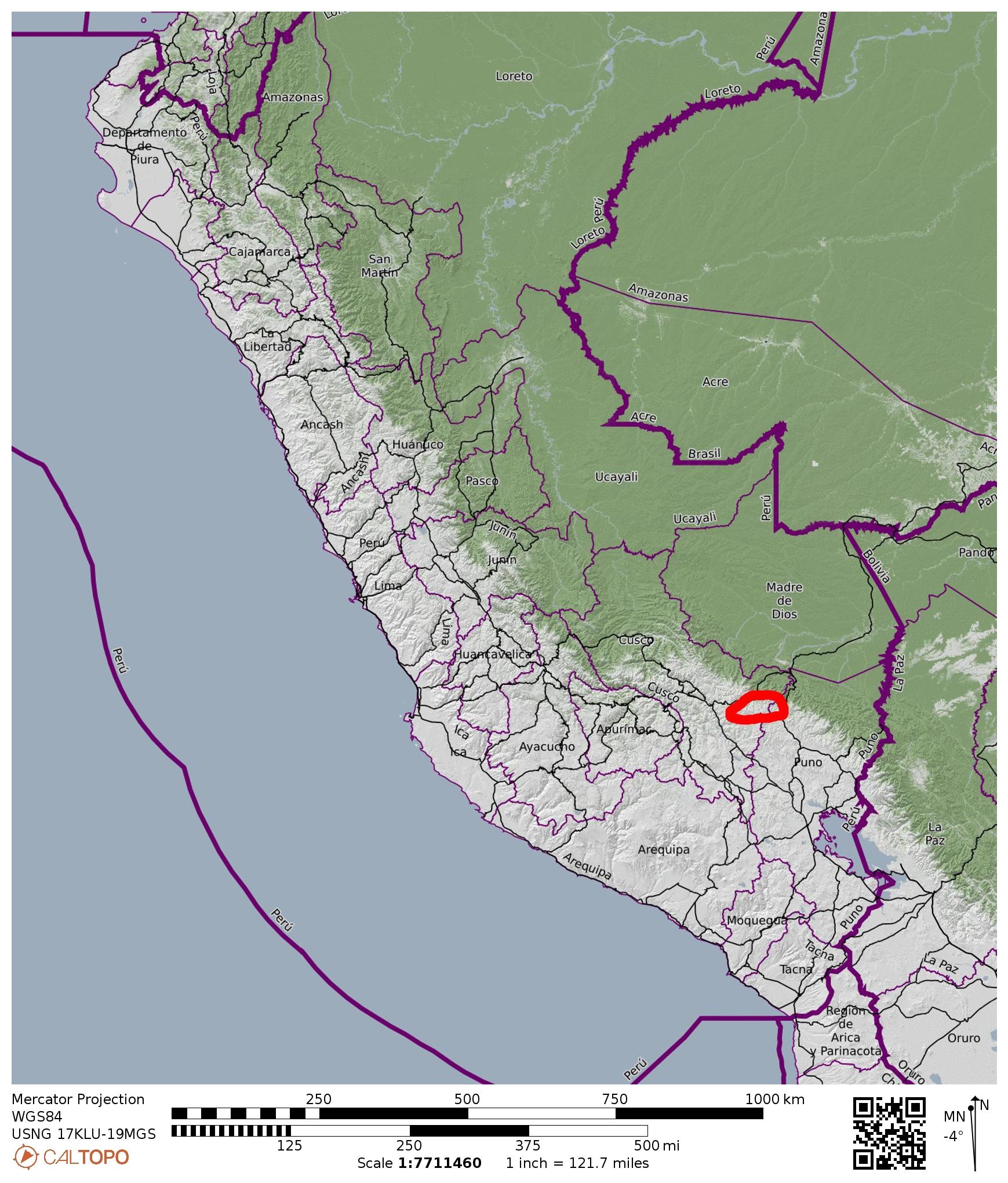
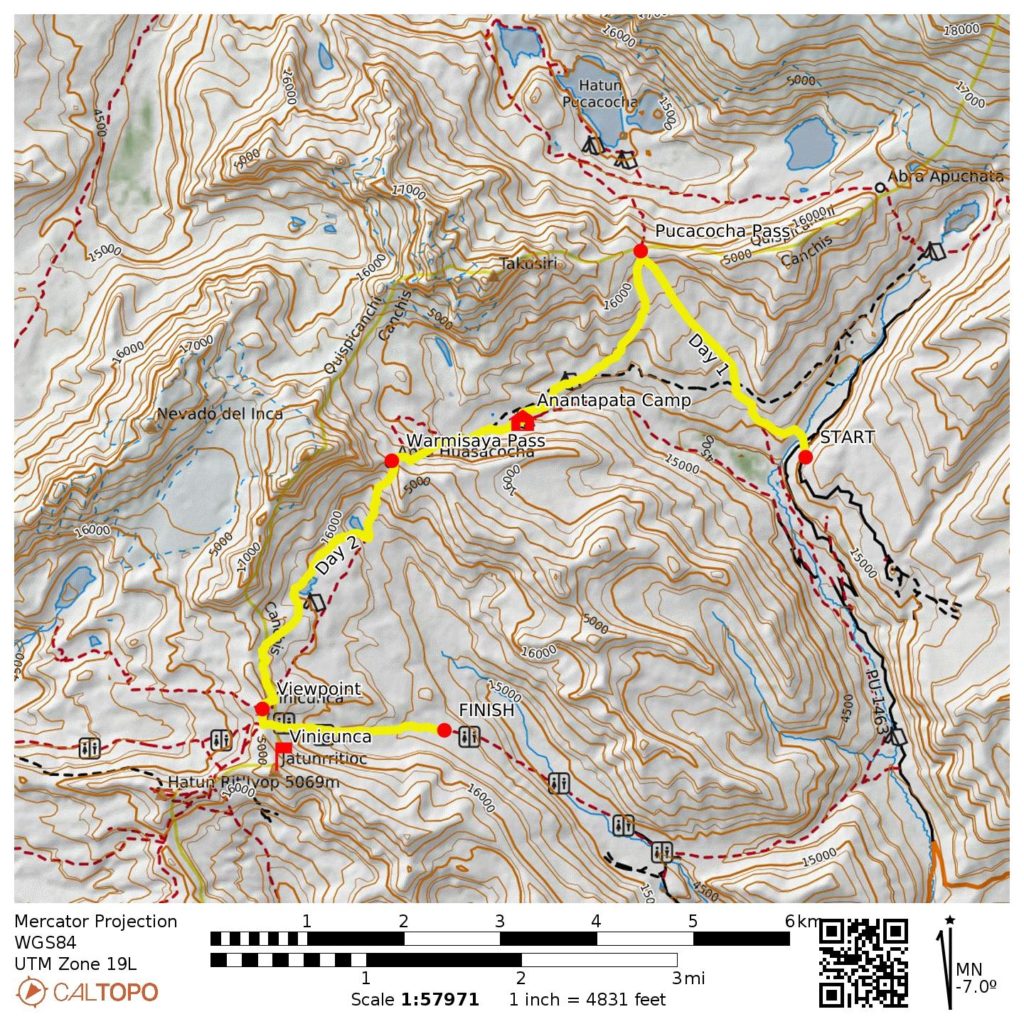
Ausangate–Vinicunca Trek: East Aloatari Road to Rainbow Mtn Viewpoint to West Aloatari Road
Pucacocha Pass aka Aloatari Pass (16,050′)
Anantapata Camp aka Anapata Camp
Warmisaya Pass aka Surini Pass (16,340′)
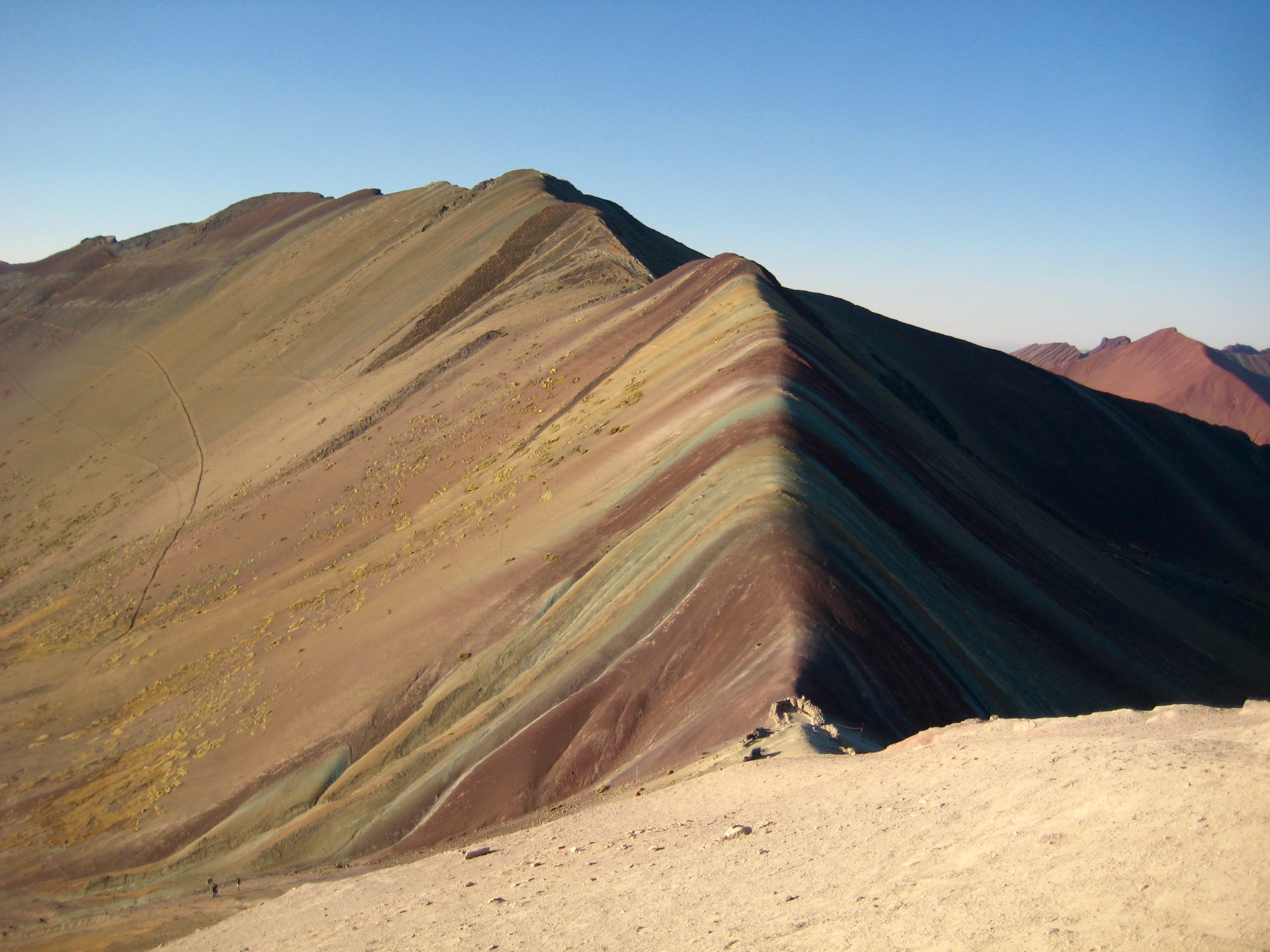
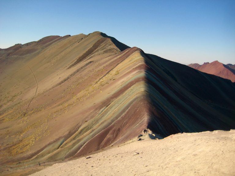
Rainbow Mountain Viewpoint aka Vinicunca Viewpoint (16,450′)
Trip Report Summary
Region: Peru
Sub-Region: Southern Peruvian Andes
Sub-Sub-Region: Cordillera Vilcanota
Starting Point: East Aloatari Road (Elev. 15,050 feet / 4590 meters)
Way Points: Pucacocha/Aloatari Pass & Anantapata/Anapata Camp & Warmisaya/Surini Pass & Warmisaya Lakes & Rainbow Mountain / Vinicunca Viewpoint & West Aloatari Road (trail hike & off-trail hike)
High Point: Rainbow Mountain / Vinicunca Viewpoint (Elev. 16,450 feet / 5010 meters)
Ending Point: West Aloatari Road (Elev. 15,500 feet / 4730 meters)
Accommodations: Anantapata/Anapata Andean Huts
Guide Service & Guide: Flashpacker Connect / Delia
Approximate Stats: 7.8 miles / 12.6 kilometers traveled; 3000 feet / 915 meters gained; 2550 feet / 775 meters lost.

…
Full Trip Report
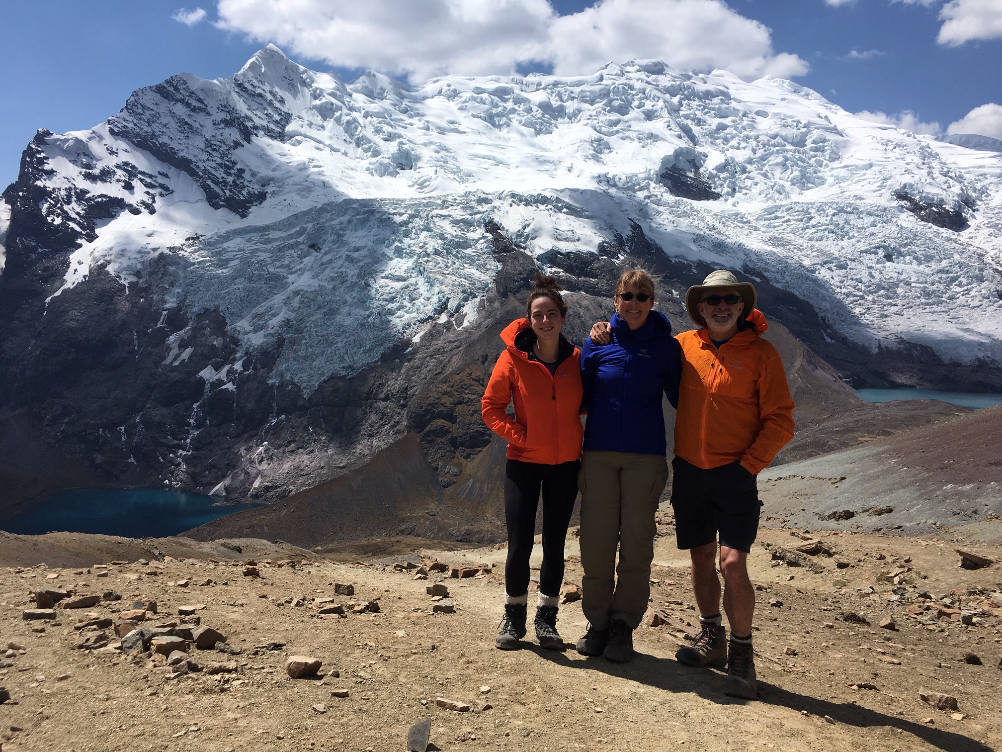
Eileen and Brooke and I continued our Peruvian adventure trip with a two-day Ausangate–Rainbow Trek in the Cordillera Vilcanota, about 50 miles southeast of Cusco. This trek provided us with additional acclimation to the high elevations, and it allowed us to see the geological marvel that is Rainbow Mountain.
Flashpacker Connect was our guide service for the trek, and our personal guide was Delia, a native Peruvian with 7 years of local experience. As with all of the guides we met in Peru, Delia spoke Quechua (“KETCH-wah”) as her first language, Spanish as her second language, and English as her third. She was accompanied by a cook, a horseman, and two pack horses. In the end, we found the company and the guide to be adequate but not exceptional.
Day 1: East Aloatari Road to Anantapata Camp
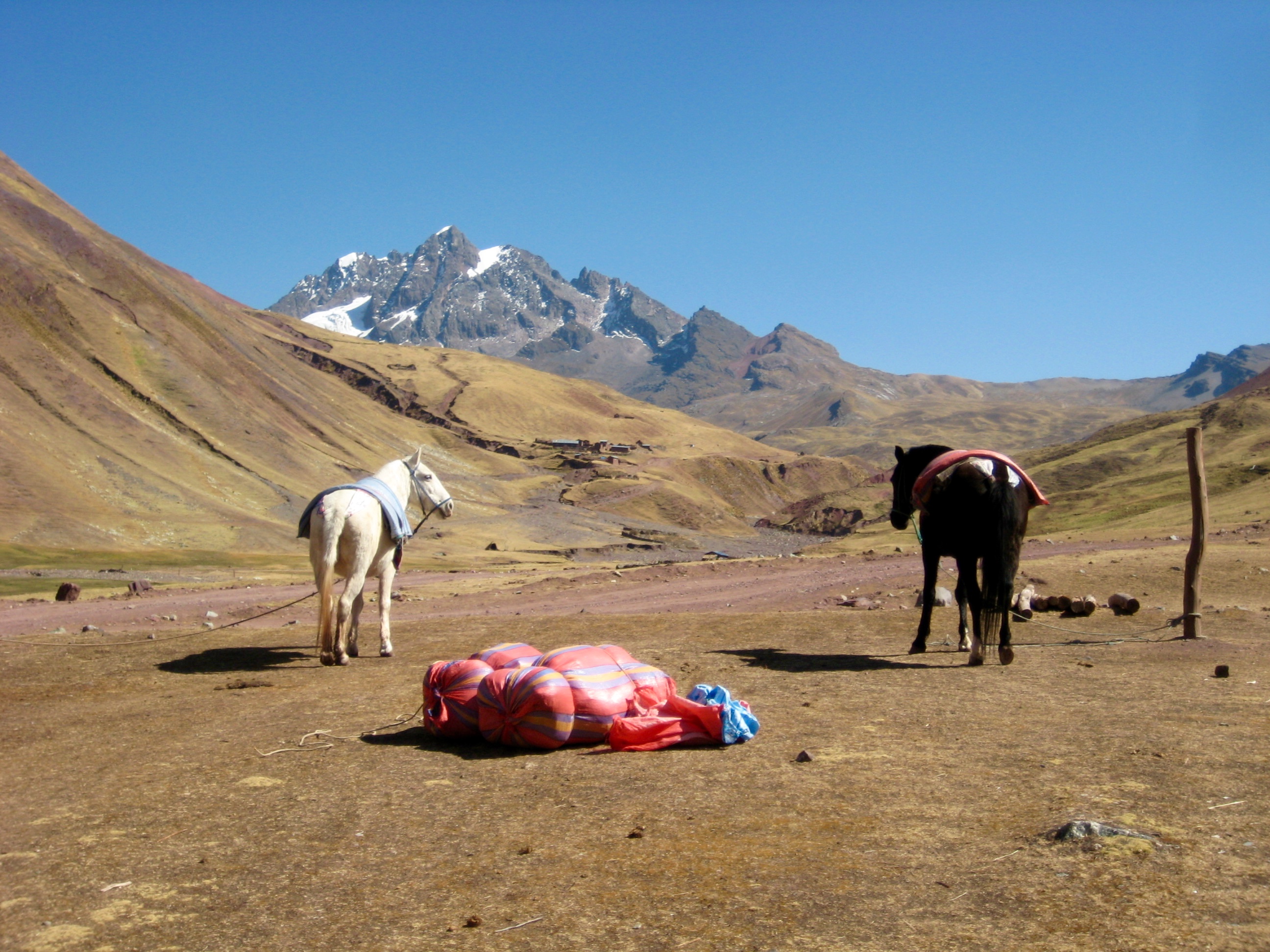
Delia and her van driver picked us up at our hotel in Cusco at 4:10am and drove us high into the mountains. We stopped for breakfast at a dining room near Aloatari, and our overnight gear was loaded on pack horses there.
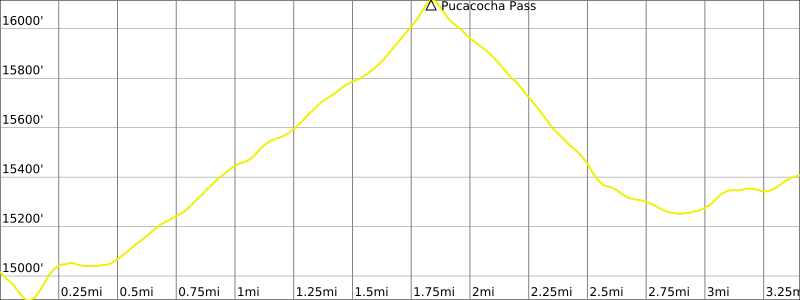
After breakfast, we continued driving up the Aloatari road. At 10:00am, we reached an elevation of 15,200 feet, and the driver stopped to let us out. It felt very strange to be starting a hike at an elevation 800 feet higher than the summit of Mt. Rainier! We dropped down to cross a small creek, then began hiking upward through a vast, gentle, alpine tundra. This type of cross-country travel is so easy, there was little concern about staying on a trail.
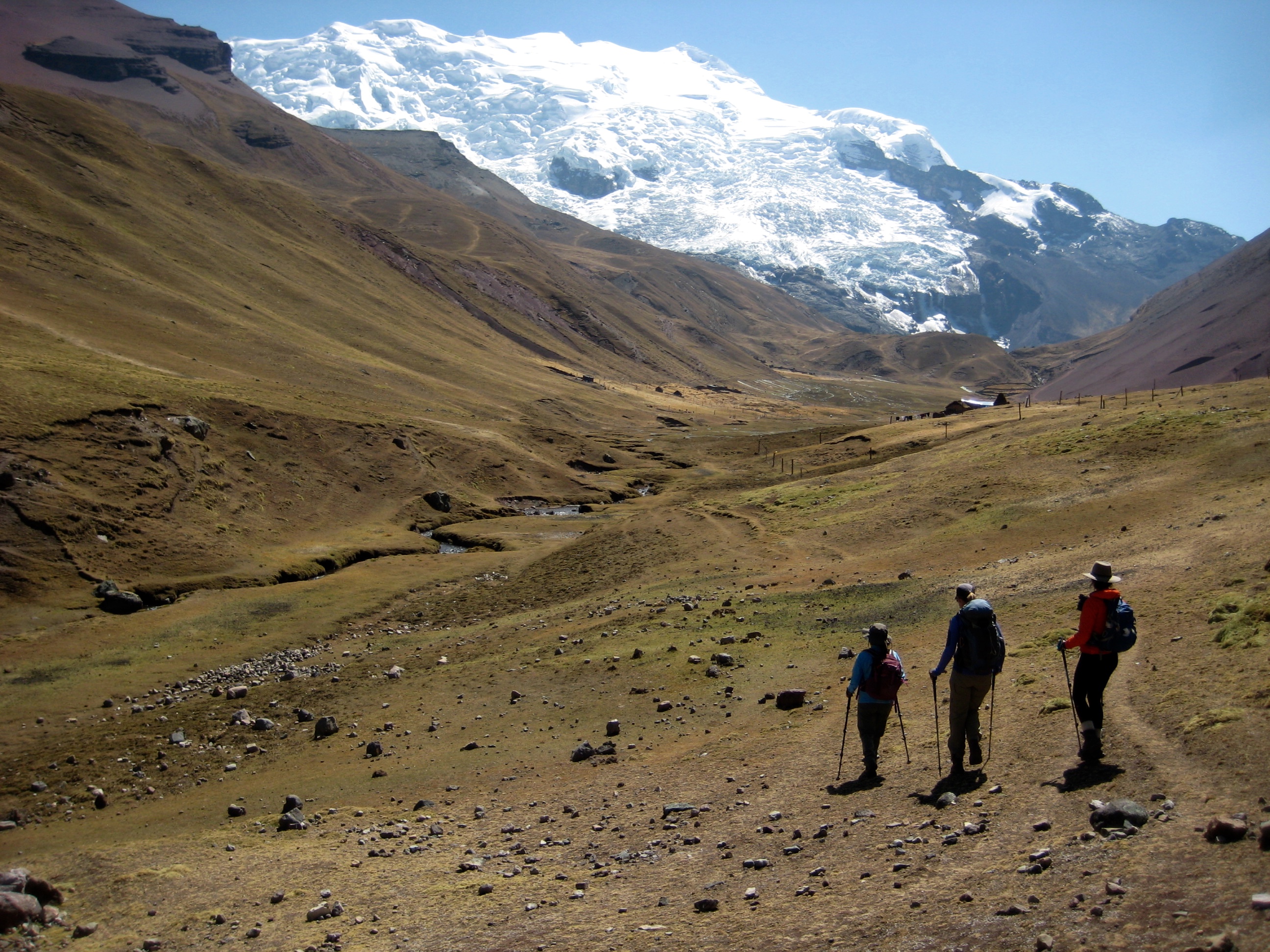
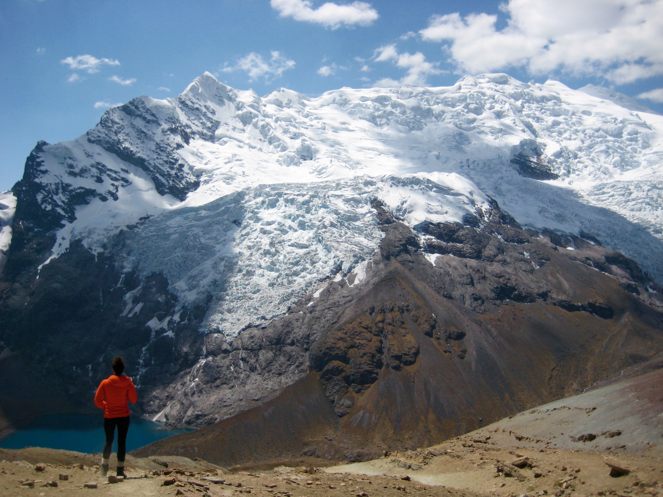
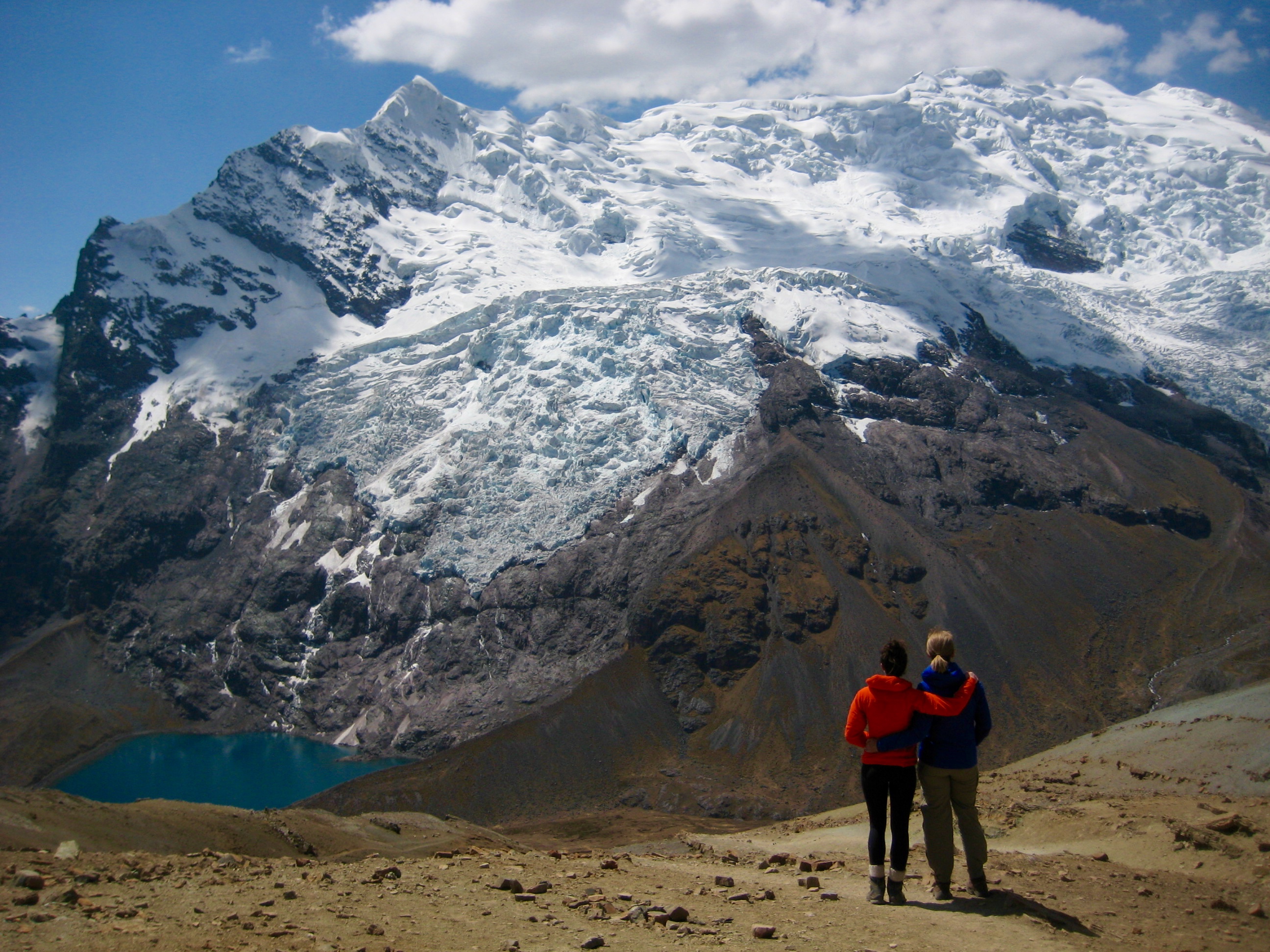
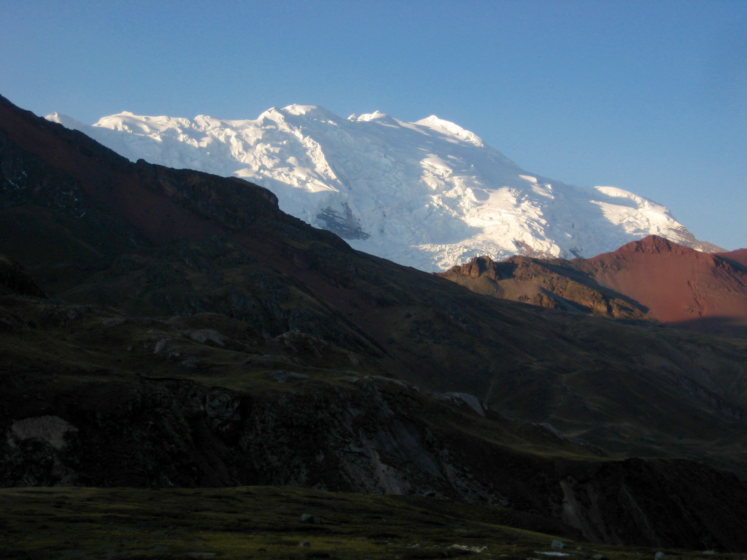
Shortly after noon, we reached 16,050-foot Pucacocha Pass (2.2 hours + 1250 feet from starting point) and feasted our eyes on the massive hulk of Nevado Ausangate (“AUS-an-GAH-tee”). With a summit elevation of 20,945 feet, Ausangate is the sixth highest mountain in Peru and is the centerpiece of the Cordillera Vilcanota.
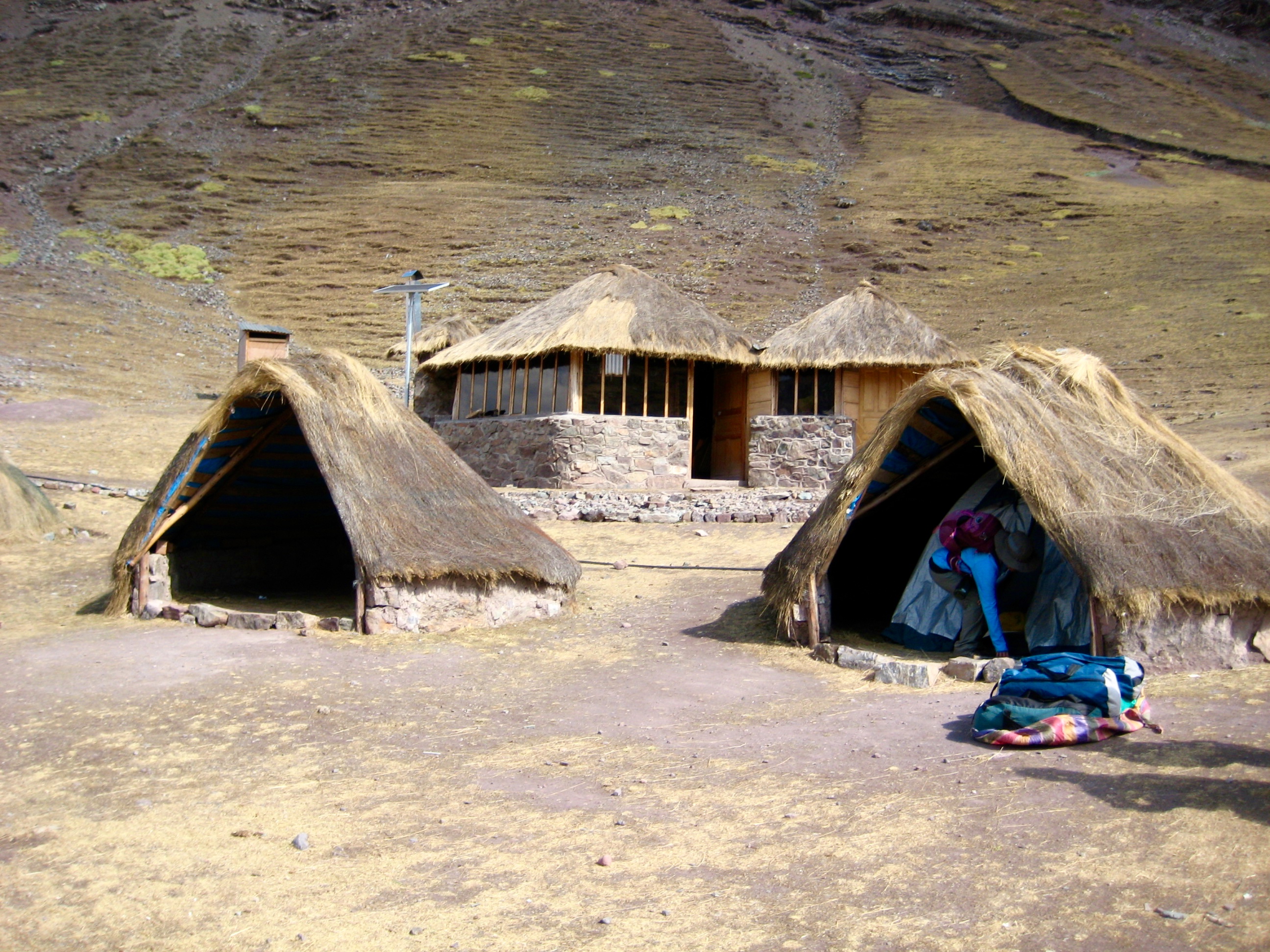
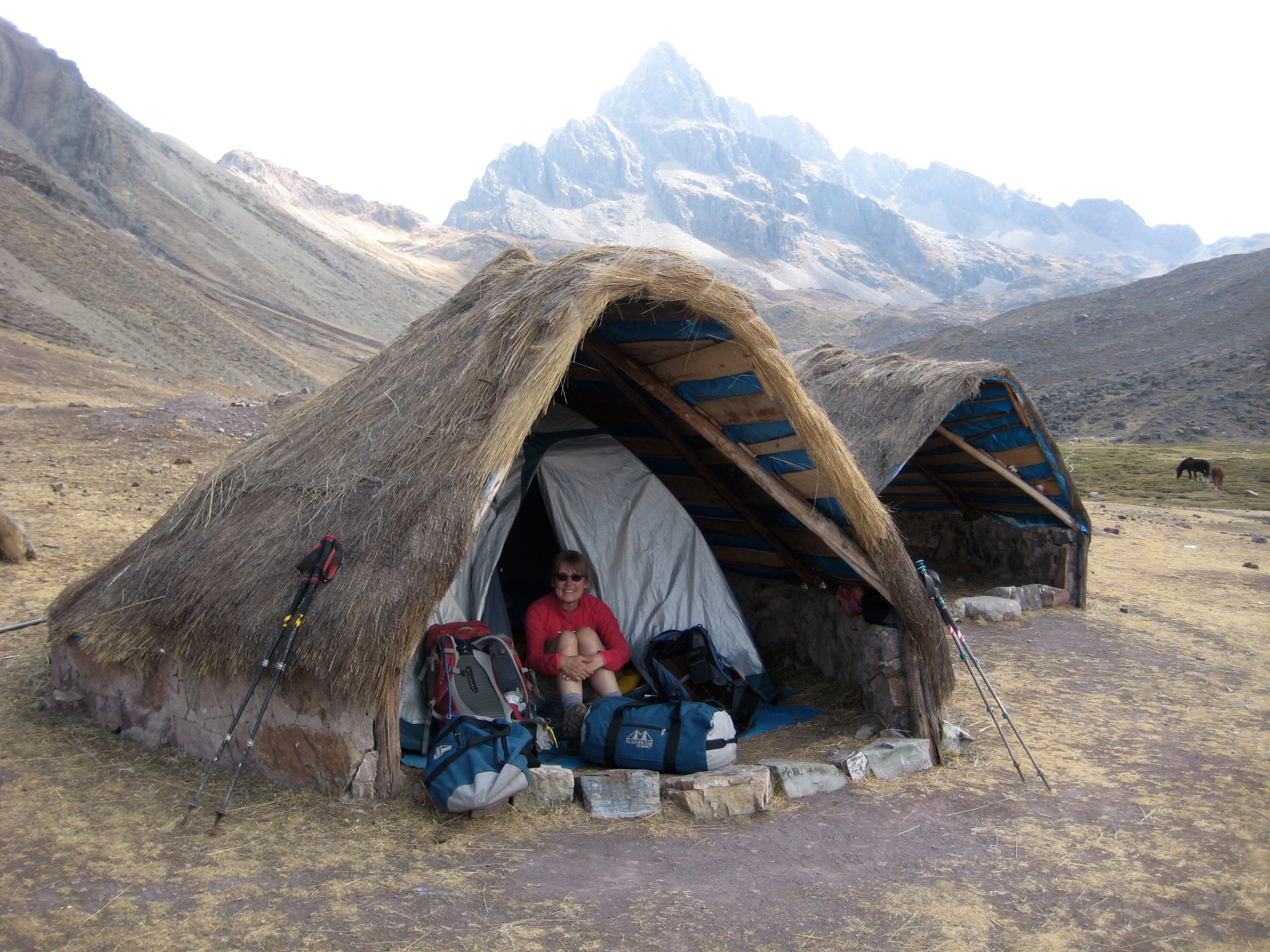
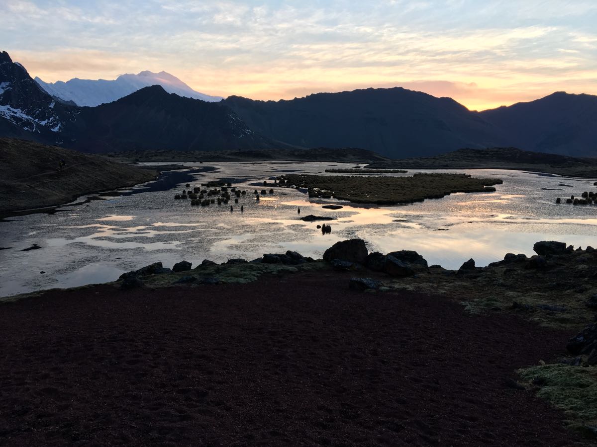
Following a long break at the pass, Delia led us down 1000 feet to the south and then across the hillslope toward a high pampa (flat meadow area) called Anantapata. Flashpacker Connect has constructed a trekking camp in this pampa to service their popular Ausangate–Rainbow Trek.
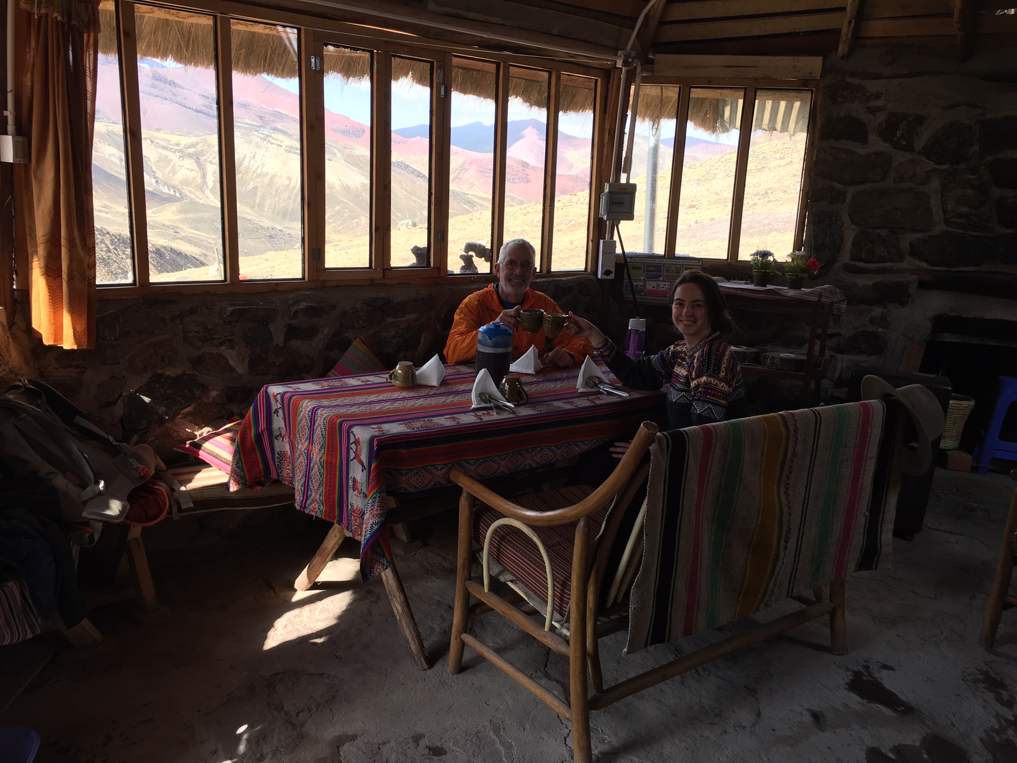
We reached Anantapata Camp at 2:30pm (4.3 hours + 1400 feet from starting point) and were pleased to find a small, rustic, stone lodge accompanied by several Andean-style, thatch-roof huts. A two-person tent was pitched inside each hut to provide sleeping shelters.
The trekking cook had lunch waiting for us in the lodge, so we hurried indoors and feasted on seven tasty items served in clay tureens. Everyone spent the rest of the afternoon relaxing in the lodge.
By late afternoon, the sky had cleared completely, and soft sunlight washed over the expansive Ausangate Glacier.
A light dinner was served in the early evening, after which Eileen, Brooke, and I retired to our huts in anticipation of a dark-thirty start the next morning.
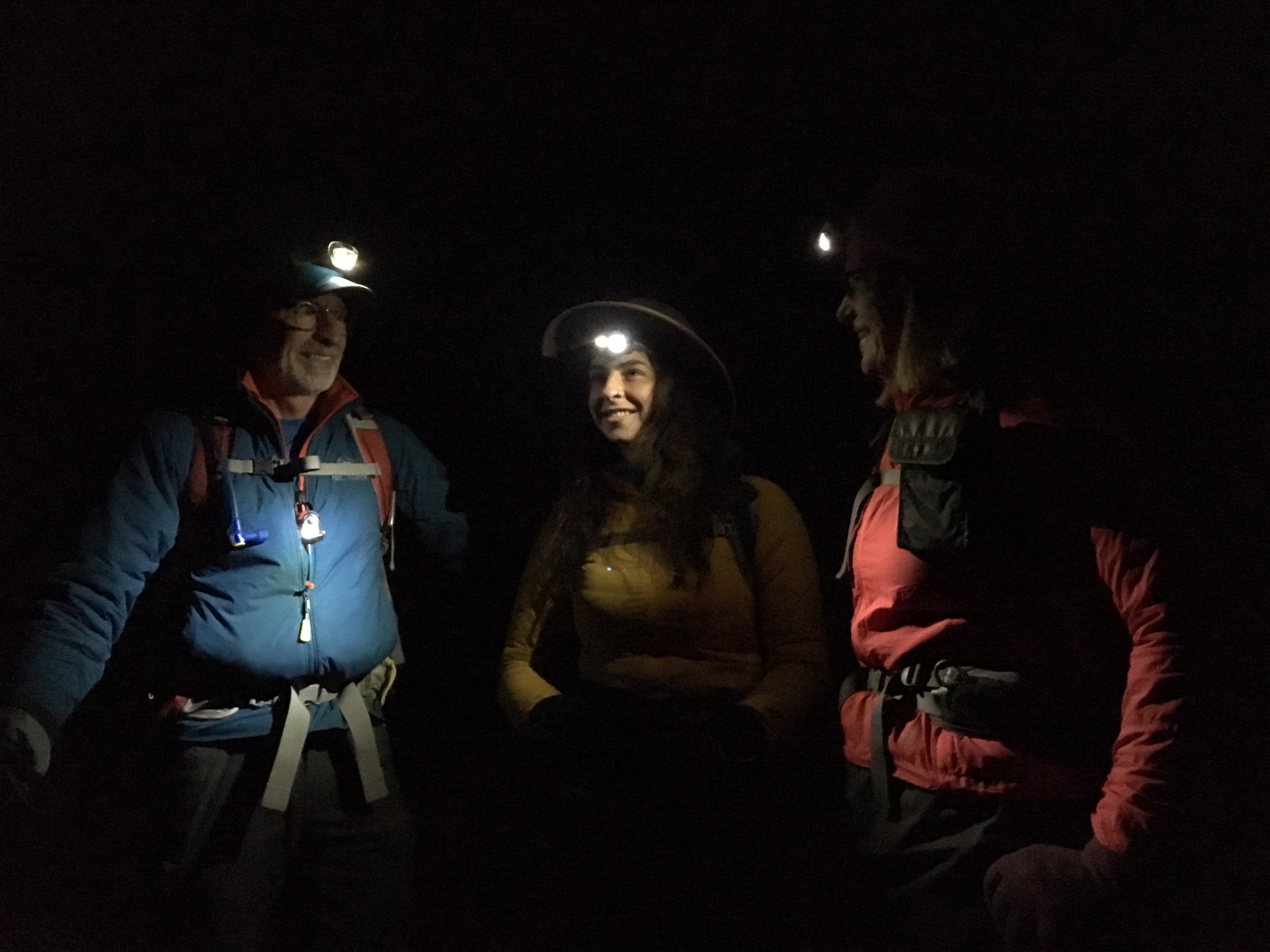
Day 2: Anantapata Camp to West Aloatari Road
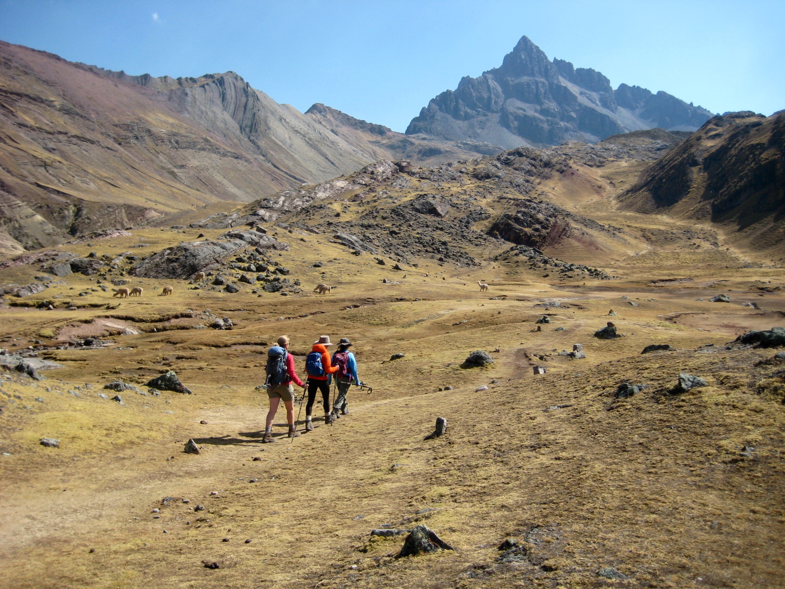
We awoke at 2:40am and were on the trail with headlamps an hour later. Our trail led us 900 feet up to 16,340-foot Warmisaya Pass, where a frigid wind chased us down the other side.
Gradually, it became light enough for us to turn off our headlamps as we hiked through the high basin of Warmisaya Lakes. A layer of ice on the lakes confirmed what we all thought: it was cold!
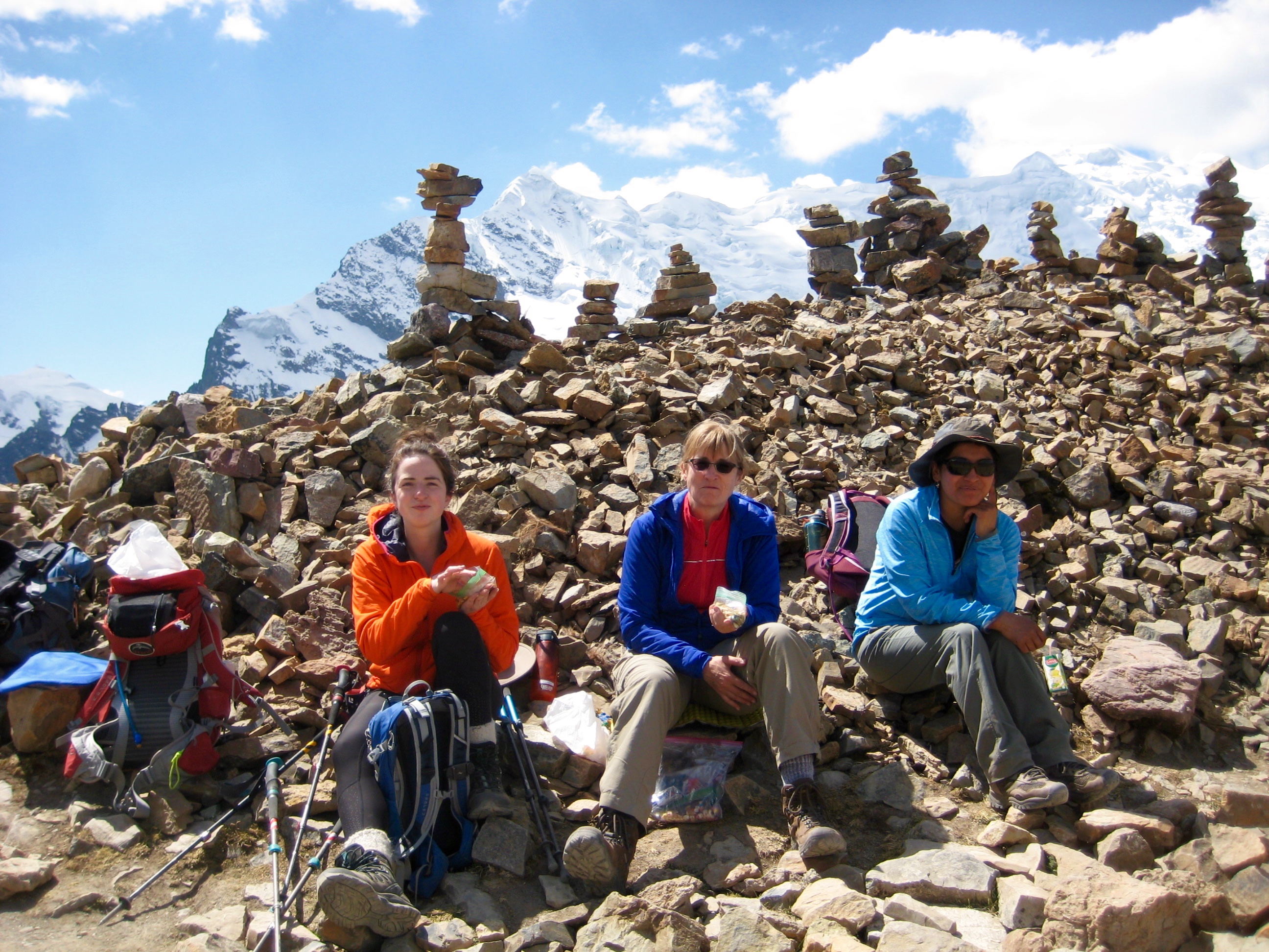
With the rising sun, Rainbow Mountain (Vinicunca) became visible in the distance. We increased our pace and made a long upward traverse to 16,400-foot viewpoint (3.0 hours + 1600 feet from camp). Even at this early hour, there were several dozen other hikers milling about—all here to view what has become the most distinctive natural landmark in Peru.
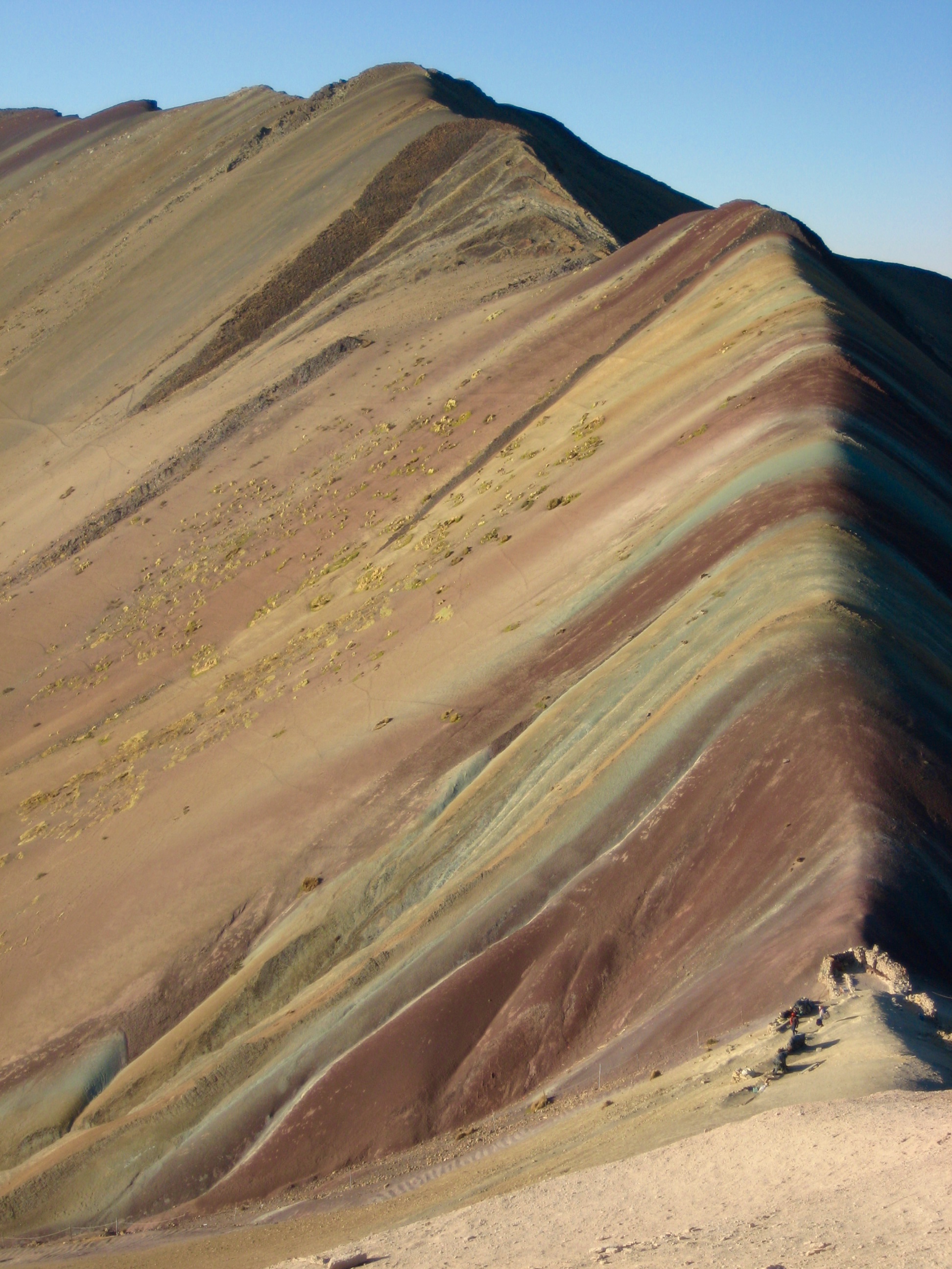
After getting our visual fill of the sedimentary wonder before us, we began descending to our exit point on a western branch of the Aloatari Road, approximately 1.5 miles away. Delia explained how the popularity of Rainbow Mountain has created something of an “access battle” among the two communities that own the land on opposite sides of the mountain. Initially, the viewpoint was accessible only via a long approach from one community. Later, the other community built a new road to provide easier access. The first community then retaliated by building a new road of their own. Now, visitors can choose between two equally short approach hikes.
Route Map & Profiles
…
…
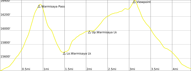
Photo Gallery
Click to enlarge…