Trip Date: November 1, 2021
2021 DESERT SOUTHWEST ADVENTURE VACATION
Hole-in-the-Rock Canyon Exploration & Day Hike
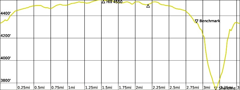
Benchmark 4329
Hill 4550
Hole-in-the-Rock Canyon
Lake Powell
Trip Report Summary
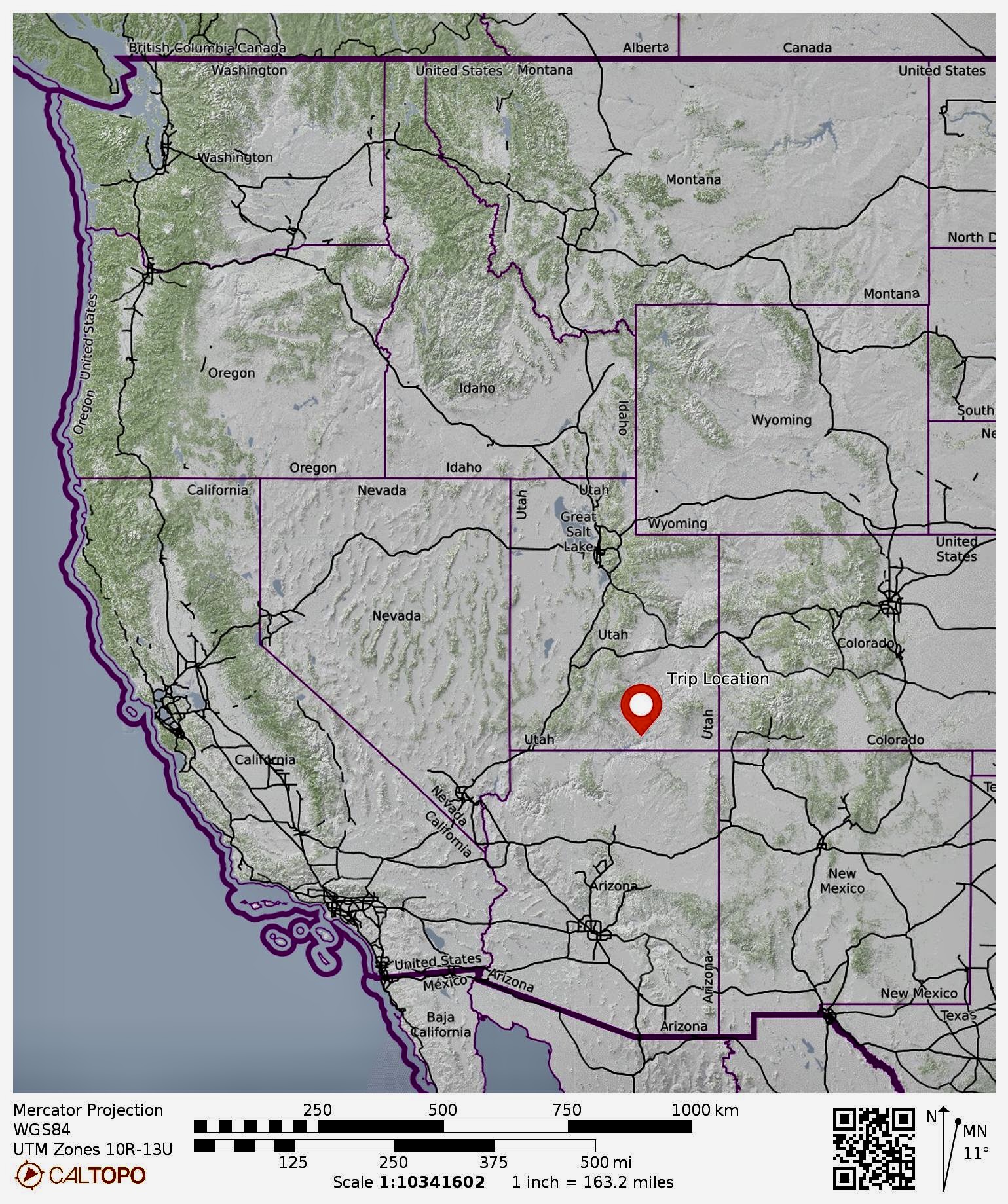
Region: Utah
Sub-Region: Southeastern Utah
Area: Glen Canyon National Recreation Area
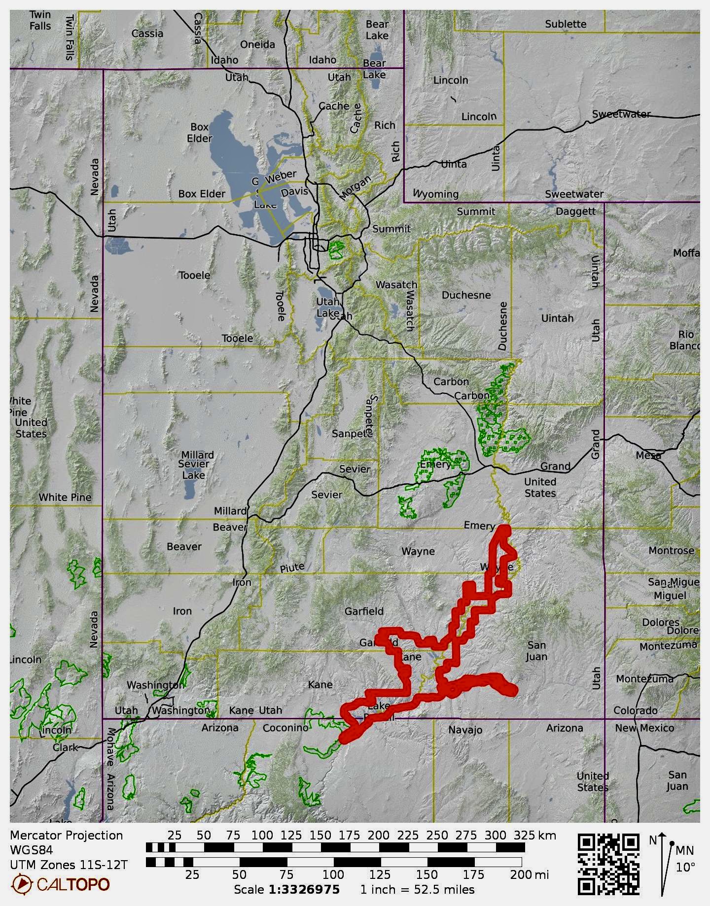
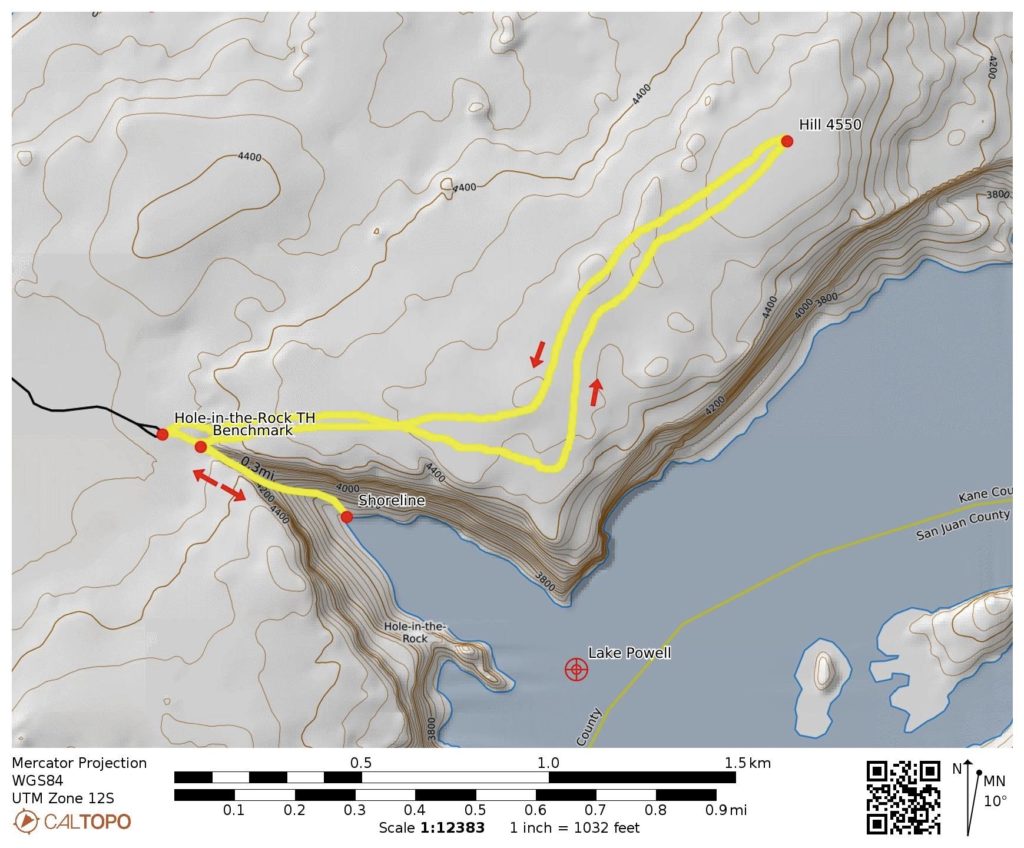
Starting & Ending Point: Hole-in-the-Rock Trailhead (Hole-in-the-Rock Road #200)
Way Points: Benchmark 4329 & Hole-in-the-Rock Viewpoint & Hill 4550 & Benchmark 4329 & Hole-in-the-Rock Canyon & Lake Powell shore & Benchmark 4329 (off-trail hike & rock scramble)
Summit: Hill 4550 (ascent & descent via Southwest Slope)
Invert: Hole-in-the-Rock Canyon (down & back traverse of full length)
Approximate Stats: 3.6 miles traveled; 1500 feet gained & lost; 5.0 hours elapsed.
…
Full Trip Report
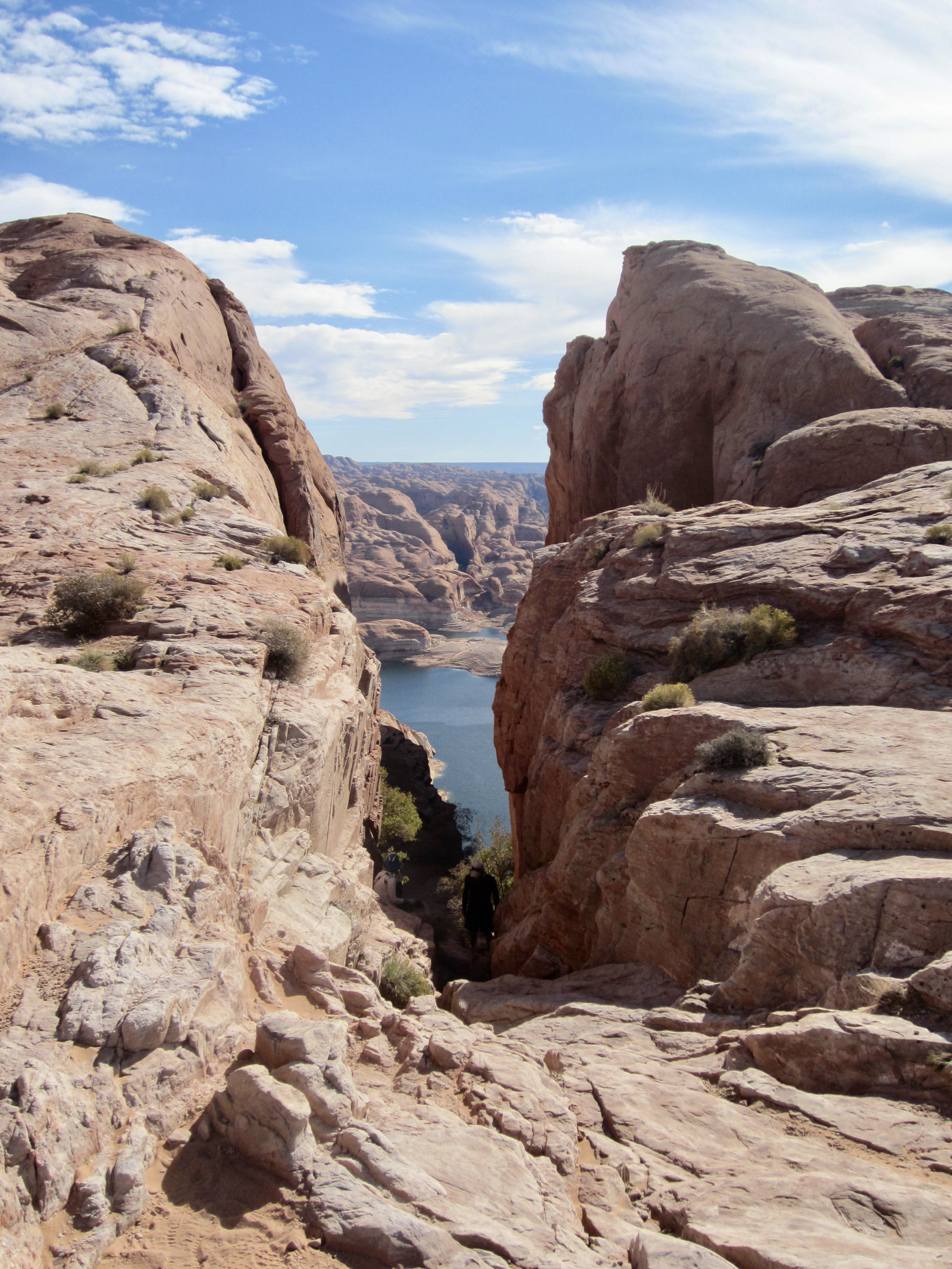
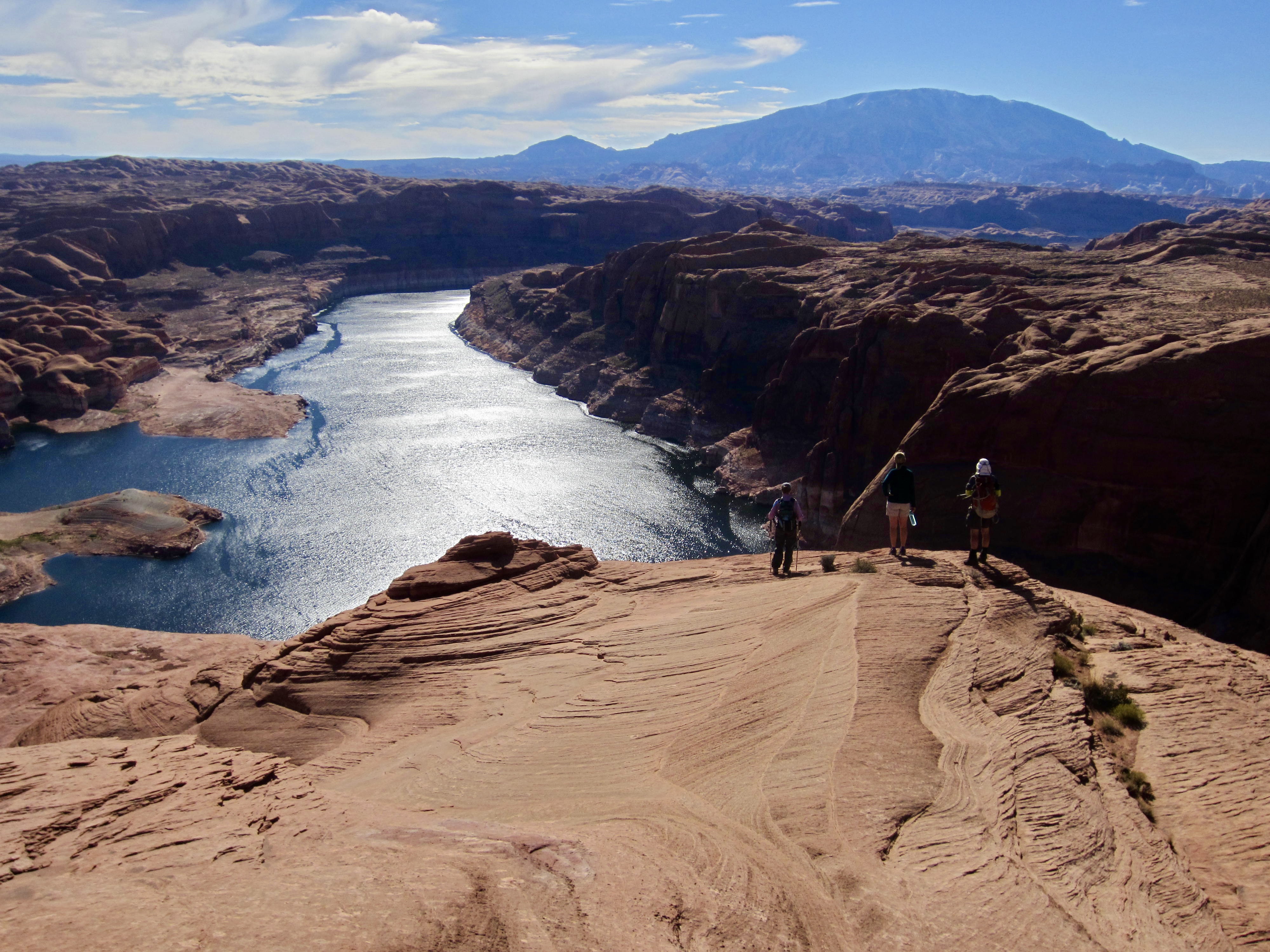
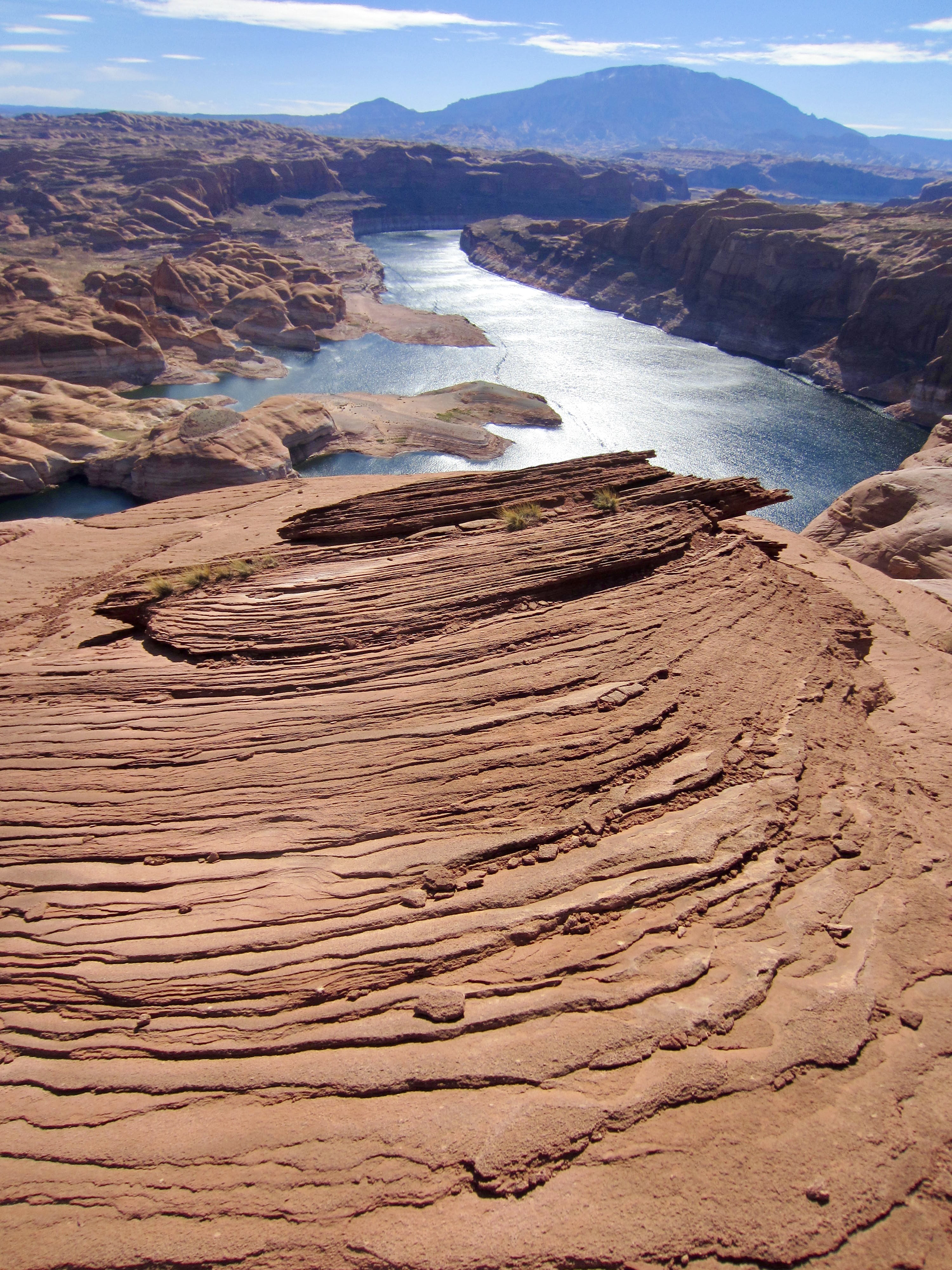
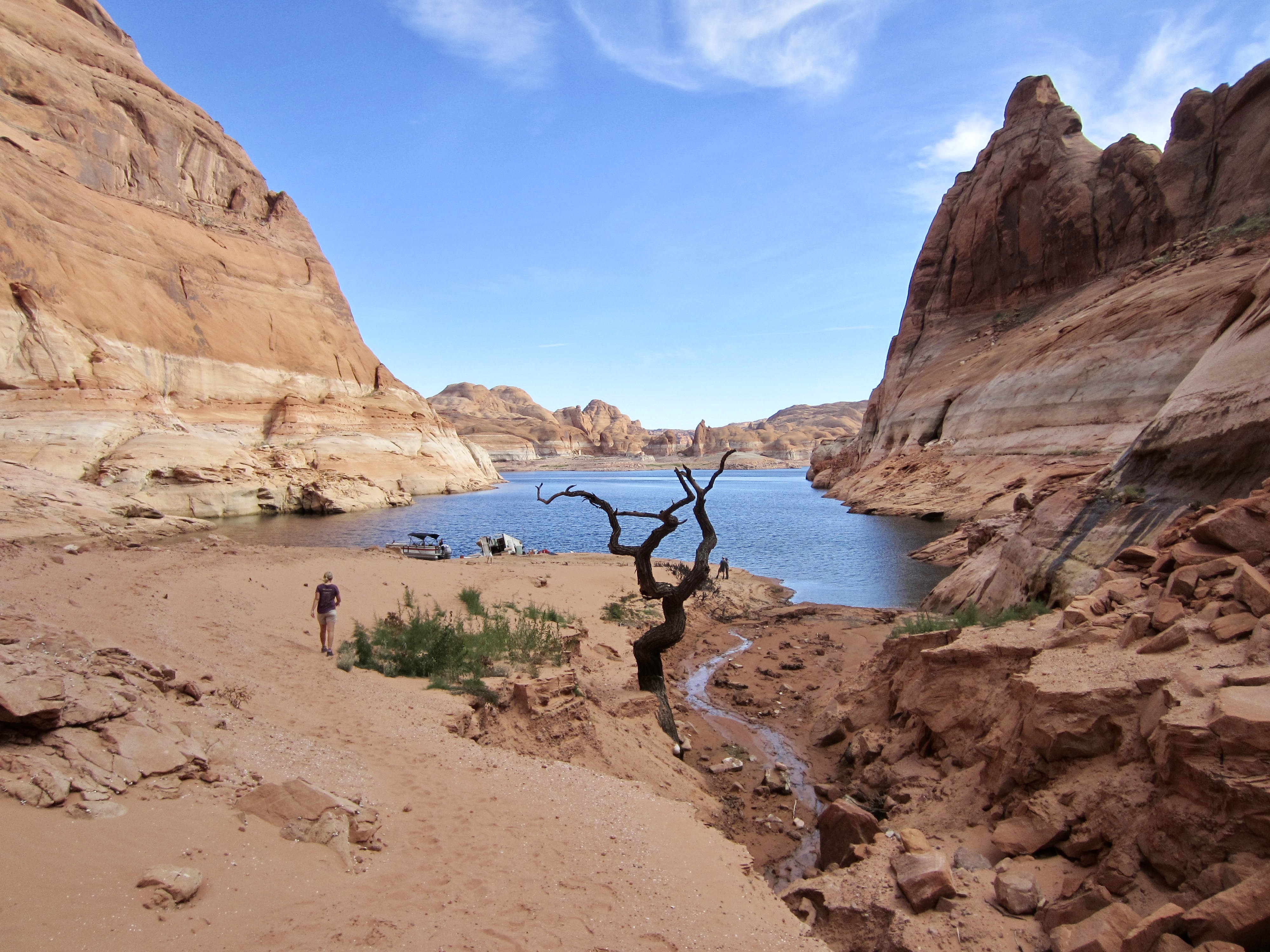
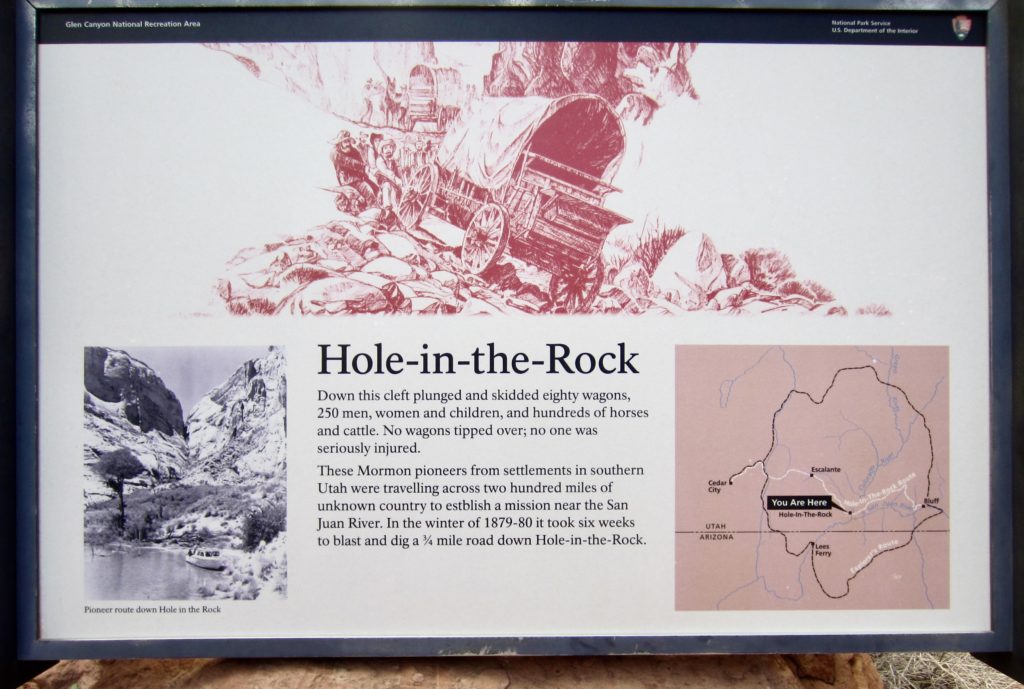
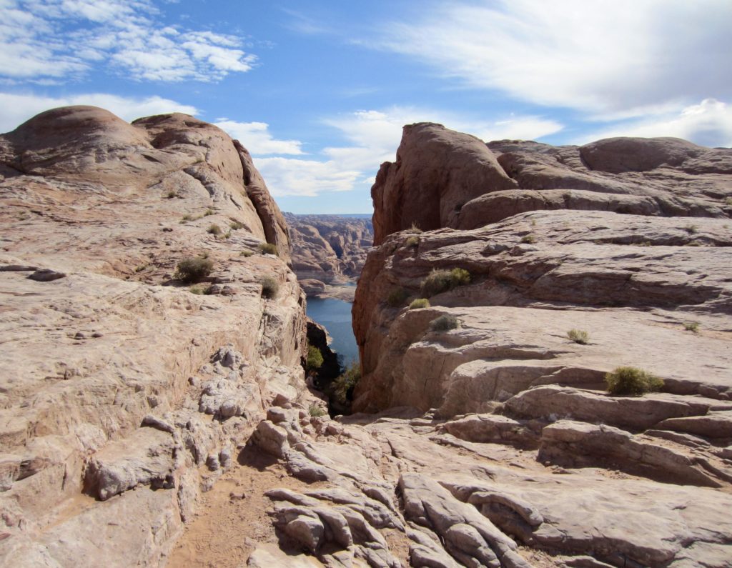
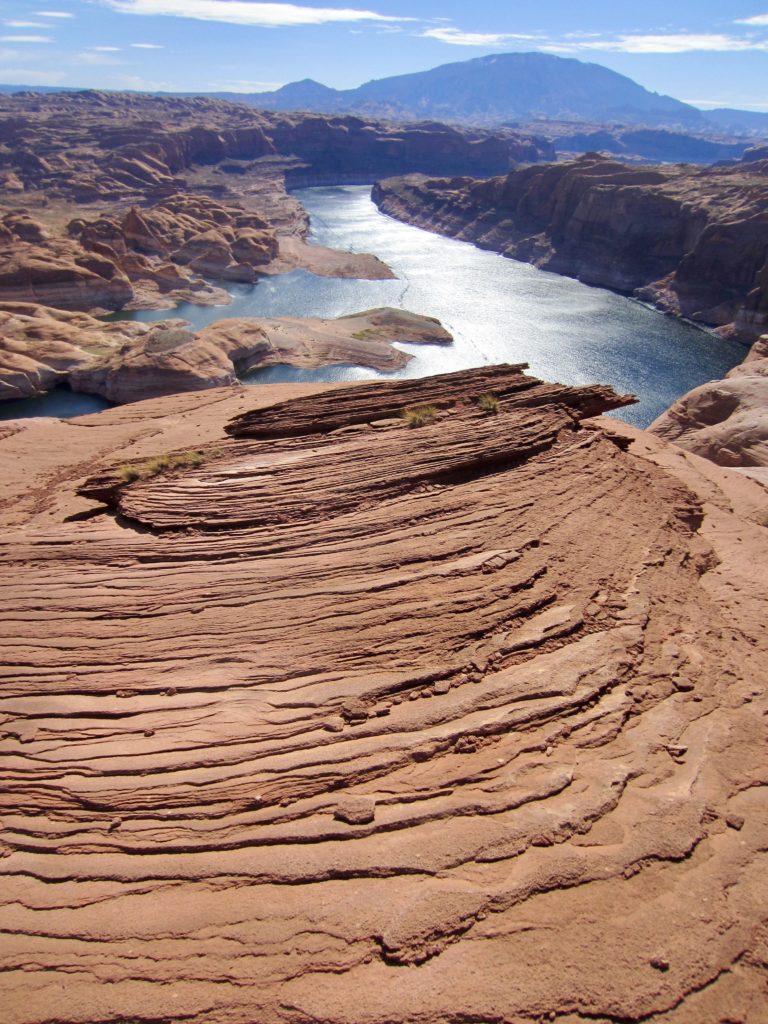
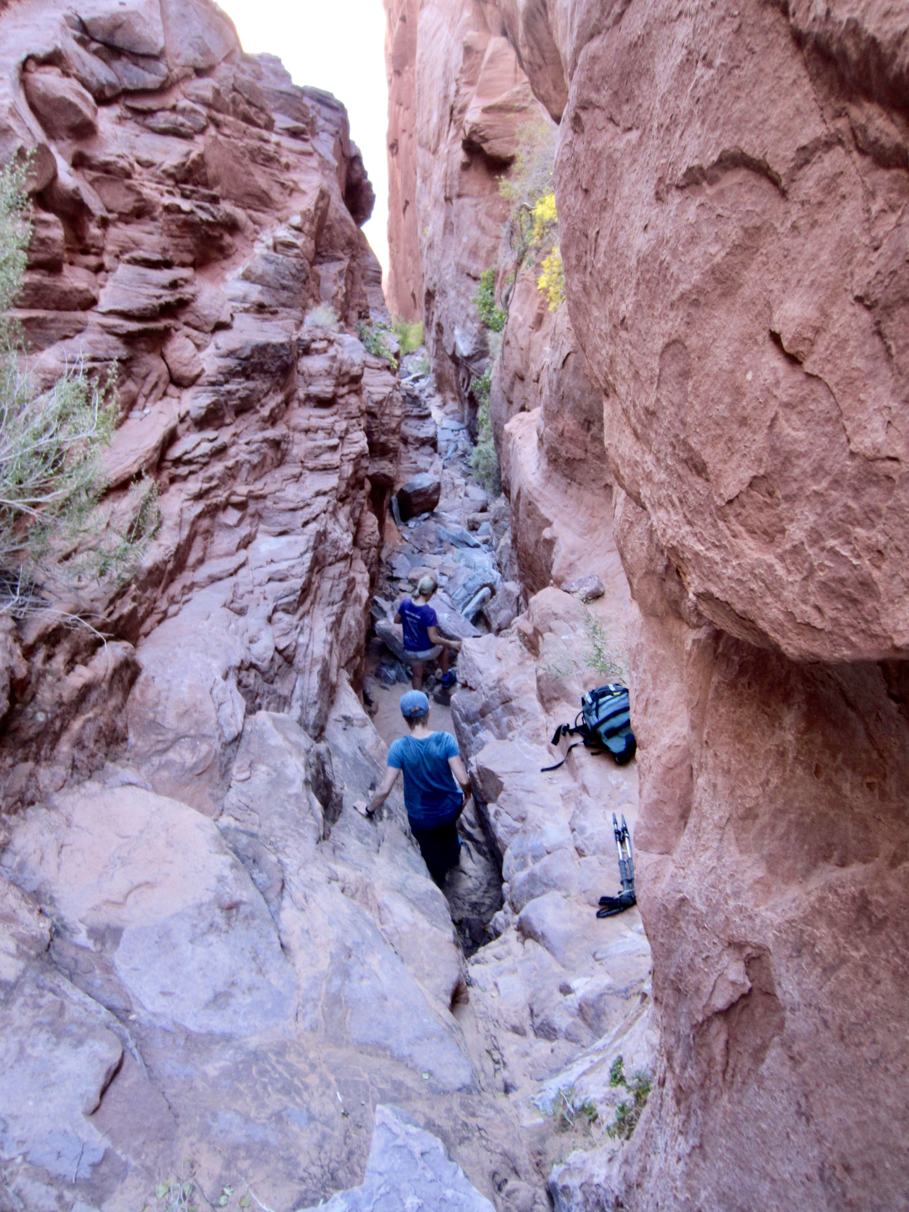
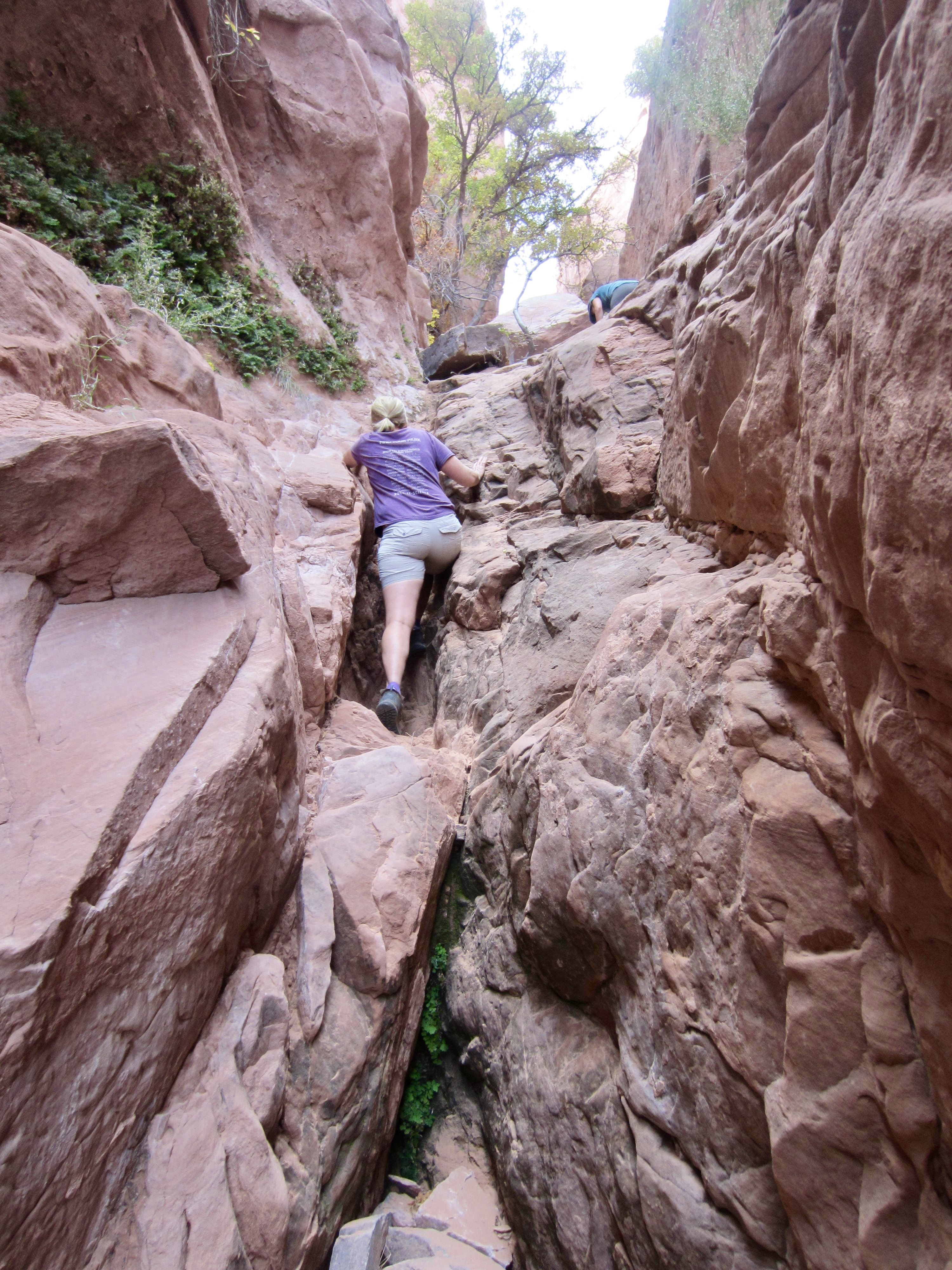
Perhaps one of the most coveted historical sites in southern Utah is a place called “Hole-in-the-Rock.” Although the name might be regarded as banal to some people and mysterious to others, it is certainly misleading. Hole-in-the-Rock is not really a hole in the conventional sense but, rather, a steep canyon that splits the sandstone rampart bordering Lake Powell’s western shoreline. This canyon rises 700 vertical feet from lake level to the Kaiparowits Plateau, with a width of only 10 feet at the narrowest spot.
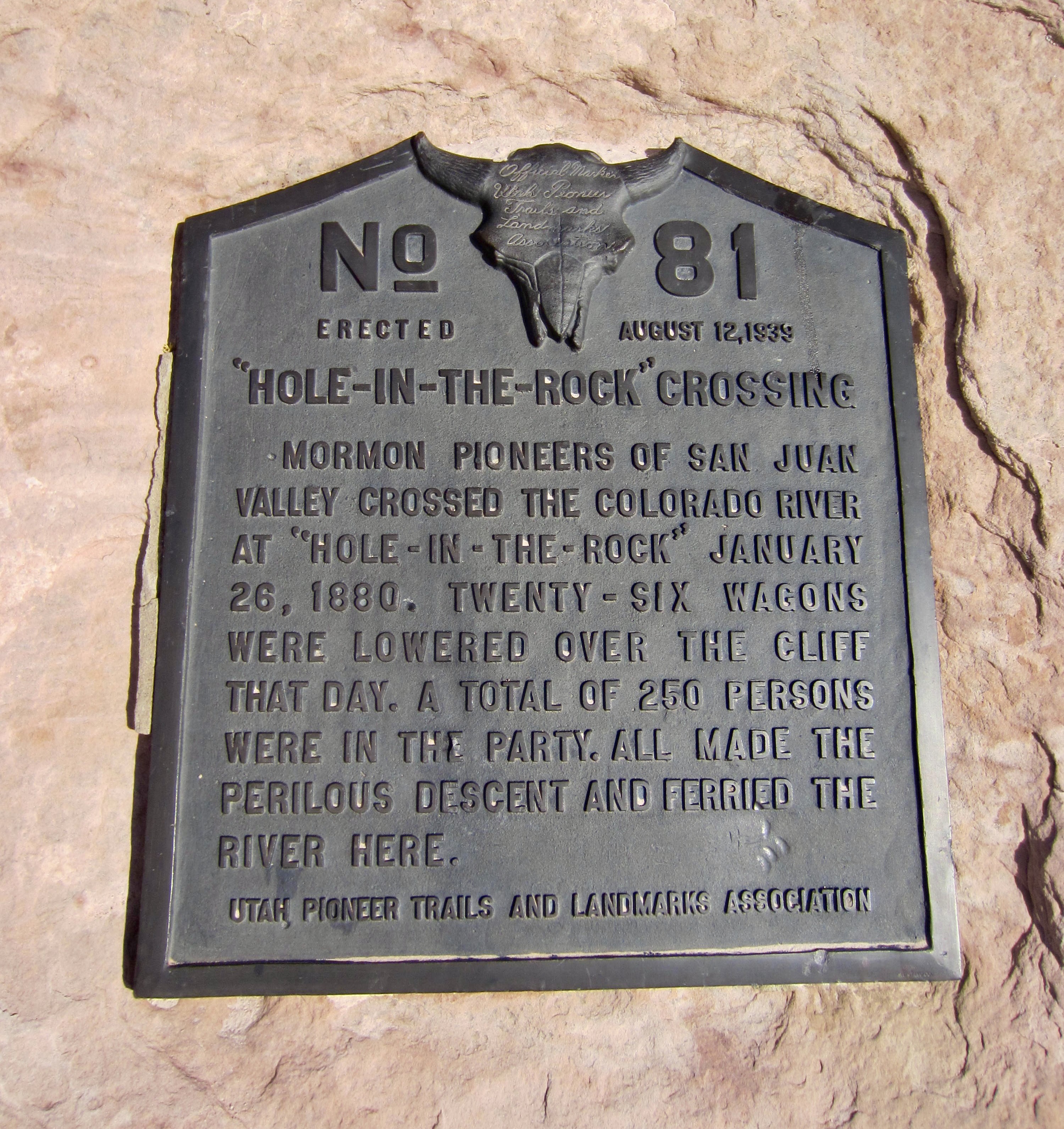
Hole-in-the-Rock is historically important because it served as a key access route for Mormon pioneers traveling eastward across southern Utah during the winter of 1879-80. At that time—long before the construction of Glen Canyon Dam and subsequent formation of Lake Powell—it appeared to be the best place to cross the Colorado River. In a display of great determination, the pioneers reportedly spent six weeks blasting rock and preparing the canyon for passage, and when done, they lowered dozens of wagons, 250 people, and hundreds of stock animals down to the river, then floated across on a ferry.
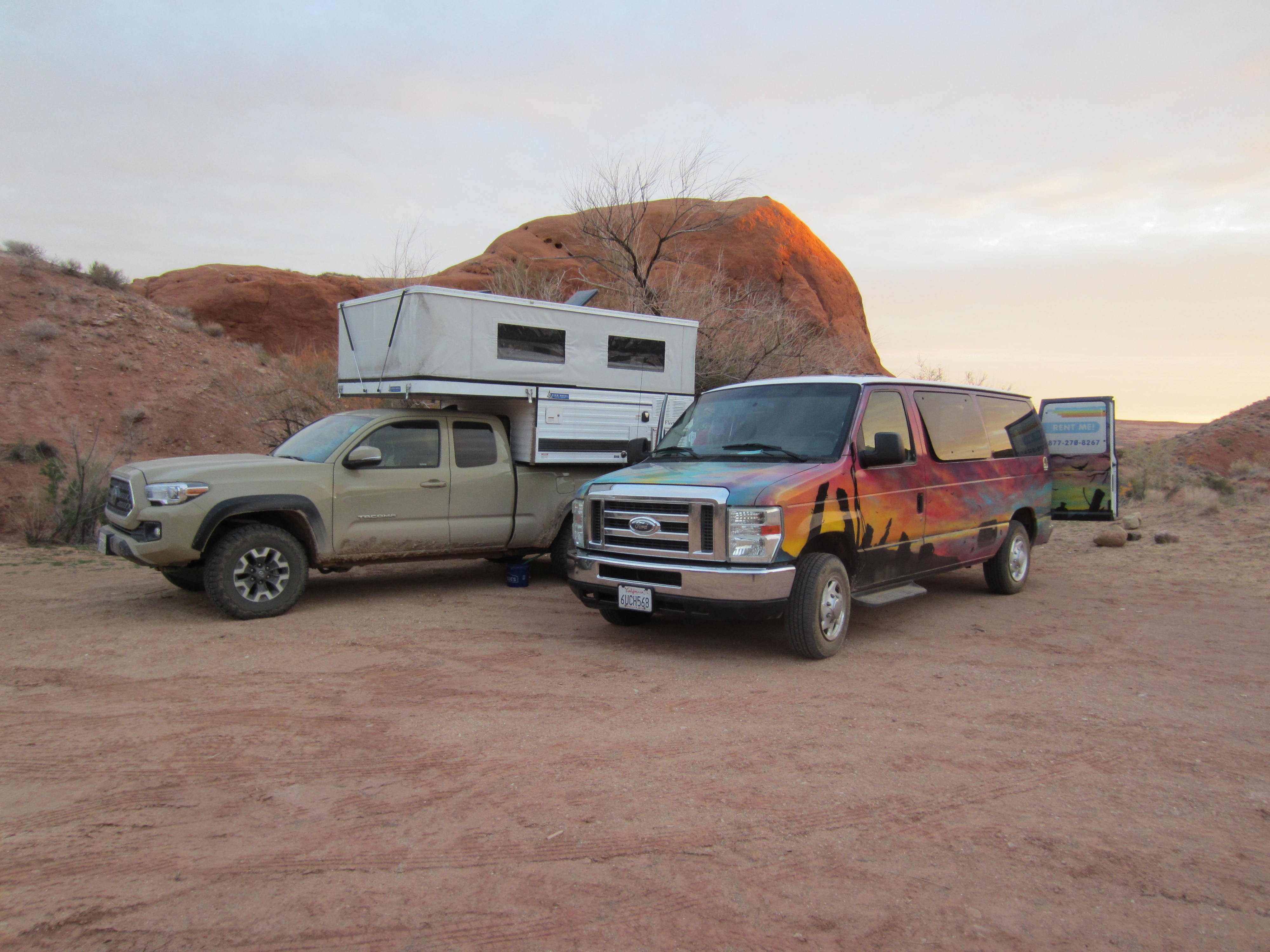
For modern-day explorers, Hole-in-the-Rock can be reached either by driving out the long and rough Hole-in-the-Rock Road #200 from Escalante or by boating in on Lake Powell. Eileen, Steve, Deb, and I chose to drive out as part of our two-week car-camping trip through the Desert Southwest. Starting from our boondock campsite in Sooner Wash on a sunny morning, we all squeezed into Steve and Deb’s four-wheel-drive truck and headed east. Eileen and I left our two-wheel-drive Escape Campervan behind to guard the camp.

Road #200 is notoriously rugged and washboarded over its entire 62-mile length, but east of Sooner Wash it gets really bad! There are several steep uphill and downhill sections, as well as many areas with big rocks and soft sand. A high-clearance four-wheel-drive rig is pretty much essential if you care at all about your vehicle’s undercarriage. Even with our very capable truck, the 15-mile drive out to Hole-in-the-Rock Trailhead took us about 1½ hours.

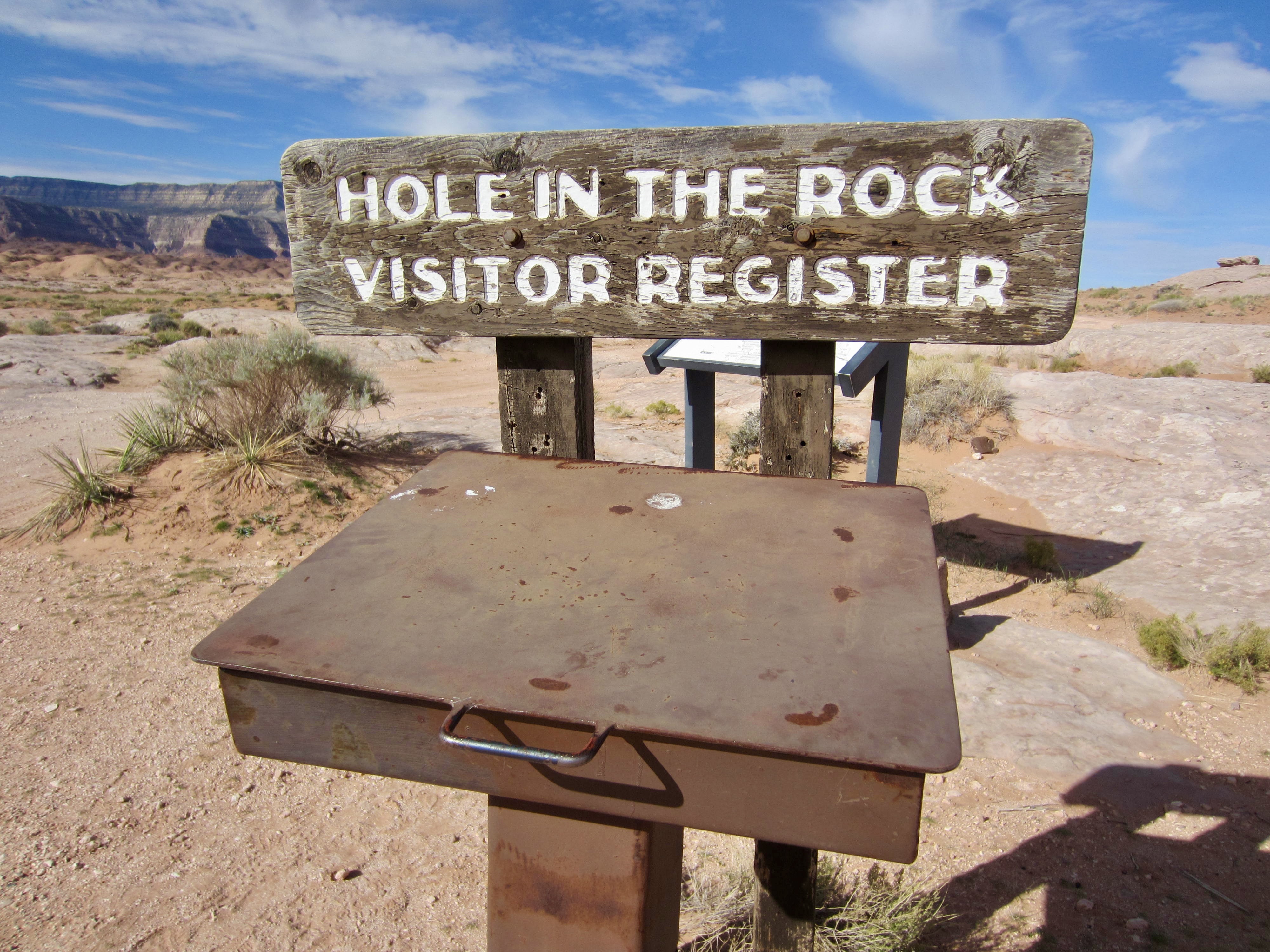
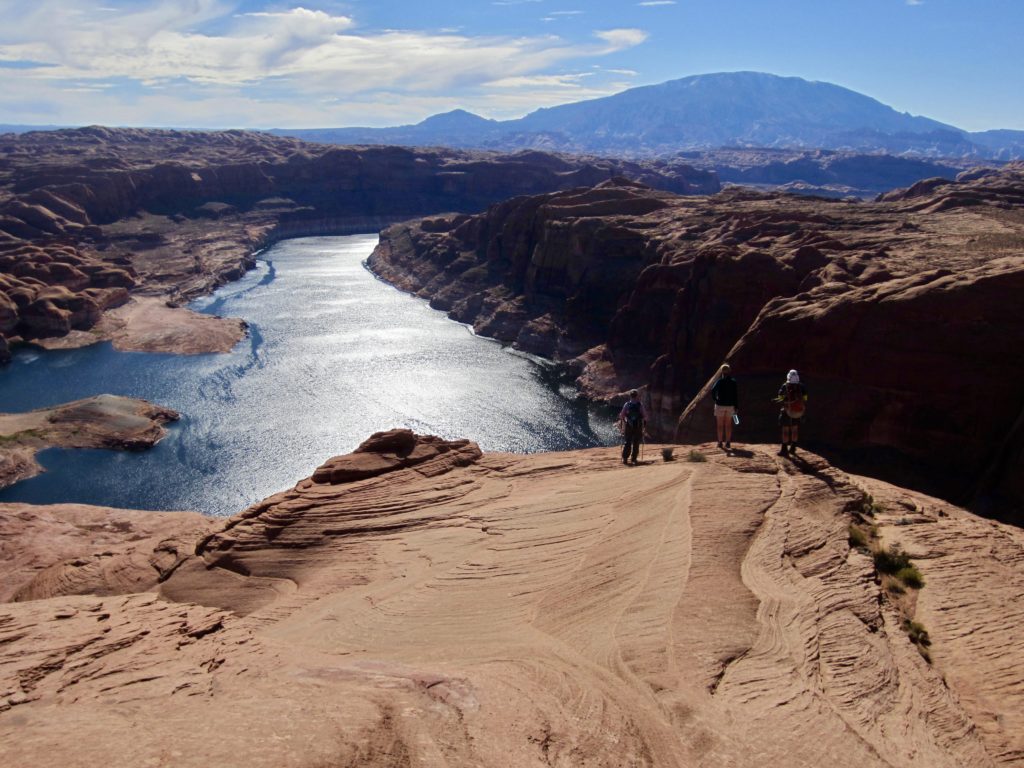
From the trailhead, Hole-in-the-Rock can be seen as a narrow cleft in a low sandstone ridge about 100 yards away. A brass benchmark bearing an elevation of 4329 feet is embedded in the rock on the right side of this cleft, and a commemorative plague is mounted on the left side. The rock walls are etched with the names of some of the early pioneers. We peered through the cleft and saw a steep canyon leading down to the shimmering blue water of Lake Powell far below. By chance, another group of four explorers was just scrambling up through the cleft, having accessed the canyon bottom via kayak.
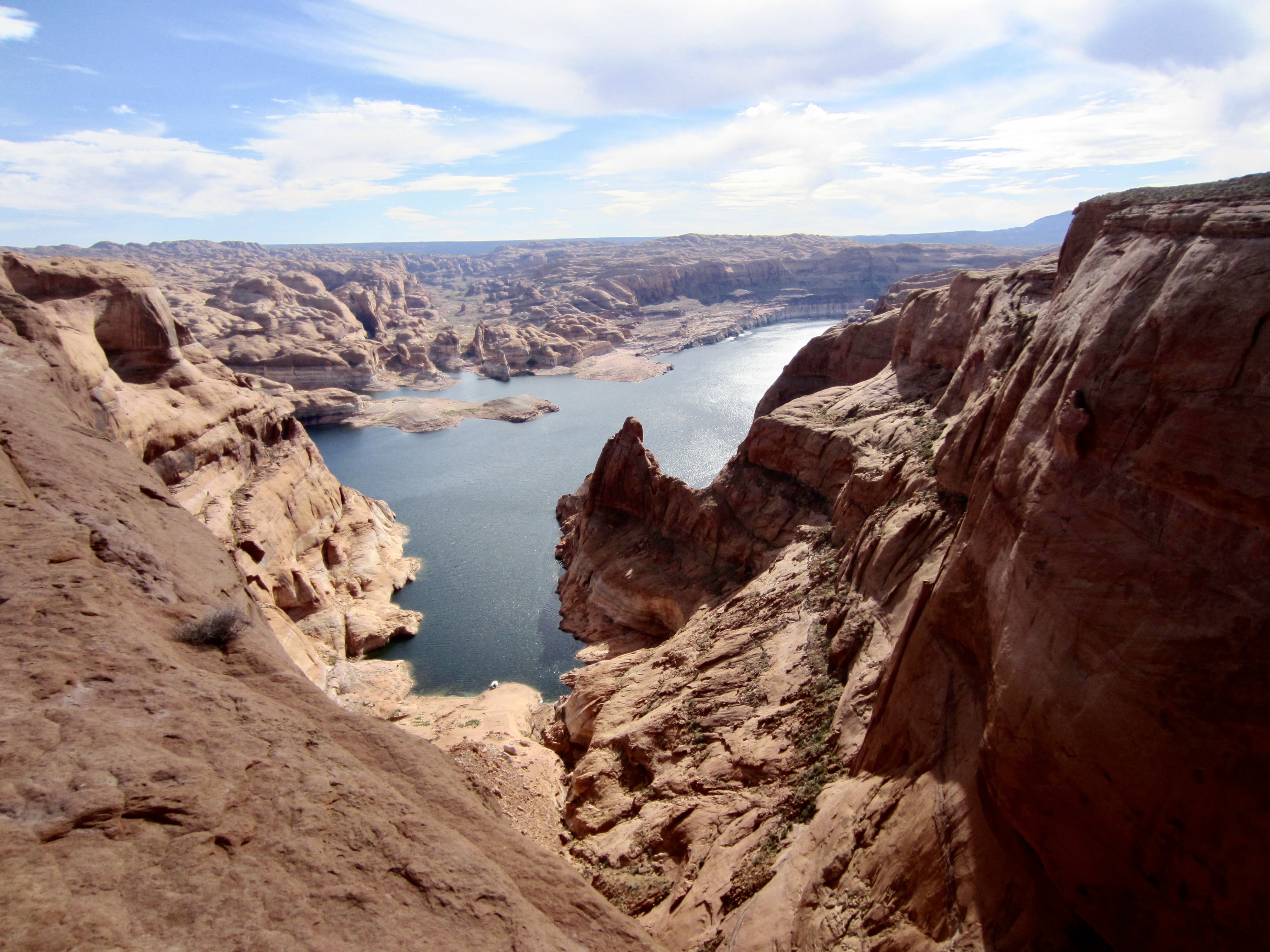
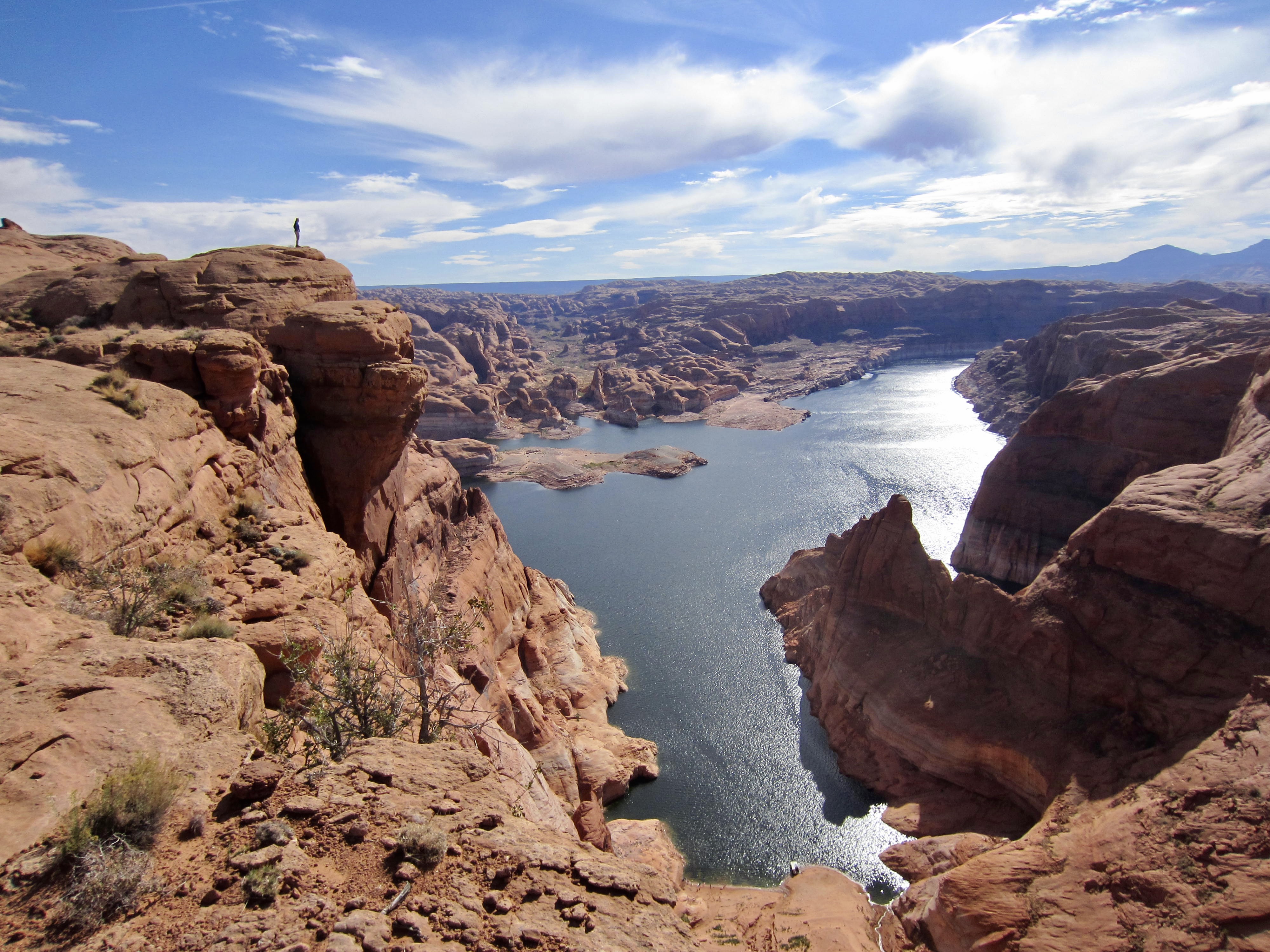
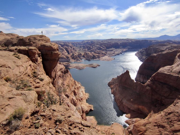
Eileen, Steve, Deb, and I began our exploration by hiking and scrambling out to a rocky viewpoint overlooking Lake Powell. Like many man-made reservoirs, this one has a complex shoreline with innumerable bays, inlets, peninsulas, and islands. Several houseboats were visible as tiny specks on the water surface below.
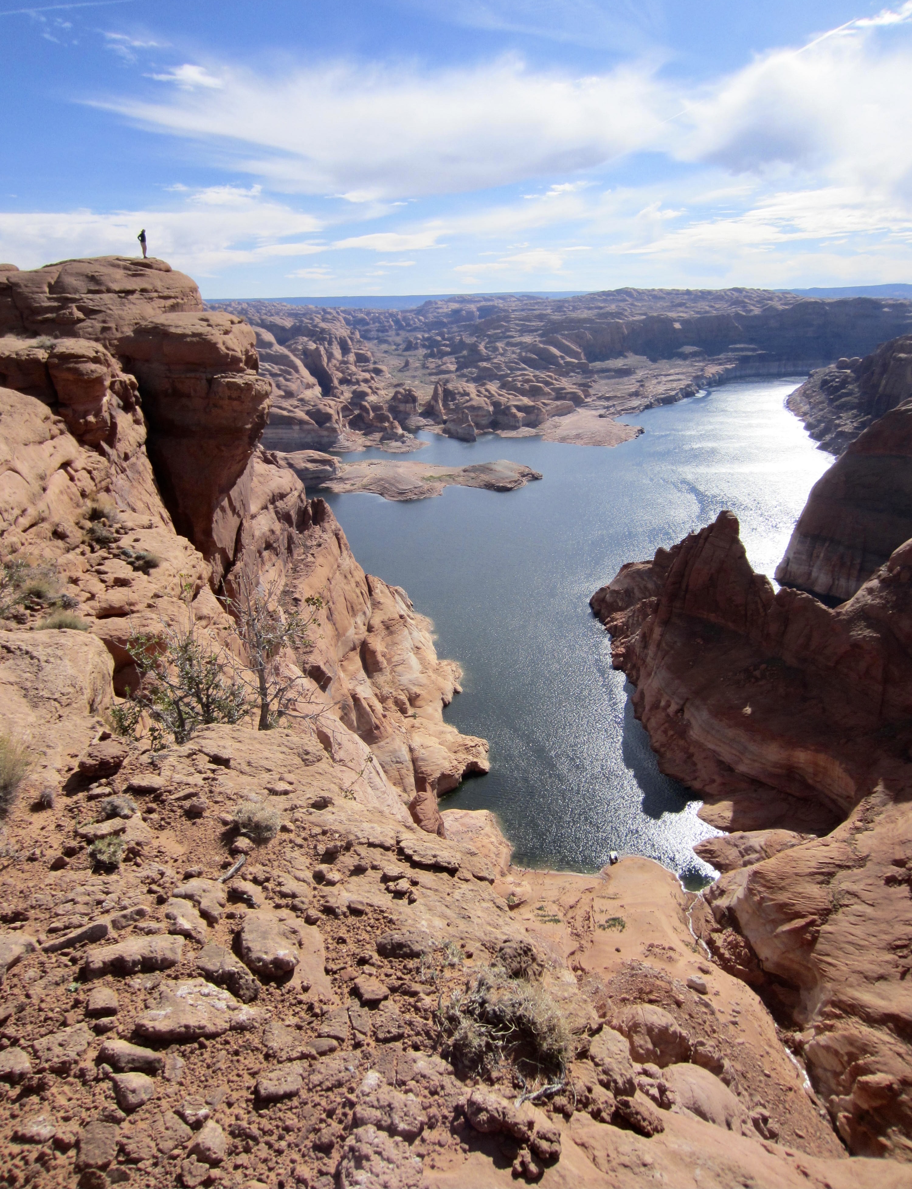
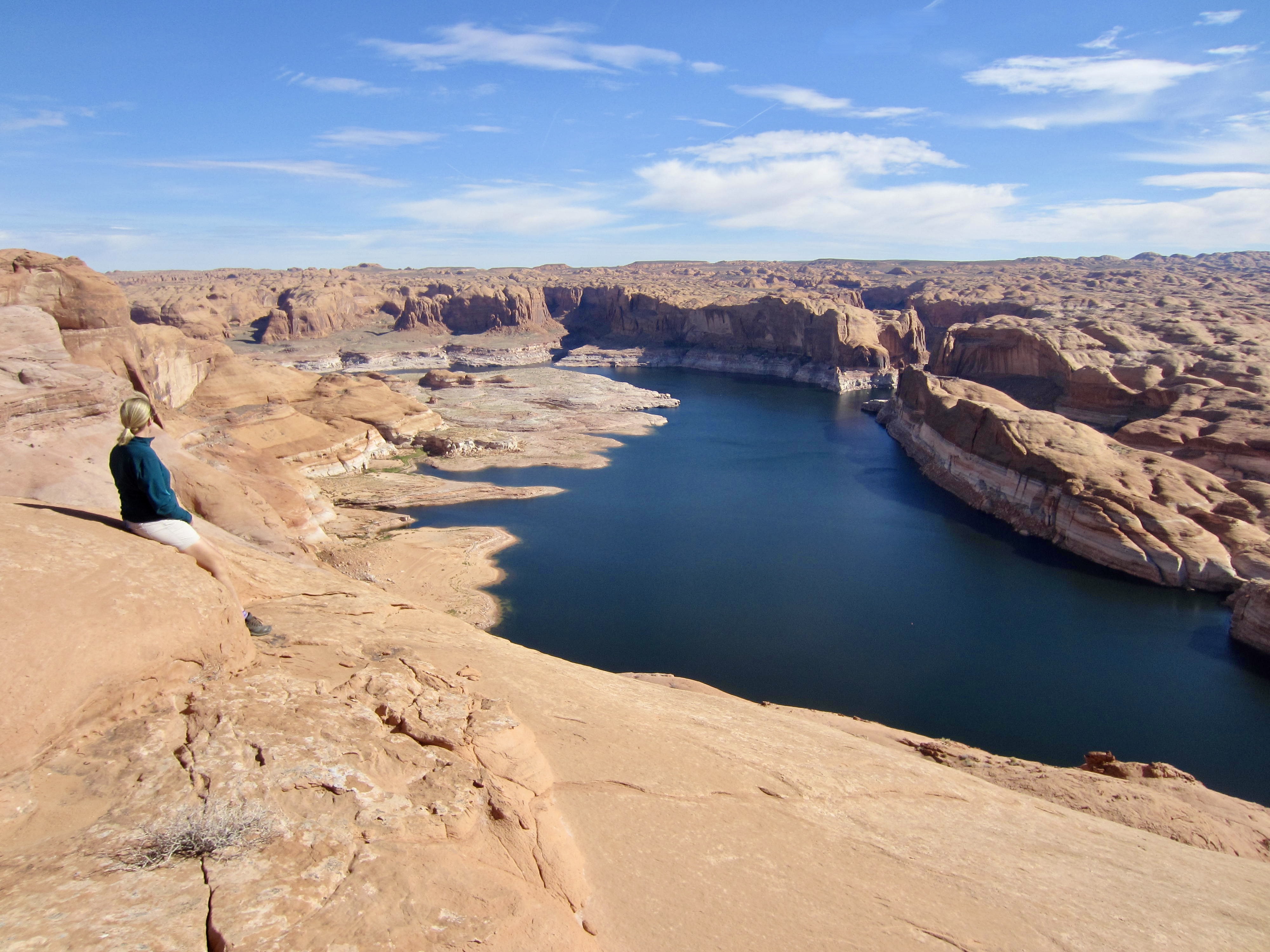
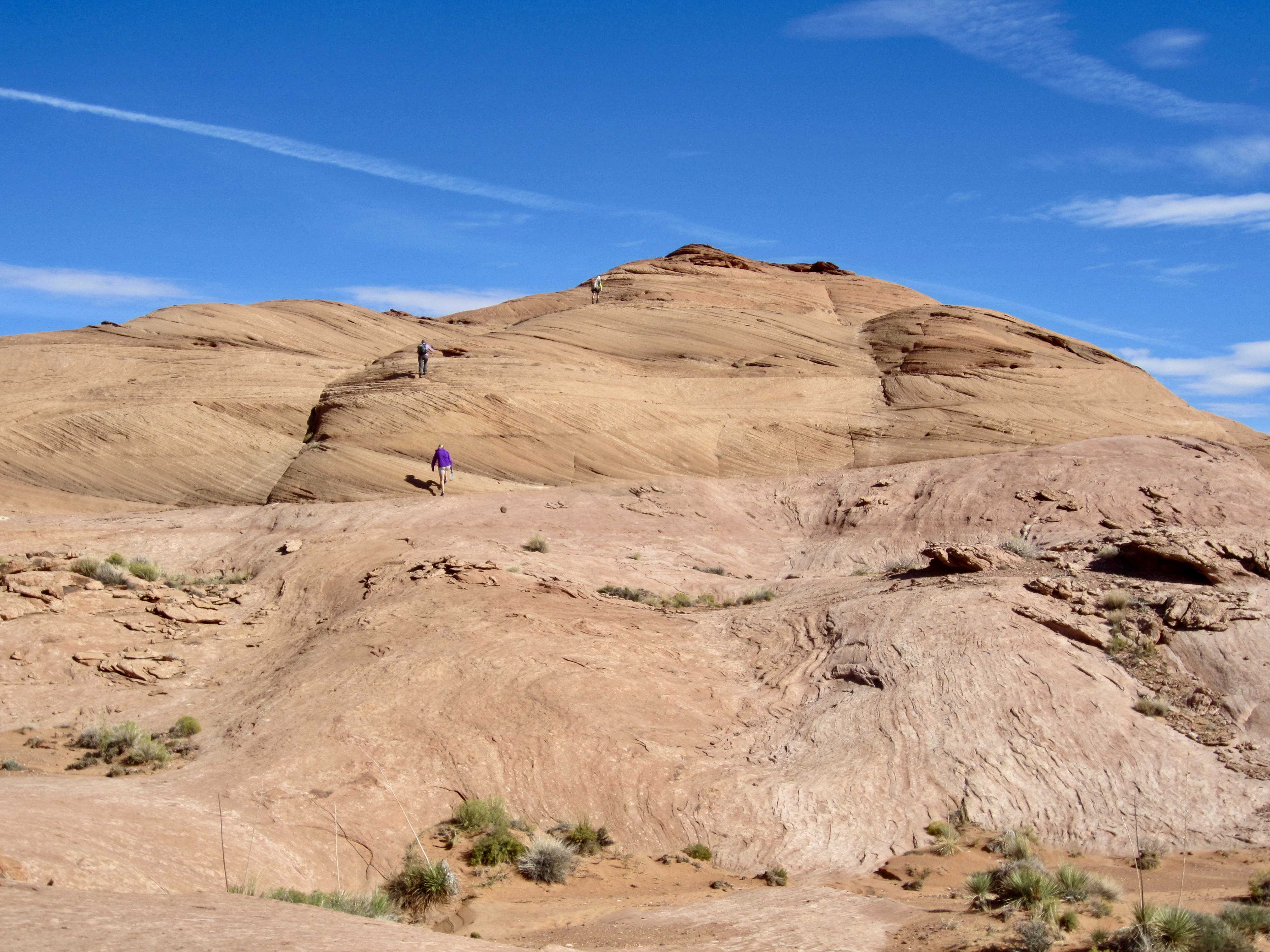
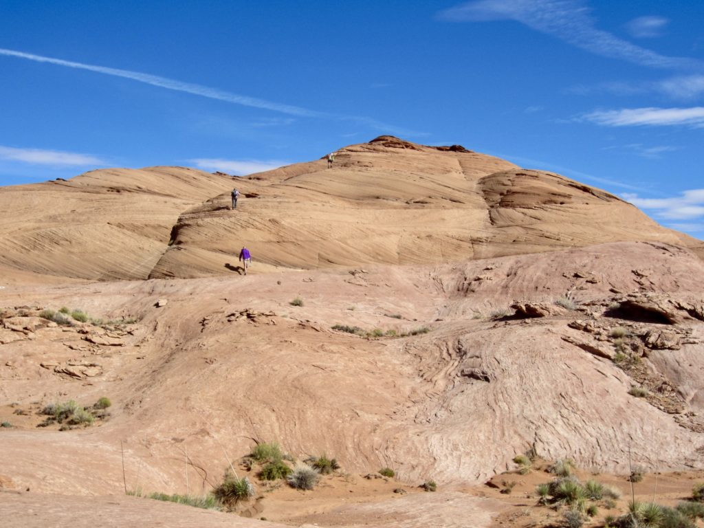
We kept hiking northeastward until gaining the top of a 4550-foot reddish sandstone dome. This dome appears to be the highest point within many miles, and it provides an excellent view of the entire Lake Powell area.
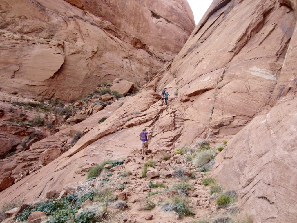
After returning to the Hole-in-the-Wall benchmark, we dropped into the narrow canyon and began carefully scrambling downward. The sandstone is generally quite solid, and the scrambling was very enjoyable, with continual Class 3 moves. The crux is a near-vertical 10-foot step in a narrow slot, where a short rope would likely be appreciated by many explorers.
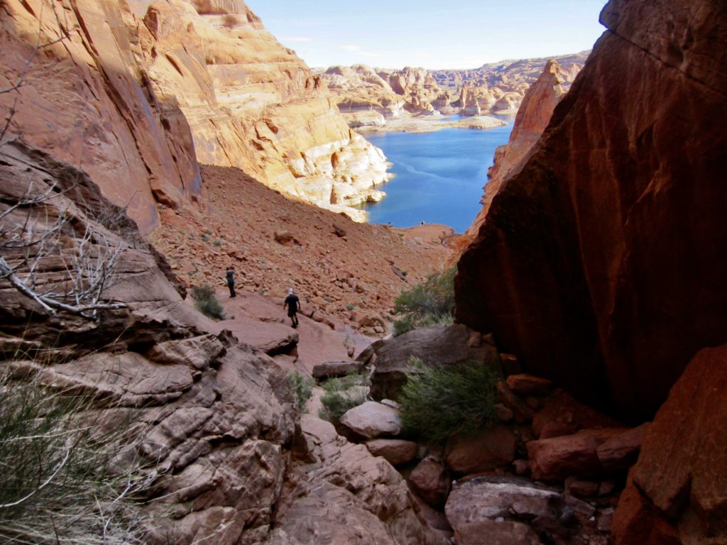
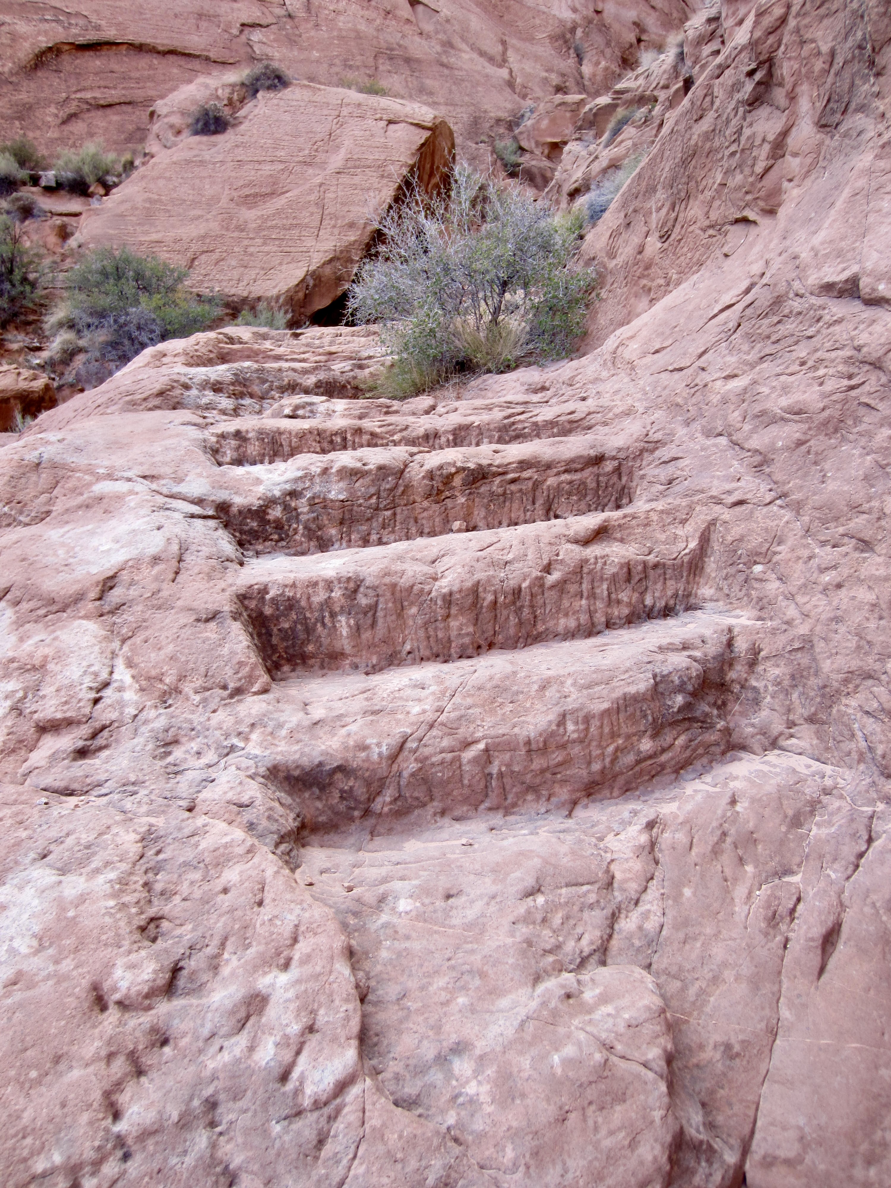
About halfway down, the canyon opened up and eased back considerably, transitioning to a moderately steep talus-and-scree slope. We were happy to find crude trail switch-backing down the slope, along with many steps carved into zones of solid rock. These steps were quite puzzling; we had read that the Mormon pioneers did a lot of blasting to gain passage, but it seemed unlikely that they would devote such detailed labor to a temporary route. Mystery solved: we later learned that prospectors and miners came through here in the early 1900s and improved the Mormon trail.
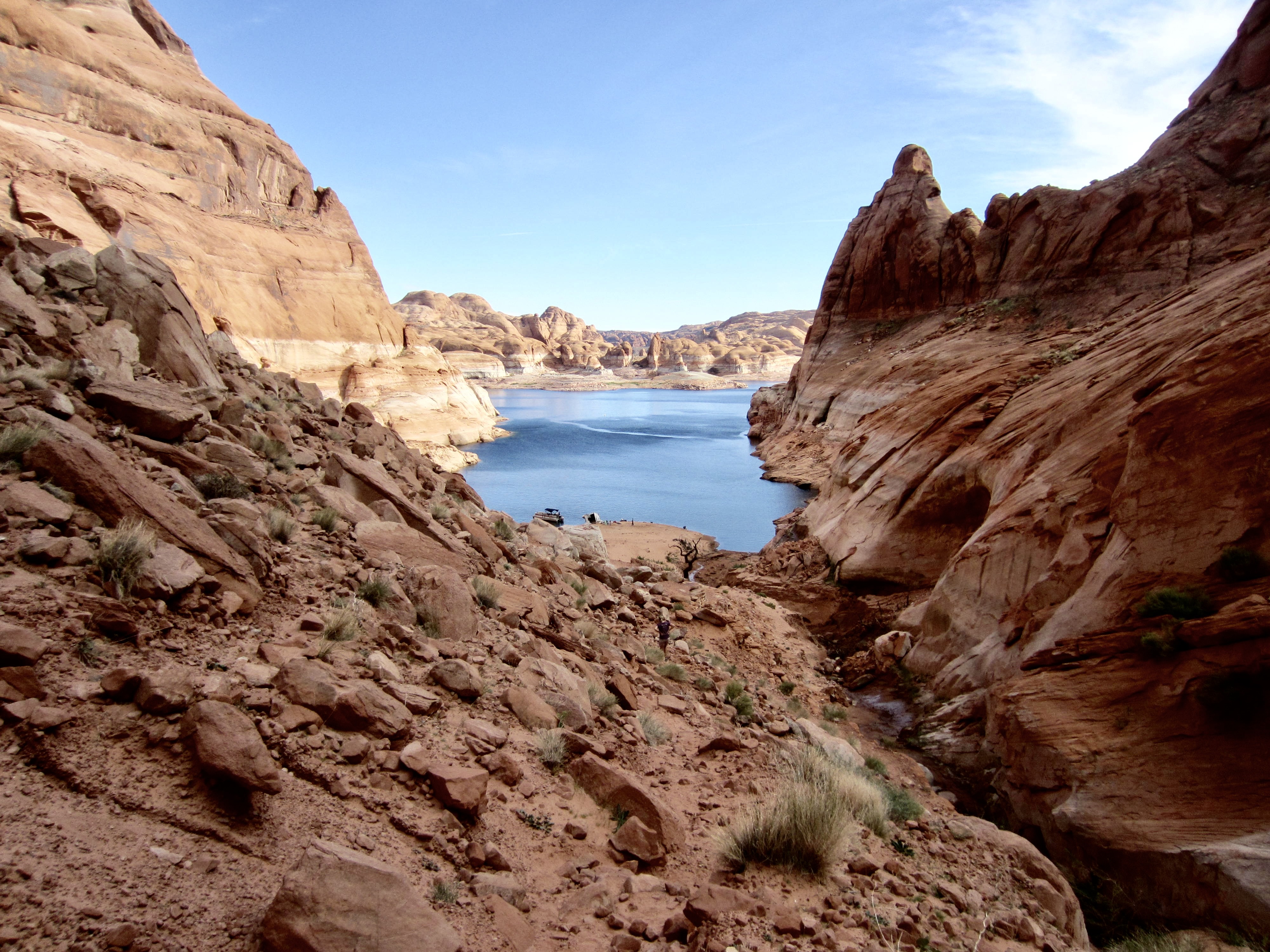
Our talus-and-scree slope gradually transitioned to a low-angle sand slope that extended down to Lake Powell. We stopped near the shore (1.0 hours – 700 feet from benchmark) and watched with interest as a small group of people attempted to use one houseboat to pull upright another houseboat that had capsized on the beach during a recent storm. They gave up after multiple failed attempts, which led us to conclude, “They’re gonna to need a bigger boat!” All joking aside, though, we could sympathize with their plight; it was a rented houseboat.

With the day’s entertainment over, we headed back up the canyon. The Class 3 scrambling was easier going up, and we were back at the benchmark by mid-afternoon (0.8 hours + 700 feet from shore) to complete a very fun and interesting day of exploration.
…
Route Map & Profile
…
…
Photo Gallery
Click to enlarge…