Trip Date: June 6-8, 2019
Greyhorn Peak Climbing Trip
Scatter Creek Basin
Point 7612 aka South Scatter Point
Greyhorn Peak (7618 ft)
Red Cornice Saddle
Trip Report Summary
Region: Northeastern Washington Cascades
Sub-Region: Mazama Mountains
Area: Lake Chelan – Sawtooth Wilderness
Starting & Ending Point: Scatter Creek Trailhead on Twisp River Road (Elev. 3200 feet)
Way Points: Scatter Creek & Scatter Creek Basin (trail hike)
Campsite: Scatter Creek Basin (Elev. 6450 feet)
Sidetrip: South Scatter Point & Point 7416 (off-trail hike & rock scramble); return via Point 7416 & Red Cornice Saddle (rock scramble & off-trail hike)
Summit: Greyhorn Peak (rock scramble via Southeast Face)
Approximate Stats: 10.6 miles traveled; 5700 feet gained & lost.
Related Posts
>>> Abernathy Peak via Scatter Lake—Southeast Chute – May 2025
>>> Abernathy Peak via Scatter Lake–Southeast Slope – October 2012
Full Trip Report
Eileen and I joined Fay for a three-day trek up the Twisp River to climb Greyhorn Peak. This largely unknown and rarely visited summit turned out to be a little gem, but it was the unseasonably cold weather that dominated our trip.
Day 1: Trailhead to Scatter Creek Basin
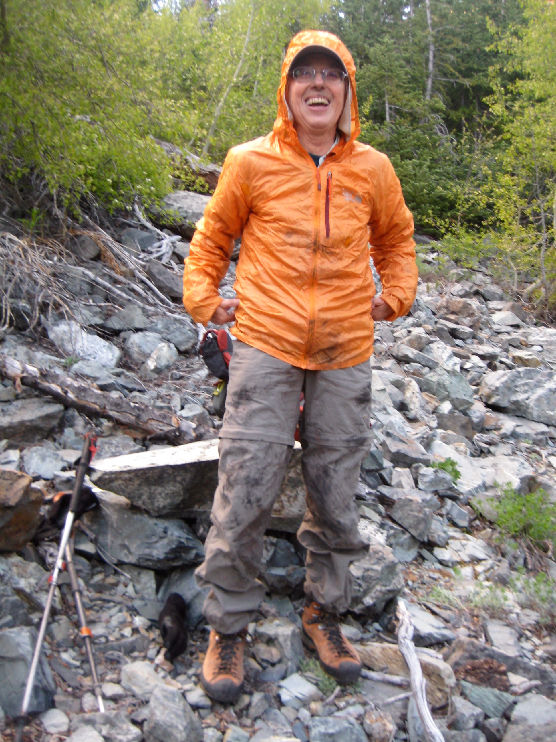
We started up the Scatter Creek Trail in mid-afternoon. Sadly, a forest fire had burned out this area last year, leaving us to hike through alternating patches of green trees and blackened snags. The most annoying part was crawling over or under the scorched logs that had fallen across the trail. After a few miles, Fay was smeared with charcoal and looked like an old-time chimney sweep!

- Blackened Fay On Scatter Creek Trail
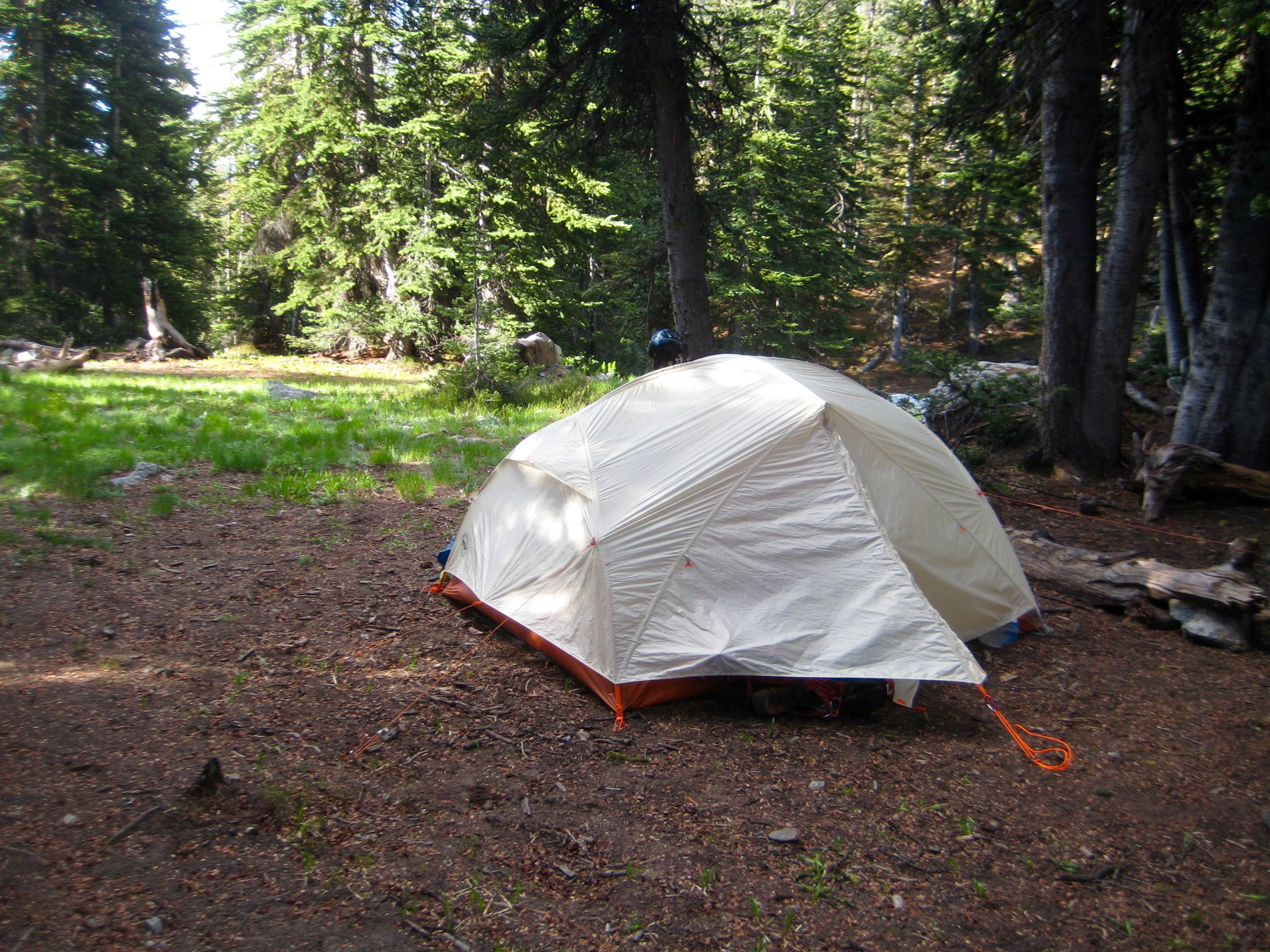
Although the afternoon had began warm and sunny, the weather quickly grew cool, cloudy, and breezy. In fact, it was downright cold by the time we reached 6500-foot Scatter Creek Basin (4.3 hours + 3300 feet from TH). We pitched our three-person tent at an established campsite beside the trail.

- Camp In Scatter Creek Basin
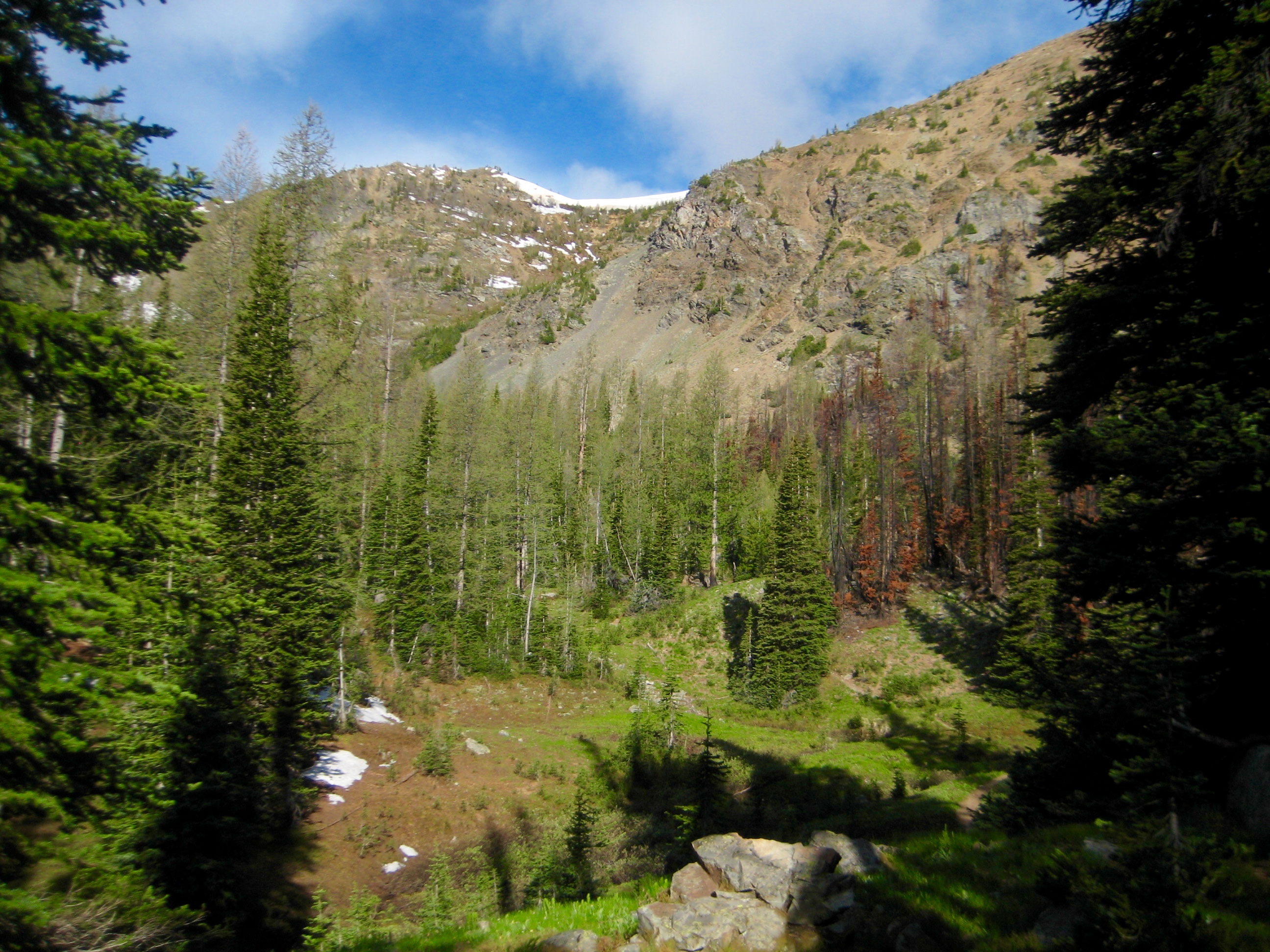
From camp, we had a good view of our planned route up to Point 7612 (aka South Scatter Point), which is on the same ridge as Greyhorn Peak.
- South Scatter Point (7612) and Red Cornice Saddle From Camp
Day 2: Greyhorn Peak Summit Climb
Following a surprisingly frigid night, we awoke to a layer of ice in our cookpot and water jug. Breakfast was consumed in an open meadow next to our camp, in an effort to take advantage of transient sunbeams. Once underway, we ascended easy meadow slopes to the southwest, eventually gaining a spur ridge southeast of 7612-foot South Scatter Point.
- Heading Up To Ridge Crest
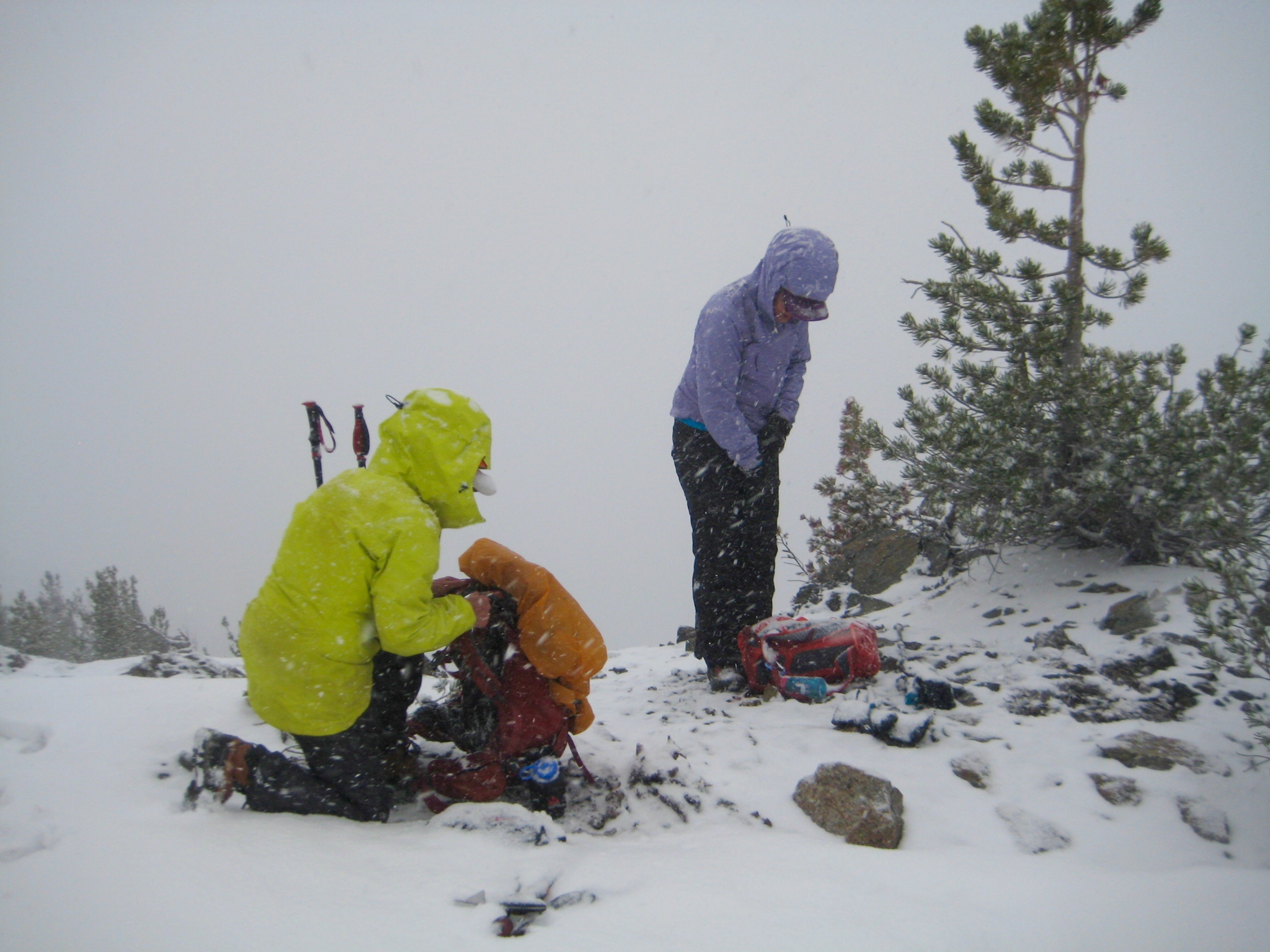
On the crest, we turned right and went over South Scatter Point. It had been trying to snow all morning, and the flakes came in earnest just as we reached the top. Was this really June?!
- Fay & Eileen In Snow Squall On South Scatter Point
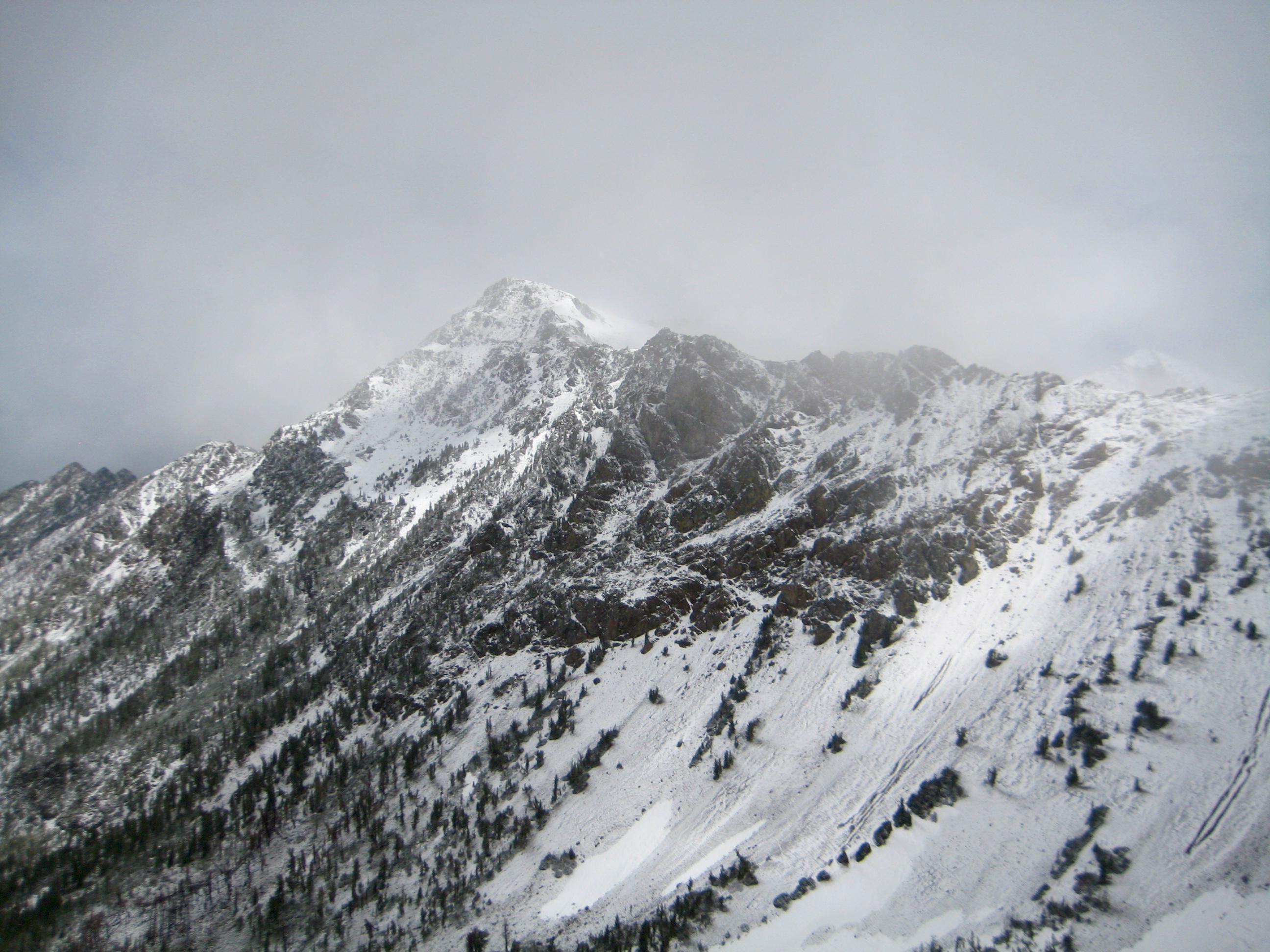
- Fresh Snow On Abernathy Peak
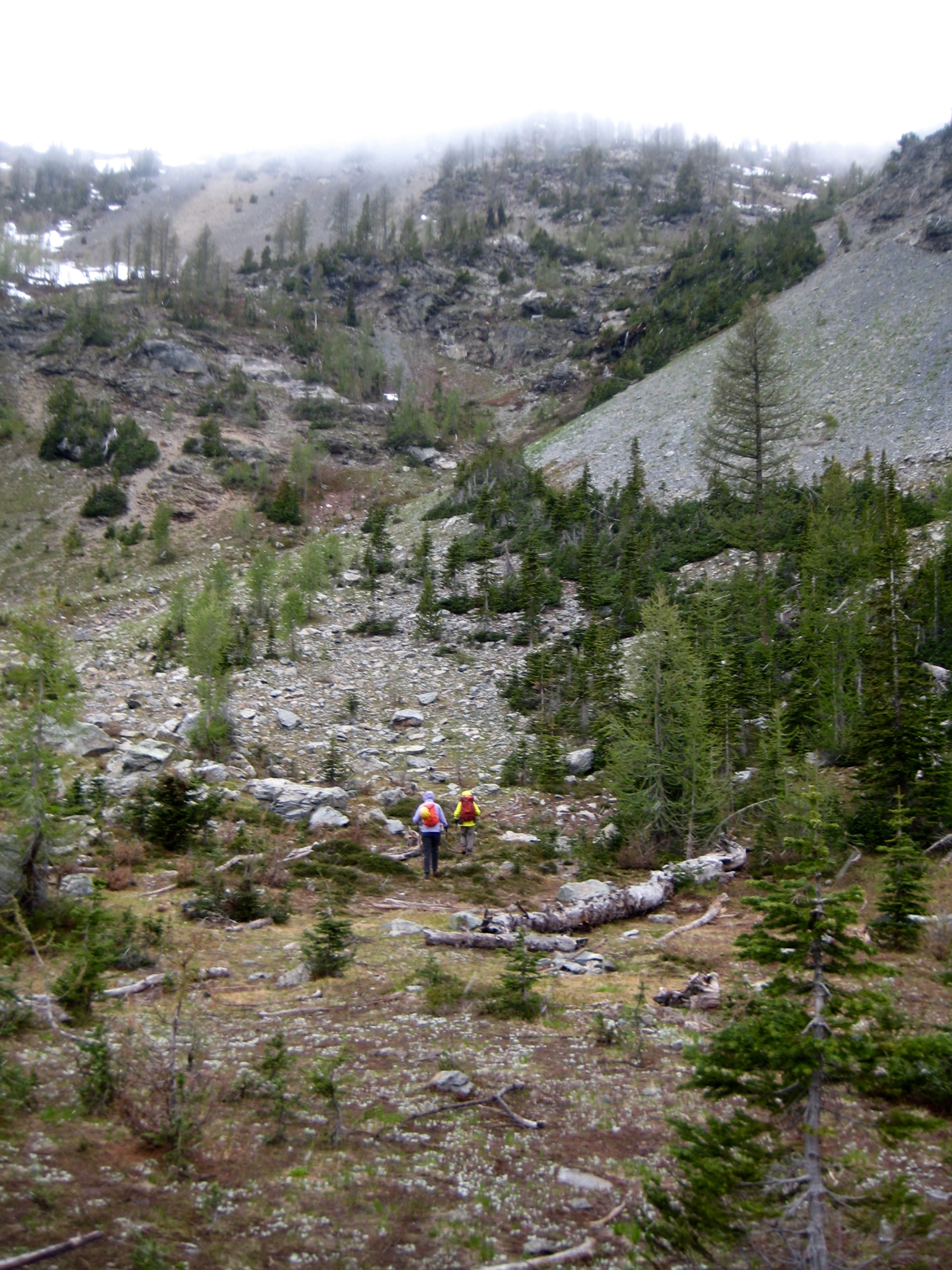
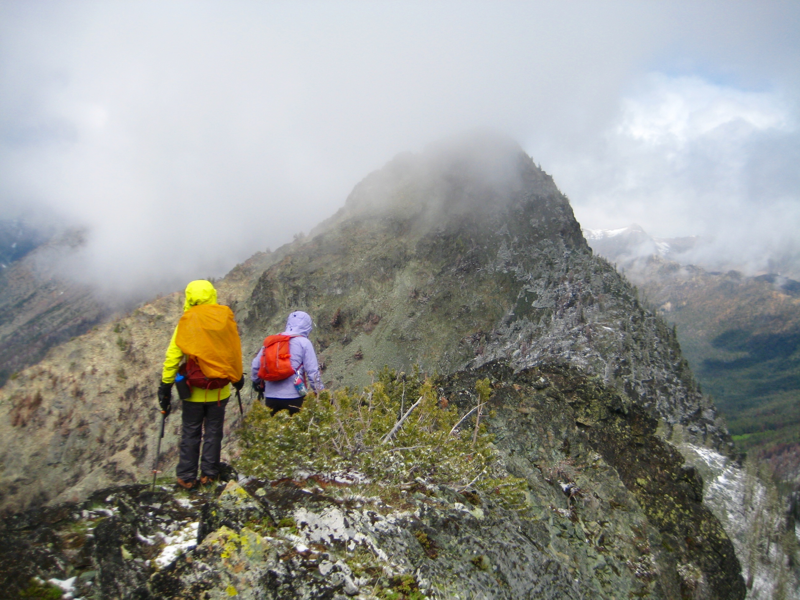
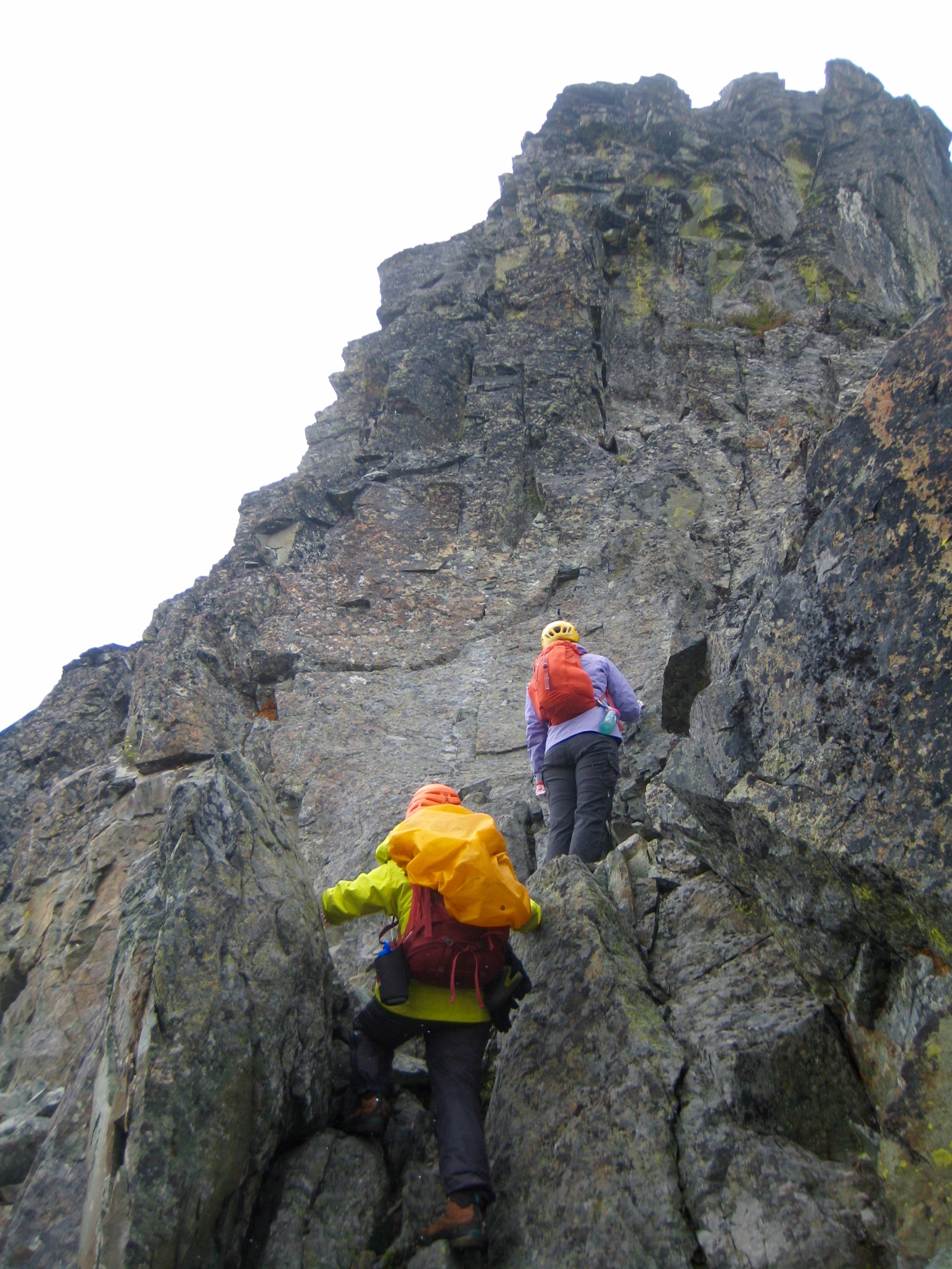
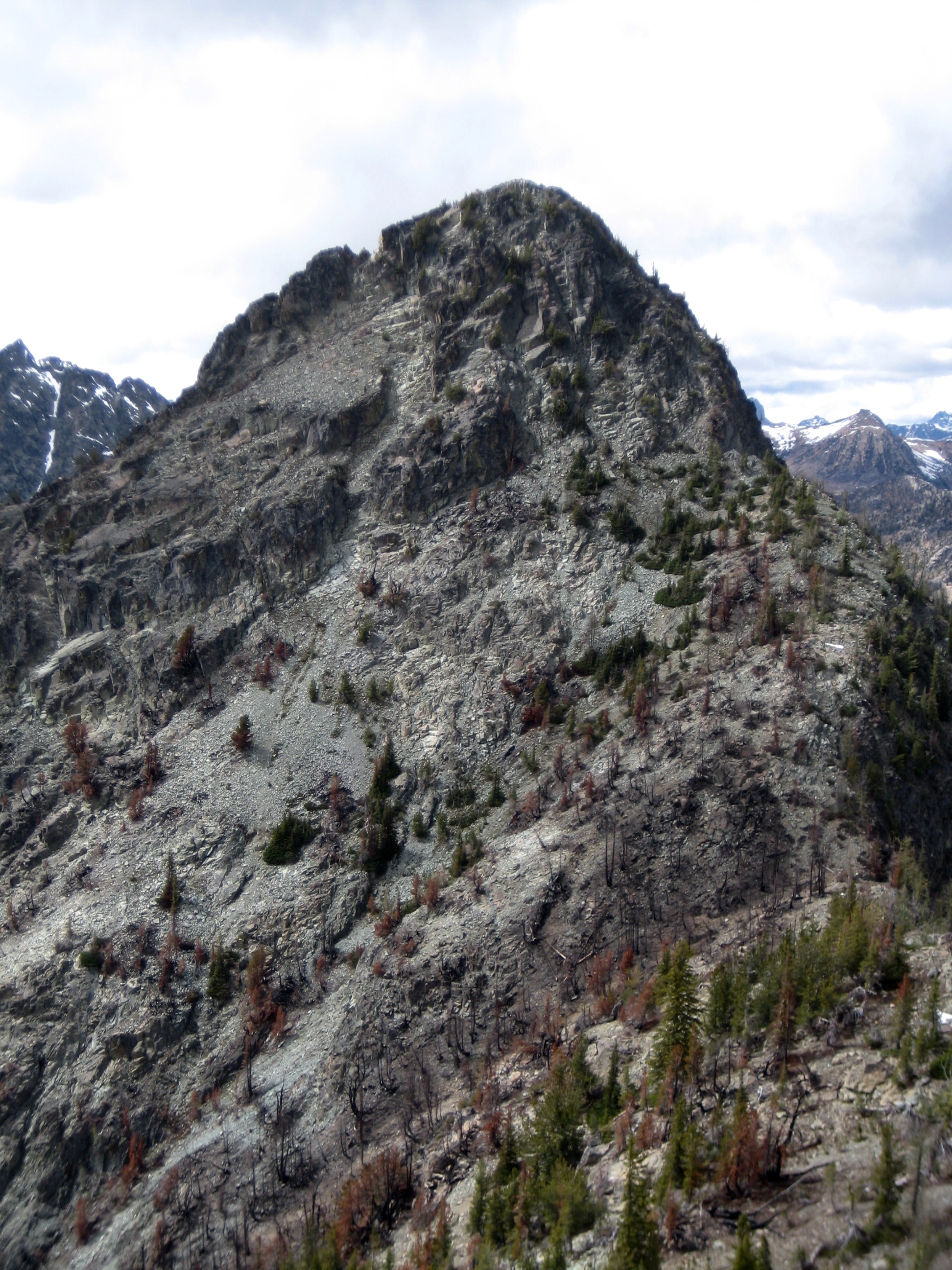
Continuing westward along the crest, we encountered some Class 3 scrambling to get over the top of Point 7416. Fortunately, the snow squall had ended and the fresh snow was melting quickly.
- Traversing Ridge To Greyhorn Peak
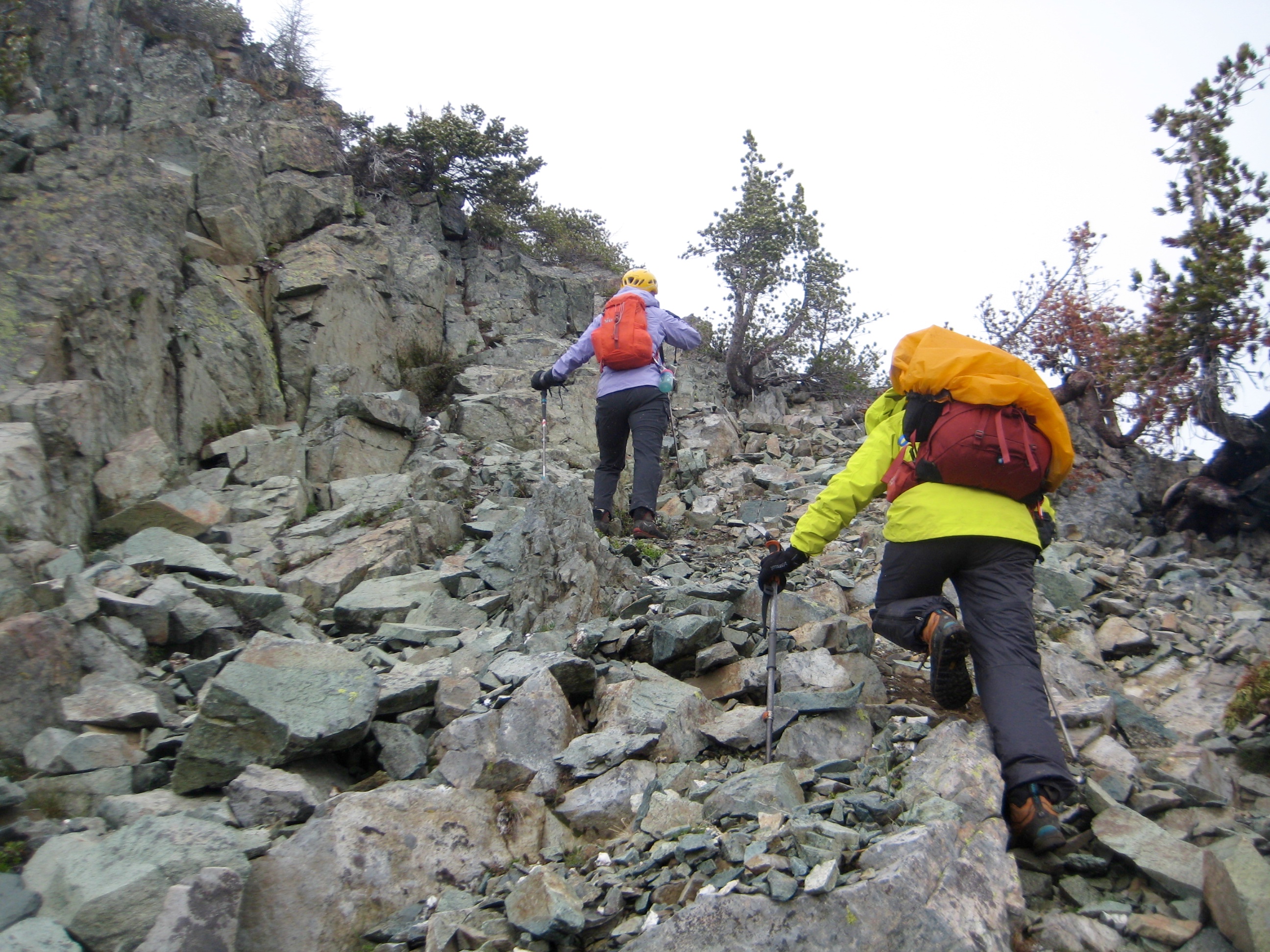
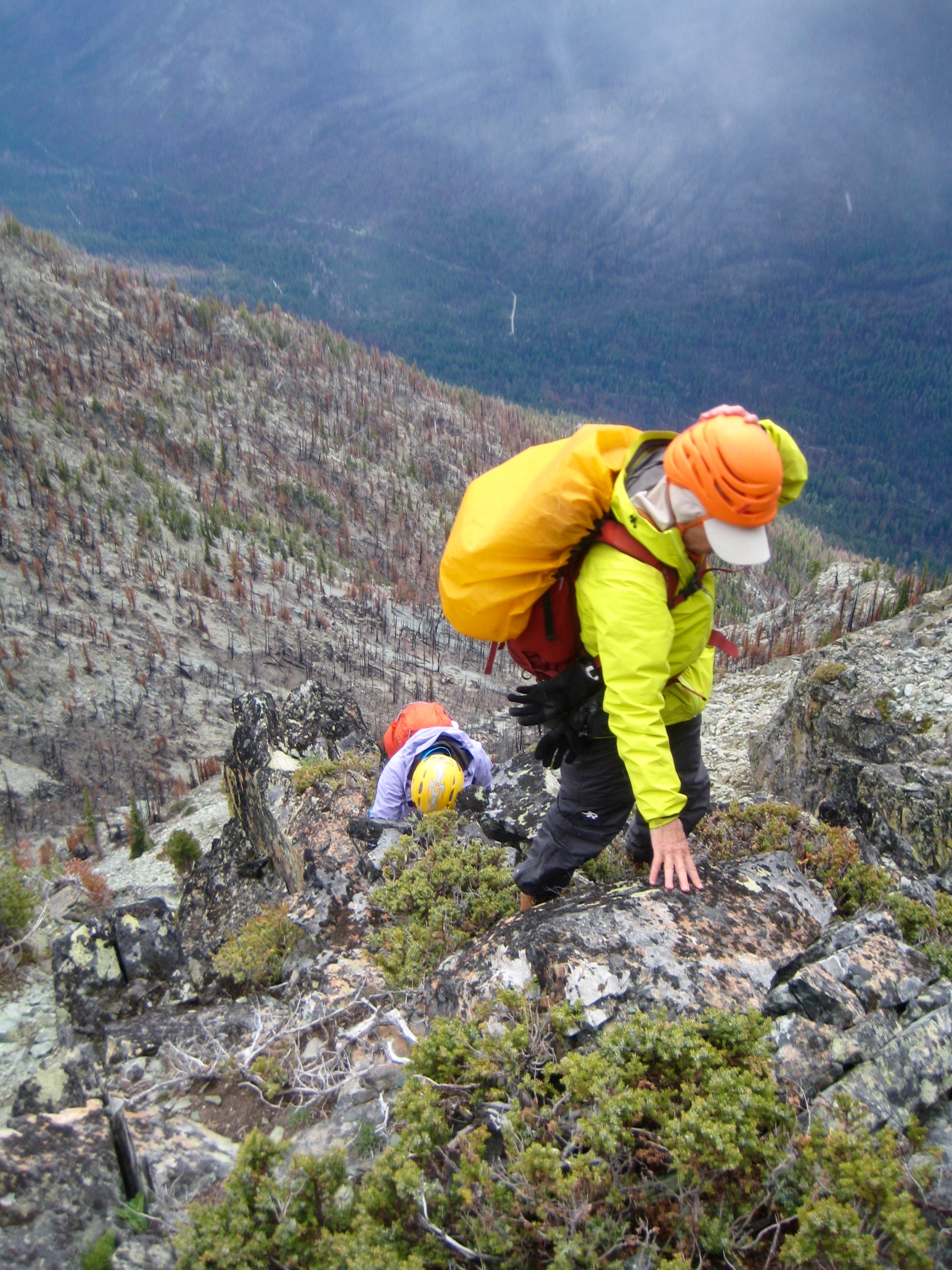
We then descended to a saddle at the base of Greyhorn Peak. From there, it was not obvious where to go. We started by scrambling straight up the east ridge, but this soon ended at a steep cliff.
- Heading Up Greyhorn Peak
- Steep Terrain On Greyhorn Peak
After scoping out several options, we discovered a series of ledges and ramps that led around to the left, past several small ribs and slots. This put us near the middle of the southeast face, from where we could climb Class 2-3 rock directly up to the summit.
- Fay & Eileen High On Greyhorn Peak
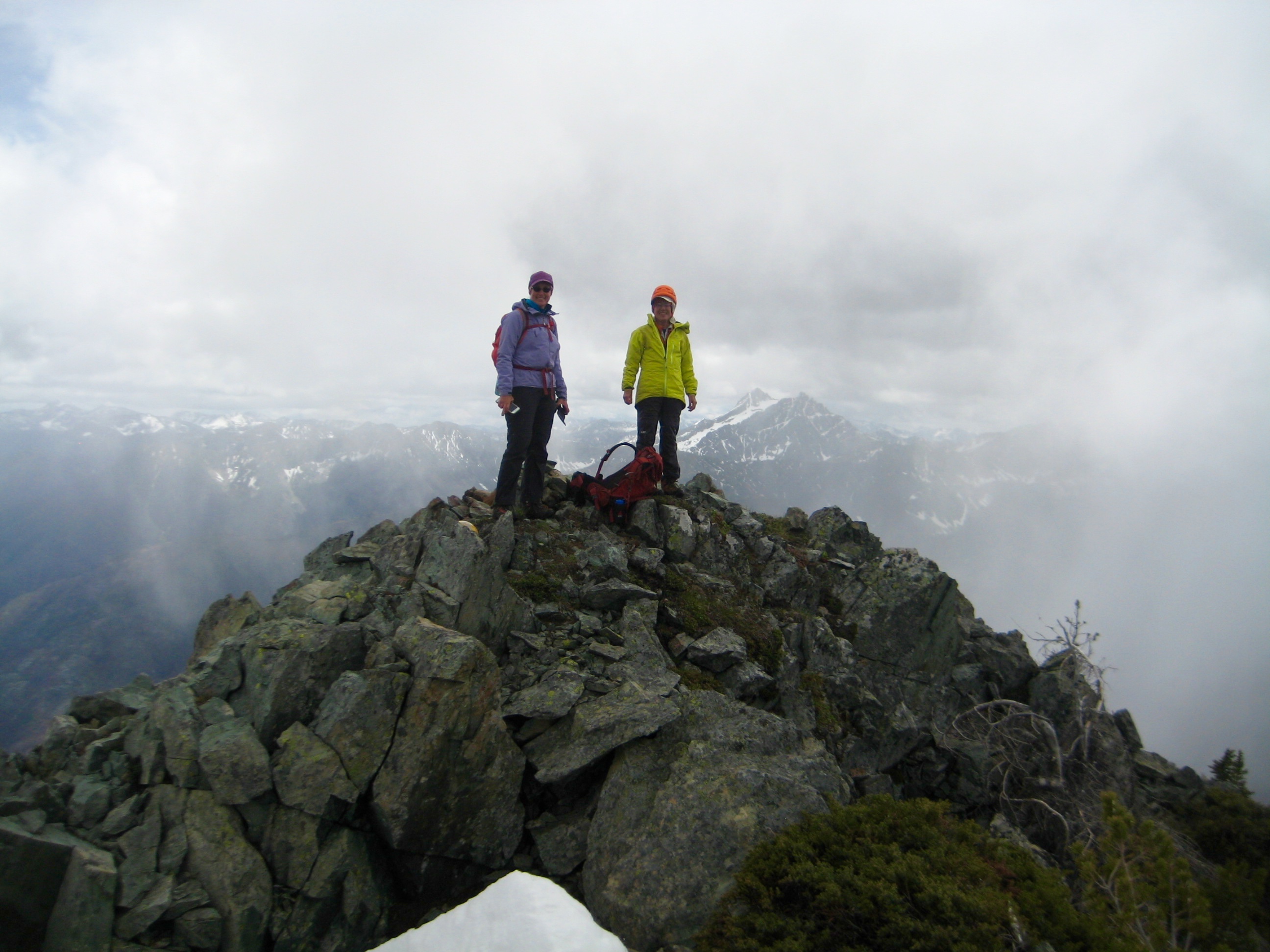
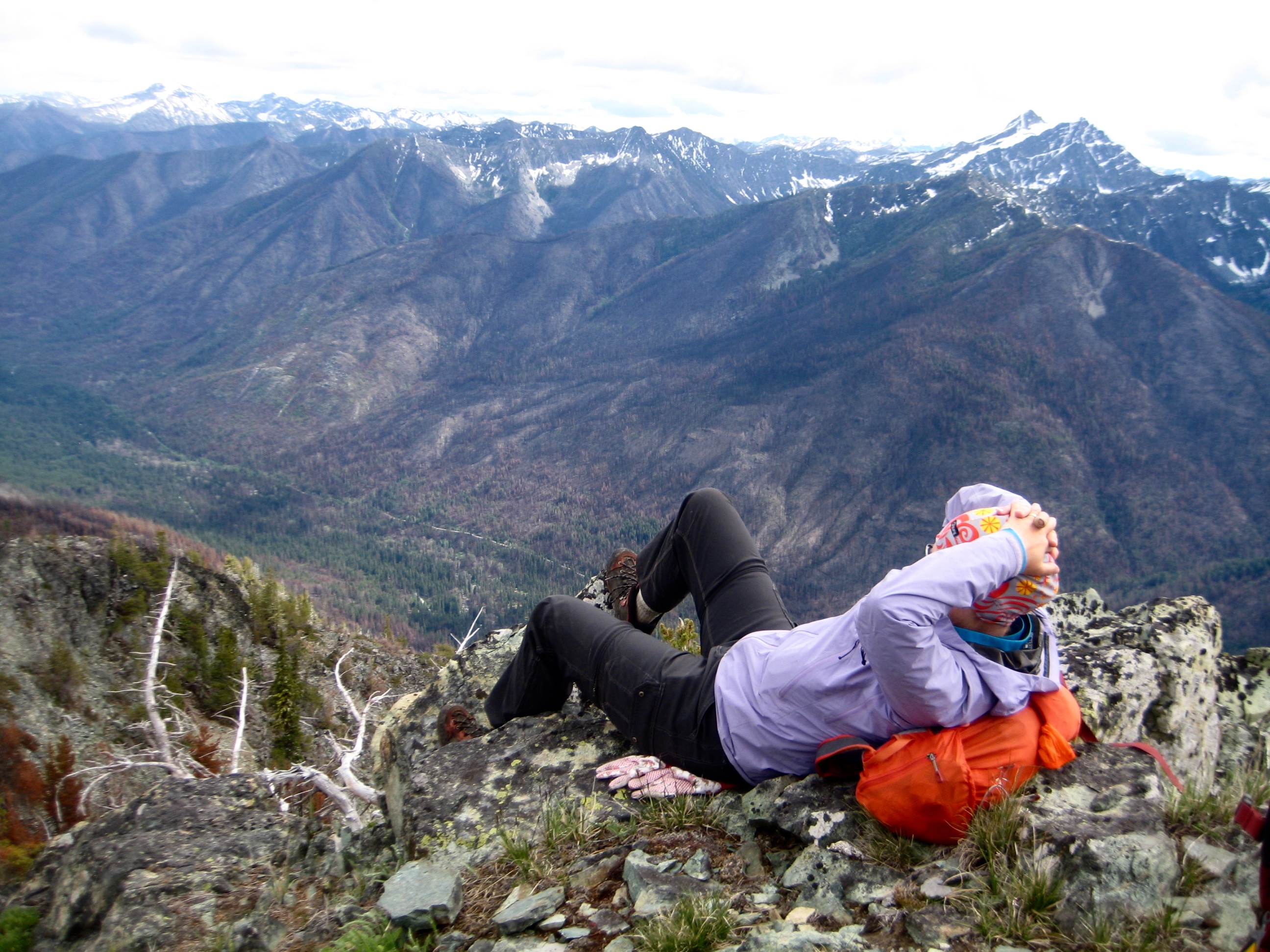
We topped out in early afternoon (3.9 hours + 1750 feet from camp) and stayed long enough to enjoy the steadily improving views. Fay left a mini register in the summit cairn.
- Eileen & Fay On Greyhorn Peak Summit
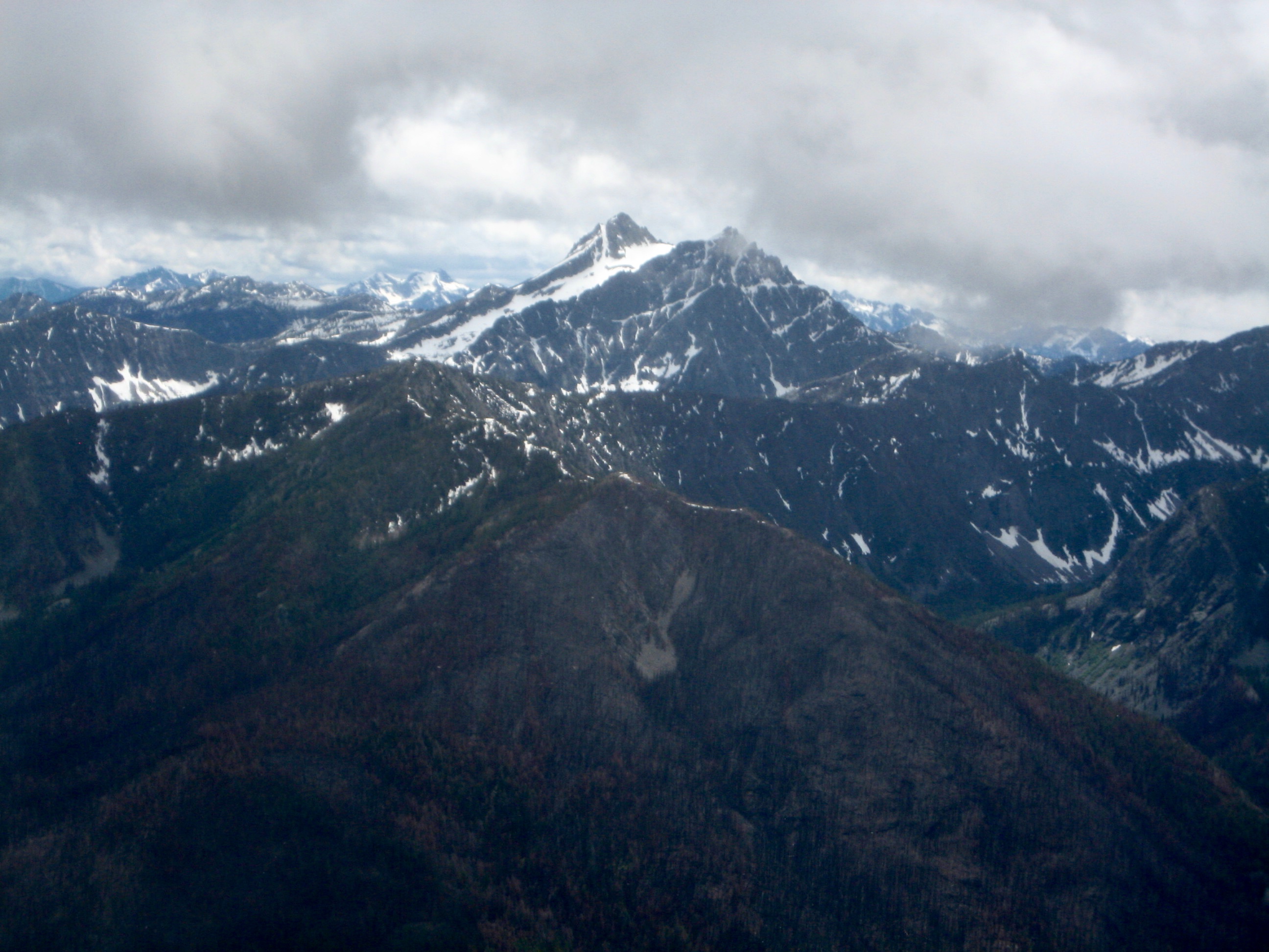
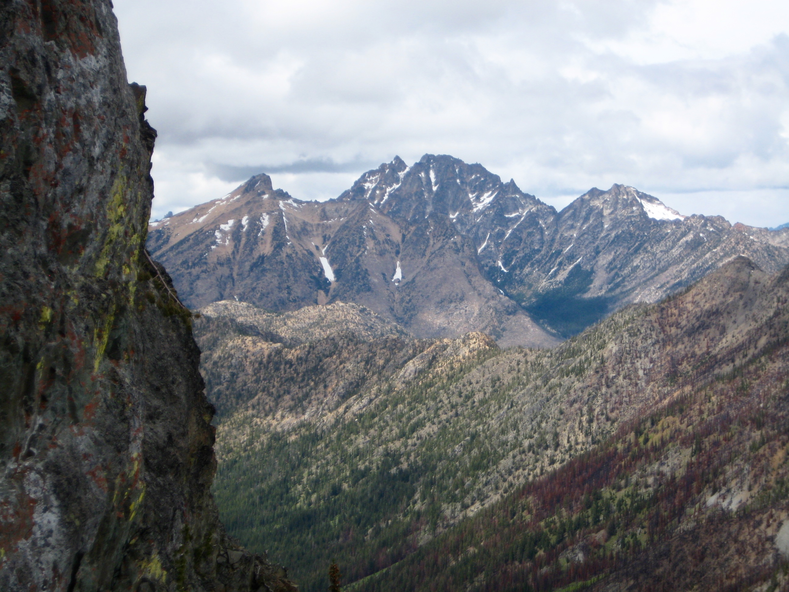
- Reynolds Peak From Greyhorn Peak Summit
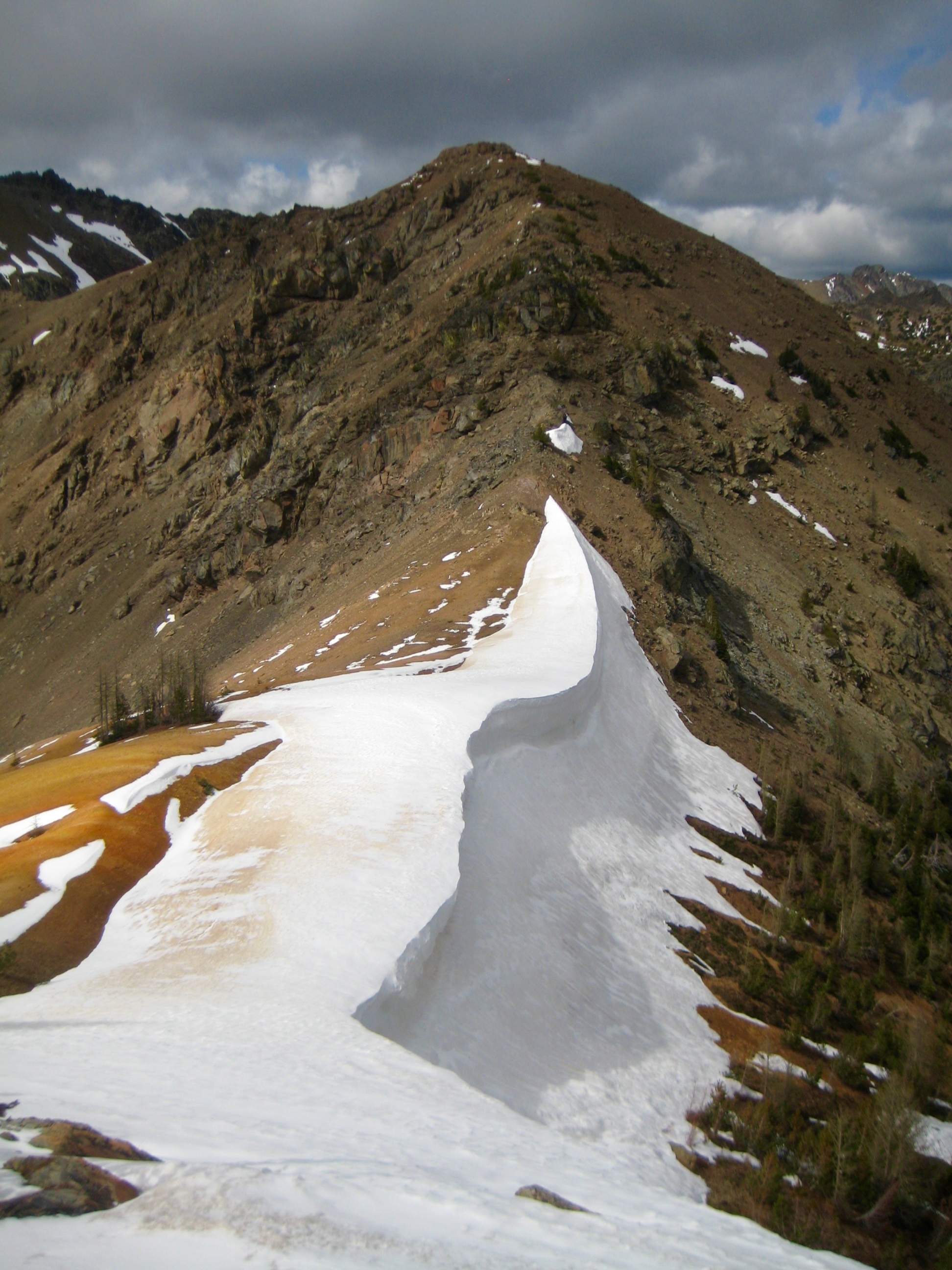
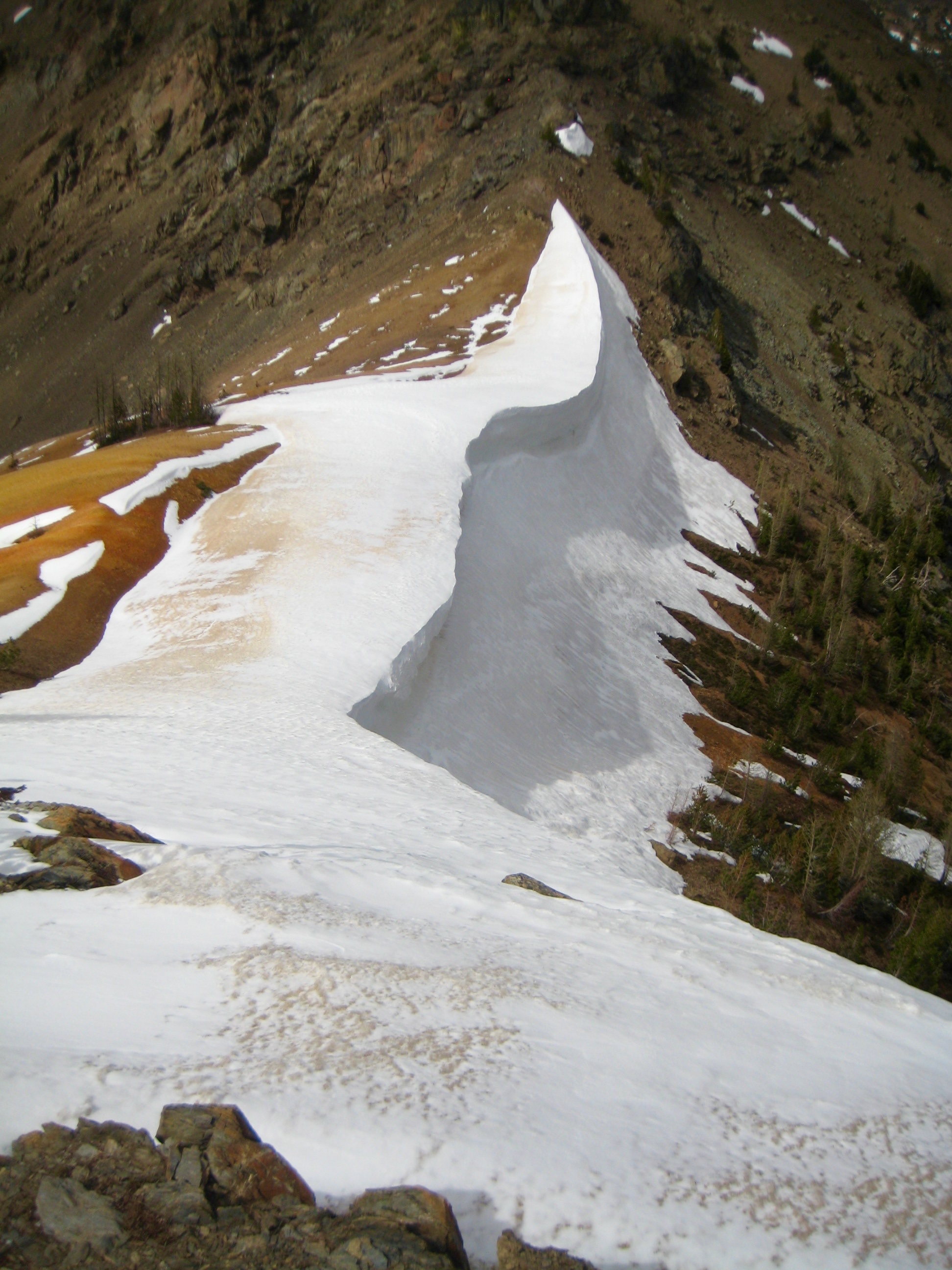
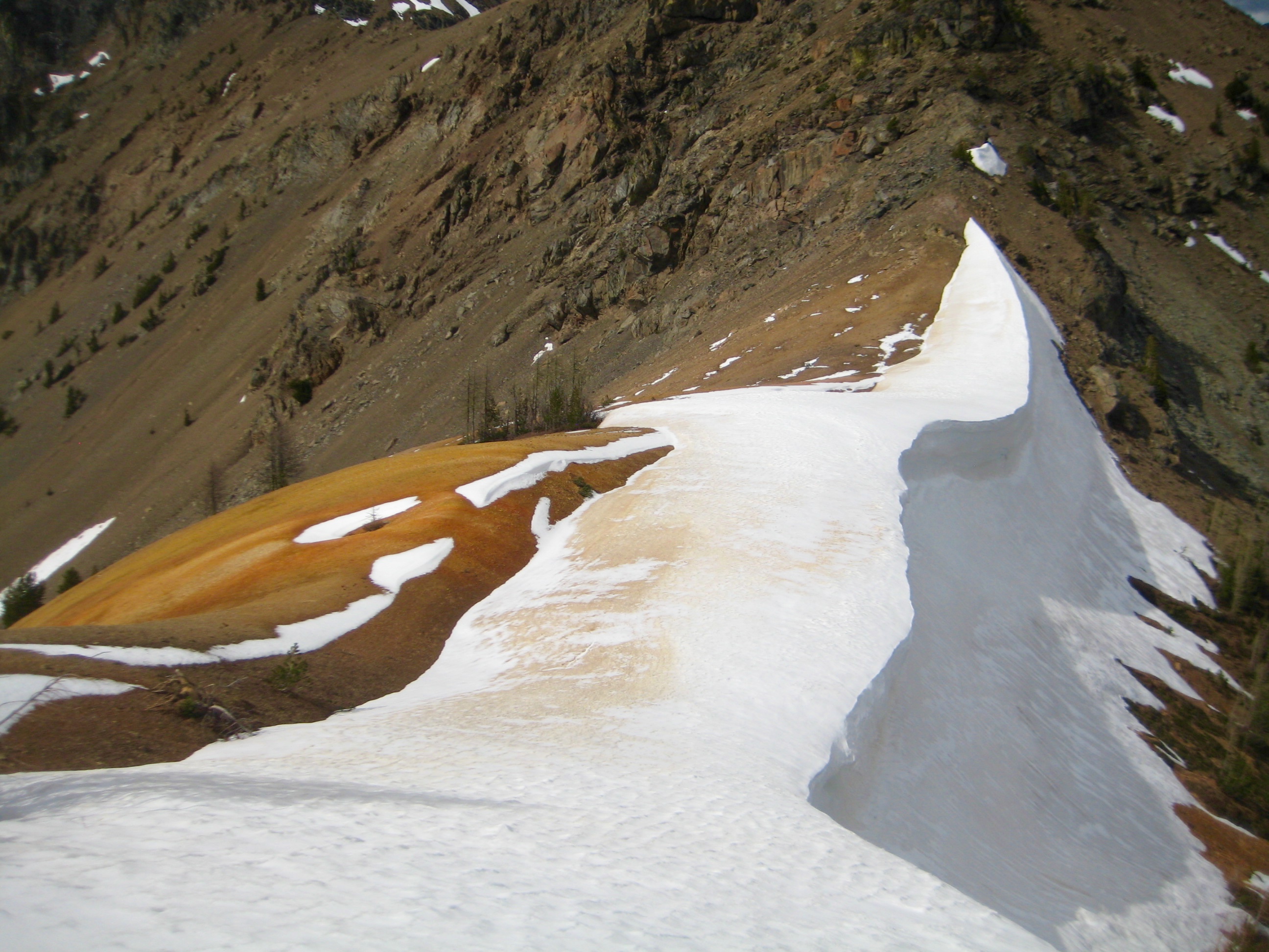
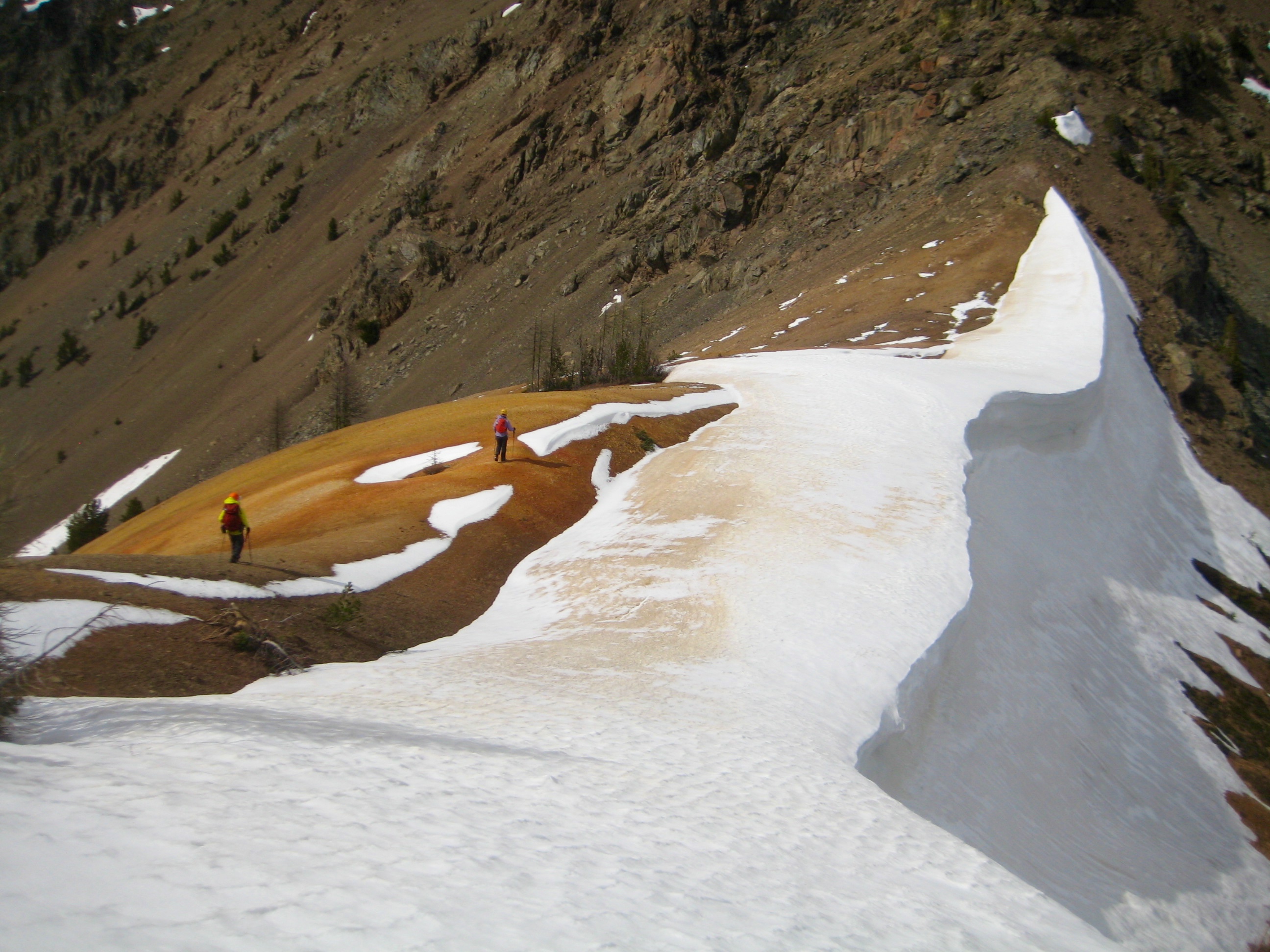
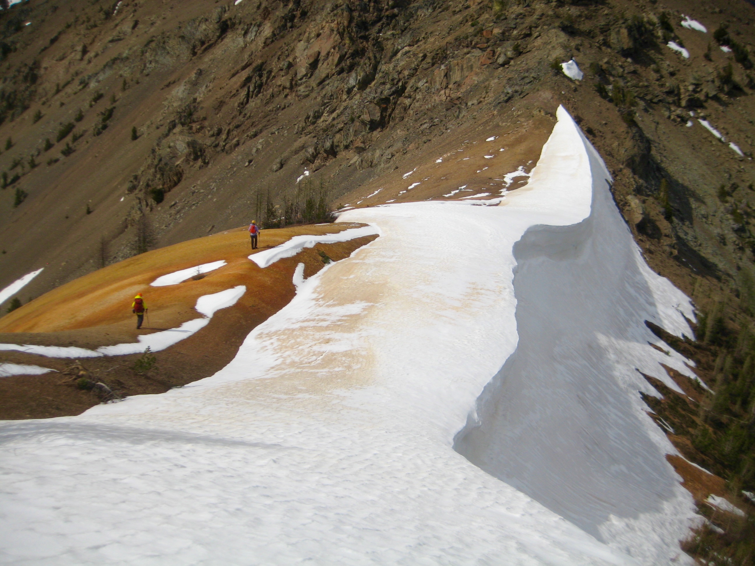
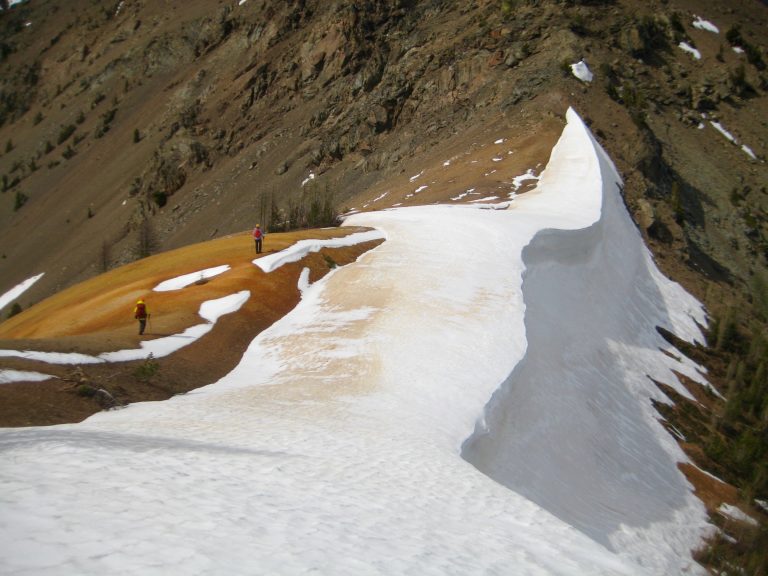
Our descent route took us back along the ridge crest until just below South Scatter Point. From there, we easily dropped down to a 7500-foot saddle that features oxide-stained soil and rock overlain by an artistically formed remnant snow cornice. The whole scene was visually striking!
- Red Cornice Saddle & North Scatter Point (7763)
- Hiking Across Red Cornice Saddle
We stepped around the cornice and worked our way down through scree slopes and ledgey rock to reach the large basin below. We strolled into our campsite in late afternoon (3.7 hours + 550 feet from summit).
Day 3: Scatter Creek Basin to Trailhead
Following another cold night, we were pleased to see large blue patches in the morning. Our hike back down the trail involved several stops to doff clothing layers, and it was pleasantly warm by the time we reached the trailhead (3.1 hours + 100 feet from camp).
Route Map
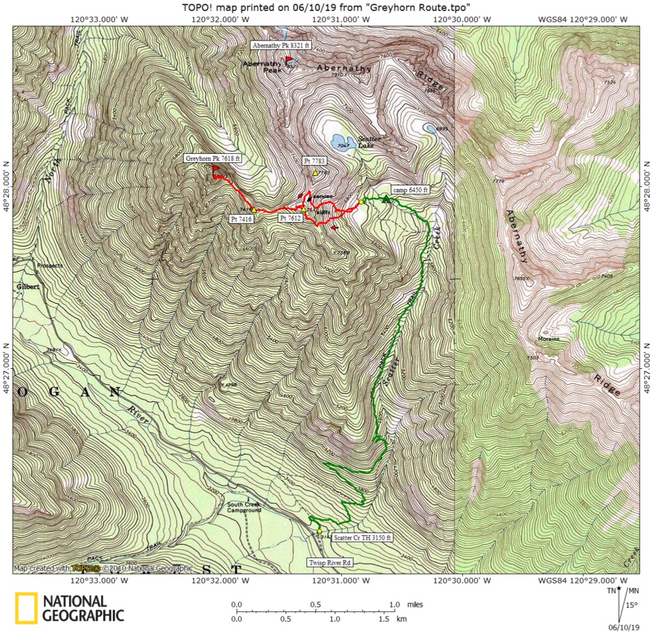
Photo Gallery
Click to enlarge…