Trip Date: September 30 – October 1, 2000
Gardner Mountain Climbing Trip
Wolf Creek Valley
Gardner Meadows
Gardner Mountain (8898/8897 ft)
Trip Report Summary
Region: Northeastern Washington Cascades
Sub-Region: Mazama Mountains
Area: Lake Chelan – Sawtooth Wilderness
Starting & Ending Point: Wolf Creek Trailhead at end of Wolf Creek Road #5005 (Elev. 2950 feet)
Way Points: Wolf Creek & North Fork Trail junction & Abernathy Trail junction & Hubbard Creek Trail junction & Lower Gardner Meadows (trail hike)
Campsite: Lower Gardner Meadows (Elev. 5400 feet)
Sidetrip: Gardner Meadows (trail hike)
Summit: Gardner Mountain (off-trail hike & rock scramble via South Slope)
Approximate Stats: 25 miles traveled; 7300 feet gained & lost.
Related Posts
>>> North Gardner Mtn via Wolf Creek–Southeast Slope—South Ridge – June 2018
>>> North Gardner Mtn via Wolf Creek–Southeast Slope–South Ridge – June 2004
Full Trip Report
Despite the somewhat grim weather outlook last weekend, I really wanted to reach one more high summit this fall. Gardner Mountain looked like a good (non-technical) peak for the mixed-ability group we had. Joining me for this questionable adventure were Laura, Dee, Kevin, and Kevin’s 13-year-old son, Matthew, whose only previous summit was Mt. Pilchuck. I was gambling with a gloomy forecast, but we had several things in our favor: (1) the mountain is far to the east; (2) the forecast indicated slight improvement toward Sunday; and (3) this was Laura’s annual birthday climb, so I figured the mountain gods might give her a gift. Well, the gamble paid off, and Laura got a huge gift!
Day 0: Home to Trailhead
The Wolf Creek Trailhead is located at the end of the Left Fork Wolf Creek Road; we mistakenly followed the main Wolf Creek Road for about 10 miles before realizing that it was heading in the wrong direction. We camped at the Wolf Creek Trailhead Friday night and were awakened by rain at about 2:00am.
Day 1 (AM): Trailhead to Lower Gardner Meadows
After a wet night, it continued to rain during our hike to base camp in Lower Gardner Meadows (4.0 hours from TH) on Saturday morning. The trail itself was in very good condition and had only a few blowdowns, but the weather pretty effectively dampened our clothing and spirits. I think Laura was particularly disenchanted by the whole situation.

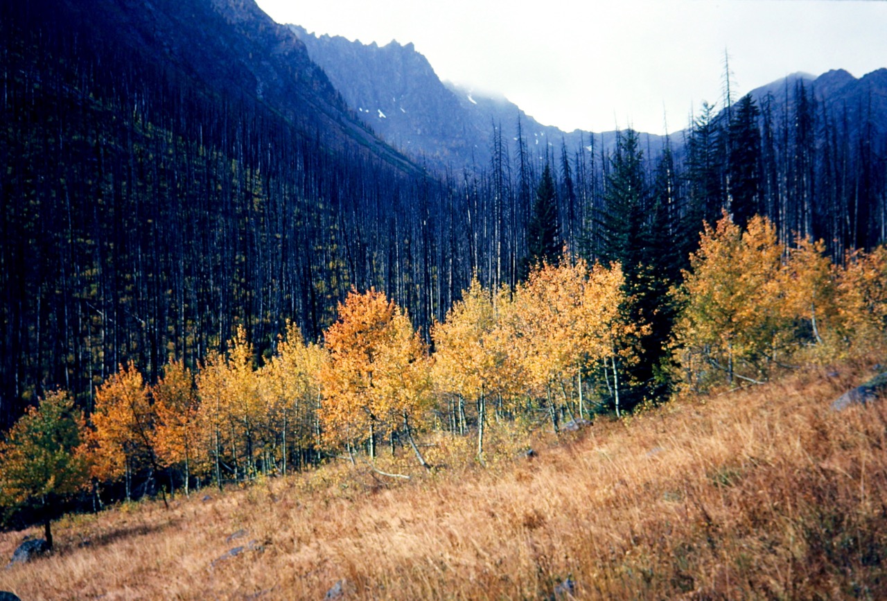
- Fall Color In Gardner Meadow
Day 1 (PM): Gardner Mtn Summit Climb
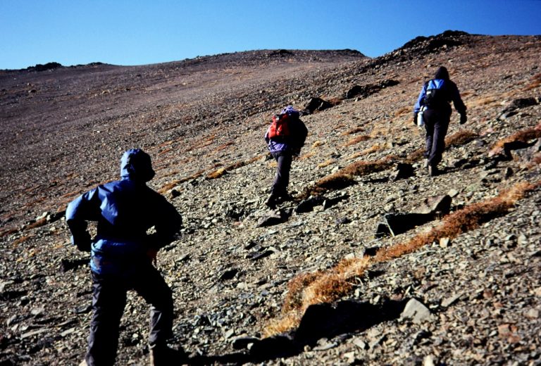
At 12:30pm, I coaxed most of our uninspired and reluctant group to leave camp and hike up to Gardner Meadow and start up the south slope climbing route. None of us (not even me) actually thought we could get more than about halfway to the summit on such a soggy day. To our surprise, the rain stopped and the clouds thinned after about 30 minutes of climbing. Soon after, we saw something that looked like blue sky. When we stumbled into a beautiful little larch-studded basin at 7200 feet, our spirits soared.

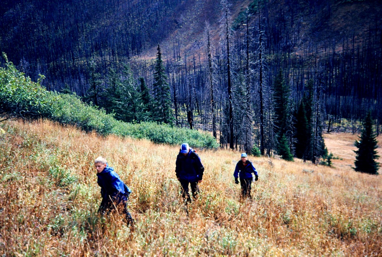
- Hiking Up Thru Gardner Meadow
Suddenly, Matthew spotted a herd of mountain goats emerging from a ravine across the basin! We counted 18 or so, but there seemed to be more just inside the ravine. None of us had ever seen so many goats in one place before. We took this to be an auspicious encounter and continued climbing with a new zeal. A scenic little basin was reached at 7200 feet (a creek emanates from this basin and crosses the trail near the 9-mile point), then Class 2 scree slopes led to a tiny col at 8500 feet.

- Hiking Up South Slope Of Gardner Mtn
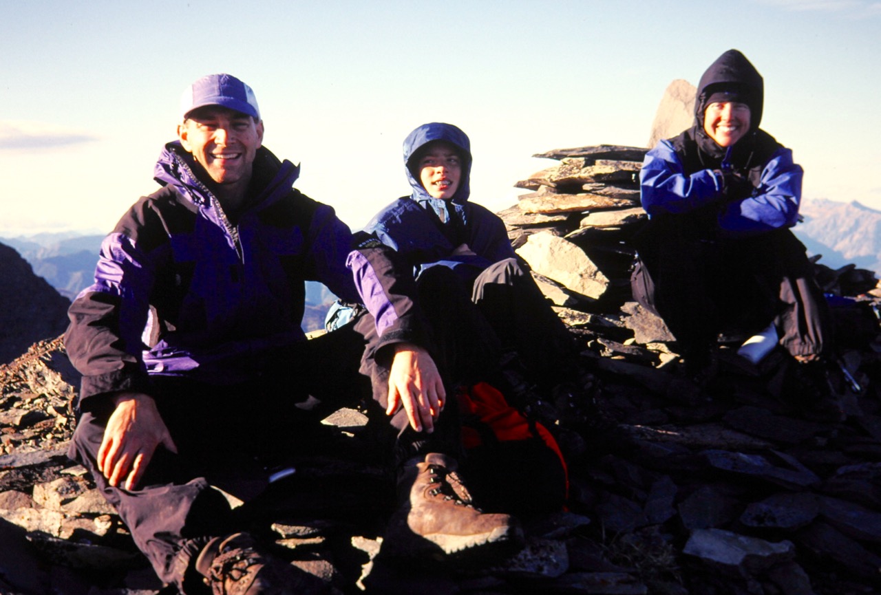
From there, the summit route is merely a Class 1 stroll across tundra-like alpine slopes. The summit (3.3 hours from camp) was being blasted by an arctic gale, but even Matthew, cold and tired as he was, joined us on the summit. Laura was overflowing with joy; the mountain gods had indeed given her a wonderful birthday gift!

- Kevin, Matthew, and Laura On Gardner Mtn Summit

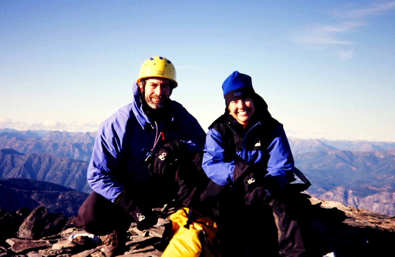
- Jim and Laura On Gardner Mtn Summit
Day 2: Lower Gardner Meadows to Trailhead
Our next day involved pleasant weather and a leisurely hike back out the trailhead (3.4 hours from camp).
Photo Gallery
Click to enlarge…