Trip Report: October 26, 2019
East Mission Gulch Bike Descent: Beehive Junction to Mission Creek Fork
Beehive Ridge
East Mission Gulch
Mission Spring
Mission Creek Fork
Trip Report Summary
Region: Central Washington Cascades
Sub-Region: Lower Wenatchee Mountains
Area: Okanogan–Wenatchee National Forest
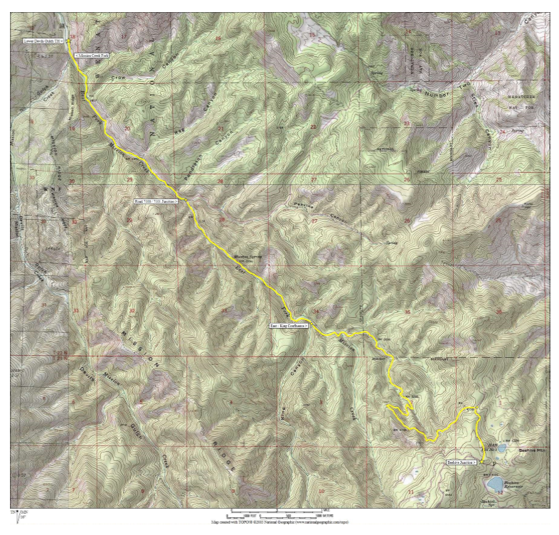
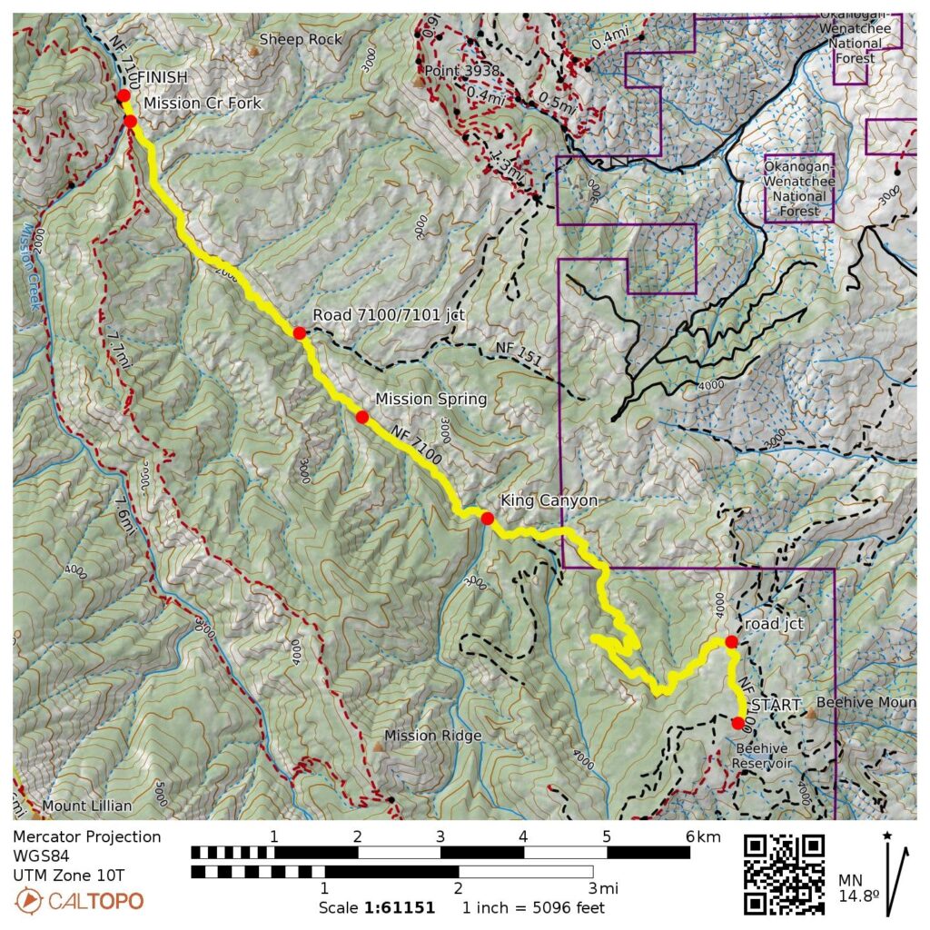
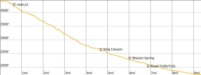
Starting Point: Beehive Junction at Road 9712 / Road 7100 intersection (Elev. 4450 feet)
Way Points: Beehive Ridge & East Fork Mission Creek & East Mission Gulch & King Canyon mouth & Mission Spring & Road 7100 / Road 7101 junction & Mission Creek Fork (bike ride)
Ending Point: Lower Devils Gulch Trailhead on Mission Creek Road (Elev. 1720 feet)
Approximate Stats: 9.5 miles traveled; 80 feet gained; 2800 feet lost; 2.4 hours elapsed.
Related Posts
>>> East Devil Bike Loop: East Mission Gulch to Devils Gulch – October 24, 2019
>>> Red Devil Bike Loop + Devils Gulch – September 24, 2019
>>> Devils Gulch Bike Descent: Beehive Ridge to Mission Creek Fork – October 21, 1989
Trip Overview
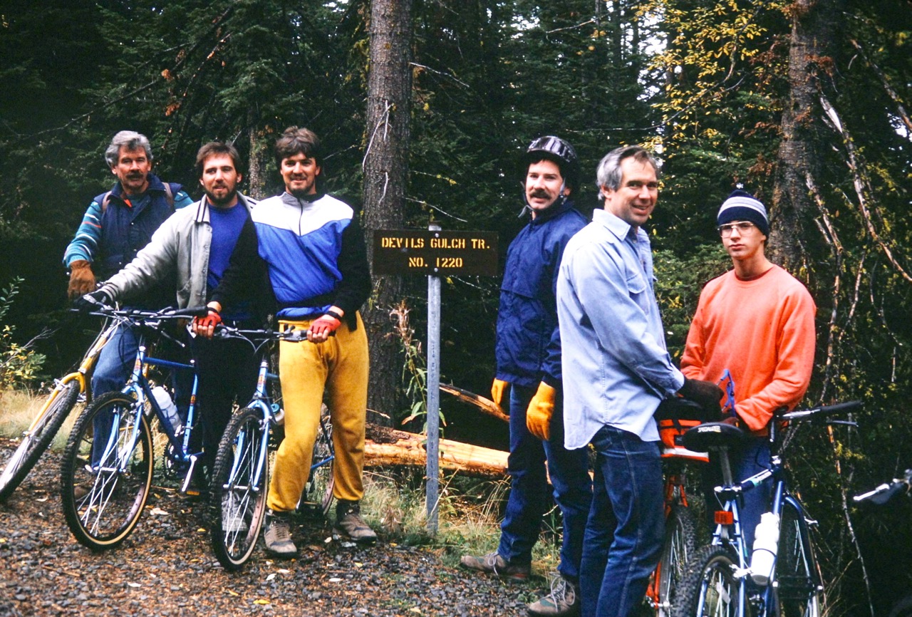
While sorting through my old Kodachrome slides earlier this month, I came across some photos from a family bike descent of Devil’s Gulch in October 1989. We were all riding rigid-frame mountain bikes back then—quite primitive by today’s standards—but that didn’t stop us from having a blast. When I proposed the idea of a 30th anniversary ride to my brothers Keith, Ted, and Brad, they were all in…sort of.
Although my brothers loved the idea of another Devil’s Gulch bike descent, they were very concerned about trail conditions, seeing as how the Wenatchee Mountains had been hit by a freak snowstorm just a few weeks before. A flurry of emails went back and forth between us. What about residual snow? What about mud on steep sideslopes? What about bad creek crossings? We were in a quandary, and it looked as though our trip was off the table.
Two days before our scheduled trip date, I made a reconnaissance ride up East Mission Gulch and down Devil’s Gulch in an effort to break the stalemate. I reported back with bad news: Devil’s Gulch Trail was a mess, with lots of downed trees, forest debris, and mud puddles. But there was good news: East Mission Gulch Trail was in pretty good condition, with just a few downed trees and some reasonable creek crossings. Our route would be different—we wouldn’t actually be repeating our 1989 Devil’s Gulch descent—but we had an acceptable substitute. Besides, the technical difficulty of East Mission Gulch is probably more commensurate with our ages. Now, the brothers really were all in!
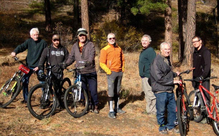
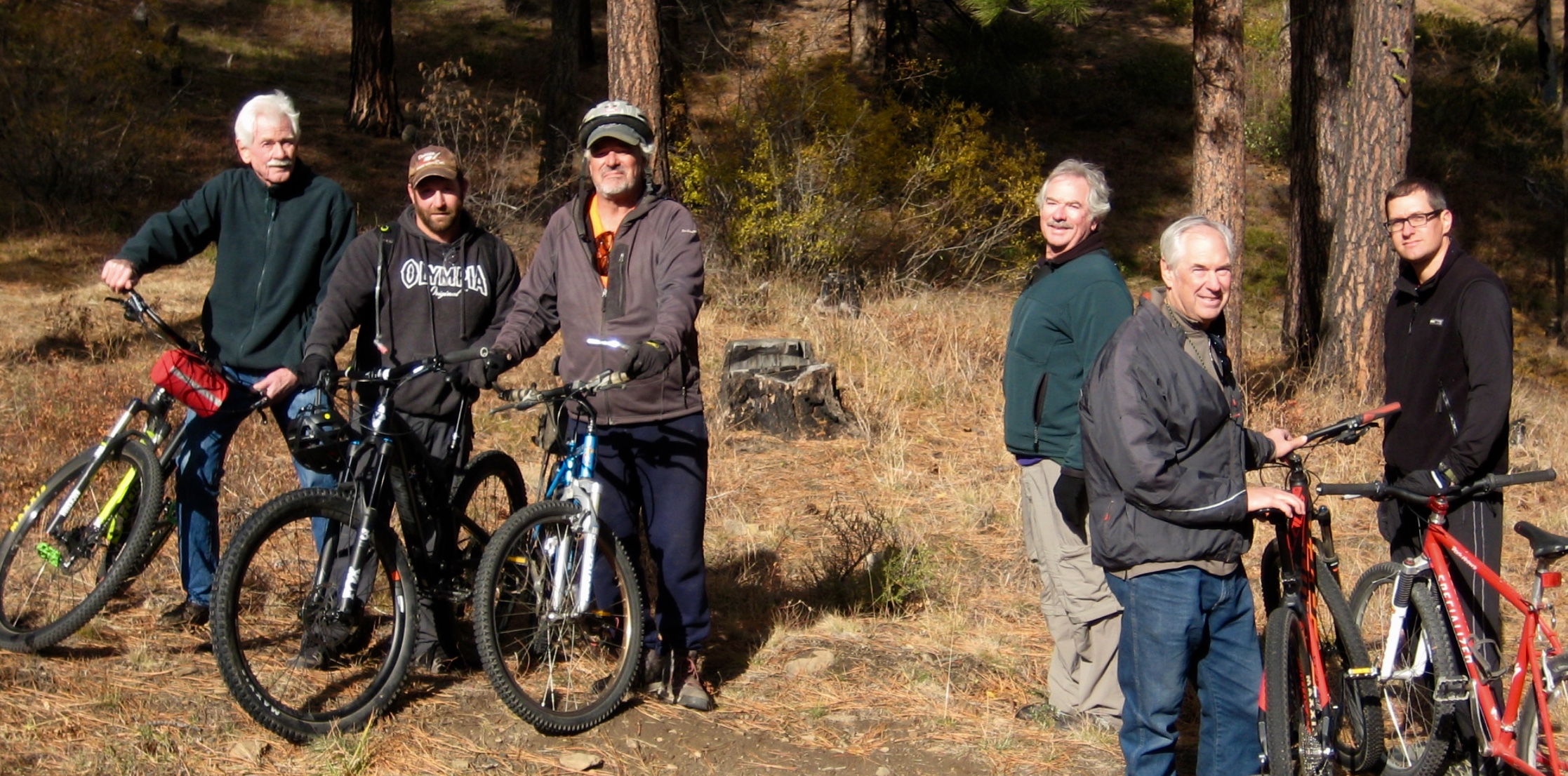
More good news came the night before our trip: nephew Heath and longtime family friend Leonard—both participants in our previous ride—would be joining us. It seemed a bit miraculous that, 30 years after the 1989 event, we had somehow wrangled six of the seven members of our Devil’s Gulch Gang. Furthermore, Leonard invited his friend Justin to stand in for Richard, the only missing member, so we were back up to a full contingent of seven. The East Mission Gulch Gang was ready to ride!
Full Trip Report
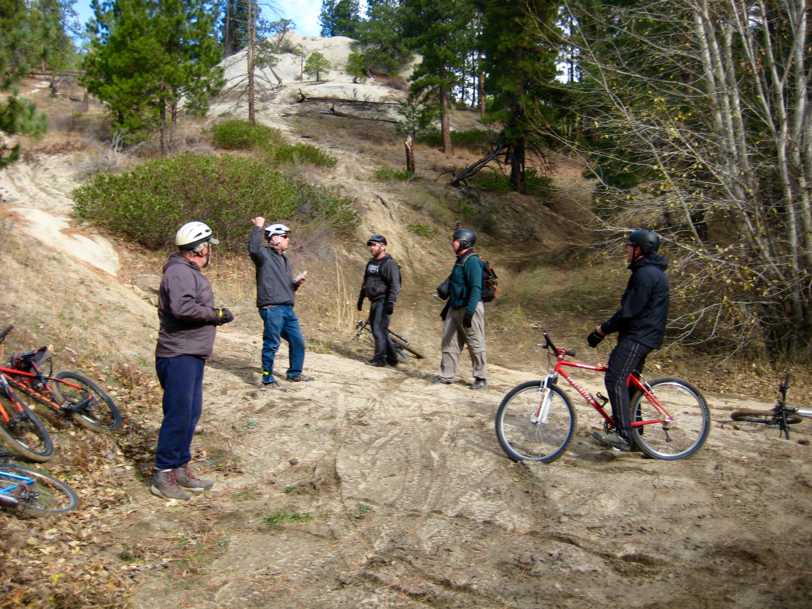
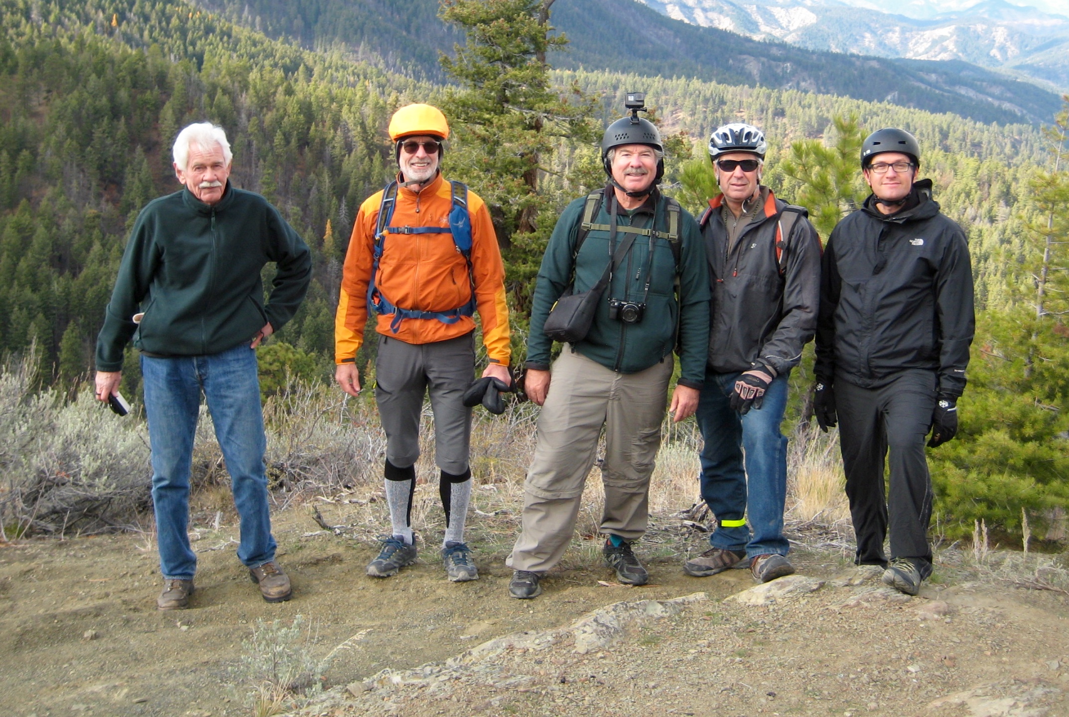
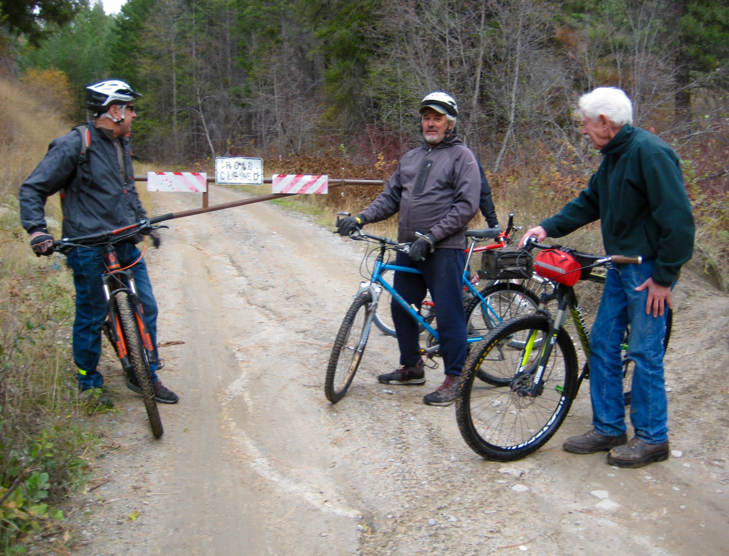
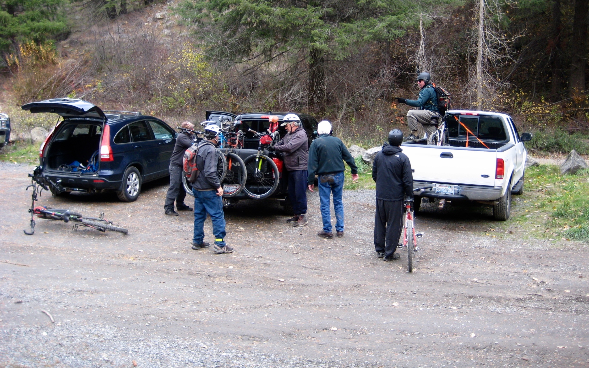
Handling vehicular logistics for a one-way bike ride with seven people is no small task. However, Brad and Leonard quickly devised an effective strategy that involved five vehicles; three vehicles were left at the ending point, and two vehicles were driven to the starting point. It looked complicated to an outside observer but actually worked without a hitch. By noon on a crisp Saturday, we had moved all vehicles into position and were assembled at our starting point near Beehive Junction. Now the East Mission Gulch Gang was ready to ride! Well…almost.
One more critical task remained: we wanted to re-create my 1989 photo of the Devil’s Gulch Gang. This turned out to be more difficult than expected, partly because we were in a different location (the old Devil’s Gulch Trailhead is gone) but mostly because you simply cannot get six untrained people to cooperate in a photo shoot. Nonetheless, it was worth a try. Did we succeed? Look at the old and new photos below and judge for yourself.
Ok, NOW it was finally time to ride! We pedaled a few hundred yards up to Beehive Junction (the intersection of Road 9712 and Road 7100), turned right on Road 7100, and headed down Beehive Ridge.
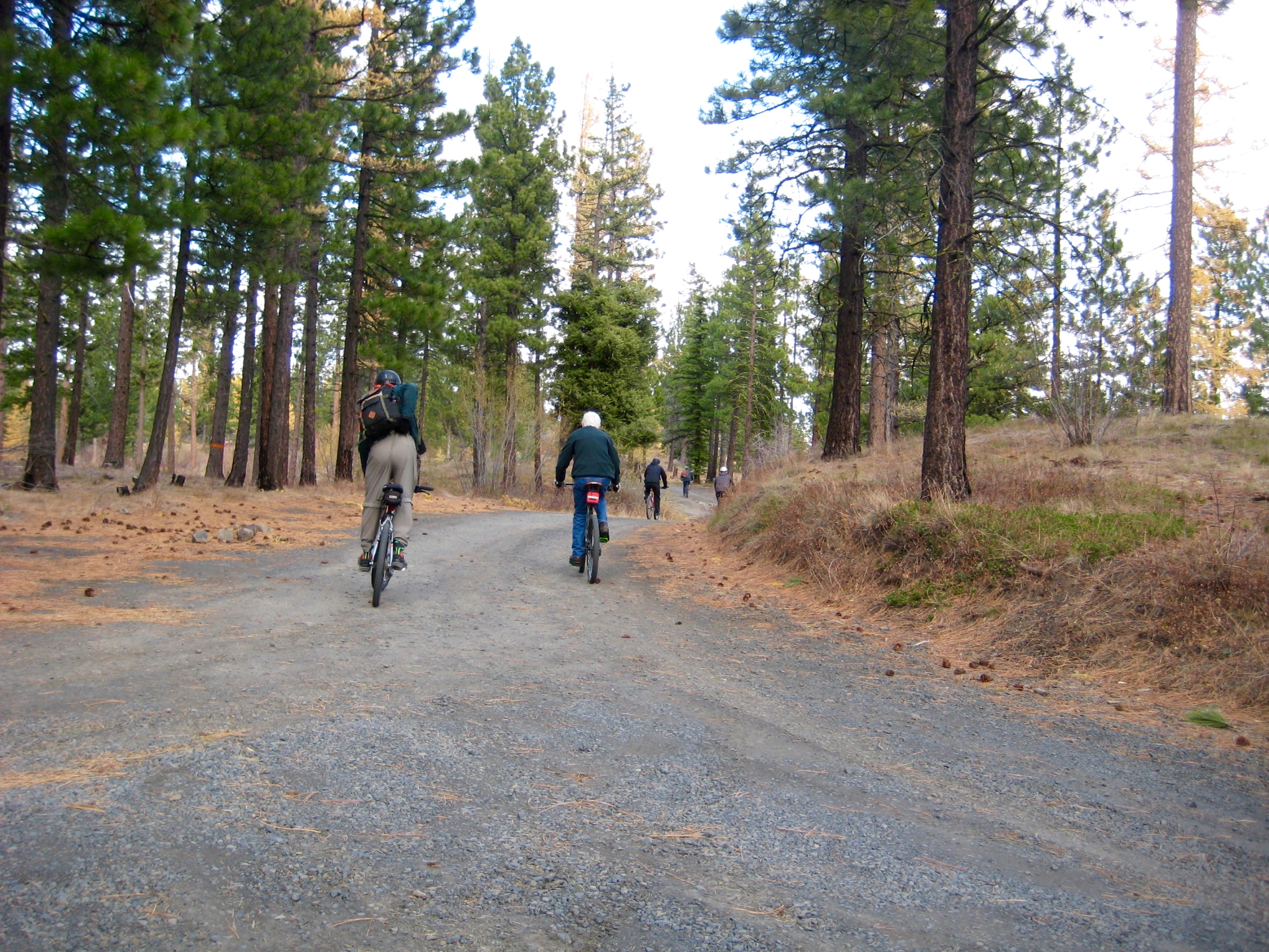
In a short mile from Beehive Junction, Road 7100 makes a sharp left turn and crosses a cattle guard. This marks the upper end of the East Mission Gulch Trail and the start of the real fun.
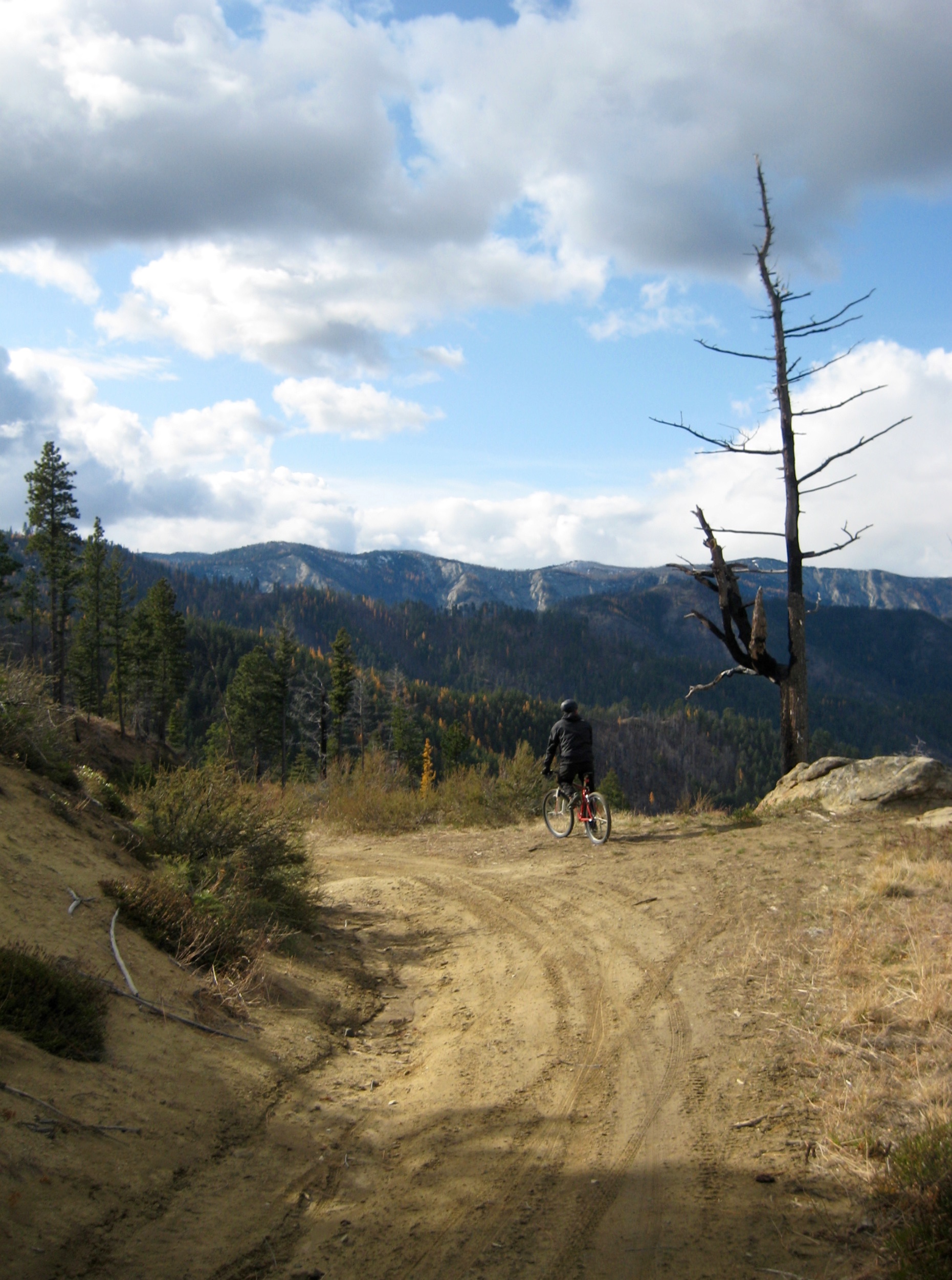
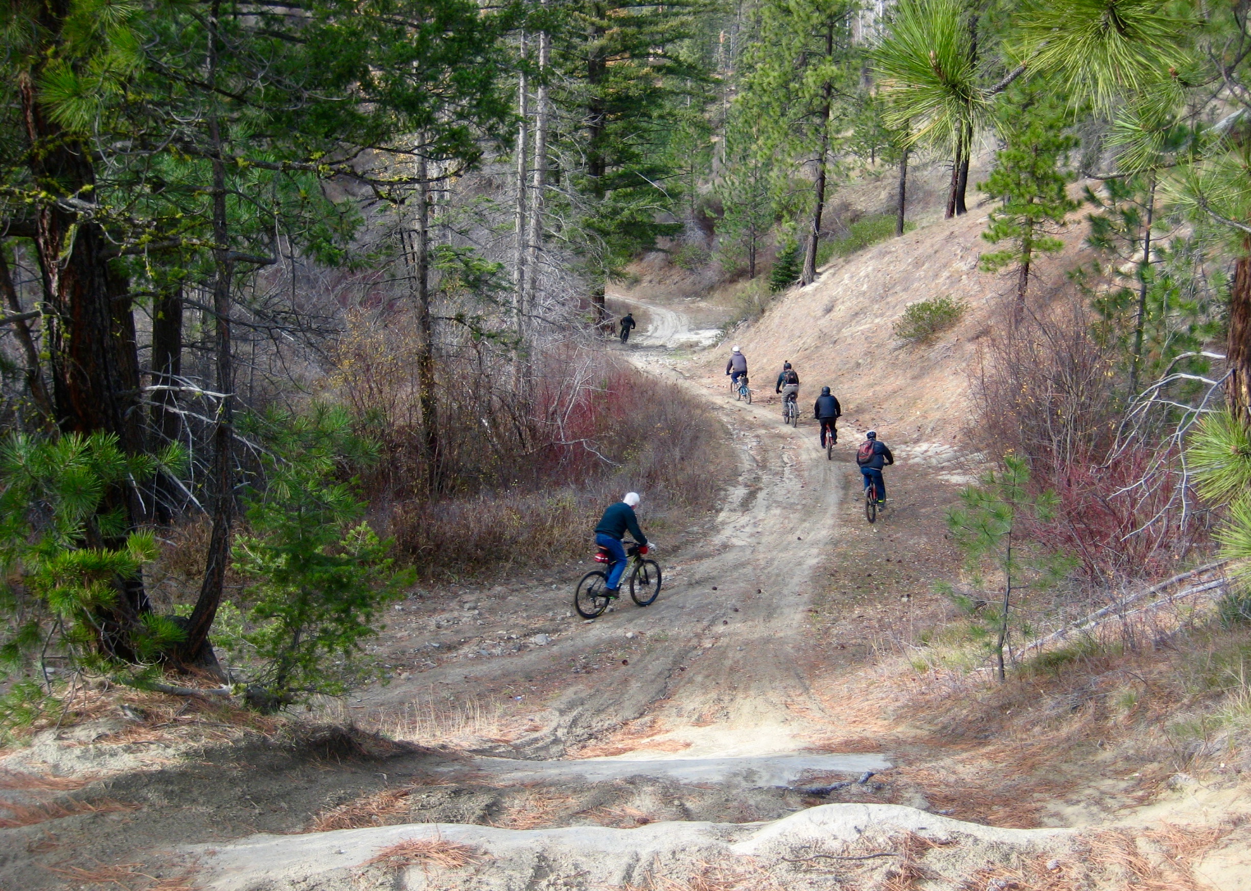
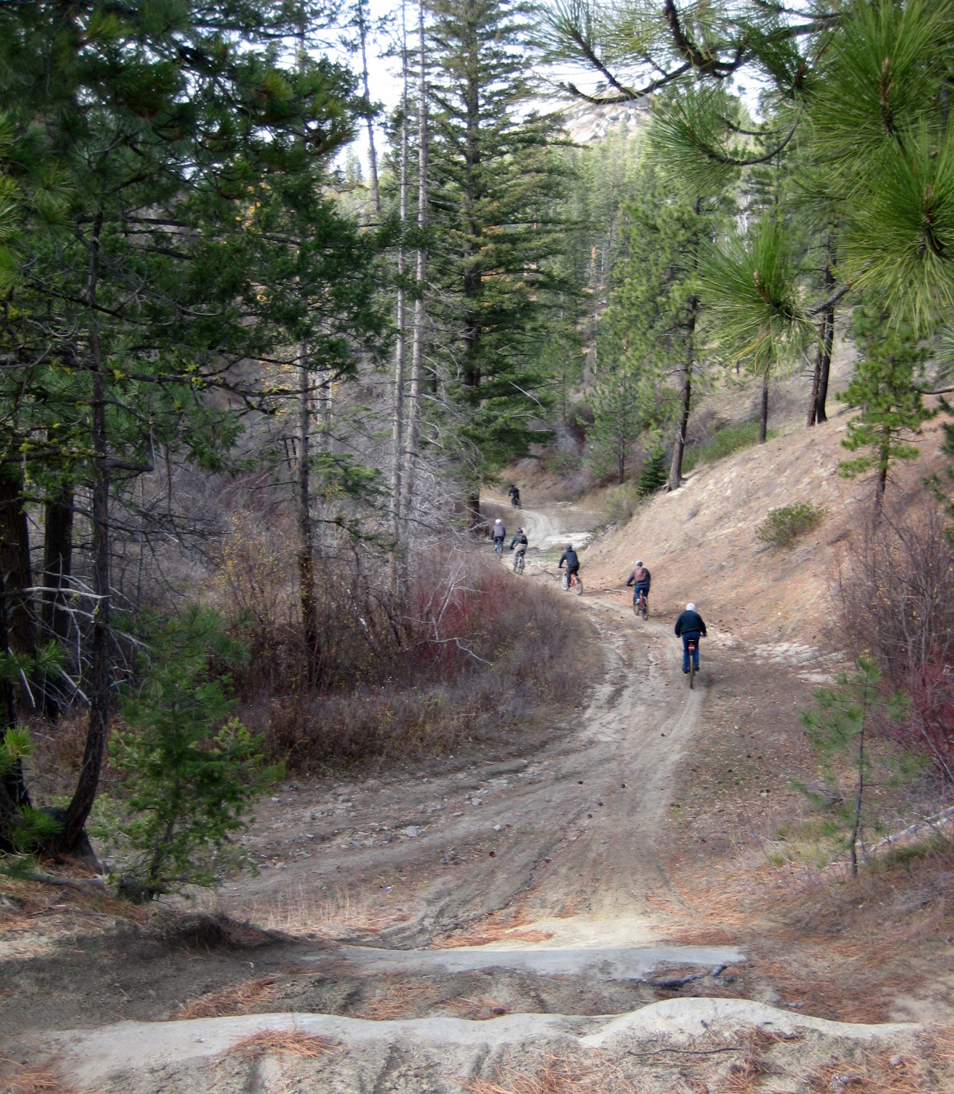
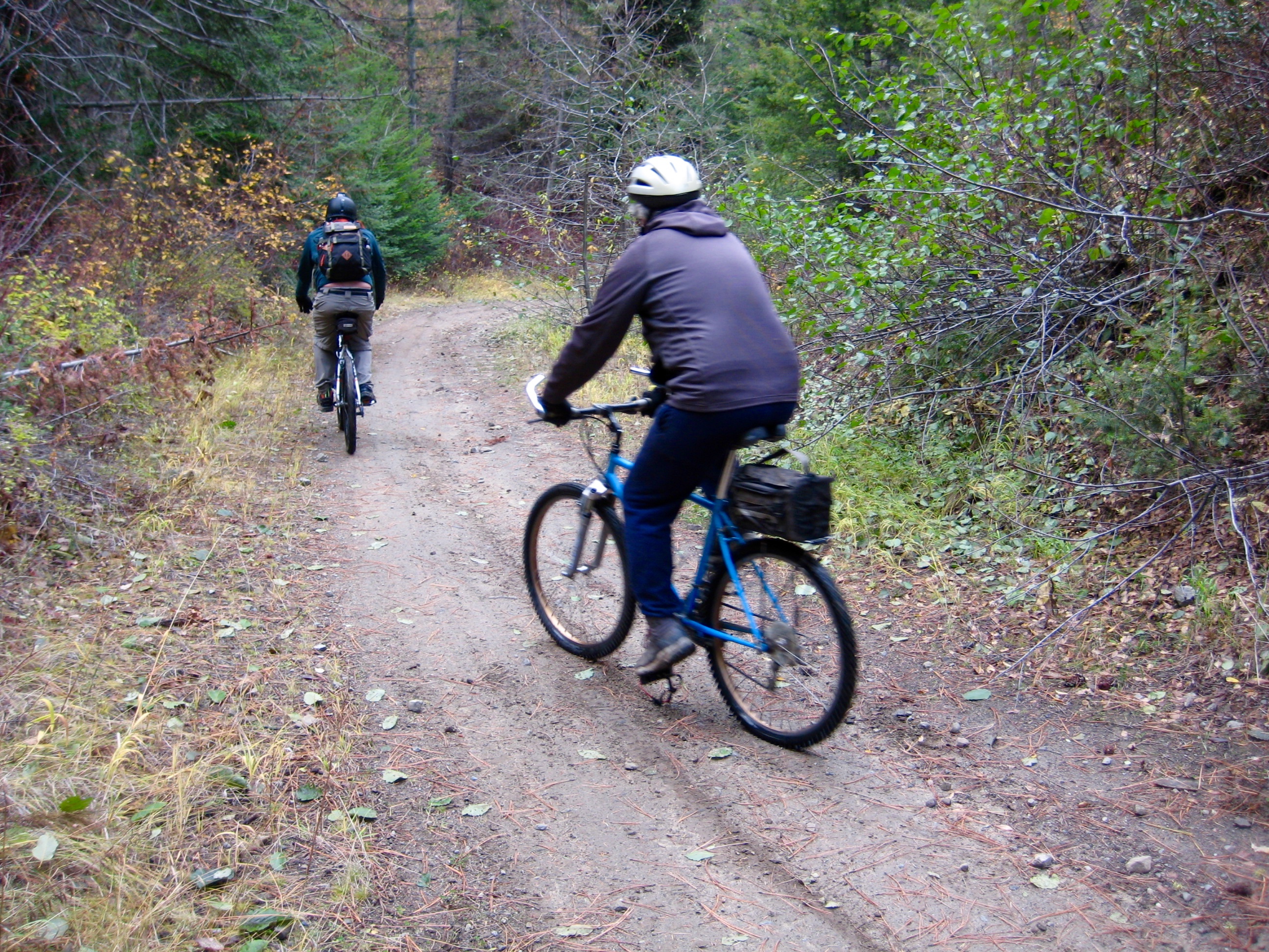
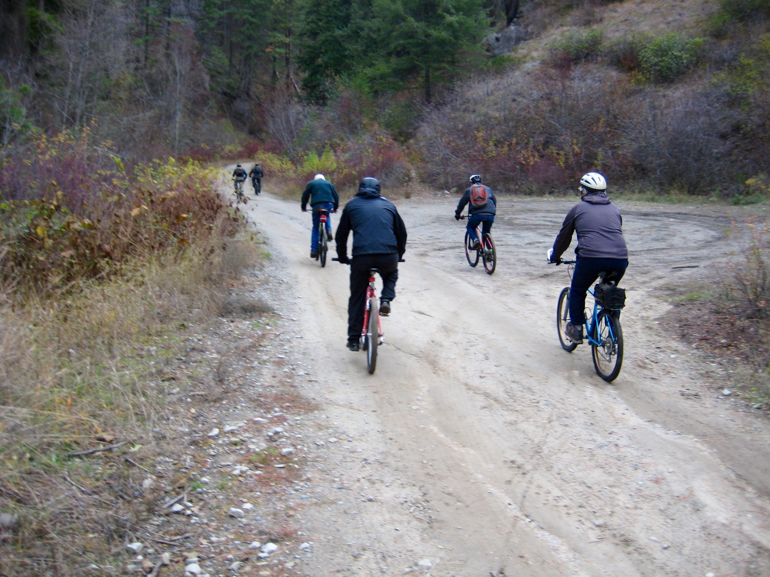
The trail begins with a fast, descending traverse that offers wide-ranging views to the north. Enthusiastic whoops of approval could be heard through the forest.
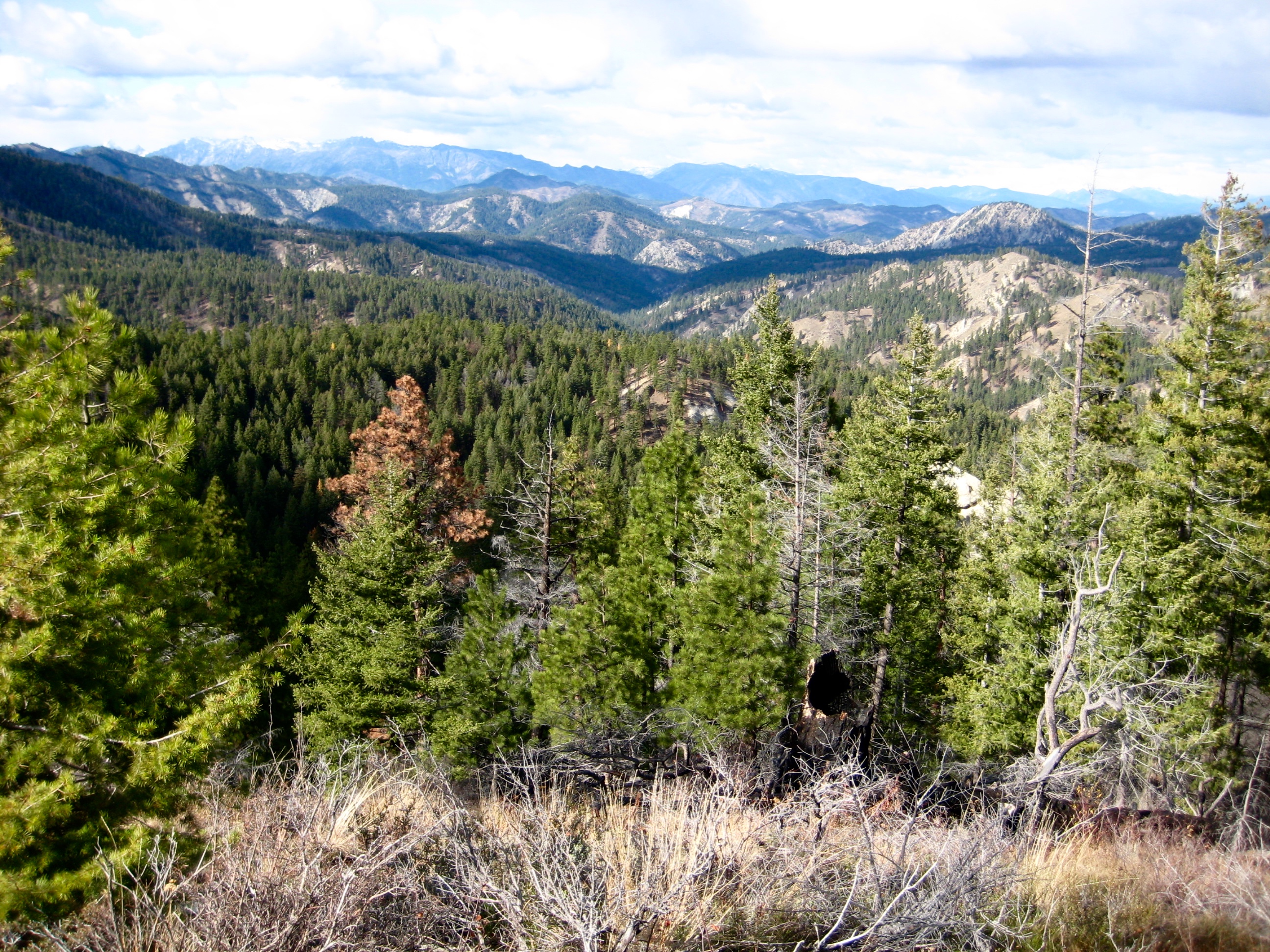
Where the trail crosses a spur ridge about 2 miles down, we stopped at a scenic viewpoint that demanded a family snapshot. CLICK. I couldn’t help but think that they make comedy movies about rag-tag crews like us on adventures like this!
Continuing farther down East Mission Gulch, the trail steepens a bit and works through a series of sharp turns with banked corners. This was probably our favorite part of the ride.
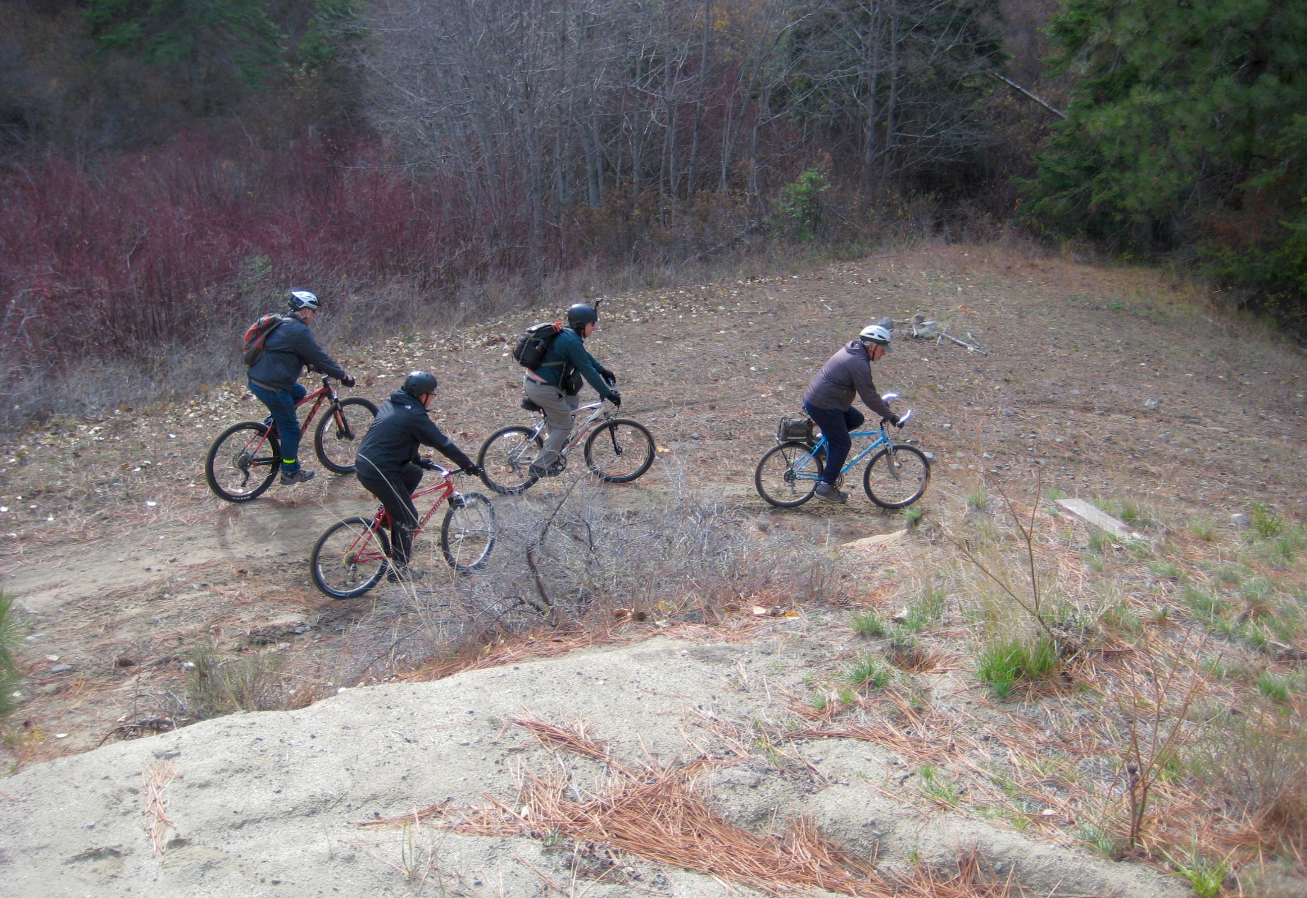
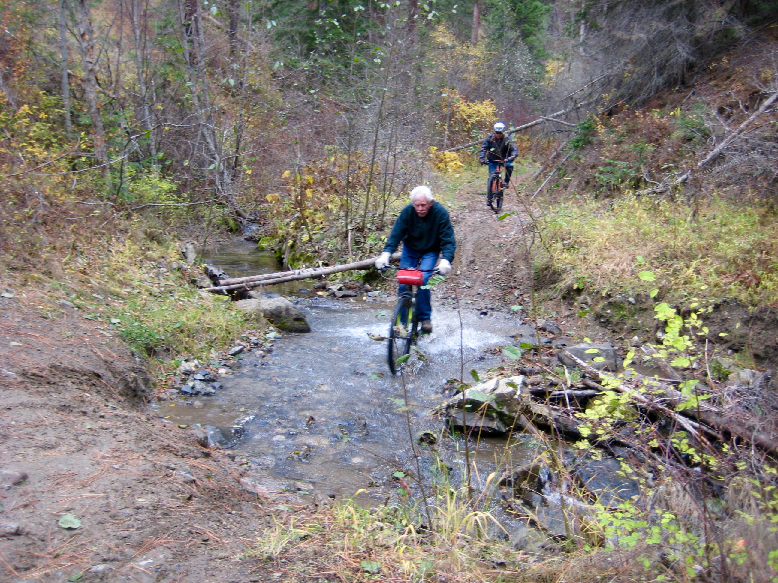
The good times rolled on as our route dropped into the gulch invert and followed East Fork Mission Creek. The trail transitions from double-track to single-track through here.
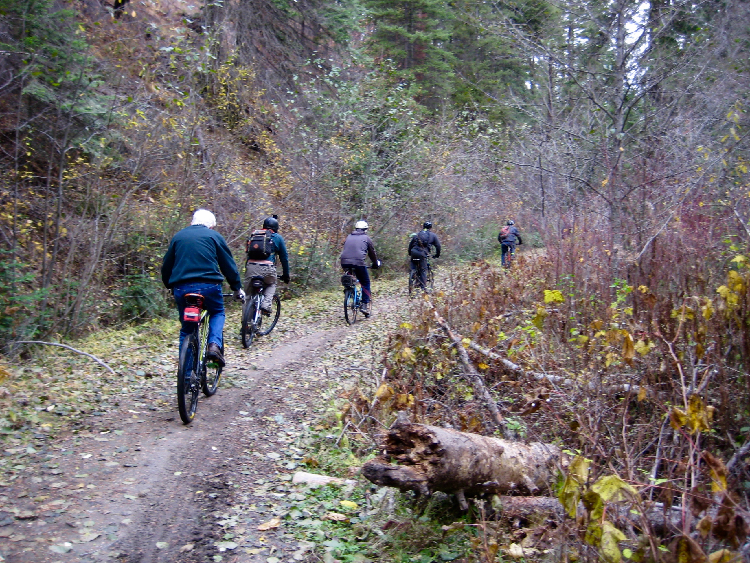
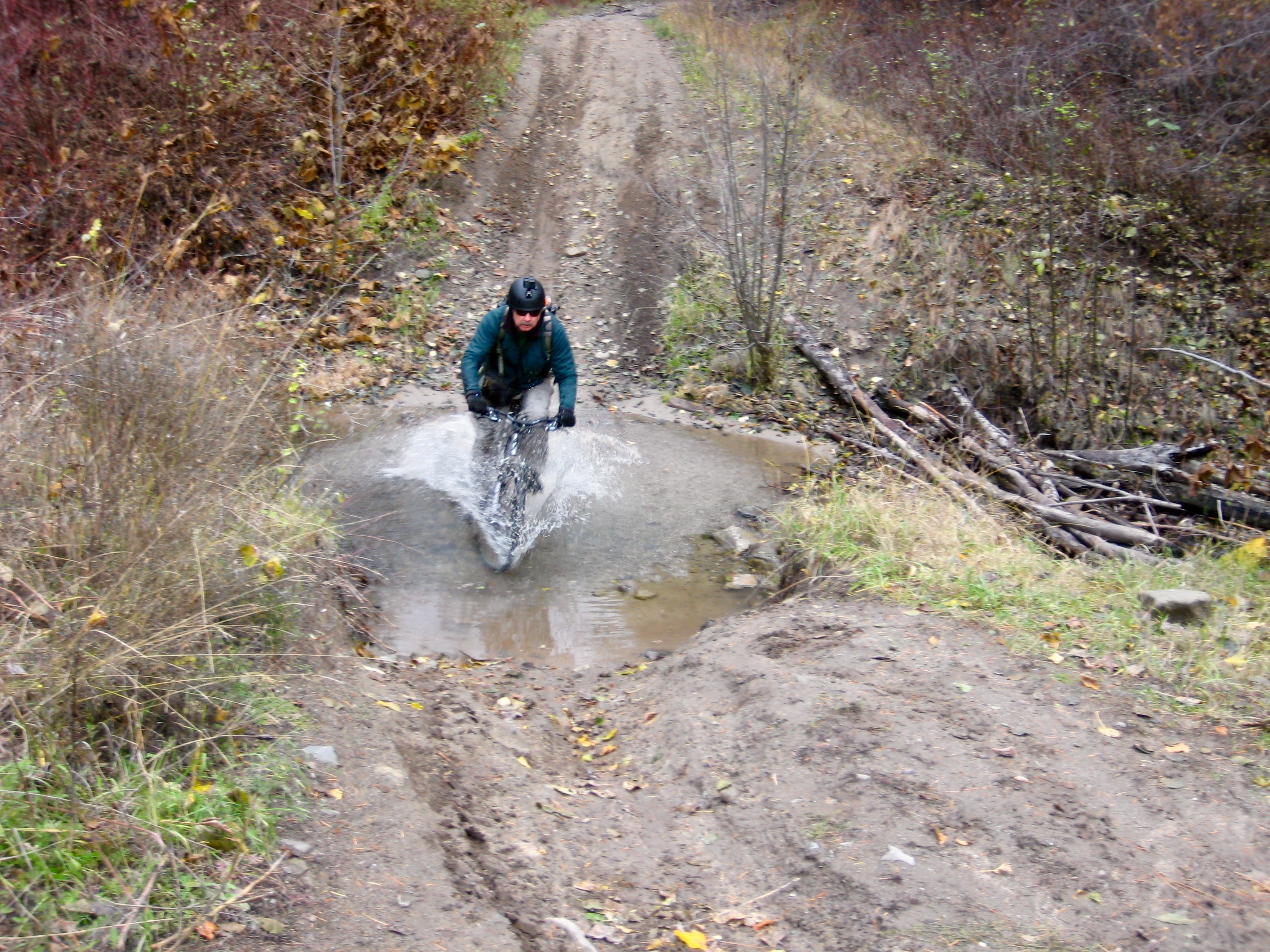
The last 2 miles of trail involves multiple creek crossings. We were able to ride across at most locations, although getting up the opposite bank often proved to be difficult. Yes, there were a few tumbles.
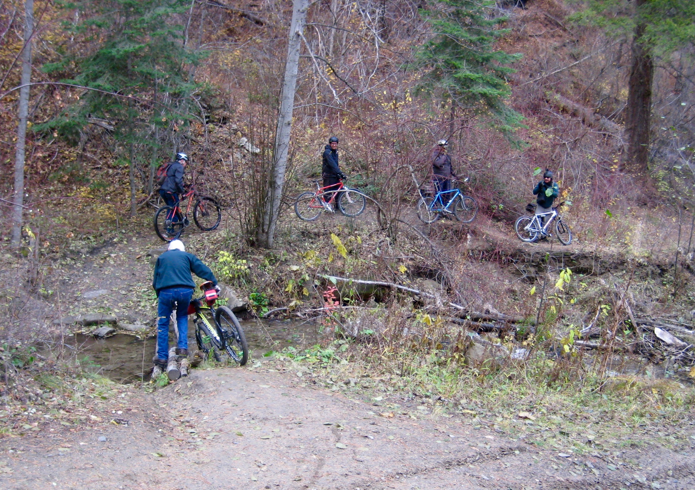
Several creek crossings required delicate rock-hopping or log-walking to keep our feet dry.
Eventually, our trail ended at the Road 7100 / Road 7101 intersection. An injury check here revealed one bruised abdomen, three muddy trouser seats, and seven perma-grins—but no serious casualties.
We then saddled up for the final 2.3-mile ride down Road 7100. This home stretch is wide, silky smooth, and very enjoyable.
All too soon, we rolled into the Lower Devils Gulch Trailhead, ending a fun and successful 30th anniversary “friends & family” bike ride. East Mission Gulch will never match the epic feeling of Devil’s Gulch, but today it was a winning substitute. Even before our bikes were loaded up, Brad was lobbying for a 31st anniversary ride.
Route Maps & Profile
…
…
…
Photo Gallery
Click to enlarge…