Trip Date: September 30 – October 5, 2021
Wallowa Mountains Climbing Trip & Glacier Pass Trail Loop: Frazier Lake to Moccasin Lake
Ice Lake
Matterhorn (9826 ft)
Frazier Lake
Hawkins Pass
Honeymoon Basin
Cusick Mountain (9518 ft)
Glacier Lake
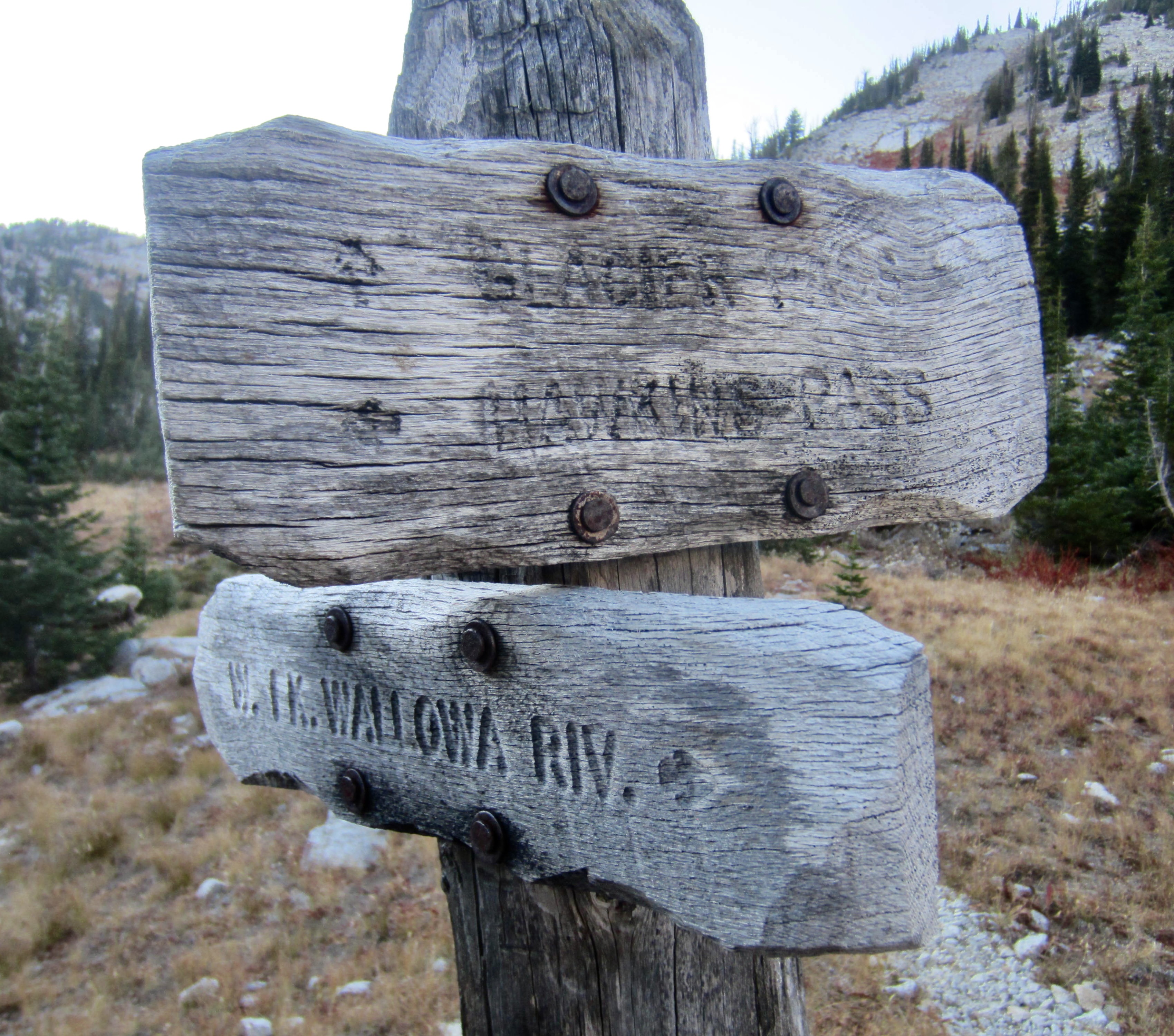
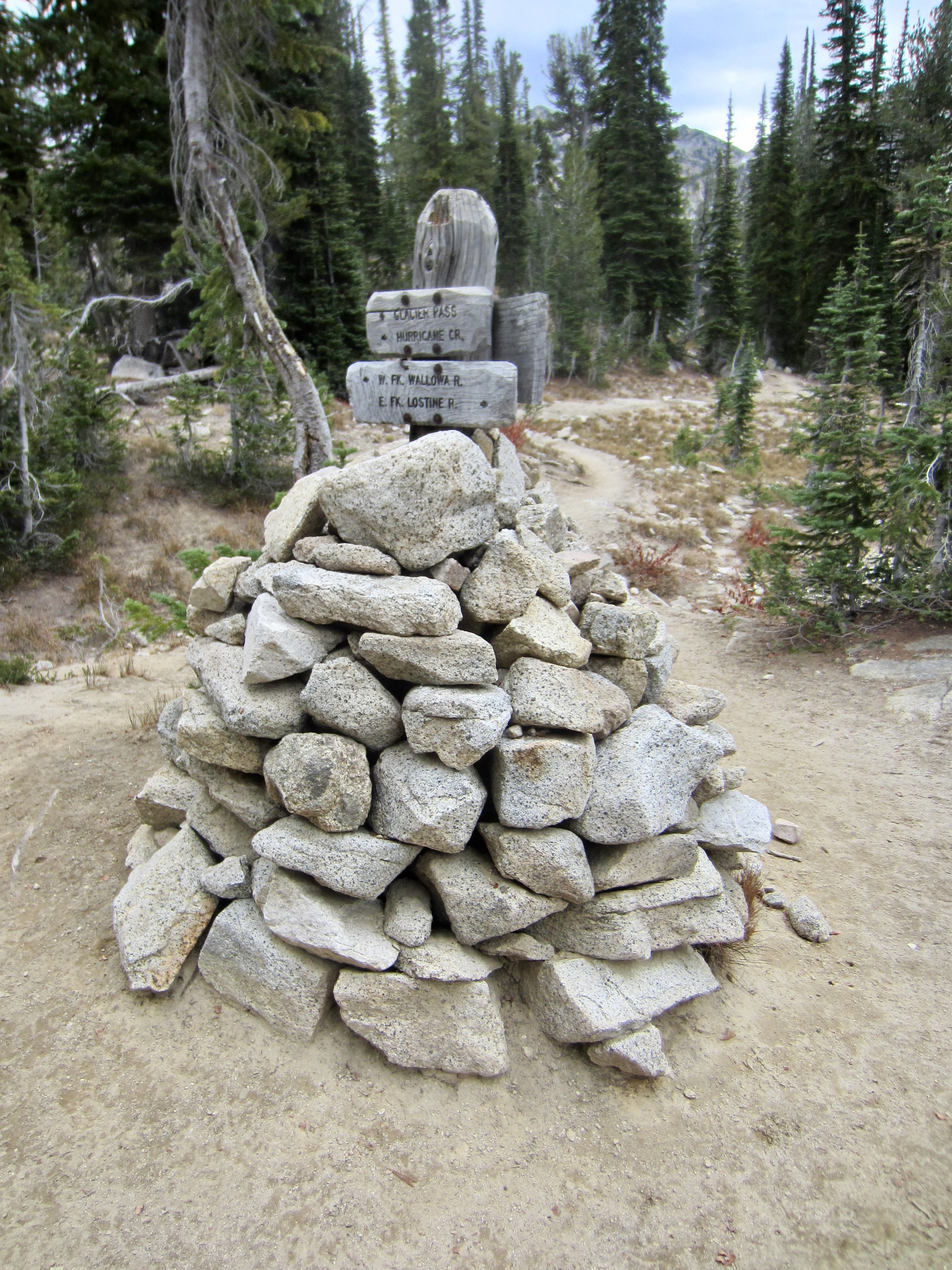
Glacier Pass
Moccasin Lake
Mirror Lake
Eagle Cap (9572 ft)
Douglas Lake
Horseshoe Lake
- Trip Report Summary
- Full Trip Report
- Day 1: Trailhead to Adam Creek Basin
- Day 2: Adam Cr. Basin to Ice Lake Trail Jct. + Matterhorn Summit Climb
- Day 3: Ice Lake Trail Jct. to Frazier Lake + Hawkins Pass Sidetrip
- Day 4: Frazier Lake to Glacier Lake + Cusick Mtn. Summit Climb
- Day 5: Glacier Lake to Moccasin Lake + Eagle Cap Summit Hike
- Day 6: Moccasin Lake to Trailhead
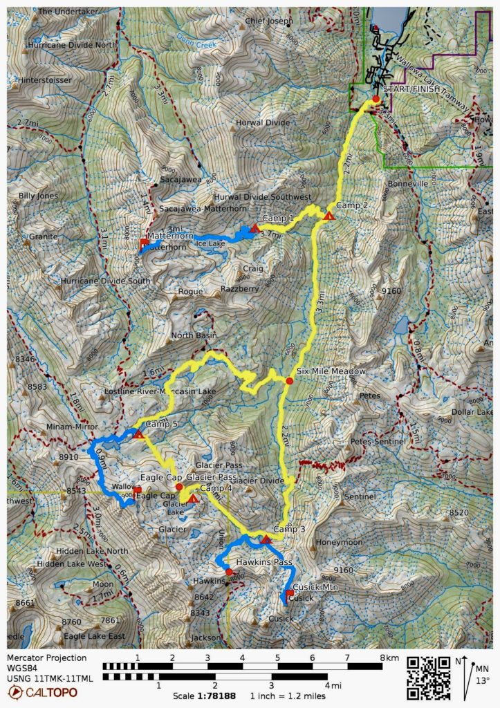
- Route Maps & Profile
- Photo Gallery
Trip Report Summary
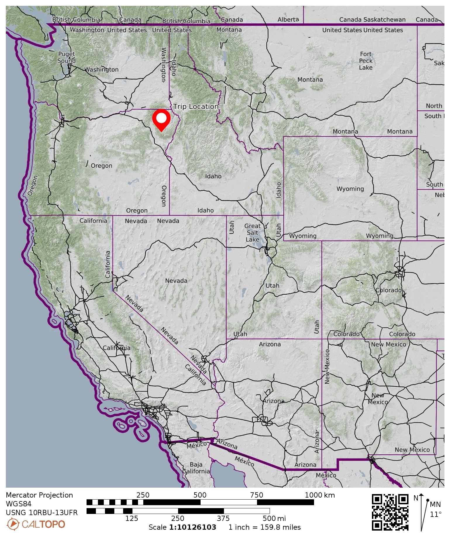
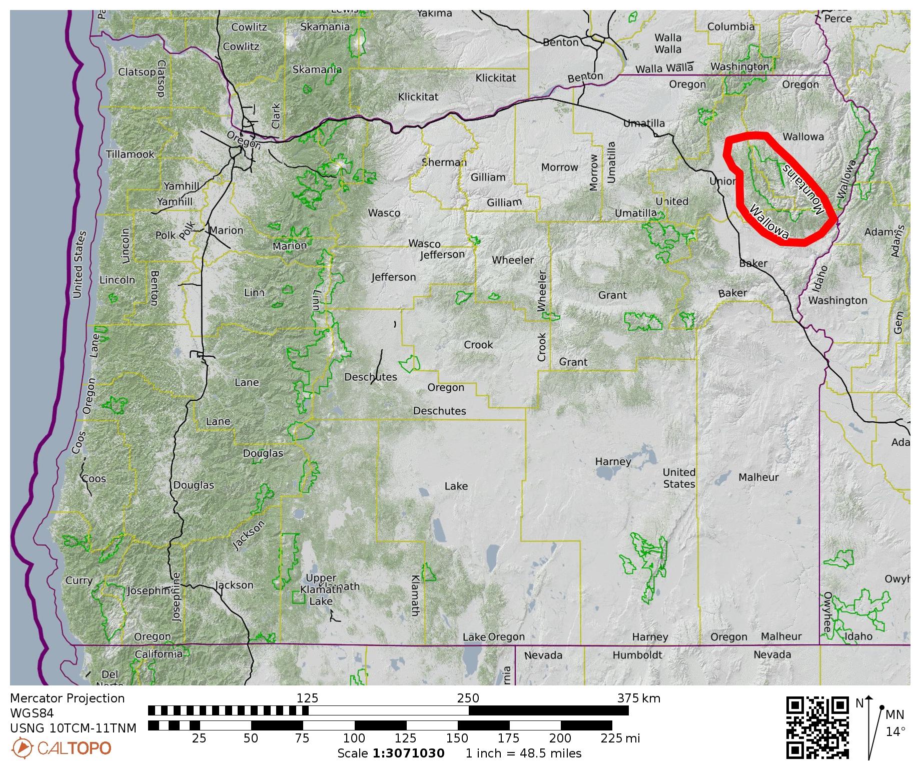
Region: Oregon
Sub-Region: Northeastern Oregon
Sub-Sub-Region: Wallowa Mountains
Area: Eagle Cap Wilderness
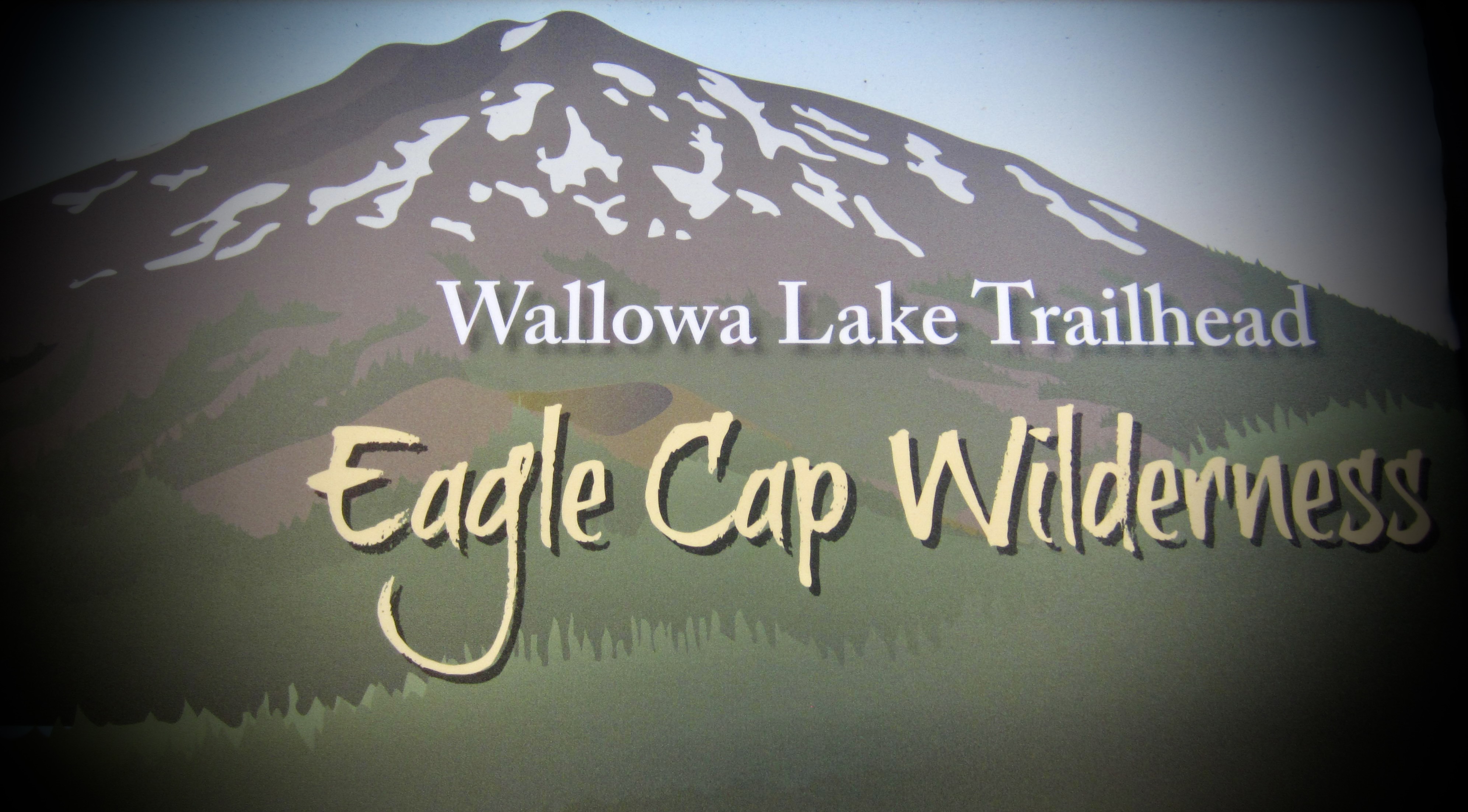
Starting & Ending Point: Wallowa Lake Trailhead at end of Wallowa Lake Highway #351 (Elev. 4650 feet)
Way Points: West Fork Wallowa River & Ice Lake Trail junction & Adam Creek & Adam Creek Basin & West Fork Wallowa River Trail junction & Six Mile Meadow & Frazier Lake & Glacier Lake & Glacier Pass & Moccasin Lake & Douglas Lake & Lee Lake & Horseshoe Lake & Lake Creek & Six Mile Meadow (trail hike)
High Point: Glacier Pass (Elev. 8550 feet)
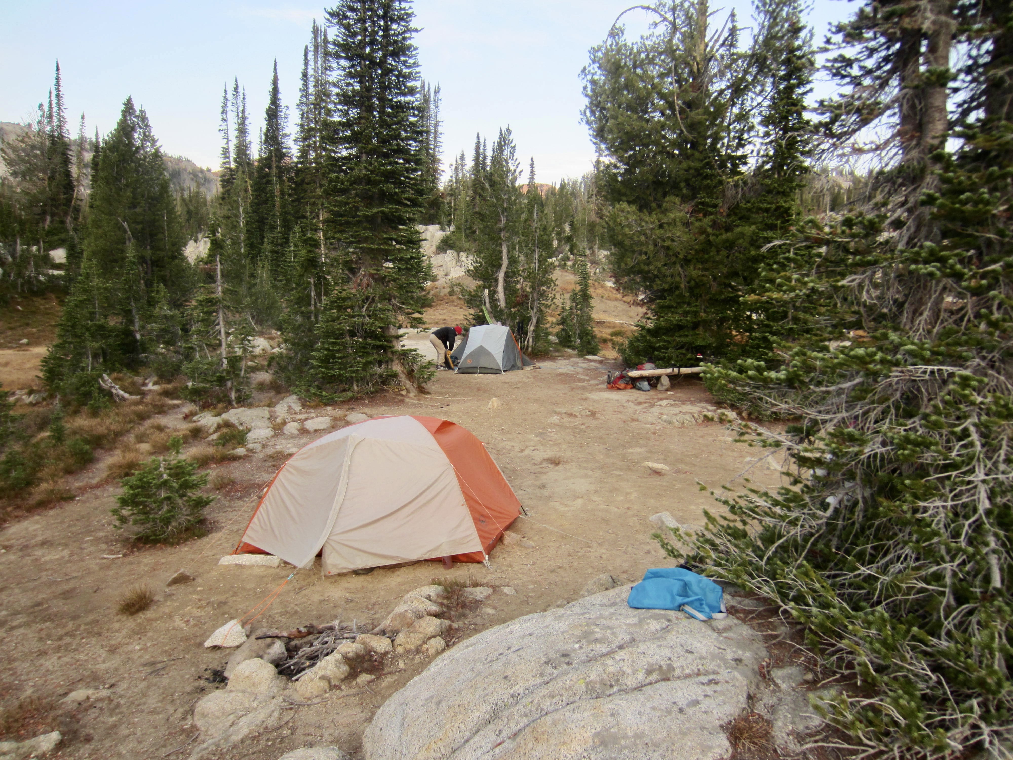
Campsites: Adam Creek Basin & Ice Lake Trail junction & Frazier Lake & Glacier Lake & Moccasin Lake
Sidetrip: Ice Lake & Matterhorn summit (trail hike & off-trail hike & rock scramble)
Summit: Matterhorn (off-trail hike & rock scramble via East Slope—East Ridge)
Sidetrip: South Frazier Lake & Little Frazier Lake & Hawkins Pass (trail hike)
Sidetrip: Honeymoon Basin & Cusick Mountain summit (off-trail hike & rock scramble)
Summit: Cusick Mountain (rock scramble via North Rib—Upper Northwest Ridge)
Sidetrip: Mirror Lake & Upper Lake & Horton Pass Meadows & Eagle Cap summit (trail hike)
Summit: Eagle Cap (trail hike via Northwest Ridge—Upper West Slope)
Approximate Stats (excluding sidetrips): 32.5 miles traveled; 5900 feet gained & lost.
Approximate Stats (including sidetrips): 53.0 miles traveled; 14,700 feet gained & lost.
…
Full Trip Report
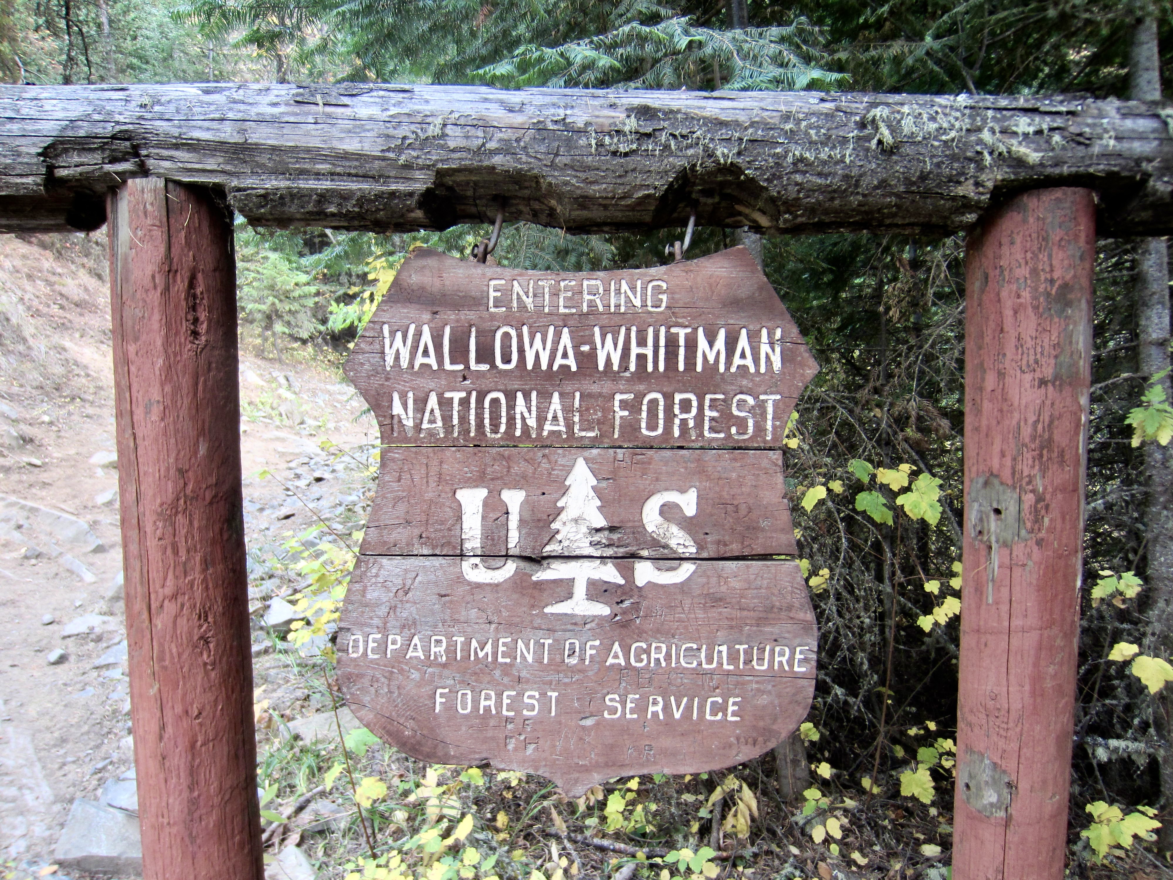
Eileen and I joined Steve and Deb for an early-autumn backpacking trek through the Wallowa Mountains of northeastern Oregon. Over the course of six days, we managed to tuck in three major peaks and a dozen beautiful lakes—all contained within a fascinating geological terrane of limestone, basalt, and granite. In addition, we were finally able to resolve a long-burning mystery: “Are the Wallowas included within the Pacific Northwest’s beloved alpine-larch belt?” The short answer is a decisive, “Well…sort of.” The slightly longer answer is that the true alpine larch, or Lyall’s larch (Larix lyallii), does not naturally exist anywhere in Oregon; however, the more-common western larch (Larix occidentalis) does grow at high elevations throughout the Wallowas.
Day 1: Trailhead to Adam Creek Basin
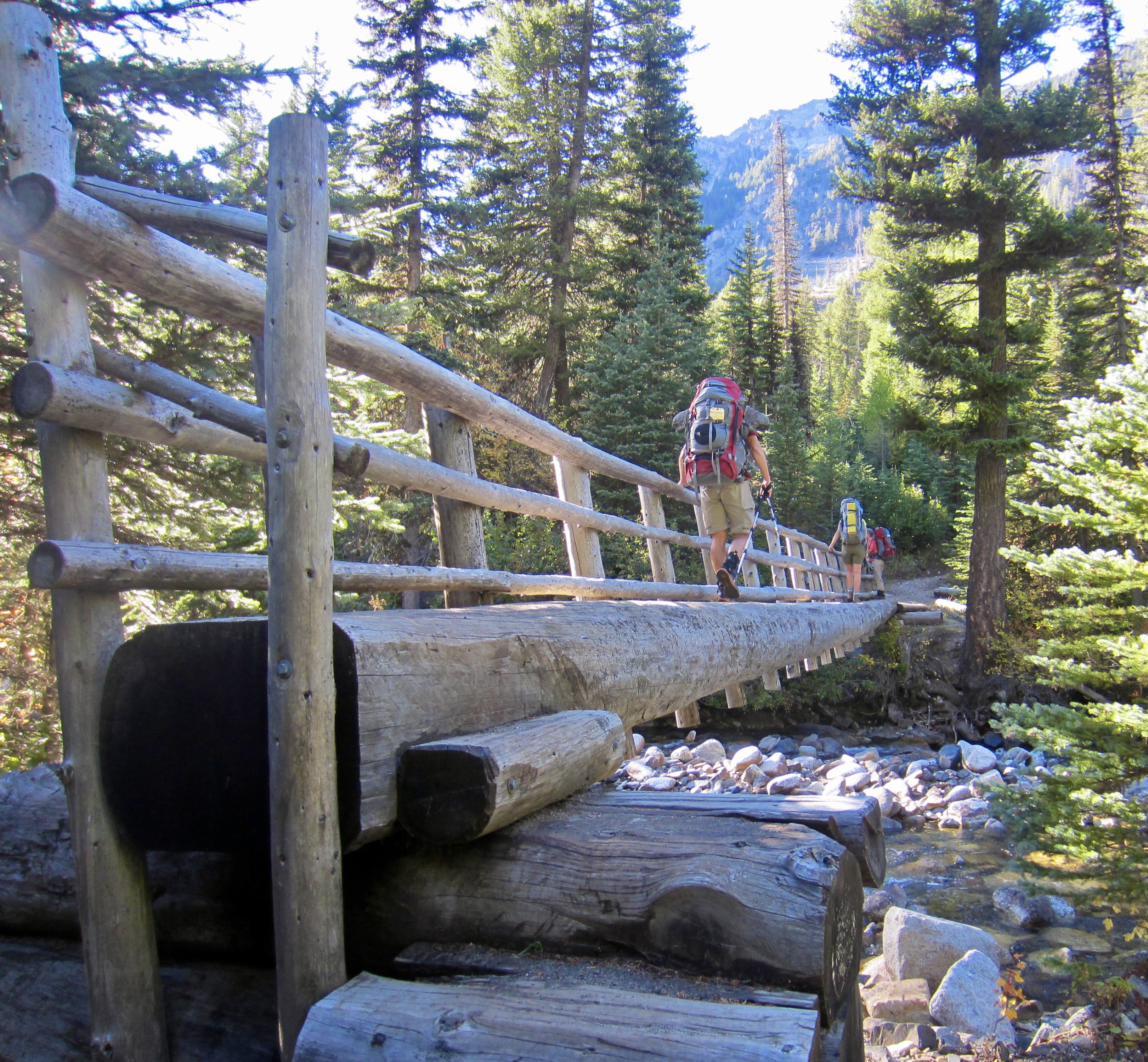
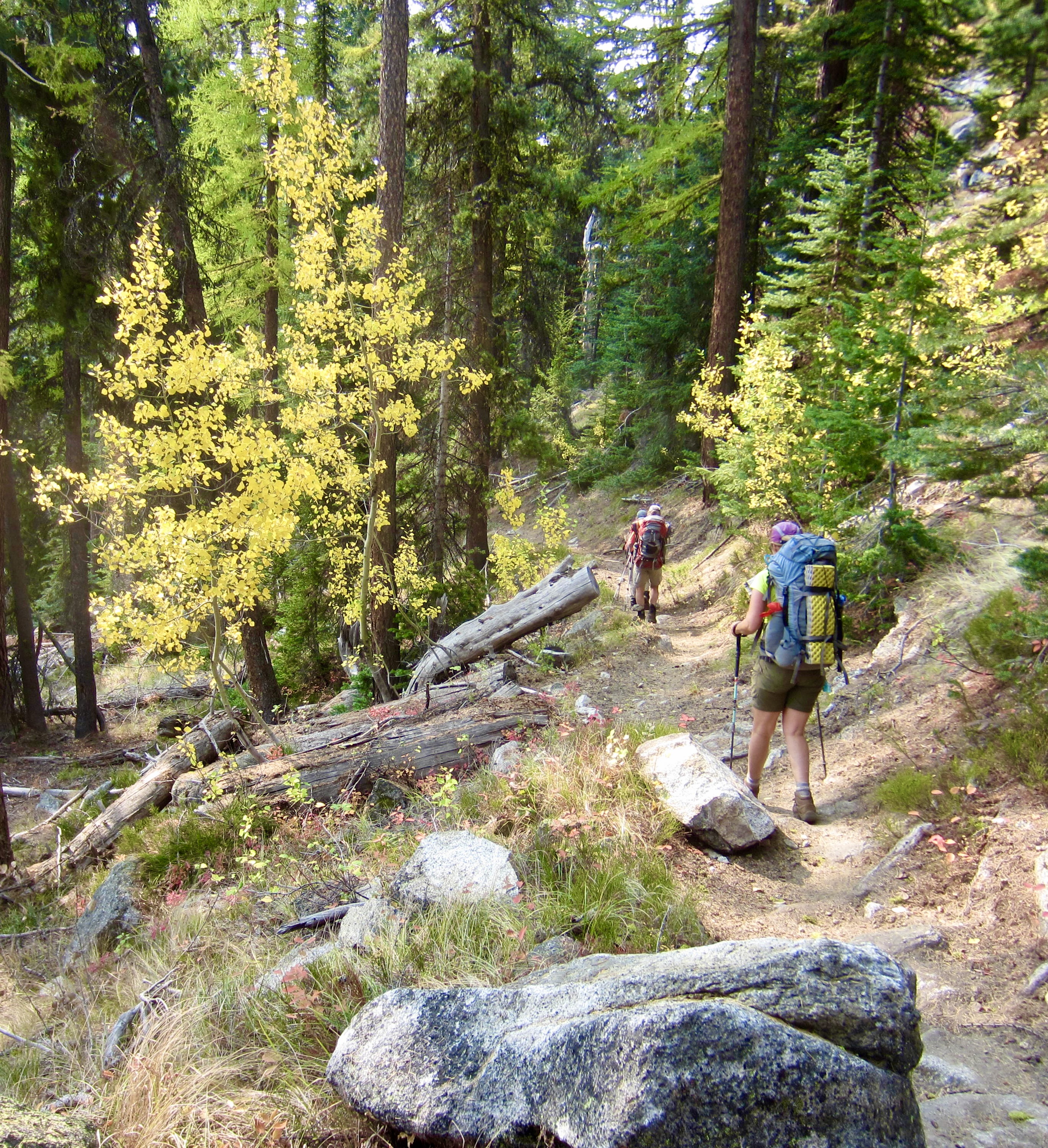
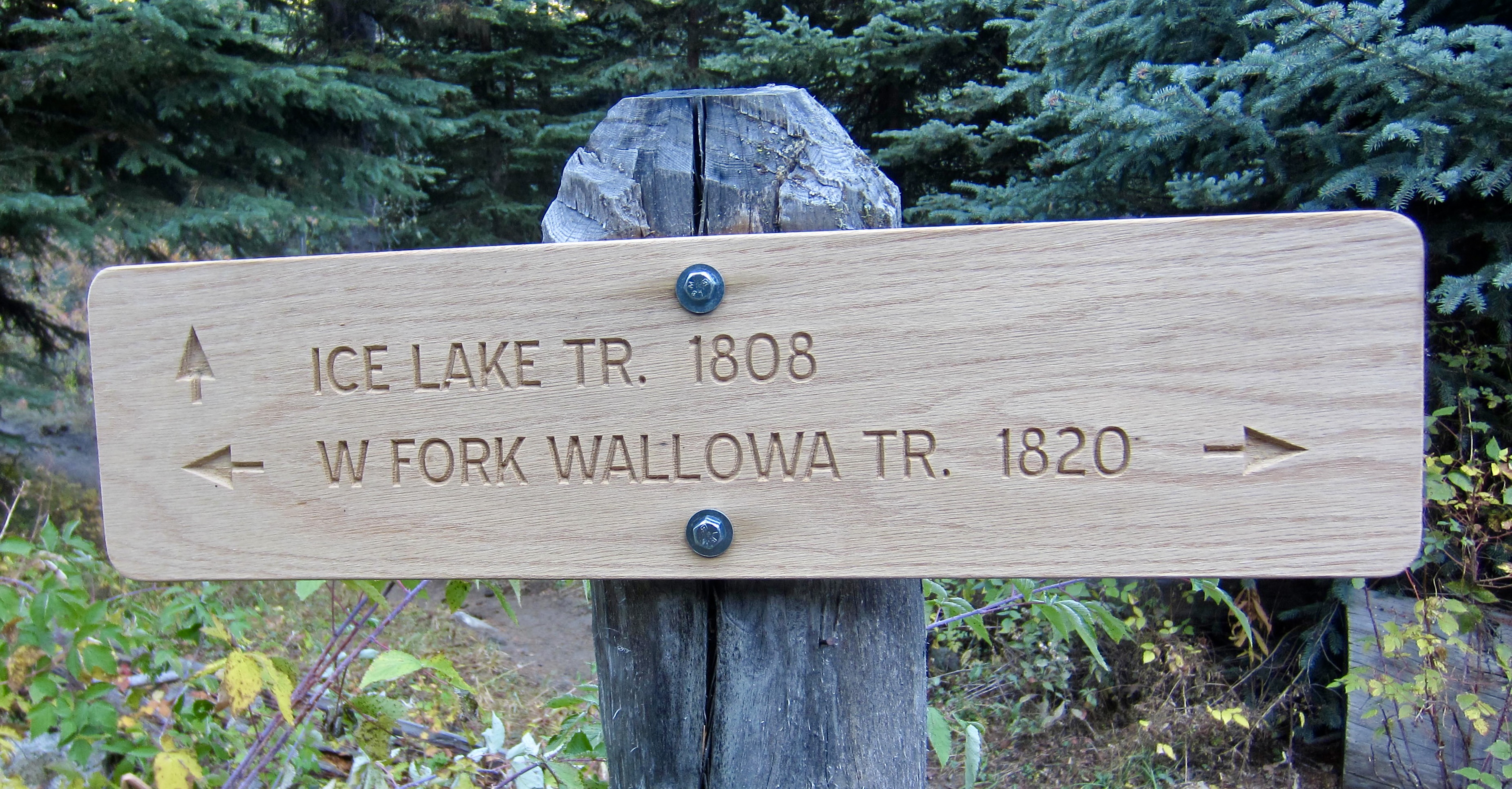
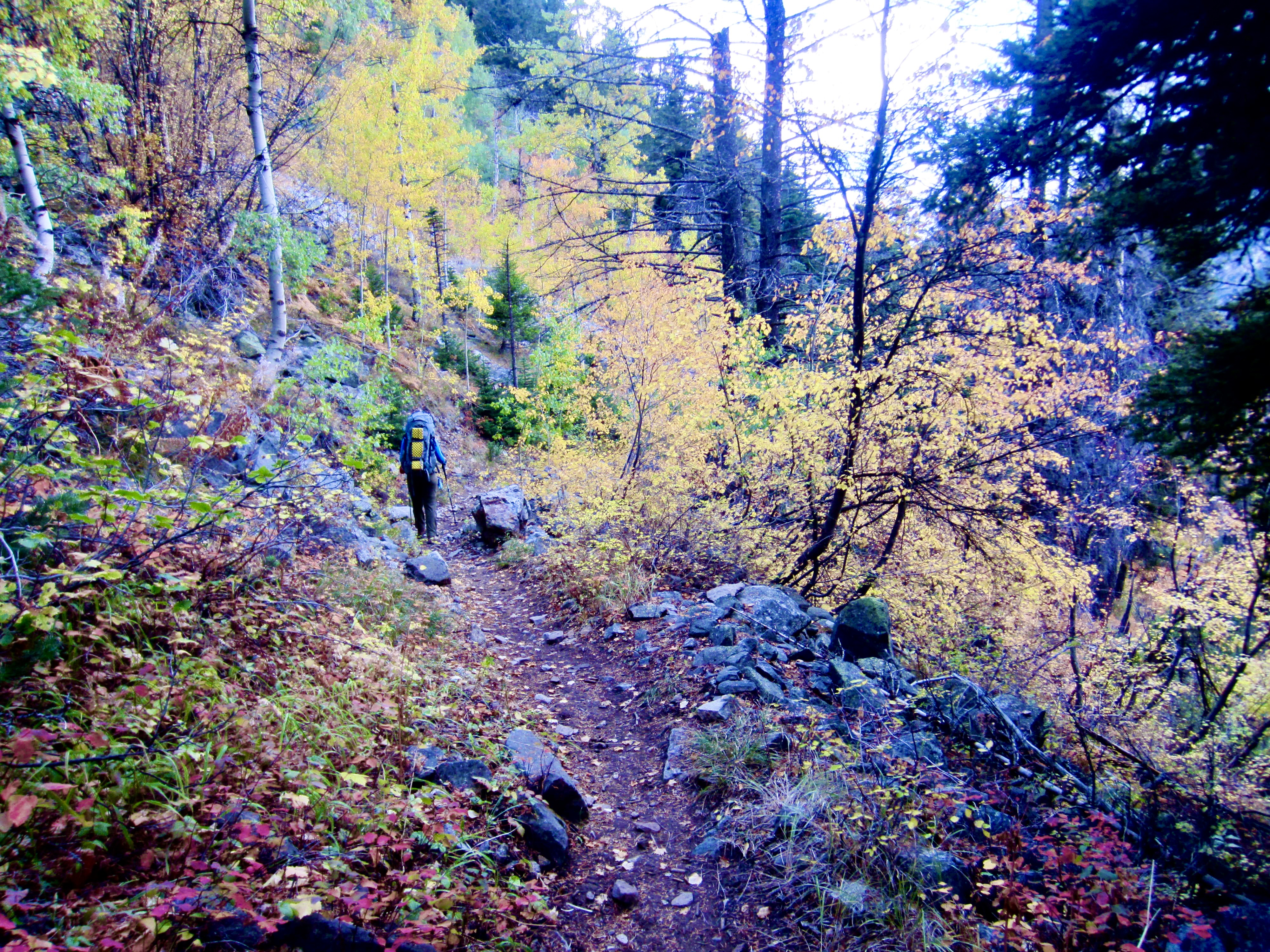
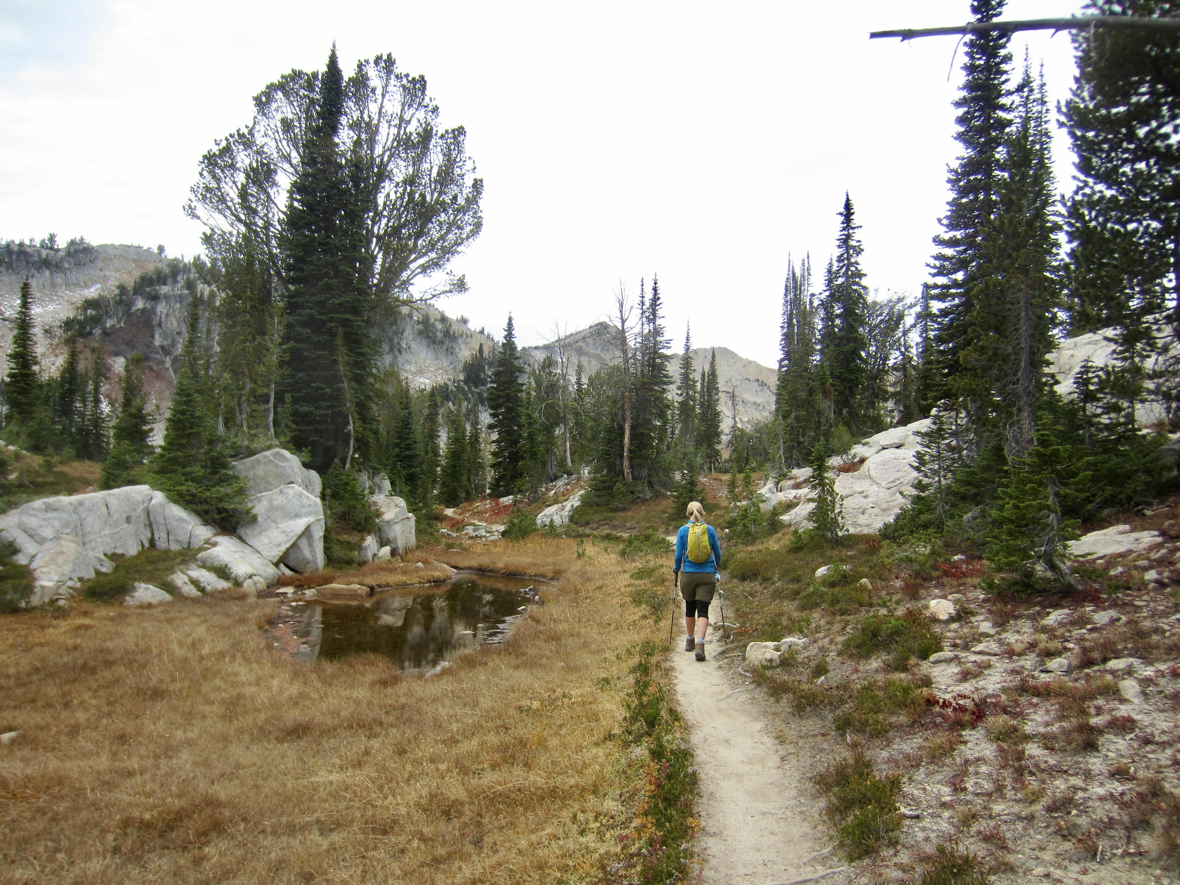
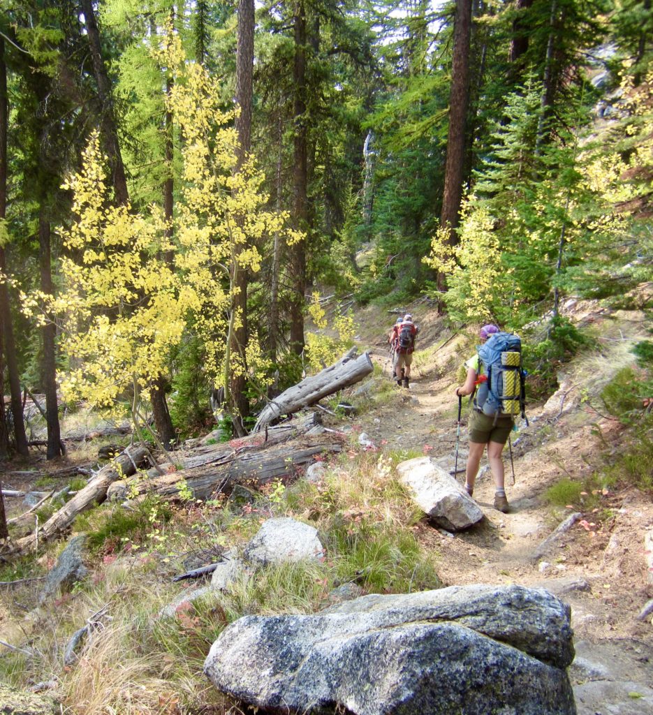
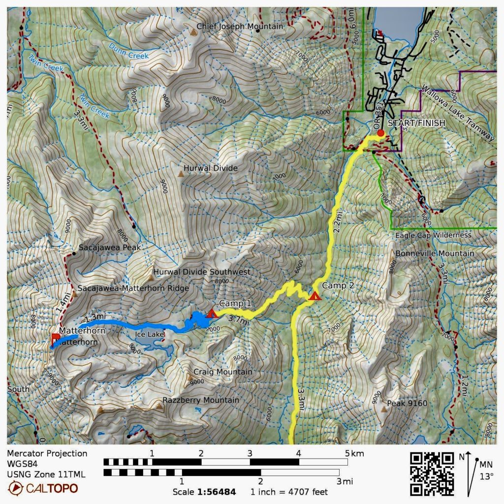
Starting at the Wallowa Lake Trailhead on a warm Thursday afternoon, we hiked southward on West Fork Wallowa River Trail #1820. After 2½ miles, we turned right on Ice Lakes Trail #1808 and crossed the river on a long footlog.

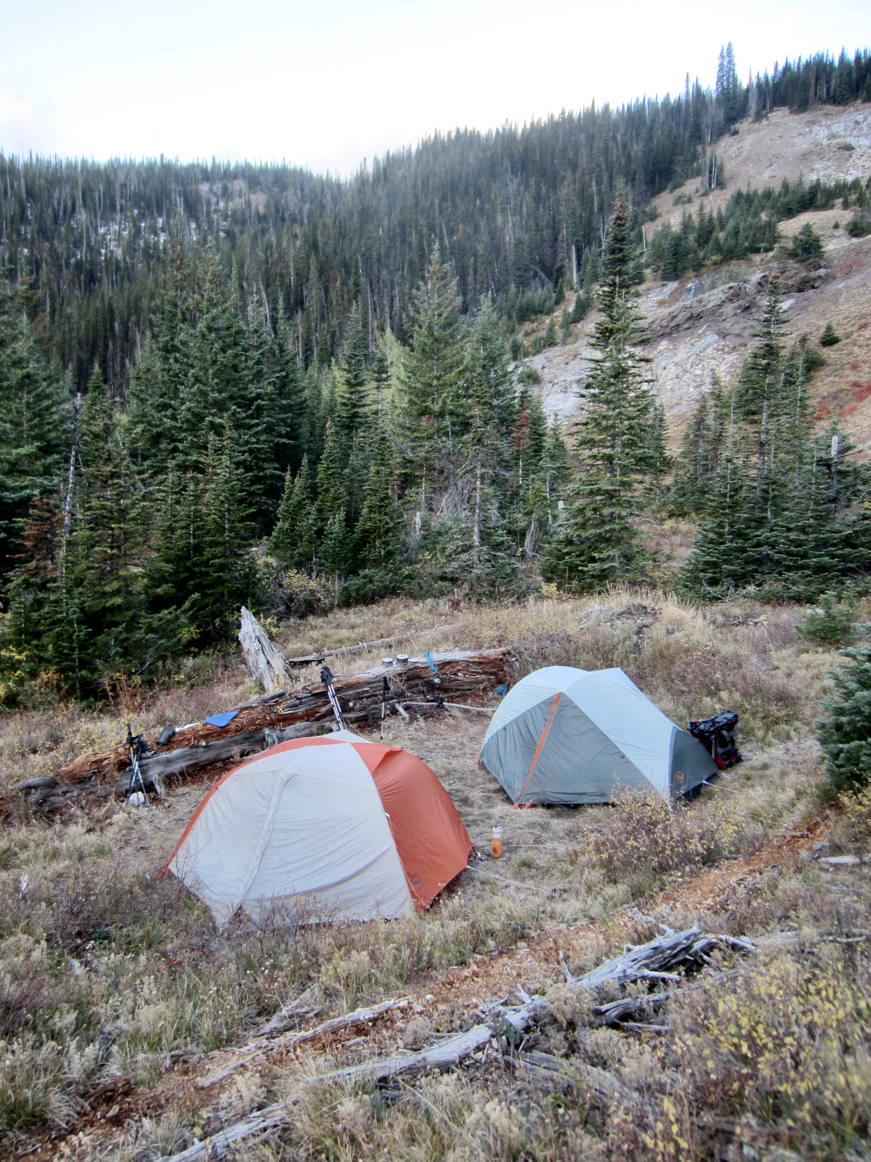
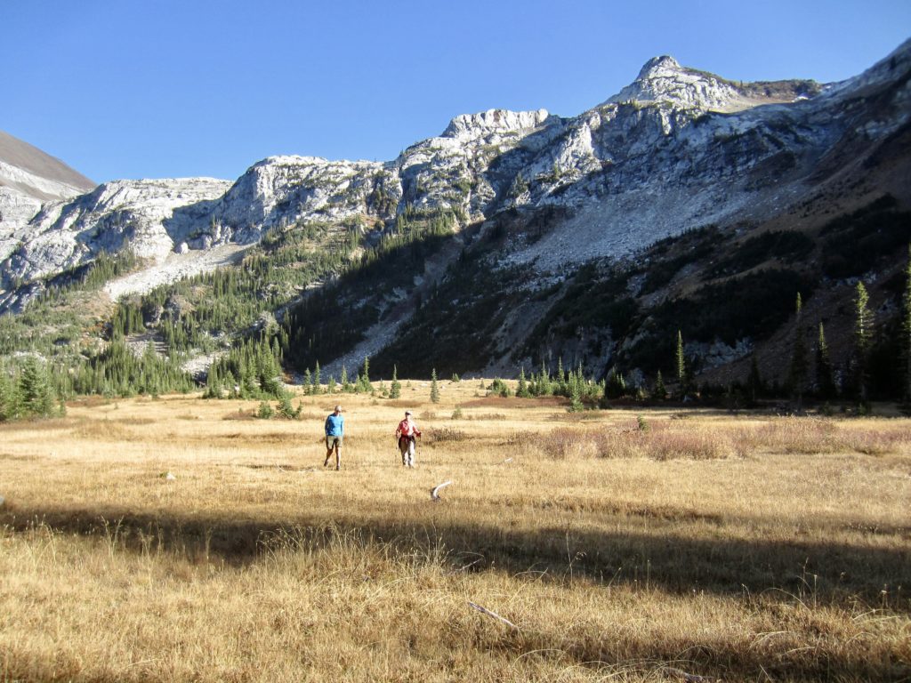
Our trail steadily climbed out of the river valley and traversed over to Adam Creek, which flows through a deep gorge with a series of waterfalls. In late afternoon, we entered a sloping, grassy basin and stopped for the day at an informal 6900-foot campsite (3.4 hours + 5.0 miles + 2300 feet from TH). The surrounding hillsides displayed a few patches of yellow aspens and one stand of golden larches. Did this meet the standards for a Golden Larch Outing? The debate still continues.
Day 2: Adam Cr. Basin to Ice Lake Trail Jct. + Matterhorn Summit Climb
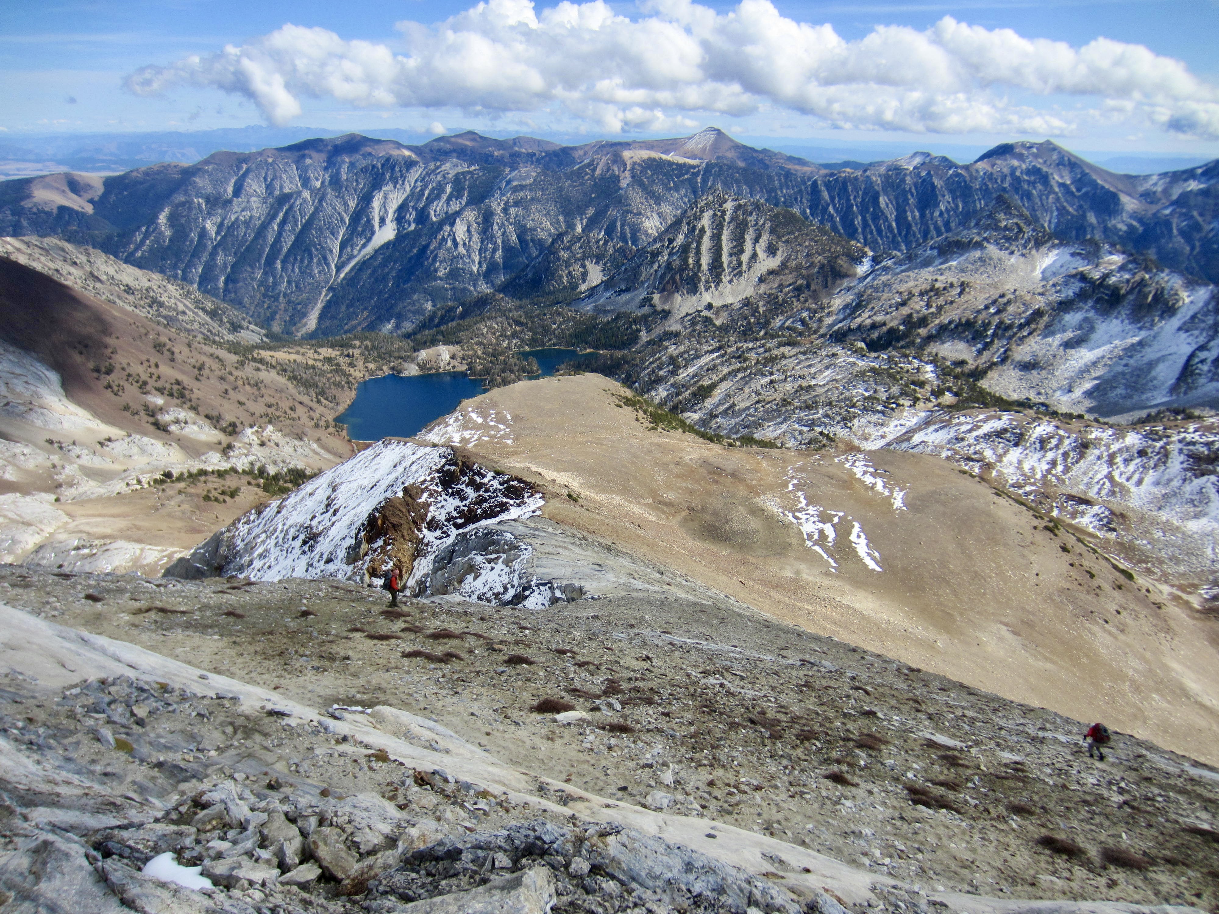
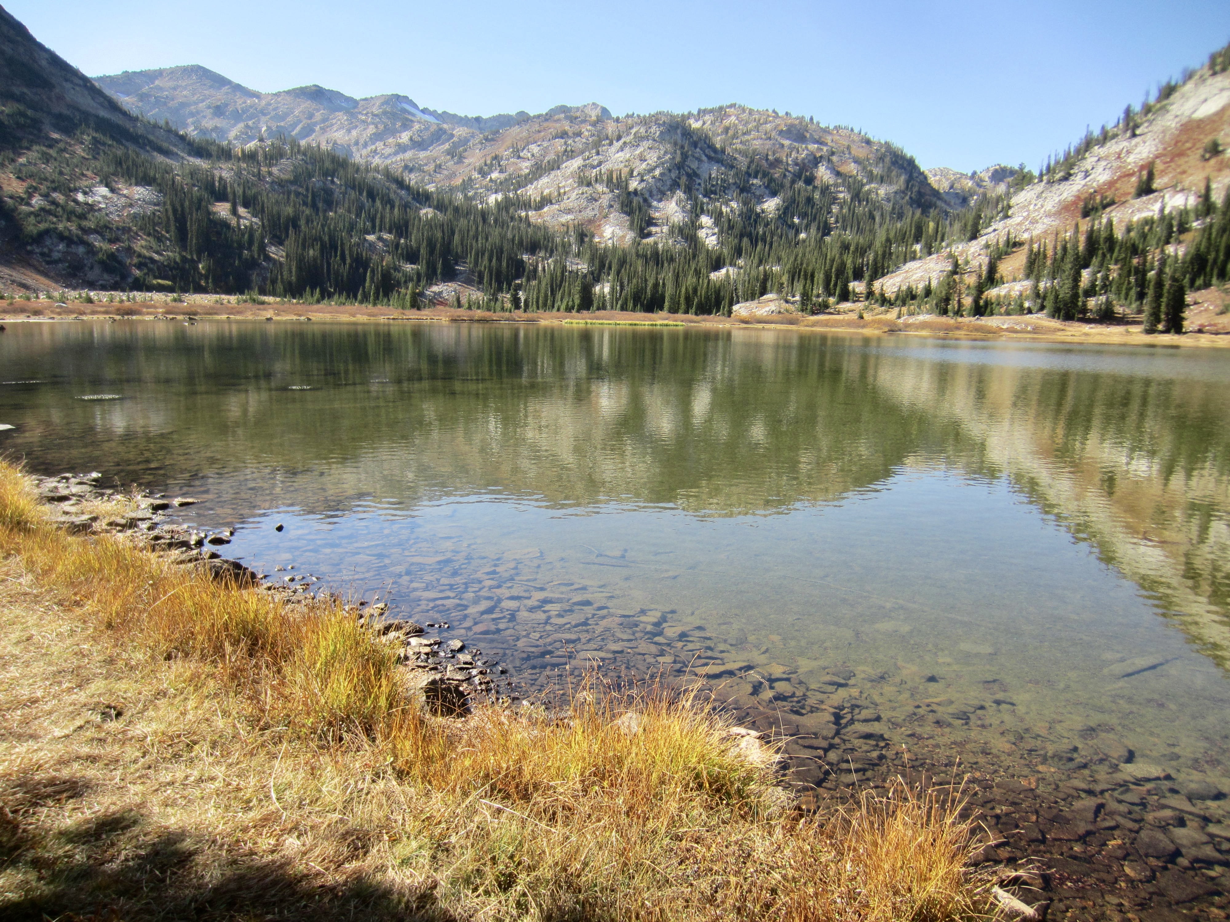
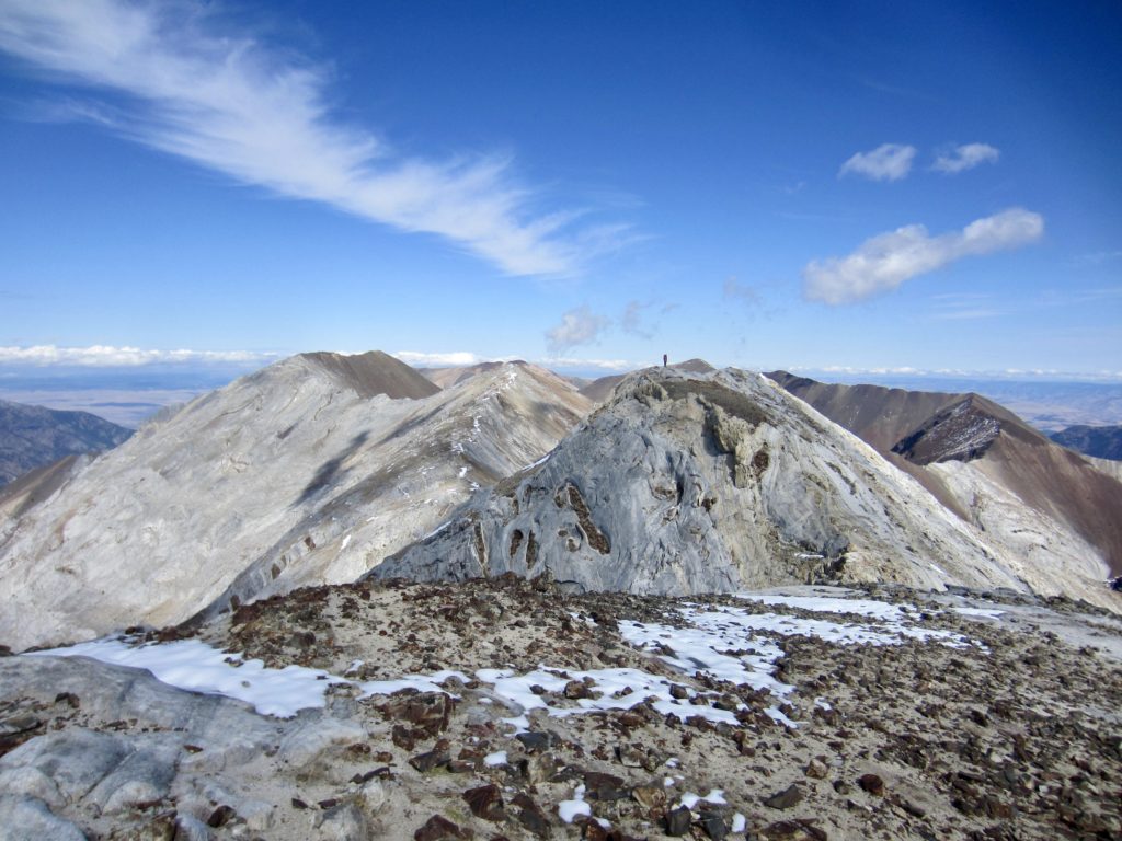
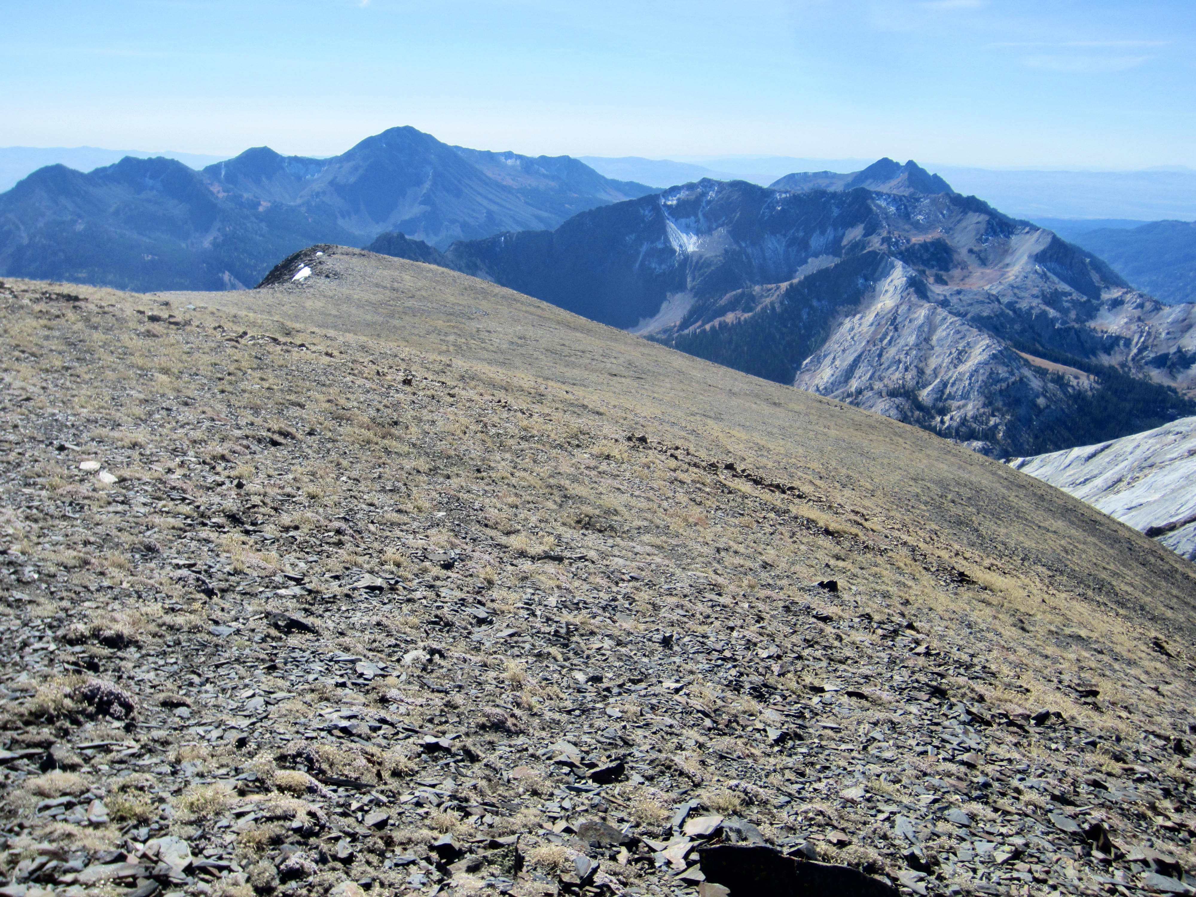
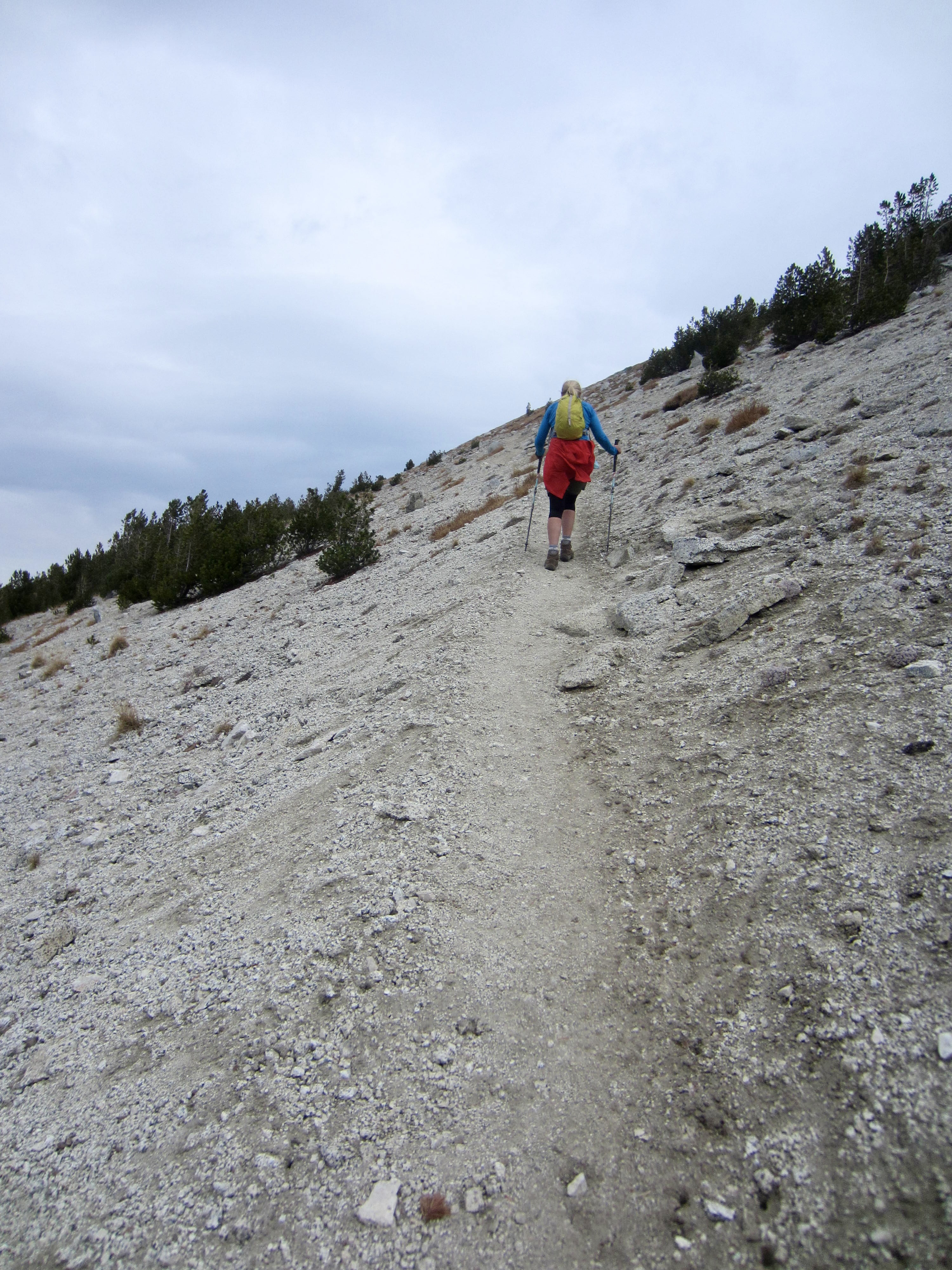
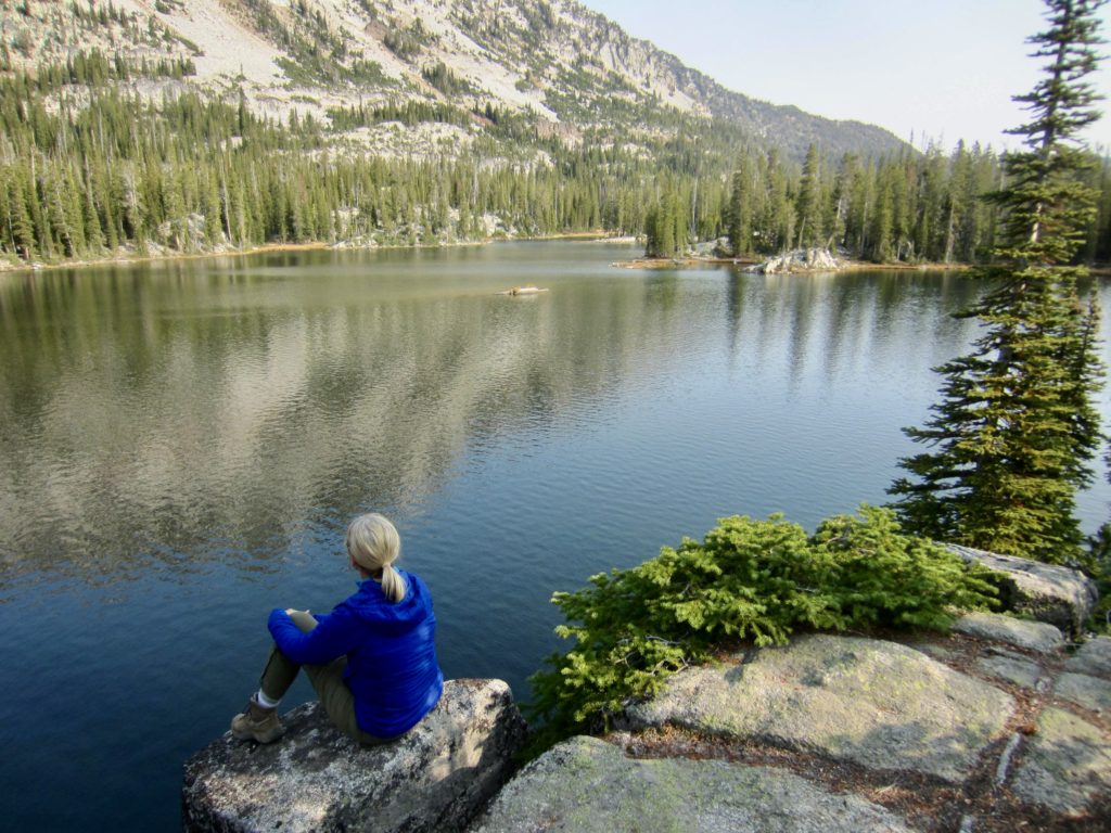
Today’s agenda called for a climb of Matterhorn, the second highest peak in the Wallowa Mountains and, by many accounts, the most famous. This fame probably owes more to its exalted name than its appearance, considering that it looks nothing like the Swiss Matterhorn. Regardless, it is a worthy goal on the basis of scenery and stature alone. We left camp with summit packs and hiked up to Ice Lake, a large body of crystal-blue water resting directly below Matterhorn.
Although the formal trail ends at Ice Lake, a well-defined climber’s path continues past the lake and up the eastern flank of Matterhorn. Above 9000 feet, our route took us up steep, snow-covered switchbacks onto the peak’s east ridge, followed by zigzagging ledges on its barren limestone summit dome.

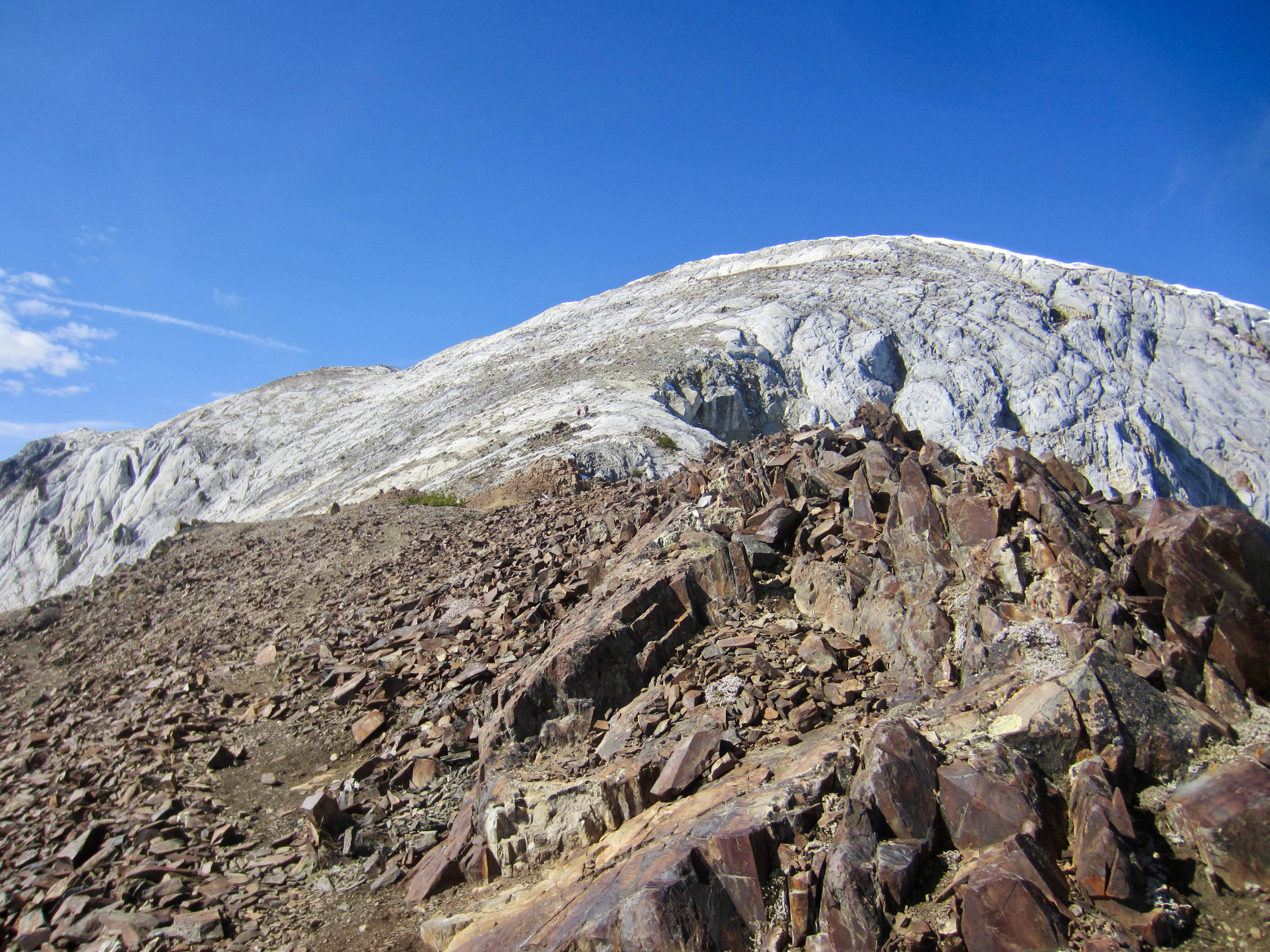
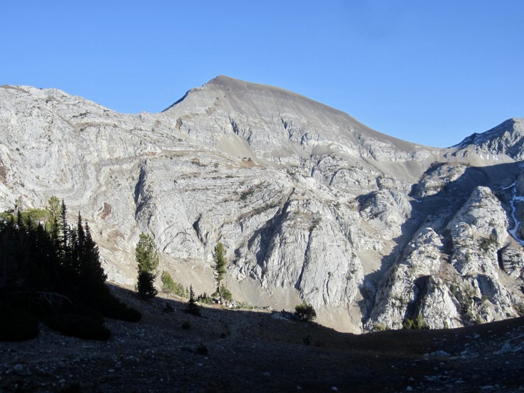
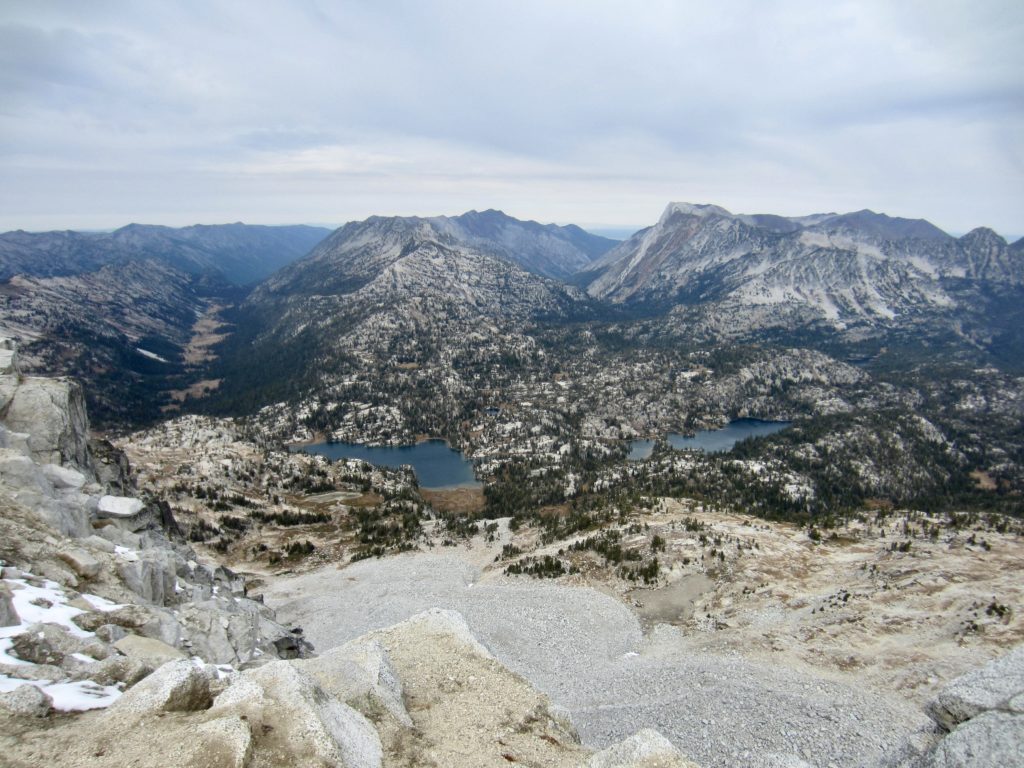
We gained the summit just after noon (3.5 hours + 2950 feet from Camp 1) and plopped down to soak in the views. This was a first visit to the Wallowas for Eileen and me, so the scenery was completely unfamiliar to us. We were particularly intrigued by the sharp color contrast between the off-white limestone and russet-brown basalt, as well as by the wavy forms within the limestone.

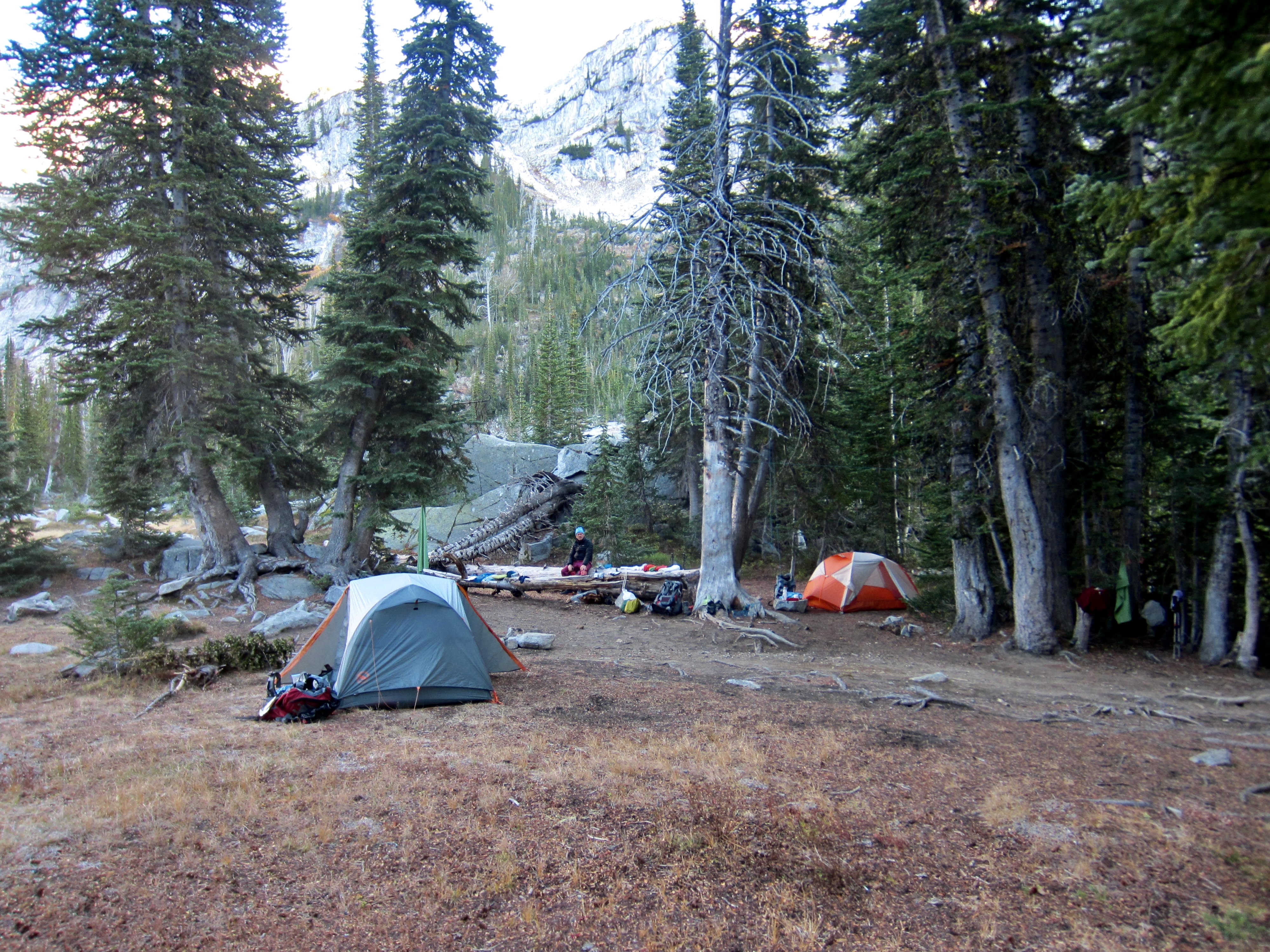
After spending some time wandering around the broad summit area and trying to determine the exact high point (it was inconclusive), we retraced our route back to camp in Adam Creek Basin (2.6 hours + 50 feet from summit). There were several hours of daylight remaining, so we packed up and moved our camp down to a roomy site near the junction of the West Fork Wallowa River Trail and Ice Lake Trail.

Day 3: Ice Lake Trail Jct. to Frazier Lake + Hawkins Pass Sidetrip
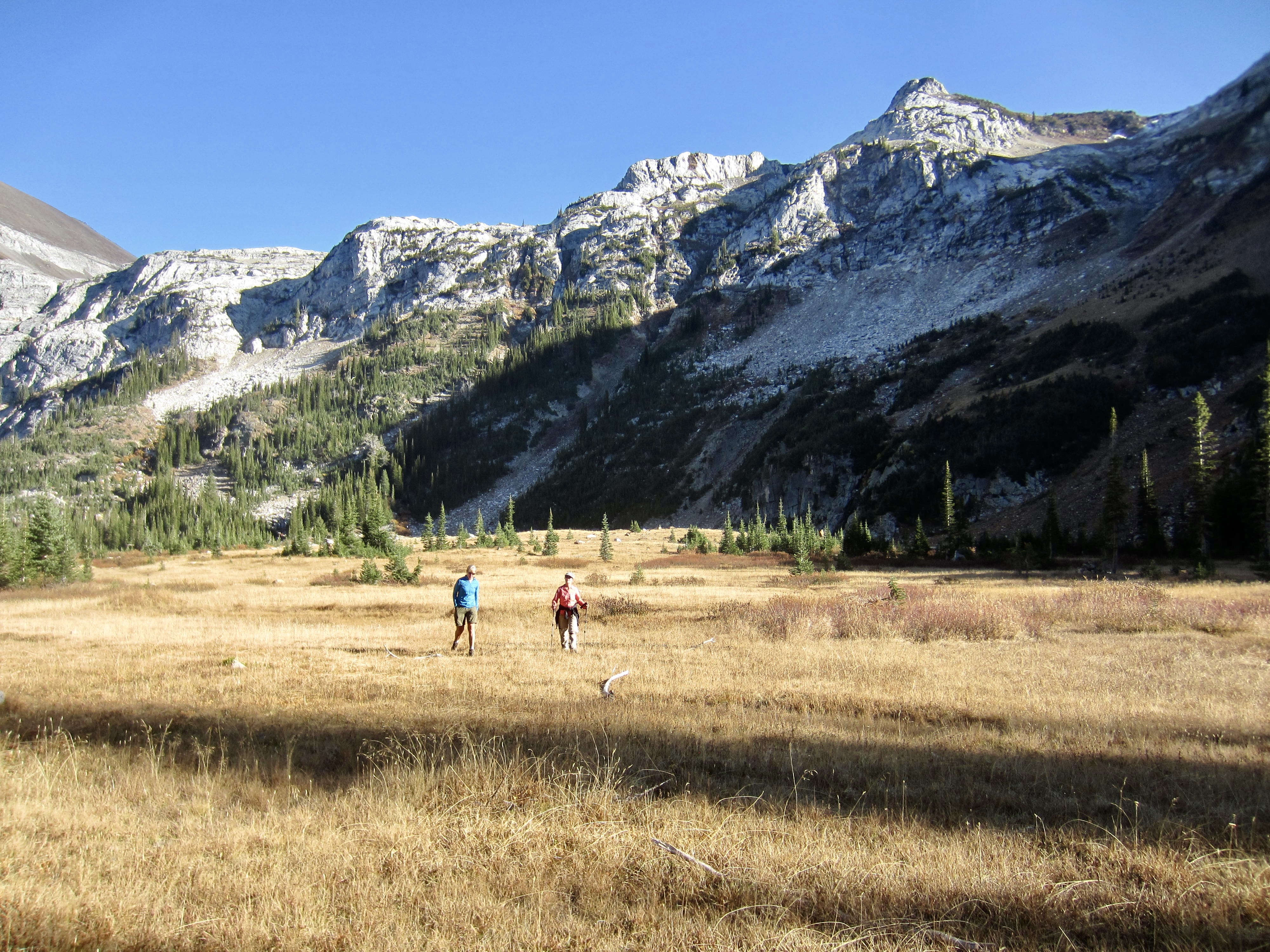
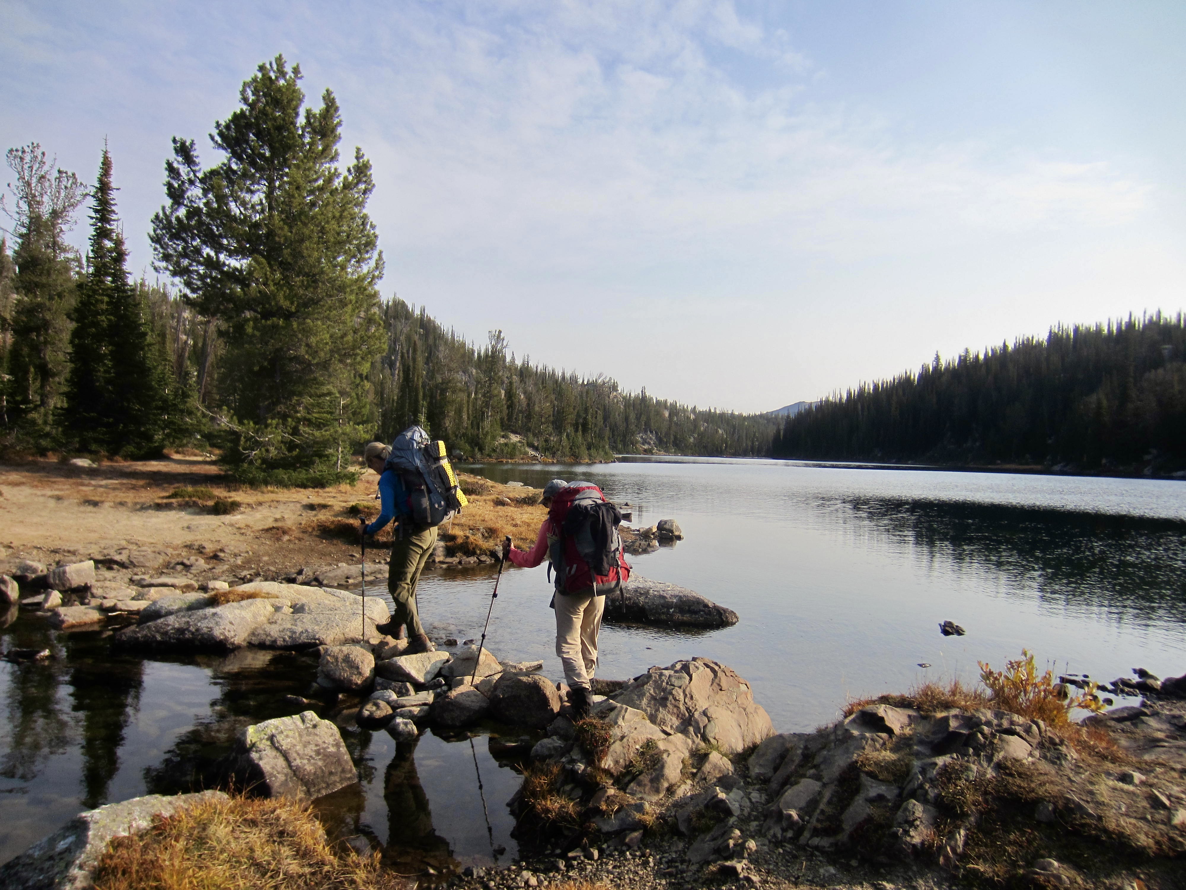
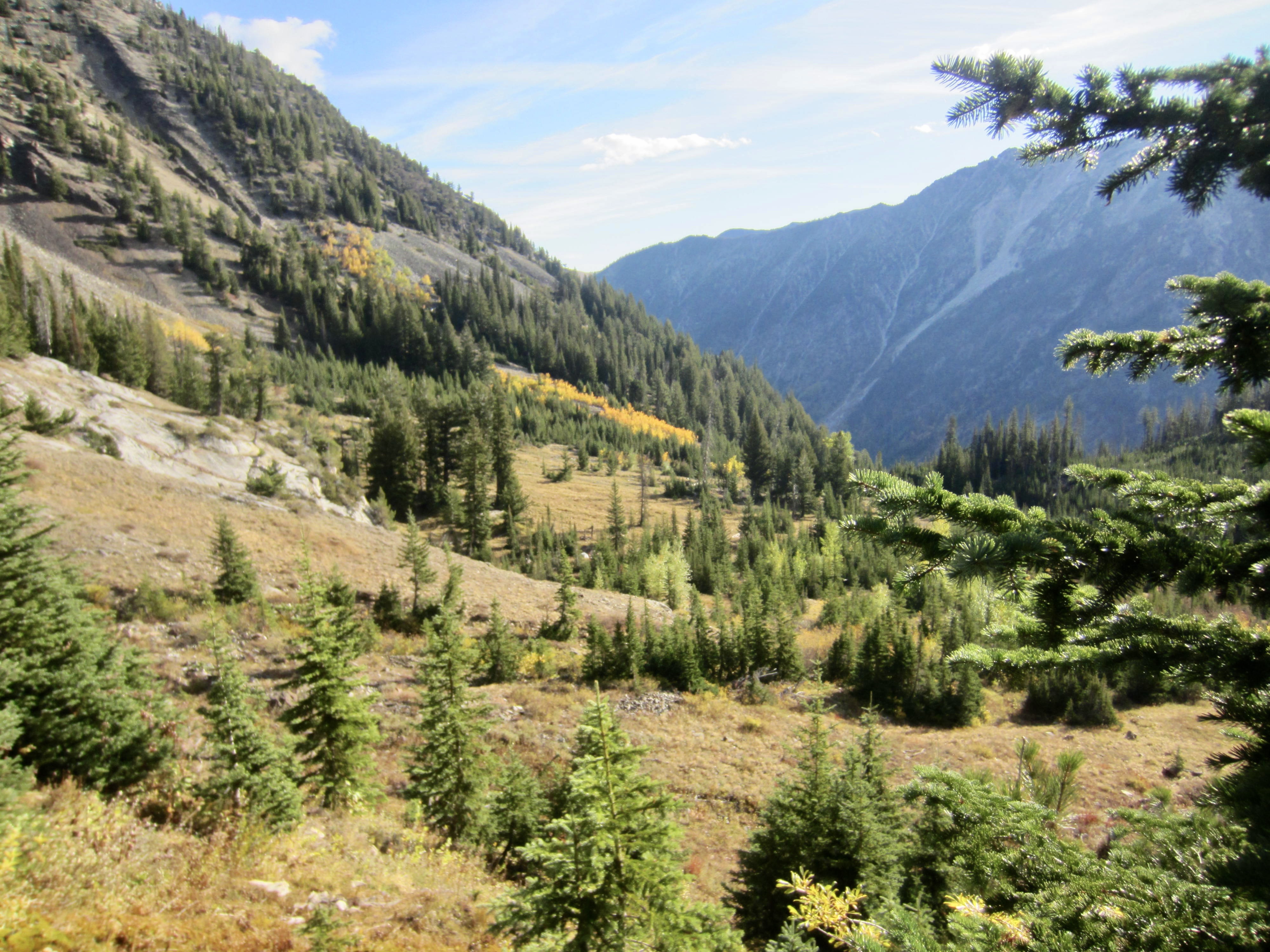
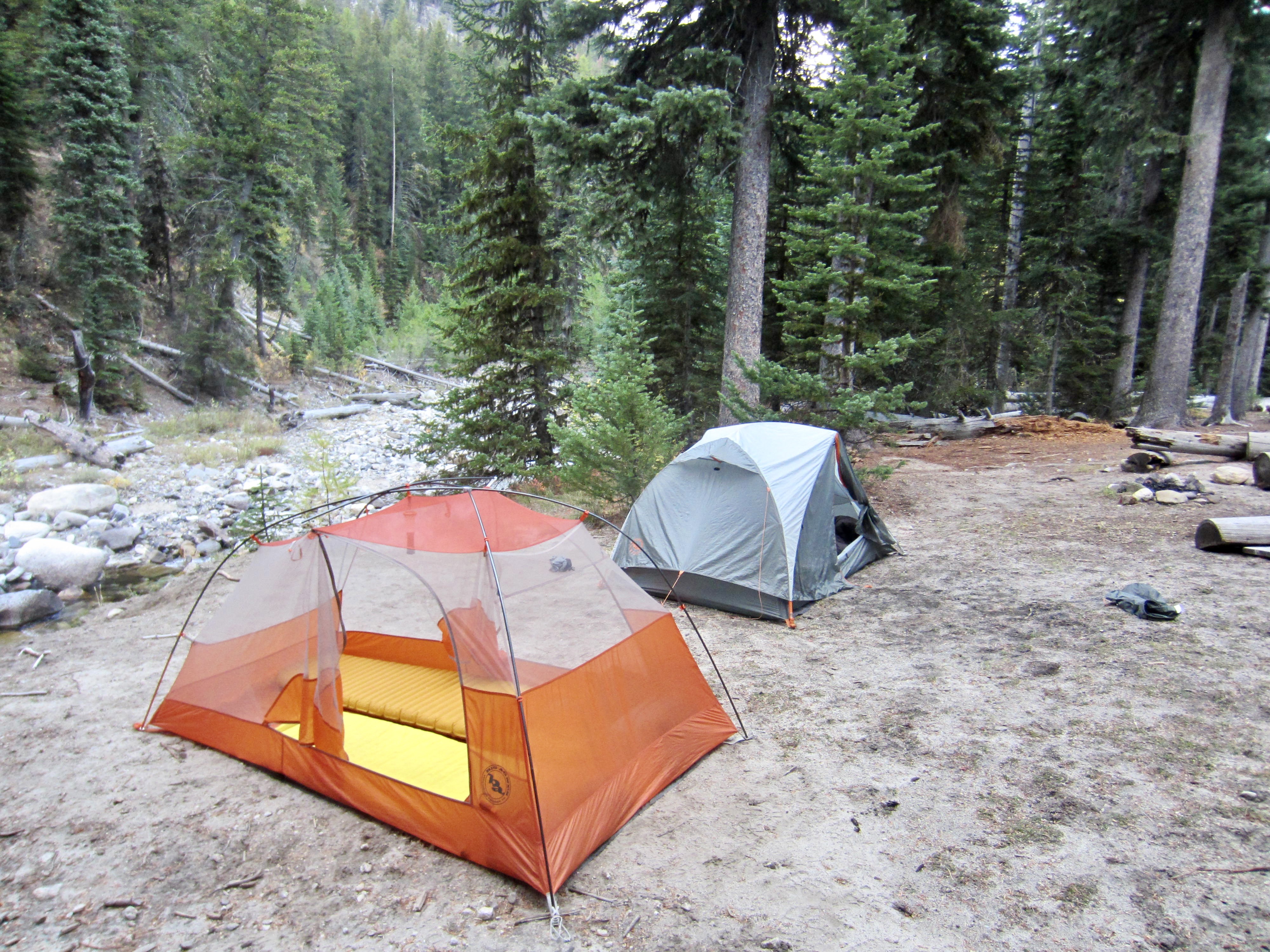
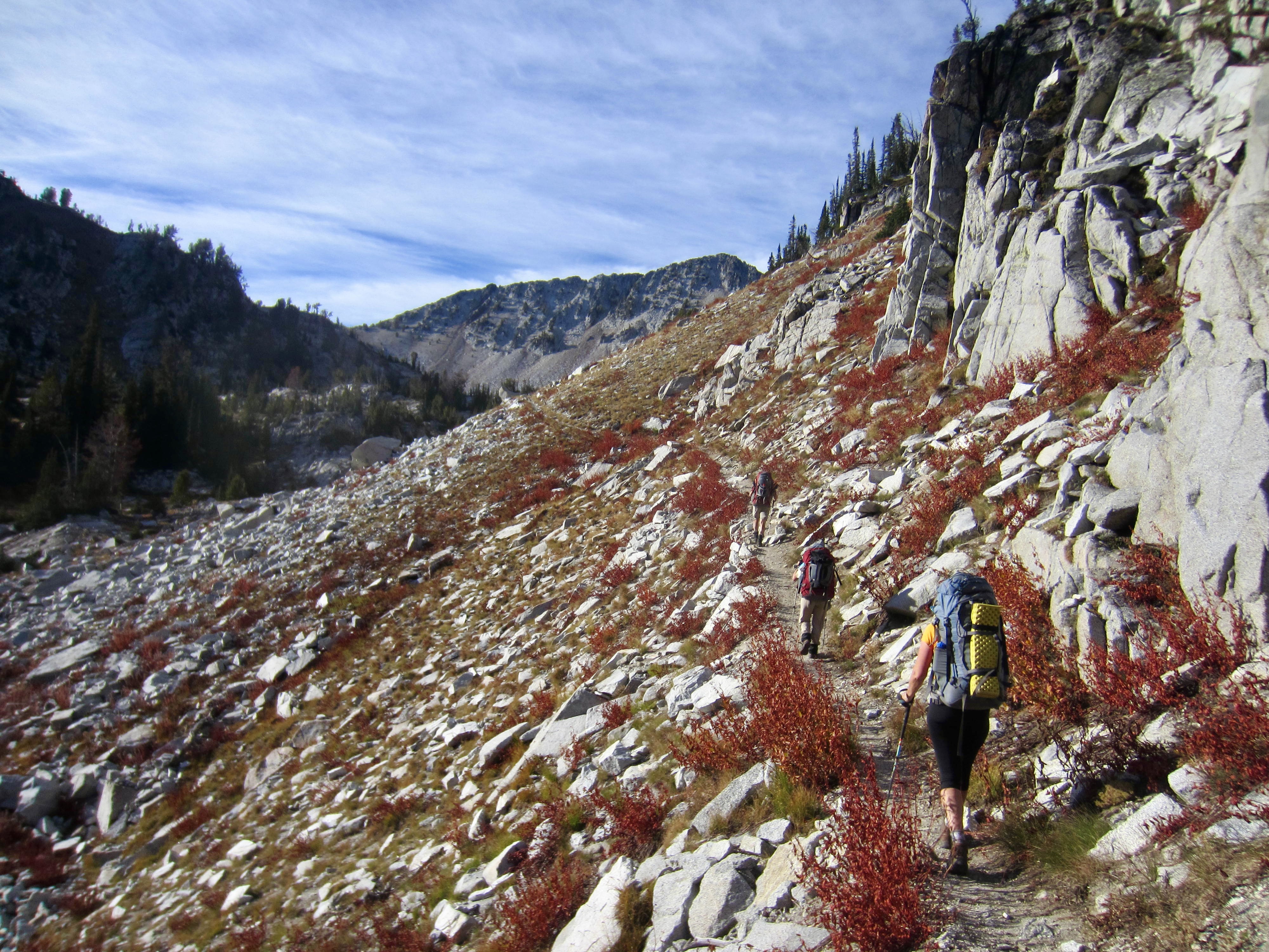
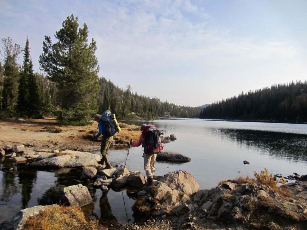
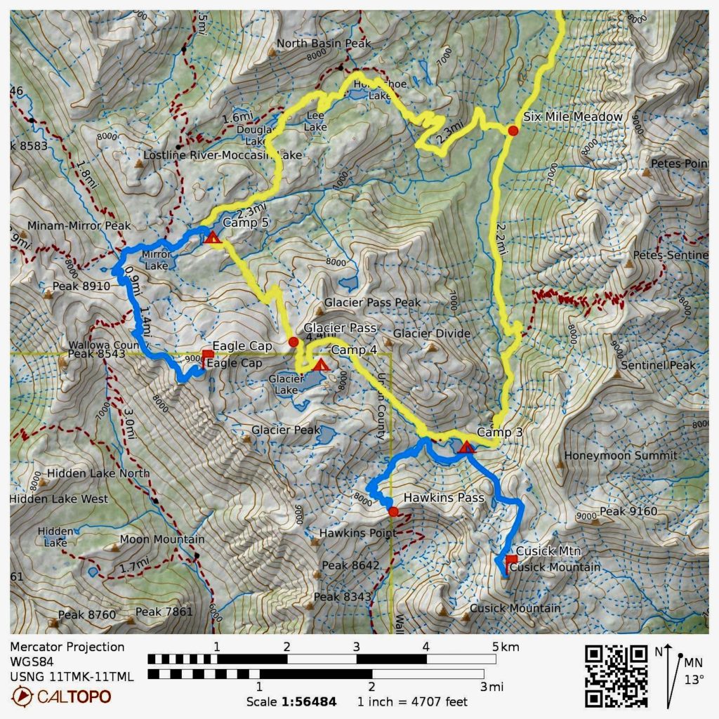
We were back on the West Fork Wallowa River Trail after breakfast, heading upstream through Six Mile Meadow and past the Lake Basin Trail junction. A right turn at the valley head took us to Frazier Lake at 2:00pm (4.6 hours + 7.3 miles + 1650 feet from Camp 2). We established Camp 3 near the outlet stream.

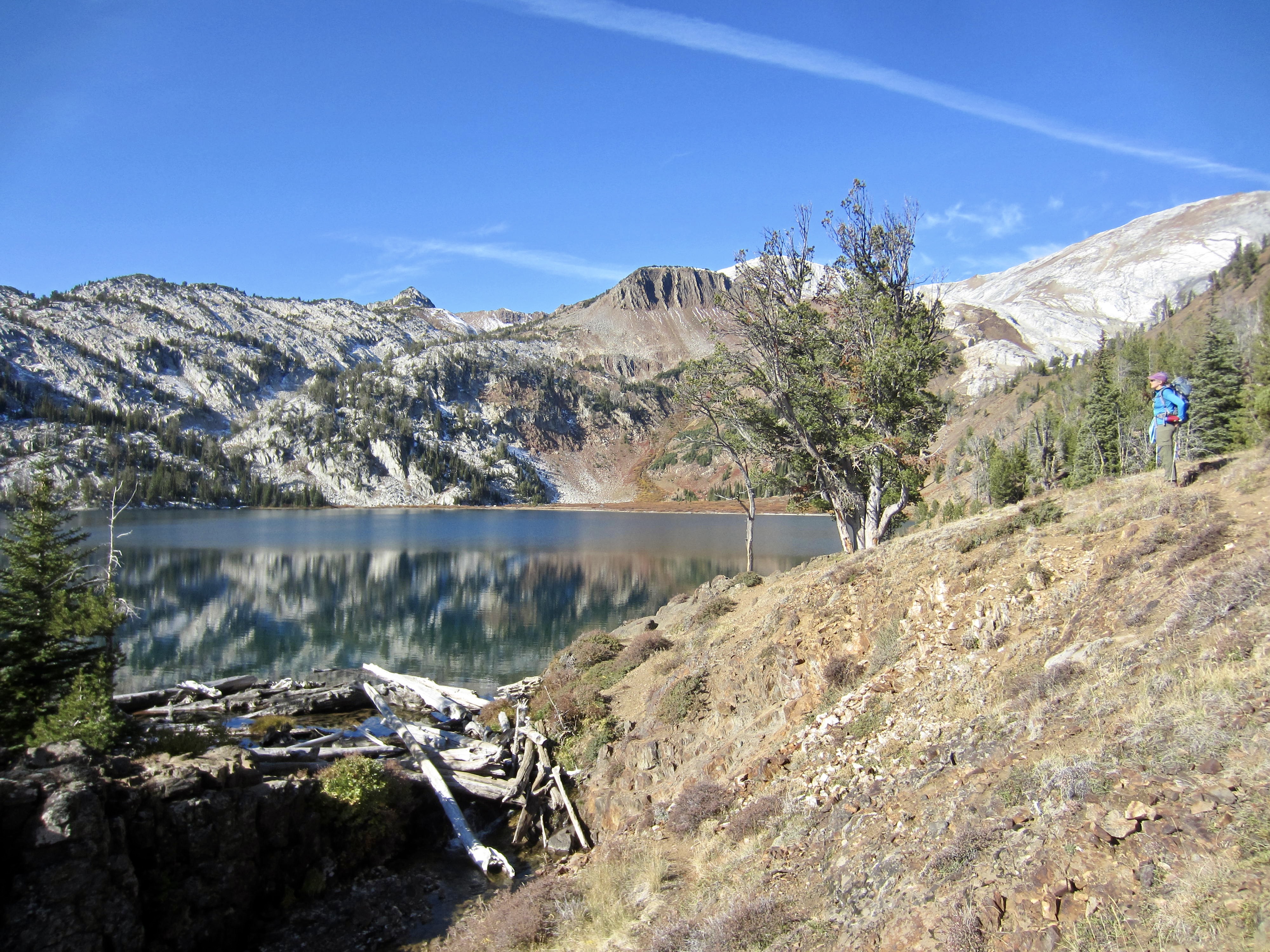
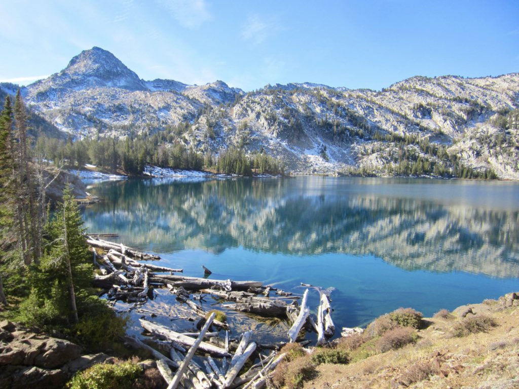
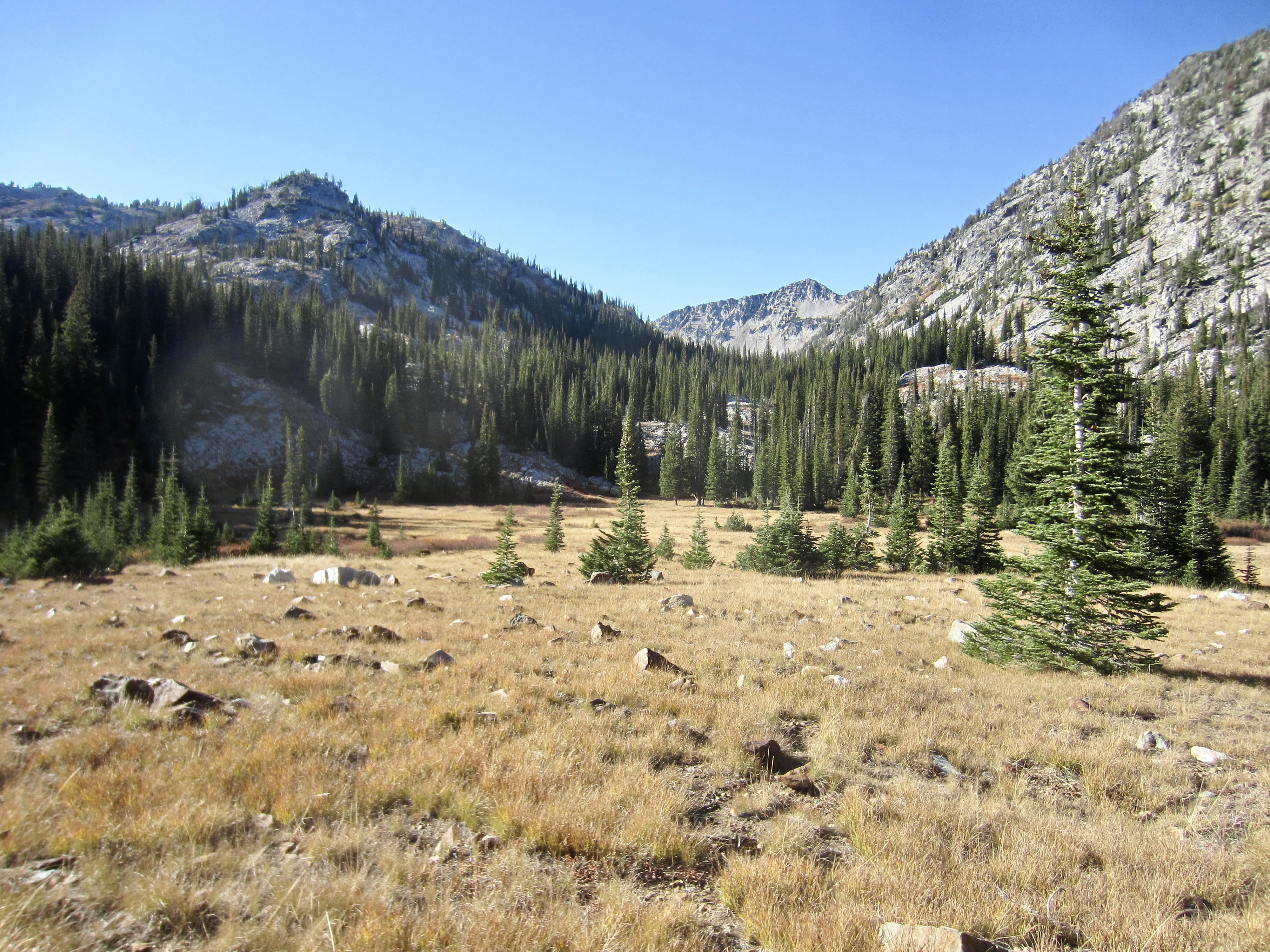
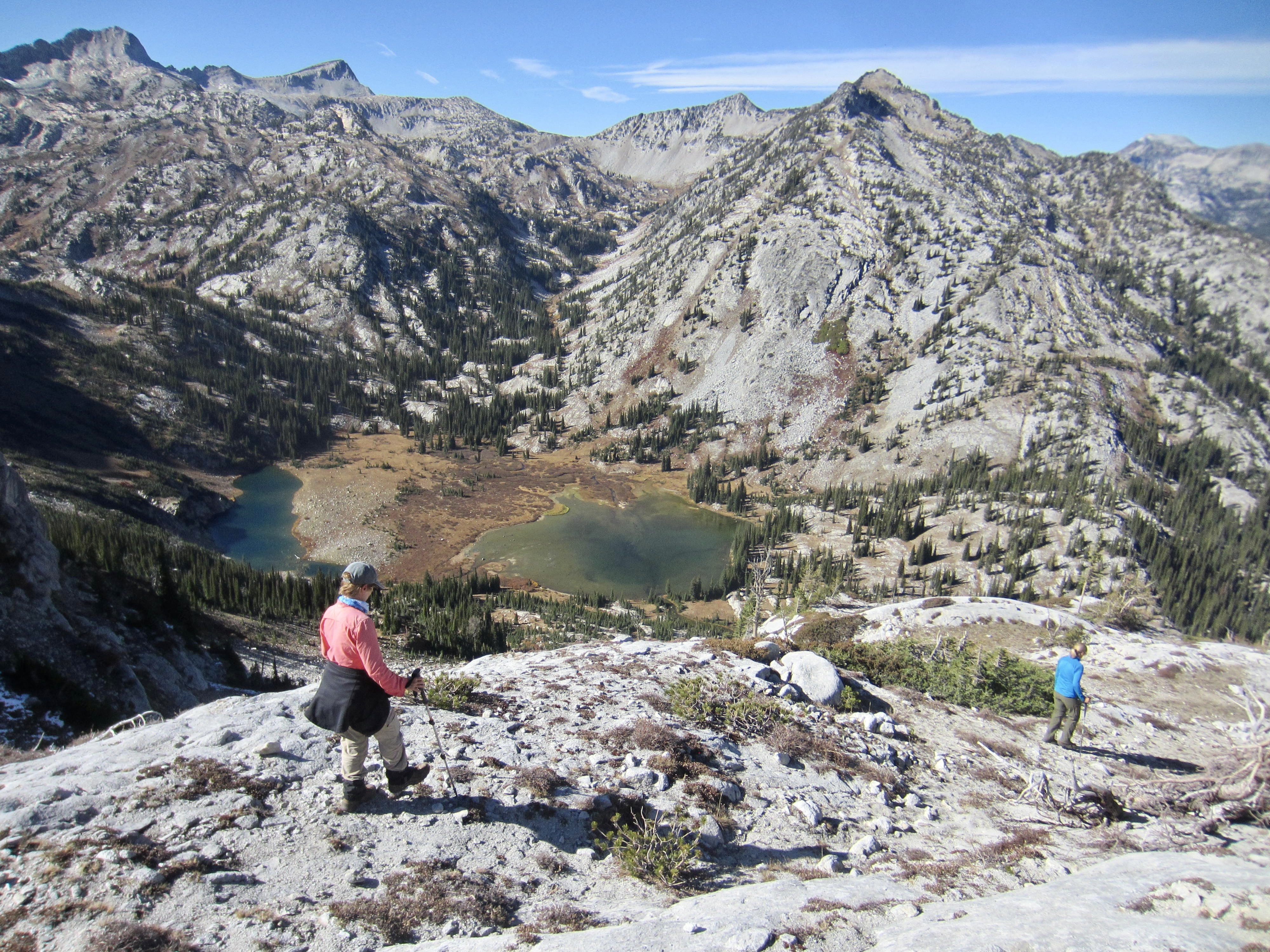
Our afternoon was occupied by exploring the lake bowl and vicinity. Frazier Lake and its smaller companion lake closely to the south (“South Frazier Lake”) sit in a large meadow speckled with granite boulders and surrounded by limestone cliffs. In preparation for a climb of Cusick Mountain tomorrow, we also scoped out options for getting through the limestone cliff. A left-slanting gully directly above the lake looked like our best bet.
Having a couple hours available before dinnertime, Eileen and I took a hike up to Little Frazier Lake, and then I continued farther up to 8350-foot Hawkins Pass. This pass provides access to the South Fork Imnaha River Trail and also affords a good view of Cusick Mountain’s west face—one of the common climbing routes.
I rejoined my comrades back at camp in late afternoon (2.0 hours + 1300 feet RT), just in time for a twilight dinner. Although this was a Saturday evening in a very popular area, we were the only party camped at the lake. It would no doubt be a different situation here in the summer months.
Day 4: Frazier Lake to Glacier Lake + Cusick Mtn. Summit Climb
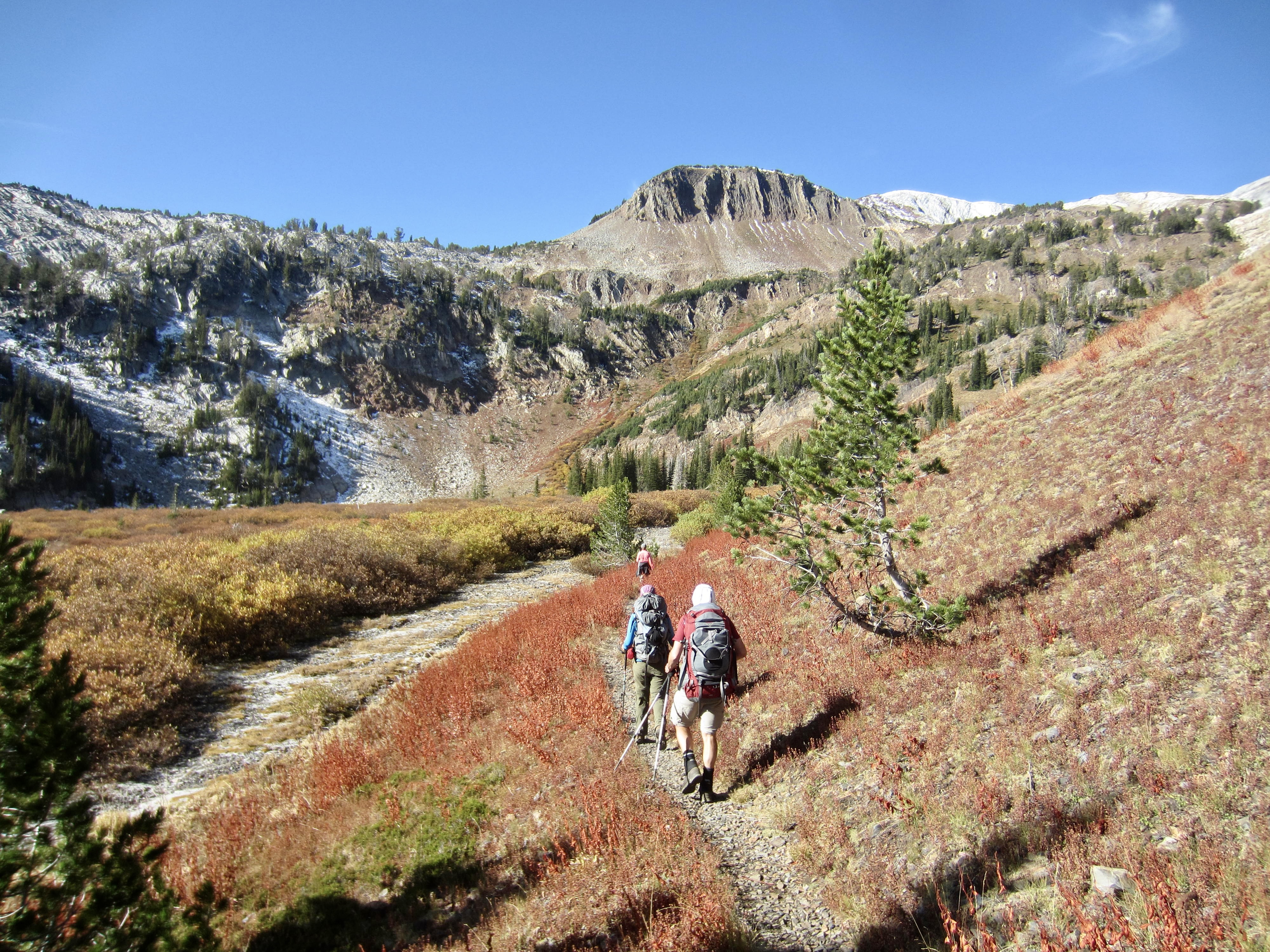
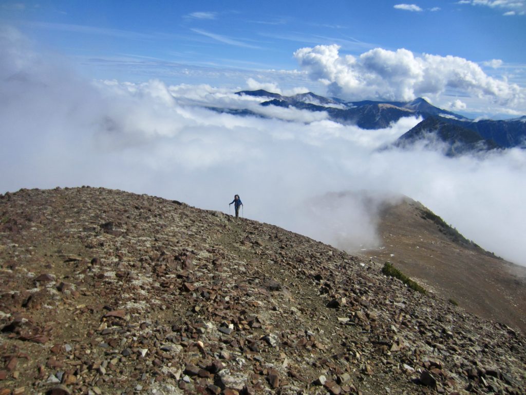
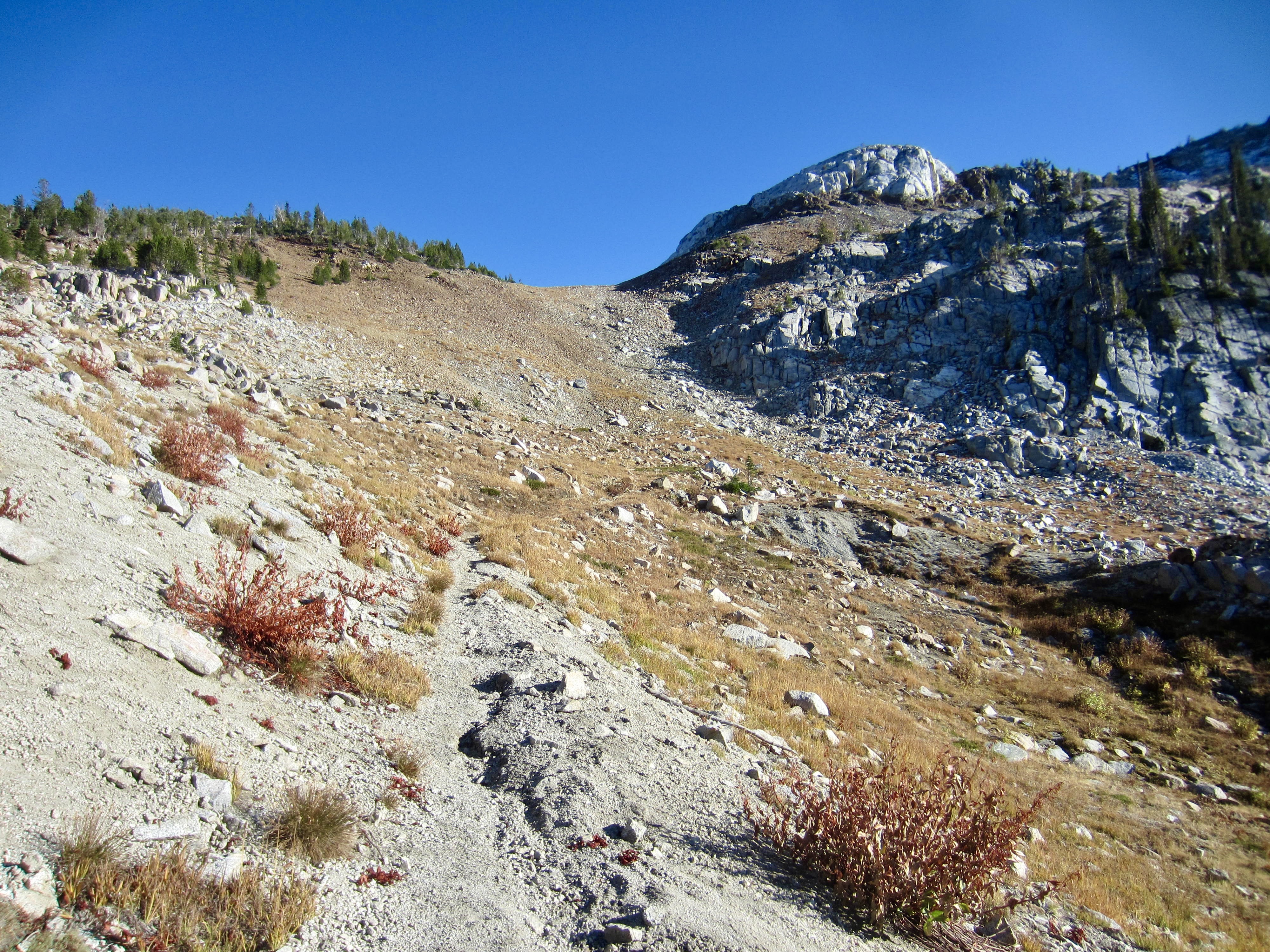
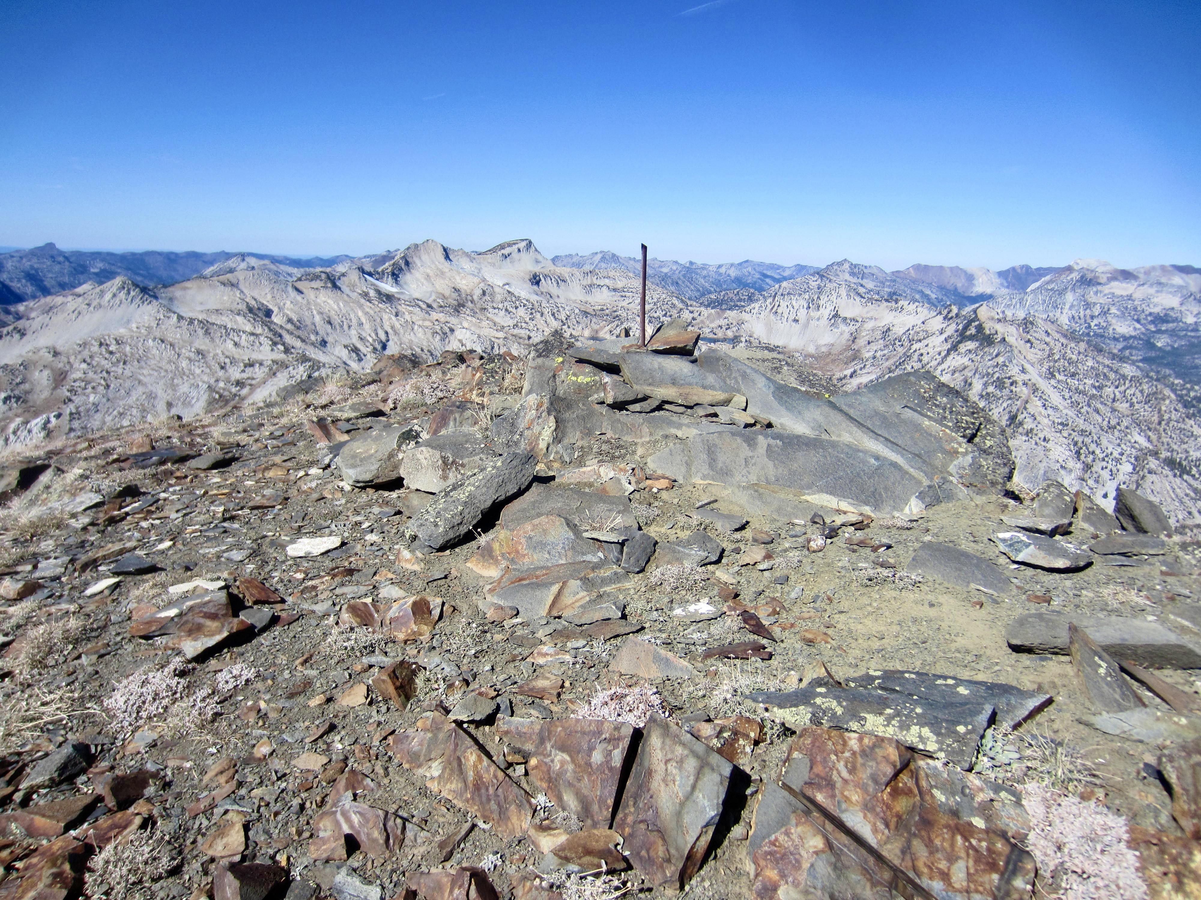
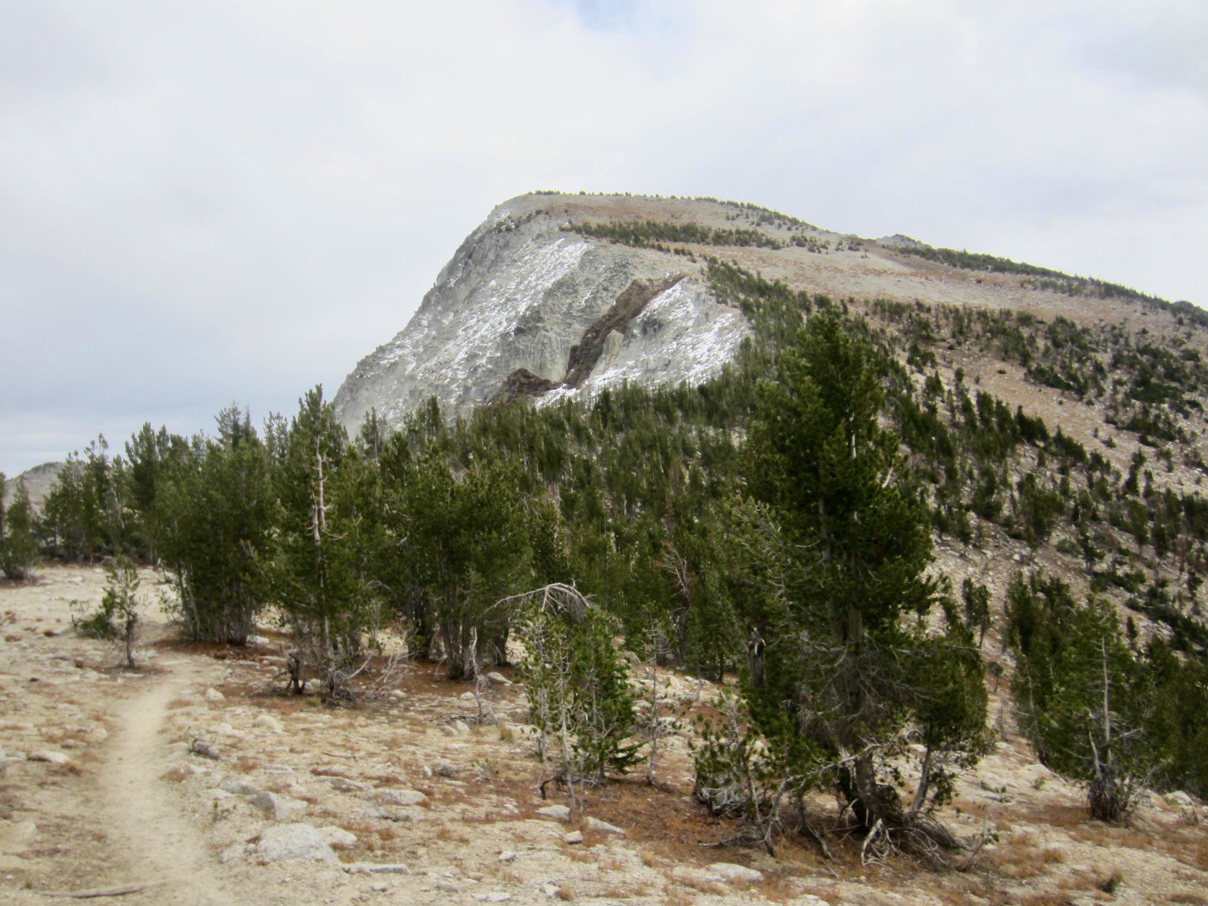
We awoke to clear skies at dawn and were heading out of camp with summit packs by 9:00am. Our objective today was 9518-foot Cusick Mountain, a somewhat lesser-known peak in the Wallowas but one that had floated to the top of Deb’s wish list. After rock-hopping across the outlet stream, we ascended a bouldery slope leading southward to the left-slanting gully that we’d scoped out yesterday. This gully led us easily through the limestone cliff band with only a bit of Class 2-3 scrambling.
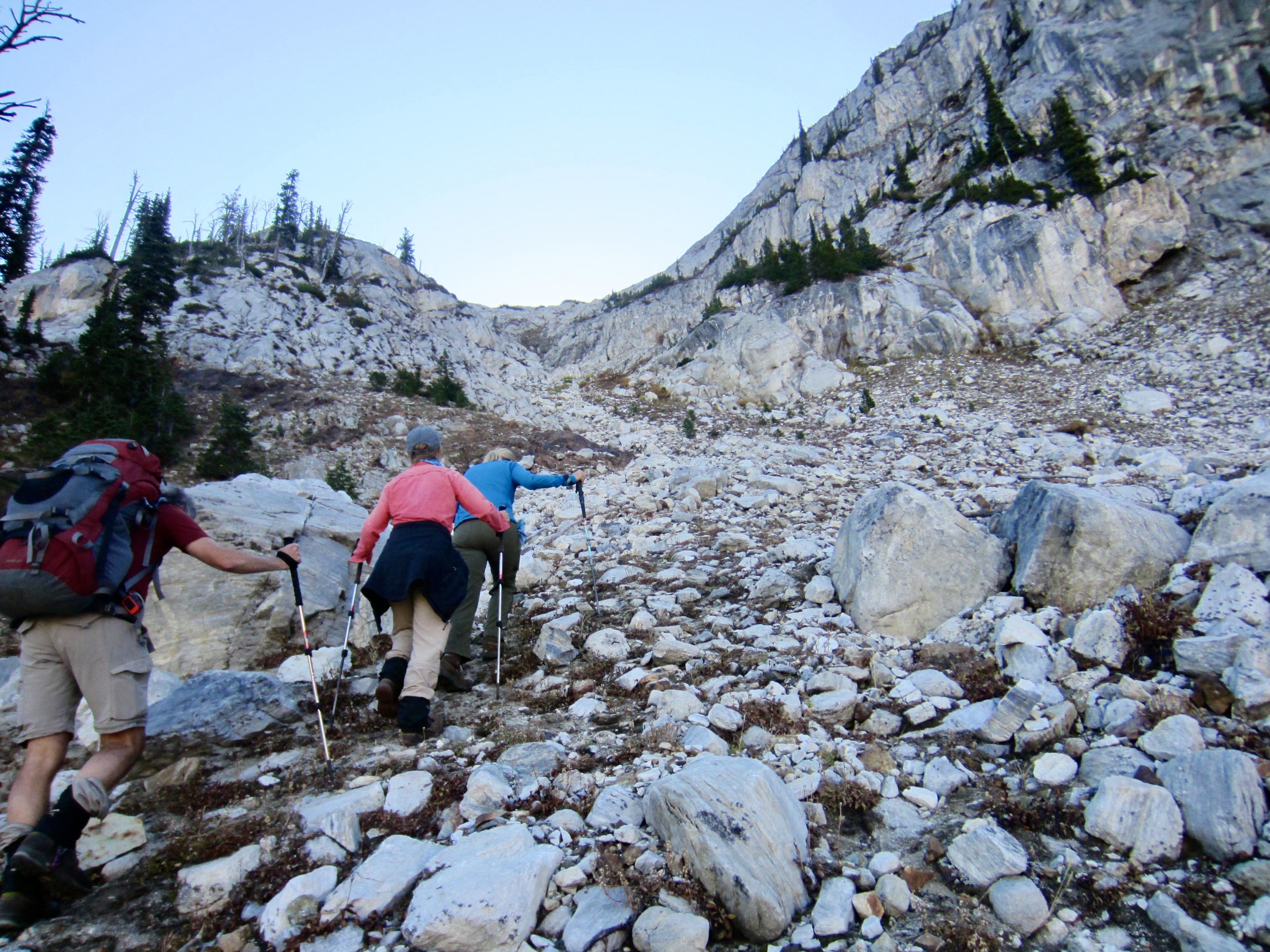
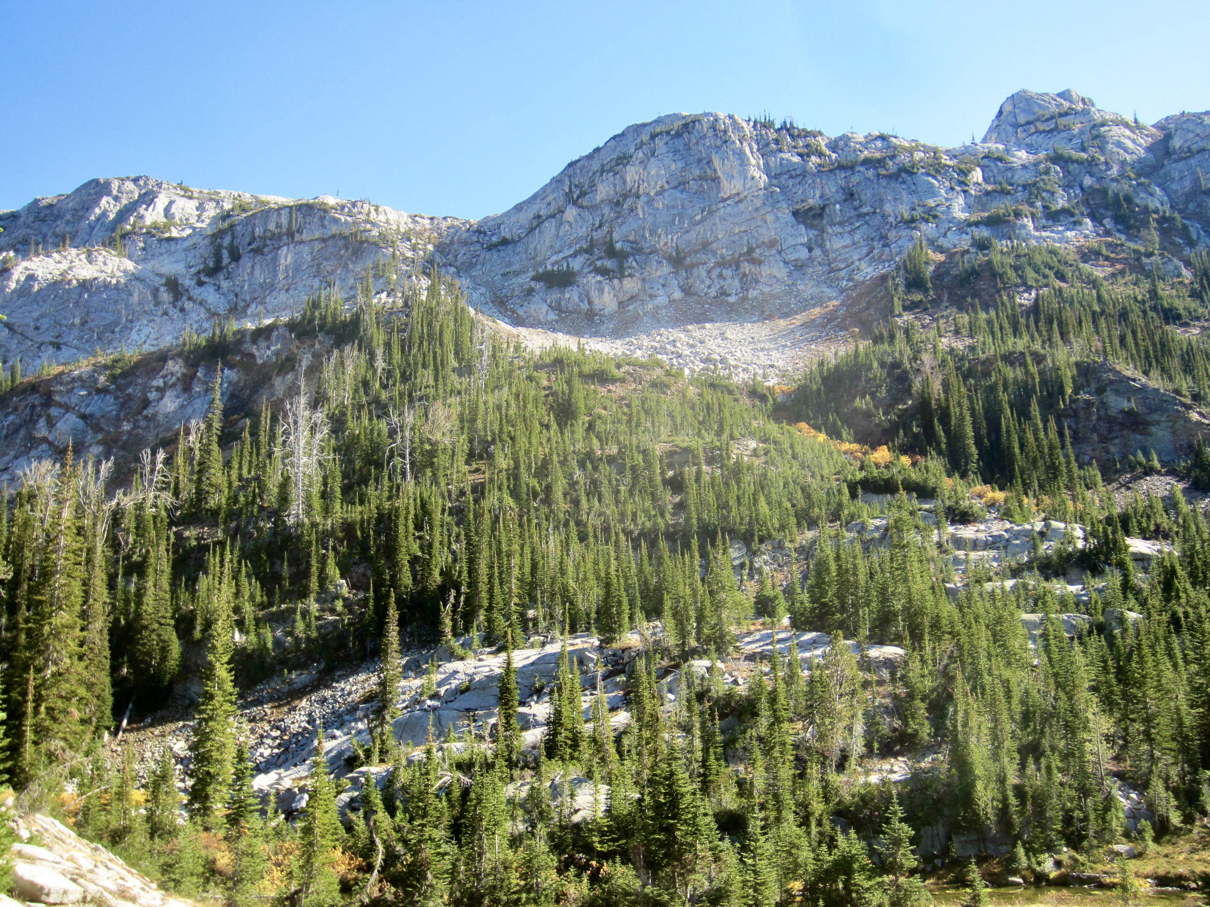
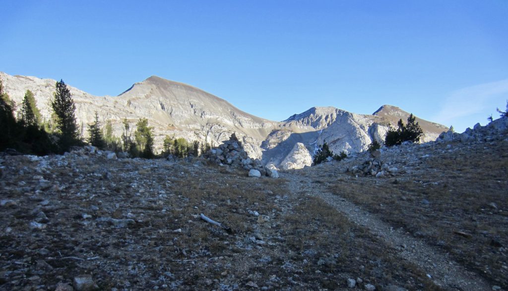
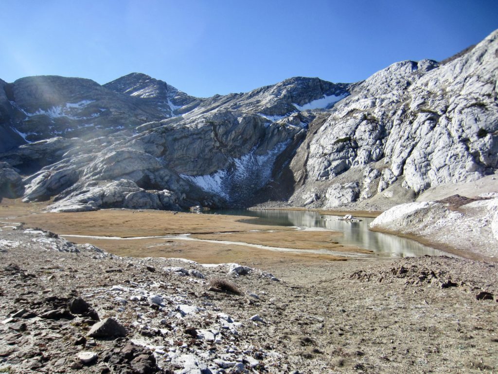
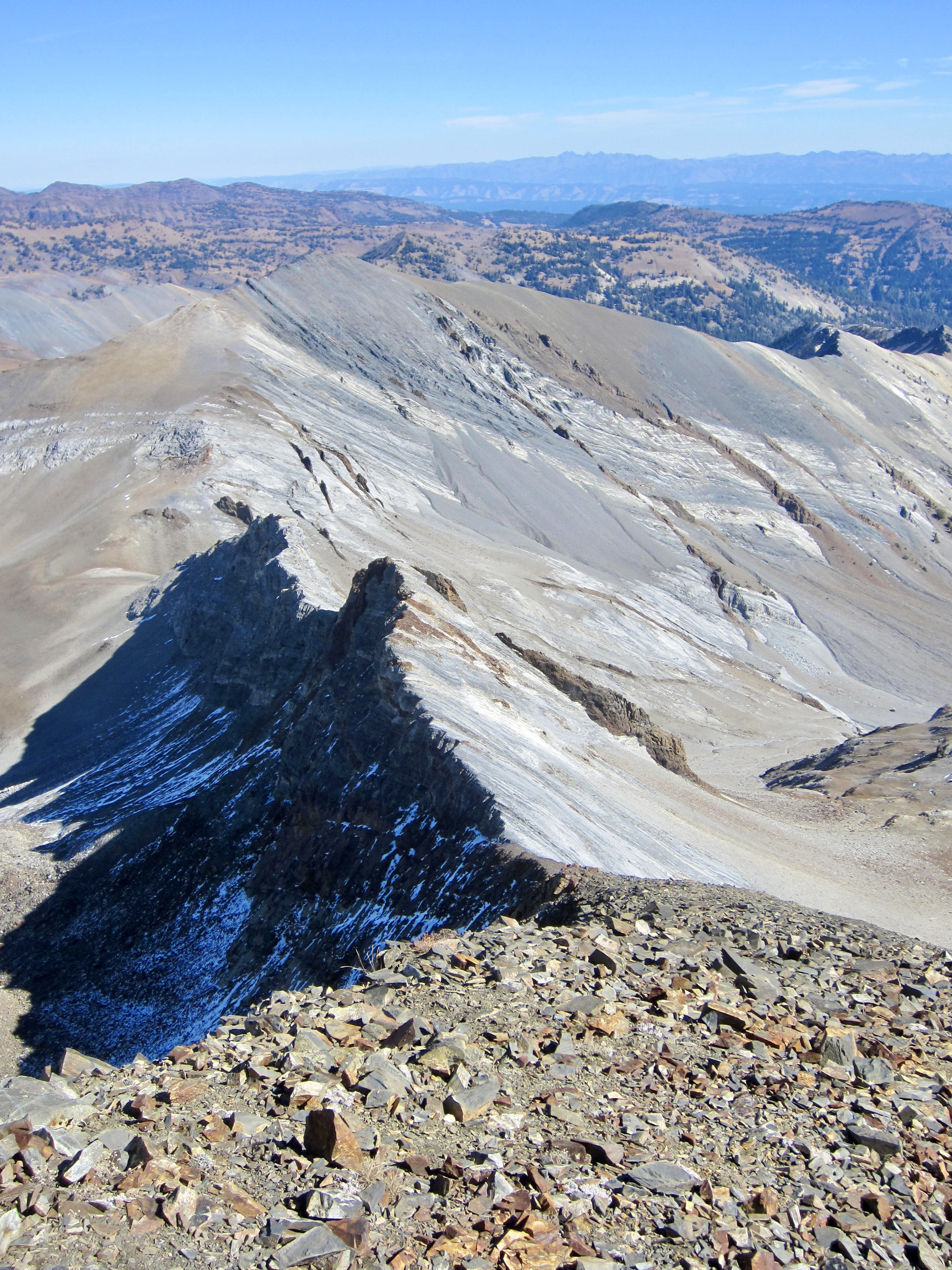
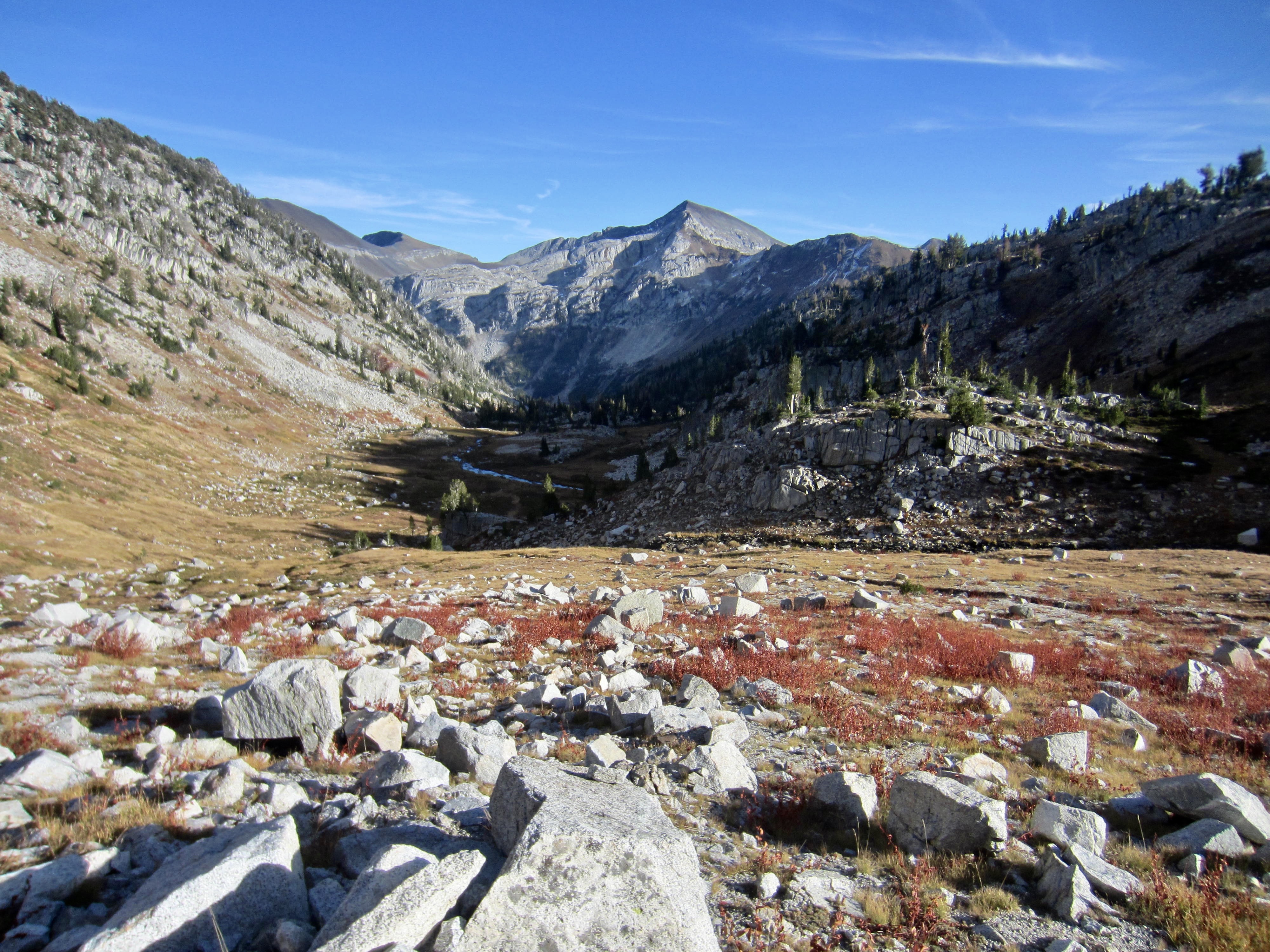
The top of the gully opened onto Honeymoon Basin, a visually striking expanse of gravel and grass and water, all bounded by white cliffs on one side and by brown talus on the other side. It had been previously described as “moon-like” here, and we couldn’t agree more!
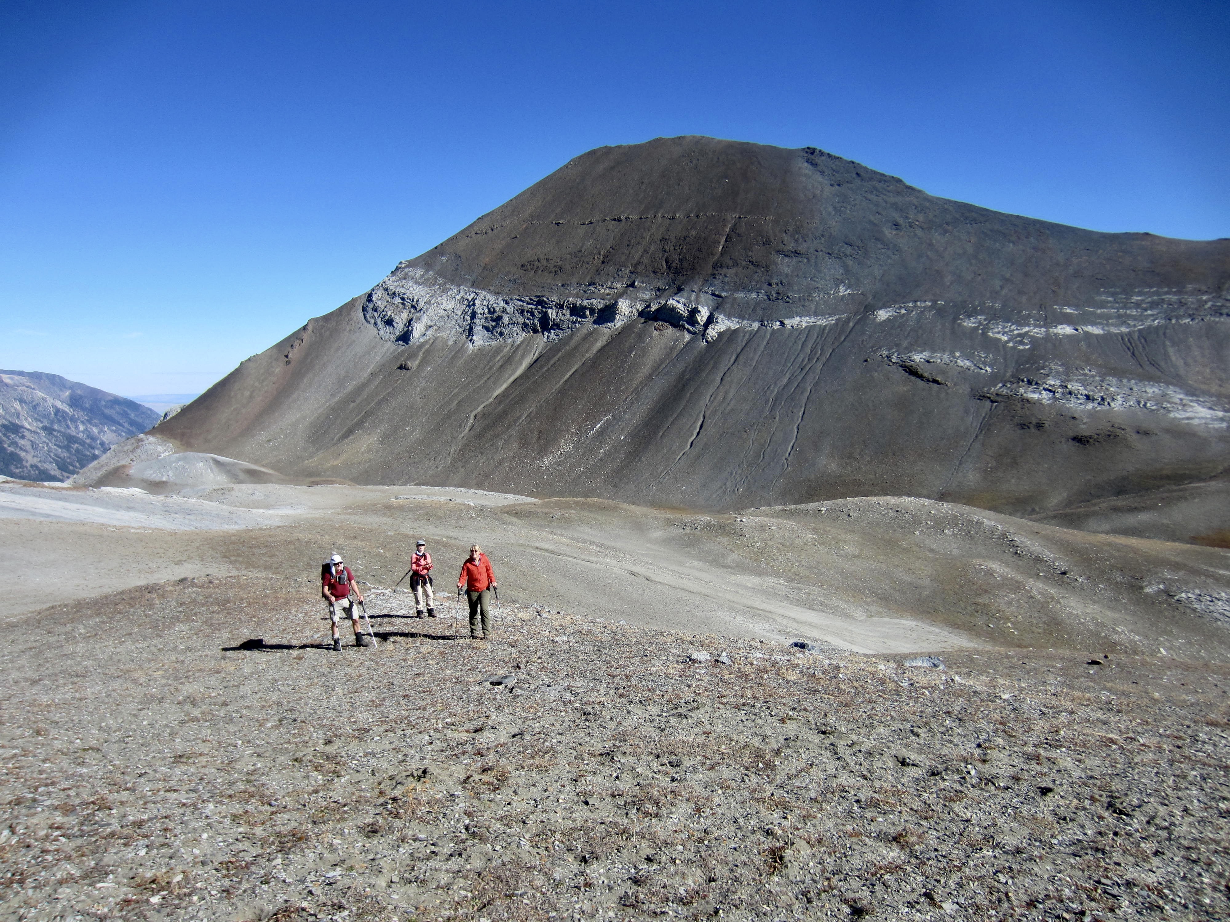
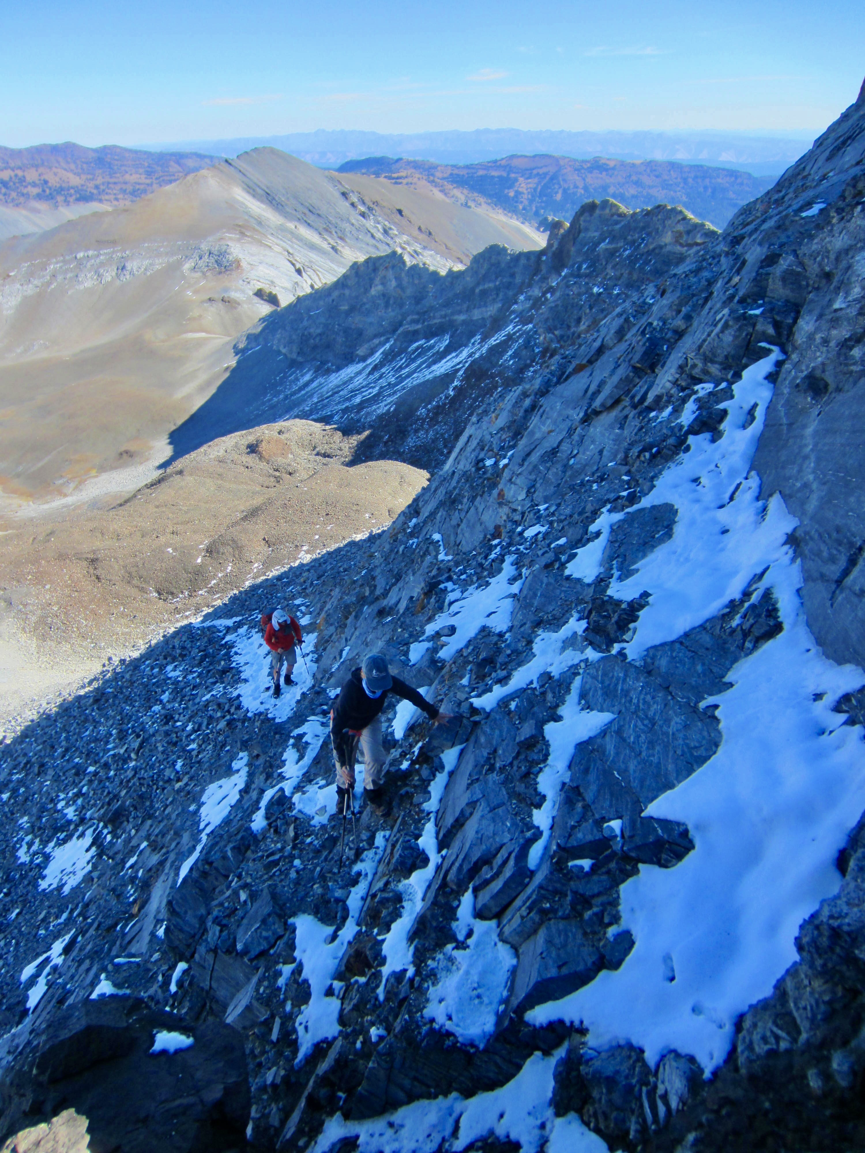
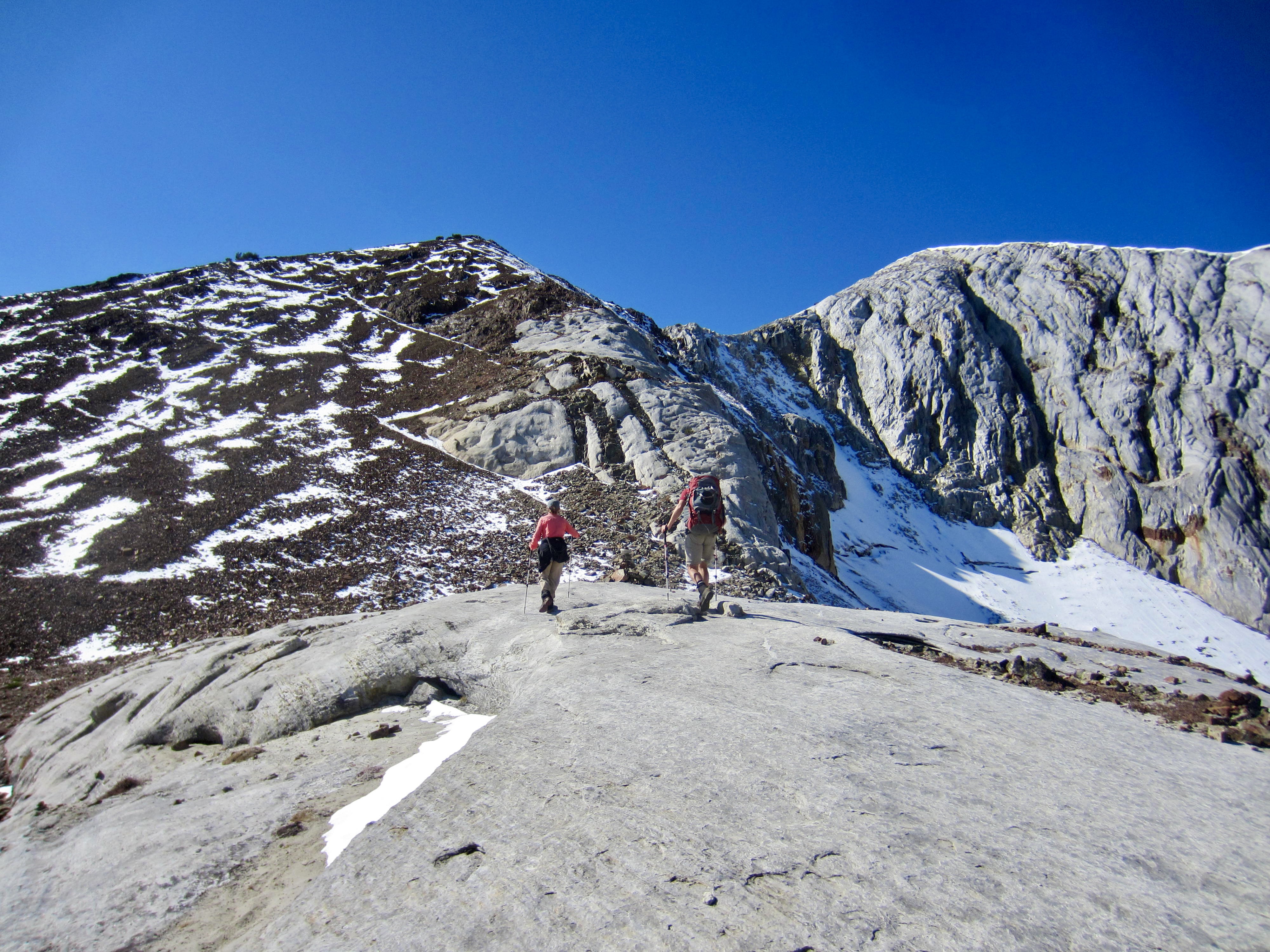
Cusick Mountain was visible straight ahead, and we could see lots of fresh snow on its shady north face. These conditions would undoubtedly make the climb more challenging but, hopefully, not too difficult. We continued ascending slabby limestone on a minor rib that separates the mountain’s craggier northwest and northeast ridges. I’d never climbed on limestone before this trip, so I didn’t know that it could be such fun!
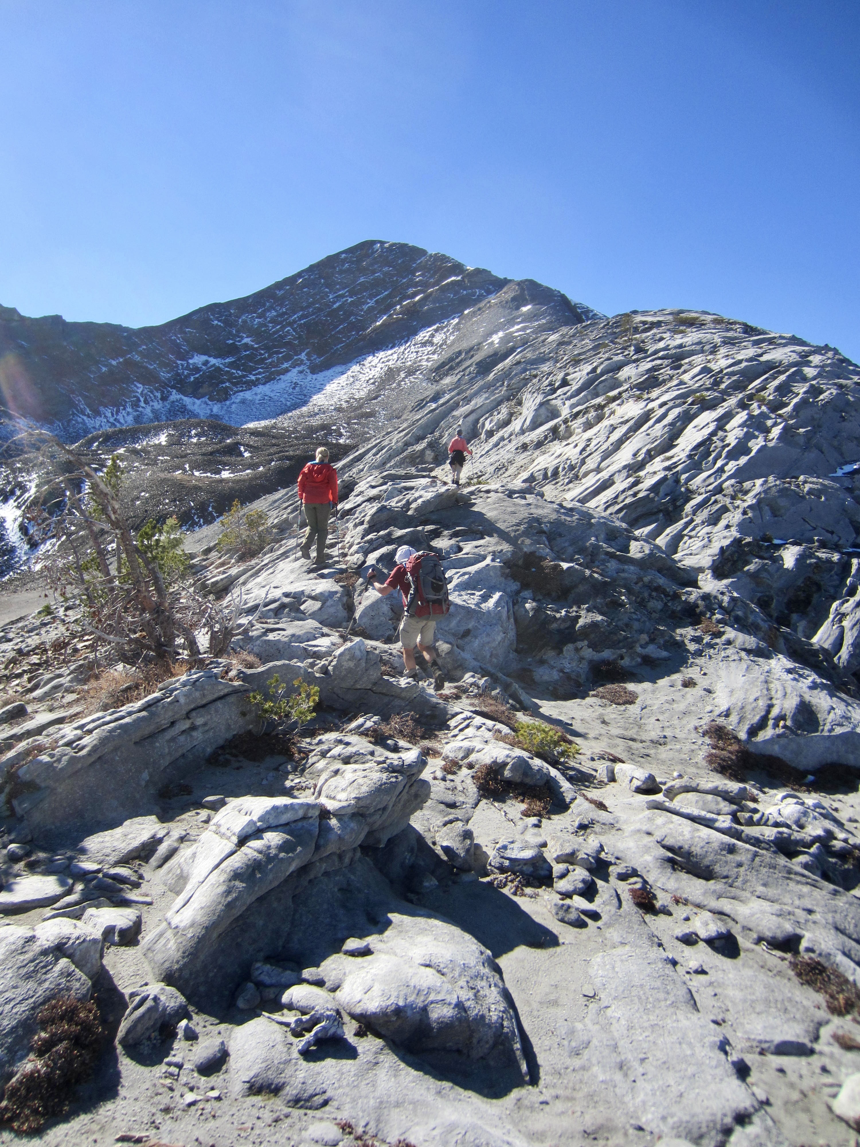
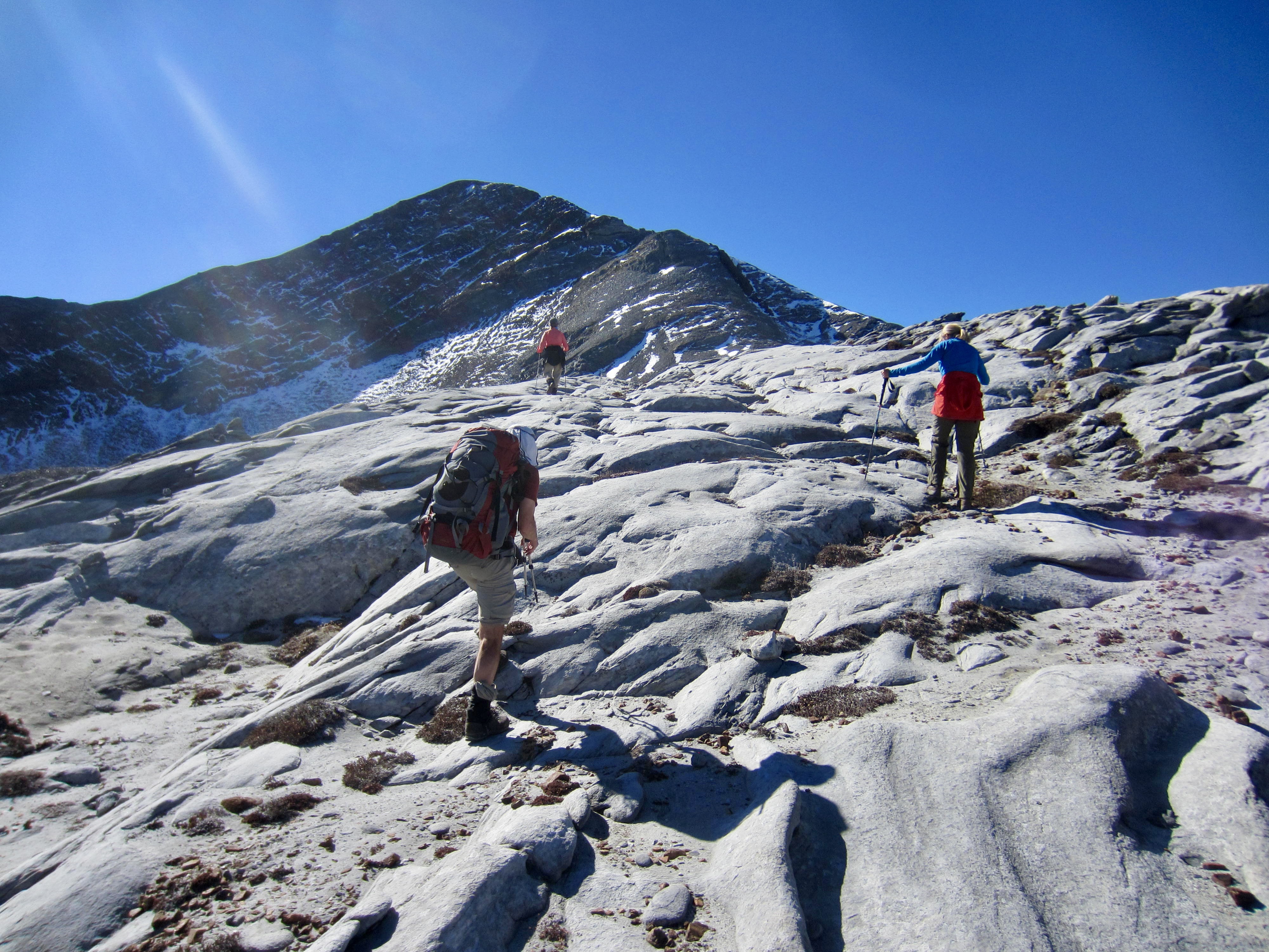
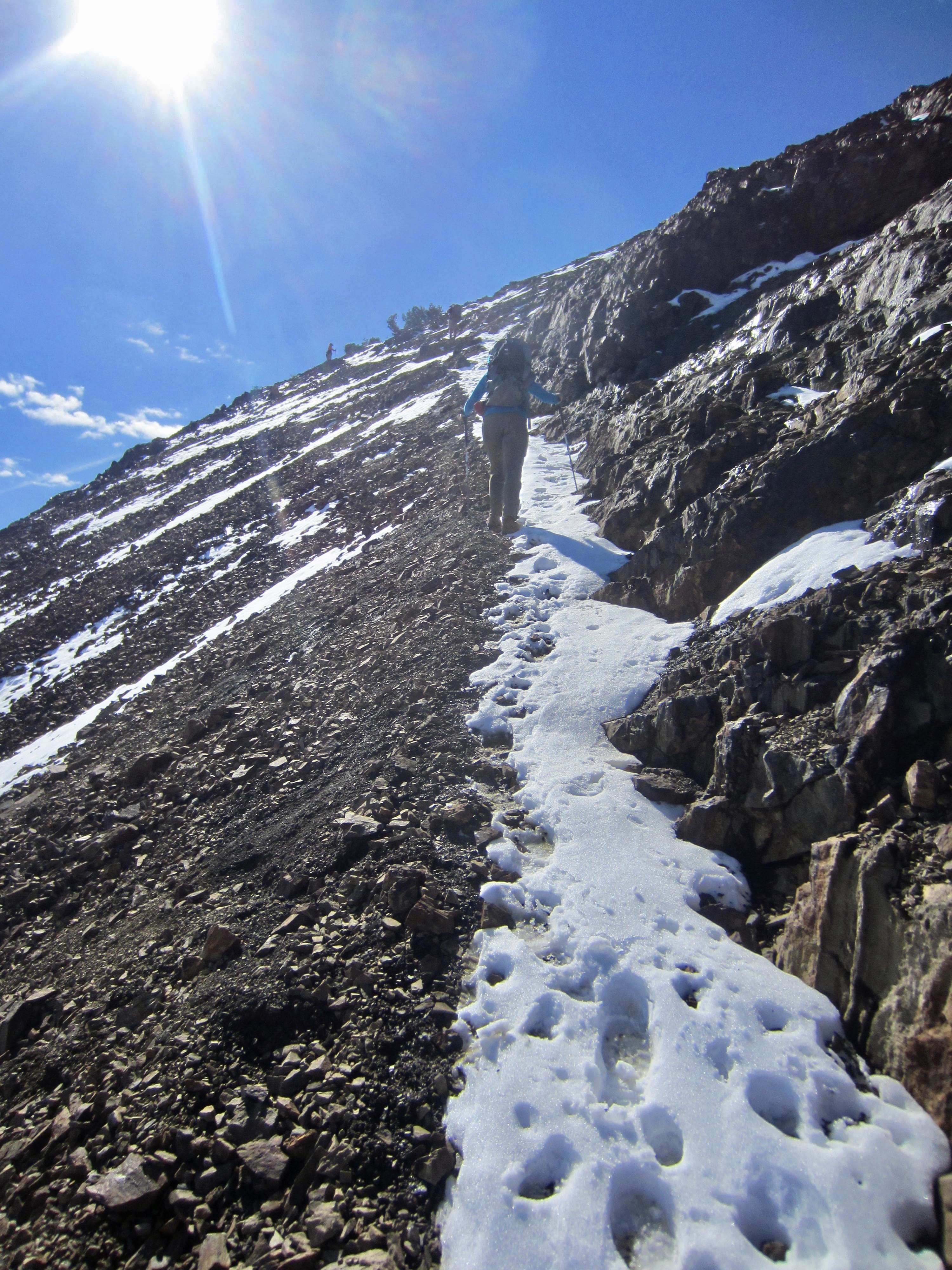
Our easy north rib gradually melded with the mountain’s north face and northwest ridge, leaving us to scramble up a series of snow-covered ledges. A few moderately exposed Class 3 moves—the crux of our climb—were required to gain the northwest ridge at 9200 feet.

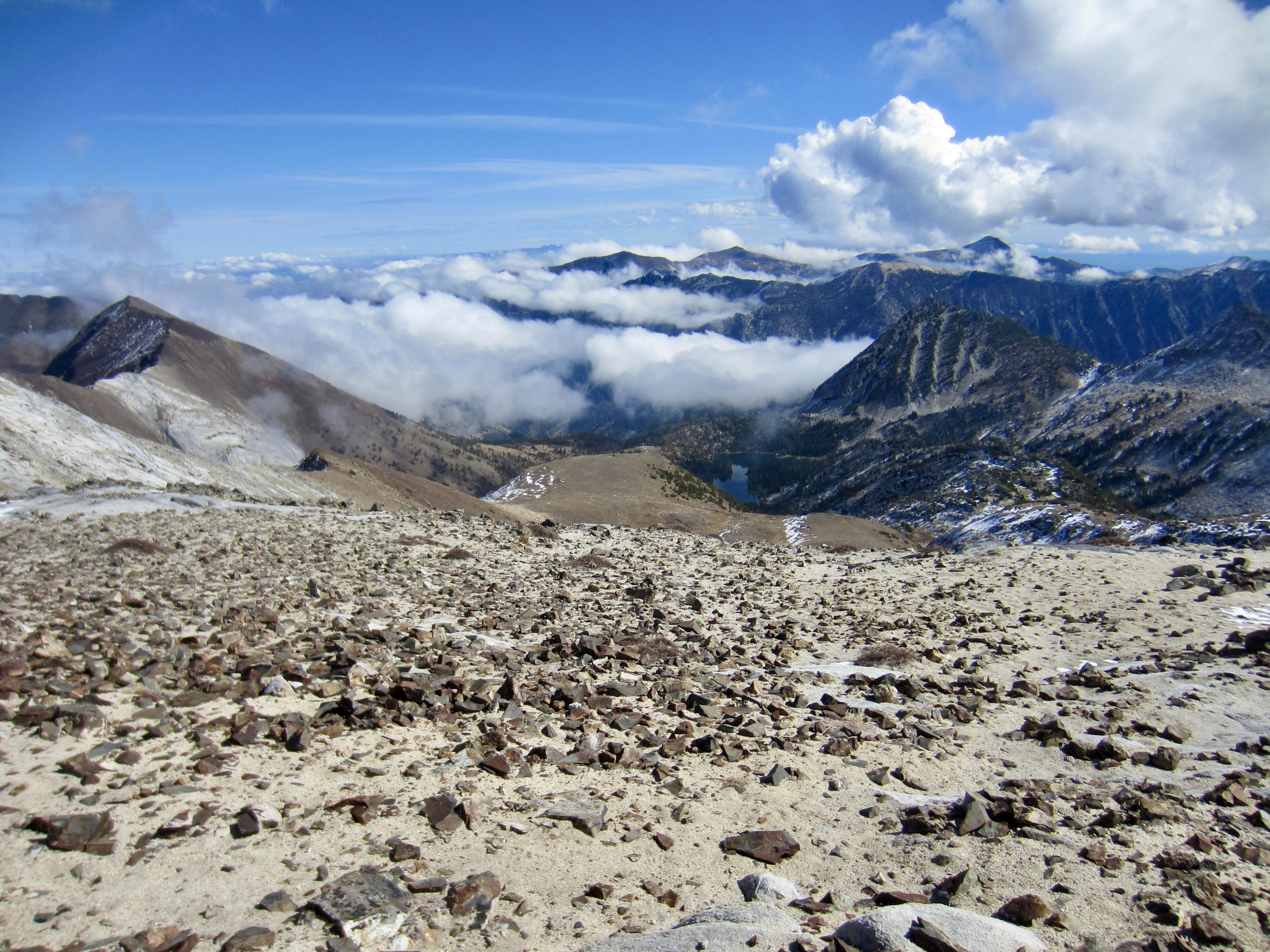
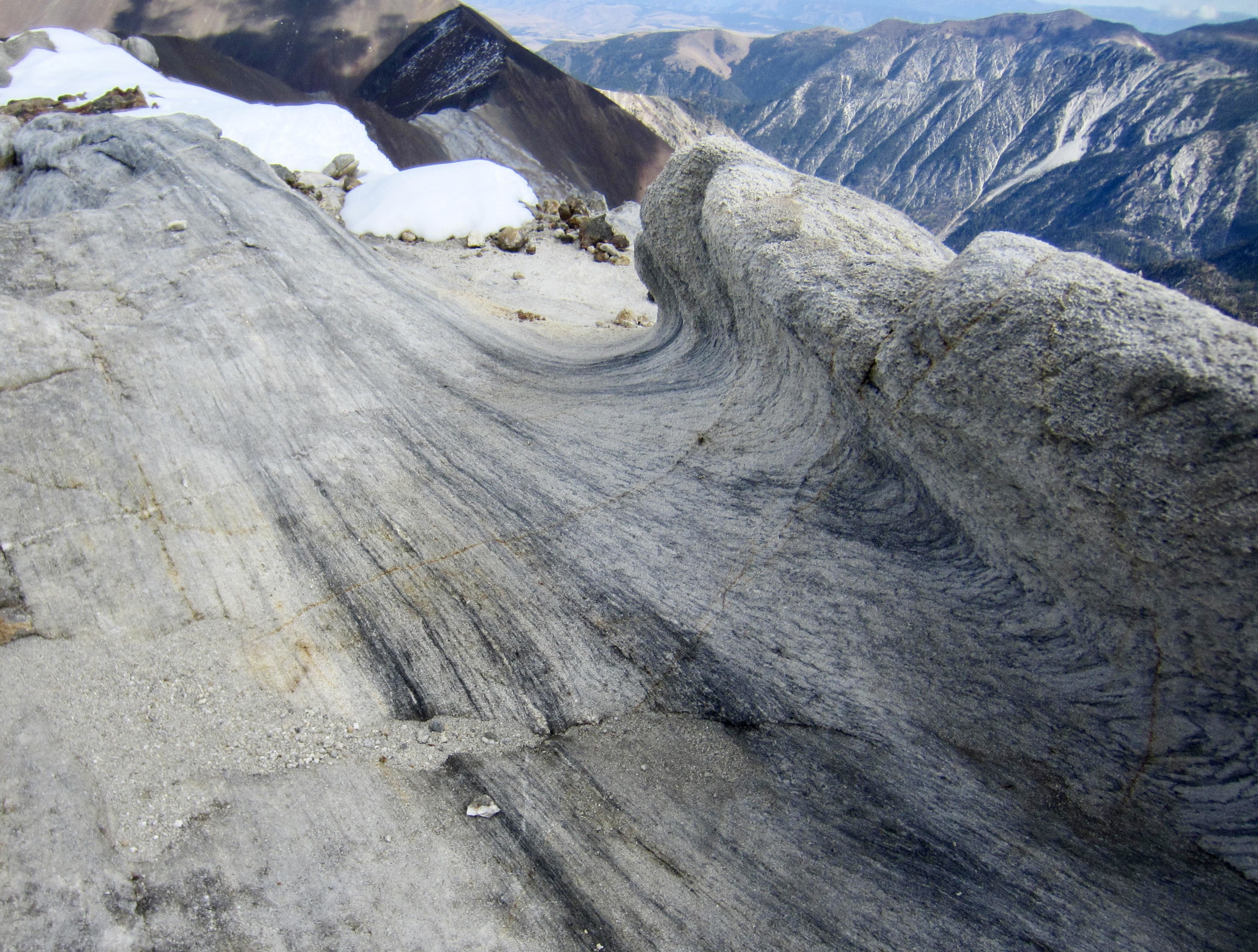
Upon gaining the northwest ridge, it was a straightforward hike up the crest, and we stepped onto the summit at noon (3.0 hours + 2350 feet from Camp 3). Cusick Mountain has an interesting geomorphology: a steep, glacially plucked face on the north side, a convex felsenmeer (“rock sea”) on the west side, and a uniform sand slope on the east side. Long ridges extend out to the northwest and northeast like open arms that cradle Honeymoon Basin.
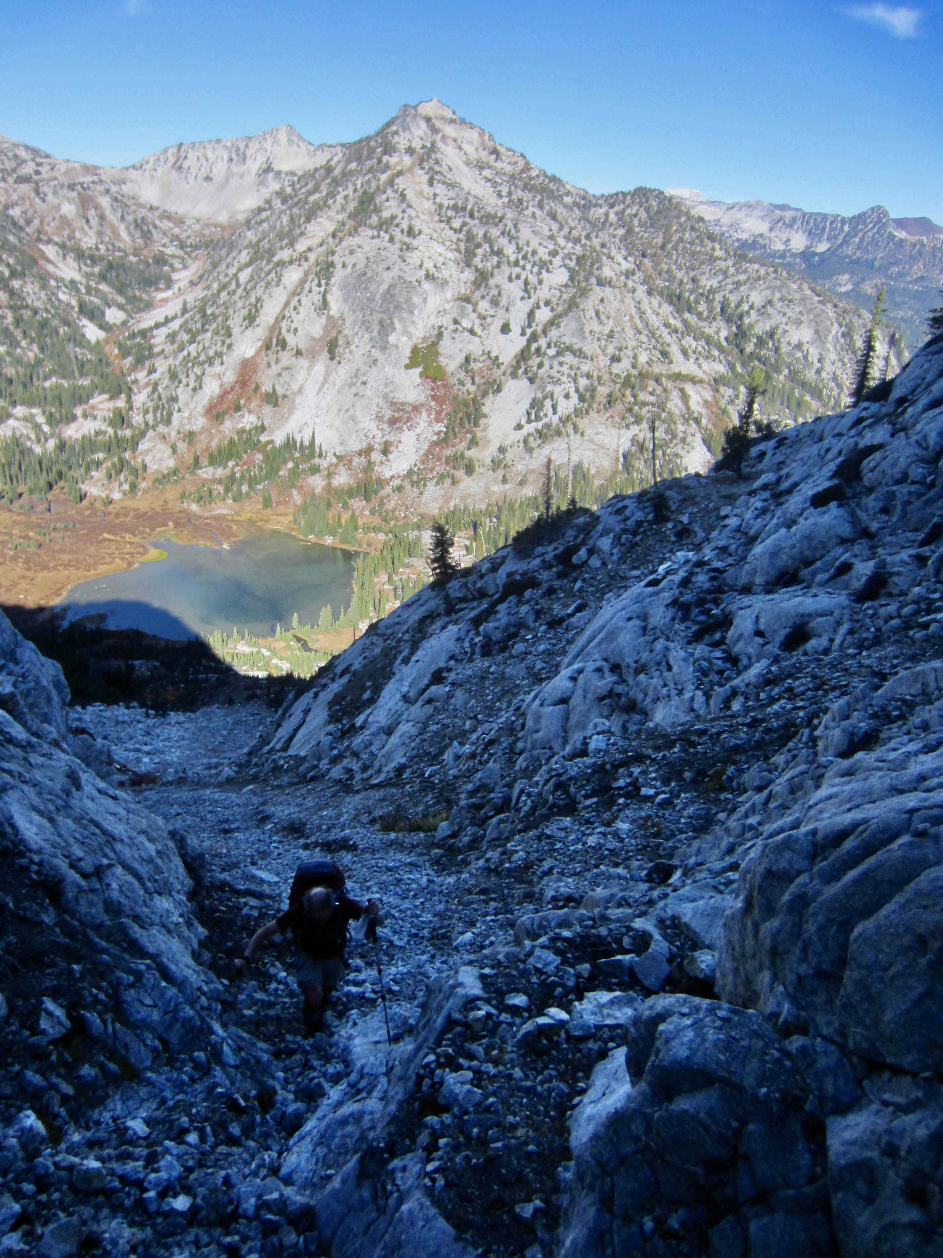
We descended via our up-route, carefully scrambling down the north rib to Honeymoon Basin and then on down the slanting gully to Frazier Lake (2.3 hours from summit). The weather had warmed up nicely by the time we reached camp.
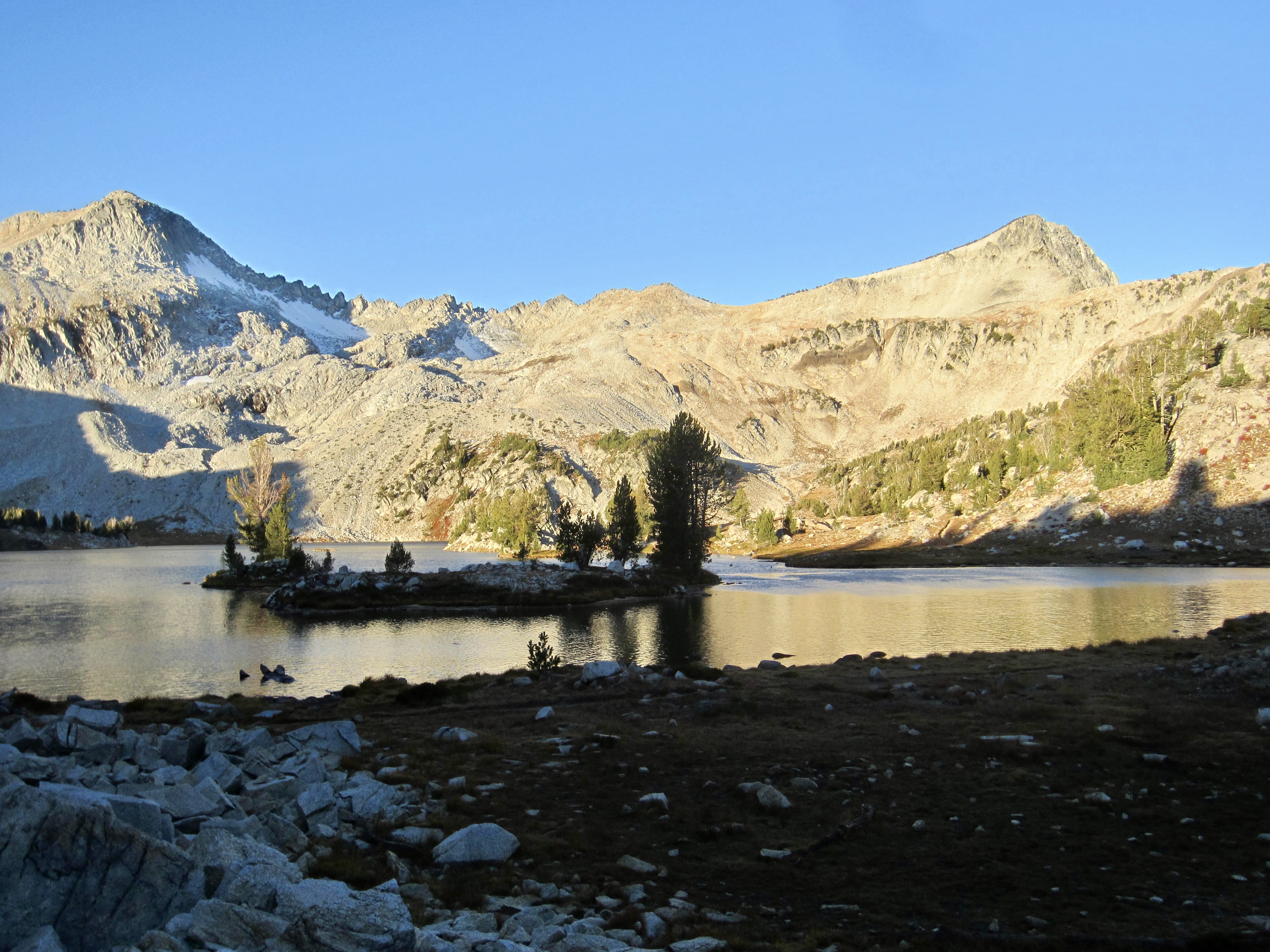
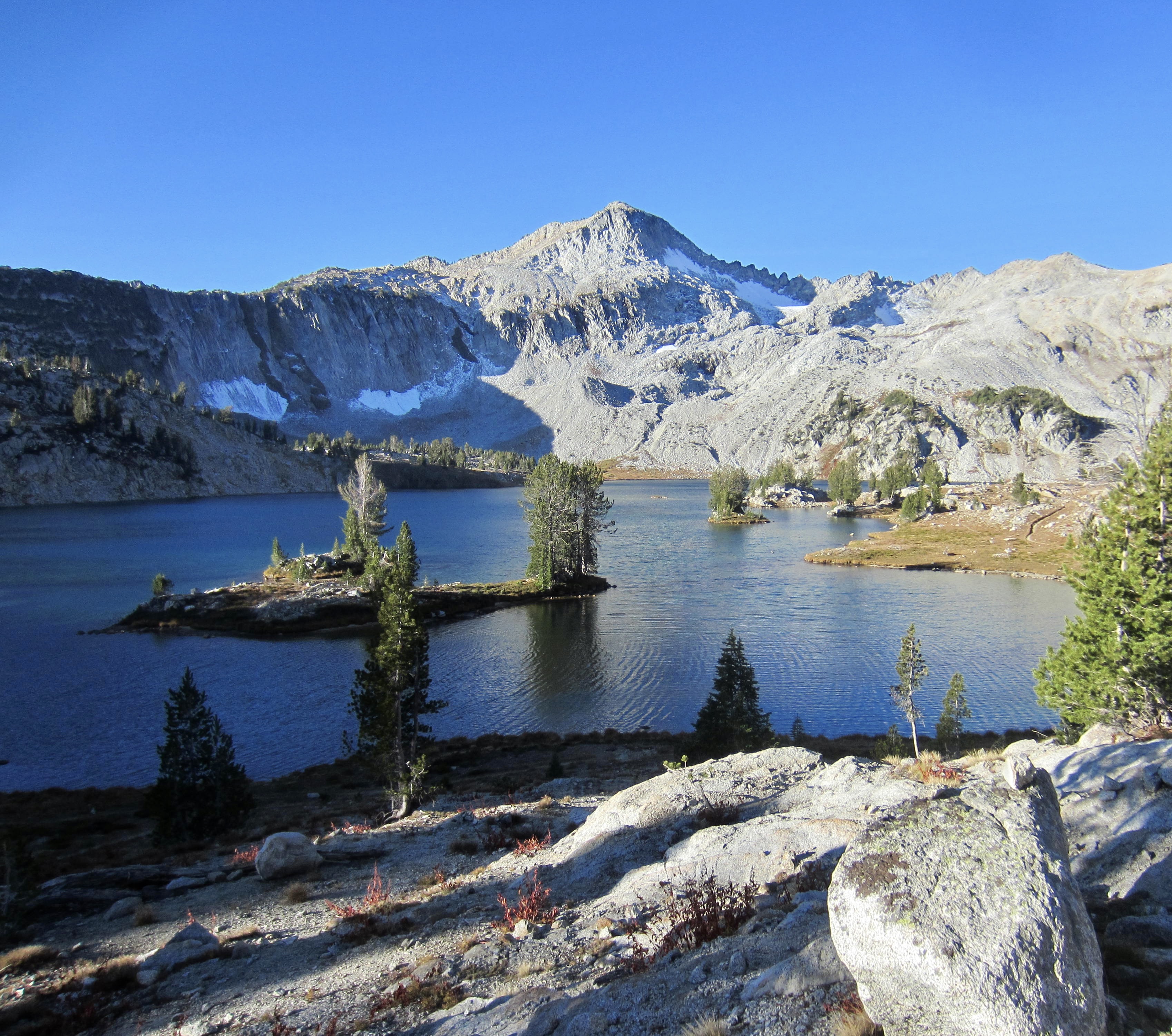
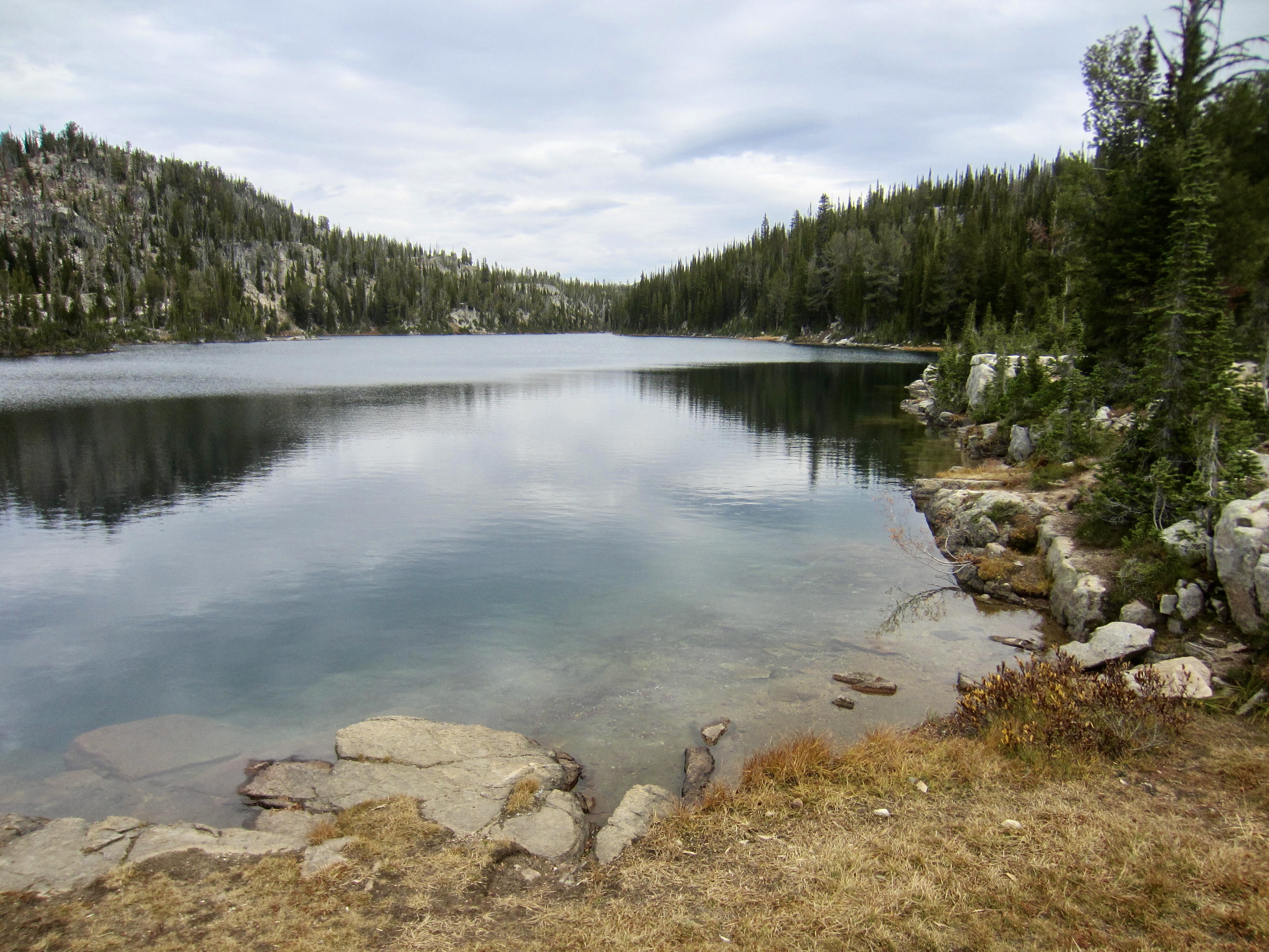
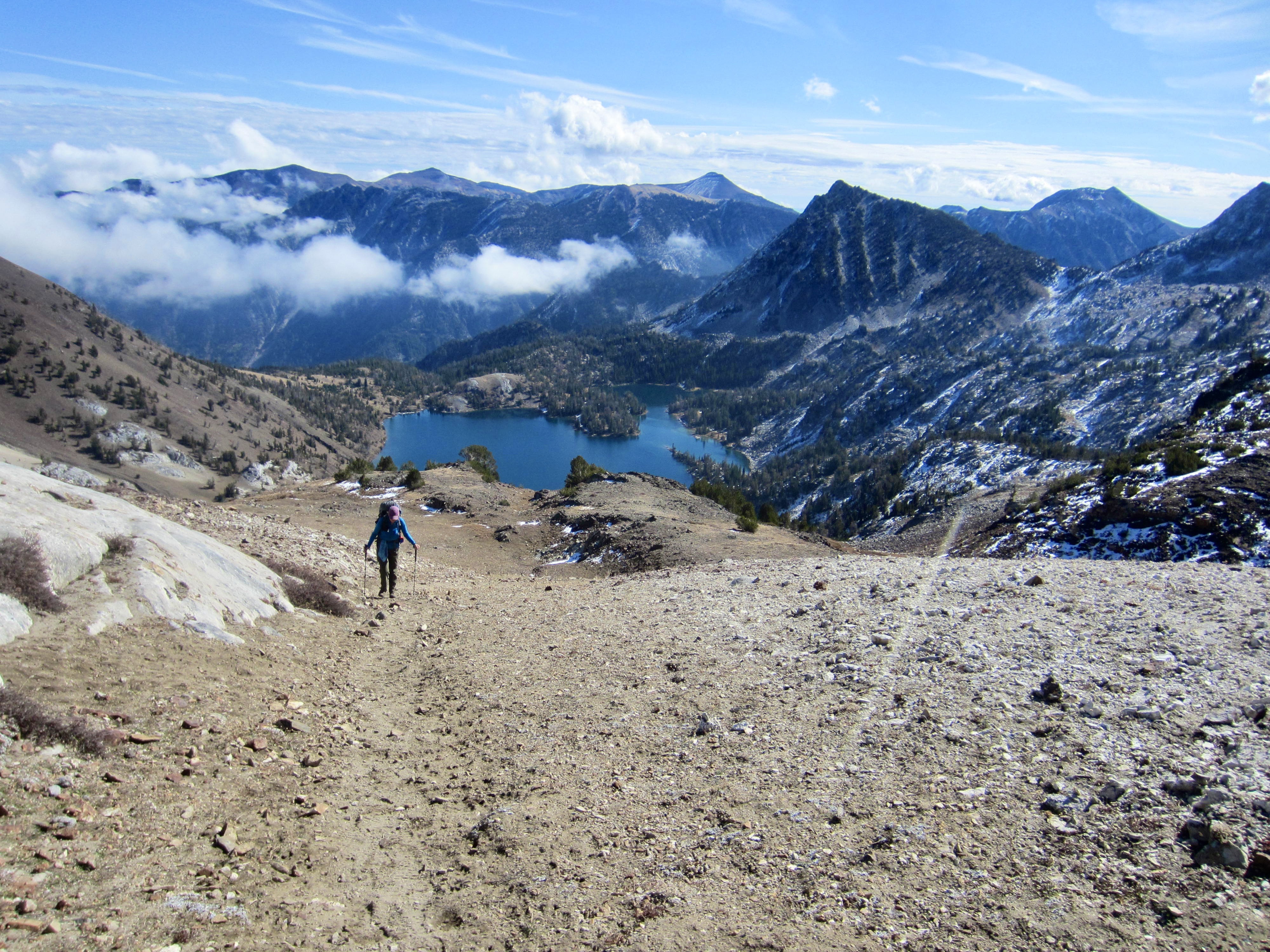
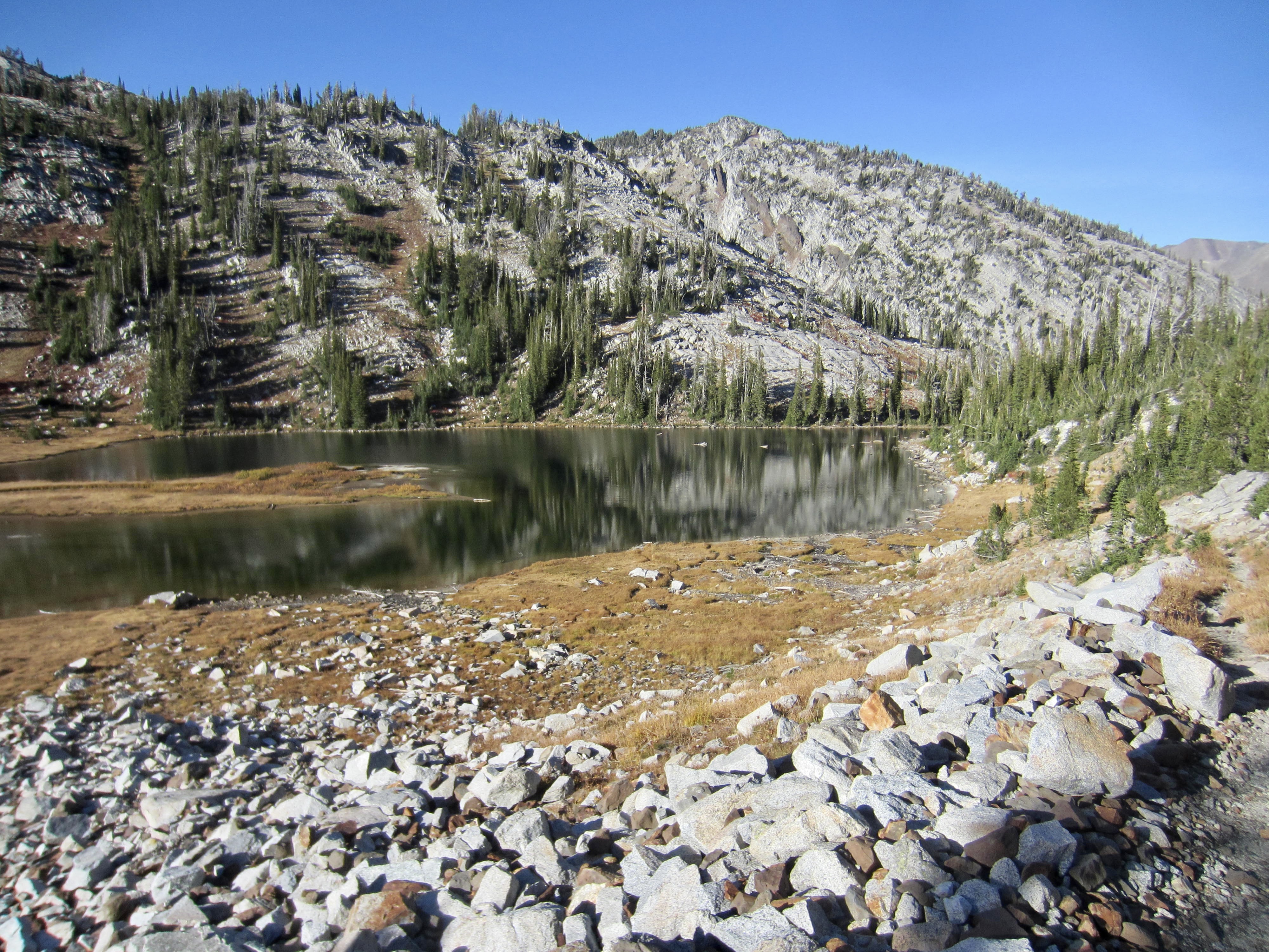
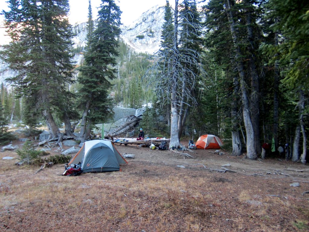
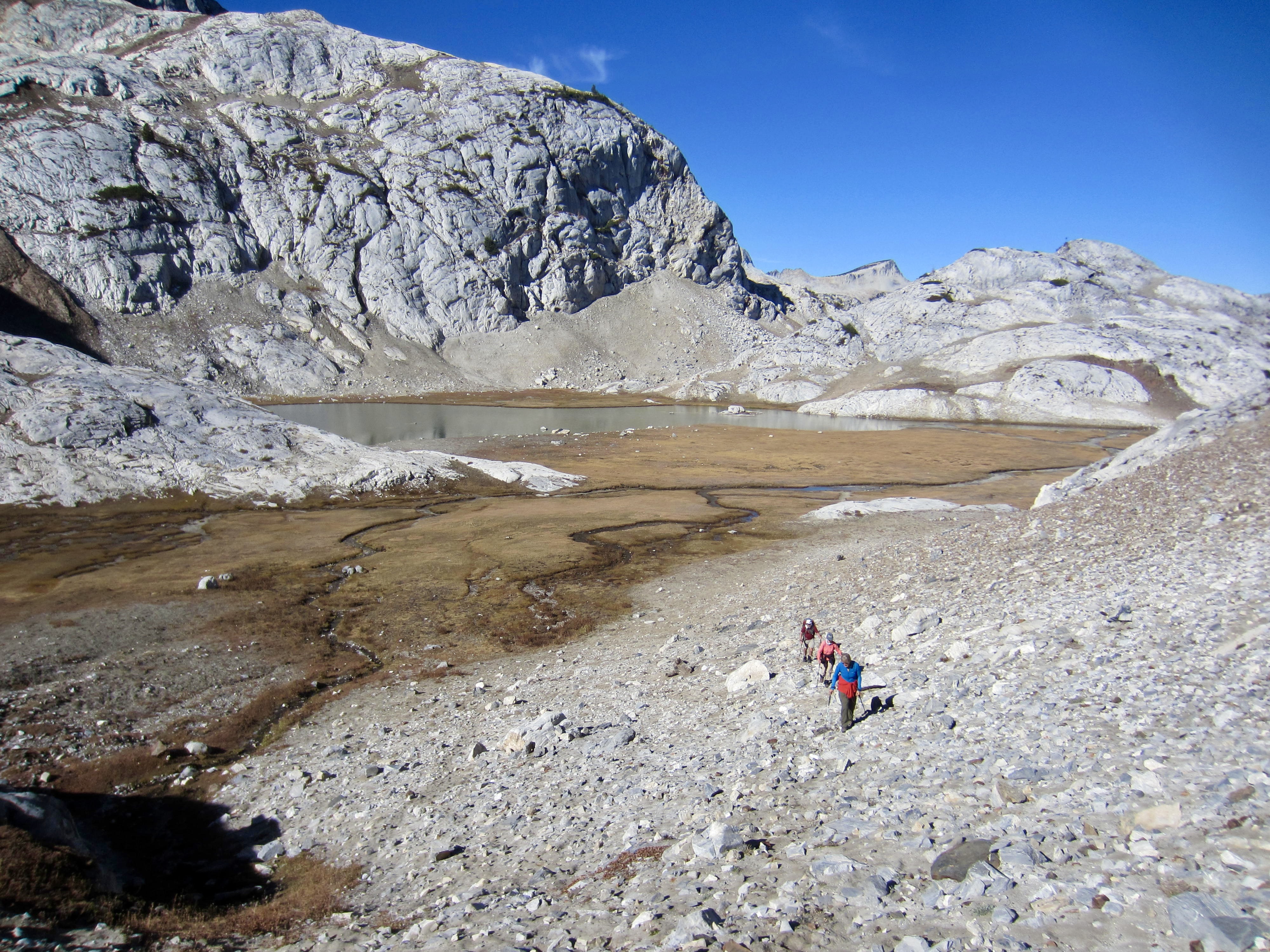
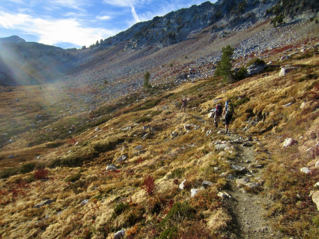
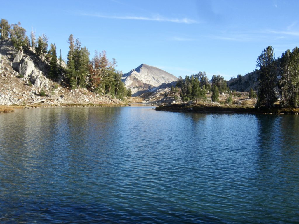
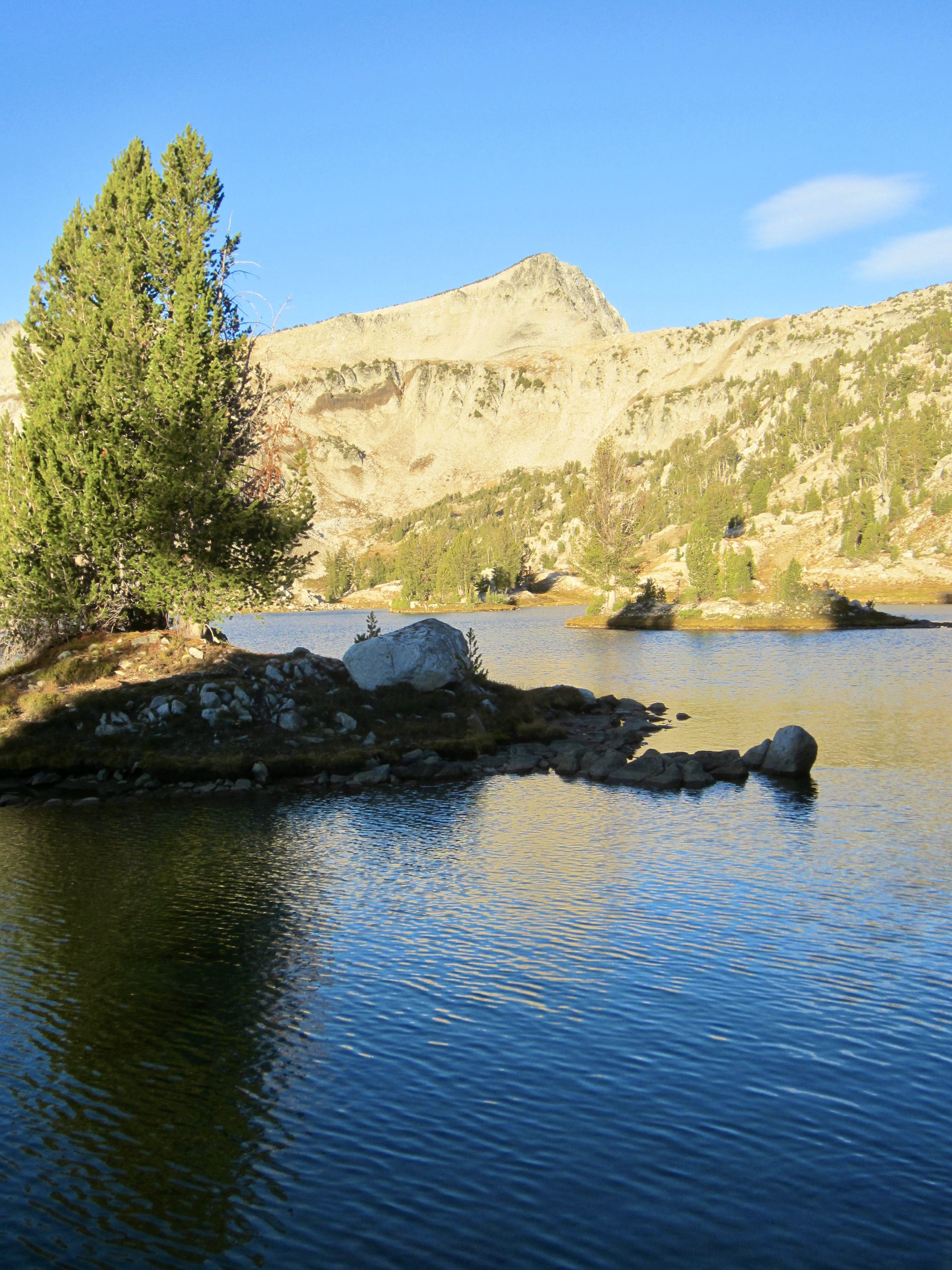
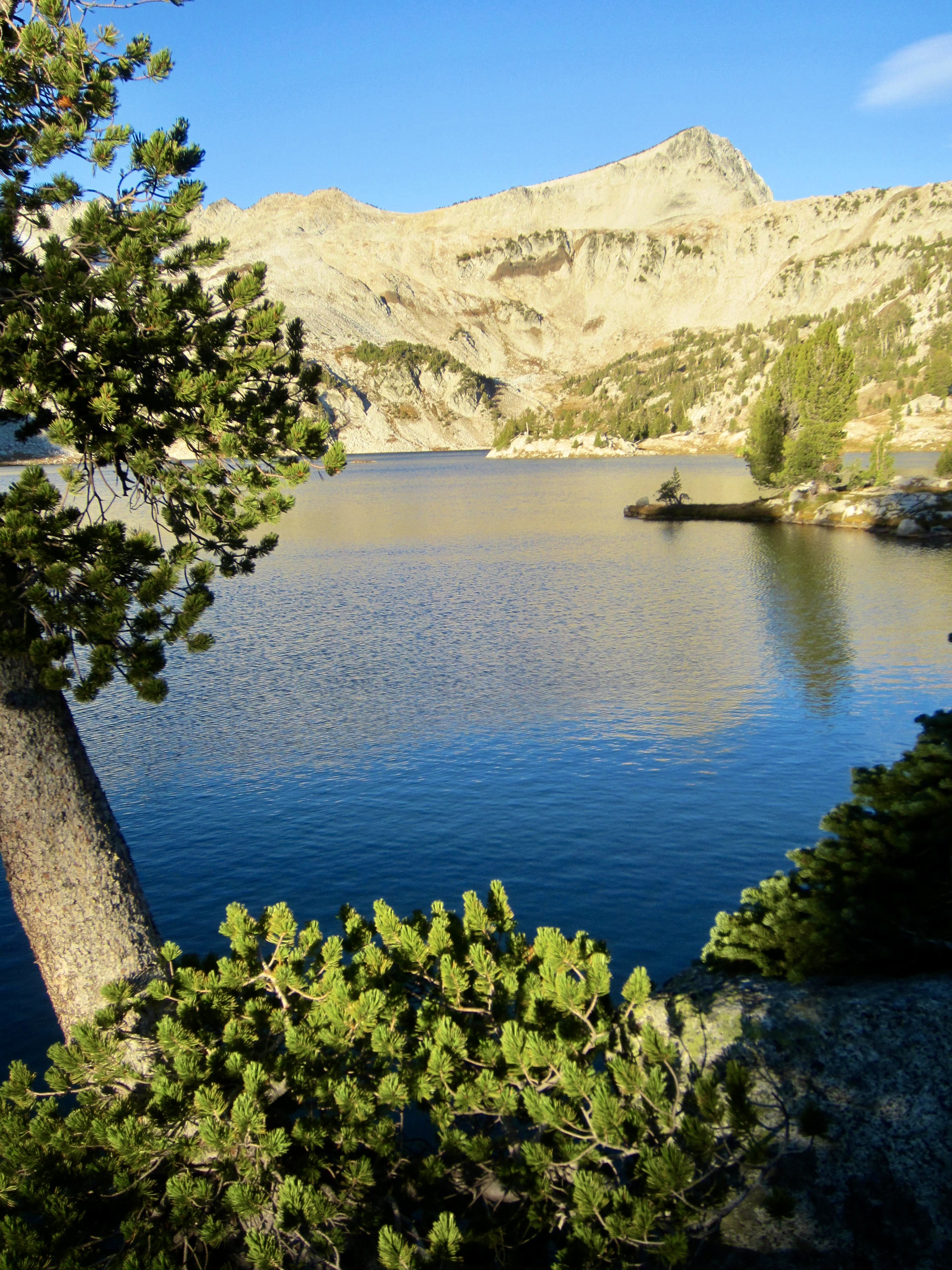
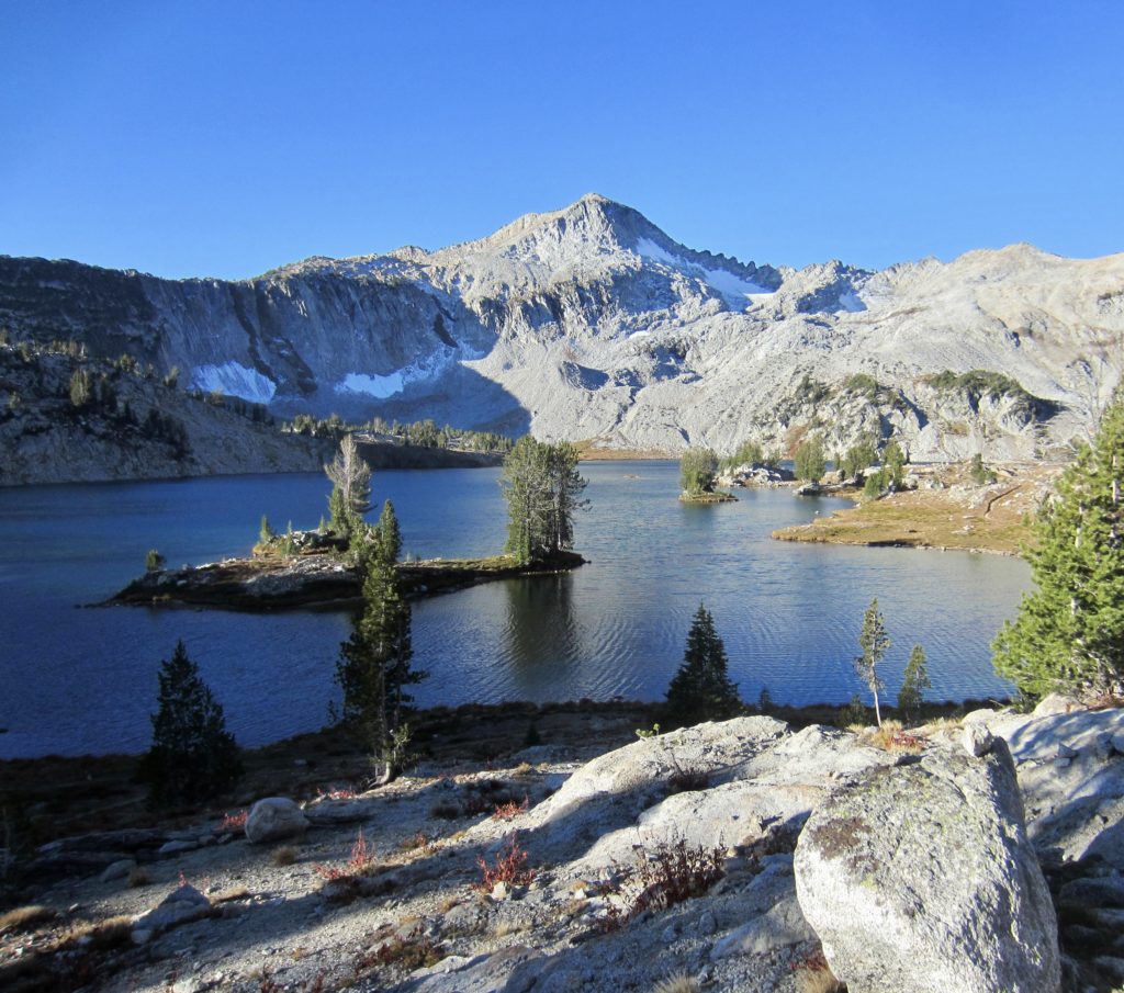
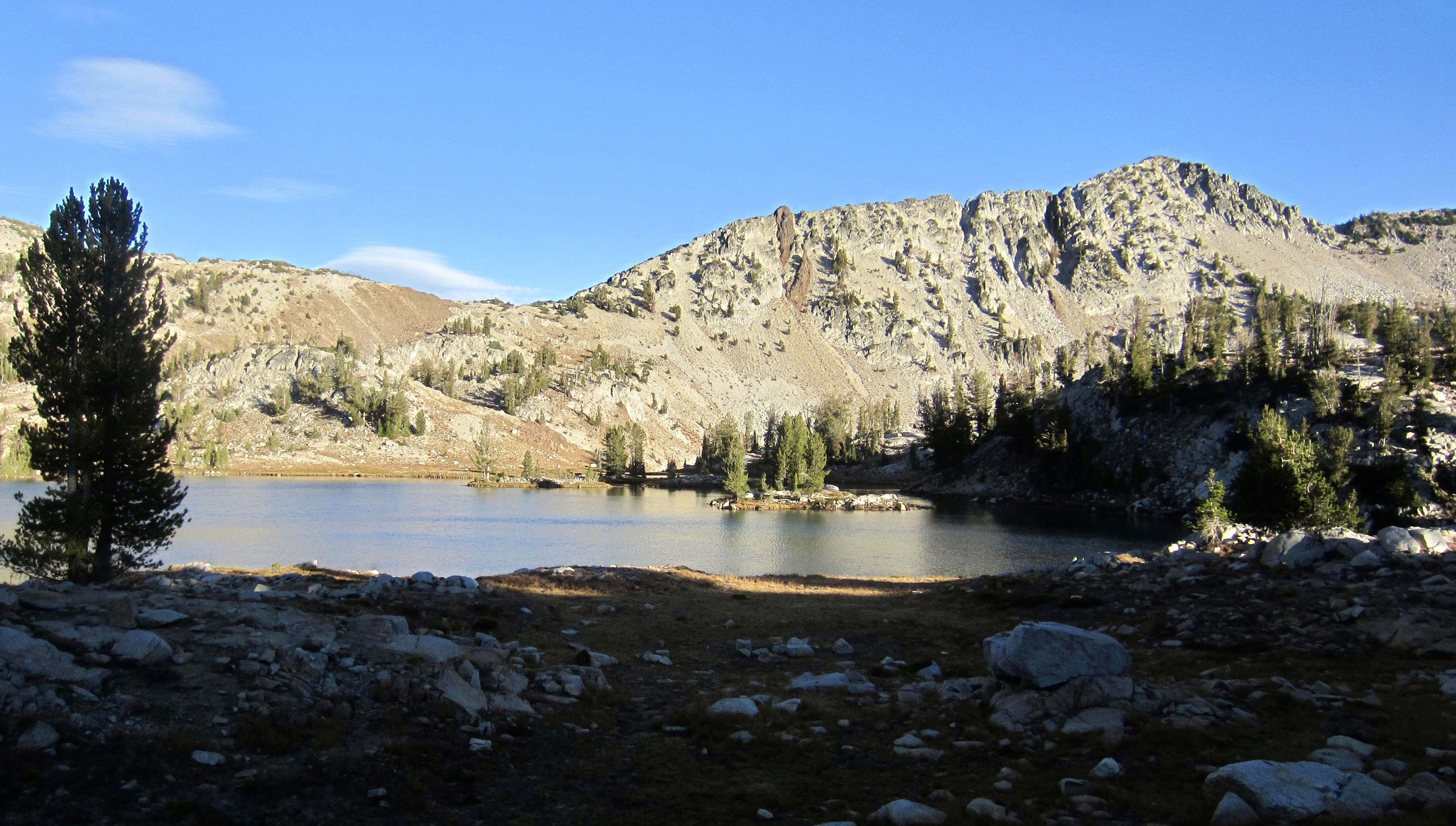
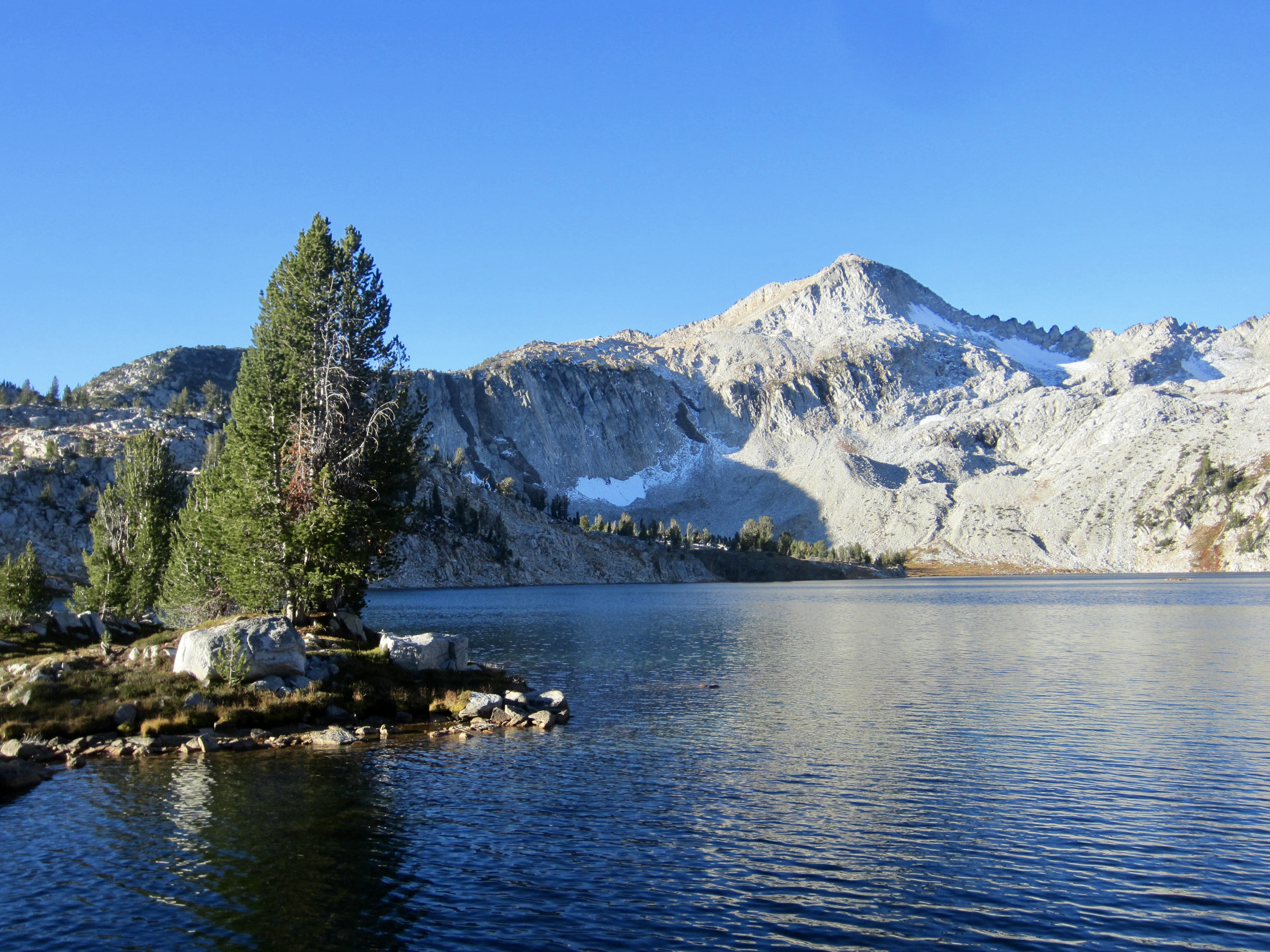
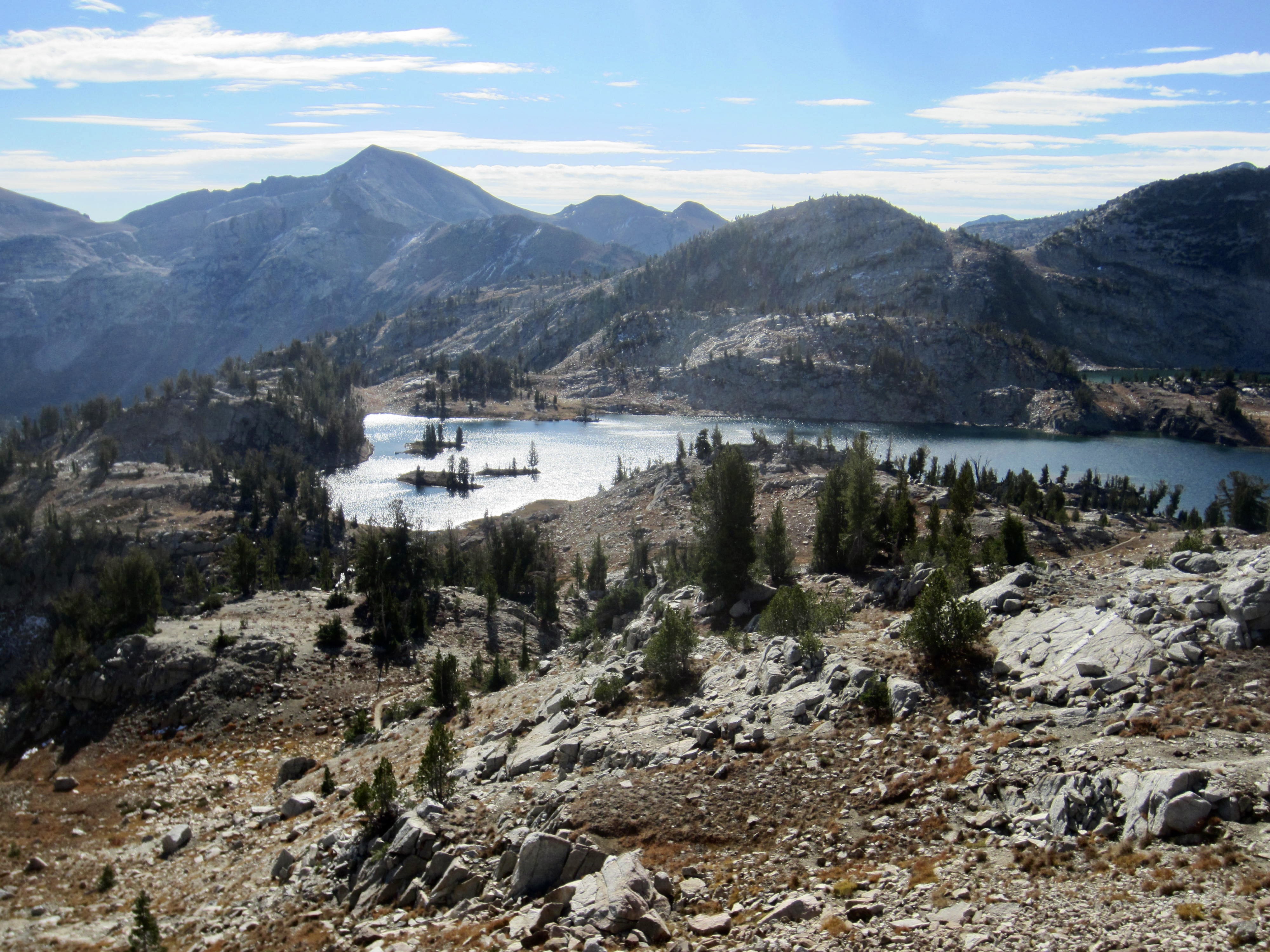
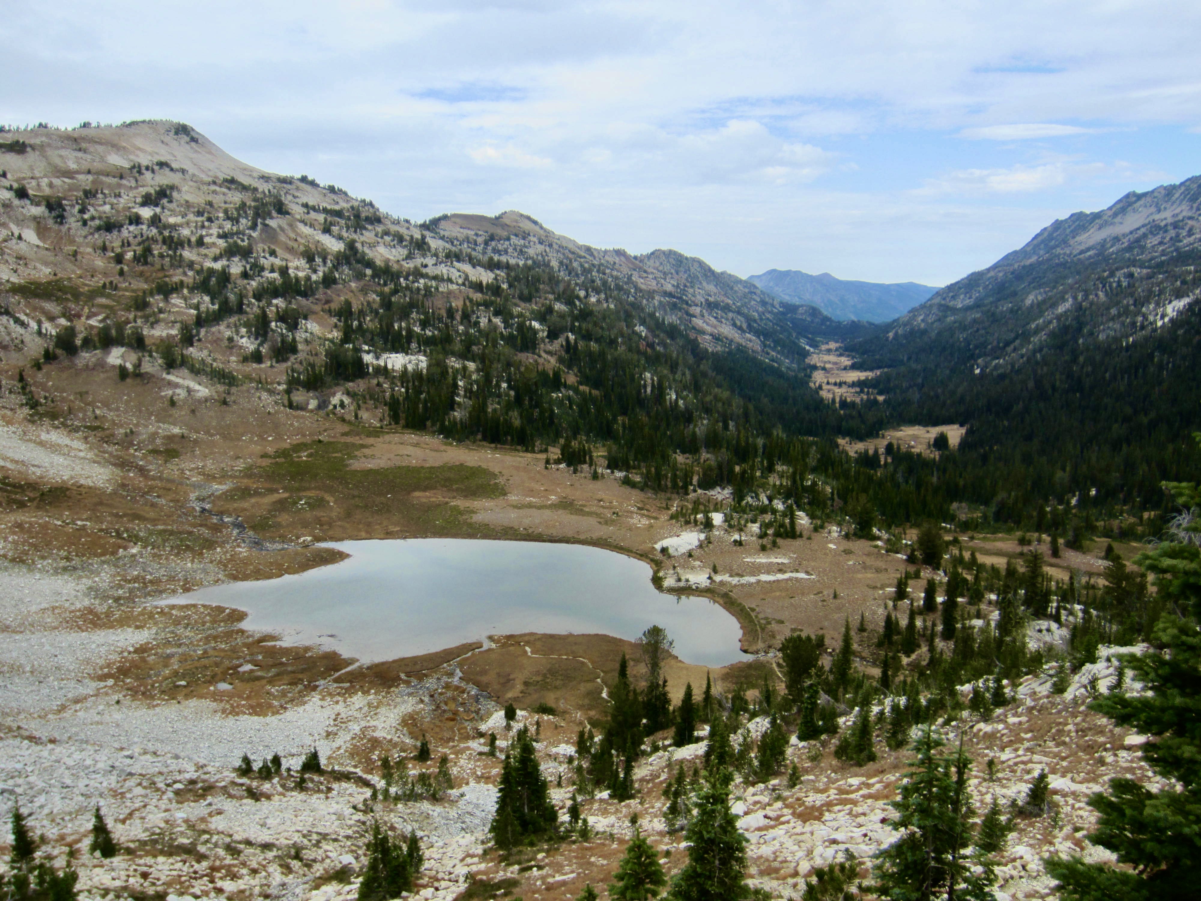
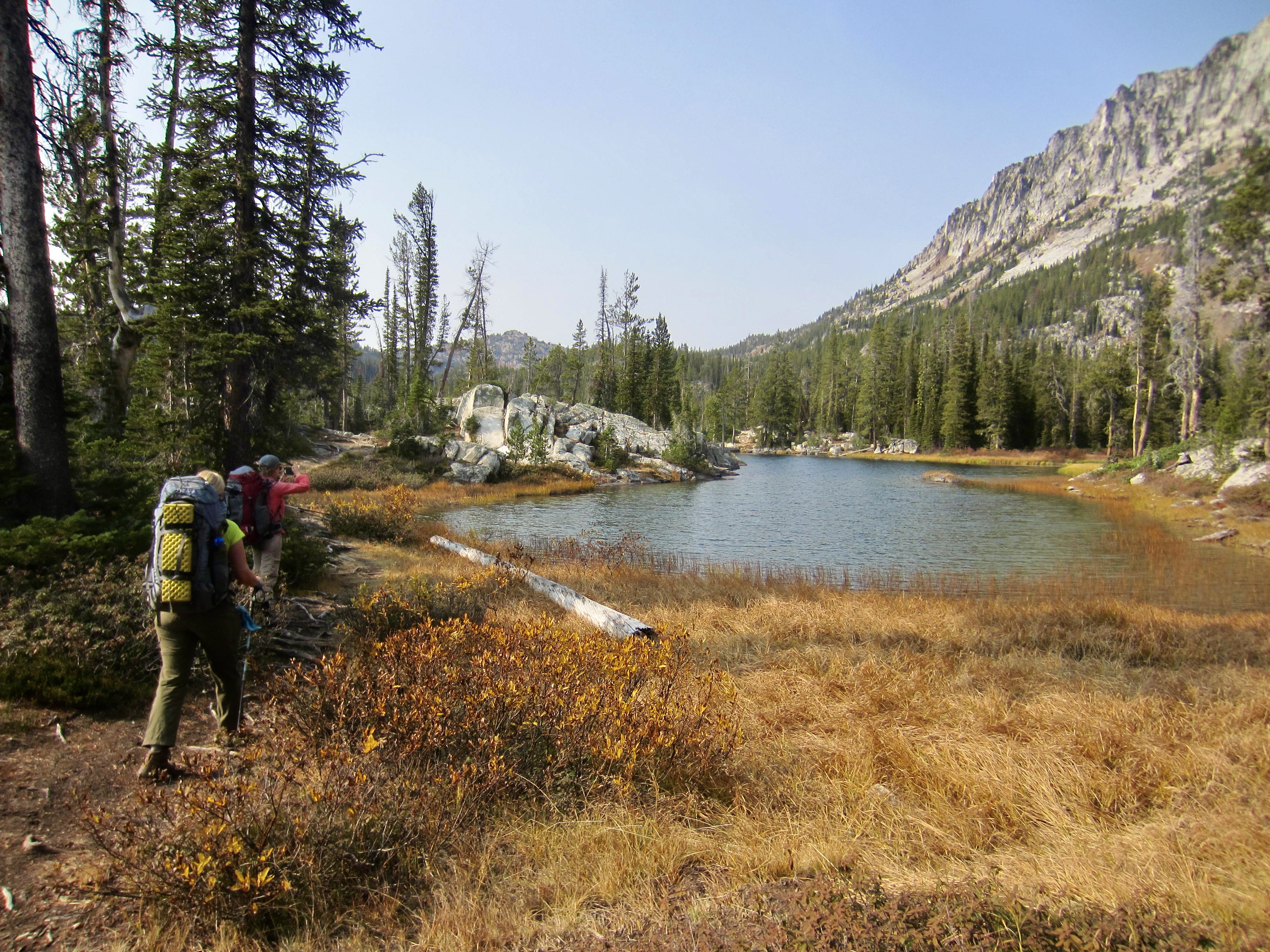
Once again, we had enough time remaining to move camp farther up-valley, so we packed up and headed out. The well-graded stock trail took us through a series of ever-more-delightful meadows until we arrived at Glacier Lake in late afternoon (1.2 hours + 2.0 miles + 1050 feet from Camp 3). Camp 4 was established in a small saddle overlooking the lake.
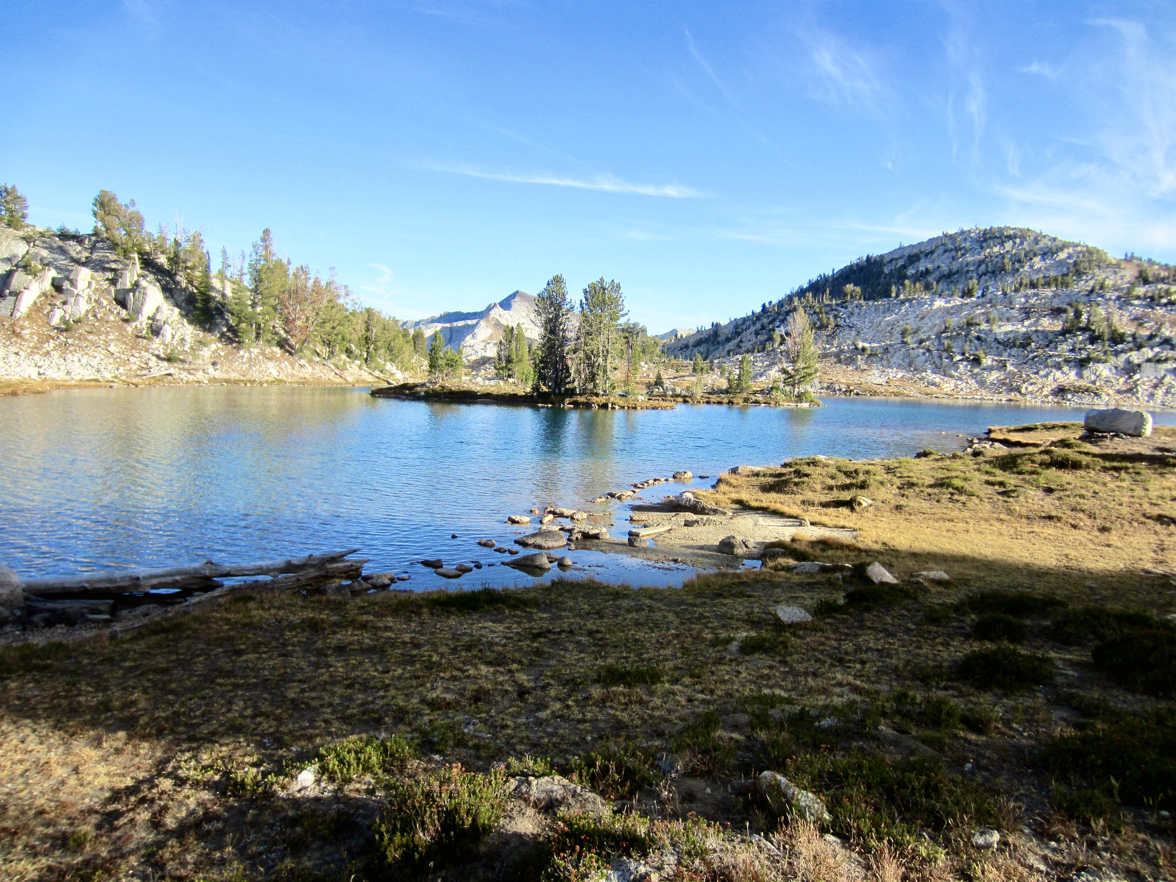
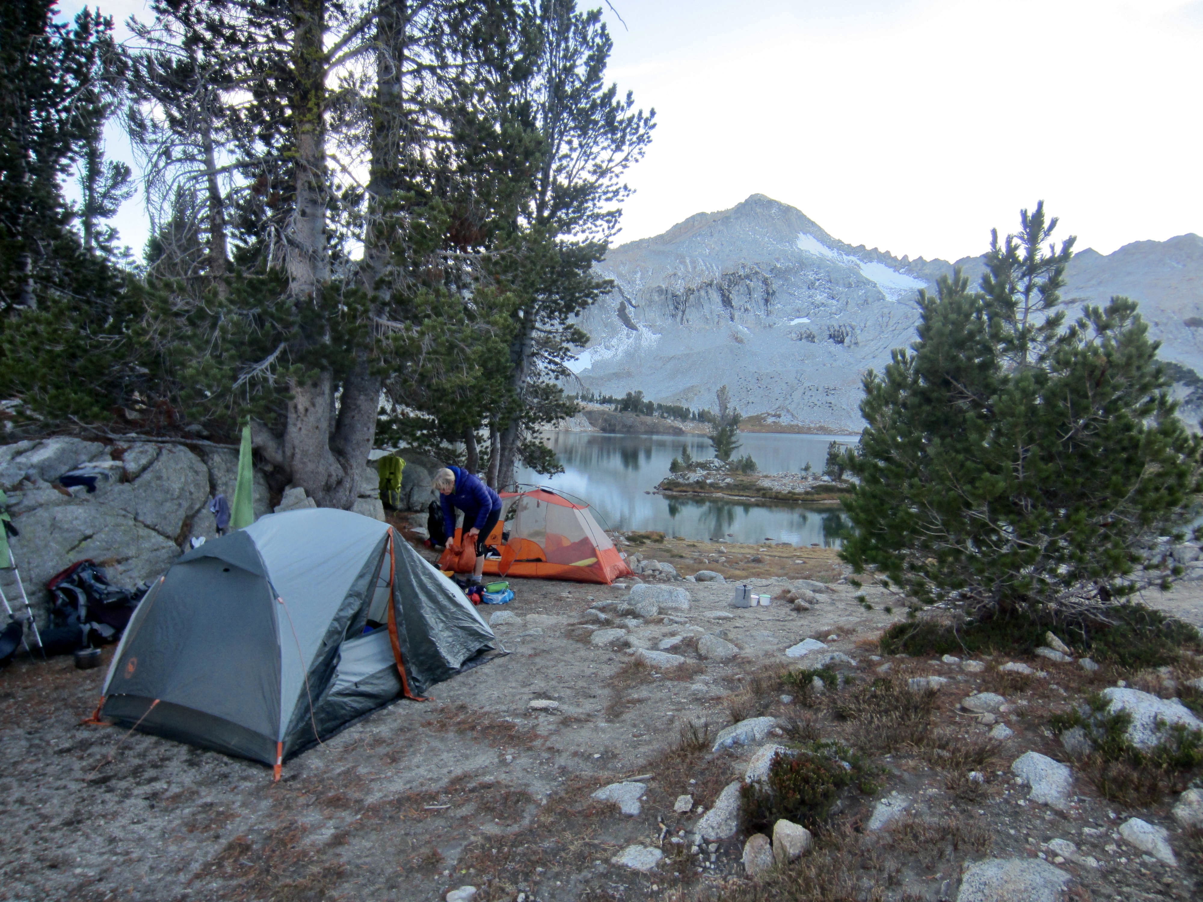
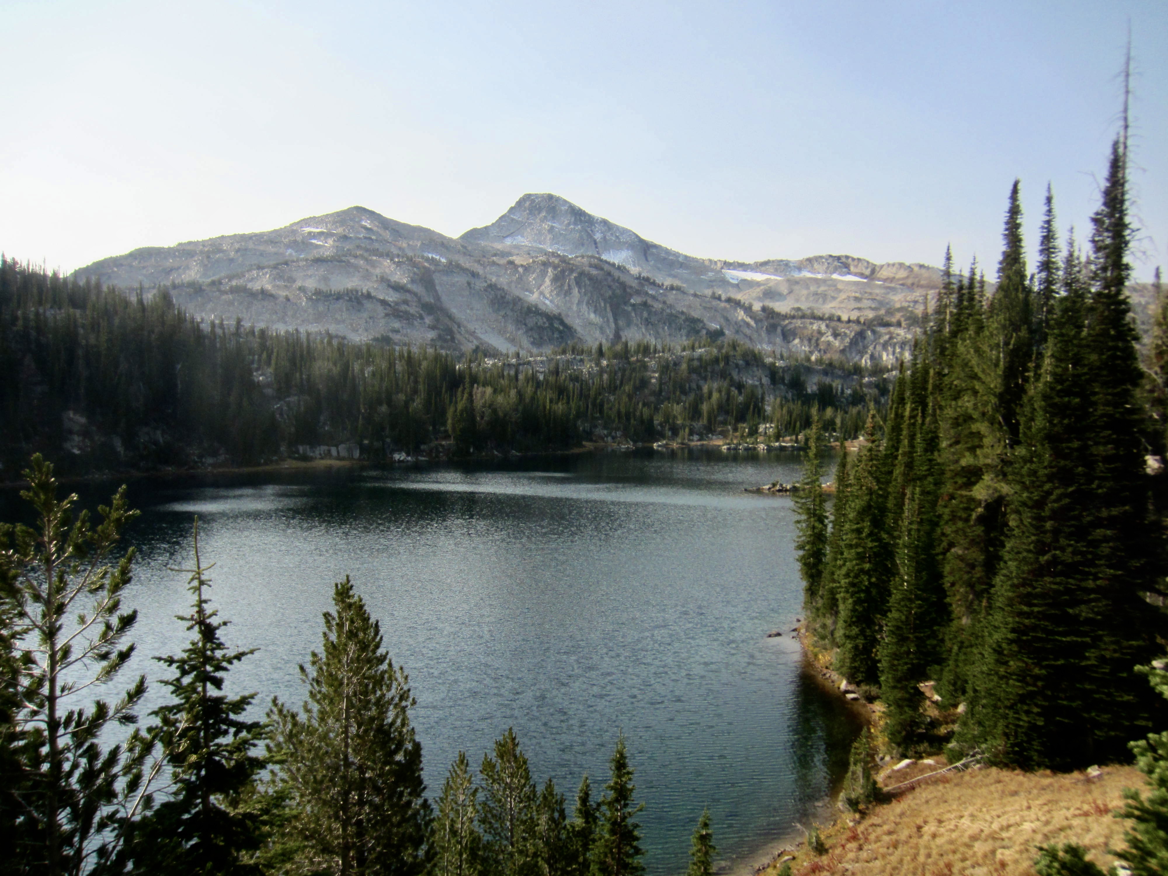
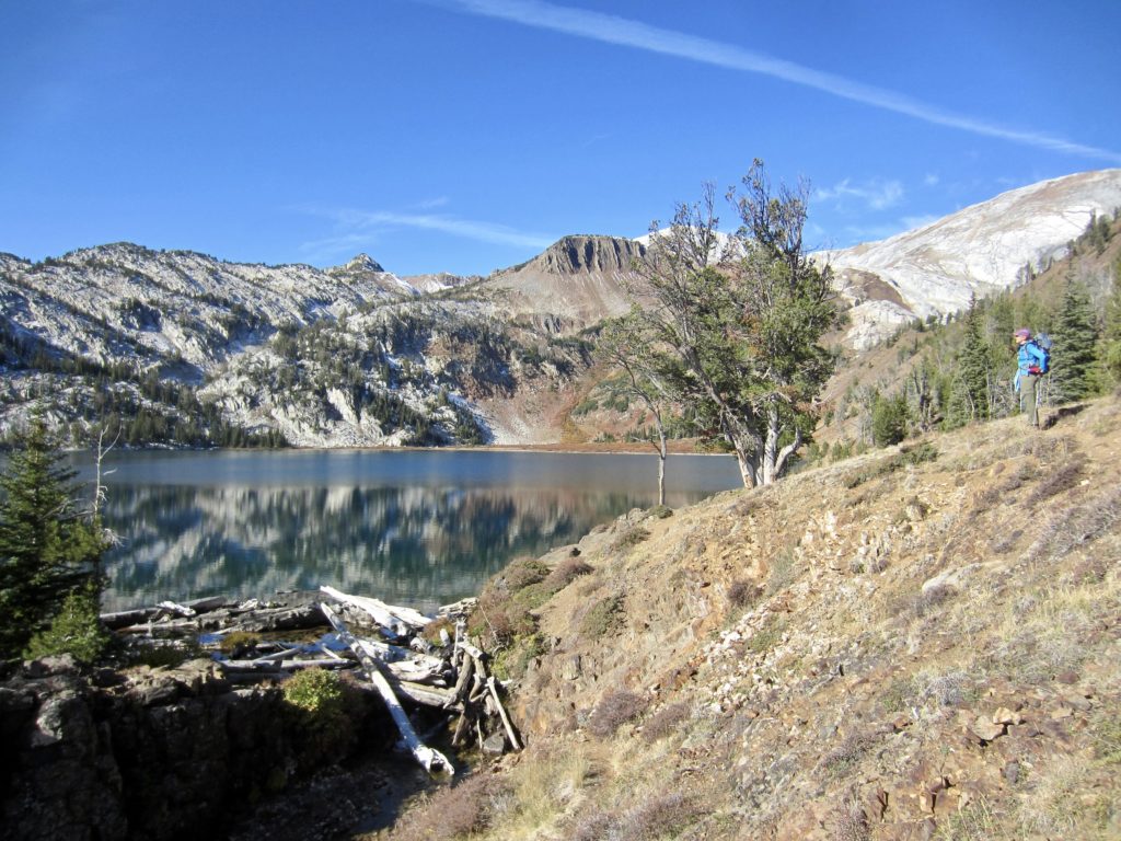
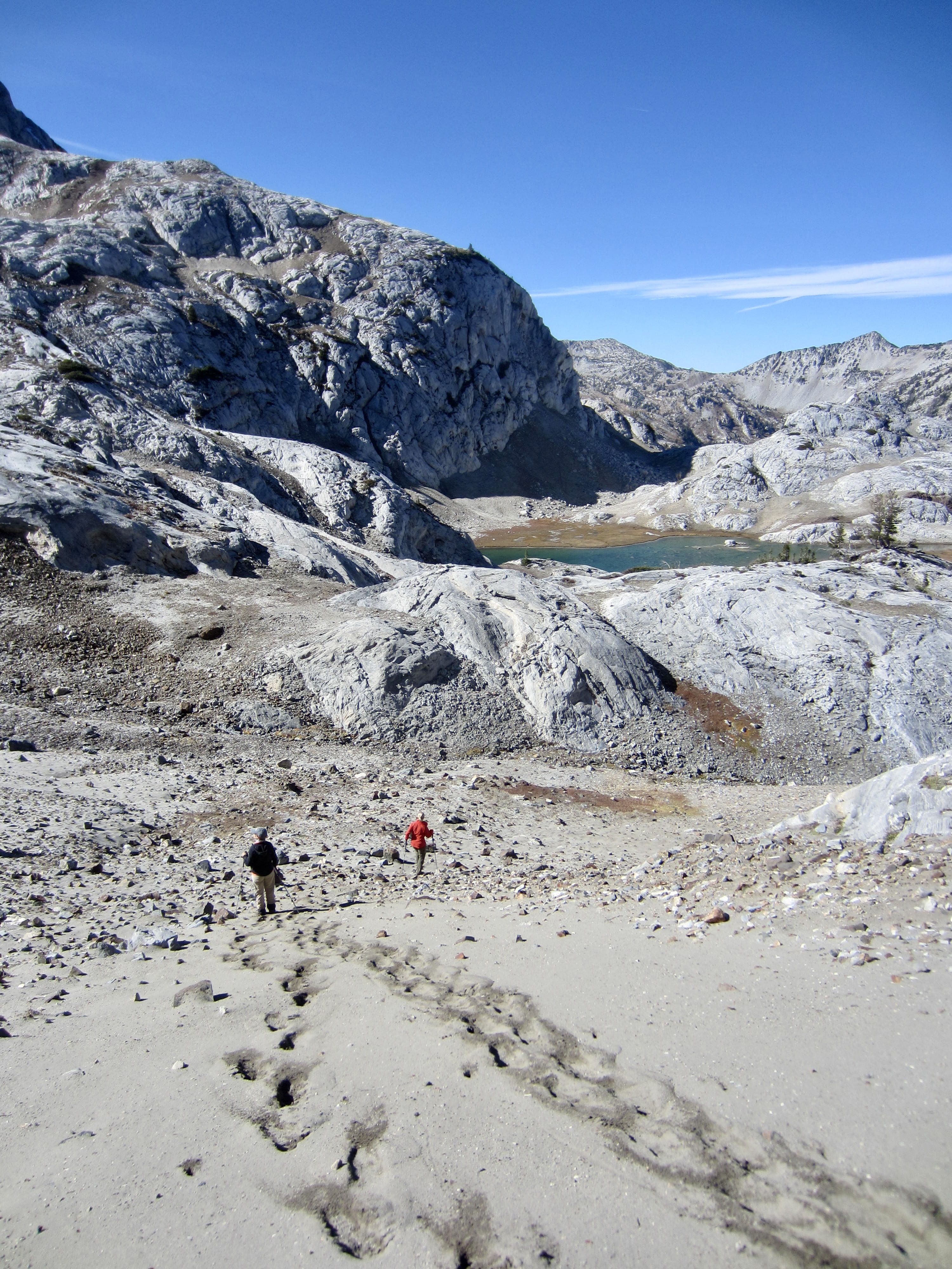
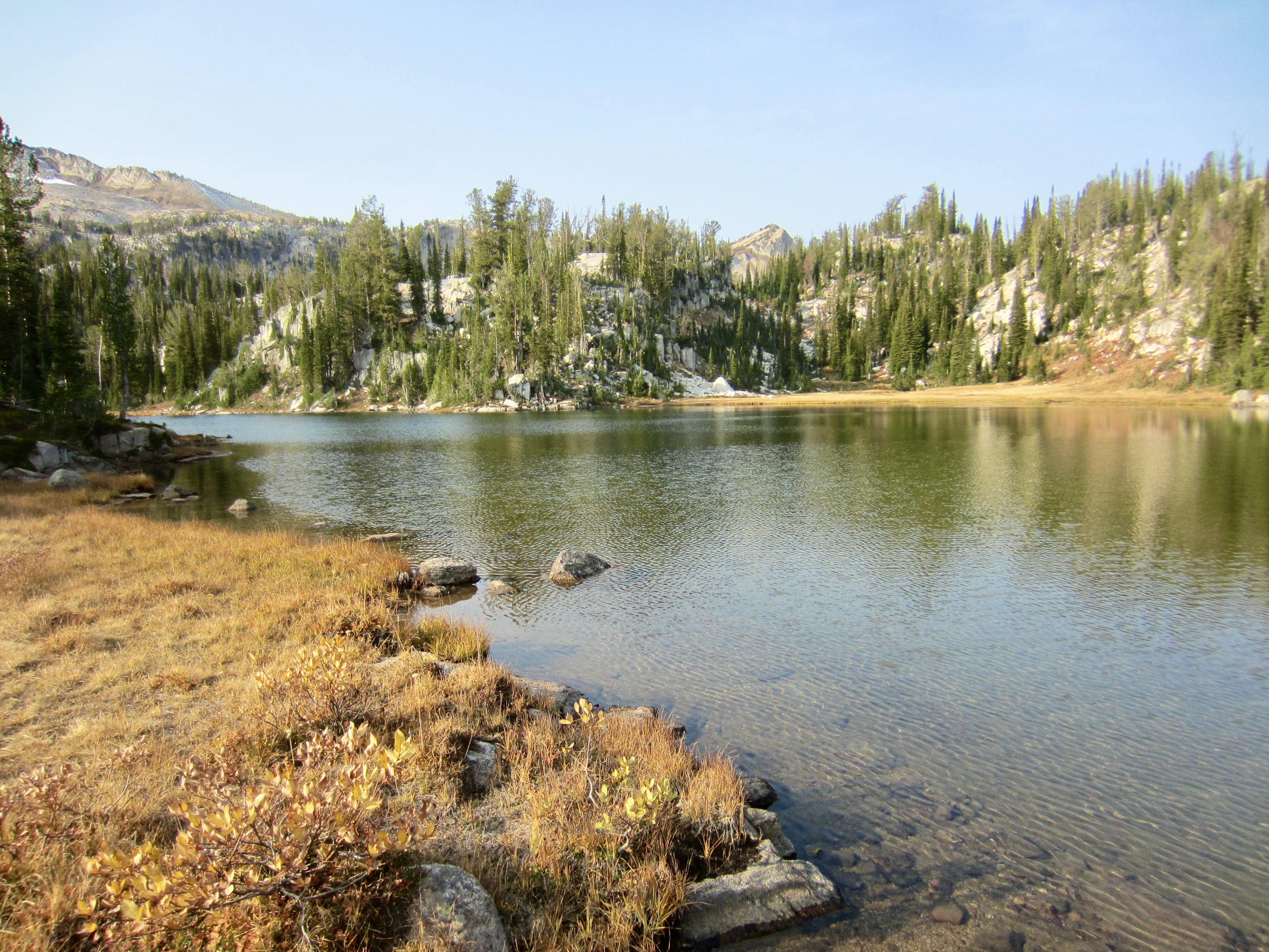
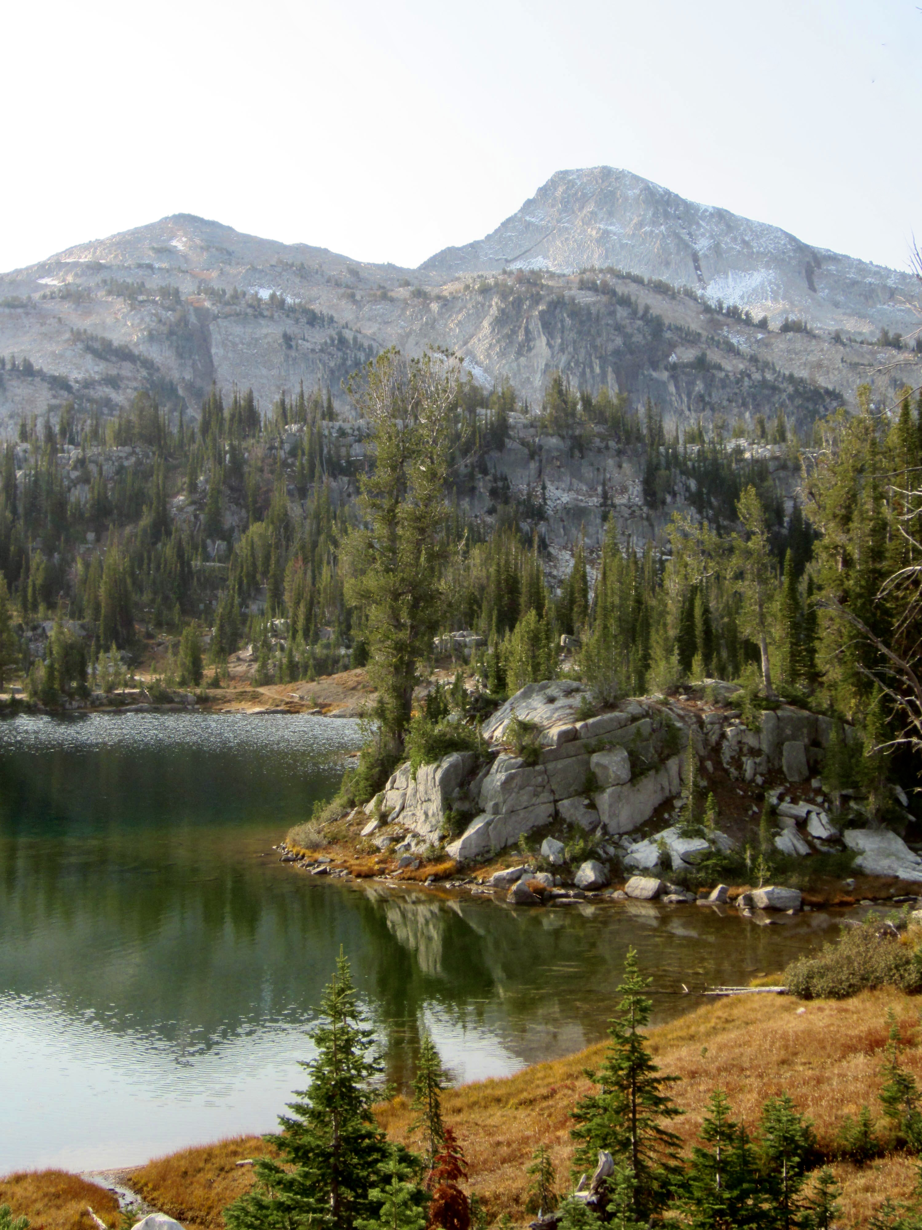
Glacier Lake is one of the largest and highest lakes in this area—and possibly the most exquisite. It features numerous islands and peninsulas, in a setting of green grass and white granite, with Glacier Peak and Eagle Cap as a backdrop. I found it absolutely mesmerizing! Deb described how, less than a decade ago, the water had an opaque turquoise color due to glacial flour; now, with the adjacent glaciers all but gone, the water has taken on a clear azure color.
Day 5: Glacier Lake to Moccasin Lake + Eagle Cap Summit Hike
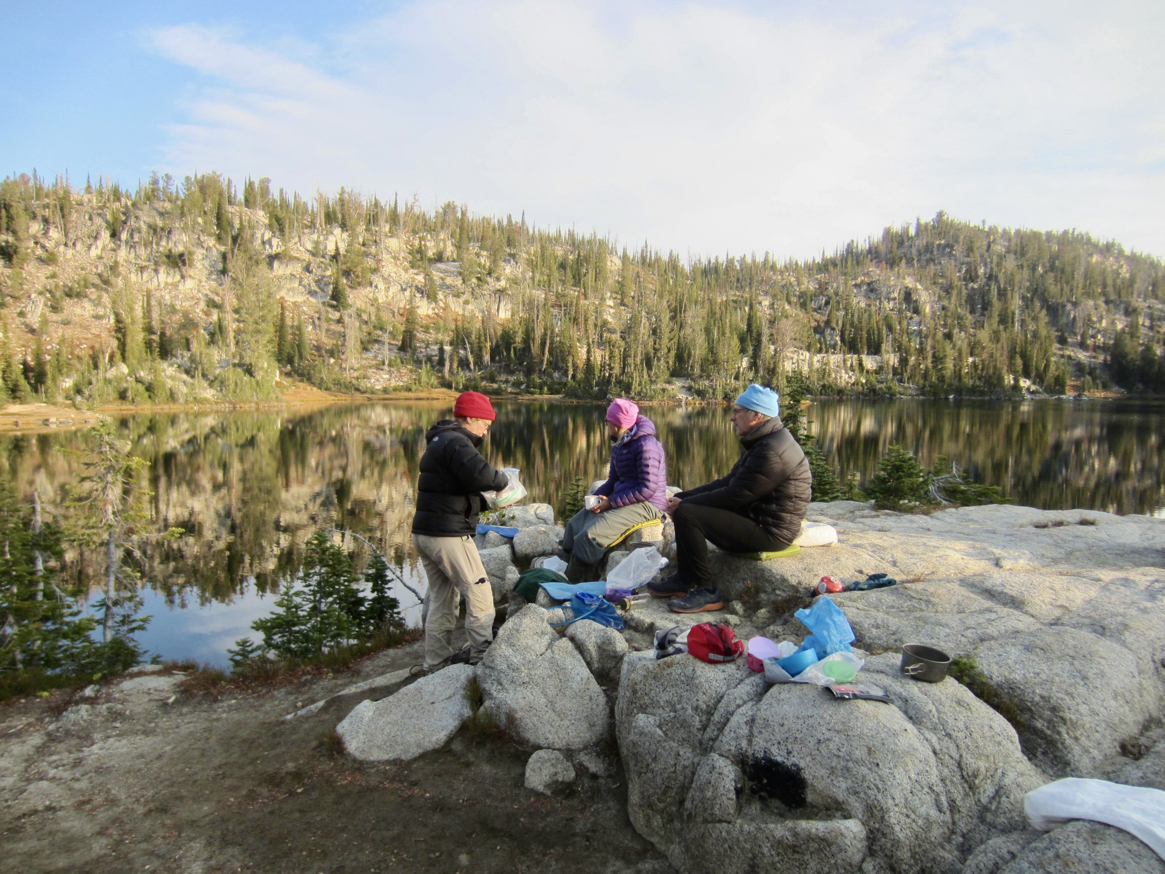
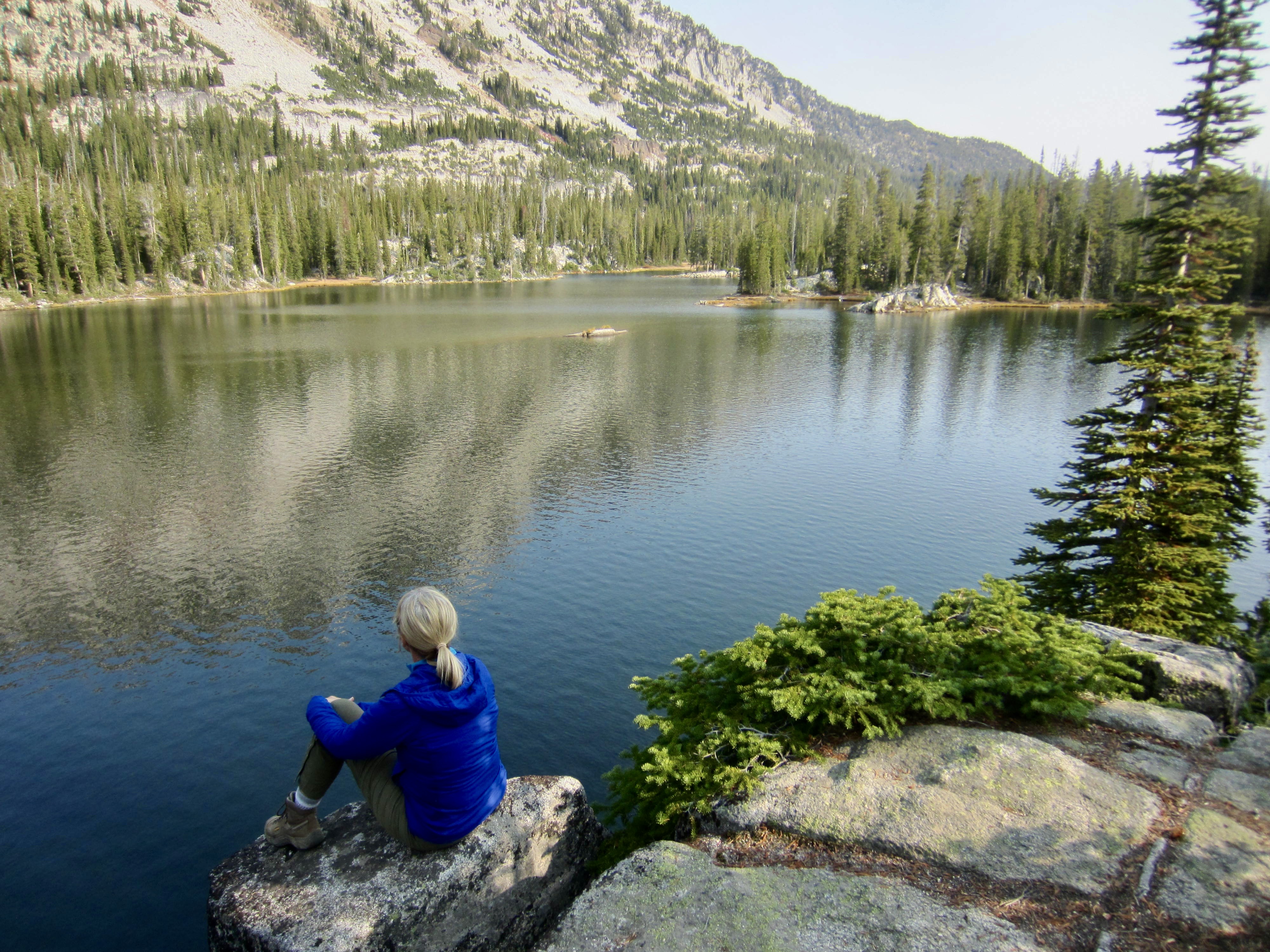
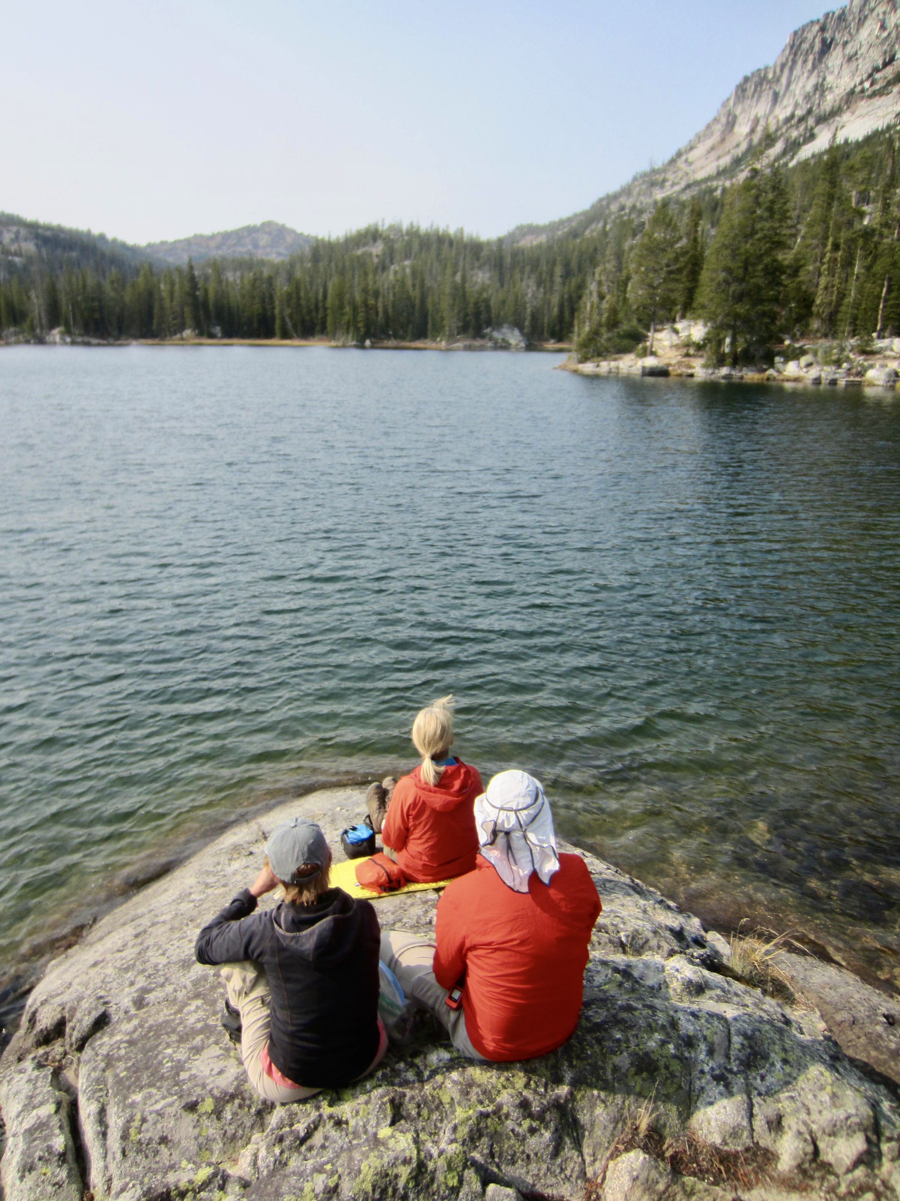
Following a night of gusty winds, we awoke to a cold, cloudless, breezy morning. Eileen and I took a pre-breakfast stroll around the lake as the rising sun lit up various parts of the shoreline.

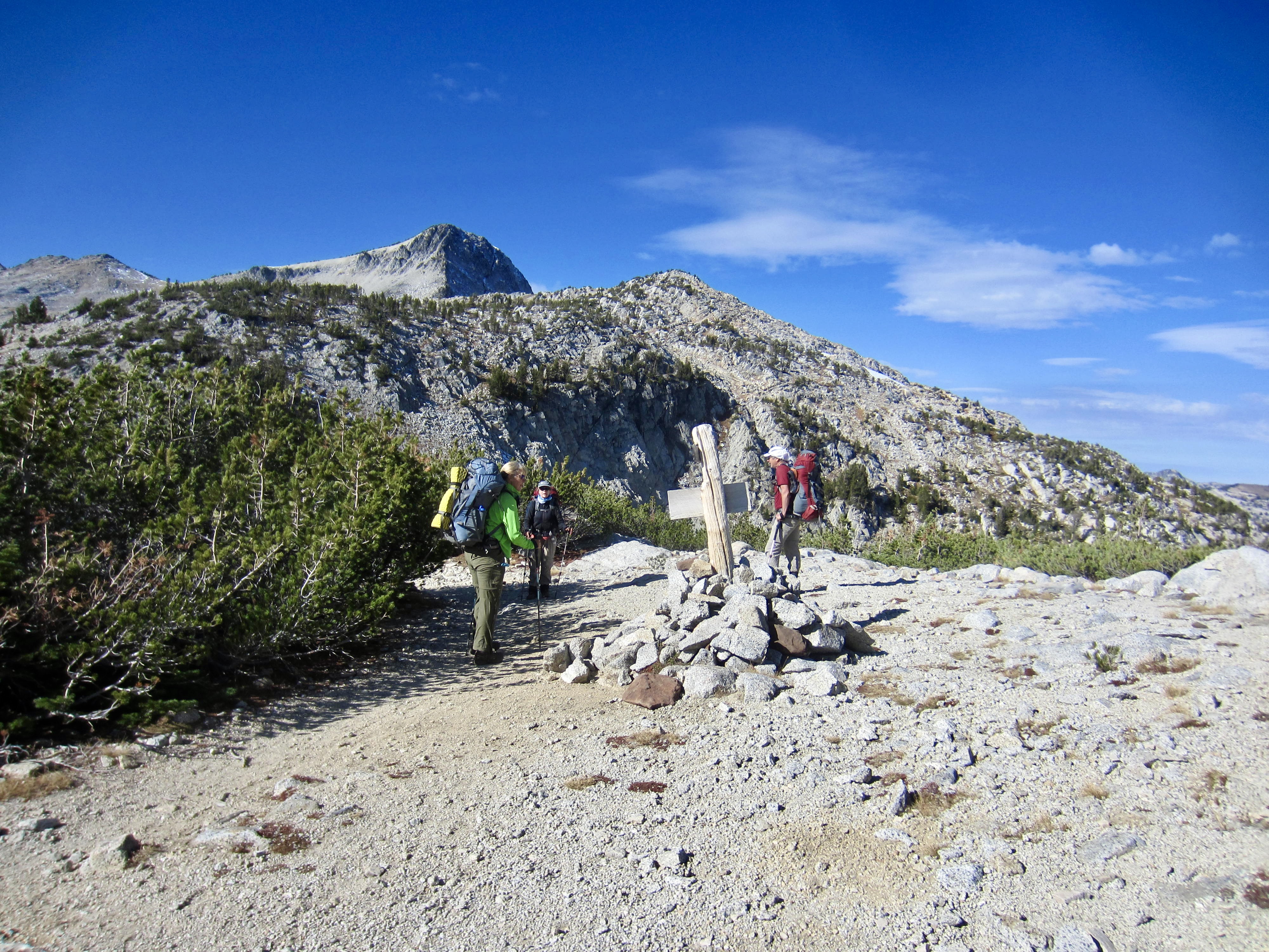
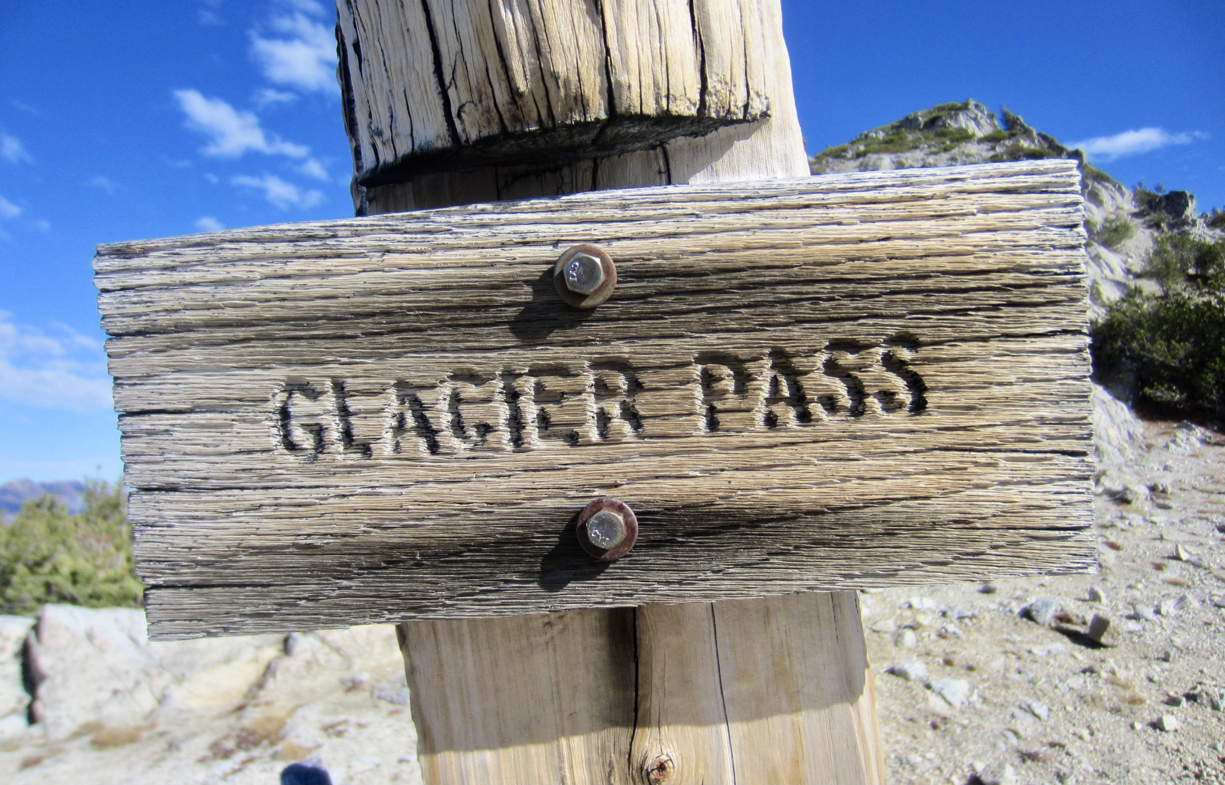
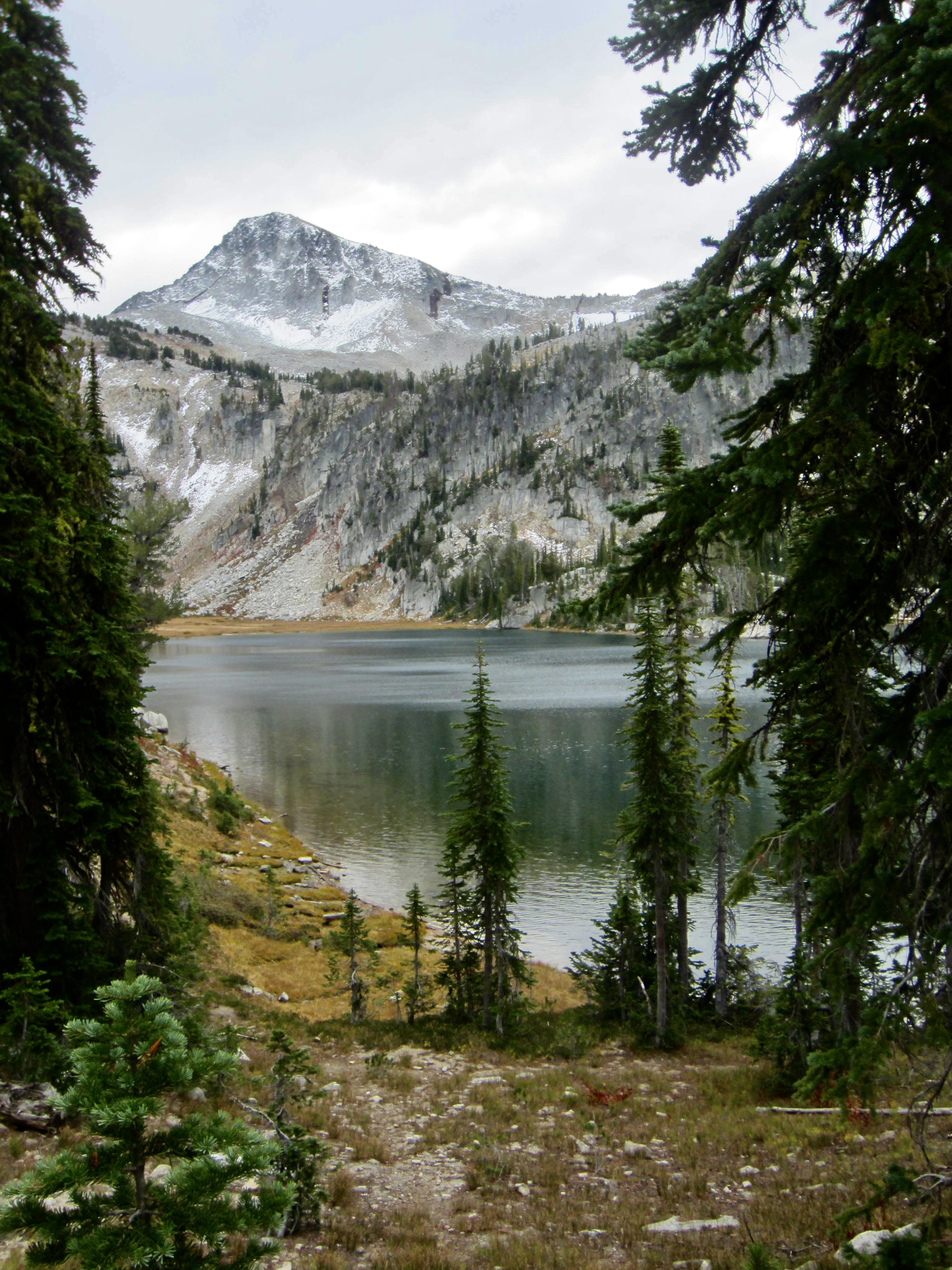
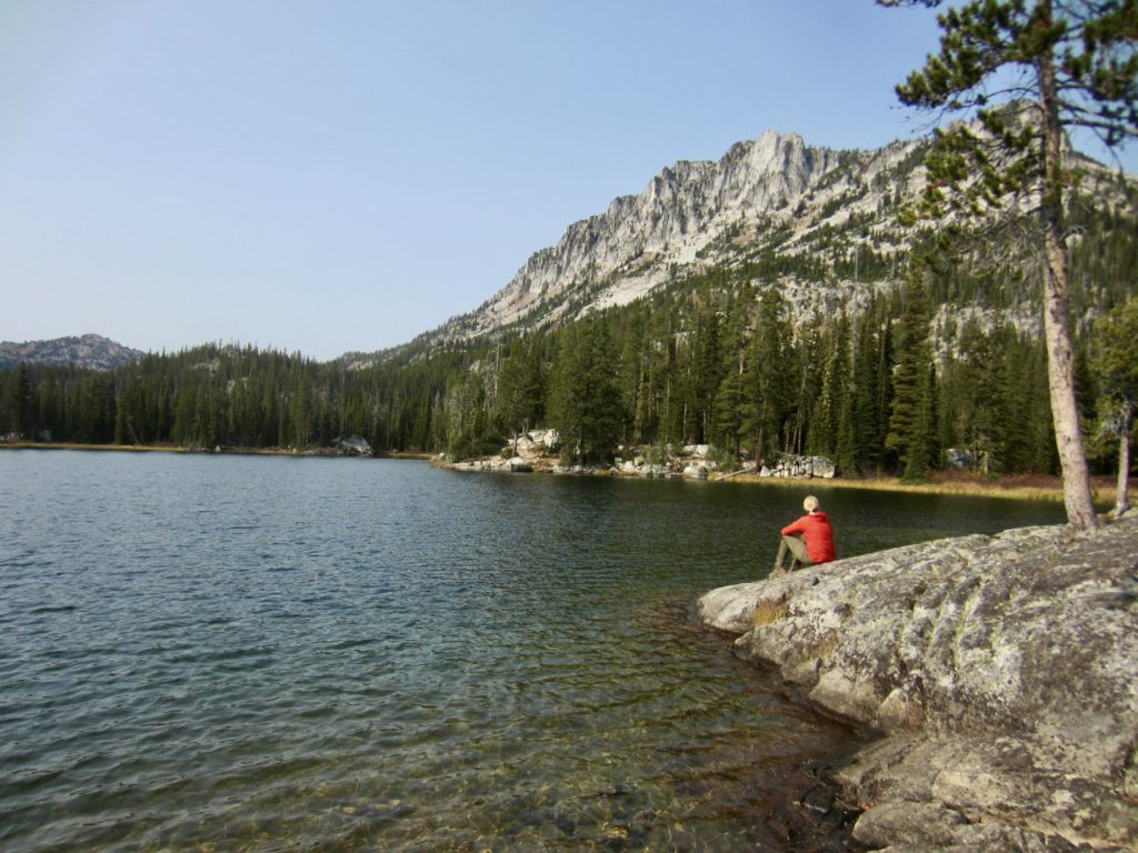
Once camp was packed away, we hiked up to 8550-foot Glacier Pass—the high point of our trail loop—and then down to Moccasin Lake in late morning (1.7 hours + 2.7 miles + 500 feet from Camp 4). We quickly unloaded gear at a splendid lakeside campsite before heading out with summit packs.
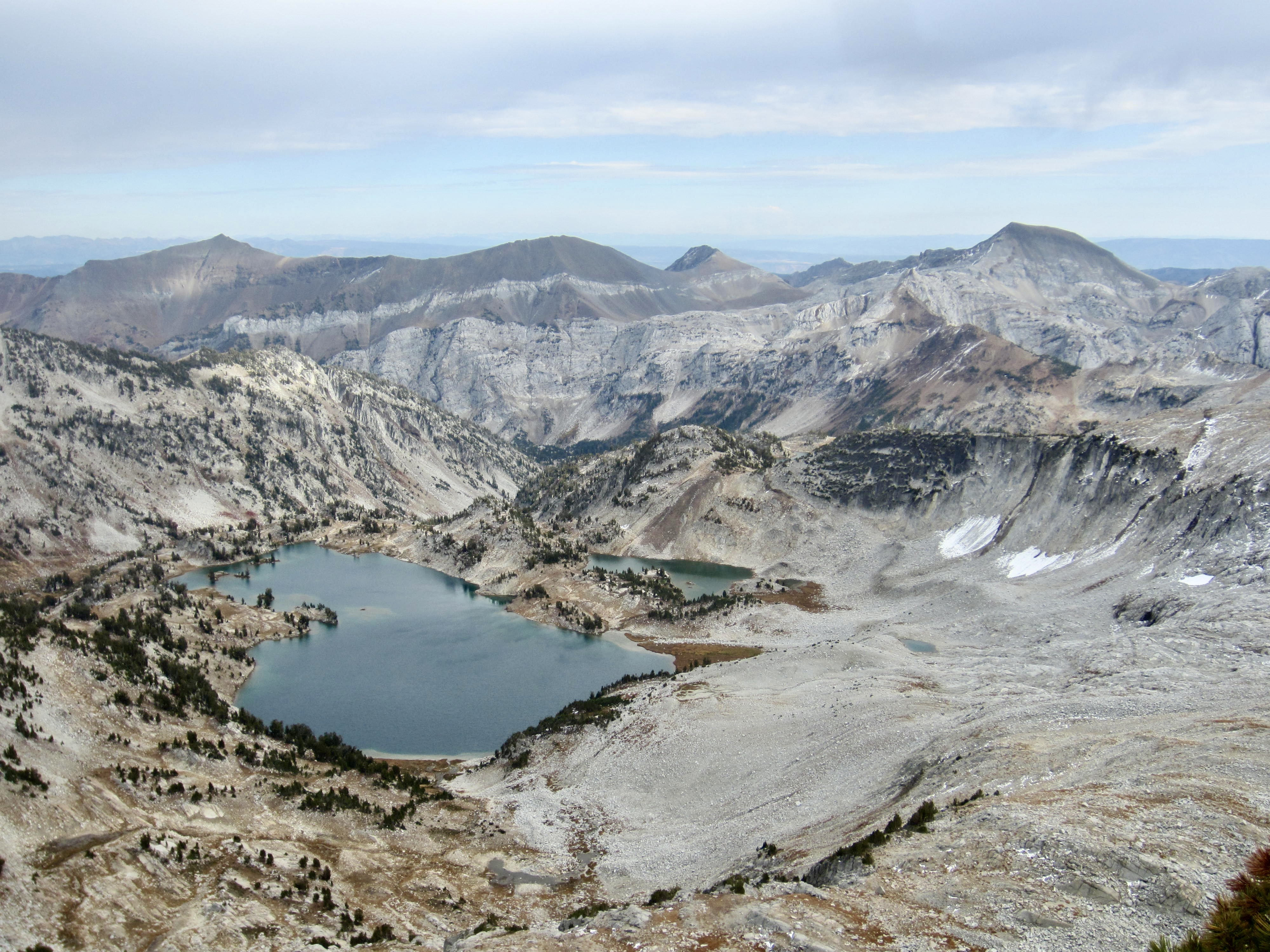
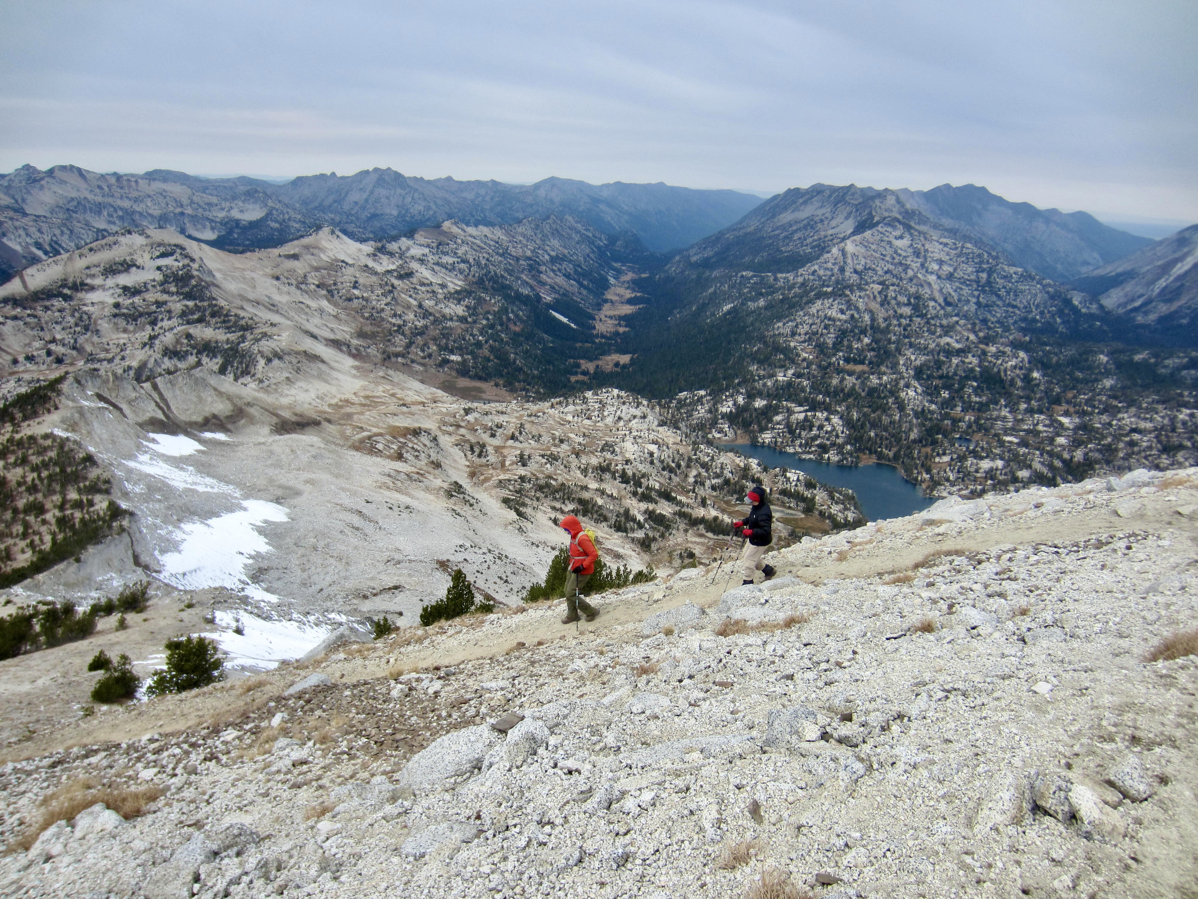
Our goal for this afternoon was Eagle Cap, another of the Wallowa’s 9000-foot peaks and the name source for the encompassing wilderness area. We followed a nice trail past Mirror Lake and Upper Lake to Horton Pass Meadows, then turned onto the Eagle Cap Summit Trail.
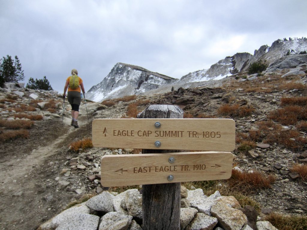
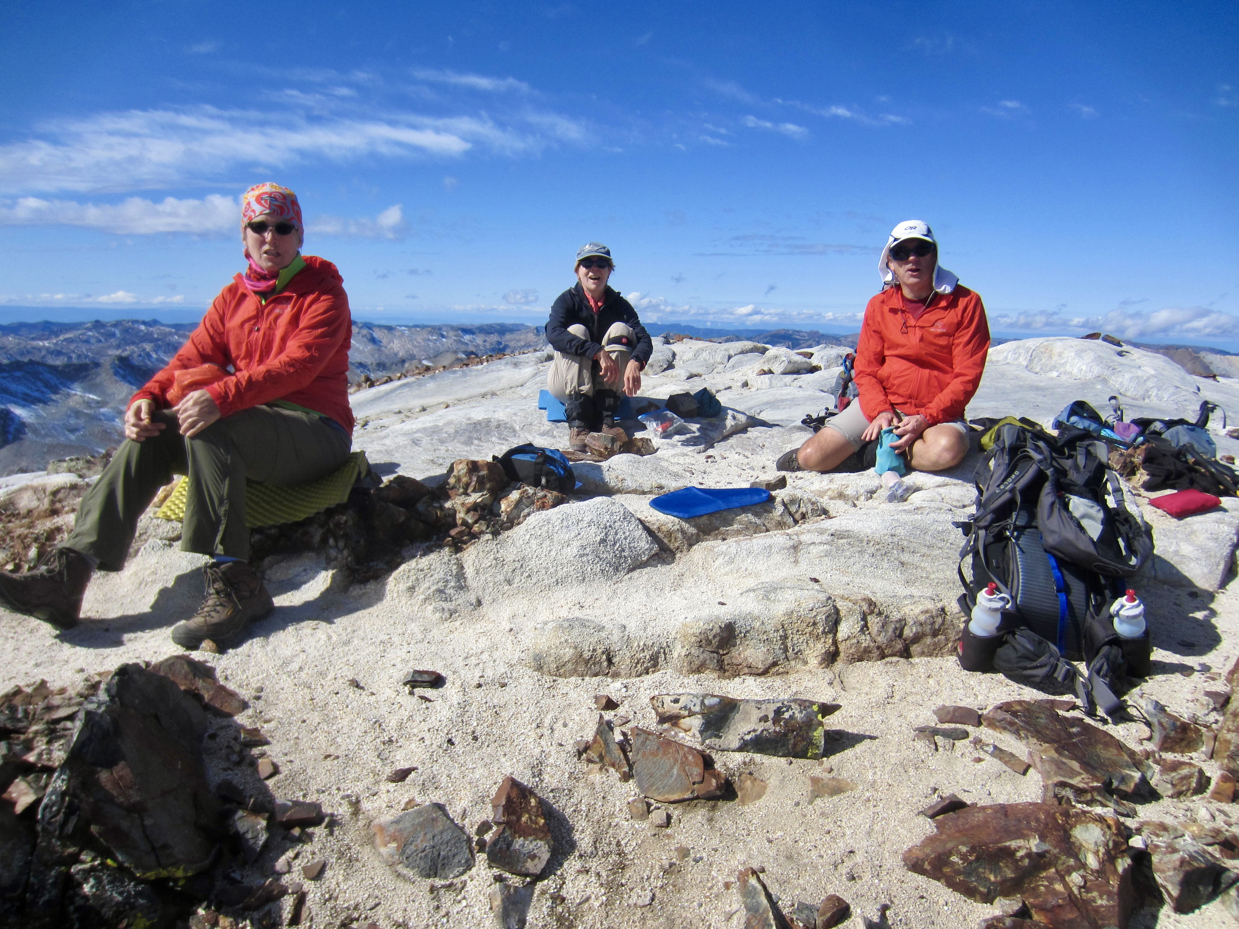
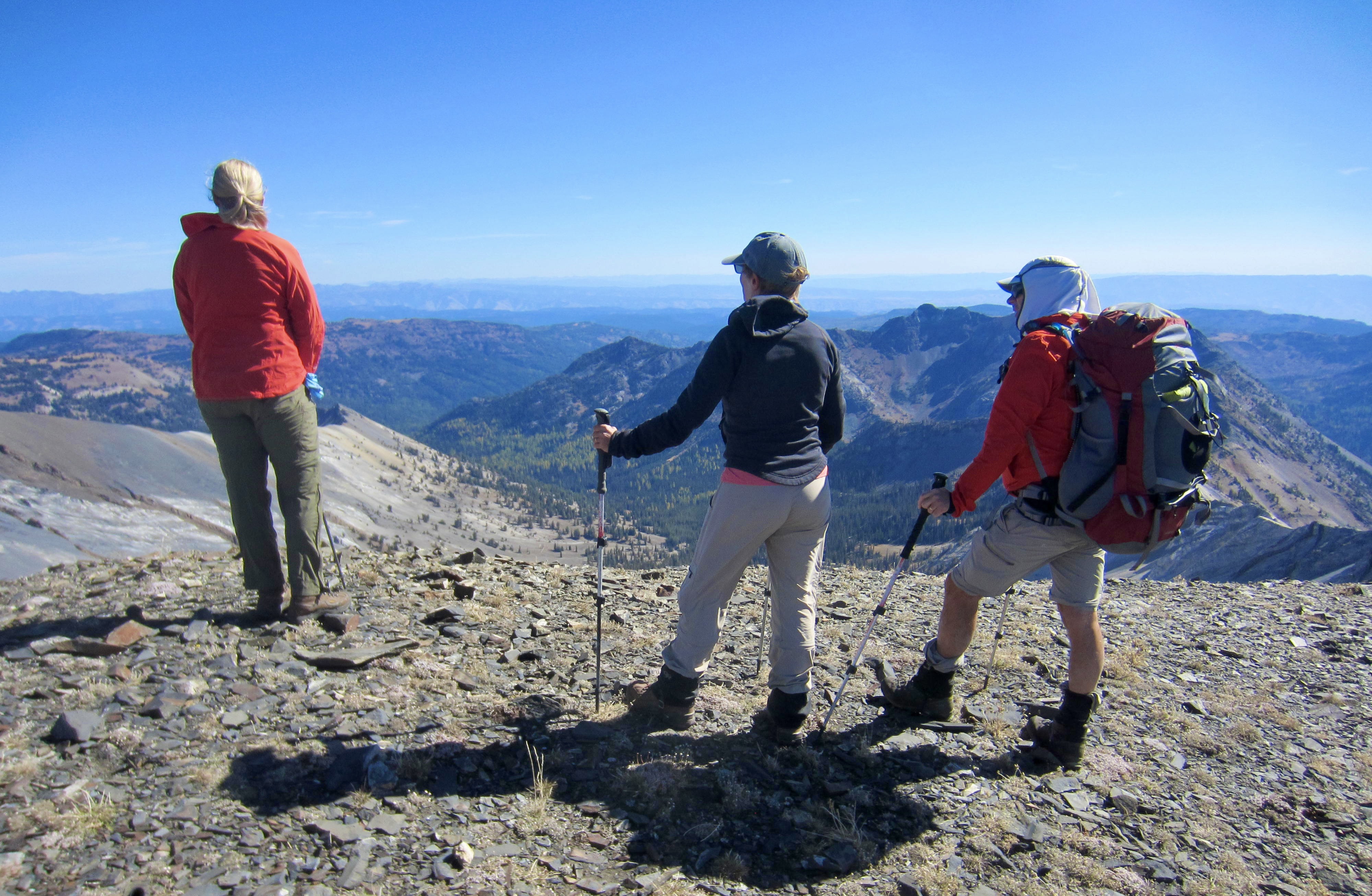
The marvelous summit trail switchbacks up to Eagle Cap’s northwest ridge, then wanders back and forth along the crest for a mile before making a final switchback ascent on the west slope. We all gathered on the broad granitic summit in mid-afternoon (2.0 hours + 2100 feet from Camp 5).
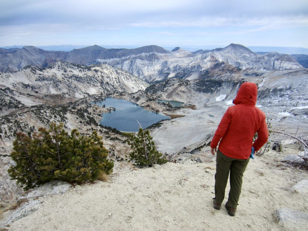
There was a high, gray cloud ceiling overhead, and the air had an unsettled feeling, but the views demanded a suitable break. Standout peaks included Matterhorn—now looking very much like Yosemite’s Half Dome—to the north, Aneroid Mountain to the northeast, and Cusick Mountain to the southeast. Mirror Lake, Moccasin Lake, and Glacier Lake were visible closely below.
Sensing a threat of rain, we hustled back down to Mocassin Lake and finished setting up our camp. Fortunately, the foul weather never manifested into anything more than some wind gusts.
Day 6: Moccasin Lake to Trailhead
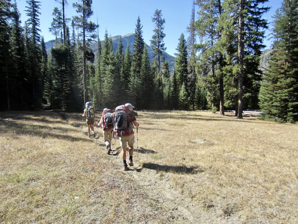
Greeted by sunny weather in the morning, we had a leisurely lakeside breakfast for our last day in the high country. Today’s plan was to visit several lakes within the aptly named Lake Basin before heading back toward the trailhead. We were on the move by 9:15am.

Our exit trail took us around the far shore of Moccasin Lake, then over to Douglas Lake, then to Lee Lake, and finally to Horseshoe Lake. Each lake had its own attributes, such that we would be hard-pressed to pick a favorite. Indeed, Lake Basin is a special place.
After leaving Horseshoe Lake, we followed the Lake Basin Trail down to Six Mile Meadow, thereby closing the loop portion of our trek. We then hiked back along the West Fork Wallowa River and arrived at the trailhead in late afternoon (8.3 hours + 12.8 miles + 400 feet from Camp 5). It was too late for the long drive back home, so we spent our final night at Wallowa Lake State Park. This gave us all a relaxing evening to savor our excellent autumnal adventure.
…
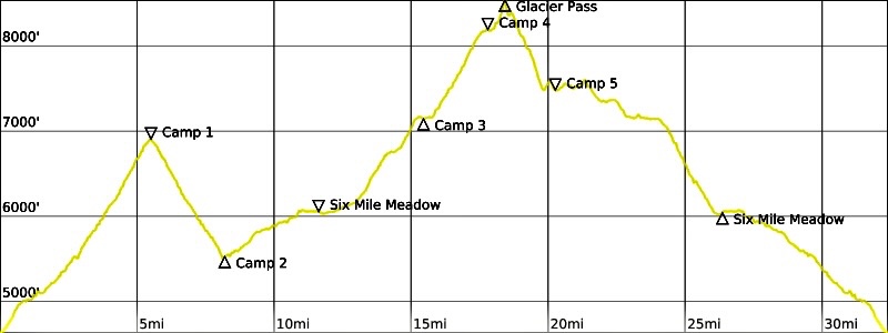
Route Maps & Profile
…
…
Photo Gallery
Click to enlarge…