Trip Date: June 16-24, 2018
Picket Range Climbing Trip & Picket Traverse: Perfect Pass to McMillan Pass
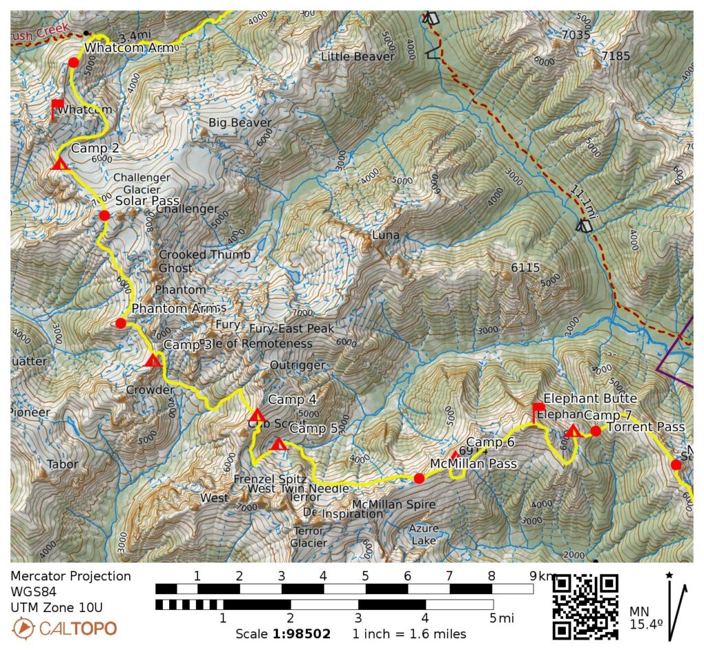
Little Beaver Creek
Whatcom Arm
Perfect Pass
Whatcom Peak (7574′)
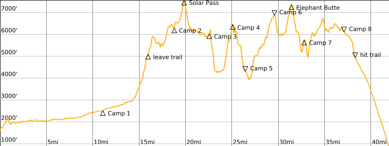
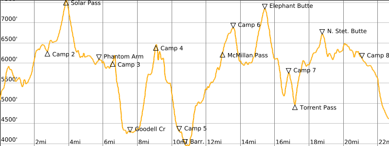
Solar Pass
Phantom Arm
Pickell Pass
Picket Pass
McMillan Pass
Rhino Butte (6914′)
Elephant Butte (7380′)
Torrent Pass
North Stetattle Butte (6728′)
South Stetattle Butte (6495′)
Sourdough Creek
- Trip Report Summary
- Related Posts
- Full Trip Report
- Day 0: Team Staging At Newhalem Campground
- Day 1: Ross Dam Trailhead to Little Beaver Landing to 12-Mile Camp
- Day 2: 12-Mile Camp to Whatcom Arm to Perfect Pass
- Day 3 (AM): Whatcom Peak Summit Climb
- Day 3 (PM): Perfect Pass to Solar Pass to Pickell Pass
- Day 4: Pickell Pass to Picket Pass
- Day 5: Picket Pass to McMillan Tarn
- Day 6: McMillan Tarn to McMillan Pass to Rhino Butte
- Day 7: Rhino Butte to Elephant Butte to Torrent Bench
- Day 8: Torrent Bench to Torrent Pass to Stetattle Arm
- Day 9: Stetattle Arm to Sourdough Trailhead
- Route Maps & Profiles
- Photo Gallery
Trip Report Summary
Region: Northwestern Washington Cascades
Sub-Region: Picket Range
Area: North Cascades National Park
Primary Starting Point: Ross Dam Trailhead on Highway 20 (Elev. 2150 feet)
Secondary Starting Point: Little Beaver Creek Trailhead on Highway 20 (Elev. 1600 feet)
Way Points: Ross Lake Landing (trail hike); Ross Lake & Little Beaver Landing (boat ride); Perry Creek & Redoubt Creek & Pass Creek & Whatcom Arm (trail hike); Whatcom Glacier & Perfect Pass & Challenger Glacier & Solar Pass & Solar Glacier & Crooked Thumb Glacier & Phantom Arm Saddle & Pickell Pass & Goodell Cirque & Picket Pass & Mustard Glacier & McMillan Tarn & Barricade Nose & McMillan Glacier & McMillan Pass & Rhino Butte summit & Elephant Butte summit & Torrent Bench & Torrent Lake & Torrent Pass & North Stetattle Butte summit & South Stetattle Butte summit & Stetattle Arm & Sourdough Creek (snow climb & rock scramble); Sourdough Trailhead (trail hike)
High Point: Solar Pass (Elev. 7600 feet)
Ending Point: Sourdough Trailhead at Diablo Townsite on Diablo Road (Elev. 1200 feet)
Campsites: Little Beaver Creek Trail at MP-12 & Perfect Pass & Pickell Pass & Picket Pass & McMillan Tarn & Rhino Butte summit & Torrent Bench & Stetattle Arm
Summit: Whatcom Peak (snow climb & rock scramble via South Slope—West Ridge)
Summit: Rhino Butte (snow hike via West Ridge)
Summit: Elephant Butte (snow climb & rock scramble via West Ridge; descent via East Face)
Summit: North Stetattle Butte (snow climb via Northwest Ridge; descent via Southeast Ridge)
Summit: South Stetattle Butte (snow climb via Northwest Ridge; descent via Southeast Ridge)
Approximate Stats: 45 miles traveled on foot; 22,200 feet gained; 23,400 feet lost; 7 passes crossed; 5 summits attained; 0 other people seen between Ross Lake and Sourdough Creek.
Related Posts
Picket Traverse Photo Gallery – June 2018
Crooked Thumb Peak + Phantom Peak via Whatcom Pass – June/July 2016
Whatcom Peak Loop + Easy Peak + Perfect Pass + Whatcom Peak – July 2011
Full Trip Report
Kevin K, George, Fay, Eileen, and I teamed up for a nine-day traverse through the Picket Range last week. The Picket Traverse is widely regarded as the most difficult of the various classic traverses that have been established in the Cascades and Olympics. Like many parties attempting this alpine high route, we initially wondered whether we would be equal to the rigors of the trip. However, what we lacked in terms of technical skill and youthful vigor, we hoped would be offset by our mountain experience and crusty zeal. Ultimately, we found the traverse to be long, arduous, and challenging but never unreasonably difficult. All in all, it felt like an epic journey through an incredible alpine landscape!
Day 0: Team Staging At Newhalem Campground
In order to get an early start on our trip, we all met the evening before at Newhalem Campground. This was a good strategic launching point, and it gave us all some time to make final packing decisions.
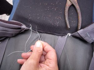
While doing a preliminary backpack weigh-in at the campground, I experienced a heart-stopping moment when the seam holding my pack’s shoulder straps partially tore out. I was horrified at the thought of having a total seam failure in the middle of the Picket Range! However, I was able to borrow a needle from a nearby campsite, and Eileen used dental floss to implement some emergency repairs. Thanks to her stitchery—and nine days of delicate handling on my part—I was able to get my pack through the trip.
…
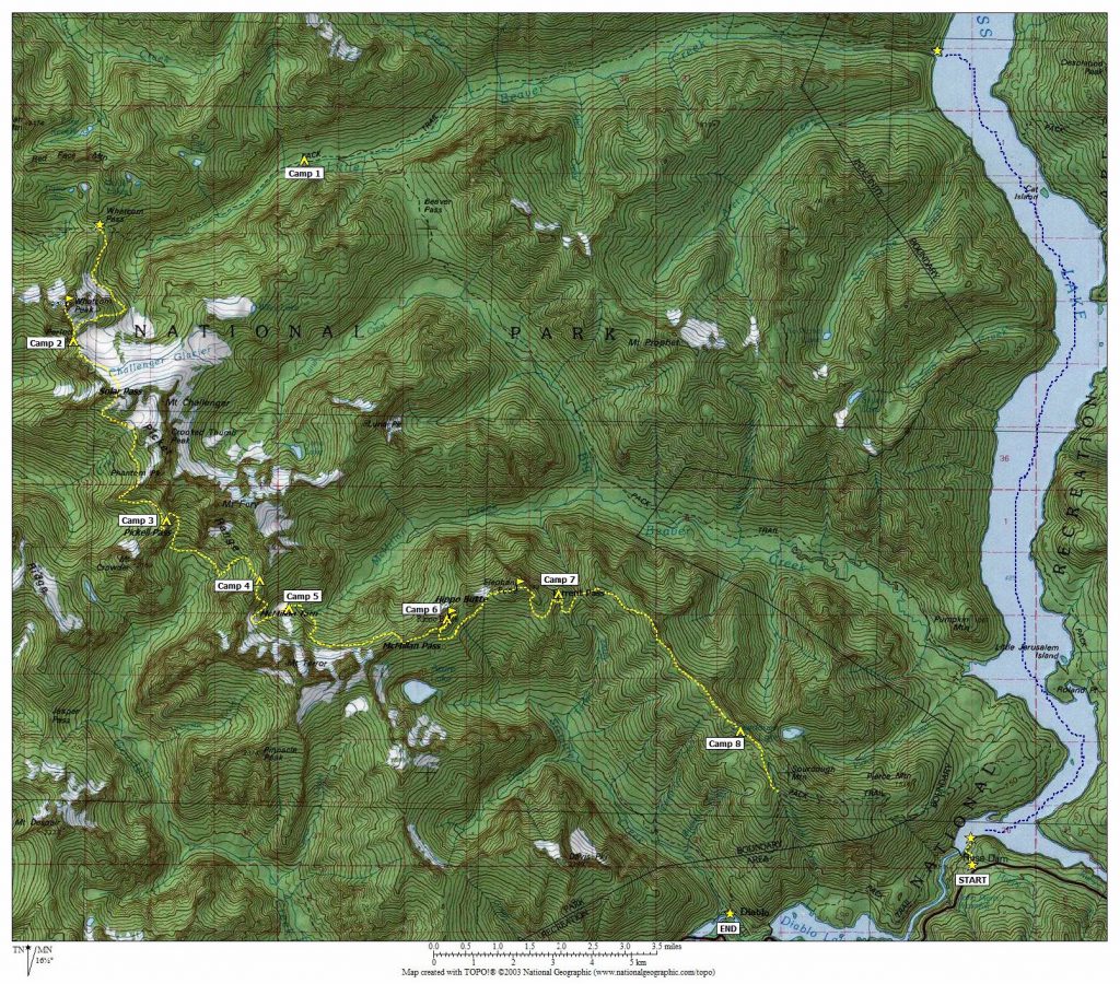
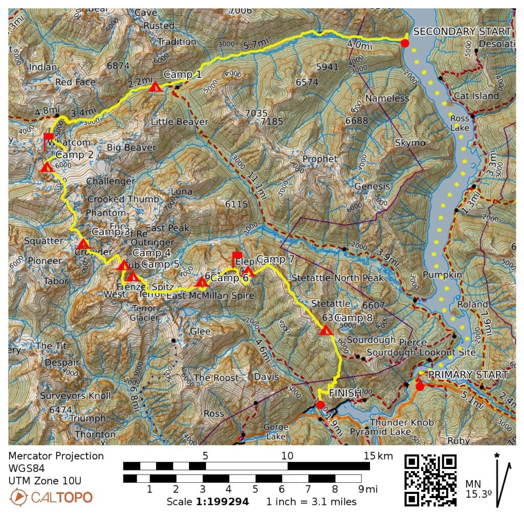
Day 1: Ross Dam Trailhead to Little Beaver Landing to 12-Mile Camp
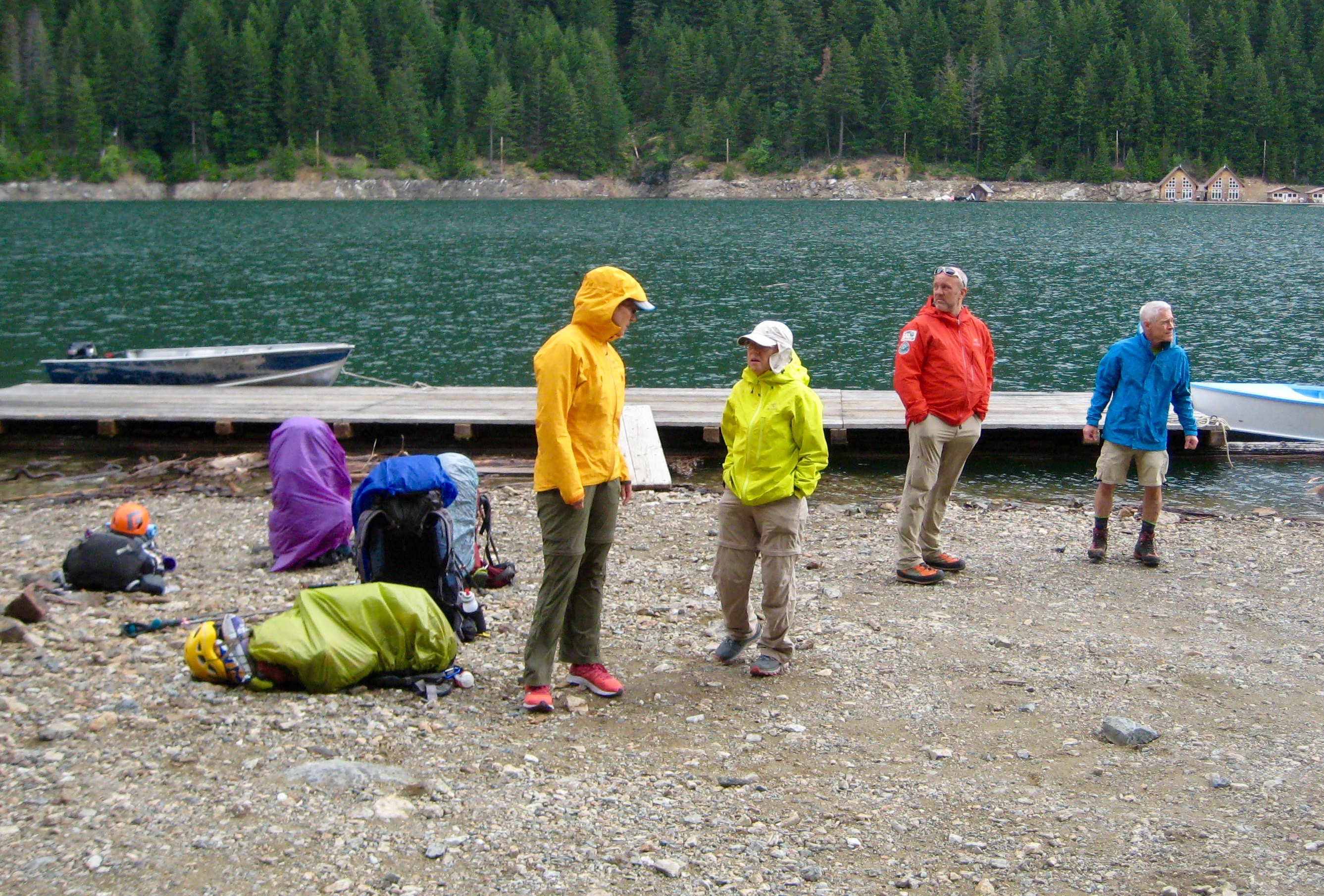
The classic traverse route, as mapped out by Tabor & Crowder, formally begins at Perfect Pass, and there are several common approaches to that starting point. We elected to approach by way of the Little Beaver Trail—not because this is the best option but rather because none of us had ever hiked up this trail. In retrospect, I would say that the Little Beaver approach is just as bad as all of the other options. Getting to the trailhead involved a boat ride from the Ross Dam Landing, where we assembled at 9:00am on Saturday.

- Waiting For Boat At Ross Lake Landing
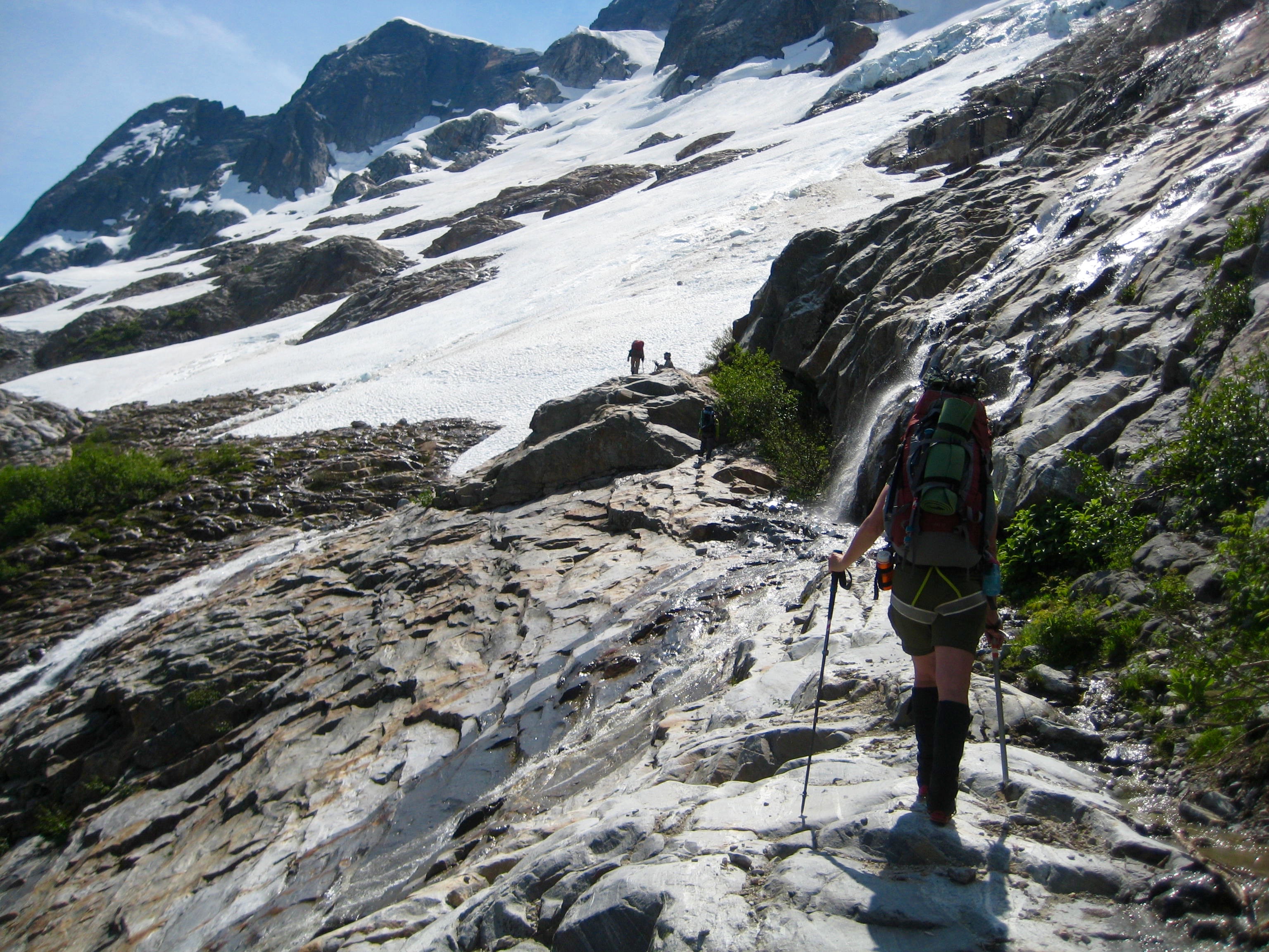
The Little Beaver Trail is notoriously rough and brushy, but we had heard that a trail crew went through last summer and performed a significant amount of maintenance. Even with the benefit of last year’s work, we encountered numerous blowdown logs (especially in the first 5 miles) and washout zones, making for frustratingly slow progress.

- Start Of Little Beaver Trail
Although our goal was to reach Twin Rocks Camp at Mile 14, we ended up camping in a flat area at Mile 12 (9.3 hours from Little Beaver Landing).
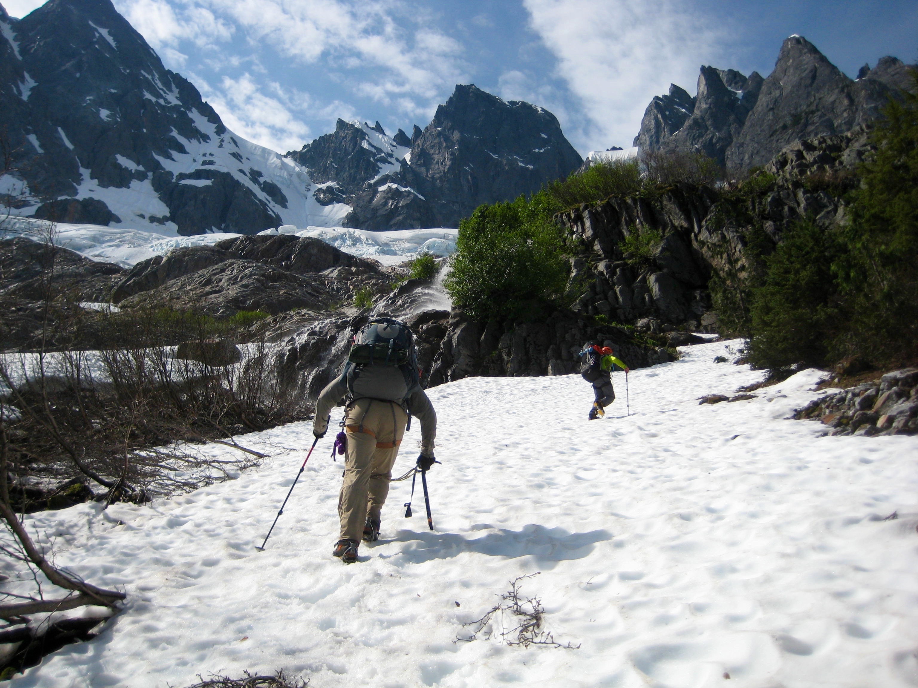
Day 2: 12-Mile Camp to Whatcom Arm to Perfect Pass
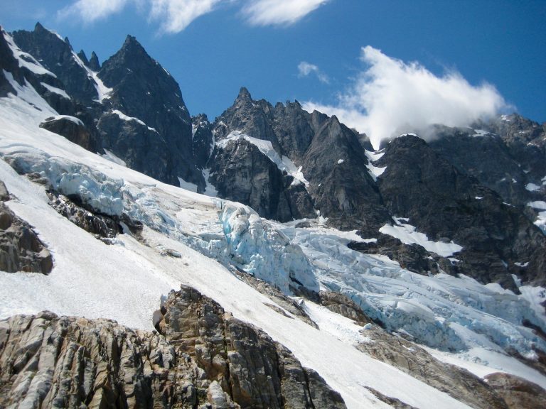
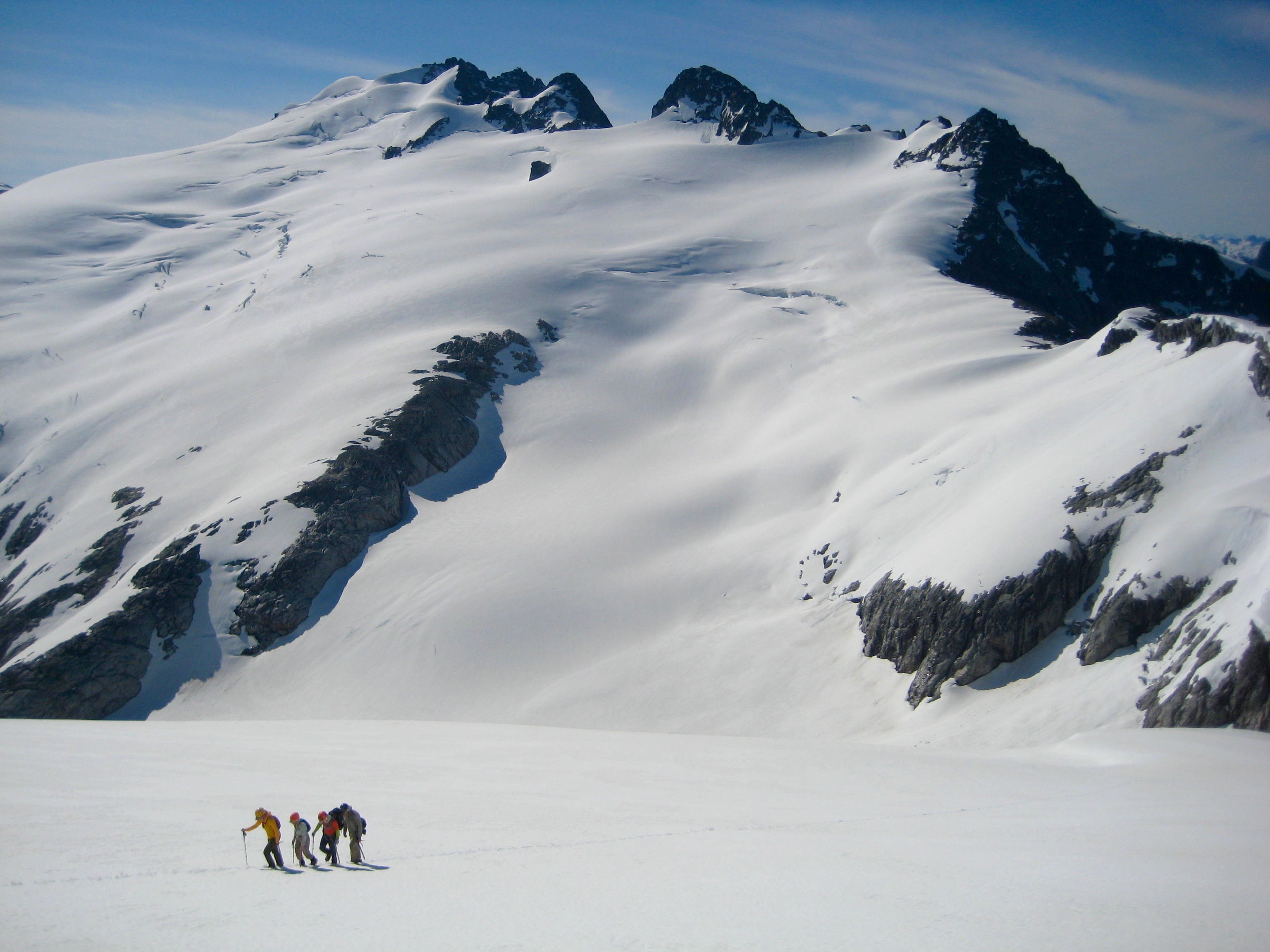
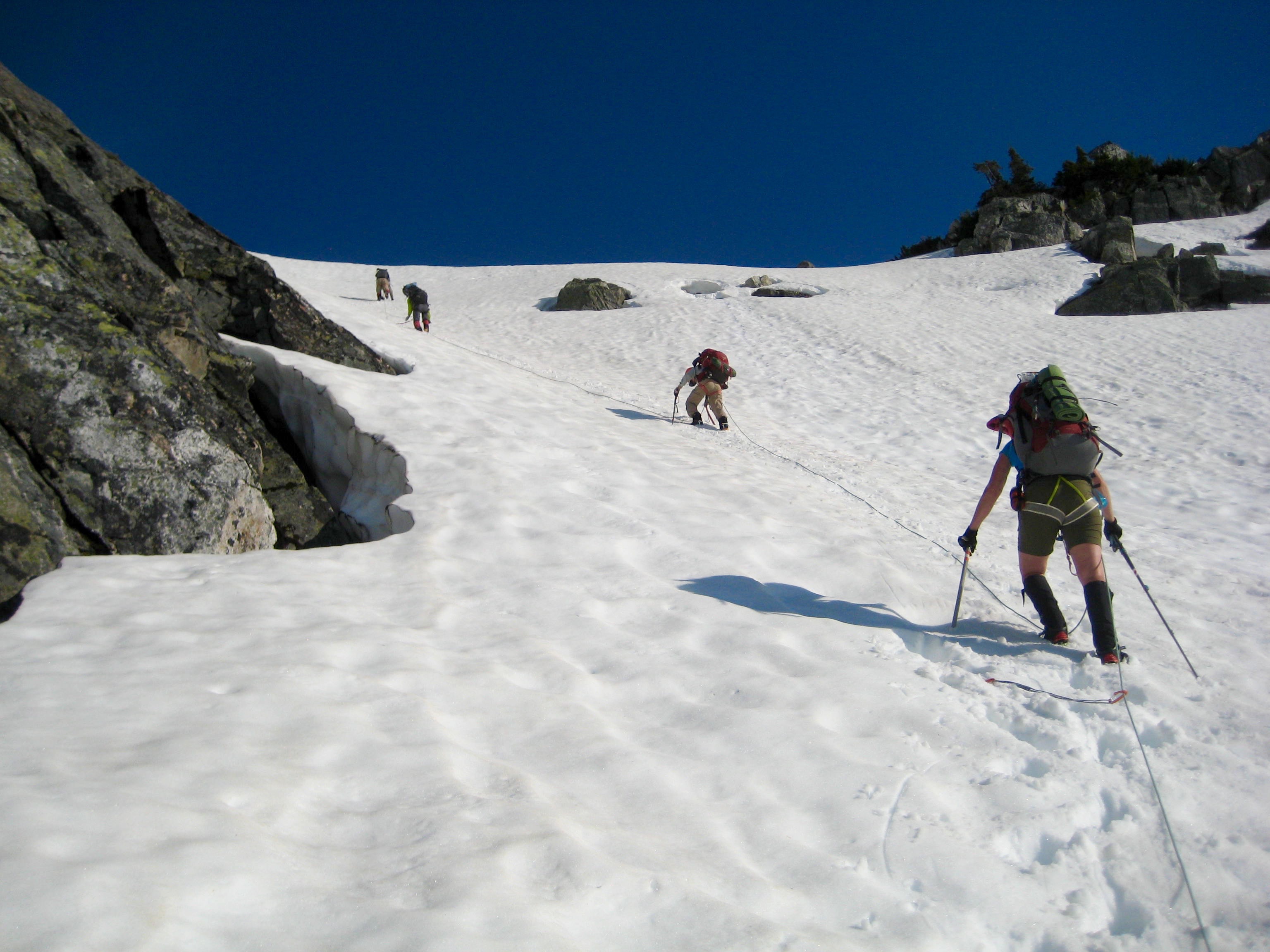
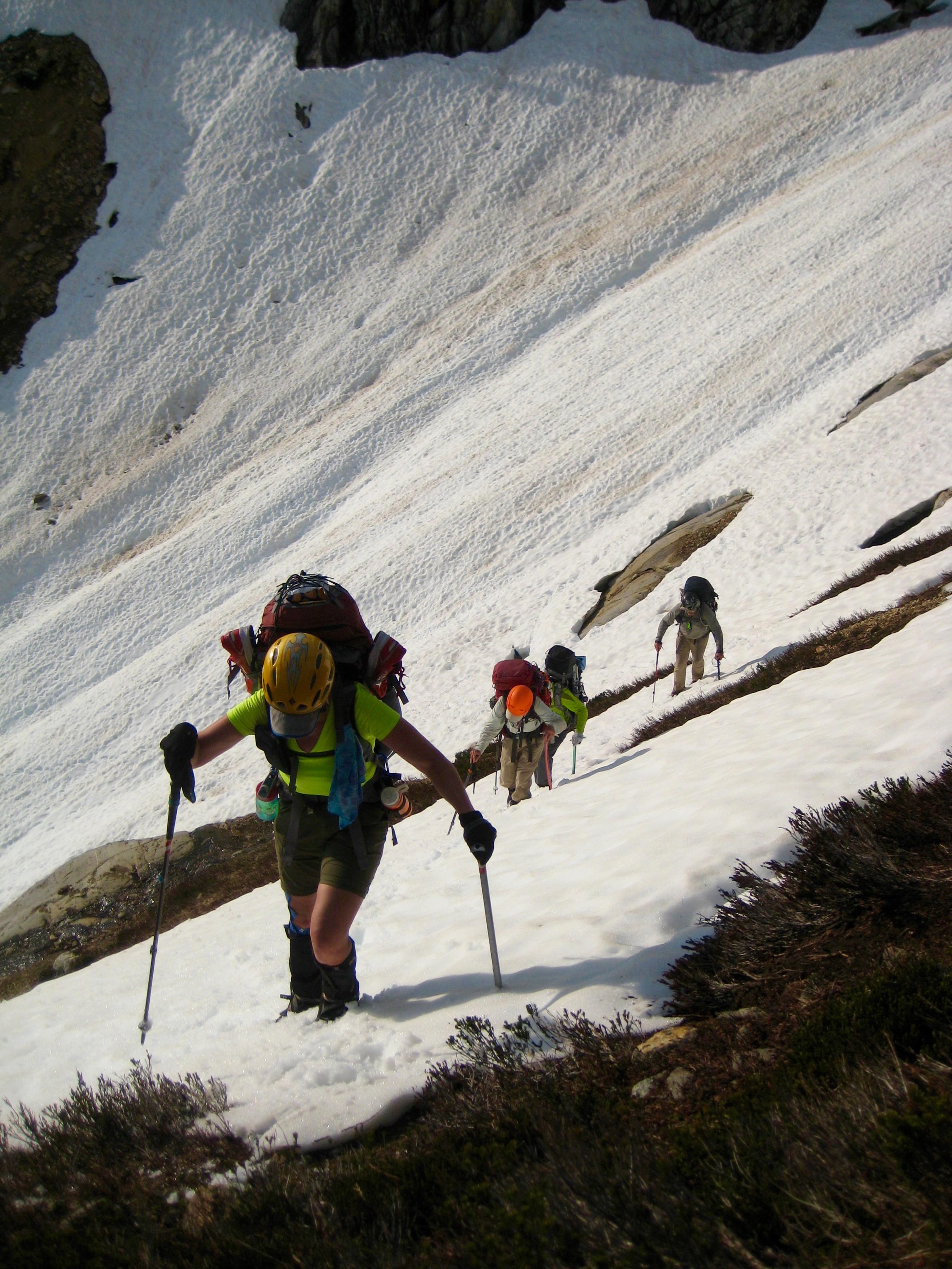
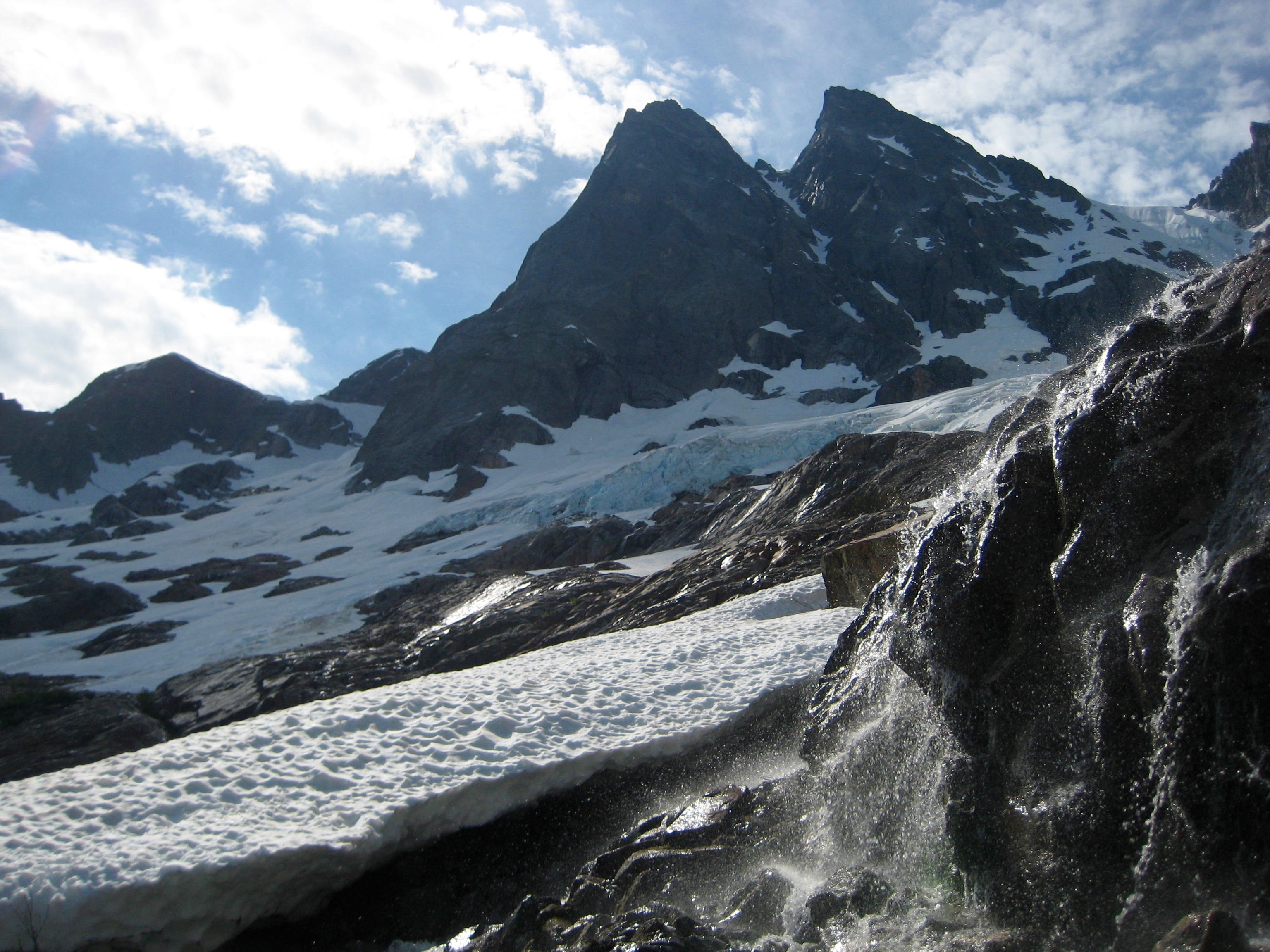
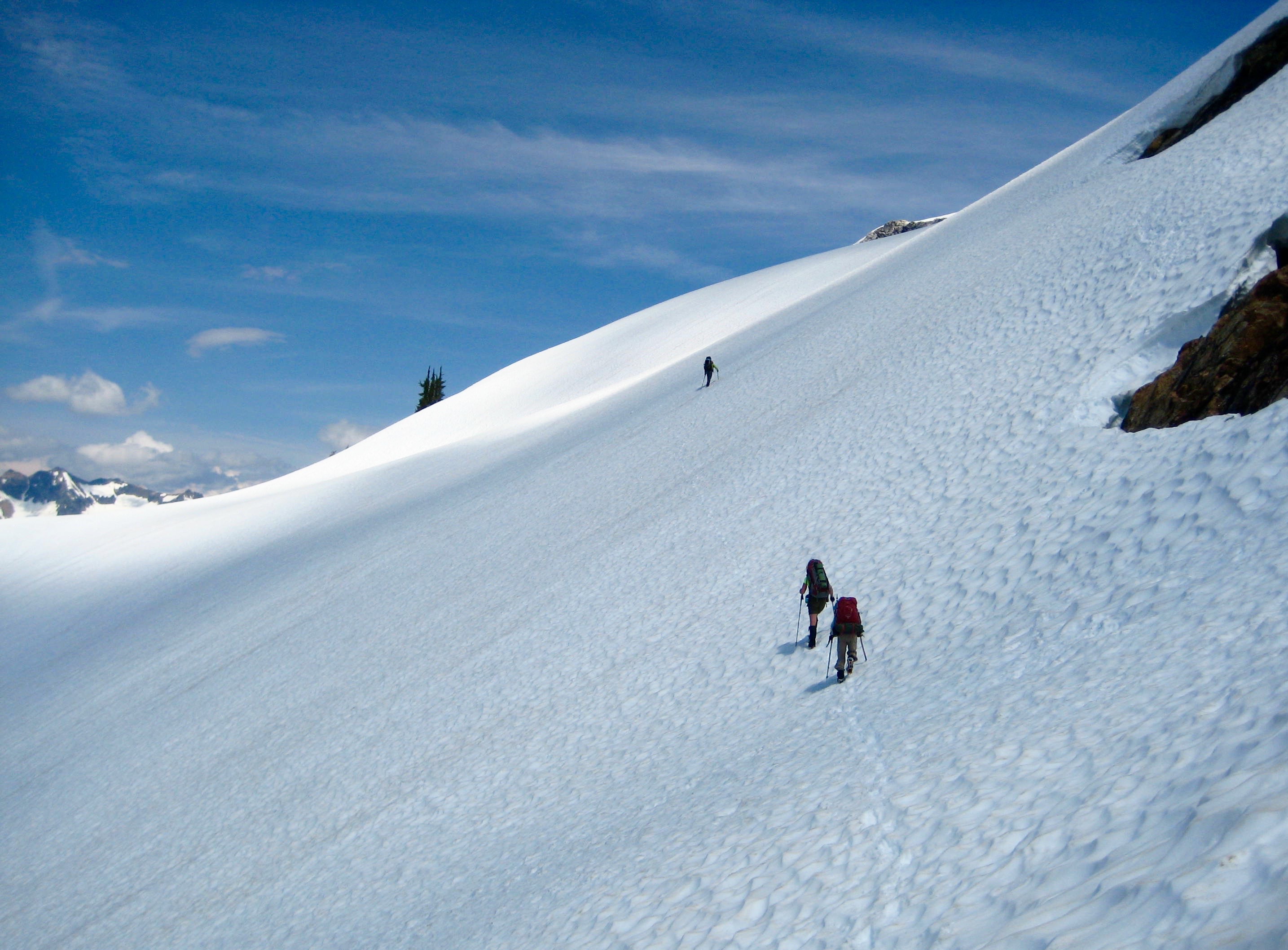
After overnight rains, we awoke to a warm and sunny morning. By the time we reached Whatcom Pass (6.4 hours from Camp 1), it was downright hot. We traversed out Whatcom Arm, then crossed the Whatcom Glacier. Snow coverage was very good.

- Traversing Whatcom Glacier
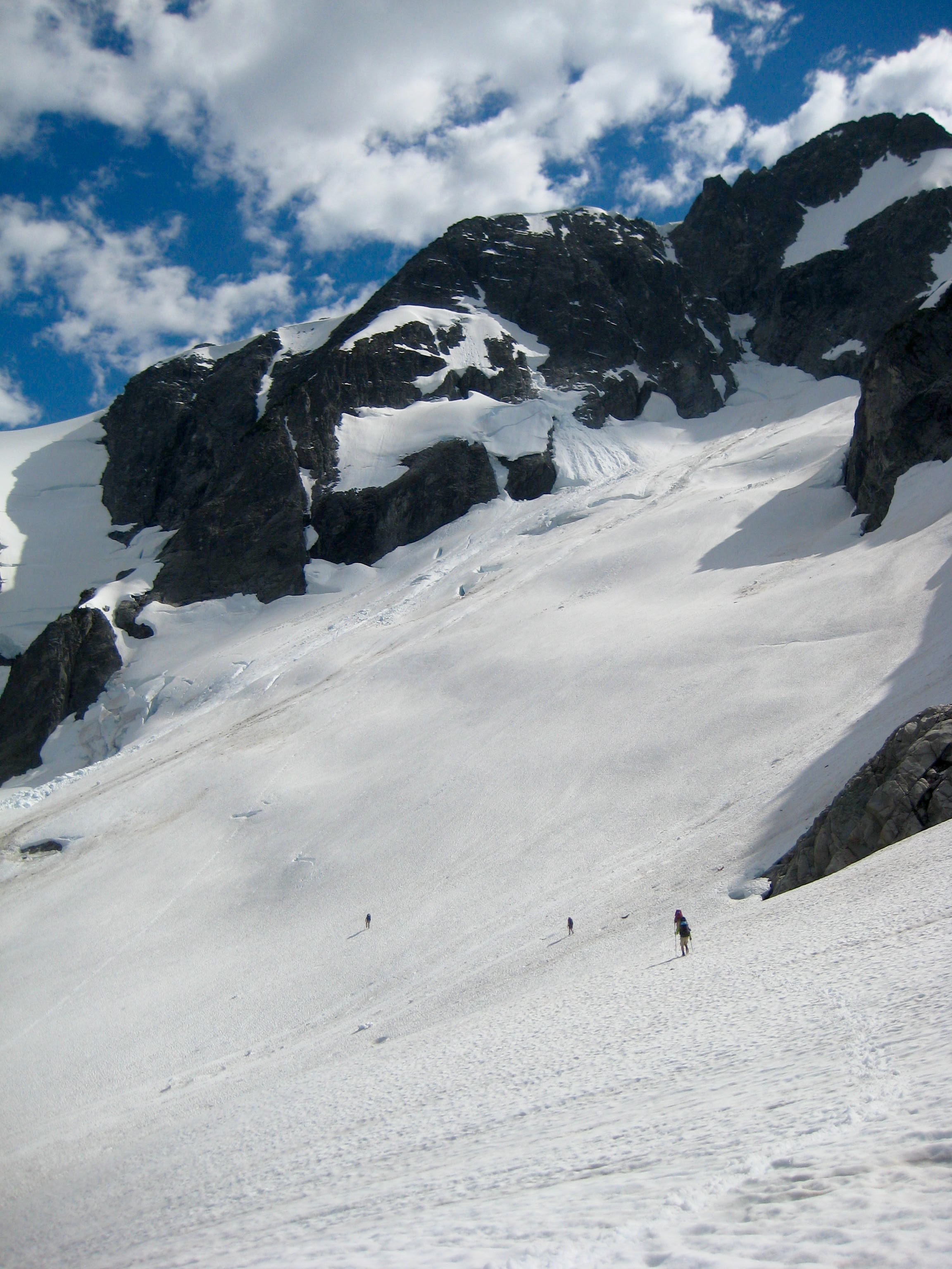
The past winter’s heavy snowfall had left the Challenger Glacier as smooth and unblemished as any of us had ever seen it.
- High On Whatcom Traverse
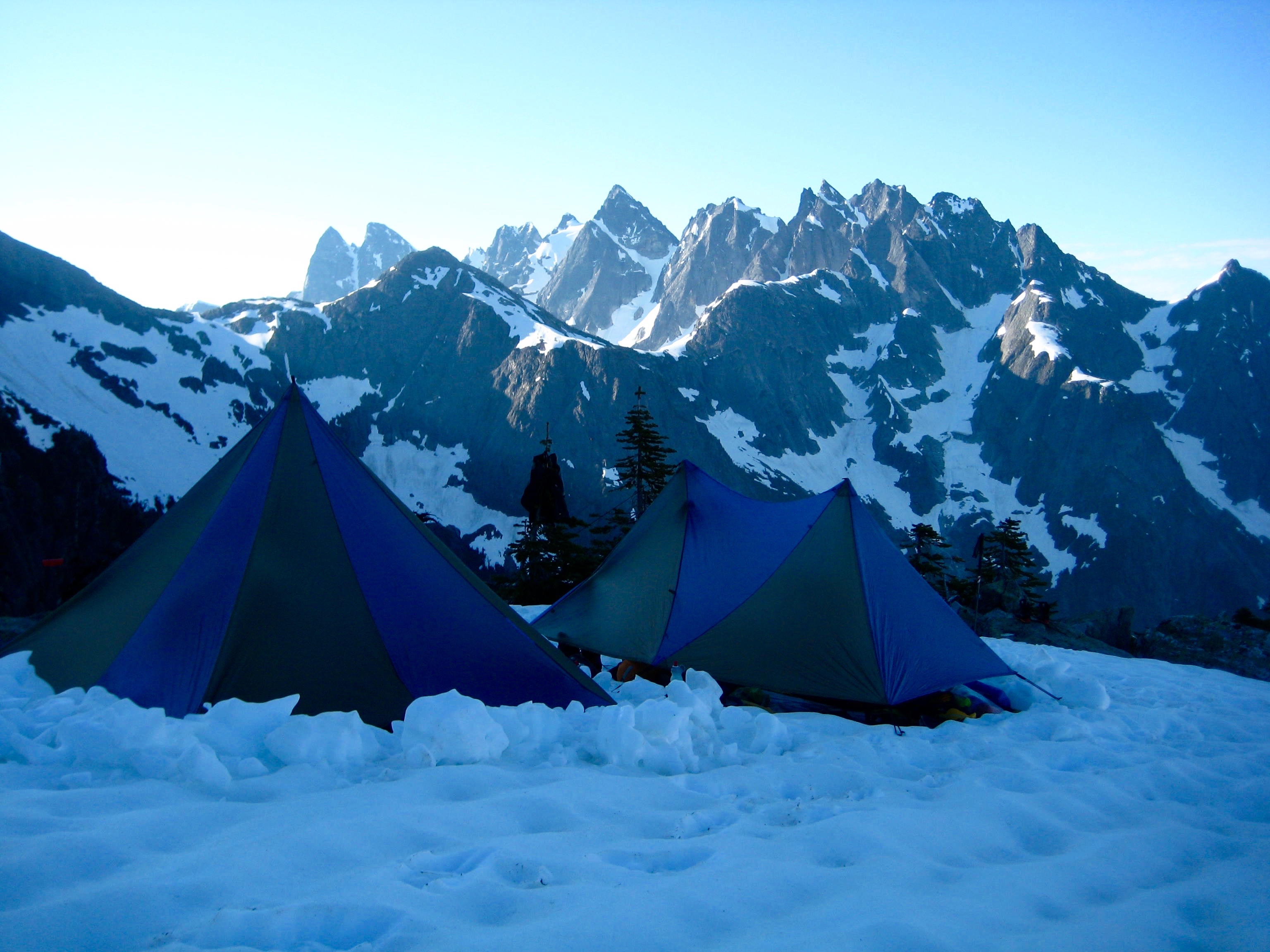
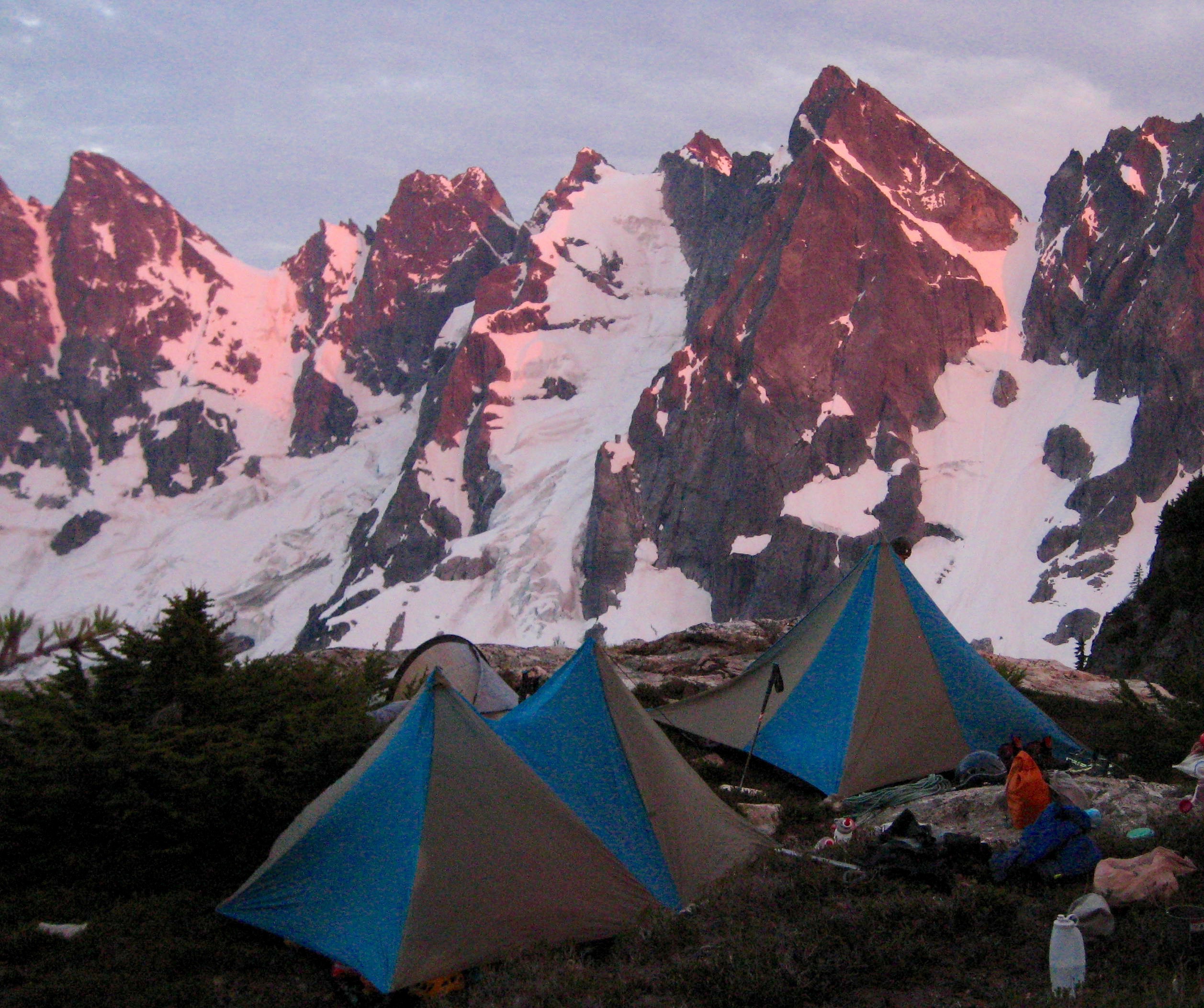
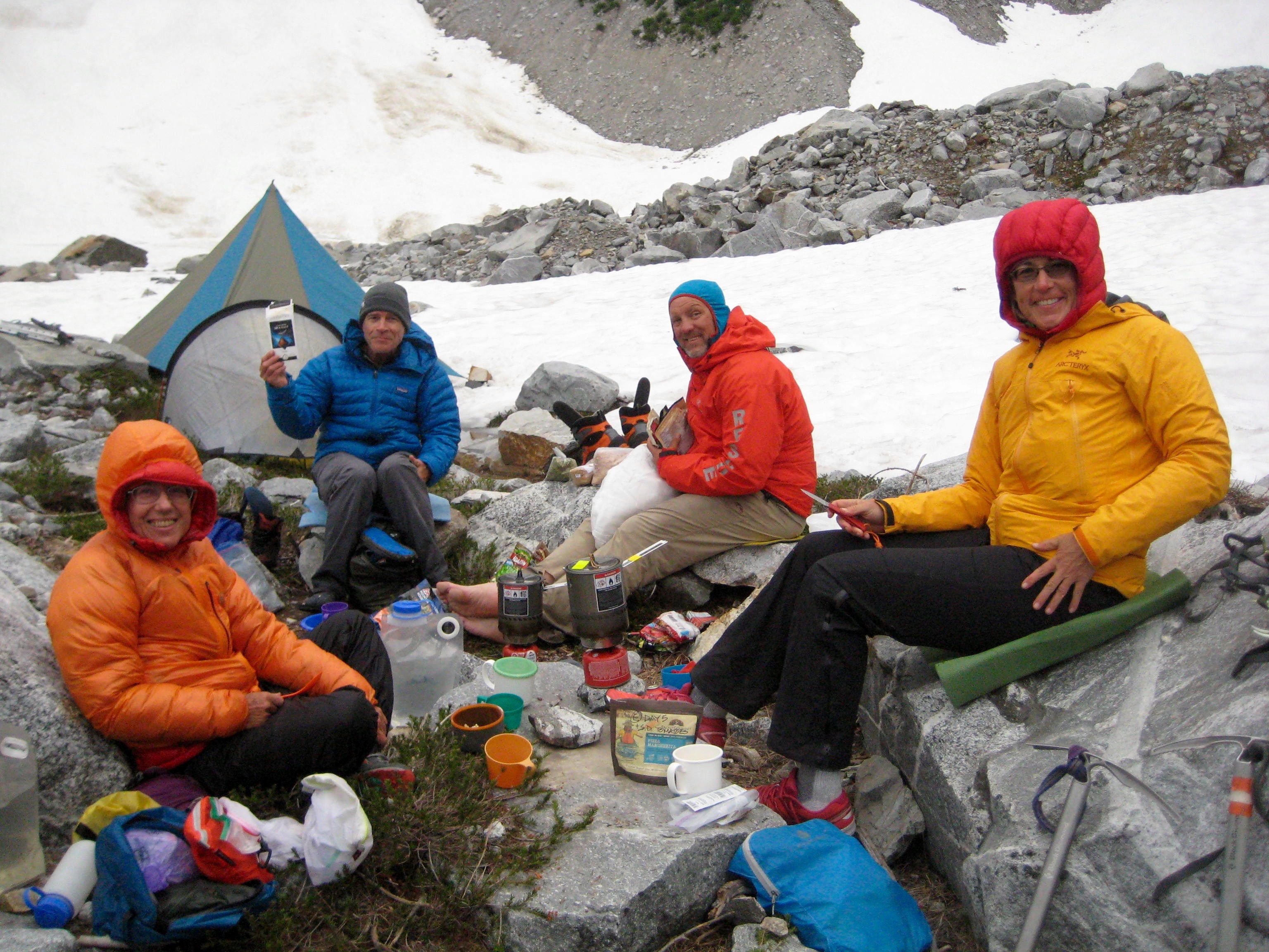
We dropped into Perfect Pass at 8:30pm (11.2 hours from Camp 1) and were soon eating dinner in the last rays of evening sunshine.
- Group Dinner At Perfect Pass
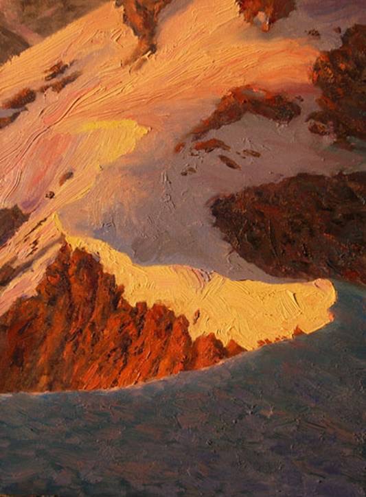
Besides being the official start of the Picket Traverse, Perfect Pass is a special place with a graceful elegance. This feeling is beautifully captured in the oil painting below, by my brother Brad.

- Perfect Pass At Sunrise (oil painting by Brad Brisbine)
Day 3 (AM): Whatcom Peak Summit Climb
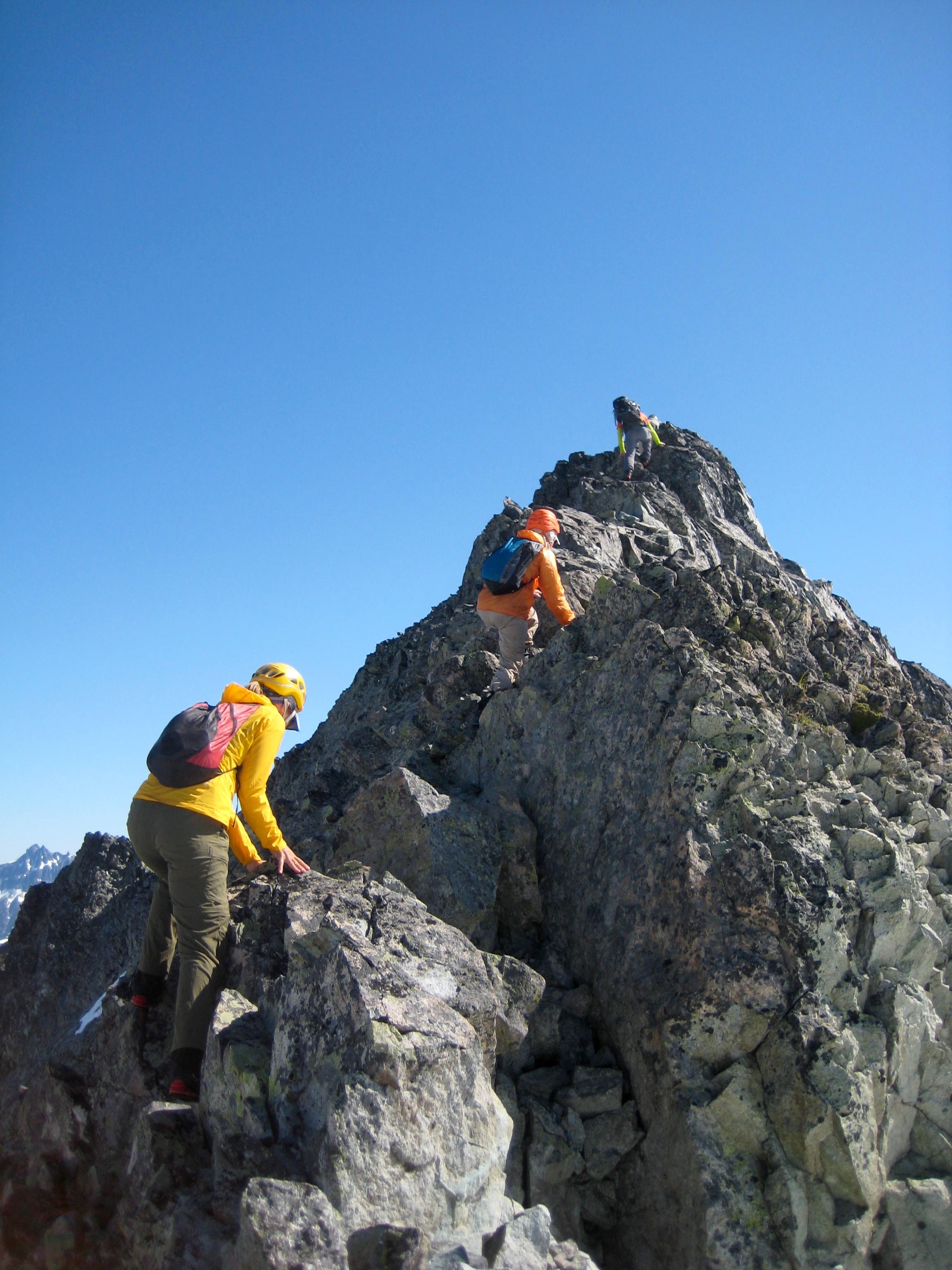
Our morning schedule called for a climb of Whatcom Peak, which rises from the northern side of Perfect Pass. After breakfast, we gathered summit packs and headed up the southern snowfield.
- Heading Up Whatcom Peak
The final 300 feet of the climb ascends an exposed ridge of solid Class 3 rock. I regard this to be one of the finest ridge scrambles in the Cascades.
- Scrambling Up Whatcom Peak
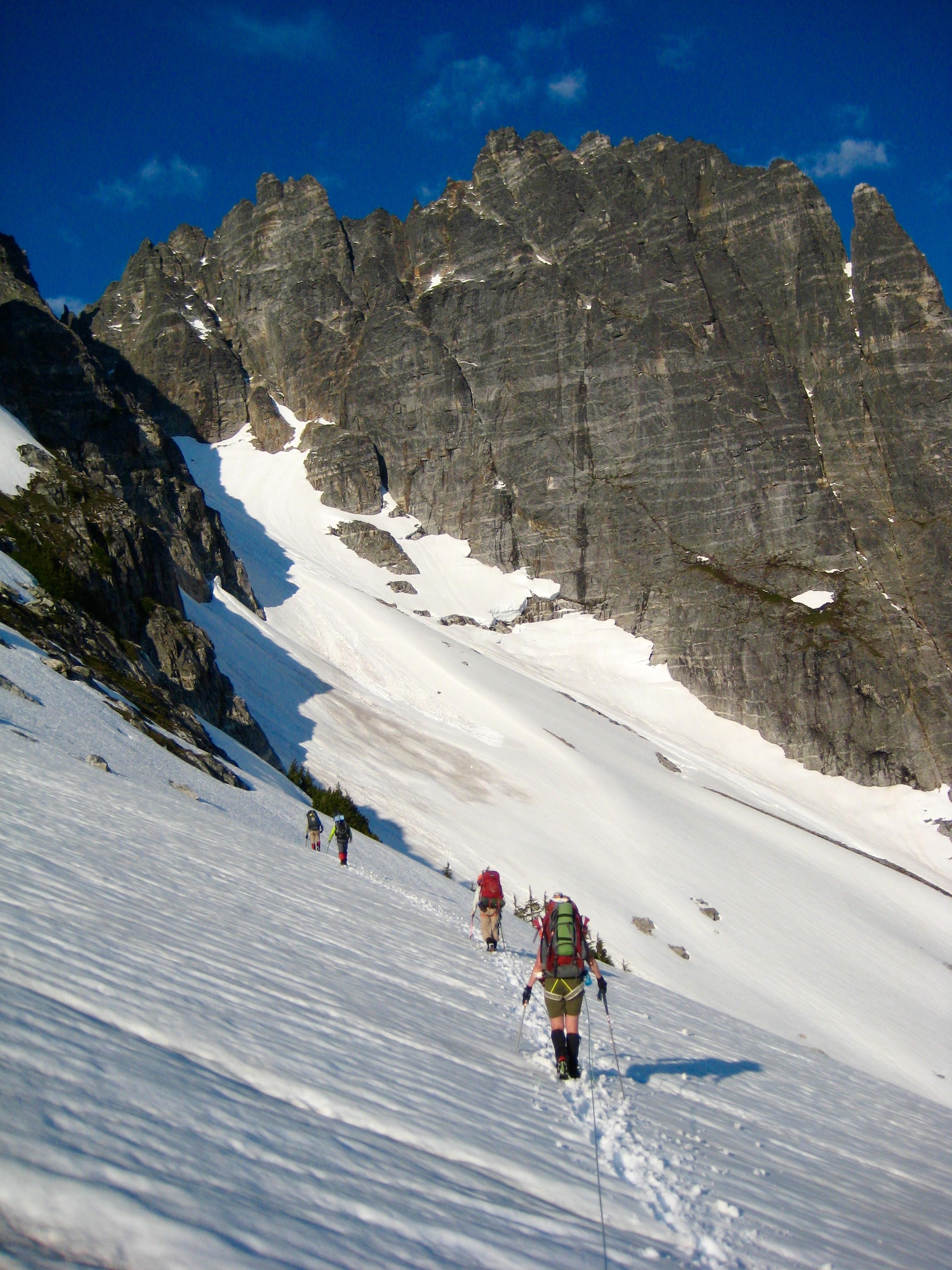
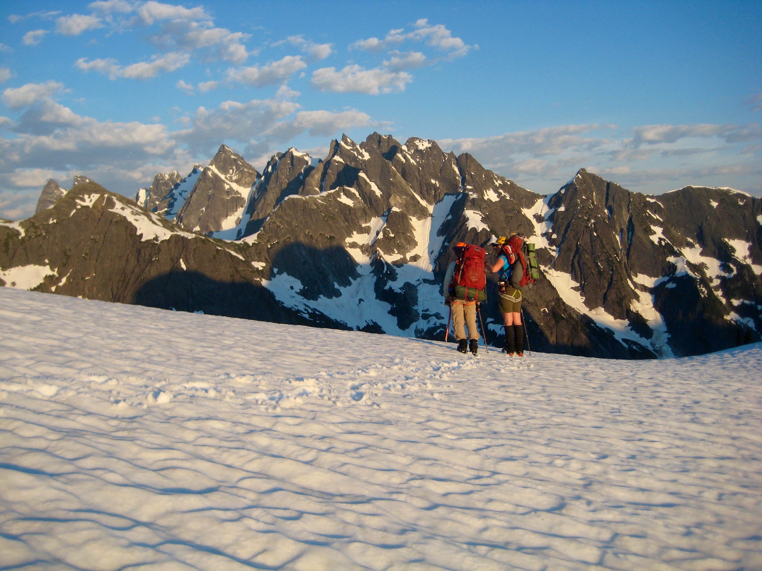
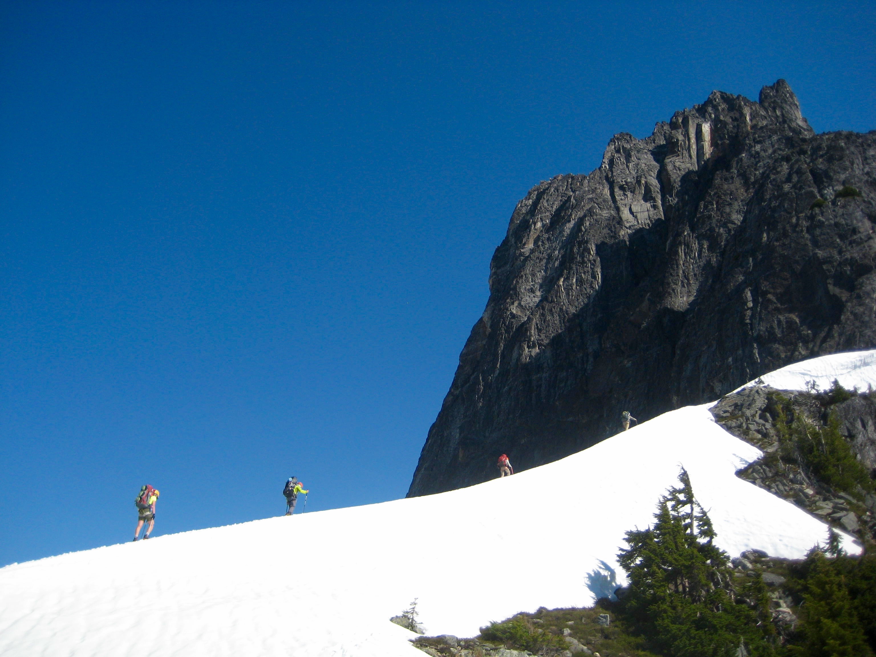
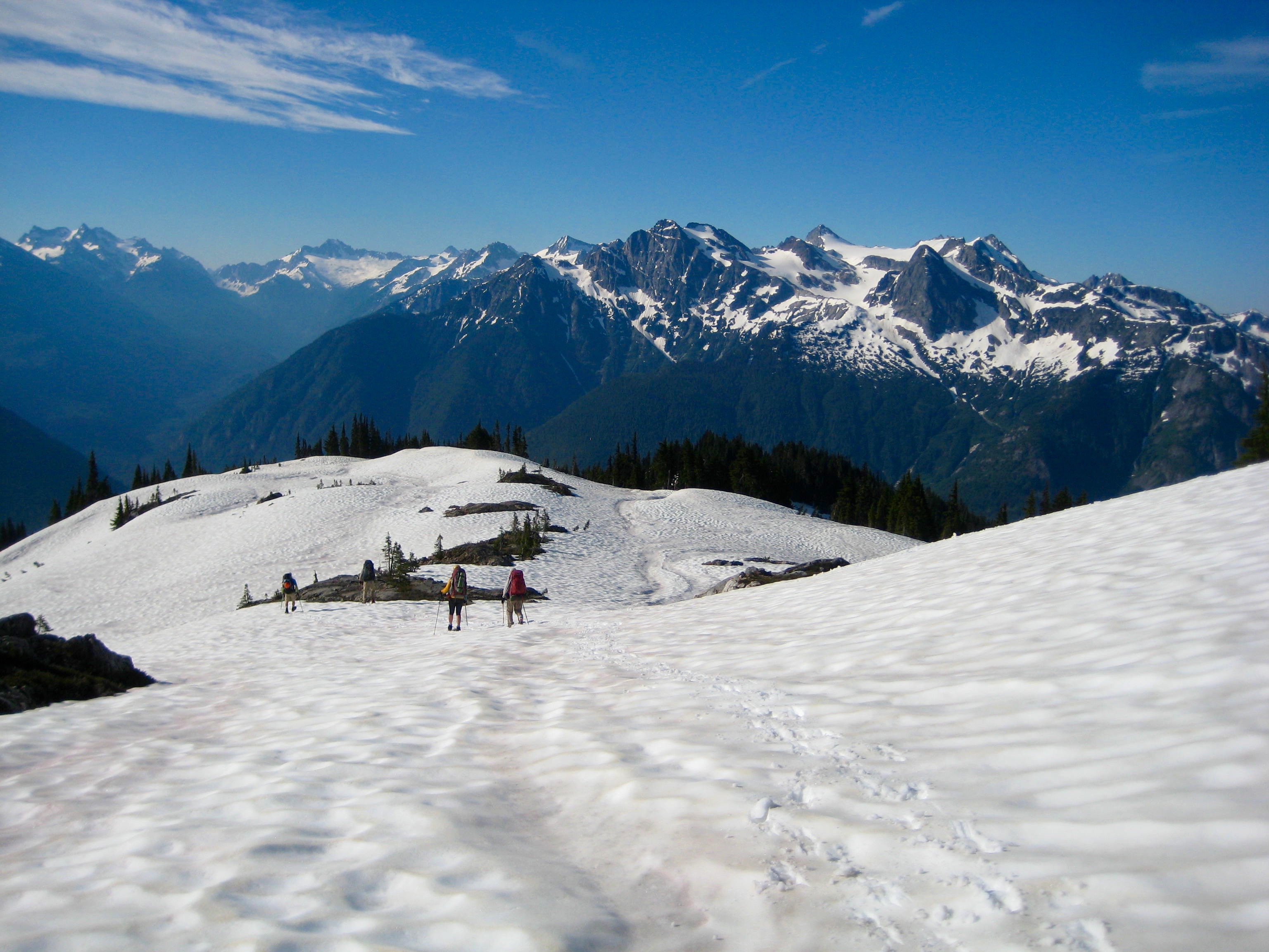
Day 3 (PM): Perfect Pass to Solar Pass to Pickell Pass
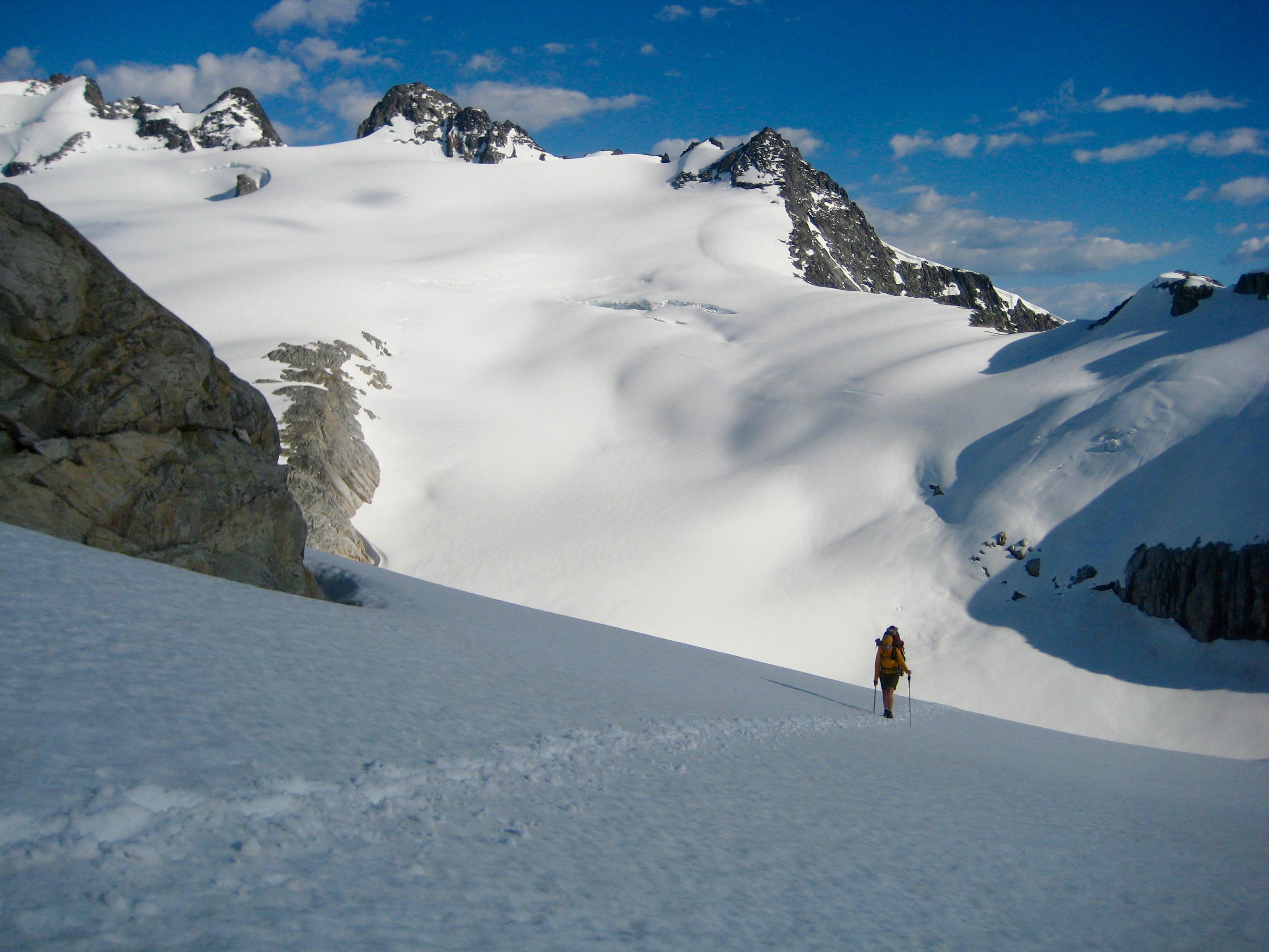
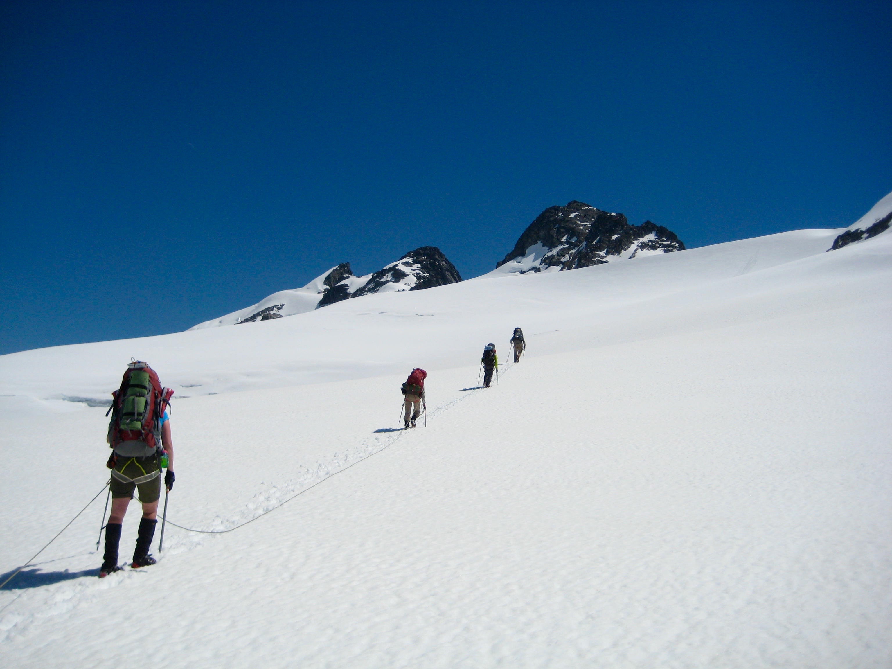
We were back at Perfect Pass in time for lunch, then we packed up and ascended the Challenger Glacier.
- Heading Up Challenger Glacier On Day 3
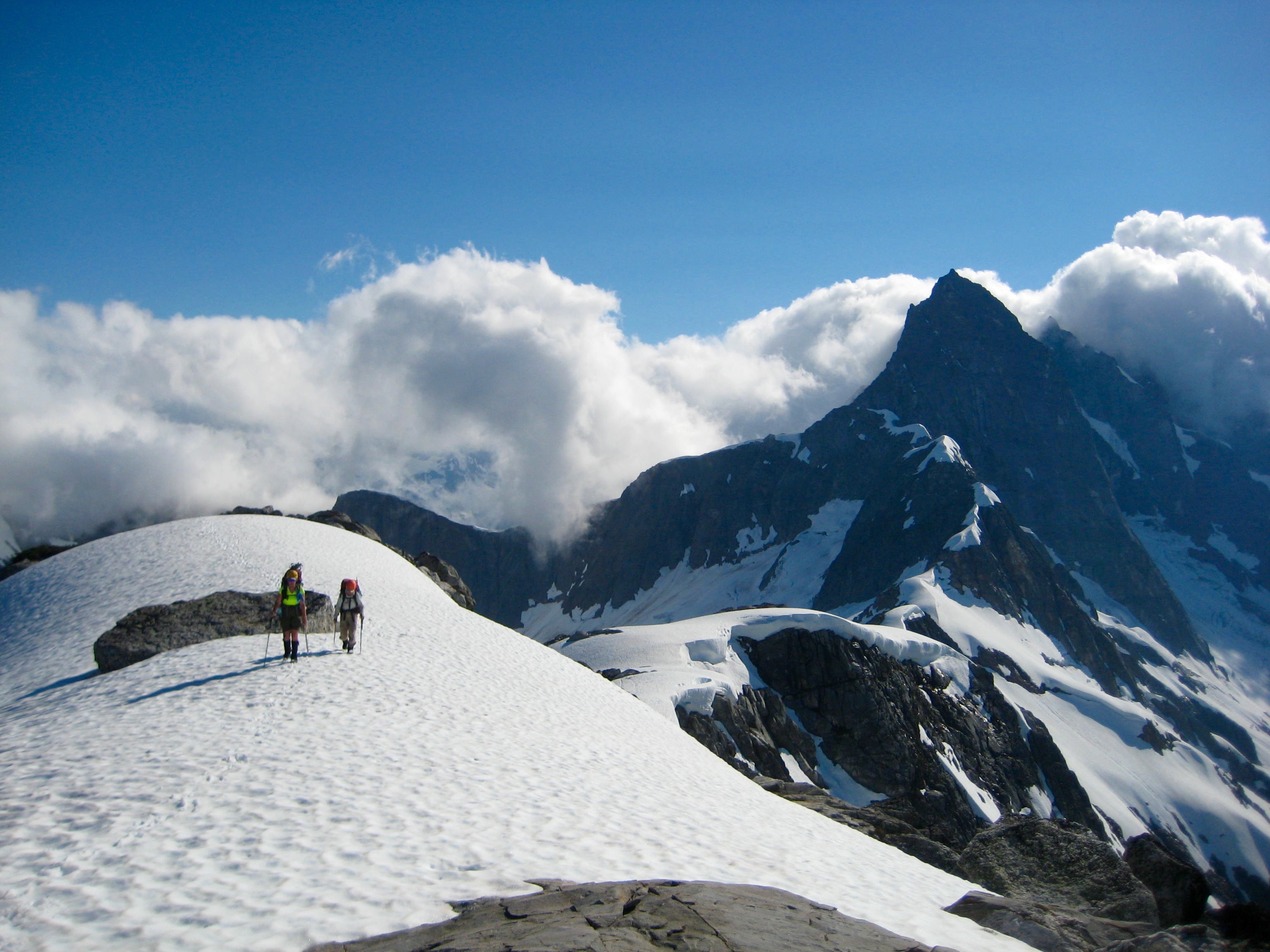
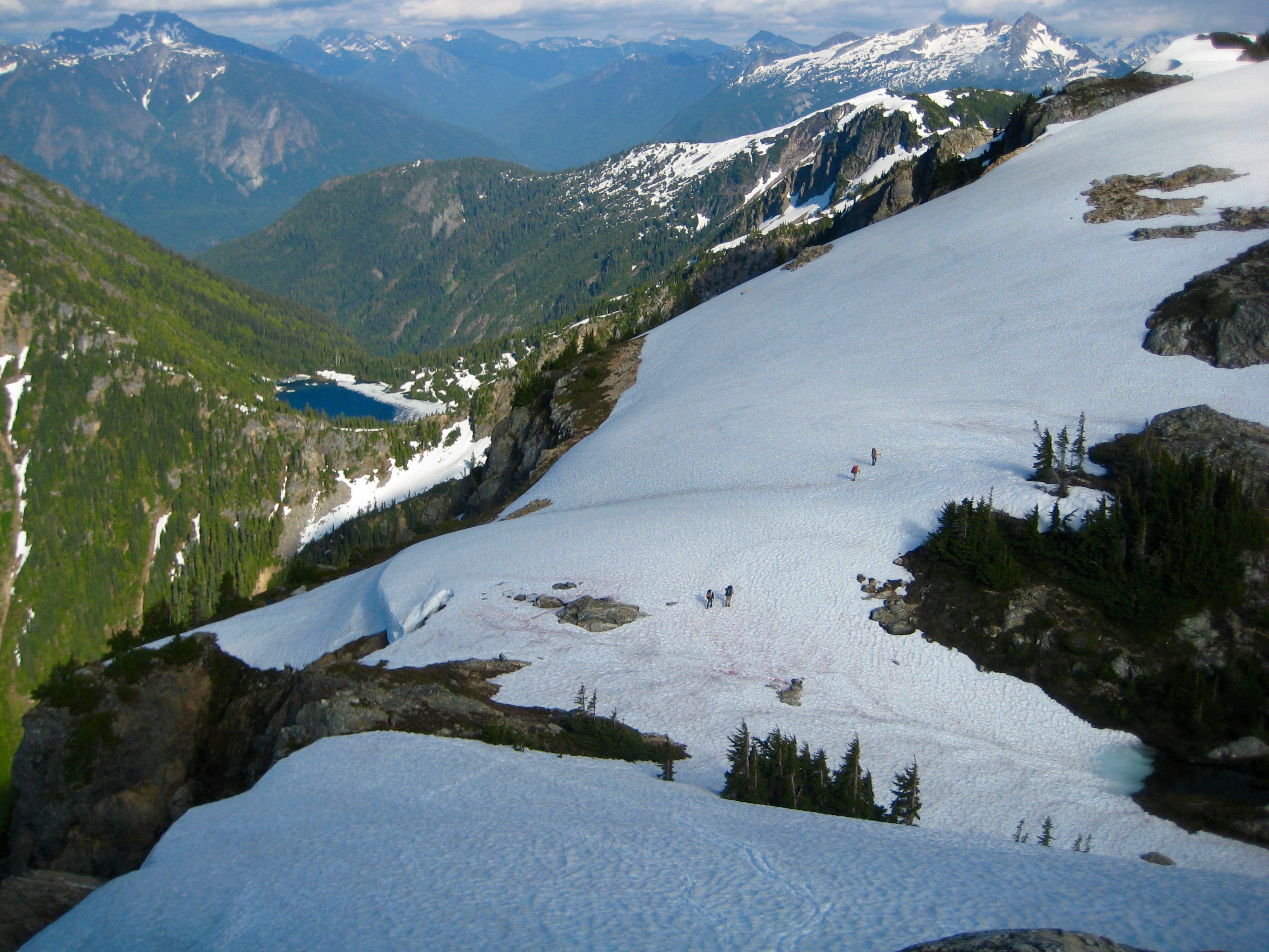
We crossed over “Solar Pass,” a 7560-foot gap between the fourth and fifth peaks of Mt. Challenger. Crooked Thumb and Phantom Peak were visible to the south.
- Lunch Stop At Solar Pass
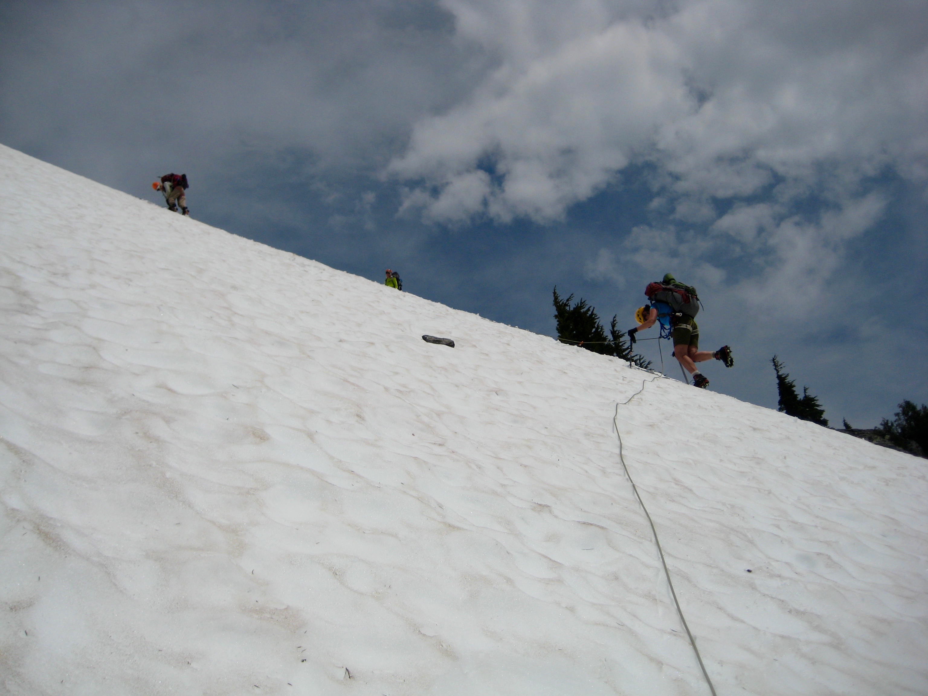
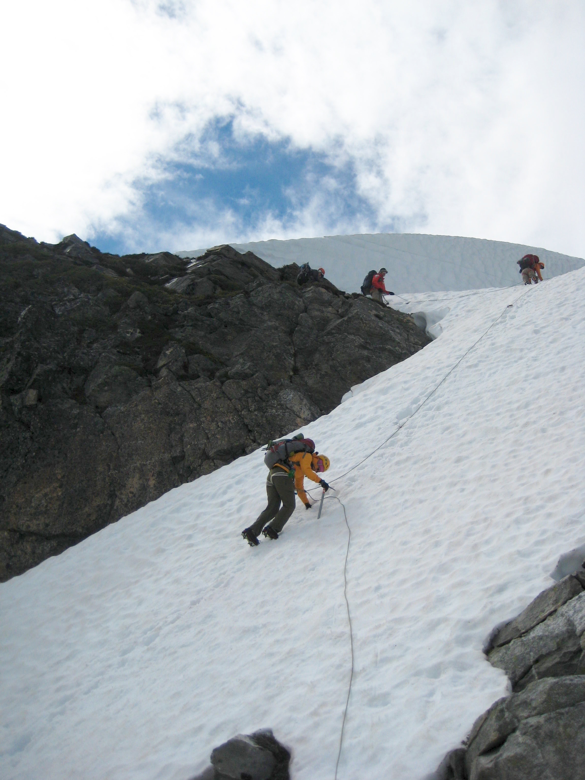
From the pass, we booted 1000 feet down the Solar Glacier, then turned southward and began a long traverse over to Phantom Arm. Steep, hard snow on the arm itself prompted the use of ropes, flukes, and pickets.
- Climbing Up Phantom Arm
After surmounting the arm, we contoured below the huge, dike-riddled walls of Phantom Peak. This is possibly my favorite view in the Northern Pickets.
- Traversing Below Phantom Peak
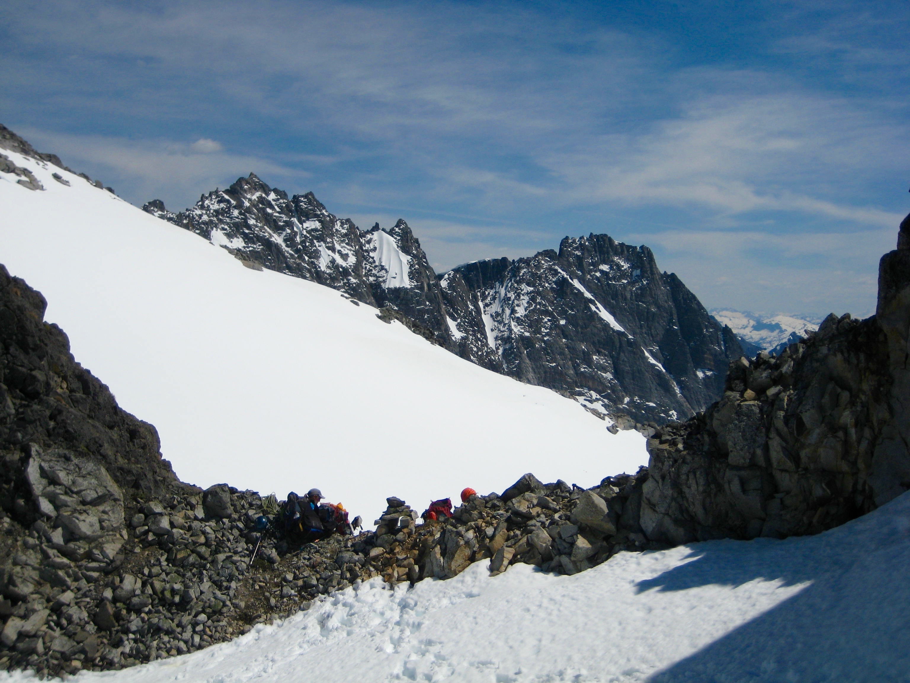
It was late evening when we topped out on Pickell Pass (8.5 hours from Camp 2). Soft sunlight washed over the Southern Pickets on the other side of the pass.
- Fay and Eileen At Pickell Pass
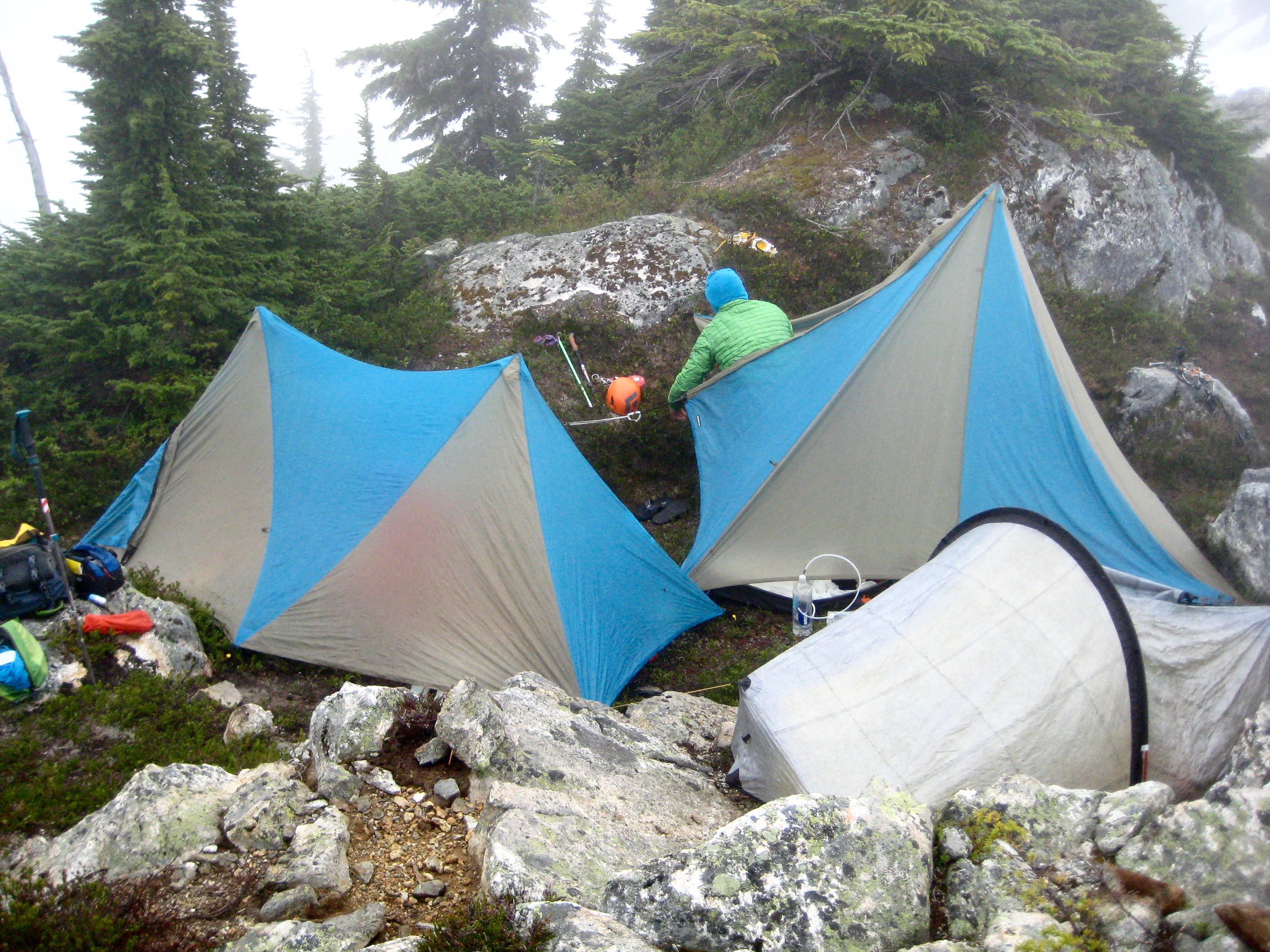
Because the entire pass was snow-bound, we booted 200 feet up to the northeast and found some exposed rocks for better camping.
- Heading To Camp Above Pickell Pass
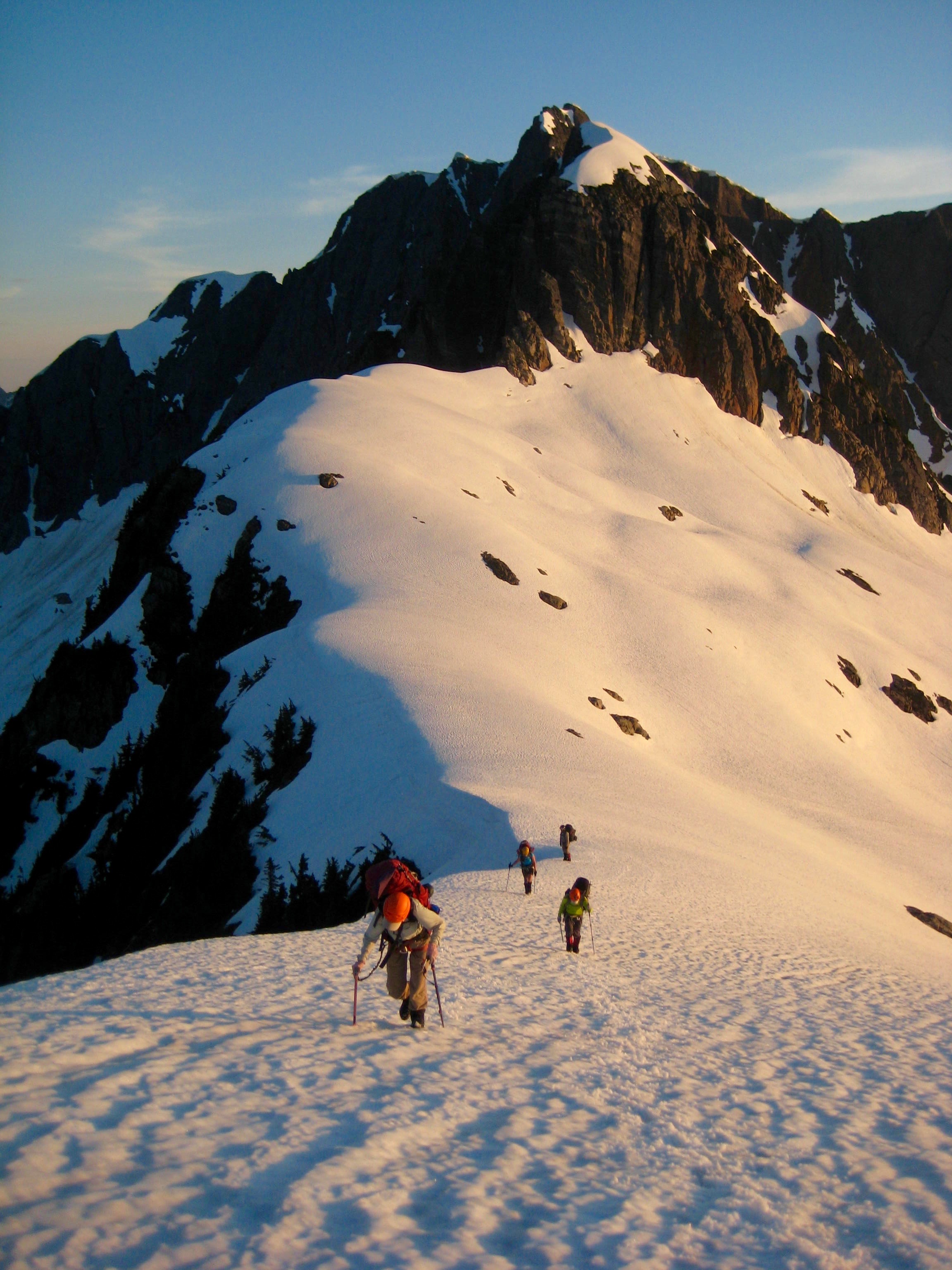
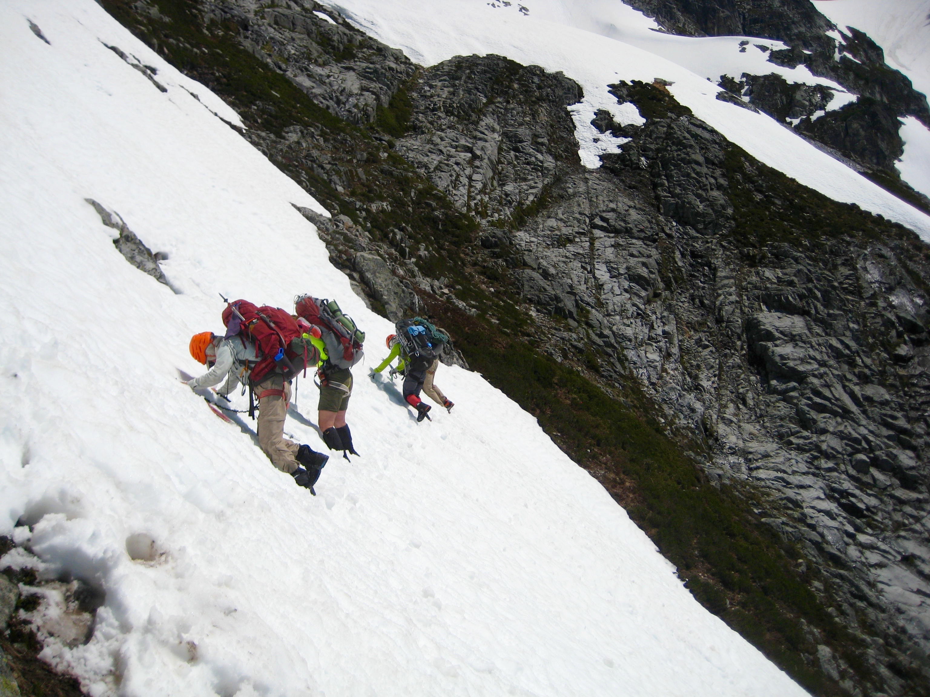
Day 4: Pickell Pass to Picket Pass
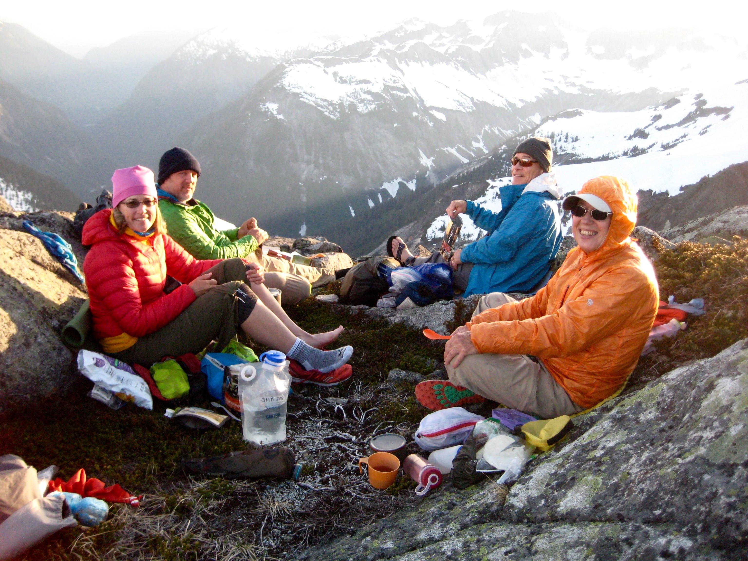
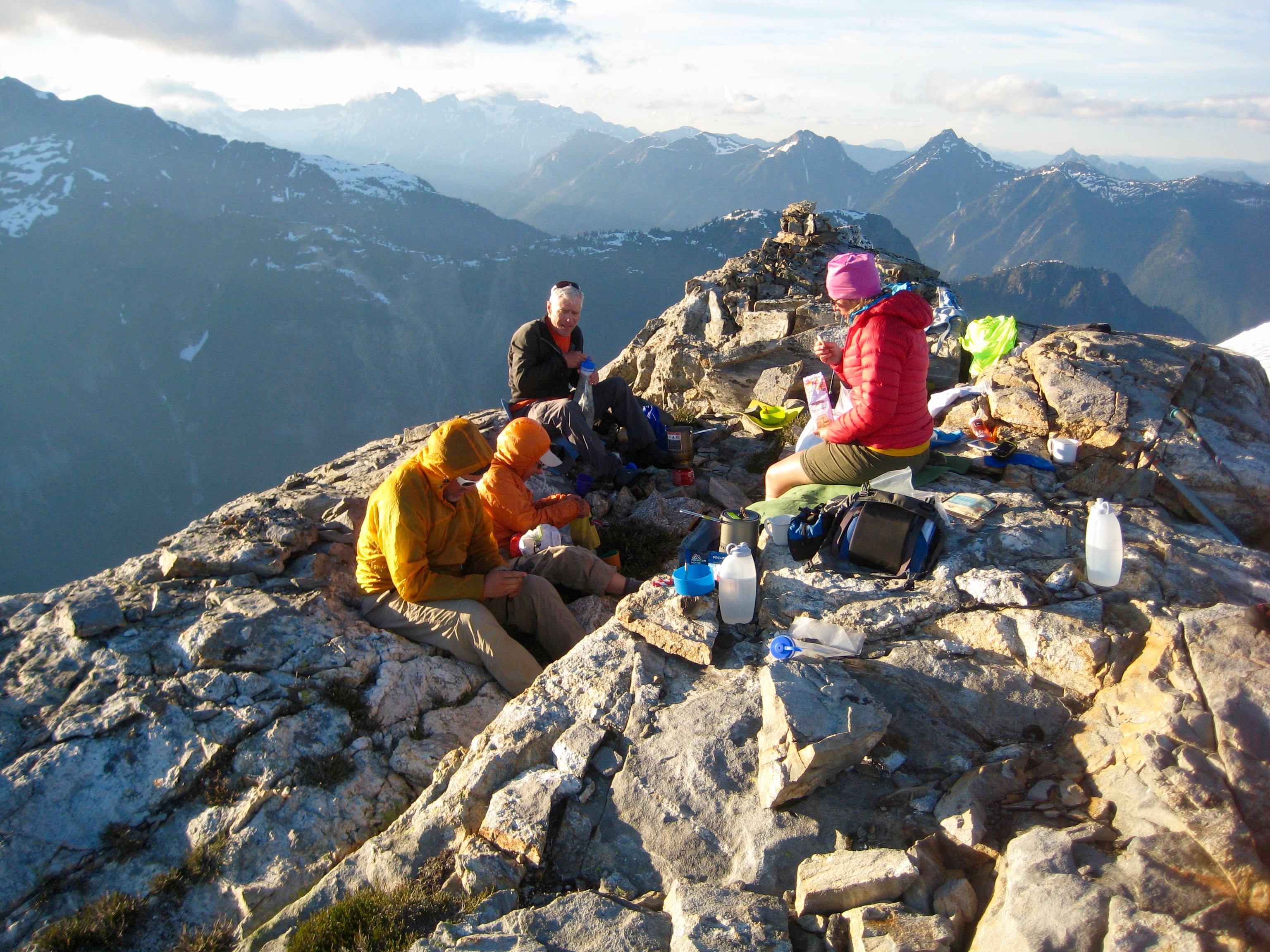
We awoke to another day of clear, blue skies and enjoyed a fabulous Picket view with our breakfast.
- Camp 3 At Pickell Pass
Upon striking camp, we continued up to the northeast until able to begin descending into Goodell Cirque.
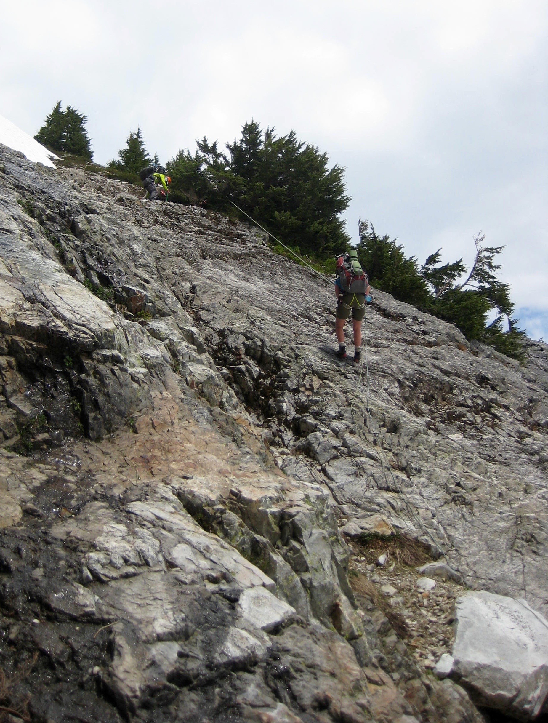
- Climbing Out Of Pickell Pass On Day 4
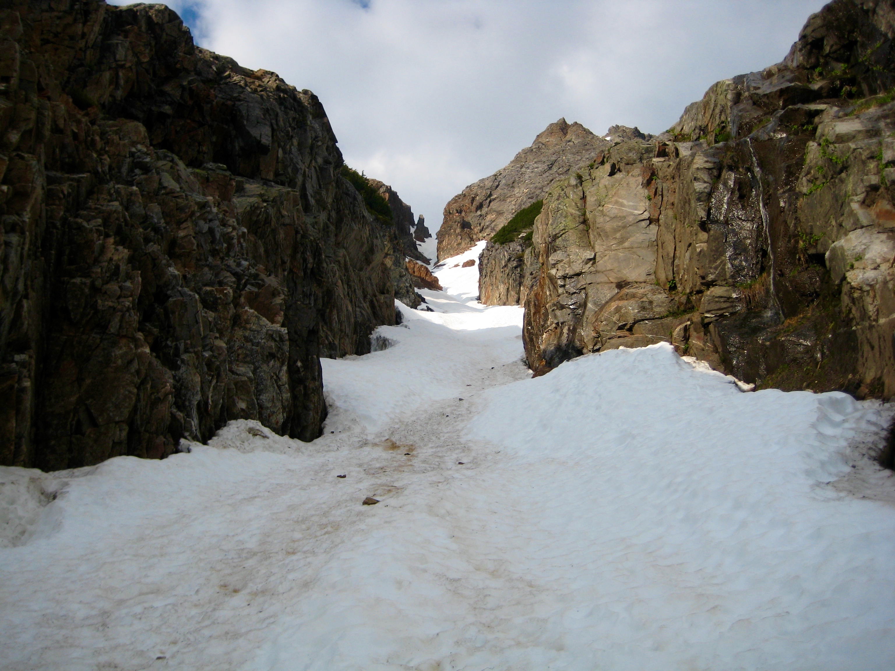
Getting into the cirque involved a rappel, a steep snow traverse, a descent of steep heather and grass, and another short rappel. This took a considerable amount of time, such that we didn’t reach the cirque floor until early afternoon.
- Snow Descent From Pickell Pass
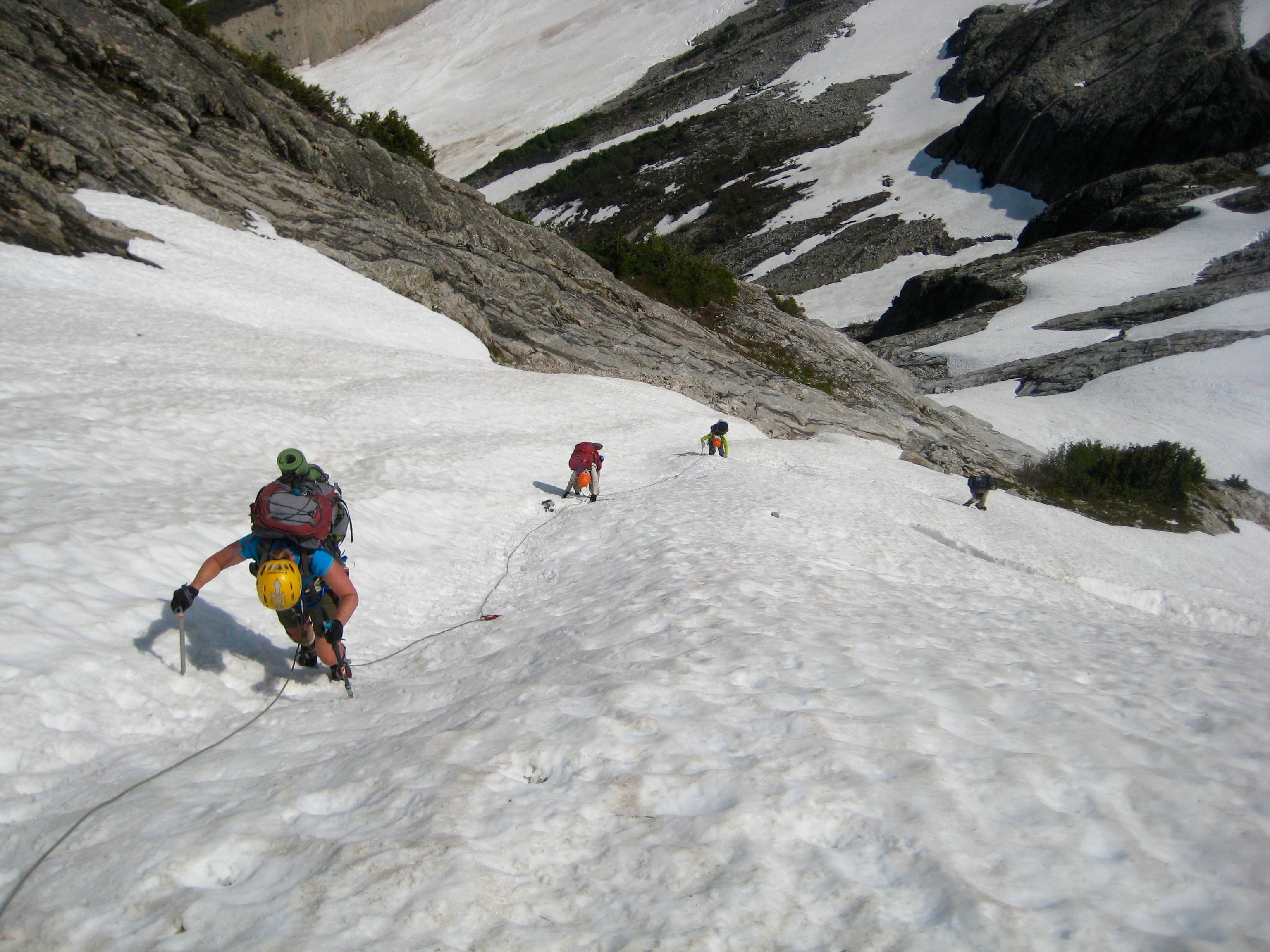
Given the thick snowpack, we followed Tabor & Crowder’s recommendation to traverse southeasterly until encountering a long snow gully. Their advice was spot on, and we began ascending the gully on firm snow. Farther up, the gully transitioned to a narrow defile that cut through a large cliff band.
- Upper Snow Gully In Goodell Cirque
After a 1000 foot climb, we exited to the right and made a rising traverse over to Picket Pass.
- Ascending To Picket Pass
We reached Picket Pass shortly before 8:00pm (10.5 hours from Camp 3) and set up tents on one of the expansive benches.

- Camp At Picket Pass
Throughout the evening, we marveled at the alpenglow on the Southern Pickets…
- Sunset On Southern Pickets

…on Elephant Butte and Rhino Butte…
- Sunset On Elephant Butte and Rhino Butte
…and in the sky over Mt. Fury.
- Sunset Over Mt Fury From Picket Pass
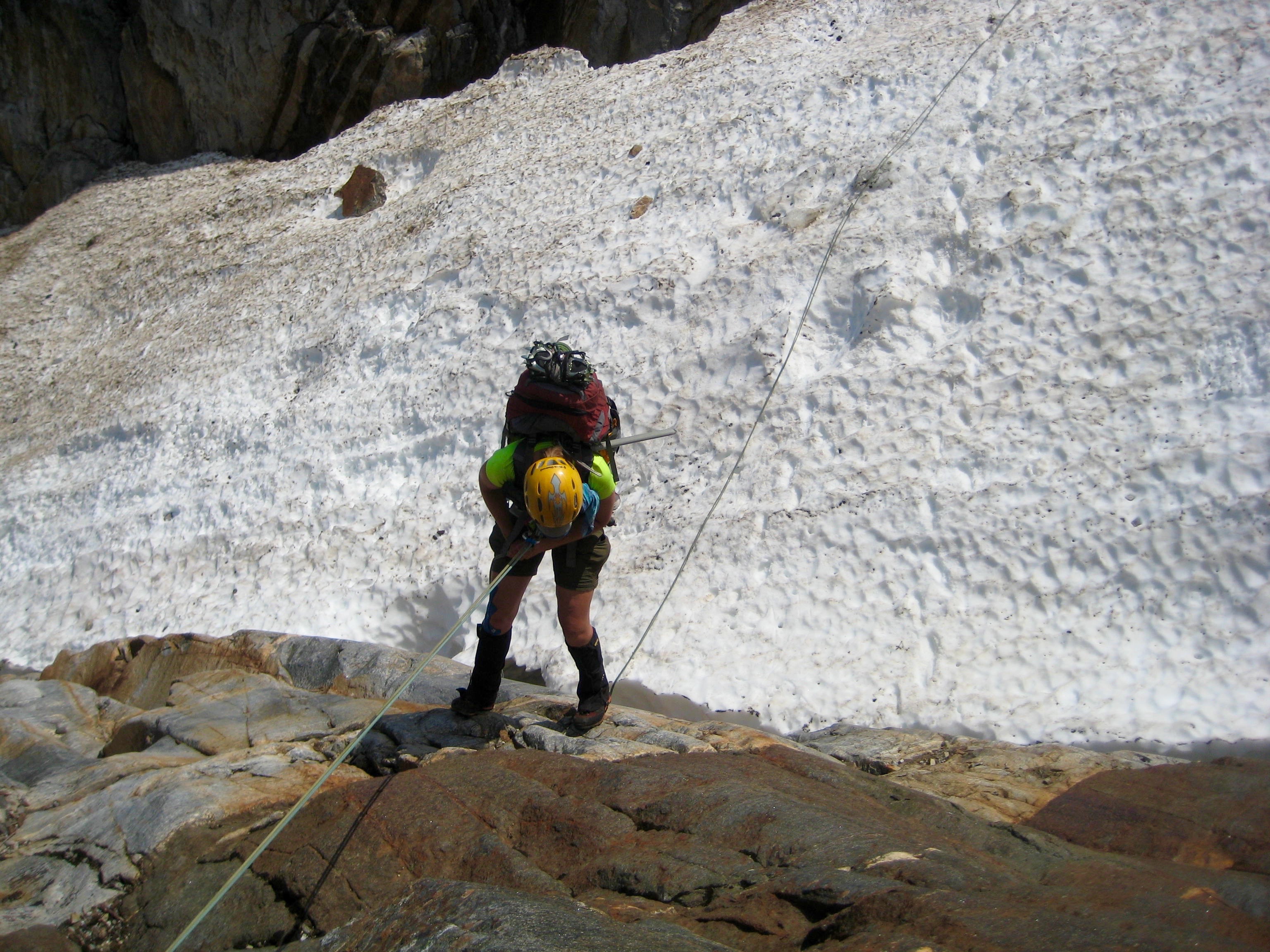
Day 5: Picket Pass to McMillan Tarn
The crux of the Picket Traverse is often reported to be the descent from Picket Pass. We began our morning with a roped down-climb of the very steep snow slopes immediately below the pass. This is no-fall territory.
- Descending From Picket Pass
Farther down, we executed two rappels over a rock face above the Mustard Glacier.

- First Rappel Down To Mustard Glacier
After the second rappel, we did more roped down-climbing on steep snow above a bergshrund.
- Descending Mustard Glacier
Once on the lower part of the Mustard Glacier, we easily angled down to the southeast and located the key ledge that leads into a snow-filled canyon. This canyon provided a rapid descent to still-frozen “McMillan Tarn” at the converging feet of the Mustard and Degenhardt Glaciers.
- Descending To McMillan Tarn
We pitched our tents on the only flat spot near the tarn. Dinner was a cold affair, rudely interrupted by a thundershower.
- Group Dinner At McMillan Tarn Before The Thundershower
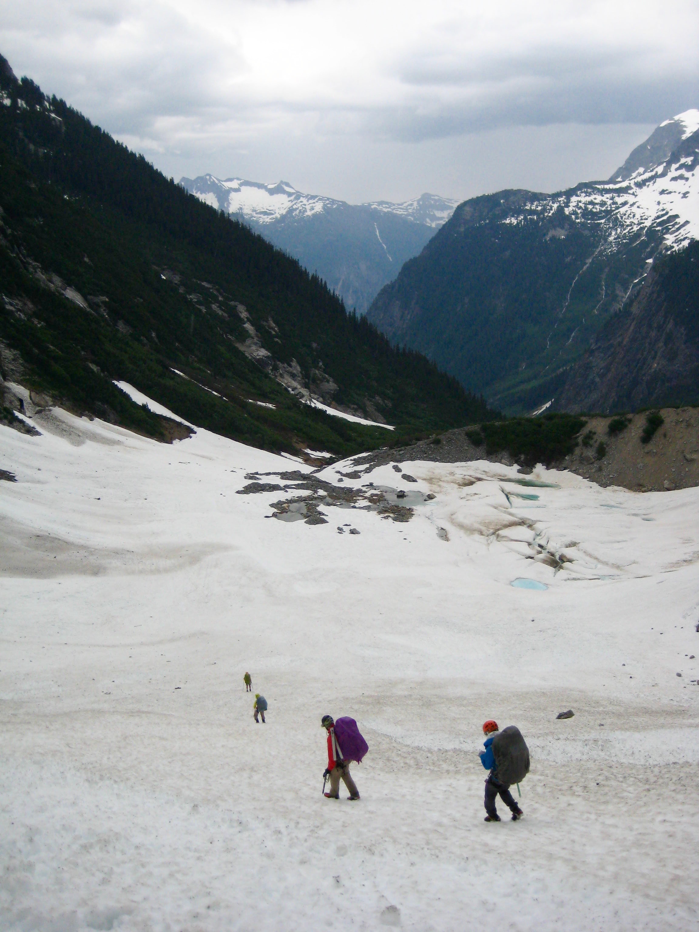
Day 6: McMillan Tarn to McMillan Pass to Rhino Butte
The previous evening’s cloudy skies and rain showers had cleared up by morning. We packed up and made a descending traverse to get below the nose of The Barricade. From our low point at 4000 feet, we started climbing back up along the cliff base.
- Climbing Up To McMillan Glacier
The McMillan Glacier could be seen farther to the east, but we had to cross several streams and rock ribs before getting there.
- Looking Across Snout Of McMillan Glacier
At a major gully, we made one short rappel into the bottom…
- Rappelling Into Snow Gully Below McMillan Glacier
…then scrambled up to a rock ledge that traversed under the glacier. It was a relief when we finally worked past the menacing icefalls along the glacier snout.
- Crossing Key Ledge Below McMillan Glacier
Picturesque snow slopes led us up the final few hundred feet to McMillan Pass.

- Ascending To McMillan Pass
Rather than camping at the narrow pass, we booted up nearby Point 6914 aka “Rhino Butte.”
- Climbing Rhino Butte
The reached the summit of Rhino Butte at 5:30pm (9.8 hours from Camp 5) and set up Camp 6. A cold, moist layer of marine air moved in during the evening, which made for some dramatic fog and cloud textures.
- Group Dinner On Summit Of Rhino Butte
Day 7: Rhino Butte to Elephant Butte to Torrent Bench
Now that we were out of the Picket Range proper, we expected that travel would become much easier. For awhile it did, and we readily ascended the gentle west ridge of Elephant Butte. However, descending the east ridge proved to be as technically difficult and convoluted as anything we’d done earlier in the trip. We made several roped down-climbs and rappels in an effort to reach Torrent Pass directly.
- Descending Steep Snow On Elephant Butte
By late evening (11.3 hours from Camp 6), we were cold, tired, frustrated, and still almost 1000 feet above Torrent Pass. We ended up squeezing our three tents into a tiny spot on a 5700-foot bench above the pass. It was a comically crowded situation.
- Camp 7 At Torrent Bench
Day 8: Torrent Bench to Torrent Pass to Stetattle Arm
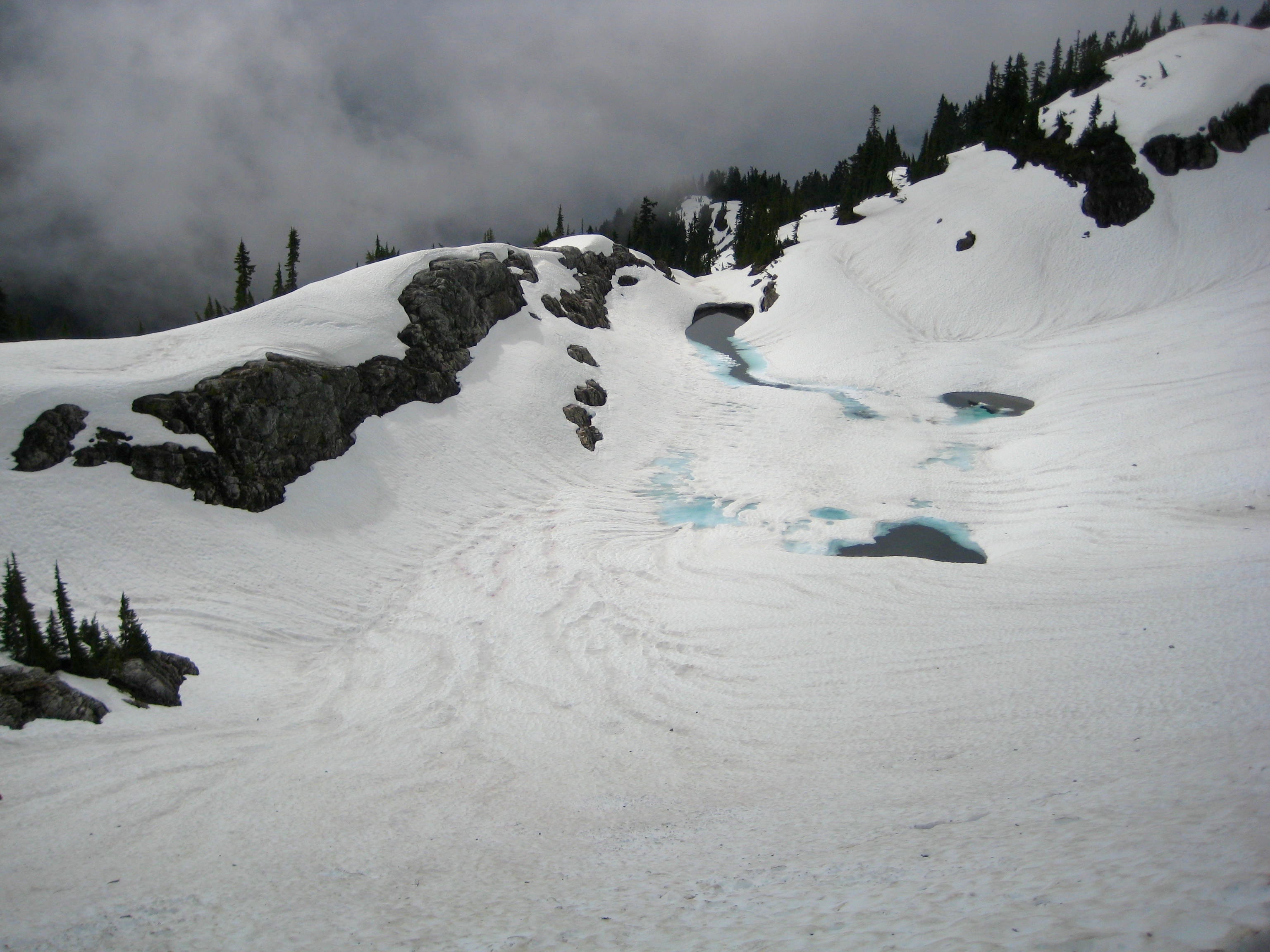
We awoke to more cold, marine fog and had a somber breakfast before packing up. From our bench camp, we descended southward to the snowy bowl of Torrent Lake, then followed a series of game paths over to Torrent Pass.
- Looking Down On Frozen Torrent Lake
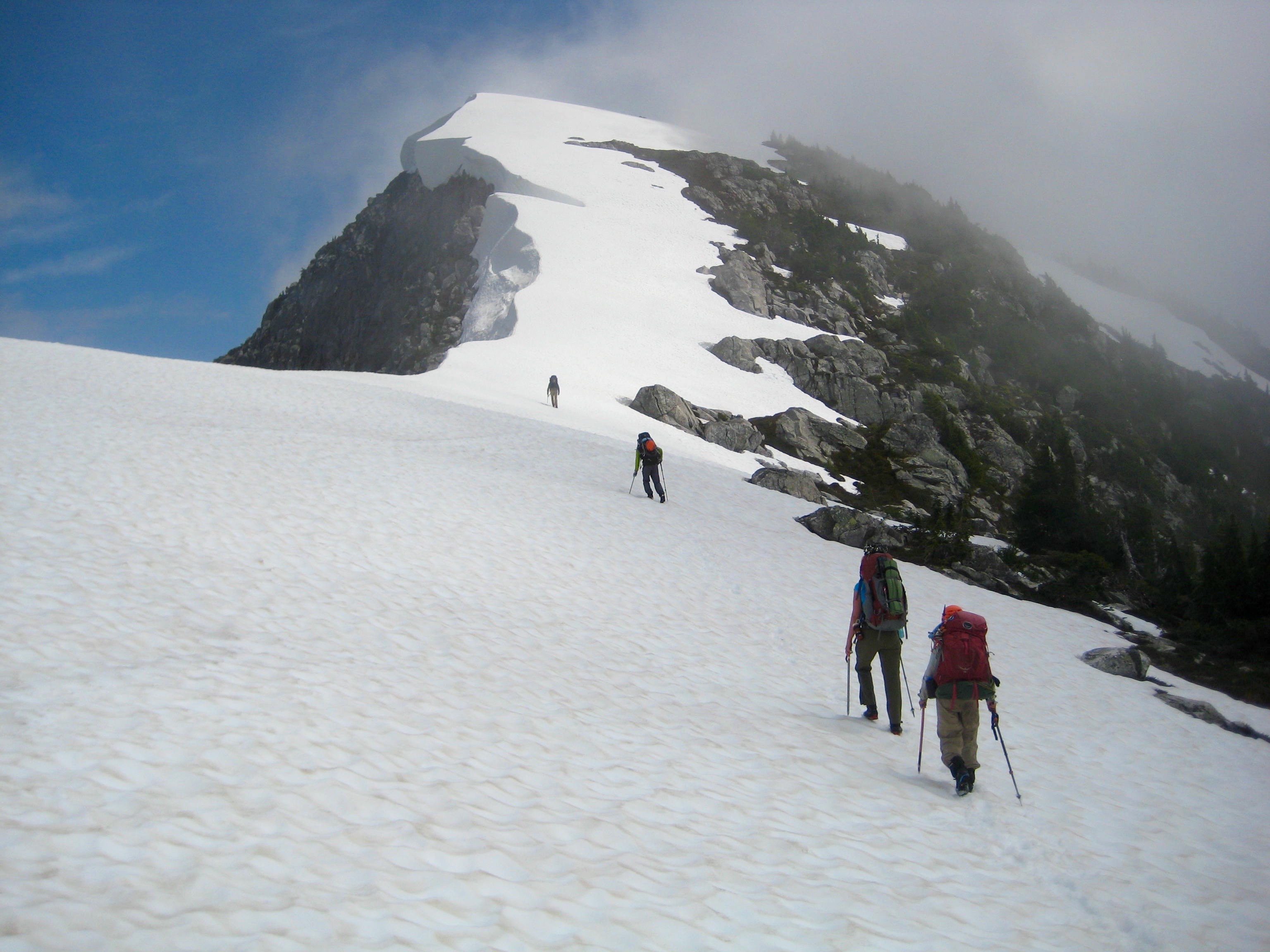
Everything seemed to improve as we climbed out of Torrent Pass. The snow cover got better, the terrain got better, and the weather got better. We booted along the scenic crest of Stetattle Ridge, crossing over the summits of North and South Stetattle Buttes in the process.
- Ascending North Stetattle Butte
After cresting the final ridge knob, we descended onto the broad crest of Stetattle Arm above Sourdough Lake.
- Descending To Stetattle Arm Above Sourdough Lake
Our final camp was established at 6100 feet on Stetattle Arm (9.2 hours from Camp 7), with a gorgeous view of Colonial Peak, Snowfield Peak, and other summits in the McAllister Mountains.
- McAllister Mountains From Stetattle Arm Camp

Day 9: Stetattle Arm to Sourdough Trailhead
Our traverse concluded with a fairly uneventful descent to Sourdough Creek, where we encountered both the Sourdough Trail and the first humans that we’d seen since Day 1.
- Hiking Down Stetattle Arm
We reached the Sourdough Trailhead at Diablo Townsite before noon and took a quick dip in the cold lake before departing to find fresh food and soft beds.
Route Maps & Profiles
…
…
…
…
…
Photo Gallery
Click to enlarge…
Days 0-3: Newhalem to Pickell Pass


Days 4-5: Pickell Pass to McMillian Tarn


Days 6-9: McMillian Tarn to Sourdough Trailhead


