• Hike/Climb/Ride
      • Canadian Cascades BC
      • Northwestern WA Cascades
      • Northeastern WA Cascades
      • North-Central WA Cascades
      • Central WA Cascades
      • Southern WA Cascades
      • Olympic Mountains WA
      • Columbia Plateau WA
      • Other USA & Canadian Regions
        • Arizona
        • California
        • Montana
        • Nevada
        • New Mexico
        • Oregon
        • Utah
        • Wyoming
        • Canada (non-Cascades)
      • International (outside USA & Can)
        • France
        • Jordan
        • Italy
        • Mexico
        • New Zealand
        • Patagonia
        • Peru
        • Slovenia
        • Switzerland
        • Tasmania
    • Major Peaks
      • Special Groups
        • The Regal Six
          • Glacier Peak (10,541/10,544 ft)
          • Adams, Mt (12,276/12,273 ft)
          • Baker, Mt (10,781/10,773 ft)
          • Olympus, Mt (7969 ft)
          • Rainier, Mt (14,411/14,400 ft)
          • St Helens, Mt (9677/8365/8321 ft)
        • The Big Ten
          • Bonanza Peak (9511/9503 ft)
          • Jack Mountain (9066/9065 ft)
          • Buckner, Mt (9114/9111 ft)
          • Fernow, Mt (9249/9241 ft)
          • Goode, Mt (9200+/9223 ft)
          • Logan, Mt (9087/9097 ft)
          • Maude, Mt (9082/9077 ft)
          • Shuksan, Mt (9131/9125 ft)
          • Stuart, Mt (9415/9414 ft)
          • Seven-Fingered Jack (9100 ft)
        • The Landmark Twelve
          • Black Peak (8970/8986 ft)
          • Bonanza Peak (9511/9503 ft)
          • Dome Peak (8920/8921 ft)
          • Eldorado Peak (8868/8873 ft)
          • Jack Mountain (9066/9065 ft)
          • Goode, Mt (9200+/9223 ft)
          • Redoubt, Mt (8969/8958 ft)
          • Shuksan, Mt (9131/9125 ft)
          • Stuart, Mt (9415/9414 ft)
          • Silver Star Mountain (8876/8892 ft)
          • Silvertip Mountain (8517 ft)
          • Sloan Peak (7835 ft)
        • The Super Eight
          • Agnes Mountain (8115 ft)
          • American Border Peak (7994 ft)
          • Chimney Rock (7727 ft)
          • Triumph, Mt (7270 ft)
          • Hozomeen Mtn: north peak (8066 ft)
          • Slesse, Mt (8002 ft)
          • Hozomeen Mtn: south peak (8003 ft)
          • Whitehorse Mountain (6852 ft)
        • The Tall Twelve
          • Black Peak (8970/8986 ft)
          • Boston Peak (8894/8883 ft)
          • Copper Peak (8964/8960 ft)
          • Dome Peak (8920/8921 ft)
          • Dragontail Peak (8840+/8836 ft)
          • Eldorado Peak (8868/8873 ft)
          • Forbidden Peak (8815/8839 ft)
          • Gardner Mountain (8898/8897 ft)
          • Redoubt, Mt (8969/8958 ft)
          • Spickard, Mt (8979/8978 ft)
          • Gardner Mtn, North (8956/8958 ft)
          • Silver Star Mountain (8876/8892 ft)
      • Canadian Cascades Majors
        • The Canadian Chilliwack Three
          • Lindeman, Mt (7578 ft)
          • Rexford, Mt (7641 ft)
          • Slesse, Mt (8002 ft)
        • The Cheam Six
          • Baby Munday Peak (7382 ft)
          • Cheam Peak (6929 ft)
          • Foley Peak (7572 ft)
          • Lady Peak (7182 ft)
          • Stewart Peak (7343 ft)
          • Welch Peak (7999 ft)
        • The Coquihalla Seven
          • Coquihalla Mountain (6955+/7077 ft)
          • Gemse Peak (6037+/6201 ft)
          • Ibex Peak (6562+/6690 ft)
          • Needle Peak (6693+/6857 ft)
          • Steinbok Peak (6430+/6601 ft)
          • Vicuna Peak (6880+/6975 ft)
          • Yak Peak (6640+/6690 ft)
        • The Sumallo Three
          • Payne, Mt (8097 ft)
          • Rideout, Mt (8029 ft)
          • Silvertip Mountain (8517 ft)
      • Northwestern Cascades Majors
        • The American Chilliwack Six
          • Bear Mountain (7931 ft)
          • Custer, Mt (8630/8648 ft)
          • Redoubt, Mt (8969/8958 ft)
          • Spickard, Mt (8979/8978 ft)
          • Mox Peak, Easy (8407/8392 ft)
          • Mox Peak, Hard (8504/8501 ft)
        • The Lower Skagit Five
          • Bacon Peak (7061 ft)
          • Blum, Mt (7680 ft)
          • Despair, Mt (7292 ft)
          • Hagan, Mt (7080+ ft)
          • Triumph, Mt (7270 ft)
        • The McAllister Five
          • Austera Peak (8334/8366 ft)
          • Colonial Peak (7771 ft)
          • Klawatti Peak (8485/8500 ft)
          • Primus Peak (8508/8497 ft)
          • Snowfield Peak (8347/8346 ft)
        • The Nooksack Six
          • American Border Peak (7994 ft)
          • Canadian Border Peak (7516 ft)
          • Larrabee, Mt (7861 ft)
          • Sefrit, Mt (7191 ft)
          • Shuksan, Mt (9131/9125 ft)
          • Tomyhoi Peak (7435 ft)
        • The Picket Twelve
          • Crooked Thumb Peak (8124 ft)
          • McMillan Spire, East (7992 ft)
          • Inspiration Peak (7880+ ft)
          • Luna Peak (8311/8286 ft)
          • Challenger, Mt (8207 ft)
          • Degenhardt, Mt (8000+ ft)
          • Fury, Mt: east peak (8288/8322 ft)
          • Fury, Mt: west peak (8292/8298 ft)
          • Terror, Mt (8151 ft)
          • Triumph, Mt (7270 ft)
          • Phantom Peak (8045 ft)
          • Twin Needles: west peak (7936 ft)
        • The Thunder Eight
          • Boston Peak (8894/8883 ft)
          • Eldorado Peak (8868/8873 ft)
          • Forbidden Peak (8815/8839 ft)
          • Buckner, Mt (9114/9111 ft)
          • Goode, Mt (9200+/9223 ft)
          • Logan, Mt (9087/9097 ft)
          • Sahale Peak (8680+ ft)
          • Storm King Mountain (8520+/8560 ft)
        • The Twin Sisters Two
          • Twin Sisters: north peak (6640+ ft)
          • Twin Sisters: south peak (7000+ ft)
      • Northeastern Cascades Majors
        • The Mazama Three
          • Gardner Mountain (8898/8897 ft)
          • Gardner Mtn, North (8956/8958 ft)
          • Silver Star Mountain (8876/8892 ft)
        • The Pasayten Eleven
          • Craggy Peak, Big (8470/8473 ft)
          • Blackcap Mountain (8397/8402 ft)
          • Lake Mountain (8371/8372 ft)
          • Lost Peak (8464/8466 ft)
          • Monument Peak (8592/8610 ft)
          • Carru, Mt (8595/8604 ft)
          • Lago, Mt (8745/8743 ft)
          • Osceola Peak (8587/8579 ft)
          • Ptarmigan Peak (8614 ft)
          • Robinson Mountain (8726/8724 ft)
          • Craggy Peak, West (8366/8367 ft)
        • The Ragged Seven
          • Black Peak (8970/8986 ft)
          • Corteo Peak (8080+ ft)
          • Cosho Peak (8332/8333 ft)
          • Katsuk Peak (8680+/8679 ft)
          • Kimtah Peak (8600+/8644 ft)
          • Mesahchie Peak (8795/8805 ft)
          • Arriva, Mt (8215 ft)
        • The Similkameen Three
          • Cathedral Peak (8601/8599 ft)
          • Grimface Mountain (8645 ft)
          • Remmel Mountain (8685/8683 ft)
        • The Upper Methow Six
          • Azurite Peak (8400+/8440 ft)
          • Cutthroat Peak (8050 ft)
          • Golden Horn (8366/8418 ft)
          • Ballard, Mt (8340/8371 ft)
          • Hardy, Mt (8080+ ft)
          • Tower Mountain (8444/8440 ft)
        • The Upper Skagit Five
          • Castle Peak (8306/8343 ft)
          • Crater Mountain (8128 ft)
          • Jack Mountain (9066/9065 ft)
          • Hozomeen Mtn: north peak (8066 ft)
          • Hozomeen Mtn: south peak (8003 ft)
        • The Washington Pass Three
          • Liberty Bell Mountain (7720+ ft)
          • Early Winters Spire, North (7760+ ft)
          • Early Winters Spire, South (7807 ft)
      • North-Central Cascades Majors
        • The Chelan Four
          • Cardinal Peak (8590/8591 ft)
          • Emerald Peak (8422/8414 ft)
          • Pinnacle Mountain (8402/8395 ft)
          • Saska Peak (8404/8399 ft)
        • The Chiwawa Four
          • Buck Mountain (8528/8534 ft)
          • Chiwawa Mountain (8459/8453 ft)
          • Dumbell Mountain (8421/8411 ft)
          • Fortress Mountain (8760+/8679 ft)
        • The DaKobed Four
          • Chalangin Peak (8320+/8366 ft)
          • Clark Mountain (8602/8582 ft)
          • Luahna Peak (8400+/8445 ft)
          • Tenpeak Mountain (8281 ft)
        • The Entiat Five
          • Copper Peak (8964/8960 ft)
          • Fernow, Mt (9249/9241 ft)
          • Maude, Mt (9082/9077 ft)
          • Seven-Fingered Jack (9100 ft)
          • Spectacle Butte, South (8392/8395 ft)
        • The Monte Cristo Seven
          • Cadet Peak (7186 ft)
          • Columbia Peak (7172 ft)
          • Del Campo Peak (6610 ft)
          • Foggy Peak (6810 ft)
          • Kyes Peak (7280+ ft)
          • Monte Cristo Peak (7136 ft)
          • Gemini Peak, South (6799 ft)
        • The Ptarmigan Pten
          • Agnes Mountain (8115 ft)
          • Dome Peak (8920/8921 ft)
          • Johannesburg Mountain (8200 ft)
          • Gunsight Peak, Main (8198 ft)
          • Formidable, Mt (8325/8353 ft)
          • Old Guard Peak (8240+ ft)
          • Sentinel Peak (8261 ft)
          • Sinister Peak (8440+/8439 ft)
          • Spider Mountain (8300/8312 ft)
          • Spire Point (8264 ft)
        • The Sauk Seven
          • Black Mountain (7262 ft)
          • Pugh, Mt (7201 ft)
          • Sloan Peak (7835 ft)
          • Three Fingers: north peak (6870 ft)
          • Three Fingers: south peak (6854 ft)
          • White Chuck Mountain (6989 ft)
          • Whitehorse Mountain (6852 ft)
        • The Sawtooth Six
          • Martin Peak (8375/8372 ft)
          • Corax Peak (8572/8592 ft)
          • Bigelow, Mt (8440+/8468 ft)
          • Oval Peak (8795 ft)
          • Reynolds Peak (8512 ft)
          • Star Peak (8690/8688 ft)
        • The Skykomish Three
          • Gunn Peak (6240 ft)
          • Baring, Mt (6125 ft)
          • Spire Mountain (6213 ft)
        • The Stehekin Seven
          • Bonanza Peak (9511/9503 ft)
          • Devore Peak (8360+/8378 ft)
          • Flora Mountain (8320/8323 ft)
          • Riddle Peak, Main (8232 ft)
          • Martin Peak (8511/8504 ft)
          • Tupshin Peak (8320+/8343 ft)
          • Wy’East Mountain (8280+ ft)
        • The Suiattle Five
          • Bruseth, Mt (7220 ft)
          • Buckindy, Mt (7320+ ft)
          • Chaval, Mt (7127 ft)
          • Misch, Mt (7435 ft)
          • Snowking Mountain (7433 ft)
      • Central Cascades Majors
        • The Chiwaukum Two
          • Chiwaukum Peak, Big (8081 ft)
          • Snowgrass Mountain (7993 ft)
        • The Icicle Eight
          • Argonaut Peak (8453/8455 ft)
          • Cannon Mountain (8638/8652 ft)
          • Cashmere Mountain (8501/8514 ft)
          • Colchuck Peak (8705/8706 ft)
          • Dragontail Peak (8840+/8836 ft)
          • McClellan Peak (8364/8363 ft)
          • Stuart, Mt (9415/9414 ft)
          • Sherpa Peak (8605/8630 ft)
        • The Snoqualmie Twelve
          • Bears Breast Mountain (7197 ft)
          • Chair Peak (6238 ft)
          • Chikamin Peak (7000+ ft)
          • Chimney Rock (7727 ft)
          • Hibox Peak (6547 ft)
          • Kaleetan Peak (6259 ft)
          • Lemah Mountain (7480+ ft)
          • Daniel, Mt (7986 ft)
          • Hinman, Mt (7492 ft)
          • Thomson, Mt (6554 ft)
          • Summit Chief Mountain (7464 ft)
          • Three Queens Mtn: main peak (6687 ft)
      • Southern Cascades Majors
        • The Goat Rocks Three
          • Ives Peak (7932 ft)
          • Old Snowy Mountain (7930 ft)
          • Curtis Gilbert, Mt (8184 ft)
      • Olympic Mountains Majors
        • The Olympic Thirteen
          • Anderson, Mt: east peak (7321 ft)
          • Anderson, Mt: west peak (7365 ft)
          • Angeles, Mt (6454 ft)
          • Carrie, Mt (6995 ft)
          • Christie, Mt (6177 ft)
          • Constance, Mt: inner peak (7667 ft)
          • Constance, Mt: outer peak (7756 ft)
          • Deception, Mt (7788 ft)
          • Meany, Mt (6695 ft)
          • Mystery, Mt (7639 ft)
          • Stone, Mt (6612 ft)
          • Washington, Mt (6255 ft)
          • Brothers, The: south peak (6842 ft)
      • Wild-Card Groups
        • The Outlier Twelve
          • Big Four Mountain (6160+ ft)
          • Davis Peak (7051 ft)
          • McGregor Mountain (8122 ft)
          • David, Mt (7420 ft)
          • Garfield, Mt (5519 ft)
          • Index, Mt: main peak (5991 ft)
          • Outram, Mt (8000+ ft)
          • Prophet, Mt (7640+ ft)
          • Ingalls Peak: North/Main (7662 ft)
          • Sluiskin Mtn: The Chief (7026 ft)
          • Cradle, The (7467 ft)
          • Whatcom Peak (7574 ft)
        • The Satellite Three
          • Colfax Peak (9443/9440 ft)
          • Lincoln Peak (9096 ft)
          • Little Tahoma Peak (11,138/11,136 ft)
      • Major Alpine Crags
        • Canadian Cascades Crags
          • Nesakwatch Spire, South (7400+ ft)
          • Slesse Peak, South (7700+ ft)
        • Northwestern Cascades Crags
          • Devil’s Tongue (8048 ft)
          • Dorado Needle (8440+/8466 ft)
          • Twin Needles: east peak (7840+ ft)
          • Himmelgeisterhorn (7880+ ft)
          • Nooksack Tower (8285 ft)
          • Paul Bunyan’s Stump (7480+ ft)
          • Sharkfin Tower (8120+ ft)
          • Chopping Block, The (6819 ft)
          • Degenhardt Pyramid, The (7920+ ft)
        • Northeastern Cascades Crags
          • Kangaroo Peak, Big (8326/8318 ft)
          • Methow Needle, Big (8170 ft)
          • Burgundy Spire (8400+ ft)
          • Concord Tower (7560+ ft)
          • Lexington Tower (7560 ft)
        • North-Central Cascades Crags
          • Gunsight Peak, North (8190 ft)
          • White Goat Peak (7800+ ft)
        • Central Cascades Crags
          • Cathedral Rock (6724 ft)
          • Little Big Chief Peak (7225 ft)
          • Index, Mt: middle peak (5493 ft)
          • Index, Mt: north peak (5357 ft)
          • Prusik Peak (8000+ ft)
          • Bull’s Tooth, The (6680+ ft)
          • Citadel, The (7120+ ft)
          • Mole, The (7240+ ft)
          • Enchantment Temple (8292/8290 ft)
        • Southern Cascades Crags
          • Goat Horn, Big (8000+ ft)
          • Fifes Peak, East (6793 ft)
          • Cowlitz Chimney, Main (7605 ft)
        • Olympic Mountains Crags
          • Clark, Mt (7528 ft)
          • Cruiser, Mt (6104 ft)
    • Ski/Snowshoe
      • Snow Tours in British Columbia
      • Snow Tours in Northwestern WA Cascades
      • Snow Tours in Northeastern WA Cascades
      • Snow Tours in North-Central WA Cascades
      • Snow Tours in Central WA Cascades
      • Snow Tours in Southern WA Cascades
      • Snow Tours in Olympic Mountains WA
      • Snow Tours in Oregon
      • Snow Tours in Other Locations
    • Types of Trips
      • Canyoneering
      • Difficult 10 Climbs
      • Family Trips
      • Golden Larch Outings
      • Lookout Sites
      • Marathon Hikes
      • Mid-Summer Outings
      • Mtn & Gravel Biking
      • Rock & Ice Climbing
      • Summit Camps
      • The Early Years
      • Traverses & Loops: Alpine
      • Traverses & Loops: Bike
      • Traverses & Loops: Ski
      • Traverses & Loops: Trail
      • Traverses & Loops: Classics
        • Bacon-Hagan-Blum Trav (WA)
        • Enchantment Traverse (WA)
        • High–Giant Traverse (WA)
        • Inspiration–Isolation Trav (WA)
        • Olympus–Bailey Trav (WA)
        • Picket Traverse (WA)
        • Ptarmigan Traverse (WA)
        • Sneffels Ski Traverse (CO)
        • Grand Canyon Raft Trav (AZ)
        • Huayhuash Circuit (Peru)
        • Overland Trav (Tasmania)
      • Via Ferratas
      • WA Blue Corn Specials
      • Winter Summits
    • Mountain Goodies
      • Mountain Artifacts
        • Fire Lookout Cabins & Towers
        • Backcountry Shelters & Furniture
        • Backcountry Trail & Route Markers
        • Summit Registers & Benchmarks
        • Backcountry Informational Signs
      • Patterns/Textures/Colors
        • Clouds & Fog
        • Light & Shadow
        • Plants & Trees
        • Rocks & Minerals
        • Snow & Ice
        • Sunrise & Sunset
        • Water & Color
      • Equipment Catalogs
      • Mountain News Articles
      • Mountain Route Sketches
      • Handy Information Links
        • Weather & Avalanche Forecasts
        • Mountain Road & Trail Reports
        • Wildfire Reports & Smoke Forecasts
        • Mountain Snowpack Depths
        • Nordic Grooming Reports
    • Reviews/Lists/Tips
      • Reviews of Selected Gear for Summertime & Wintertime Mountain Sports
      • Packing Lists & Gear Comments for Multi-Day Mountain Trips
      • Trailcat Tips: Assorted Gear Modifications/Procedures/Hacks & I-90 Trip Suggestions
    • Home
    • Major Peaks Synopsis
    • Major Peaks Map
    • Major Peaks A-Z
    • Recent Posts
    • Trip Archives
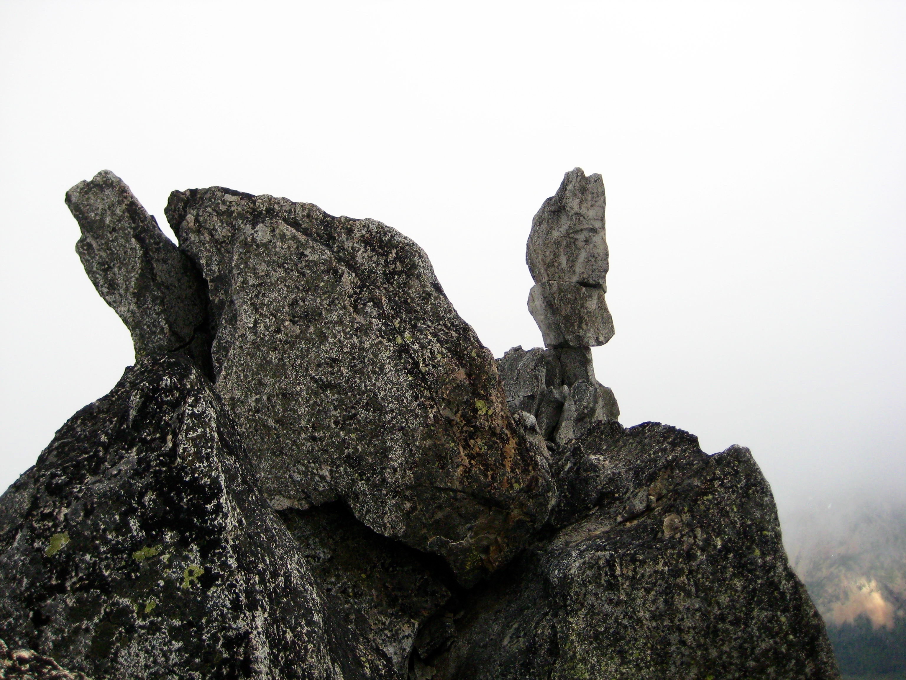
    The summit of Sherpa Peak and the Sherpa Balanced Rock can be seen through a dense fog in the Alpine Lakes Wilderness
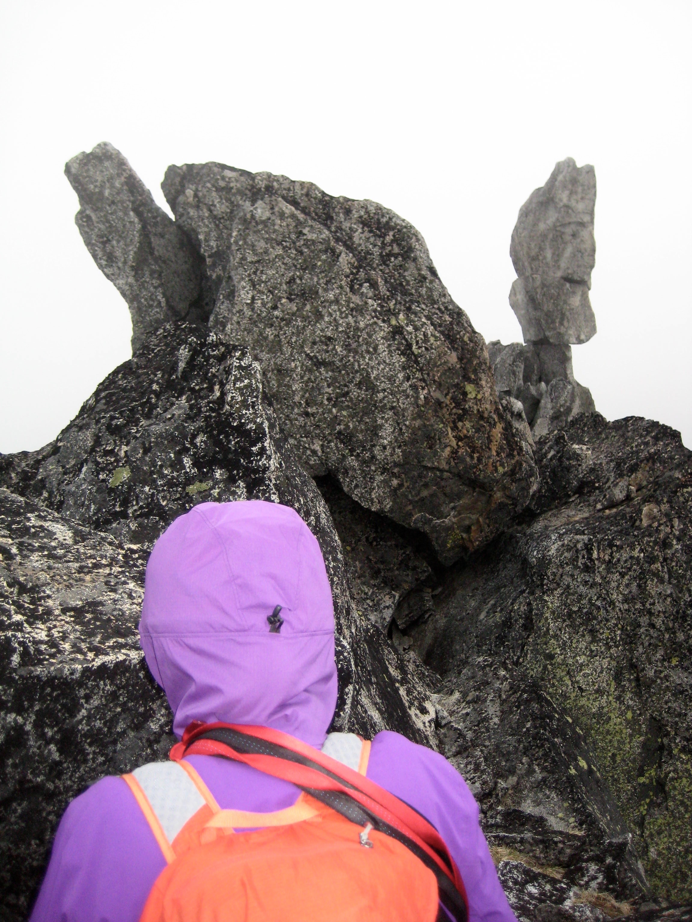
    Looking across the summit horn of Sherpa Peak at the Sherpa Balanced Rock

    Sherpa Peak via Longs Pass—South Couloir—South Face (Icicle Mountains, WA)

    Jim Brisbine · July 2, 2018
    Central WA Cascades Icicle Mountains Sherpa Peak (8605/8630 ft) The Icicle Eight

    Trip Date: June 30 – July 2, 2018

    Sherpa Peak Climbing Trip

    Long’s Pass
    Ingalls Creek
    Cascadian Creek
    Sherpa Peak (8605′)

    Jump ahead to…
    show
    • Trip Report Summary
    • Related Post
    • Full Trip Report
      • Day 1: Trailhead to Bivy Boulder
      • Day 2: Sherpa Peak Summit Climb
      • Day 3: Bivy Boulder to Trailhead
    • Route Map
    • Photo Gallery

    Trip Report Summary

    Region: Central Washington Cascades

    Sub-Region: Icicle Mountains

    Area: Alpine Lakes Wilderness

    Starting & Ending Point: Esmerelda Trailhead at end of North Fork Teanaway River Road (Elev. 4250 feet)

    Way Points: North Fork Teanaway River & Ingalls Way Trail junction & Long’s Pass Trail junction & Long’s Pass & Ingalls Creek & Ingalls Creek Trail junction & Beverly–Turnpike Trail junction & Cascadian Creek & 6000-foot Bivy Boulder (trail hike & off-trail hike & bushwhack)

    Campsite: 6000-foot bivy boulder

    Sidetrip: South Sherpa Couloir (off-trail hike & rock scramble) 

    Summit: Sherpa Peak (rock scramble & rock climb via Southeast Gully—South Face—Upper South Ridge)

    Approximate Stats: 14 miles traveled; 8600 feet gained & lost.

    Related Post

    Sherpa Peak via Sherpa Glacier—West Ridge – August 2, 1981

    Full Trip Report

    Eileen and I climbed Sherpa Peak during a short period of supposedly favorable weather.  In actuality, the weather forecast did not hold, and we barely snuck in a successful summit bid.

    Day 1: Trailhead to Bivy Boulder

    We pulled into the crowded Esmerelda Trailhead around noon on Saturday and managed to squeeze into a roadside parking spot.  Note to self: On weekends, plan to arrive at this trailhead before 9:00am.

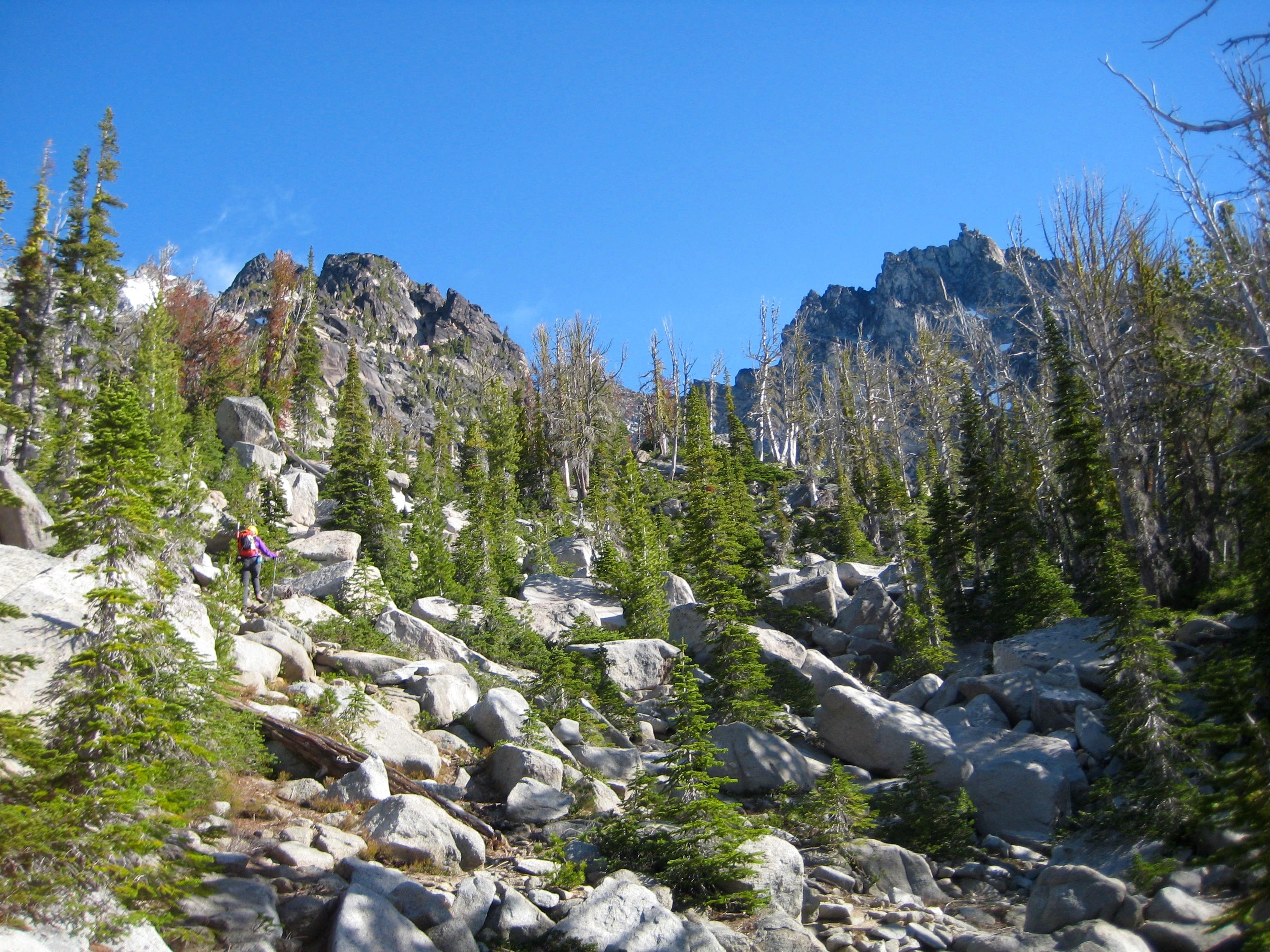
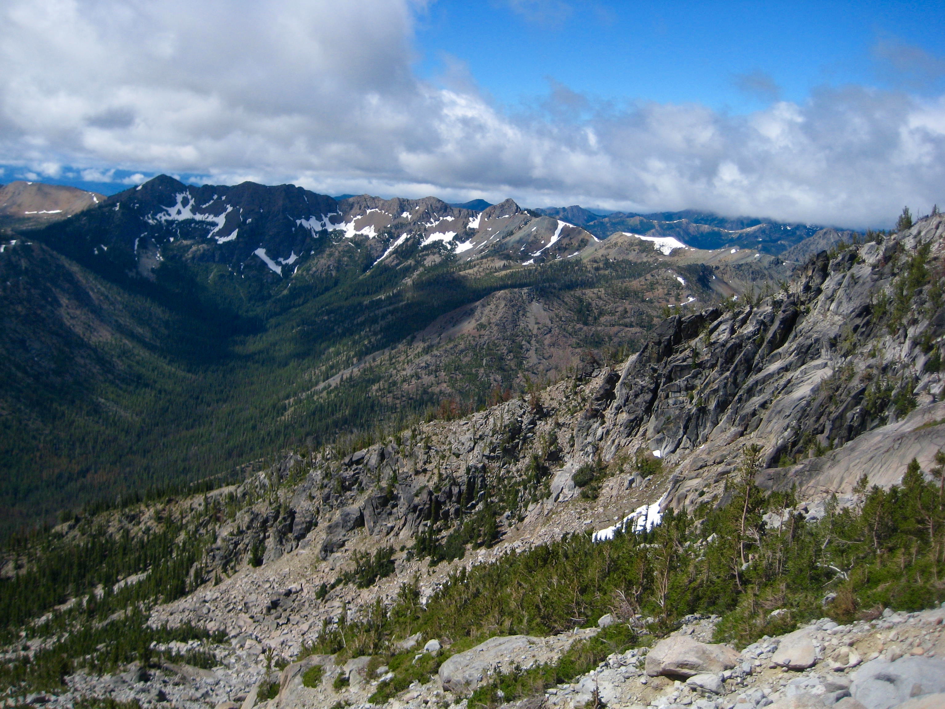
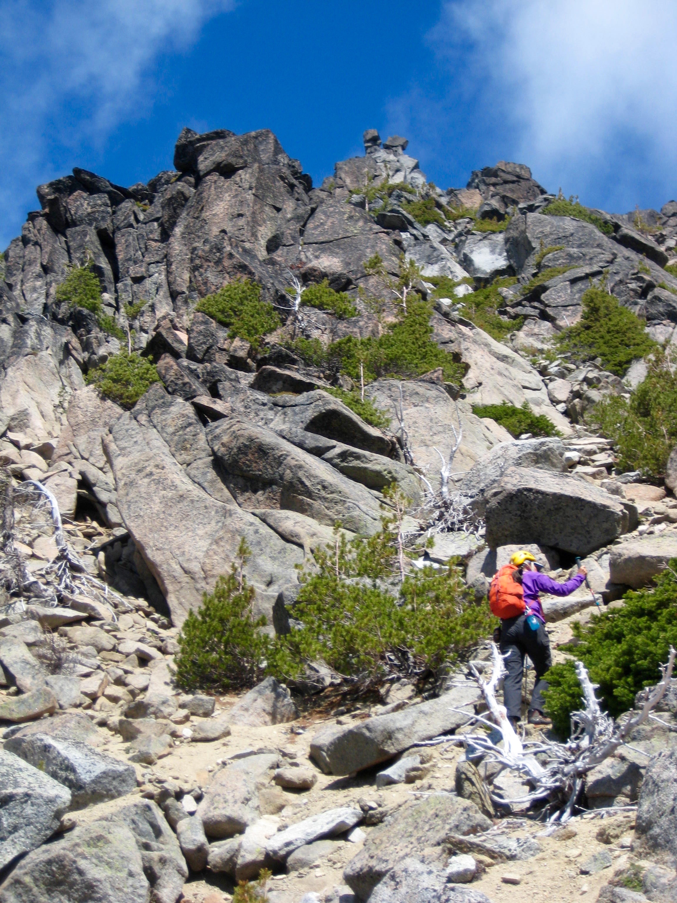
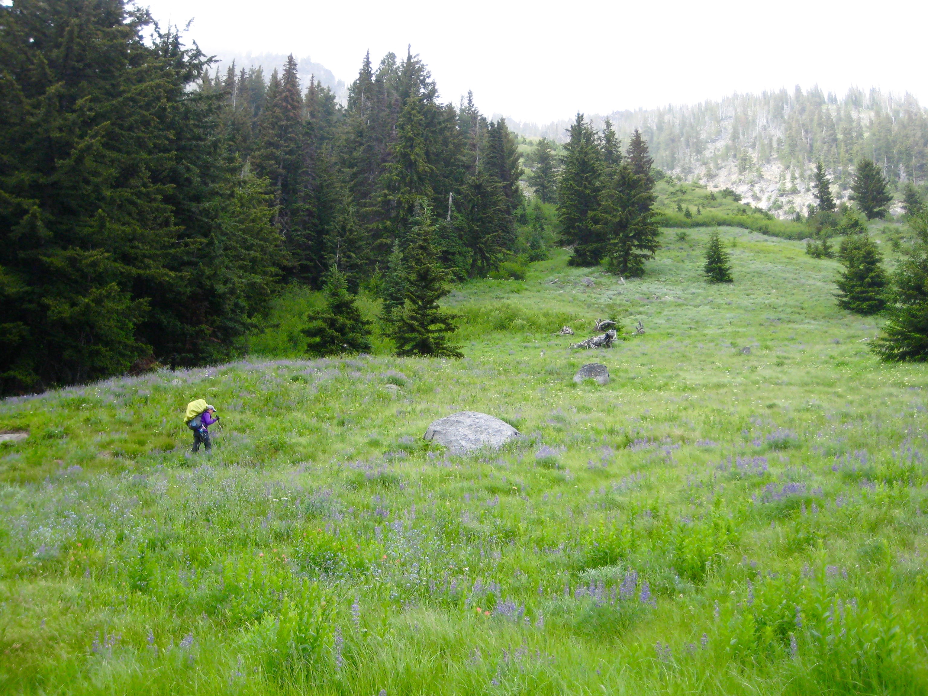
    We hiked up the trail to Long’s Pass (1.8 hours + 1950 feet from TH), then descended to Ingalls Creek (3.8 hours from TH).  A large log offered an easy creek crossing, then we hiked a mile downstream to the Beverly–Turnpike Trail junction.  About 50 yards upstream of the junction, we located a well-beaten climbers path heading up to the north.  This path ascended through open meadow for several hundred feet, then angled over to the left and went up through deep forest.  We initially missed the left-hand veer and ended up in thick brush; we should have veered sooner.

    mountain climber hiking up grassy slope in the Icicle Mountains
    Hiking Up Lower Slopes Toward Camp

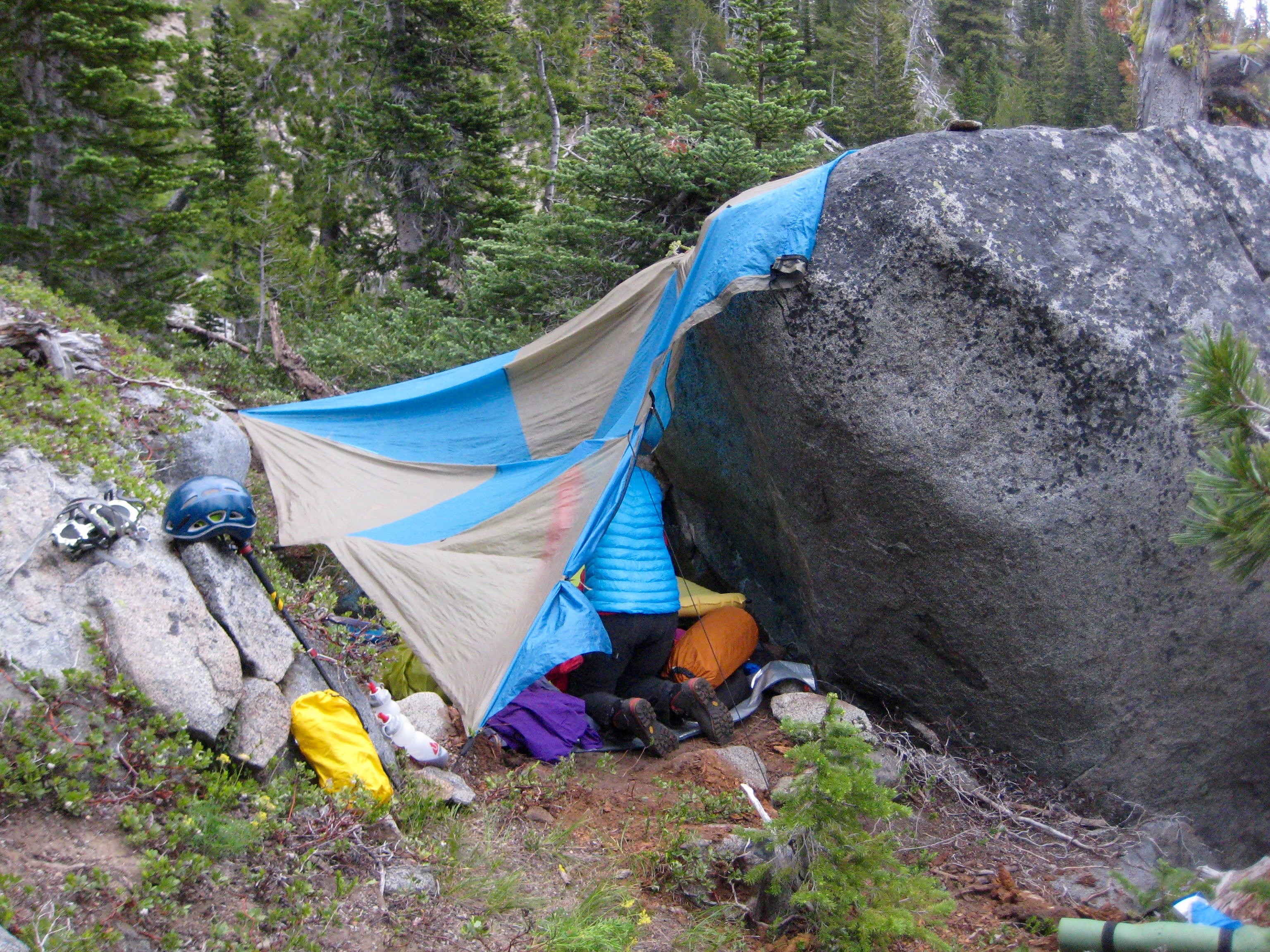
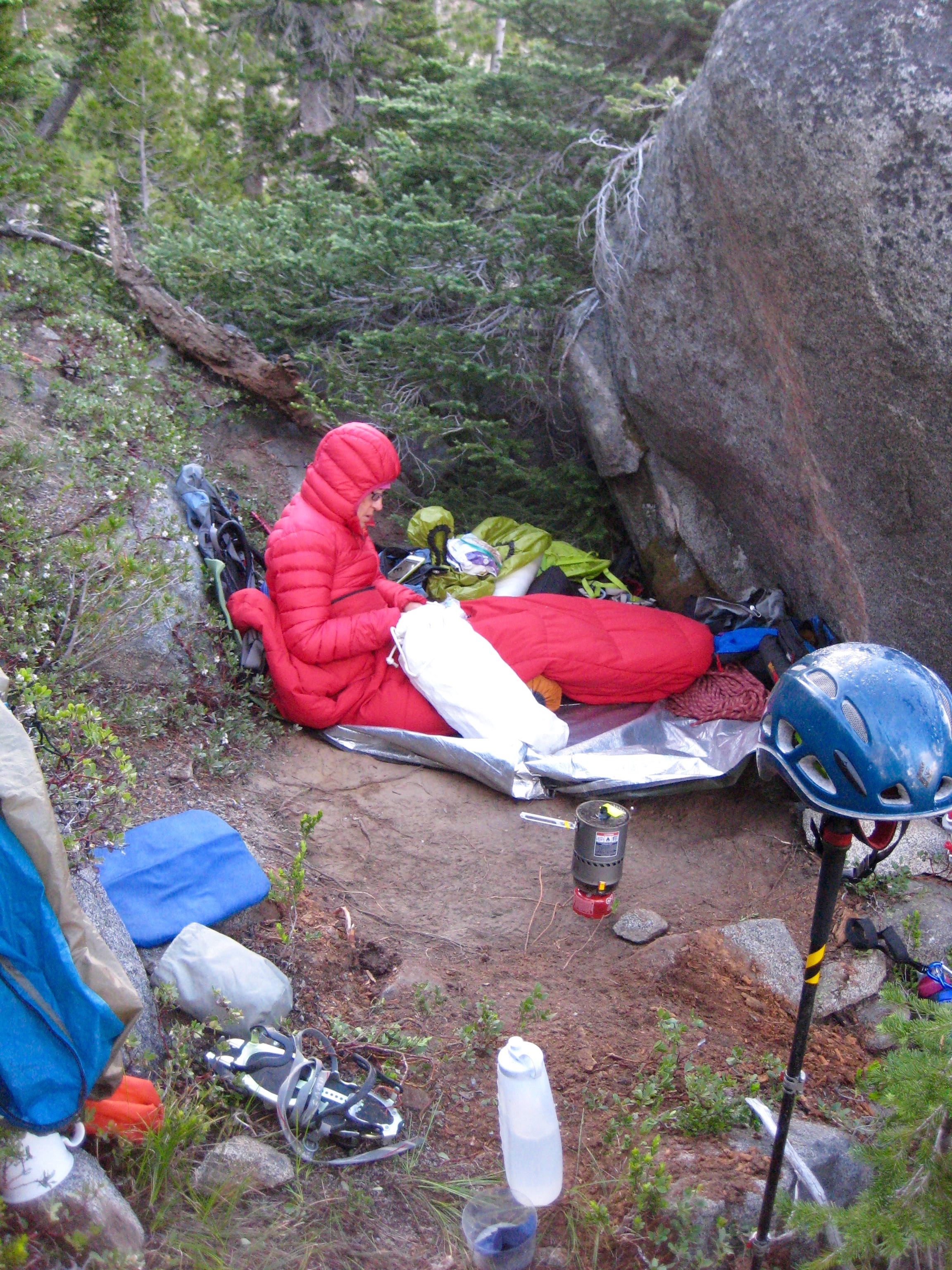
    At 6000 feet, the path came close to Cascadian Creek, our first water source since leaving Ingalls Creek.  It was now dinnertime, so we scraped out a meager bivouac site next to a boulder 50 yards west of the creek (6.2 hours + 3450 feet from TH).

    mountain climber's bivey site next to a giant boulder on the shoulder of Sherpa Peak in the Icicle Mountains
    Bivouac Site At 6000-Foot Boulder

    Day 2: Sherpa Peak Summit Climb

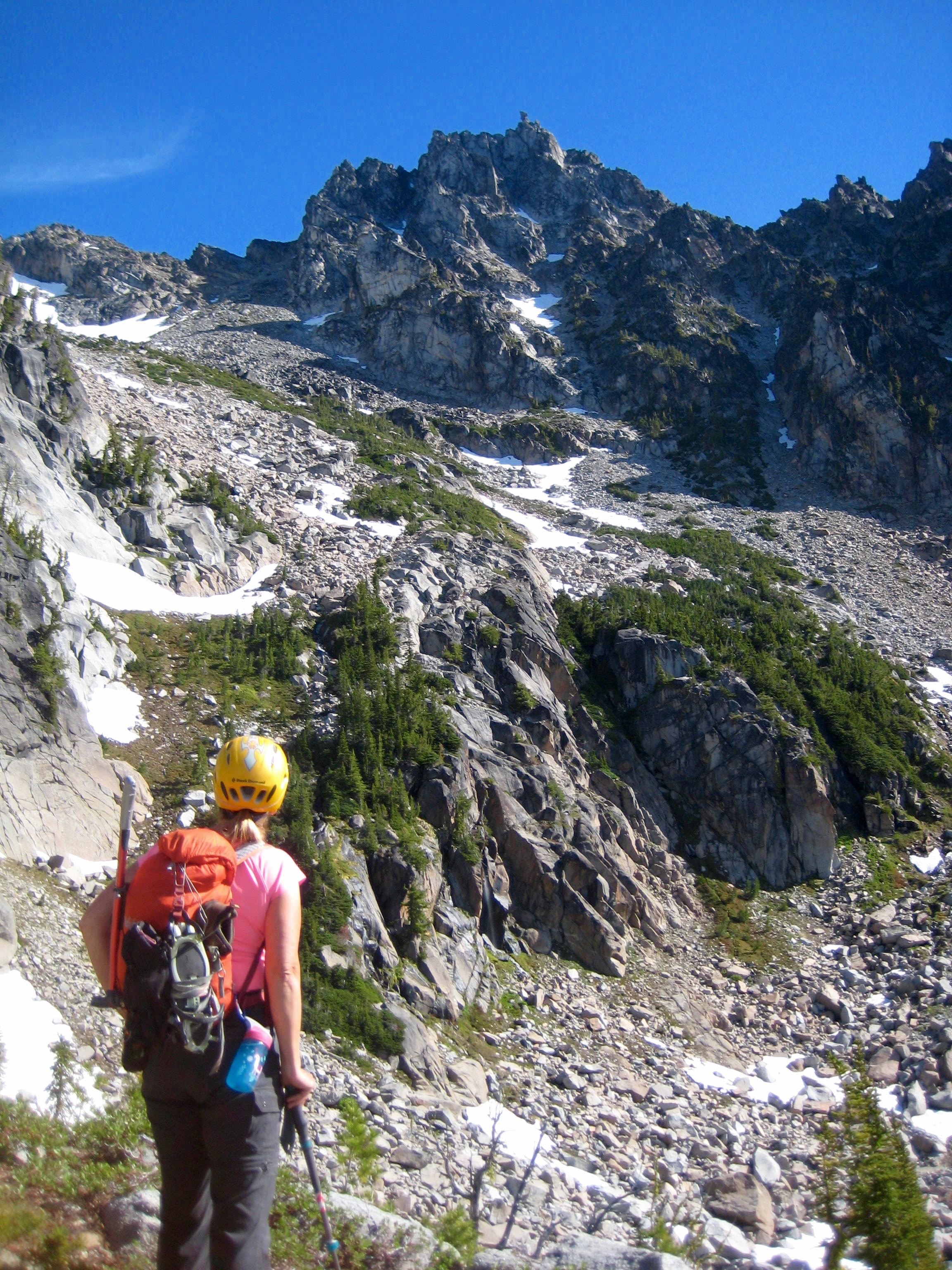
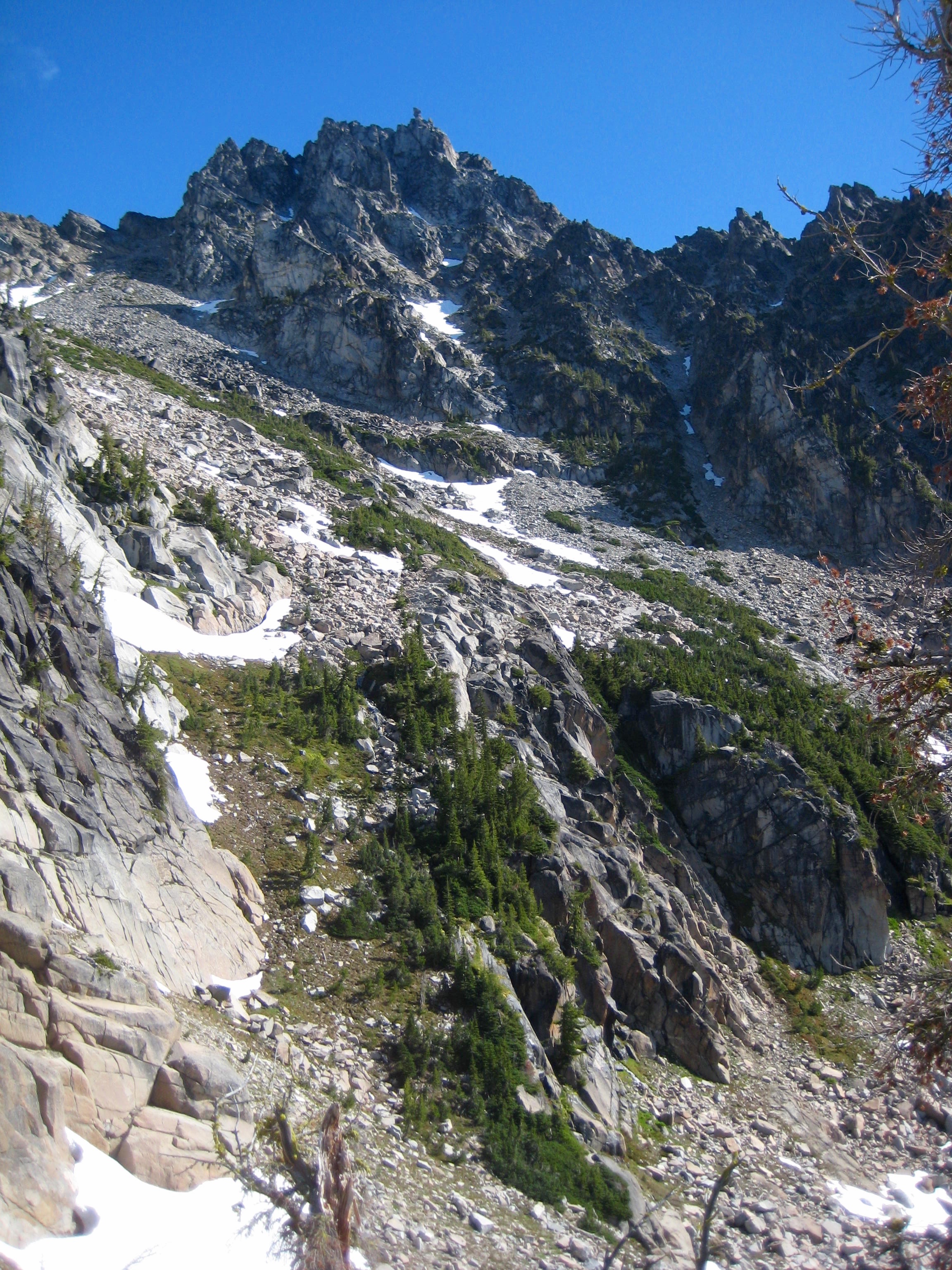
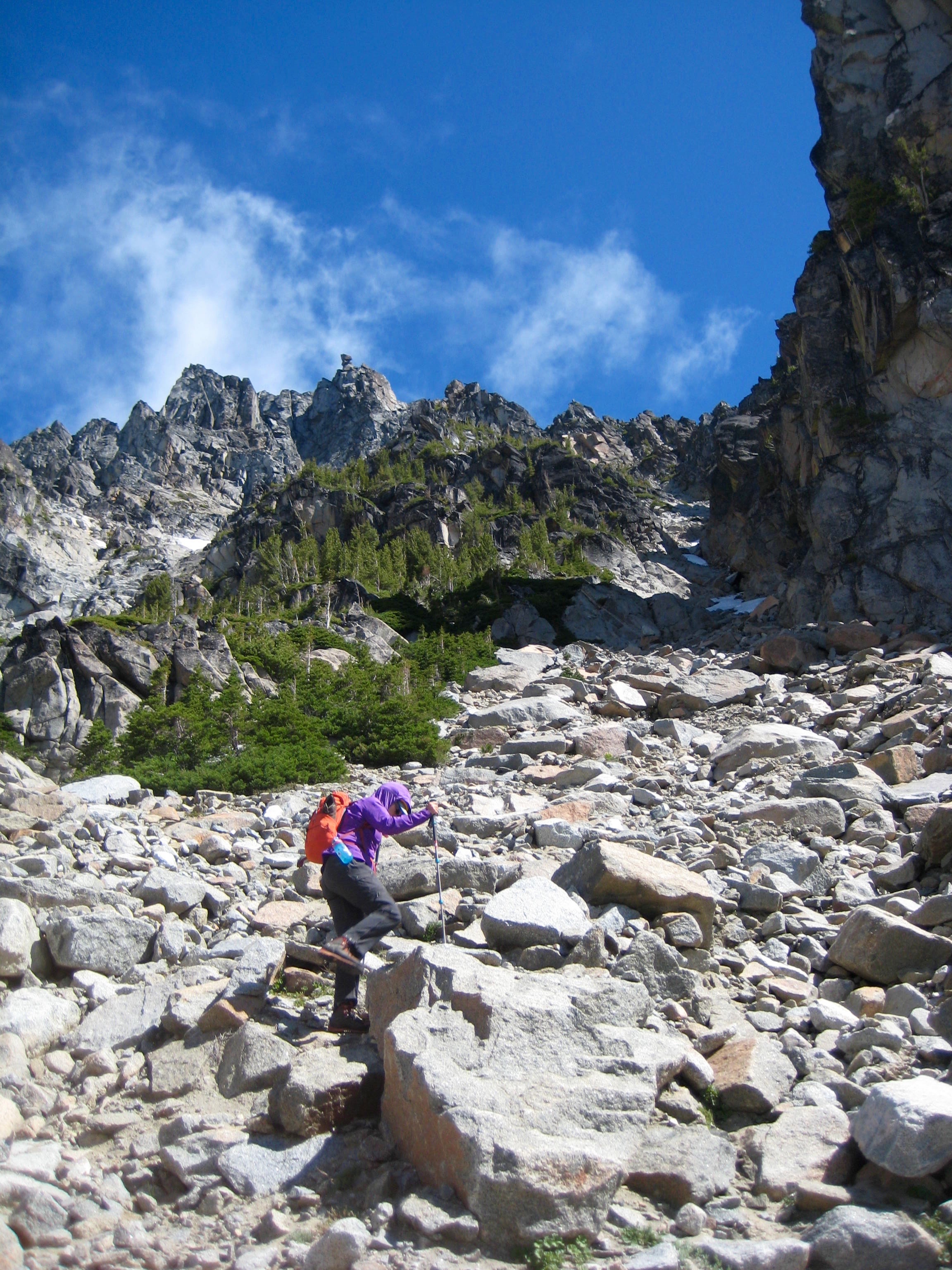
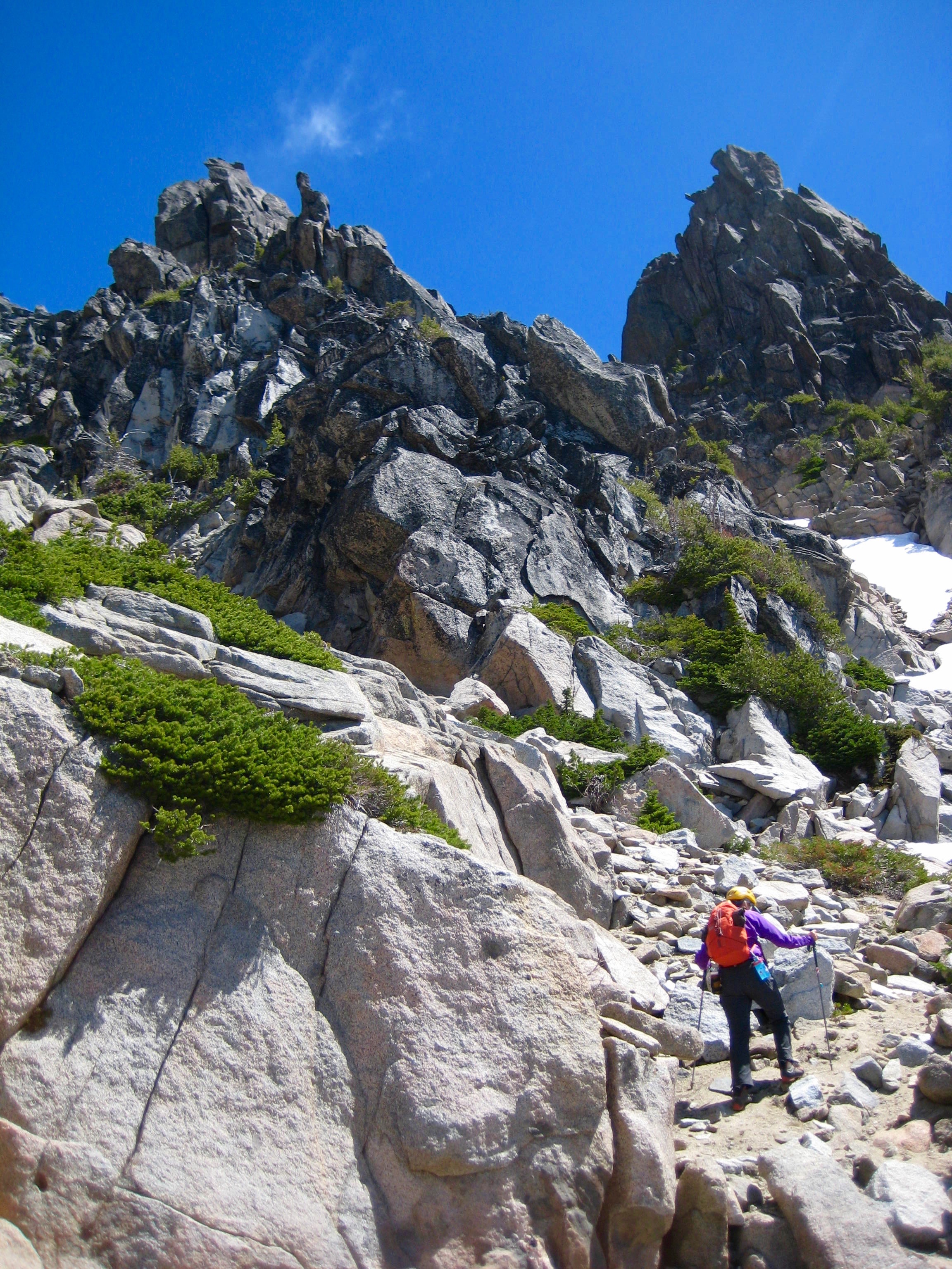
    Following an overcast and gusty night, the morning exhibited a promise of clearing.  We crossed over Cascadian Creek, then hiked up a wooded rib on the east until encountering cliffs at 6550 feet.  Here, we descended about 150 feet eastward to the broad South Sherpa Couloir.  The summit of Sherpa Peak was clearly visible at the head of this couloir.

    mountain climber scoping out the route up Sherpa Peak across scree fields and up gullies
    Scoping Out Gullies To Summit

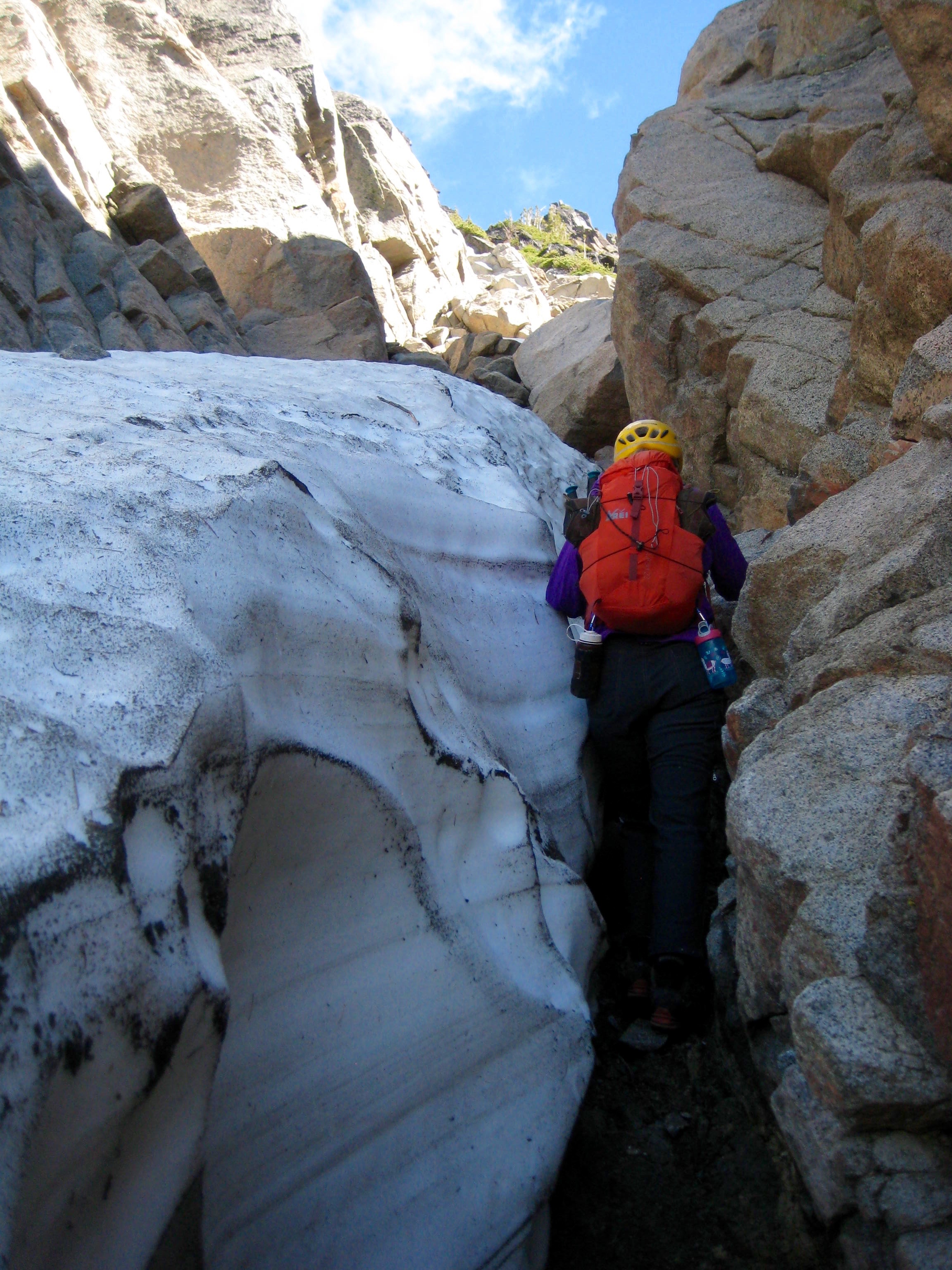
    After assessing several options, we traversed over to the right edge of the couloir, then scrambled up a steep, narrow gully to gain a 7800-foot notch in Sherpa Peak’s southeast ridge (3.6 hours + 2100 feet from camp).

    mountain climber ascending boulder gully on the southeast face of Sherpa Peak in the Icicle Mountains with balancing rock in the backgournd
    Heading Up Southeast Gully
    mountain climber squeezing between snow and steep rock side of southeast gully on Sherpa Peak in the Icicle Mountains
    Squeezing Thru Moat In Southeast Gully

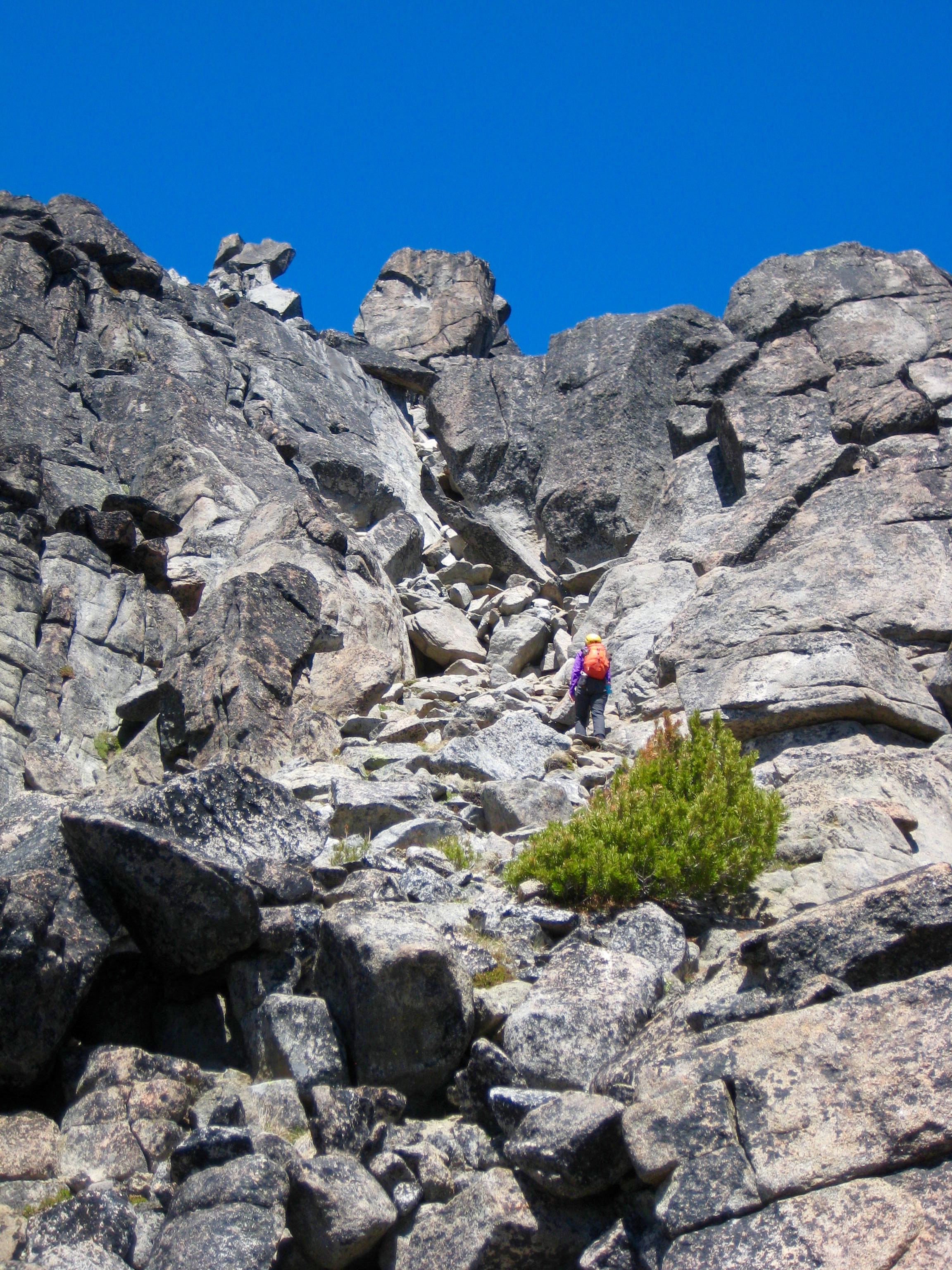
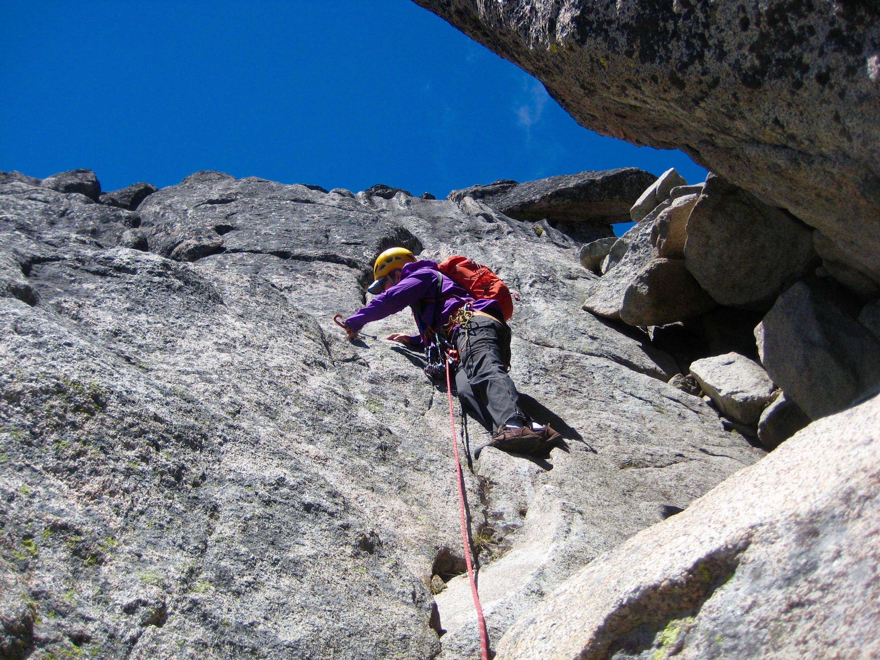
    A sandy trough on the other side of the ridge led us to a high notch and a rock slot, which we climbed in one roped Class 4 pitch to reach a high shoulder.

    mountain climber crossing scree field under rock horns on Sherpa Peak in the Icicle Mountains
    Crossing Over Southeast Ridge
    mountain climber scrambling large boulders in a rocky slot high on Sherpa Peak in the Icicle Mountains
    Hiking Up To Rock Slot

    The route ahead was not clear, but it appeared that we could traverse across and up the northeastern face.  However, three pitches of Class 4-5 climbing led us to a dead end on a steep arete.

    mountain climber belaying from rock ledge of the steep rock shoulder of Sherpa Peak in the Icicle Mountains
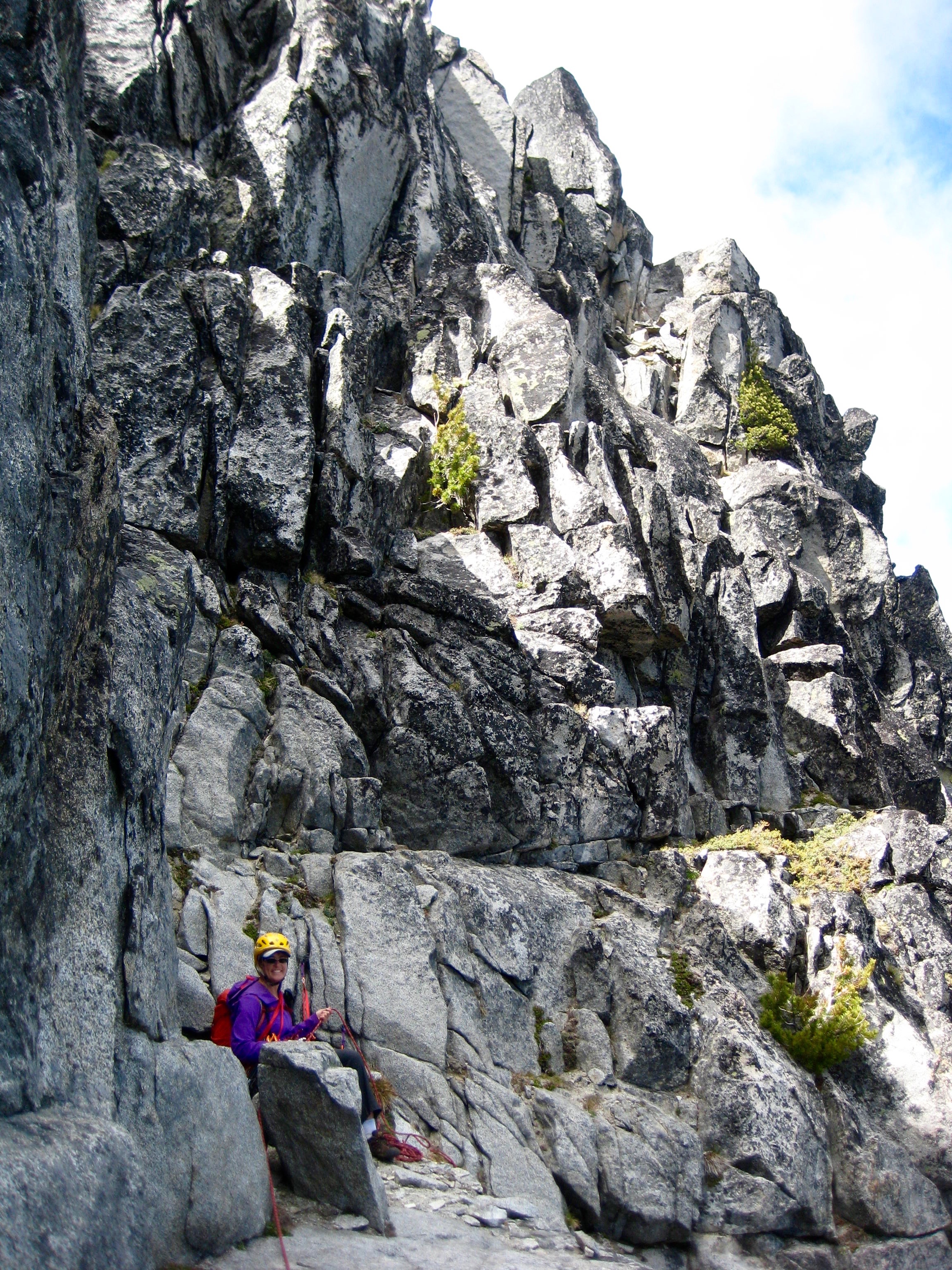
    Eileen Belaying Below North Ridge

    We climbed back to the southeast ridge and climbed one Class 5 pitch up a narrow buttress, but this also led to a dead end.  We rappelled back down to the center of the south face, feeling quite frustrated with our lack of progress.  It was now late afternoon, and low clouds were starting to scud over the peak.

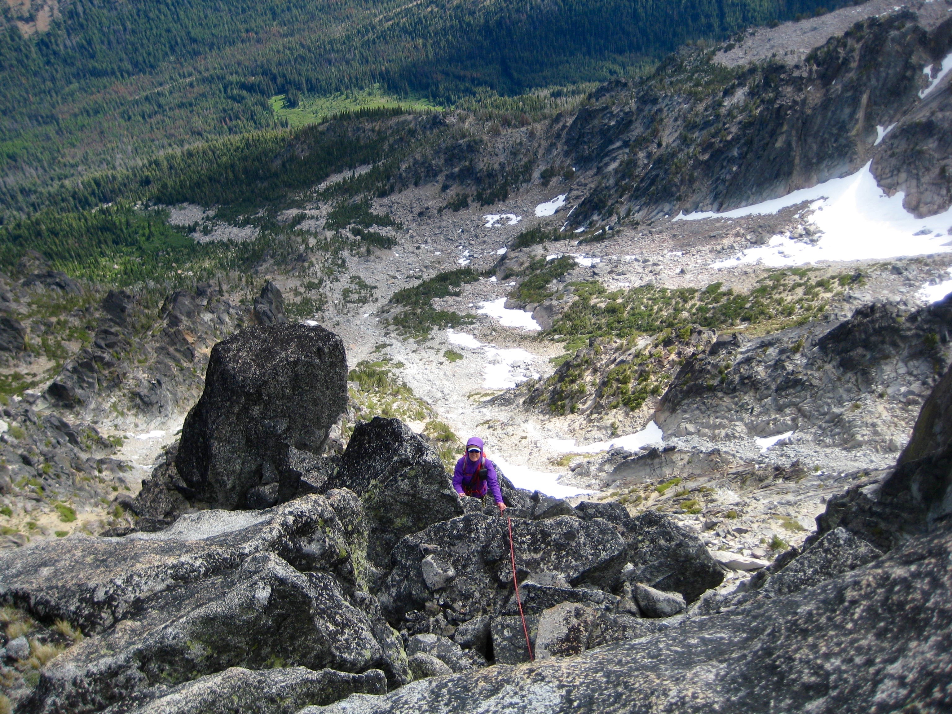
    looking down on mountain climber scrambling south ridge on Sherpa Peak with rocky basin and snow patches in the background
    Eileen Climbing Up South Ridge

    For our third attempt, we climbed two Class 4-5 pitches directly up the south face and were delighted to find ourselves at the base of the iconic Sherpa Balanced Rock!  Unfortunately, the entire peak was now shrouded in cold fog.  This made it very confusing as to how we could reach the summit.

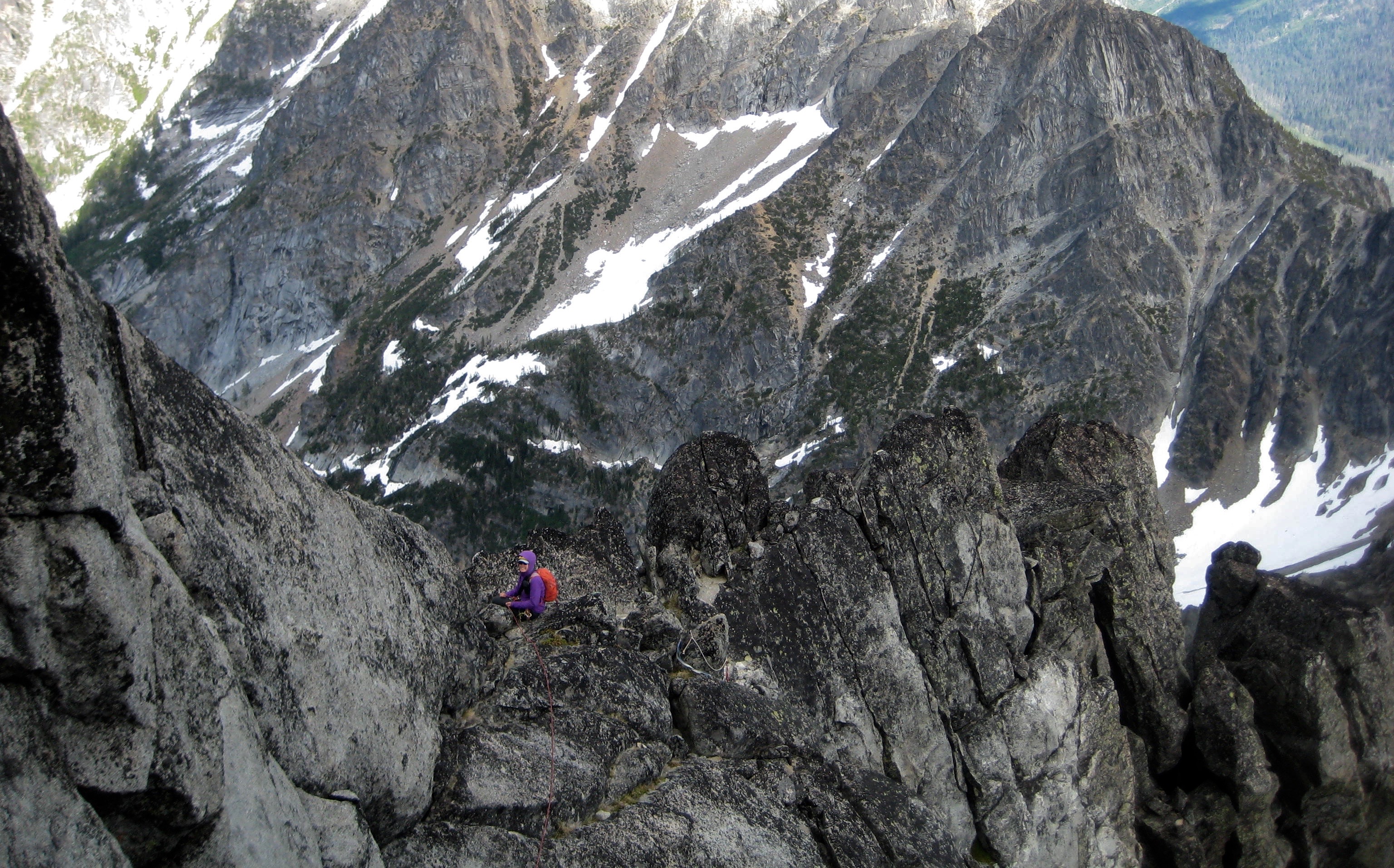
    mountain climber belaying on the step rocky east ridge of Sherpa Peak in the Icicle Mountains
    Eileen Belaying On Upper East Ridge
    mountain climber looking at Balancing Rock on Sherpa Peak summit ridge in the Icicle Mountains
    Balanced Rock From Summit Ridge

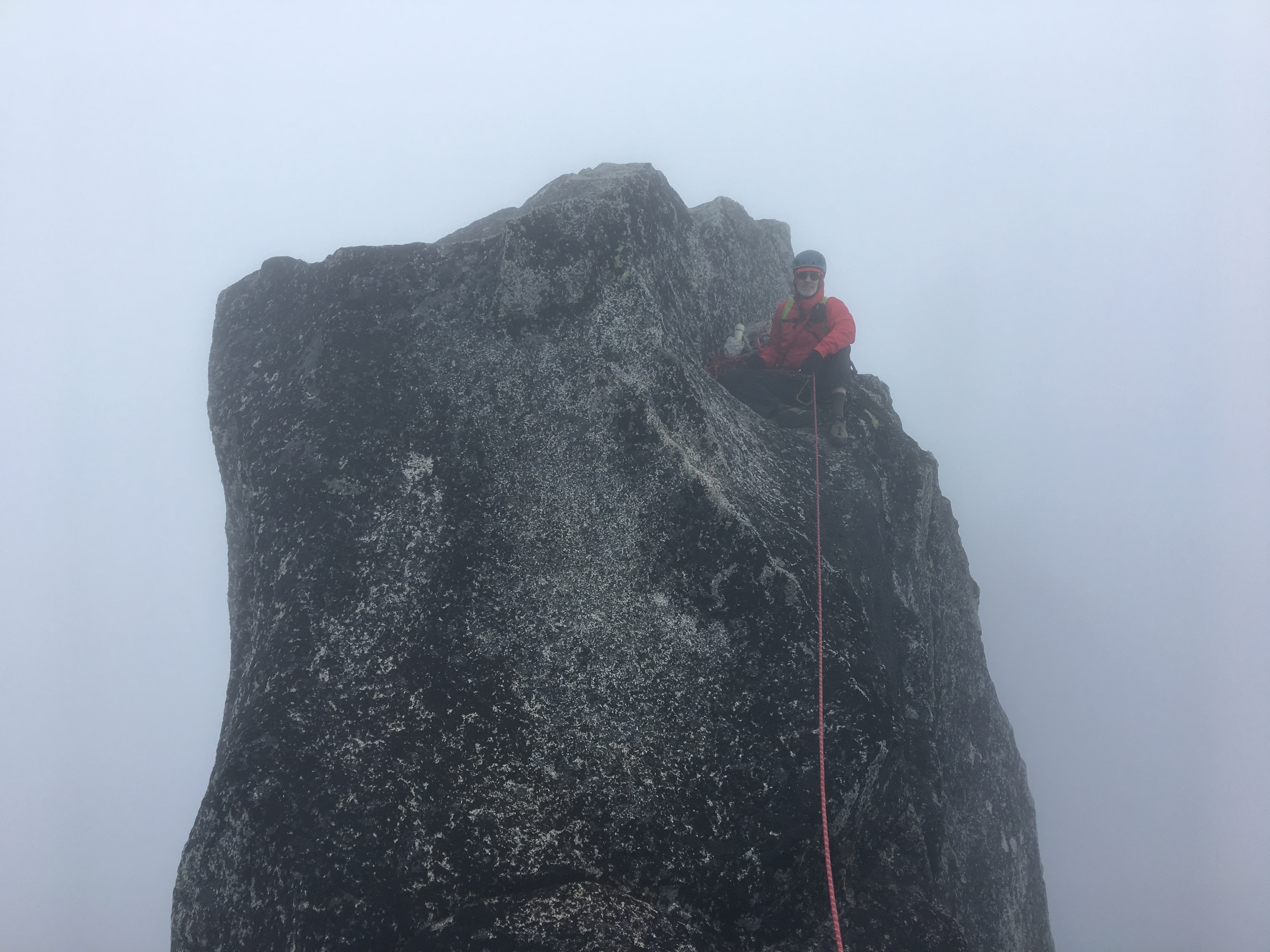
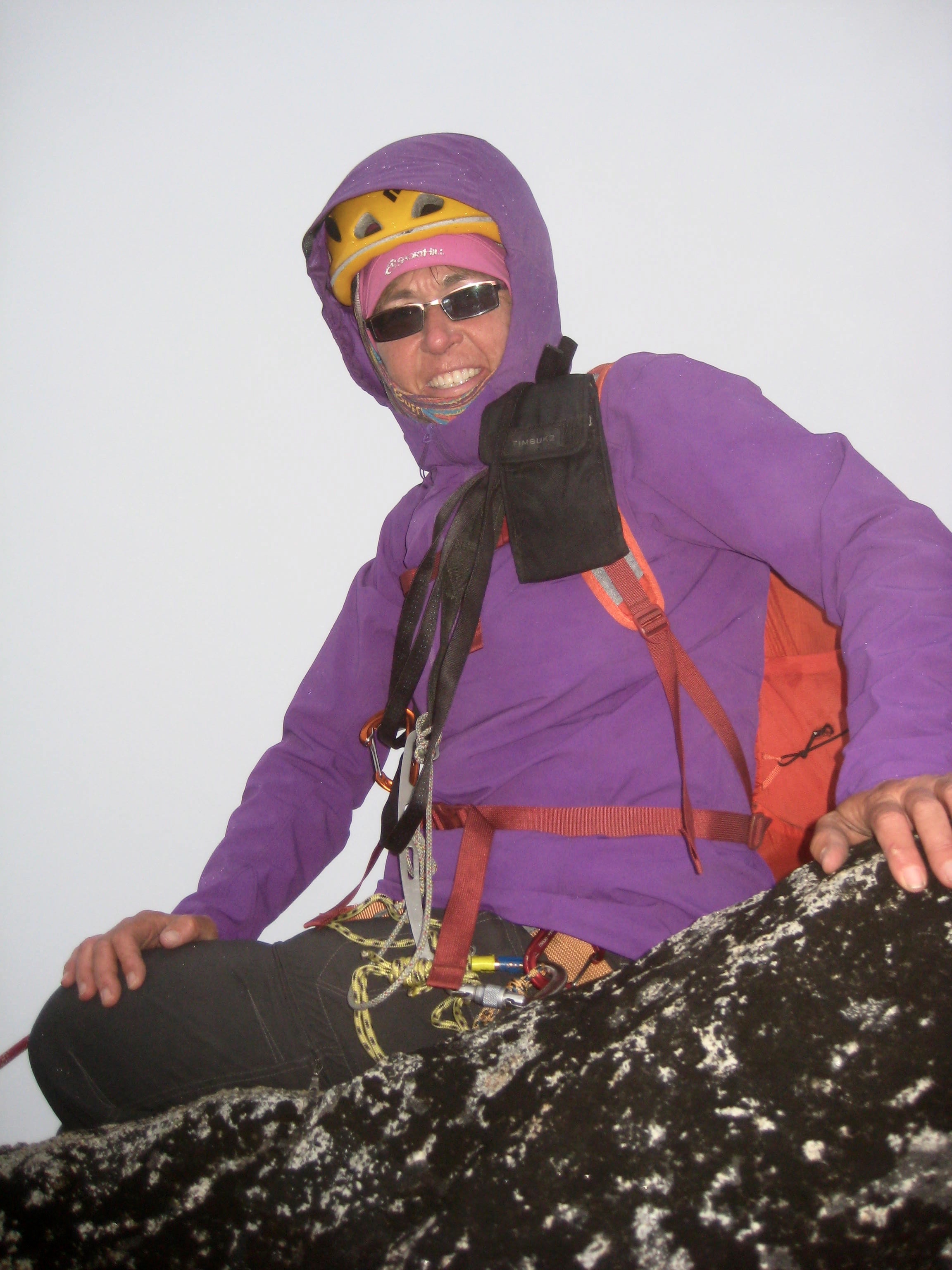
    We traversed across the exposed summit crest to the base of the actual summit tower, then descended about 20 feet to the northeast, then climbed up a Class 5 chimney that terminated closely north of the summit horn.  A final short pitch along an exposed razorback gained us the summit at 6:50pm (10.9 hours + 3300 feet from camp).  It was cold and windy, with spitting rain, and visibility less than 50 yards, so we stayed only 5 minutes.  There was no chance to sign the summit register, because the lid on the PVC tube was firmly stuck and I had neglected to bring a set of pipe wrenches.

    roped mountain climber belaying from the summit of Sherpa Peak in the fog in the Alpine Lakes Wilderness
    Jim On Foggy Summit Of Sherpa Peak
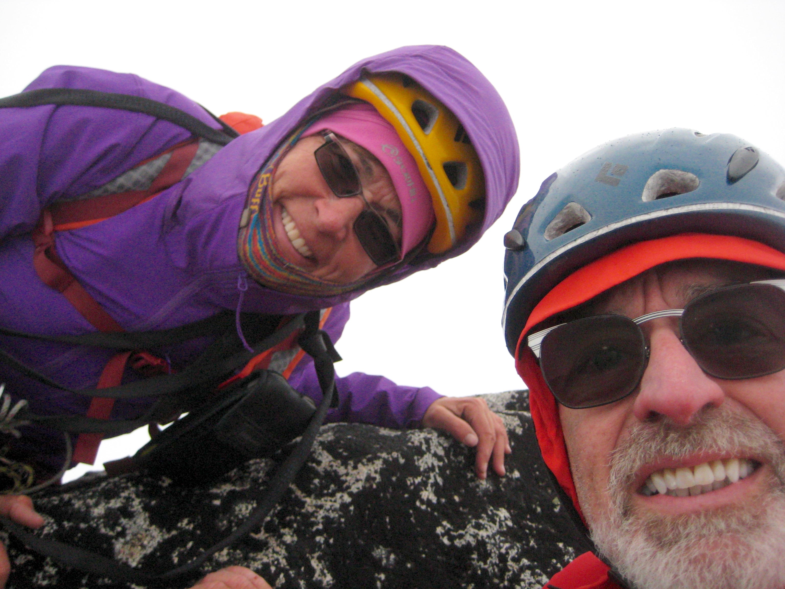
    selfie of mountain climbers on the rocky summit horn of Sherpa Peak in the Icicle Mountains
    Eileen and Jim On Summit of Sherpa Peak

    Our hasty descent involved one rappel off the summit, a series of running belays back to the balanced rock, two rappels down the south face, some easy scrambling back across the south shoulder, and one final rappel down the rock slot.  We hurried down the sandy trough in fading light and reached the southeast notch as darkness fell.

    The next several hours involved a slow, tedious, headlamp descent of the South Sherpa Couloir, then scrambling back over the wooded rib, then working our way down the little waterfalls of Cascadian Creek.  We stumbled into our meager campsite at 2:00am (7.1 hours + 300 feet from summit), feeling thoroughly chilled and completely exhausted.

    Day 3: Bivy Boulder to Trailhead

    We slept in until 10:00am and groggily went through our morning routine.  It was cool and breezy and partially cloudy.  At noon, we headed down to Ingalls Creek (2.2 hours from camp), then hiked back up to Longs Pass (4.0 hours + 1550 feet from camp).  After a last look at Sherpa Peak, we descended to the trailhead (5.6 hours from camp).

    Route Map
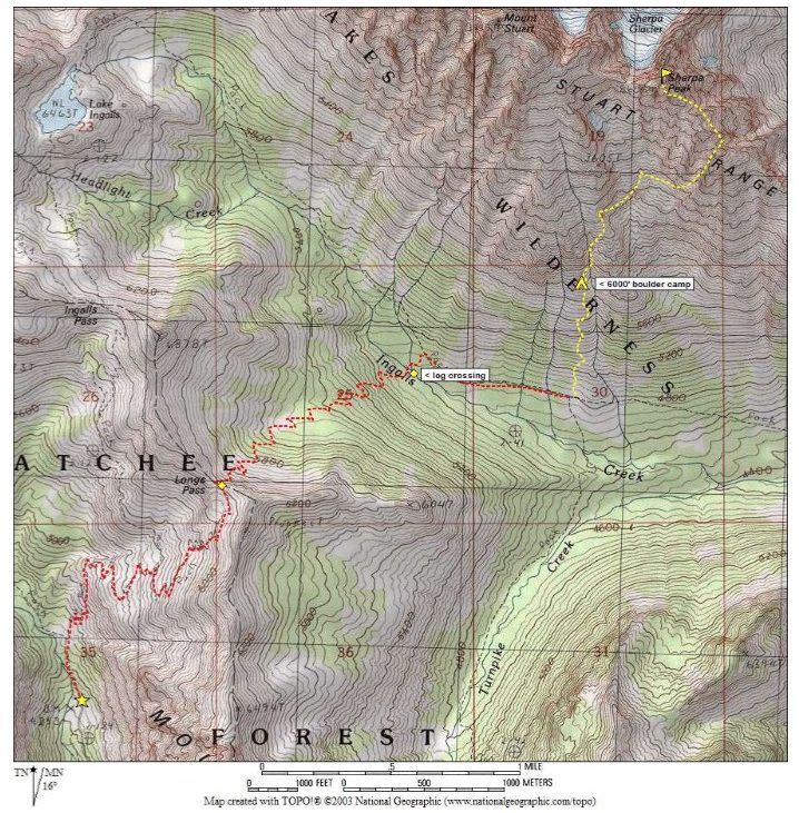
    Route Map of hike and climb on Sherpa Peak in the Icicle Mountains
    Sherpa Peak Route Map

    Photo Gallery

    Click to enlarge…
    Hiking Up Lower Slopes Toward Camp
    Crude Camp At 6000-Foot Boulder
    Brekfast On Day 2
    Hiking Up Rocky Rib On Day 2
    Scoping Out Gullies To Summit
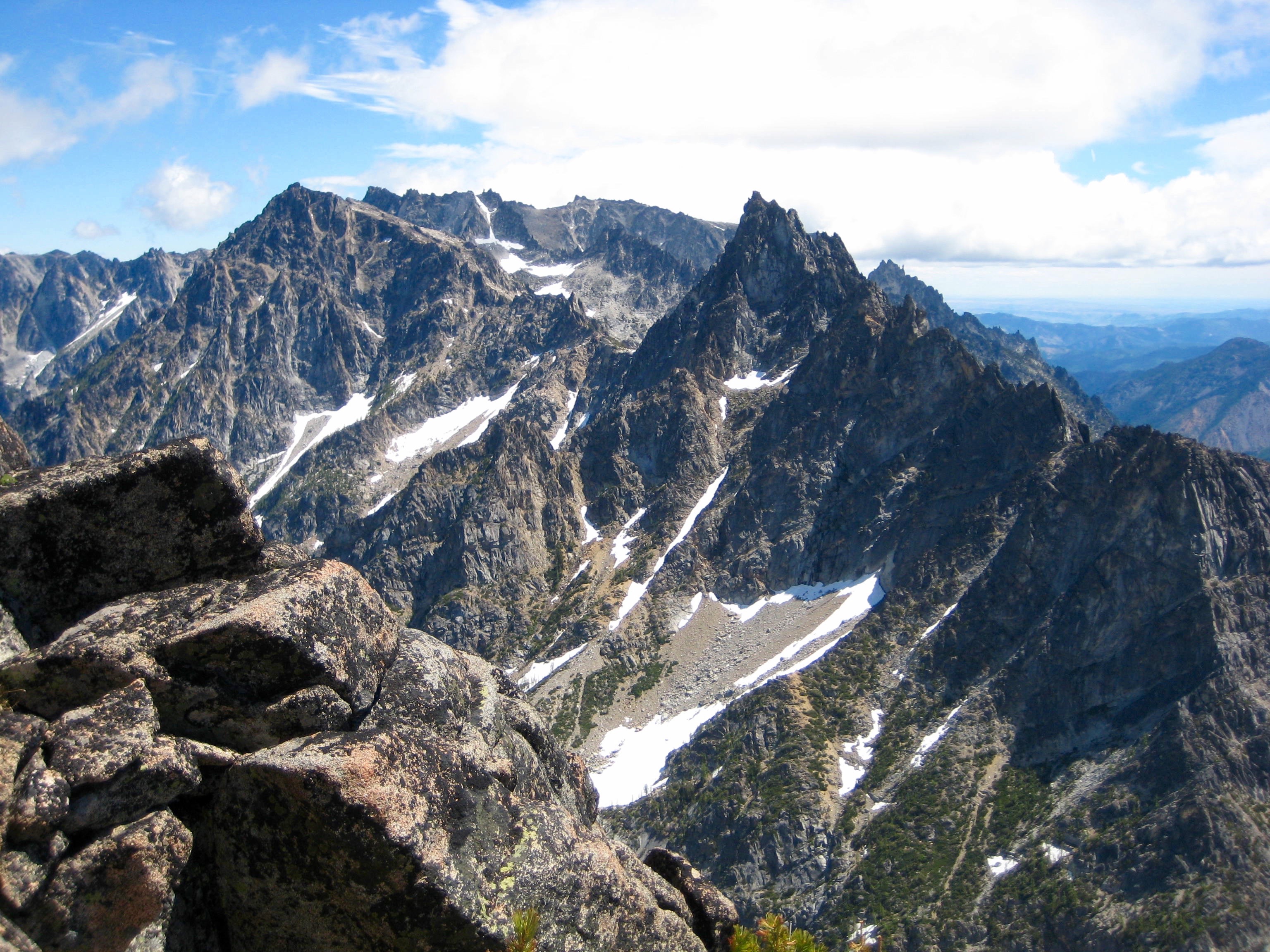
    View Across South Sherpa Couloir
    Teanaway Mountains and Rocky Rib From South Couloir
    Heading Up Southeast Gully
    Squeezing Thru Moat In Southeast Gully
    Crossing Over Southeast Ridge
    Hiking Up Toward Summit
    Colchuck Peak and Argonaut Peak
    Hiking Up To Rock Slot
    Eileen Leading Up Rock Slot
    Eileen Belaying Below North Ridge
    Eileen Climbing Up South Ridge
    Eileen Belaying On Upper East Ridge
    The summit of Sherpa Peak and the Sherpa Balanced Rock can be seen through a dense fog in the Alpine Lakes Wilderness
    Looking across the summit horn of Sherpa Peak at the Sherpa Balanced Rock
    Balanced Rock From Summit Ridge
    Jim On Summit Of Sherpa Peak
    Eileen On Summit
    Eileen and Jim On Summit
    Previous Article Picket Traverse: Little Beaver Creek to Sourdough Creek via Perfect Pass—Picket Pass—McMillan Pass—Torrent Pass + Whatcom Peak + Elephant Butte (Picket Range, WA)
    Next Article Hard Mox Peak + Easy Mox Peak via Depot Creek—Ouzel Lake—Redoubt Glacier (American Chilliwack Mountains, WA)
    Jim Brisbine

    Jim Brisbine has been climbing Washington peaks for over 50 years, while documenting hundreds of summits and thousands of trail miles in words and pictures. As the creator of "Major Peaks of the Cascades and Olympics --- Fraser/Nicola River to Columbia River," he is an avid outdoorsman and lifelong trailcat who spends his time prowling around the Pacific Northwest and beyond.

    Meet TrailCatJim

    Jim Brisbine has been climbing Washington peaks for 50+ years, documenting hundreds of summits and thousands of trail miles in words and pictures. As the author of "Major Peaks of the Cascades and Olympics --- Fraser/Nicola River to Columbia River," he is an avid outdoorsman and lifelong trailcat who spends his time prowling around the Pacific Northwest and beyond.
    CONTACT TRAILCATJIM

    Gear Reviews & Tips & Trips

    • Reviews of Mountain Gear
    • Trailcat Tips & Gear Modifications
    • Ski Tours: I-90 / Snoqualmie Pass
    • Snowshoe Treks: I-90 / Snoqualmie Pass
    • Backcountry Huts: What to Expect

    Handy Information Links

    • Weather & Avalanche Forecasts
    • Mountain Road & Trail Reports
    • Wildfire Reports & Smoke Forecasts
    • Mountain Snowpack Depths
    • Nordic Grooming Reports

    Packing Lists For Big Trips

    • Alta Via 2 & 4, Dolomites, Italy
    • “O” + “W” Circuit, Patagonia, Chile
    • Hauyhuash Circuit, Peru
    • Overland Track, Tasmania
    • Three Capes Traverse, Tasmania
    • Mountaineer’s Haute Route, Switzerland
    • Walker’s Haute Route, Switzerland

    Most Recent Posts

    Ashley Gorge Via Ferrata Climbs: The Outlaw + Abduction + The Pump + The Soup + Toothy Grin (Uinta Range, UT)

    Guye Peak: North Summit + Middle Summit + South Summit via Alpental Slope—Cave Ridge (Snoquamlie Range, WA)

    McAlester–Rainbow Loop via McAlester Pass—Rainbow Creek—Rainbow Pass—Bridge Creek + McAlester Mtn (North Stehekin Mountains, WA)

    Hoodoo Pass Loop via Horsehead Pass—Libby-Crater Saddle + Mt Bigelow + Crater Peak (Sawtooth Mountains, WA)

    Amabilis Mtn Bike Loop via Amabilis Beacon + Amabilis Peak (Keechelus Mountains, WA)

    Three Fingers Mtn: South Peak / Lookout Via Meadow Mtn—Goat Flats—Tin Can Gap—Southwest Side (West Sauk Mountains, WA)

    Defiance Trail Traverse: Thompson Pass to Hemlock Pass via Mason Pass—Pratt Pass + Mt Defiance (Lower Snoqualmie Range, WA)

    LaCrosse Pass Loop via Enchanted Valley—O’Neil Pass—Duckabush River—Dosewallips River—Anderson Pass (Olympic Mountains, WA)

    Granite Mtn via Hyas Lake—Tuck Lake—Robin Lakes—Northwest Ridge (Upper Icicle Mountains, WA)

    Glacier Basin Climbing Reconn: Monte Cristo Peak attempt + Cadet Peak attempt (Monte Cristo Mountains, WA)

    • About Me
    • Recent Posts
    • Trailcat Tips
    • Gear Reviews
    • Contact TrailCatJim
    © 2026 TrailCatJim
    • Home
    • Most Recent Posts
    • Major Peaks A-Z
    • Major Peaks Map
    • Major Peaks Synopsis
    • Hike/Climb/Ride
      • Canadian Cascades BC
      • Northwestern WA Cascades
      • Northeastern WA Cascades
      • North-Central WA Cascades
      • Central WA Cascades
      • Southern WA Cascades
      • Olympic Mountains WA
      • Columbia Plateau WA
      • Other USA & Canadian Regions
      • International (outside USA & Can)
    • Ski/Snowshoe
      • Snow Tours in British Columbia
      • Snow Tours in Northwestern WA Cascades
      • Snow Tours in Northeastern WA Cascades
      • Snow Tours in North-Central WA Cascades
      • Snow Tours in Central WA Cascades
      • Snow Tours in Southern WA Cascades
      • Snow Tours in Olympic Mountains WA
      • Snow Tours in Oregon
      • Snow Tours in Other Locations
    • Types of Trips
      • Canyoneering
      • Difficult 10 Climbs
      • Family Trips
      • Golden Larch Outings
      • Lookout Sites
      • Marathon Hikes
      • Mid-Summer Outings
      • Mtn & Gravel Biking
      • Rock & Ice Climbing
      • Summit Camps
      • Winter Summits
      • The Early Years
      • Traverses & Loops (Alpine)
      • Traverses & Loops (Ski)
      • Traverses & Loops (Trail)
      • Traverses & Loops (Classics)
        • Bacon-Hagan-Blum Trav (WA)
        • Enchantment Traverse (WA)
        • High–Giant Traverse (WA)
        • Olympus–Bailey Trav (WA)
        • Picket Traverse (WA)
        • Ptarmigan Traverse (WA)
        • Grand Canyon Raft Trav (AZ)
        • Huayhuash Circuit (Peru)
        • Inspiration–Isolation Trav (WA)
        • Overland Trav (Tasmania)
      • Via Ferratas
      • WA Blue Corn Specials
      • Winter Summits
    • Reviews / Lists / Tips
    • Mountain Goodies
    • Contact TrailCatJim
    Type to search or hit ESC to close
    See all results