Trip Date: August 18-20, 1978
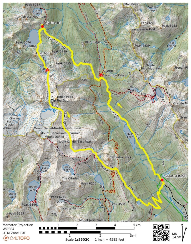
Dip Top Loop: Deception Pass to Dip Top Gap to Cathedral Pass
Hyas Lake
Deception Pass
Marmot Lake
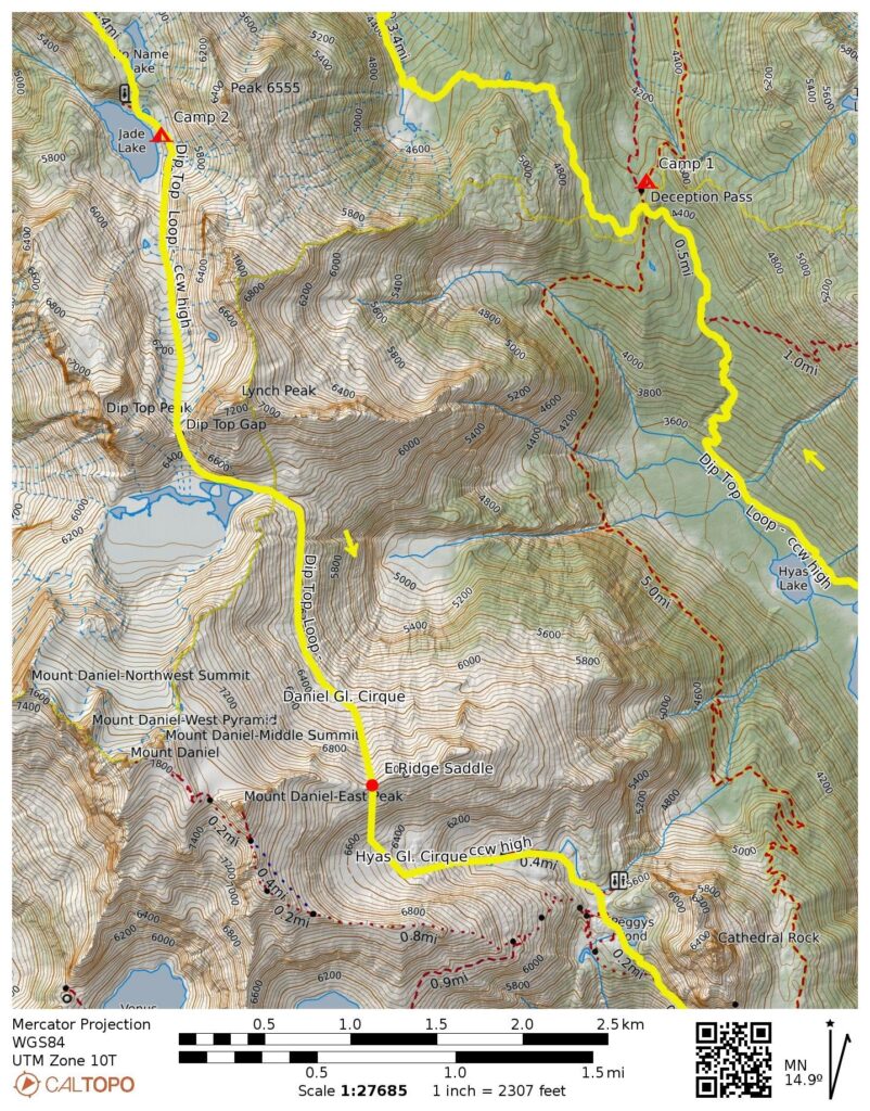
No-Name Lake & Jade Lake
Dip Top Gap
Pea Soup Lake
Peggy’s Pond
Cathedral Pass
Squaw Lake
Trip Report Summary
Region: Central Washington Cascades
Sub-Regions: Miller–Foss Mountains & Snoqualmie Range
Area: Alpine Lakes Wilderness
Starting & Ending Point: Tucquala Meadows Trailhead at end of Cle Elum River Road (Elev. 3400 feet)
Way Points: Hyas Lake & Deception Pass & Marmot Lake & No-Name Lake & Jade Lake & Dip Top Gap & Pea Soup Lake & Pea Soup Pass & East Daniel Ridge saddle & Peggy’s Pond & Cathedral Pass & Squaw Lake & Cle Elum River footbridge (trail hike & off-trail hike & rock scramble & snow climb)
High Point: East Daniel Ridge saddle (Elev. 6950 feet)
Campsites: Deception Pass & Jade Lake
Approximate Stats: 19.0 miles traveled; 5550 feet gained & lost.
Related Posts
>>> Dip Top Loop: Marmot Lake to Pea Soup Lake to Peggy’s Pond – September 2024
>>> Dip Top Loop + Mt. Daniel Carryover via Lynch Glacier – July 1984
Full Trip Report
Day 1 (PM): Trailhead to Deception Pass
On a weekend of unsettled weather, I joined Peter H., Chris S., and Cathy on a hiking and climbing loop through Dip Top Gap in the Alpine Lakes Wilderness. We started at the Tucquala Meadows Trailhead on Friday evening and hiked up to Deception Pass, where we made camp in the forest.
Day 2: Deception Pass to Jade Lake
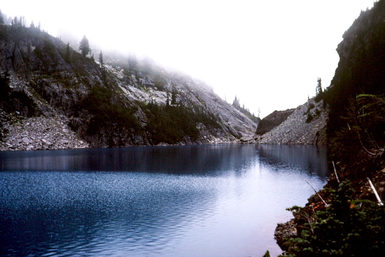
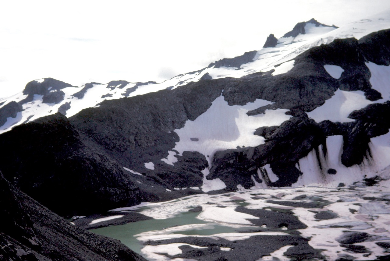
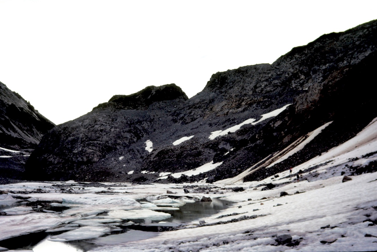
Saturday morning brought low clouds and a threat of rain. We packed up and hiked over to Marmot Lake, then up toward Dip Top Gap. However, rain settled in as we passed No-Name Lake, so we stopped for the day at beautiful Jade Lake.

Day 3: Jade Lake to Peggy’s Pond to Trailhead
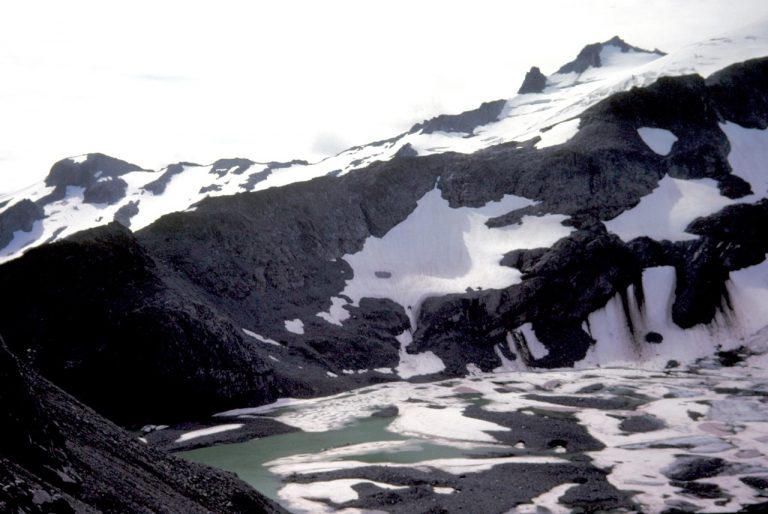
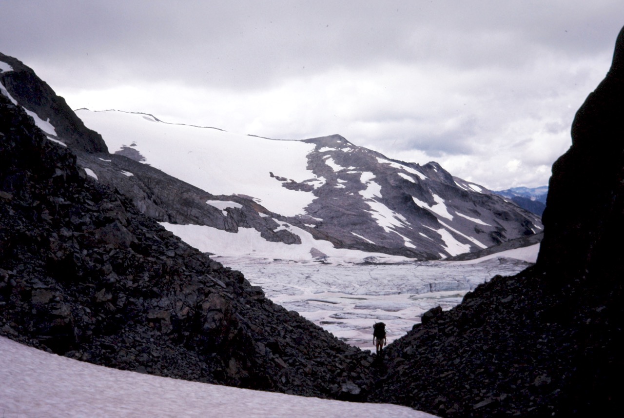
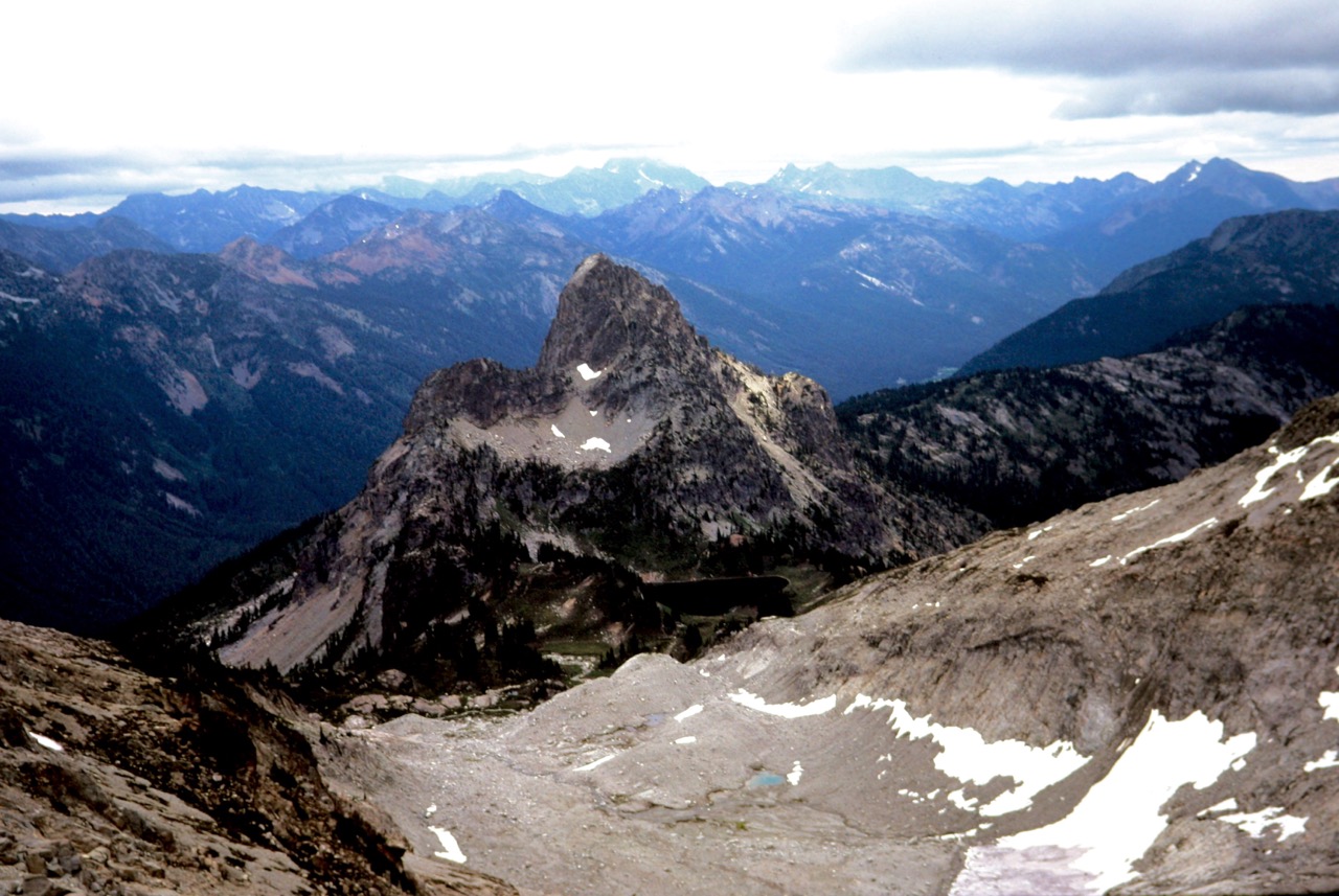
We awoke to patches of blue sky and a promise of better weather on Sunday. Feeling optimistic, we hiked around the lake and booted up a moderately steep snow couloir to Dip Top Gap. The view of Mt. Daniel, the Lynch Glacier, Pea Soup Lake, and Jade Lake was absolutely spectacular from here!
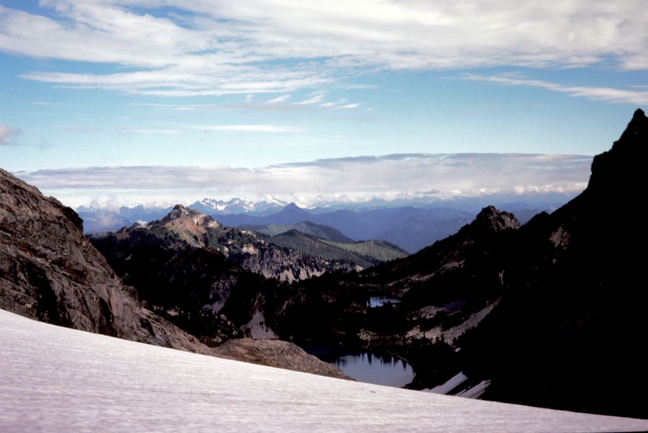

After scoping out a route around the left (eastern) side of Pea Soup Lake, we began a long, curving traverse toward Pea Soup Pass, a low gap closely east of the lake. Our traverse took us across very unpleasant rubble slopes, followed by easier snow slopes. We later traveled along the lake shore and then scrambled up to Pea Soup Pass.
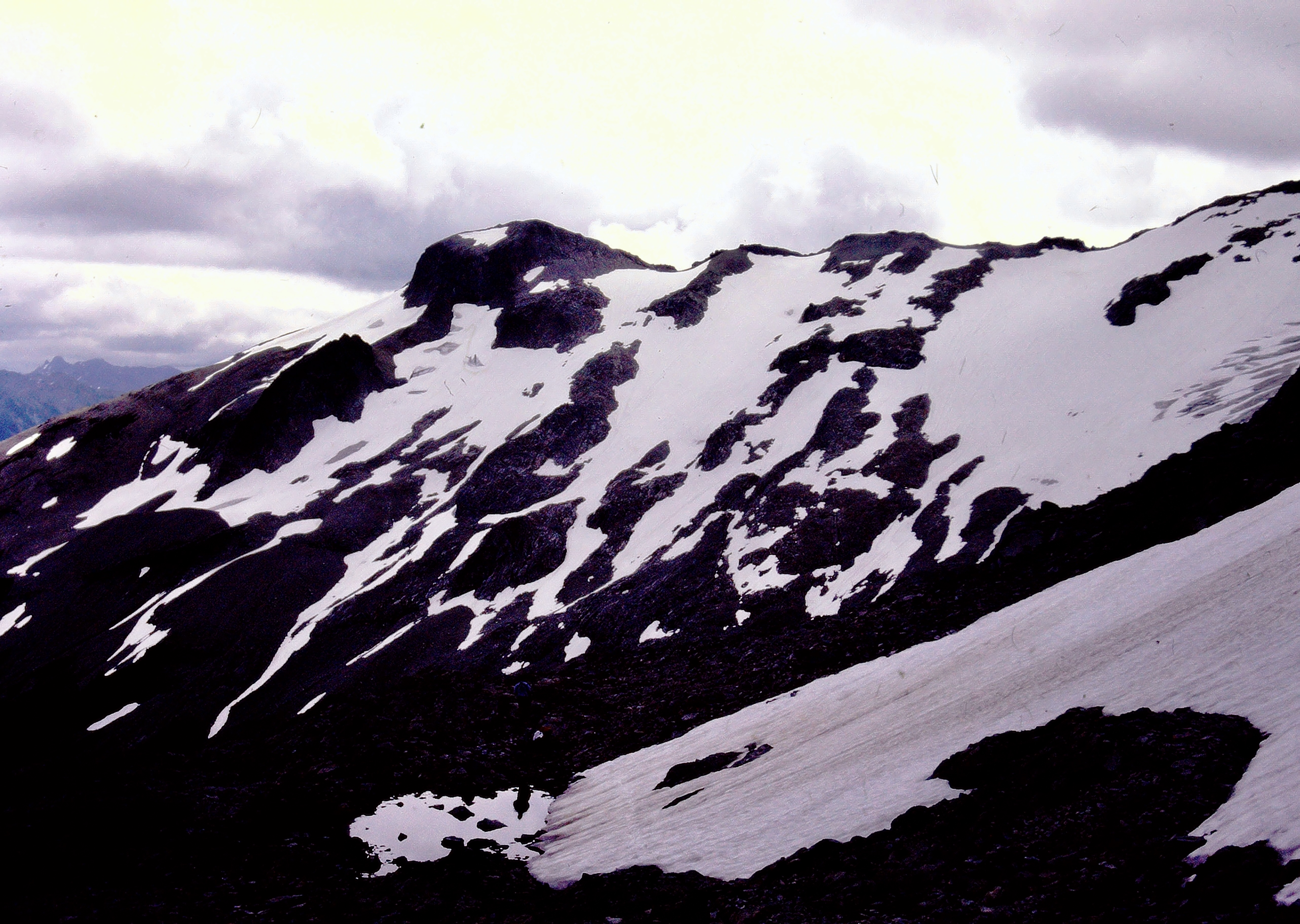
Our hopes of climbing Mt. Daniel were stifled by the arrival of more bad weather, shrouding the summit dome in dense fog. As such, we contoured on snow slopes around the Daniel Glacier Cirque, crossed Daniel’s east ridge at a 6950-foot saddle, dropped into the Hyas Glacier Cirque, and then descended to Peggy’s Pond. From there, it was an uneventful hike down to Tucquala Meadows Trailhead to complete our loop.
Route Maps & Profile
…
…
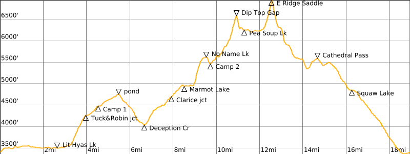
Photo Gallery
Click to enlarge…