Trip Date: March 26, 2021
2021 ARIZONA & CALIFORNIA ADVENTURE VACATION
Cathedral Notch Scramble & Cathedral Rock Loop Hike
Cathedral Gap
Cathedral Notch
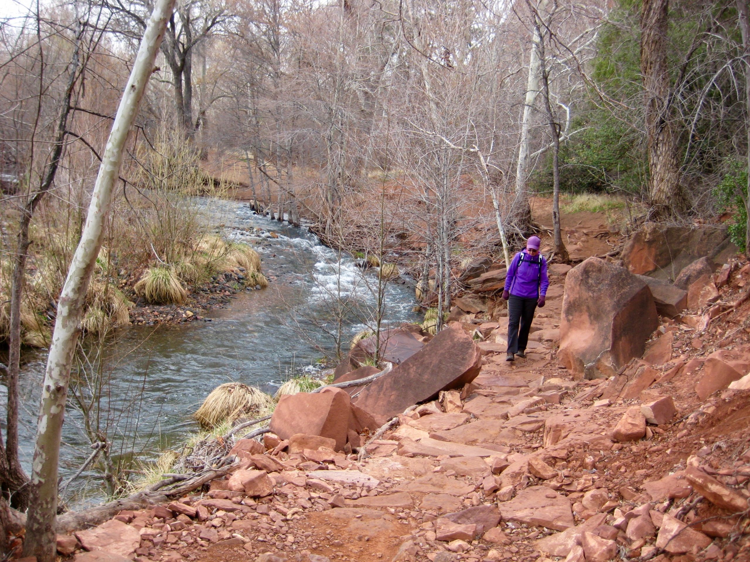
Oak Creek
Hiline Pass
Trip Report Summary
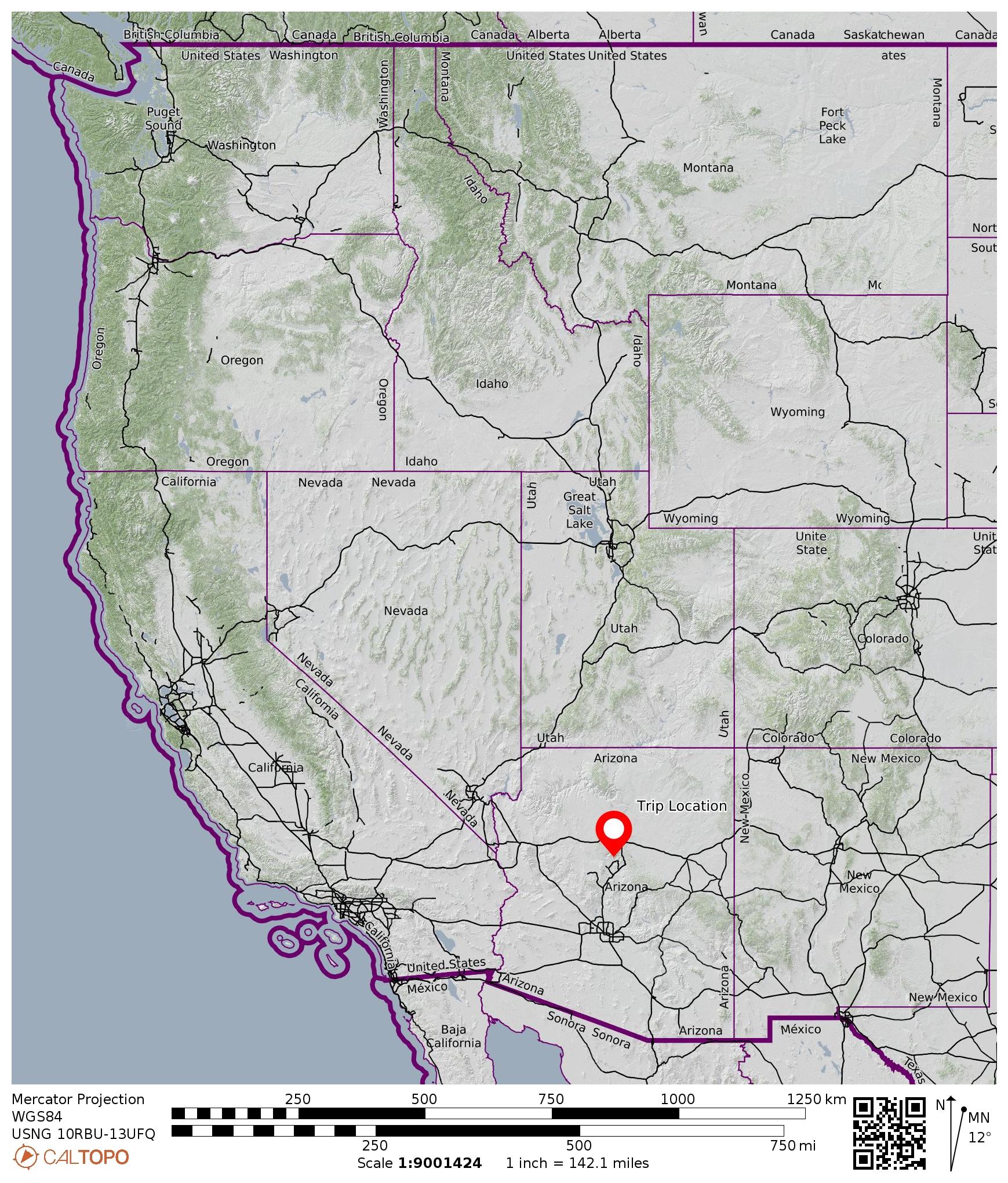
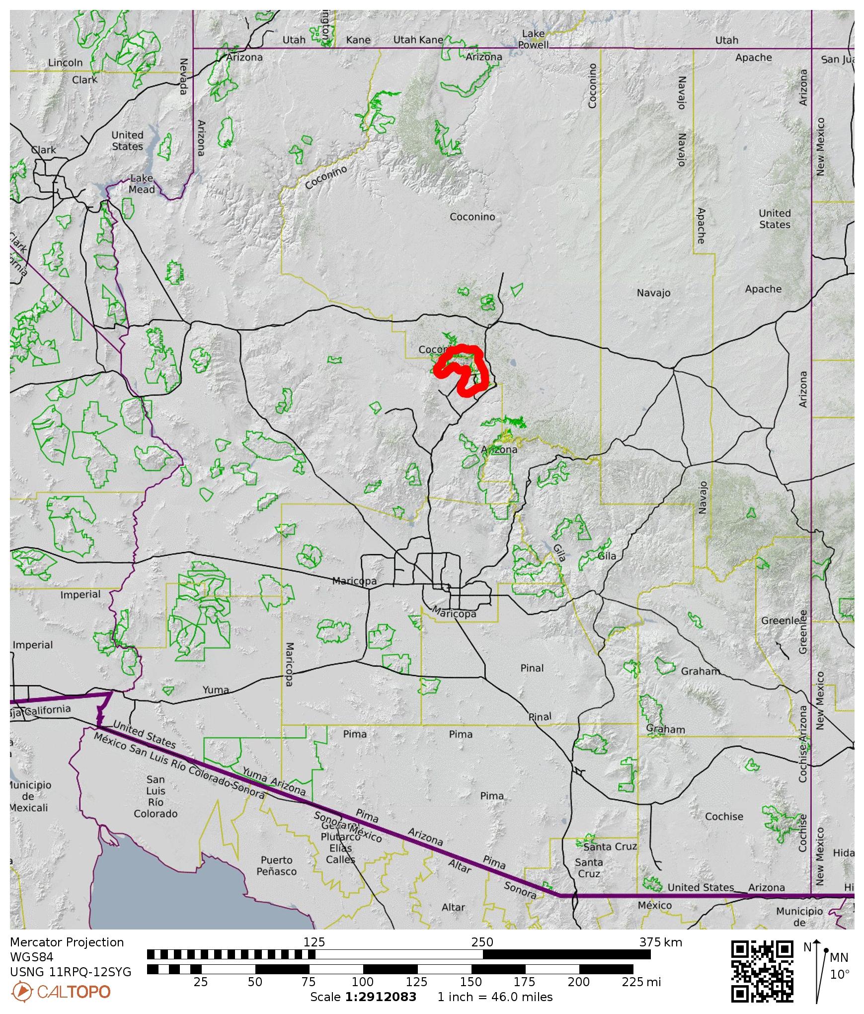
Region: Arizona
Sub-Region: Central Arizona
Sub-Sub-Region: Sedona Mountains
Area: Coconino National Forest
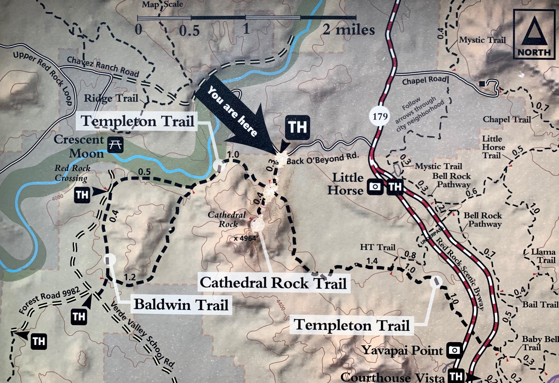
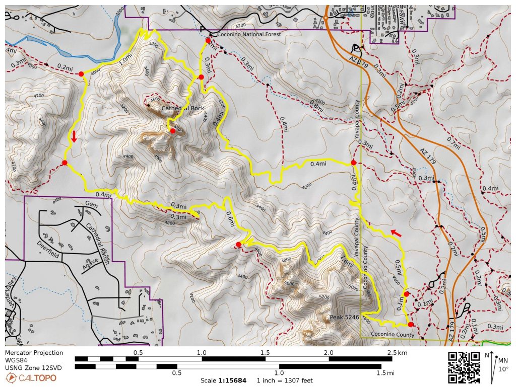
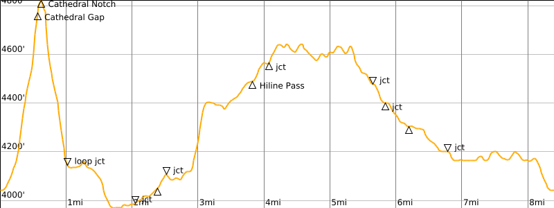
Starting & Ending Point: Cathedral Rock Trailhead on Back O’ Beyond Road (Elev. 4000 feet)
Loop Way Points: Templeton Trail junction & Oak Creek & Baldwin Trail junction & Hiline Trail junction & Hiline Pass & Transept Trail junction & Slim Shady Trail junction & Templeton Trail junction & Cathedral Rock Trail junction (trail hike)
Loop High Point: Hiline Ridge (Elev. 4650 feet)
Sidetrip: Cathedral Gap & Cathedral Notch (trail hike & rock scramble)
Sidetrip High Point: Cathedral Notch (Elev. 4800 feet)
Approximate Stats: 8.5 miles traveled; 1500 feet gained & lost; 6.3 hours elapsed.
…
Full Trip Report
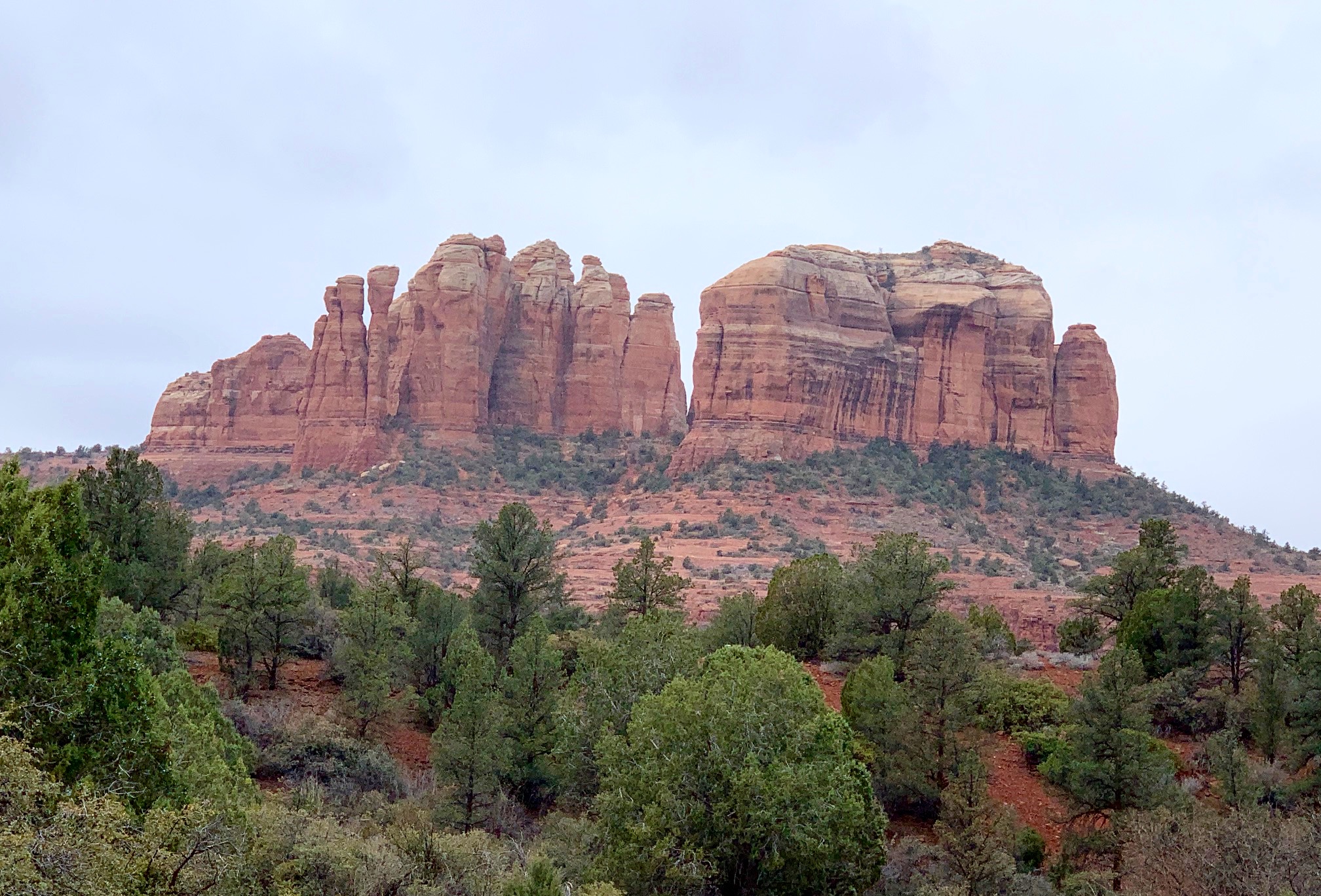
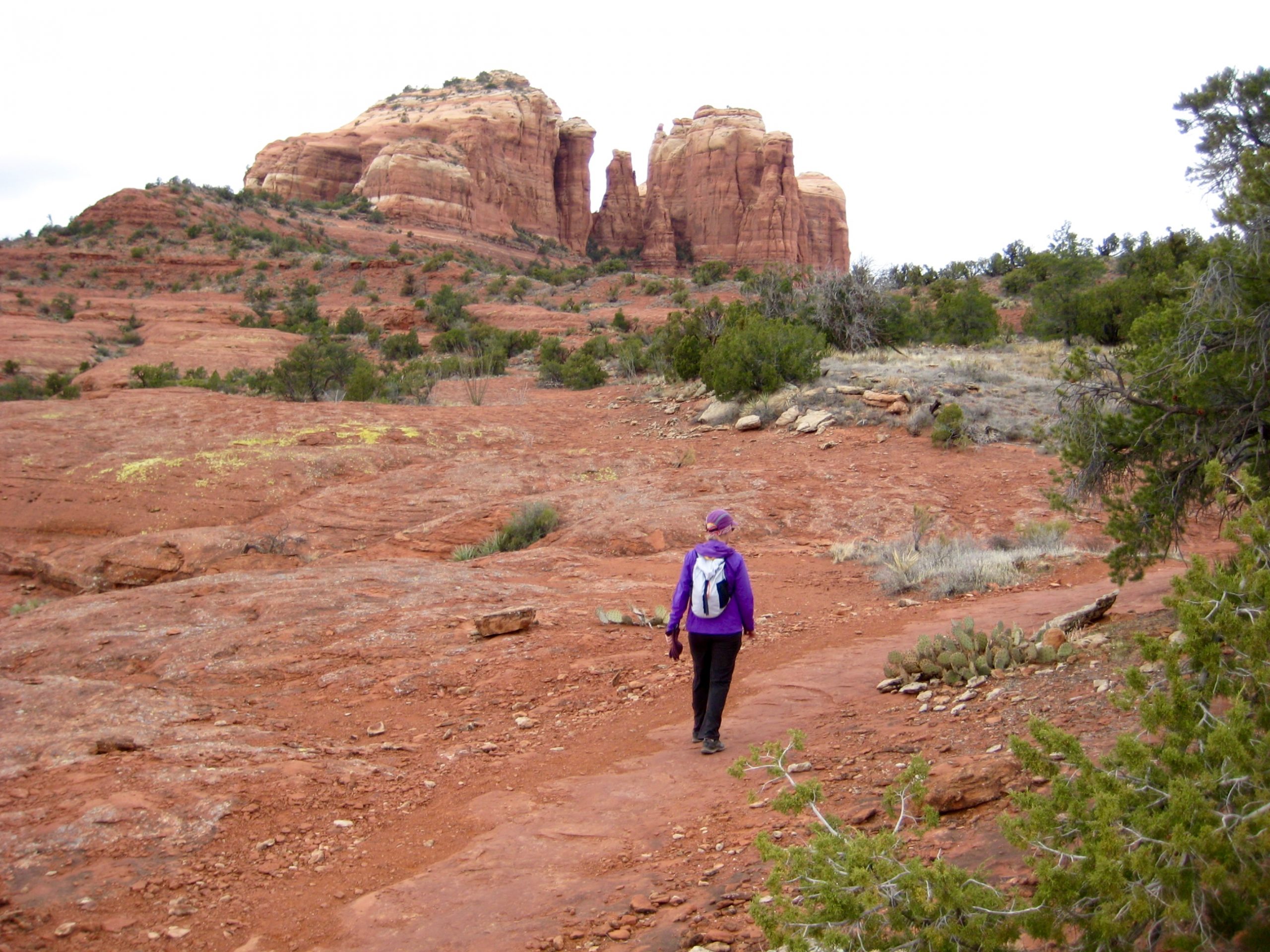
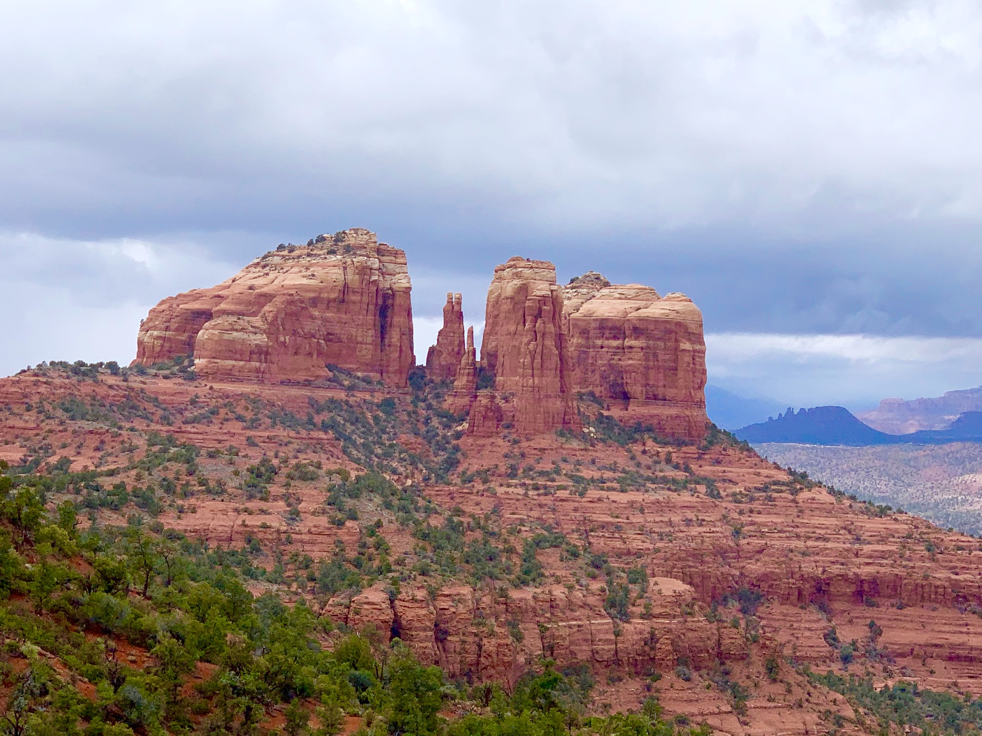
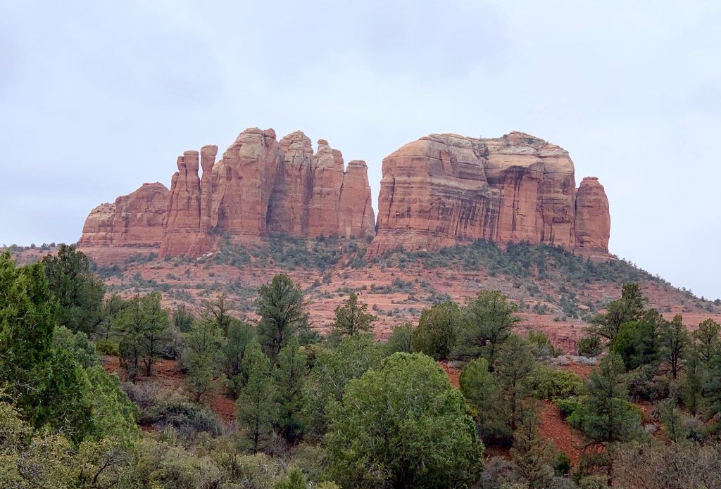
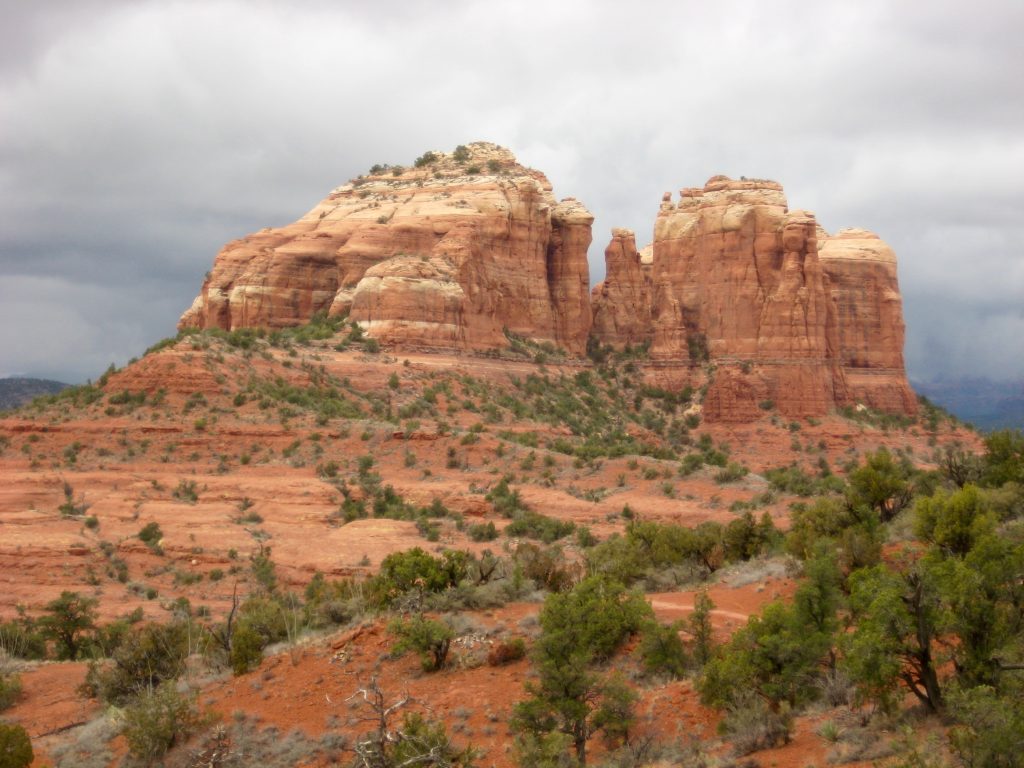
Eileen and I continued our Sedona vacation with a scramble up to Cathedral Notch and a hike around Cathedral Rock. We began at the Cathedral Rock Trailhead, which lies in the shadow of the marvelously rugged “red-bed” sandstone butte.
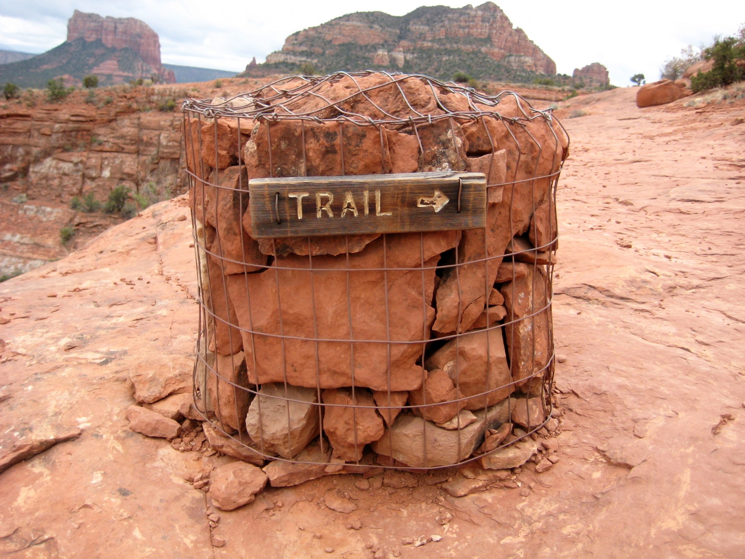
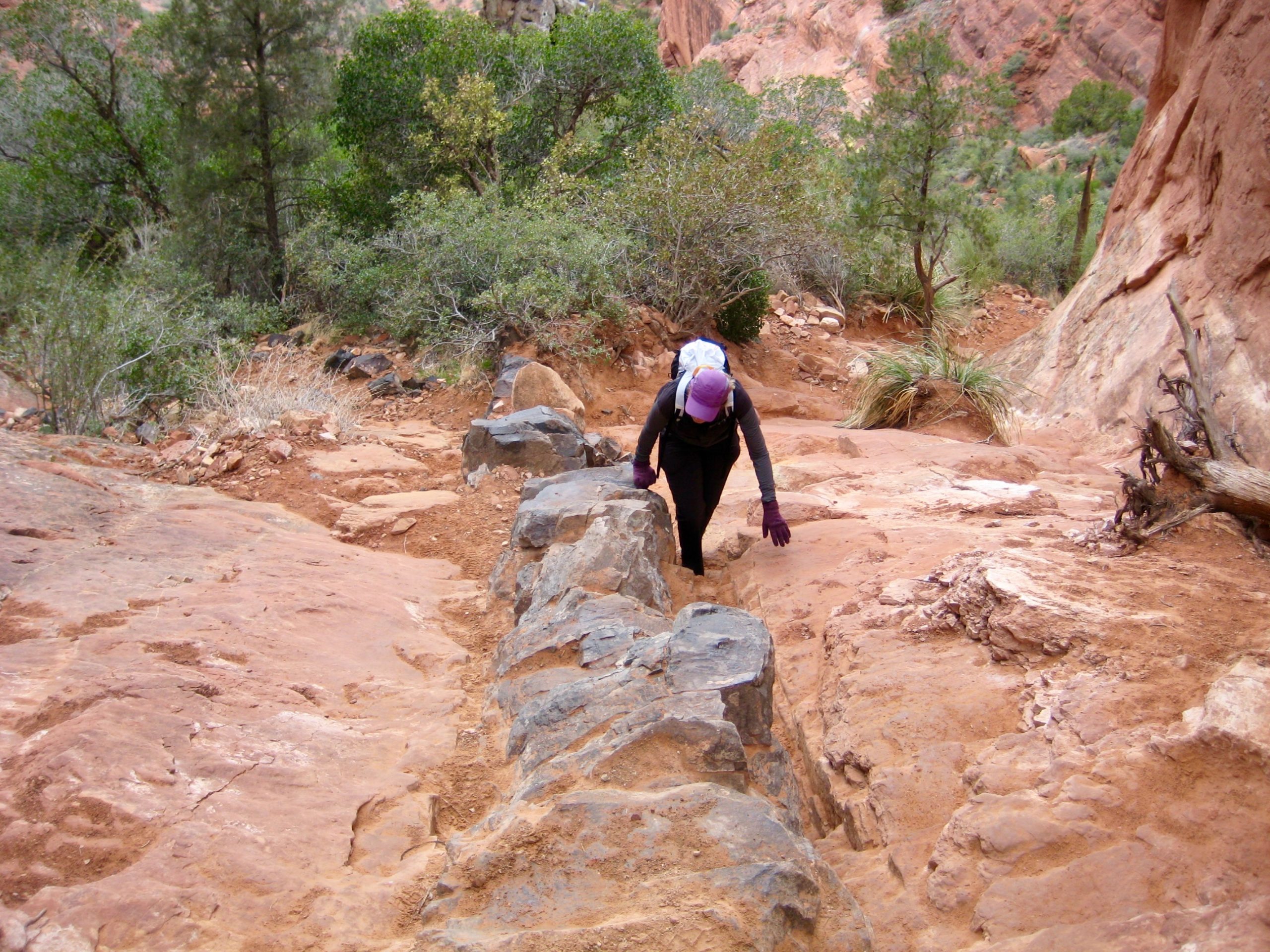
Cathedral Rock Trail ascends gently for ¼ mile to a junction with Templeton Trail, then proceeds upward on moderately steep sandstone slabs. The entire route is well-marked by dozens of cylindrical gabion cairns.
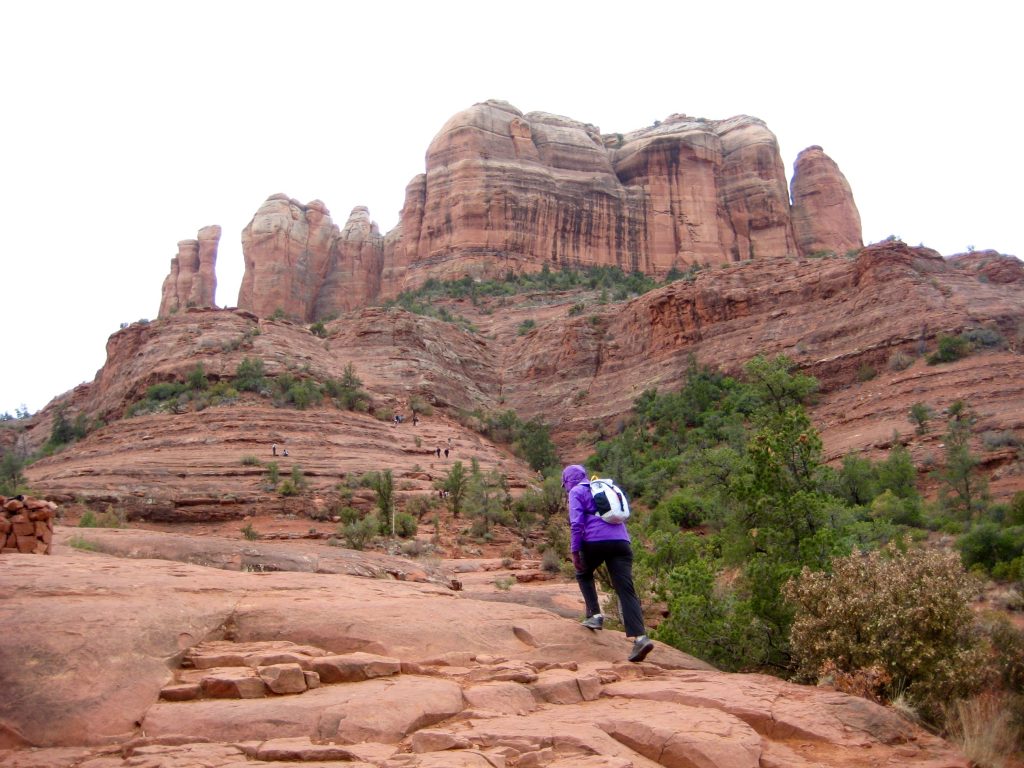
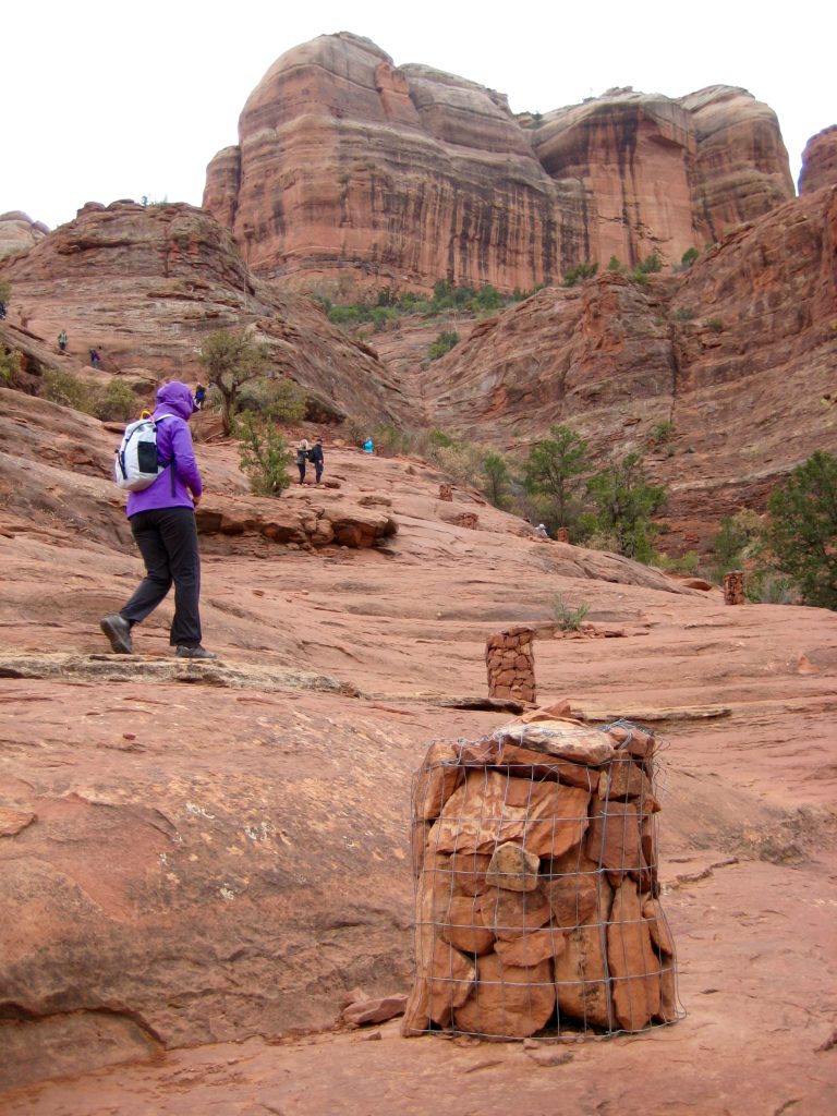
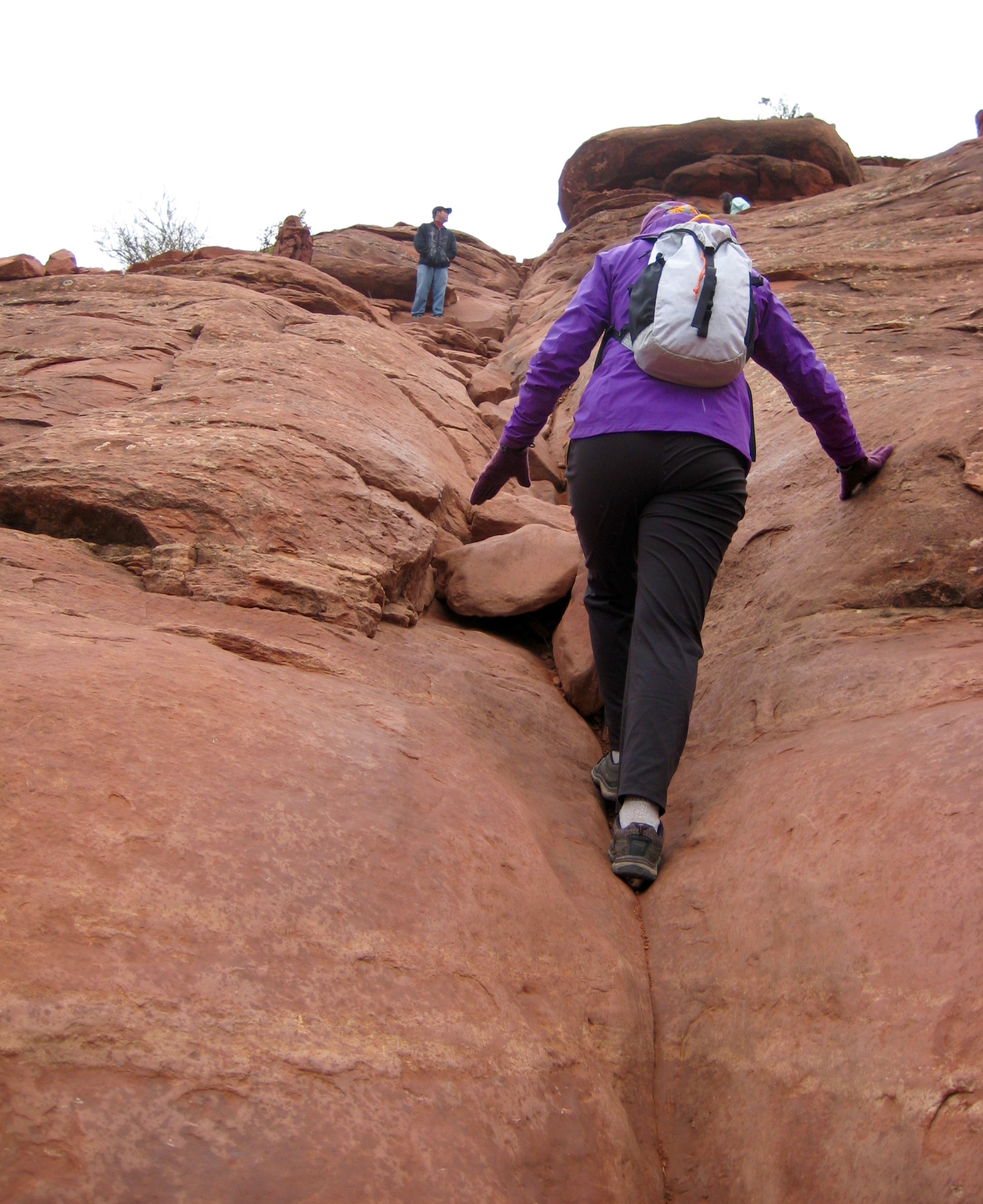
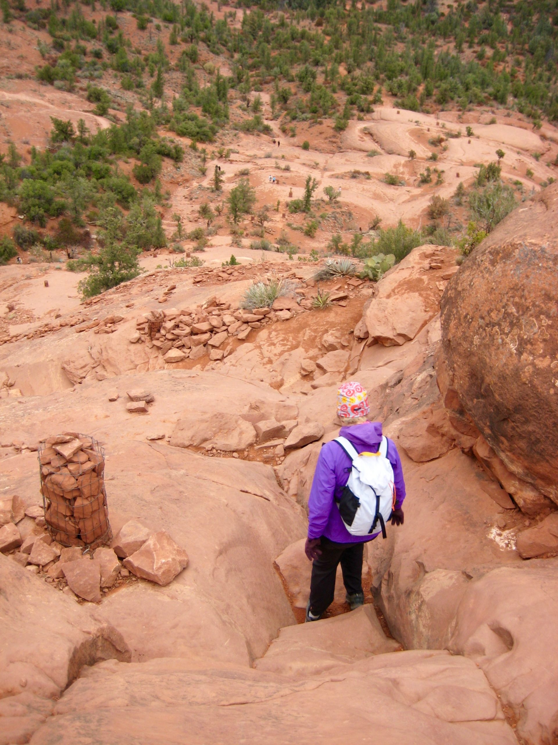
A combination of easy ledges and Class 2-3 grooves leads to Cathedral Gap (0.5 hours + 650 feet from TH), which represents the official end of the trail. This gap offers good views of the Sedona area and provides a satisfying destination for most trekkers.

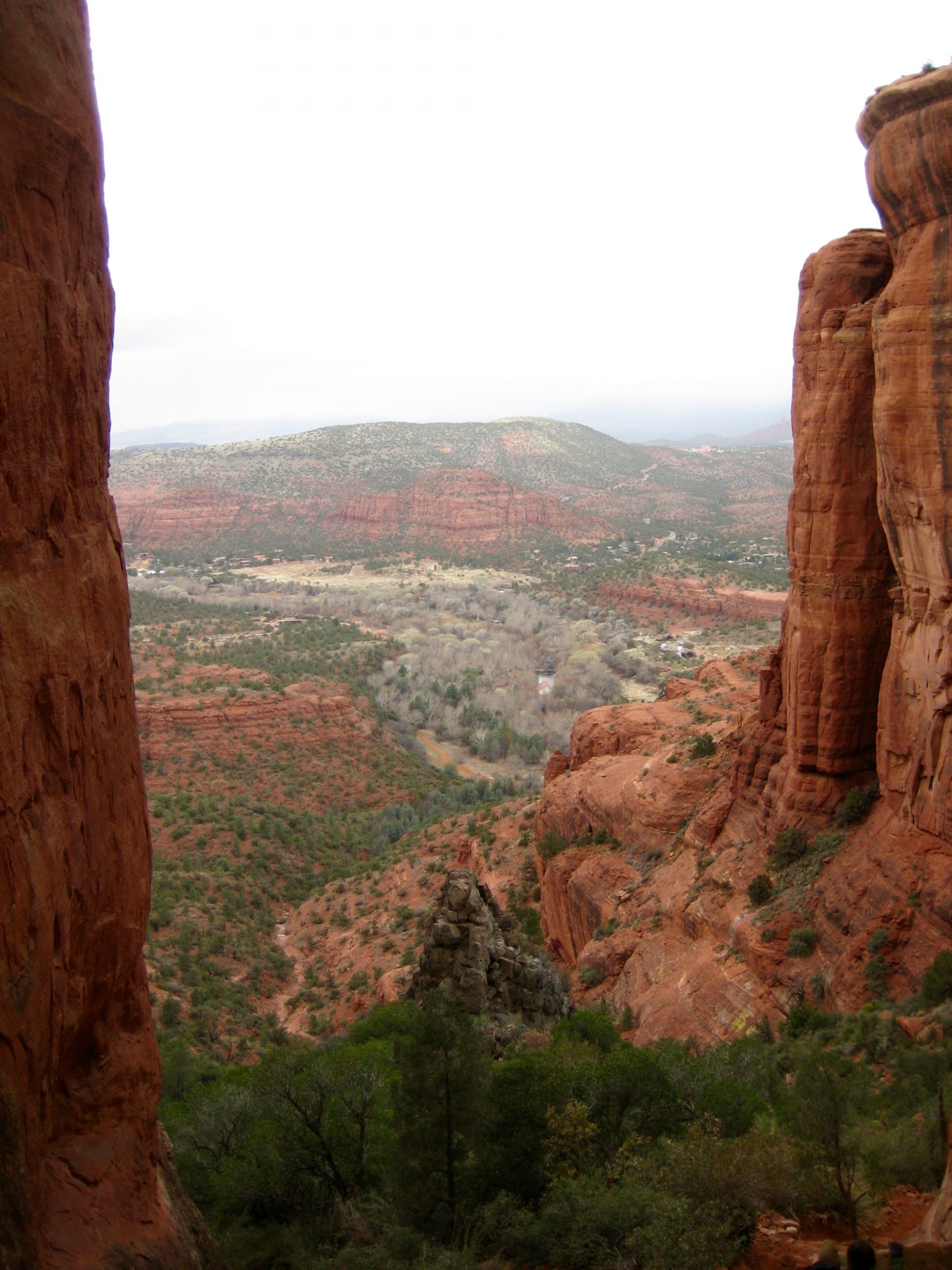
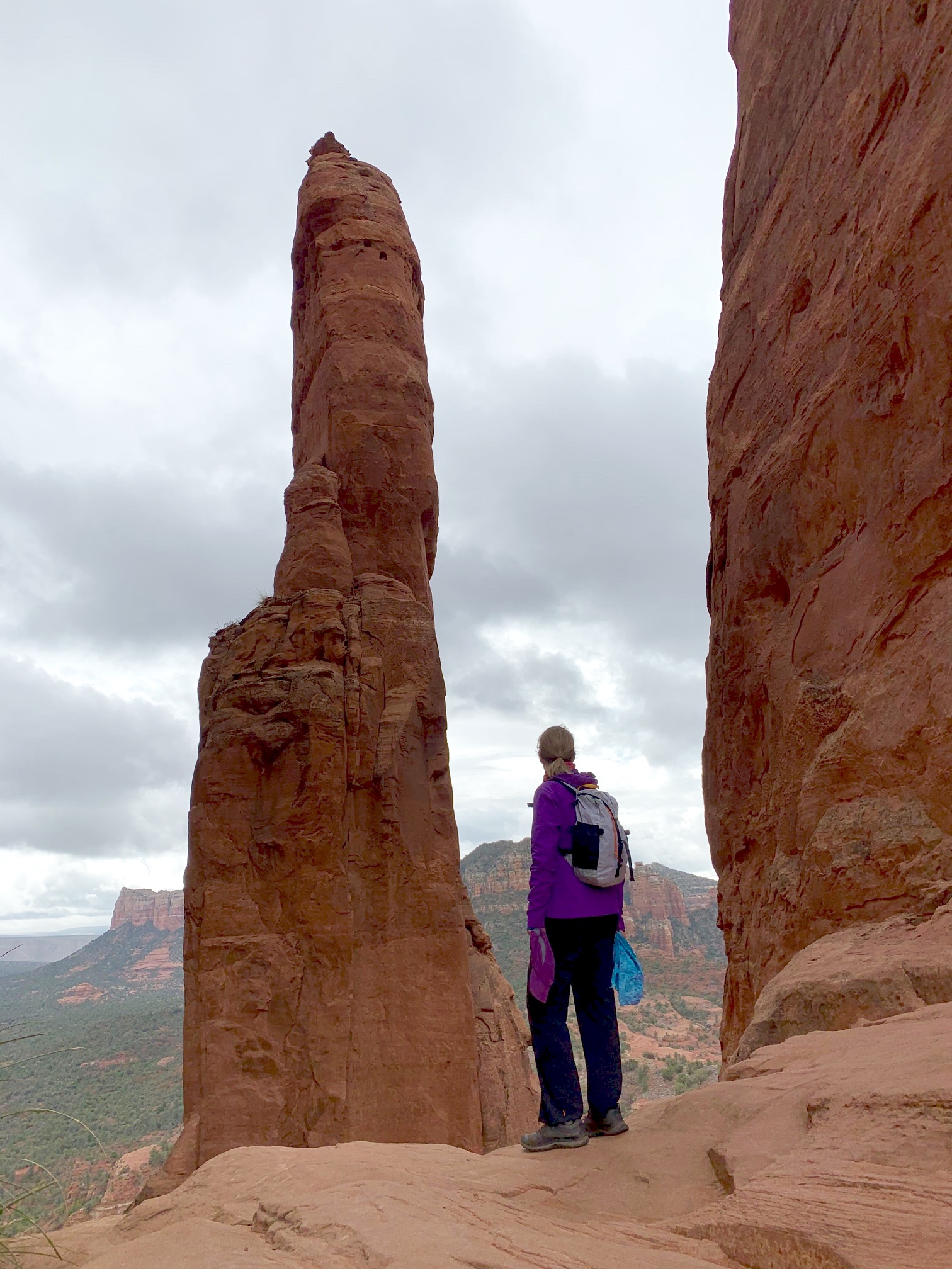
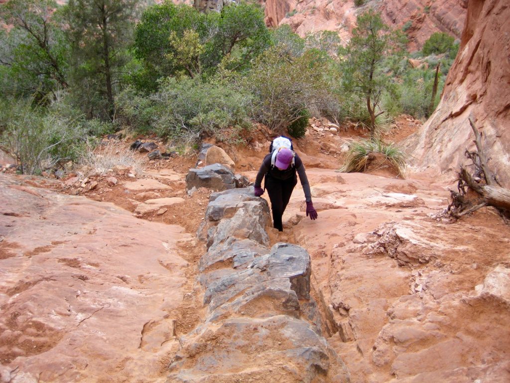
For a somewhat more dramatic view, we curved around to the left and scrambled up a basalt dike to reach Cathedral Notch (0.6 hours + 700 feet from TH). This high notch is situated between tall vertical walls of smooth sandstone.

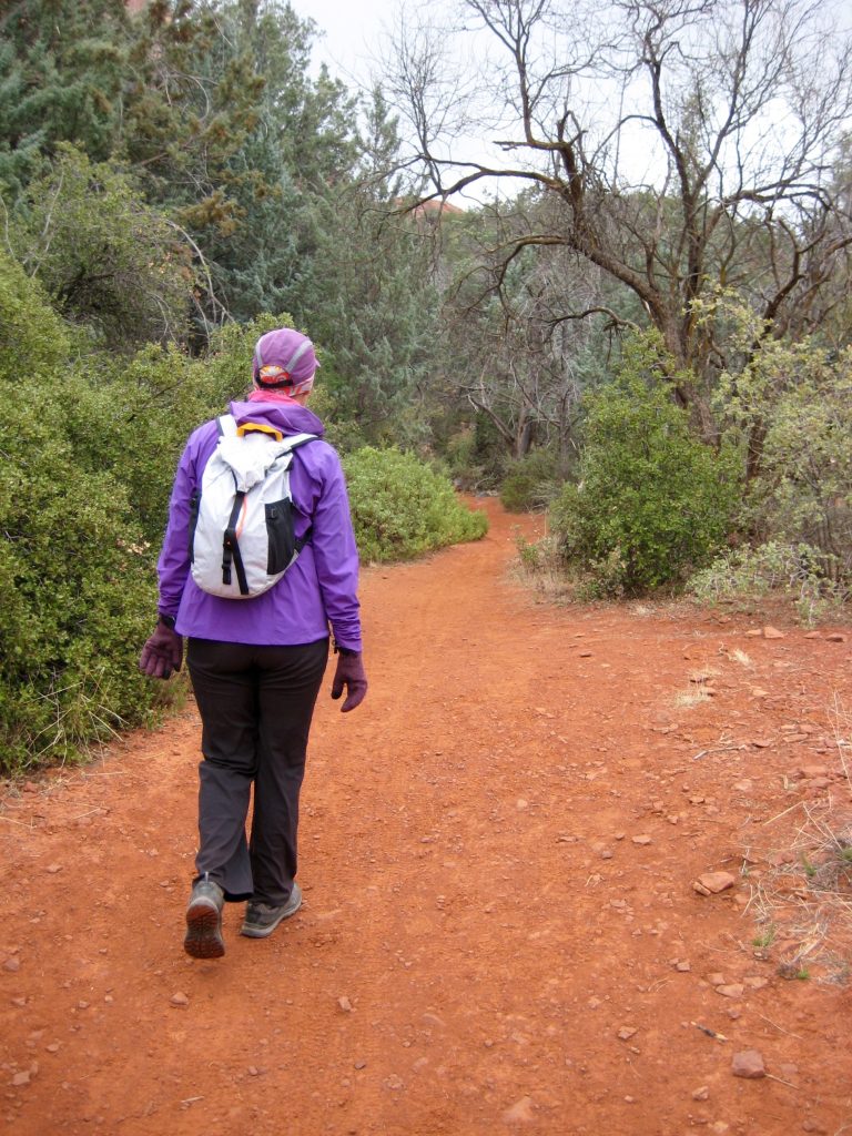
After retracing our steps back down to the Templeton Trail junction, we turned left and started an elongated counter-clockwise loop around Cathedral Rock. Templeton Trail wanders through sycamore woods and becomes tangent to Oak Creek for a short stretch.


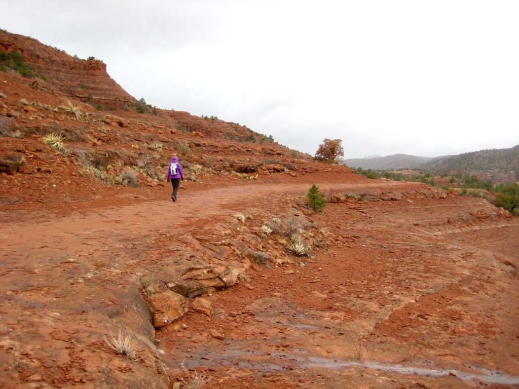
After an easy mile, we turned onto Baldwin Trail and proceeded southward on ocher-colored dirt for ½ mile to Hiline Trail, which we then followed eastward up steeper terrain. Hiline Trail is a popular but difficult (black diamond) bicycle route.
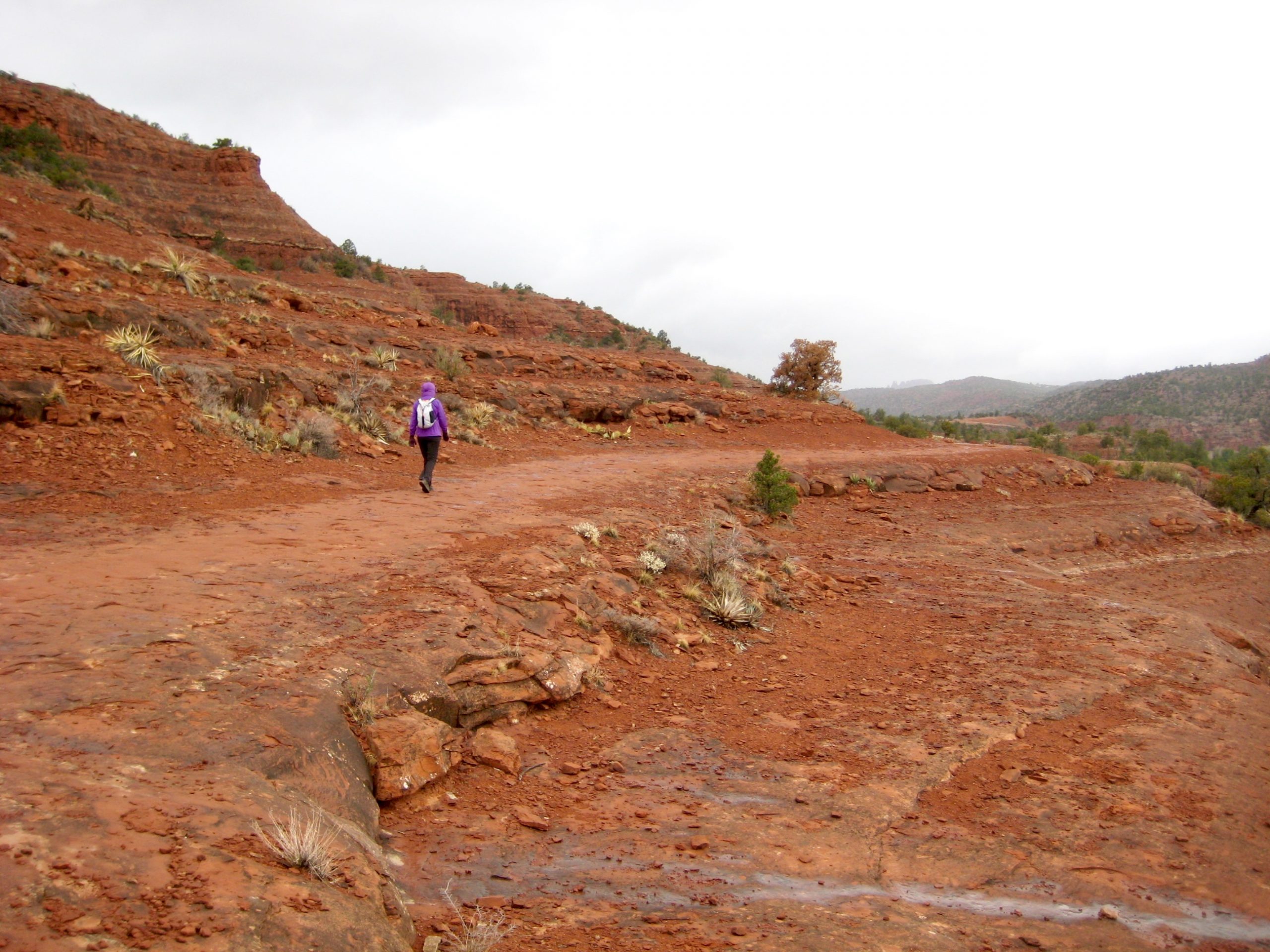
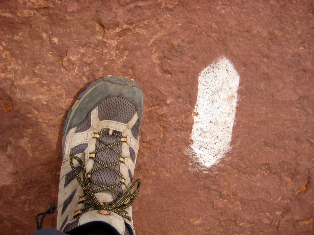
We ascended to 4500-foot Hiline Pass and soon reached our circuit’s high-point at a junction with Transept Trail (4.0 hours + 1300 feet from TH). For the benefit of both hikers and bikers, the route through here is marked with hundreds of white arrows painted on the slabby rock.
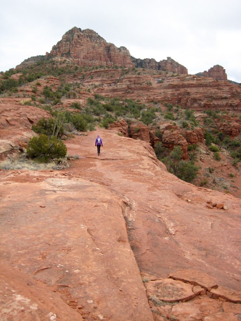
Beyond the Transept Trail junction, Hiline Trail cuts across a sequence of ribs and gullies, providing grand views of Cathedral Rock. Dark clouds filled the sky all day, but they never generated more than a few sprinkles.
A short descent ended at a junction with Slim Shady Trail, which in turn led us northward to Templeton Trail. This latter trail contours the hillside on a wide, persistent sandstone ledge. We closed our loop at the junction with Cathedral Rock Trail and finished our day with a ¼-mile stroll back to the starting trailhead (6.3 hours + 1500 feet for total trek).
Route Map & Profile
…
…
Photo Gallery
Click to enlarge…