Trip Date: July 4-8, 2022
2022 DOLOMITE ALPS ADVENTURE VACATION
Alta Via 2 Trekking Traverse – North Part: Plose Ski Area to Lake Fedaia
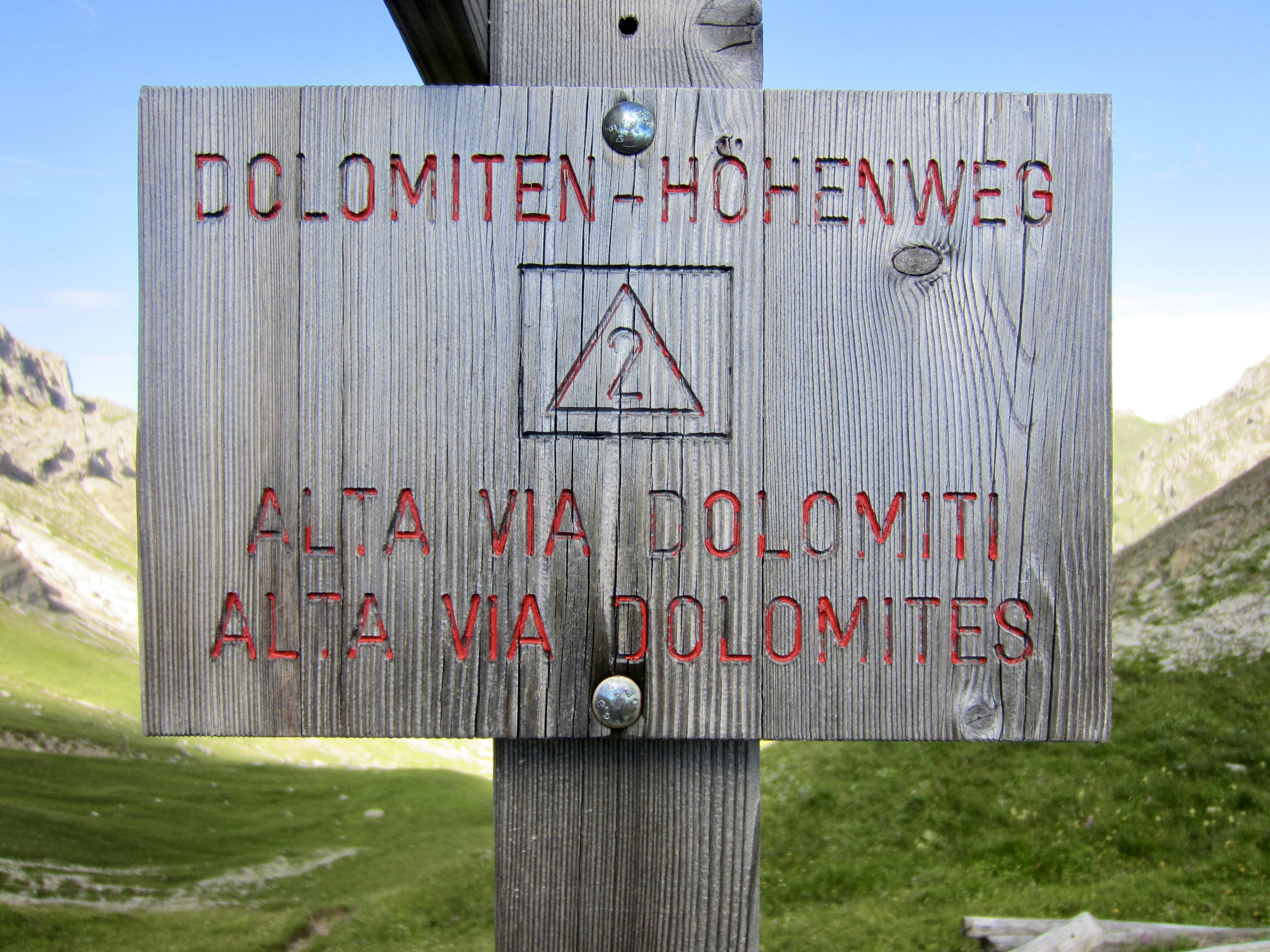
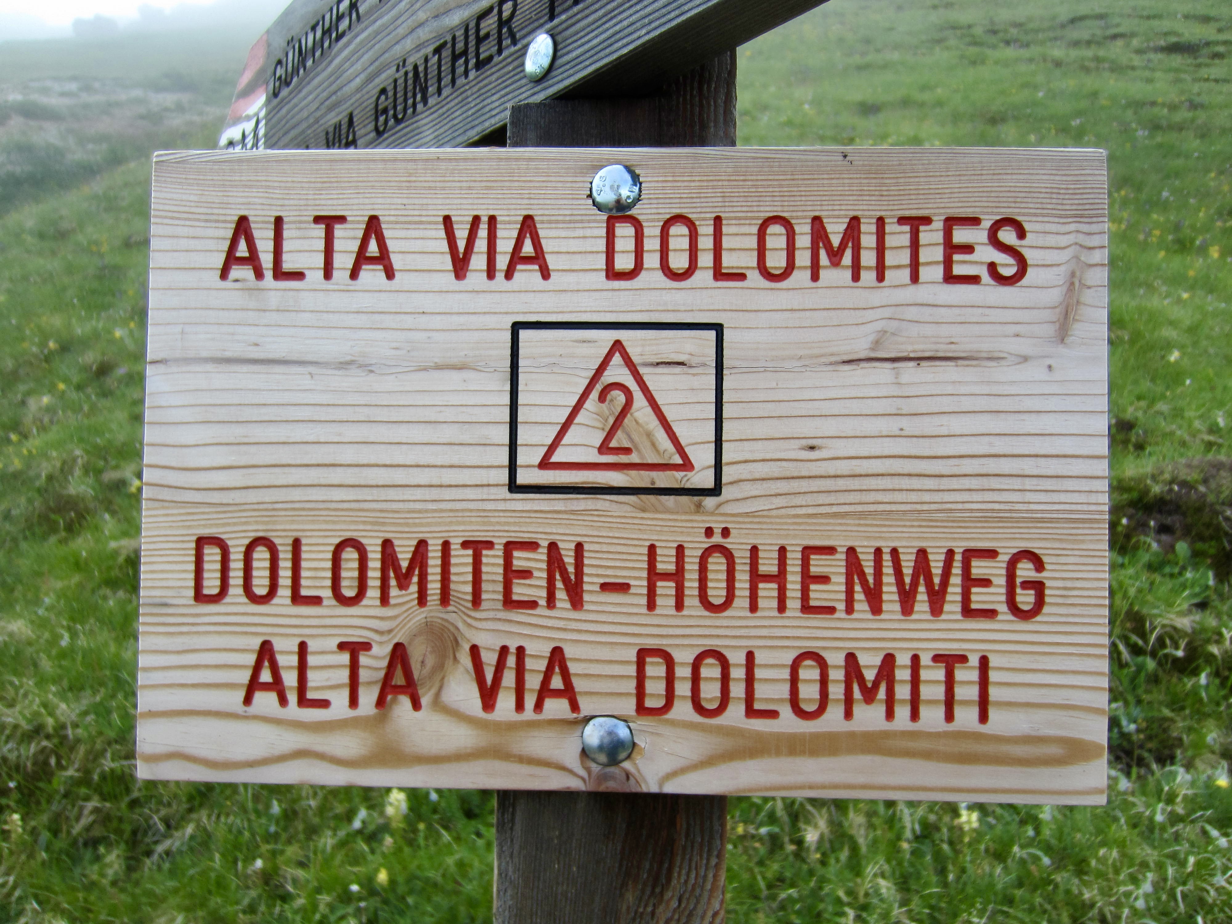
Alta Via Dolomiti 2 aka Dolomiten-Hohenweg 2
Passo Gardena aka Grodnerjoch aka Gardena Pass
Via Ferrata Brigata Tridentina aka Brigata Tridentina Klettersteig
Piz Pisciadu (9790 ft / 2985 m)
Piz Boe (10,335 ft / 3151 m)
Sas de Pordoi (9676 ft / 2950 m)
Passo Pordoi aka Pordoijoch aka Pordoi Pass
Sasso del Cappello aka Sas da Ciapel (8384 ft / 2556 m)
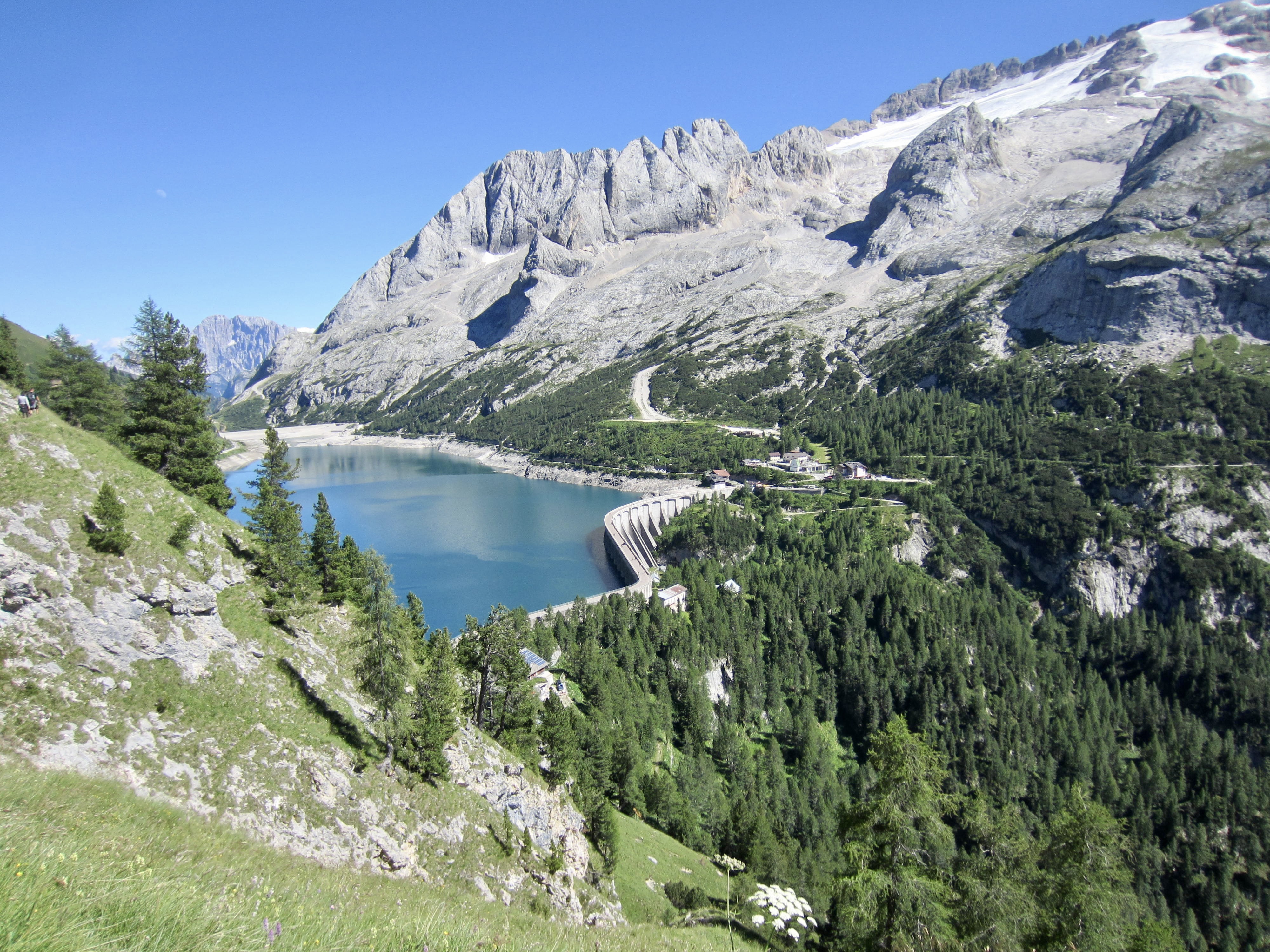
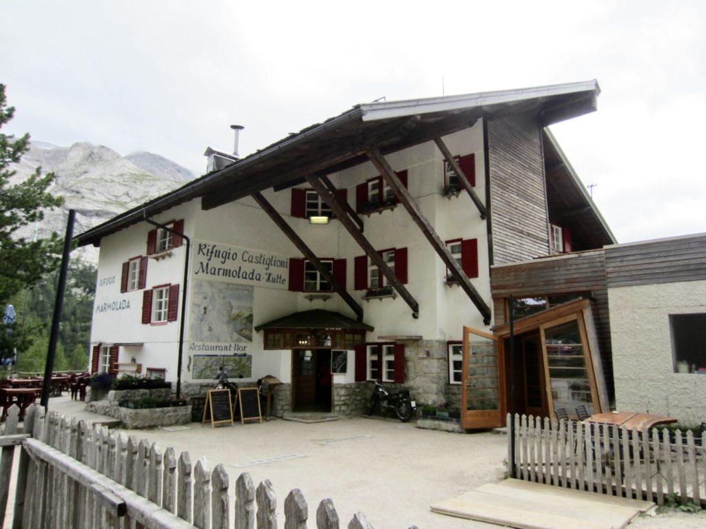
Rifugio Castiglioni Marmolada aka Castiglioni Marmolata Hutte
Trip Report Summary
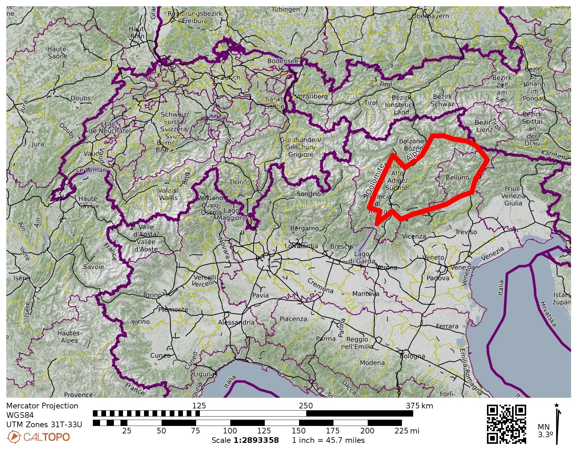
Region: Italy
Sub-Region: Dolomite Alps
Sub-Sub-Regions: Peitlerkofel Group & Puez-Odle/Geisler Group & Sella Group
Area: Puez–Odle/Geisler Nature Park
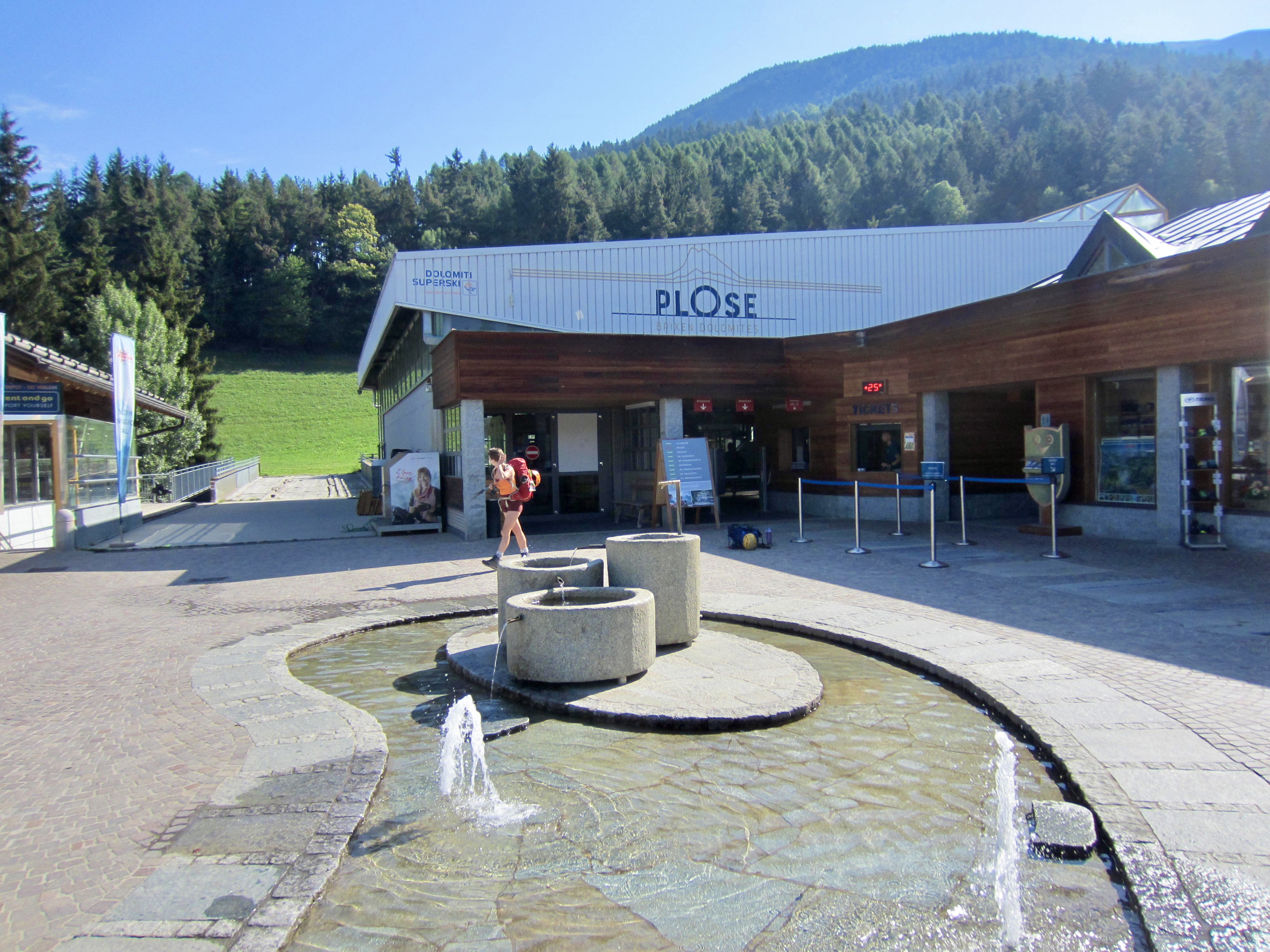
Starting Point: Plose Gondola top station (Elev. 6725 feet / 2050 meters)
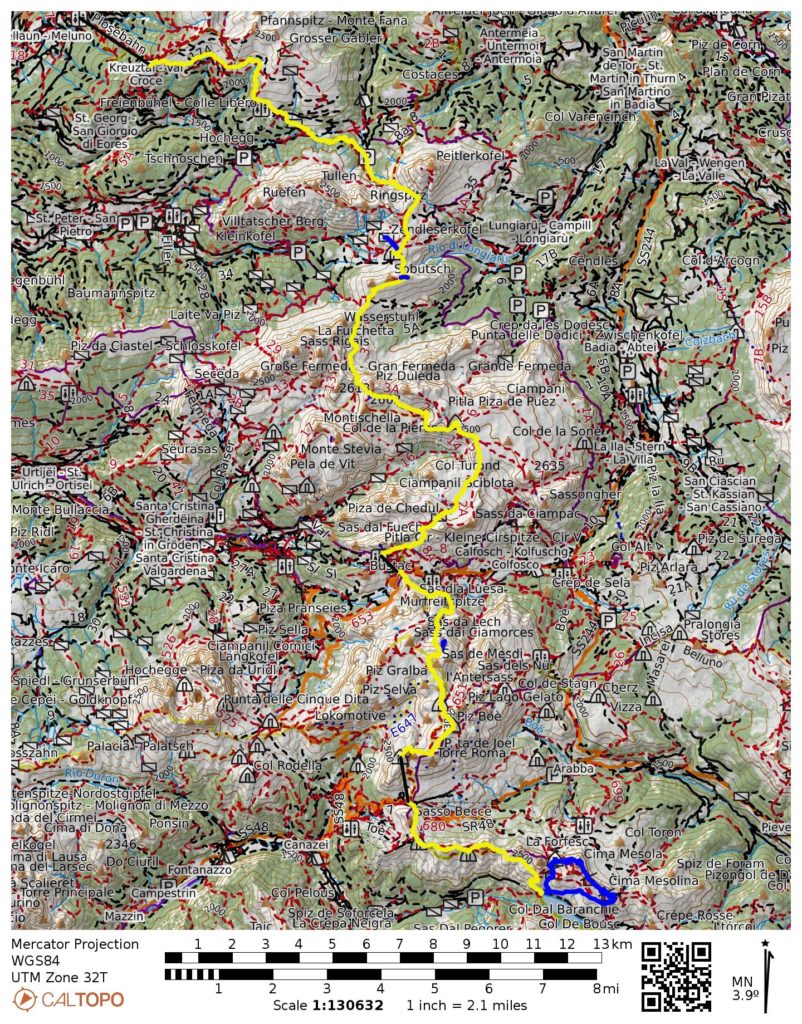
Traverse Way Points: Schnatz Creek & Edelweiss Hut & Forcella de Putia & Genova/Schluter Hut & Forcella Roa & Puez Hut & Forcella Crespeina & Forcella Cir & Jimmy Hut & Dantercepies Hut & Gardena Pass & Pisciadu Hut & Boe Hut & Piz Boe summit / Cappanna Fassa Piz Boe Hut & Forcella Pordoi & Sas Pordoi / Maria Hut & Pordoi Pass & Cuch Col / Fredarola Hut & Viel dal Pan Hut & Cappello Ridge & Castiglioni Marmolada Hut (trail hike & trail scramble)
Traverse High Point: Piz Boe summit (Elev. 10,335 feet / 3151 meters)
Ending Point: Road 641 at Lake Fedaia Dam (Elev. 6735 feet / 2054 meters)
Accommodations: Genova/Schluter Hut & Puez Hut & Pisciadu Hut & Fassa Piz Boe Hut & Castiglioni Hut
Short Sidetrip: Zendleser Kofel (trail hike)
Short Sidetrip: Sobutsch (trail hike)
Summit Sidetrip: Piz Pisciadu (ascent & descent via South Ridge)
Summit: Piz Boe (ascent via Northwest Slope; descent via Southwest Ridge)
Summit: Sasso Cappello (ascent via West Ridge; descent via East Ridge)
Approximate Stats (excluding sidetrips & gondola/chairlift rides): 30.5 miles / 49.1 km traveled; 13,200 feet / 4125 meters gained; 10,300 feet / 3140 meters lost.
…
Related Posts
>>> Alta Via 2 Trekking Traverse – Overview: Brixen/Bressanone to Feltre
>>> Alta Via 2 Trekking Traverse – South Part: Marmolada/Marmolata to Feltre
>>> Brigata Tridentina Via Ferrata / Klettersteig / Climb
>>> Trincee Via Ferrata / Klettersteig / Hiking & Climbing Loop
>>> Alta Via 4 Trekking Traverse: Alte Sage to Tai di Cadore – July 12, 2026
…
Full Trip Report
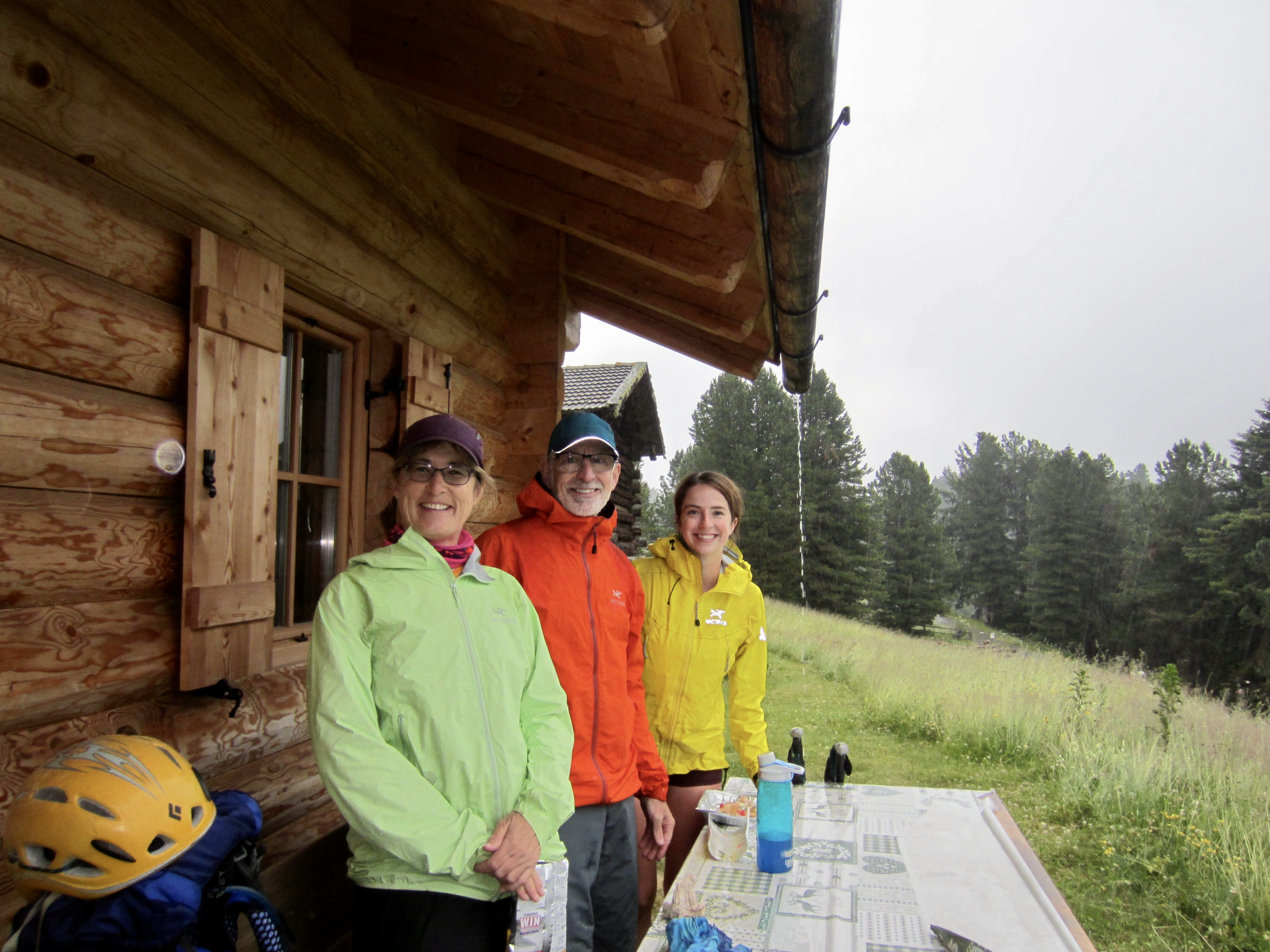
Over the course of five full days, Eileen and Brooke and I completed the northern part of Alta Via 2 (AV2) in the Dolomite Alps of northern Italy, traveling from Brixen/Bressanone to Lake Fedaia at the base of Marmolada. It was the culmination of three years of planning by Eileen and Brooke, and it exceeded our expectations in so many ways. The following is a day-by-day summary of our trek. For a general discussion regarding our combined AV2-North and AV2-South treks, see my separate Trekking Overview post.
Immediately before starting our trek, we heard the shocking news that a huge chunk of ice had calved off one of Marmolada’s glaciers, killing or injuring more than a dozen climbers (the final count was eleven killed and eight injured). This tragic incident became a major topic of conversation throughout our trek and cast a somber mood that became more pronounced as we got closer to the mountain each day. It also altered our itinerary, which had originally included an ascent of Marmolada.
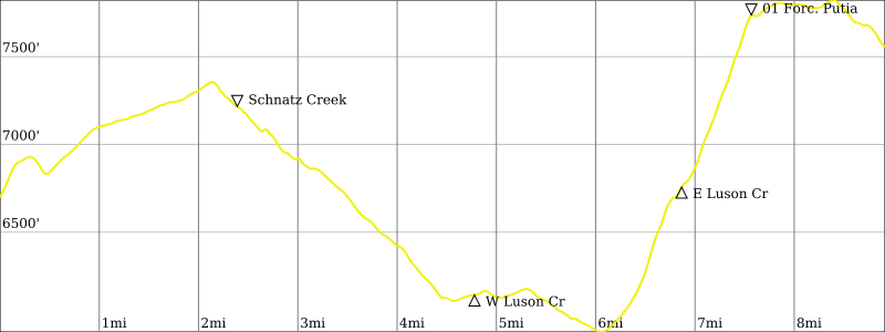
Day 1: Plose Ski Area to Schluter/Genova Hut
Approximate Stats (excluding gondola ride & sidetrips): 7.0 hours elapsed; 9.0 miles / 14.5 km traveled; 2650 feet / 810 meters gained; 1800 feet / 550 meters lost.
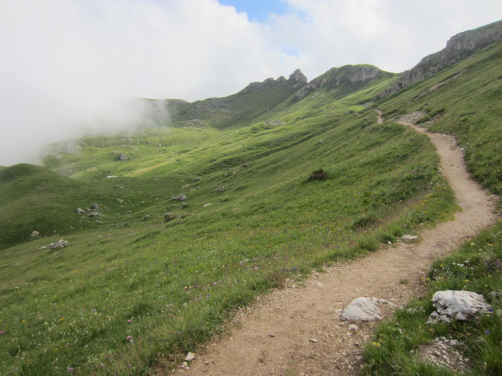
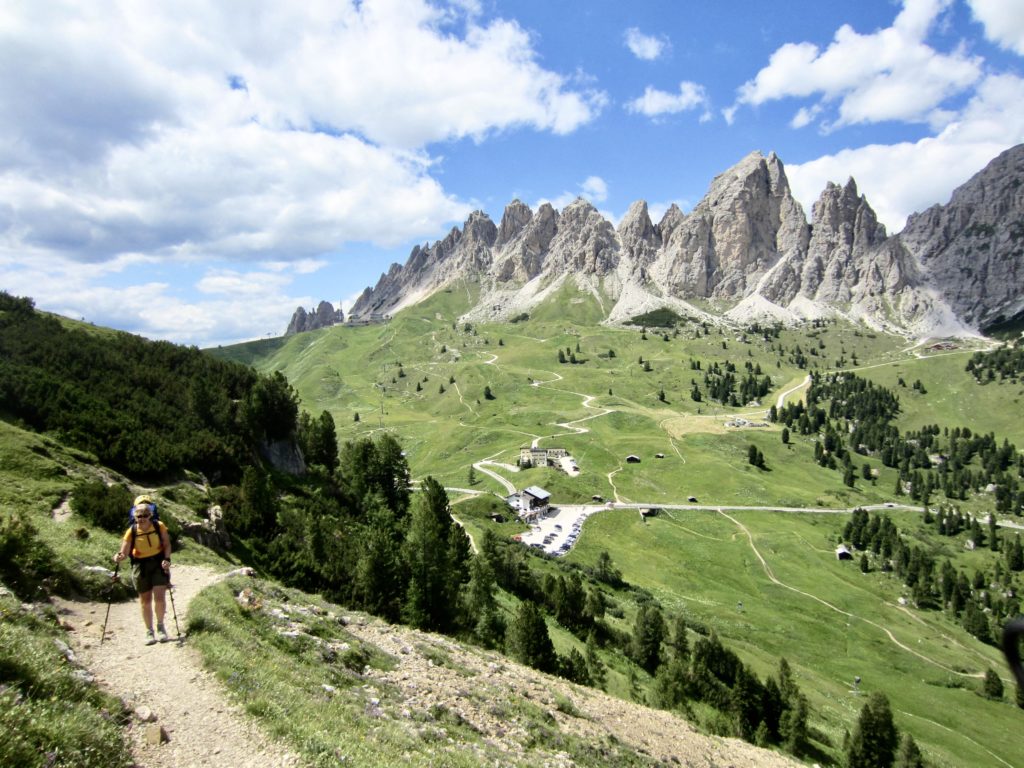
Following an overnight stay in the charming ski town of Brixen/Bressanone, we took a taxi up to the Plose Ski Area gondola base station, then rode the gondola to the top station. (Taking the gondola saved us nearly 3400 feet, or 1000 meters, of elevation gain and buckets of sweat on this hot morning.) The top area was swarming with day-hikers, long-trekkers, and mountain bikers of all ages.
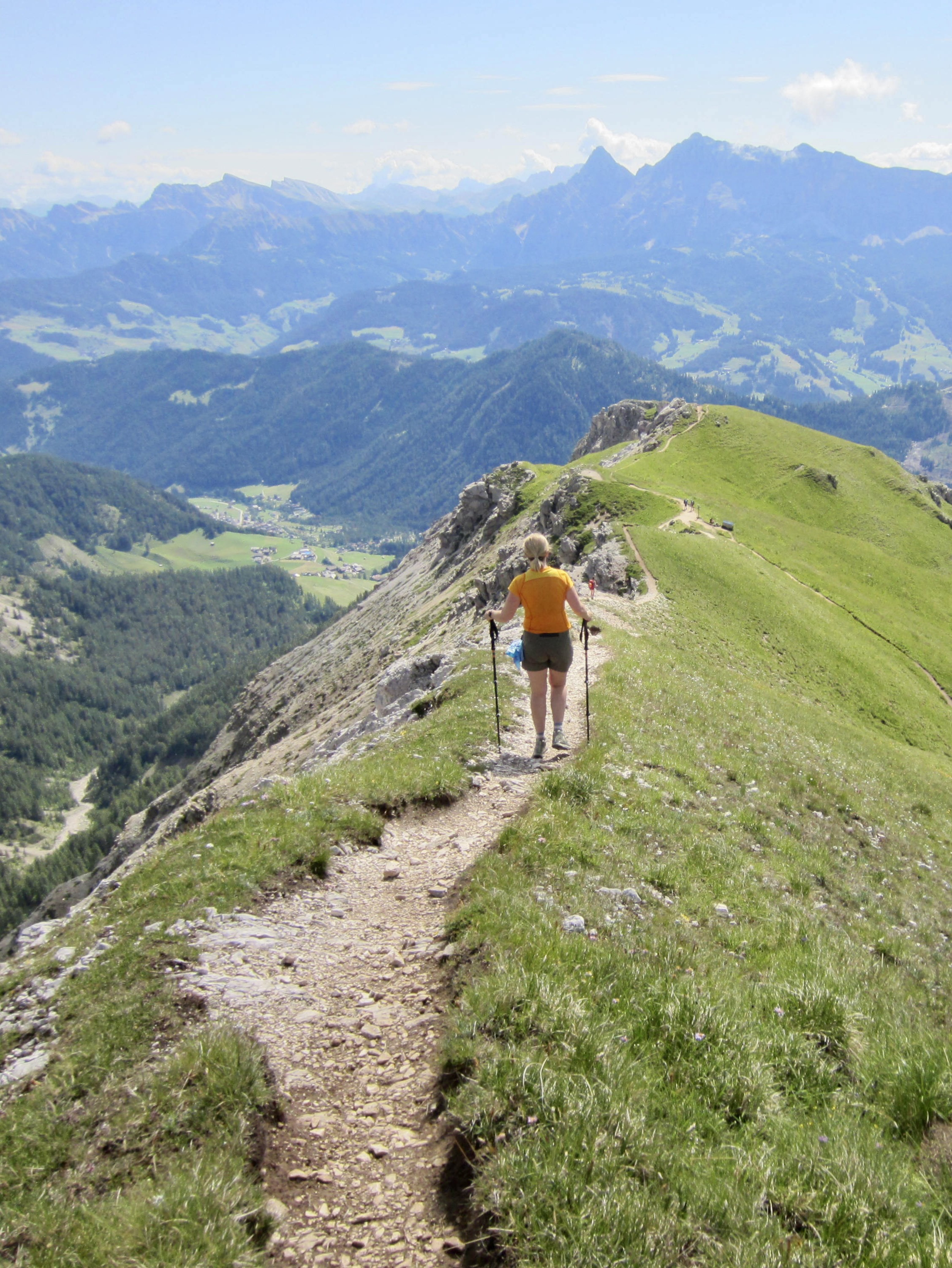
We located the AV2 trailhead and headed out. At the first junction, Brooke continued uphill on AV2 toward the Plose Hut, while Eileen and I branched off on a lower variant trail. A cluster of jagged peaks in the distance gave us a hint of things to come over the next two weeks, adding a bit of spring to our steps.
As we worked through the confusing maze of trails that crisscross this wintertime ski resort, the sky grew darker and the air grew colder. We soon heard thunder, then felt a few raindrops, then got doused by steady rain. The Dolomites wasted no time in affirming their reputation for regular afternoon thunderstorms! Upon coming to a small building, we stopped under the eaves to eat lunch. Brooke arrived moments later, having had an equally confusing experience in the ski area.

After lunch, we walked a paved road for a mile and then got back on a trail leading to Forcella Putia. (The word forcella translates to fork but is routinely used to designate any high mountain pass with a trail junction.)
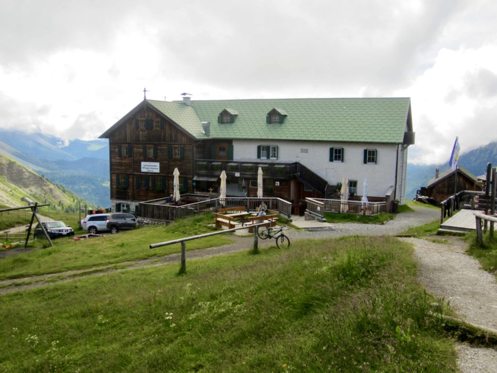
Eileen and Brooke dropped their rucksacks at Forcella Putia and scurried off to do a via ferrata ascent of Putia/Peitlerkofel, the highest peak in this mountain group. Sadly for me, I was suffering with a badly swollen knee and was relegated to being a bench warmer—at least until a cold fog prompted me to move on. The pleasant trail led me through strikingly green meadows and down to Schluter/Genova Hut, our destination for today.
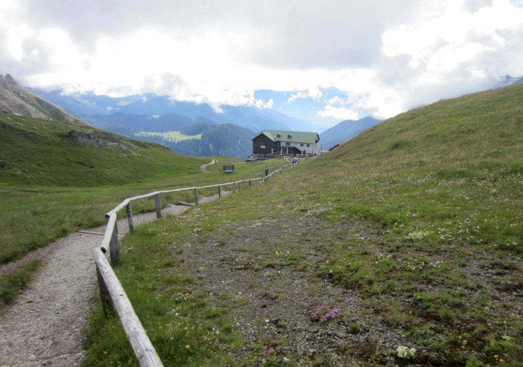
Eileen and Brooke arrived at the hut a couple hours later, just in time for dinner. Although this was not the first mountain hut any of us had ever stayed at, it was our first night in a fully catered Alpine hut, and we thoroughly enjoyed the experience of being served a tasty, three-course dinner—with wine, no less! Being a vehicle-accessible hut, Schluter/Genova offers better meals than most of the remote mountain huts and, as we later learned, is a favorite among Dolomite trekkers.
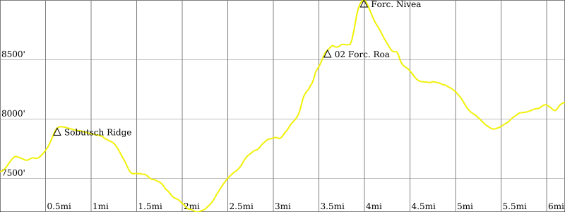
Day 2: Schluter/Genova Hut to Puez Hut
Approximate Stats (excluding sidetrips): 8.1 hours elapsed; 6.2 miles / 10.0 km traveled; 2400 feet / 730 meters gained; 1850 feet / 560 meters lost.
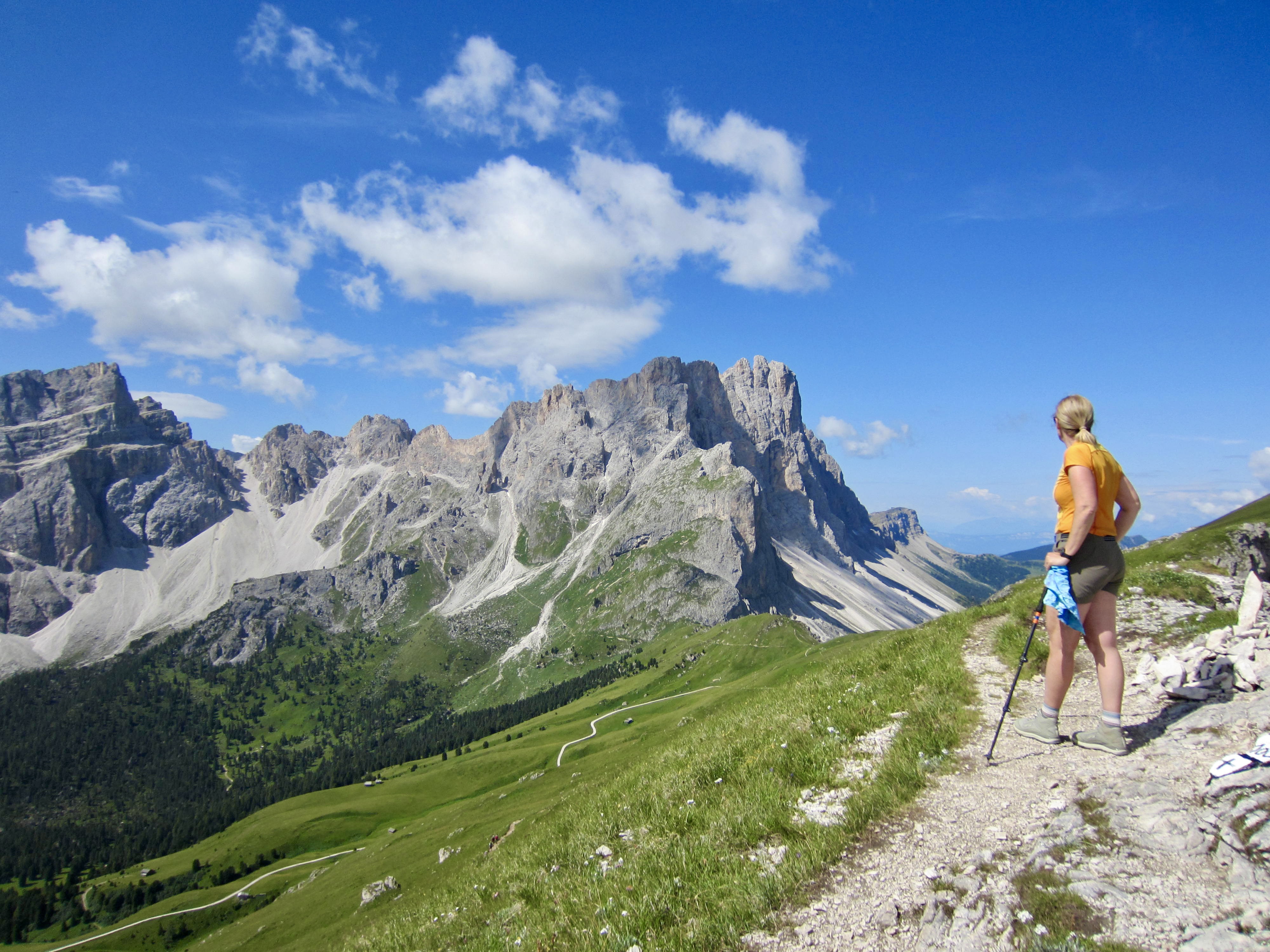
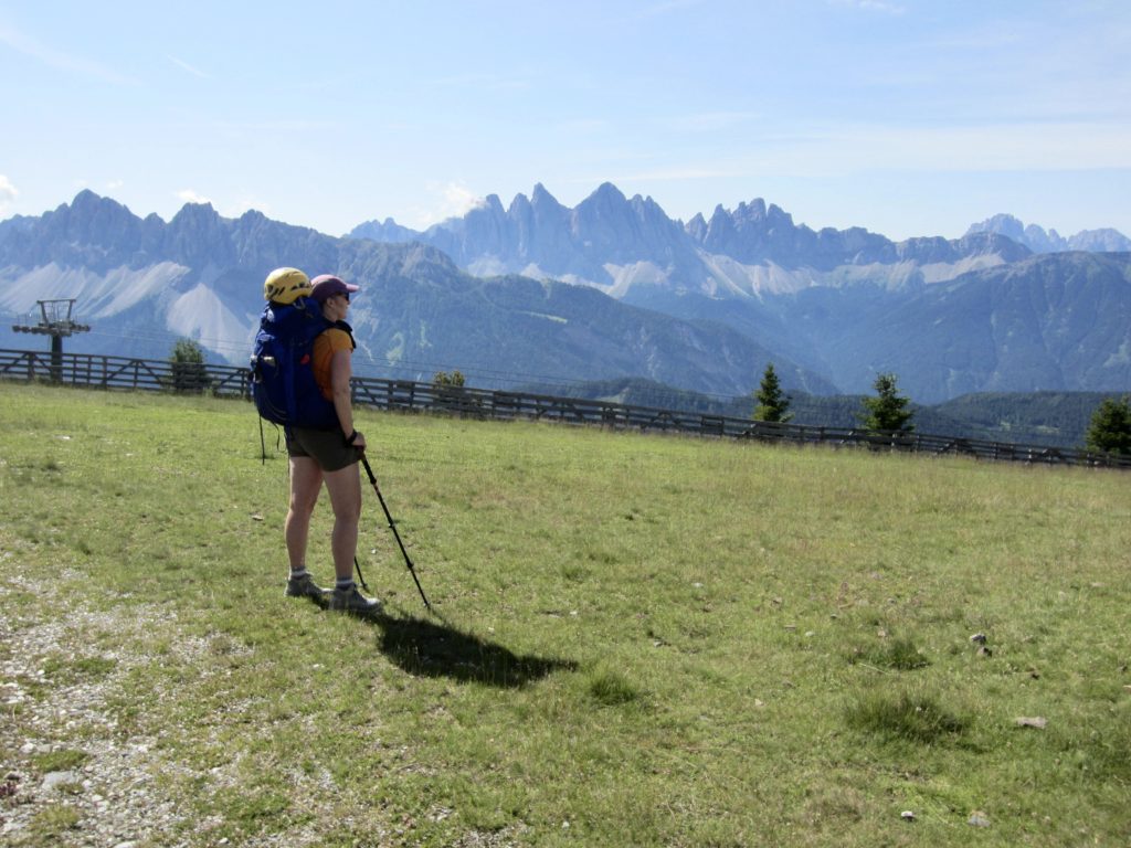
We began our day with a short sidetrip up Zendleser Kofel for views of the surrounding mountains. Once underway with rucksacks, we took another short sidetrip up nearby Sobutsch for more views. Forchetta and Sass Rigais were especially impressive from here.

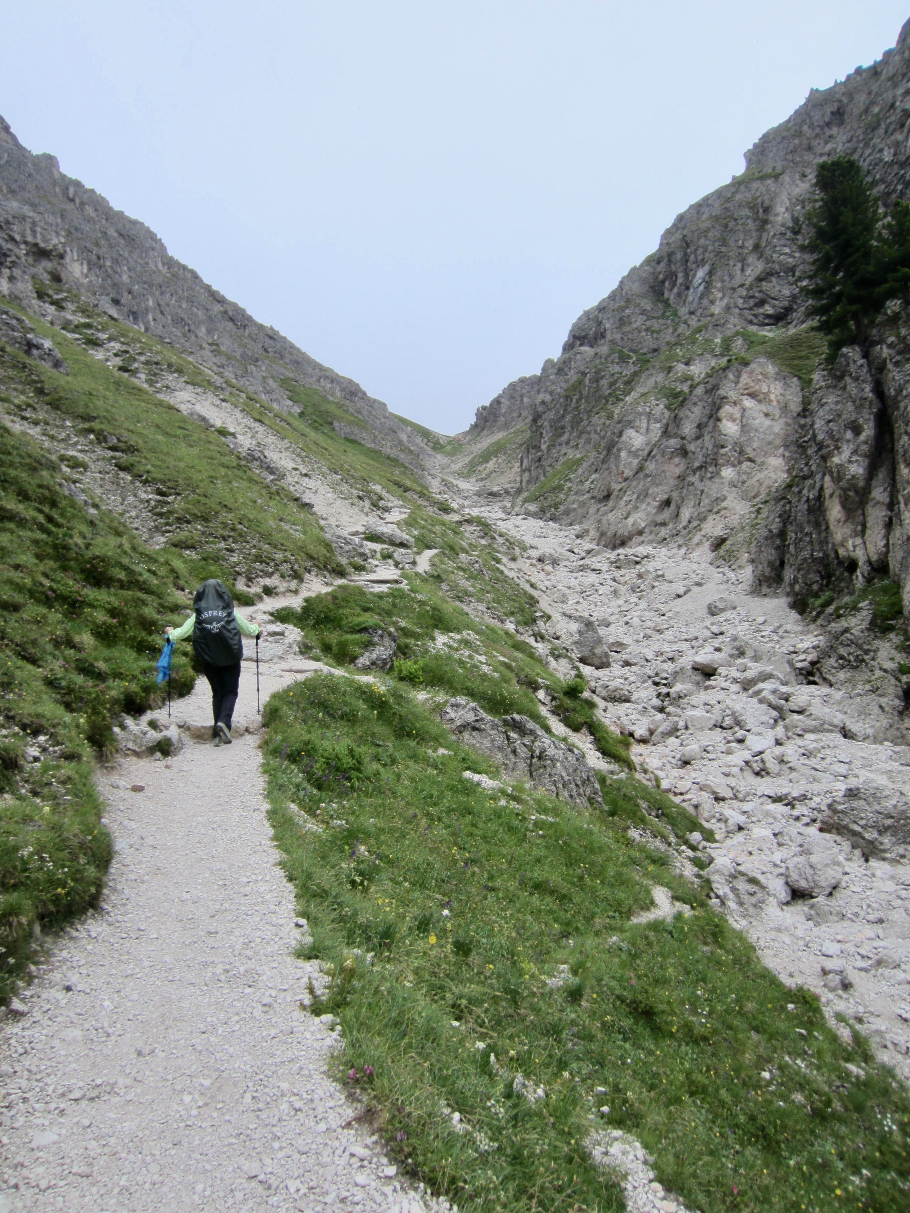
The rest of our morning involved a long, level traverse around the head of a large basin, followed by a steep ascent of a scree chute ending at Forcella Roa. We stopped here to eat lunch and assess our options.
From Forcella Roa, AV2 drops into a valley and makes an end-run around a rocky spur ridge. A much shorter but steeper variation ascends directly to Forcella Nivea—a broad saddle below Piz Duleda—and then descends to reconnect with AV2. We chose the direct variation, and it turned out to have a fun, easy (Grade 1) via ferrata section with several cables and one ladder.
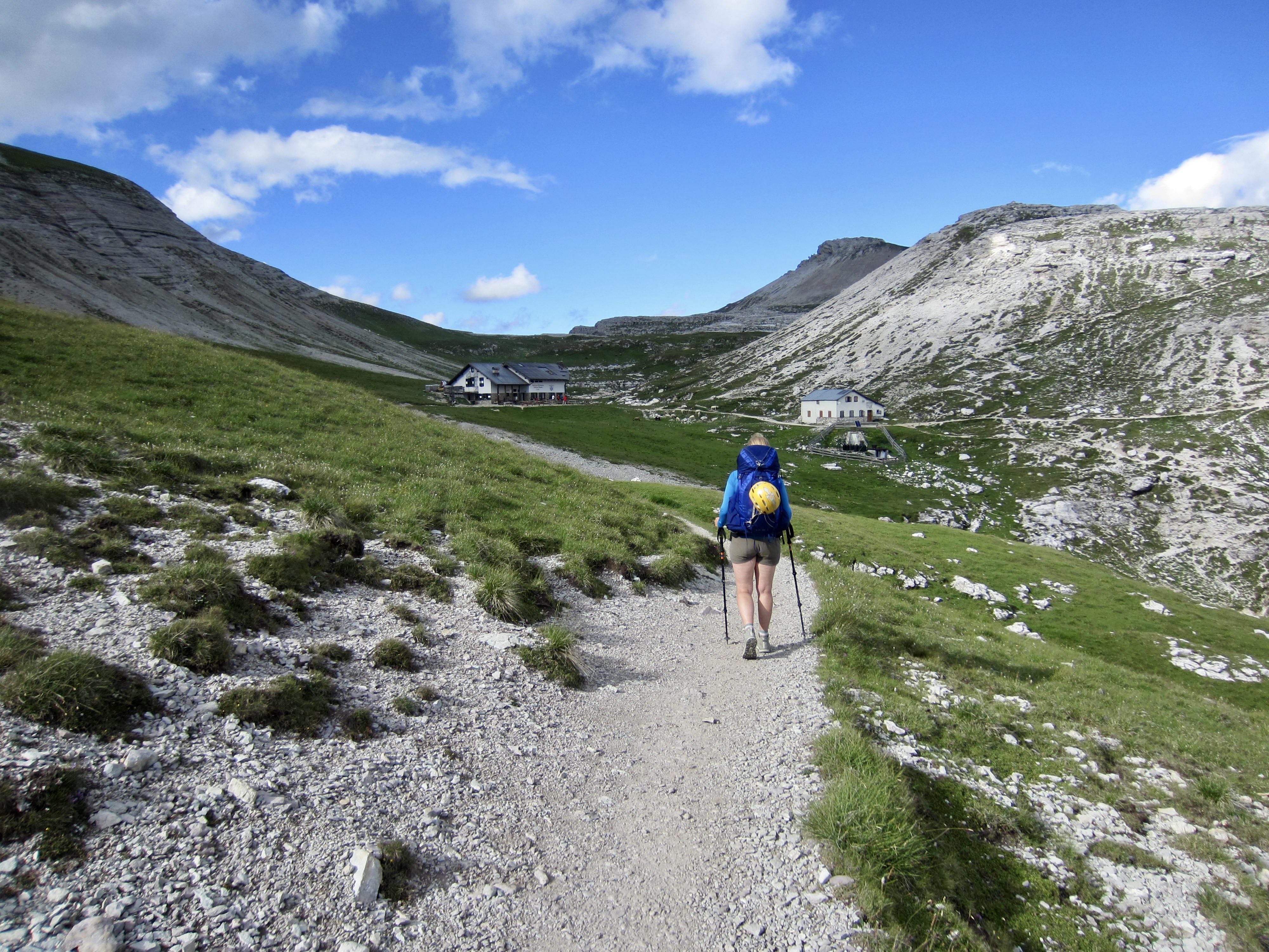
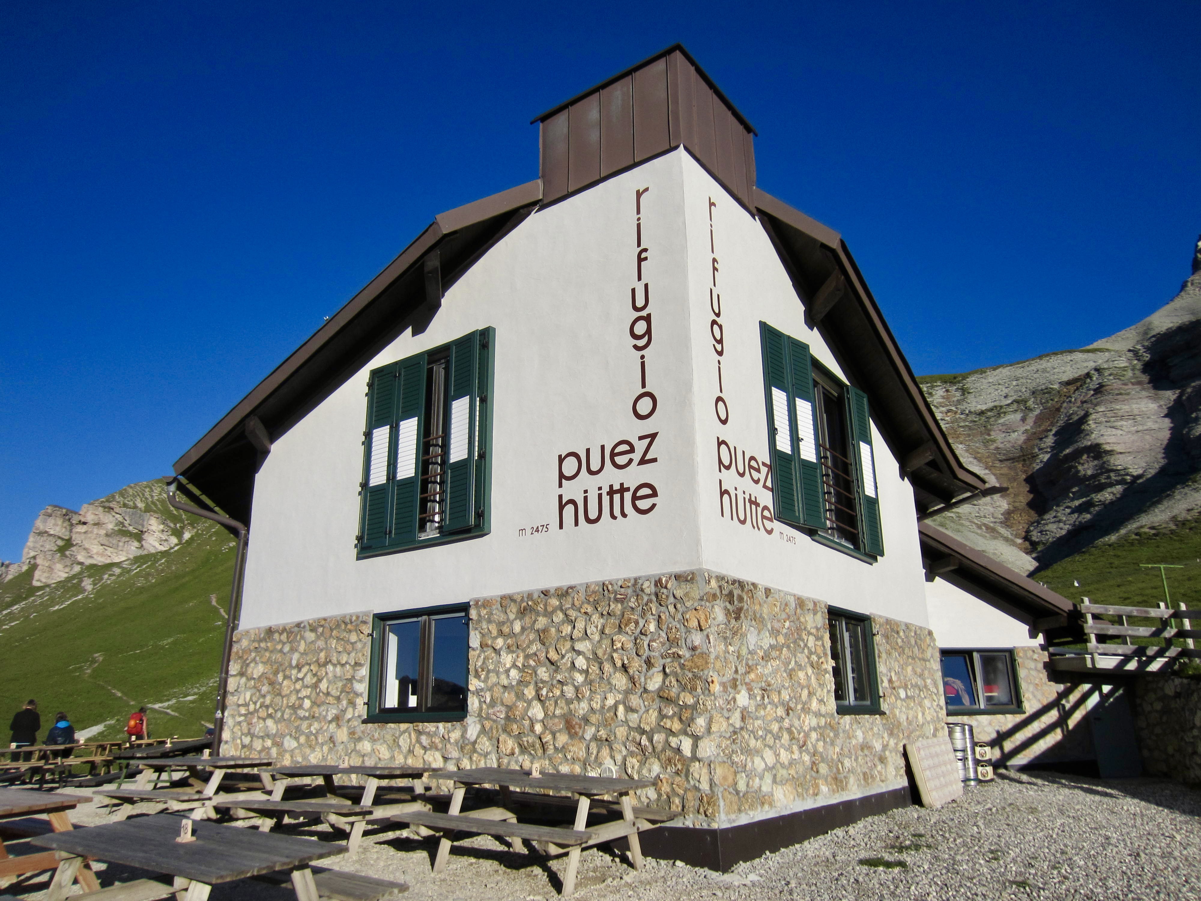
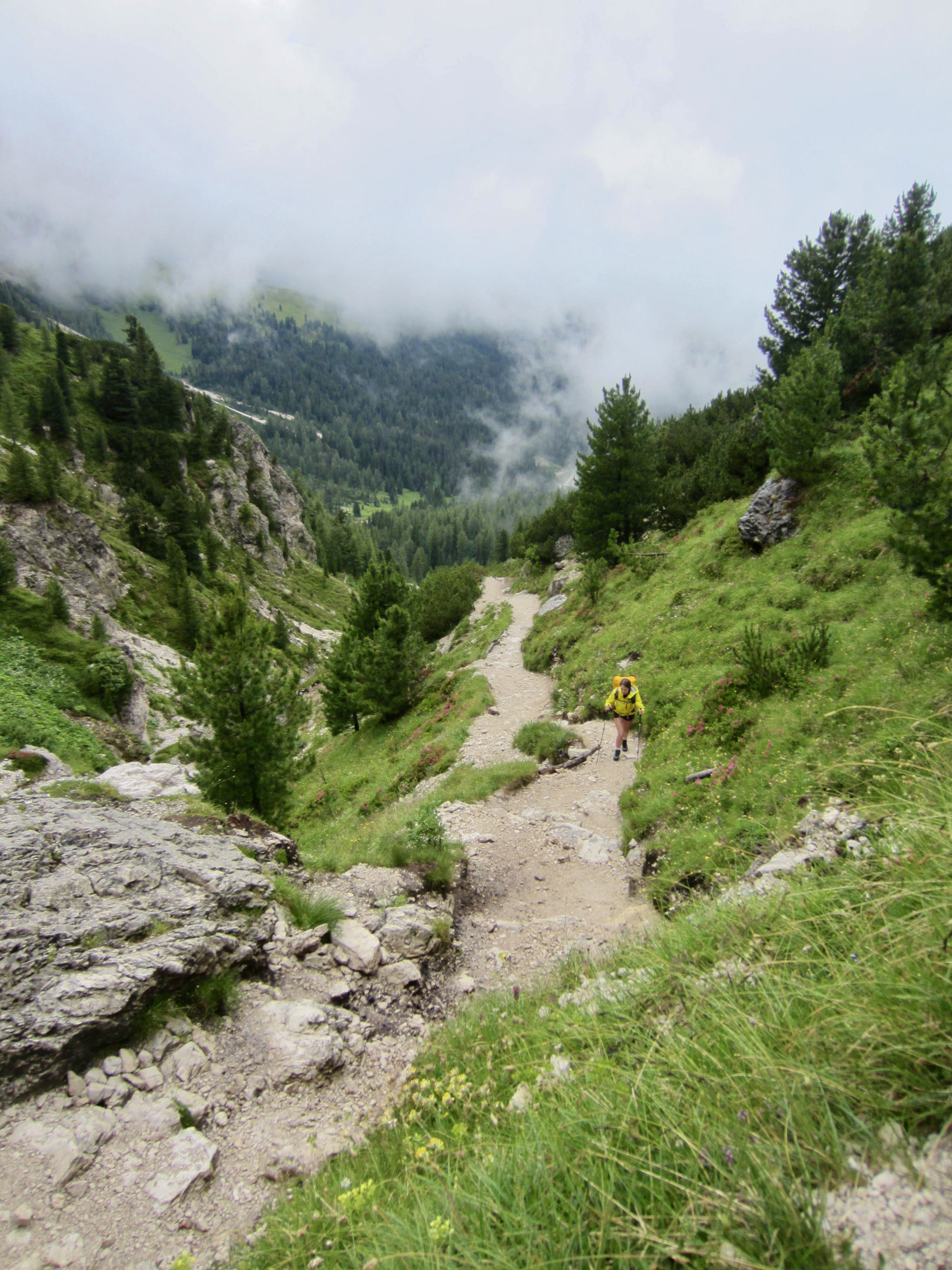
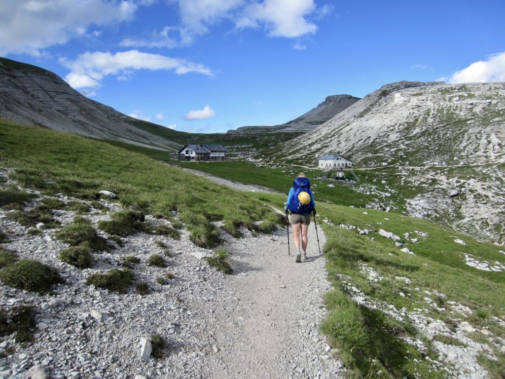
We crossed over 9000-foot Forcella Nivea and began descending through sheep-grazing meadows, eventually intersecting AV2. At 6:00pm, we arrived at Puez Hut, which sits in a gentle draw above Pisuli Canyon.

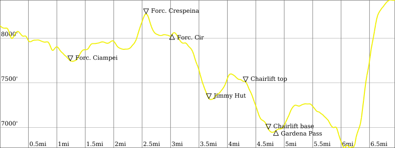
Day 3: Puez Hut to Pisciadu Hut
Approximate Stats (excluding sidetrips & chairlift ride): 11.7 hours elapsed; 6.5 miles / 10.5 km traveled; 3100 feet / 945 meters gained; 2150 feet / 655 meters lost.
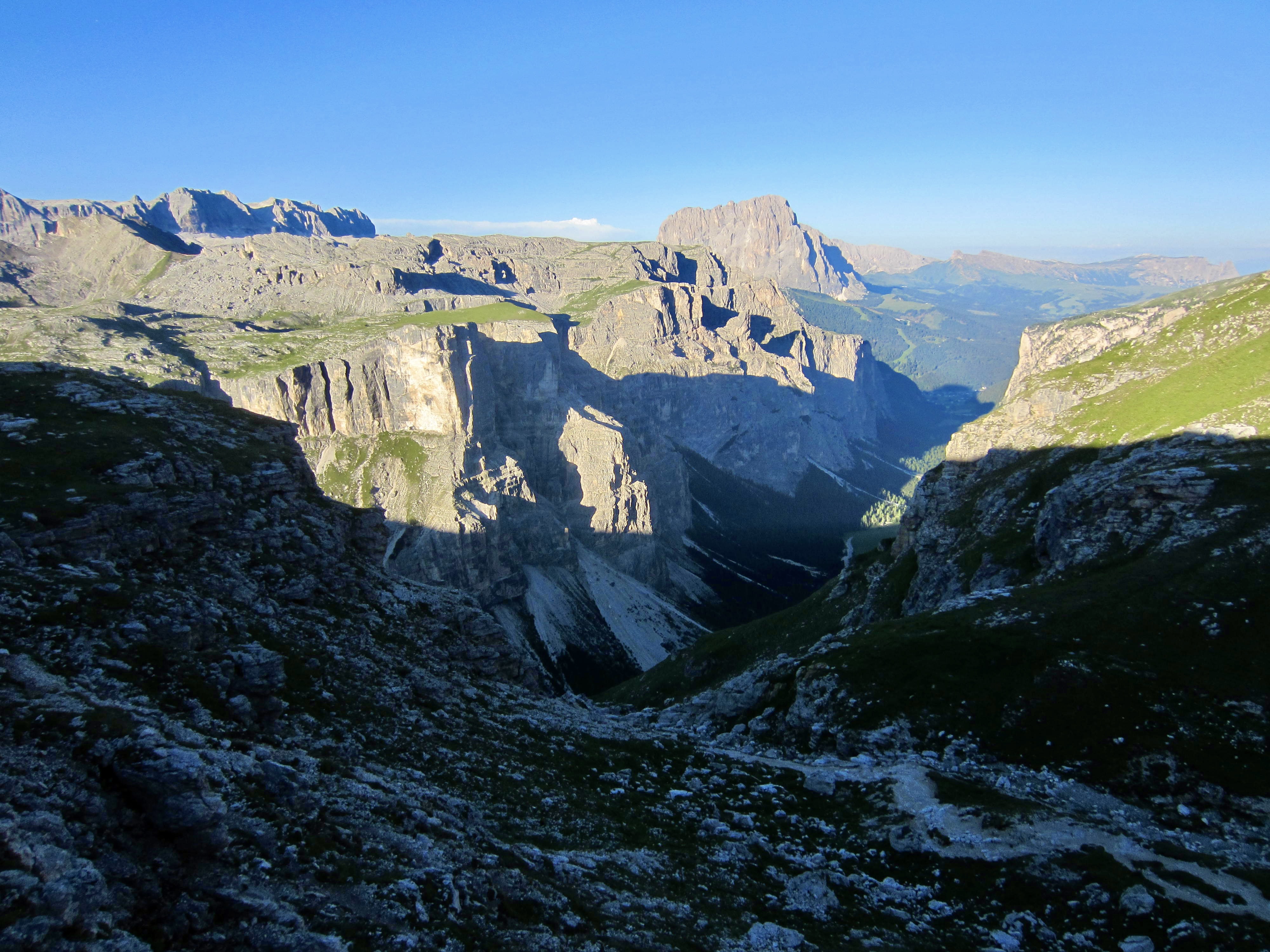
Knowing that today would be filled with several via ferratas, we left Puez Hut before breakfast was served. The kitchen staff had graciously given us “sack breakfasts” with juice, apples, rolls, and granola bars to eat on the trail. Eileen and I followed AV2 around the head of Pisuli Canyon, across a meadowy plateau, and up to 8300-foot Crespeina Pass. Brooke took an alternative high trail over the summit of Sas Ciampac and met us near the pass.


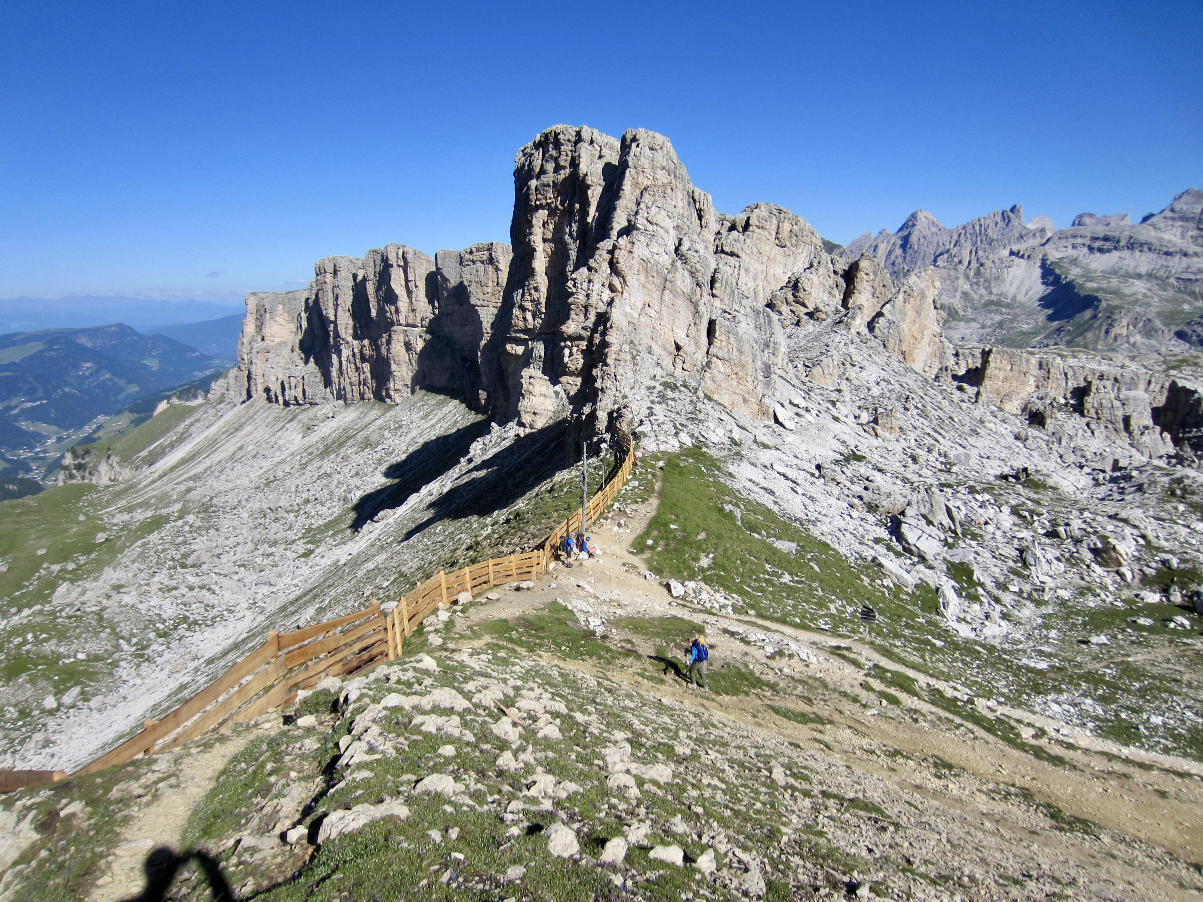
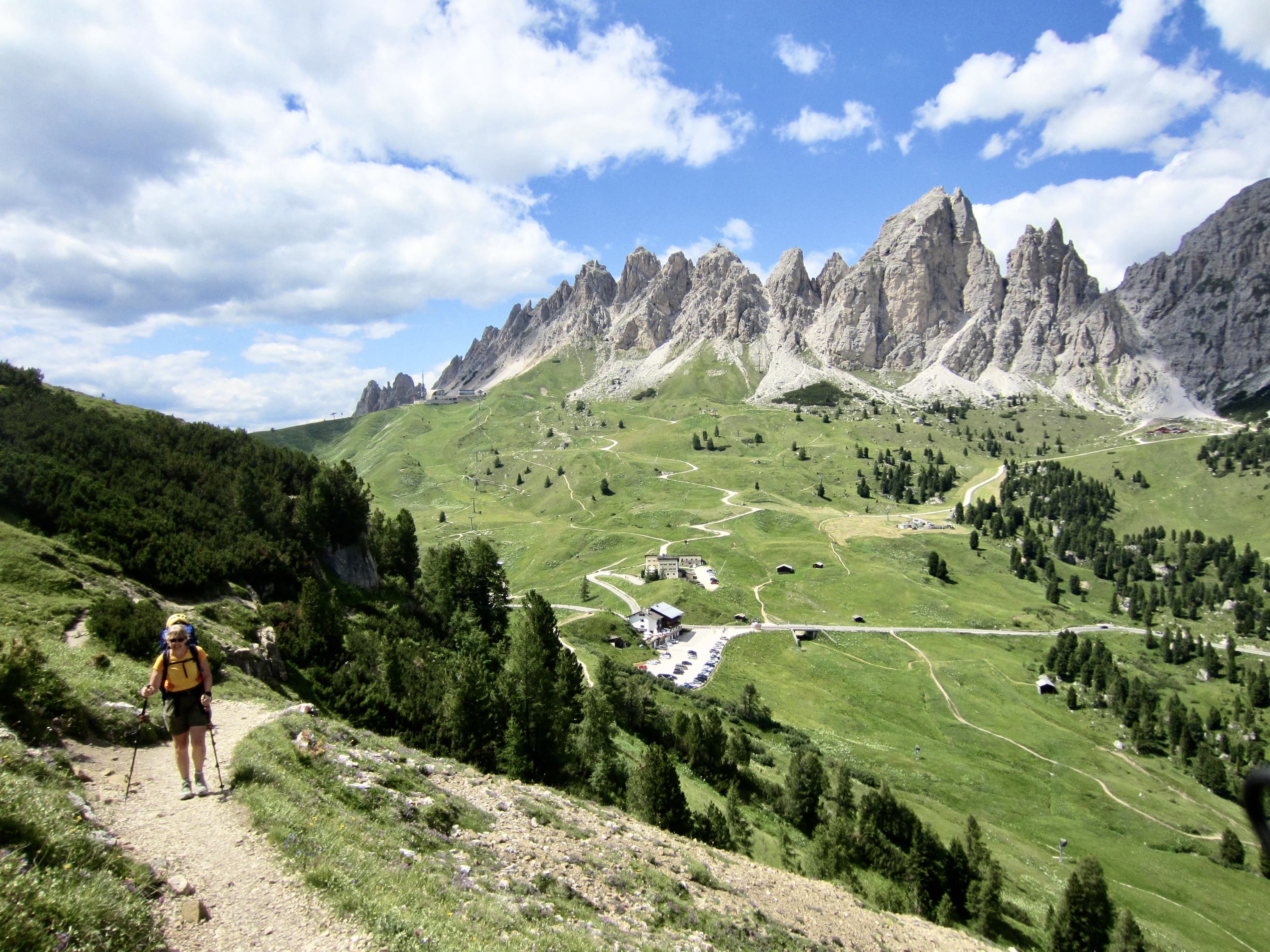
A short traverse brought us to Forcella Cir and an unexpected crowd of tourists with tiny rucksacks. We were startled to suddenly encounter so many people after being nearly alone for the past day and a half! It turned out that we were only a mile from Gardena Pass—a major recreation area with numerous gondolas, chairlifts, and restaurants.

I was still on injured-reserve, so I stayed at Forcella Cir for an extra hour while Eileen and Brooke hurried off to climb two via ferrata routes on Gran Cir and Pitla Cir. By the time I left, over a hundred hikers had come up to the pass! A steep, convoluted trail led me down to civilization for a delicious lunch at Jimmy Hut and a delectable affogato at Dantercepies Hut.
Eileen and Brooke arrived from their successful via ferrata climbs at 1:30pm, giving one a big thumbs-up and the other a so-so. Brooke stayed at Dantercepies Hut for a cold brew while Eileen and I rode a chairlift down to Gardena Pass, where we regained AV2 and began an eastward traverse to the day’s main attraction: Via Ferrata Brigata Tridentina.
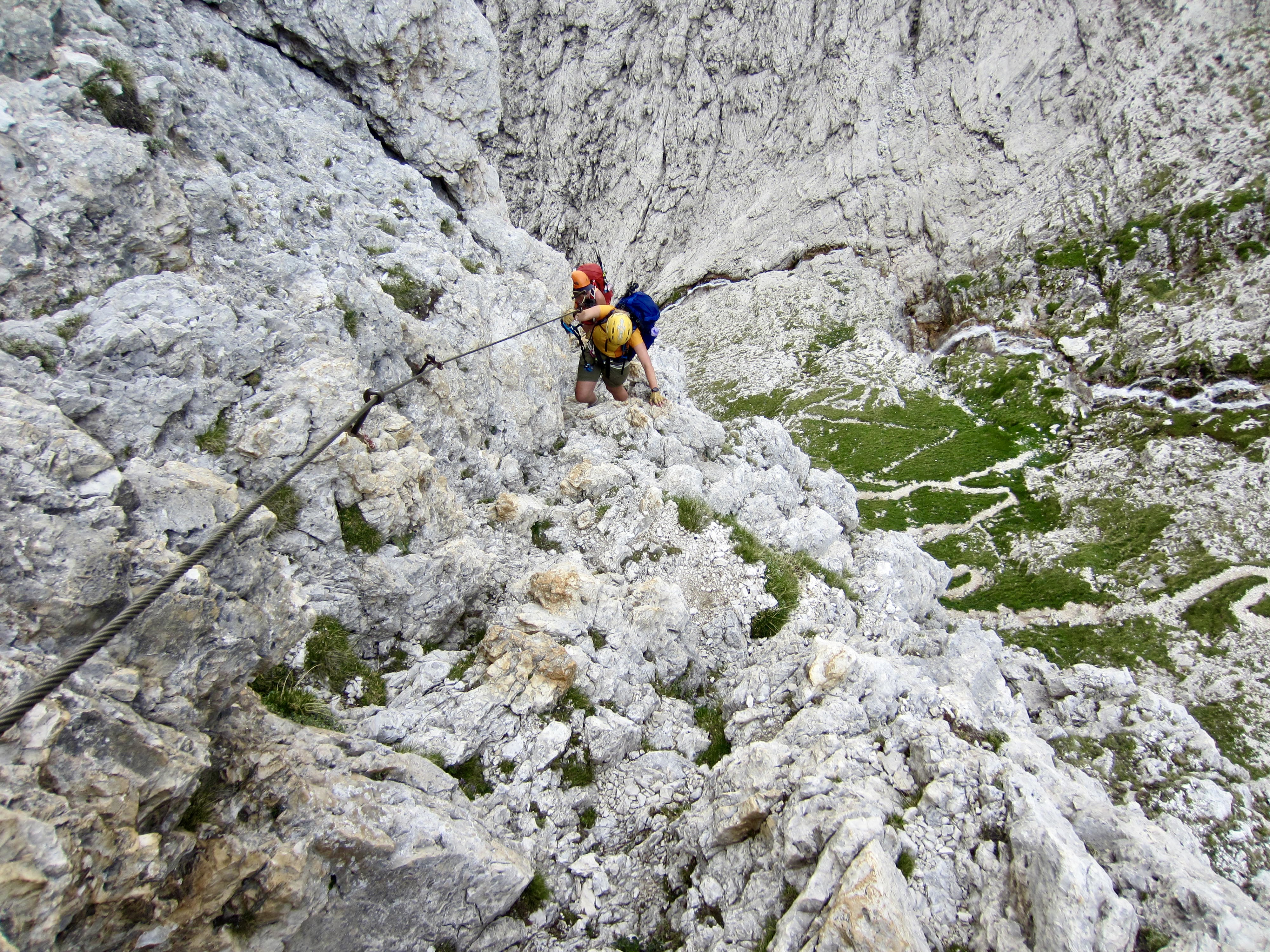
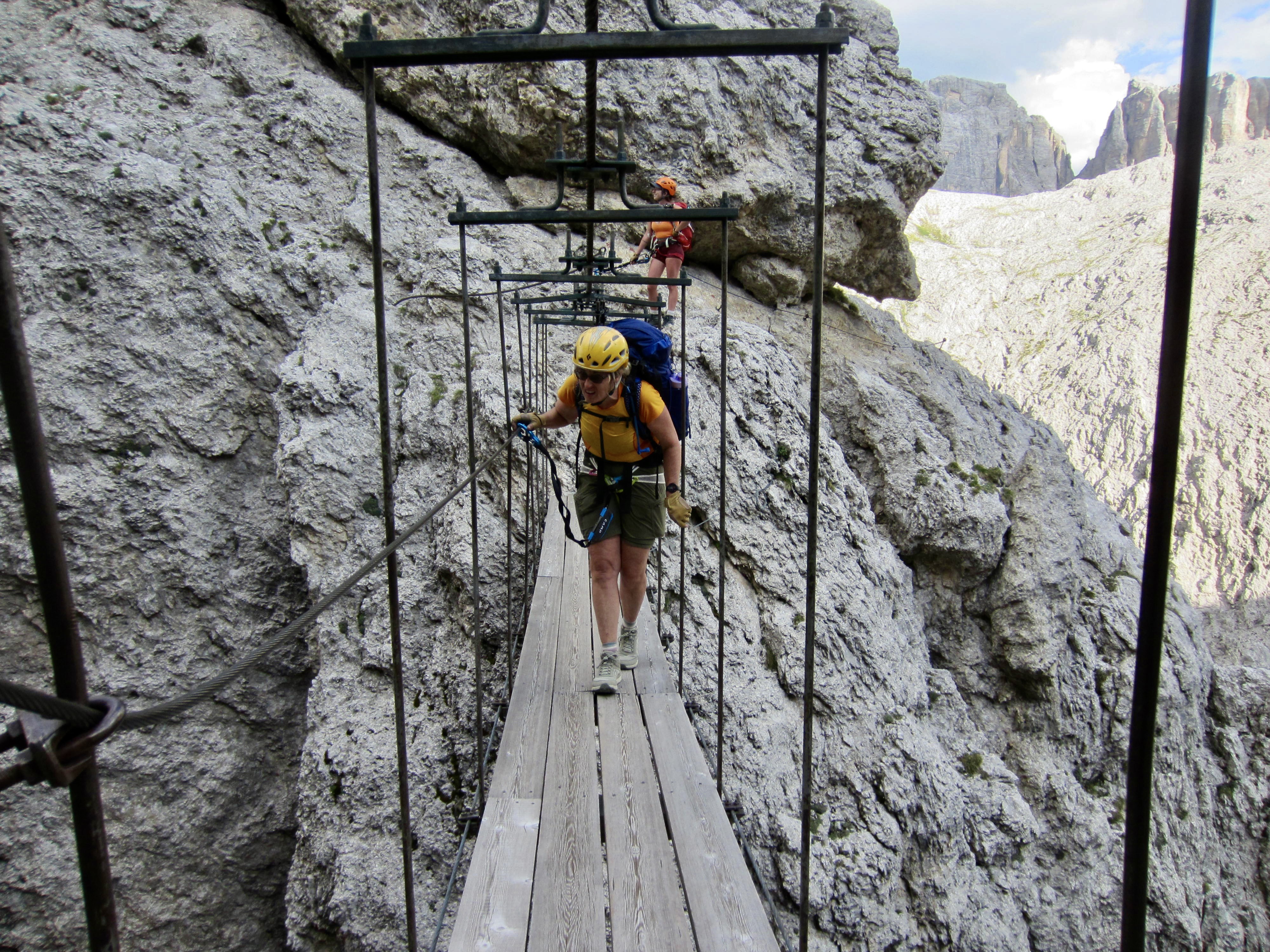
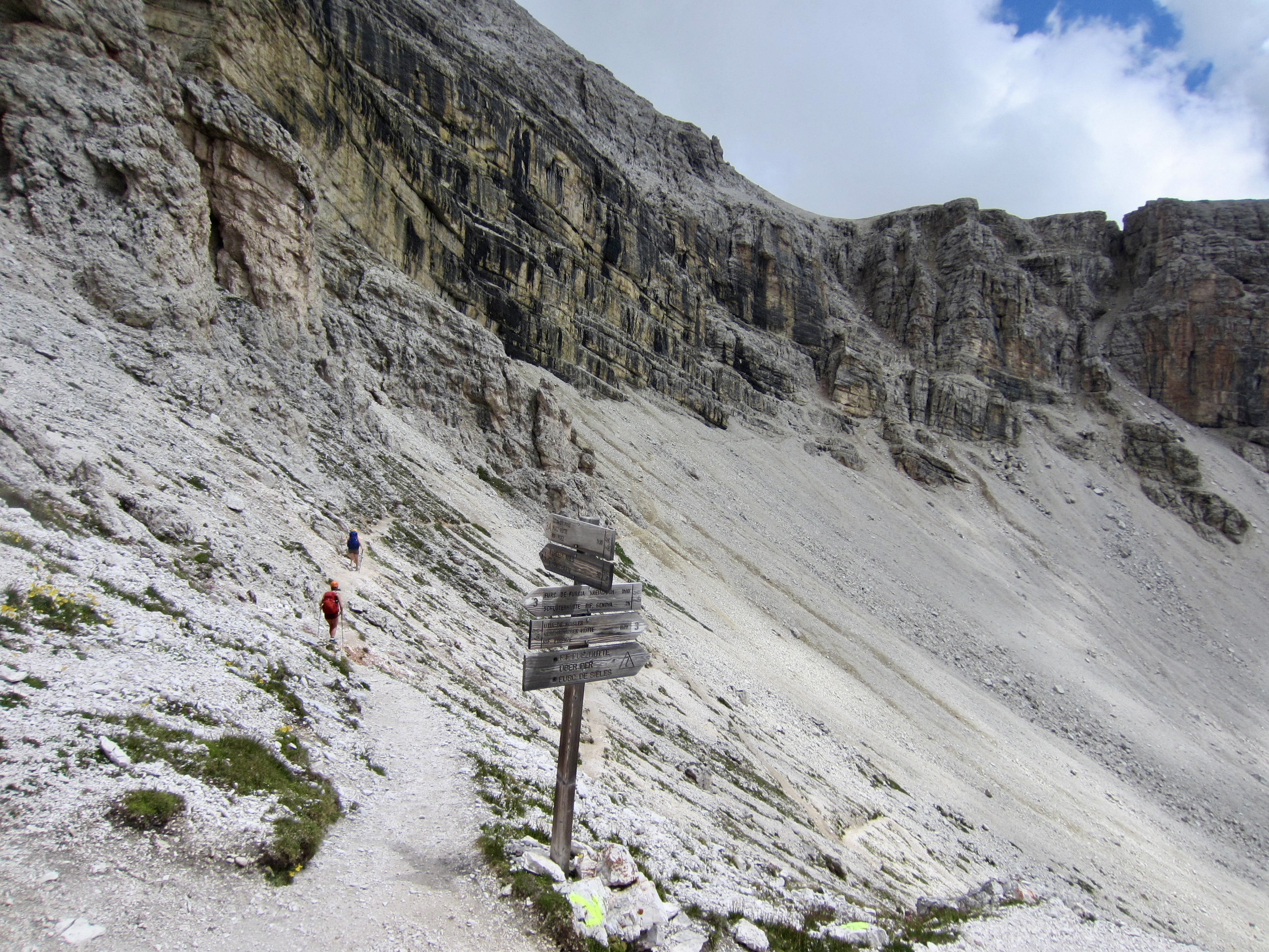
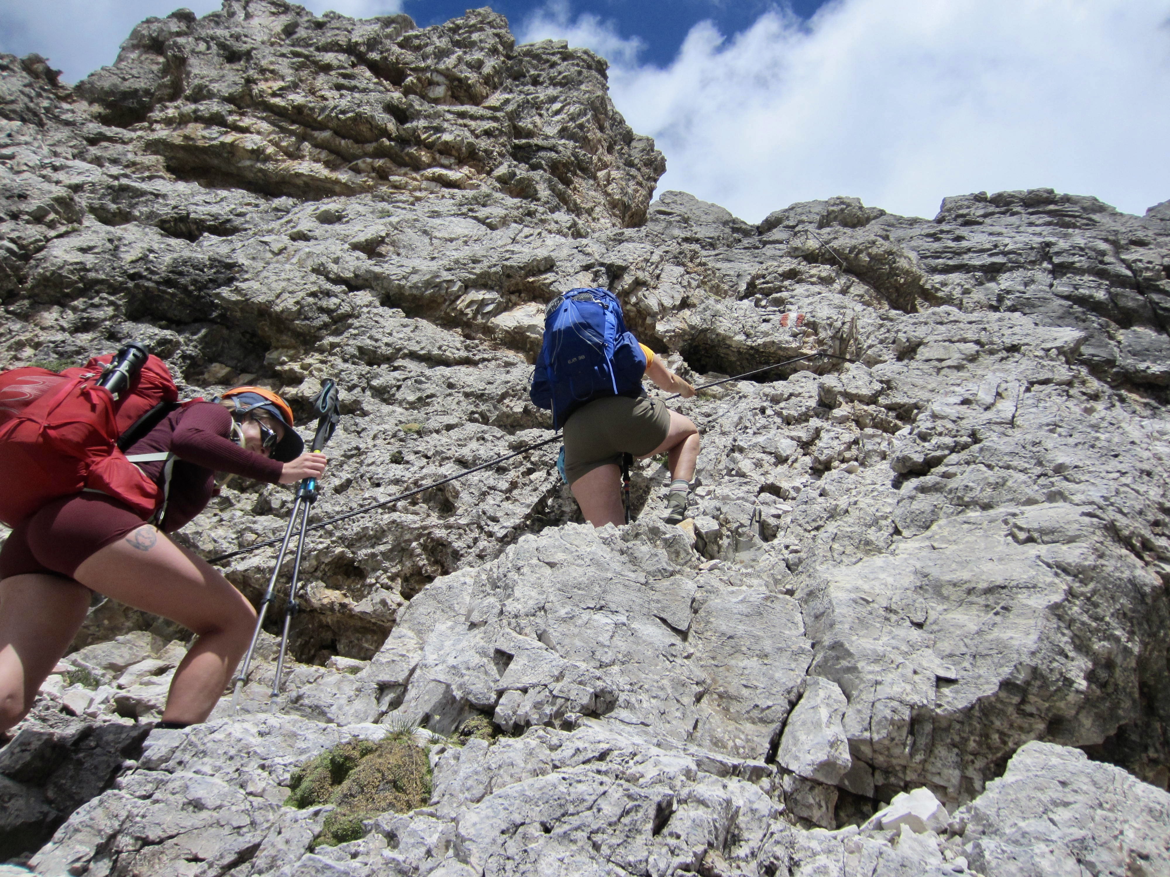
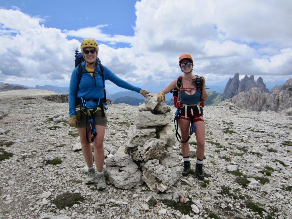
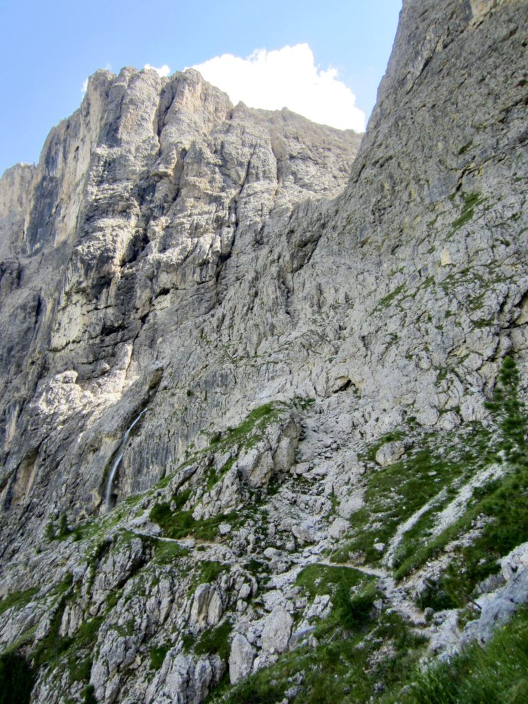
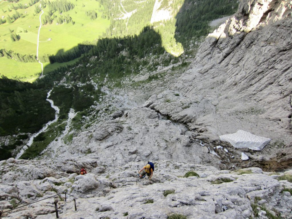
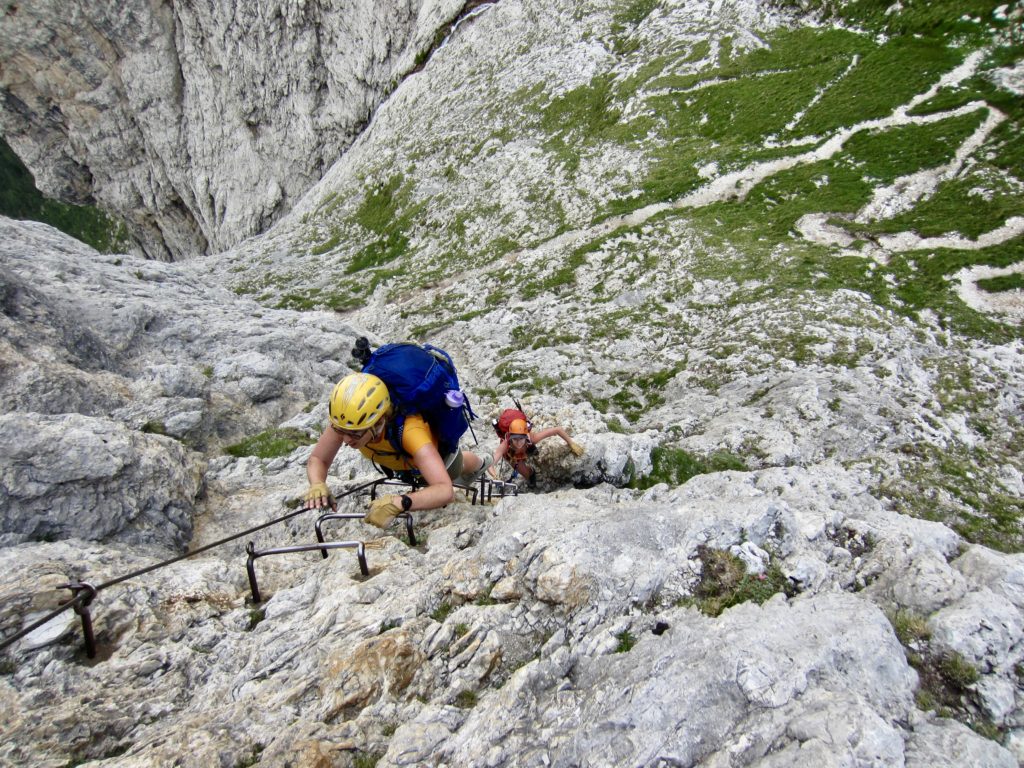
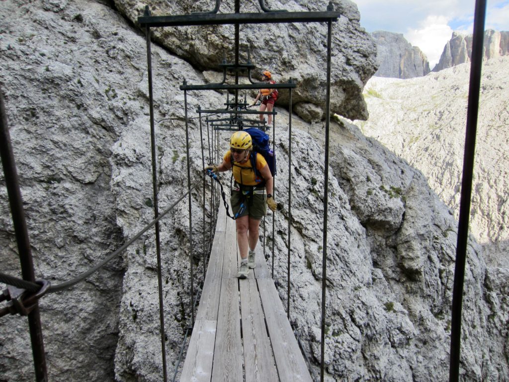
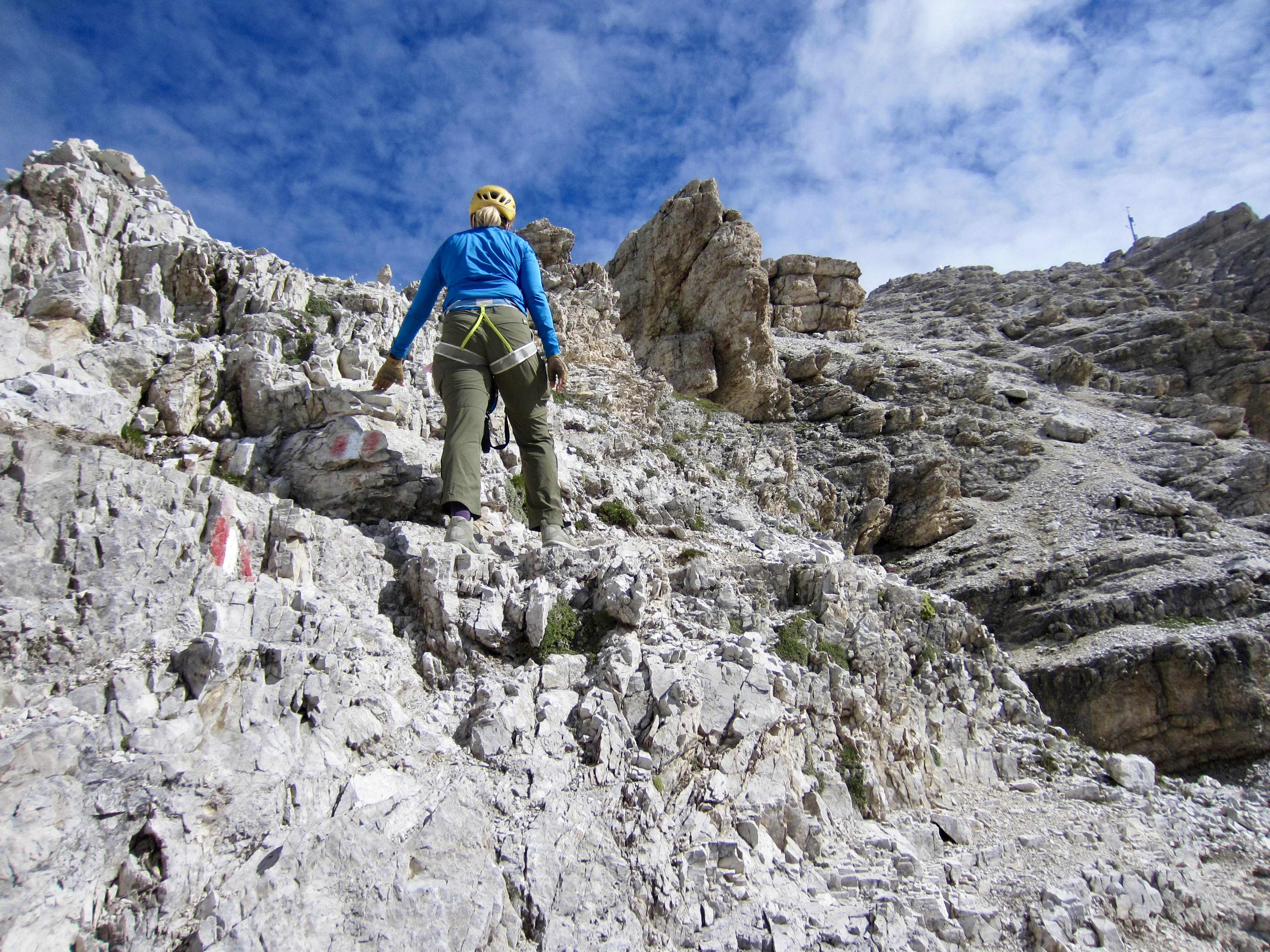
From Gardena Pass, there are two different canyons that can be taken to reach Pisciadu Hut. The standard route goes up a western canyon involving an easy (Grade 1) via ferrata. A variant route goes up an eastern canyon involving a difficult (Grade 3) via ferrata. The latter, known as Via Ferrata Brigata Tridentina, is said to be the most popular via ferrata in the entire Dolomites. We were about to find out why.
We followed an undulating trail across a rocky hillside until coming to a narrow waterfall and a metal plaque that marks the start of Via Ferrata Brigata Tridentina. The three of us donned our harnesses, lanyards, helmets, and gloves, then started up the route.
The climb was an absolute blast! It featured steep scrambling on solid dolomitic rock, with iron rungs and steel ladders on vertical faces, and even a suspension bridge across a deep chasm. For a detailed report and photos concerning this outstanding via ferrata, see my separate post here:
>>> Brigata Tridentina Via Ferrata / Klettersteig / Climb

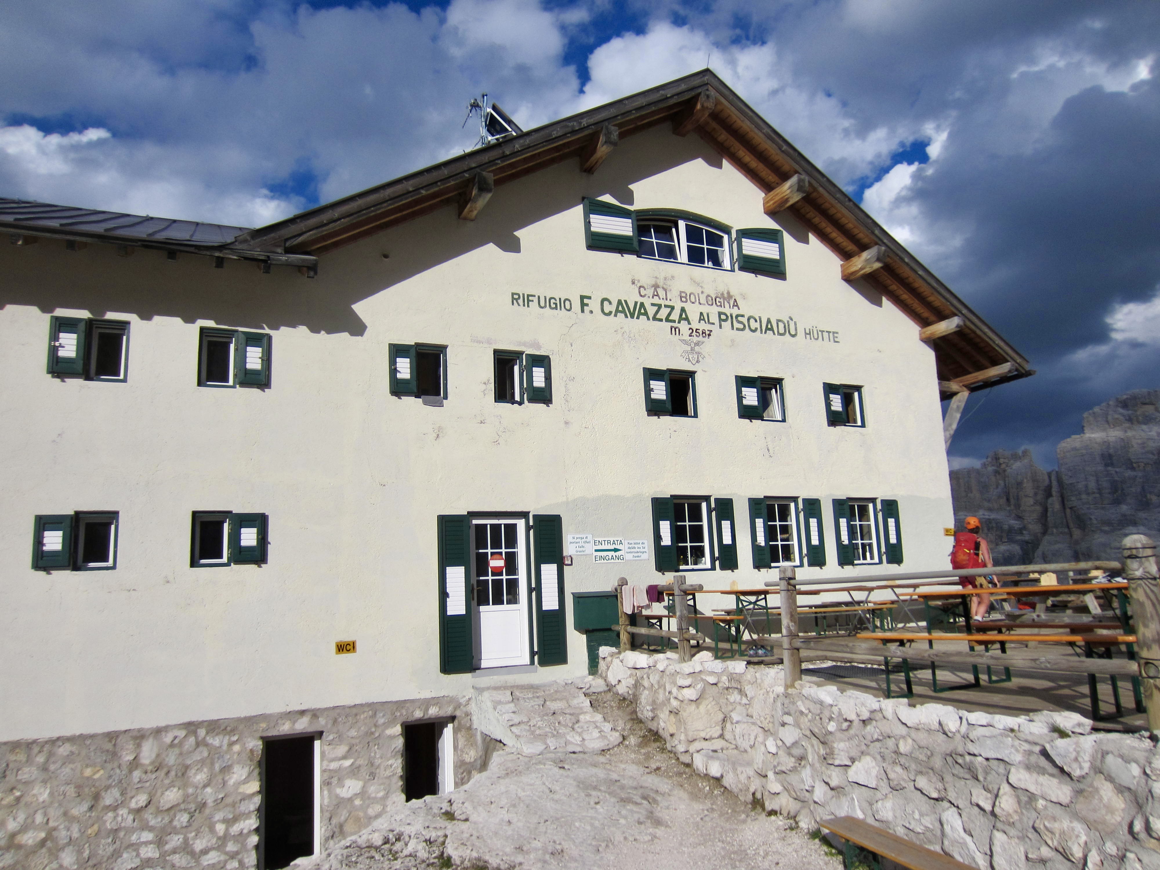
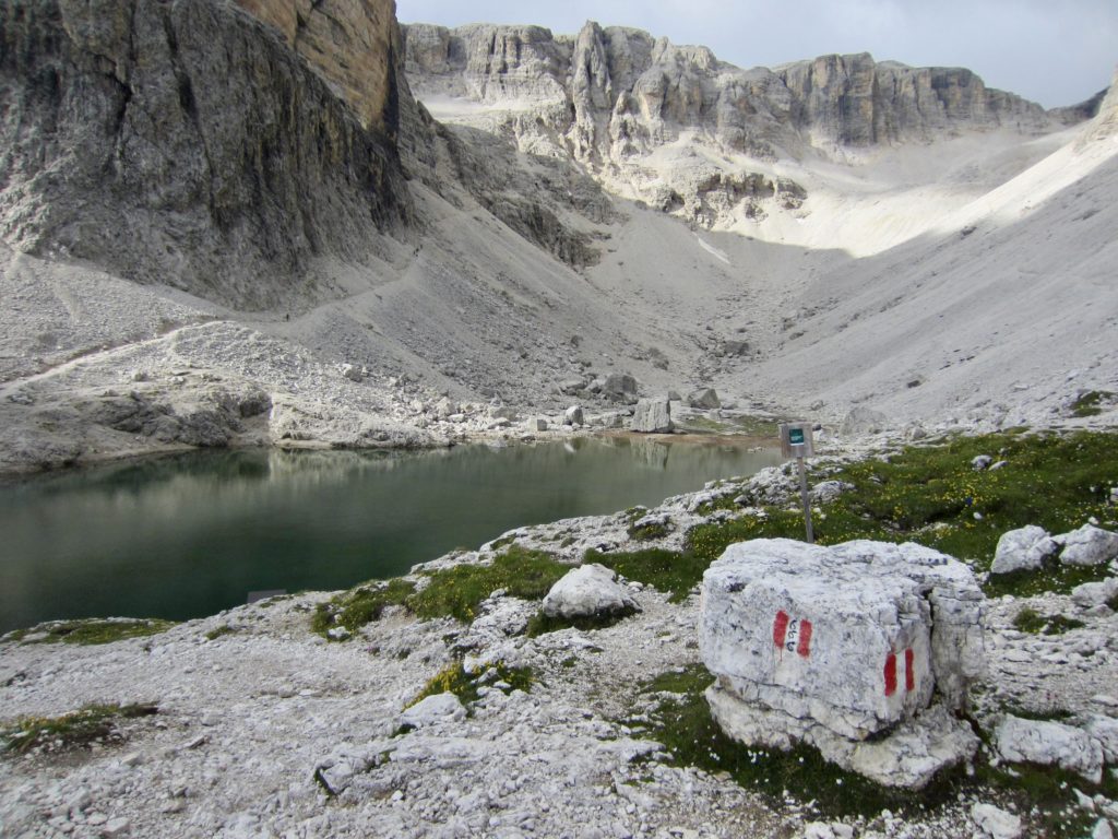
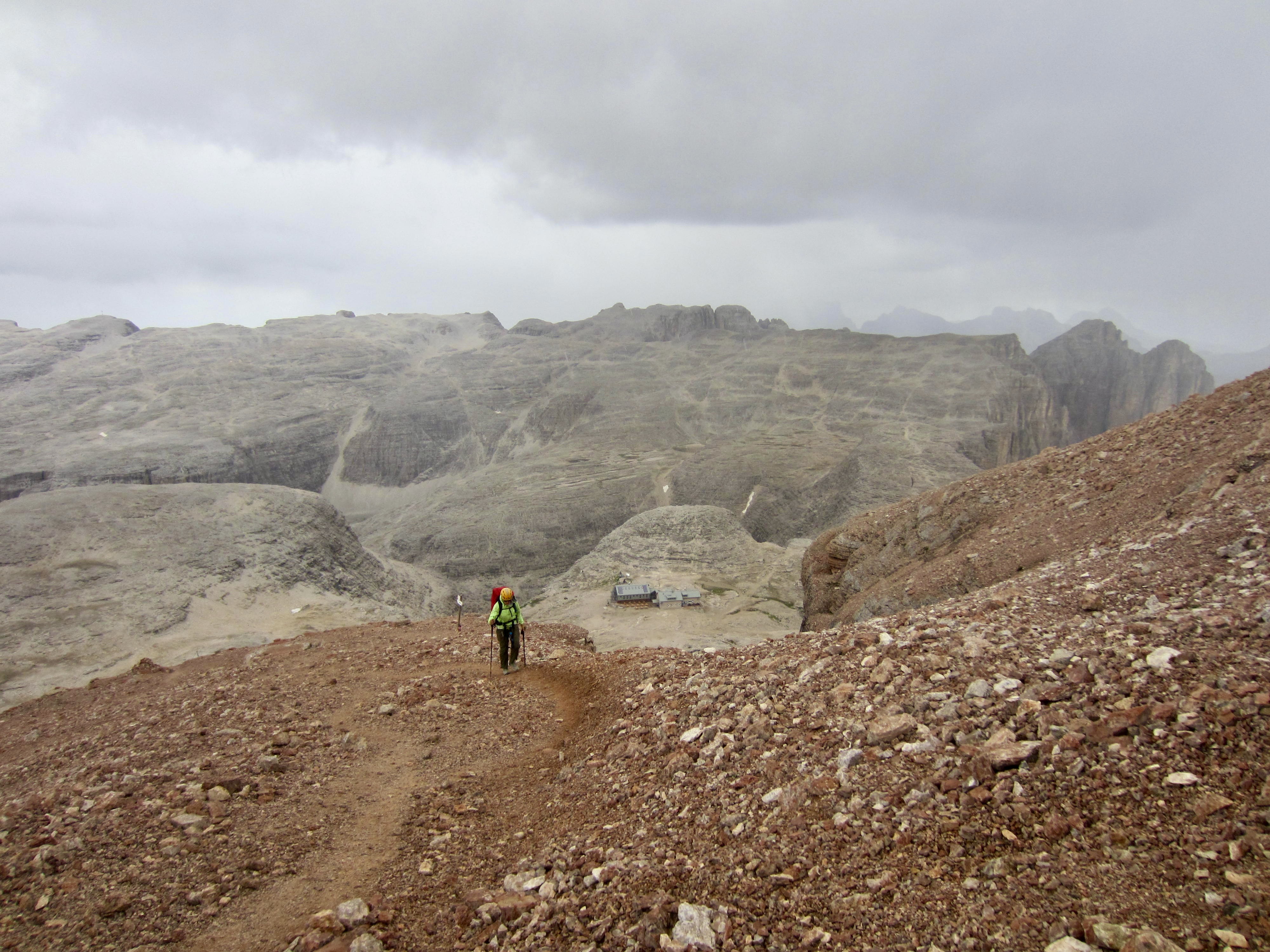
When the cabled climbing ended, a trail led us up and over to Pisciadu Hut, which is perched at the brink of a cliff overlooking both the canyon and a small lake. We arrived at 6:30pm, just in time to clean up before dinner.


Day 4: Pisciadu Hut to Fassa Piz Boe Hut
Approximate Stats (excluding sidetrips): 4.5 hours elapsed; 2.8 miles / 4.5 km traveled; 2800 feet / 855 meters gained; 950 feet / 290 meters lost.
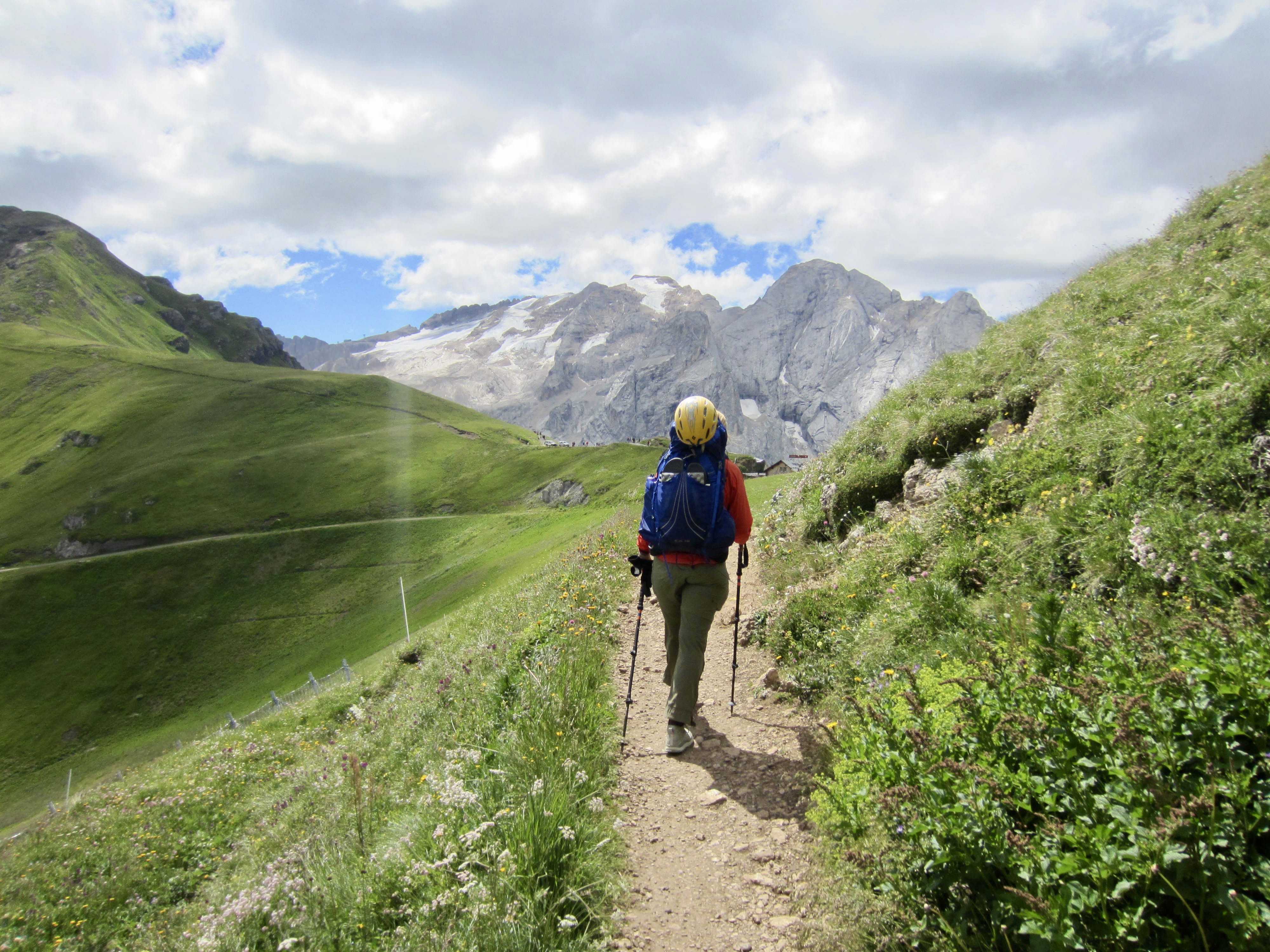
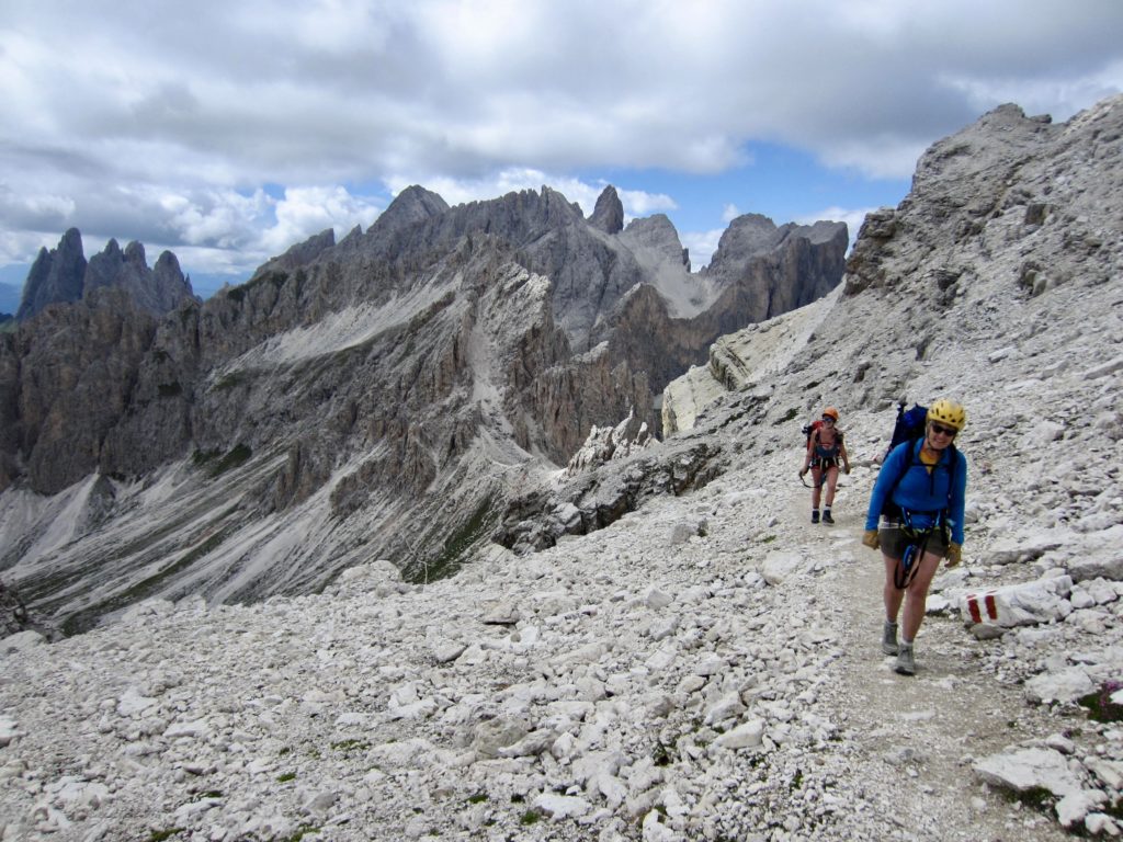
Leaving Pisciadu Hut on a cool, partly cloudy morning, we hiked around Pisciadu Lake and up through a cliff band that offered cables for extra security. This is one of many locations along AV2 that constitute a Grade 1 (easy) via ferrata. We observed several people using lanyards here, but most were simply using the cable as a handline.
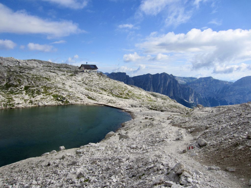
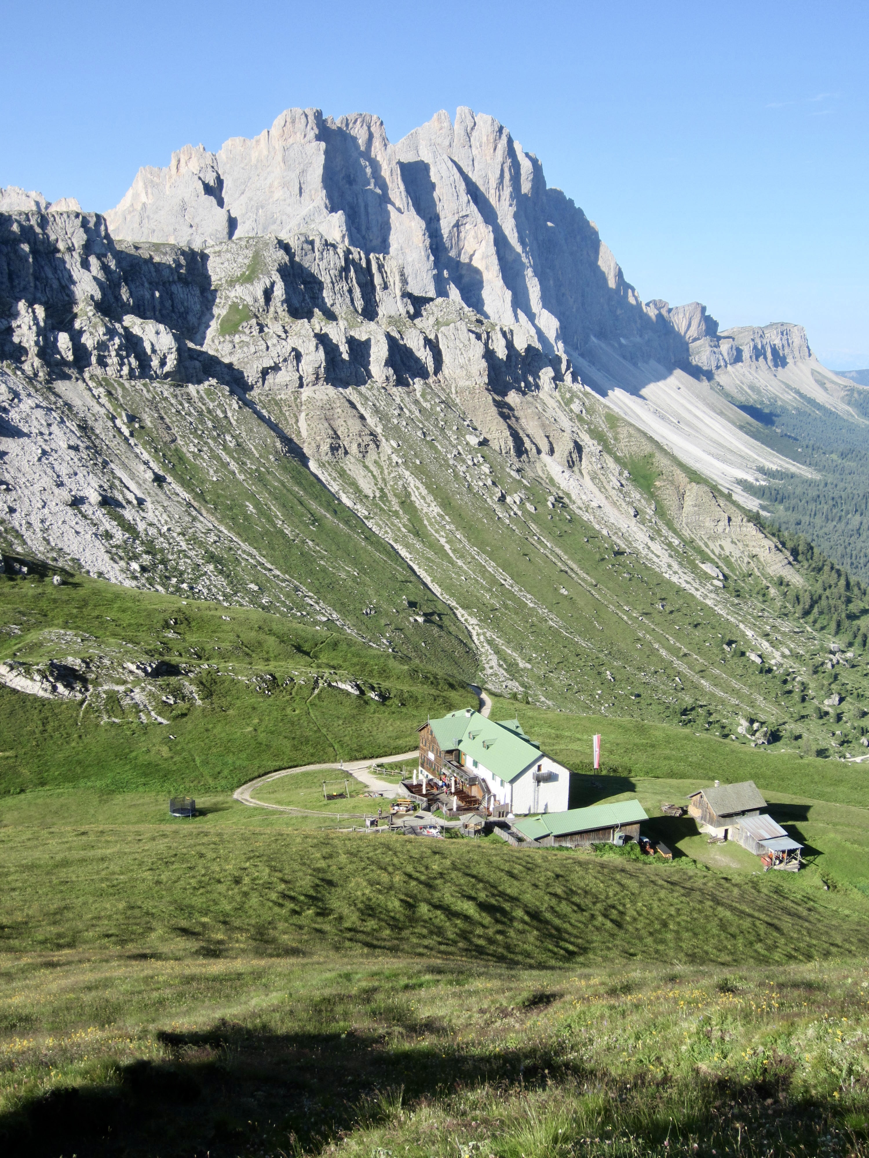
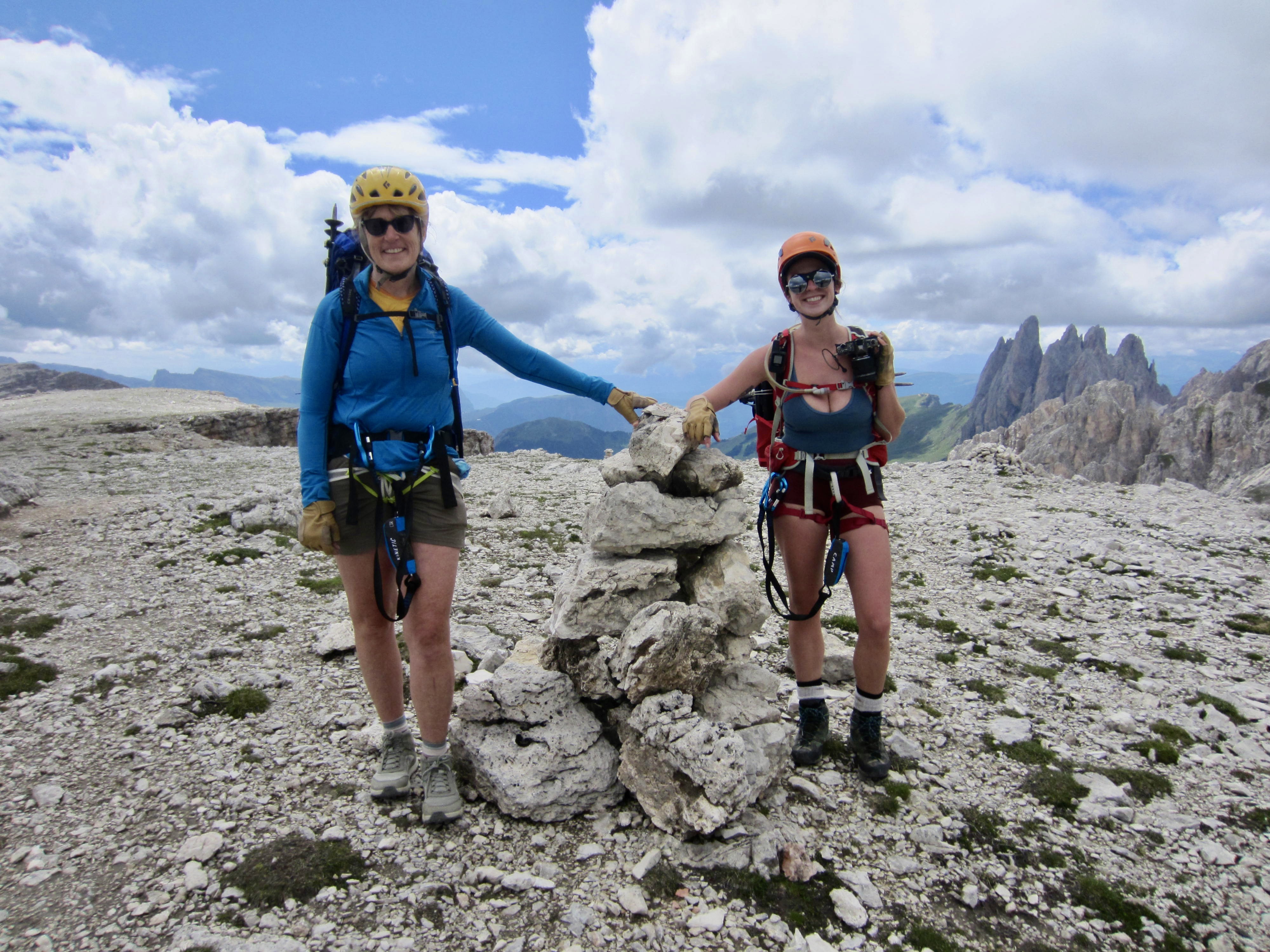
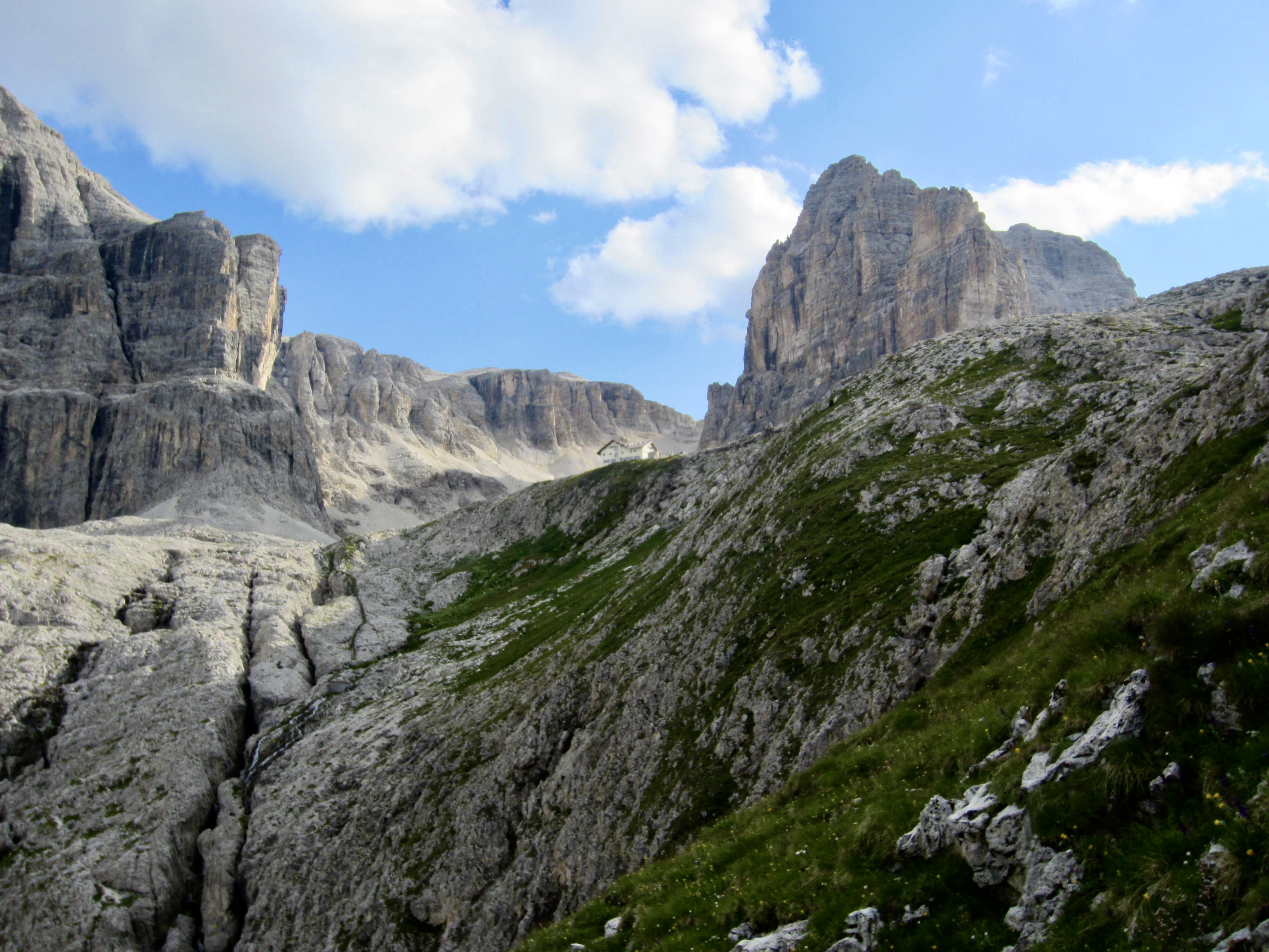
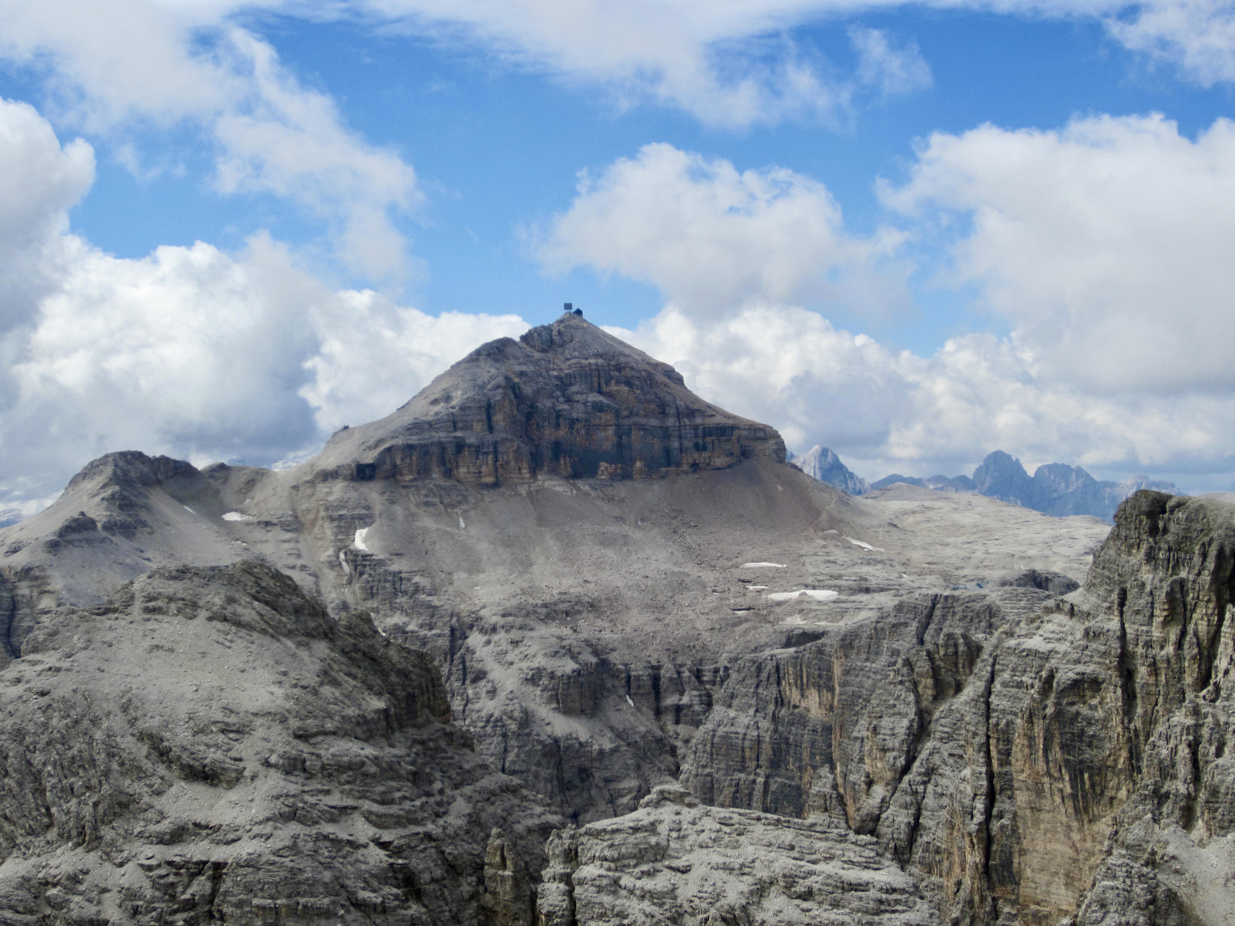
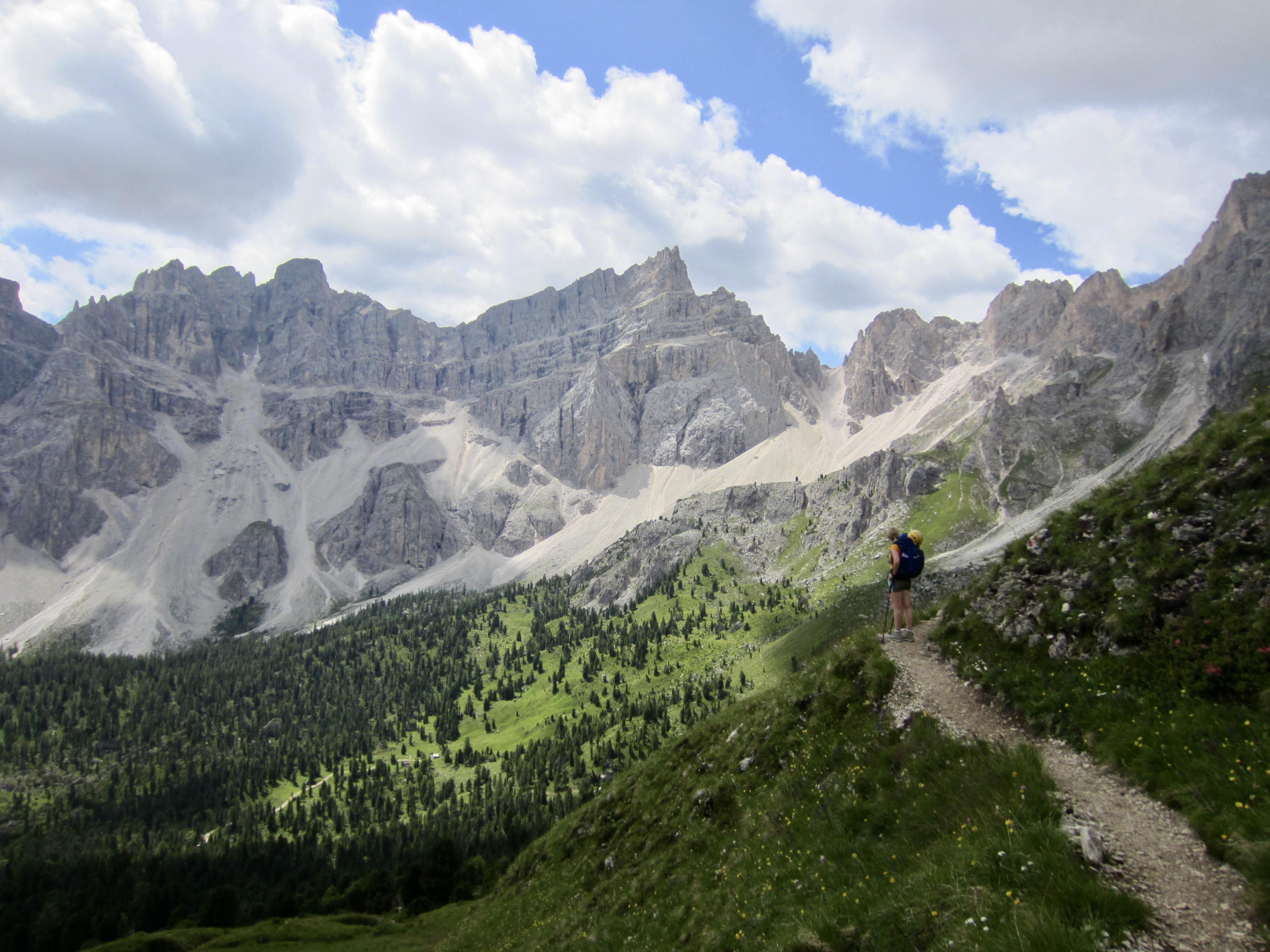
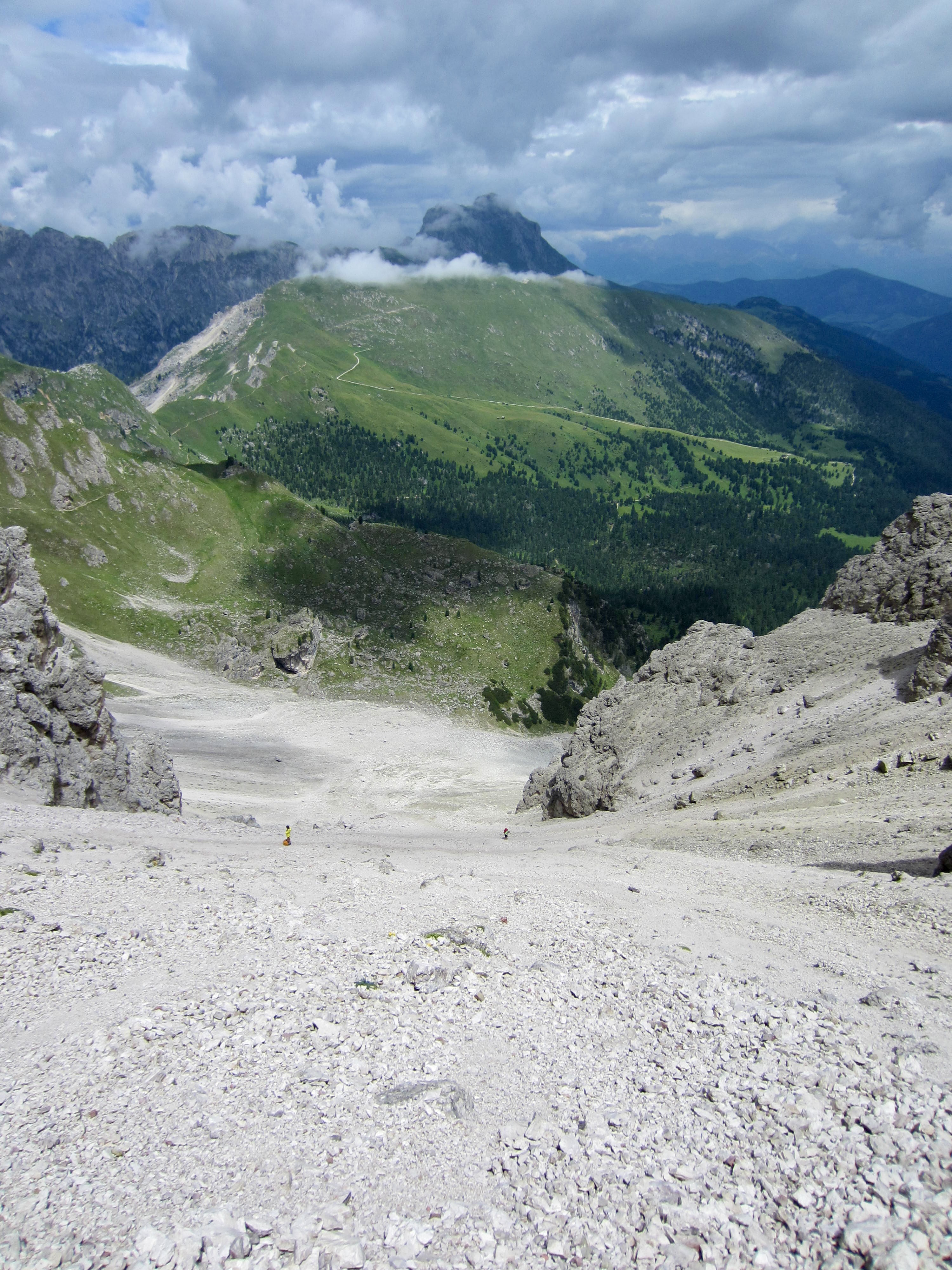
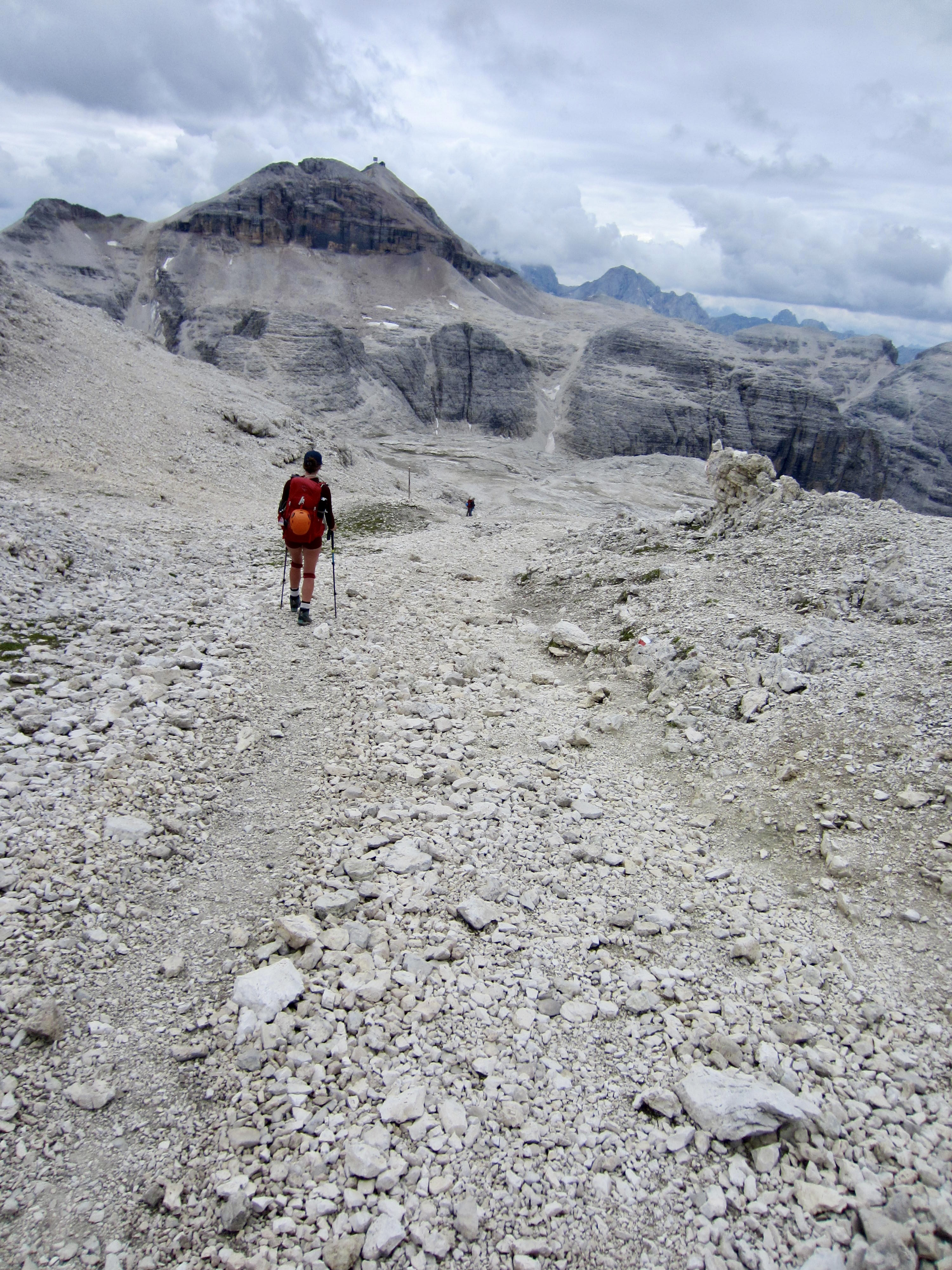
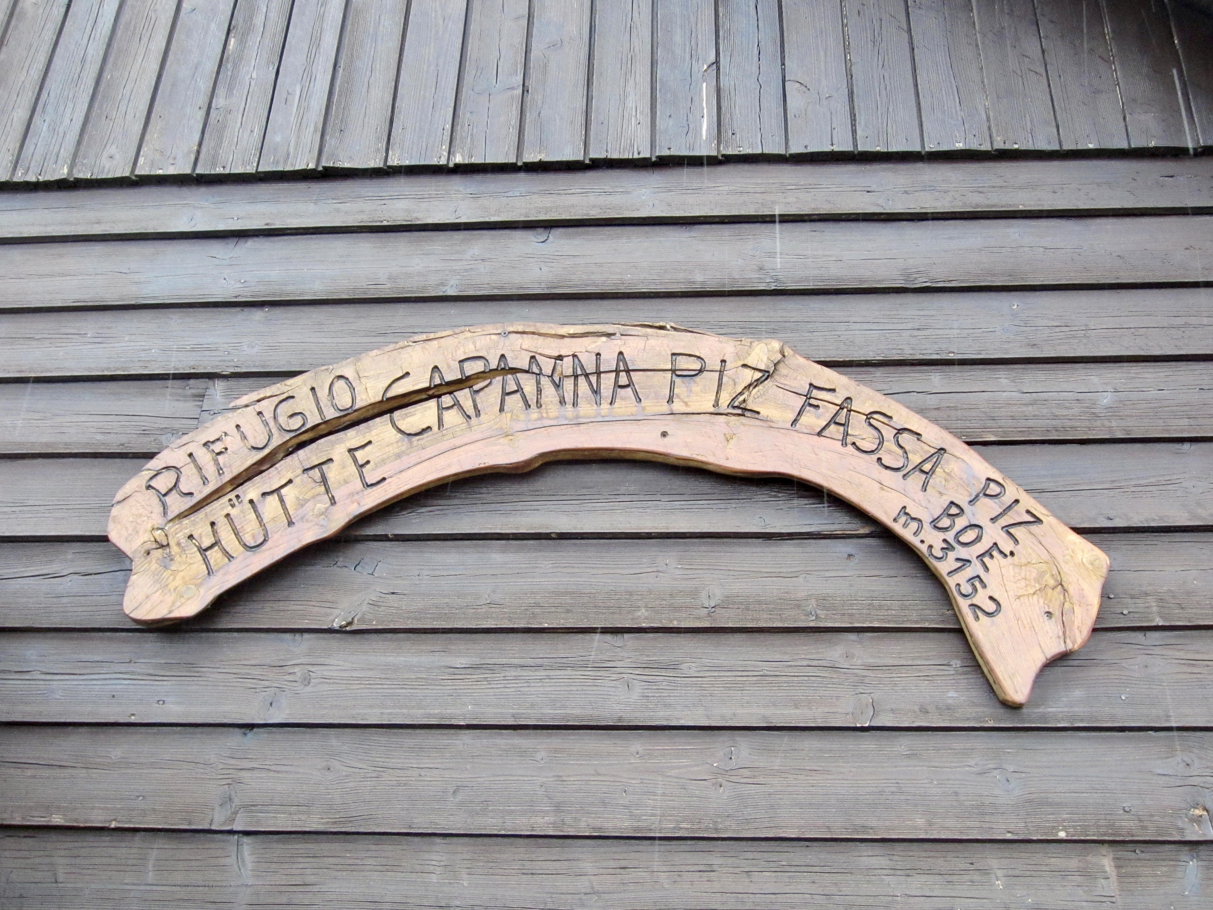
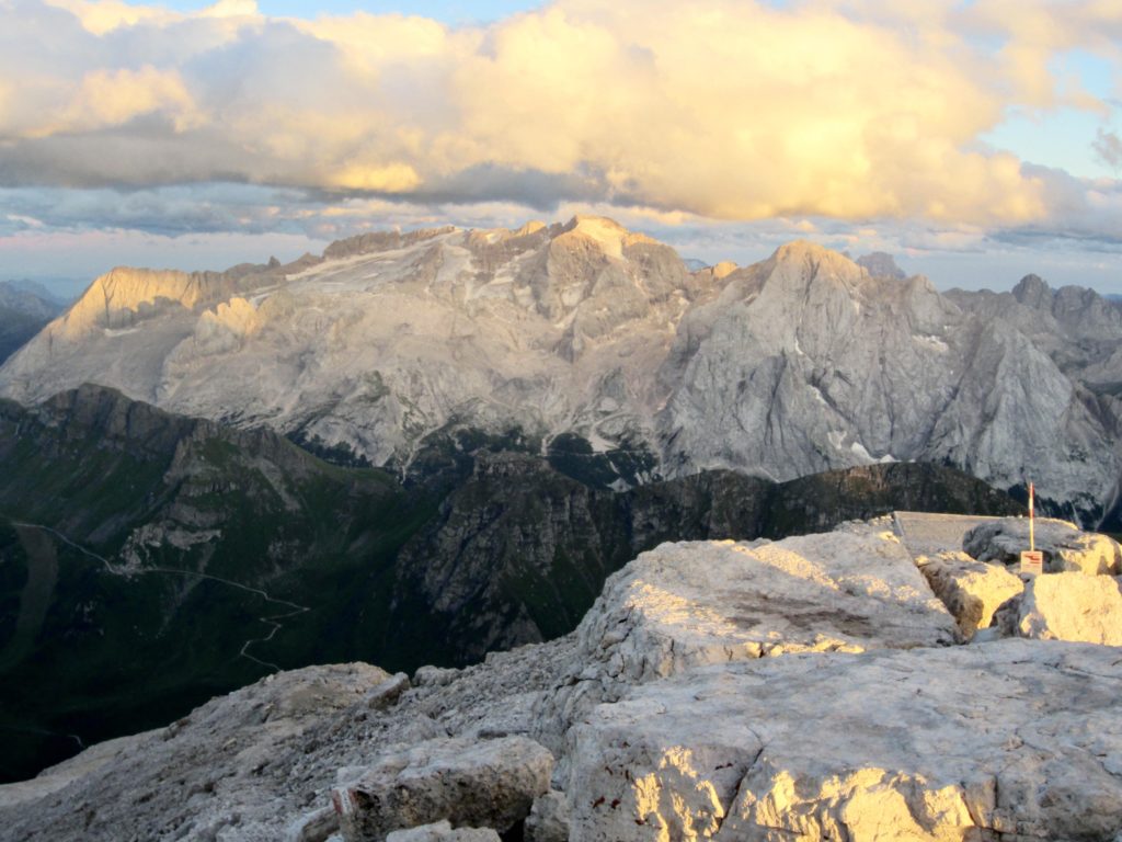
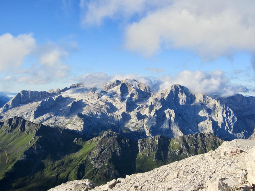
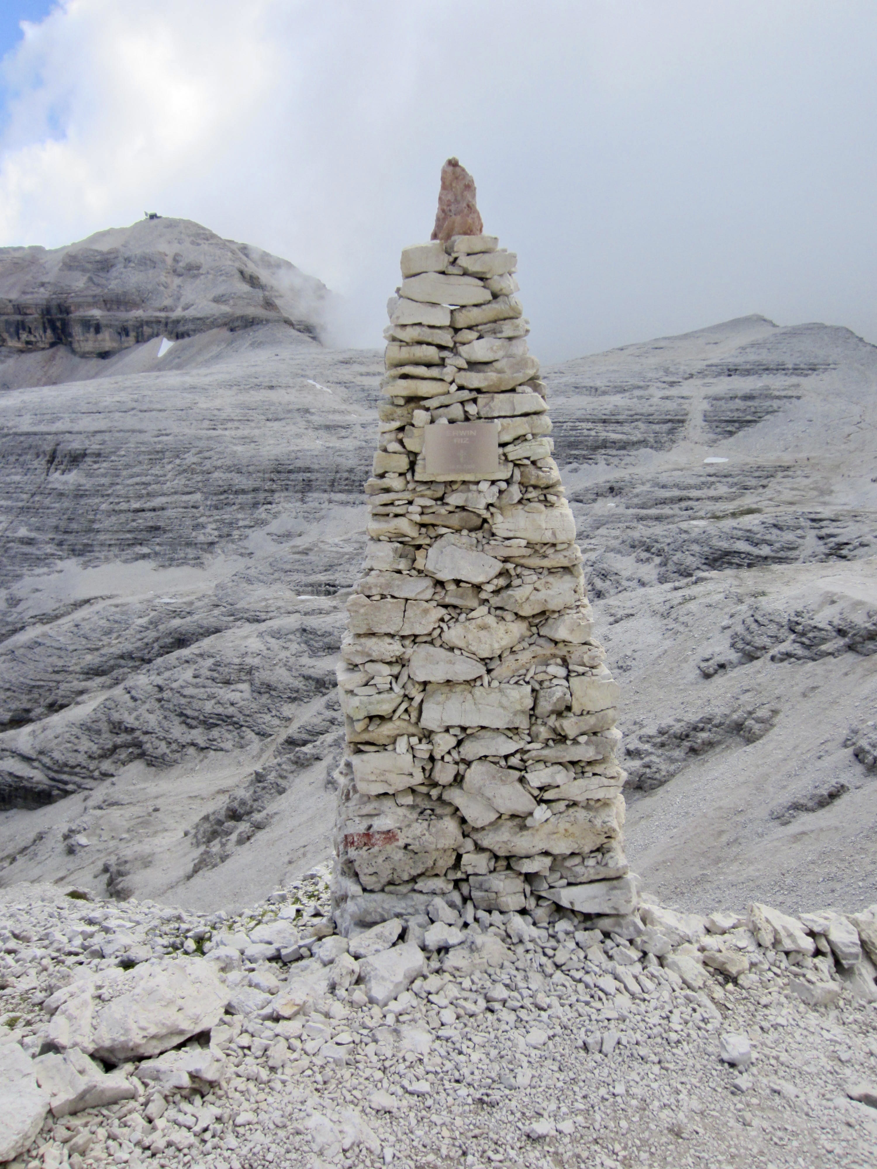
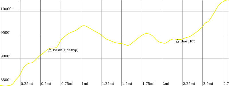
We dropped our rucksacks in a small basin and scrambled up ledgey Class 2-3 rock to the summit of Piz Pisciadu. Today’s destination hut, Cappana Fassa, was clearly visible on the summit of Piz Boe, due south of us. With an elevation of 10,340 feet (3151 meters), Piz Boe is the tallest peak in the Sella Group of mountains.

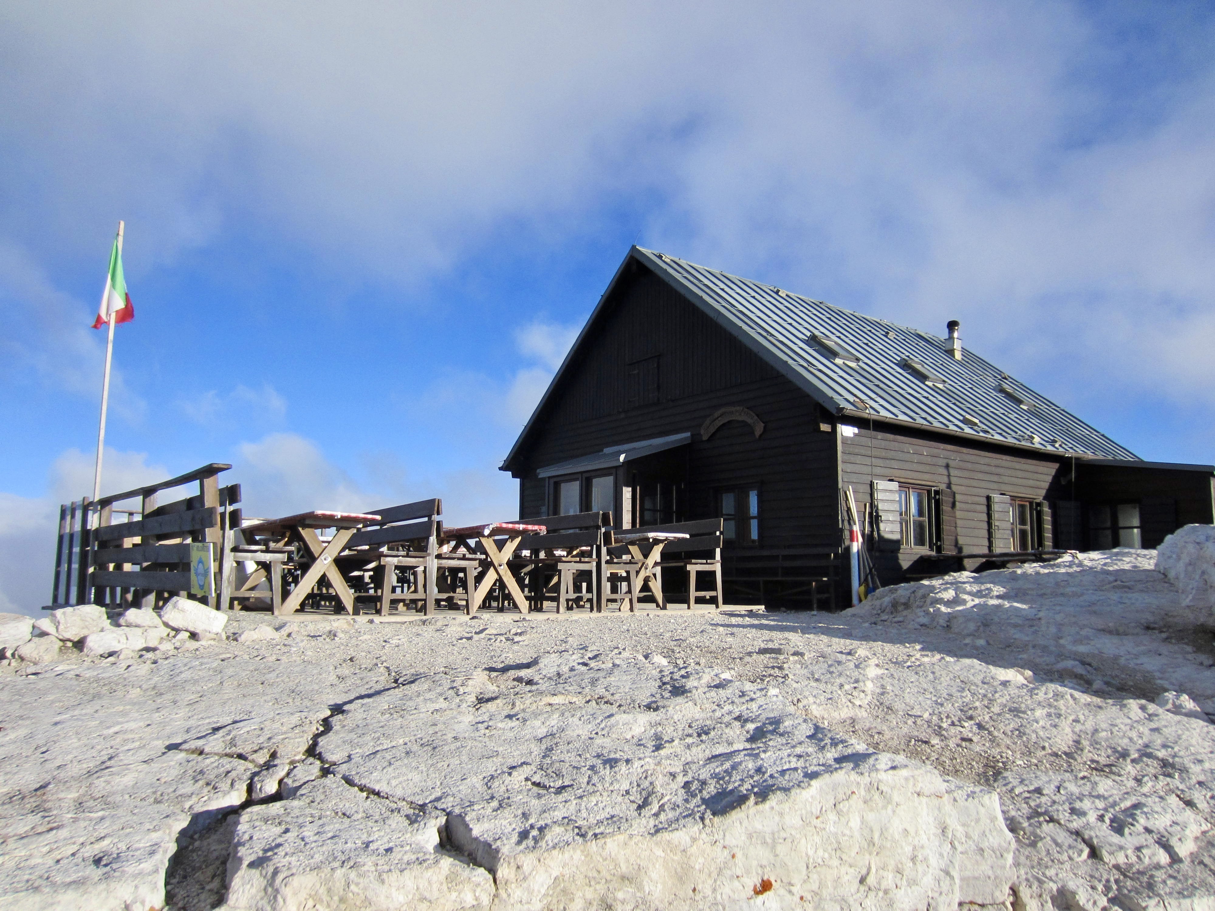
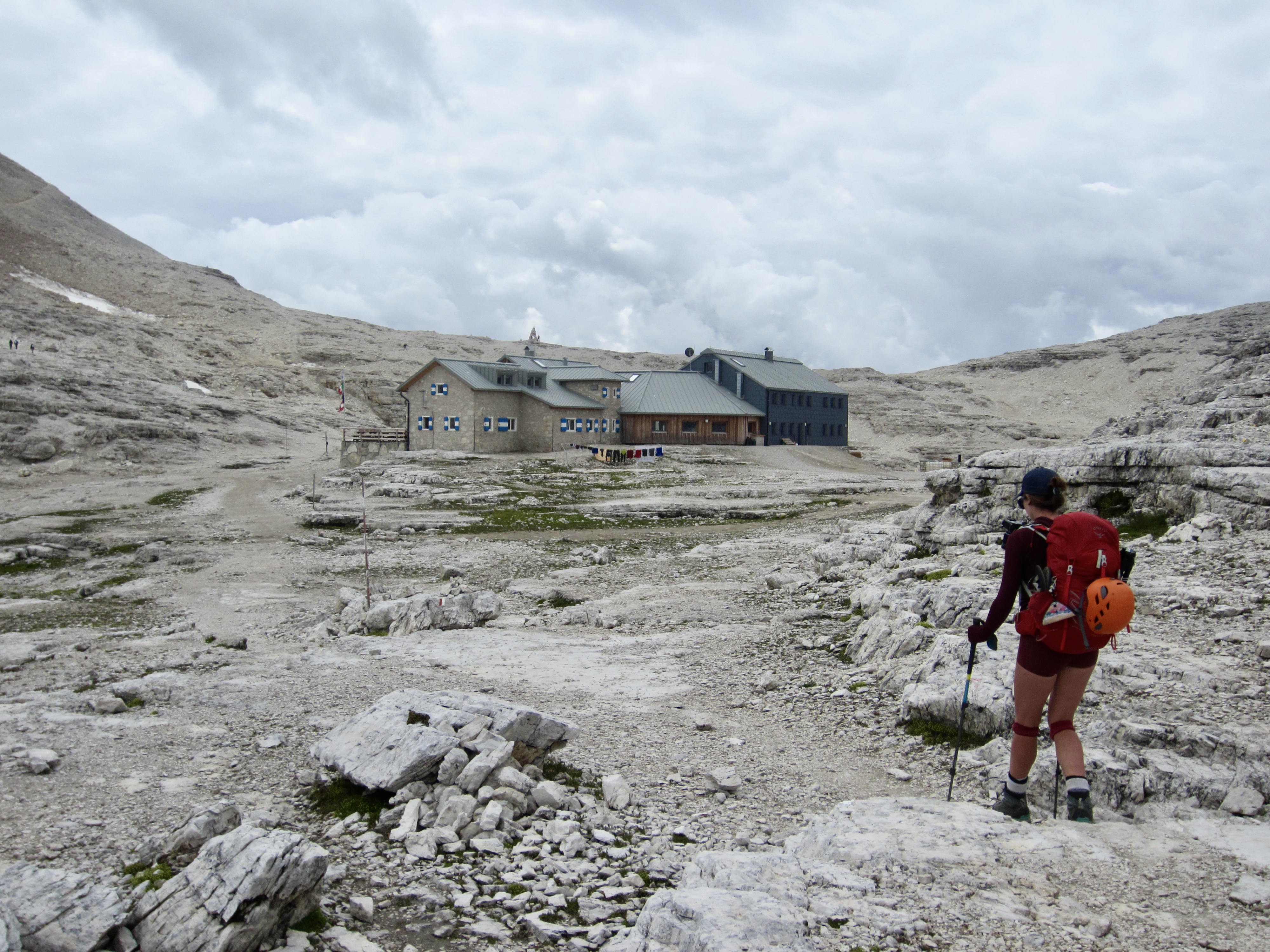
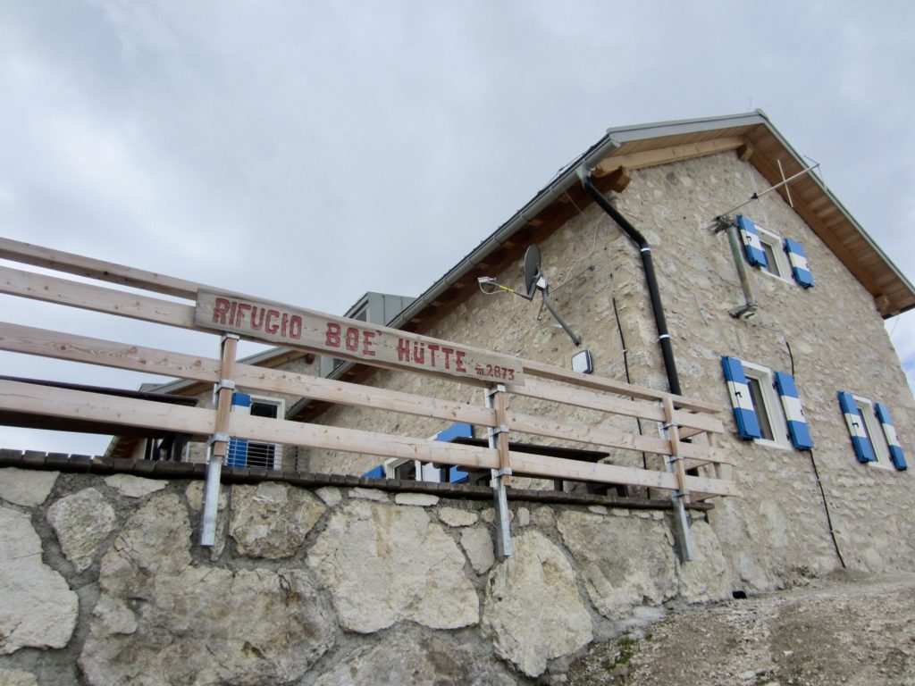
We returned to the basin and continued hiking up AV2 through a lunarscape of post-glacial rubble. Totally incongruous with this terrain was the elegantly rustic and beautifully renovated Boe Hut, which provided a comfortable lunch spot away from the ever-darkening sky.
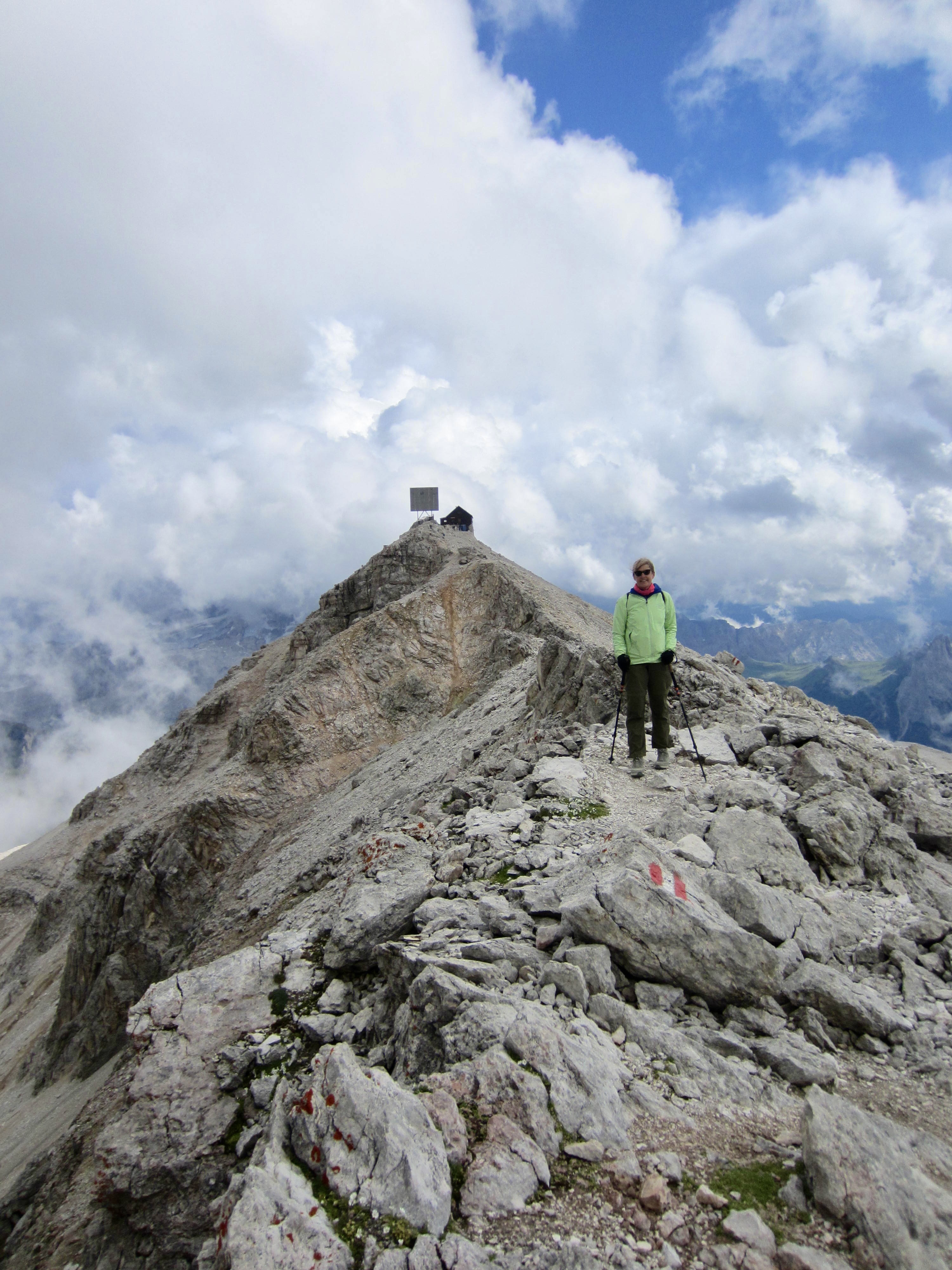
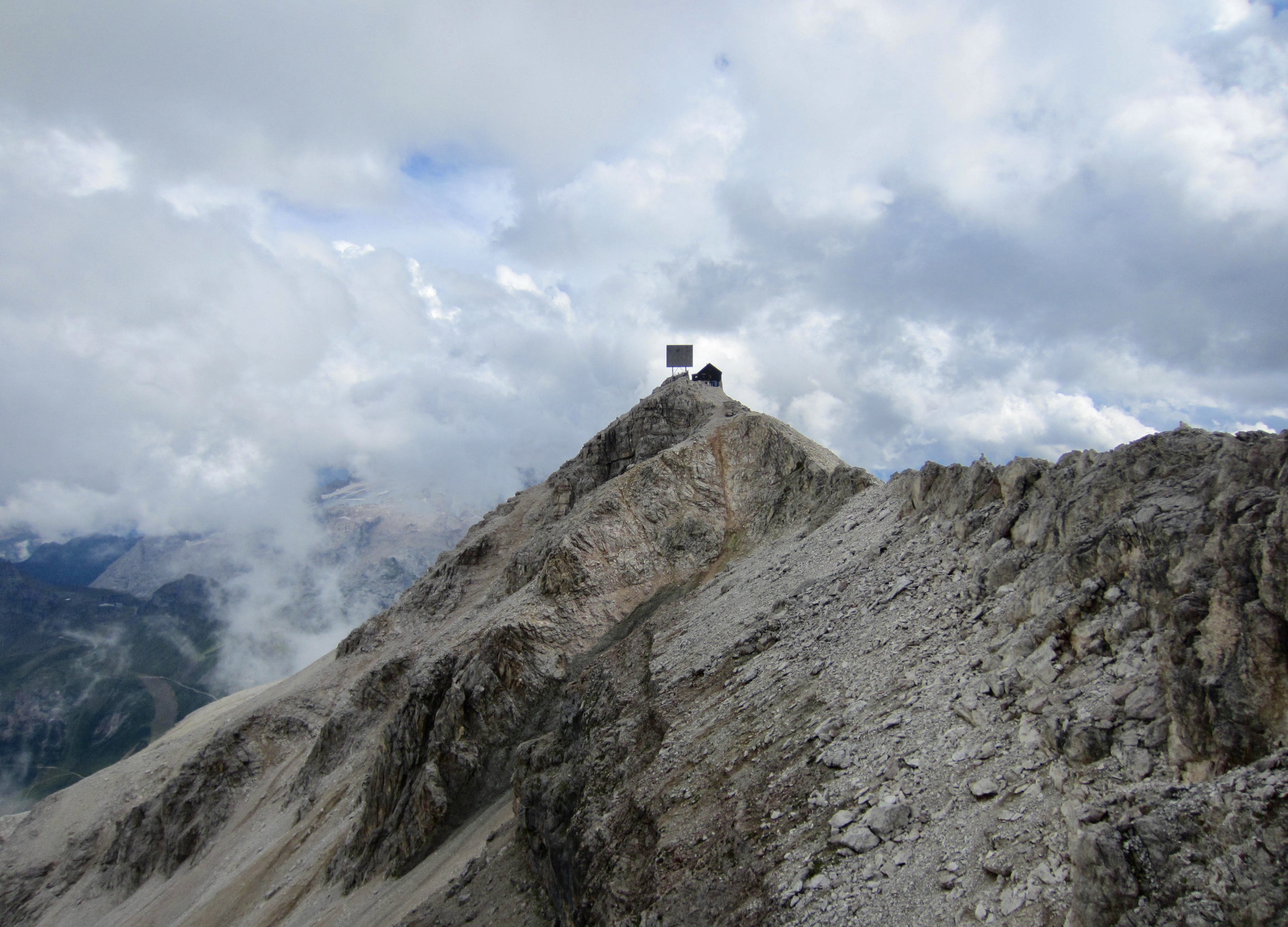
During our steep hike from Boe Hut to the summit of Piz Boe, raindrops started to fall and rumbles of thunder could be heard. Higher up, we were pelted with wind-driven snow and hail. As improbable as it seemed that there could be a cozy hut on this lofty summit, we were certainly happy to arrive in the middle of a thunderstorm!


We spent the remainder of our afternoon indoors, chatting with other hut guests. Some were doing the AV2 trek, some were doing the Munich-to-Venice Dream Trail, and some were just doing an overnight trip to this hut. When the storm abated shortly before dinnertime, Eileen and I took a jaunt out the north ridge to investigate our surroundings. From there, the large radio reflector adjacent to the hut looks comically out of place—much like a giant billboard!
Day 5: Fassa Piz Boe Hut to Castiglioni Hut
Approximate Stats (excluding gondola ride & sidetrips): 8.4 hours elapsed; 6.0 miles / 9.7 km traveled; 1900 feet / 580 meters gained; 3200 feet / 975 meters lost.
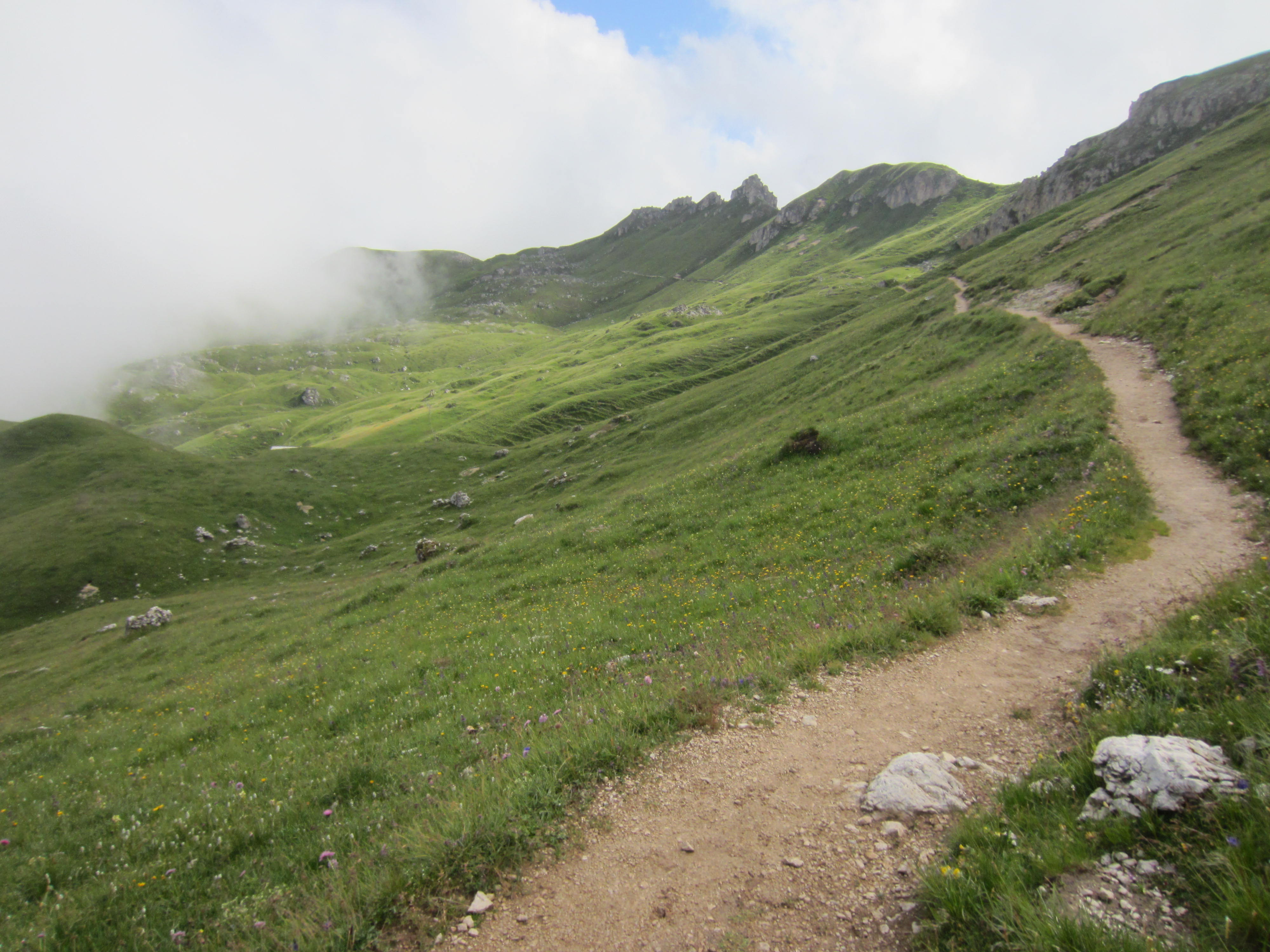
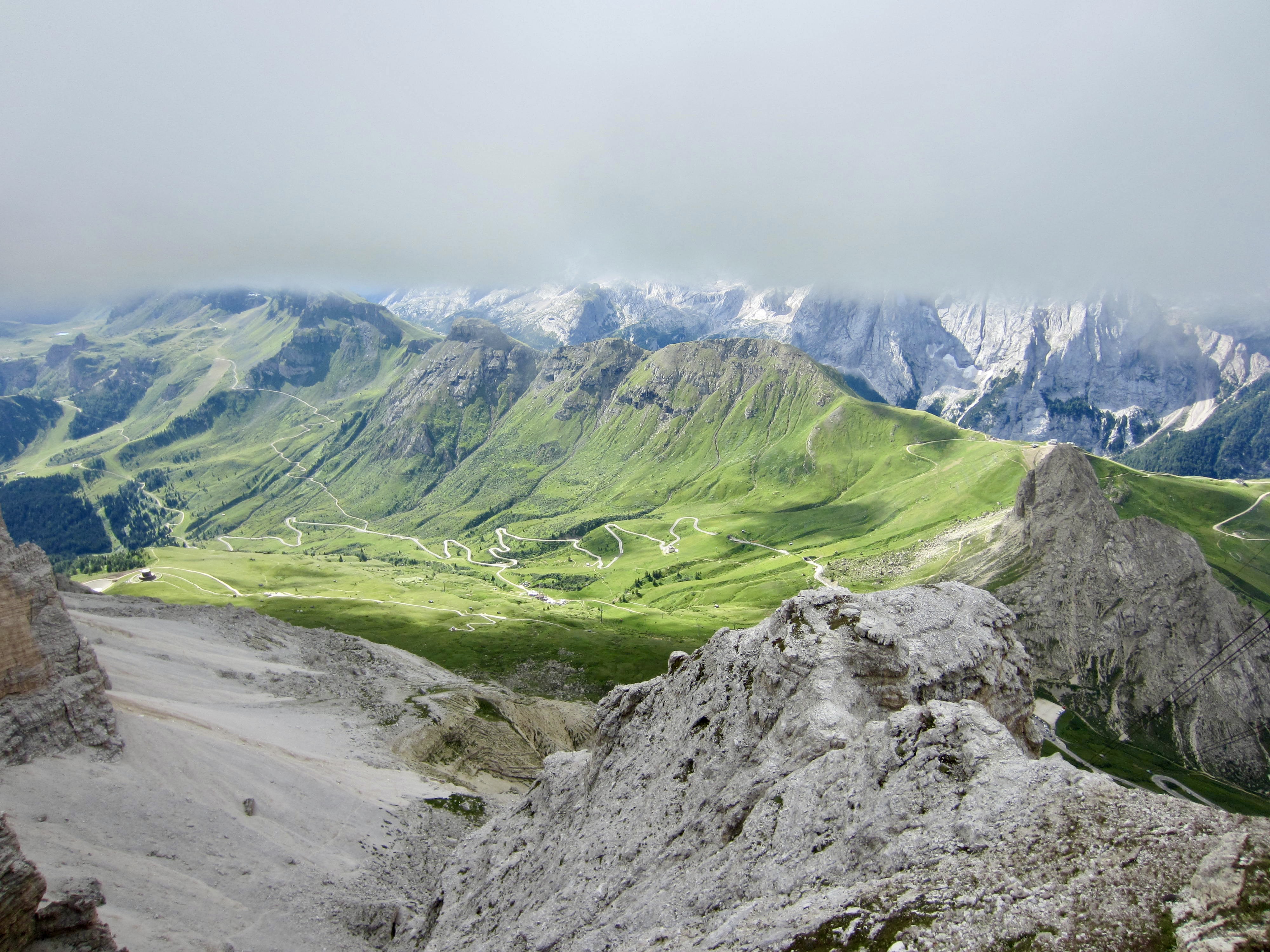
The morning sky was filled with low clouds but with scattered blue patches, looking like the kind of moody weather that could easily turn in either direction. Dramatic lighting accented the surrounding peaks.
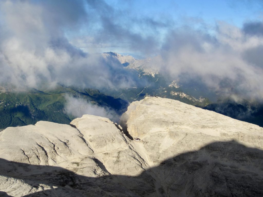
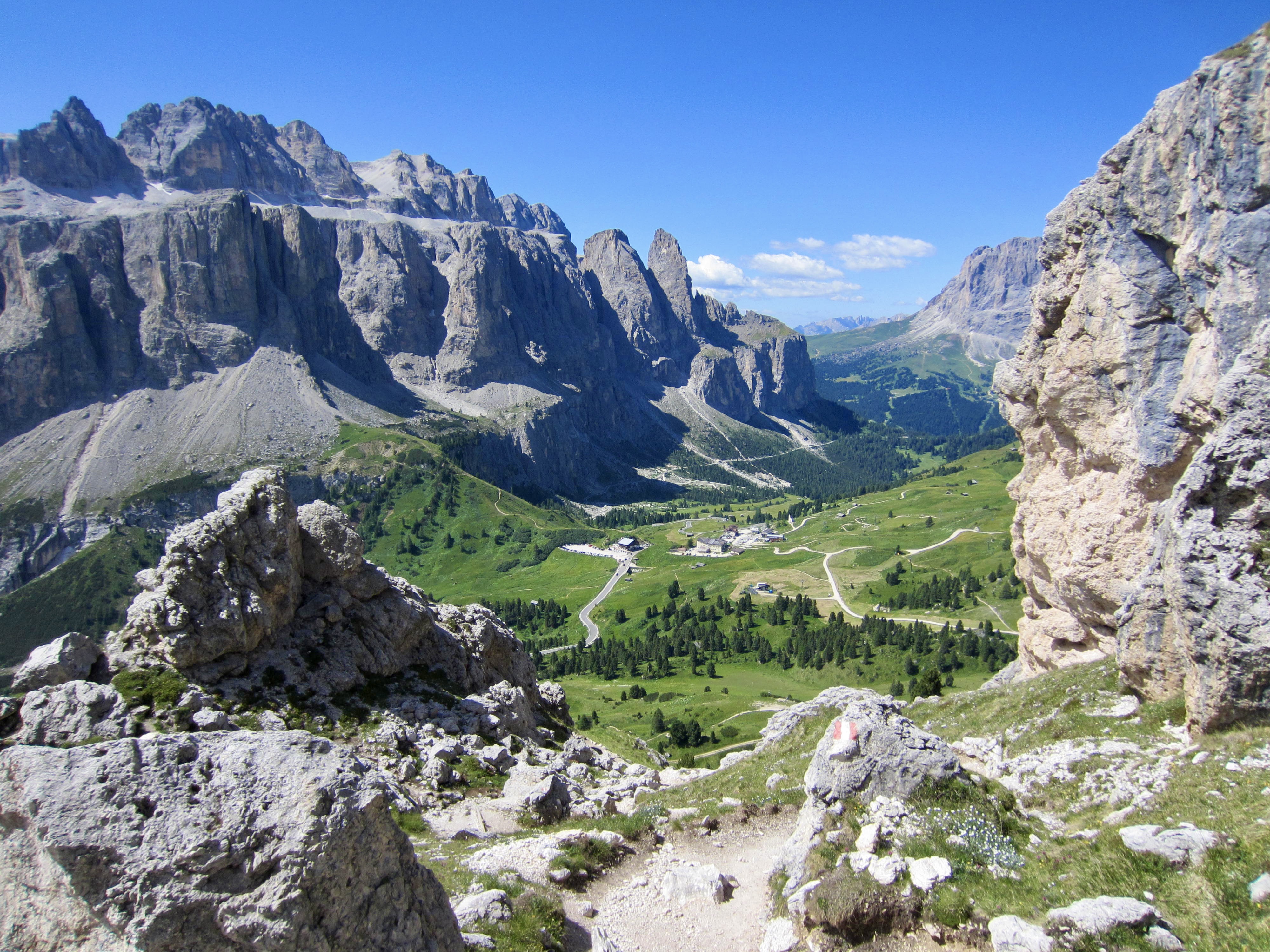
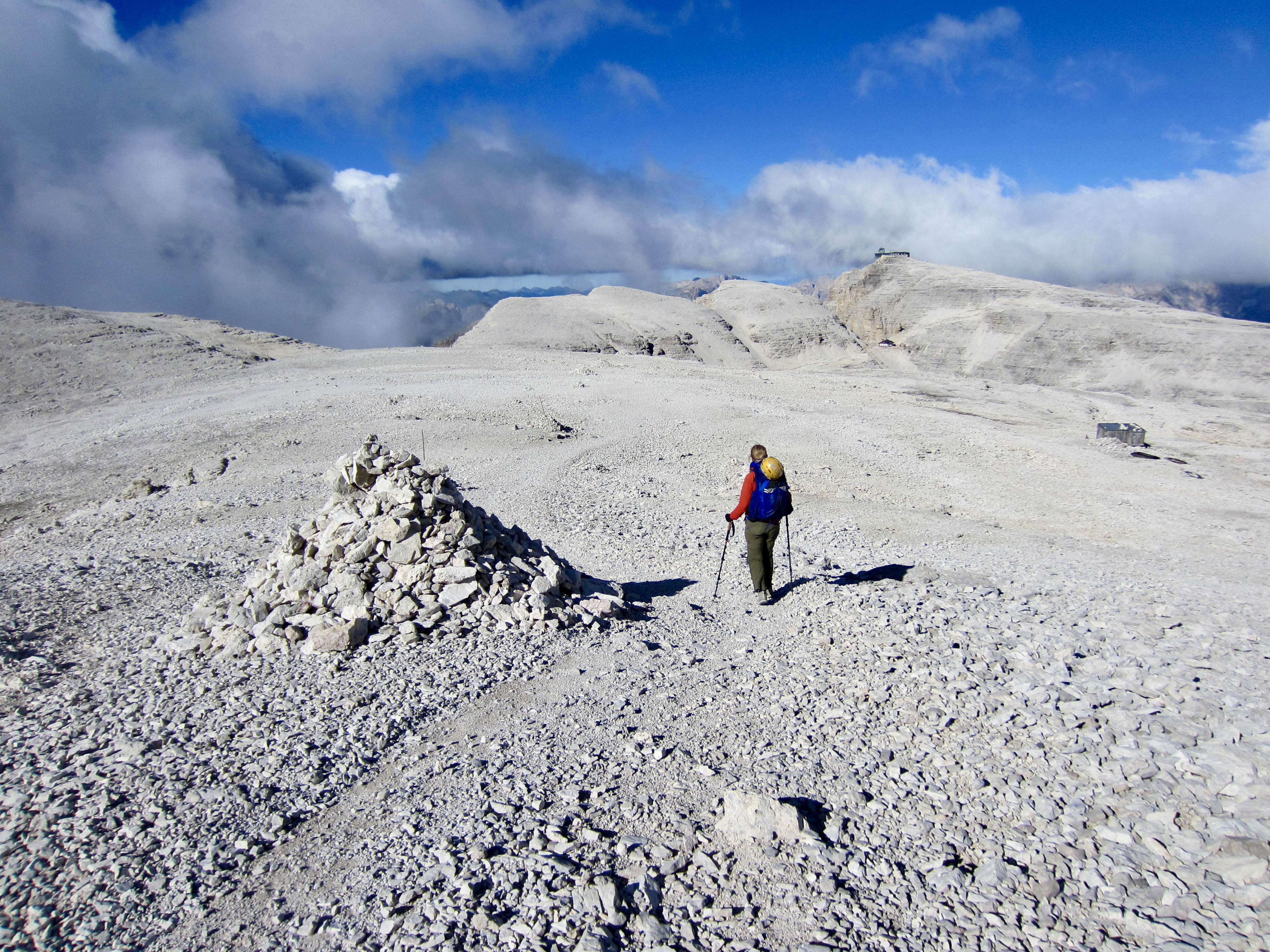
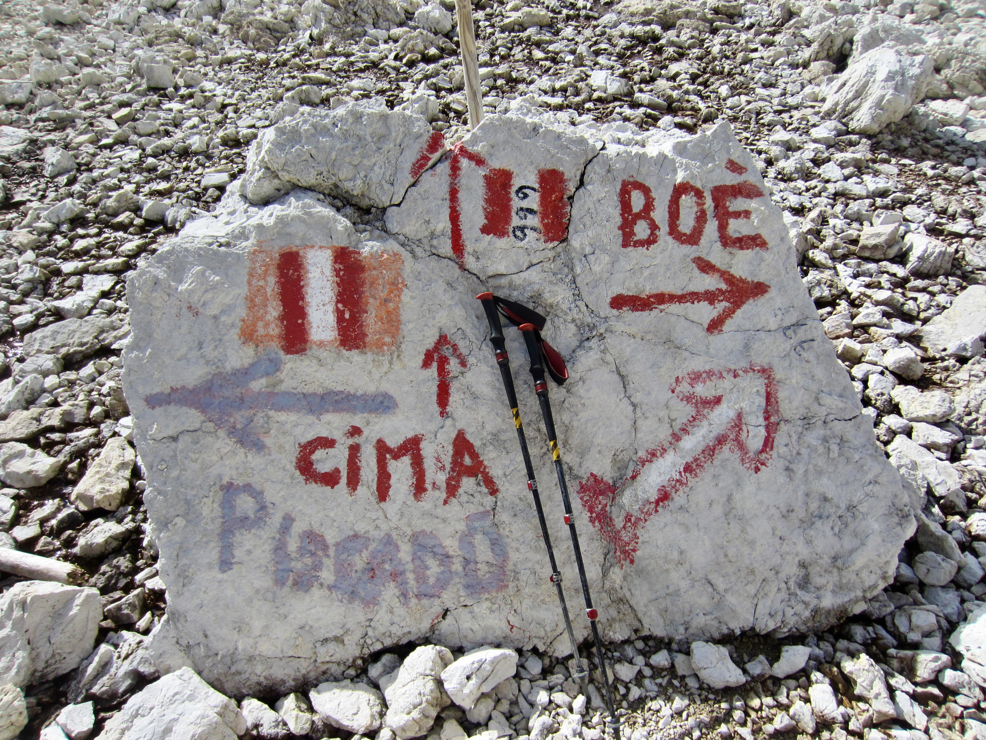
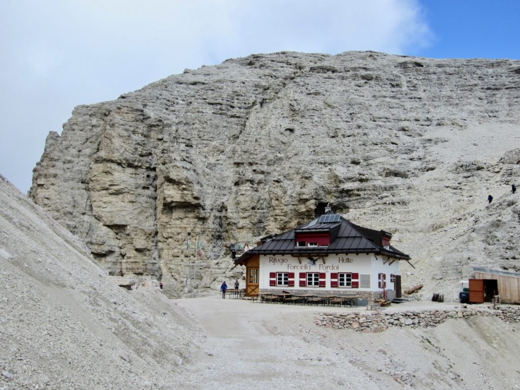
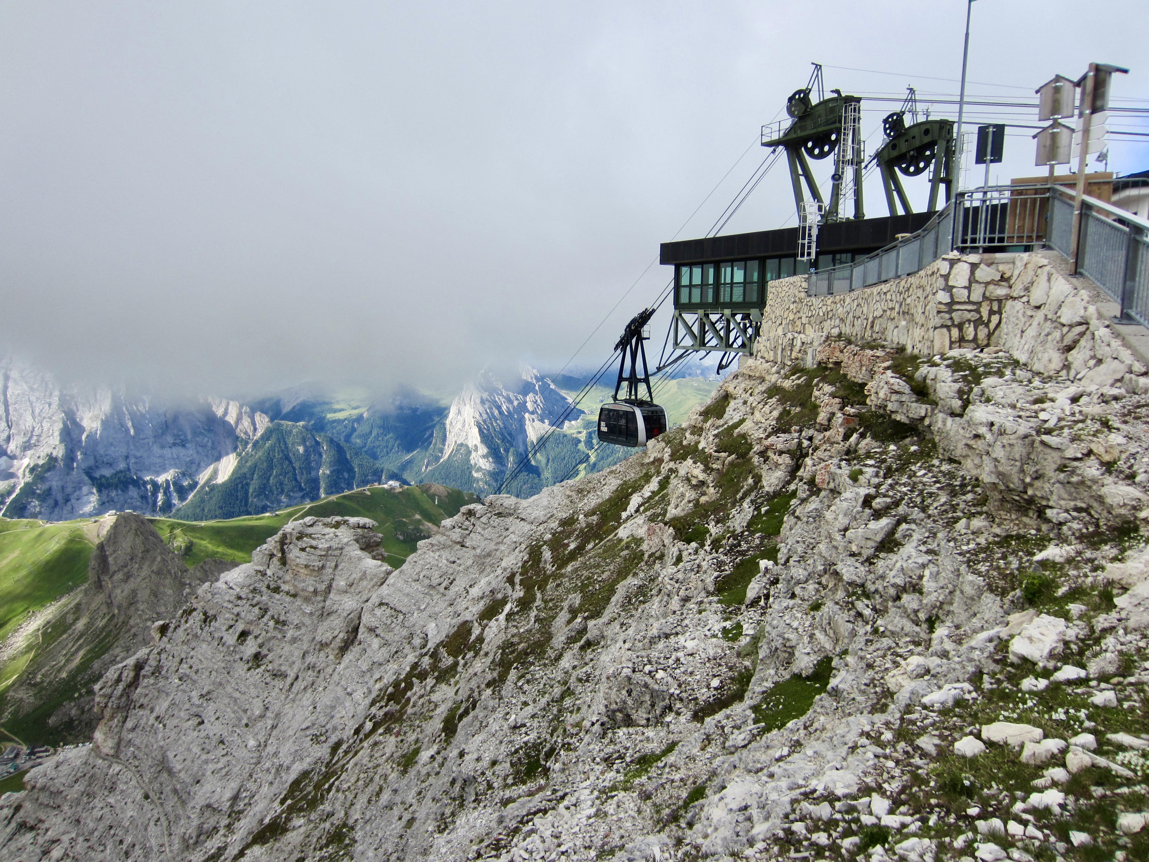
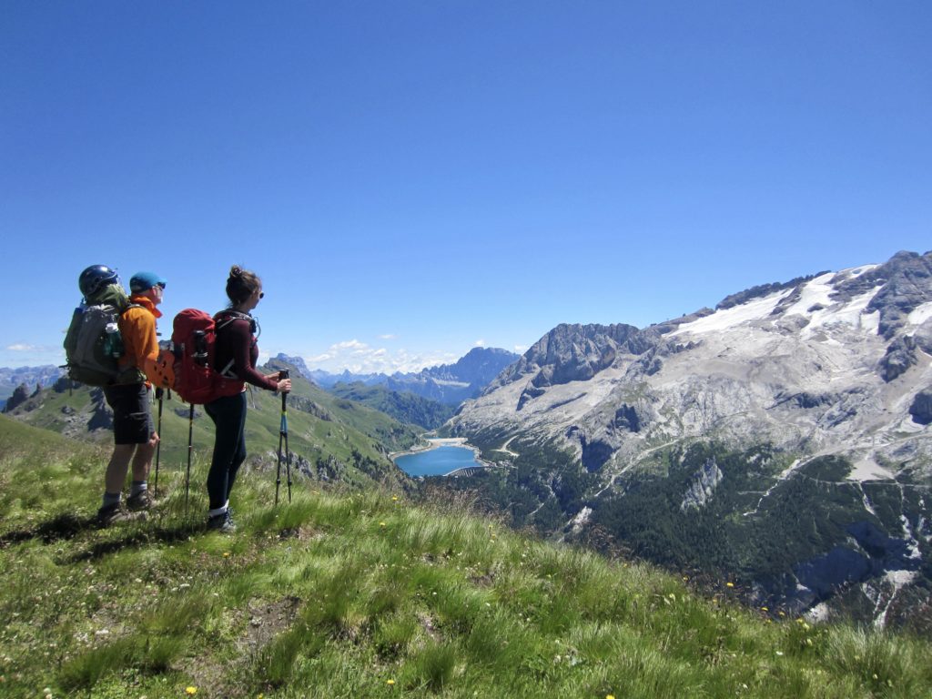
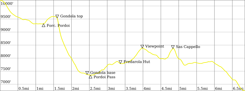
We packed up and headed southwestward across the high lunar plateau, aiming for the gondola station atop Sasso Pordoi, which stands closely above Forcella Pordoi Hut. Although AV2 provides a 2300-foot trail descent from the hut to Pordoi Pass, we all preferred to ride the knee-saving gondola downhill.


After stepping out of the gondola base station at Pordoi Pass, we located AV2 on the other side of the busy road and hiked uphill a mile to Fredarola Hut. There, we feasted on pizza while gazing at Marmolada from their expansive deck. It would have been a perfect lunch experience if not for a hostile encounter with a snarly employee who threw our trekking poles at Eileen. As such, it was an unforgettable lunch for more than one reason.

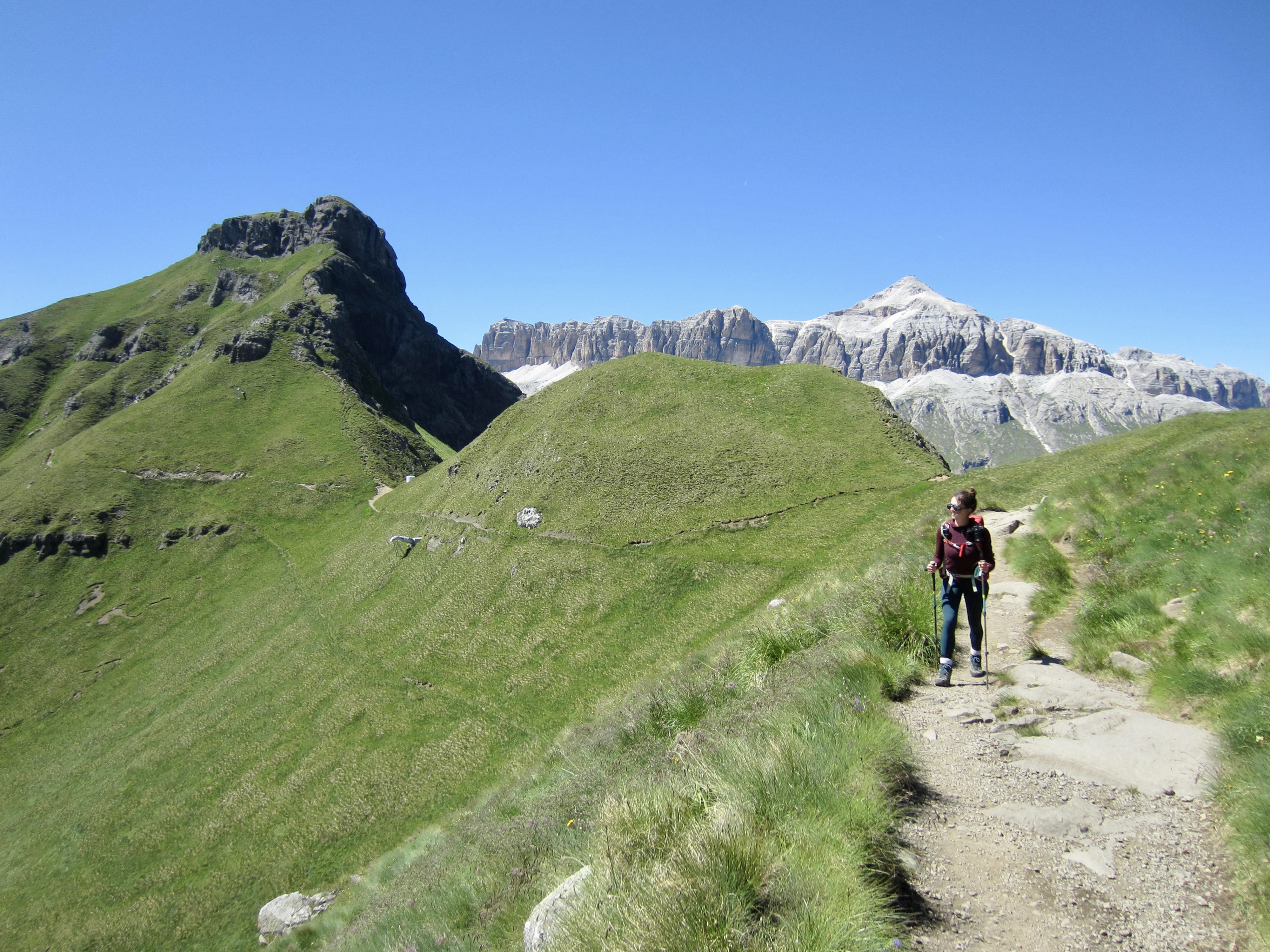
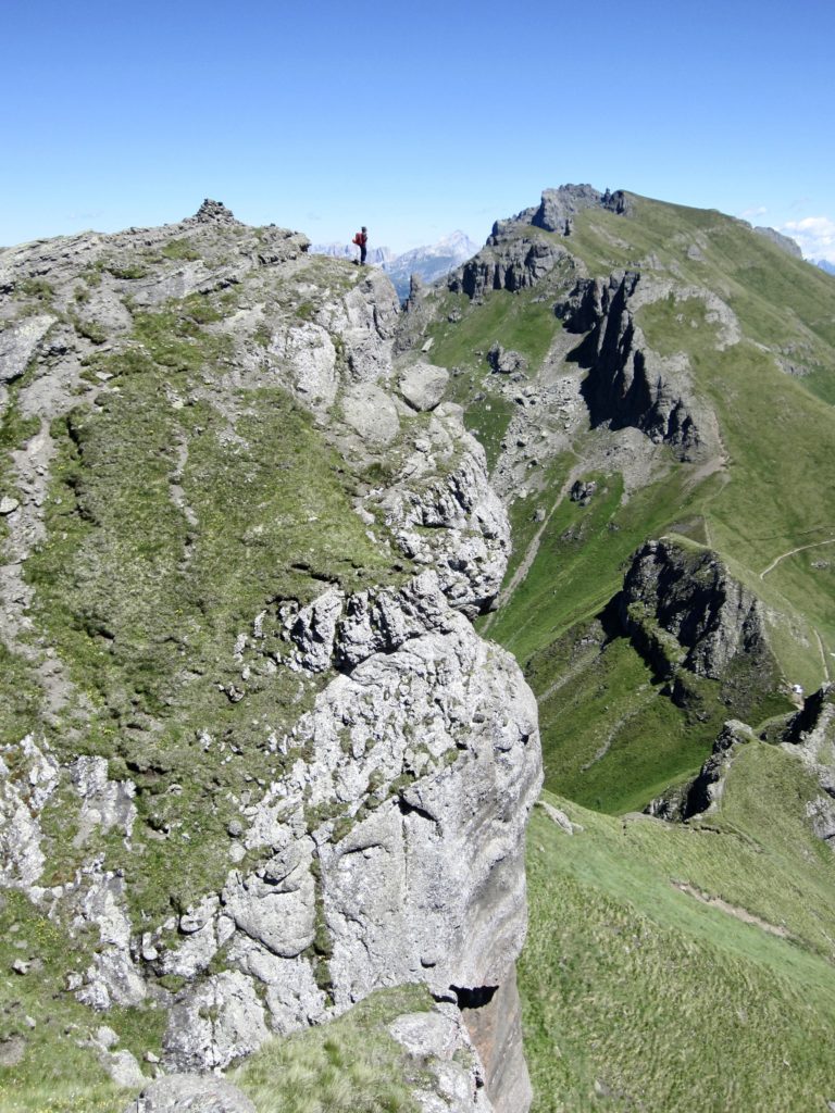
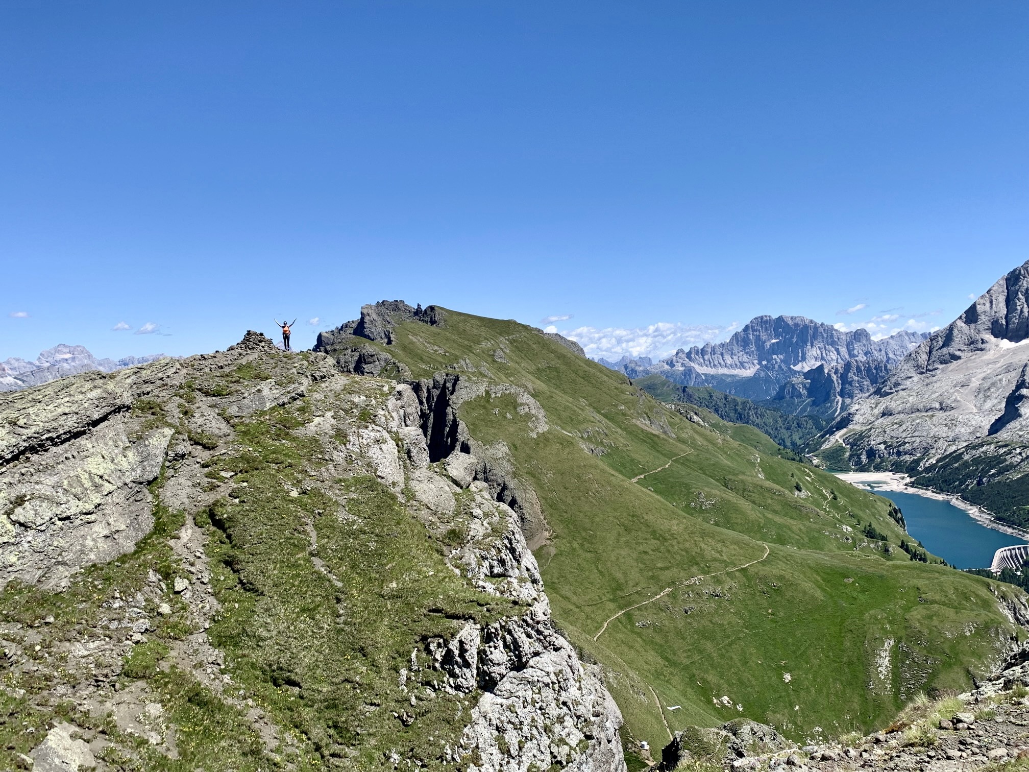
We spent our afternoon making an easterly traverse down to Lake Fedaia. Eileen stayed on AV2 and completed the traverse in less than 2 hours, whereas Brooke and I elected to take a higher (and rougher) variant trail that ran along the crest of Cappello Ridge. A short Class 3 rock scramble gained us the summit of Sass Cappello for marvelous views in all directions.
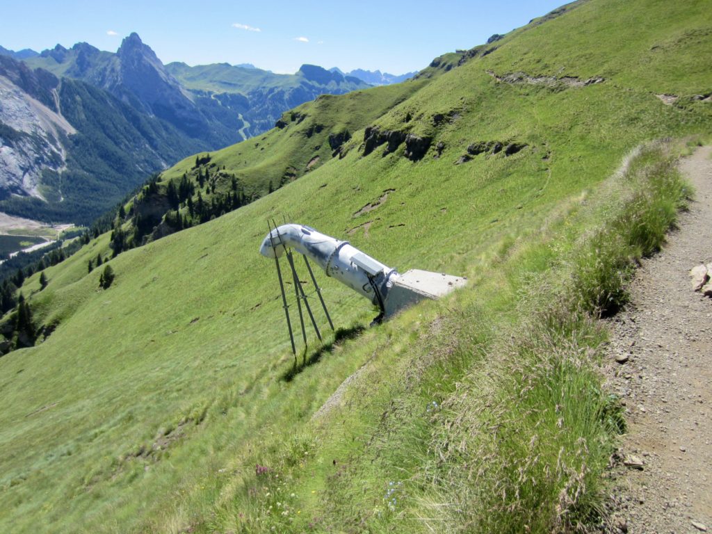
From below the summit of Sass Cappello, we skidded down a super-steep dirt path and rejoined AV2 on a grassy hillside. Interestingly, there were numerous large pipe structures, shaped like giant spigots, spaced along this hillside. Later research revealed that they are are avalanche control devices. They combine oxygen and propane to create an explosive blast that triggers small avalanches.

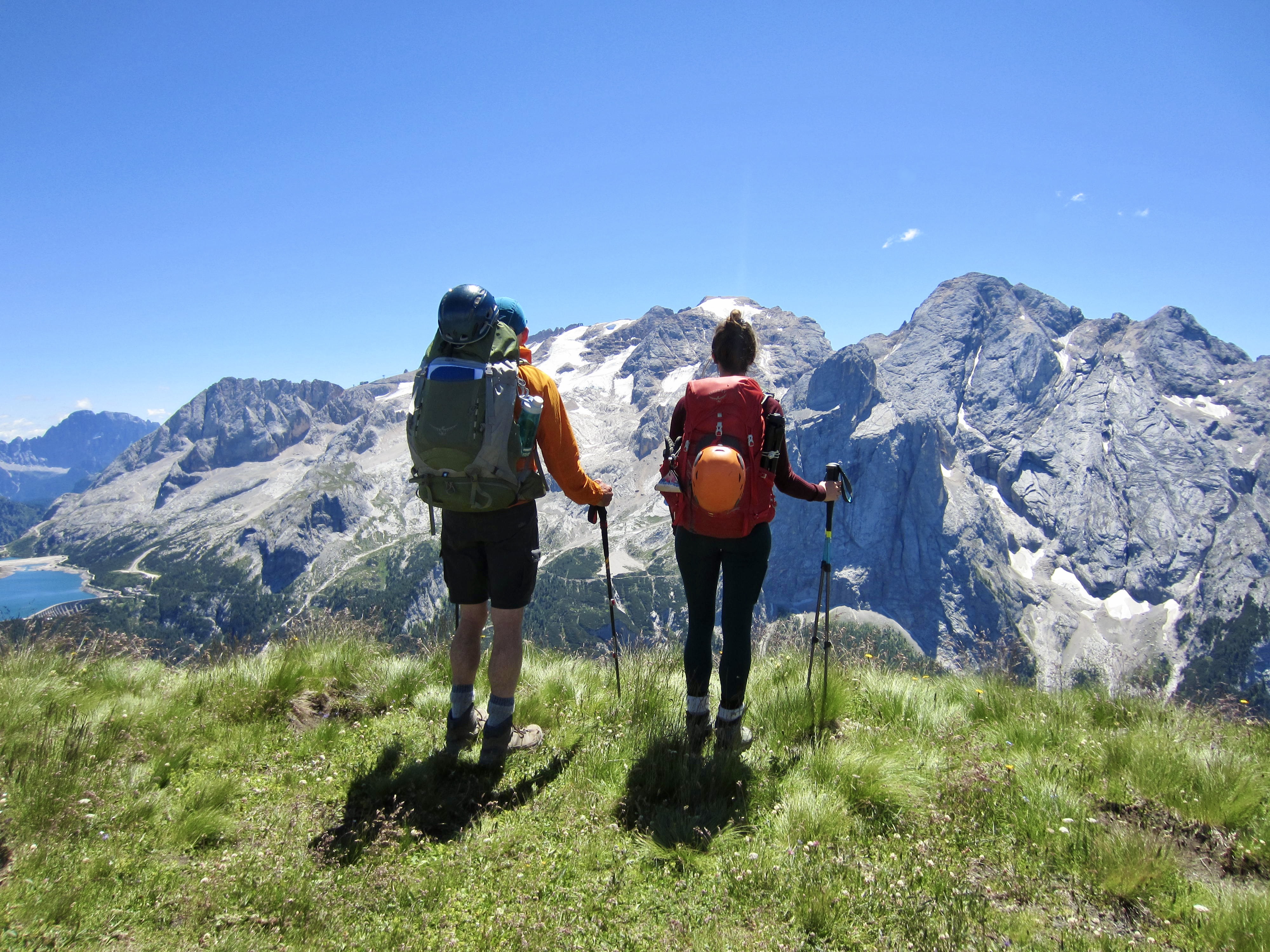
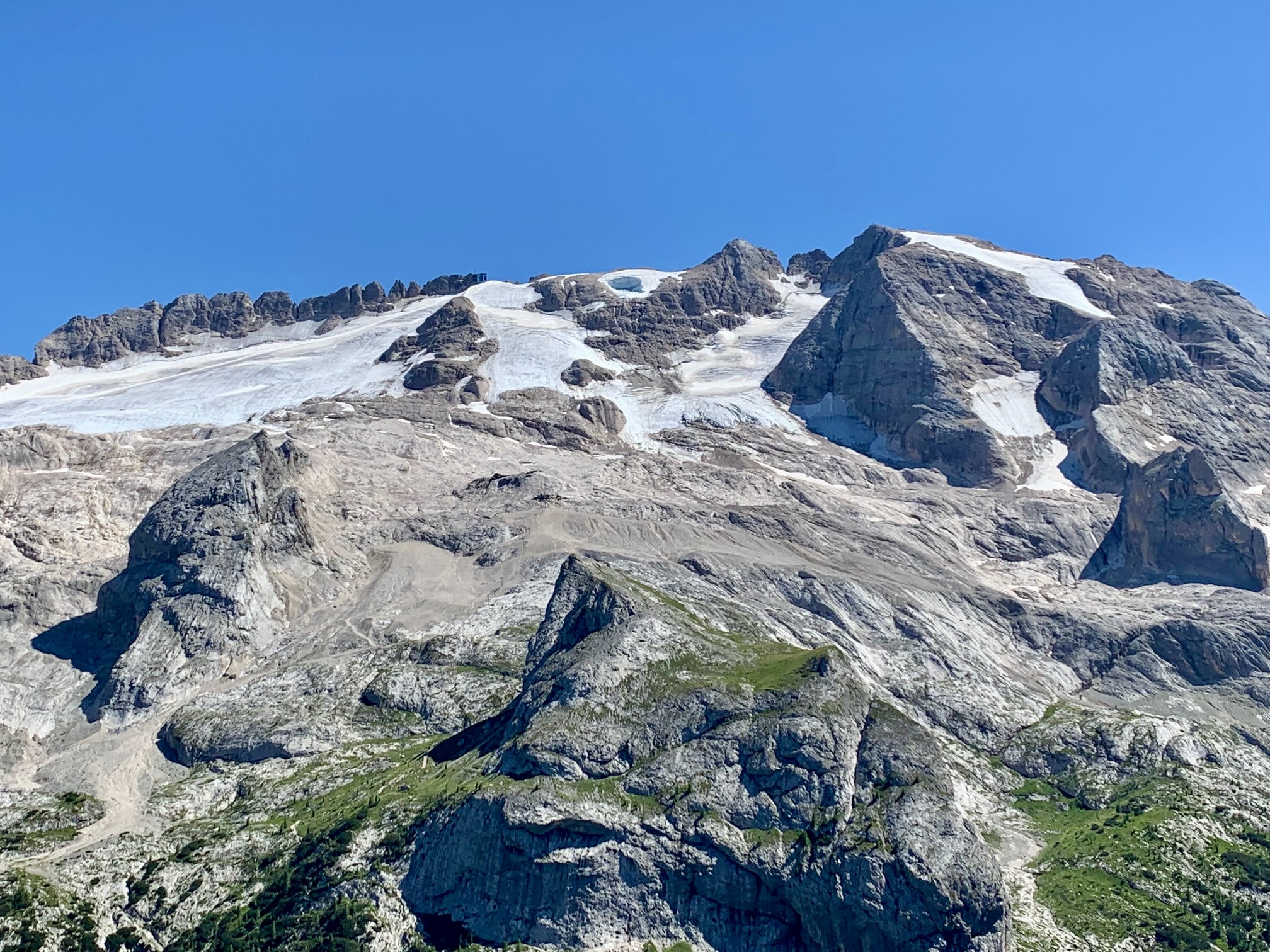
Our trail traverse took us to a point directly north of Marmolada, such that we could clearly see a large failure scarp on one of Marmolada’s high glaciers (appearing as dark oval at the top-center of the photo below). This was a stark vestige of last week’s deadly avalanche.

We continued downslope and arrived at Castiglioni Marmolada Hut adjacent to the Lake Fedaia Dam in late afternoon. This concluded the northern part of our AV2 trek, and the hut became our home base for two nights before starting the southern part of AV2.

Day 6 & Day 7: Layover at Castiglioni Hut
During our first layover day at Castiglioni Hut, we ate lots of gelato at a local cafe, rode a bus down to the town of Canazei for lunch, and did a 5-mile hike up the scenic canyon of Avisio Creek. During our second layover day, we completed a ridge traverse along the fabulous Via Ferrata delle Trincee, as described in my separate trip report here:
>>> Trincee Via Ferrata / Klettersteig / Hiking & Climbing Loop
Route Map & Profiles
…
…
…
…
…
…
Photo Gallery
Click to enlarge…