• Hike/Climb/Ride
      • Canadian Cascades BC
      • Northwestern WA Cascades
      • Northeastern WA Cascades
      • North-Central WA Cascades
      • Central WA Cascades
      • Southern WA Cascades
      • Olympic Mountains WA
      • Columbia Plateau WA
      • Other USA & Canadian Regions
        • Arizona
        • California
        • Montana
        • Nevada
        • New Mexico
        • Oregon
        • Utah
        • Wyoming
        • Canada (non-Cascades)
      • International (outside USA & Can)
        • France
        • Jordan
        • Italy
        • Mexico
        • New Zealand
        • Patagonia
        • Peru
        • Slovenia
        • Switzerland
        • Tasmania
    • Major Peaks
      • Special Groups
        • The Regal Six
          • Glacier Peak (10,541/10,544 ft)
          • Adams, Mt (12,276/12,273 ft)
          • Baker, Mt (10,781/10,773 ft)
          • Olympus, Mt (7969 ft)
          • Rainier, Mt (14,411/14,400 ft)
          • St Helens, Mt (9677/8365/8321 ft)
        • The Big Ten
          • Bonanza Peak (9511/9503 ft)
          • Jack Mountain (9066/9065 ft)
          • Buckner, Mt (9114/9111 ft)
          • Fernow, Mt (9249/9241 ft)
          • Goode, Mt (9200+/9223 ft)
          • Logan, Mt (9087/9097 ft)
          • Maude, Mt (9082/9077 ft)
          • Shuksan, Mt (9131/9125 ft)
          • Stuart, Mt (9415/9414 ft)
          • Seven-Fingered Jack (9100 ft)
        • The Landmark Twelve
          • Black Peak (8970/8986 ft)
          • Bonanza Peak (9511/9503 ft)
          • Dome Peak (8920/8921 ft)
          • Eldorado Peak (8868/8873 ft)
          • Jack Mountain (9066/9065 ft)
          • Goode, Mt (9200+/9223 ft)
          • Redoubt, Mt (8969/8958 ft)
          • Shuksan, Mt (9131/9125 ft)
          • Stuart, Mt (9415/9414 ft)
          • Silver Star Mountain (8876/8892 ft)
          • Silvertip Mountain (8517 ft)
          • Sloan Peak (7835 ft)
        • The Super Eight
          • Agnes Mountain (8115 ft)
          • American Border Peak (7994 ft)
          • Chimney Rock (7727 ft)
          • Triumph, Mt (7270 ft)
          • Hozomeen Mtn: north peak (8066 ft)
          • Slesse, Mt (8002 ft)
          • Hozomeen Mtn: south peak (8003 ft)
          • Whitehorse Mountain (6852 ft)
        • The Tall Twelve
          • Black Peak (8970/8986 ft)
          • Boston Peak (8894/8883 ft)
          • Copper Peak (8964/8960 ft)
          • Dome Peak (8920/8921 ft)
          • Dragontail Peak (8840+/8836 ft)
          • Eldorado Peak (8868/8873 ft)
          • Forbidden Peak (8815/8839 ft)
          • Gardner Mountain (8898/8897 ft)
          • Redoubt, Mt (8969/8958 ft)
          • Spickard, Mt (8979/8978 ft)
          • Gardner Mtn, North (8956/8958 ft)
          • Silver Star Mountain (8876/8892 ft)
      • Canadian Cascades Majors
        • The Canadian Chilliwack Three
          • Lindeman, Mt (7578 ft)
          • Rexford, Mt (7641 ft)
          • Slesse, Mt (8002 ft)
        • The Cheam Six
          • Baby Munday Peak (7382 ft)
          • Cheam Peak (6929 ft)
          • Foley Peak (7572 ft)
          • Lady Peak (7182 ft)
          • Stewart Peak (7343 ft)
          • Welch Peak (7999 ft)
        • The Coquihalla Seven
          • Coquihalla Mountain (6955+/7077 ft)
          • Gemse Peak (6037+/6201 ft)
          • Ibex Peak (6562+/6690 ft)
          • Needle Peak (6693+/6857 ft)
          • Steinbok Peak (6430+/6601 ft)
          • Vicuna Peak (6880+/6975 ft)
          • Yak Peak (6640+/6690 ft)
        • The Sumallo Three
          • Payne, Mt (8097 ft)
          • Rideout, Mt (8029 ft)
          • Silvertip Mountain (8517 ft)
      • Northwestern Cascades Majors
        • The American Chilliwack Six
          • Bear Mountain (7931 ft)
          • Custer, Mt (8630/8648 ft)
          • Redoubt, Mt (8969/8958 ft)
          • Spickard, Mt (8979/8978 ft)
          • Mox Peak, Easy (8407/8392 ft)
          • Mox Peak, Hard (8504/8501 ft)
        • The Lower Skagit Five
          • Bacon Peak (7061 ft)
          • Blum, Mt (7680 ft)
          • Despair, Mt (7292 ft)
          • Hagan, Mt (7080+ ft)
          • Triumph, Mt (7270 ft)
        • The McAllister Five
          • Austera Peak (8334/8366 ft)
          • Colonial Peak (7771 ft)
          • Klawatti Peak (8485/8500 ft)
          • Primus Peak (8508/8497 ft)
          • Snowfield Peak (8347/8346 ft)
        • The Nooksack Six
          • American Border Peak (7994 ft)
          • Canadian Border Peak (7516 ft)
          • Larrabee, Mt (7861 ft)
          • Sefrit, Mt (7191 ft)
          • Shuksan, Mt (9131/9125 ft)
          • Tomyhoi Peak (7435 ft)
        • The Picket Twelve
          • Crooked Thumb Peak (8124 ft)
          • McMillan Spire, East (7992 ft)
          • Inspiration Peak (7880+ ft)
          • Luna Peak (8311/8286 ft)
          • Challenger, Mt (8207 ft)
          • Degenhardt, Mt (8000+ ft)
          • Fury, Mt: east peak (8288/8322 ft)
          • Fury, Mt: west peak (8292/8298 ft)
          • Terror, Mt (8151 ft)
          • Triumph, Mt (7270 ft)
          • Phantom Peak (8045 ft)
          • Twin Needles: west peak (7936 ft)
        • The Thunder Eight
          • Boston Peak (8894/8883 ft)
          • Eldorado Peak (8868/8873 ft)
          • Forbidden Peak (8815/8839 ft)
          • Buckner, Mt (9114/9111 ft)
          • Goode, Mt (9200+/9223 ft)
          • Logan, Mt (9087/9097 ft)
          • Sahale Peak (8680+ ft)
          • Storm King Mountain (8520+/8560 ft)
        • The Twin Sisters Two
          • Twin Sisters: north peak (6640+ ft)
          • Twin Sisters: south peak (7000+ ft)
      • Northeastern Cascades Majors
        • The Mazama Three
          • Gardner Mountain (8898/8897 ft)
          • Gardner Mtn, North (8956/8958 ft)
          • Silver Star Mountain (8876/8892 ft)
        • The Pasayten Eleven
          • Craggy Peak, Big (8470/8473 ft)
          • Blackcap Mountain (8397/8402 ft)
          • Lake Mountain (8371/8372 ft)
          • Lost Peak (8464/8466 ft)
          • Monument Peak (8592/8610 ft)
          • Carru, Mt (8595/8604 ft)
          • Lago, Mt (8745/8743 ft)
          • Osceola Peak (8587/8579 ft)
          • Ptarmigan Peak (8614 ft)
          • Robinson Mountain (8726/8724 ft)
          • Craggy Peak, West (8366/8367 ft)
        • The Ragged Seven
          • Black Peak (8970/8986 ft)
          • Corteo Peak (8080+ ft)
          • Cosho Peak (8332/8333 ft)
          • Katsuk Peak (8680+/8679 ft)
          • Kimtah Peak (8600+/8644 ft)
          • Mesahchie Peak (8795/8805 ft)
          • Arriva, Mt (8215 ft)
        • The Similkameen Three
          • Cathedral Peak (8601/8599 ft)
          • Grimface Mountain (8645 ft)
          • Remmel Mountain (8685/8683 ft)
        • The Upper Methow Six
          • Azurite Peak (8400+/8440 ft)
          • Cutthroat Peak (8050 ft)
          • Golden Horn (8366/8418 ft)
          • Ballard, Mt (8340/8371 ft)
          • Hardy, Mt (8080+ ft)
          • Tower Mountain (8444/8440 ft)
        • The Upper Skagit Five
          • Castle Peak (8306/8343 ft)
          • Crater Mountain (8128 ft)
          • Jack Mountain (9066/9065 ft)
          • Hozomeen Mtn: north peak (8066 ft)
          • Hozomeen Mtn: south peak (8003 ft)
        • The Washington Pass Three
          • Liberty Bell Mountain (7720+ ft)
          • Early Winters Spire, North (7760+ ft)
          • Early Winters Spire, South (7807 ft)
      • North-Central Cascades Majors
        • The Chelan Four
          • Cardinal Peak (8590/8591 ft)
          • Emerald Peak (8422/8414 ft)
          • Pinnacle Mountain (8402/8395 ft)
          • Saska Peak (8404/8399 ft)
        • The Chiwawa Four
          • Buck Mountain (8528/8534 ft)
          • Chiwawa Mountain (8459/8453 ft)
          • Dumbell Mountain (8421/8411 ft)
          • Fortress Mountain (8760+/8679 ft)
        • The DaKobed Four
          • Chalangin Peak (8320+/8366 ft)
          • Clark Mountain (8602/8582 ft)
          • Luahna Peak (8400+/8445 ft)
          • Tenpeak Mountain (8281 ft)
        • The Entiat Five
          • Copper Peak (8964/8960 ft)
          • Fernow, Mt (9249/9241 ft)
          • Maude, Mt (9082/9077 ft)
          • Seven-Fingered Jack (9100 ft)
          • Spectacle Butte, South (8392/8395 ft)
        • The Monte Cristo Seven
          • Cadet Peak (7186 ft)
          • Columbia Peak (7172 ft)
          • Del Campo Peak (6610 ft)
          • Foggy Peak (6810 ft)
          • Kyes Peak (7280+ ft)
          • Monte Cristo Peak (7136 ft)
          • Gemini Peak, South (6799 ft)
        • The Ptarmigan Pten
          • Agnes Mountain (8115 ft)
          • Dome Peak (8920/8921 ft)
          • Johannesburg Mountain (8200 ft)
          • Gunsight Peak, Main (8198 ft)
          • Formidable, Mt (8325/8353 ft)
          • Old Guard Peak (8240+ ft)
          • Sentinel Peak (8261 ft)
          • Sinister Peak (8440+/8439 ft)
          • Spider Mountain (8300/8312 ft)
          • Spire Point (8264 ft)
        • The Sauk Seven
          • Black Mountain (7262 ft)
          • Pugh, Mt (7201 ft)
          • Sloan Peak (7835 ft)
          • Three Fingers: north peak (6870 ft)
          • Three Fingers: south peak (6854 ft)
          • White Chuck Mountain (6989 ft)
          • Whitehorse Mountain (6852 ft)
        • The Sawtooth Six
          • Martin Peak (8375/8372 ft)
          • Corax Peak (8572/8592 ft)
          • Bigelow, Mt (8440+/8468 ft)
          • Oval Peak (8795 ft)
          • Reynolds Peak (8512 ft)
          • Star Peak (8690/8688 ft)
        • The Skykomish Three
          • Gunn Peak (6240 ft)
          • Baring, Mt (6125 ft)
          • Spire Mountain (6213 ft)
        • The Stehekin Seven
          • Bonanza Peak (9511/9503 ft)
          • Devore Peak (8360+/8378 ft)
          • Flora Mountain (8320/8323 ft)
          • Riddle Peak, Main (8232 ft)
          • Martin Peak (8511/8504 ft)
          • Tupshin Peak (8320+/8343 ft)
          • Wy’East Mountain (8280+ ft)
        • The Suiattle Five
          • Bruseth, Mt (7220 ft)
          • Buckindy, Mt (7320+ ft)
          • Chaval, Mt (7127 ft)
          • Misch, Mt (7435 ft)
          • Snowking Mountain (7433 ft)
      • Central Cascades Majors
        • The Chiwaukum Two
          • Chiwaukum Peak, Big (8081 ft)
          • Snowgrass Mountain (7993 ft)
        • The Icicle Eight
          • Argonaut Peak (8453/8455 ft)
          • Cannon Mountain (8638/8652 ft)
          • Cashmere Mountain (8501/8514 ft)
          • Colchuck Peak (8705/8706 ft)
          • Dragontail Peak (8840+/8836 ft)
          • McClellan Peak (8364/8363 ft)
          • Stuart, Mt (9415/9414 ft)
          • Sherpa Peak (8605/8630 ft)
        • The Snoqualmie Twelve
          • Bears Breast Mountain (7197 ft)
          • Chair Peak (6238 ft)
          • Chikamin Peak (7000+ ft)
          • Chimney Rock (7727 ft)
          • Hibox Peak (6547 ft)
          • Kaleetan Peak (6259 ft)
          • Lemah Mountain (7480+ ft)
          • Daniel, Mt (7986 ft)
          • Hinman, Mt (7492 ft)
          • Thomson, Mt (6554 ft)
          • Summit Chief Mountain (7464 ft)
          • Three Queens Mtn: main peak (6687 ft)
      • Southern Cascades Majors
        • The Goat Rocks Three
          • Ives Peak (7932 ft)
          • Old Snowy Mountain (7930 ft)
          • Curtis Gilbert, Mt (8184 ft)
      • Olympic Mountains Majors
        • The Olympic Thirteen
          • Anderson, Mt: east peak (7321 ft)
          • Anderson, Mt: west peak (7365 ft)
          • Angeles, Mt (6454 ft)
          • Carrie, Mt (6995 ft)
          • Christie, Mt (6177 ft)
          • Constance, Mt: inner peak (7667 ft)
          • Constance, Mt: outer peak (7756 ft)
          • Deception, Mt (7788 ft)
          • Meany, Mt (6695 ft)
          • Mystery, Mt (7639 ft)
          • Stone, Mt (6612 ft)
          • Washington, Mt (6255 ft)
          • Brothers, The: south peak (6842 ft)
      • Wild-Card Groups
        • The Outlier Twelve
          • Big Four Mountain (6160+ ft)
          • Davis Peak (7051 ft)
          • McGregor Mountain (8122 ft)
          • David, Mt (7420 ft)
          • Garfield, Mt (5519 ft)
          • Index, Mt: main peak (5991 ft)
          • Outram, Mt (8000+ ft)
          • Prophet, Mt (7640+ ft)
          • Ingalls Peak: North/Main (7662 ft)
          • Sluiskin Mtn: The Chief (7026 ft)
          • Cradle, The (7467 ft)
          • Whatcom Peak (7574 ft)
        • The Satellite Three
          • Colfax Peak (9443/9440 ft)
          • Lincoln Peak (9096 ft)
          • Little Tahoma Peak (11,138/11,136 ft)
      • Major Alpine Crags
        • Canadian Cascades Crags
          • Nesakwatch Spire, South (7400+ ft)
          • Slesse Peak, South (7700+ ft)
        • Northwestern Cascades Crags
          • Devil’s Tongue (8048 ft)
          • Dorado Needle (8440+/8466 ft)
          • Twin Needles: east peak (7840+ ft)
          • Himmelgeisterhorn (7880+ ft)
          • Nooksack Tower (8285 ft)
          • Paul Bunyan’s Stump (7480+ ft)
          • Sharkfin Tower (8120+ ft)
          • Chopping Block, The (6819 ft)
          • Degenhardt Pyramid, The (7920+ ft)
        • Northeastern Cascades Crags
          • Kangaroo Peak, Big (8326/8318 ft)
          • Methow Needle, Big (8170 ft)
          • Burgundy Spire (8400+ ft)
          • Concord Tower (7560+ ft)
          • Lexington Tower (7560 ft)
        • North-Central Cascades Crags
          • Gunsight Peak, North (8190 ft)
          • White Goat Peak (7800+ ft)
        • Central Cascades Crags
          • Cathedral Rock (6724 ft)
          • Little Big Chief Peak (7225 ft)
          • Index, Mt: middle peak (5493 ft)
          • Index, Mt: north peak (5357 ft)
          • Prusik Peak (8000+ ft)
          • Bull’s Tooth, The (6680+ ft)
          • Citadel, The (7120+ ft)
          • Mole, The (7240+ ft)
          • Enchantment Temple (8292/8290 ft)
        • Southern Cascades Crags
          • Goat Horn, Big (8000+ ft)
          • Fifes Peak, East (6793 ft)
          • Cowlitz Chimney, Main (7605 ft)
        • Olympic Mountains Crags
          • Clark, Mt (7528 ft)
          • Cruiser, Mt (6104 ft)
    • Ski/Snowshoe
      • Snow Tours in British Columbia
      • Snow Tours in Northwestern WA Cascades
      • Snow Tours in Northeastern WA Cascades
      • Snow Tours in North-Central WA Cascades
      • Snow Tours in Central WA Cascades
      • Snow Tours in Southern WA Cascades
      • Snow Tours in Olympic Mountains WA
      • Snow Tours in Oregon
      • Snow Tours in Other Locations
    • Types of Trips
      • Canyoneering
      • Difficult 10 Climbs
      • Family Trips
      • Golden Larch Outings
      • Lookout Sites
      • Marathon Hikes
      • Mid-Summer Outings
      • Mtn & Gravel Biking
      • Rock & Ice Climbing
      • Summit Camps
      • The Early Years
      • Traverses & Loops: Alpine
      • Traverses & Loops: Bike
      • Traverses & Loops: Ski
      • Traverses & Loops: Trail
      • Traverses & Loops: Classics
        • Bacon-Hagan-Blum Trav (WA)
        • Enchantment Traverse (WA)
        • High–Giant Traverse (WA)
        • Inspiration–Isolation Trav (WA)
        • Olympus–Bailey Trav (WA)
        • Picket Traverse (WA)
        • Ptarmigan Traverse (WA)
        • Sneffels Ski Traverse (CO)
        • Grand Canyon Raft Trav (AZ)
        • Huayhuash Circuit (Peru)
        • Overland Trav (Tasmania)
      • Via Ferratas
      • WA Blue Corn Specials
      • Winter Summits
    • Mountain Goodies
      • Mountain Artifacts
        • Fire Lookout Cabins & Towers
        • Backcountry Shelters & Furniture
        • Backcountry Trail & Route Markers
        • Summit Registers & Benchmarks
        • Backcountry Informational Signs
      • Patterns/Textures/Colors
        • Clouds & Fog
        • Light & Shadow
        • Plants & Trees
        • Rocks & Minerals
        • Snow & Ice
        • Sunrise & Sunset
        • Water & Color
      • Equipment Catalogs
      • Mountain News Articles
      • Mountain Route Sketches
      • Handy Information Links
        • Weather & Avalanche Forecasts
        • Mountain Road & Trail Reports
        • Wildfire Reports & Smoke Forecasts
        • Mountain Snowpack Depths
        • Nordic Grooming Reports
    • Reviews/Lists/Tips
      • Reviews of Selected Gear for Summertime & Wintertime Mountain Sports
      • Packing Lists & Gear Comments for Multi-Day Mountain Trips
      • Trailcat Tips: Assorted Gear Modifications / Procedures / Hacks & I-90 Trip Suggestions
    • Home
    • Major Peaks Synopsis
    • Major Peaks Map
    • Major Peaks A-Z
    • Recent Posts
    • Trip Archives
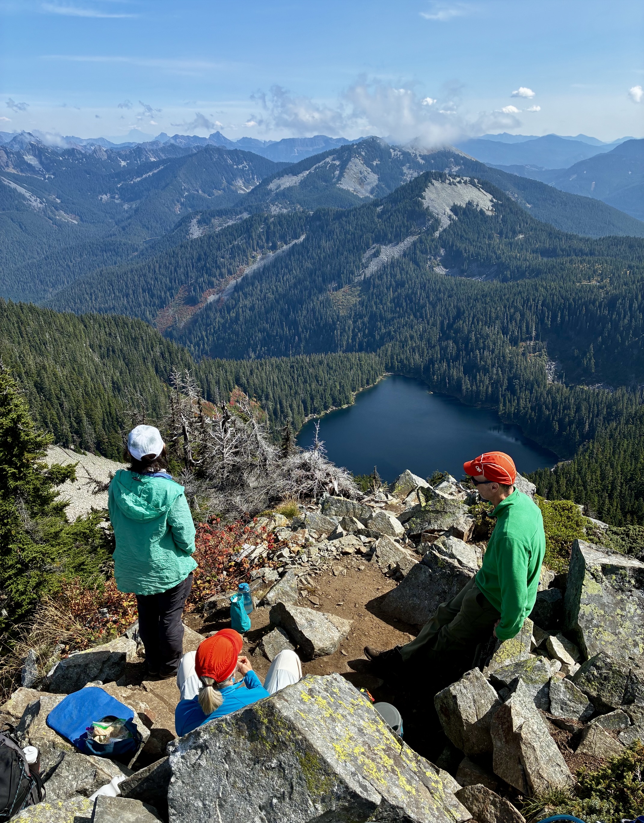
    Kula Kula Lake From Mt Defiance Summit

    Mt Defiance via Exit 42 / Exit 45—Mason Lake—Mason Pass—Defiance Junction (Lower Snoqualmie Range, WA)

    Jim Brisbine · November 17, 2012
    Central WA Cascades Lower Snoqualmie Range

    Originally Posted: November 2012
    Updated: November 2026

    Mt. Defiance Day Hike via Exit 42
    Mt. Defiance Day Hike via Exit 45

    Lower Mason Creek
    Mason Lake
    Mason Pass
    Mount Defiance (5584 ft)

    What’s in this Post…
    show
    • Route Summary
    • Route Overview
    • Full Route Description
      • Mason Creek Trailhead to Ira Spring Trailhead
      • Ira Spring Trailhead to Mason Lake
      • Mason Lake to Mt. Defiance
    • Route Map & Profiles
    • Photo Gallery

    Route Summary

    Region: Central Washington Cascades

    Sub-Region: Lower Snoqualmie Range

    Area: Alpine Lakes Wilderness

    Option A: Exit 45 Approach

    Starting & Ending Point: Ira Spring Trailhead at end of Mason Lake Road #9031 (Elev. 2150 feet)

    Way Points: Mason Creek Bridge & Alpine Lakes Wilderness boundary & Bandera Junction & bouldery rib & Mason Lake & Mason Pass & Defiance Junction & Mt. Defiance summit (trail hike)

    Approximate Stats for Mason Lake (round trip): 6.6 miles traveled; 2350 feet gained & lost.

    Approximate Stats for Mt. Defiance (round trip): 9.8 miles traveled; 3750 feet gained & lost.

    Summit: Mt. Defiance (trail hike via Southwest Ridge)

    Option B: Exit 42 Approach

    Starting & Ending Point: Mason Creek Trailhead at end of short spur road off Interstate-90 at Exit 42 (Elev. 1500 feet)

    Way Points: Lower Mason Creek crossing & Mason Creek Road junction & Ira Spring Trailhead & Mason Creek Bridge & Alpine Lakes Wilderness boundary & Bandera Junction & bouldery rib & Mason Lake & Mason Pass & Defiance Junction & Mt. Defiance summit (trail hike & road walk)

    Approximate Stats for Mason Lake (round trip): 8.0 miles traveled; 3000 feet gained & lost.

    Approximate Stats for Mt. Defiance (round trip): 11.2 miles traveled; 4400 feet gained & lost.

    Summit: Mt. Defiance (trail hike via Southwest Ridge)

    Route Overview

    Among the various day-hiking destinations in the Interstate-90 corridor, Mt. Defiance is an often-overlooked gem. Its summit can be most-easily accessed by a trail that passes next to beautiful Mason Lake—an excellent swimming spot on a hot summer day. The 5584-foot summit offers views of other peaks and a handful of lakes in the Lower Snoqualmie Range.

    There are two typical approach routes to reach the summit of Mt. Defiance, as described below.

    • Exit 45 Approach (Option A): The shortest and most common route starts at the Ira Spring Trailhead, which is easily accessed from Exit 45 on Interstate-90. Drive westward on Talapus Lake Road #9030 and then Mason Creek Road #9031 for a total of 3.7 miles to reach the moderately large parking lot. Be aware that this parking lot fills up quickly on weekends, and it requires a Northwest Forest Pass or equivalent.
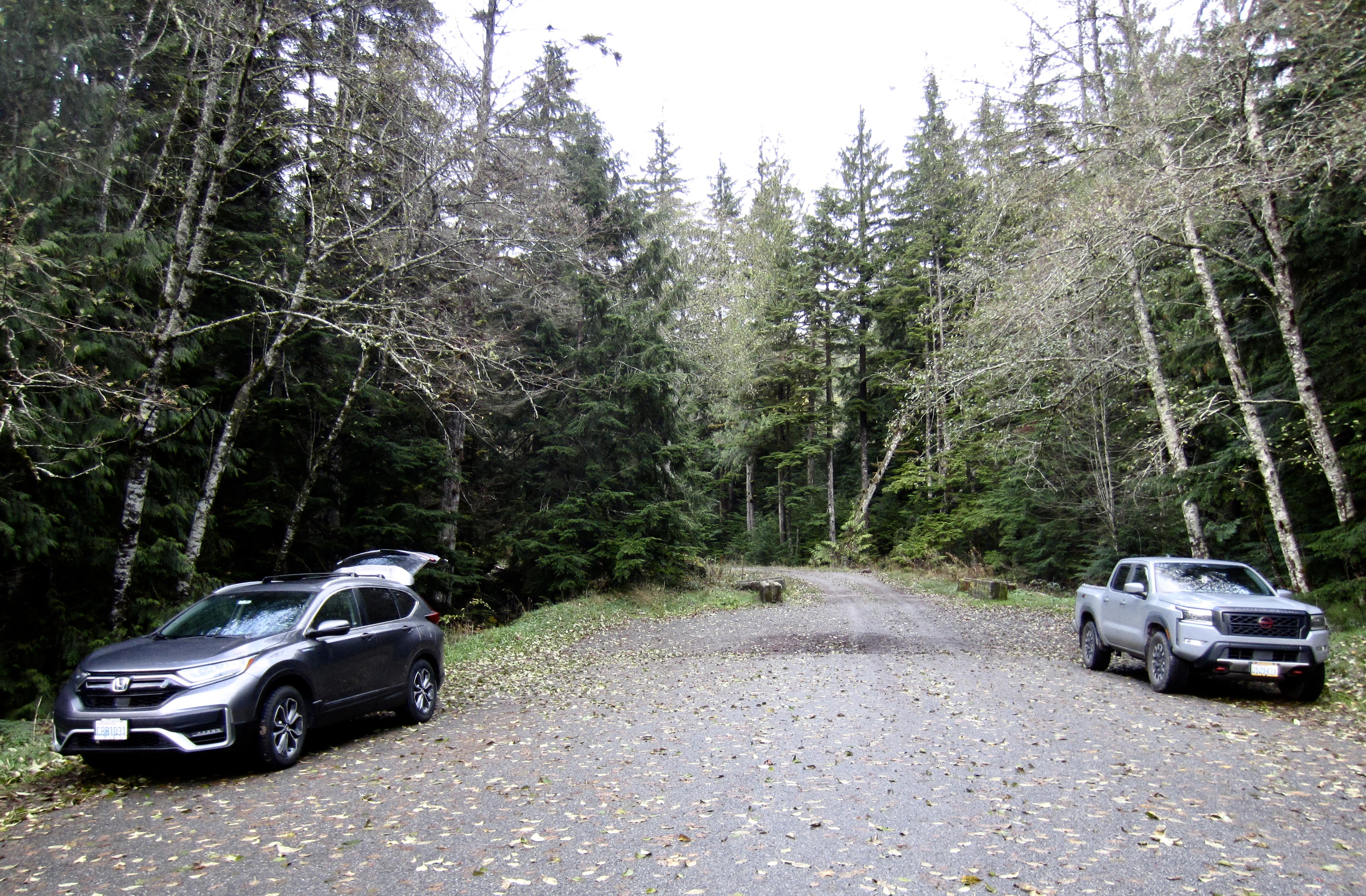
    • Exit 42 Approach (Option B): A slightly longer route starts at the Mason Creek Trailhead, which is located at the end of a short spur road that extends approximately 150 yards northward from the Exit 42 interchange on Interstate-90. There is limited parking along both sides of this spur road, but no pass is required. This starting point is recommended for people who want some additional exercise or who can appreciate an unpopulated hike through a charming forest.
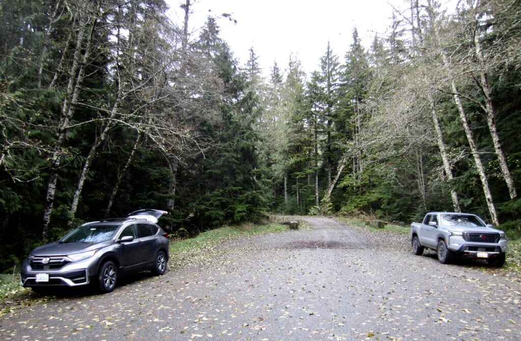
    Exit 42 Spur Road Near Mason Creek Trailhead
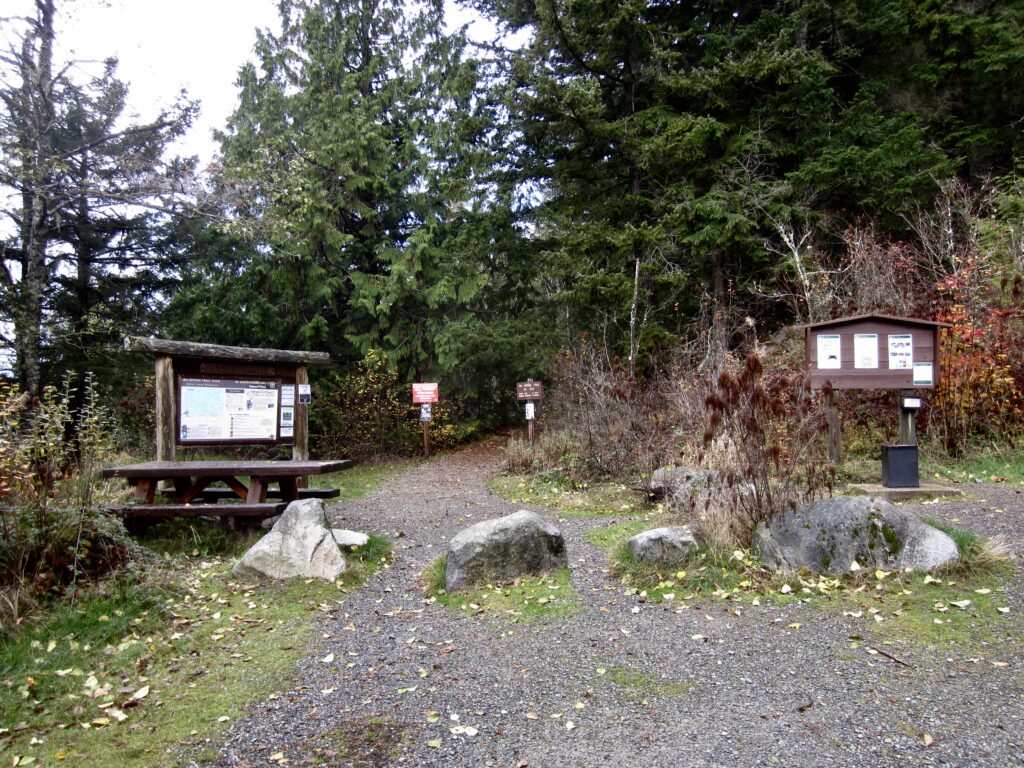
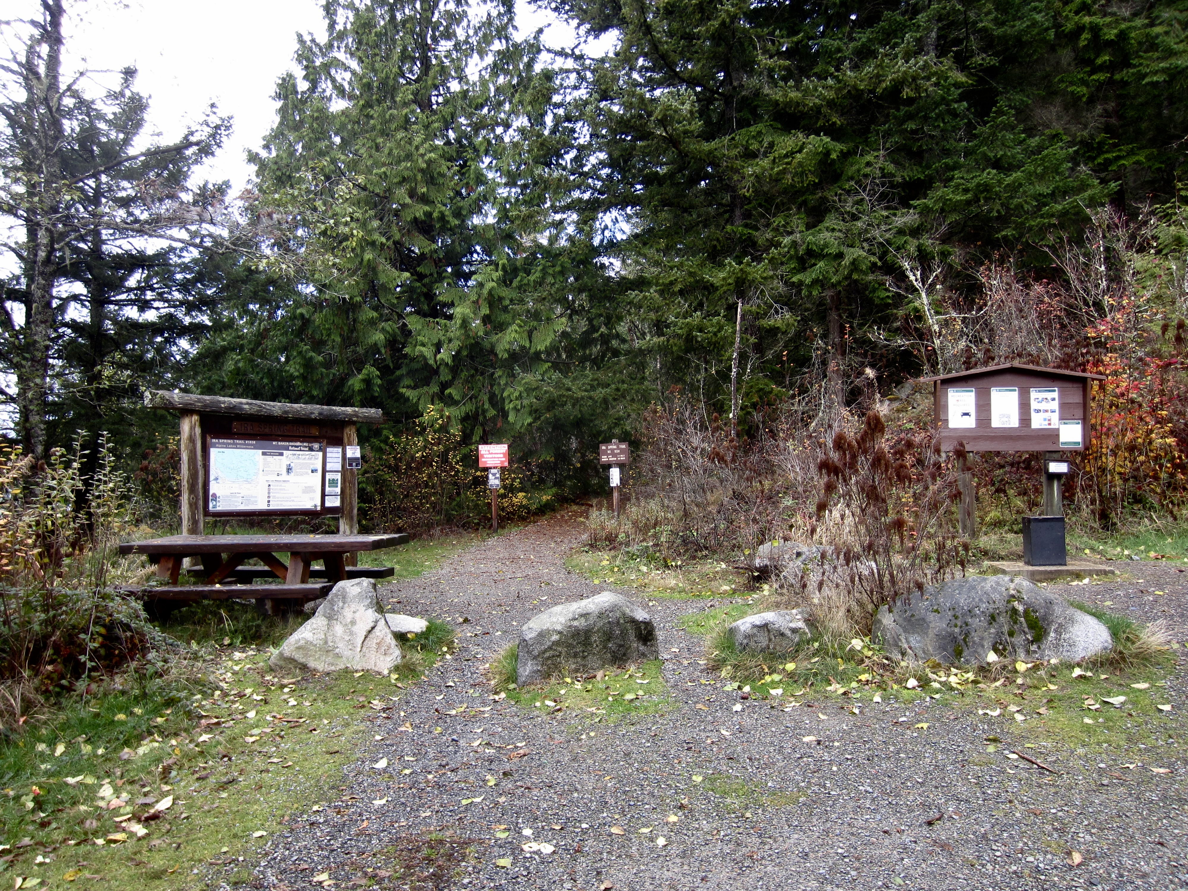
    Ira Spring Trailhead Kiosks & Signage

    .

    Full Route Description

    The first text section below describes the approach route from the Mason Creek Trailhead near Exit 42 to the Ira Spring Trailhead. If you are starting at the higher Ira Spring Trailhead, skip directly to the second section.

    Mason Creek Trailhead to Ira Spring Trailhead

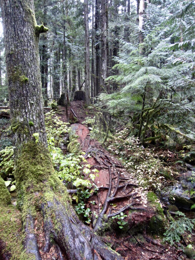
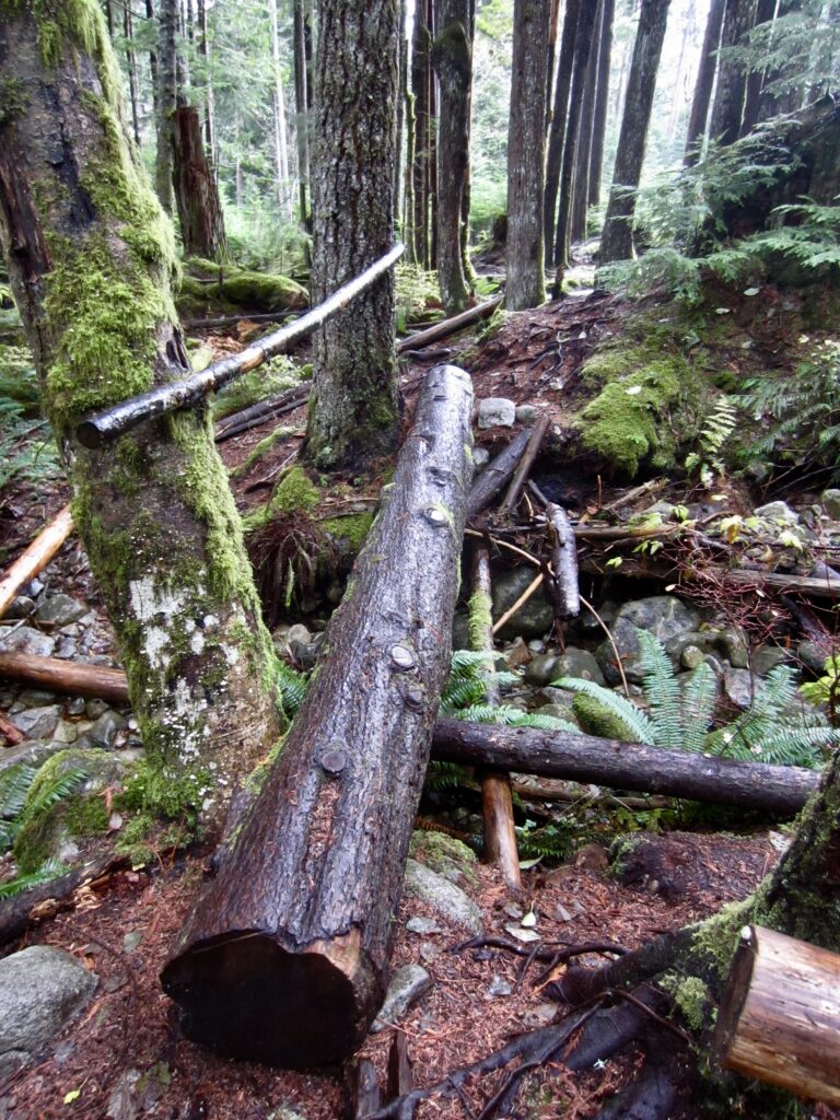
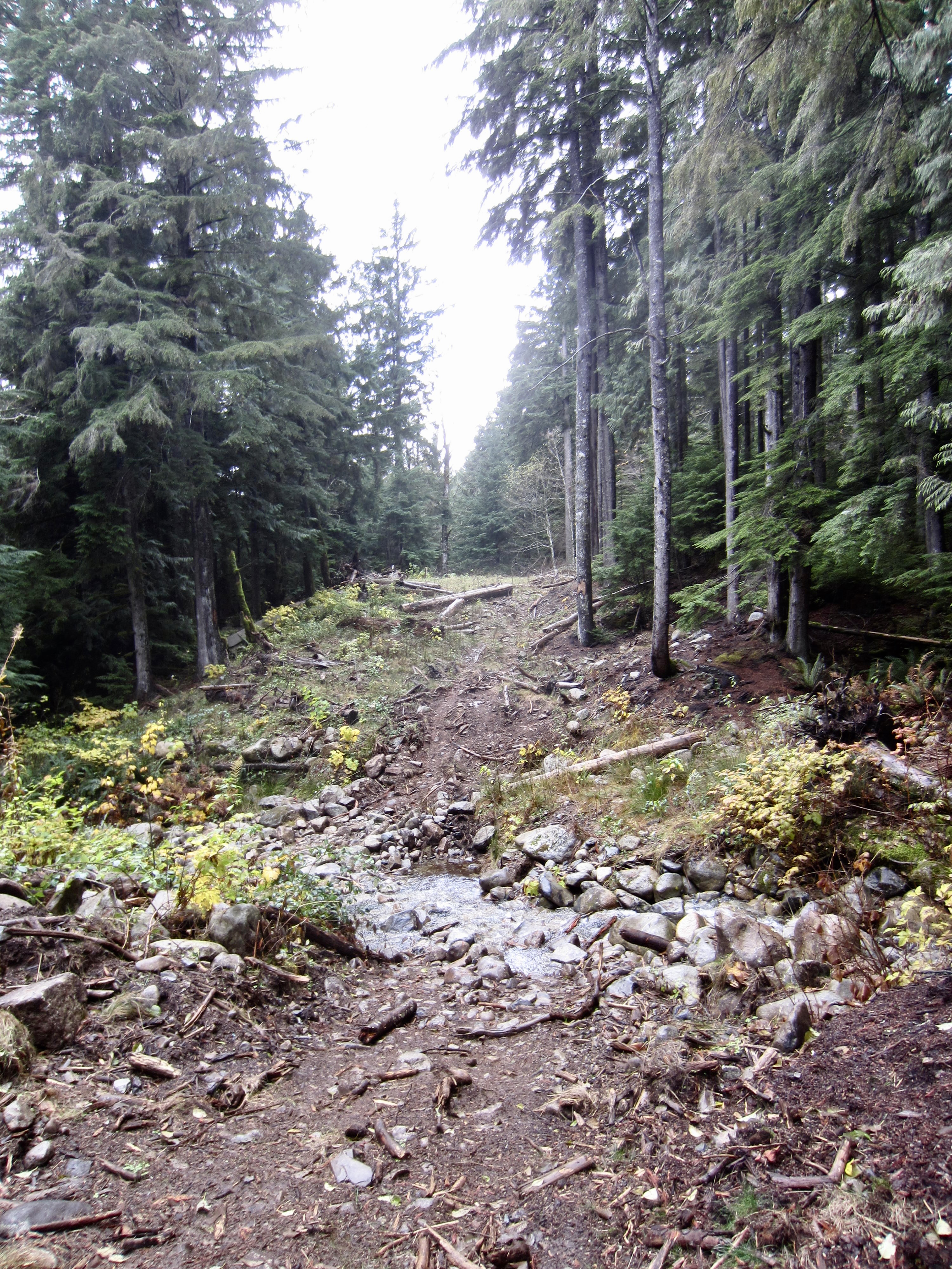
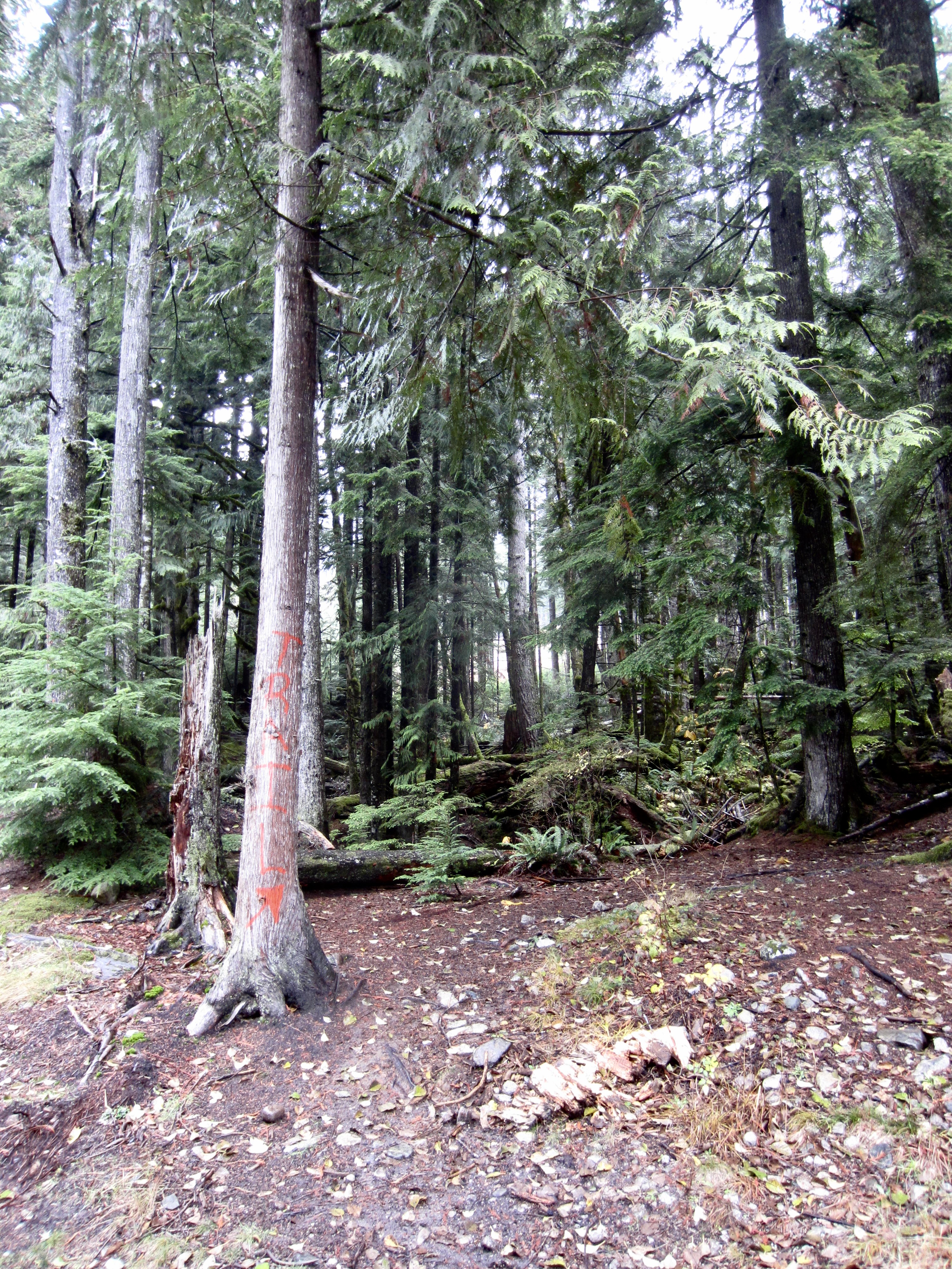
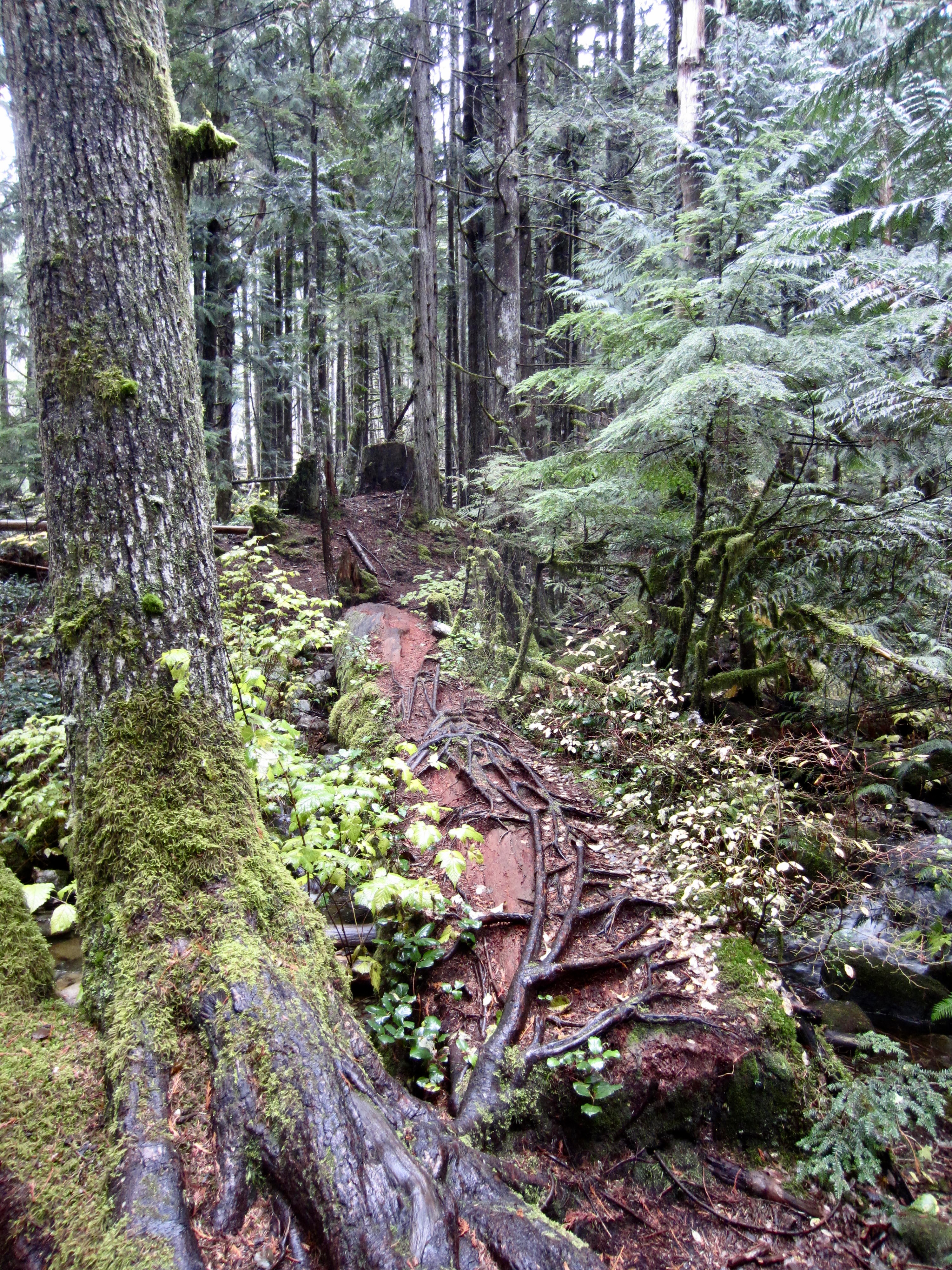
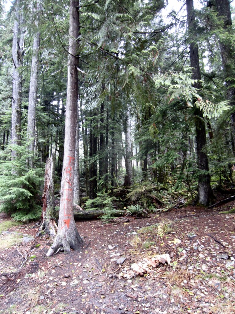
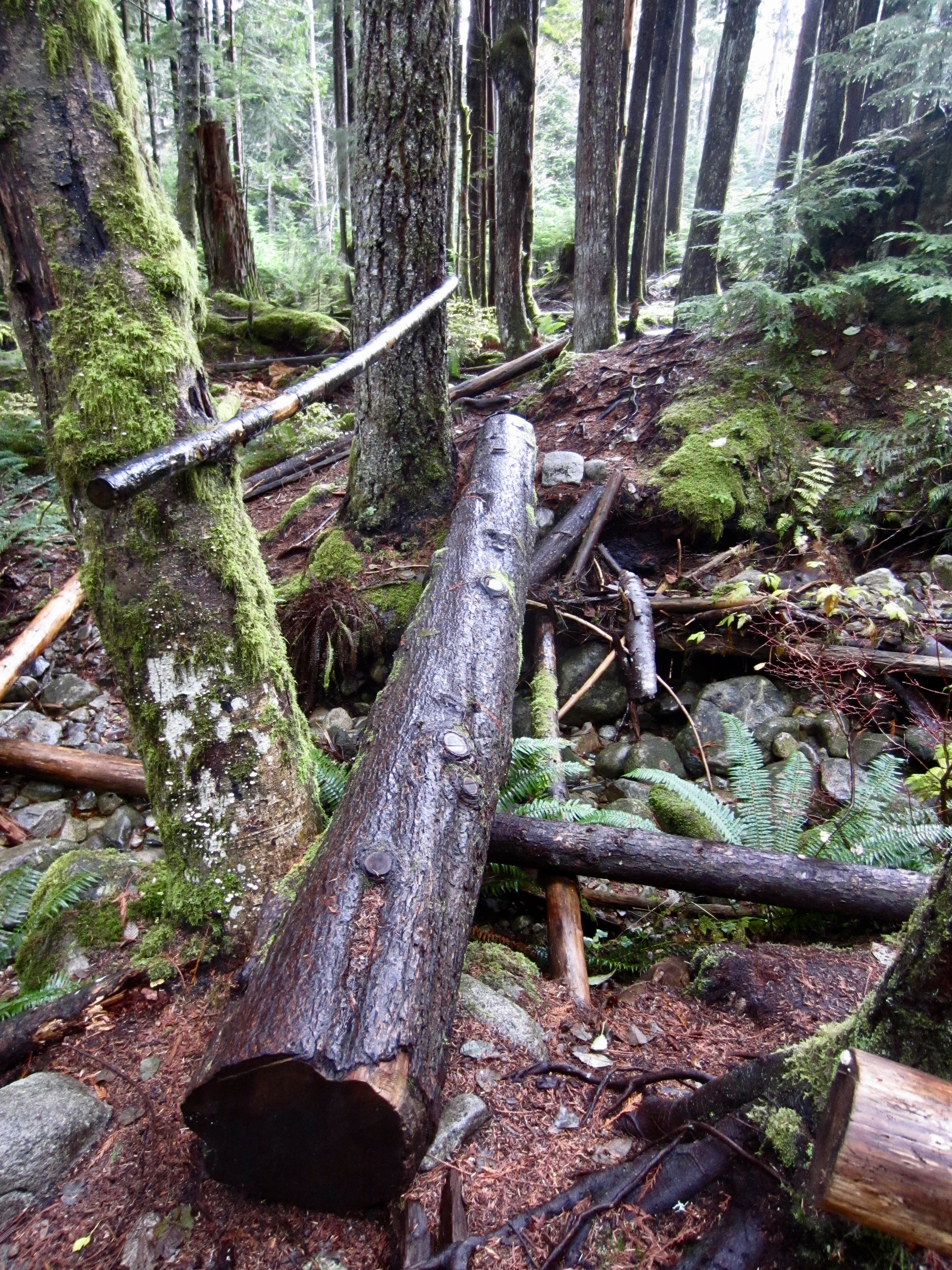
    From the end of the paved spur road at Exit 42, walk 100 yards up the wide dirt road that makes a sweeping curve to the left (west). Just before coming to a small ravine, look for a tree bearing the word “TRAIL” in red paint. Turn right here and follow a rough trail into the woods for about 30 yards, then cross the main branch of Lower Mason Creek on a large, root-covered log. Quickly cross two minor tributaries on footlogs, then turn right and keep hiking uphill.
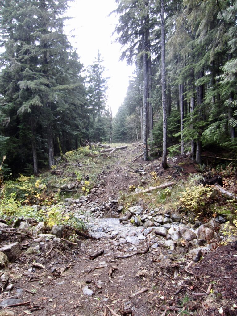
    Small Ravine Near Mason Creek Trailhead
    Red Paint Marking Mason Creek Trailhead

    .

    Large Log Over Lower Mason Creek
    Small Log Over Lower Mason Creek

    .

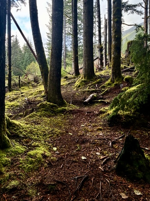
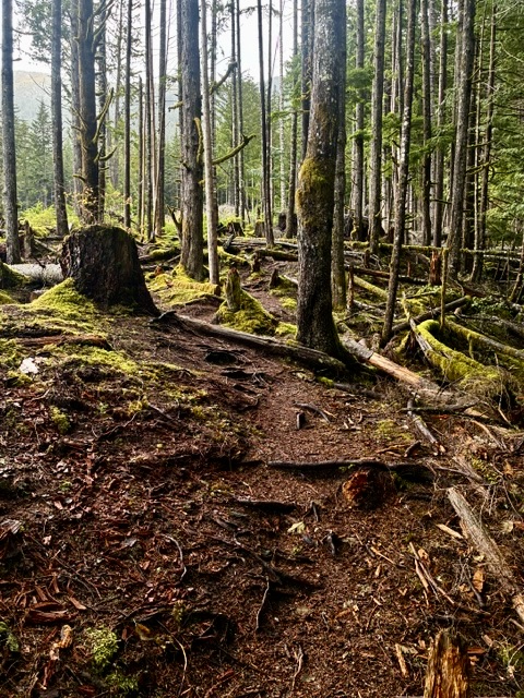
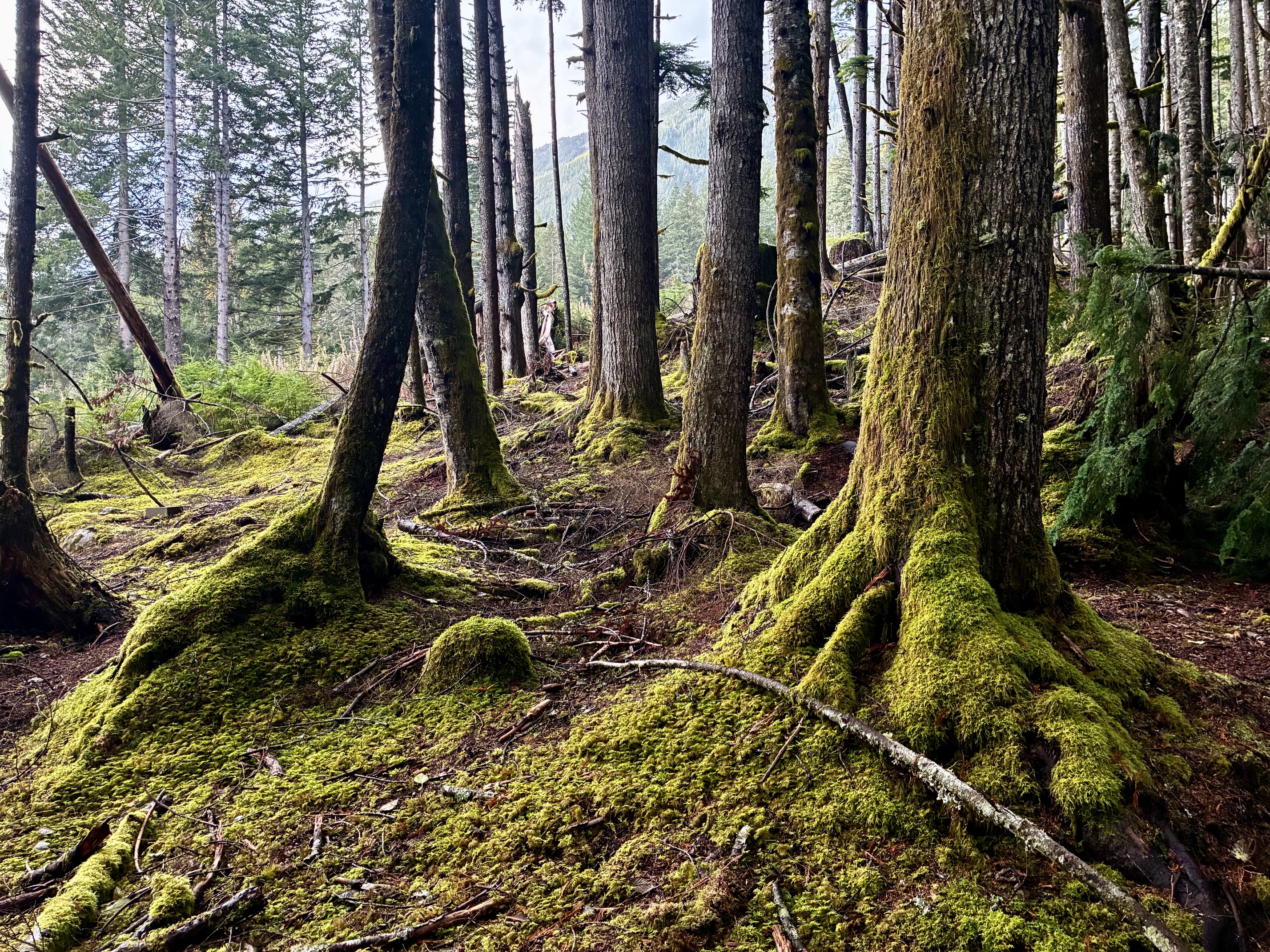
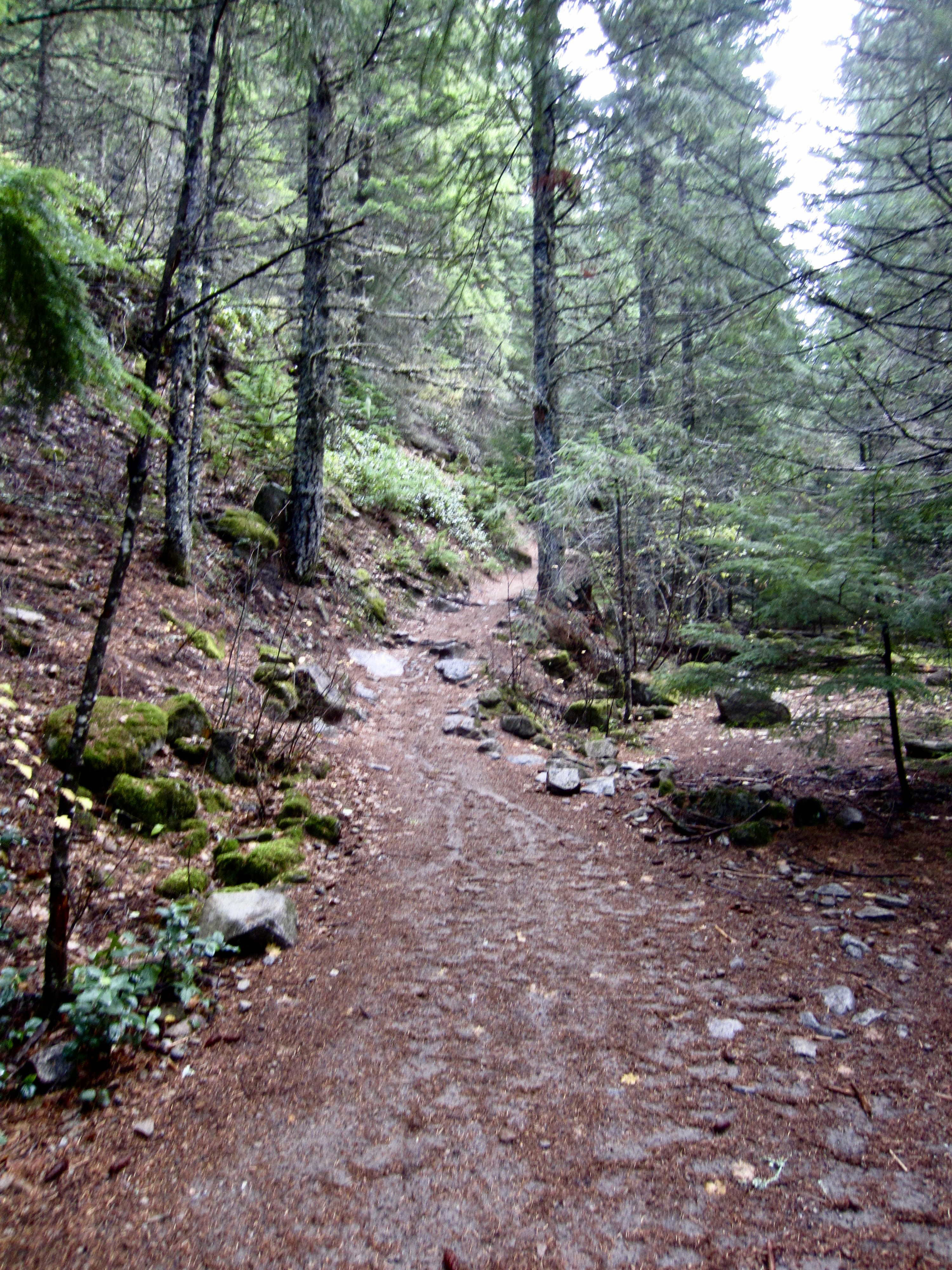
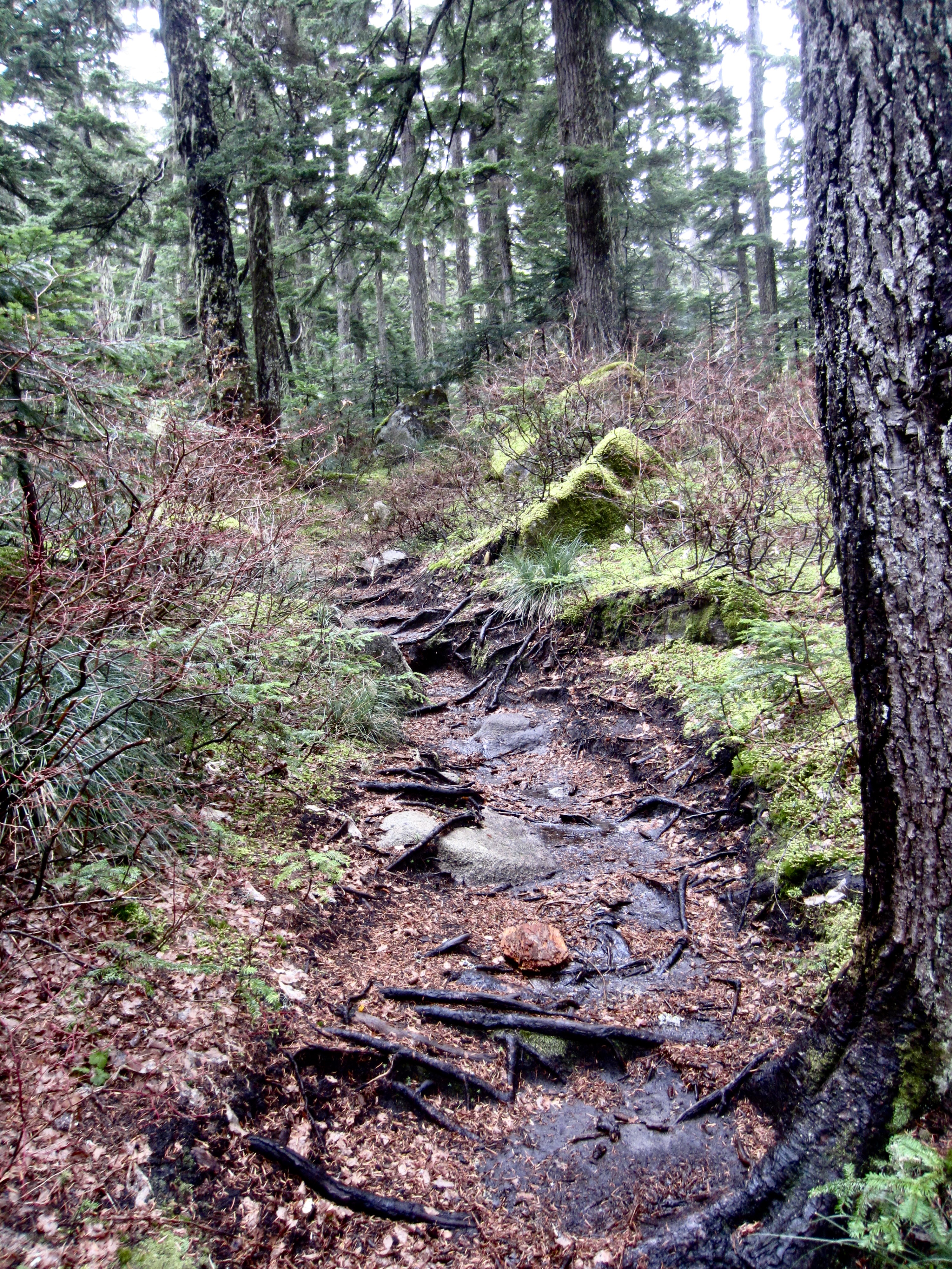
    Despite being an unsanctioned “volunteer trail,” it is surprisingly well-maintained, as evidenced by the dozens of cut logs. The trail climbs in a northward direction, always staying within earshot of the creek as it wanders through pleasant second-growth forest decorated with moss and ferns.
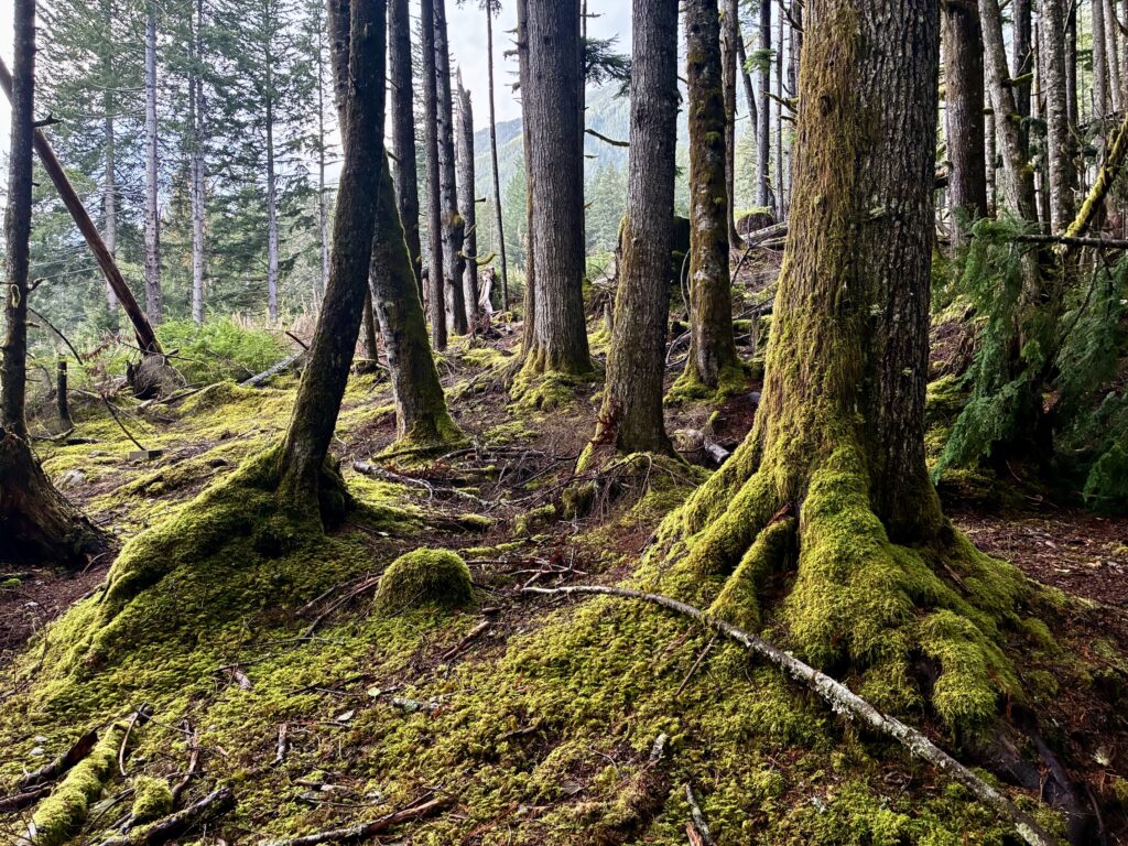
    Mossy Forest On Mason Creek Trail

    .

    Mason Creek Trail In Mossy Forest
    Mason Creek Trail Thru Mossy Forest

    .

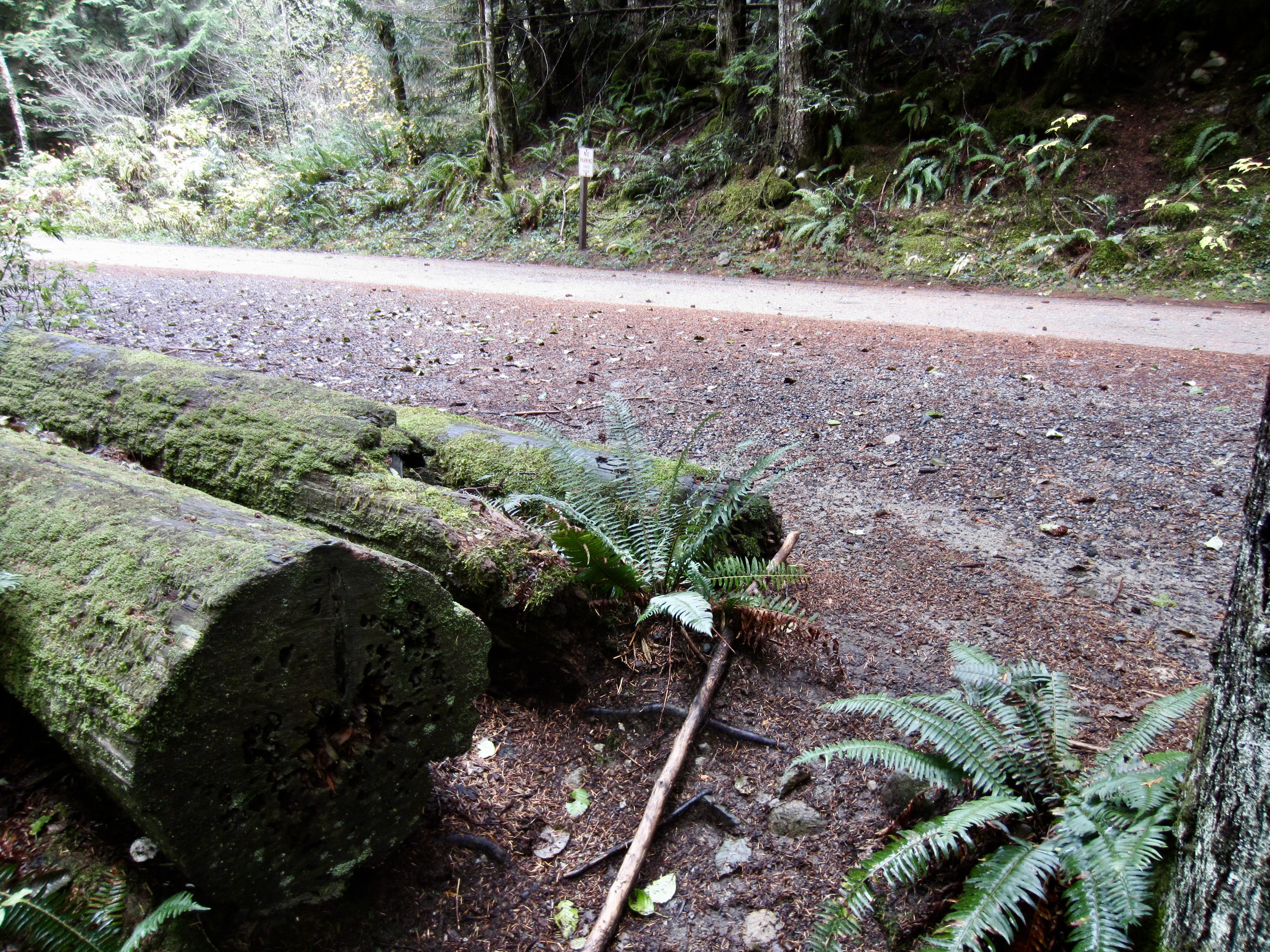
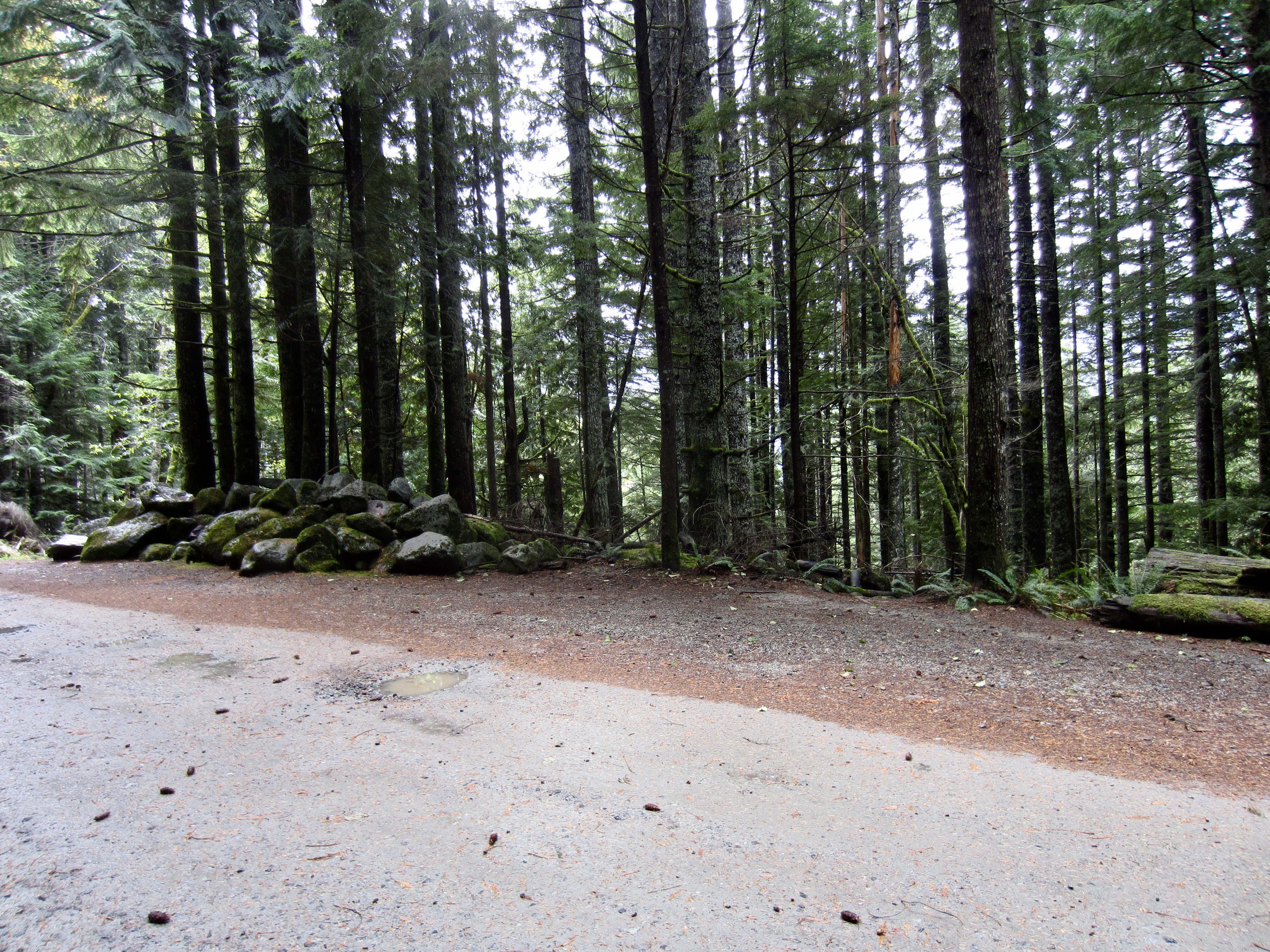
    After gaining about 600 vertical feet, you will intersect a wide dirt road (Mason Creek Road). Take note of the fact that this junction is located adjacent to a pile of boulders and across from a “No Parking” sign; these will be useful landmarks on your return hike later. Turn left and walk the road westward for approximately ¼ mile until it ends in the Ira Spring Trailhead parking lot (0.7 miles + 650 feet from Mason Creek Trailhead).
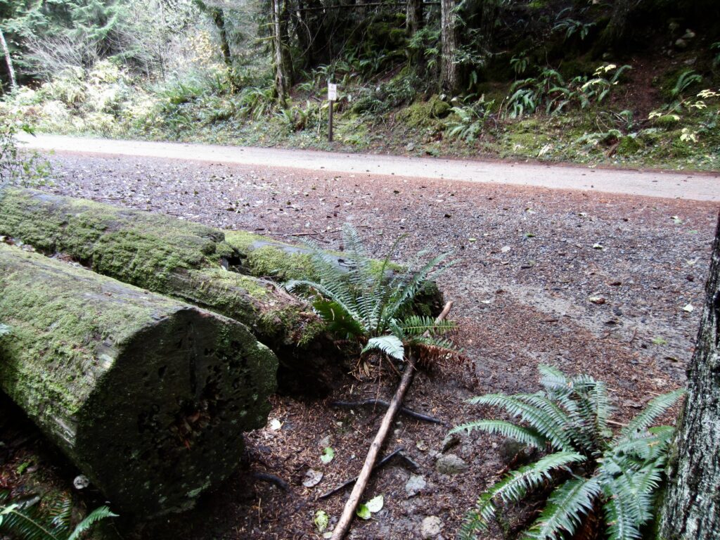
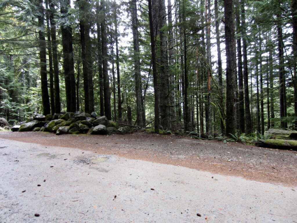
    Mason Creek Trail Junction With Road
    Upper End Of Mason Creek Trail

    .

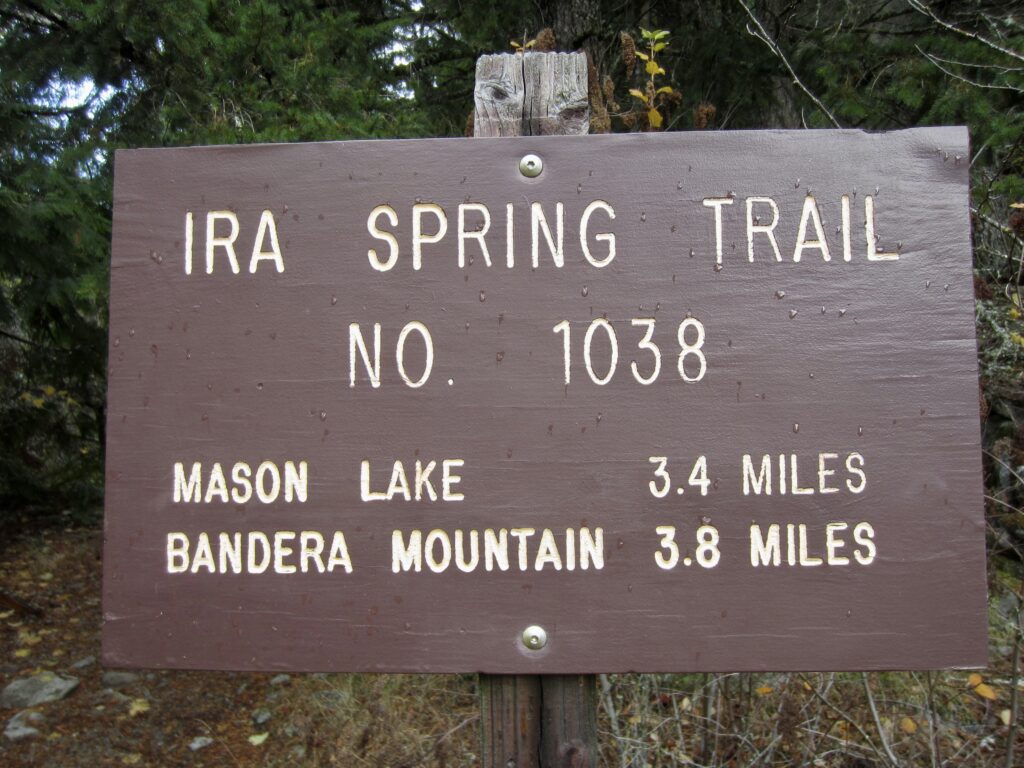
    Ira Spring Trailhead Kiosks & Signage
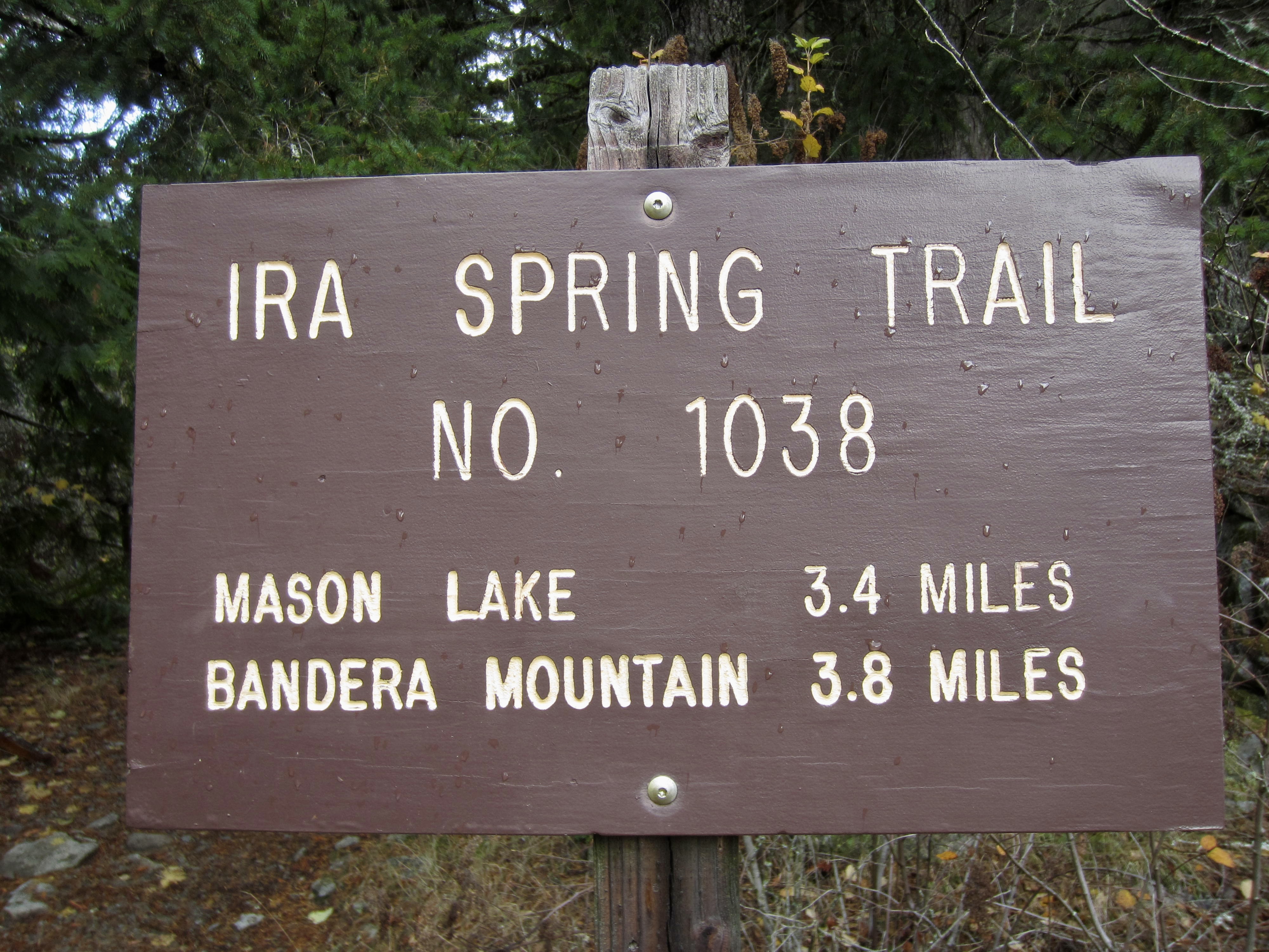
    Ira Spring Trailhead Sign

    .

    Ira Spring Trailhead to Mason Lake

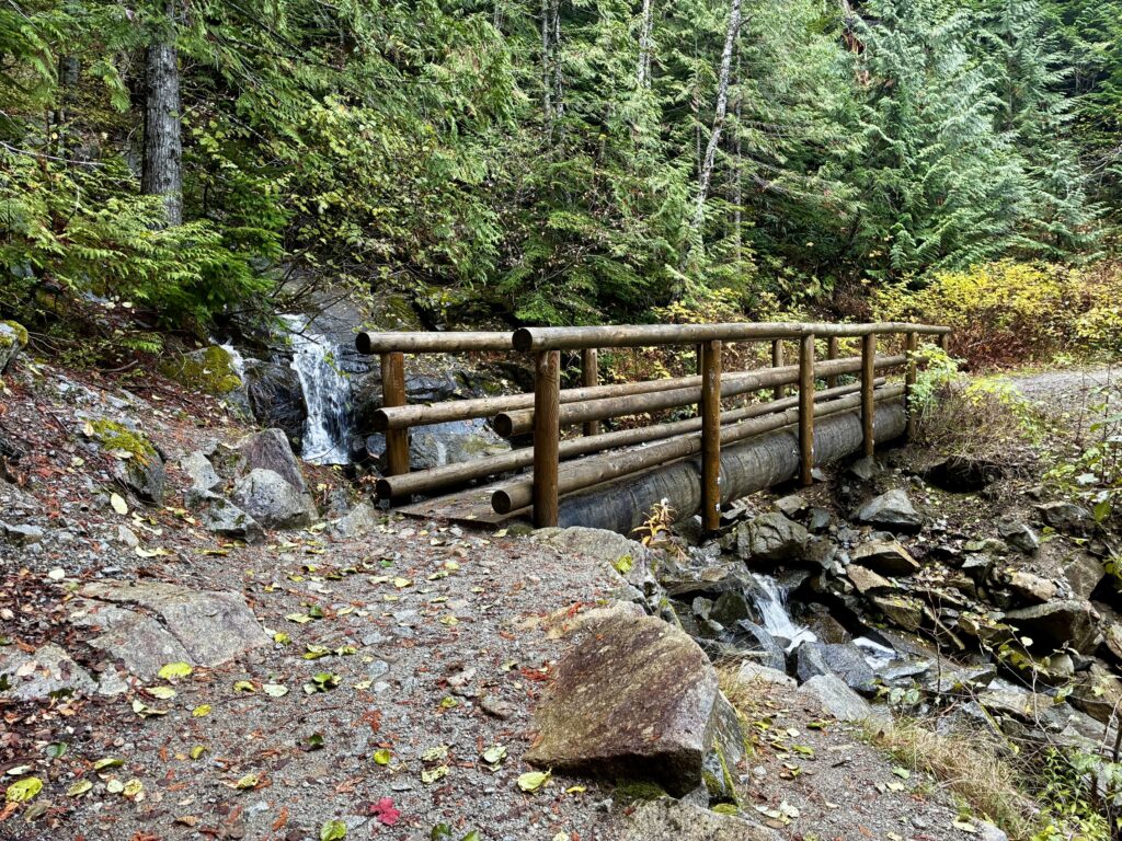
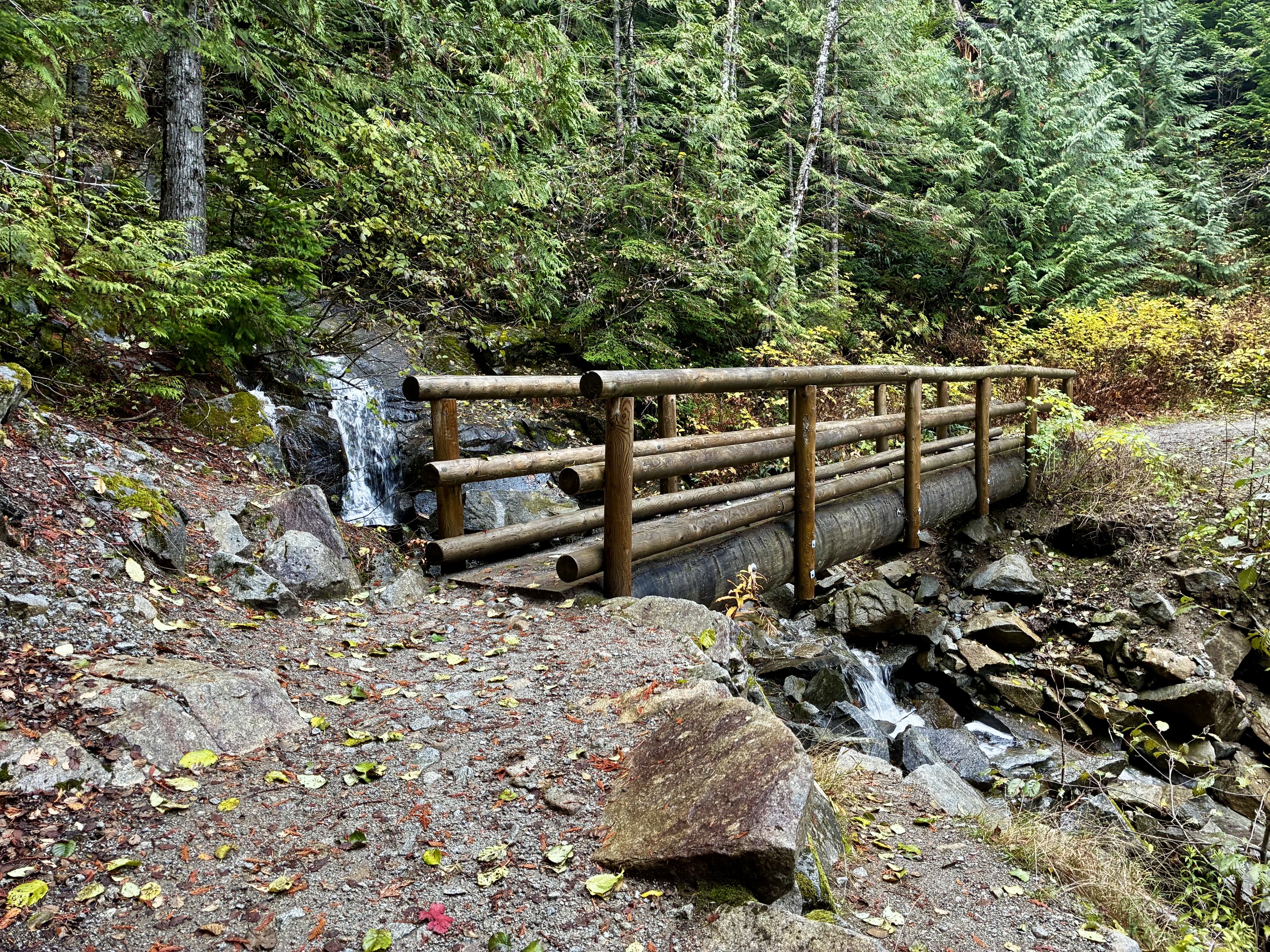
    From the trailhead kiosk at the western end of the parking lot, hike westerly on the well-marked Ira Spring Trail, which initially follows an abandoned logging road. After approximately 300 yards, the gently inclined road-trail curves back to the right and makes a long easterly traverse across the forested hillslope. Very soon, you will cross the Mason Creek Bridge.
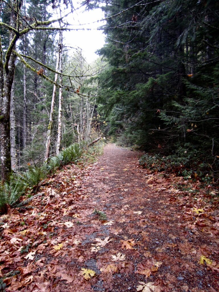
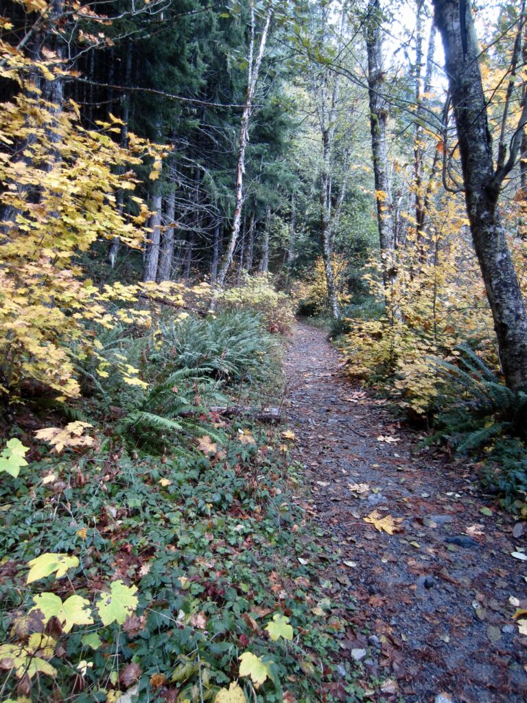
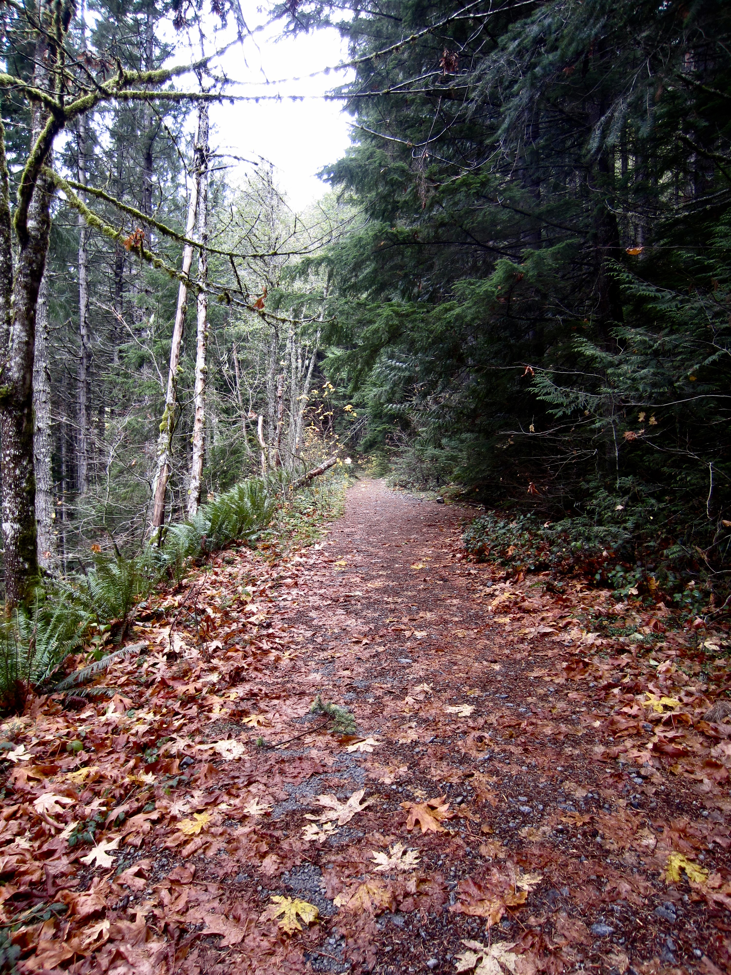
    Ira Spring Trail On Abandoned Road
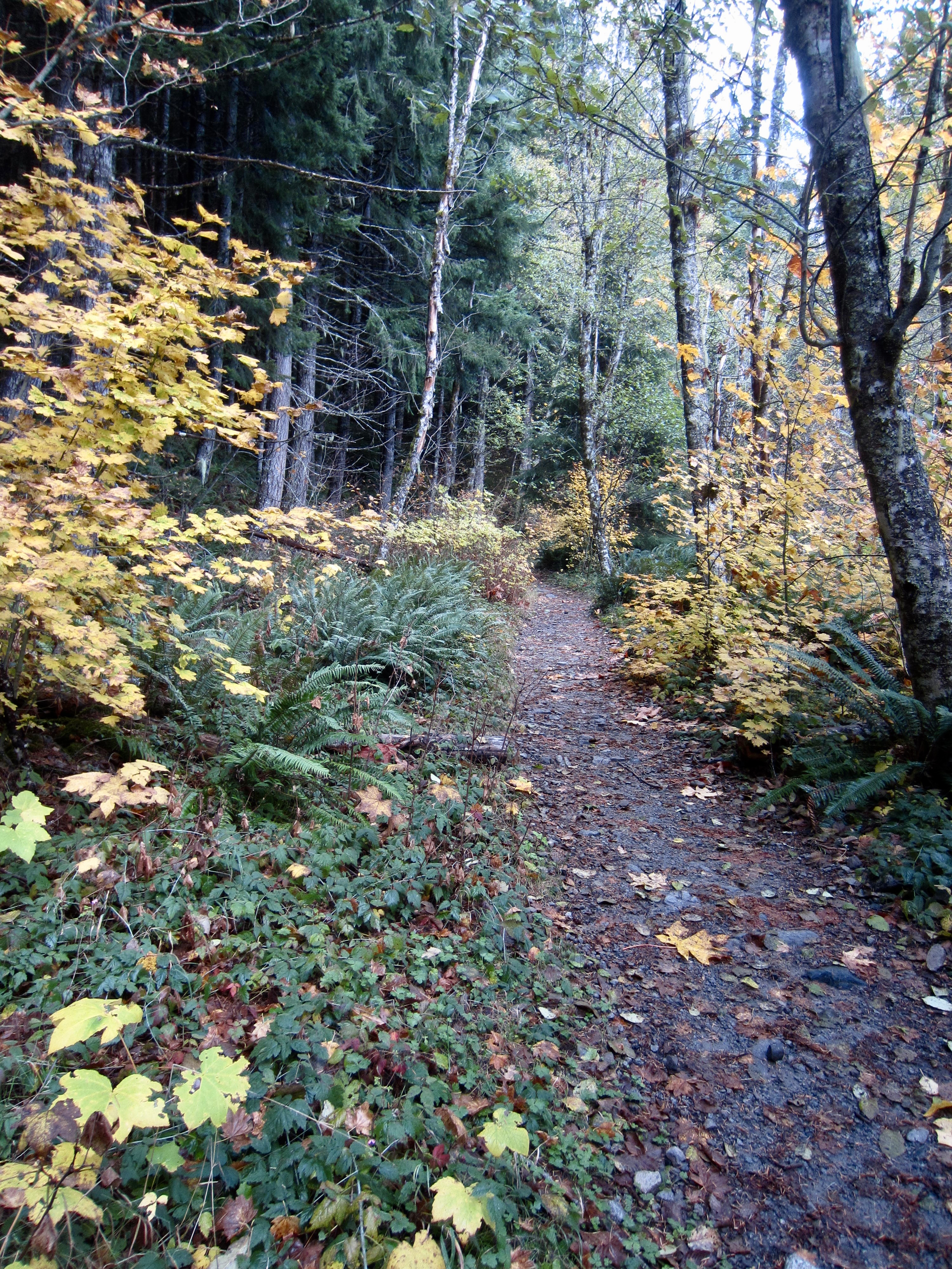
    Ira Spring Trail Thru Autumn Foliage

    .

    Mason Creek Bridge On Ira Spring Trail

    .

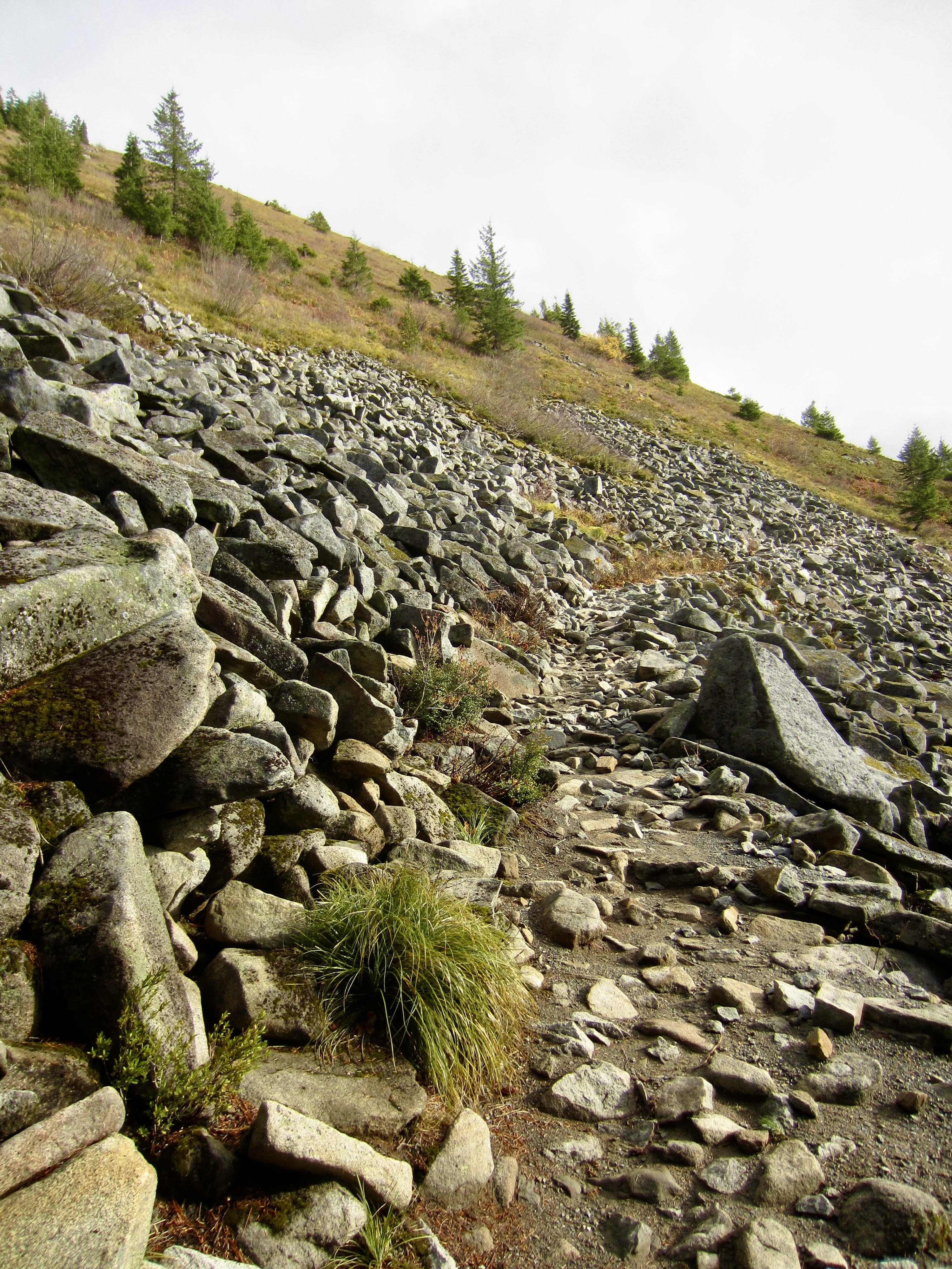
    As you keep traversing, you will enter the Alpine Lakes Wilderness and then reach a point where the trail veers to the left on a noticeably steeper abandoned logging road. This steeper road-trail soon transitions to a newer single-track trail that climbs the hillside in a series of traverses and switchbacks. The forest eventually opens onto a large talus slope below Bandera Mountain, and the trail keeps climbing.
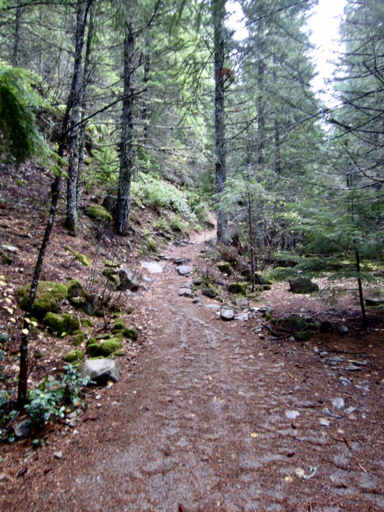
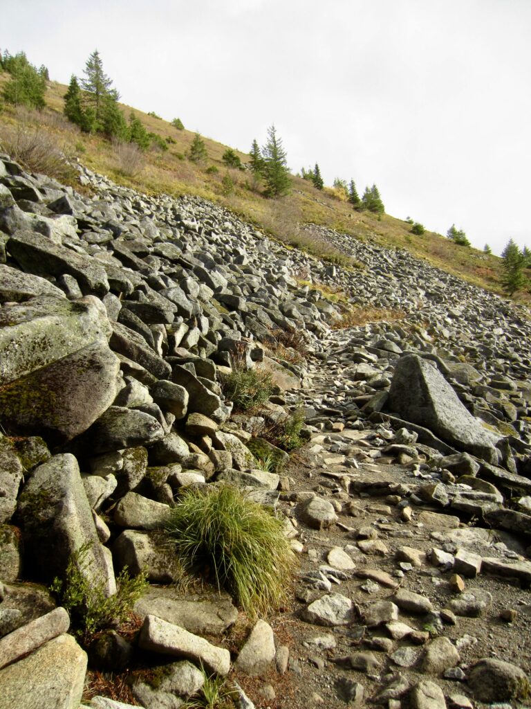
    Steeper Grade On Ira Spring Trail
    Ira Spring Trail Below Bandera Mtn

    .

    At the highest switchback, you will go past Bandera Junction and then traverse over to a bouldery rib. Mt. Defiance and its junior summit, Putrid Pete’s Peak, can be seen high above.
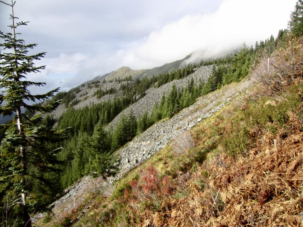
    Traversing Talus Slope On Ira Spring Trail

    .

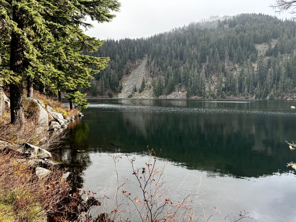
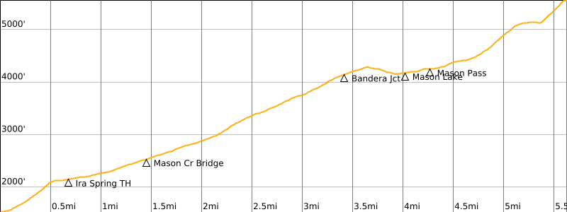
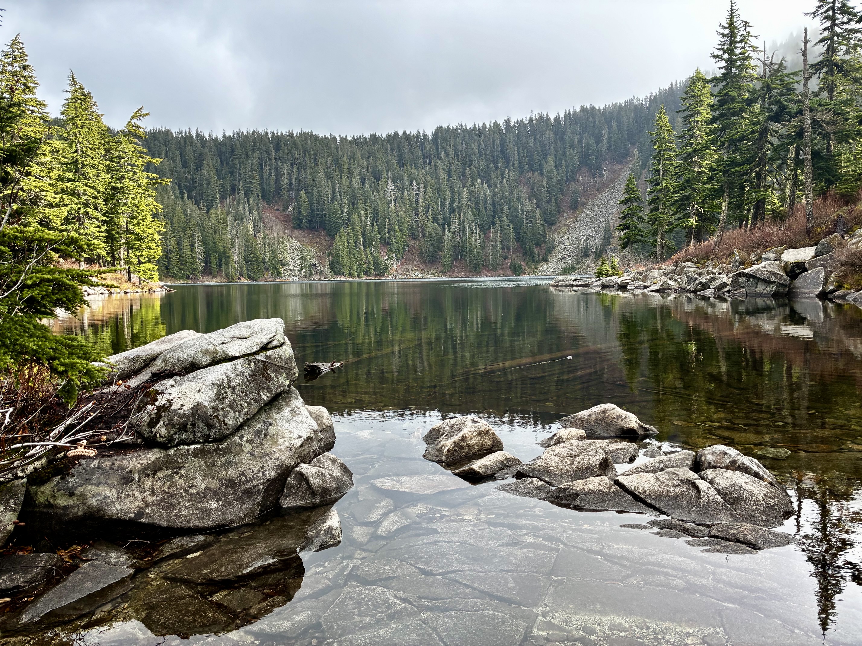
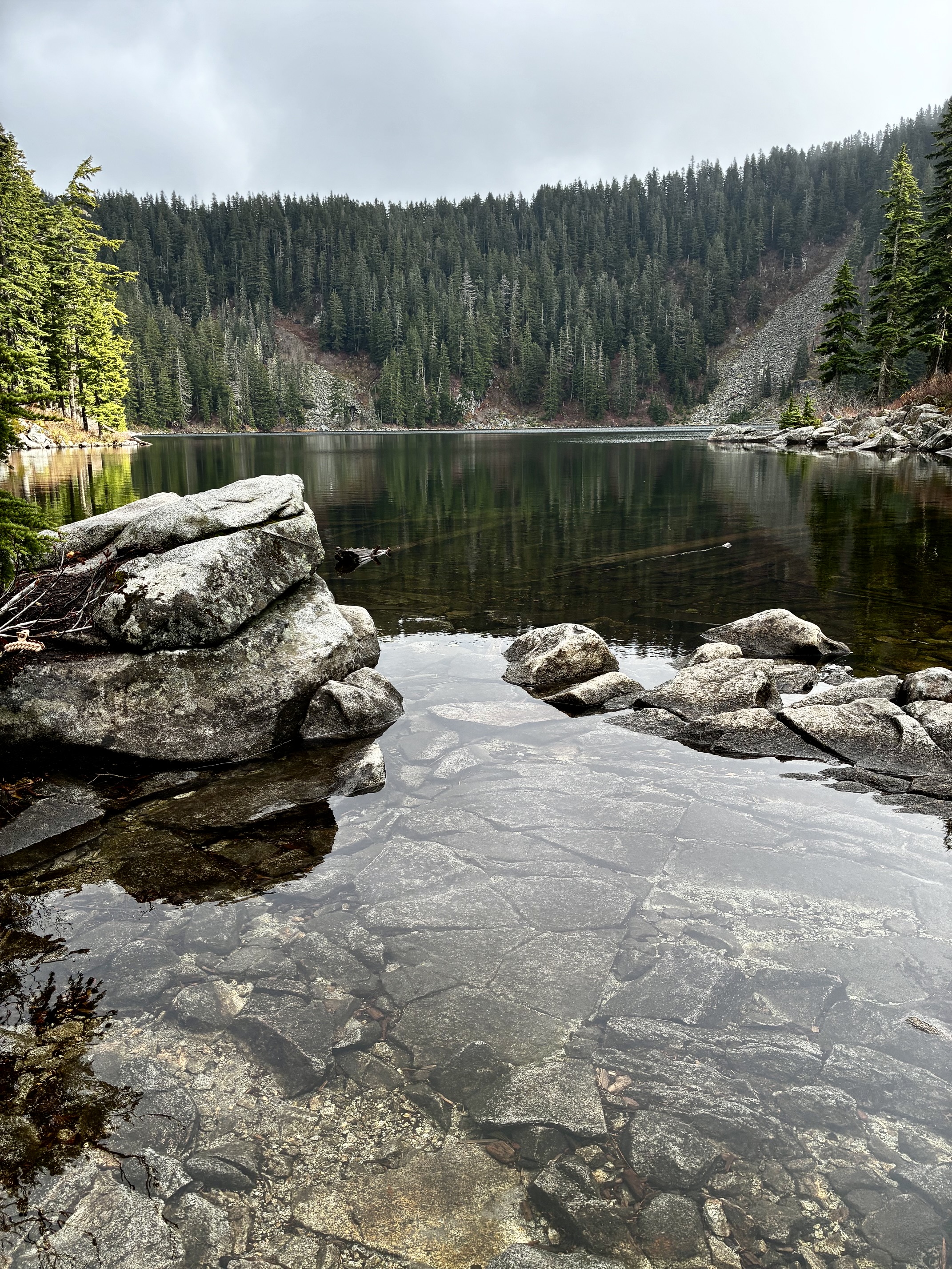
    After crossing over the bouldery rib, the trail drops 150 feet and then angles up to Mason Lake (3.3 miles + 2200 feet from Ira Spring Trailhead; 4.0 miles + 2850 feet from Mason Creek Trailhead). This has always been my favorite day-hike lake in the Interstate-90 corridor, and perhaps you will see why.
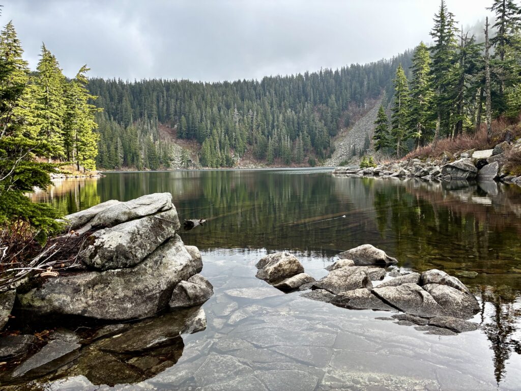
    Mason Lake From Outlet Stream

    .

    Bandera Mtn Above Mason Lake

    .

    Mason Lake to Mt. Defiance

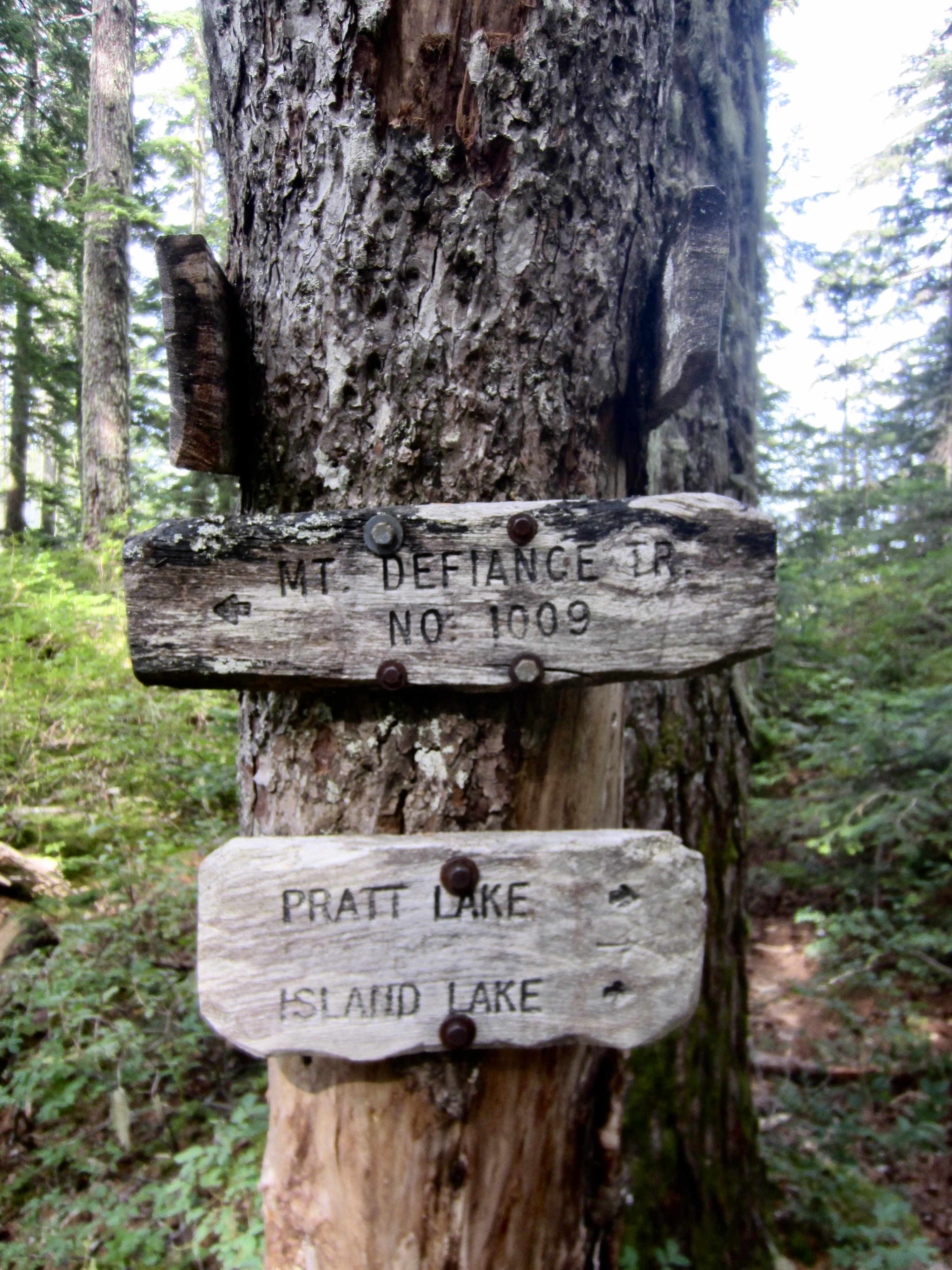
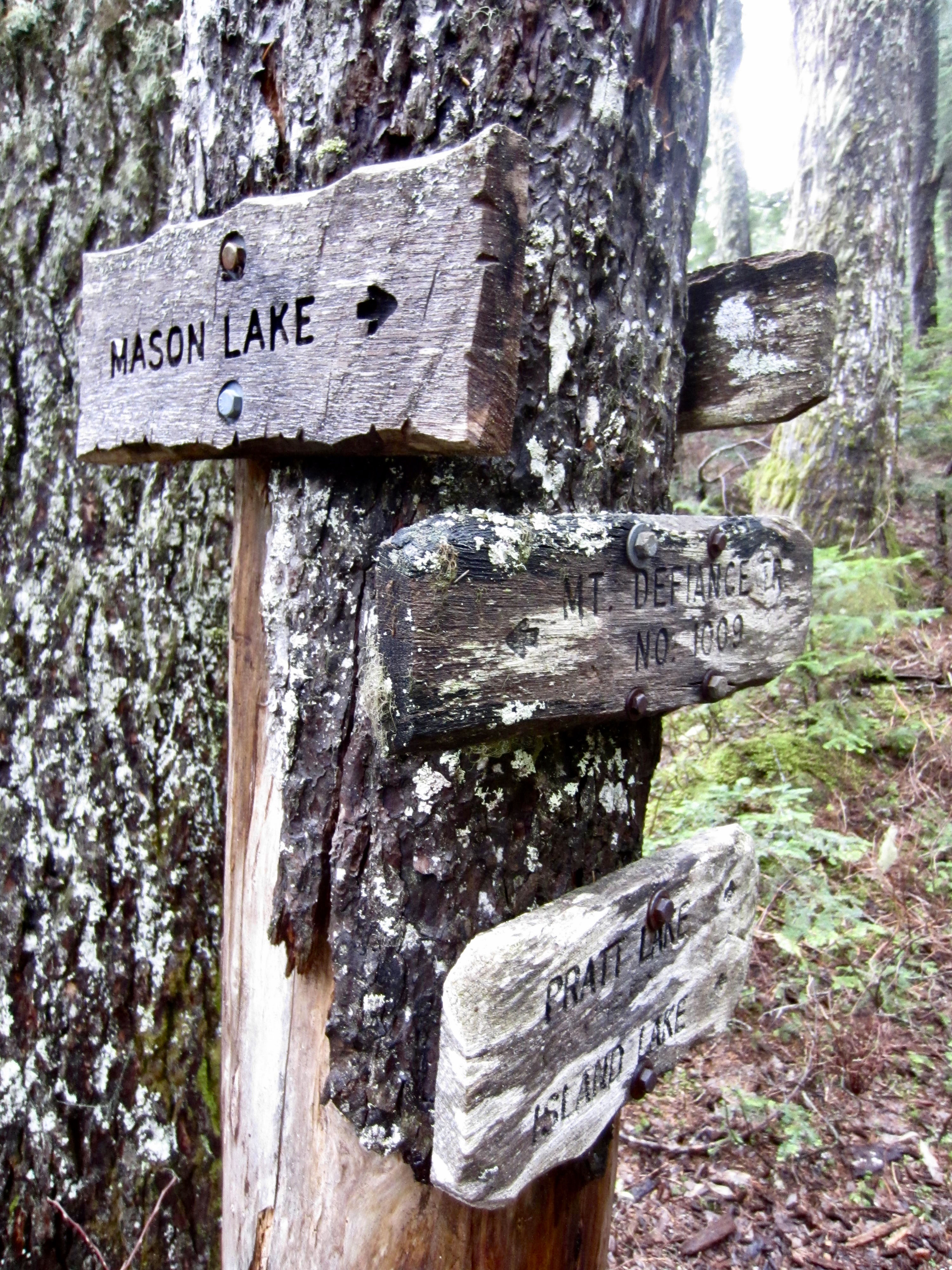
    From the outlet of Mason Lake, skirt around the left shore and wend your way around big boulders, following small “Main Trail” signs to assist with navigation. After a short hike, you will arrive at Mason Pass and a “T” intersection with the Mt. Defiance Trail. The right-hand branch leads to Rainbow Lake and Island Lake, both of which provide a nice sidetrip. The left-hand branch leads to Mt. Defiance and better views.
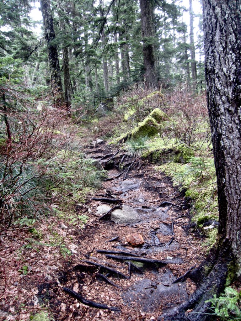
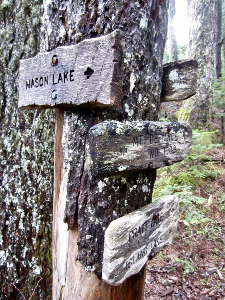
    Rooty Trail Near Mason Pass
    Tree Signs At Mason Pass

    .

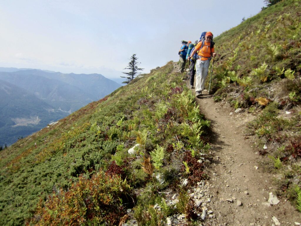
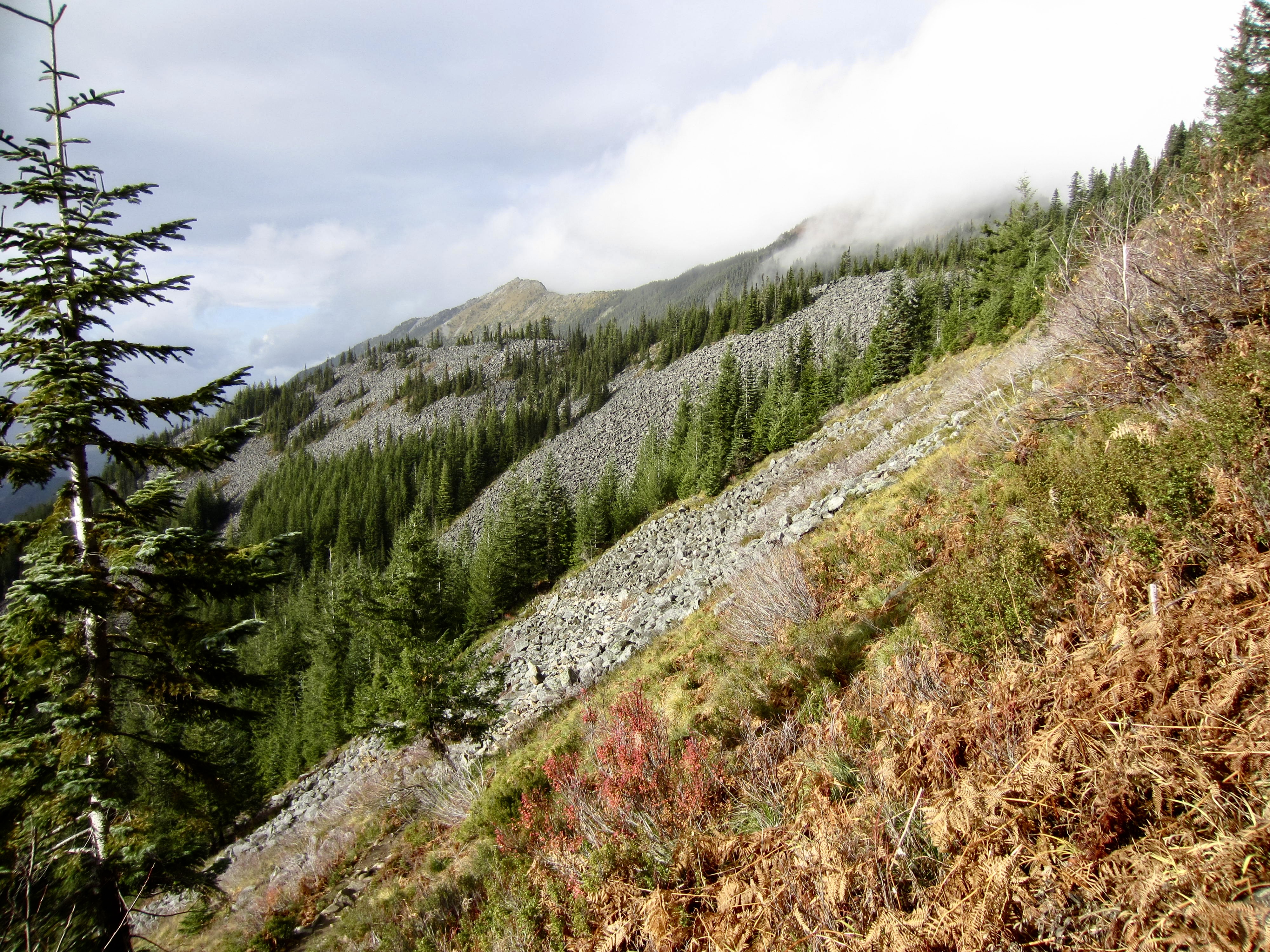
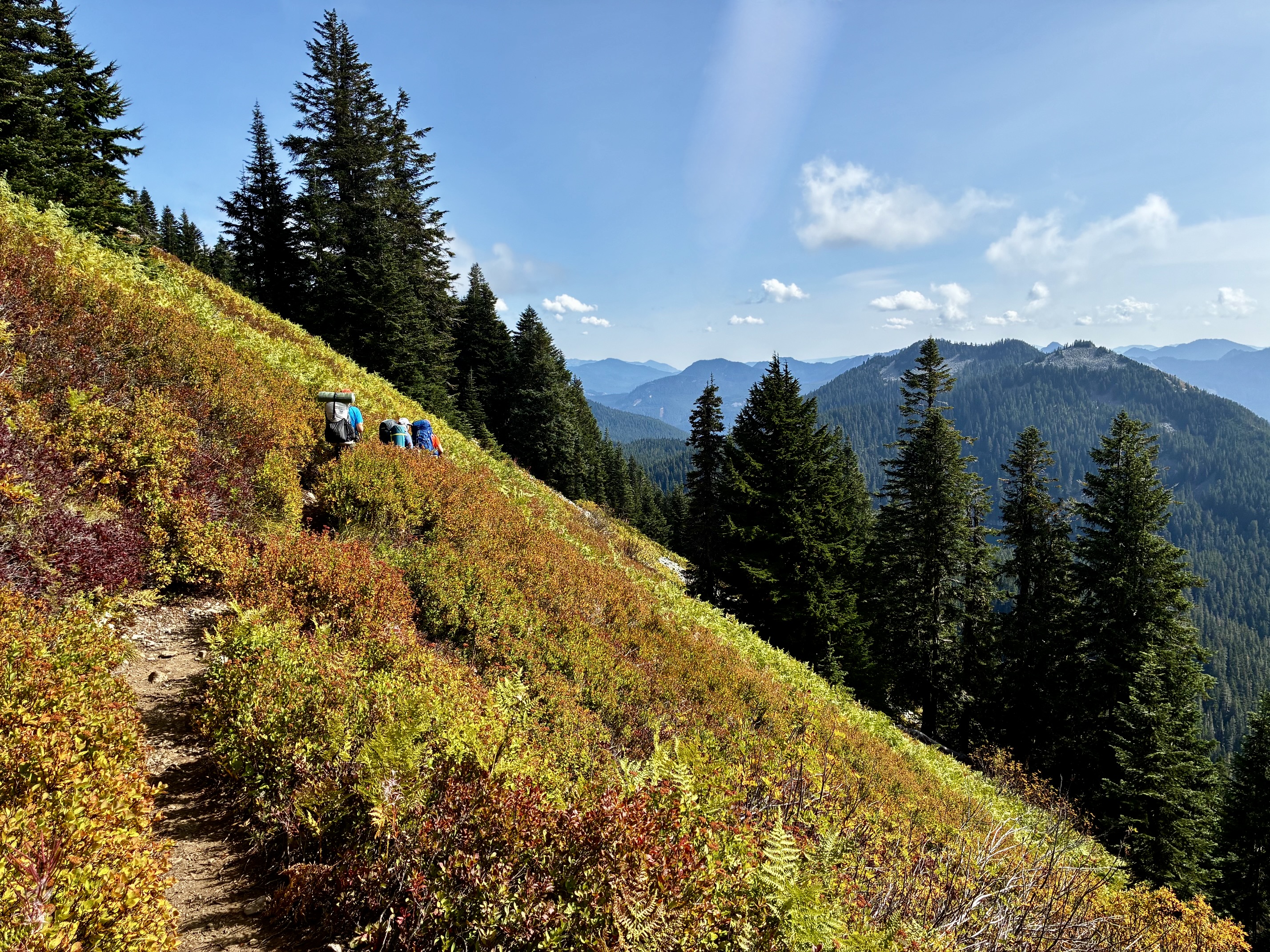
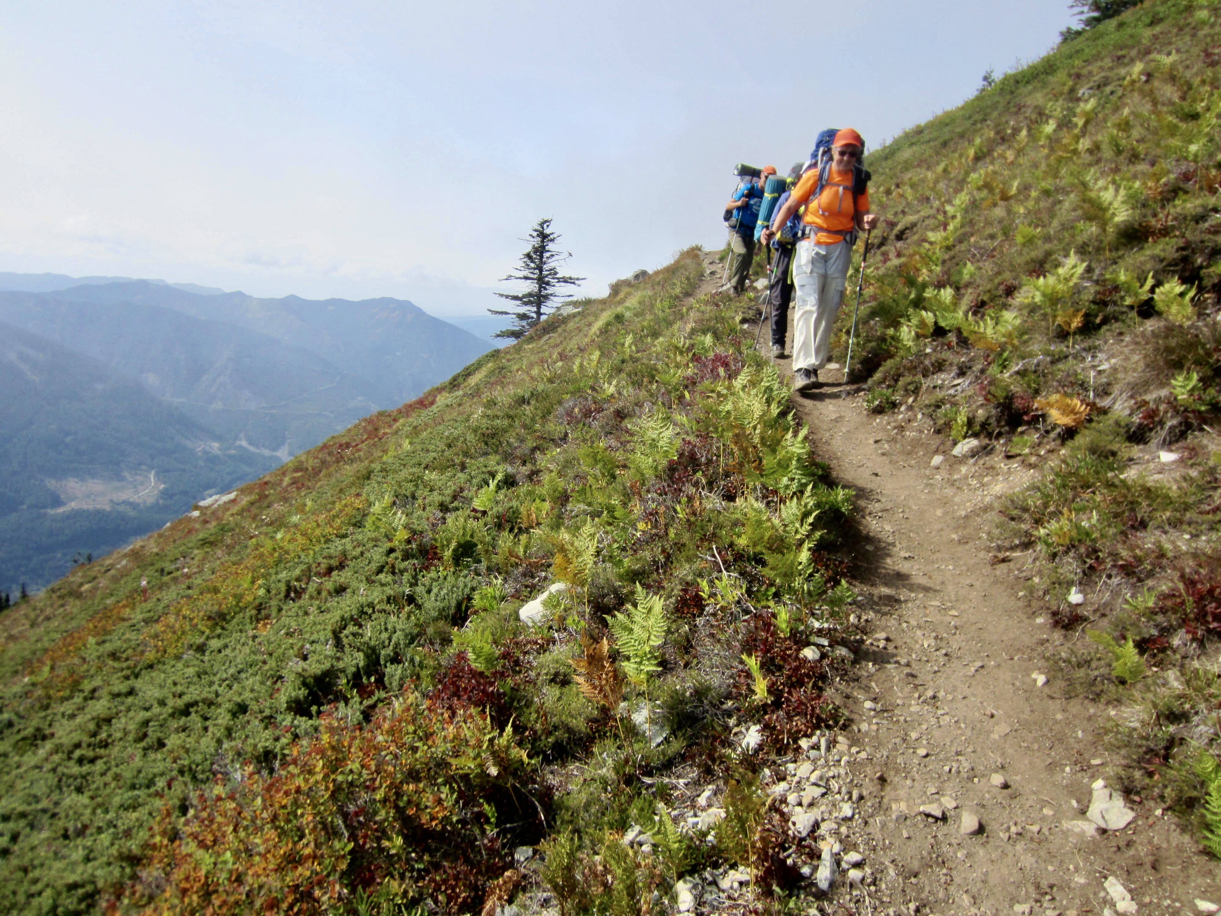
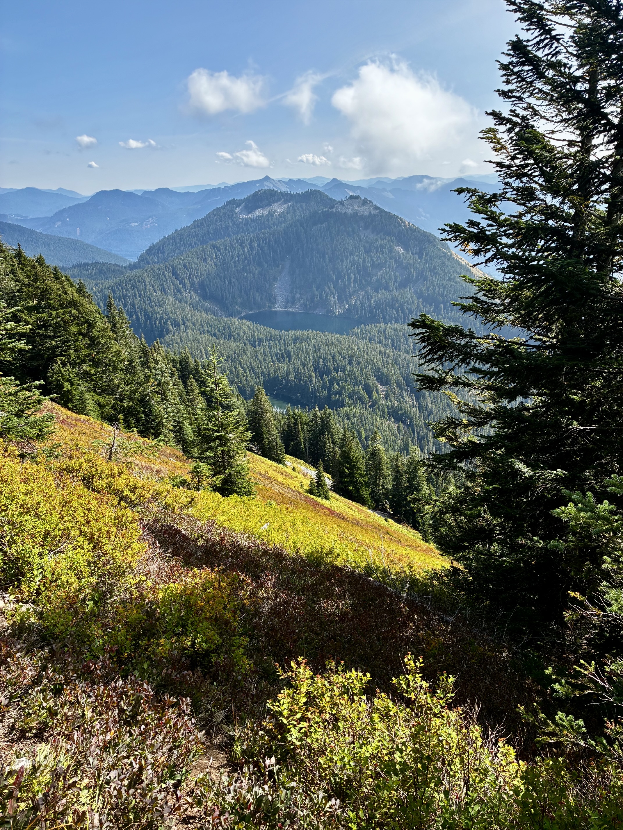
    Turn left at Mason Pass and begin a northwesterly hike up a ridge that separates Mason Lake from Lake Kulla Kulla. After a steady gain, the trail turns to the west and cuts across the wonderfully open hillslope of Mt. Defiance, with views out to the south. At the far edge of this open hillslope, you will come to Defiance Junction, which is unmarked but very obvious.
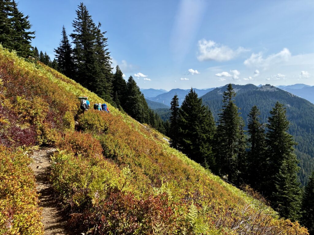
    Colorful Hillslope On Mt Defiance

    .

    Traversing Hillside Below Mt Defiance

    .

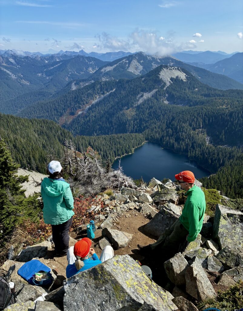
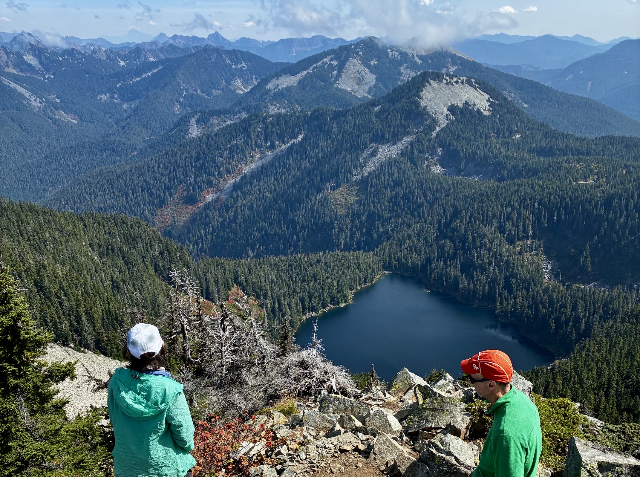
    Turn right at the junction and hike uphill for 400 vertical feet on a steep, rocky, boot-beaten trail to reach the summit of Mt. Defiance (4.9 miles + 3550 feet from Ira Spring Trailhead; 5.6 miles + 4200 feet from Lower Mason Creek Trailhead). Nearby summits include Mailbox Peak and Revolution Peak to the west, Bandera Mountain and Granite Mountain to the east, and the impressive horn of McClellan Butte to the south. On a clear day, you can see many summits in the rugged Snoqualmie Range—all dominated by the striking fang of Kaleetan Peak.
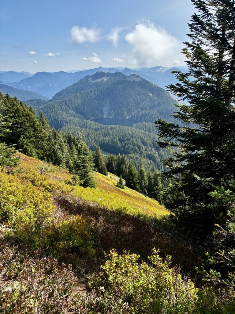
    Bandera Mtn & Mason Lake From Mt Defiance

    .

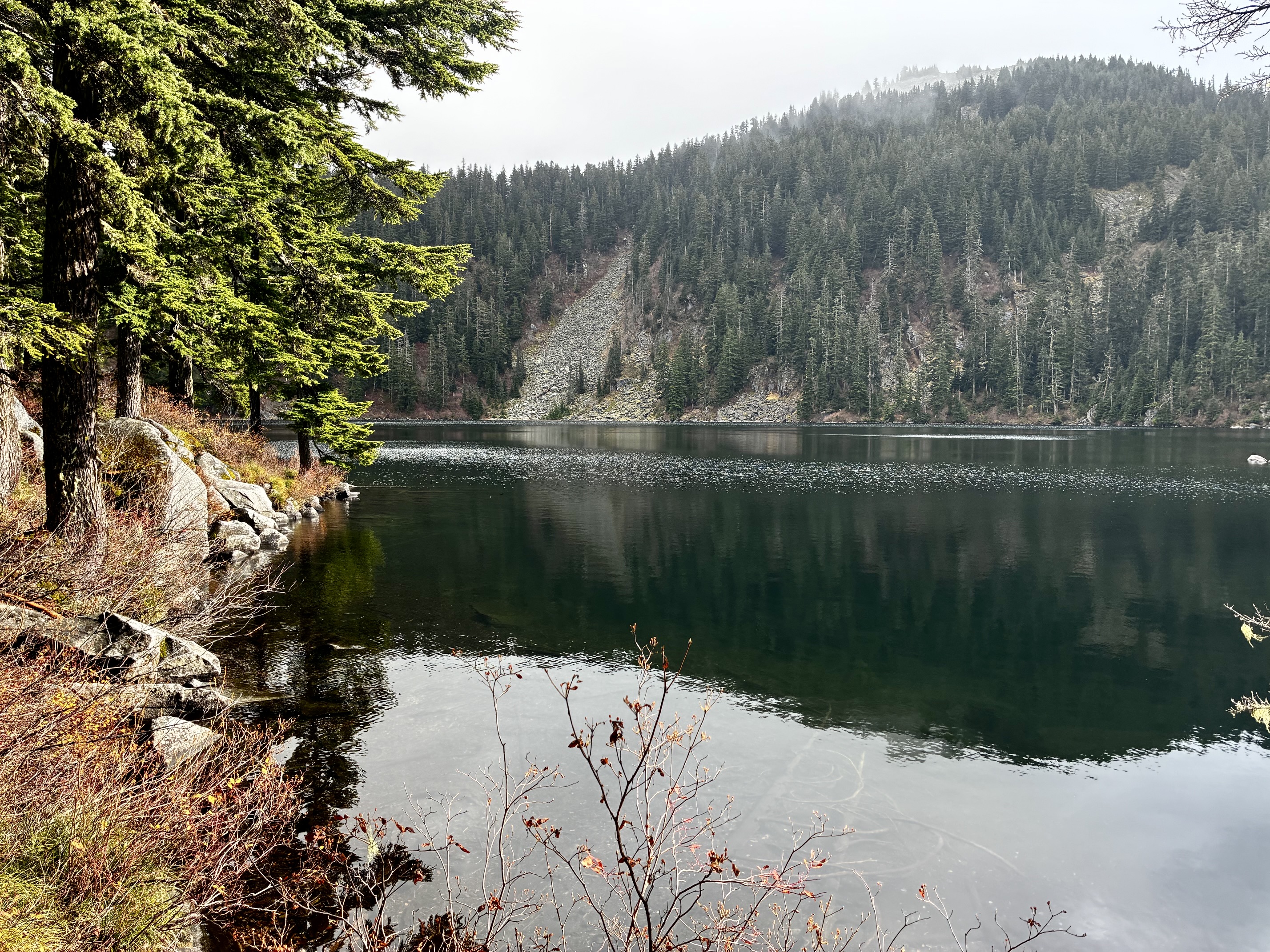
    Lake Kulla Kulla From Mt Defiance Summit

    .

    Route Map & Profiles

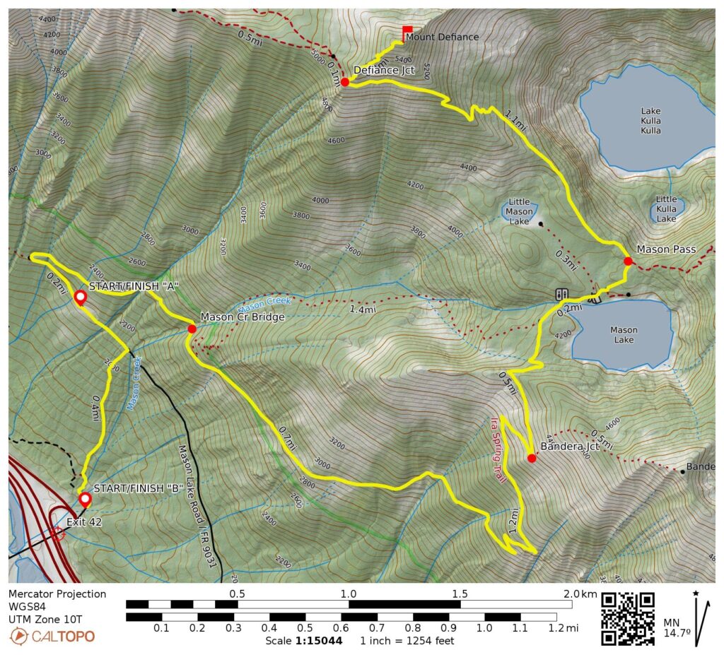
    Mt Defiance Route Map (CalTopo)

    …

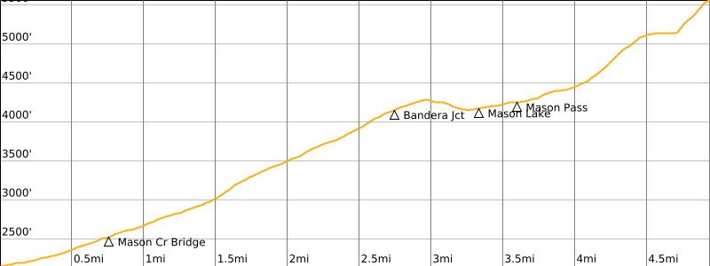
    Mt Defiance Route Profile From Ira Spring TH

    …

    Mt Defiance Route Profile From Mason Creek TH

    …

    Photo Gallery

    Click to enlarge…
    Exit 42 Spur Road Near Mason Creek Trailhead
    Small Ravine Near Mason Creek Trailhead
    Red Paint Marking Mason Creek Trailhead
    Large Log Over Lower Mason Creek
    Small Log Over Lower Mason Creek
    Mossy Forest On Mason Creek Trail
    Mason Creek Trail In Mossy Forest
    Mason Creek Trail Thru Mossy Forest
    Mason Creek Trail Junction With Road
    Upper End Of Mason Creek Trail
    Ira Spring Trailhead Kiosks & Signage
    Ira Spring Trailhead Sign
    Ira Spring Trail On Abandoned Road
    Ira Spring Trail Thru Autumn Foliage
    Mason Creek Bridge On Ira Spring Trail
    Steeper Grade On Ira Spring Trail
    Ira Spring Trail Below Bandera Mtn
    Traversing Talus Slope On Ira Spring Trail
    Mason Lake From Outlet Stream
    Mason Lake From Outlet Stream
    Bandera Mtn Above Mason Lake
    Rooty Trail Near Mason Pass
    Trail Signs At Mason Pass
    Tree Signs At Mason Pass
    Occluded Clouds On Mt Defiance Ridge, Central Cascades
    Colorful Hillslope On Mt Defiance
    Traversing Hillside Below Mt Defiance
    Bandera Mtn & Mason Lake From Mt Defiance
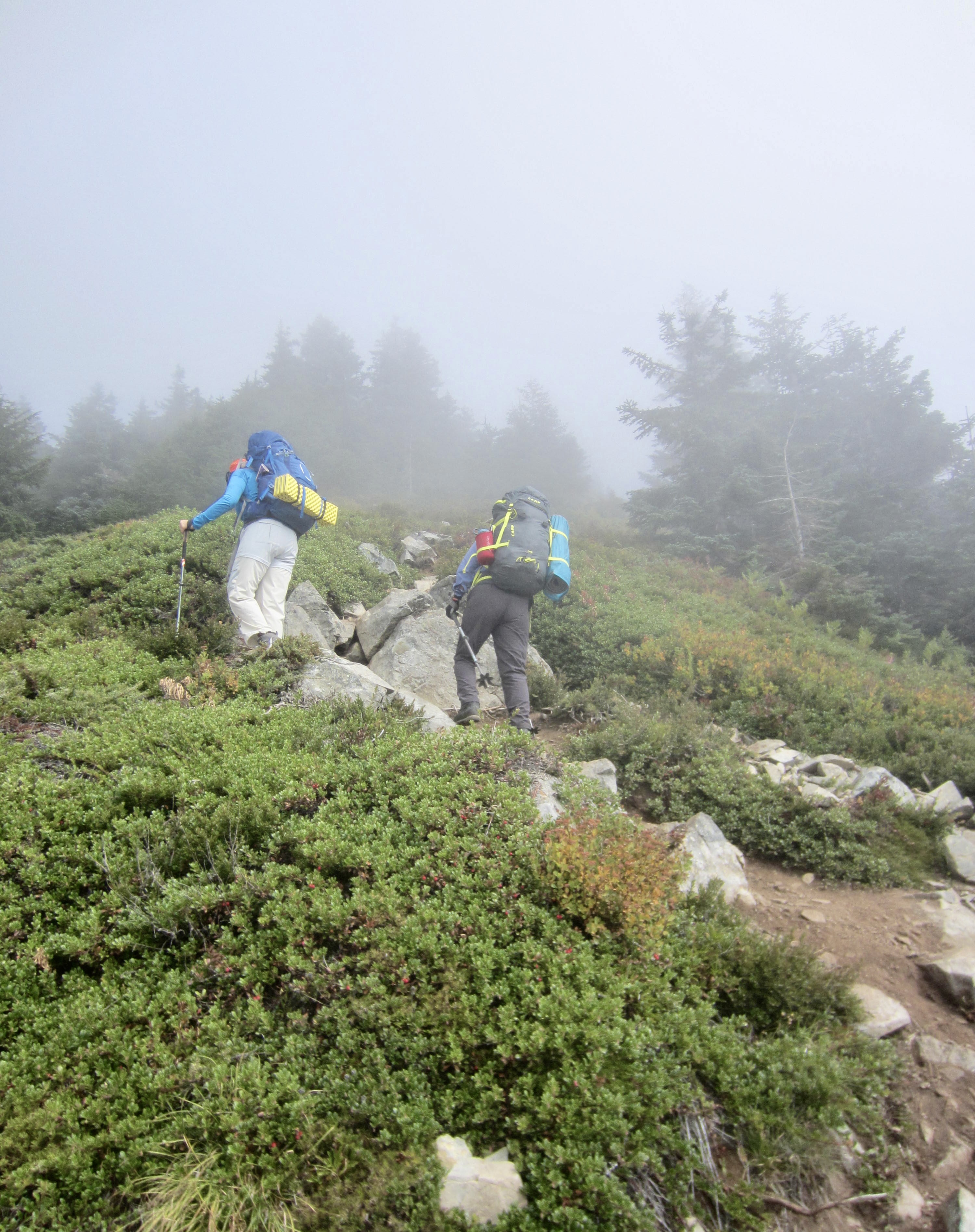
    Eileen & Yoko Heading Up Foggy Mt Defiance
    Kula Kula Lake From Mt Defiance Summit
    Lake Kulla Kulla From Mt Defiance Summit
    Previous Article Abernathy Peak via Scatter Lake—Southeast Slope—Upper South Ridge (Mazama Mountains, WA)
    Next Article Other Mountain Activities in 2012
    Jim Brisbine

    Jim Brisbine has been climbing Washington peaks for over 50 years, while documenting hundreds of summits and thousands of trail miles in words and pictures. As the creator of "Major Peaks of the Cascades and Olympics --- Fraser/Nicola River to Columbia River," he is an avid outdoorsman and lifelong trailcat who spends his time prowling around the Pacific Northwest and beyond.

    Meet TrailCatJim

    Jim Brisbine has been climbing Washington peaks for 50+ years, documenting hundreds of summits and thousands of trail miles in words and pictures. As the author of "Major Peaks of the Cascades and Olympics --- Fraser/Nicola River to Columbia River," he is an avid outdoorsman and lifelong trailcat who spends his time prowling around the Pacific Northwest and beyond.
    CONTACT TRAILCATJIM

    Gear Reviews & Tips & Trips

    • Reviews of Mountain Gear
    • Trailcat Tips & Gear Modifications
    • Hikes & Scrambles: I-90 / Snoqualmie Pass
    • Ski Tours: I-90 / Snoqualmie Pass
    • Snowshoe Treks: I-90 / Snoqualmie Pass
    • Backcountry Huts: What to Expect

    Handy Information Links

    • Weather & Avalanche Forecasts
    • Mountain Road & Trail Reports
    • Wildfire Reports & Smoke Forecasts
    • Mountain Snowpack Depths
    • Nordic Grooming Reports

    Packing Lists For Big Trips

    • Alta Via 2 & 4, Dolomites, Italy
    • “O” + “W” Circuit, Patagonia, Chile
    • Hauyhuash Circuit, Peru
    • Overland Track, Tasmania
    • Three Capes Traverse, Tasmania
    • Mountaineer’s Haute Route, Switzerland
    • Walker’s Haute Route, Switzerland

    Most Recent Posts

    Ashley Gorge Via Ferrata Climbs: The Outlaw + Abduction + The Pump + The Soup + Toothy Grin (Uinta Range, UT)

    Guye Peak: North Summit + Middle Summit + South Summit via Alpental Valley / Commonwealth Valley (Snoqualmie Range, WA)

    McAlester–Rainbow Loop via McAlester Pass—Rainbow Creek—Rainbow Pass—Bridge Creek + McAlester Mtn (North Stehekin Mountains, WA)

    Hoodoo Pass Loop via Eagle Lakes—Horsehead Pass—Libby-Crater Saddle—Crater Lake + Mt Bigelow + Crater Peak (Sawtooth Mountains, WA)

    Amabilis Mtn Bike Loop via Amabilis Beacon + Amabilis Peak (Keechelus Mountains, WA)

    Three Fingers Mtn: South Peak / Lookout Via Meadow Mtn—Goat Flats—Tin Can Gap—Southwest Side (West Sauk Mountains, WA)

    Defiance Trail Traverse: Thompson Pass to Hemlock Pass via Mason Pass—Pratt Pass + Mt Defiance (Lower Snoqualmie Range, WA)

    LaCrosse Pass Loop via Enchanted Valley—O’Neil Pass—Duckabush River—Dosewallips River—Anderson Pass (Olympic Mountains, WA)

    Granite Mtn via Hyas Lake—Tuck Lake—Robin Lakes—Northwest Ridge (Upper Icicle Mountains, WA)

    Glacier Basin Climbing Reconn: Monte Cristo Peak attempt + Cadet Peak attempt (Monte Cristo Mountains, WA)

    • About Me
    • Recent Posts
    • Trailcat Tips
    • Gear Reviews
    • Contact TrailCatJim
    © 2026 TrailCatJim
    • Home
    • Most Recent Posts
    • Major Peaks A-Z
    • Major Peaks Map
    • Major Peaks Synopsis
    • Hike/Climb/Ride
      • Canadian Cascades BC
      • Northwestern WA Cascades
      • Northeastern WA Cascades
      • North-Central WA Cascades
      • Central WA Cascades
      • Southern WA Cascades
      • Olympic Mountains WA
      • Columbia Plateau WA
      • Other USA & Canadian Regions
      • International (outside USA & Can)
    • Ski/Snowshoe
      • Snow Tours in British Columbia
      • Snow Tours in Northwestern WA Cascades
      • Snow Tours in Northeastern WA Cascades
      • Snow Tours in North-Central WA Cascades
      • Snow Tours in Central WA Cascades
      • Snow Tours in Southern WA Cascades
      • Snow Tours in Olympic Mountains WA
      • Snow Tours in Oregon
      • Snow Tours in Other Locations
    • Types of Trips
      • Canyoneering
      • Difficult 10 Climbs
      • Family Trips
      • Golden Larch Outings
      • Lookout Sites
      • Marathon Hikes
      • Mid-Summer Outings
      • Mtn & Gravel Biking
      • Rock & Ice Climbing
      • Summit Camps
      • Winter Summits
      • The Early Years
      • Traverses & Loops (Alpine)
      • Traverses & Loops (Ski)
      • Traverses & Loops (Trail)
      • Traverses & Loops (Classics)
        • Bacon-Hagan-Blum Trav (WA)
        • Enchantment Traverse (WA)
        • High–Giant Traverse (WA)
        • Olympus–Bailey Trav (WA)
        • Picket Traverse (WA)
        • Ptarmigan Traverse (WA)
        • Grand Canyon Raft Trav (AZ)
        • Huayhuash Circuit (Peru)
        • Inspiration–Isolation Trav (WA)
        • Overland Trav (Tasmania)
      • Via Ferratas
      • WA Blue Corn Specials
      • Winter Summits
    • Reviews / Lists / Tips
    • Mountain Goodies
    • Contact TrailCatJim
    Type to search or hit ESC to close
    See all results