Trip Date: June 16-18, 2026
Sharkfin Tower Climbing Trip
Lower Boston Basin
Quien Sabe Glacier
Sharkfin Tower (8120+ ft)
Trip Report Summary
Region: Northwestern Washington Cascades
Sub-Region: Thunder Mountains
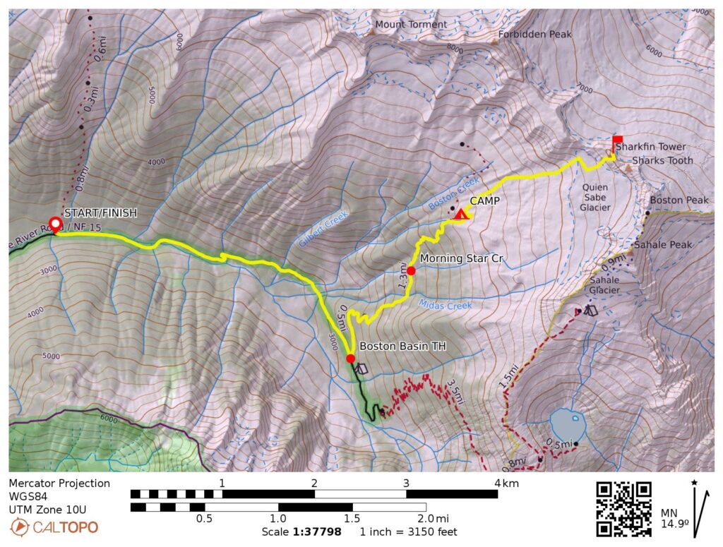
Starting & Ending Point: Eldorado Trailhead adjacent to North Fork Cascade River Road closure gate (Elev. 2200 feet)
Approach Way Points: North Fork Cascade River Bridge & Boston Basin Trailhead (road walk); old diamond mine / road end & Midas Creek crossing & Morning Star Creek crossing & miner’s cabin site / bivy site & South Fork Boston Creek crossing & Lower Boston Basin Camp (trail hike & trail scramble)
Campsite: Lower Boston Basin Camp (Elev. 5700 feet)
Sidetrip Way Points: Middle Fork Boston Creek crossing & mine adit & Quien Sabe Glacier snout & Sharkfin Cliff (off-trail hike & rock scramble & snow climb)
Summit: Sharkfin Tower (rock scramble & snow climb & rock climb via Southwest Gully—Upper Snowfield—Sharkfin Notch—Southeast Ridge)
Approximate Total Stats (round trip): 11.5 miles traveled; 6100 feet gained & lost.
Trip Overview
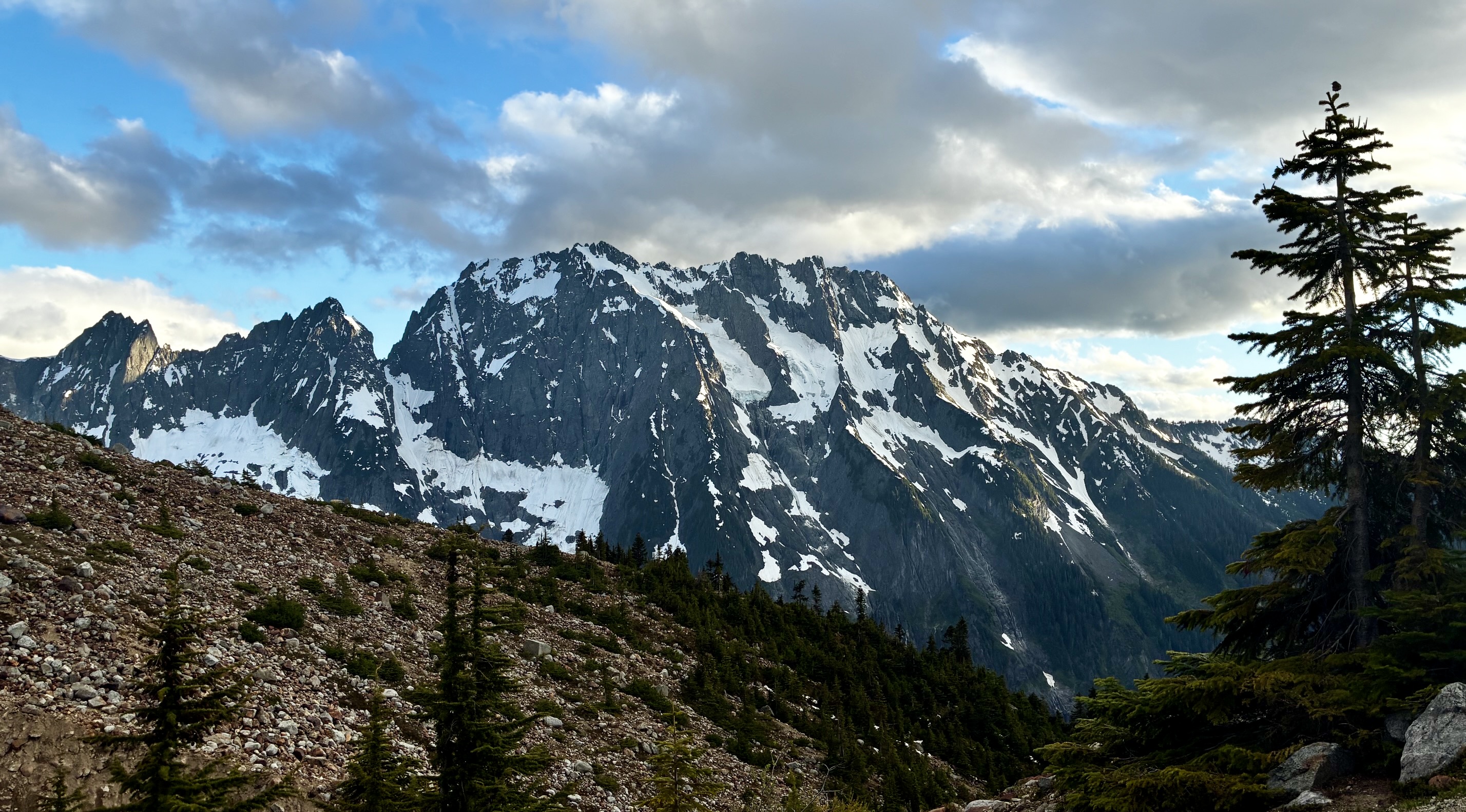
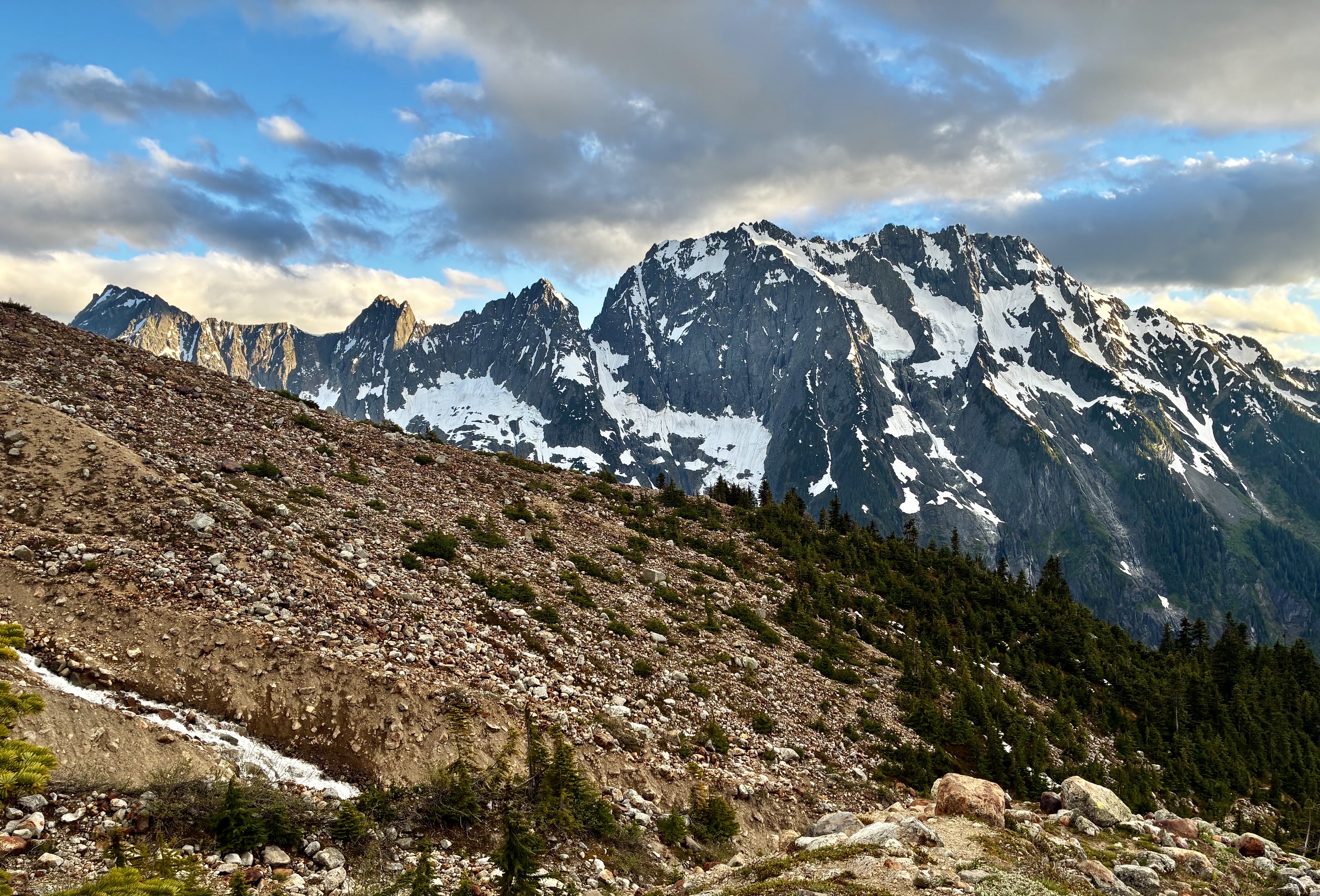
In recent years, Sharkfin Tower has come to epitomize the concept of an alpine crag more than any other in the North Cascades. Despite being dwarfed by its next-door neighbors, Sharkfin is an ultra-popular climbing objective not so much as a summit but merely for the climb itself. There are at least three reasons for this popularity, and none of them are associated with an easy approach; for a crag climb, the price of admission is pretty high!
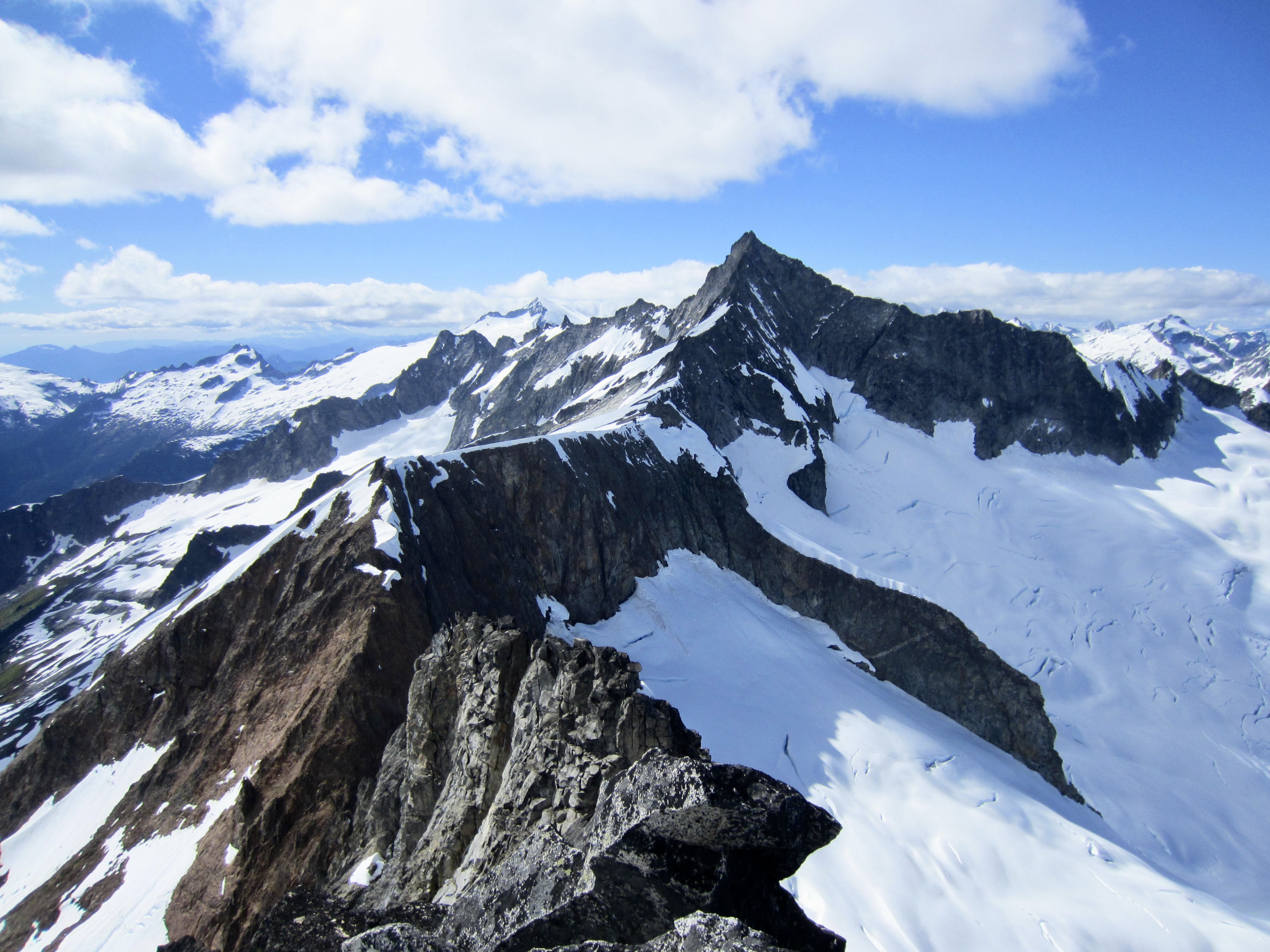
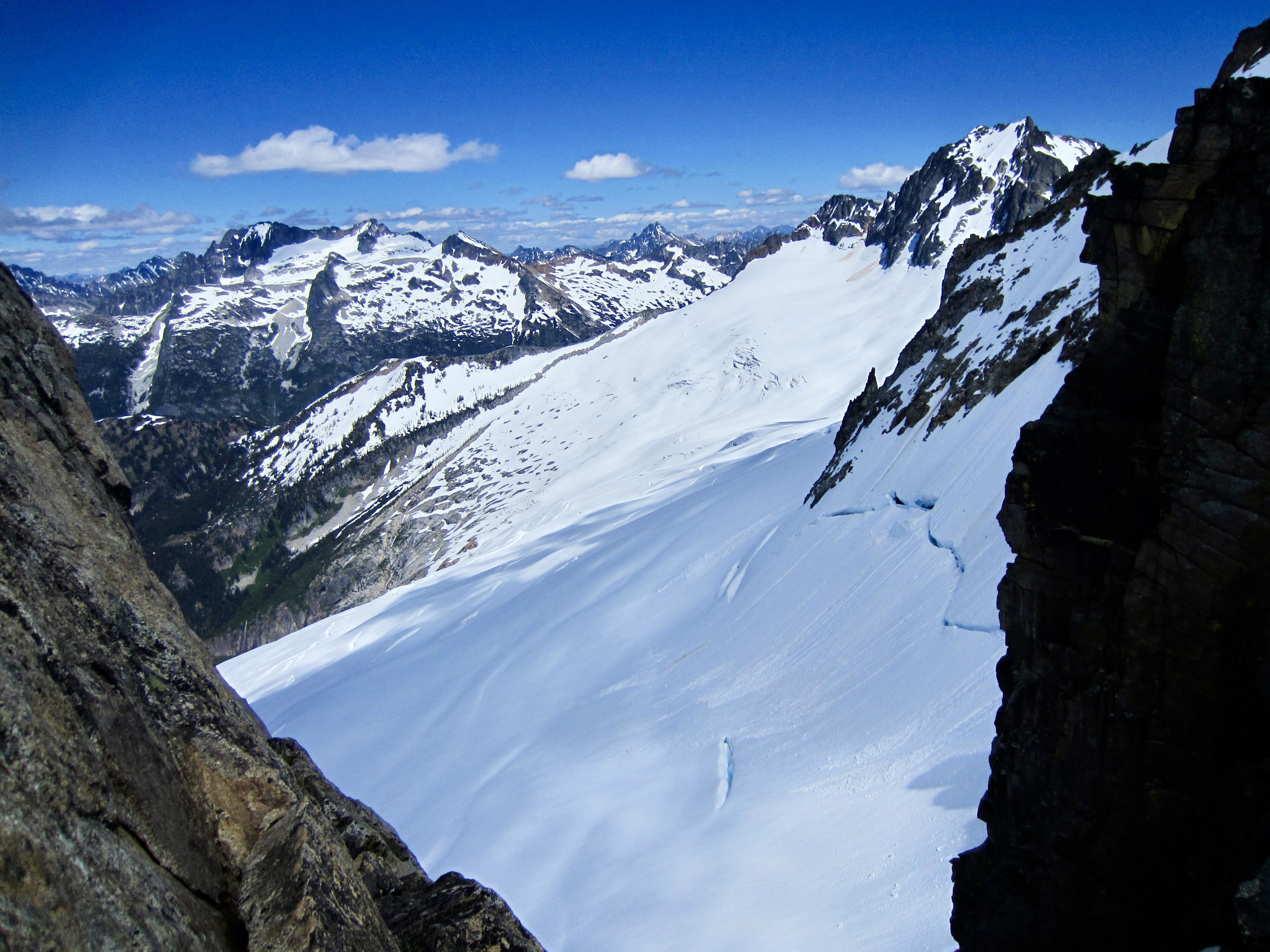
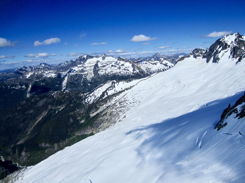
The first reason is Sharkfin’s setting among some of the grandest mountains in the North Cascades. These include Eldorado Peak, Forbidden Peak, Boston Peak, Mt. Logan, Mt. Buckner, and Johannesburg Mountain. Second is the rock quality, which is unusually good by Cascadian standards. Technically, Sharkfin Tower consists of orthogneiss—a geologic term for metamorphosed igneous rock—but you would be correct to call it granitoid or to simply think of it as a version of granite. Third is the tremendous exposure associated with the climbing routes. On the northern side, you can look between your shoes to see the Boston Glacier hundreds of feet below!
Eileen had climbed Sharkfin Tower with Fay Pullen in 2015 but was eager to make a second ascent. I, on the other hand, had been stymied by poor weather on three prior attempts and dearly wanted to finally tuck in my first ascent. This year, our hopes were buoyed by a very good forecast: warm and mostly sunny. Mountain weather being a fickle companion, we actually experienced some challenging conditions but managed to complete the climb. Andrew joined us at the last minute and got a big taste of alpine cragging.
Full Trip Report
Day 1: Eldorado Trailhead to Lower Boston Basin
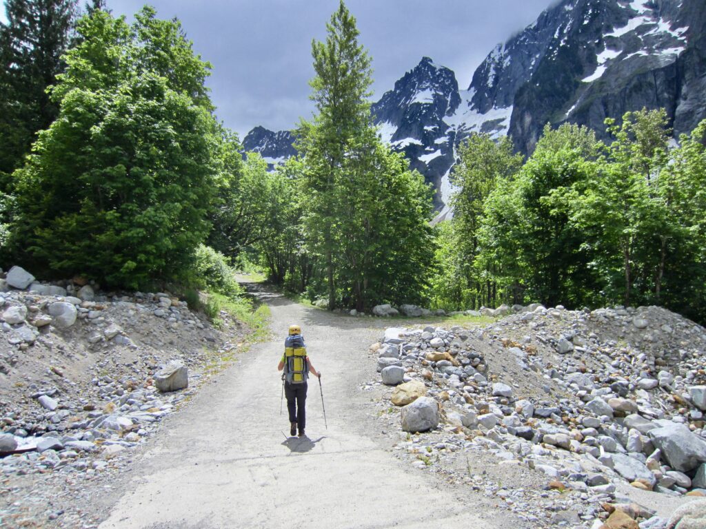
After obtaining a Boston Basin camping permit in Marblemount, Eileen and I drove up the North Fork Cascade River Road for 20 miles to reach the Eldorado Trailhead parking lot. The road was gated at this point due to ongoing repair work but is scheduled to open by July. We strapped on heavy backpacks and began walking up the road, passing numerous construction vehicles before arriving at the Boston Basin Trailhead (1.4 hours + 2.5 miles + 1050 feet from gate).
.
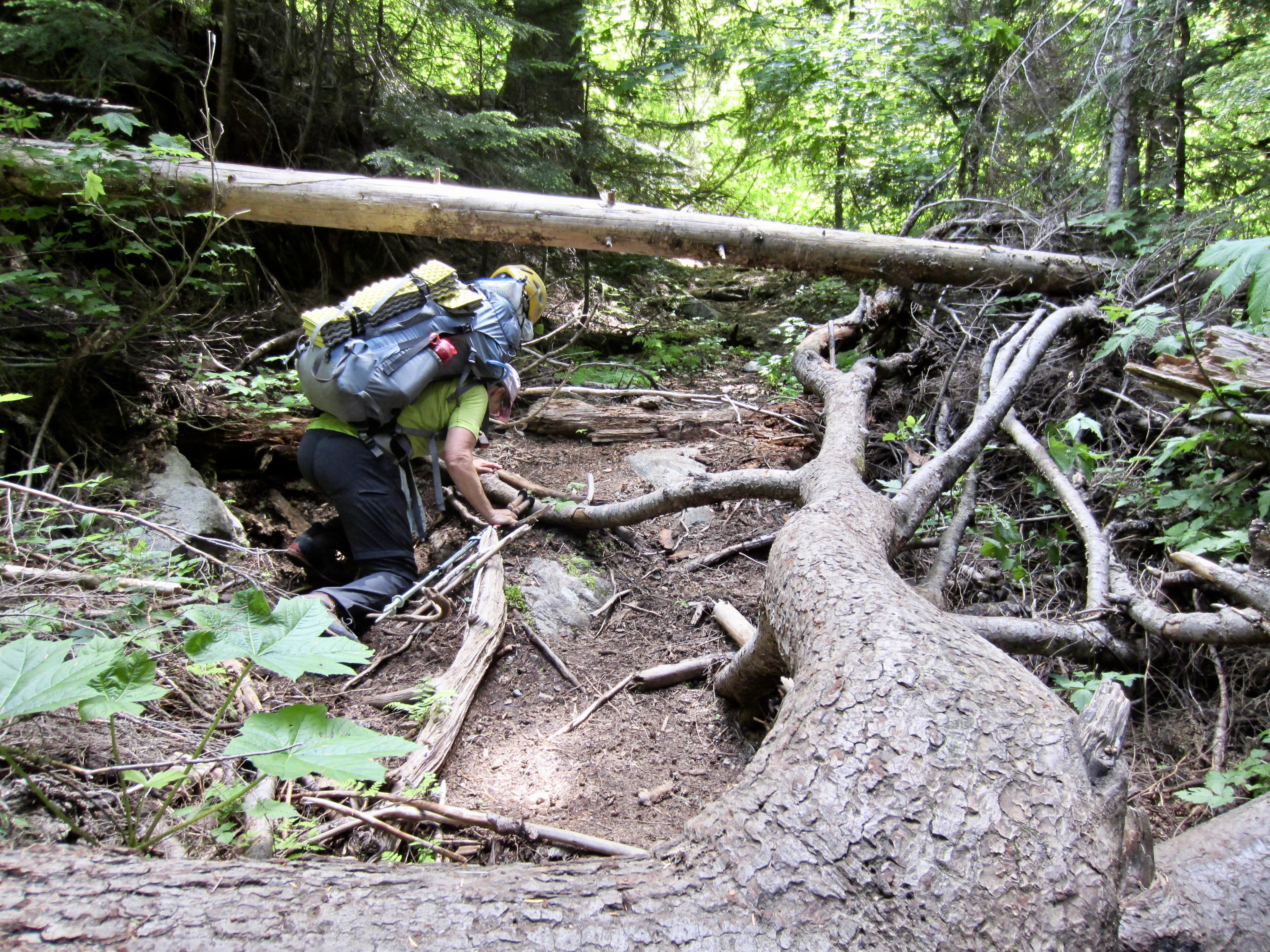
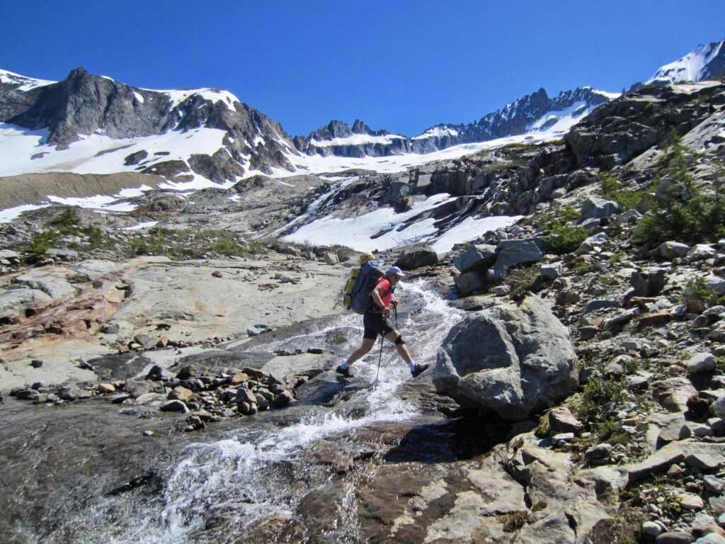
The Boston Basin Trail degrades a little bit every year as the brush grows out and new logs fall down. Thankfully, conditions generally improve with elevation, and the crossings of Midas Creek and Morning Star Creek were fairly easy.
.
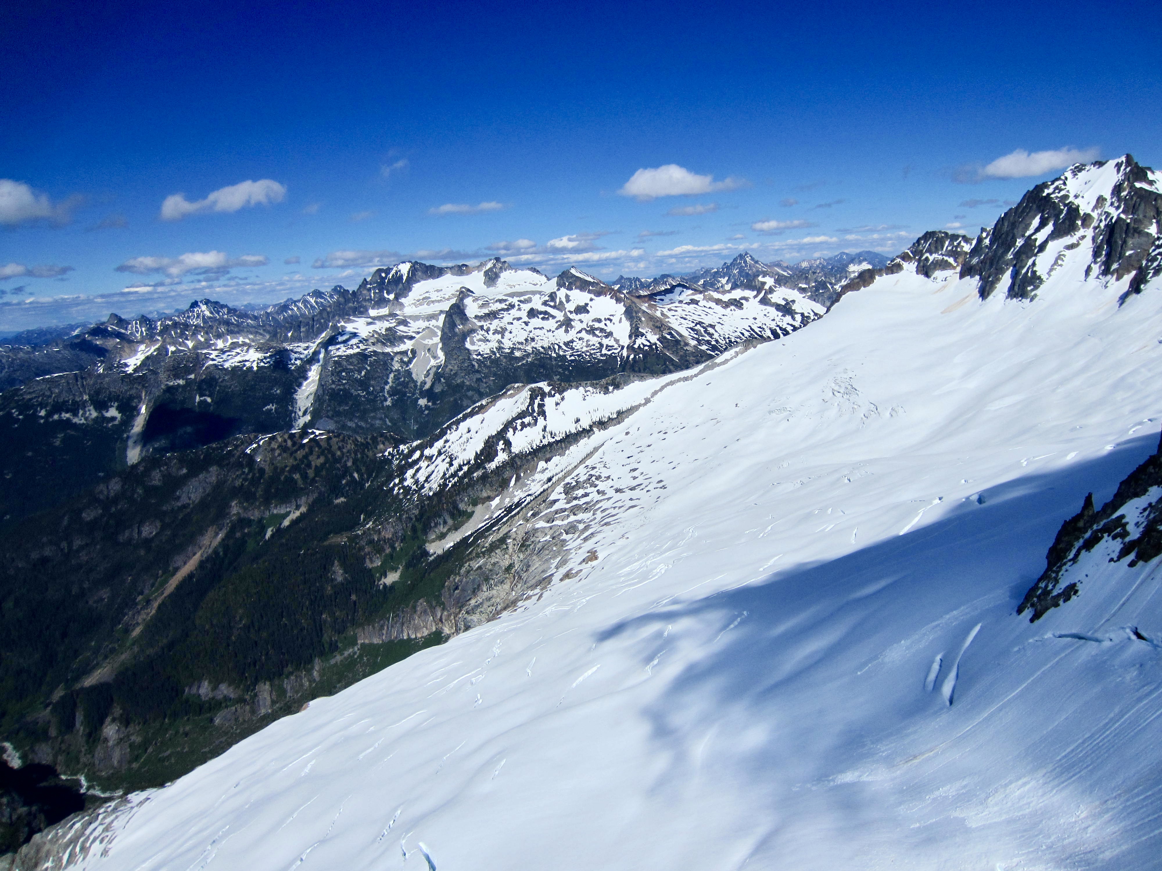
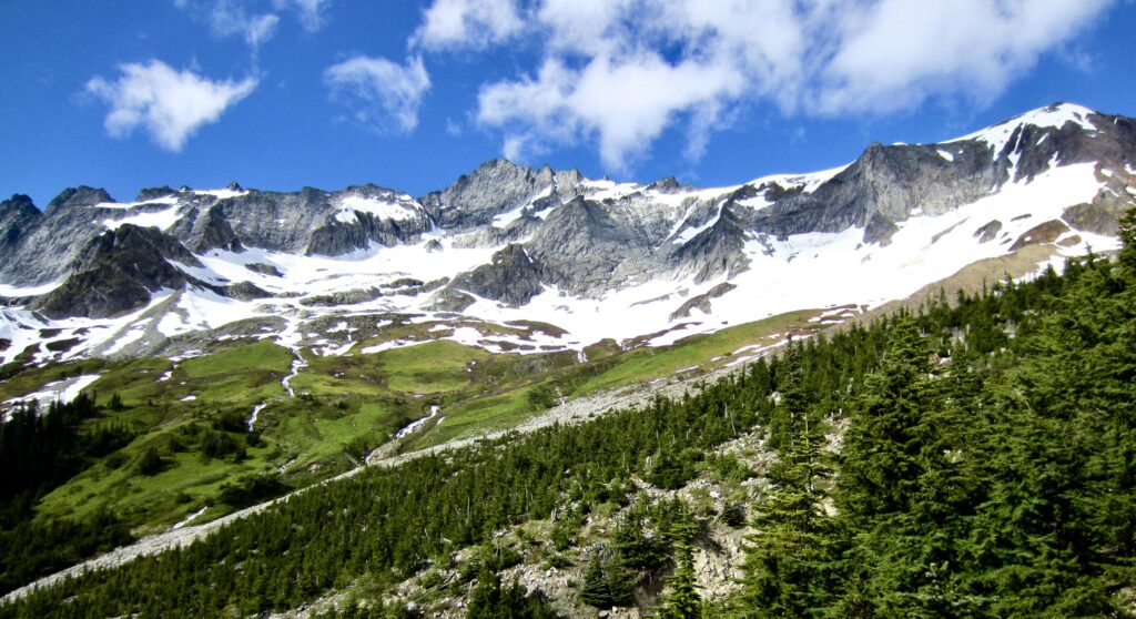
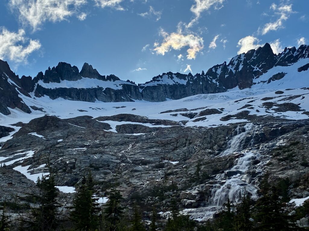
We broke out of the forest at 5400 feet and got our first look at Boston Basin. Interestingly, despite this winter’s skimpy snowpack, there was much more snow now than during our early-July trip last year. Whether this would benefit us or hinder us on the climb remained to be seen.
.
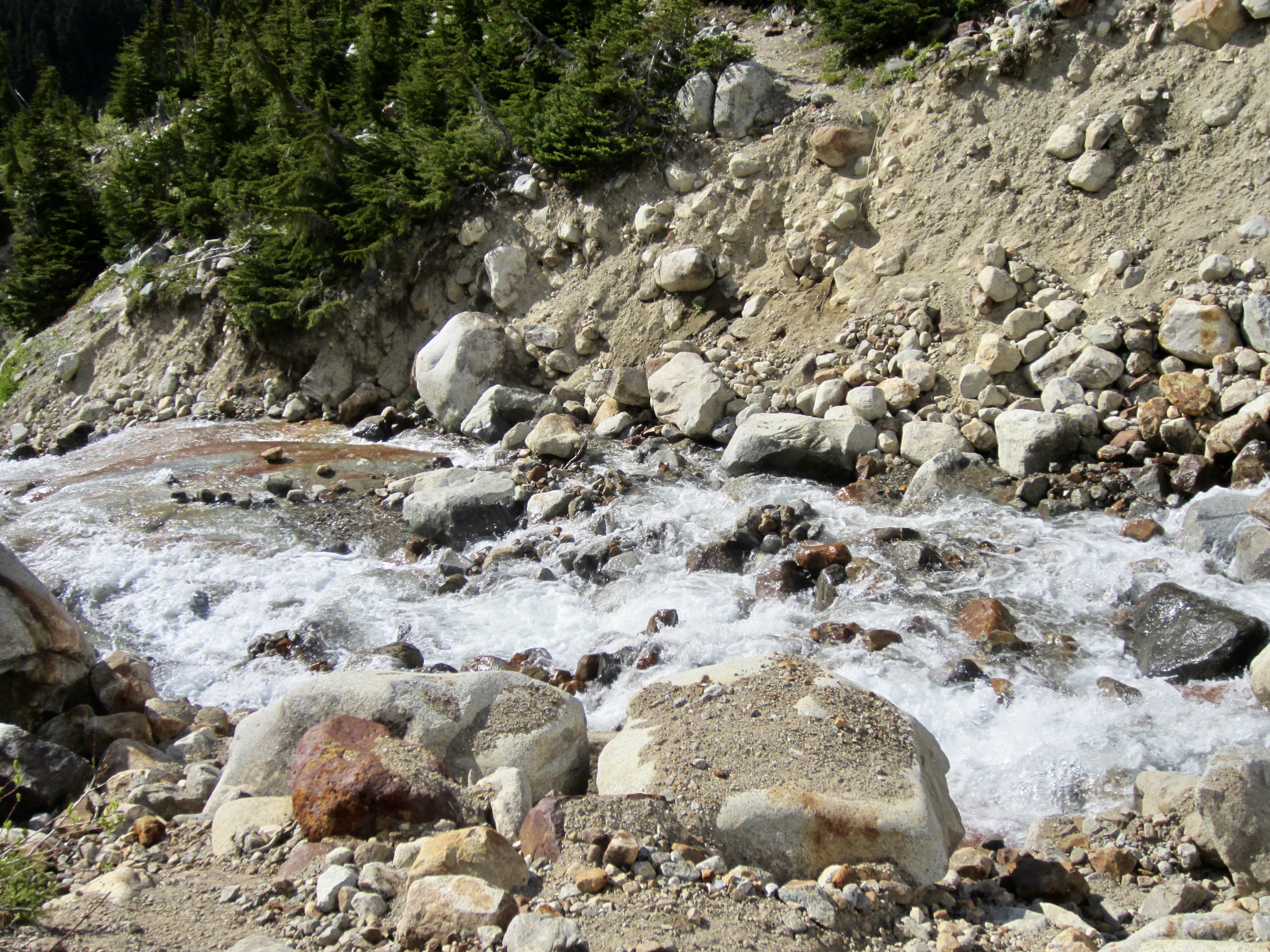
Upon reaching Boston Creek’s south fork, we could see that the normal trail crossing point was as unappealing as ever, with a steep erosion bank on the far side. Like last year, we elected to continue up the moraine for 150 vertical feet and then cross the creek where it flattens out above a bifurcation.

.
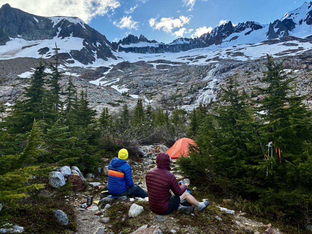
We arrived in Lower Boston Basin Camp at 6:00pm (6.6 hours + 4.5 miles + 3500 feet from gate) and found two other parties tenting there. One party consisted of a guide from Pro Mountain Sports (Brian) and two clients from Michigan. The other party consisted of a young couple (Jason and Brooke) from Bremerton. Brian graciously moved his tent closer to his clients’ tent so that Eileen and I could lay out our bivouac sacks and other gear.
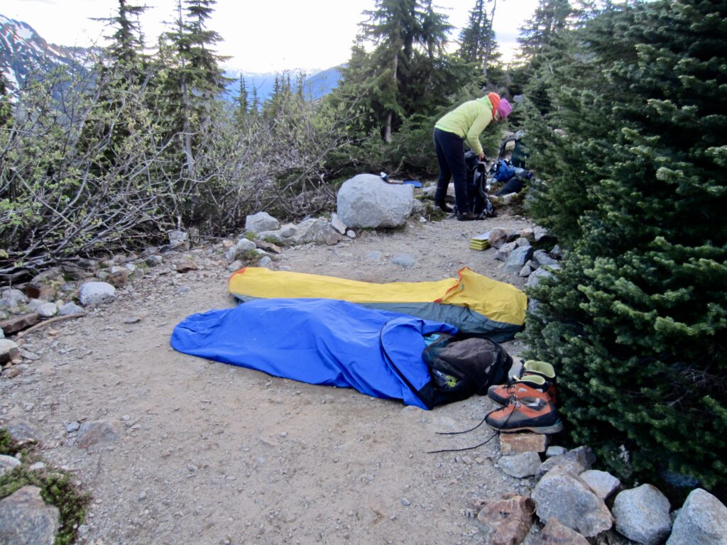
.
What the lower campsite lacks in roominess and comfort, it makes up for in scenery. Sharkfin Tower, Boston Peak, and Sahale Peak rise up to the east, and the ominous nordwand of Johannesburg Mountain stands across the valley to the southwest.
.

.
Andrew rolled into camp shortly after sundown, having been delayed in Seattle due to work obligations. Eileen and I got him situated before we all turned in for the night. All three parties in camp were headed up Sharkfin Tower tomorrow, so there was a little concern about congestion on the route.
Day 2: Sharkfin Tower Summit Climb
Eileen, Andrew, and I were up at 7:00am, several hours after Brian’s party had headed out. This reduced our concern about congestion gave us some hope that he would tease out the gully portion of the climb. Jason and Brooke came through while we were eating breakfast, so they would also have a significant head start on us.
.
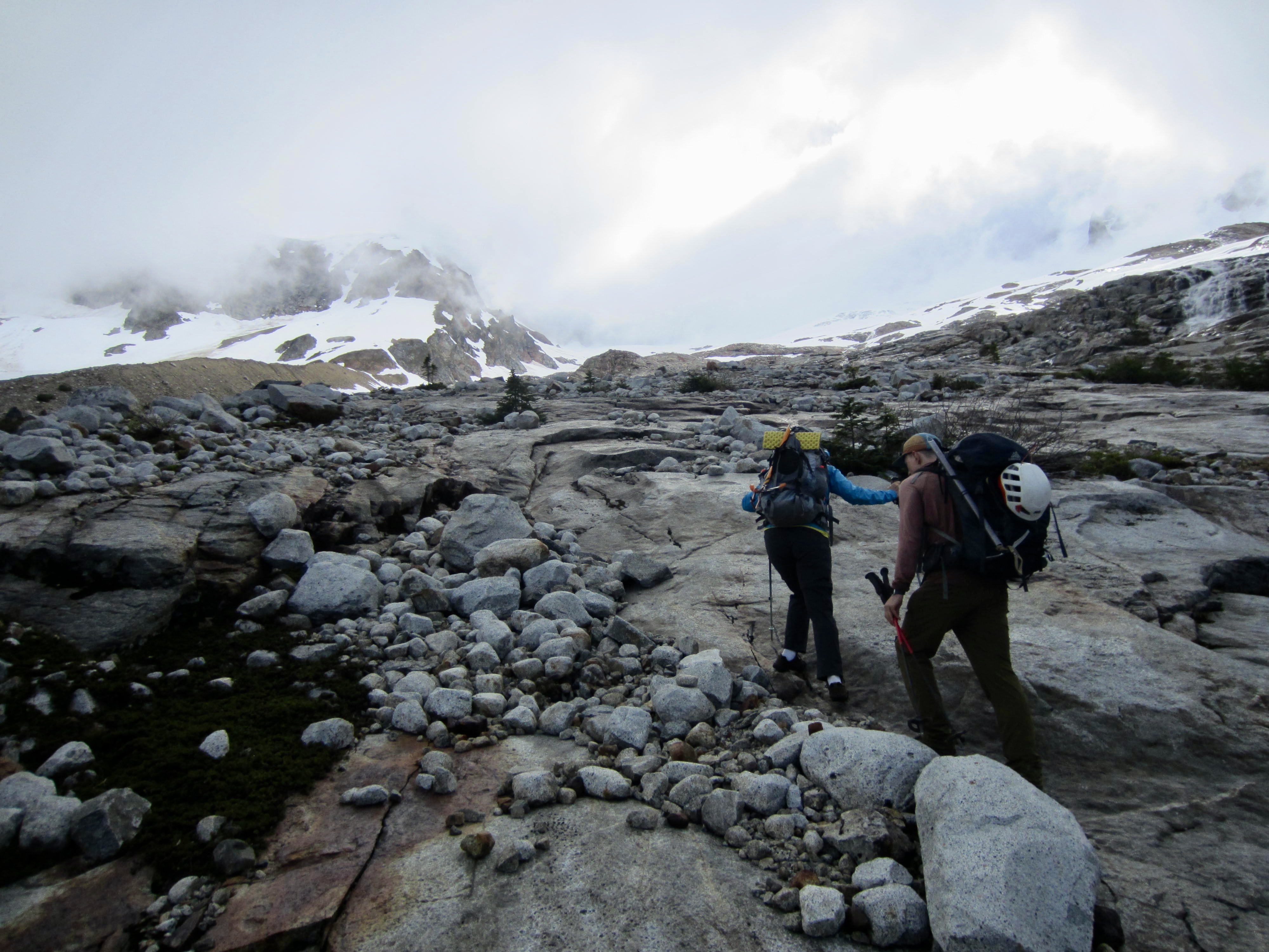
Although the sky had been mostly clear throughout the night and early morning, we were dismayed to observe low clouds enveloping all of the surrounding peaks by the time we left camp at 9:15am. Our weather forecast called for a sunny day, but this was looking like a replay of last year’s fog-bound climb!
.

.
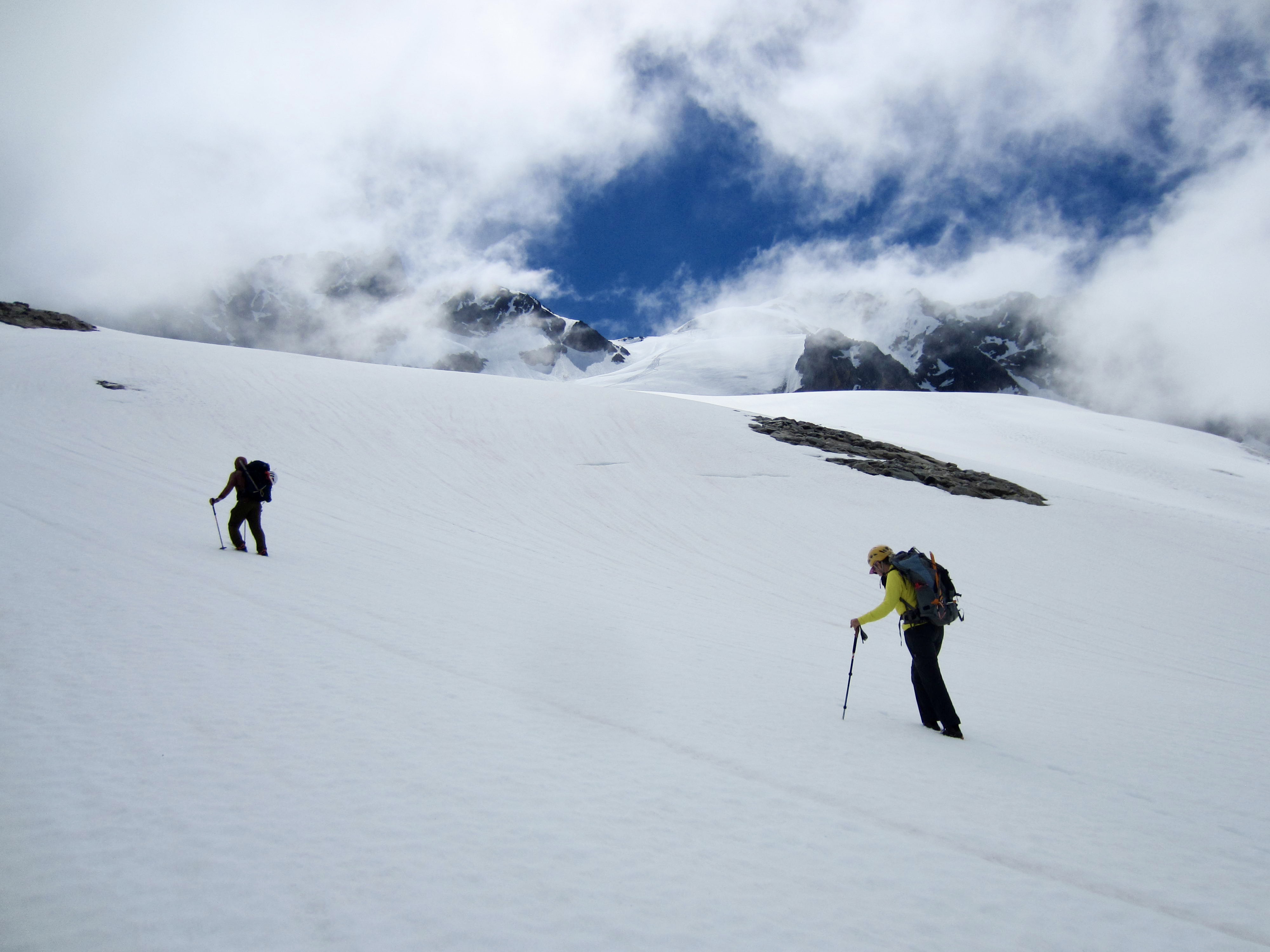
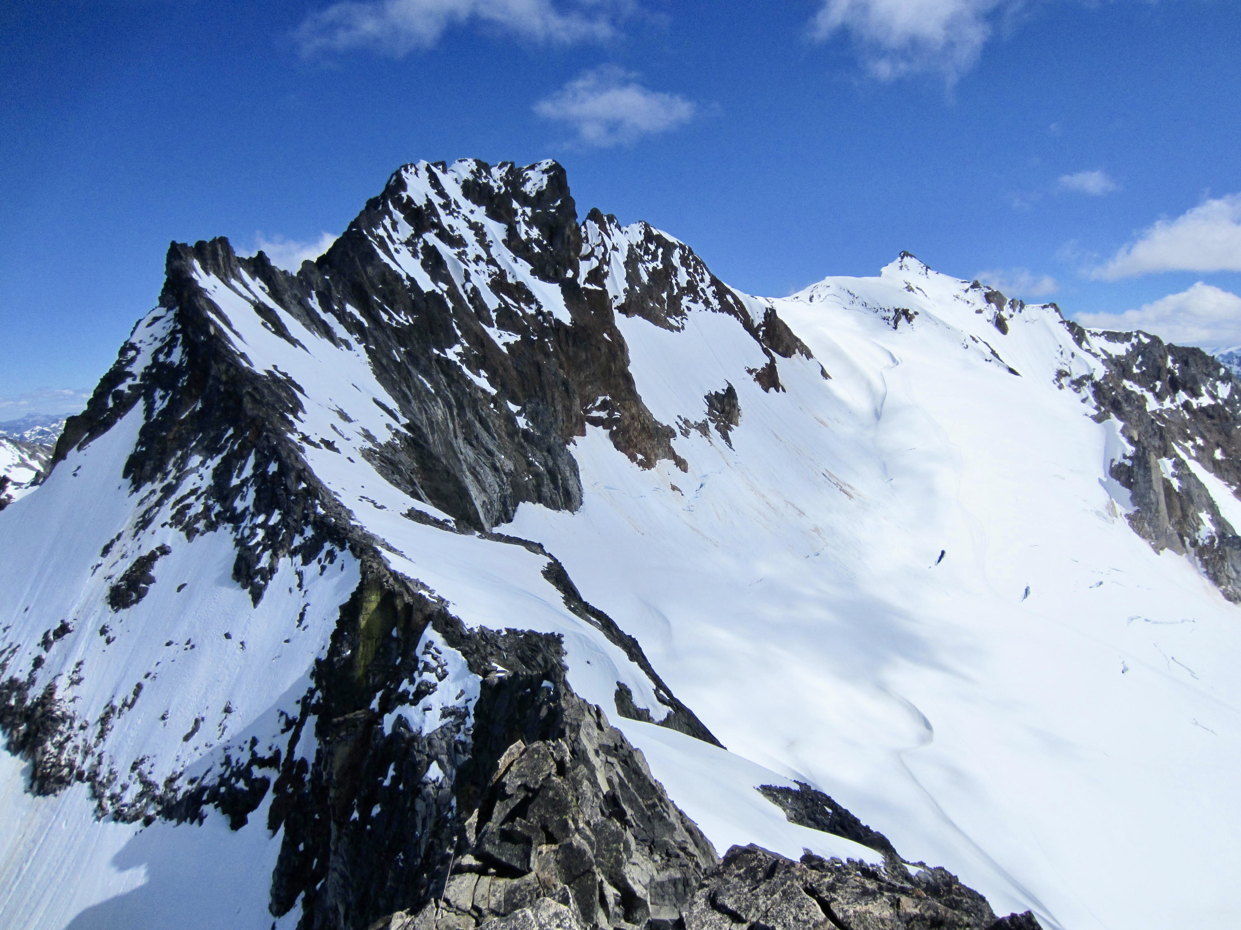
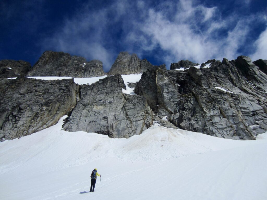
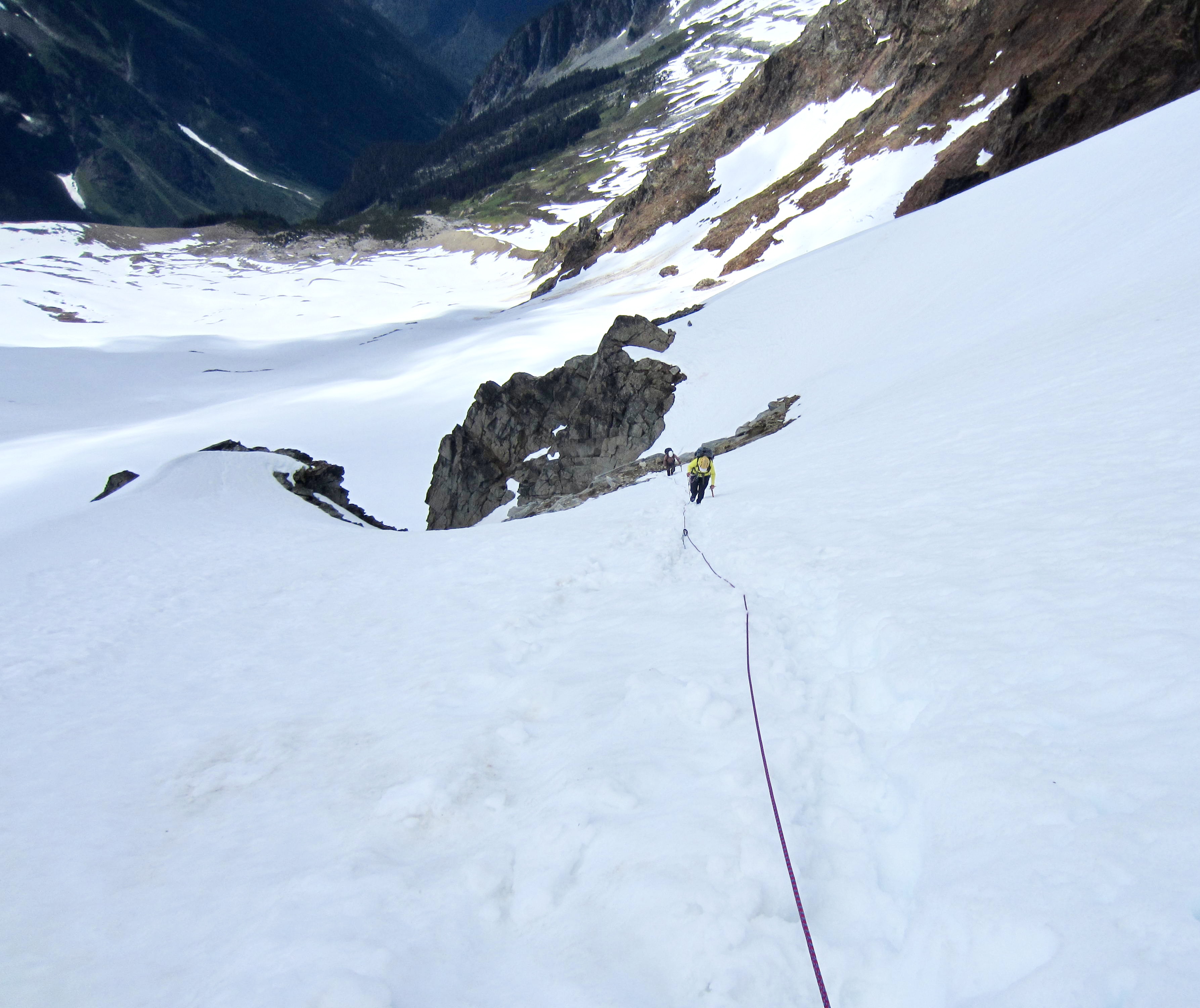
Sharkfin Tower remained hidden in clouds and fog during our entire ascent of the lower slabs, snowfields, and Quien Sabe Glacier, but it suddenly revealed itself in grand fashion just as we approached the broad cliff band. Apparently, this was the peak’s idea of a “Just kidding; had you scared, didn’t I?” prank! Jason and Brooke arrived just then, having traversed in from our left side.
.
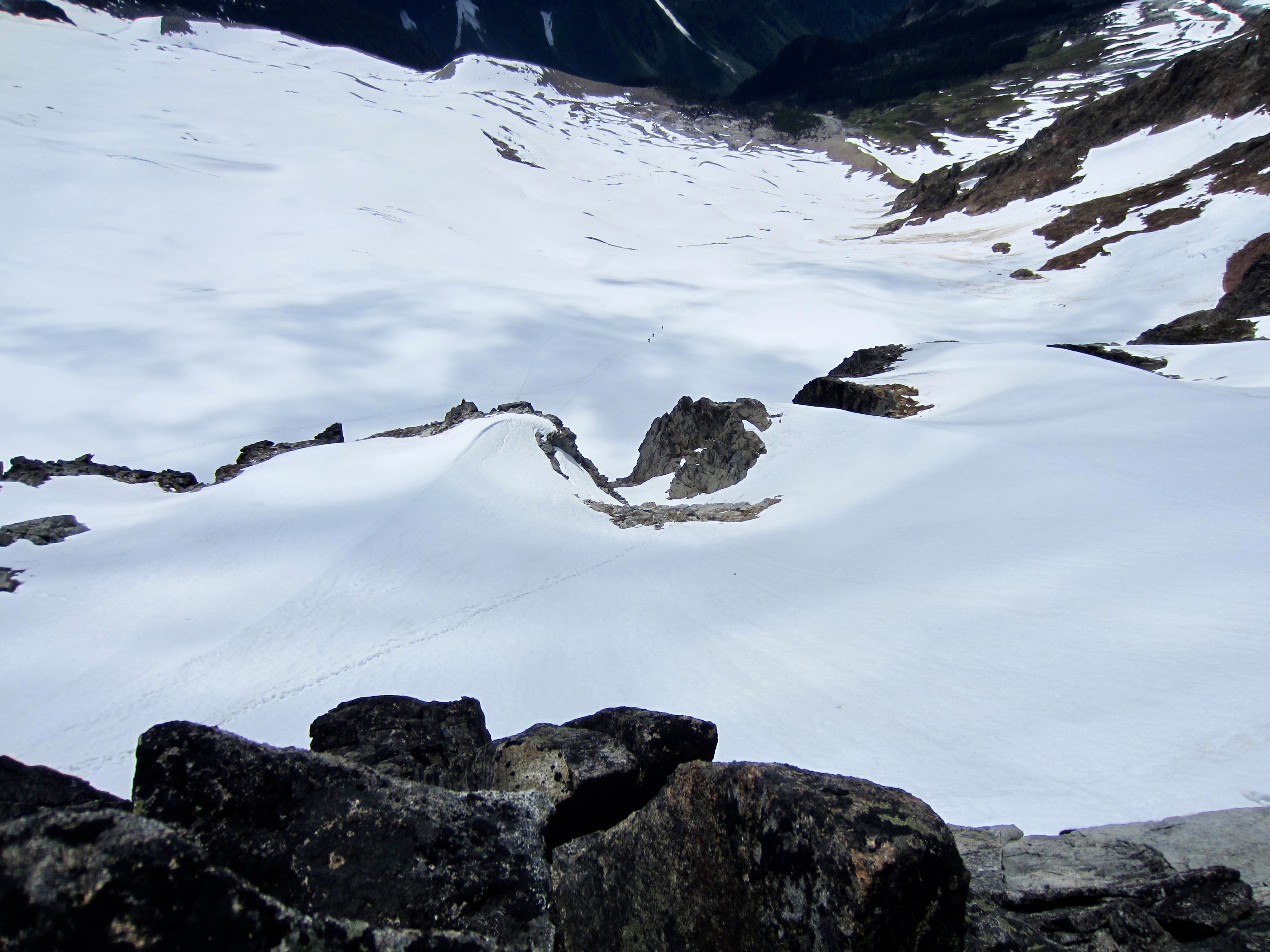
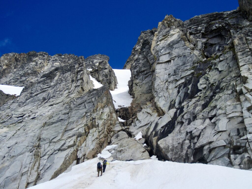
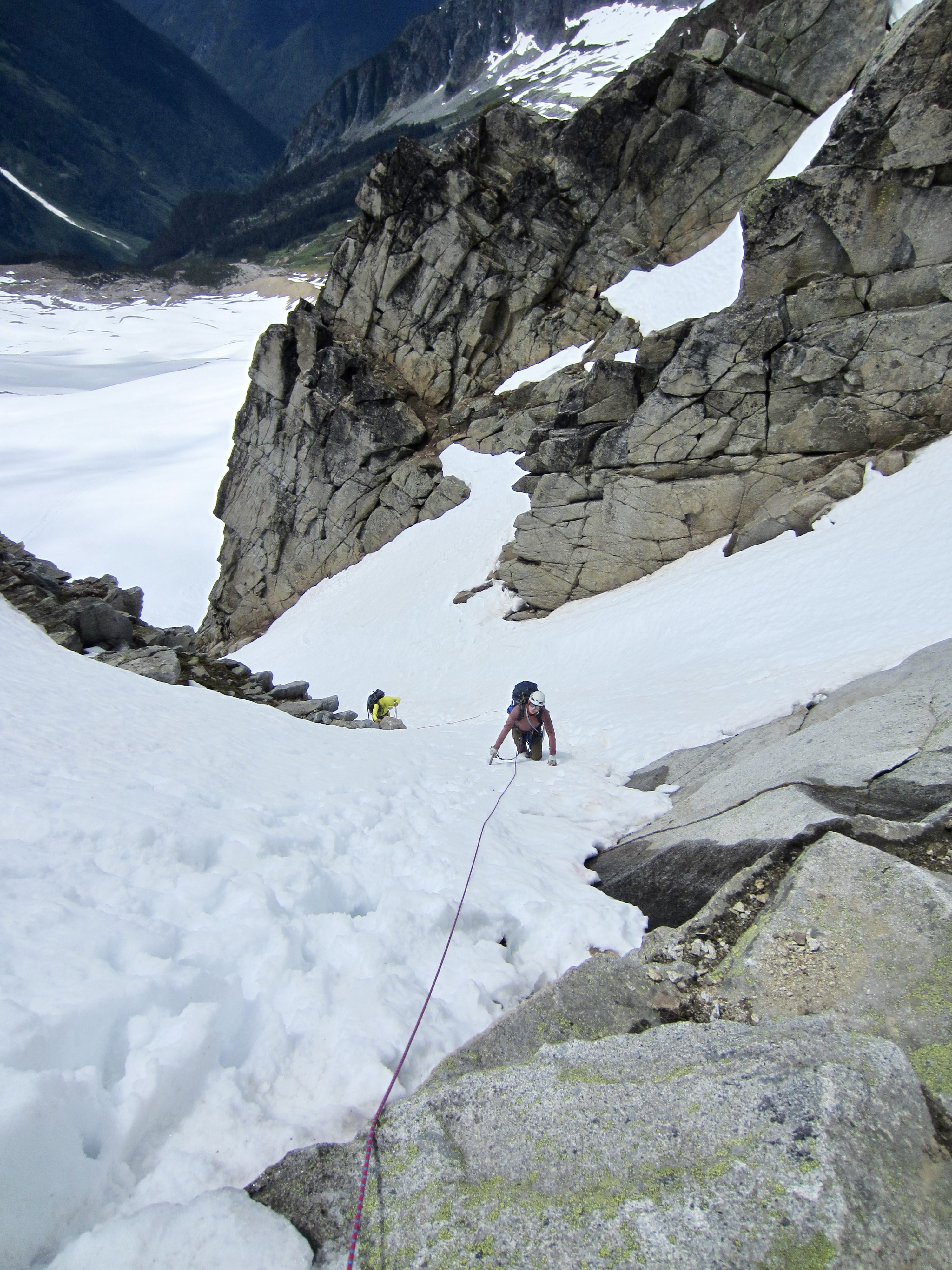
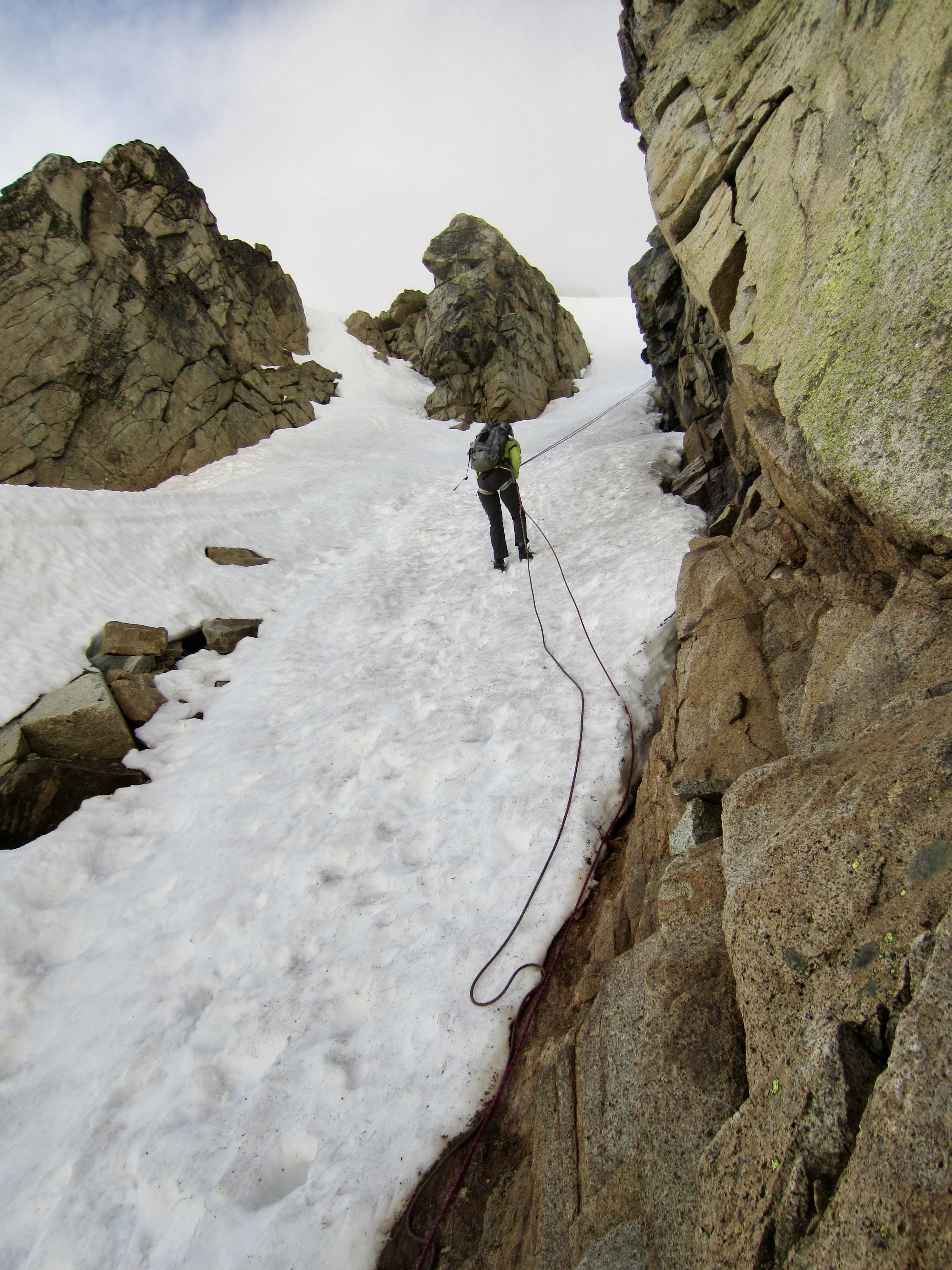
After booting up towards the key Southwest Gully, we could see that its upper half consisted of a snowfinger, whereas its lower half was exposed rock and dirt with a small creek flowing through. The moat at the bottom was largely open on the left side but had some thin snow bridges on the right side.
.
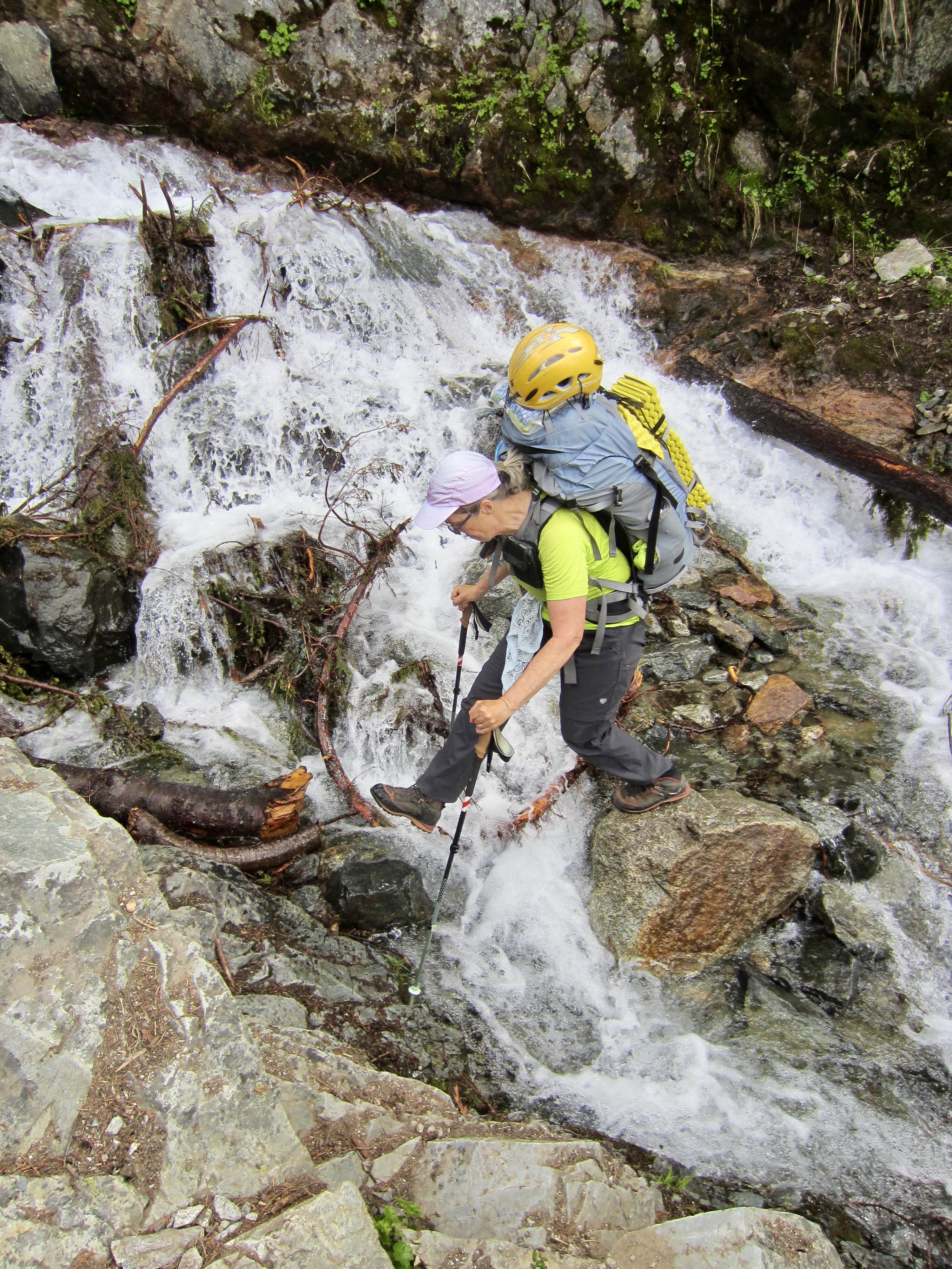
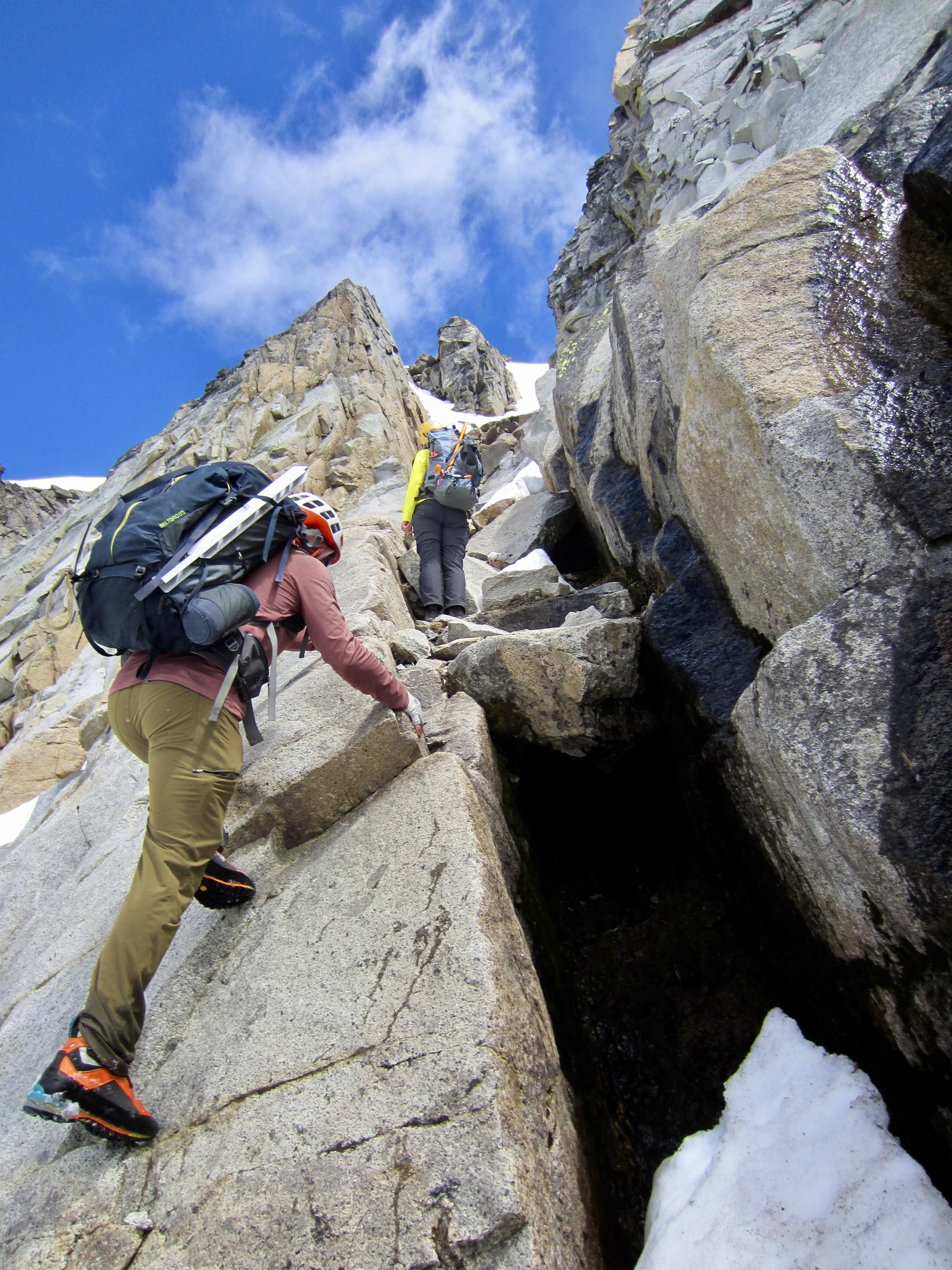
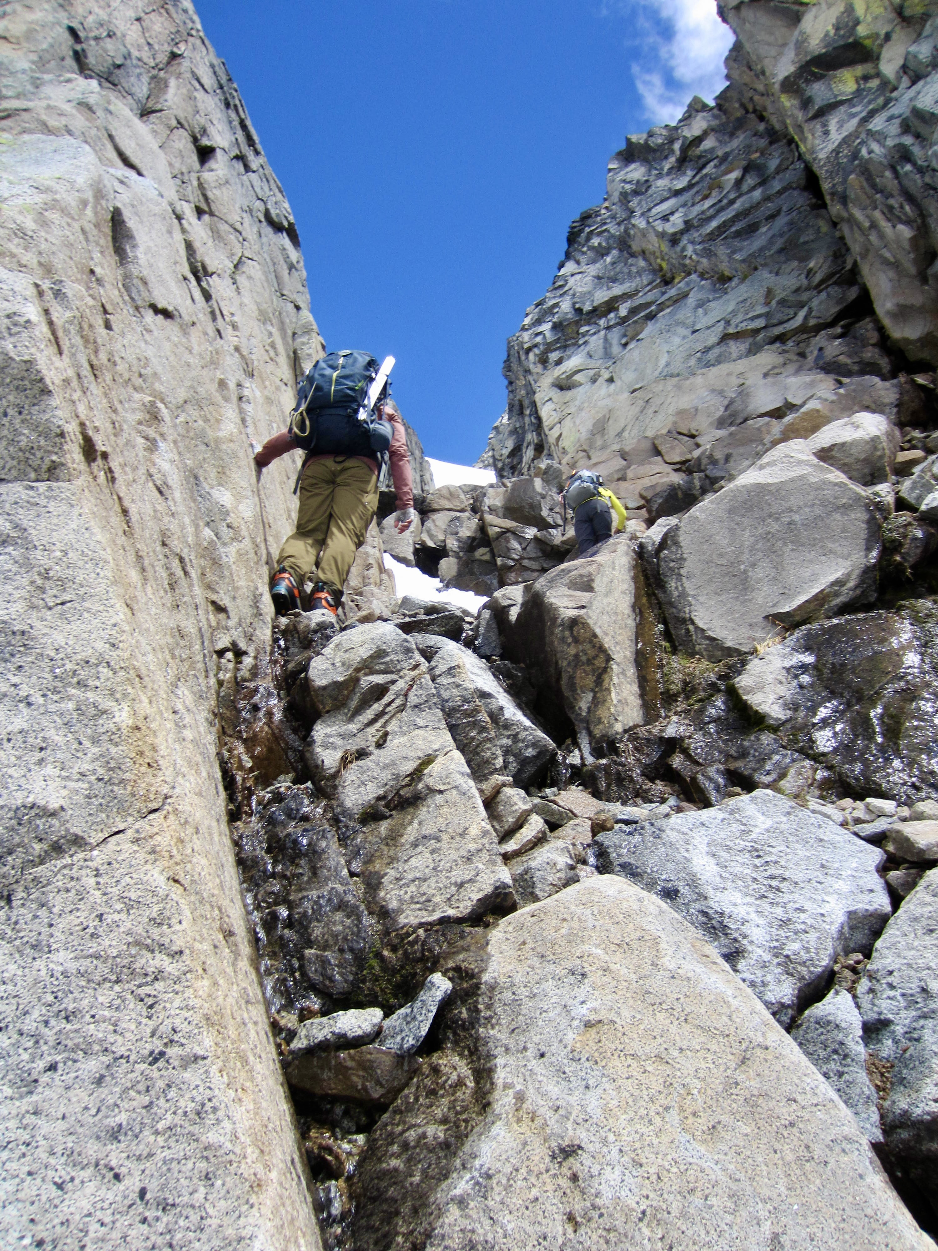
Eileen gingerly stepped across a snow bridge and made a few dicey bouldering moves up the right edge of the gully. Andrew and I followed, and we all continued scrambling up the loose rock and saturated dirt. Although the scrambling never exceeds Class 3, the rubbly quality and potential for serious rockfall make this a very stressful ascent.
.
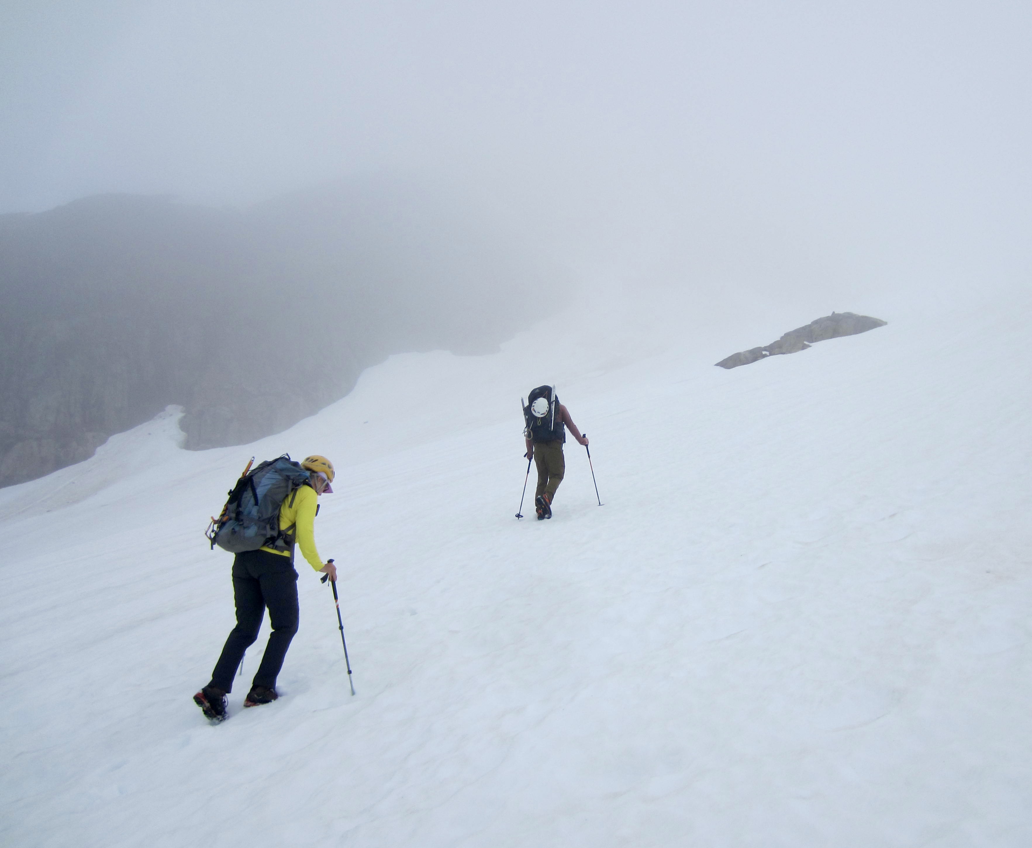
Upon reaching the bottom of the snowfinger, we roped up, and I began kicking steps upward, placing one picket for protection. At a point where the snowfinger splits, I encountered Brian and his two clients setting up a rappel at a fixed-sling anchor. His party had completed the first rock pitch on Sharkfin Tower but then had to turn around due to time constrants (they were hiking out today). He kindly shared the anchor with us and indicated that he’s left two cams farther up for use as a belay/rappel anchor. Eileen, Andrew, and I continued booting up steep, soft snow to the cam anchor, and then we made a right-angling ascent of the upper snowfield.
.
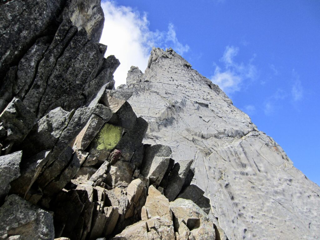
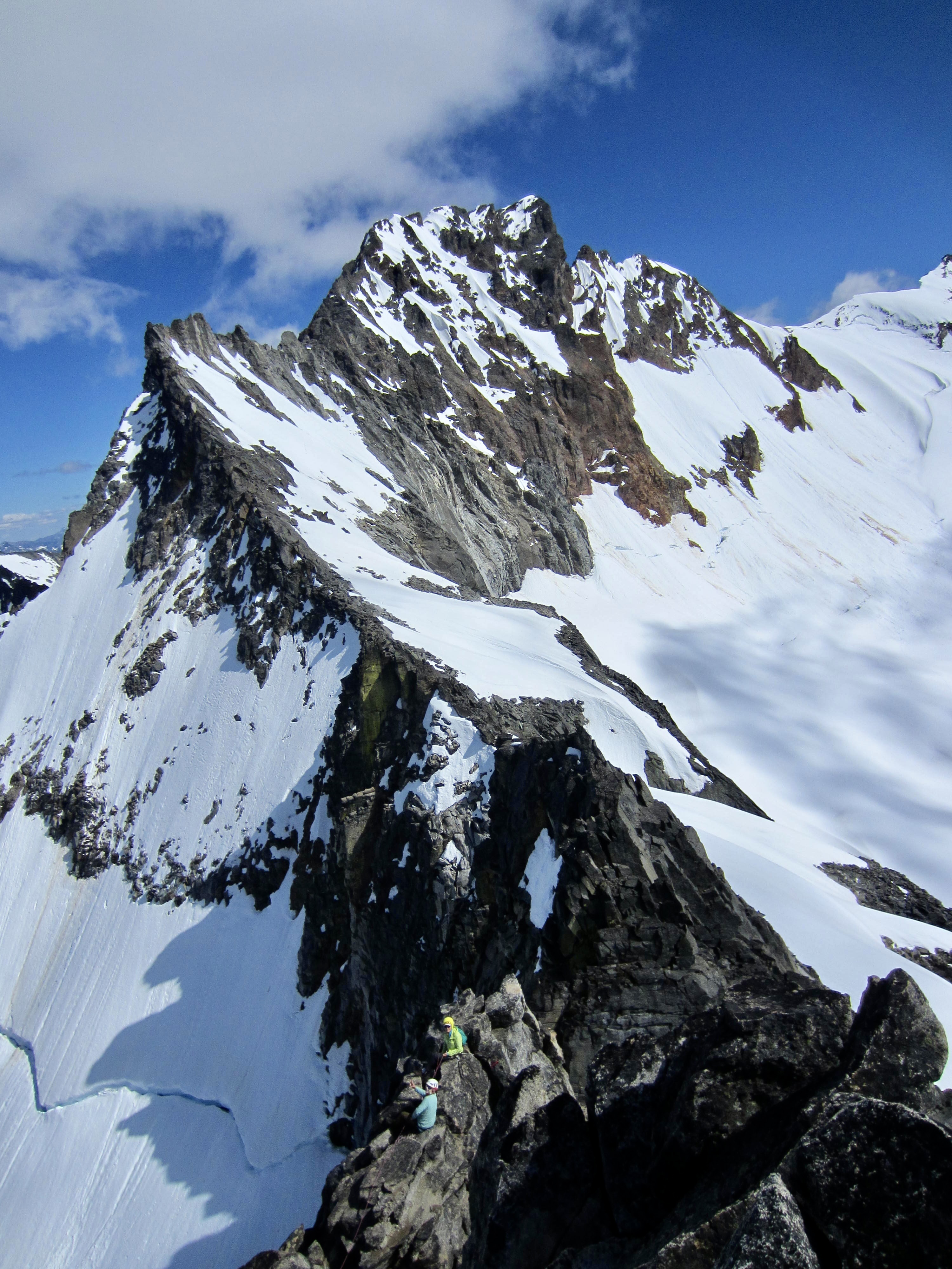
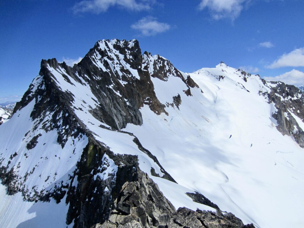
A short scramble above the upper snowfield brought us to Sharkfin Notch at 2:00pm (4.7 hours + 2350 feet from camp). From here, the view of Sharkfin’s sheer southeast face is almost frightening! A frigid wind was blowing through the notch, but we stopped to eat a quick lunch and reconfigure our gear, making a transition from snow climbing to rock climbing (mountain boots off, approach shoes on).
.
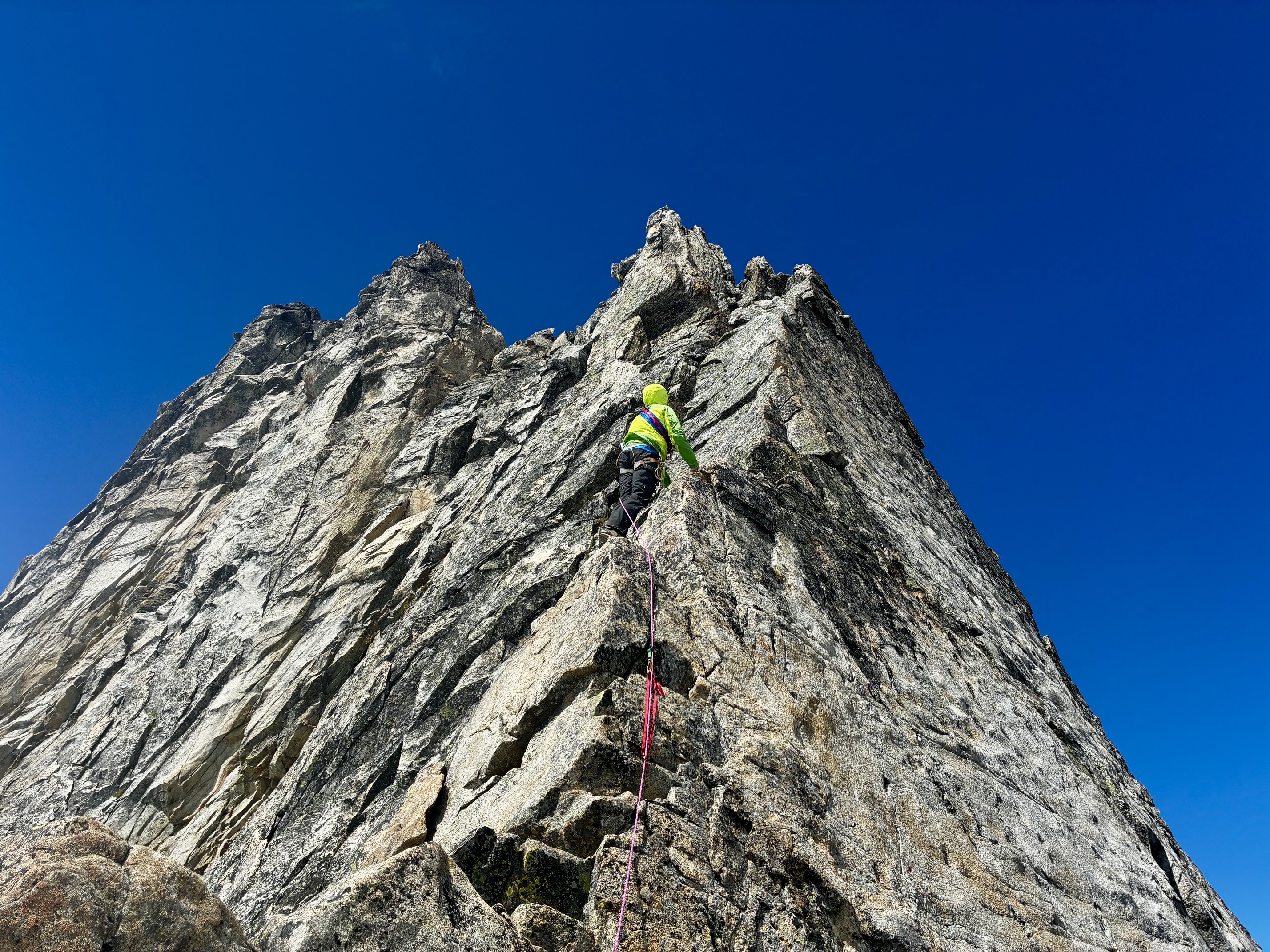
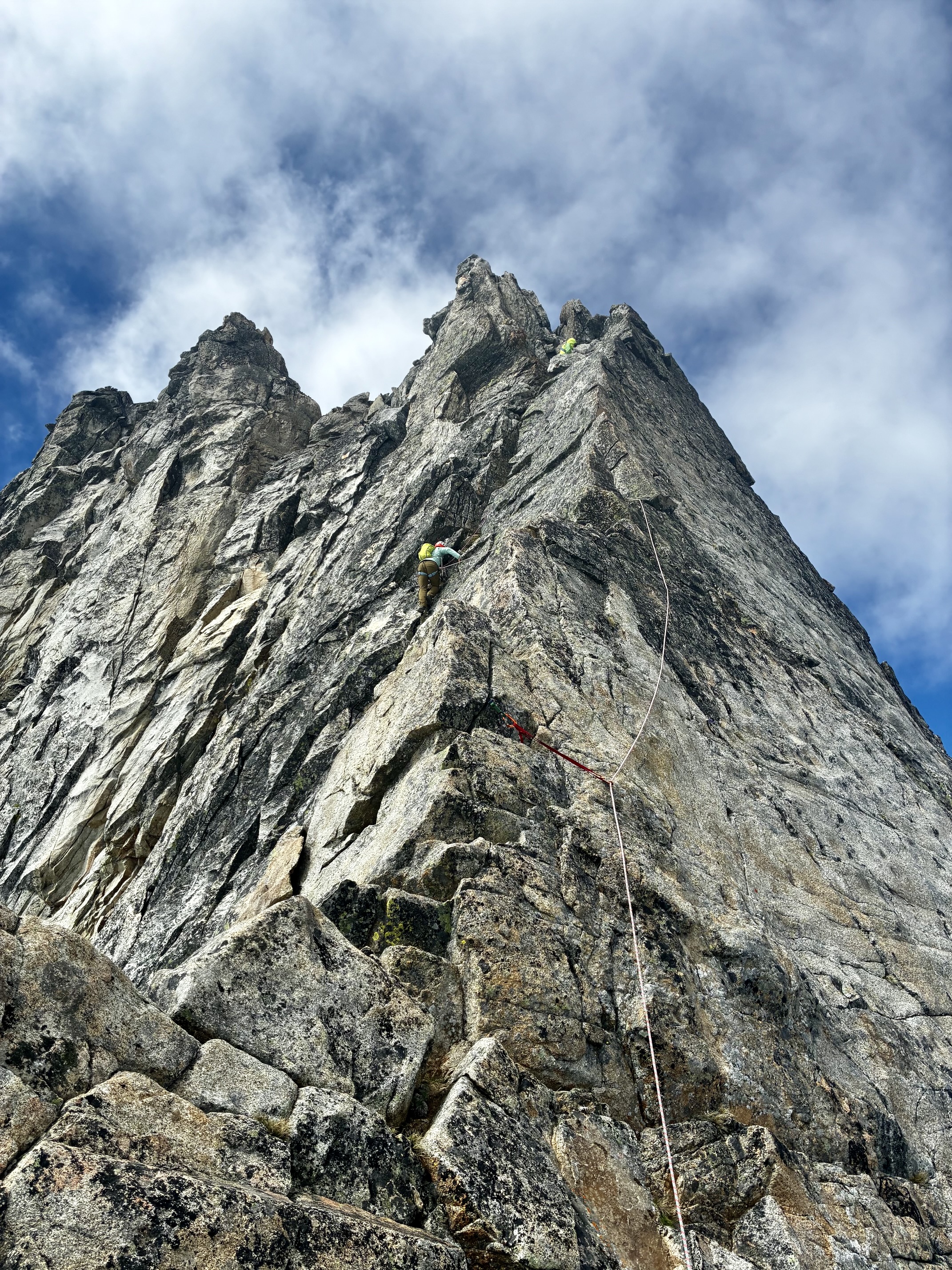
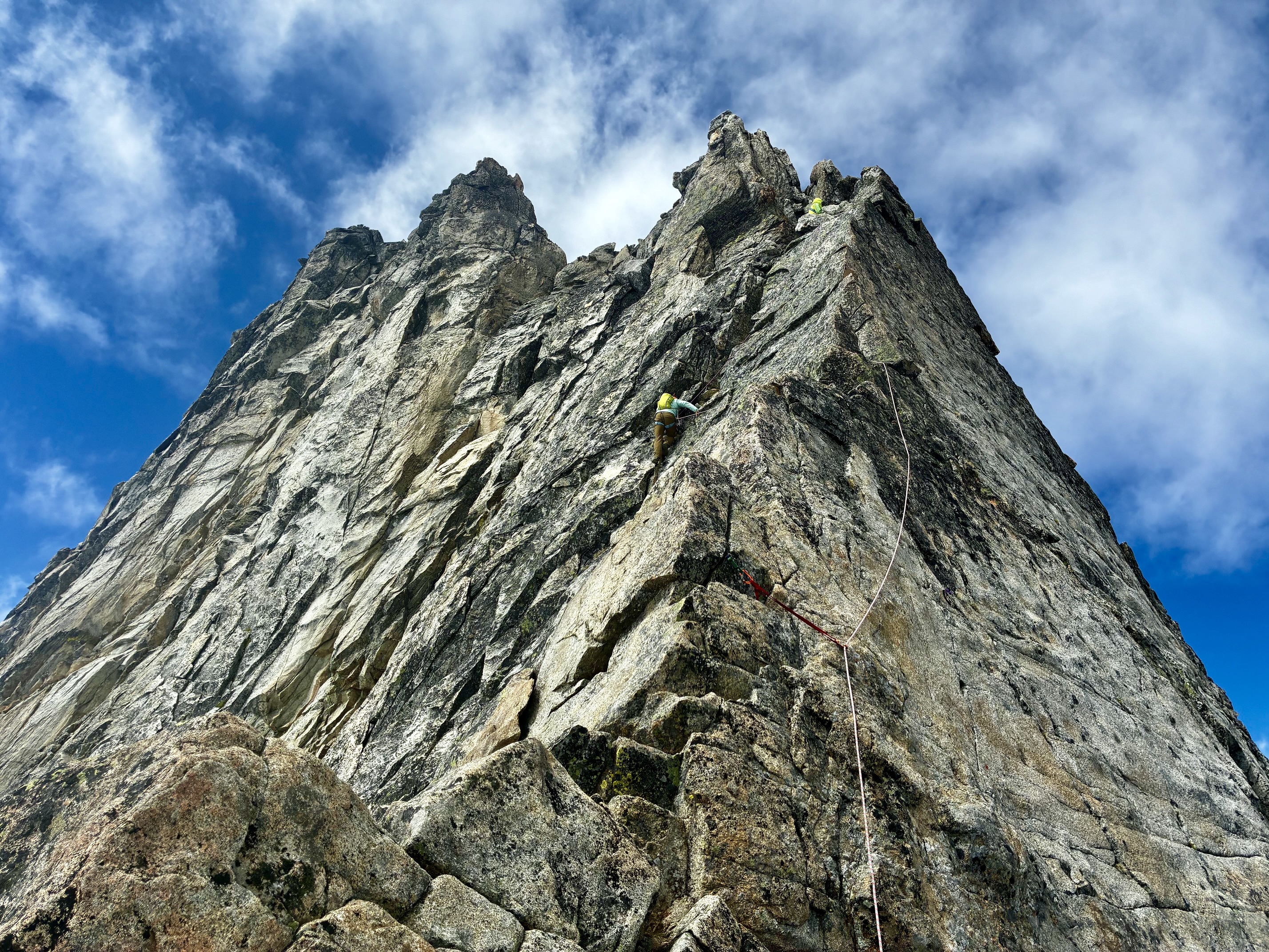
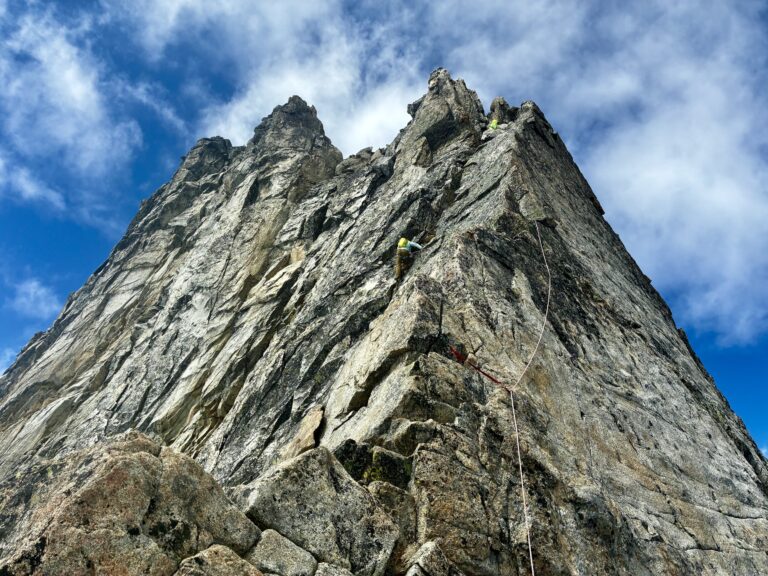
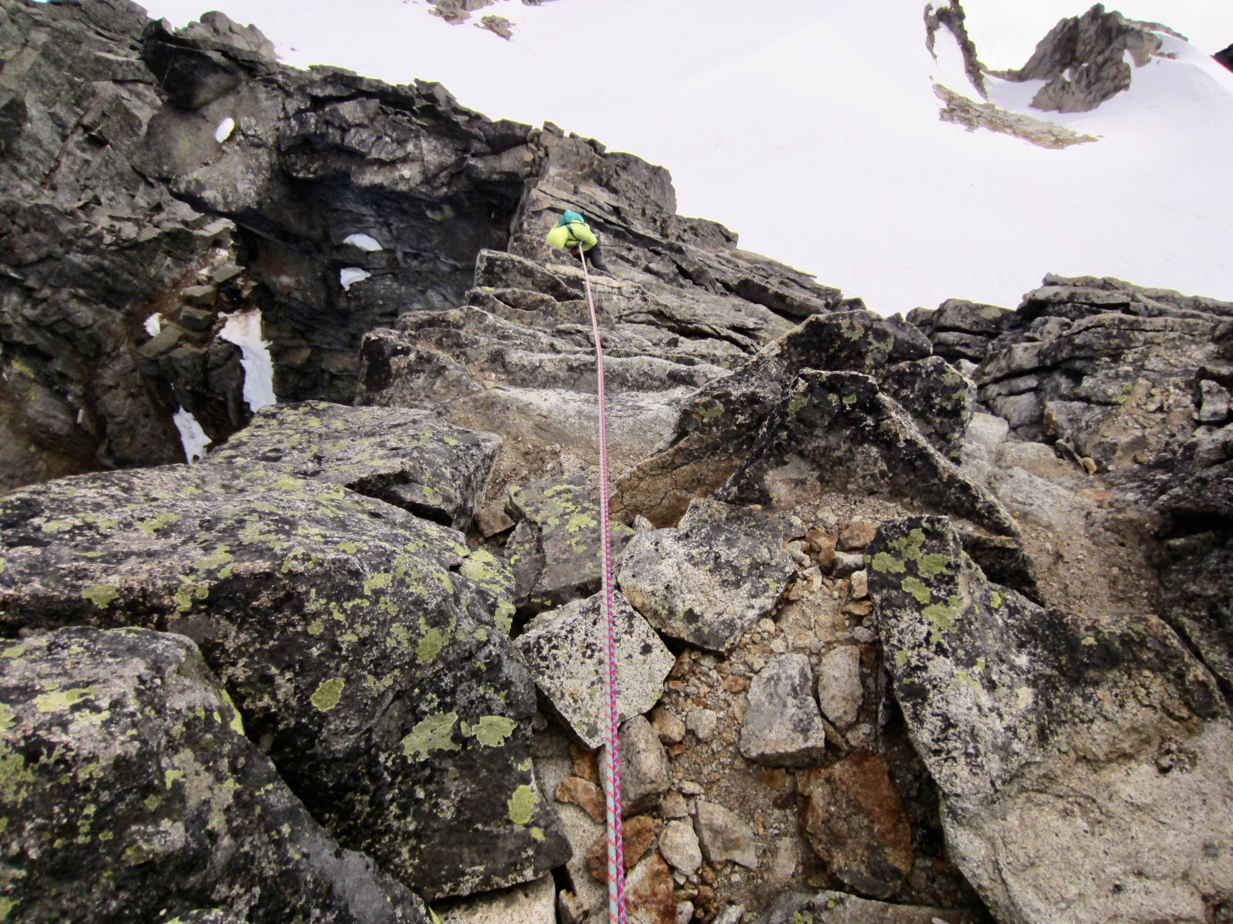
We tied into our two 40-meter ropes, with me at the front, Andrew in the middle, and Eileen at the back. I led Pitch 1 around to the right and up to a level step in the ridge, placing several stoppers and small cams. Most of the pitch was very low Class 5, but there were a couple moves that we all felt were Class 5.4, especially given the exposure.
.
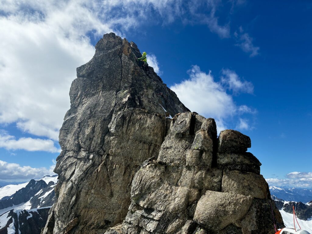
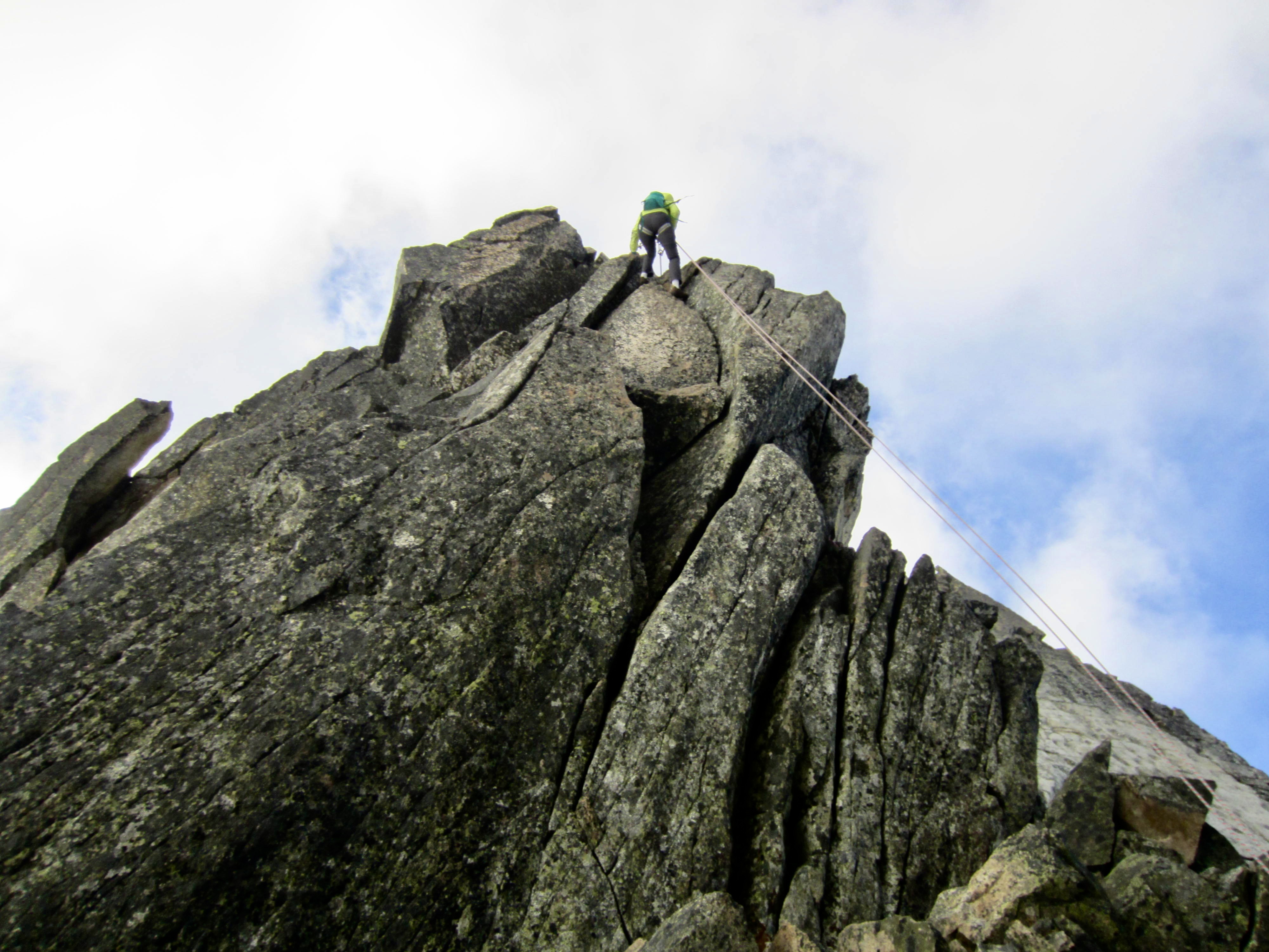
Pitch 2 is the “money pitch” on Sharkfin Tower. The easiest route starts up an airy arete between two steep faces, then angles left into a shallow chimney, then angles back onto the arete—all with dramatic exposure—and ends in an alcove with fixed anchor slings. This pitch is a blast; the rock is solid, the holds are plentiful, and the moves never exceed Class 5.2 or so.

.

.

.
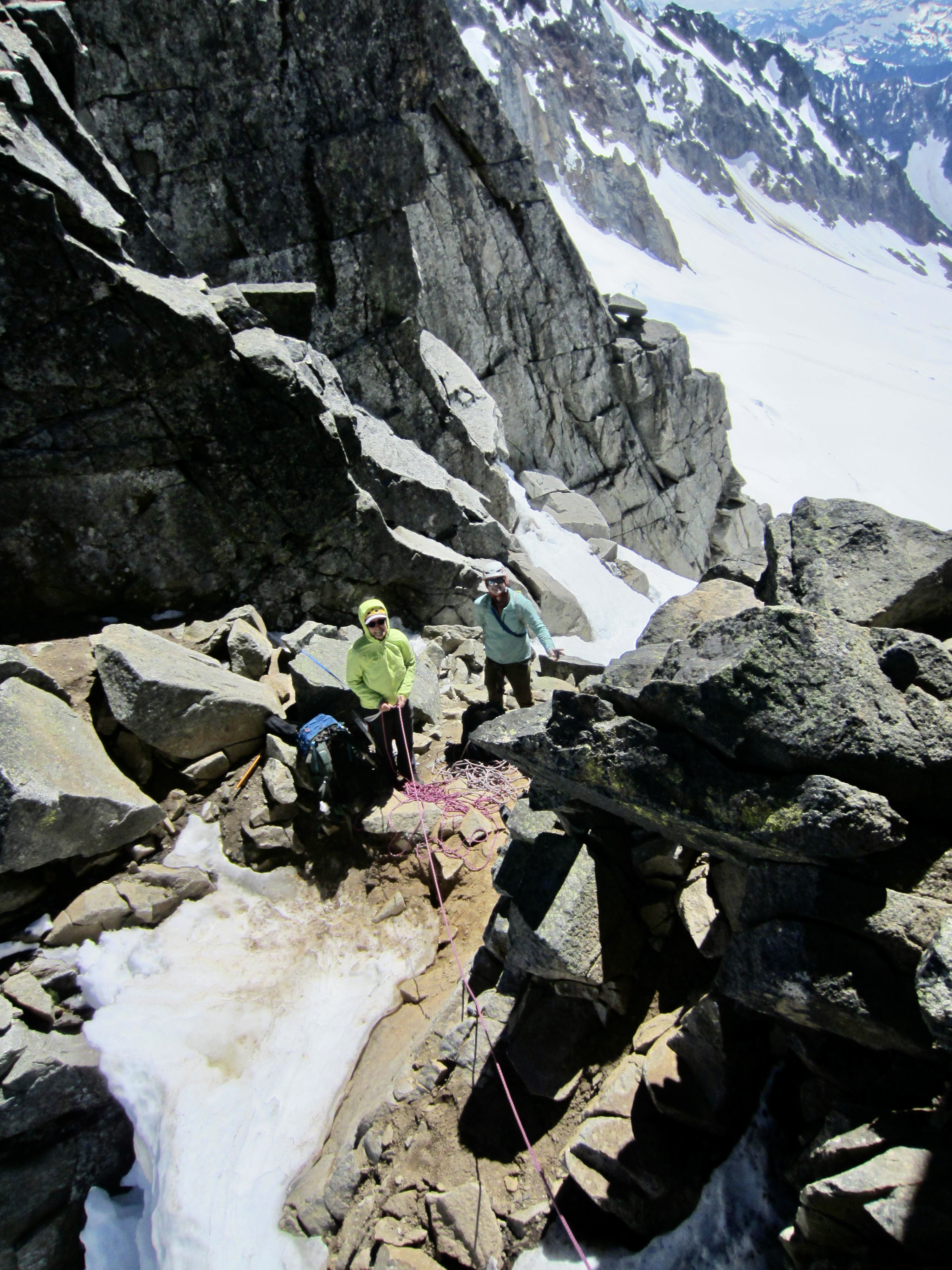
Eileen led a short Pitch 3 up from our belay alcove to the ridge crest and over to another flat step. This mini-pitch could be combined with either Pitch 2 or Pitch 4, but the rope drag would likely be excessive. I then led Pitch 4 up the right face and along the summit ridge. We gave this a Class 5.4 rating, due to several tricky moves along the way.
.

.
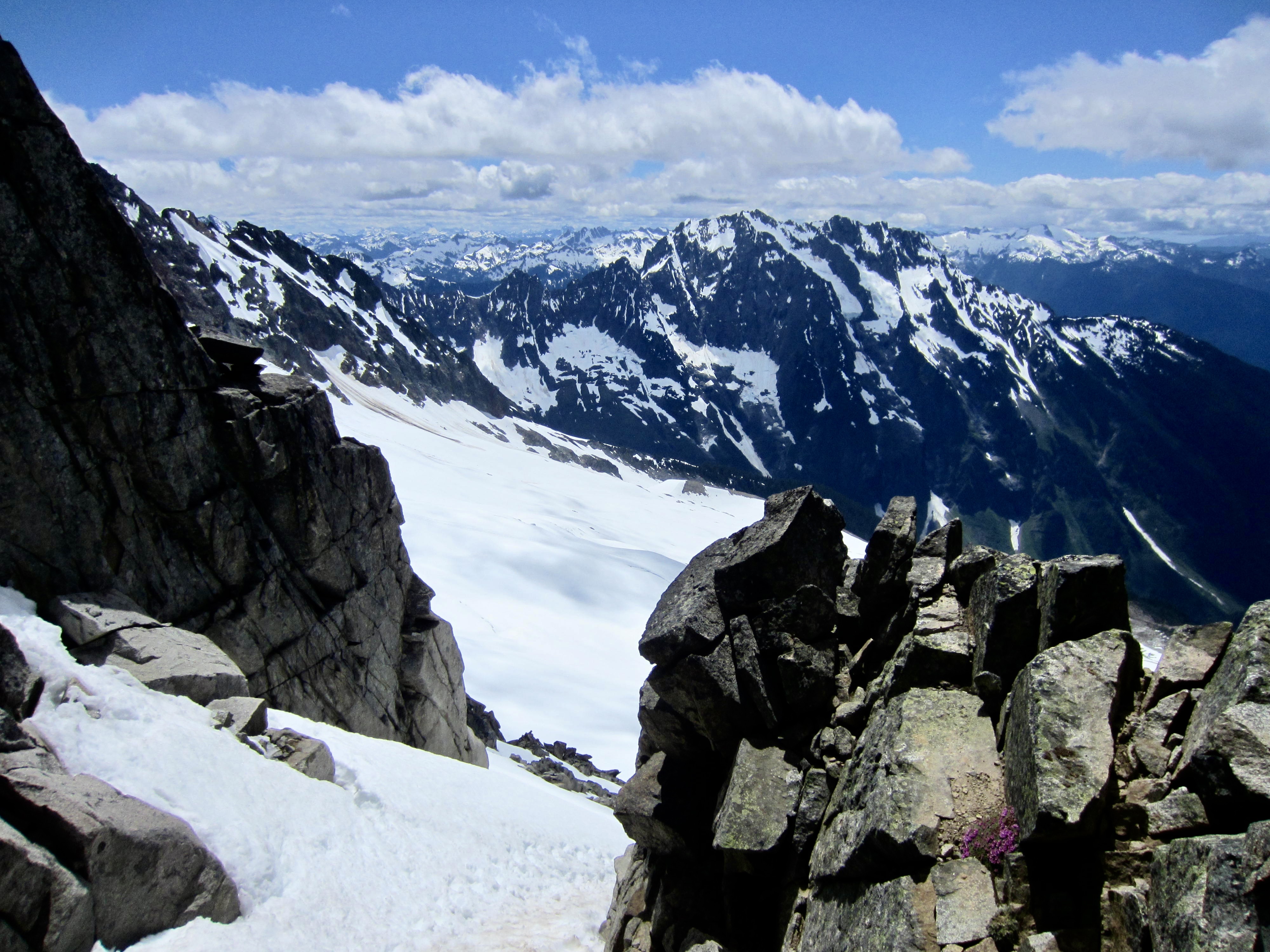
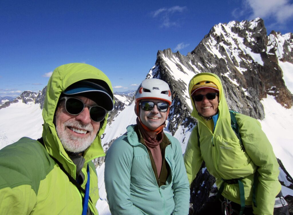
By 4:30pm, we were all gathered on the summit of Sharkfin Tower (7.2 hours + 2500 feet from camp). The climb had surpassed my expectations in terms of overall difficulty—on both the snow and rock portions—and the exposure was sensational. It also far exceeded Eileen’s memory from 11 years ago and left her wondering how she and Fay had managed to complete the climb so readily! It was the boldness of youth, no doubt.
.

.
.
.
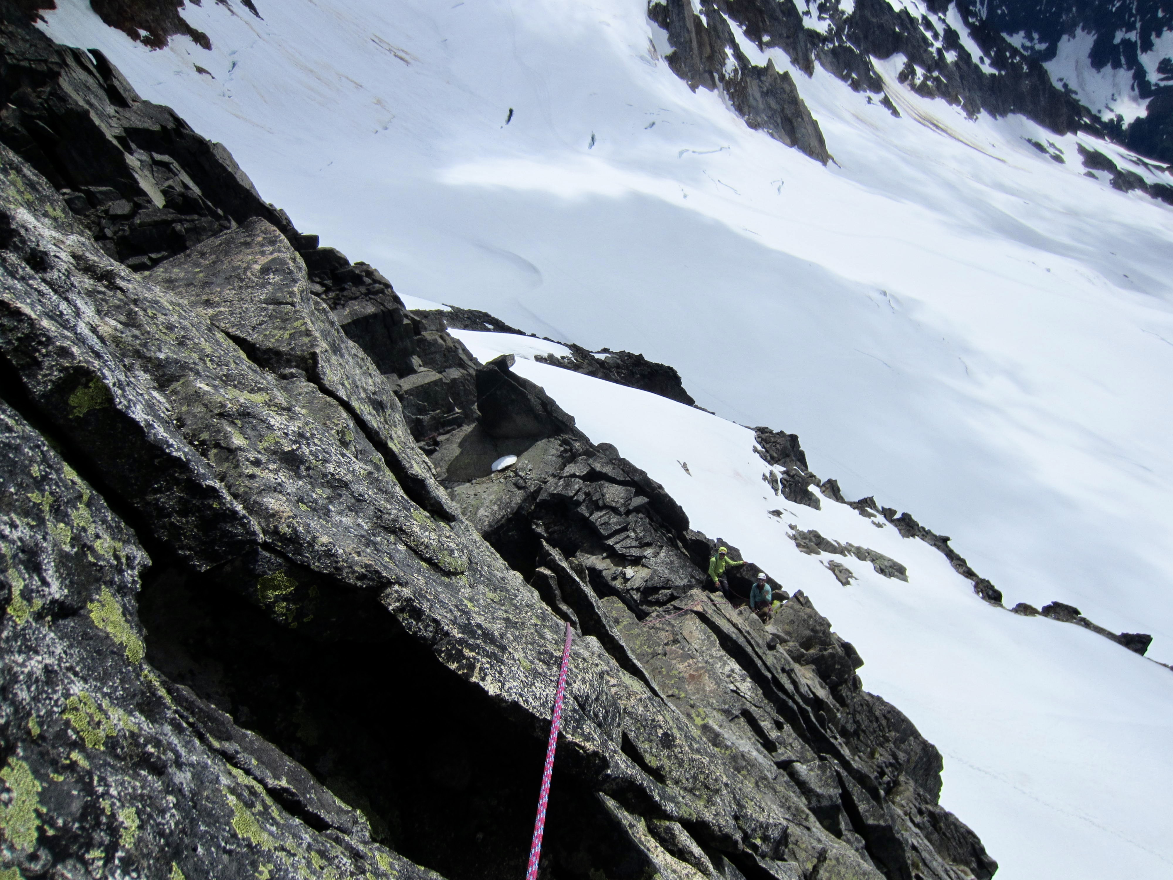
For our descent, we did a belayed down-climb of Pitch 4 and Pitch 3, then made a double-rope rappel down Pitch 2. Eileen went first on this rappel and continually fought with the ropes, as the frigid wind blew them over the arete and created frustrating tangles. By the time everyone finished the rappel, we were shivering uncontrollably. An overhanging single-rope rappel delivered us to Sharkfin Notch (2.0 hours from summit), where we transitioned back to mountain boots, crampons, and ice axes.
.
After angling back down the upper snowfield, we made two double-rappels down the snowfinger, first using Brian’s cam anchor and then using the sling anchor. Conveniently, the snowfinger ended adjacent to a fixed-sling anchor. From there, we made another double-rope rappel down the grungy gully, hoping that our ropes would reach the glacier.
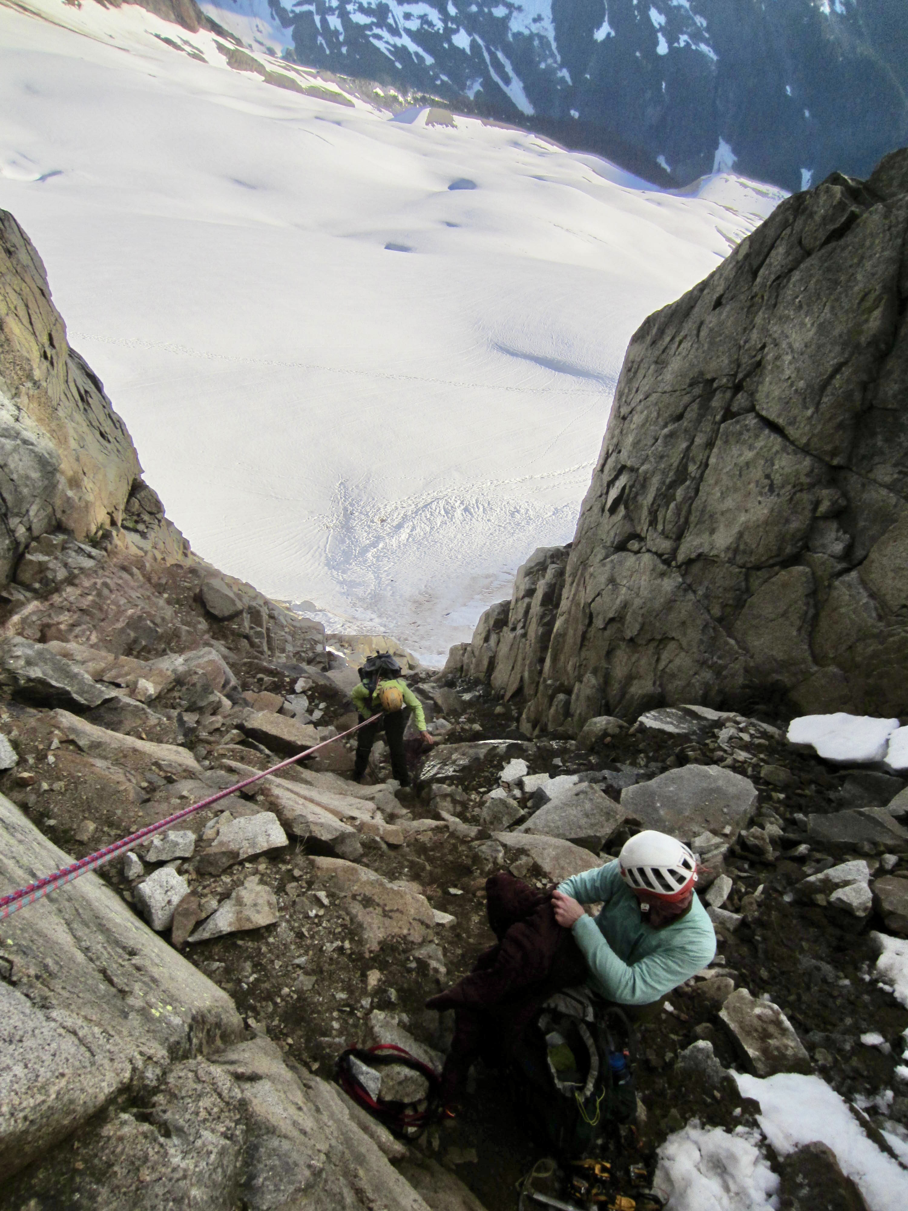
.
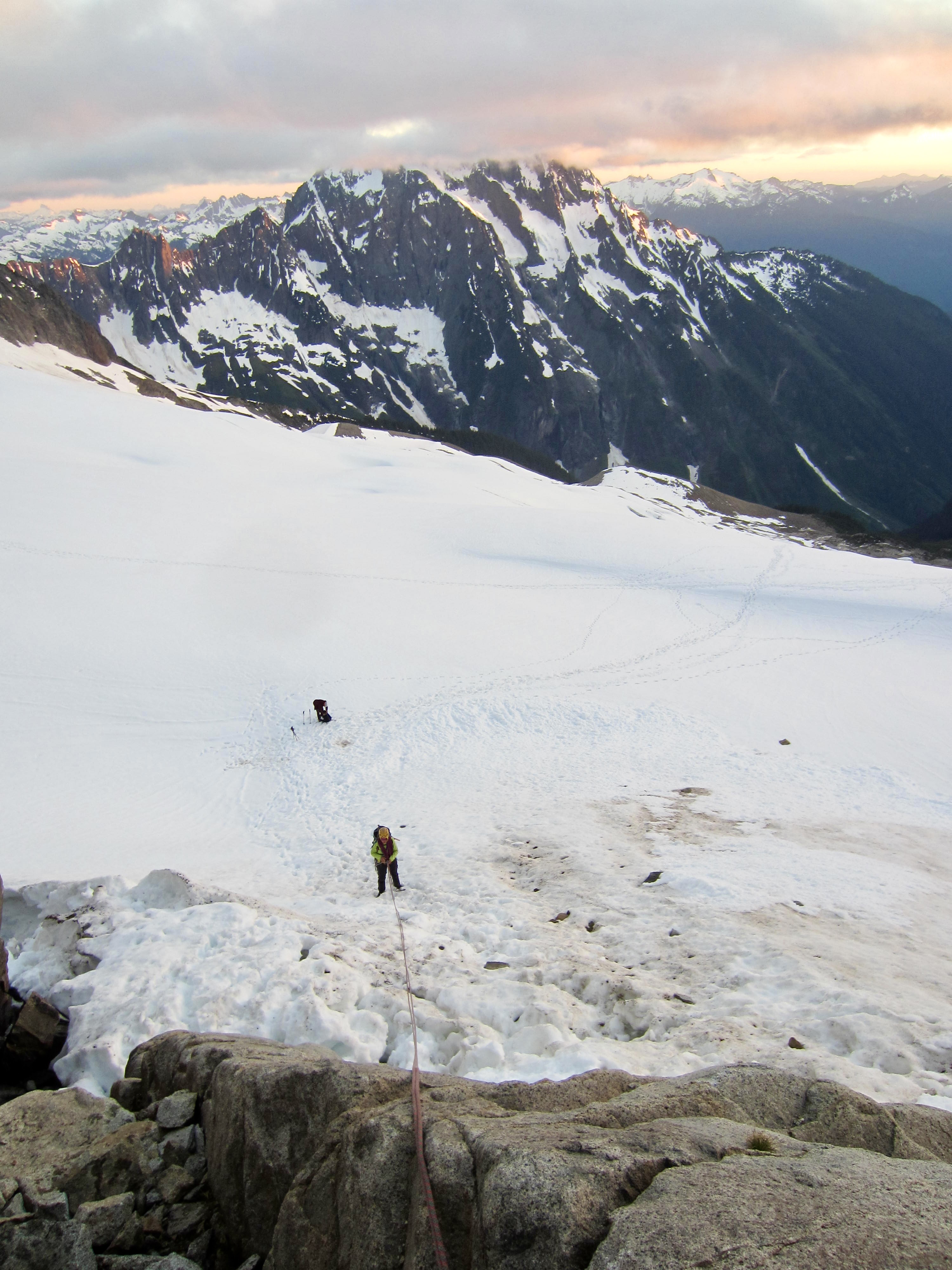
Our ropes came up about 20 feet short, so we slung a boulder and made a final rappel down the lowest rocks, across the moat, and onto the Quien Sabe Glacier (4.6 hours from summit). As the third person down, I punched through a weak snow bridge and ended up dangling in the moat, then had to execute a series of awkward moves in order to extricate myself. Eileen and Andrew were admiring the sunset, so they missed the whole comical affair—much to their chagrin!
.
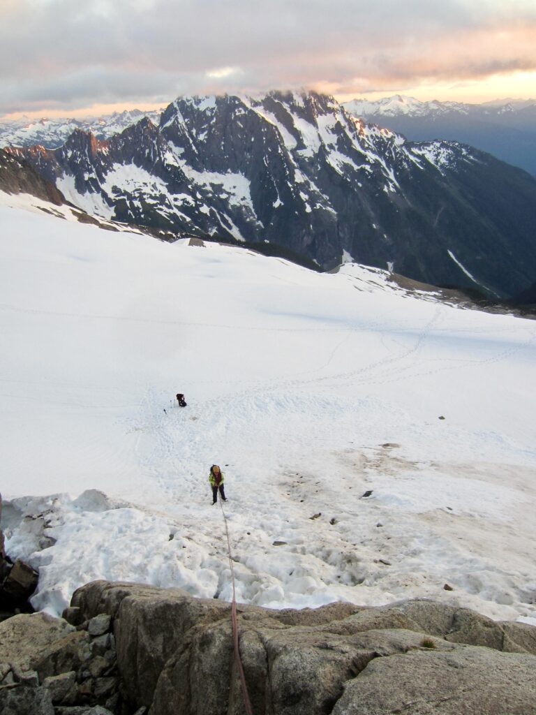
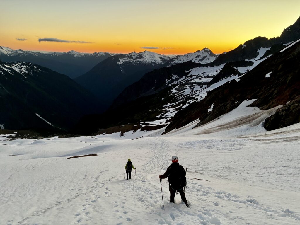
A golden sunset colored the western horizon as we made a hurried twilight descent, following our tracks down the glacier and retracing our approach route down the slabs. At 10:15pm, scant minutes before headlamp time, we reached Lower Boston Basin Camp (5.6 hours from summit). Despite our late arrival, we all stayed up until midnight, enjoying a celebratory dinner.
.
Day 3: Lower Boston Basin to Eldorado Trailhead
Eileen and I awoke at 8:00am to a flawless blue sky and a quiet camp. (Andrew had left a few hours earlier in order to attend a work meeting.) Knowing that this would likely be our last visit to Boston Basin, we had a very leisurely breakfast and took extra time packing up. We also set a relaxed pace down the trail and down the road, arriving at the bustling Eldorado Trailhead in late afternoon (5.8 hours from camp) to close the book on a marvelous adventure.
.
Route Map & Profile
…

…
Photo Gallery
Click to enlarge…