Trip Date: August 4-9, 2013
Sauk Mountains Climbing Trip & Glacier Peak Summit Loop: Lost Creek Ridge to White Pass
Bingley Gap
Lost Creek Ridge
Hardtack Lake
Lake Byrne
Black Mountain (7242’)
Old Kennedy Hot Springs
Glacier Peak aka DaKobed (10,541’)
Glacier Gap
Kololo Peak (8210’)
Foam Pass
White Pass
White Mountain (7030’)
- Trip Report Summary
- Related Posts
- Full Trip Report
- Day 1: Lost Creek Ridge Trailhead to Hardtack Lake
- Day 2: Hardtack Lake to Camp Creek Ridge + Black Mountain
- Day 3: Camp Creek Ridge to Kennedy Glacier Knob
- Day 4: Kennedy Glacier Knob to Glacier Peak Summit to Baekos Gap
- Day 5: Baekos Gap to Foam Basin + Kololo Peak
- Day 6: Foam Basin to NF Sauk River Trailhead + White Mountain
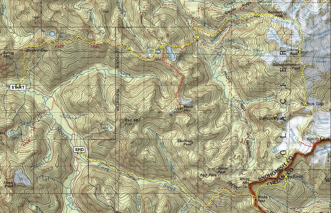
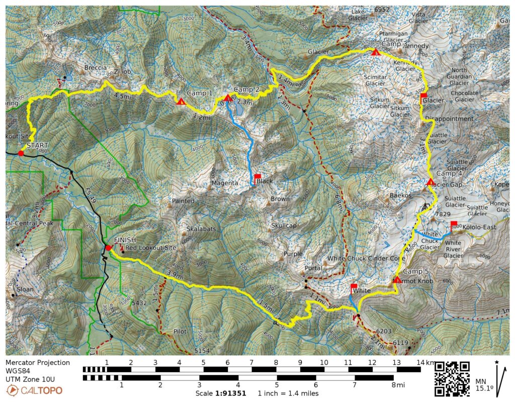
- Route Maps & Profile
- Photo Gallery
Trip Report Summary
Region: North-Central Washington Cascades
Sub-Regions: East Sauk Mountains & Glacier Peak Massif & DaKobed–White Range
Area: Glacier Peak Wilderness
Starting Point: Lost Creek Ridge Trailhead on North Fork Sauk River Road (Elev. 1850 feet)
Way Points: Bingley Gap & Lost Creek Ridge & Hardtack Lake & Camp Lake & Camp Creek Ridge & Lake Byrne & White Chuck River & Old Kennedy Hot Springs & Kennedy Creek & Kennedy Ridge & Glacier Creek & Kennedy Glacier Moraine & Kennedy Glacier Knob (trail hike & off-trail hike & rock scramble); Kennedy Glacier & Frostbite Ridge & Rabbit Ears & Glacier Peak summit (snow climb & ice climb); Disappointment Ridge & Cool Glacier & Baekos Gap & Glacier Gap & White Chuck Glacier & White Chuck Flats & Foam Pass (snow climb & rock scramble & off-trail hike); Foam Basin & White River Meadows & White Pass & Mackinaw Shelter & North Fork Sauk River & Red Creek & Skalabats Creek & Rainy Camp (trail hike)
Ending Point: North Fork Sauk River Trailhead on North Fork Sauk River Road (Elev. 2050 feet)
Campsites: Hardtack Lake & Camp Creek Ridge & Kennedy Glacier knob & Baekos Gap & Foam Basin
Sidetrip: Byrne Ridge Saddle & Lost Creek Basin (off-trail hike & rock scramble)
Summit: Black Mountain (rock scramble & snow climb via Northwest Face)
Summit: Glacier Peak (snow climb & ice climb via Kennedy Glacier—Frostbite [North] Ridge; descent via Disappointment [South] Ridge)
Sidetrip: White Chuck Glacier Saddle (off-trail hike & rock scramble)
Summit: Kololo Peak (ascent & descent via Southeast Face—South Ridge)
Summit: White Mountain (off-trail hike via South Ridge)
Approximate Stats (including all sidetrips): 45 miles traveled; 22,000 feet gained; 21,800 feet lost.
Related Posts
Black Mtn via Northwest Face – July 2002
Kololo Peak via White Chuck Glacier—White River Glacier + White Mtn via East Ridge – September 2001
Glacier Peak via Lower Kennedy Glacier—Frostbite Ridge – July 2000
Glacier Peak attempt via Ptarmigan Glacier—Frostbite Ridge – September 1995
Glacier Peak via Sitkum Glacier – July 1975
Full Trip Report
For the past decade, I had a notion to do a large backpacking and climbing loop out Lost Creek Ridge, down to the White Chuck River, back up the north ridge of Glacier Peak, down the south ridge, and out via White Pass. The execution of this loop—with all the sidetrips thrown in—turned out to be every bit as scenic and much more difficult than I anticipated. It was completed only with much help from a great team composed of Kevin K, Steve, Deb, Eileen (all locals), Beth B (a former local visiting from Utah), and Tim and Cassie (both visiting from Montana). In the end, we concluded that this was a physically and mentally taxing alpine adventure with the potential to become a Cascadian classic.
Day 1: Lost Creek Ridge Trailhead to Hardtack Lake
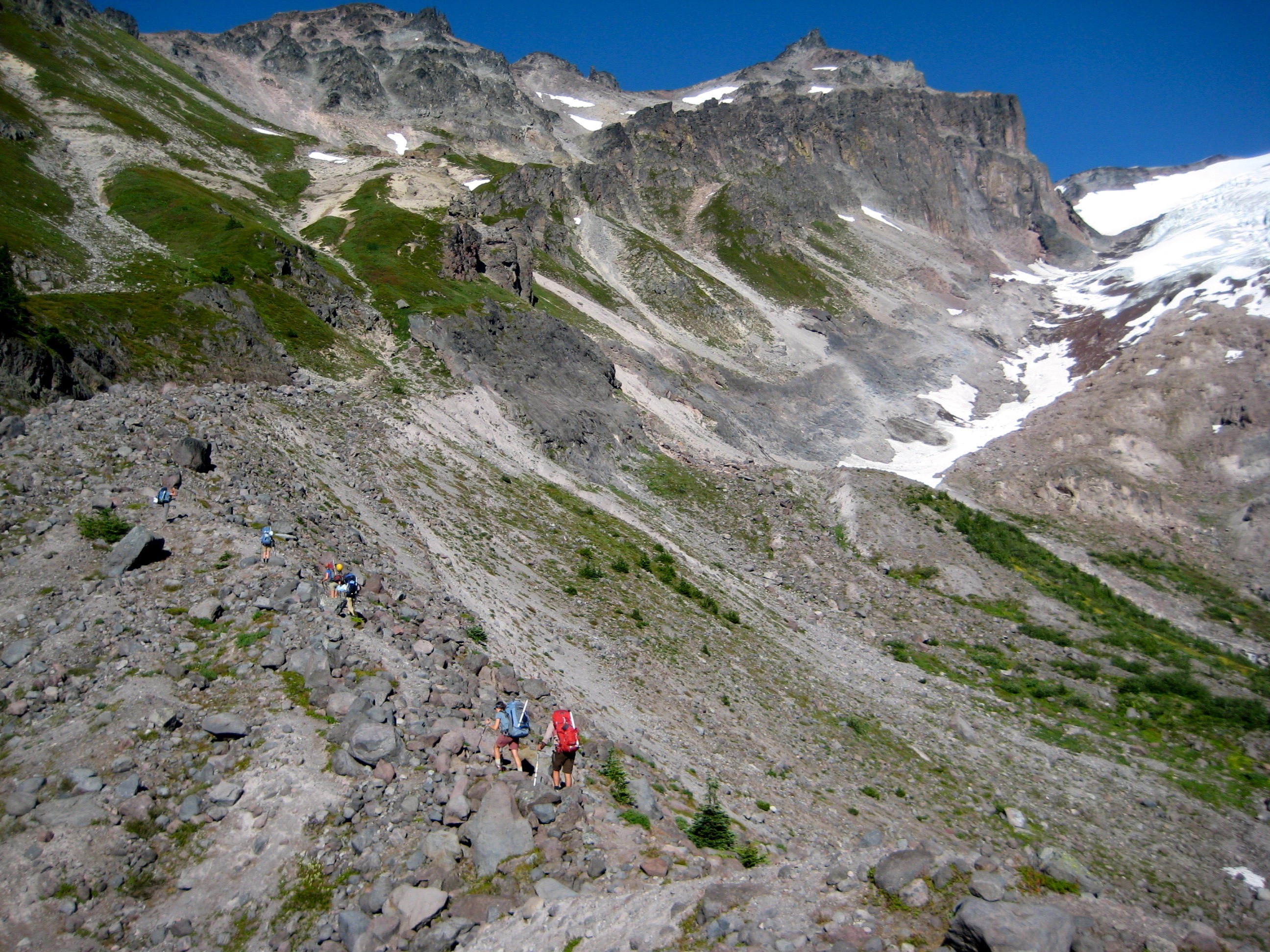
After dropping a car at the North Fork Sauk River Trailhead (near Sloan Creek Campground), we donned heavy packs and started grinding up the Lost Creek Ridge Trail. Numerous switchbacks led past Bingley Gap (2.7 hours from TH) and up the crest of Lost Creek Ridge. Mosquitoes and black flies were prevalent and annoying every time we stopped for a break, but not too bad while we were moving.
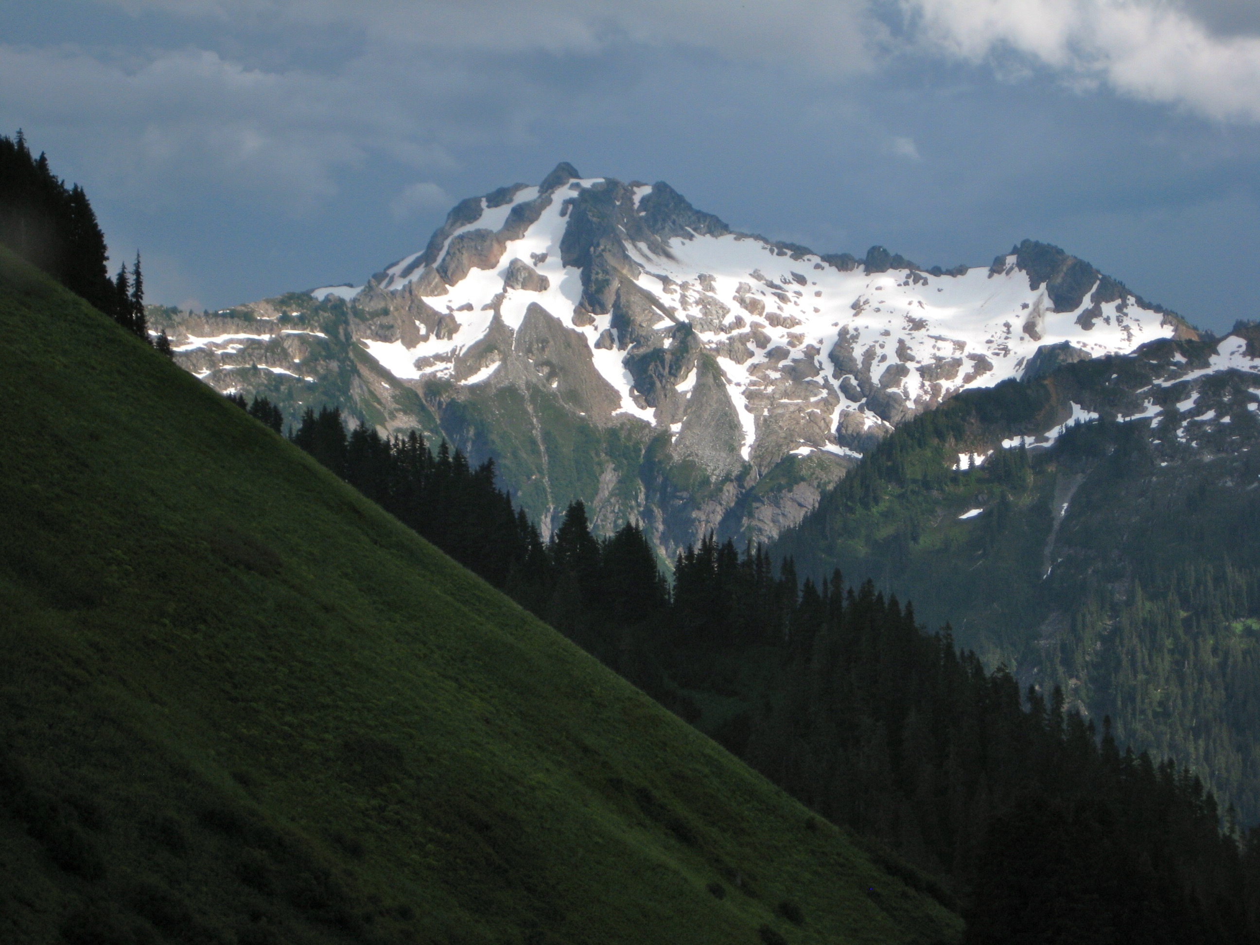
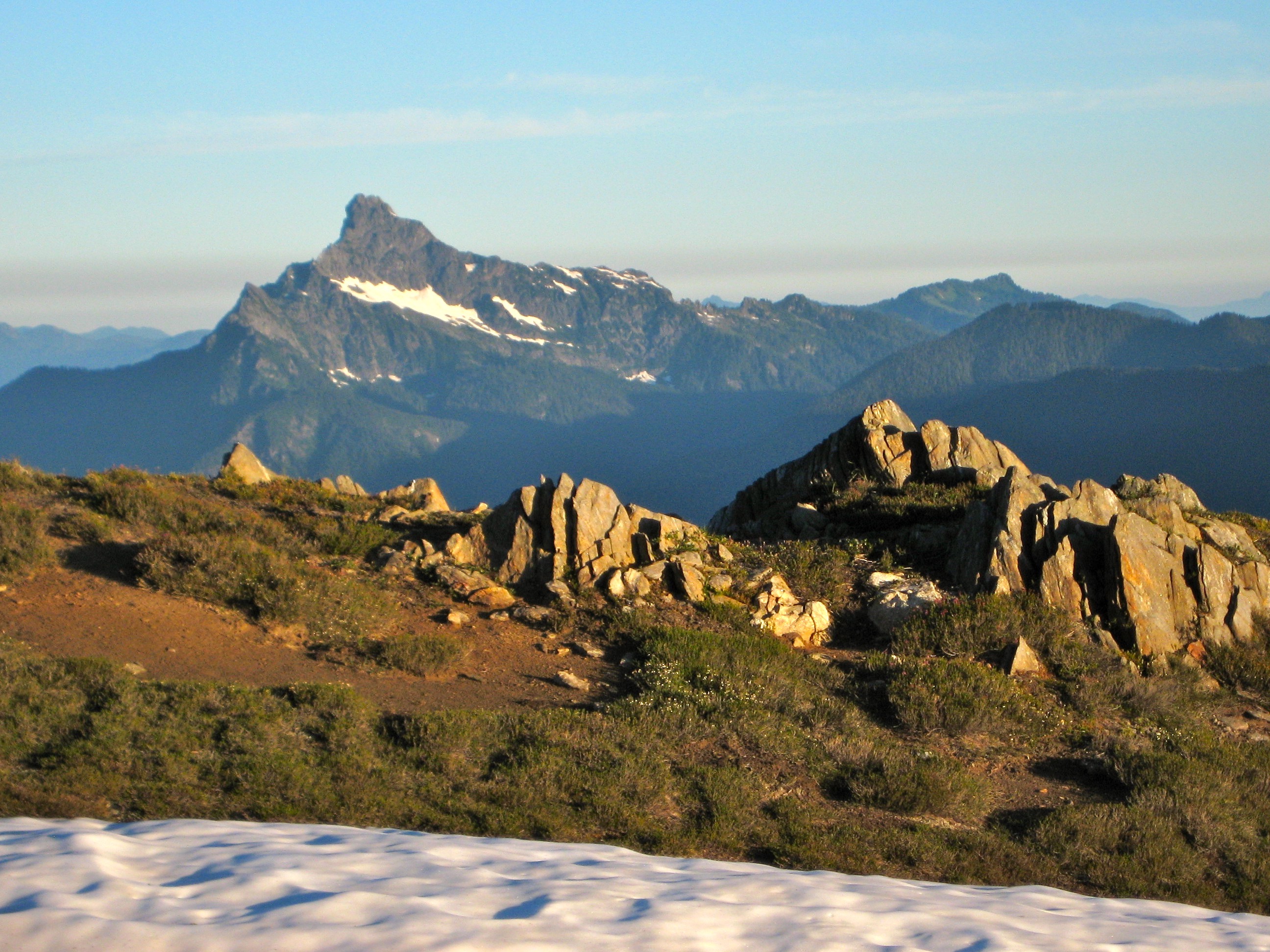
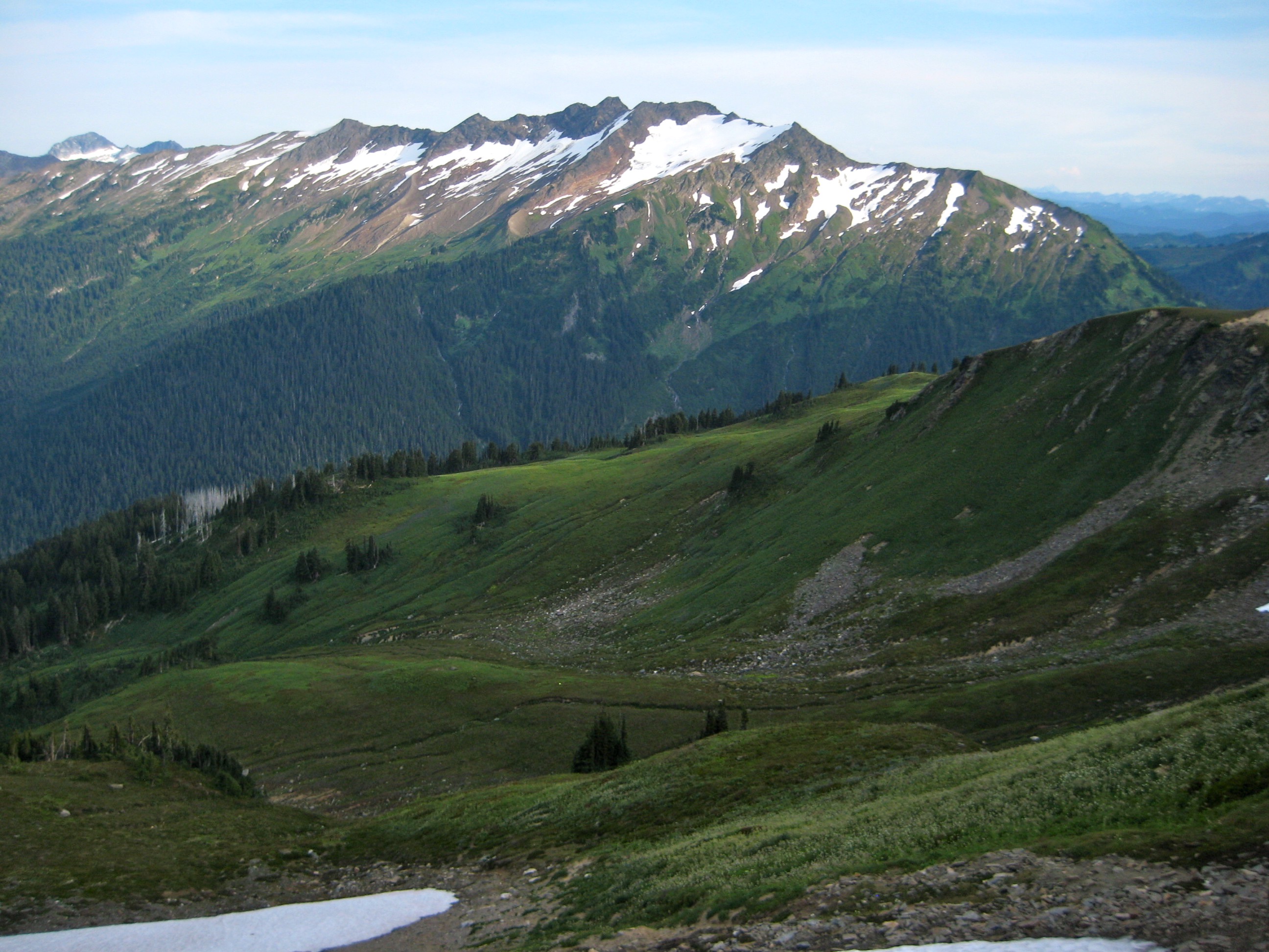
Eventually, the old trail, which is unmaintained but easy to follow, eased up and began contouring the southern side of the ridge. There are lots of ups and downs as it climbs over rocky ribs and drops into grassy gullies, with little net elevation gain. Farther along, the trail swings back and forth across the crest, giving marvelous views in both directions. Sloan Peak, Black Mountain, Mt. Pugh, and White Chuck Mountain are showcased at various locations.
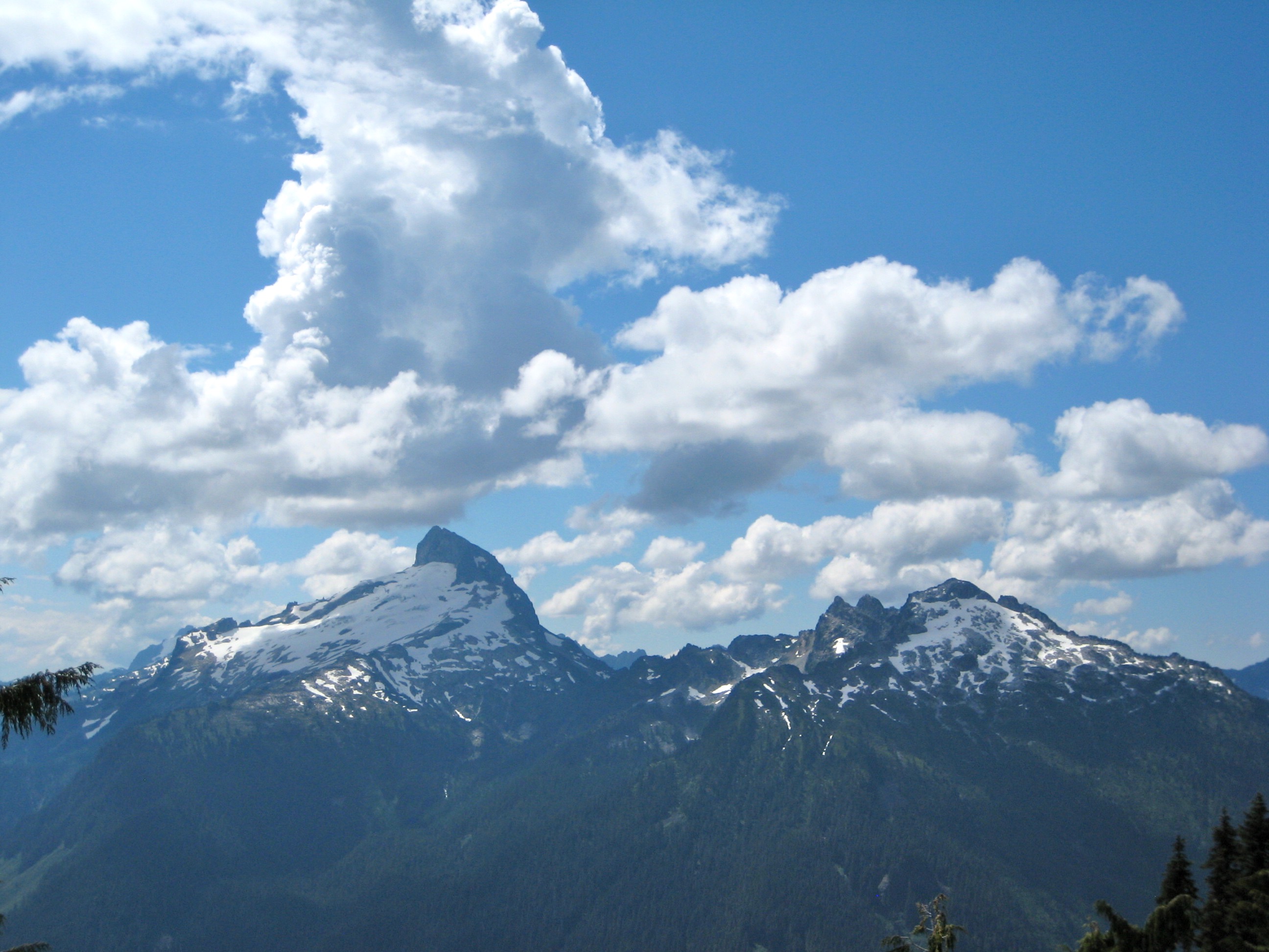
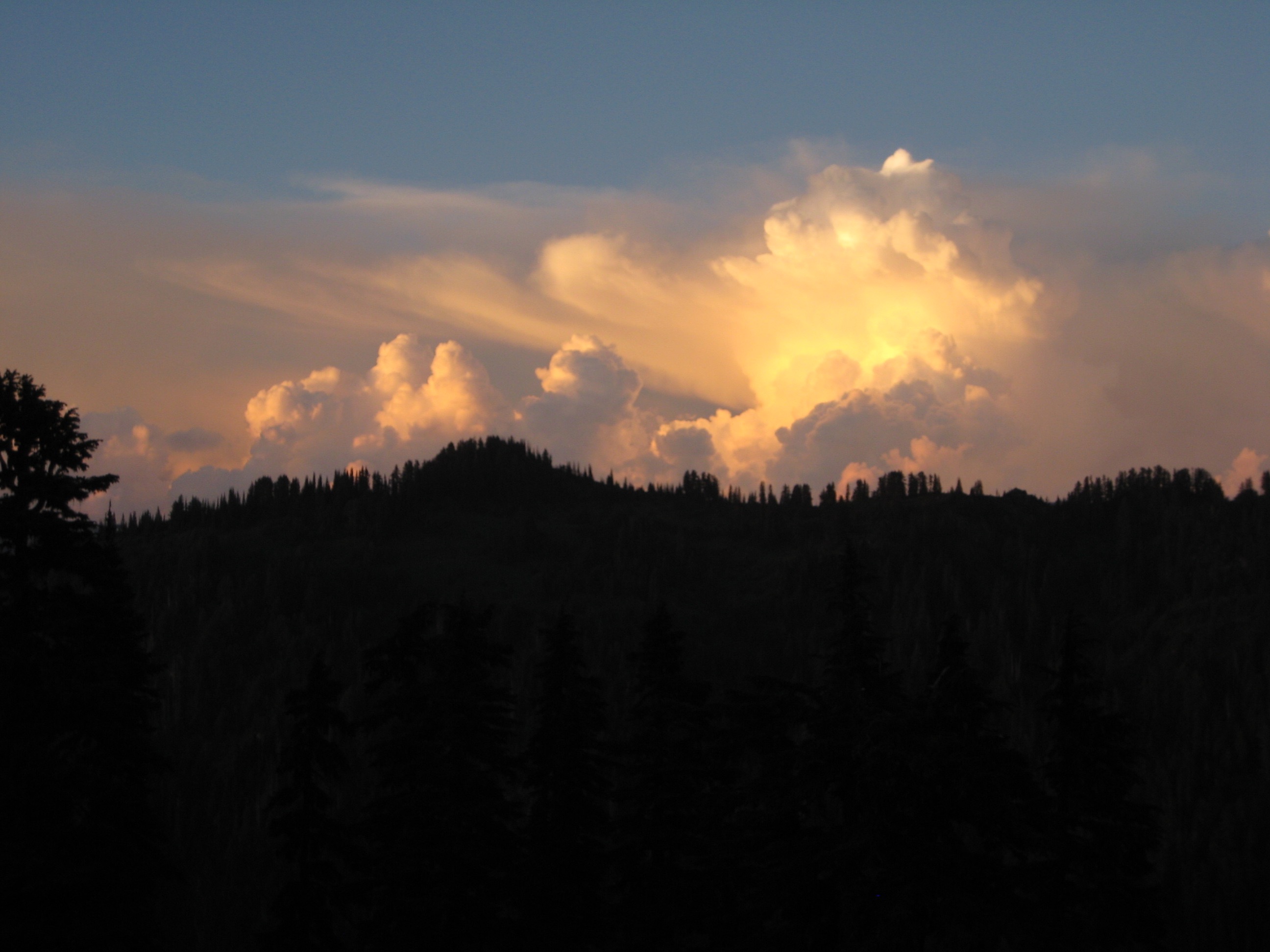
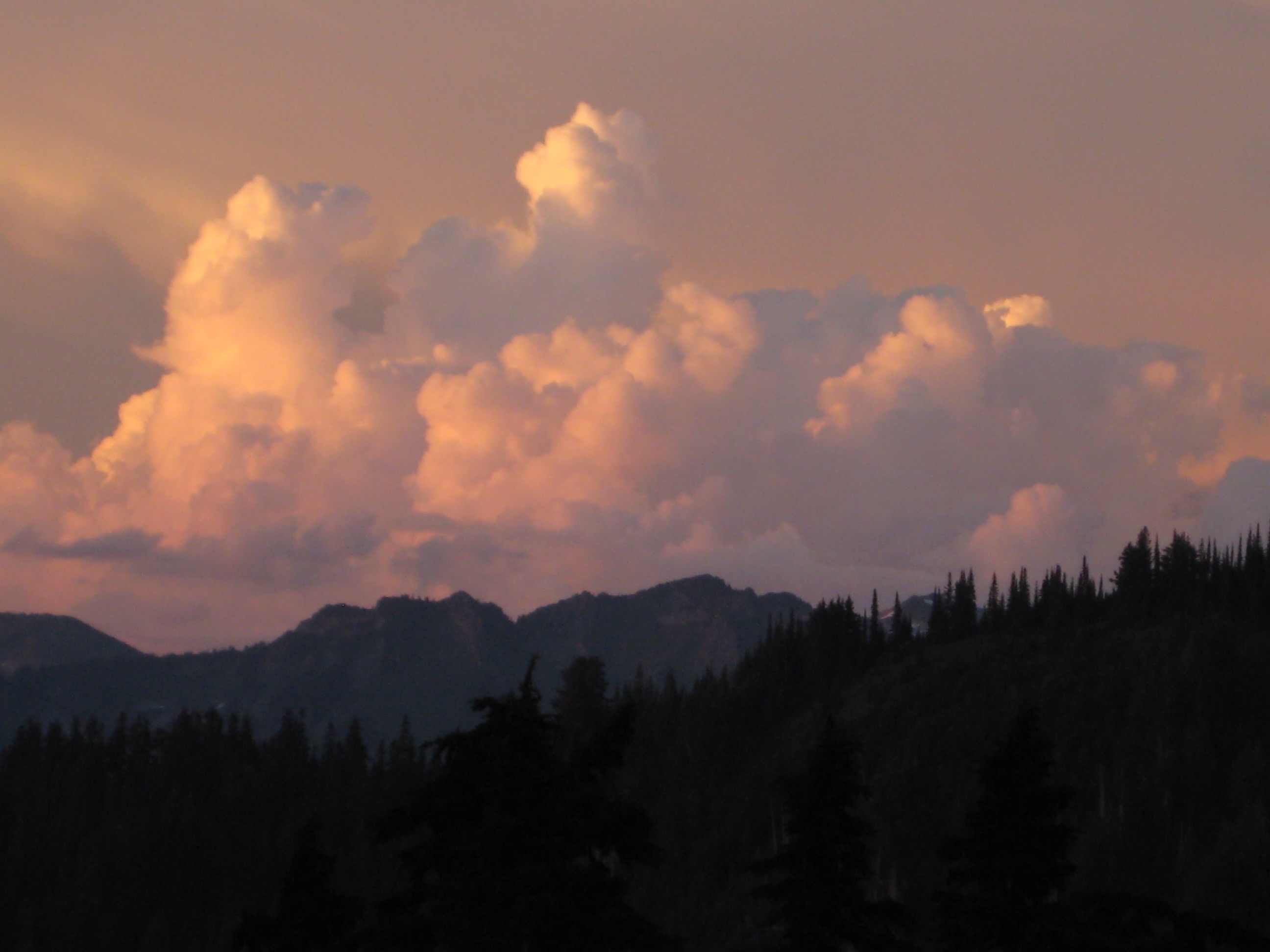
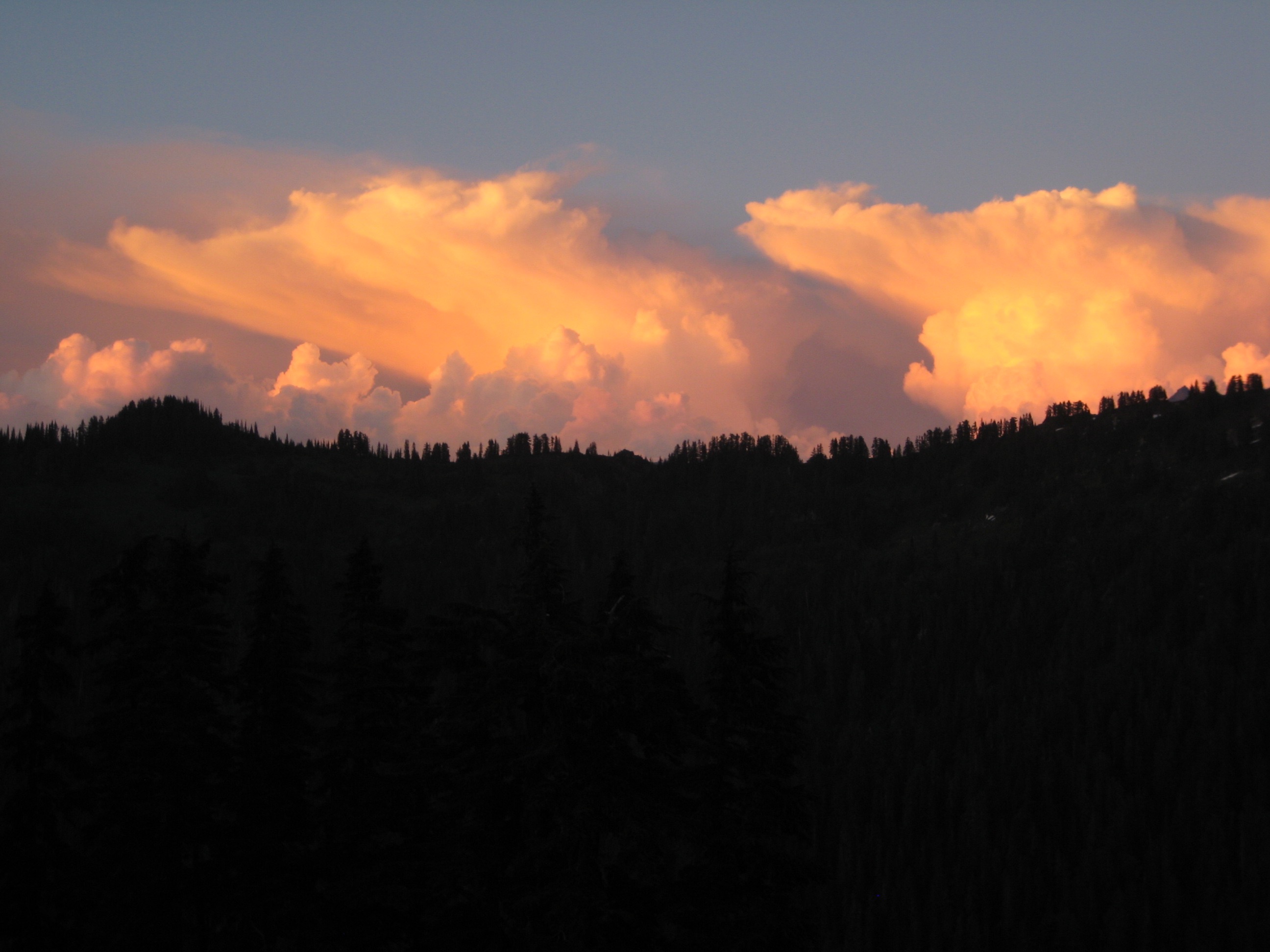
Thunderheads gradually built up during the afternoon, resulting in an hour of large hailstones and raindrops around mid-afternoon. We trudged into a heathery campsite overlooking Hardtack Lake (8.6 hours from TH) just as the rain stopped. By bedtime, the storm clouds had completely dissipated, and we had only sunny skies for the remainder of the week.

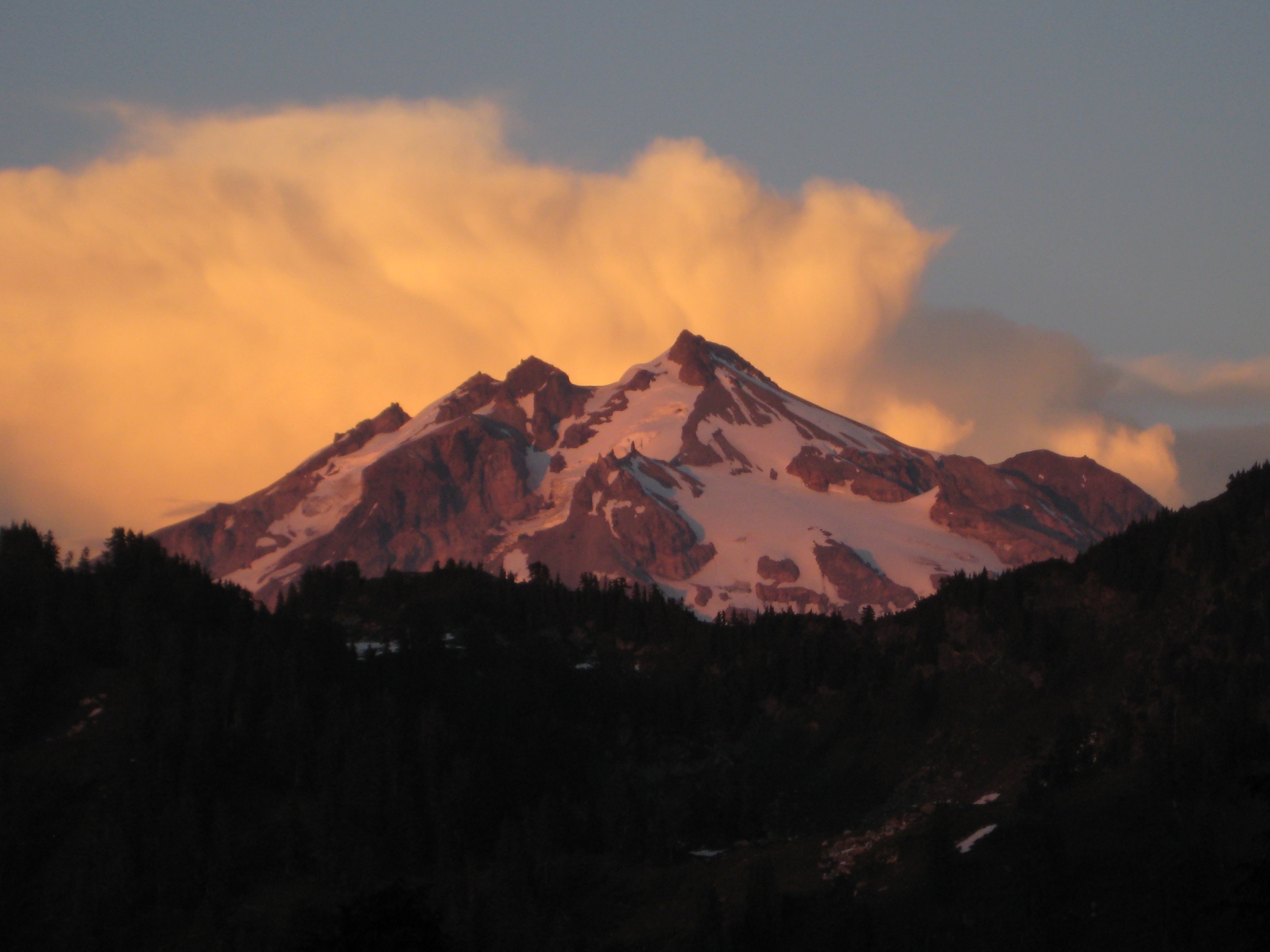
- Thunderhead Building Over Sloan Peak
- Black Mountain From Lost Creek Ridge Trail
- Post Storm Clouds Over Camp Creek Ridge
- Glacier Peak From Camp 1 At Hardtack Lake
Day 2: Hardtack Lake to Camp Creek Ridge + Black Mountain
Most of our morning was spent moving camp 1.5 miles eastward from Hardtack Lake to the crest of Camp Creek Ridge (1.2 hours from Camp 1), which separates Camp Lake and Lake Byrne. T&C refer to the ridge-top basin as “Little Siberia,” but the surrounding uplands are as non-Siberian as can be; our campsite consisted of a gorgeous parkland that would be better described as “Little Elysium.”
We set up tents, arranged daypacks, and then struck off for Black Mountain, which sits about 2.5 miles south of Lake Byrne. Black Mountain is an under-appreciated peak with considerable topographic projection and a handsome structure. Our route from camp took us on a convoluted traverse over a high saddle, across several basins, gullies, and ribs, and finally up a northwest-facing snow couloir.
We summited in late afternoon (5.3 hours from Camp 2) and took in a front-row view of Glacier Peak—along with our upcoming challenges for the next several days. And guess what? The summit register indicated that Stefan Feller’s party had just summited Black Mountain the day before! We retraced our long traverse route back to camp (3.7 hours from summit), arriving shortly before dark.
- Cassie and Eileen Climbing Black Mountain Couloir
- Camp 2 On Camp Creek Ridge
Day 3: Camp Creek Ridge to Kennedy Glacier Knob
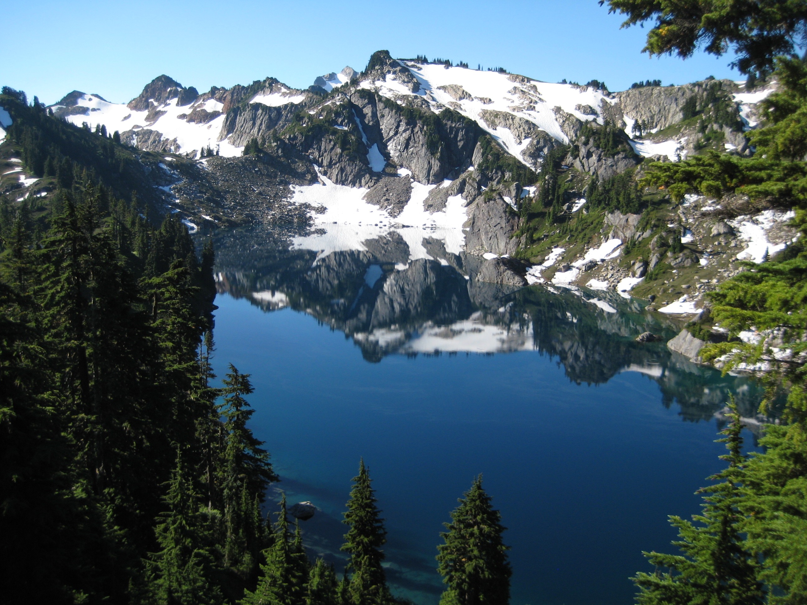
We reluctantly packed up and left our Elysian campsite, knowing that the day would involve a big elevation drop to the White Chuck River, followed by an equally big gain back up Kennedy Ridge. We stopped at beautiful Lake Byrne—one of Washington’s renowned alpine gems—before plunging 2300 feet down switchbacks to the river. Despite a lack of maintenance since the 2003 flood that wiped out Kennedy Hot Springs, this trail remains in pretty good shape; expect to encounter a normal number of downed trees, but the tread is well defined.
- Calm Morning At Lake Byrne
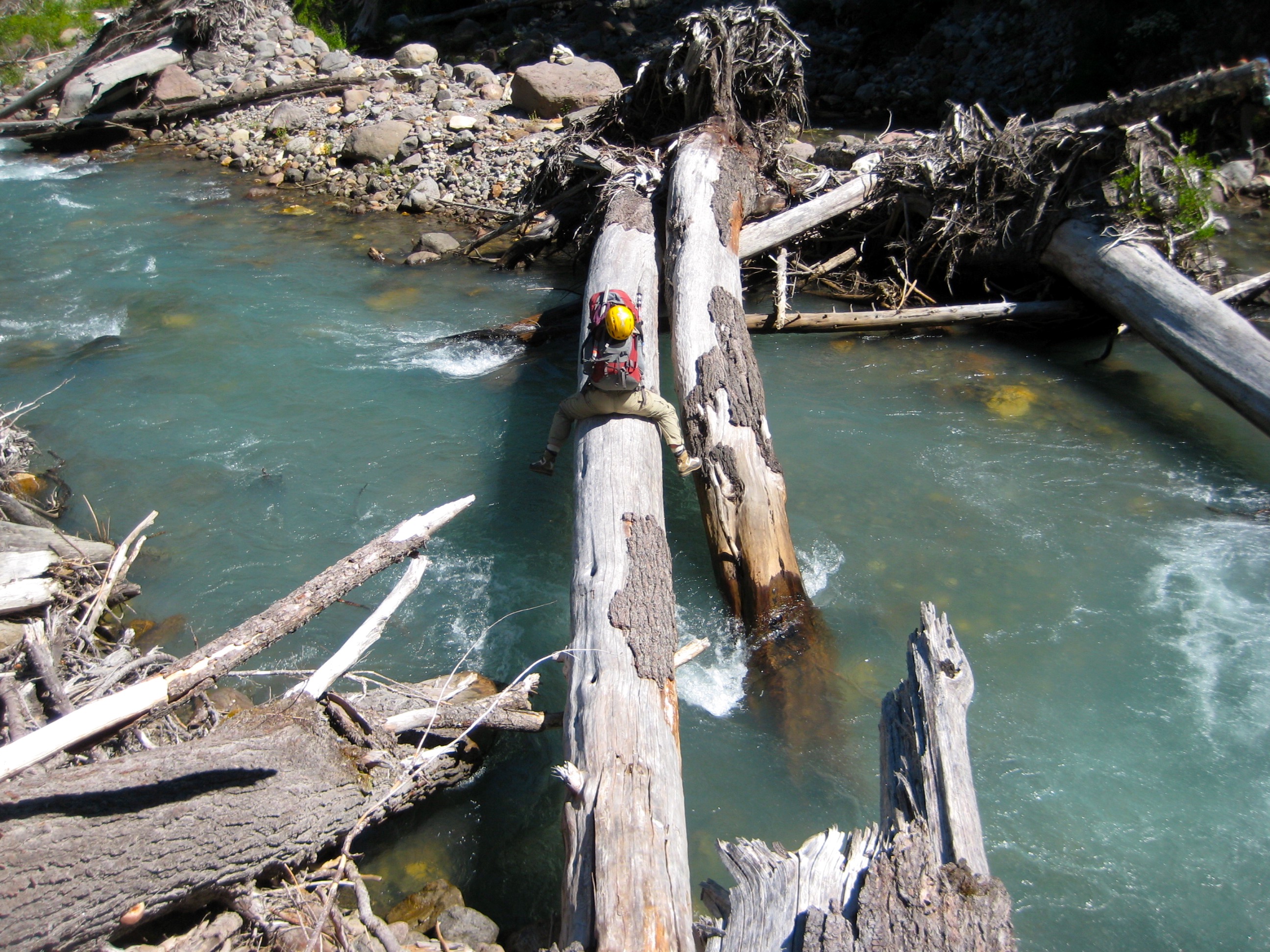
We arrived at the broad White Chuck River floodplain just before noon (2.9 hours from Camp 2) and easily followed ducks, cairns, and footsteps to a crossing location approximately 50 yards upstream from the White Chuck River – Kennedy Creek confluence. There are actually two or three stout logs spanning the channel here, so we each selected a log according to individual taste.
- Crossing White Chuck River On Day 3
During our lunch break, Kevin went off exploring and found the relic hot springs seeping through the flood deposit. We also spotted the ruins of the ranger’s cabin. For those of us who had visited Kennedy Hot Springs in its heyday, it was eerie to see the little remains of structures, signs, and trails amid this swath of natural devastation.
After lunch, we crossed Kennedy Creek on a nearby log and then wandered downstream in search of the old White Chuck River Trail. This was quickly found along the forest edge and followed several hundred yards to its junction with the Kennedy Ridge Trail. We turned eastward on the latter trail and began a shady ascent of Kennedy Ridge. The trail along this ridge, which eventually narrows down to a crest less than 10 feet wide, is a backpacker’s delight and still in excellent condition.
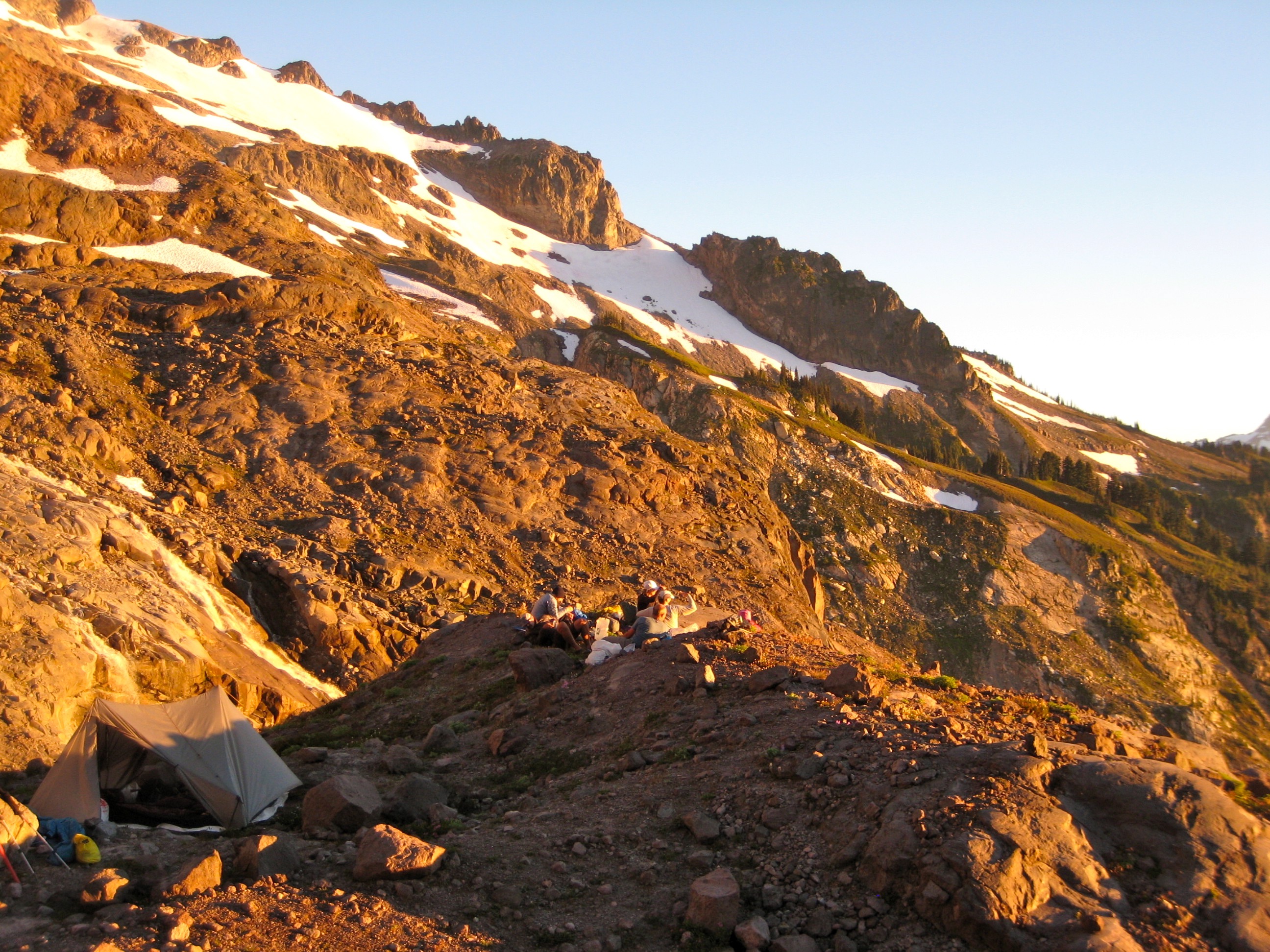
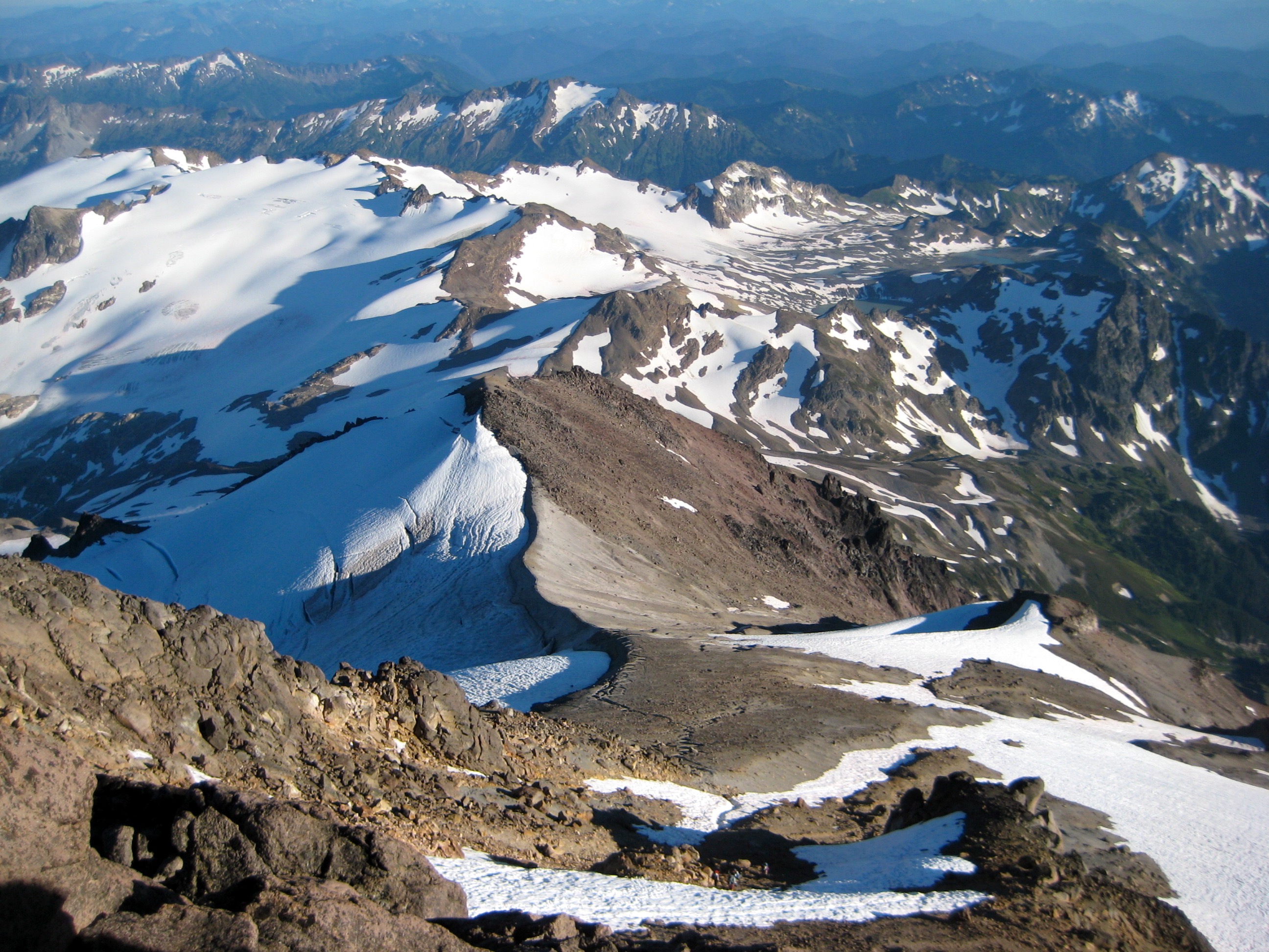
After 1.7 miles, we turned left (north) on the Pacific Crest Trail and continued for another 2.3 miles to Glacier Creek. Trail traffic increased considerably on the PCT; we met 10 or 12 through-hikers heading for Stehekin. Our route, however, left the PCT and followed a climber’s path up Glacier Creek and along the Kennedy Glacier moraine. Where the path petered out, we scrabbled down the southern face of the moraine and traversed up to a 6100-foot bench (9.1 hours from Camp 2) overlooking Kennedy Creek. This bench served as a functional campsite amid a remarkable landscape of “textbook” glacial erosion and deposition.
- Hiking Up Kennedy Moraine To Camp 3
- Camp 3 On Kennedy Glacier Moraine
Day 4: Kennedy Glacier Knob to Glacier Peak Summit to Baekos Gap
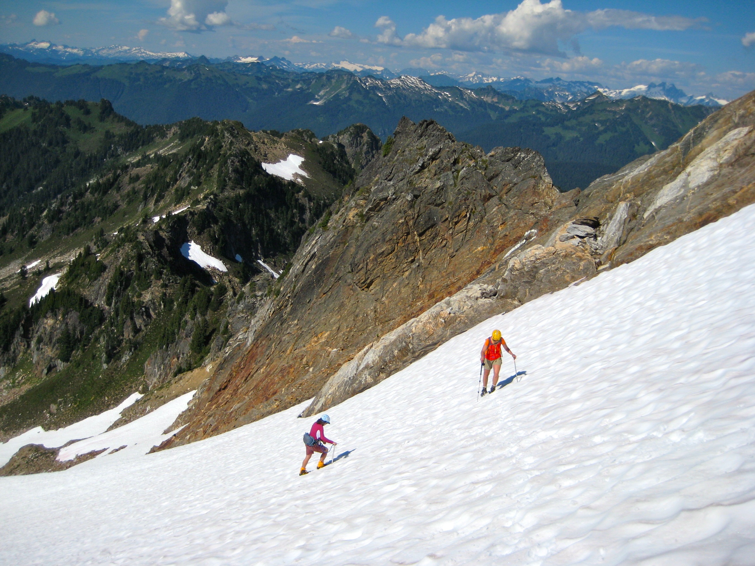
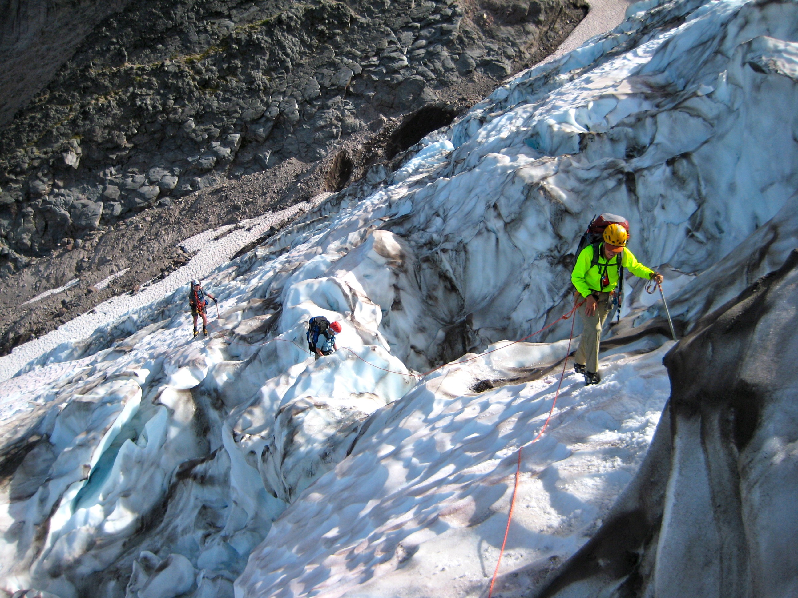
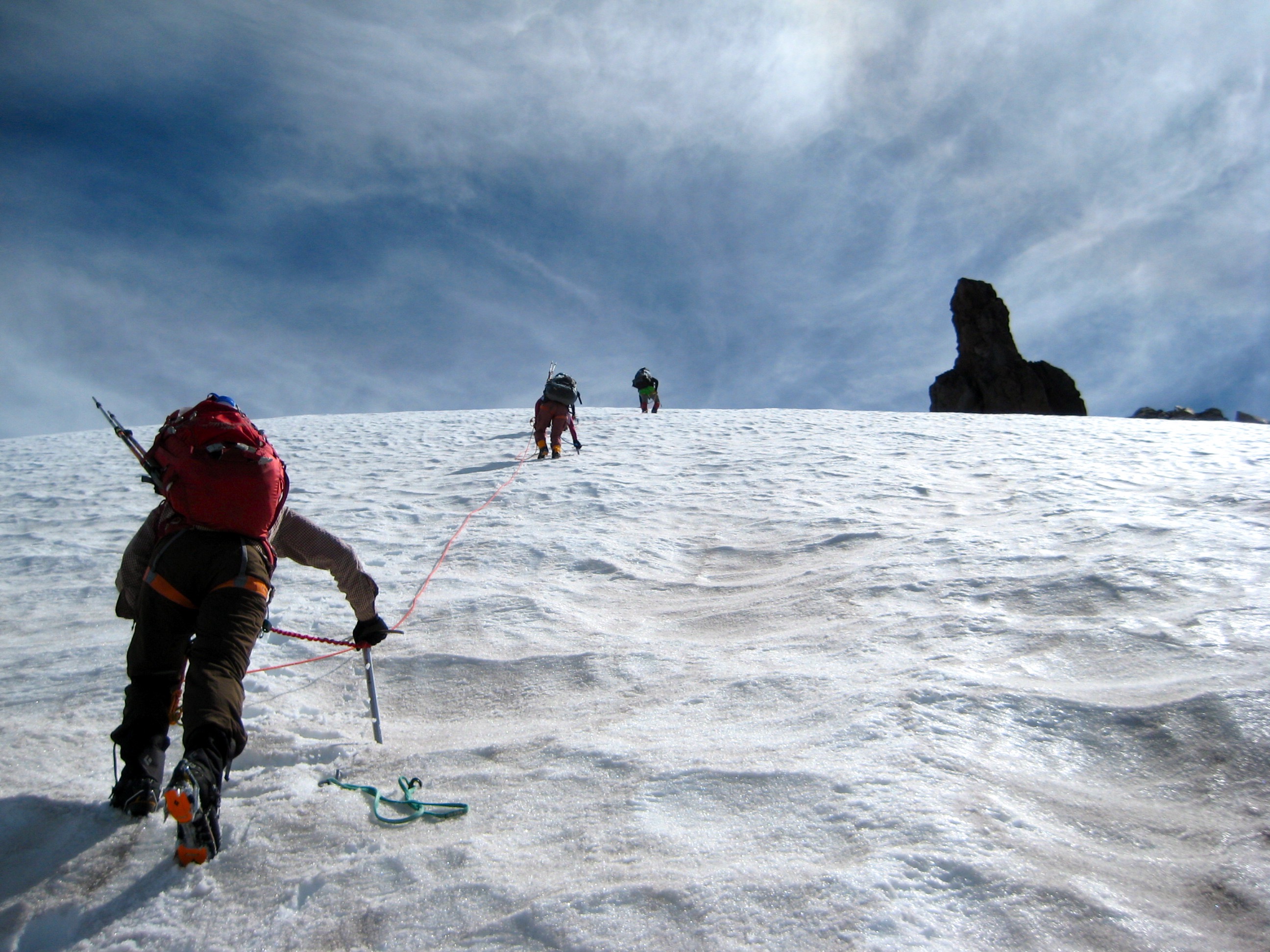
We awoke to another morning of calm, warm, clear weather, anticipating a day that would be our topographic and mental climax for the trip. From camp, we climbed snow and rock about 500 feet up to the snout of the Kennedy Glacier, then ascended low-angle neve to reach the lower icefall. Kevin led one pitch through the jumbled icefall, placing several ice screws and pickets for protection. We continued onward another 1000 feet to the upper icefall and managed to circumvent this via a series of ice bridges on the left side. By hugging the left margin, we had a crevasse-free snow climb to the Kennedy-Ermine saddle (4.7 hours from Camp 3).
- Climbing Thru Kennedy Glacier Icefall
- Frontpointing Up Frostbite Ridge
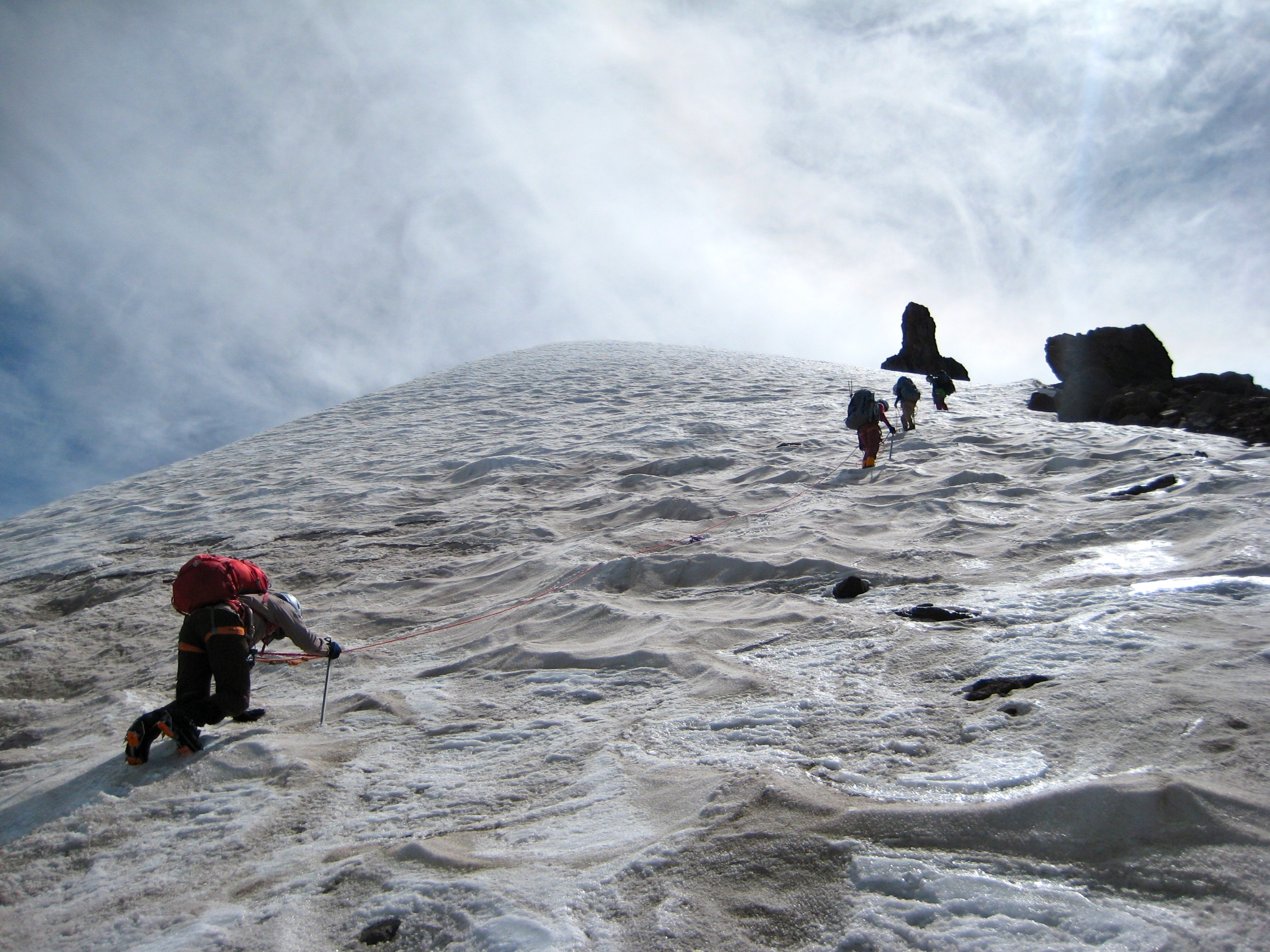
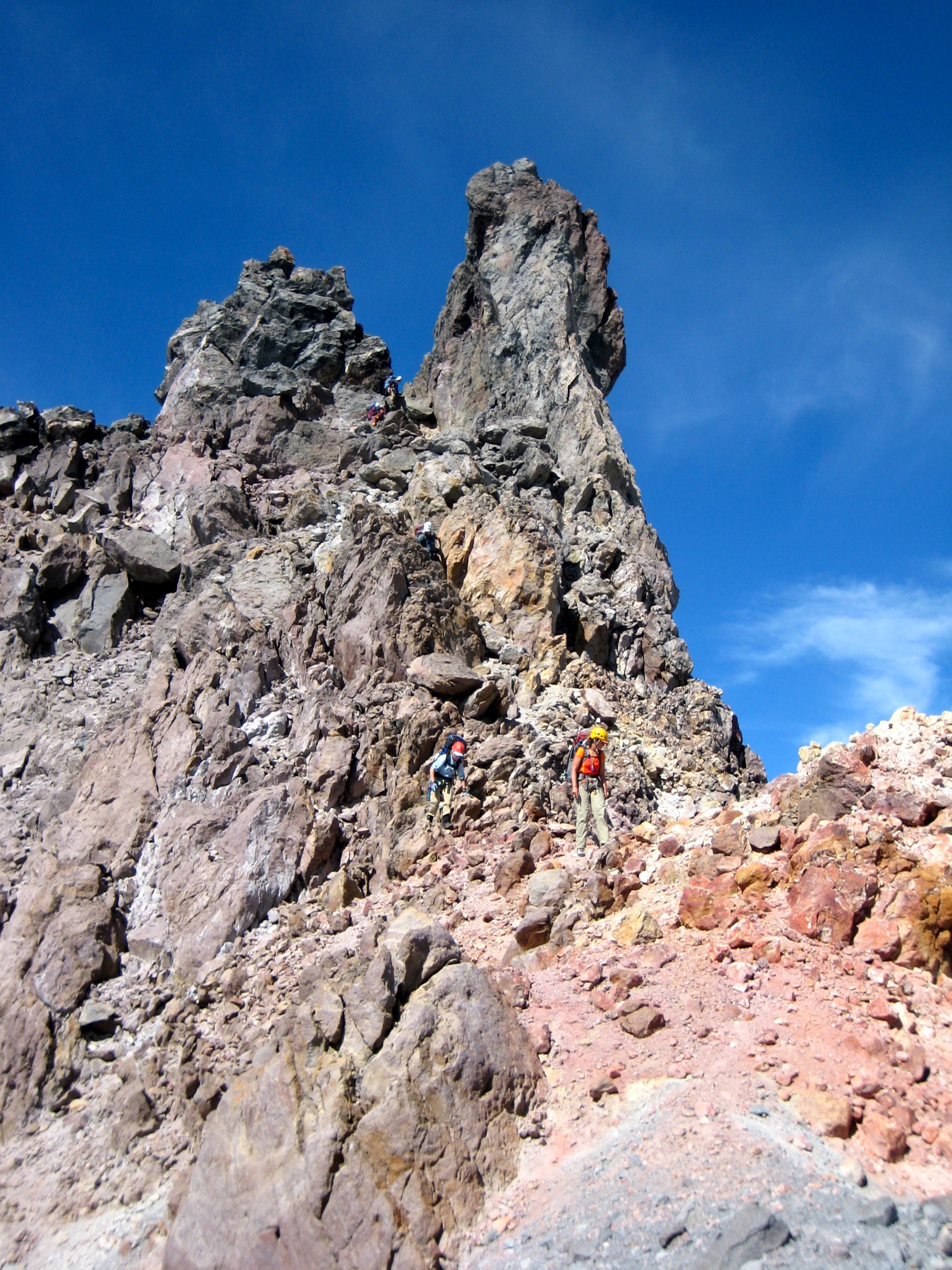
Our route got even more interesting beyond this saddle. We climbed steep snow and ice (sometimes on frontpoints) up Frostbite Ridge, working past a series of steps and benches, using a combination of flukes, pickets, and screws for protection where needed. A key feature of this ridge route is climbing through the “Rabbit Ears” and scrambling down 150 feet of loose Class 2-3 rock on the other side. The scramble ends at a steep snow slope that forms the northern rim of the summit crater. We climbed to the rim and then descended 100 feet into the crater.

- Scrambling Thru Rabbit Ears On Frostbite Ridge
- Buck Mountain, Clark Mountain, and Chocolate Glacier
- Climbing Above Rabbit Ears On Frostbite Ridge
The technical crux of our day was climbing back up the very steep southern rim of the crater, which consisted of partially cemented ice marbles. I have never seen anything like it! Kevin led this 100-foot penultimate pitch, carefully kicking steps into the raveling surface and struggling to find anything solid enough to hold ice screws. The final pitch was equally steep but thankfully soft, and we all gathered on the summit at 7:00pm (11.2 hours from Camp 3) after a long, strenuous day.
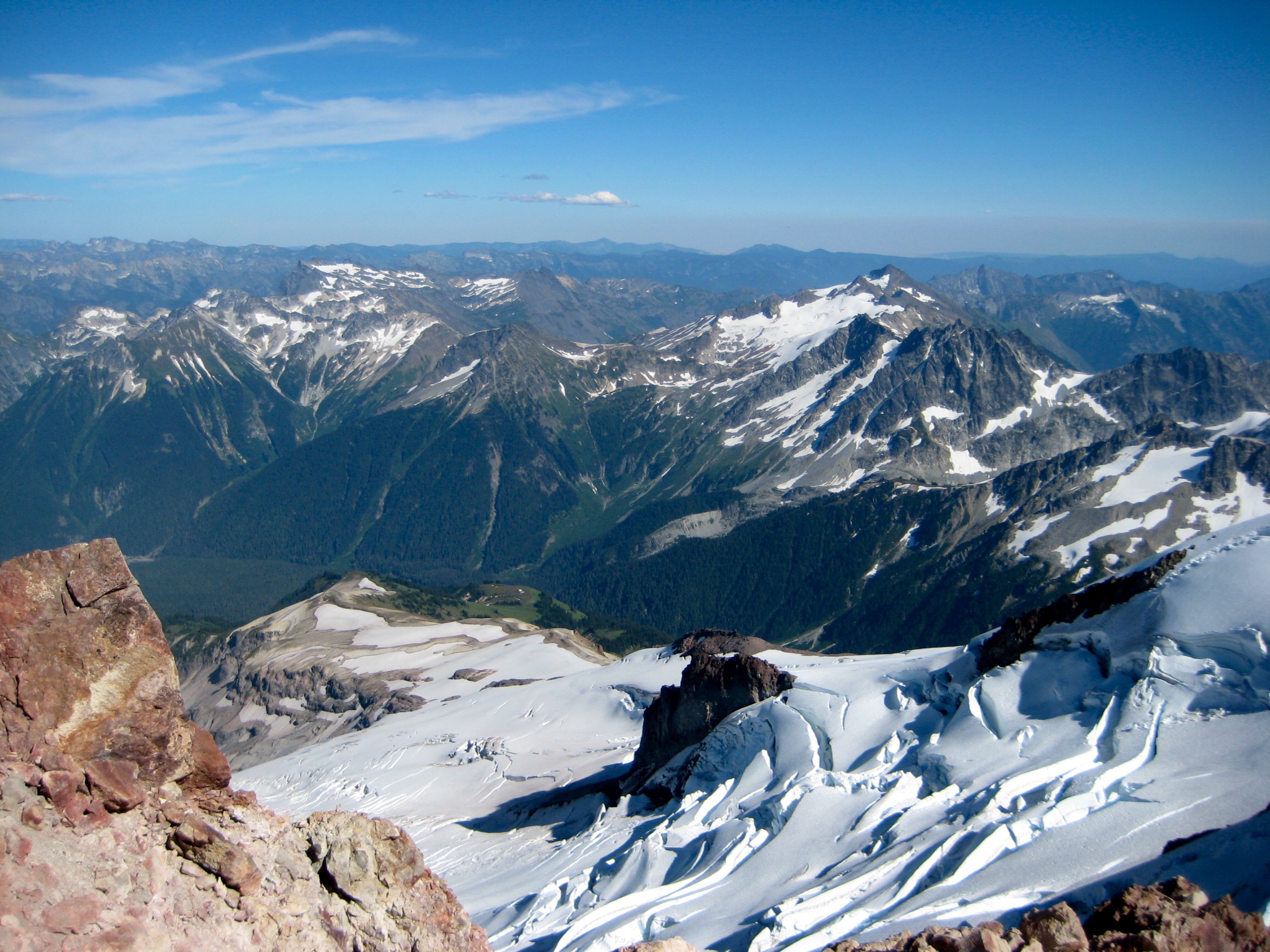
It is well understood that Glacier Peak represents the matriarch of the Cascades, due to its central location and dominant elevation. However, this role was never so apparent to me as on this superbly clear, warm, and calm evening, with low-angle sunshine highlighting every peak within a 50-mile radius. Even after dozens of collective volcano summits in our group, none of us could recall having such benign weather and excellent visibility. We absorbed as much summit magic as possible and then started descending the south ridge.
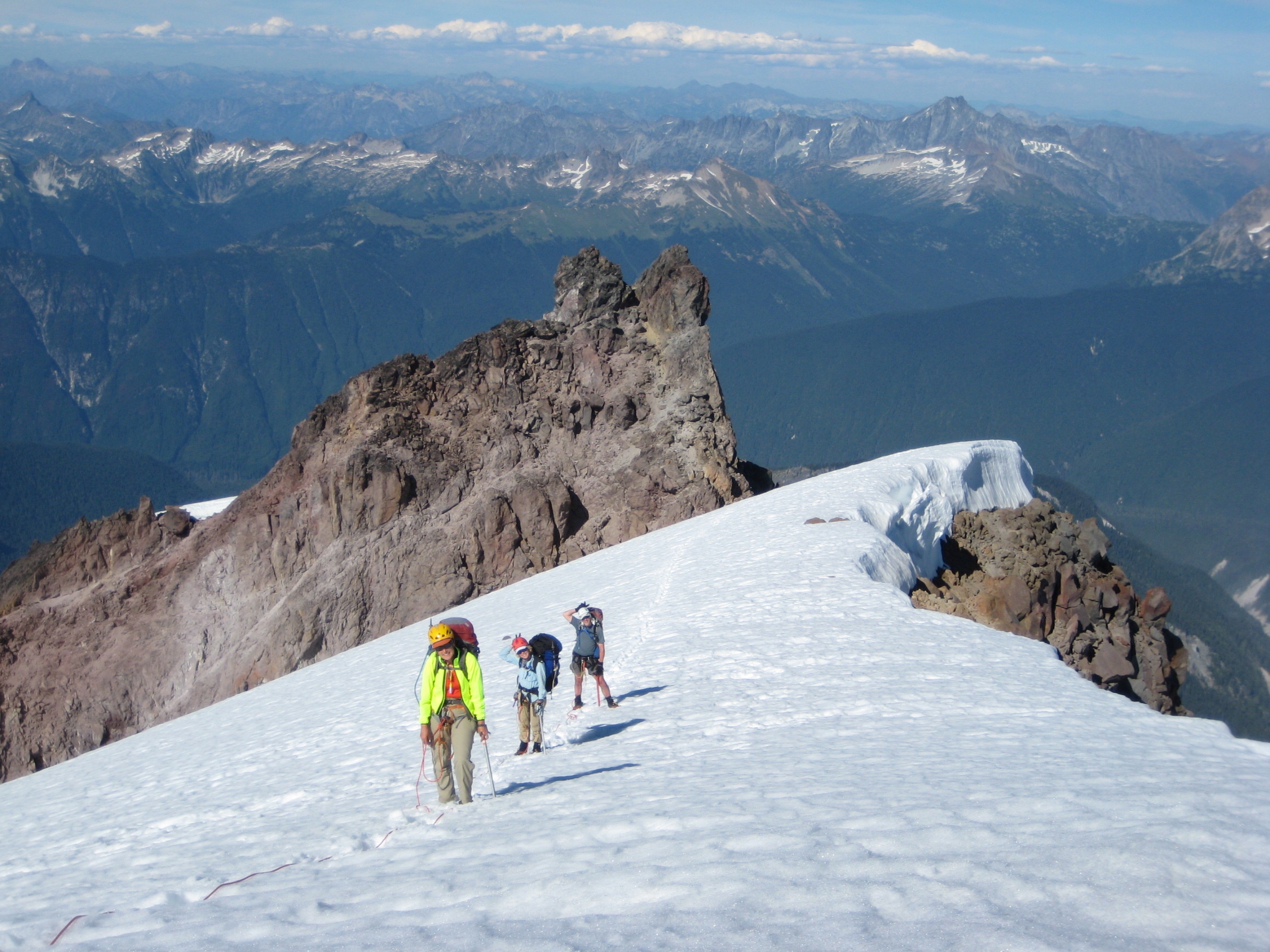
- Descending South Ridge From Glacier Peak Summit
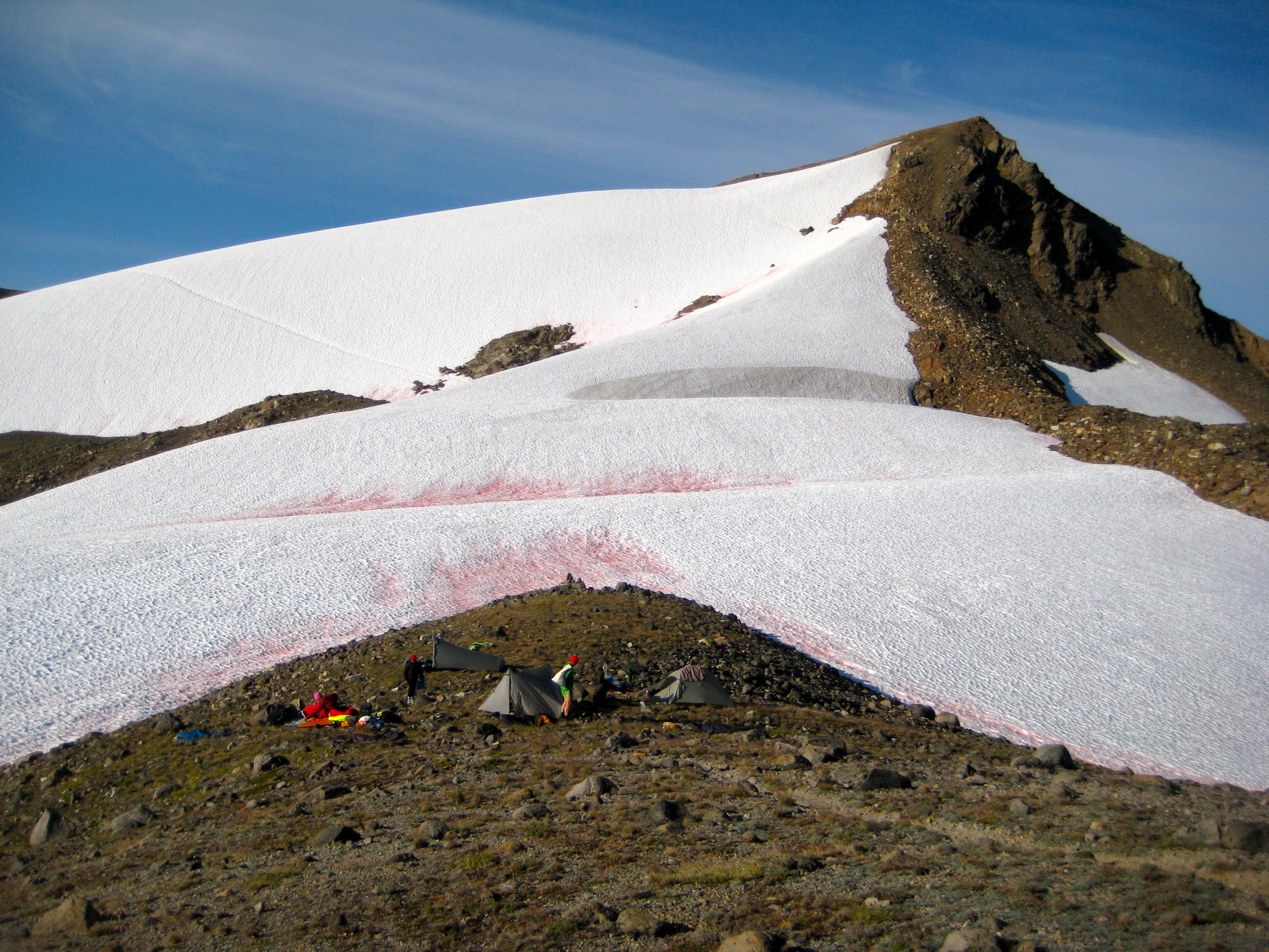
Kevin, Beth, Tim, and Cassie got a headstart dropping towards Disappointment Peak, going around the eastern side, and further down south-side snowslopes. They managed to find suitable camping (with nearby water) at 7350-foot “Baekos Gap” sometime after nightfall. Steve, Deb, Eileen, and I spent more time descending in the dark, such that we did not reach camp until 11:00pm (15.3 hours from Camp 3). The Glacier Peak carry-over had been a long and demanding day for all.
- Camp 4 At Baekos Gap
Day 5: Baekos Gap to Foam Basin + Kololo Peak
We slept late and did not get going until 10:30am. Compared to yesterday, this promised to be a relatively easy day. We wrapped around the eastern side of a snowfield to Glacier Gap, then crossed to the western side and traversed onto the White Chuck Glacier.
- White Chuck Glacier Moonscape
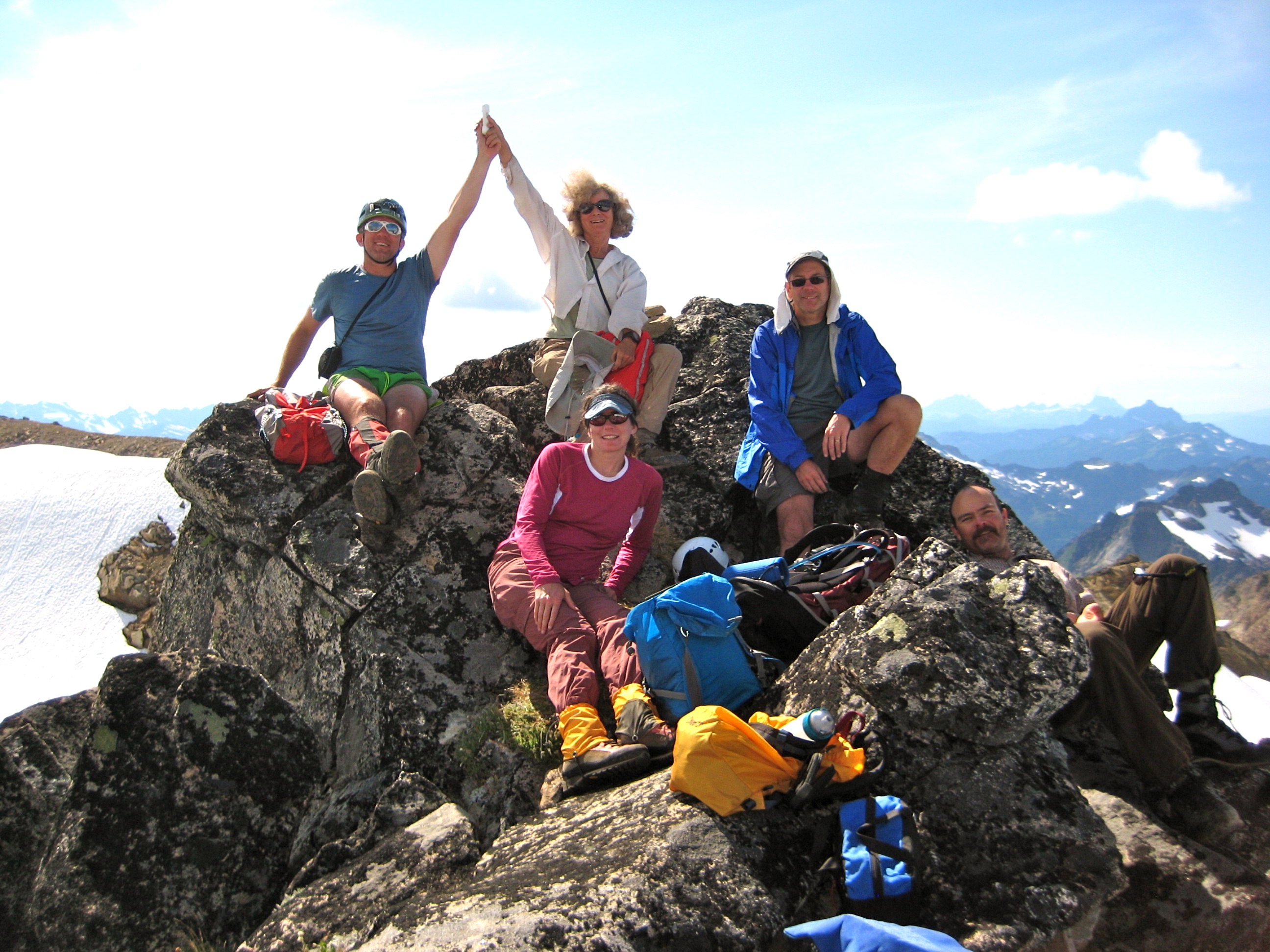
At an outcrop below the glacier snout, Deb and Eileen continued on toward Foam Basin while the rest of us dropped backpacks and headed up Kololo Peak. This provided a pleasant afternoon excursion on snow and rock to the 8200-foot summit (4.7 hours from Camp 4). Fay’s summit register showed a couple ascents per year, including a recent climb by the inspirational duo of Roy McMurtrey and Don Duncan.
- Kevin, Beth, Steve, Cassie, and Tim On Kololo Peak
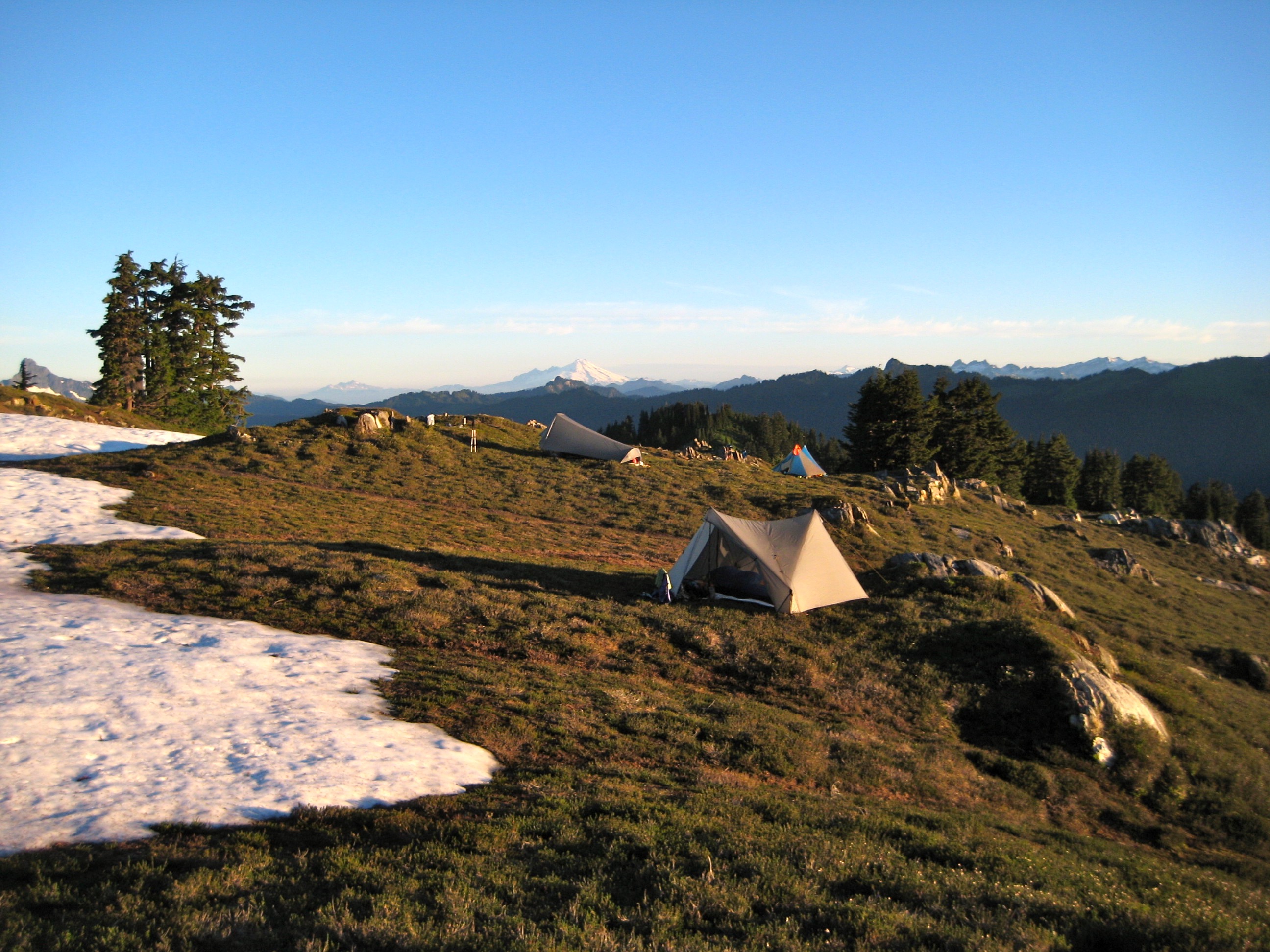
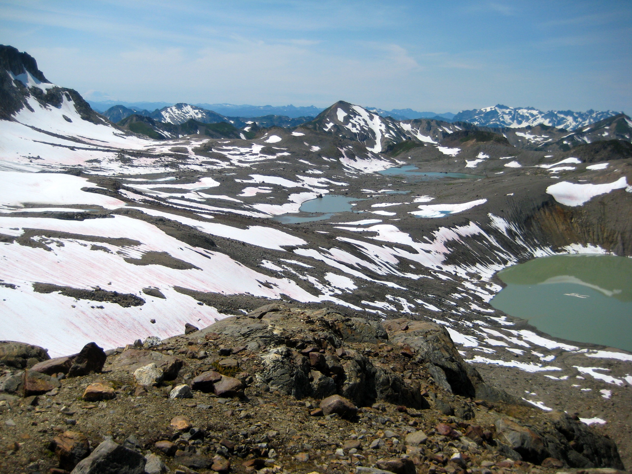
After returning to our backpacks, we continued traversing across the glacial ice shield and past numerous ablation tarns. The vast post-glacial terrain located between Glacier Gap and the White-Kololo ridge covers nearly 2 square miles and could best be described as an “alpine moonscape.” It is truly amazing. Perhaps equally amazing is the sudden contrast when crossing over Foam Pass on the White-Kololo ridgeline and suddenly seeing the sweeping green hillslopes surrounding the White River headwaters. We descended into verdant Foam Basin and set up camp on a heather bench (7.9 hours from Camp 4).
- Descending To Camp 5 In Foam Basin
In a pre-arranged meeting, we were greeted by Fay, who had just returned from an ascent of rarely climbed Baekos Peak. Several hours later, a foursome of tired and disoriented Glacier Peak climbers passed through our camp, demanding to know where to find the “Foam Basin Trail.” We pointed them in the direction of White Pass but had doubts as to whether they could navigate through the darkness.
Day 6: Foam Basin to NF Sauk River Trailhead + White Mountain
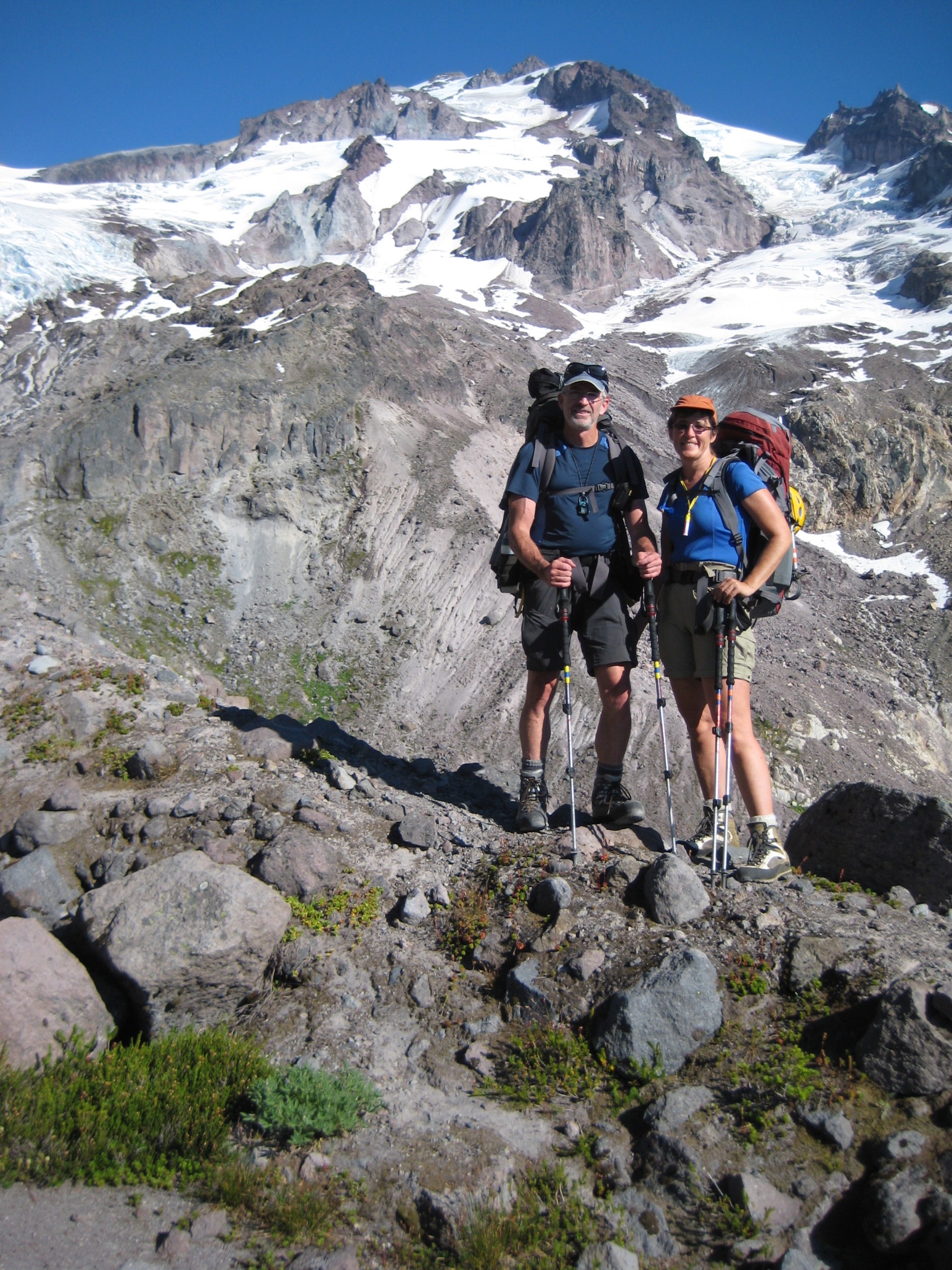
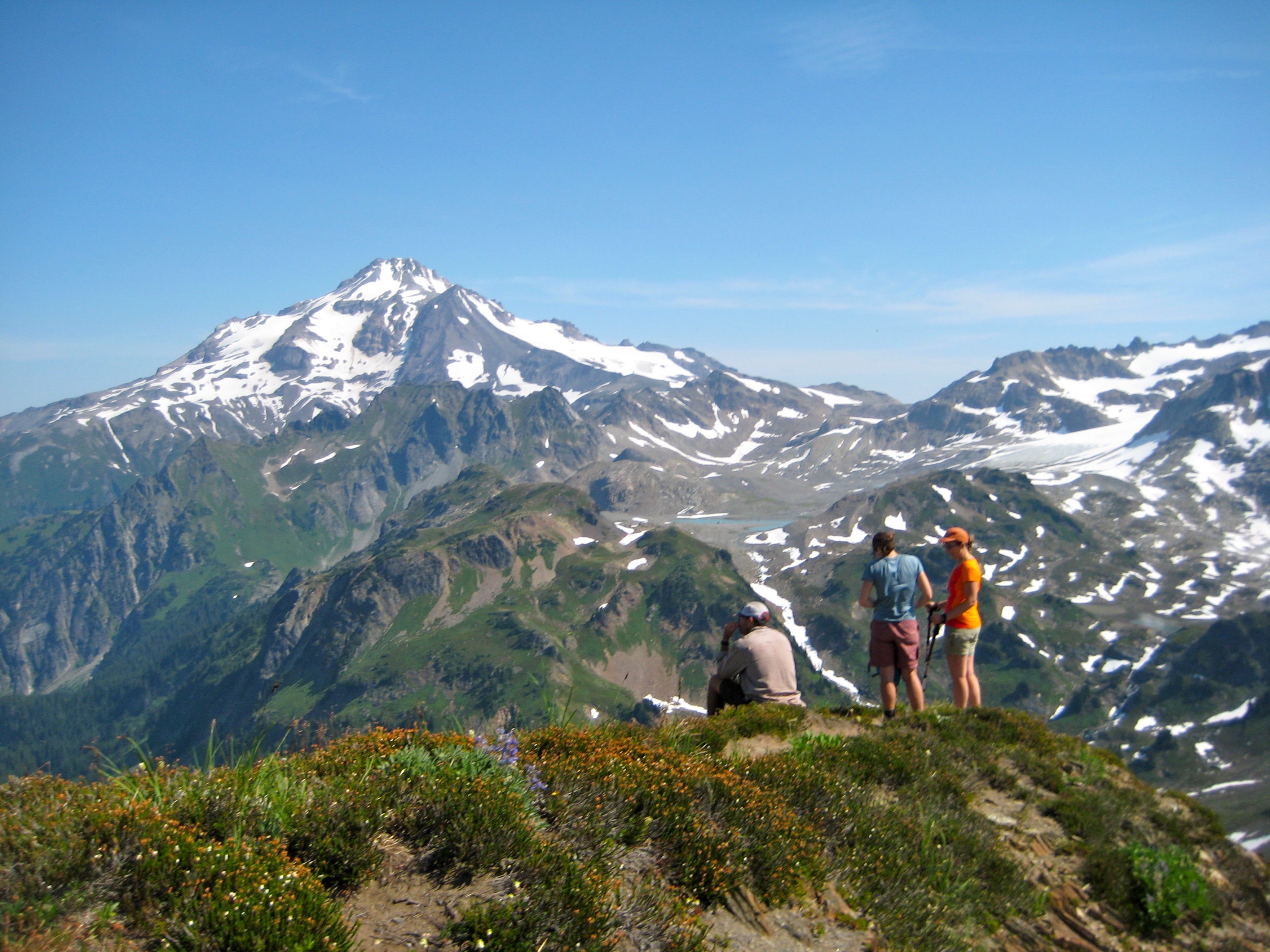
We had a leisurely breakfast before breaking camp and continuing on the westward leg of our horseshoe-shaped loop. We contoured green slopes for ½ mile and then found the old sheepherder’s trail heading to White Pass. After a brief snack break at the pass, Tim, Cassie, Kevin, Eileen, and I strolled up nearby White Mountain for a final view of our week-long route, whereas Fay, Beth, Steve, and Deb were content to beeline for the trailhead.
- Glacier Peak From White Mountain
Hours later, Eileen and I reached the trailhead (9.2 hours from Camp 5), feeling sore and tired but happy and satisfied to have completed this incredible backcounty loop.
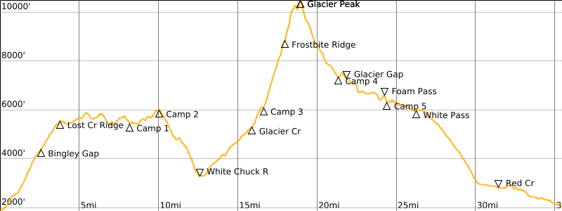
Route Maps & Profile
…
…
…
Photo Gallery
Click to enlarge…