Originally Posted: December 2022
Updated: December 2024
Talapus Lake & Olallie Lake Ski Tour / Snowshoe Trek
Bandera Overlook
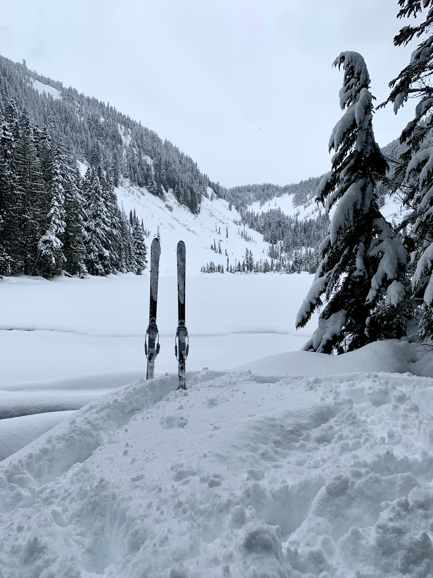
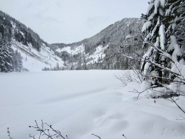
Talapus Lake
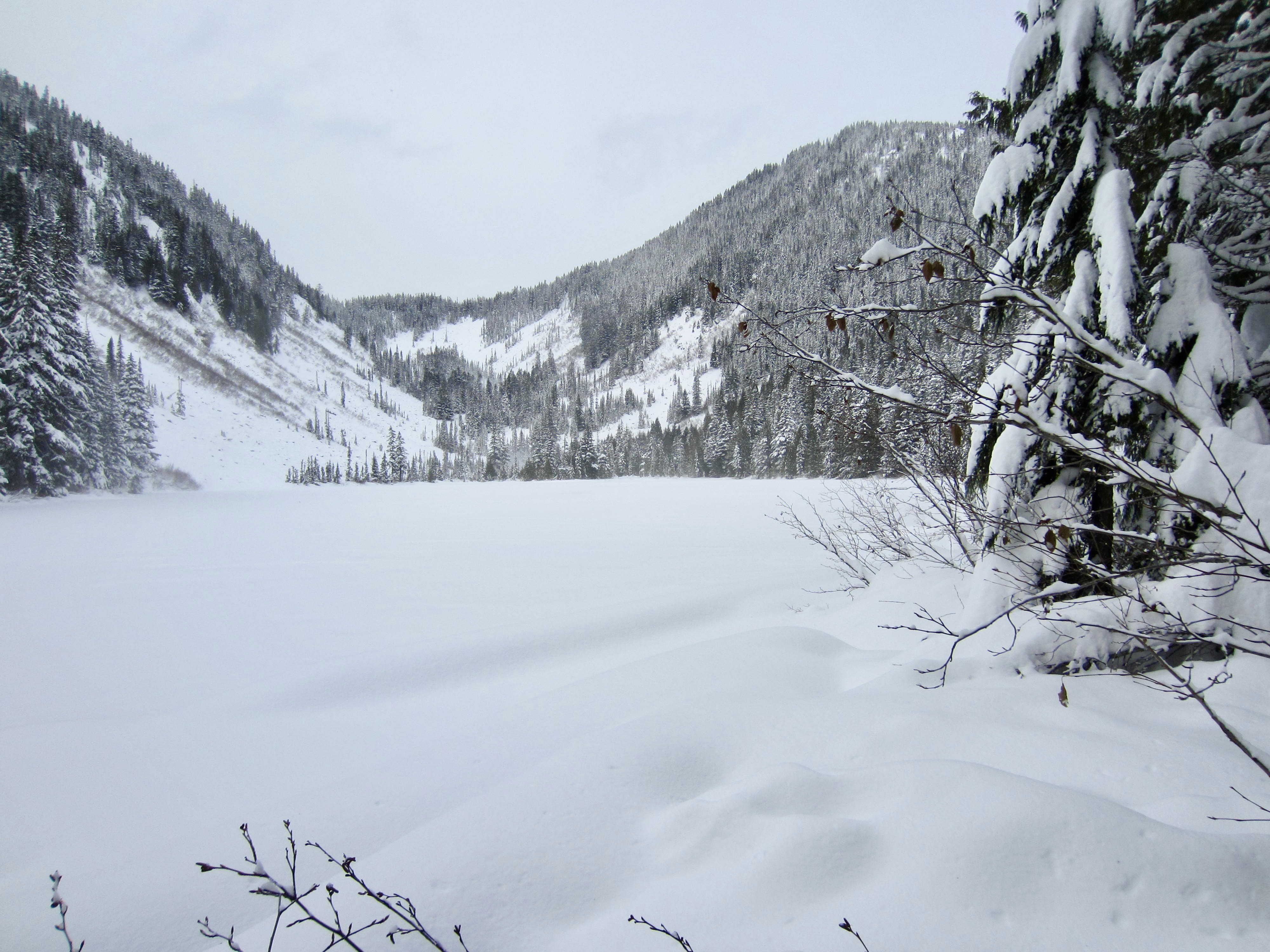
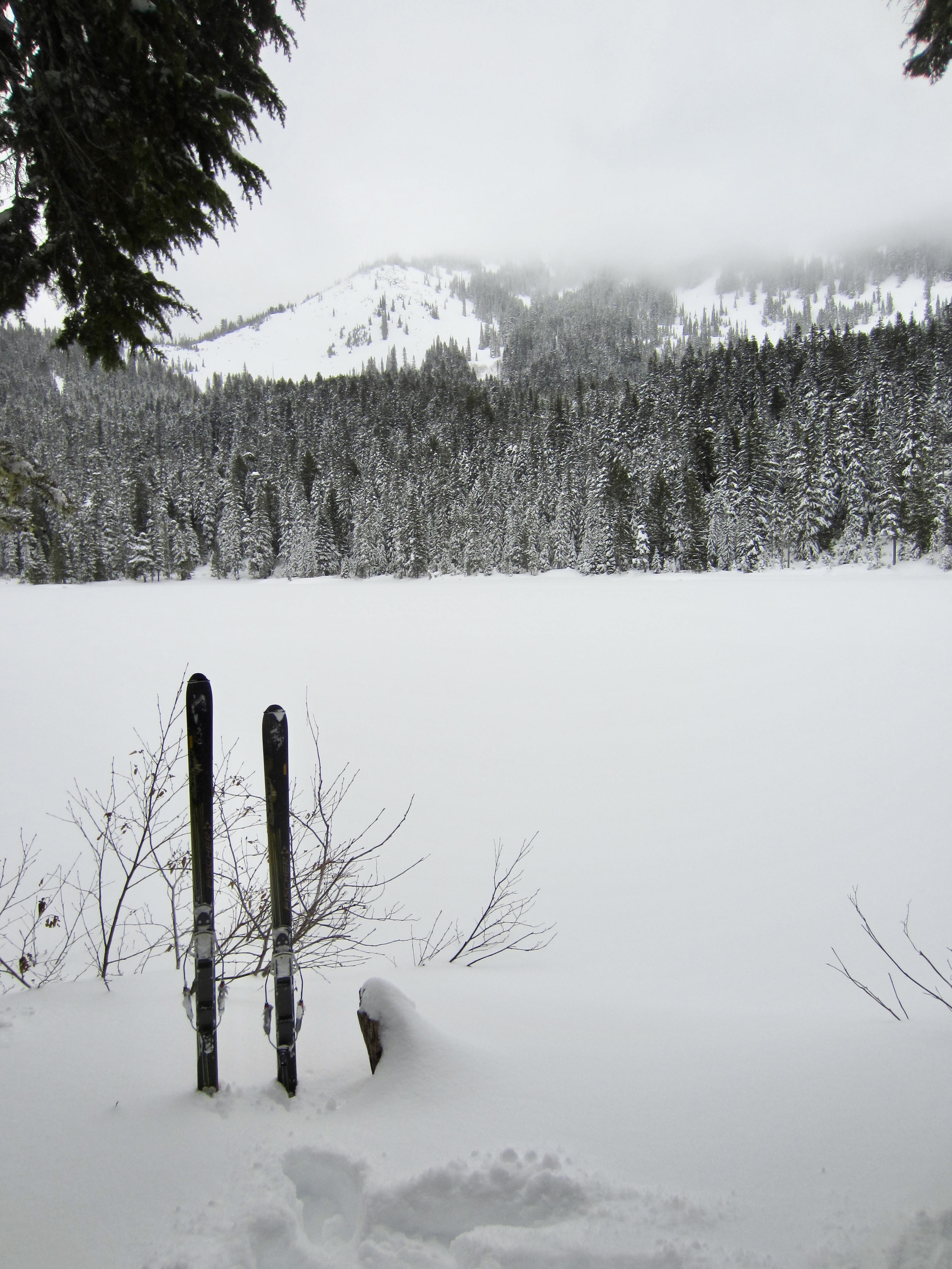
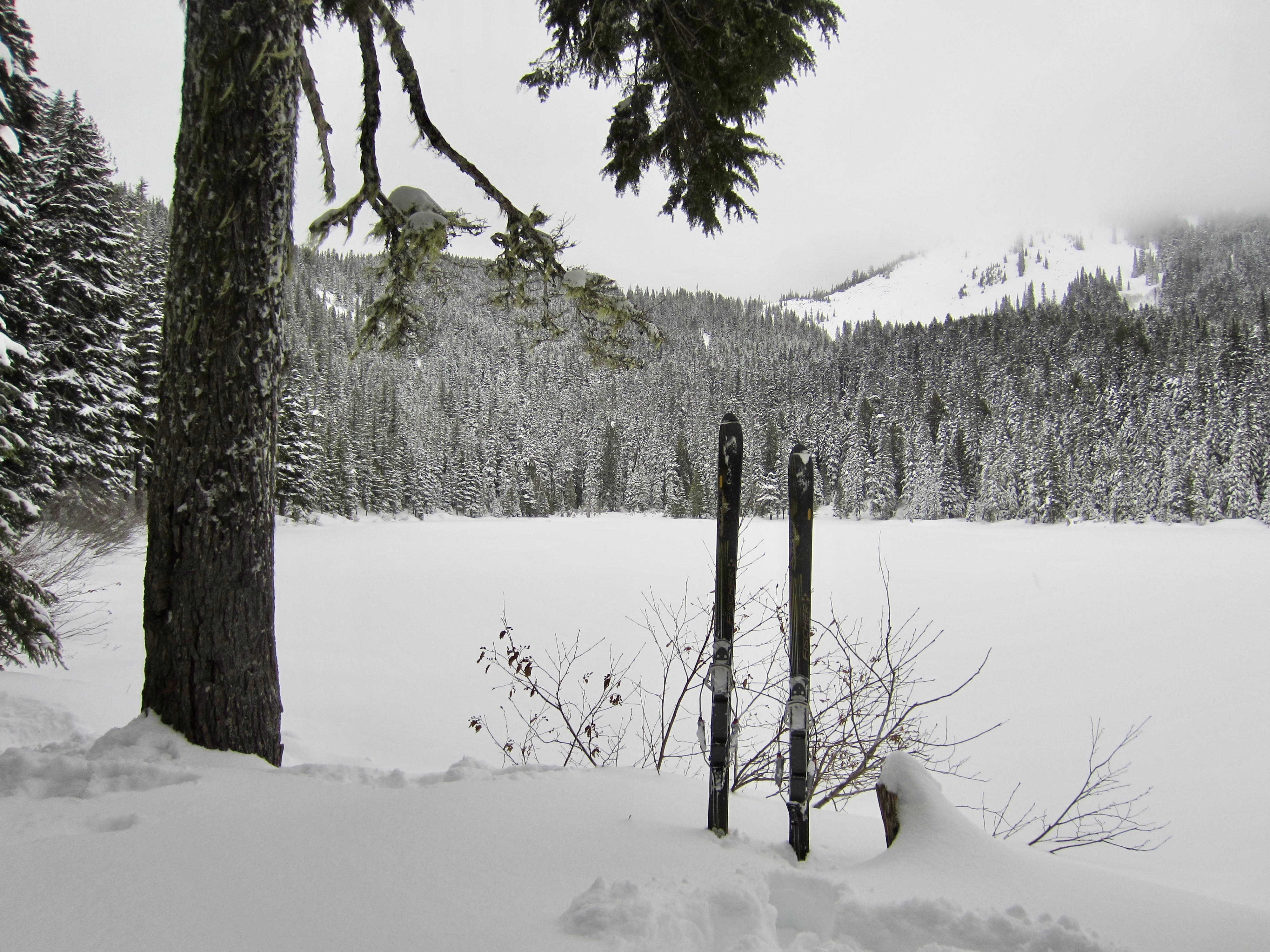
Olallie Lake
Route Summary
Region: Central Washington Cascades
Sub-Region: Lower Snoqualmie Range
Areas: Mt. Baker – Snoqualmie National Forest & Alpine Lakes Wilderness
Starting & Ending Point: Bandera Interchange at Exit 45 on Interstate-90 (Elev. 1700 feet)
Typical Season: mid-December to early April
Option 1: Talapus Lake
Way Points: Road 9030/9031 junction & Talapus Lake Trailhead / Bandera Overlook & Talapus Creek Bridge & Talapus Lake (snowshoe hike or ski tour)
High Point: Talapus Lake (Elev. 3250 feet)
Approximate Stats (round trip): 9.6 miles traveled; 1650 feet gained & lost.
Option 2: Olallie Lake
Way Points: Road 9030/9031 junction & Talapus Lake Trailhead / Bandera Overlook & Talapus Creek Bridge & Talapus Lake & Pratt Lake Trail junction & Olallie Lake (snowshoe hike or ski tour)
High Point: Olallie Lake (Elev. 3800 feet)
Approximate Stats (round trip): 12.0 miles traveled; 2200 feet gained & lost.
Information Sources
The following links provide helpful information for planning this snowshoe trek or ski tour. Even these information sources, however, should not be taken as a substitute for having the fitness, knowledge, equipment, and clothing required for snowshoe trekking or ski touring.
>>> WSDOT road reports for Interstate-90 and Snoqualmie Pass
>>> National Weather Service weather forecast for Snoqualmie Pass area
>>> Northwest Avalanche Center avalanche forecast for Snoqualmie Pass area
>>> Other easy to intermediate ski tours in the I-90 / Snoqualmie Pass corridor
>>> Other easy to intermediate snowshoe treks in the I-90 / Snoqualmie Pass corridor
Route Overview
Talapus Lake provides a nice wintertime destination in the Lower Snoqualmie Mountains that is suitable for a wide range of abilities and experience levels. Olallie Lake, being a little farther and higher, requires somewhat more ability and experience. However, the entire route to both lakes has very little avalanche risk, making either trek feasible even during or after periods of moderately heavy snowfall. Furthermore, the starting point is fairly close to the Puget Sound metropolitan area and doesn’t involve a drive over Snoqualmie Pass—an important feature when Interstate-90 is a stormy mess.
The trek to Talapus Lake and Olallie Lake can be readily completed on either backcountry skis or snowshoes, although both modes might feel like a bit of a compromise at times. The first part of the trek follows a forest road that is quite enjoyable on skis but perhaps a little tedious on snowshoes—especially during the descent. In contrast, the second part of the trek follows a forest trail that is delightful on snowshoes but perhaps a little tricky on skis—again, especially during the descent. Nonetheless, competent skiers and snowshoers alike will no doubt find the overall journey to be enjoyable and satisfying.
Fun Facts: In Chinook jargon, talapus means “coyote” and olallie means “berries.”

.
Parking Comments
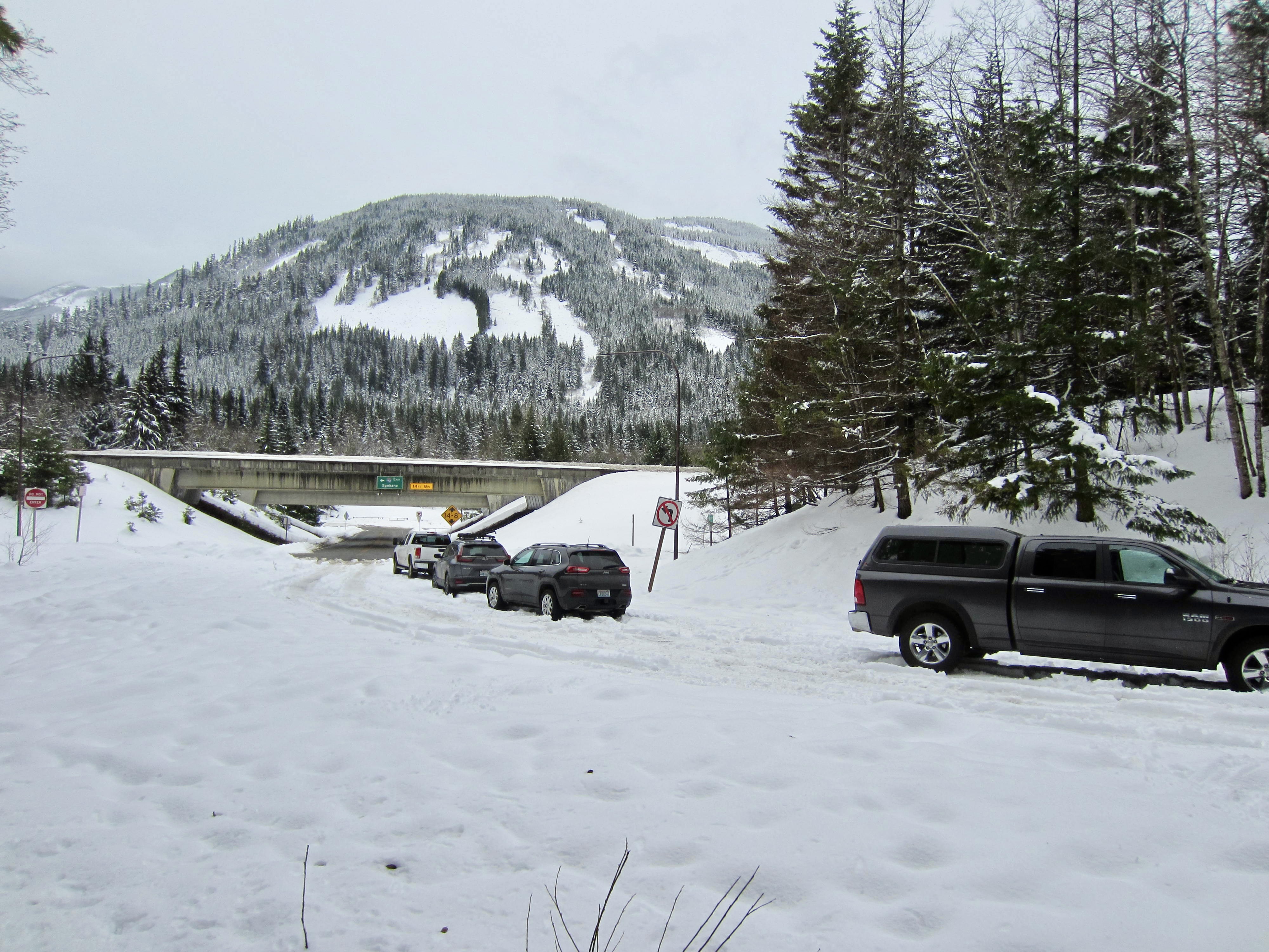
The route to Talapus Lake and Olallie Lake begins and ends on Forest Road 9030, which extends northward from the Bandera Interchange at Exit 45 on Interstate-90. Although the drive to this interchange is usually very simple, the parking situation can be problematic in the wintertime, particularly after a significant snowfall. Some days, Road 9030 is plowed for several hundred yards from the interchange, thereby creating parking space for numerous vehicles; other days, the road is not plowed at all, leaving people to get creative. I’ve seen lots of different conditions here but have always been able to figure out a place to park somewhere alongside Road 9030.
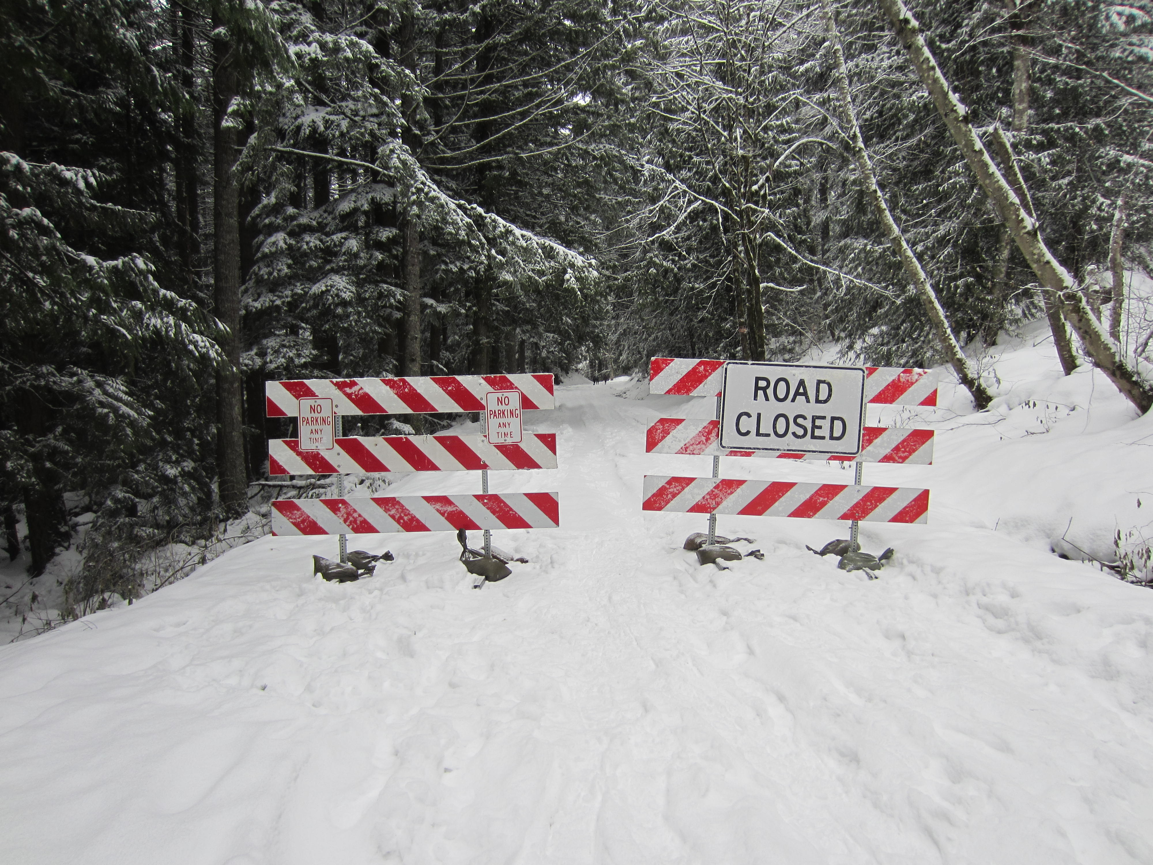
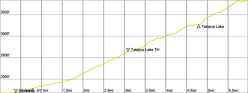
No Washington State Sno-Park Permit, Discover Pass, or Northwest Trail Pass is needed to park on Road 9030. Just be sure that your vehicle is completely beyond the interchange area and not obstructing the on-ramp or off-ramp in any way, lest you get ticketed by the State Patrol. Regardless of where you park, it always helps to have an all-wheel drive or four-wheel drive vehicle to navigate the snowy ground. Throughout the winter, Road 9030 is typically blockaded at a point about ⅓ mile from the interchange, so having a “monster rig” doesn’t really get you any farther.
It should be noted that the lower part of Road 9030 is often drivable very early in the winter season, before the blockade is placed, and late in the spring season, after the blockade has been removed. On these occasions, the trek can potentially be started at the Road 9030/9031 junction, which cuts off ¾ miles of skiing or snowshoeing each way. However, the following route description assumes that the combination of snow conditions and vehicle capability requires starting right at the interchange.

.
Full Route Description
The following route description is presented in three parts: (1) from Bandera Interchange to Talapus Lake, (2) from Talapus Lake to Olallie Lake, and (3) from either lake back to the interchange.
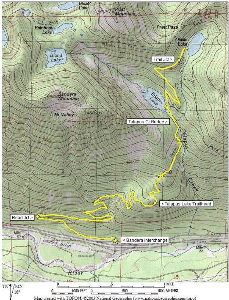
Bandera Interchange to Talapus Lake
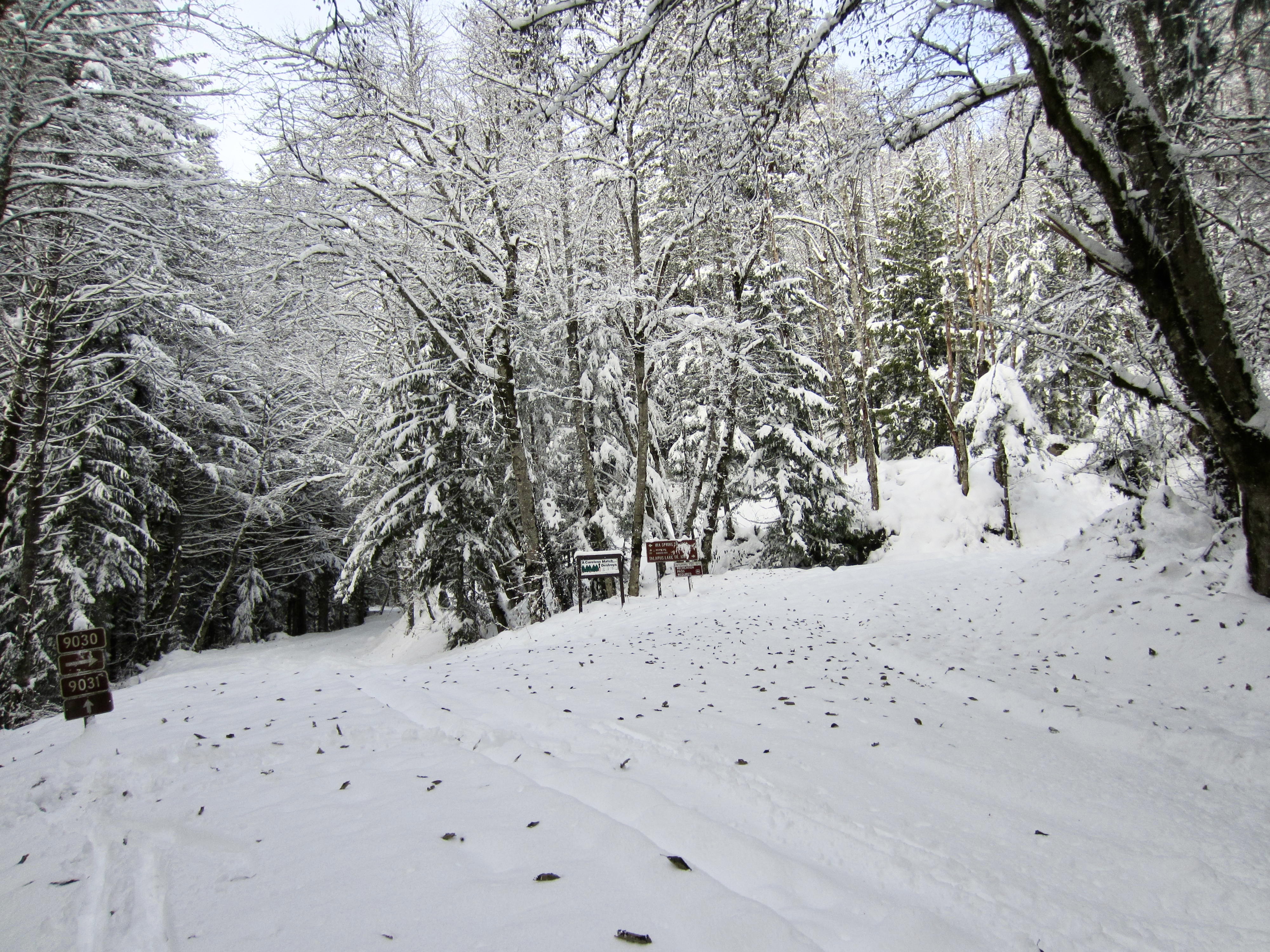
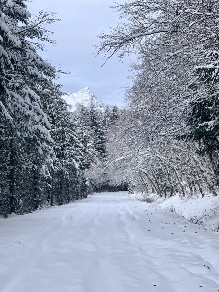
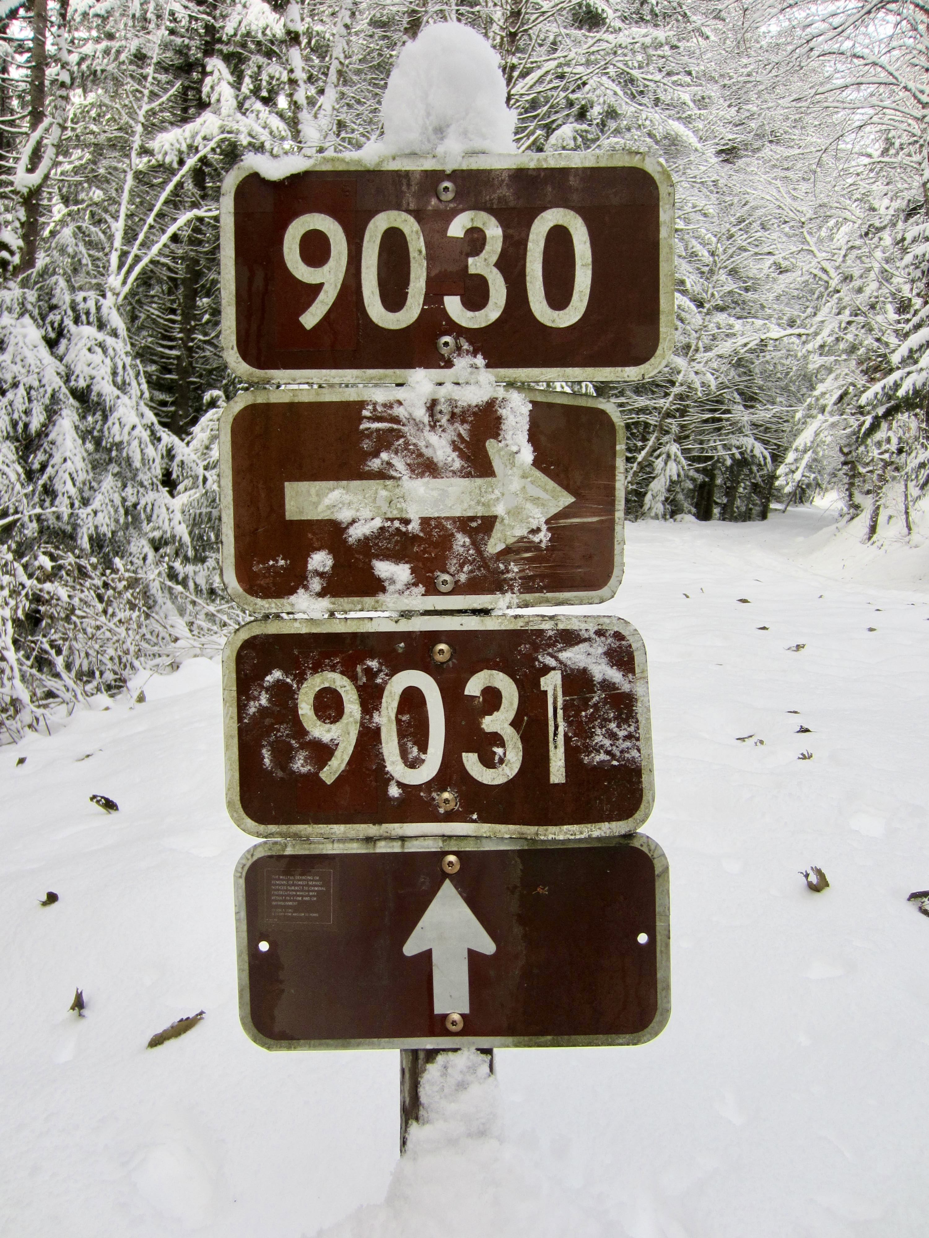
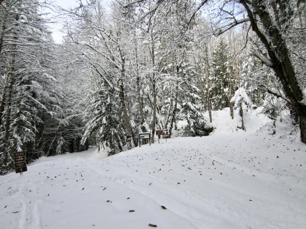
From the interchange area, proceed westward on Road 9030, which runs roughly parallel to Interstate-90 and ascends at a very slight grade. The impressive horn of McClellan Butte will be visible through the forest corridor on a clear day. Pass through the road blockade and continue onward to a “T” intersection (0.8 miles + 150 feet from interchange), where Road 9031 continues straight ahead and Road 9030 turns uphill.
.
.
.
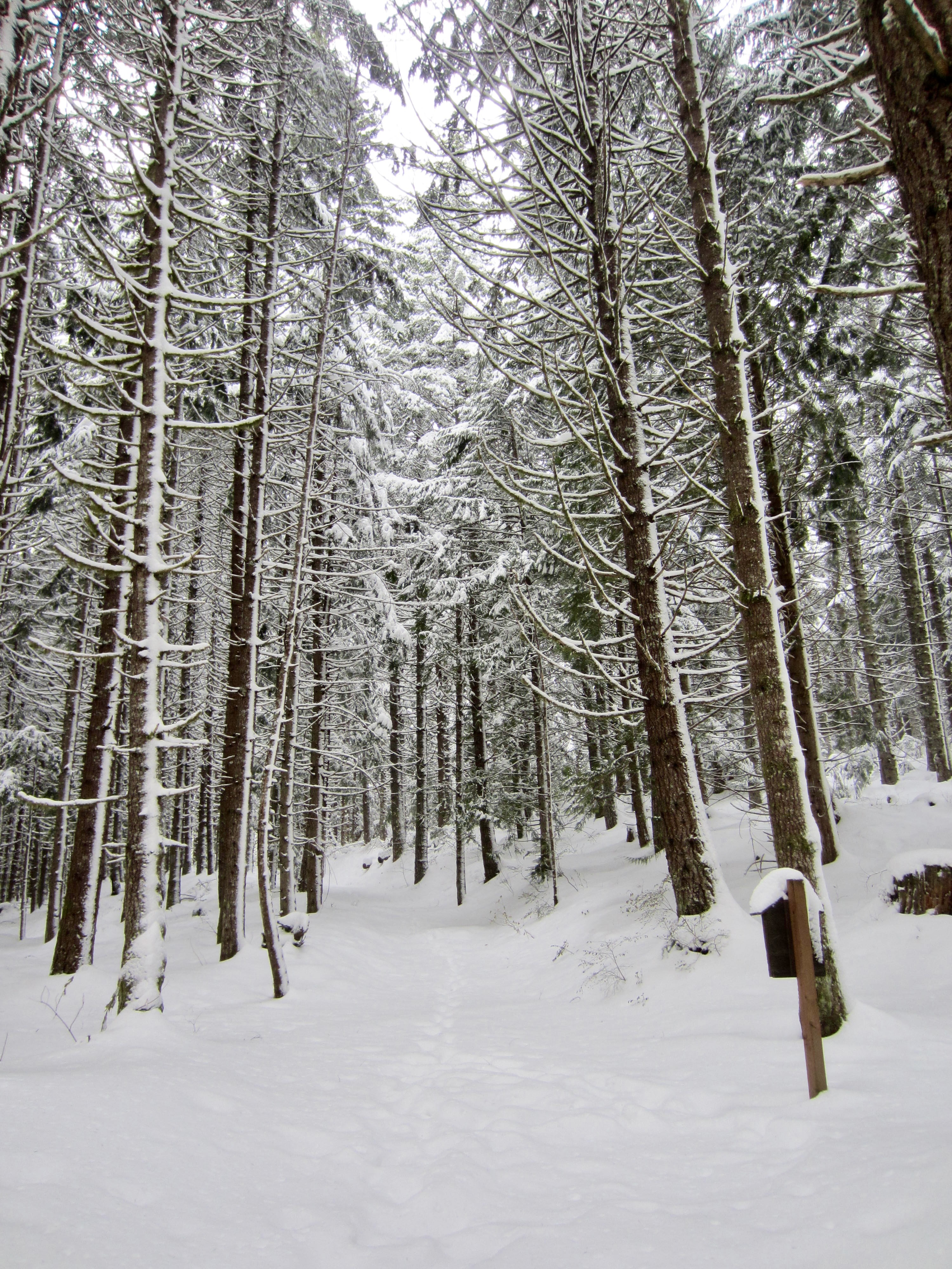
Turn right at the junction and follow Road 9030 as it curves back to the east and traverses the hillside for ¾ mile. The road then begins to climb more steeply via six switchbacks. Several recent (Summer 2022) clearcuts are crossed along the way, offering limited views over to Mt. Gardner and Carter Creek Knoll on the southern side of Interstate-90.

.
.
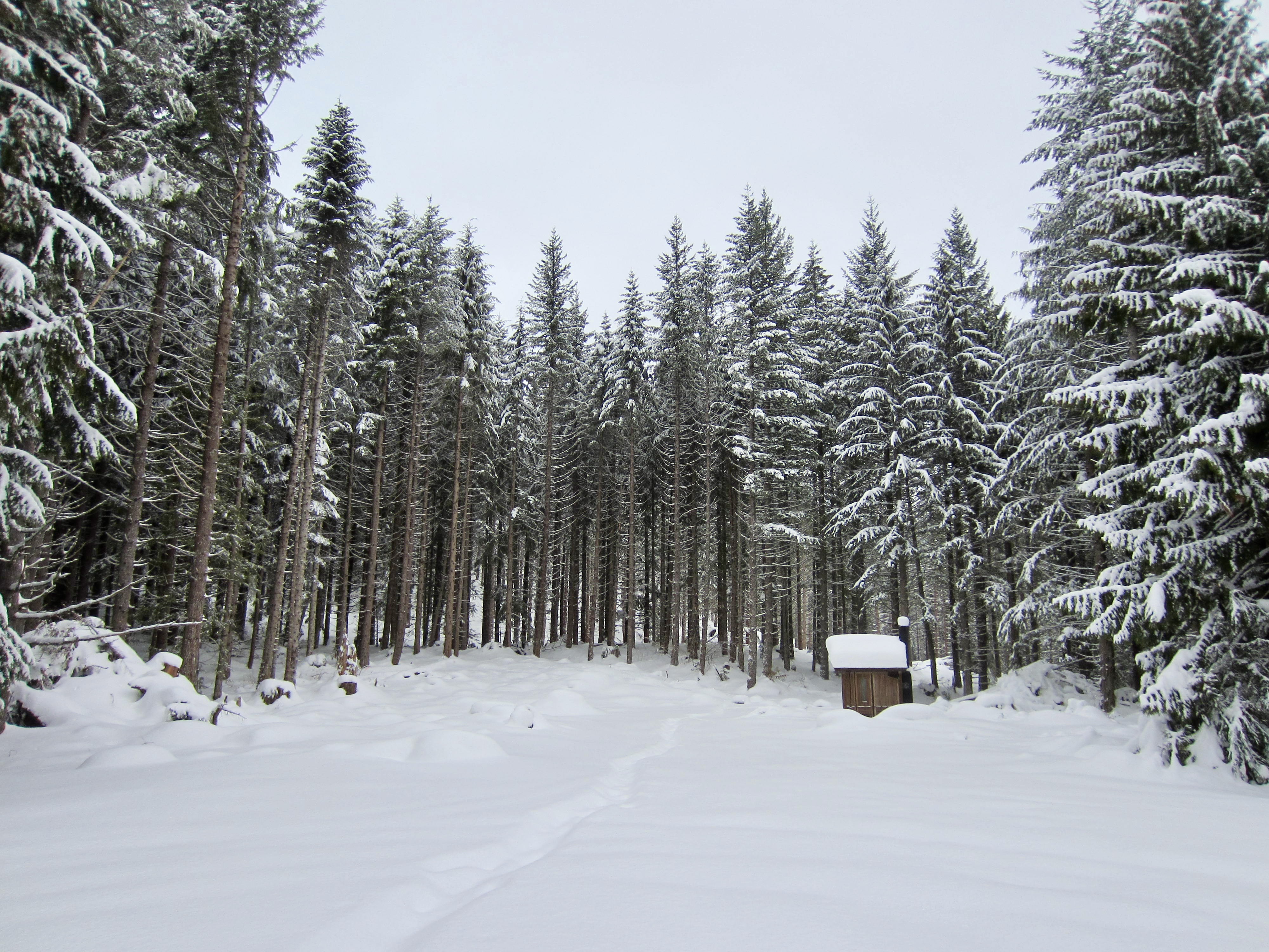
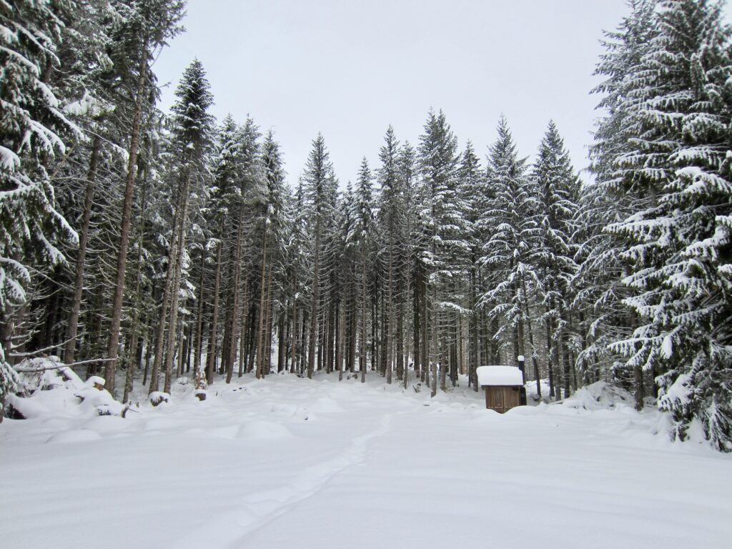
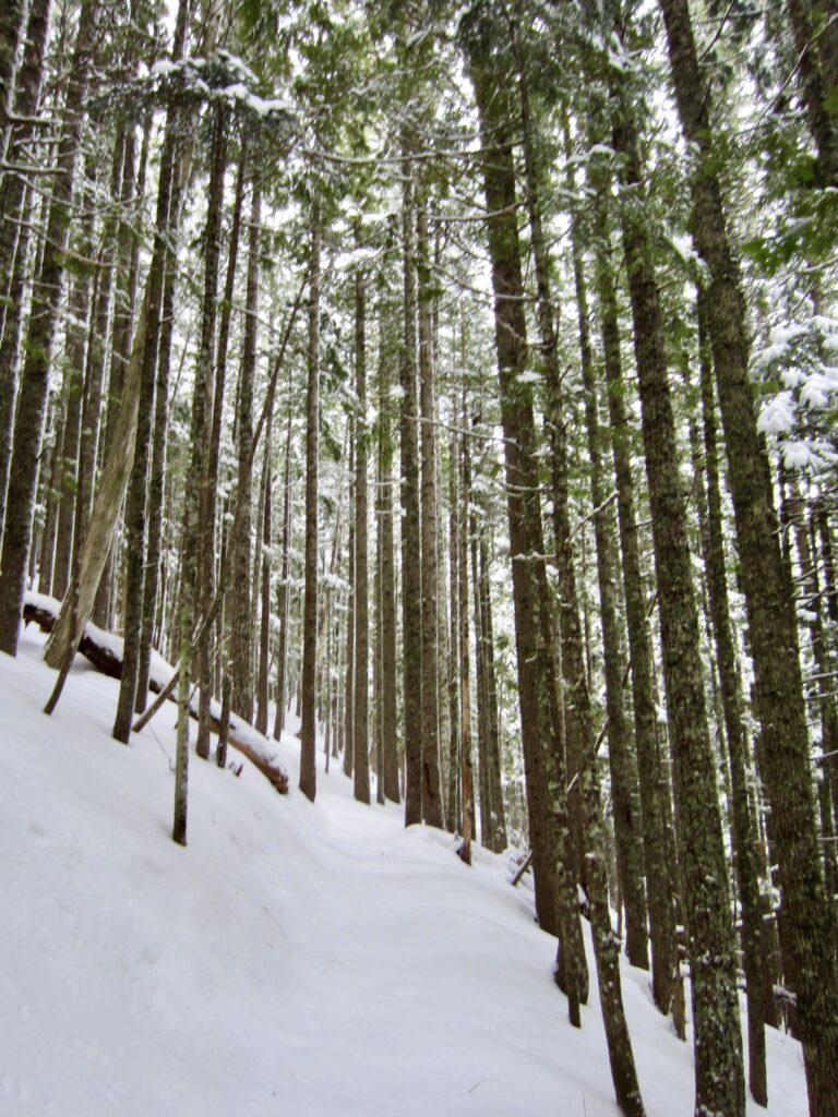
After the last switchback, you will arrive at the Talapus Lake Trailhead parking lot (3.1 miles + 1000 feet from interchange). This large clearing was previously referred to as the “Bandera Overlook” because it provided a good view of the Bandera Airstrip and nearby peaks; however, now that the surrounding trees have grown quite tall, there is no view at all.
.
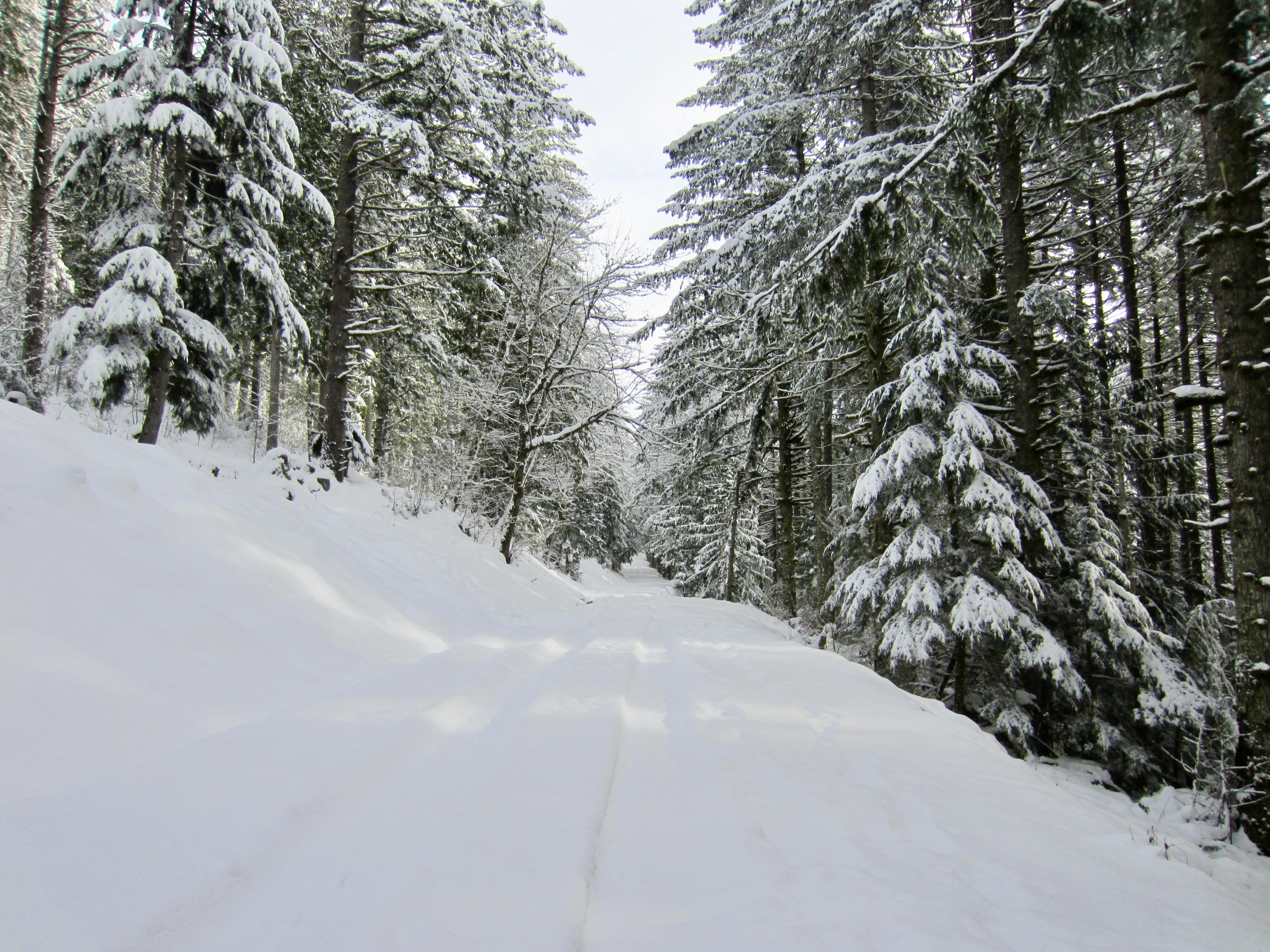
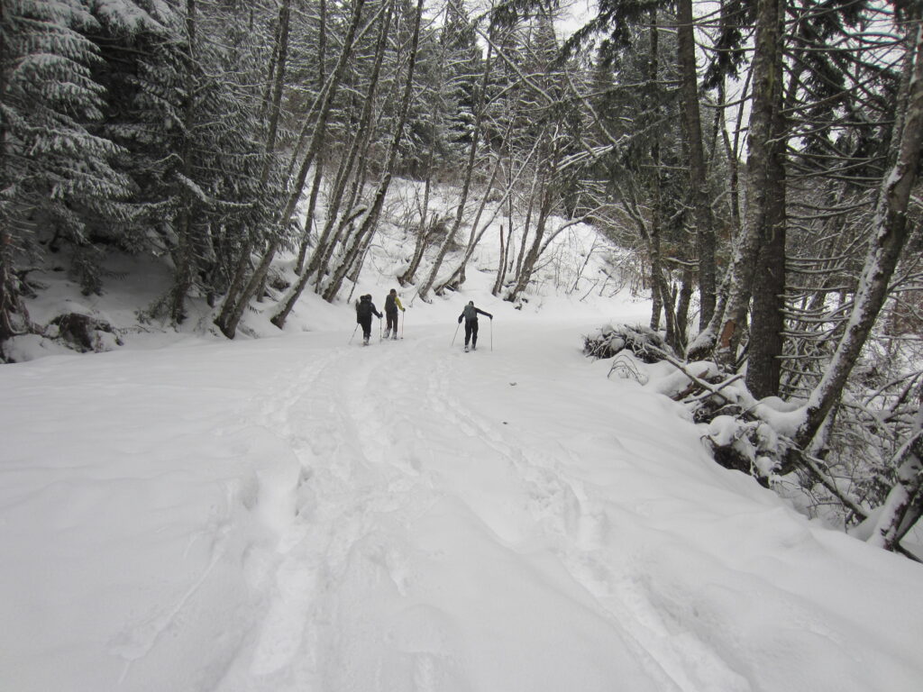
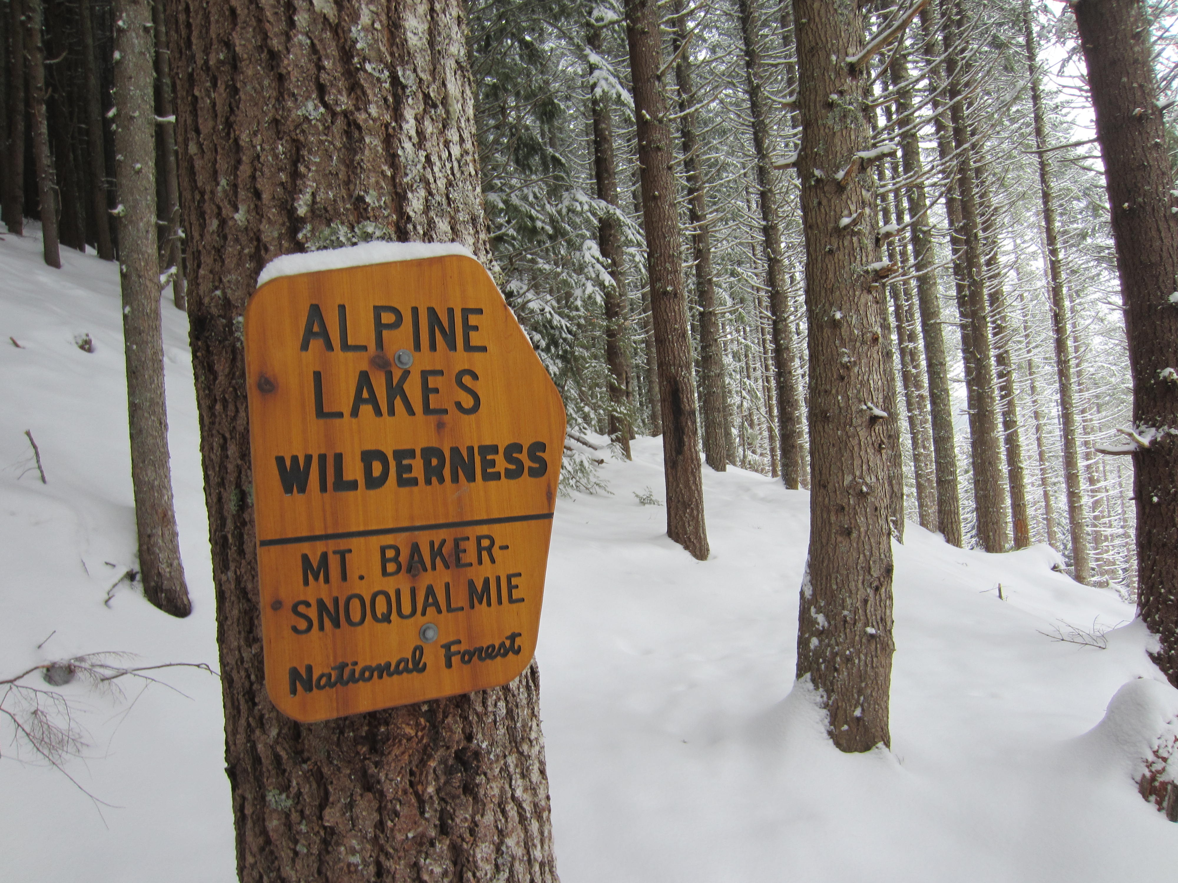
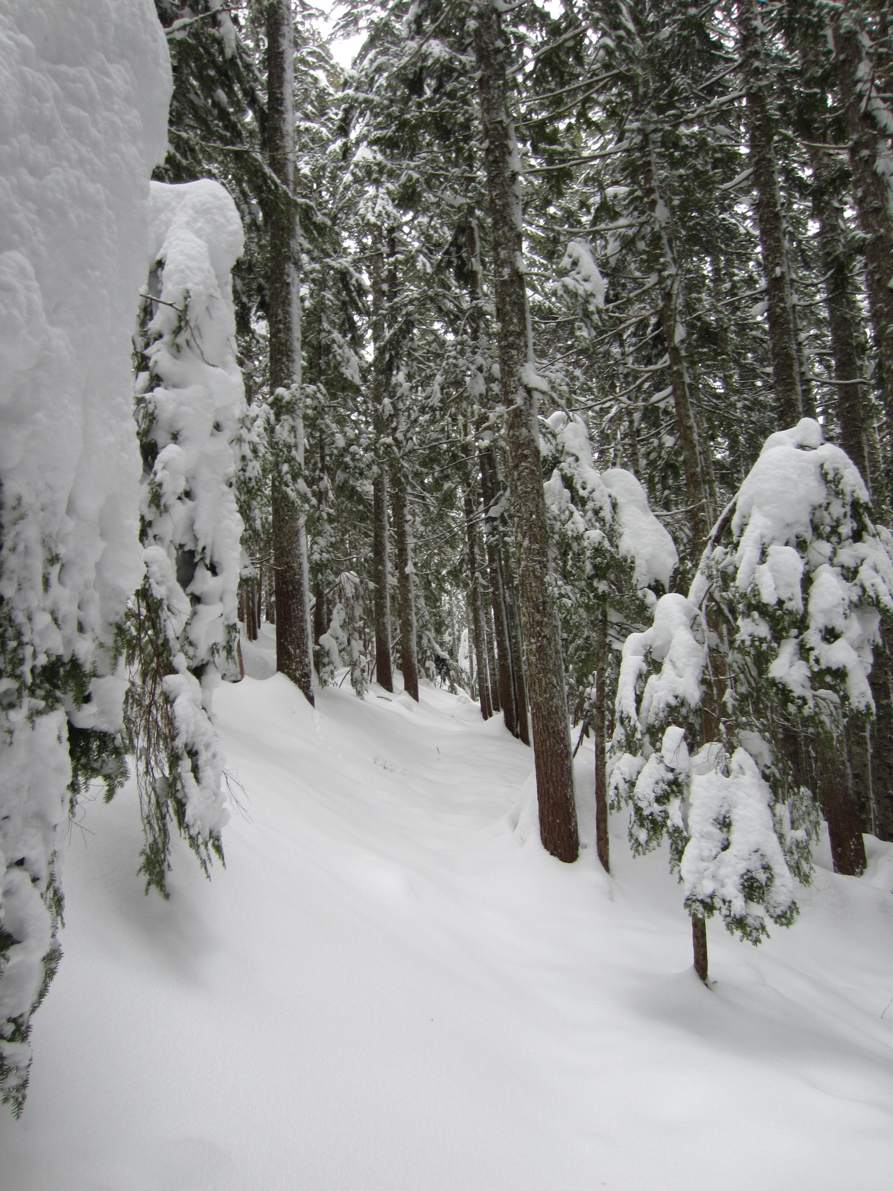
From the northern corner of the parking lot, locate Talapus Lake Trail #1039, which immediately begins curving to the left and then back to the right, soon entering the Alpine Lakes Wilderness. This trail follows a wide corridor through the forest, so it is fairly easy to identify even under deep snow.
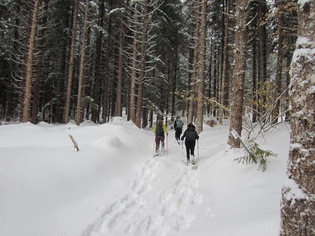
.
.
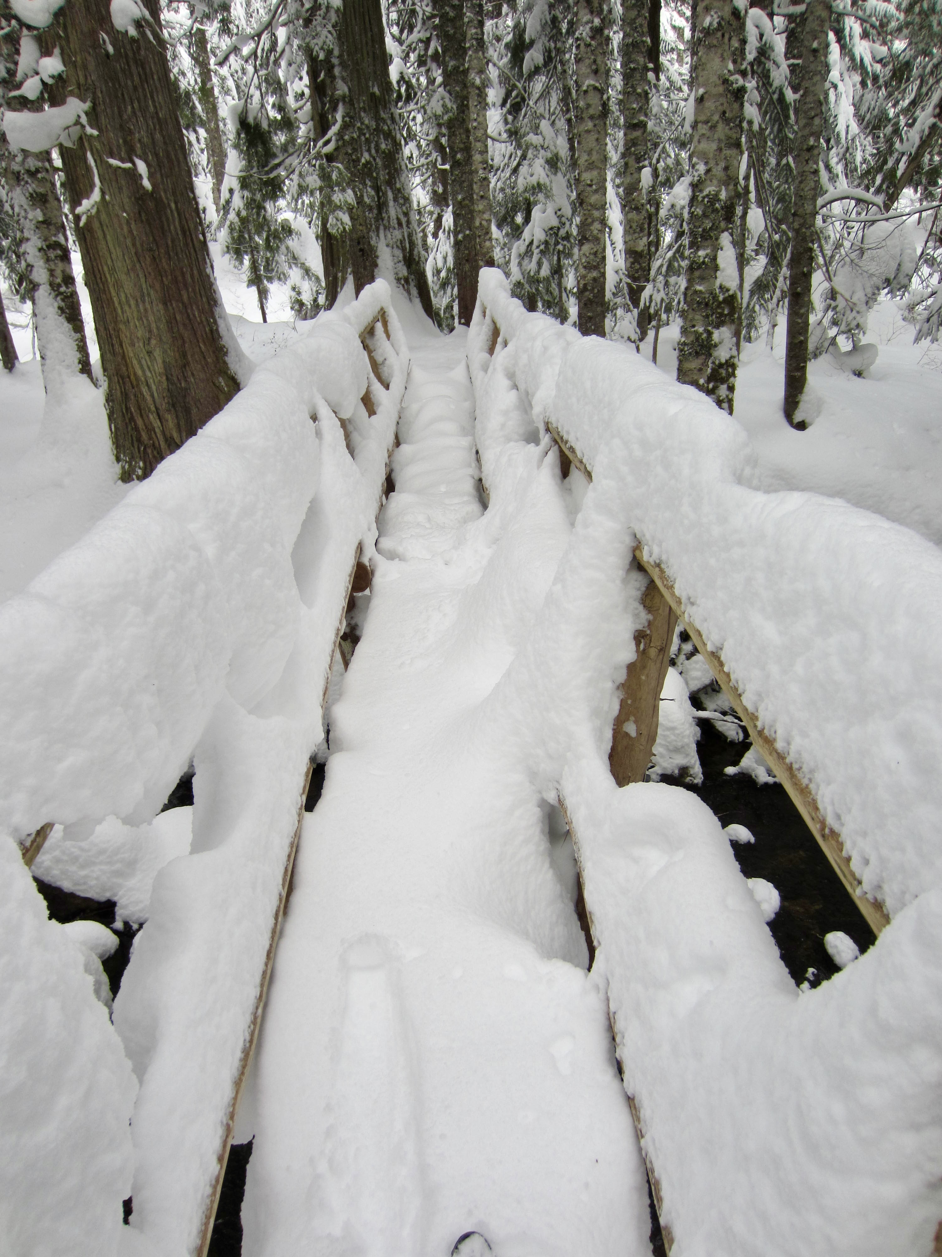
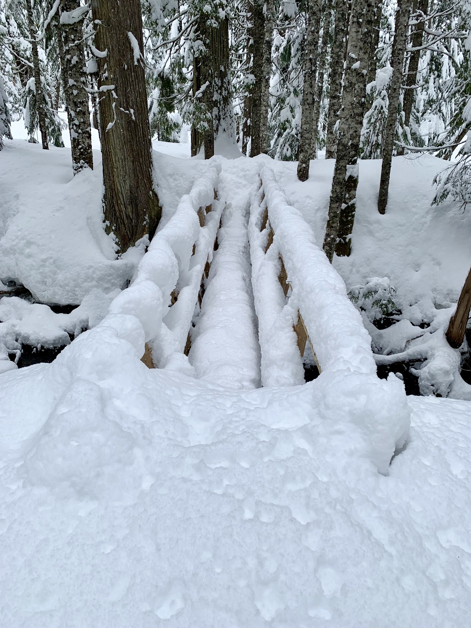
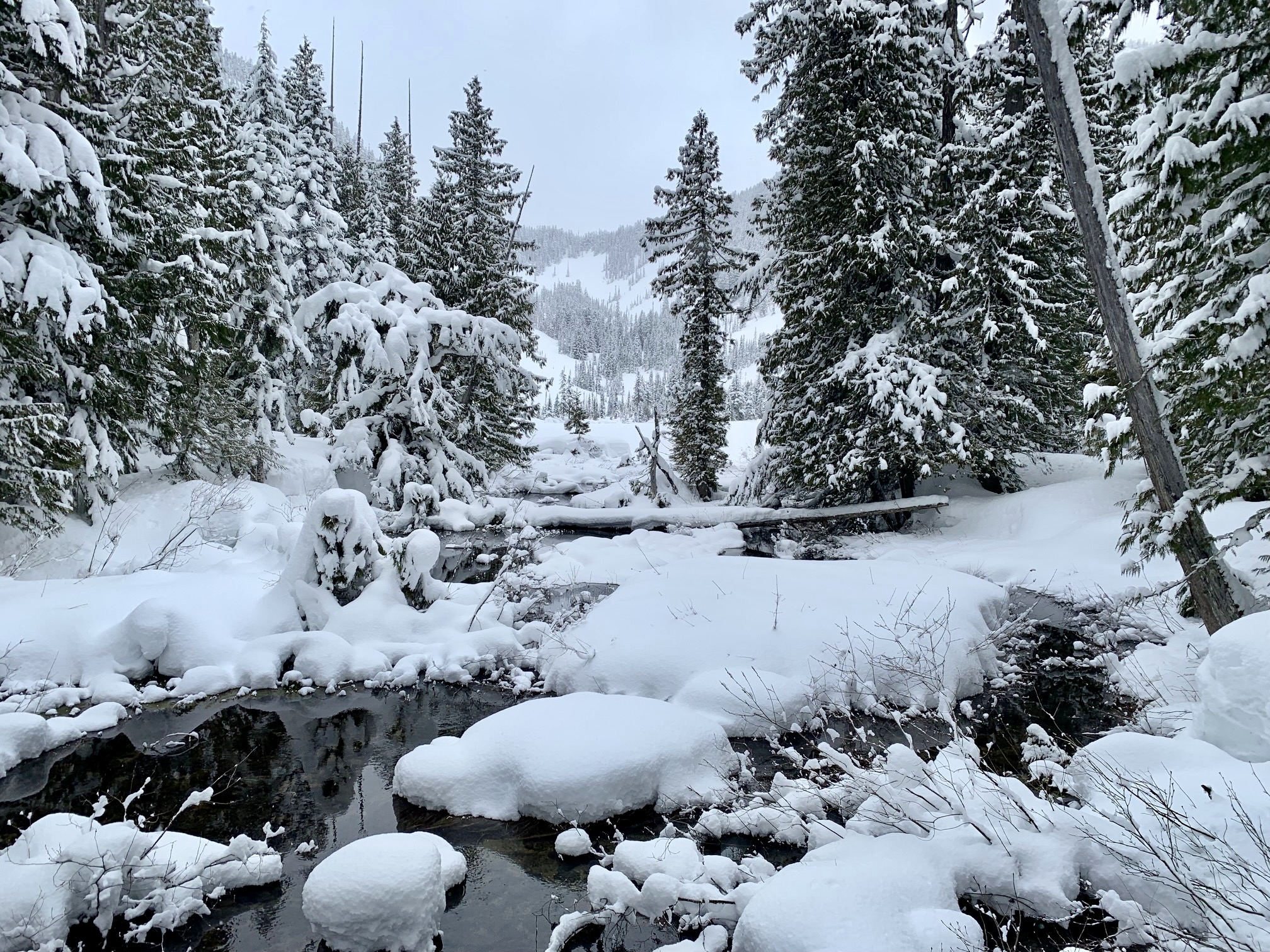
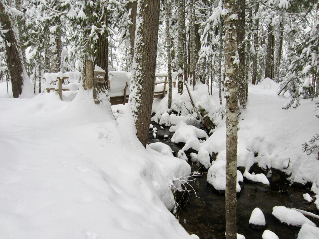
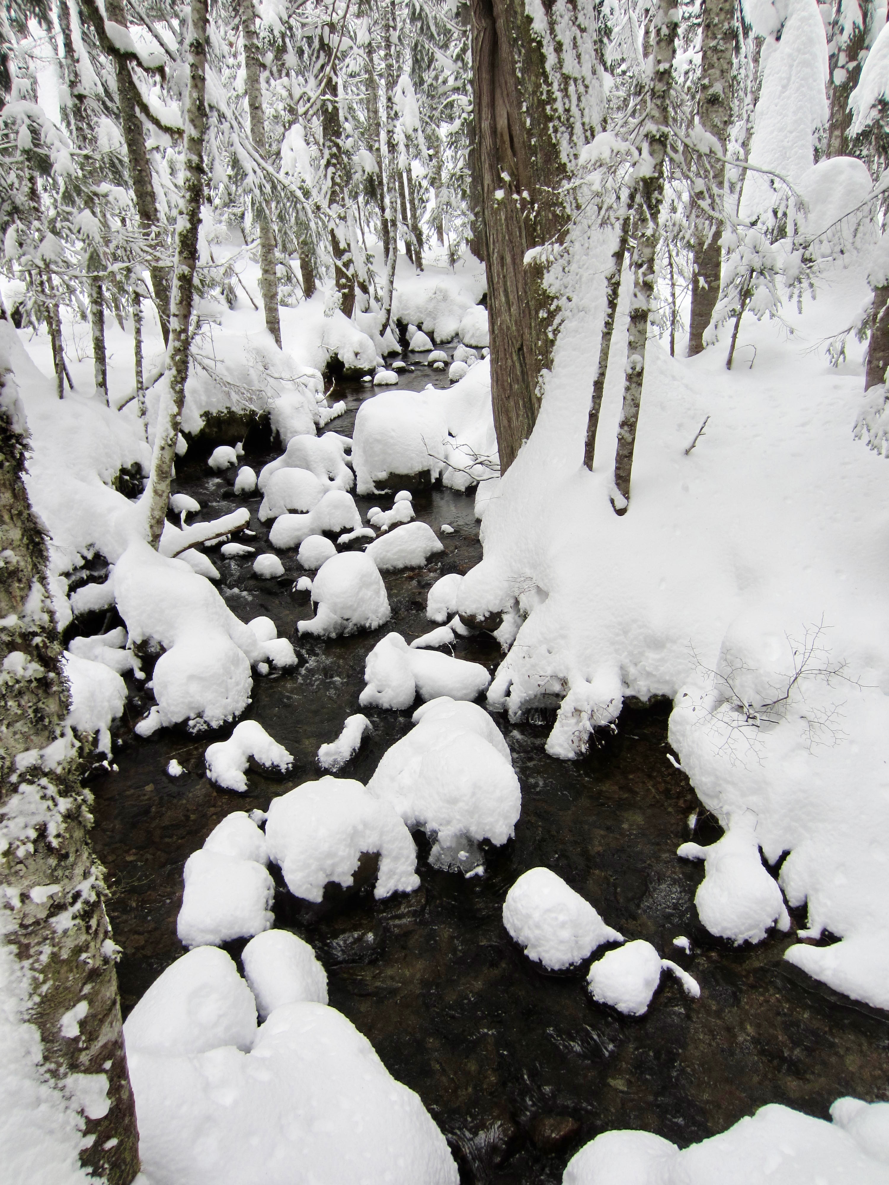
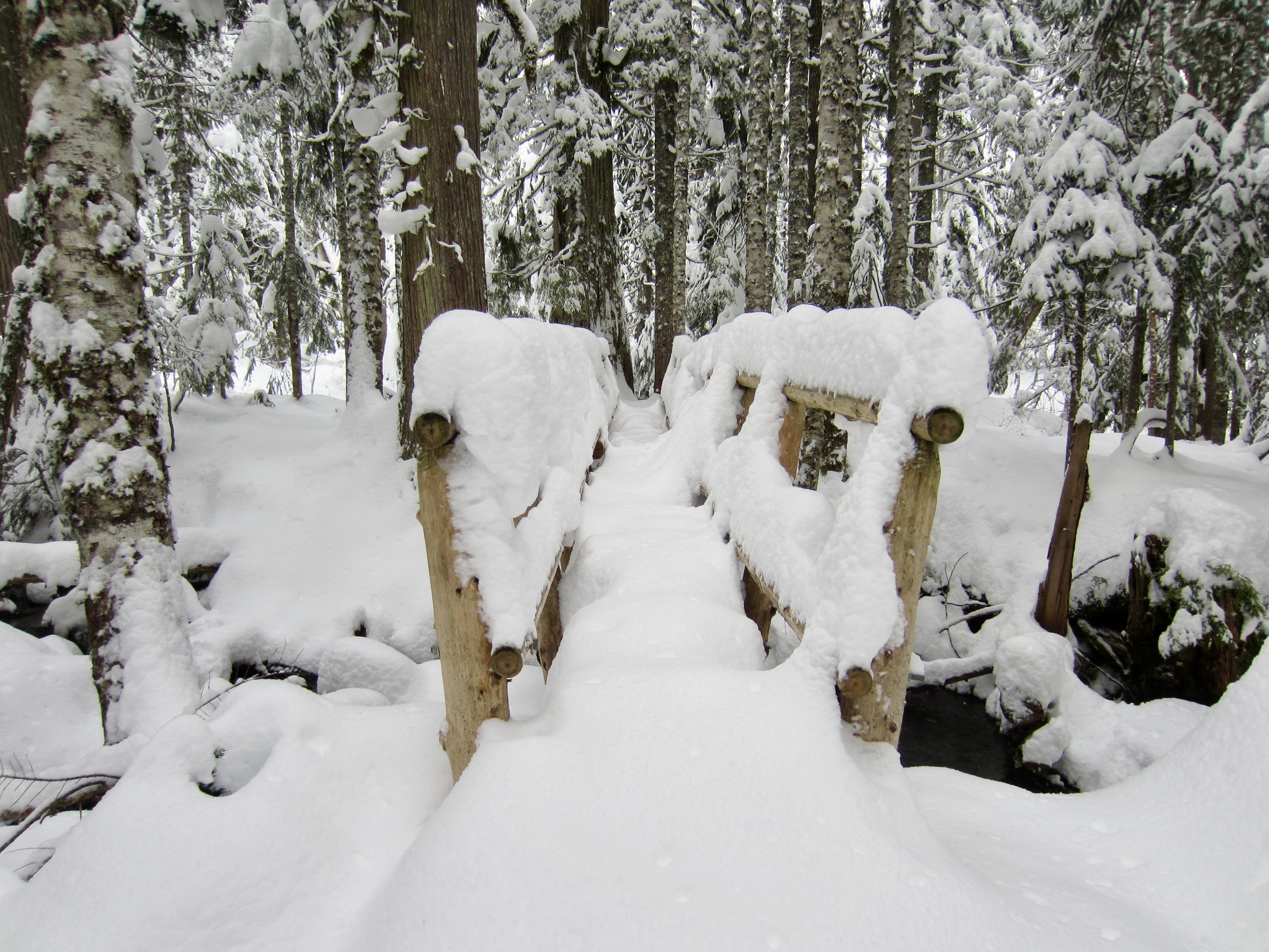
The trail makes a few switchbacks up the nose of a minor rib, then traverses for ¼ mile, then makes a few more switchbacks before traversing over to Talapus Creek. A footbridge across the creek soon comes into view, letting you know that you are now very close to Talapus Lake.
.
.
The Talapus Creek Bridge consists of a sturdy footlog with handrails on each side. When the snowpack is fairly low, such as in early season or late season, crossing this bridge is pretty straightforward. However, under a deep, mid-season snowpack, it can feel pretty narrow and dicey!
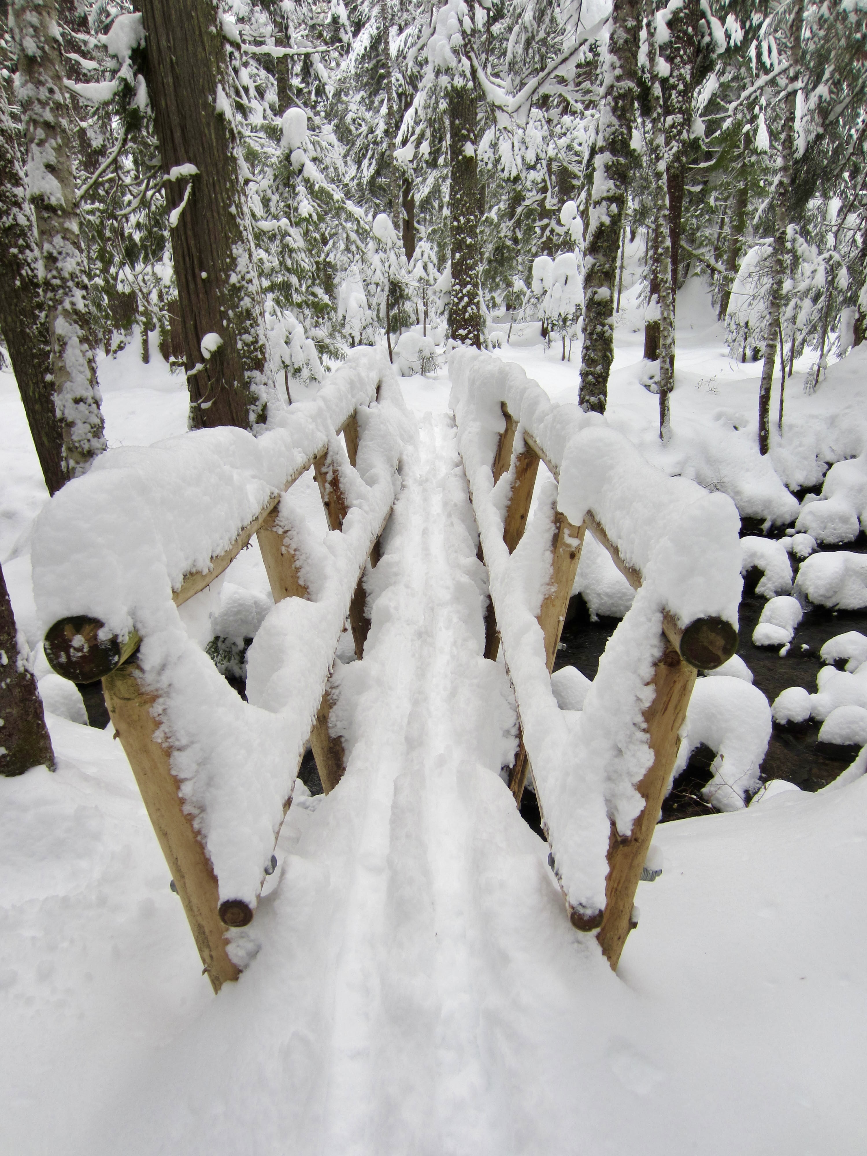
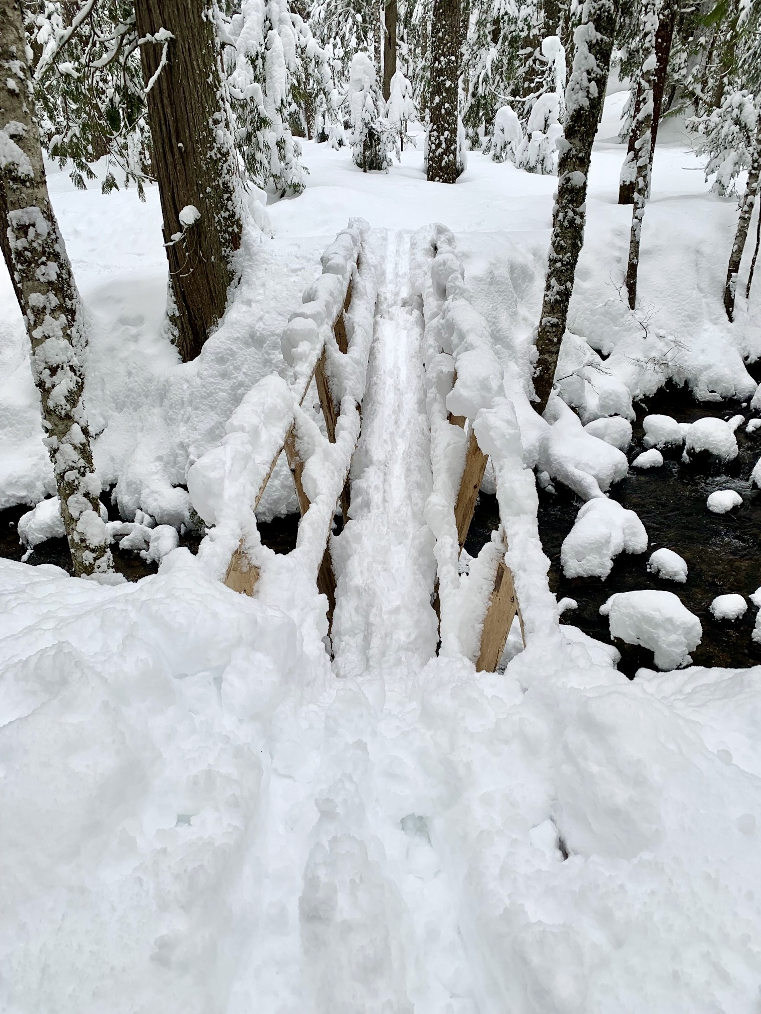
.
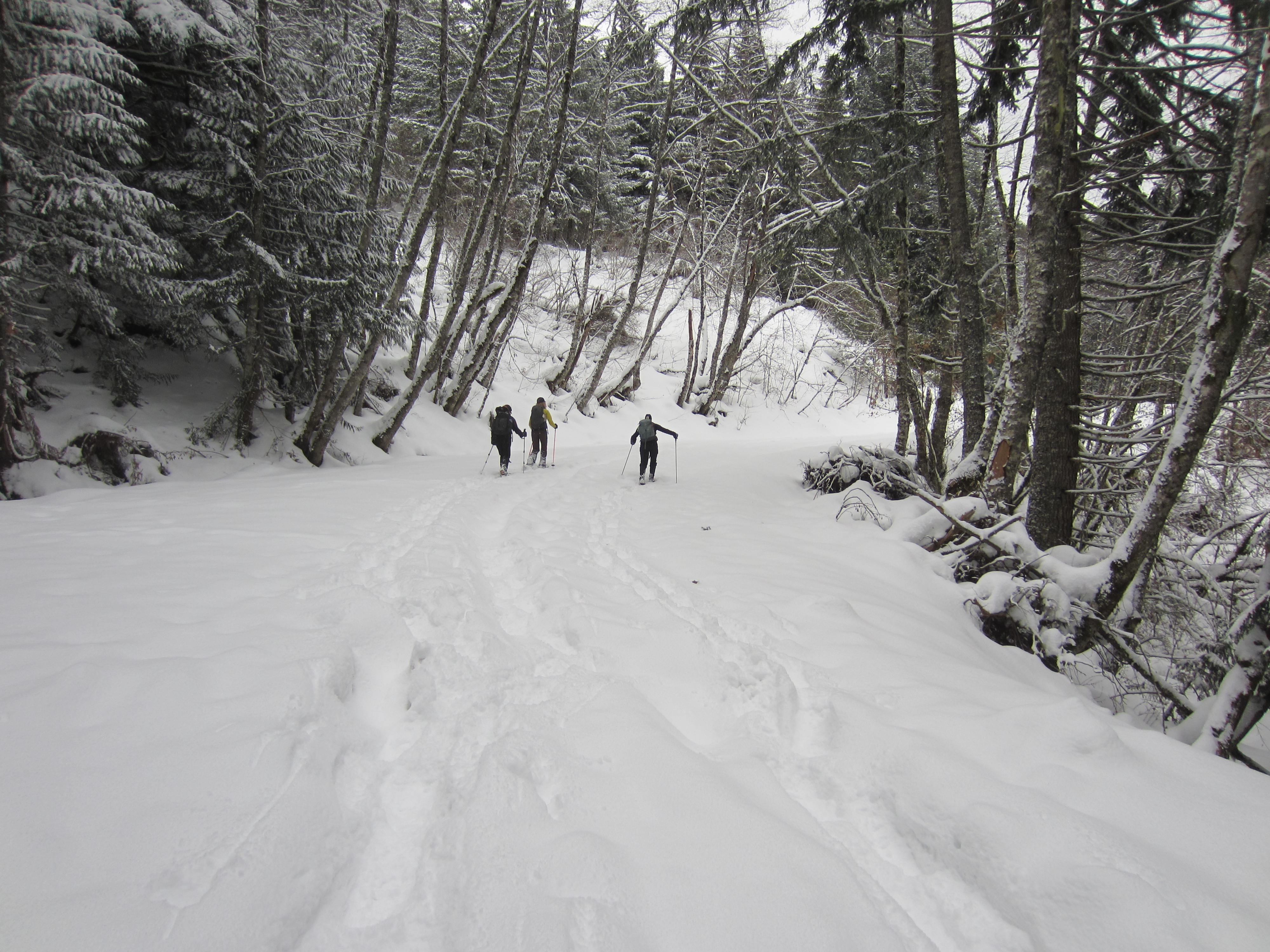
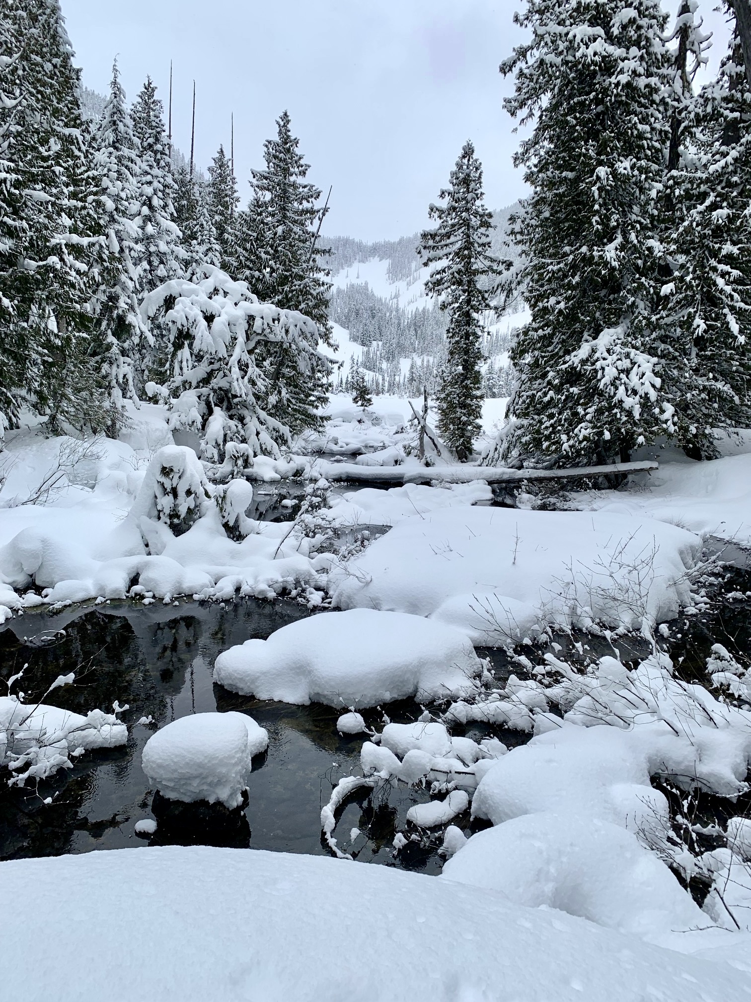
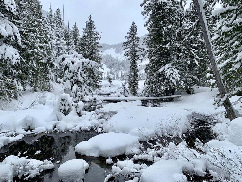
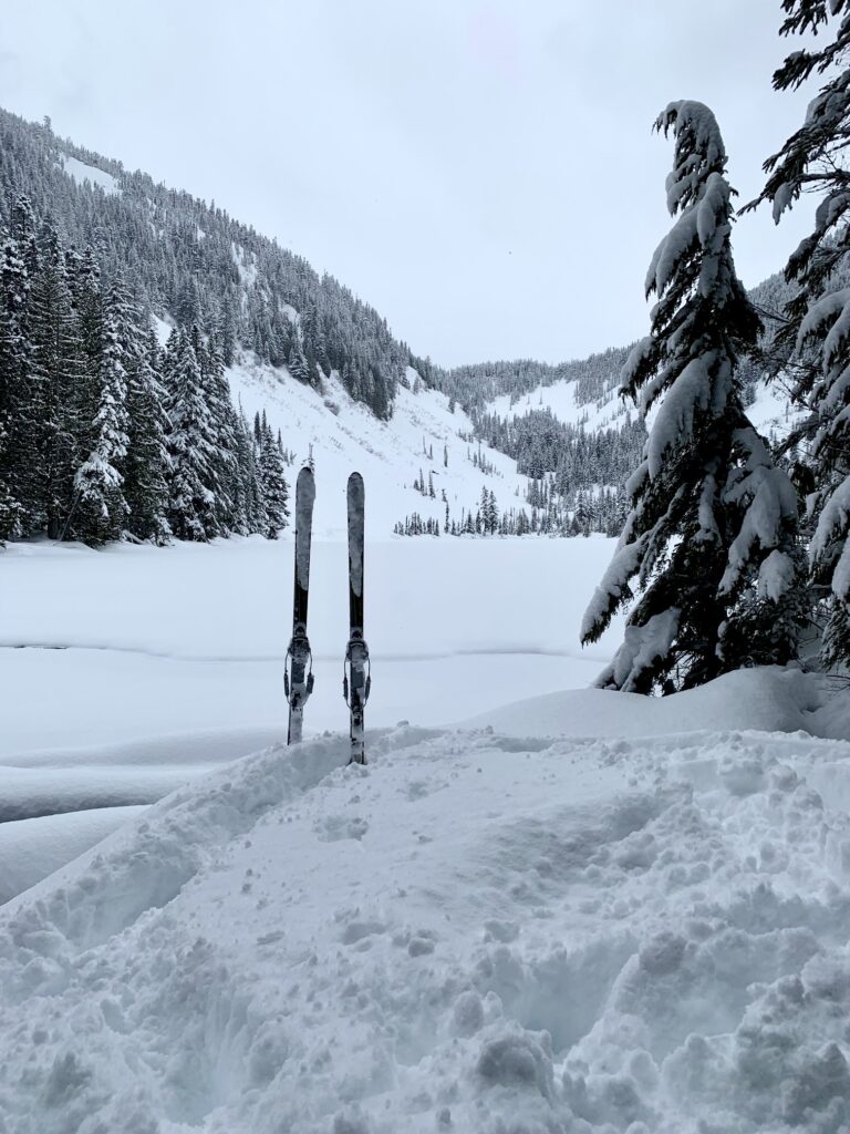
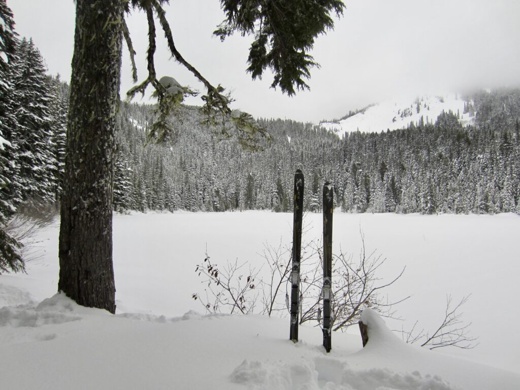
If you are uncomfortable trying to cross the bridge, simply stay on the left (west) side of the creek and keep heading upstream. Regardless of which side you choose, it is only 200 yards through the forest to reach Talapus Lake (4.8 miles + 1650 feet from interchange). Being tucked in a woodsy bowl between Bandera Mountain and Pratt Mountain, the lake is usually sheltered from cold winds, thereby providing a nice lunch spot.
.
.
Talapus Lake to Olallie Lake
Winter travelers who are looking for more adventure can continue along the trail to Olallie Lake, which sits 1¼ miles farther to the northeast and 550 feet higher. The trail switchbacks up the northeastern side of the Talapus Lake bowl, making several long traverses through mature forest. Be aware that many maps (USGS, Green Trails, and Gaia) do not show this trail correctly; it actually traverses much farther to the northwest, as shown on the route maps below.
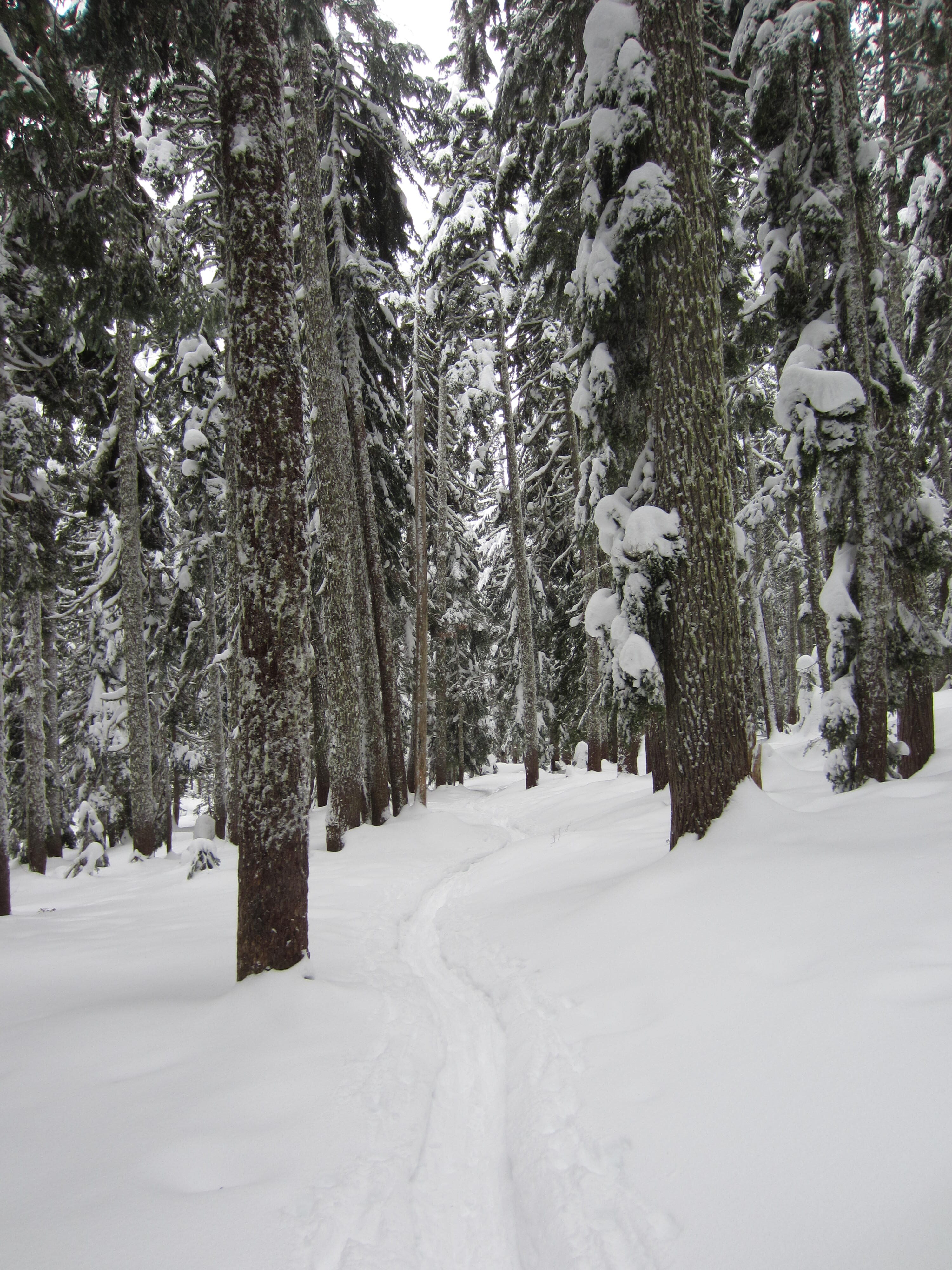
.
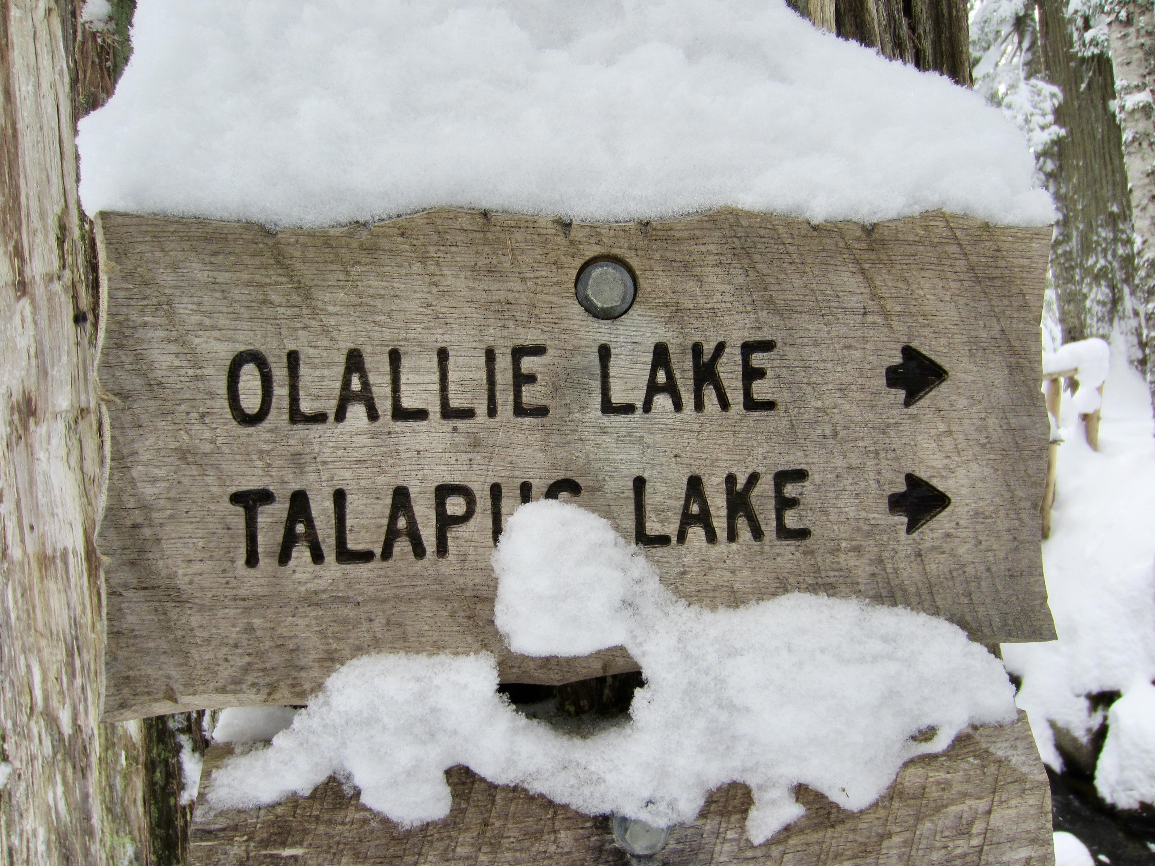
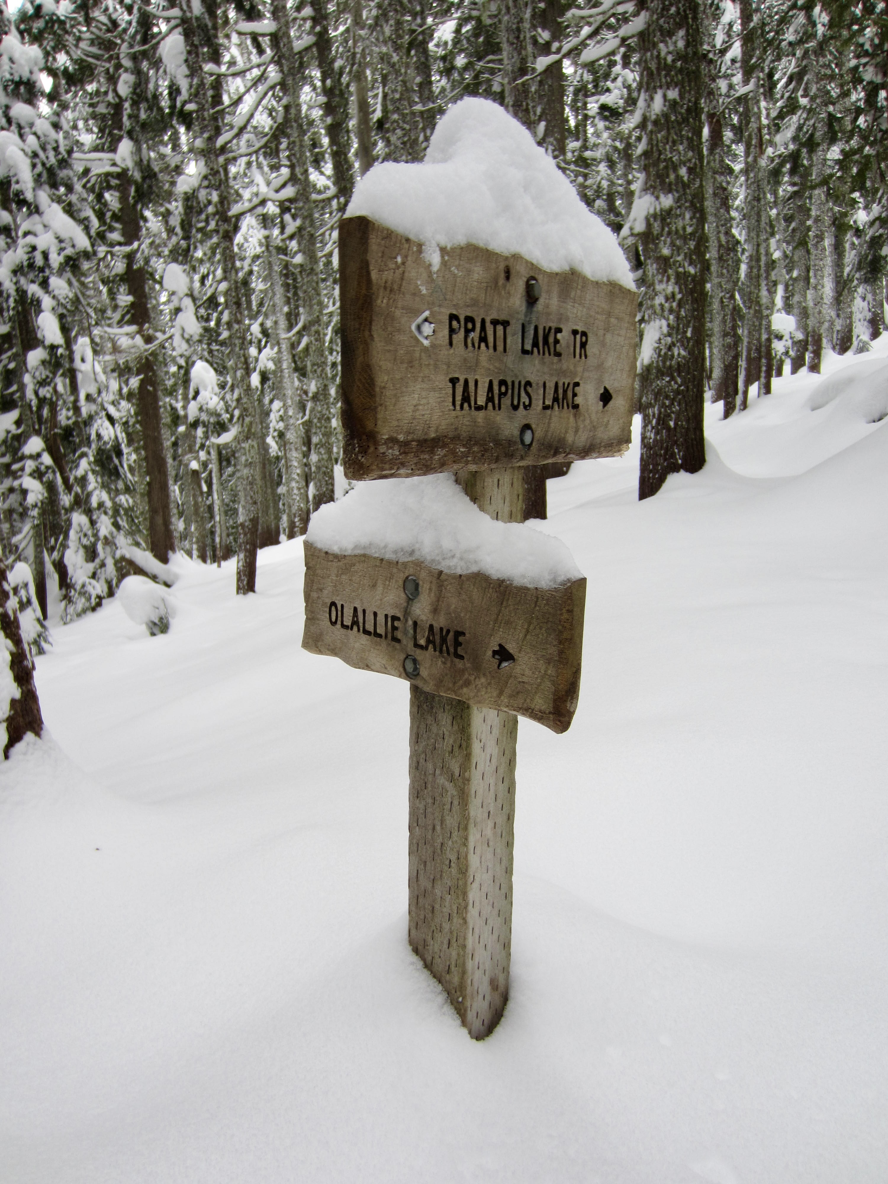
Approximately 1 mile from Talapus Lake, you will come to a junction with the Pratt Lake Trail, although the signpost might be completely buried under snow by mid-winter. Keep contouring northwestward for 250 yards to reach Olallie Lake (6.0 miles + 2200 feet from interchange).
.
.
Return to Bandera Interchange
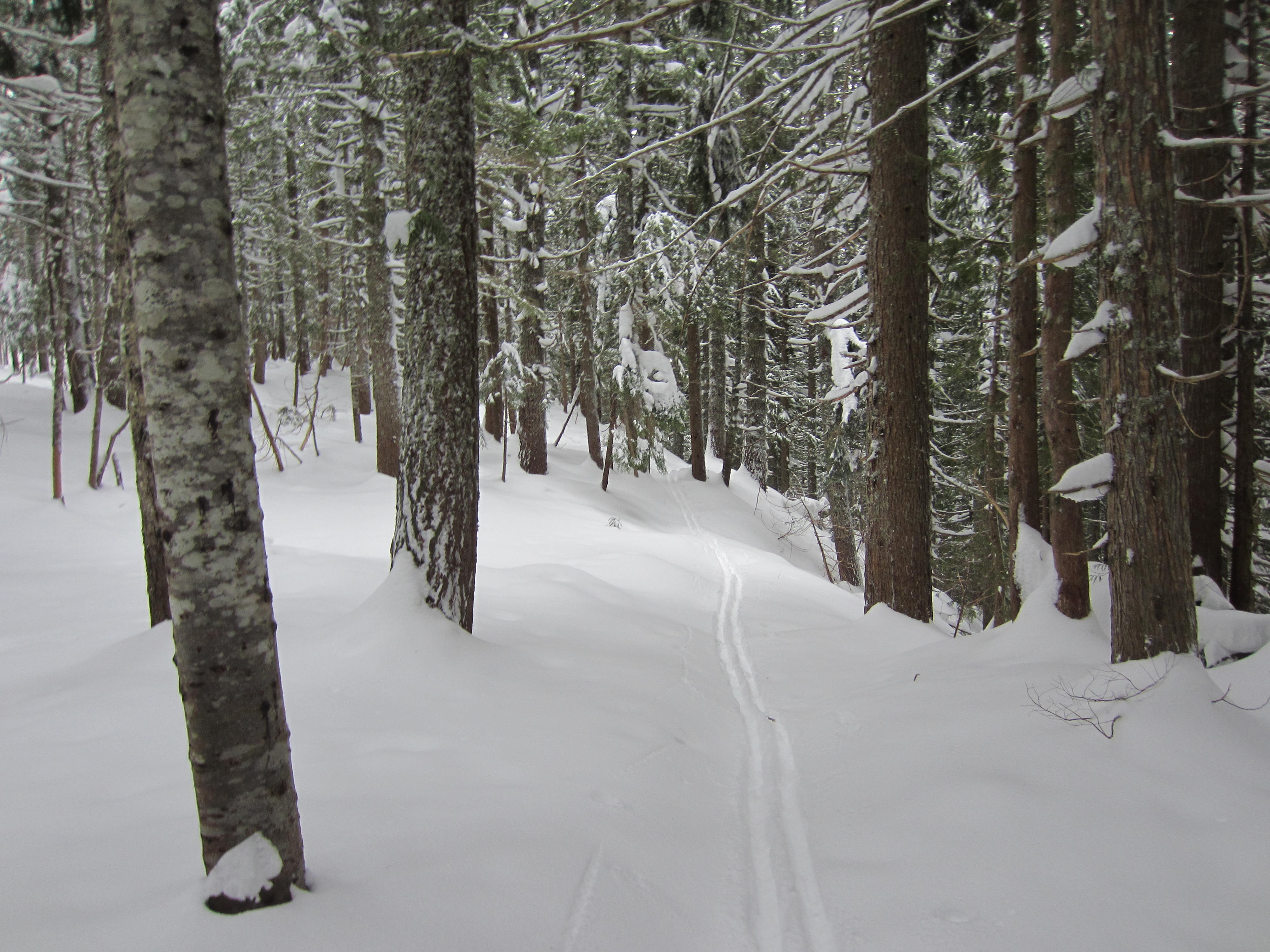
To descend from either lake, simply retrace your tracks back to the interchange. Depending on snow conditions, skiers might find the narrow trail easier to navigate by leaving the climbing skins on their skis; then, once back at the trailhead, rip off the skins and enjoy a fast cruise down Road 9030. Skiers and snowshoers alike might find it fun and expedient to cut a few of the switchbacks when there is adequate snowcover.
Equipment Comments
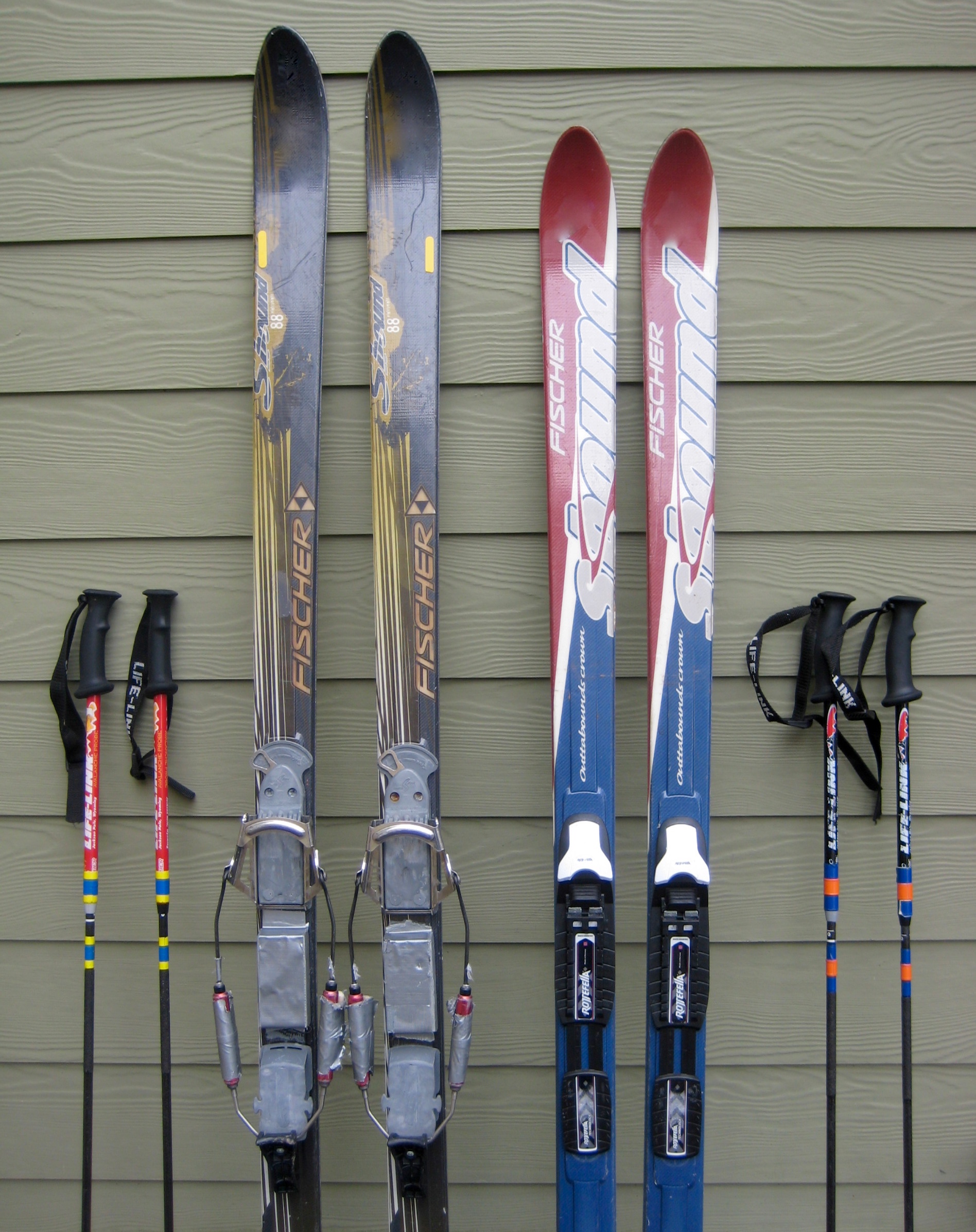
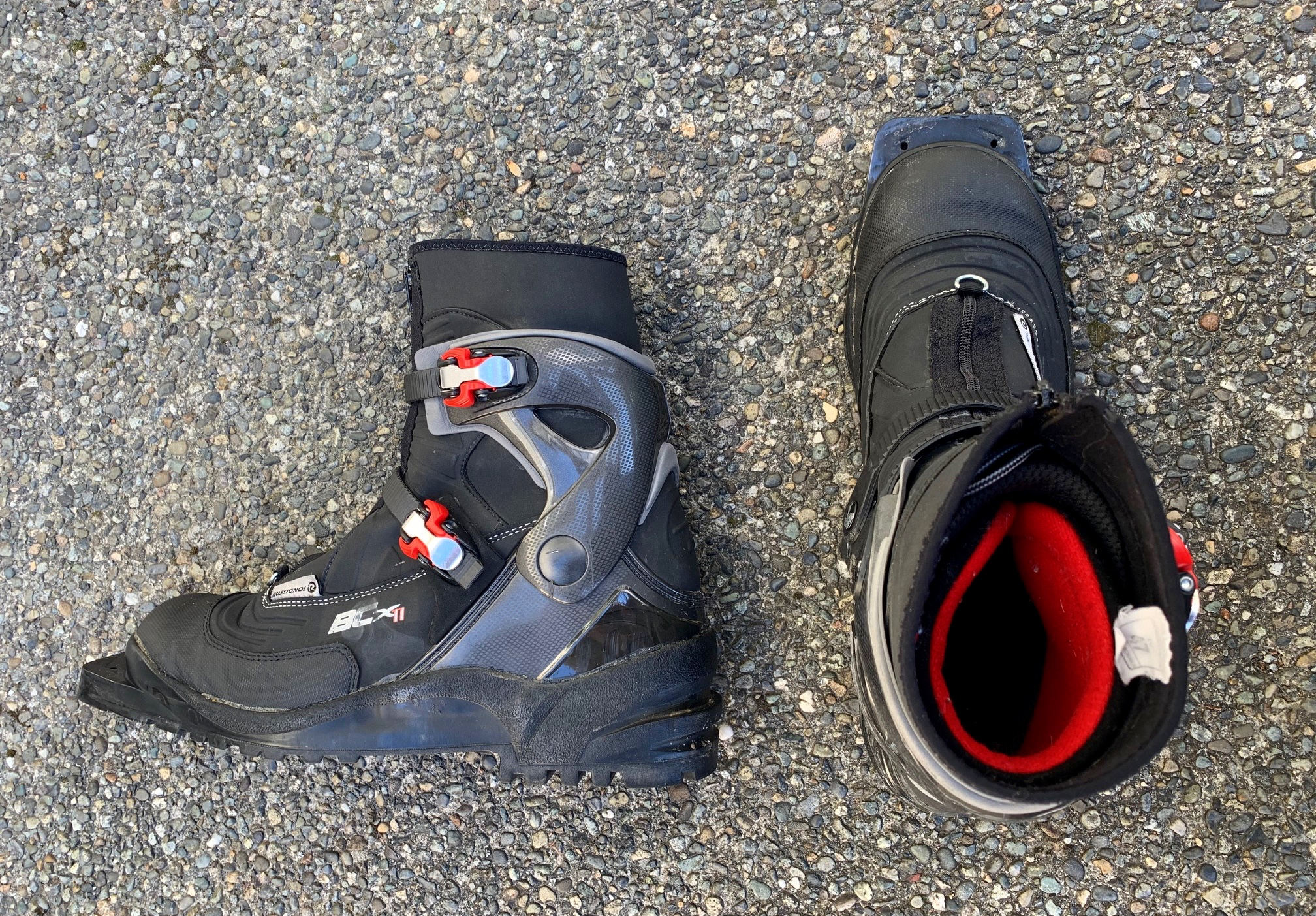
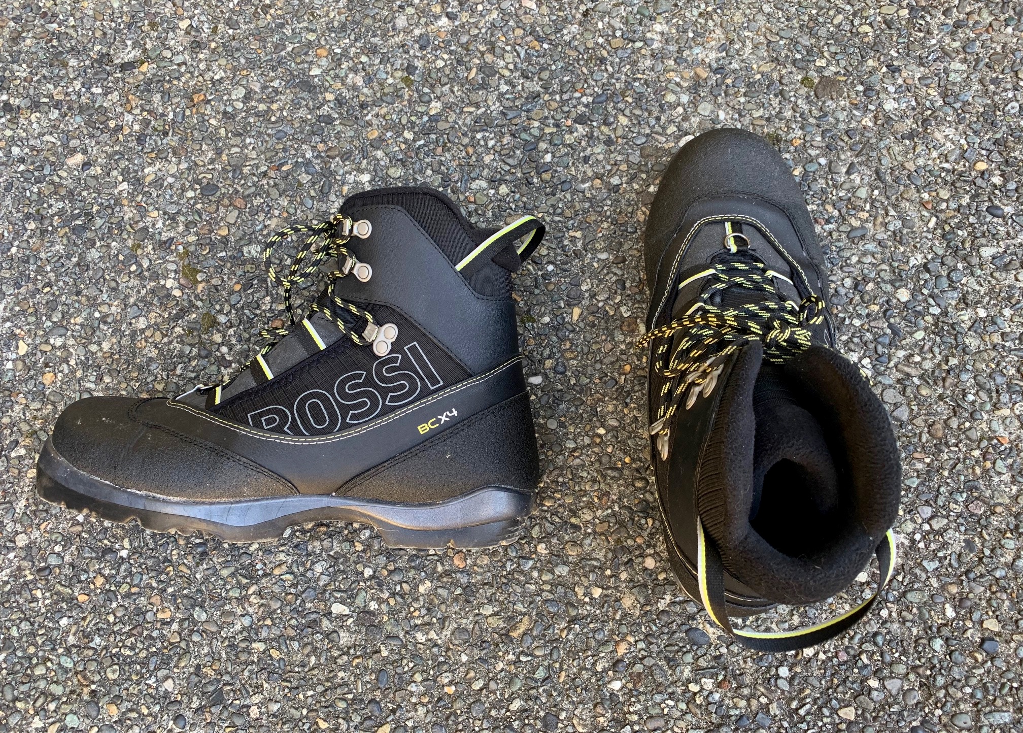
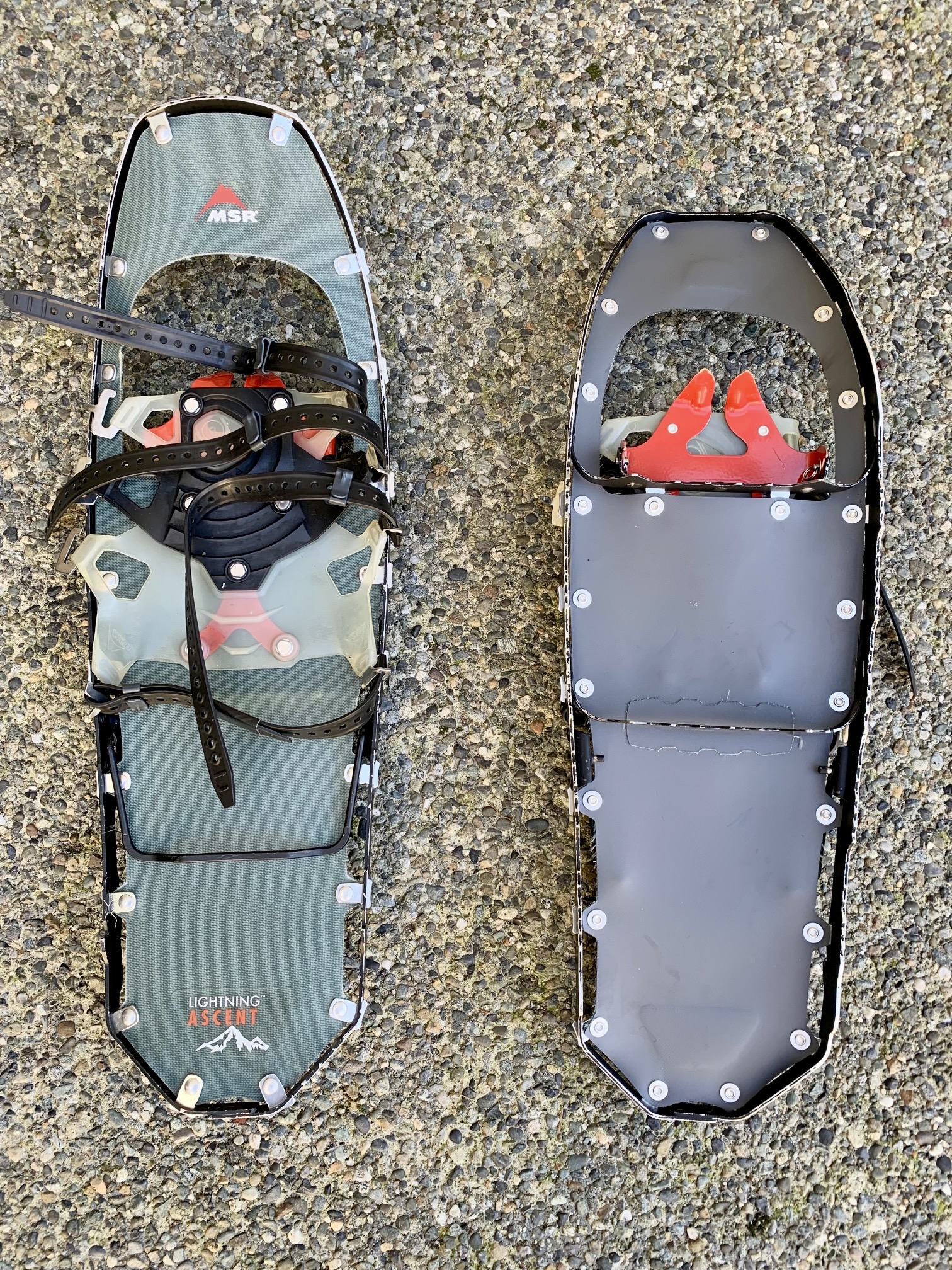
If doing this trek as a ski tour, I recommend using medium-width, fishscale-base, backcountry nordic skis mounted with either 75-mm bindings or NNN-BC bindings, combined with compatible nordic touring boots. Alpine touring (AT, or randonnee) gear is also suitable for the tour, even if it feels a bit slow on the flat parts of the road. In either case, partial or full-length climbing skins are very useful for traction, especially on the trail portion. Although not essential, I also recommend using adjustable ski poles to maximize efficiency on the uphill and downhill portions.
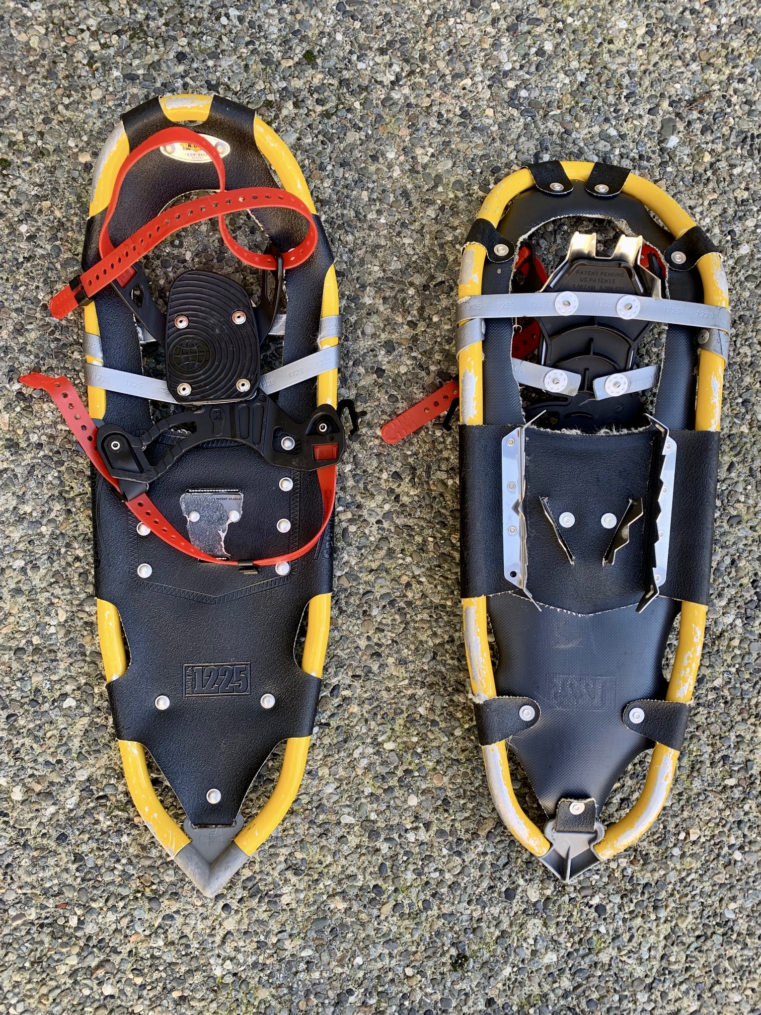
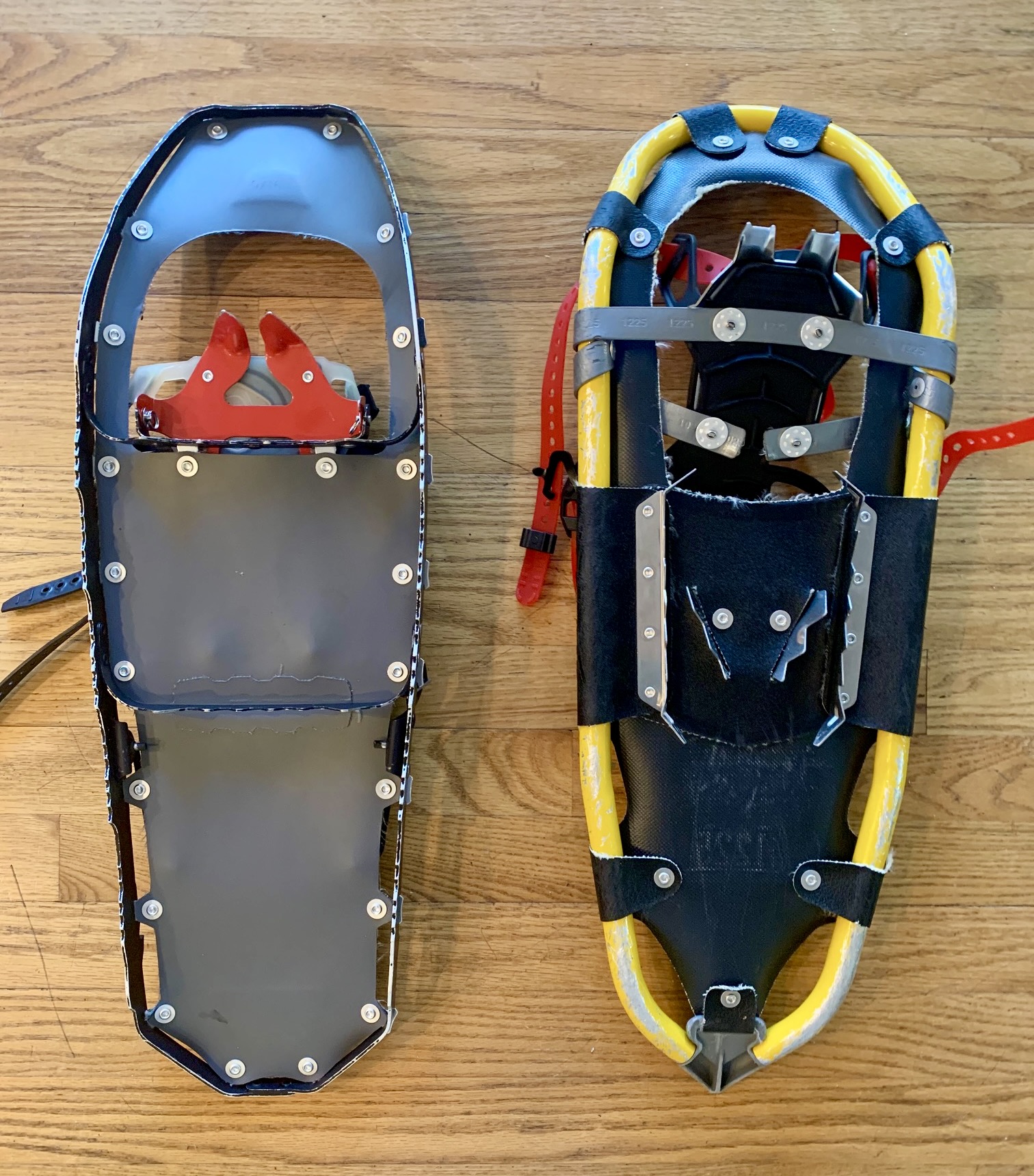
If you are snowshoeing to Talapus Lake, I would say that either trail snowshoes or mountain snowshoes are full adequate. If continuing on to Olallie Lake, mountain snowshoes would become more advantageous but still not essential. In either case, trekking poles are highly recommended.
For further information regarding the specialized equipment that I typically use on this particular trip and on trips of a similar type, see my gear discussions and reviews on the following pages:
>>> Trail & Mountain Snowshoes
>>> Backcountry Nordic Ski Touring Gear
>>> Backcountry Ski & Snowshoe Packs
>>> Wintertime Comfort Accessories
.
…
Route Maps & Profile
…

…
…
Photo Gallery
Click to enlarge…