Trip Date: July 31 – August 3, 2020
MID-SUMMER OUTING NO. 18: CHIWAWA RANGE
Buck Mountain Climbing Trip & High Giant Traverse: Buck Creek Pass to High Pass to Little Giant Pass
Chiwawa River
Buck Creek Pass
Liberty Cap (6760’+)
High Pass
Napeequa Mountain (8073′)
Louis Creek Basin
Buck Mountain (8560’)
Napeequa Valley
Little Giant Pass
- Trip Report Summary
- Related Posts
- Full Trip Report
- Day 1: Chiwawa River Trailhead to Buck Creek Pass
- Day 2: Buck Creek Pass to Louis Creek Basin + Napeequa Mountain
- Day 3 (AM): Buck Mountain Summit Climb
- Day 3 (PM): Louis Creek Basin to Napeequa Valley
- Day 4: Napeequa Valley to Little Giant Trailhead
- Route Maps & Profiles
- Photo Gallery
Trip Report Summary
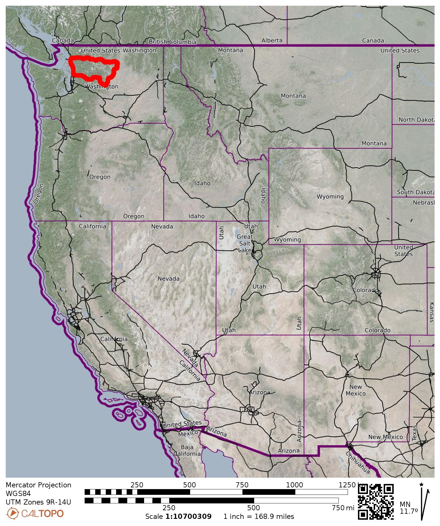
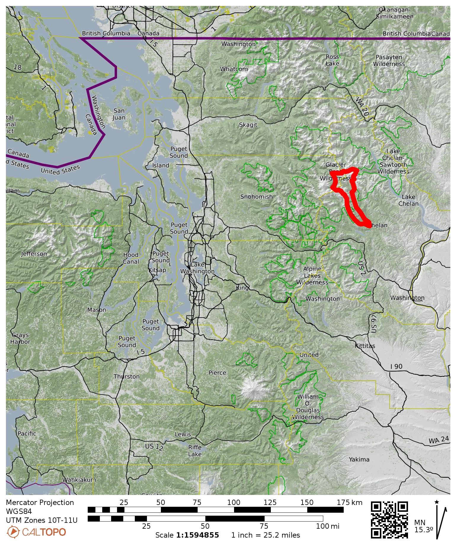
Region: North-Central Washington Cascades
Sub-Region: Chiwawa Range
Area: Glacier Peak Wilderness
Starting Point: Chiwawa River Trailhead at Trinity on Chiwawa River Road (Elev. 2800 feet)
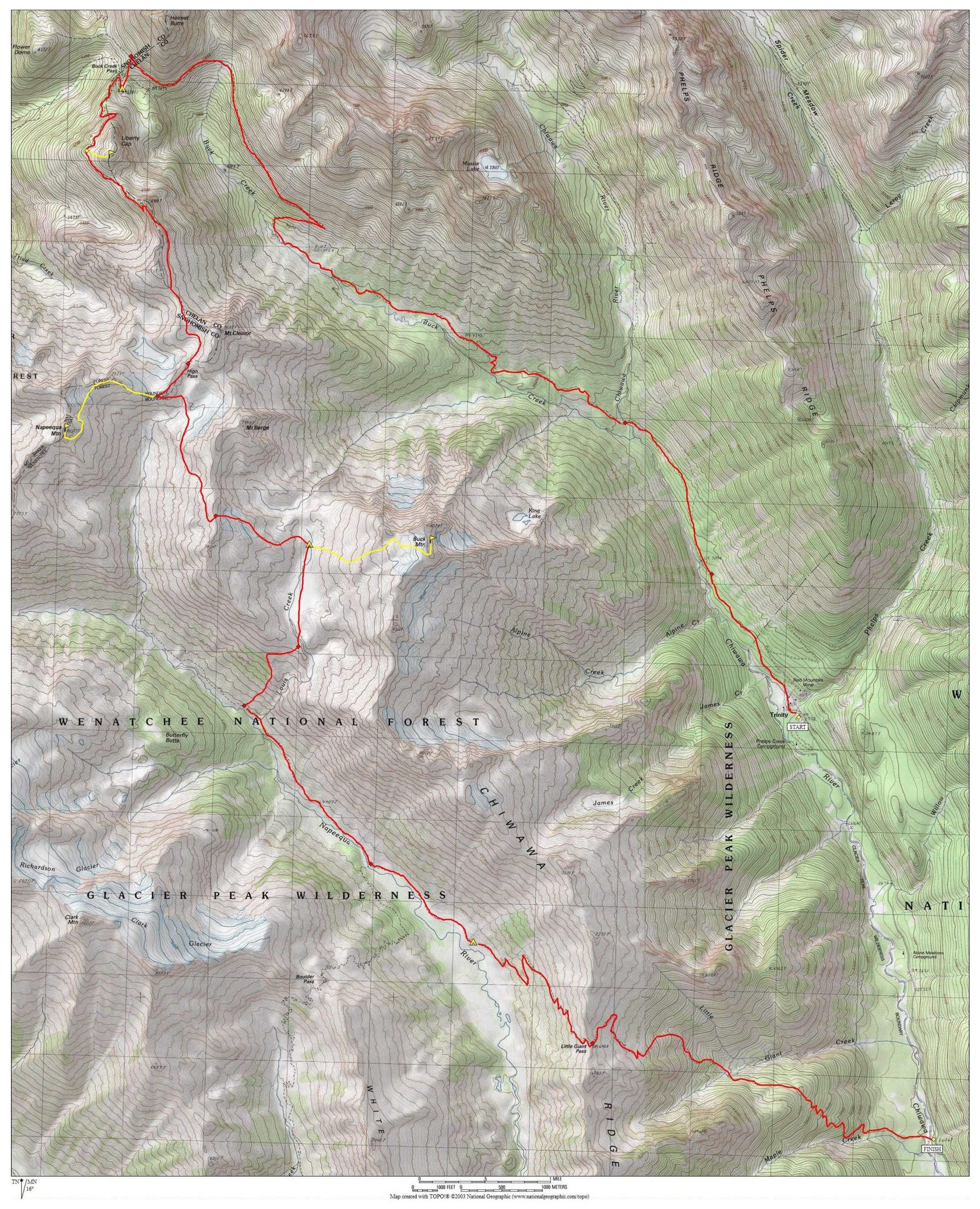
Way Points: Phelps Creek Bridge & Chiwawa River Bridge & Buck Creek crossing & Buck Creek Pass & High Pass & Berge Ridge notch & Louis Creek Basin & Louis Creek crossing & Napeequa Valley & Napeequa River & Boulder Pass Trail junction & Little Giant Pass & Little Giant Creek crossing & Chiwawa River ford (trail hike & off-trail hike & rock scramble & snow climb)
High Point: Berge Ridge notch (Elev. 7840 feet)
Ending Point: Little Giant Trailhead on Chiwawa River Road (Elev. 2600 feet)
Campsites: Buck Creek Pass & Louis Creek Basin & Napeequa Valley meadow
Summit: Liberty Cap (off-trail hike via West Slope)
Summit: Napeequa Mountain (off-trail hike & rock scramble & snow climb via Northeast Ridge—East Face)
Summit: Buck Mountain (off-trail hike & rock scramble & snow climb via West Slope—West Face)
Approximate Stats: 35 miles traveled; 11,700 feet gained; 11,900 feet lost.
Related Posts
High Giant Traverse + Buck Mountain – October 2011
High Giant Traverse + Buck Mtn + Mt Cleator + Mt Berge – September 1984
Full Trip Report
For our 18th annual Mid-Summer Climbing Trip (COVID Edition), Jon, Eric, Todd, Adam, Noah, Alex, Kris, and I completed the High Giant Traverse in the Chiwawa Range. It was my third time doing this sub-alpine traverse from Buck Creek Pass to High Pass to Little Giant Pass, but the changes in terrain conditions and the variations in our specific route made it feel like my first time. Because most of our group had not even set foot in the Chiwawa Range before, there was an overriding theme of discovery and revelation throughout the entire trek.
Day 1: Chiwawa River Trailhead to Buck Creek Pass
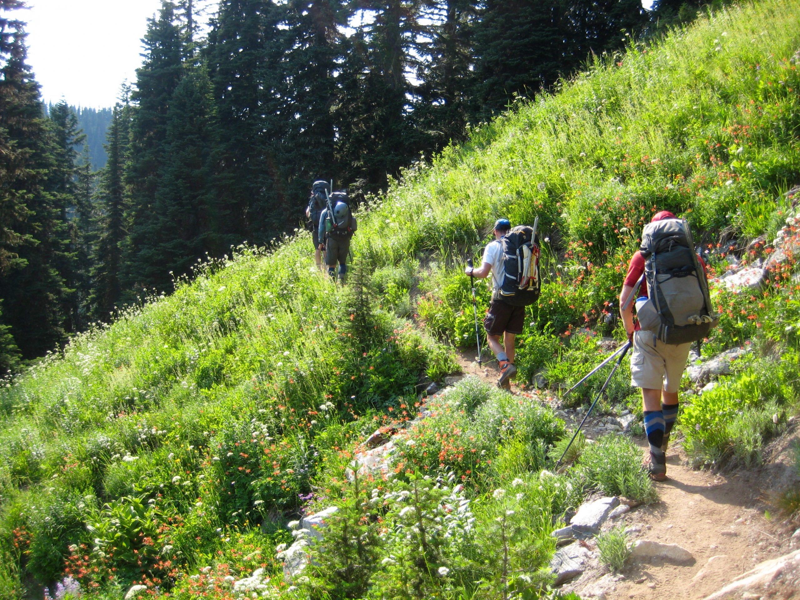
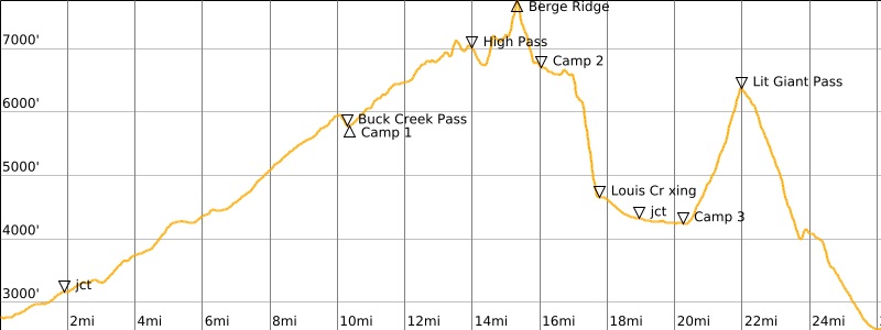
After dropping a vehicle at the Little Giant Trailhead, we all drove up to the Chiwawa River / Buck Creek Trailhead at Trinity to begin our approach hike. Temperatures were predicted to reach 90 degrees by mid-afternoon, so we braced ourselves for a taxing hike to Buck Creek Pass. Near Mile 3, where the trail crosses the upper reaches of the Chiwawa River on a badly damaged bridge (1.3 hours + 550 feet from TH), everyone stopped for a cooling splash.

The next several hours involved a grueling trail ascent, with precious little shade and an overdose of both mosquitos and black flies. Fortunately, the wildflower displays and mountain views improved steadily.
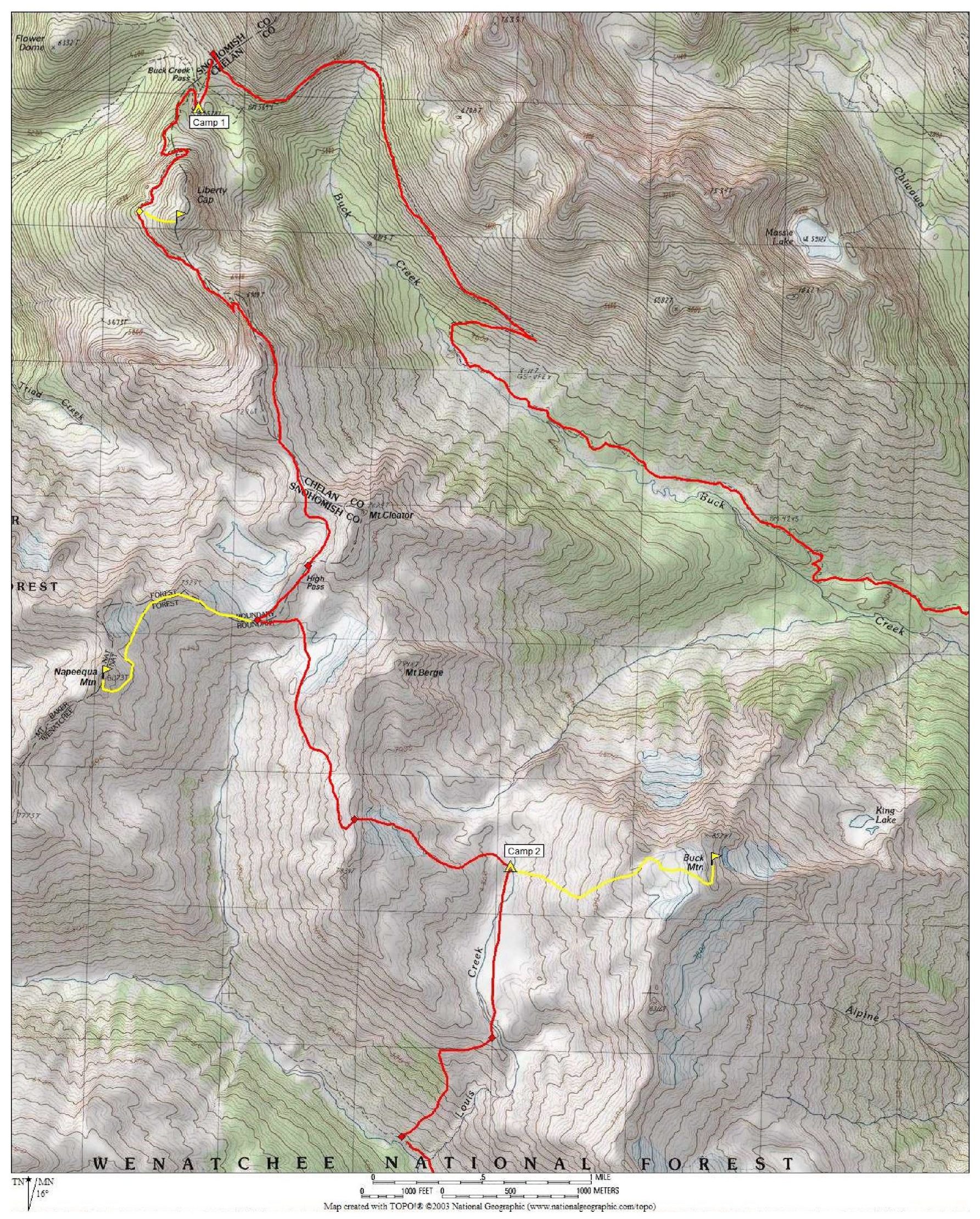
We gained Buck Creek Pass in late afternoon (6.0 hours + 3000 feet from TH) and found a comfortable group campsite among a grove of trees adjacent to a grassy meadow. Ice-cold drinking water miraculously emanated from a nearby spring.
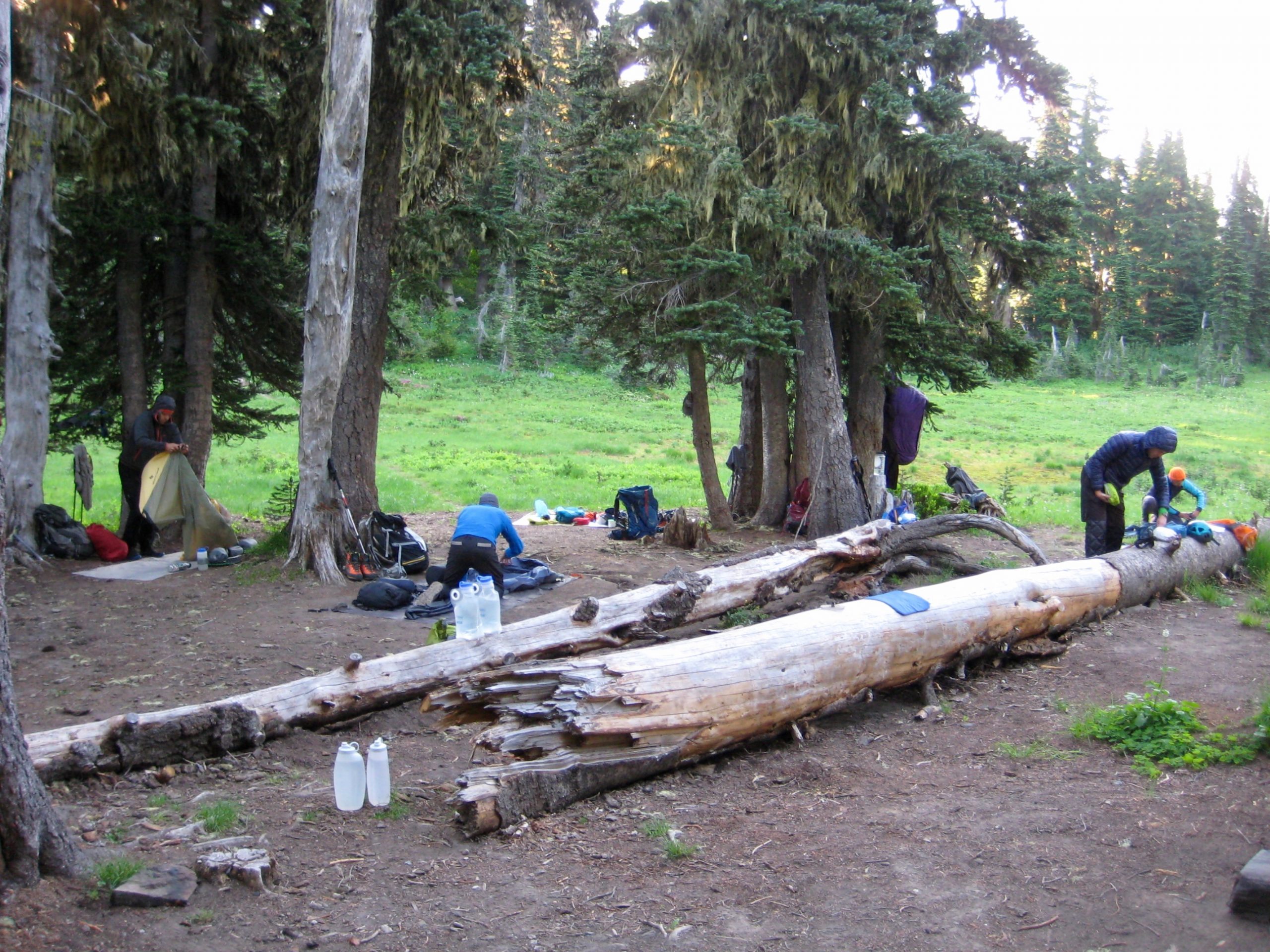
After dinner, everyone walked back up the trail a short distance to get a twilight view of Glacier Peak. I truly think that Buck Creek Pass rivals Image Lake as a prime vantage point for the matronly volcano.
Day 2: Buck Creek Pass to Louis Creek Basin + Napeequa Mountain
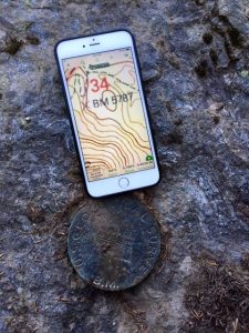
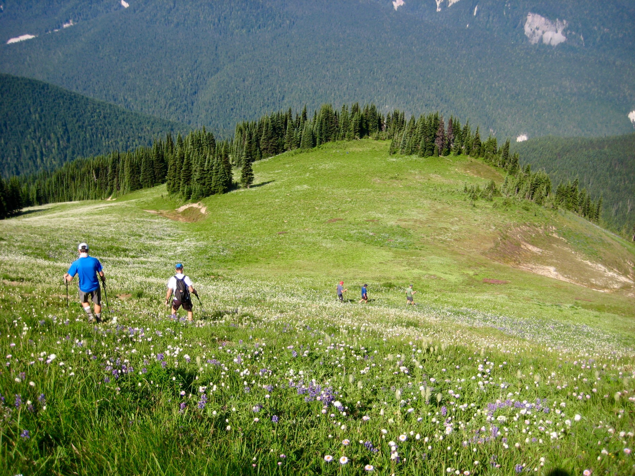
Temperatures were much cooler in the morning and remained comfortably moderate throughout the rest of our trek. While slowly packing up, we entertained ourselves by searching for a meadow benchmark using our various cell phone GPS apps. It was reassuring to find that all phone apps were bang-on accurate.
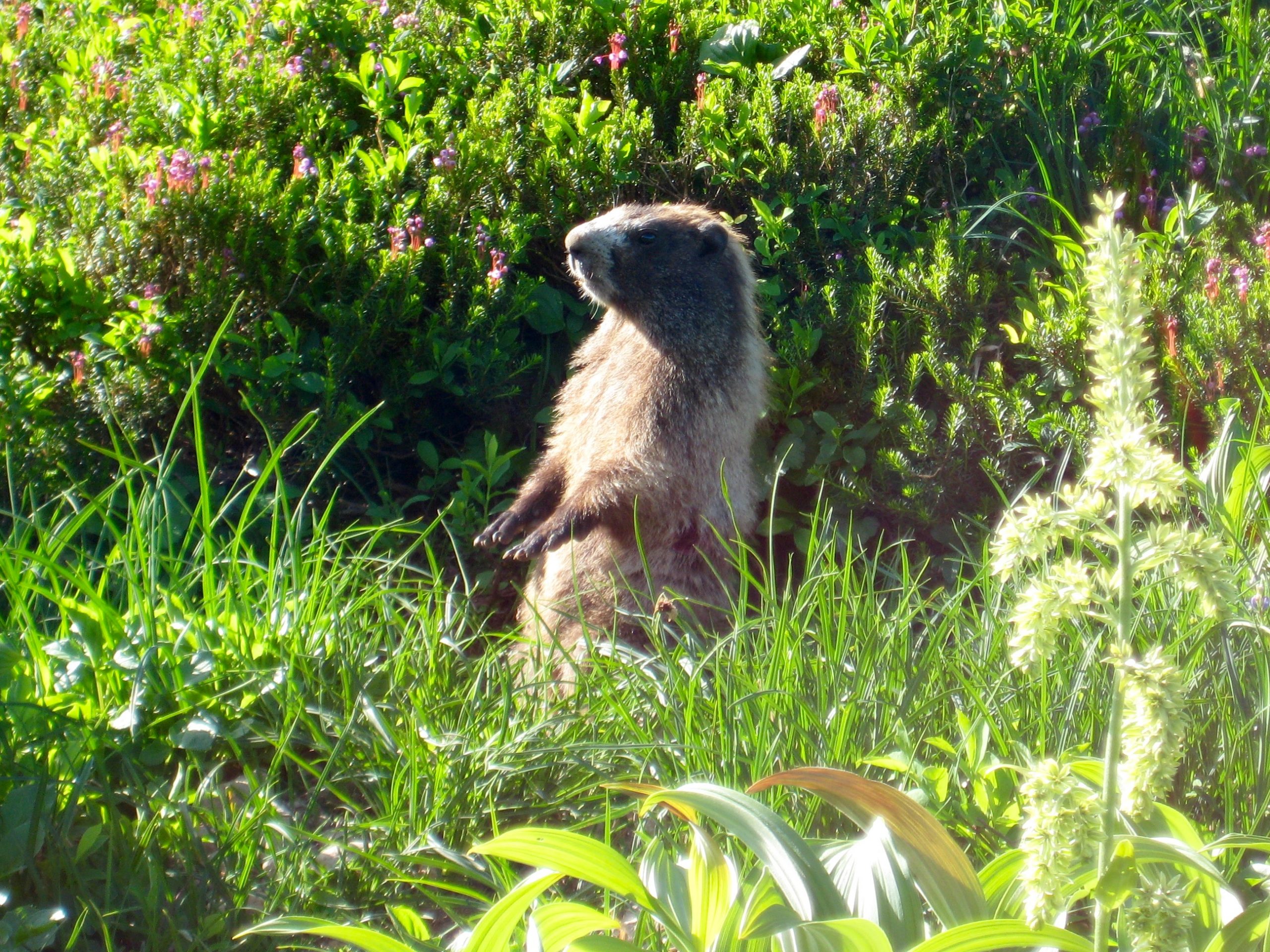
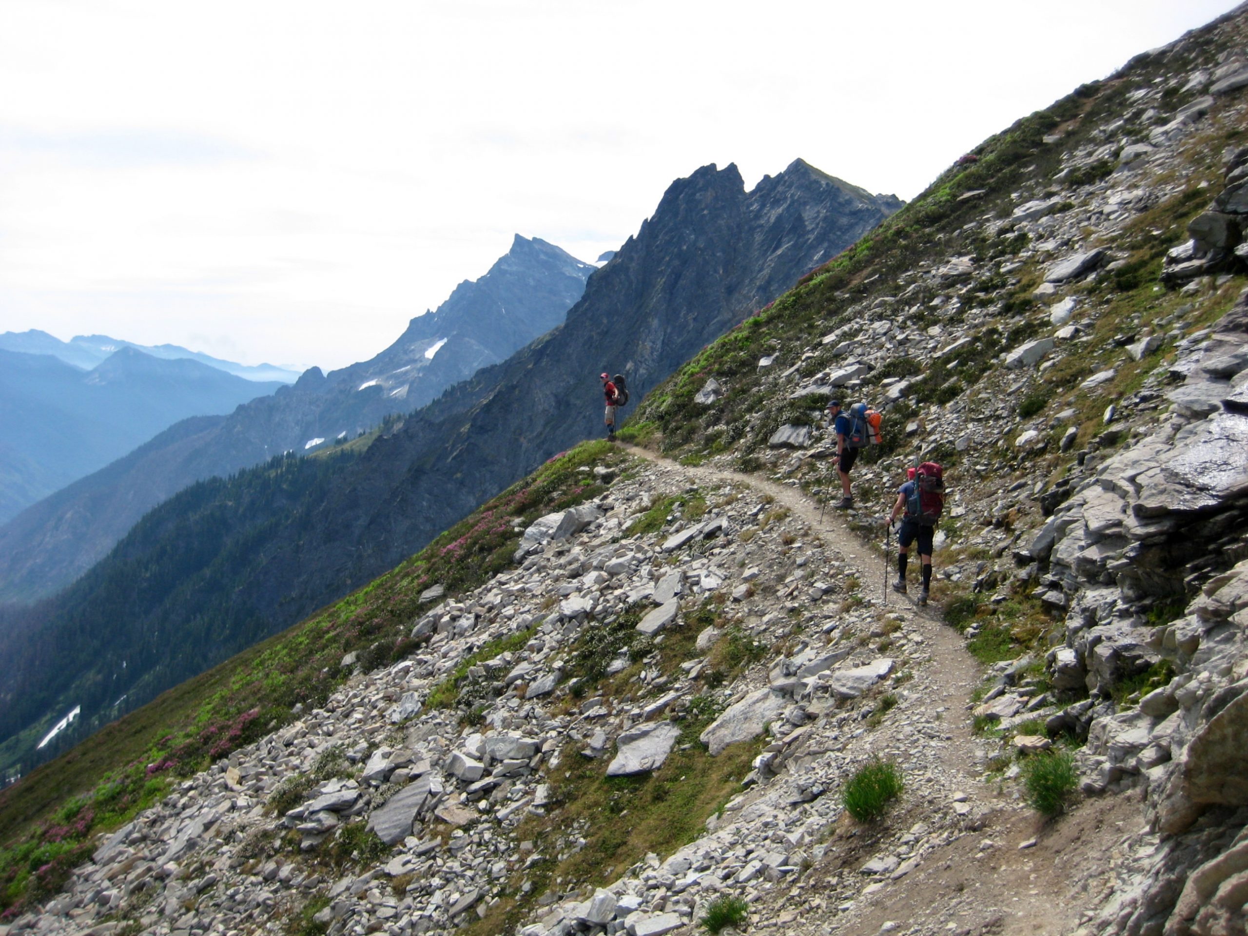
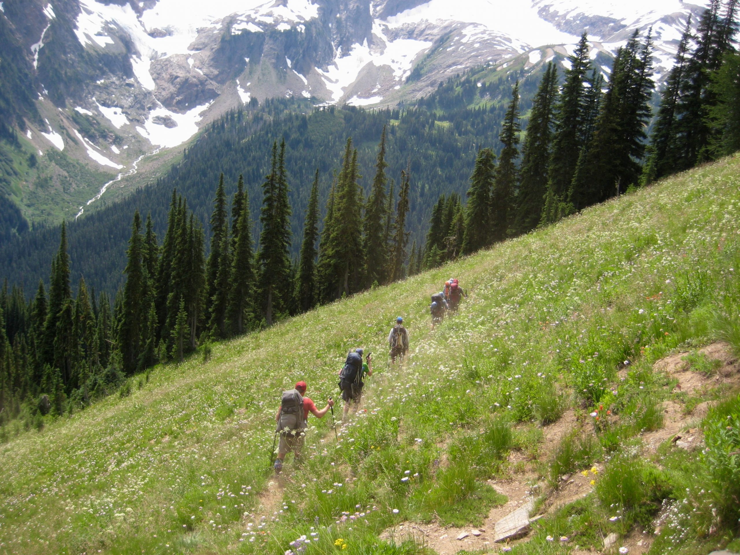
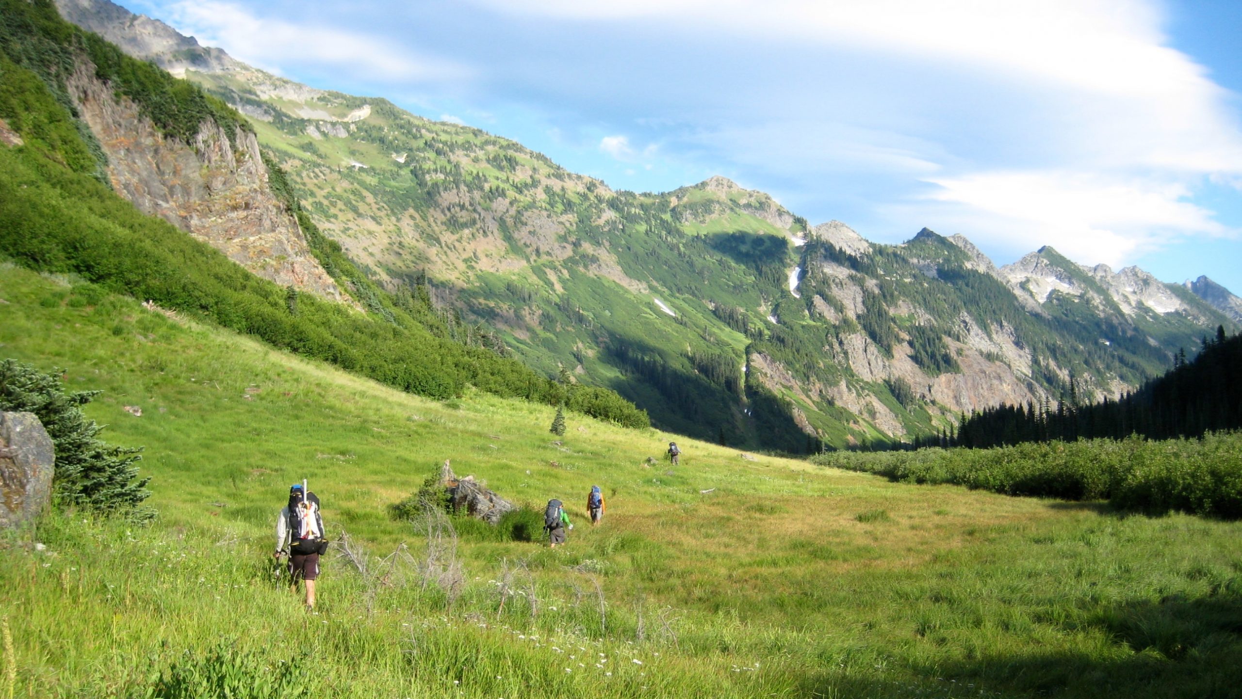
With packs shouldered, or “rucked” as the Germans say, we headed up the unmarked trail leading to High Pass. Frequent stops were required to take in the marvelous views and to greet friendly marmots.
Where the trail crosses over the western flank of Liberty Cap, everyone made a photographic sidetrip to the broad summit. If Julie Andrews lived in Washington, she would probably select this delightful little peak for her summer home.
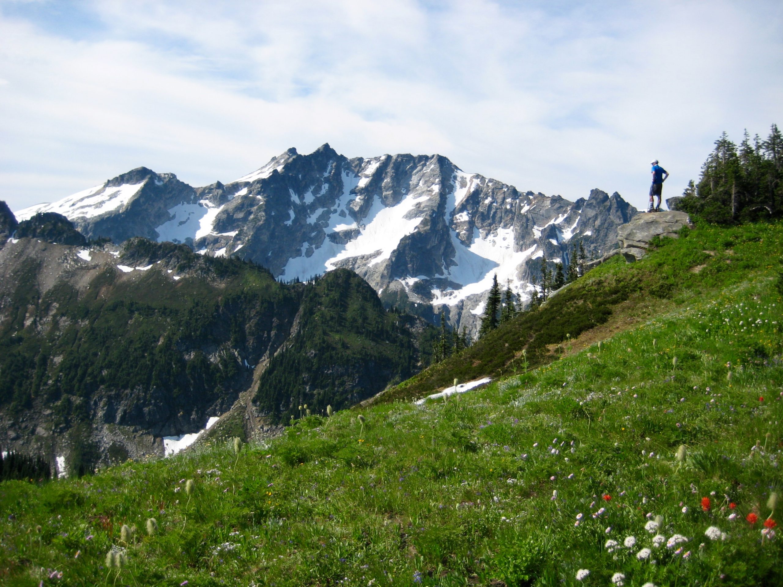
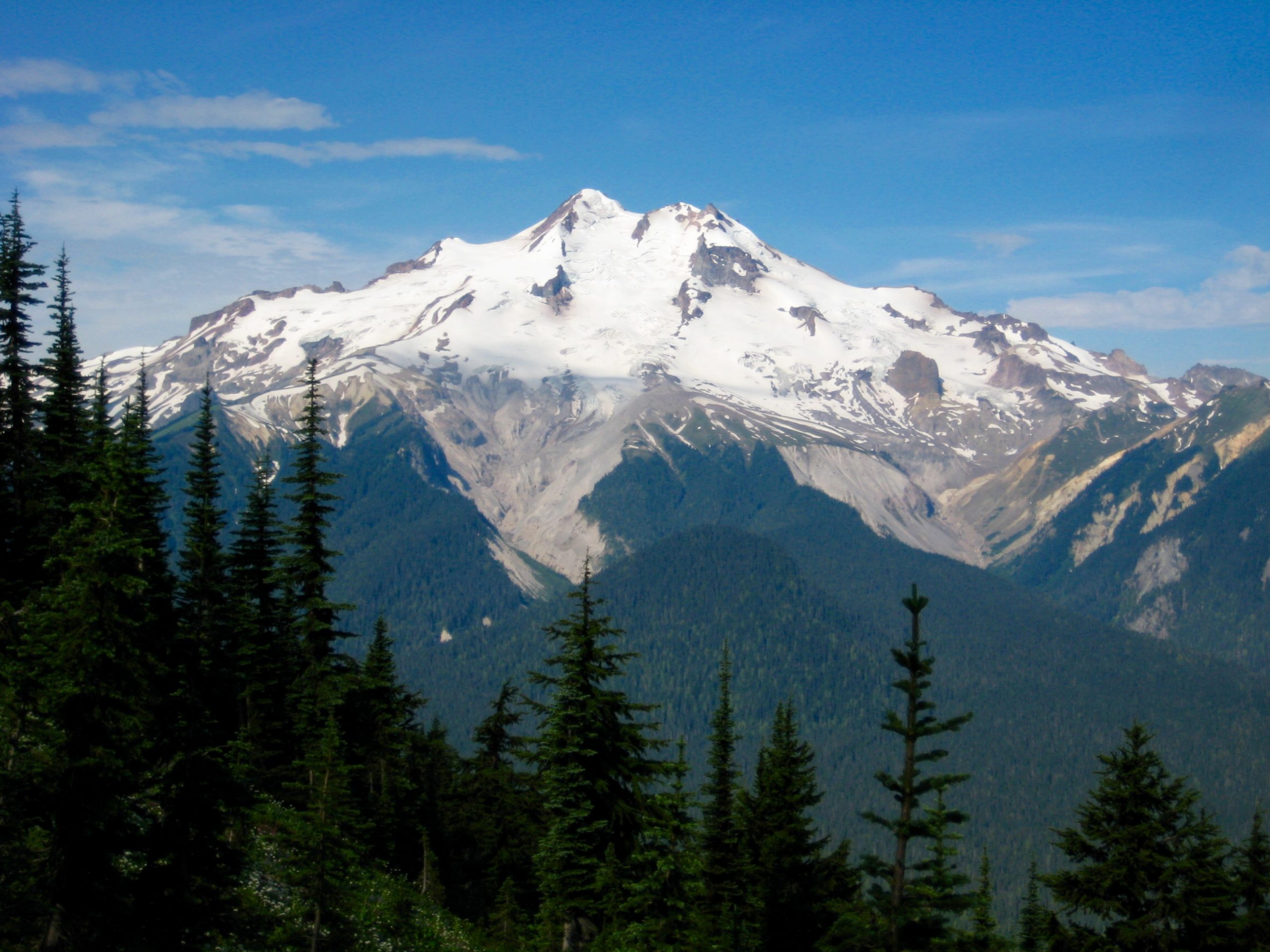
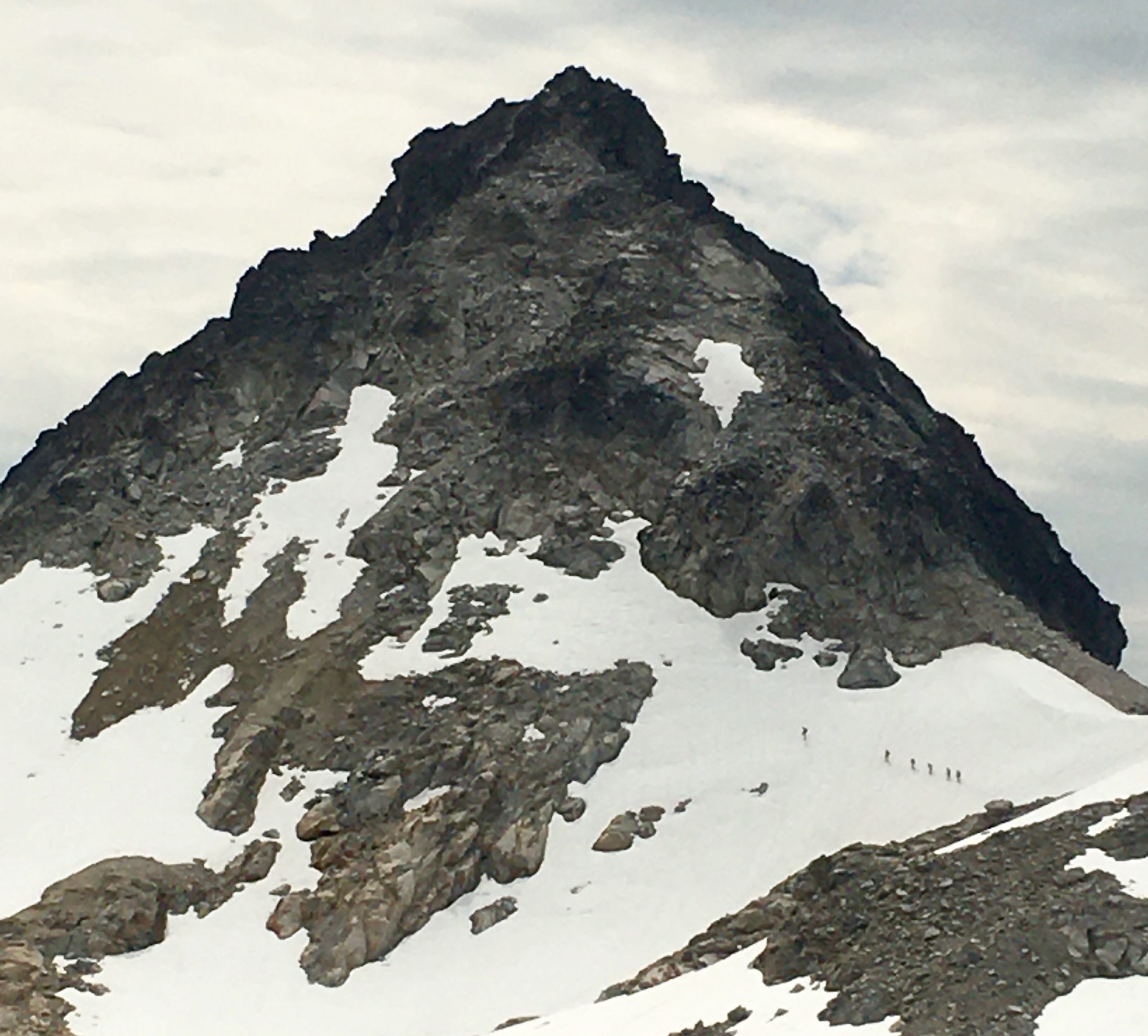
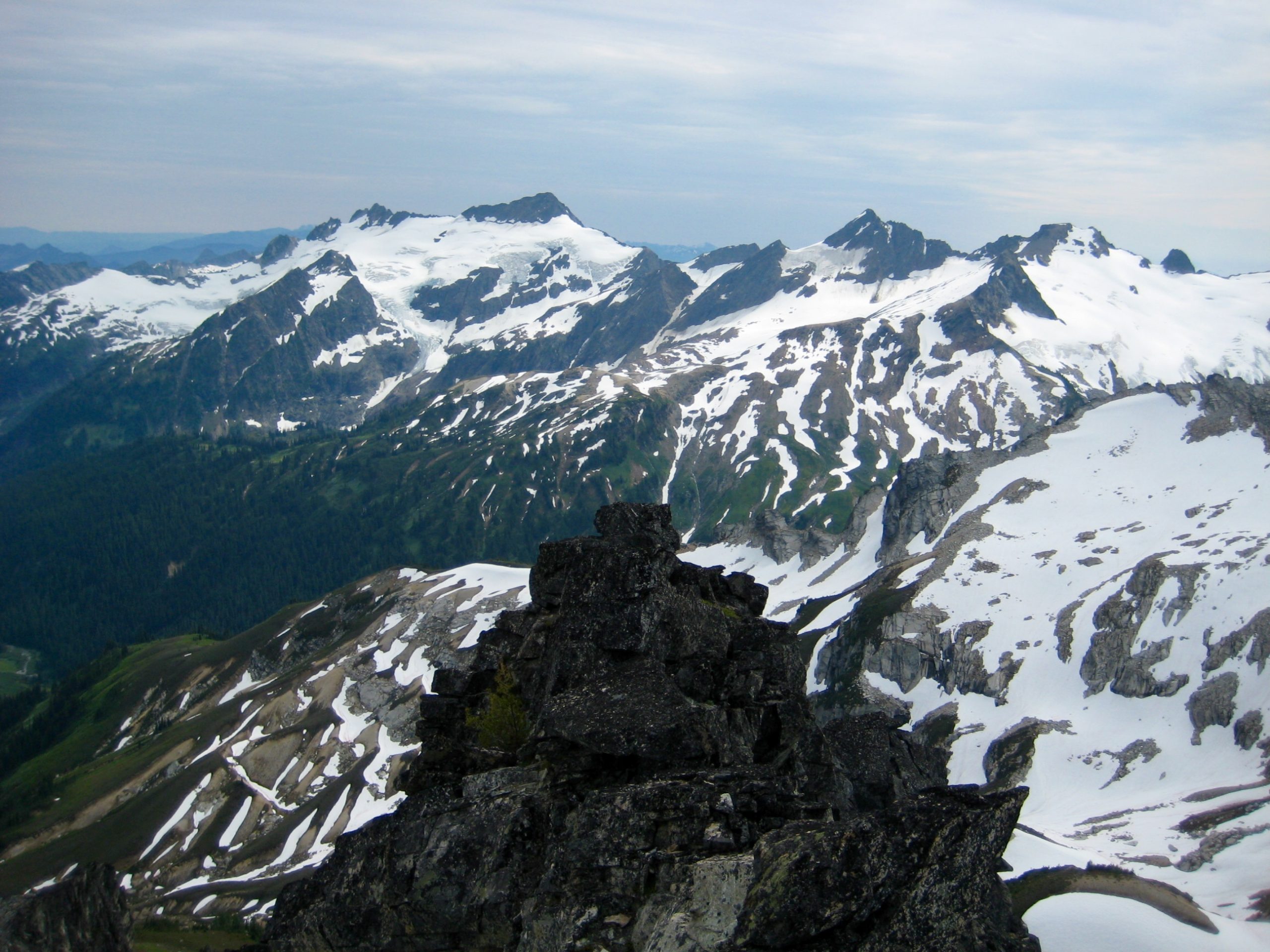
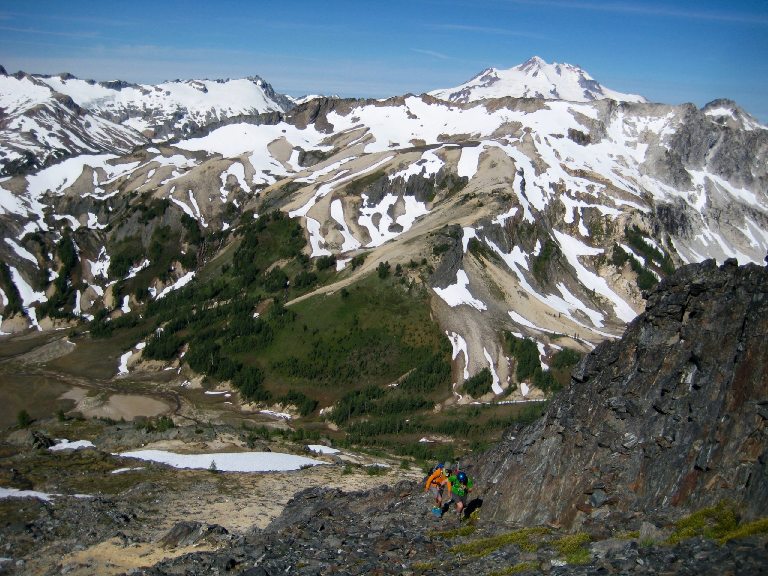
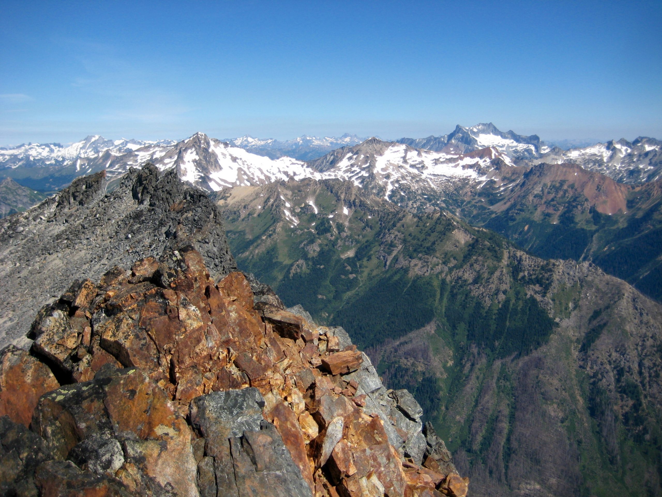
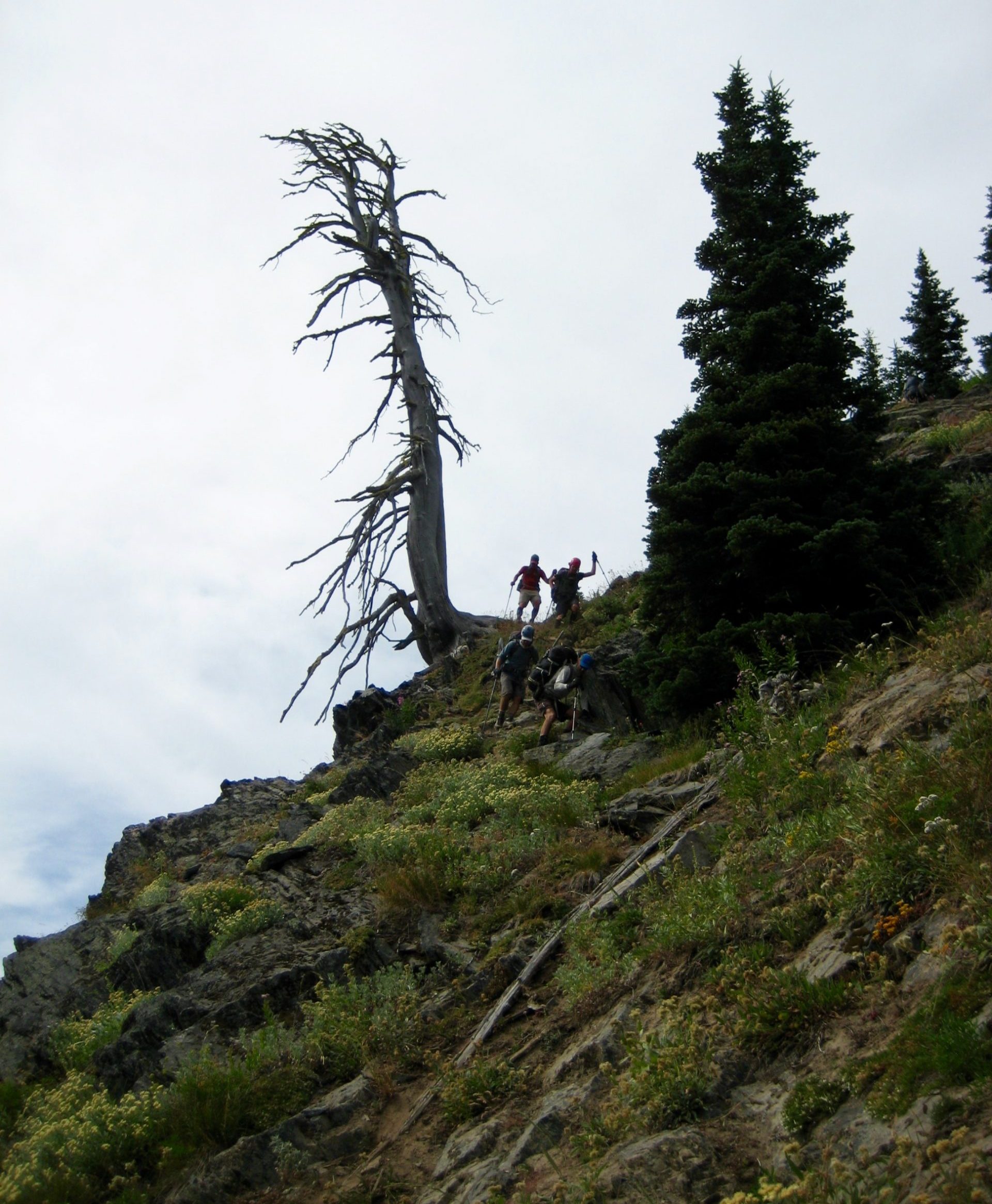
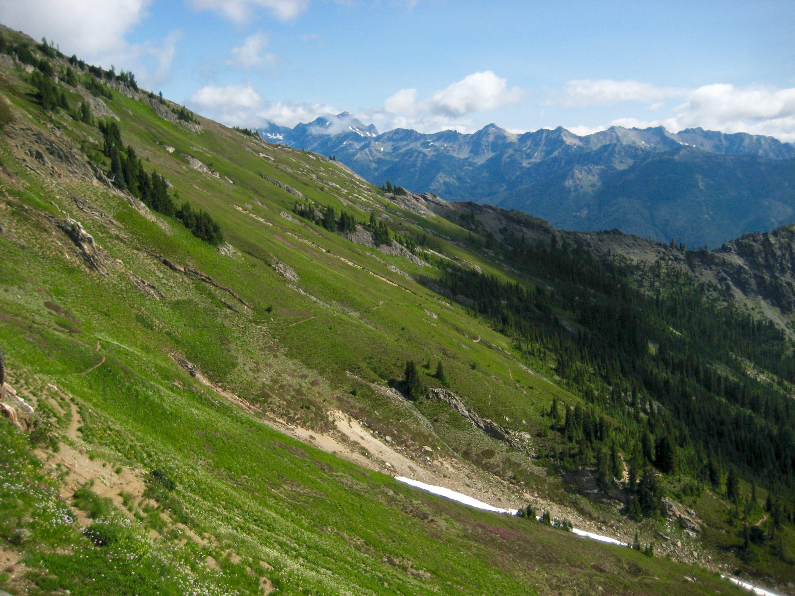
Proceeding southward on the High Pass Trail, we contoured around two hills and crossed several narrow but steep snow chutes. The impressive black schist horns of Buck Mountain, one of our two summit objectives for this trip, stayed in our sights.
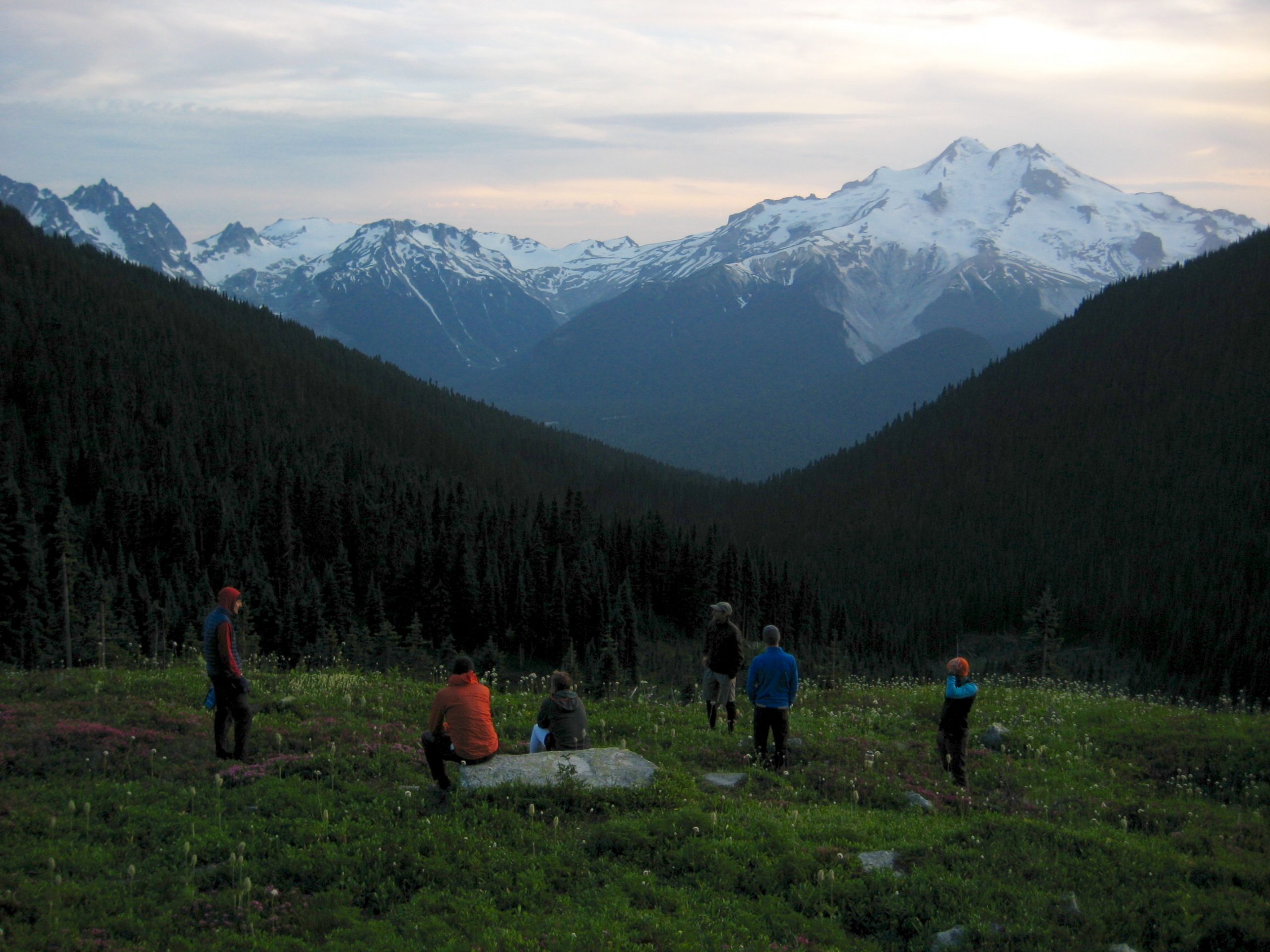
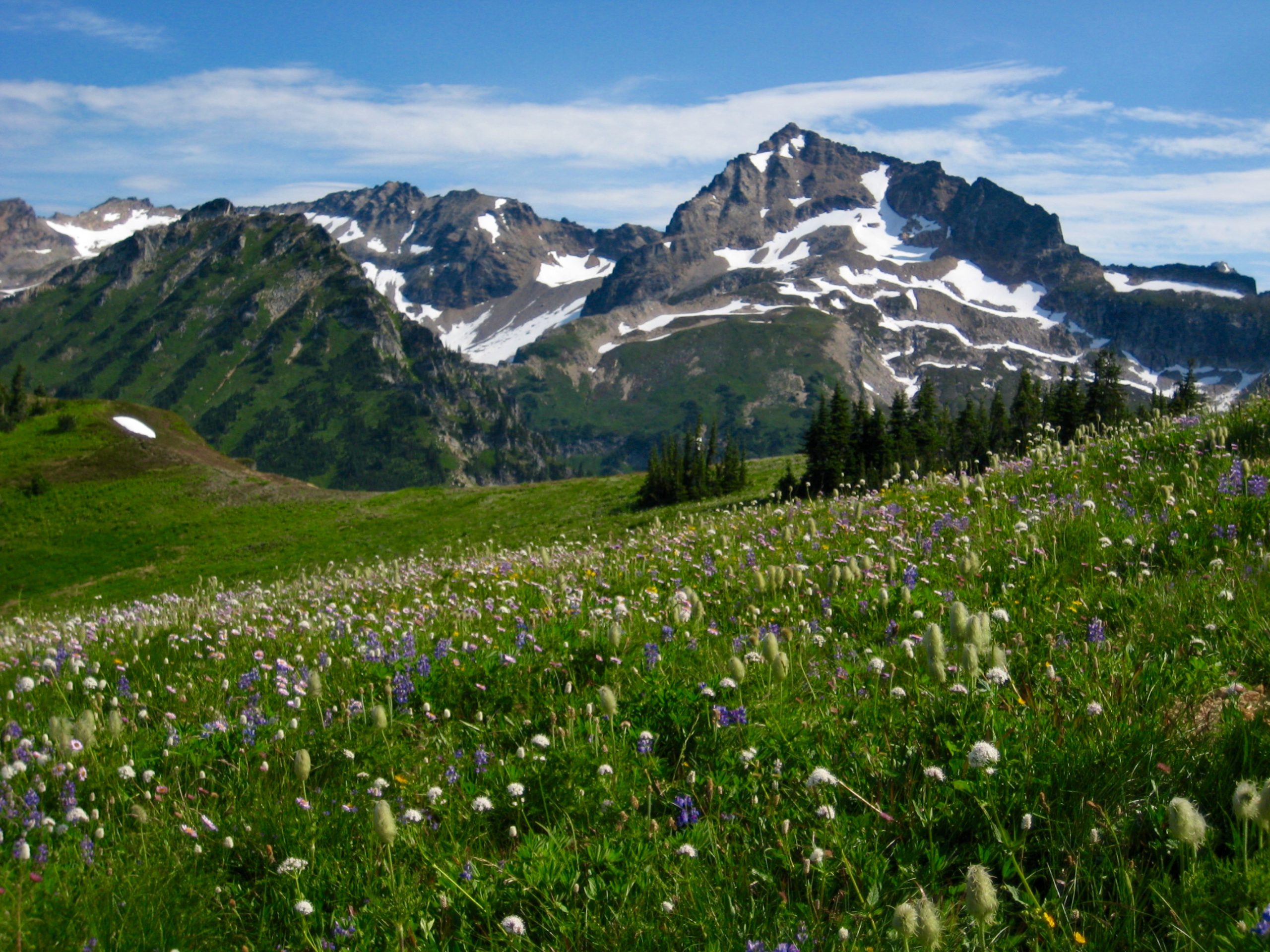
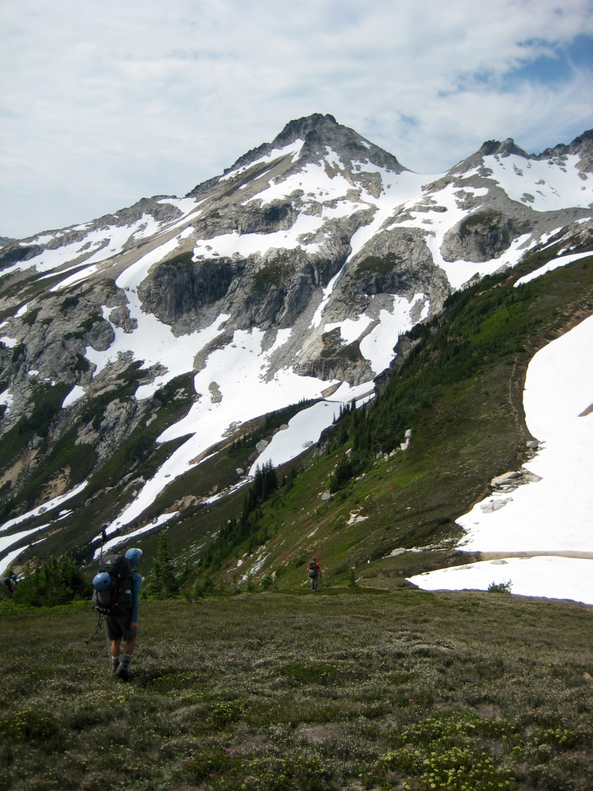
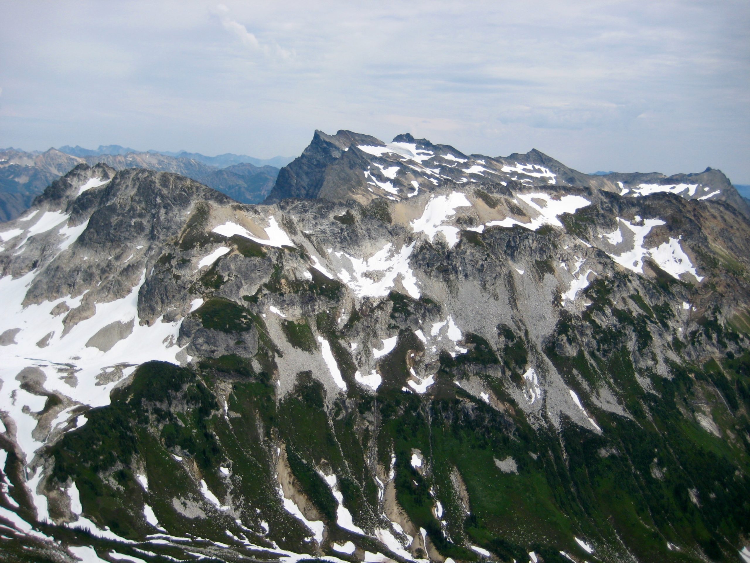
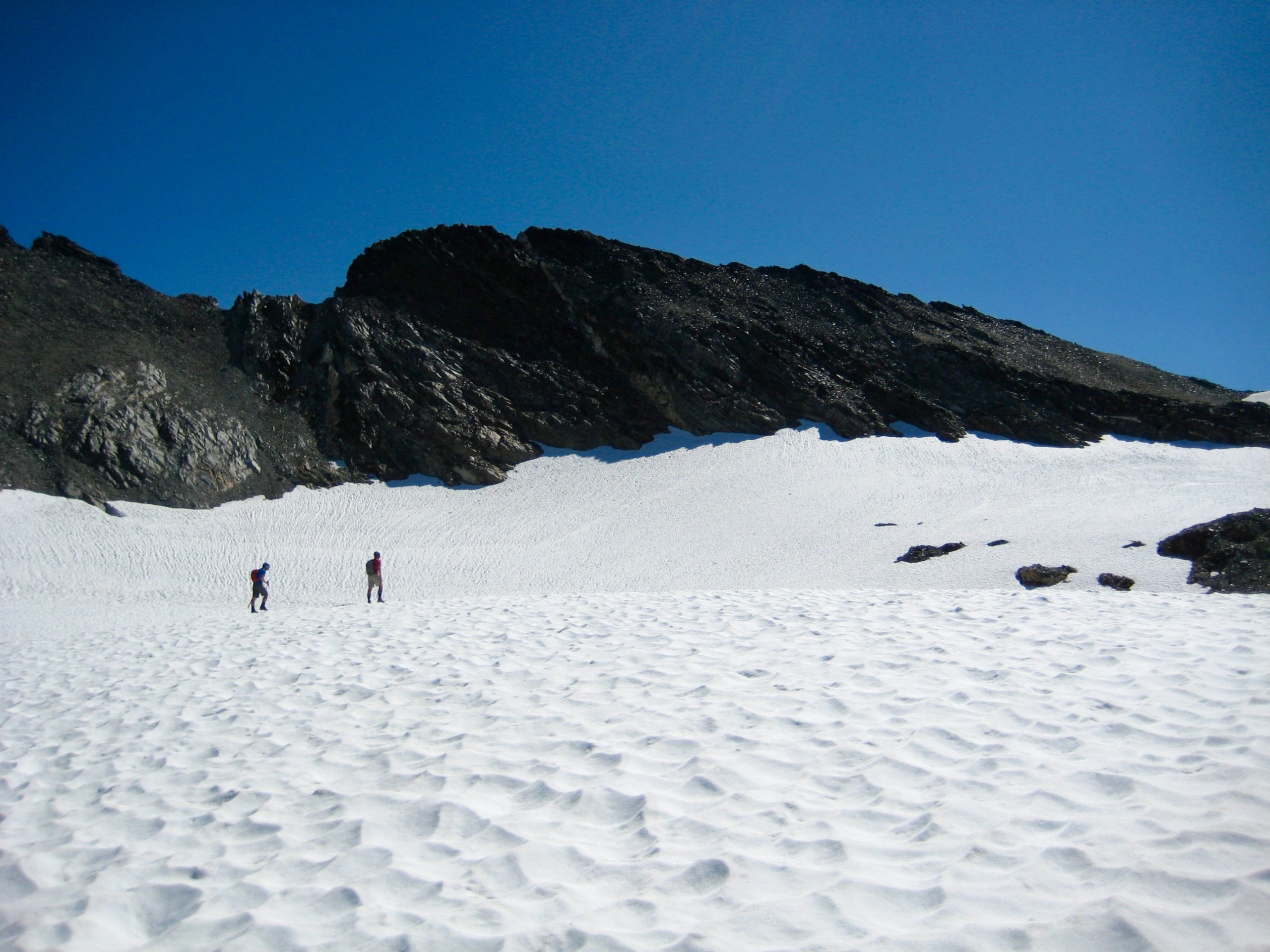
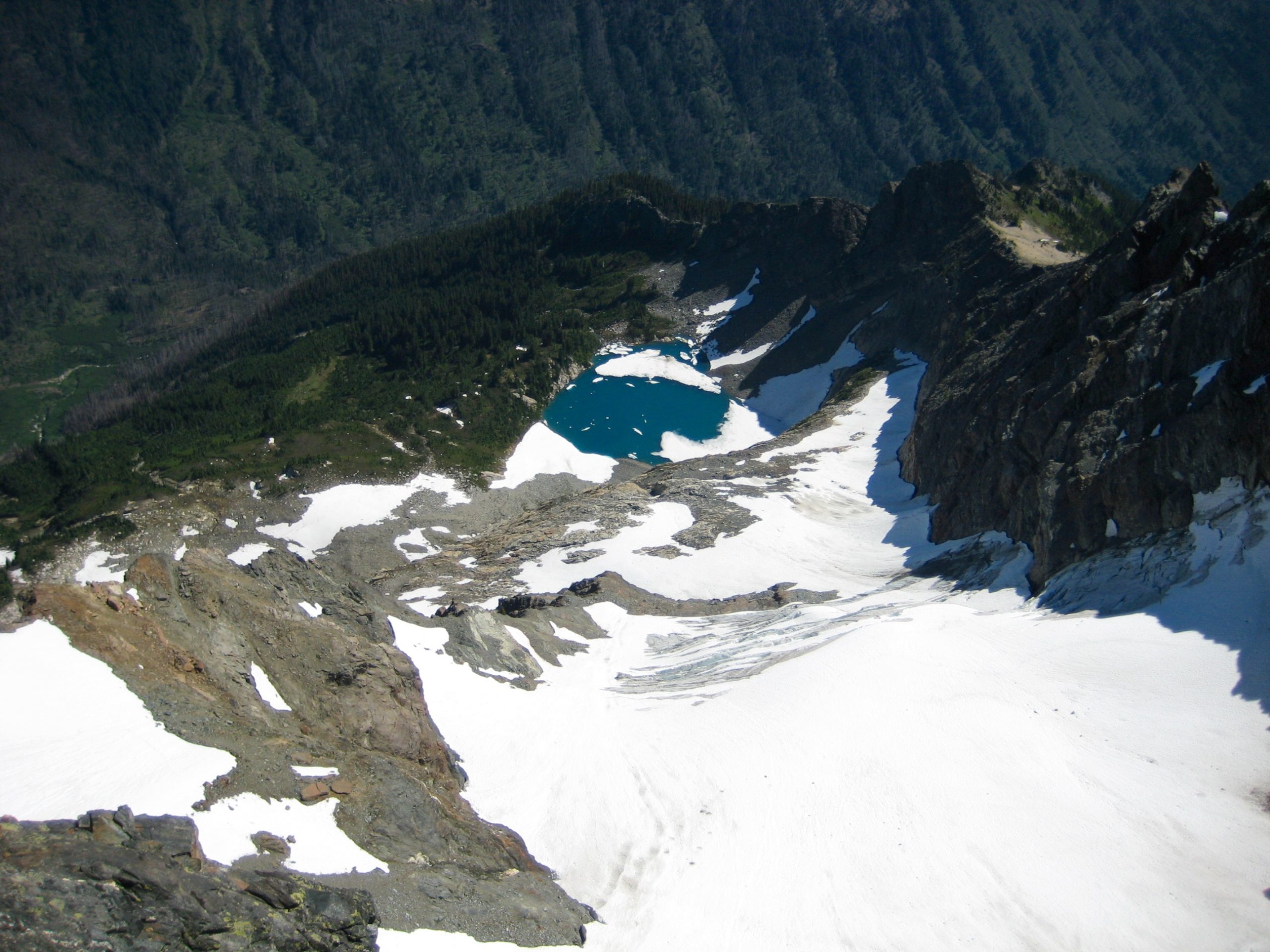
A broad snowfield led us to the undulating heather and pumice slopes of High Pass shortly after midday (3.4 hours + 1850 feet from Camp 1). The grey granite cliffs of Napeequa Mountain, our other summit objective, stood guard over partially frozen Triad Lake.
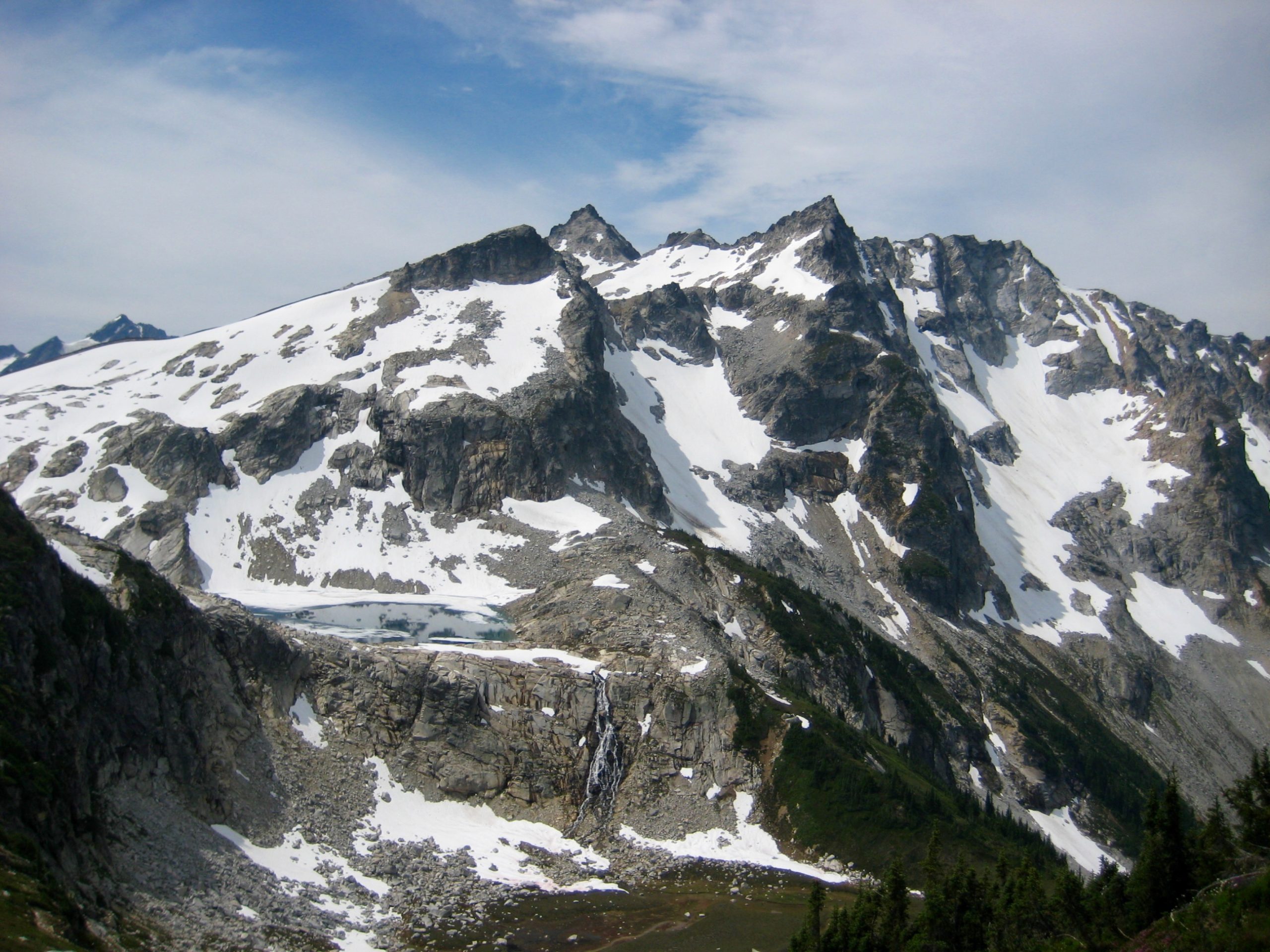
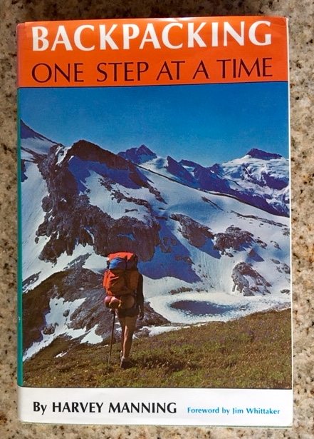
Back in the 1970’s, High Pass and Triad Lake earned a special stature among backpackers after being featured on the cover of a popular book. If something about the photo looks a bit strange, you are correct; the image was reversed for artistic reasons.
From High Pass, we dropped down to a 6950-foot saddle immediately south of Triad Lake and stashed gear in preparation for a Napeequa Mountain bid.
Our ascent began with an easy hike up a smooth ridge, followed by a rising traverse across moderate slopes of sand, moraine rubble, and firm snow. This took us over to the peak’s east face.
Loose, slabby, Class 2 rock on the lower face transitioned to fairly solid, blocky, exposed, Class 3 rock higher on the face.
We gained the seldom-visited summit in mid-afternoon (5.9 hours + 3150 feet from Camp 1). There was no register but lots of views.
We descended via the same route and reached our gear stash at 4:00pm (3.0 hours + 1100 feet summit RT). Good moods abounded until Noah suddenly realized that he had lost his wallet during the descent. It was a textbook case of walletwegkratzenlassen, which is the German term describing that his cargo pocket was torn on a sharp rock and his wallet fell out. After much waffling, he and Jon decided to hike back up the ridge in hopes of finding it.
Meanwhile, the rest of our group slowly headed toward Louis Creek Basin. This began with a southward traverse along the lower, western side of Berge Ridge. Jon and Noah rejoined us during the traverse, but the missing wallet did not.
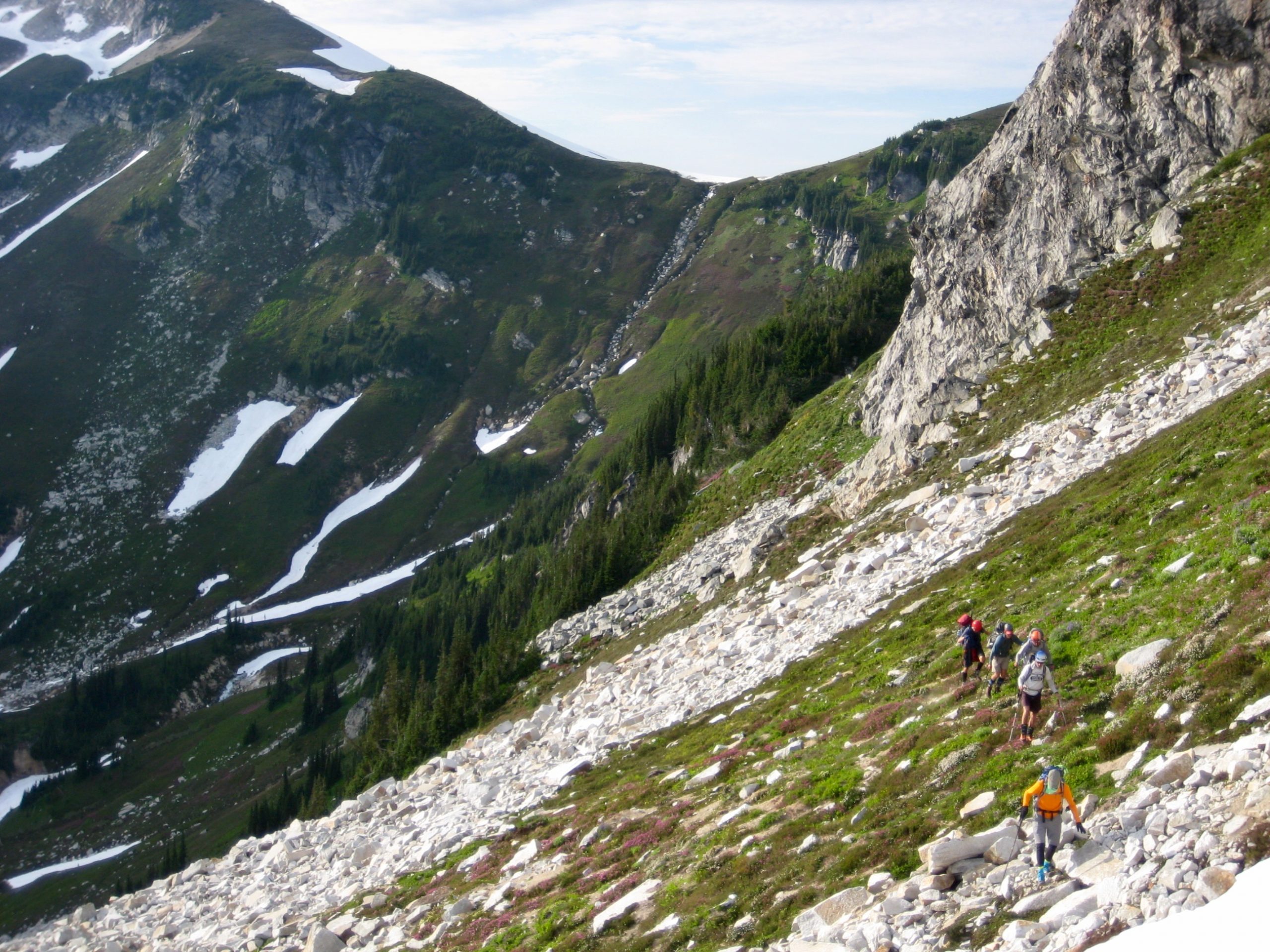
Although Eric and I had separately crossed over Berge Ridge by two different routes on previous trips, neither of us could find the desired crossover locations. We ended up at a tiny 7840-foot notch in the crest, approximately halfway between the two preferred locations. The descent from this notch was not very appealing, but with fading daylight, we had no choice.
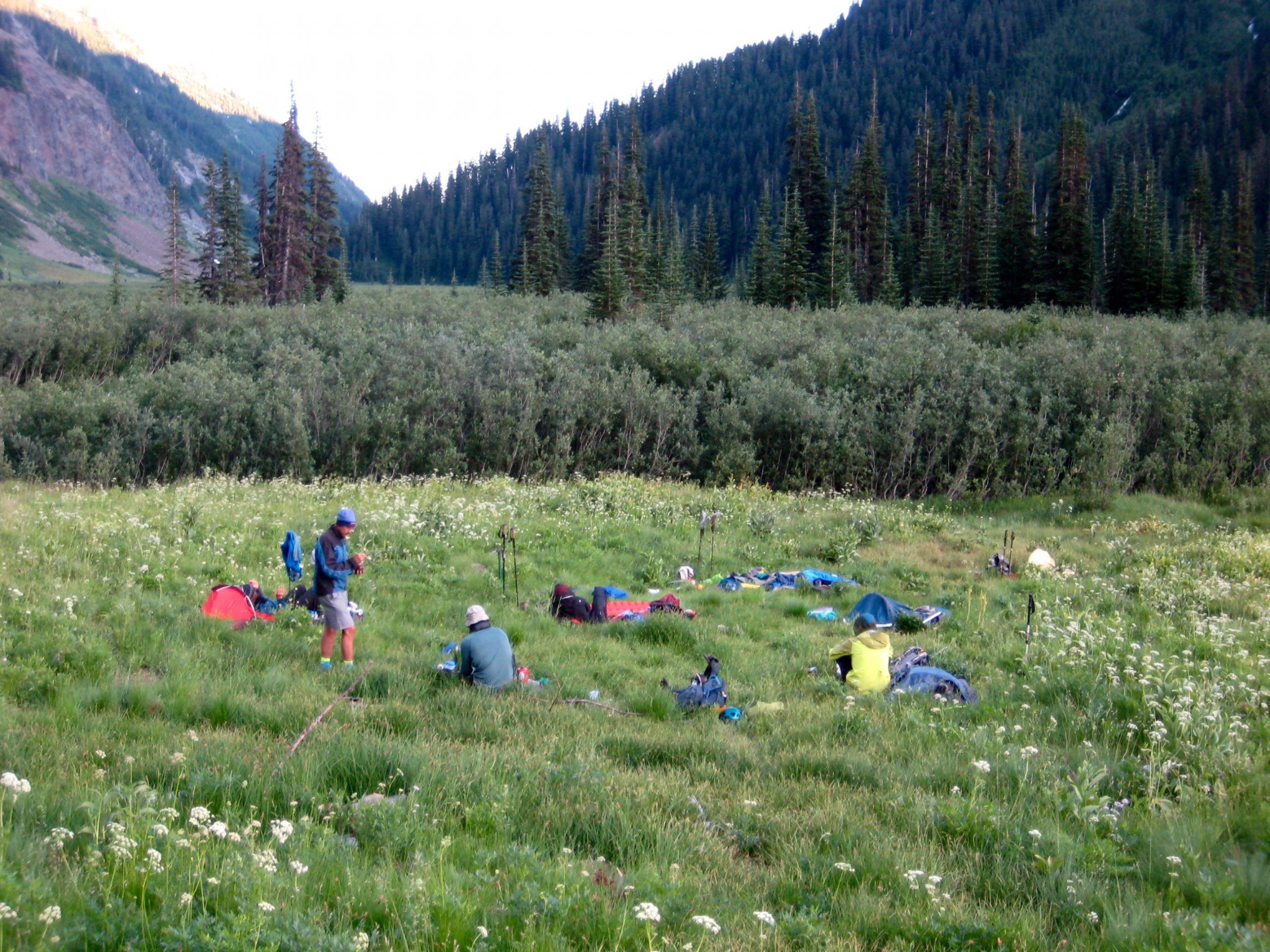
A steep snowfinger led down from the tiny notch to a widening snowfield, which gave way to rock and pumice slopes farther down. We stepped into Louis Creek Basin shortly after dark and made camp on a pumice rib at 6700 feet (12.2 hours + 4400 feet from Camp 1, including all sidetrips).
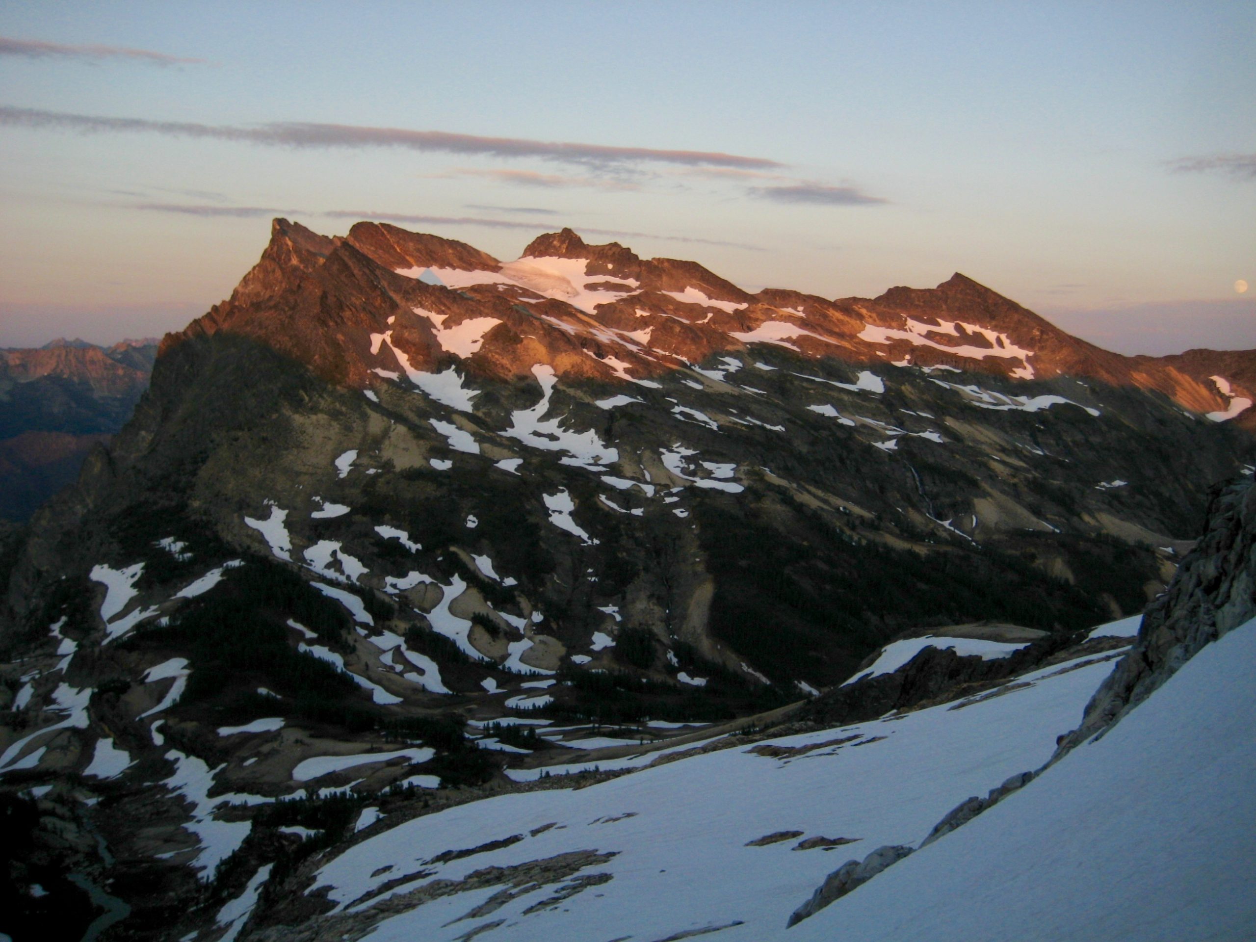
Day 3 (AM): Buck Mountain Summit Climb
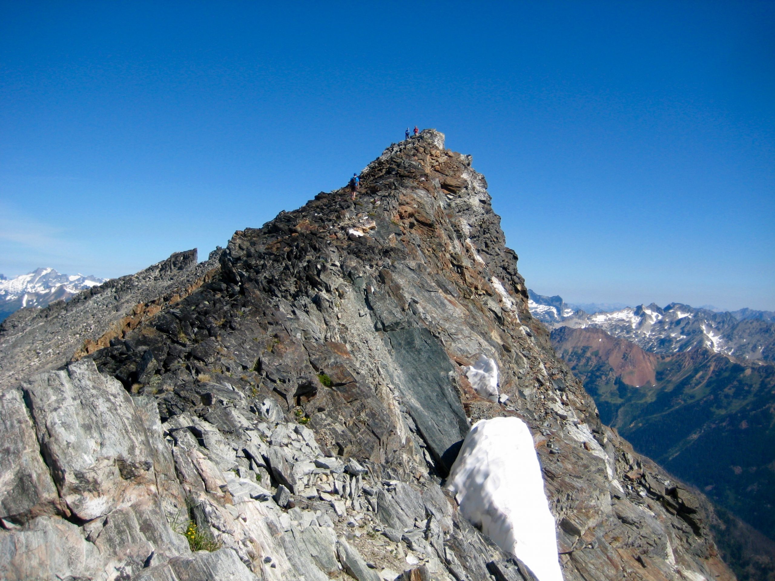
The morning gave us a clear sky for our climb of Buck Mountain. We hiked westward up pumice slopes and scrambled up a cliff band to reach an old morainal basin, then booted up a low-angle snowfield toward the summit ridge. Surprisingly, two other climbers appeared on this snowfield, having started from Buck Creek Pass at 5:00am.
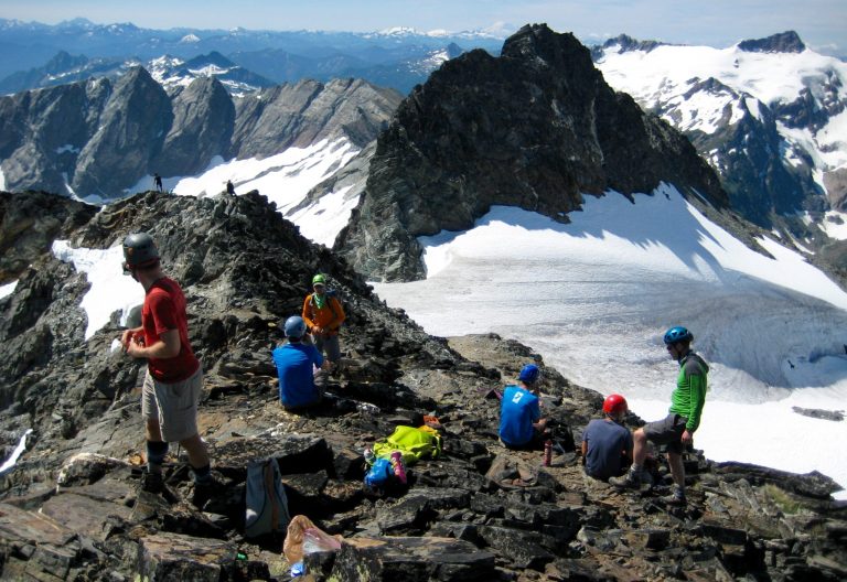
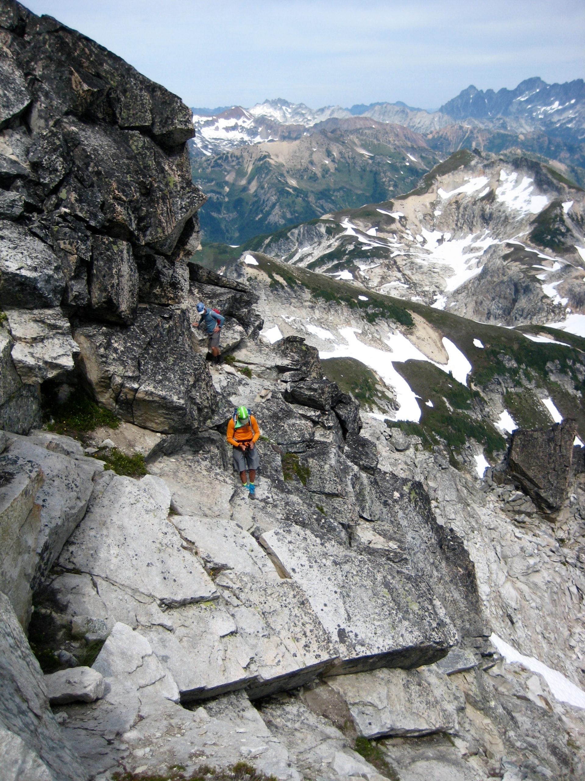
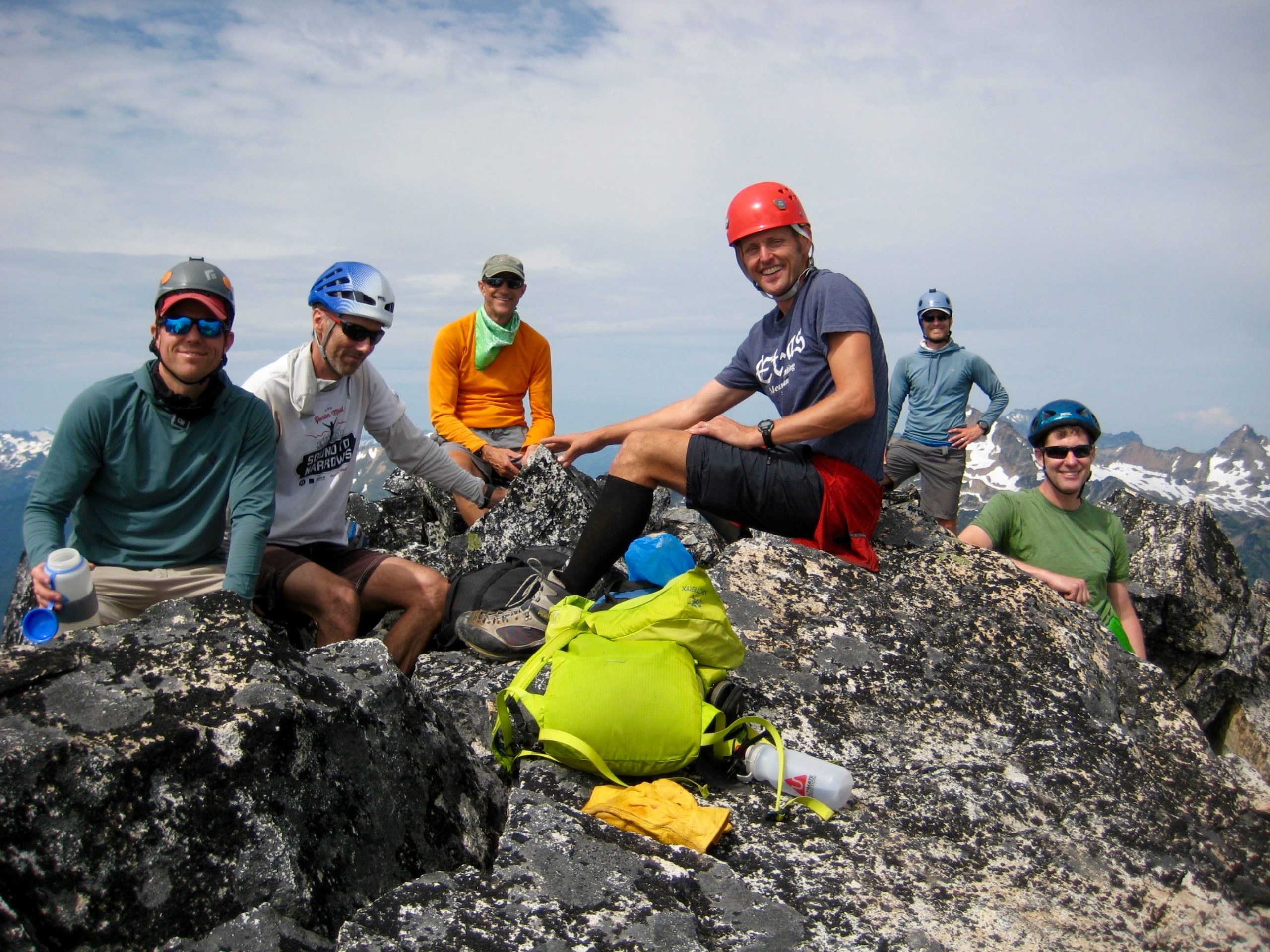
Class 2-3 scrambling up rubbly, slabby schist ended high on the summit ridge (2.0 hours + 1800 feet from Camp 2). Several of us took turns traversing over to the highest horn and back.
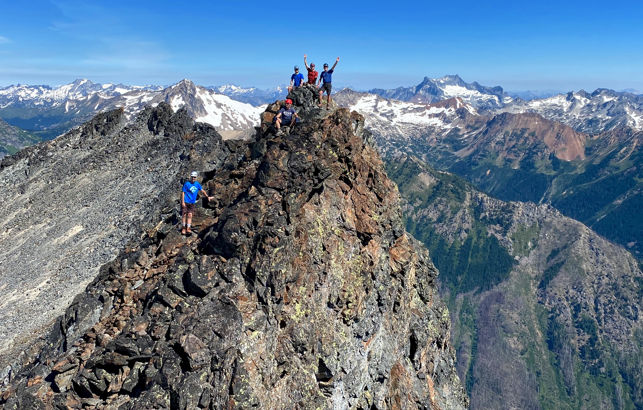
I was disappointed to discover that the summit register, which had been in place for many decades, is now gone. In the spirit of science, though, I had brought a hand-level to ascertain the highest point on the broad summit crest. Several points are within a few feet of each other. What is more clear-cut is the fact that the middle peak is considerably higher than the north peak, which was triangulated at 8528 feet. I believe that the old map triangulation of 8573 feet adequately represents the true summit elevation. Update: A subsequent field survey by Eric Gilbertson in 2021 measured a summit elevation of 8560 feet.
We hurried back down our ascent route and were back in camp by lunchtime (4.0 hours summit RT).
Day 3 (PM): Louis Creek Basin to Napeequa Valley
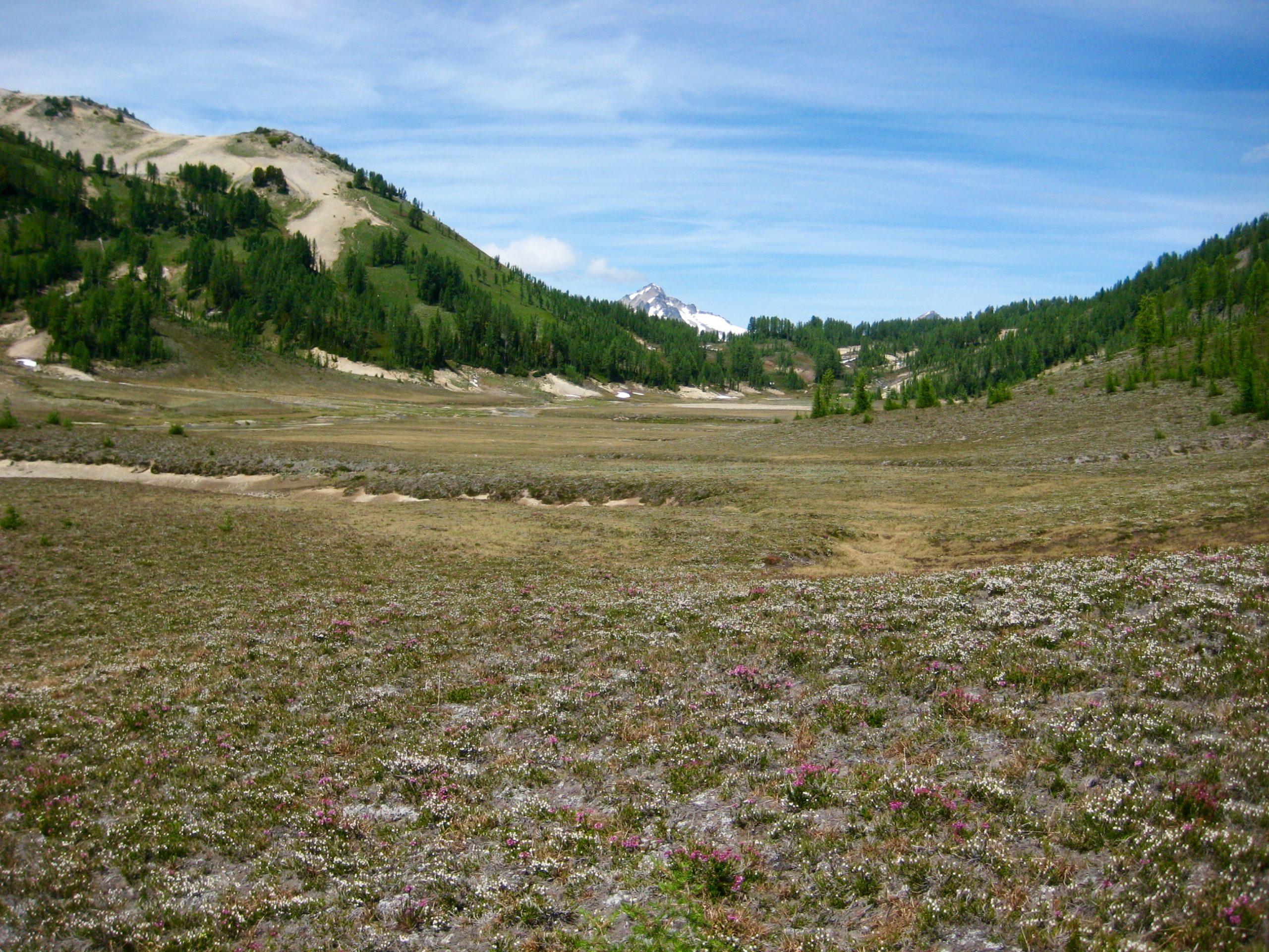
By early afternoon, we were all packed up and heading south through Louis Creek Basin. There was much geological speculation regarding the formation of this remarkably wide and flat basin. One theory is that a shallow lake once existed here, thereby resulting in relatively level lacustrine sedimentation. Todd and I agreed that a thorough program of exploratory borings is needed to assess this theory.
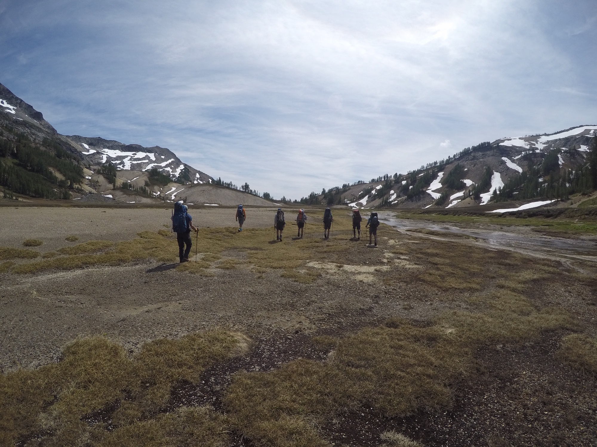
At the basin’s mouth, we crossed over to the western side of Louis Creek and began descending a well-defined game path for 600 feet. When this path faded atop a cliffy area, we scrambled down steep, rubbly dirt for another 600 feet.
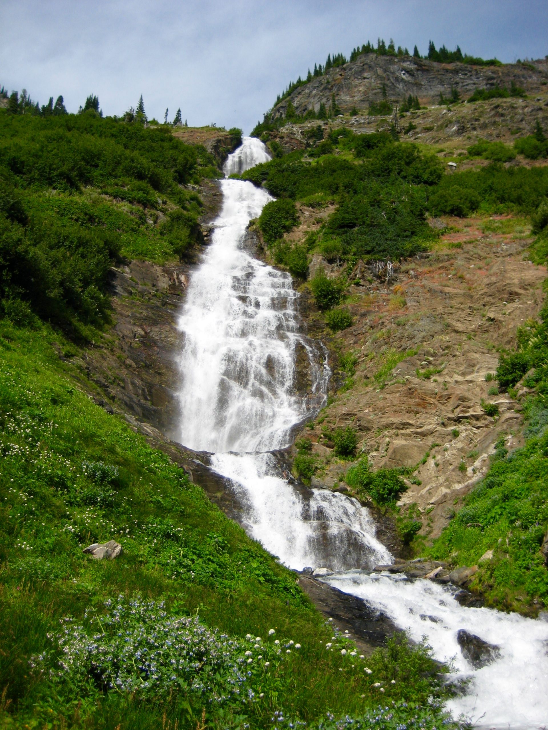
The final 700 feet of our descent involved slipping and stumbling down a benign-looking hillslope of wildflowers and ferns. It was equal parts frustrating, painful, and comical! One by one, we reached the Napeequa River Trail and rendezvoused below spectacular Louis Creek Falls in late afternoon (3.1 hours from Camp 2).
We crossed Louis Creek by various techniques (log-walking, rock-hopping, wading), then strolled down-valley on well-defined trail. Aside from aggressive blackflies, voracious mosquitos, and epic quagmires, this was a pleasant way to end our day.
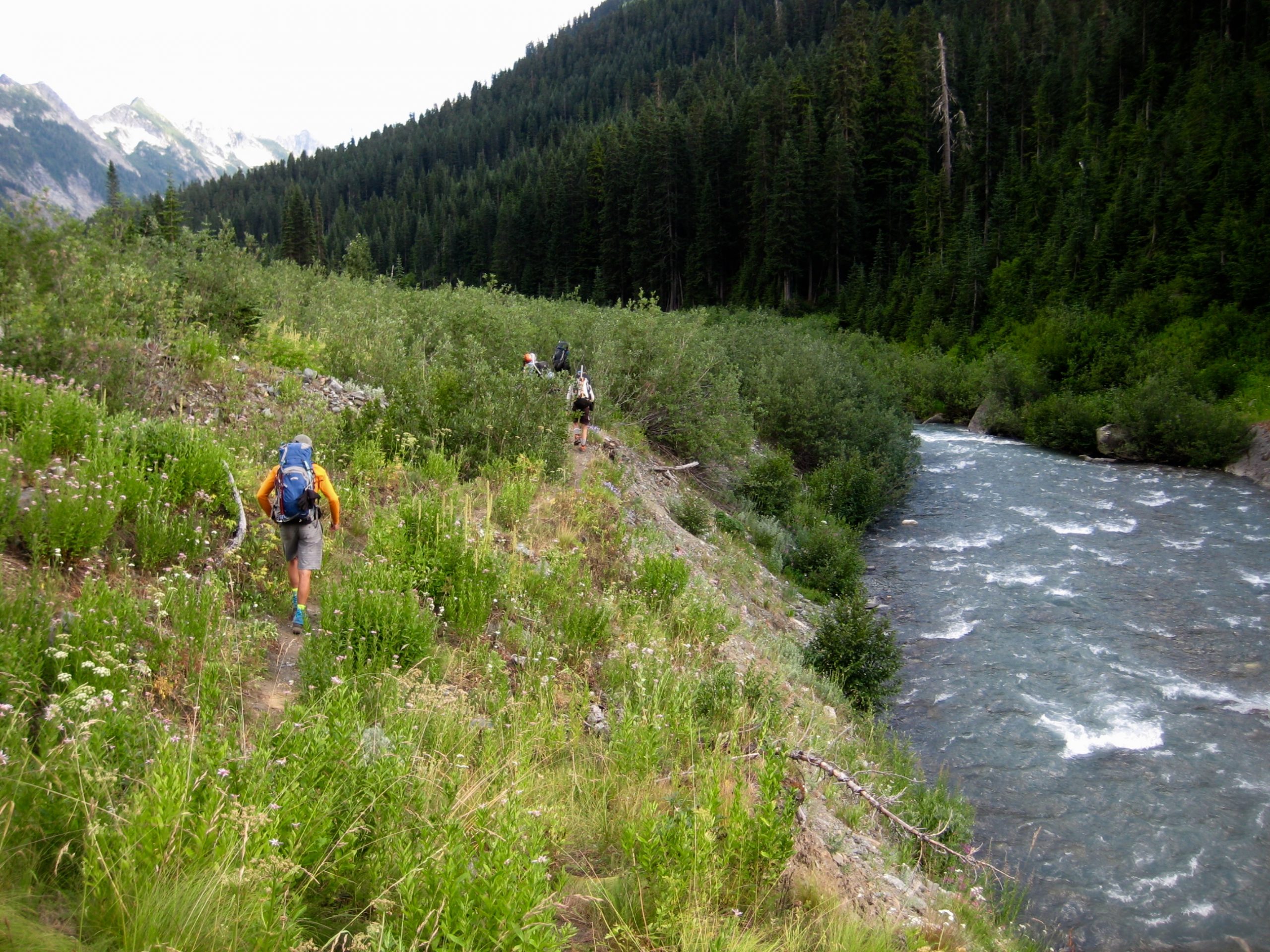
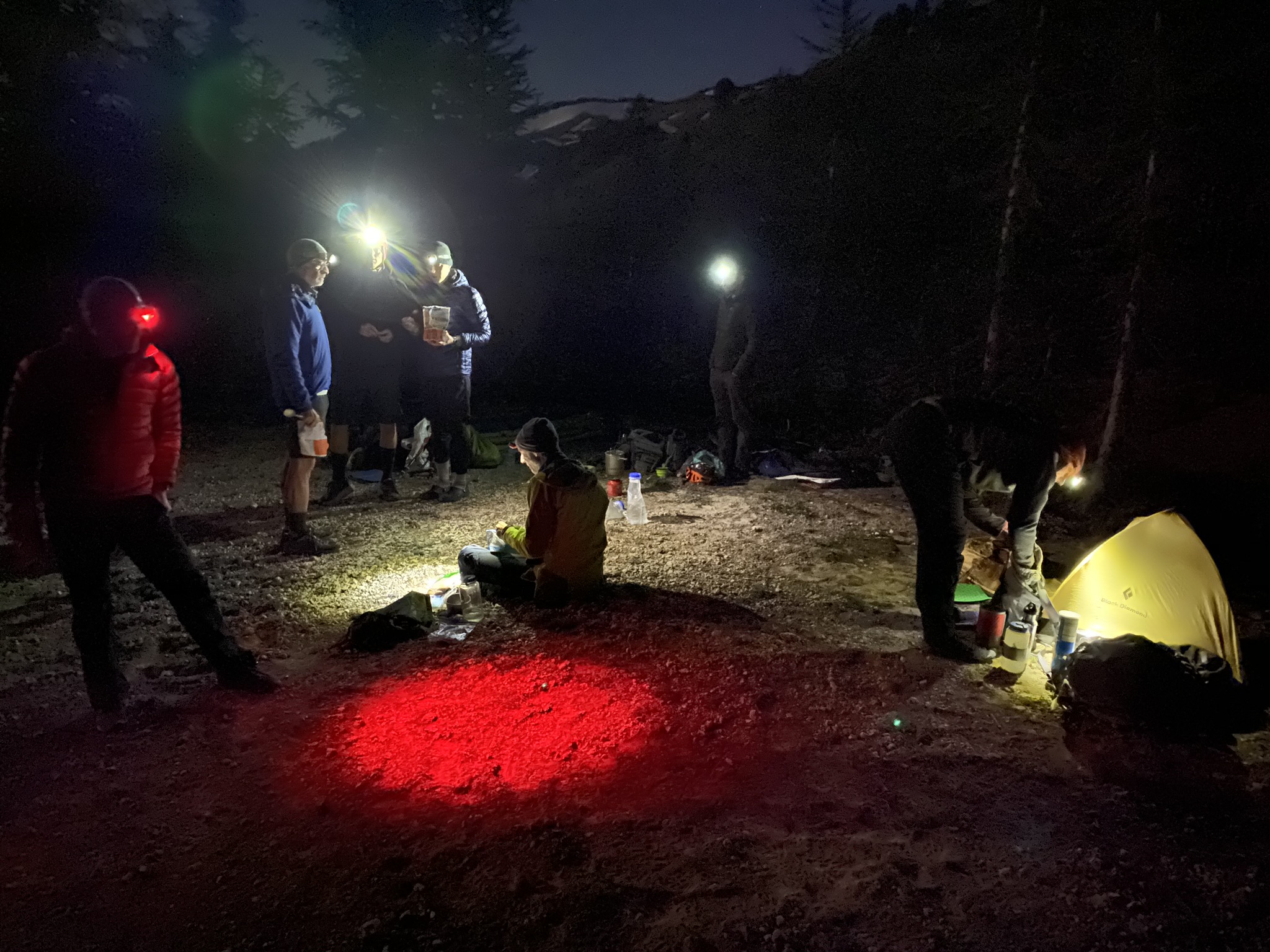
After 3 miles of hiking, we stopped for the night in a grassy meadow at 4250 feet (5.1 hours + 250 feet from Camp 2). Dinner conversation continually returned to the subject of our individual experiences during the wildflower hillslope descent—and what equipment might make such a descent more agreeable.
Day 4: Napeequa Valley to Little Giant Trailhead
Our last day began with a brisk hike up the eastern sidewall of Napeequa Valley, following the Little Giant Trail. This lightly used trail is badly eroded, heavily overgrown, and ridiculously steep in places. It’s sad to think this key access route to Washington’s “Shangri-La” could eventually disappear due to lack of use—but I suppose that would only increase the valley’s mysterious appeal.
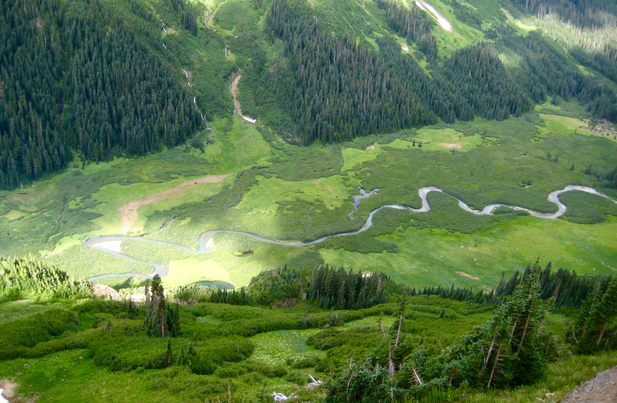
We gained Little Giant Pass in mid-morning (1.5 hours + 2100 feet from Camp 3) and took a long break overlooking the Chiwawa River Valley. Our descent trail was clearly visible cutting through the vast green hillslopes below.
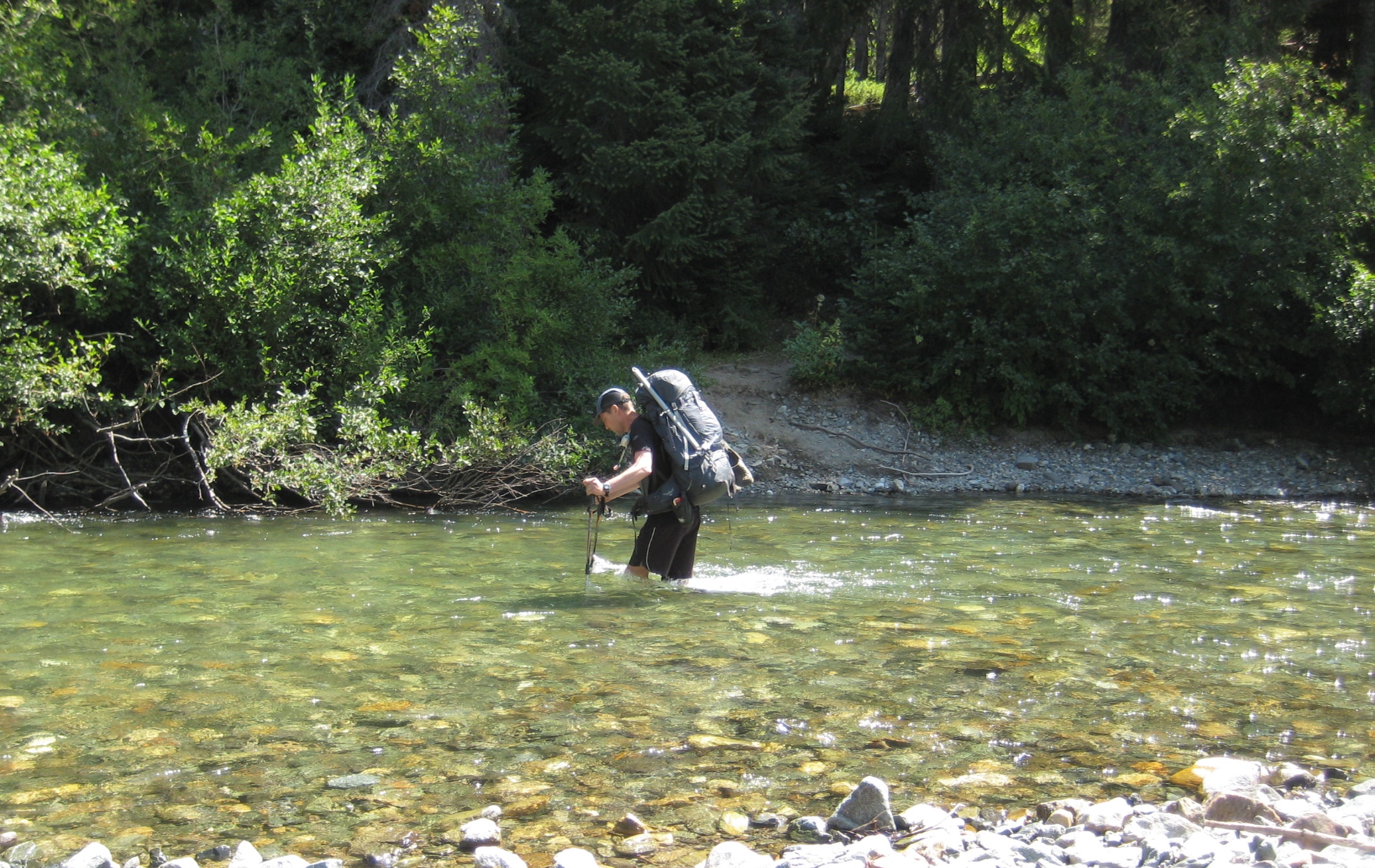
A 3800-foot plunge ended at the Chiwawa River shoreline in early afternoon (4.4 hours + 2250 feet from Camp 3). Thanks to the return of hot weather, the thigh-deep river ford provided a refreshingly welcome finish to a most excellent traverse and another successful Mid-Summer Outing!
Route Maps & Profiles
…
…
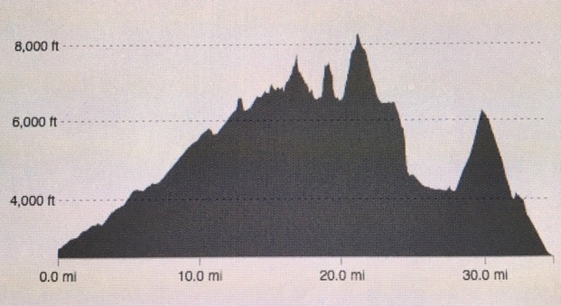
Photo Gallery
Click to enlarge…
Day 1 & 2: Chiwawa River TH to Louis Creek Basin + Napeequa Mtn Climb


Day 3 & 4: Louis Creek Basin to Little Giant TH + Buck Mtn Climb


