Trip Date: July 2-6, 2005
Downey Creek Climbing Loop: Bench Lake to South Cascade Lake to Cub Lake
Bench Lake & Woods Lake
Mount Bruseth (7220 ft)
Hoch Joch Spitz (7360+ ft)
Sentinel Peak (8261 ft)
Lizard Pass
White Rock Lakes
Spire Point (8264 ft)
Dana-Dome Saddle
Dome Peak (8920+ ft)
Itswoot Pass
Cub Lake
Bachelor Meadow
Trip Report Summary
Region: North-Central Washington Cascades
Sub-Regions: Suiattle Mountains & Ptarmigan Mountains
Area: Glacier Peak Wilderness
Starting & Ending Point: Downey Creek Vehicle Bridge (Suiattle River Road)
Way Points: Downey Creek & Bachelor Creek & Goat Creek & Downey-Goat Ridge & Bench Lake & Bench–Woods Saddle & Woods Lake & Slim Pass & Hoch Joch Ridge & Hoch Joch Tarn & Hoch Joch Glacier & South Cascade Glacier & Lizard Pass & White Rock Lakes & Dana Glacier & Dana-Dome Saddle & Dome Glacier & Itswoot Pass & Cub Lake & Cub Pass & Bachelor Creek Meadow & Bachelor Flats & Bachelor Creek & Downey Creek (trail hike & off-trail hike & bushwhack & rock scramble & snow climb)
Campsites: Bench Lake & Hoch Joch Tarn & White Rock Lakes & Cub Lake
Summit: Mt. Bruseth (rock scramble via Southeast Ridge—South Face)
Summit: Hoch Joch Spitz (rock scramble via Northeast Ridge)
Summit: Sentinel Peak (rock scramble via West Face)
Summit: Spire Point (rock scramble & rock climb via Dana Glacier—East Face)
Summit: Dome Peak (snow climb & rock climb via Upper Dome Glacier—Northwest Ridge)
Approximate Stats: 45 miles traveled; 15,000 feet gained & lost.
Related Posts
>>> Ptarmigan Traverse + Spire Point attempt + Dome Peak – August 2021
>>> Ptarmigan Traverse + Hurry-Up Peak + LeConte Mtn + Old Guard Peak + Dome Peak – August 2012
>>> Ptarmigan Traverse + Magic Mountain – September 1981
Full Trip Report
Over Independence Day weekend, Kevin and I joined Chris R, Kathy R, and Stan on a wide clockwise loop around the Downey Creek drainage. We followed a seldom-traveled high route from Bench Lake to the South Cascade Glacier, then turned southward and followed the classic Ptarmigan Traverse route to the Dana Glacier.
Chris, Kathy, and Stan planned to continue northeastward out to Stehekin, whereas Kevin and I planned to exit via Cub Lake and Bachelor Creek. Poor weather conspired against the long-trippers, and several accidents occurred along the way, but we all managed to have a very satisfying and successful adventure nonetheless.
Day 1: Downey Creek Bridge to Bench Lake
On an overcast Saturday morning, our group of five climbers (plus Linda, our designated driver) parked alongside the Suiattle River Road adjacent to the washed-out Downey Creek Bridge. We all climbed over the bridge on a makeshift ladder, then headed up the Downey Creek Trail. Although it wasn’t raining, the wet brush that overhangs the second half of this trail gave us a good shower. Immediately after crossing Bachelor Creek, we crossed Downey creek on a big log with a tricky step-across at the far end. Kevin took a tumble here, when a root gave way beneath his foot. Linda bade us farewell at this log and started hiking back to the cars.
The rest of us proceeded upstream for a short distance to Goat Creek, which proved to be problematic obstacle. There were no apparent opportunities to boulder-hop, and the only possible log to cross was unappealingly skinny (about 15 inches in diameter) and high (about 6 feet above the creek level). When crossing on logs, I think every individual has a “personal minimum” for the diameter-to-height ratio, and this log’s ratio did not lie within my acceptable range.
Chris, however, managed to walk entirely across the log, albeit in a precarious fashion. Kathy went next, using a combination of shinnying and crawling techniques. Kevin then tried walking across, but near the log’s midpoint, he lost his balance and toppled headfirst into the rushing creek! We all watched in shock, afraid that he had sustained a skull fracture or broken arm. Remarkably, he emerged from the creek uninjured, but he was soaking wet and mad as a hornet! The only damage done was a lost trekking pole.
After Kevin’s mishap on the log, he and I decided to simply ford the creek at a nearby wide spot, whereas Stan executed a humorous (to us) and painful (to him) prone slithering method to cross the log. Once we’d all gotten to the other side of Goat Creek, we quickly located the fisherman’s path ascending to Bench Lake. This path is relentlessly steep but surprisingly well-defined (except for a short segment of chaotic blow-downs near the bottom).
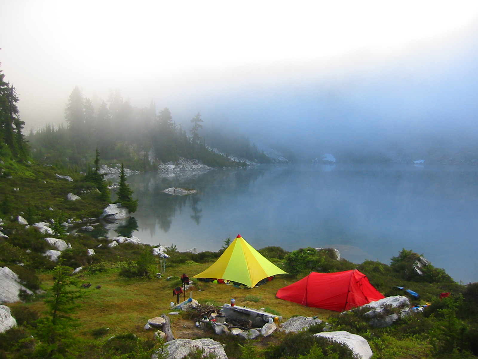
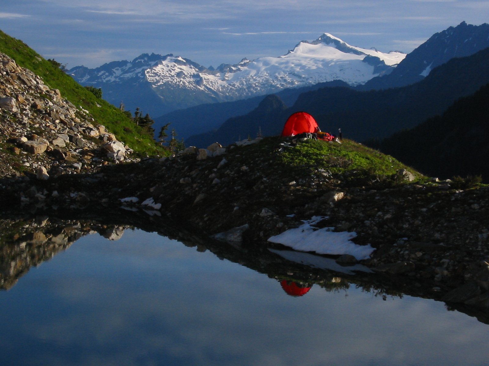
We toiled up the path for several hours, grateful for the cloudy sky and cool air. After finally topping out at a meadowy 5100-foot saddle, we dropped 200 feet to a pond, then proceeded up the opposite hillside to reach large and attractive Bench Lake at 5235 feet (9.2 hours from car). A flat, grassy pad near the shore offered us a comfortable campsite for the night.

- Camp At Bench Lake
Day 2: Bench Lake to Hoch Joch Tarn
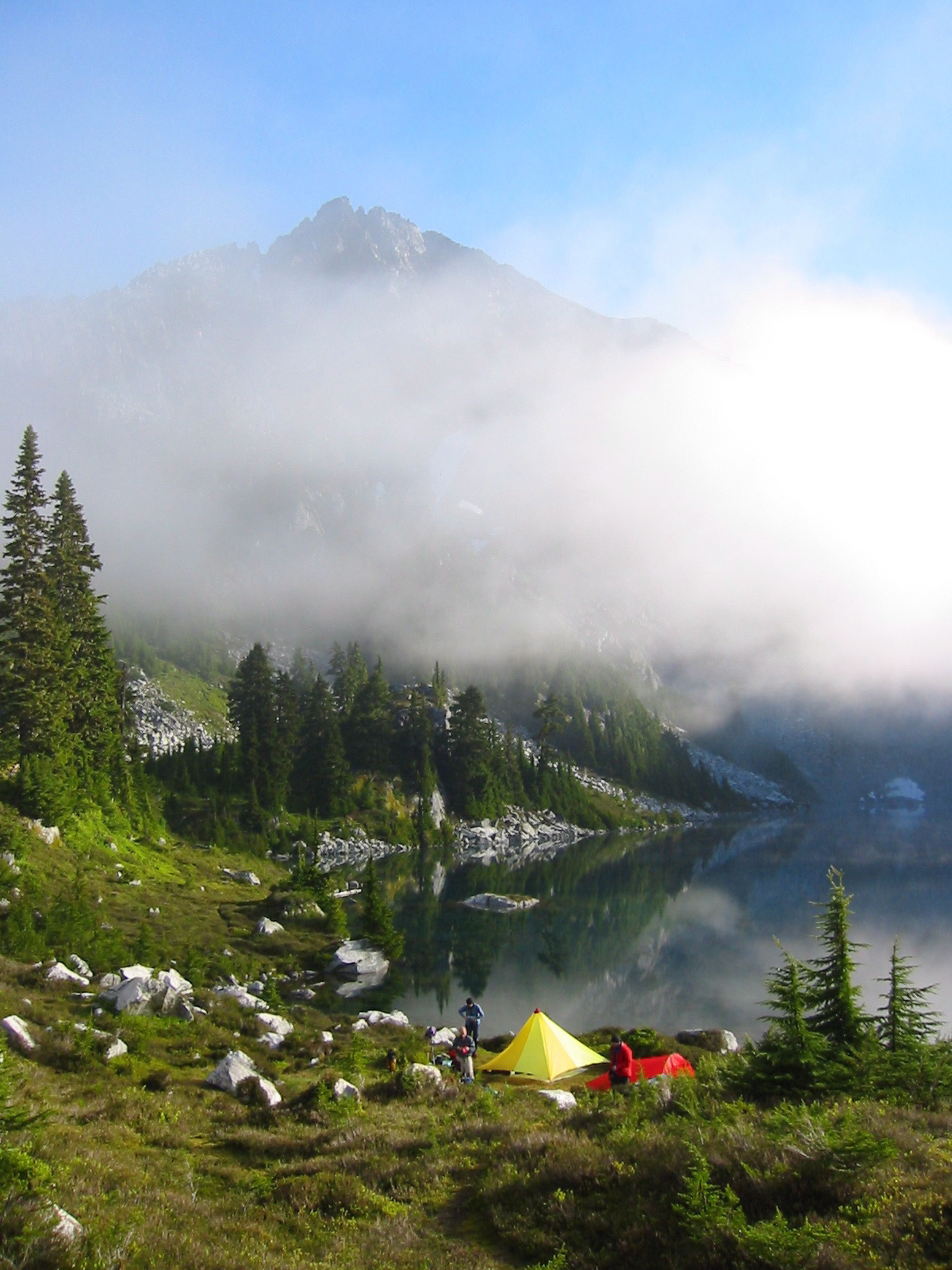
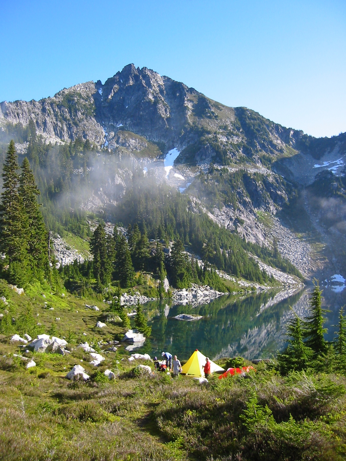
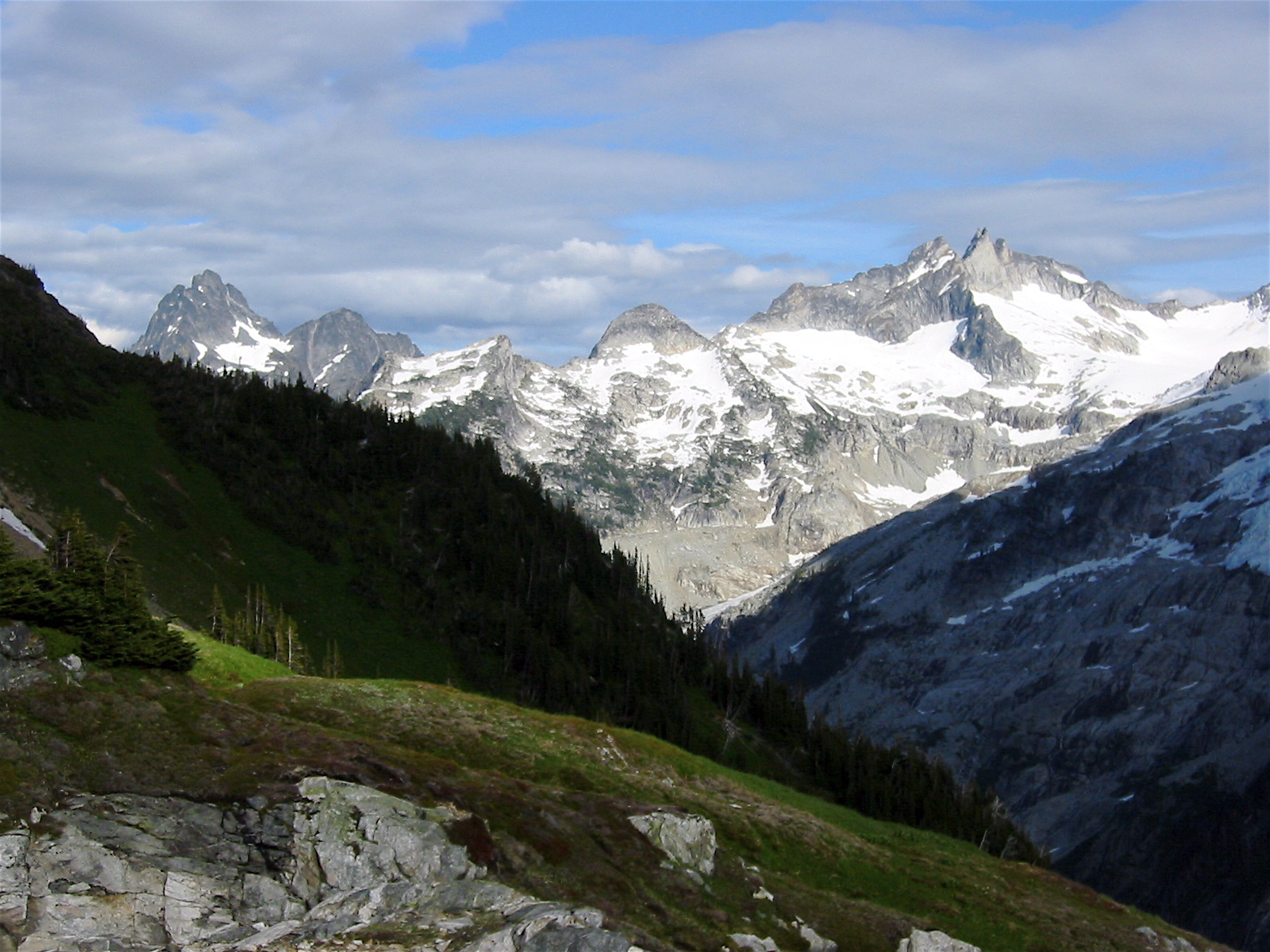
The prior day’s clouds and fog burned off completely by mid-morning, giving us a nice view of Mt. Bruseth, our first summit objective for the trip.

- Mt Bruseth and Bench Lake
We skirted the left shore of Bench Lake, then ascended a steep streambed to a 6400-foot saddle above. During this ascent, I slipped on a rock and sliced my palm open, thus necessitating a 20-minute stop for first-aid-by-committee. I feared that my injured hand might hamper me over the remainder of our trip, but it turned out to not be an issue.
At the saddle, Chris, Stan, Kevin, and I quickly prepared summit packs and began climbing the moderate slopes of Bruseth’s southeast flank. Higher up, we traversed across the south face on a series of exposed down-sloping ledges. This face was steeper and more difficult than we expected from the CAG’s description of “some scrambling”!
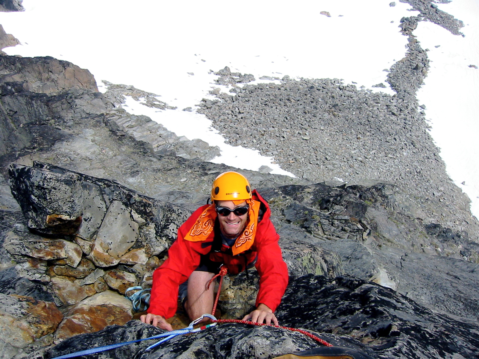
We spent most of an hour trying to find a reasonable route to the crest of the eastern summit ridge. Eventually, we succeeded via a short pitch of Class 4 climbing on questionable rock, which Kevin did unroped and the rest of us did roped.
- On East Ridge Of Mt Bruseth
More scrambling along the exposed crest, a short traverse across a steep snowpatch, and a final slab of clean Class 3-4 rock gained us the summit (2.0 hours from saddle).
- Kevin, Chris, and Stan On Mt Bruseth
The makeshift register (a toilet paper tube in a tobacco can) showed only a few ascents in the past decade; the last was by Don Goodman’s party in 2004.
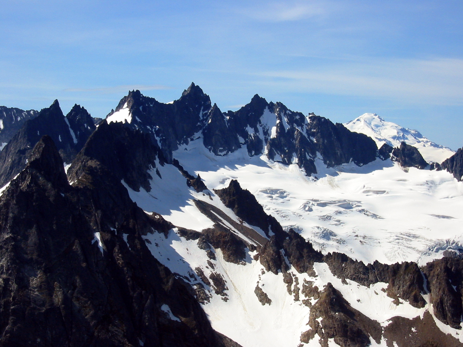
- Mt Misch and Mt Buckindy From Mt Bruseth
For our descent, we stayed on or close to the crest of the east ridge, making one short rappel at a vertical step, then picked up our up-track on the southeastern flank. We rejoined Kathy back at the saddle about an hour later than promised, which was of no surprise to her.
From the saddle, we all descended northerly on snowfields, talus, and super-steep heather to reach the outlet of 5200-foot Woods Lake. Along the way, some sort of mosquito alarm must have sounded, because hordes of them suddenly swarmed us mercilessly.
We continued traversing northeasterly past the lake outlet, ascended to a small 5500-foot saddle, then dropped down more steep heather to 5000-foot Slim Pass at the head of Slim Lake.
- Spire Point From Slim Pass
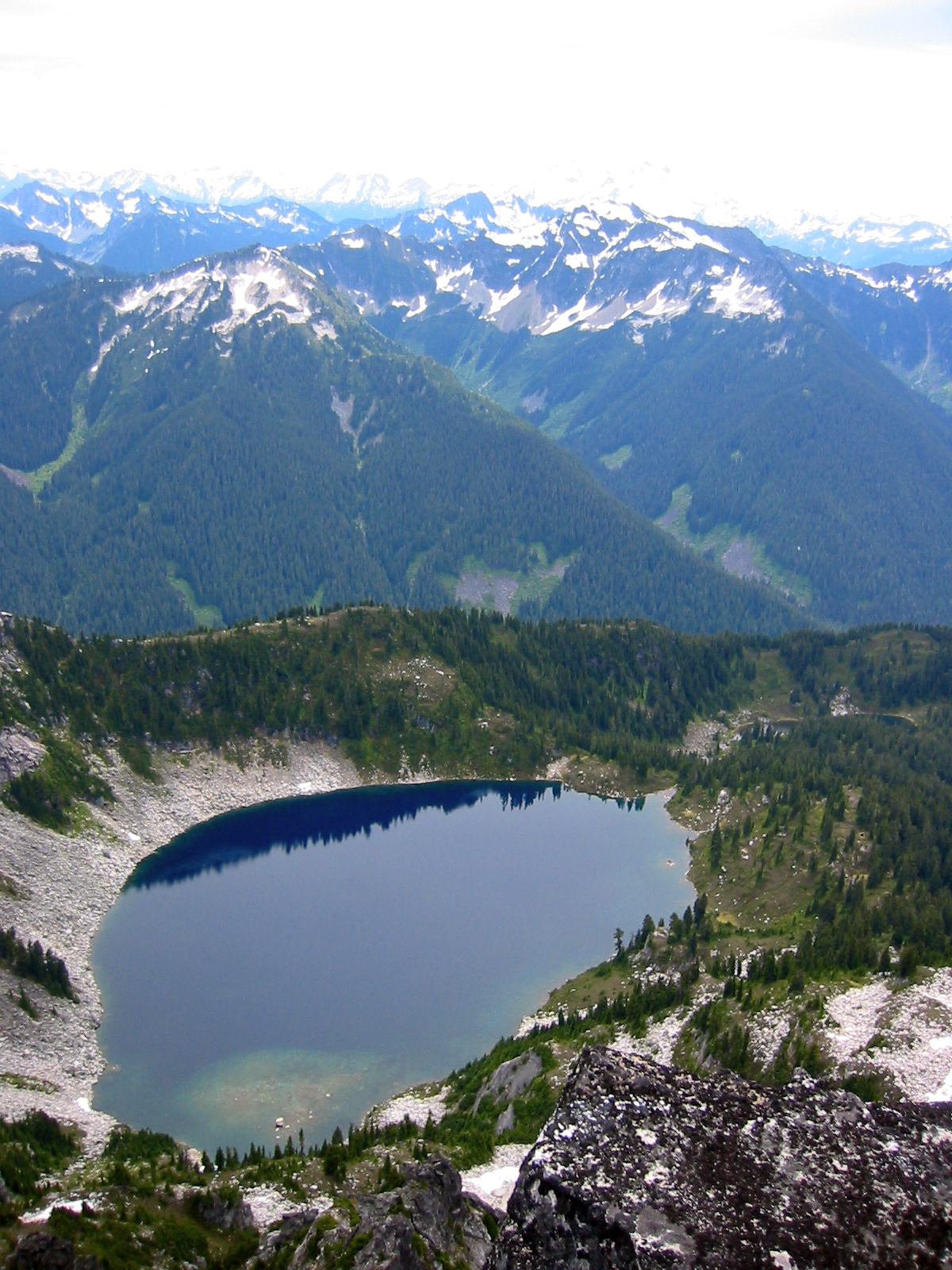
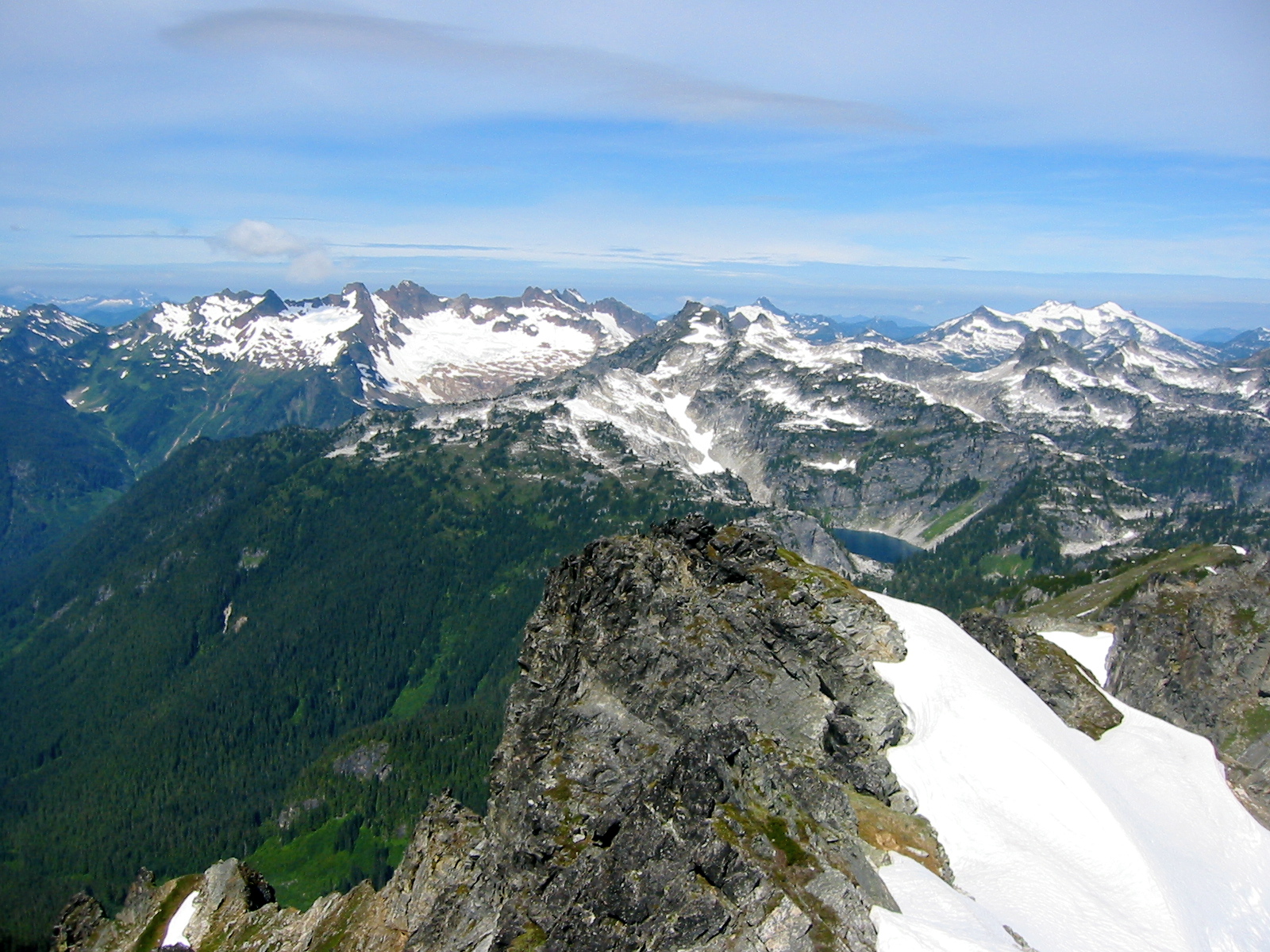
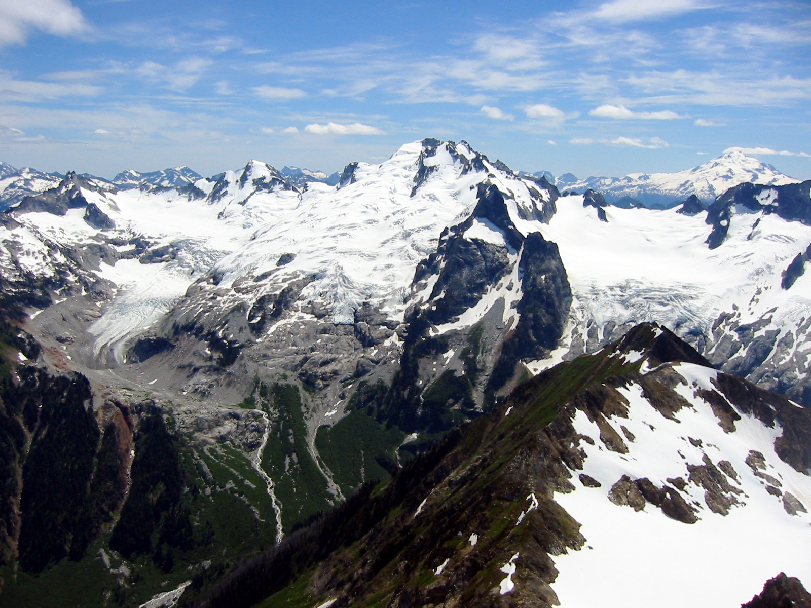
In retrospect, I realize that Slim Pass represented the topographic and psychological low point of our high route; we were hot, tired, hungry, cranky, and tormented by bugs. A tough southeastward ascent on the crest of a heathery ridge, followed by a pleasant eastward traverse along its northern side eventually brought us to scenic 5900-foot Hoch Joch Tarn (10.3 hours from Bench Lake) perched high above South Cascade Lake.
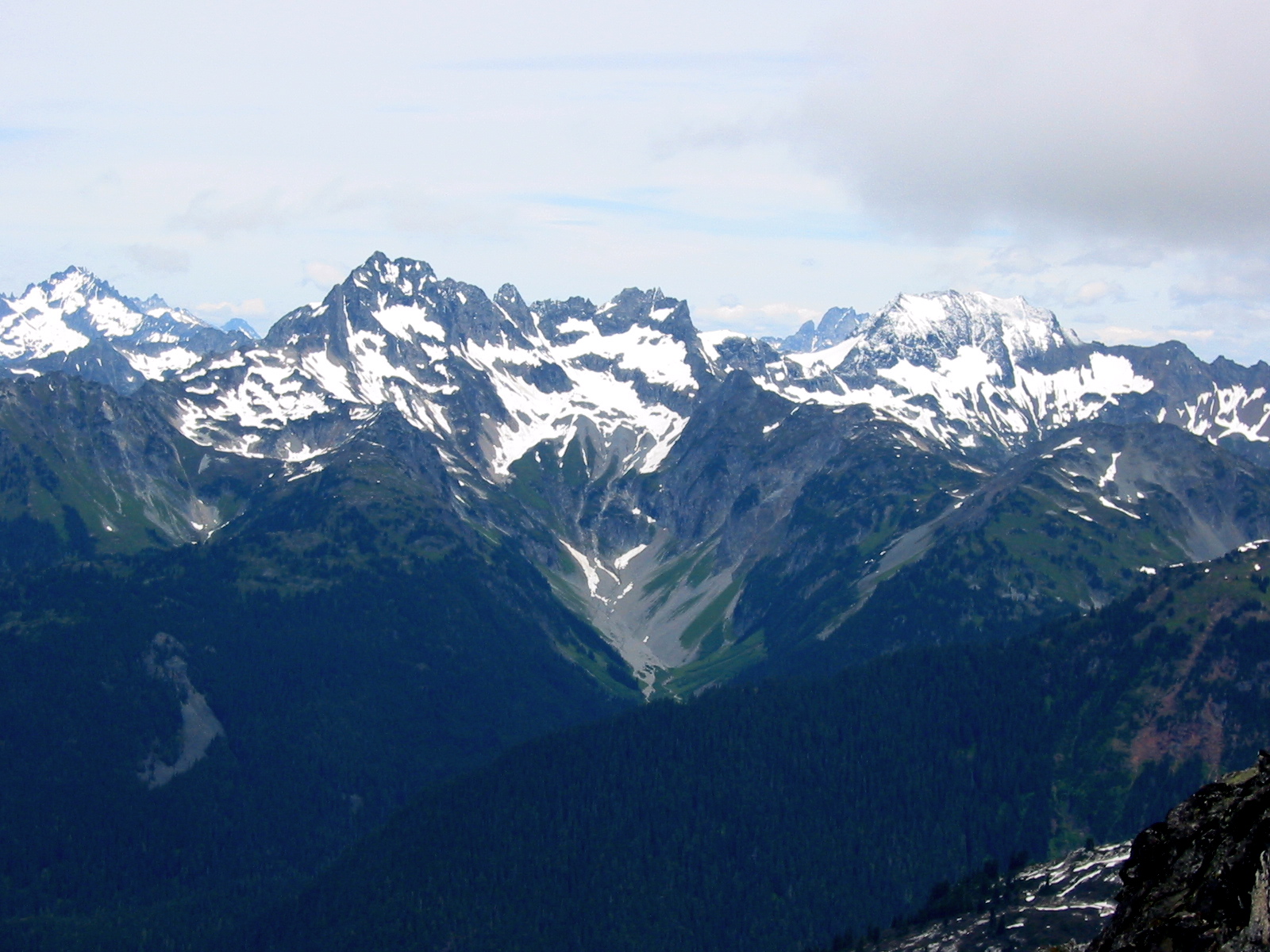
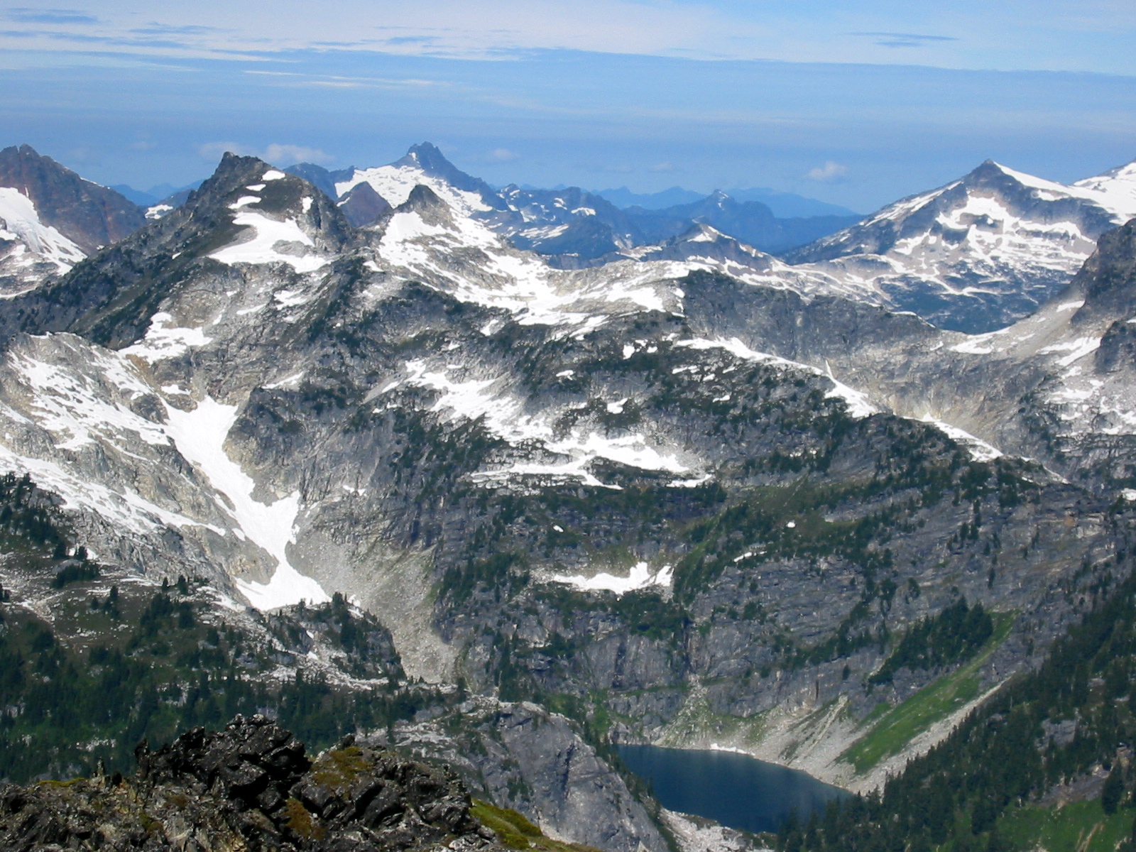
- LeConte Mountain and South Cascade Lake
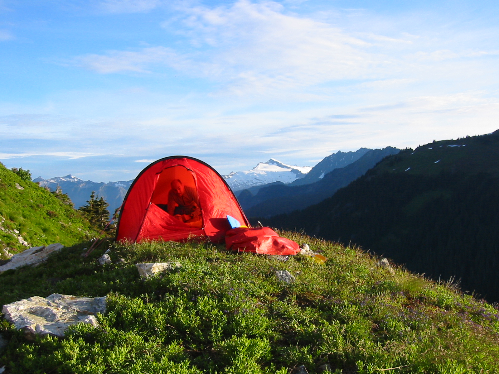
Despite offering only marginal camping on rocky, uneven ground, this tarn was too enticing to pass up. The views of Eldorado Peak and Mt. Formidable were stunning, and it was breezy enough to keep the mosquitoes in partial check.
- Eldorado Peak From Tarn Camp
Day 3: Hoch Joch Tarn to White Rock Lakes
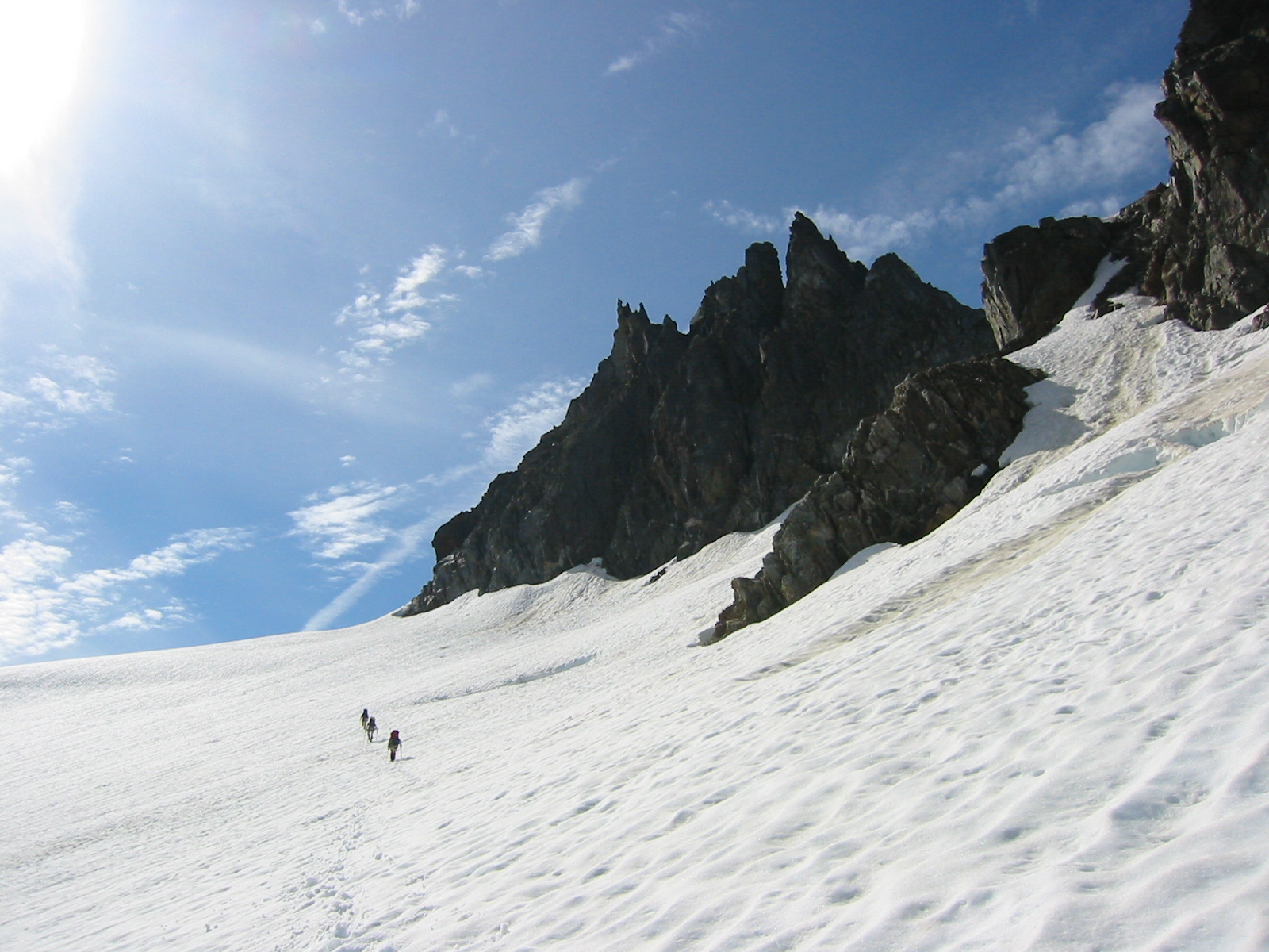
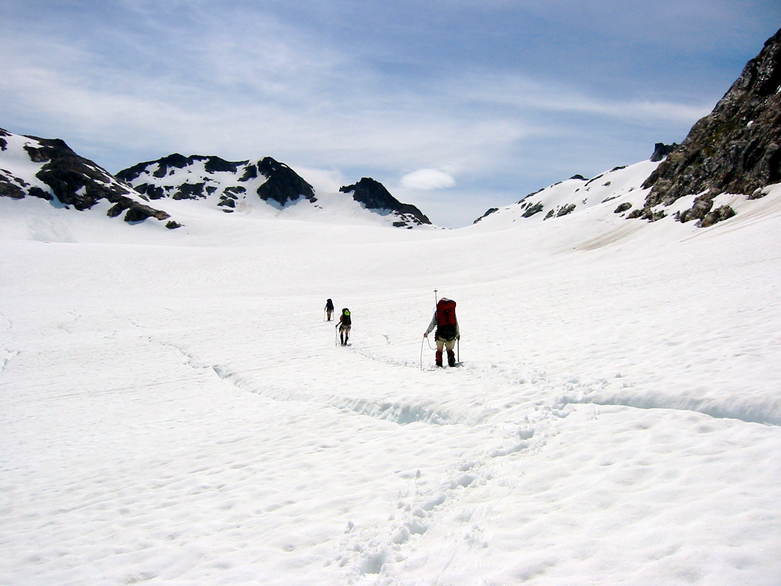
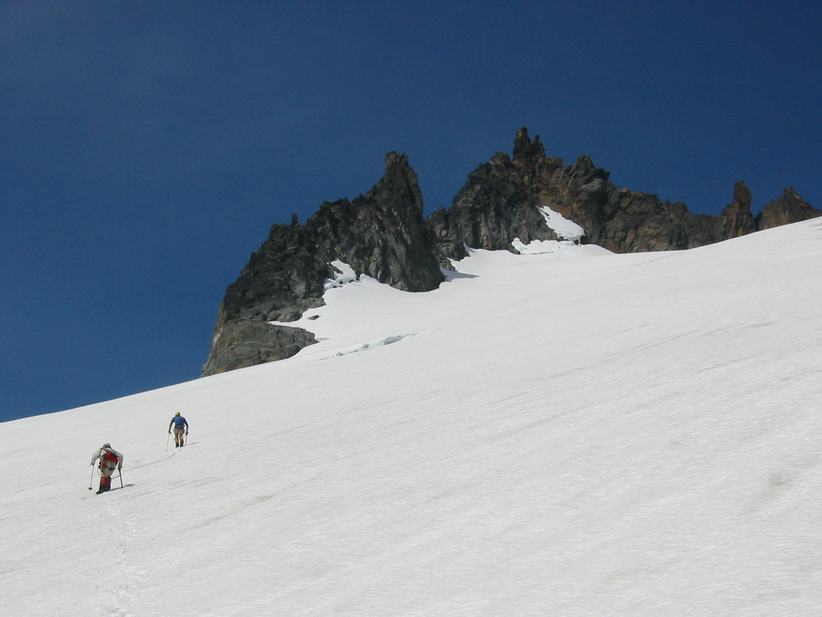
The morning was clear and mild, signaling another hot day ahead. We evaluated two possible routes from our tarn to the upper South Cascade Glacier. One involved descending a hideous, steep, rubbly stream gully to South Cascade Lake, then ascending the moraine and glacier; the other involved ascending moderately steep snowfields and glaciers beneath Hoch Joch Spitz. Thankfully, the latter option won out, and we were soon traversing upward on marvelous alpine terrain.
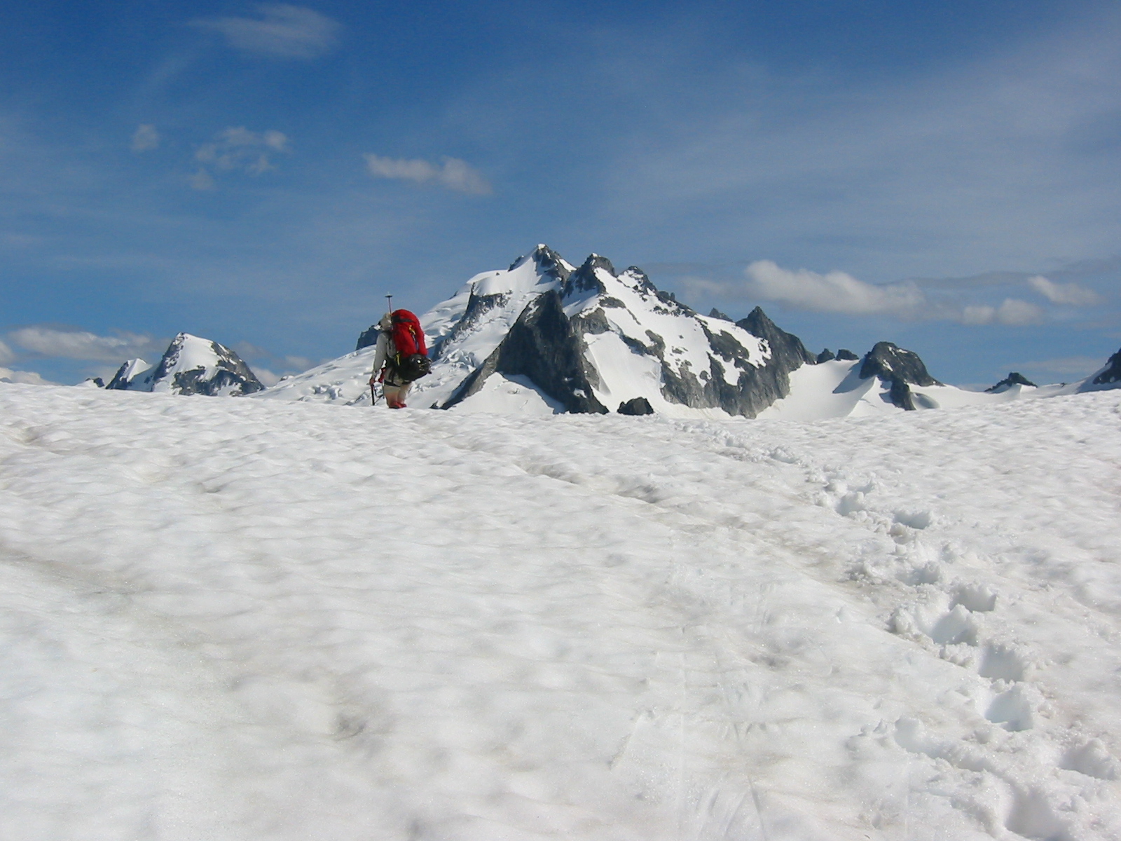
- Traversing Hoch Joch Glacier
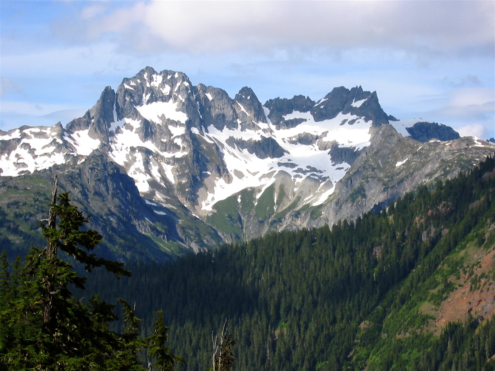
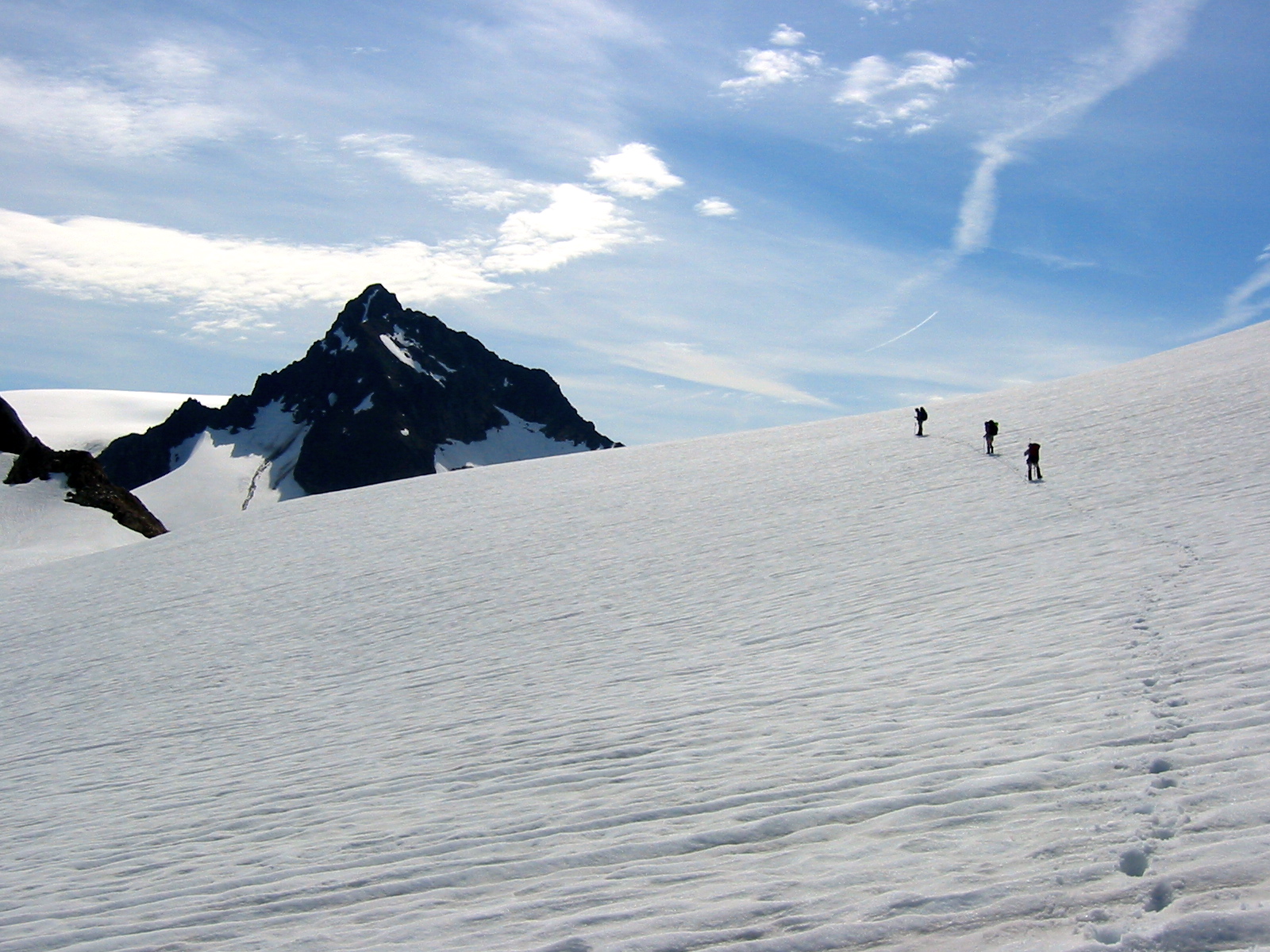
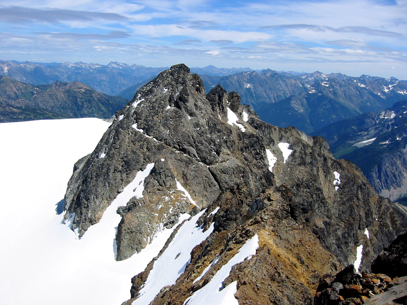
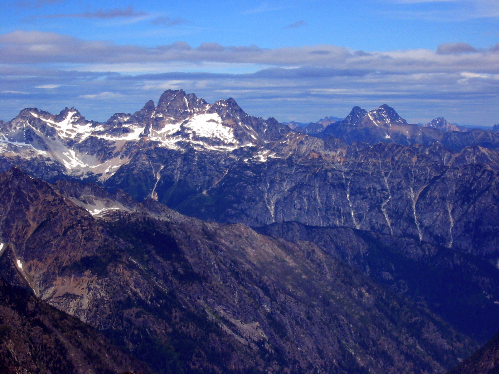
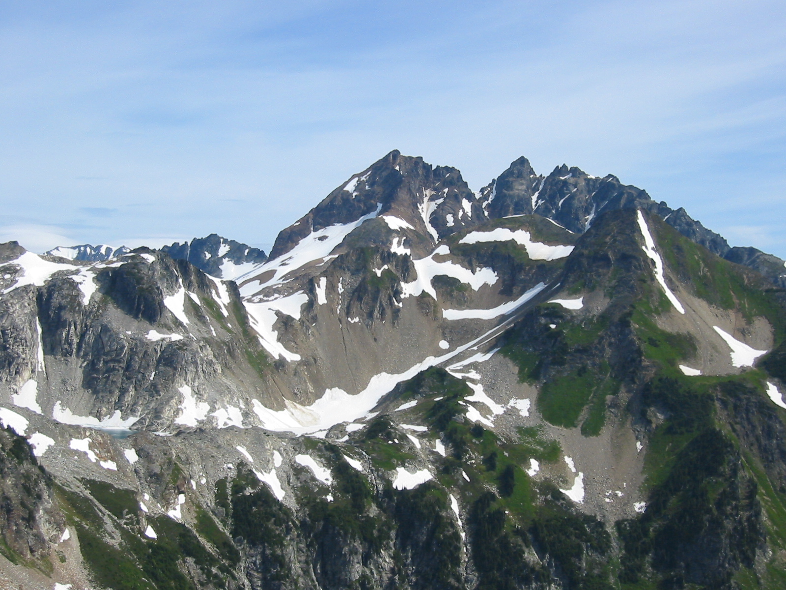
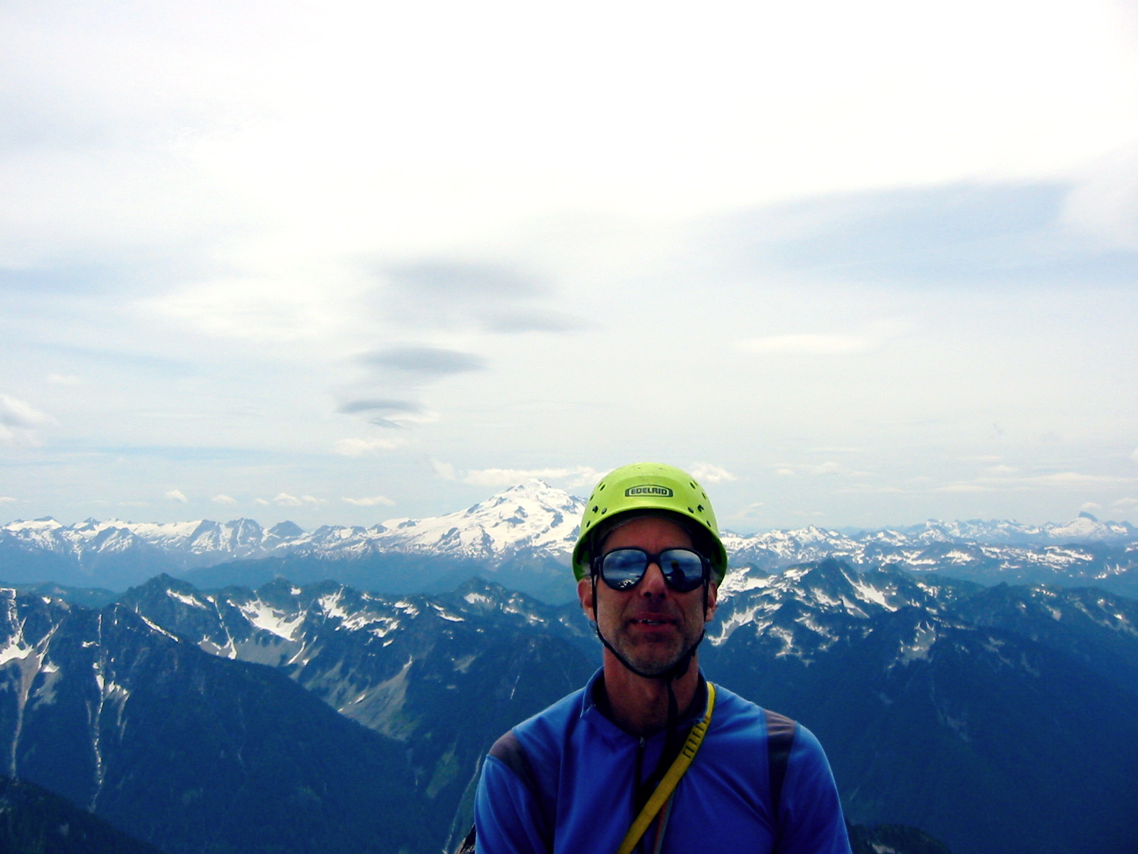
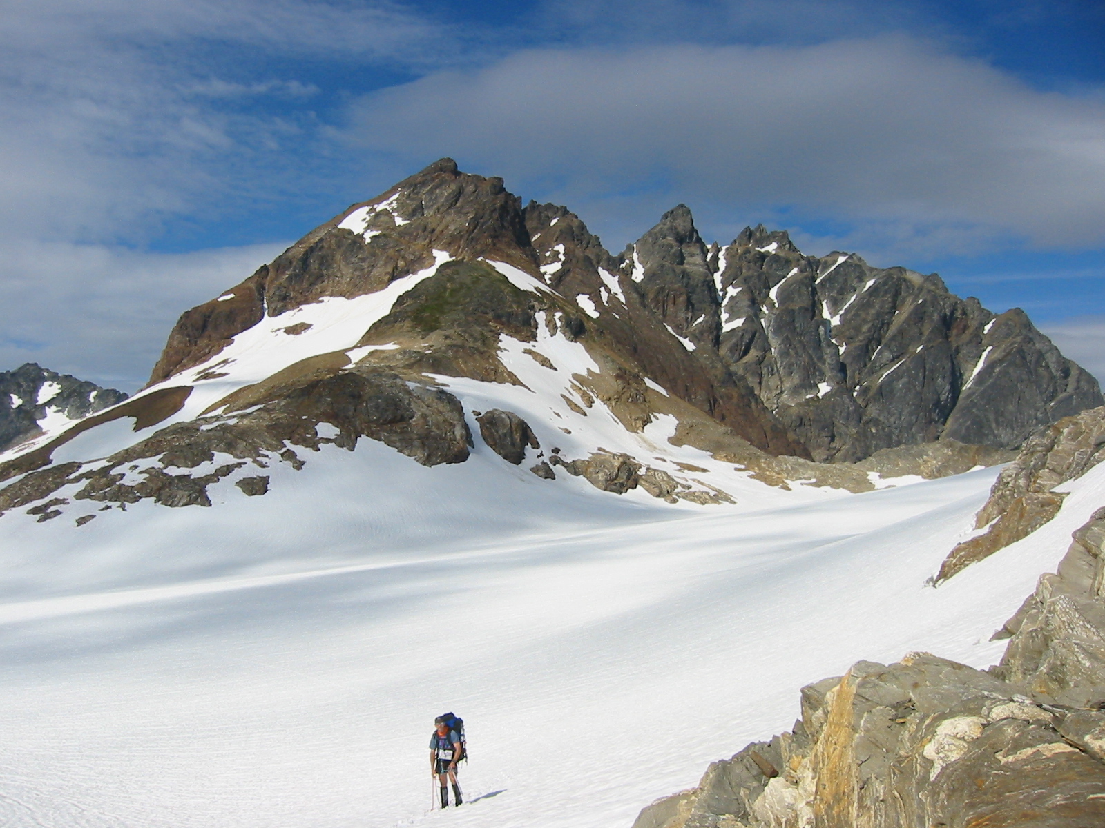
By late morning, we had curled around to a 7100-foot saddle immediately northeast of Hoch Joch Spitz, an interestingly named and impressively pointed landmark in this area. Chris and Stan and I made a quick sidetrip to Hoch Joch’s summit, which provides fabulous views of the north-central Cascades in return for modest effort.
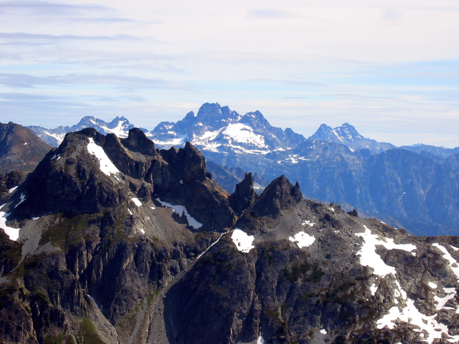
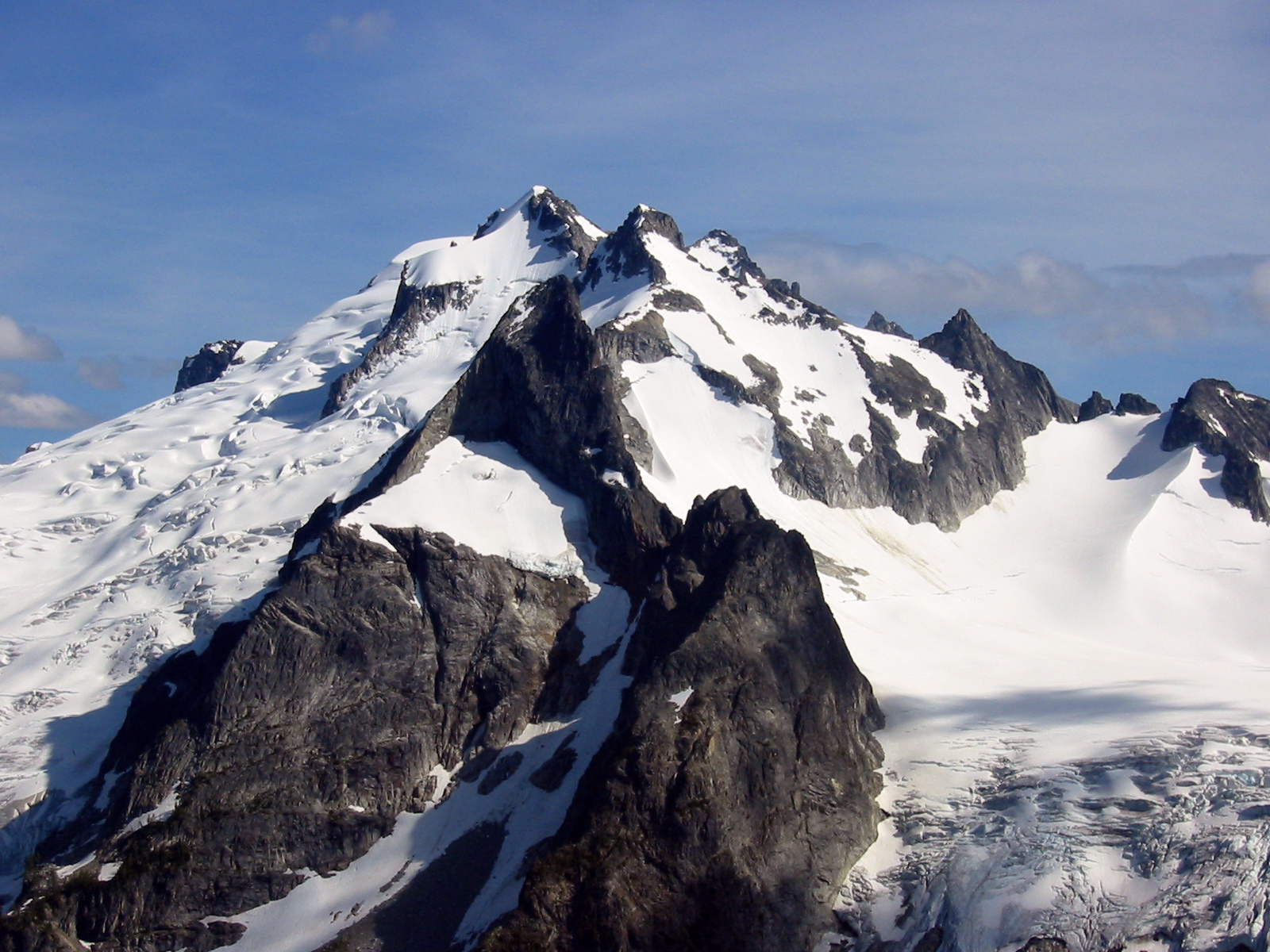
- Sentinel Peak From Hoch Joch Spitz
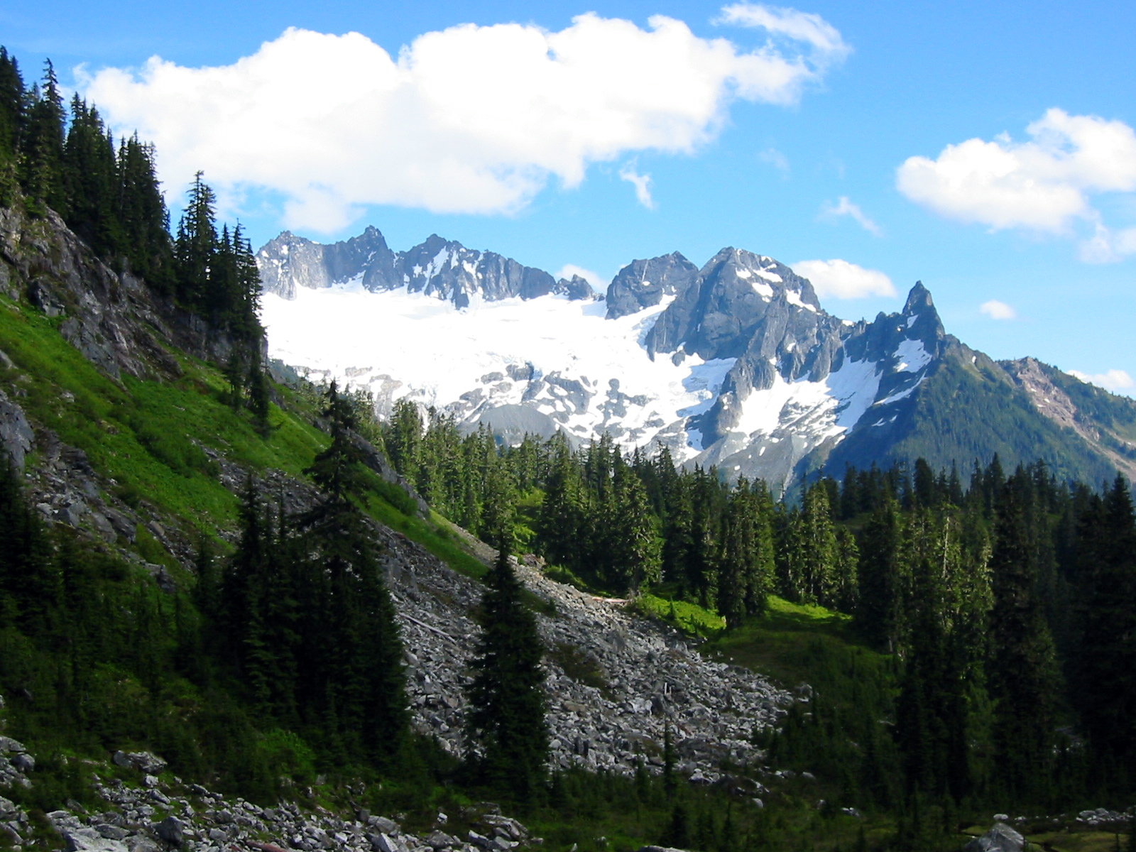
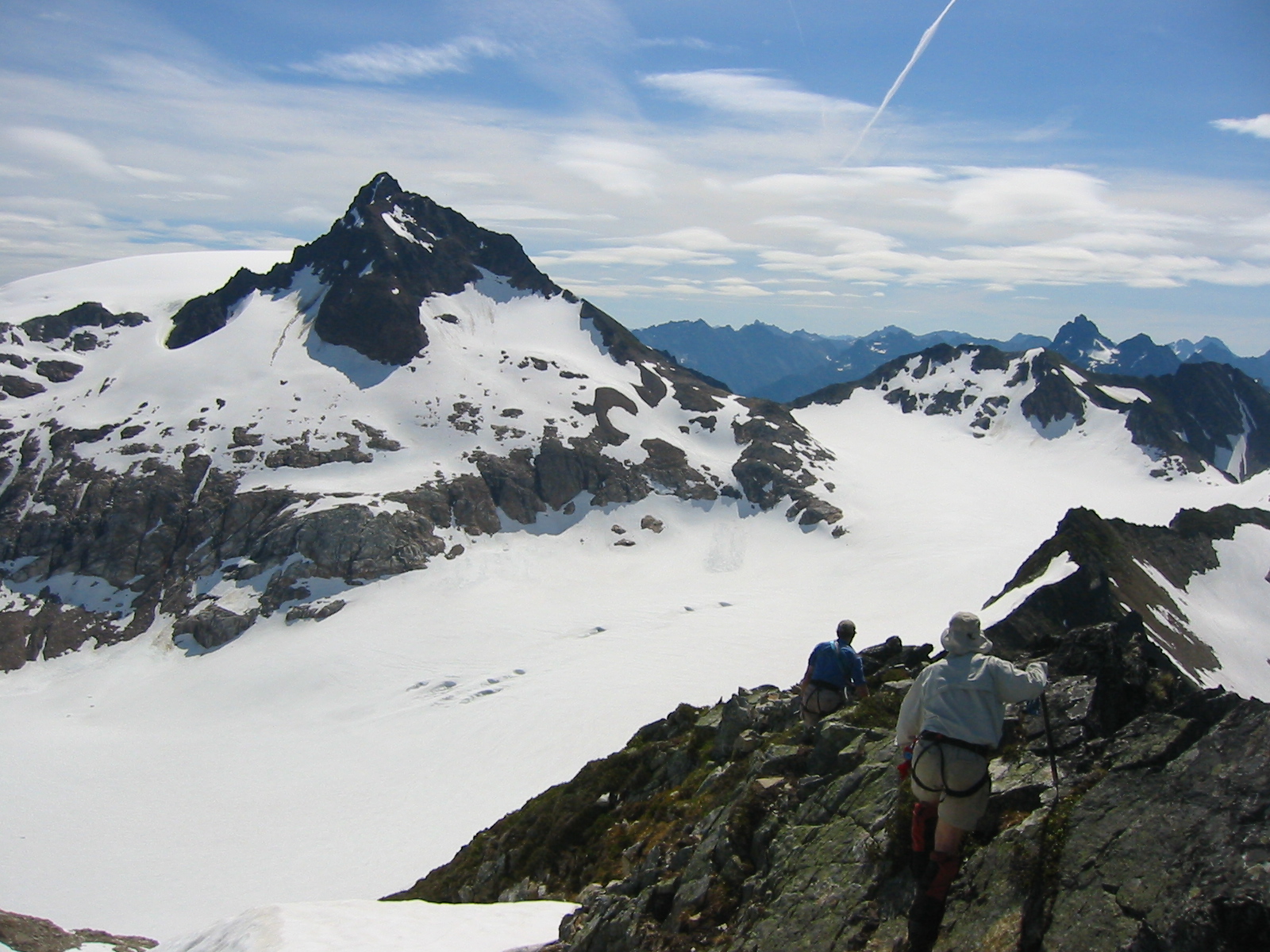
Afterwards, we all descended a snow couloir about 800 feet to the South Cascade Glacier and traversed across to the base of Sentinel Peak.
- Traversing To Sentinel Peak
It occurred to me that this high, gentle, glaciated valley may very well represent Washington‘s closest example of what would be called a cwm (pronounced “koom”) in the Himalayas. We encountered some glacial research apparatus out in the middle of the glacier, as well as on the surrounding rock outcrops. One of these slabby rocks became our sunny lunch spot.
In the early afternoon heat, Chris, Stan, Kevin, and I made a climb up the snow and Class 2-3 rock of Sentinel Peak’s west face. The summit views were even better from here than from Hoch Joch Spitz, and we spent some time enjoying them.
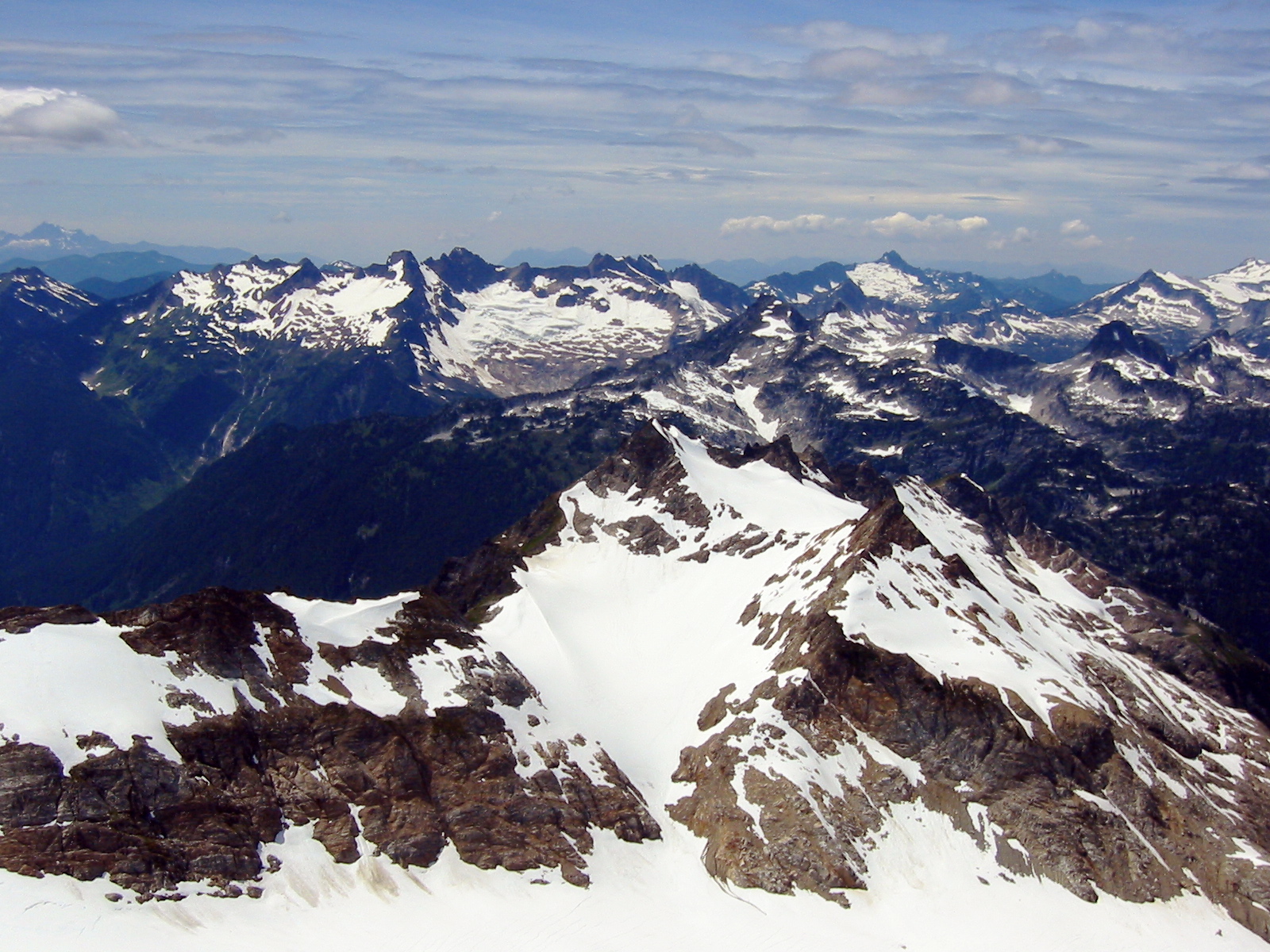
- Old Guard Peak From Sentinel Peak
- Mt Logan, Mt Goode, and Black Peak From Sentinel Peak
Not finding a summit register, I left one of my own. A bit later, while peering around the steep summit block, I spotted an aluminum register tube on a ledge about 25 feet below. Chris scrambled down to check it out and announced that it appeared to have been struck by lightening. In a comical scene, he then tried to toss it up to me but managed to heave it over my head and down the other side of the peak! We listened to it ricocheting thousands of feet down to the Agnes Creek valley, where some bushwhacking party might stumble upon it many decades from now.
Although our original intention was to down-climb Sentinel Peak’s east ridge to reach the Sentinel – Old Guard notch and then to climb Old Guard Peak’s west ridge, the descent route looked totally unappealing; steep, rotten rock transitioned into 60-degree snow patches. We abandoned our plans to climb Old Guard Peak and instead retraced our up-route down Sentinel’s west face. We hooked up with Kathy on the sunny slabs and spent an hour relaxing.
- Sentinel Peak and Old Guard Peak From Lizard Pass
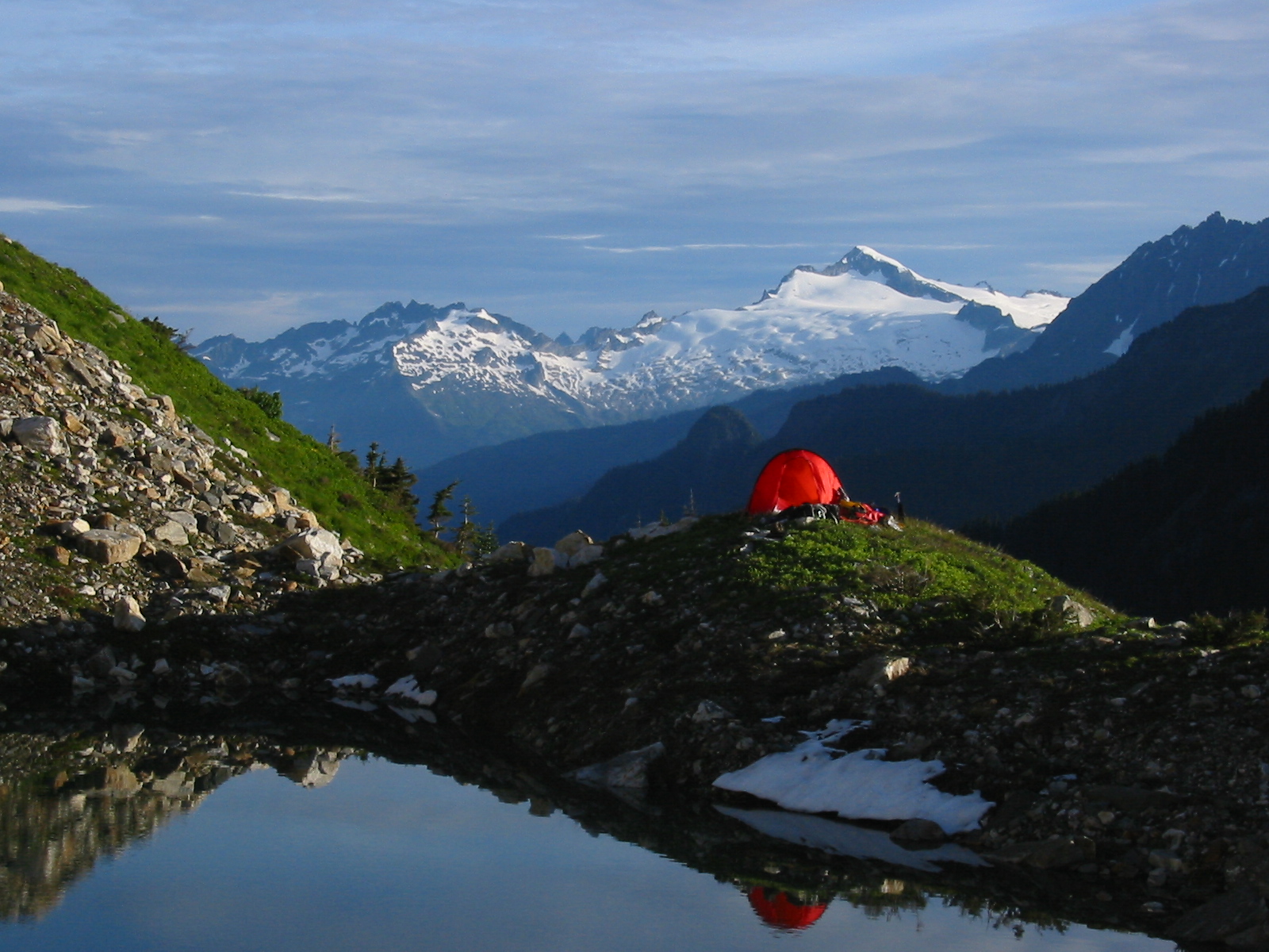
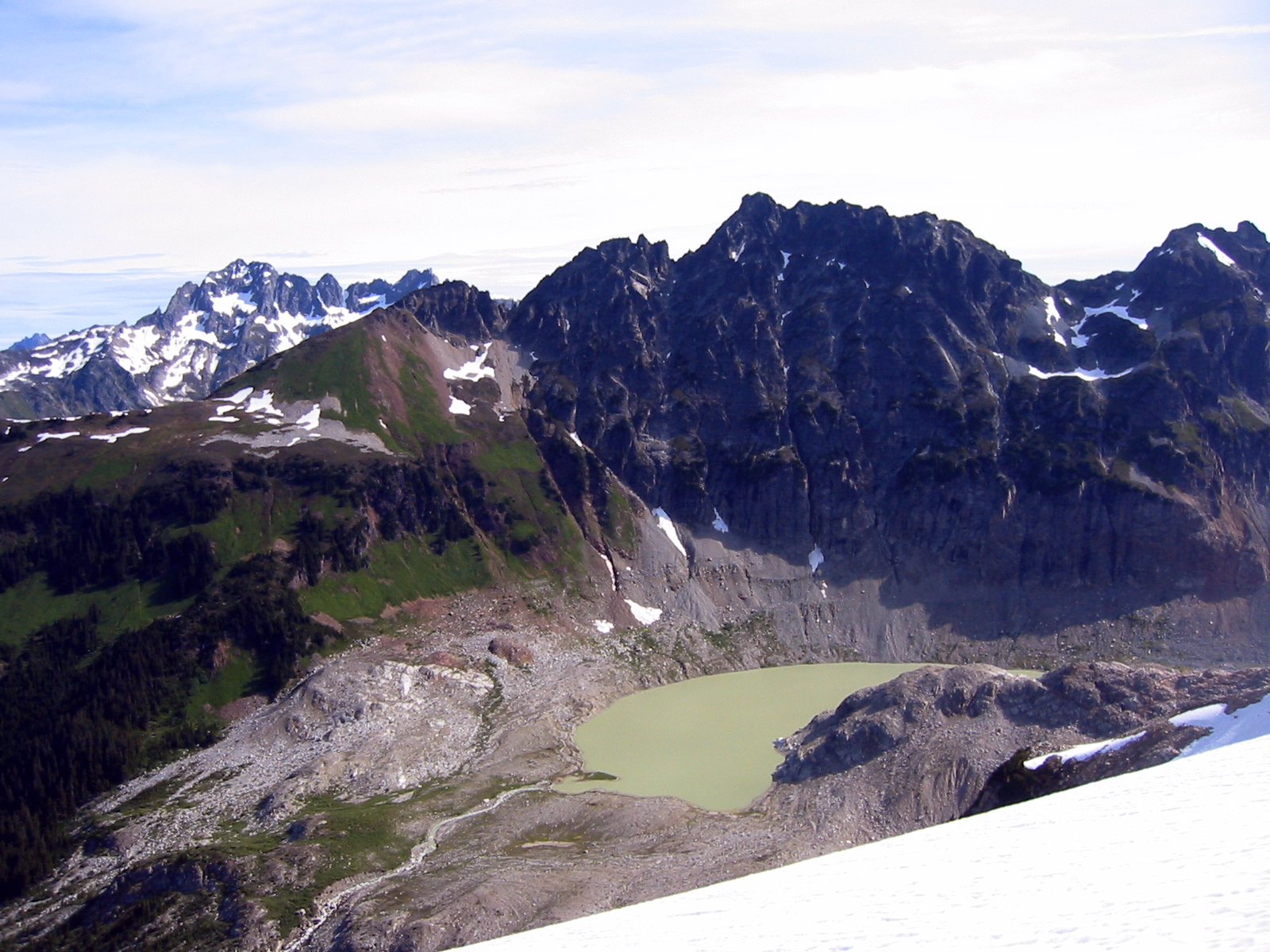
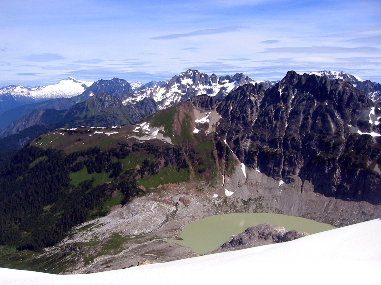
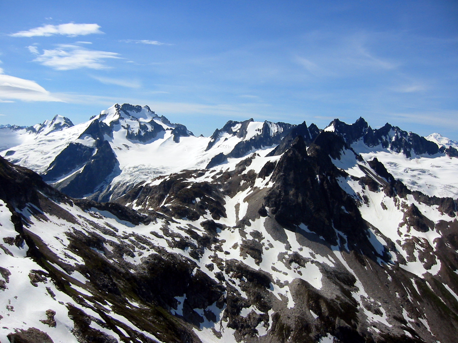
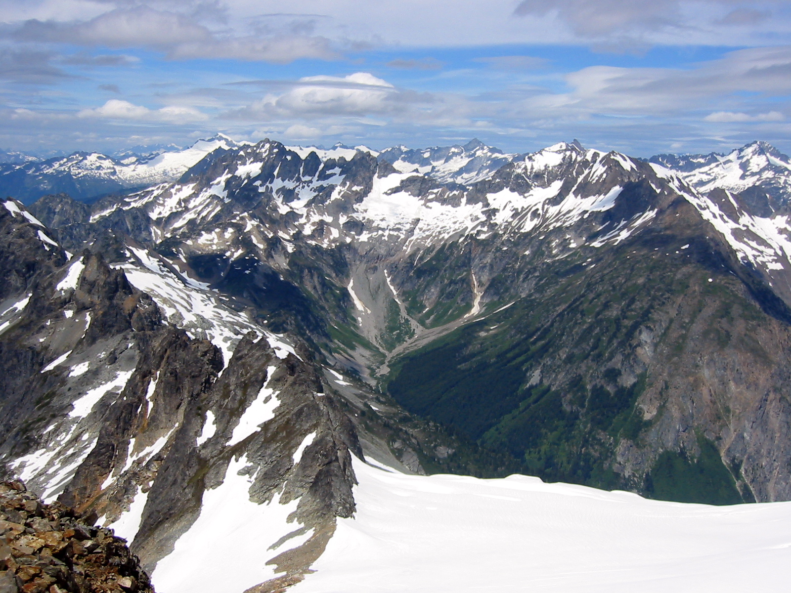
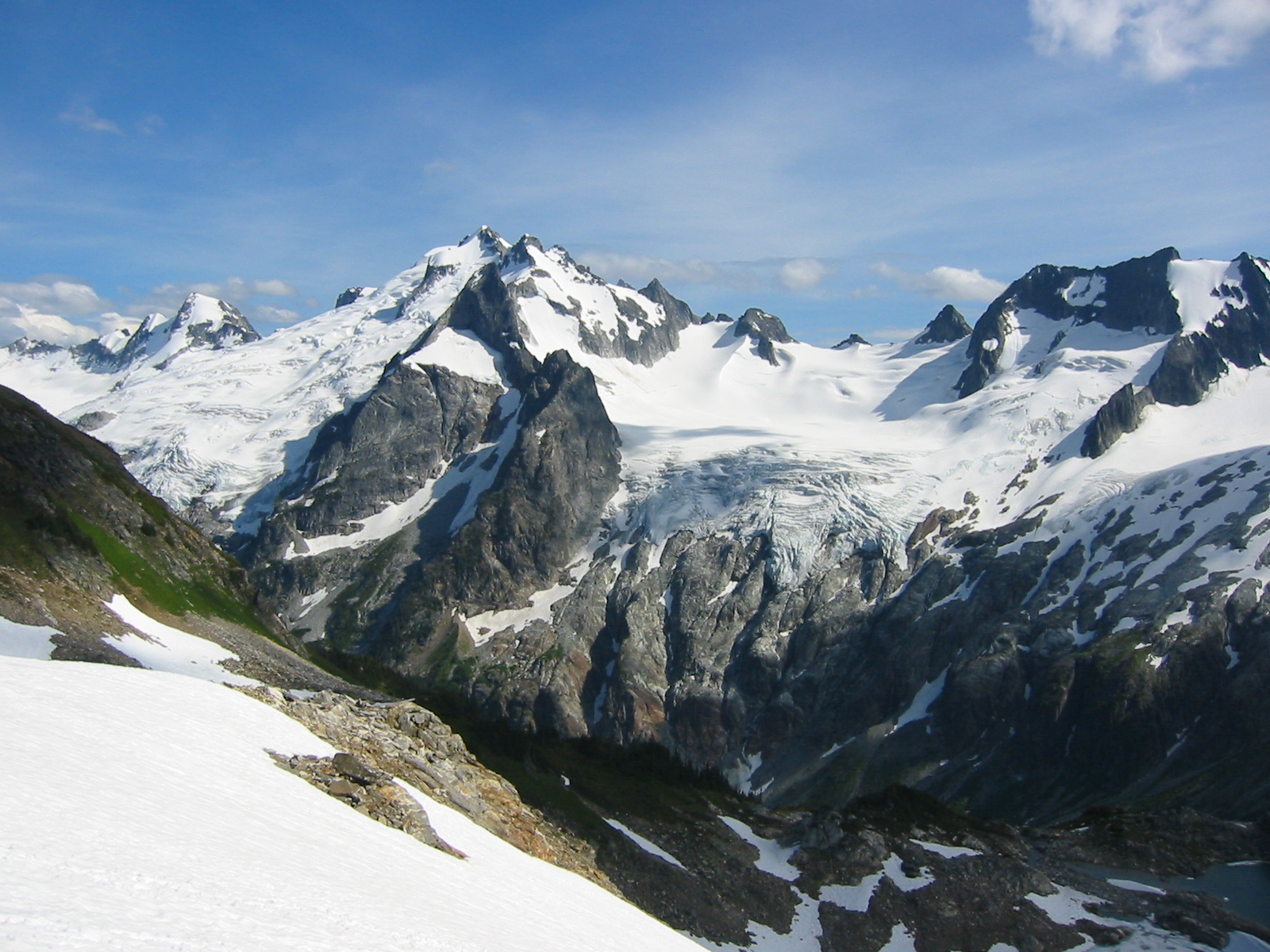
An easy beeline to 6800-foot Lizard Pass at the head of the South Cascade Glacier was followed by a quick descent to partially frozen White Rock Lakes (9.0 hours from tarn), where we made camp in a spacious grassy flat.
I had camped here while doing the Ptarmigan Traverse 24 years ago but had forgotten how dramatic the views are over to Dome Peak and Spire Point. What I hadn’t forgotten about, though, was the misery our party incurred the following day as we bailed out via the middle fork of Downey Creek; that ugly descent has remained one of the two worst bushwhacking experiences of my life!
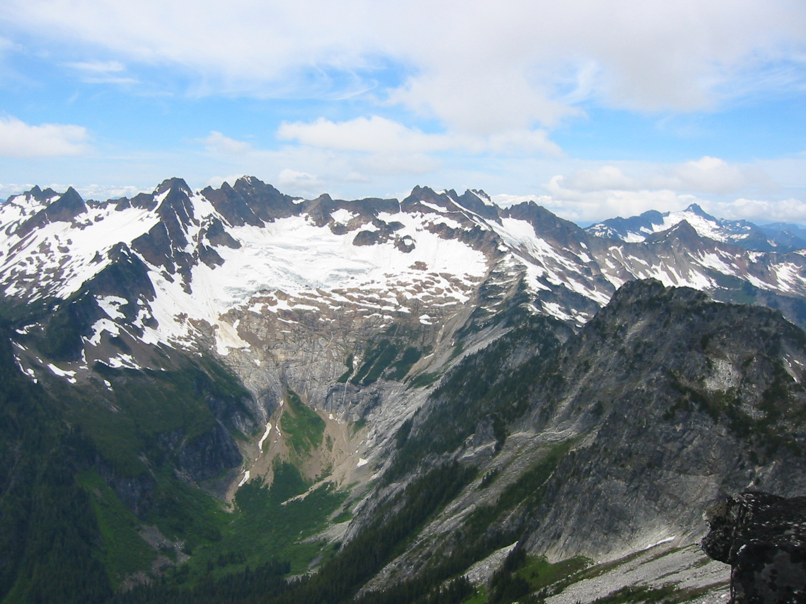
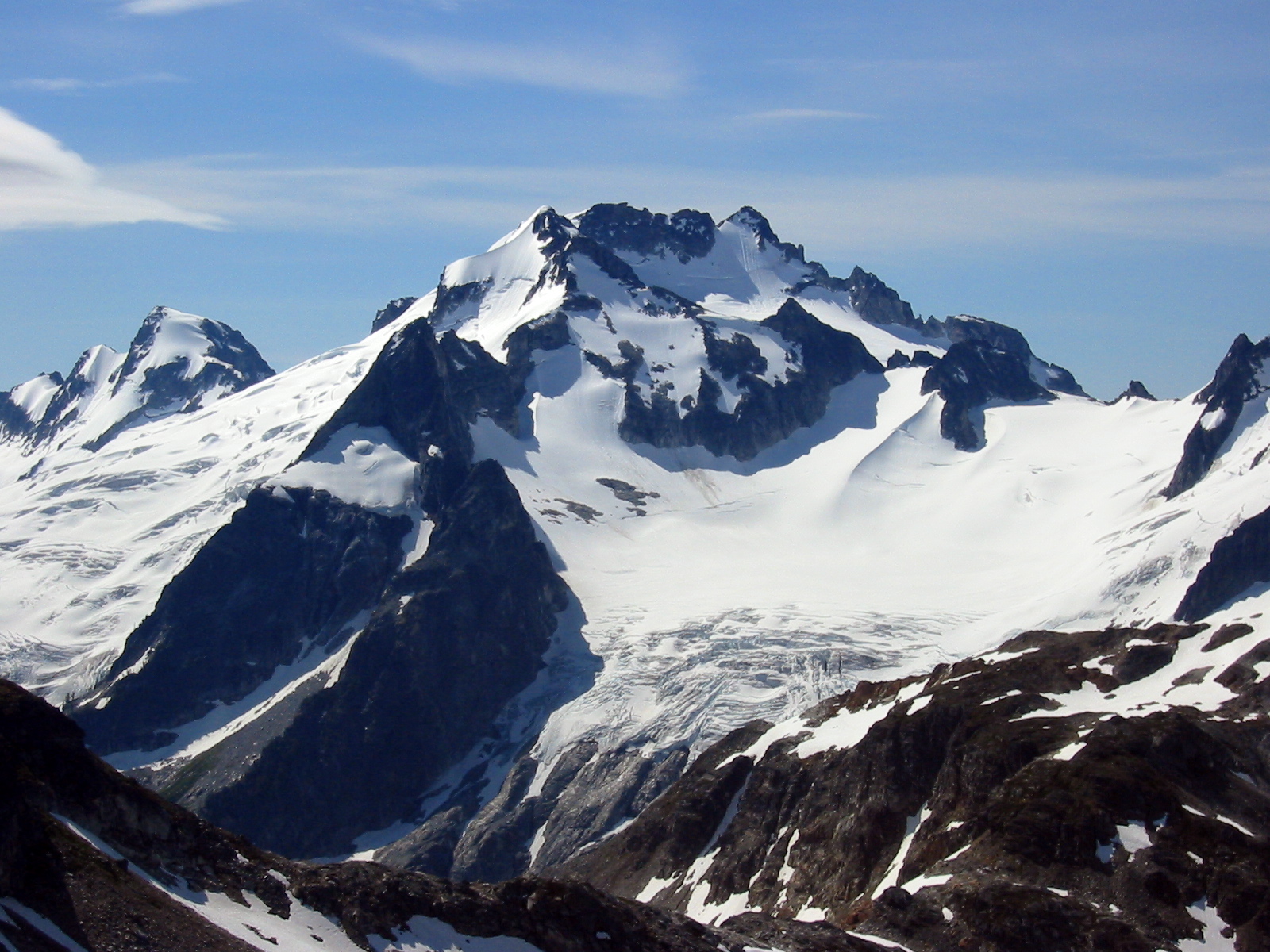
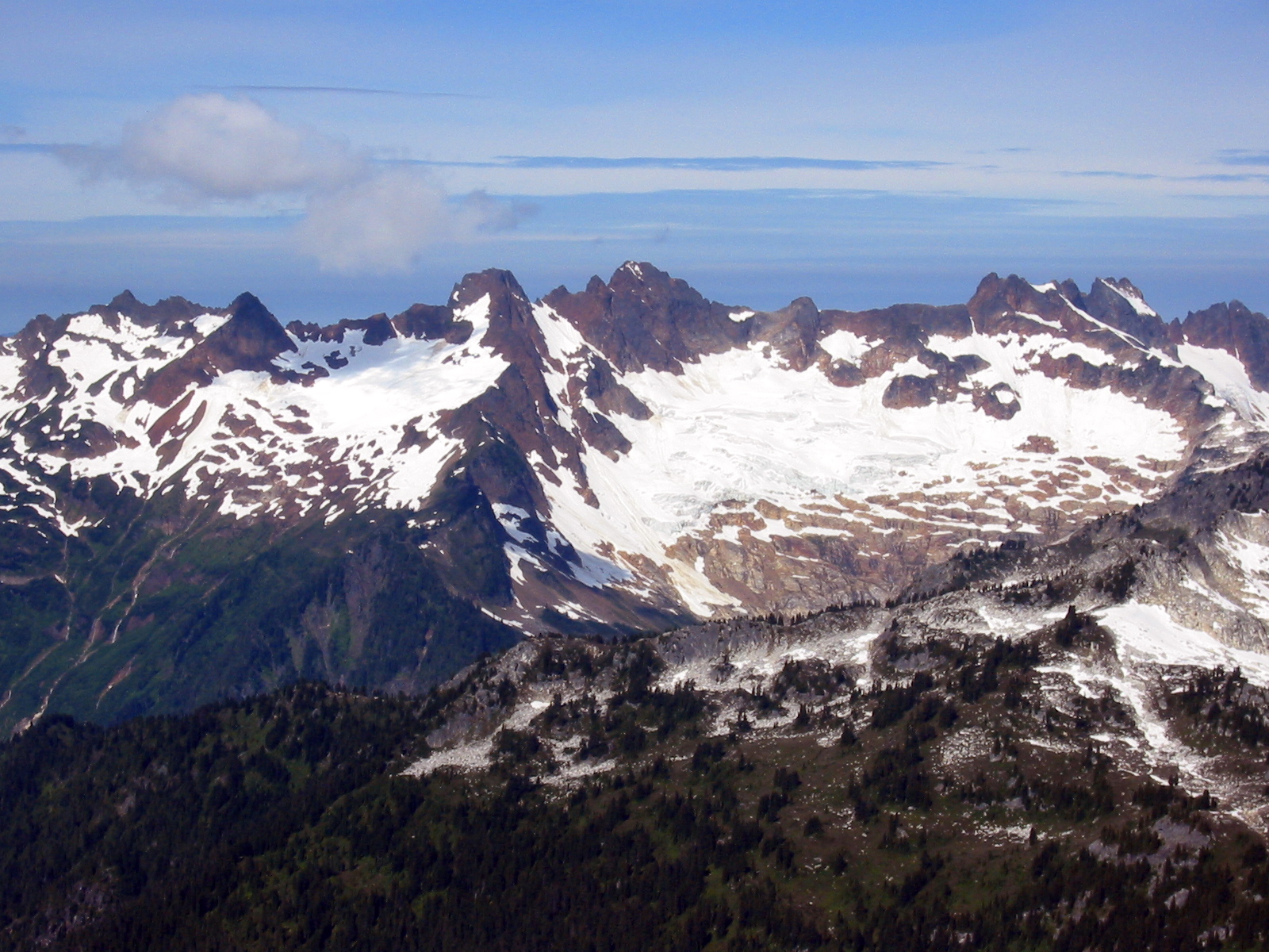
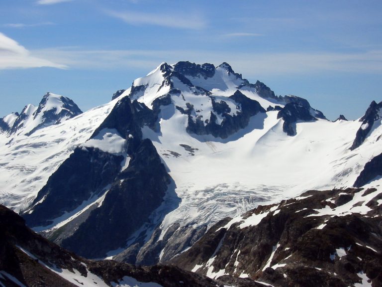
- Dome Peak From White Rocks Lakes
Day 4: White Rock Lakes to Cub Lake
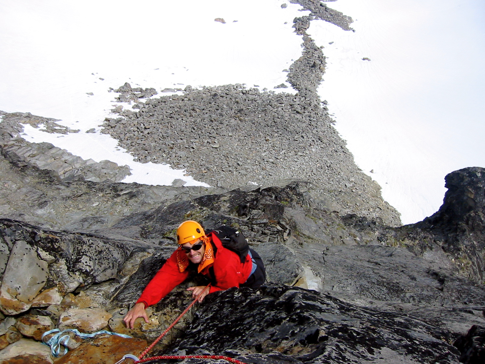
Under more blue skies, we hiked from White Rock Lakes down the Ptarmigan path and then ascended snowfields until about 1000 feet below Spire Point.
- Climbing To Spire Point
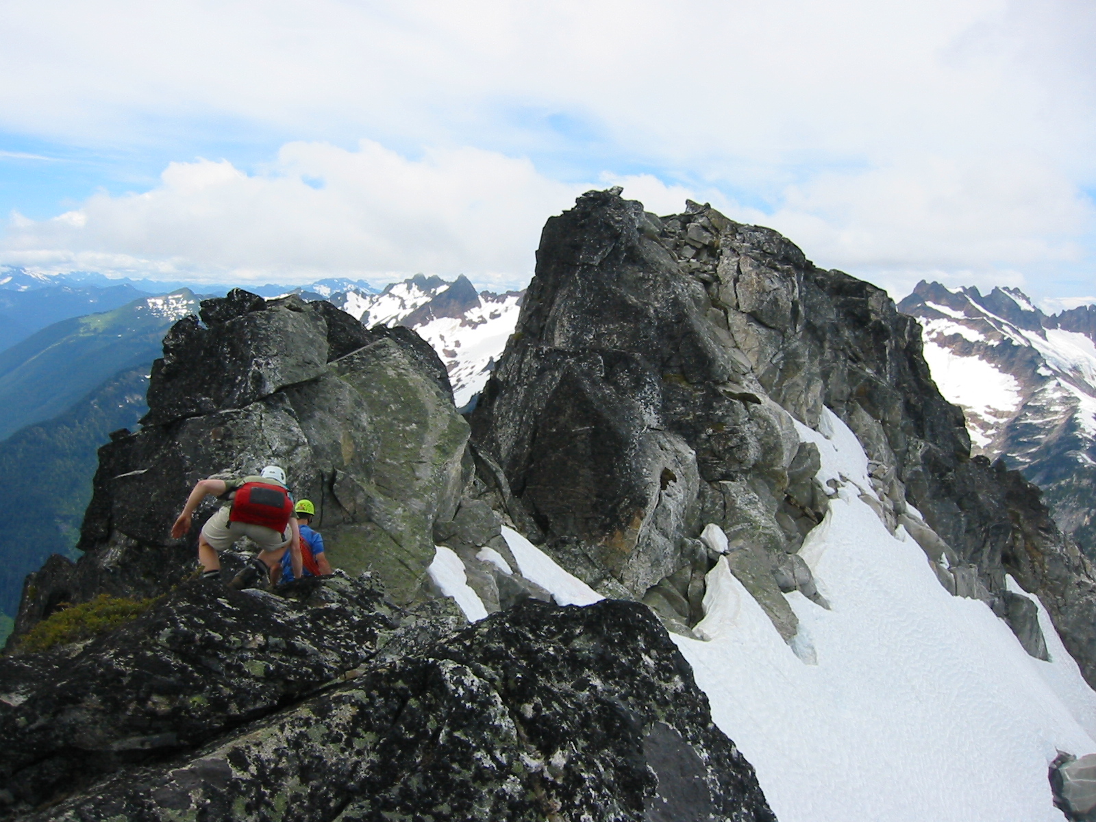
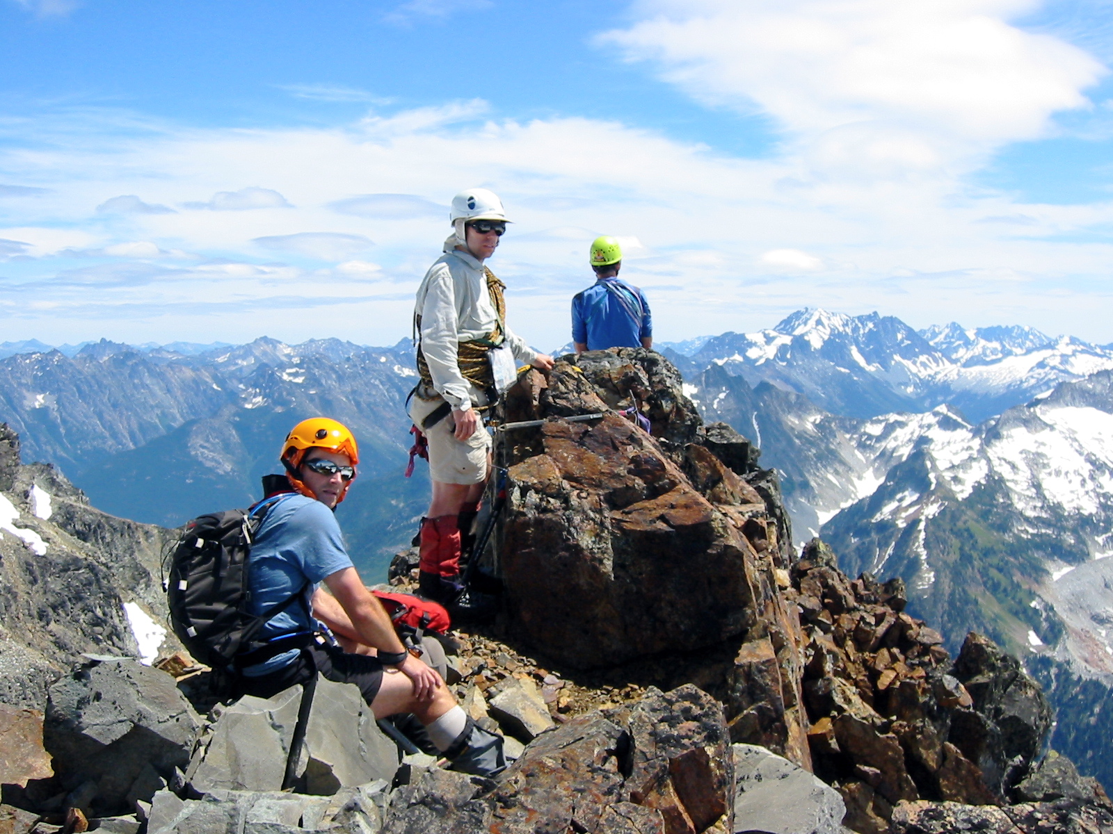
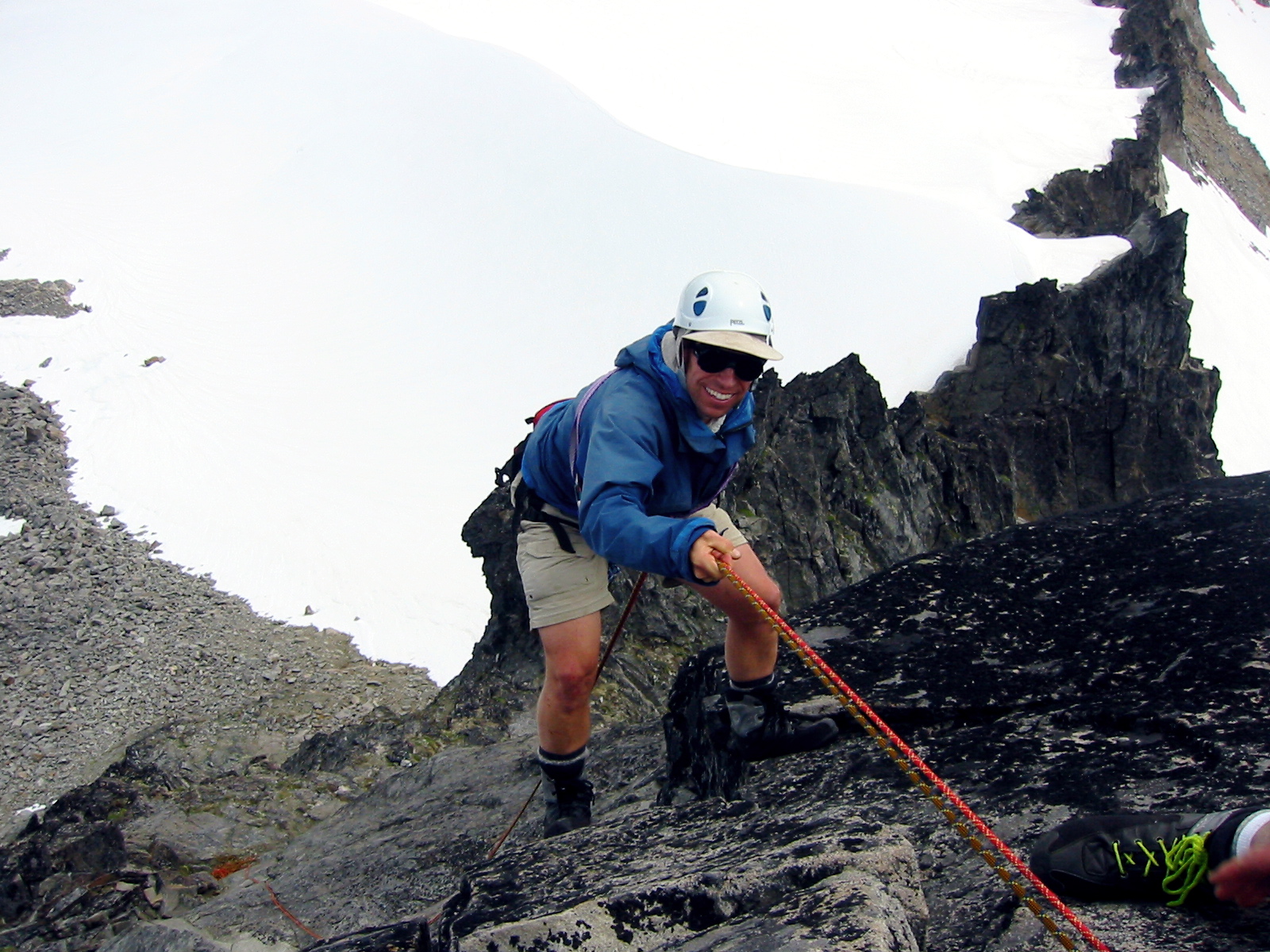
Chris, Kevin, Stan, and I grabbed summit packs and climbed toward Spire Col. Once at the base of Spire Point, we tried in vain to reconcile the CAG route description with the actual features of the peak’s northeast face. Nothing appeared to offer a Class 4 route as advertised. Eventually, Chris roped up and climbed a possible route near the right side of the face, but this turned into 5.7+ climbing after half a rope length, so he rappelled off.
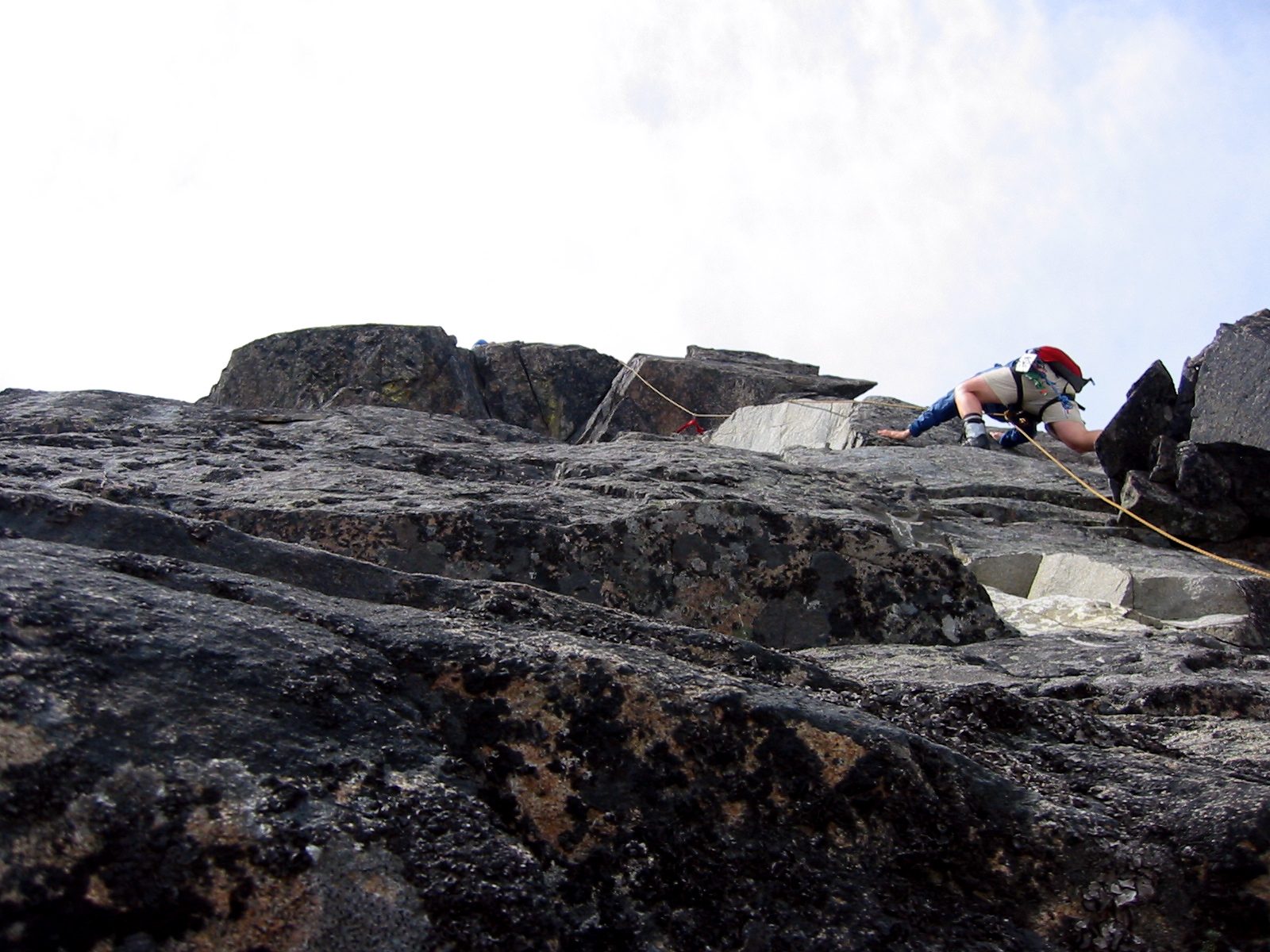
Meanwhile, I had scoped out an easier-looking, narrow gully to the left, and Kevin volunteered to do a reconnaissance scramble. When he gave it a favorable shout, the rest of us followed him to a notch at the gully’s head. This put us at the bottom of an enticing granite face that extended upward about 100 feet to the summit. I was actually hoping to lead this pitch, but Chris tied into the sharp end of the rope without comment and headed up. It turned out to be an elegantly direct Class 5.5 pitch.
- Kevin On Spire Point

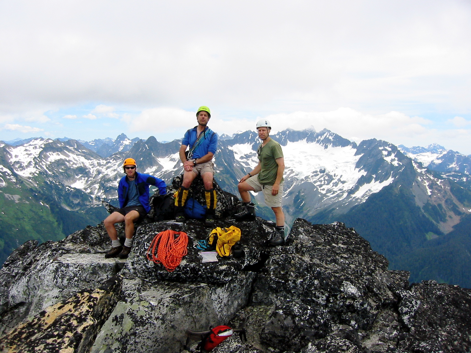
One by one, he belayed us up to the tiny and incredibly exposed summit horn—probably the most precipitous and exhilarating summit I’ve ever been on!
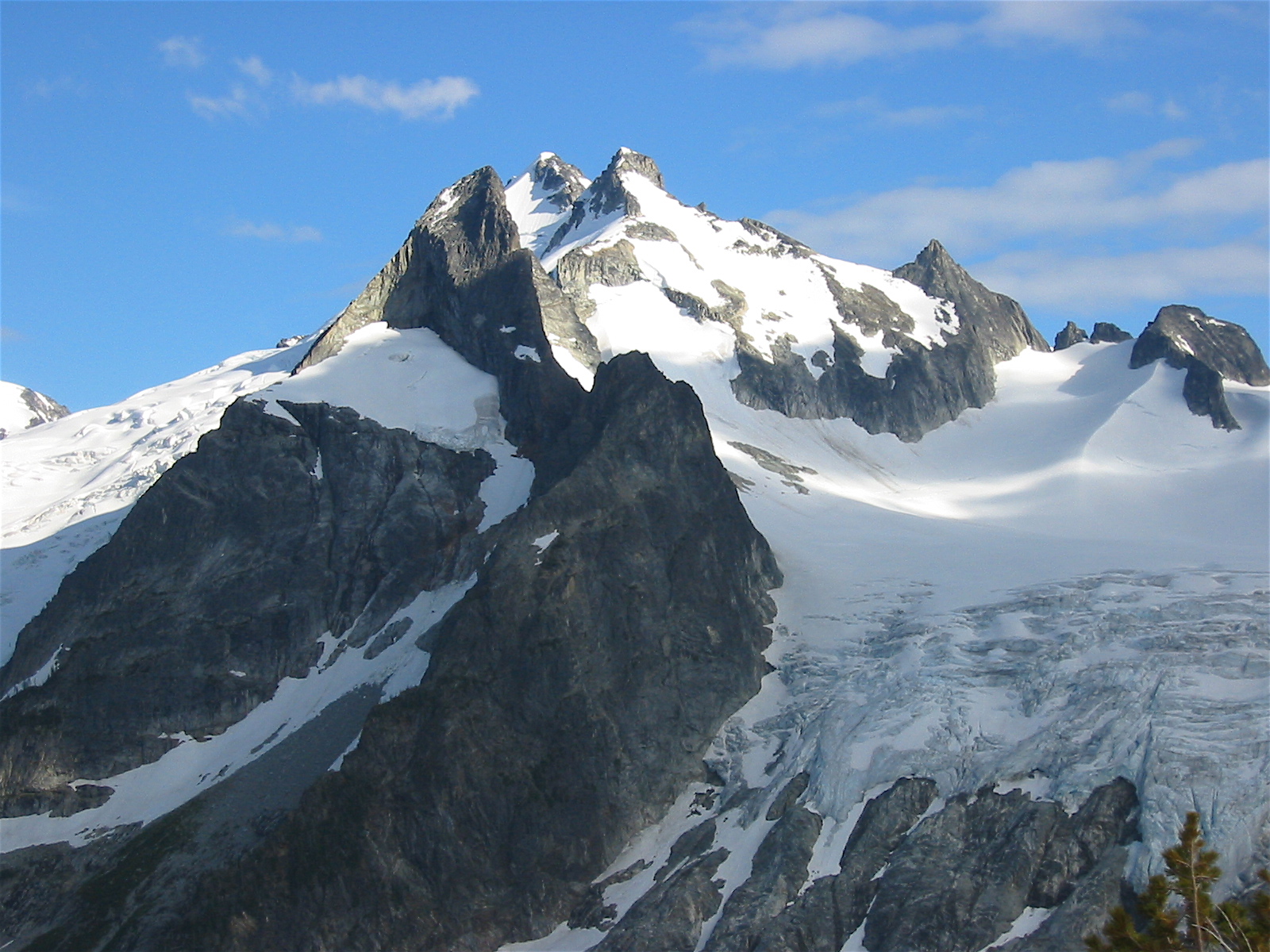
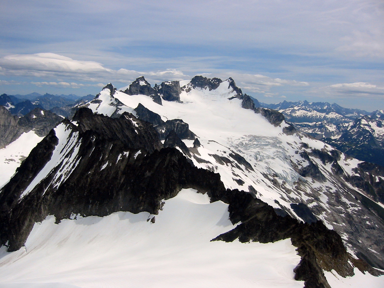
- Dome Peak From Spire Point
During the several hours we spent teasing out Spire Point, the weather had turned cloudy and cold. We left a mini register, made a white-knuckle rappel off the summit horn, which I documented using the last frame of film in my camera. Damn, why didn’t I bring more film?!
- Stan Rappelling Off Spire Point

After rappelling, we quickly down-climbed the rock and snow to rejoin Kathy below. She showed little surprise that, once again, we’d grossly underestimated our return time; such is the life of those who wait for climbers. We all roped up and made a rising traverse across the Dana Glacier toward 7700-foot Dana-Dome Saddle west of Dome Peak.
It was almost 4:30pm when we reached the windy saddle. Dome Peak was now shrouded in clouds, and rain was approaching from the west. Some quick decisions needed to be made. Chris, Kathy, and Stan elected to head down the Dome Glacier—and possibly all the way over to Cub Lake—in search of a suitable campsite. Kevin and I chose to make a run at Dome Peak, since we were so close, and then meet the others at their campsite. Our two groups parted company at 4:40pm.
Kevin led me up the Dome Glacier through light fog, following the boot-tracks of previous climbers. Snowfields above the glacier took us to the narrow, granitic summit ridge just as big raindrops started to fall. We carefully shinnied across the exposed ridge, feeling apprehensive about slipping off the wet rock or being blown off by the wind. This was Kevin’s first climb of Dome Peak, and his summit delight beamed through the blustery storm! I was bummed that I had no film in my camera to record the event. We hastily signed the register and began down-climbing. It was almost 7:00pm when we finally reached the Dana-Dome Saddle, where our backpacks were stashed.
As the rain temporarily abated, we followed boot-tracks down the Dome Glacier, then picked up a nice climber’s path traversing over to Itswoot Ridge. We expected to see the rest of our group somewhere over the ridge, and sure enough, their yellow-green tent was pitched down at Cub Lake. An hour of hiking, slipping, and sliding got us down to the lake circa 8:00pm (12.3 hours from White Rock Lakes), but the yellow-green tent turned out to belong to another group. Where were Kathy, Chris, and Stan? We figured they must have found a hidden campsite on the glacier, with the intention of waiting out the bad weather at a higher elevation. Kevin and I ate dinner in the rain and then turned in.
Day 5: Cub Lake to Downey Creek Bridge
Although the rain fell heavily all night, it had tapered off to a sprinkle by the time we arose for breakfast. We were packed and on the trail to Cub Lake Pass before 7:30am, leaving word with some nearby campers that the rest of our party might be coming through later. (We subsequently found out that they came through about 4 or 5 hours after we left.)
Our hike down the abandoned Bachelor Creek Trail was long and wet, with lots of crawling over logs, squishing across bogs, and bashing through saturated brush. One of my crazy pipe-dreams is that this important access trail will eventually get some long-overdue maintenance. Fortunately, the skies had mostly cleared up by the time we reached the Downey Creek Trail, so that segment of our exit hike was long but dry. We finished off our fabulous trip by climbing over the Downey Creek Bridge and walking the short segment of Suiattle River Road, arriving at our parked vehicle just before 2:30pm (7.0 hours from Cub Lake).
Photo Gallery
Click to enlarge…