Trip Date: August 23 – September 1, 2019
2019 PERU ADVENTURE VACATION
Huayhuash Trekking Circuit: Quartelhuain to Huayllapa to Llamac
Cacanan Pass (15,400′)
Alcay Ridge (16,000′)
Lake Carhuacocha
Carnicero Pass (15,100′)
Huayhuash Pass (15,650′)
Viconga Hot Spring
Cuyoc Pass (16,500′)
Cutatambo Pass aka Santa Rosa Pass (16,600′)
Sarapococha Valley
Rosario Pass (16,700′)
Huayllapa Village
Tapush Pass (15,700′)
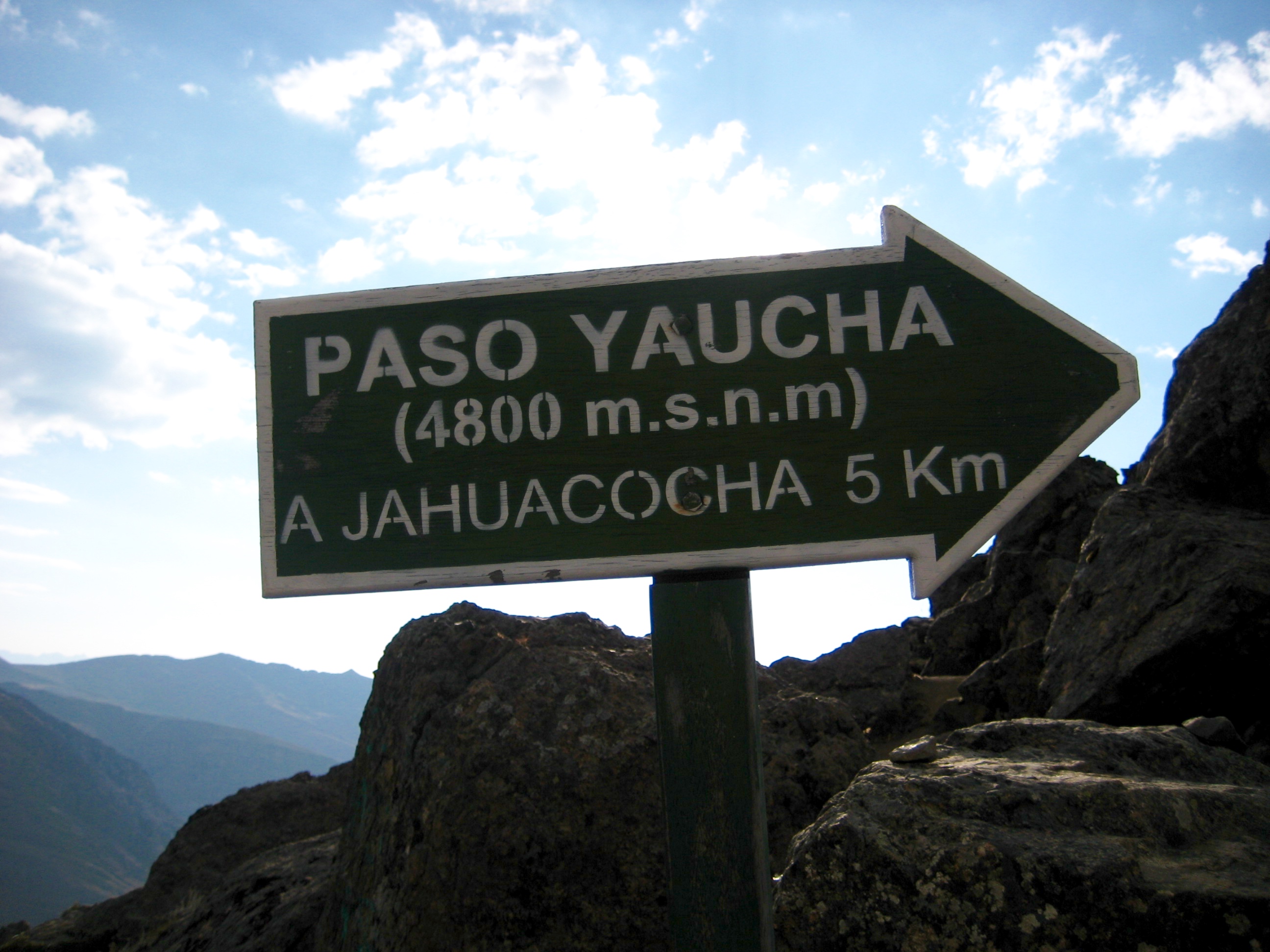
Yaucha Pass (15,900′)
Jahuacocha River
- Trip Report Summary
- Trip Overview
- The Route
- Support Options
- Elevation & Acclimation
- Transportation
- Weather Conditions
- Trail Conditions
- Camping & Accommodations
- Trail & Camping Fees
- Drinking & Cooking Water
- Maps & Information
- Full Trip Report
- Day 1: Huaraz to Quartelhuain to Lake Mitucocha
- Day 2: Lake Mitucocha to Lake Carhuacocha Camp
- Day 3: Lake Carhuacocha Camp to Huayhuash Camp
- Day 4: Huayhuash Camp to Viconga Camp
- Day 5: Viconga Camp to Cuyoc Camp
- Day 6: Cuyoc Camp to Little Lake Juraucocha
- Day 7: Little Lake Juraucocha to Lake Caramarca Moraine
- Day 8: Lake Caramarca Moraine to Huayllapa Village
- Day 9: Huayllapa Village to North Yaucha Basin
- Day 10: North Yaucha Basin to Llamac Village to Huaraz
- Gear Comments & Packing List
- Route Map & Profiles
- Photo Gallery
Trip Report Summary
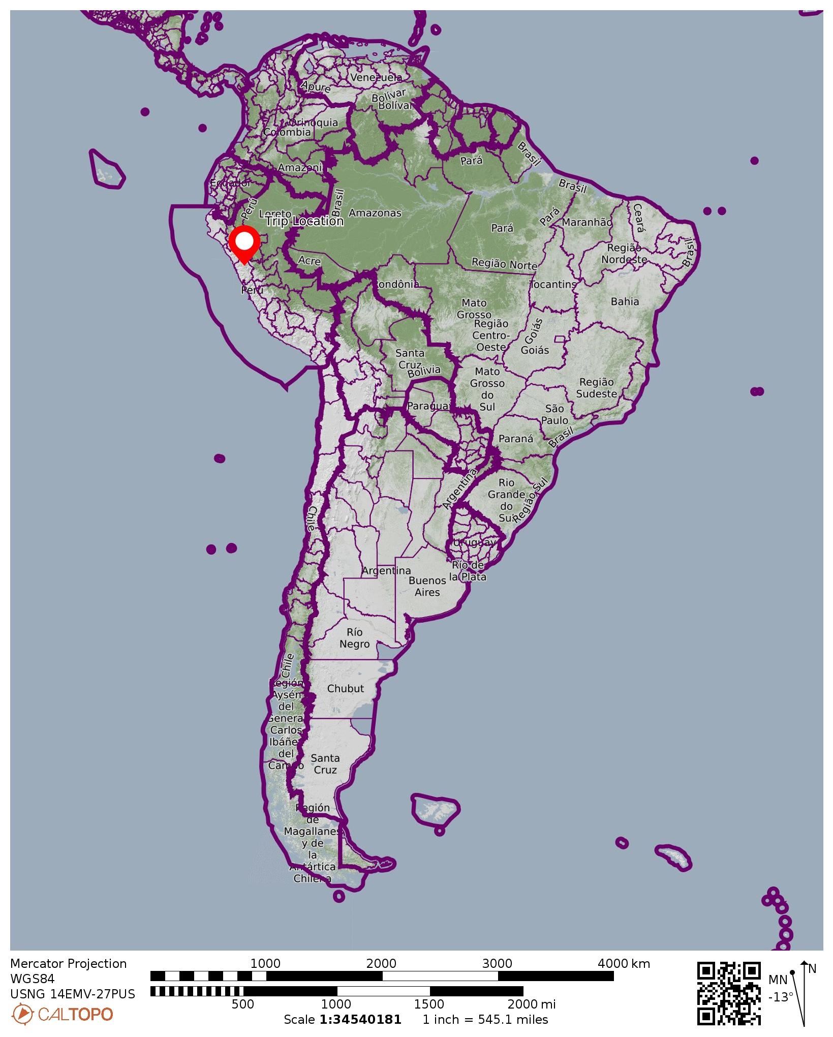
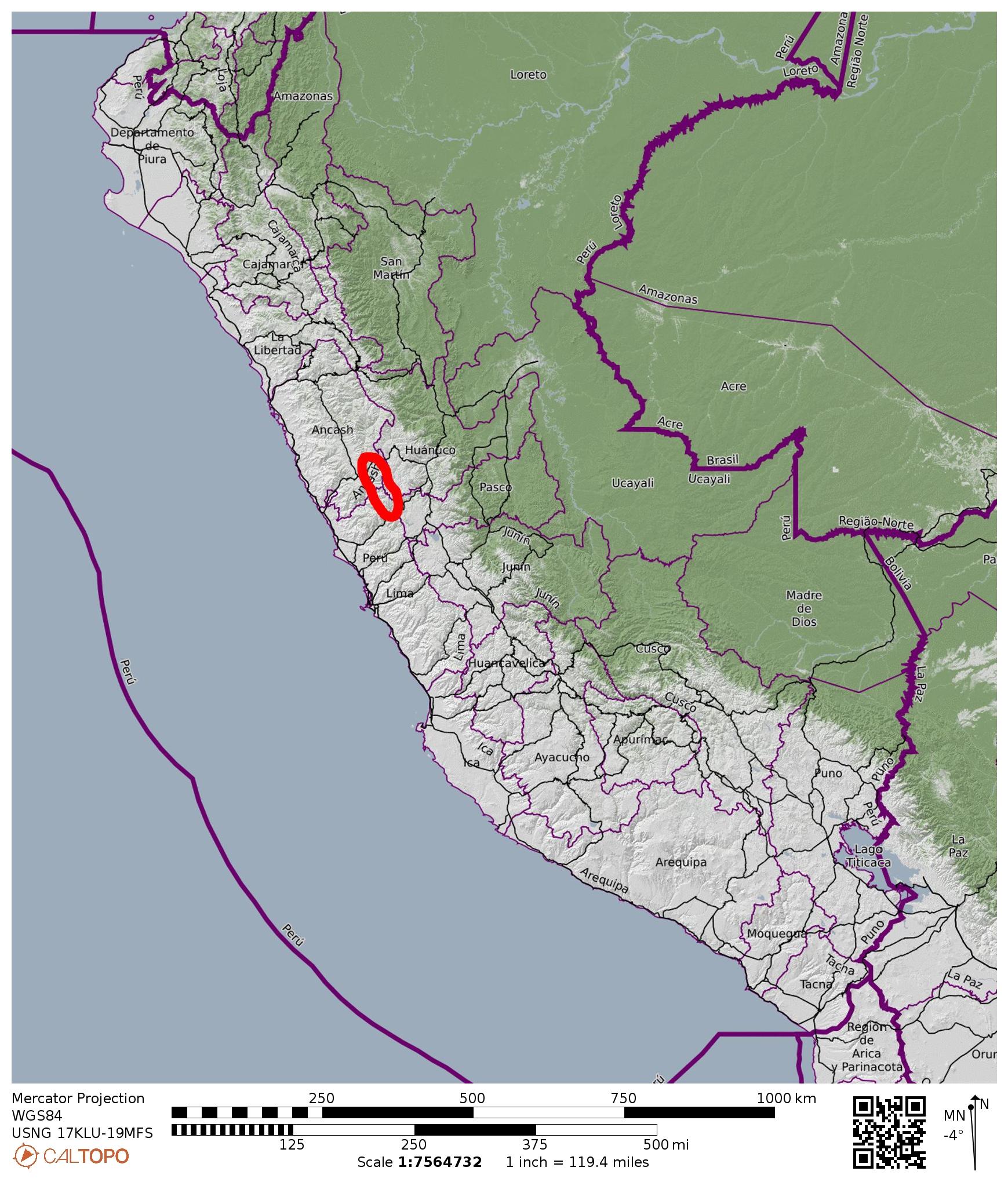
Region: Peru
Sub-Region: Northern Peruvian Andes
Sub-Sub-Region: Cordillera Huayhuash
Area: Cordillera Huayhuash Reserved Zone
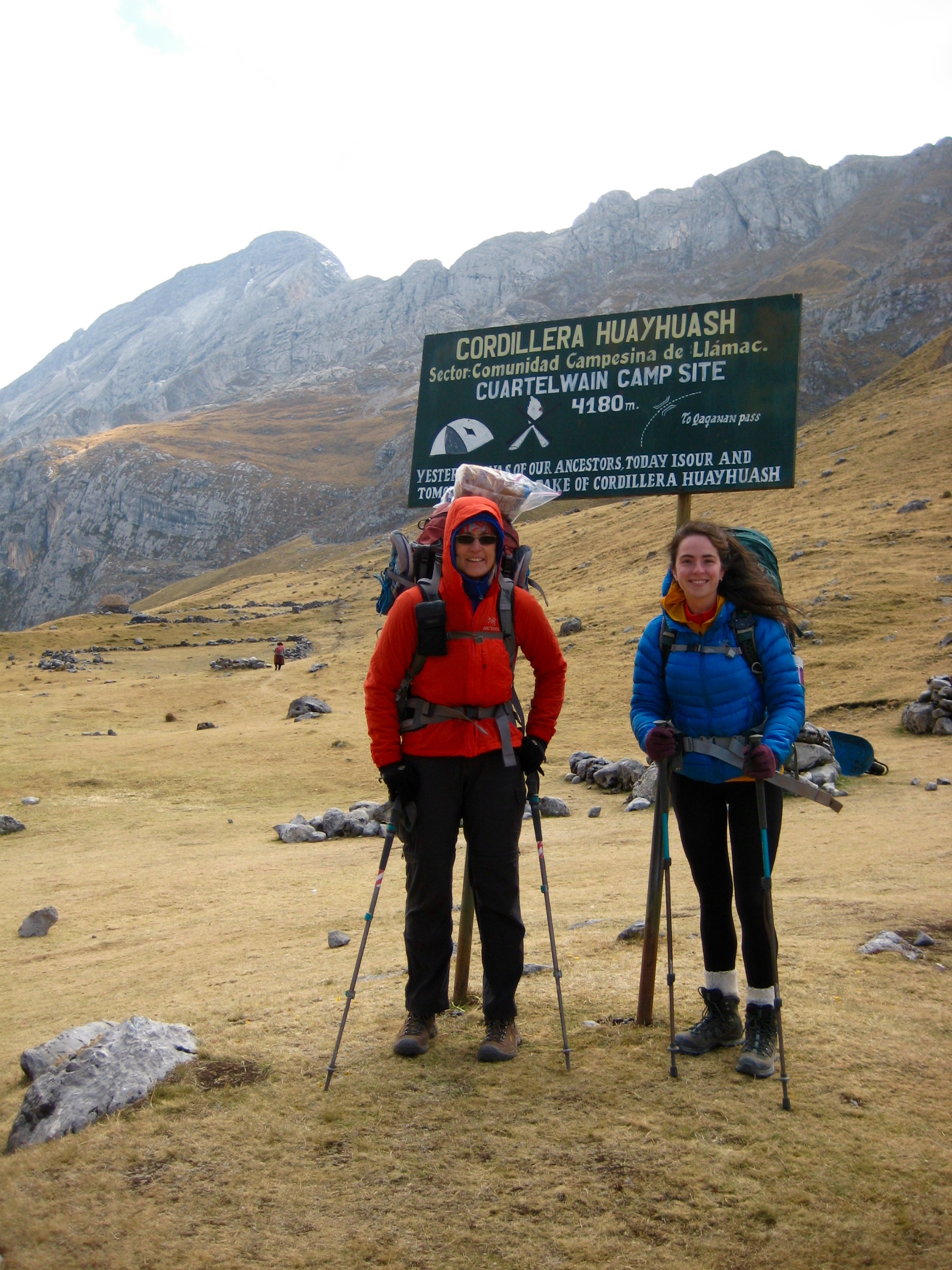
Starting Point: Quartelhuain / Matacancha Trailhead on Llamac Road (Elev. 13,600 feet / 4150 meters)
Way Points: Cacanan Pass & Polish Memorial & Lake Mitucocha & Alcay Ridge & Lake Alcaycocha & Lake Carhuacocha Camp & Atocshayco Valley & Carnicero Pass & Lake Huaracacocha & Lake Carnicero & Huayhuash Camp & Lake Mitococha & Huayhuash Pass & Lake Suerococha & Lake Viconga & Viconga Camp & Cuyoc Pass & Cuyoc Camp & Cutatambo / Santa Rosa Pass & Lake Juraucocha & Little Lake Juraucocha & Sarapococha Valley & Rosario Pass & Segya Pampa & Lake Caramarca Moraine & Segya Valley & Huayllapa Village & Milo Valley & Huatiaq Camp & Tapush Pass & Gashpapampa Camp & Yaucha Pass & North Yaucha Basin & Huacrish Ridge & Jahuacocha River & Pampa Llamac Pass (trail hike & off-trail hike)
High Point: Rosario Pass (Elev. 16,700 feet / 5100 meters)
Ending Point: Llamac Trailhead at Llamac Village on Llamac Road (Elev. 10,600 feet / 3250 meters)
Campsites/Accommodations: Lake Mitucocha & Lake Carhuacocha Camp & Huayhuash Camp & Viconga Camp & Cuyoc Camp & Little Lake Juraucocha & Lake Caramarca Moraine & Huayllapa Village private residence & North Yaucha Basin
Sidetrip: Lake Santa Rosa Moraine viewpoint (off-trail hike)
Approximate Stats: 70 miles / 113 kilometers traveled; 23,000 feet / 7000 meters gained; 26,000 feet / 7900 meters lost.
Trip Overview
Eileen and Brooke and I culminated our Peruvian adventure trip with a ten-day trek along the Huayhuash Circuit in the Cordillera Huayhuash (pronounced “WHY-wash”), about 60 miles southeast of Huaraz. Over the past decade, this circuit has become quite popular and is now widely considered to be one of the Top 10 treks in the world. Looking back at our trek, Eileen and I can’t disagree. Brooke, who has done more international trekking than us, also gave it two thumbs up.
The Route
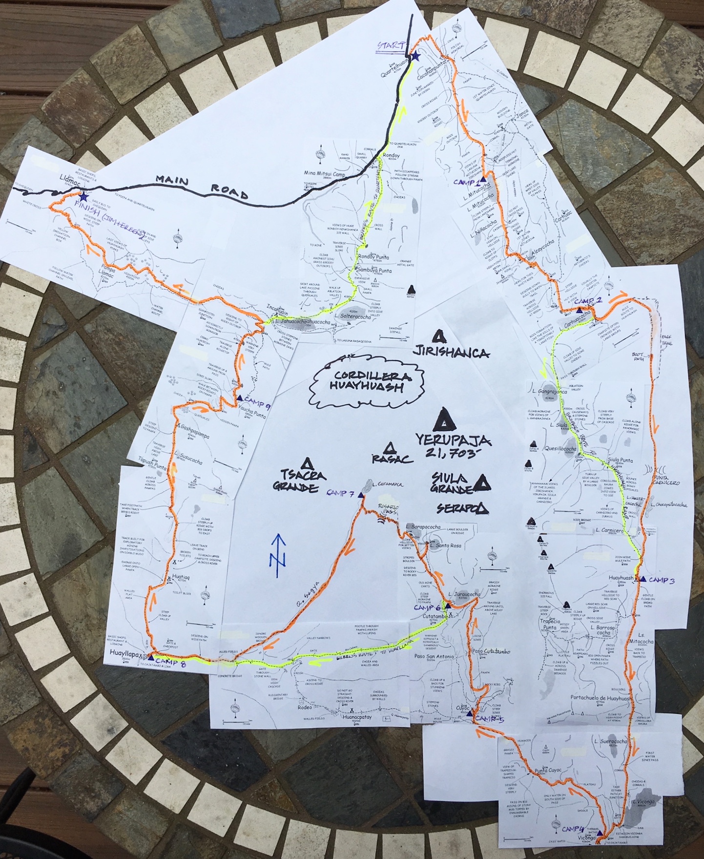
The Huayhuash Circuit is not a specific route on a single trail; instead, it is a general route with numerous variations available over a network of trails. Traditionally, the circuit starts at Quartelhuain (aka Matacancha) and proceeds southward to Viconga Camp, then westward to Huayllapa Village, and then back northward to Llamac Village. This route forms a large “U” shape, with a dirt road connecting the two upper points.
Many hikers close the loop by walking the road about 10 miles between Llamac Village and Quartelhuain (uhhgg!), but a more elegant closure involves hiking a trail northeastward over Rondoy Pass and down to Quartelhuain. Either way, the total distance traveled on foot is approximately 60 to 80 miles, depending on the day-to-day variations selected.
Due to the natural topography of the Huayhuash Circuit, each day typically begins in a valley or pampa (a flat meadow) and then ends in another valley or pampa several miles away. Between these low points, the route usually crosses over a high pass (or two), which involves an ascent ranging from 1500 feet to 3500 feet and a descent in the same range.
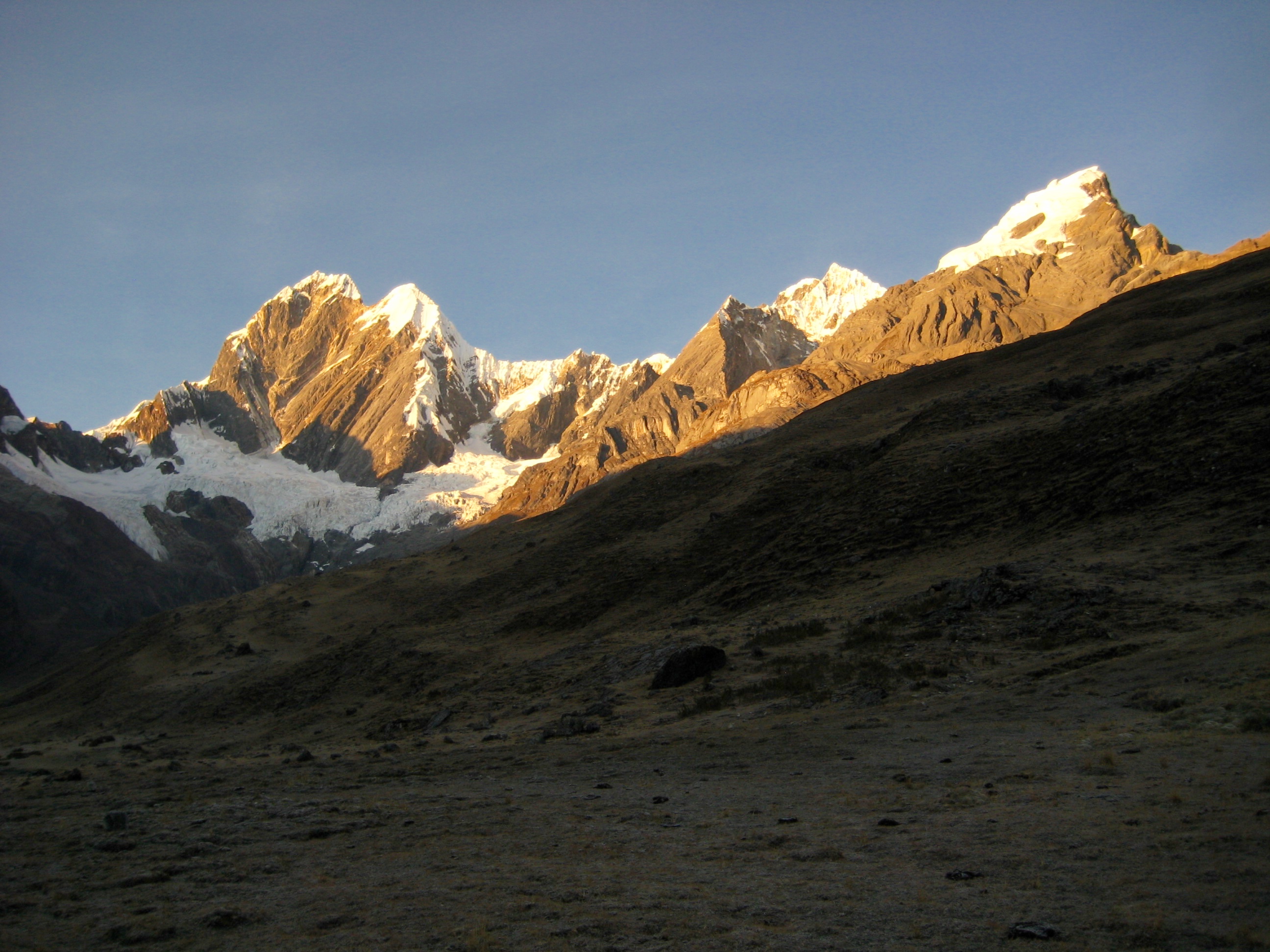
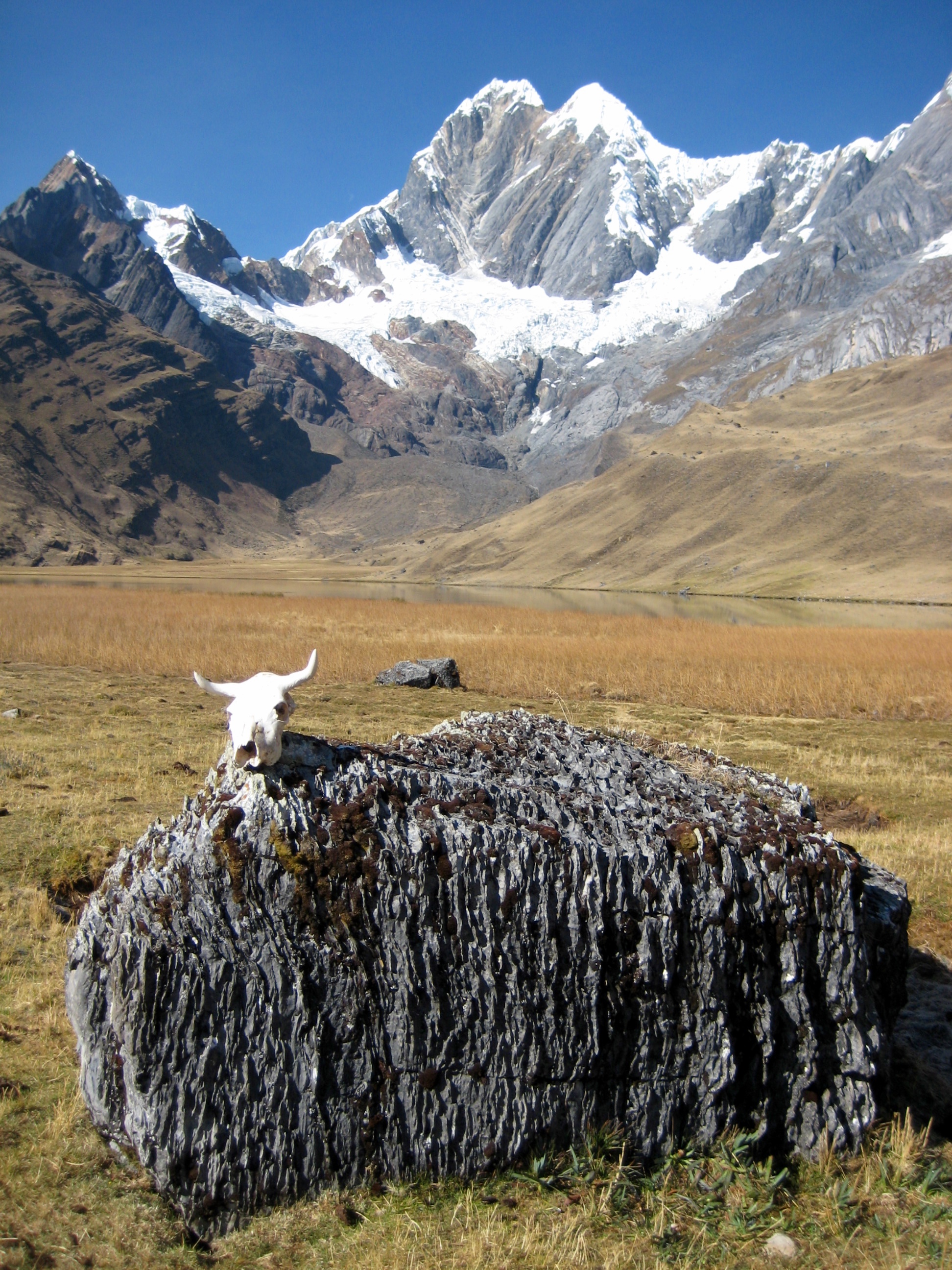
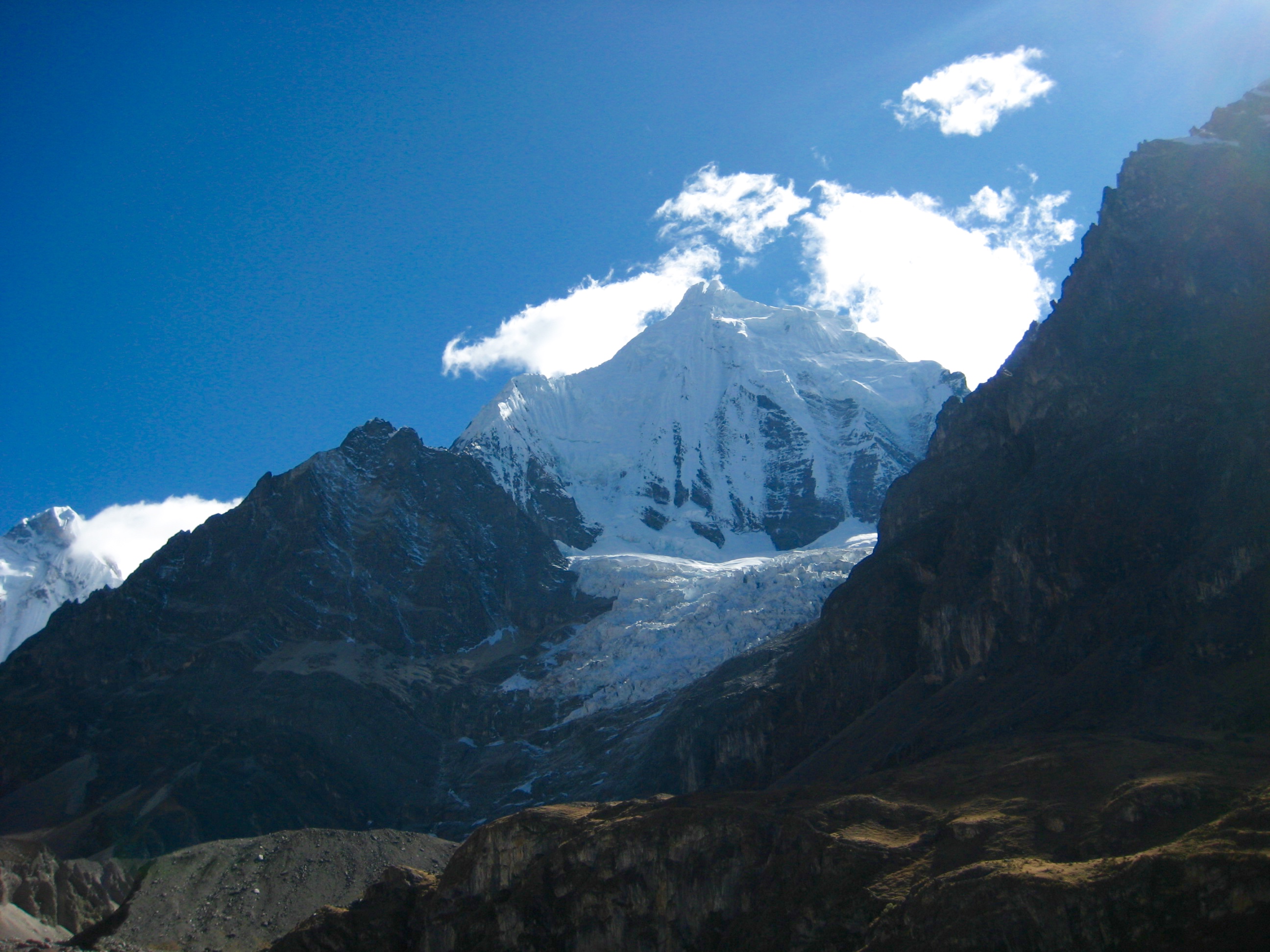
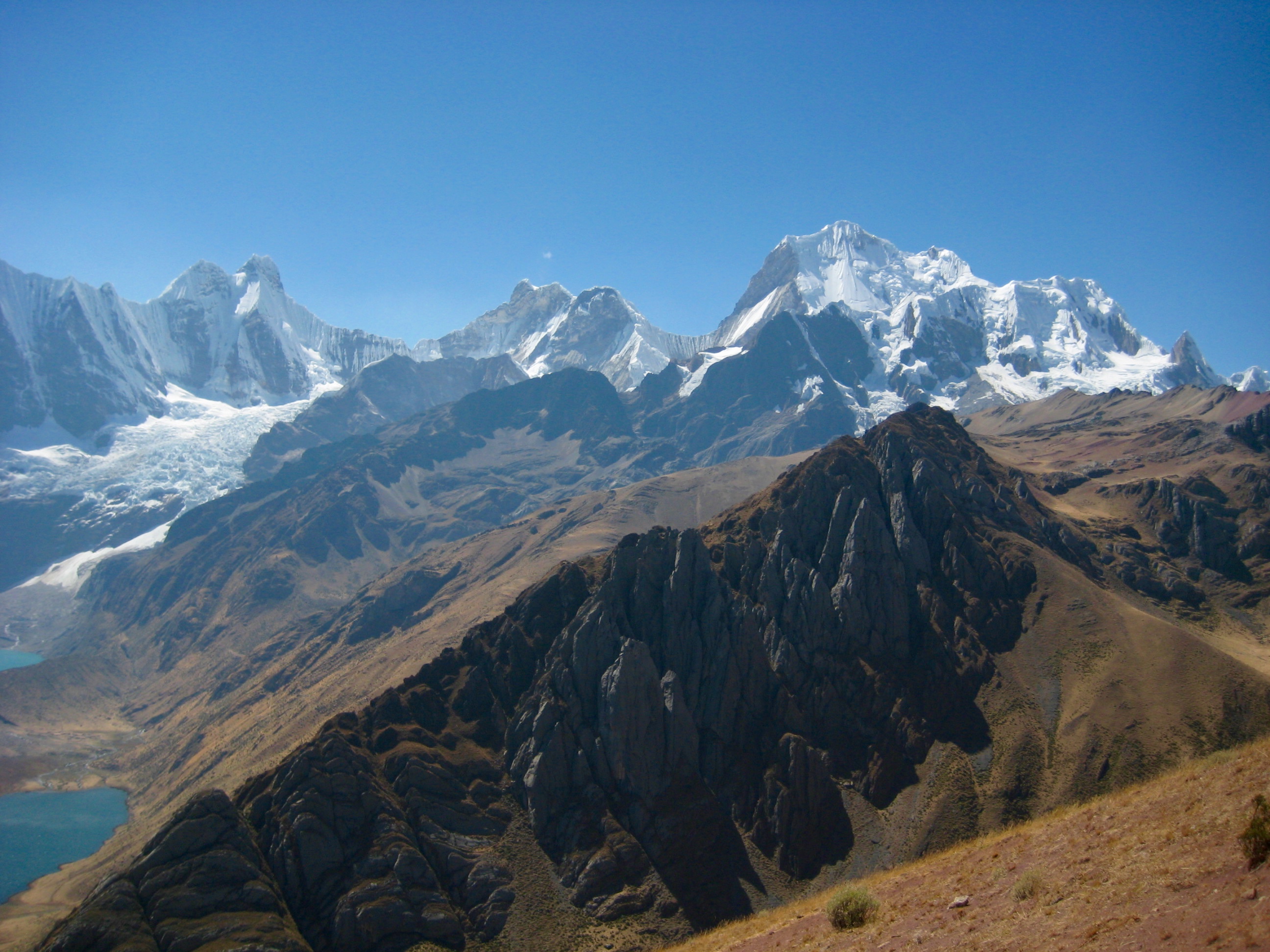
A notable feature of the circuit is that it scribes a big loop around the heart of the Cordillera Huayhuash. This mountain range comprises many major Andean peaks, including Nevado Jirishanca and the infamous Nevado Siula Grande. The crown jewel of the range is 21,709-foot Nevado Yerupaja (“ya-RUPE-a-ha”), Peru’s second highest mountain.
Support Options
The Huayhuash Circuit can be undertaken using one of several different support options. I will describe these as the Luxury Plan, the Premium Plan, and the Economy Plan.
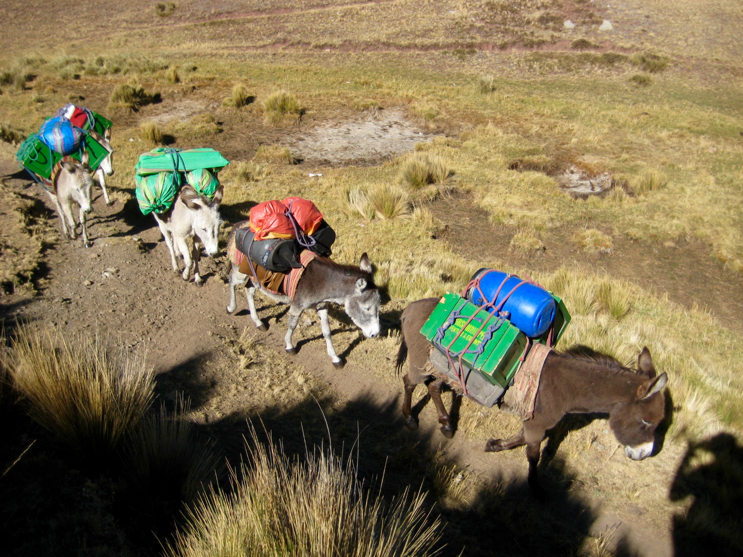
- Luxury Plan: This involves signing up with a trekking company to transport you to and from the trailhead, carry all of your camping gear and food, set up the tents, handle cooking chores, and provide a full-time guide. Most companies supply individual sleeping tents, a cooking tent, and a dining tent. You need only carry a small rucksack between campsites. We were quoted a typical cost of $2600 per person for this package.
- Economy Plan: This involves getting yourself to and from the trailhead, carrying your own camping gear and food in a backpack, and handling all of your own camping chores. In other words, treat it as a normal backpacking trip.
Eileen, Brooke, and I chose the Economy Plan for our trek, not only to save money but also because it gave us maximum flexibility regarding our campsites, routes, and schedule. This flexibility was greatly appreciated during our trek, and we were ultimately very satisfied with our choice. However, I must admit to leering with envy at the small rucksacks worn by the trekking company clients, as I was laboring under my jumbo-size backpack!
Elevation & Acclimation
The traditional Huayhuash Circuit route begins at an elevation of 13,650 feet at Quartelhuain and crosses over eight passes that exceed 15,000 feet, with a high point of 16,600 feet at Cutatambo Pass. For most people, especially those of us who live near sea level, hiking at this high elevation introduces numerous discomforts, including general weakness, breathing difficulties, headaches, and digestive distress—along with the potential for serious edema problems. It is usually advised to spend a week or more at elevations above 10,000 feet before beginning an Andean hike, in order to at least partially acclimate.
Eileen, Brooke, and I attempted to acclimate by completing several high-elevation hikes in advance. Between these acclimation hikes, we stayed in towns (Cusco and Huaraz) that lie at elevations at or above 10,000 feet. All told, we spent ten days at high altitude before beginning our circuit. Additionally, we took Diamox pills and drank the local coca-leaf tea during our acclimation period. I honestly can’t say whether the pills and tea helped significantly, but we did feel reasonably well acclimated by the time we started our circuit. Nonetheless, Eileen and I both found the elevation to be a huge factor, and it made this trek the most arduous and exhausting backpacking trip we’ve ever done.
Transportation
The drive from Huaraz to Quartelhuain takes about 3.5 hours, half of which is on very rough dirt roads. Because no public buses travel all the way to Quartelhuain (they stop at Llamac Village), we hired a private shuttle service, High Summit Peru, to transport us to and from the trailhead. This was more expensive than a public bus, but it saved us from having to walk the 10 miles of dirt road from Llamac Village to Quartelhuain and was well worth the cost. Our driver, Jaime, handled the rough, twisting, dirt roads masterfully. Renting a car in Huaraz and driving to the trailhead would be a frightening experience and is not recommended.
Weather Conditions
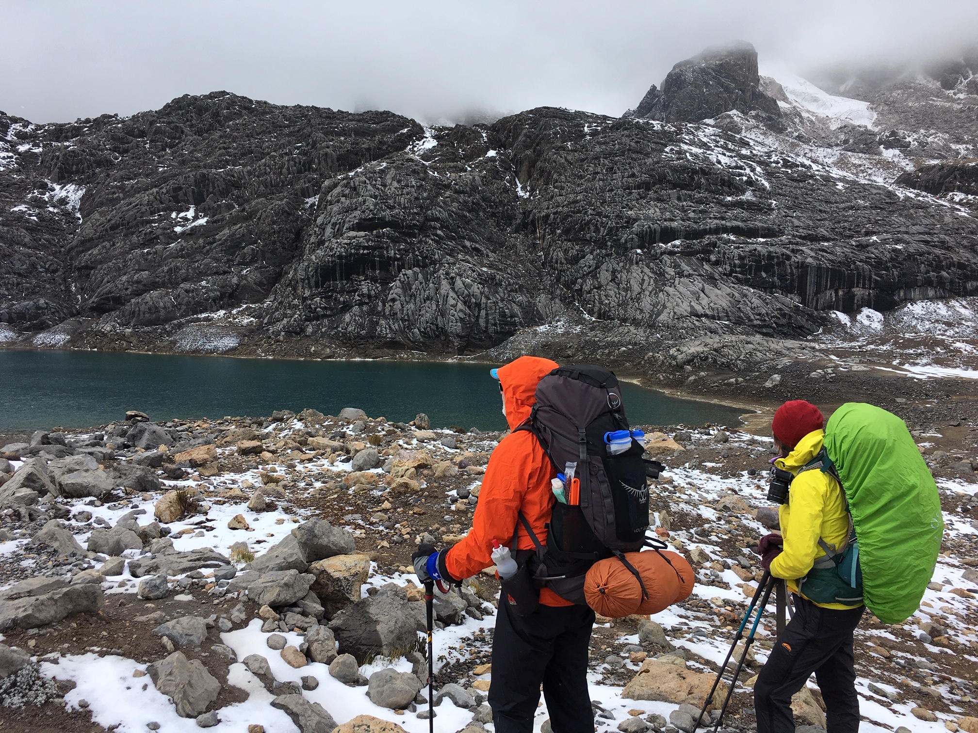
The dry season in Peru extends roughly from May through September, so we did not expect much precipitation during our August trip. At moderate elevations (such as around our campsites), the days tend to be warm and sunny, whereas the nights tend to drop below freezing. At higher elevations (such as at trail passes), the weather tends to be cold and windy. Furthermore, rain or snow storms are common at all elevations, even during the dry season. This all means that hikers must carry enough clothing and gear to span a wide range of weather conditions. We experienced several sudden weather changes during our trek.
Trail Conditions
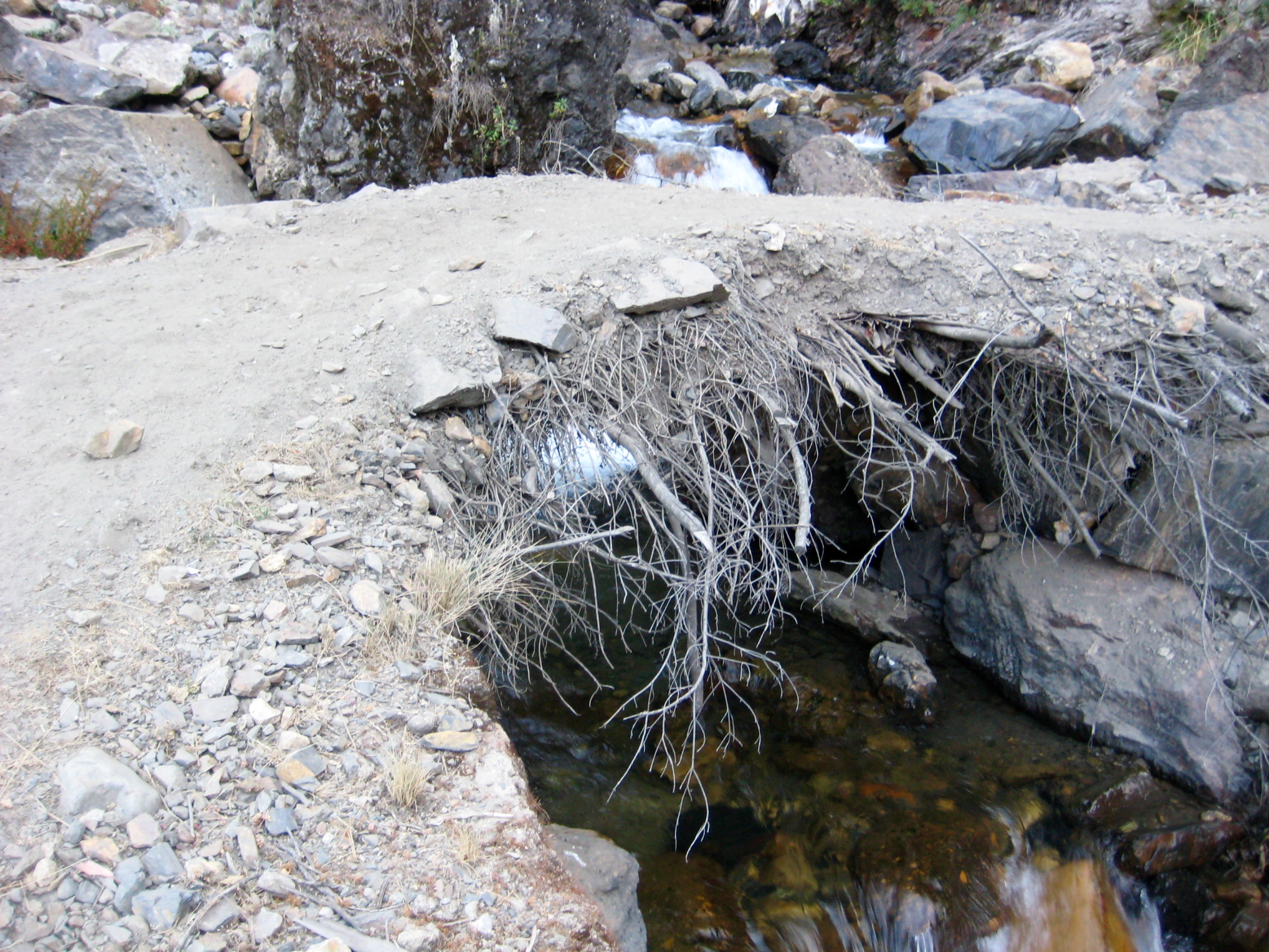
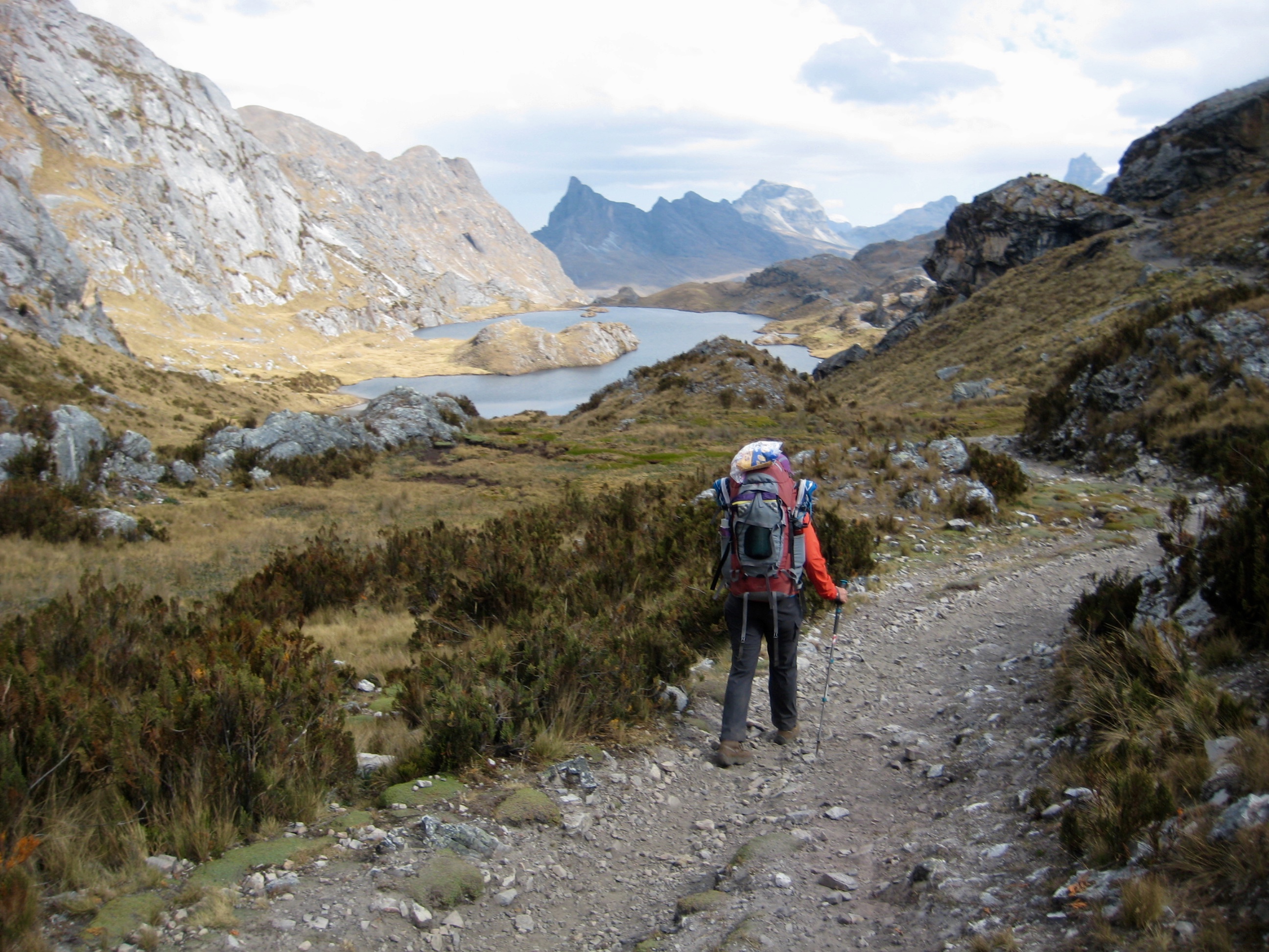
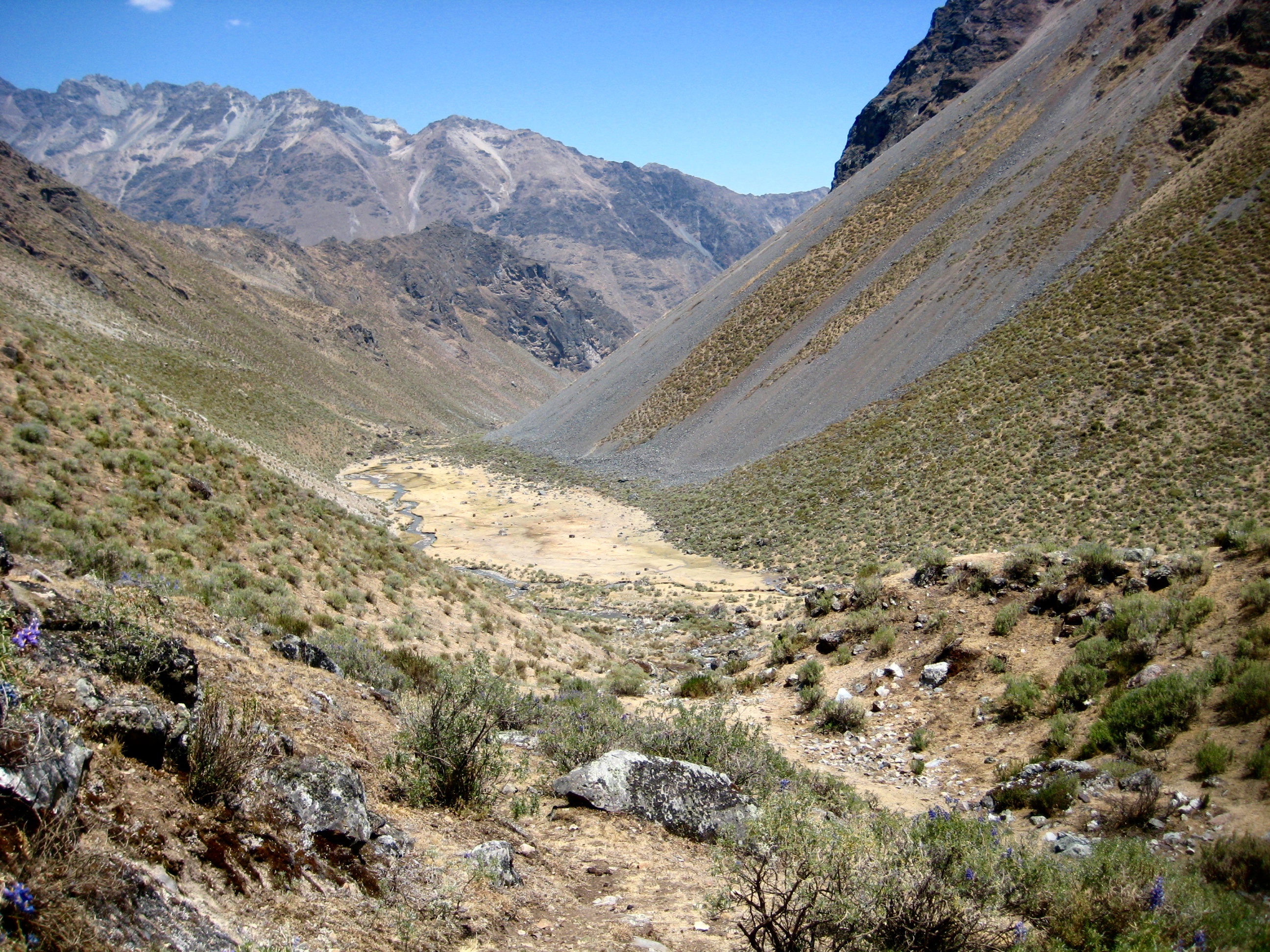
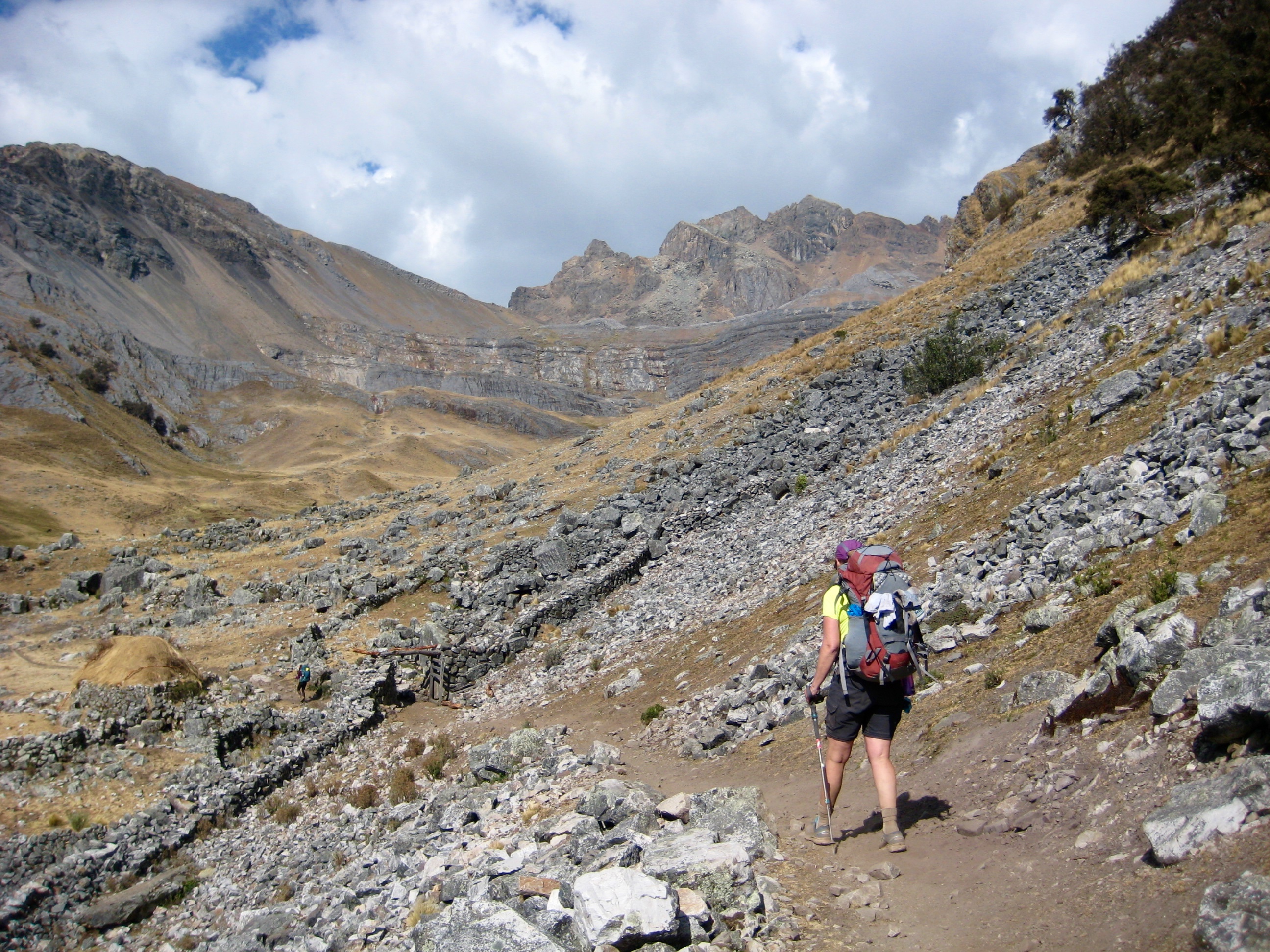
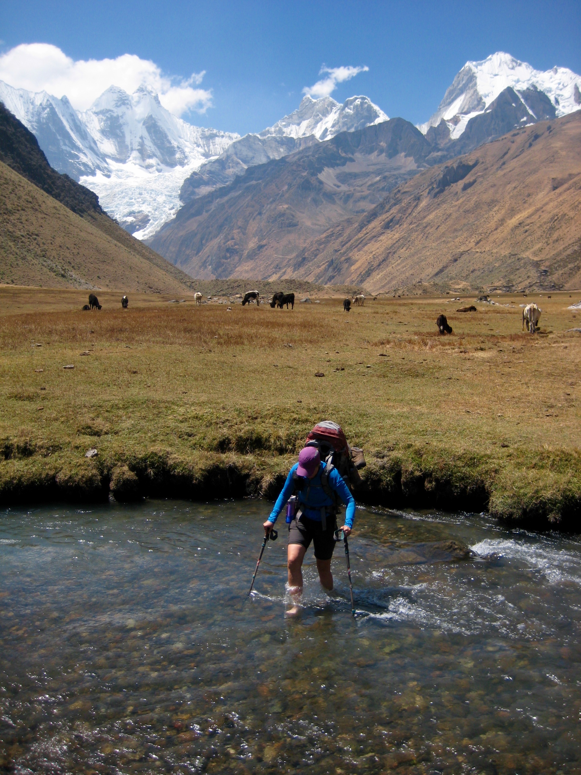
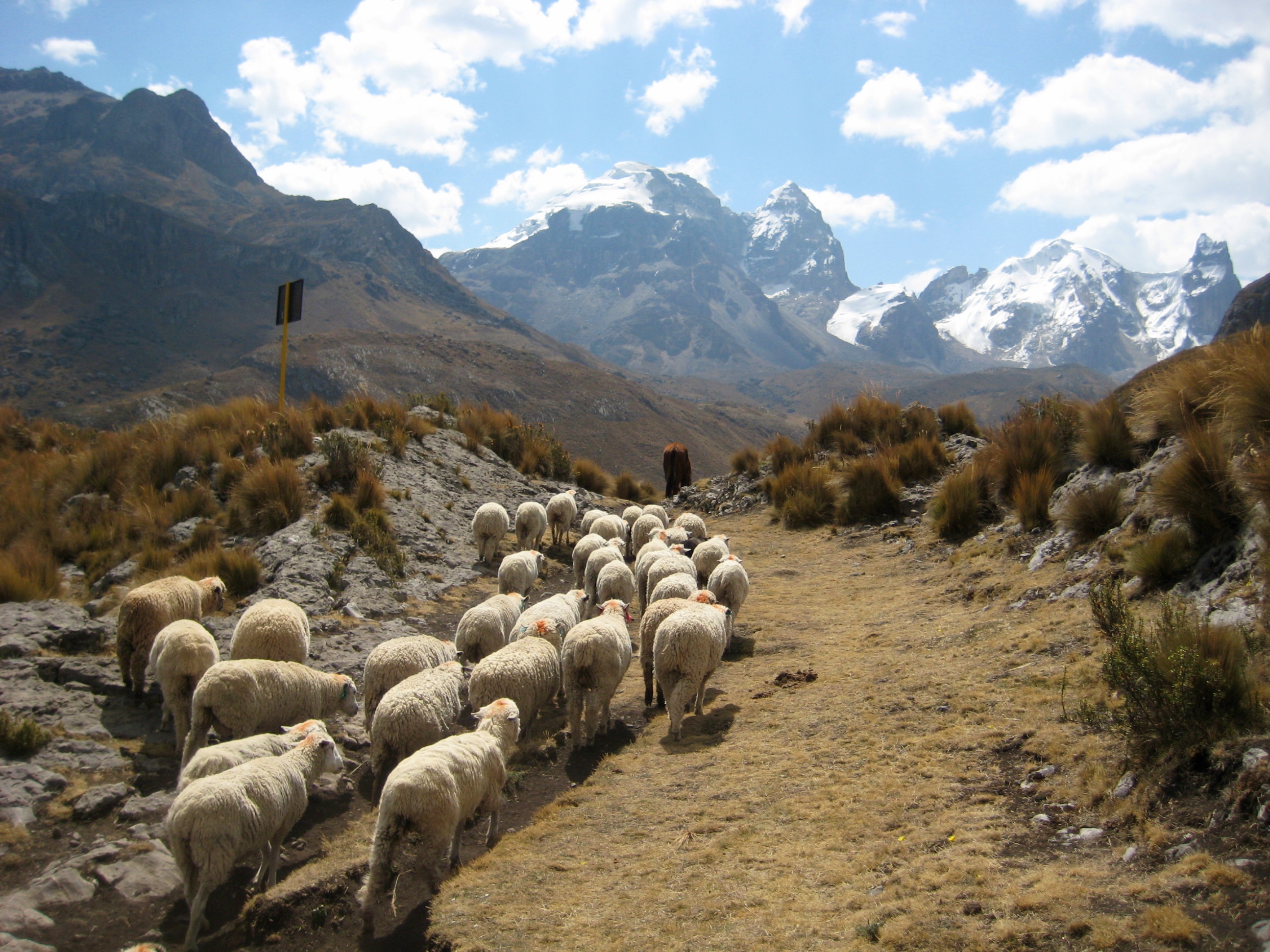
The Huayhuash Circuit encompasses many different trails following various routes. Connecting all campsites, there is a primary trail used by pack animals (horses, mules, and donkeys carrying gear and food) as well as by hikers. These pack trails are typically wide tracks covered by loose dirt and rocks, with occasional areas of mud—all in all, not very appealing.
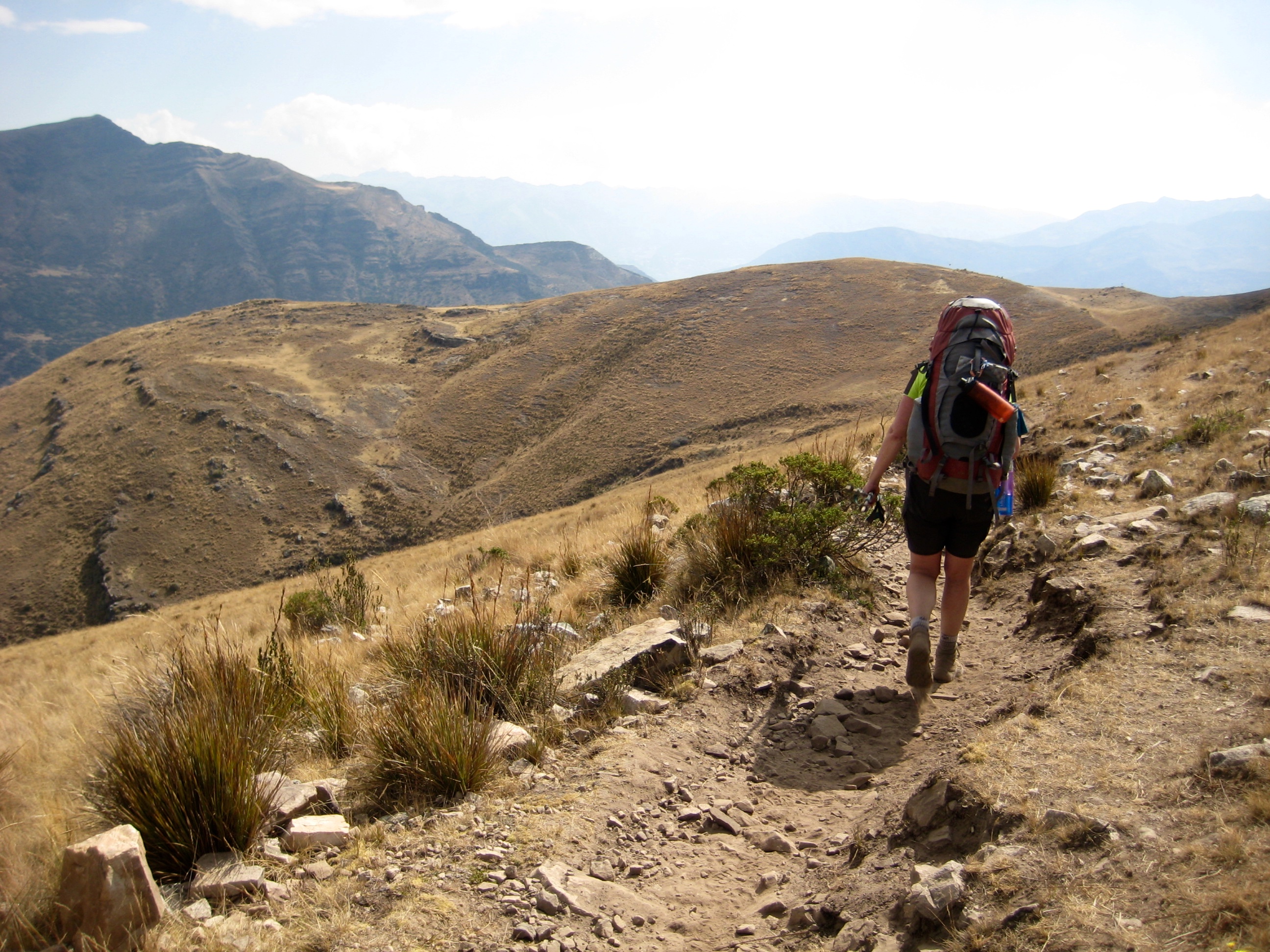
In many locations, a hiker-only trail is available as an alternative to the pack trail. These alternative trails tend to be well-trodden, narrow tracks that take a higher and more scenic route than the pack trails. Additionally, there are numerous alpine trails that go over remote passes and connect adjacent valleys. Some alpine trails are well-traveled and easy to follow, whereas others are nothing more than a vague bootpath.
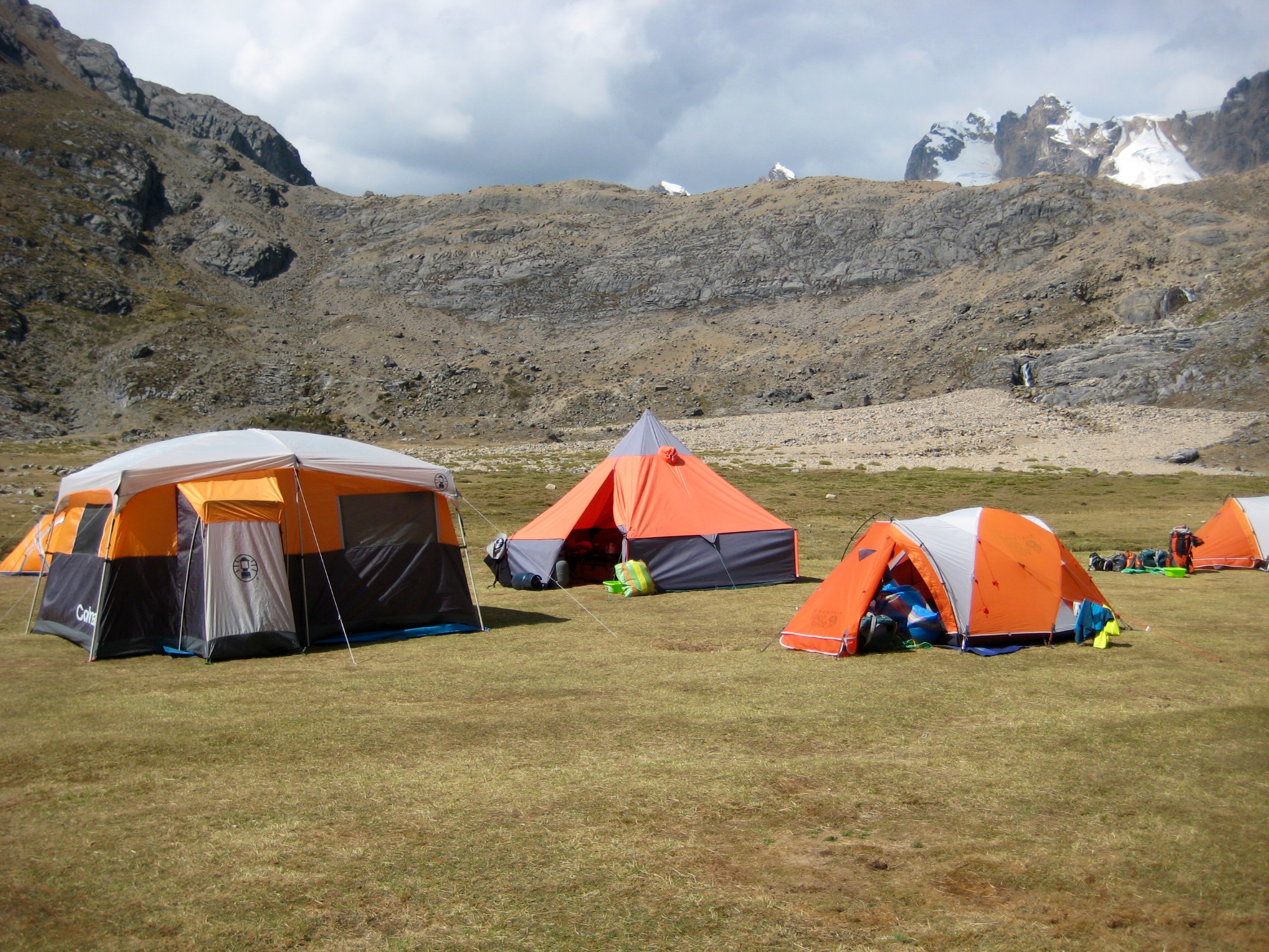
Camping & Accommodations
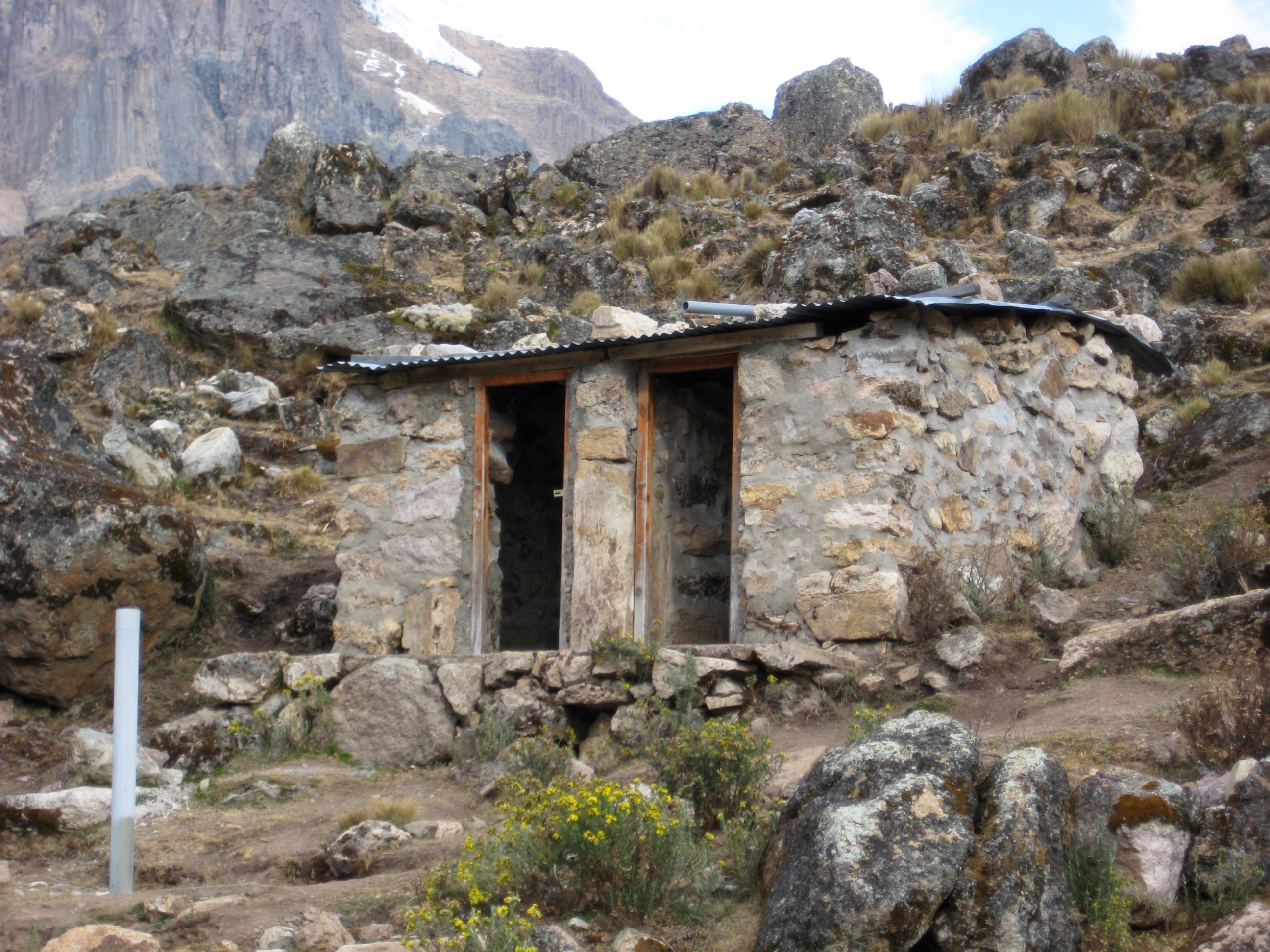
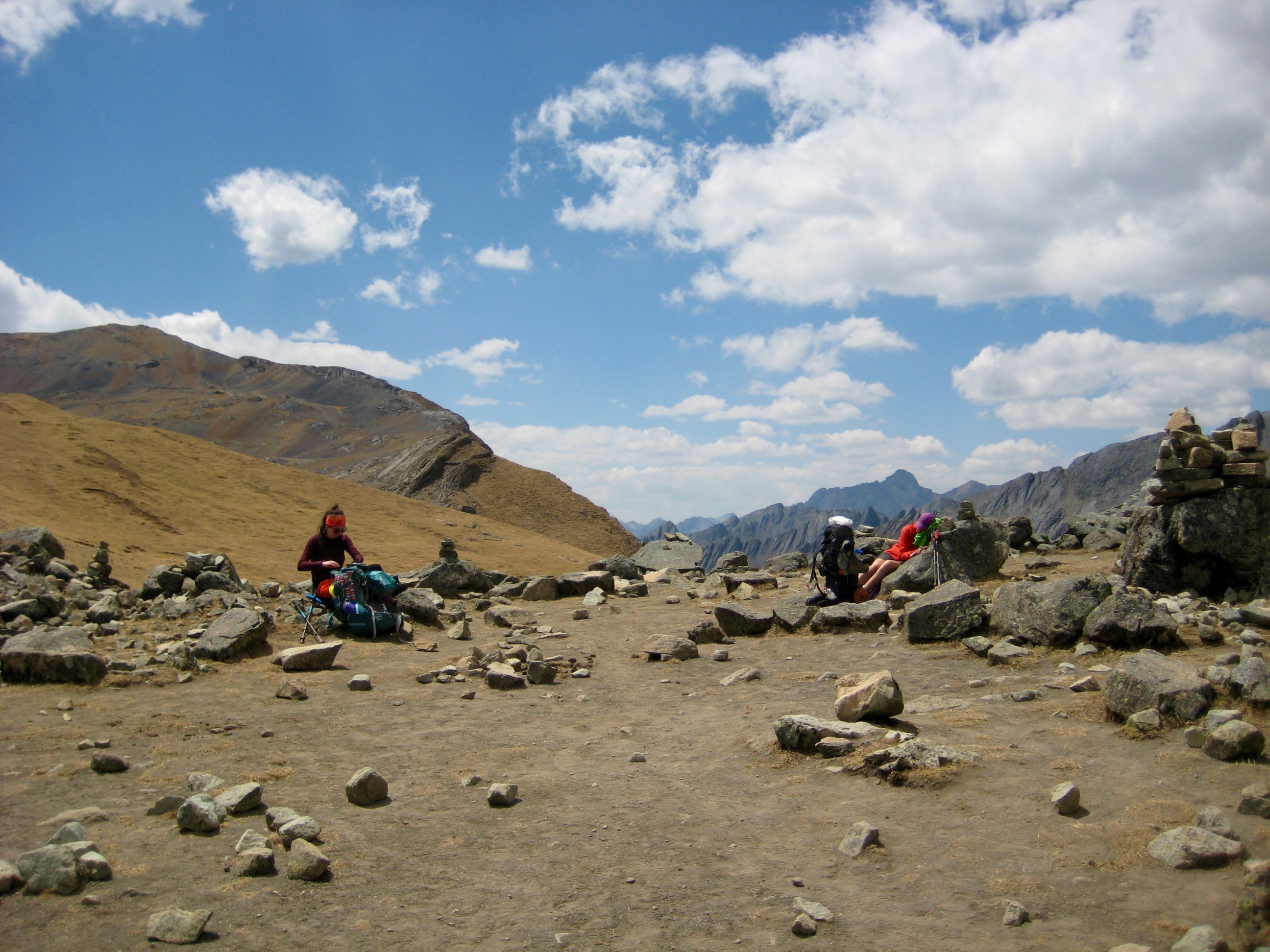
Established campsites are spaced along the route at intervals ranging from a half day of hiking to a full day of hiking. The local setting varies considerably from one campsite to another, but each one has the critical amenities: plenty of flat ground, usually covered with grass; a bano (restroom), often of shockingly primitive design; and cooking water, either from a spigot or a nearby creek (but see my comments below regarding water). You can expect to share the established campsites with several other parties, yet there is always enough room to spread out.
Although backcountry, or wild, camping is not prohibited, it is officially discouraged. We wild-camped on three occasions during our trek, purely out of need. For those trekkers wanting a break from their tent, hotel rooms are available at Huayllapa Village, which is encountered about two-thirds of the way through the circuit.
Trail & Camping Fees
Interestingly, the Huayhuash Circuit crosses over lands that are not owned by any federal or district agency; rather, the various land areas are owned by local communities. Currently, eight different communities own the land, and each one charges a fee for crossing over or camping on their land. A cobrador (ticket seller) is stationed at each established campsite to collect the fee. We typically paid about $7 to $12 per person per site.
Drinking & Cooking Water
Cows, sheep, llamas, and other livestock are ubiquitous in the mountains of Peru, even above 16,000 feet. Consequently, all mountain lakes and streams are assumed to be contaminated, and the water must be boiled, filtered, or chemically treated. This includes water from campsite spigots, and even water from hotel sinks. In camp, we usually boiled water for drinking purposes. On the trail, we used a filter to obtain drinking water from streams.
Maps & Information
We relied on three sources of information for planning and routefinding purposes, and all three sources were invaluable throughout the trek.
- Trailblazer guidebook: Hiking & Biking Guide to Peru’s Cordilleras Blanca & Huayhuash, by Neil & Harriet Pike. This is currently the definitive guide to the Huayhuash Circuit.
- Topographic map: Alpenvereinskarte Cordillera Huayhuash (Peru), by Gerhart & Annemarie Moser. This is currently the best (and perhaps only) map for the Huayhuash area, and it shows the primary trails.
- Topographic maps: Offline Topo Maps with Gaia GPS. These electronic maps show not only the primary trails but also many of the high alpine trails.
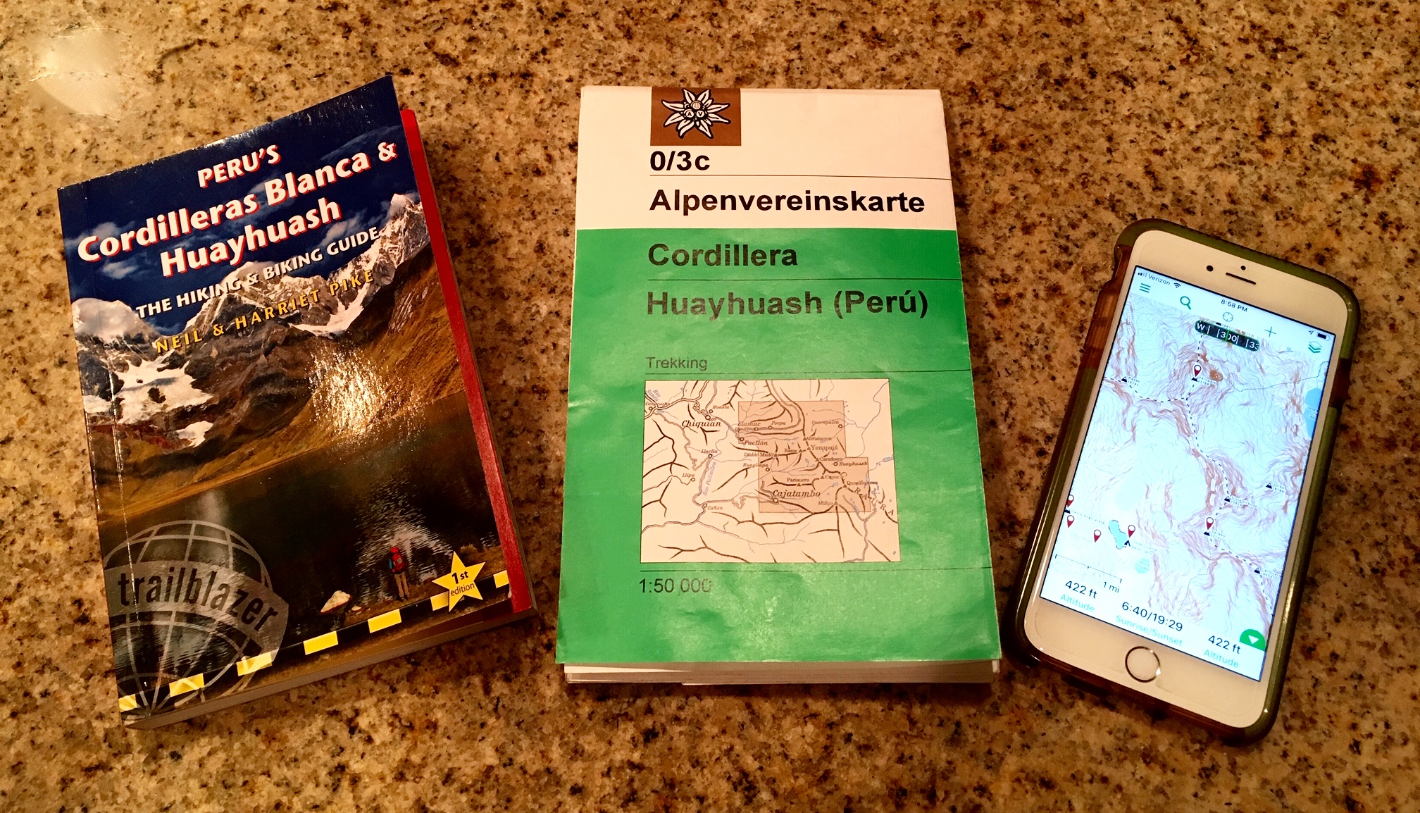
A fourth source of information was Marco Reyes, the owner and head guide of High Summit Peru. We camped near Marco’s trekking group for several nights of our circuit, and he was extremely helpful in supplying advice about the various trail options.
It should be noted that there seems to be much inconsistency between the geographic nomenclature used by these three information sources. It is not unusual to see two or three different names used for the same feature. I have tried to use the most common name. Also, the book, maps, and trail signs tend to use the terms abra, alto, paso, portachuelo, and punta somewhat interchangeably when referring to a mountain pass or ridge saddle. Rather than add to the confusion, I have consistently used the term pass in my text.
Full Trip Report
Day 1: Huaraz to Quartelhuain to Lake Mitucocha
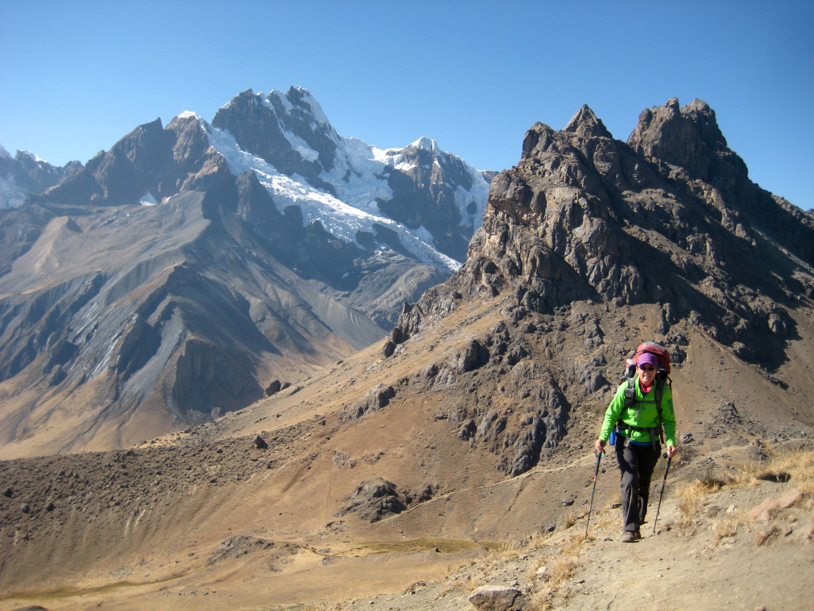
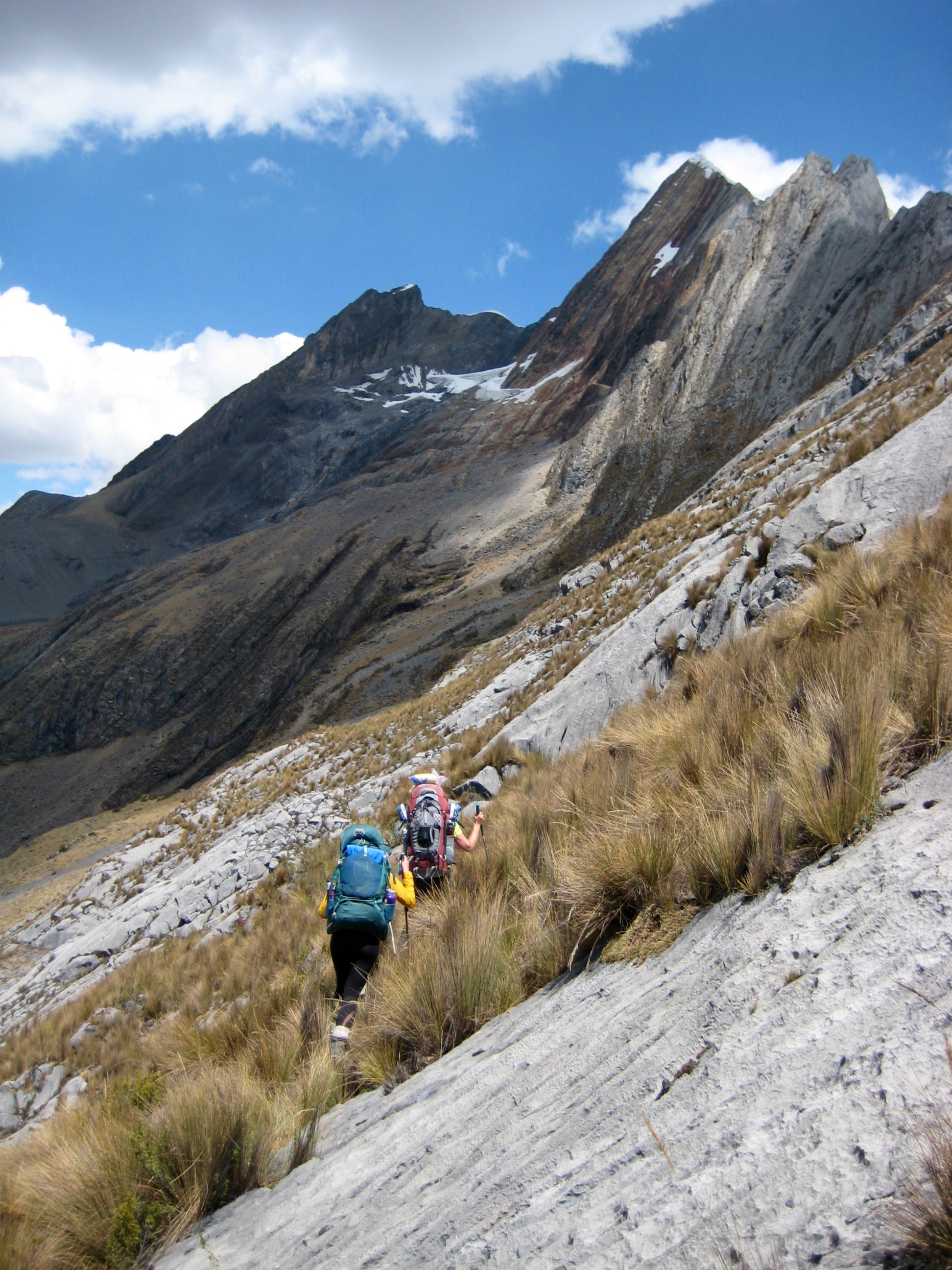
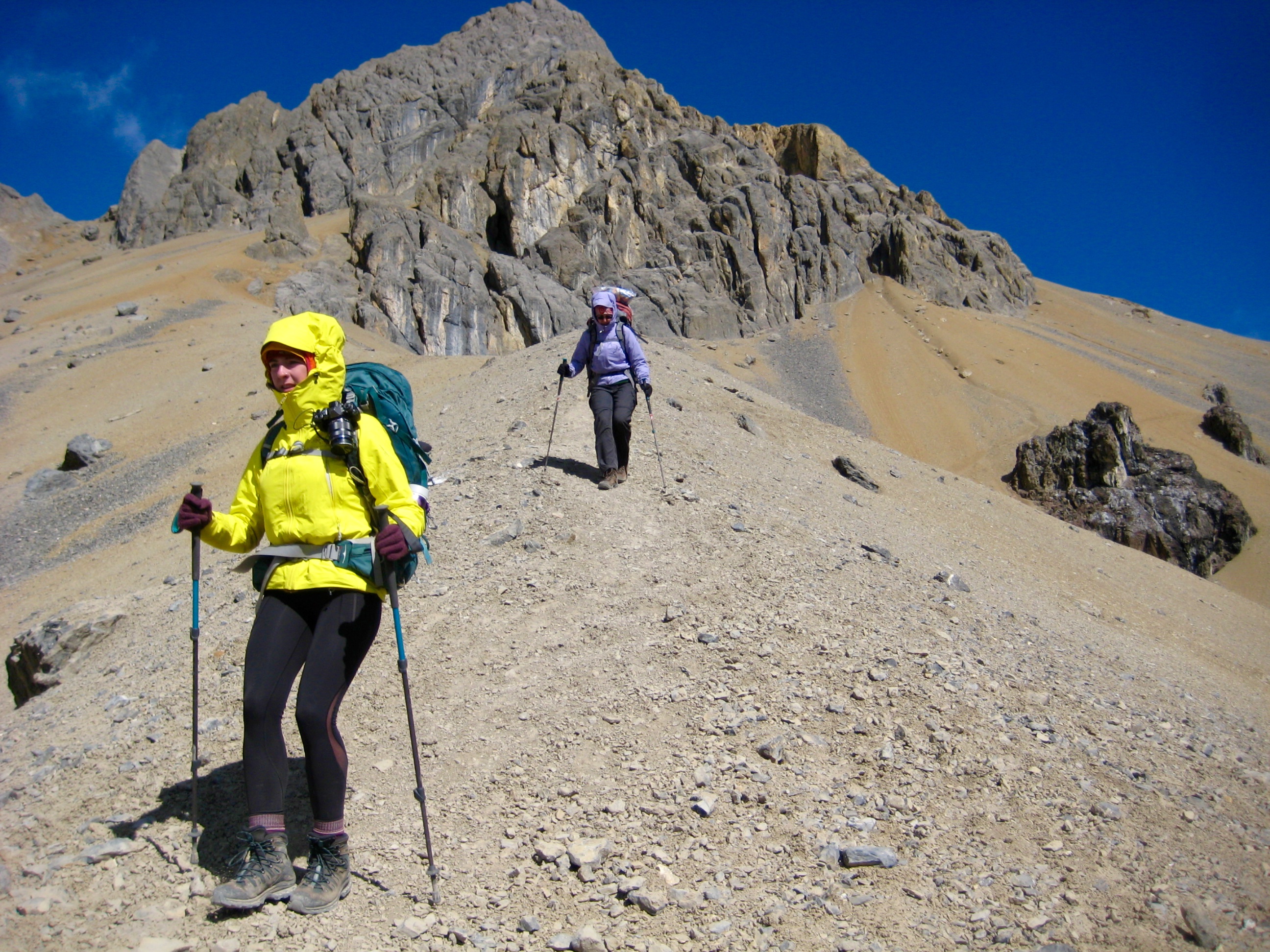
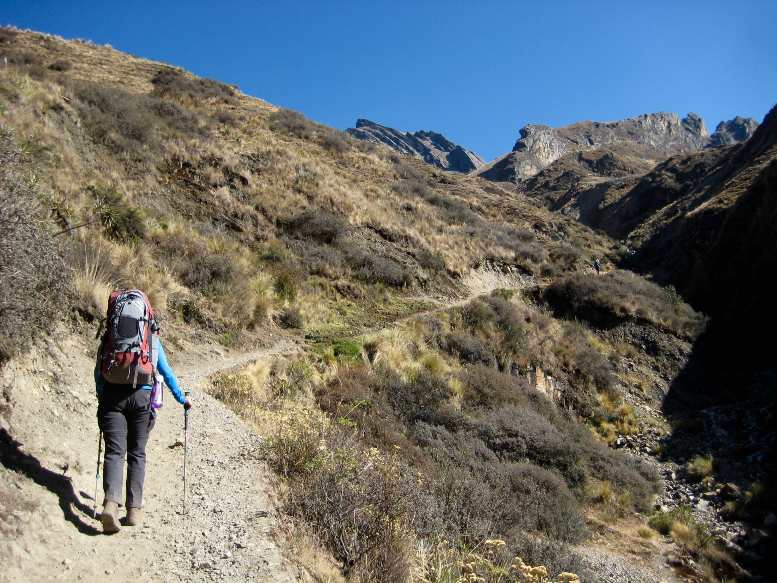
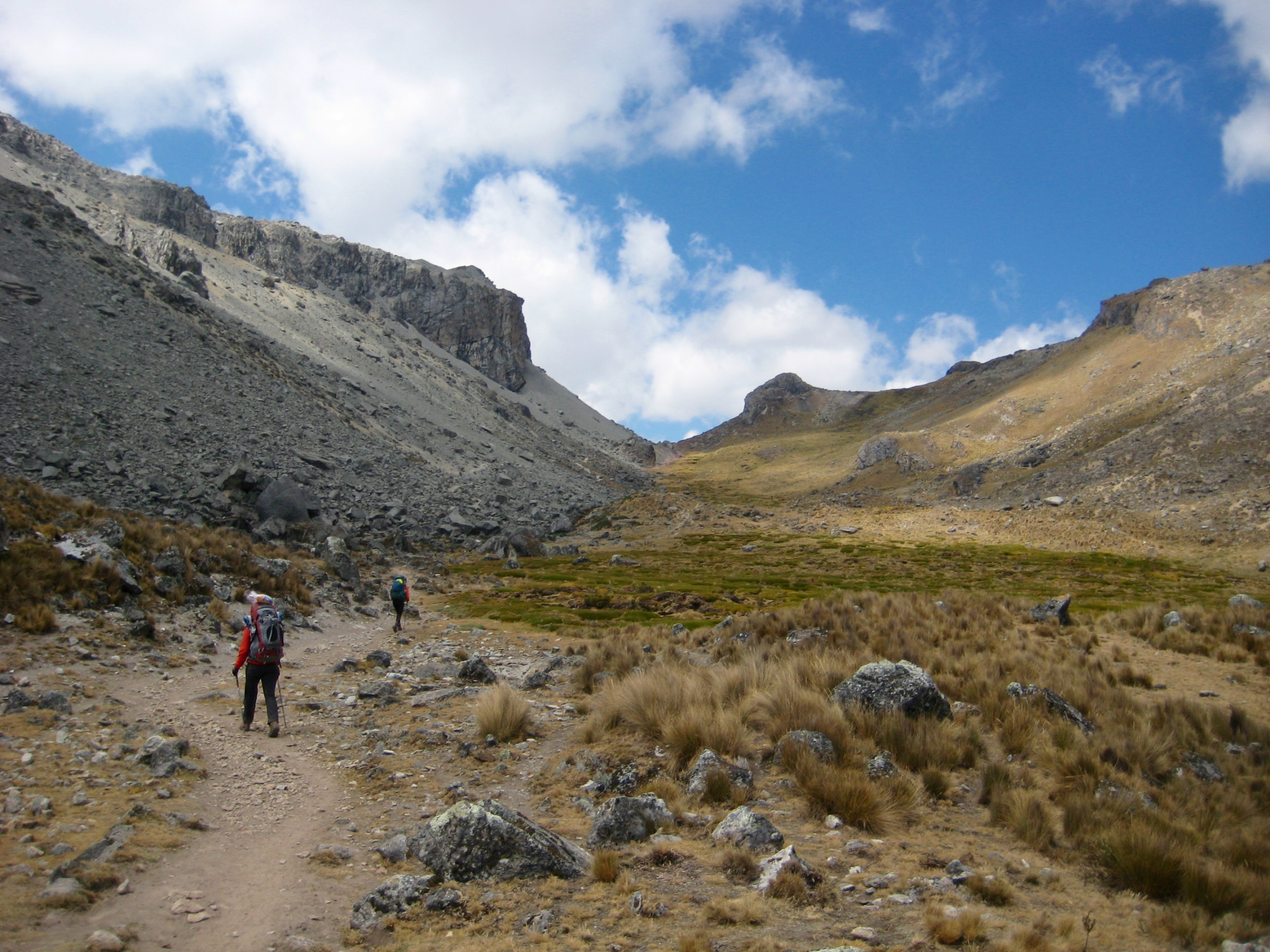
Jaime, our High Summit Peru driver, picked us up in Huaraz at 5:00am and dropped us off at the Quartelhuain Trailhead at 9:15am. It was cold, windy, and gray—all of which tossed a somber shroud over the beginning of our trek. We finished distributing our group gear, shouldered our disconcertingly heavy backpacks, and started up the well-trodden pack trail.
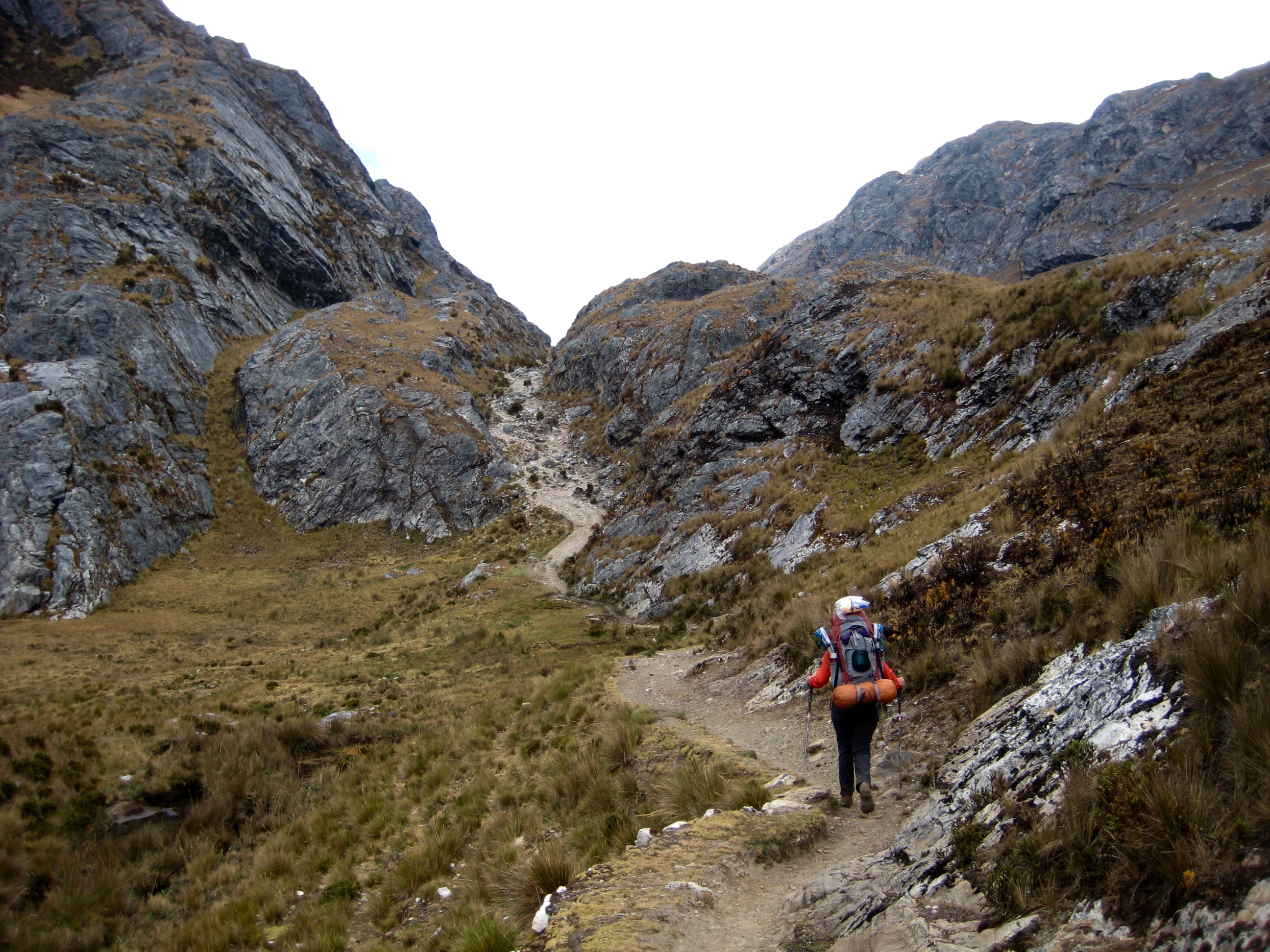
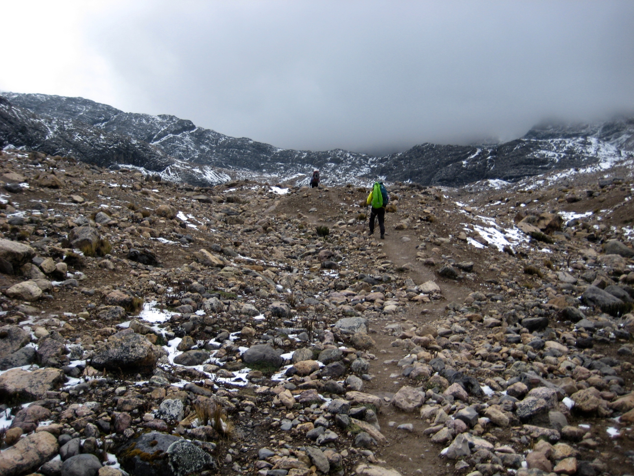
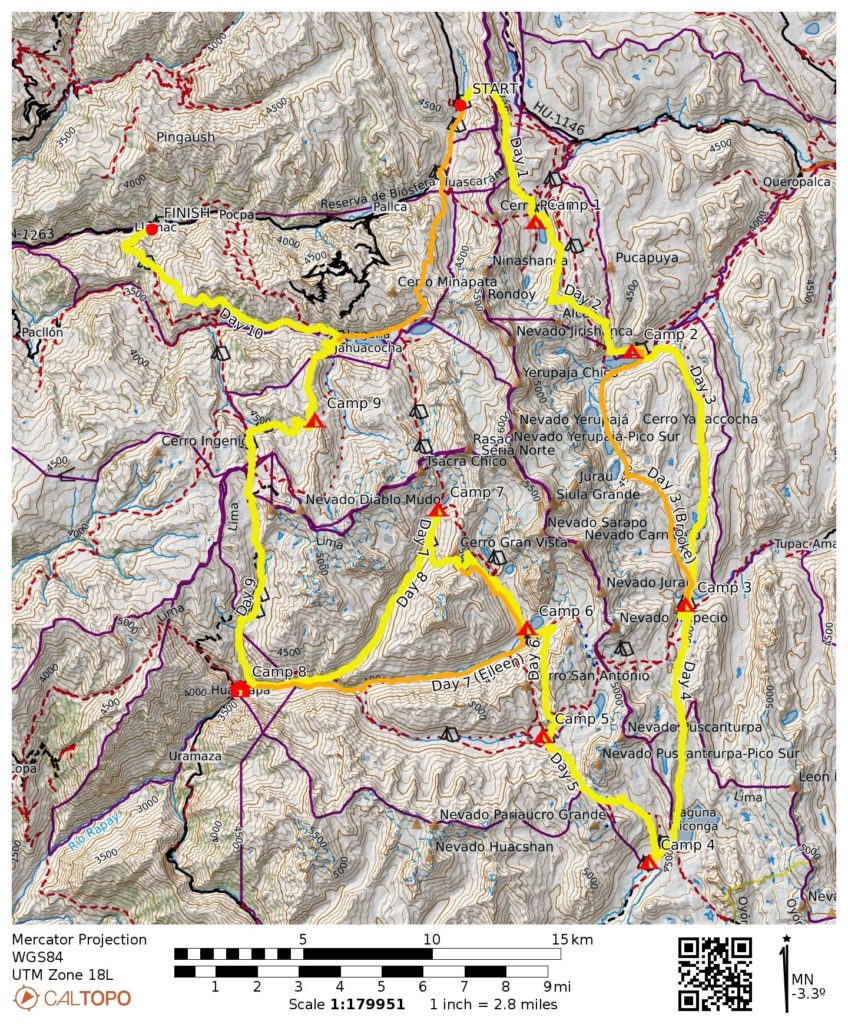
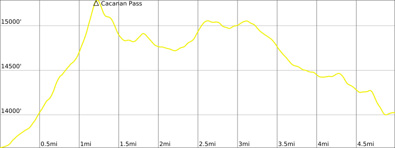
Steep switchbacks took us up a grassy draw and over to 15,400-foot Cacanan Pass (2.7 hours + 1800 feet from TH). This seemed like a rude beginning to our trek.
After dropping down the other side of the pass for several hundred feet, we veered off the pack trail and headed up to a ridge crest, over to a second ridge, and then down a steep hillslope.
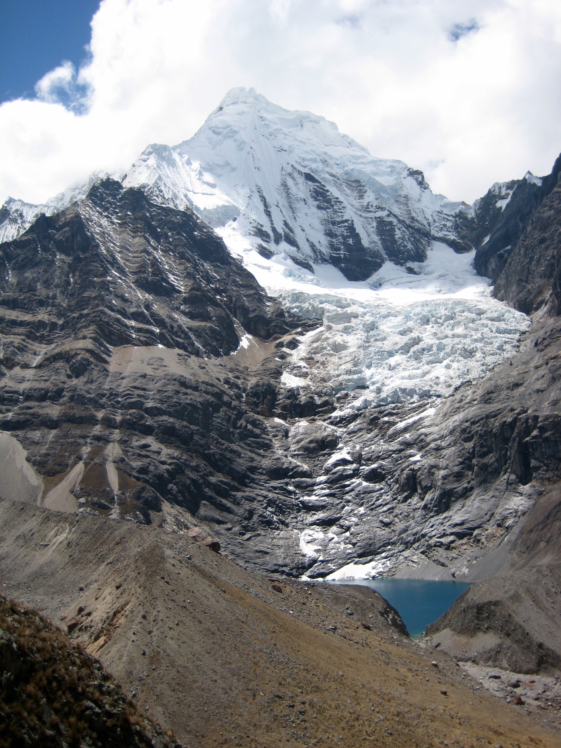
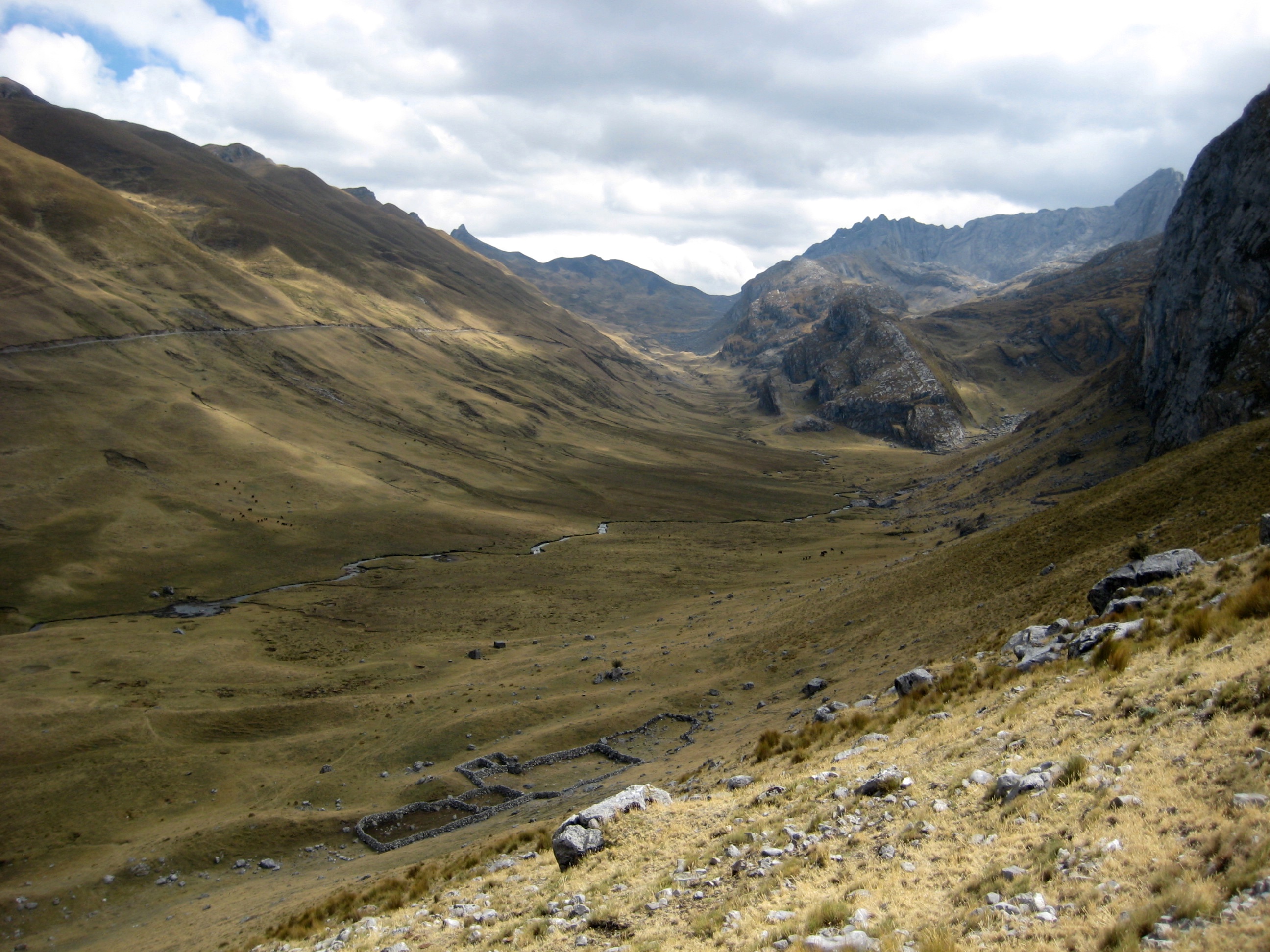
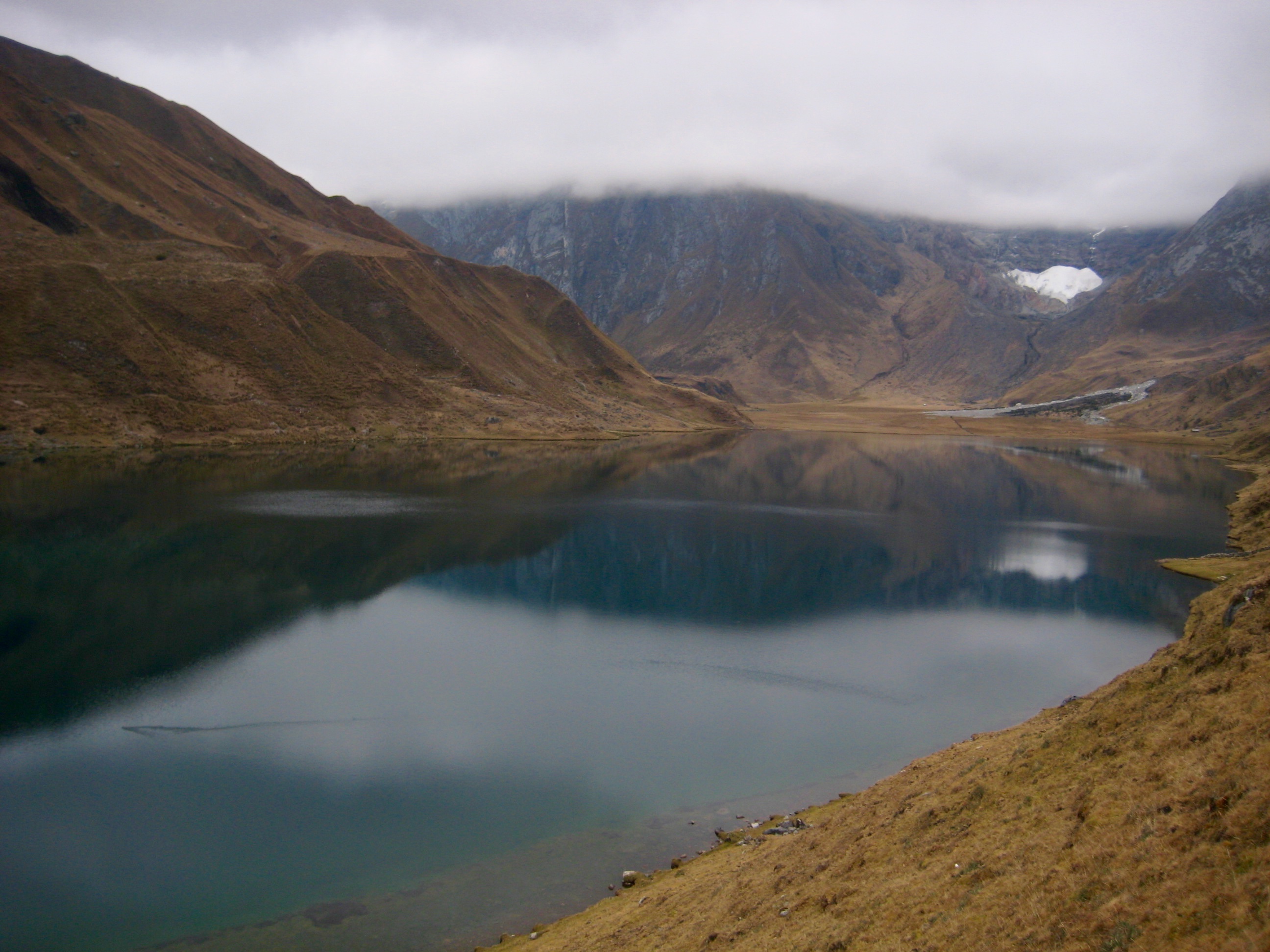
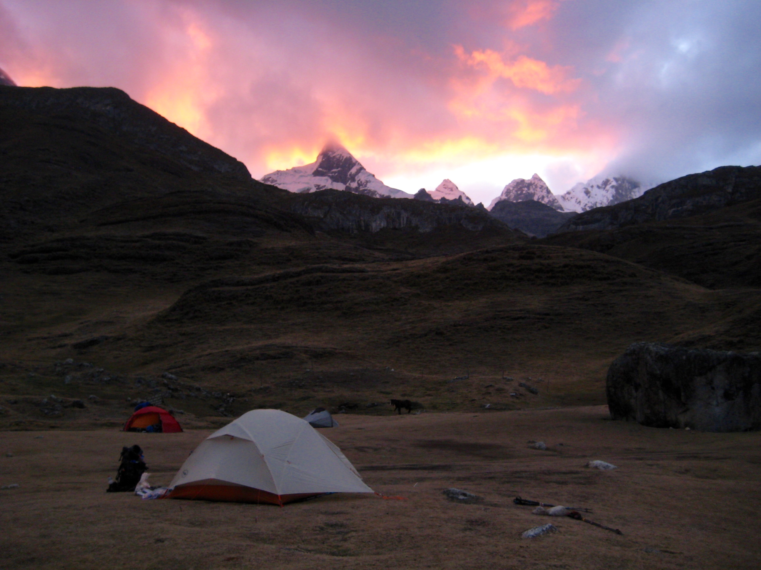
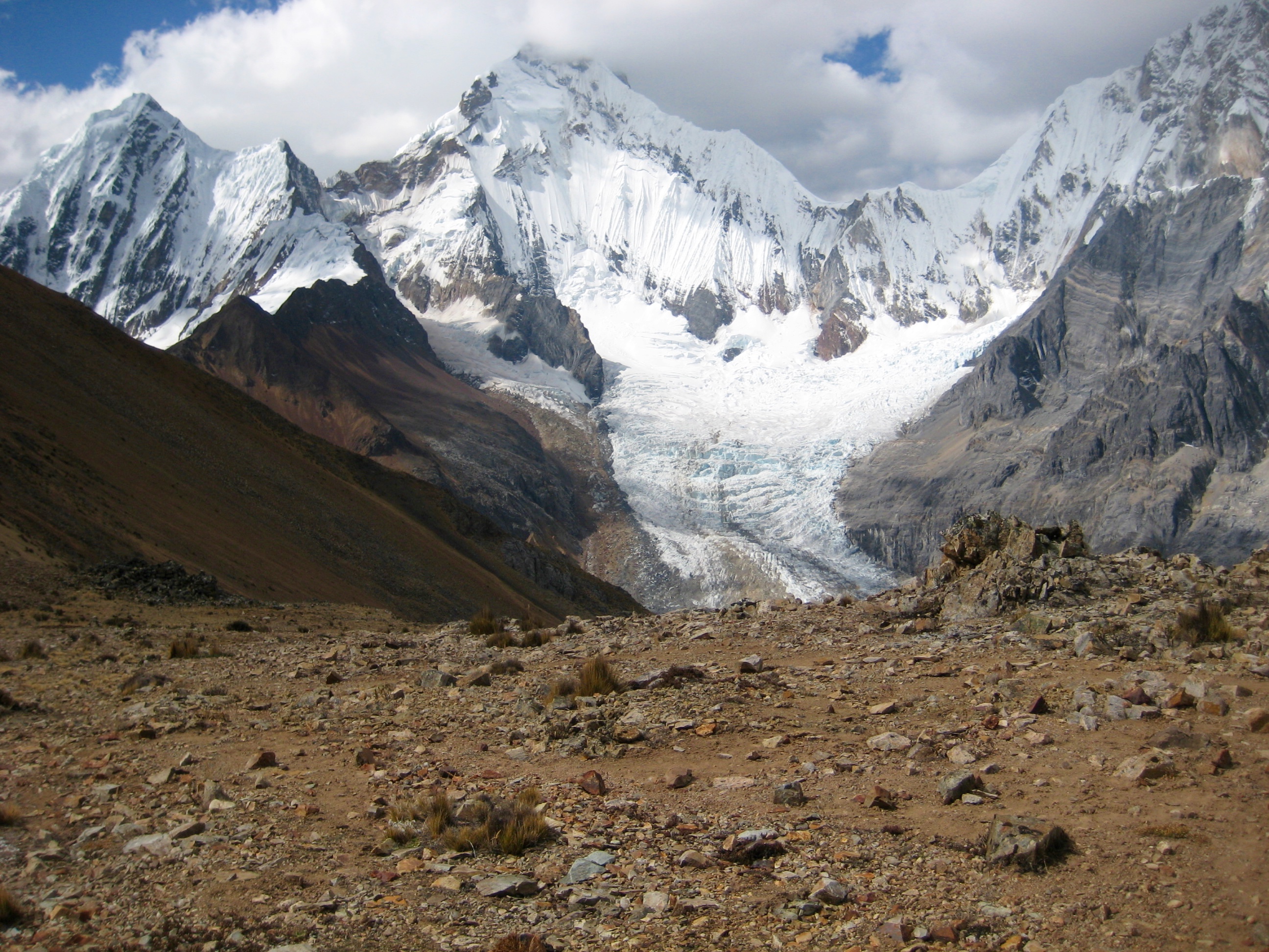
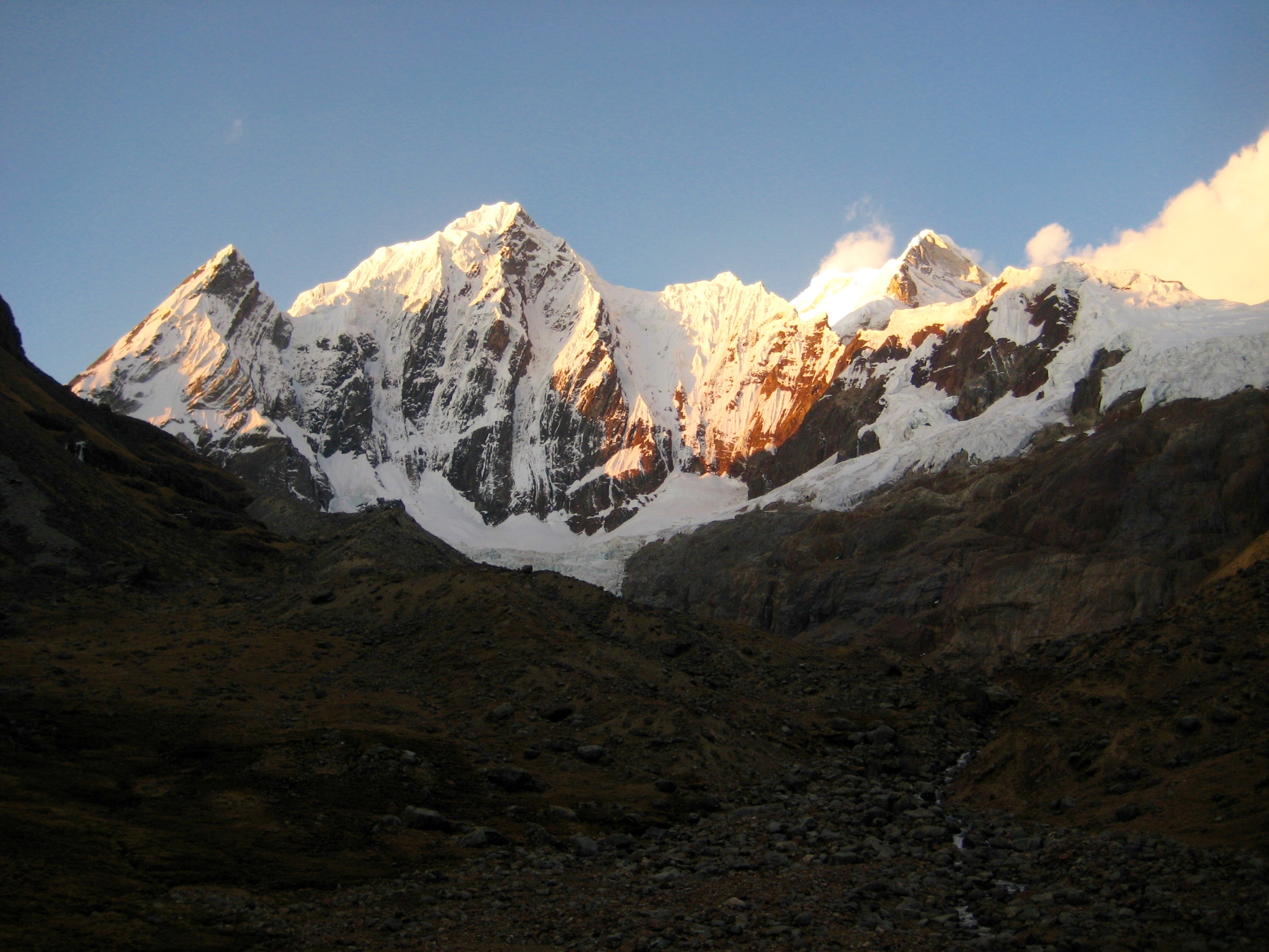
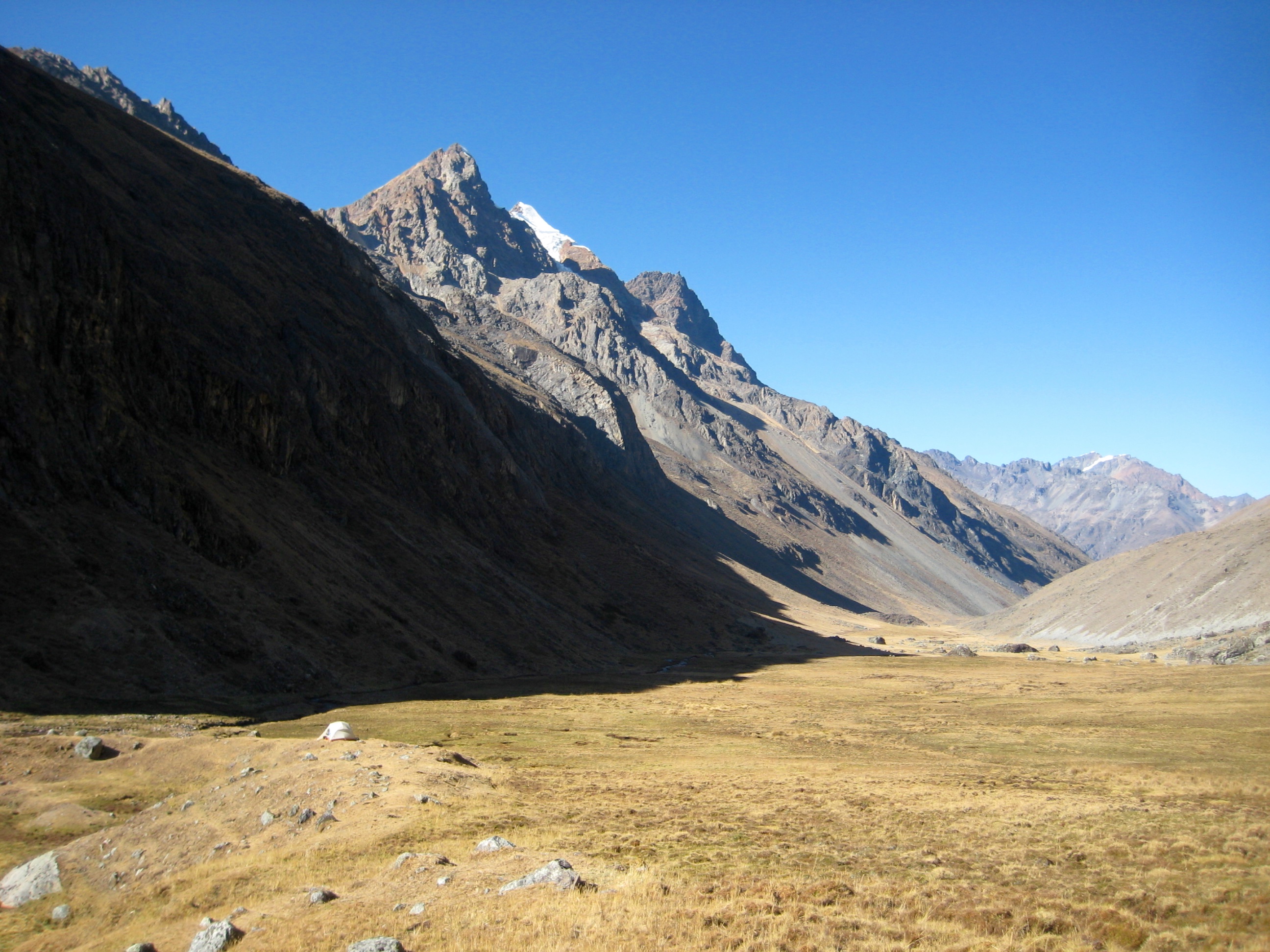
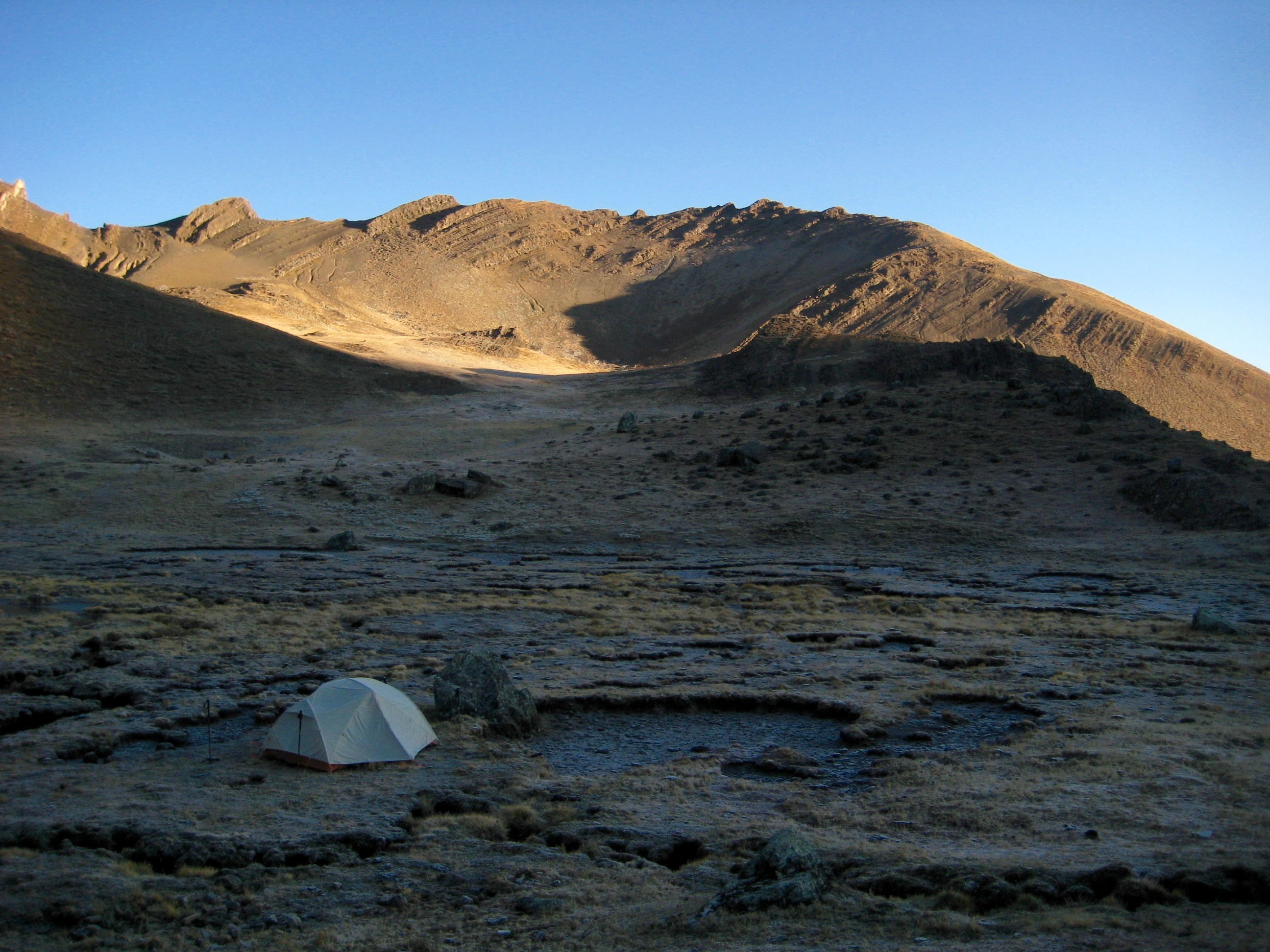
On paper, Lake Mitucocha, which sits at the bottom of the hill, looked like an inviting place to spend the night. It turned out to be even better in person, with a stunning view of Nevado Jirishanca, so we pitched our tent on its grassy shore near the outlet stream (6.4 hours + 5.7 miles + 2250 feet from TH).
Day 2: Lake Mitucocha to Lake Carhuacocha Camp
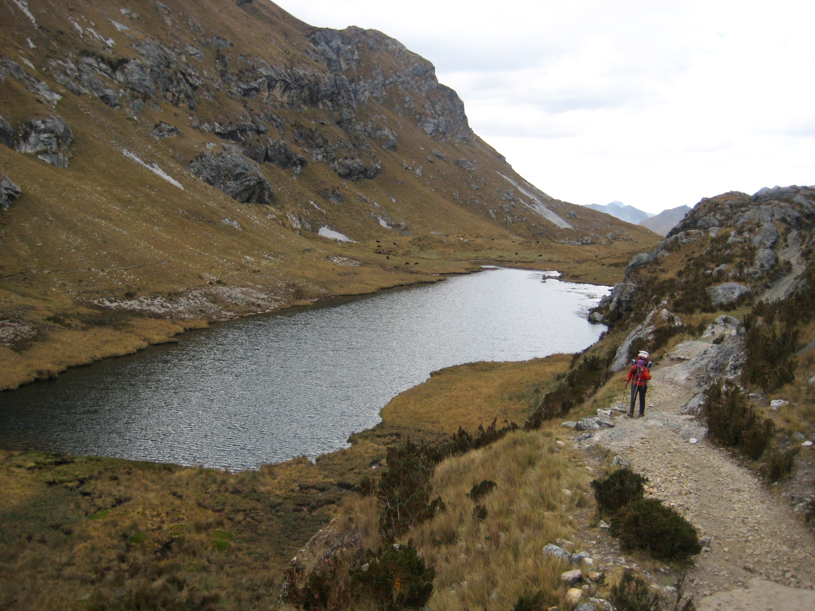
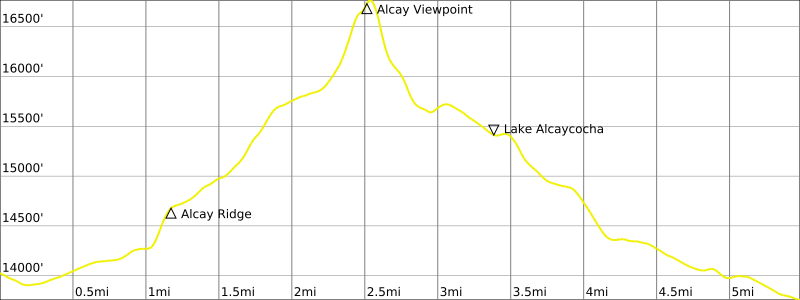
The morning was clear and cold, and alpenglow lit up Jirishanca. Once underway, we crossed over to the lake’s eastern shore and made a rising traverse to a saddle in the ridge above.
A faint bootpath and scattered cairns led us farther up the ridge, past some large slabs, to a point where we could cross to the eastern side. There, a better path continued upward to a 16,000-foot moraine below Nevado Alcay, then down to Lake Alcaycocha.
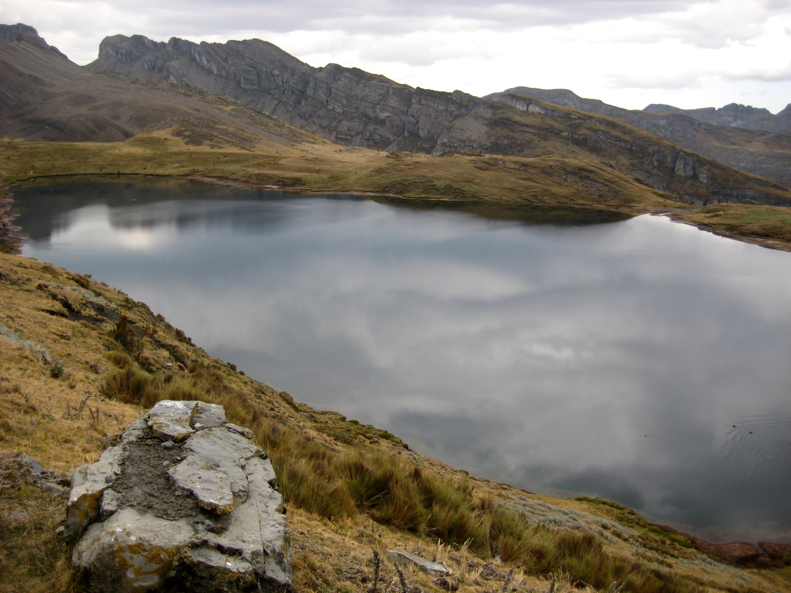
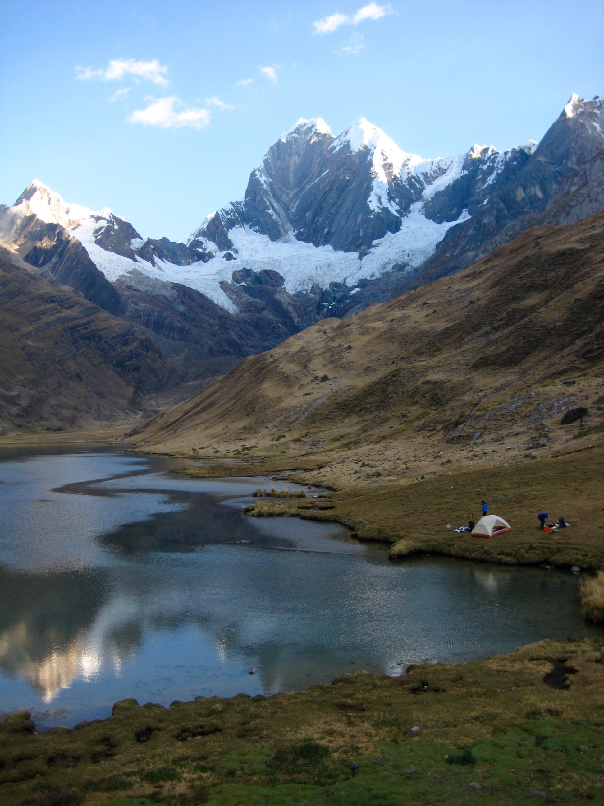
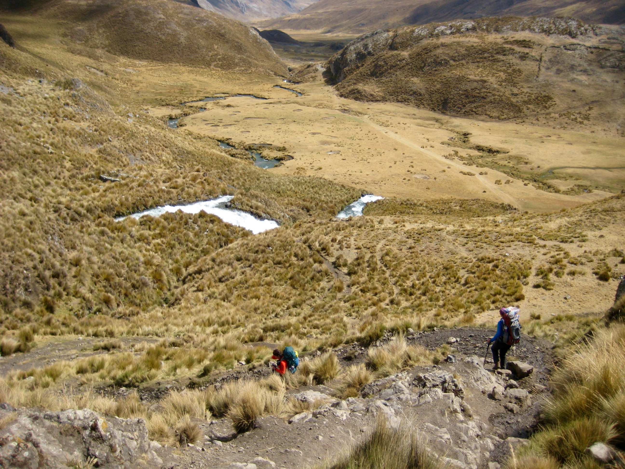
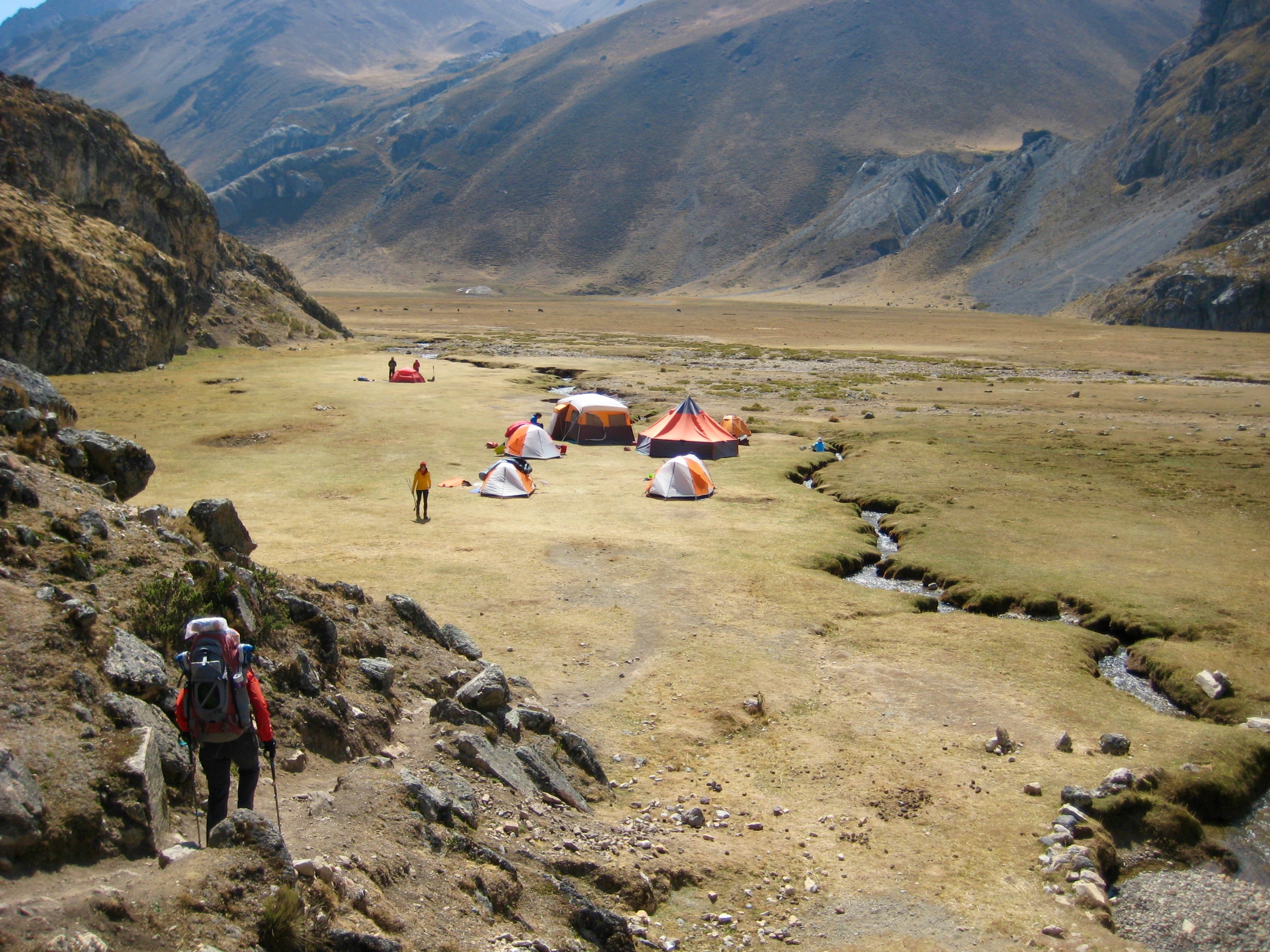
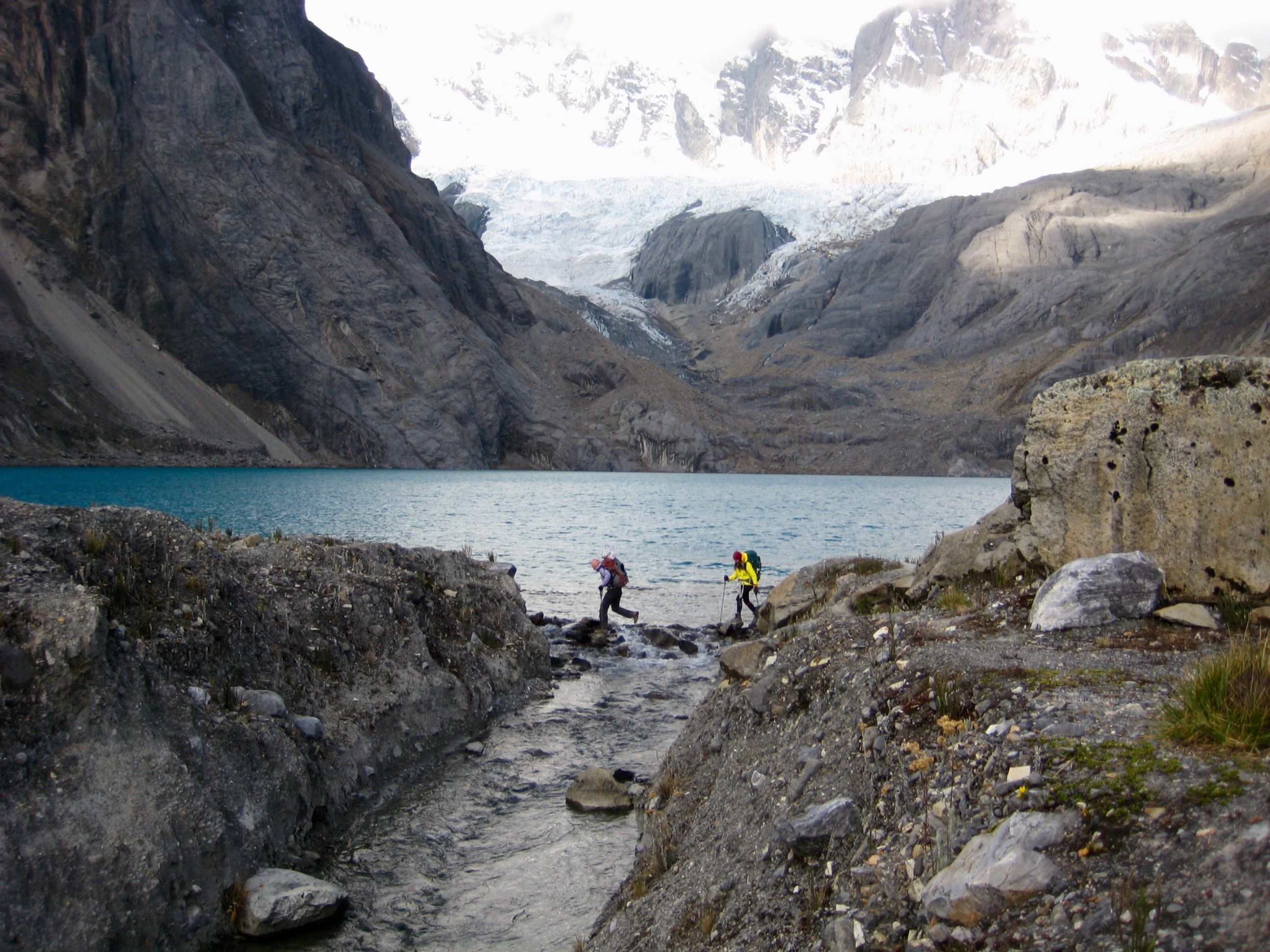
We descended a long, grassy slope to the valley bottom and an intersection with the pack trail. We then followed the pack trail for a long mile to an established camp at 13,600-foot Lake Carhuacocha (7.8 hours + 5.7 miles + 2350 feet from Camp 1), below the towering hulk of Nevado Yerupaja.
We pitched our tent in a grassy swale, along with several other backpacking tents and a cluster of trekking company tents. The trekking company guide and owner, Marco, greeted us enthusiastically and invited us into his dining tent for hot tea. Marco’s hospitality and entertaining anecdotes over the next several days would become one of the highlights of our circuit.
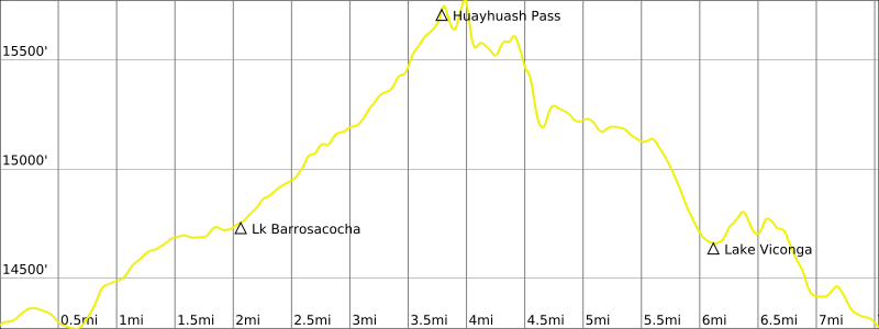
Day 3: Lake Carhuacocha Camp to Huayhuash Camp
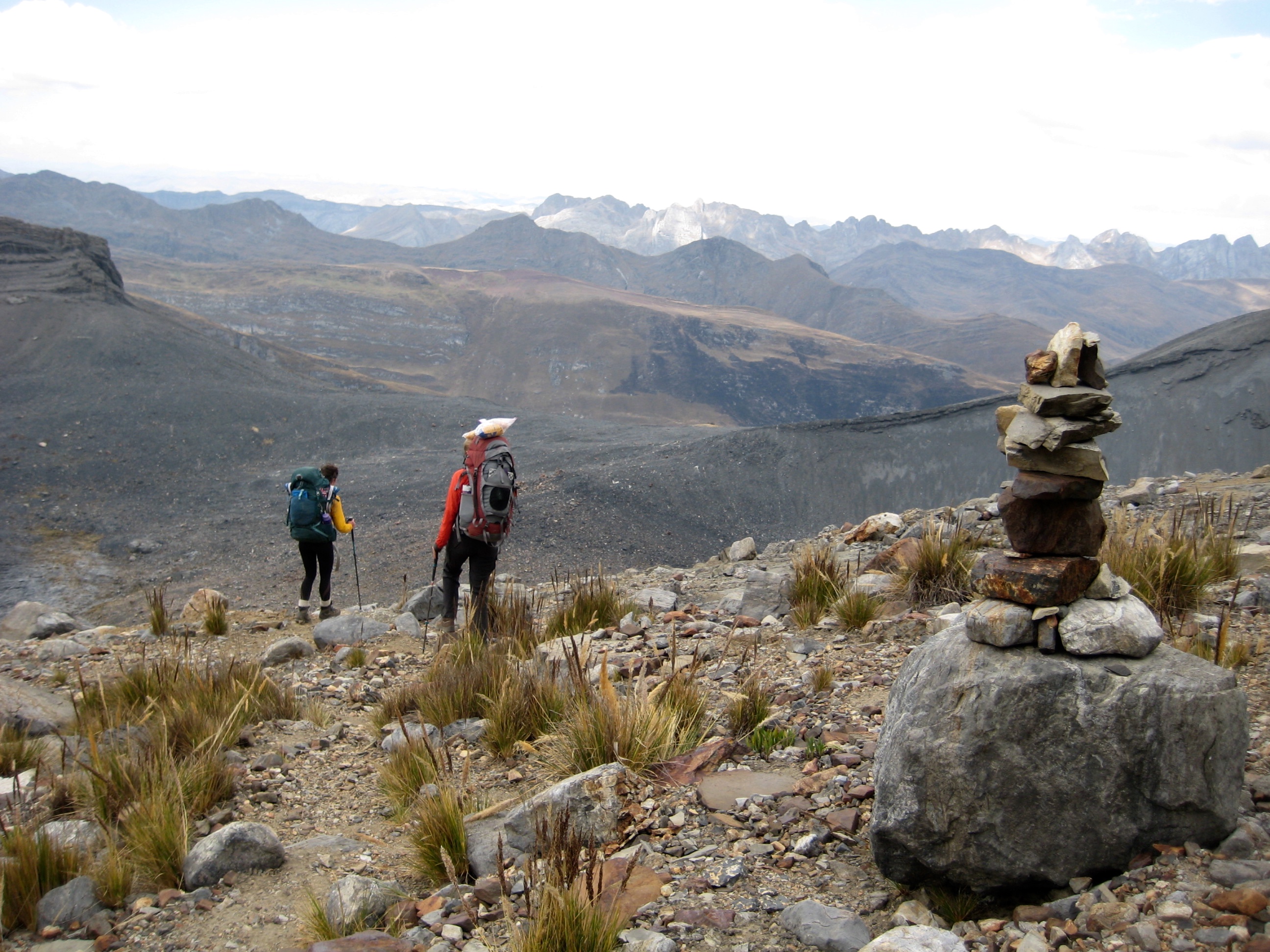
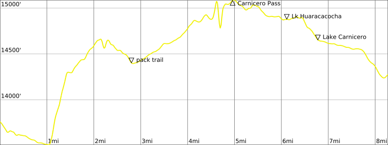
I was stricken with a stomach bug during the night and woke up feeling weak and unsteady in the morning. As such, Eileen and I chose to take the “easier” pack trail over Carnicero Pass to our next camp. Brooke, on the other hand, took the harder and more scenic alpine trail over Siula Pass, along with everybody else in our camp. There was a low cloud ceiling when we all headed out at 9:00am.
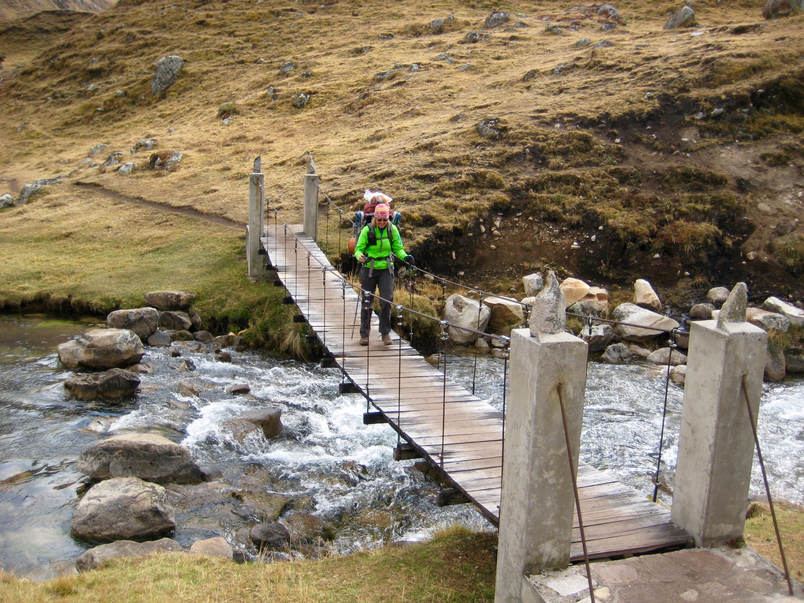
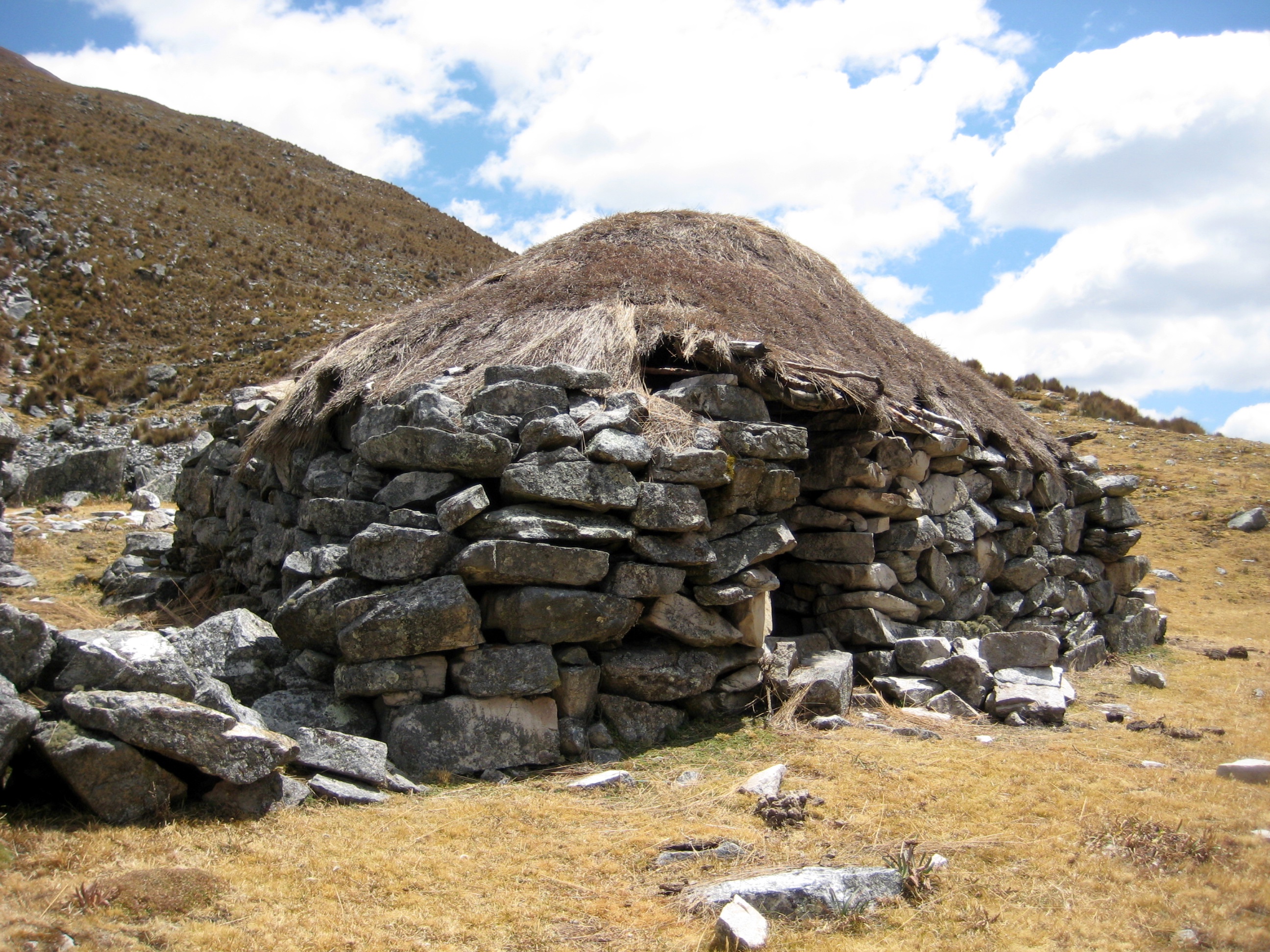
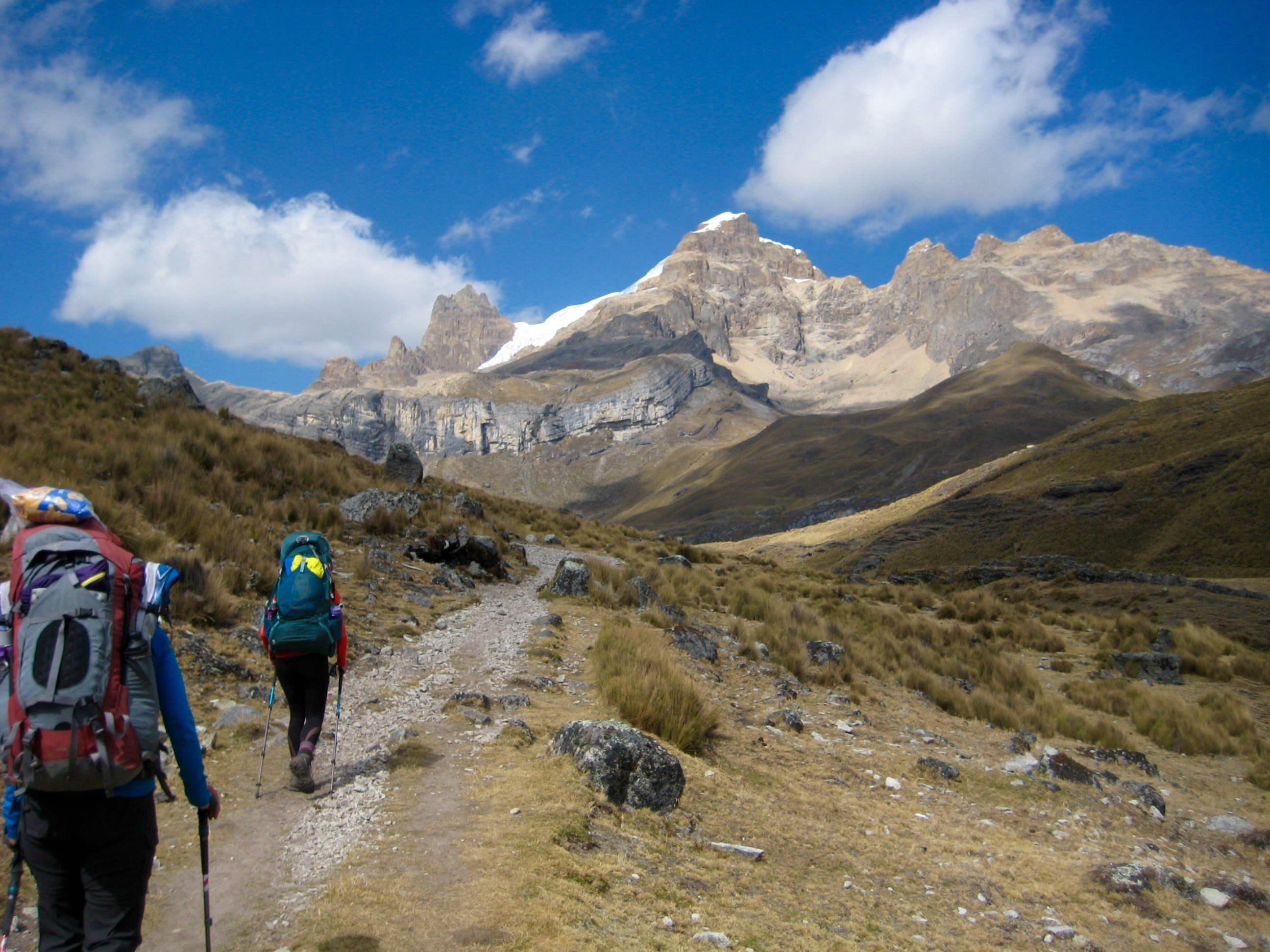
Eileen and I followed the pack trail out of the lake basin for a mile but soon became annoyed with the loose dirt and rocks. When a bootpath veered off to the right, we gladly followed it. This bootpath took us on a pleasant 4-mile hike up through a hanging valley, past numerous rock walls and an occasional choza (stone-and-thatch hut), with views back to Nevado Yerupaja.
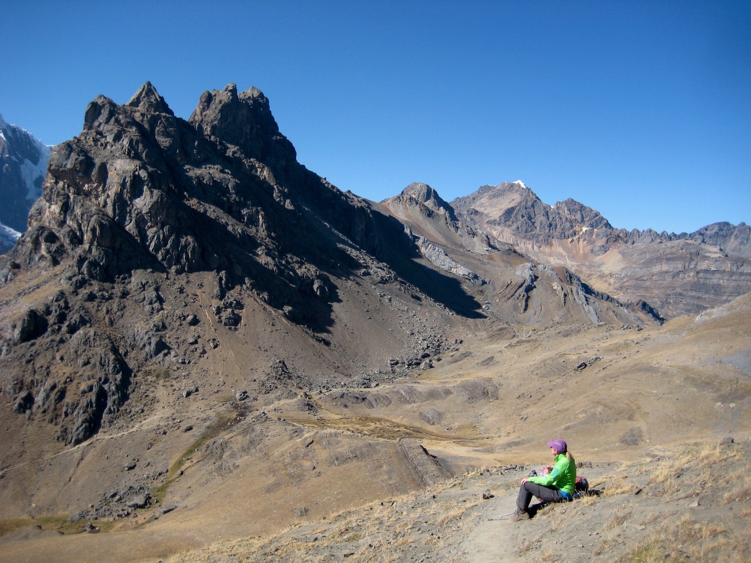
We eventually gained the narrow defile of 15,100-foot Carnicero Pass (5.5 hours + 1750 feet from Camp 2), which is garnished on both sides with attractive lakes. It was hard to believe that this is regarded as a non-scenic route!
By late afternoon, we had descended the opposite valley and reached the grassy expanse of 14,300-foot Huayhuash Camp (7.9 hours + 8.9 miles + 1950 feet from Camp 2). Brooke and the other trekkers were waiting for us there, having completed a strenuous but visually stunning hike over Siula Pass.
Day 4: Huayhuash Camp to Viconga Camp
In the morning, I was dismayed to discover that some roving campsite dogs had stolen half of my breakfast supply and my entire roll of toilet paper from our vestibule! A search of the nearby hillside produced the TP roll but not the food. Obviously, we needed to be more careful with our food and gear storage in the future.
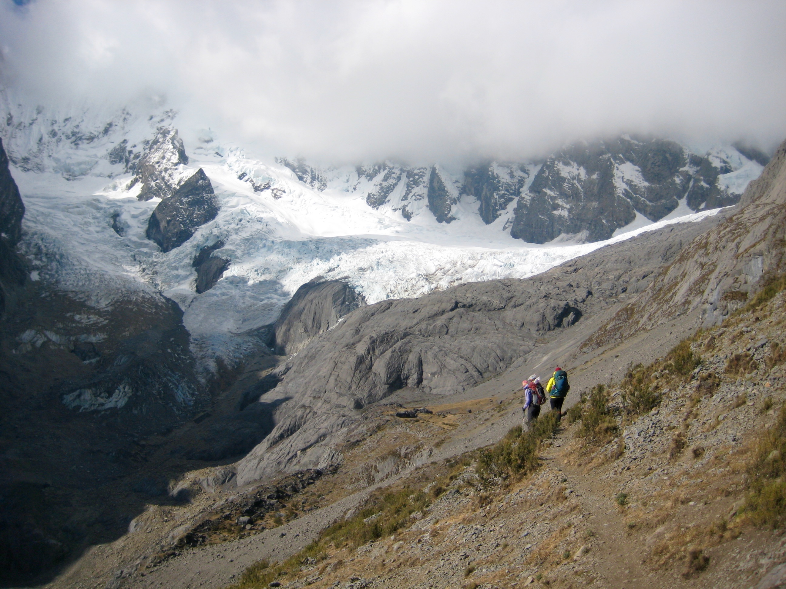
Our hike today took us up to 15,650-foot Huayhuash Pass (2.5 hours + 1450 feet from Camp 3), which gives a good view of an adjacent mountain range called the Cordillera Raura.
We then descended to Lake Viconga, a huge reservoir that is artificially controlled for irrigation purposes.
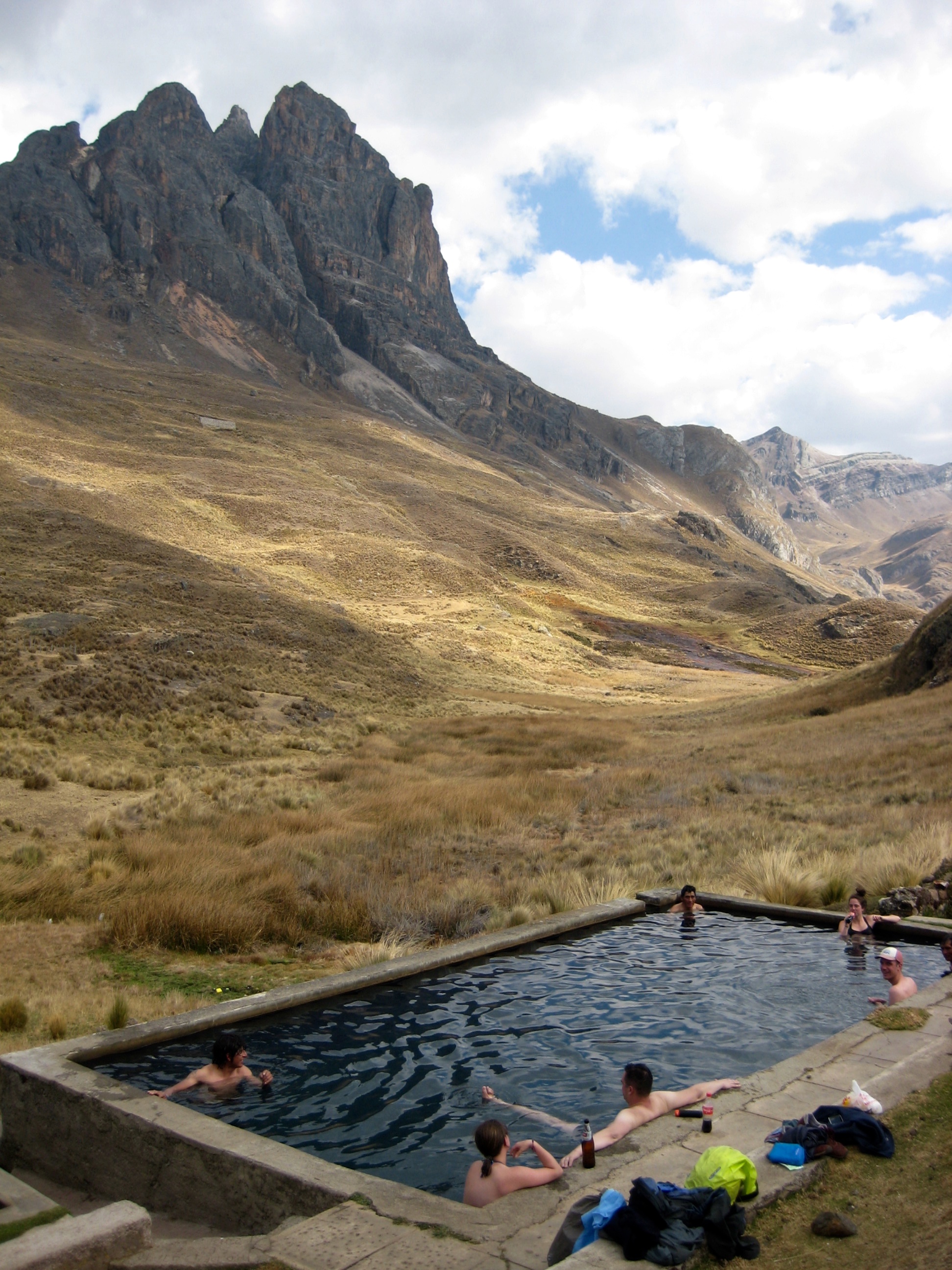
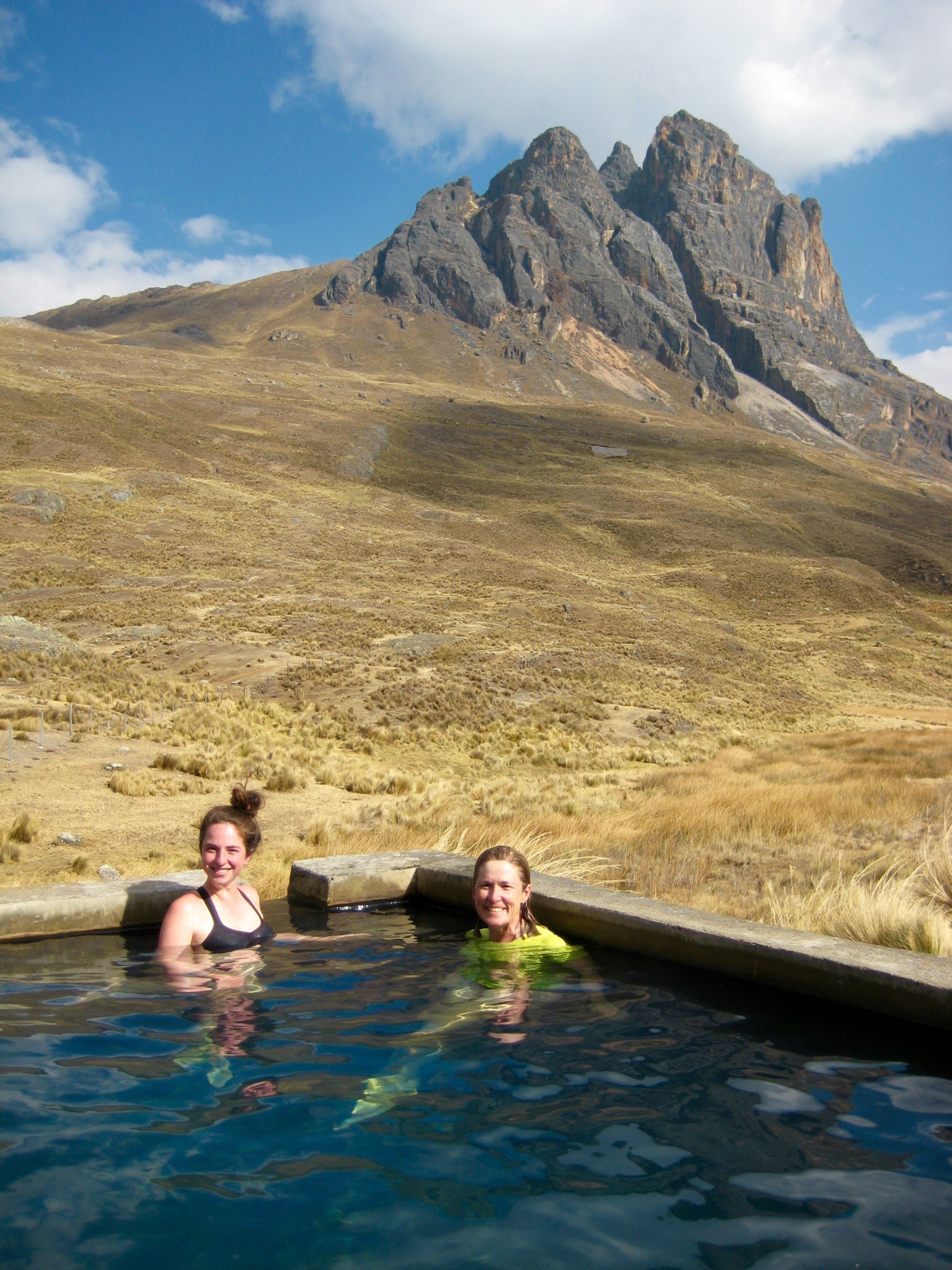
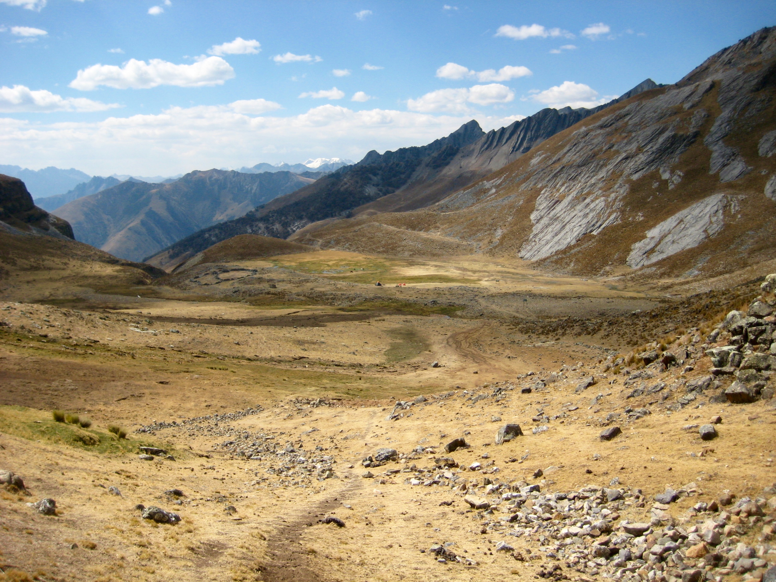
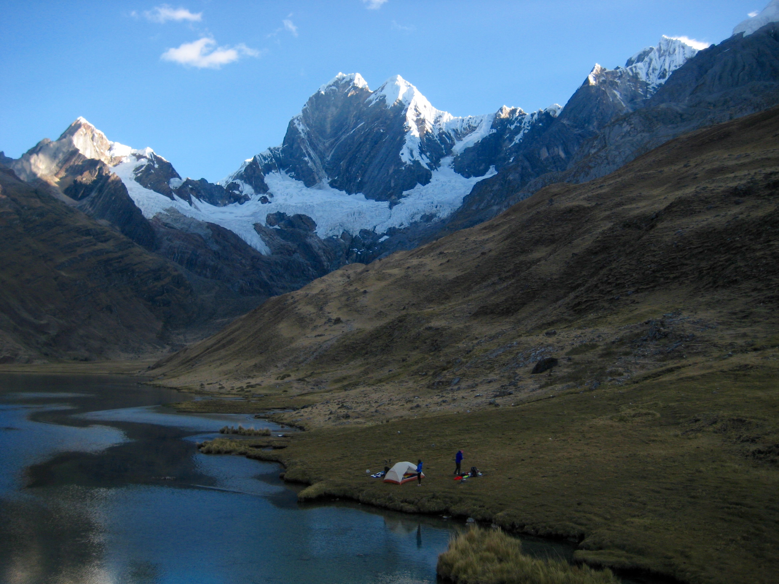
We continued down along the lake’s raging outlet stream until it leveled out in the idyllic pampa of 14,300-foot Viconga Camp (5.6 hours + 7.6 miles + 1600 feet from Camp 3).
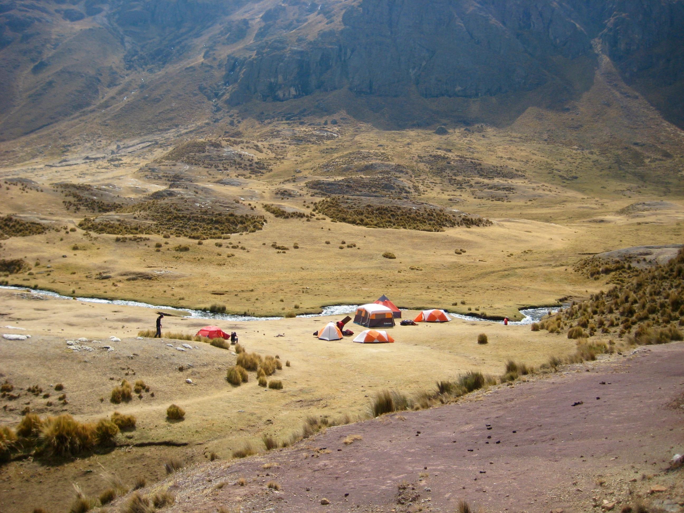
This campsite possesses a very special distinction along the Huayhuash Circuit: it has several pools that are fed by natural hot springs. Trekkers eagerly look forward to the opportunity for a hot soak to relieve sore muscles and wash off trail grime.
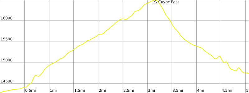
Day 5: Viconga Camp to Cuyoc Camp
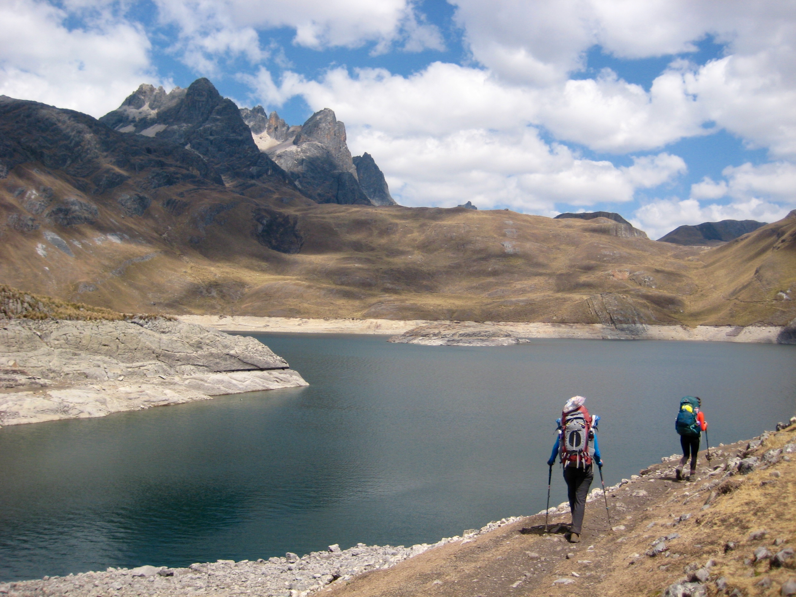
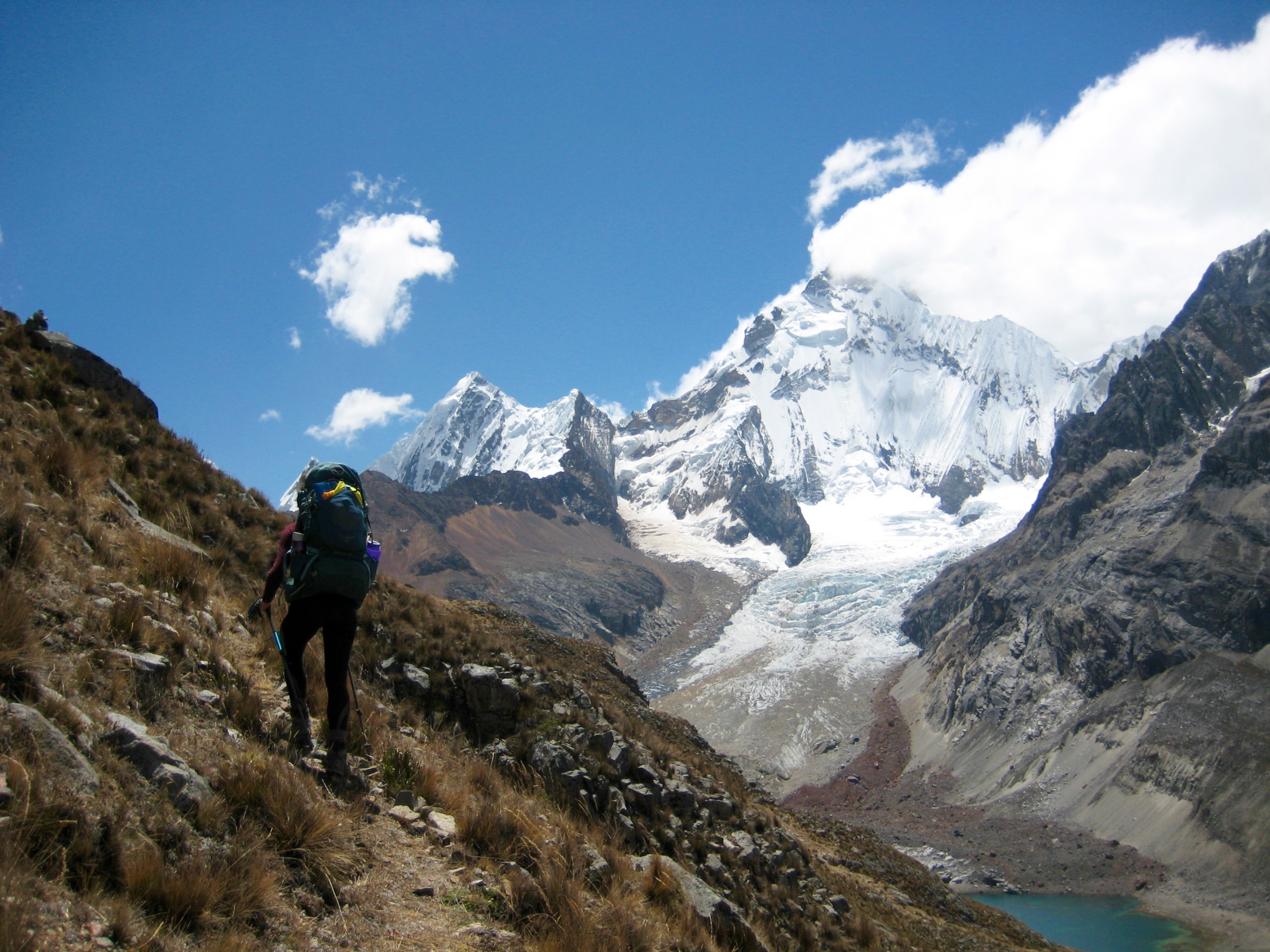
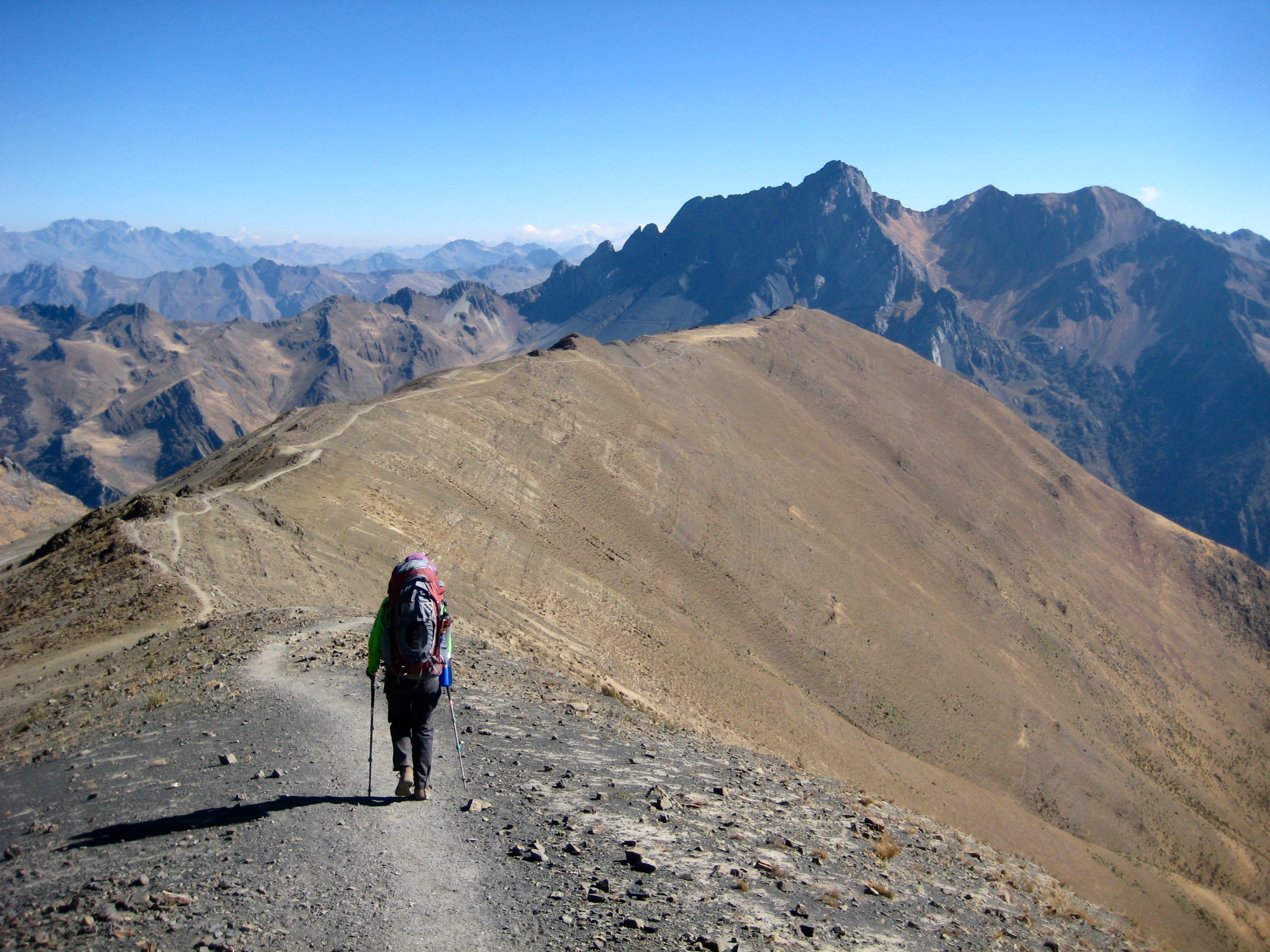
Viconga Camp marks the southeasternmost point of the Huayhuash Circuit; from there, the route turns sharply back toward the northwest. Starting out on a bluebird morning, we followed the pack trail up to 16,500-foot Cuyoc Pass (3.3 hours + 2150 feet from Camp 4), which lies closely below an impressive ice cliff.
The pack trail dropped steeply over the other side of the pass until flattening out in a high basin. Farther down the trail, we started to see the vast Huanacpatay Valley below.
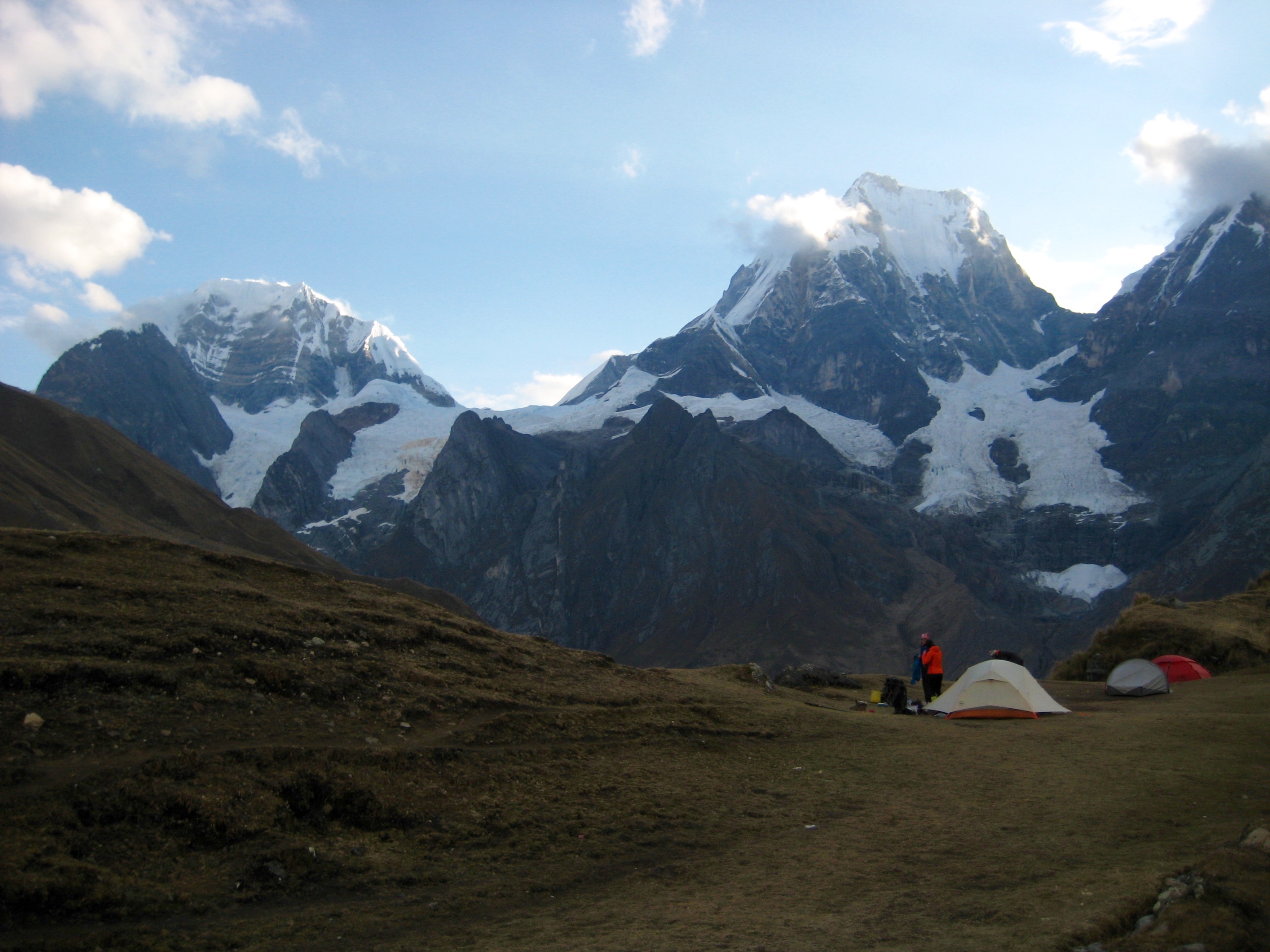
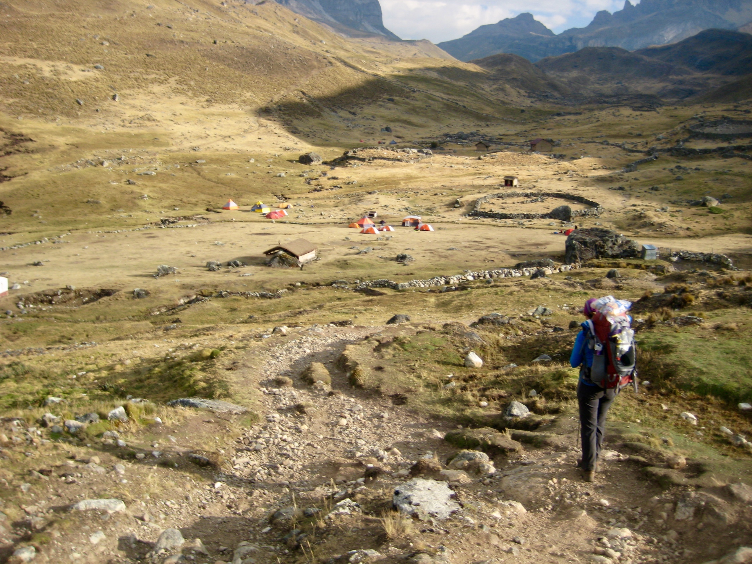
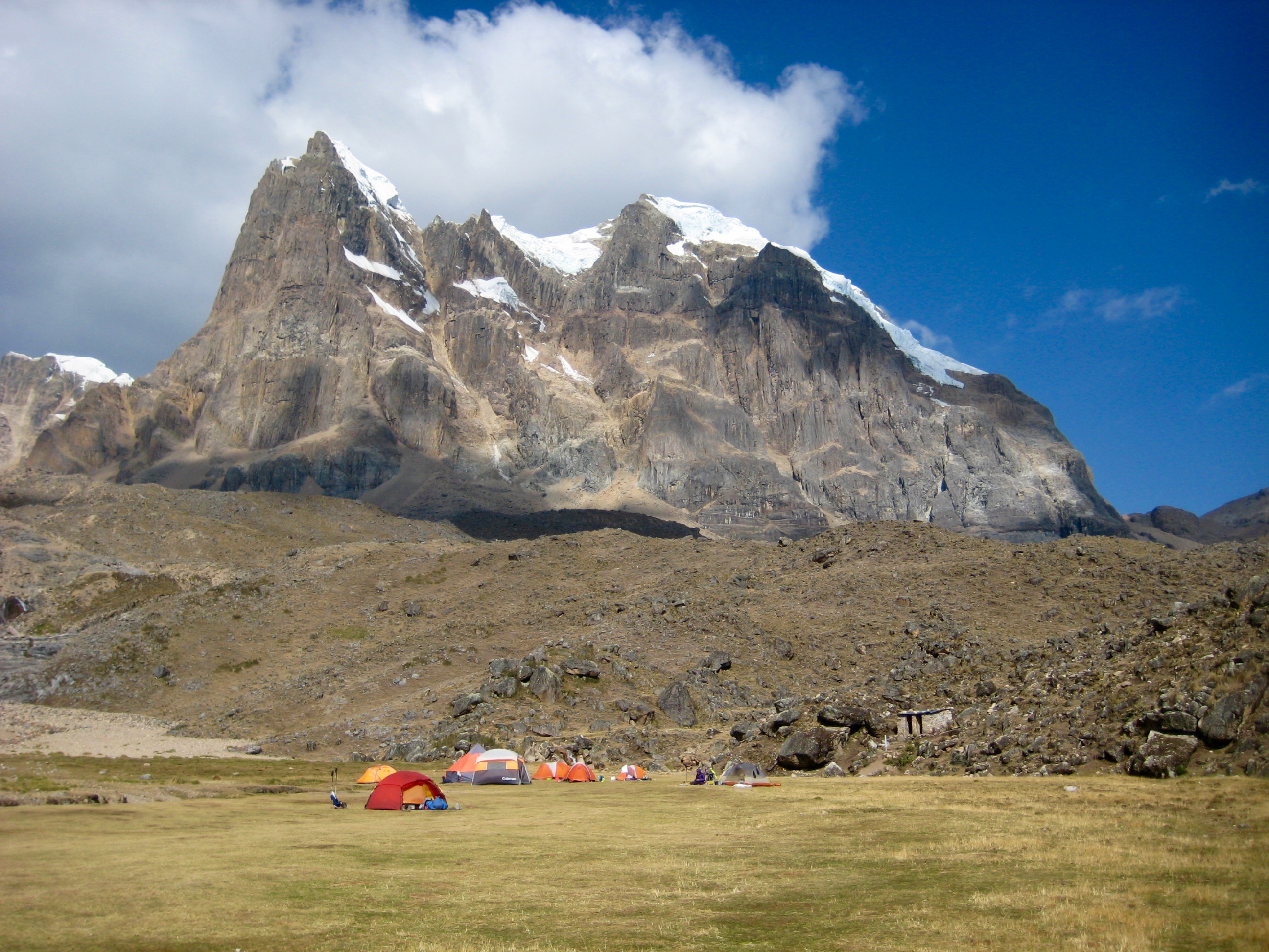
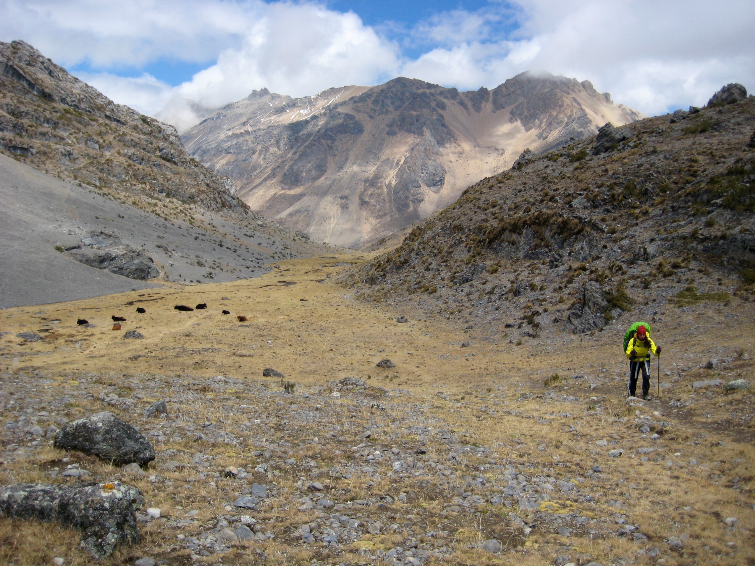
By mid afternoon, we reached Cuyoc Camp (5.4 hours + 5.2 miles + 2200 feet from Camp 4). This camp sits in a beautiful pampa that is tucked between a meandering creek and a rocky slope.
We pitched our tent and then relaxed in the sun. Having a few hours before dinner, Marco and Brooke scurried off to San Antonio Pass for sunset views of the Huayhuash core peaks. While they were gone, some threatening clouds started to build overhead. Did this perhaps signal a change in the weather?
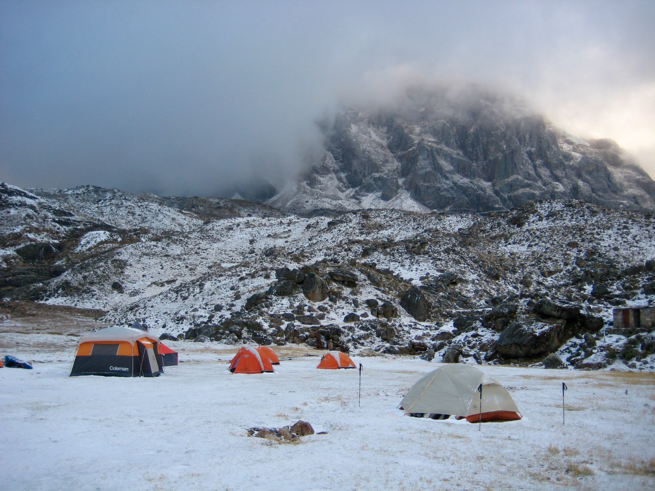
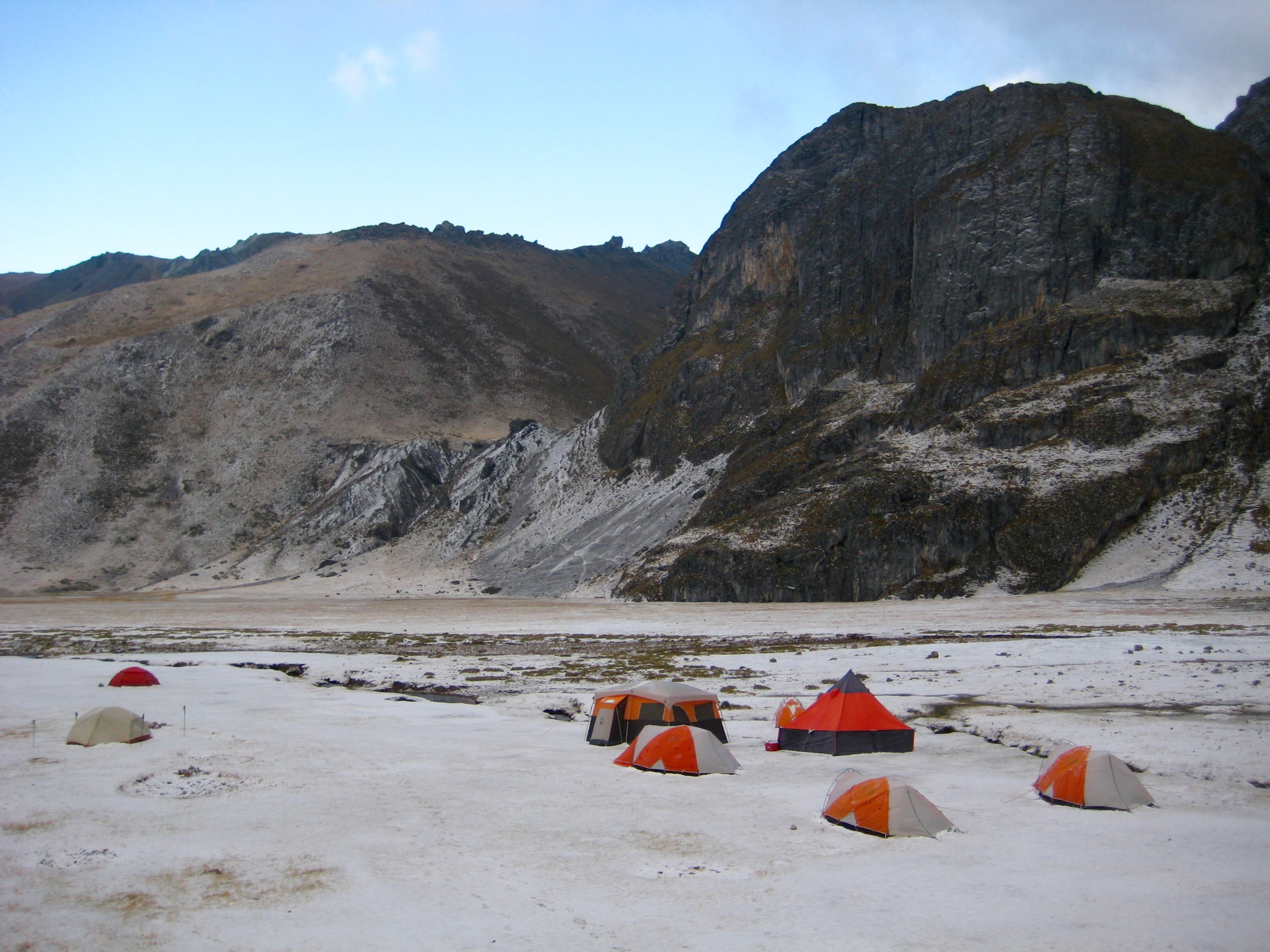
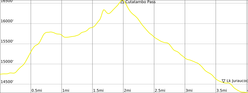
Day 6: Cuyoc Camp to Little Lake Juraucocha
We were awakened during the night by the sound of graupel pelting our tent. However, this didn’t stop Brooke and Marco from heading out at 4:45am to catch sunrise from San Antonio Pass. By the time they returned at 7:00am, the ground was white but the storm was abating.
Given the foul weather, Marco and all other trekkers in camp decided to follow the pack trail 10 miles down Huanacpatay Valley to Huayllapa Village. Rather than join them, Eileen and Brooke and I wanted to stick with our original plan to hike over Cutatambo Pass (aka Santa Rosa Pass) and spend the night at Lake Juraucocha. It was sad to say goodbye to the others, after having spent several days together. As the three of us headed up the rocky trail, we felt very alone in an unfamiliar mountain range.
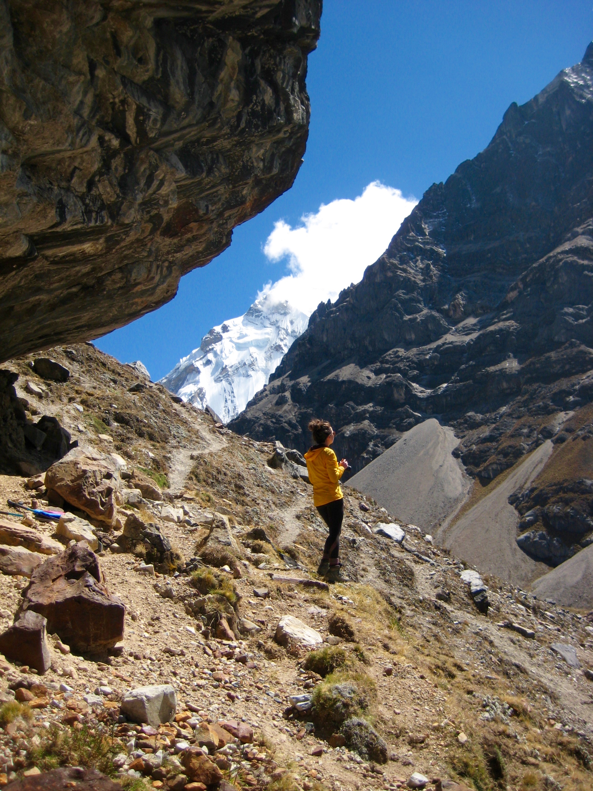
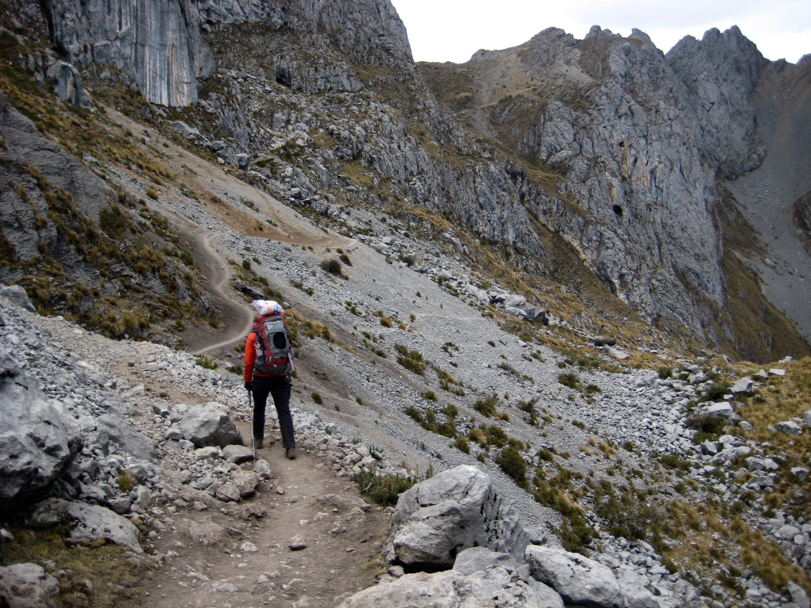
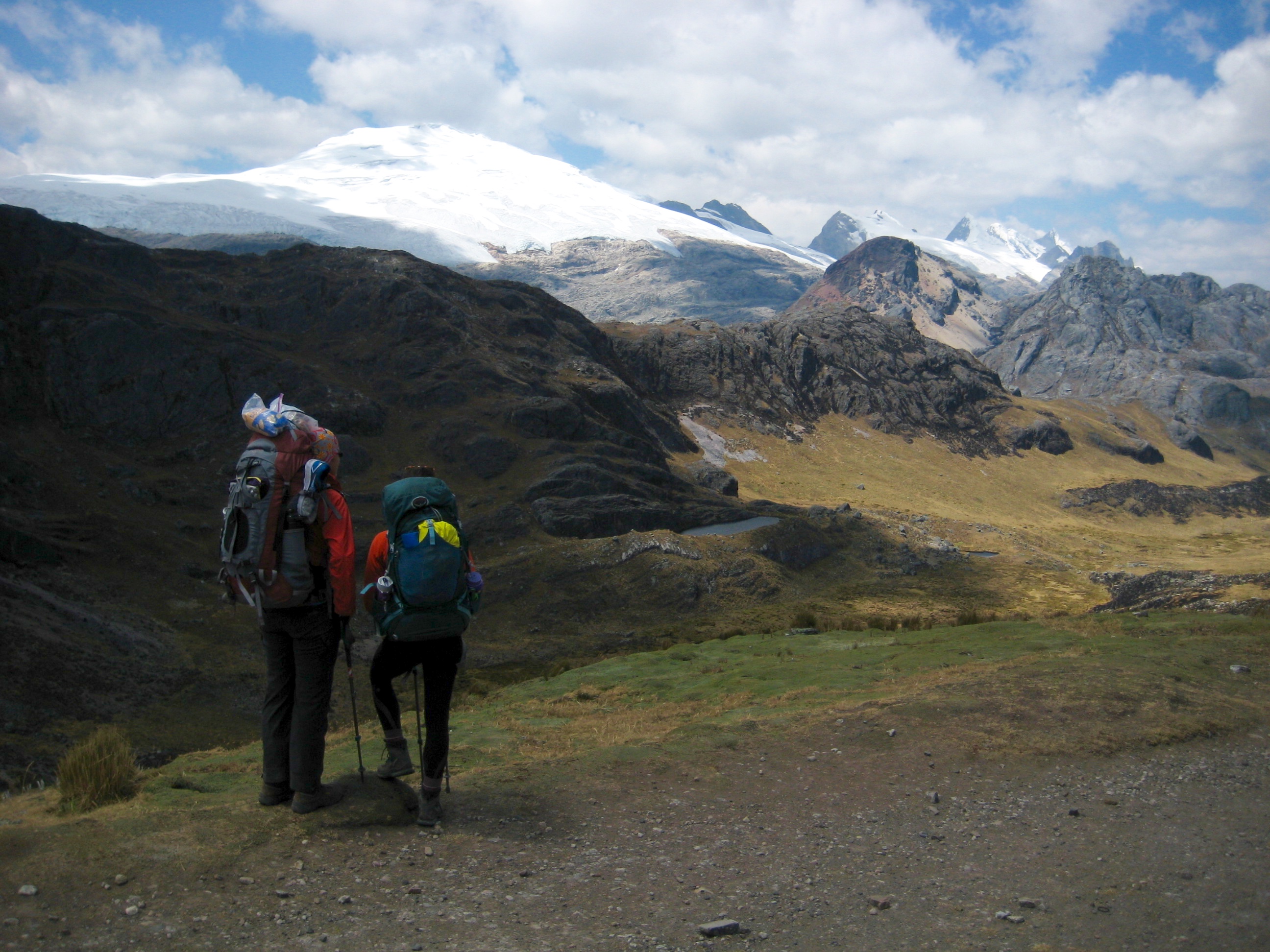
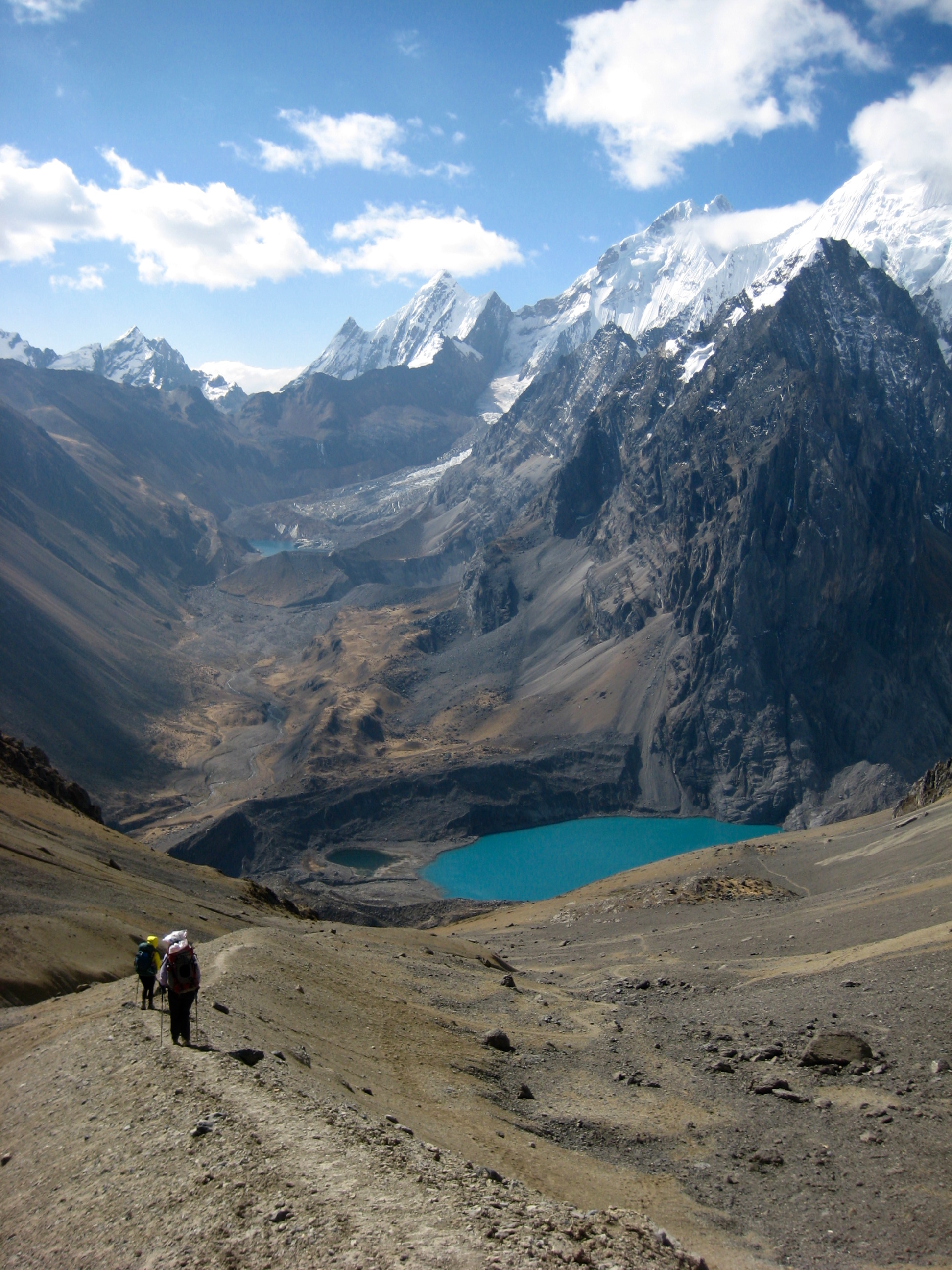
Our ascent to Cutatambo Pass was prolonged by some routefinding errors, but we eventually got back on the right track and could see the pass far ahead. Thankfully, all snow had melted by now.
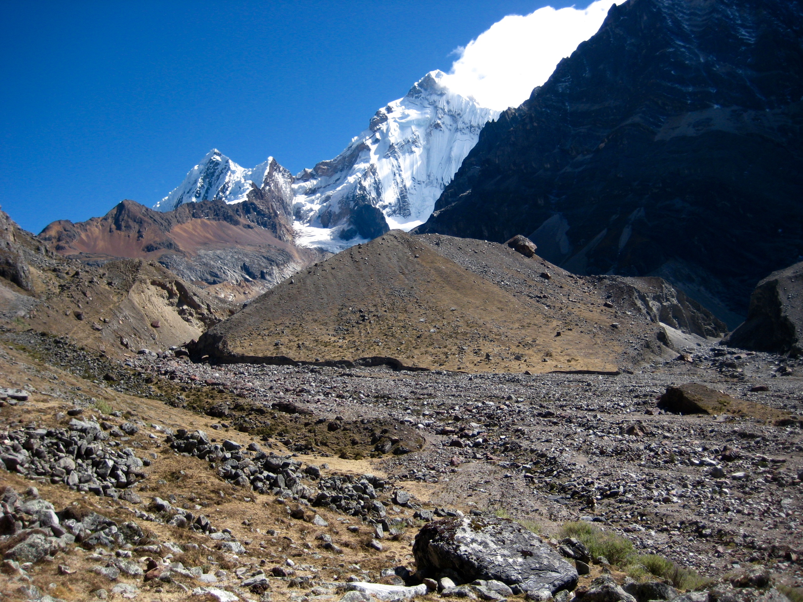
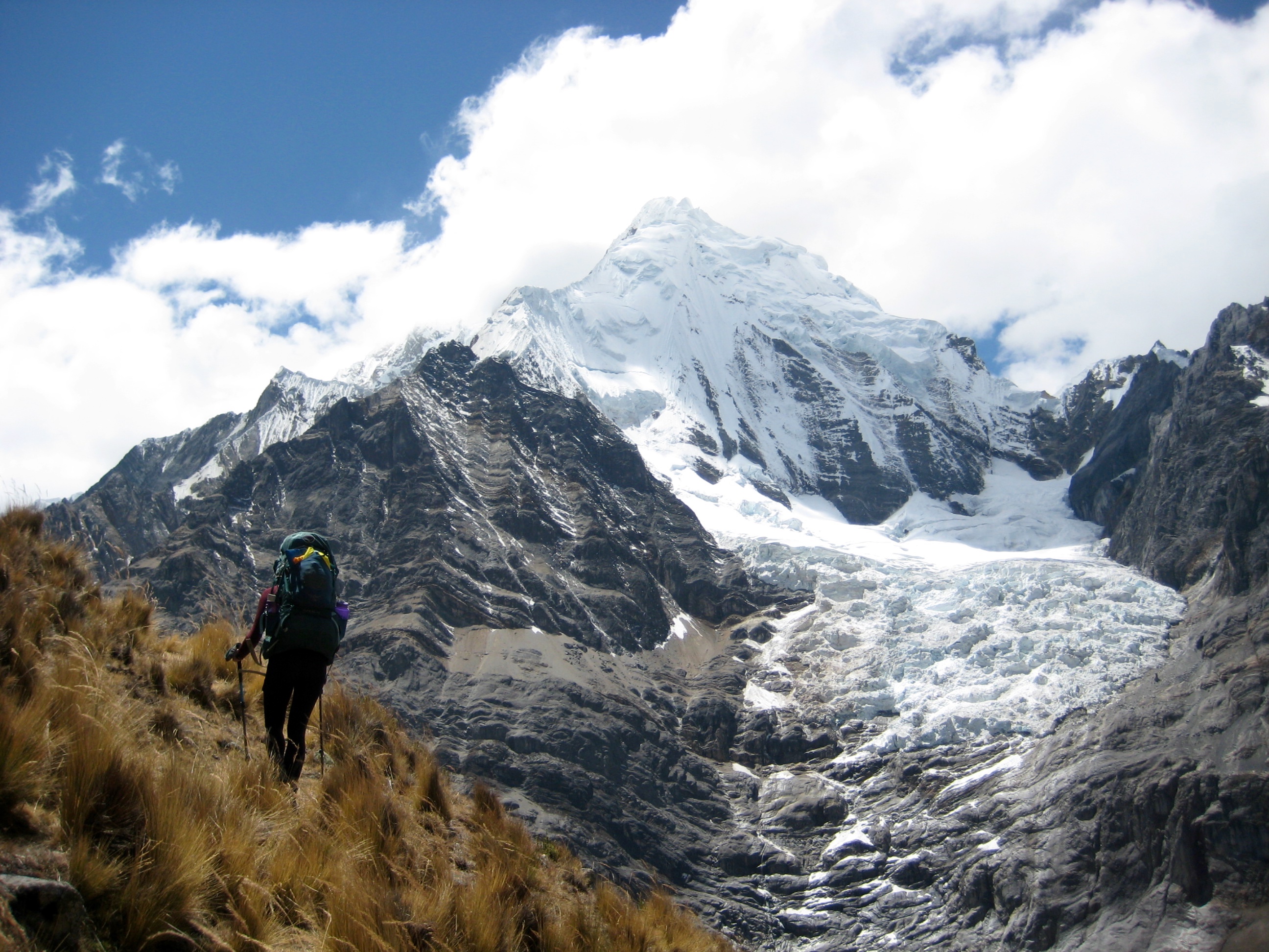
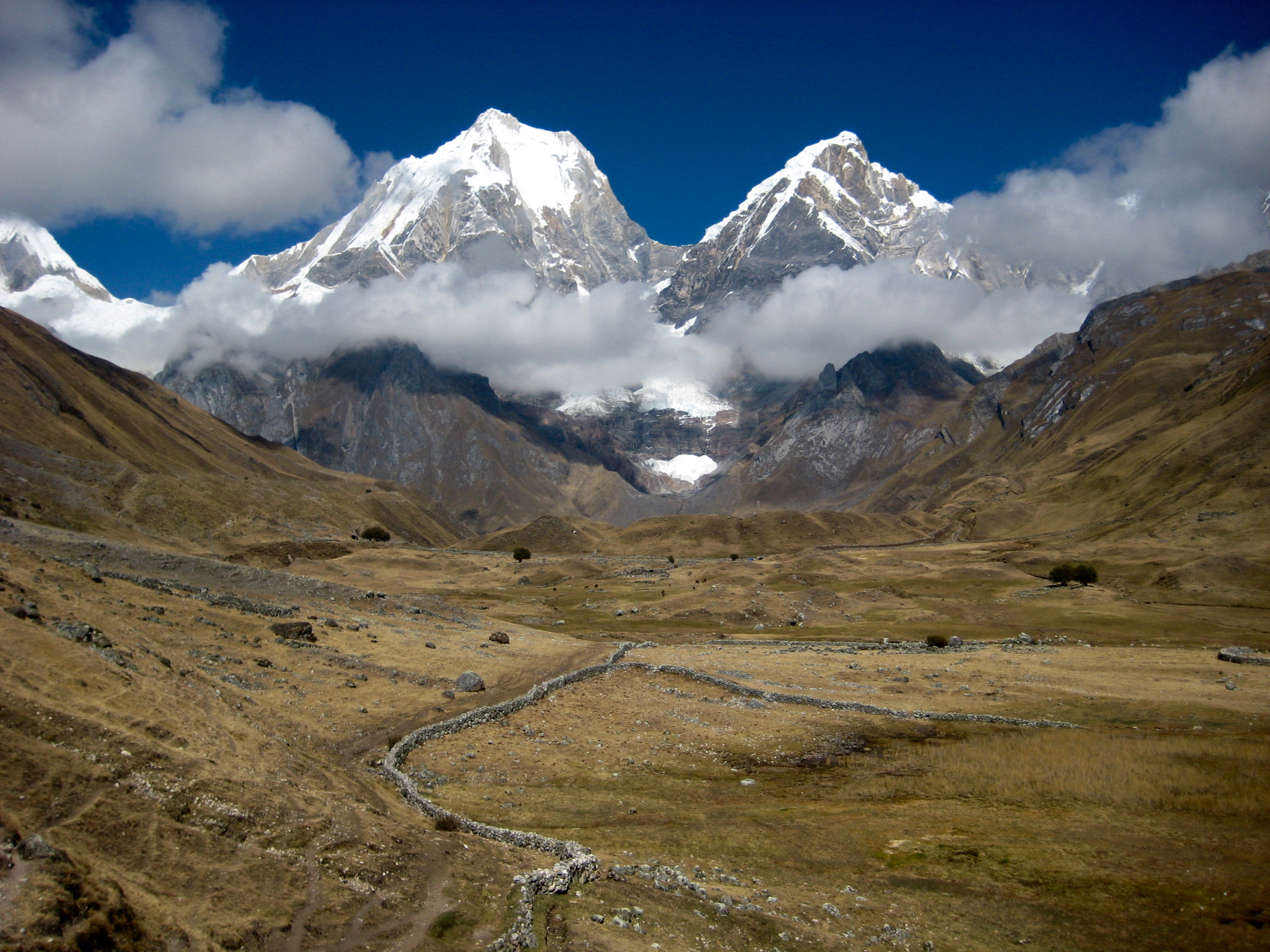
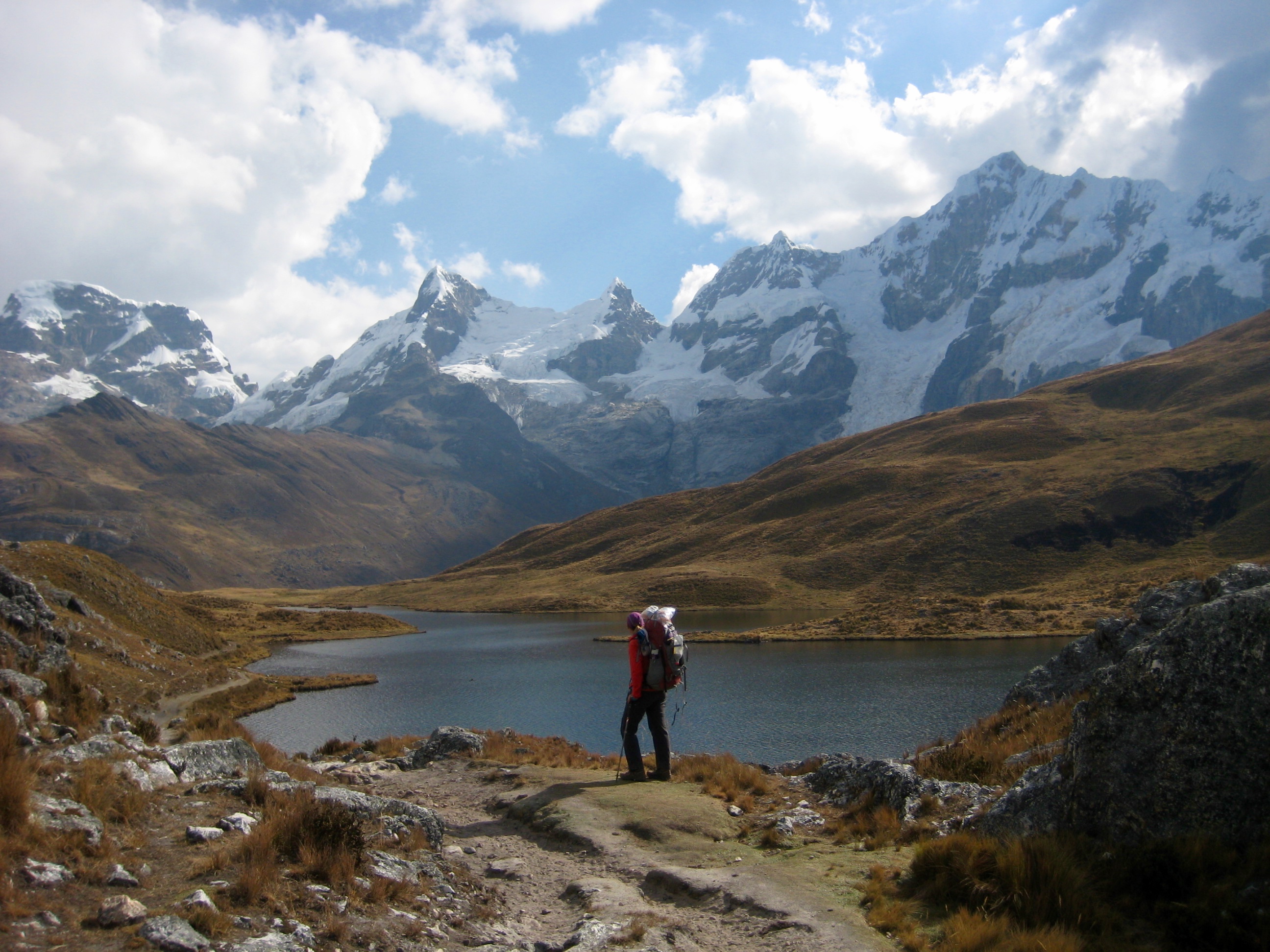
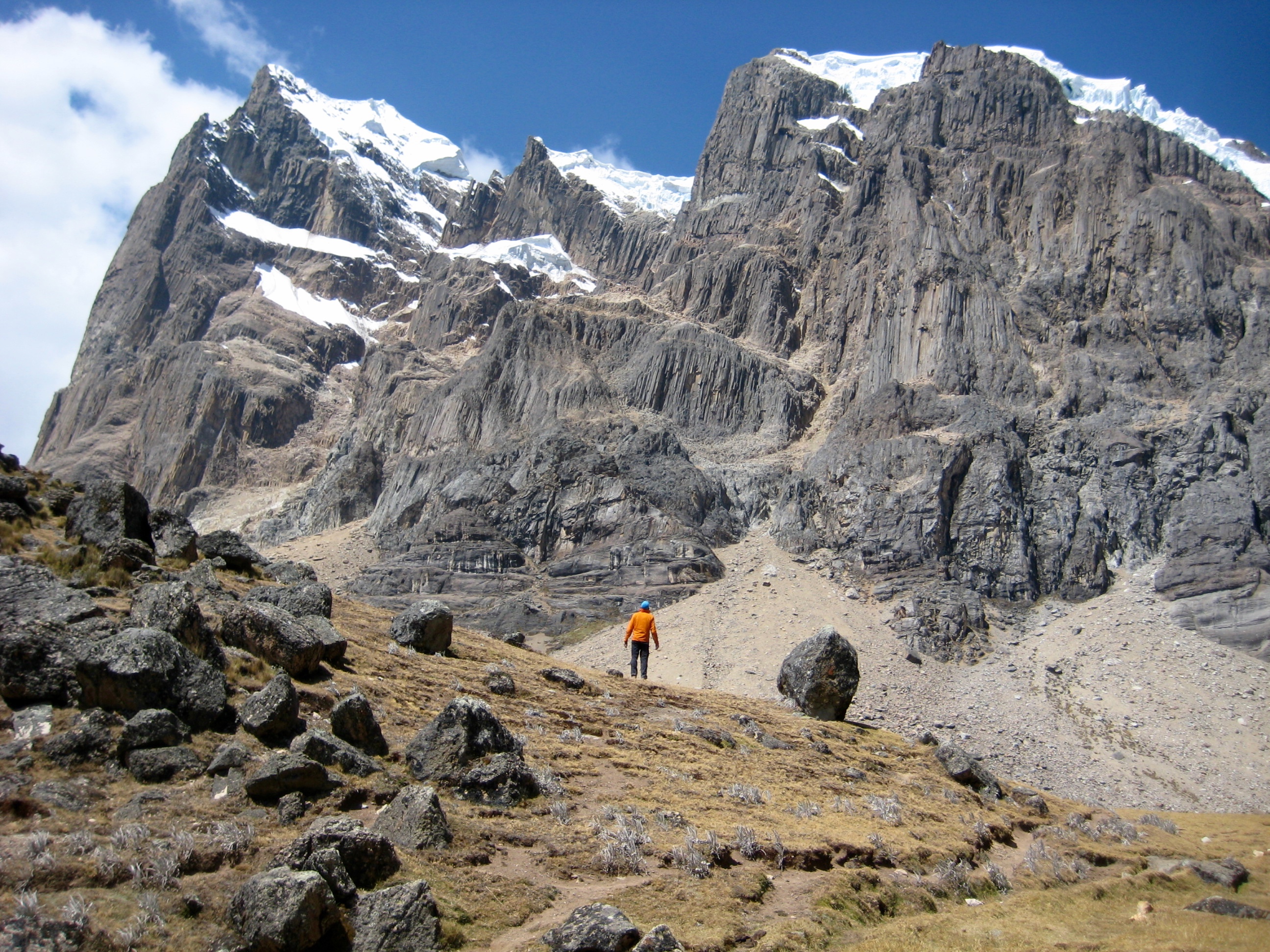
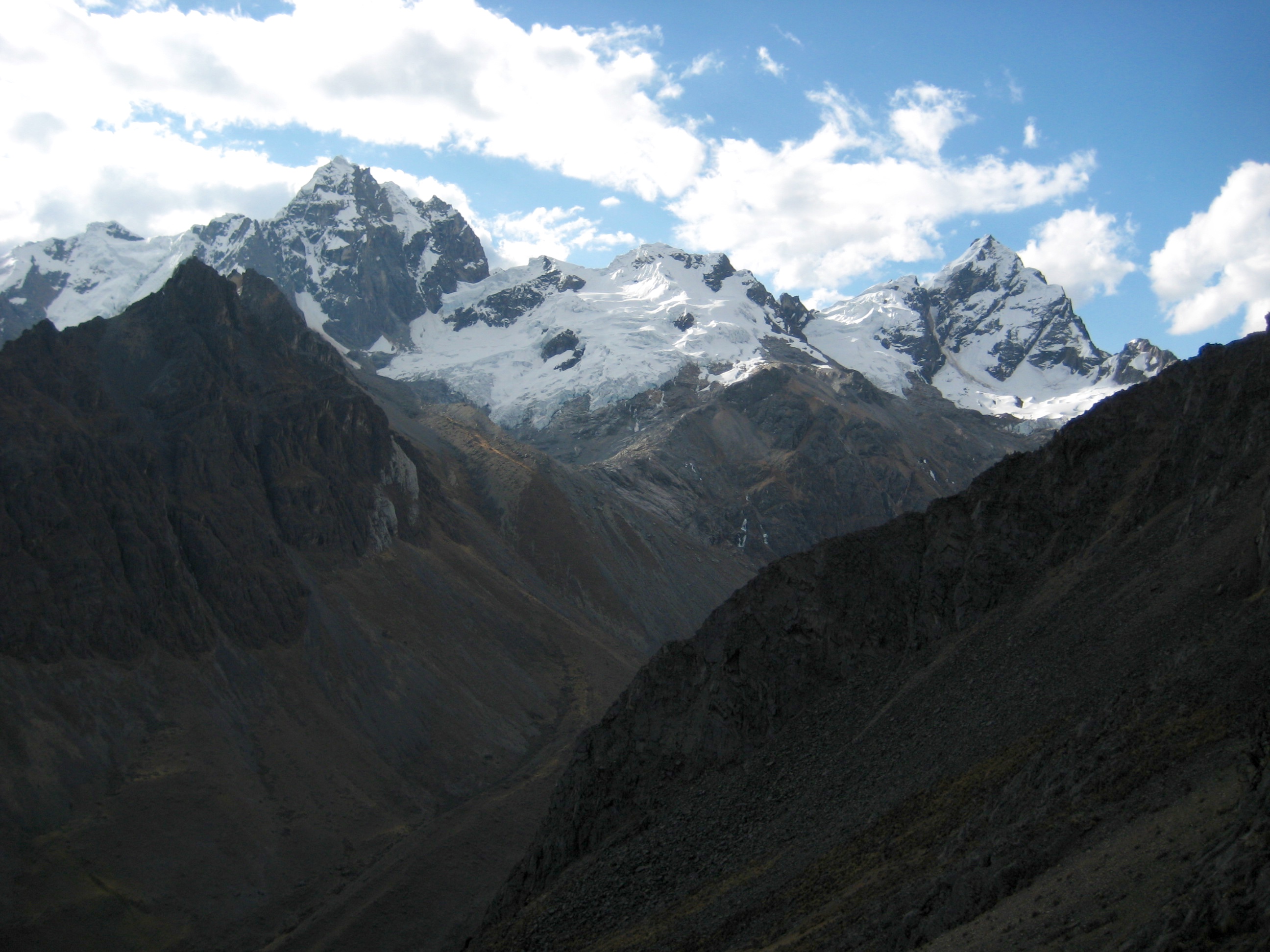
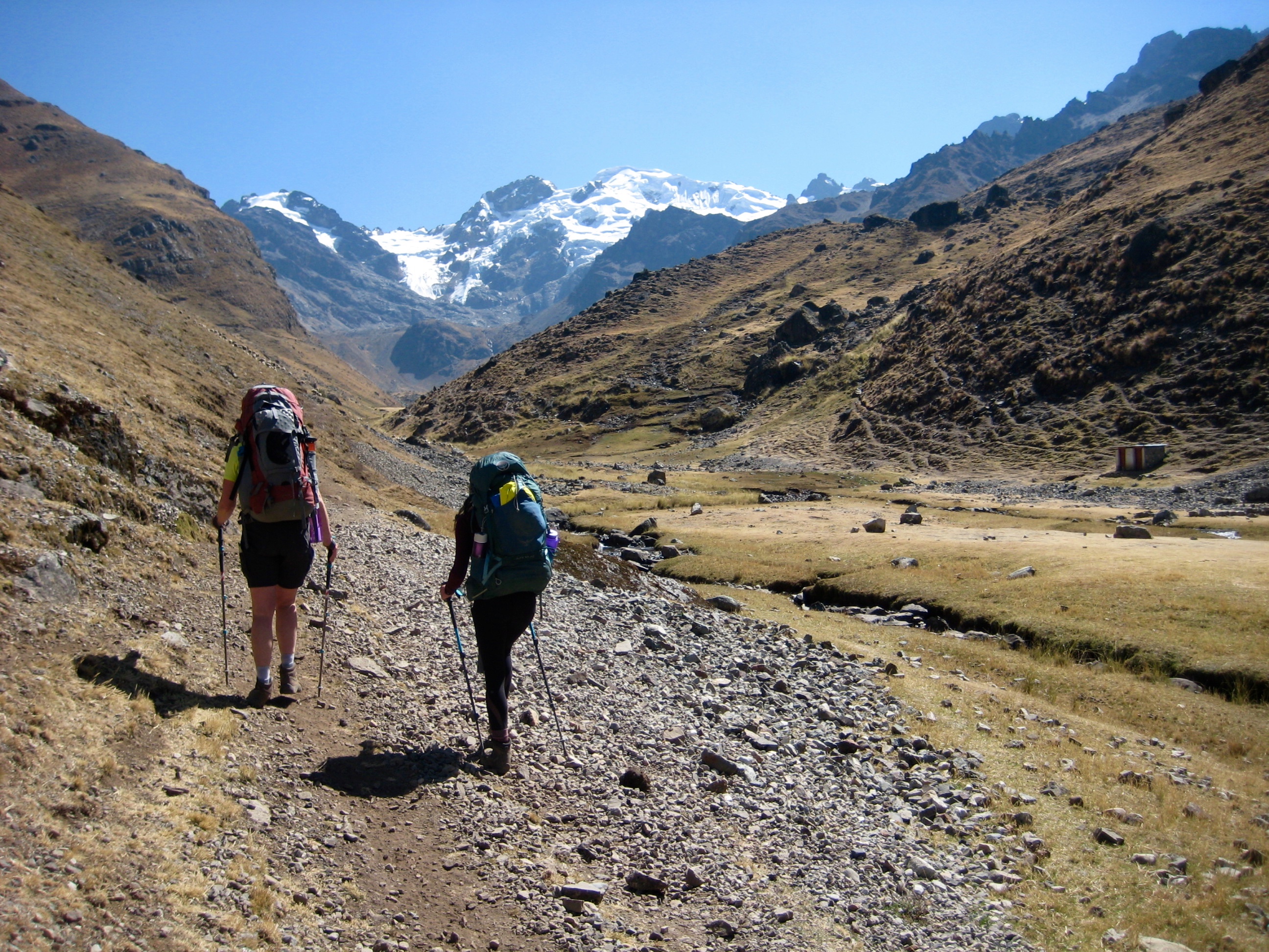
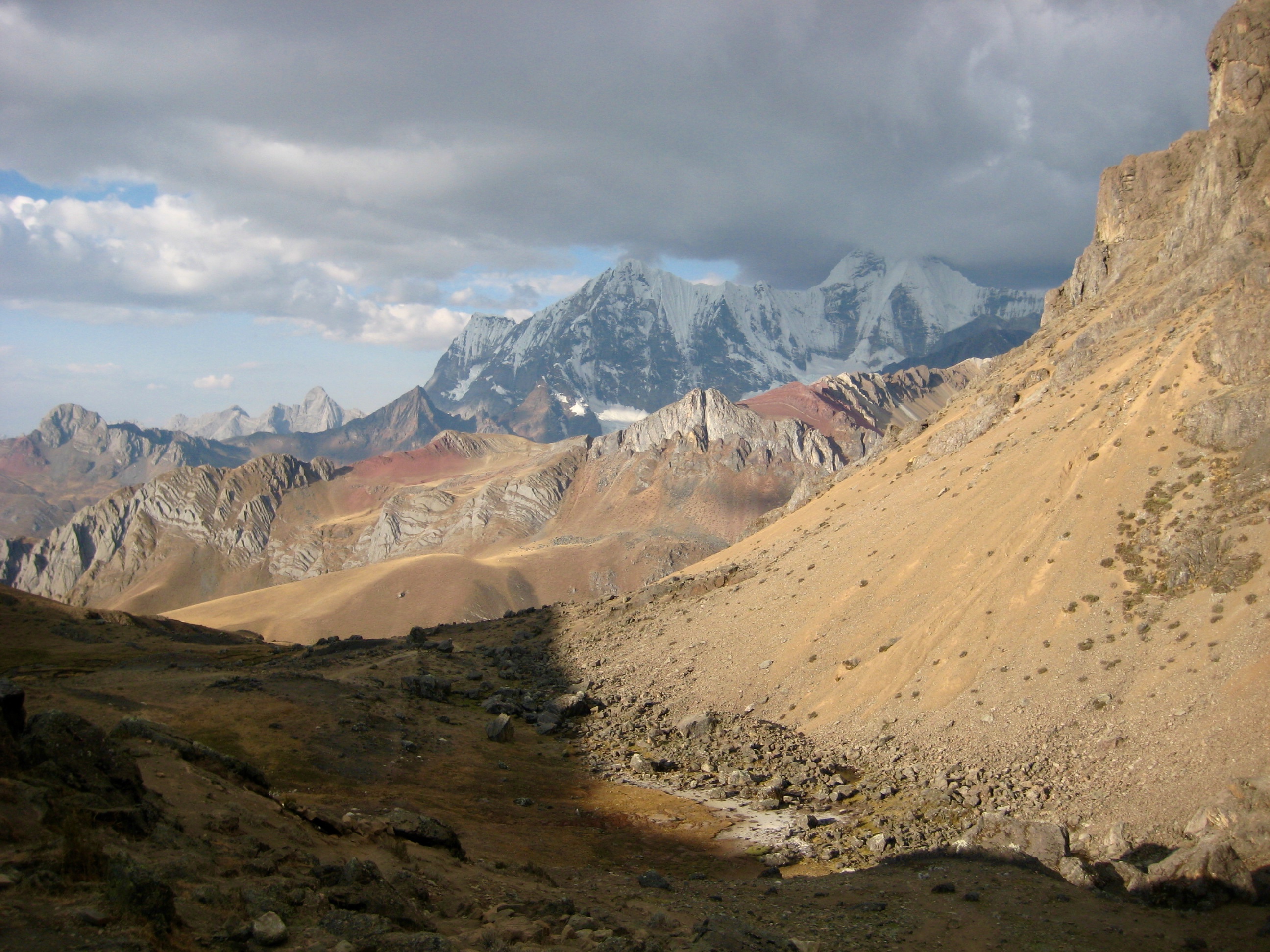
We reached the 16,600-foot pass at 2:00pm (4.5 hours + 2150 feet from Camp 5) and were struck by incredible views of the Huayhuash core peaks. Nevados Yerupaja, Siula Grande, and Serapo stood across the valley, with clouds swirling around their summits.
After a long lunch break at the windy pass, we headed northward down the steep trail through barren terrain. Sketchy footing made for a tedious descent.
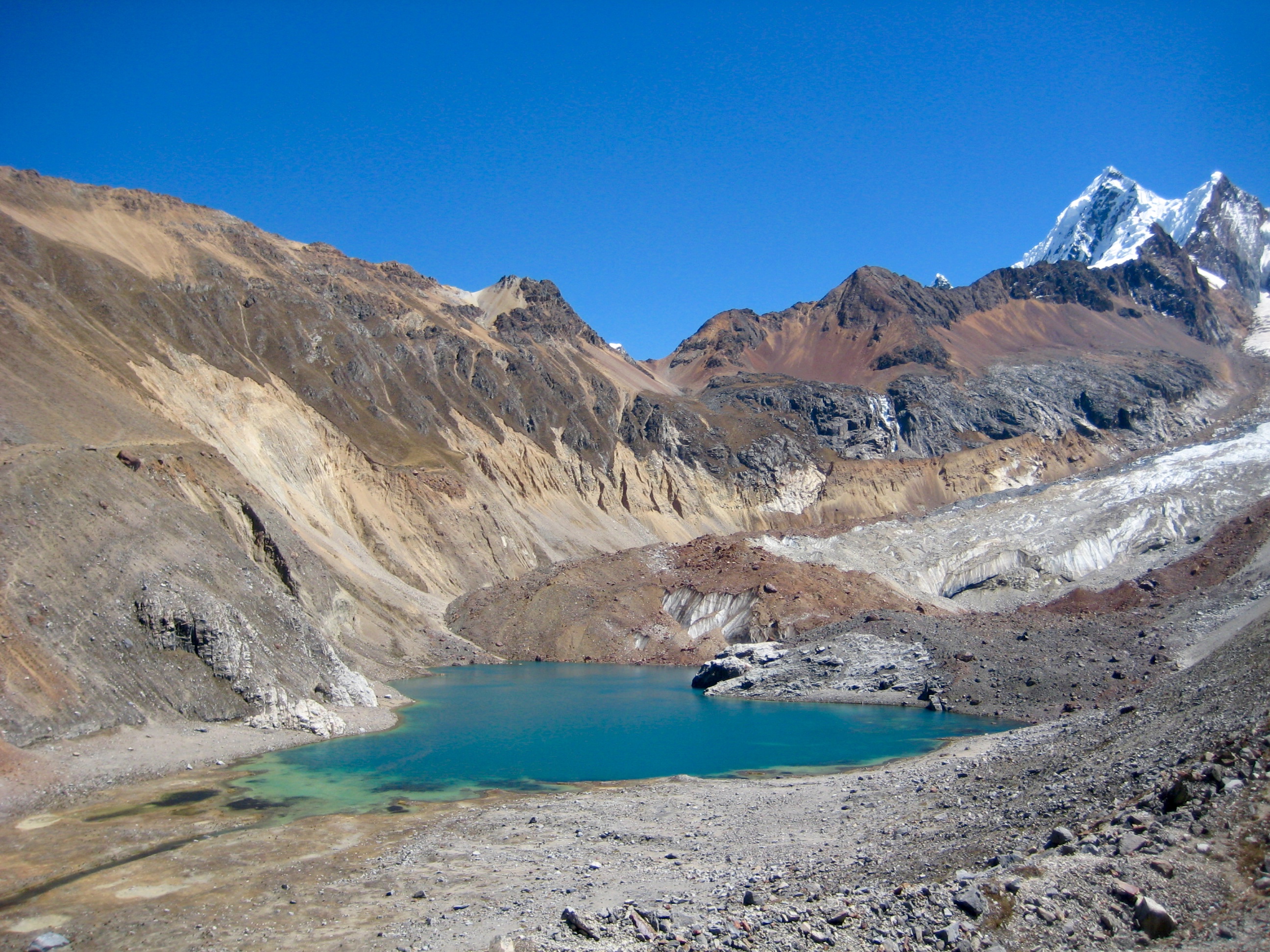
The trail took us on a traverse high above Lake Juraucocha, then back across the lakeshore. Here, we were surprised to see two other hikers coming down the trail behind us. They were a French couple who had just crossed over Jurau Pass and were following high alpine trails through the Huayhuash.
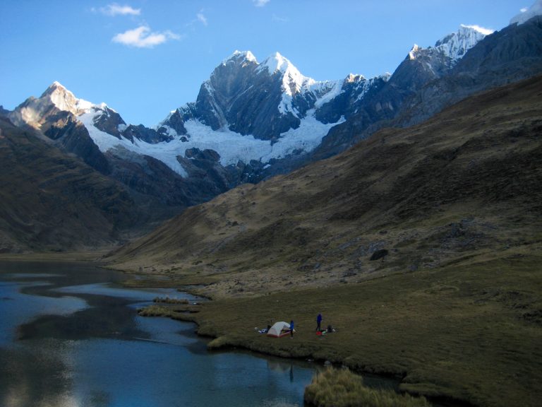
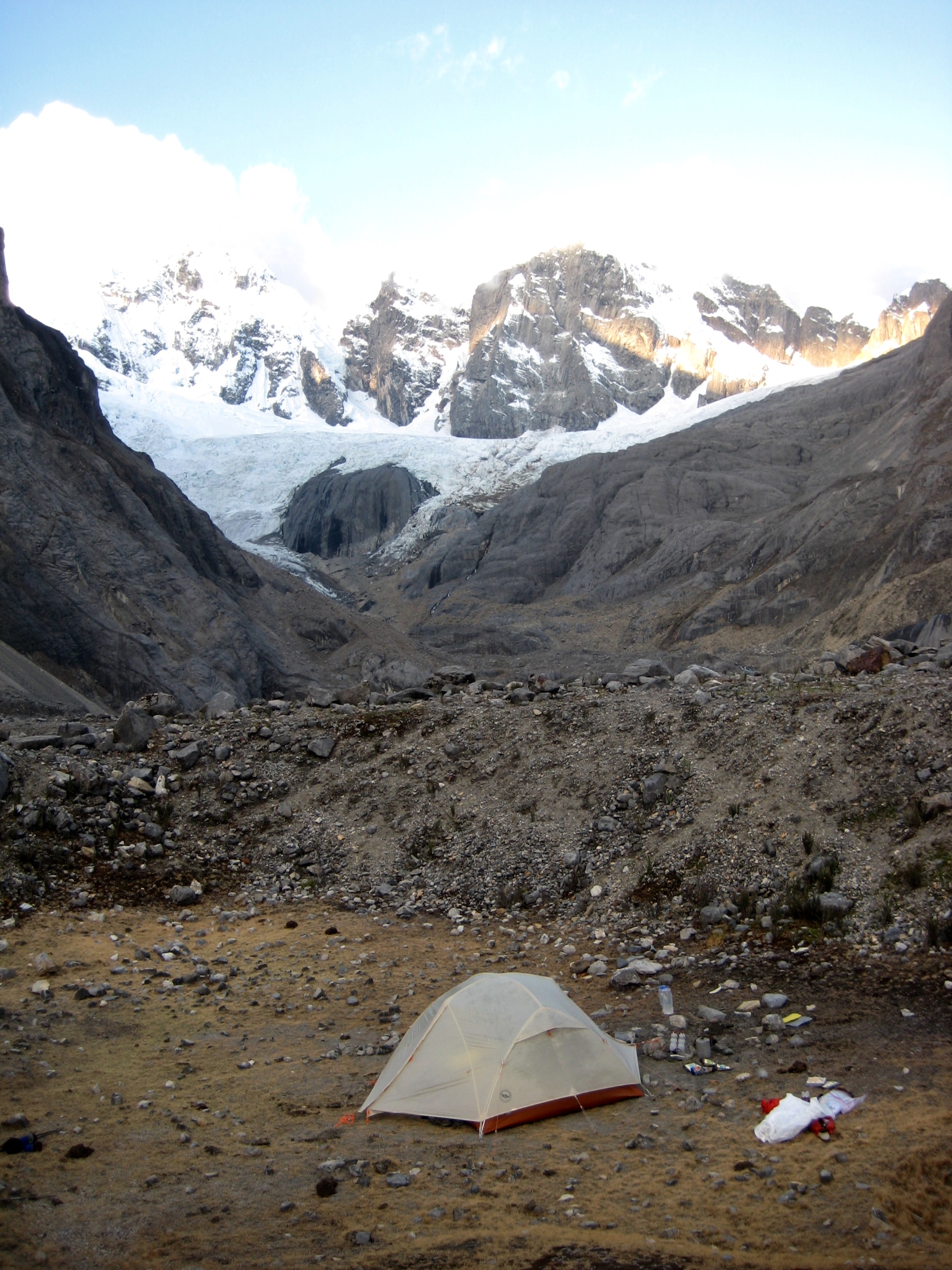
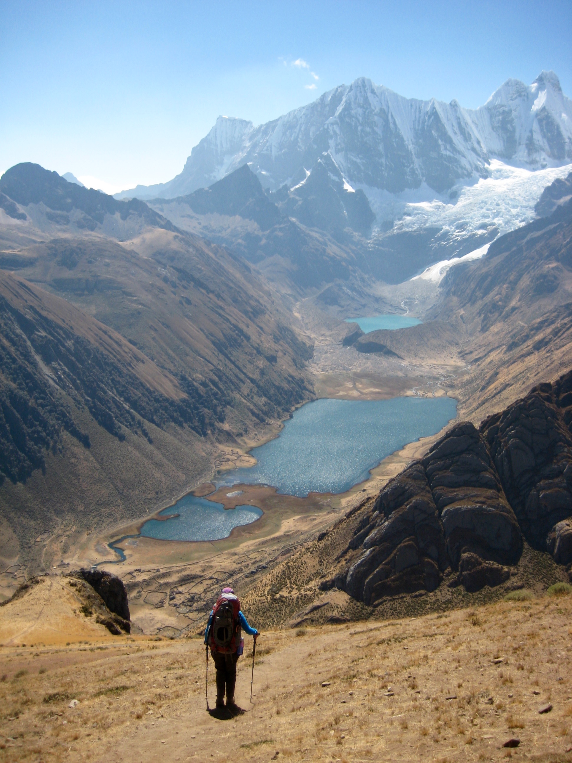
We ended up camping next to the French couple in a small morainal swale adjacent to 14,300-foot Little Lake Juraucocha (7.4 hours + 4.7 miles + 2300 feet from Camp 5).
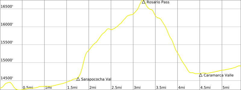
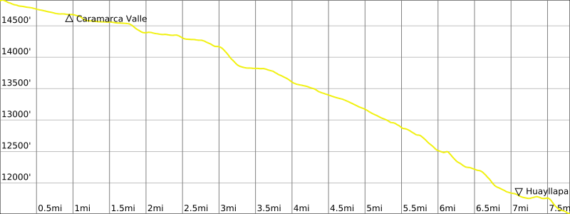
Day 7: Little Lake Juraucocha to Lake Caramarca Moraine
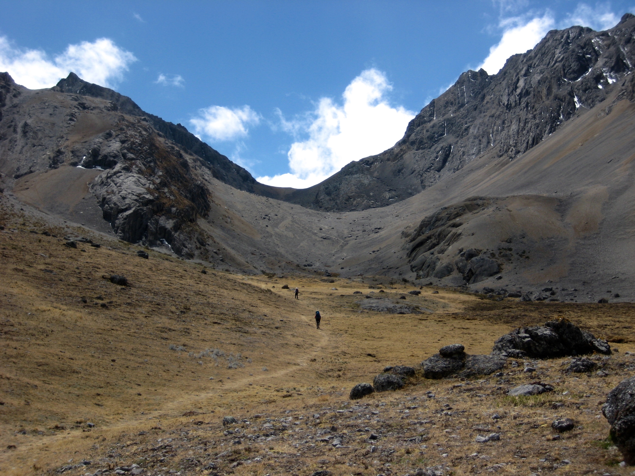
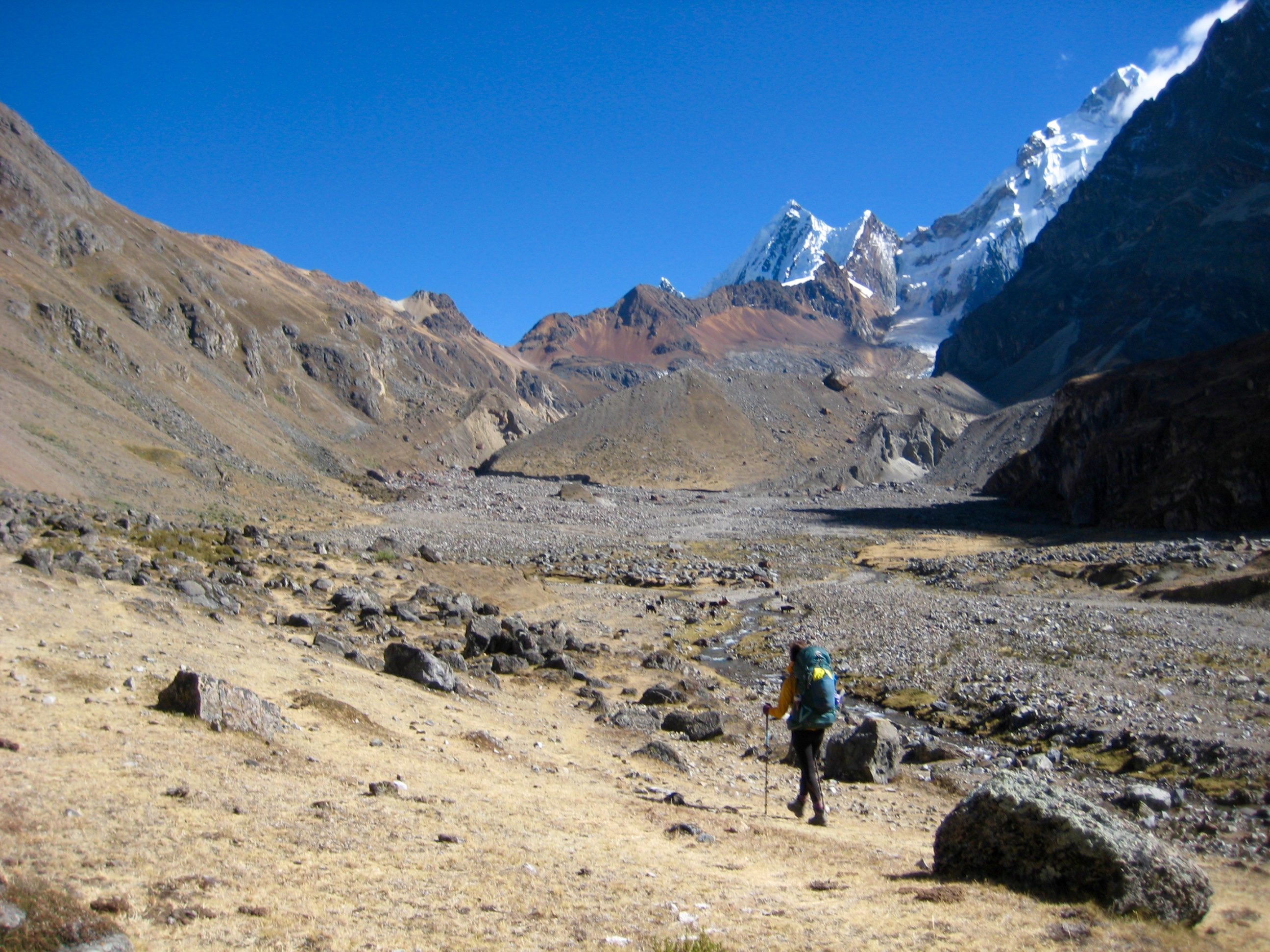
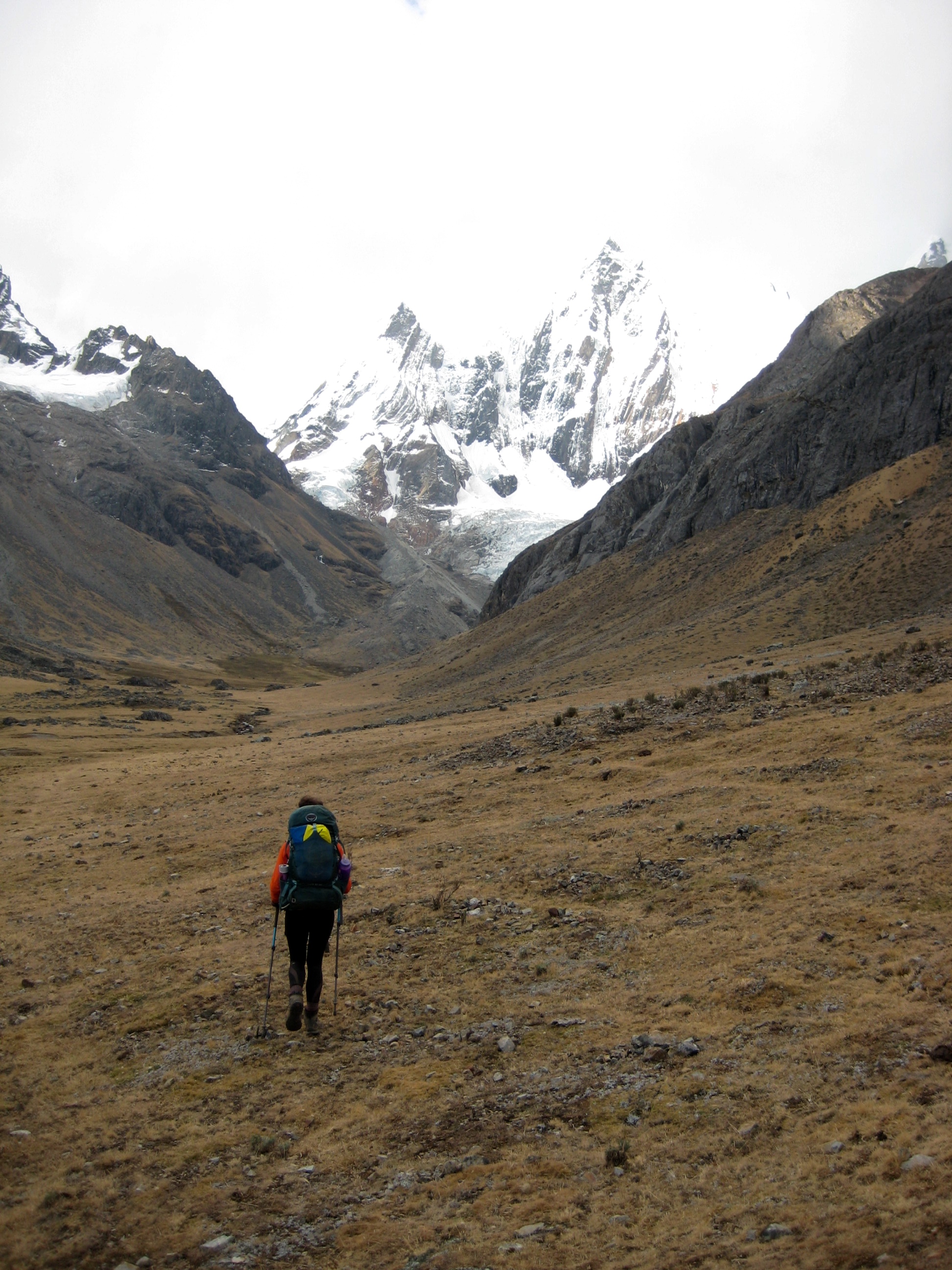
Our plan for today was to hike up the Sarapococha Valley and go over Rosario Pass en route to Huayllapa Village. Since this was the day that Eileen had looked forward to the most, she got a head start out of camp. Brooke and I followed about an hour later.
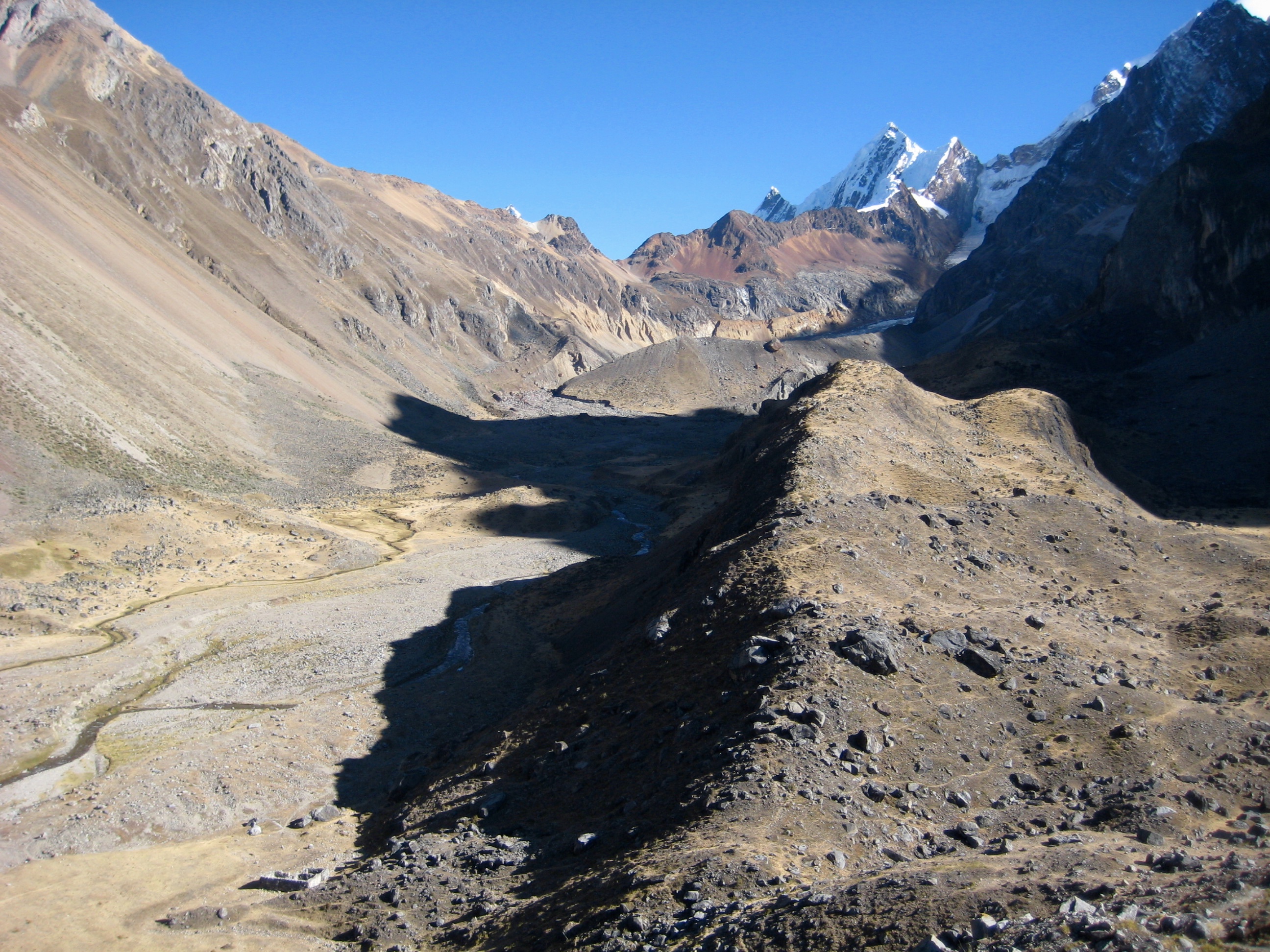
We all regrouped in the valley and fine-tuned our plan. Eileen would slowly work her way up to Rosario Pass while Brooke and I made a sidetrip over to a viewpoint moraine above Lake Santa Rosa, then we would meet at the pass later. It seemed like a foolproof plan, but our family has a long history of travel miscommunications and miscues—some of which turned out quite laughable, others not so much.
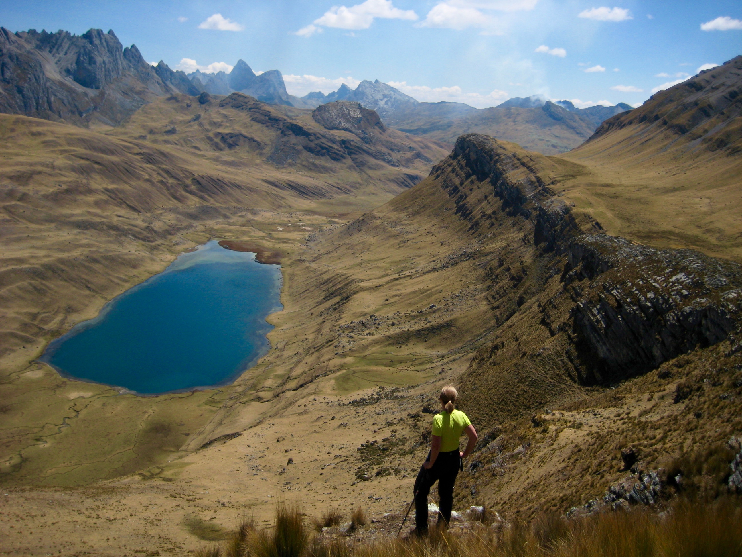
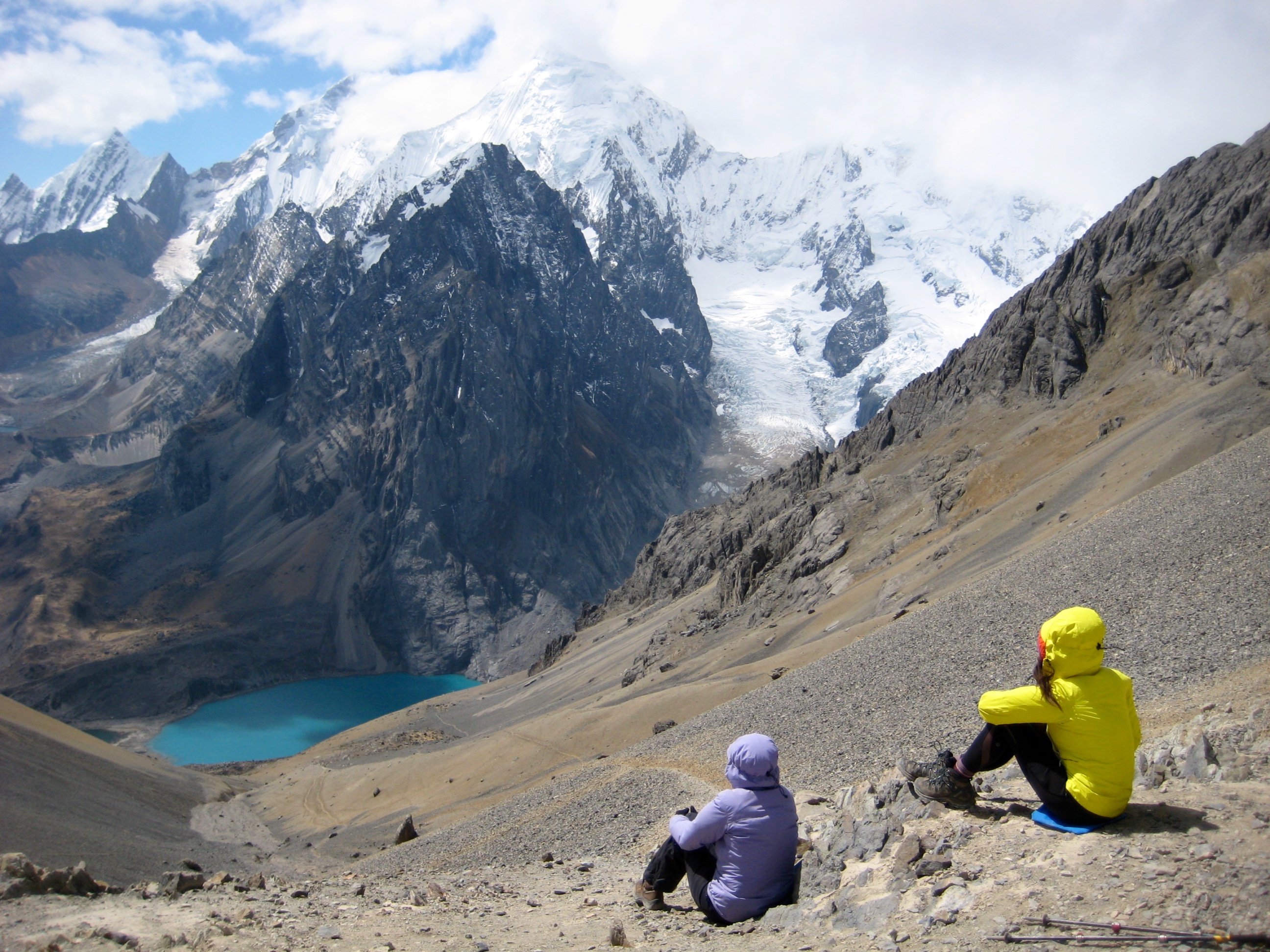
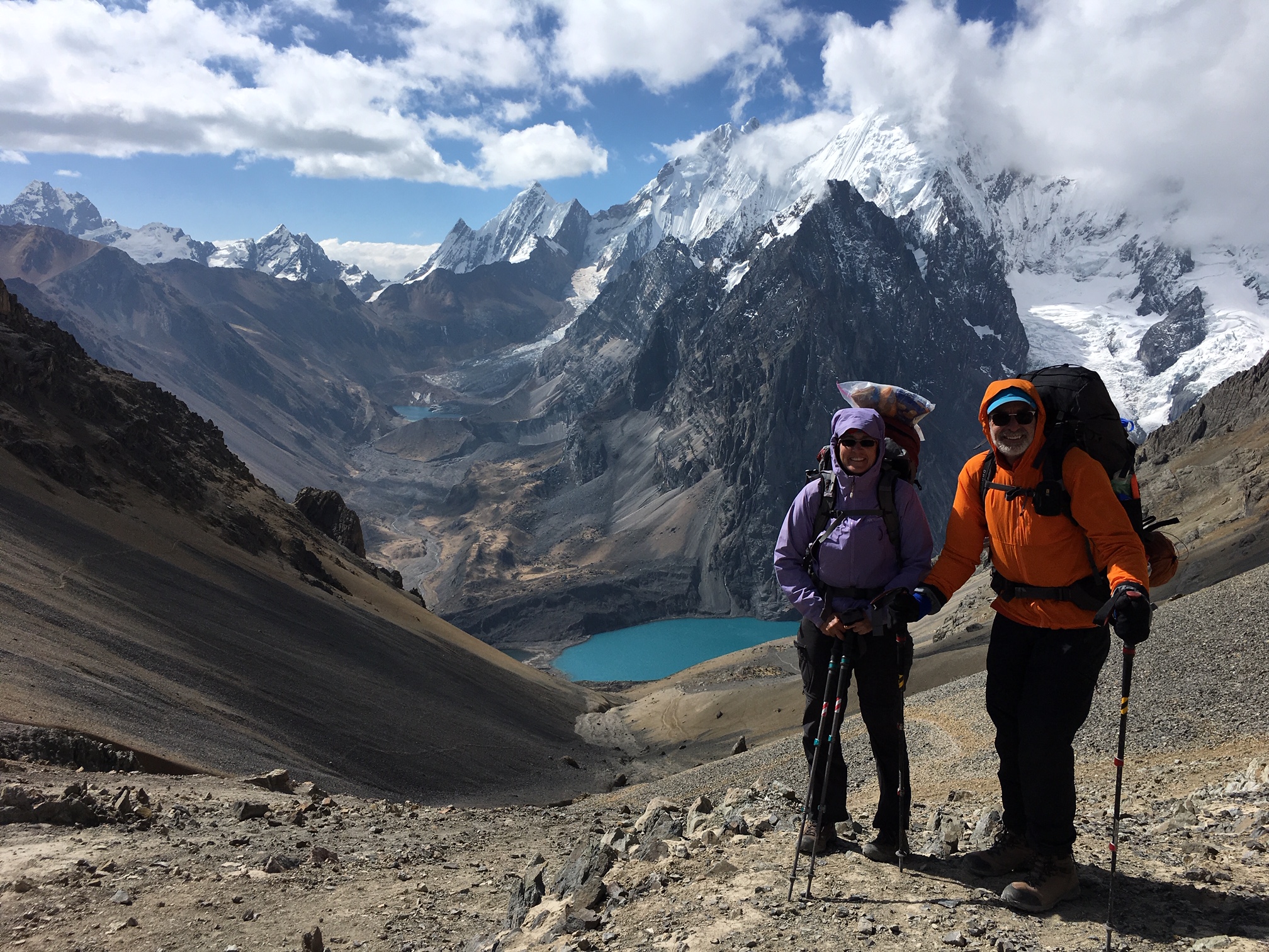
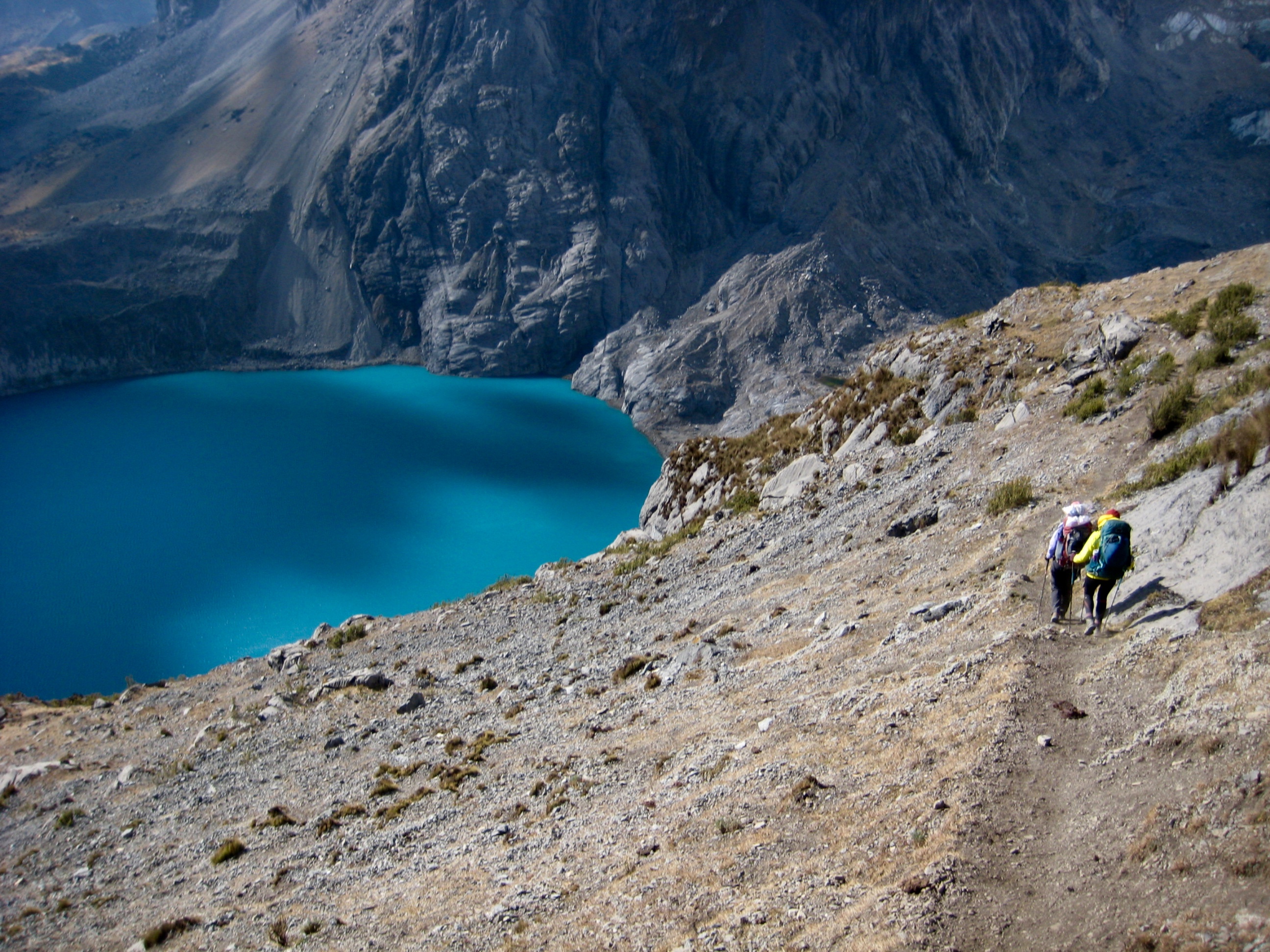
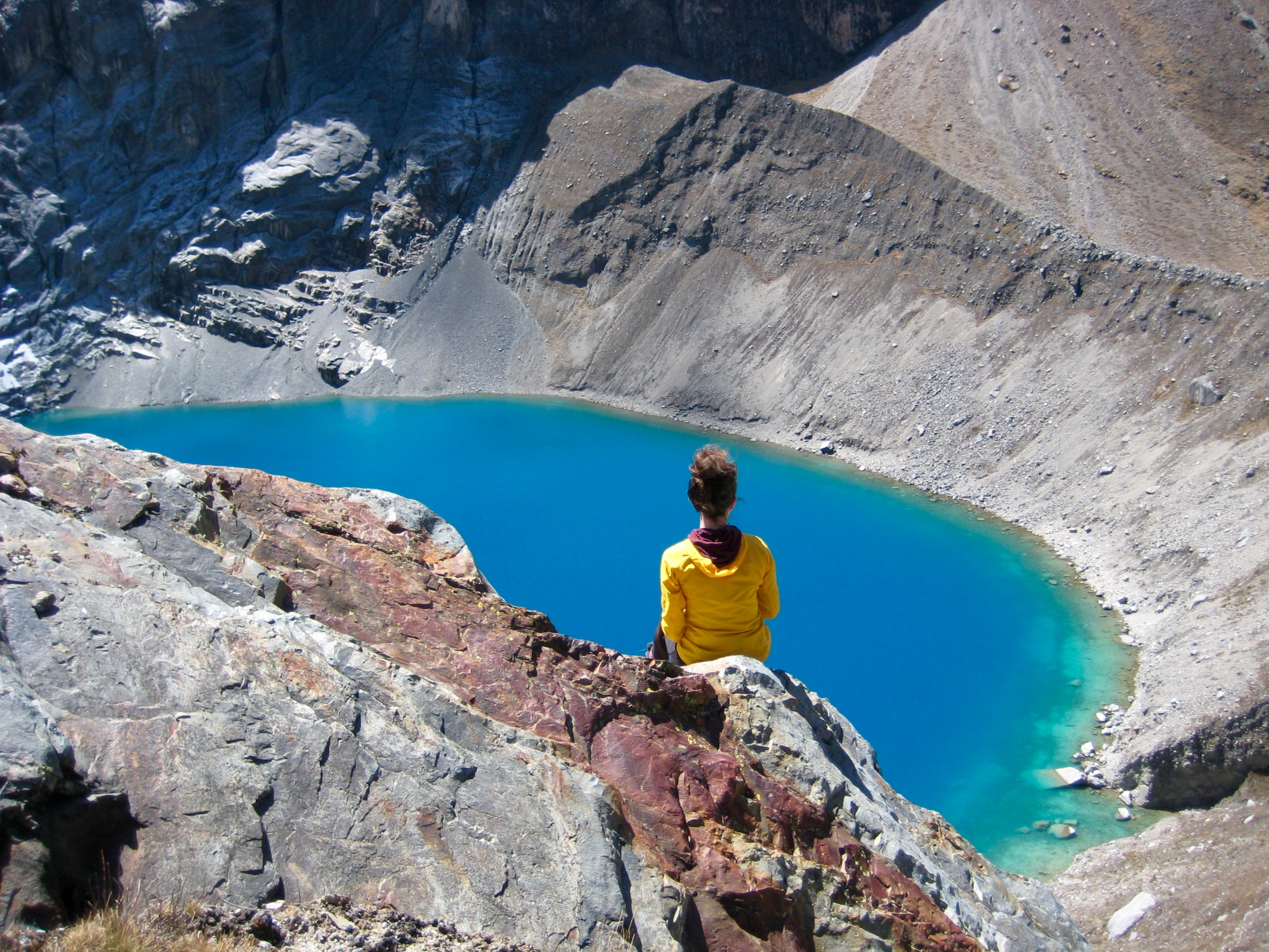
Our sidetrip over to the Santa Rosa Moraine gave us terrific views Nevado Serapo, Lake Santa Rosa, and Lake Sarapococha. This valley was used as a basecamp by Joe Simpson and Simon Yates during their uber-epic climb of Nevado Siula Grande, which was excruciatingly detailed in Touching the Void.
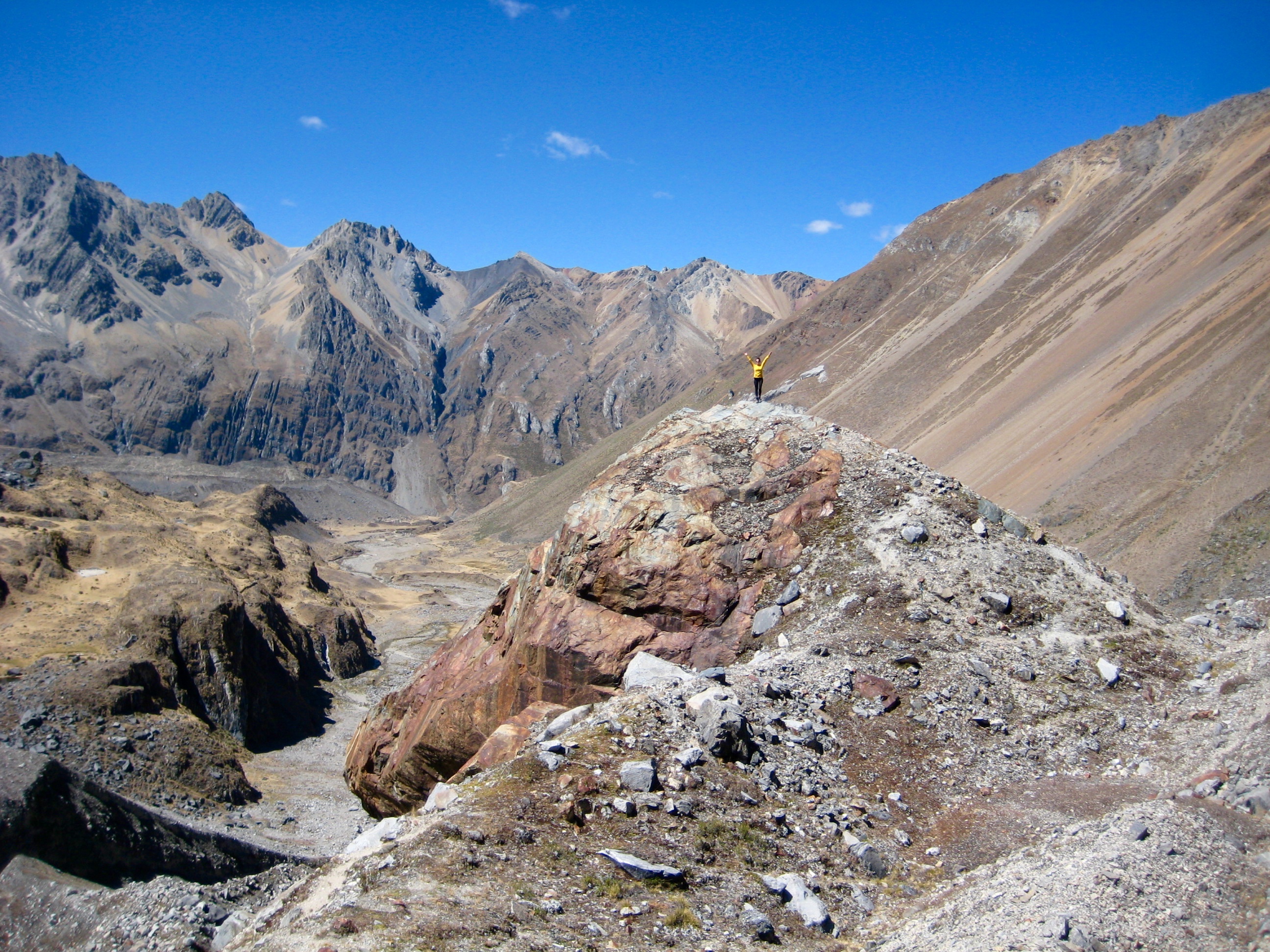
Brooke and I completed our sidetrip by late morning and then started up the hillslope toward Rosario Pass. Upon encountering a well-beaten bootpath several hundred feet upslope, we followed this on a northward traverse. Nevados Yerupaja and Siula Grande came into better view as we progressed.
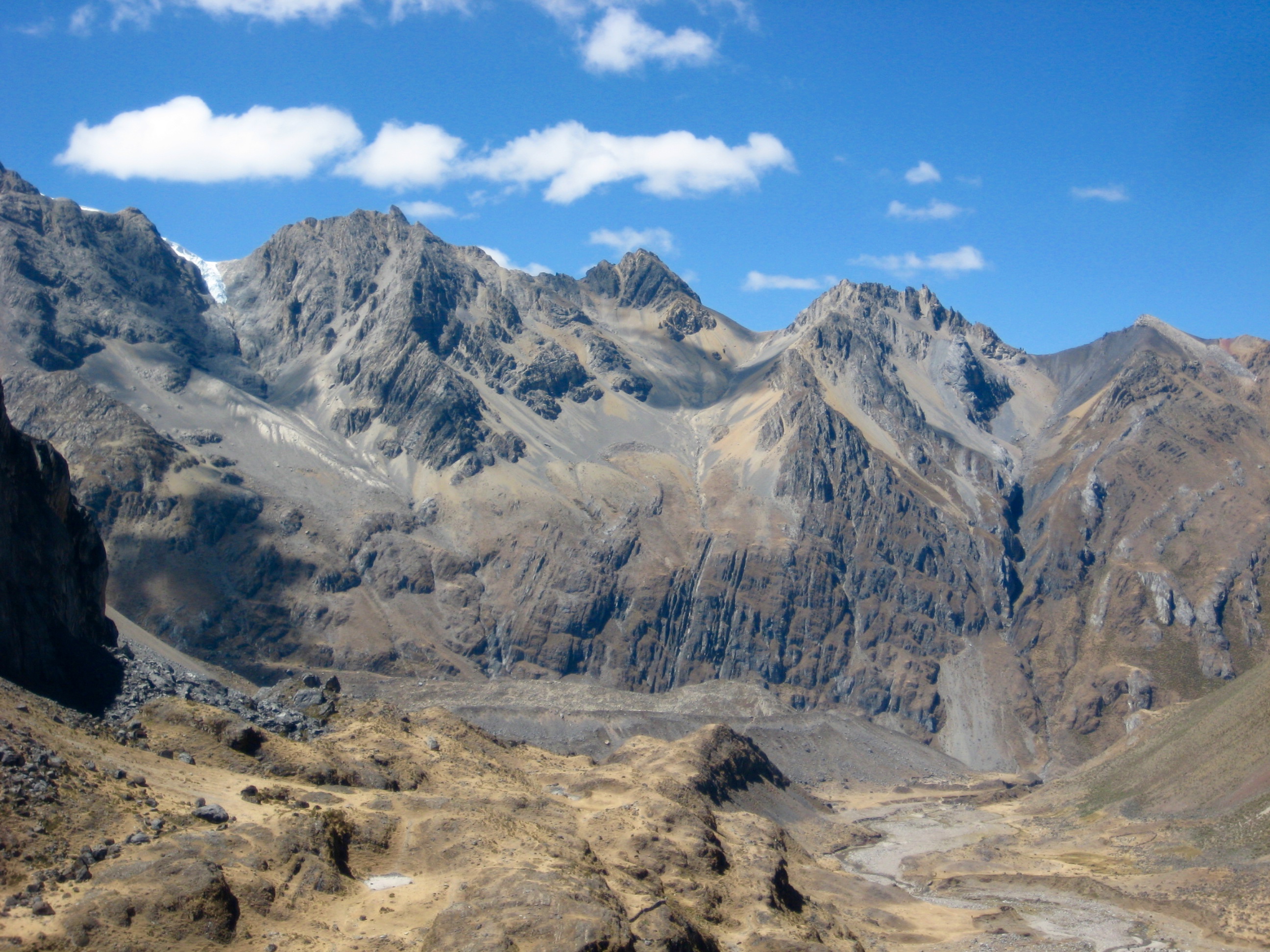
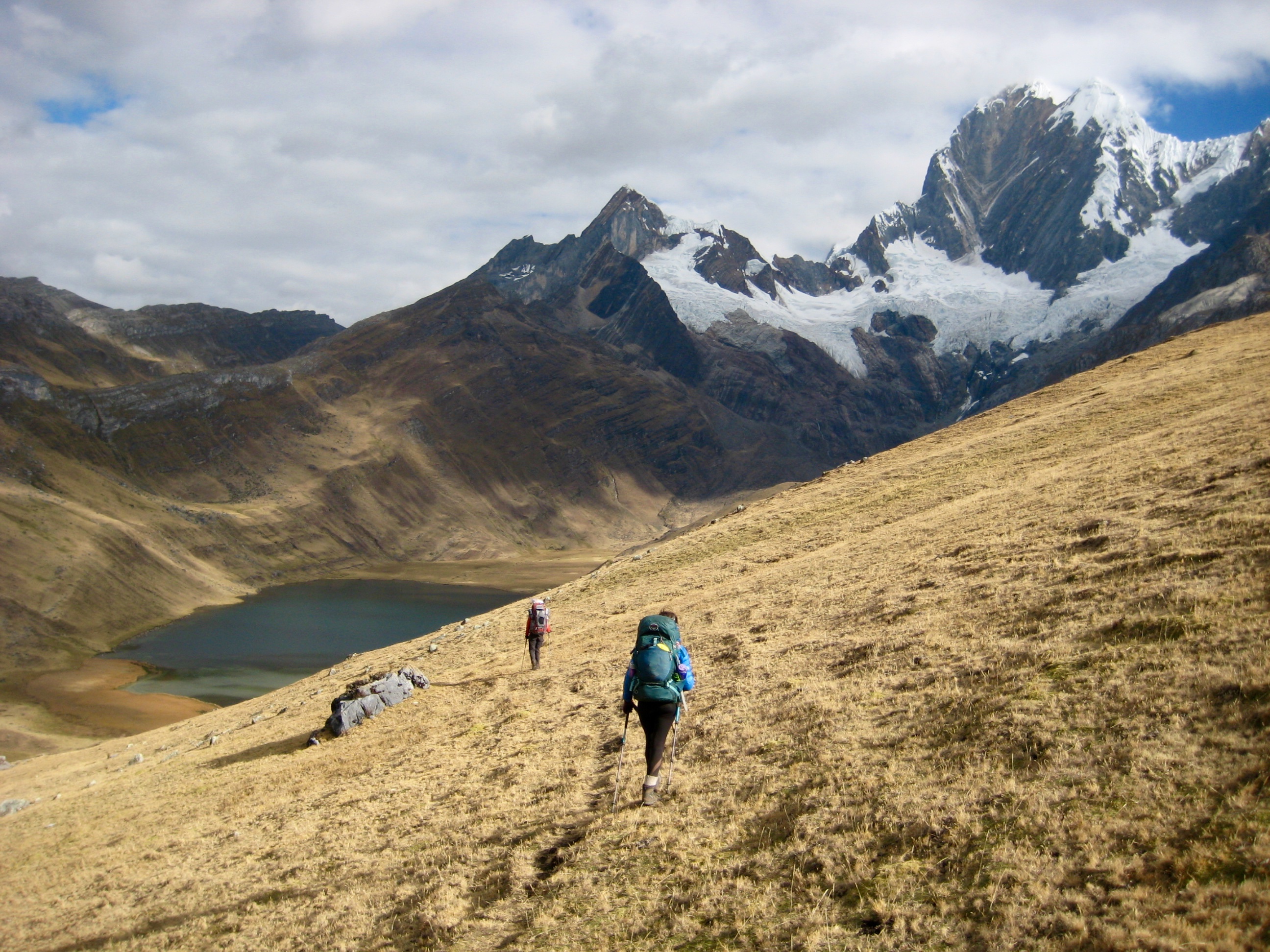
I eventually realized that we had traversed too far north, so we left the bootpath and headed directly uphill. Due to the high elevation and steep gradient, our climb was slow and exhausting. We finally arrived at 16,700-foot Rosario Pass around 3:00pm (6.7 hours + 3350 feet from Camp 6). Giant peaks were visible in all directions, but oddly enough, Eileen was nowhere to be seen.
After much shouting and whistling, we made a decision to drop down the other side of the pass in hopes that Eileen (and possibly the French couple) had headed that way. Our descent began on horribly loose talus and scree but gradually transitioned onto a vague bootpath. Once the path reached Segya (Caramarca) Valley, we hiked a mile up-stream toward Lake Caramarca.
On a conspicuous grassy moraine located closely below the lake (9.3 hours + 6.4 miles + 3500 feet), we pitched our tent in the shadow of Nevado Rasac and waited…and waited…and waited.
Day 8: Lake Caramarca Moraine to Huayllapa Village
Not knowing where Eileen was, and not having a sleeping bag, I had a long, restless, cold night. Come morning, Brooke and I anxiously waited until 10:00am before packing up and heading down-valley. Our new hope was that Eileen had gone down to Huayllapa Village to find shelter and food.
After an hour of hiking, we encountered a solo hiker camped in the valley. Had he seen Eileen? Yes! He saw her yesterday and confirmed that she was heading for the village! With a great sense of relief and a spring in our step, we continued down Segya Valley.
The valley route started out as a sketchy and undulating path before widening into a pack trail. It was mid afternoon when reached the edge of the village (4.7 hours + 8.1 miles + 200 feet from Camp 7).
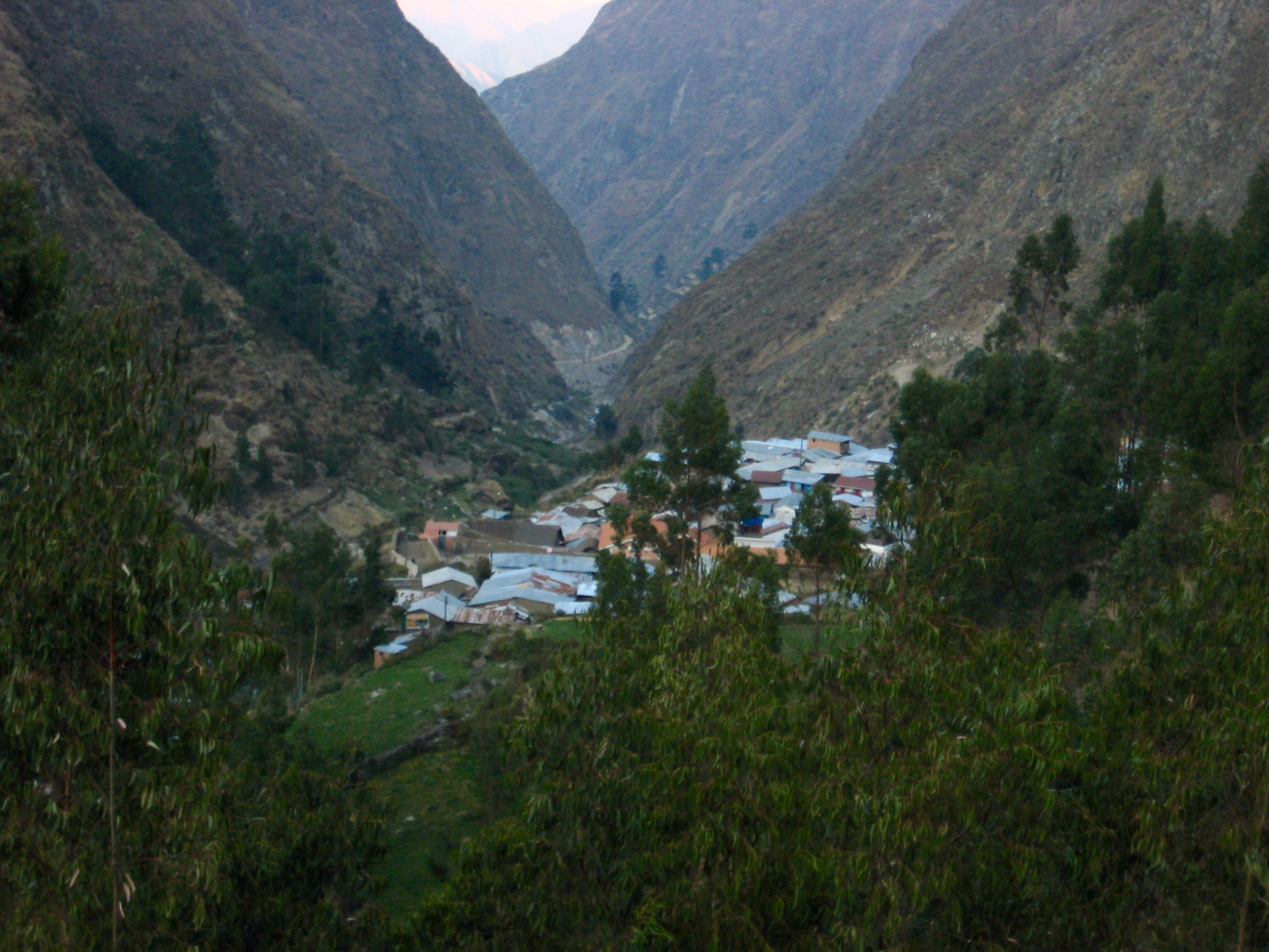
Eileen was waiting near the village entrance, surrounded by a group of concerned residents. She sprinted forward and welcomed us with hugs, smiles, and tears. The village residents grinned and cheered. Unintentionally, we had all become the talk of the entire town! As for what happened next, suffice it to say that we used the experience as a “family learning moment.”
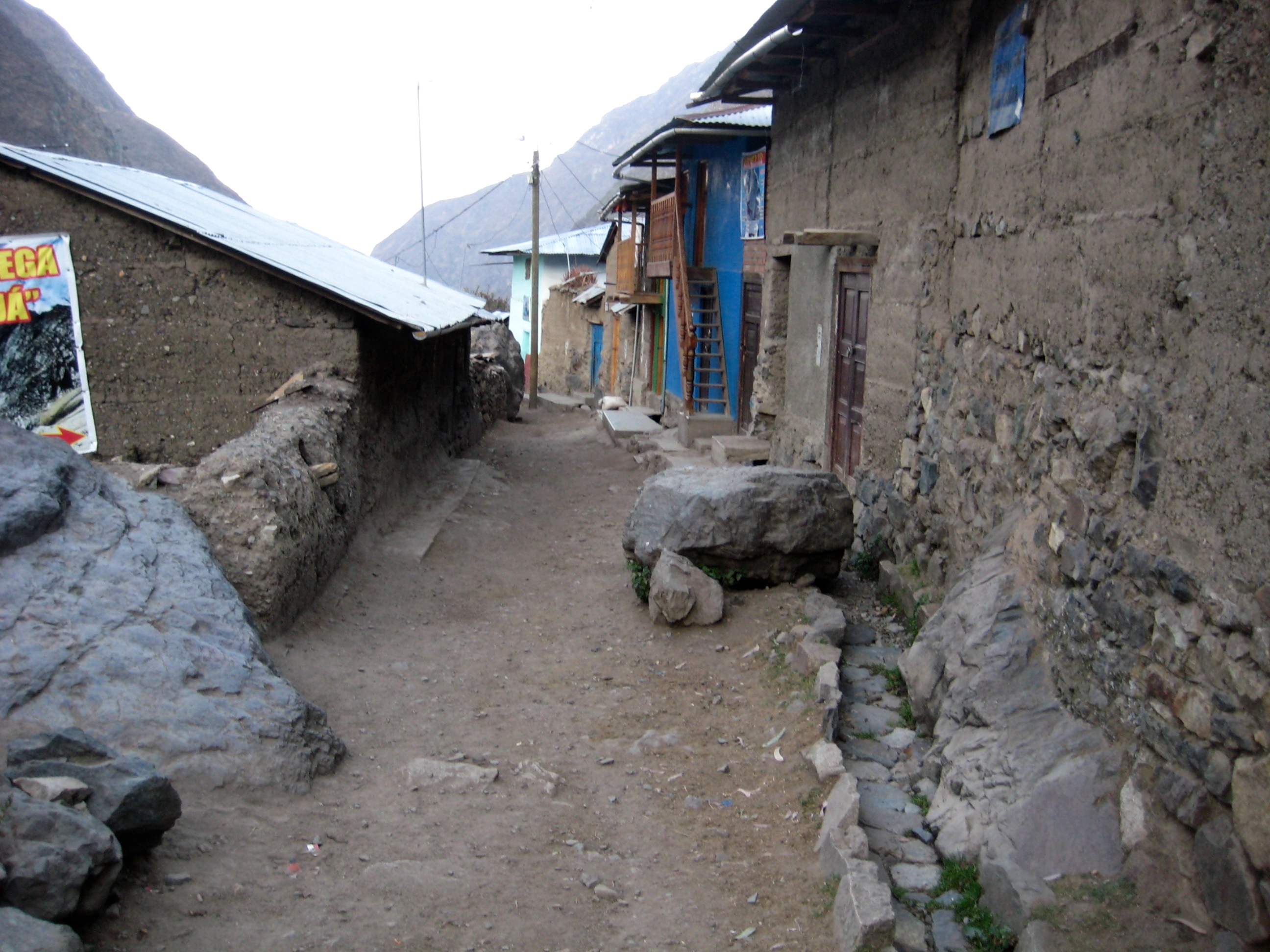
Eileen led Brooke and me over to the home of Omar and Flor, two residents who had taken her in last night, giving her food and a bed. We ended up spending another night in their home and enjoying their unbounded Peruvian generosity and graciousness. They asked for no payment in return, but they did ultimately accept a donation to their home-improvement fund.
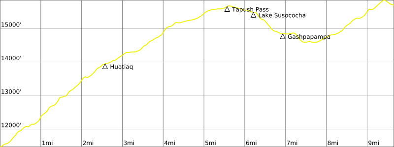
Day 9: Huayllapa Village to North Yaucha Basin
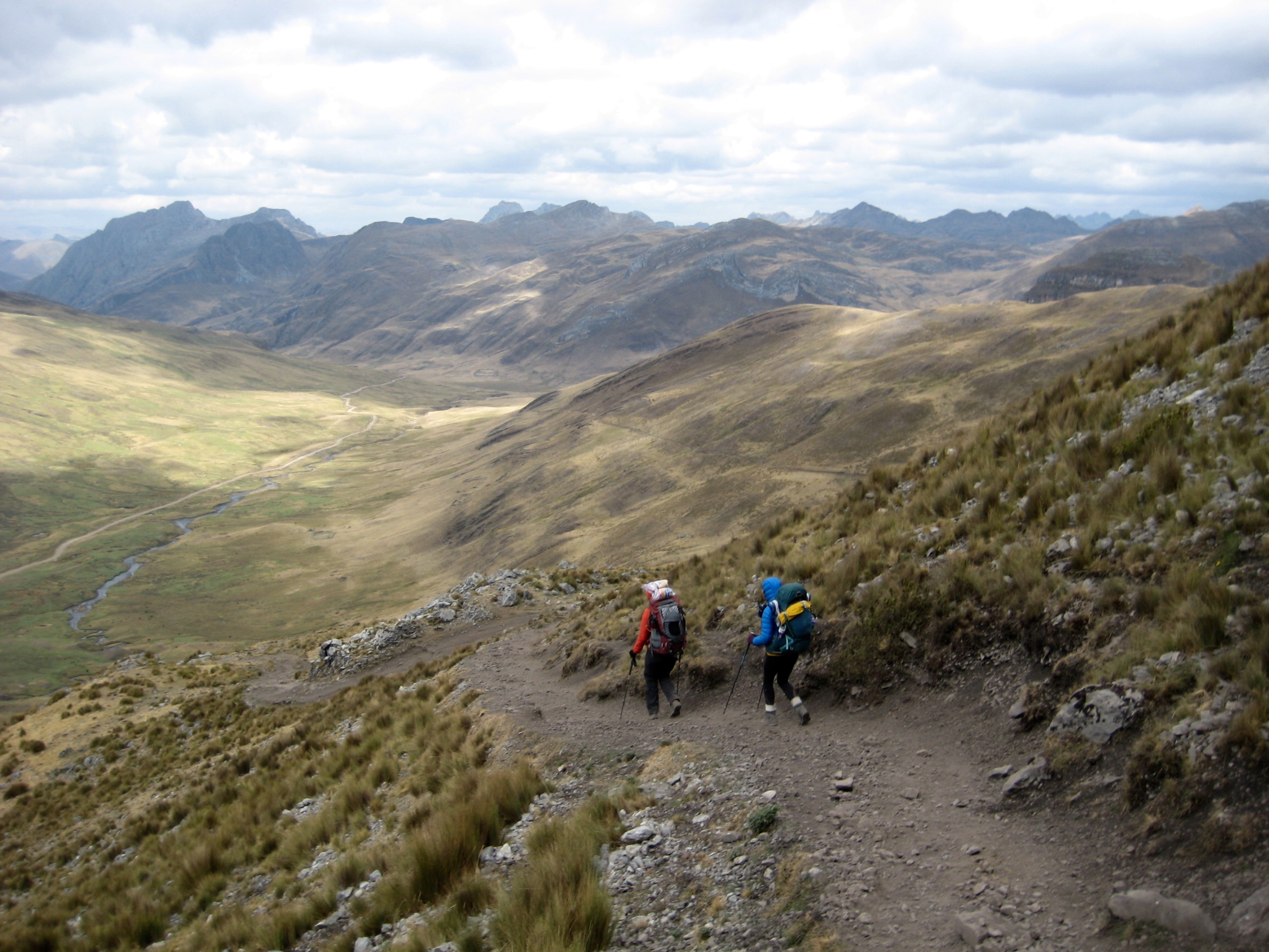
Huayllapa Village marks the southwesternmost point of the Huayhuash Circuit, and from there the route turns sharply northward. For trekkers staying in the village—either in a campground, a hotel, or a home—this is the day that everyone dreads because it is necessary to make a long ascent of 4200 vertical feet from the 11,500-foot village to 15,700-foot Tapush Pass before descending to Gashpapampa Camp. In our case, we needed to continue even farther; our schedule required that we get over a second, higher pass before stopping for the night, resulting in a one-day ascent of well more than 5000 feet.
Knowing it would be a long, strenuous day, we awoke at 5:30am and were underway before 6:30am. The village was silent except for several ambitious roosters. We headed up the pack trail in cool morning air, not passing Huatiaq Camp (3.6 hours + 2250 feet from village) until shortly after the sun hit our valley.
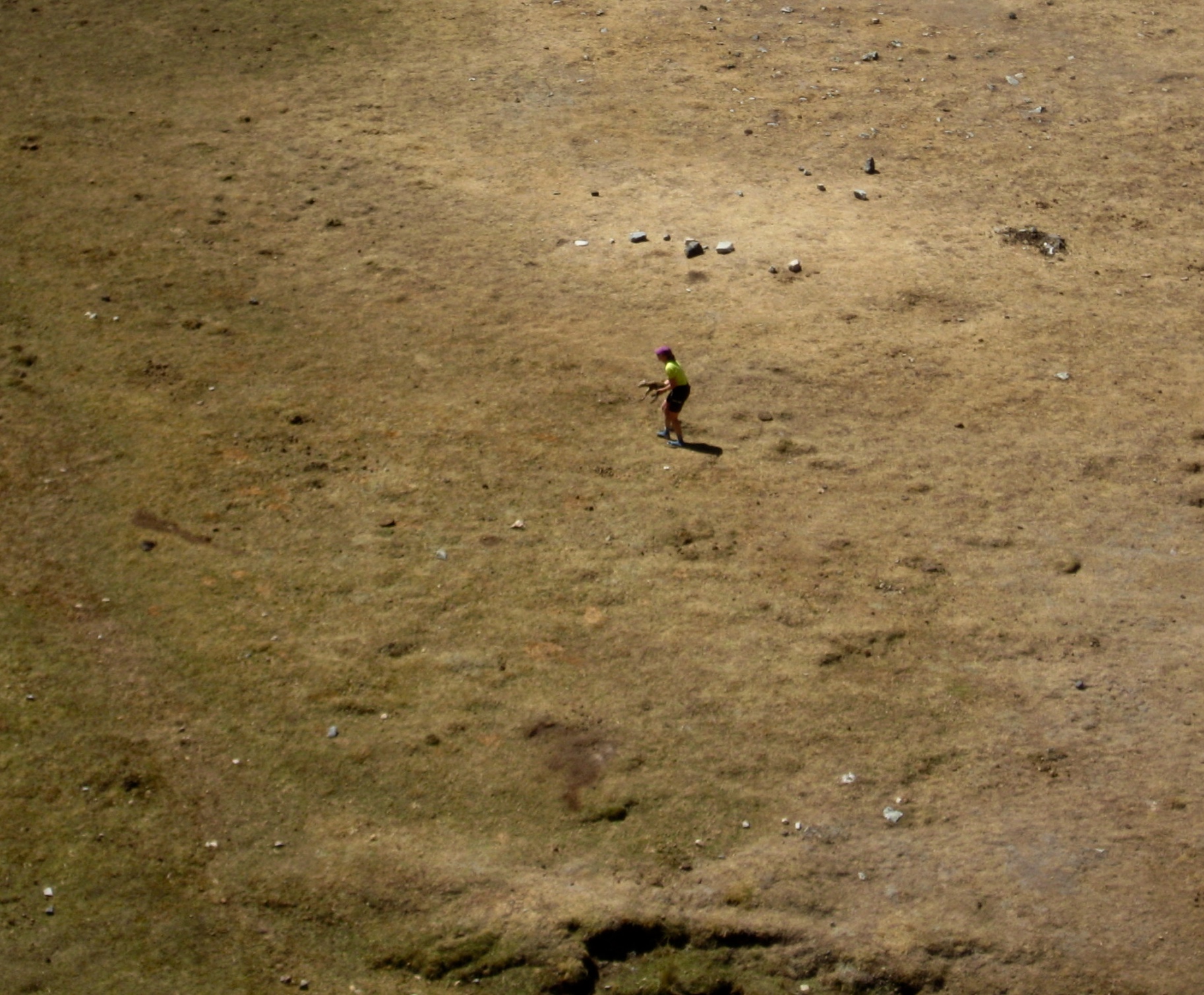
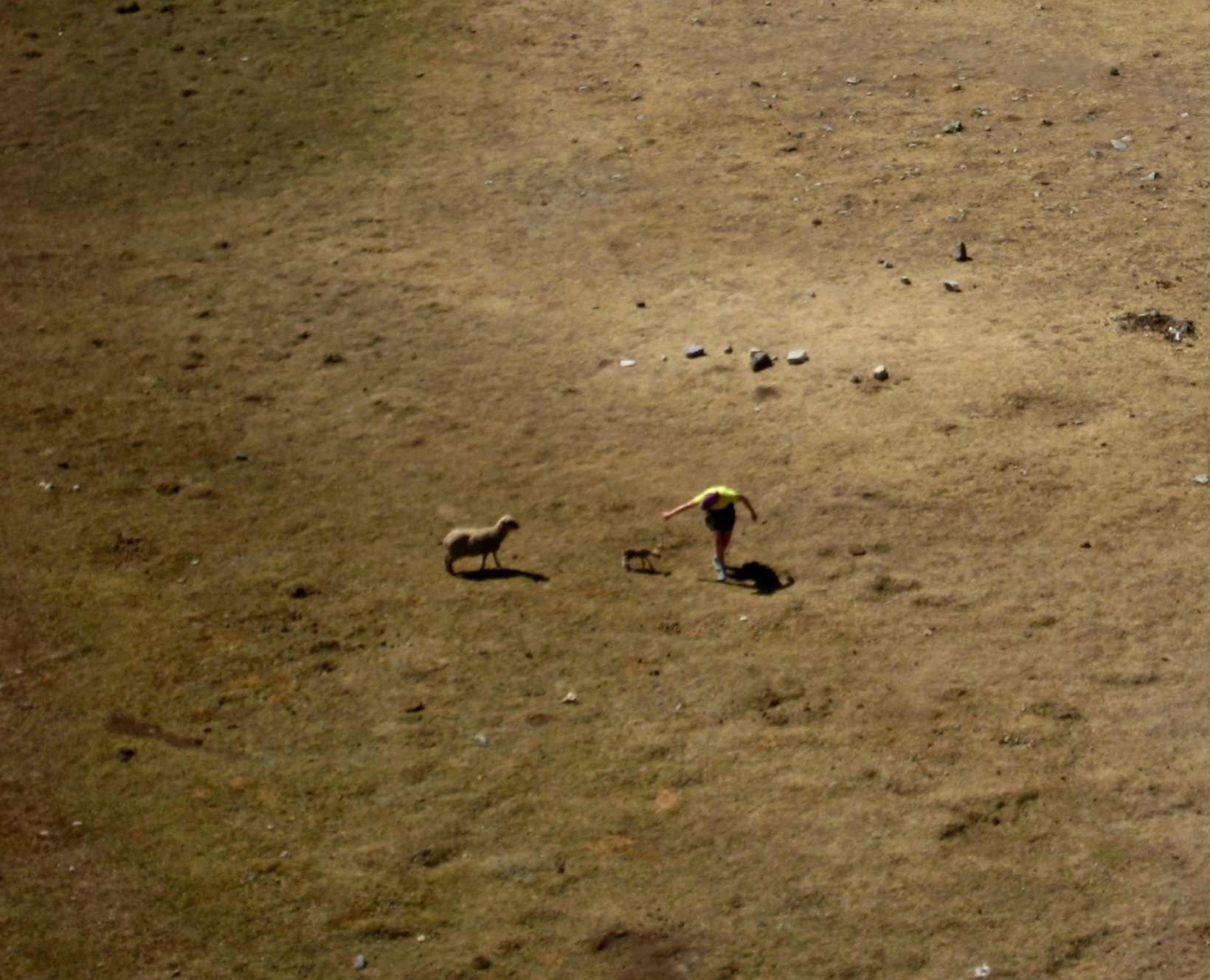
A bit farther up-valley, Eileen earned her Life-Saving Merit Badge. We had paused to watch a herd of sheep running across a basin and leaping over a deep, narrow creek. Suddenly, a baby lamb fell into the creek and began crying in panic; his distraught mother also began crying and jumping back and forth across the creek. Without hesitating, Eileen dropped her backpack and ran down the hill. I watched with pride and admiration as she jumped in the creek and pulled the tiny lamb to safety, then returned it to the mother sheep. Humorously, the lamb spent several moments trying to decide whether to stay with Eileen or its mother!
Good deed completed, we continued hiking up-valley on a series of trails and mining roads until finally topping out at Tapush Pass (6.9 hours + 4200 feet from village). It had been a tiring ascent, but we still had far to go.
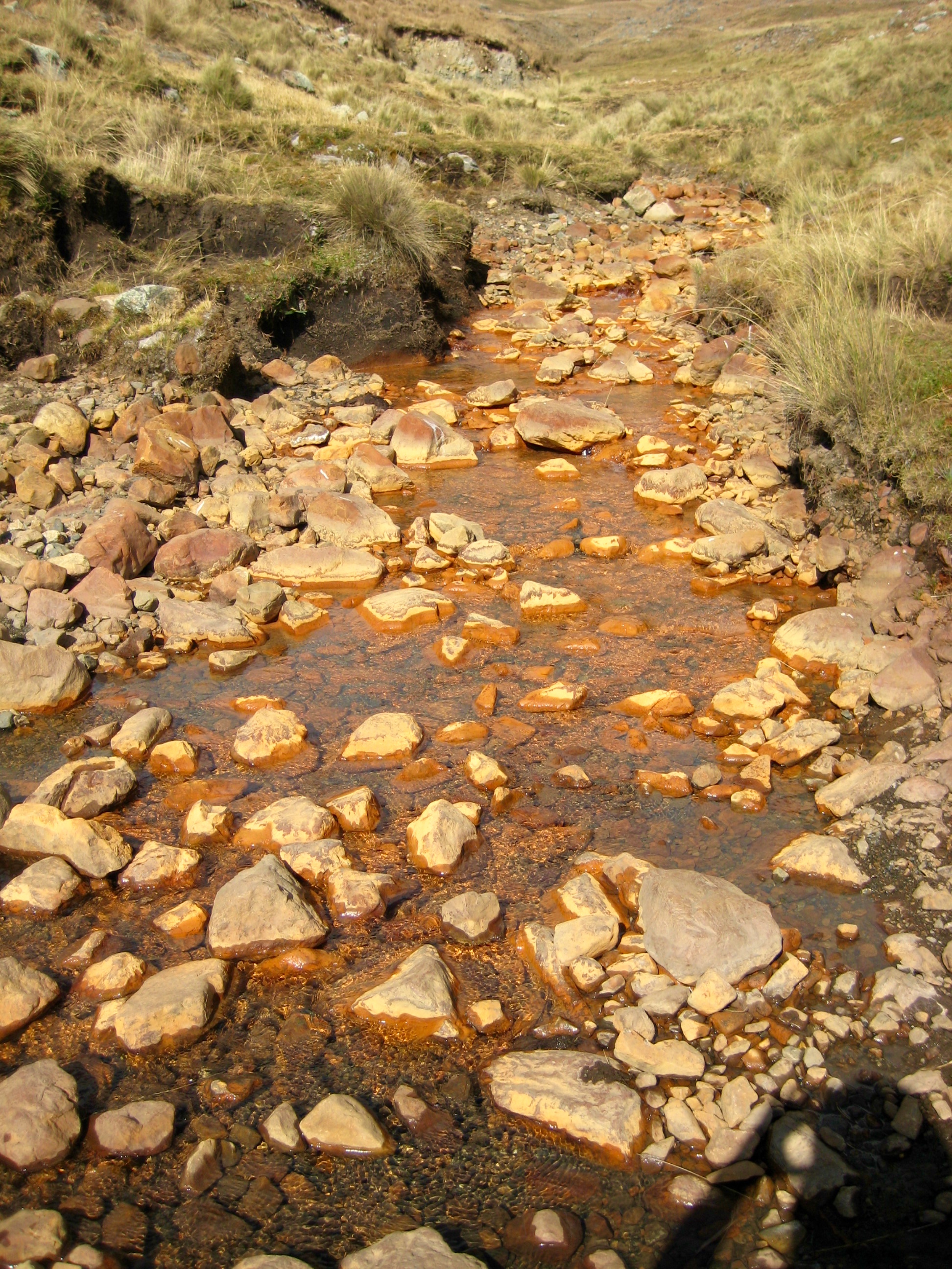
We descended to Gashpapampa Camp, which sits in a sheltered basin, then dropped farther down to a strikingly orange creek (probably stained by toxic mining waste). From there, we had another hefty ascent to 15,900-foot Yaucha Pass. Eileen was feeling a bit ill, so she waved Brooke and me to go out ahead and find a camp before dark.
Our final ascent was slow and tiring, given the high altitude and long day. However, the trail itself was ingenious and interesting; it weaved back and forth between imposing cliff bands, always finding an easy way through. Brooke and I reached Yaucha Pass shortly before sunset (10.4 hours + 10.0 miles + 5300 feet from village).
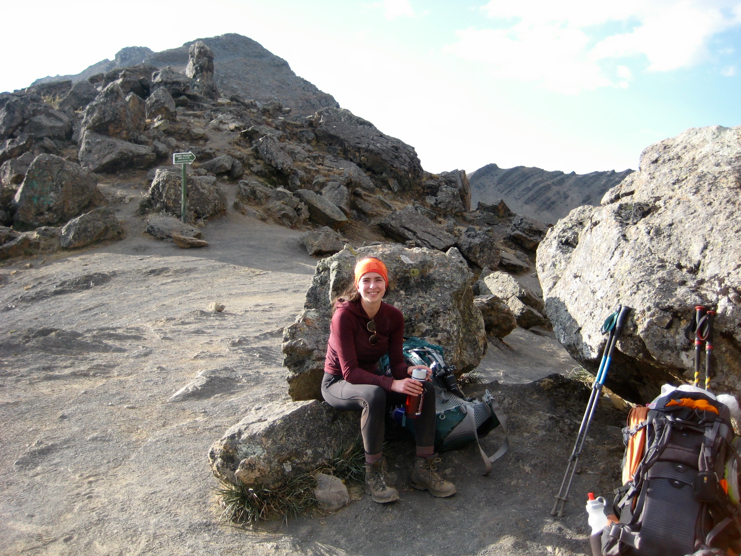
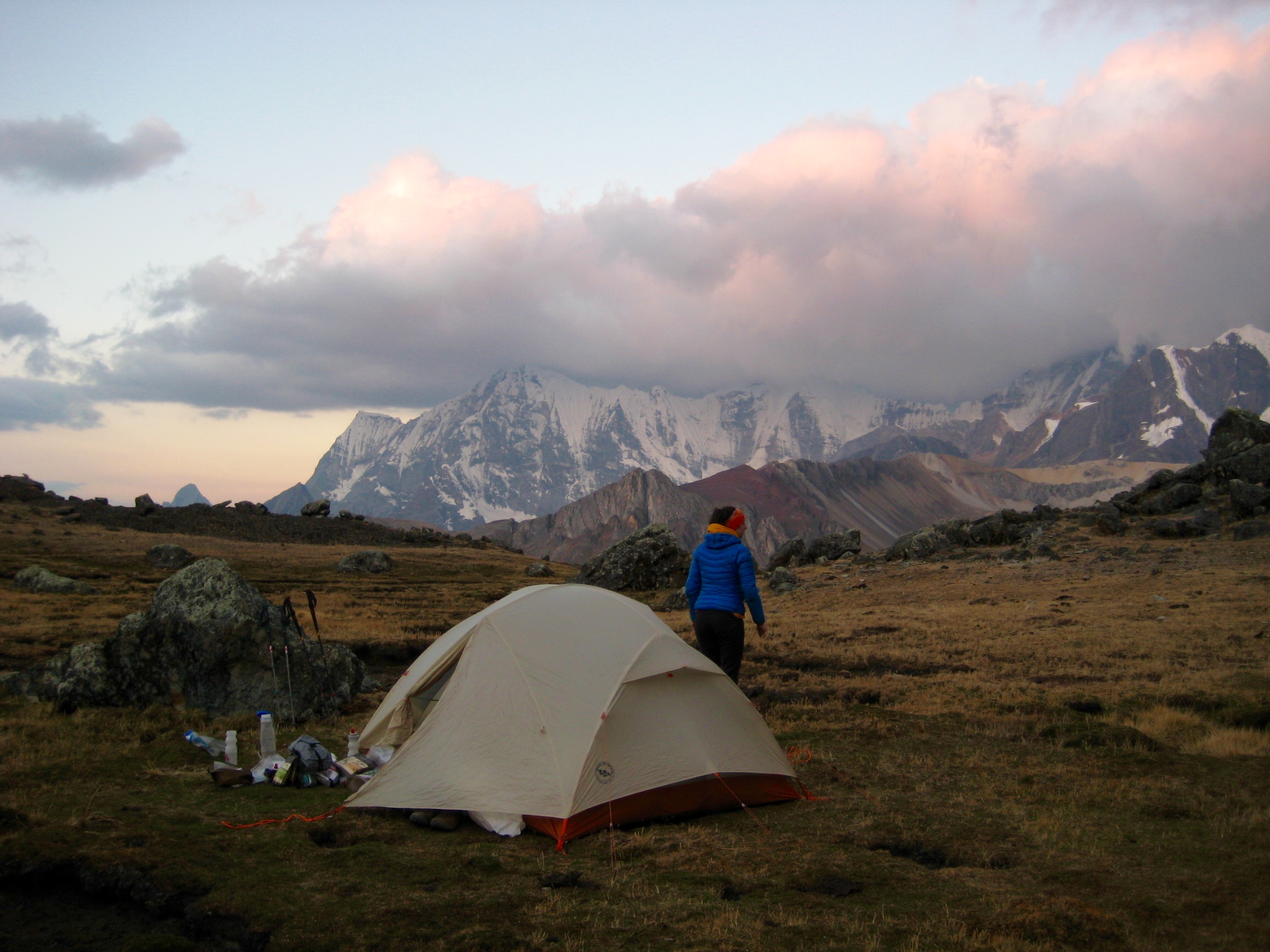
We dropped 200 feet down the northern side of the pass and quickly found a suitable campsite in a grassy basin. There we pitched our tent for the last time. Eileen arrived just before dark.
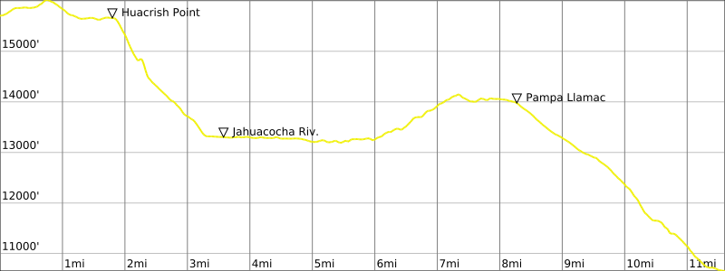
Day 10: North Yaucha Basin to Llamac Village to Huaraz
Brooke’s goal today was to fully and elegantly complete the Huayhuash Circuit by hiking northeastward back to our starting point at Quartelhuain. As such, she got an early start on the trail. Her route took her out Huacrish Ridge, down to Incahuain Camp at Jahuacocha Lake, up to 15,600-foot Rondoy Pass, down to Rondoy, and then up to Quartelhuain. By pre-arrangement, our High Summit Peru driver would pick her up there at 3:00pm. She was on a unstoppable mission and managed to accomplish her task by 2:00pm (6.5 hours + 13.5 miles + 3000 feet from Camp 9).
Eileen and I opted to take the traditional (and easier) exit northwestward to Llamac Village. We left camp a half-hour later and headed out Huacrish Ridge. This turned out to be a wonderfully scenic ridge trail with views of Nevados Rondoy, Jirishanca, and Yerupaja.
At the end of the ridge, the trail plunged 2500 feet into the Jahuacocha Valley. We crossed the broad valley, forded the river, and stopped for lunch (3.3 hours + 450 feet from Camp 9).
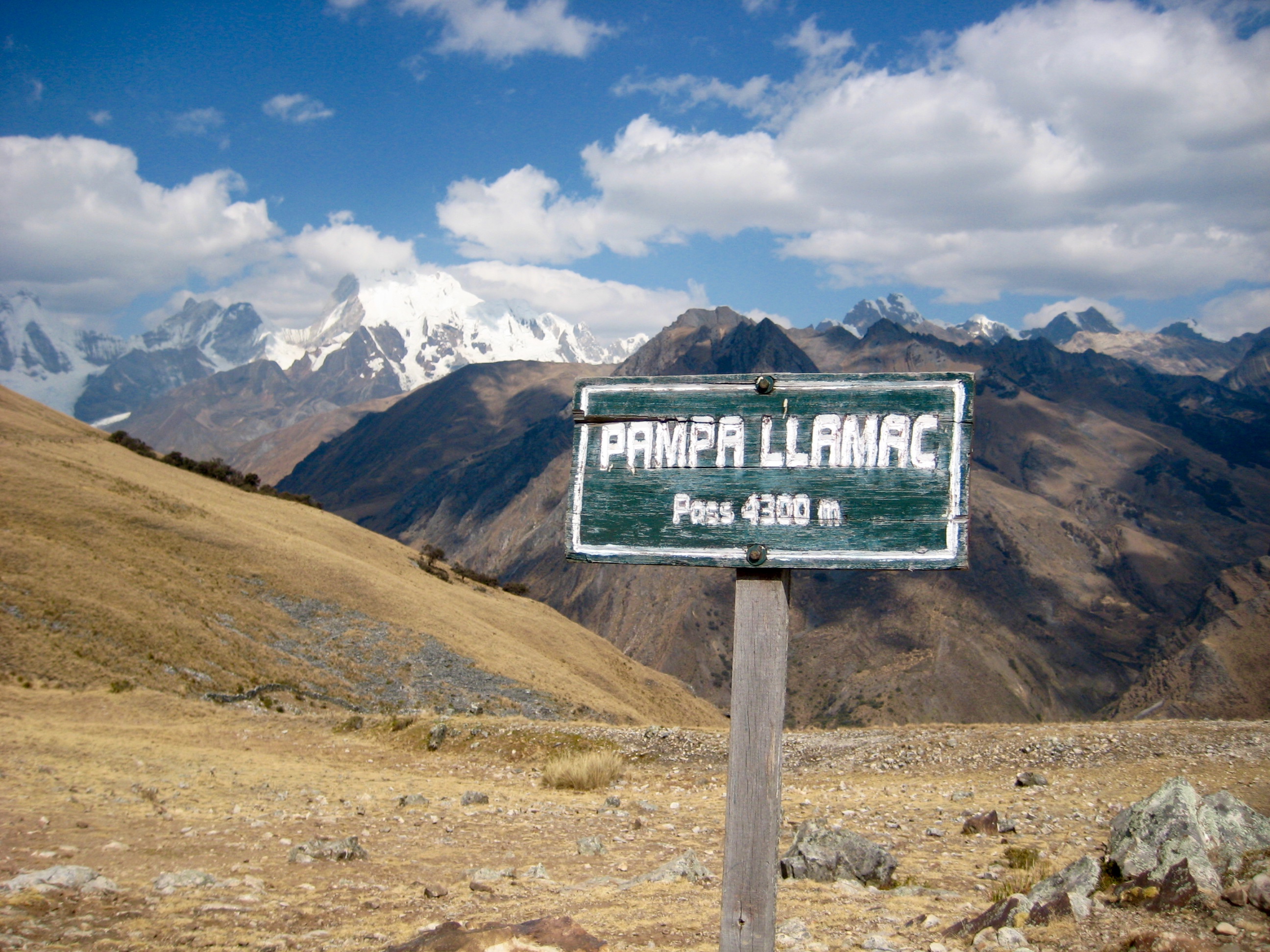
As pleasant as our morning had been, the afternoon was much less so. We followed a pack trail westward out of the valley as it inexplicably and annoyingly ascended over 1000 feet in an undulating fashion. After finally reaching the high point, the trail started a gradual descent to Pampa Llamac Pass, where we took one last look back at the giant peaks.
Continuing onward, the trail became steeper, rockier, and dustier. Eventually, Llamac Village came into view far below, and after an endless series of rocky switchbacks, the trail made a final traverse into the 10,600-foot village. We knew our circuit had come to a conclusion when we encountered Jaime, our driver, walking up the trail. He graciously carried Eileen’s backpack down the last 1/4 mile to his vehicle (8.7 hours + 12.1 miles + 1500 feet from Camp 9) where Brooke was waiting for us.
During our drive back to Huaraz, we all felt a bit numb. It would take days, weeks, or even months to thoroughly digest this fantastic, arduous, and emotional adventure!
Gear Comments & Packing List
Because we did the Huayhuash Circuit in a fully self-supported fashion, it was critical to have all of the necessary gear but very little unnecessary gear. Here is a link to a separate page that describes our gear choices for the trip and presents a PDF of our specific packing list.
>>> Gear Comments & Packing List for the Huayhuash Circuit
Route Map & Profiles
…
…
…
…
…
…
…
…
…
…
…
Photo Gallery
Click to enlarge…
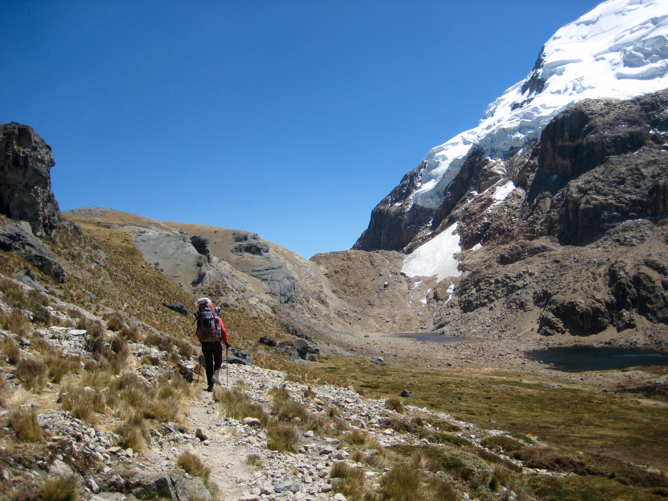
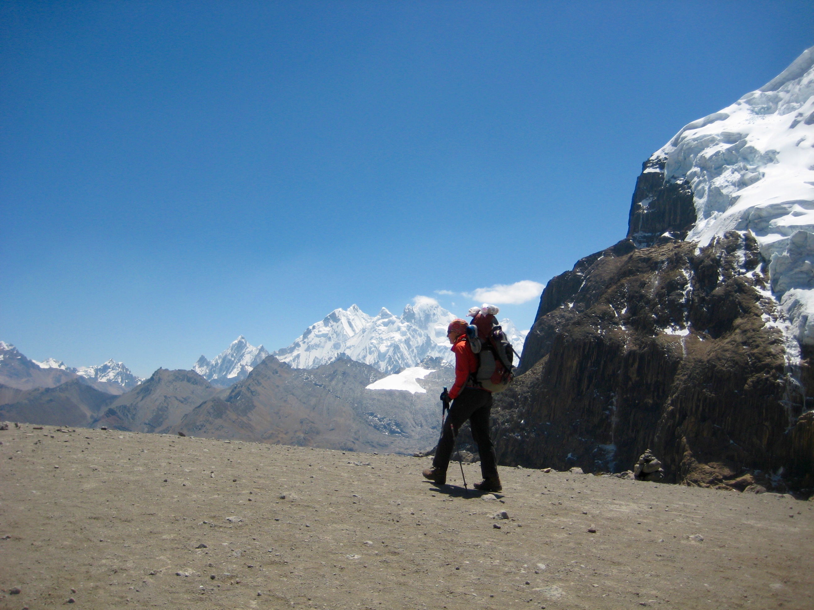
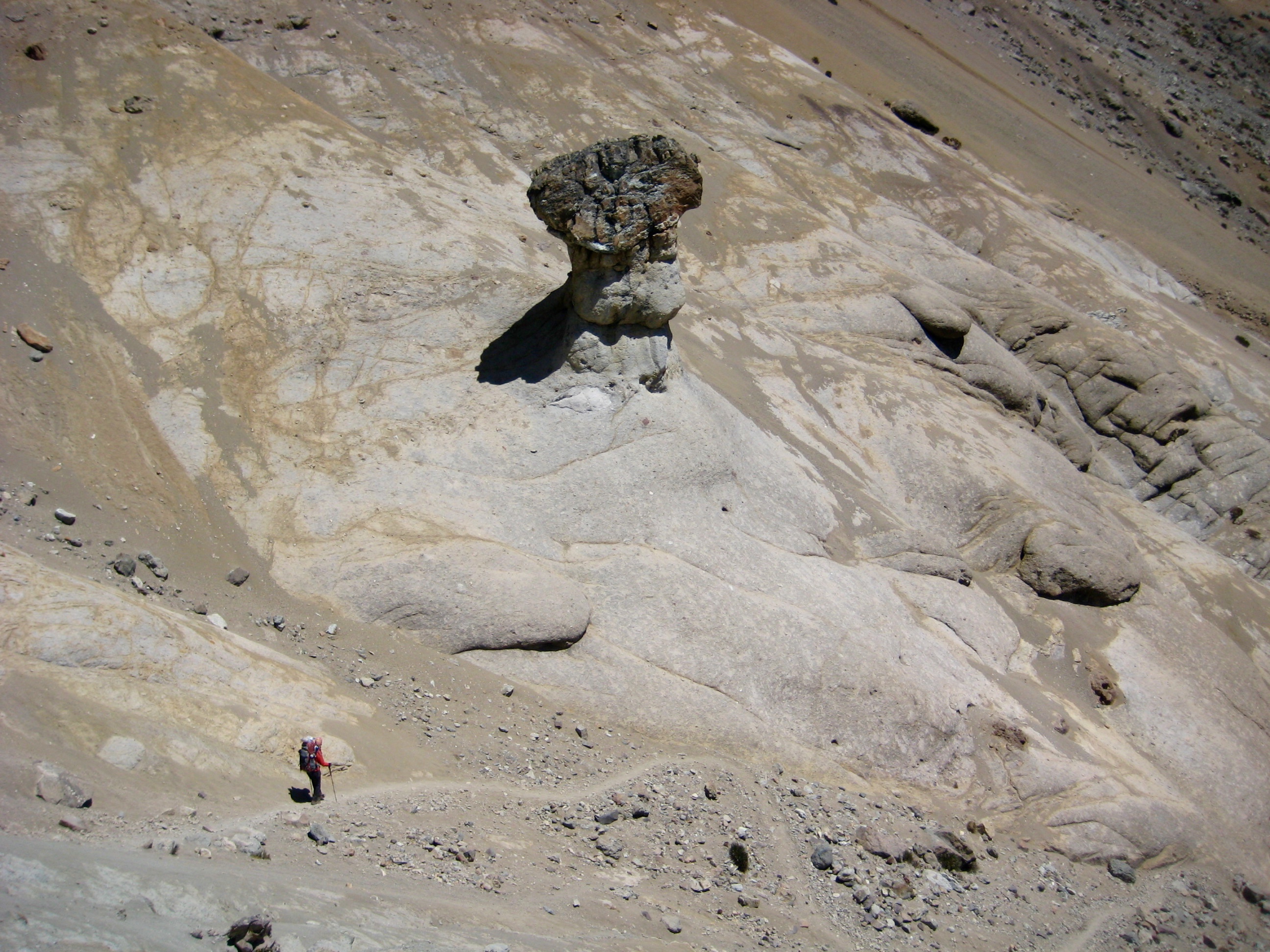
Day 1 – 3: Quartelhuain to Huayhuash Camp
Day 4 – 6: Huayhuash Camp to Little Lake Juraucocha
Day 7 – 10: Little Lake Juraucocha to Llamac Village