Trip Dates: October 16 & 18 & 20, 2025
2025 MT. CHARLESTON ADVENTURE VACATION
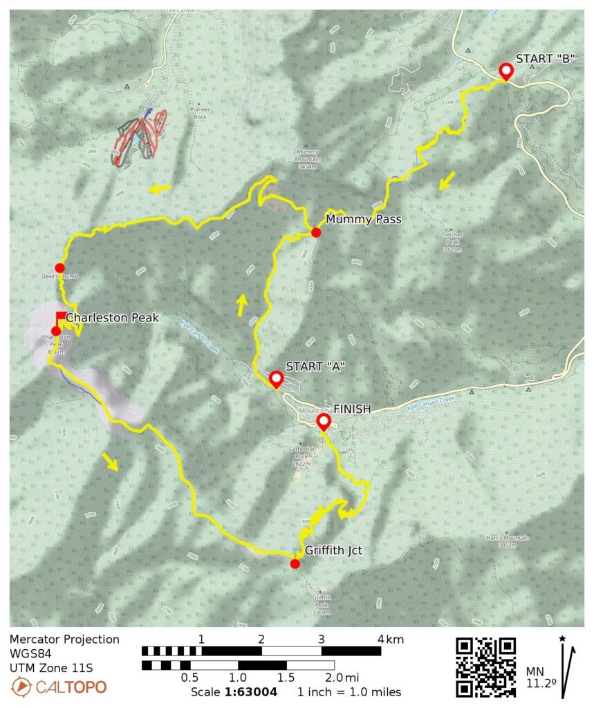
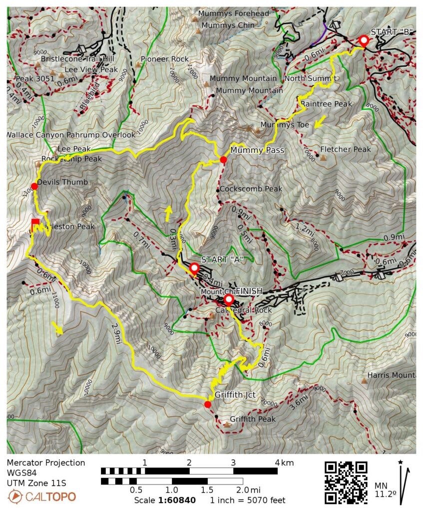
Charleston Peak Summit Traverse: Echo Trailhead / North Loop Trailhead to South Loop Trailhead
Trail Canyon
Raintree Peak Shoulder
Raintree Junction / The Raintree
Mummy Pass
Lee Peak Overlook
Devil’s Thumb
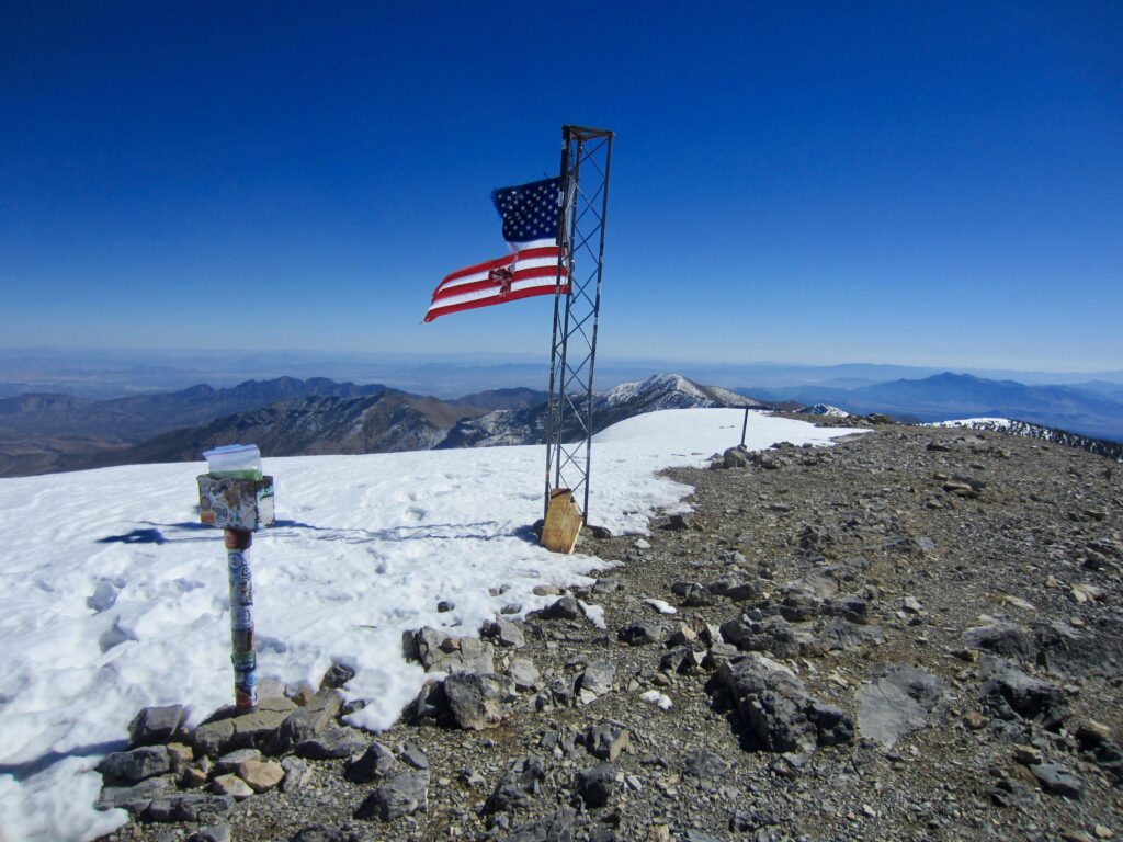
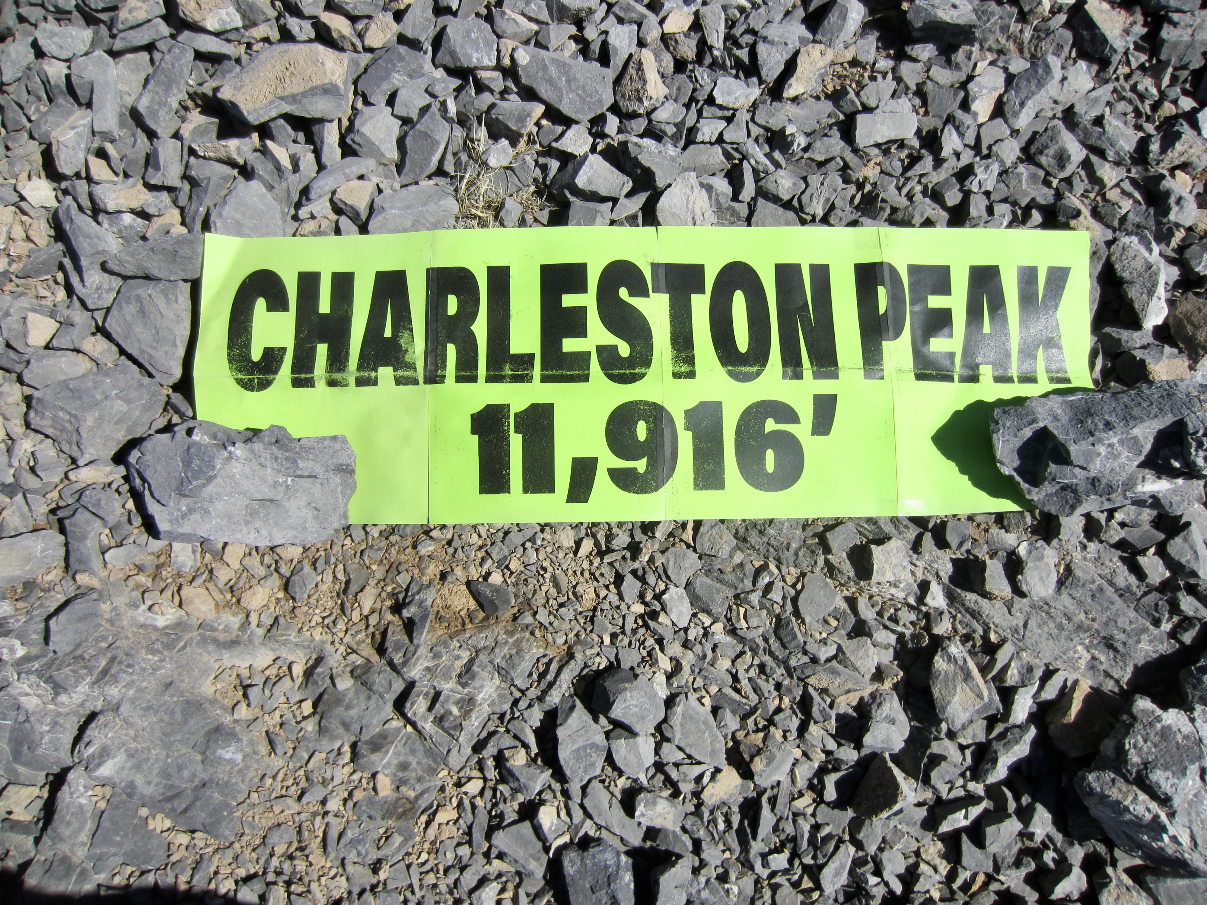
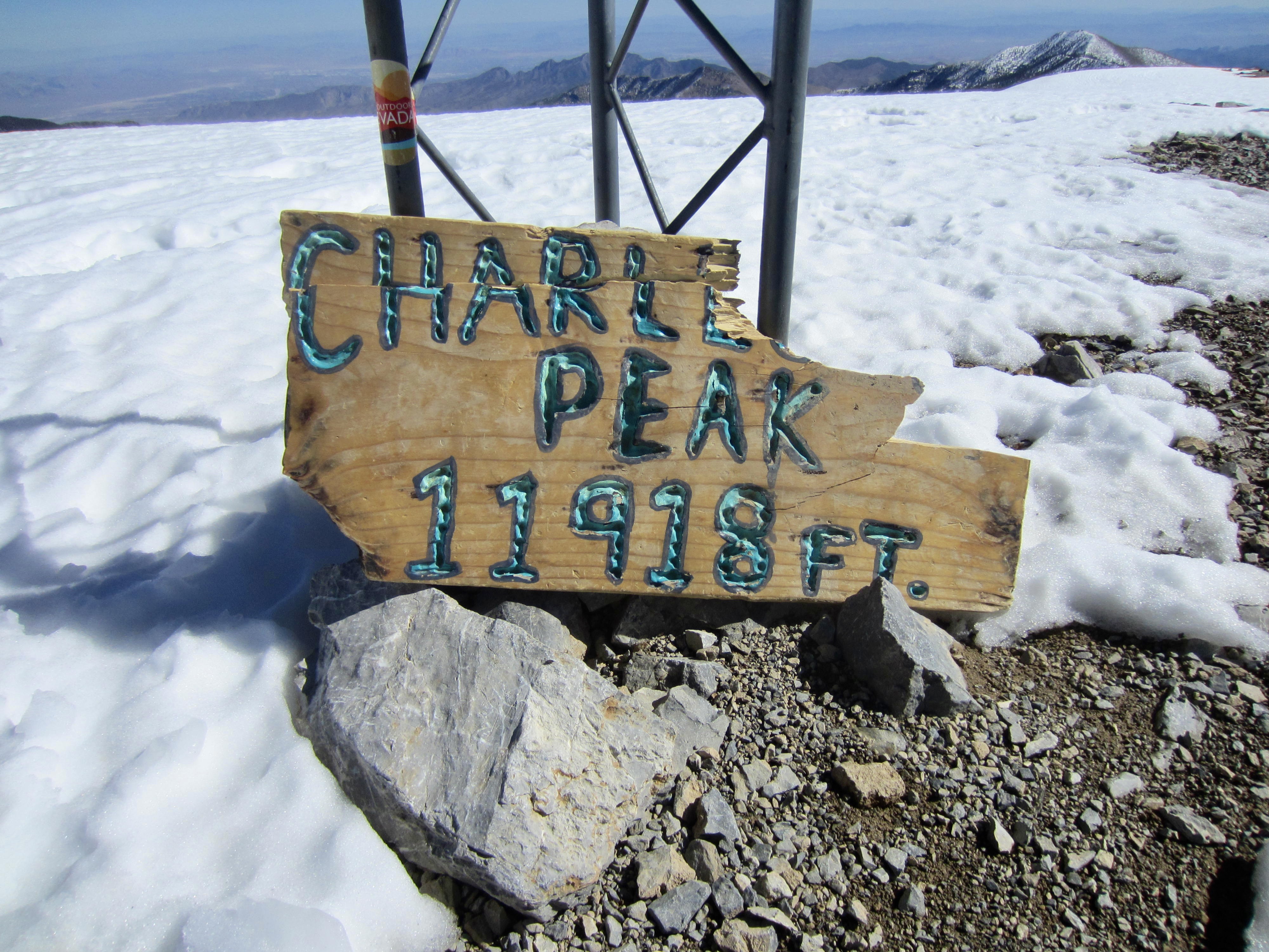
Charleston Peak (11,916 ft)
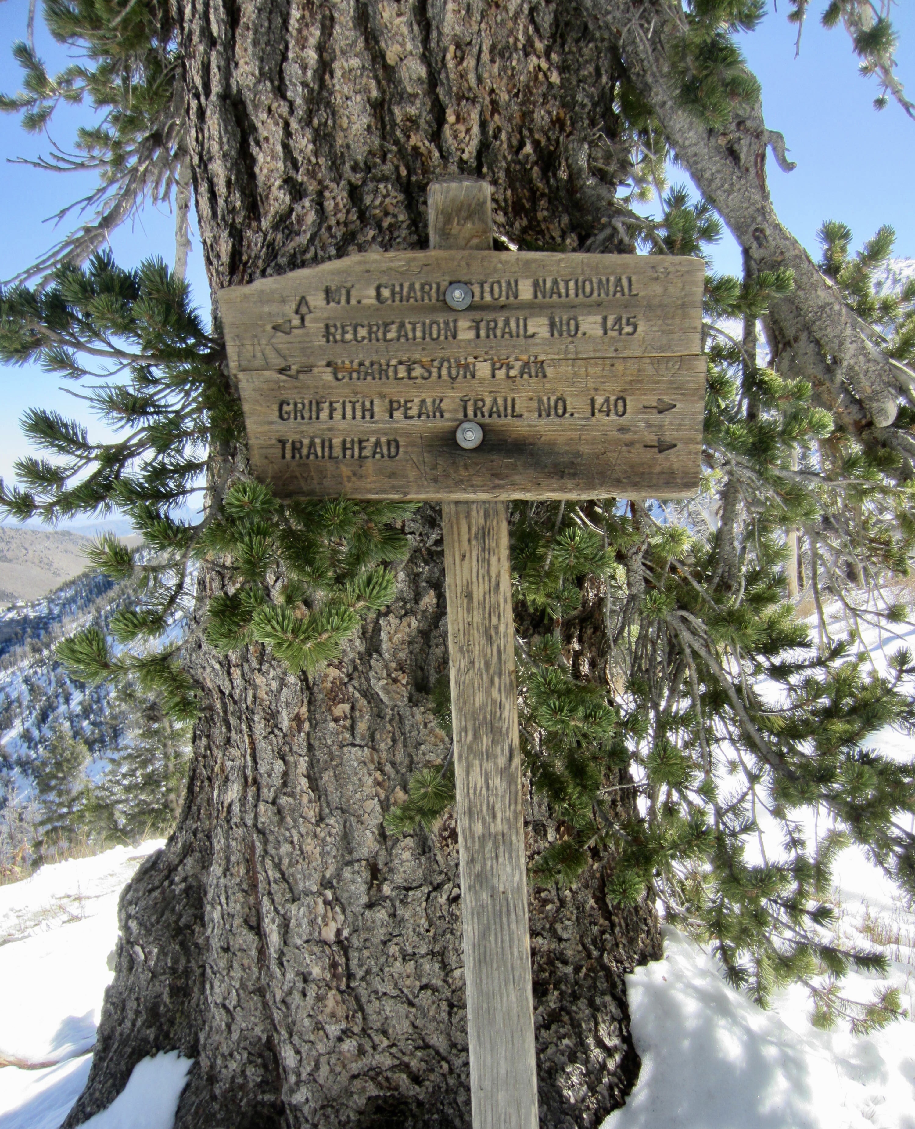
Griffith Junction
Echo Overlook
Griffith Canyon
- Trip Report Summary
- Related Posts
- Trip Overview
- Full Trip Report
- Segment 1A: Echo Trailhead to Mummy Pass
- Segment 1B: North Loop Trailhead to Mummy Pass
- Segment 2: Mummy Pass to Charleston Peak
- Segment 3: Charleston Peak to Griffith Junction
- Segment 4: Griffith Junction to South Loop Trailhead
- Route Maps & Profiles
- Photo Gallery
Trip Report Summary
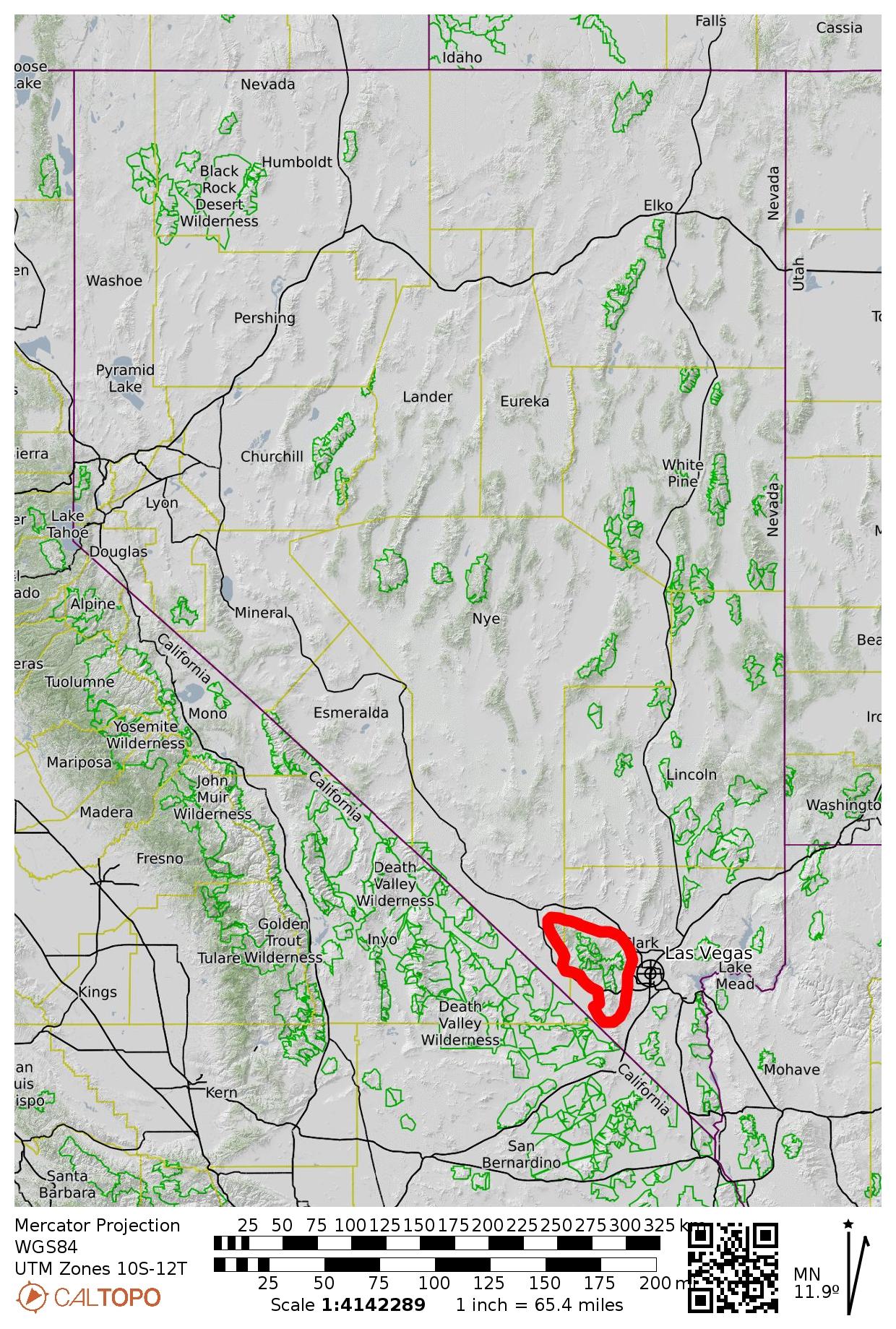
Region: Nevada
Sub-Region: Spring Mountains
Areas: Spring Mountains National Recreation Area & Mt. Charleston Wilderness
Option A: Echo Trailhead to South Loop Trailhead
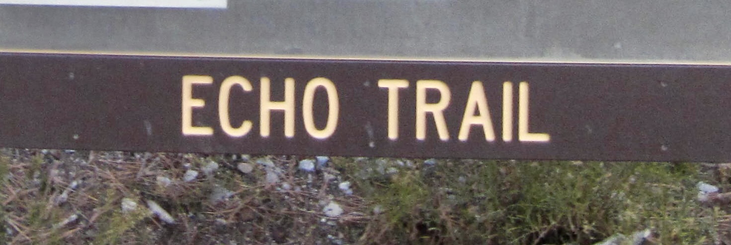
Starting Point: Echo Trailhead on Echo Road in Kyle Canyon (Elev. 7600 feet)
Way Points: Trail Canyon Trailhead & Echo Road Water Tank & Mt. Charleston Wilderness boundary & Mummy Pass & Cave Spring & Mummy Mountain climber’s path junction & Lee Overlook & Devil’s Thumb & Charleston Peak summit & cross-over saddle & Griffith Junction & Mt. Charleston Wilderness boundary & Echo Overlook & Griffith Canyon invert crossing & Cathedral Rock Trail junction & South Loop Trailhead (trail hike & snow hike)
High Point: Charleston Peak summit (Elev. 11,916 feet)
Ending Point: Cathedral Rock / South Loop Trailhead on Kyle Canyon Road (Elev. 7650 feet)
Summit: Charleston Peak (snow hike & snow climb via East Slope; descent via South Ridge)
Approximate Stats: 16.6 miles traveled; 4900 feet gained; 4850 feet lost.
Option B: North Loop Trailhead to South Loop Trailhead
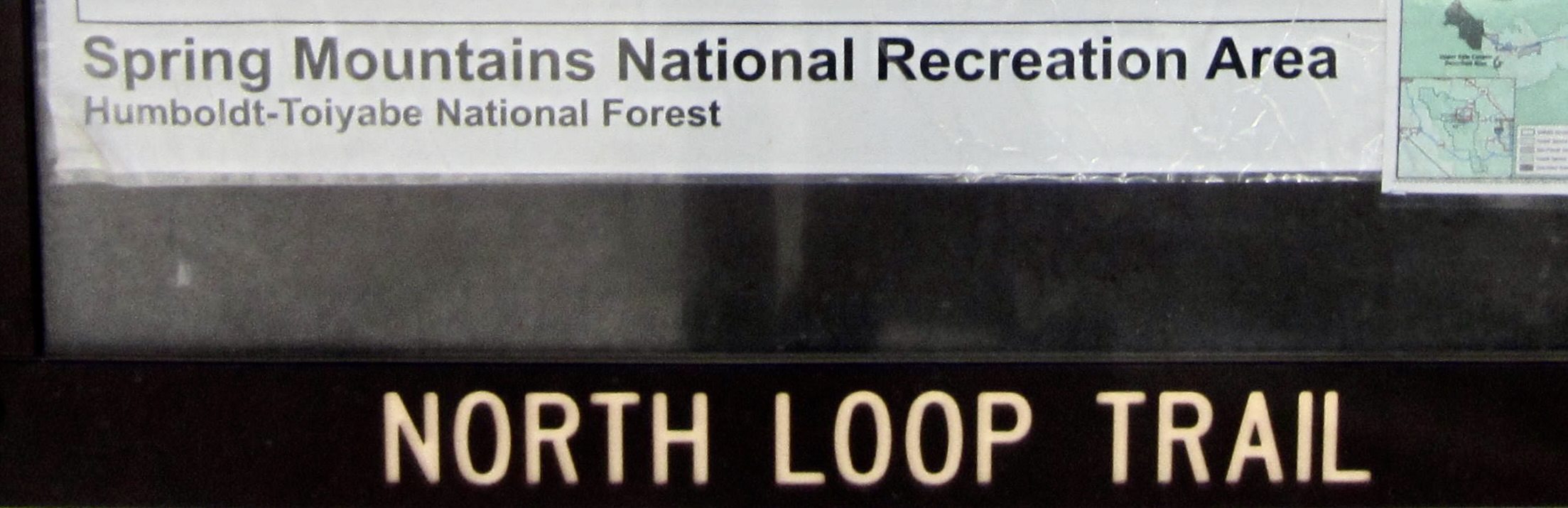
Starting Point: North Loop Trailhead on Deer Creek Road #158 at head of Telephone Canyon (Elev. 8400 feet)
Way Points: Mt. Charleston Wilderness boundary & Raintree Shoulder & Raintree Junction / The Raintree & Mummy Pass & Cave Spring & Mummy Mountain climber’s path junction & Lee Overlook & Devil’s Thumb & Charleston Peak summit & cross-over saddle & Griffith Junction & Mt. Charleston Wilderness boundary & Echo Overlook & Griffith Canyon invert crossing & Cathedral Rock Trail junction & South Loop Trailhead (trail hike & snow hike)
High Point: Charleston Peak summit (Elev. 11,916 feet)
Ending Point: Cathedral Rock / South Loop Trailhead on Kyle Canyon Road (Elev. 7650 feet)
Summit: Charleston Peak (snow hike & snow climb via East Slope; descent via South Ridge)
Approximate Stats: 18.2 miles traveled; 4850 feet gained; 5600 feet lost.
…
Related Posts
>>> Raintree Trail Traverse: North Loop Trailhead to Echo Trailhead via Mummy Pass – October 16, 2025
>>> Griffith Peak via South Loop Trail—Echo Overlook—Griffith Junction – October 18, 2025
Trip Overview
With an elevation just under 12,000 feet, Charleston Peak is the highest summit in the Spring Mountains range of Southern Nevada and the undisputed centerpiece of the Mt. Charleston massif. This entire massif is composed of horizontally bedded limestone that rises 7000 feet above the desert plain and supports a healthy forest of ponderosa and bristlecone pines. Charleston is a fine example of a desert alpine peak.
Charleston Peak can be readily accessed by either of two primary trails: the South Loop Trail via Griffith Junction or the North Loop Trail via Mummy Pass. Together, these trails constitute the Charleston Peak National Recreation Trail, which makes a big arc over the summit. An out-and-back summit hike on either trail results in a total distance ranging from 16 to 20 miles and a cumulative gain ranging from about 4700 to 5500 feet, depending on the specific starting point. Overall, the South Loop Trail is easier and more popular, whereas the North Loop Trail is harder but more interesting.
By all accounts, the “signature hike” at Mt. Charleston is the Charleston Peak Traverse—a one-way trail traverse over the summit. This challenging day-hike showcases the wide variety of topography, botany, and geomorphology in the massif, while offering great views of nearby canyons, ridges, peaks, and desert plains. Completing the traverse seems to be a rite of passage for Las Vegas hikers, and I would include it on my all-time list of Top Three Desert Day-Hikes, along with the Superstition Ridge Full Traverse in Arizona and the Chesler Park Loop in Utah.
The Charleston Peak Traverse could, of course, be completed in either a north-to-south or a south-to-north direction. I chose the former direction because it involves ascending the more exposed parts of the route, then descending the less exposed parts. Normally, I wouldn’t be too concerned about exposure on a well-constructed trail, but my hike occurred one week after a freak snowstorm blanketed Mt. Charleston with snow and ice—putting an emphasis on alpine desert peak! In retrospect, this was a good direction from both a safety standpoint and an esthetic standpoint. I would recommend it even without snow and ice.
When doing a north-to-south traverse, you currently have your choice between two different starting points and corresponding approaches to Mummy Pass. These two options are: (A) start at Echo Trailhead on Echo Road inside Mt. Charleston Village and approach via Trail Canyon; or (B) start at North Loop Trailhead on Deer Creek Road outside of the village and approach via Raintree Junction. Key pros and cons of each option are summarized below. Regardless of starting point, your traverse will go through Mummy Pass and Griffith Junction, then end at the Cathedral Rock / South Loop Trailhead on Kyle Canyon Road in the village.
- Option A – Echo Trailhead Start: This option starts at a lower elevation but ascends more directly to Mummy Pass, resulting in a total traverse distance of 16.6 miles—about 1½ miles shorter than Option B. The cumulative elevation gain of 4800 feet for the entire traverse is essentially equal to Option B. A major advantage is that the starting trailhead is less than 1 road-mile from the ending trailhead, thereby minimizing or even eliminating the car shuttle. Currently, a notable disadvantage is that the approach trail in Trail Canyon is officially closed due to “hazardous conditions.” However, many local hikers seem to understand that the trail is actually in excellent condition (as of 2025) and was likely closed due to an administrative over-reaction. For more details, see the Usage Considerations section in my associated Raintree Trail Traverse trip report. Overall, neglecting this regulatory issue, I would say that Option A is more convenient and more efficient but less scenic and less interesting than Option B.
- Option B – North Loop Trailhead Start: This option starts at a higher elevation but ascends less directly to Mummy Pass, resulting in a total traverse distance of 18.2 miles—about 1½ miles longer than Option A. The cumulative elevation gain of 4750 feet for the entire traverse is essentially equal to Option A. The most important advantage is that the approach trail winds you through a stately forest of ponderosa and bristlecone, then takes you past The Raintree—a magnificent 3000-year-old bristlecone—before descending to Mummy Pass. Currently, another notable advantage is the lack of any regulatory closures (as of 2025). A major disadvantage is that the starting trailhead is more than 8 road-miles from the ending trailhead, thereby requiring a car shuttle. Overall, I would say that Option B is more scenic and more interesting but less convenient and less efficient than Option A.
Full Trip Report
For purposes of this trip report, I’ve divided the traverse into five segments, as follows: Echo Trailhead (starting option “A”) to Mummy Pass; North Loop Trailhead (starting option “B”) to Mummy Pass; Mummy Pass to Charleston Peak summit; Charleston Peak summit to Griffith Junction; and Griffith Junction to South Loop Trailhead.
Segment 1A: Echo Trailhead to Mummy Pass
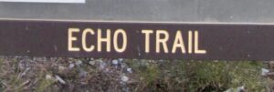
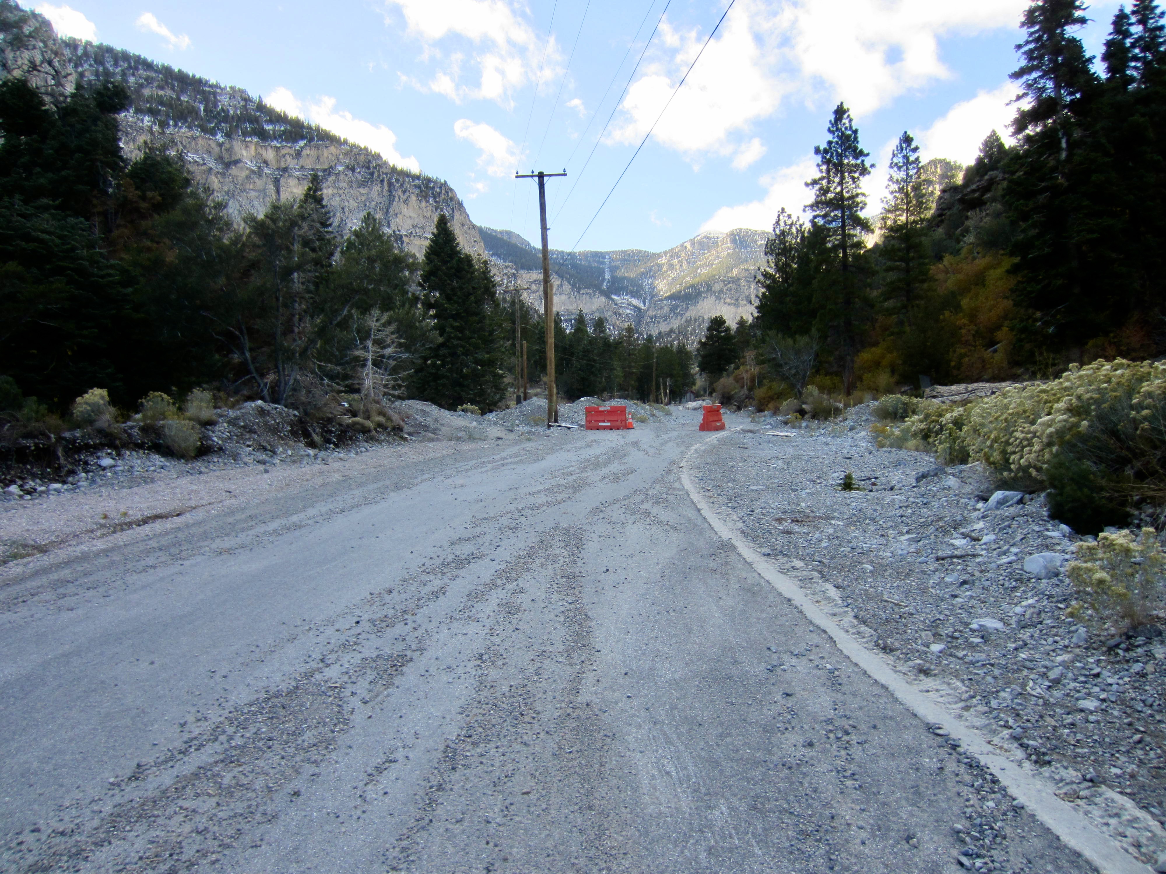
If choosing to approach Mummy Pass via Trail Canyon, then you will start at the Echo Trailhead located on Echo Road, about 200 yards up-valley from the Kyle Canyon Road hairpin. There is a large, graveled parking lot here.
From the parking lot, walk up Echo Road, taking note of the 2023 flood damage along the way. In about ¼ mile, you will come to the Trail Canyon Trailhead, which is posted as “closed” due to “hazardous conditions.” If you’ve gotten this far, you probably already read my comments in the previous text section and/or in my associated Raintree Trail Traverse trip report and have chosen to proceed despite the posted closure.

.
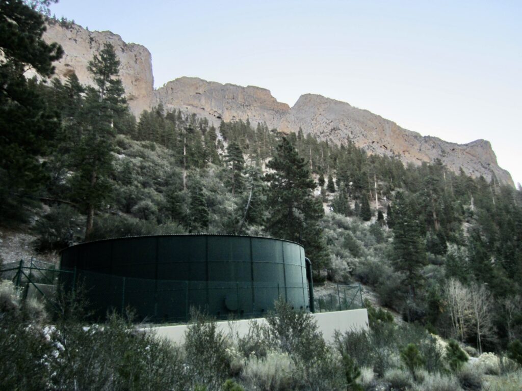
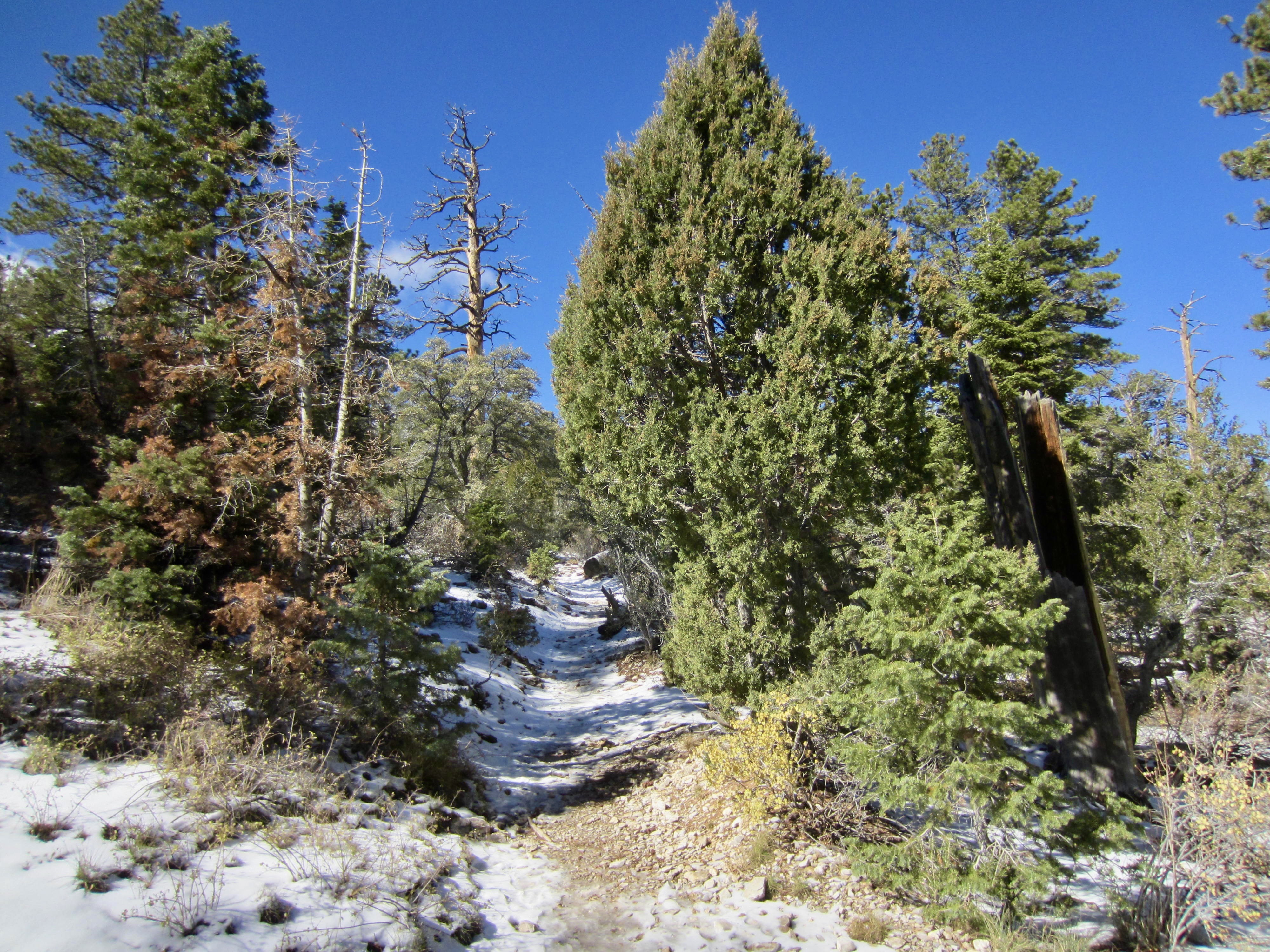
A bit farther up the road, you will pass the Echo Road Water Tank and merge with the Trail Canyon Trail (a name probably given by the Department of Redundancy Department). Shortly beyond, you will enter the Mt. Charleston Wilderness.
.
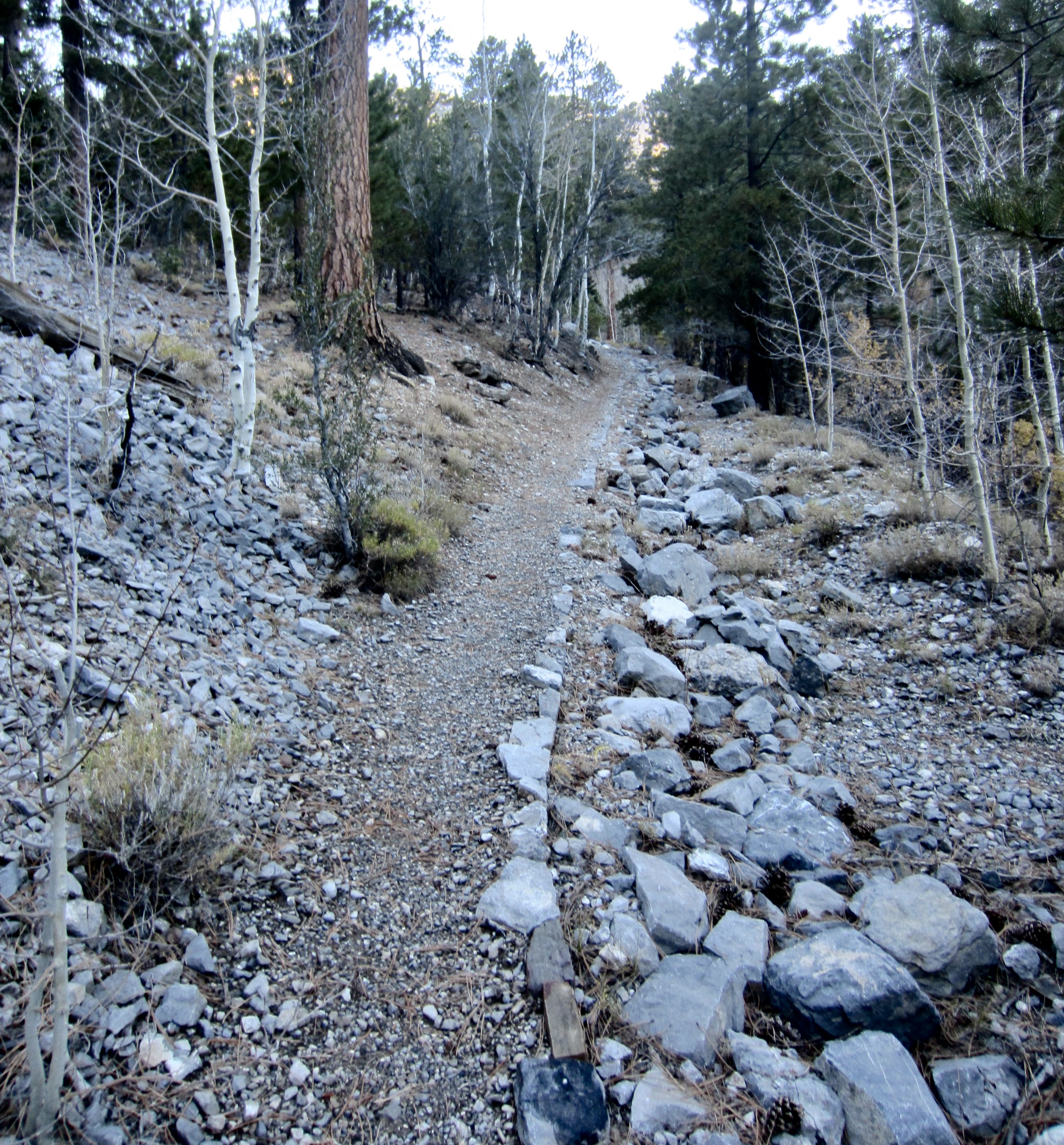
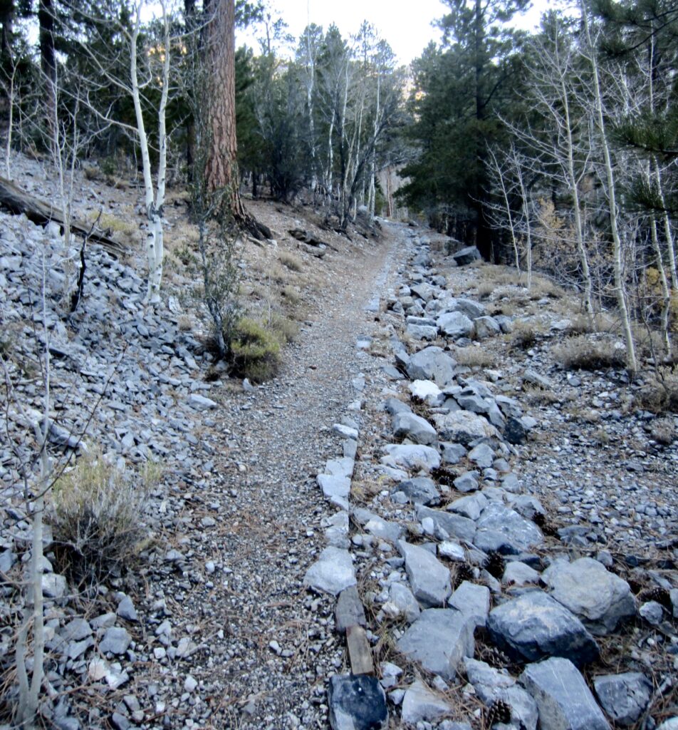
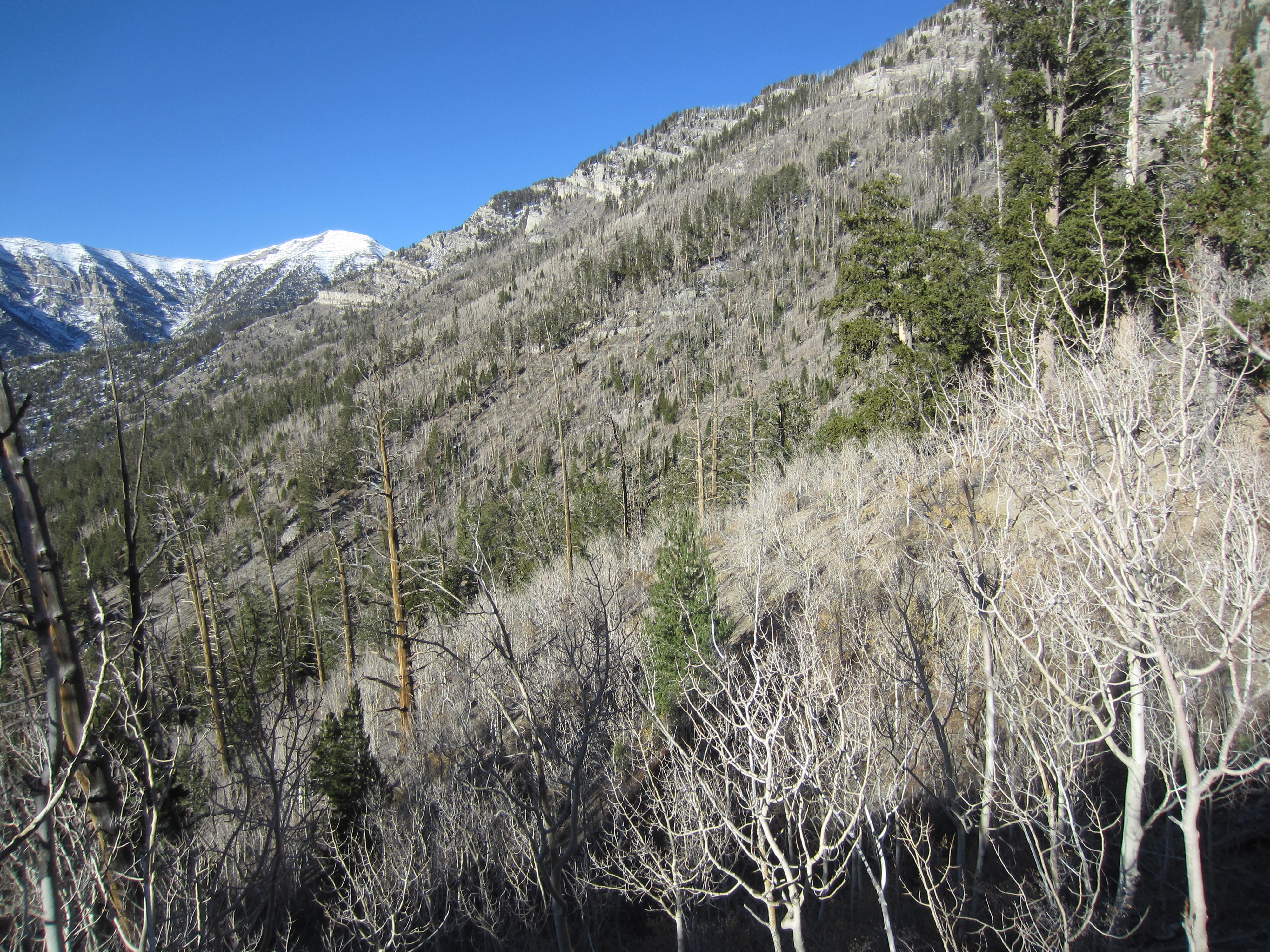
As of 2025, the trail was in excellent condition, with a gravel surface and rock edging along much of the distance. Where the trail runs adjacent to the invert of Trail Canyon, you might notice that there many young trees (up to 10 years old) growing in the channel and no evidence of recent erosion. It is remarkable that nearby Mary Jane Canyon was devastated by the 2023 flood, while this canyon was virtually untouched!
.
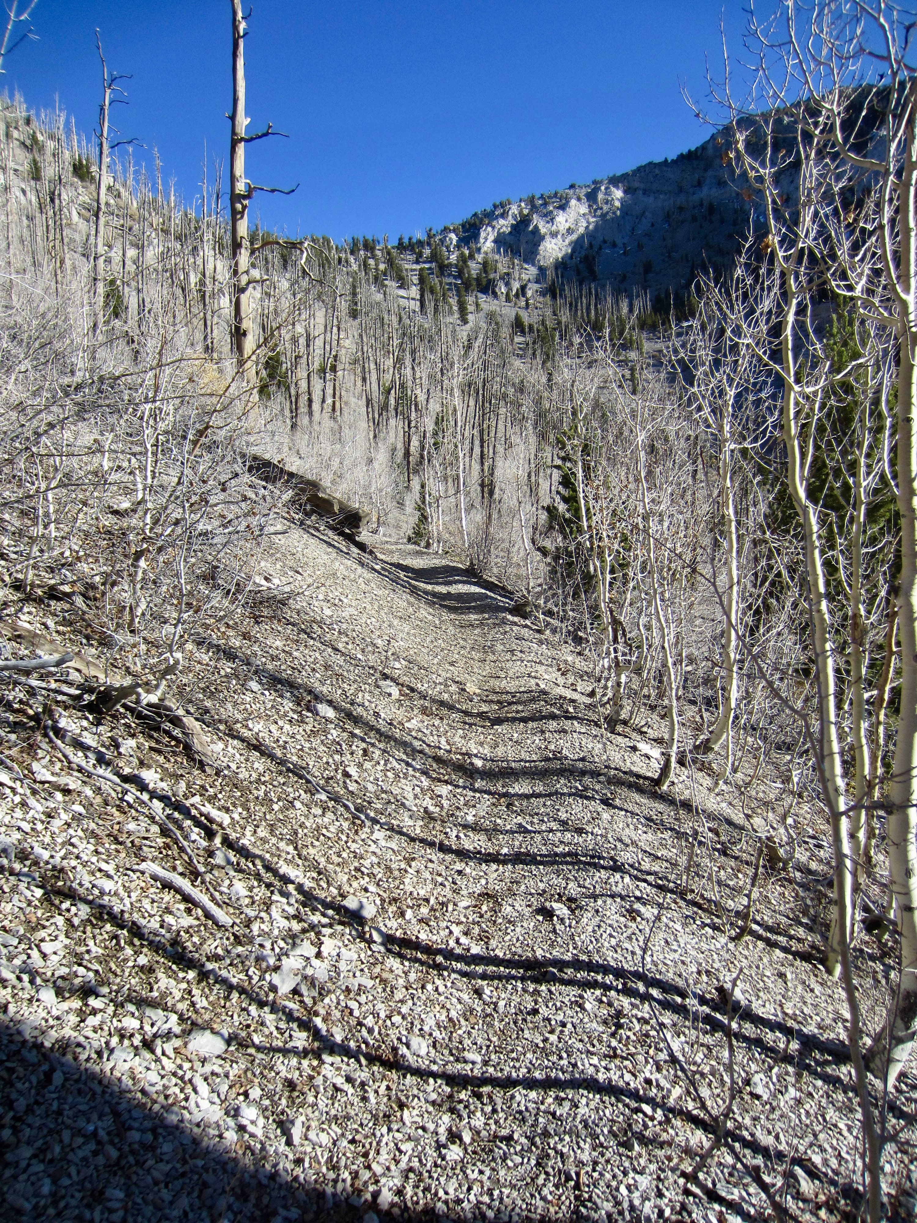
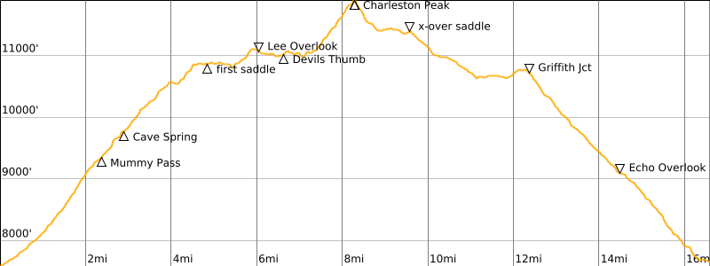
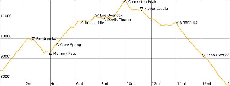
Continue up through ponderosa and aspen forest, with frequent views of craggy Cockscomb Ridge high above. A few switchbacks on the canyon headwall will bring you to 9350-foot Mummy Pass (2.3 miles + 1750 feet from starting point “A”). Here, the Trail Canyon Trail meets the North Loop Trail coming from its trailhead on Deer Creek Road (starting point “B”).
.

.
Segment 1B: North Loop Trailhead to Mummy Pass
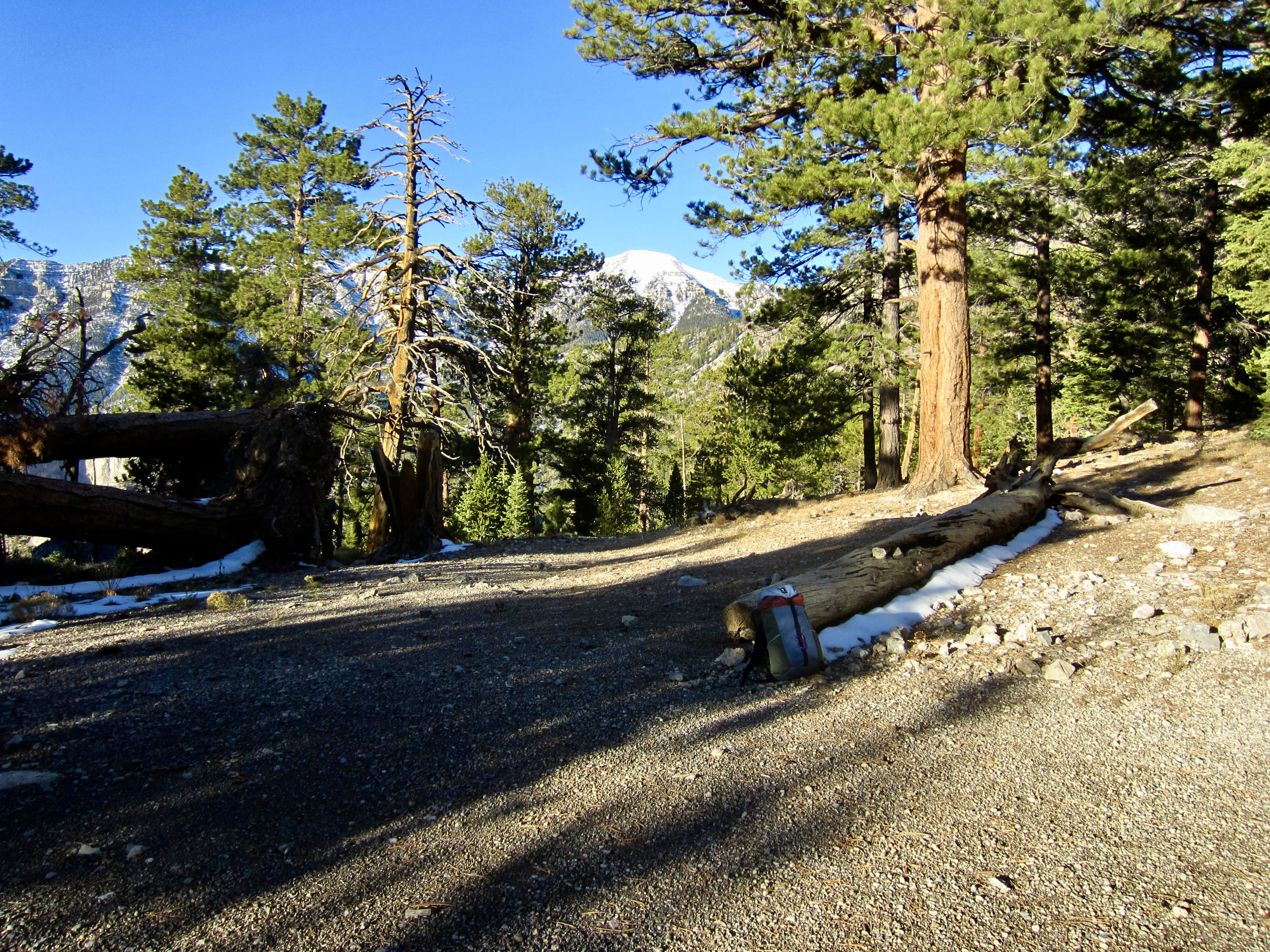
If choosing to approach Mummy Pass via Raintree Junction, then you will start at the North Loop Trailhead located on Deer Creek Road. The small roadside parking lot here is shared with the whimsically named Chutes & Ladders Trail.
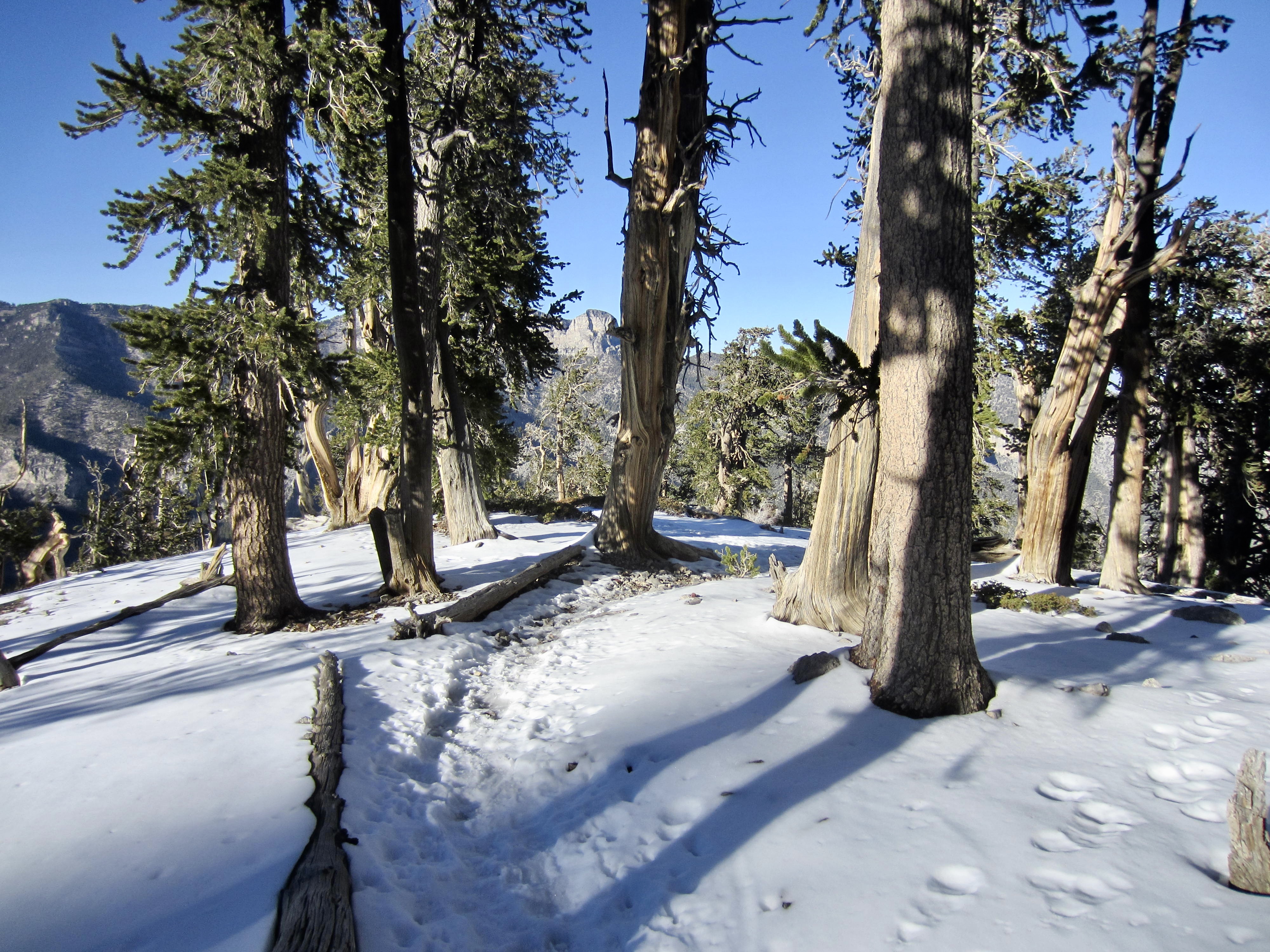
The North Loop Trail angles over to a broad, gravelly bench, enters the Mt. Charleston Wilderness, and immediately begins climbing through mature ponderosa and bristlecone forest. Higher up, a series of tight switchbacks and a short traverse will take you over 10,000-foot Raintree Shoulder on the eastern side of Raintree Peak (2.2 miles + 1600 feet from starting point “B”).
.
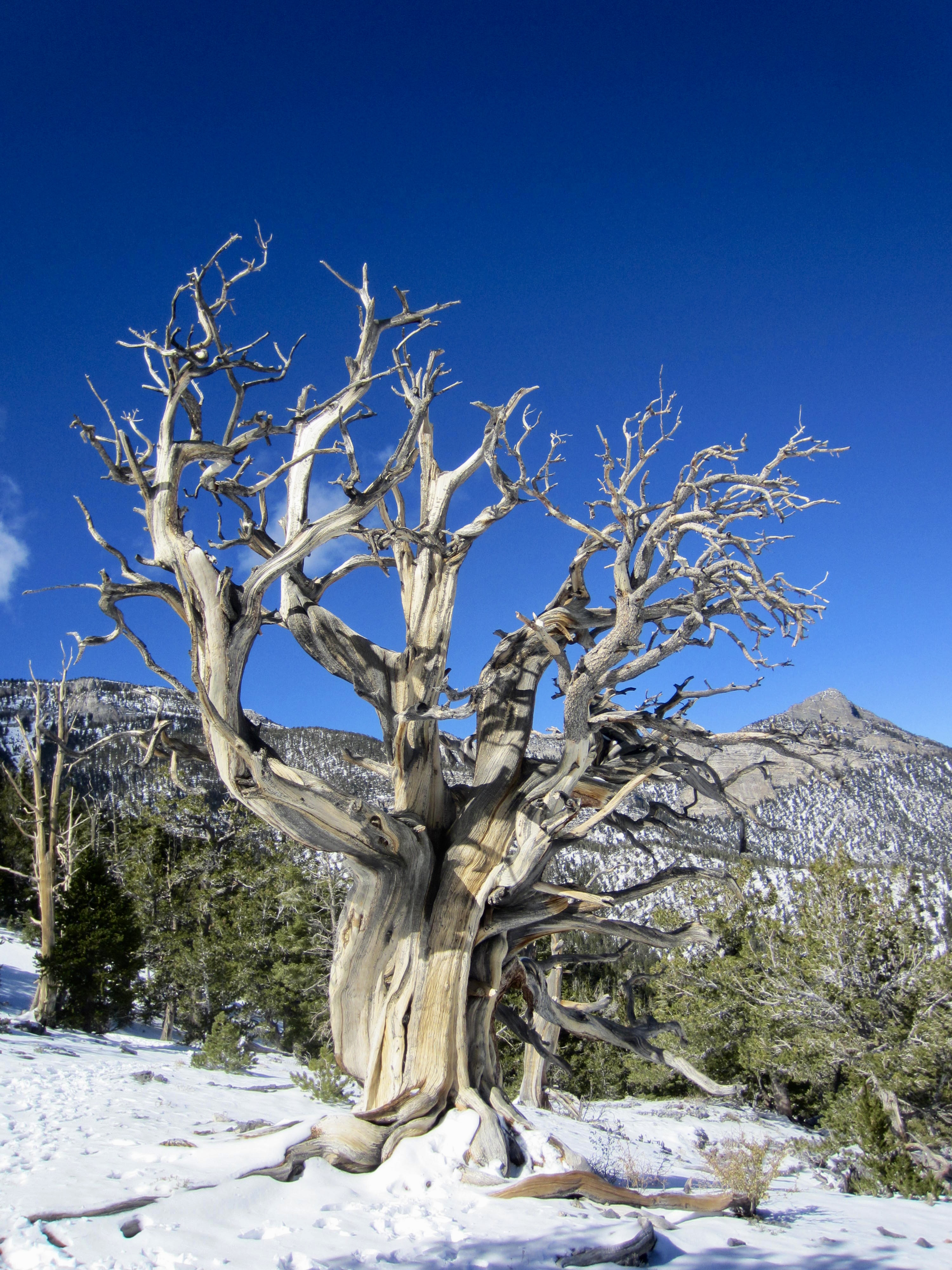
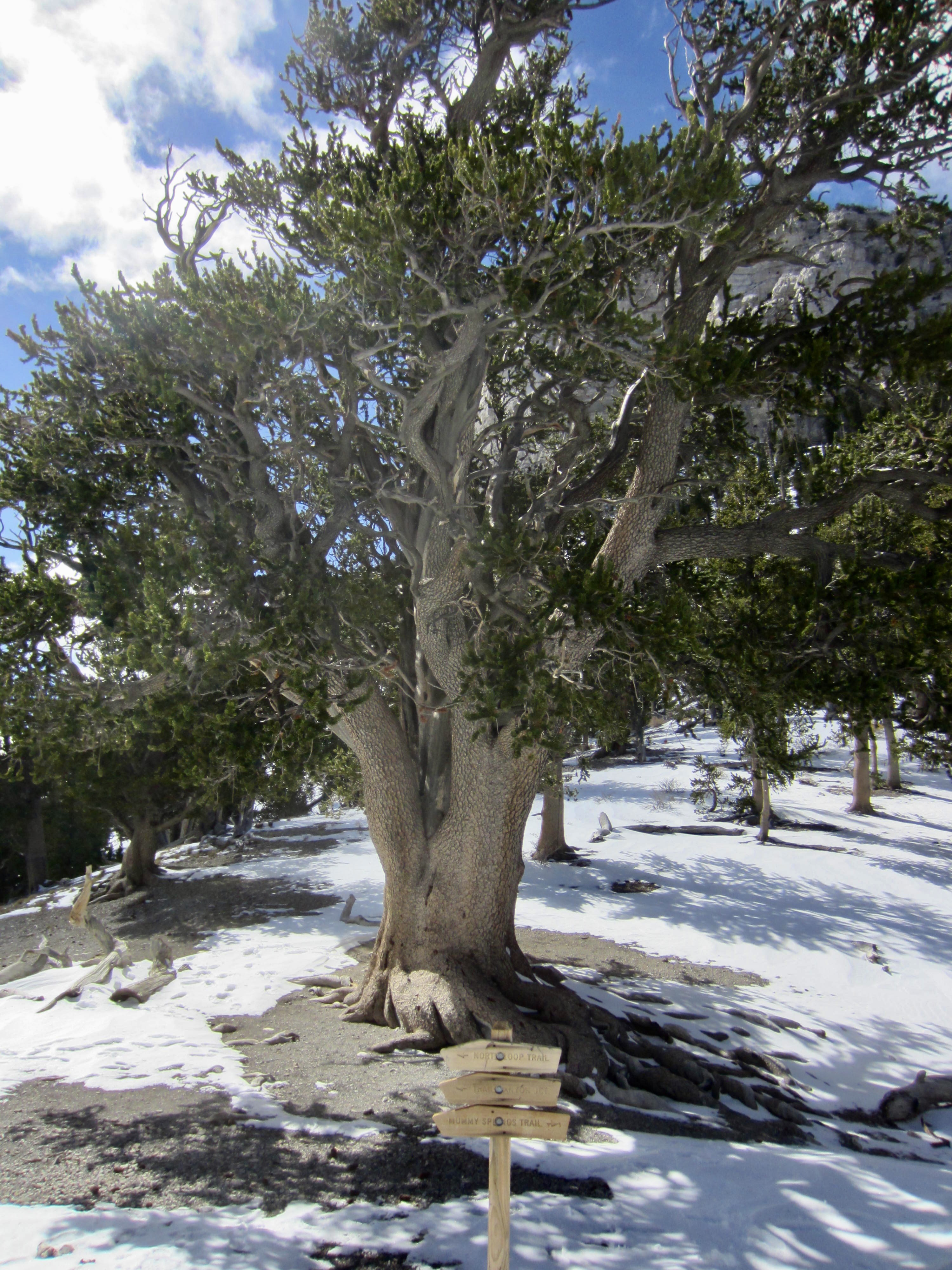
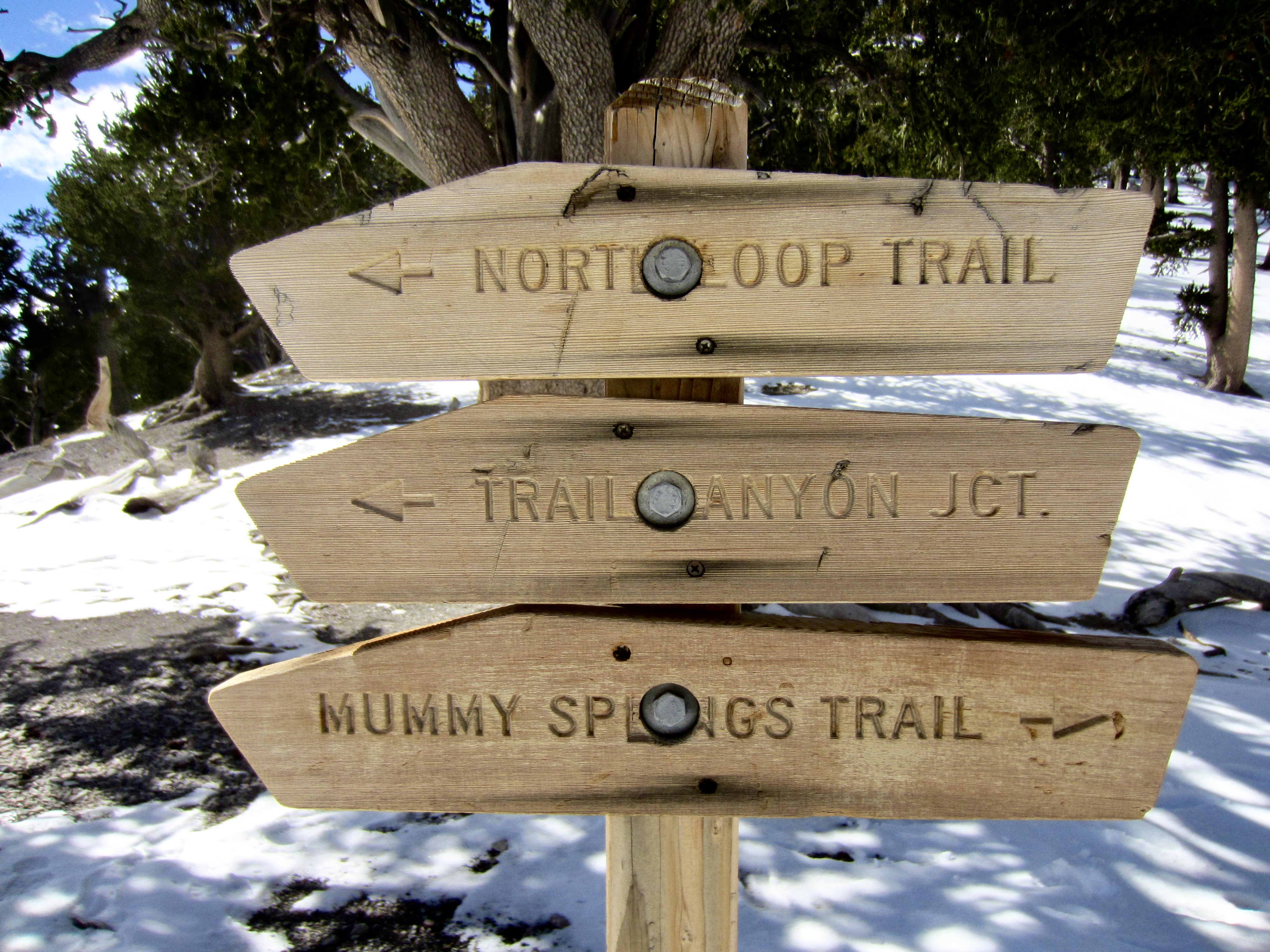
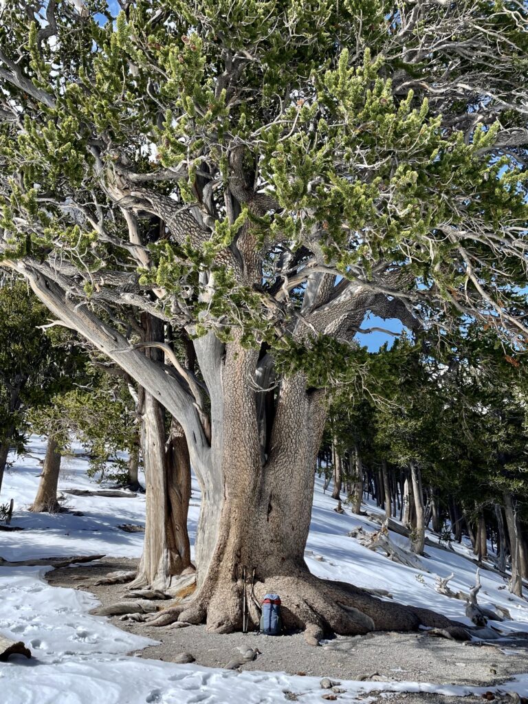
From Raintree Shoulder, the trail weaves through two closely spaced saddles in the ridge crest and soon comes to Raintree Junction at a third saddle. Here, a spur trail veers right (northwest) to Mummy Springs, and the North Loop Trail veers left (southwest) to Mummy Pass. Most notable, though, is a gigantic bristlecone pine tree that stands guard at the junction. This majestic specimen, formally known as The Raintree, has been estimated to be 3000 years old, making it the oldest living thing in Nevada!
.
.
.
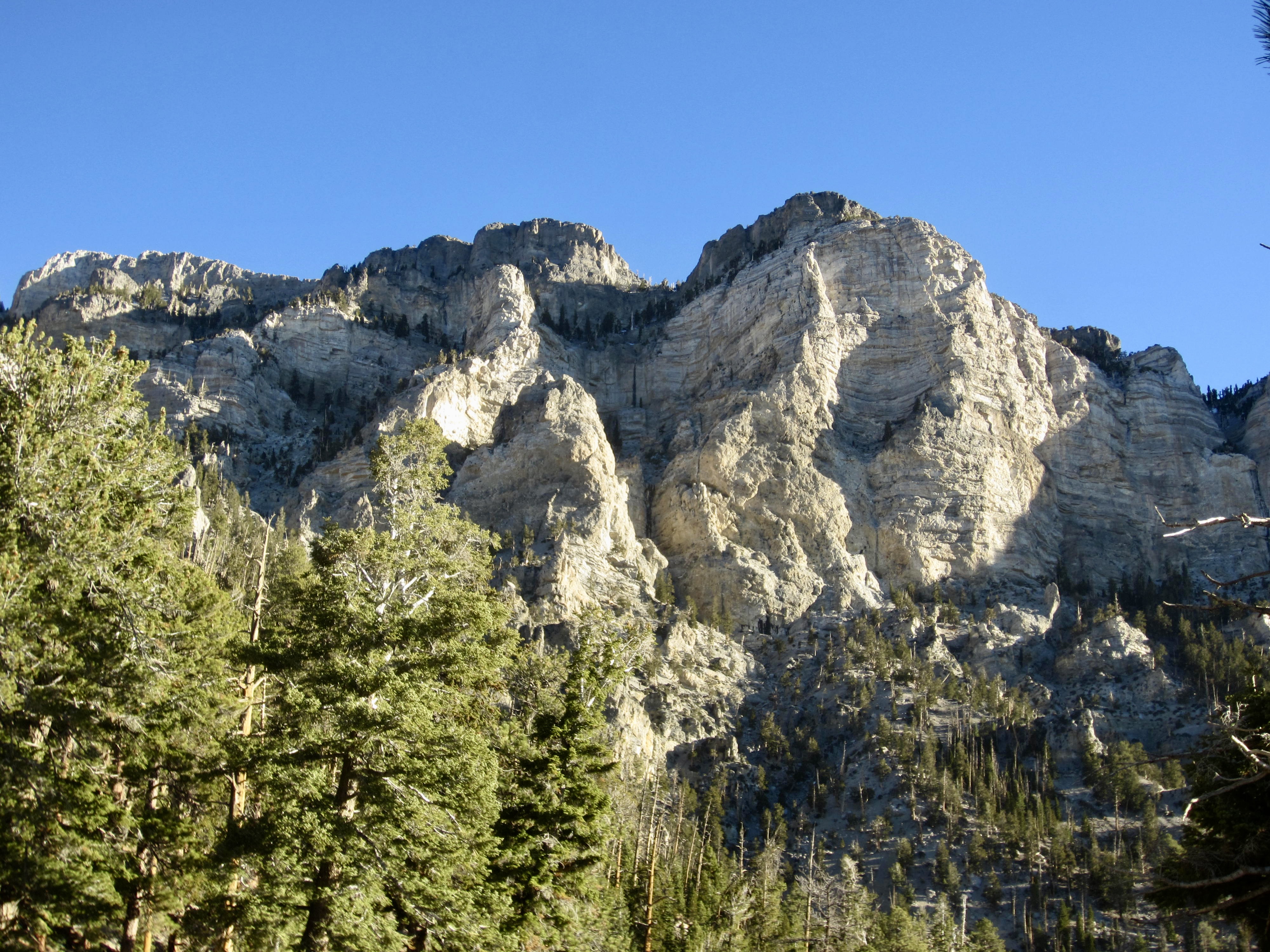
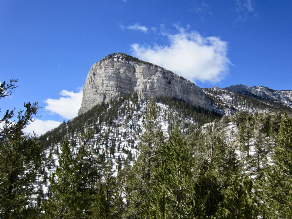
Continuing southwesterly on the North Loop Trail, you will curve around the striking limestone cliffs of Mummy’s Toe. This impressive geologic feature represents the “foot” end of Mummy Mountain, which from certain angles has the appearance of a supine mummy wrapped in gray gauze.
.
.
A descending traverse will bring you to 9350-foot Mummy Pass (4.0 miles + 1700 feet from starting point “B”). Here, the North Loop Trail meets the Trail Canyon Trail coming up-valley from the Echo Trailhead in Kyle Canyon (starting point “A”).
.
Segment 2: Mummy Pass to Charleston Peak
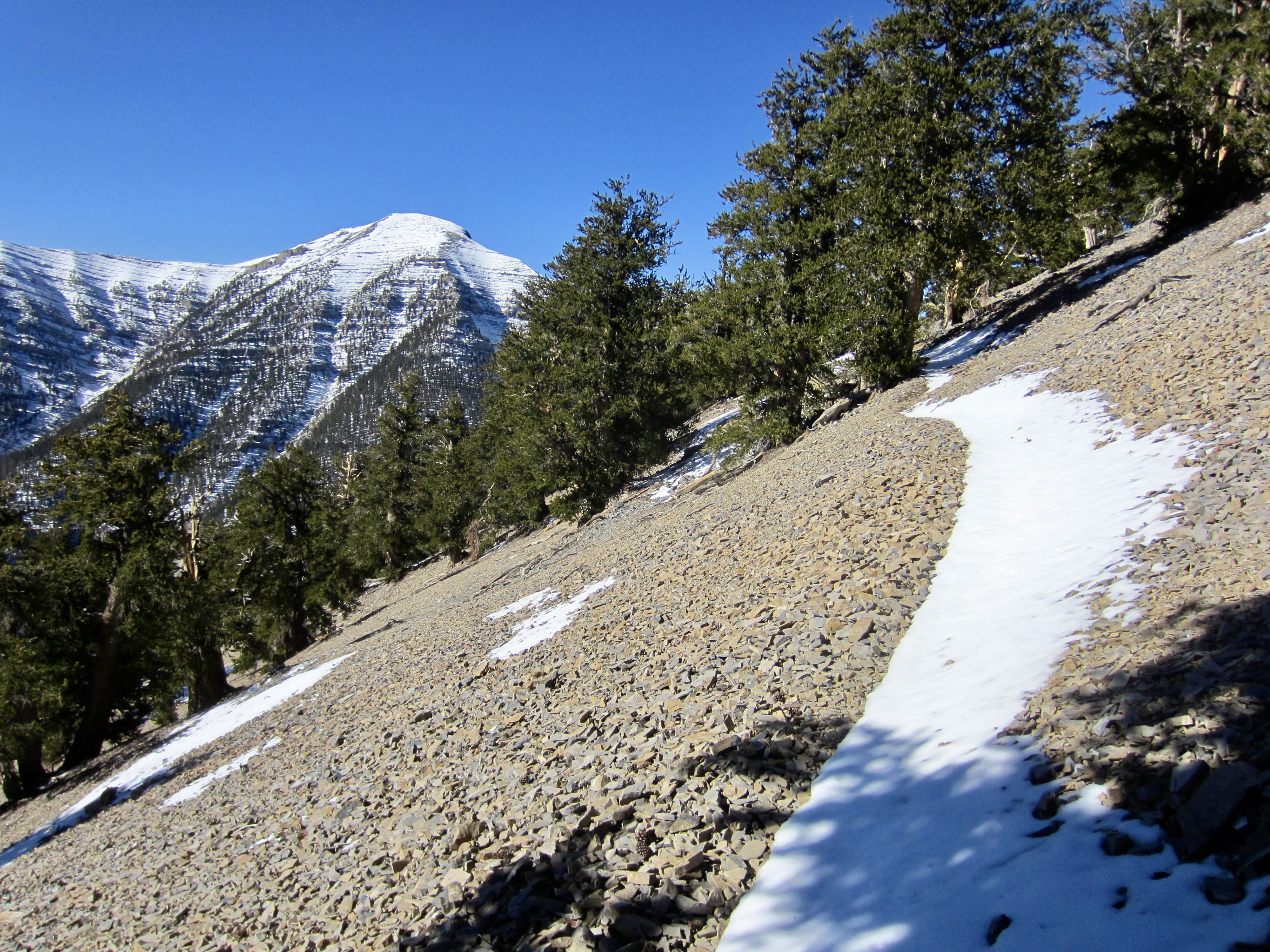
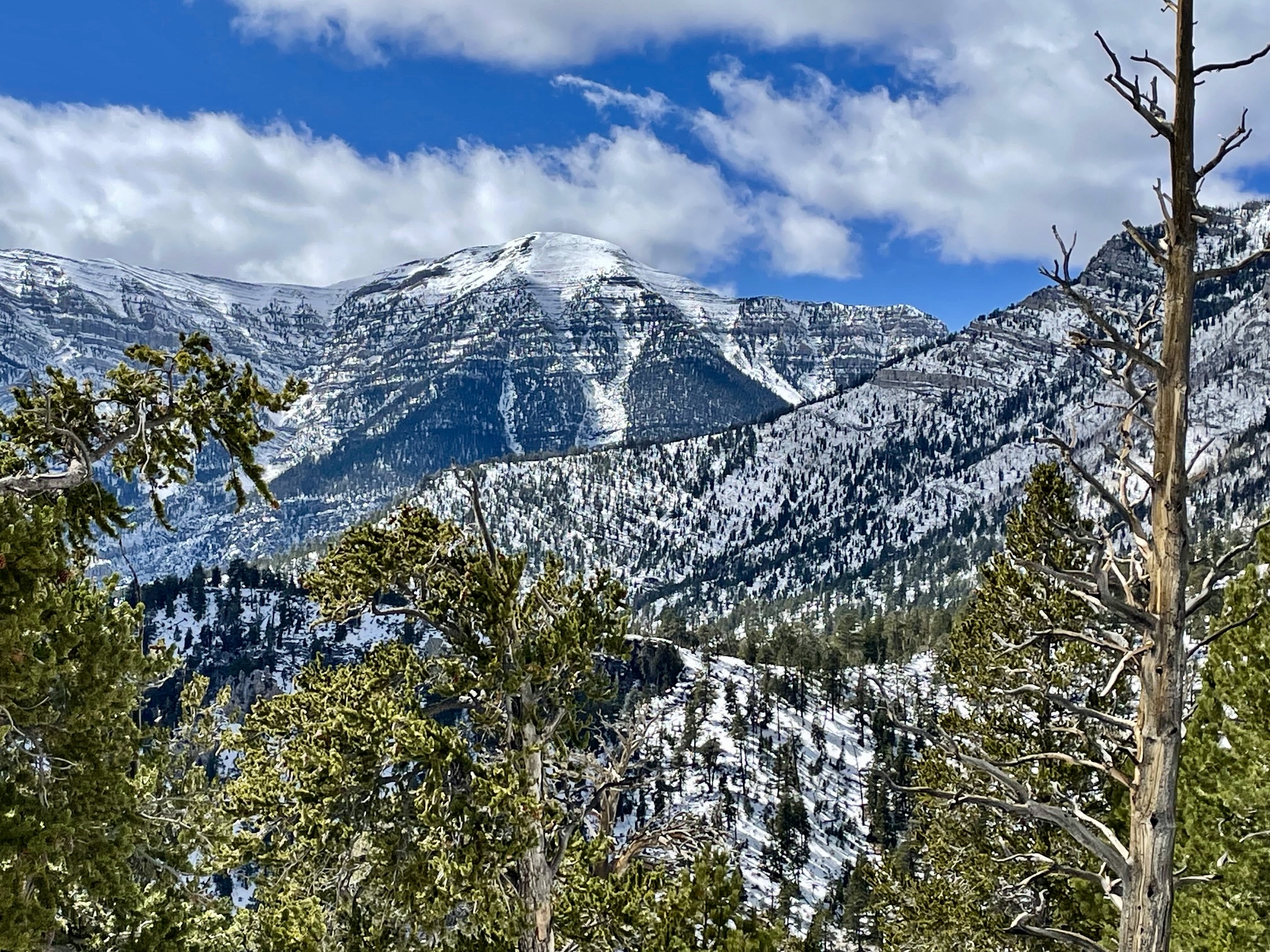
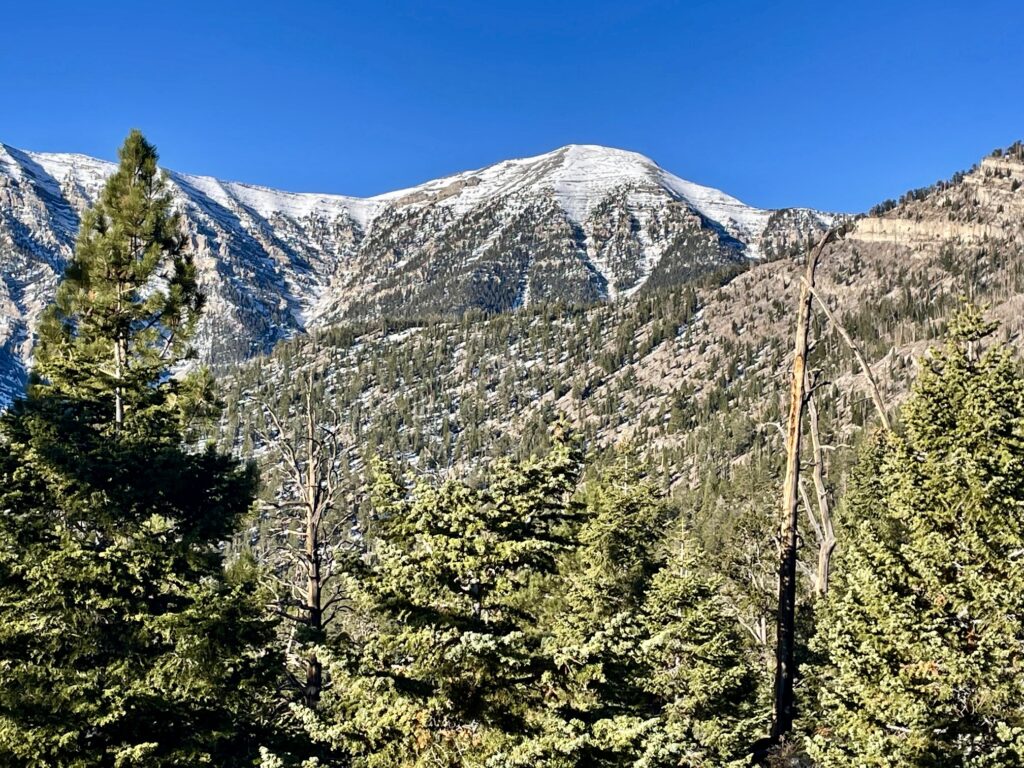
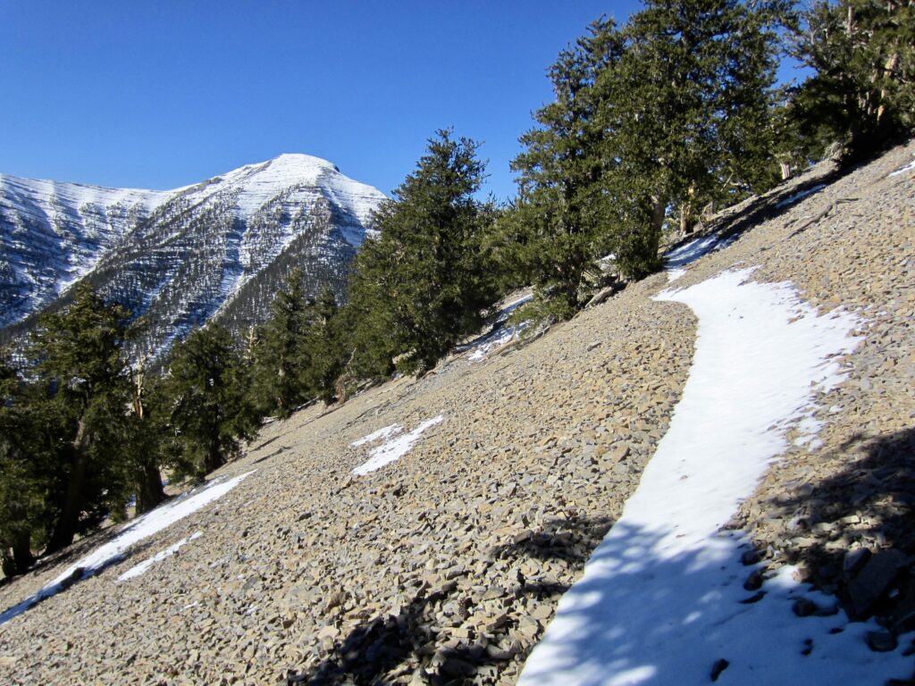
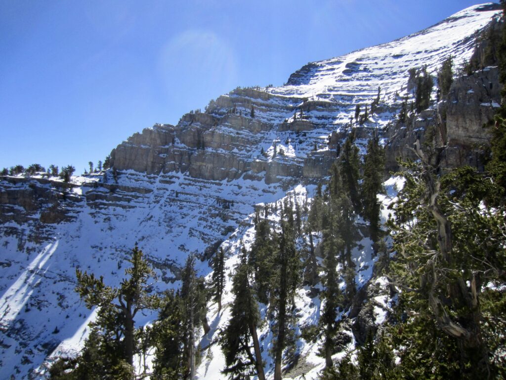
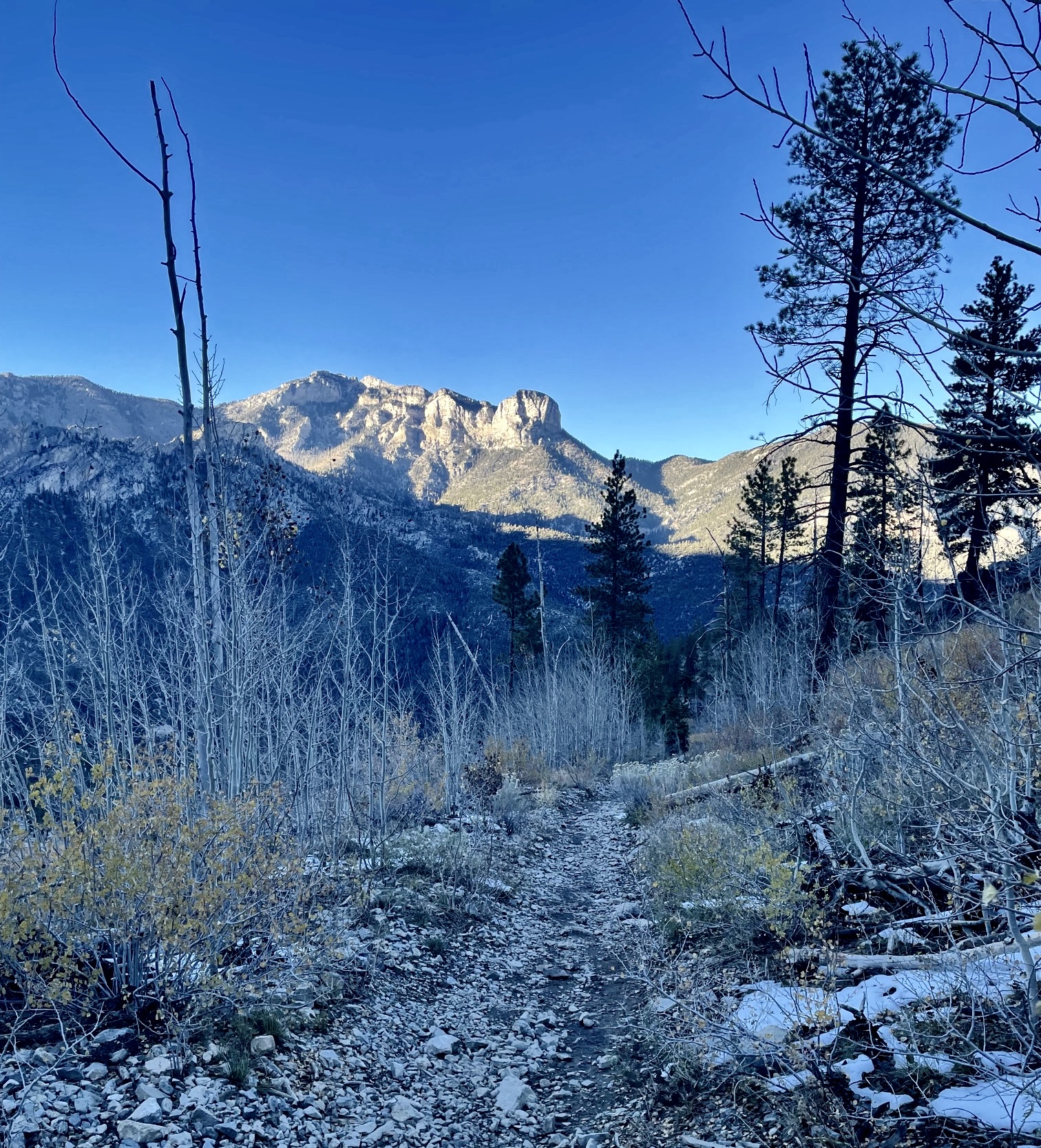
Leaving Mummy Pass on a chilly Monday morning, I followed the North Loop Trail on a rising traverse across the head of Trail Canyon. The broad summit of Charleston Peak came into view through the trees, and its snowy slopes stood in sharp contrast to the vivid blue sky. I could clearly see the trail switchbacking up the peak’s east slope, but it looked discouragingly far away.
.
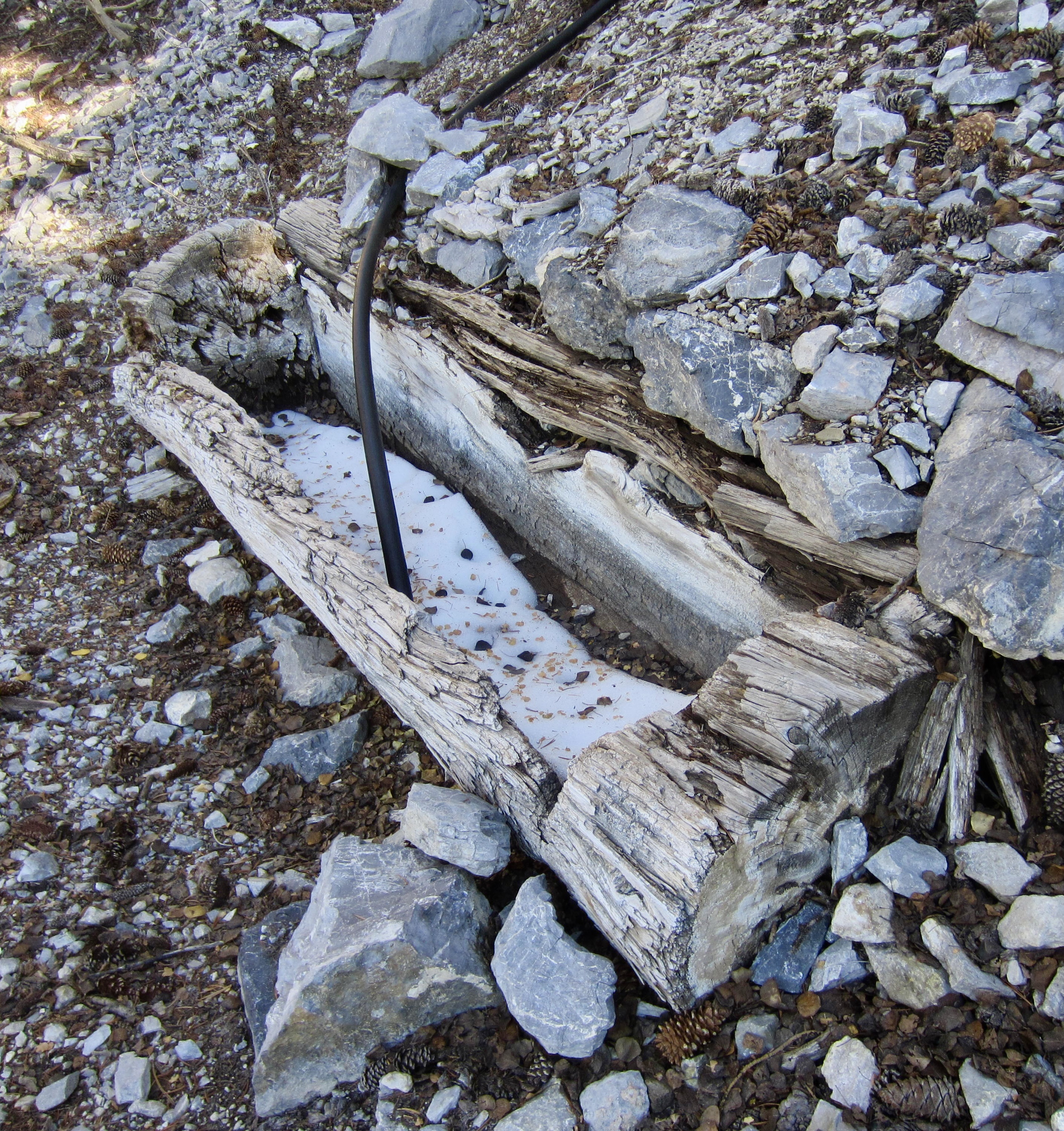
Very quickly, I entered the expansive burn zone of a 1940s-era forest fire. The entire hillslope within this zone is now vegetated with young aspen trees and widely spaced pine trees. I passed an old wooden water trough that marks the location of Cave Spring—presumably, the only summertime water source along the entire traverse but dry today.
.
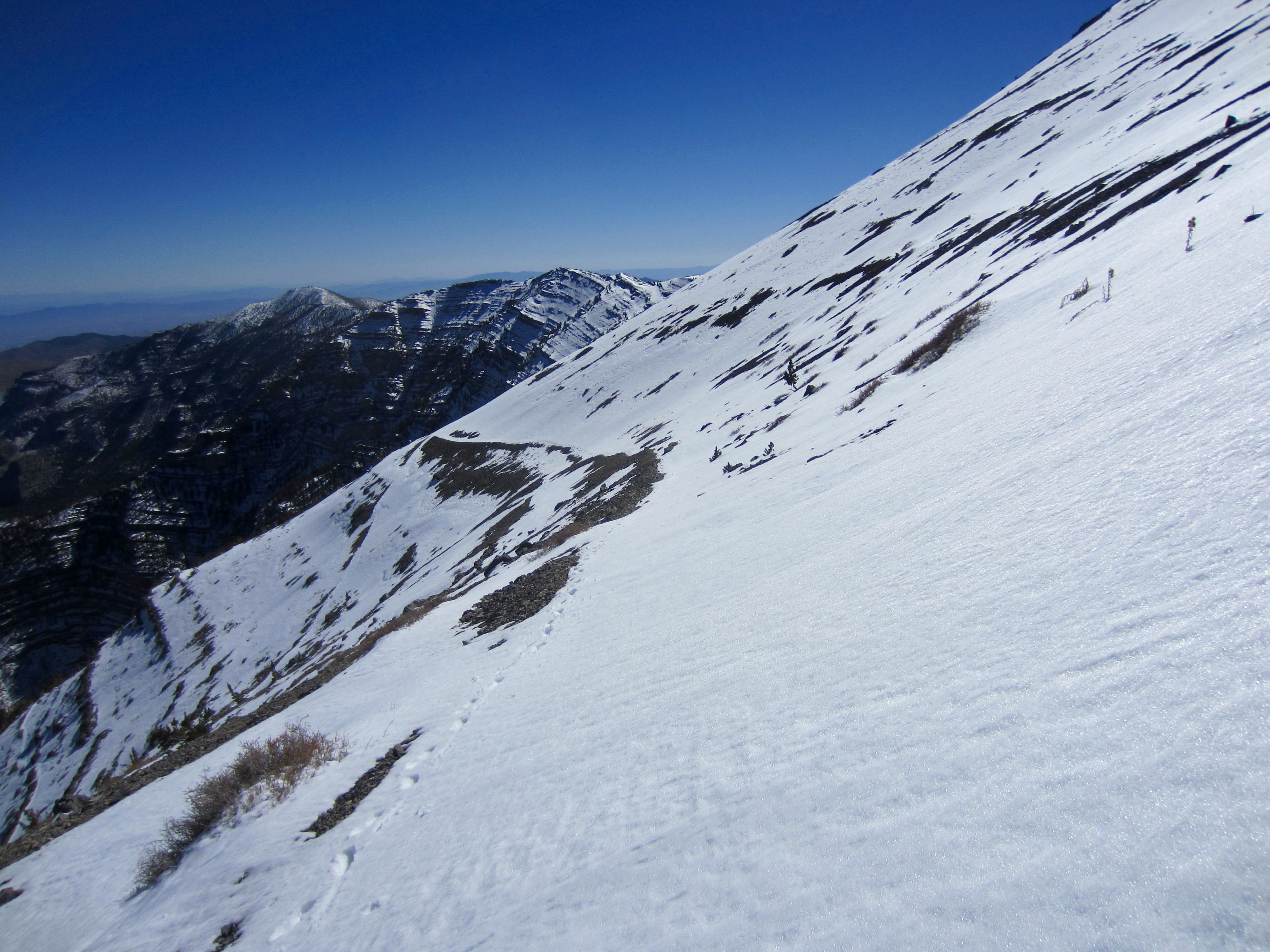
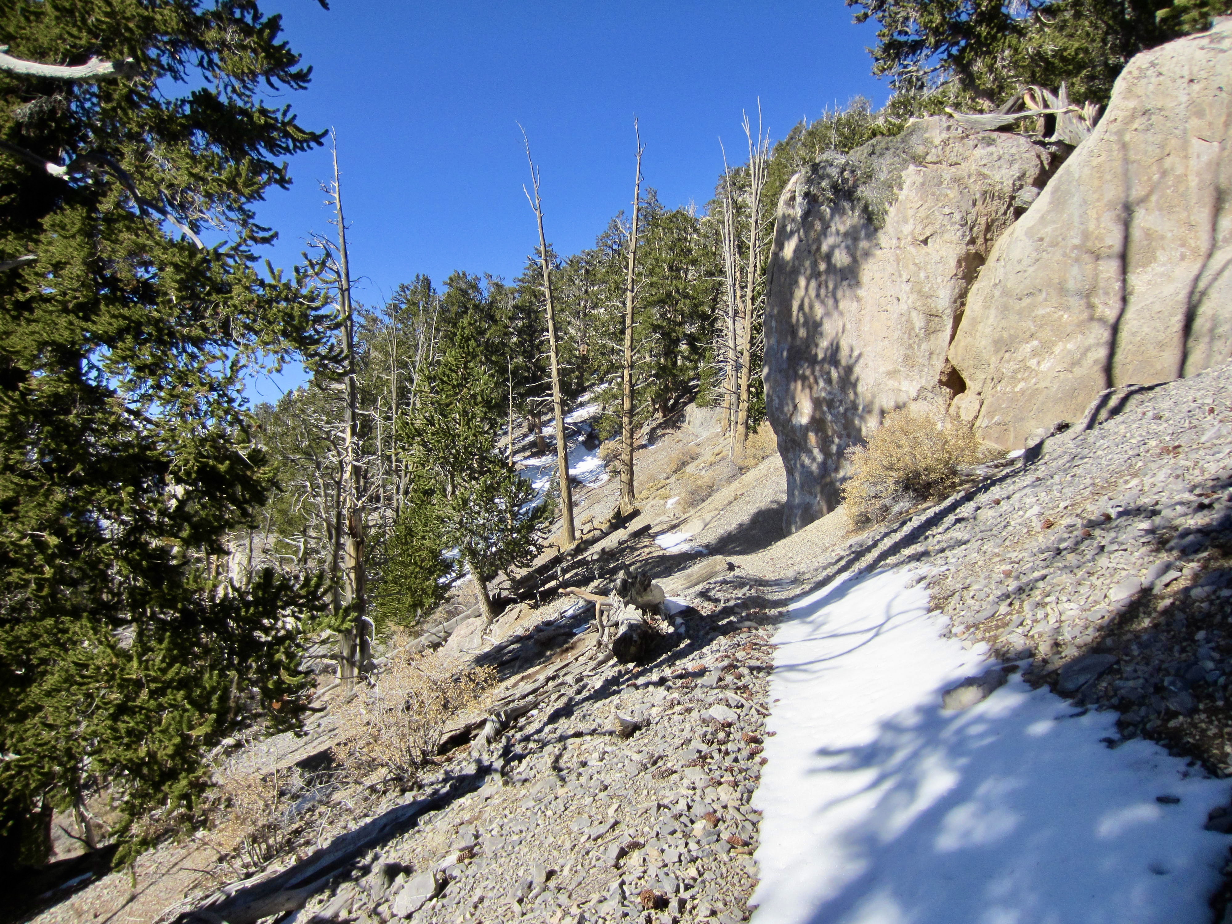
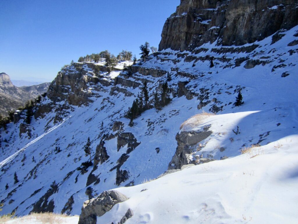
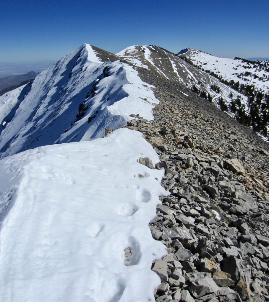
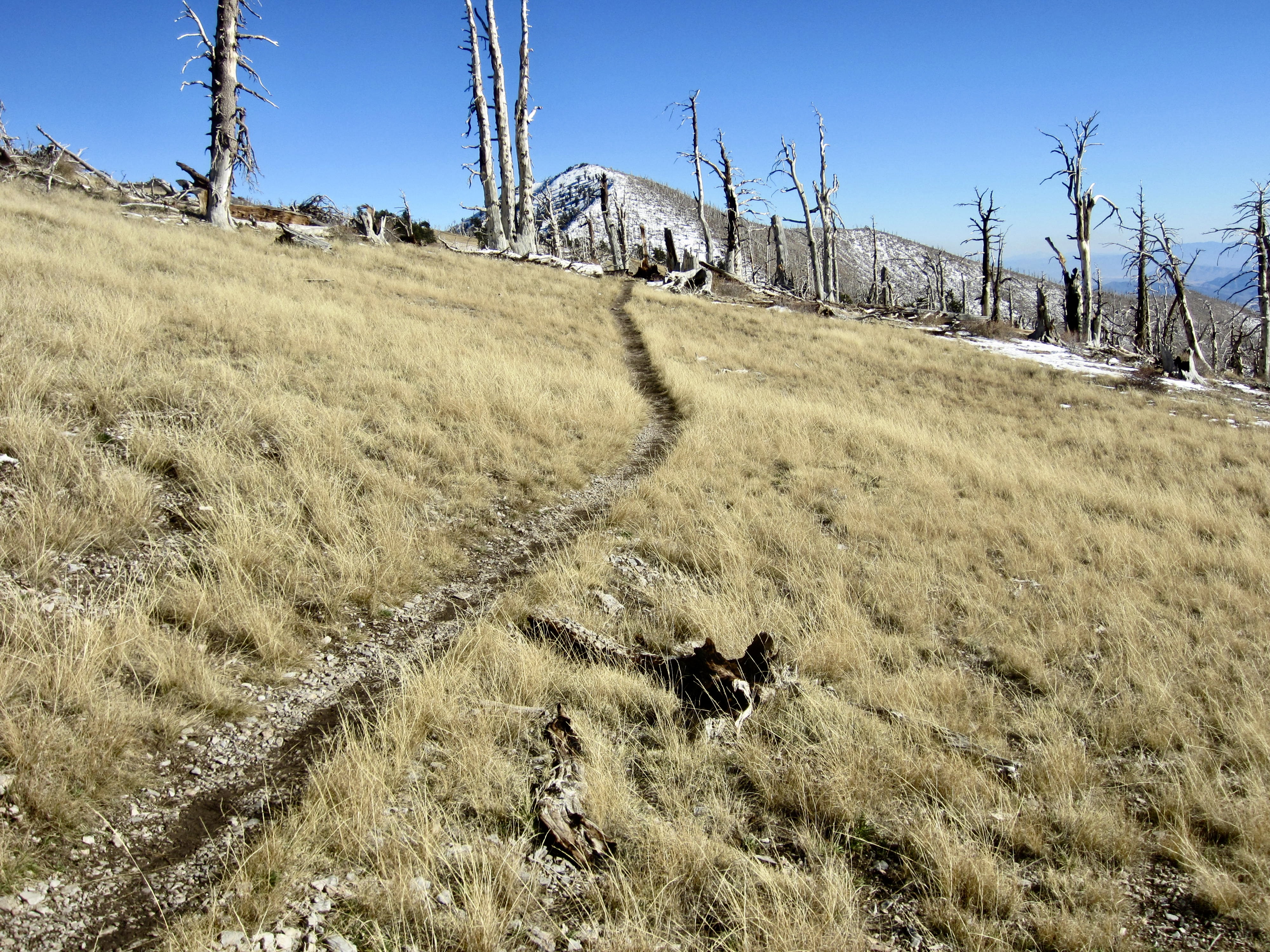
Beyond Cave Spring, the trail climbs the hillside via two switchbacks and passes an unmarked junction with a climber’s path leading to Mummy Mountain. It then embarks on a long westerly traverse across a high ridge—even tagging the crest at several saddles. I relished every step on this wonderfully scenic route!
.
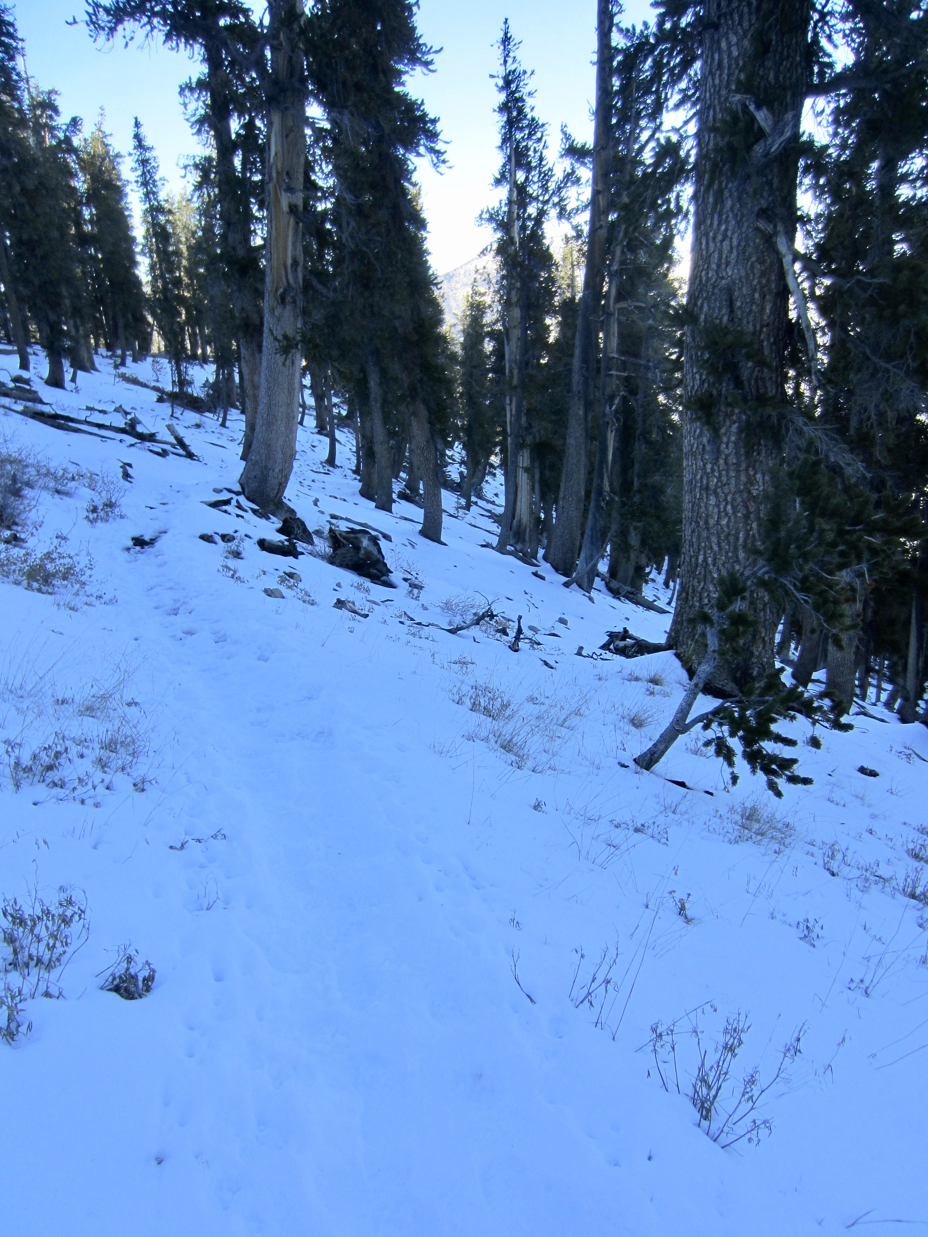
Eventually, the entire trail bed became covered in snow, and the lack of footprints indicated that nobody had been here since the snowstorm one week ago. This confirmed that I would be breaking trail through deep snow on the high peak. My traverse just got a little more alpine!
.
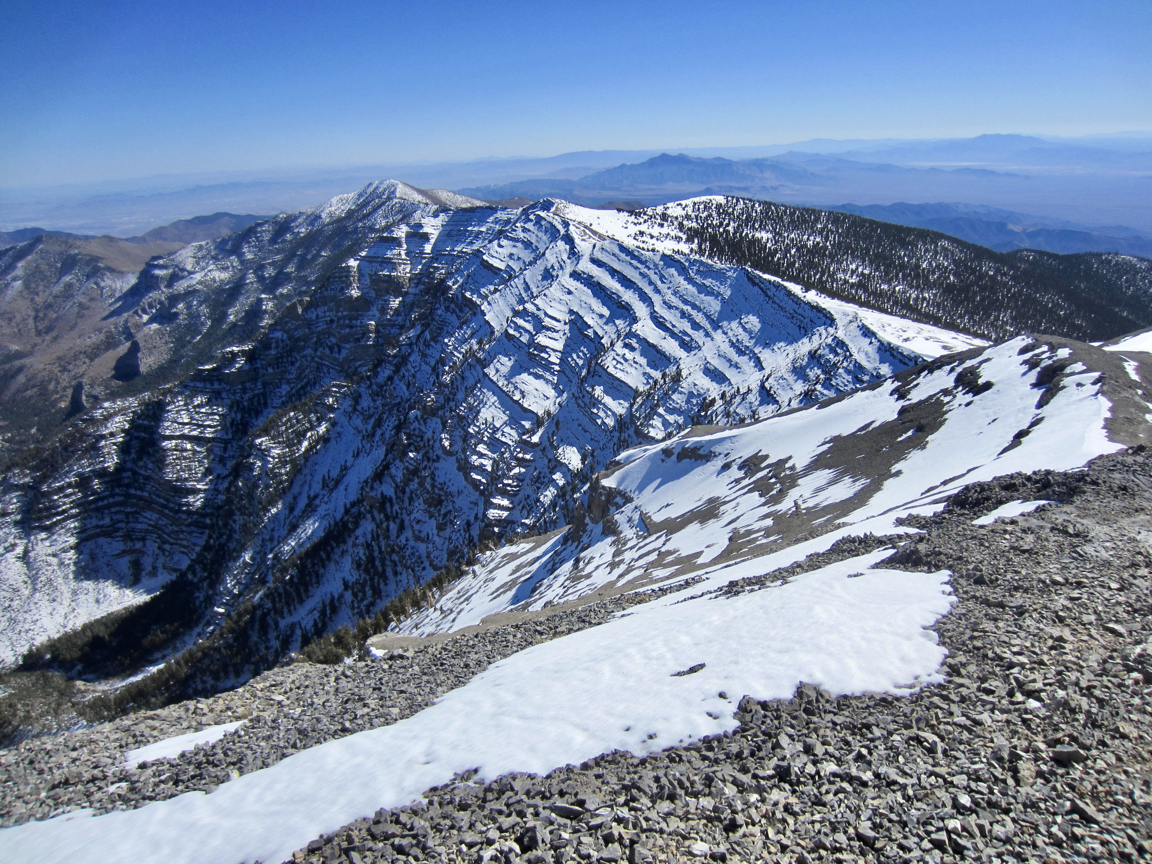
After 2 hours of delightful traversing along the high ridge, I came to Lee Overlook—a rocky promontory on the flank of Lee Peak (3.7 miles + 1800 feet from Mummy Pass). From here, I could look straight down Mary Jane Canyon to Mt. Charleston Village. It was now late morning and becoming pleasantly warm.
.
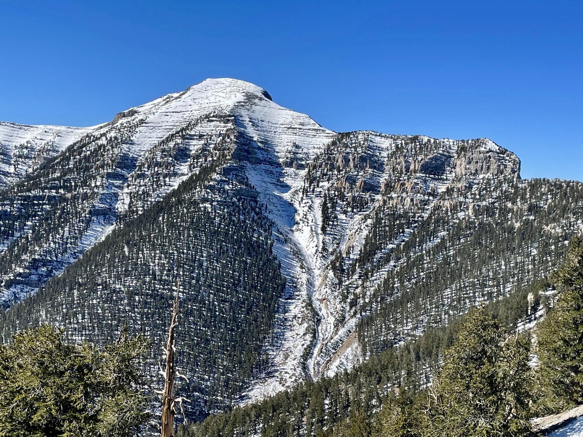
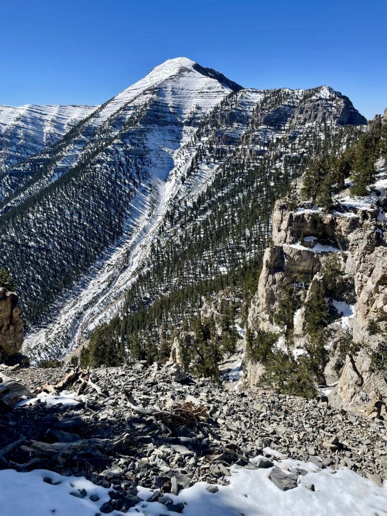
Over to the right was Charleston Peak, now looking very close. Its precipitous, tightly banded northeast face stared back at me, and I wondered whether I could safely cross those snow-covered ledges to reach the east slope. There seemed to be a good possibility that I would get stymied and need to retrace my approach hike. I considered my chances to be 50-50 at this point.
.
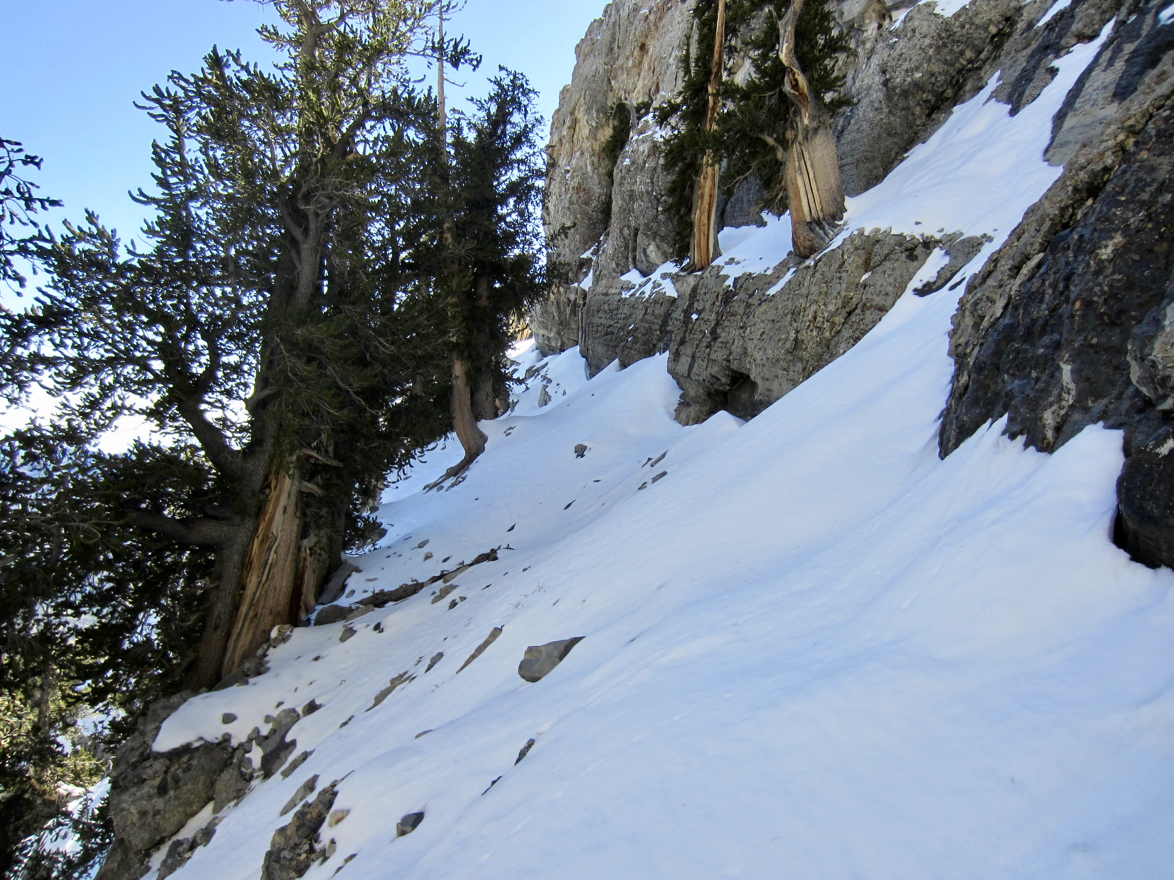
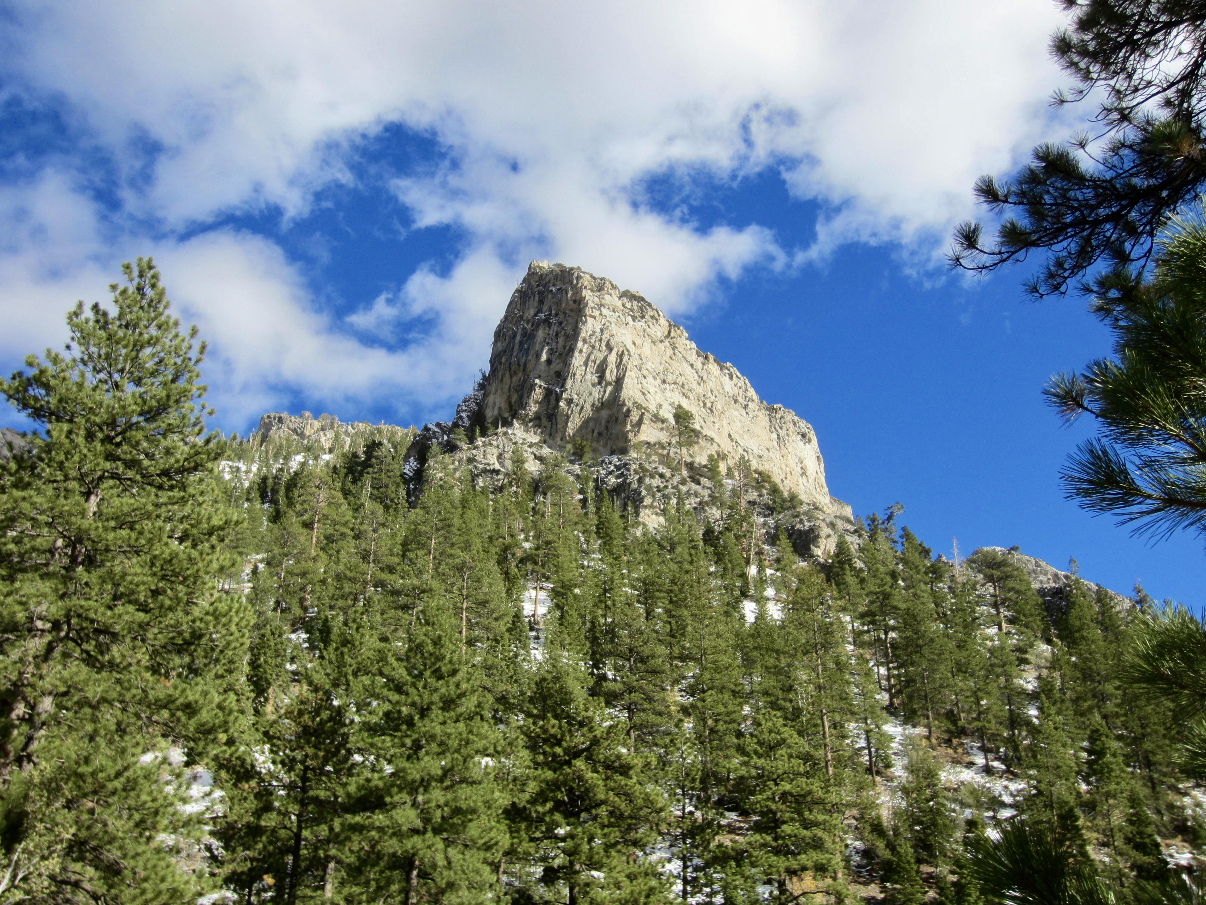
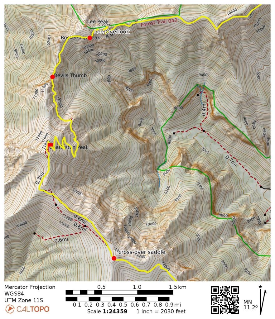
From Lee Overlook, the trail makes a left turn below Rocketship Peak and heads south for several hundred yards to reach Devil’s Thumb. This intriguingly named feature consists of a 40-foot-high limestone pinnacle that stands in a saddle on Charleston Peak’s north ridge. It looks like a worthwhile crag climb for anyone willing to haul gear this far.
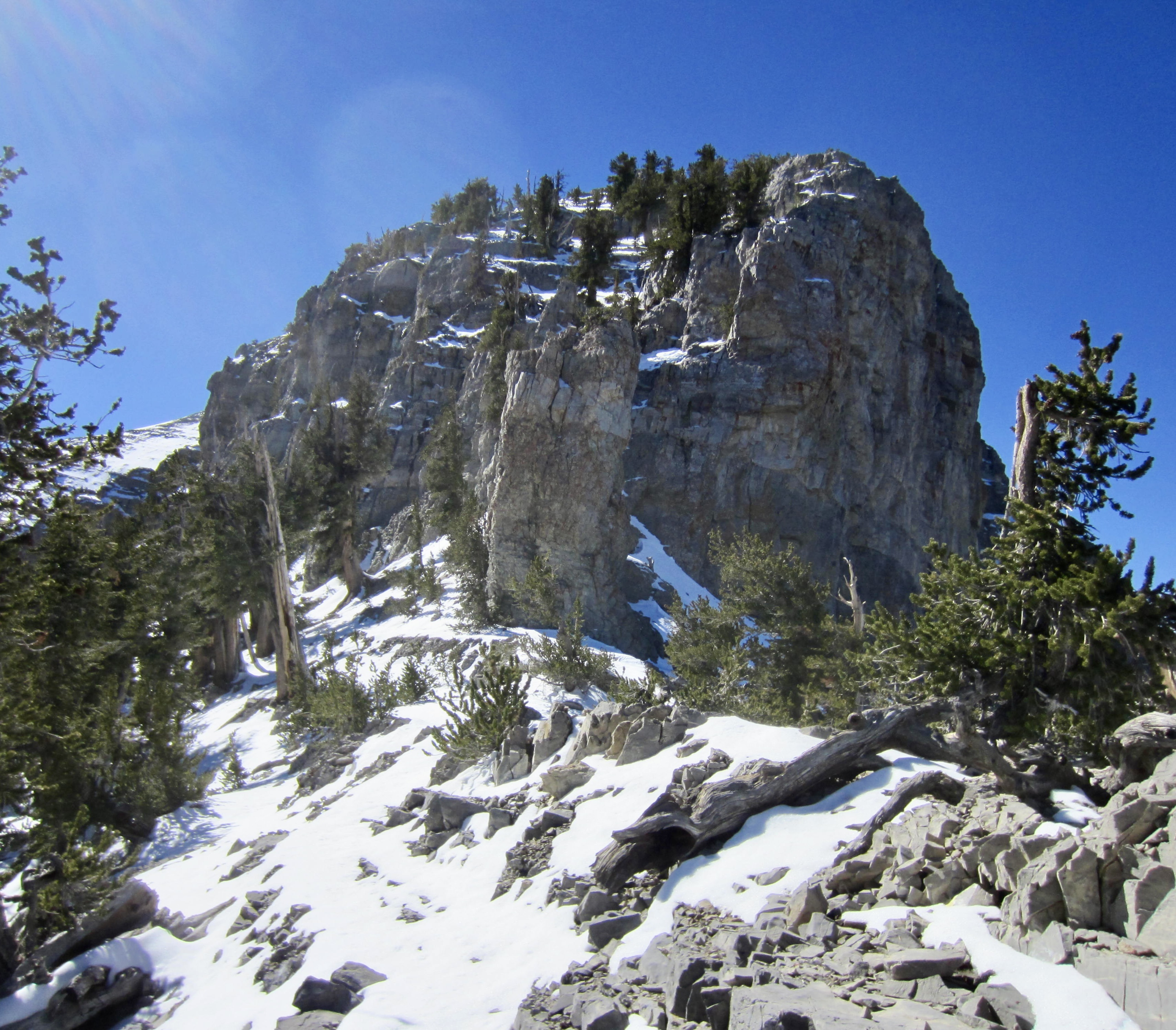
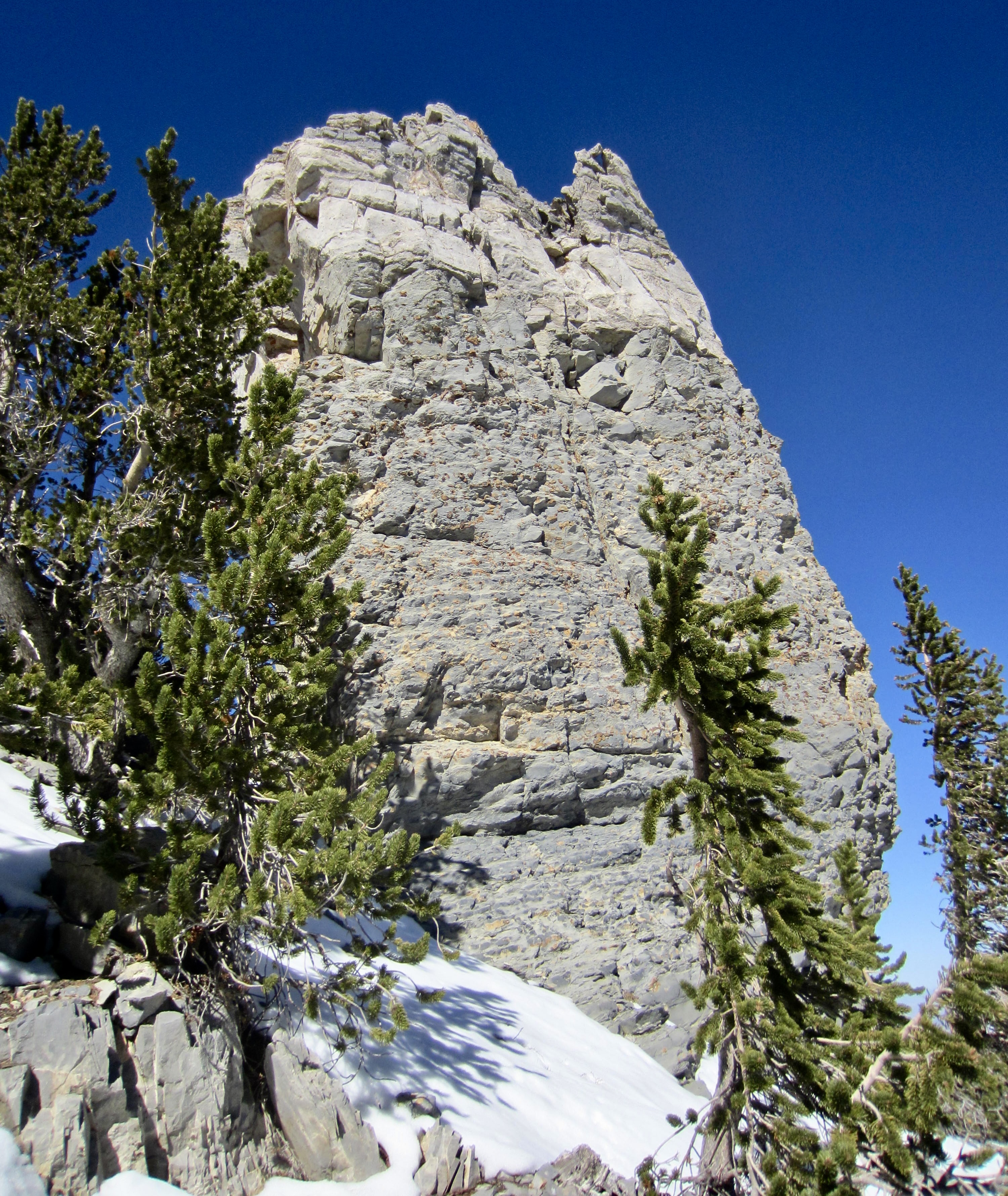
.
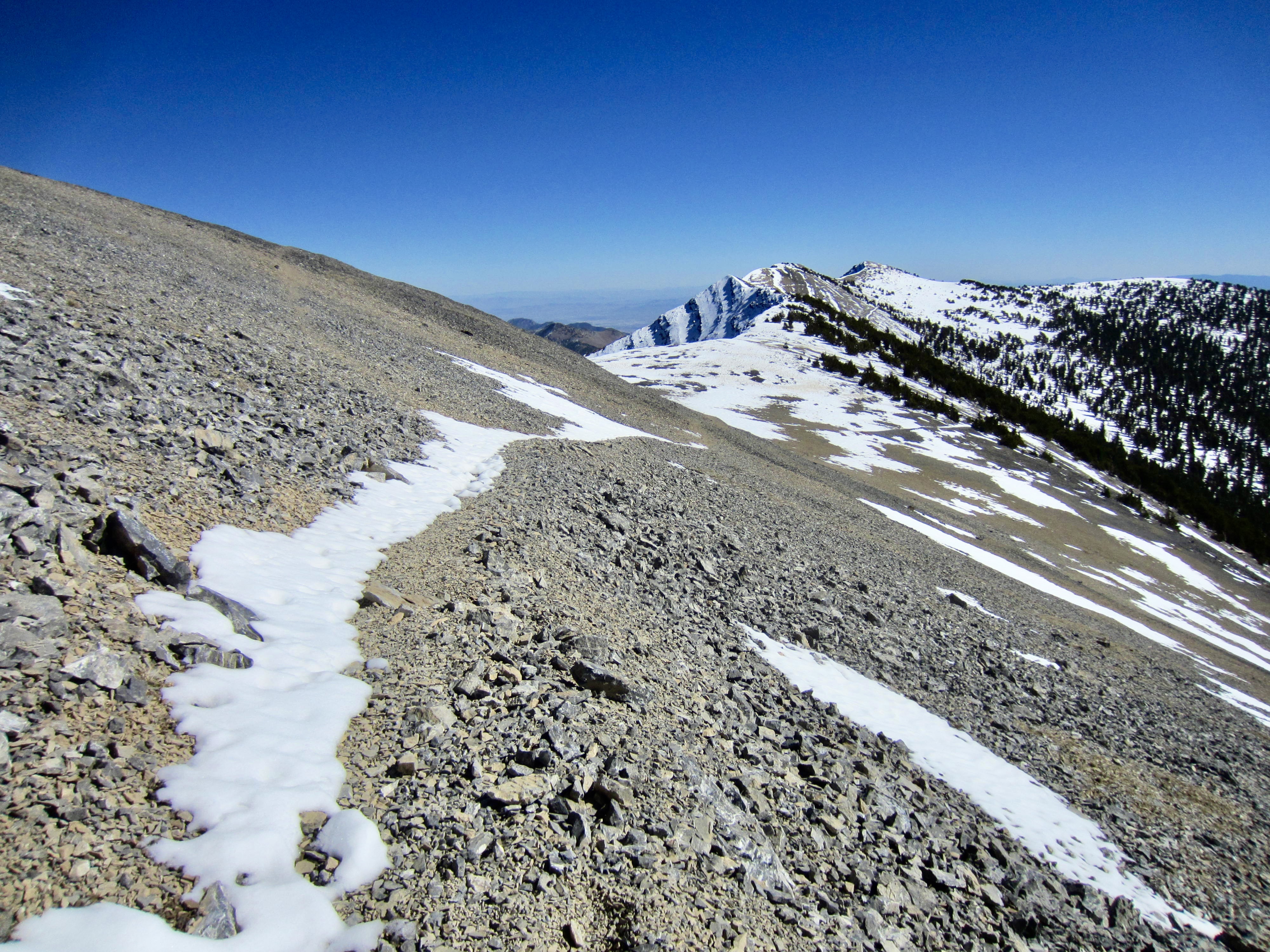
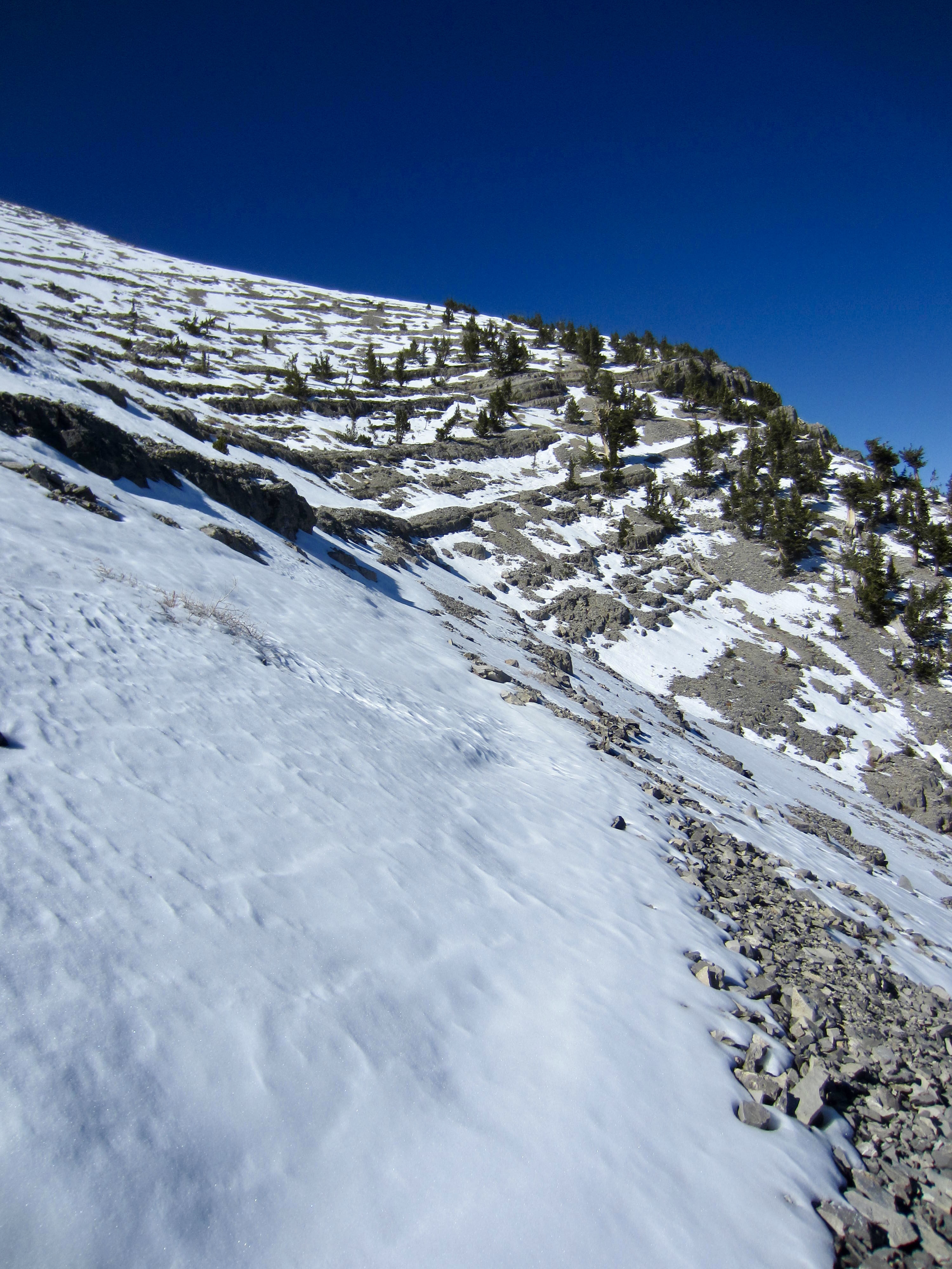
For me, Devil’s Thumb signaled a major change in trail conditions. Up to here, the North Loop Trail had been easy to follow and quite enjoyable, with minimal exposure and no more than 12 inches of snowcover. In contrast, the trail ahead was fairly exposed, difficult to see, and buried under a lot of snow. My 50-50 estimate now seemed optimistic!
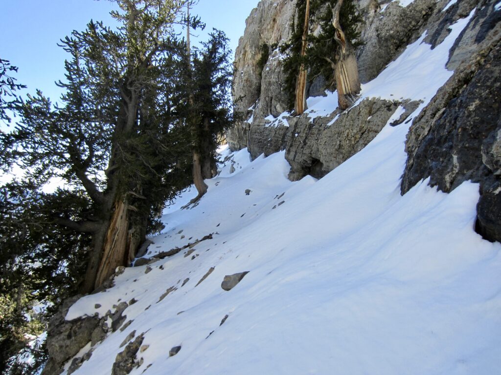
.
I began plowing forward, carefully staying on the trail as best I could as it contoured across a series of ribs and gullies. Typically, the snow depth decreased to only a few inches where the trail rounded a rib, but it increased to knee-deep in the gullies. The exposure would have warranted an ice axe and crampons if the sun crust had been much harder, but I was able to punch through the crust with each step.
.
.
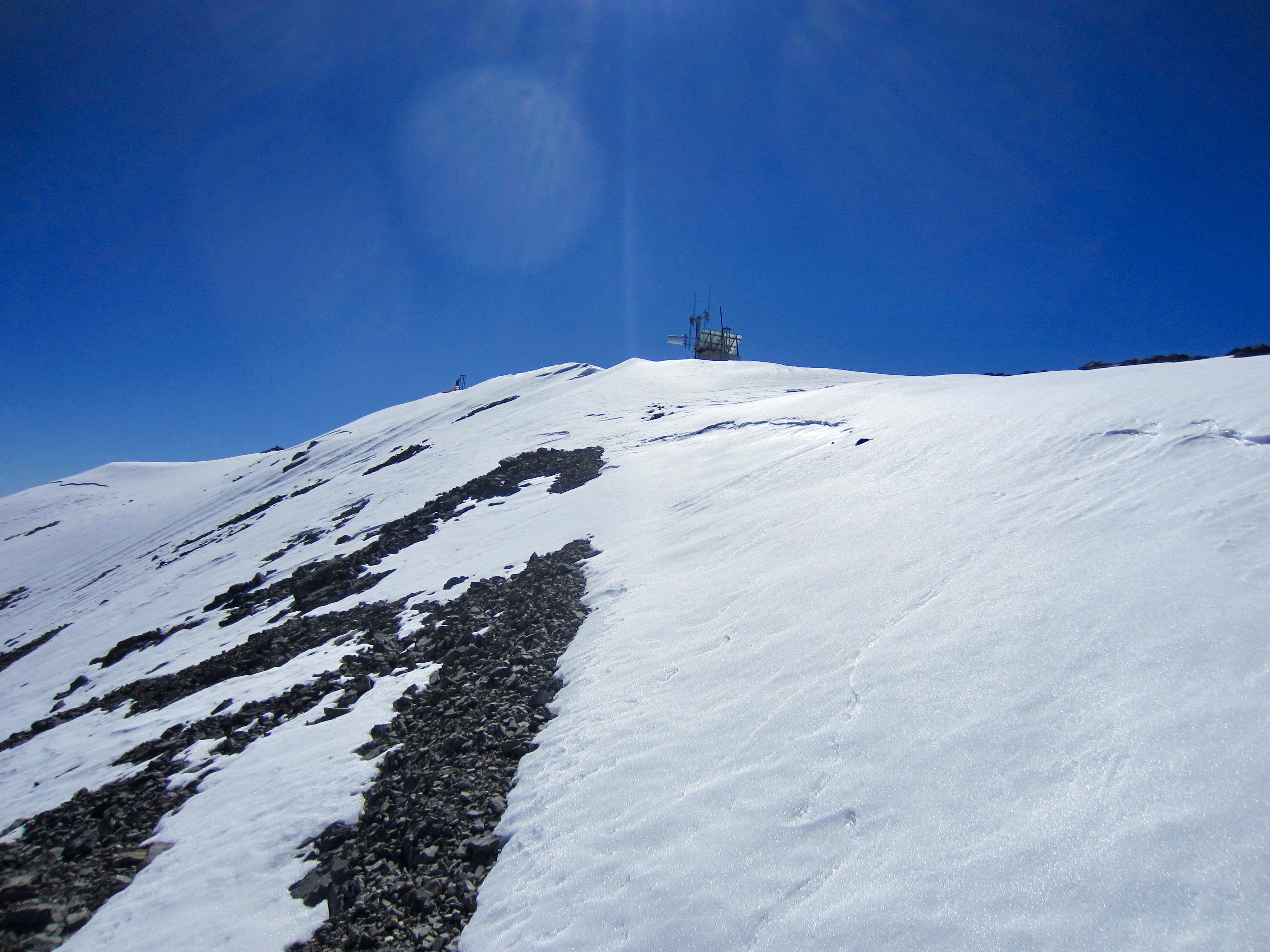
After a mile of apprehensive traversing, I reached relatively benign east slope and began making long tacks up the snowy, switchbacking trail. A breakable sun crust made this final 900 feet very tiring and annoying, but I appreciated the security it provided.
.

.
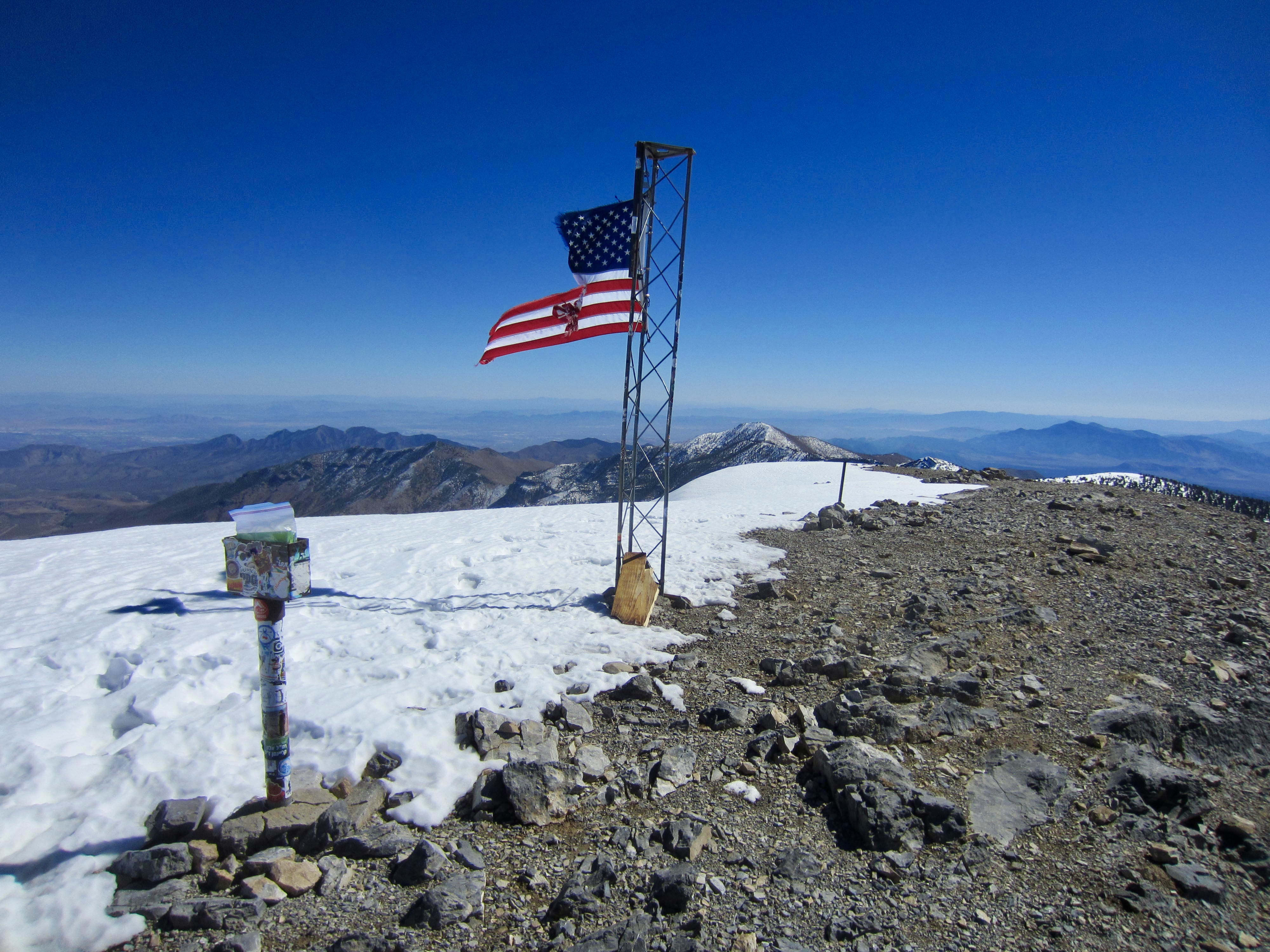
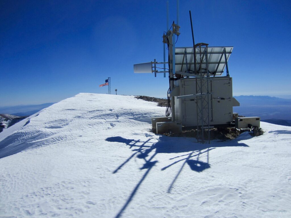
A summit communication structure and flagpole eventually came into view, and a final tack brought me to the top of Charleston Peak at 1:00pm (5.9 miles + 2900 feet from Mummy Pass). I was exhausted but ecstatic—and not just because I could change into dry socks!

.
.
It was encouraging to see that the western side of the mountain was almost entirely snow-free. This meant that my descent on the South Loop Trail, which stays mainly on western and southwestern aspects, would be much easier.
.
.
.
Segment 3: Charleston Peak to Griffith Junction
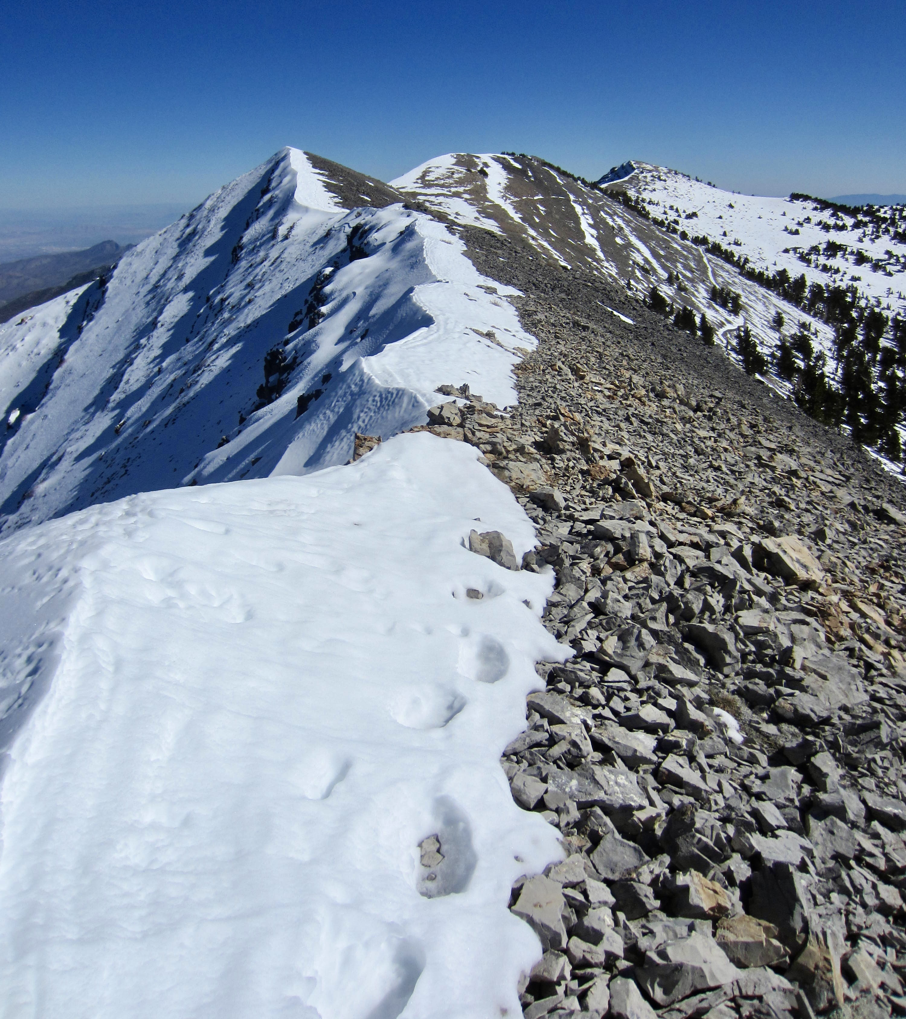
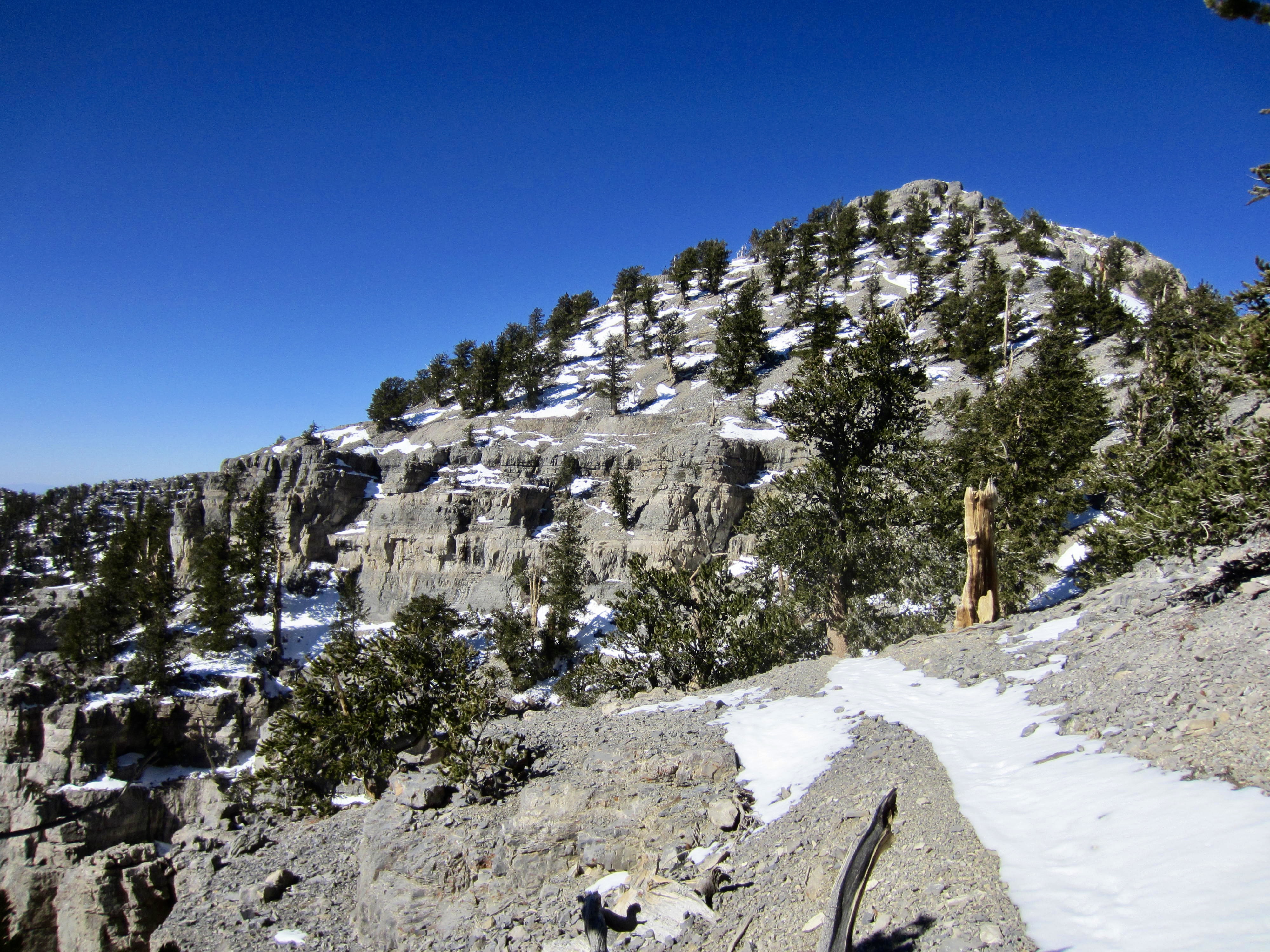
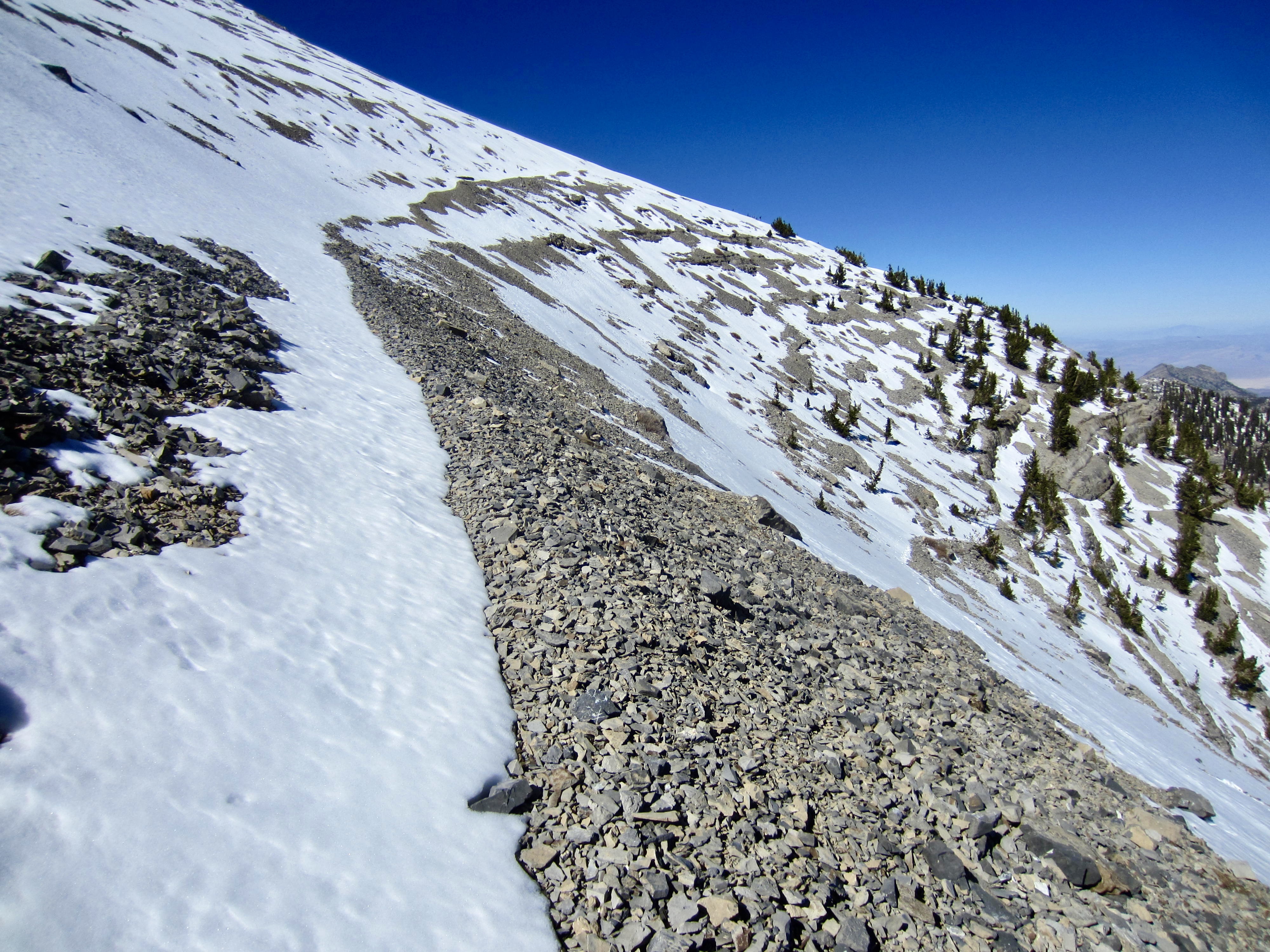
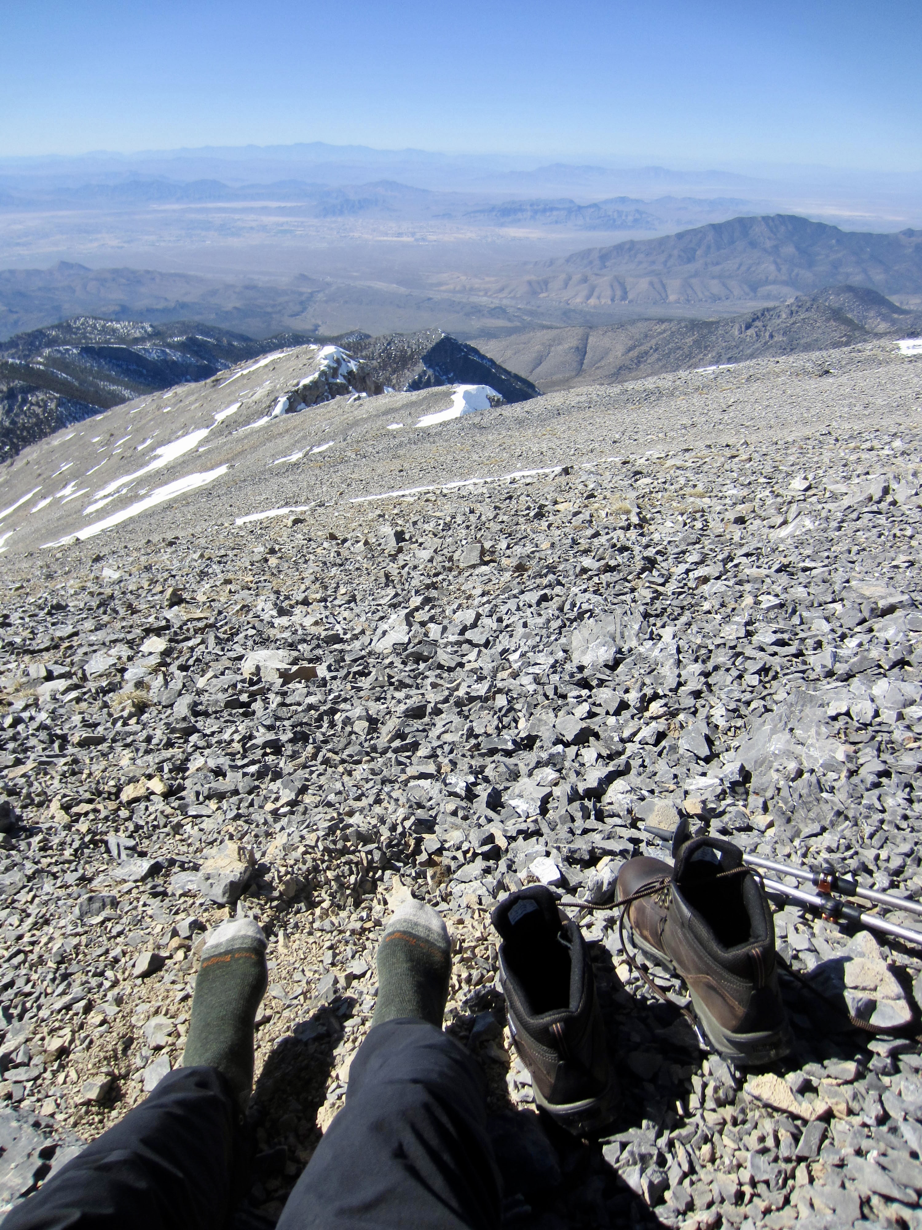
Following the South Loop Trail down from Charleston’s summit was no problem, because residual snow on the trail bed created a white ribbon across the barren hillslopes. Also, as I suspected, several people had come up the trail from Griffith Junction during the past week, so there were footsteps in the snow.

.
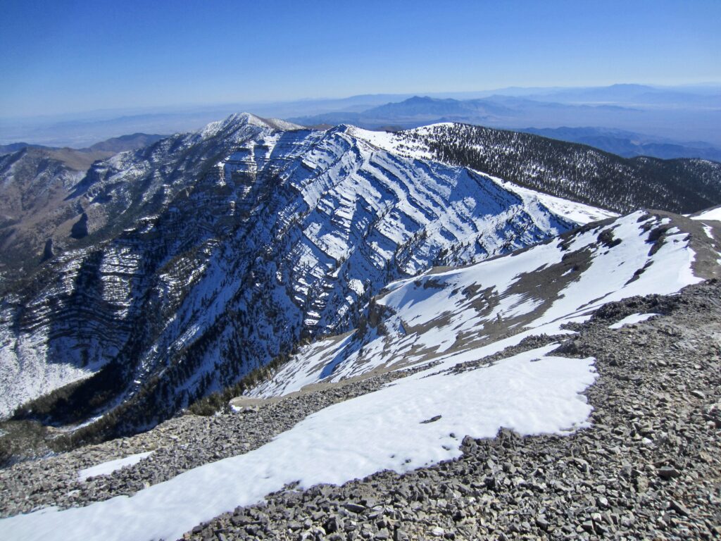
When the trail split into two parallel branches at one point, I followed the upper branch on a high, undulating traverse along the corniced crest. Although last week’s snowstorm had made my traverse more difficult, it had also made the journey more visually stunning!
.
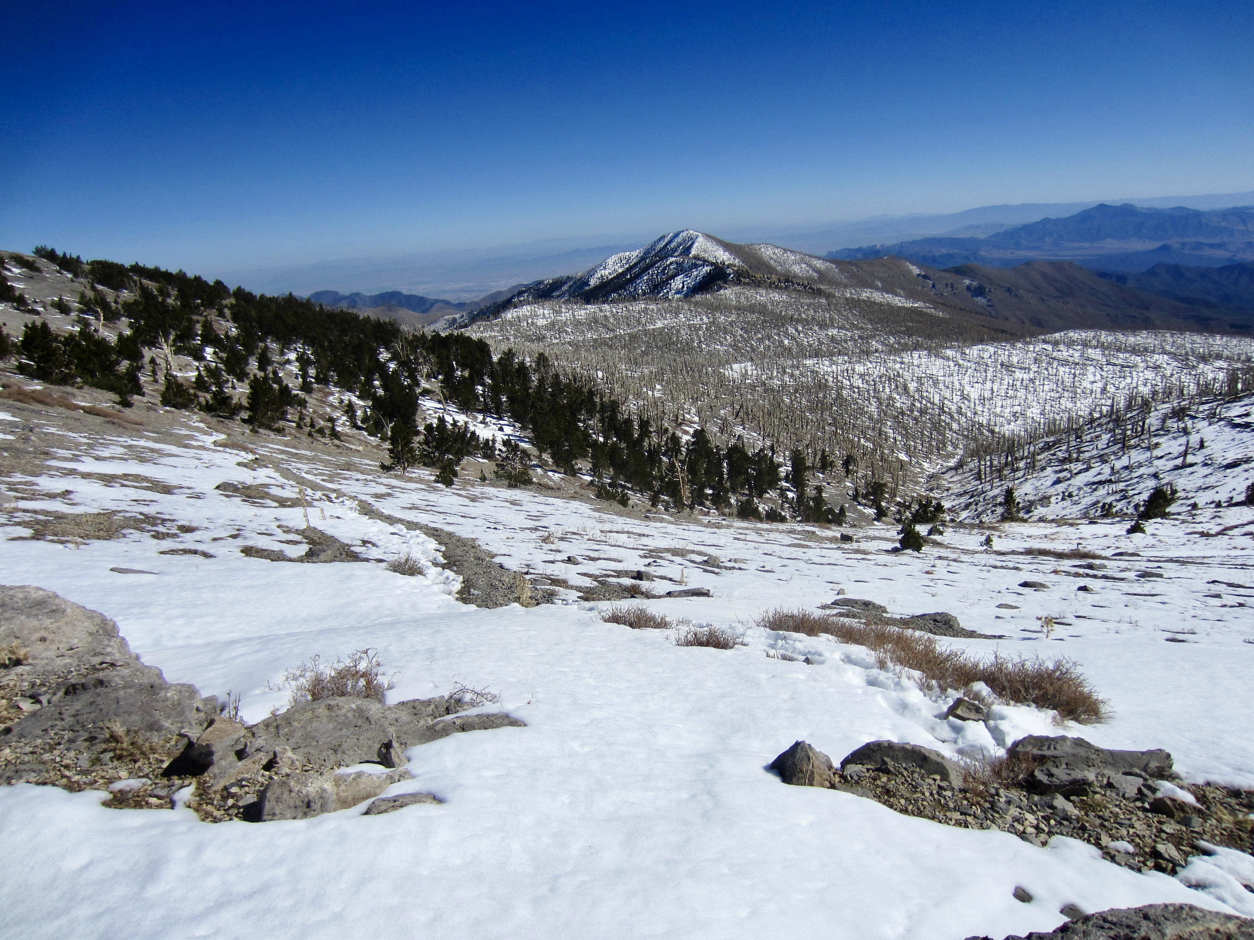
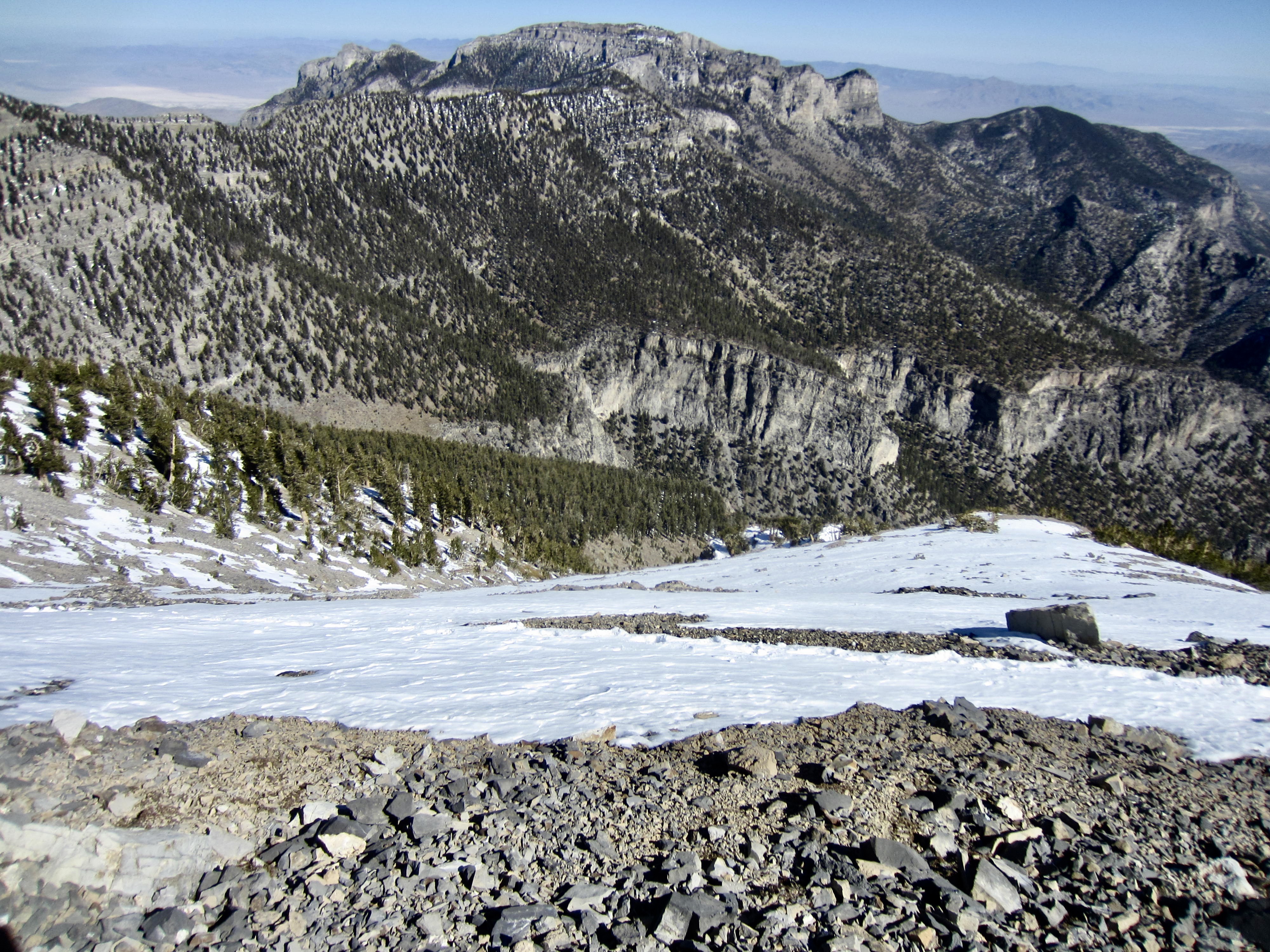
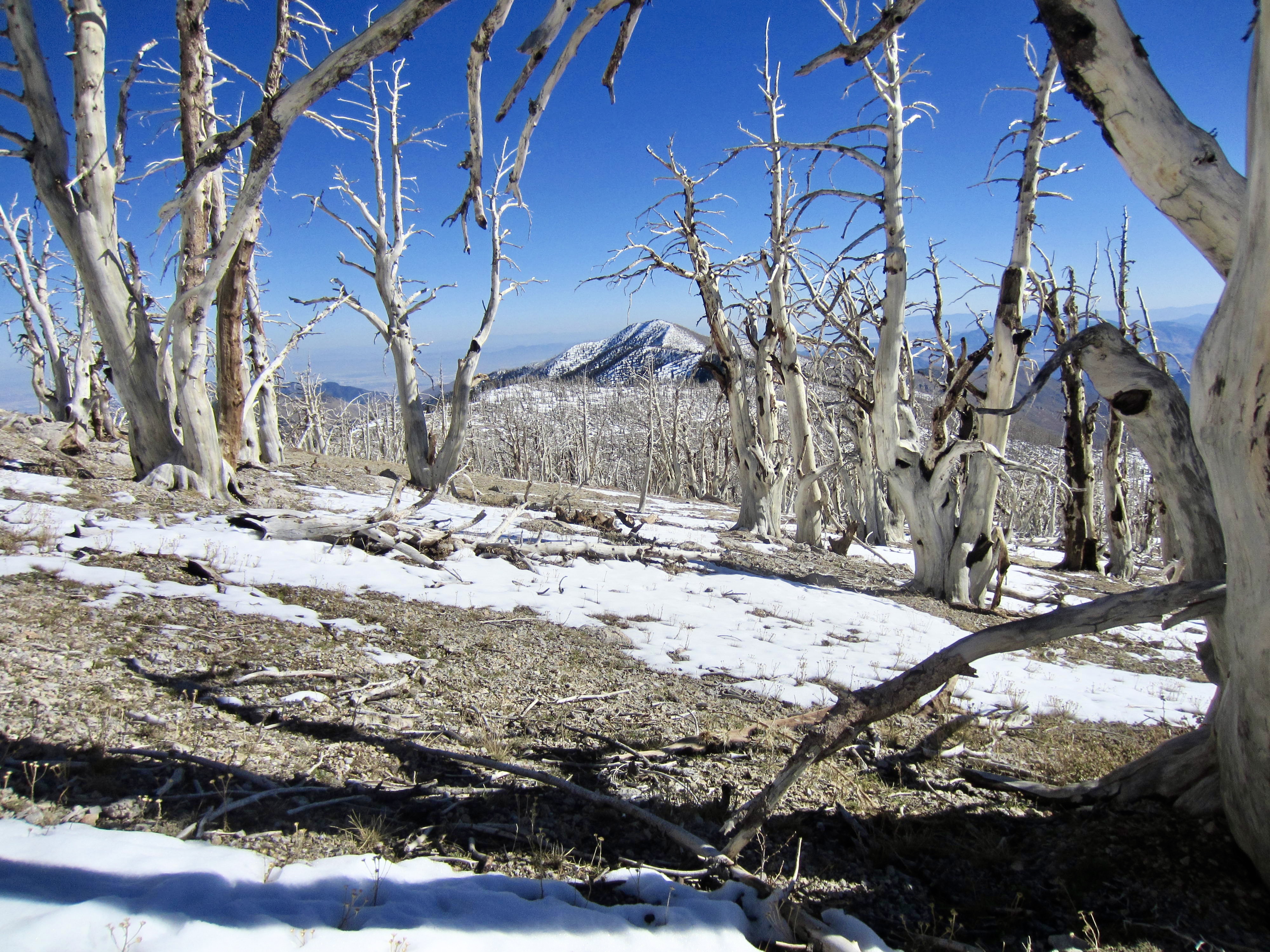
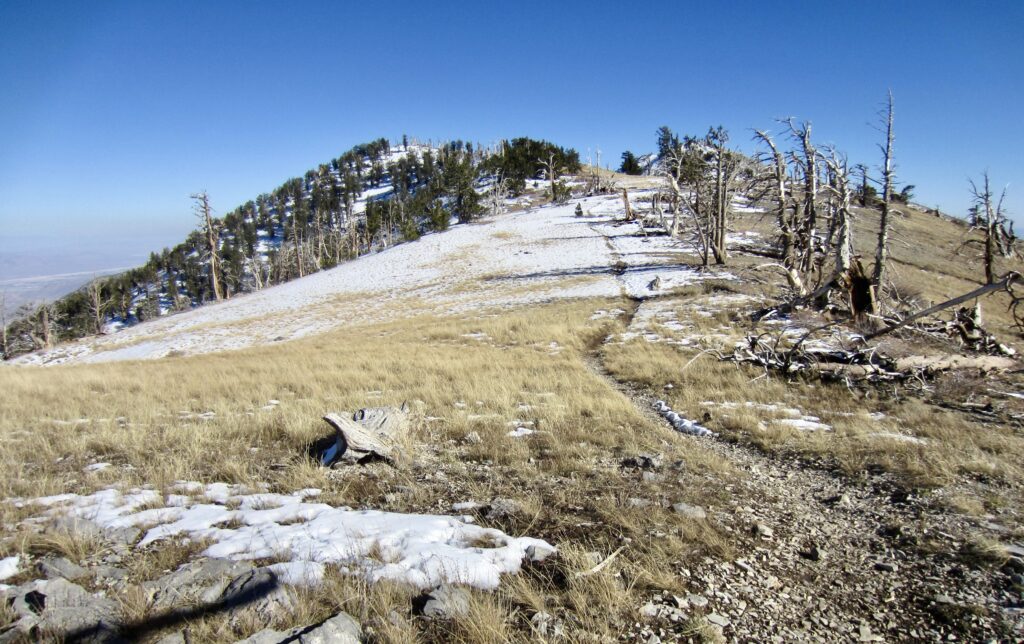
After a long mile, the two branches converged into a single trail and crossed over an 11,400-foot saddle in a spur ridge. This took me onto a south-facing aspect with a distinctly different appearance. Very soon, I re-entered the 1940s-era burn zone, which is covered by countless thousands of bristlecone pine “skeletons.”

.
.
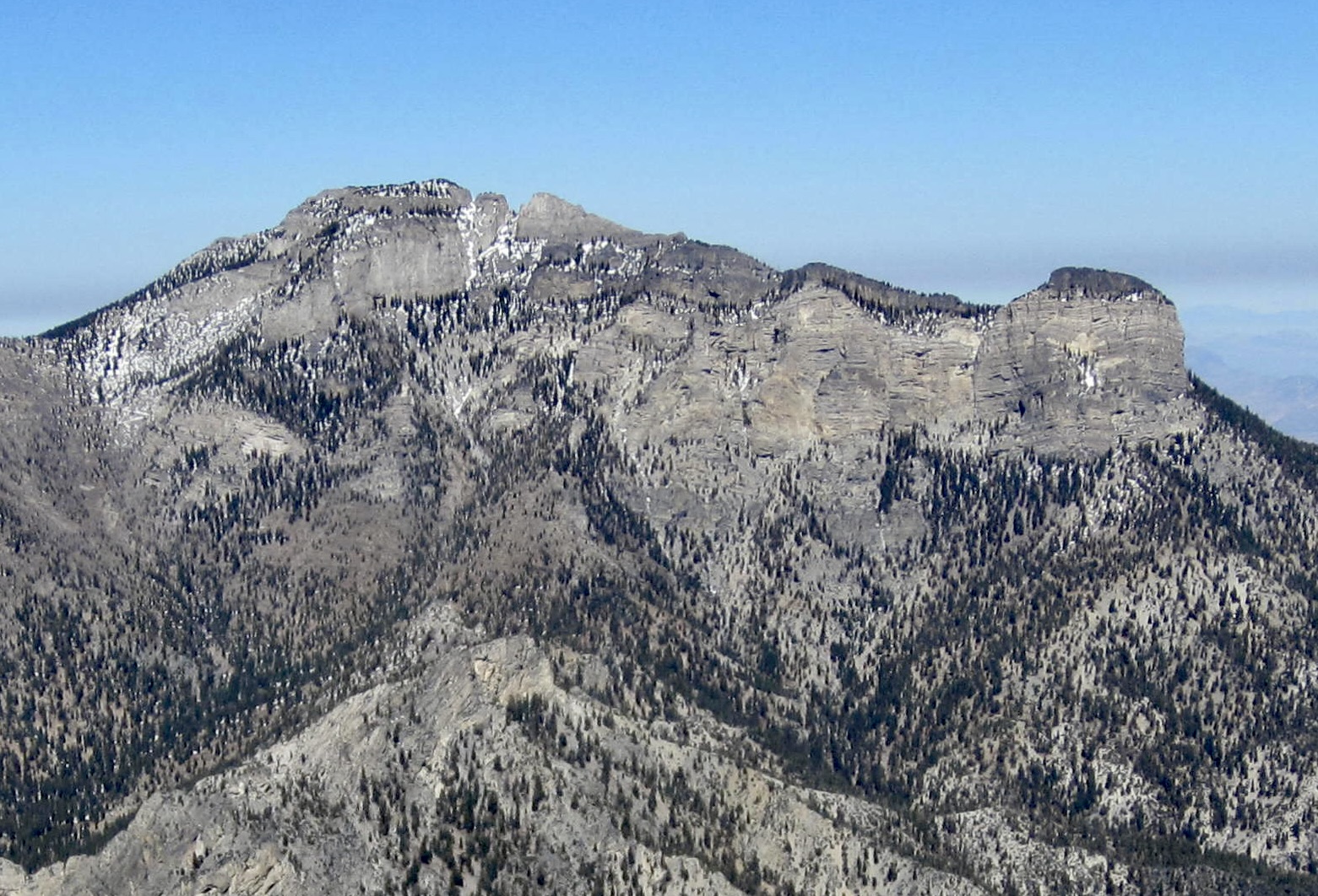
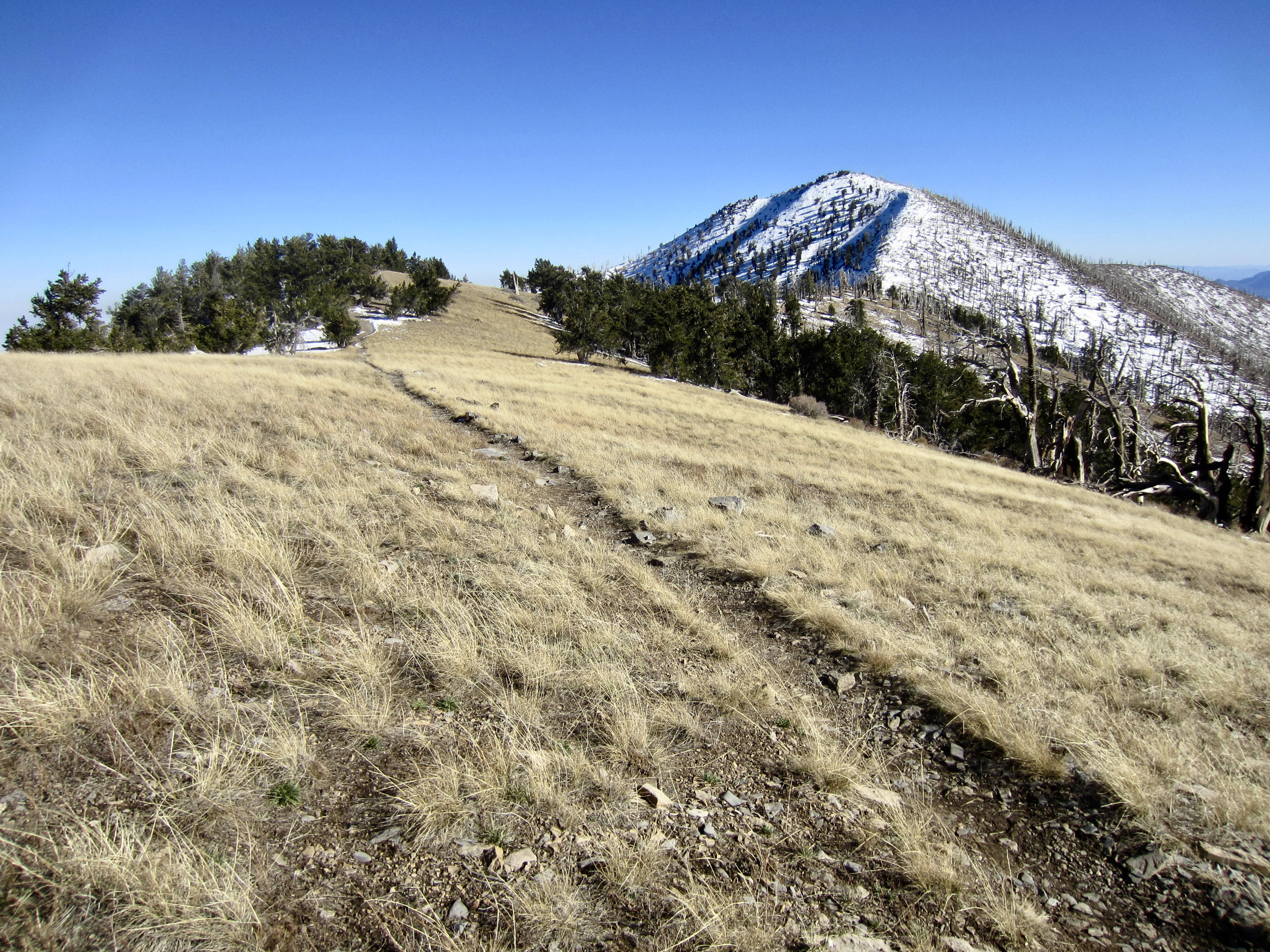
Barren alpine slopes gradually transitioned to graceful grassland slopes, and Griffith Peak stood as a marker beacon on the ridge far ahead. I was once again surprised and delighted by the remarkable variety of terrain on this traverse. National Recreation Trail? Oh yeah!!
.
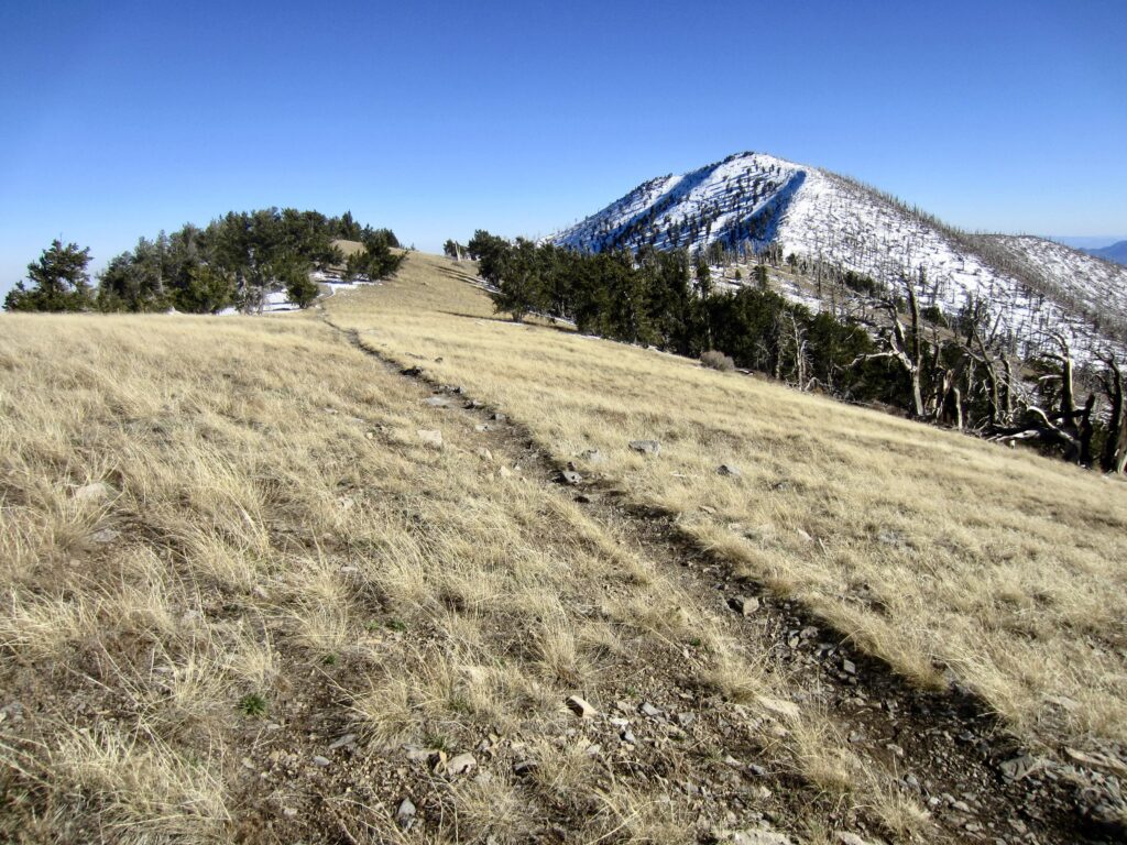
.
I arrived at 10,700-foot Griffith Junction on the ridge crest in mid-afternoon (4.1 miles + 200 feet – 2400 feet from summit). At this point, the Griffith Peak Trail continues straight ahead, over the summit of nearby Griffith Peak, whereas the South Loop Trail turns left (northeast) and makes a long descent into Kyle Canyon.
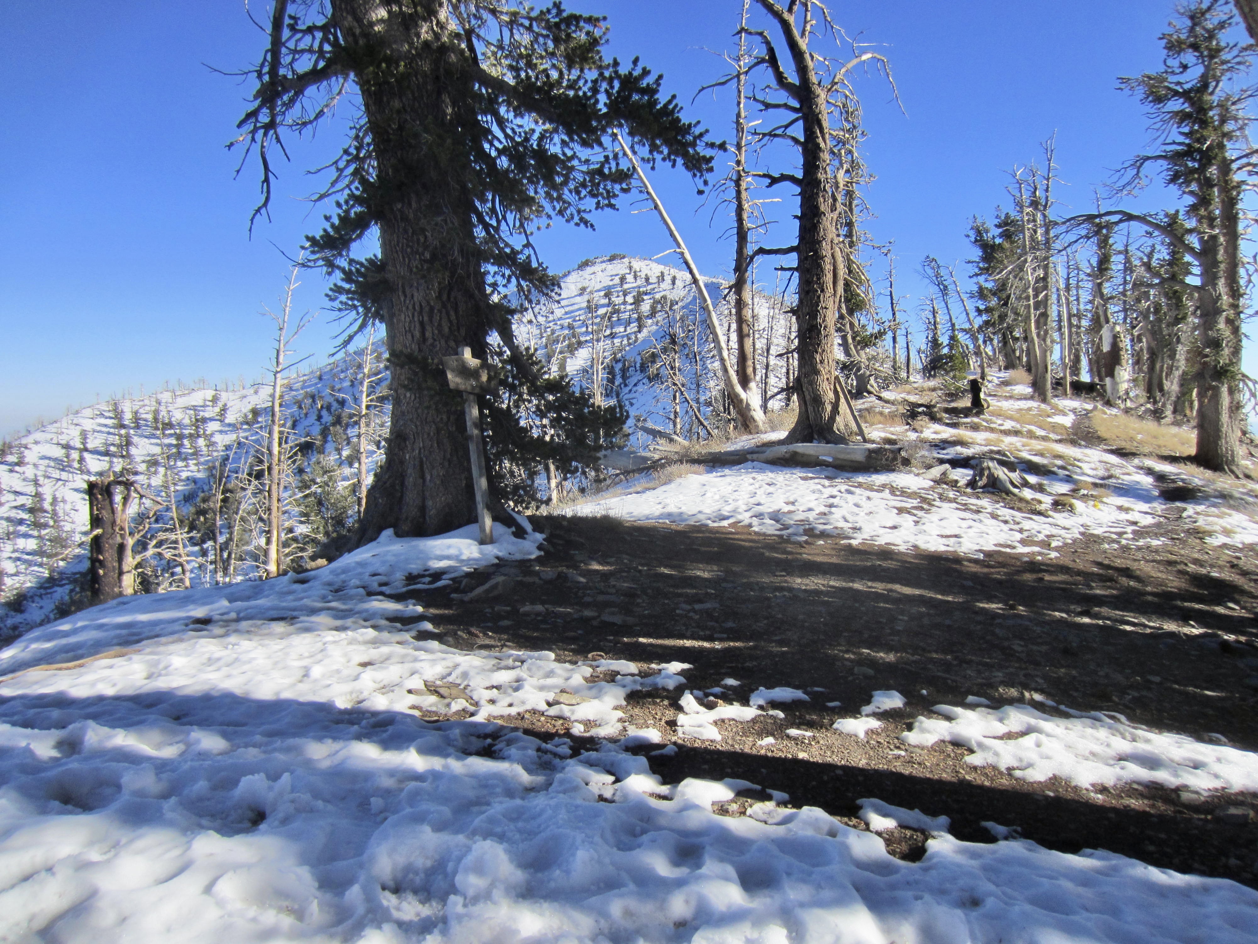
.
Segment 4: Griffith Junction to South Loop Trailhead
From Griffith Junction, I began descending the South Loop Trail on a long series of switchbacks. The north-facing hillside here was shady and cold, and the heavily traveled trail was covered by refrozen snow.
.
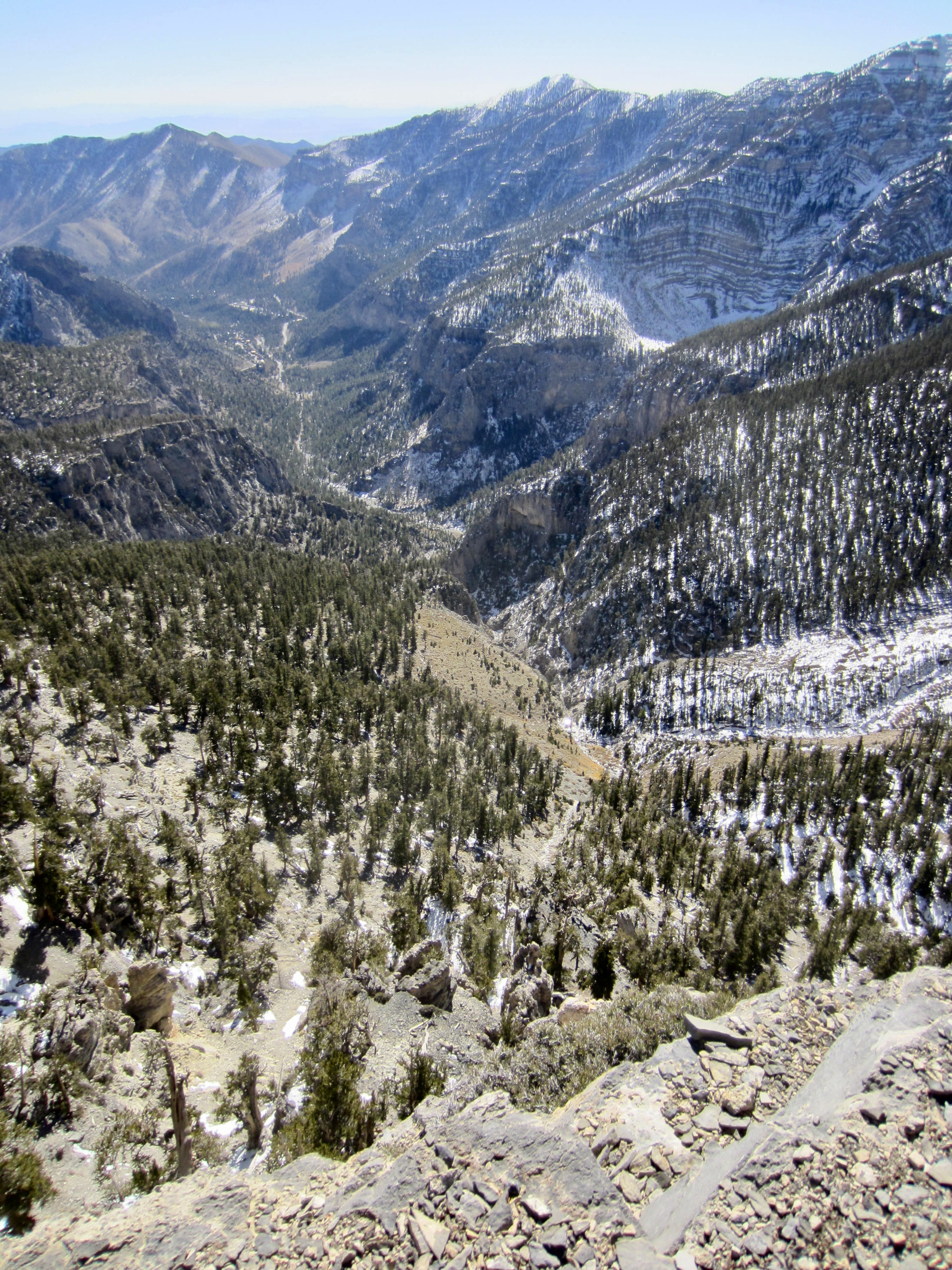
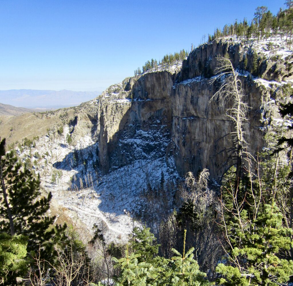
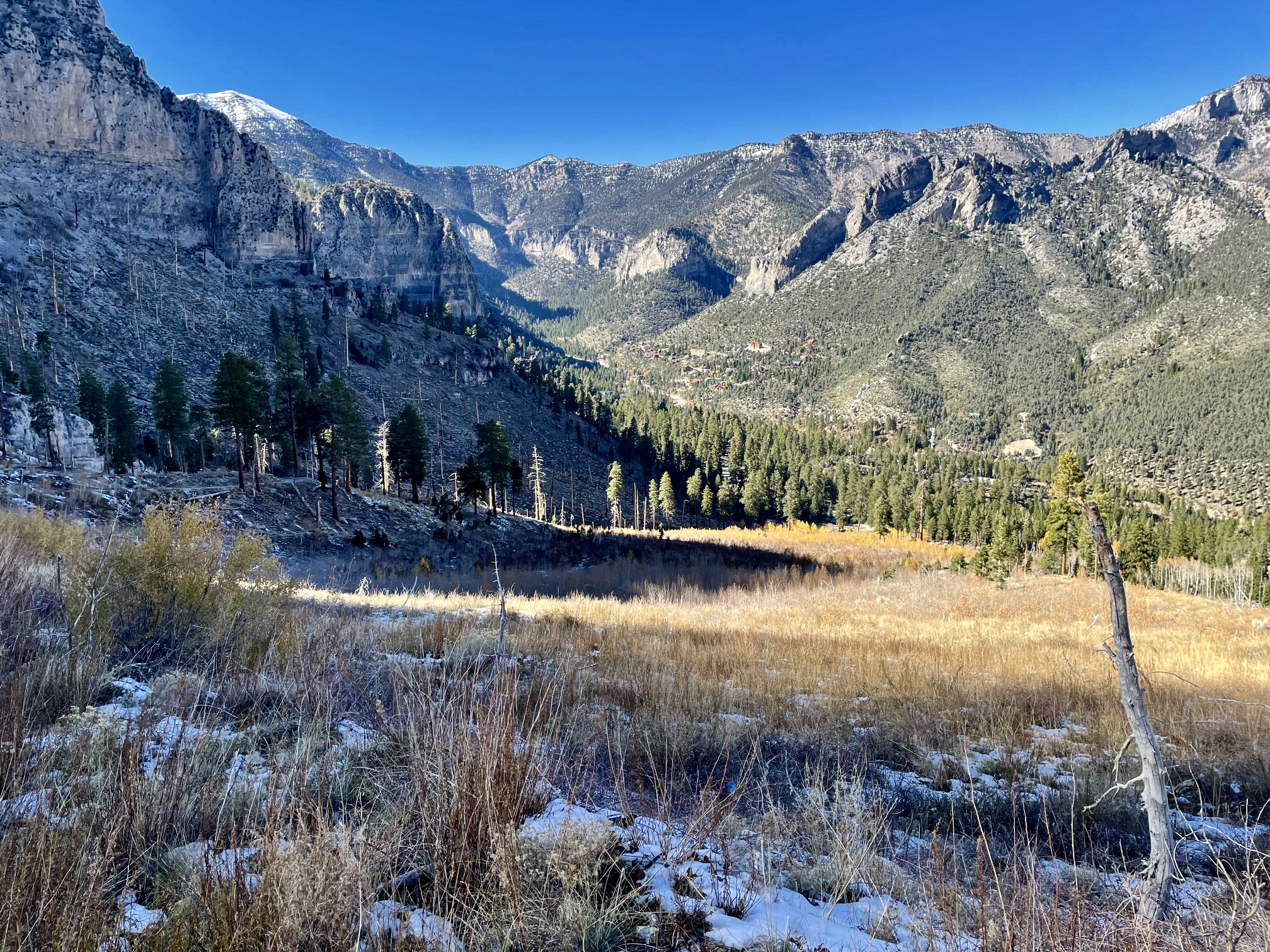
Soon after passing the Mt. Charleston Wilderness boundary, I reached the broad, flat bench of Echo Overlook at 9100 feet (6.2 miles + 200 feet – 3000 feet from summit). This popular location offers a great view of adjacent Griffith Canyon and of the Mt. Charleston Village area far below.
.
Below Echo Overlook, the trail was generally covered by a veneer of snow or ice in shady areas but melted out in sunny areas. Care was needed to avoid a bad slip through here, but I eventually dropped below the snowline and was able to increase my pace. Low-angle sun rays highlighted the picturesque peaks and ridges above.
.
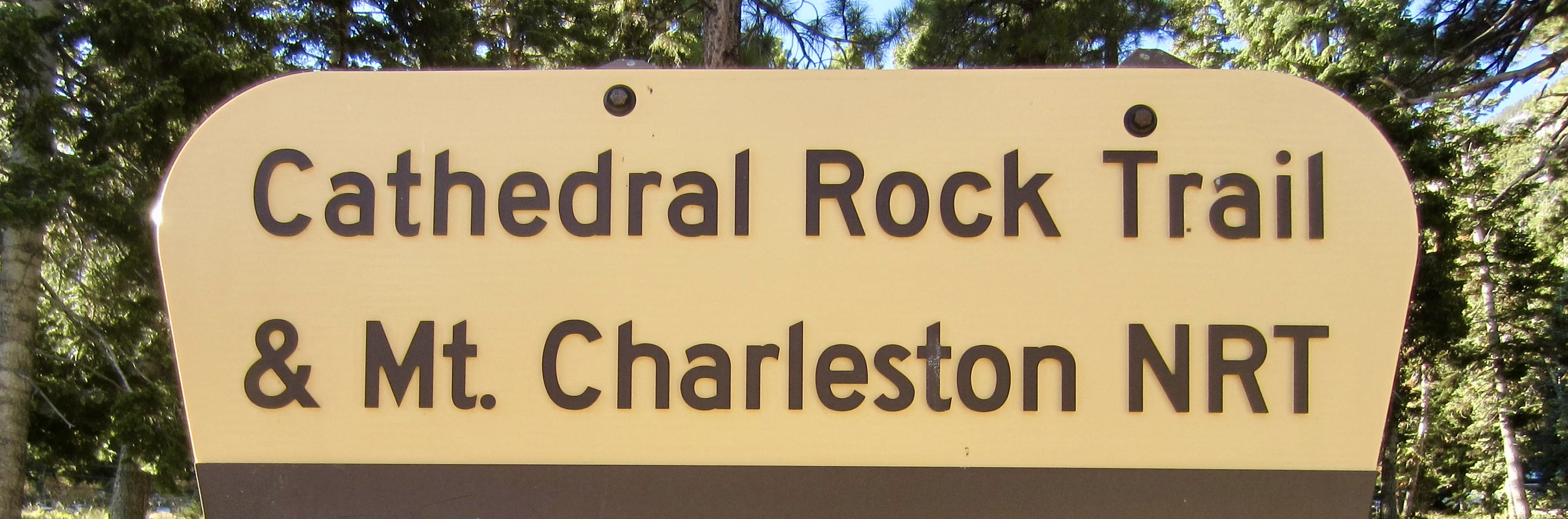
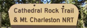
The lower bare trail led me on a northwesterly traverse under Echo Cliff, then it merged with the Cathedral Rock Trail for a short distance before coming to the Cathedral Rock / South Loop Trailhead (8.3 miles + 250 feet – 4600 feet from summit). At 5:30pm, I stepped onto the mostly empty parking lot, where Eileen was waiting to pick me up.
This fabulous desert-alpine trail traverse ended our Mt. Charleston vacation. The unseasonable snowstorm and accompanying cold weather had initially caused us a lot of dismay and altered our plans, but it also added a healthy dose of adventurous spice to the entire week!
Route Maps & Profiles
…
…
…
…
Photo Gallery
Click to enlarge…