Trip Date: May 23-24, 2025
Abernathy Peak Climbing Trip
Scatter Creek Basin
Scatter Lake
Abernathy Peak (8321 ft)
Trip Report Summary
Region: Northeastern Washington Cascades
Sub-Region: Mazama Mountains
Area: Lake Chelan – Sawtooth Wilderness
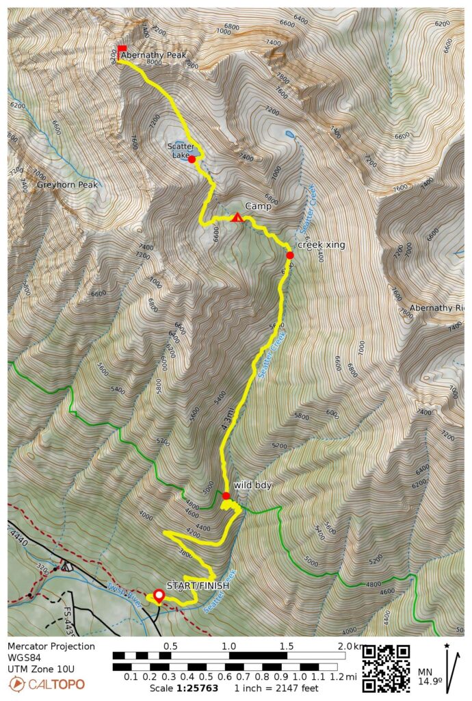
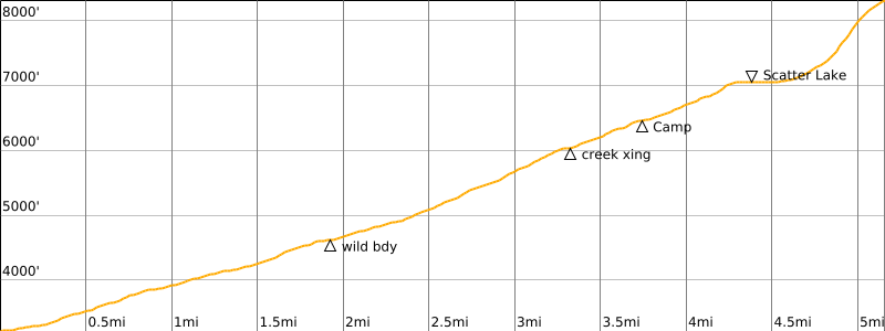
Starting & Ending Point: Scatter Lake Trailhead on Twisp River Road (Elev. 3200 feet)
Way Points: Wilderness boundary & Scatter Creek crossing & Scatter Creek Basin & Scatter Lake (trail hike & snow hike)
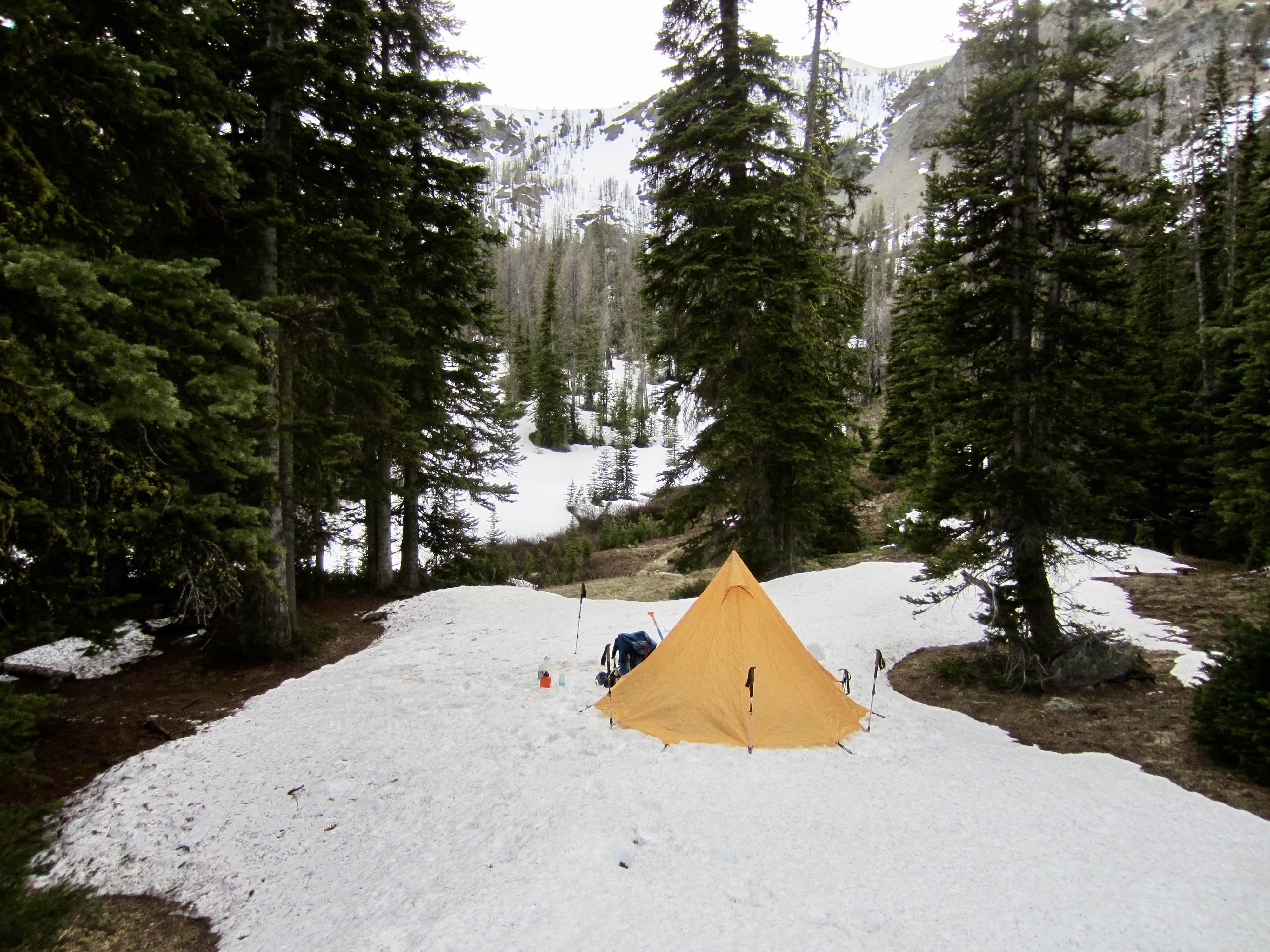
Campsite: Scatter Creek Basin (Elev. 6450 feet)
Summit: Abernathy Peak (snow climb via Southeast Chute—Upper Southeast Slope)
Approximate Stats: 10.3 miles traveled; 5200 feet gained & lost.
Related Posts
>>> Abernathy Peak via Scatter Lake—Southeast Slope – October 2012
>>> Greyhorn Peak via Scatter Creek Basin—Southeast Face – June 2019
Full Trip Report
Eileen, Lisa, Kevin, and I were looking for a good two-day climbing trip to kick off Memorial Day weekend, and Abernathy Peak fit the bill nicely. Lisa and I had each previously climbed the peak during the autumn season, but it would be a new summit for Eileen and Kevin.
Day 1: Trailhead to Scatter Creek Basin
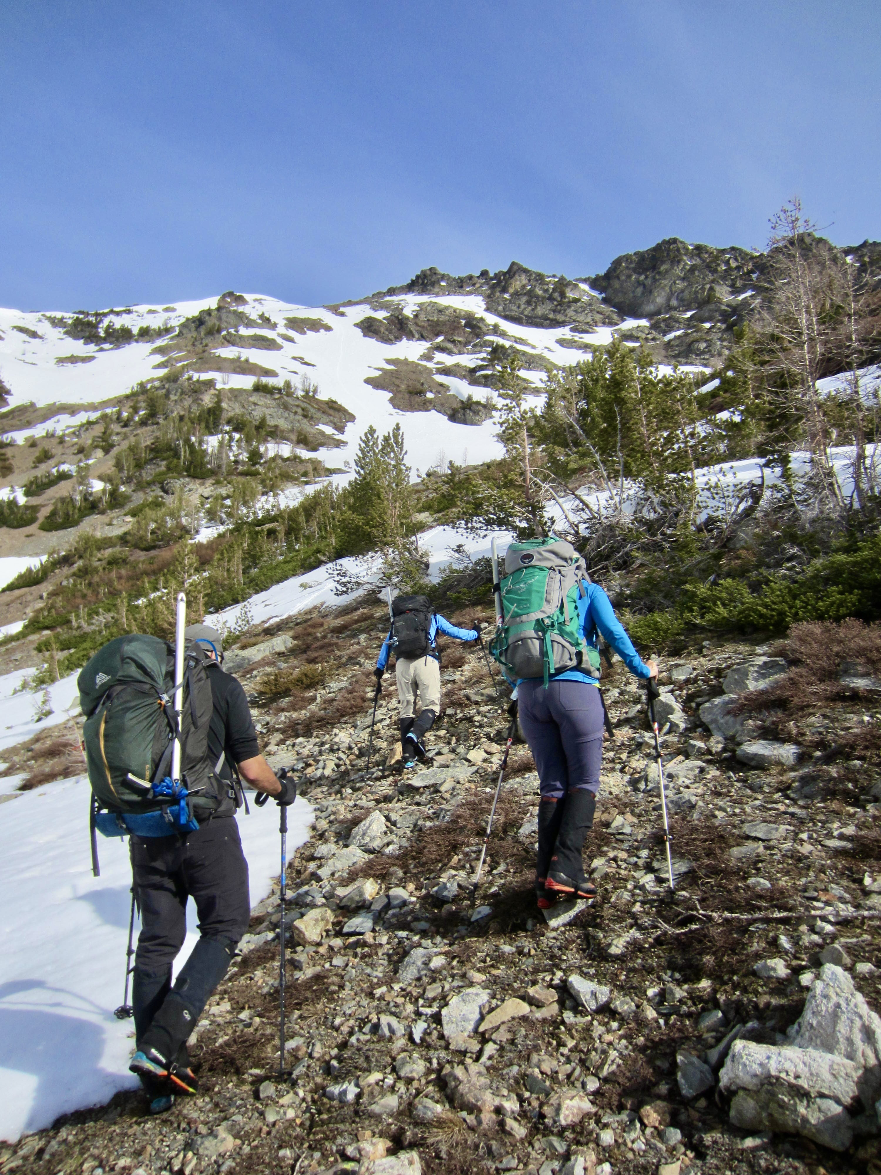
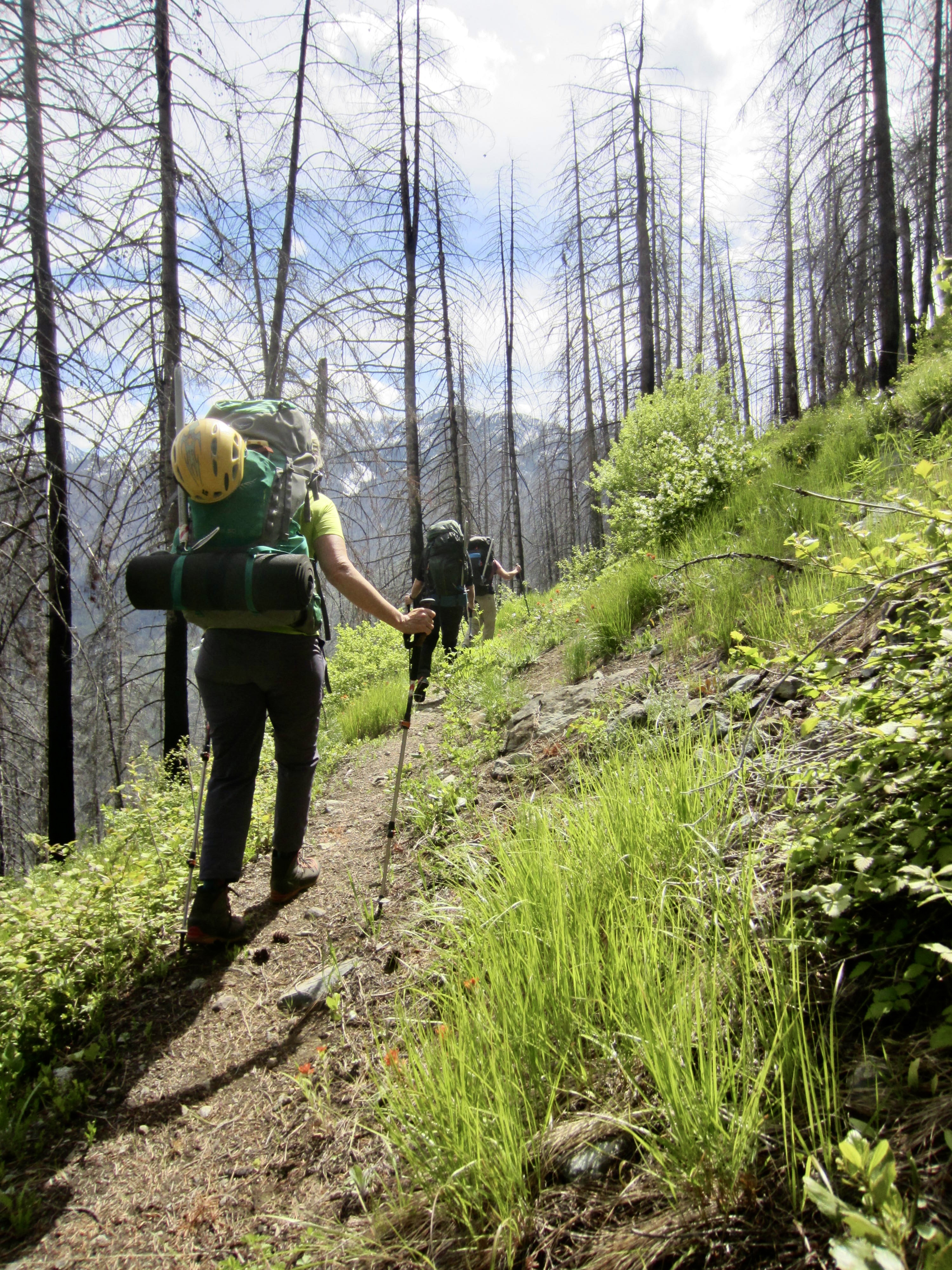
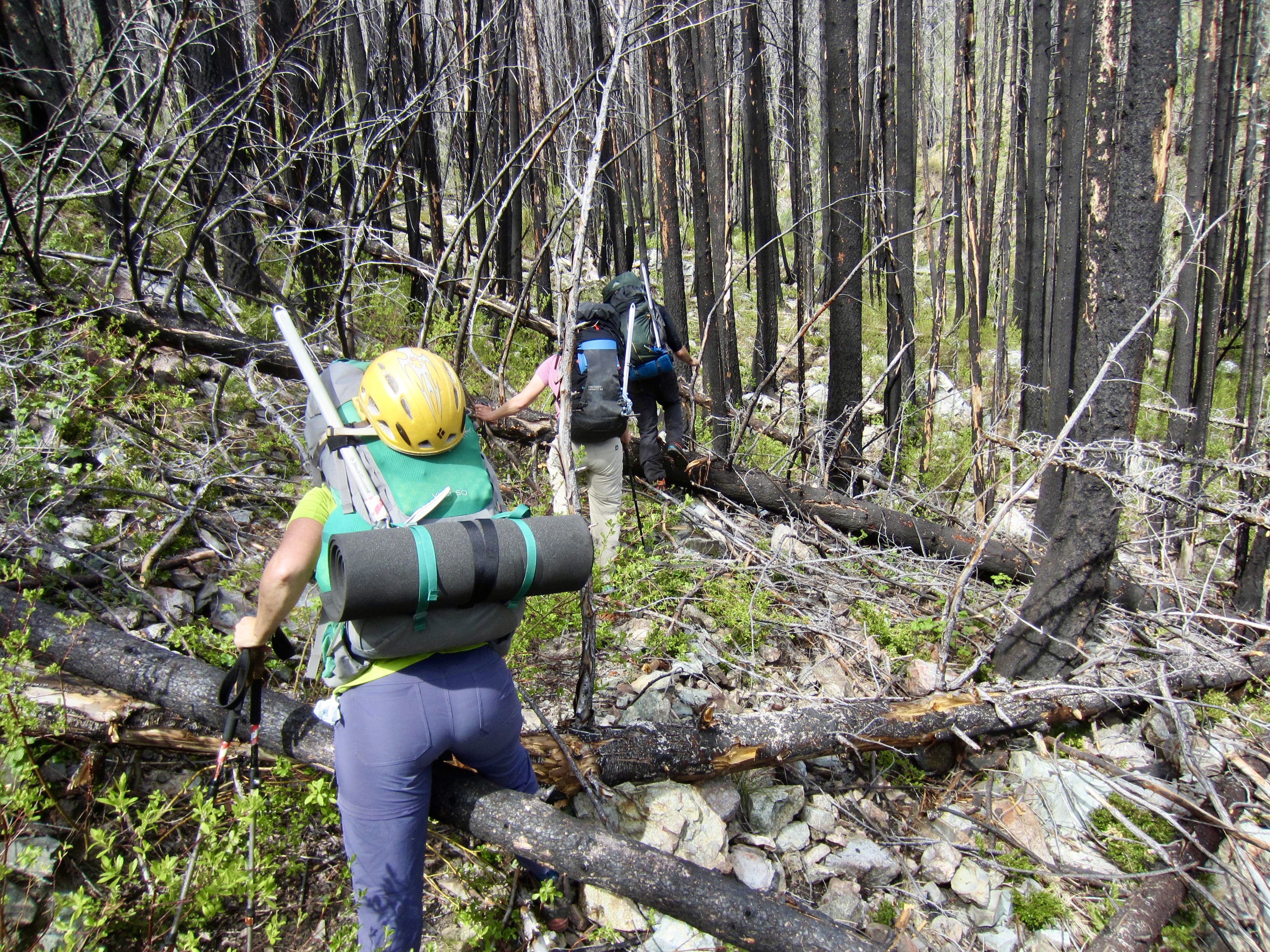
We left the Scatter Lake Trailhead on a partly cloudy Friday afternoon and began hiking up the steep hillslope. This entire area was burned by the Crescent Mountain Fire in 2018, leaving only charred trees and low bushes now. Thankfully, the first 2 miles of trail up to the wilderness boundary were recently logged out and brushed back. Beyond the boundary, we were faced with a mile of brushy trail littered with blackened logs.
.
Shortly before crossing Scatter Creek, the trail entered a band of green forest and was in much better condition. We strode into Scatter Creek Basin in late afternoon and stopped at an established campsite (4.2 hours + 3250 feet from TH). Large patches of snow still covered most of the ground here, but we were happy to have a bare kitchen.

.
Day 2 (AM): Abernathy Peak Summit Climb
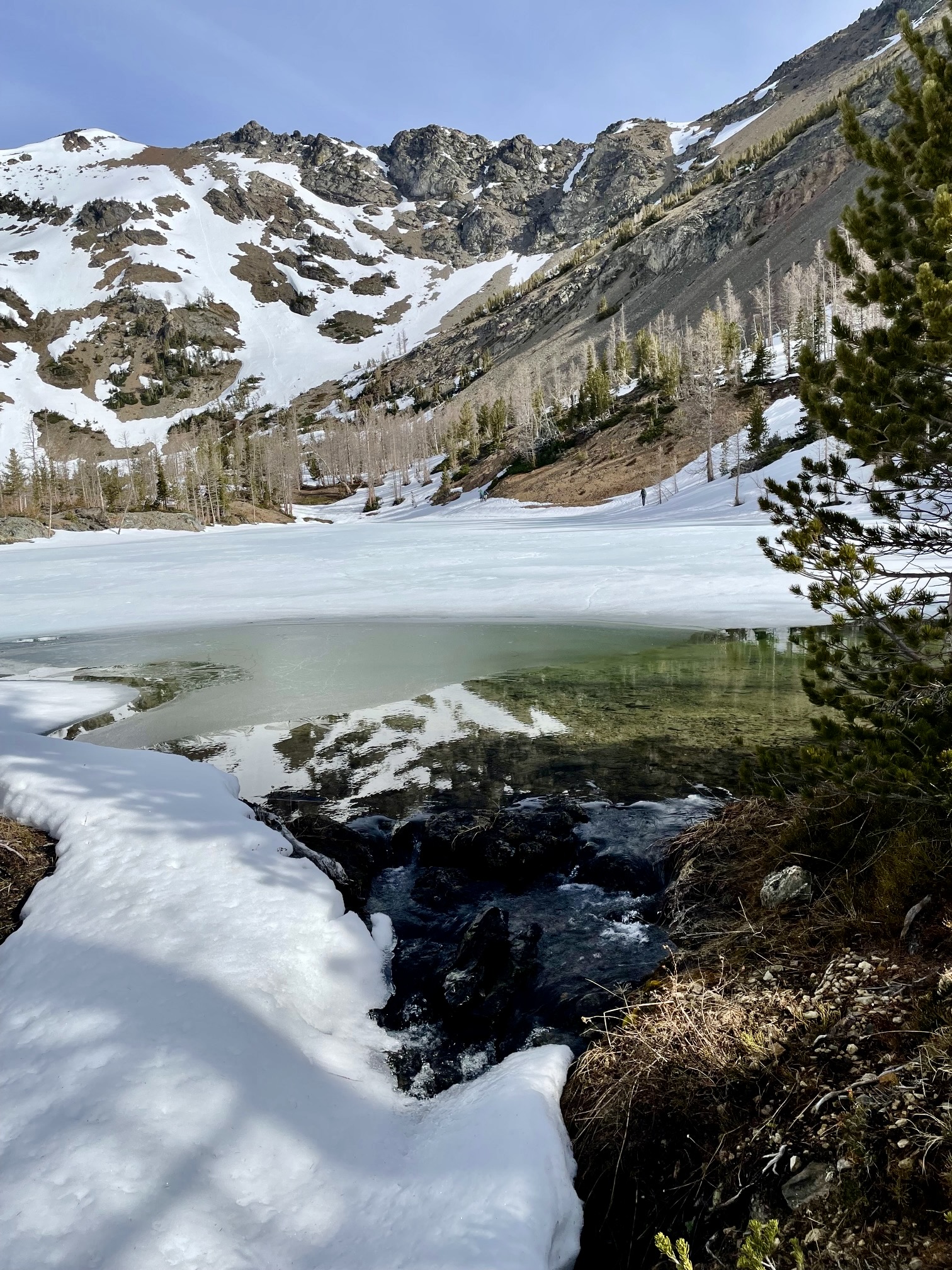
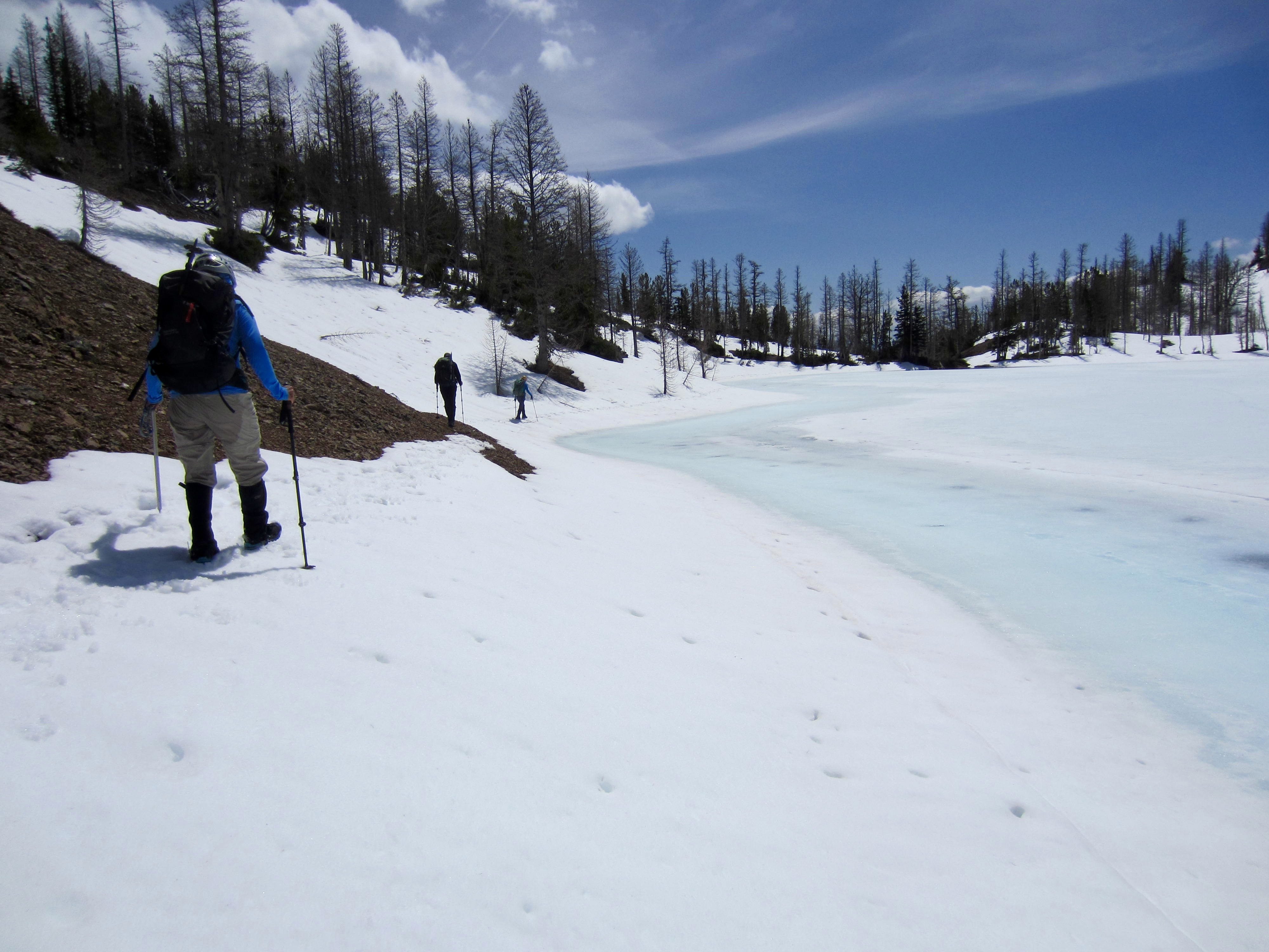
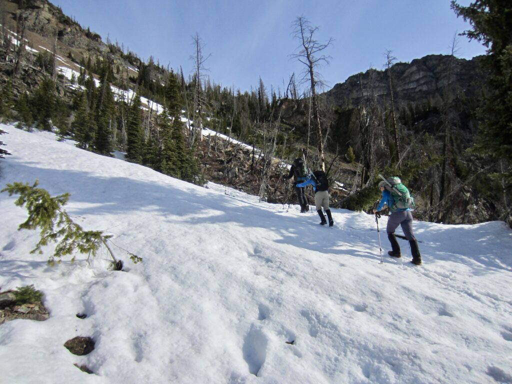
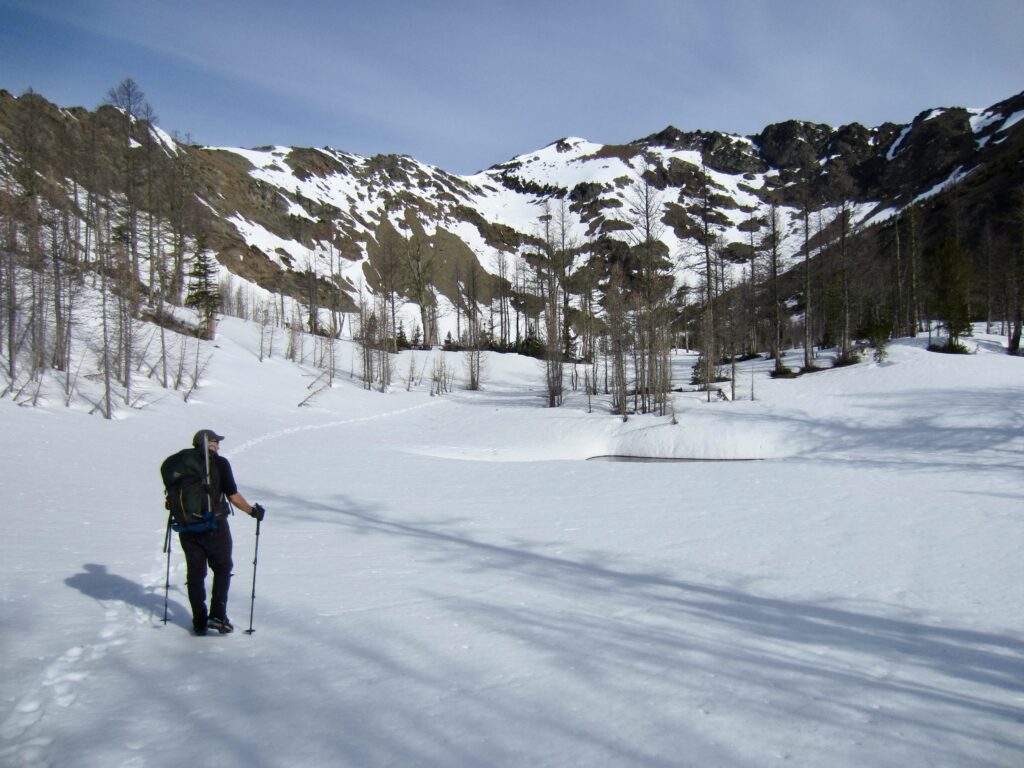
After a cold, clear night, we awoke to find a rock-hard crust on the snow. We loaded summit packs and continued up the trail, which was approximately half bare and half snow-covered. The trail disappeared for good under continuous snow at still-frozen Scatter Lake (0.8 hours + 600 feet from camp).
.
.
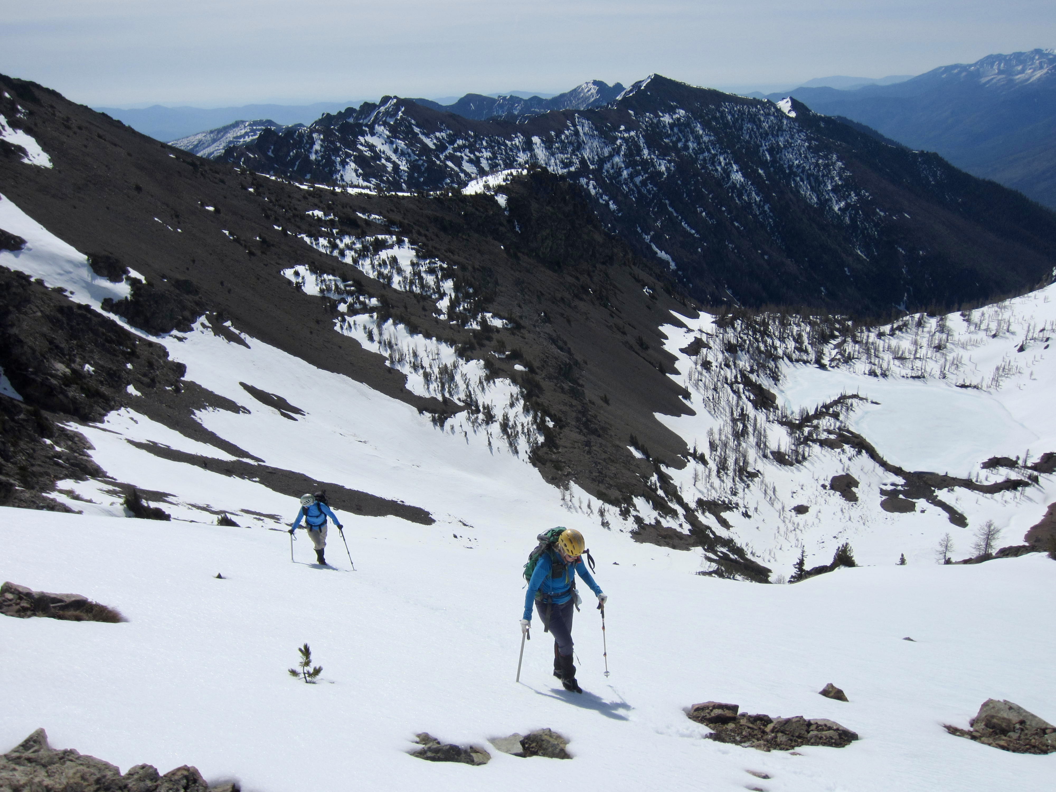
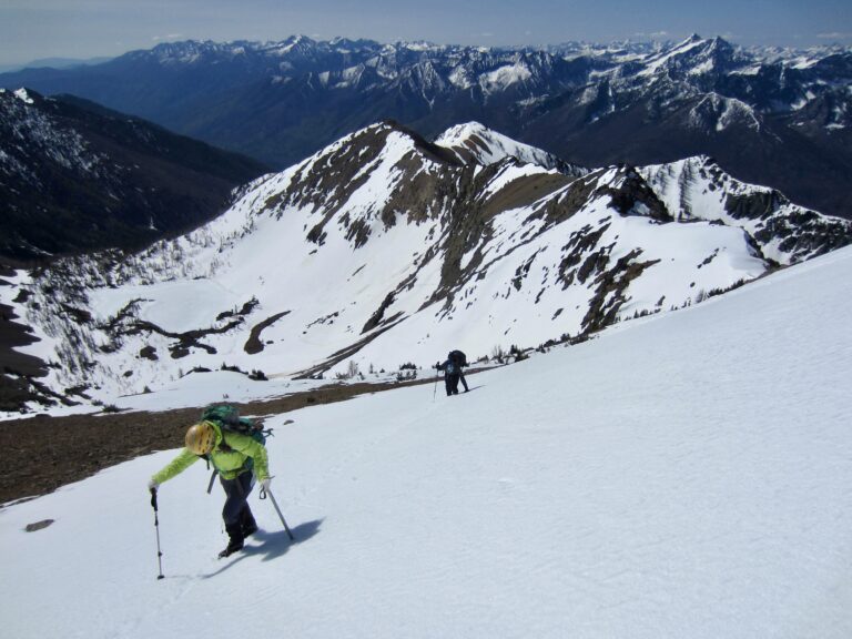
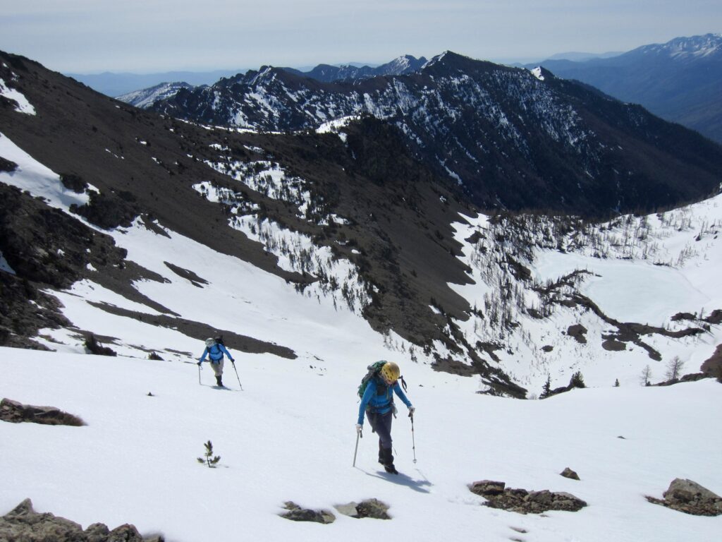
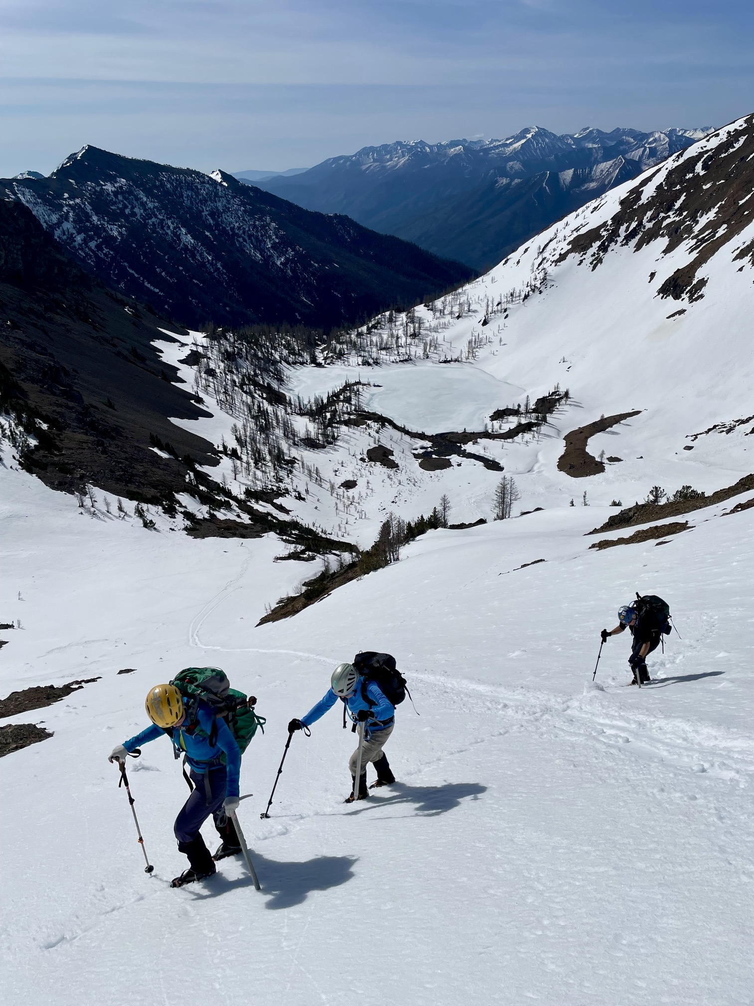
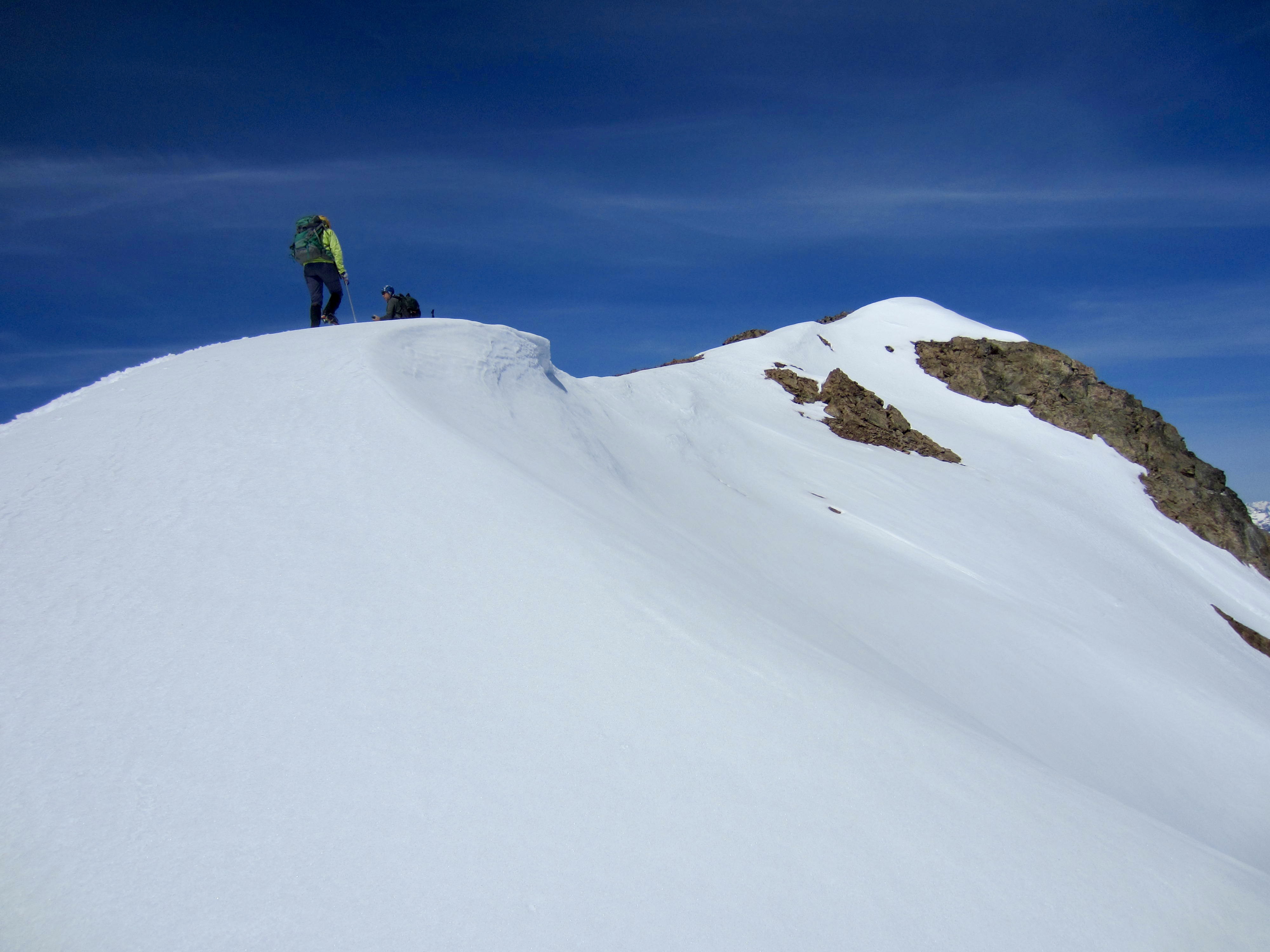
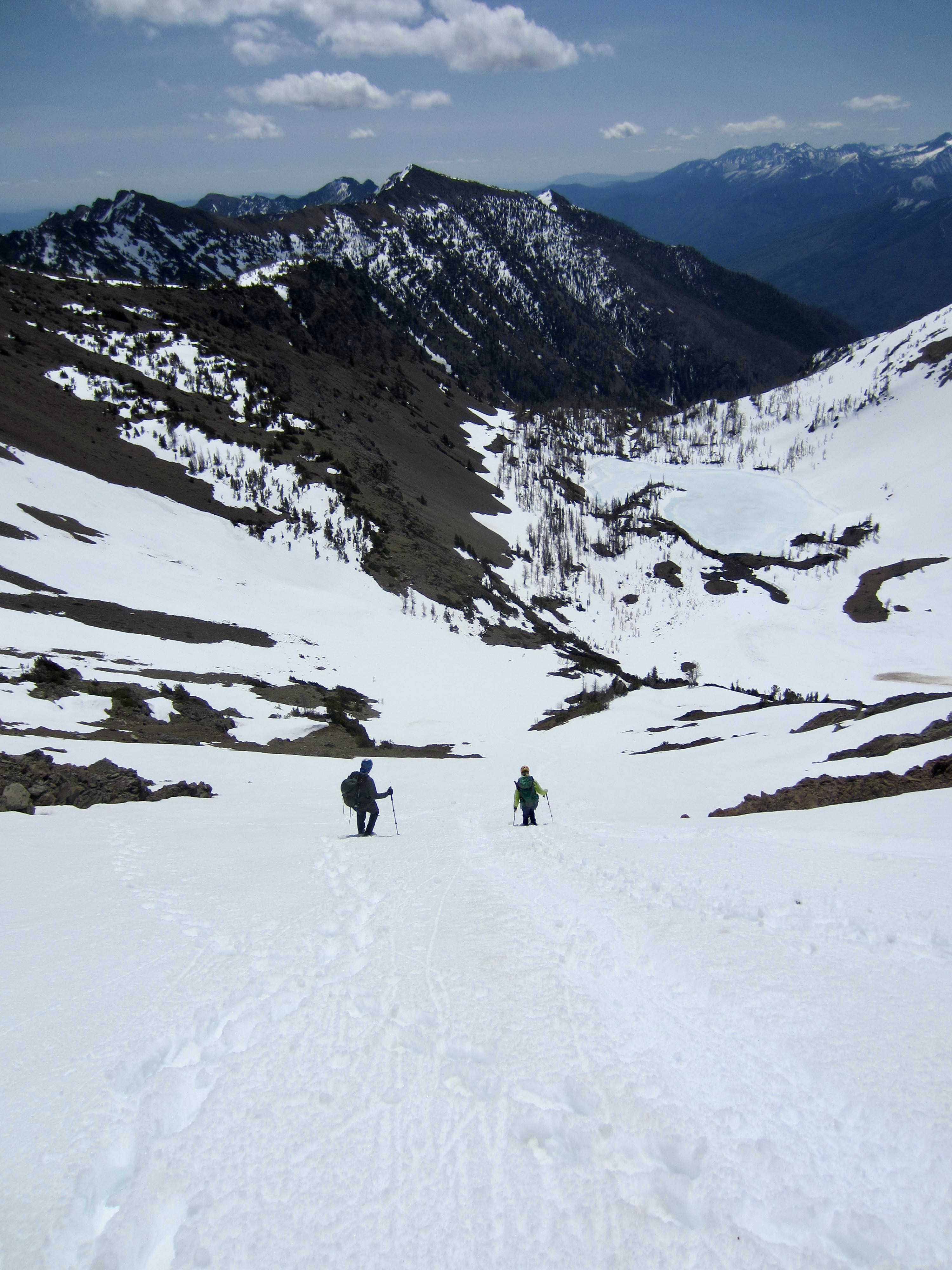
From Scatter Lake, Abernathy Peak rises up directly to the northwest. We scoped out a route around the right-hand shore and up a broad snow chute leading to the mountain’s upper southeast slope.

.
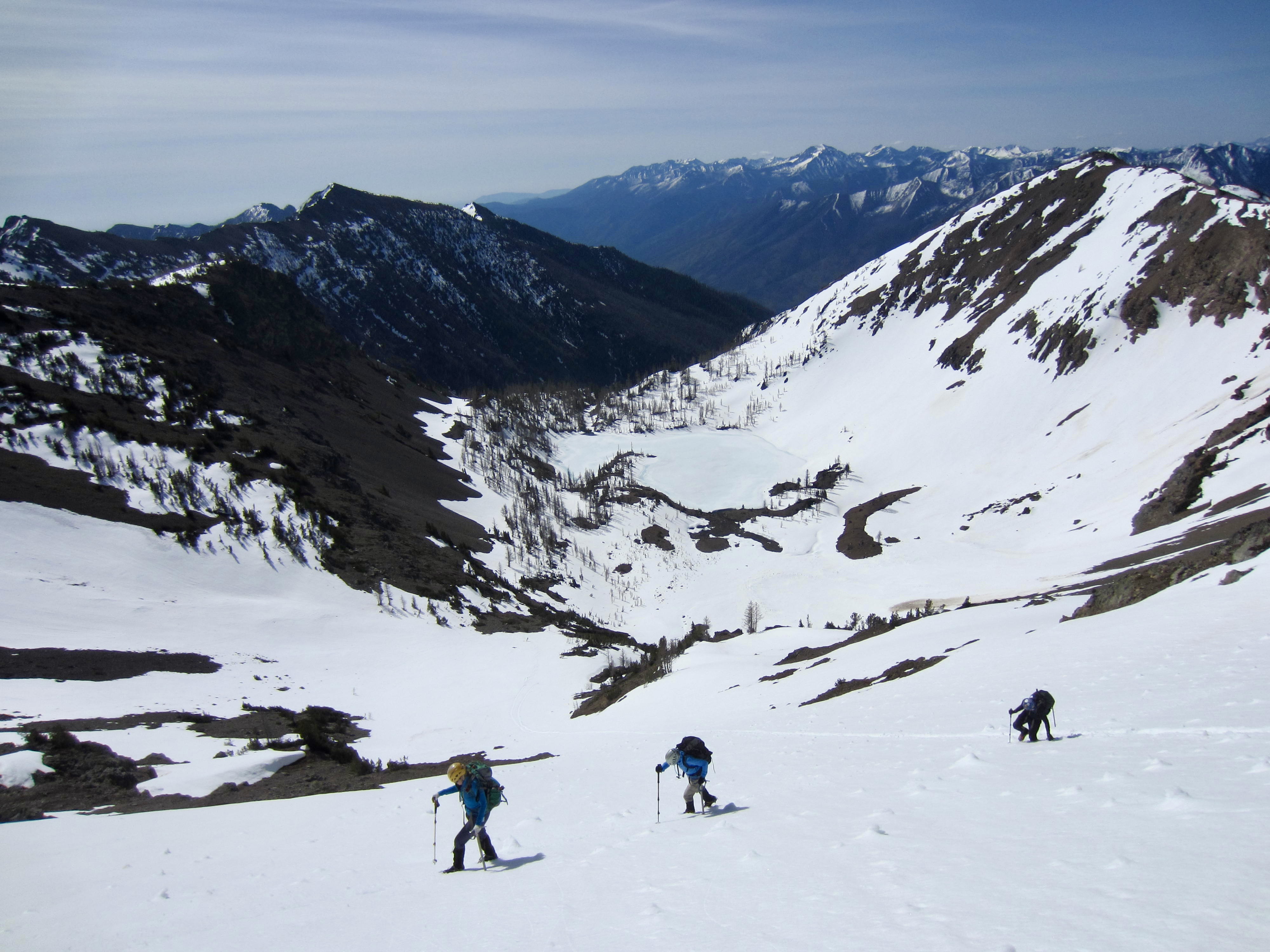
At the base of the broad chute, we donned crampons and began climbing. Our route closely followed the tracks of a party that had summited yesterday. The firm crust provided good cramponing conditions—except where we broke through and plunged down to mid-thigh!

.
.
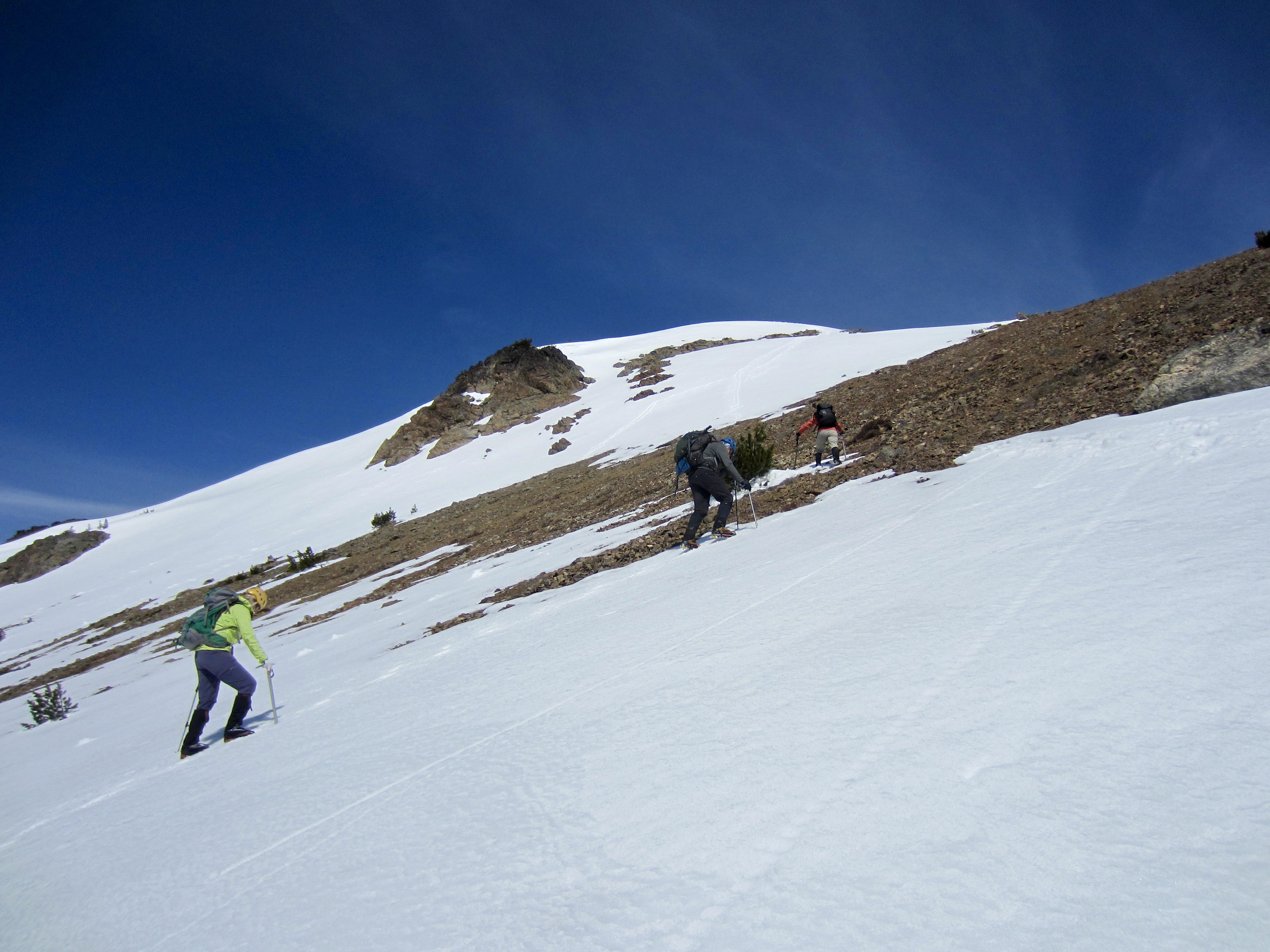
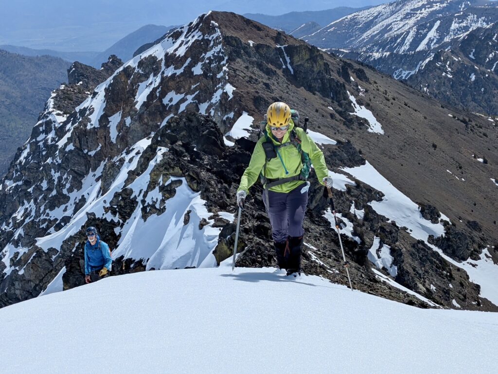
Our snow chute opened onto the upper snowfield, which eased back to a more moderate angle. The true summit soon came into view just beyond a little false summit.
.
.
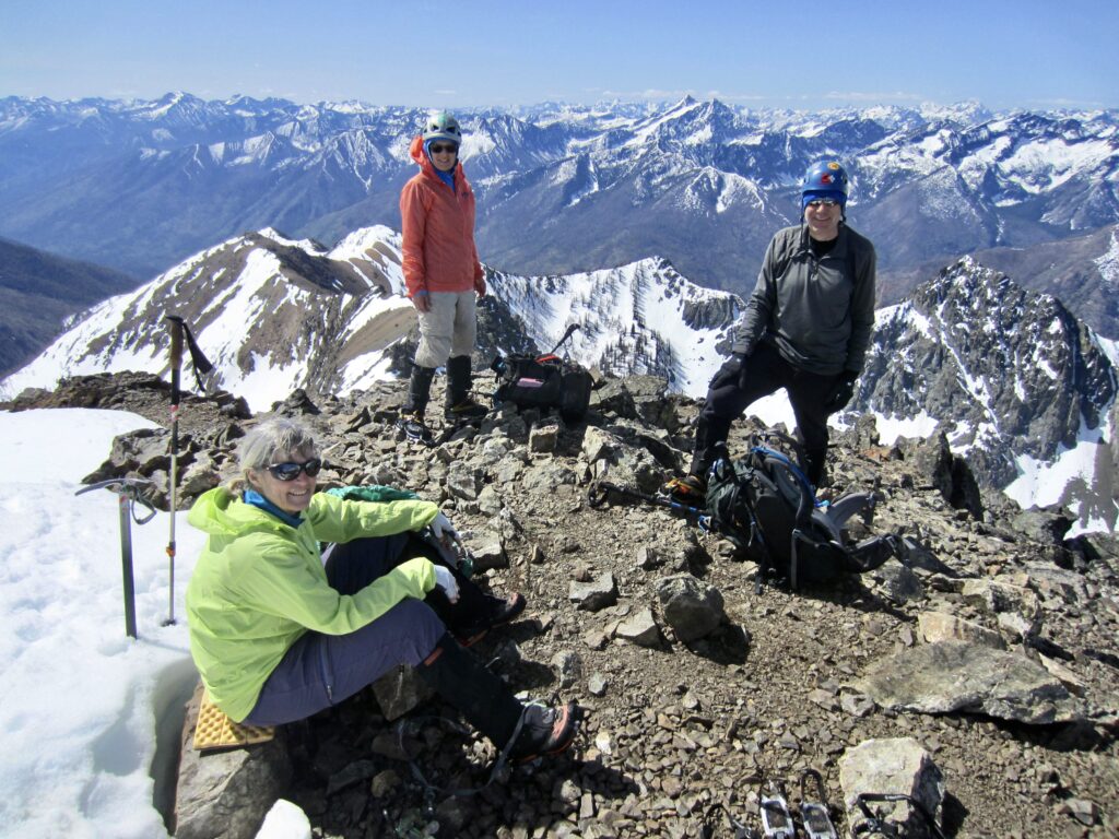
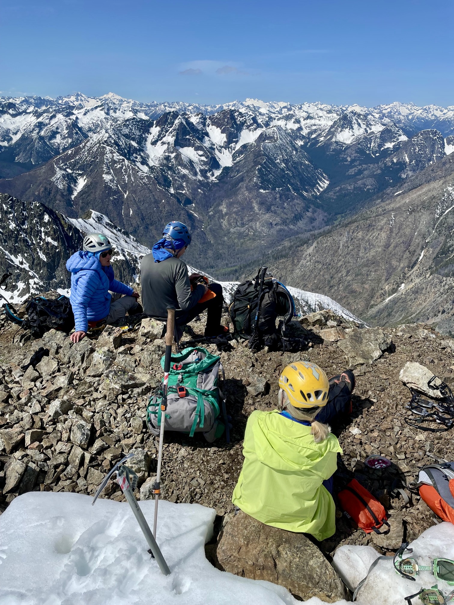
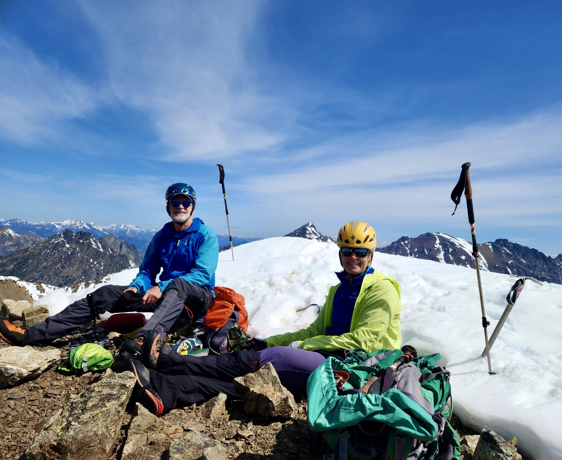
We topped out in late morning (3.1 hours + 1850 feet from camp) and enjoyed calm conditions with our summit snacks. Lisa spotted a register tube in some nearby rocks, but we neglected to sign in. Undoubtedly, this fine summit gets a lot of visitors every year.
.
.
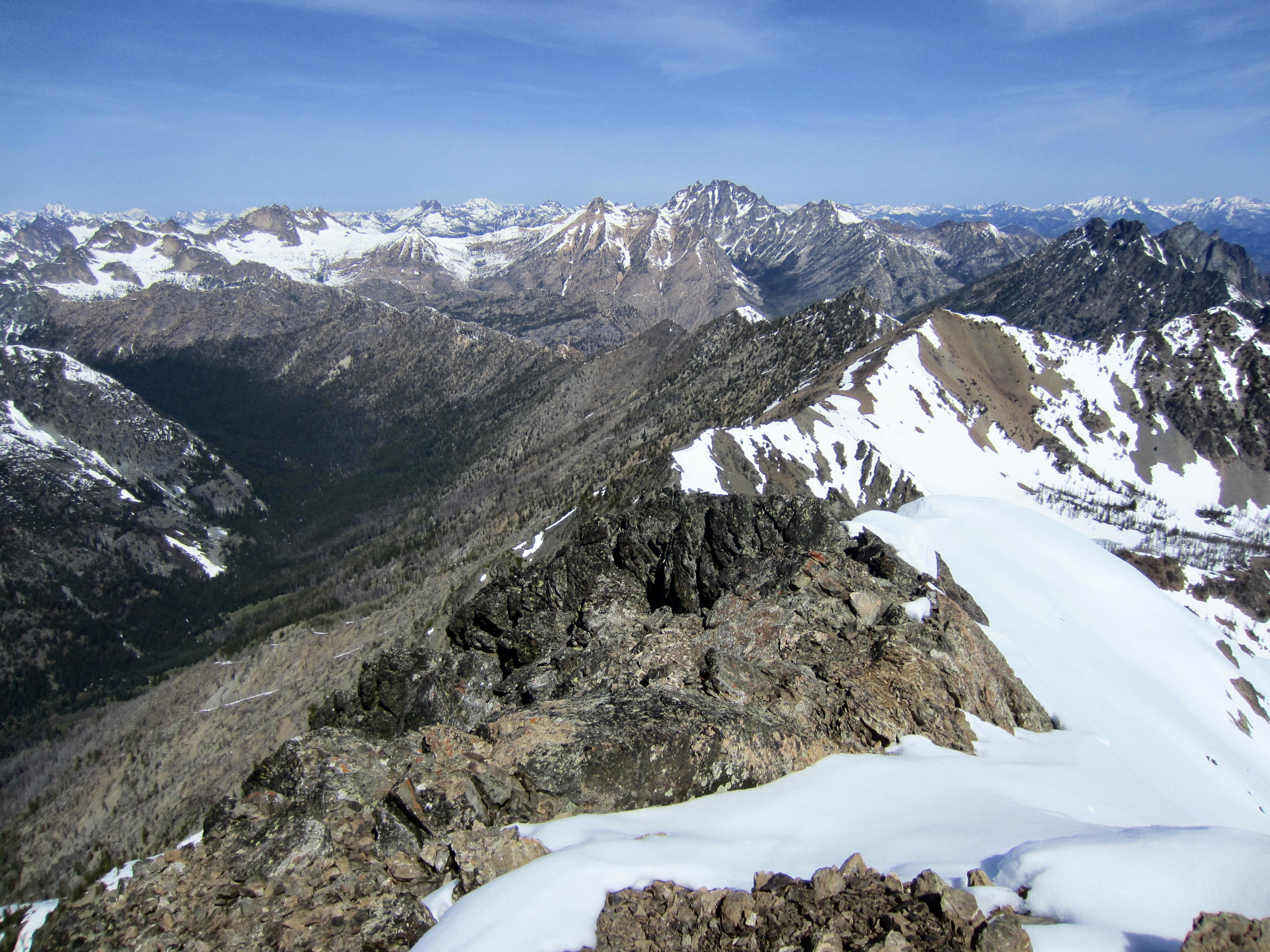
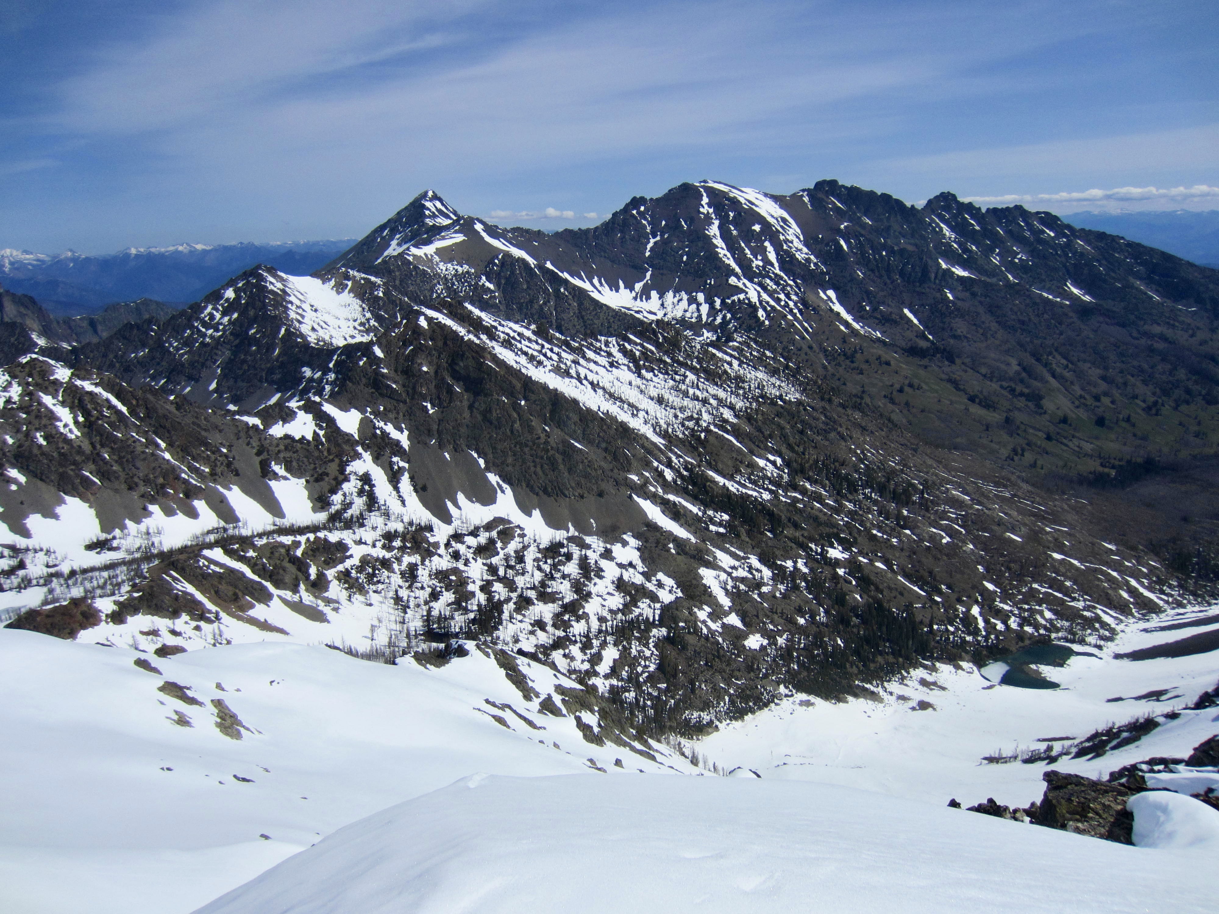
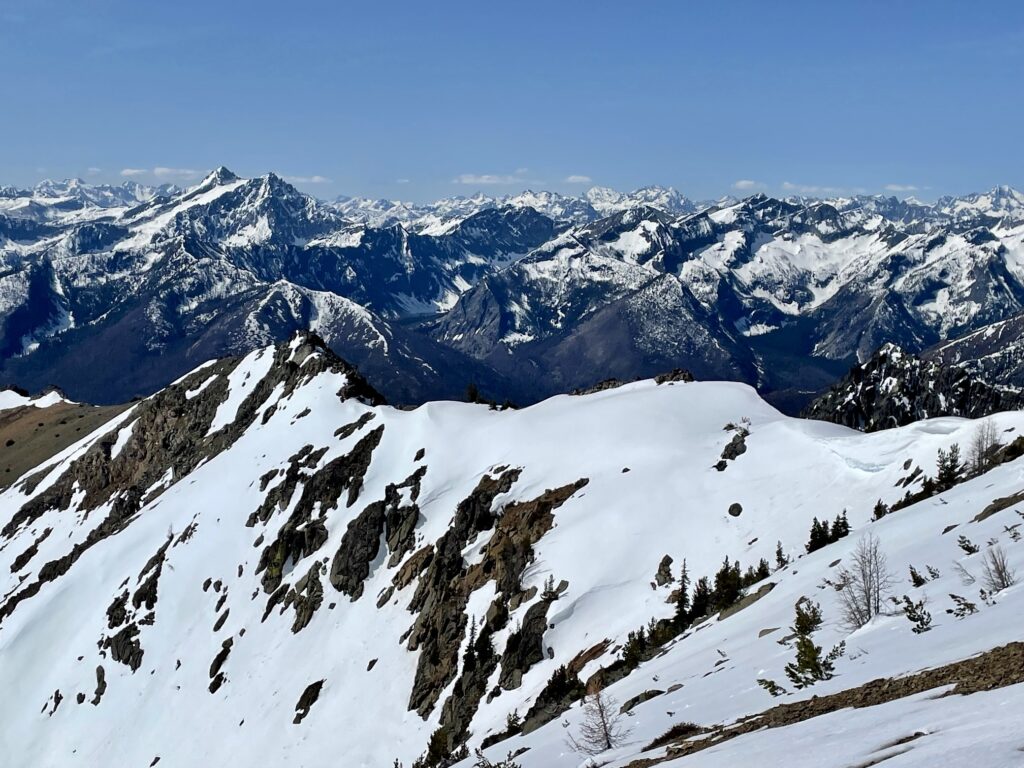
Abernathy Peak offers excellent views of the northeastern Cascades. Most dominant are Reynolds Peak to the south, Silver Star Mountain to the northwest, and the Gardner Mountains to the northeast.
.

.

.
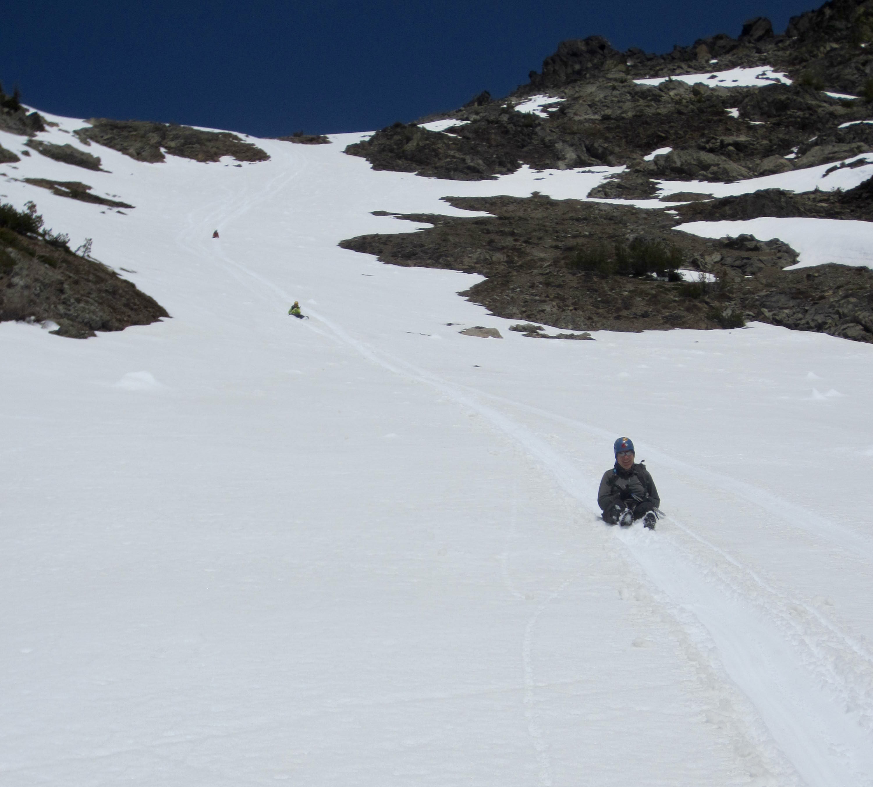
Our descent began slowly, as we booted gingerly down the upper snowfield, trying not to punch through the sun-softened crust. Even still, there were many sudden punch-throughs that threatened our knee ligaments. Once into the snow chute, however, we were able to speedily and safely glissade for the next 500 feet.
.
Following our up-track, we easily skirted around Scatter Lake and arrived back in camp shortly after noon (1.4 hours from summit).

.
Day 2 (PM): Scatter Creek Basin to Trailhead
After breaking camp, we headed down the trail, passing several day-hikers along the way. The area of charred deadfall seemed a little less unpleasant, and soon we were back on the maintained trail segment. This would have gone pretty quickly except for the fact that Eileen’s hip bursitis took the opportunity to flare up. Surprising as it may sound, she finds that walking backwards alleviates some of the pain. As such, she walked backwards down the final mile of trail, while I guided her from behind like a trailing pilot car. One can only imagine the strange looks that we would have received if we’d encountered any other hikers!
Route Map & Profile
…
…
Photo Gallery
Click to enlarge…