Trip Date: February 19, 2026
2026 ARIZONA WINTER VACATION
Chuckwalla–Pyrite Trail Loop & Pyrite Summit Hike
Chuckwalla Wash
Pyrite Saddle
Pyrite Summit (2284 ft)
East Pyrite Ridge
Route Summary
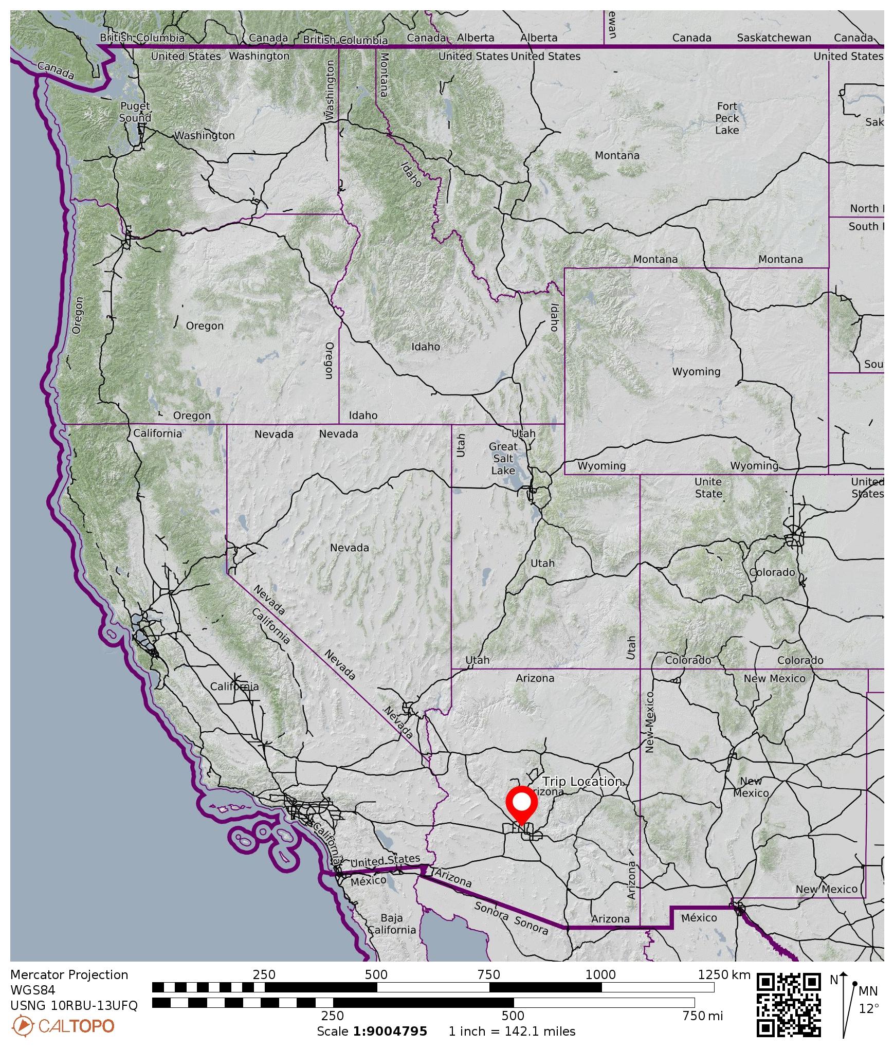
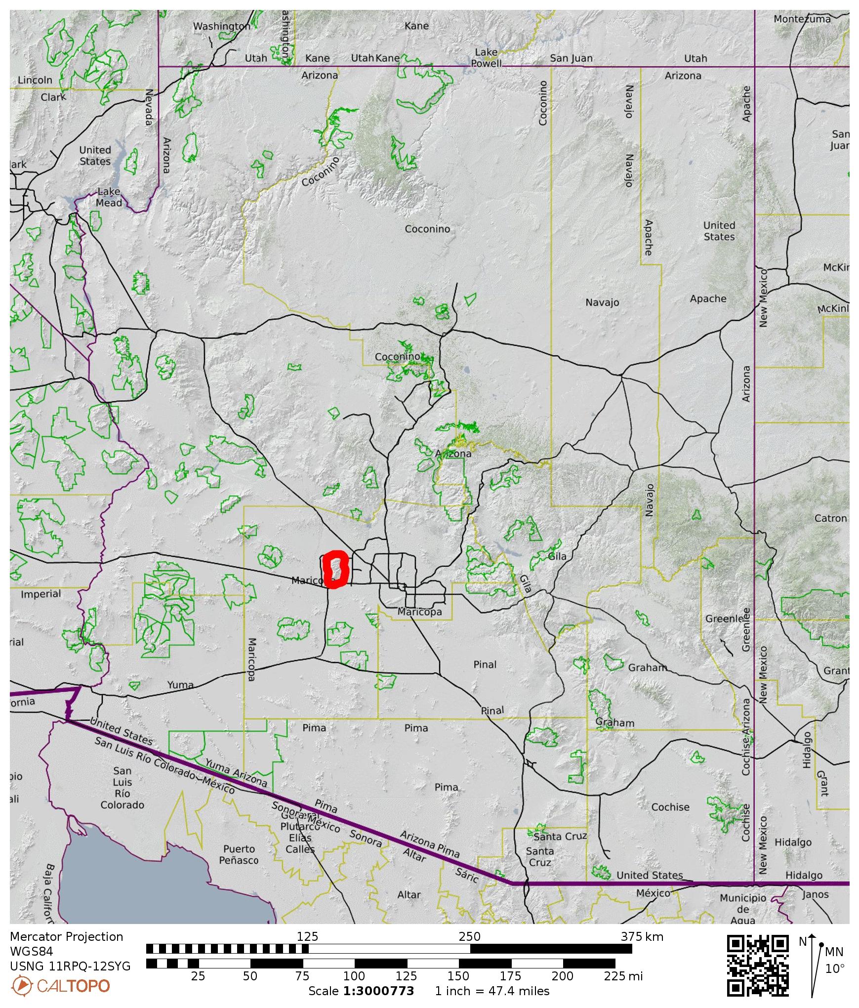
Region: Arizona
Sub-Region: Central Arizona
Sub-Sub-Region: White Tank Mountains
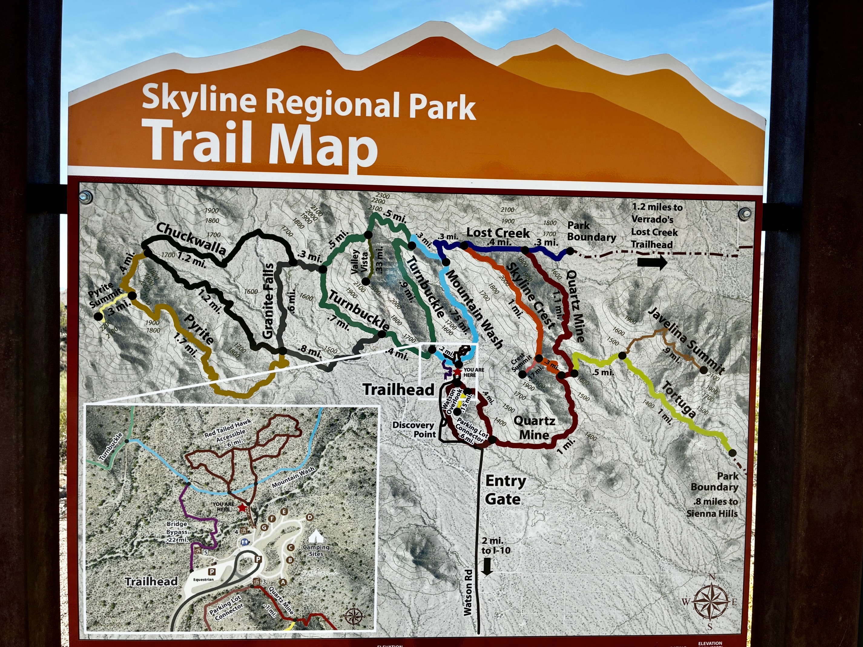
Area: Skyline Regional Park
Starting & Ending Point: Main Trailhead at end of North Watson Road (Elev. 1500 feet)
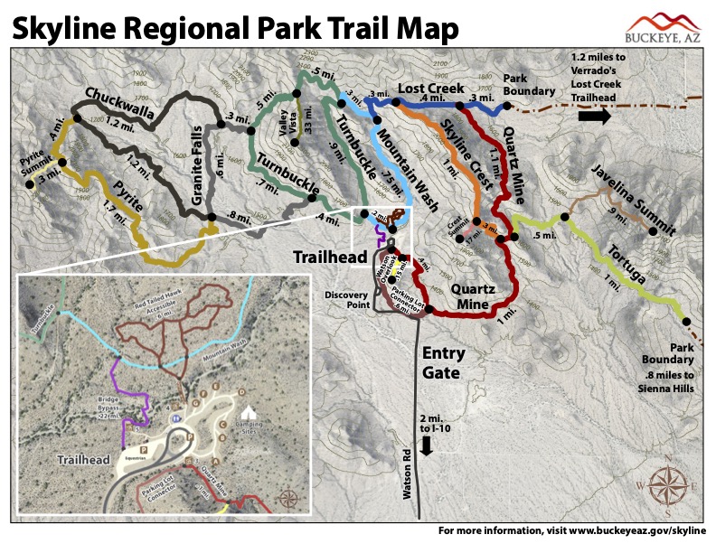
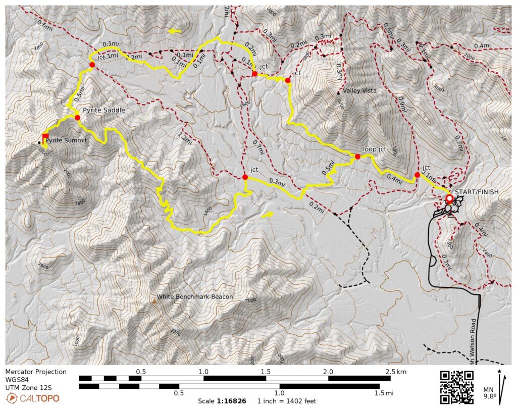
Loop Way Points: Red-Tailed Hawk Trail / Mountain Wash Trail junction & Mountain Wash Trail / Turnbuckle Trail junction & Turnbuckle Trail / Granite Falls Trail lower junction & Turnbuckle Trail / Granite Falls Trail upper junction & Granite Falls Trail / Chuckwalla Trail north junction & Chuckwalla Trail / Pyrite Trail west junction & Pyrite Saddle & Pyrite Trail / Chuckwalla Trail / Granite Falls Trail east junction & Granite Falls Trail / Turnbuckle Trail lower junction & Turnbuckle Trail / Mountain Wash Trail junction & Mountain Wash Trail / Red-Tailed Hawk Trail junction & Main Trailhead (trail hike via Red-Tailed Hawk Trail—Mountain Wash Trail—Turnbuckle Trail—Granite Falls Trail—Chuckwalla Trail—Pyrite Trail—Granite Falls Trail—Turnbuckle Trail— Mountain Wash Trail—Red-Tailed Hawk Trail)
Sidetrip: Pyrite Summit (hike via Pyrite Summit Trail)
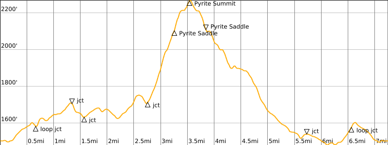
Approximate Stats (including sidetrip): 7.3 miles traveled; 1250 feet gained & lost.
…
Related Post
>>> Turnbuckle – Lost Creek Trail Traverse: Watson Trailhead to Verrado Trailhead – March 11, 2018
Route Overview
The White Tank Mountains, or simply “White Tanks,” are a compact sub-range of arid peaks lying closely west of Phoenix. The highest peak reaches slightly over 4000 feet, and the sub-range itself is named for the presence of large, water-holding depressions within the white granite bedrock. Skyline Regional Park encompasses 13½ square miles in the southern portion of the sub-range. This park features an extensive network of hiking trails that lend themselves to a variety of possible loops and traverses.
.
During my first visit to the park in 2018, I completed a one-way traverse along the Turnbuckle and Lost Creek Trails, beginning at the main (Watson Road) trailhead and ending at the eastern (Verrado) trailhead. My wife facilitated this traverse with a drop-off and pick-up. Upon returning to the area in 2026, I did a very enjoyable loop in the western portion of the park, starting and ending at the main trailhead. This 7.3-mile “lollipop loop” linked together five separate trails—Mountain Wash Trail, Turnbuckle Trail, Chuckwalla Trail, Pyrite Trail, and Granite Falls Trail—and provided easy access to a great viewpoint known as Pyrite Summit
Full Route Description
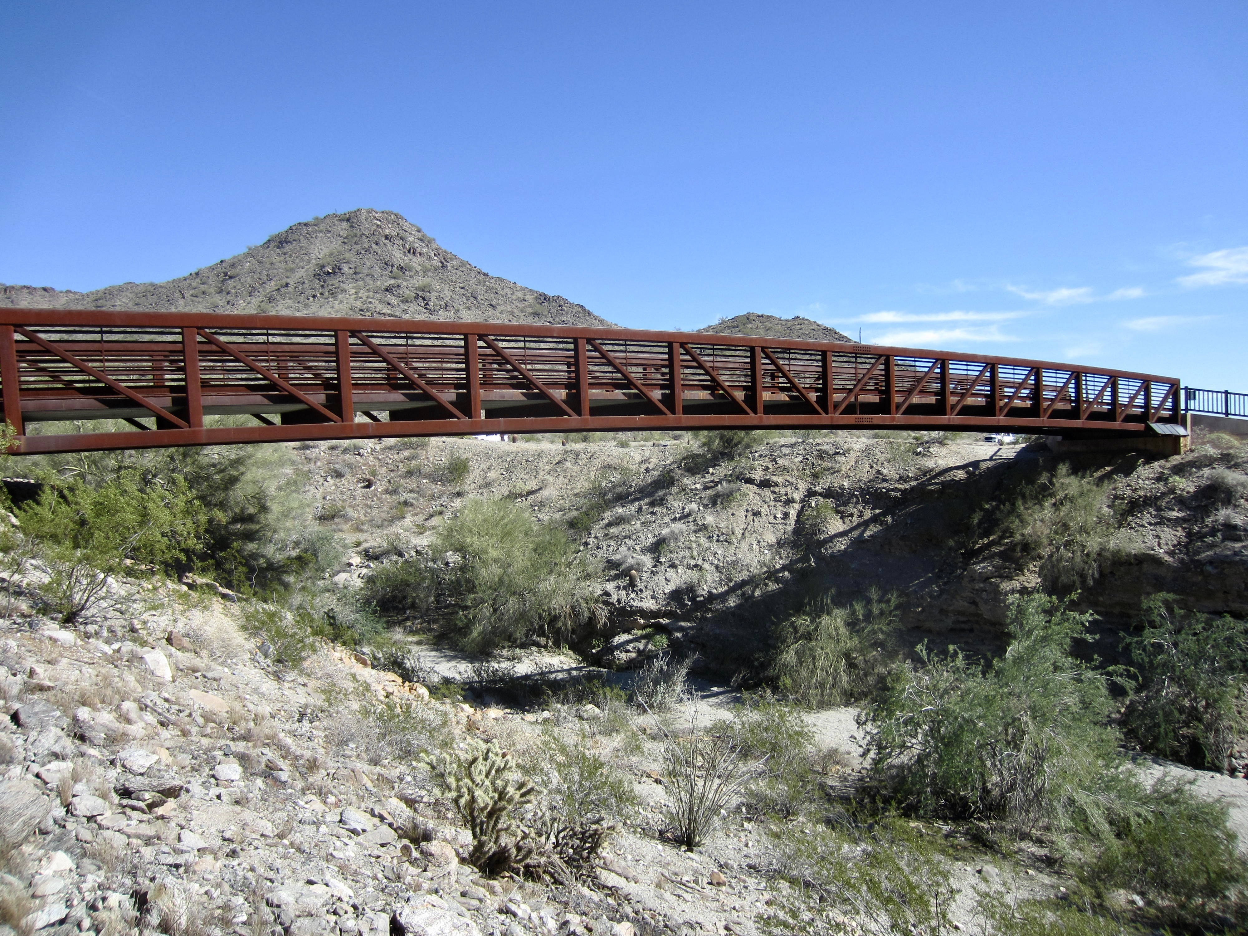
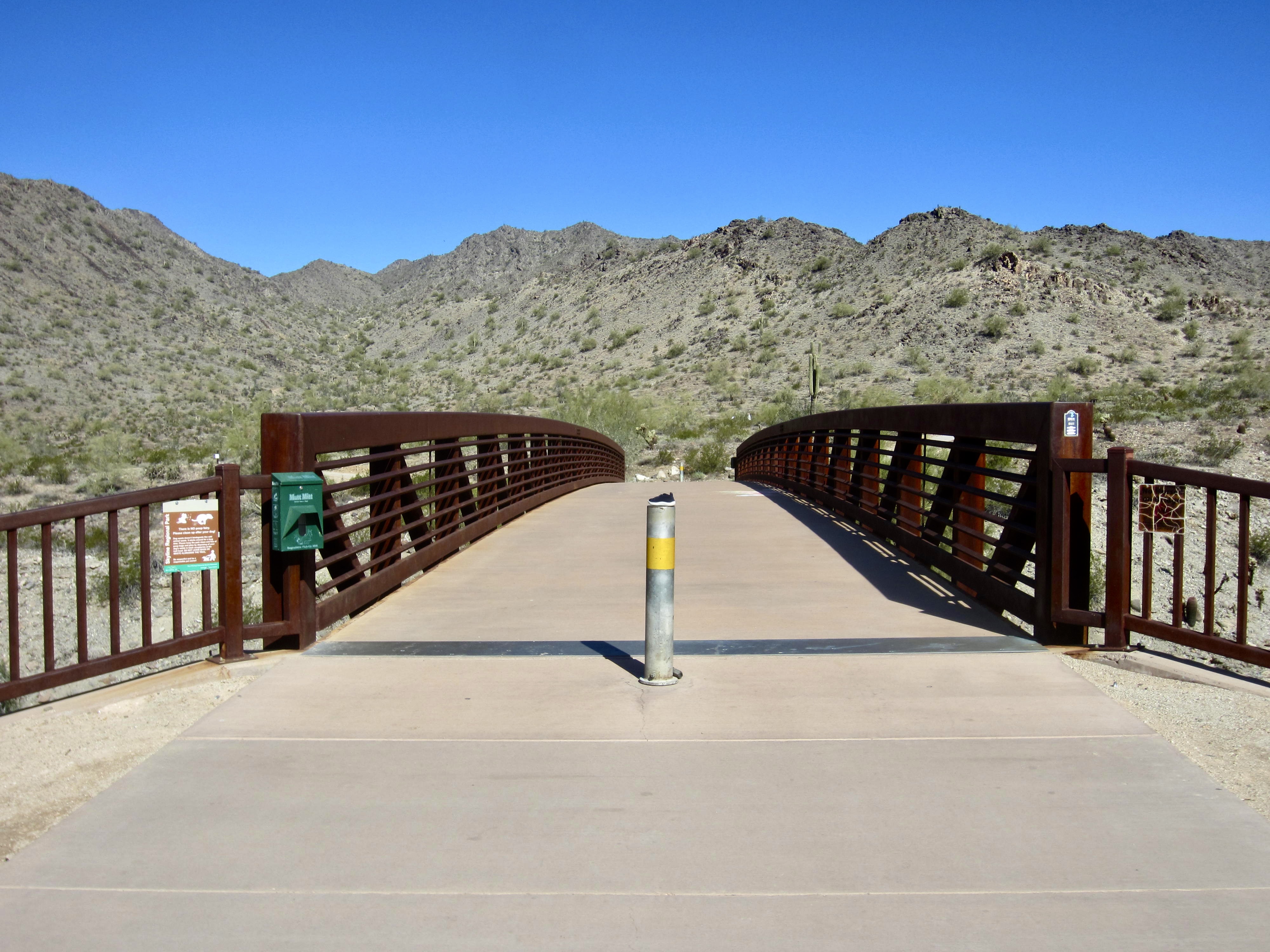
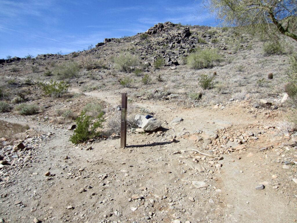
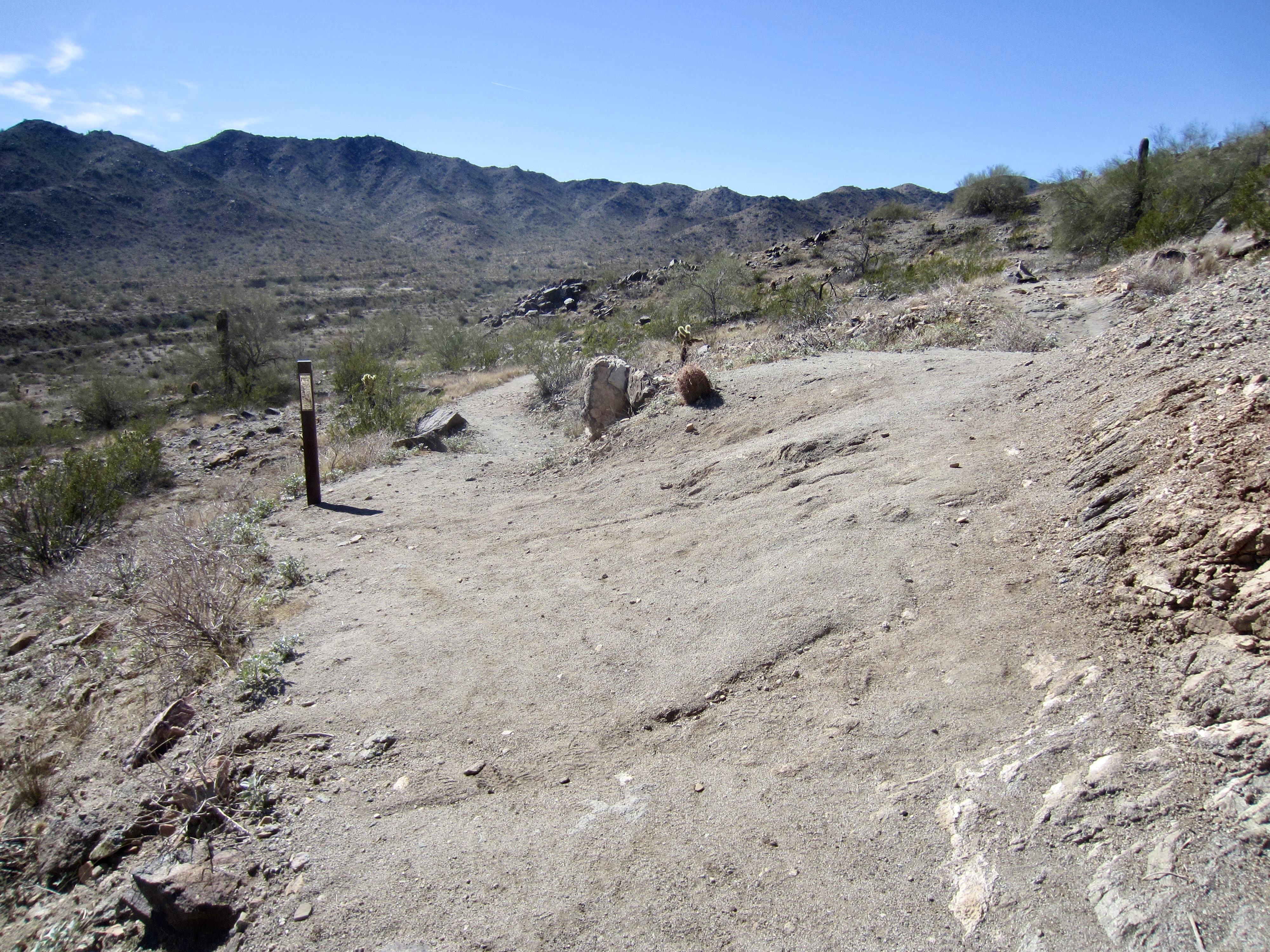
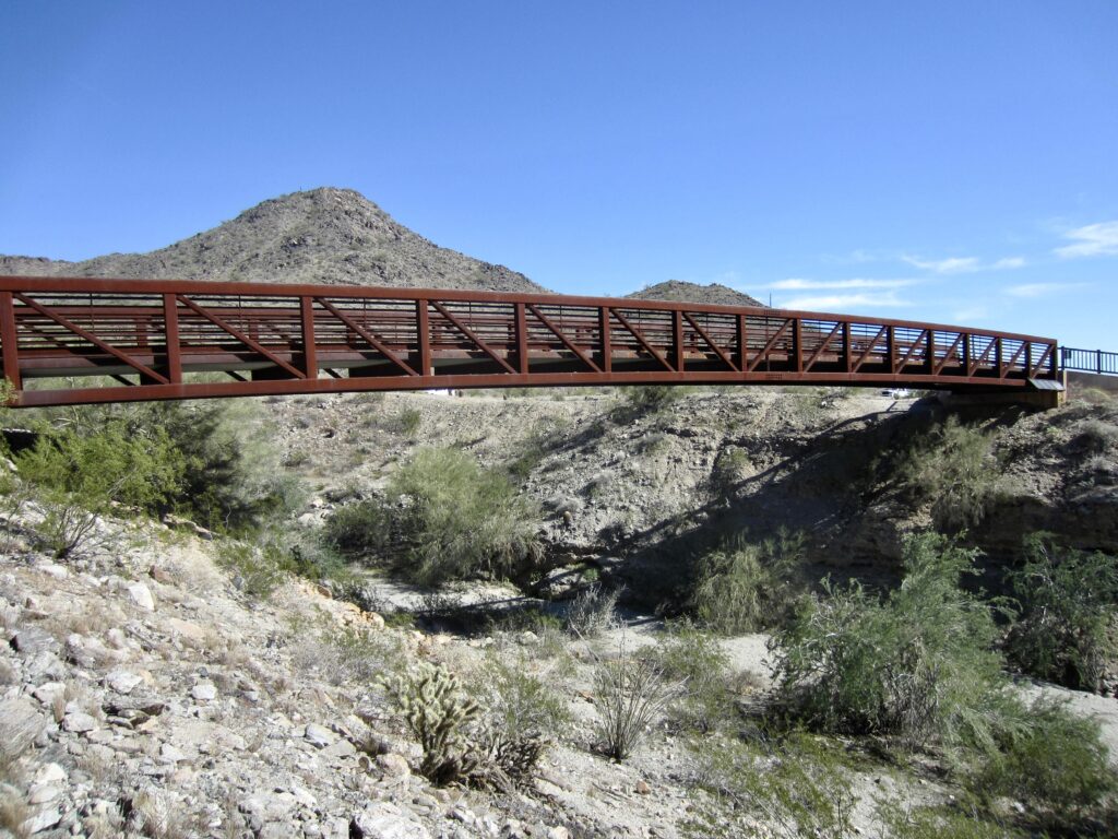
The start of the Chuckwalla–Pyrite Loop can be confusing to first-time visitors, so I am supplying some extra detail here. From the main parking lot and trailhead area, walk across the impressive pedestrian bridge and past a trail map kiosk. You will find yourself on the hard-surfaced, all-access Red-Tailed Hawk Trail, which initially angles to the left and then quickly turns to the right at a poorly marked junction. Veer to the left at this junction, onto the soft-surfaced Mountain Wash Trail.
.

.
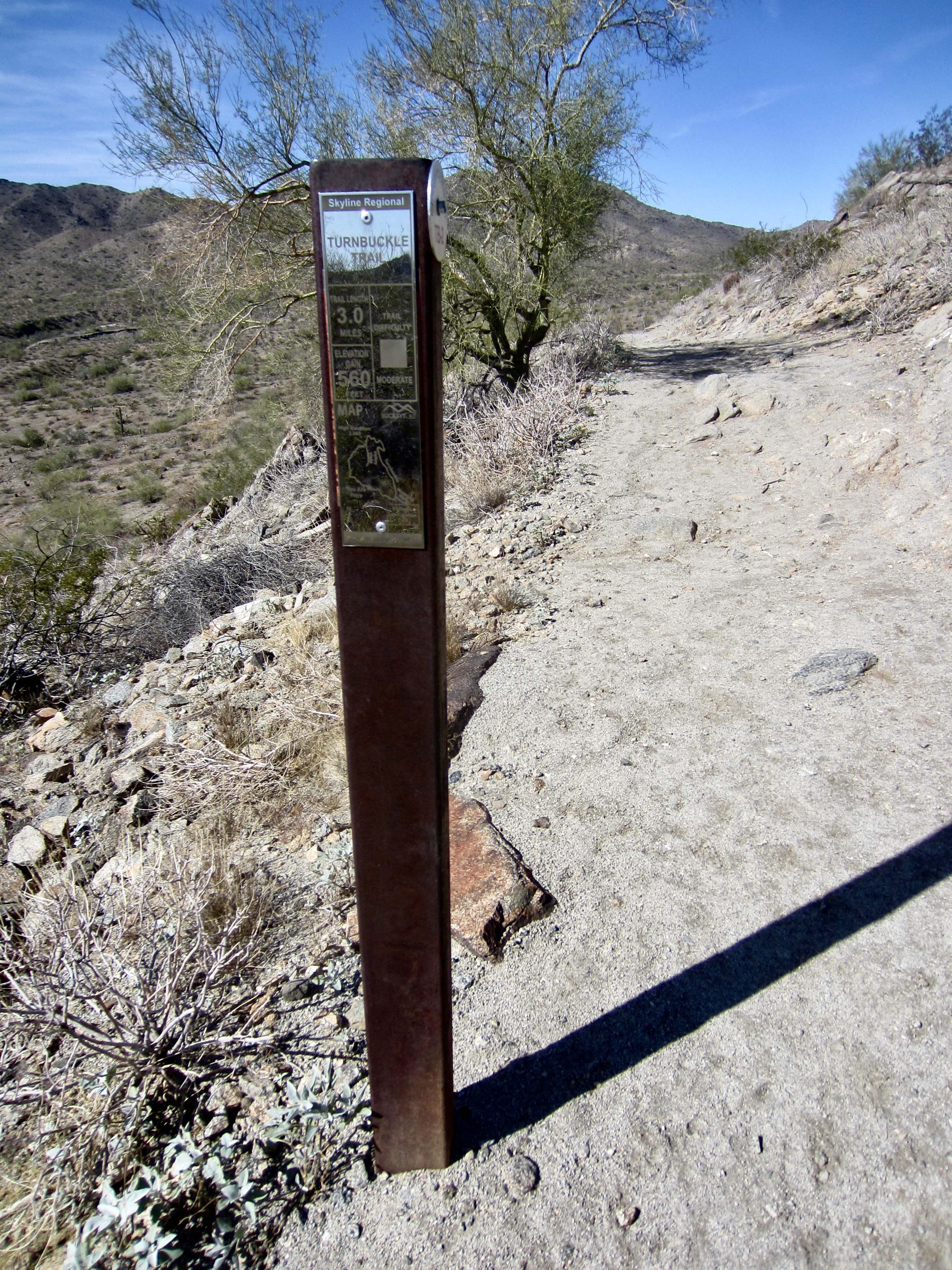
In approximately 250 yards, you will come to a four-way junction marked by a signpost, with two trails heading to the left and one trail heading to the right. Take the upper left trail, which makes a gently rising traverse across the hillside. This is the left-hand branch of the Turnbuckle Trail.
.
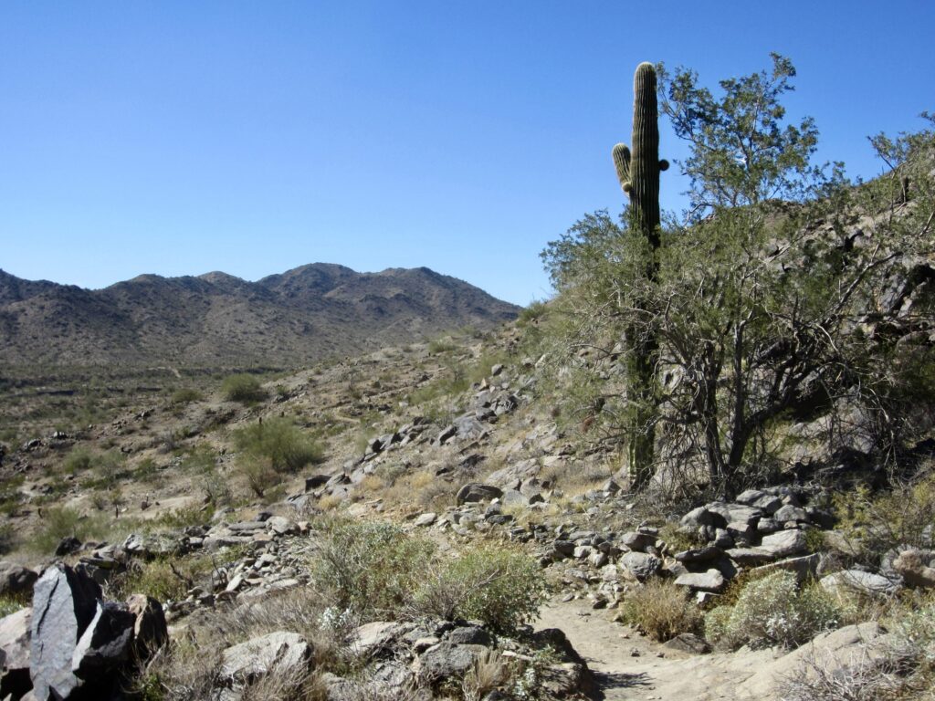
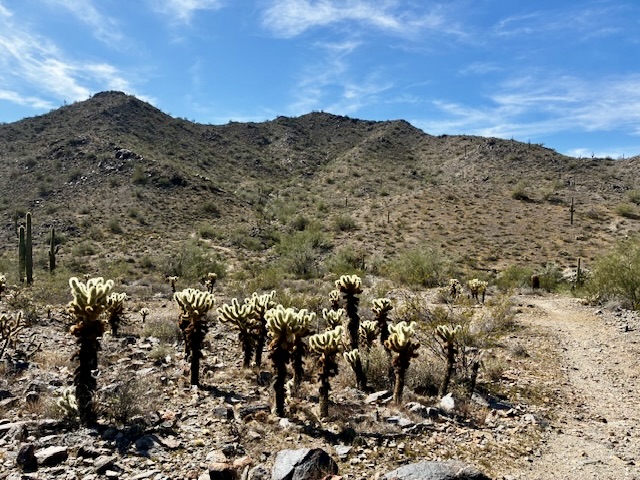
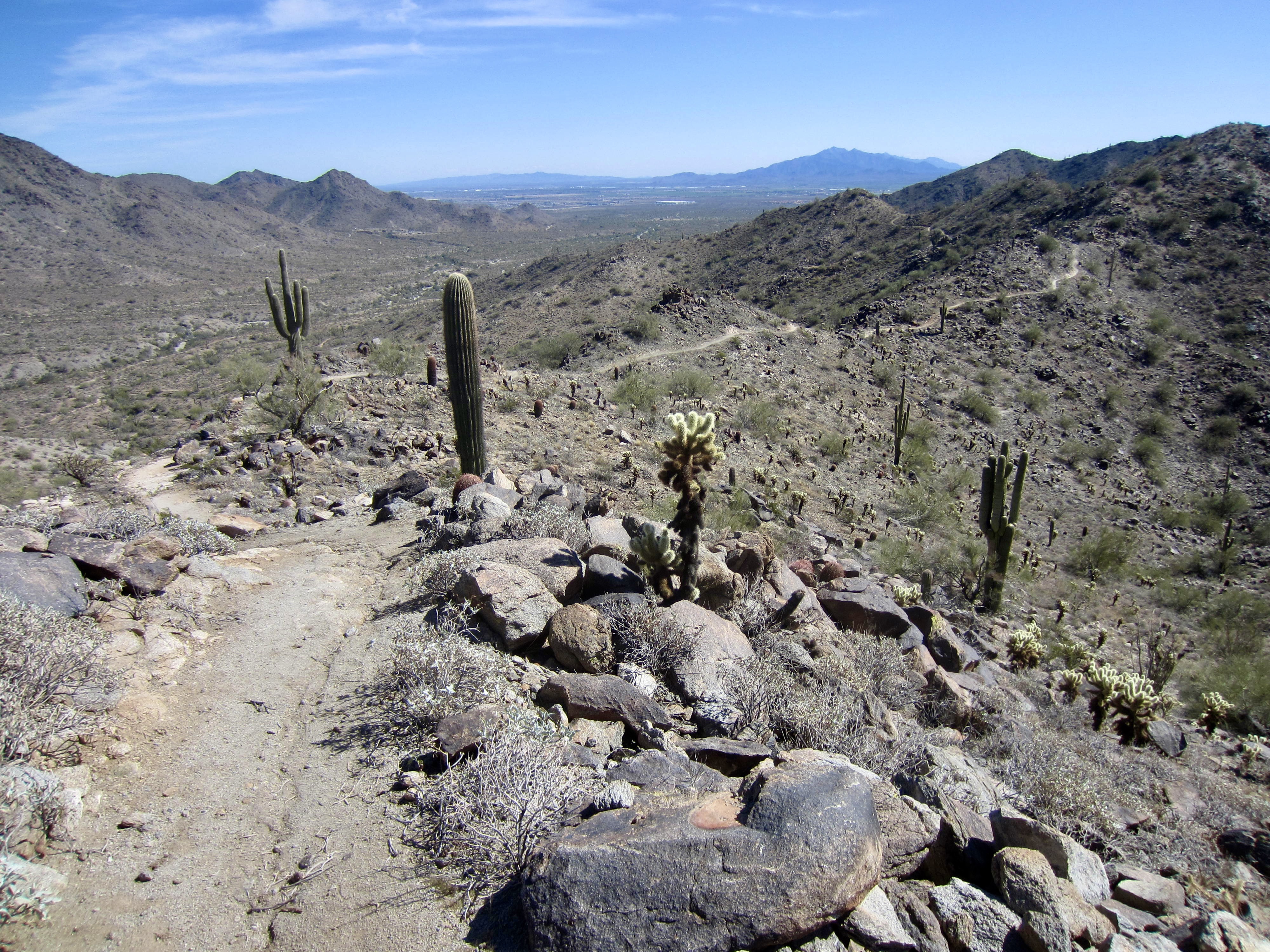
Follow the Turnbuckle Trail as it curves around the hillside, going past a lower junction with the Granite Falls Trail in about 0.4 miles. Along the way, Pyrite Summit can be seen as the high, rounded hill located far to the west.
.
After 0.7 miles from the last junction, you will come to an upper junction with the Granite Falls Trail. Here, the Turnbuckle Trail angles up to the right. Veer left onto the Granite Falls Trail, which descends at a slight gradient.
.
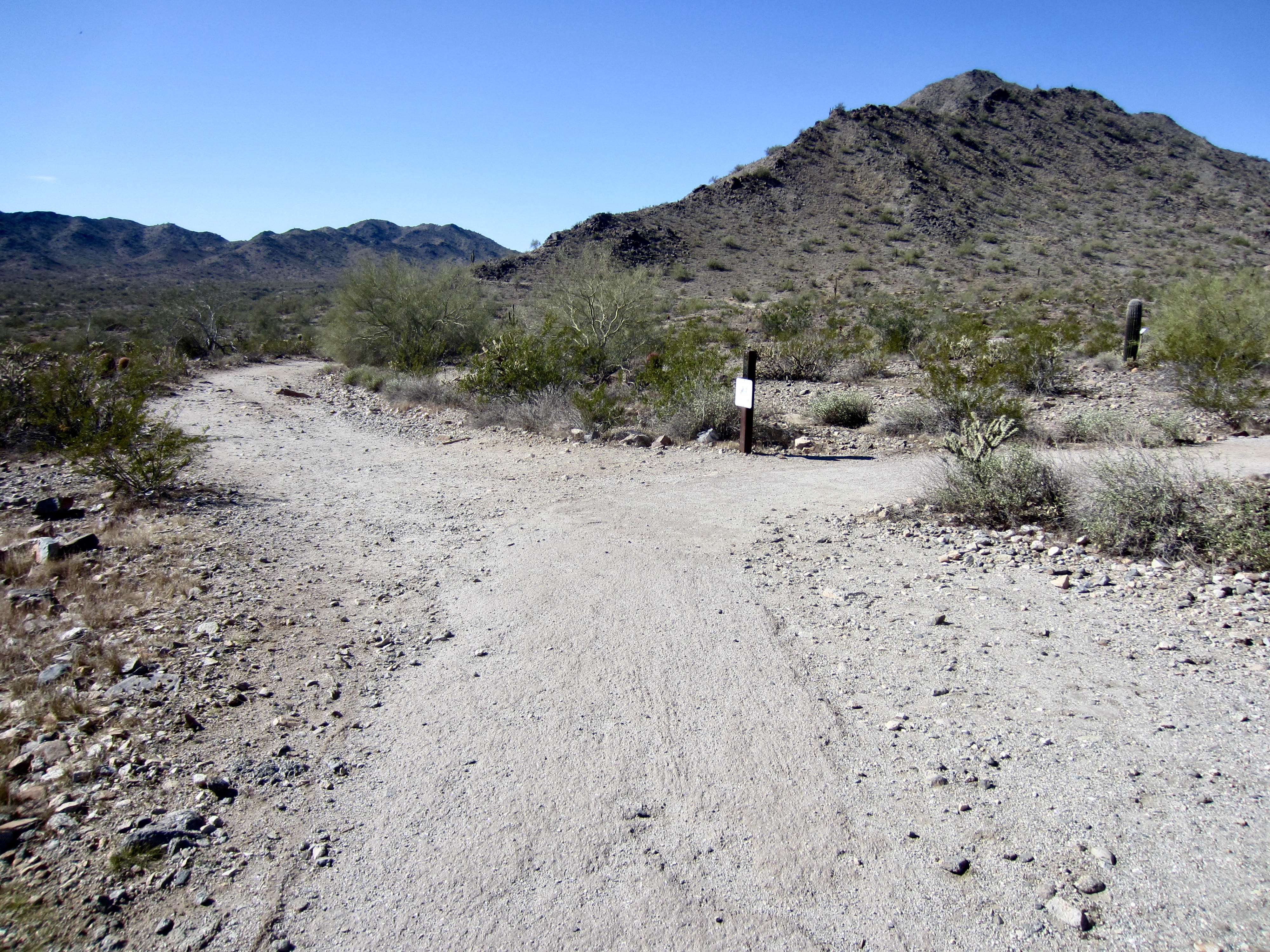
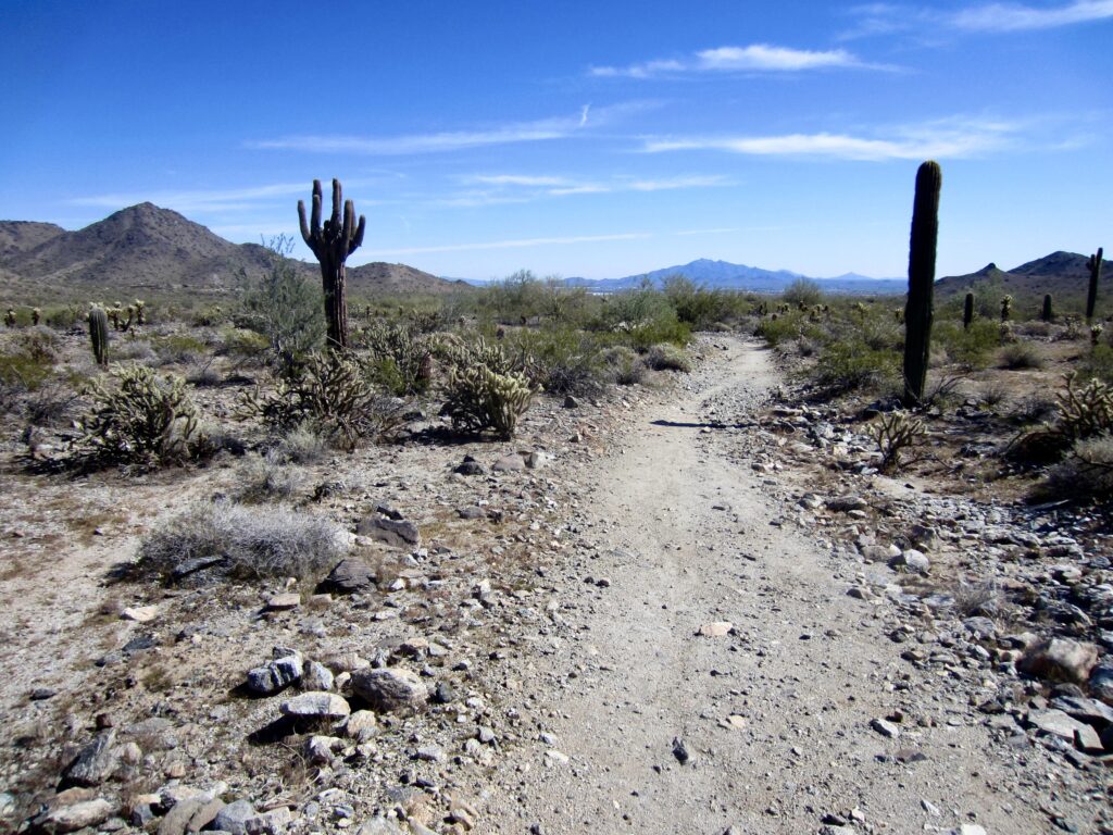
After descending approximately 300 yards on the Granite Falls Trail, you will reach a junction with the Chuckwalla Trail. Turn right onto the latter trail and continue hiking across the broad floor of Chuckwalla Wash for 0.7 miles until arriving at a junction with the Pyrite Trail.
.
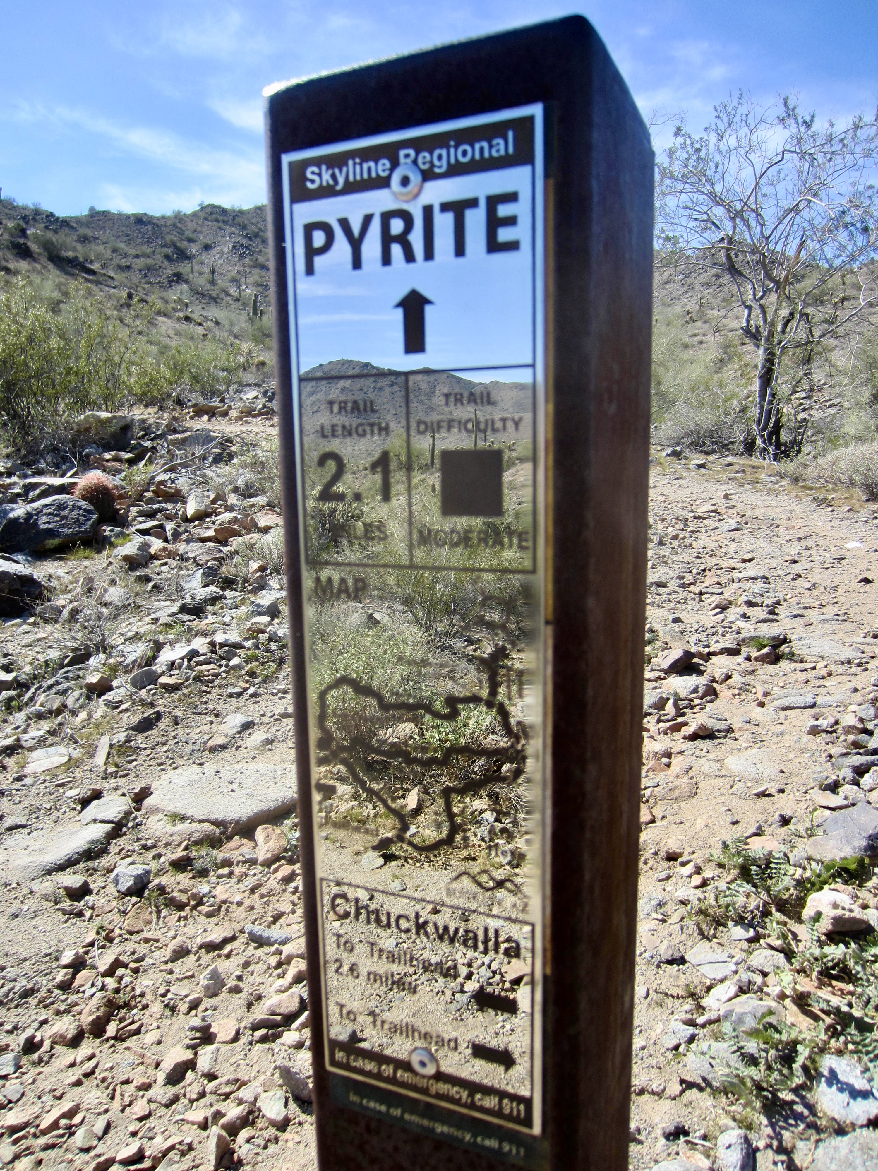
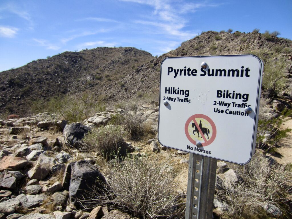
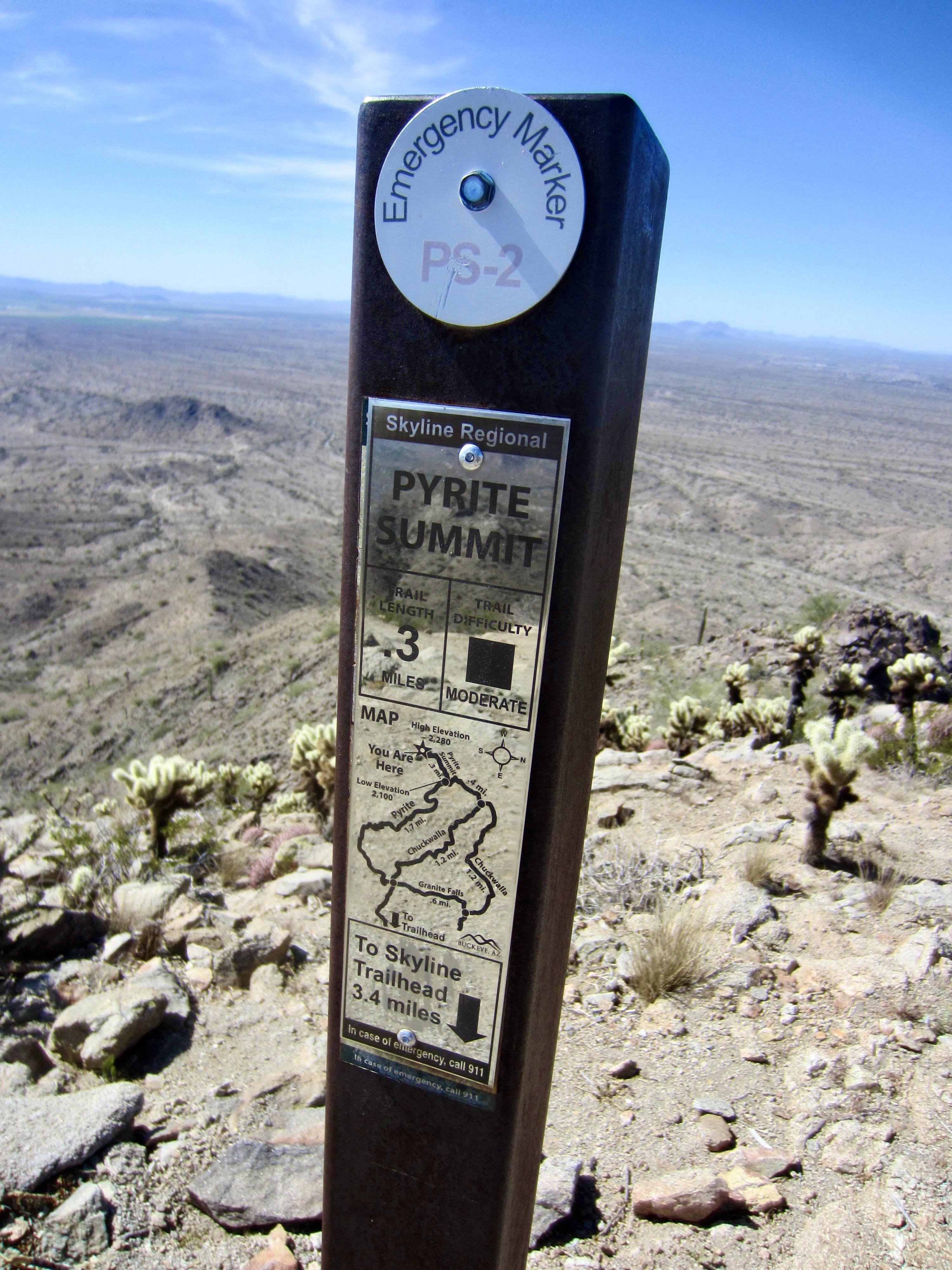
Proceed straight ahead on the Pyrite Trail as it makes a steep ascent of the hillside via numerous tight switchbacks. This part of the trail climbs 400 vertical feet in 0.5 miles to reach a junction with the Pyrite Summit Trail at Pyrite Saddle (3.2 miles + 900 feet from TH). From here, the 0.3-mile sidetrip up to Pyrite Summit is worthwhile and highly recommended.
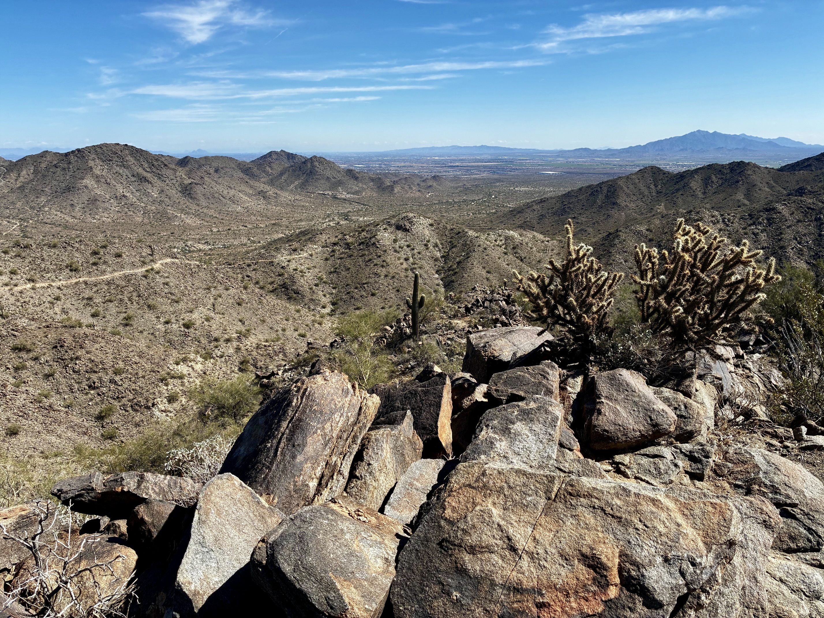
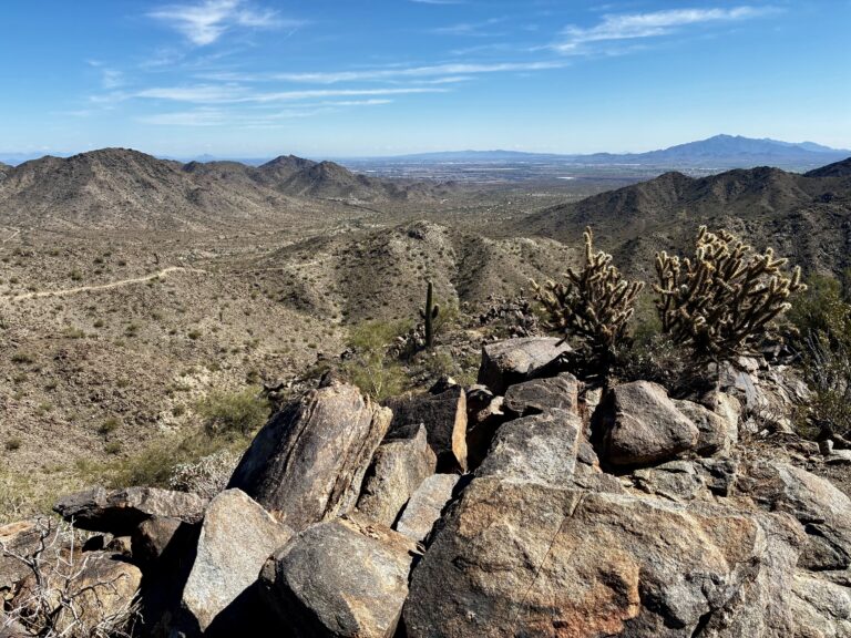
.
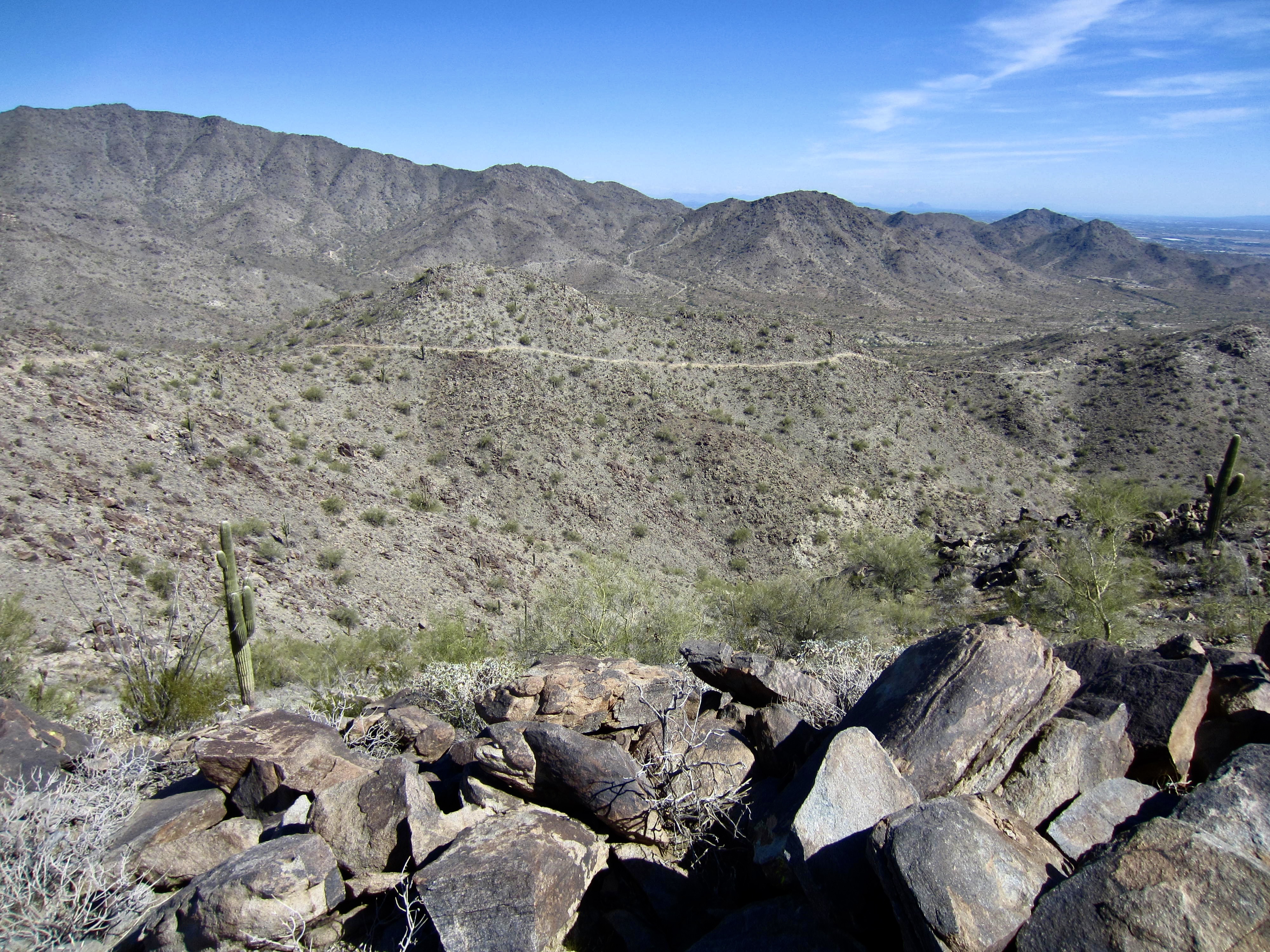
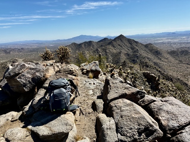
Pyrite Summit sits on the southwestern edge of the White Tank Mountains and offers a good view of the surrounding Basin & Range Geological Province, which features hundreds of isolated mountain sub-ranges rising above a vast desert plain. Closely to the southeast is White Benchmark, a pointed summit that hosts a cluster of communication towers.
.
.
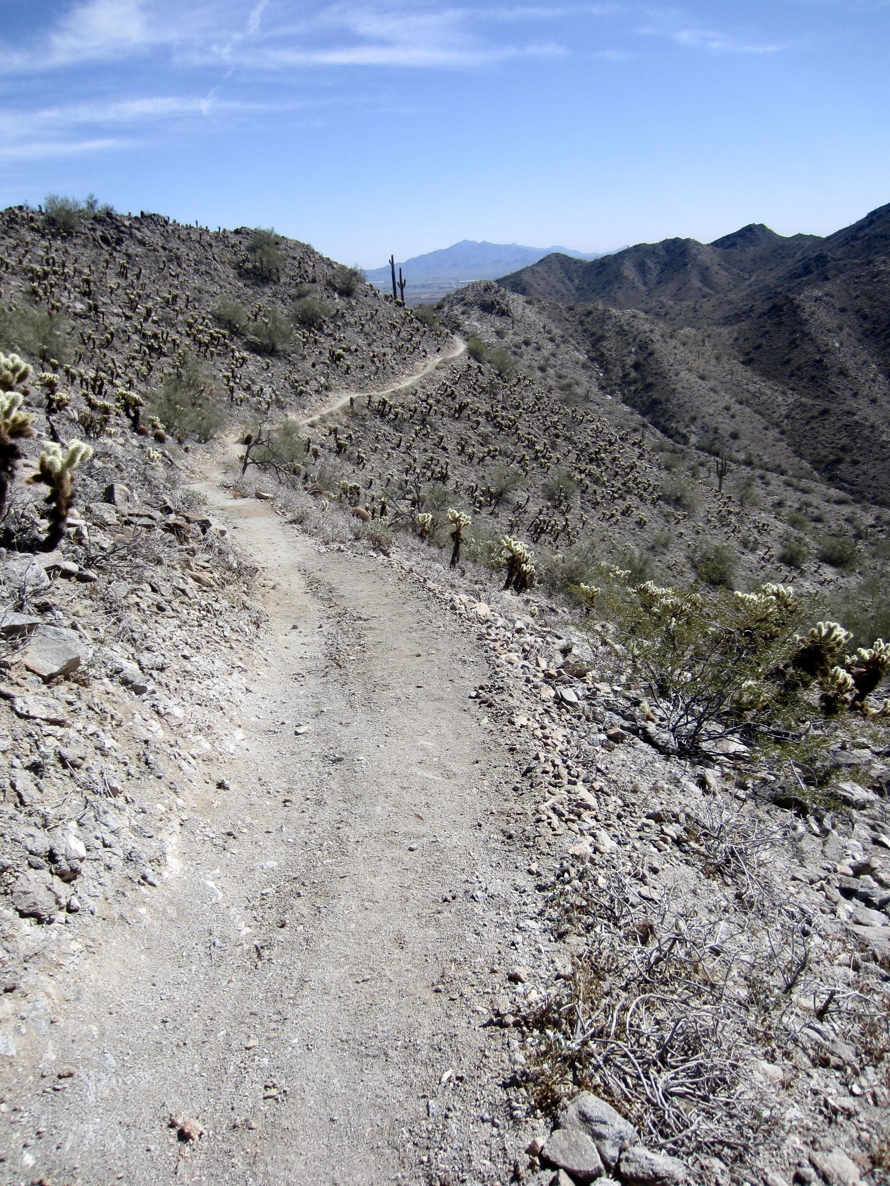
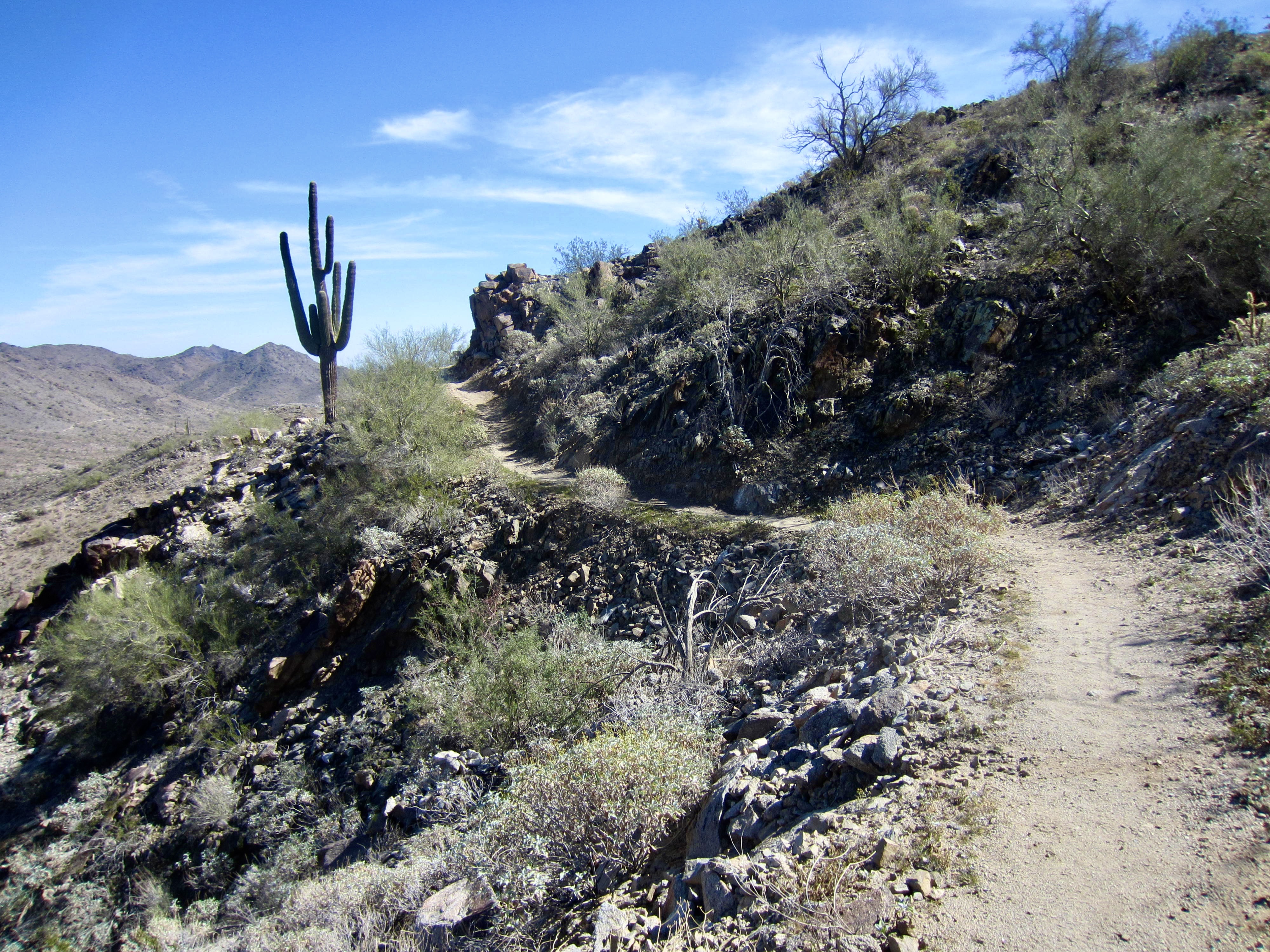
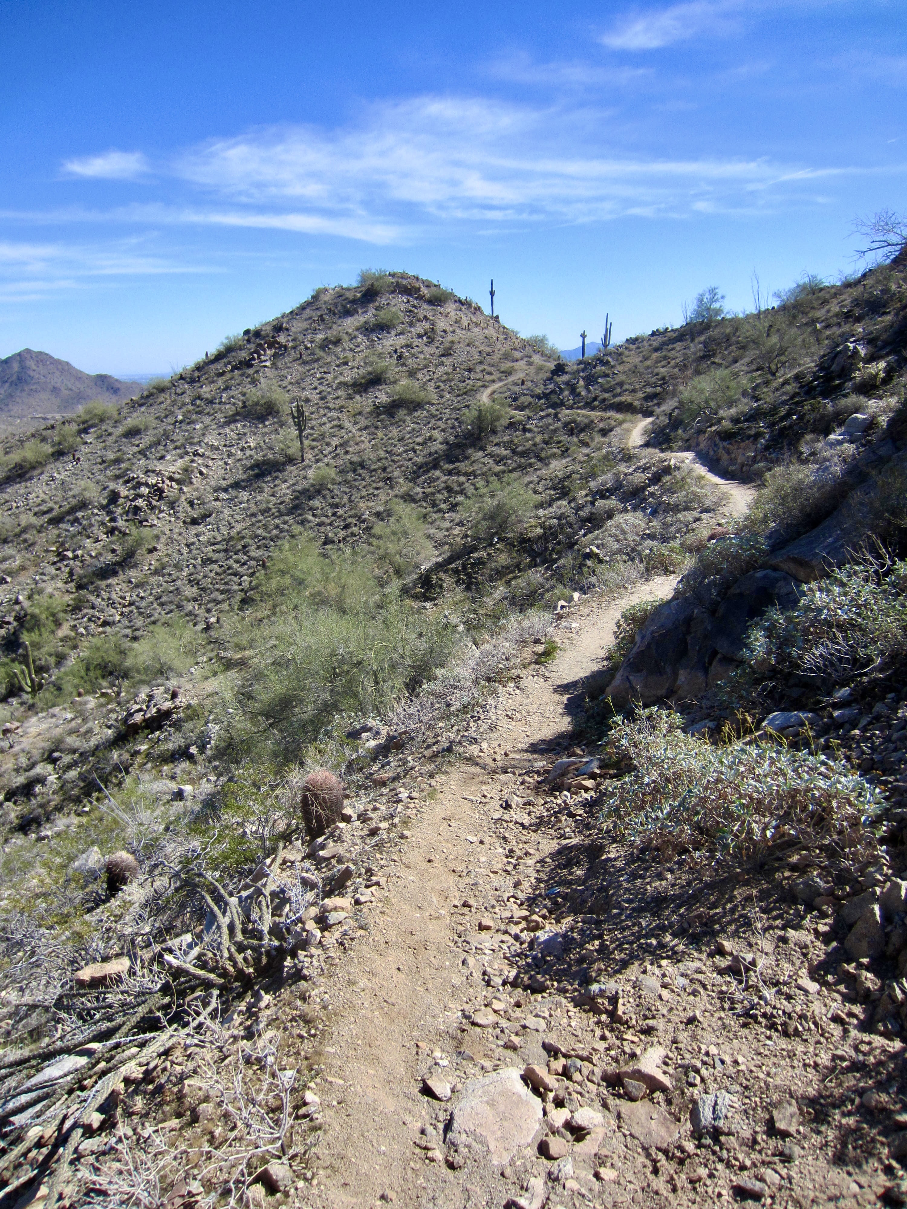
After returning to Pyrite Saddle, continue hiking southeasterly along the Pyrite Trail. This higher-elevation part of the trail wanders back and forth across the crest several times before making a descent to the valley floor.
.
.
The Pyrite Trail eventually bottoms out at an eastern junction with both the Chuckwalla Trail and Granite Falls Trail. Turn right onto the Granite Falls Trail and follow it back across the broad Chuckwalla Wash.
.
At the far side of the wash, you will come to a junction with the Turnbuckle Trail, thereby closing your loop. From here, turn right and retrace your steps back to the starting trailhead (7.3 miles + 1250 feet total loop).
.
Route Map & Profile
…
…
Photo Gallery
Click to enlarge…