Trip Date: February 18, 2026
2026 ARIZONA WINTER VACATION
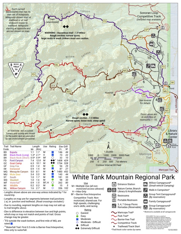
Goat–Willow Trail Loop: Goat Canyon to Willow Canyon
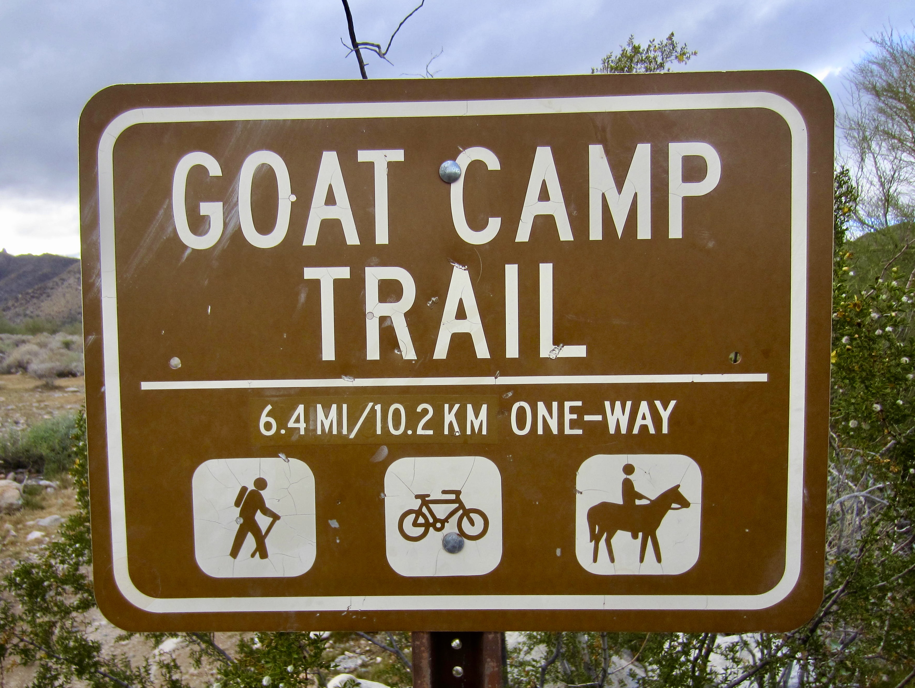
Goat Canyon
Yellow Bull Canyon
Dripping Springs Canyon
Slick Rock – Dripping Springs Saddle
Willow Canyon
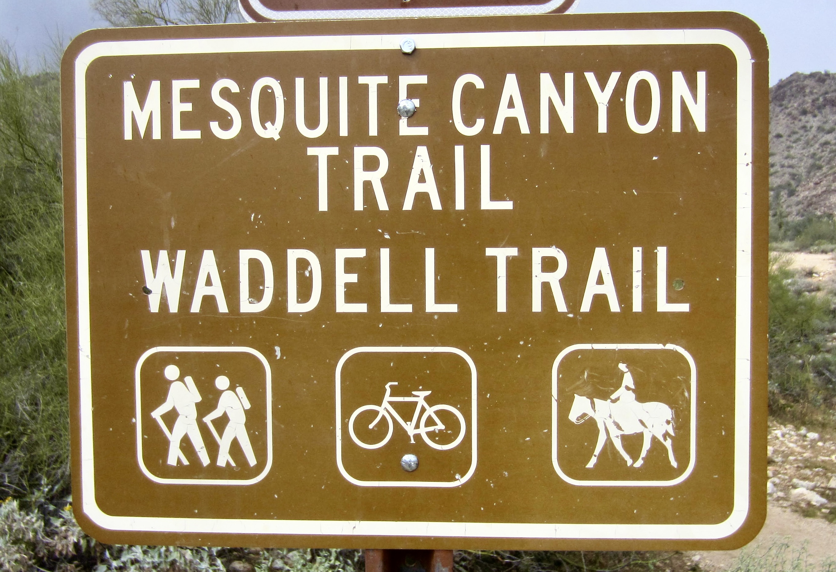
Mesquite Canyon
Route Summary
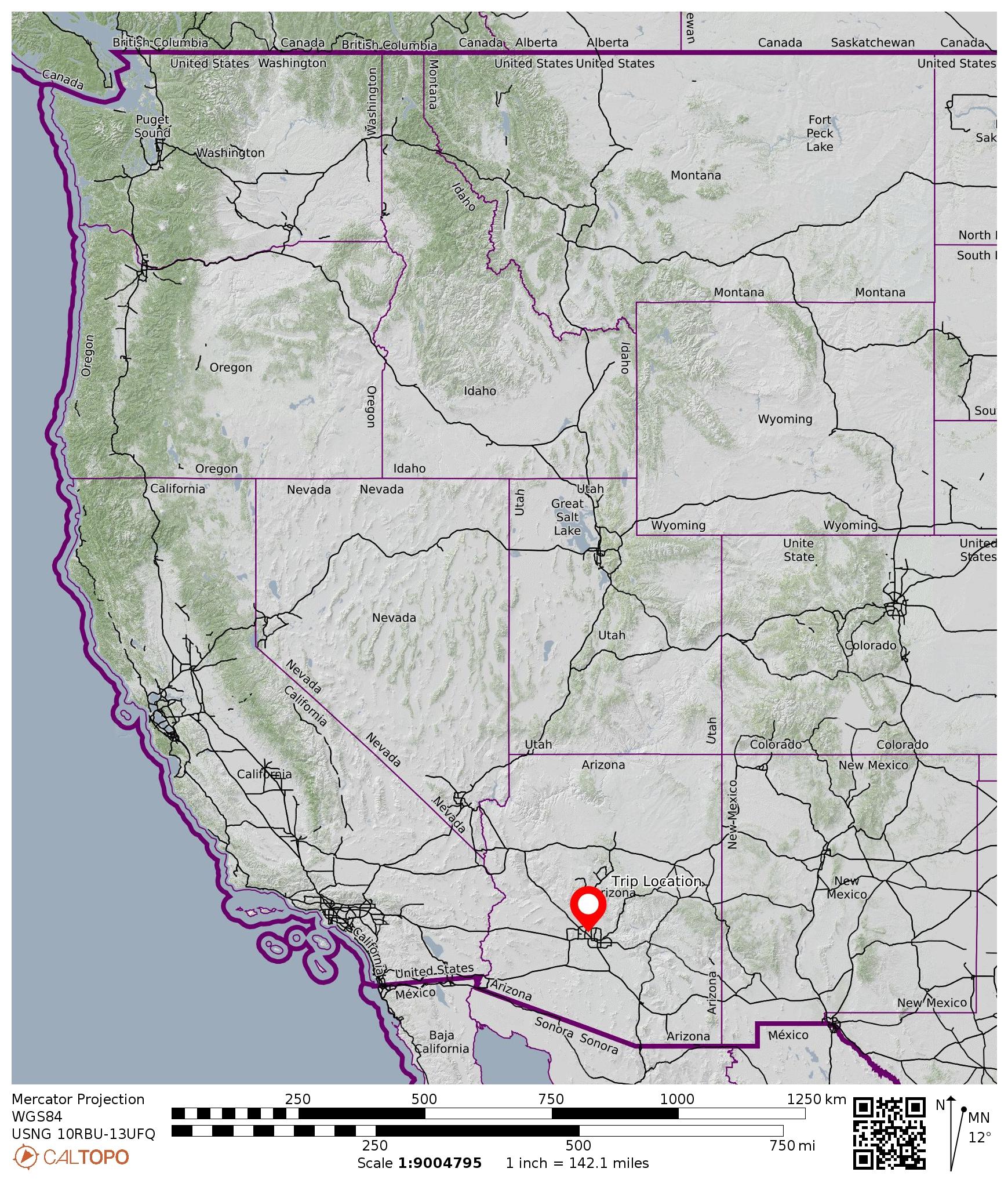
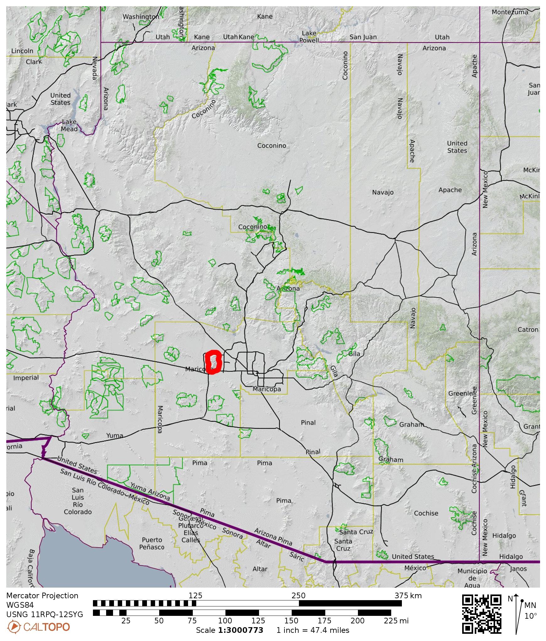
Region: Arizona
Sub-Region: Central Arizona
Sub-Sub-Region: White Tank Mountains
Area: White Tank Mountain Regional Park
Starting Point: Goat Camp Trailhead on Black Canyon Drive (Elev. 1500 feet)
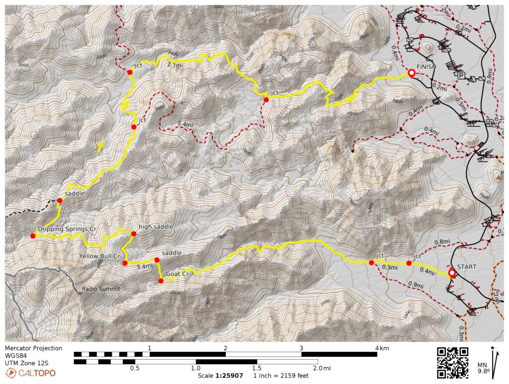
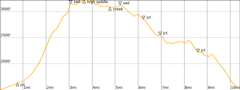
Loop Way Points: Goat Camp Trail / Bajada Trail junction & Goat Camp Trail / South Trail junction & Goat Creek crossing & Goat – Yellow Bull ridge saddle & Yellow Bull Creek crossing & Yellow Bull – Dripping Springs ridge saddle & Dripping Springs Creek crossing & Dripping Springs – Slick Rock ridge saddle & Goat Camp Trail / Ford Canyon Trail / Mesquite Canyon Trail junction & Ford Canyon Trail / Willow Canyon Trail junction & Upper Willow Creek crossing & Willow Canyon Trail / Mesquite Canyon Trail junction & Mesquite Canyon / Waddell Trailhead (trail hike via Goat Camp Trail–Ford Canyon Trail–Willow Canyon Trail–Mesquite Canyon Trail)
High Point: Yellow Bull – Dripping Springs ridge saddle (3220 feet)
Ending Point: Mesquite Canyon / Waddell Trailhead adjacent to Picnic Area #7 at end of Ramada Way (Elev. 1550 feet)
Approximate Stats: 10.4 miles traveled; 2100 feet gained; 2050 feet lost.
…
Related Post
>>> Mesquite–Ford Trail Loop: Mesquite Canyon to Ford Canyon – March 15, 2019
Route Overview
The White Tank Mountains, or simply “White Tanks,” are a compact sub-range of arid peaks lying closely west of Phoenix. The highest peak reaches slightly over 4000 feet, and the sub-range itself is named for the presence of large, water-holding depressions within the white granite bedrock. White Tank Mountain Regional Park encompasses 45 square miles in the northern portion of the sub-range. This park features an extensive network of hiking trails that lend themselves to a variety of possible loops and traverses.
.
During my first visit to the park in 2019, I completed the popular Mesquite–Ford Trail Loop, which begins and ends at the Mesquite Canyon / Waddell Trailhead. This “closed loop” follows a scenic 10.5-mile route through Mesquite Canyon and Ford Canyon. Upon returning to the area on a blustery winter day in 2026, I did the slightly more interesting Willow–Goat Trail Loop, starting at the Mesquite Canyon / Waddell Trailhead and ending at the Goat Camp Trailhead. This trek follows a horseshoe-shaped route that links four separate trails: Mesquite Canyon Trail, Willow Canyon Trail, Ford Canyon Trail, and Goat Camp Trail. Being an “open loop,” it is necessary to do a short car shuttle between the starting and ending trailheads—a road distance of 2.4 miles. Alternatively, you could stash a bike, or simply walk.
.
Although I did the loop in a counterclockwise direction, I recommend doing it clockwise, starting at the Goat Camp Trailhead and ending at the Mesquite Canyon / Waddell Trailhead. Traveling in this direction means that you ascend the relatively steep, rough, and rocky Goat Camp Trail and then descend the more civilized Willow Canyon and Mesquite Canyon Trails. Having slipped and slid my way down Goat Camp Trail in wet conditions, I can heartily advise against it!
Full Route Description
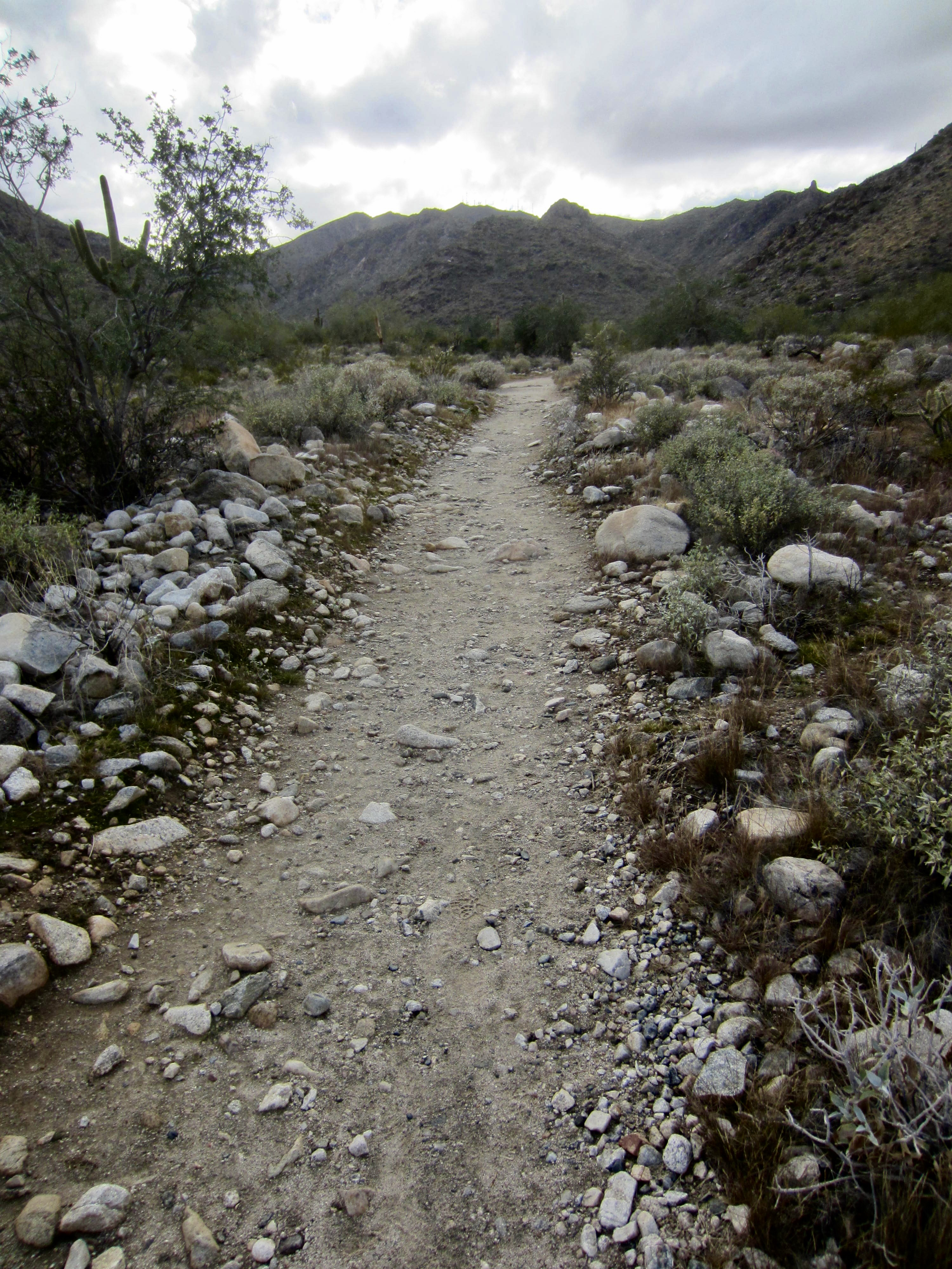
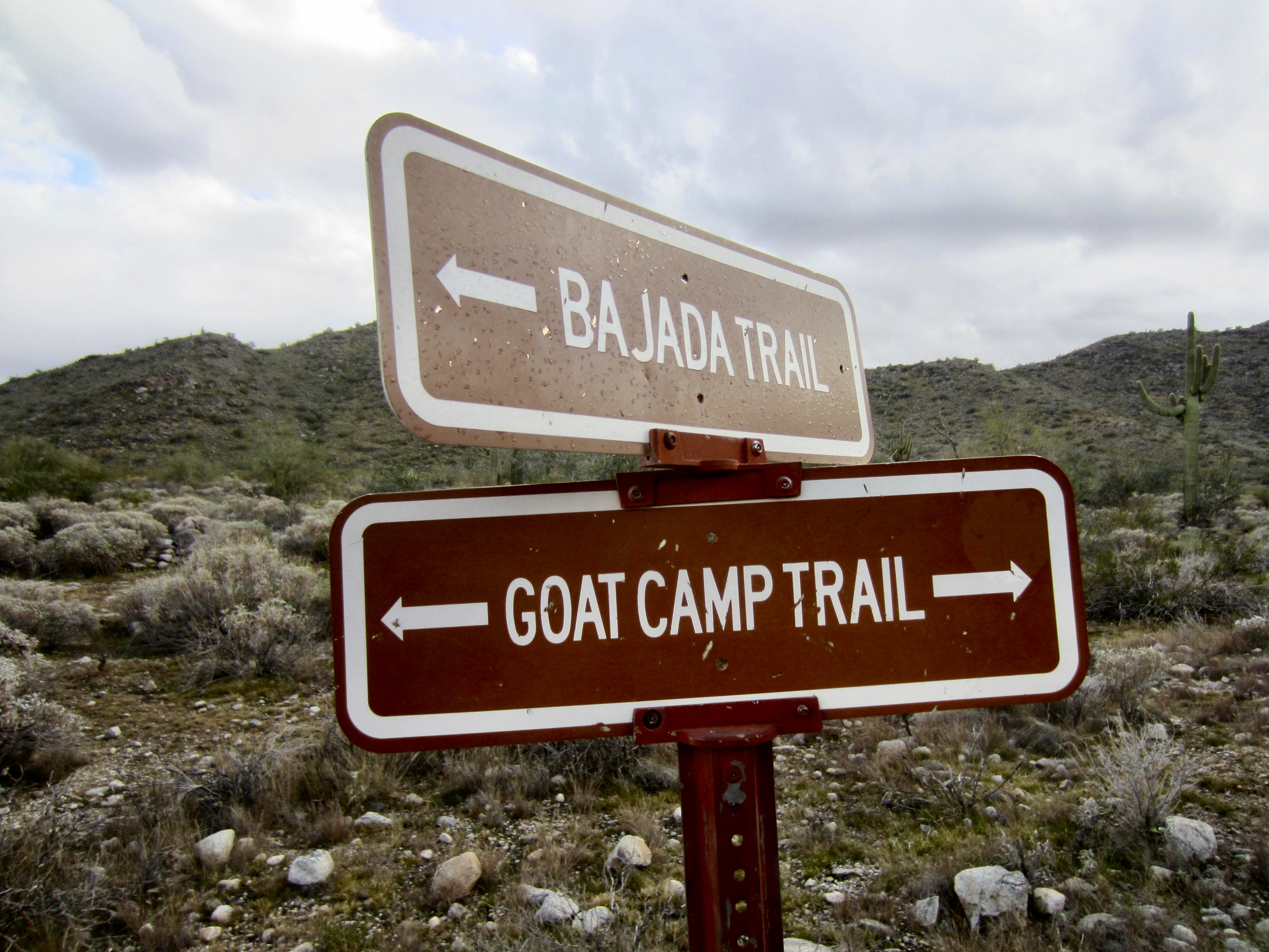
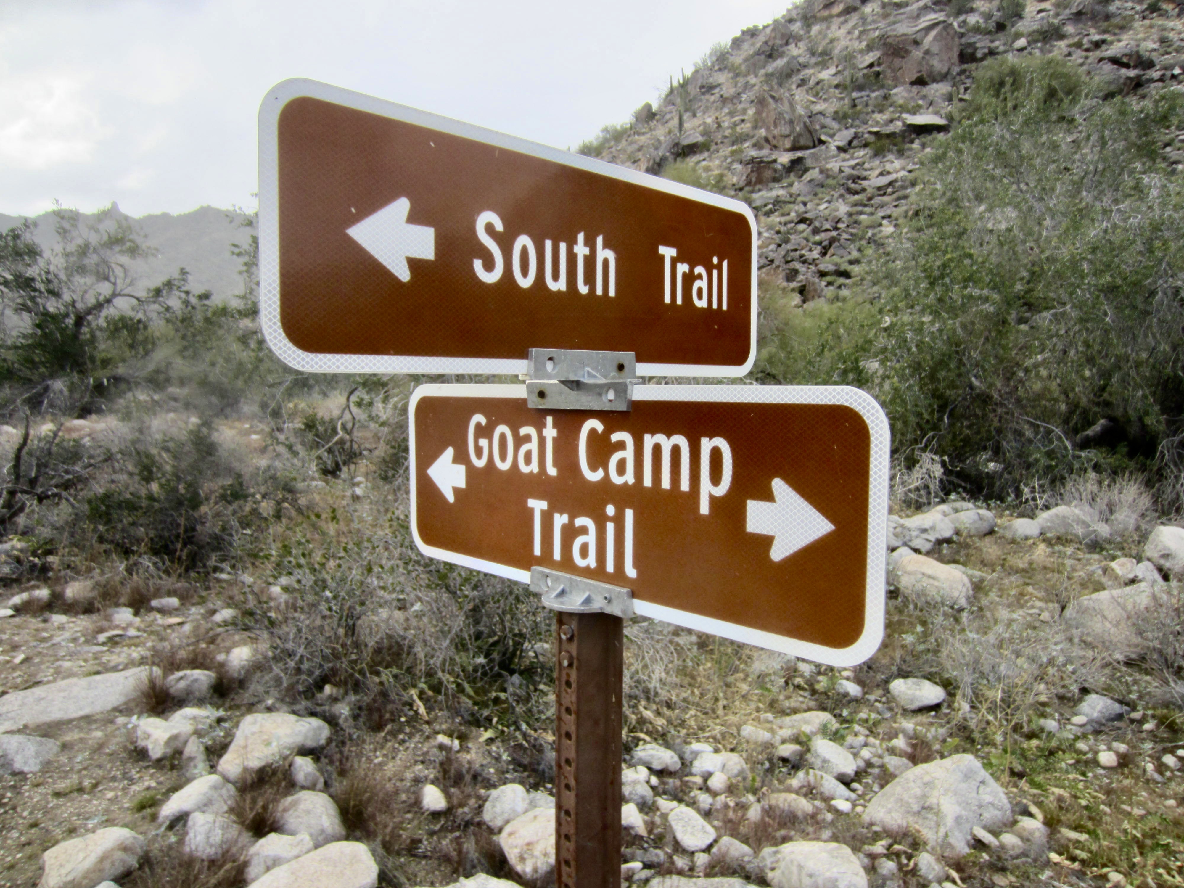
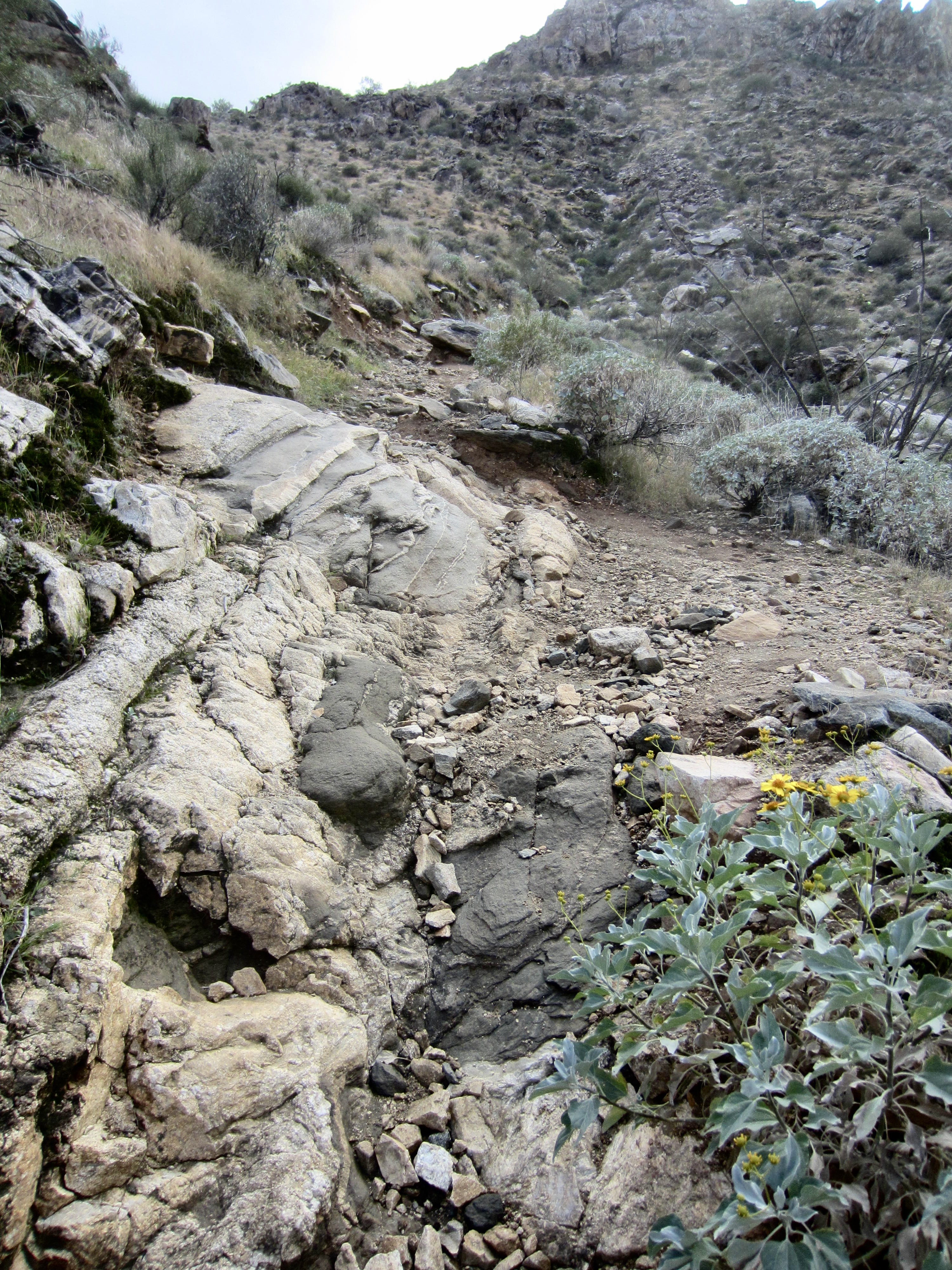
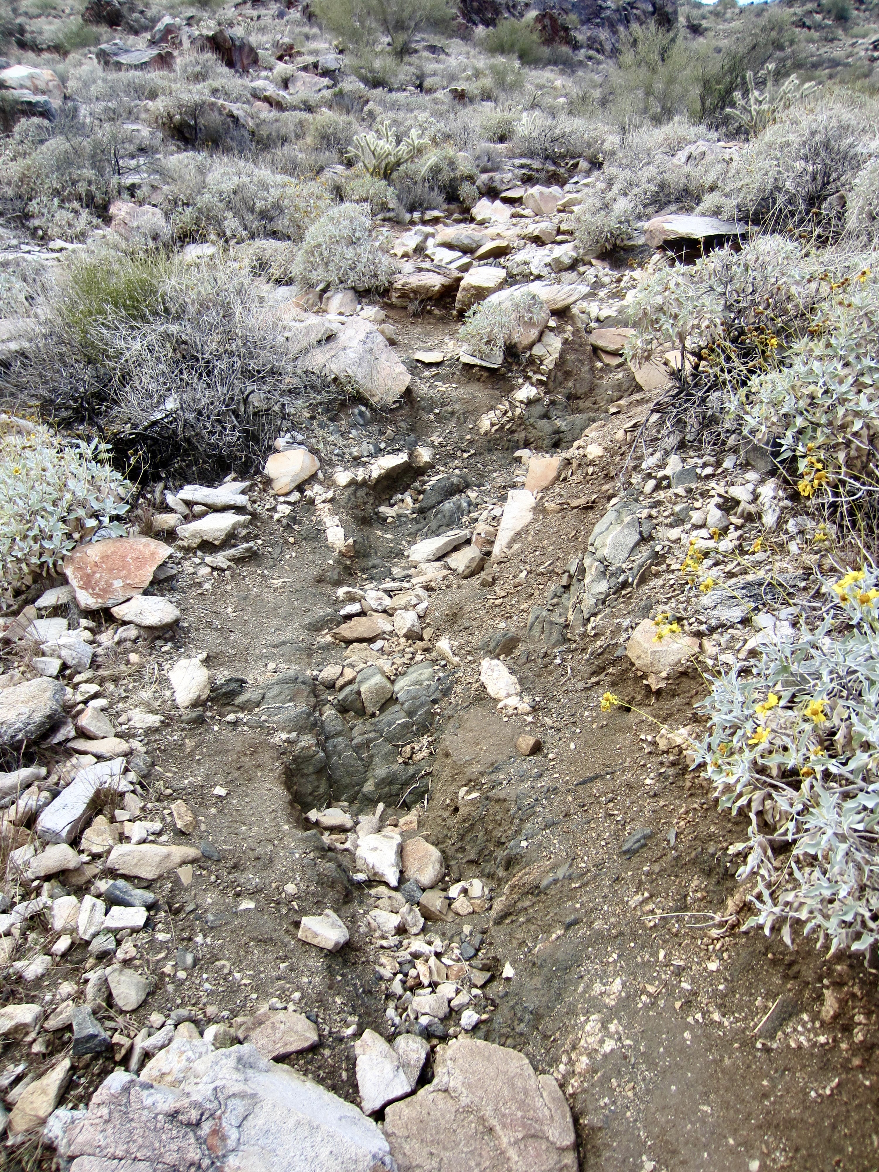
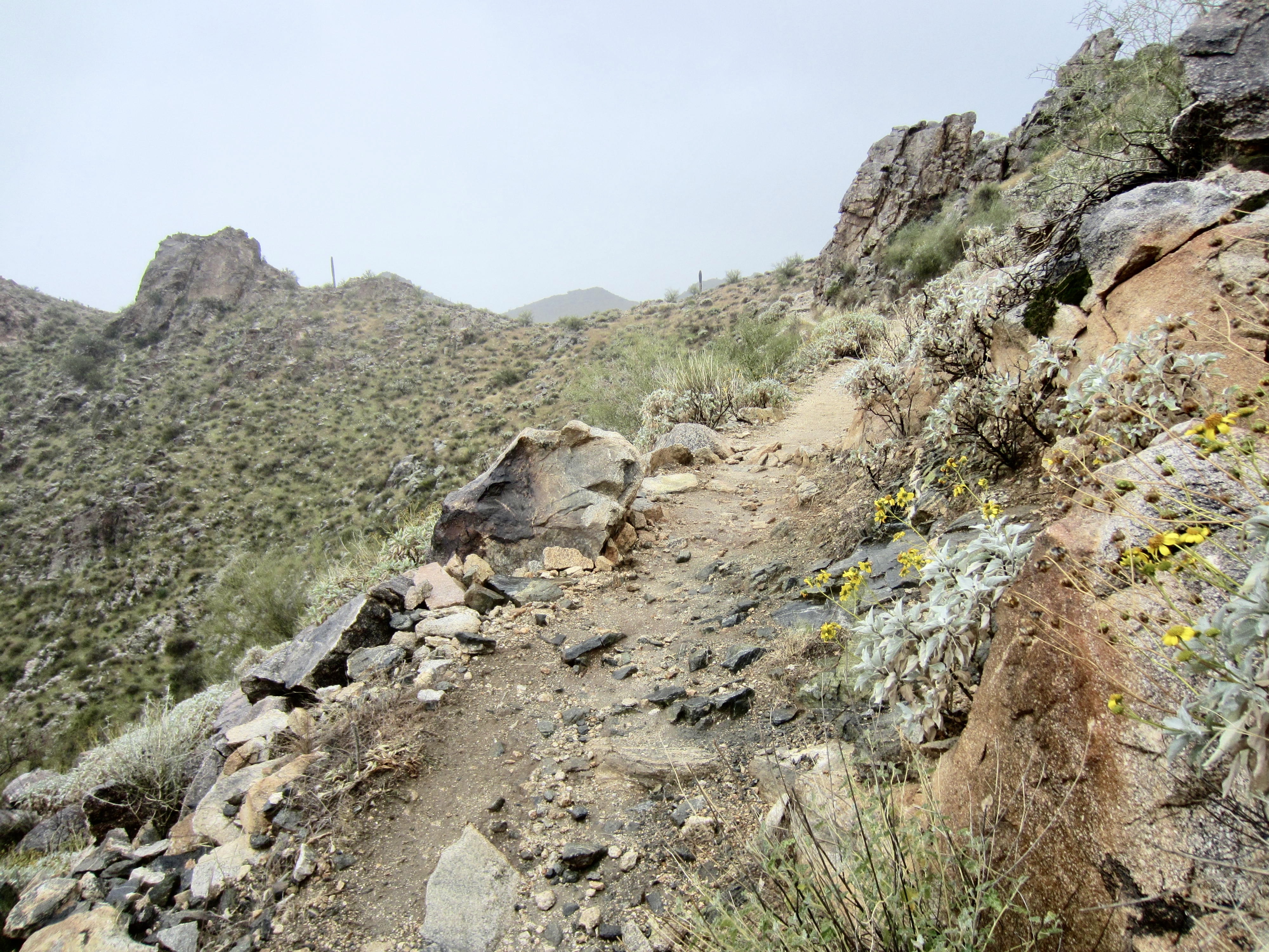
From the Goat Camp Trailhead, head up the gently inclined track, passing junctions with the Bajada and South Trails in the first ½ mile. Farther along, the track becomes much steeper and rockier as it climbs through Goat Canyon, initially along the southern side and later up the northern side.
.
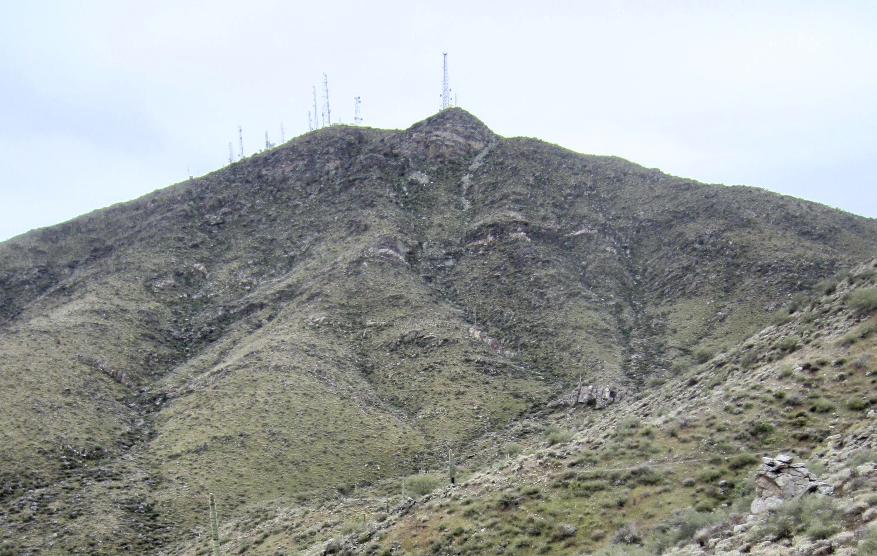
Just past Milepost 3, the grade eases noticeably and then gains the first of several ridge saddles (3.1 miles + 1650 feet from starting point). In the next 2½ miles, you will cross Yellow Bull Creek and Dripping Springs Creek, which are usually dry. Between these two channels is a 3220-foot ridge saddle that represents the highest point of the entire loop. A cluster of communication towers can be seen on Radio Summit far above the trail.

.
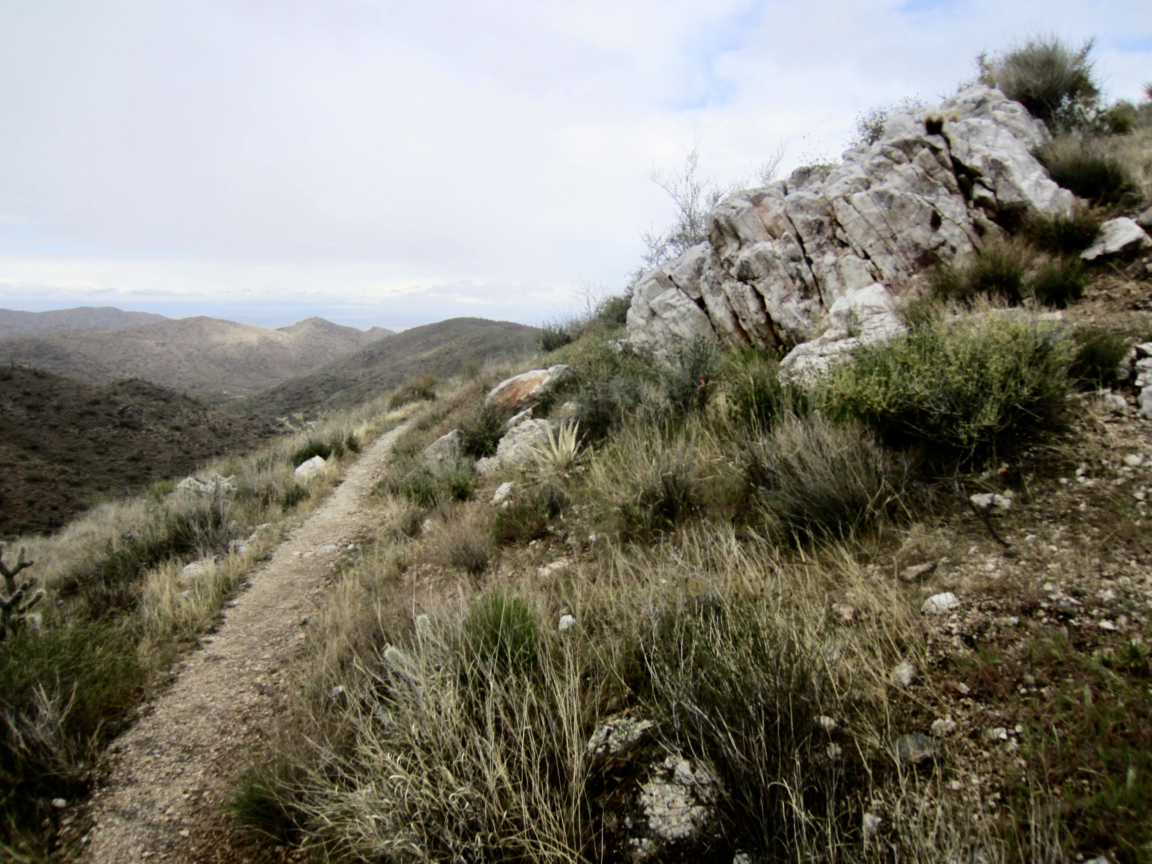
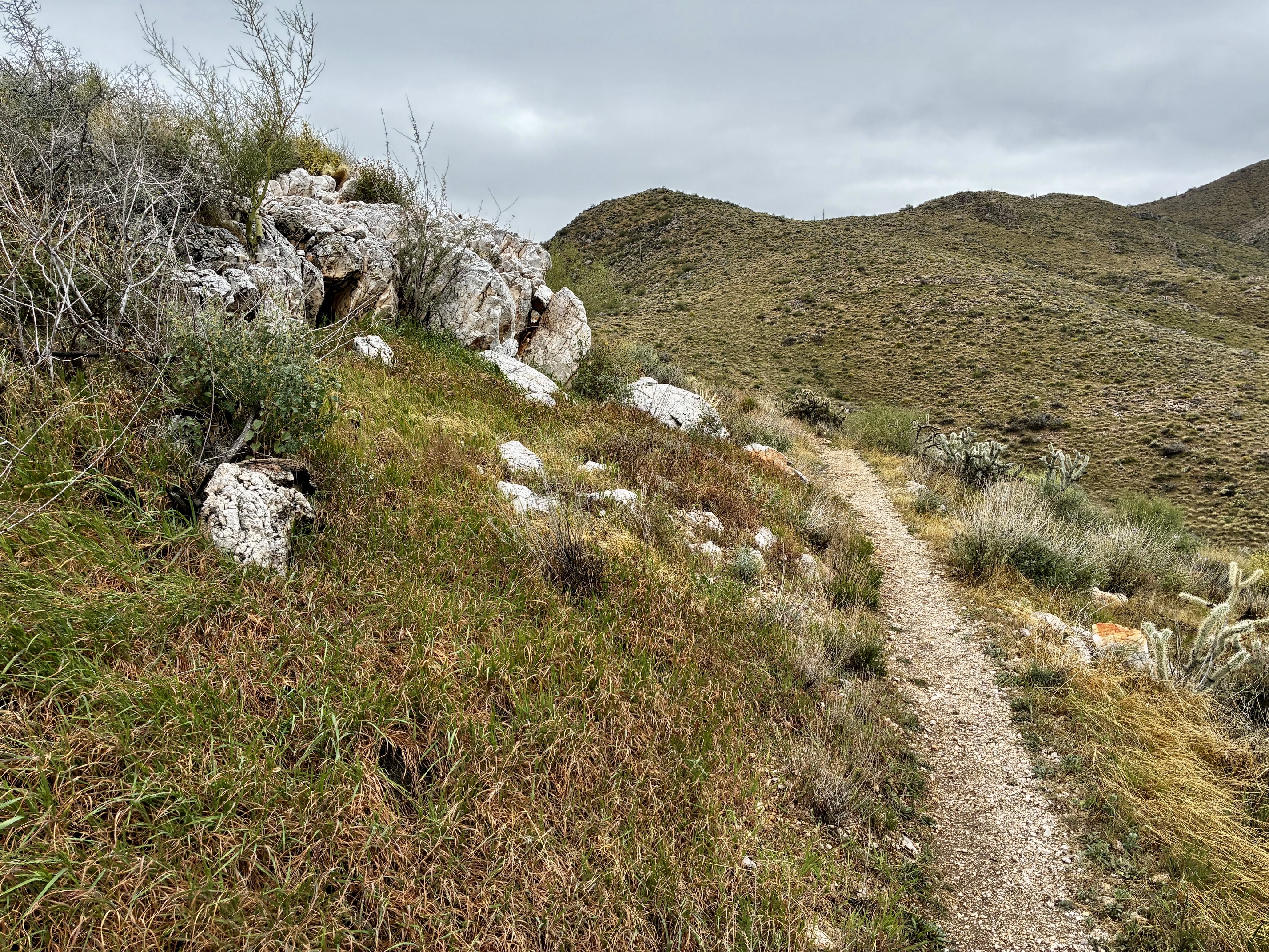
A steep climb out of Dripping Springs Canyon brings you to Slick Rock – Dripping Springs Saddle (5.2 miles + 1950 feet from starting point). This is the third saddle in the sequence, and from here the Goat Camp Trail makes a mile-long traverse above Slick Rock Canyon. Large outcrops of milky quartz decorate the trail, and Barry Goldwater Peak—the highest summit in the White Tank Mountains—can be seen off to the west. This was the scenic highlight of the loop for me.

.
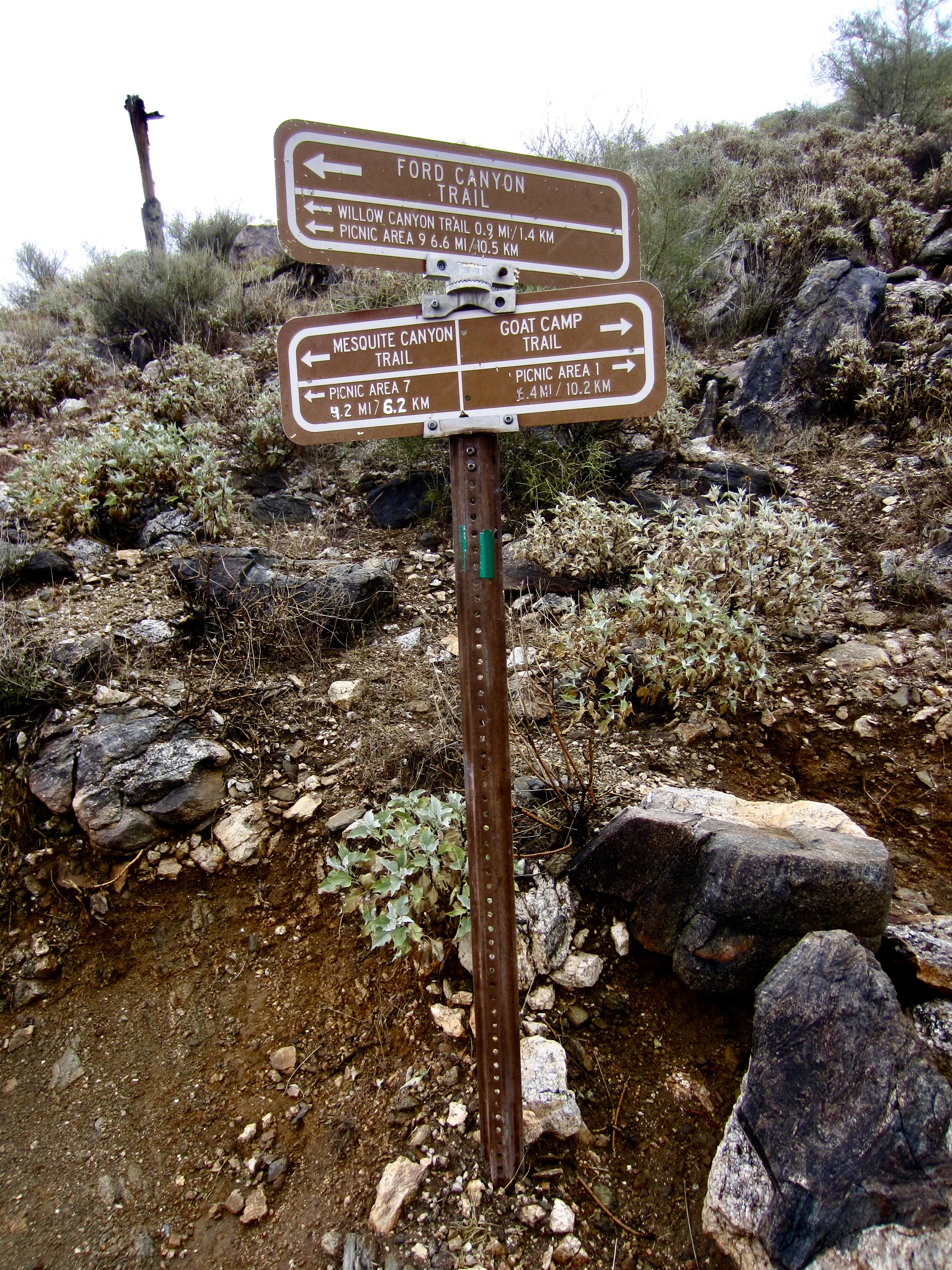
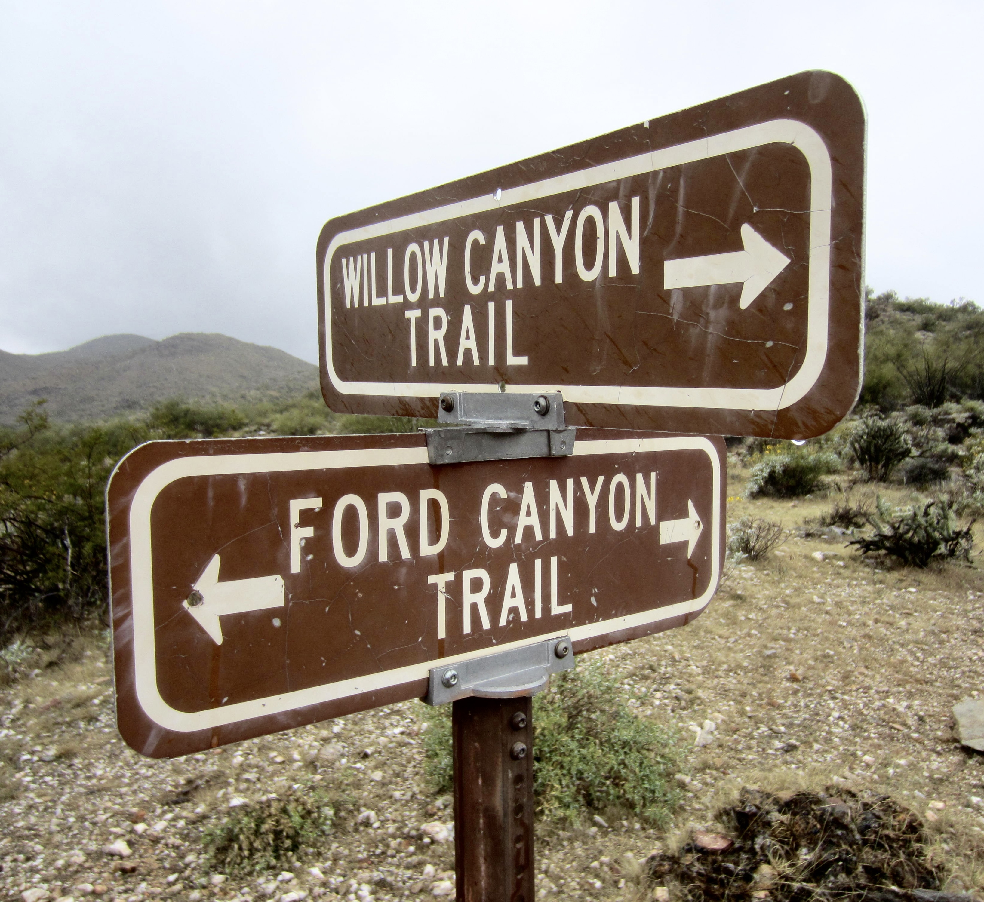
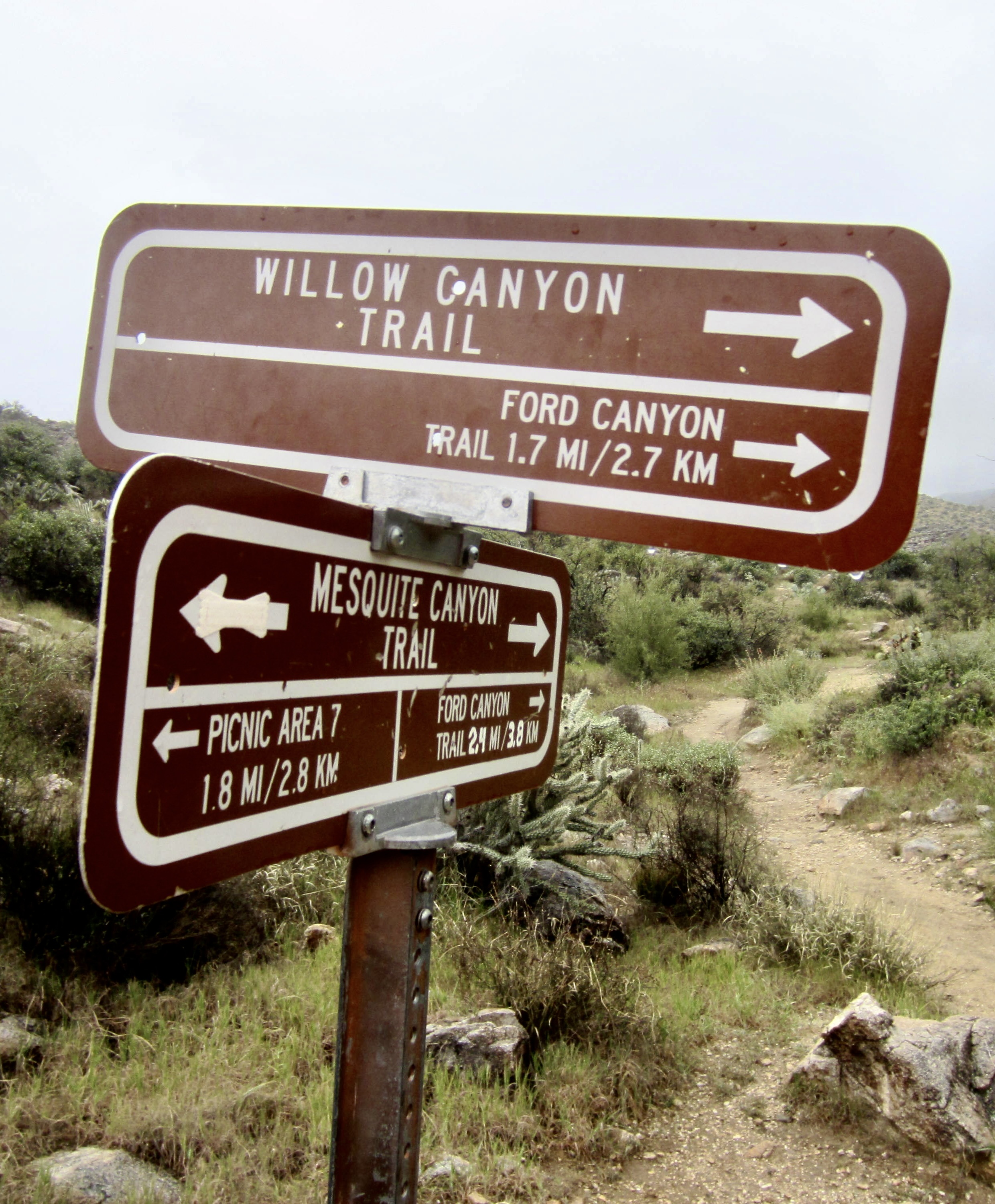
Soon, you will come to a three-way junction with the Mesquite Canyon Trail and Ford Canyon Trail (6.2 miles + 2000 feet from starting point). The Goat Camp Trail officially ends here. Go straight ahead on the Ford Canyon Trail for ¾ mile as it drops to cross Willow Creek and then quickly reaches a junction with the Willow Canyon Trail.
.
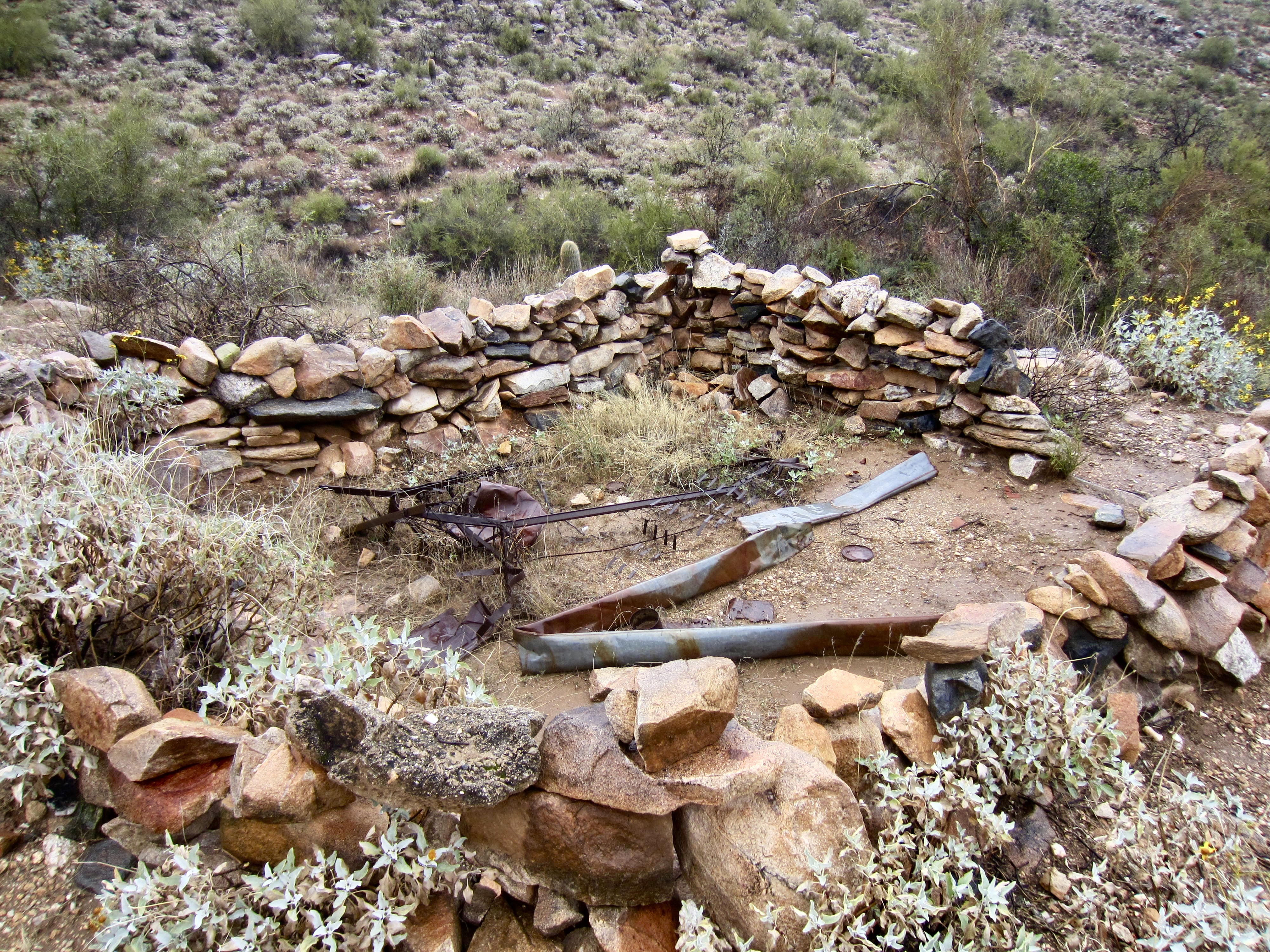
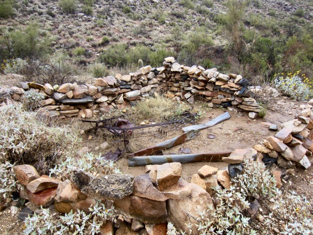
Turn right on the Willow Canyon Trail and continue descending along the upper channel of Willow Creek (also usually dry). Along the way, look for a curious stone edifice filled with various relics. Perhaps you can deduce the purpose.
.
The Willow Canyon Trail curves around to the southeast and crosses Mesquite Creek, then immediately arrives at a junction with the Mesquite Canyon Trail. Turn left and follow this trail for a final 1¾ miles as it swings around the nose of a ridge and then goes steeply down an unnamed canyon to reach the end of your loop at the Mesquite Canyon / Waddell Trailhead (10.4 miles + 2100 feet – 2050 feet from starting point)
.
Route Map & Profile
…
…
Photo Gallery
Click to enlarge…