Trip Date: October 3-6, 2025
GOLDEN LARCH OUTING: NORTH STEHEKIN MOUNTAINS
McAlester Pass Wishbone Hiking & Scrambling Trip
Bridge Creek Valley
McAlester Pass
South Pass
Dee Dee Lakes
McAlester Mountain attempt (7928 ft)
Rainbow Ridge
Lake 6111
Rainbow Peak (7237 ft)
Lake 6495 aka Bowan Lake
- Trip Report Summary
- Related Post
- Full Trip Report
- Day 1: Trailhead to Dee Dee Lakes
- Day 2 (AM): McAlester Mountain Attempt
- Day 2 (PM): Dee Dee Lakes to Lake 6111
- Day 3 (AM): Rainbow Peak + Bowan Lake Sidetrip
- Day 3 (PM): Lake 6111 to Fireweed Camp
- Day 4: Fireweed Camp to Trailhead
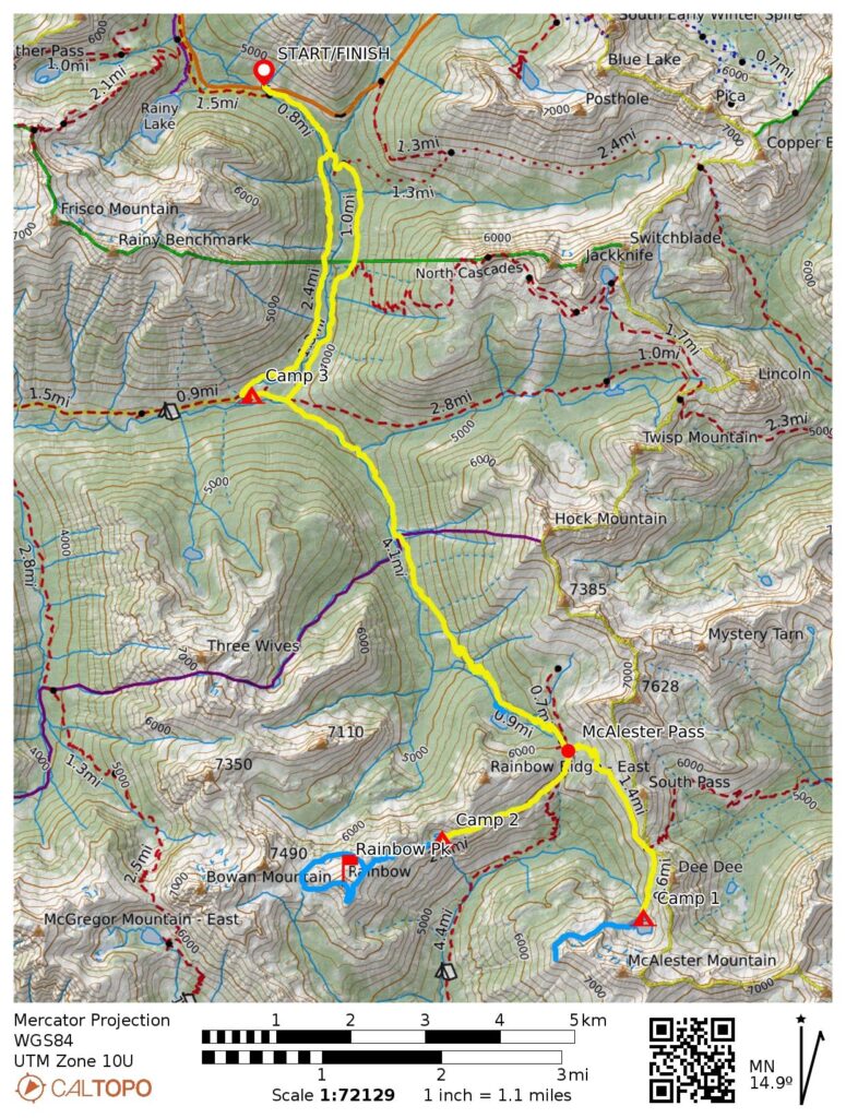
- Route Maps & Profiles
- Photo Gallery
Trip Report Summary
Region: North-Central Washington Cascades
Sub-Region: North Stehekin Mountains
Areas: North Cascades National Park & Lake Chelan National Recreation Area
Starting & Ending Point: Bridge Creek Trailhead on Highway 20 (Elev. 4550 feet)
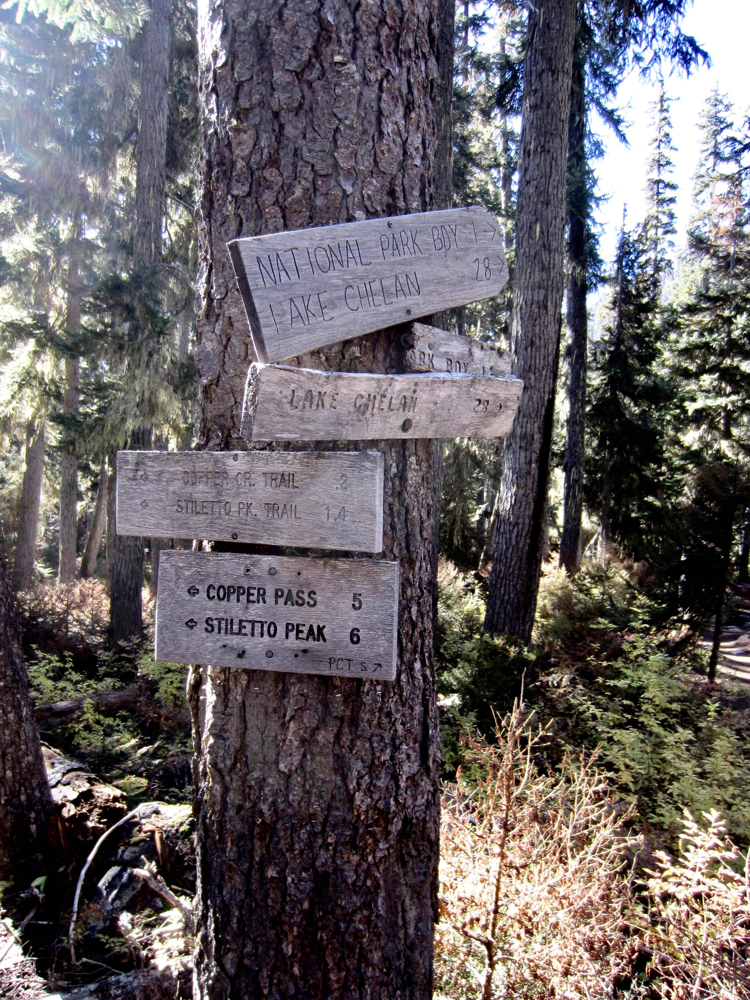
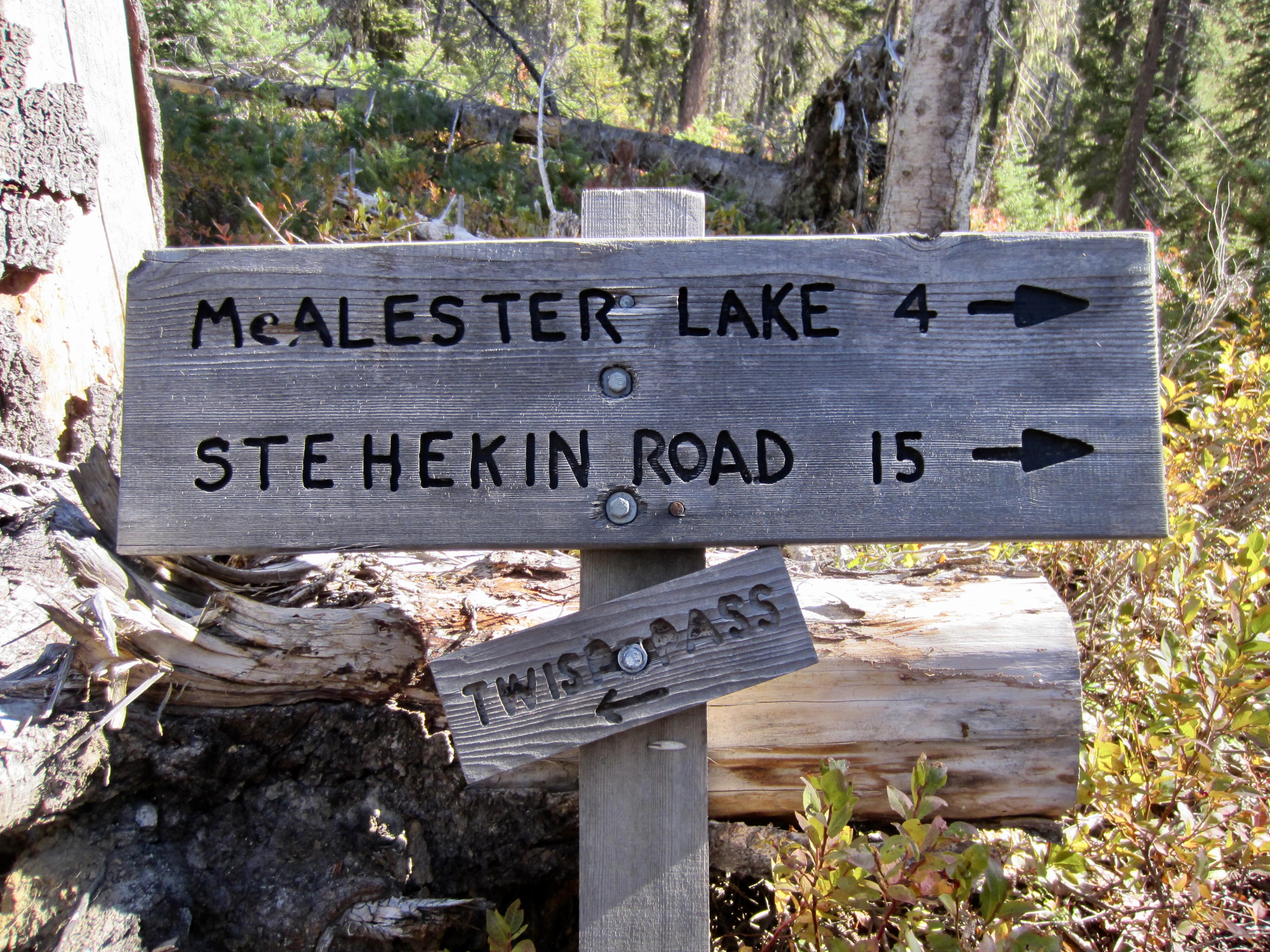
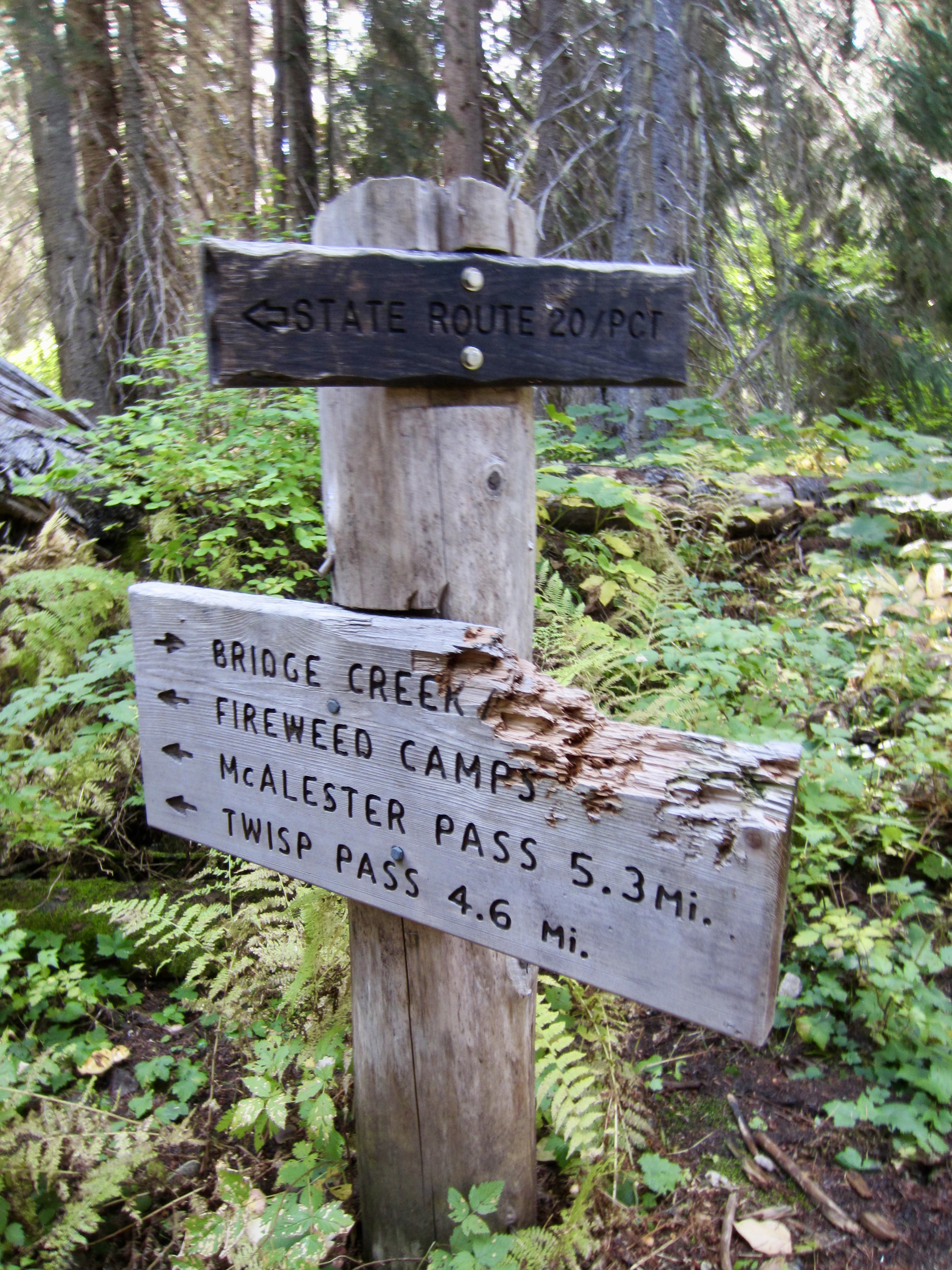
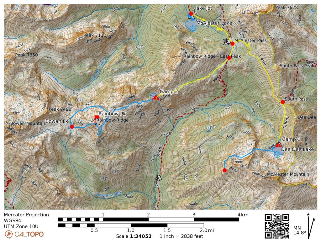
Way Points: Stiletto Spur Trail junction & McAlester Lake Trail junction & East Fork McAlester Creek crossing & McAlester Lake Spur Trail junction & McAlester Pass & South Pass & Lower Dee Dee Lake & Upper Dee Dee Lake & Lower Dee Dee Lake & South Pass & McAlester Pass & Rainbow Ridge Trail junction & Lake 6111 & Rainbow Creek Trail junction & McAlester Pass & East Fork McAlester Creek crossing & Fireweed Camp & Bridge Creek Trail junction & Bridge Creek Trailhead (trail hike & trail scramble)
Campsites: Upper Dee Dee Lake & Lake 6111 & Fireweed Camp
Sidetrip 1: McAlester Lake (trail hike)
Sidetrip 2: Rainbow Tarn & Rainbow Peak summit & Bowan Lake & Rainbow Tarn & Lake 6111 (trail hike & off-trail hike & rock scramble)
Sidetrip 3: Upper Dee Dee Lake heather bench & Northwest McAlester Ridge notch (off-trail hike & rock scramble)
Summit Attempt: McAlester Mountain (off-trail hike & rock scramble to 7000 feet on Southwest Rib via Northwest Bowl—West Slope)
Summit: Rainbow Peak (off-trail hike & rock scramble via Southeast Slope—South Ridge; descent via West Ridge—Southwest Slope)
Approximate Stats (excluding all sidetrips): 24.3 miles traveled; 4800 feet gained & lost.
Approximate Stats (including all sidetrips): 29.8 miles traveled; 7770 feet gained & lost.
Related Post
>>> Rainbow Ridge Loop via Rainbow Lake—Bowan Pass—Lake 6111 + Bowan Mountain – September 2013
Full Trip Report
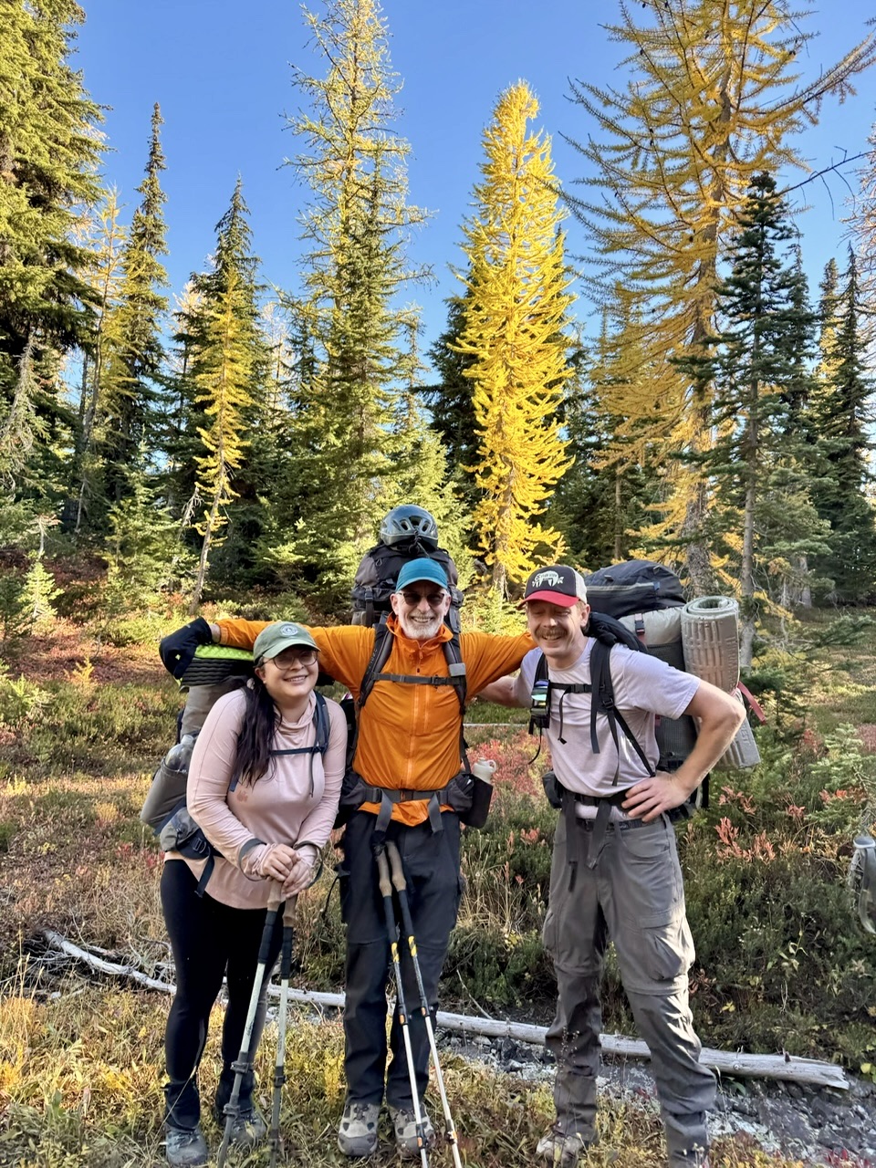
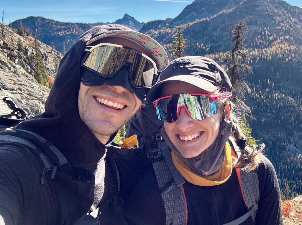
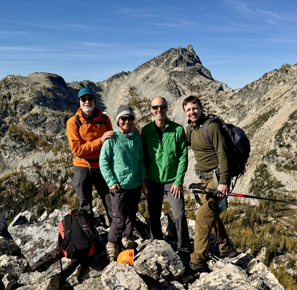
For this year’s annual Golden Larch Outing, Andrew, Lisa, Todd, and Yoko joined me on a four-day trek into the North Stehekin Mountains between Highway 20 and Lake Chelan. We traced a wishbone-shaped route by hiking southward to McAlester Pass, then making branch forays southeastward to Dee Dee Lakes and southwestward to Rainbow Ridge. Our planned itinerary was significantly affected by rain, snow, and wind, but we managed to tuck in some beautiful lakes and one nice summit. I also had two different surprise encounters with mountain friends!
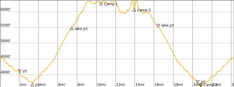
Day 1: Trailhead to Dee Dee Lakes
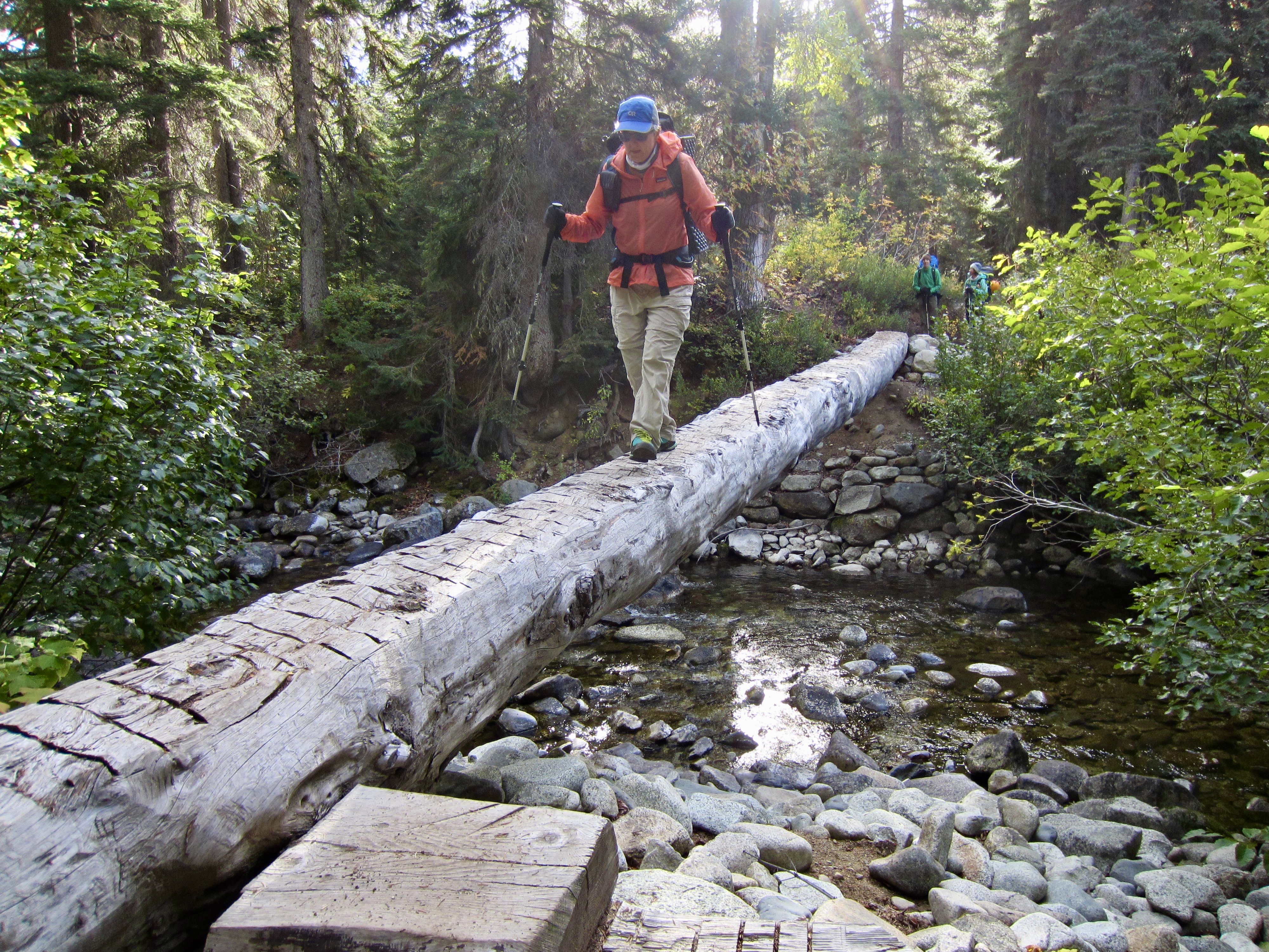
Yoko, Todd, Lisa, and I headed out from the Bridge Creek Trailhead on a cool, sunny Friday morning. We followed a somewhat confusing network of trails past five junctions, first descending Bridge Creek Valley and then ascending McAlester Creek Valley.
.
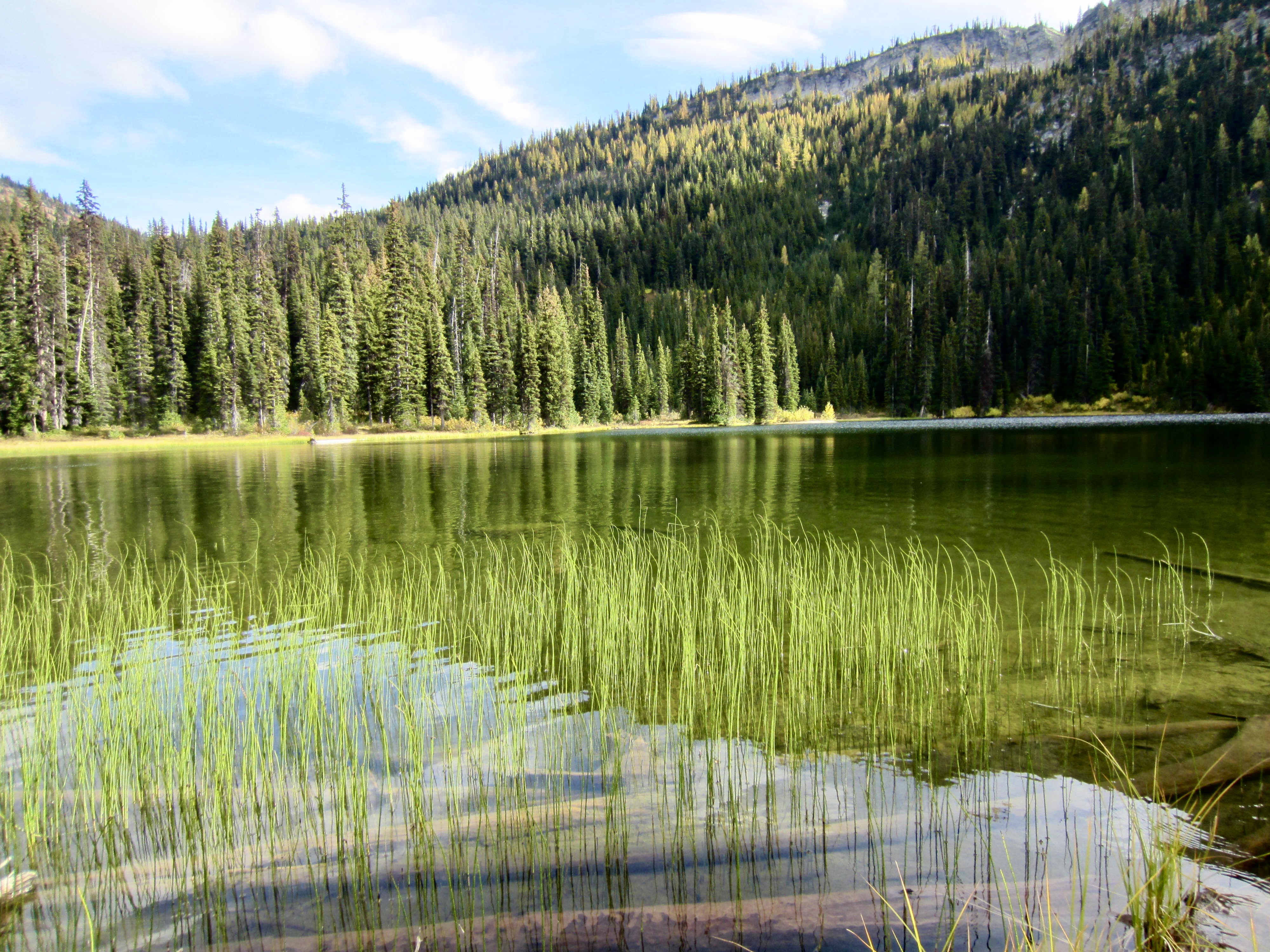
Upon reaching a junction with the McAlester Lake Spur Trail, we made a short sidetrip over to the woodsy lake. The glassy, emerald-green water and graceful reeds created an inviting scene. Note to self: this would provide a pleasant campsite on a future trip.

.
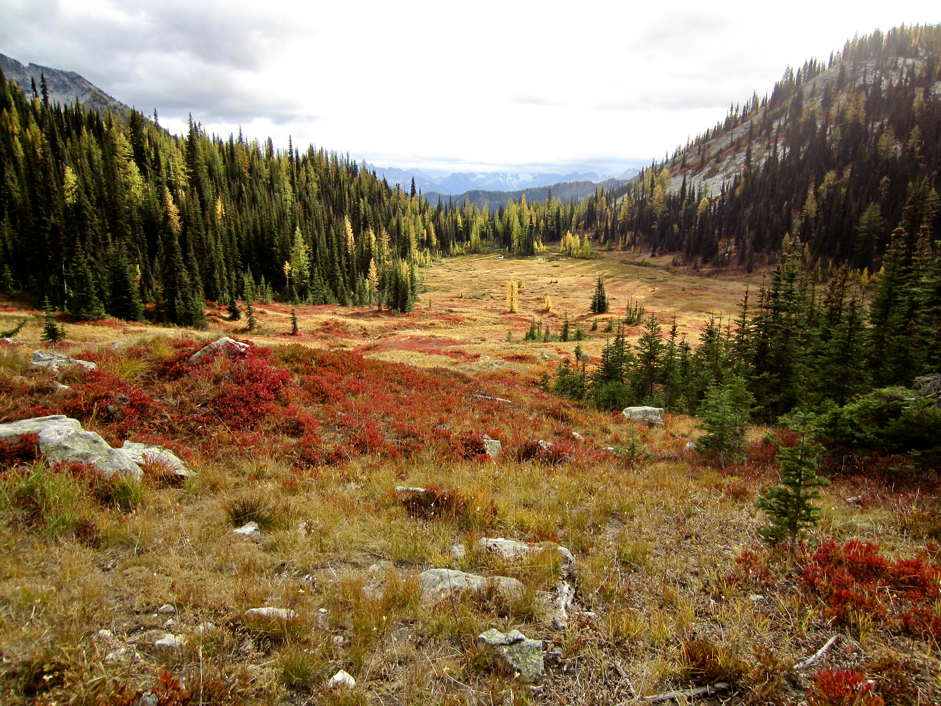
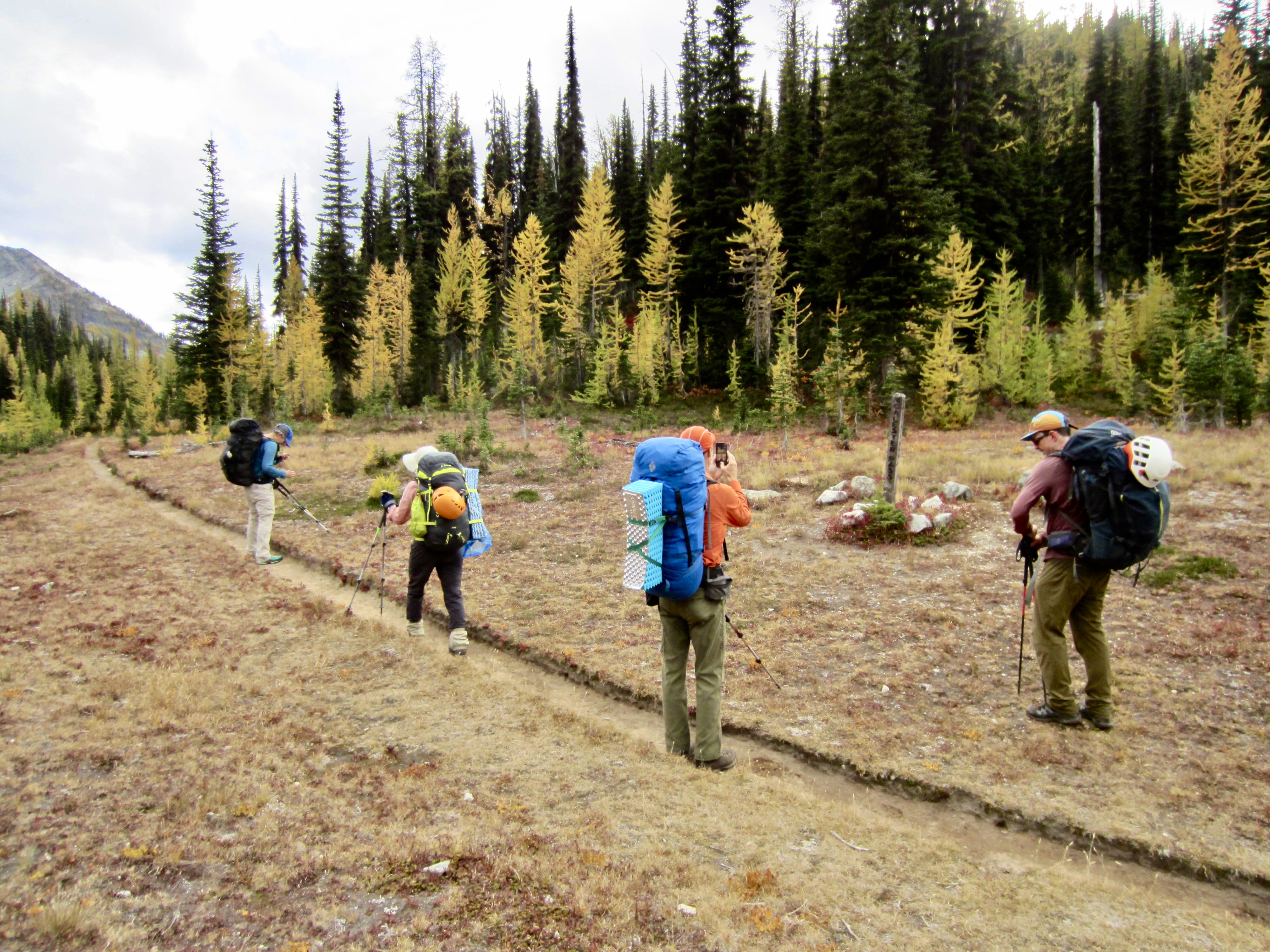
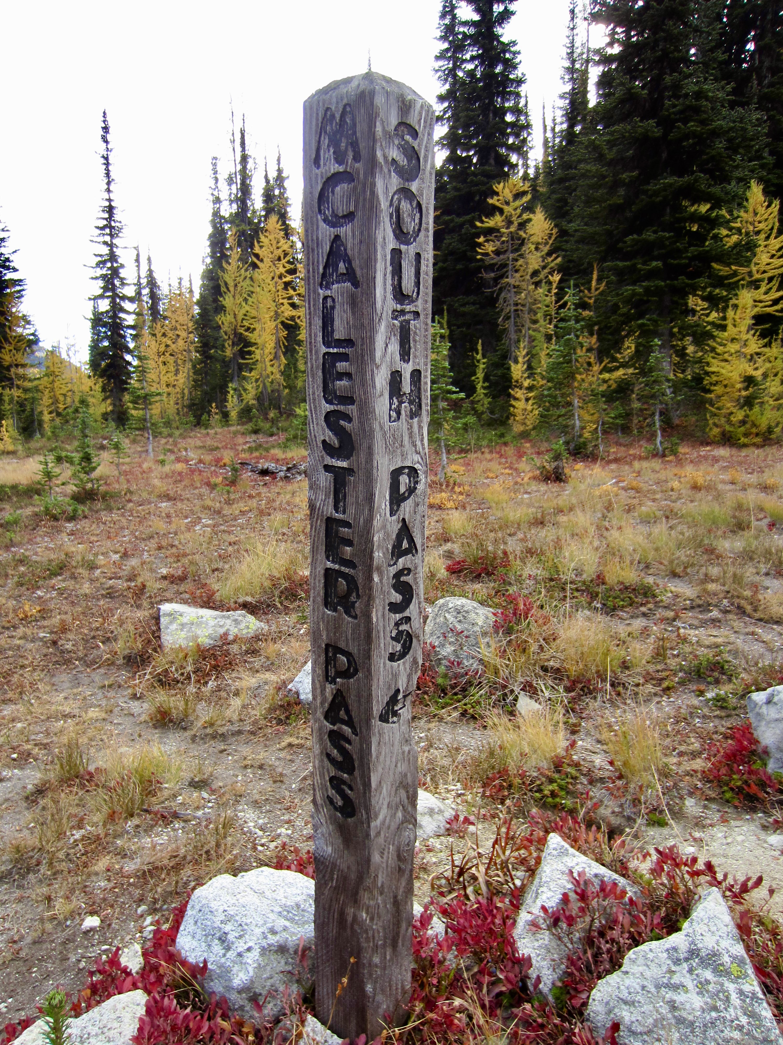
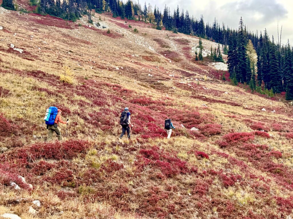
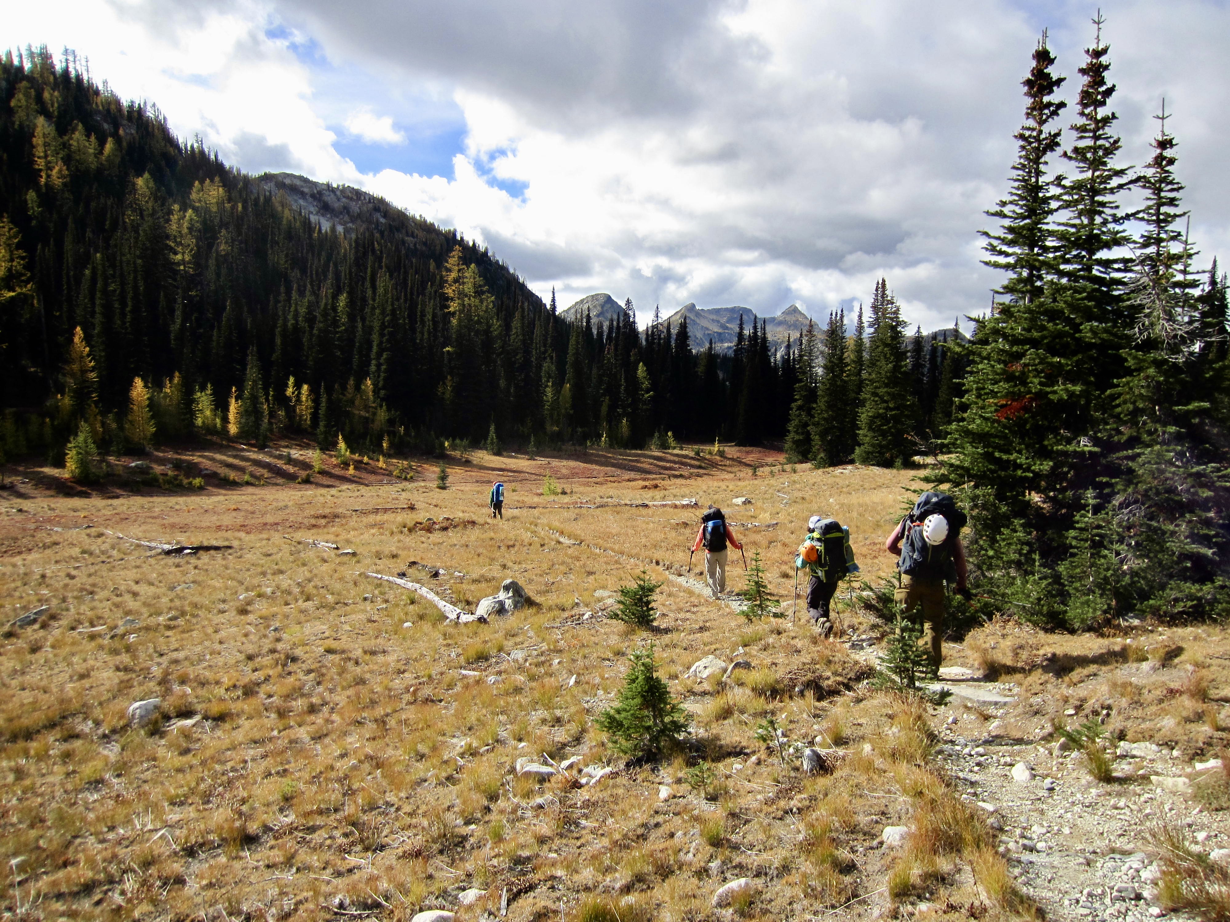
Andrew, who had driven separately, caught up to us at the lake junction, and we all continued together up to 6000-foot McAlester Pass (6.0 hours + 2300 feet from TH). There, we turned left onto the South Pass Trail and hiked across a broad, grassy hillslope of red and gold.
.
.
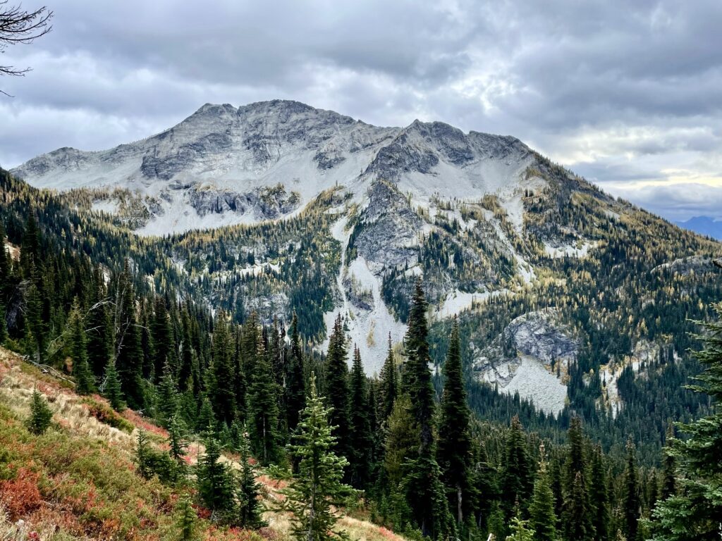
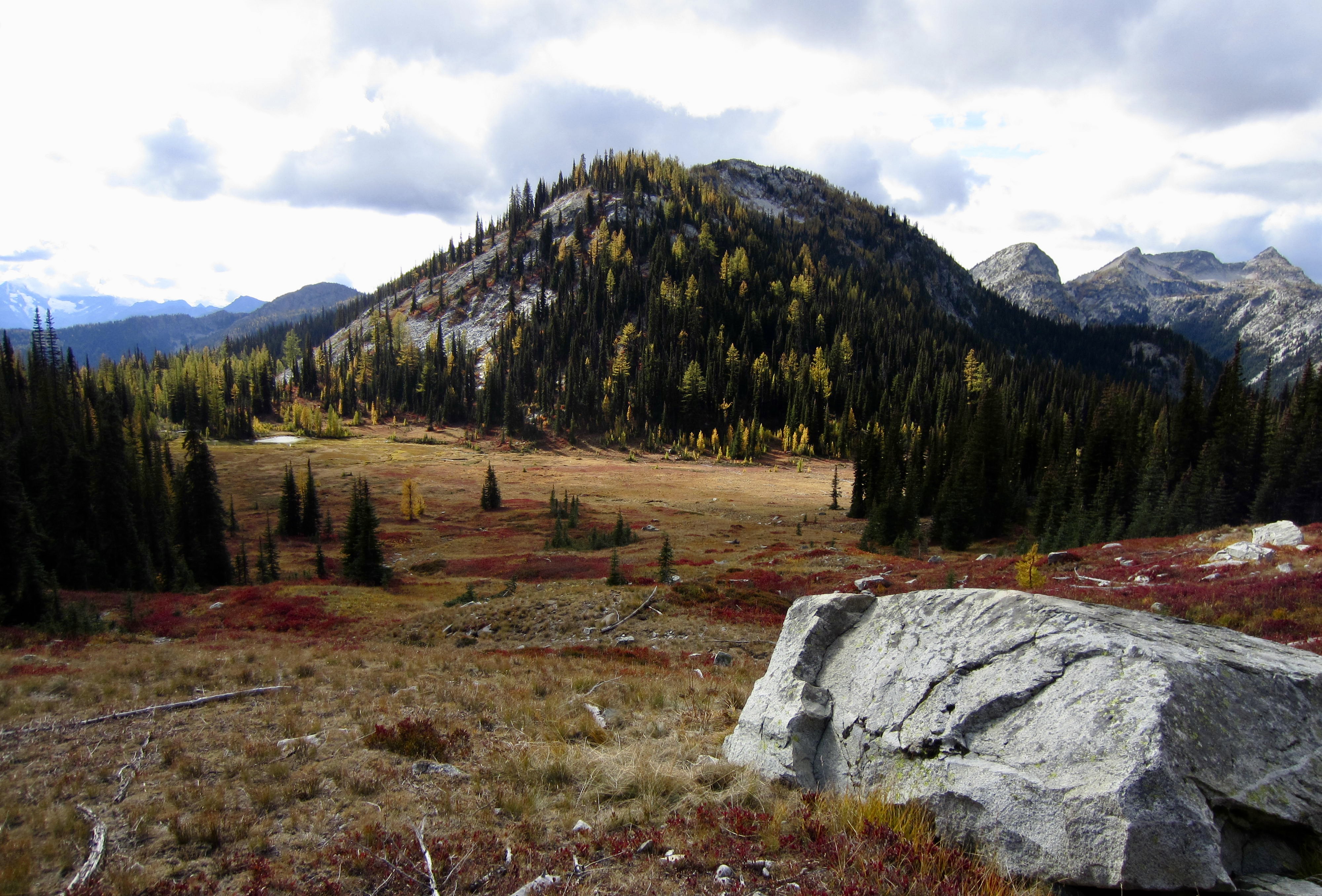
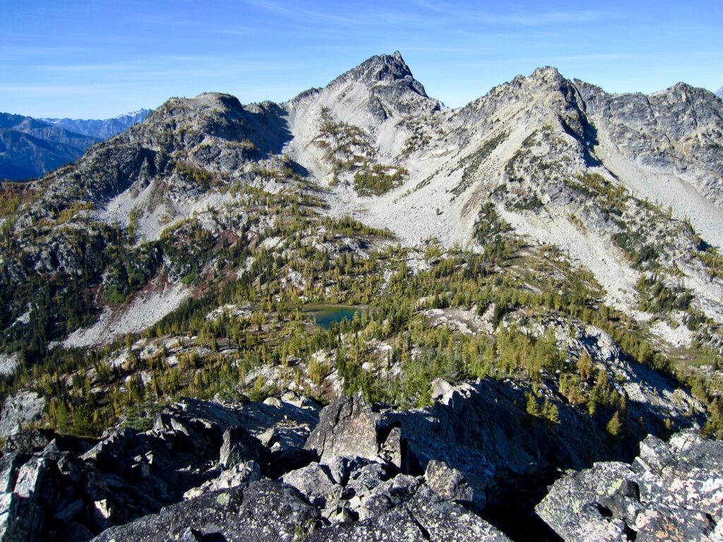
Our trail took us above the pastoral expanse of McAlester Park, now resplendent in its autumnal finery. Farther along, we obtained a good view of McAlester Mountain, which we hoped to climb tomorrow.

.
.
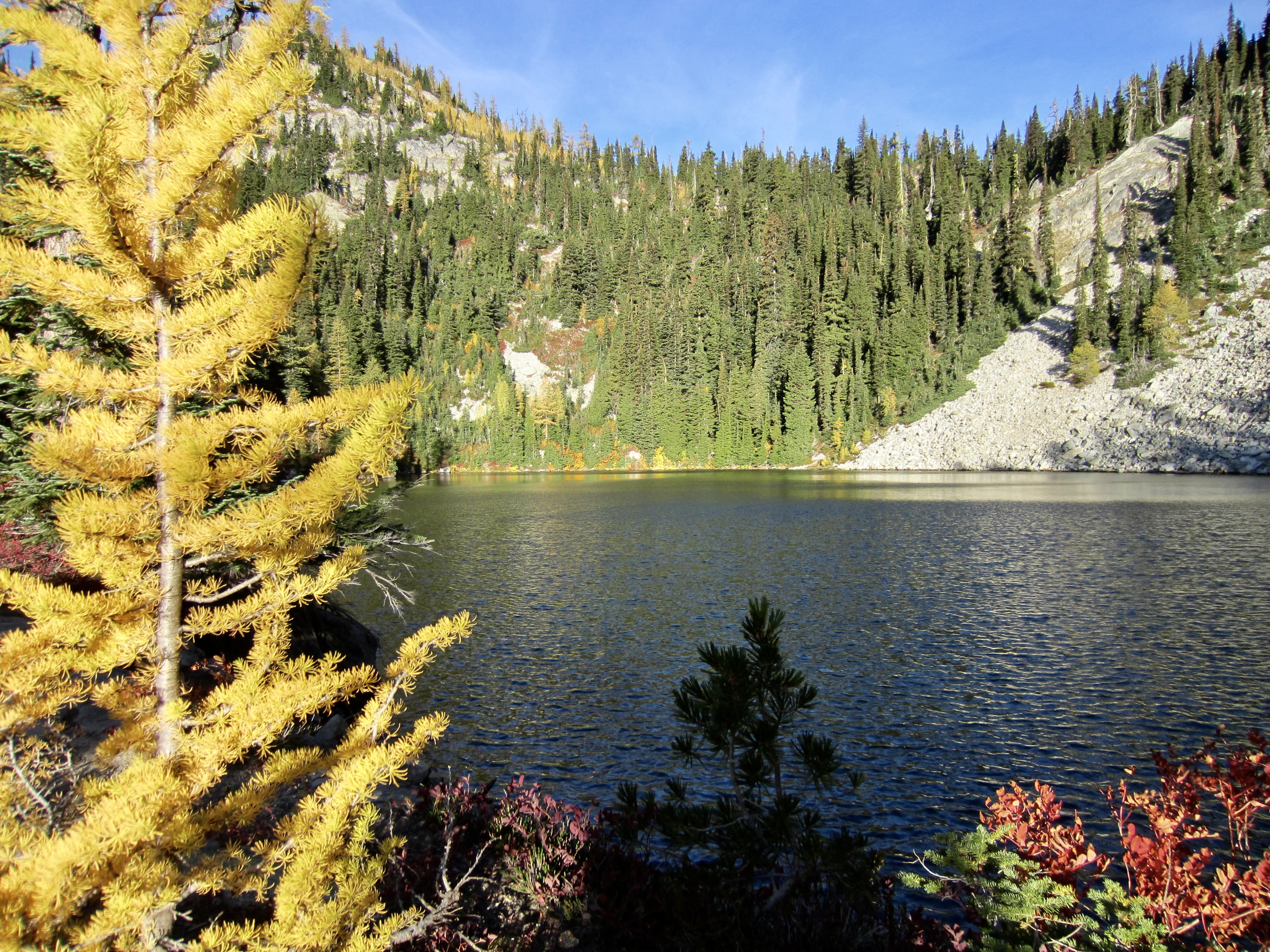
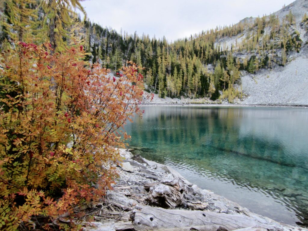
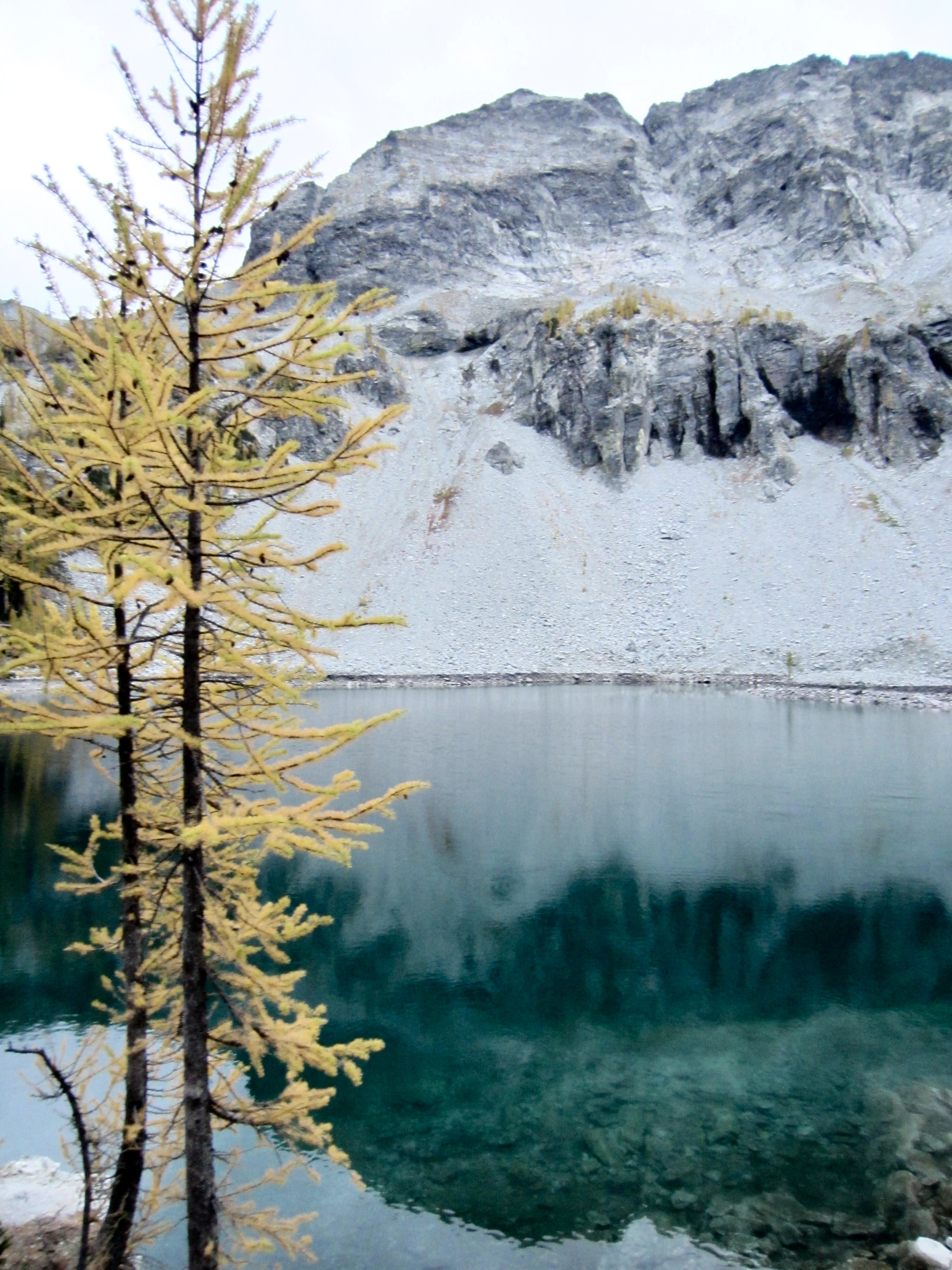
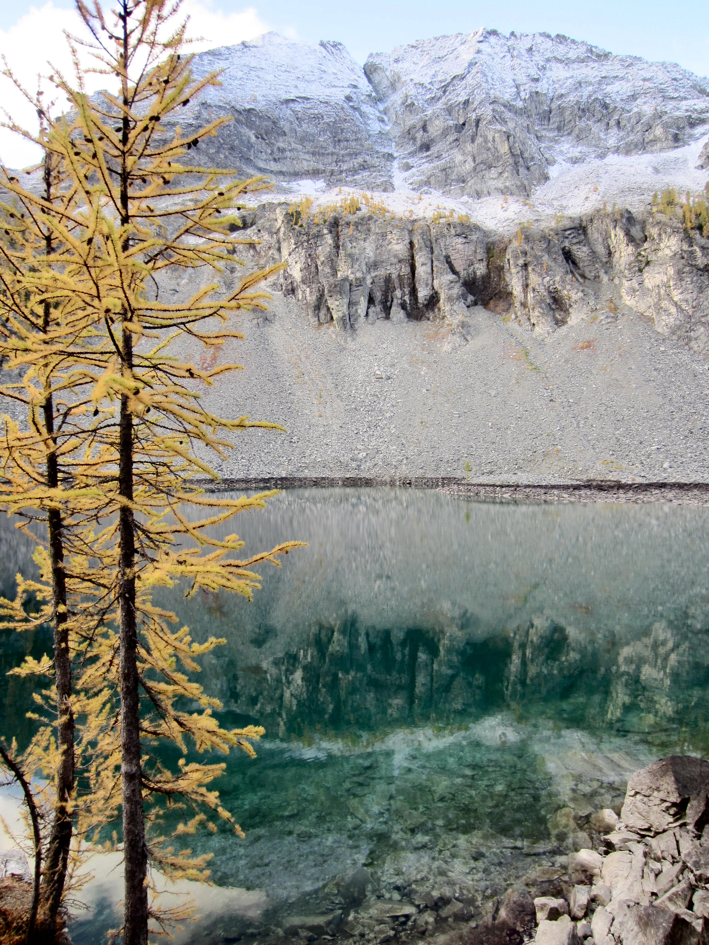
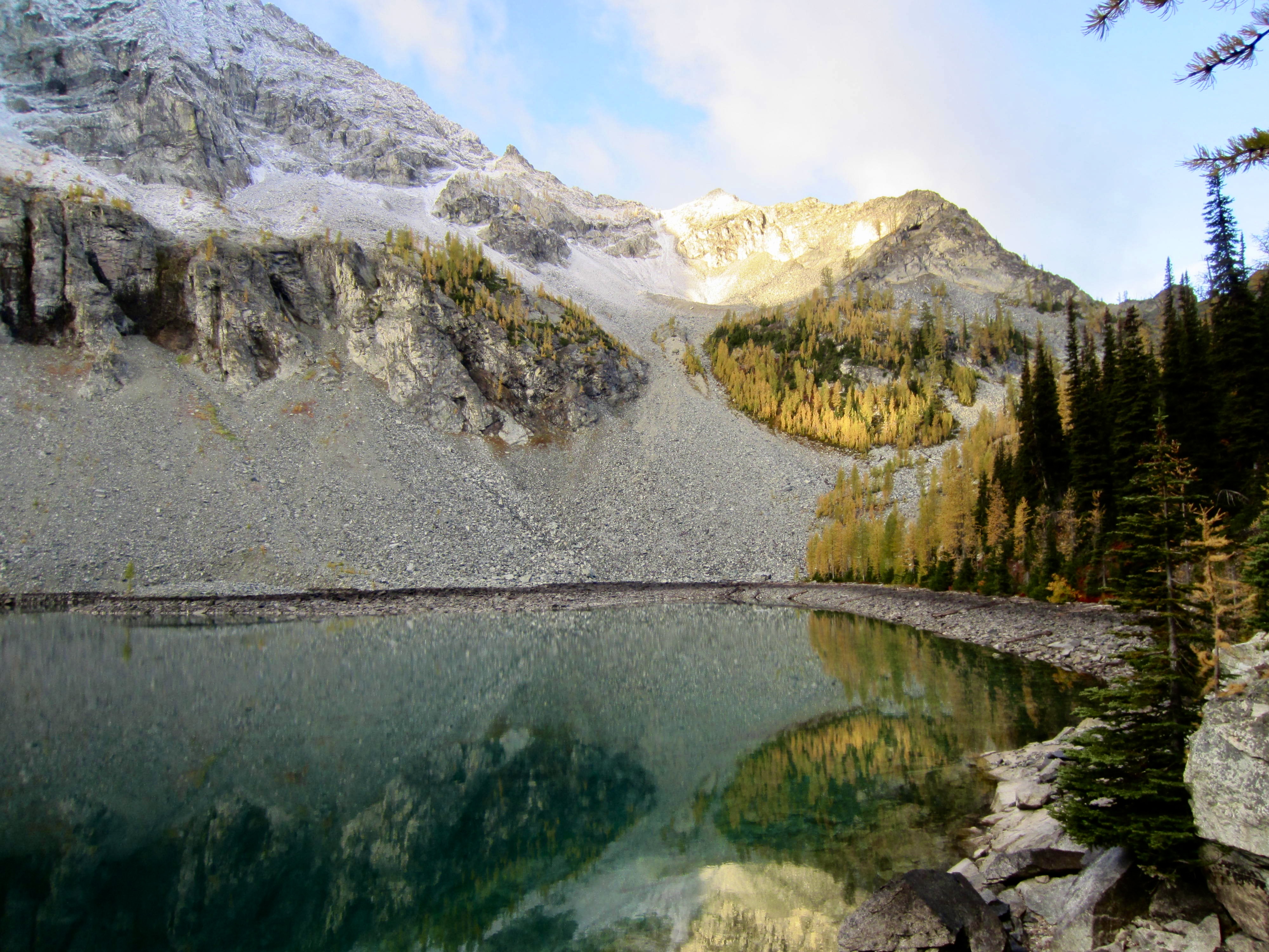
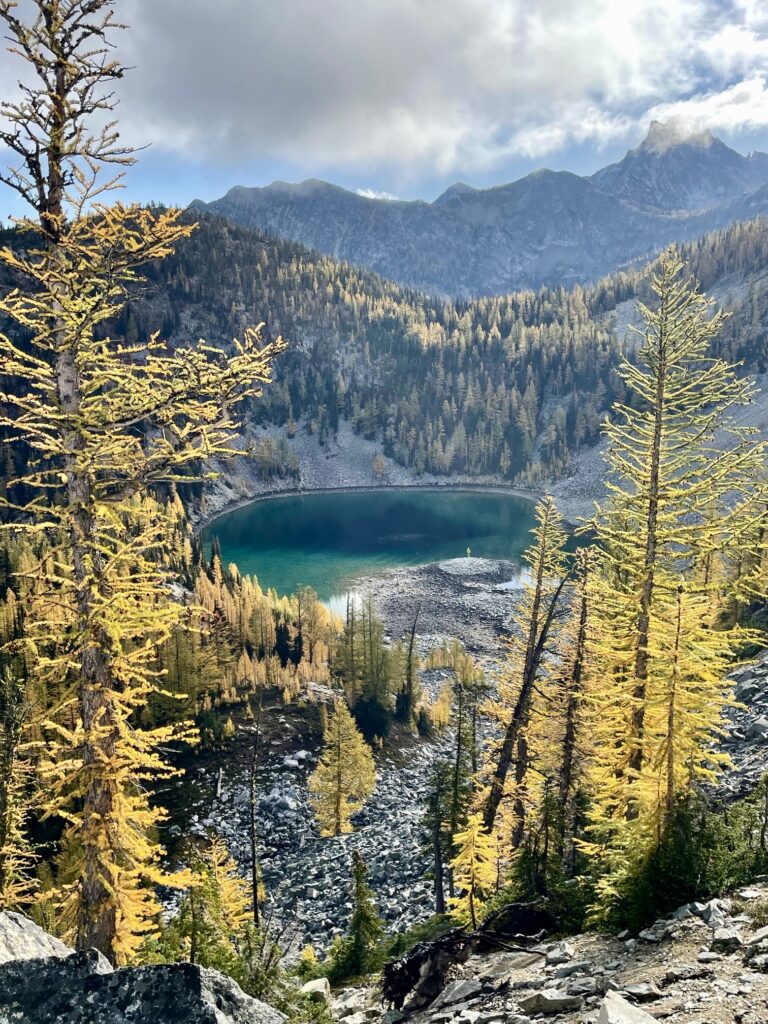
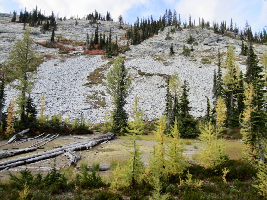
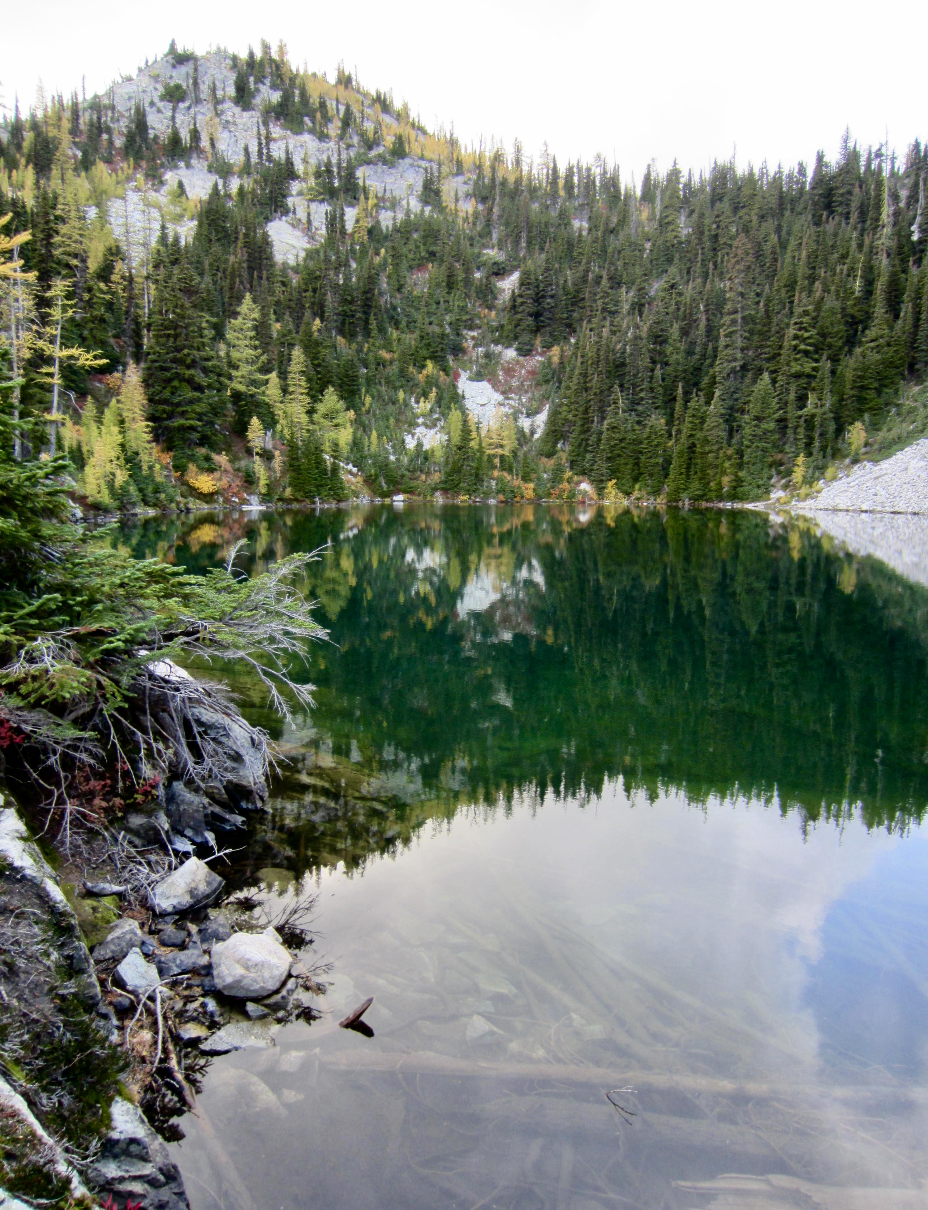
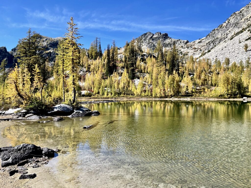
At South Pass, we departed from the formal trail and followed a rough but well-trodden fisherman’s path over to the two Dee Dee Lakes. We stopped for the day at Upper Dee Dee Lake, which sits directly beneath McAlester Mountain’s rugged north face (7.5 hours + 2800 feet from TH). Despite being very close together, these two scenic lakes have distinctly different characters. The lower lake is small, shallow, and demure, whereas the upper lake is much larger and more alpine.

.
.
.
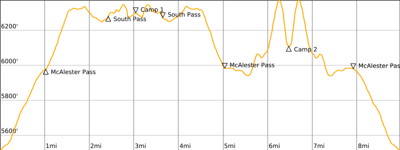
Day 2 (AM): McAlester Mountain Attempt
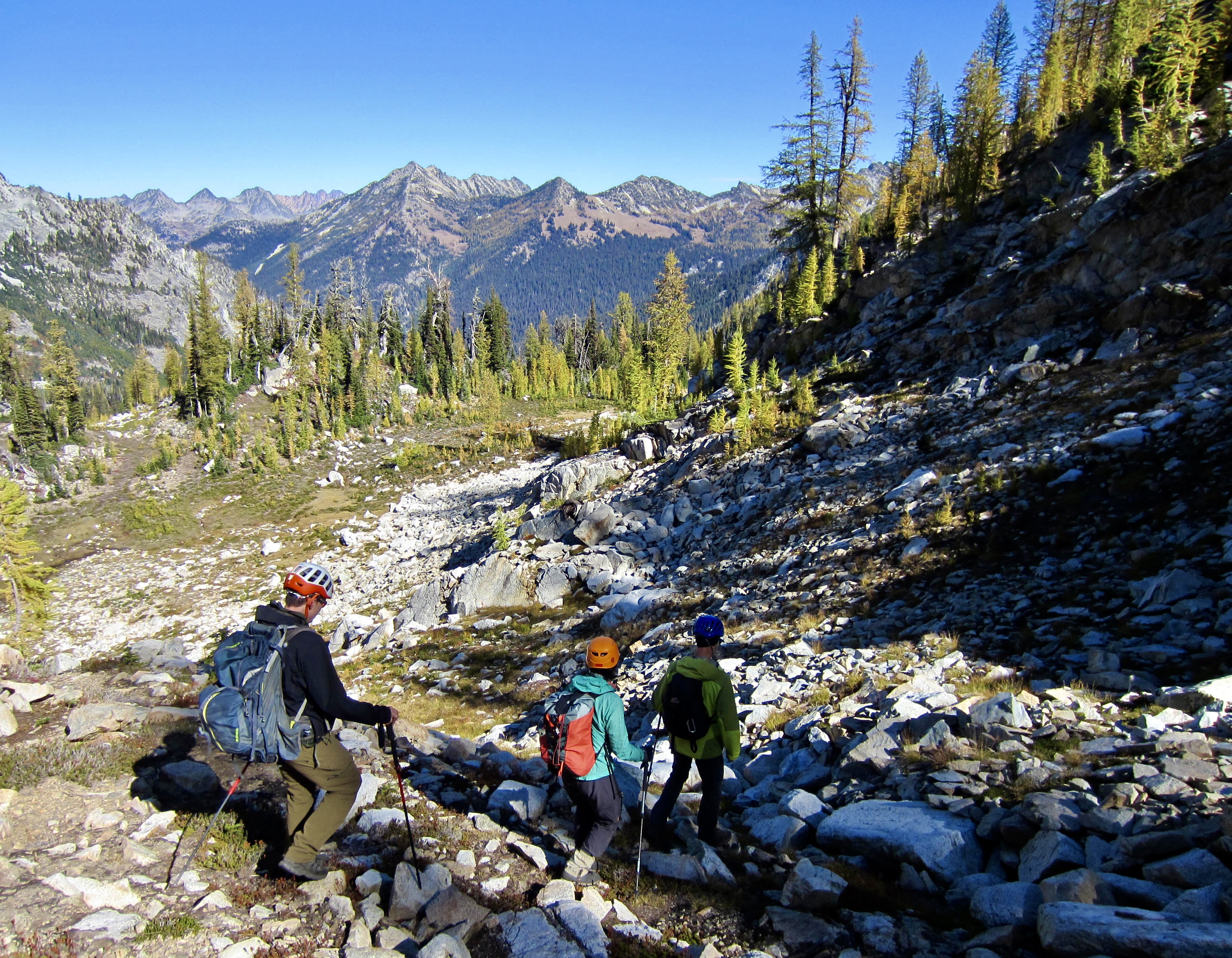
After a night of intermittent rain, we awoke to see McAlester Mountain dusted with fresh snow. Yikes! This did not bode well for our planned morning climb, but Todd, Yoko, Andrew, and I headed out with summit packs to at least reconnoiter the climbing route.
.
.
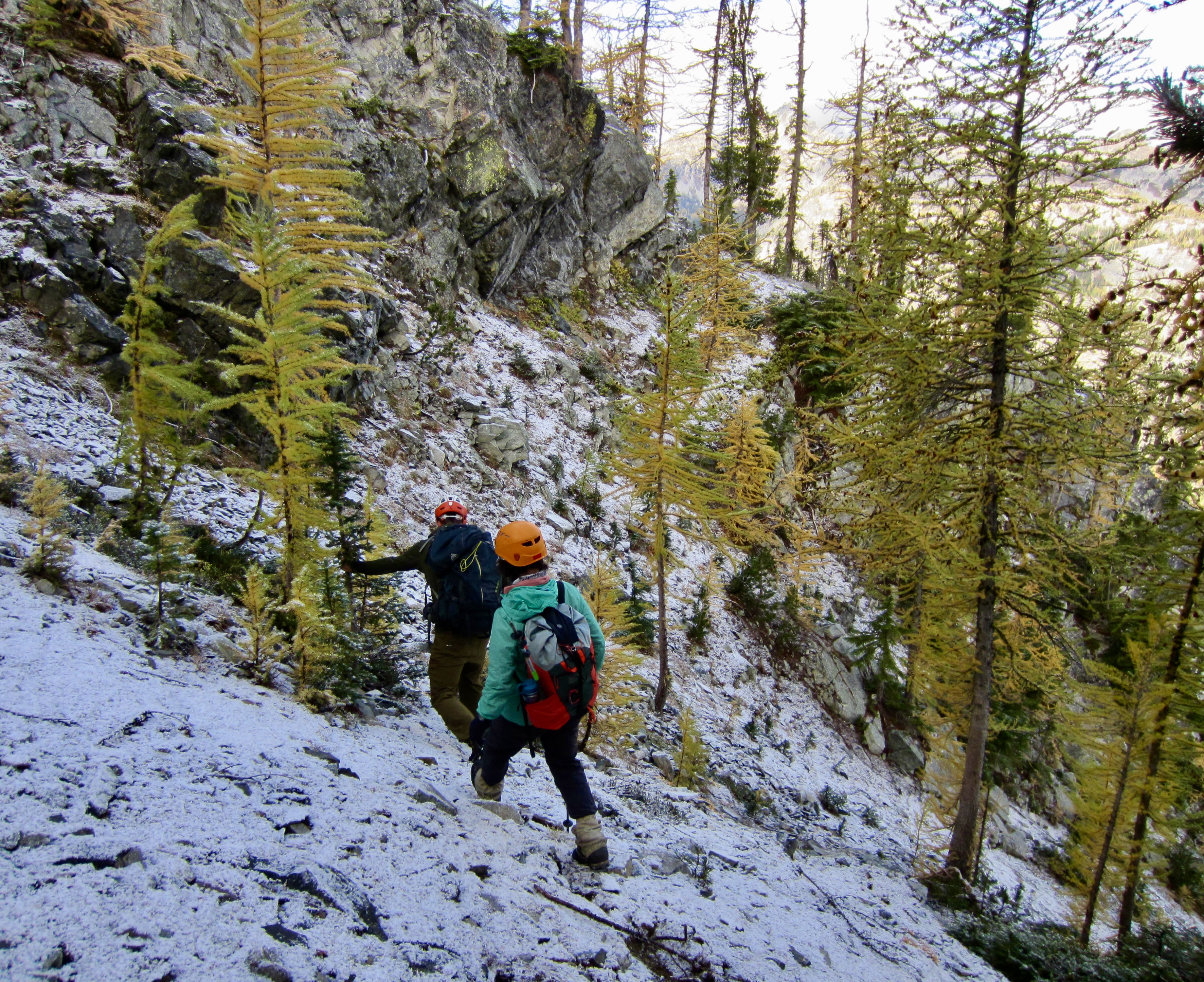
From Upper Dee Dee Lake, we hiked and scrambled due west over a heather bench to gain a 6800-foot notch in the mountain’s northwest ridge. This took us past an impressively large, gnarly larch tree and provided some striking views of the lake basin.
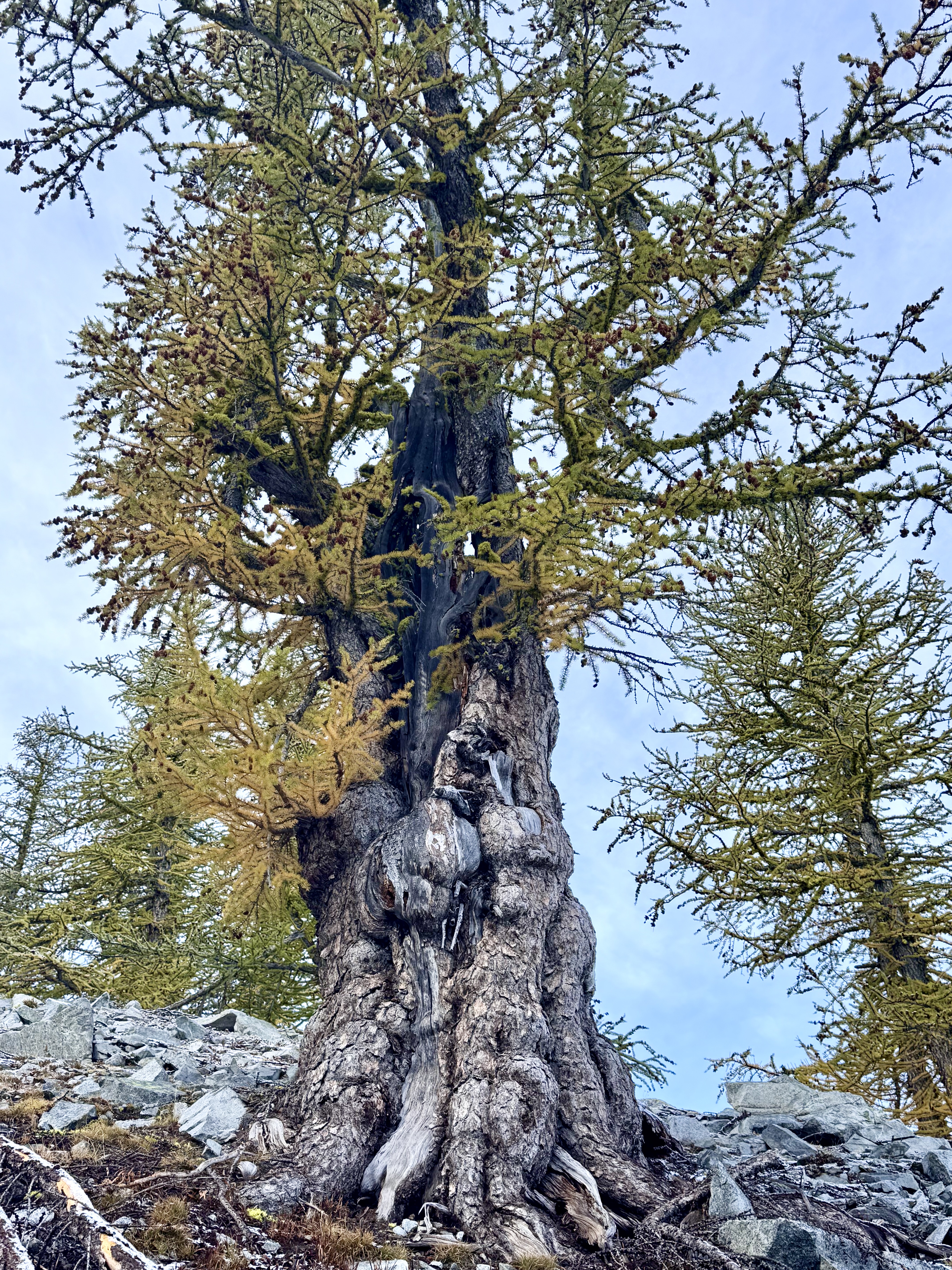
.
.
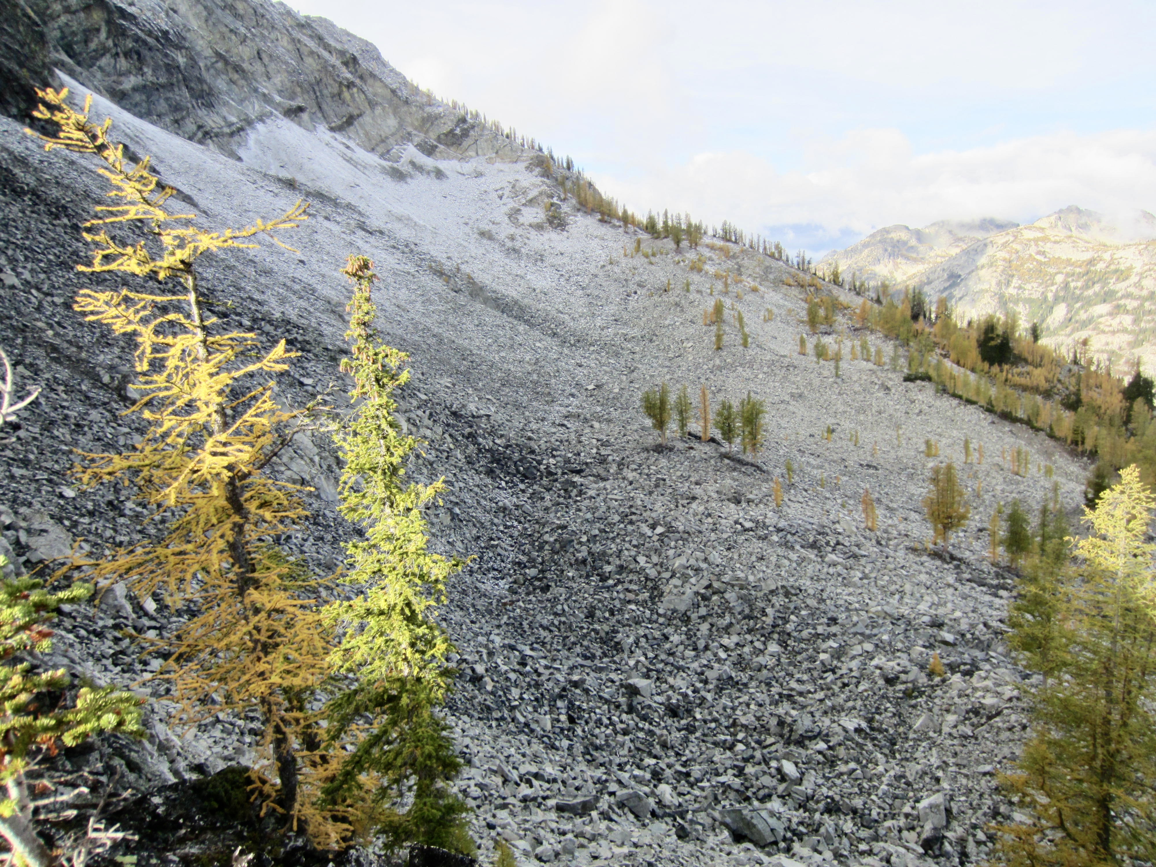
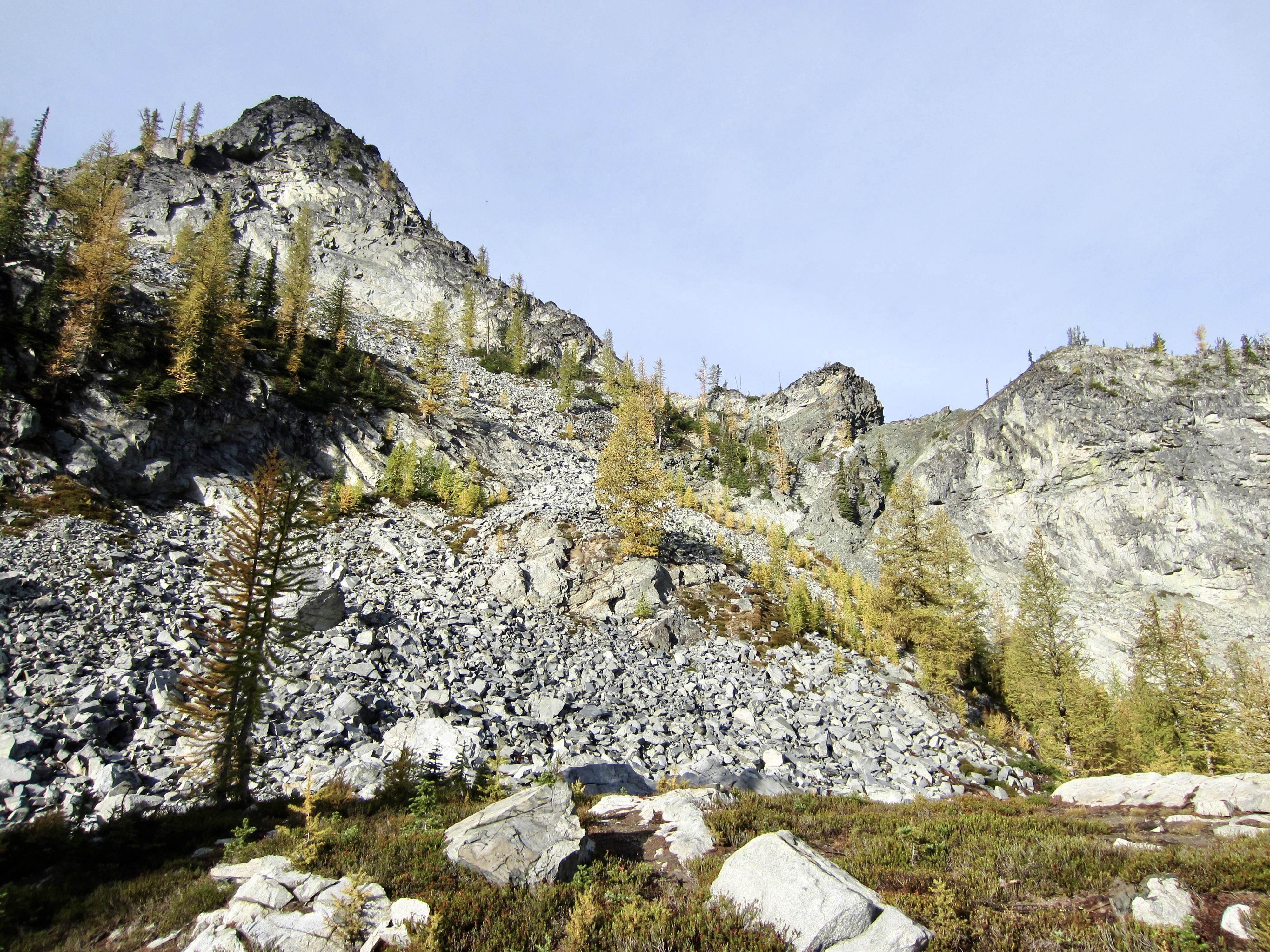
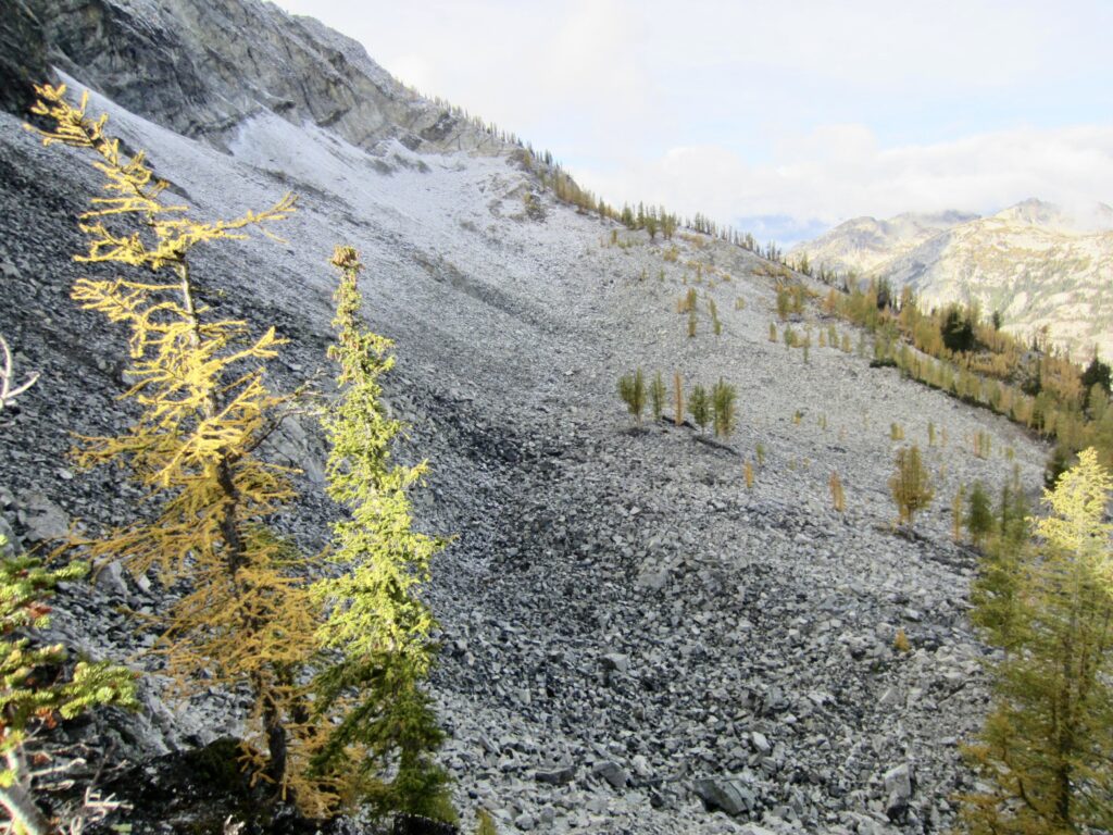
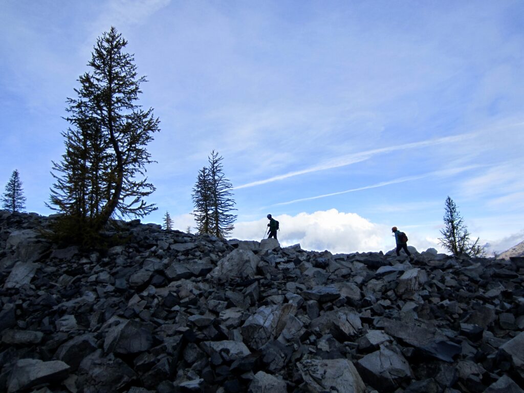
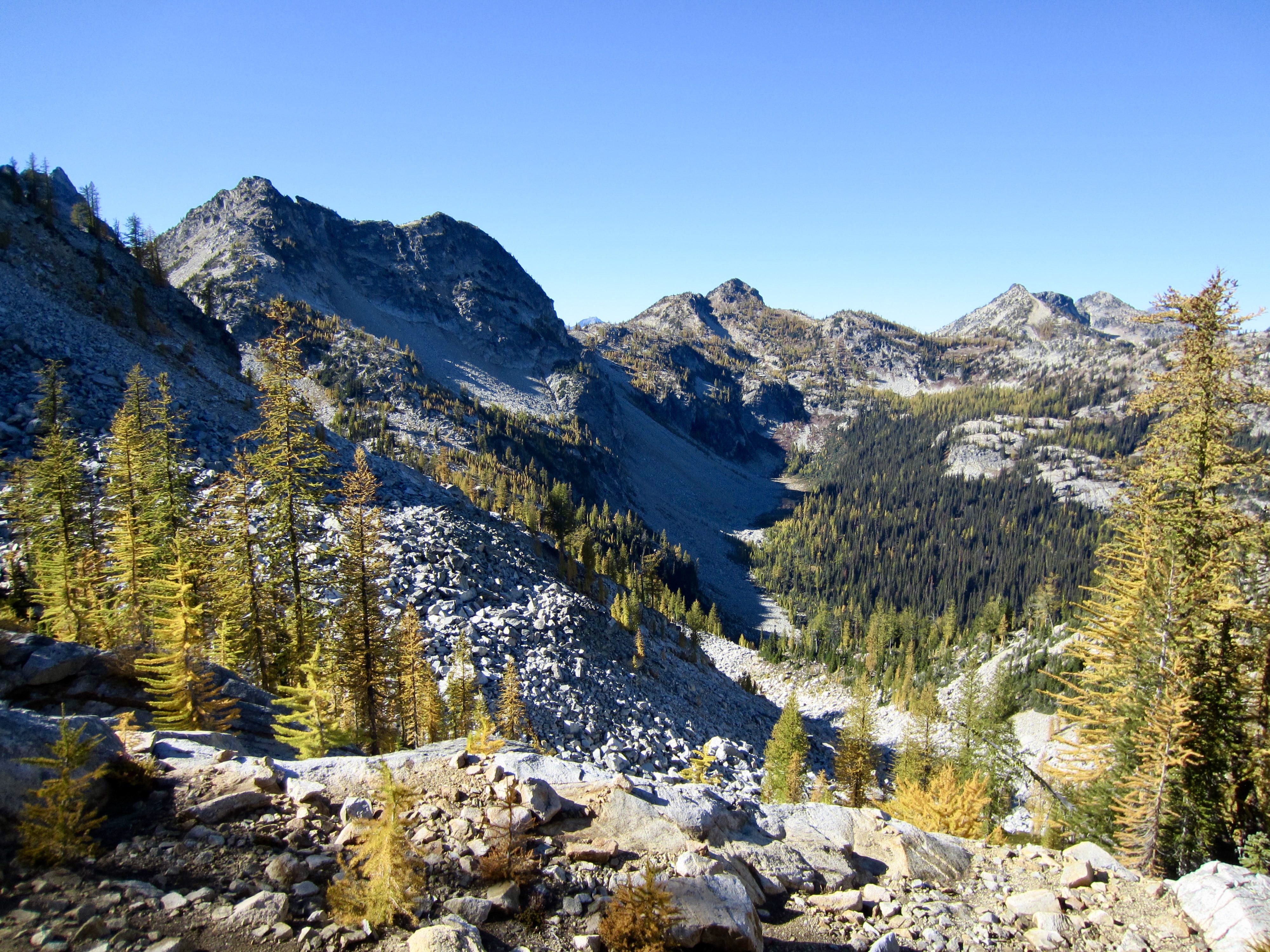
The ridge notch gave access to a big talus bowl on the mountain’s northwestern flank. We dropped into the bowl and carefully picked our way across the broad field of unstable, ice-glazed boulders, aiming for a 6900-foot step in the distant ridge.
.
.
From the ridge step, we began contouring across snow-covered heather and rock on McAlester’s western flank and around to the southwestern rib. Our progress through the slippery terrain had been slow, and the summit was still more than ½ mile away, so a reluctant decision was made to turn around here. We rejoined Lisa back at camp in early afternoon (3.5 hours + 1000 feet RT).
.

.
Day 2 (PM): Dee Dee Lakes to Lake 6111
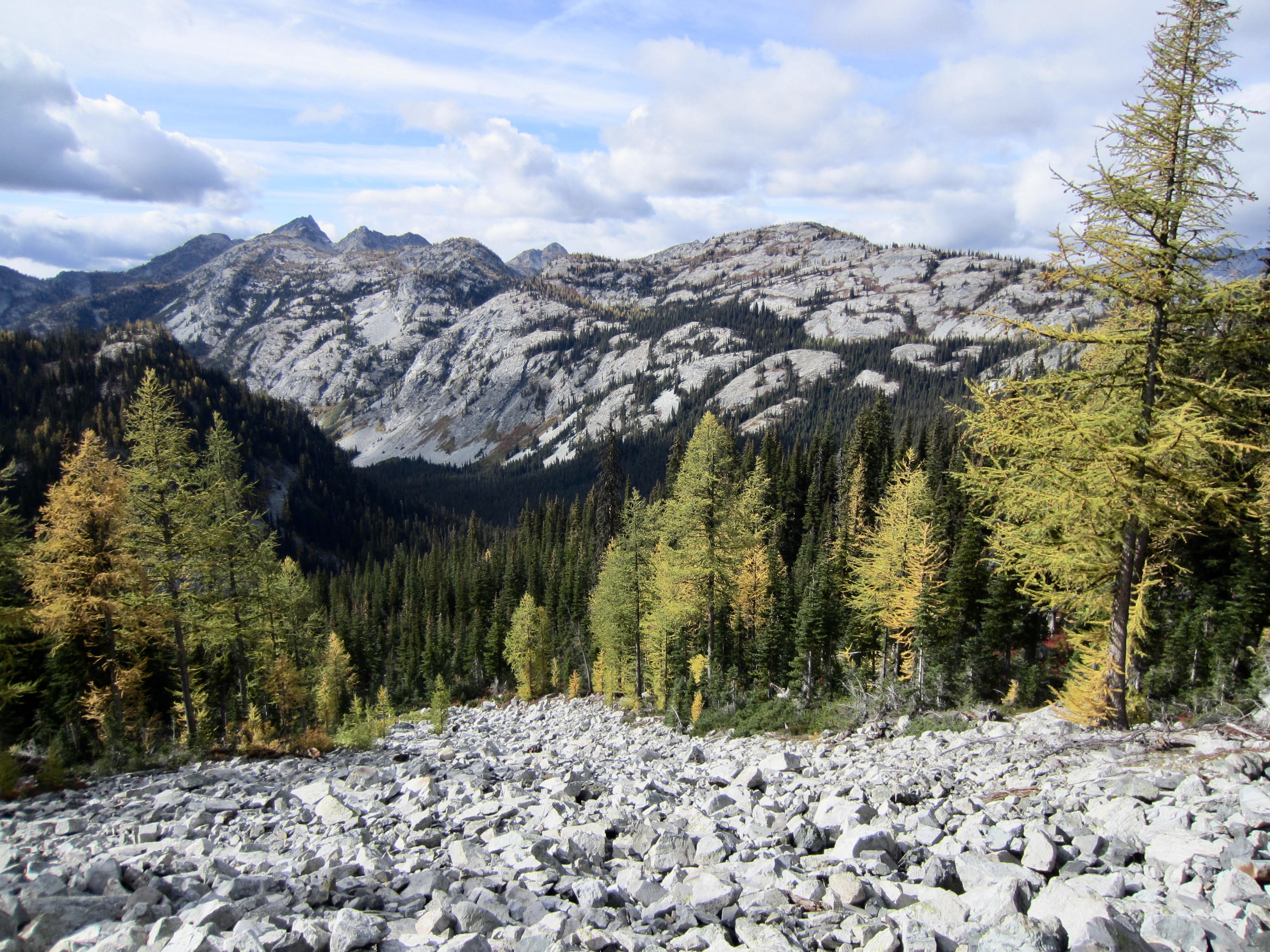
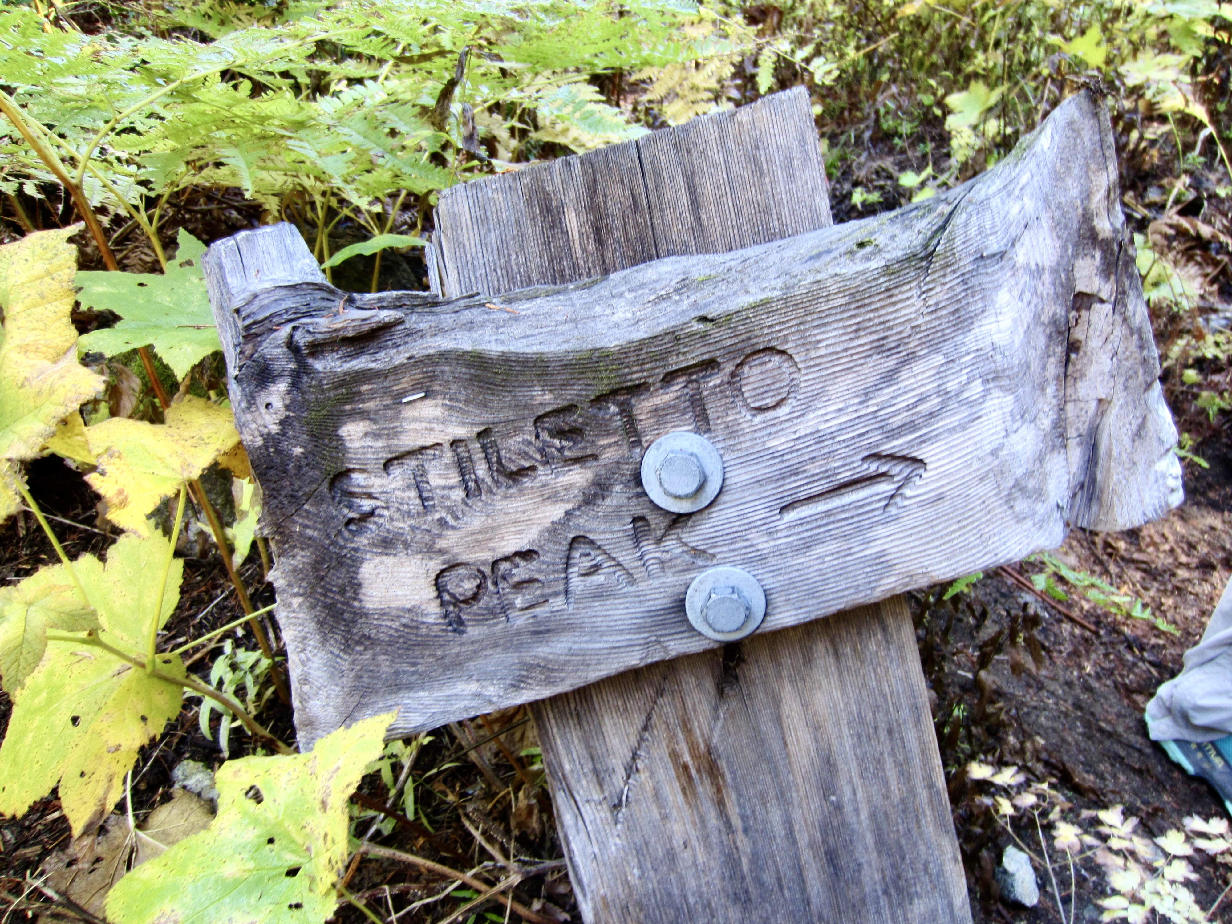
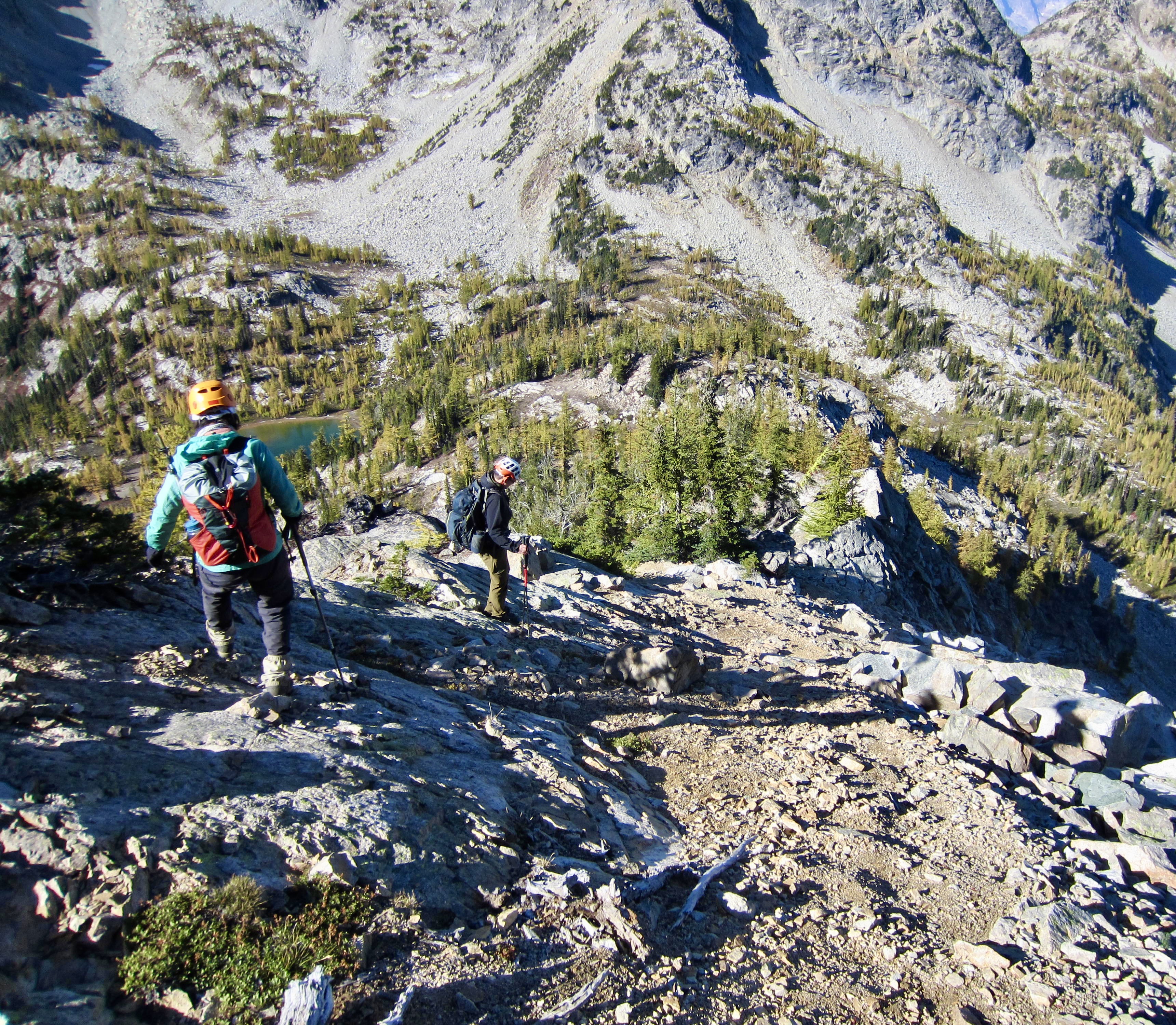
From Dee Dee Lakes, we hiked back over to South Pass and down toward McAlester Pass. The conspicuously bald granite domes of Rainbow Ridge, which extends southwesterly from McAlester Pass, beckoned us toward our next campsite.

.
.
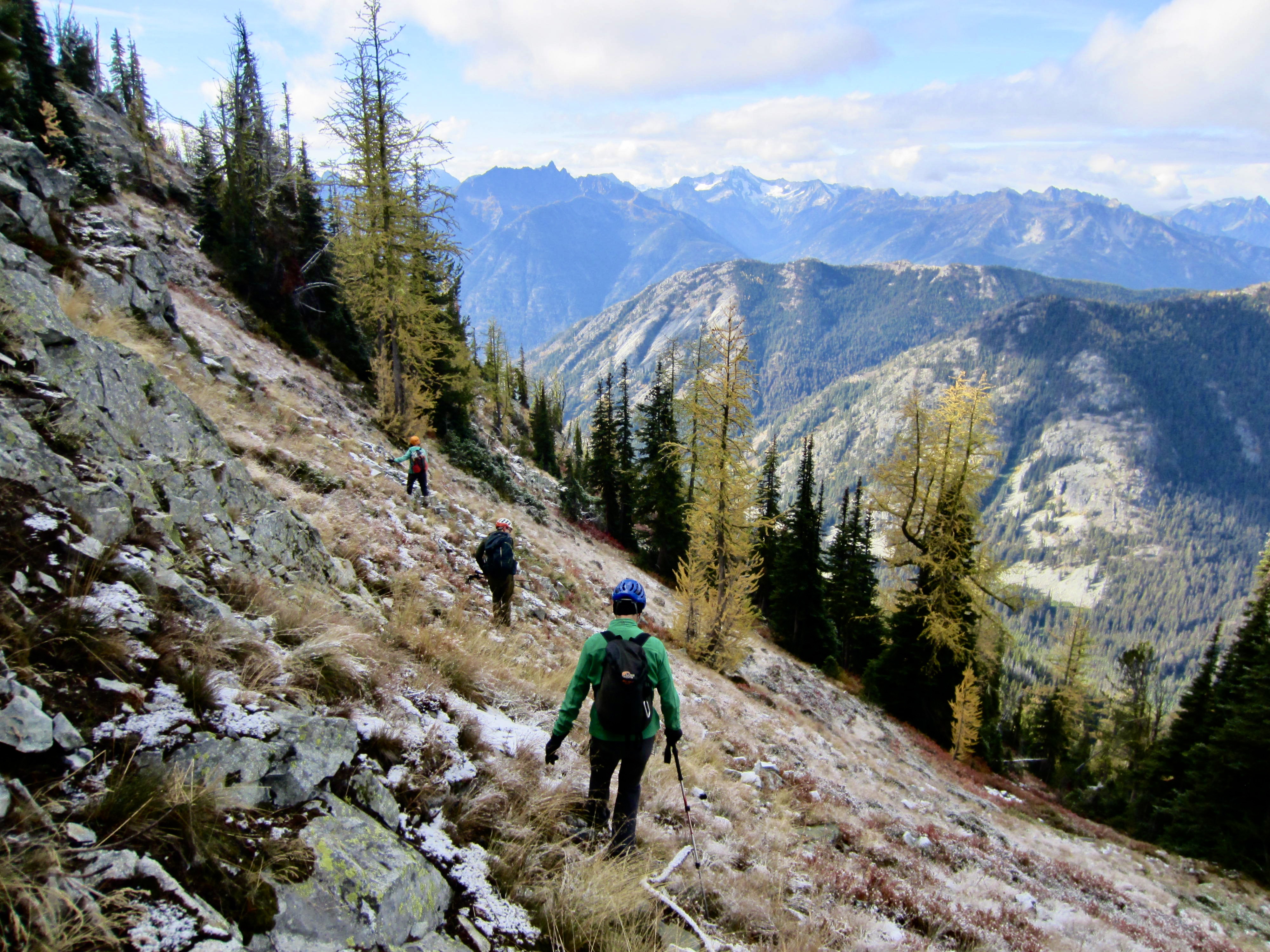
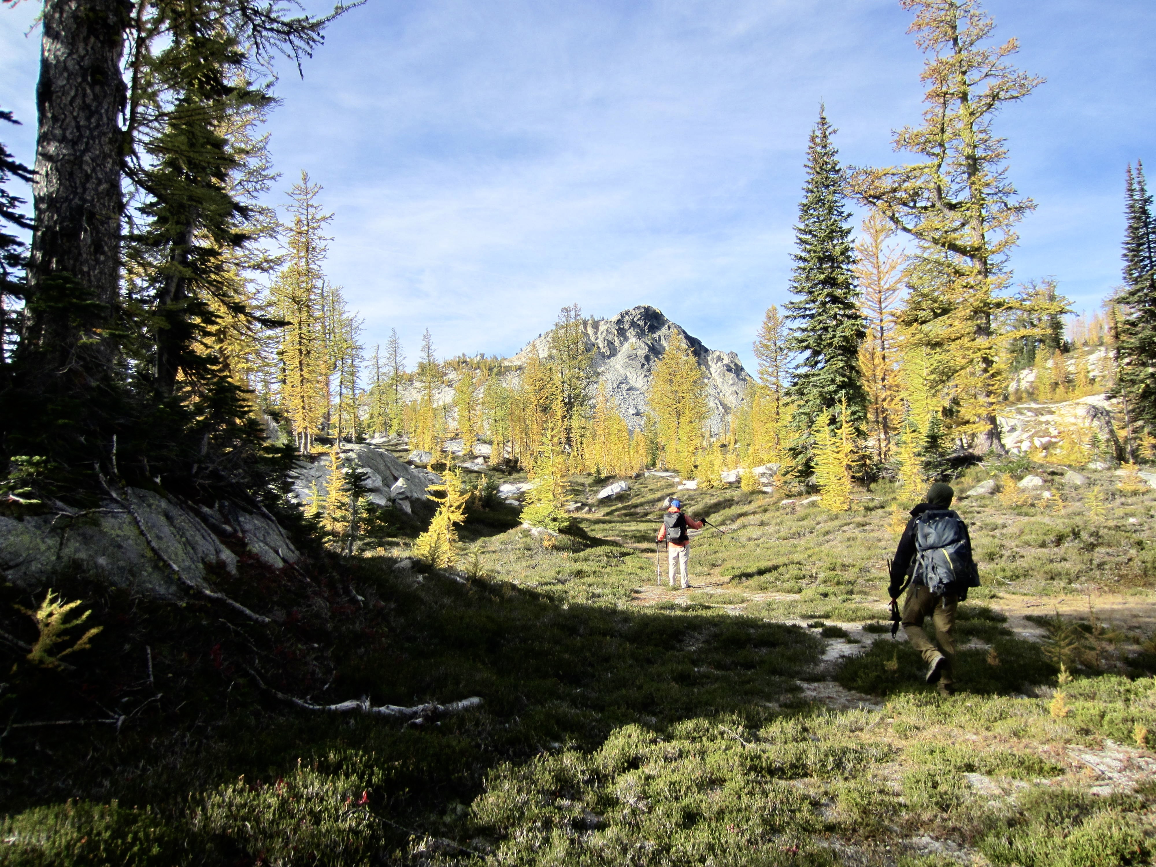
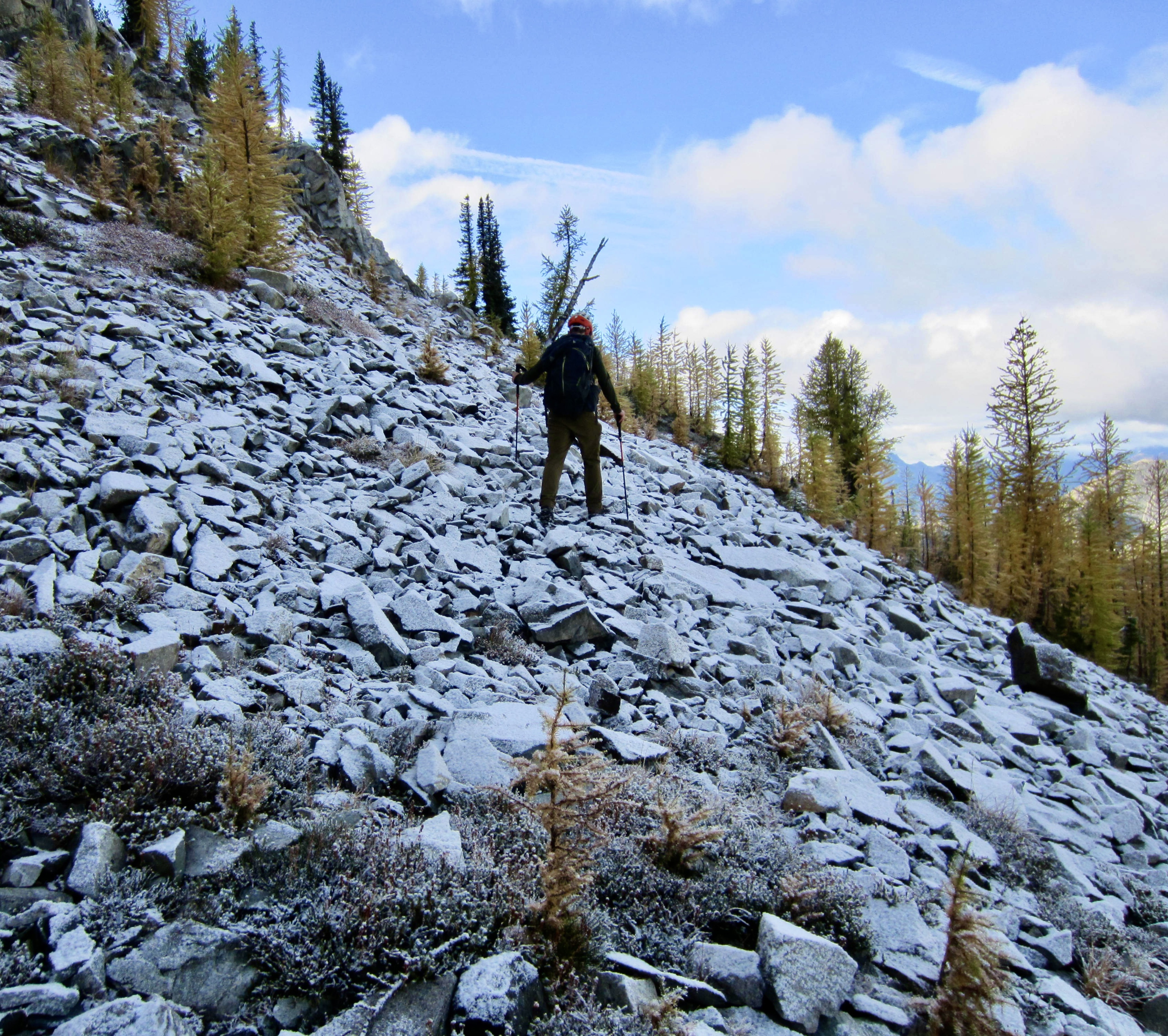
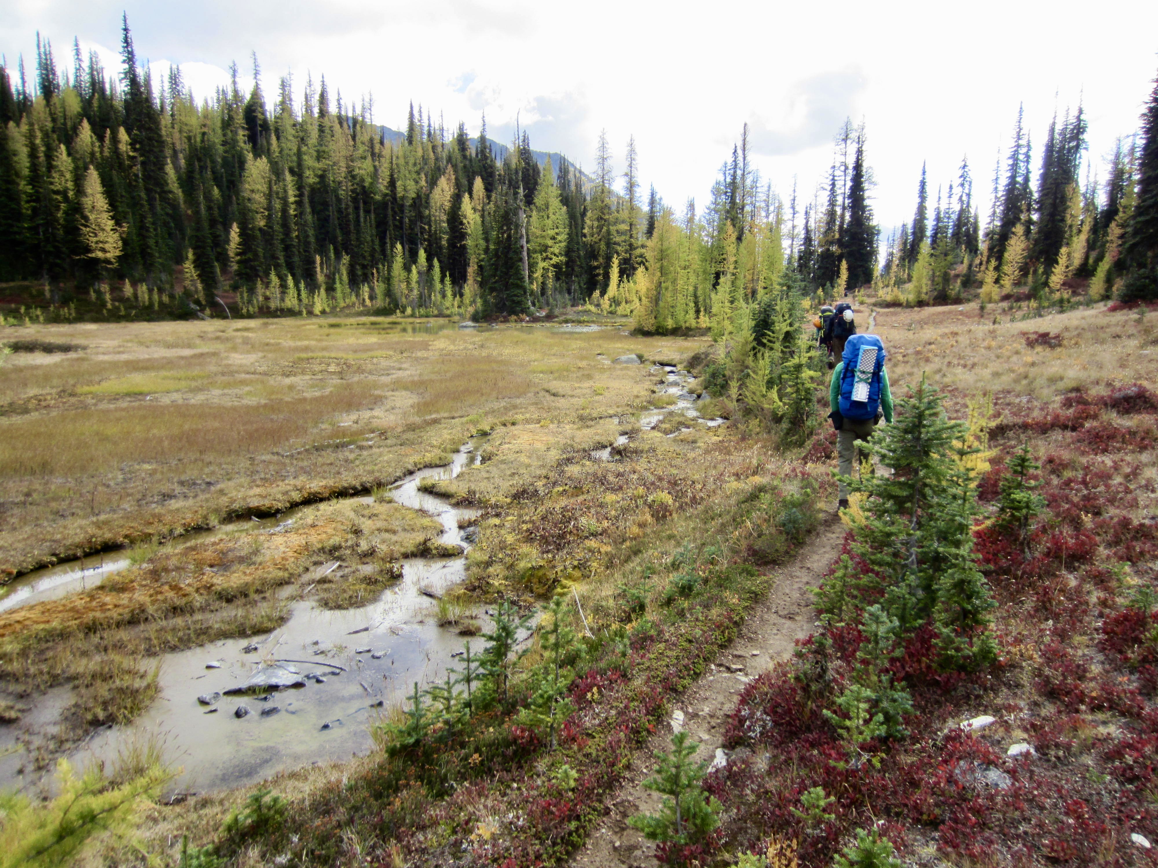
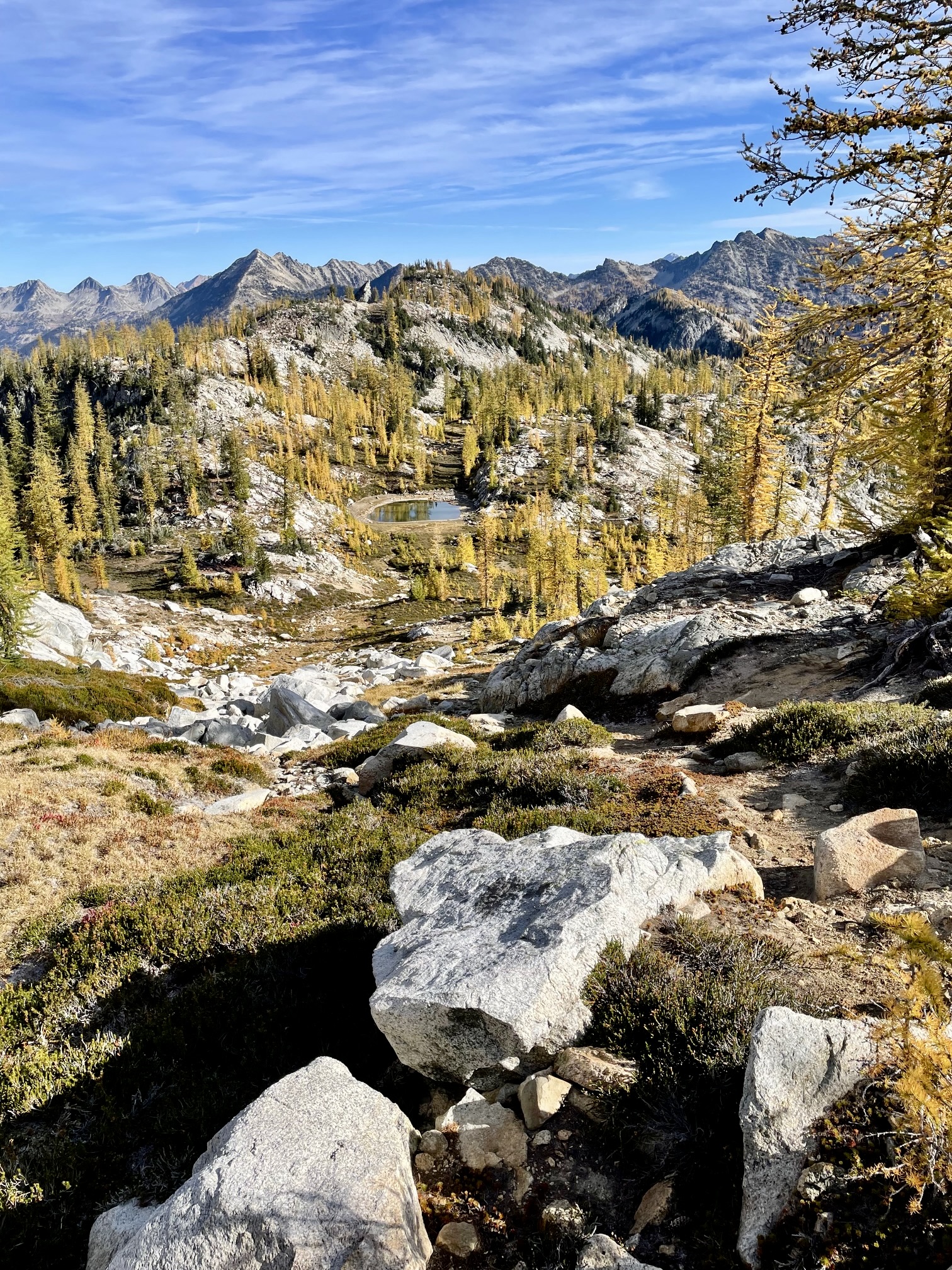
Upon reaching McAlester Pass, we turned left (south) on the Rainbow Creek Trail and hiked alongside McAlester Park. In a short ¼ mile, we came to an unmarked junction with the Rainbow Ridge Trail. This informal but well-defined trail took us through small, larch-studded meadows under boulderfields and slabs of pale granite.
.
.
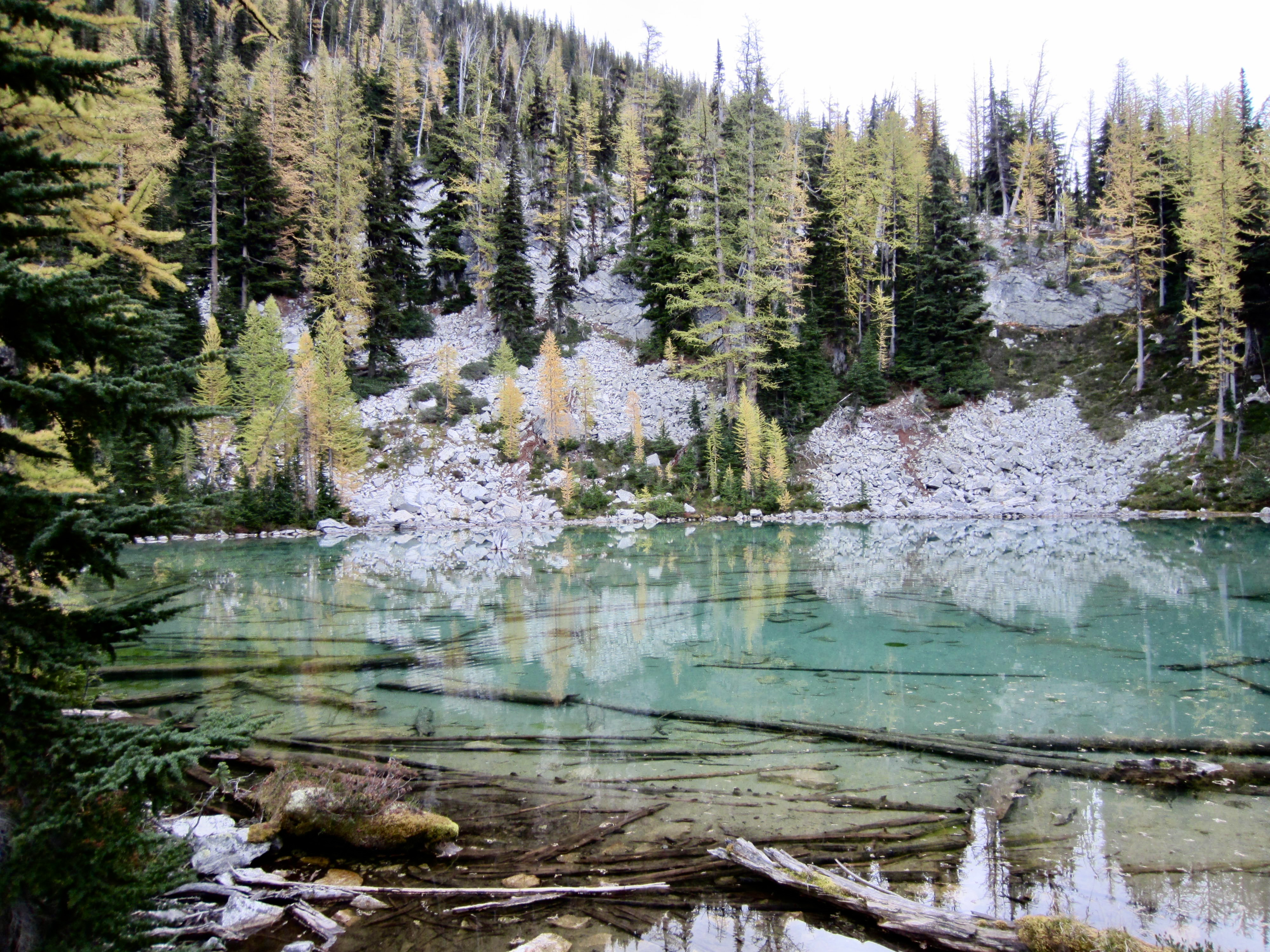
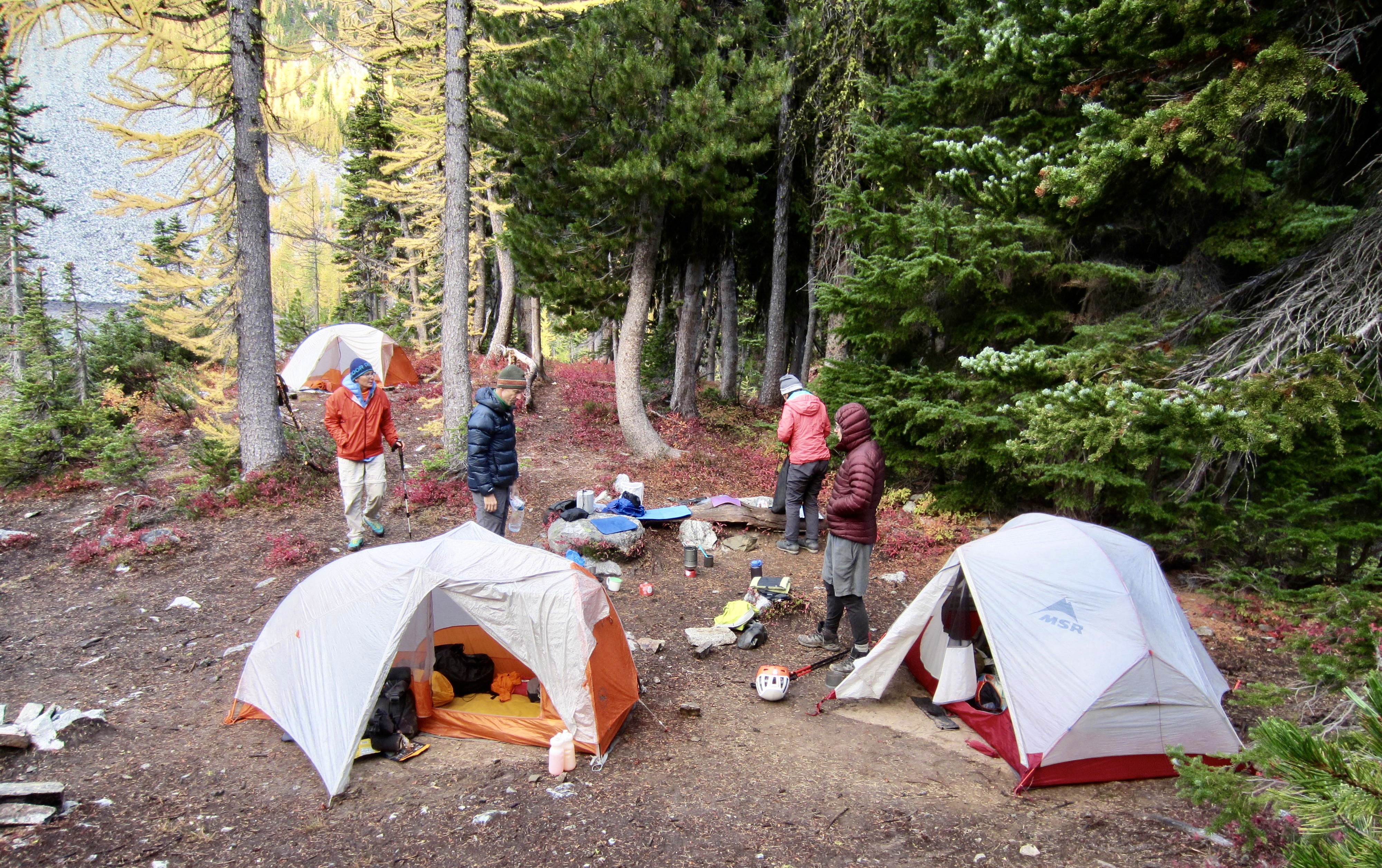
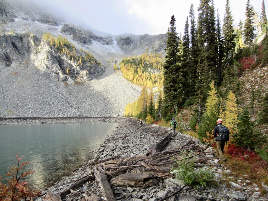
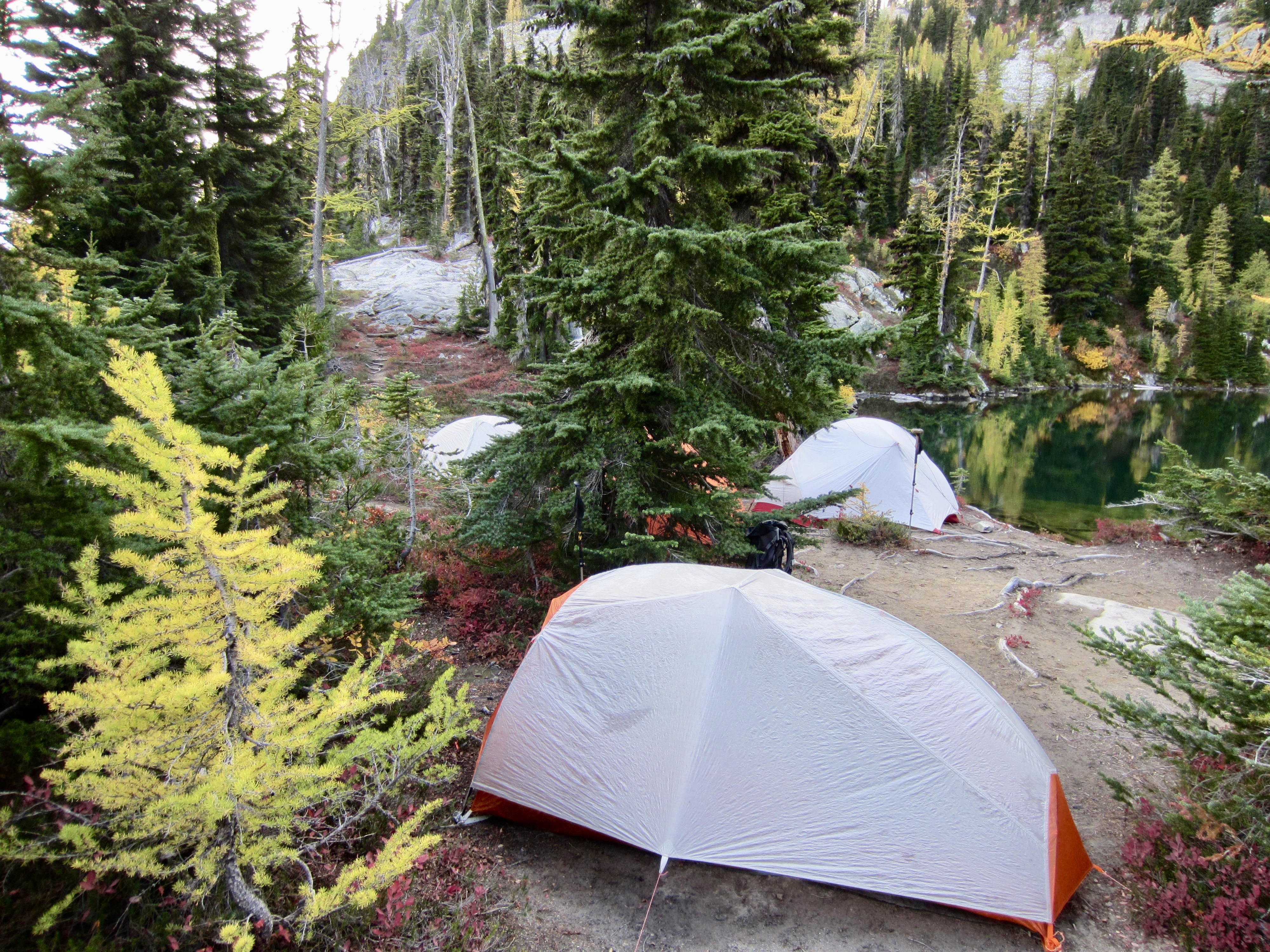
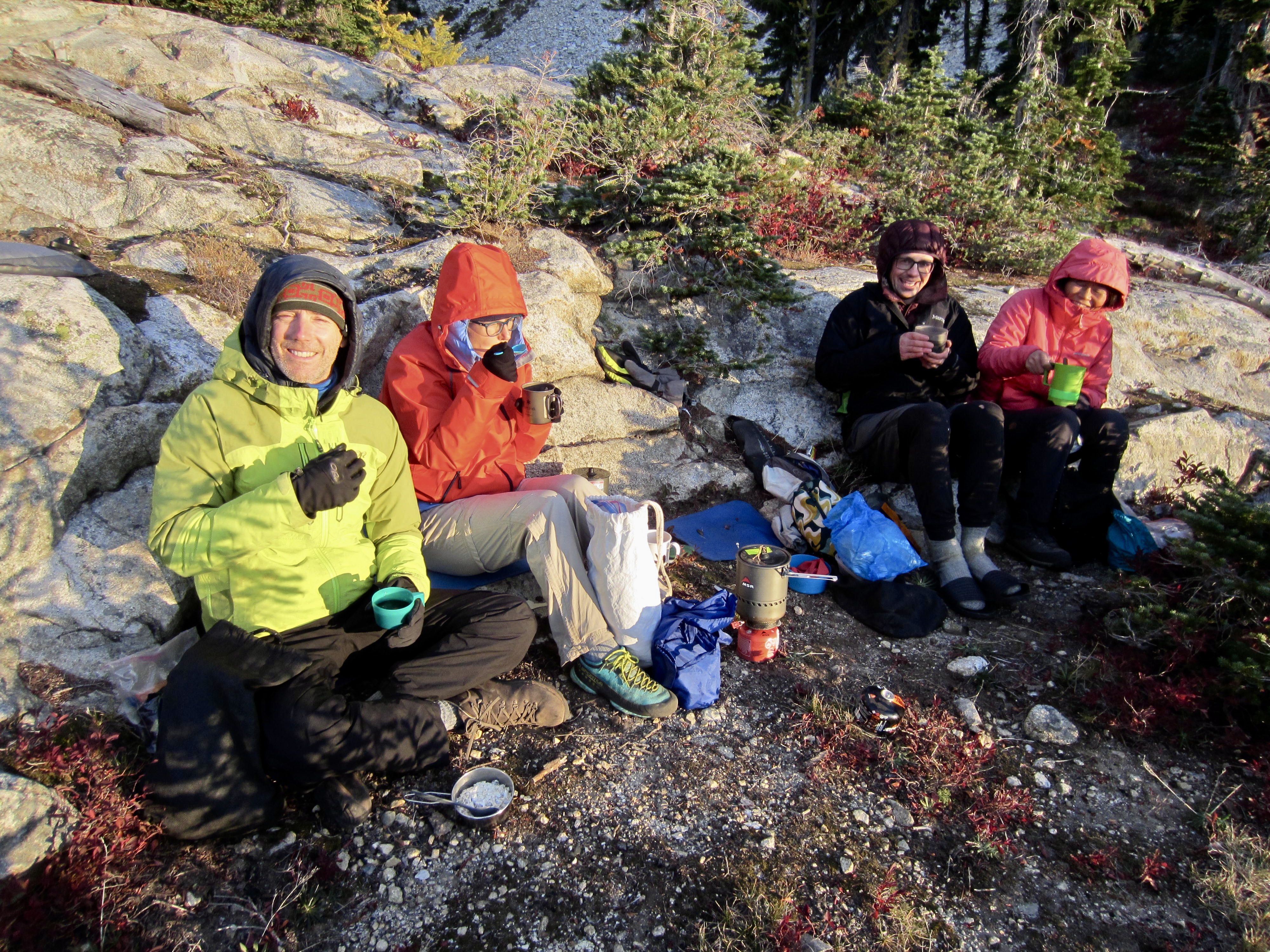
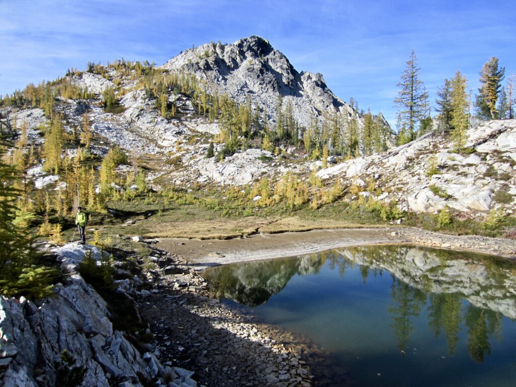
We arrived at Lake 6111 in late afternoon and set up Camp 2 near the shore (2.7 hours + 700 feet from Camp 1). This pretty little unnamed lake occupies a rocky bowl on the side of Rainbow Ridge. We were fortunate to be the first group to arrive, since the availability of campsites here is not commensurate with its popularity.
.
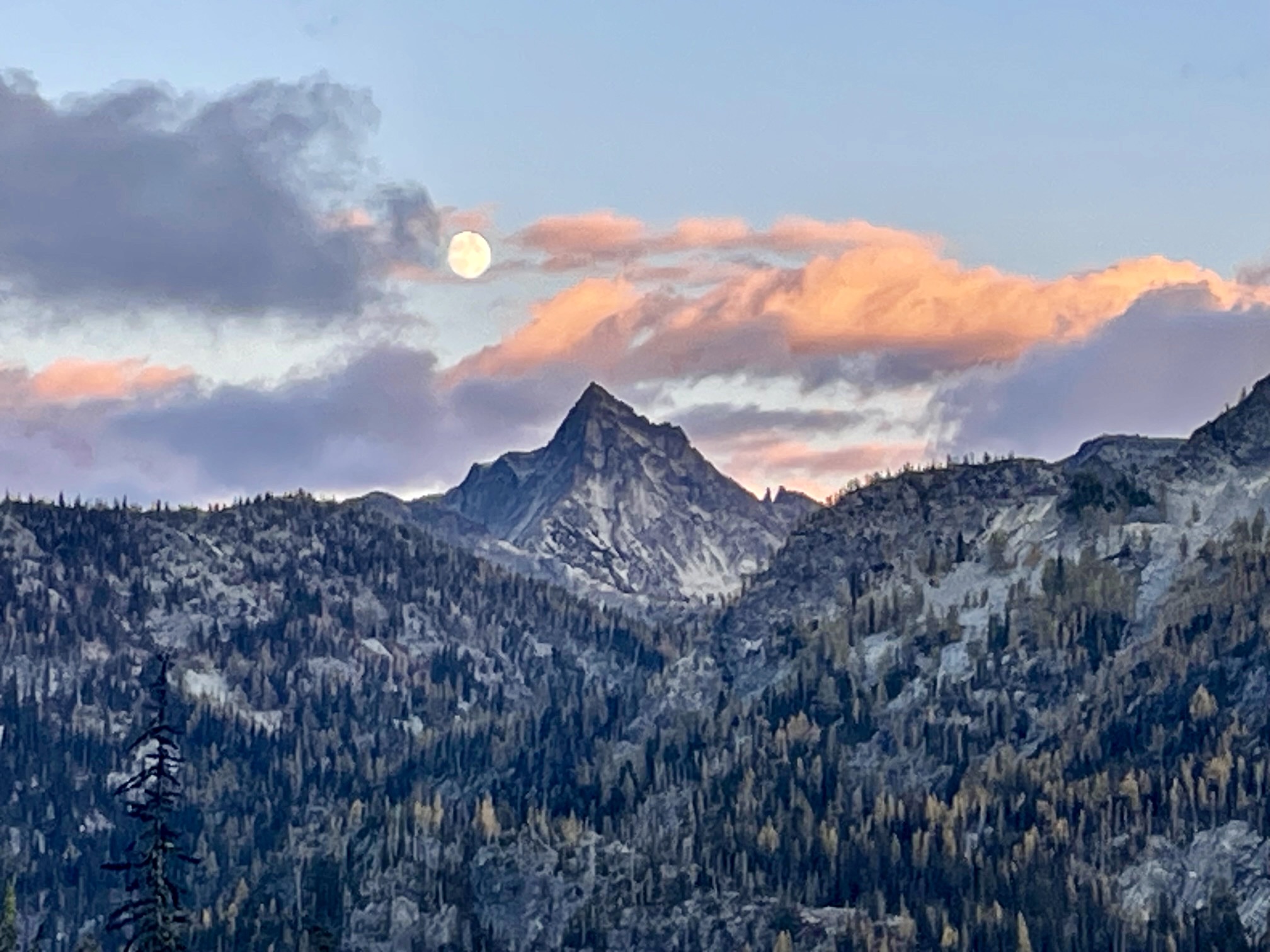
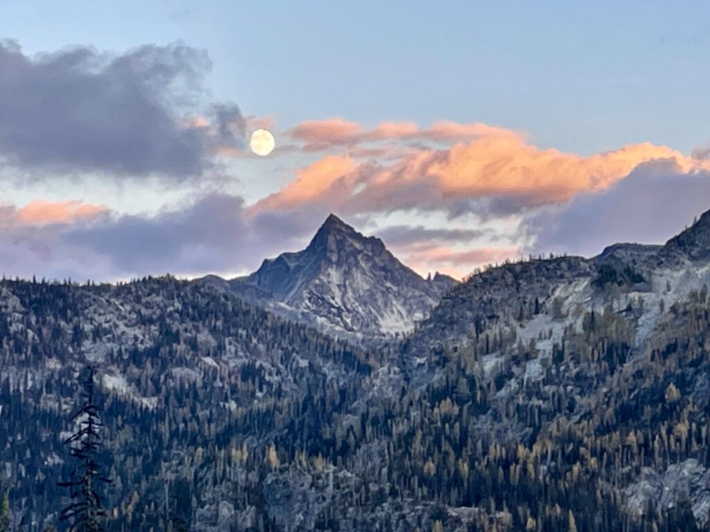
As we were finishing dinner atop a granite knob, two more hikers strode into camp. It was a huge surprise to discover that they were my newest mountain friends, Valerie and Brad! The seven of us stayed up late, swapping anecdotes, sharing laughs, and watching a full moon rise over spectacular Reynolds Peak.
.
.
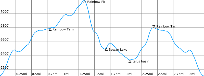
Day 3 (AM): Rainbow Peak + Bowan Lake Sidetrip
A cold front moved in during the night, bringing clear skies and frigid winds in the morning. We huddled behind our granite knob to eat breakfast before heading out for a half-day excursion.

.
.
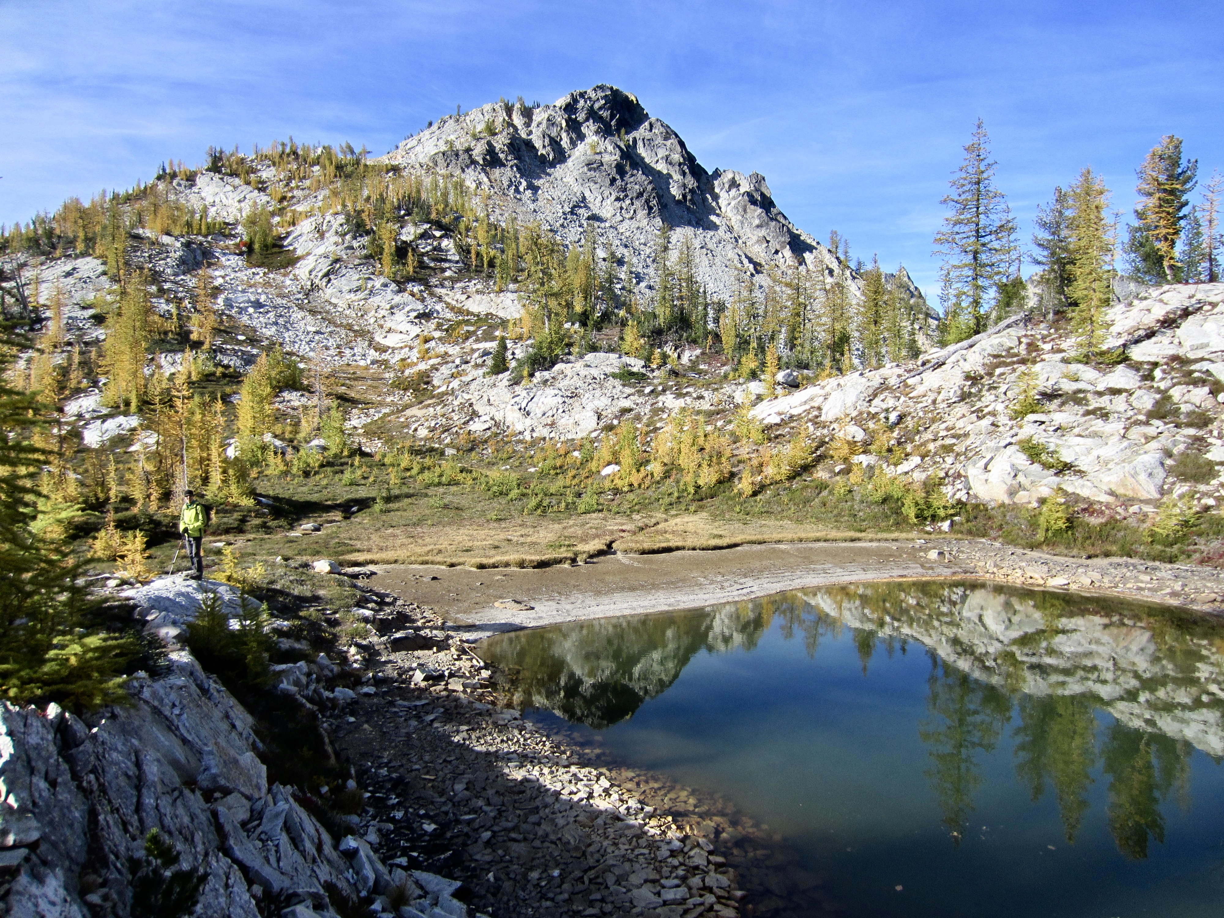
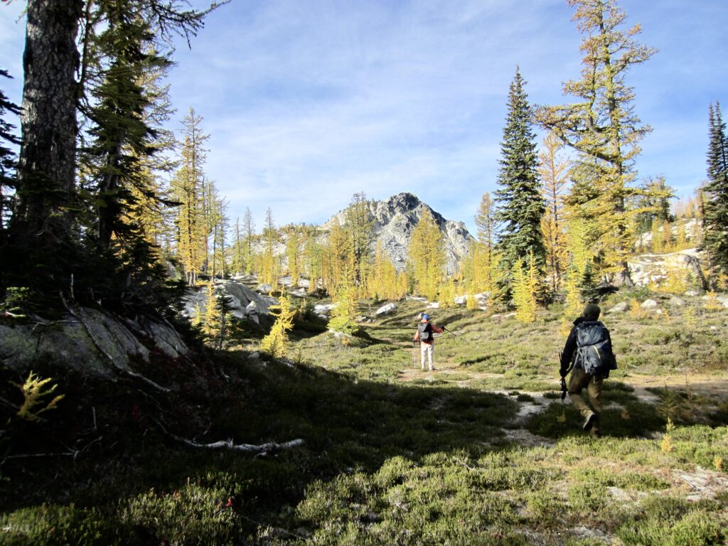
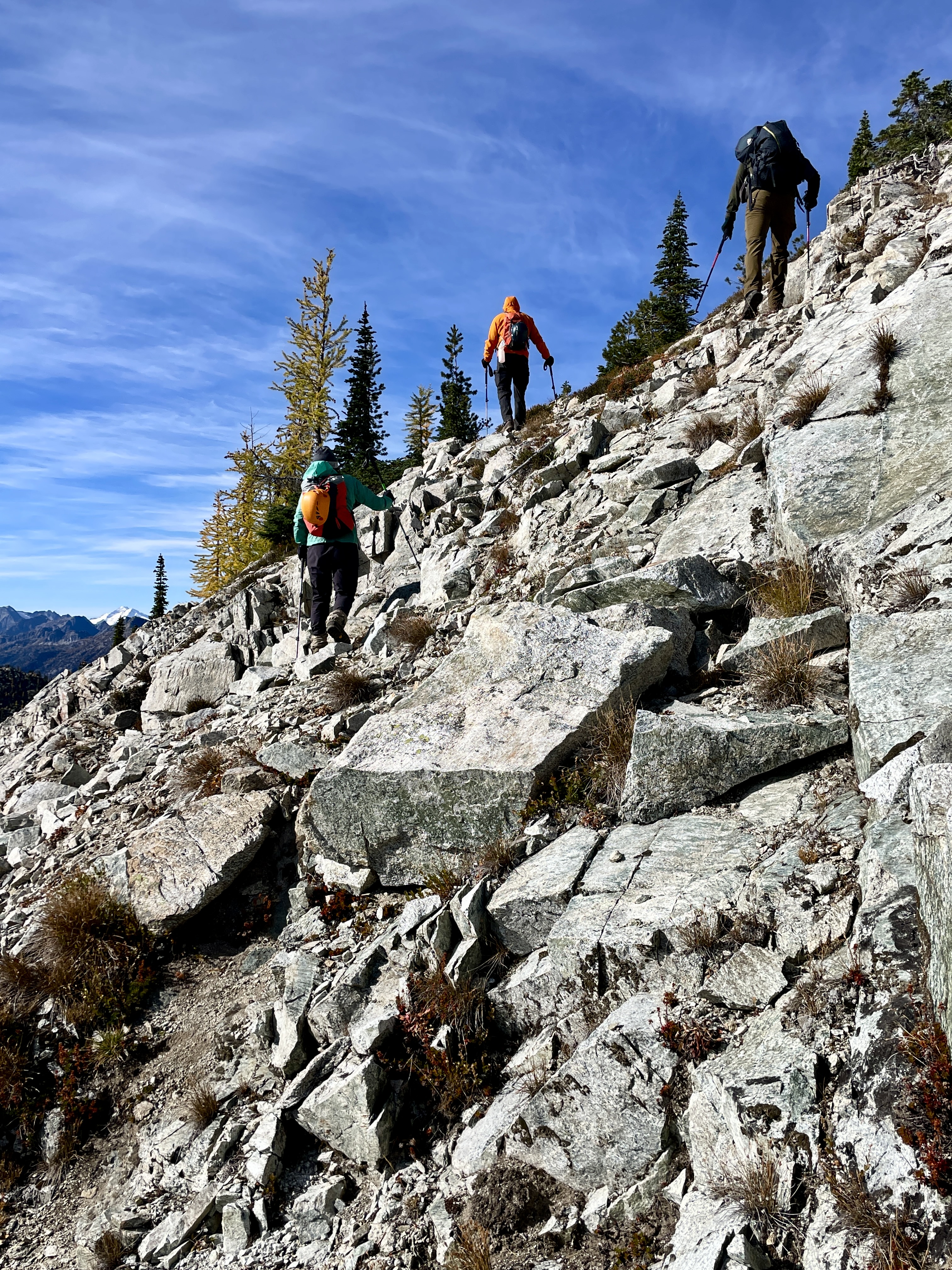
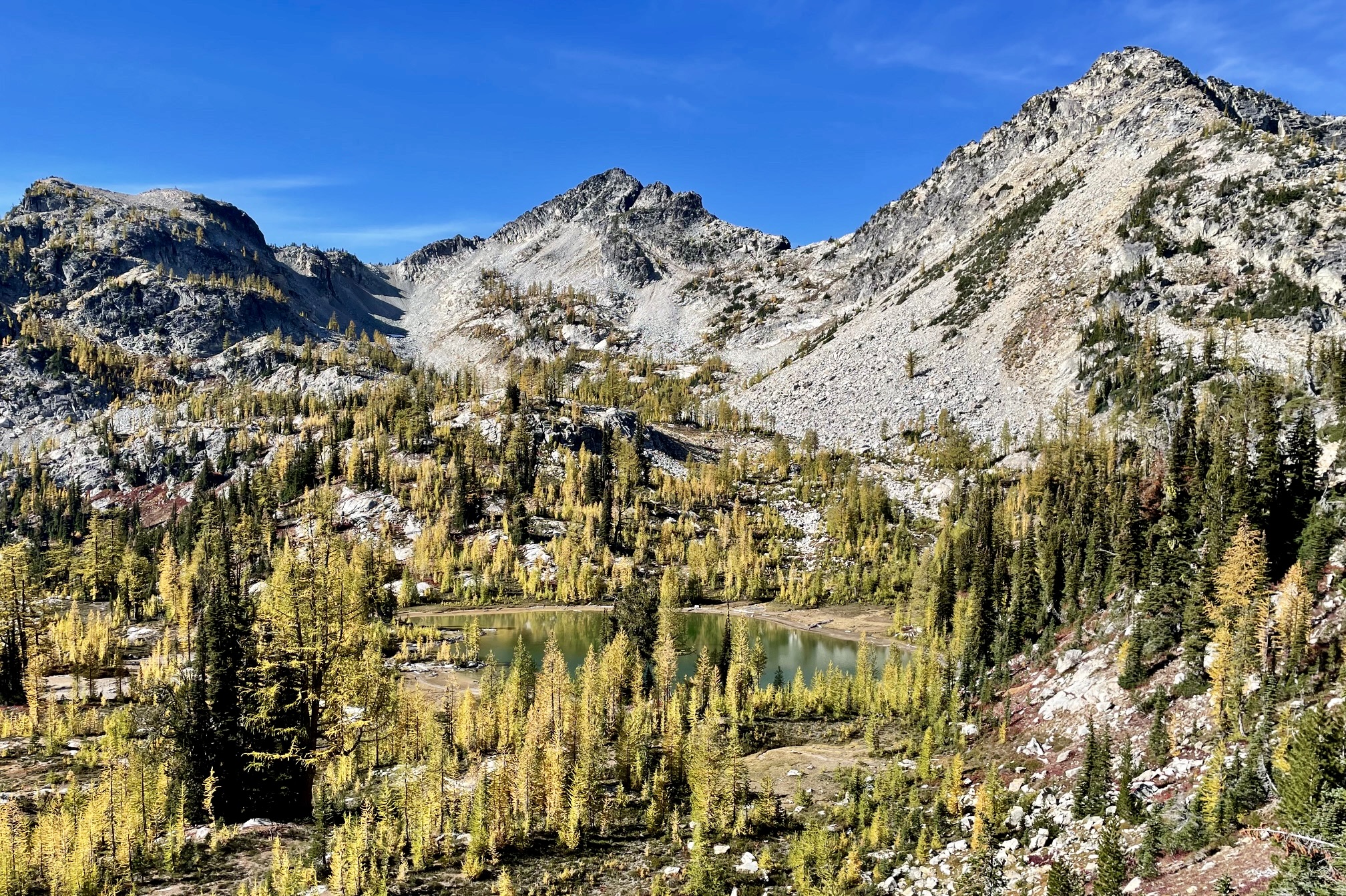
We began our excursion by continuing up Rainbow Ridge on a steep, narrow trekking path. This took us through more heather meadows and larch groves until reaching 6800-foot Rainbow Tarn at trail’s end. Rainbow Peak stood closely to the southwest.
.
.
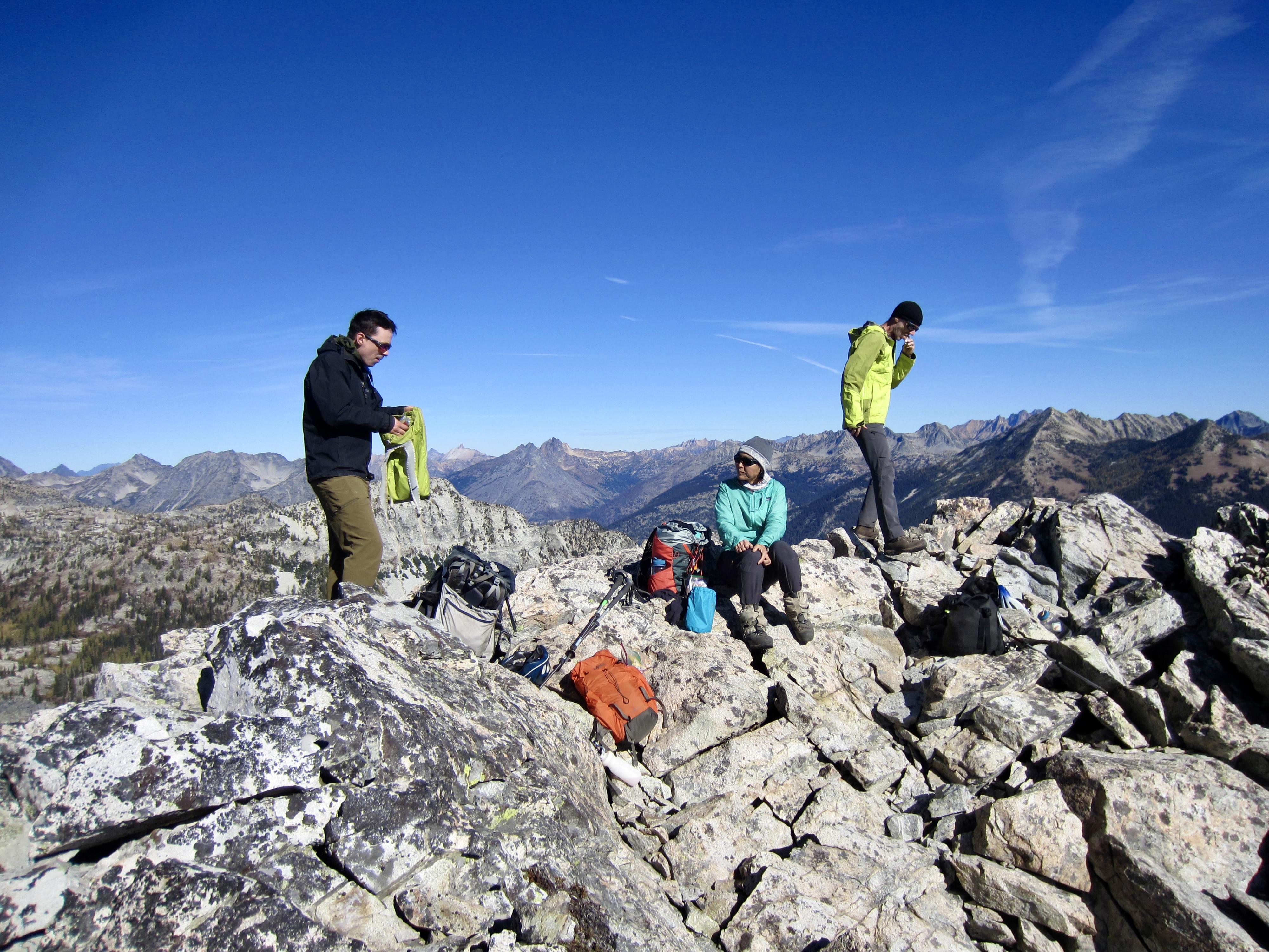
While Lisa relaxed at the tarn, the rest of us scrambled up 7237-foot Rainbow Peak via its eastern flank and Class 2-3 south ridge. We topped out in late morning (2.1 hours + 1200 feet from Camp 2). This modest summit provides a great view of Bowan Mountain and Bowan Lake.
.
.
.
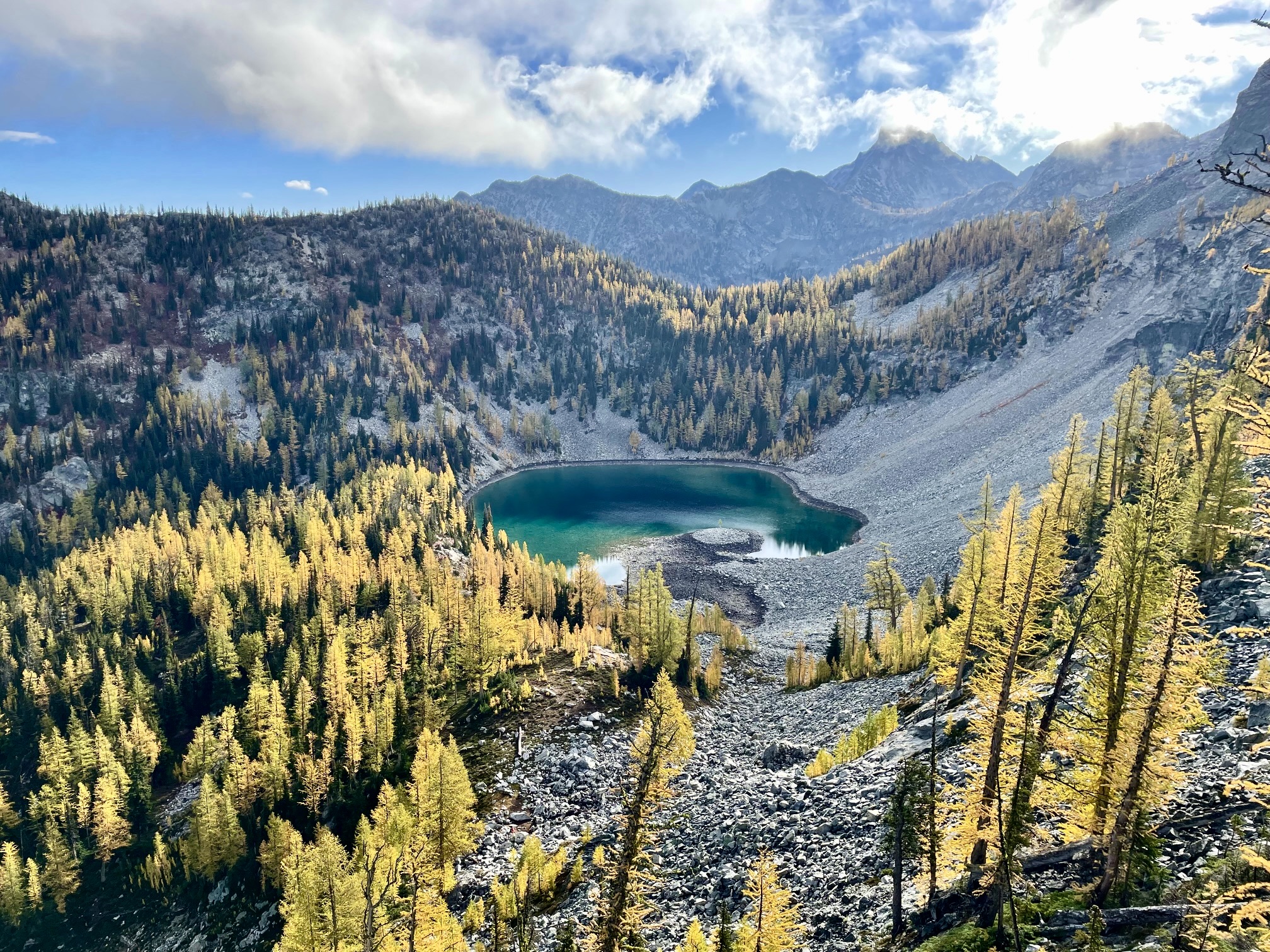
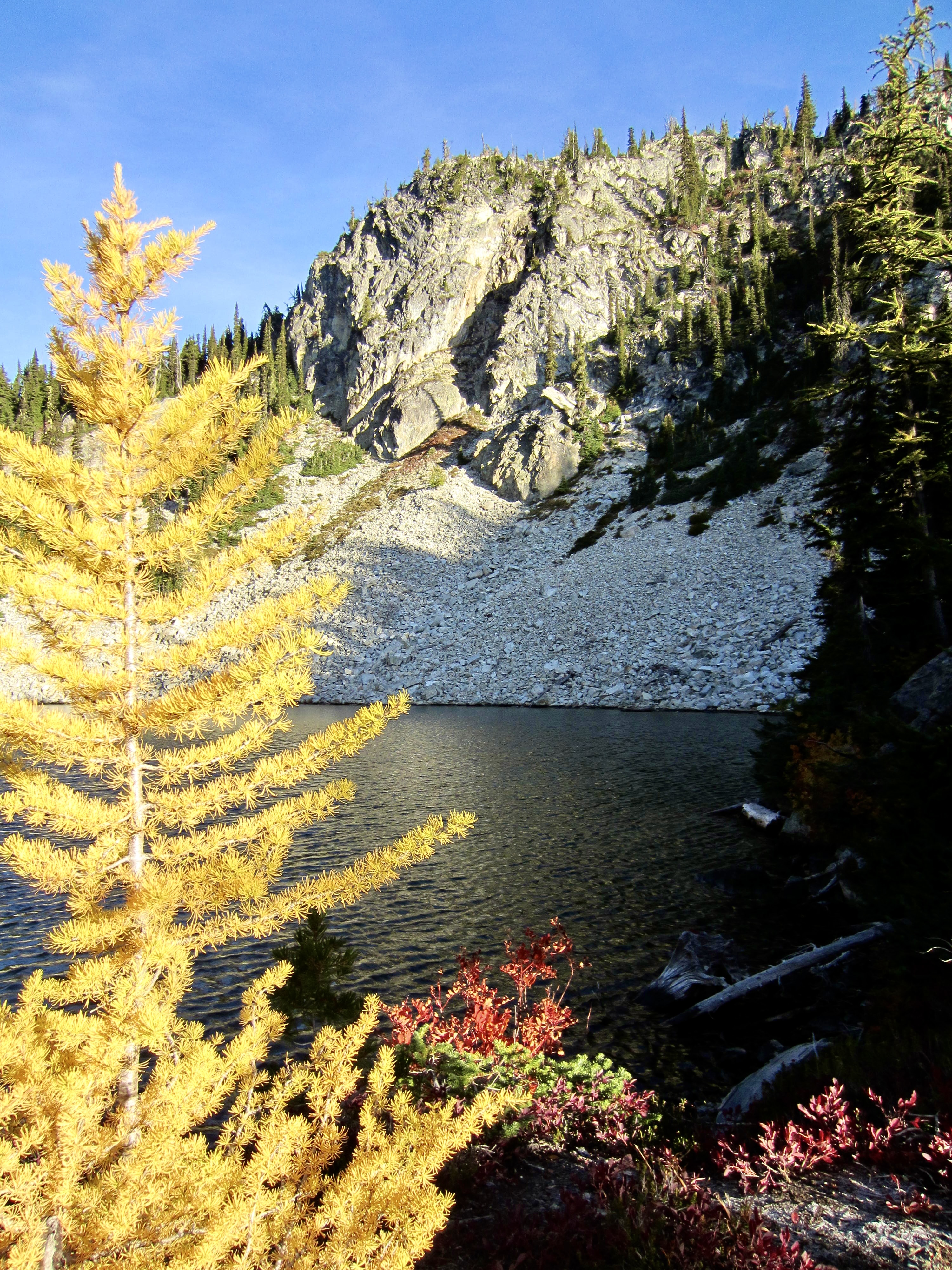
Having a little extra time to explore the area, we scrambled down the peak’s upper west ridge and lower southwestern slope to reach 6500-foot Bowan Lake. This charming little lake sits in a shallow bowl surrounded by larch trees and rugged peaks.
.
.
For our return, we circled around the northern flank of Rainbow Peak rather than retracing our route over the south ridge. This involved descending into a talus basin and then ascending to a 6800-foot saddle adjacent to Rainbow Tarn. We met Lisa back at camp in mid-afternoon (5.9 hours + 1850 feet RT).
.
Day 3 (PM): Lake 6111 to Fireweed Camp
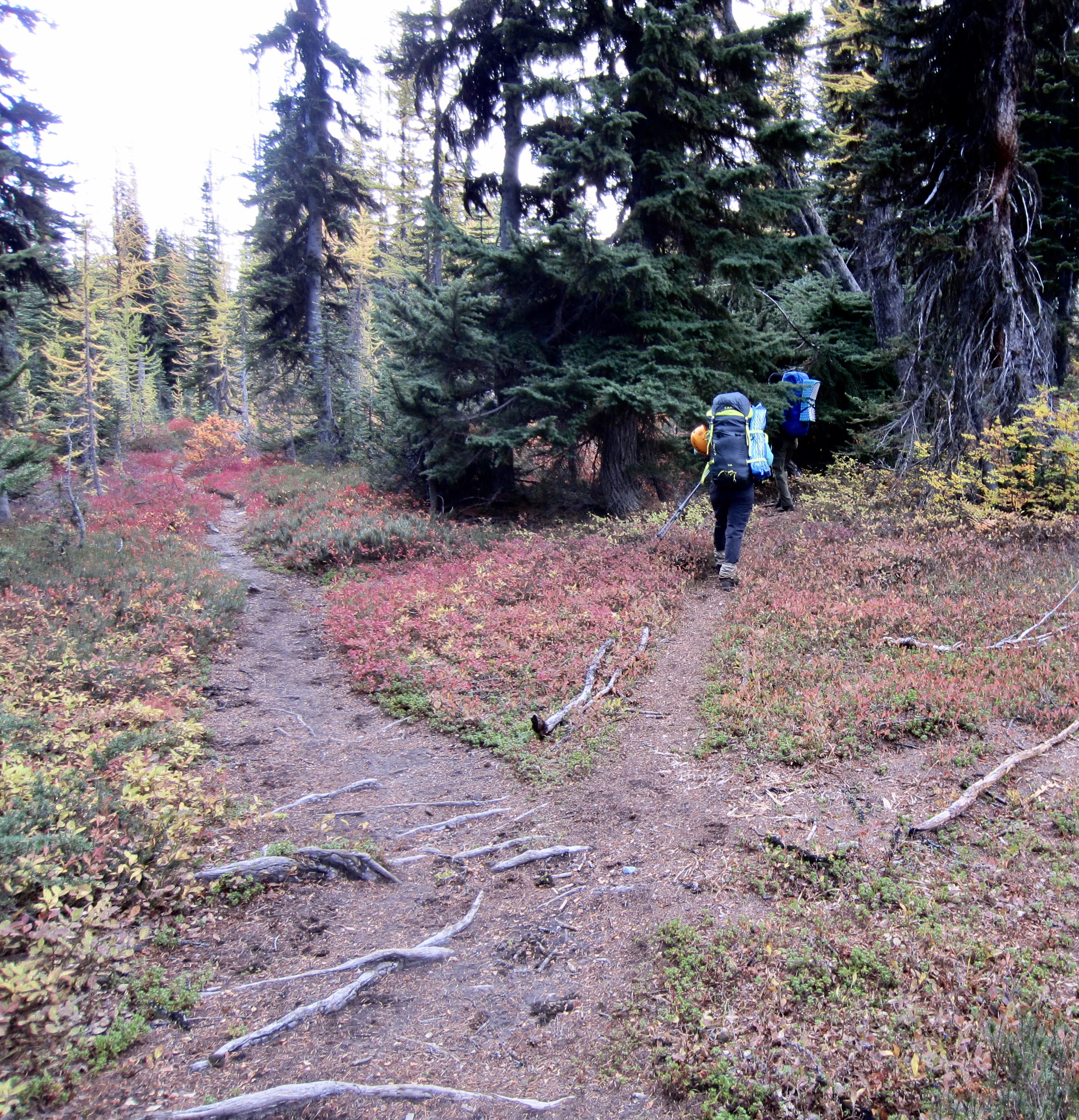
Wanting to put some miles behind us before nightfall, we quickly packed up and headed down Rainbow Ridge. Along the way, I was delighted to encounter two more mountain friends, Candy and Johnny! They were hiking up Rainbow Ridge in search of golden larches and sunny summits.

.
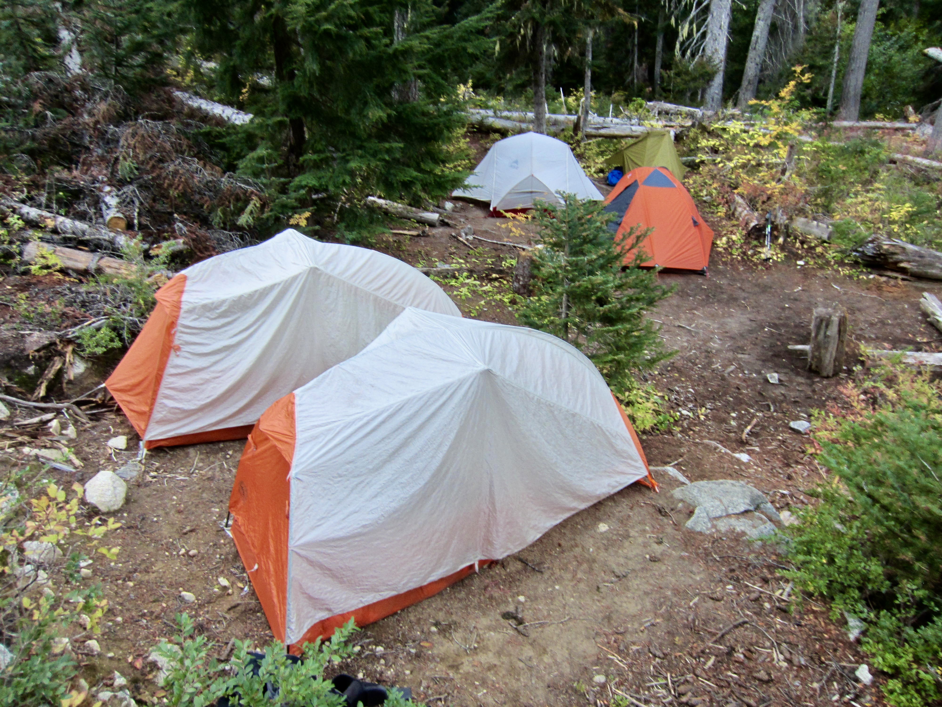
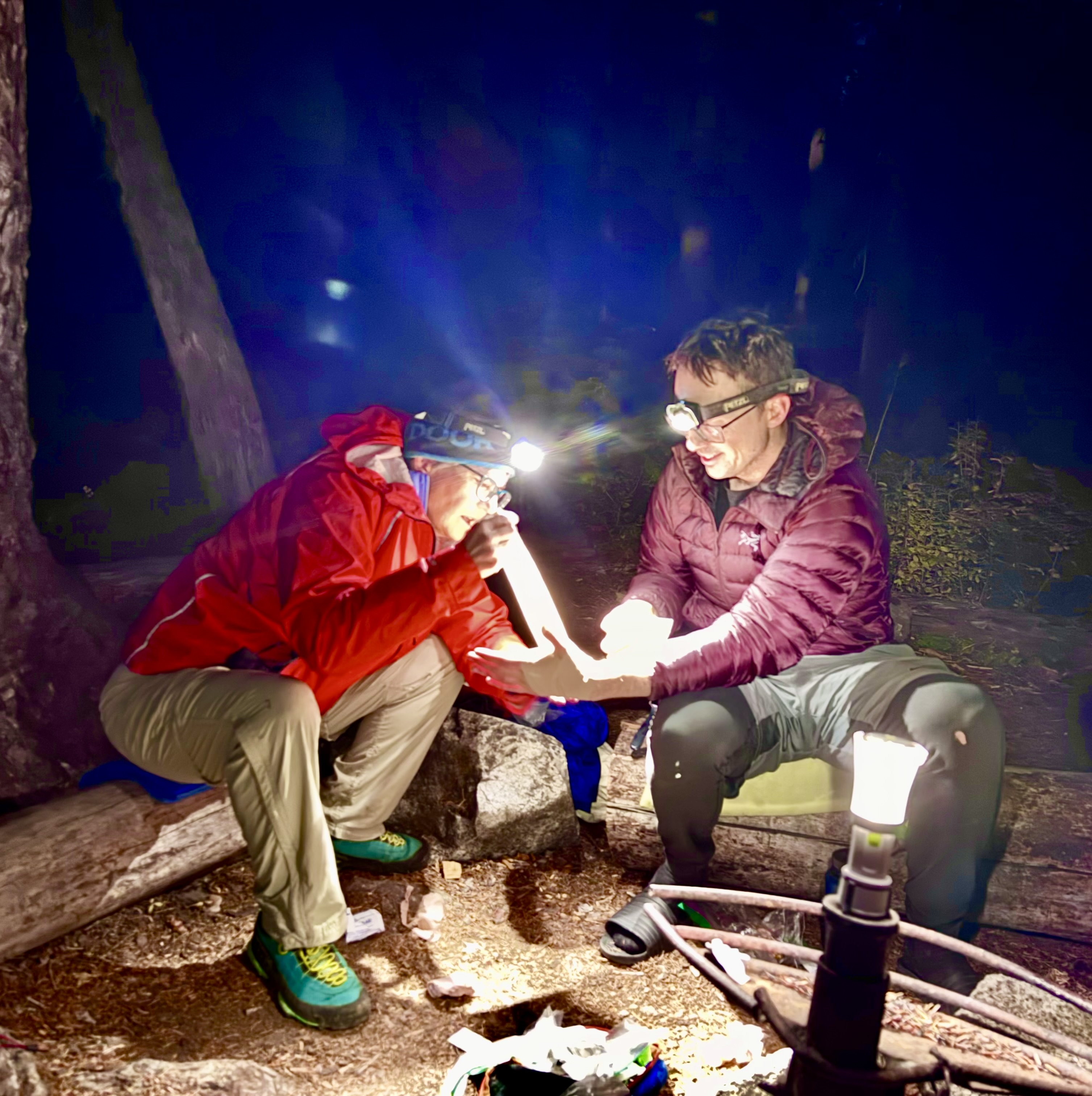
Our group crossed back over McAlester Pass—the hub of our “wishbone” trek—and hustled down McAlester Creek Valley. Just before dark, we rolled into Fireweed Camp, which sits within the confluence angle of Bridge Creek and McAlester Creek (3.5 hours + 350 feet – 2850 feet from Camp 2). Our dinnertime entertainment included a first-aid demonstration, as Lisa expertly tended to fresh lacerations on Andrew’s hand.
.
Day 4: Fireweed Camp to Trailhead
From Fireweed Camp, we had our choice between two essentially equivalent routes back to Highway 20: (1) repeating the Stiletto Spur Trail, which hugs the eastern side of Bridge Creek, or (2) following the Pacific Crest Trail, which hugs the western side of Bridge Creek. Each one involves a 3½-mile hike with nearly 1000 feet of elevation gain. For the sake of variety, we chose the latter. Shortly past noon, we were back at the Bridge Creek Trailhead to end another enjoyable Golden Larch Outing.
.
Route Maps & Profiles
…
…
…
…
…
Photo Gallery
Click to enlarge…