Trip Date: September 12-13, 2025
Nason Ridge Trail Traverse: Round Mountain Trailhead to West Nason Ridge Trailhead
Round Mountain Saddle
Alpine Lookout (6235 ft)
Merritt Lake
Royal Creek Meadow
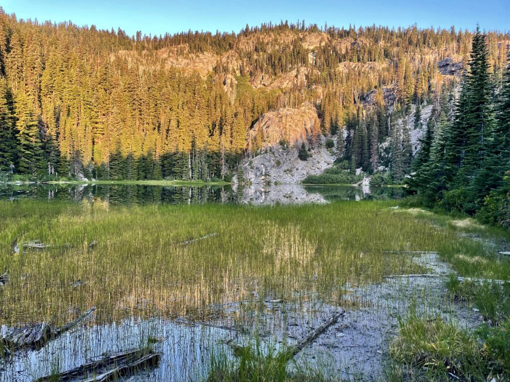
Crescent Lake
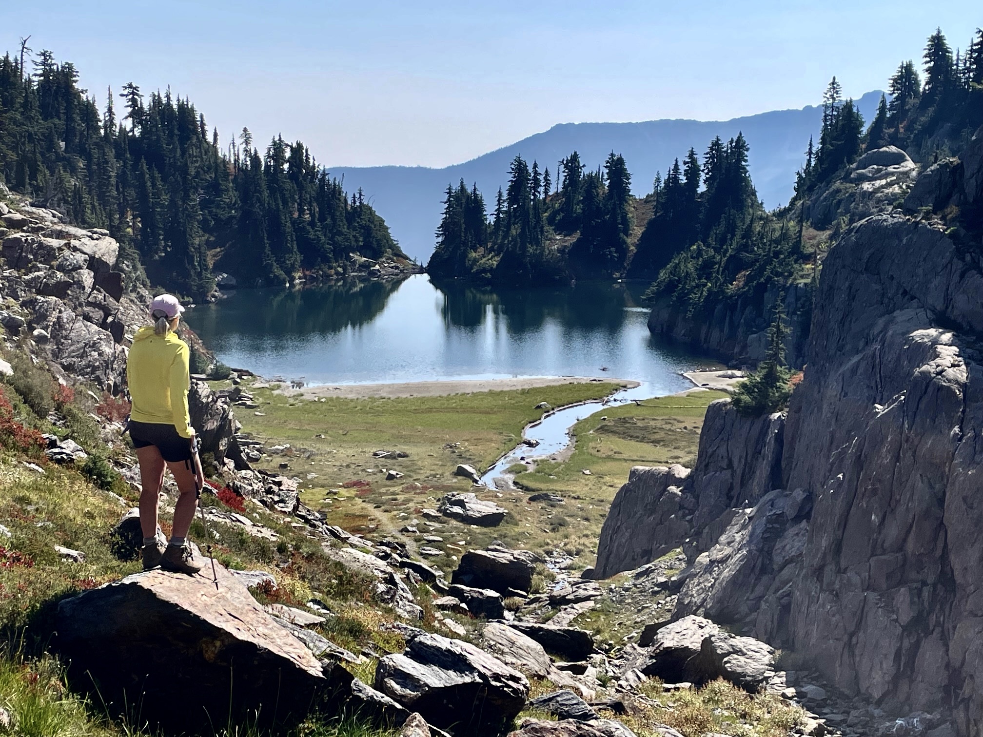
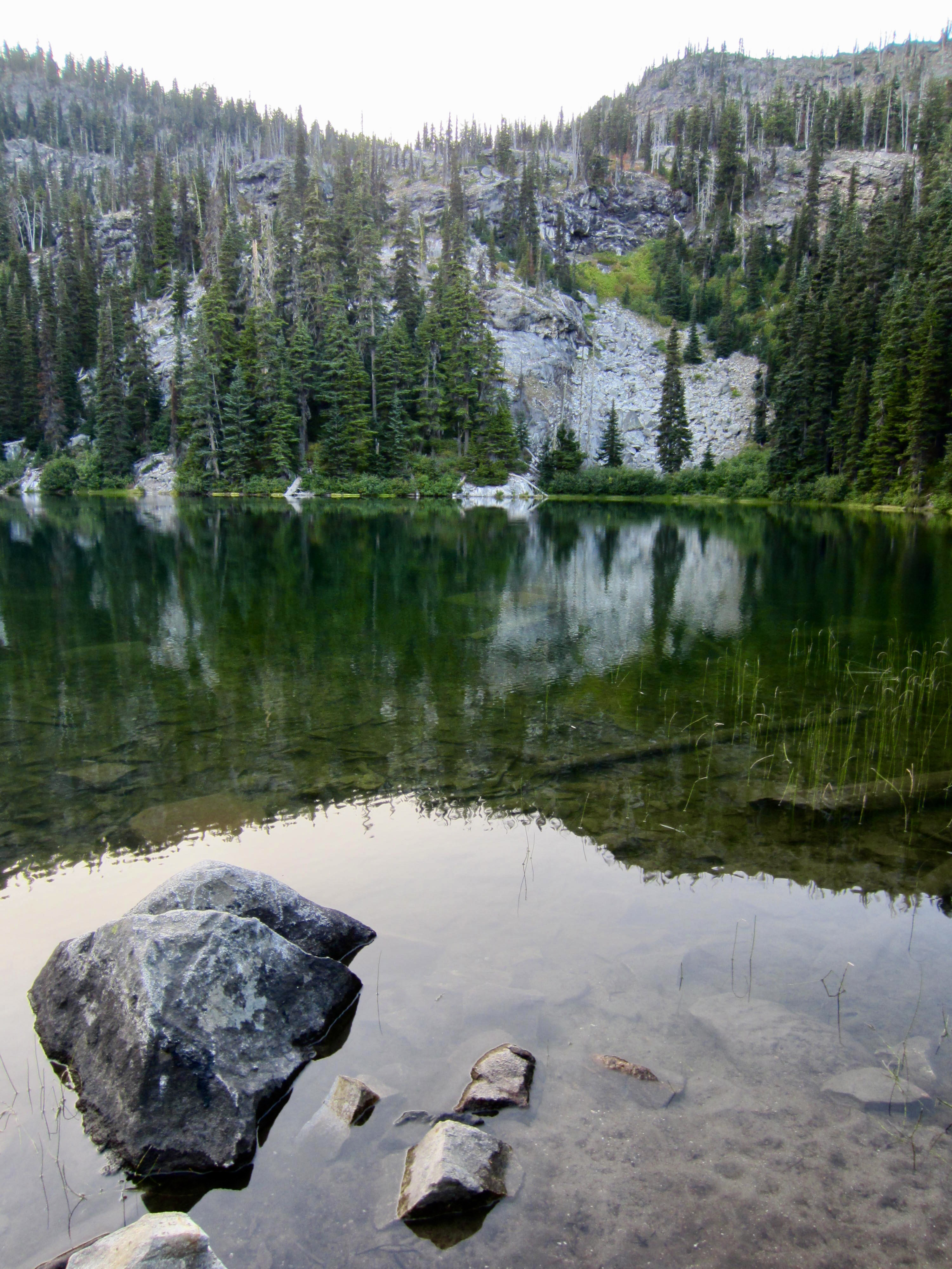
Rock Lake
Rock Mountain / Lookout (6852 ft)
Snowy Creek Basin
Rainy Pass Meadow
Trip Report Summary
Region: North-Central Washington Cascades
Sub-Region: Upper Wenatchee Mountains
Area: Okanogan–Wenatchee National Forest
Starting Point: Round Mountain Trailhead on Butcher Creek Road #6910 (Elev. 4000 feet)
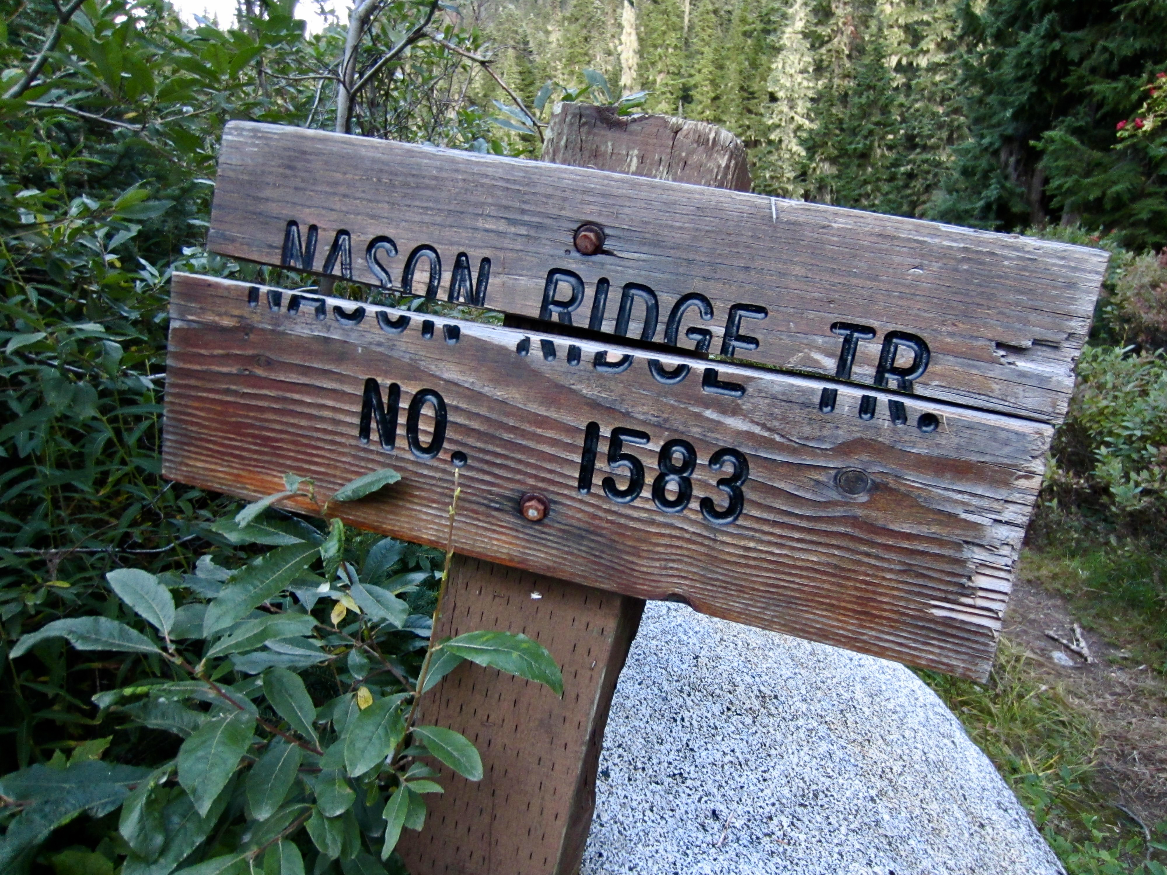
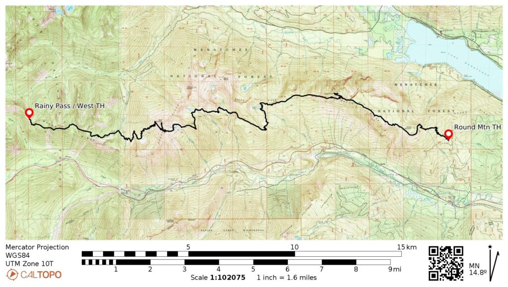
Traverse Way Points: Nason Ridge Trail junction & Round Mountain Saddle & Ninemile Saddle & Alpine Lookout Trail junction & Lost Lake Trail junction & Merritt Lake & Mahar Creek crossing & Royal Creek crossing & Crescent Creek crossing / Crescent Lake & Schilling Creek crossing / Rock Lake Bowl & Rock Mountain Trail junction & Rock Mountain Saddle / Rock Mountain Summit Trail junction & Snowy Creek Basin & East Fork Snowy Creek crossing & Snowy Creek Trail junction & West Fork Snowy Creek crossing & Saddle 5150 & Rainy Pass Meadow & West Nason Ridge Trailhead (trail hike)
Ending Point: West Nason Ridge Trailhead on Smith Brook Road #6700 at Rainy Pass (Elev. 4600 feet)
Traverse Low Point: Snowy Creek Trail junction (Elev. 3900 feet)
Traverse High Point: Rock Mountain Saddle (Elev. 6600 feet)
Campsite: Merritt Lake (Elev. 5000 feet)
Sidetrip: Alpine Lookout (hike via Lookout Trail)
Summit: Rock Mountain (hike via Summit Trail)
Approximate Stats (excluding sidetrips): 20.0 miles traveled; 7200 feet gained; 6600 feet lost.
Approximate Stats (including sidetrips): 21.2 miles traveled; 7700 feet gained; 7100 feet lost.
Related Posts
>>> Nason Ridge Summit Traverse: Mt. Mastiff to Mt. Howard to Rock Mtn. – June 1976
>>> Mt. Howard via South Slope + Summit Camp – May 2016
>>> Rock Mountain via South Ridge + Summit Camp – September 2017
Trip Overview
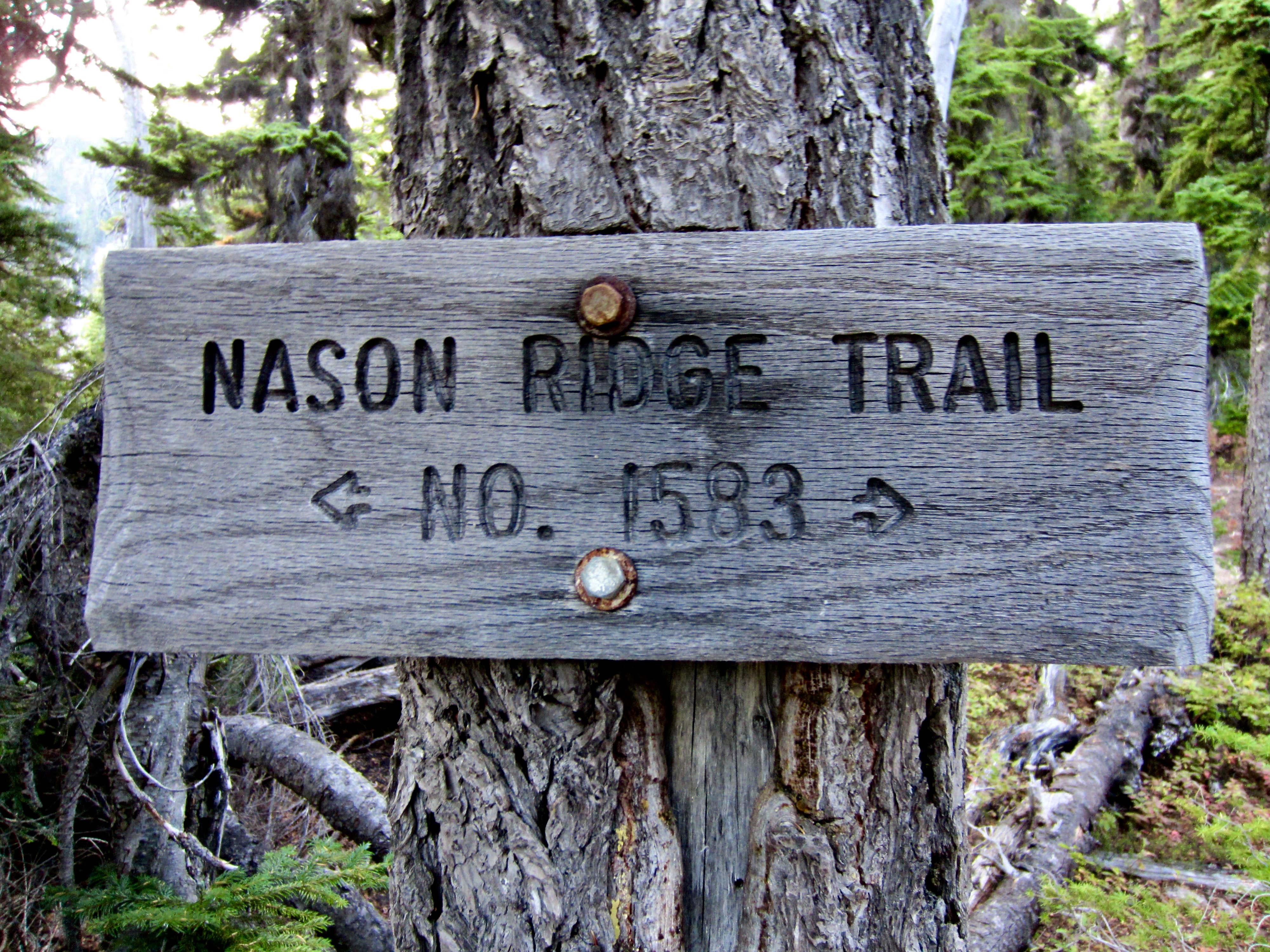
Nason Ridge is a familiar landform to most hikers and scramblers in Washington. Thanks to easy access and high visibility, this topographic spine in the Upper Wenatchee Mountains sees a lot of visitors every year. Lake-baggers are drawn to destinations such as Rock Lake, Crescent Lake, Canaan Lake, Merritt Lake, and Lost Lake. Peak-baggers are drawn to the summits of Rock Mountain, Mt. Howard, and Mt. Mastiff. And hikers are drawn to Alpine Lookout and to various traverses along the 26-mile-long Nason Ridge Trail between Rainy Pass (on Smith Brook Road) and Kahler Glen (near Highway 207).

Over the past 50 years, I had made thirteen ascents of Rock Mountain (including five ski descents and one summit camp), two ascents of Mt. Howard (including one summit camp), five hikes to Alpine Lookout, and three partial ridge traverses between Snowy Creek and Round Mountain. As such, I felt that I knew Nason Ridge pretty darn well. However, I’d never ventured onto the western extension of the trail between Rainy Pass and Snowy Creek. In fact, I didn’t even know whether that extension was even passable. Does it get used anymore?
.
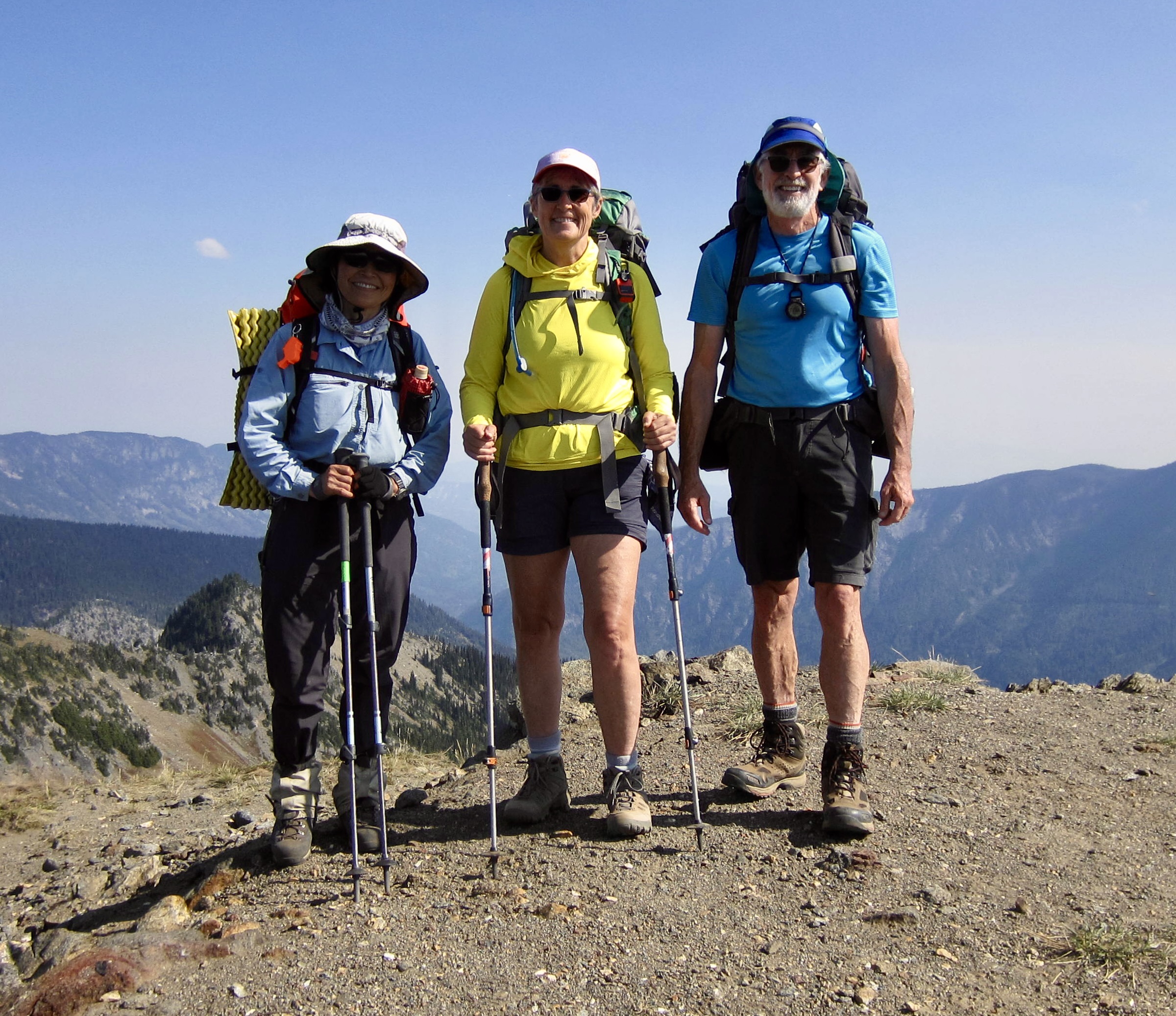
In the spirit of exploration, Eileen and Yoko joined me on a two-day backpacking traverse along the Nason Ridge Trail, starting at the Round Mountain Trailhead and ending at Rainy Pass. Our east-to-west traverse would combine many familiar segments of the trail with the completely unfamiliar western extension. It turned out to be a marvelously scenic 21-mile trek with a little splash of adventure!

.
Full Trip Report
Day 1: Round Mountain Trailhead to Merritt Lake
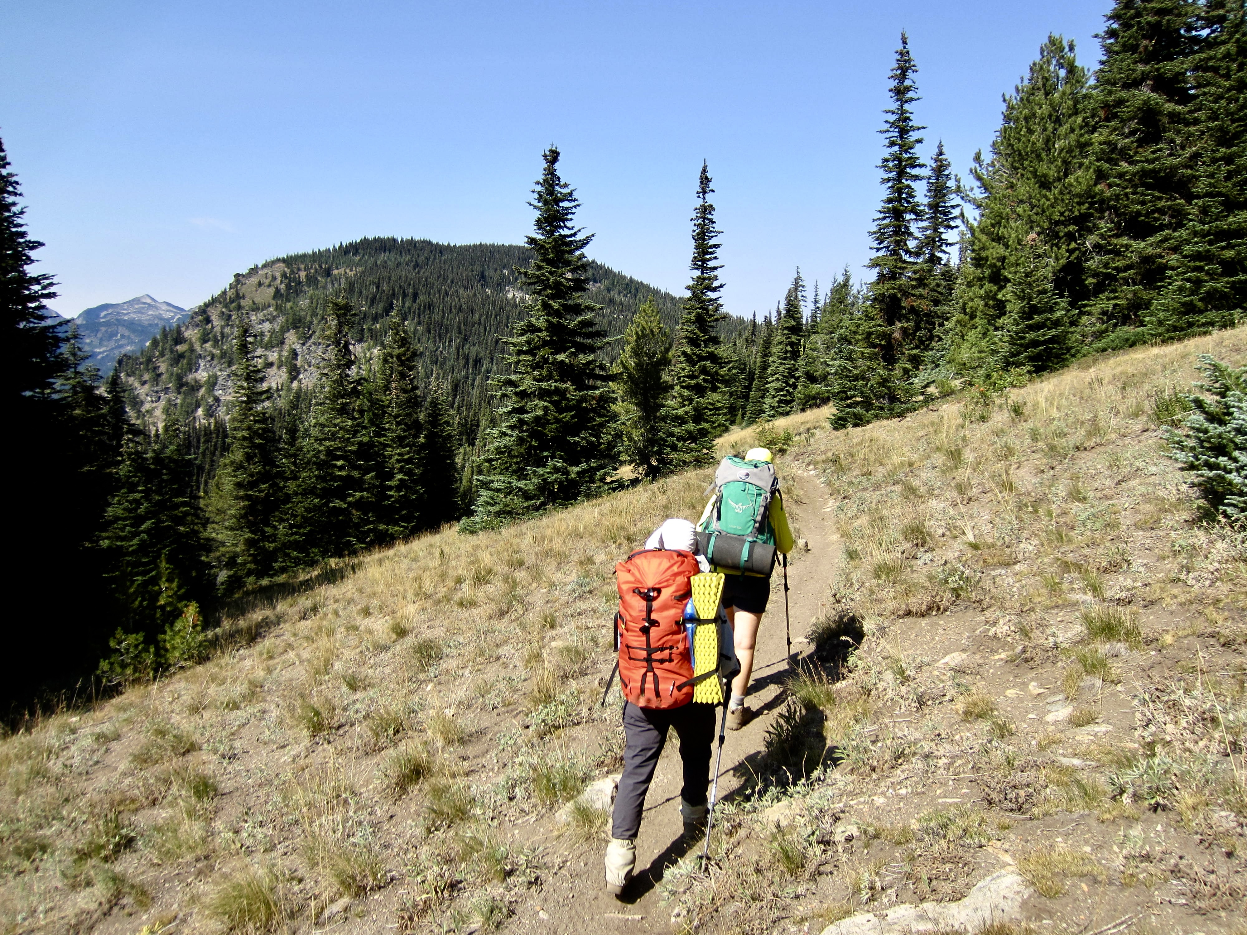
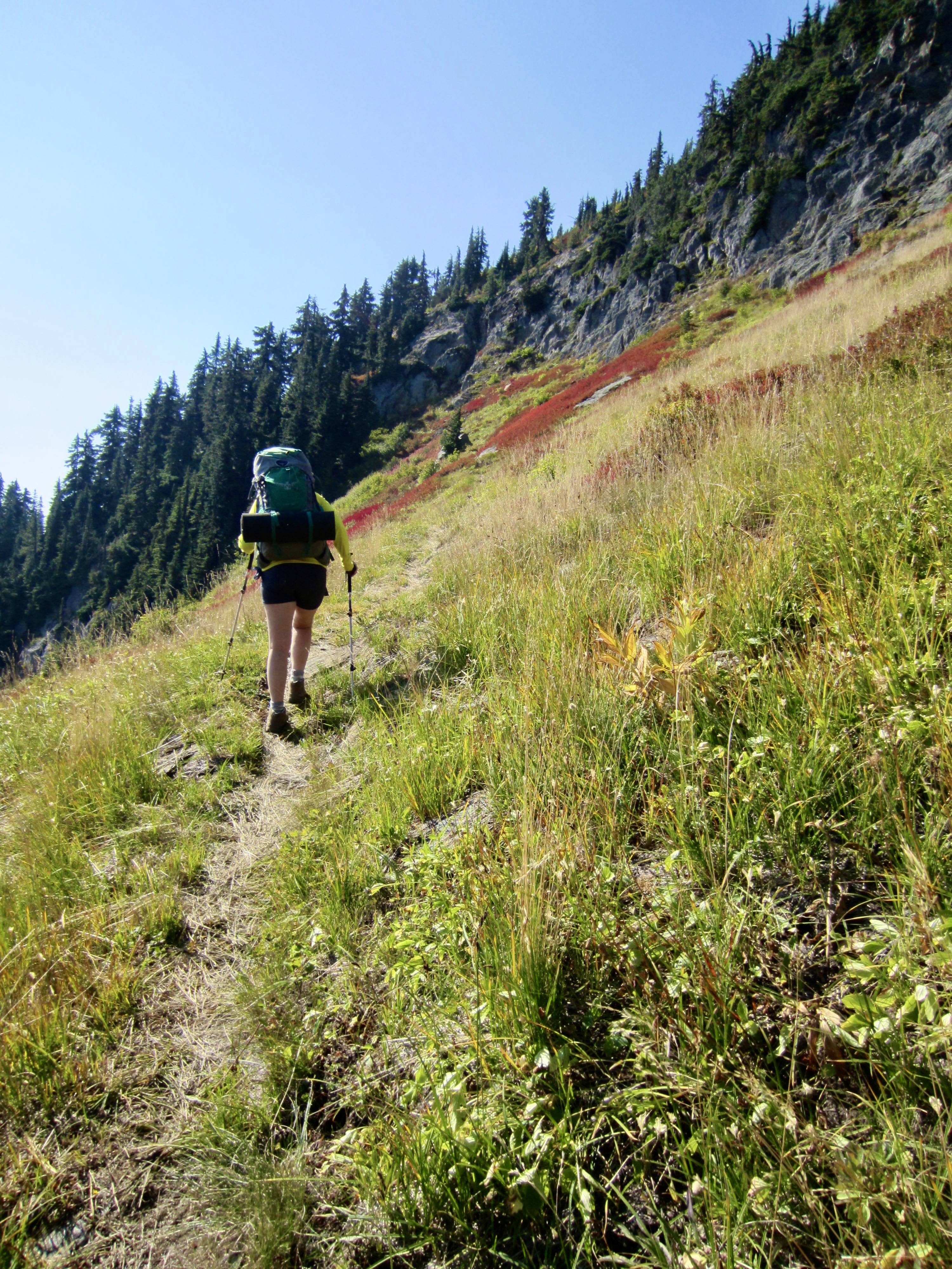
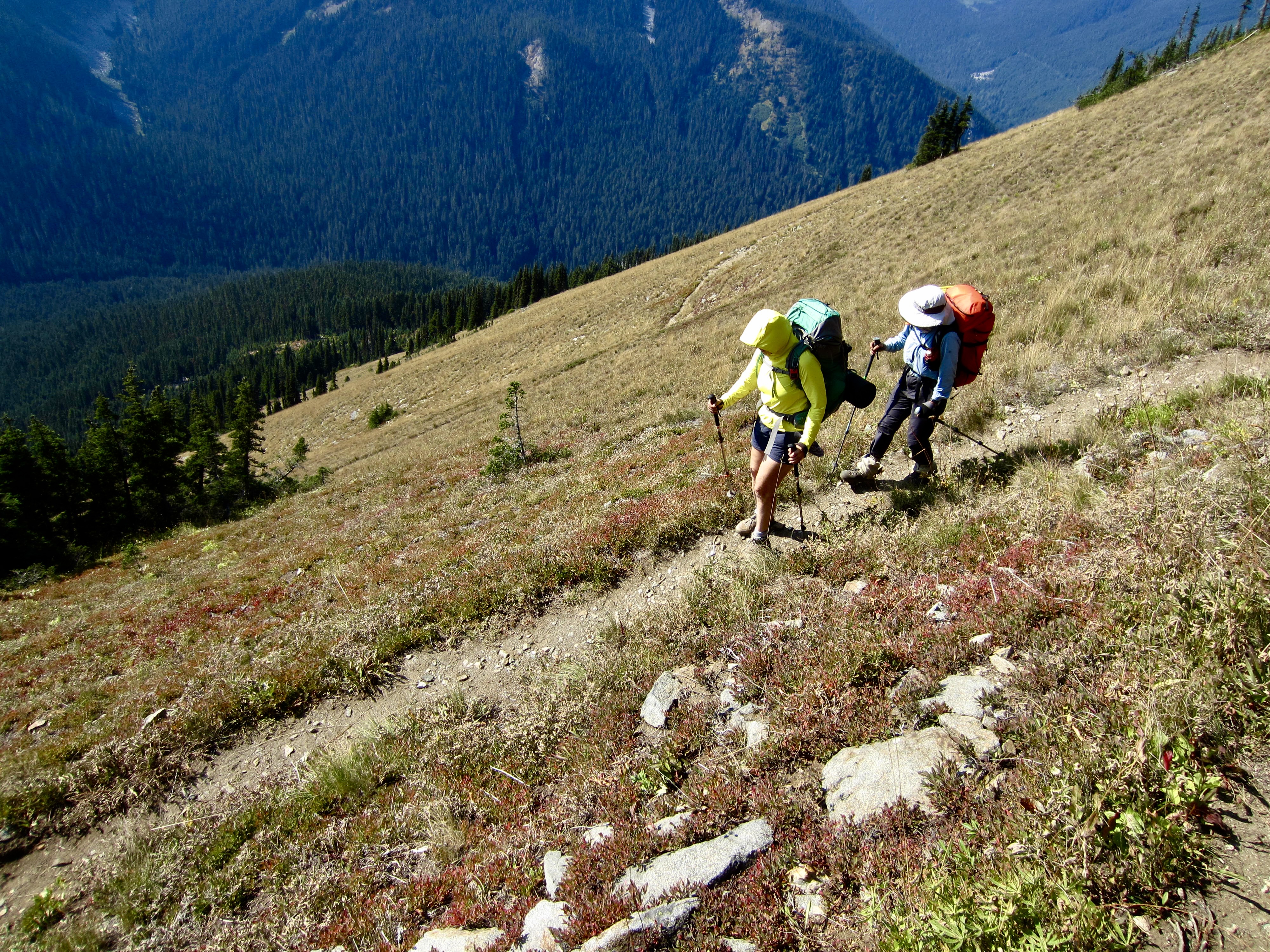
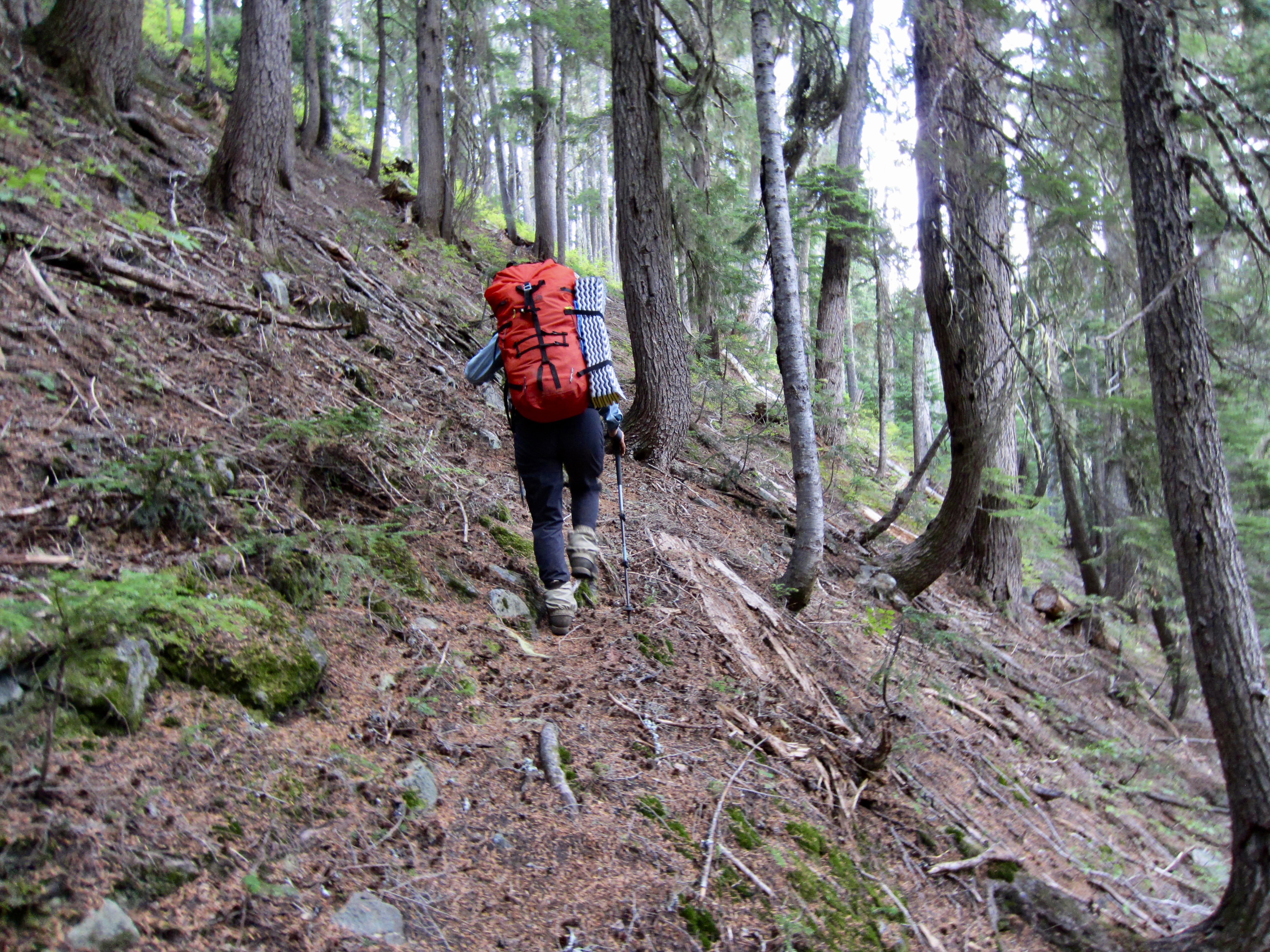
After dropping off a vehicle at Rainy Pass on Smith Brook Road, we drove over to the Round Mountain Trailhead on Butcher Creek Road and started hiking in late morning. Our pace was unusually slow due to a variety of nagging injuries, but our schedule was equally relaxed on this warm Friday.
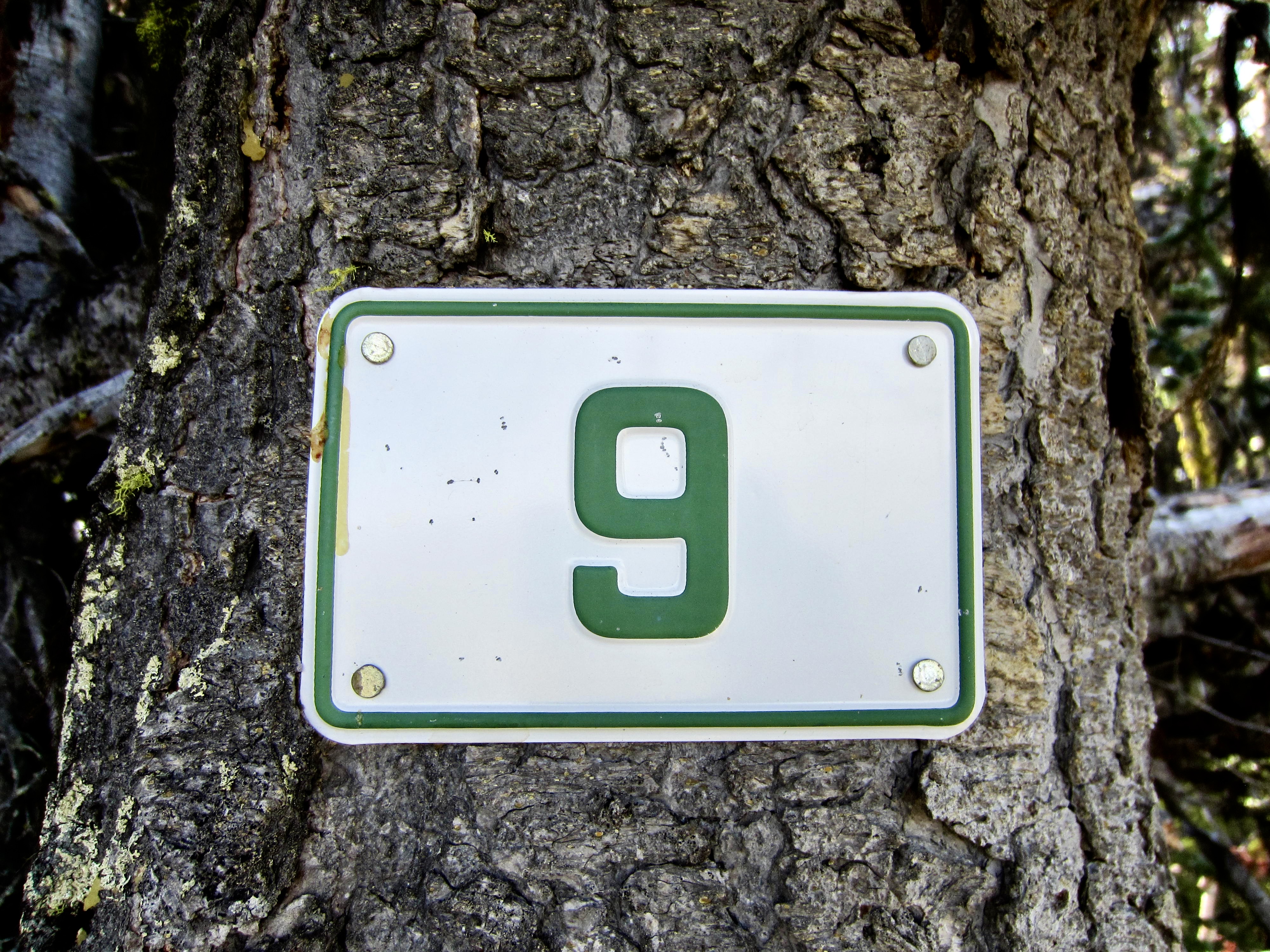
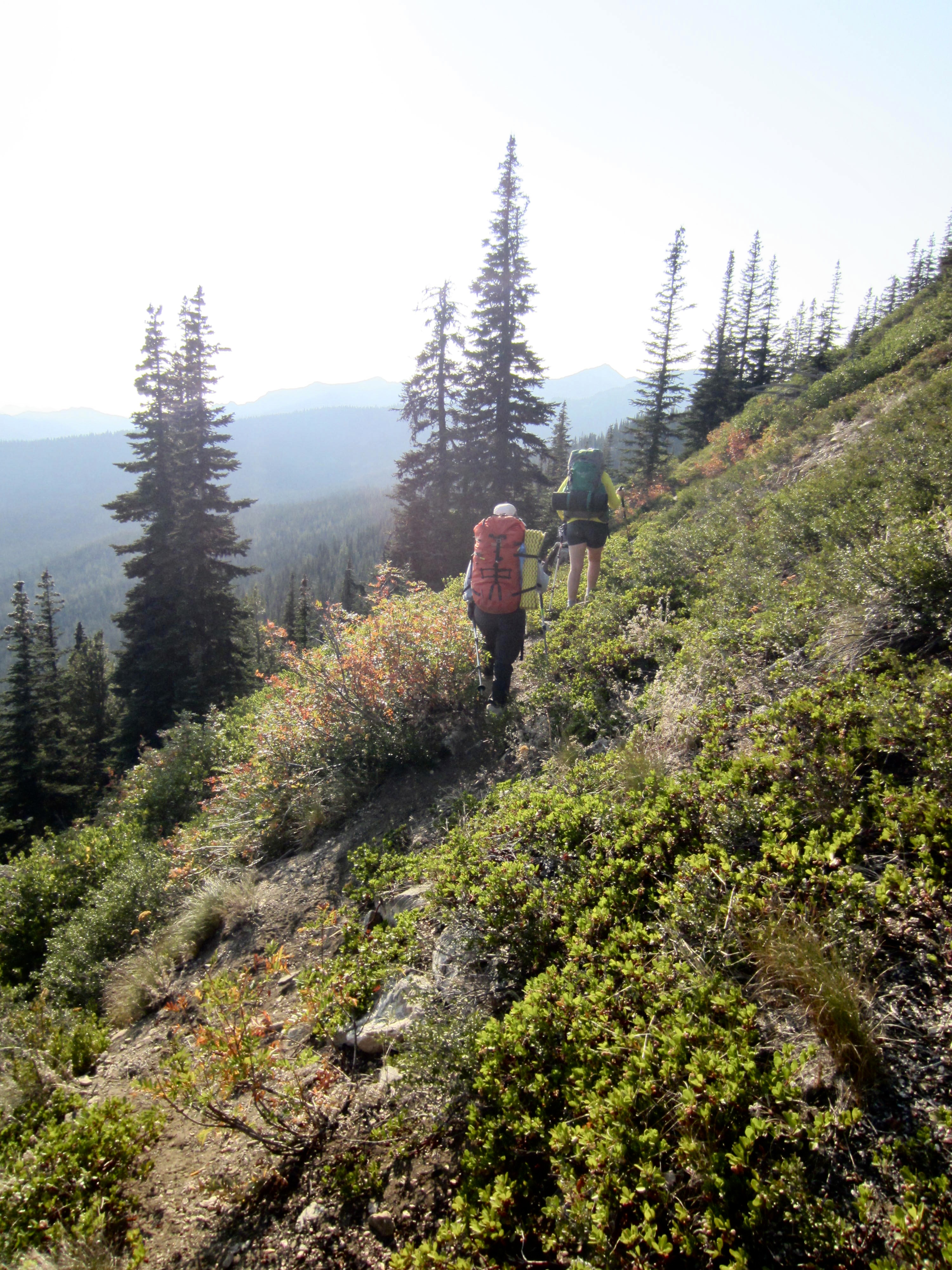
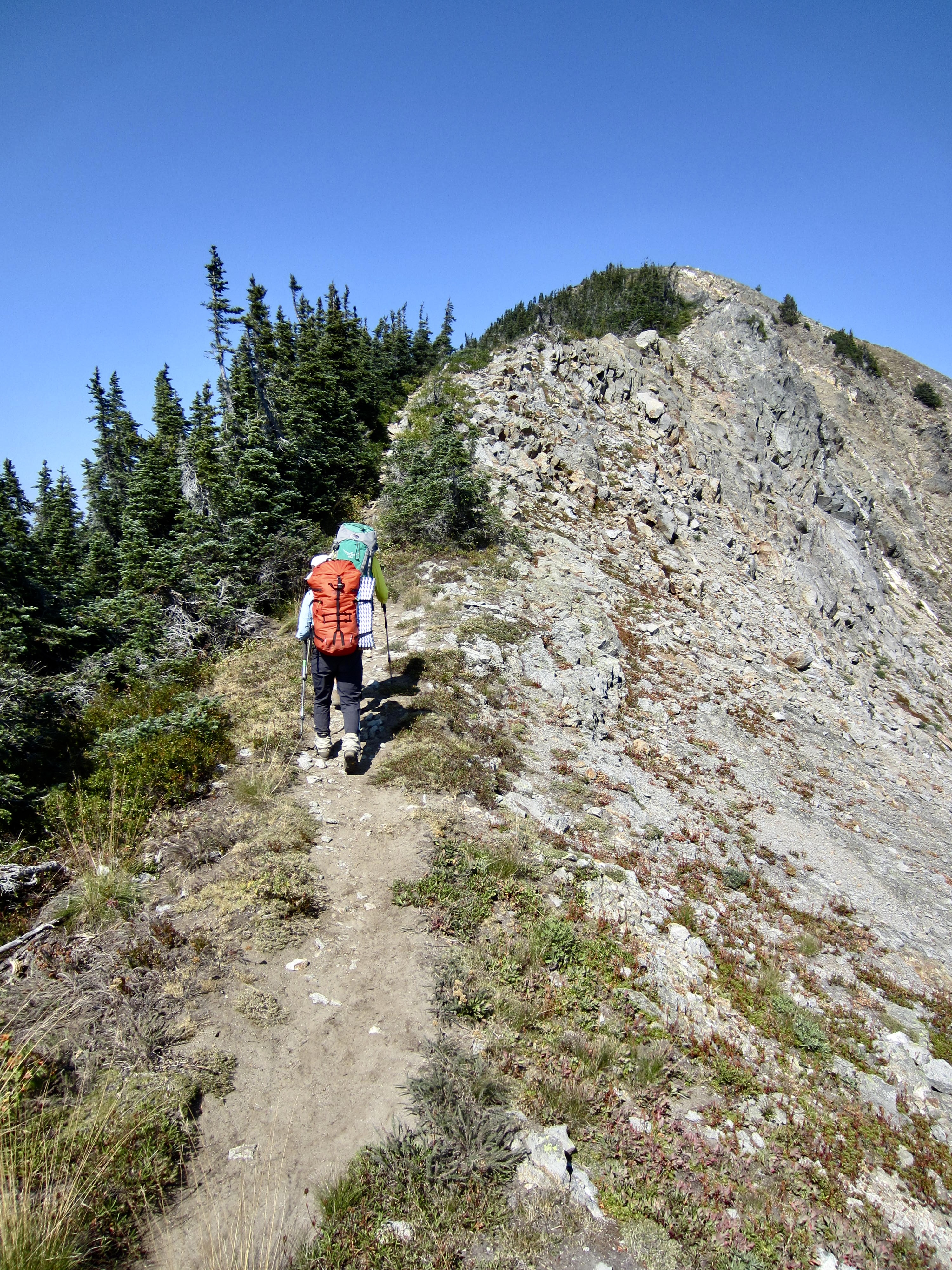
A 1½-mile ascent on the Round Mountain Trail brought us to a junction with the Nason Ridge Trail. We then headed westward on the latter trail as it curved around the flank of Round Mountain and undulated along the crest. Fittingly, a dip into Ninemile Saddle took us past a well-preserved “9” mile marker—the only marker I spotted during our entire traverse.

.
.
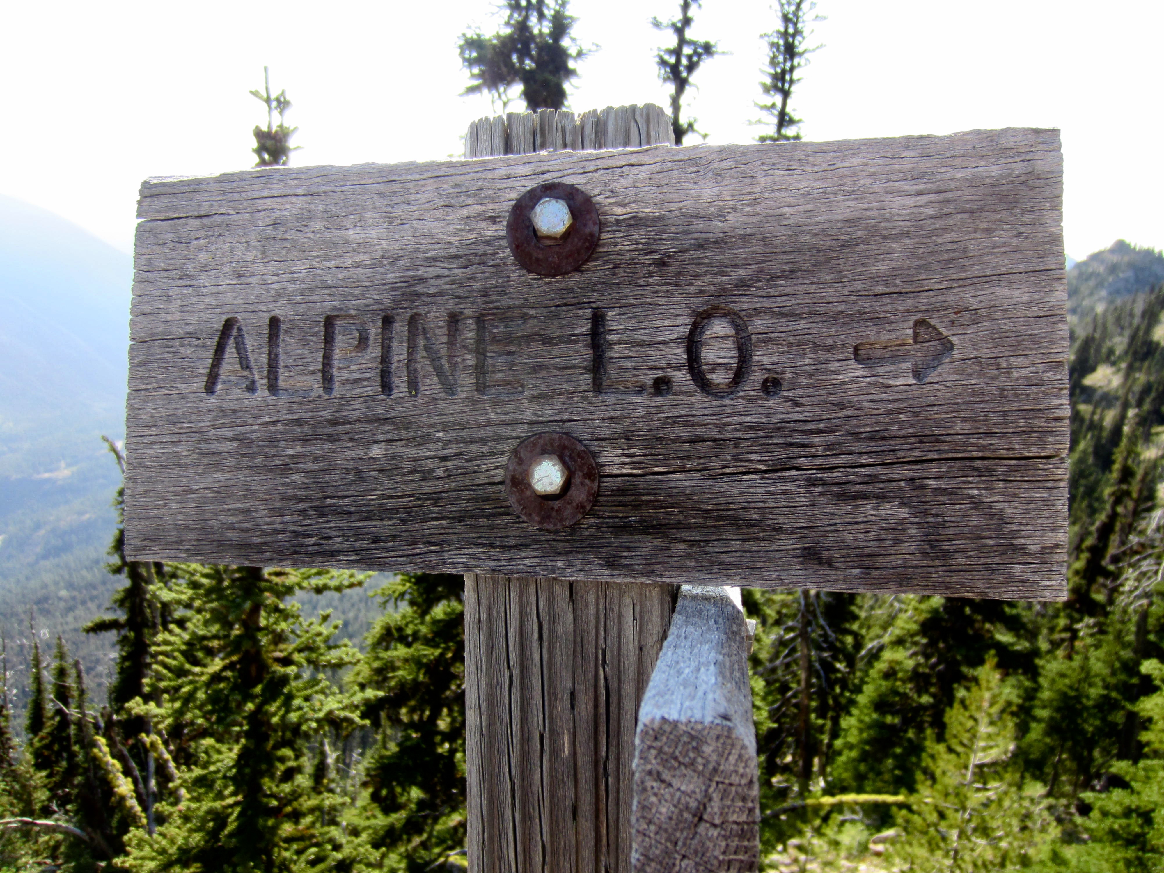
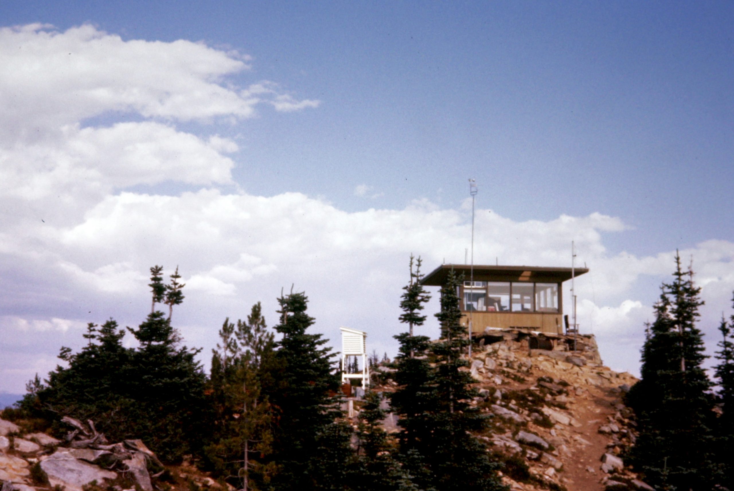
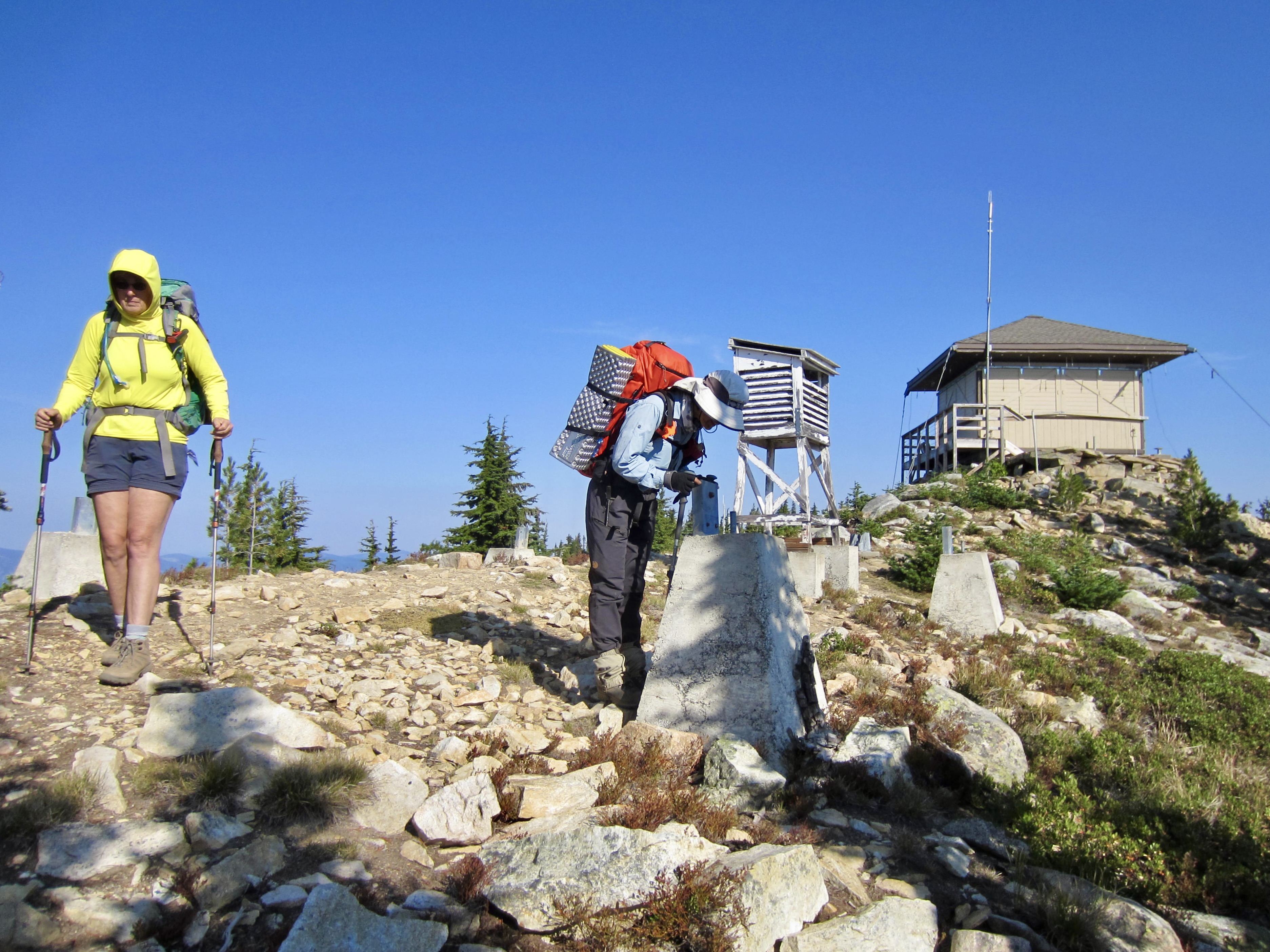
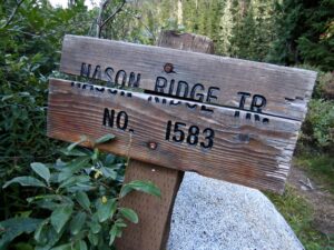
Shortly past Ninemile Saddle, we reached a spur trail junction and made a 250-foot sidetrip up to Alpine Lookout (4.5 hours + 5.0 miles + 2600 feet from TH). The cabin was locked up at the time. This was my sixth visit to the lookout over many decades, and although it appeared to be fully operational each time, I’ve only once seen any staff here.
.
.
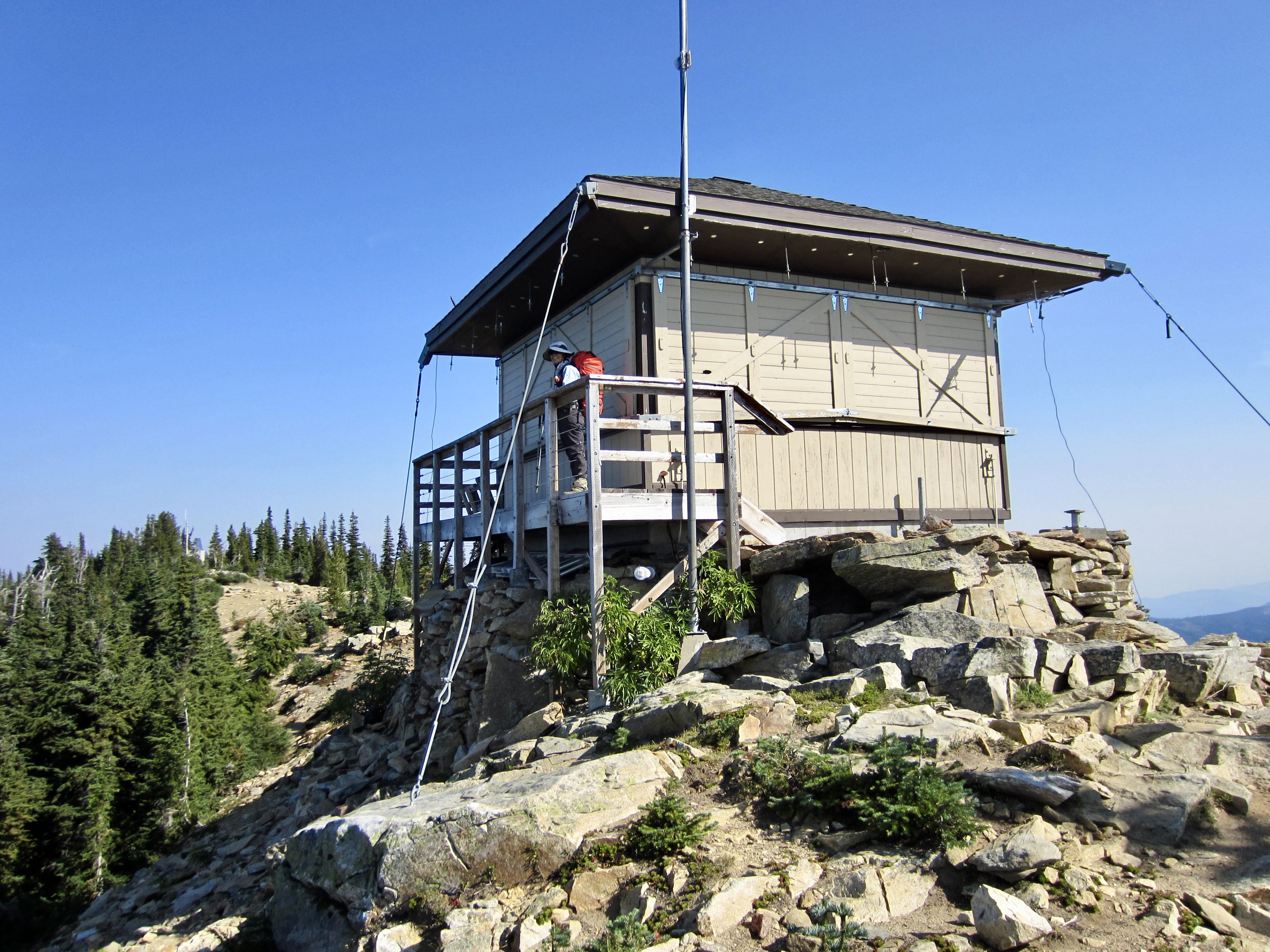
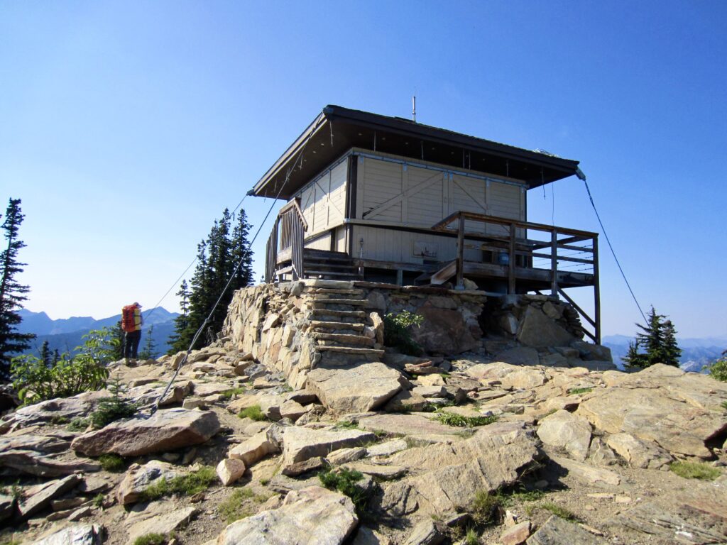
It’s interesting to see how the cabin has changed over time. The original flat roof has been replaced with a hip roof, and a catwalk has been added to the exterior. The “then & now” photos below illustrate these changes since 1977.
.
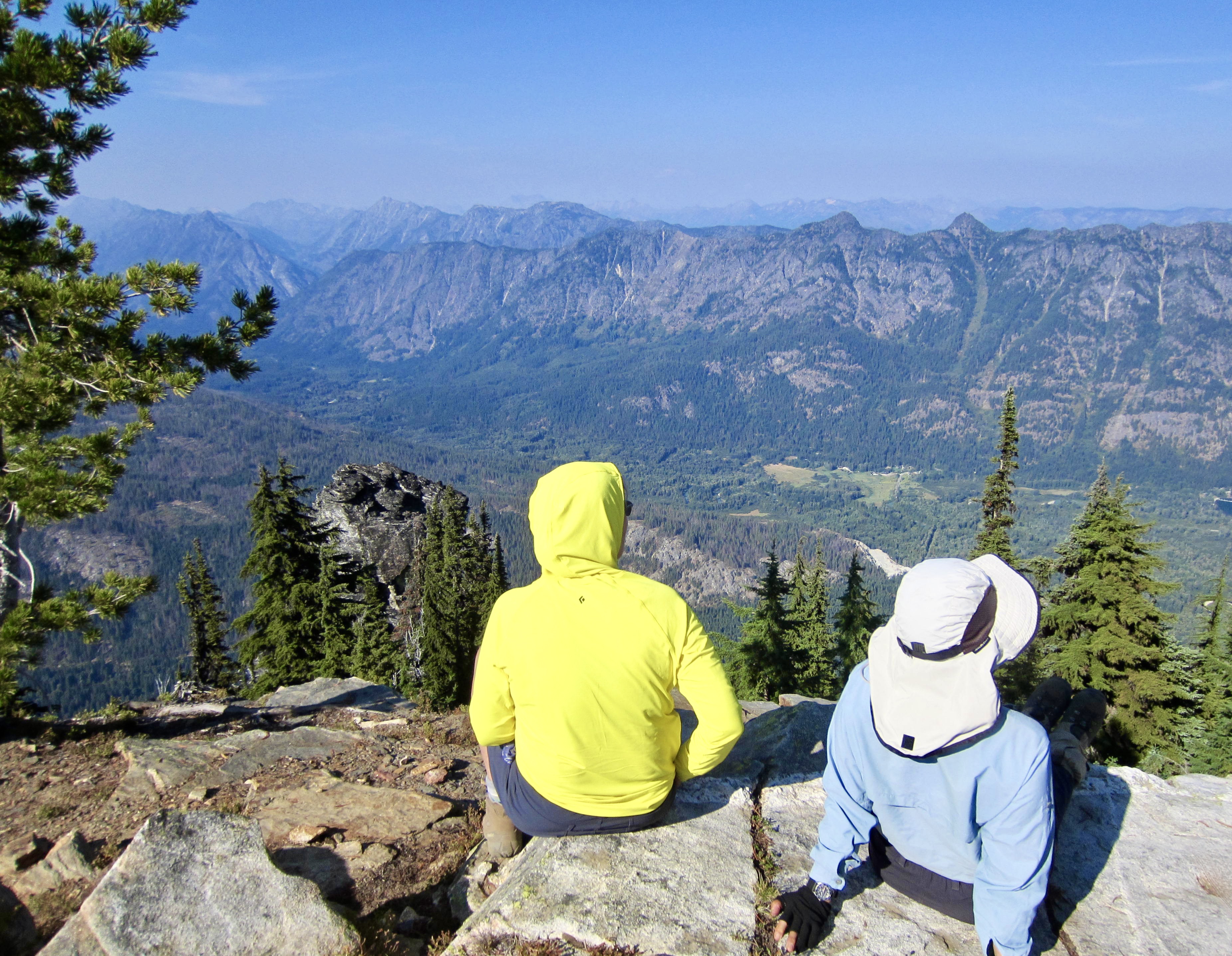
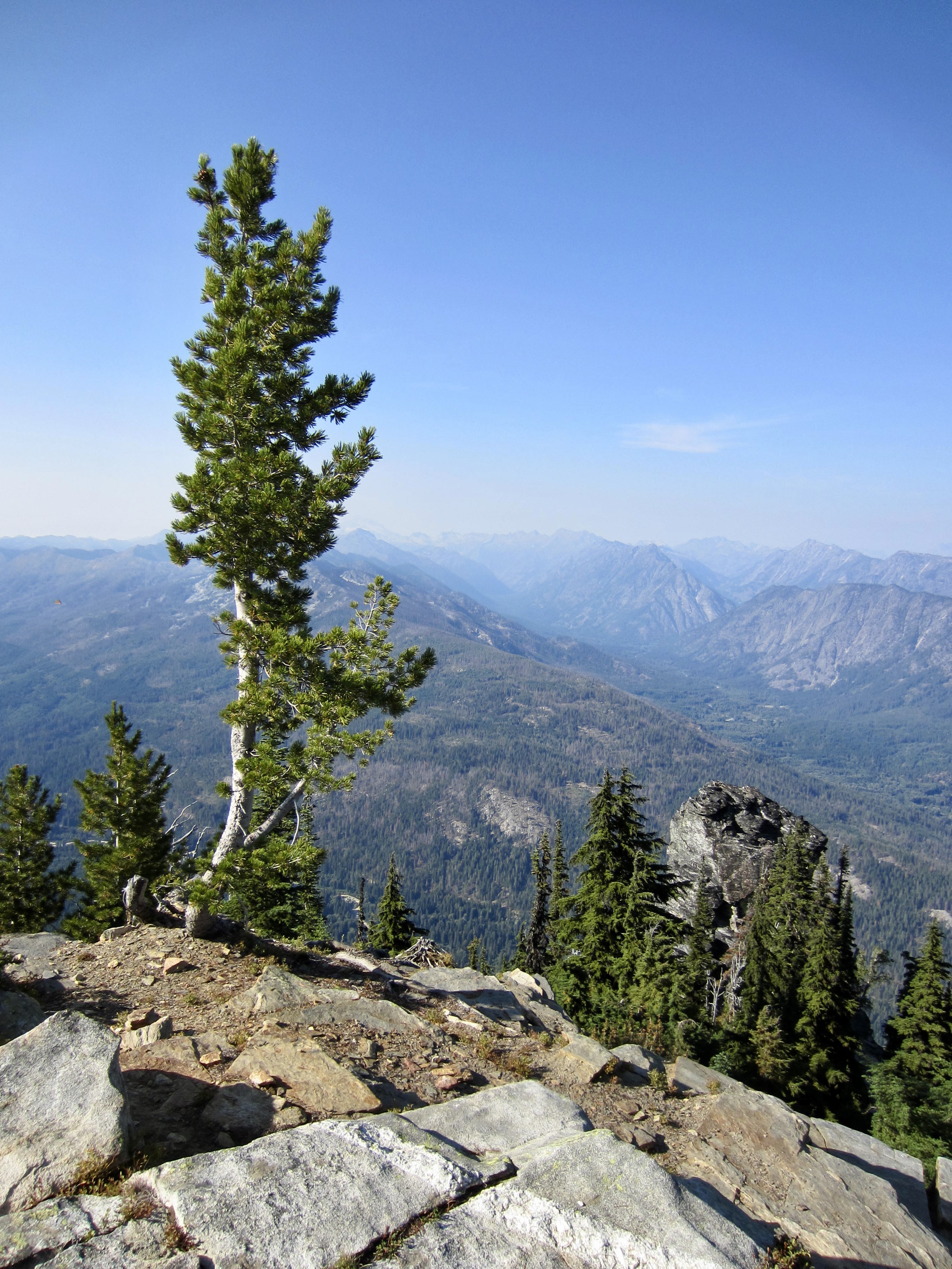
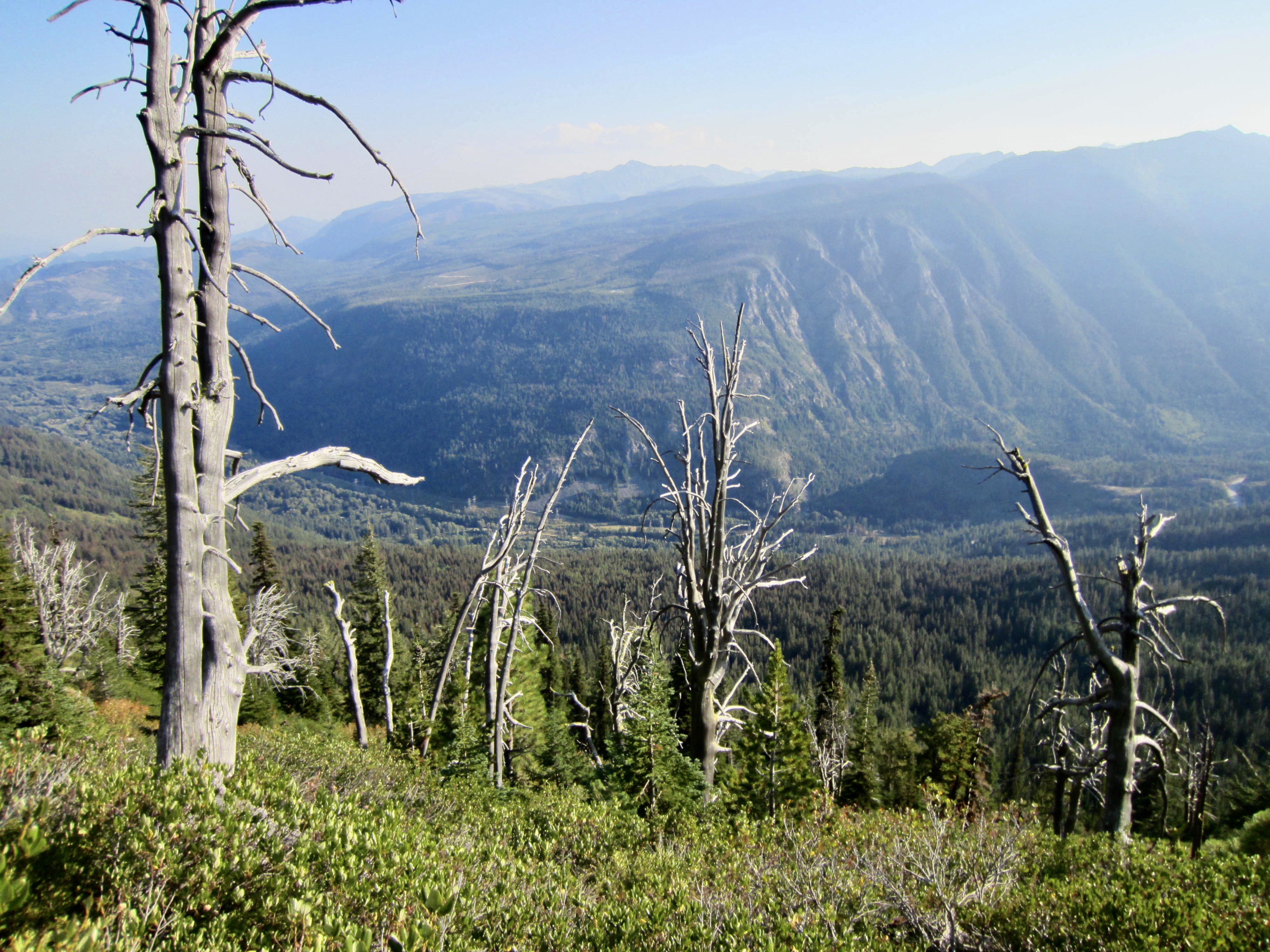
Views from the lookout were greatly limited by hazy air hanging over the mountains, but at least we could clearly see Mt. Howard and Rock Mountain along tomorrow’s route. More locally, we were intrigued by an angular tower of metamorphic rock standing just below the cabin. This tower is visible from many distant locations, including Lake Wenatchee and Highway 2.
.
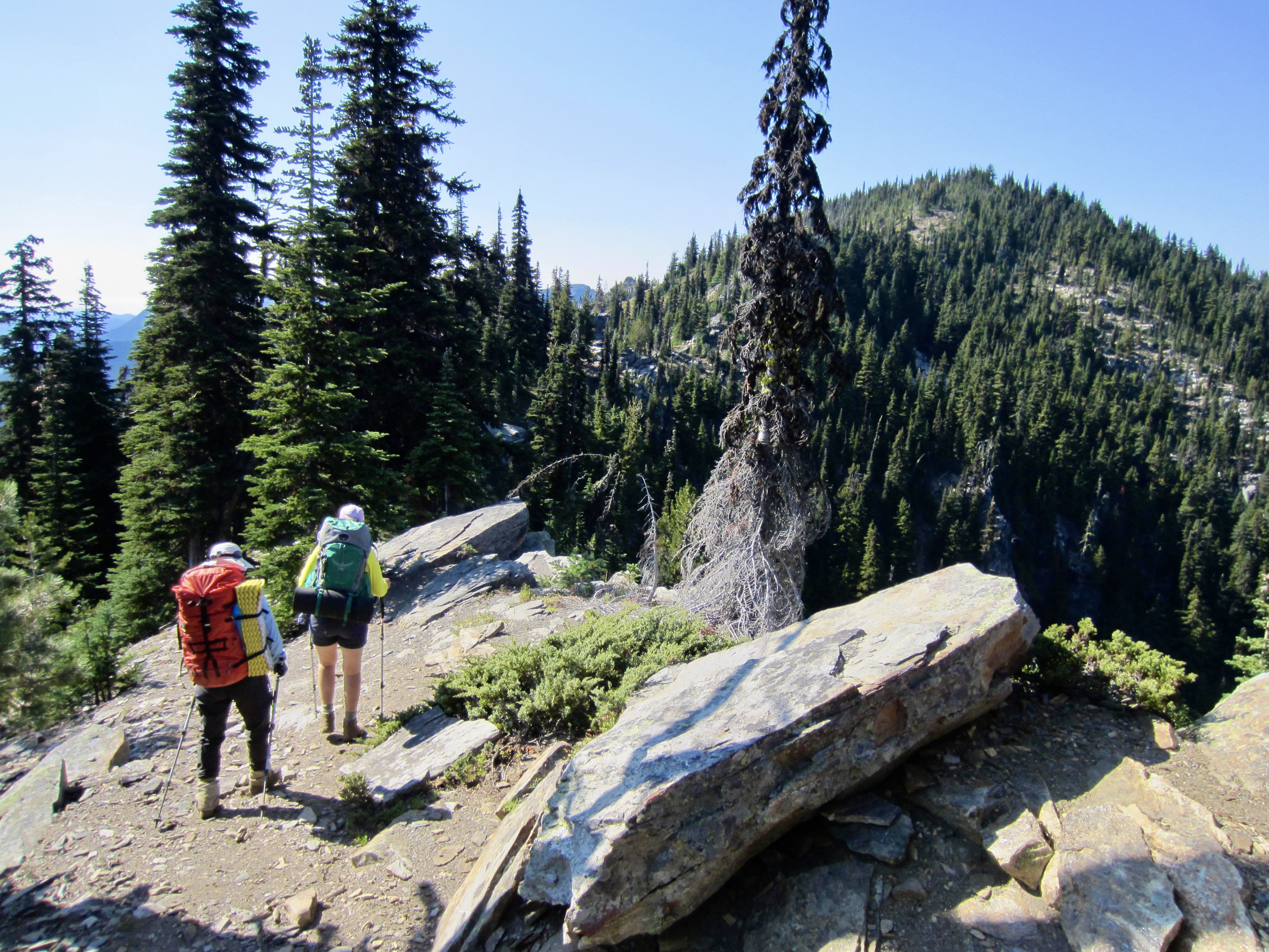
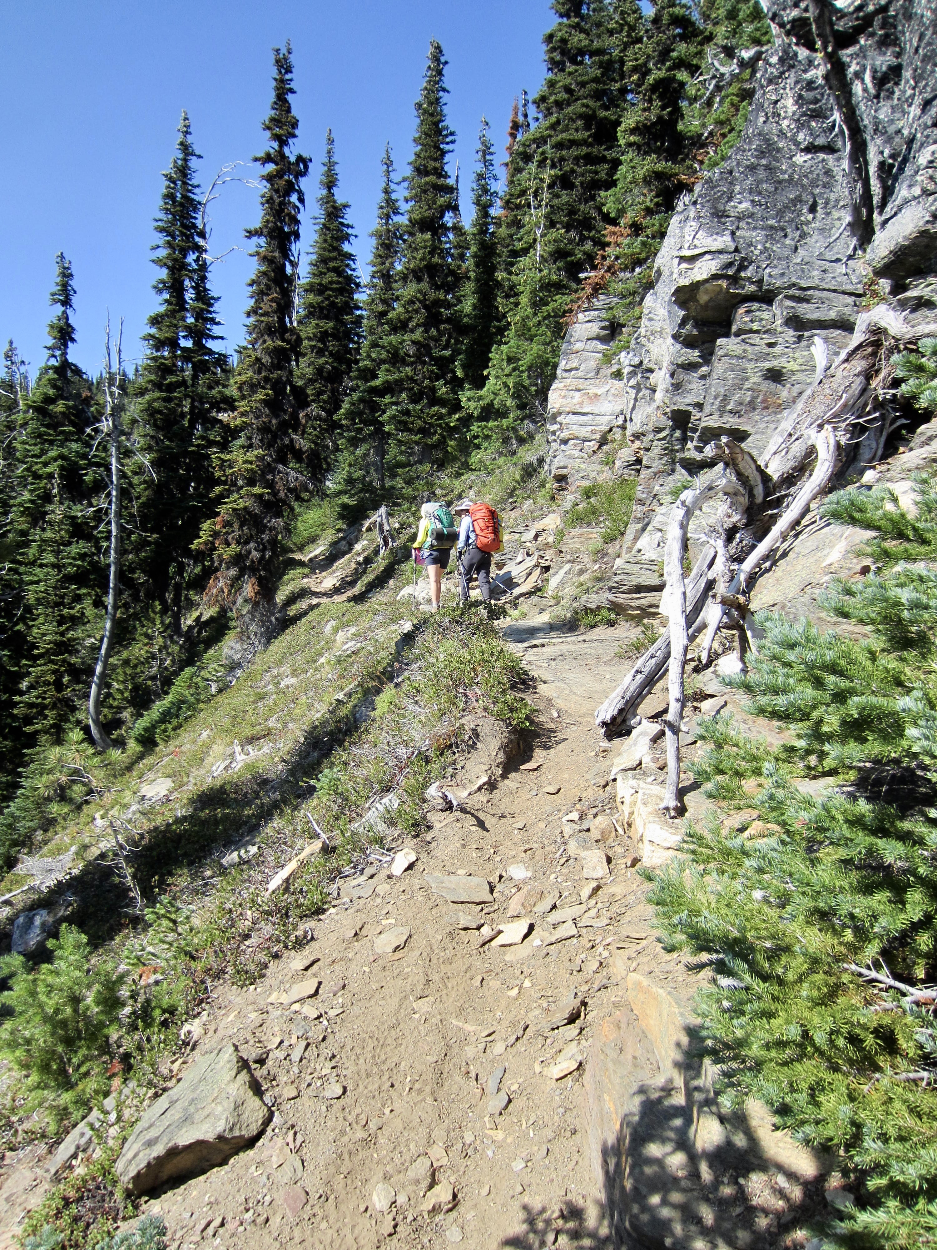
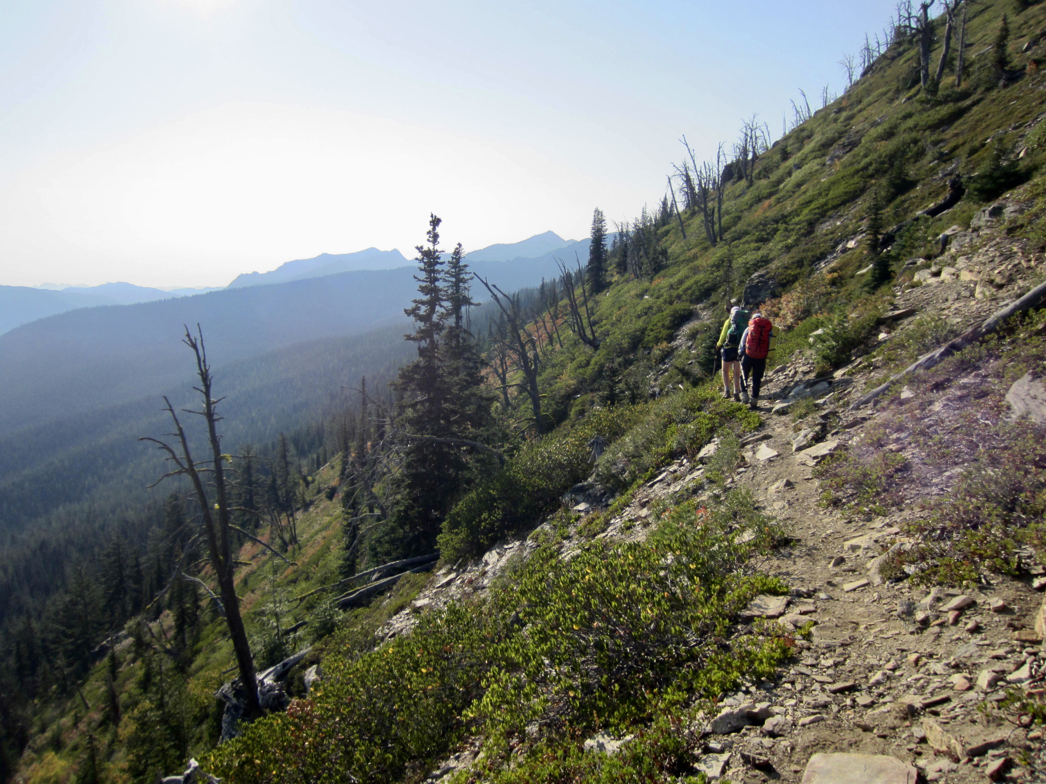
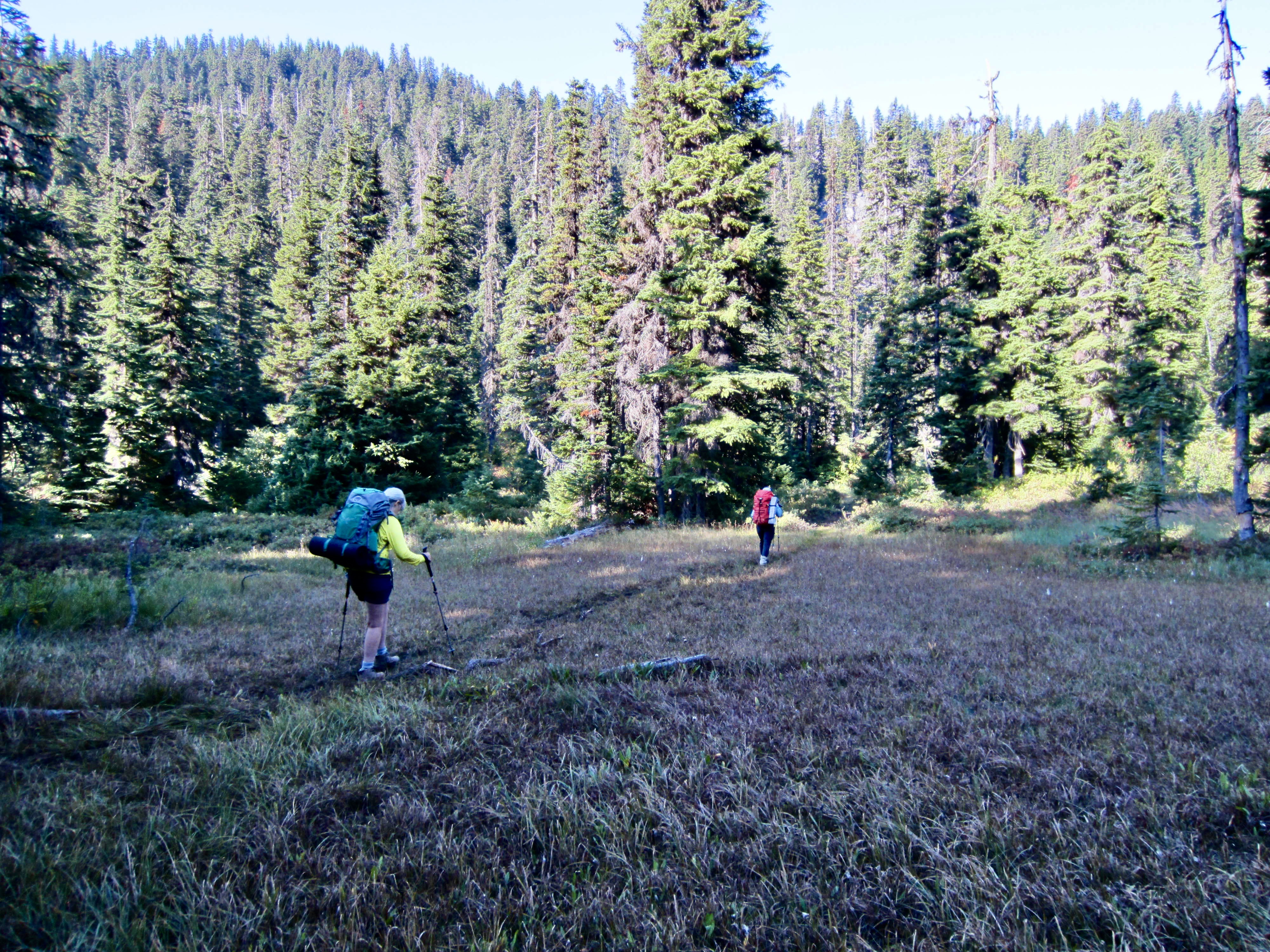
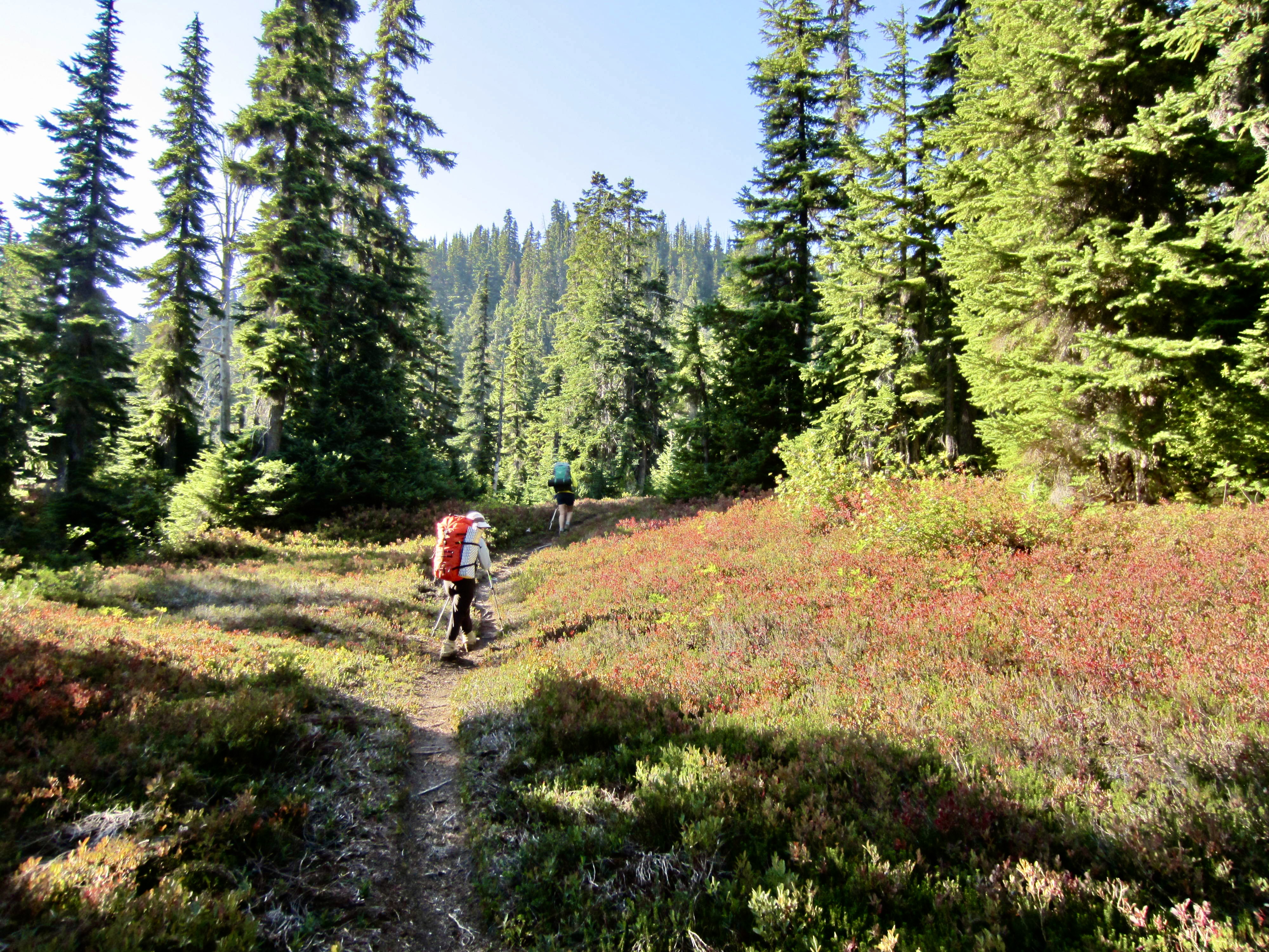
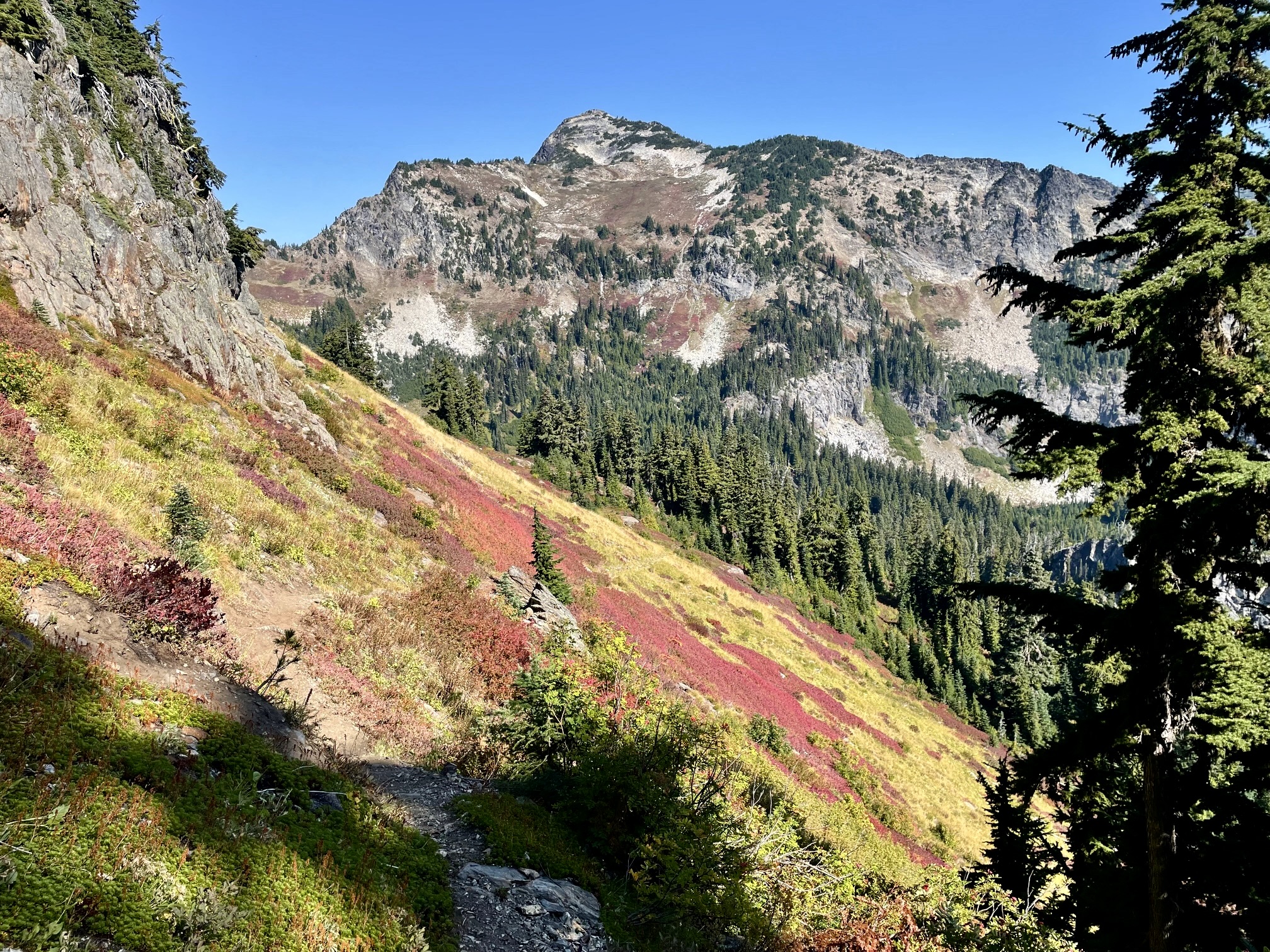
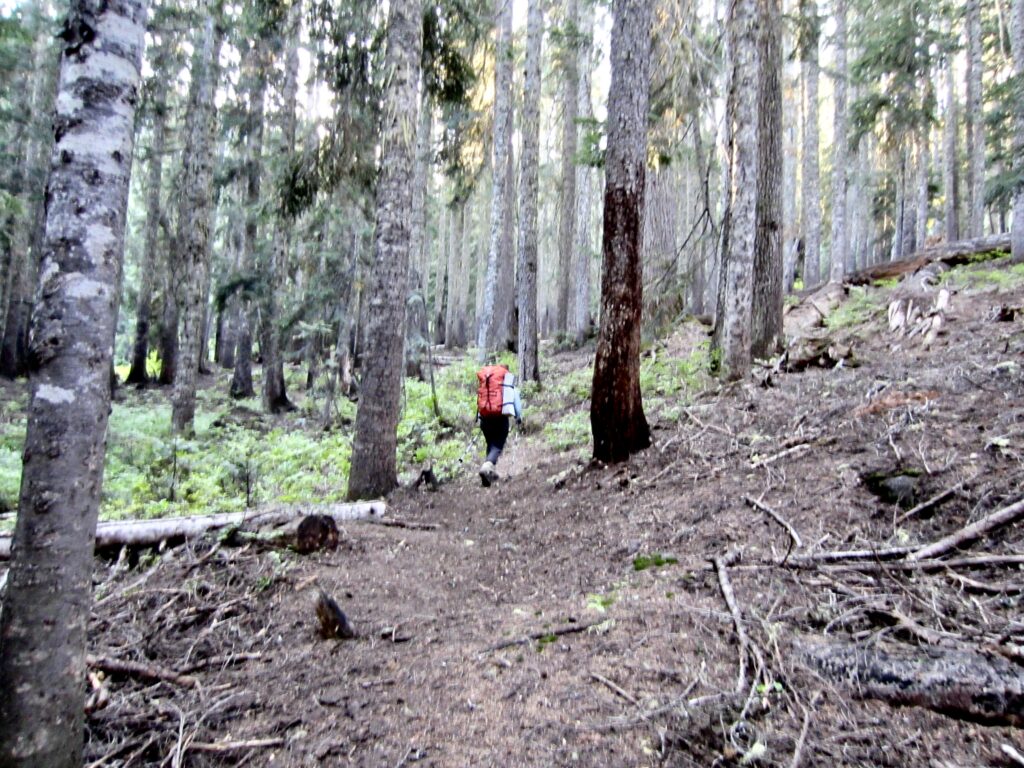
After returning to the junction, we kept hiking westward across the southern side of the crest. This part of the Nason Ridge Trail passes through an old burn and does not appear to have gotten any recent maintenance; there are large segments overgrown with dense brush and decorated with silver snags.
.
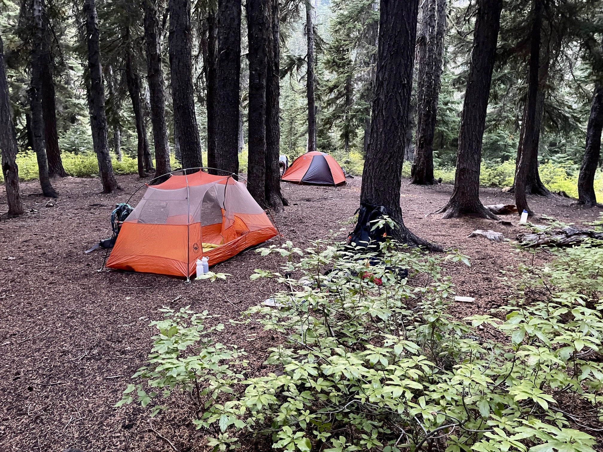
We arrived at Merritt Lake in early evening and stopped for the day (8.0 hours + 8.4 miles + 3150 feet from TH). The campsite here is exceptionally large and comfortable but was strangely quiet on this balmy evening. I should also mention that Merritt Lake was the first water source we had encountered all day; it is a bone-dry trail!
.
Day 2: Merritt Lake to Rainy Pass / West Trailhead
Following an unseasonably warm night, we were back on the trail at 7:00am. Our entire morning involved a short descent to a junction, then a series of four 600-foot ascents to various creeks or lakes or saddles.
.
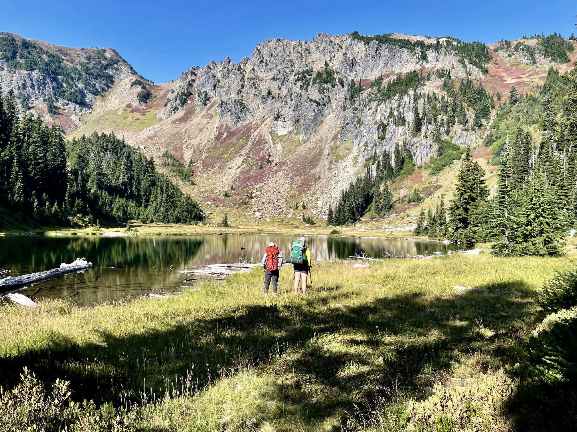
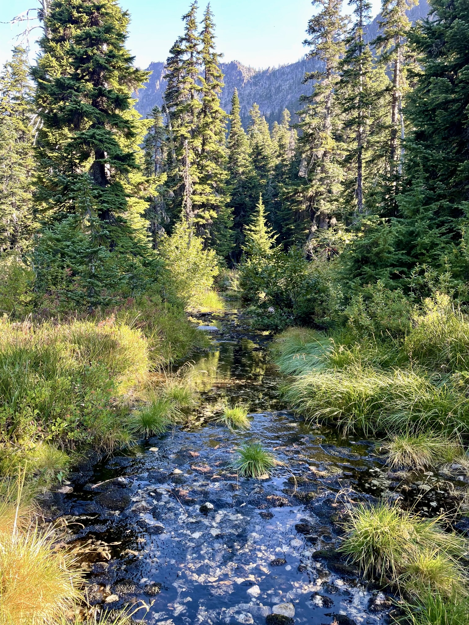
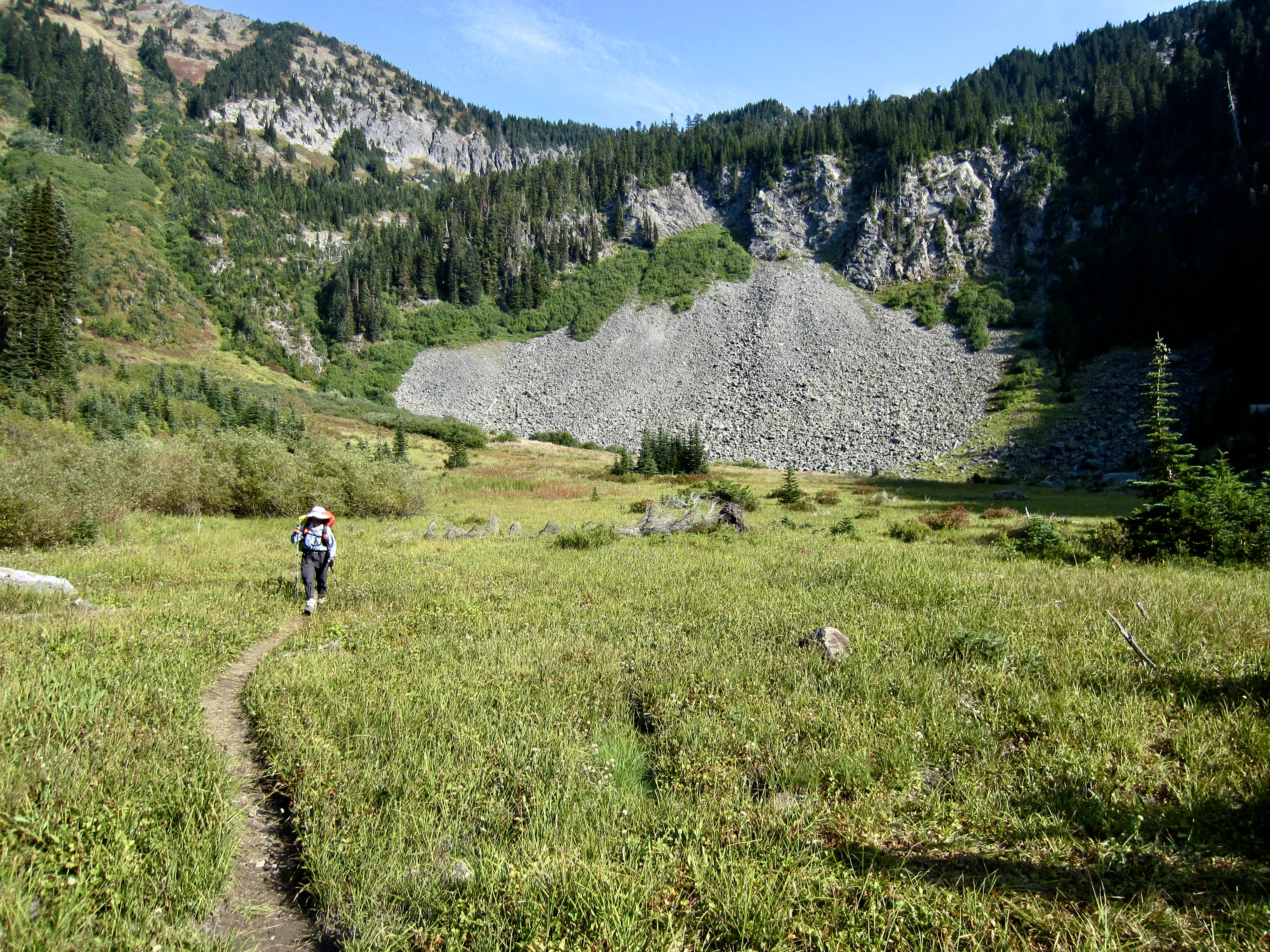
Our first way point was Royal Creek, which emanates from Canaan Lake 1000 feet above. This creek offers a reliable water source but only meager camping at best. Although the adjacent meadow initially looks like a fine campsite, it remains soggy throughout the summer and fall.
.
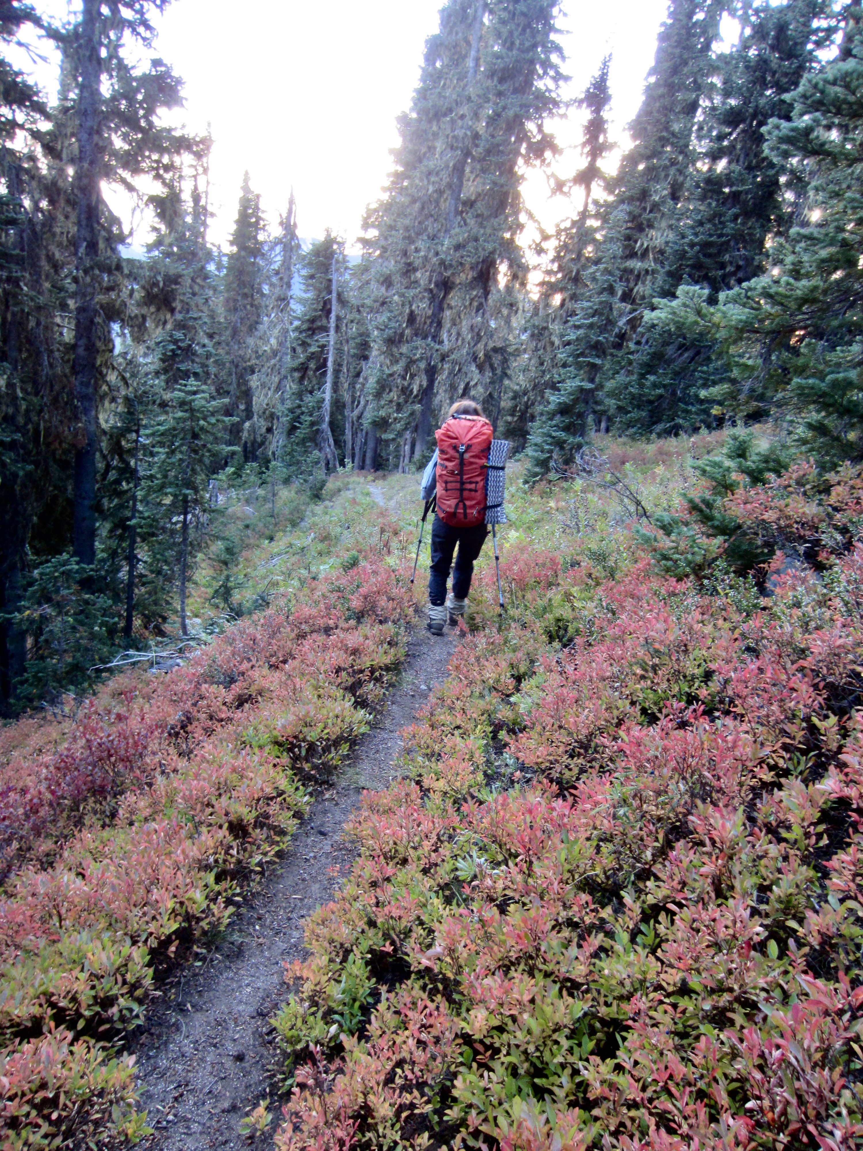
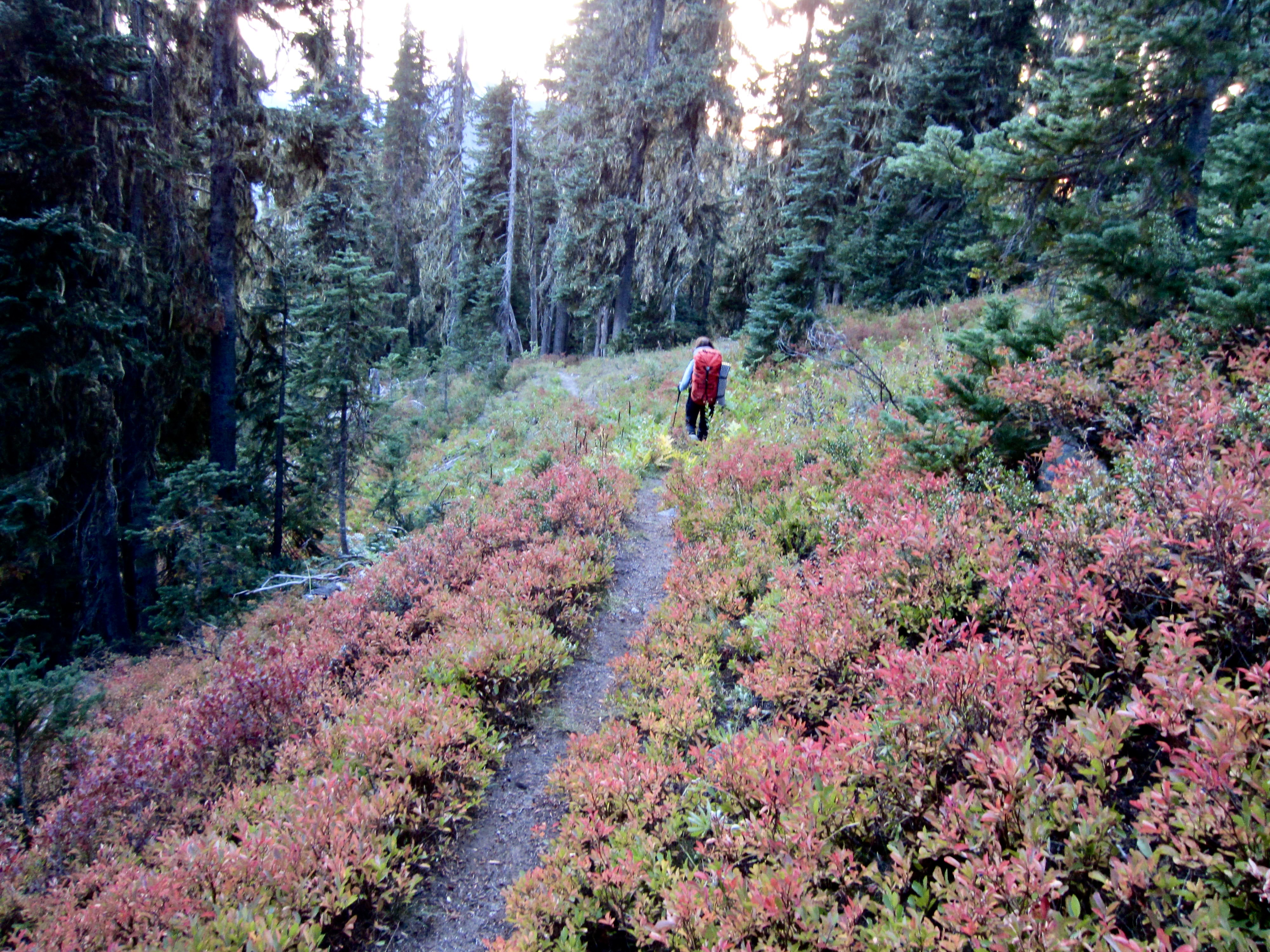
A second ascent through delightful huckleberry fields and heather meadows brought us to Crescent Lake (3.2 hours + 3.7 miles + 1300 feet from camp). This attractive lake tucked below the cliffs of Mt. Howard offers a park-like setting and a few nice campsites.
.

.
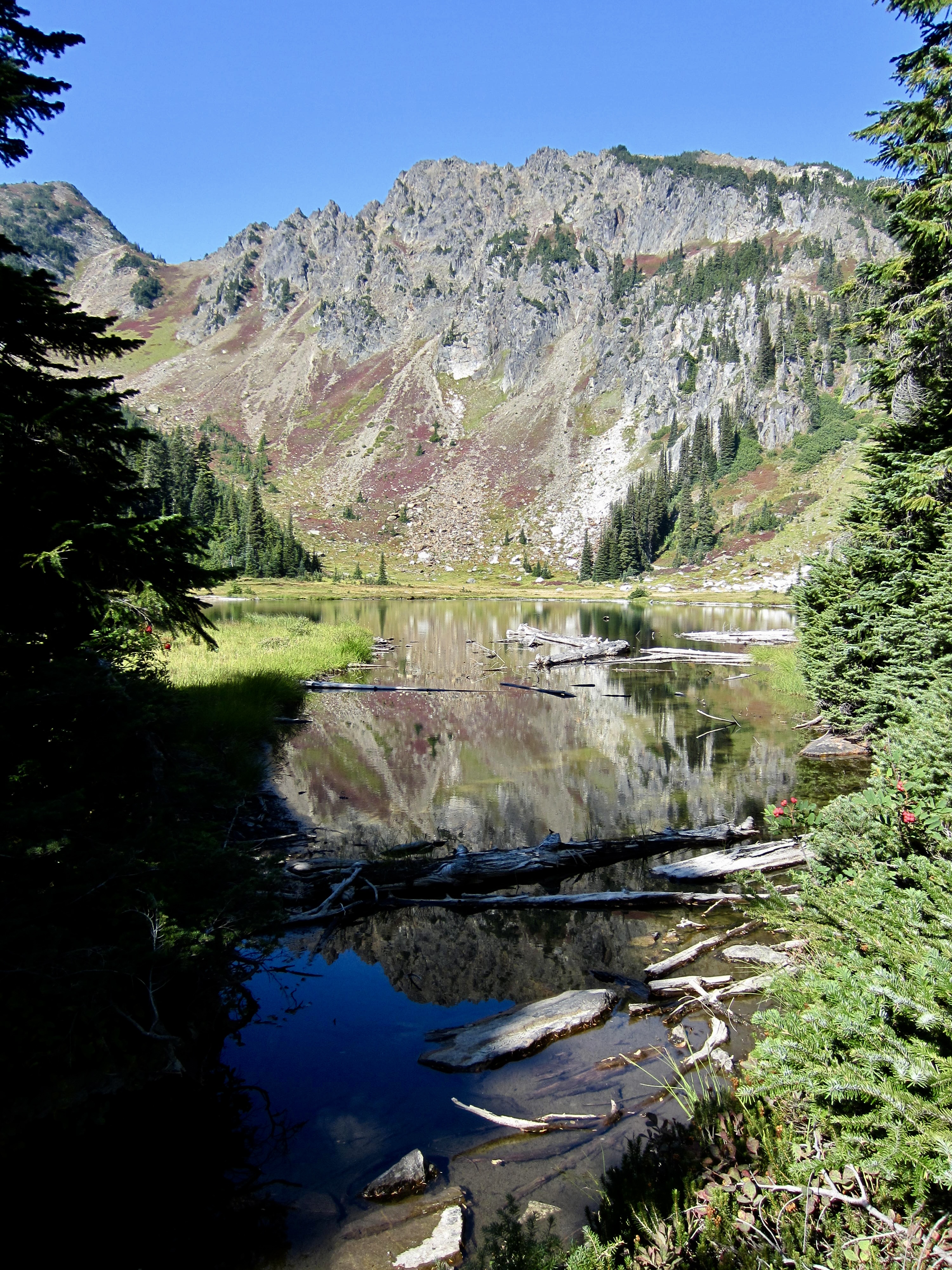
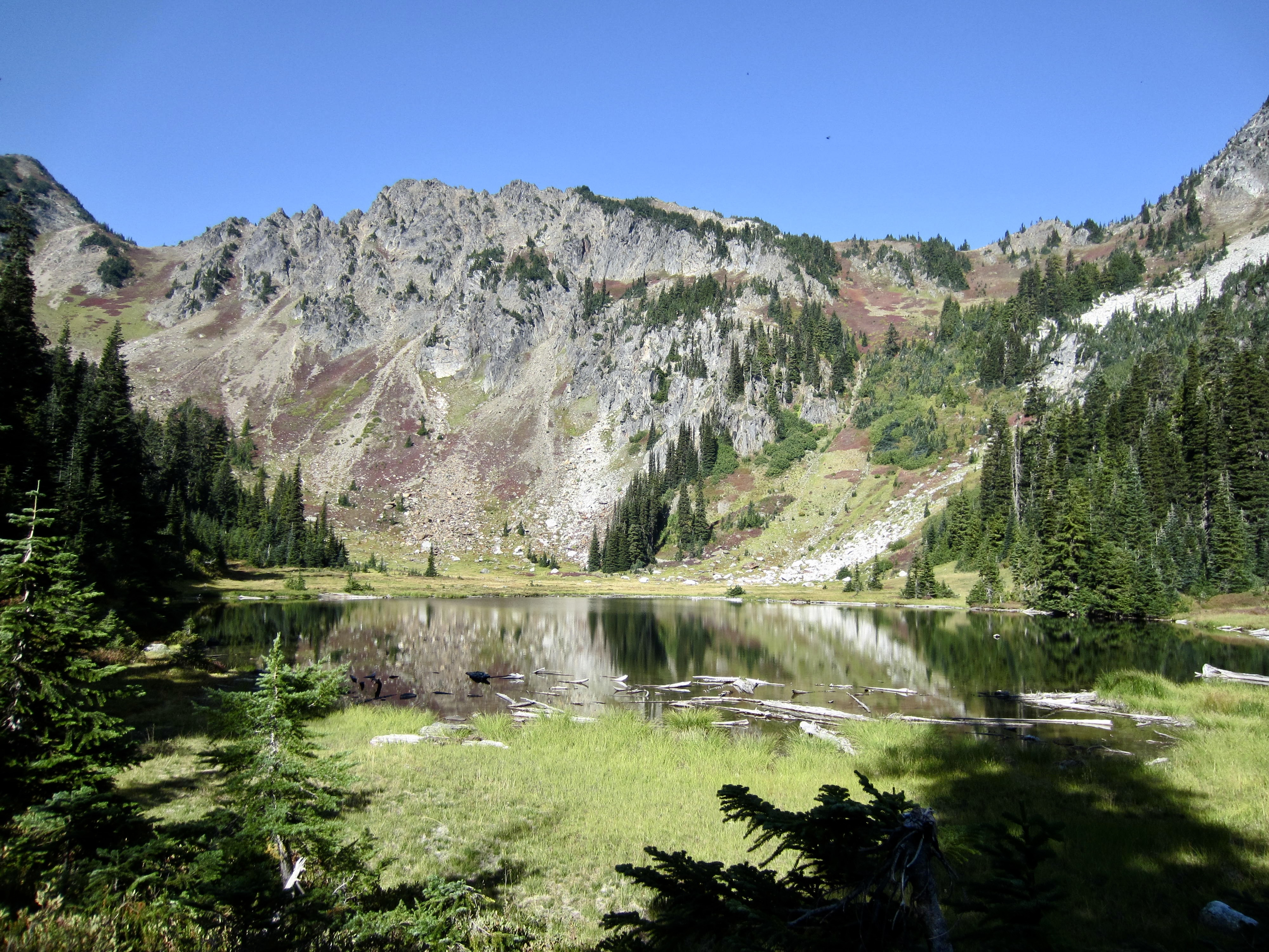
.
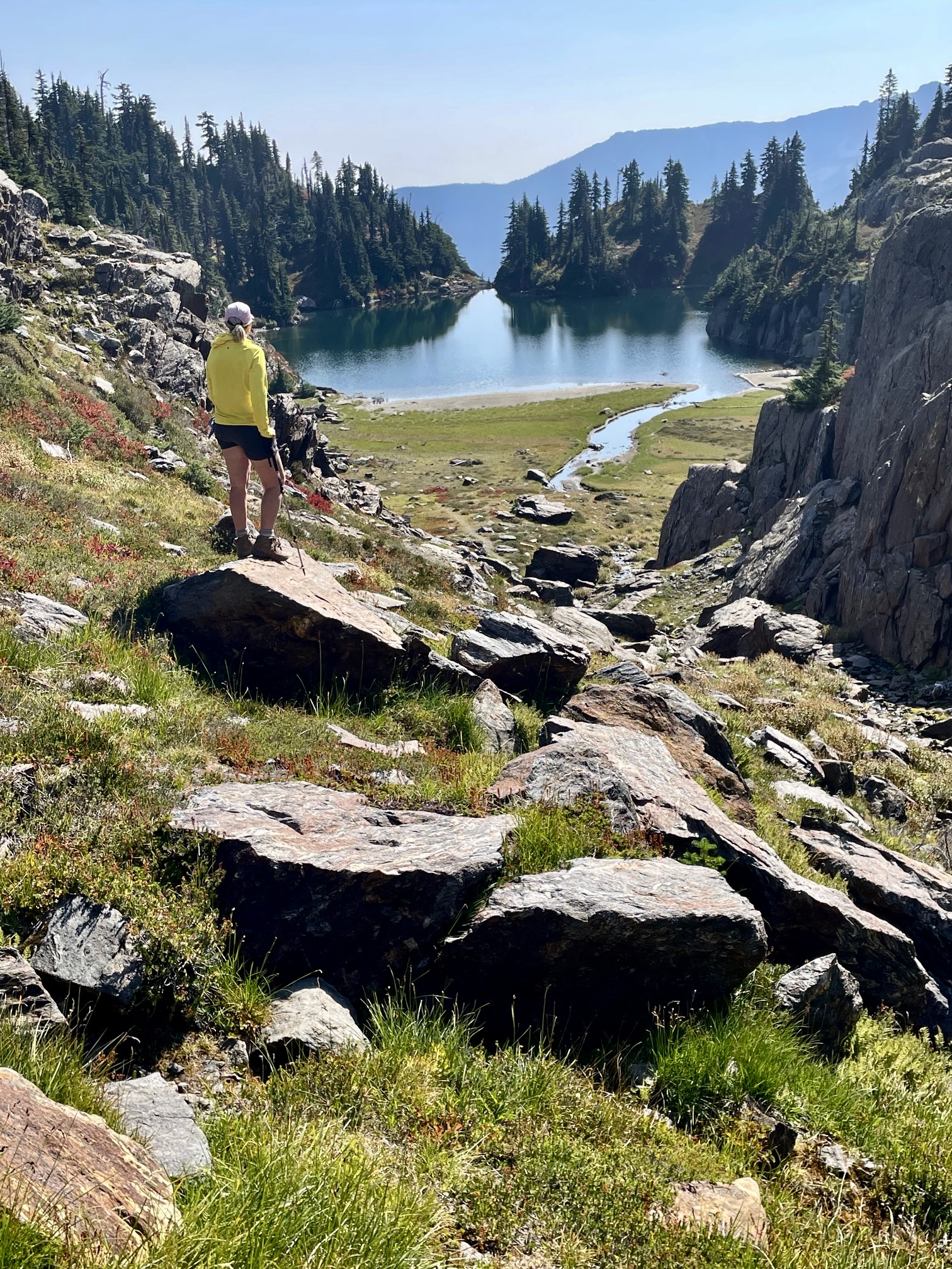
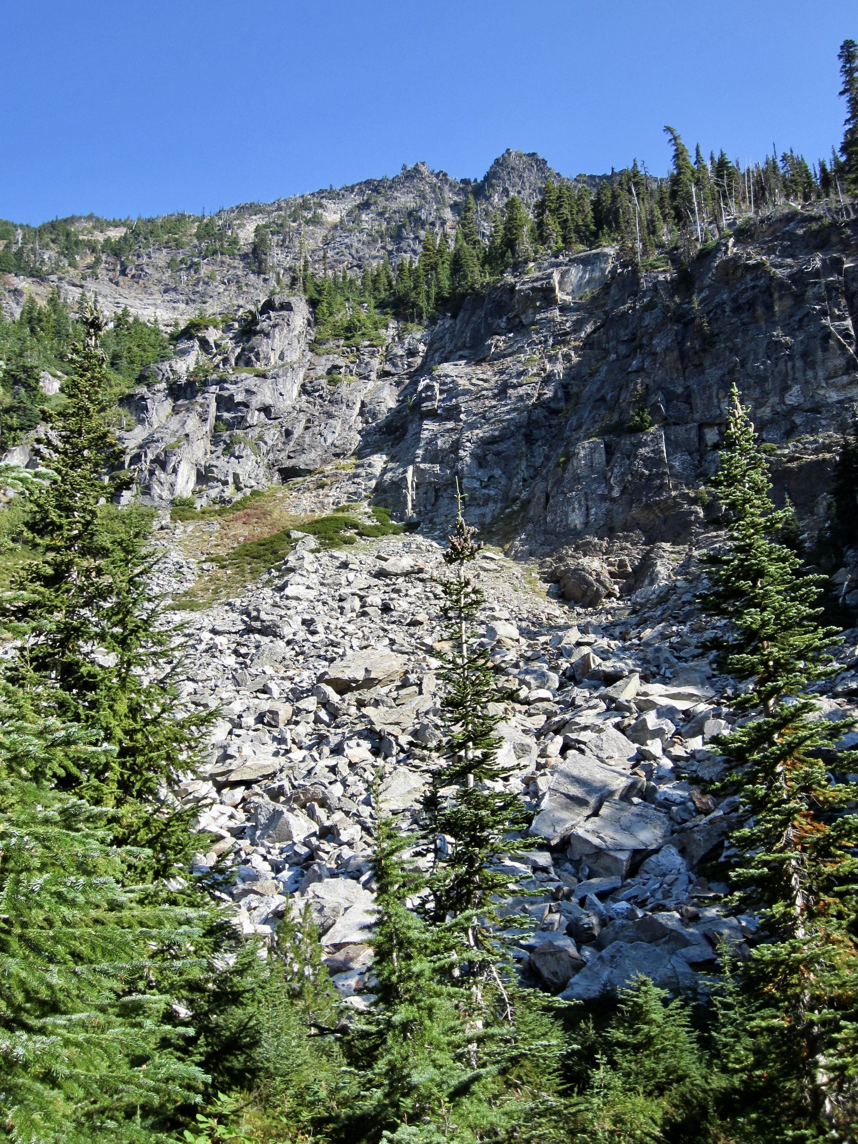
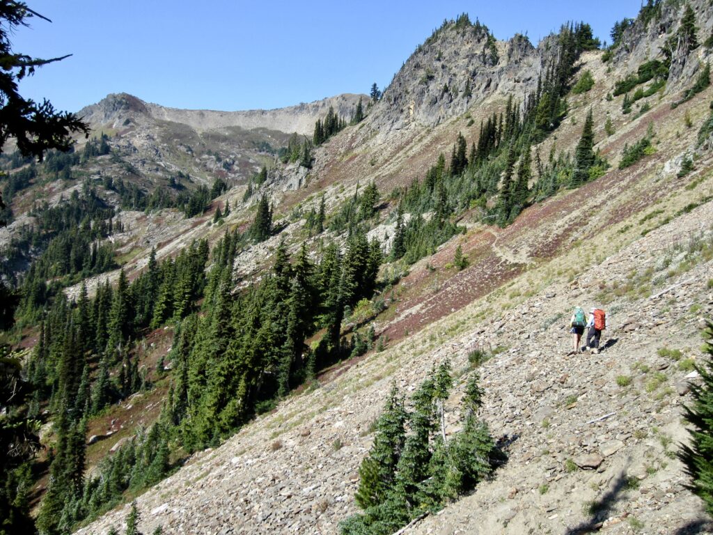
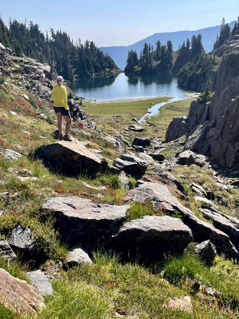
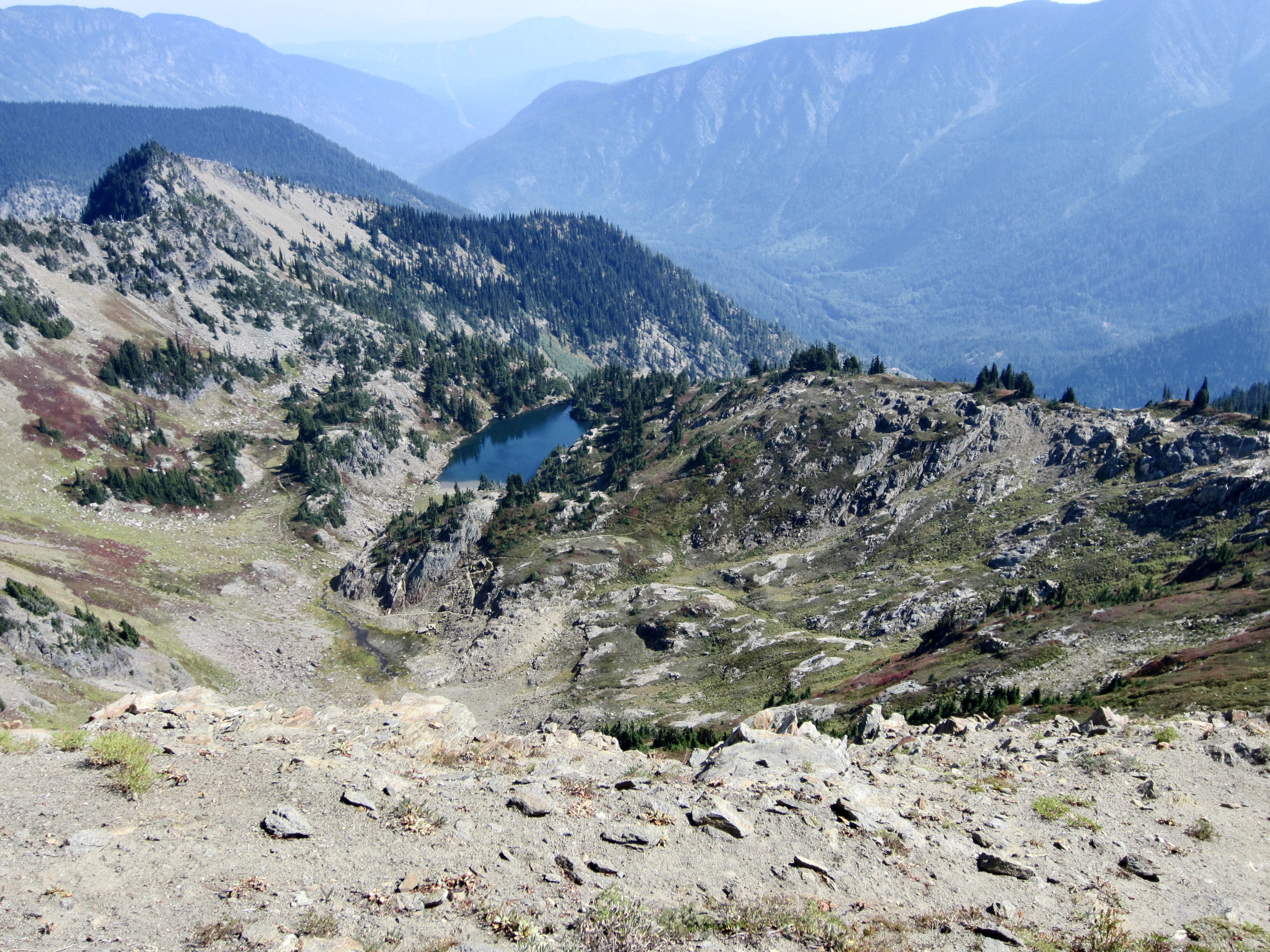
Our third ascent led us out of the lake bowl, across grassy slopes, and over the sharp crest of “Artillery Ridge,” where an ominous WSDOT sign warns hikers about avalanche-control artillery strikes here. The trail then contoured a barren slope over to the large bowl holding Rock Lake.
.
.
The Nason Ridge Trail swings around the head of Rock Lake, thereby providing a splendid view of this beautiful alpine pool. We refilled our water bottles from the barely flowing inlet stream (Schilling Creek) before continuing on.
.
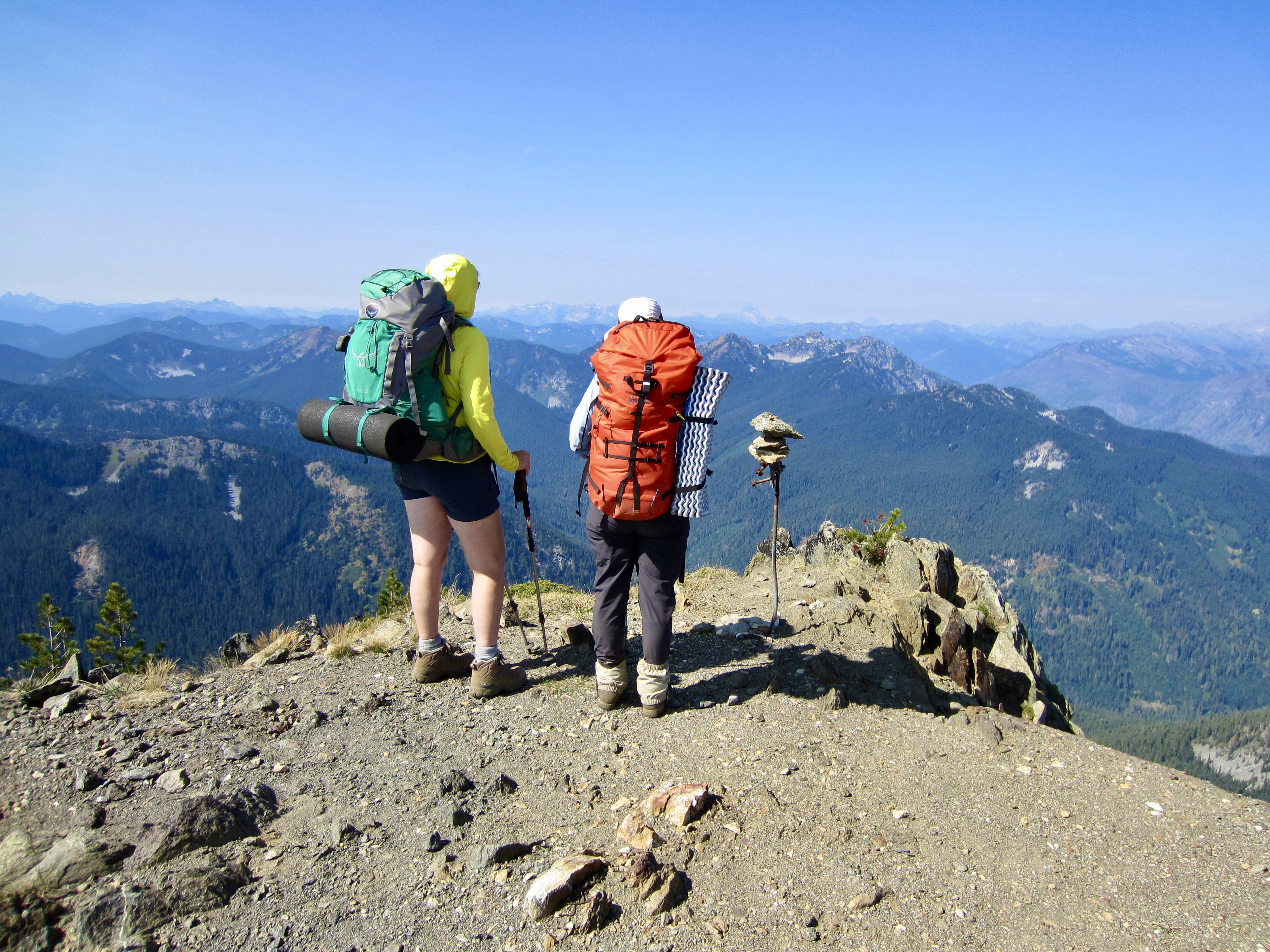
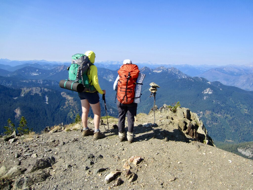
Our fourth and final ascent of the morning took us up to 6600-foot Rock Mountain Saddle, which represents the highest point along the Nason Ridge Trail. From a junction here, we followed a spur trail up to the summit of Rock Mountain (6.4 hours + 6.1 miles + 2850 feet from Camp). We took a long lunch break on top, but sadly, the surrounding peaks were still draped with a thick haze.
.
.
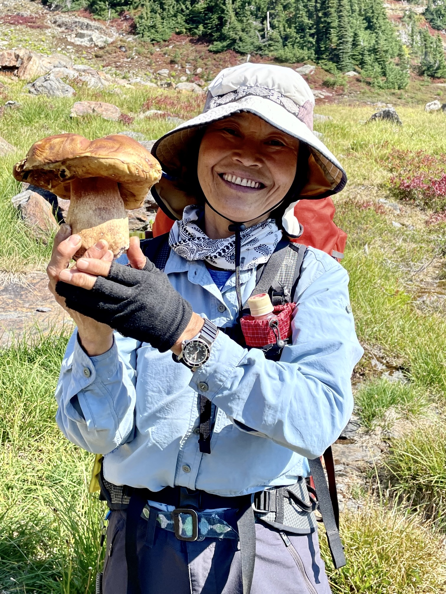
From the saddle, we plunged down a vast, grassy hillslope to reach the lush meadows of Snowy Creek Basin. We had now crossed onto the northern side of Nason Ridge, and Yoko was thrilled at the variety of mushrooms erupting from the ground or clinging to trees. She emerged from the forest proudly holding a large specimen and wearing a huge grin!
.
.
After descending 2600 feet from Rock Mountain Saddle, we came to a marked junction with the Snowy Creek Trail (9.7 hours + 9.1 miles + 2850 feet from camp). Eileen was hurting, so she elected to bail out here by hiking down to the Snowy Creek Trailhead, with the hope of hitching a ride back up to Rainy Pass. Meanwhile, Yoko and I headed uphill on the Nason Ridge Trail extension, which began with a very steep climb through open forest. We were now embarking on entirely unfamiliar terrain.
.
Our fears that this seldom-traveled western extension might be impassable proved to be unfounded. The trail is somewhat faint but easy enough to follow, and there are numerous cut logs—both old and recent—along the way. No trail bed has been cut into the regolith, indicating that this segment is just a boot-beaten path and not a constructed trail.
.
Our steep ascent ended at a 5150-foot saddle in a north-trending spur ridge (10.9 hours + 10.6 miles + 4100 feet from camp). We were pleasantly surprised to find that a formally constructed trail extends westward from this saddle. It appears that, for some reason, the original Nason Ridge Trail had a 1½-mile gap between Saddle 5150 and Snowy Creek. Inevitably, this gap was later closed with a makeshift connector.
.
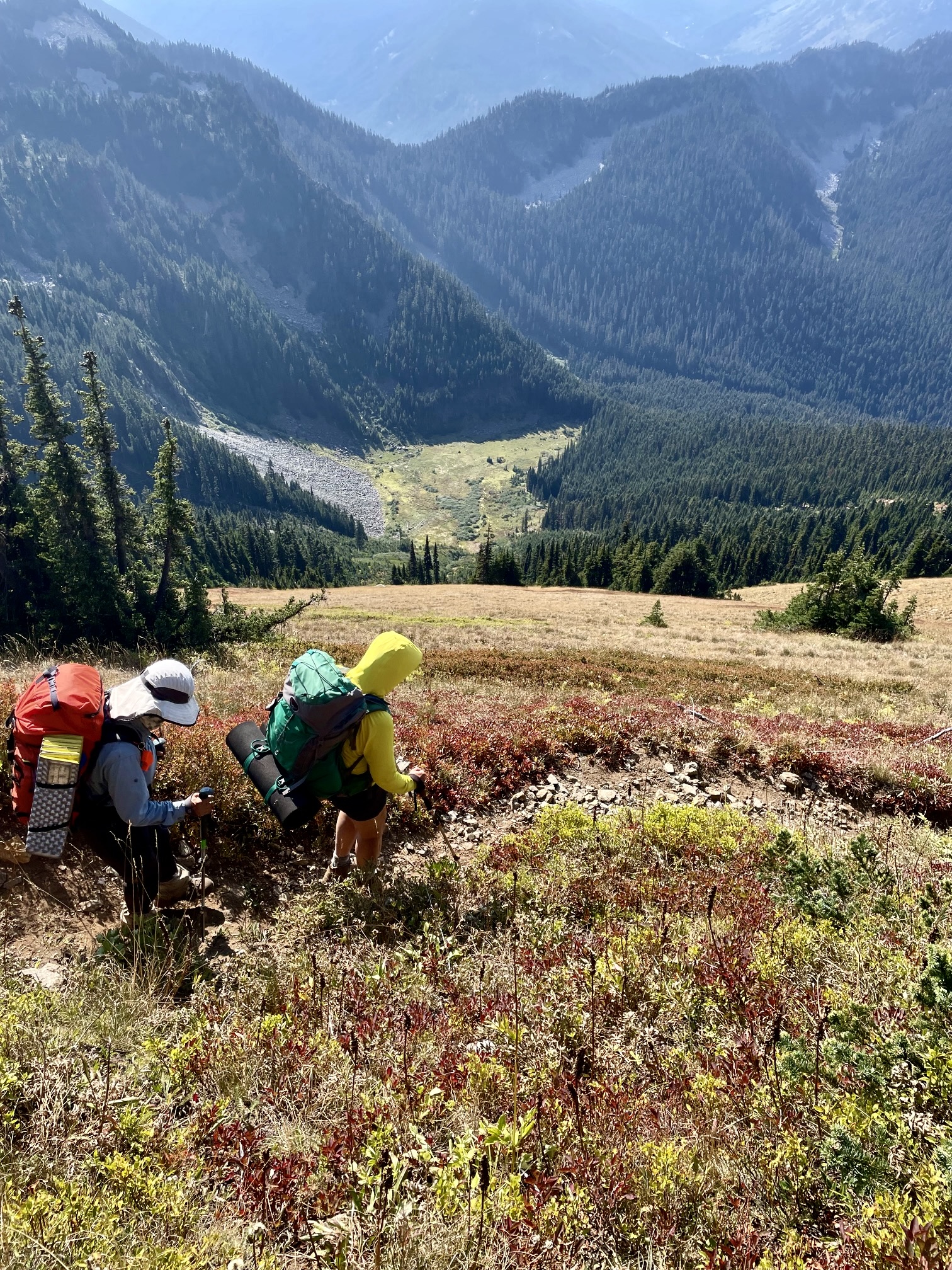
We continued hiking westward on the well-constructed and well-maintained trail, which wanders up and down along the crest. One last short ascent followed by a 900-foot descent delivered to the West Nason Ridge Trailhead at Rainy Pass (12.2 hours + 12.8 miles + 4550 feet from camp), ending an excellent two-day traverse. And no, we didn’t forget to drive down the road to pick up Eileen!
Route Maps & Profile
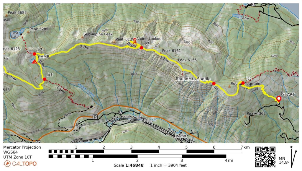
…
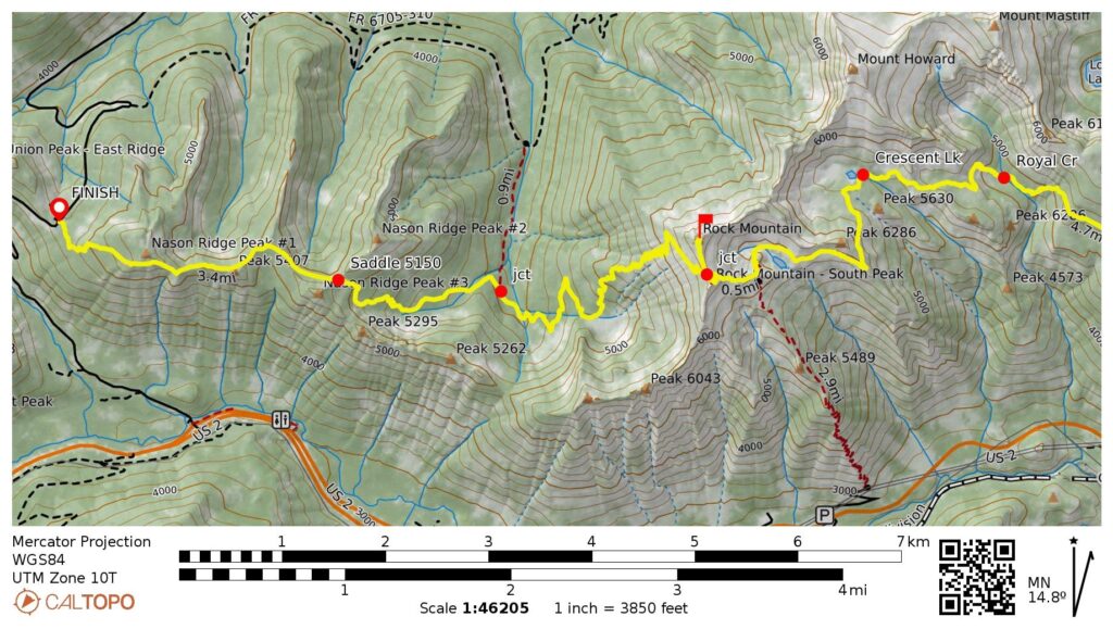
…
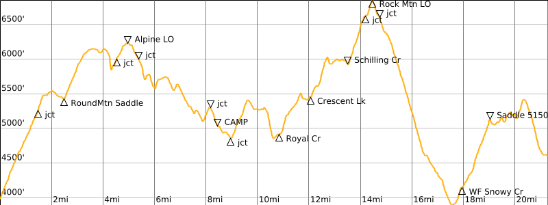
…
Photo Gallery
Click to enlarge…