Trip Date: July 8-11, 2025
Boston Basin Hiking & Climbing Trip
Lower Boston Basin
Upper Boston Basin
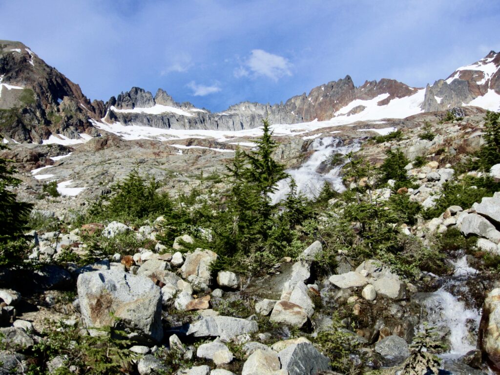
Quien Sabe Glacier
Sharkfin Tower attempt (8120+ ft)
Trip Report Summary
Region: Northwestern Washington Cascades
Sub-Region: Thunder Mountains
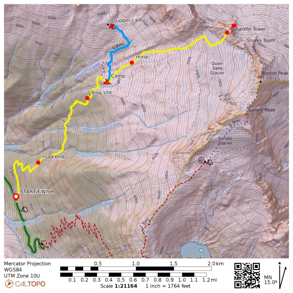
Starting & Ending Point: Boston Basin Trailhead on North Fork Cascade River Road (Elev. 3200 feet)
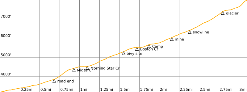
Approach Way Points: Old diamond mine / road end & Midas Creek crossing & Morning Star Creek crossing & miner’s cabin site / bivy site & South Fork Boston Creek crossing & Lower Boston Basin Camp (trail hike & trail scramble)
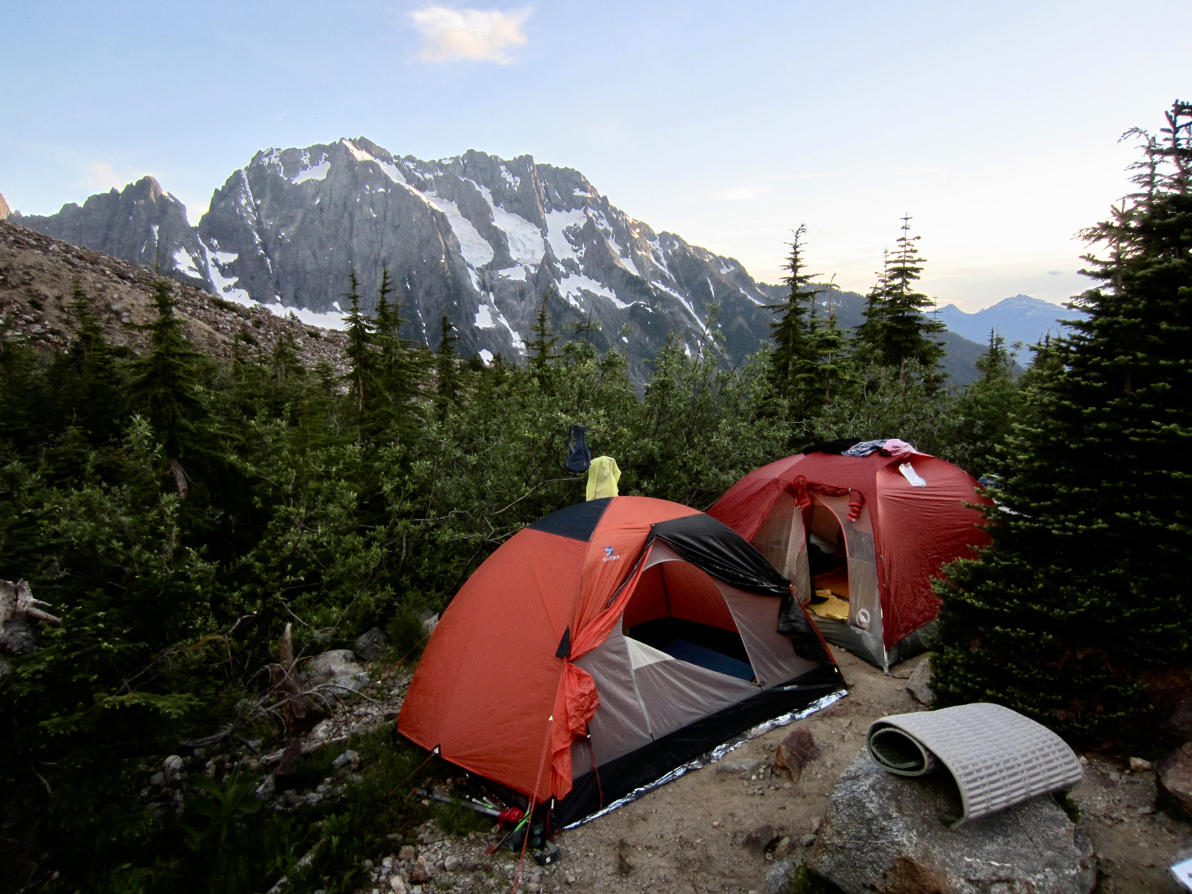
Campsite: Lower Boston Basin Camp (Elev. 5700 feet)
Sidetrip 1 Way Points: Middle Fork Boston Creek crossing & North Fork Boston Creek crossing & Upper Boston Basin Camp (off-trail hike & trail hike)
Sidetrip 2 Way Points: Middle Fork Boston Creek crossing & mine adit & Quien Sabe Glacier snout & Sharkfin Cliff (off-trail hike & rock scramble & snow climb)
Summit Attempt: Sharkfin Tower (climb to base of upper snowfield at 7960 feet via Southwest Access Gully)
Approximate Total Stats: 7.5 miles traveled; 5500 feet gained & lost.
Full Trip Report
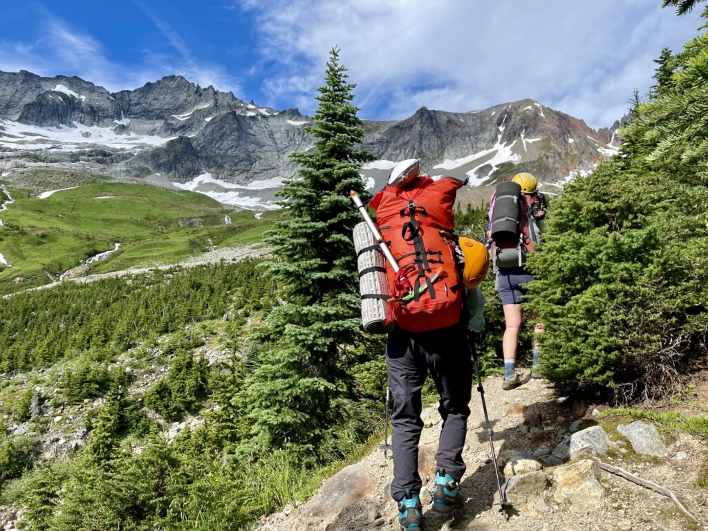
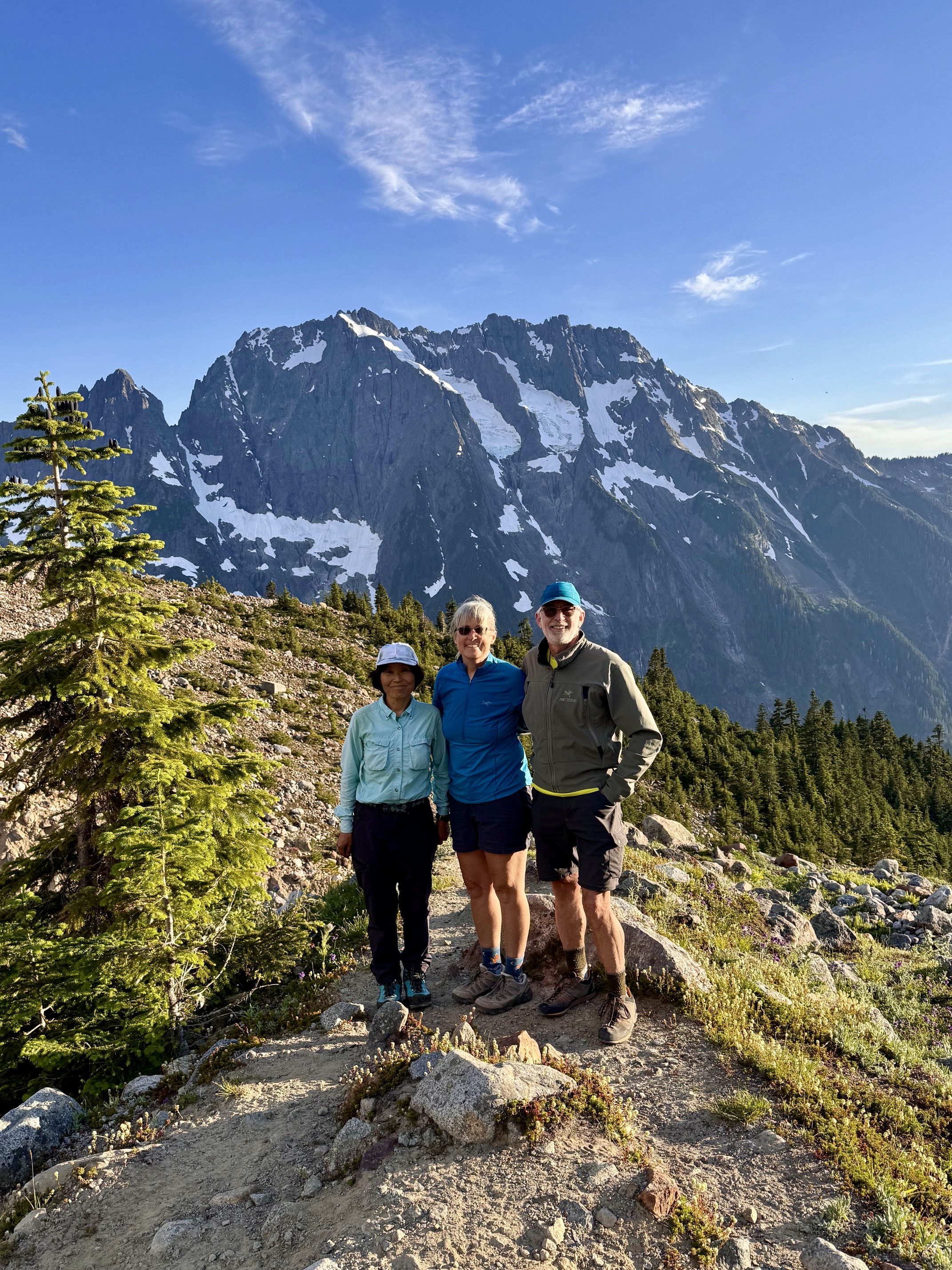
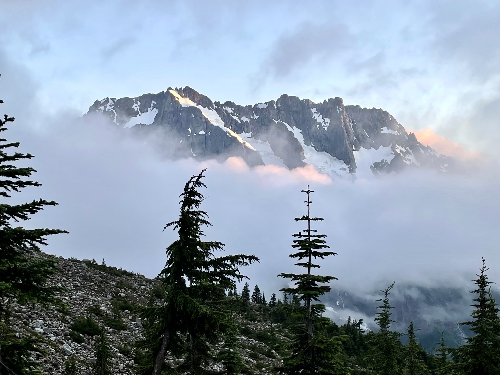
Earlier this year, Eileen and Yoko and I were fortunate to obtain a highly coveted camping permit for Boston Basin. Yoko had never been to the basin before, so she was thrilled to visit this near-mythical place for the first time. My primary interest was climbing Sharkfin Tower, a major alpine crag that overlooks the basin; I had set my sights on this summit twice before but got thwarted by poor weather both times. Although Eileen had climbed the tower 10 years ago, she was eager to make a second ascent.
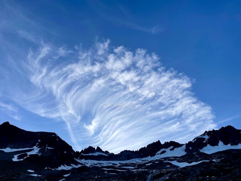
Alas, timing is a key element in alpine climbing, and our permit schedule unfortunately coincided with the only rainy day in a two-week window of sunny weather. As such, our climb ended in a fog bank within 200 feet of Sharkfin Tower’s summit. On the positive side, though, we did complete a valuable reconnaissance of the approach route, and Yoko got a thorough tour of Boston Basin.
Day 1: Trailhead to Boston Basin
We pulled into the tiny parking area at the Boston Basin Trailhead on a warm, sunny Tuesday. Cars were lined up along the narrow roadway, but we were lucky enough to grab a space left by departing climbers. It felt like an auspicious beginning to our trip.
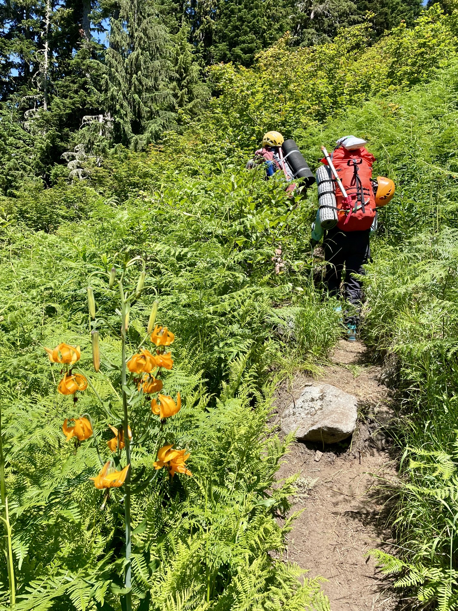
As we all headed up the first segment of trail—an abandoned mining road leading to a former diamond mine—Eileen and I noticed how brushy it has become in recent years. The climber’s path that connects this road-end with the old mining trail farther up was as steep as ever but more eroded than before. Midas Creek and Morning Star Creek were readily crossed by rock-hopping.
.
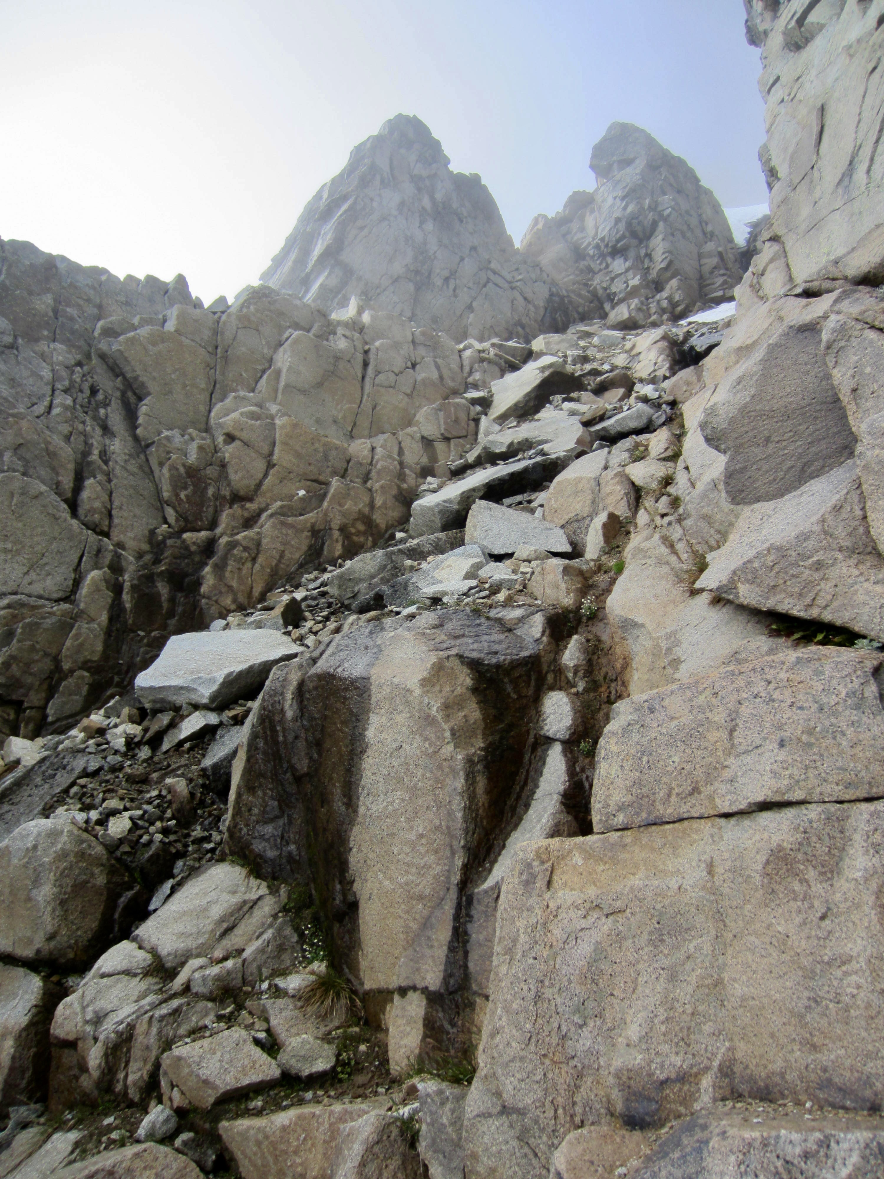
Shortly beyond the site of the former miner’s cabin at 5300 feet (now a roomy bivouac platform), we emerged from the forest and got our first unobstructed view of Boston Basin. Even after a half-dozen visits, I was awestruck by the beauty of this location, with its green hillslopes sweeping upward to meet rugged mountainsides. Eileen and I found it very reminiscent of the terrain immediately above Zermatt.
.
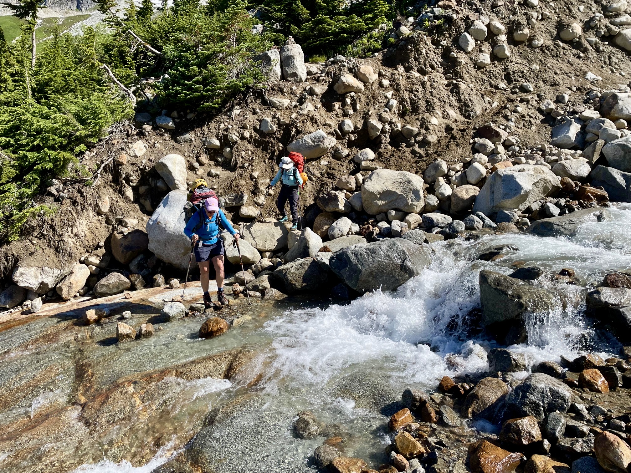
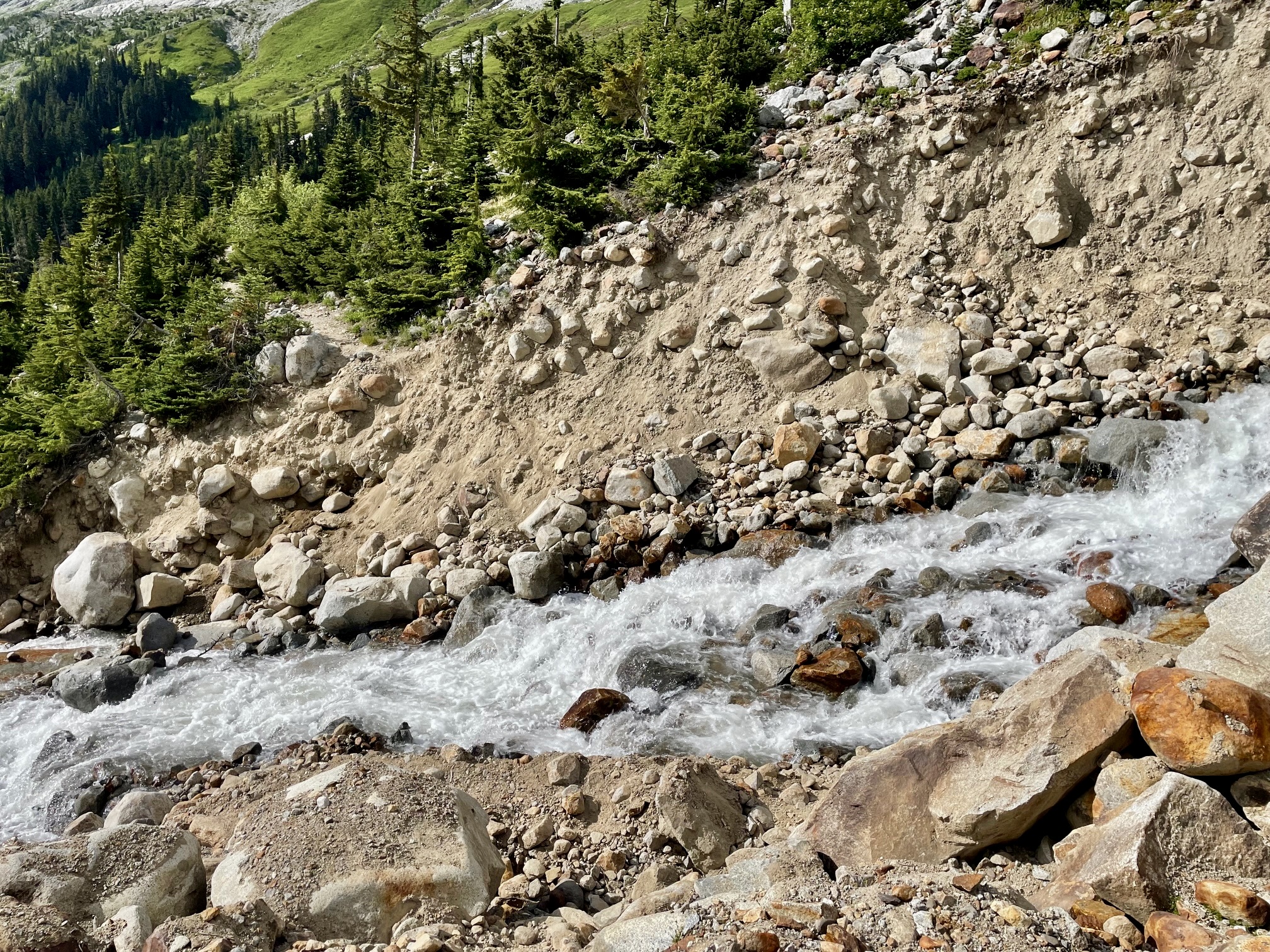
In order to reach the established campsites in Boston Basin, it is necessary to cross the south fork of Boston Creek. It was flowing very swiftly at the normal trail crossing point, so we continued hiking upstream until able to rock-hop across a braided zone. This cost us an extra 30 minutes and 100 vertical feet but still put us in camp by 6:00pm (5.3 hours + 2600 feet from TH).
.
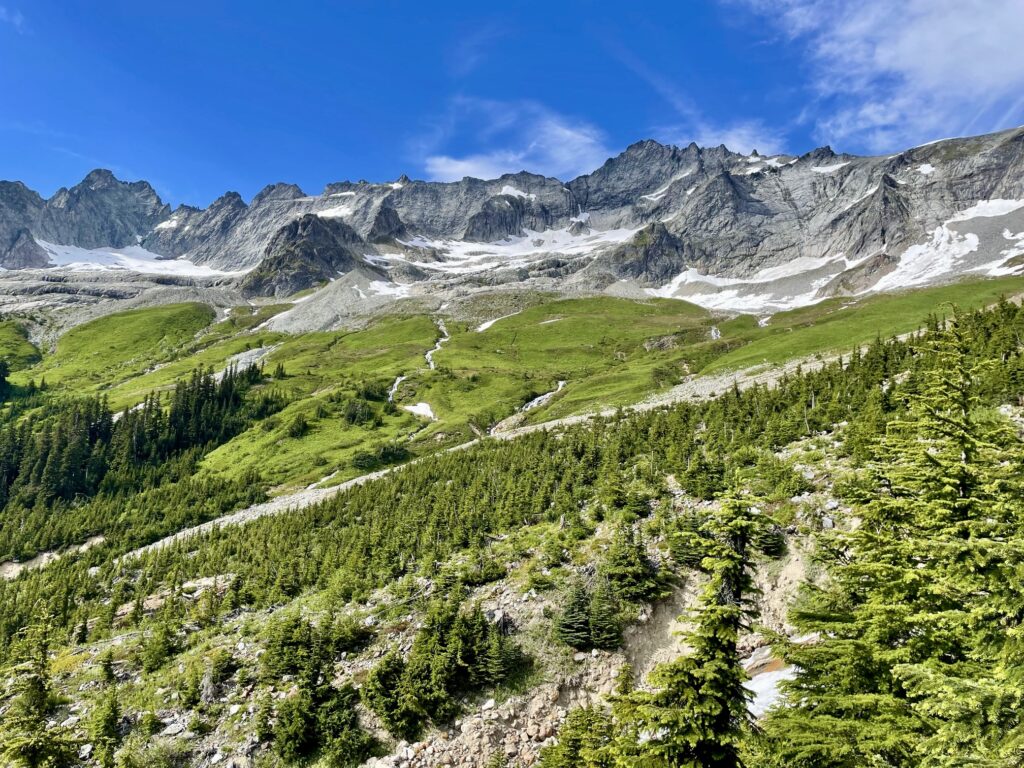
Lower Boston Basin Camp sits on a wooded moraine that separates the south and middle forks of Boston Creek. Closely to the northeast, Mt. Torment, Forbidden Peak, Sharkfin Tower, Boston Peak, and Sahale Peak form a continuous rock rim rising 2000 to 3000 feet above camp. Yoko was giddy with excitement at finally getting to experience this dramatic setting!
.
.
After pitching our tents in a snug site, we visited with our nearby neighbors, Evan and Ben. They had a permit for two nights and originally planned to climb Forbidden Peak but, given a high probability of rain tomorrow, were looking at Sahale Peak as a wet-weather consolation summit. Barring a miraculous improvement in tomorrow’s weather, Eileen, Yoko, and I were planning for a basin hike.
.
Day 2: Upper Boston Basin Hike
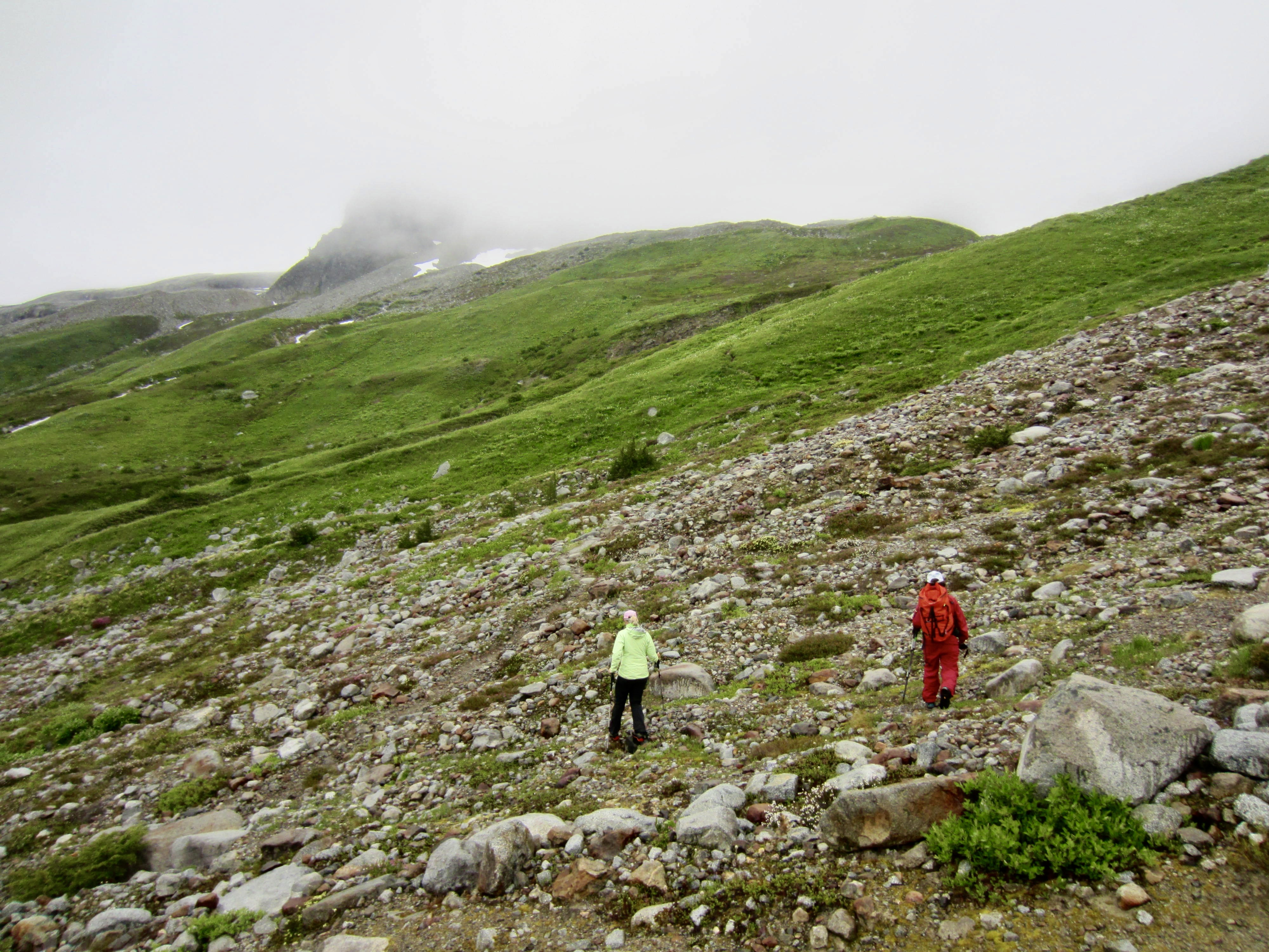
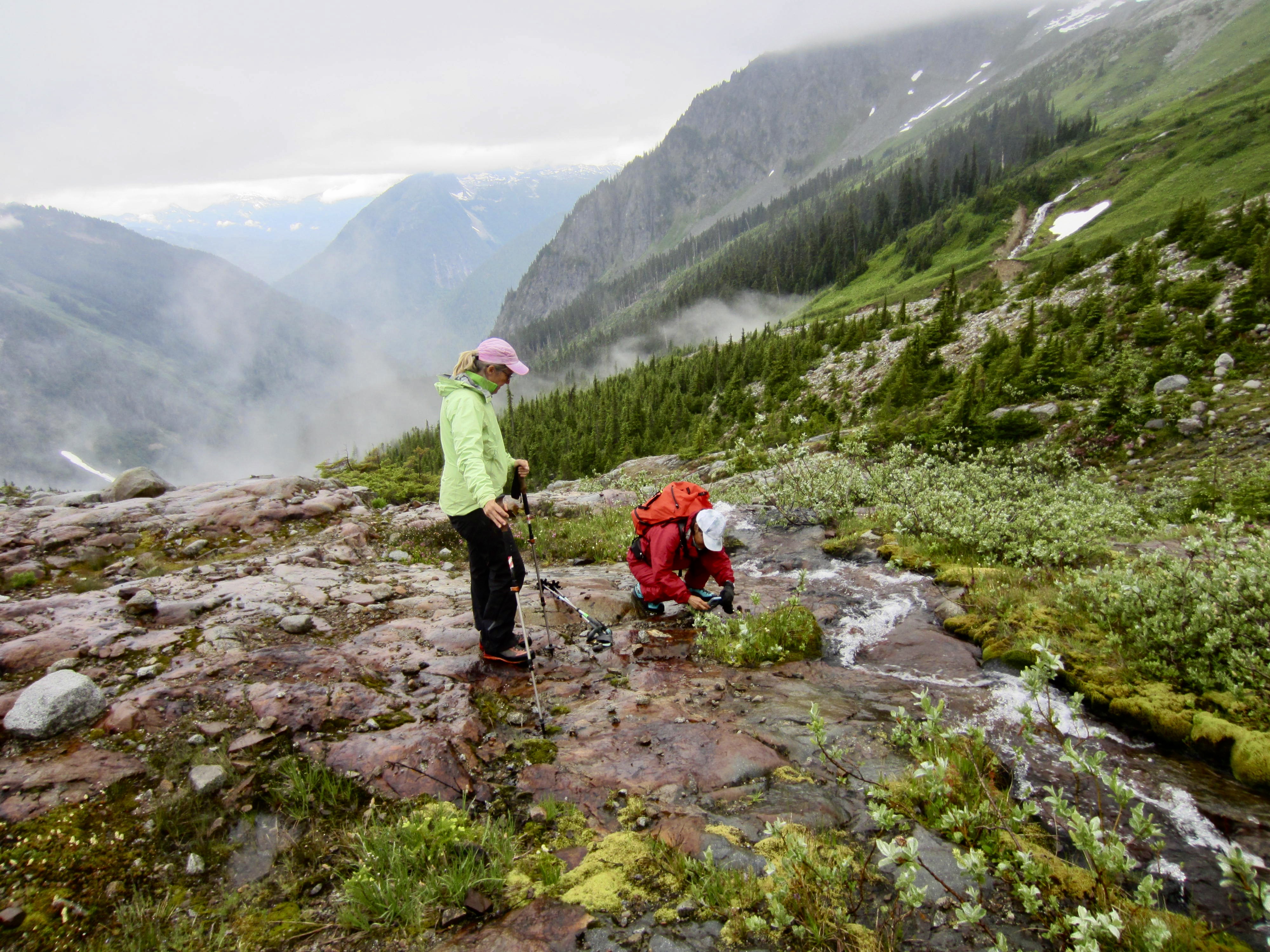
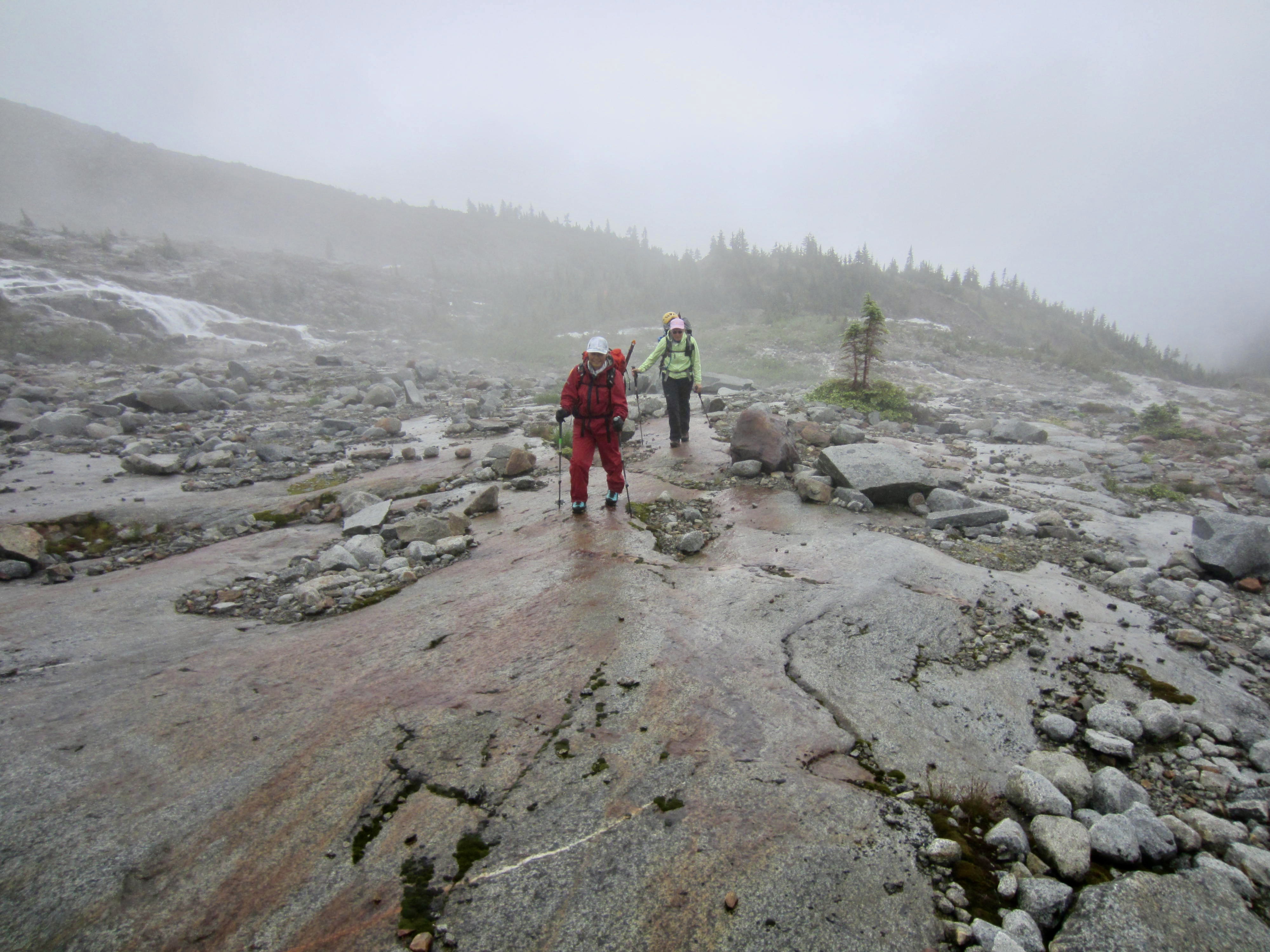
Our day began with low clouds, a light mist, and a forecast of afternoon rain. Yoko, Eileen, and I headed out for a morning hike to upper Boston Basin. We splashed across the middle fork of Boston Creek and then followed a primitive trail in a rising traverse to the north.

.
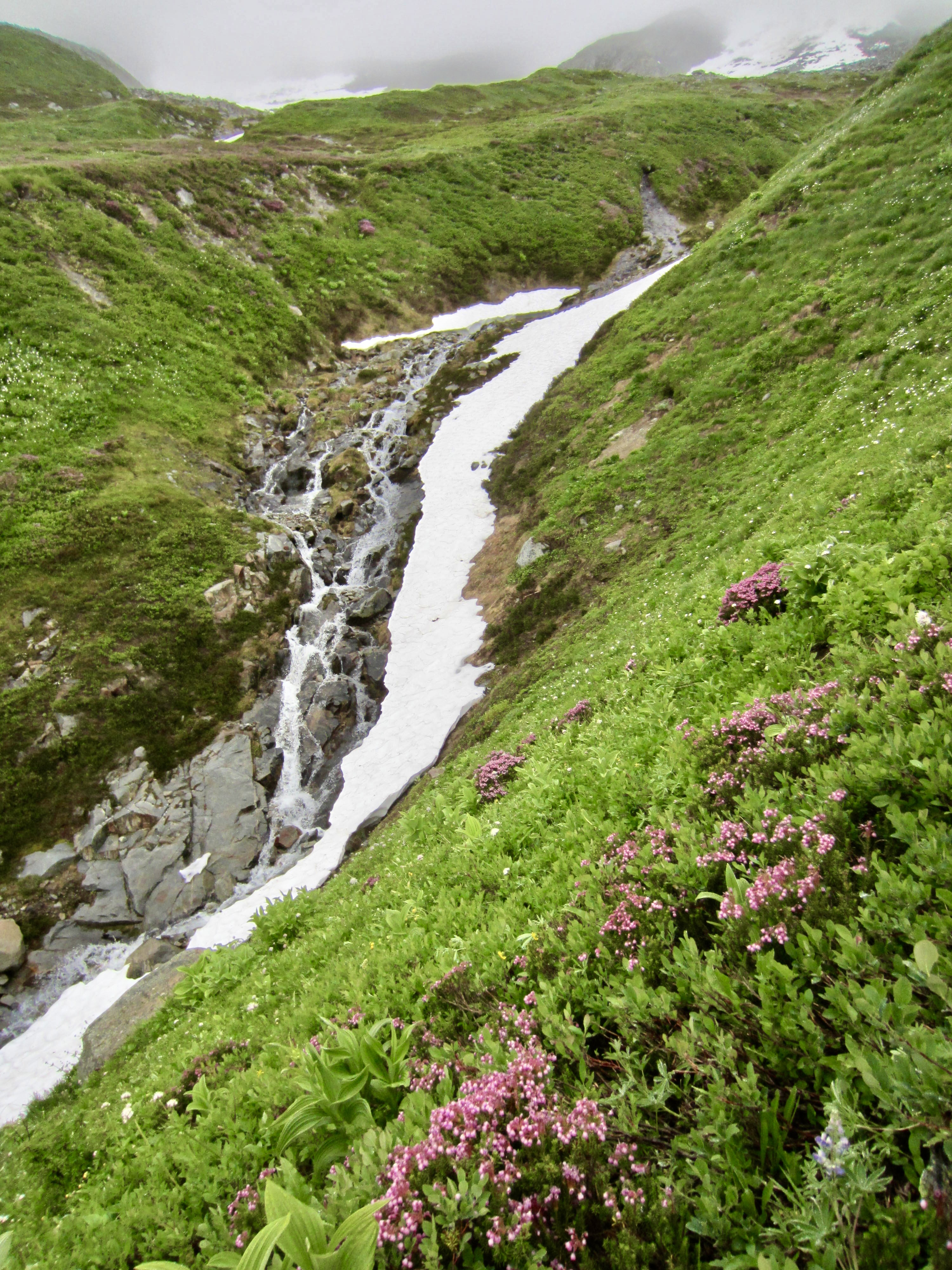
Although the misty weather obscured our long-range views, it seemed to enhance the local shades of green throughout the basin. Yoko, being a professional botanist and wildflower connoisseur, reveled in the alpine flora; she ran around like a proverbial kid in a candy store, photographing every different flower species and reciting both the latin and common names of each!
.
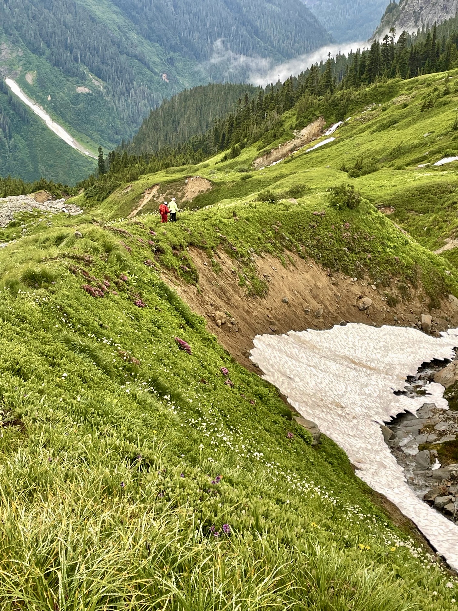
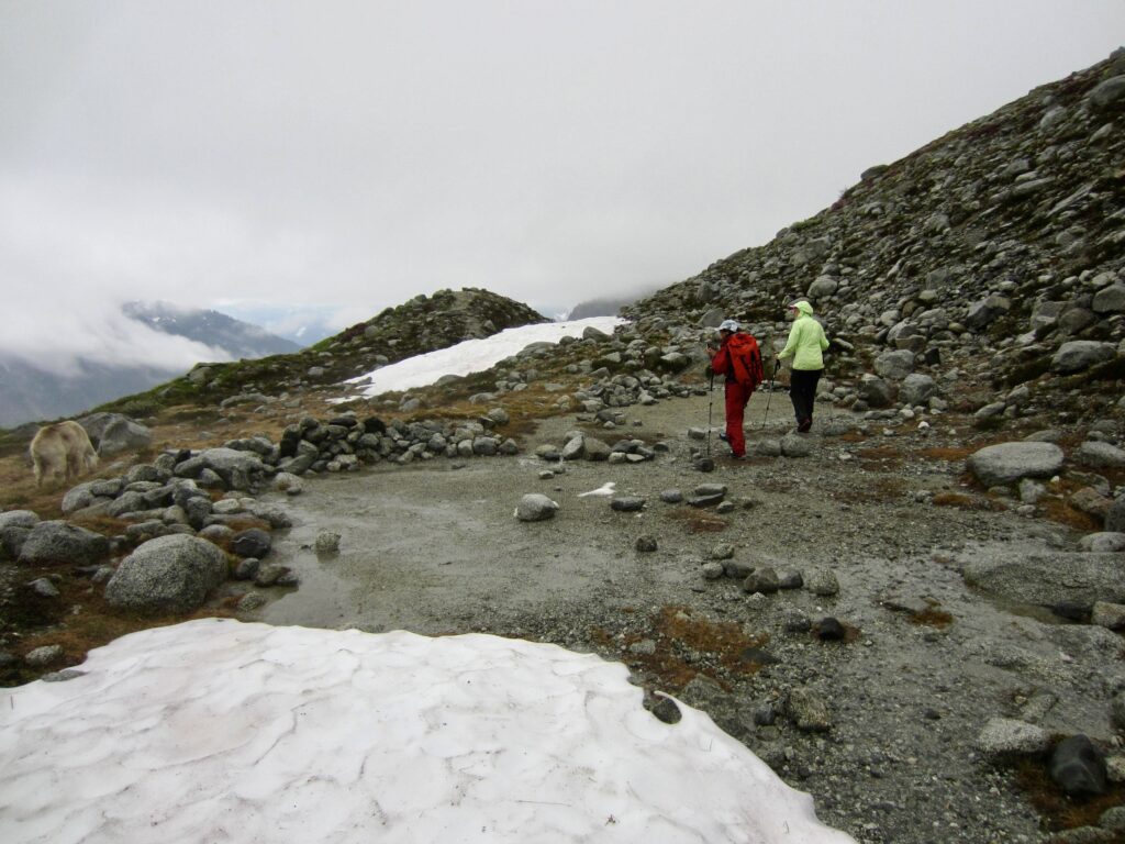
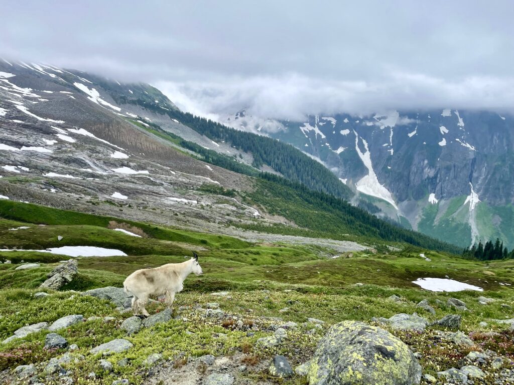
The primitive trail led us to Upper Boston Basin Camp, which occupies a rocky bench at 6270 feet. On a clear day, the level tent pads here provide campers with an outstanding view down the basin and over to Johannesburg Mountain. Today, we shared the limited views with a family of mountain goats.
.
.
We followed our trail back down to the lower basin and checked out the traditional crossing point of Boston Creek’s middle fork. Severe erosion here has created a deep channel with steep sidewalls, now making this location impassable. We found a higher crossing point and arrived back in camp at noon, just as the light mist turned to a steady drizzle.

.
Shortly after arriving, we spotted Evan and Ben hiking back to camp. A brief conversation revealed that they had managed to climb Sahale Peak in the morning mist and fog, working around corniced snow and up loose, unprotectable rock on the summit block. Given these adverse conditions, it was a respectable consolation prize for them. The five of us then retreated to our respective tents for the remainder of the day.
Day 3: Sharkfin Tower Attempt
Fog, mist, and intermittent rain continued through the night and into late morning. An updated forecast promised afternoon clearing, so we stayed in our tents until 8:30am and then slowly got ready for a late departure. Ben and Evan stopped by before hiking back to the trailhead, having run out of time for another climb.
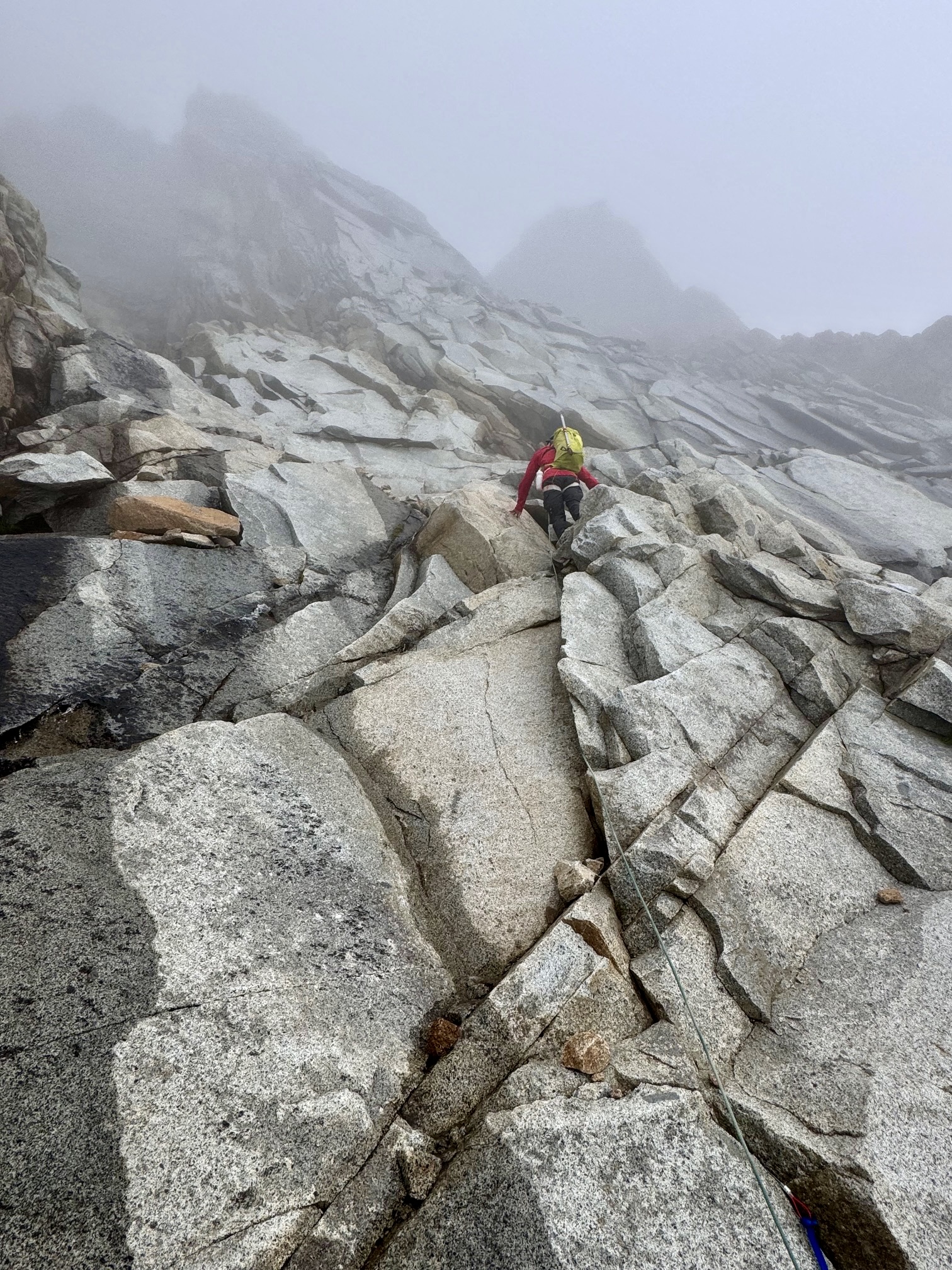
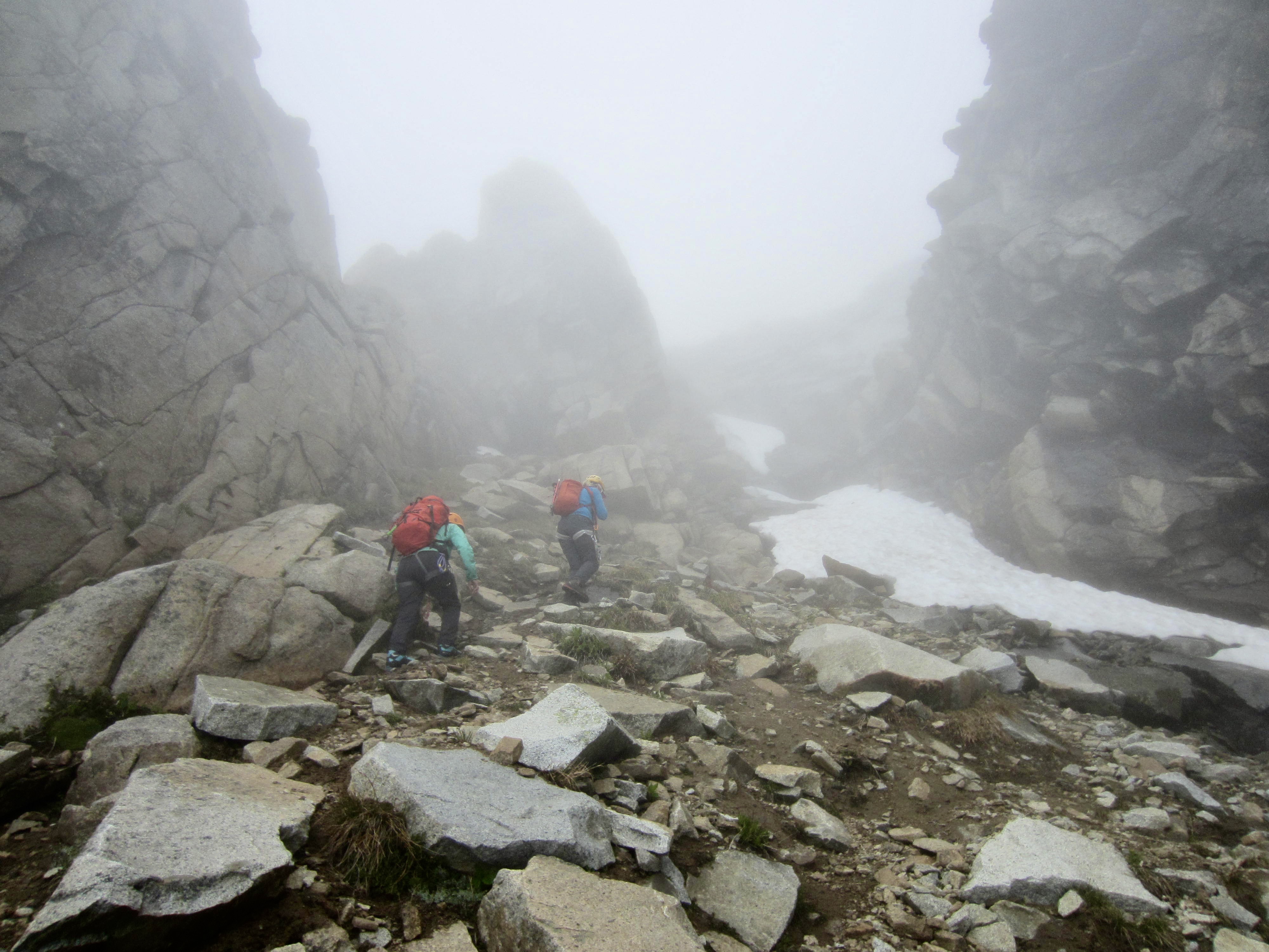
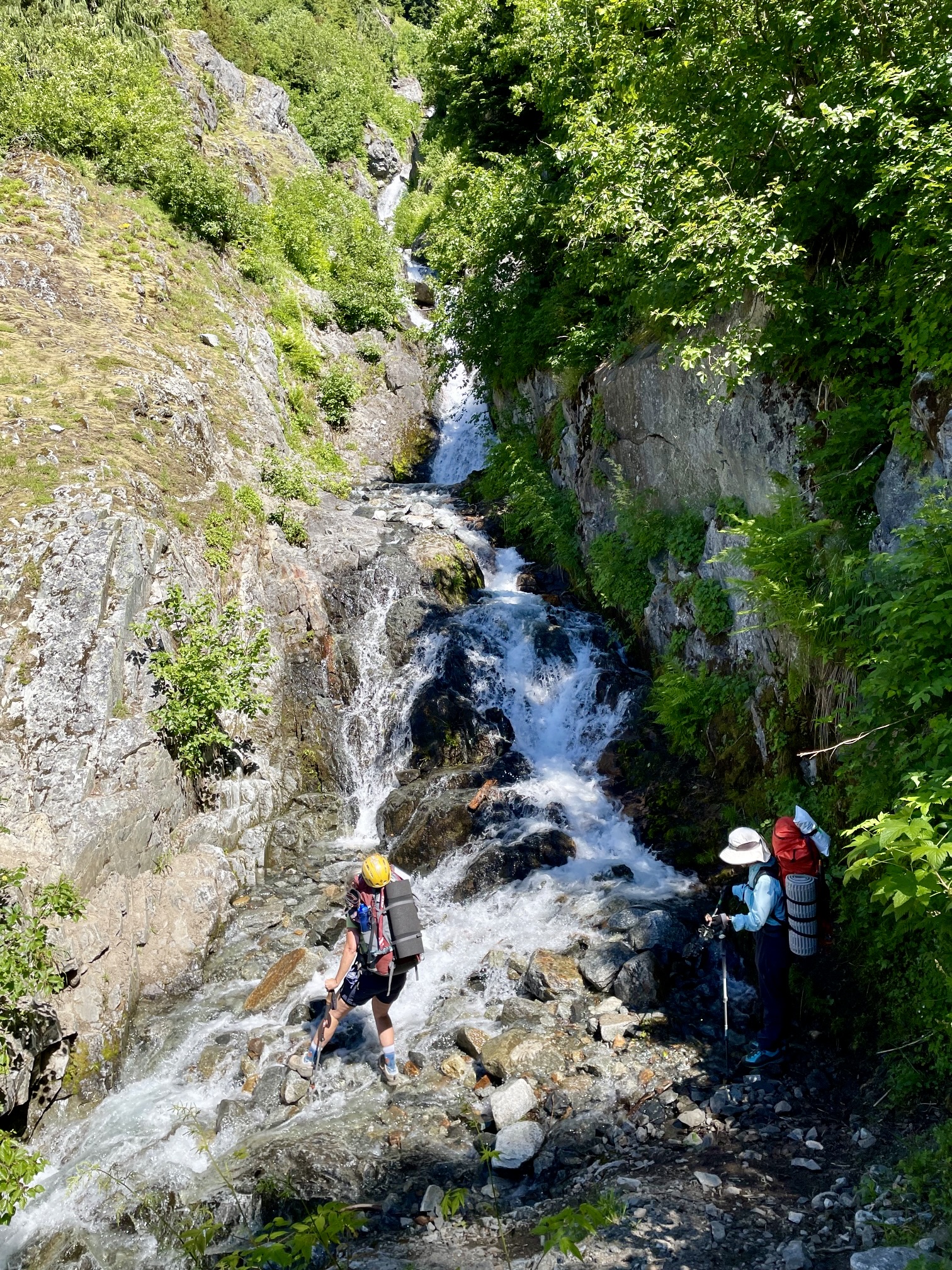
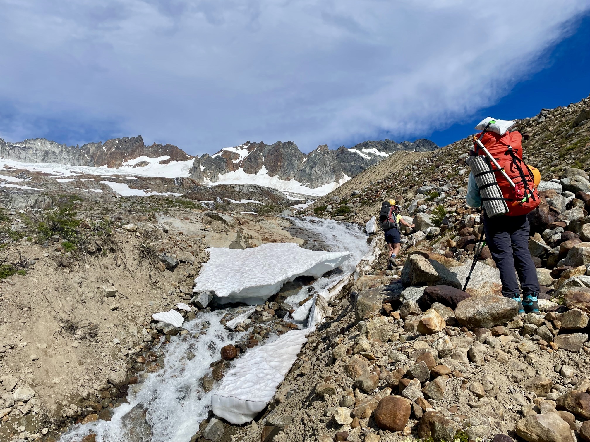
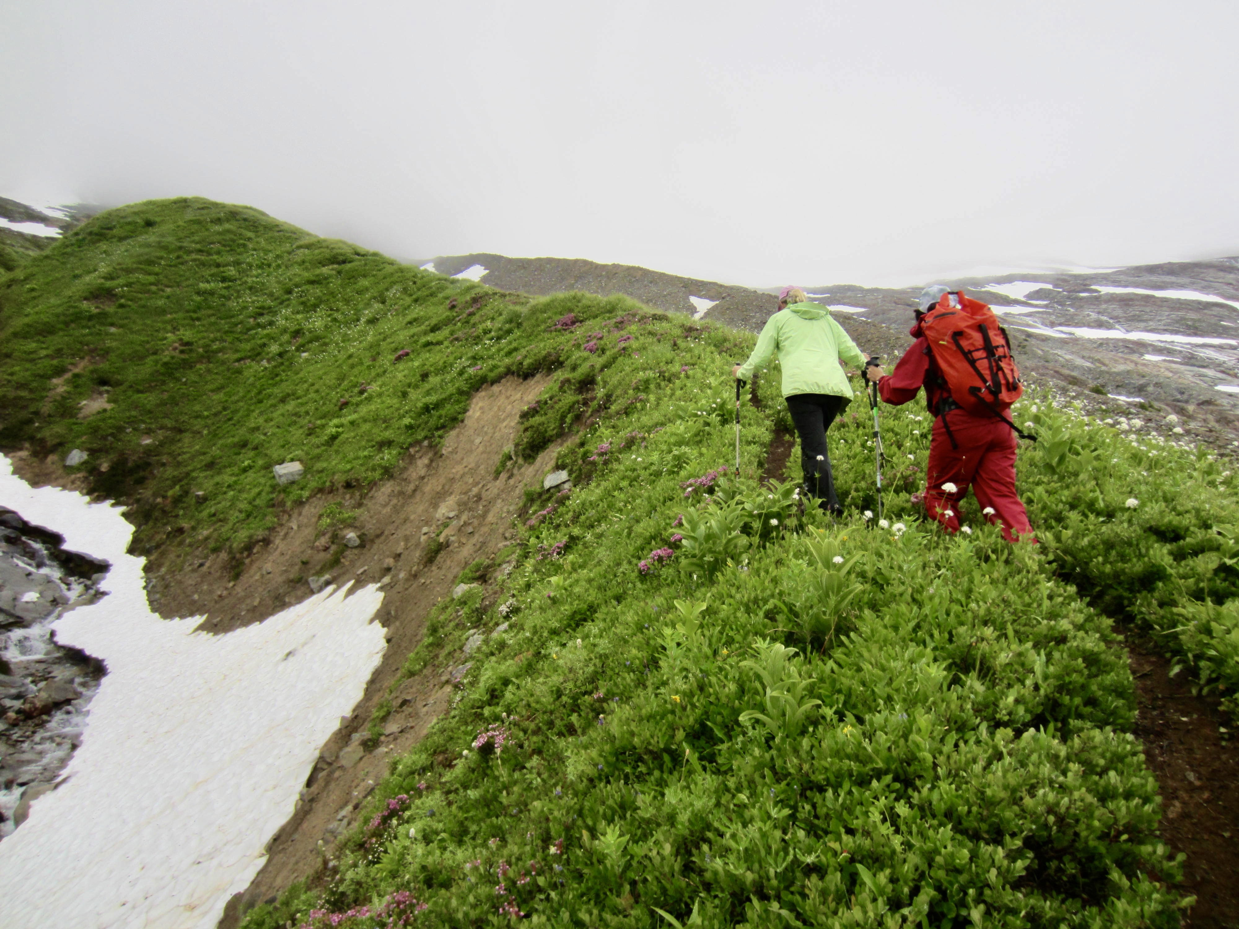
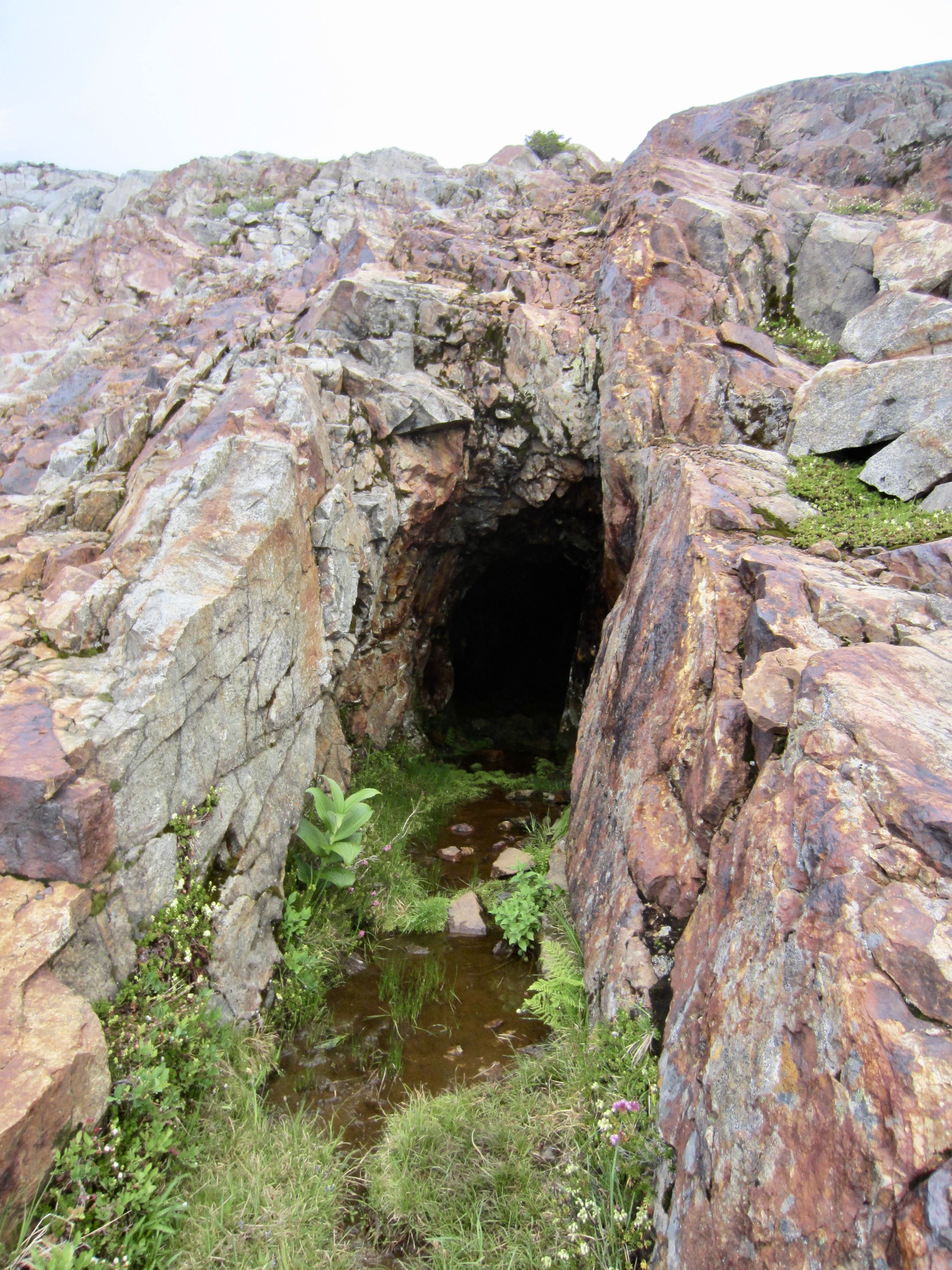
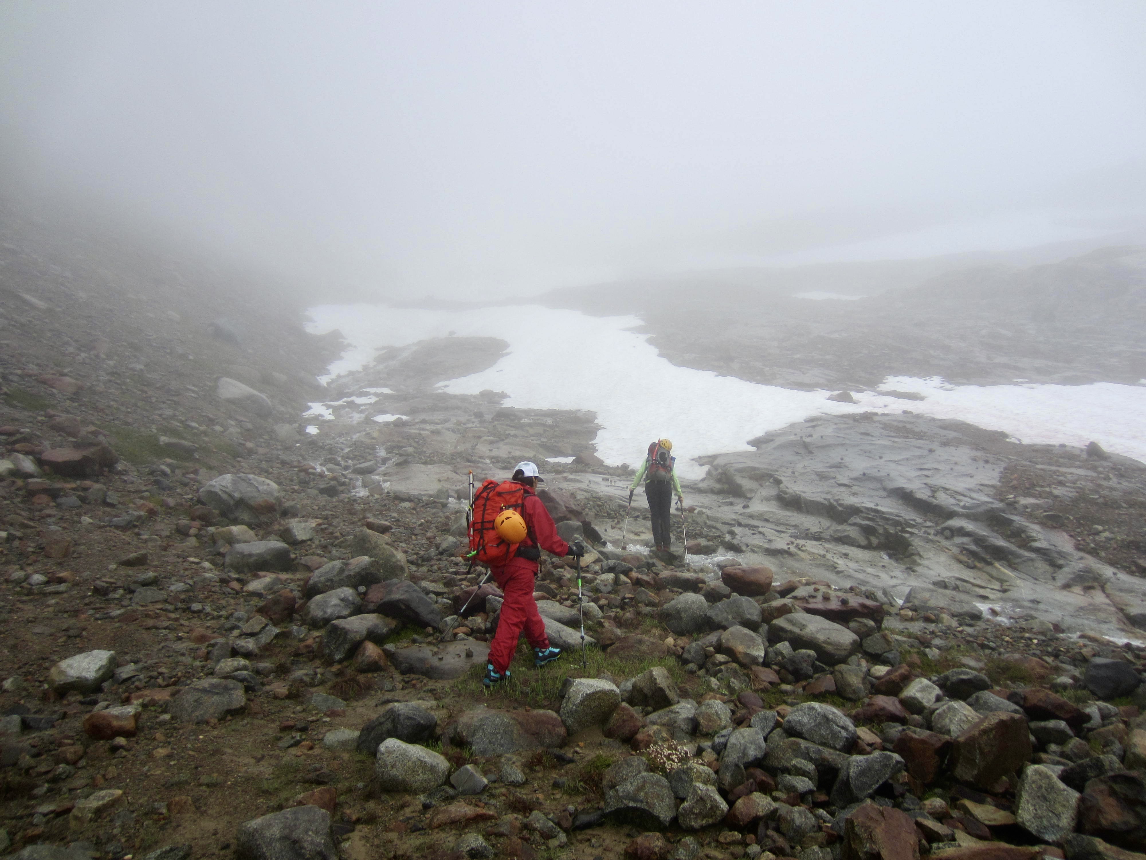
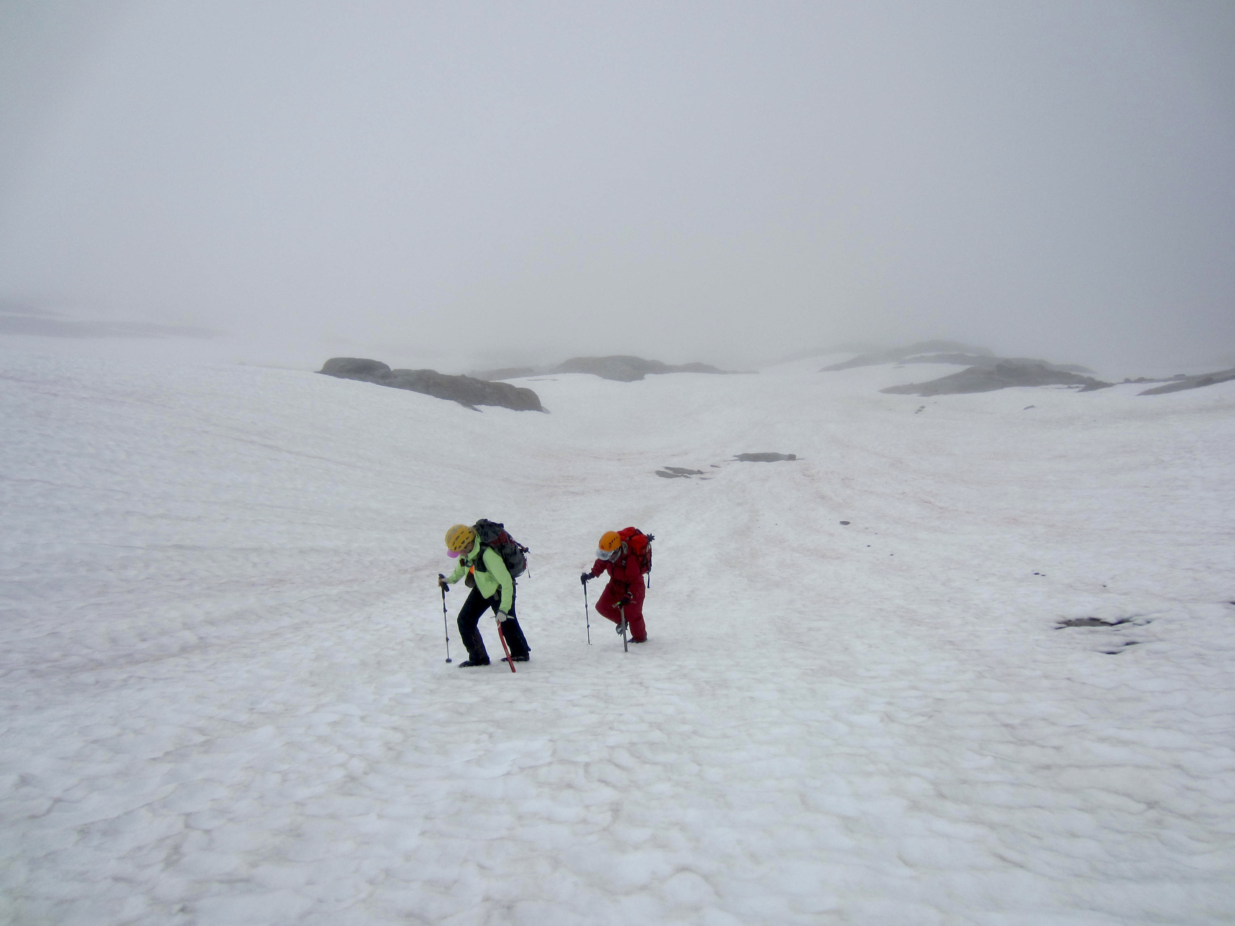
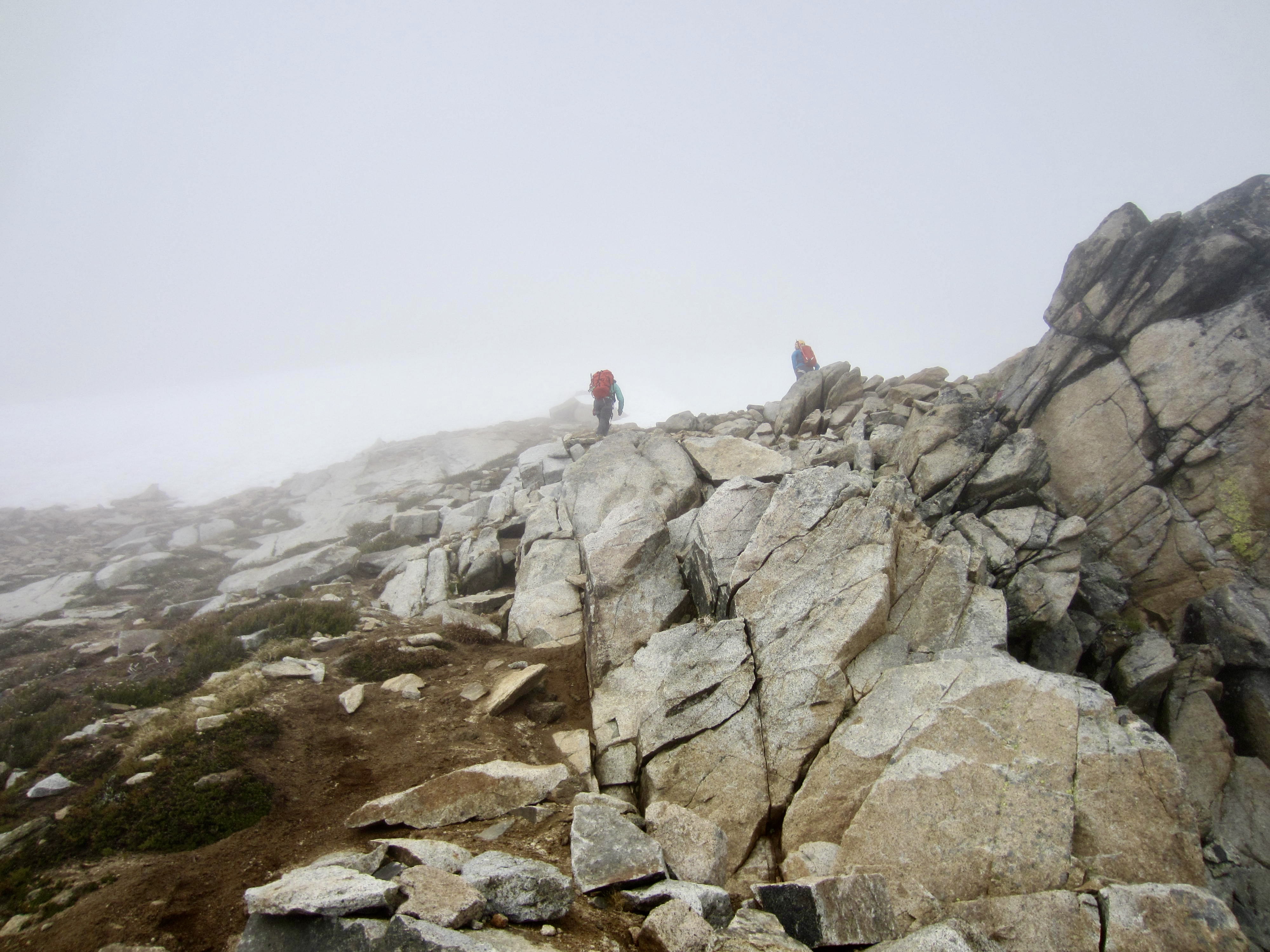
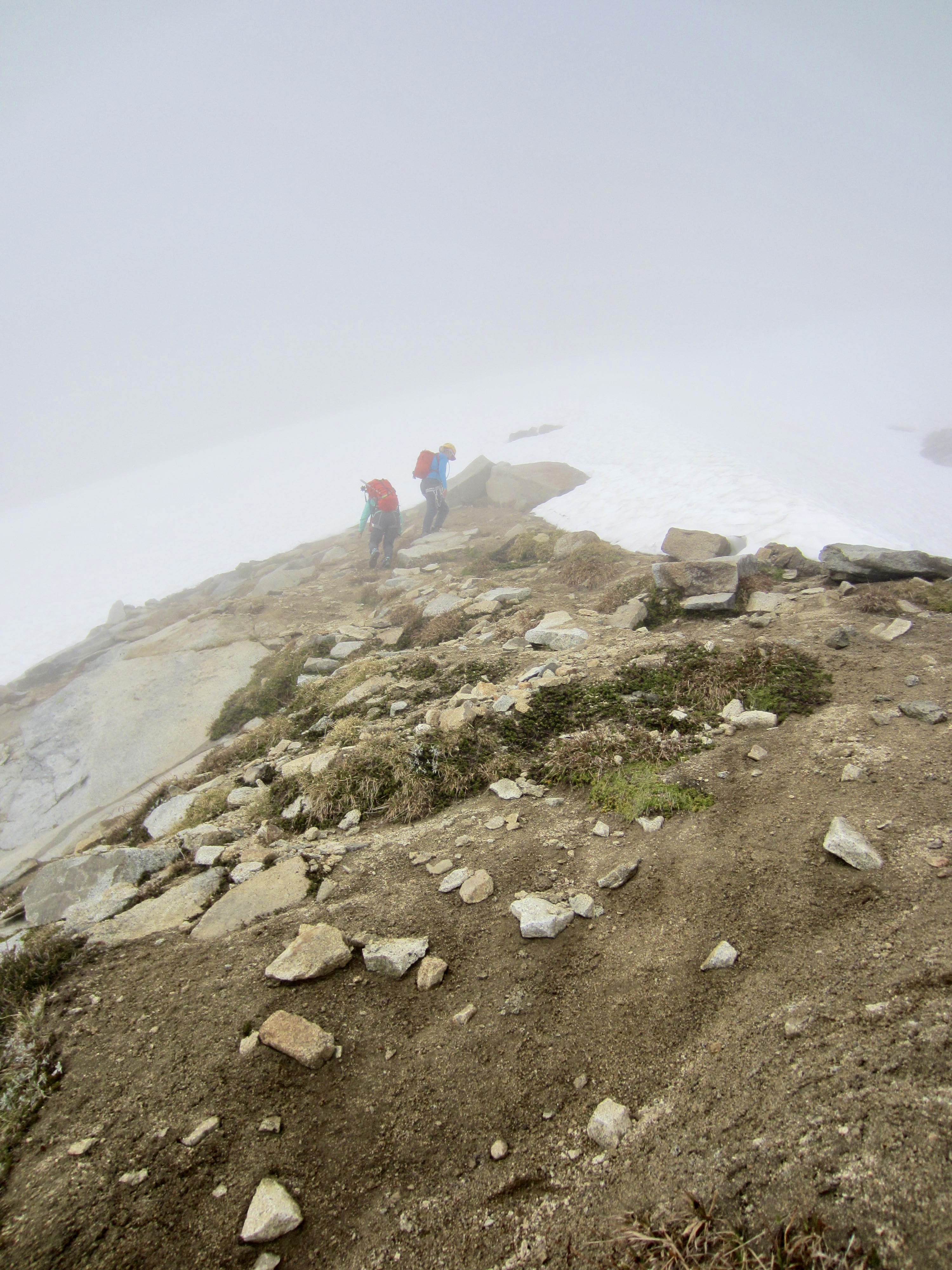
At 11:00am, Eileen, Yoko, and I headed out with summit packs, hoping that the weather would improve in time for a climb of Sharkfin Tower. From camp, we hiked upward through light fog, over morainal debris, across wet slabs, and past an old mining adit at 6040 feet. Around 6400 feet, we hit continuous snow and put on crampons. Visibility decreased to only 50 to 100 yards, but we were able to follow the footprints that Evan and Ben had created yesterday.
.
.
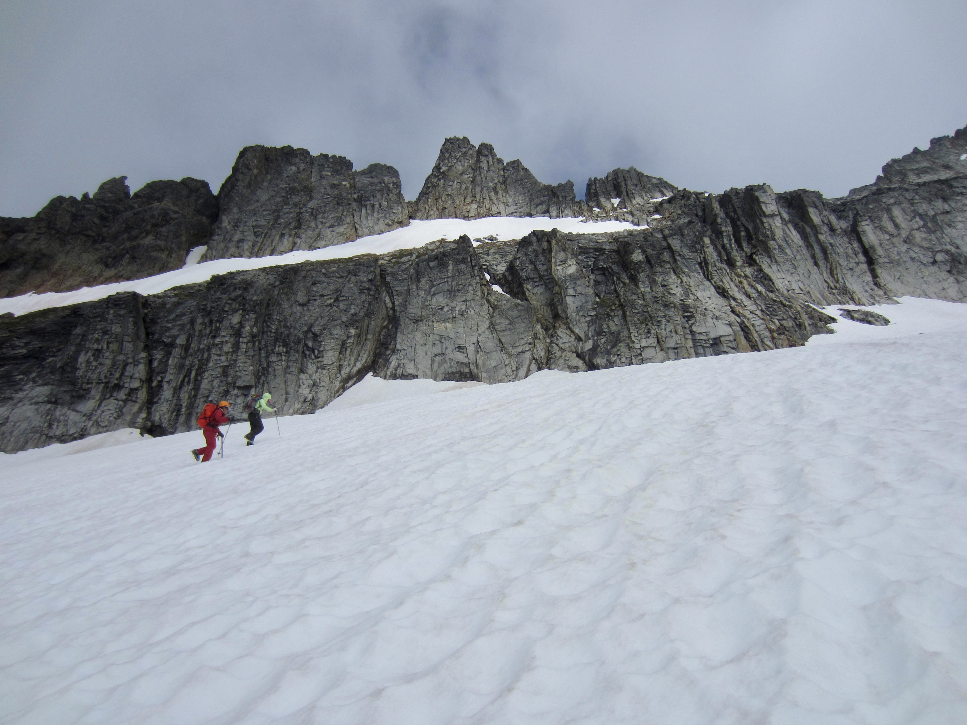
Just after we cramponed over the snout of the Quien Sabe Glacier, the dense fog cleared enough to reveal Sharkfin Tower and the lower cliff band above us. However, we then spent nearly an hour wandering back and forth, trying to find the key access gully in the cliff band! Eileen’s memory from 10 years ago was fuzzy, and our snow conditions were significantly different compared to her late-August climb. Eventually, we identified a probable gully and got confirmation from a guided party that came up behind us.

.

.
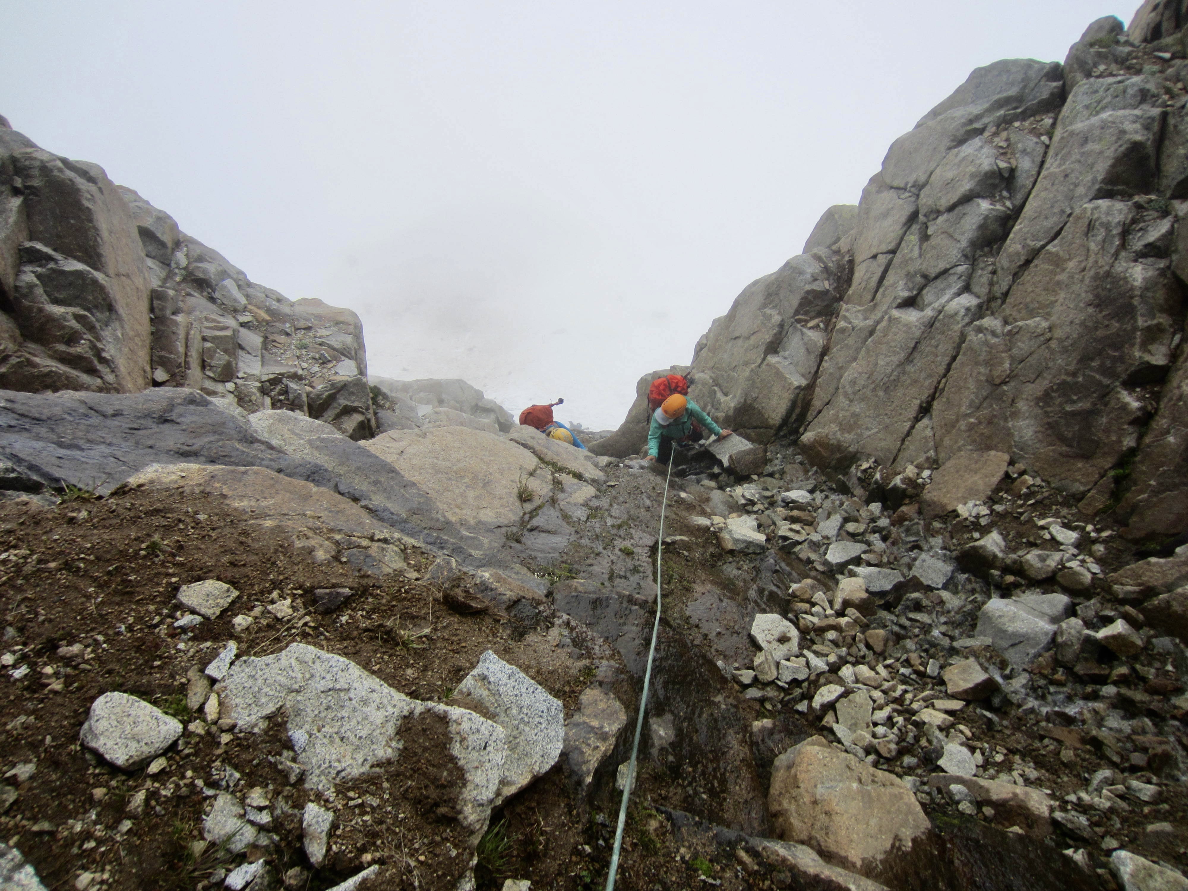
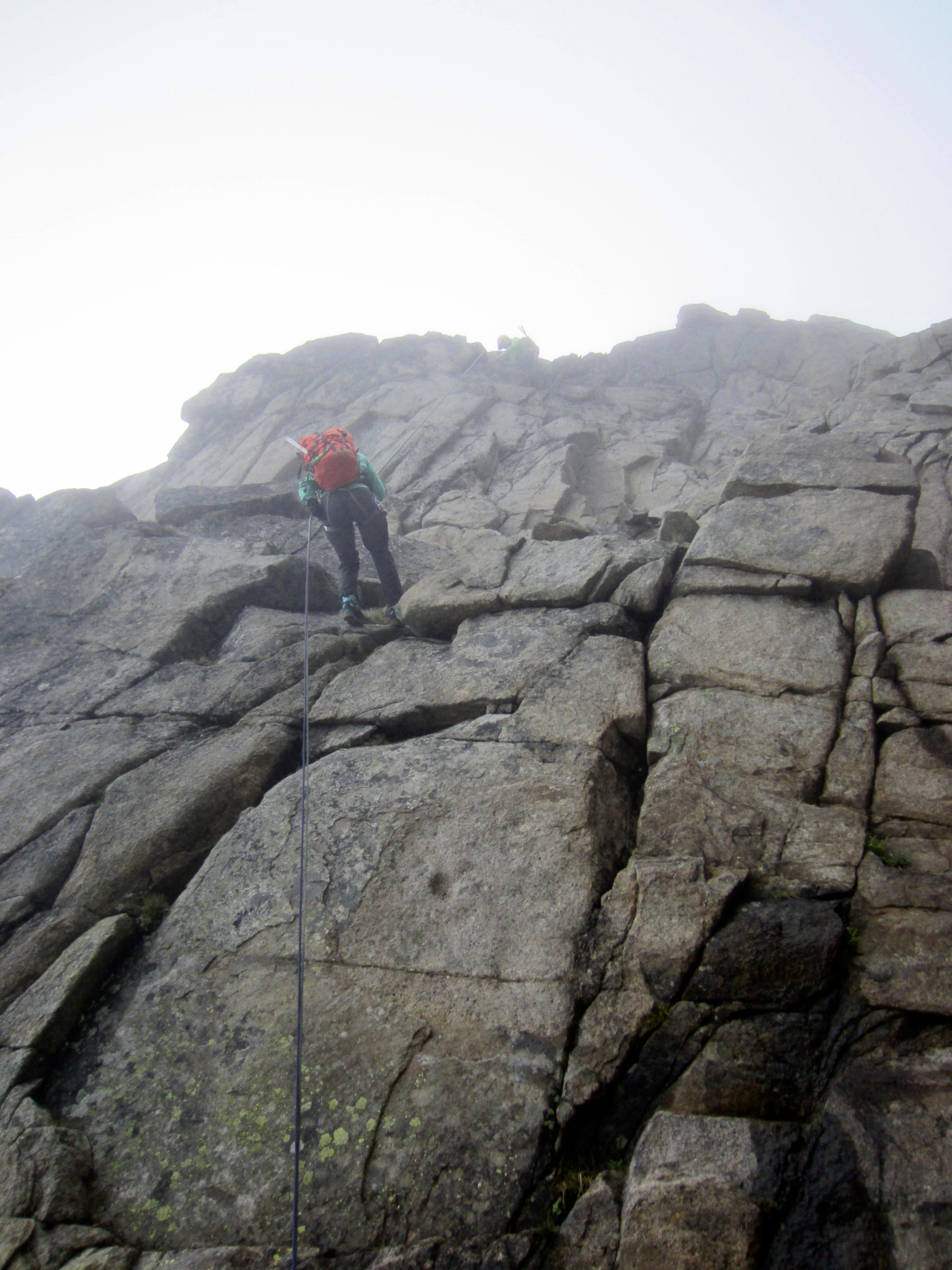
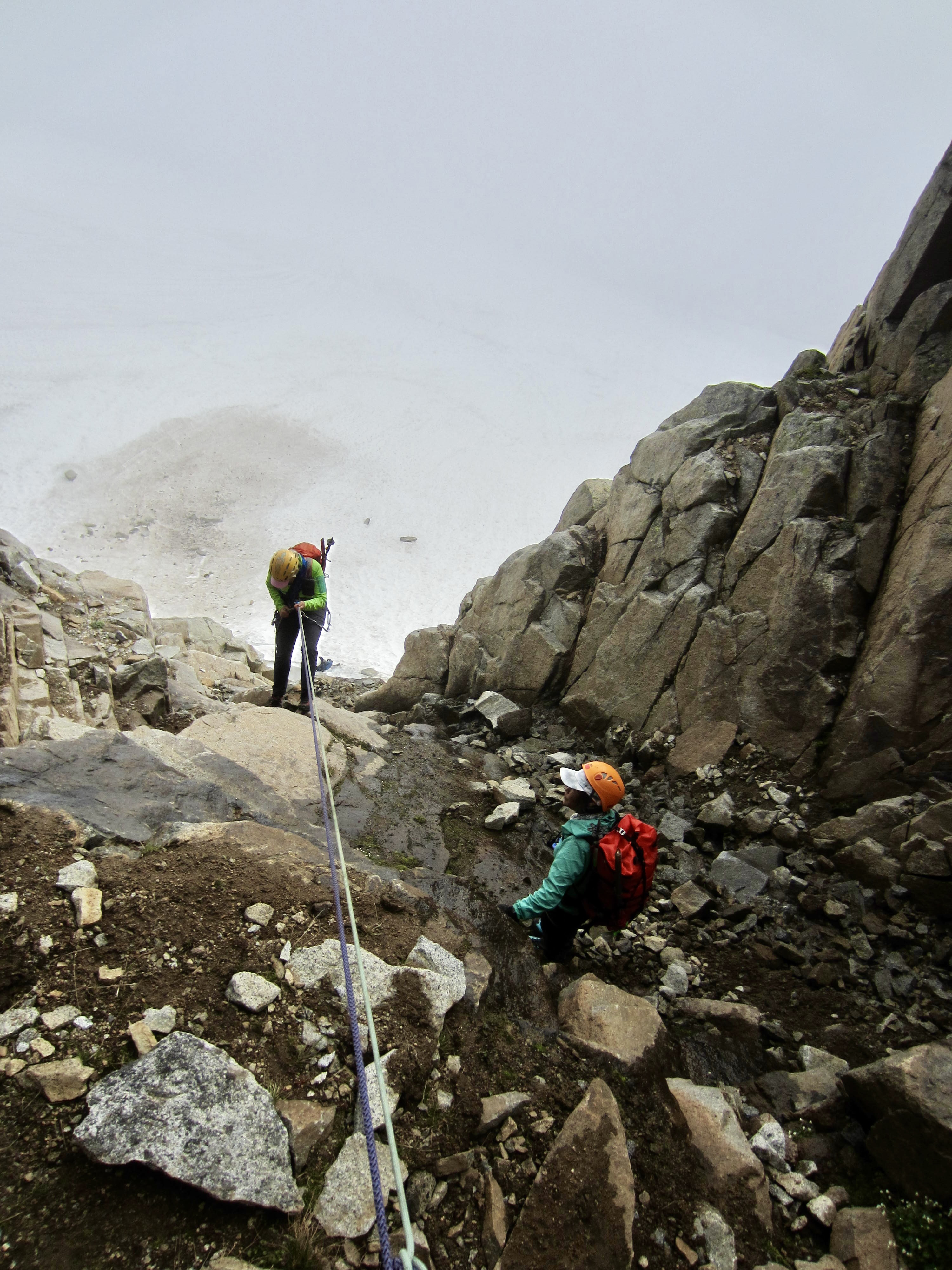
As if on cue, dense fog closed in again while we roped up below the access gully. Our climb seemed to be cursed by poor visibility. Leading out with one of our two 30-meter ropes, I stepped across a small moat and climbed up a headwall of blocky Class 4 granite. At the top of the blocky headwall, I was presented with an ugly sight: The lower part of the gully consisted of unstable rubble loosely embedded in saturated dirt, with a small creek flowing down the invert. It looked horrible!

.
As I carefully scrambled up the narrow gully, each footstep caused a localized slump failure, threatening to send a small debris slide down upon Eileen and Yoko. Concerned that I would end up riding the debris downhill, I tried to place some protection but found only a couple suitable cracks. It was a relief to arrive at a fixed anchor just where my rope ended. I belayed my partners up as they simul-climbed at a close spacing.
.
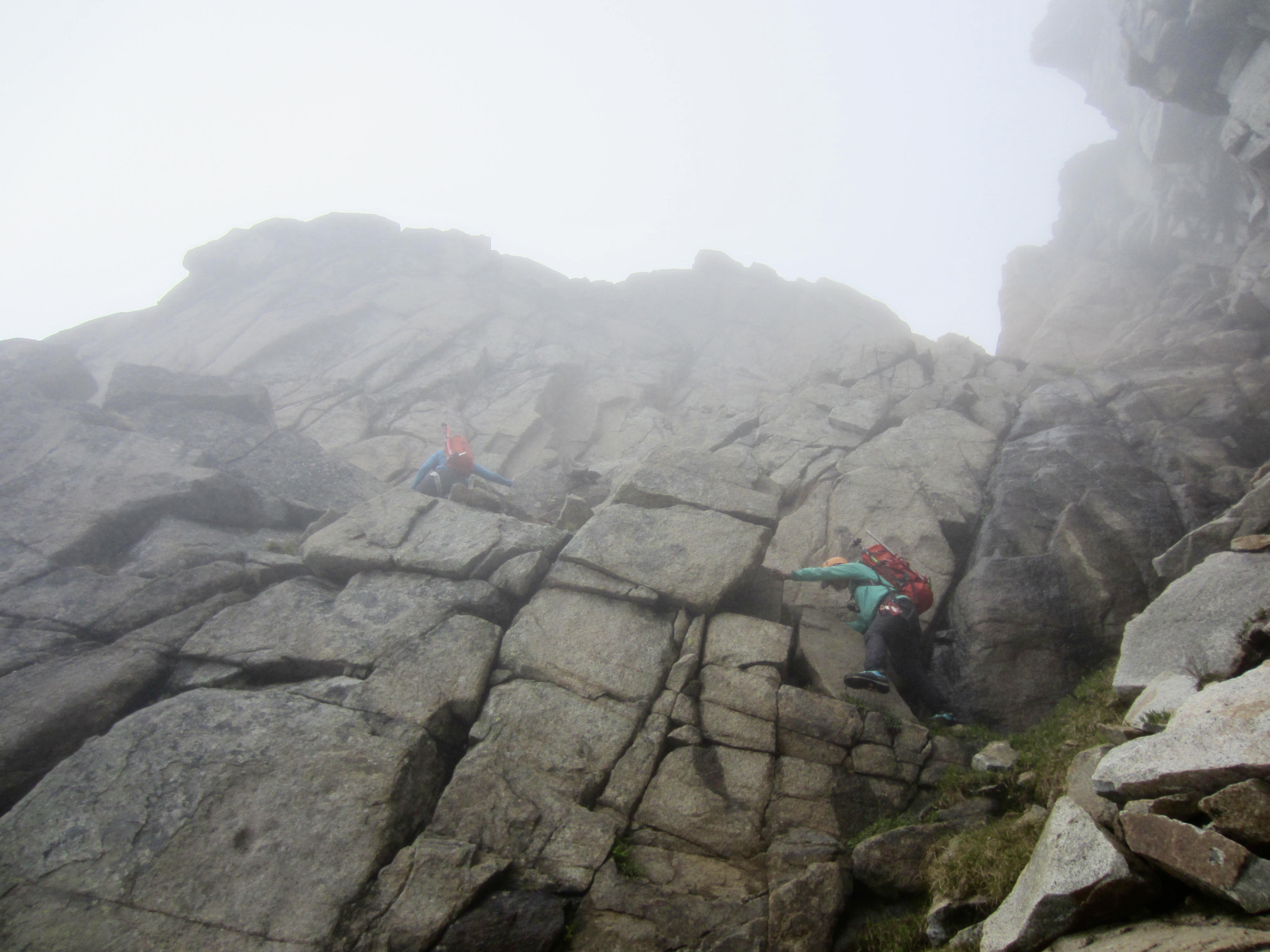
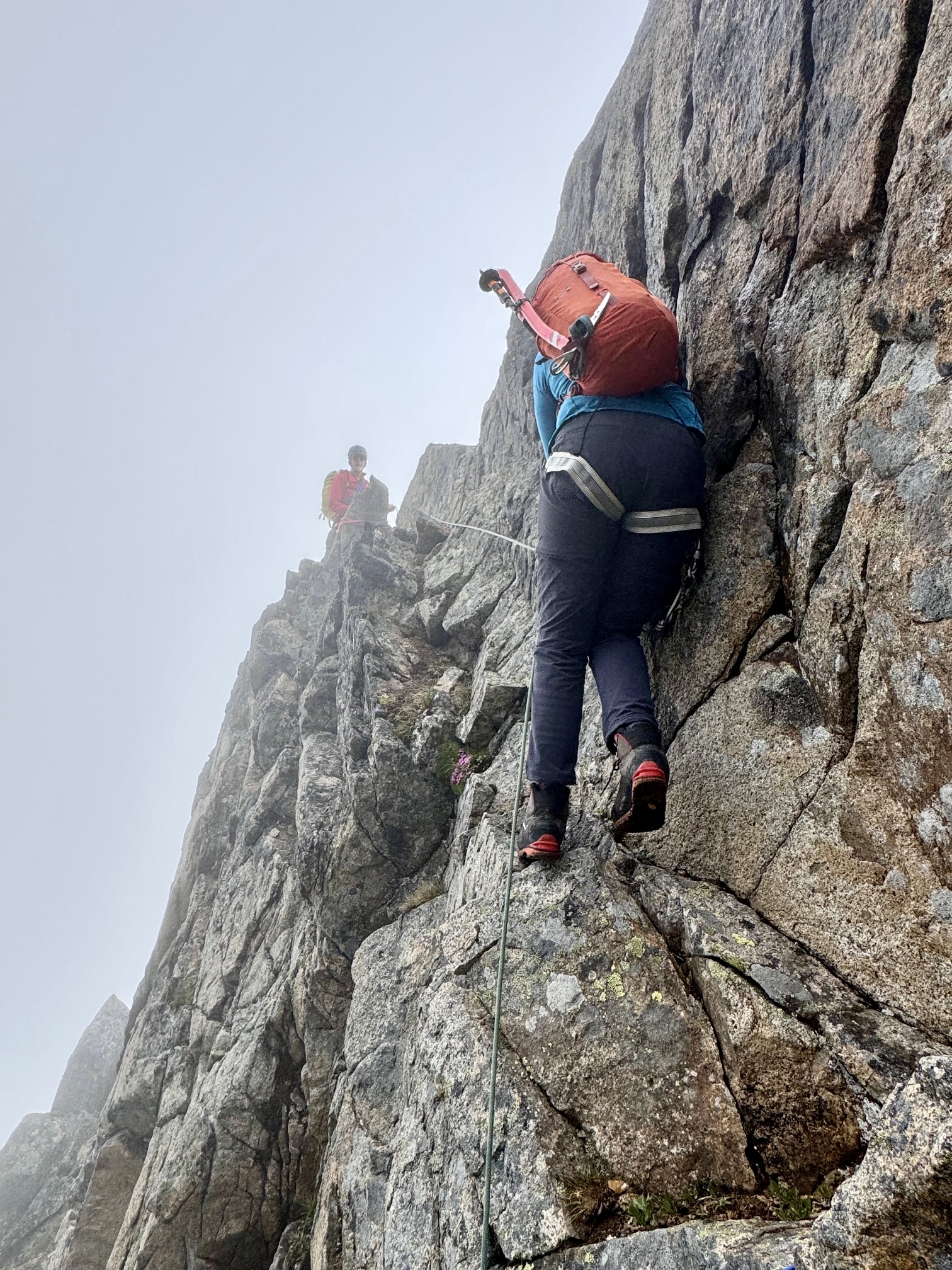
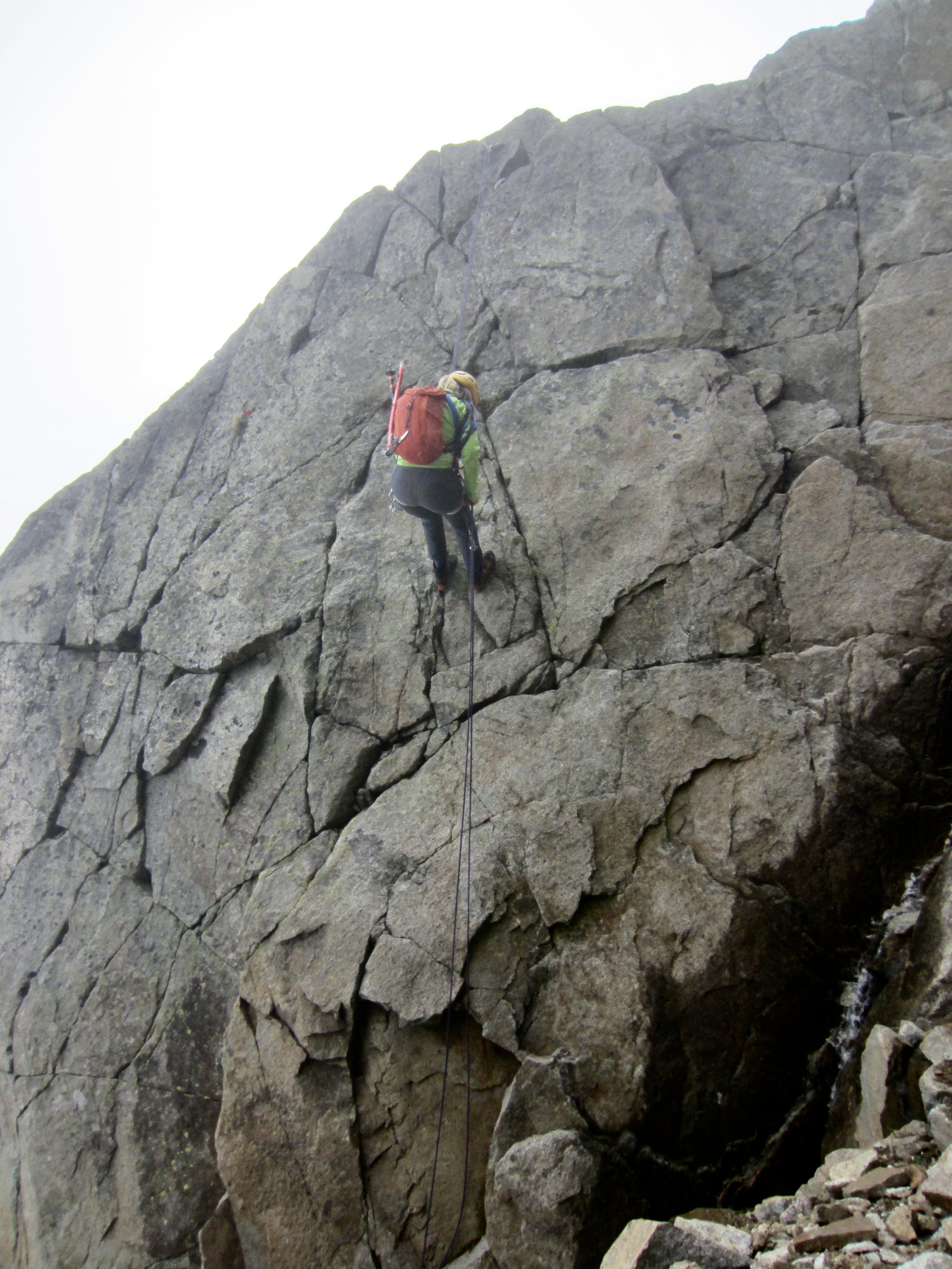
After another short pitch of scrambling up steep, slippery bedrock and loose rubble, the gully eased back and widened out. We were able to unrope and carefully hike up the saturated dirt until reaching a point where the gully divides into two branches.

.
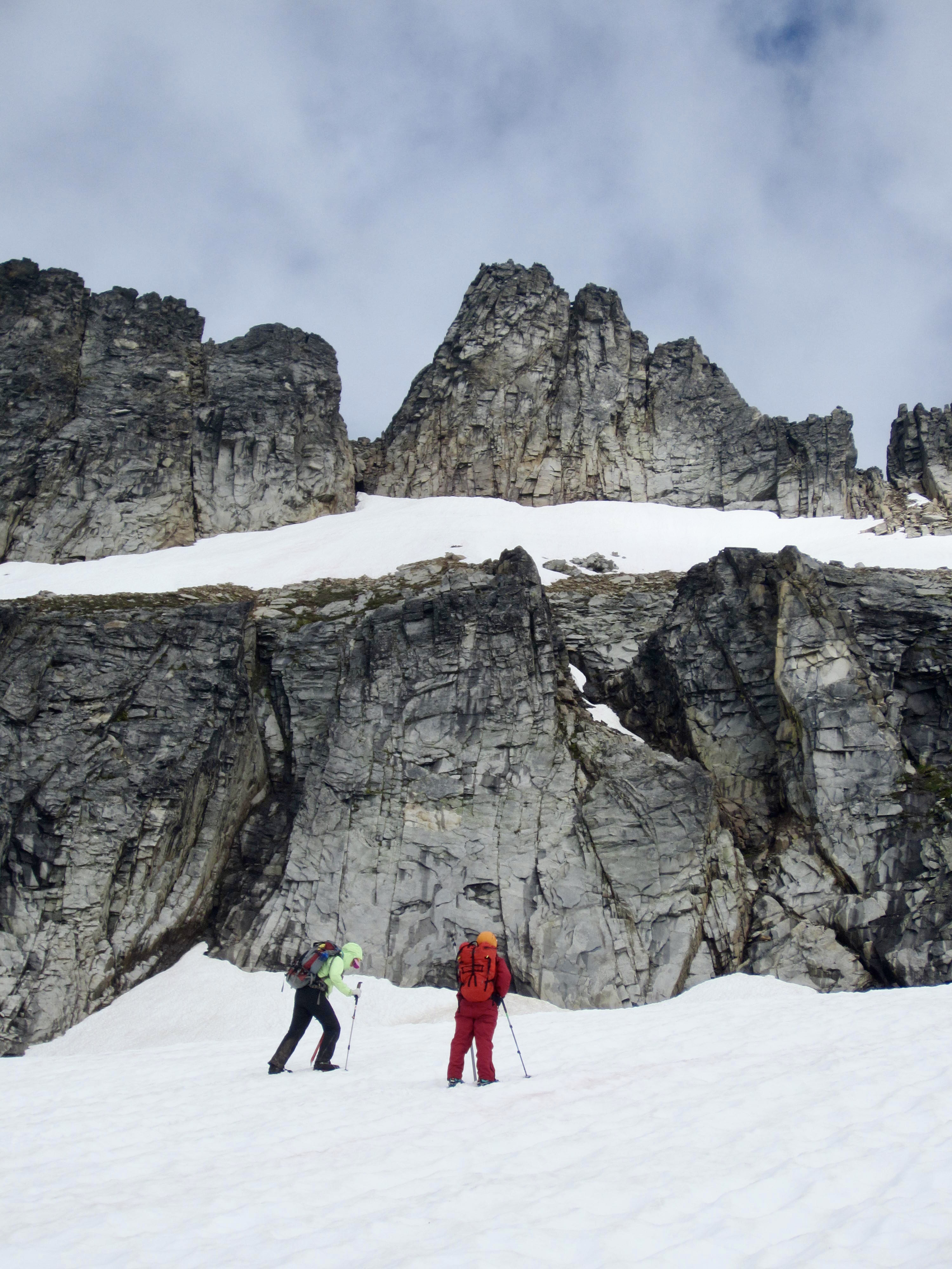
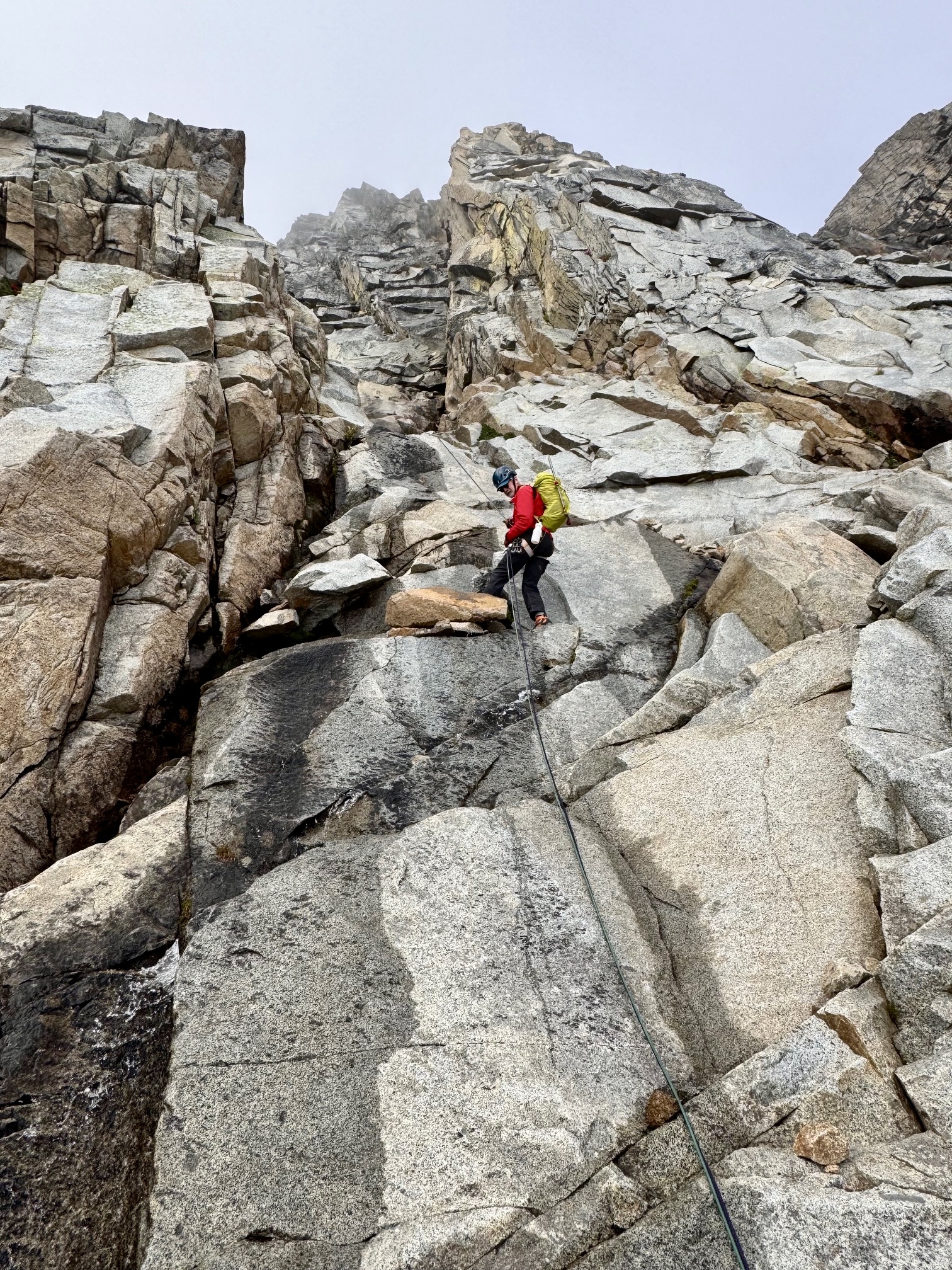
Eileen recalled previously angling left where the gully divides, but she was unclear about how to proceed. Fortunately, Yoko immediately spotted a Class 3 crack that cuts sharply back to the left. At the top of this crack, we belayed each other across an exposed catwalk ledge (low Class 5) that ended at the ridge crest.

.
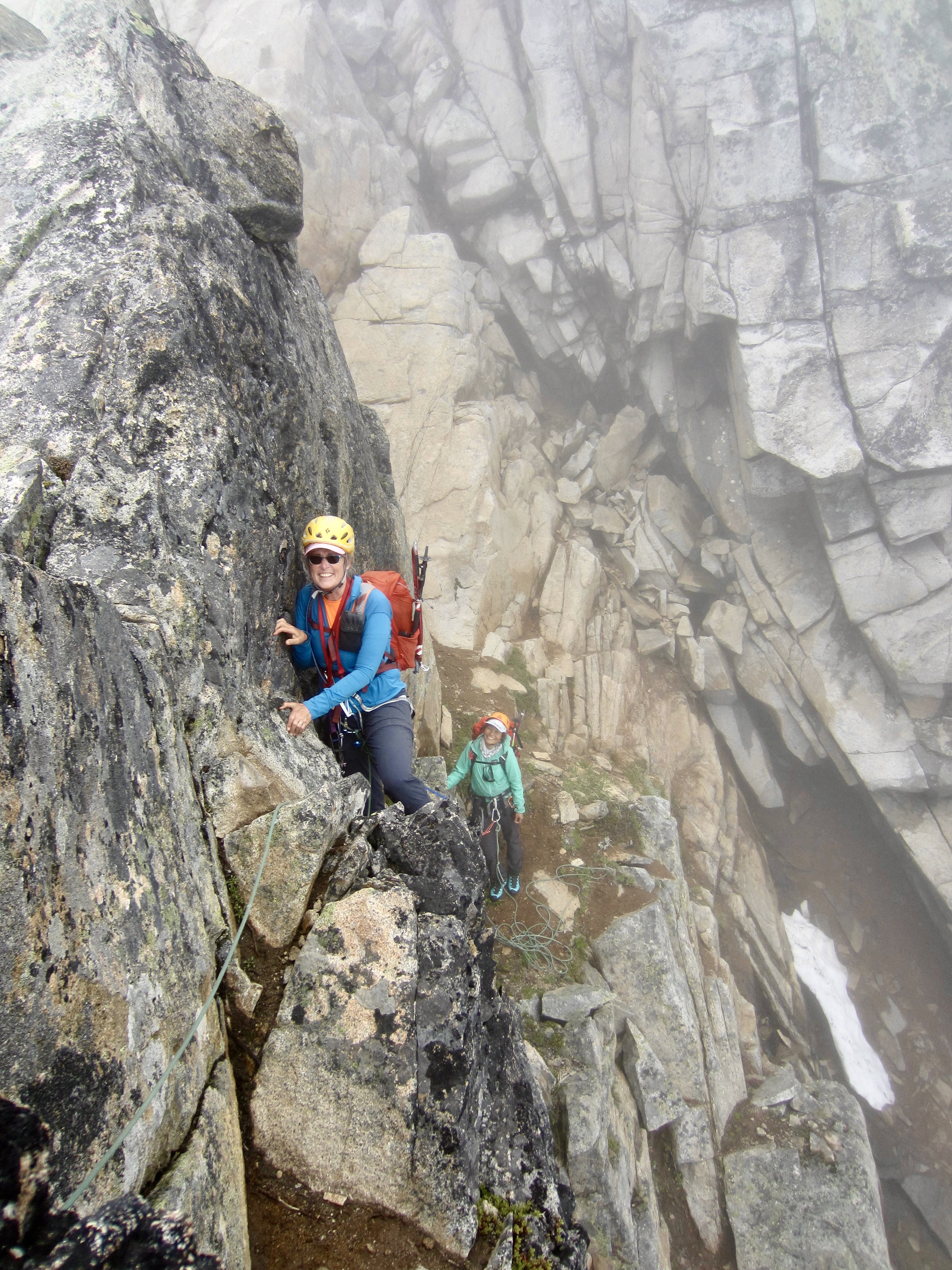
.
Upon reaching the ridge crest, we were able to follow a faint path up a loose dirt slope. This slope ended at the lower edge of Sharkfin Tower’s distinctive hanging snowfield at 7960 feet. We were now only a few dozen yards below the summit block, but it was not visible through the dense fog.
.
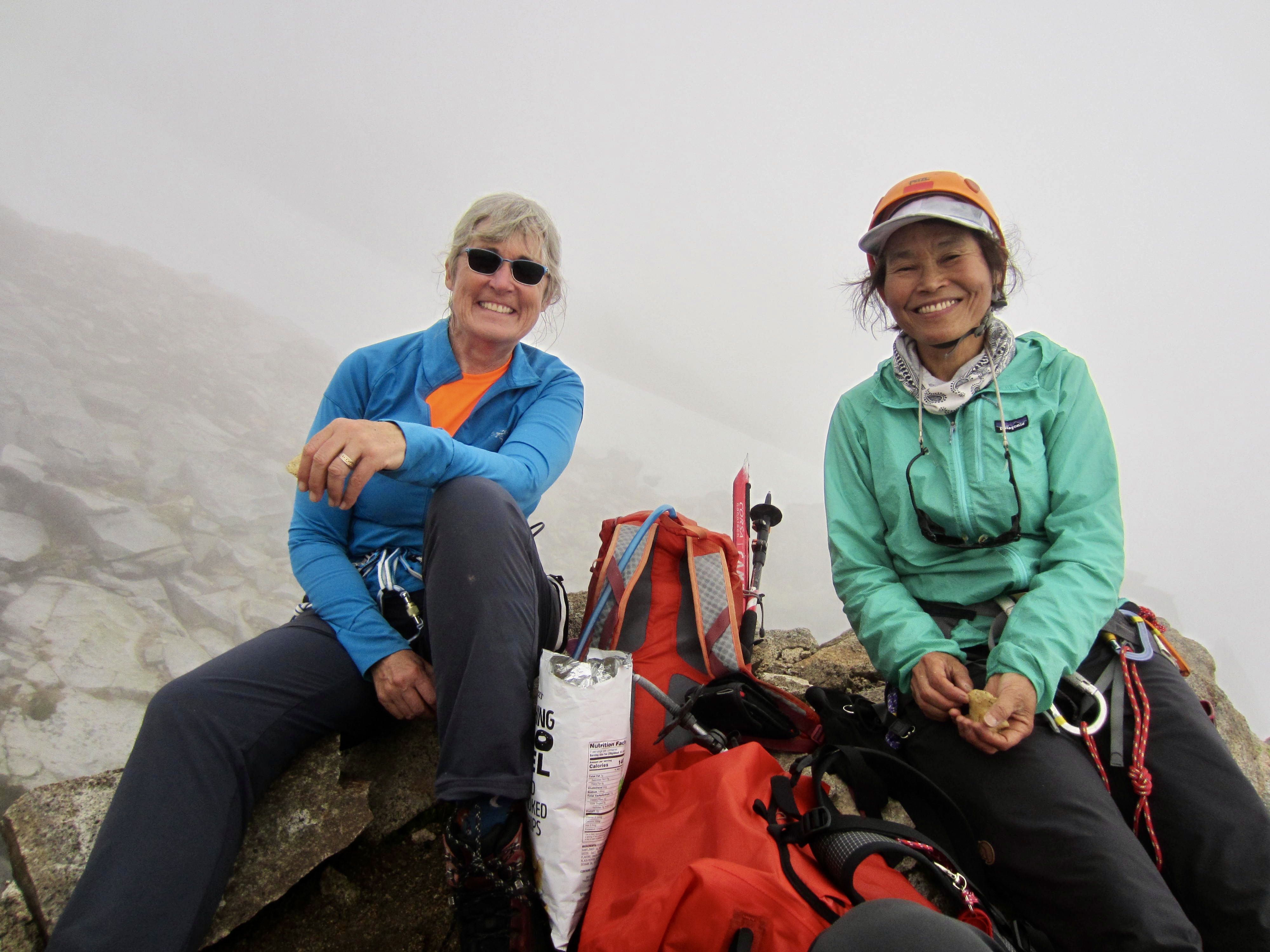
Given the fact that it was now 5:00pm and the summit was still a couple hours away, our climb came to an end here, at the base of the snowfield. Our delayed start, caused by the morning rain, simply did not leave us enough time to complete the climb. In an effort to put a positive spin on the situation, we chalked this one up to a very successful reconnaissance mission. There was nothing to do but sit down and eat potato chips.

.
To descend, we walked down the dirt path to a rappel anchor located on the rock crest. Here, we made a 20-meter rappel into the gully, then walked down to a second anchor farther down the rock crest. A 10-meter vertical rappel got us into the gully near the belay anchor we had used on our ascent. Using both ropes, a final 30-meter rappel delivered us to the Quien Sabe Glacier.
.
.
After collecting our gear left at the base of the gully, we made a straightforward descent of the glacier, snowfields, rock slabs, and moraine to reach camp at 8:30pm (3.3 hours from turnaround point). Sad as it was to get turned back so close to the summit, we were happy to not be descending in the dark.
Day 4: Boston Basin to Trailhead
We awoke to valley fog below but clearing skies above. The rim of peaks was once again visible to our east, and Johannesburg Mountain slowly performed a “grand reveal” across the valley. Boston Basin had transformed itself from dreary to dazzling!
.
Water runoff in the basin had decreased sufficiently so that we were able to cross the south fork of Boston Creek at the traditional location. From there, it was just a routine slippery, brushy descent to the trailhead, arriving in early afternoon (3.8 hours – 2500 feet from camp). We passed several parties heading up-trail for a weekend of dry weather.

.
Route Map & Profile
…
…
Photo Gallery
Click to enlarge…