Trip Date: June 12-18, 2025
2025 WESTERN ALPS ADVENTURE VACATION
Mountaineer’s Haute Route: Le Tour to Ober-Stafel
Refuge Albert 1er aka Albert Premier Hut
Col Supérieur du Tour aka Superior Tour Col
Aiguille du Tour Sud aka South Aiguille du Tour (11,615 ft / 3,540 m)
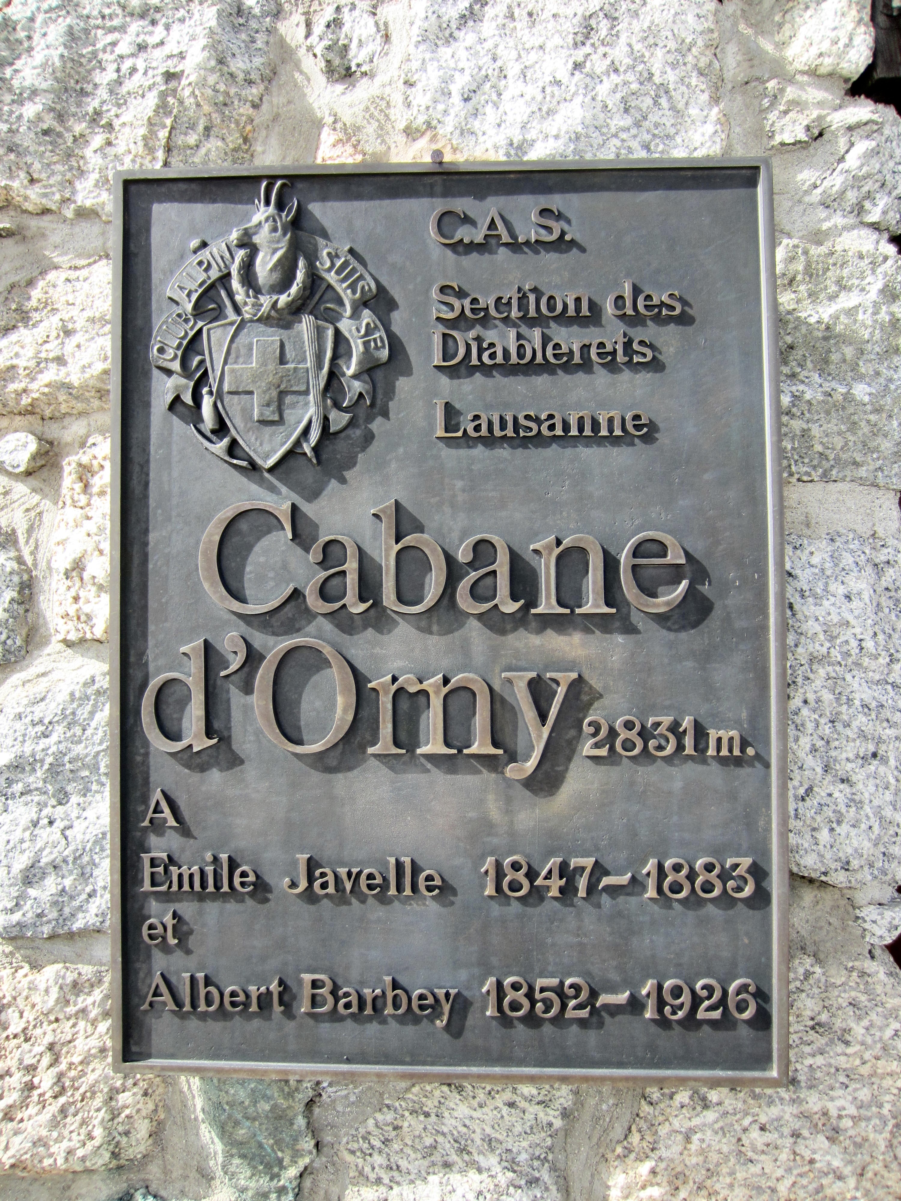
Cabane d’Orny aka Orny Hut
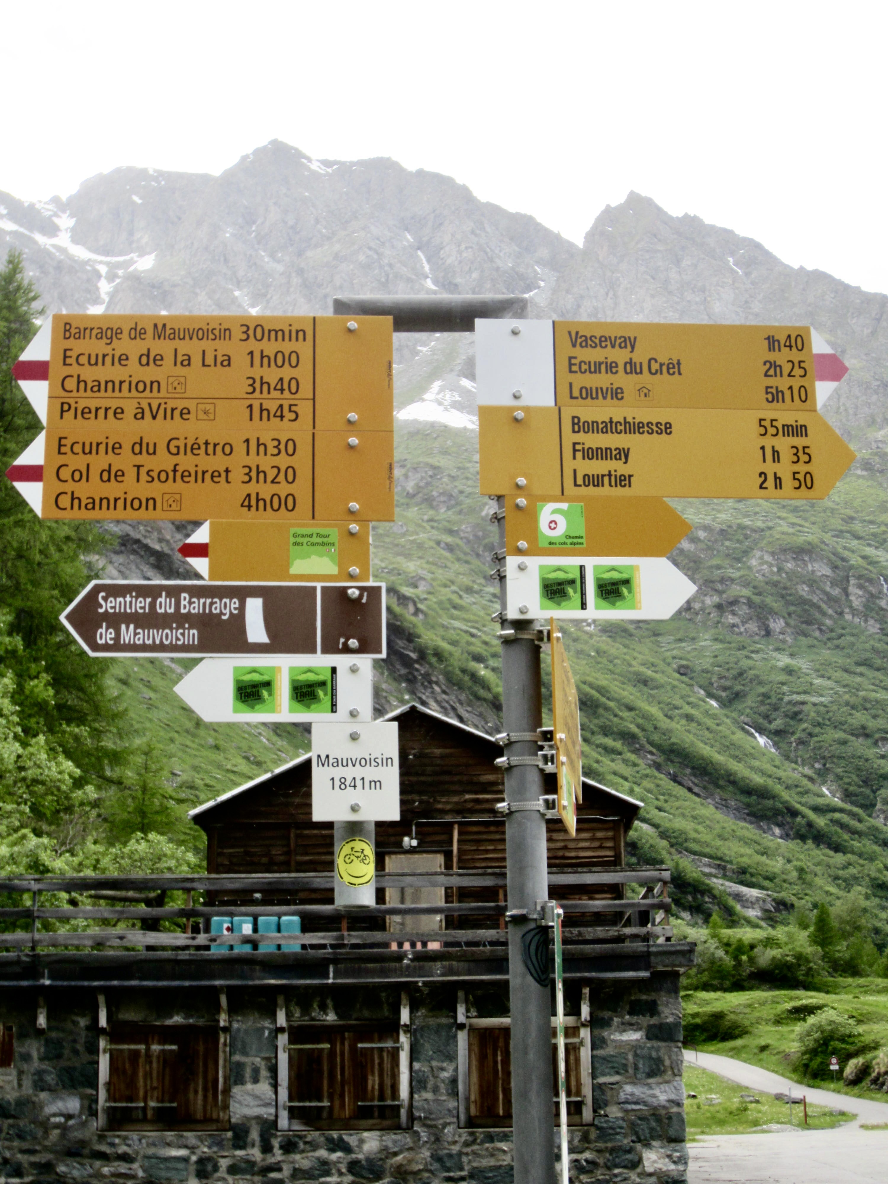
Barrage du Mauvoisin aka Mauvoisin Dam
Cabane de Chanrion aka Chanrion Hut
Col du Mont Rouge aka Mont Rouge Col
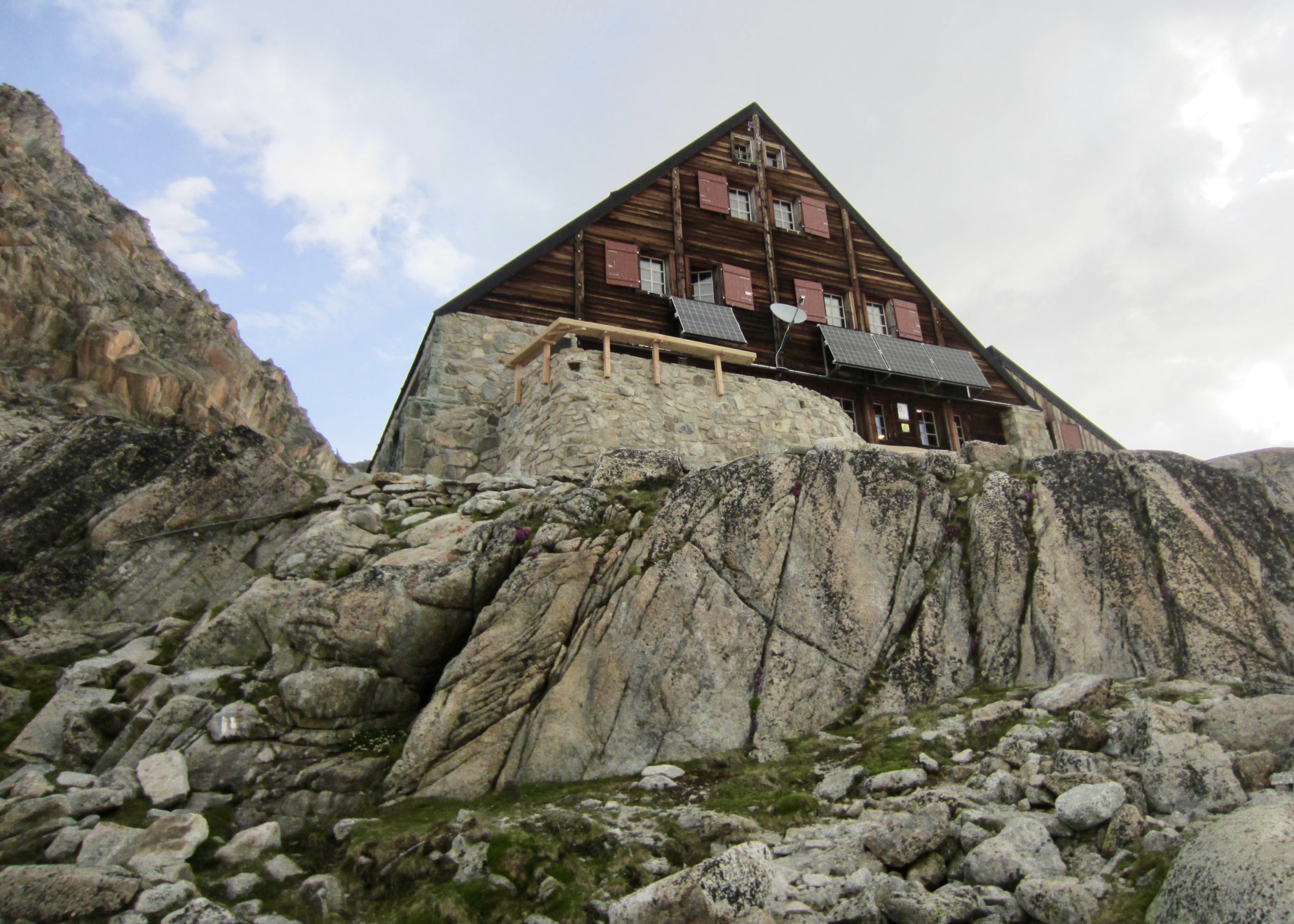
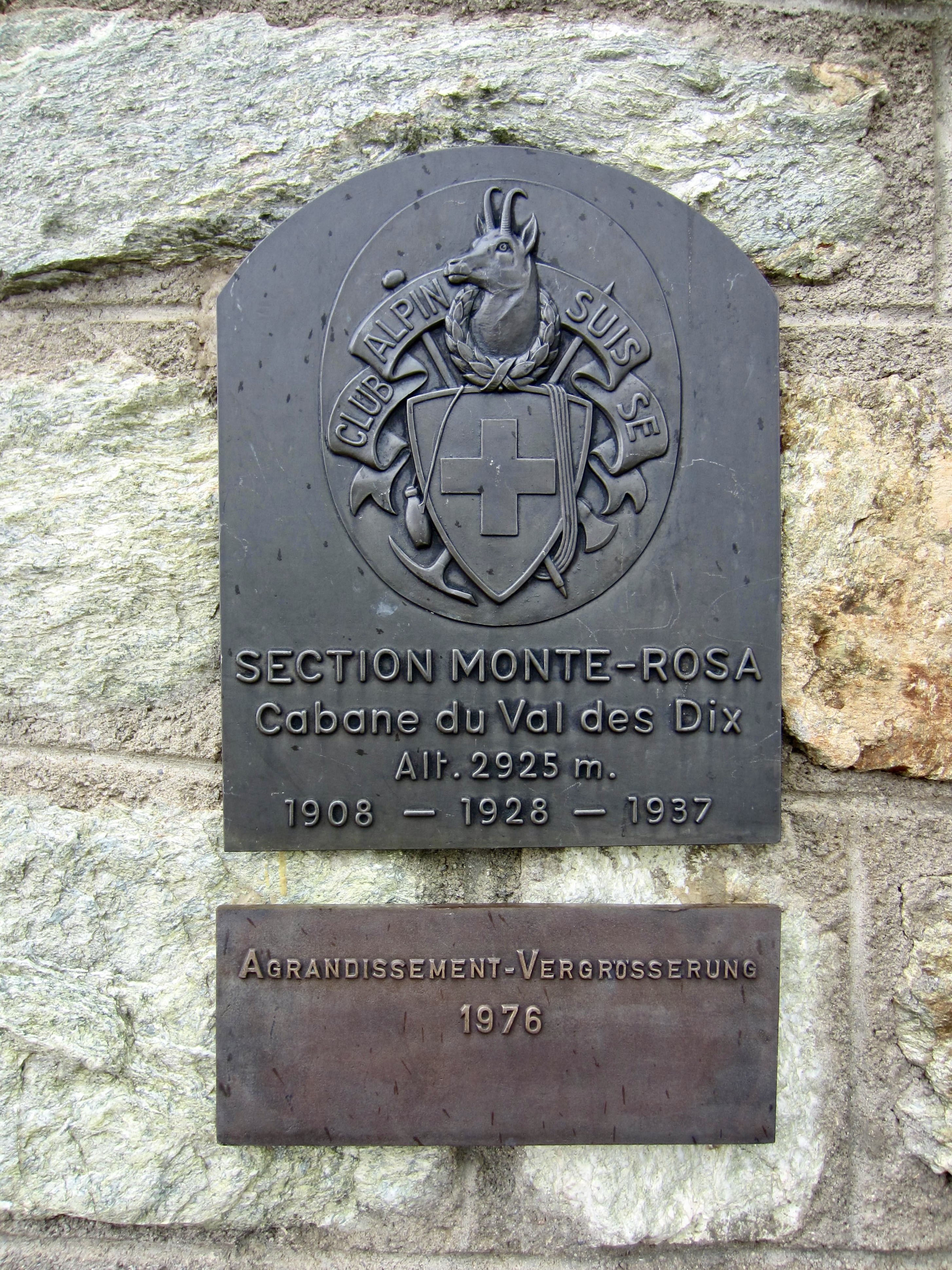
Cabane des Dix aka Dix Hut
Col d’Arolla aka Arolla Col
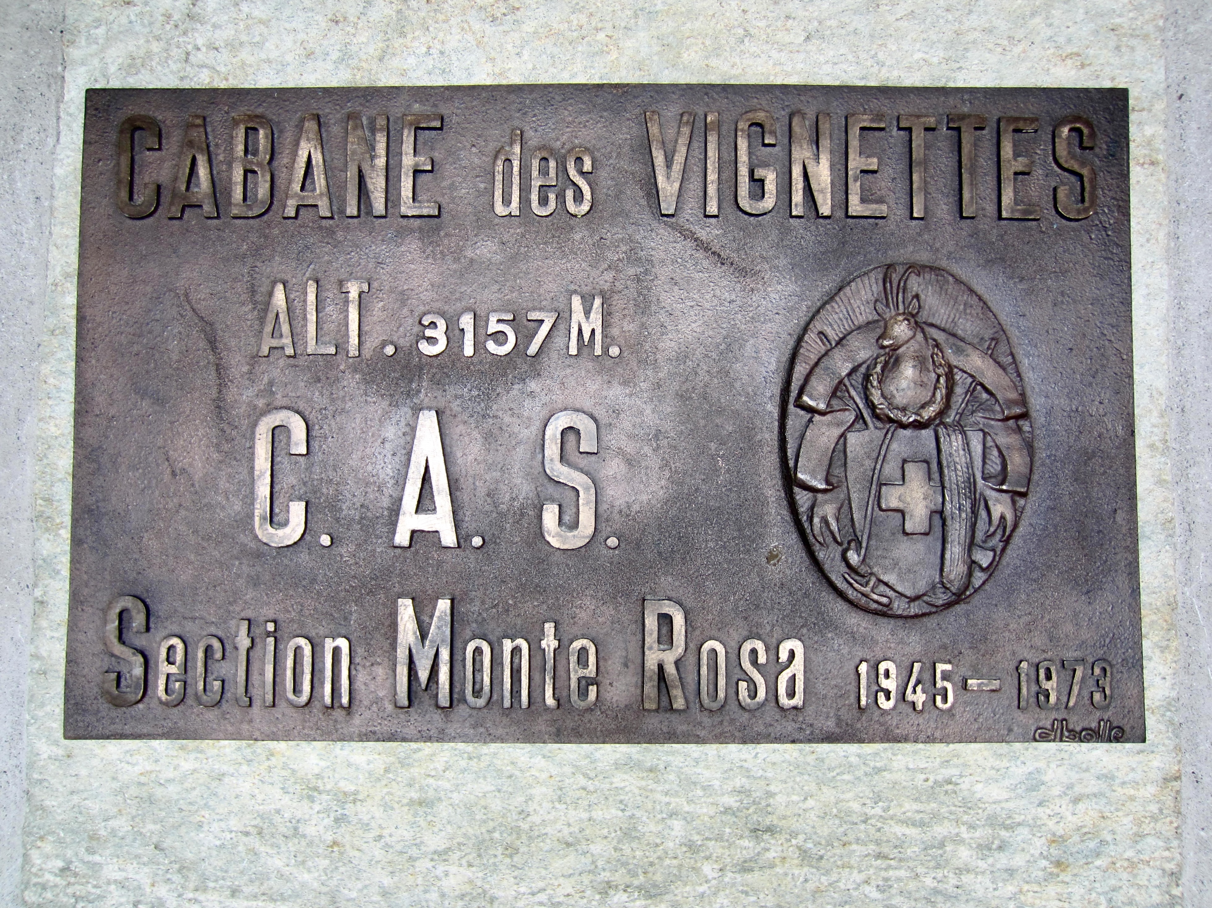
Cabane des Vignettes aka Vignettes Hut
Col de l’Eveque aka Eveque Col
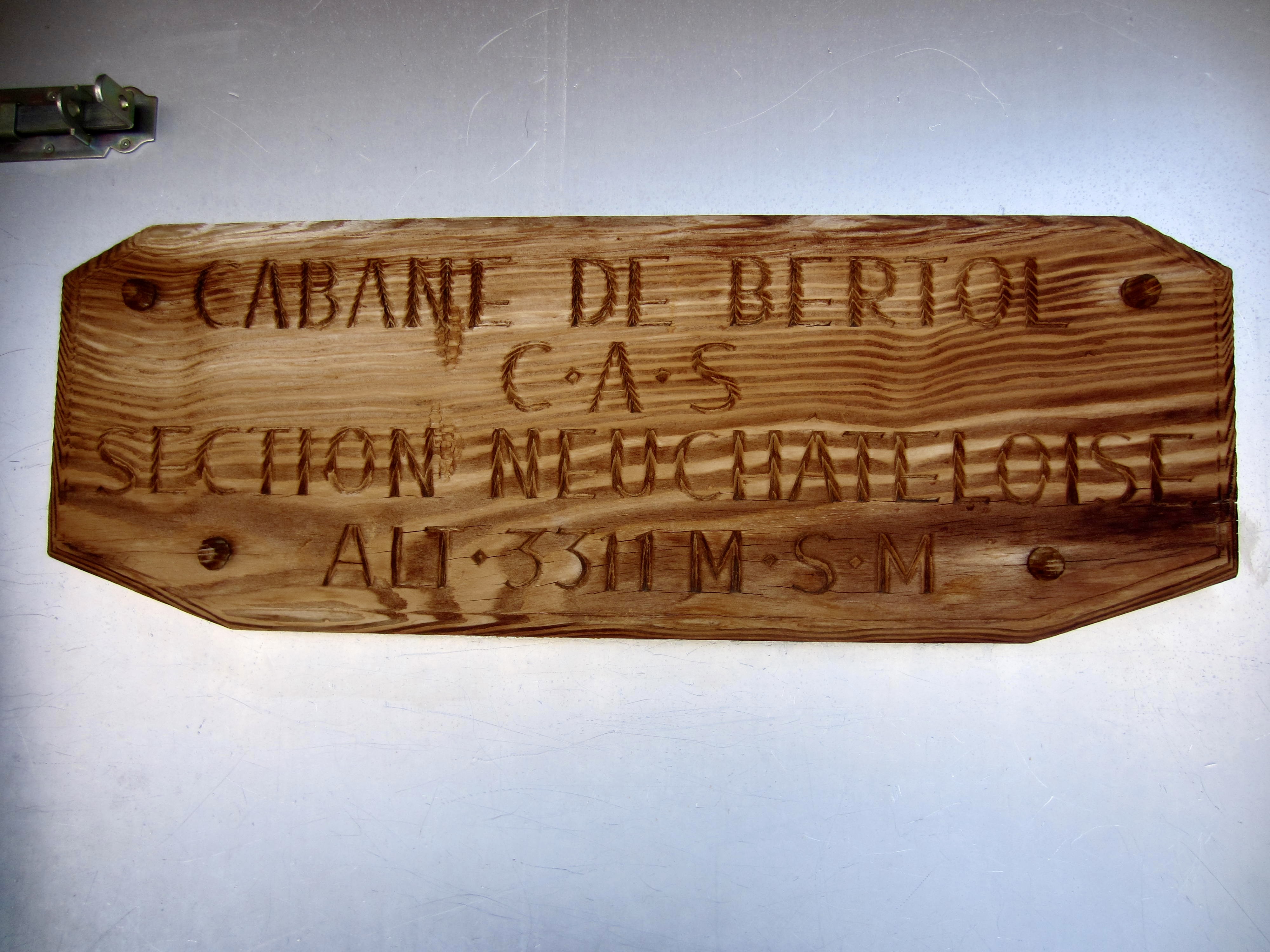
Cabane de Bertol aka Bertol Hut
Col de la Tete Blanche aka Tete Blanche Col
The Stockje aka The Stockji
- Trip Report Summary
- Trip Overview
- Haute Route Variations
- Route & Terrain Conditions
- Schedule & Accommodations
- Traverse Comparisons
- Equipment Comments
- Nomenclature Comments
- Full Trip Report
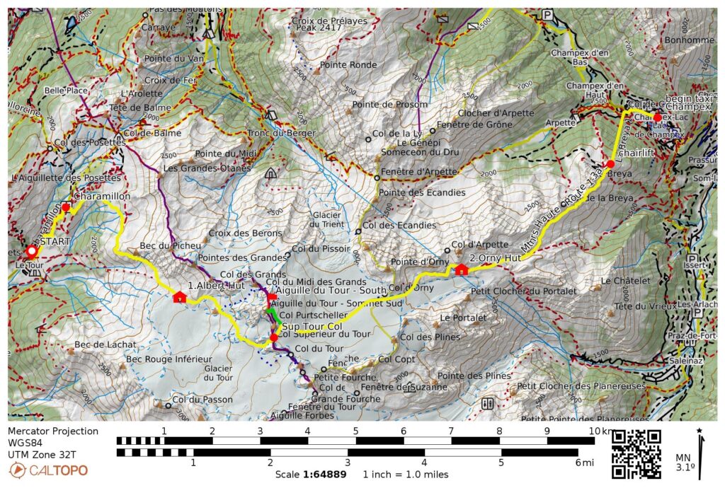
- Day 1: Le Tour to Albert Hut
- Day 2: Albert Hut to Orny Hut + Aiguille du Tour
- Day 3a: Orny Hut to Champex
- Day 3b: Champex to Mauvoisin
- Day 3c: Mauvoisin to Chanrion Hut
- Day 4: Chanrion Hut to Dix Hut
- Day 5: Dix Hut to Vignettes Hut
- Day 6: Vignettes Hut to Bertol Hut
- Day 7: Bertol Hut to Ober-Stafel
- Route Maps & Profiles
- Photo Gallery
Trip Report Summary
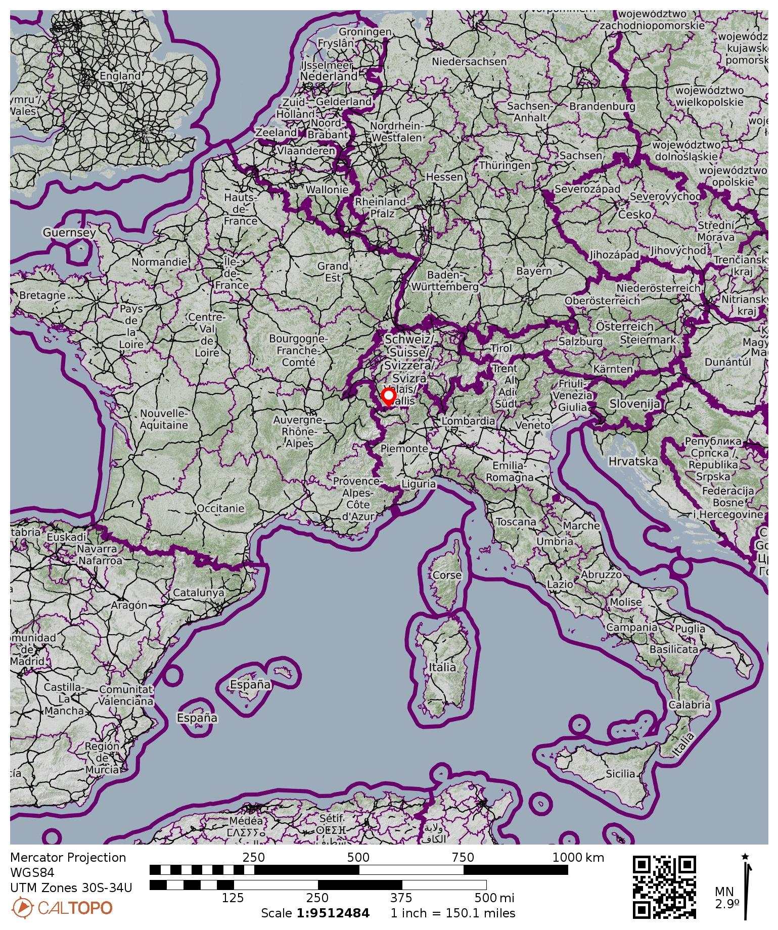
Regions: France & Switzerland
Sub-Regions: Graian Alps & Pennine Alps
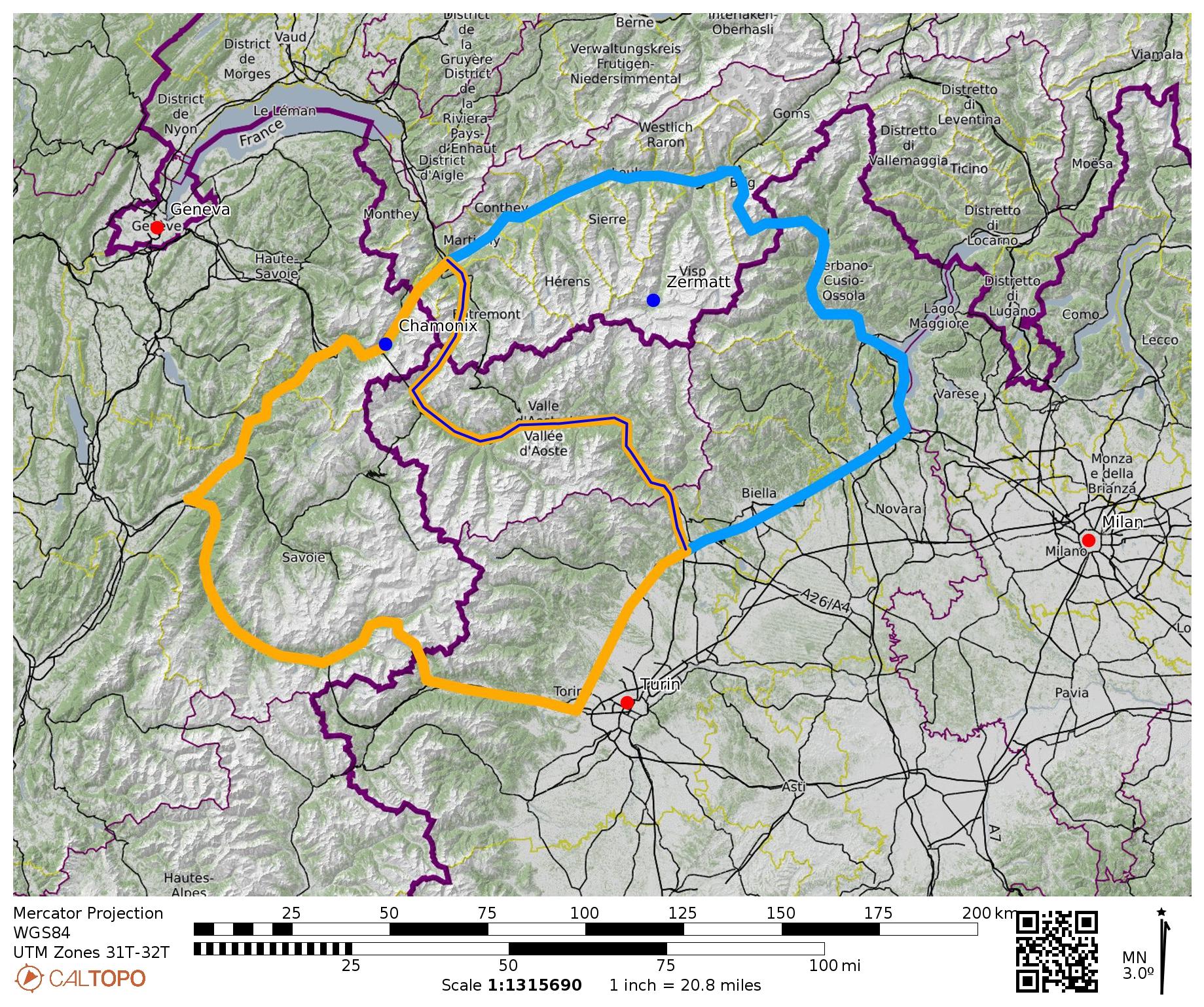
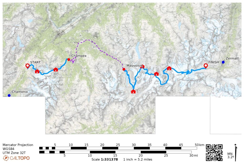
Starting Point: Charamillon Gondola base station in Le Tour, France (Elev. 4,850 feet / 1,480 meters)
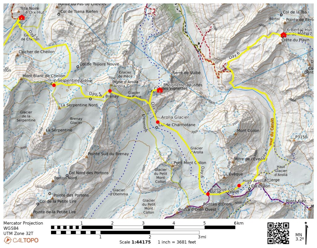
Way Points: Charamillon Lodge (road walk); Albert Premier Hut & Superior Tour Col & Orny Col & Orny Hut & La Breya Chairlift top station (trail hike & off-trail hike & snow climb); Champex-Lac (chairlift ride); Champsec & Mauvoisin (road walk & taxi ride & trail hike); Mauvoisin Dam & Tsofeiret Col & Brenay Creek & Chanrion Hut & Brenay Creek & Tsofeiret Col & Lire Rose Col & Mont Rouge Col & Cheilon Col & Dix Hut & Serpentine Col & Arolla Col & Vignettes Hut & Eveque Col & Bertol Plain & Bertol Hut & Herens Col & Tete Blanche Col & The Stockje & Stockje Glacier moraine & Zmutt Lakes (trail hike & off-trail hike & snow climb & rock scramble); Grand Dixence pump station (road walk).
High Point: Arolla Col (Elev. 12,220 feet / 3,725 meters)
Ending Point: Grand Dixence pump station near Ober-Stafel, Switzerland (Elev. 7,150 feet / 2,180 meters)
Accommodations: Albert Premier Hut & Orny Hut & Chanrion Hut winter room & Dix Hut winter room & Vignettes Hut winter room & Bertol Hut
Summit: South Aiguille du Tour (snow climb & rock scramble via Southeast Gully—East Face—Upper North Ridge)
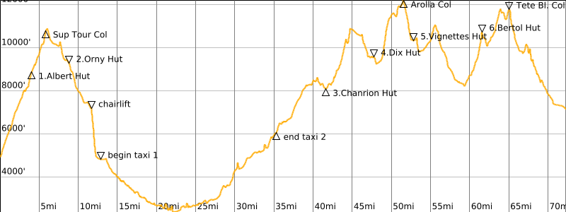
Approximate Stats (excluding sidetrips): 50 miles / 80 kilometers traveled on foot; 22 miles / 35 kilometers traveled in taxi; 0.7 miles / 1.1 kilometers traveled on chairlift; 28,800 feet / 8,780 meters gained on foot; 26,500 feet / 8,080 meters lost on foot; 2300 feet / 700 meters lost on chairlift.
…
Trip Overview
The term Haute Route (pronounced “oat root”) refers to a collection of high traverse routes extending through the Graian Alps, in southeastern France, and the Pennine Alps, in southwestern Switzerland. Although the specific routes vary considerably, long-standing tradition has all routes generally extending from the town of Chamonix to the town of Zermatt
Haute Route Variations
There are three main versions of the traverse: The Walker’s Haute Route follows established hiking trails that cross over a series of high mountain passes and connect several Alpine towns. The Mountaineer’s Haute Route and Skier’s Haute Route each take a higher course, traveling across glaciers and connecting a chain of mountain huts.
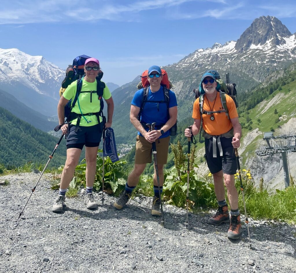
Eileen completed the Walker’s Haute Route with a group of friends in 2023, but I was sidelined with an injury that summer. Upon returning home, she immediately started planning for us to go back and do the Mountaineer’s Haute Route. Our friend Jon needed little encouragement to join the trip, and he took on the roles of principal navigator and trail-breaker, as well as Eileen’s personal porter.
.
Route & Terrain Conditions
The typical course of the Mountaineer’s Haute Route starts in the small town of Le Tour, which is located up-valley from Chamonix, and it ends in or near the town of Zermatt. Between these starting and ending points, the first three days are usually spent working through the Graian Alps, with the highest point being Superior Tour Col. Upon descending into the town of Champex, Switzerland, it is customary to take a bus or taxi over to the village of Mauvoisin, thereby avoiding two days of road-walking. The next five or six days are usually spent working through the Pennine Alps, with the highest point being Arolla Col.
.
Within the two mountainous portions of the traverse, most days involve leaving a hut, climbing over a high col, and descending to another hut. The huts sit at elevations ranging from 8,000 feet / 2,400 meters to 10,400 feet / 3,100 meters, and the cols range as high as 12,200 feet / 3,700 meters. (Note: In the Alps, the word col is applied liberally to any feature that could be described as a saddle, gap, pass, col, or notch in North America.)
.
The vast majority of the traverse lies in the alpine zone, well above timberline. At lower elevations within this zone, the traverse follows established trails that are marked with stone ducks, cairns, and red-and-white paint stripes. At higher elevations, travel generally occurs on snowfields and glaciers. Despite the alpine nature of the traverse, most of the terrain is reasonably moderate, such that a rope is not needed other than for crevasse danger. However, there are a few localized places with very steep terrain, where a handline or belay would be greatly appreciated by some trekkers.

.
Schedule & Accommodations
Eileen, Jon, and I scheduled our Haute Route traverse for the middle of June in order to take advantage of ample snowcover, stable weather, and long daylight. For the most part, this early-season strategy worked very well for us. Almost everything above 9,000 feet / 2,700 meters along the traverse was covered by snow, which usually offered easy travel, especially during the morning hours (however, we often experienced post-holing conditions due to afternoon softening). Our weather was generally very stable, with mostly sunny days and only one day of rain.
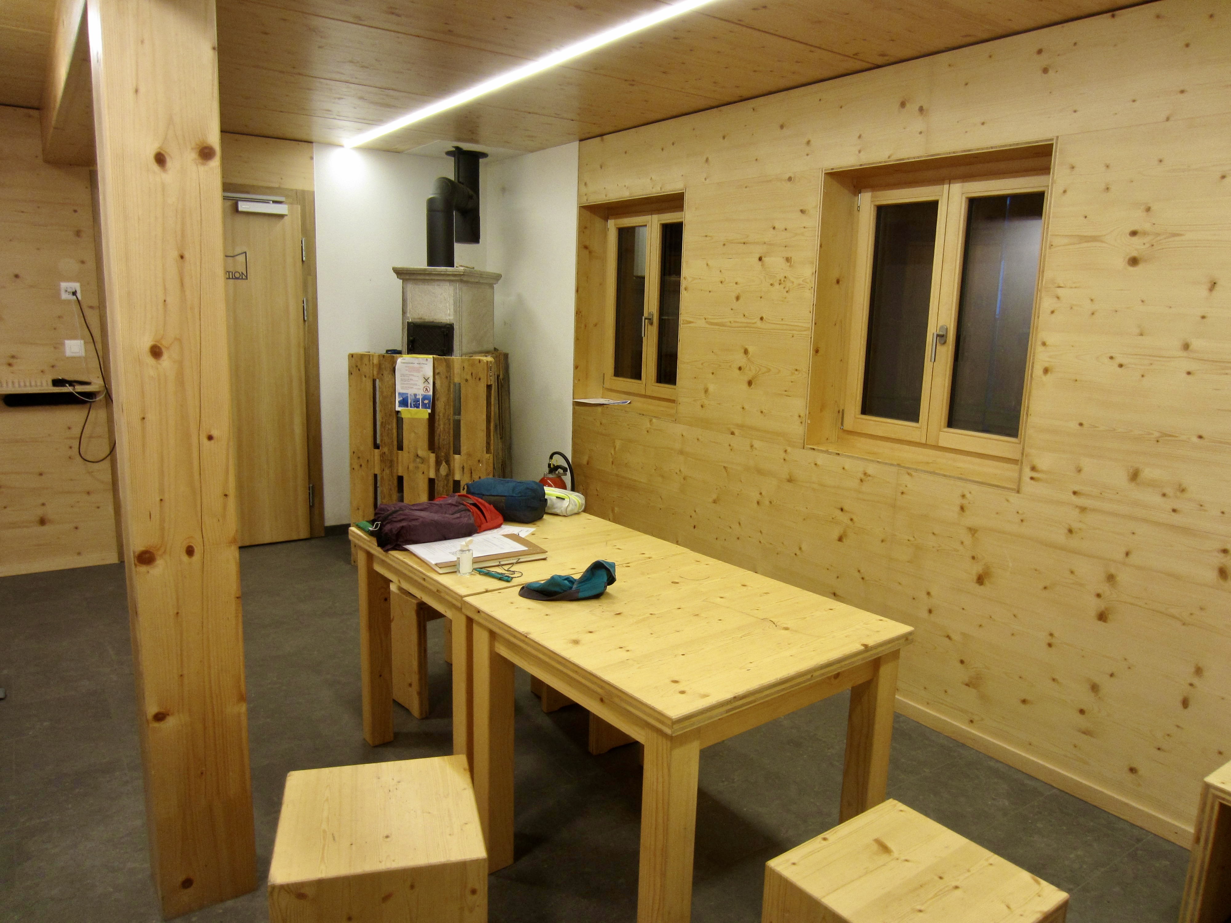
Our schedule had a major effect on our nightly accommodations, in both good and bad ways. Of the seven huts we planned to stay in during the traverse, only three (Albert, Orny, and Bertol) were open and fully staffed; three of the others (Chanrion, Dix, and Vignettes) were not yet staffed for the summer season; and one other (Schonbiel) was closed for the year. Fortunately, the three unstaffed huts allowed us to use their winter rooms, which were supplied with blankets, pads, and in some cases, a wood stove or gas cooktop. This meant that we didn’t need to carry sleeping gear, but we did need to carry dinner and breakfast foods and basic utensils. In the end, we found that the solitude of these winter rooms (we had each one entirely to ourselves) compensated for the food-weight penalty.
An unexpected consequence of our early-season schedule was the complete absence of other people during the middle part of our traverse. In contrast to the playground atmosphere that permeated our first two huts, we saw no other humans between Mauvoisin Dam on Day 3 and Bertol Plain on Day 6. This lended a more adventurous and familiar flavor to our traverse—it felt much more like our previous Cascadian traverses. However, it was surprising to be alone in the highly populated Alps. Was this normal? At Bertol Hut, on the last night of our trek, a local climber explained it in simple terms for us: “Nobody here does what you guys are doing.”

.
Traverse Comparisons
Pacific Northwest mountaineers who are familiar with trekking in the Cascades may wonder how the Haute Route compares with the two Cascadian uber-classics: the Ptarmigan Traverse and the Picket Traverse. Here are my retrospective thoughts.
If considering only the terrain, and ignoring all other aspects, I would deem the Haute Route to be slightly harder than the Ptarmigan Traverse but easier than the Picket Traverse. However, there are other factors that come into play.
A major difference between the Alpine and Cascadian traverses is elevation. The Haute Route largely stays at elevations between 8,000 feet / 2,400 meters and 12,000 feet / 3,600 meters, whereas the Ptarmigan and Picket Traverses largely stay below 7,000 feet / 2,100 meters. This difference makes the Haute Route feel more strenuous, especially to those of us who live near sea level and are not naturally acclimated.
On the other hand, the prevalence of mountain huts and access trails along the Haute Route greatly reduces the amount of gear to be carried and mitigates the level of commitment needed. Both of the Cascadian traverses require trekkers to be fully self-contained, and neither of them offers a good bail-out route. In most locations, the only feasible “bail-out” options are to keep going forward or go back to the start!
A final factor is scale. All three traverses provide equally splendid alpine scenery, with rugged mountains, tumbling glaciers, and deep valleys. But everything in the Alps is bigger, higher, wider, deeper and grander—like the Cascades on steroids! The Ptarmigan and Picket Traverses, though, provide a more intimate experience because the adjacent peaks are much closer at hand.
Boiling it down to a single sentence, I would describe the difference thusly: The Haute Route feels grand and civilized, whereas the Ptarmigan and Picket Traverses feel intimate and wild.
.
Equipment Comments
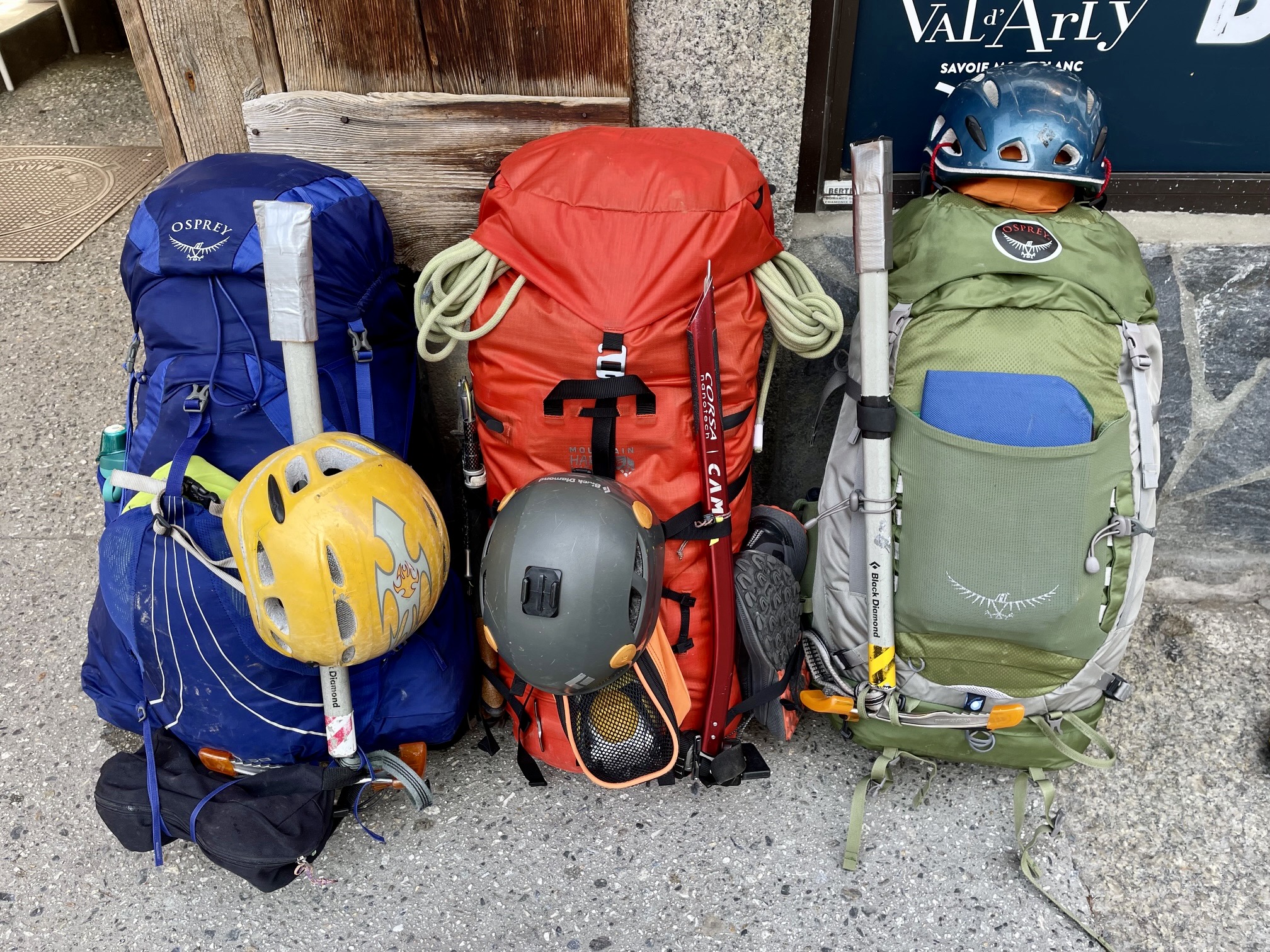
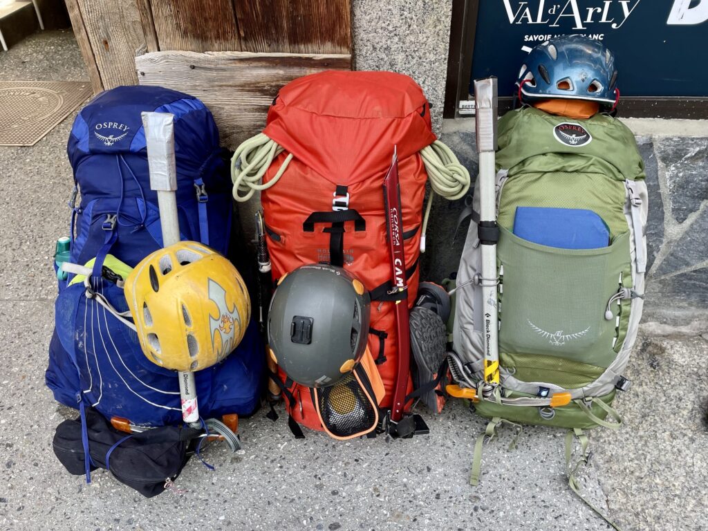
Packs: Given our early-season schedule and associated need to haul more food and clothing than typically required for a summertime hut-to-hut trip, our Haute Route traverse had the character of a hybrid trip. As such, we each carried a relatively large rucksack, with capacities ranging from 38 to 55 liters.
.
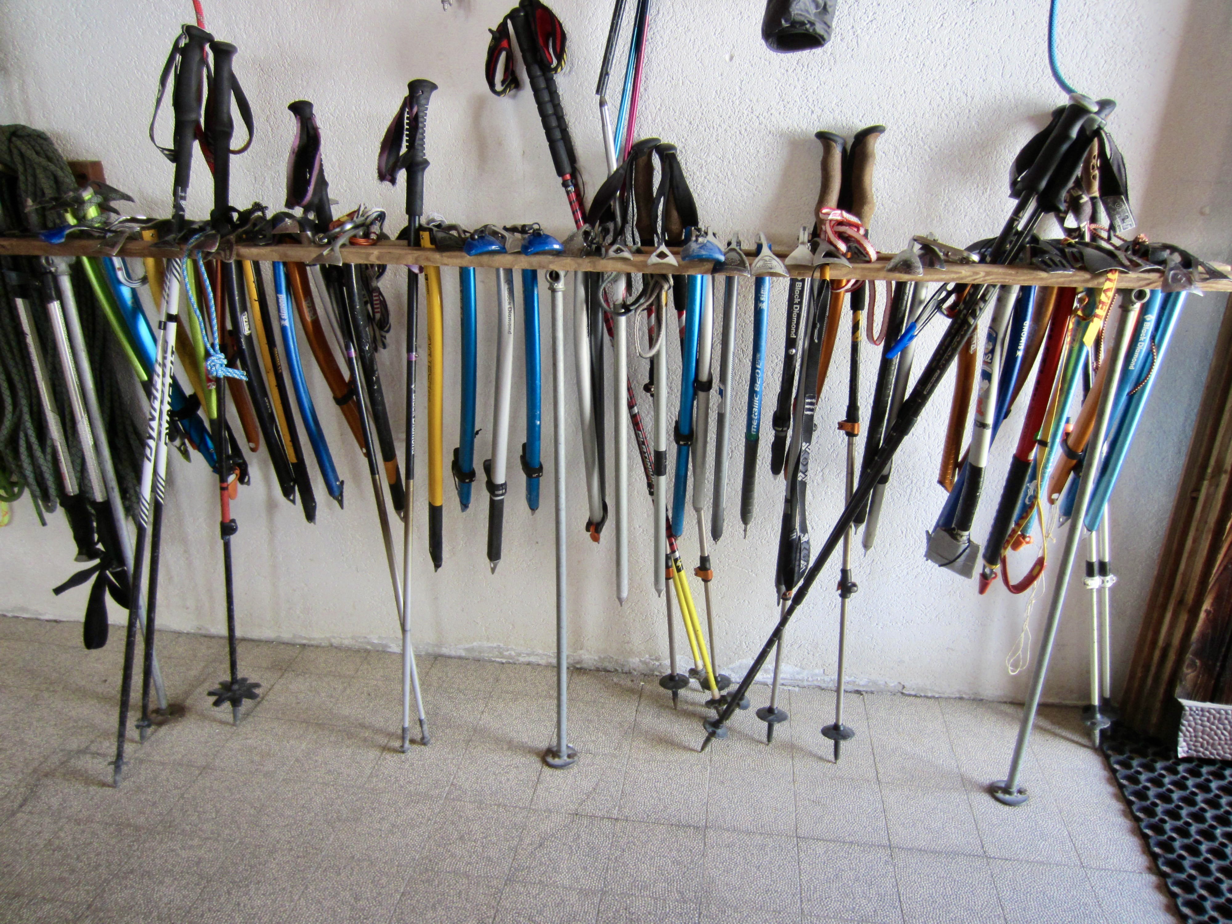
Technical Gear: Our technical gear included ice axes, crampons, helmets, lightweight harnesses, and a 20-meter glacier rope. We also carried several rappel slings but never used them.
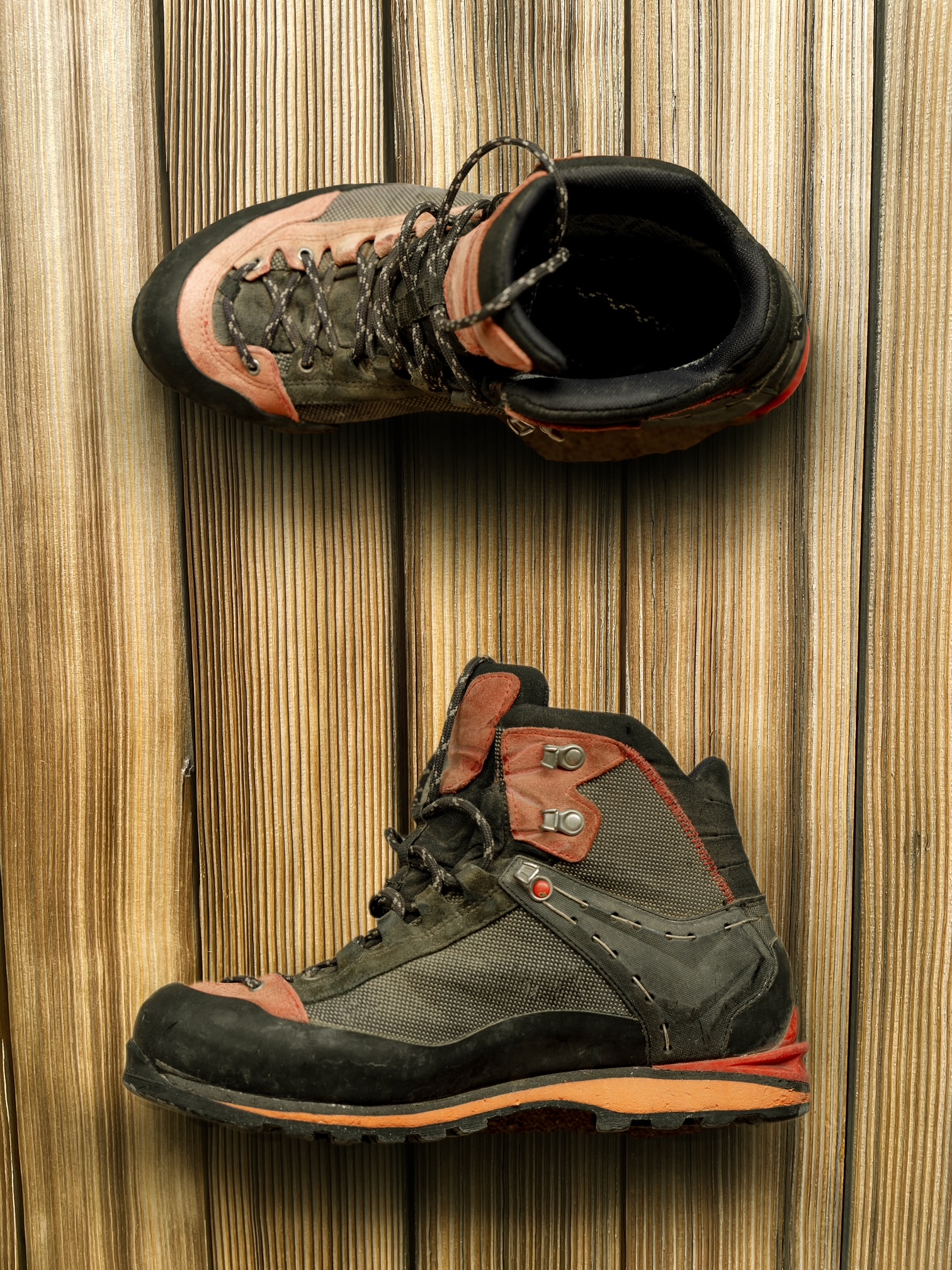
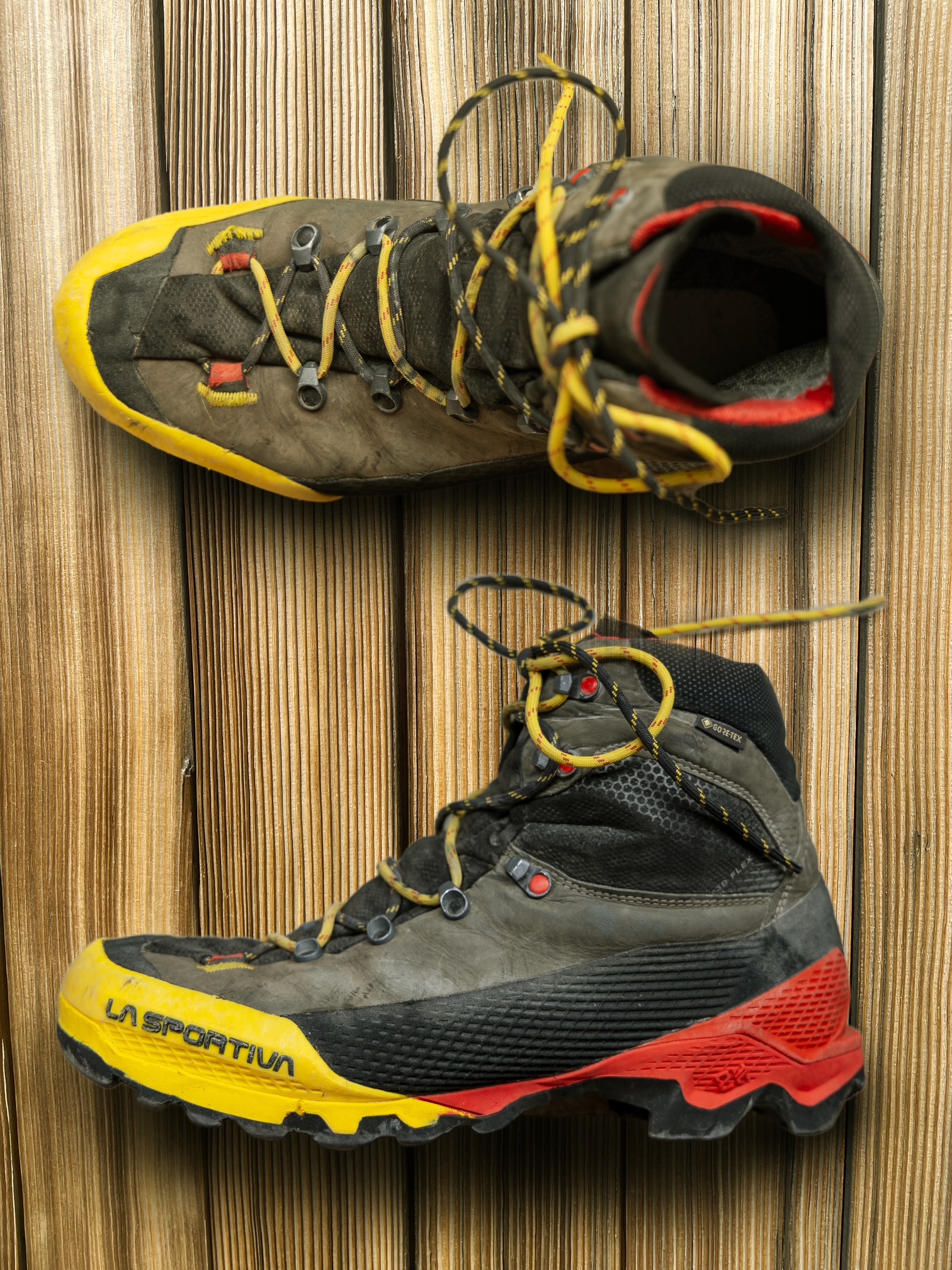
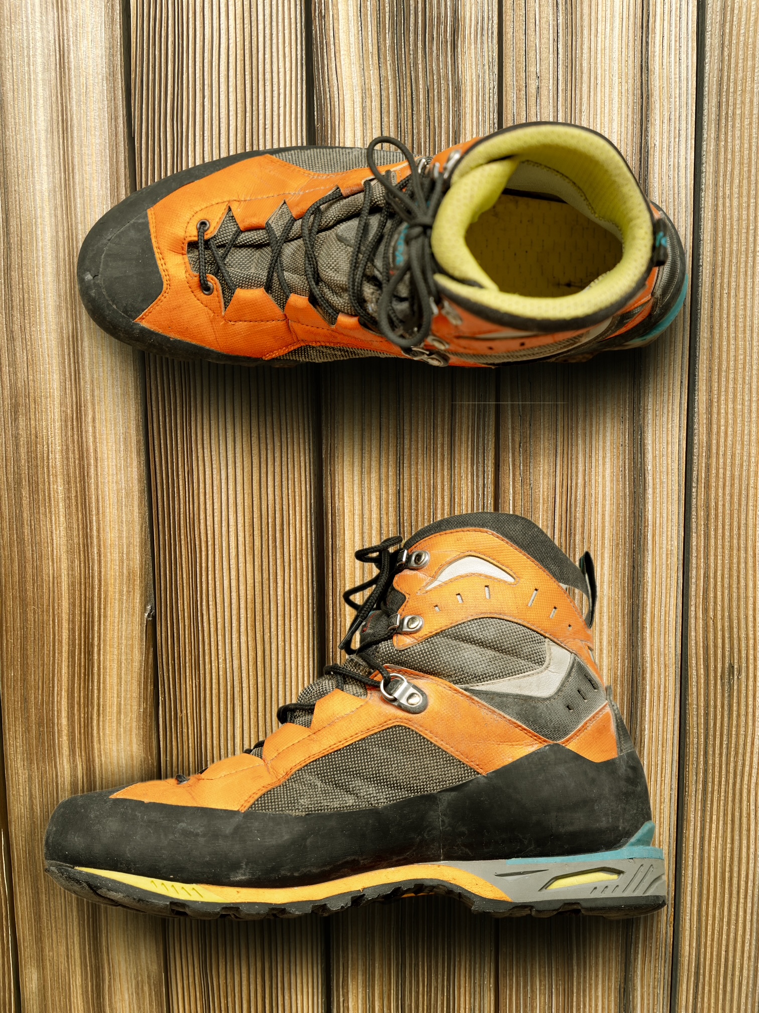
Boots: To handle the wide variety of alpine terrain, we each chose an all-purpose mountaineering boot for the traverse. Specifically, Eileen wore Salewa Crow boots, Jon wore La Sportiva Aequilibrium boots, and I wore Scarpa Charmoz boots.
.
Shoes: We each carried lightweight trail shoes for use on lowland trails and roads. These trail shoes also doubled as hut shoes, although most huts provided loaner slippers.
Socks: Due to the amount of time spent trudging through mushy snow (and fording creeks), a major issue throughout our traverse was wet feet. It was never possible to completely dry our boots overnight, so we were constantly rotating through our sock supplies. A pair of dry socks became our most coveted possession. For an early-season traverse like ours, I would recommend carrying three pairs of trekking socks and an additional pair of dedicated hut socks.
Nomenclature Comments
In the interest of brevity and clarity, I have anglicized many of the geographic names mentioned in this report, using words and syntax more familiar to English-speaking trekkers. For example, rather than saying Cabane des Vignettes, Col Superieur du Tour, and Glacier du Cheilon, I’ve simply said Vignettes Hut, Superior Tour Col, and Cheilon Glacier. Summit features, however, always retain their distinctive native names. Many other English-language reporting sources have used this same nomenclature policy.
Full Trip Report
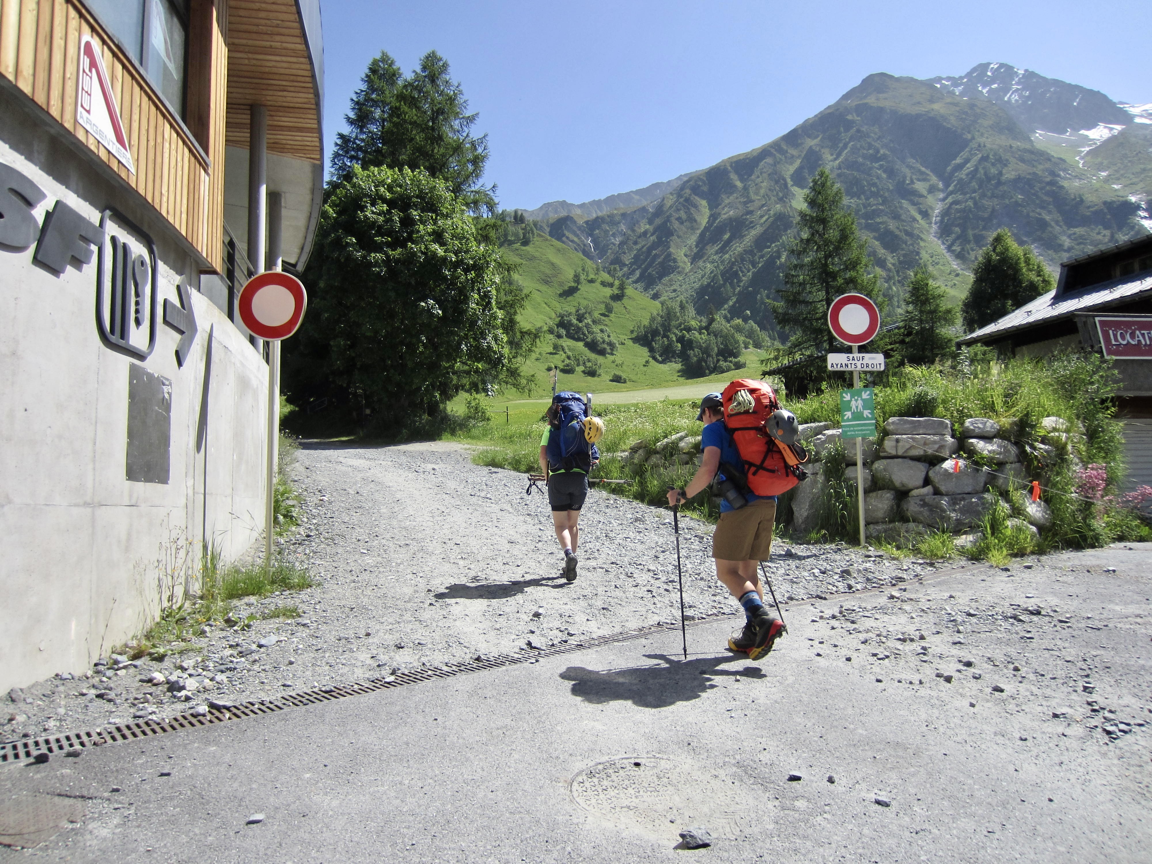
Day 1: Le Tour to Albert Hut
Approximate Stats: 4.3 miles / 6.9 kilometers traveled; 4150 feet / 1260 meters gained; 100 feet / 30 meters lost.
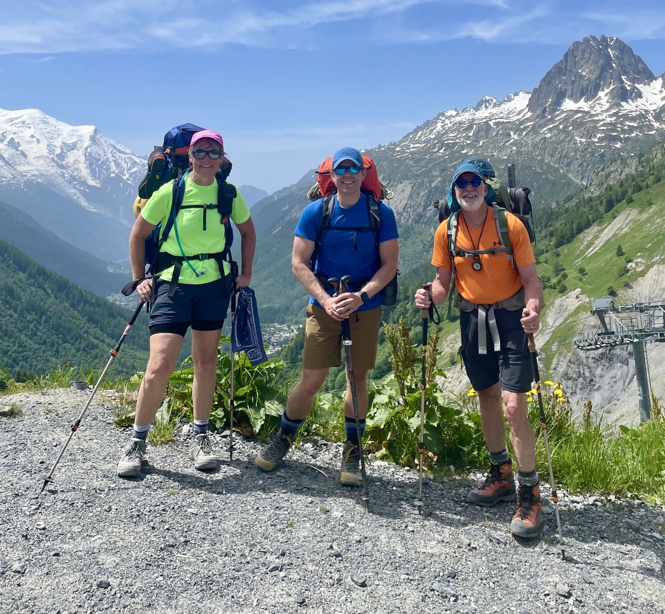
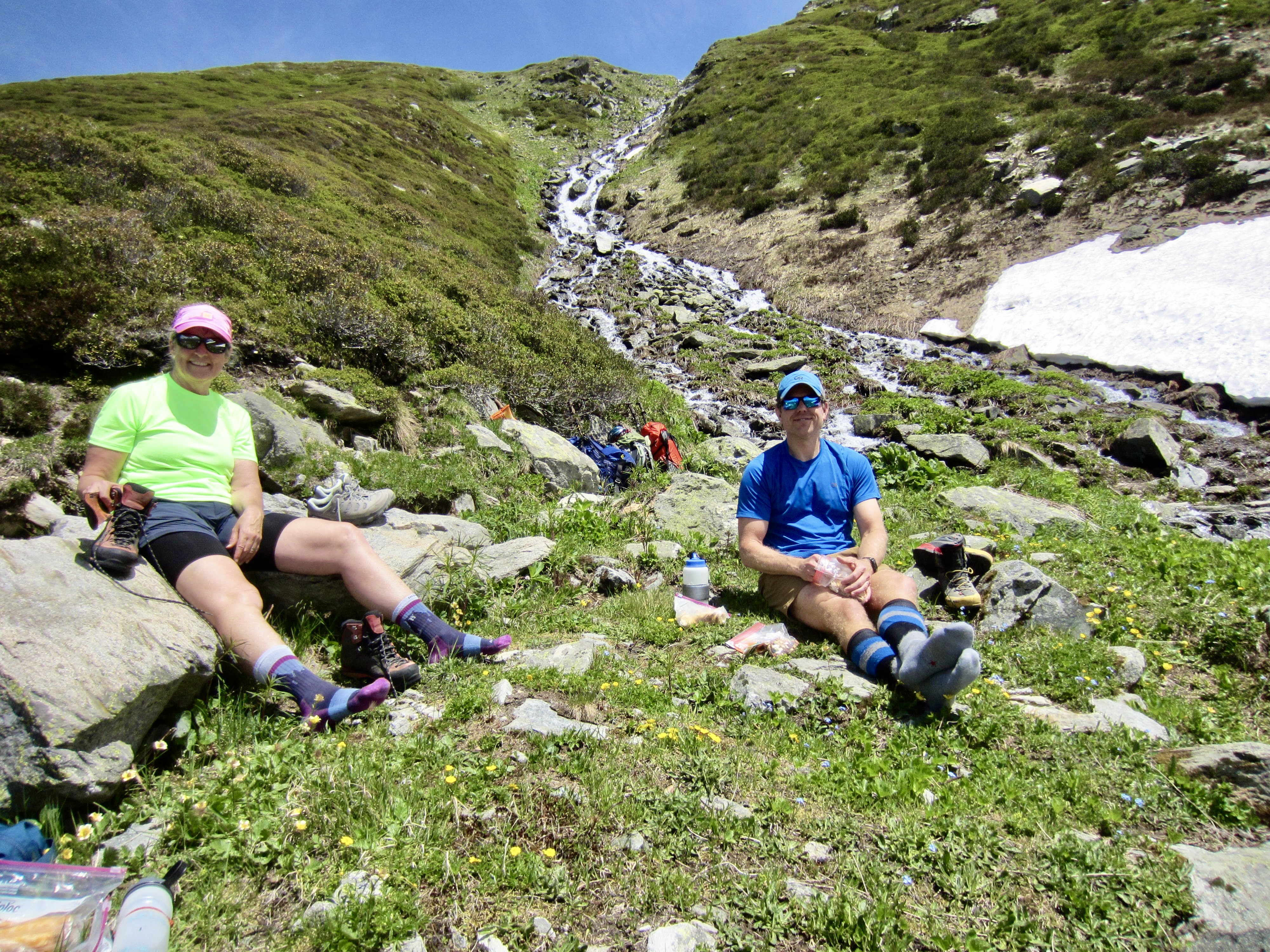
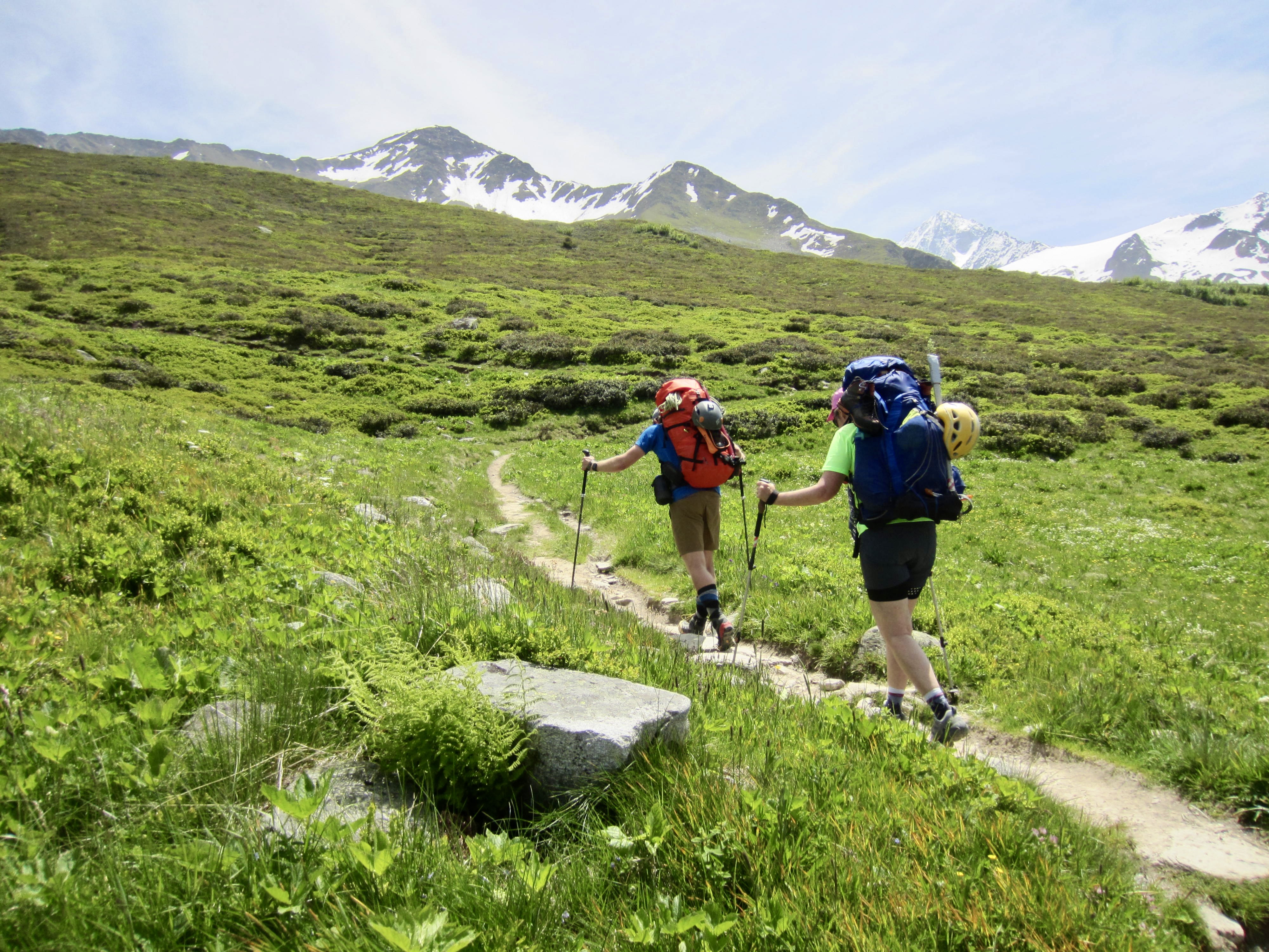
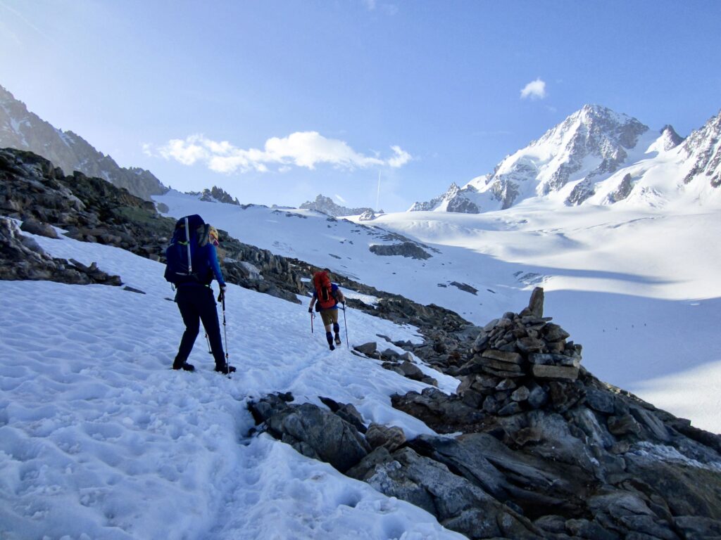
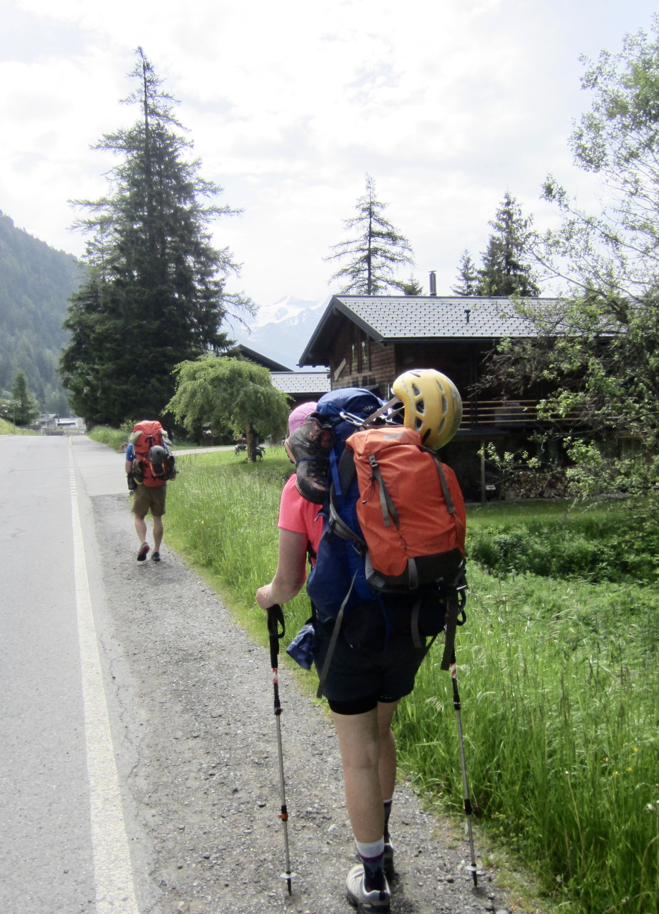
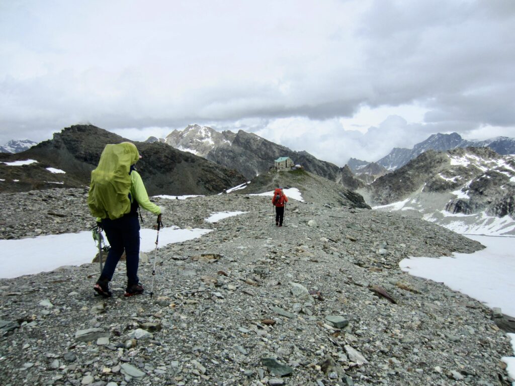
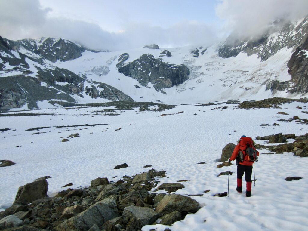
Eileen, Jon, and I headed out from Le Tour on a sunny Thursday morning. We hiked around the Charamillon Gondola base station and followed a ski area access road uphill (the gondola had not yet opened for the summer season). At an upper lodge, we angled onto a single-track trail that led eastward across a grassy hillslope
.
.
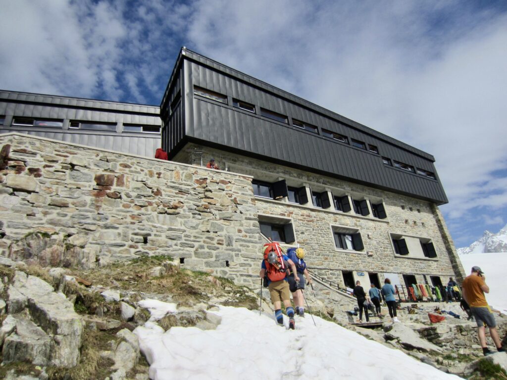
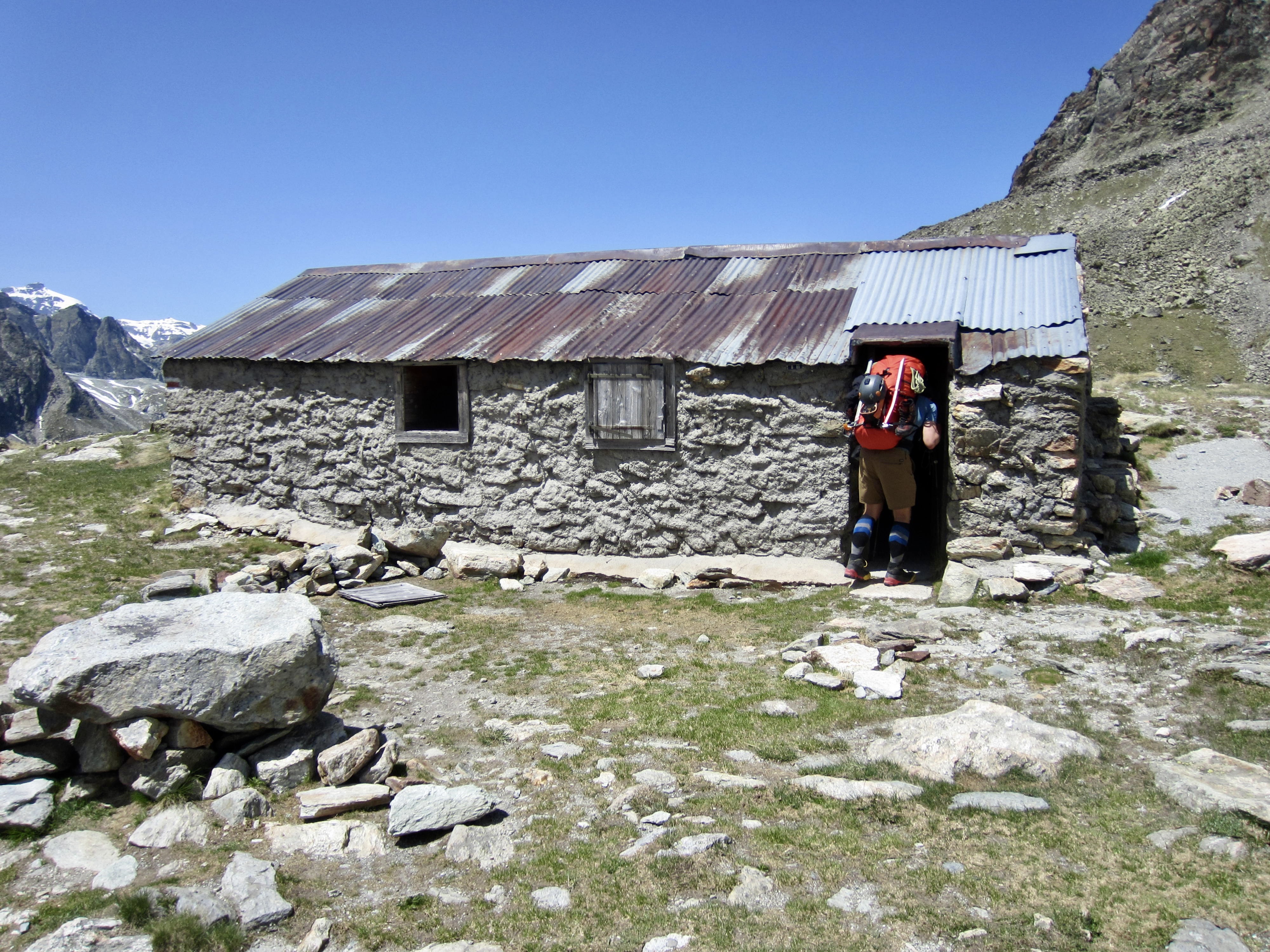
The trail continued upward, eventually leaving the grassy slopes behind and entering steeper, rocky terrain. Along the way, we encountered numerous climbing parties—including a large detachment of French soldiers—coming down the trail. A final snow chute delivered us to Albert Premier Hut in late afternoon.
.
.
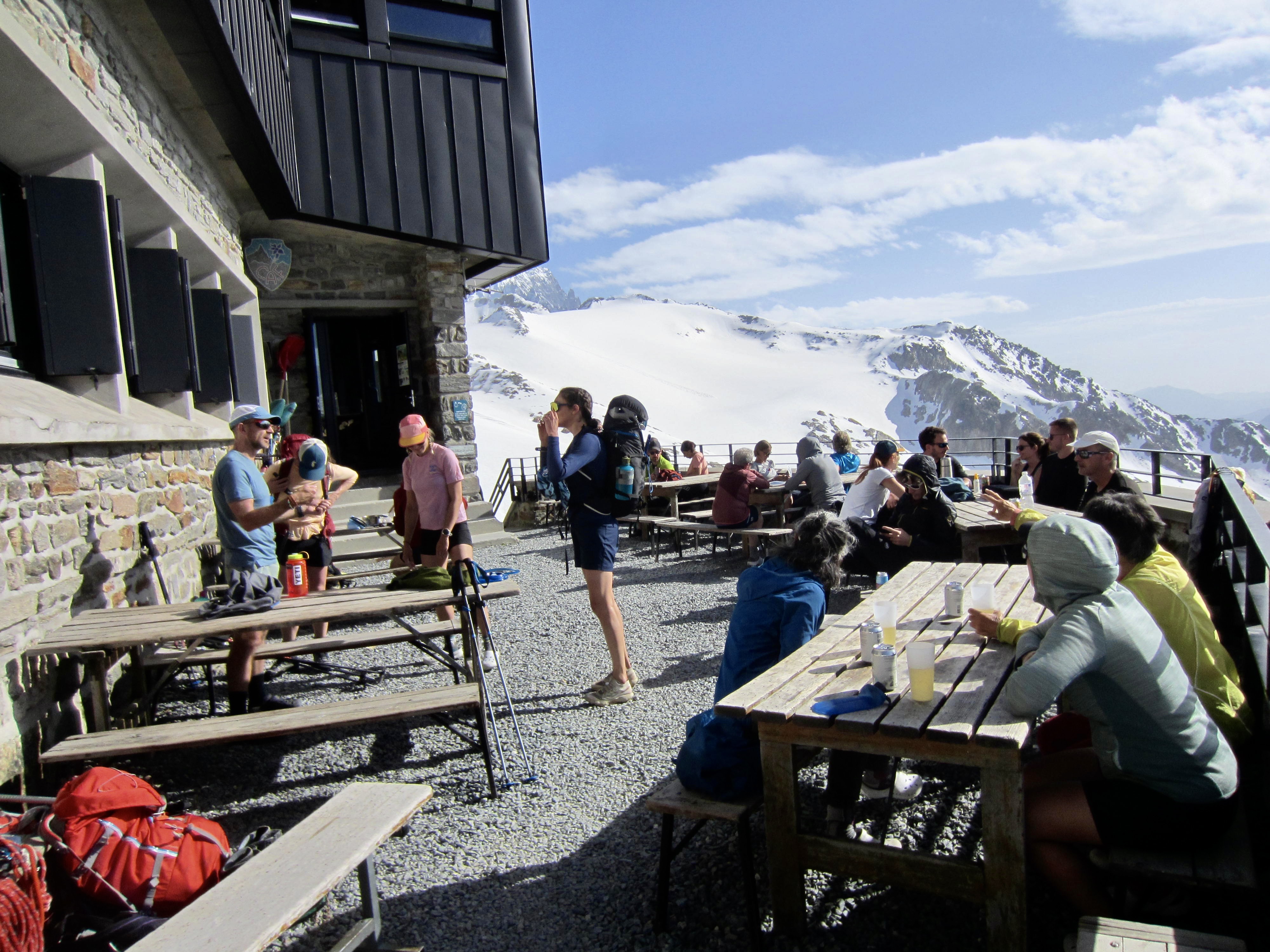
Being so close to Chamonix and other towns, the hut was bustling with softshell-clad climbers—mostly mountain guides and clients. We selected our bunks and then enjoyed a family-style dinner in the dining room.
.
Day 2: Albert Hut to Orny Hut + Aiguille du Tour
Approximate Stats: 4.8 miles / 7.7 kilometers traveled; 2750 feet / 840 meters gained; 2350 feet / 720 meters lost.
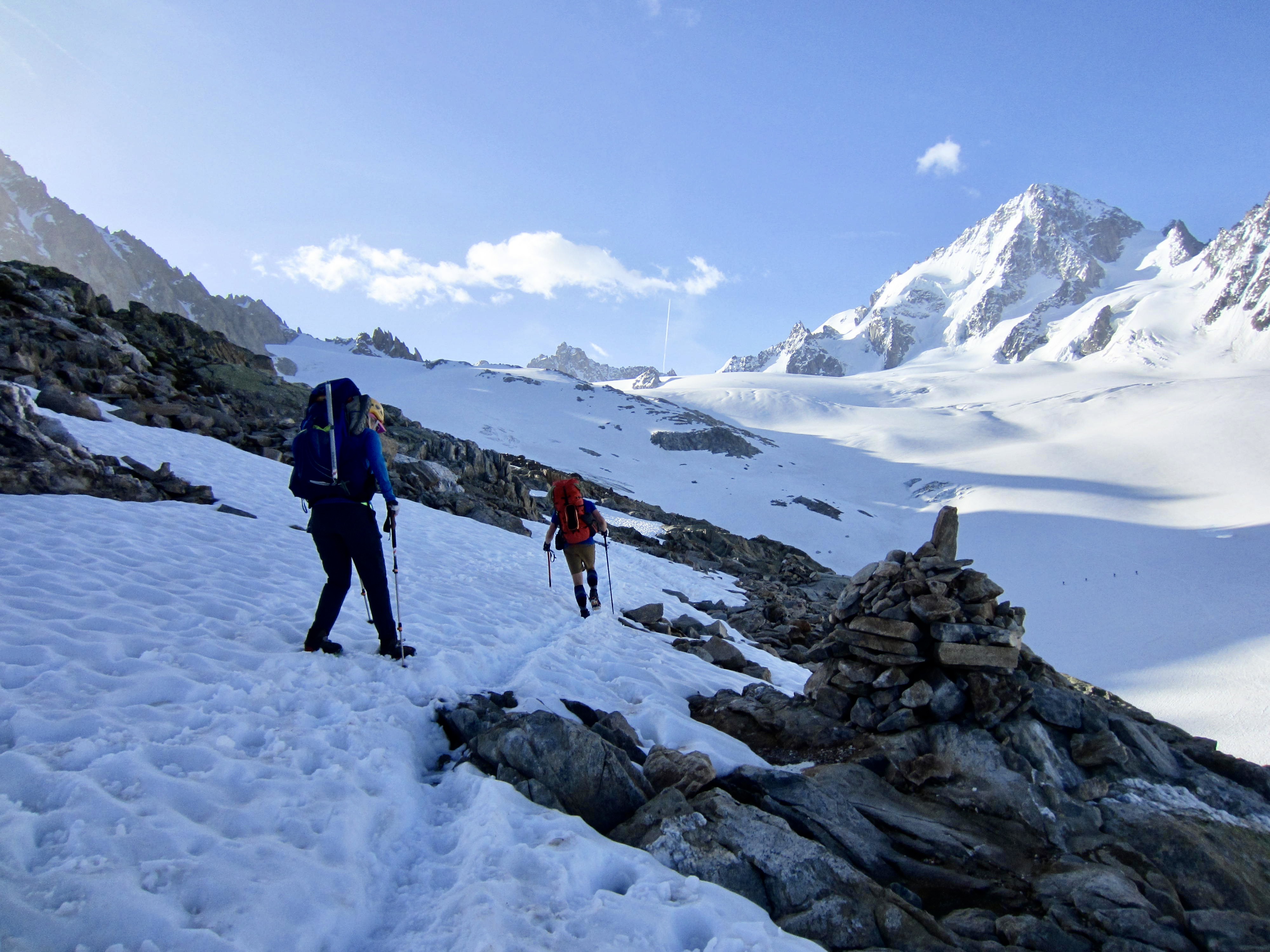
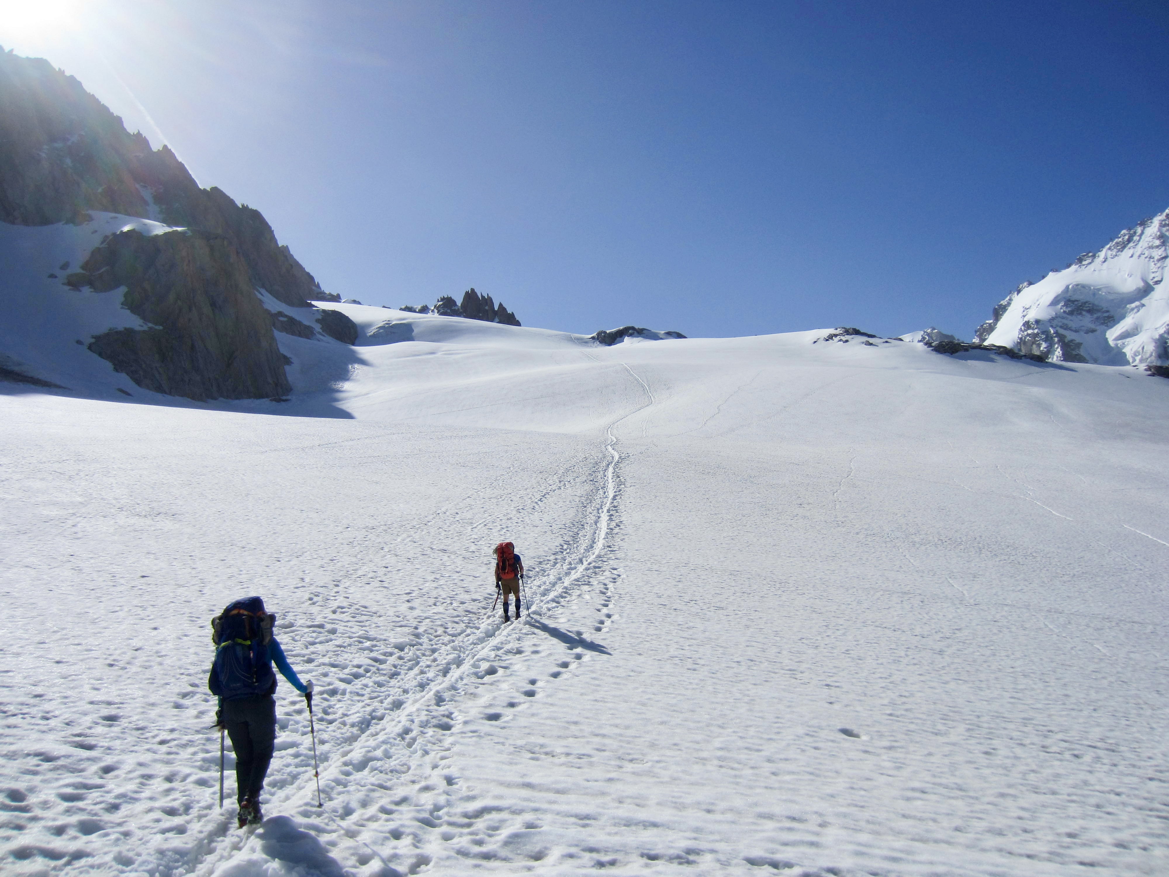
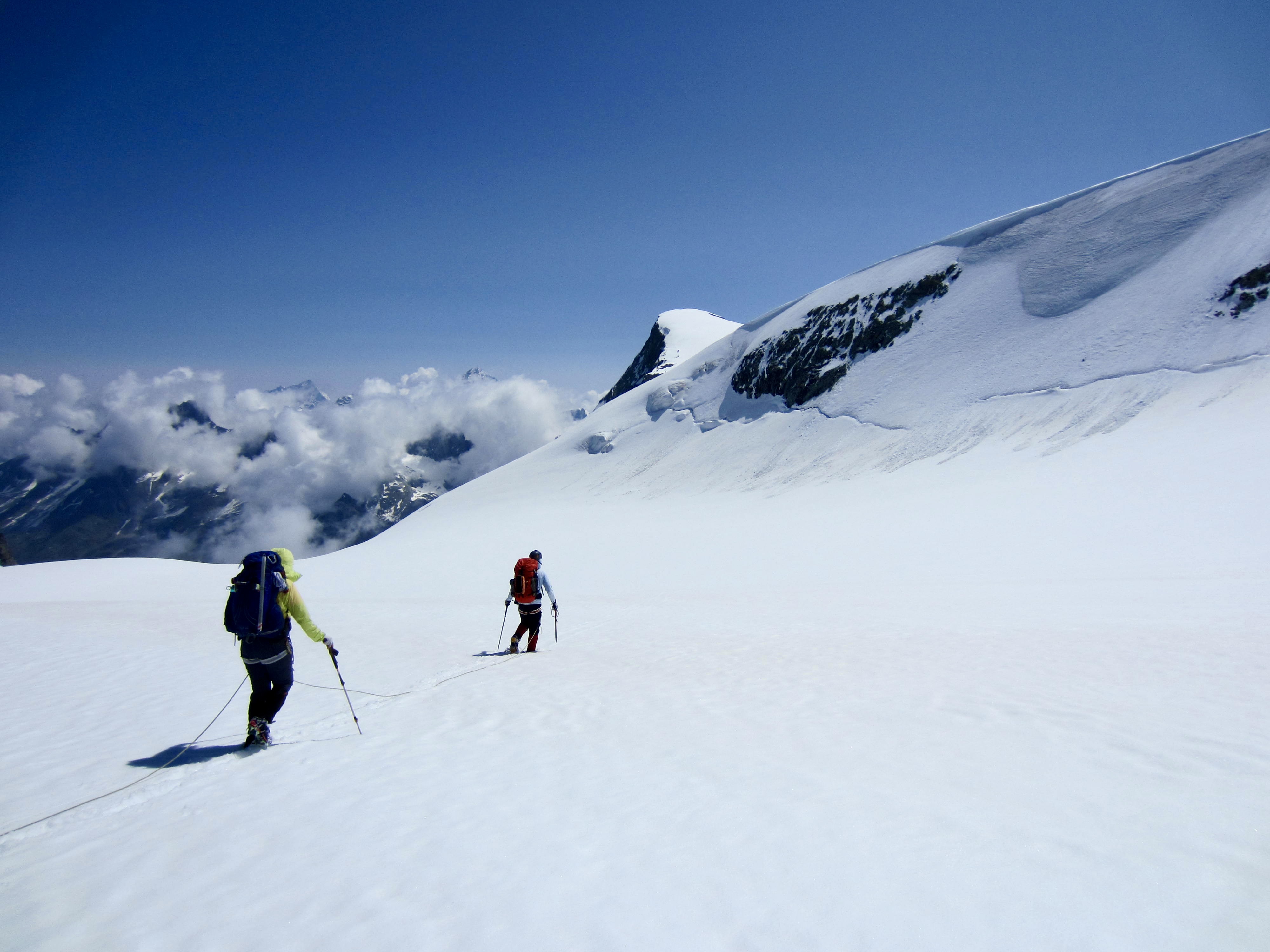
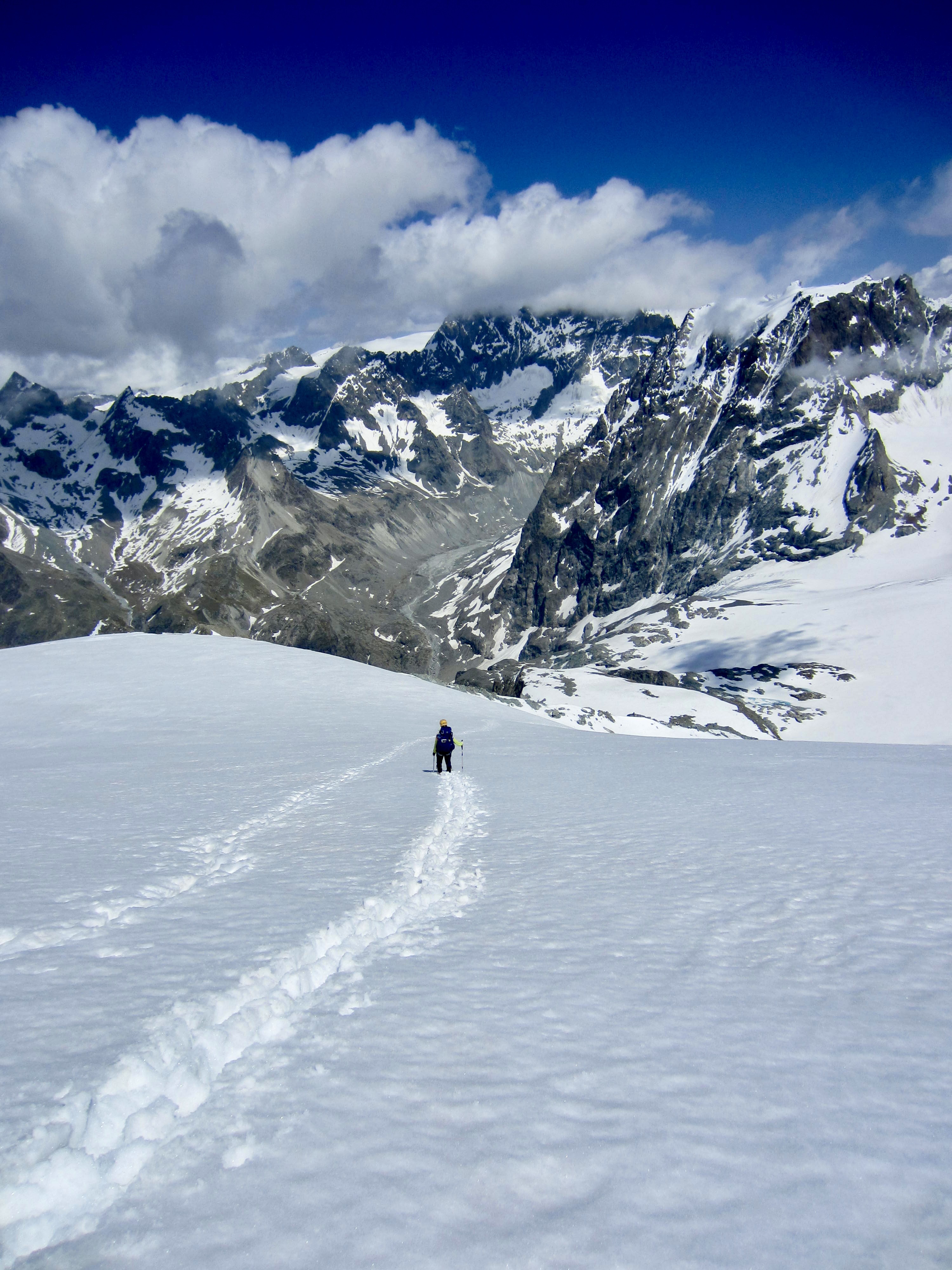
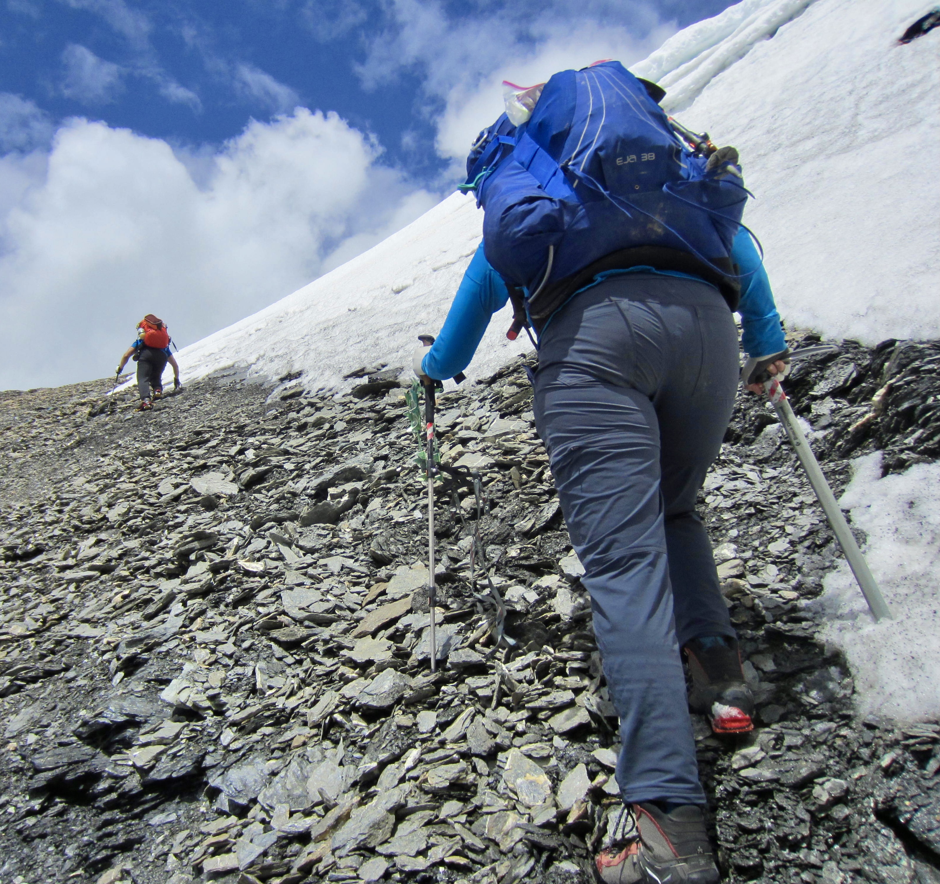
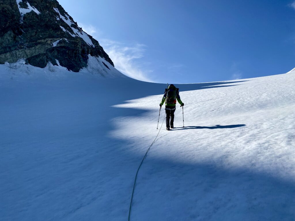
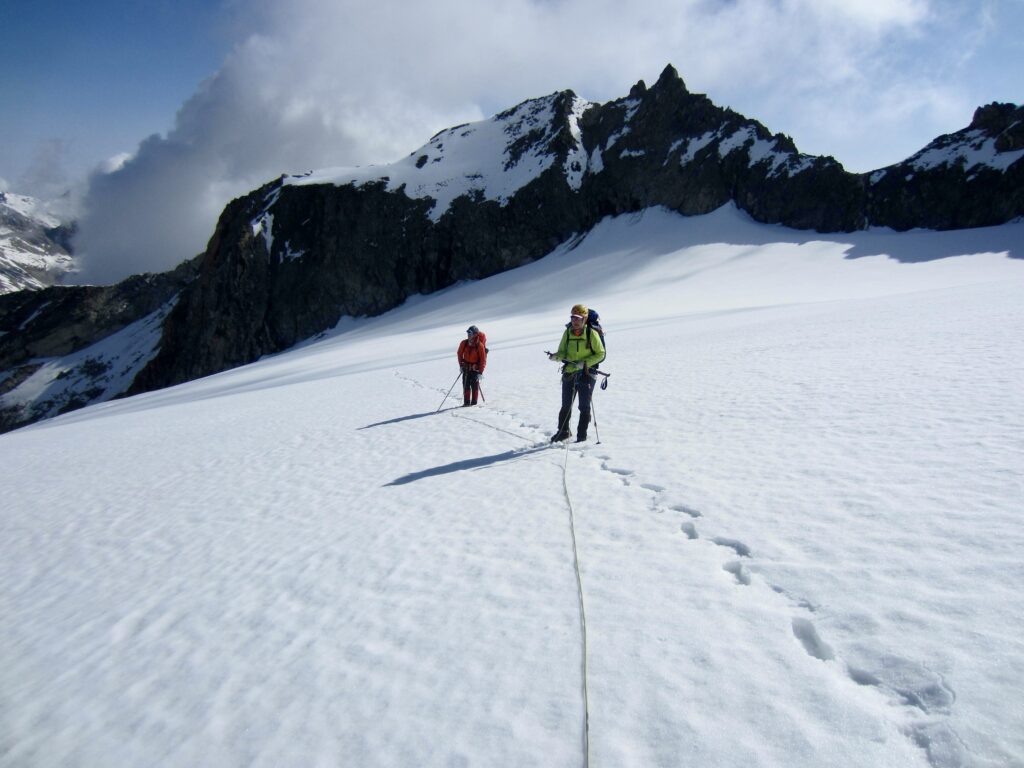
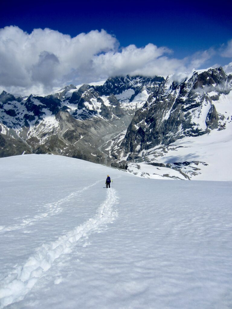
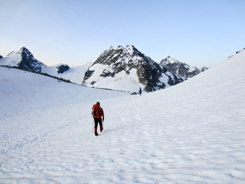
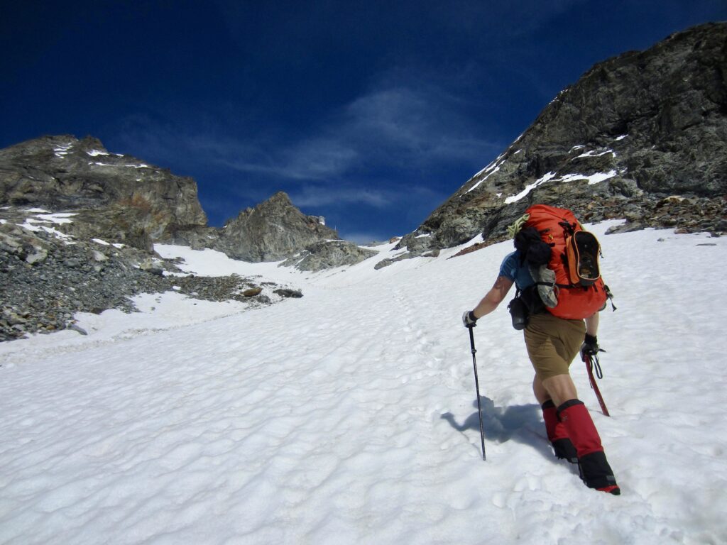
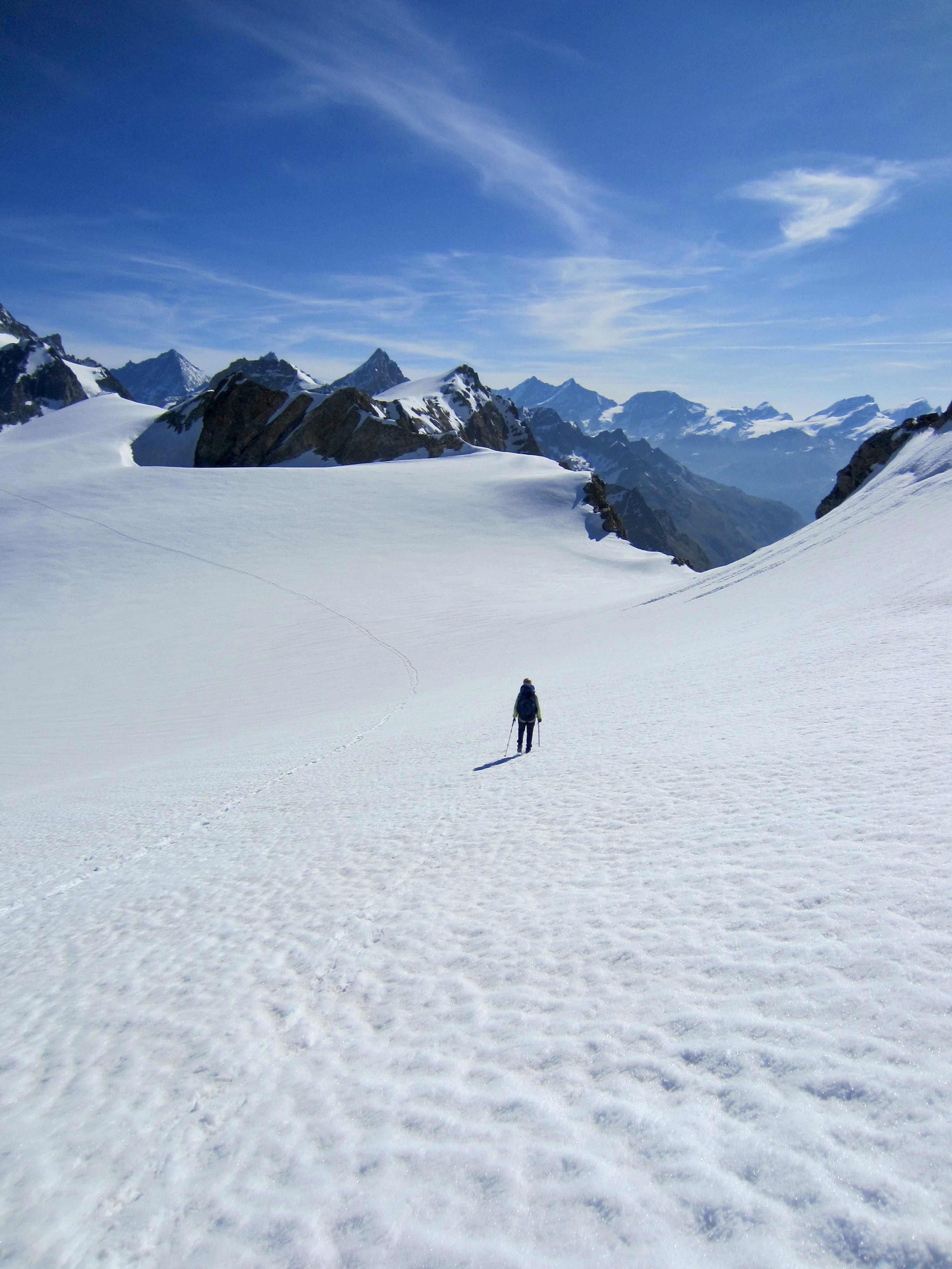
Alarms went off at 3:00am, in accordance with the guides’ desire to get a pre-dawn start. Not feeling such ambition, Eileen, Jon, and I arose at 6:00am and left the hut at 8:00am. We angled onto the Tour Glacier and followed a well-defined bootpath up along the left-hand margin. The sight of boot tracks heading toward every surrounding peak prompted Jon to blurt out, “It’s like an alpine Disneyland up here!”
.
Before long, we began encountering numerous groups of guided climbers coming down the glacier. Apparently, they had already tucked in their chosen peaks and were returning to the hut and, in many cases, hiking back to town. One guide looked askance at our casual approach and submitted his opinion with a heavy French accent: “In my mind, you are crazy!” Hmmm. Did he know something we didn’t?

.
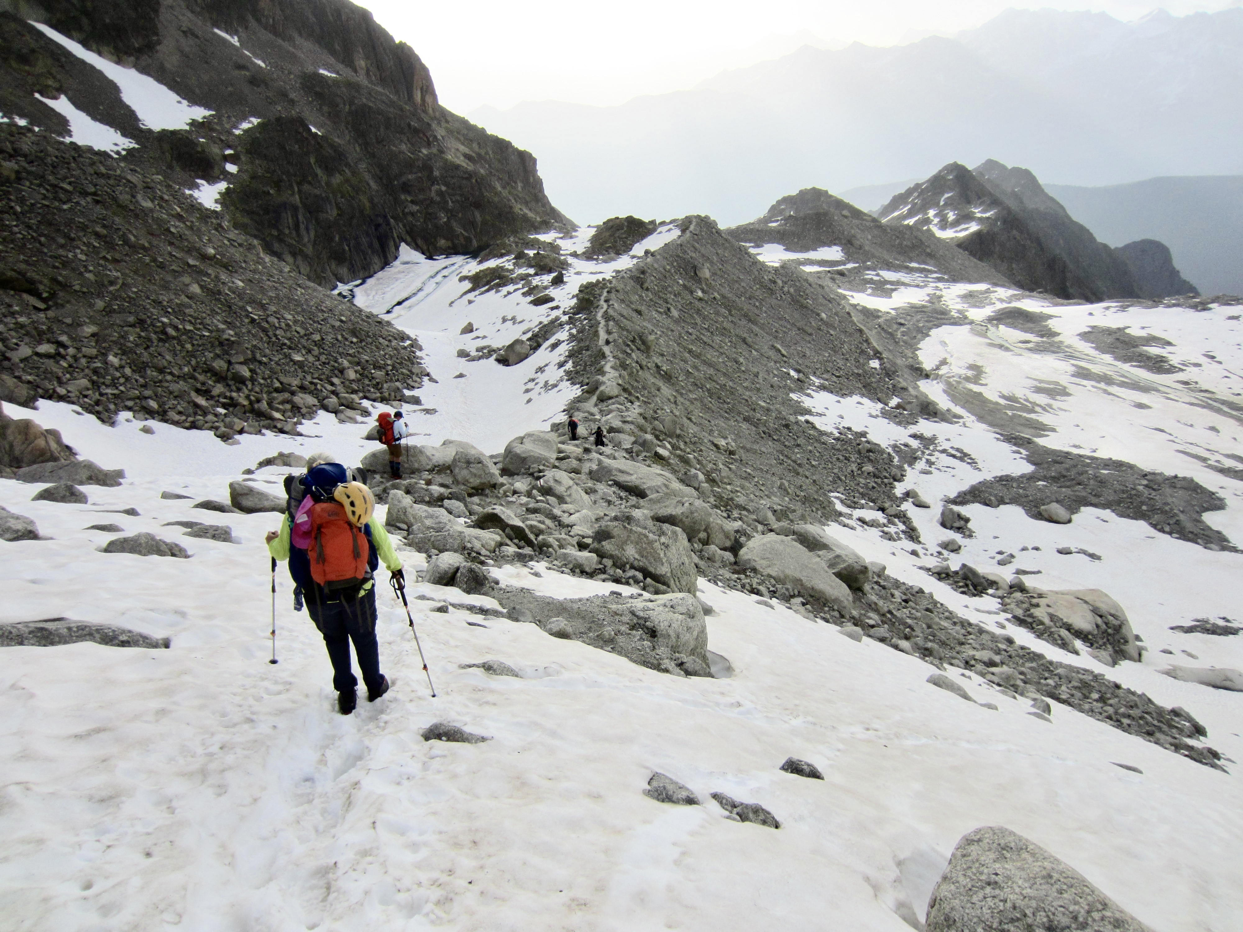
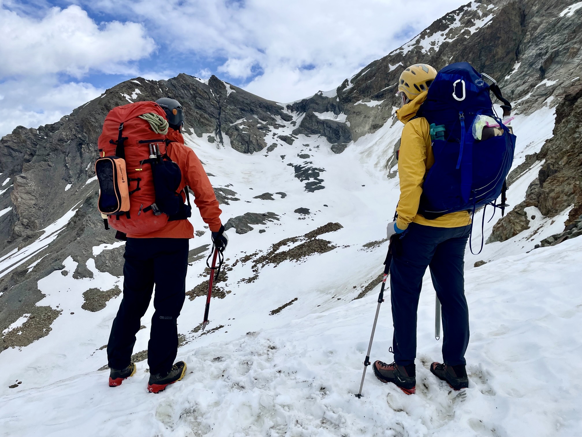
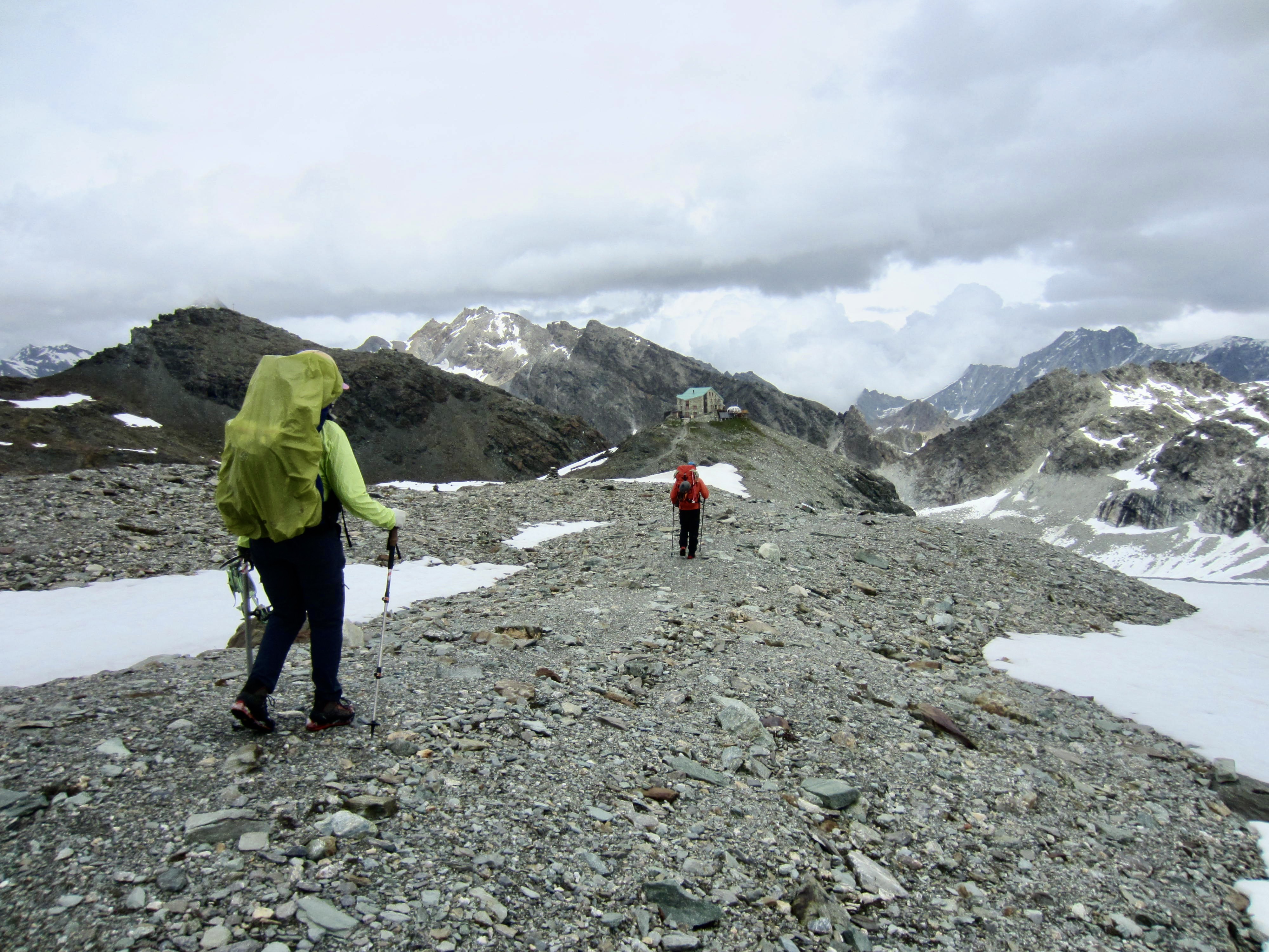
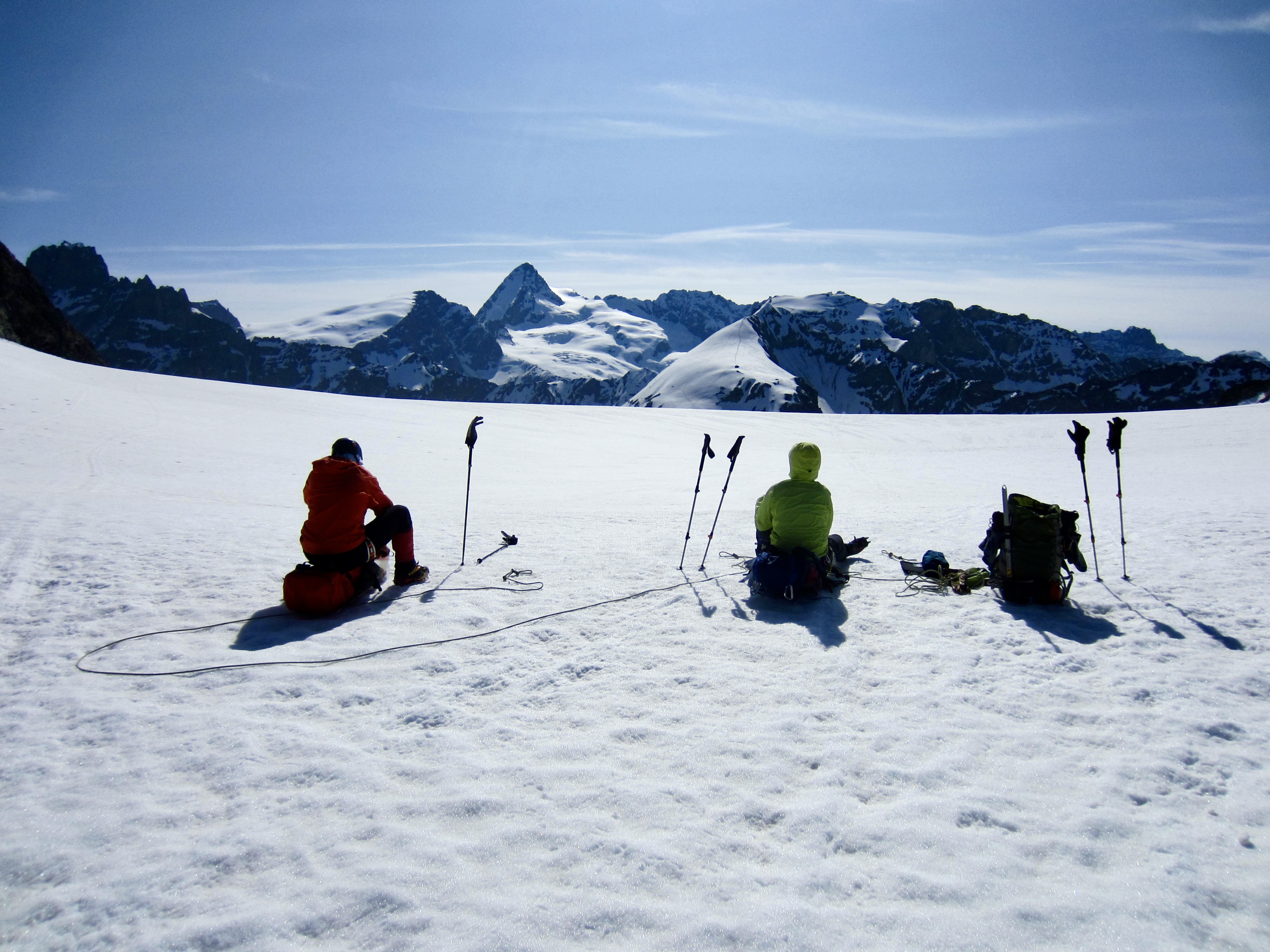
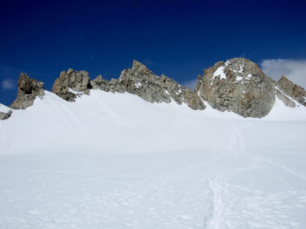
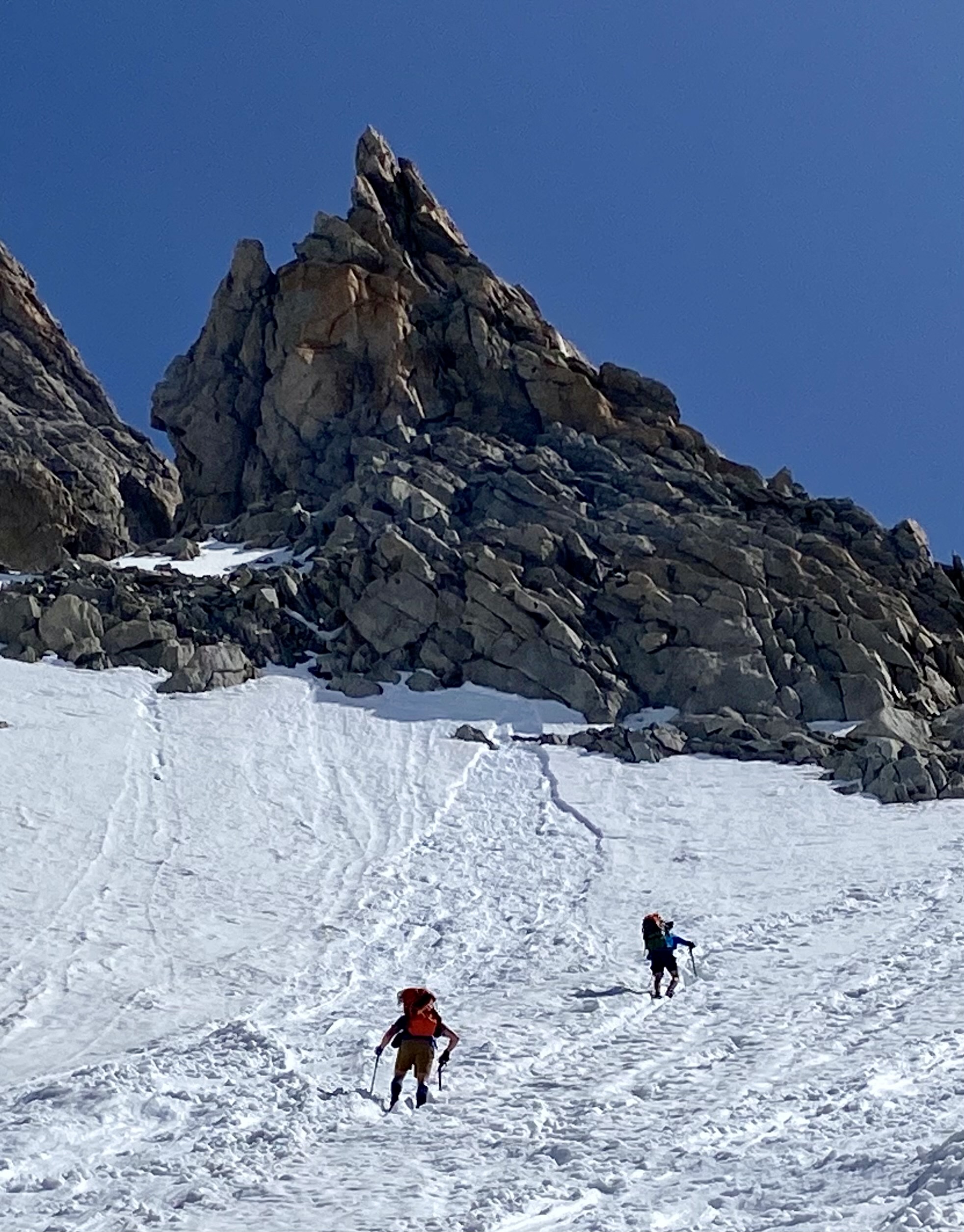
High on the glacier, we veered into a narrow couloir and booted upward, still following tracks. The couloir ended at 10,900-foot / 3,320-meter Superior Tour Col. This is the highest of four cols at the glacier’s head, and it straddles the border between France and Switzerland.
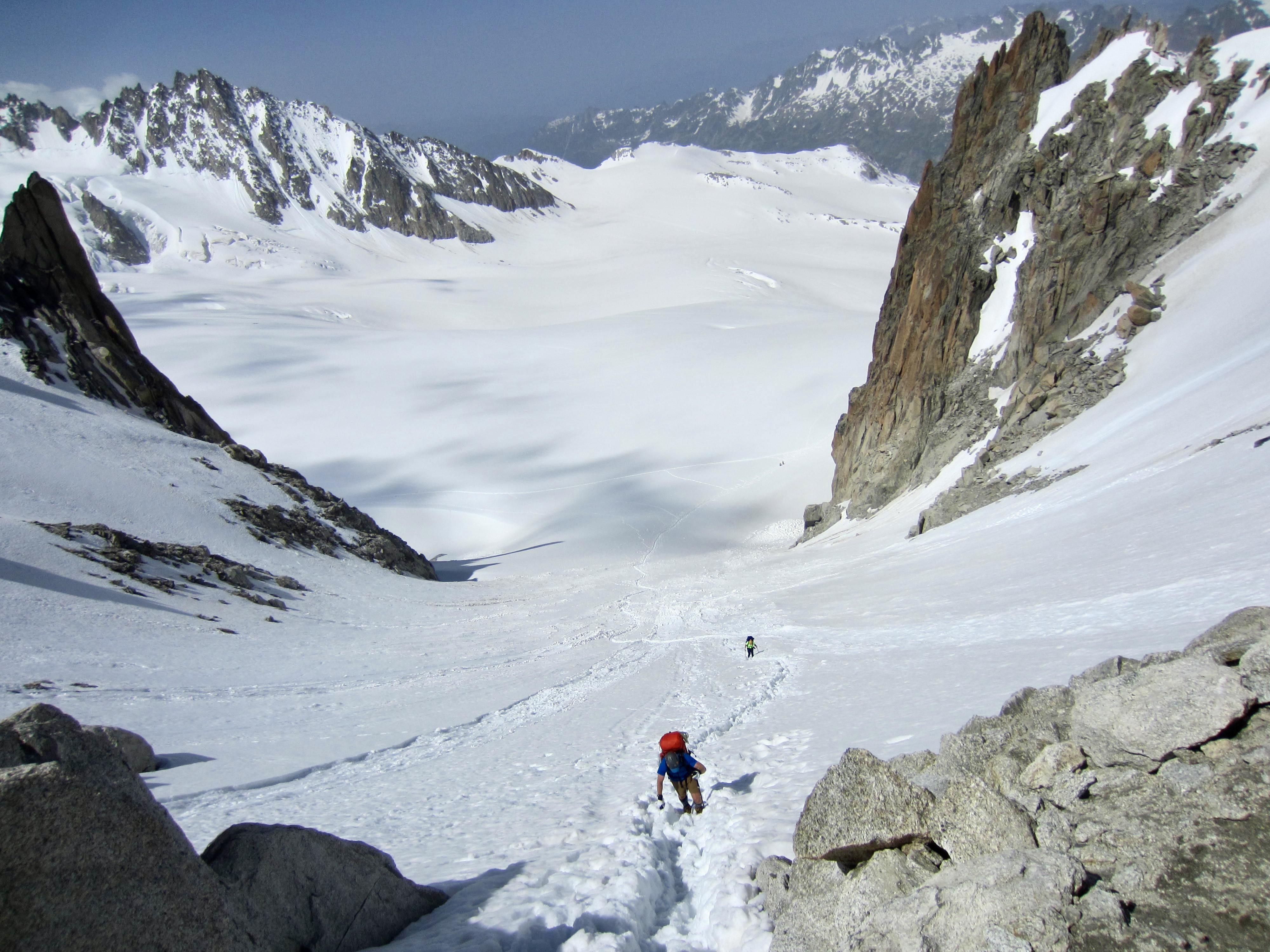
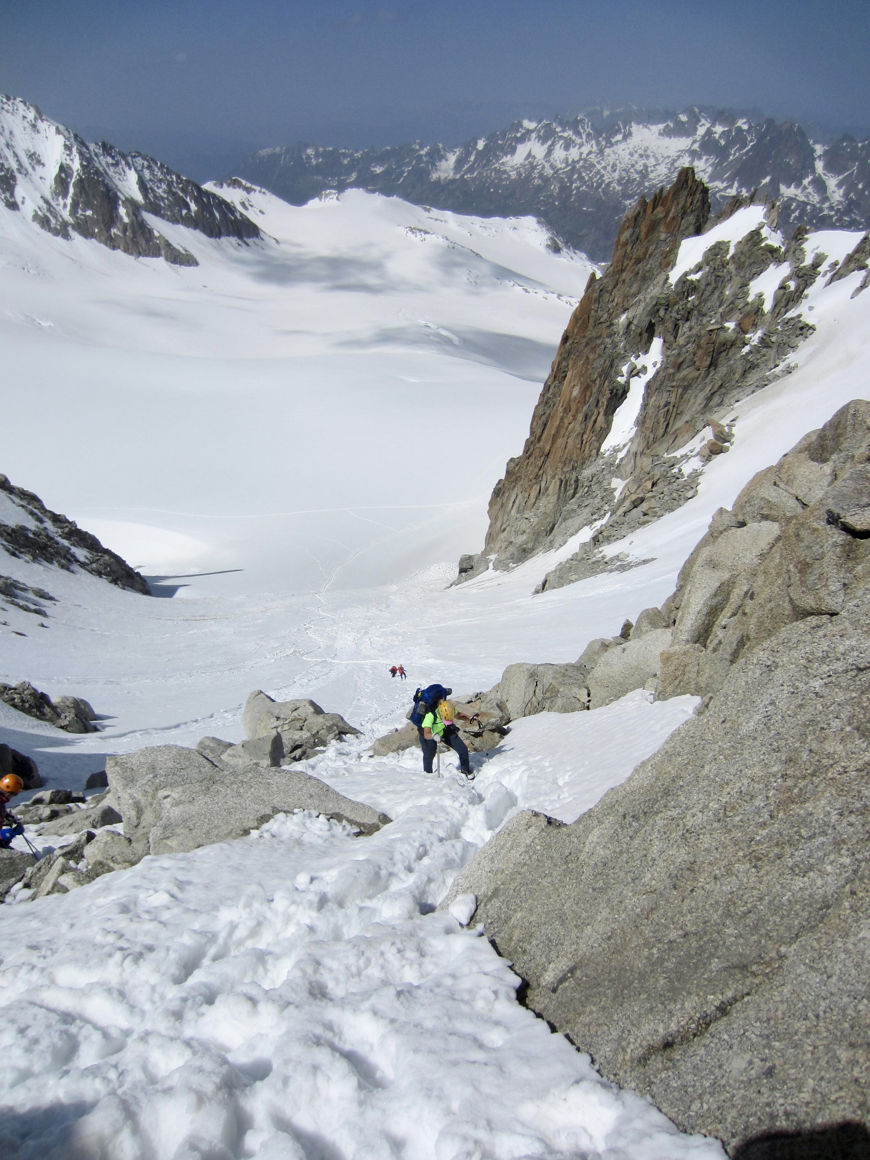
.
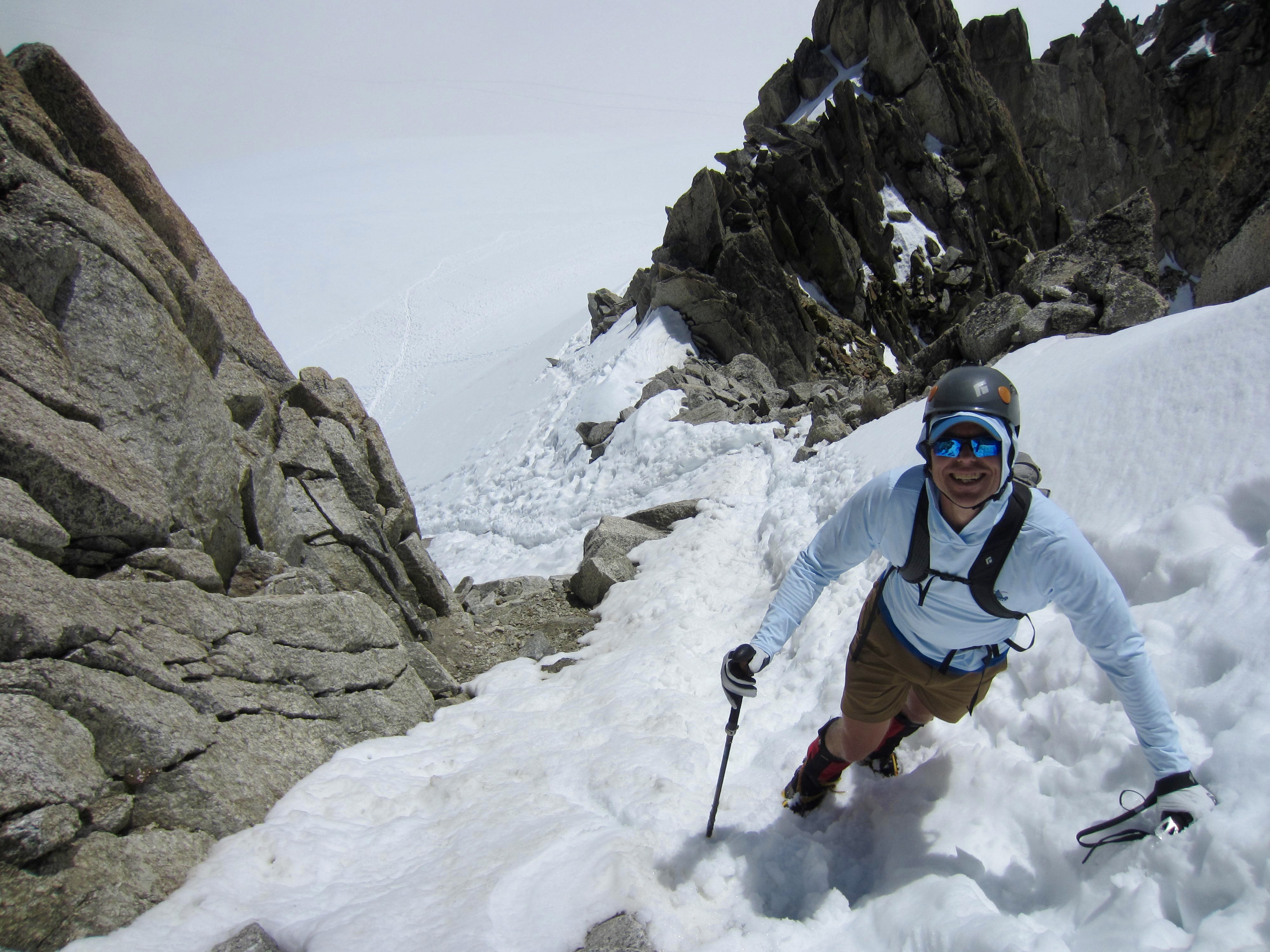
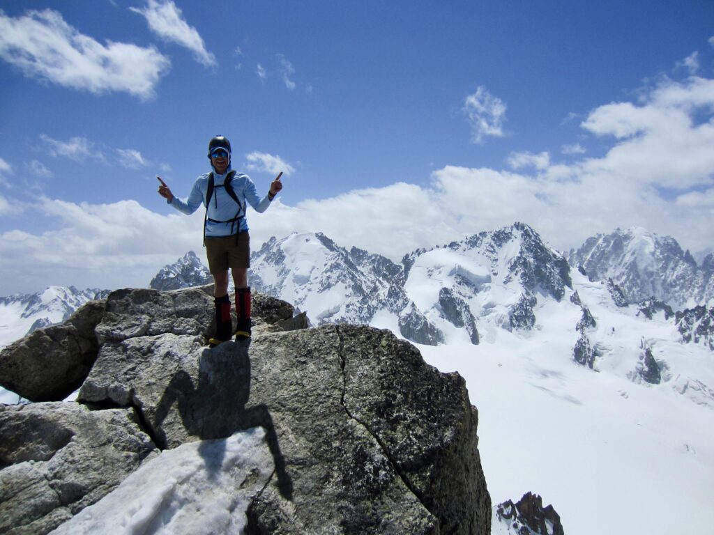
After crossing through the col and traversing up to the left, we dropped packs on a rock outcrop. Eileen made herself comfortable here, while Jon and I made a dash up nearby South Aiguille du Tour. This attractive granite horn is one of the most popular summits in the vicinity—for good reason, as we were going to find out.
.
Our ascent route took us up a steep snow finger to the peak’s southern crest, followed by a Class 2 scramble across the eastern face, and it finished with a very exposed Class 3 scramble up ice-encrusted boulders on the northern crest.
.
The 11,600-foot / 3,535-meter summit offered views across the rugged and snowy Graian Alps. It was a marvelous introduction to Euro-Alpine peak-bagging. On the Trient Glacier directly below us, Jon and I watched with amusement and puzzlement as a small pontoon airplane carved several huge “donuts” across the snow surface. “Only in the Alps!” we both quipped.
.
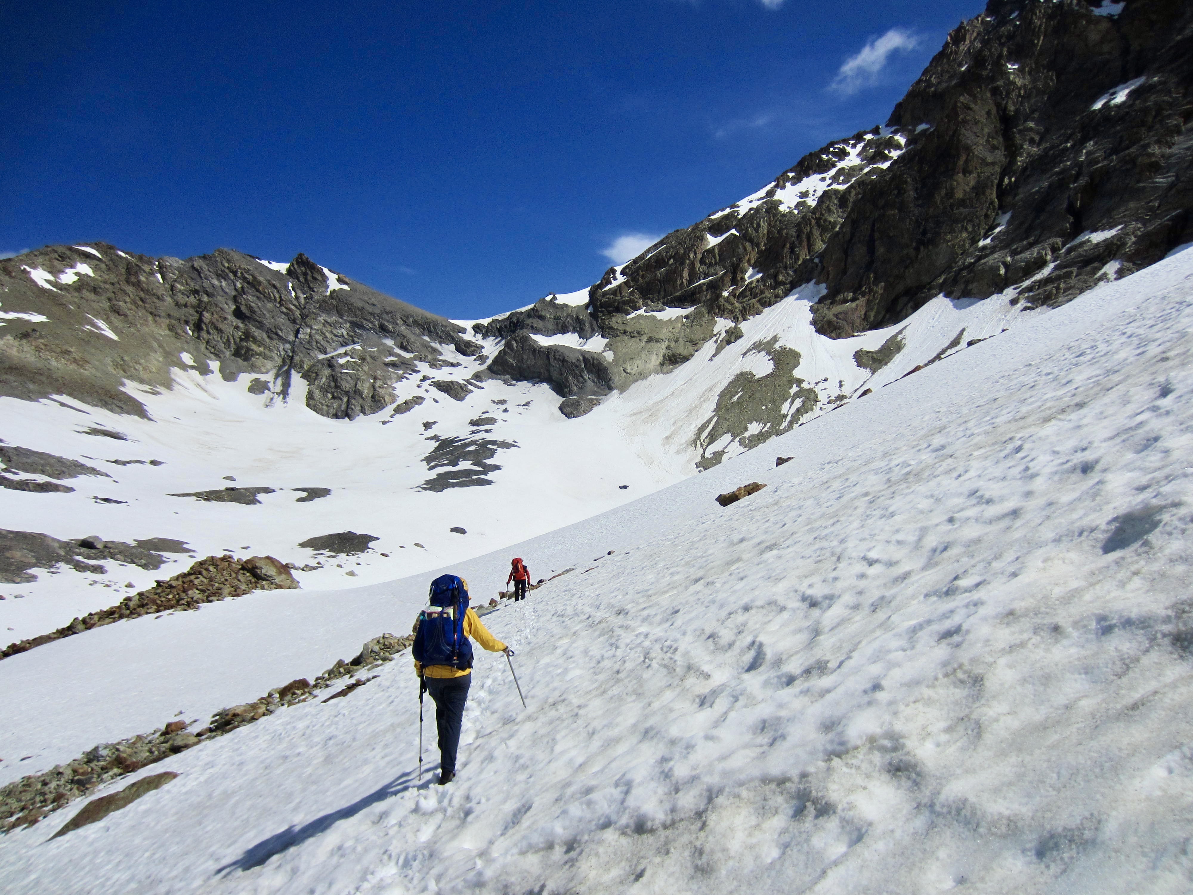
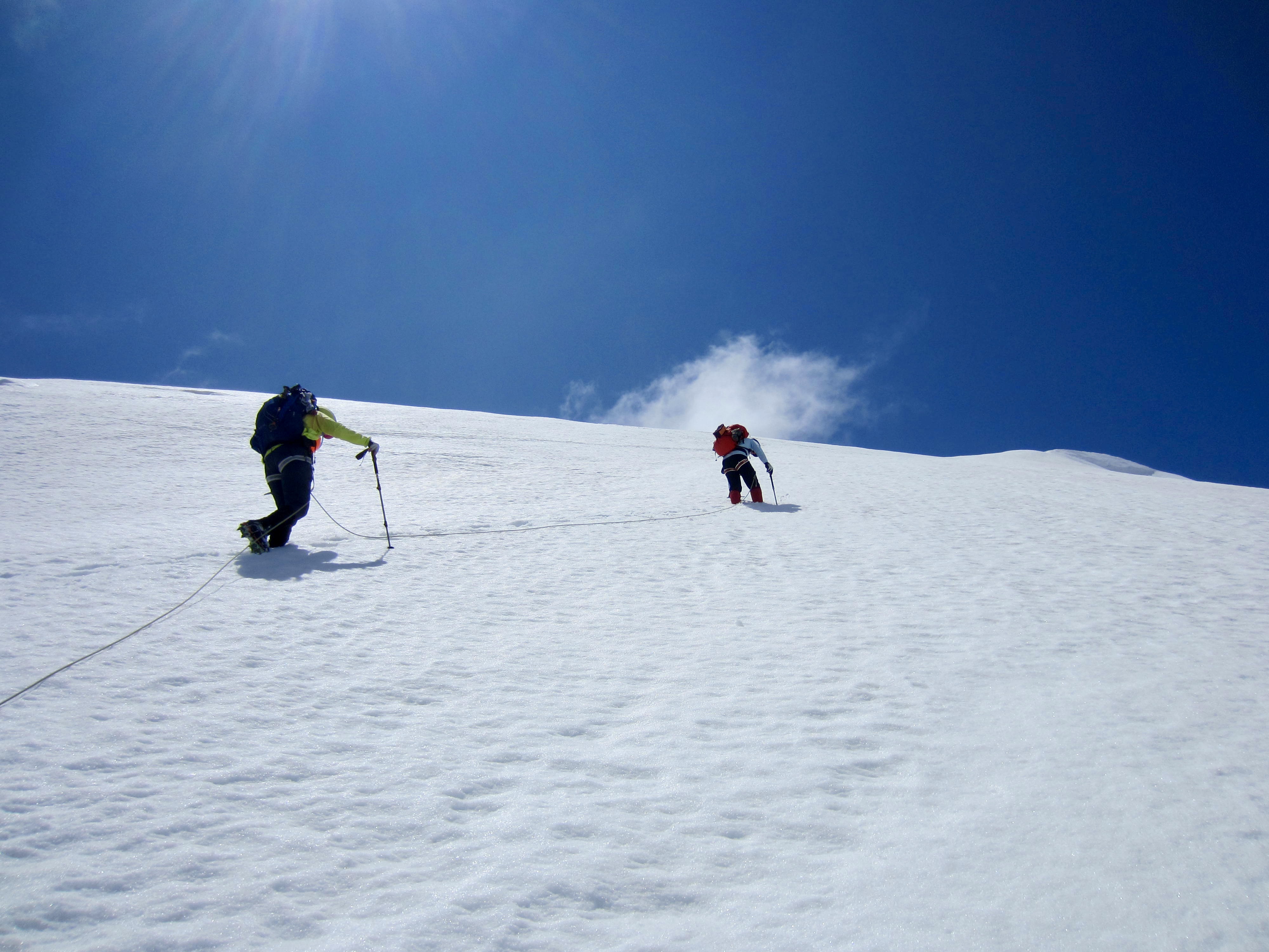
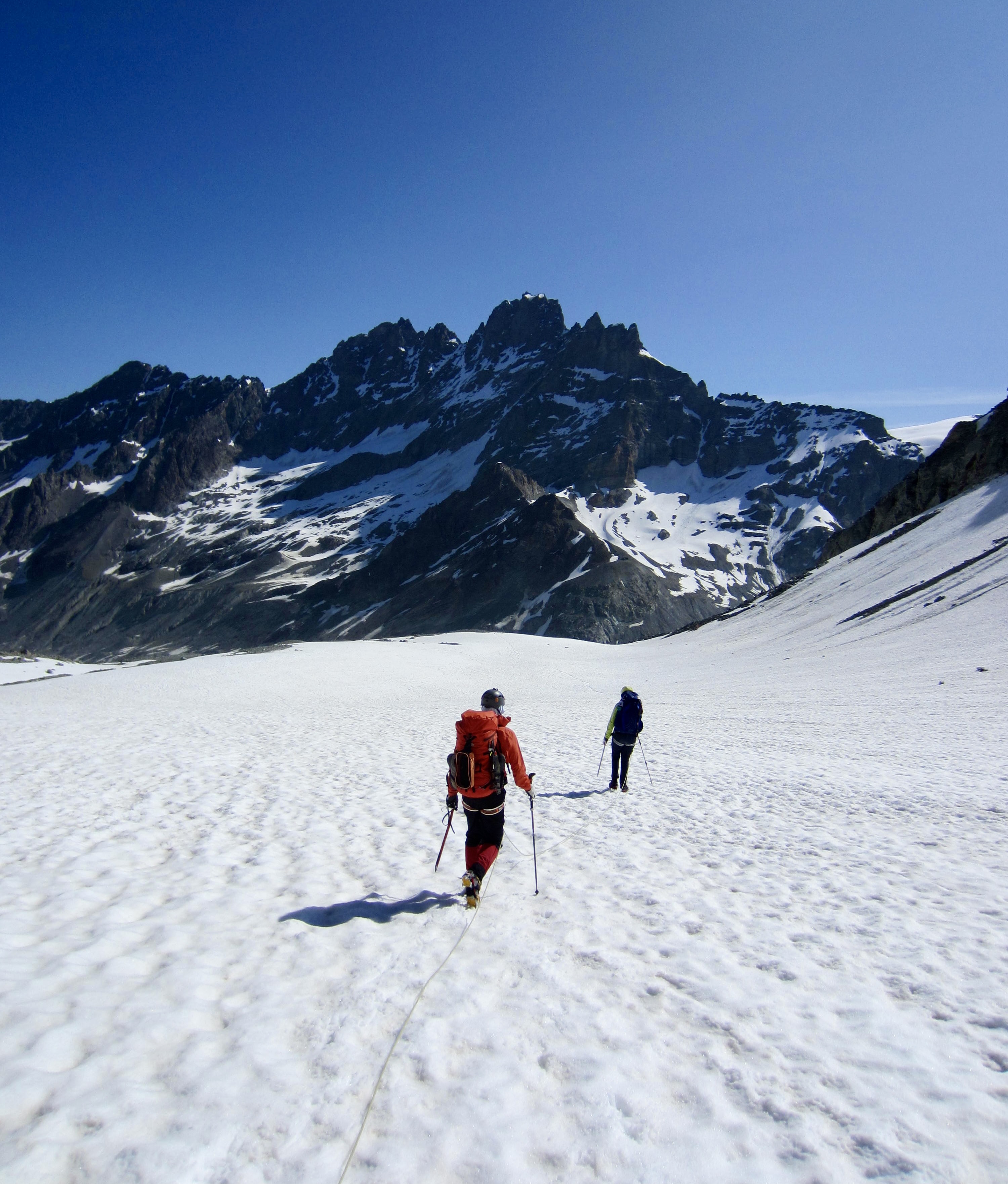
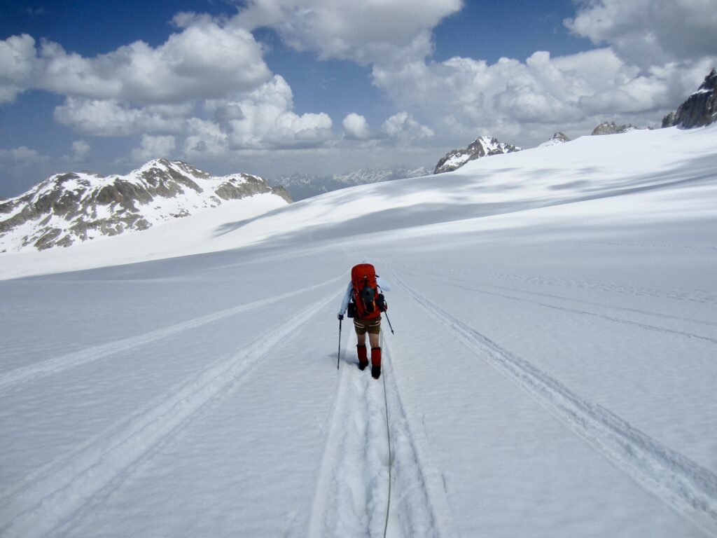
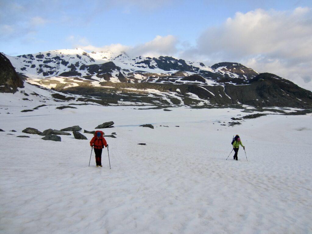
After rejoining Eileen and collecting our backpacks, we roped up and began a long march across the Trient Glacier. The afternoon sun had now turned the surficial snow into bottomless mush. Ah ha, that’s why the guides set a 3:00am alarm! For a while, we were able to follow the airplane’s pontoon tracks, but most of the traverse was a slow, tedious, post-holing slog.
.
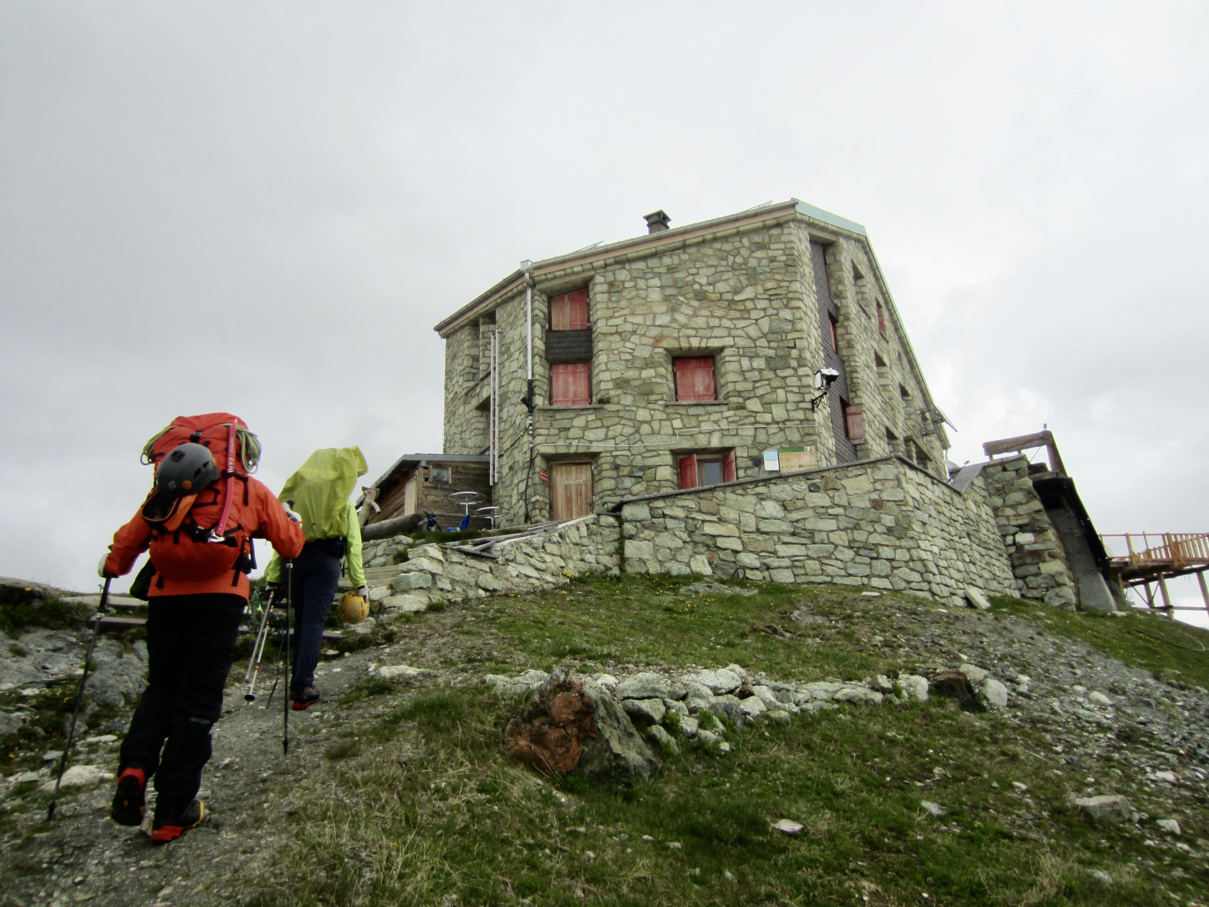
Upon reaching the far edge of the Trient Glacier, we easily transitioned onto the steeper but firmer Orny Glacier. A quick heel-plunging descent and trail hike led us down to Orny Hut, which sits on a rock rib overlooking a glacial lake.
.

.
Because Orny Hut is accessible via a day-hike from the town of Champex, it was very busy on this Friday afternoon. Unlike Albert Premier Hut, though, the main attraction here is not alpine climbing; instead, it is crag climbing on the nearby rock walls. Cams and rock shoes were prevalent, but ice axes were still needed for some approaches.
.
Day 3a: Orny Hut to Champex
Approximate Stats: 2.8 miles / 4.5 kilometers traveled on foot; 0.7 miles / 1.1 kilometers traveled on chairlift; 2100 feet / 640 meters lost on foot; 2300 feet / 700 meters lost on chairlift.
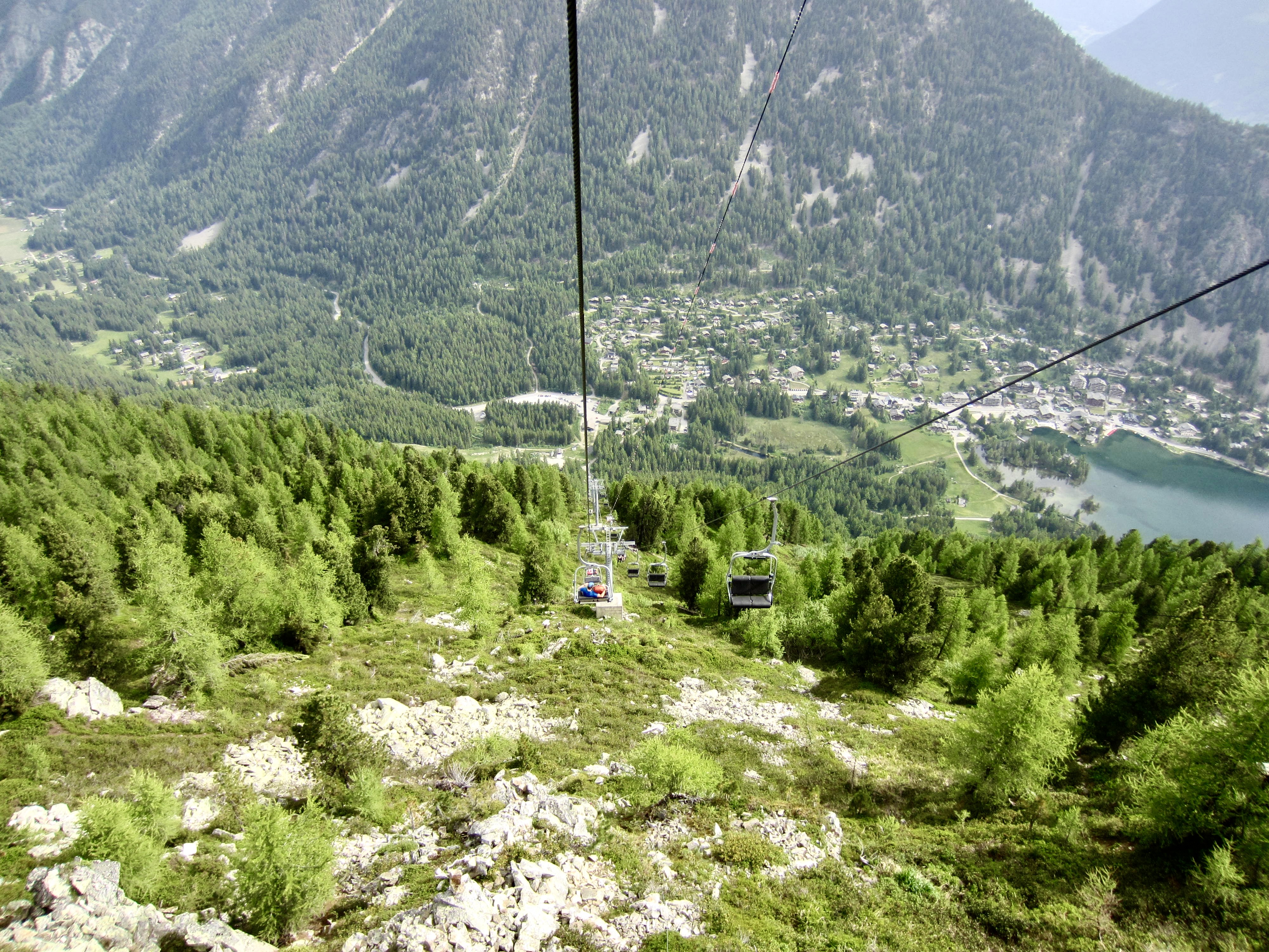
Knowing that today would involve some complicated logistics, we were on the move at 7:00am. Our morning began with a 2.8-mile / 4.5-kilometer trail hike down to La Breya Chairlift, which by good fortune had just opened today for the summer season. When we started encountering scores of hikers and climbers coming up the trail, we knew that the chairlift station was not far away.

.
La Breya Chairlift dropped us 2300 vertical feet / 700 vertical meters in a breathtakingly short distance. It was the steepest chairlift ride any of us had ever taken, and we were very happy that it was equipped with safety bars to keep our bodies and backpacks on the seats! At the base station, we strolled into Champex-Lac to grab lunch and a taxi.
.
Day 3b: Champex to Mauvoisin
Approximate Stats: 21.4 miles / 34.4 kilometers traveled by vehicle; 2.2 miles / 3.5 kilometers traveled on foot; 550 feet / 170 meters gained on foot.
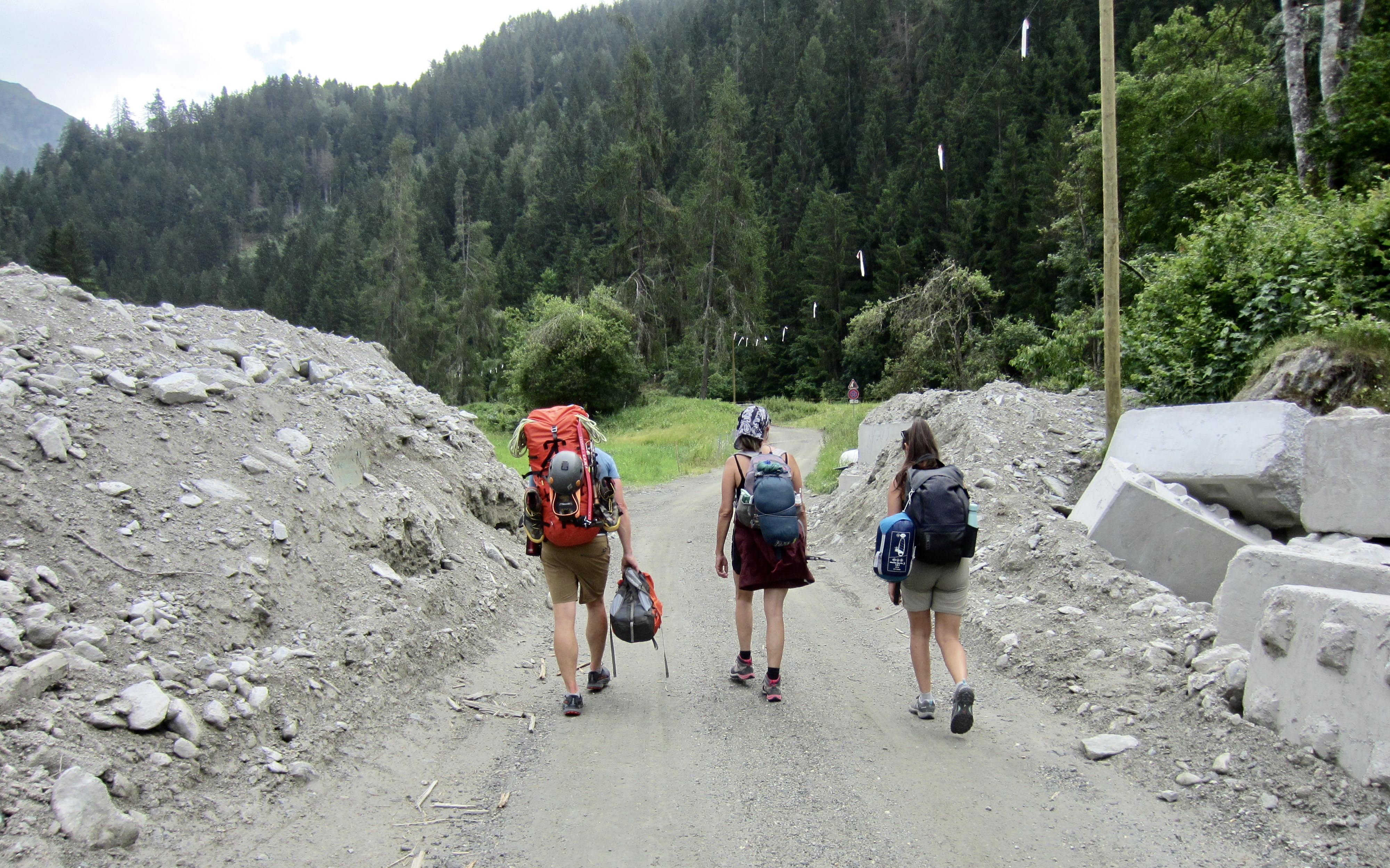
Our original plan was to take a 22-mile / 35-kilometer taxi ride from Champex to Mauvoisin and then continue hiking. However, we were dismayed to learn that a road washout prevented any through traffic. As such, we took Taxi Fen’yx to the town of Champsec, then hiked up a road and trail for 2 miles / 3 kilometers, then took a second taxi up to the village of Mauvoisin. A French mother-daughter couple helped us with translations along the way.
.
In mid-afternoon, our taxi dropped us off at Mauvoisin, a tiny village located a short distance downstream of Mauvoisin Dam. Thus far, it had been a day of multi-modal travel and unexpected complications, but we all felt confident that the remainder of our day would be pretty uneventful. How wrong we were!
.
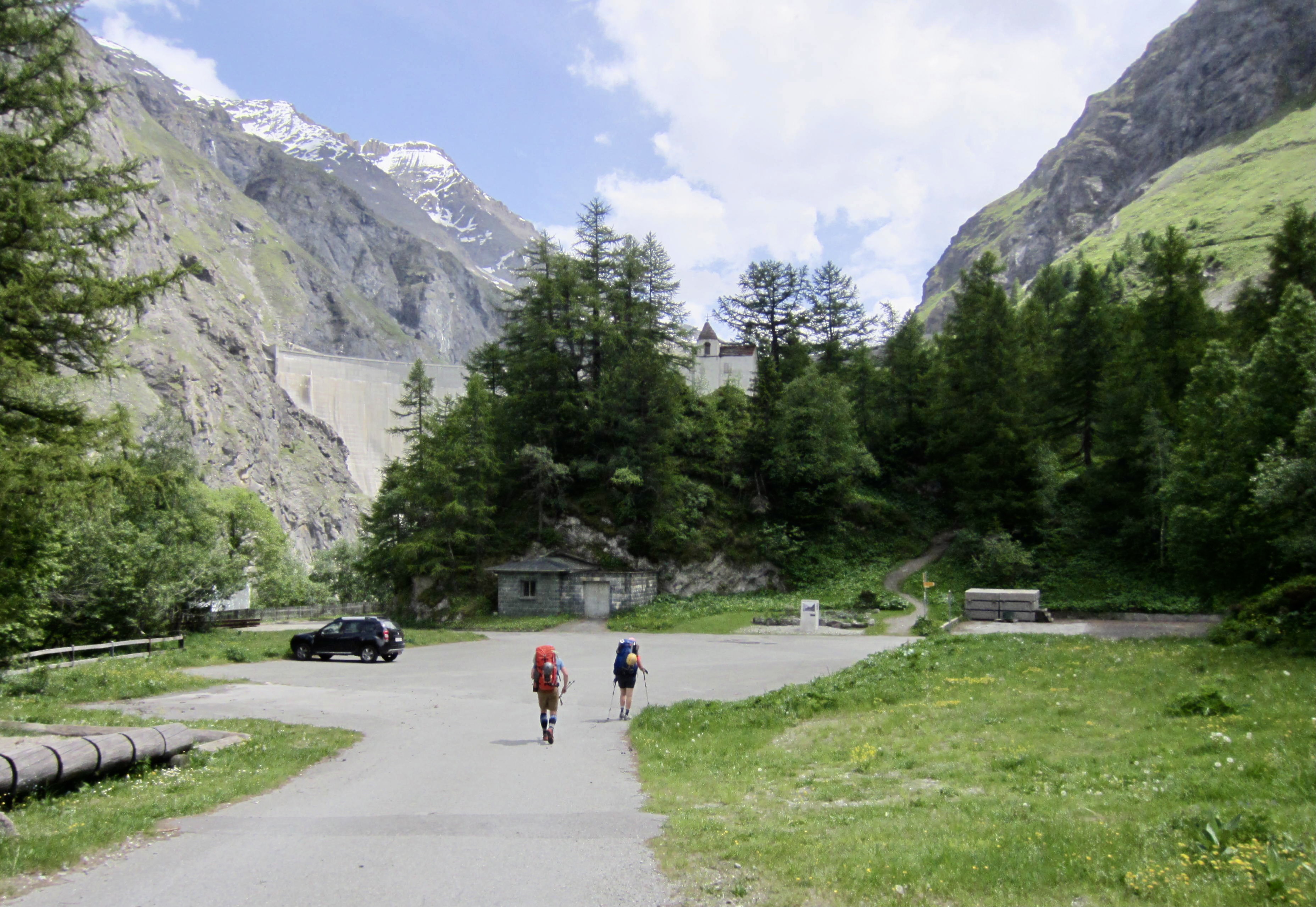
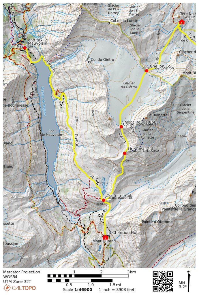
Day 3c: Mauvoisin to Chanrion Hut
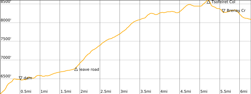
Approximate Stats: 6.3 miles / 10.1 kilometers traveled; 2750 feet / 840 meters gained; 700 feet / 210 meters lost.
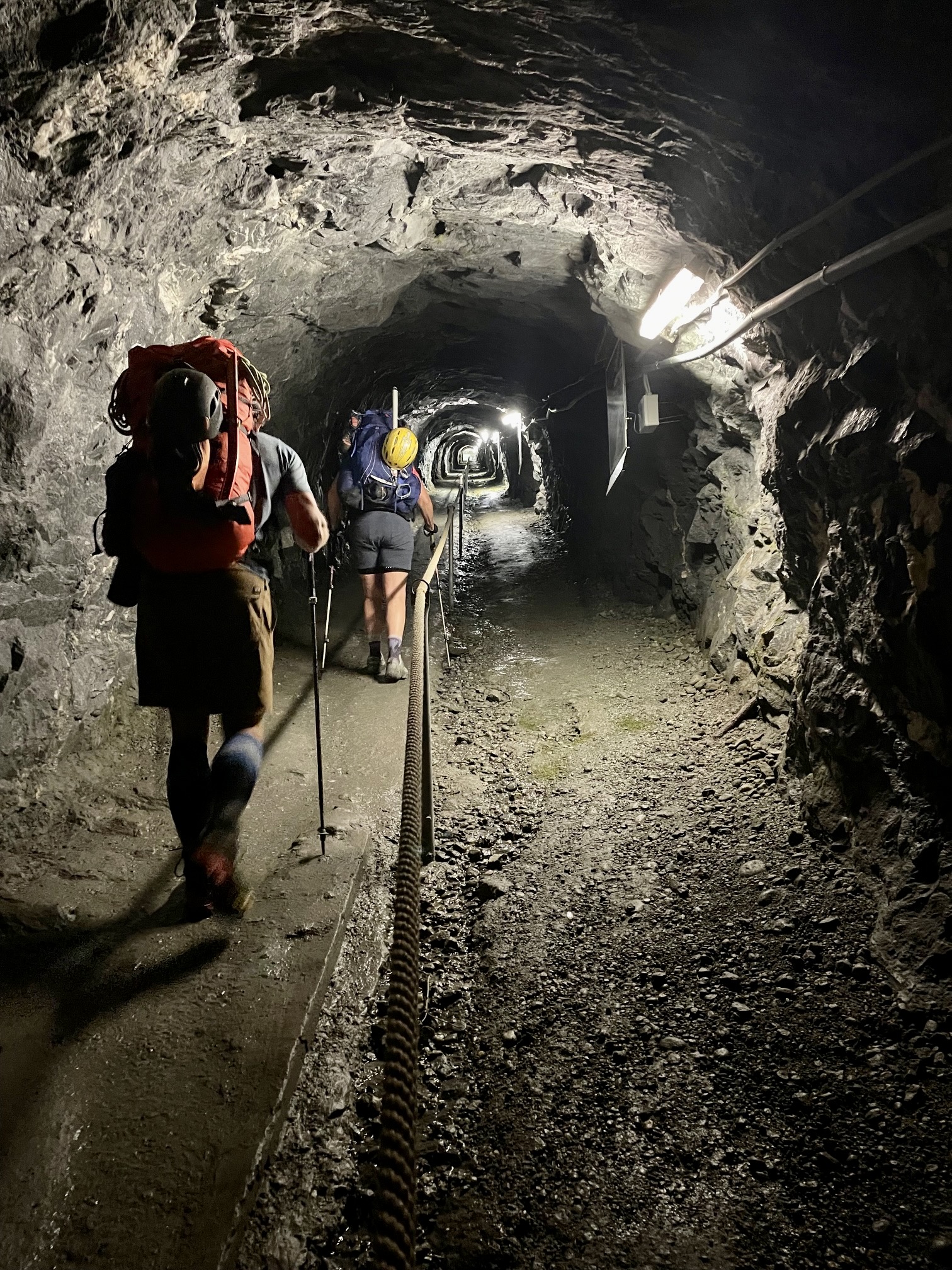
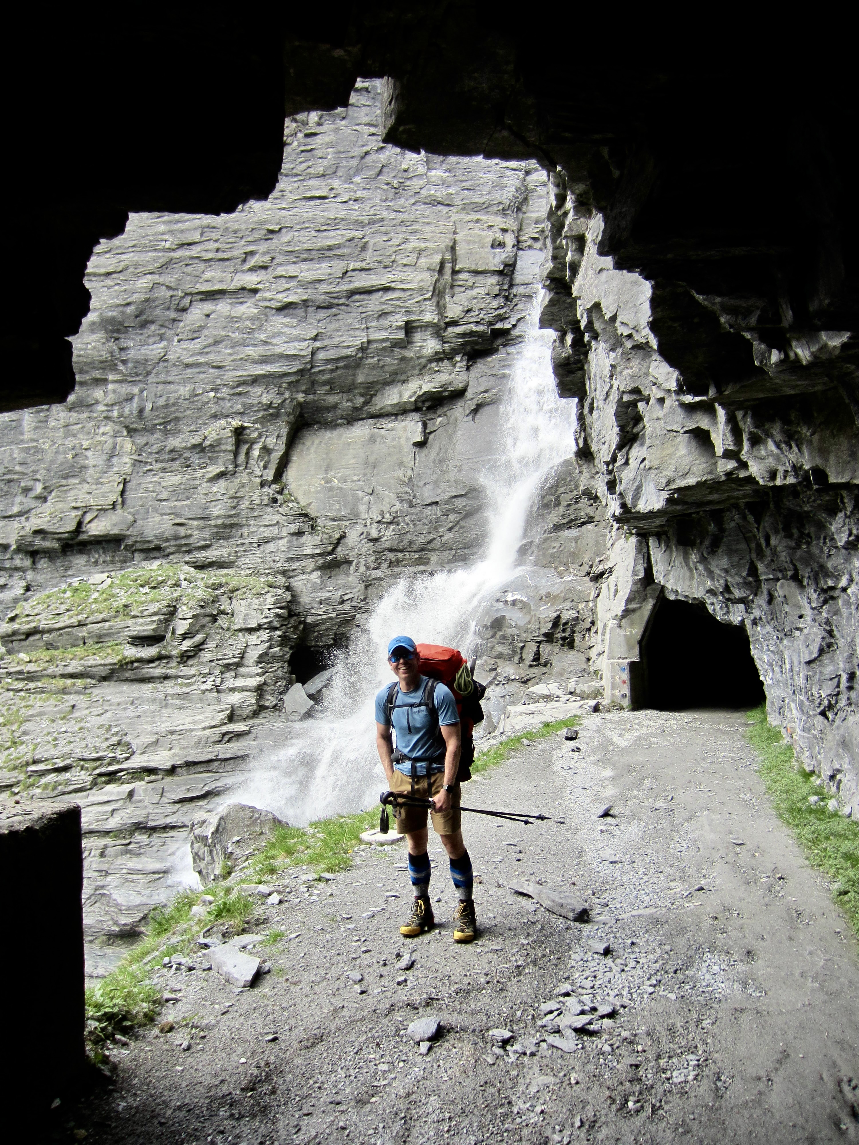
Our ascent from the Mauvoisin Trailhead began as a routine hike up a conventional trail. Before long, however, it took a bizarre turn when the trail entered a long tunnel blasted into a mountain. This tunnel was damp and drippy but well-lit and well-graded. It was decorated with numerous informational placards depicting the construction of Mauvoisin Dam throughout the 1950s.

.
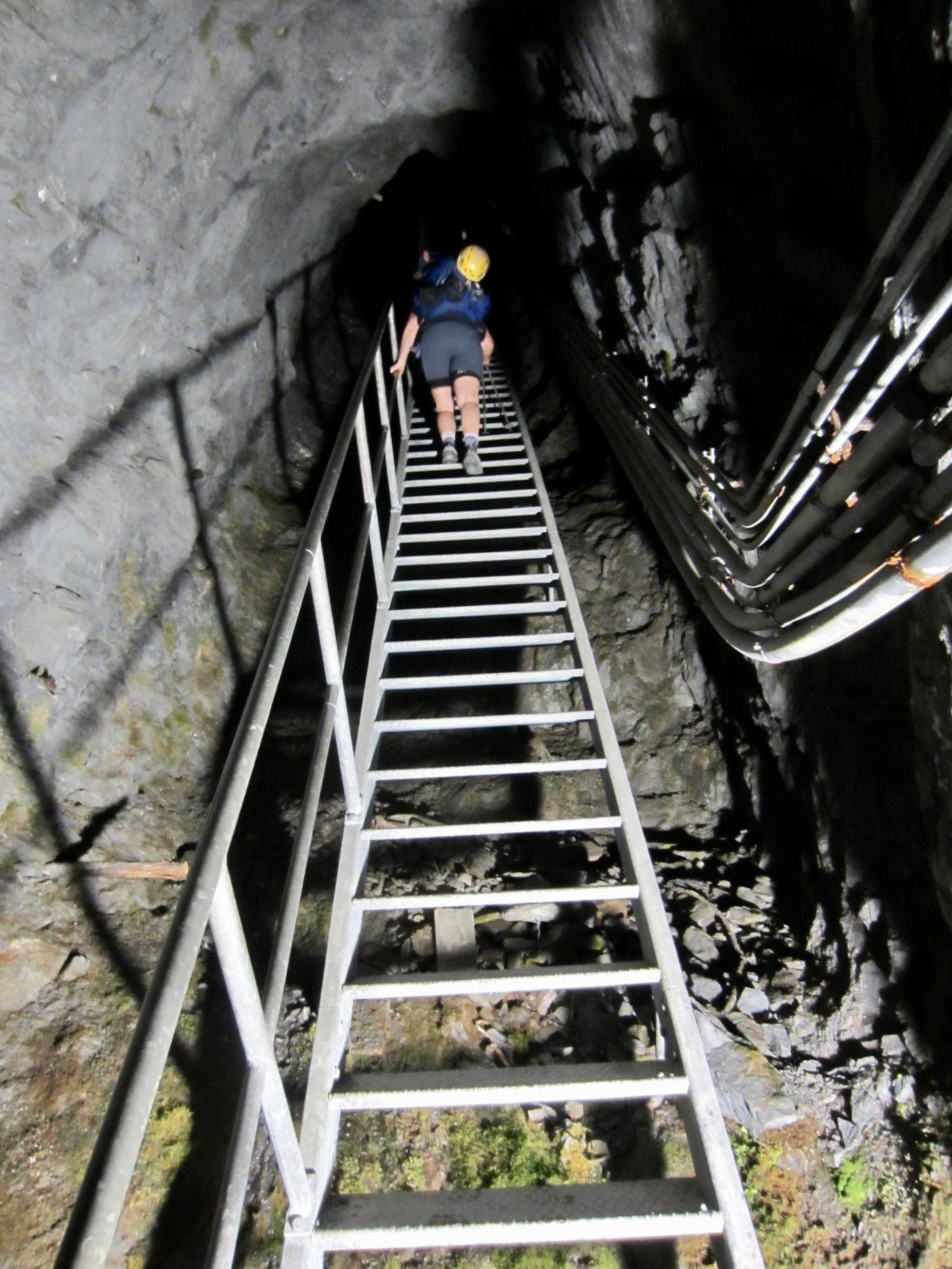
For a full half-hour, we plodded through the tunnel, steadily gaining elevation and occasionally passing side tunnels. This was definitely not a typical approach hike! Then it got even stranger when we came to a long, steep, steel stairway leading into a pitch-black shaft. I pulled out my headlamp and we gingerly headed upward, now feeling uncertain where our route would take us.
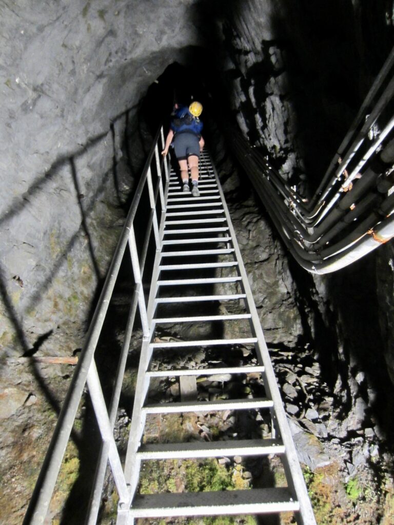
.
After a long stairway ascent into eerie darkness, we topped out and entered another unlit tunnel. It was now impossible to believe that we were actually on a proper trekking course, but we felt committed to pushing ahead simply because none of us wanted to backtrack down the steep stairway and long tunnel. We proceeded into the upper tunnel and soon came to an unmarked steel door. Eileen turned the handle but the door did not budge. Our hearts sank. In a gut-level reaction, she gave the door a swift kick. Much to our surprise and delight, it popped open!
On the other side of the steel door was yet another tunnel, but this one led us out to glorious daylight on the side of a cliff. Unfortunately, we now found ourselves high above the dam, with no obvious way to get down. Were we finally at a dead end? In a last-gasp effort, Jon reconnoitered a separate tunnel that angled farther away from the dam. Eileen and I waited, watched, and hoped for good news, while also mentally preparing for a frustrating retreat. After a short eternity, Jon appeared on the dam below, with arms raised in victory. It was a go!
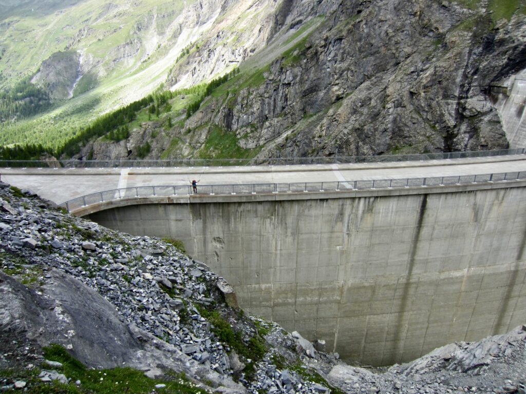
.
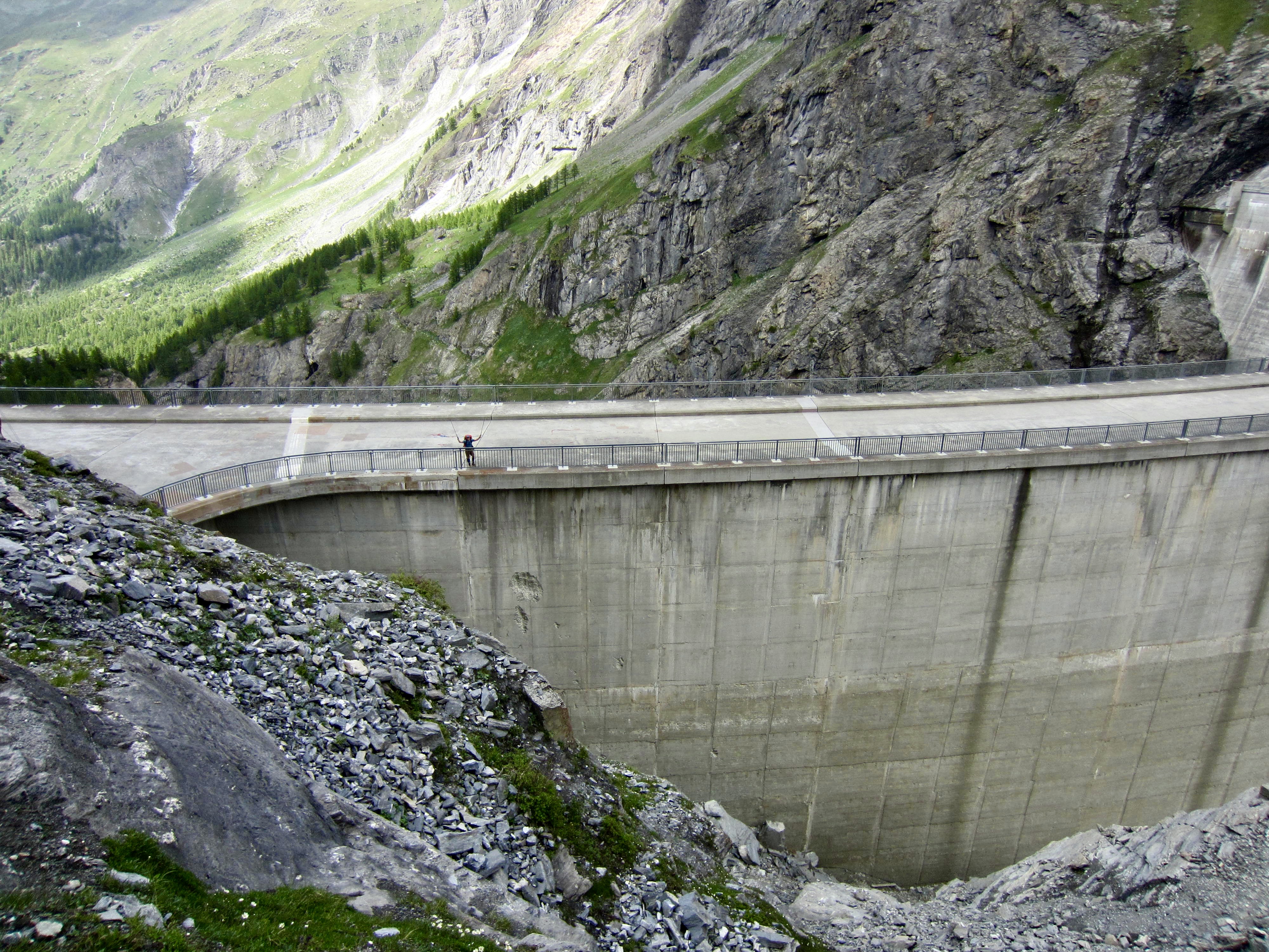
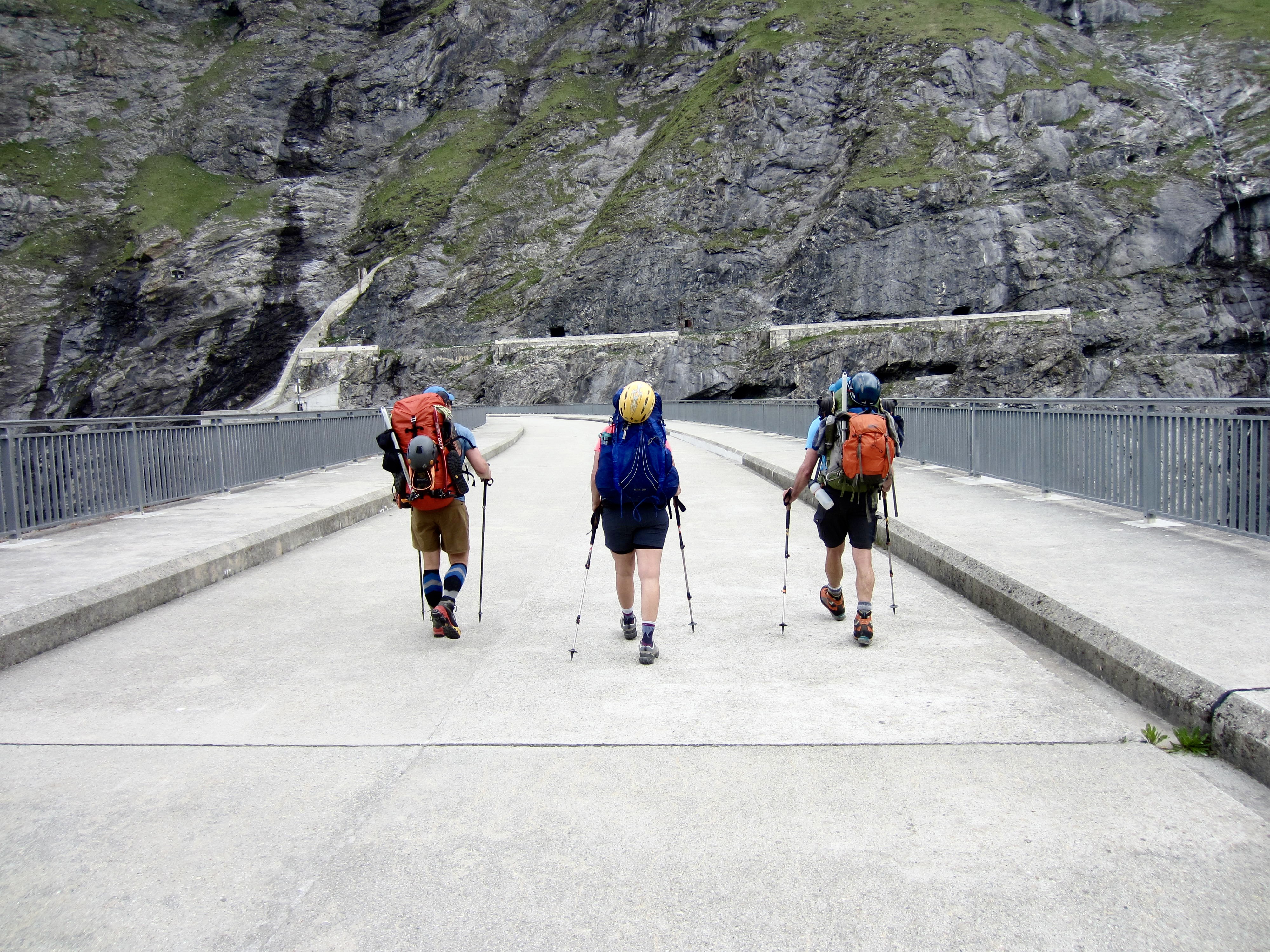
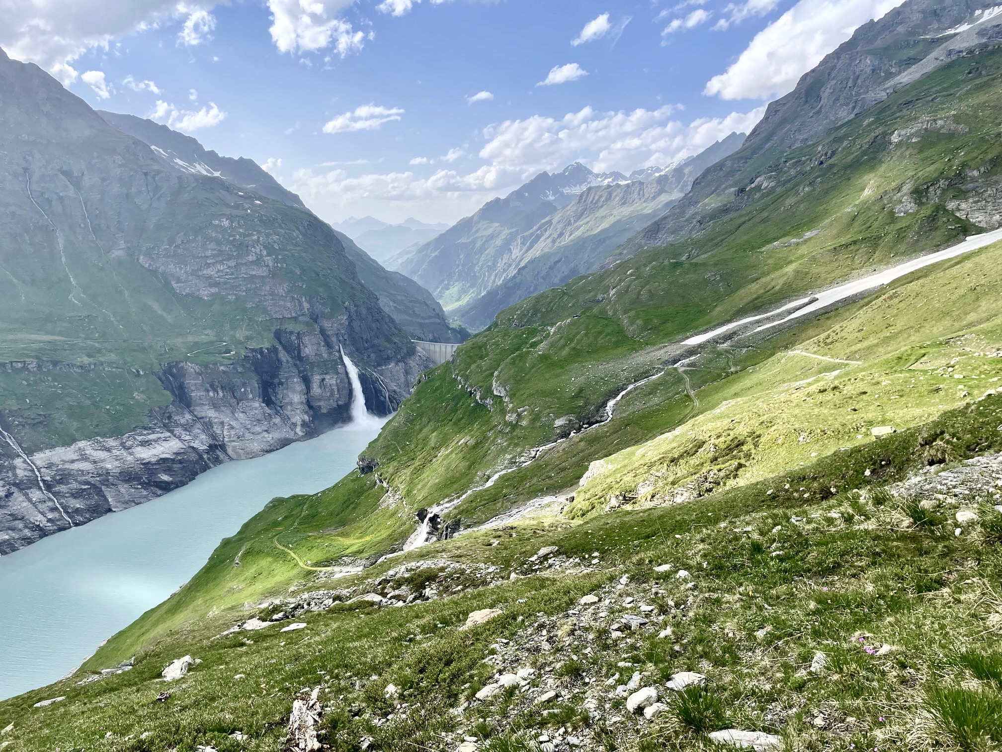
Minutes later, we were all happily tromping across the top of Mauvoisin Dam. This marvel of engineering and construction measures 1700 feet / 520 meters long by 820 feet / 250 meters high, which currently makes it the eighth highest dam in the world. The fact that it serves as a key segment of a formal hiking trail puts it in the same special category as Ross Dam in the North Cascades.
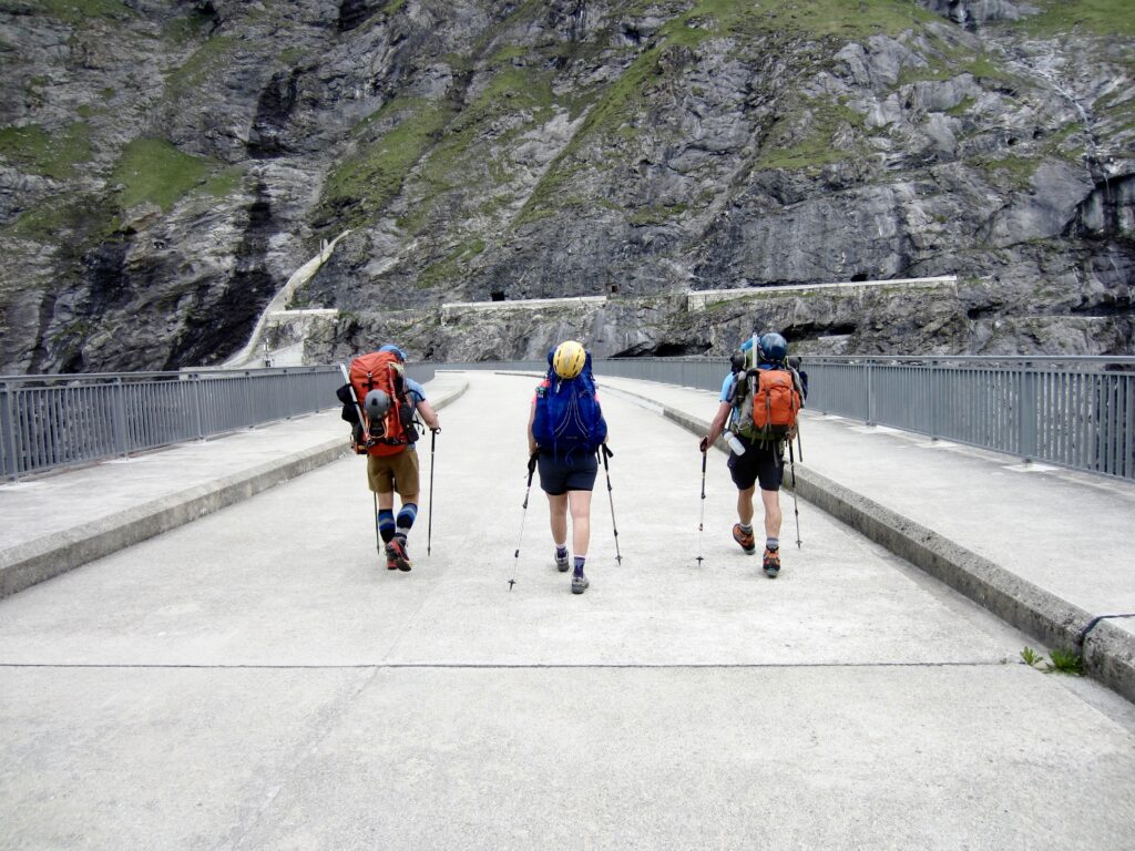
.
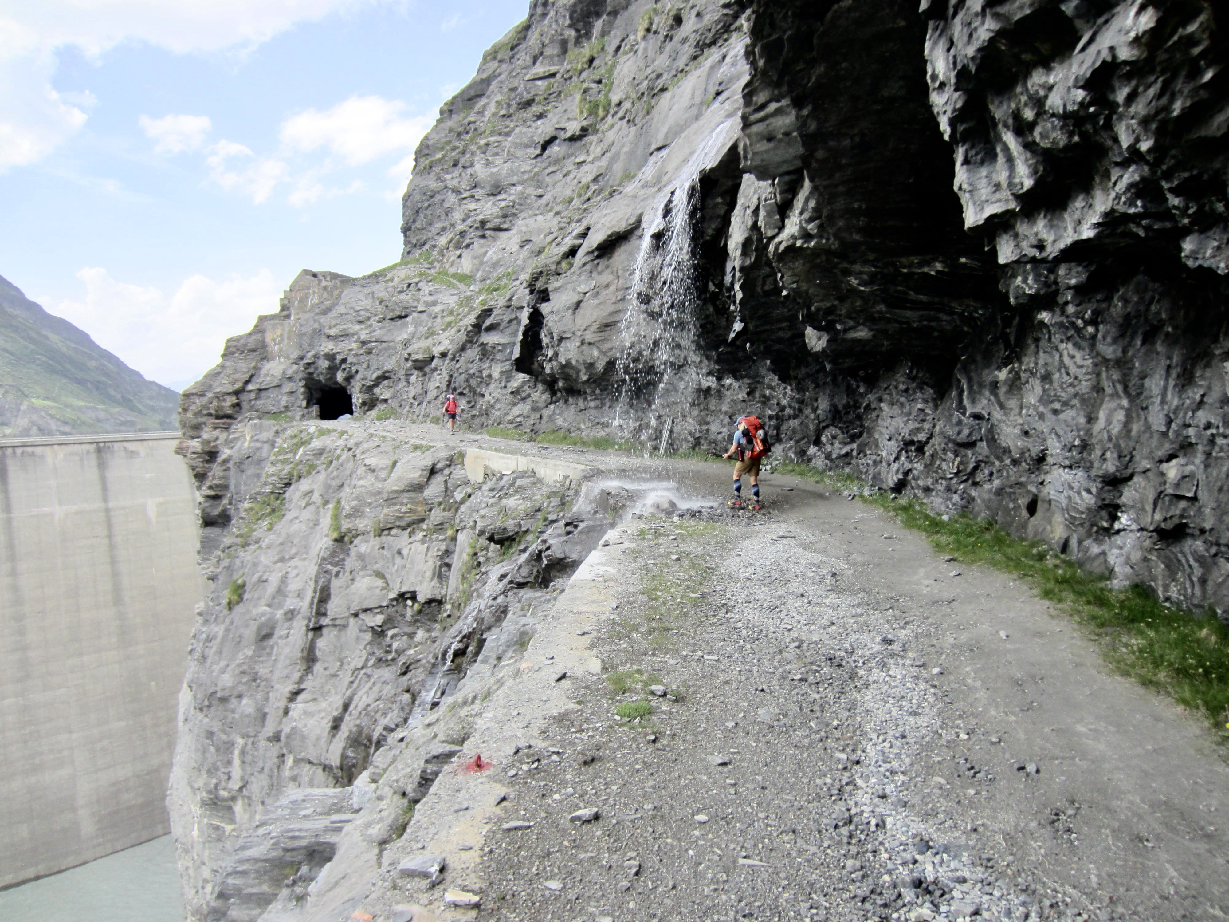
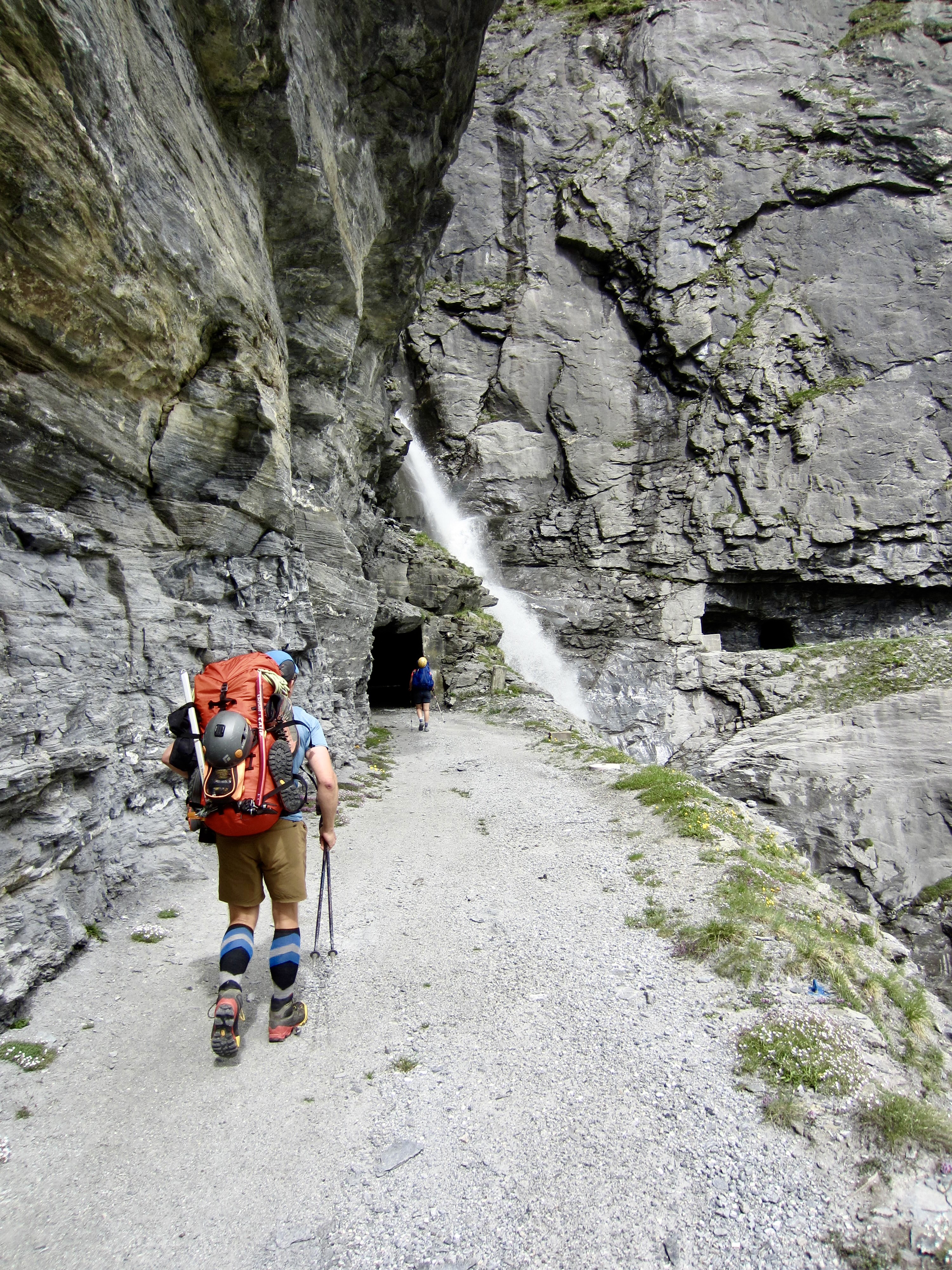
The past couple hours spent wandering through tunnels, up a dark stairway, and across a major dam had been a truly bizarre and unique experience, but our adventure was not over yet. The Haute Route took us along a narrow road carved into a steep cliff high above Mauvoisin Lake—with no safety barrier of any sort. For another hour, we hiked through short tunnels and past cascading streams.

.
.
.
The old roadway eventually transitioned to a single-track trail that climbed onto a grassy hillslope. Far below, we could see numerous streams plunging into Mauvoisin Lake. The largest one of these shot out of a cliff-face tunnel like a giant firehose.

.
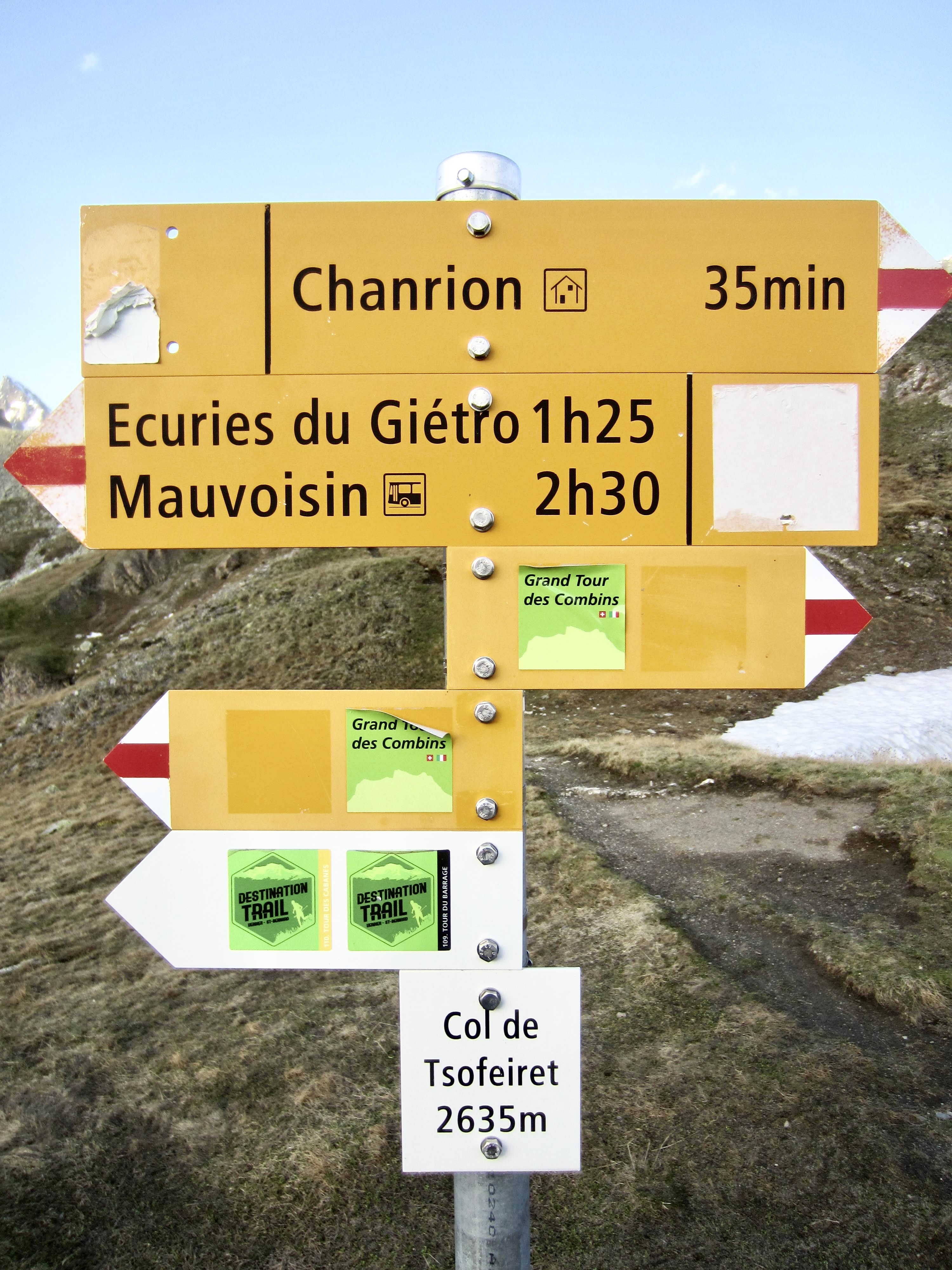
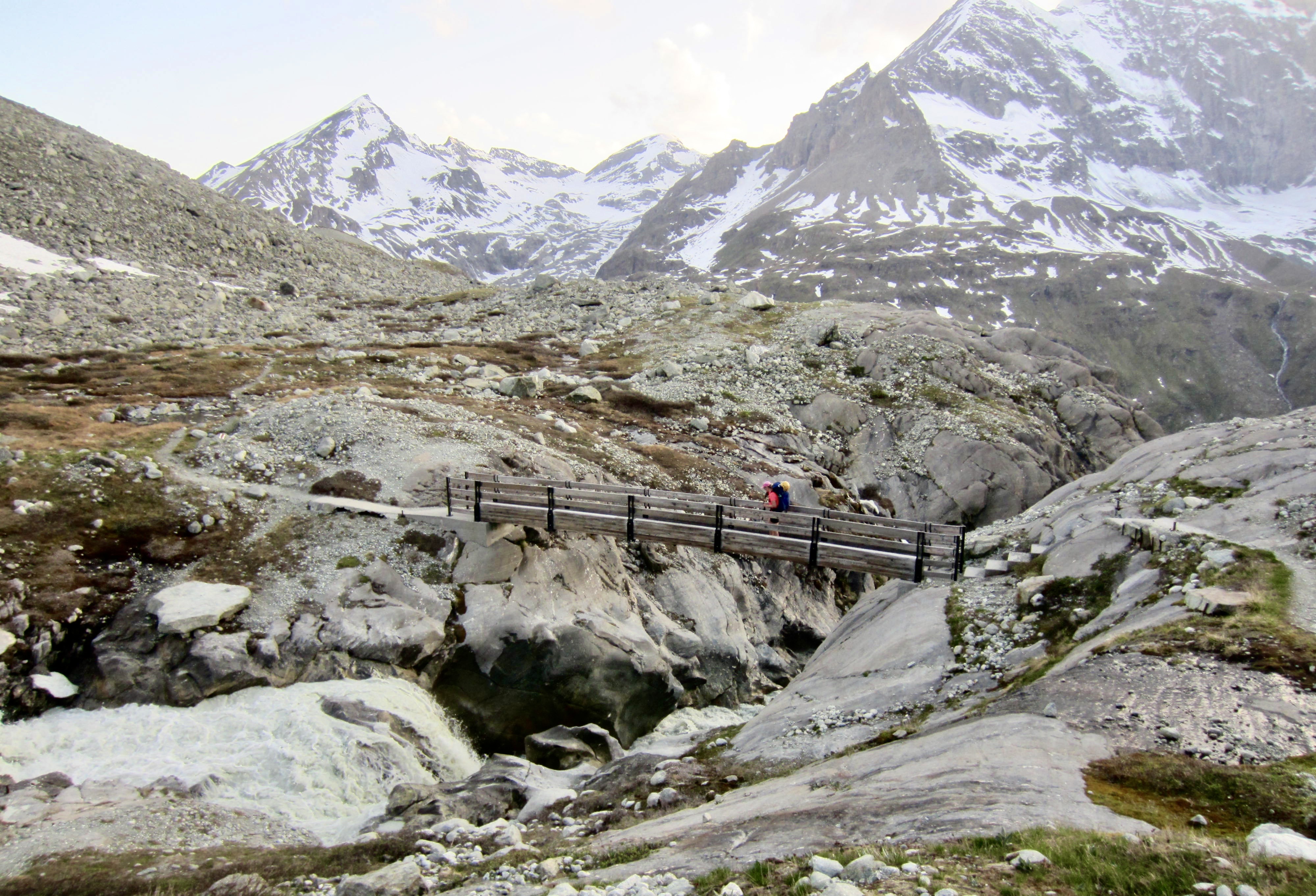
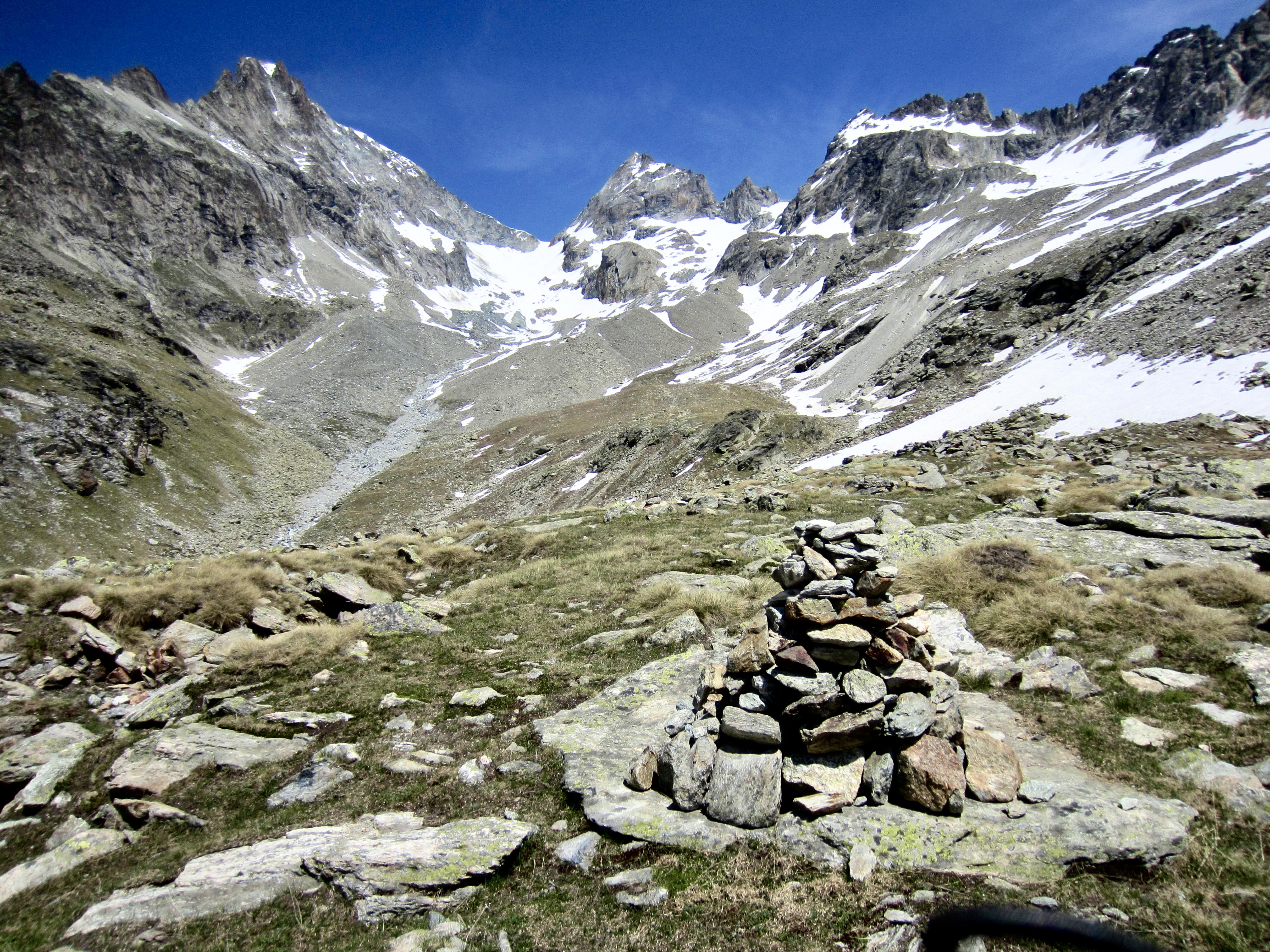
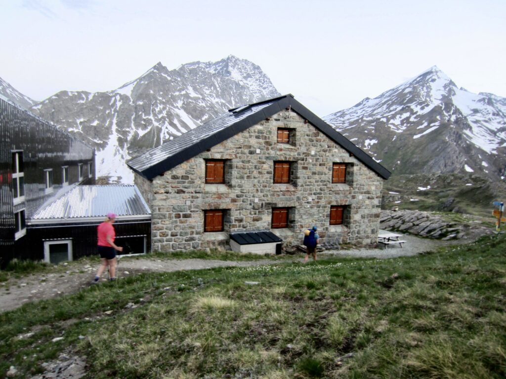
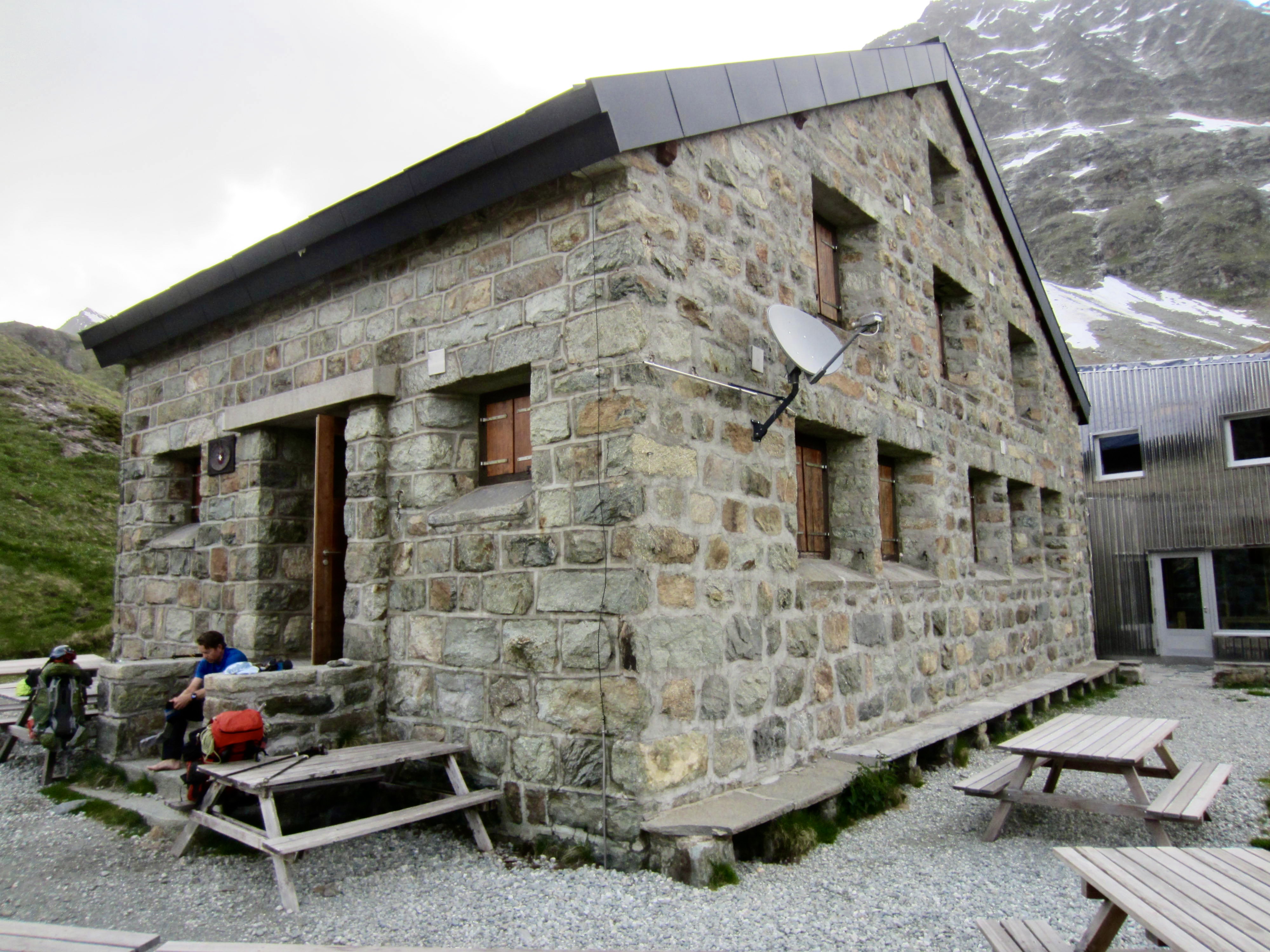
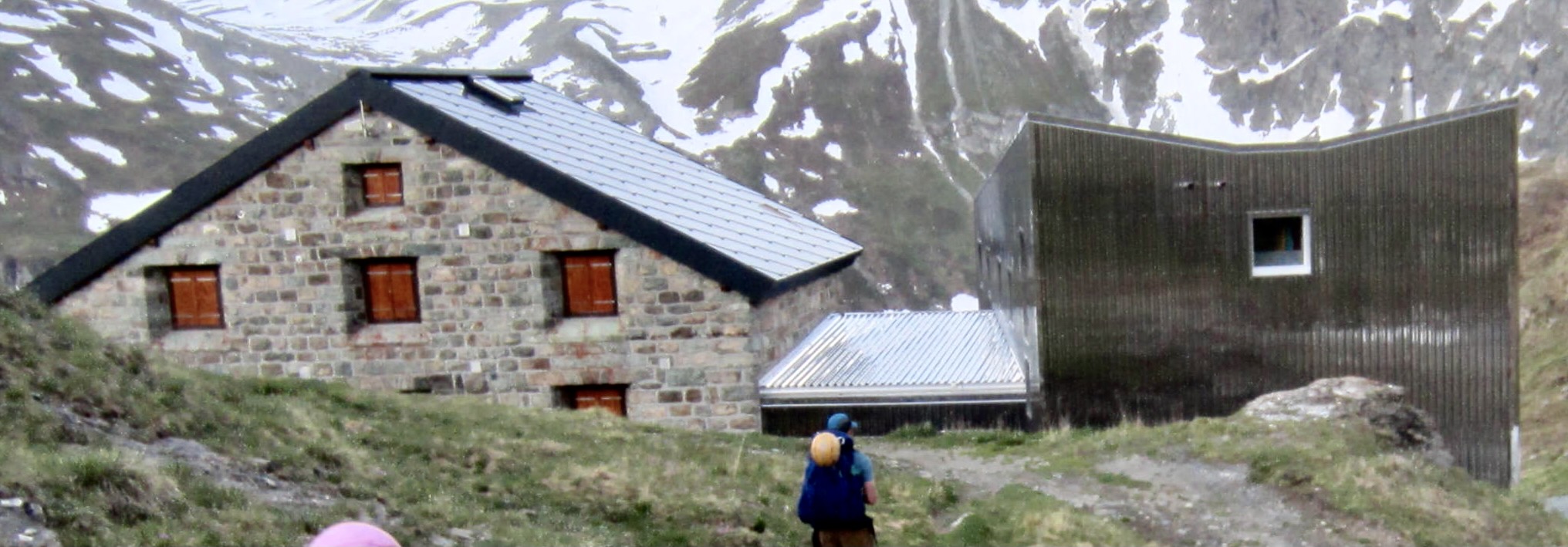
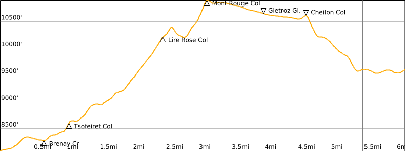
Our gradual ascent ended at 8,600-foot / 2,600-meter Tsofeiret Col. From here, a steep, eroded trail led us down the other side and across the deep gorge of Brenay Creek on a high girder bridge. In fading light, we finally arrived at Chanrion Hut.
.

.
.
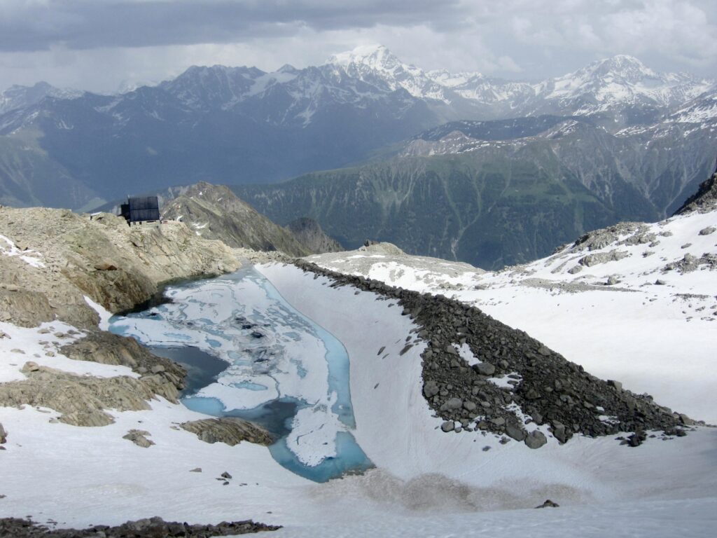
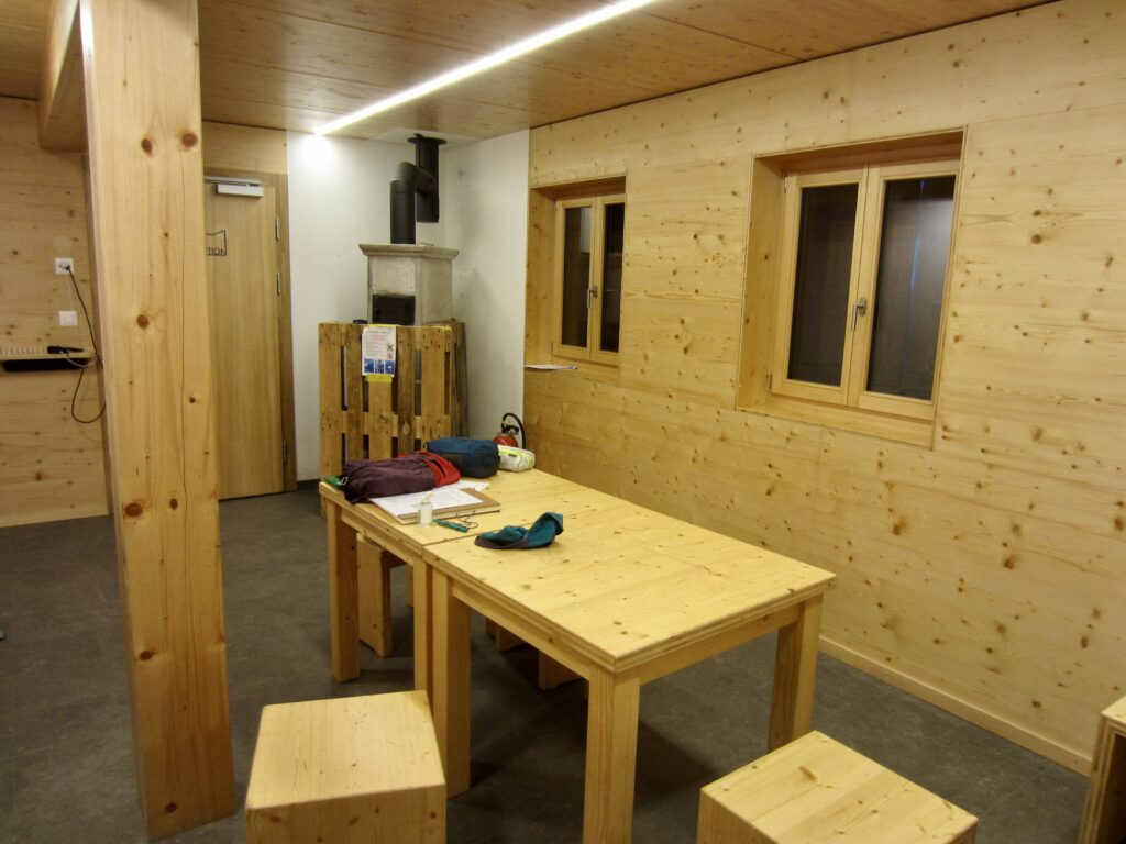
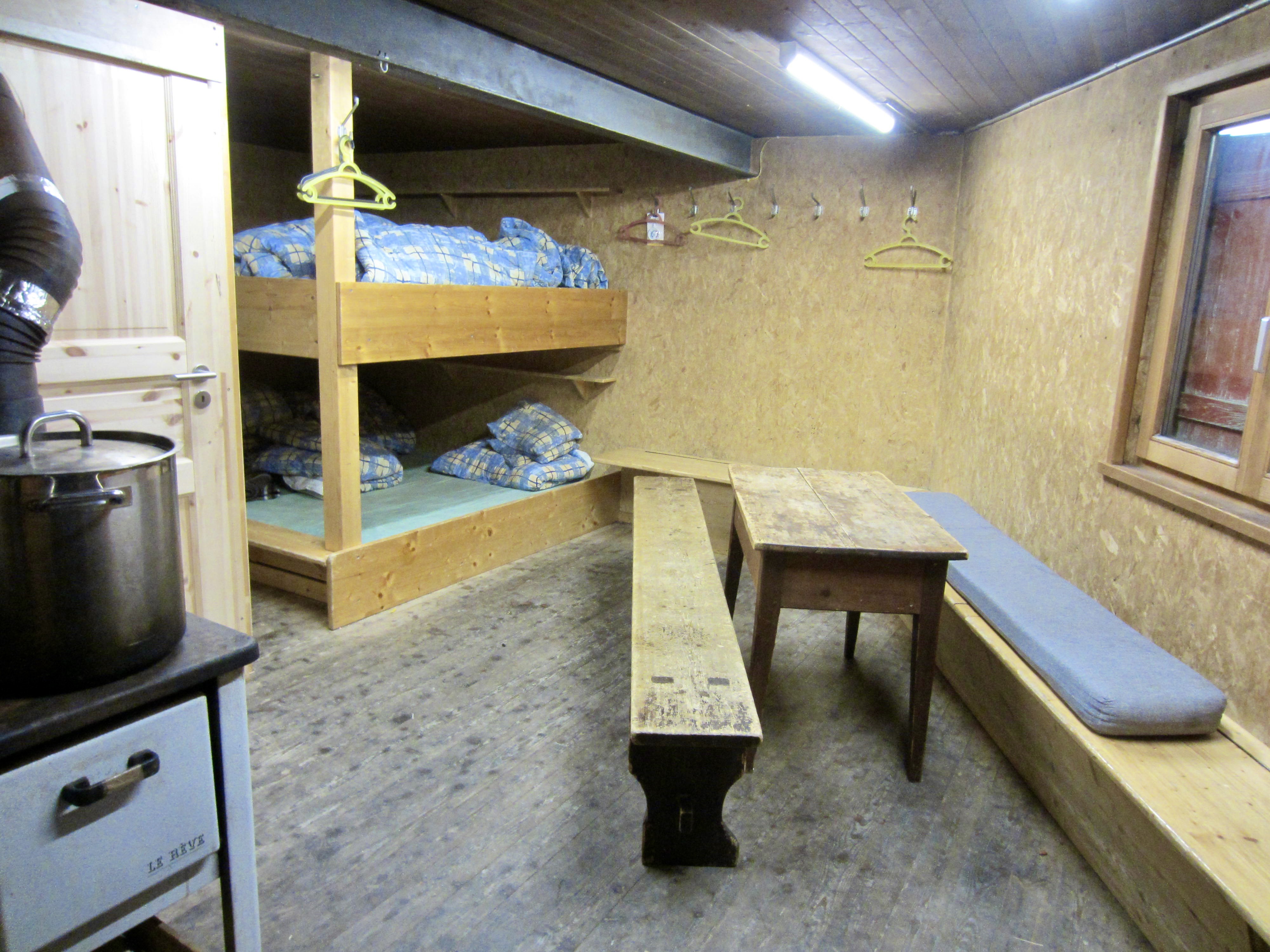
Chanrion Hut had not yet opened for the summer season, but we were able to use the winter room. None of us had ever been in a winter room before, so we didn’t know what to expect. This one is large, newly remodeled, and beautifully appointed—by far the nicest on our trek. It still smelled of fresh wood, and we had it all to ourselves! There is no cookstove here, so our dinners consisted of cold burritos.
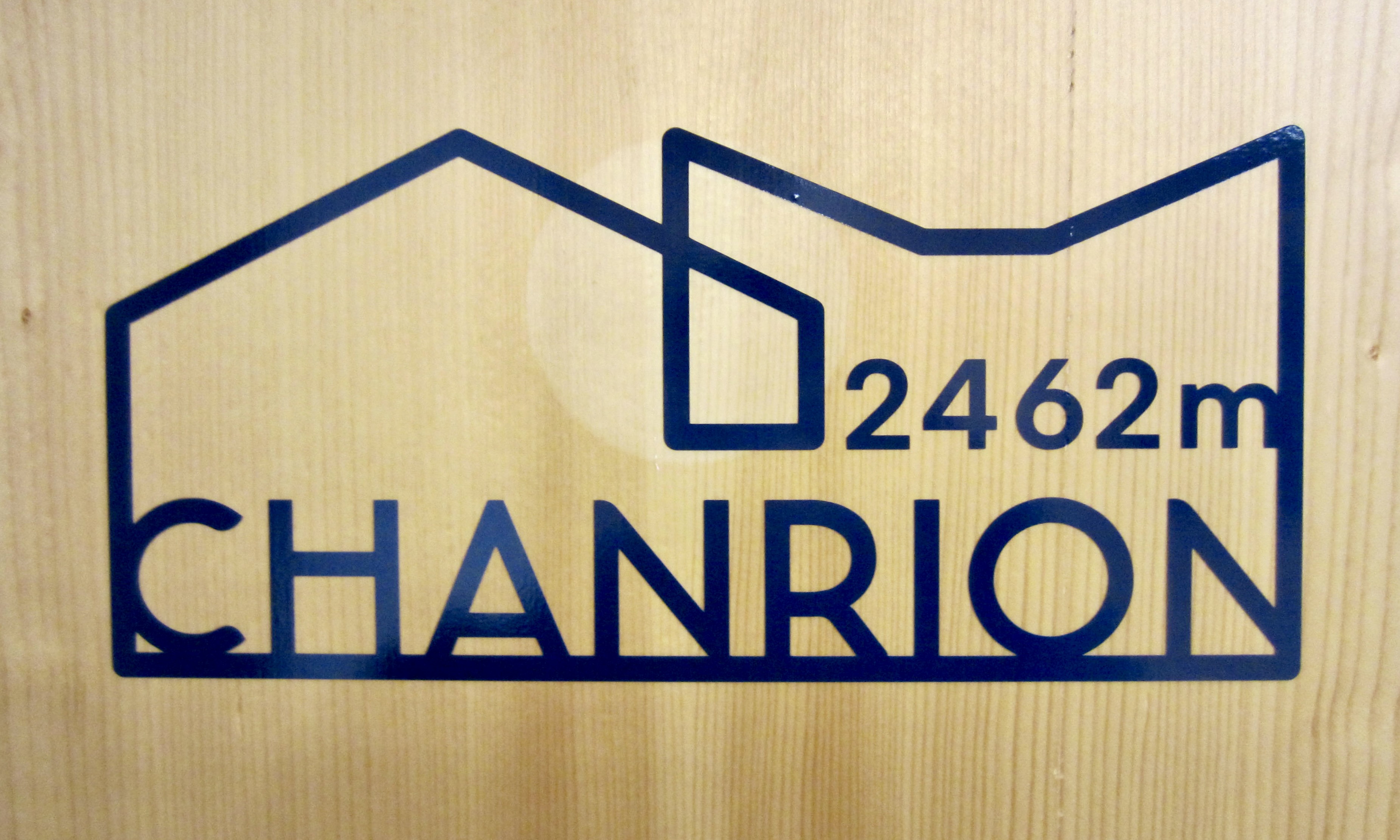
.
The recent renovation of Chanrion Hut not only included remodeling the historic stone building but also constructing a new steel-sided addition. The great difference in their design and materials creates an interesting—perhaps even bold—architectural contrast. I liked how the two separate building shapes are reflected in the hut’s new logo.
.
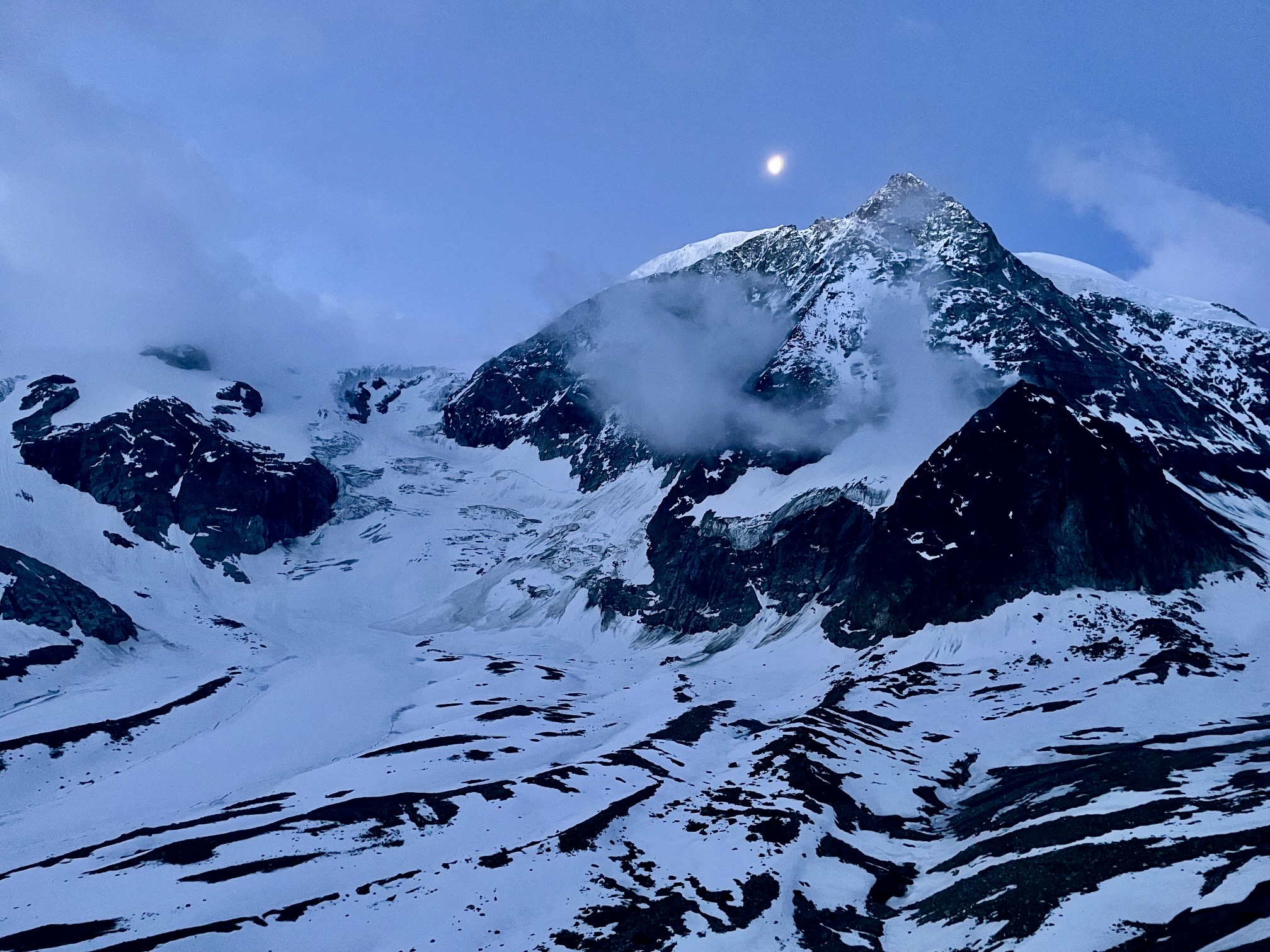
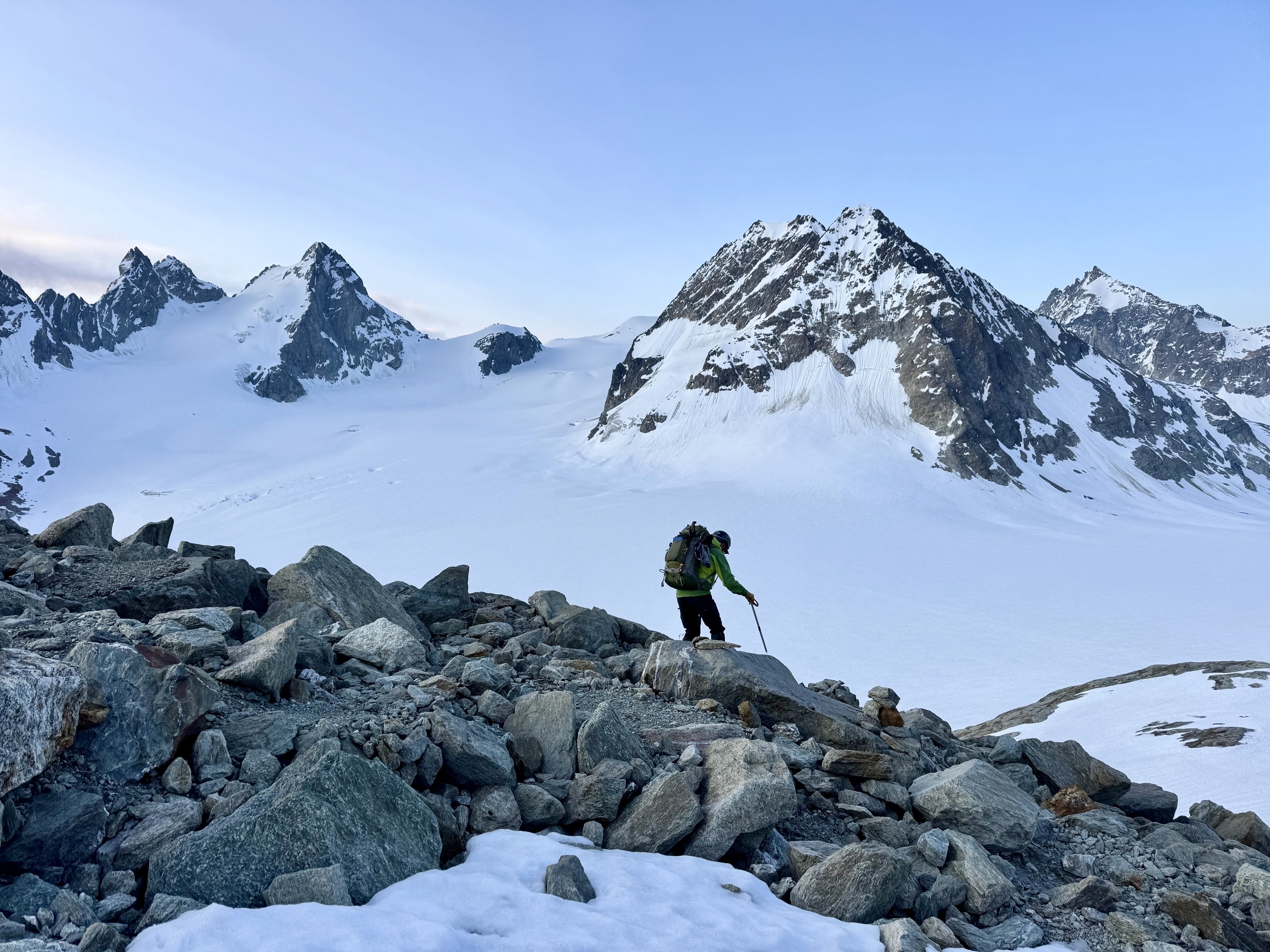
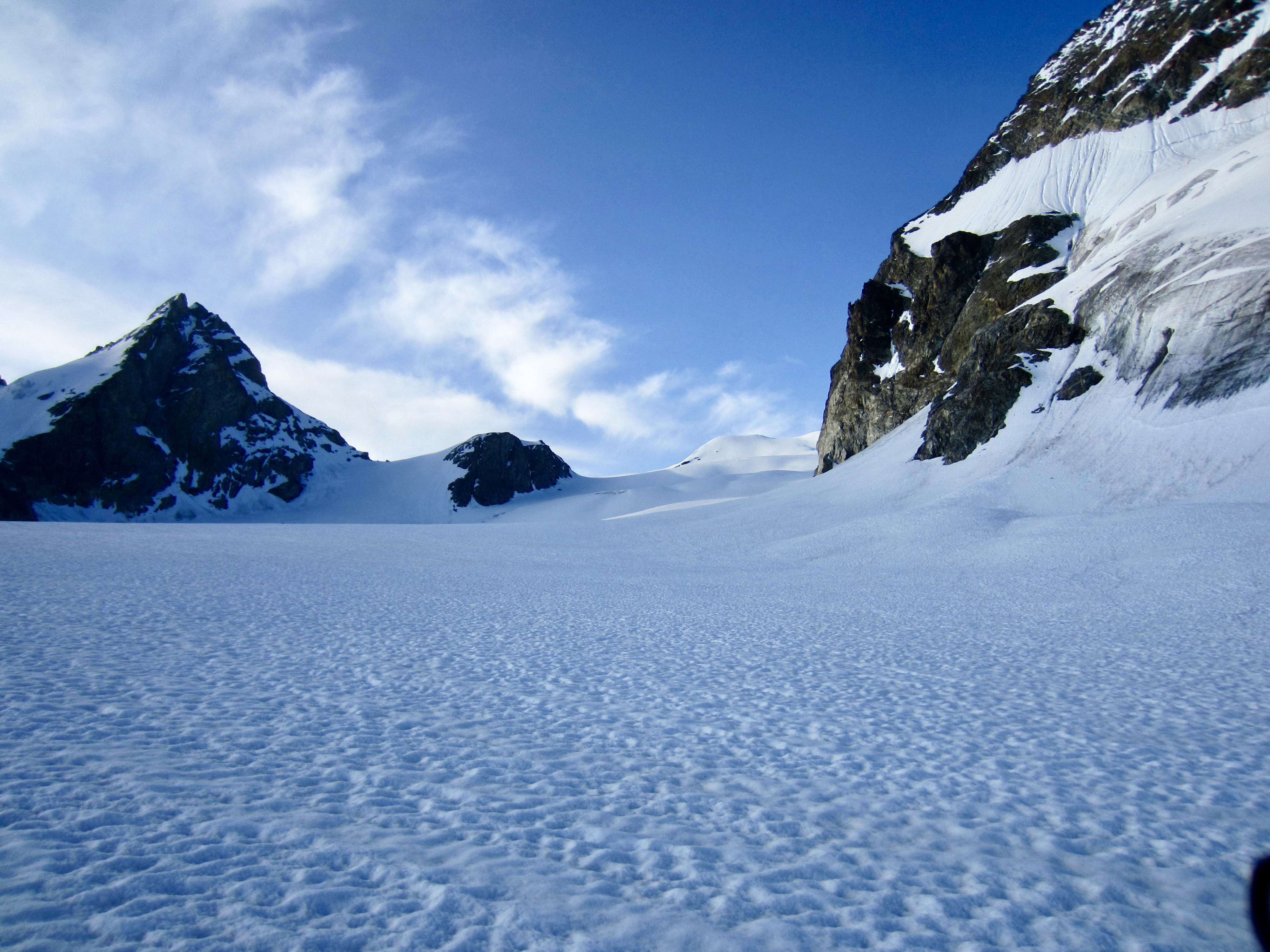
Day 4: Chanrion Hut to Dix Hut
Approximate Stats: 6.1 miles / 9.8 kilometers traveled; 3150 feet / 960 meters gained; 1650 feet / 500 meters lost.
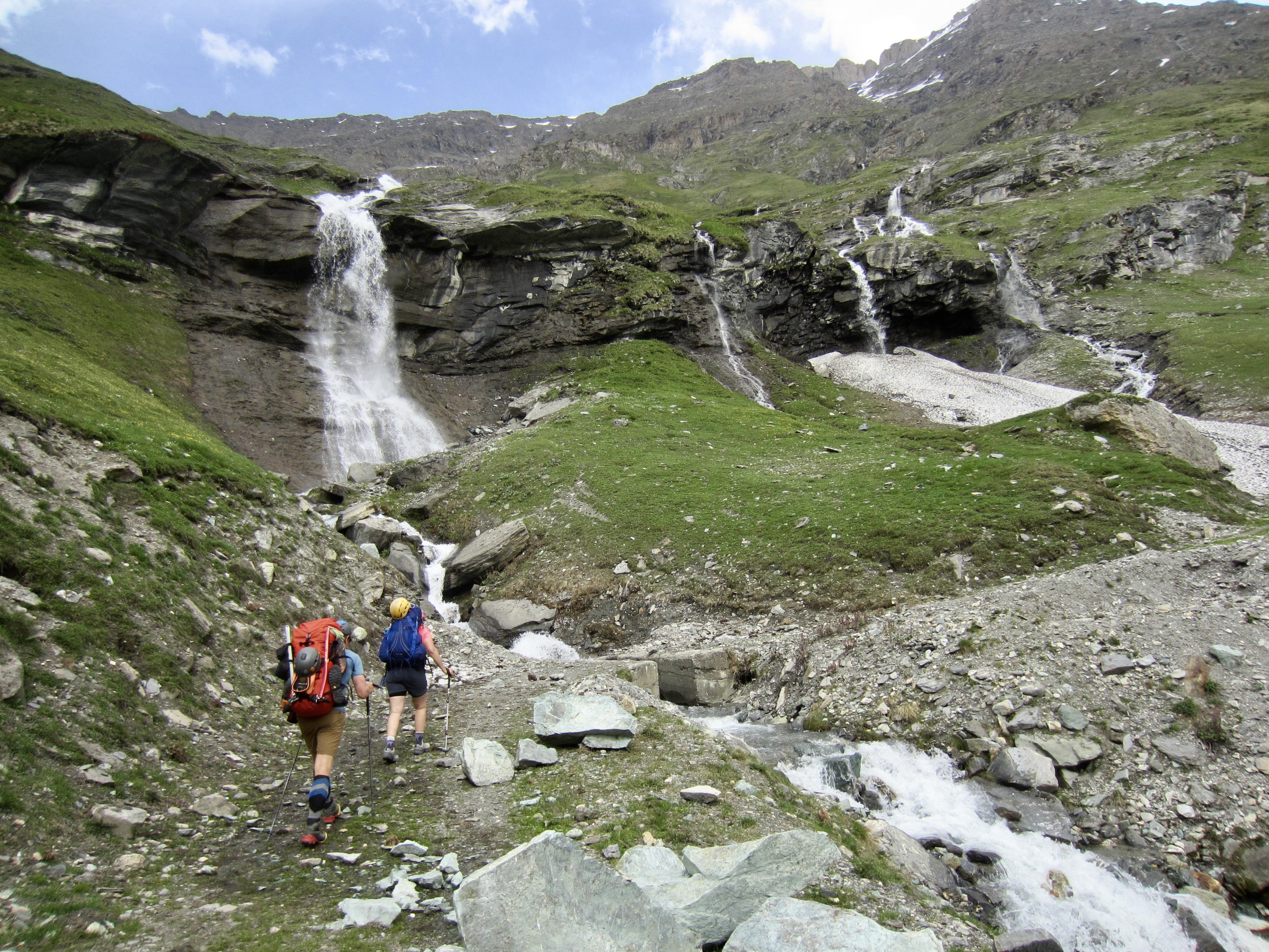
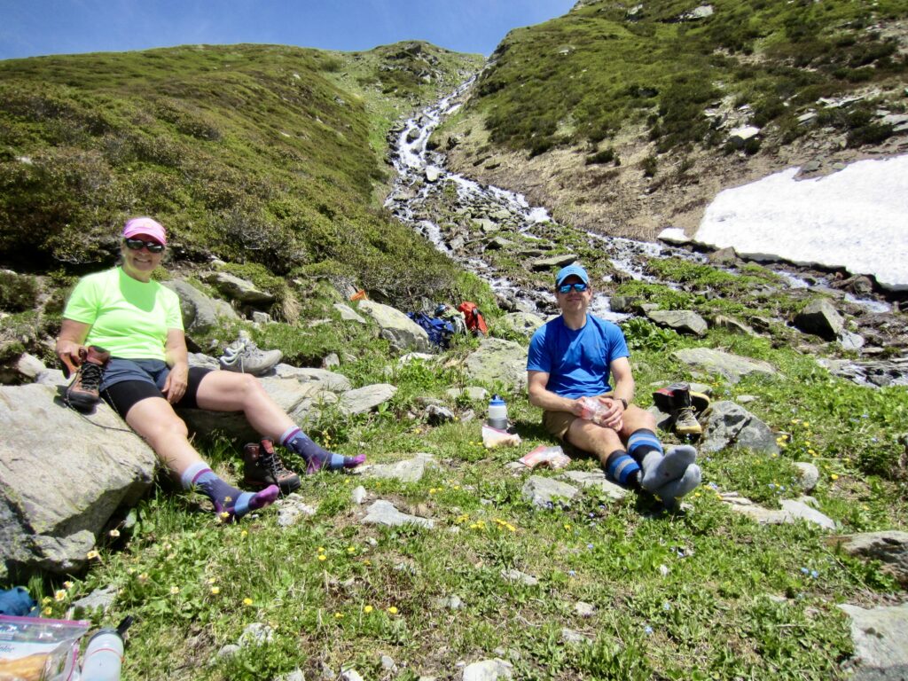
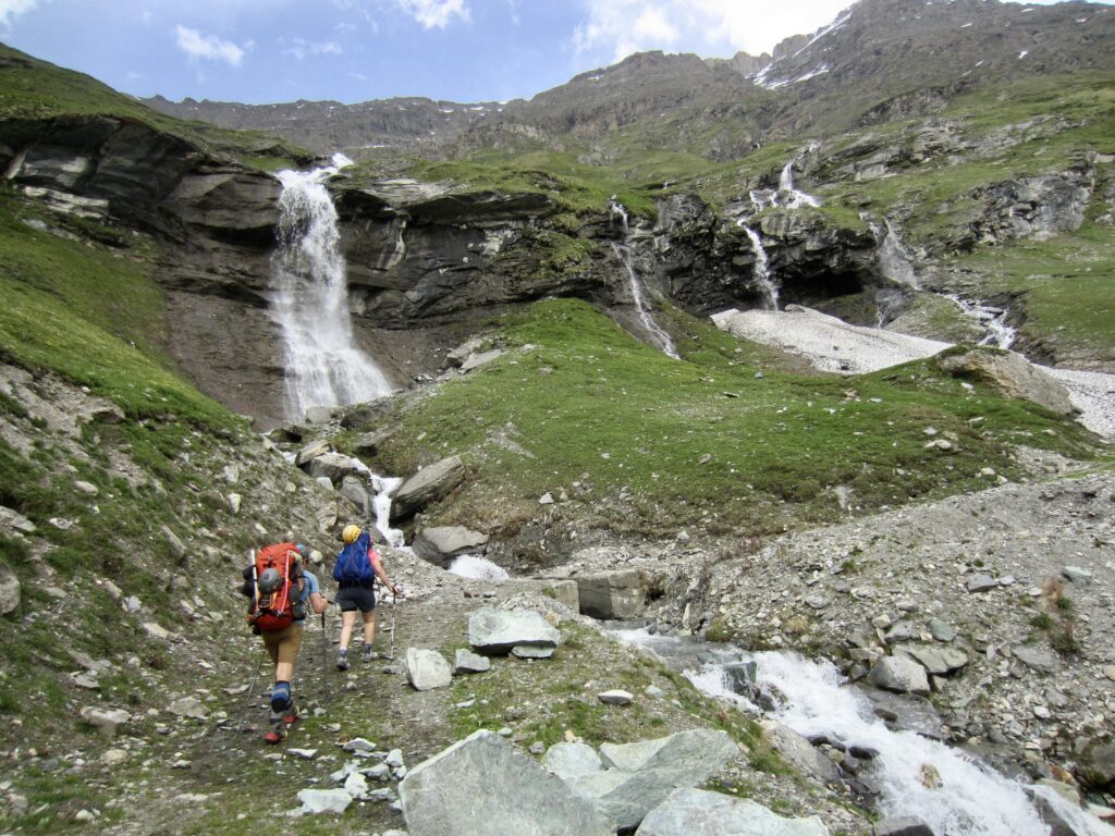
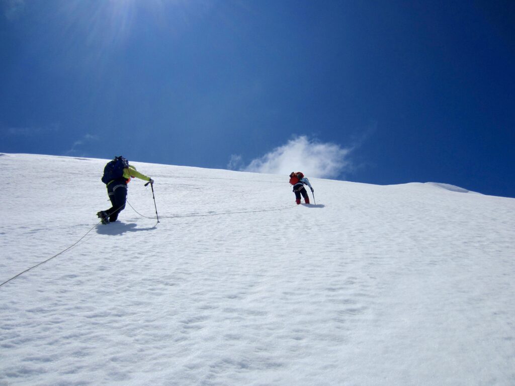
After an all-too-short night of sleep, we were out the door and on the move before 6:30am. Our morning started with a hike back up to Tsofeiret Col and then a hike and snow climb farther up to Lire Rose Col. Intermittent rain showers prompted numerous clothing adjustments throughout the day.
.
At Lire Rose Col, we could clearly scope out the continuation route over to Mont Rouge Col. This involved a traverse across a large snow bowl, followed by a moderately steep climb up a snow chute. The final part required groveling up a steep ramp consisting of shale-covered mud.

.

.
.
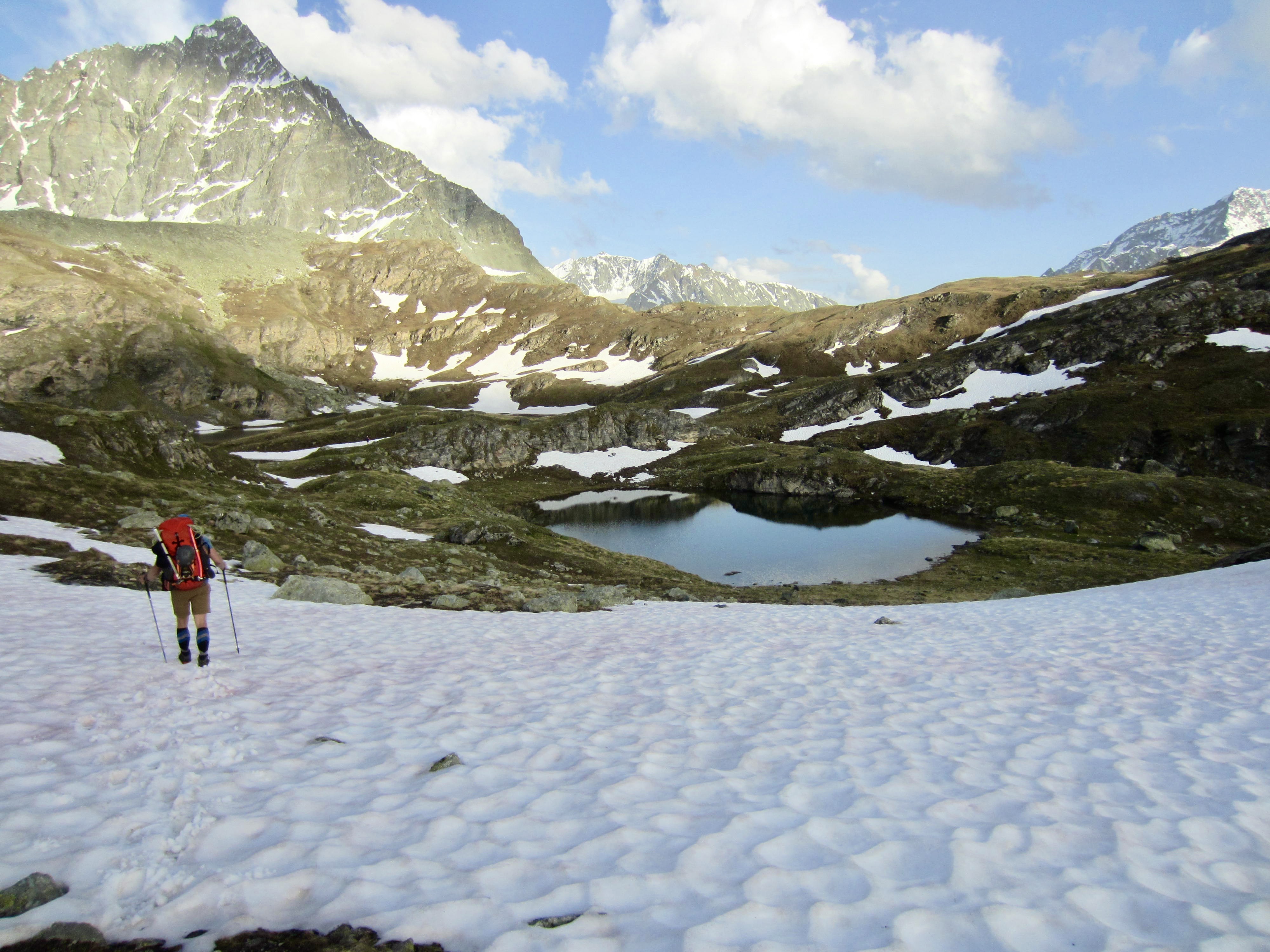
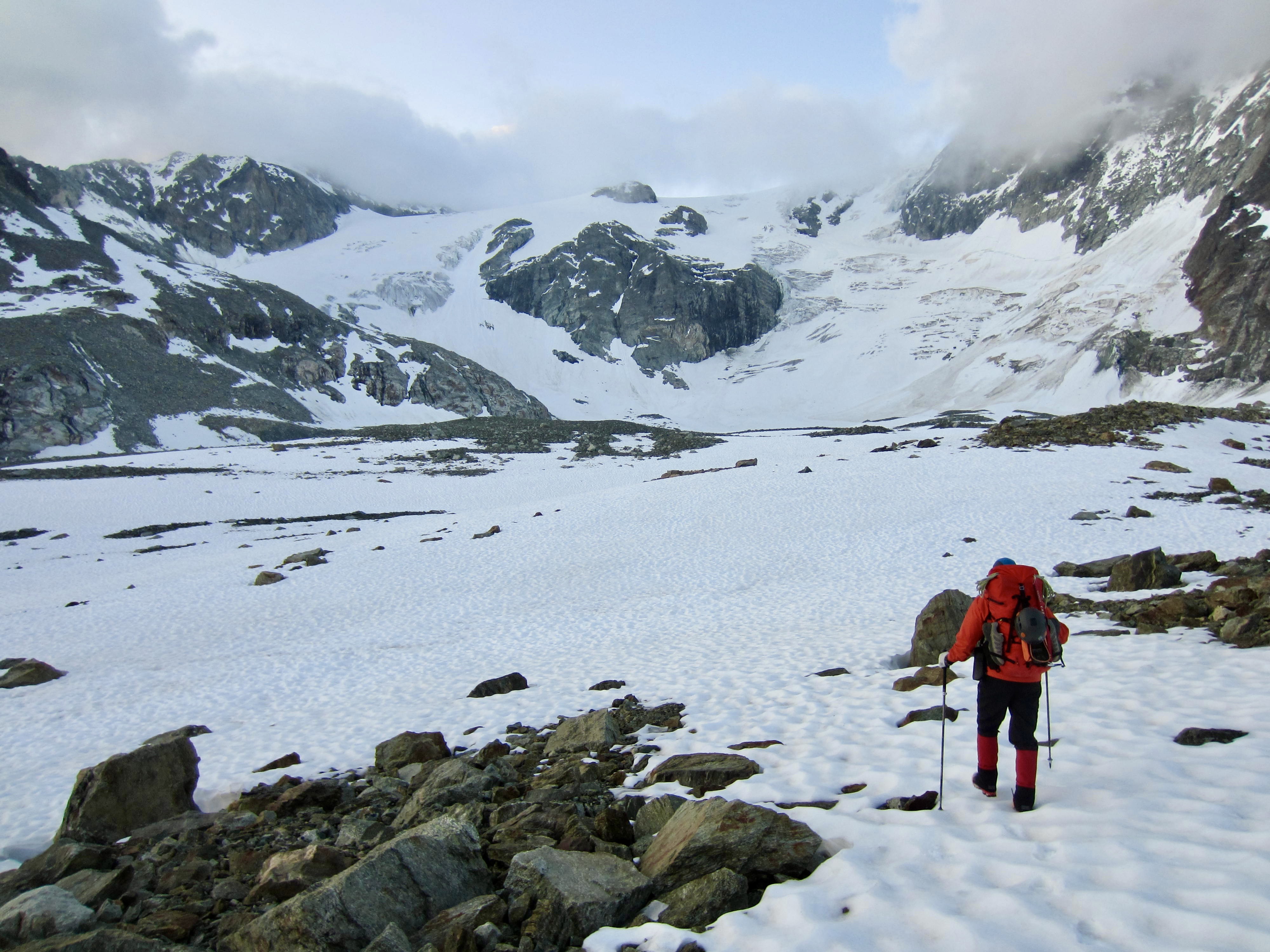
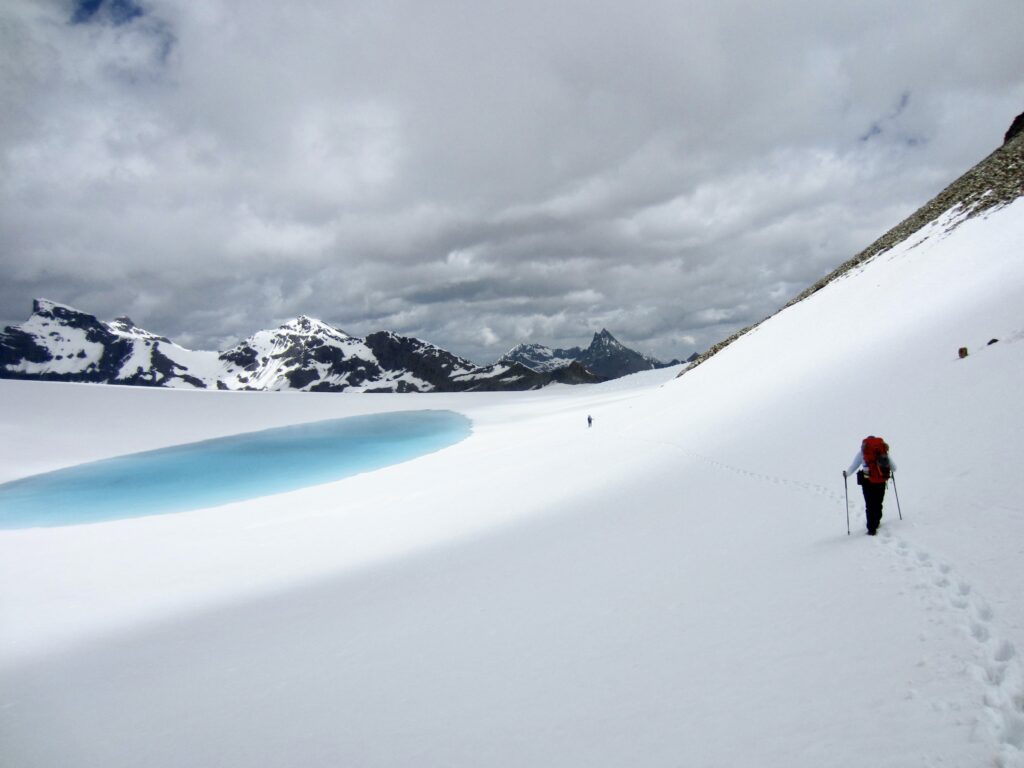
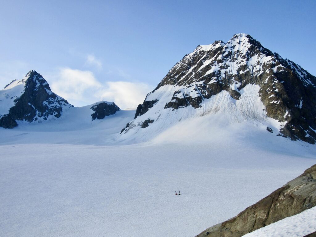
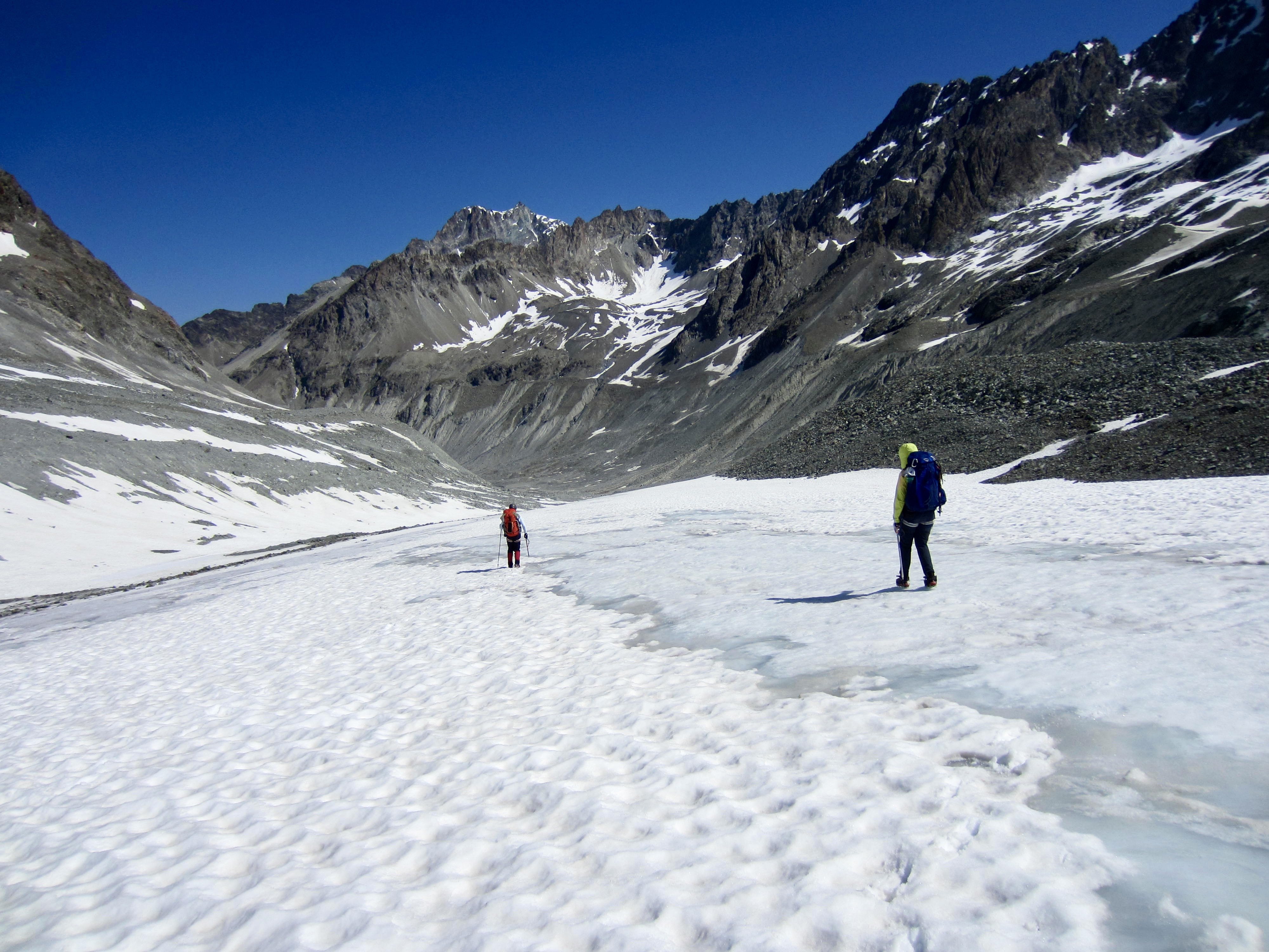
From Mont Rouge Col, we contoured around a turquoise pool sitting on the upper plateau of the Gietroz Glacier. This initially looked to be an easy stroll over to Cheilon Col, but because the previous night’s cloud cover had prevented the snow surface from freezing, it became another post-holing slog.
.
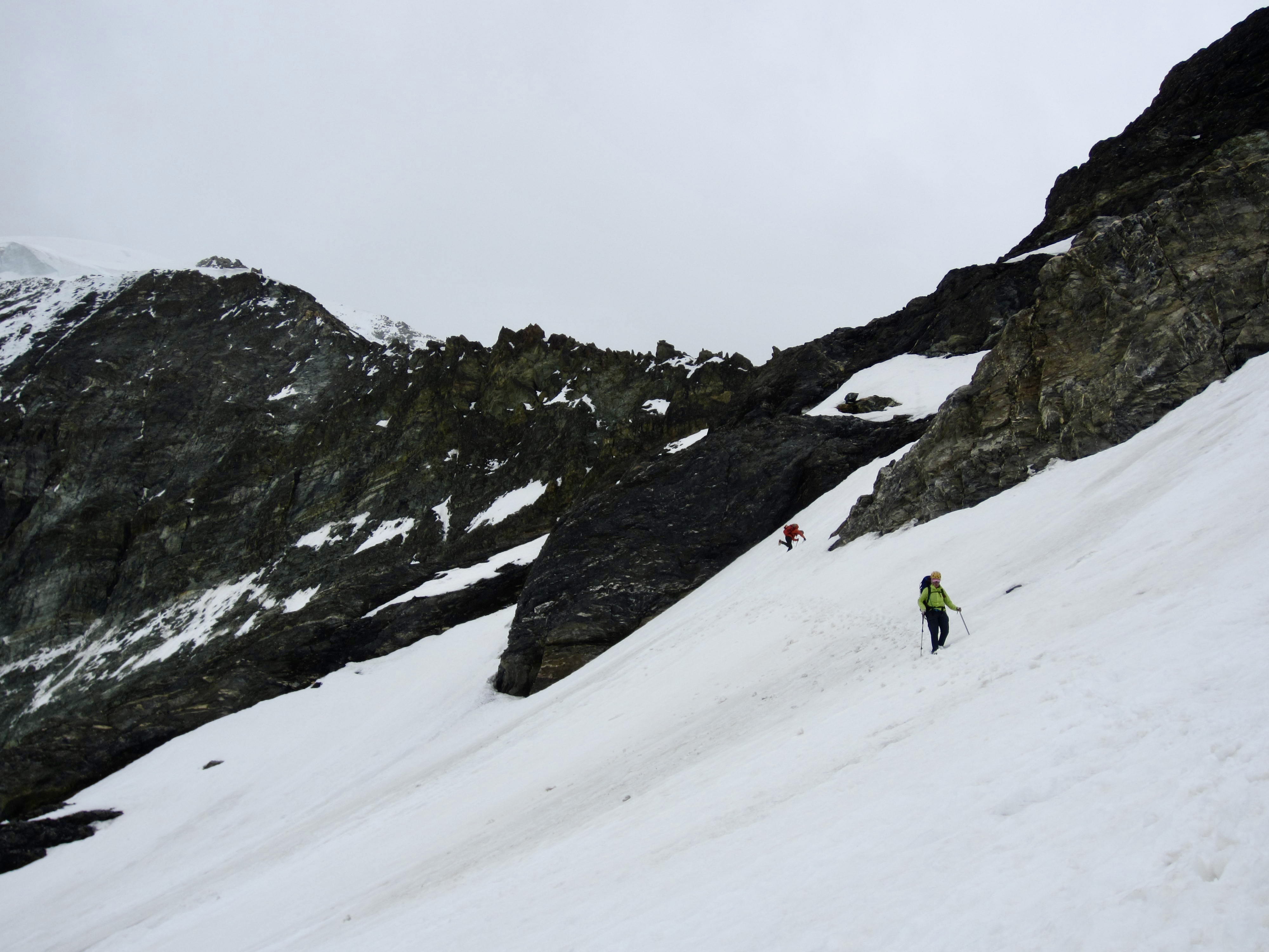
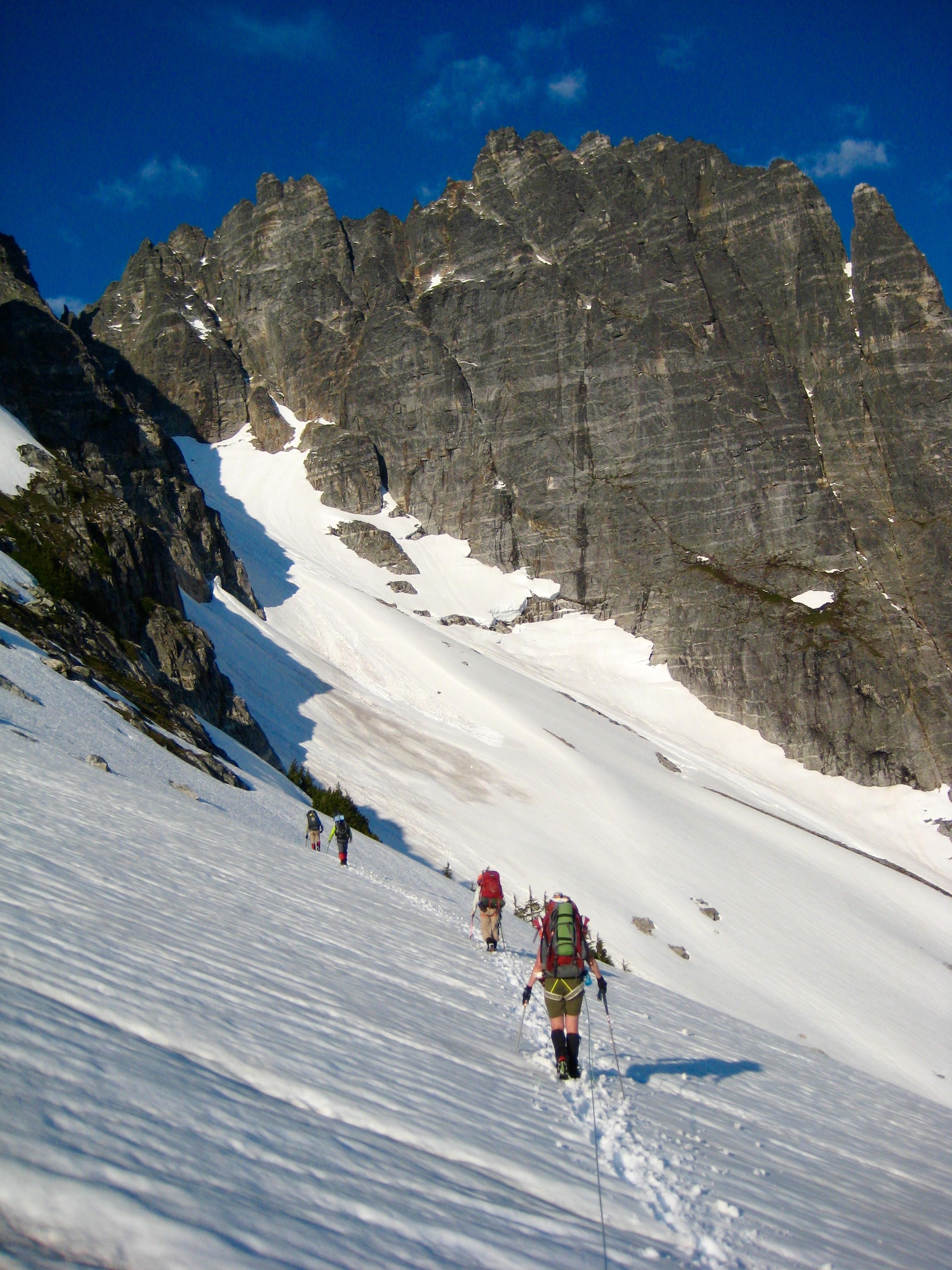
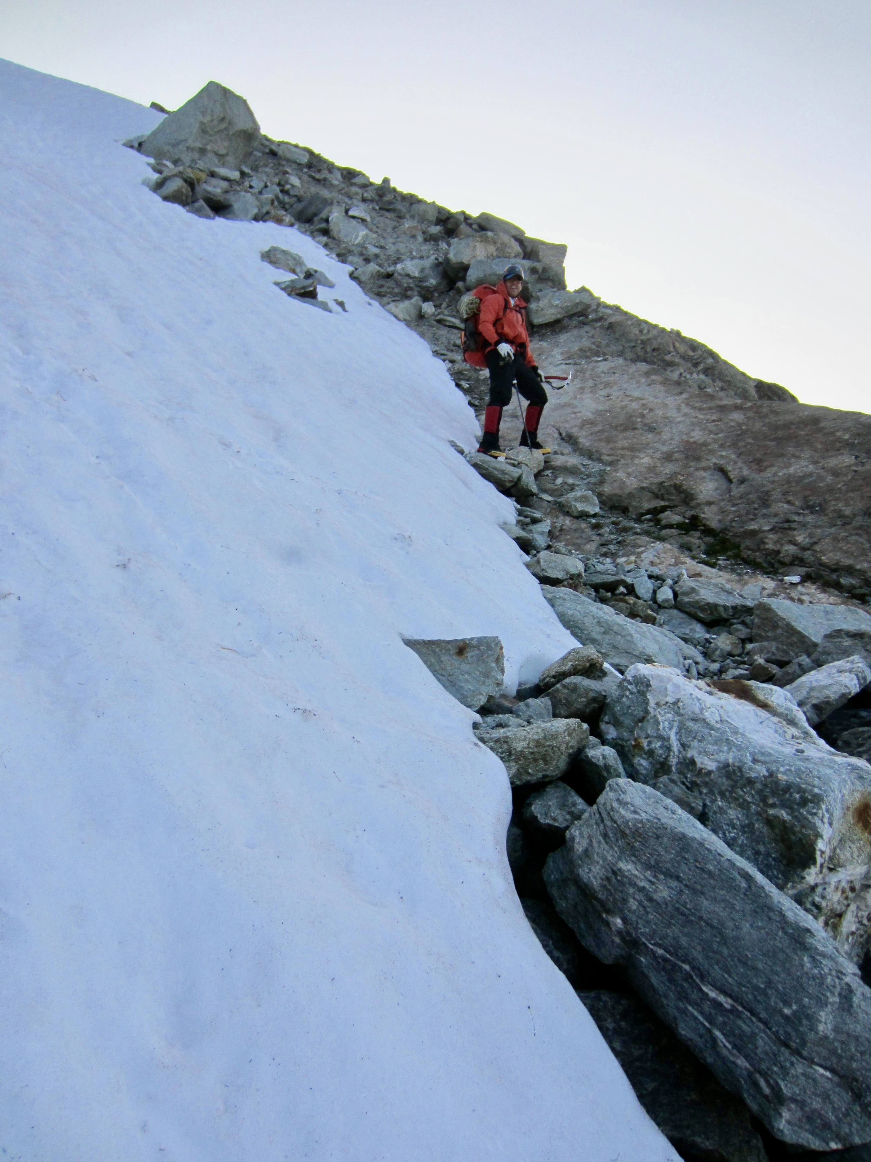
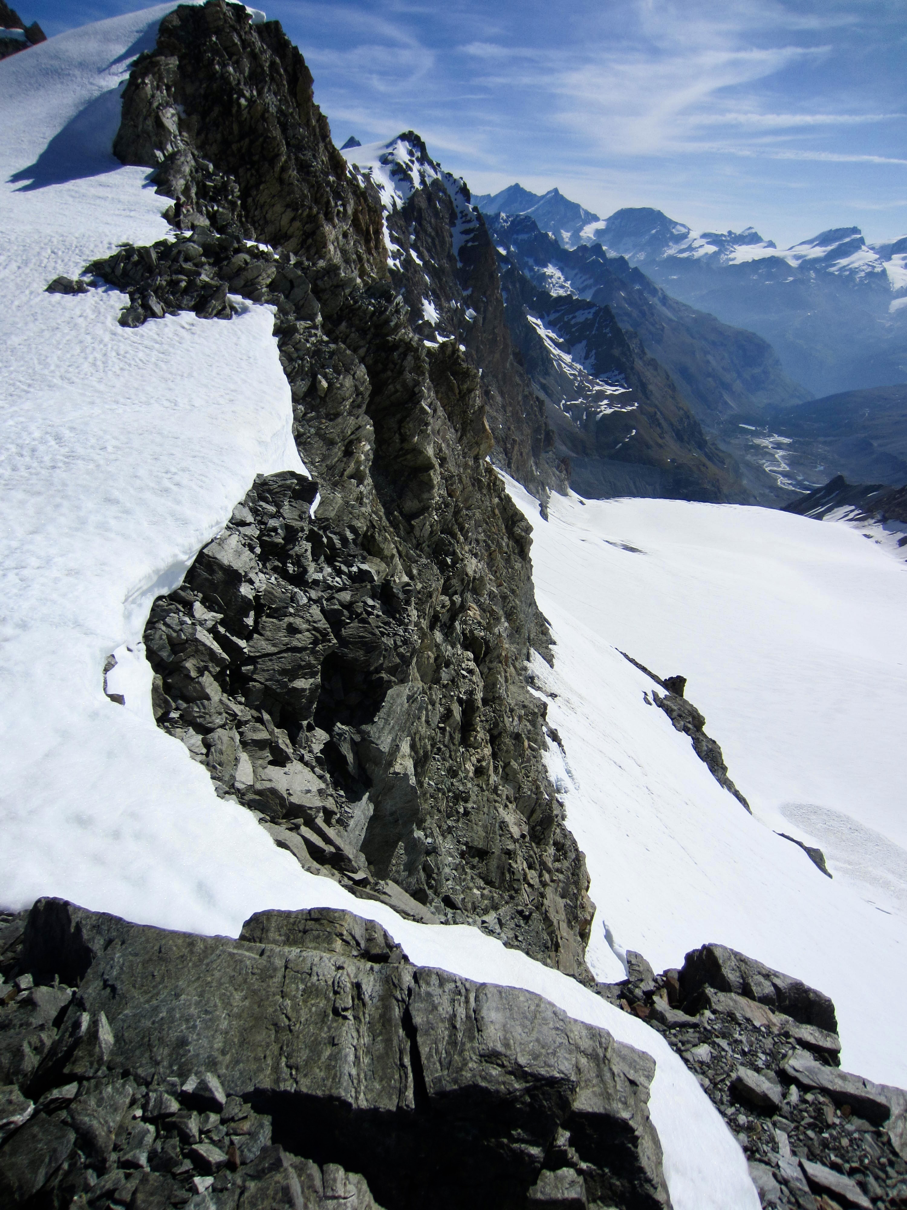
Our relief at finally reaching Cheilon Col was quickly replaced by dismay upon seeing the other side: A steep headwall of loose scree and snow separated us from the Cheilon Glacier below. This was the first serious terrain challenge of our traverse. We carefully picked our way down the scree, working around a cliff, and then backed down a 45-degree snow chute on front-points. When the angle eased off, we made a descending traverse into the glacial valley.
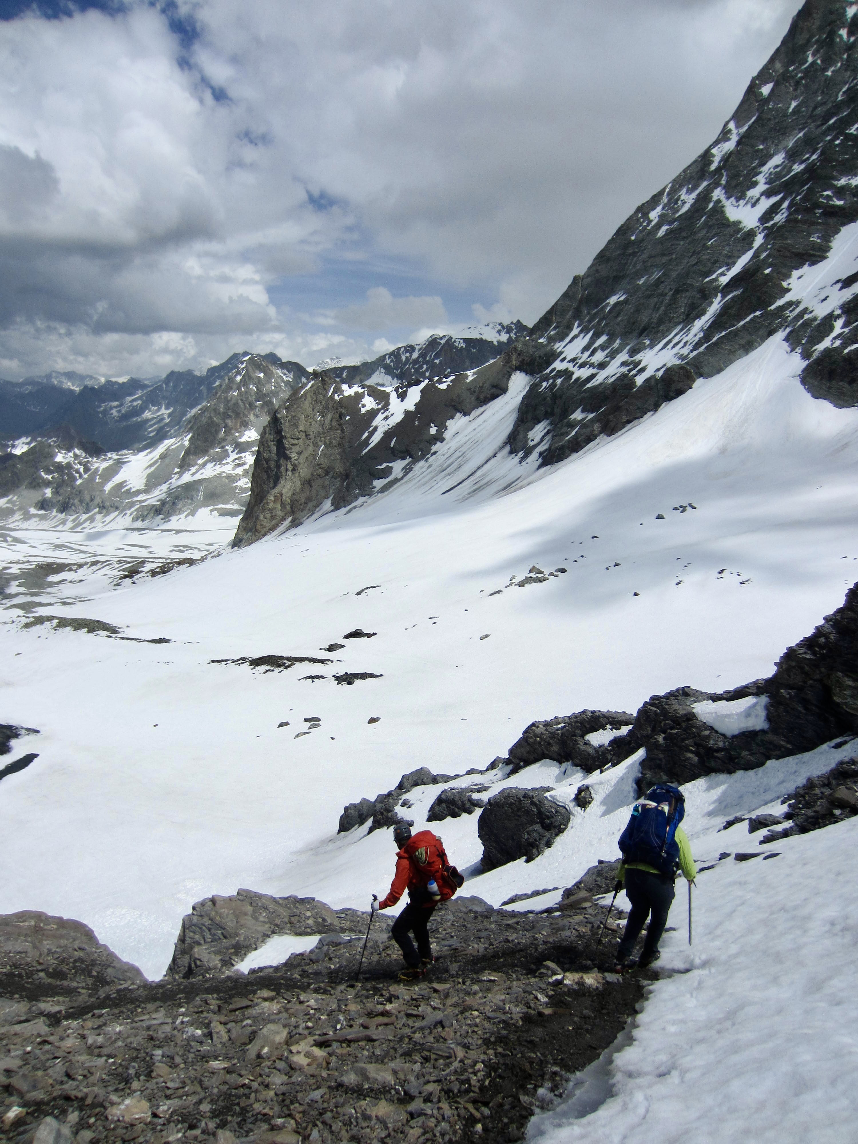
.

.
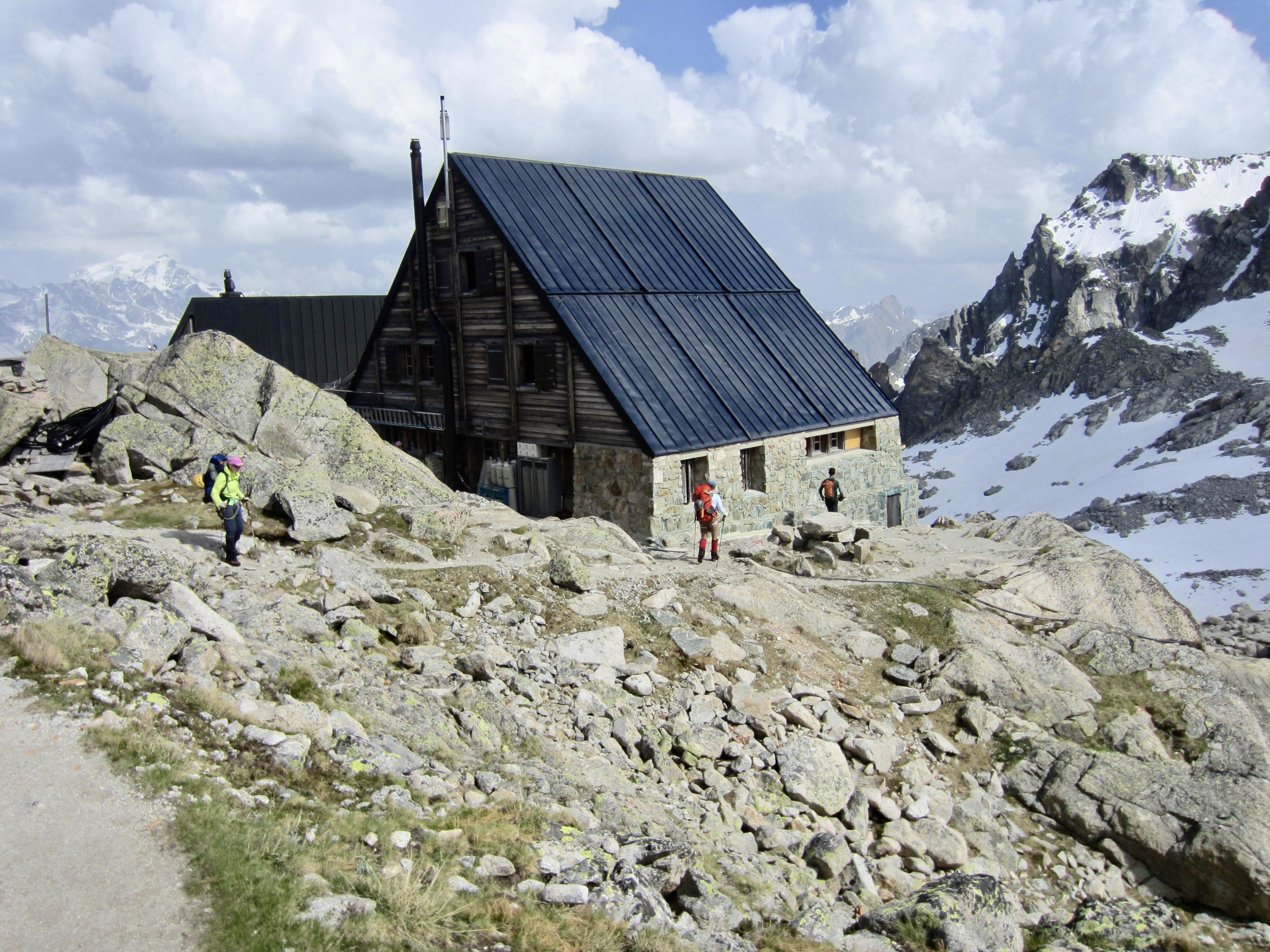
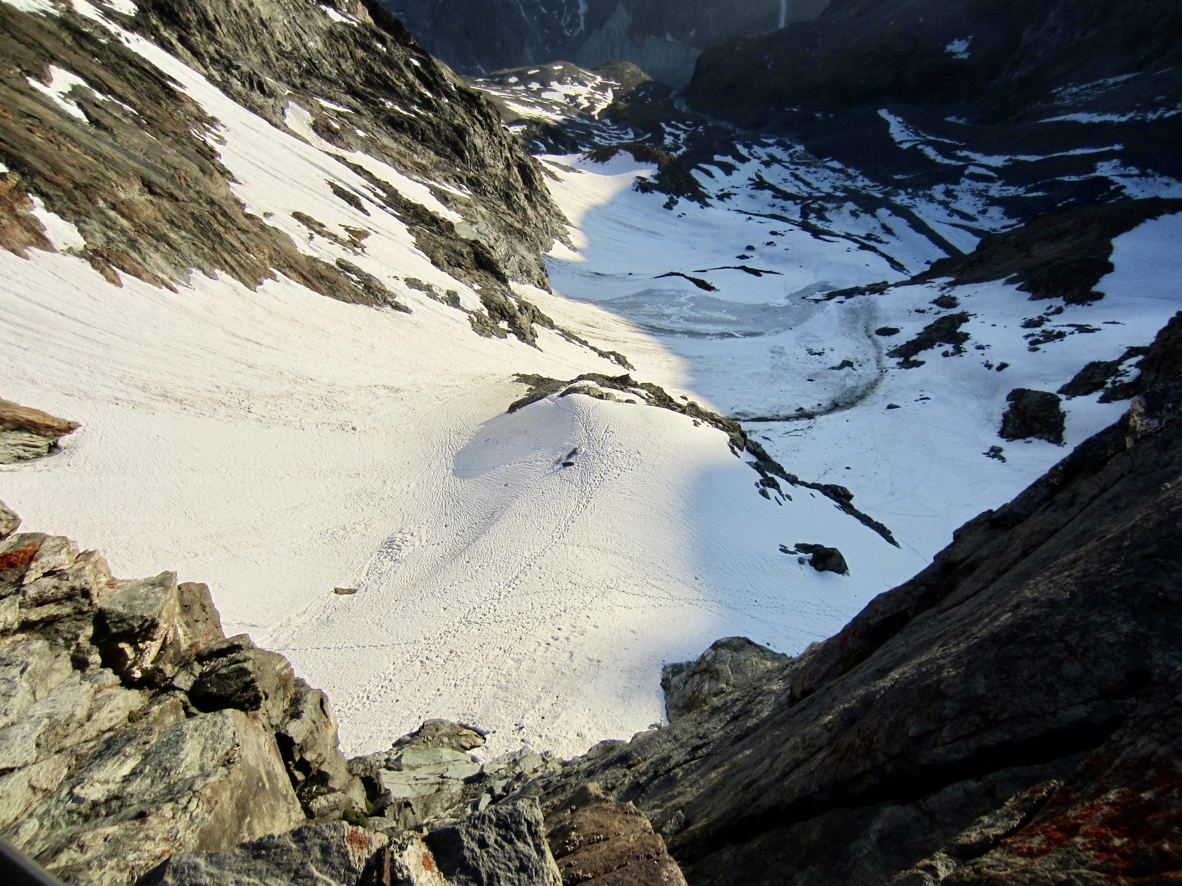
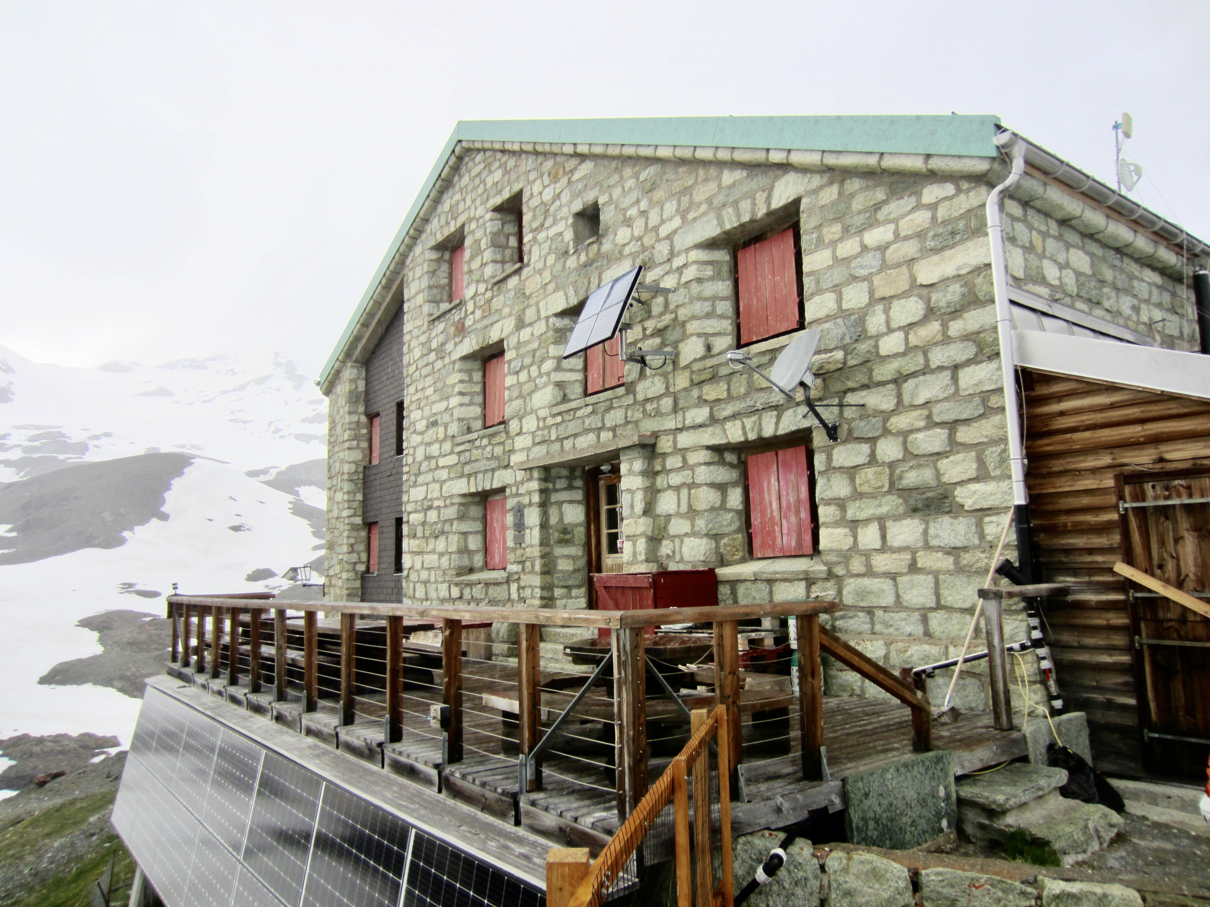
The Cheilon Glacier formerly flowed through the valley here, but it is now completely extinct, leaving a broad ablation plain of gravel, snow patches, and stagnant ice. We plodded down the gravel surface on a vague trail, arriving at Dix Hut during a late-afternoon rain squall.
.

.
Dix Hut is a three-story stone building that sits on a gravelly knoll overlooking the glacial valley. The winter room here consists of a dreary and musty little enclosure with a small table, meager kitchen, and six bunks—all in all, a far cry from Chanrion Hut, but it did provide welcome shelter from the rain. We were not allowed to use the stove for heating or cooking, so our freeze-dried dinners were again eaten cold.
.
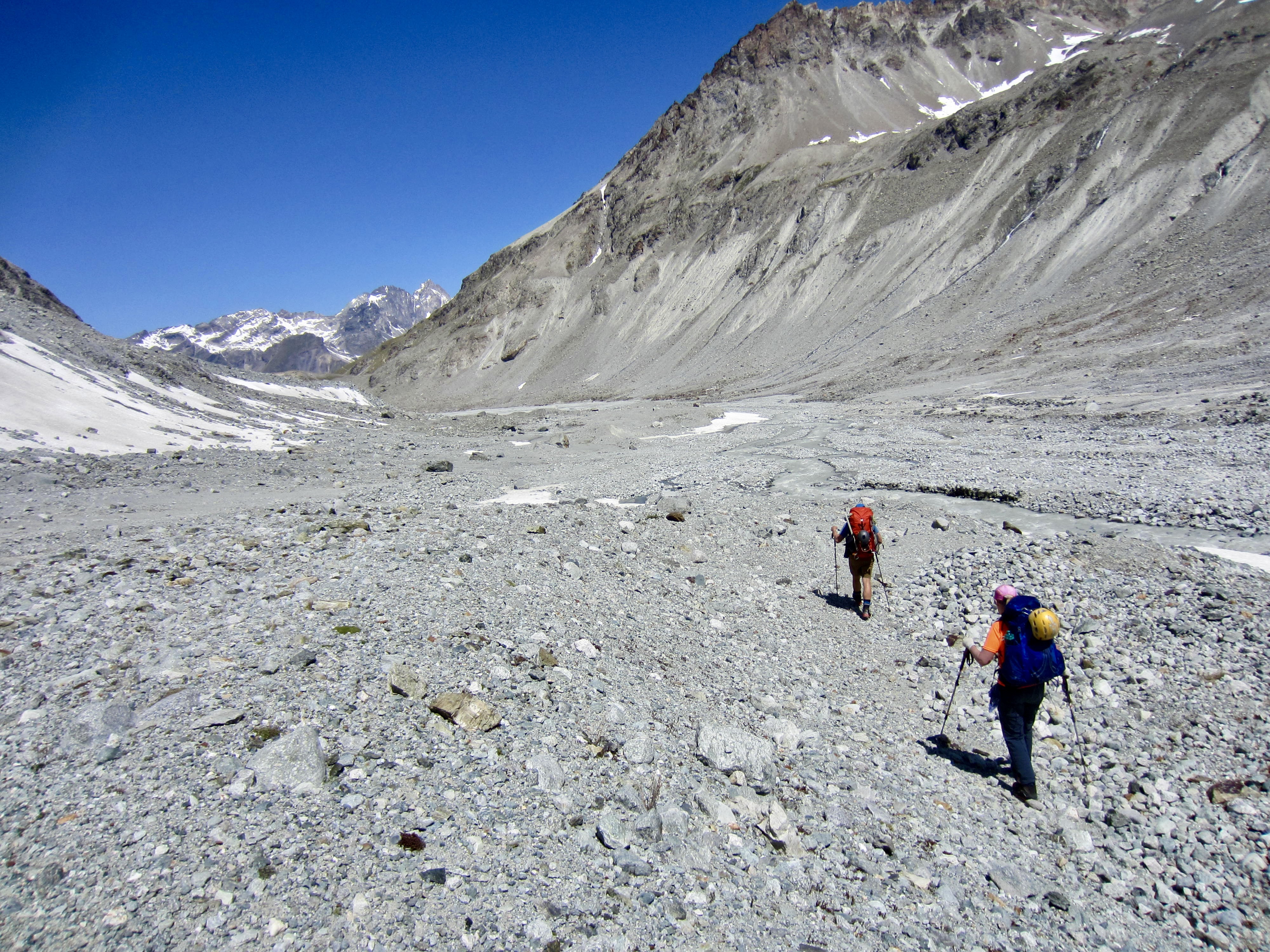
Day 5: Dix Hut to Vignettes Hut
Approximate Stats: 5.1 miles / 8.2 kilometers traveled; 3400 feet / 1040 meters gained; 2650 feet / 810 meters lost.
We left Dix Hut at 5:30am and headed across the Cheilon Glacier ablation plain. The information that we were able to obtain from guiding companies stated that today’s main challenge was to work around a feature called The Serpentine. Even the name was ominous!
.
.
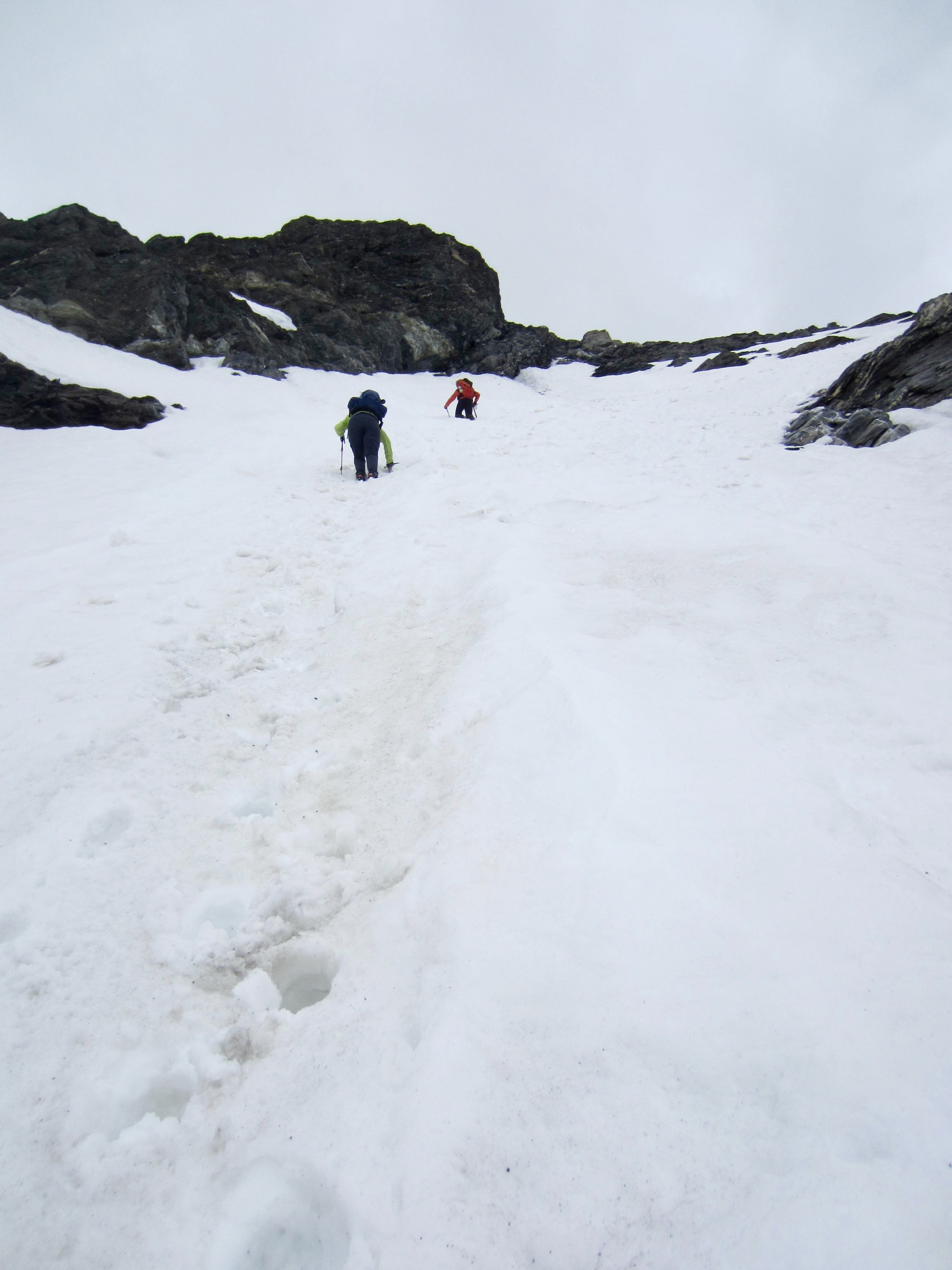
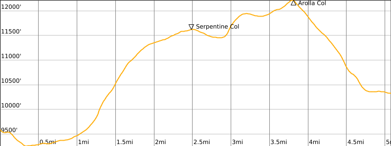
On the far side of the valley, we ascended a left-slanting ramp and then angled back to the right. The shady snow surface provided perfect crampon conditions as we readily gained elevation toward Serpentine Col.
.
.
By the time we reached Serpentine Col, the morning sun had turned our firm snow surface into an annoying breakable crust. Furthermore, the continuation route became very confusing. We initially crossed over the col and began descending, but we quickly realized that this was taking us in the wrong direction.
.
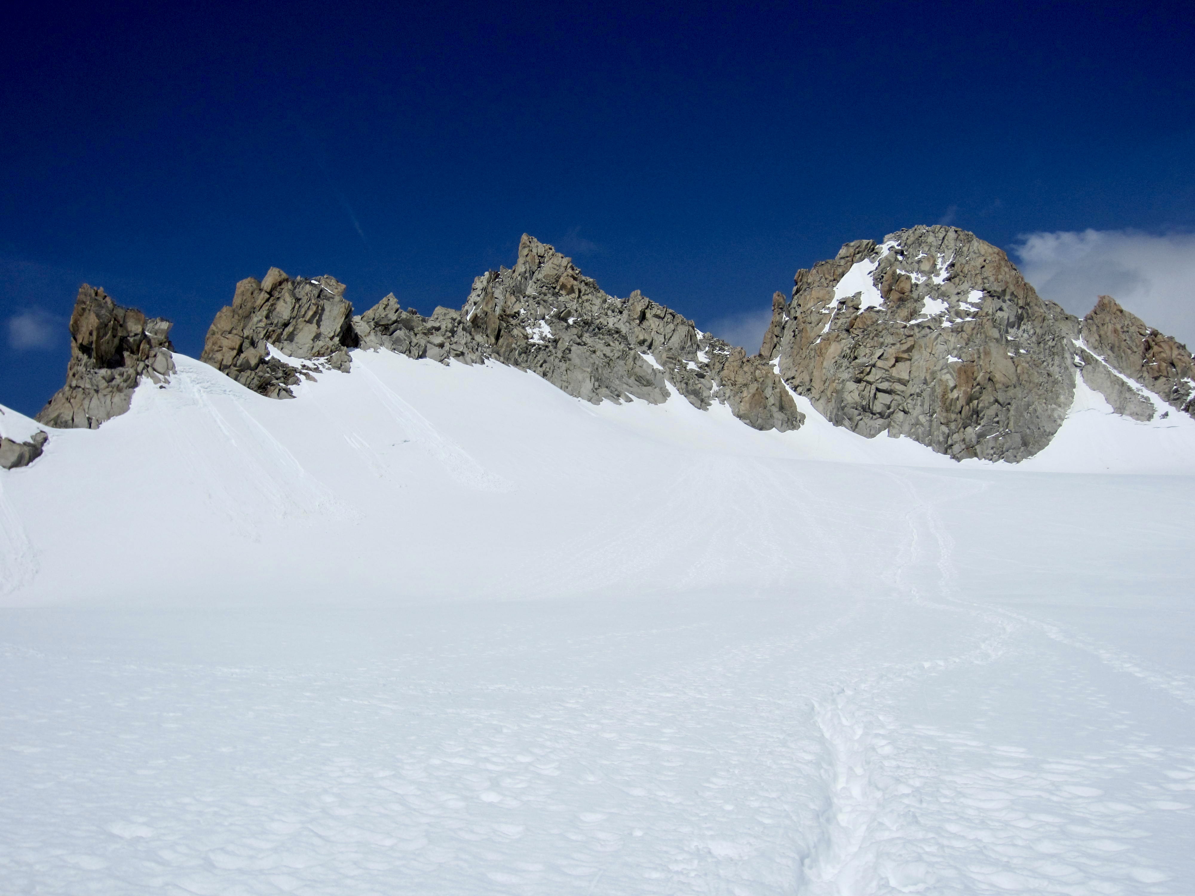
After backtracking to the col, we made a northerly traverse along the base of a long, corniced ridge. It then dawned on us that this ridge is in fact an arm of a nearby peak called La Serpentine. On a map, the peak’s north ridge extends out like a serpent.

.
Getting over Serpentine Ridge involved zigzagging up a steep slope at the northern end. When this slope is icy, the mountain guides typically set up belays. For us, it required bulldozing a track through breakable crust over mushy snow. Jon took the lead for this exhausting work.
.
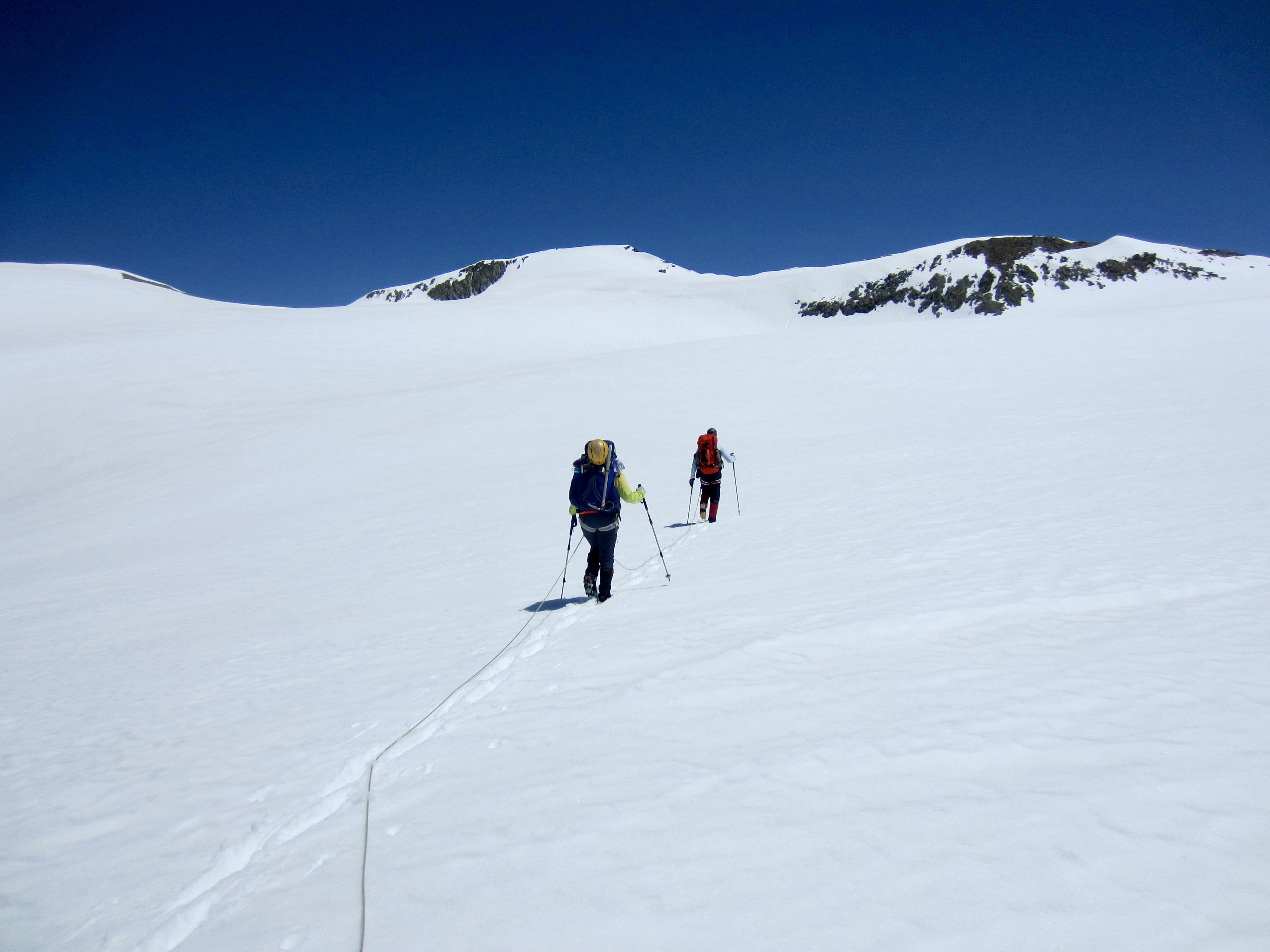
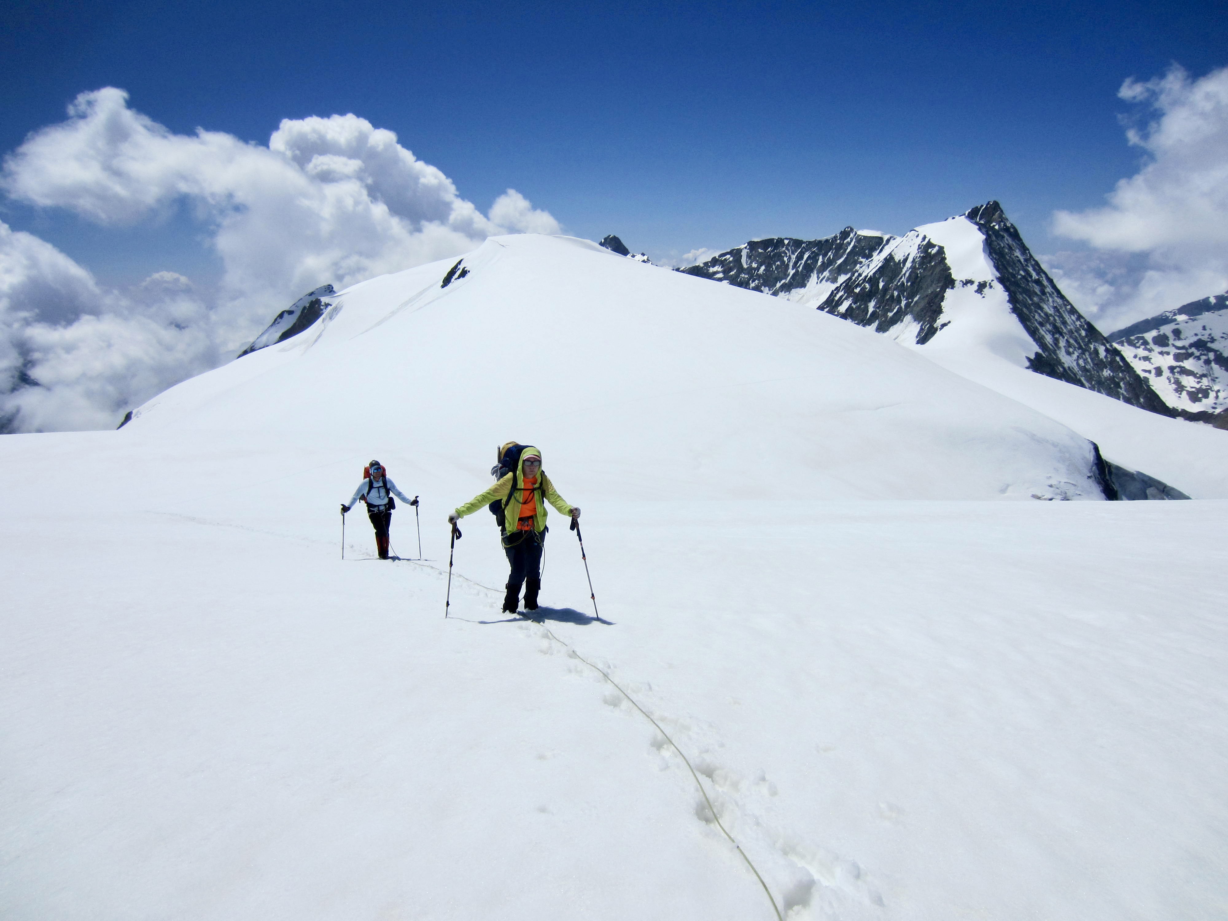
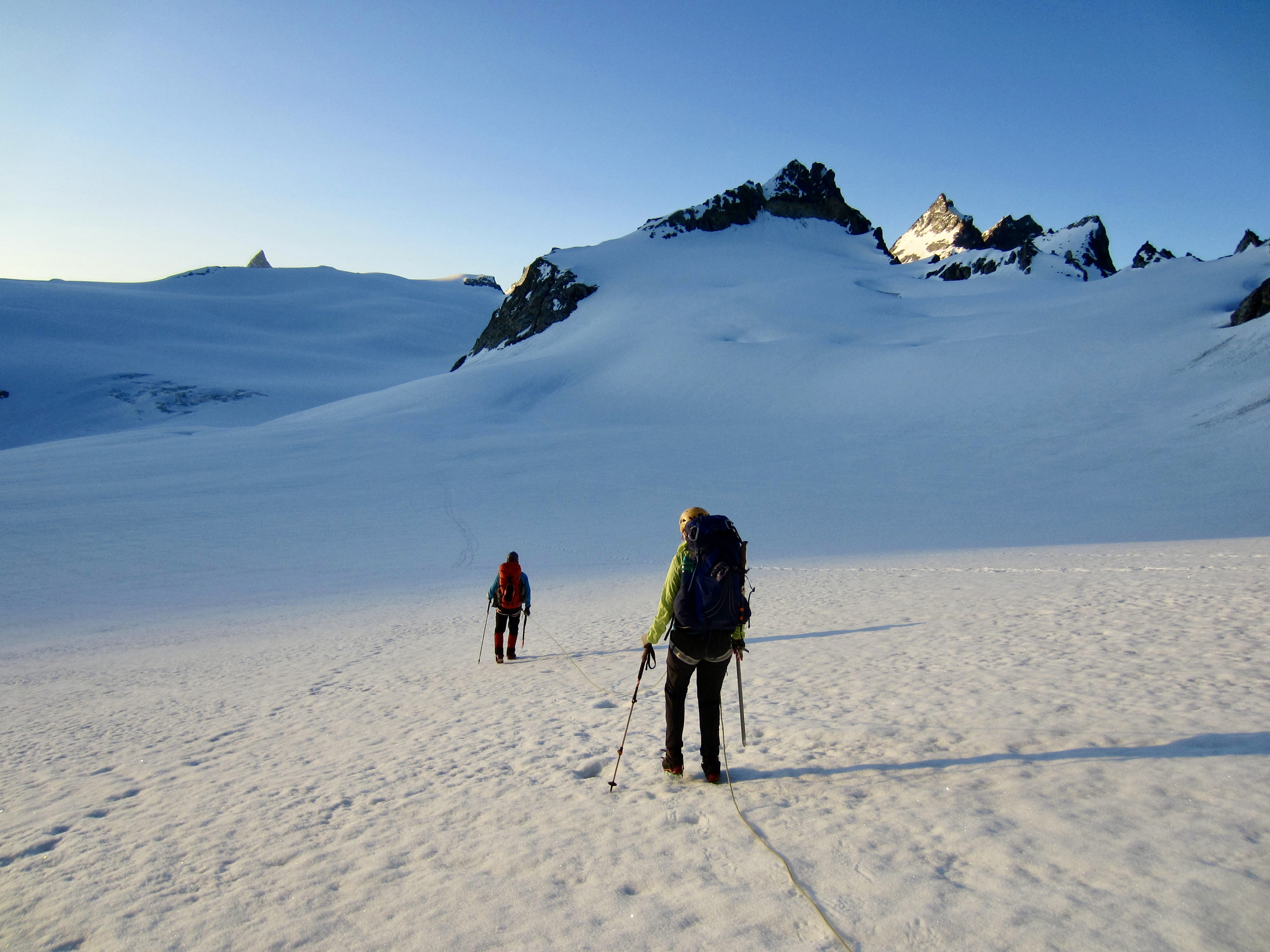
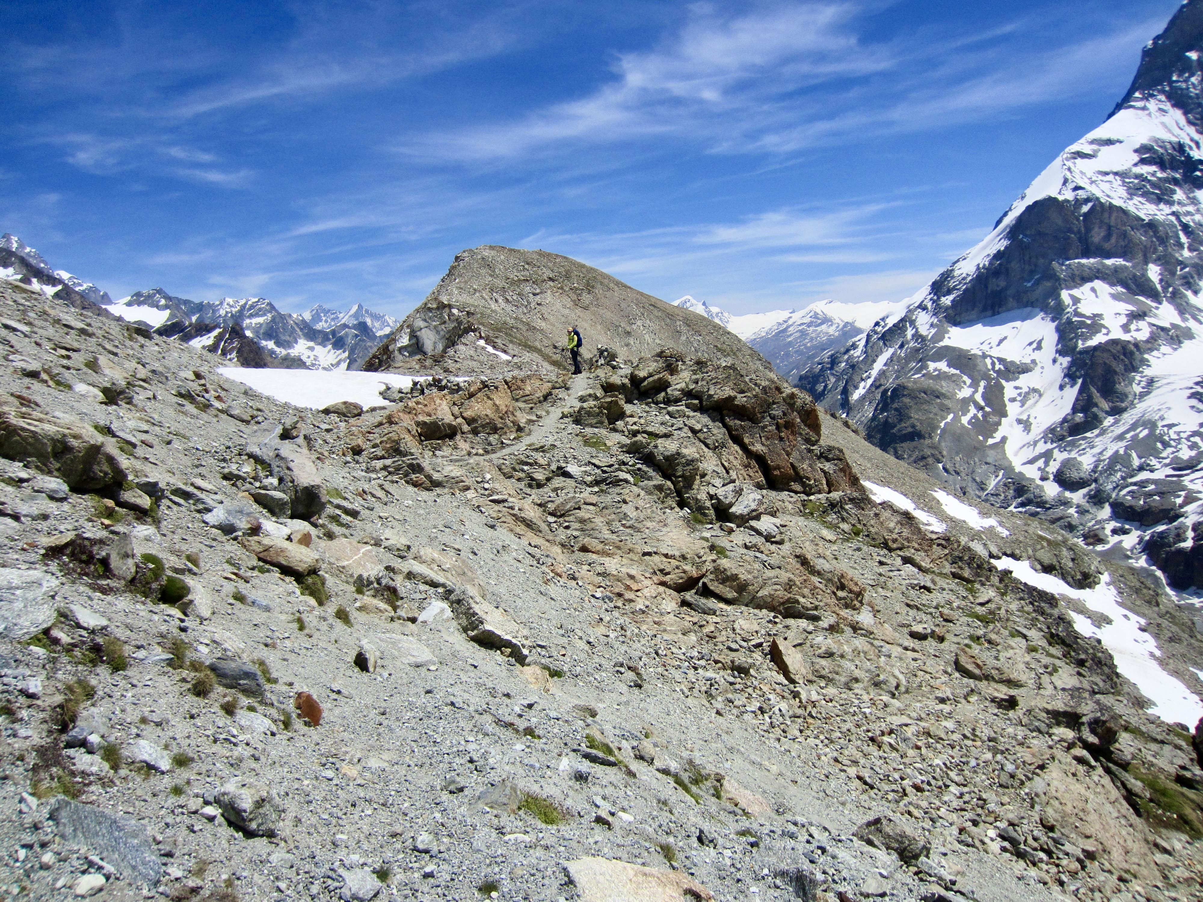
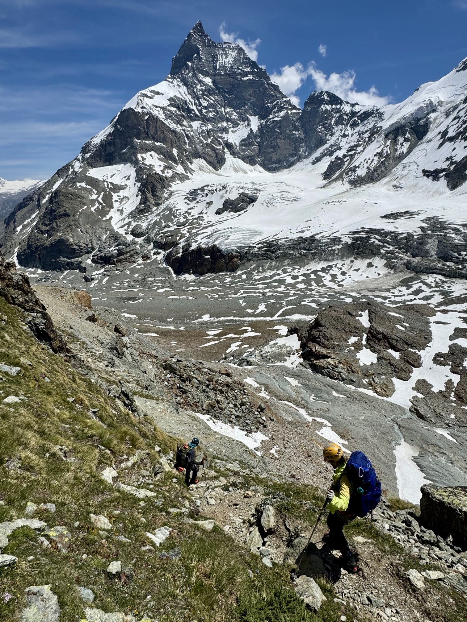
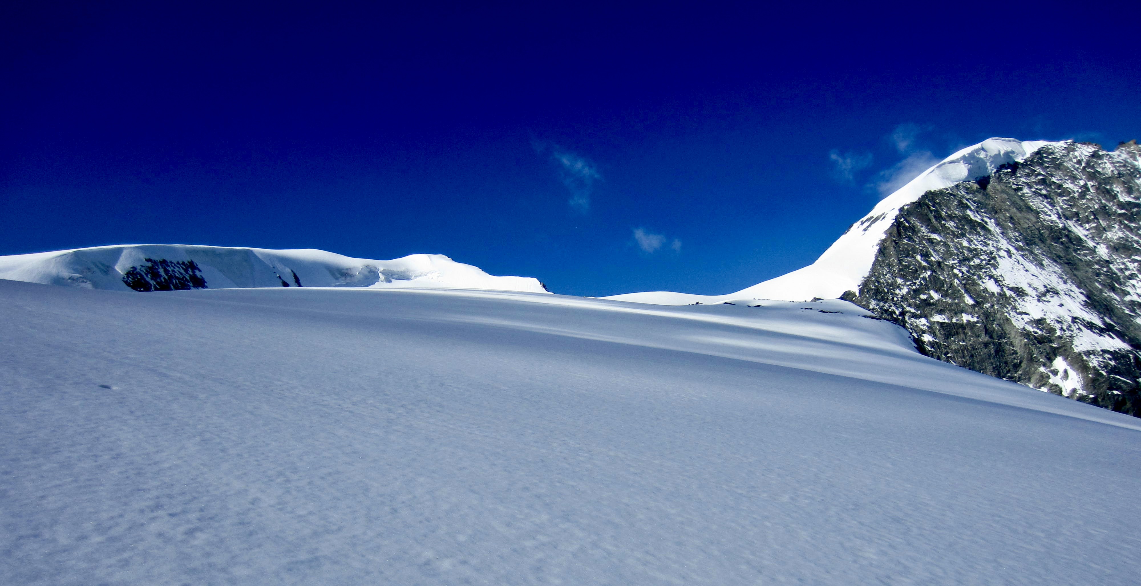
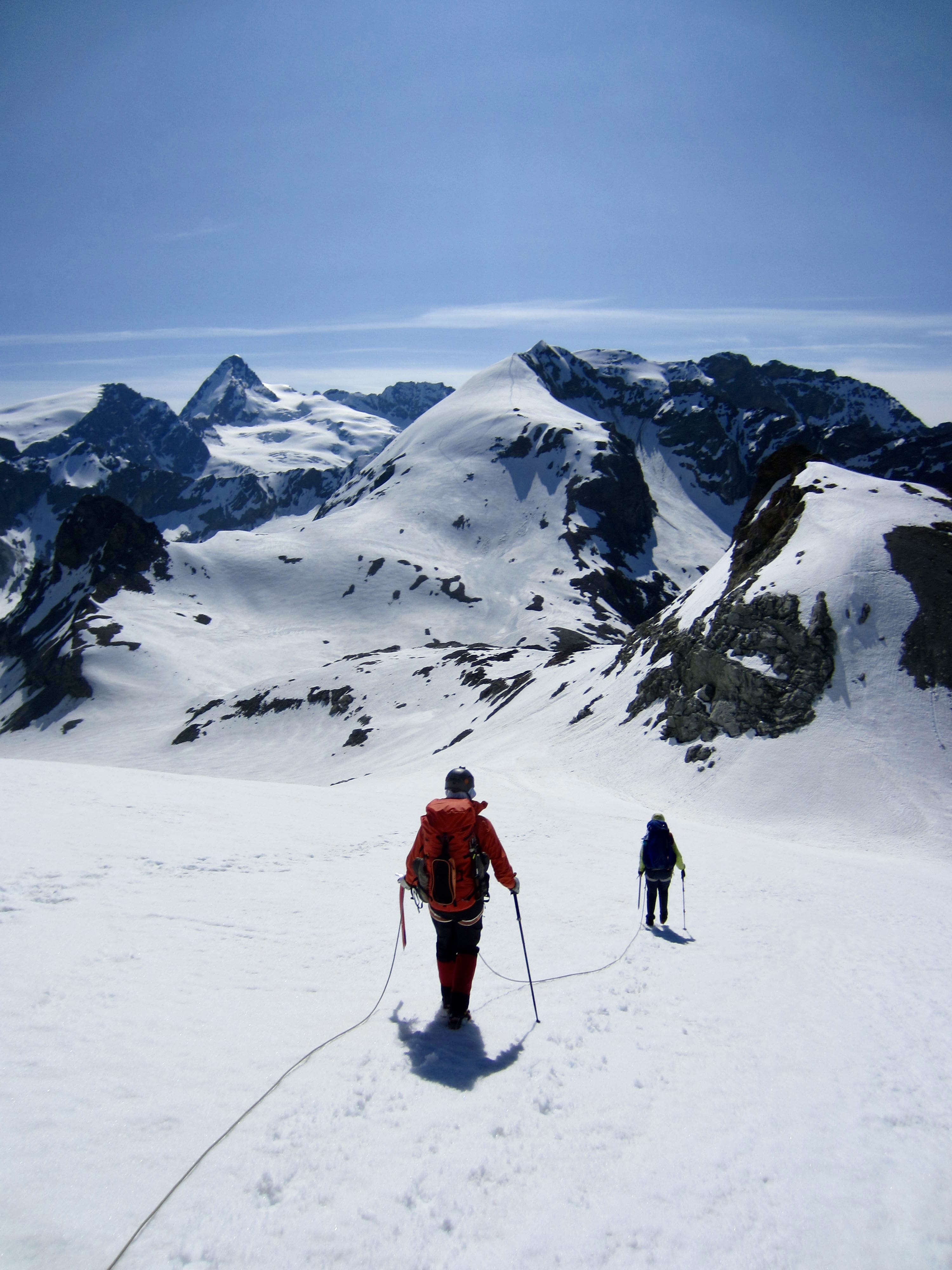
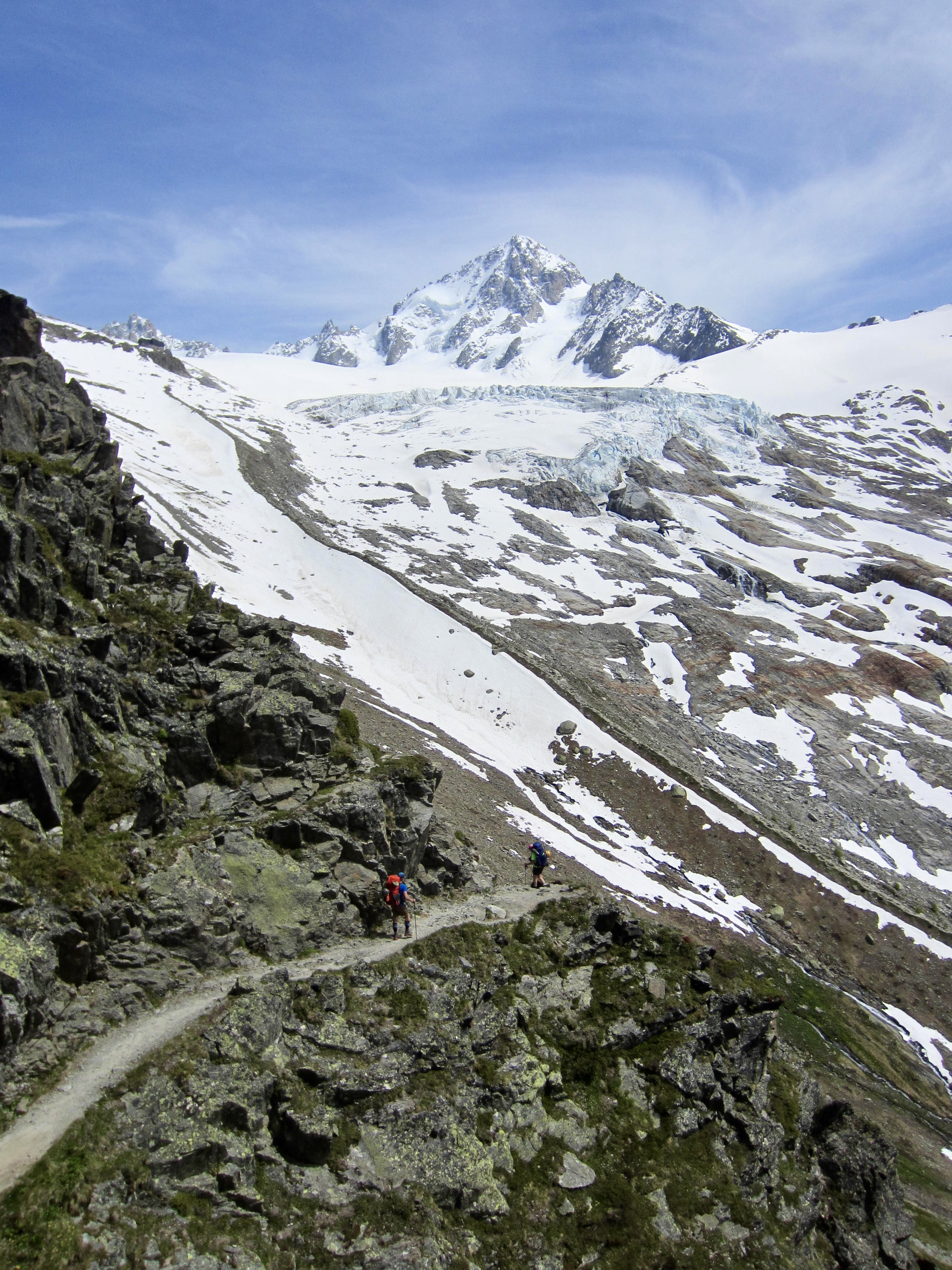
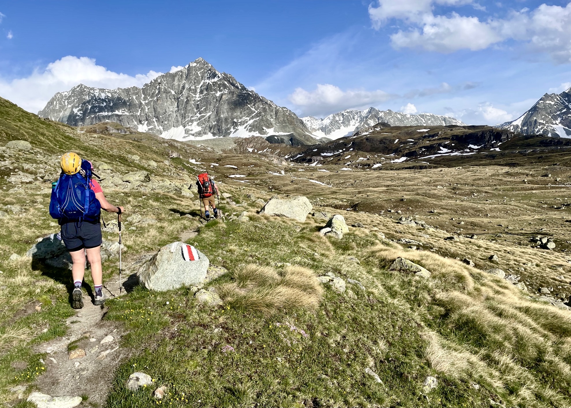
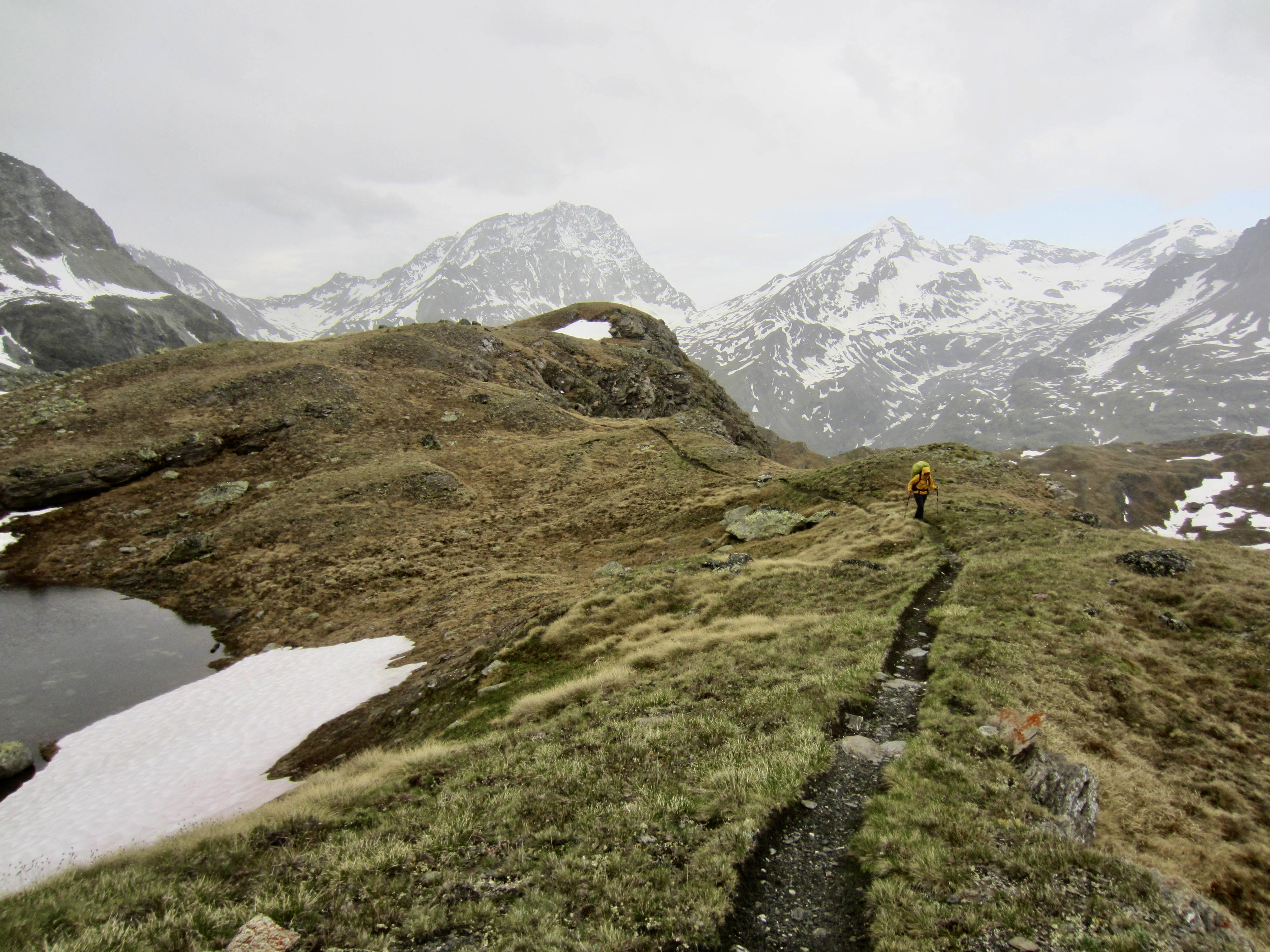
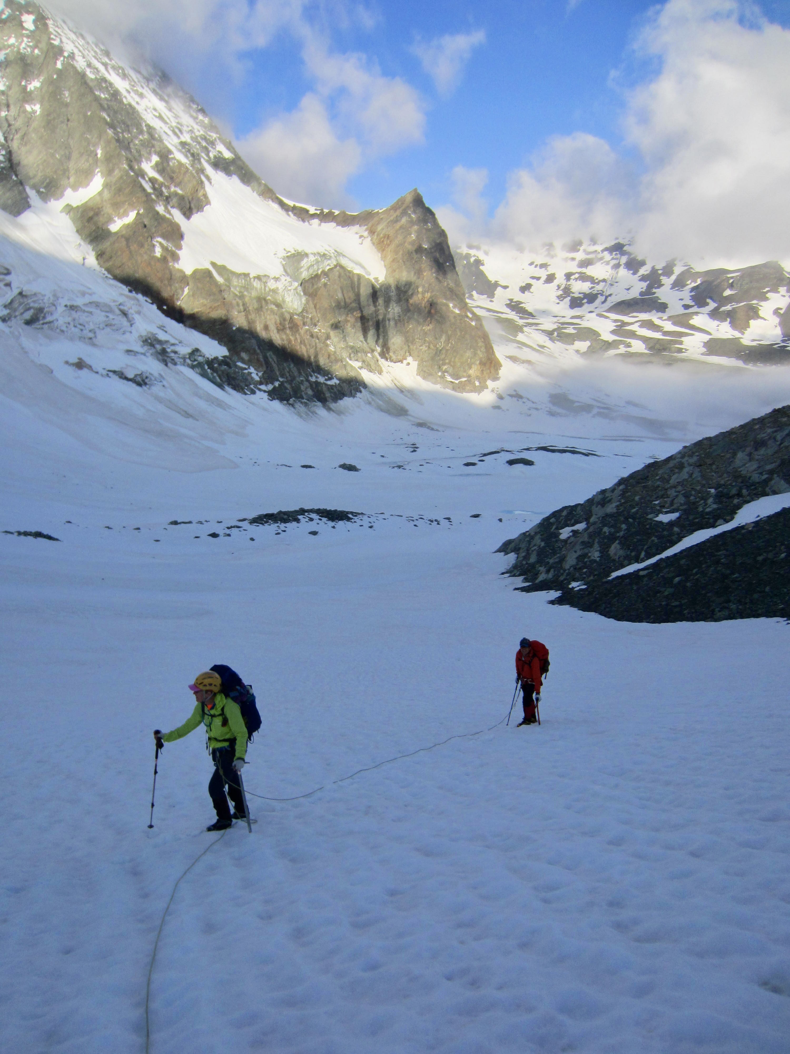
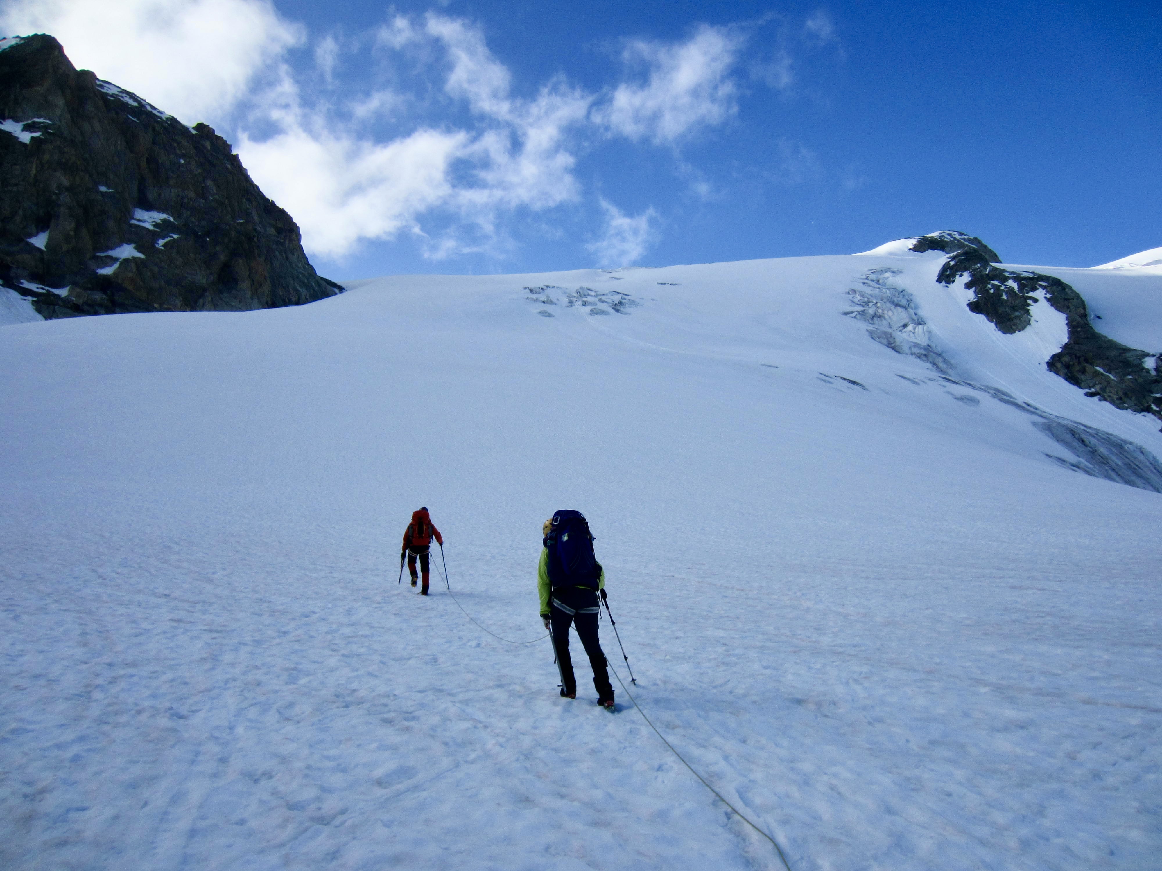
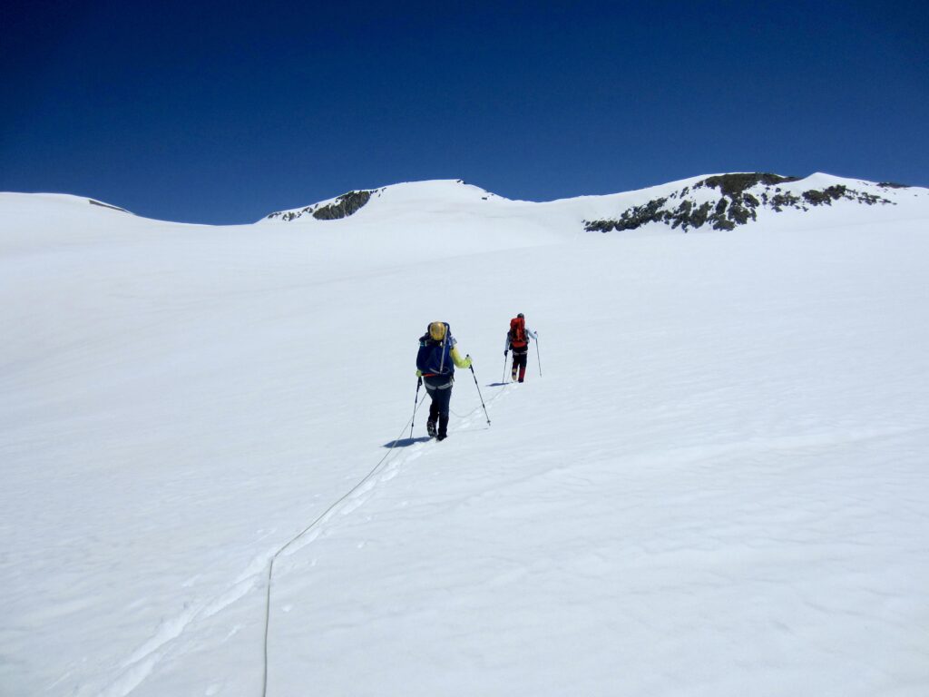
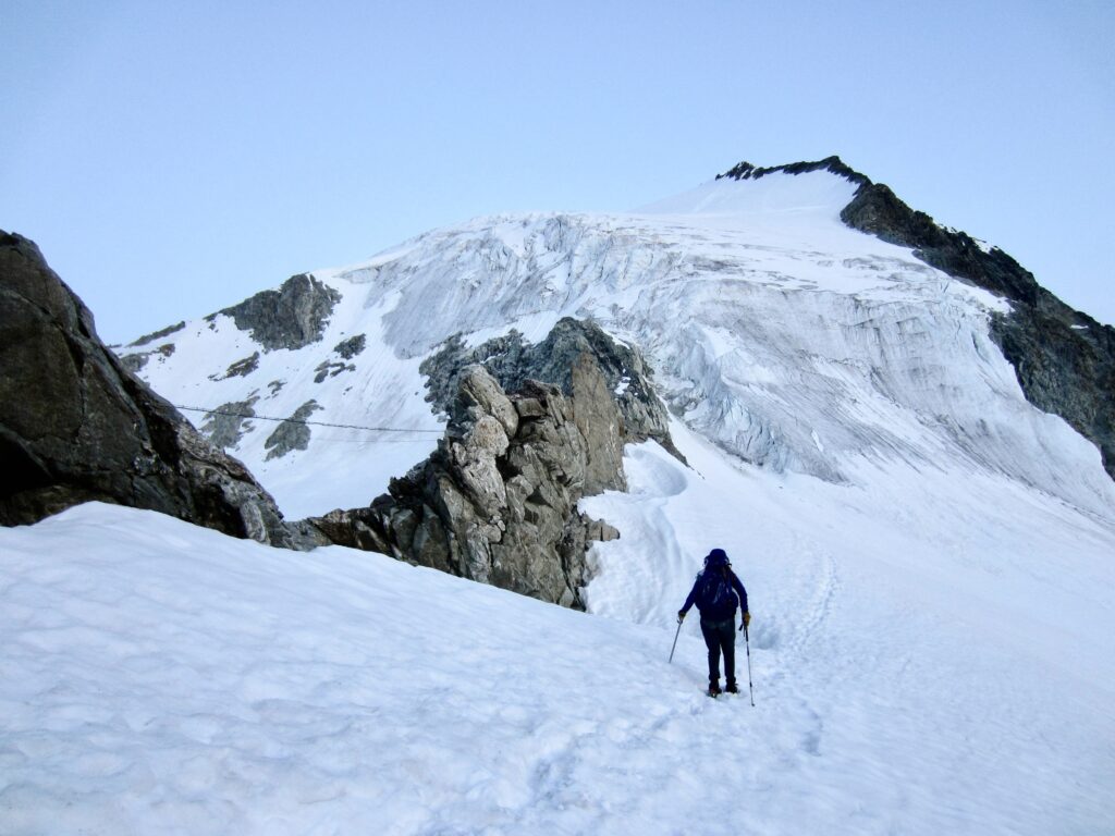
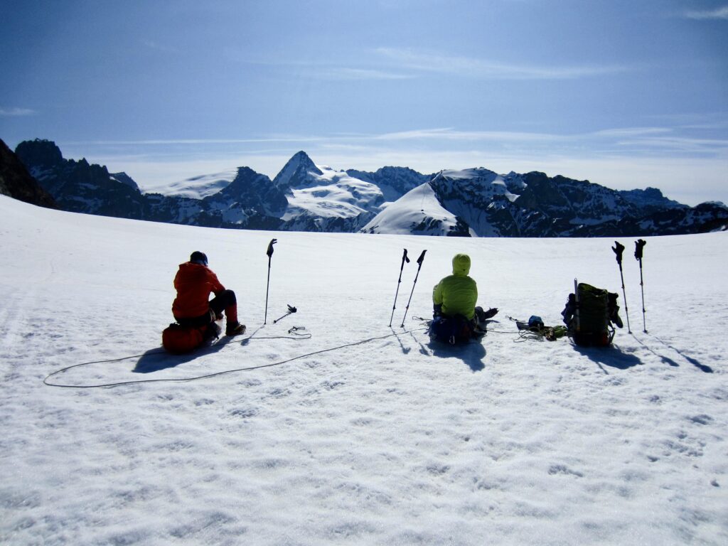
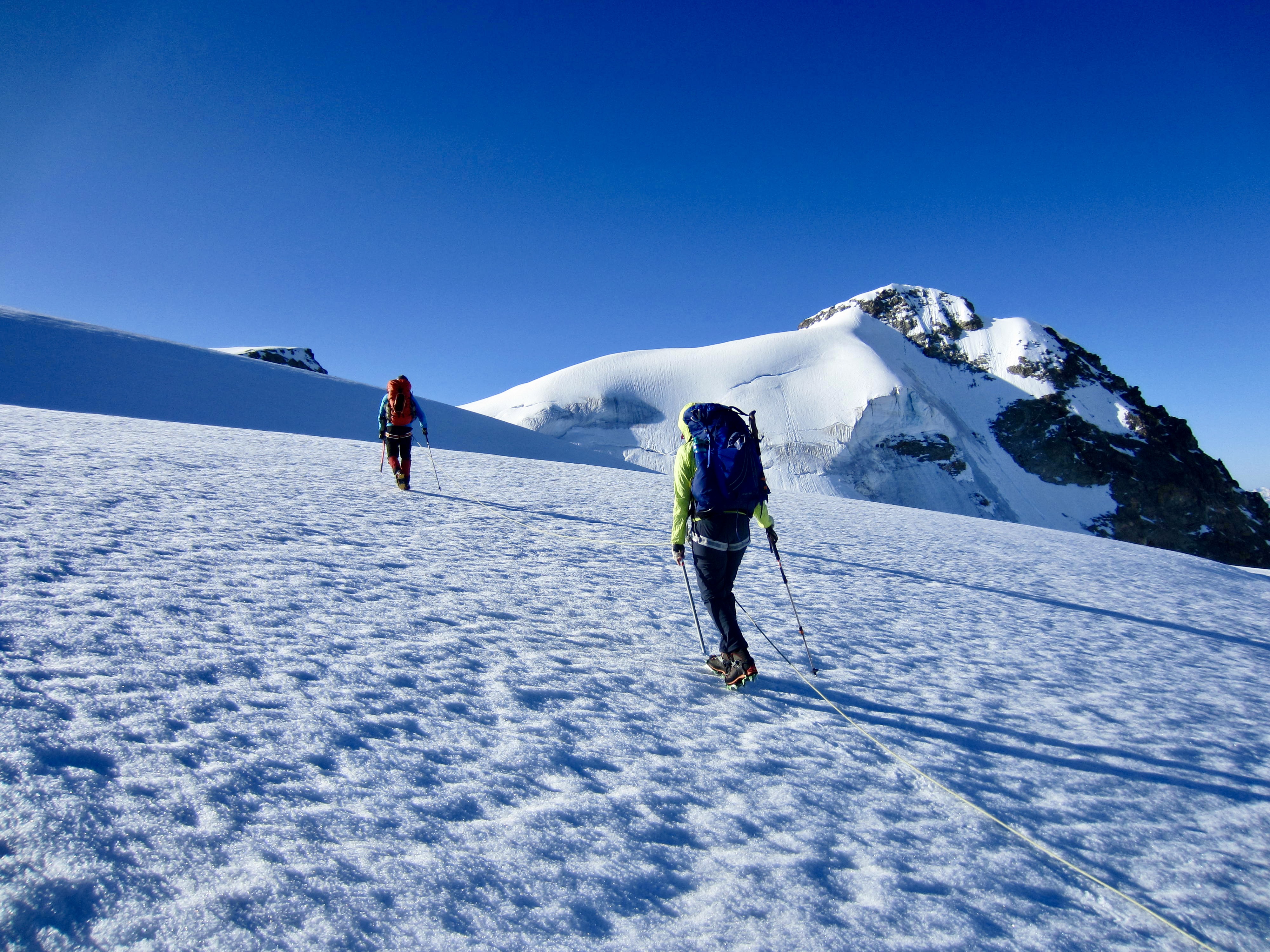
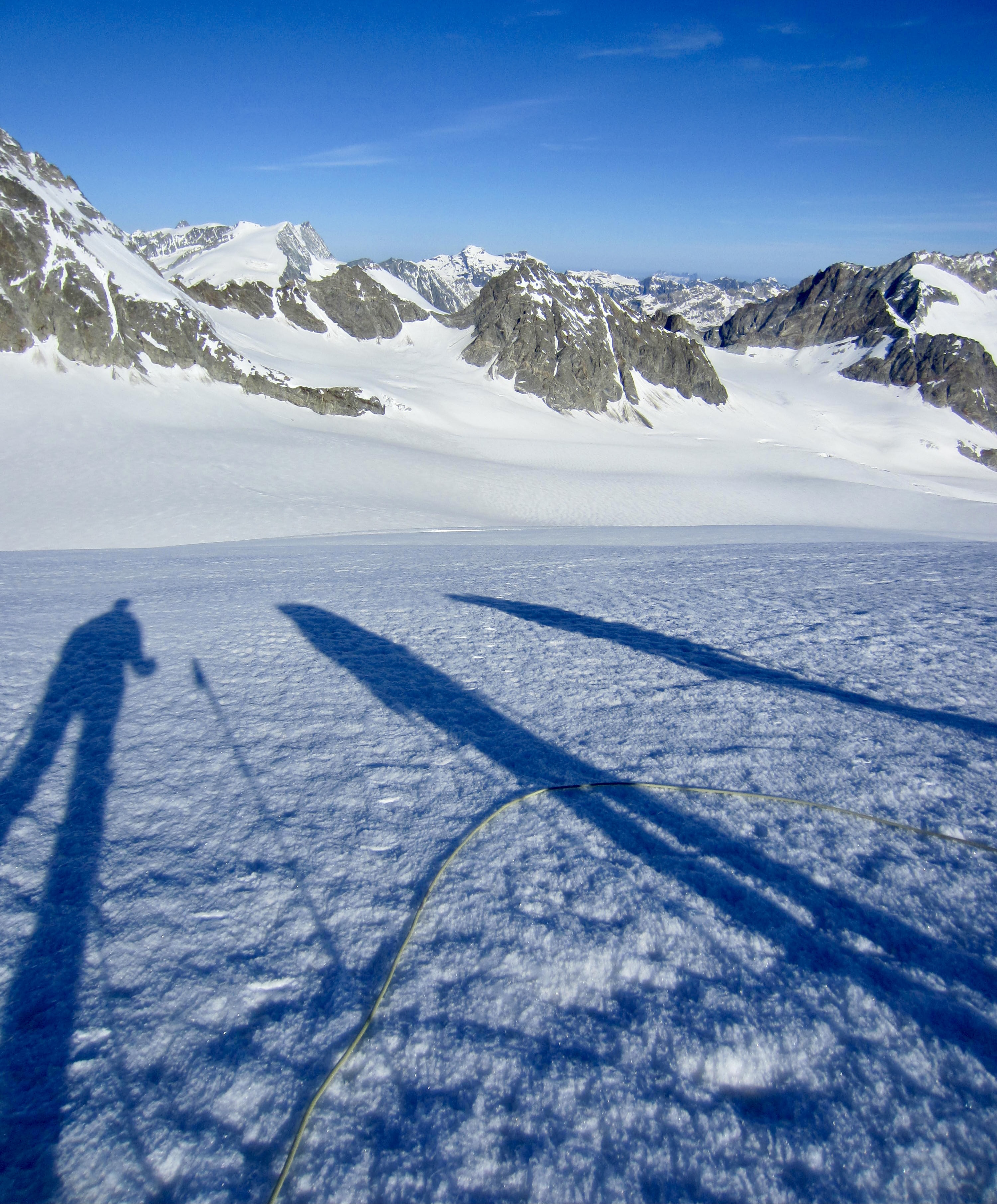
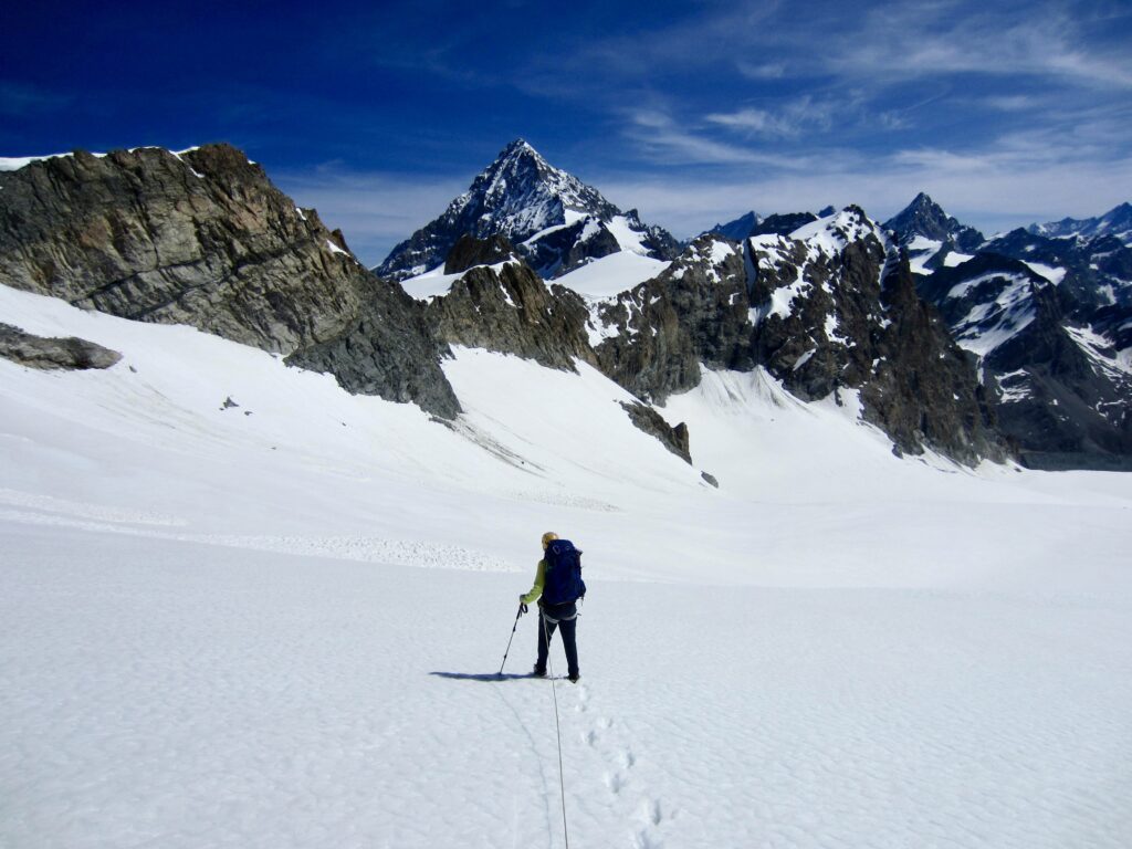
After topping out on Serpentine Ridge, we made a low-angle traverse over to Arolla Col. This 12,220-foot / 3,720-meter saddle represents the highest point in our entire Haute Route traverse. It gave us a fresh eastward view into the Pennine Alps.
.

.
From Arolla Col, we followed a fairly recent boot track down the Upper Piece Glacier. It appeared that these tracks had been made by a party coming up the Lower Piece Glacier to climb Pigne d’Arolla—the “Arolla Pine Cone.”
.
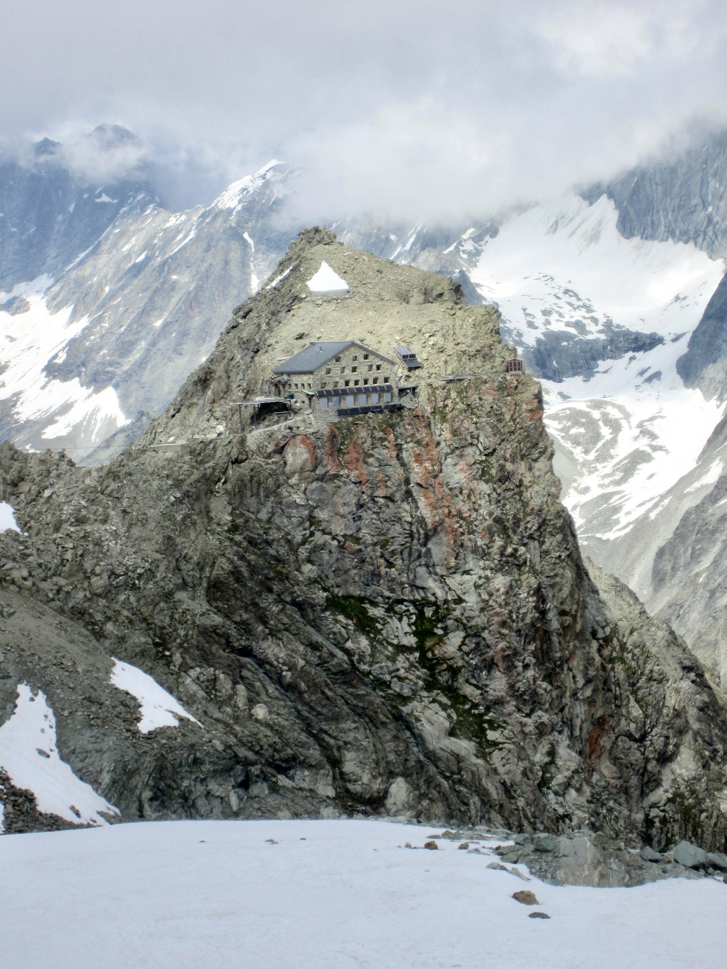
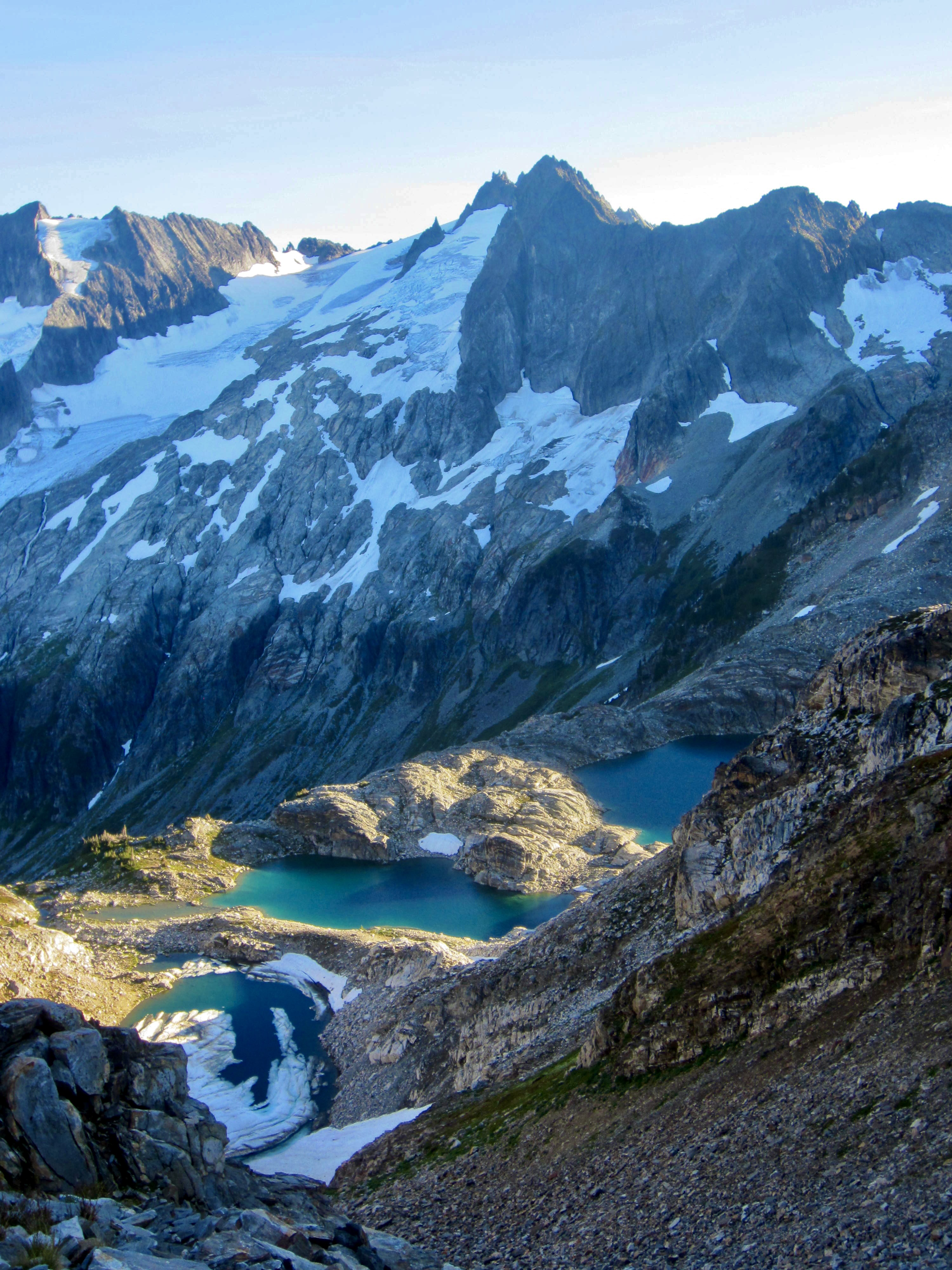
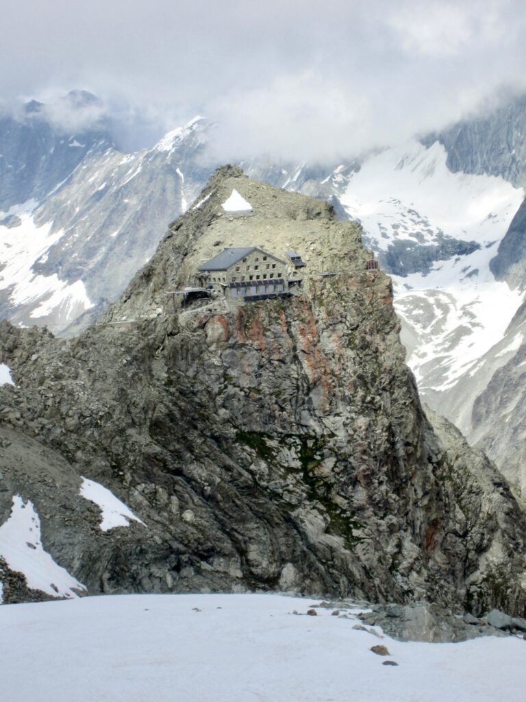
Upon reaching the bottom of the glacier, we got our first view of Vignettes Hut perched in a seemingly precarious manner on a rock knob. Our reaction was a combination of awe and incredulity; it looked like a computer-generated image in a fantasy movie!
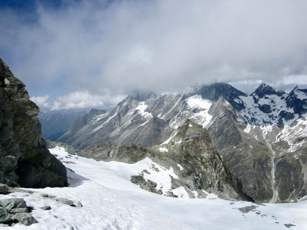
.
.
We traversed over to the knob, expecting to find a good access trail, but there was nothing visible. Instead, we had to cross a steep snow slope above the Piece Glacier. They certainly didn’t make this one easy to reach!
.
Inside the front door of Vignettes Hut is a long hallway with a row of arched windows overlooking the Arolla Glacier. This visually stunning hallway serves as a gear room for the entire hut. One doorway opens into the actual winter room, which is equipped with two tables, a gas cooktop, and a woodstove. For the first time in the past three nights, we were able to have a hot dinner.
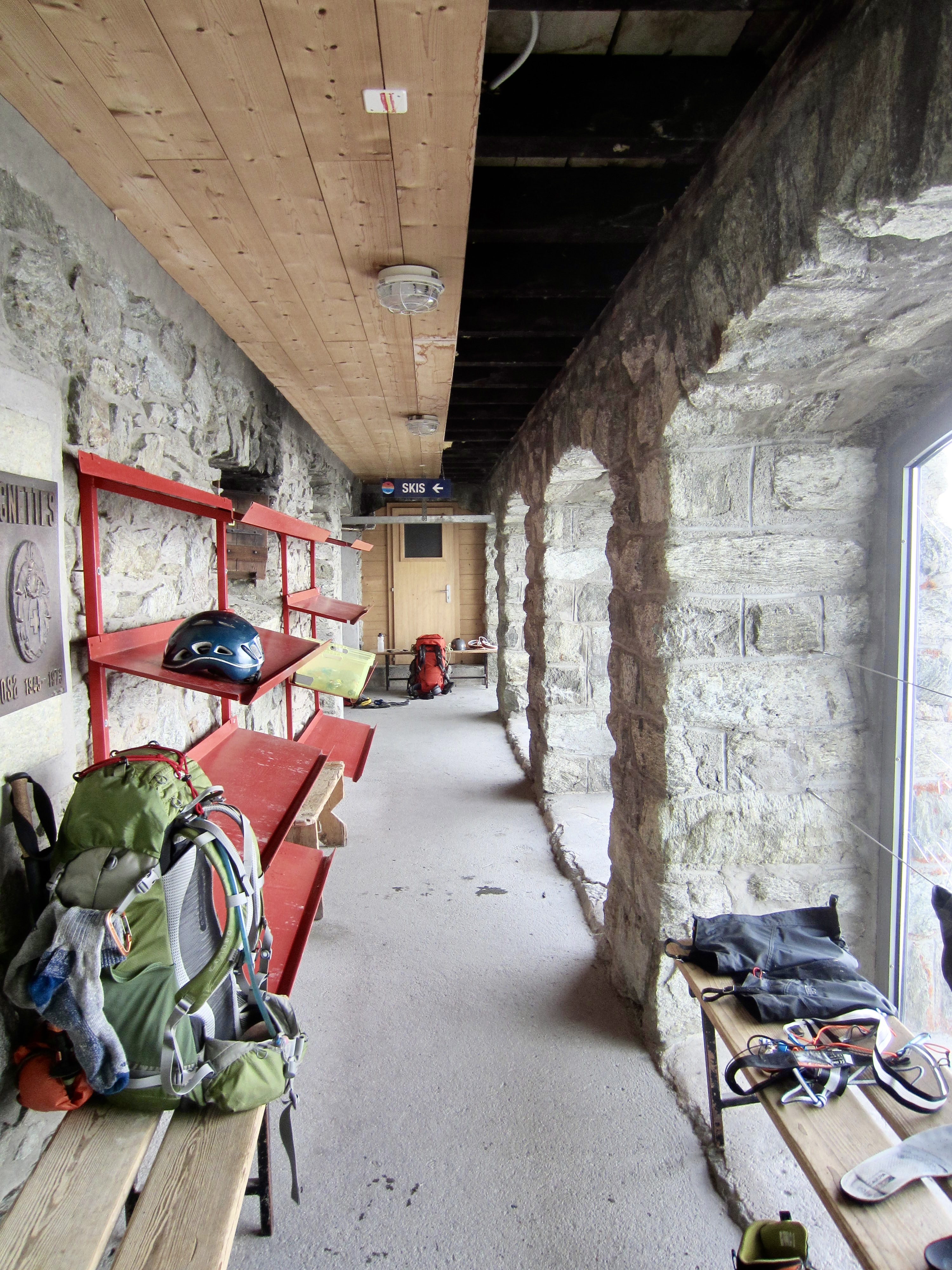
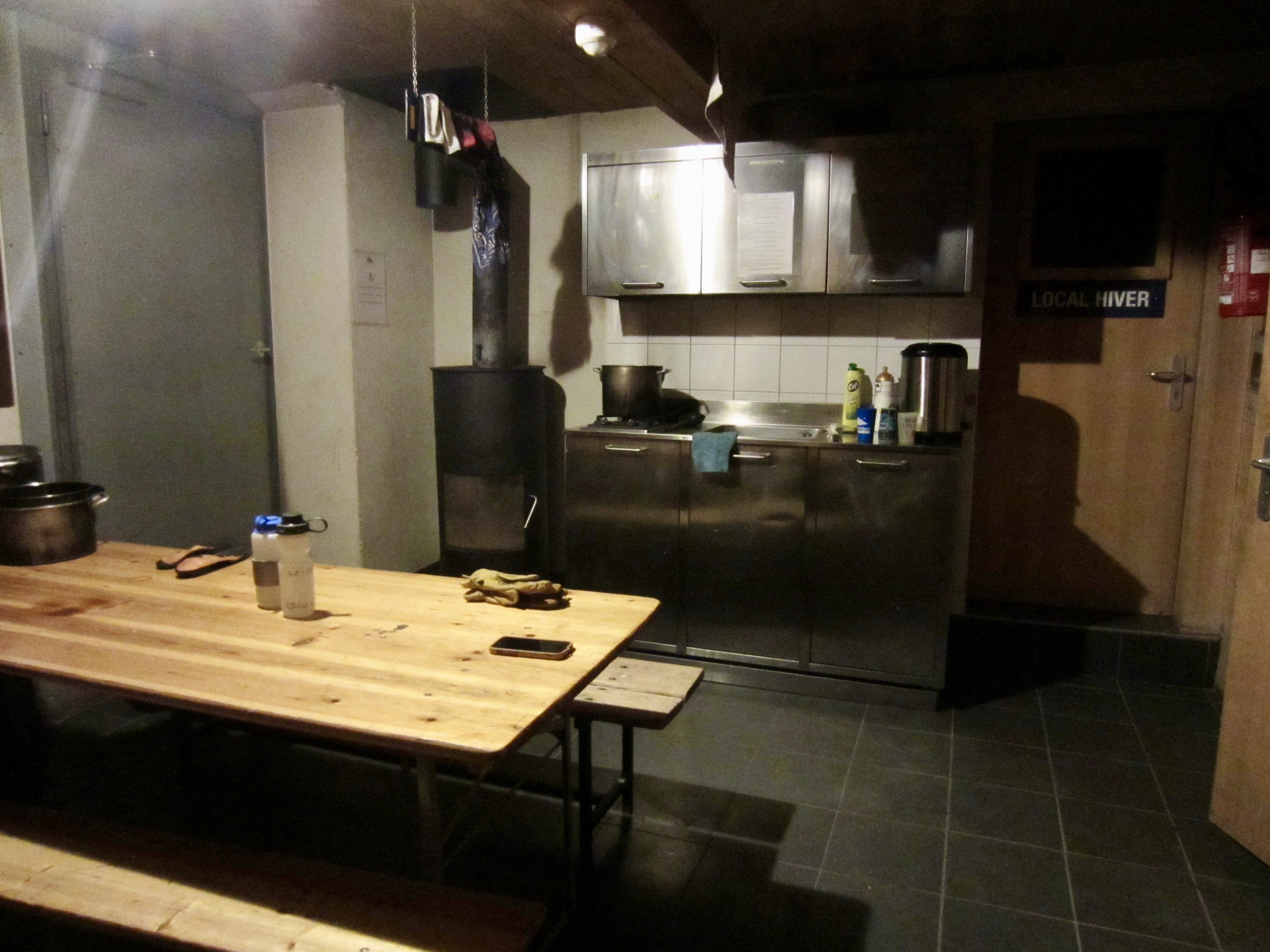
.
Day 6: Vignettes Hut to Bertol Hut
Approximate Stats: 8.7 miles / 14.0 kilometers traveled; 3850 feet / 1170 meters gained; 3400 feet / 1040 meters lost.
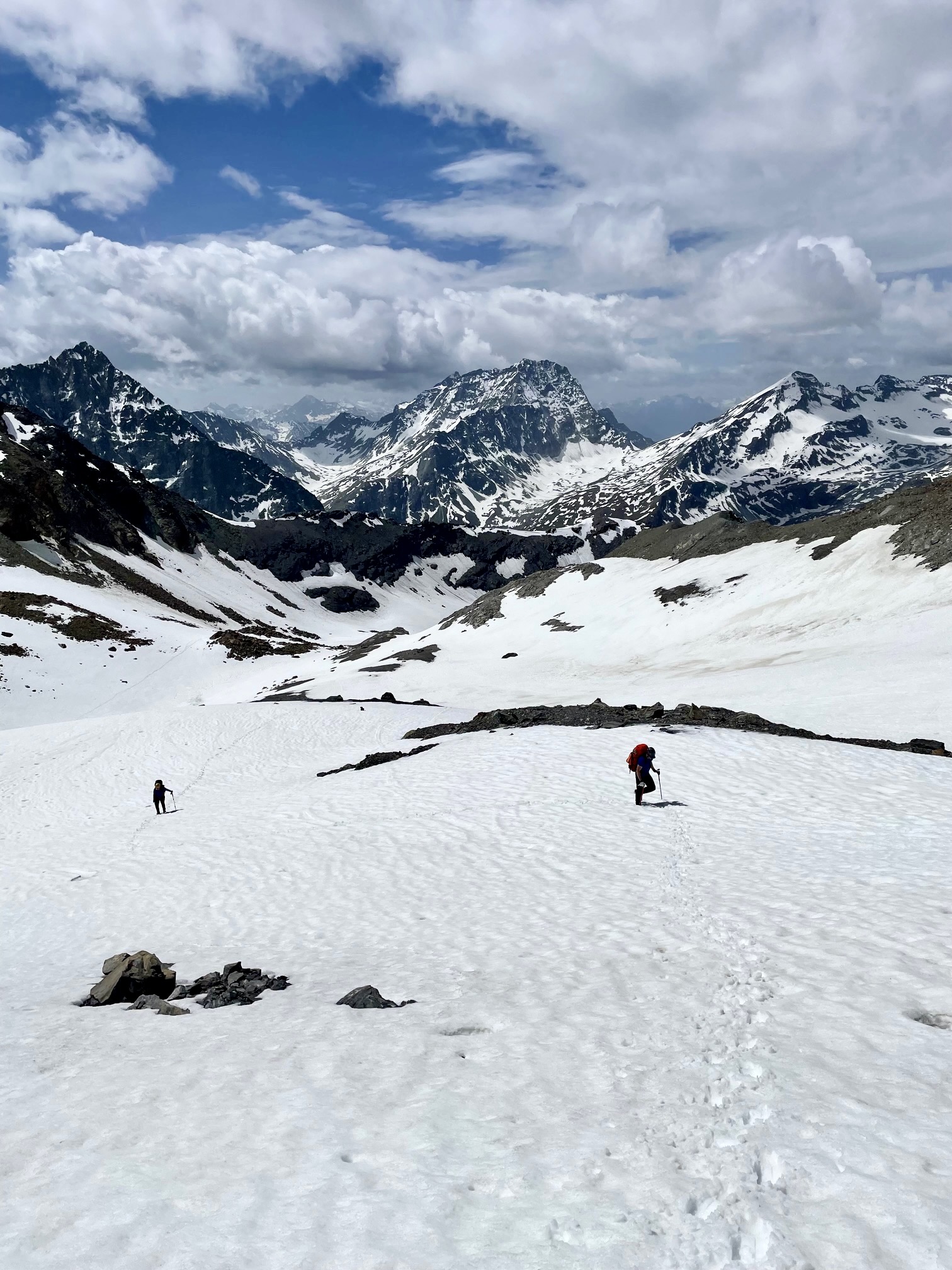
Leaving the hut at 5:30am, we crossed back over the steep snow slope, then walked along a level bench high above the Arolla Glacier. The cloudless sky heralded a beautiful day in the mountains.
.
.
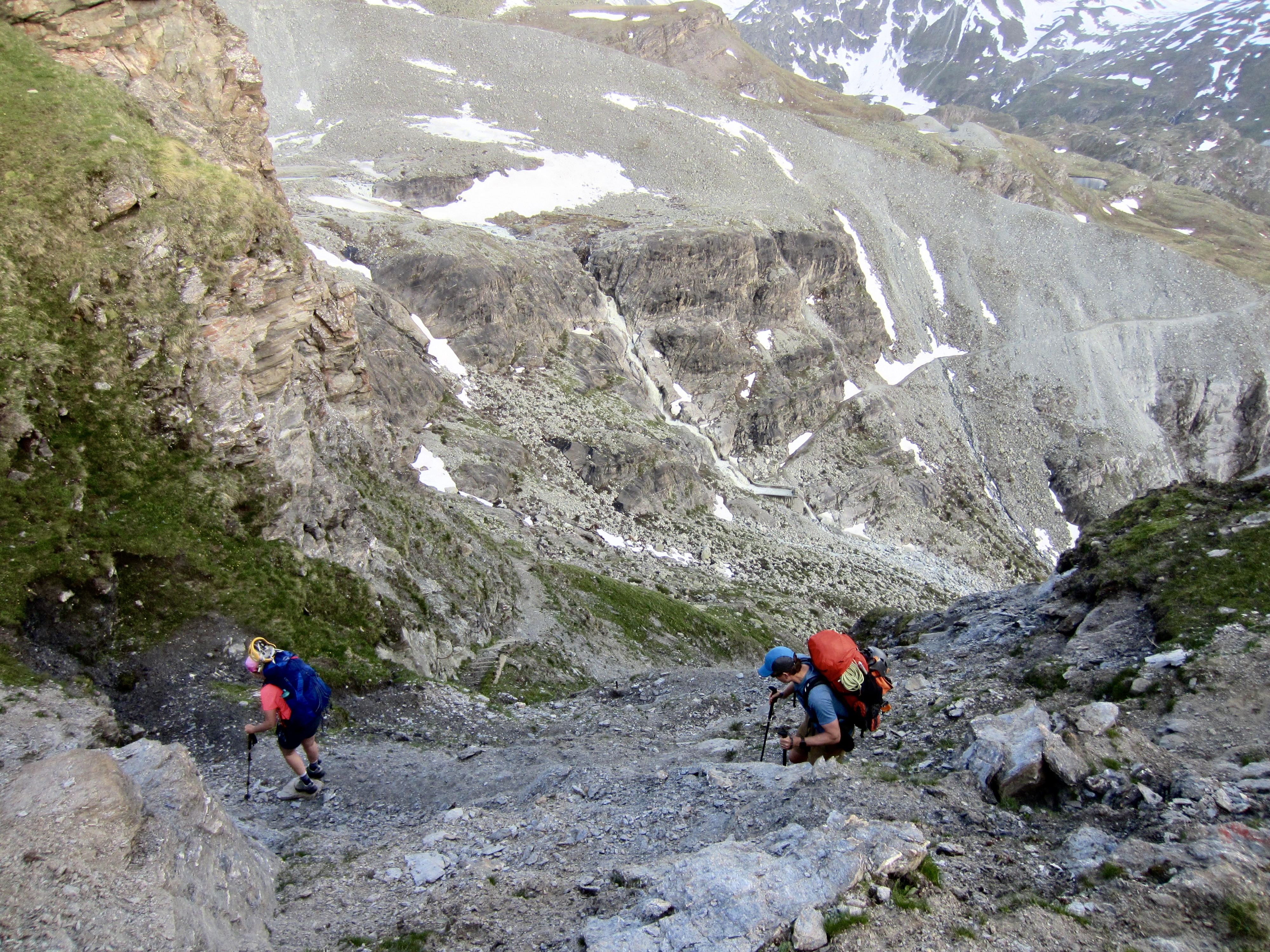
Our morning challenge was to get off the level bench and onto the Arolla Glacier. This involved scrambling down a super-steep, bouldery nose and then front-pointing down a rock-hard snowfinger. When done, we had a group debate regarding whether this descent was easier or harder than the descent off Cheilon Col two days ago. Ultimately, we agreed to disagree.
.
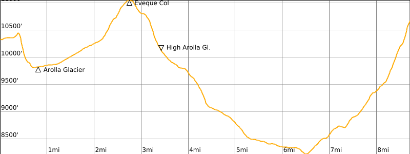
From our new vantage, we could scope out a route across the Arolla Glacier (called the Mont Collon Glacier on some maps) and up to Eveque Col. It appeared to be very straightforward—and it was.
.
.
During our morning ascent, we reveled in the perfect snow conditions, flawless weather, and grand scenery. This turned out to be the most glamorous portion of our entire traverse, and we stopped at Eveque Col to soak in the wonderful ambiance.
.
.
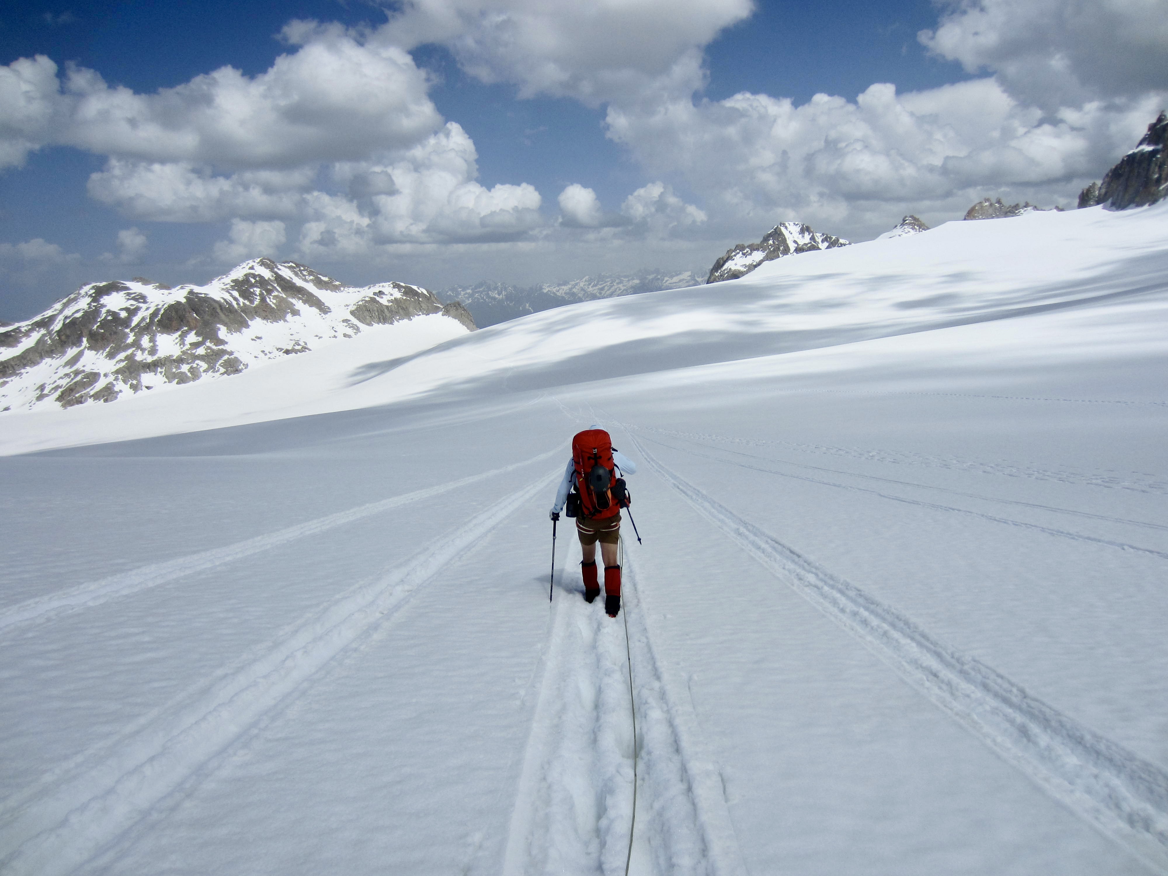
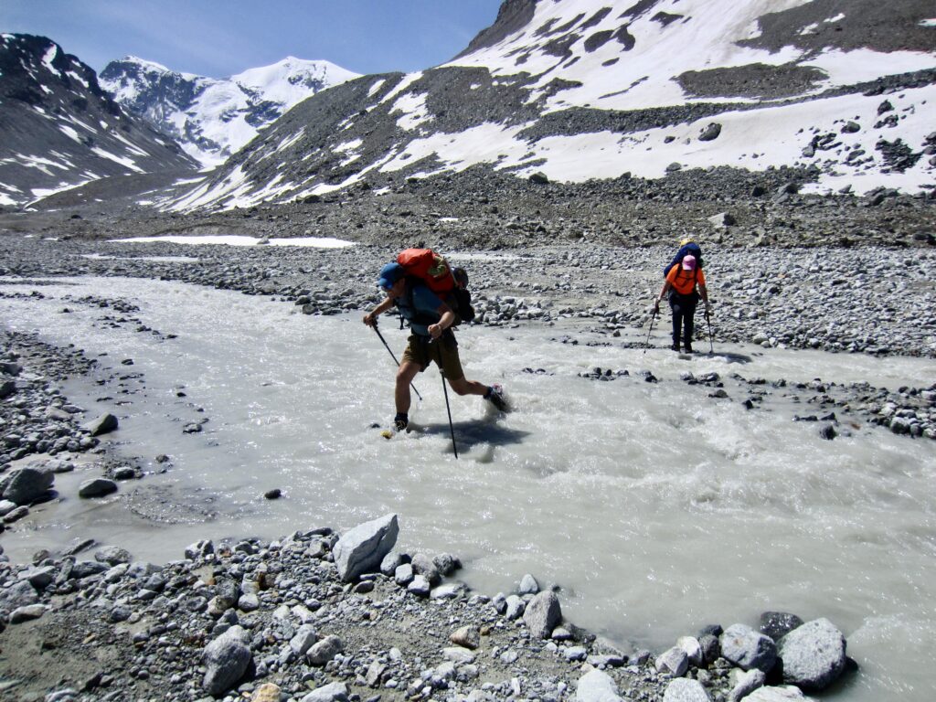
From Eveque Col, we easily plunge-stepped down the Haut Arolla Glacier. There were several moderately steep roll-overs, but most of the glacier had a very benign gradient, and the snow had a styrofoam-like firmness.
.
A glacier terminus always presents an uncertain situation with many possible problems. The Haut Arolla Glacier terminus, however, consisted of a low-angle ice shield that easily led onto a broad outwash plain. We picked up a vague path and followed it down the plain.
.
Before long, we realized that our path had deflected us onto the wrong side of the braided outwash stream. Getting to the other side required rock-hopping or fording six or seven individual braids. I guess we were destined to have wet boots on every day of the traverse!
.
Once across the stream braids, we followed a formal trail down-valley and then up to Bertol Plain. This entire area is littered with old mining prospects and associated relics. An abandoned miner’s cabin here reminded us of the Dix Hut winter room. Interestingly, our day’s route thus far had scribed a giant horseshoe around Mont Collon, such that we were now only 1.4 miles / 2.3 kilometers away from Vignettes Hut.
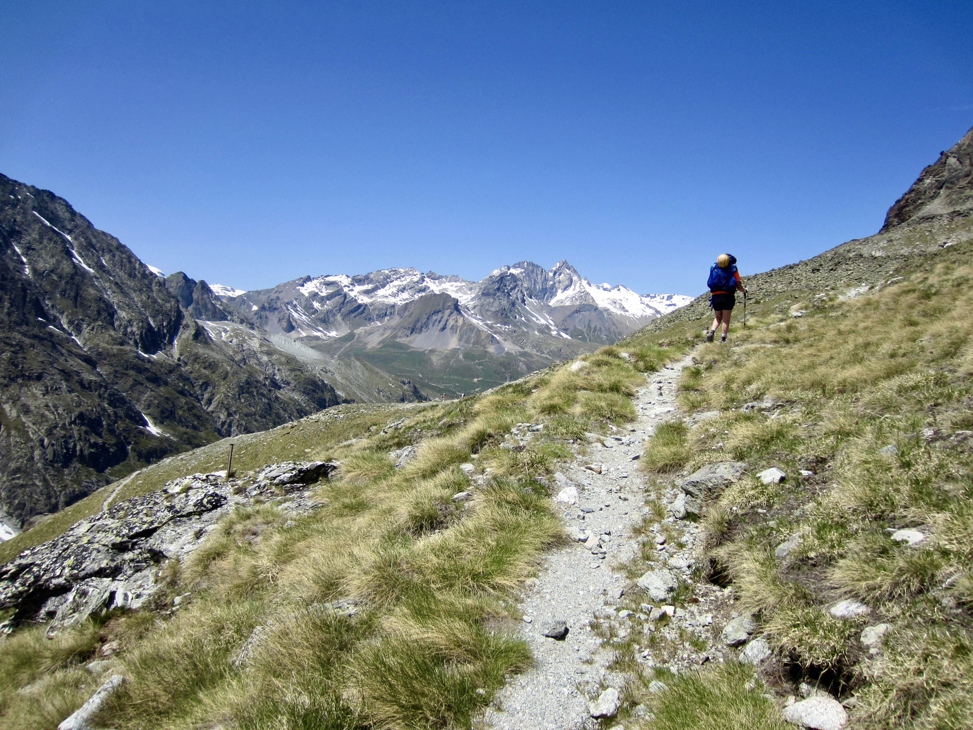
.
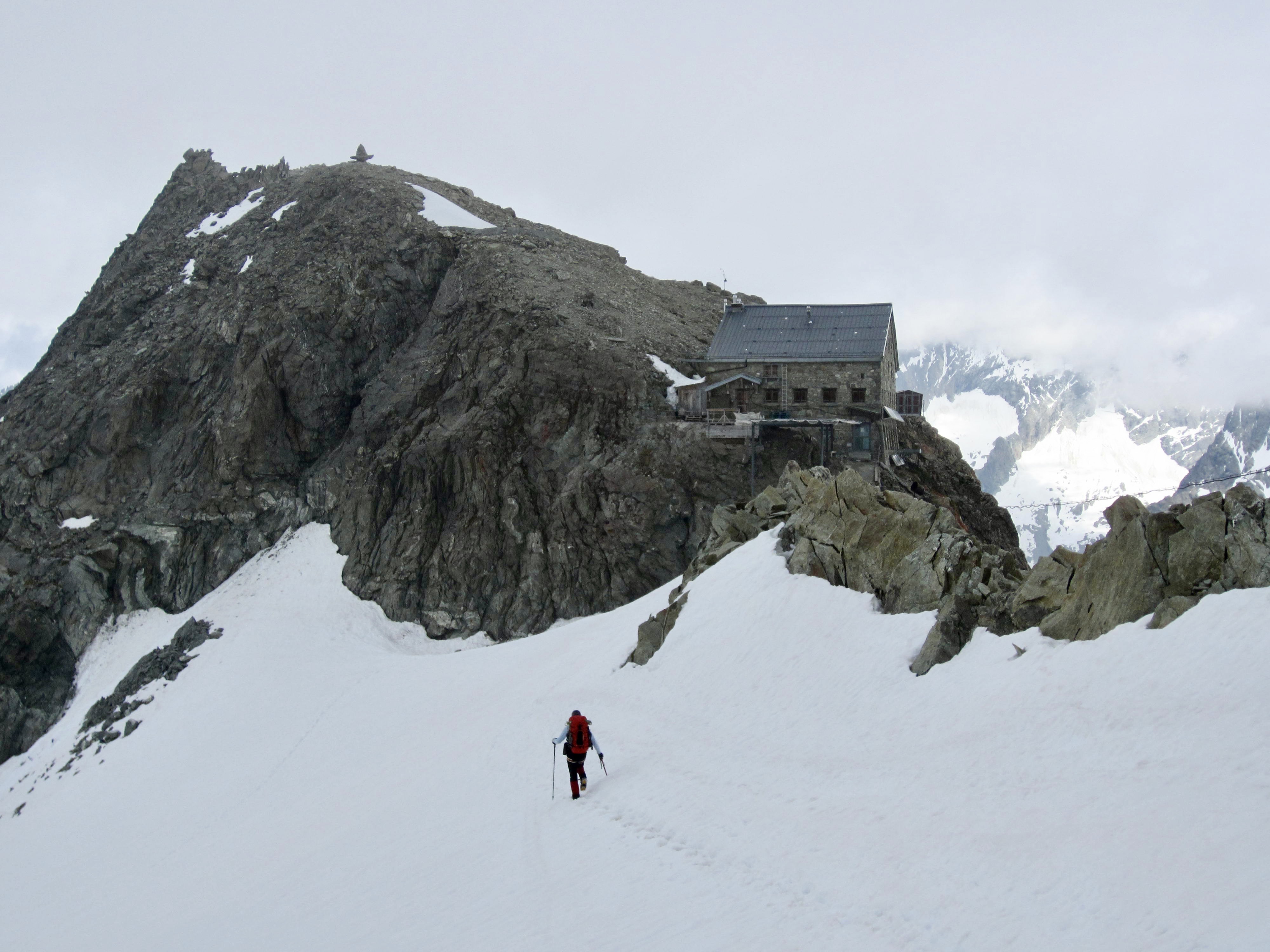
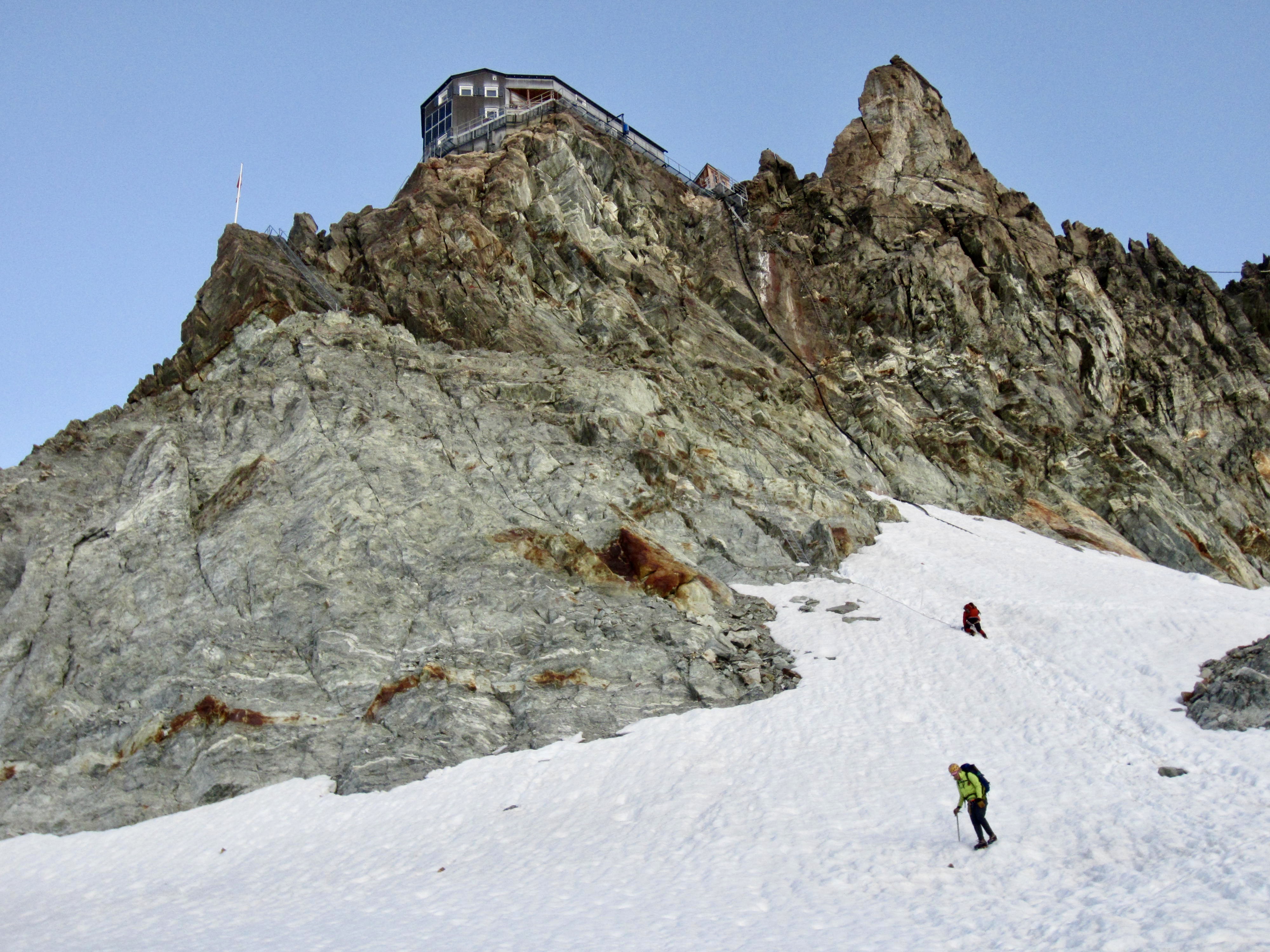
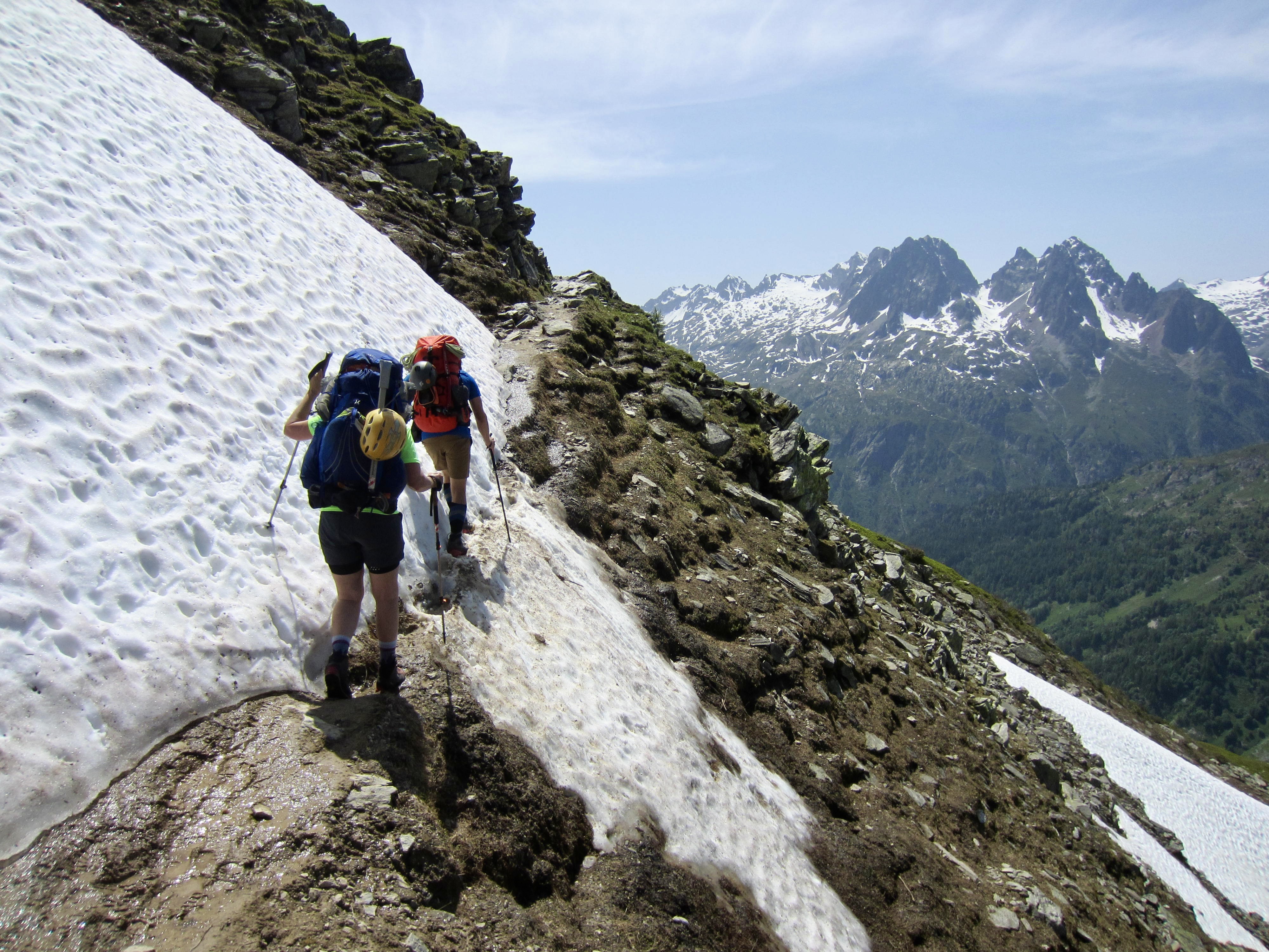
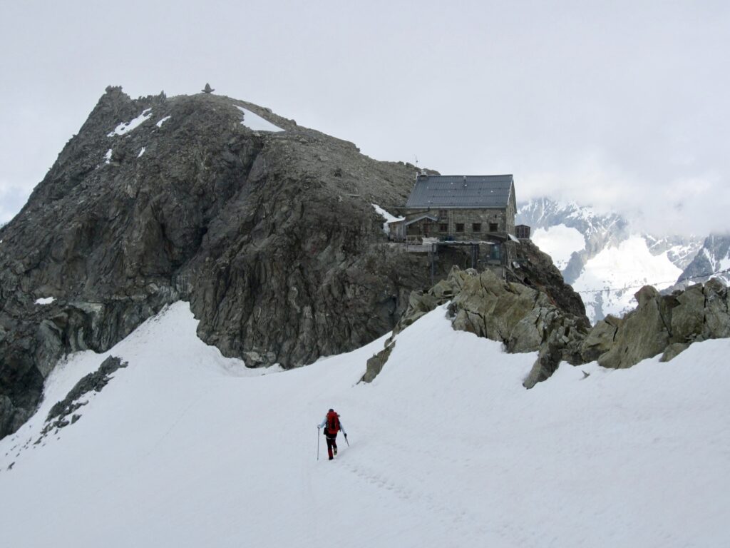
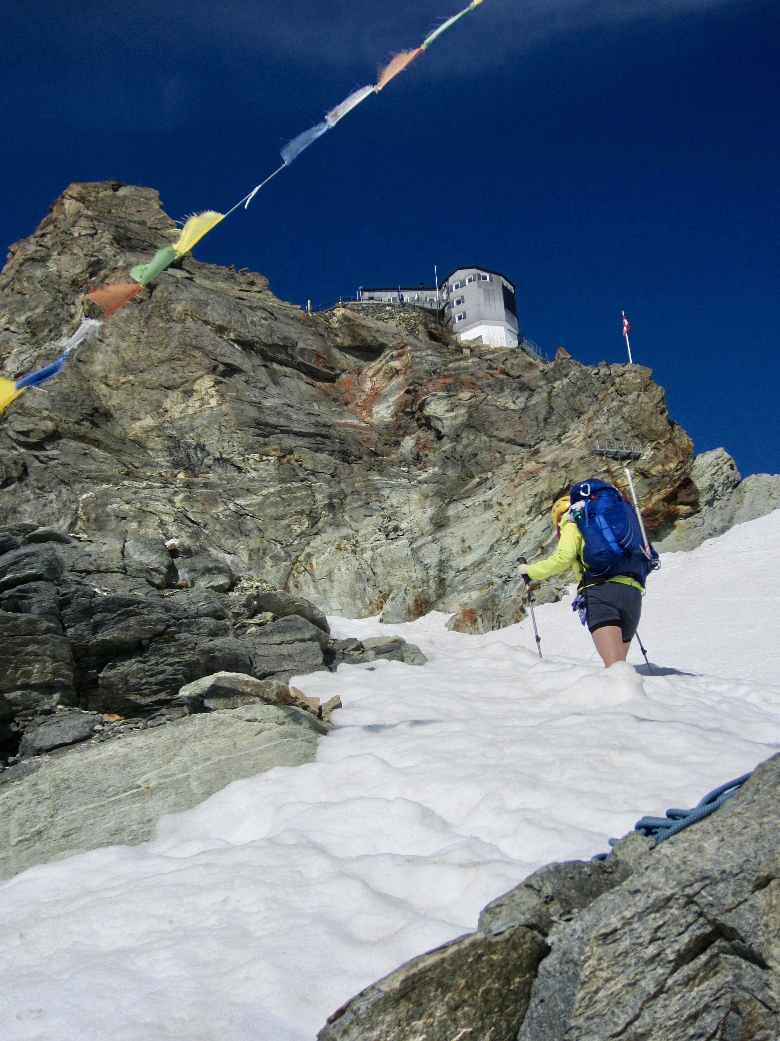
From Bertol Plain, we could clearly see Bertol Point and Bertol Col at the head of the valley. We headed up-valley, first on bare trail and then on a series of snowfields. Bertol Hut gradually came into view above the col.

.
.
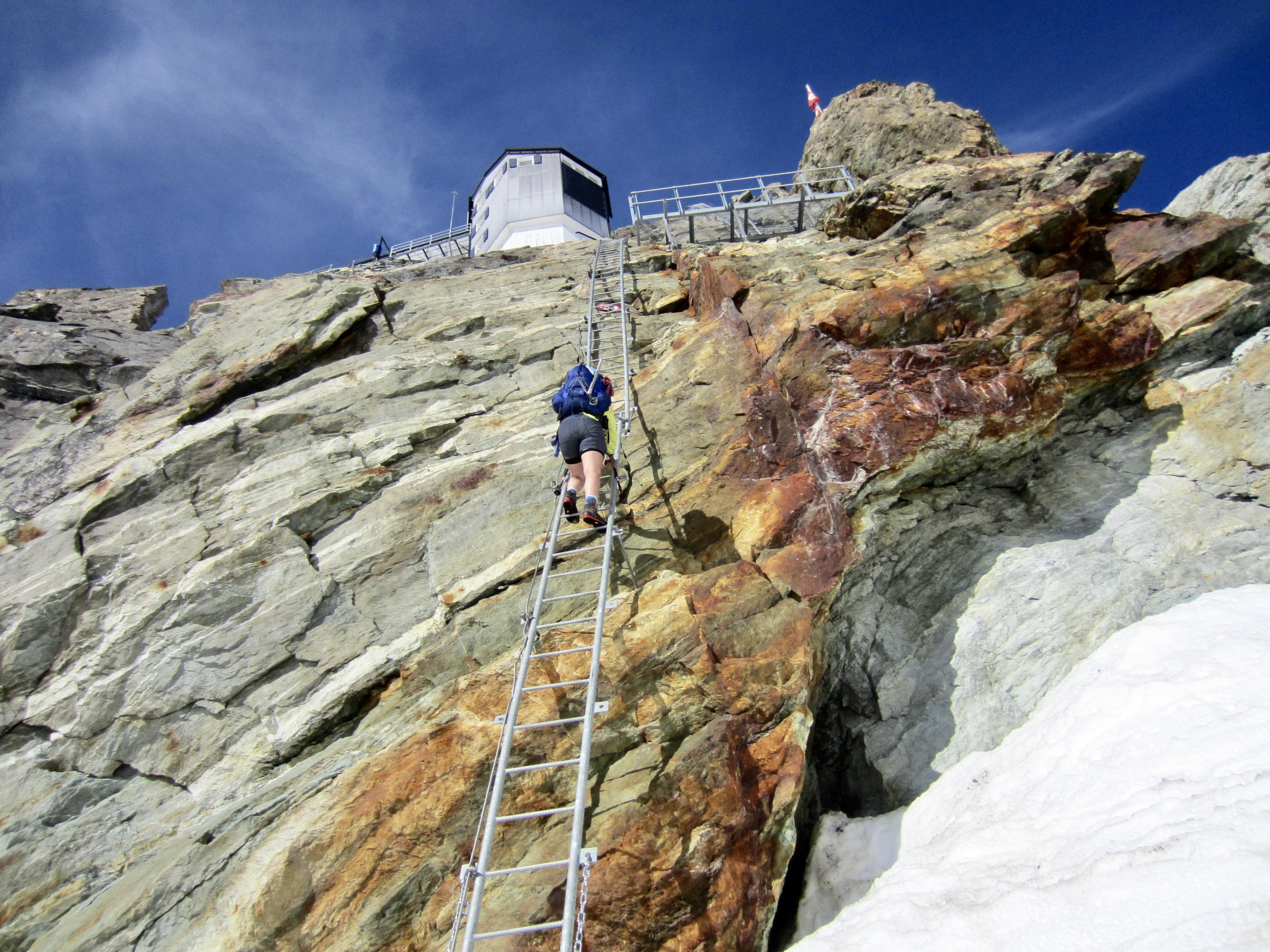
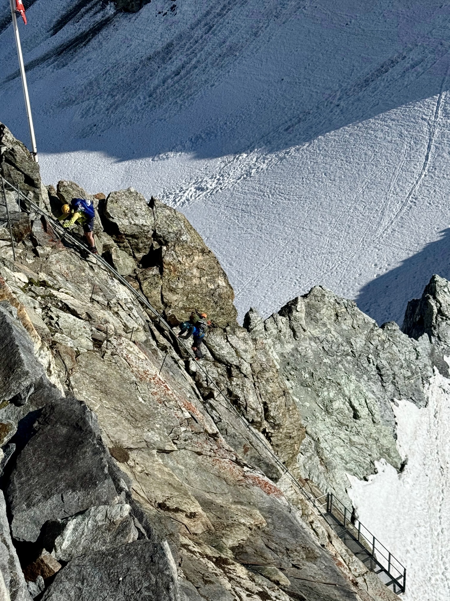
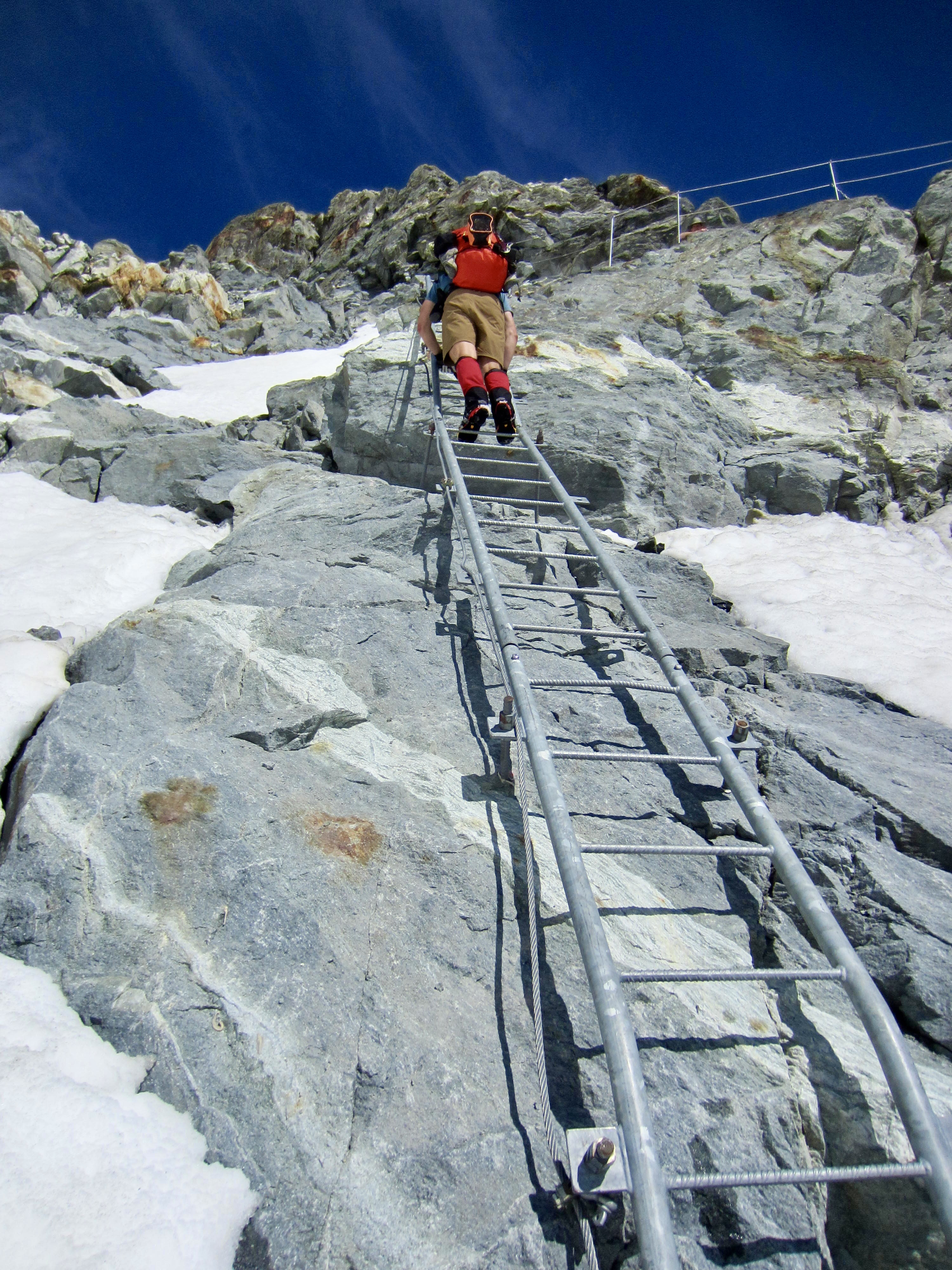
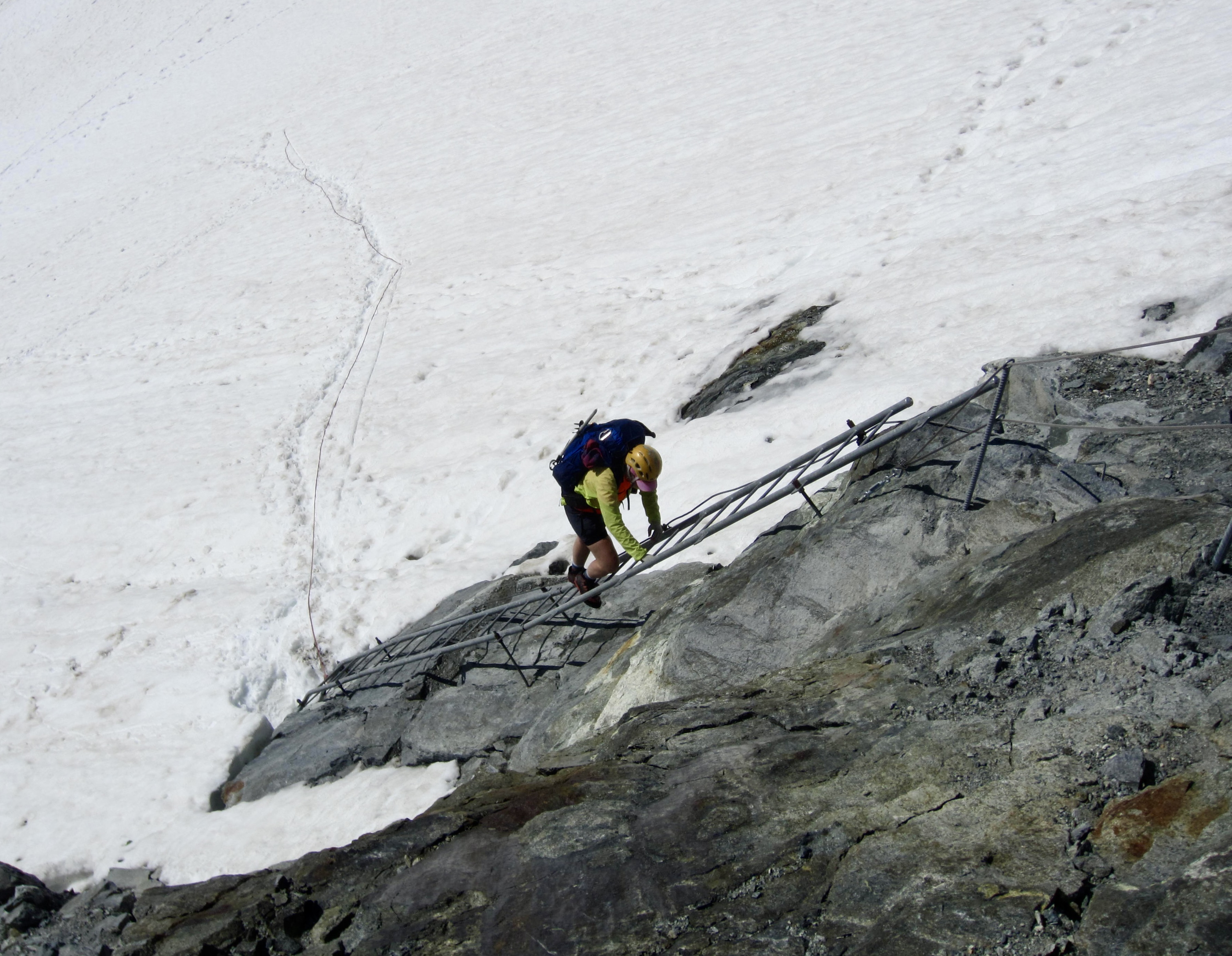
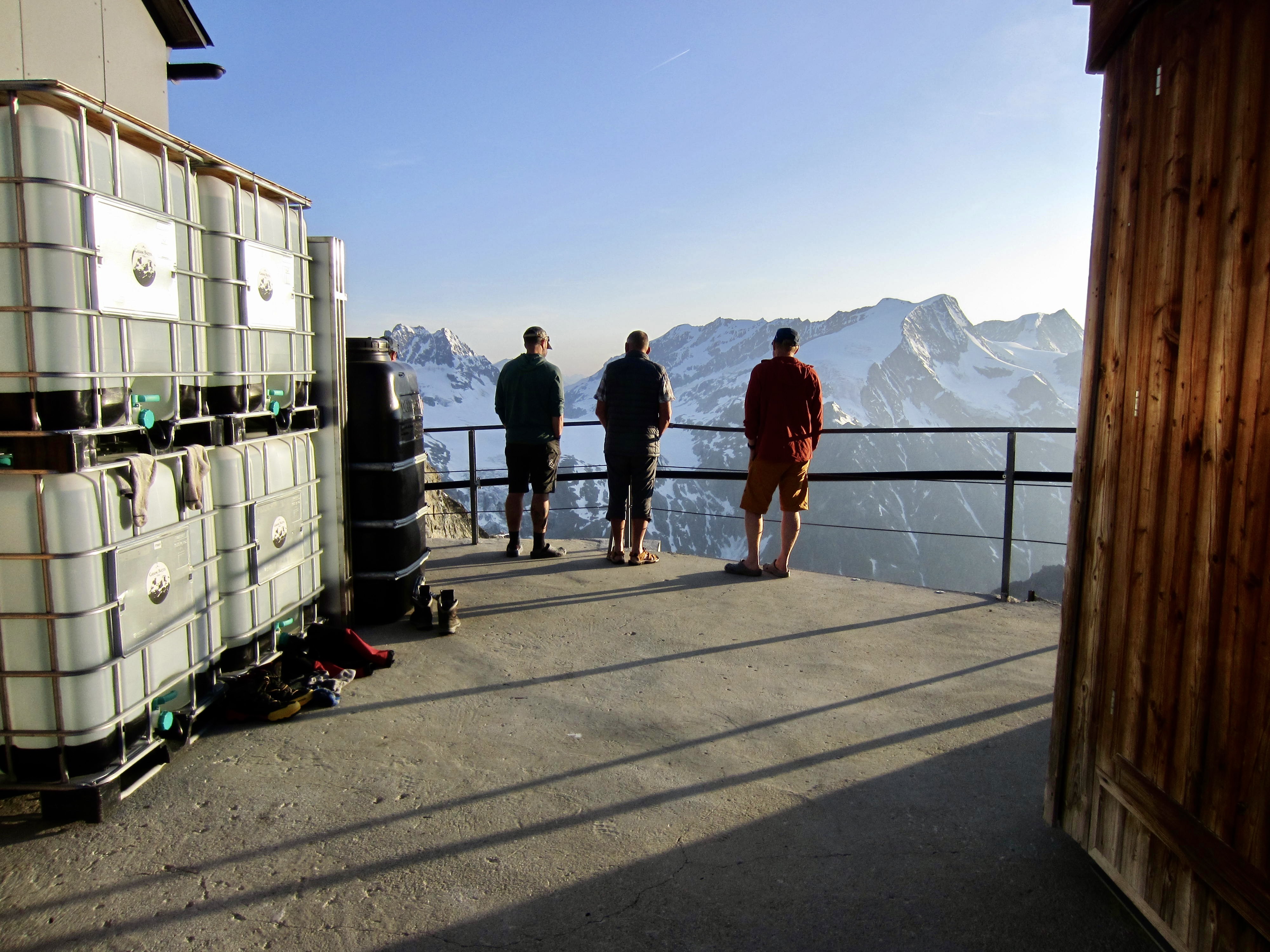
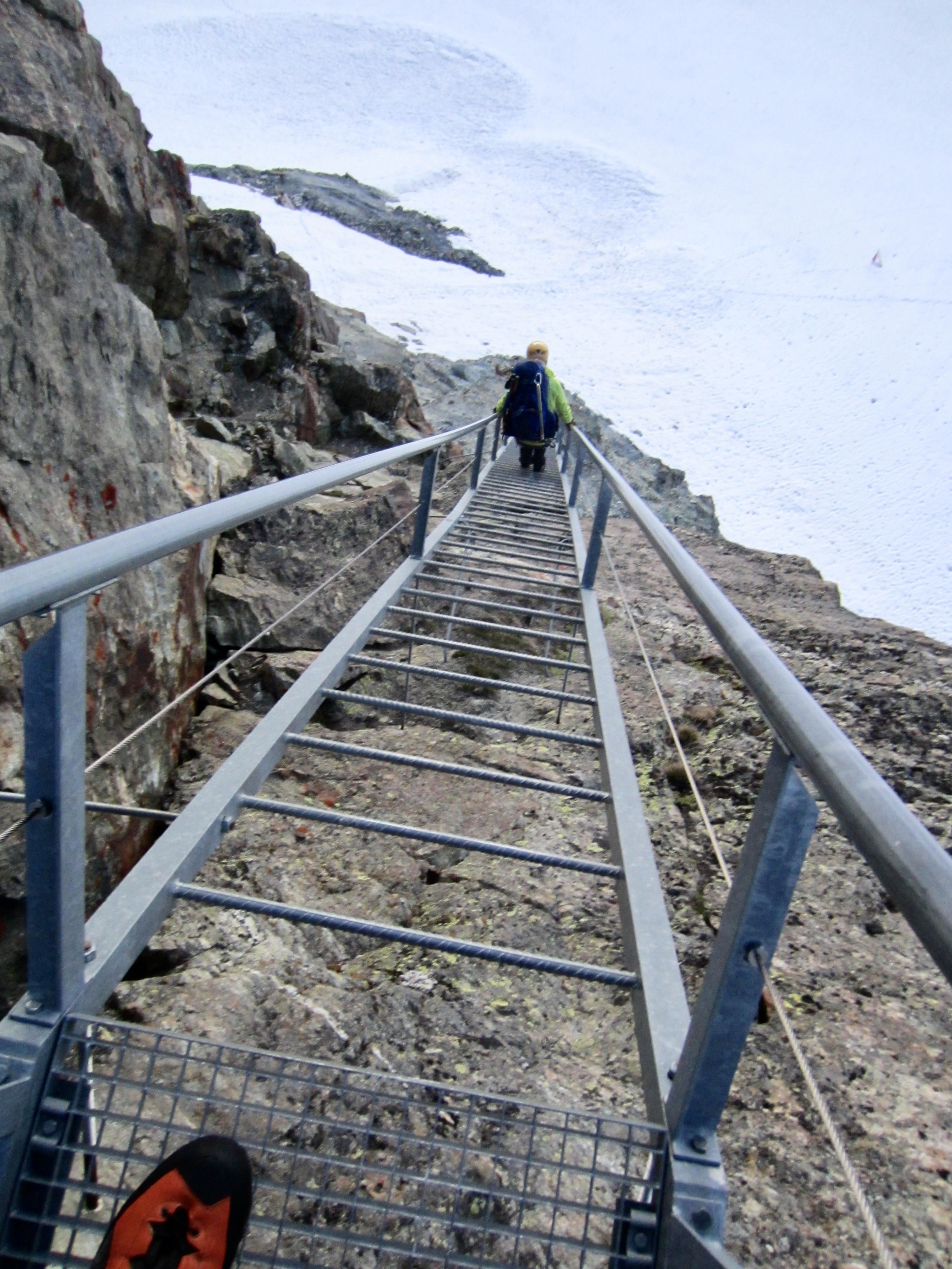
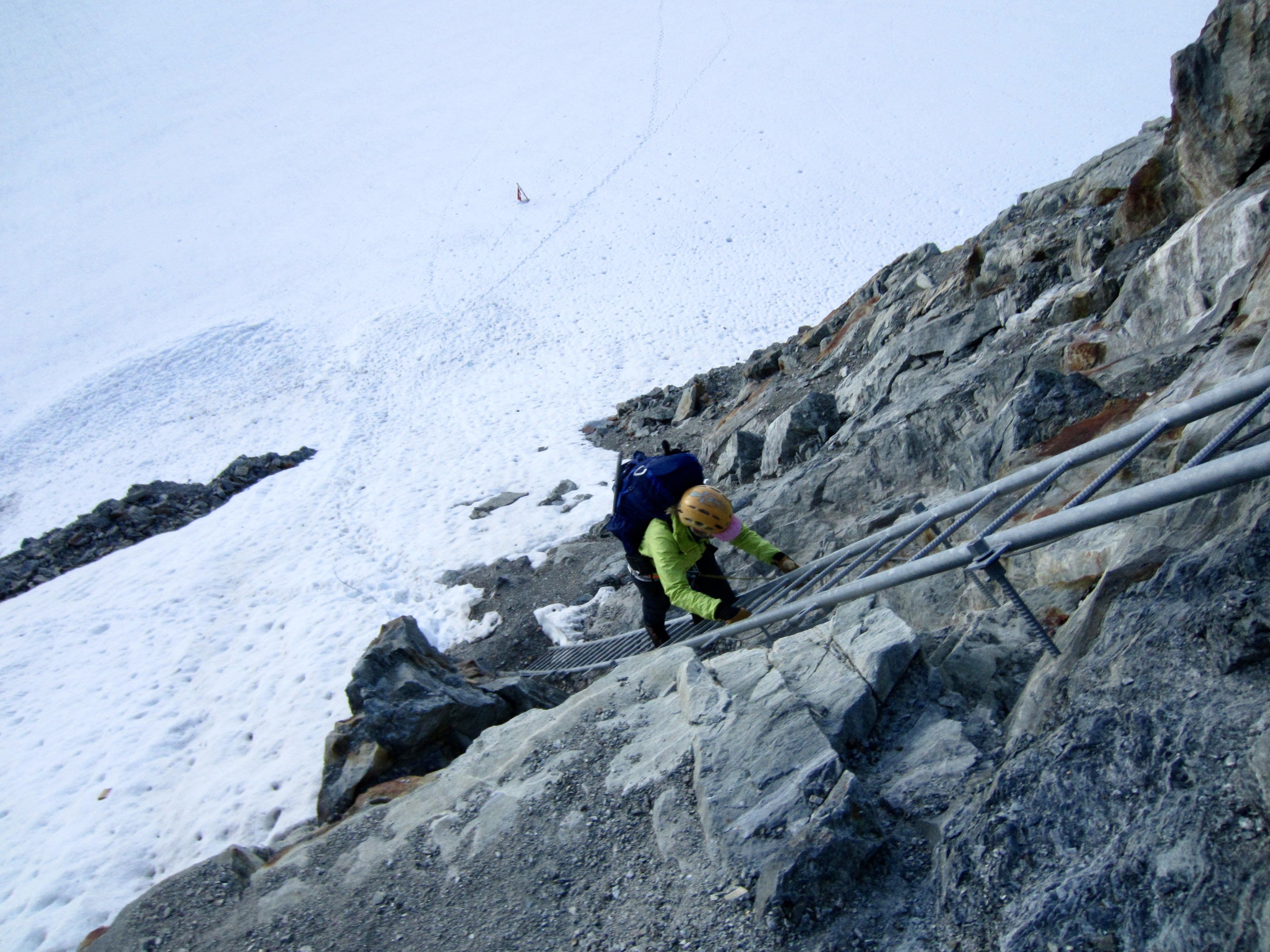
Bertol Hut is wedged into a high cliff with no obvious access. Not until we got closer did we notice a set of ladders attached to a lower cliff band. Earlier in the day, Jon and I had joked about how Bertol Hut could possibly match the dramatic setting of Vignettes Hut. Now we could see that Bertol Hut had massively raised the bar!
.
.
The lower set of ladders ended at a snow patch between two cliff bands. Incredibly, there was another set of ladders bolted to the upper cliff. Our “alpine Disneyland” experience continued!
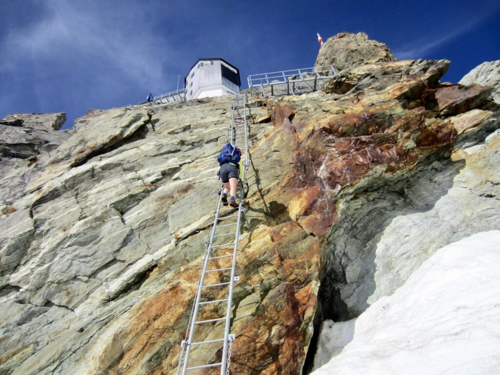
.

.
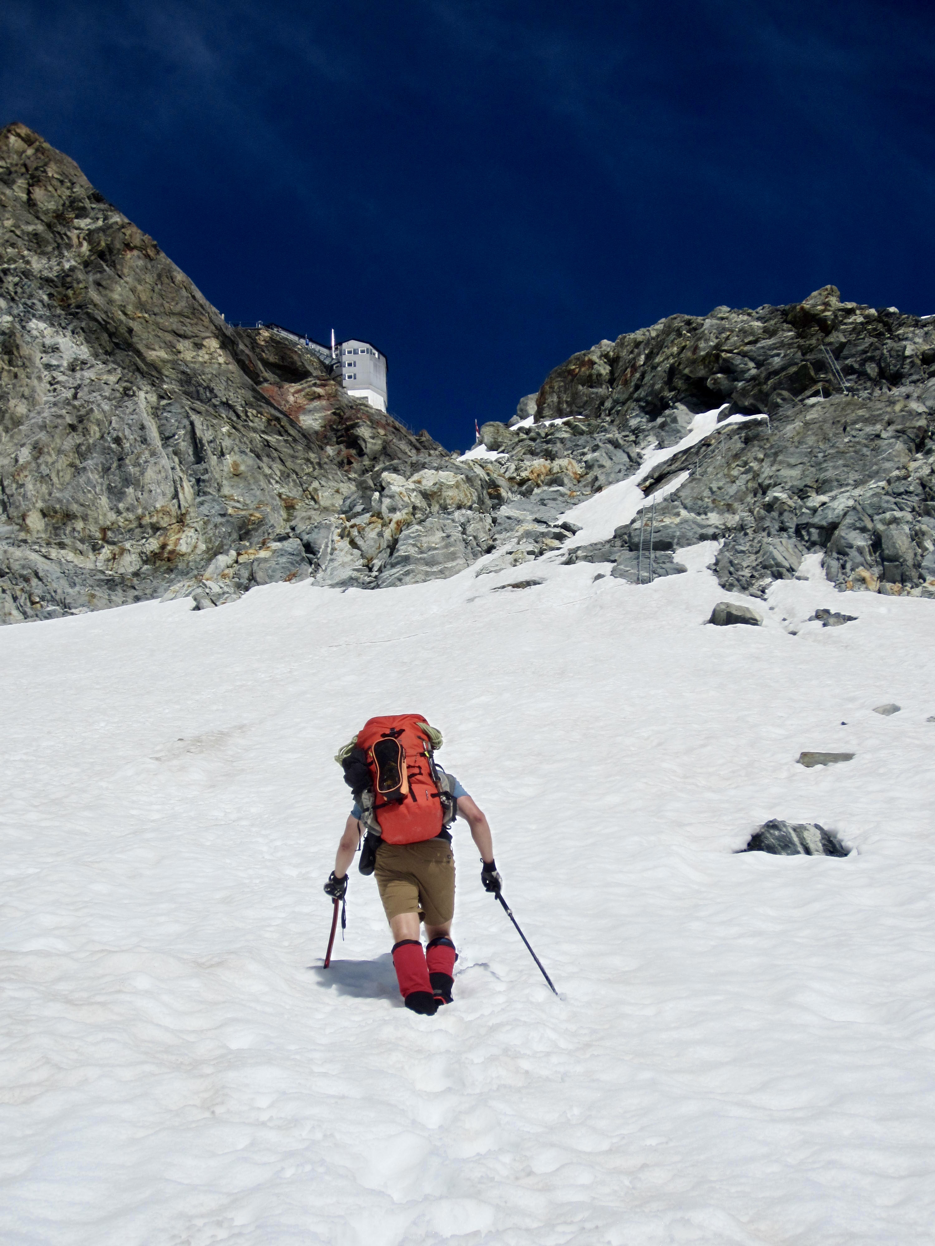
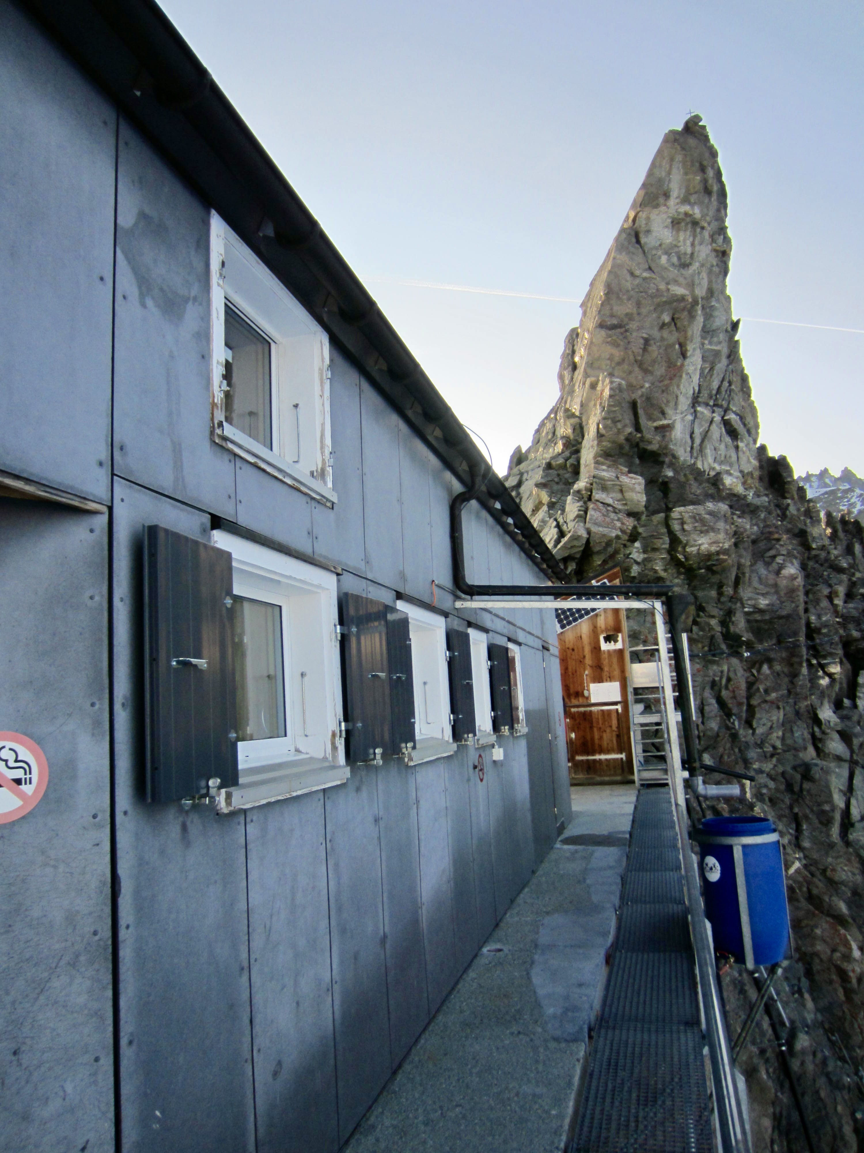
Climbing multiple ladders while wearing a heavy pack at an elevation of nearly 11,000 feet / 3,350 meters is quite exhausting. We were breathing heavily by the time we stepped onto the hut’s metal balcony at 6:00pm. As would be expected, views were marvelous in all directions.

.
.
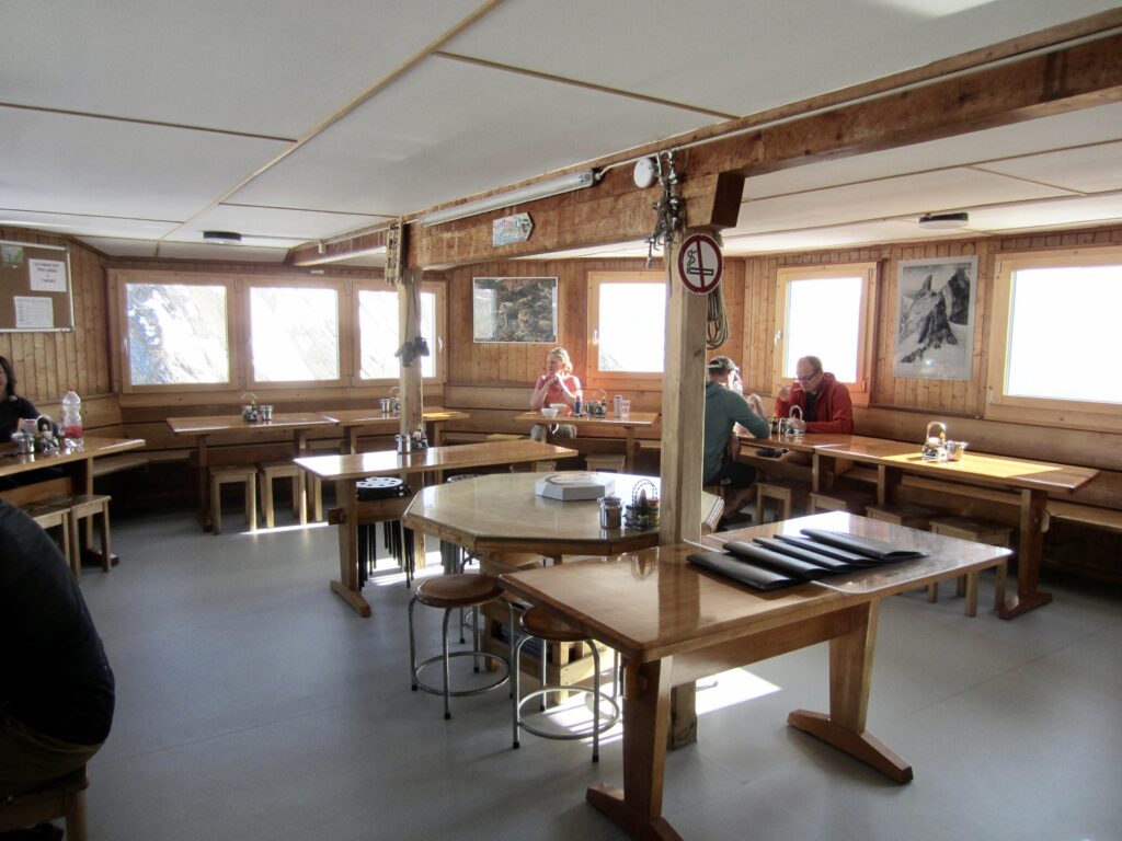
We had been looking forward to a hot meal, so it was distressing and disappointing to learn that we didn’t have dinner reservations, due to an online snafu. Fortunately, a bilingual guest heard about our situation and pleaded with the French-speaking hut manager to fit us in. His pleas were successful, and we were able to enjoy a hearty meal on our final night.
.
.
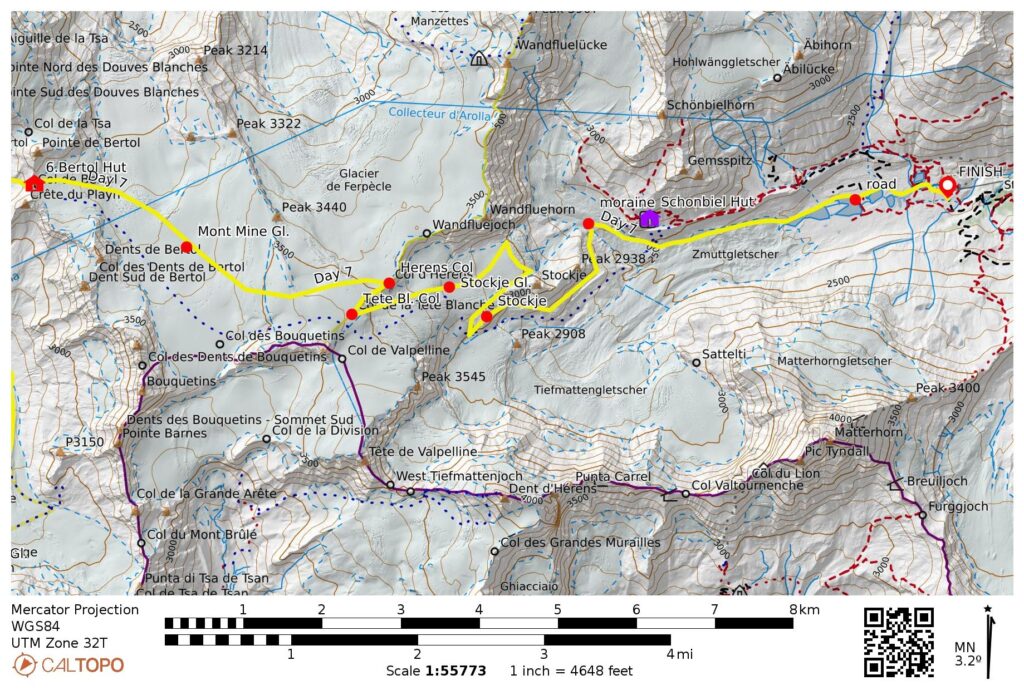
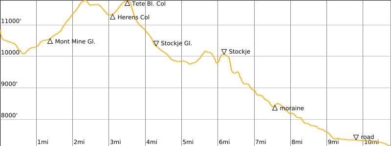
Day 7: Bertol Hut to Ober-Stafel
Approximate Stats: 10.7 miles / 17.2 kilometers traveled; 2550 feet / 770 meters gained; 6200 feet / 1880 meters lost.
Today was expected to be a tough one; the total closure of Schonbiel Hut forced us to combine the traditional last two days of the Haute Route into one long day. Our morning started with a descent of a stairway and ladder on the eastern side of the hut, followed by a down-climb of a steep snowfield.
.

.
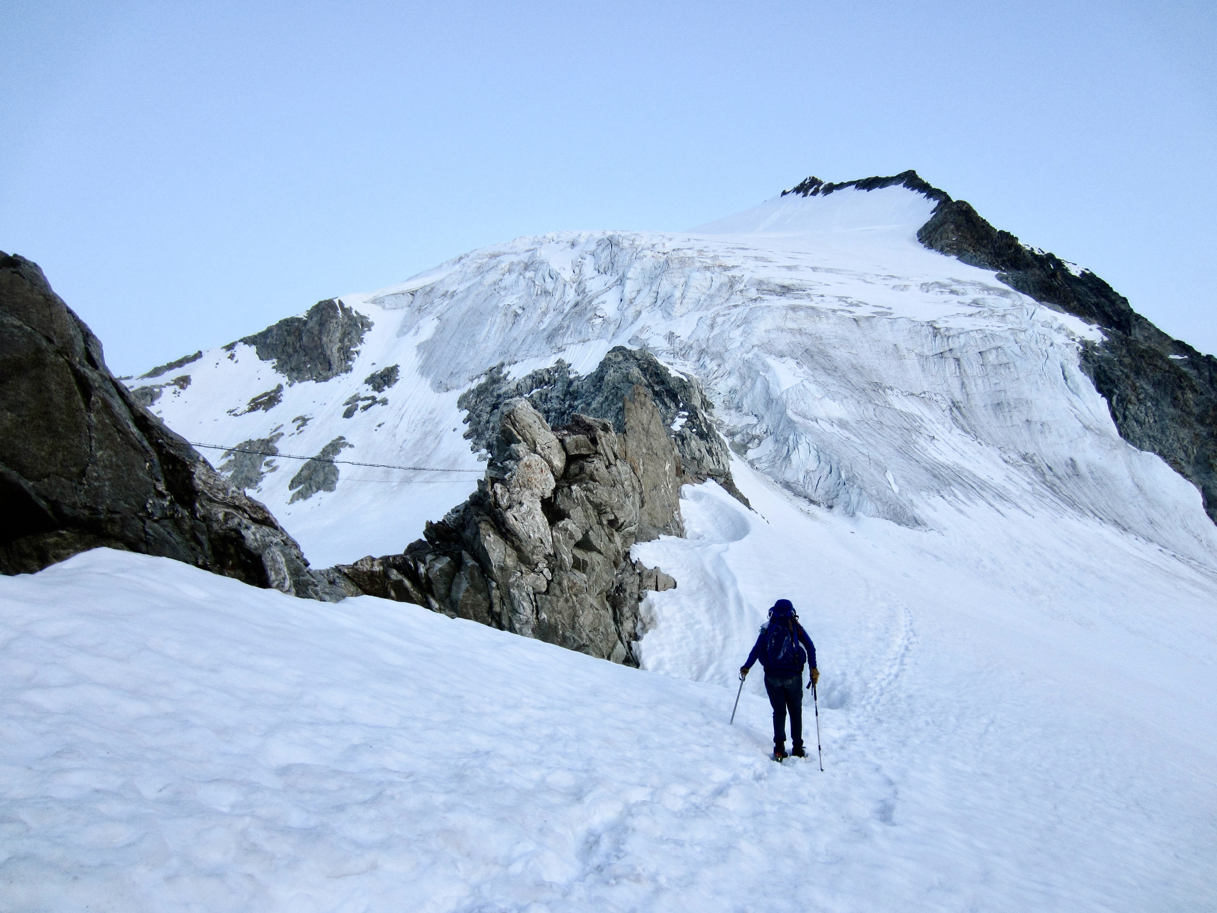
We roped up and made a long easterly traverse across the expansive Mont Mine Glacier. As we crunched over the frozen snow, sunrise gradually highlighted the surrounding peaks.

.
.
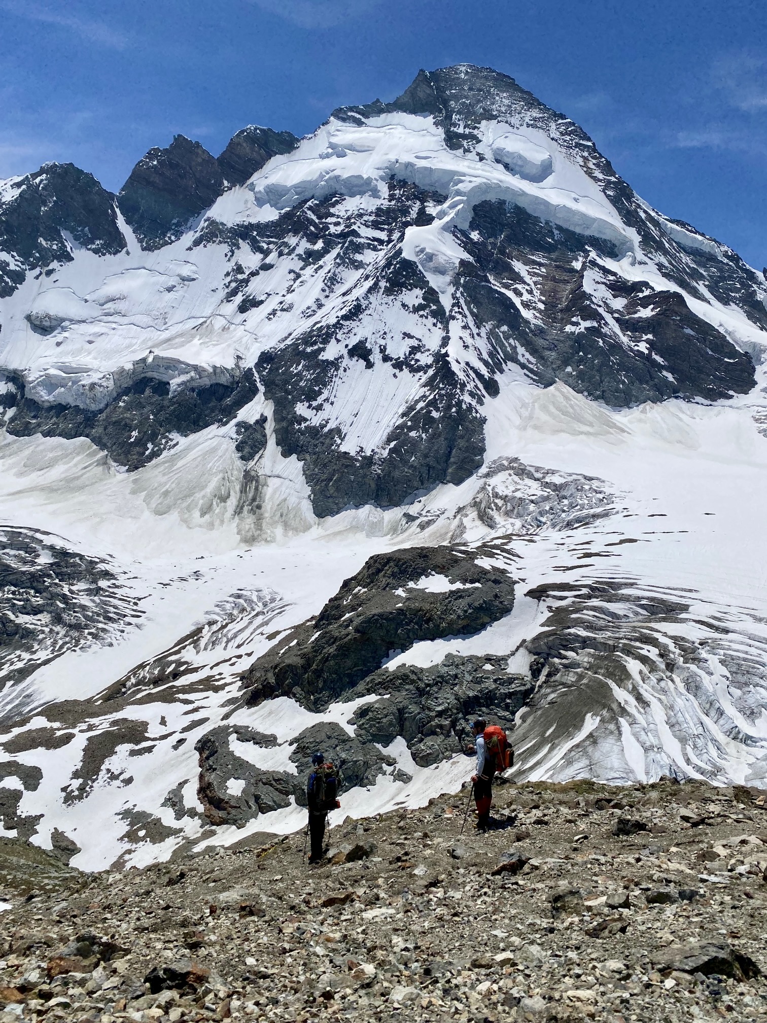
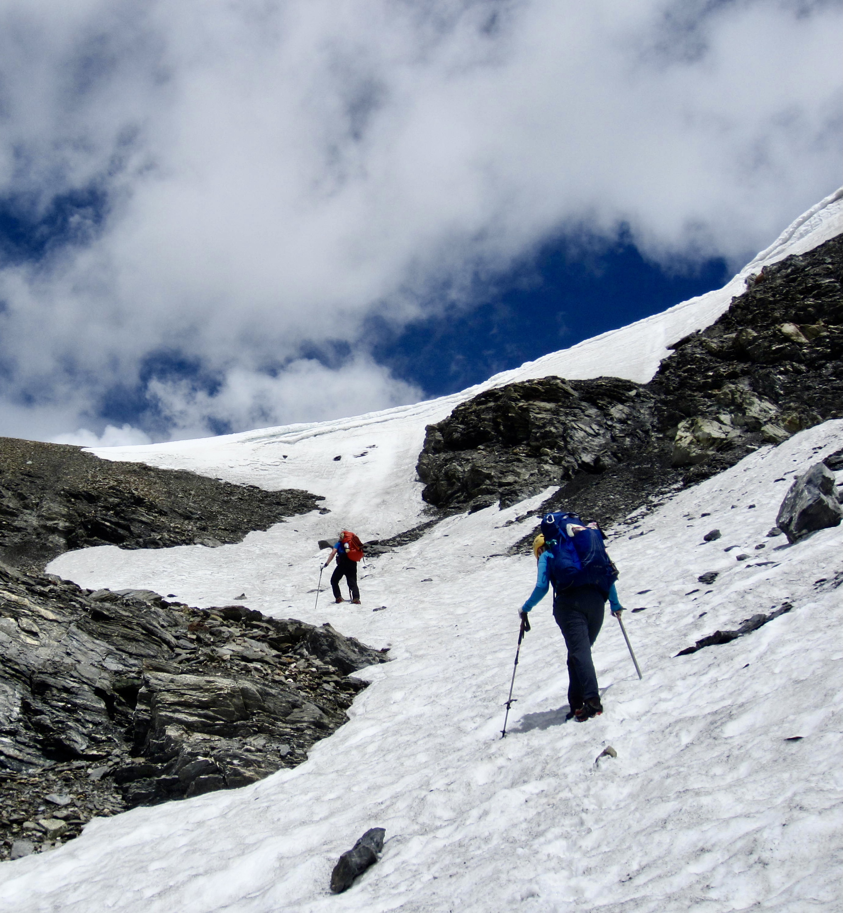
Our instinct was to aim for Herens Col, the lowest point in the distant ridge. However, this turned out to be an error because the far side of the col is a near-vertical cliff. Yikes! We quickly recalculated and booted up to nearby Tete Blanche Col.
.
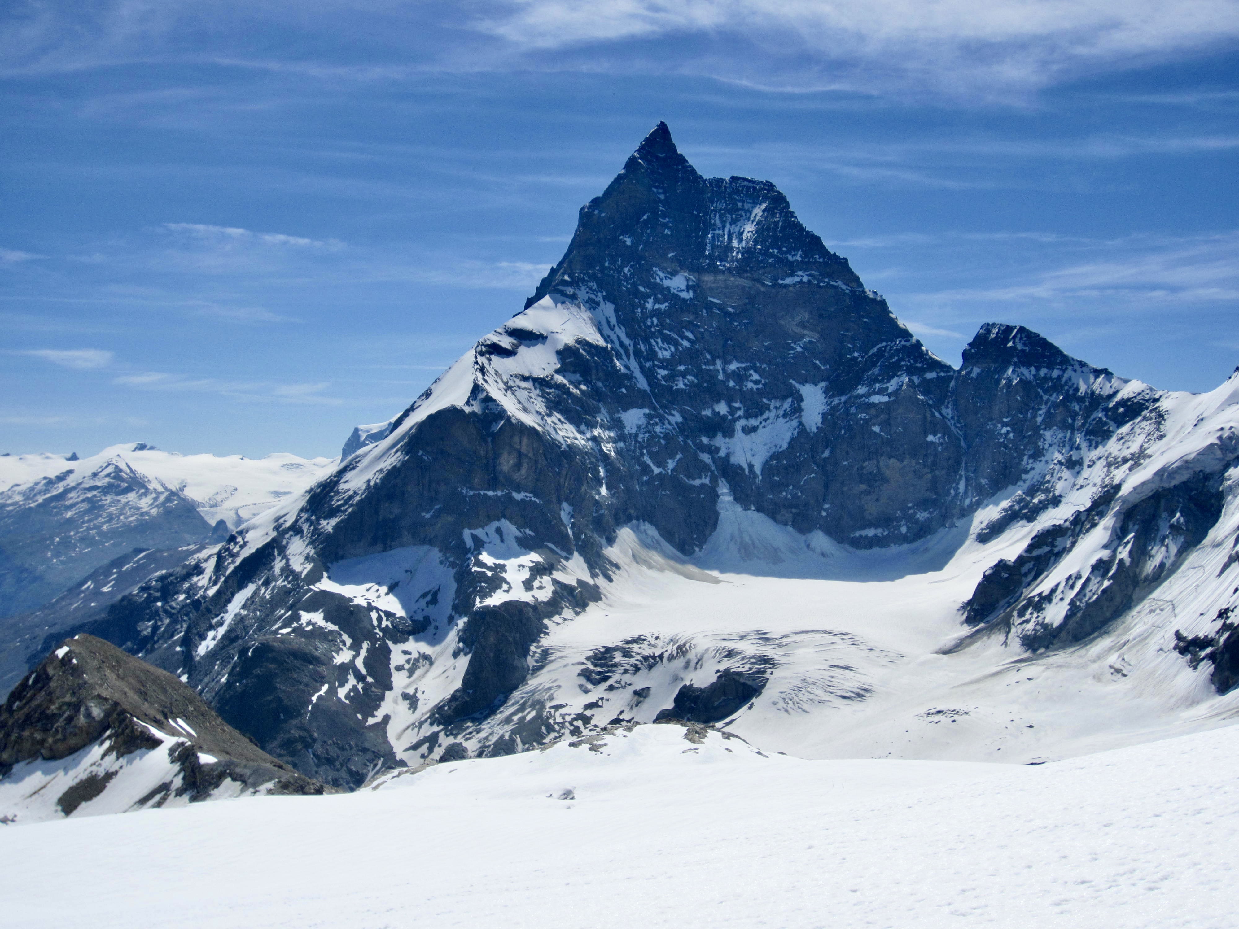
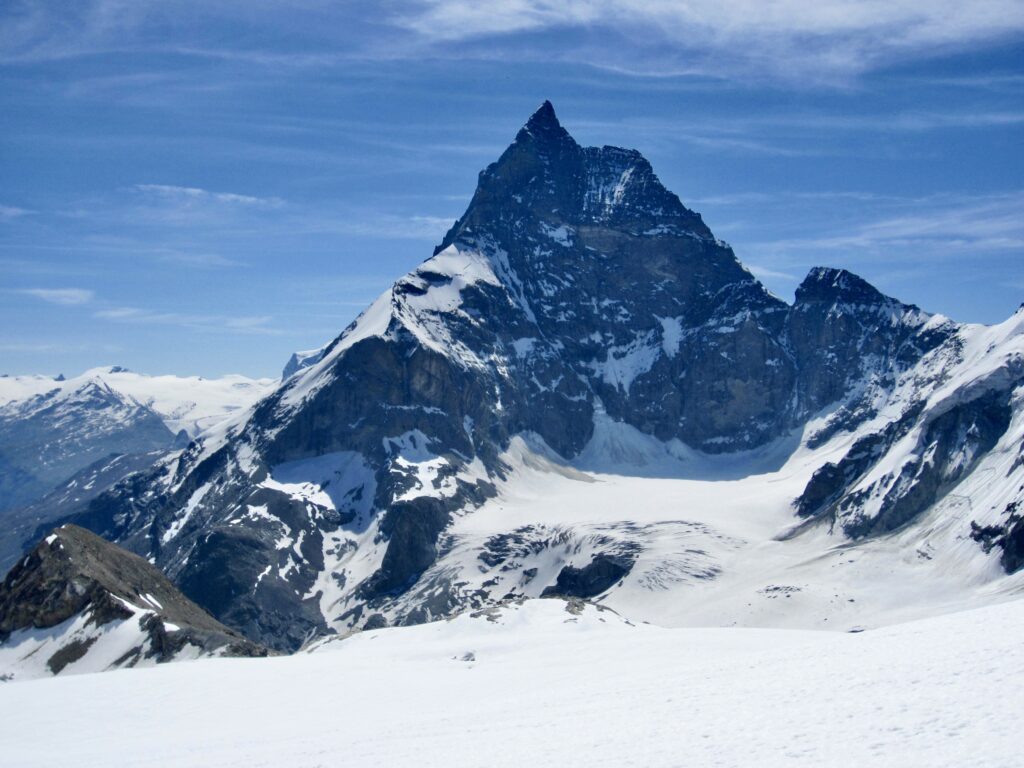
Tete Blanche Col provided our first full view of the Matterhorn. From this close-up vantage, the massive west face sweeps upward until culminating in a sharp summit horn. It was a jaw-dropping sight!
.
Tearing ourselves away from the view, we began descending the Stockje Glacier. This required a little weaving around surface depressions but overall went very smoothly until we reached the terminus, which consisted of a chaotic icefall. We explored the left and right margins, hoping to find a feasible ramp, but neither side was doable without having 20 or 30 ice screws and a long rope.
.
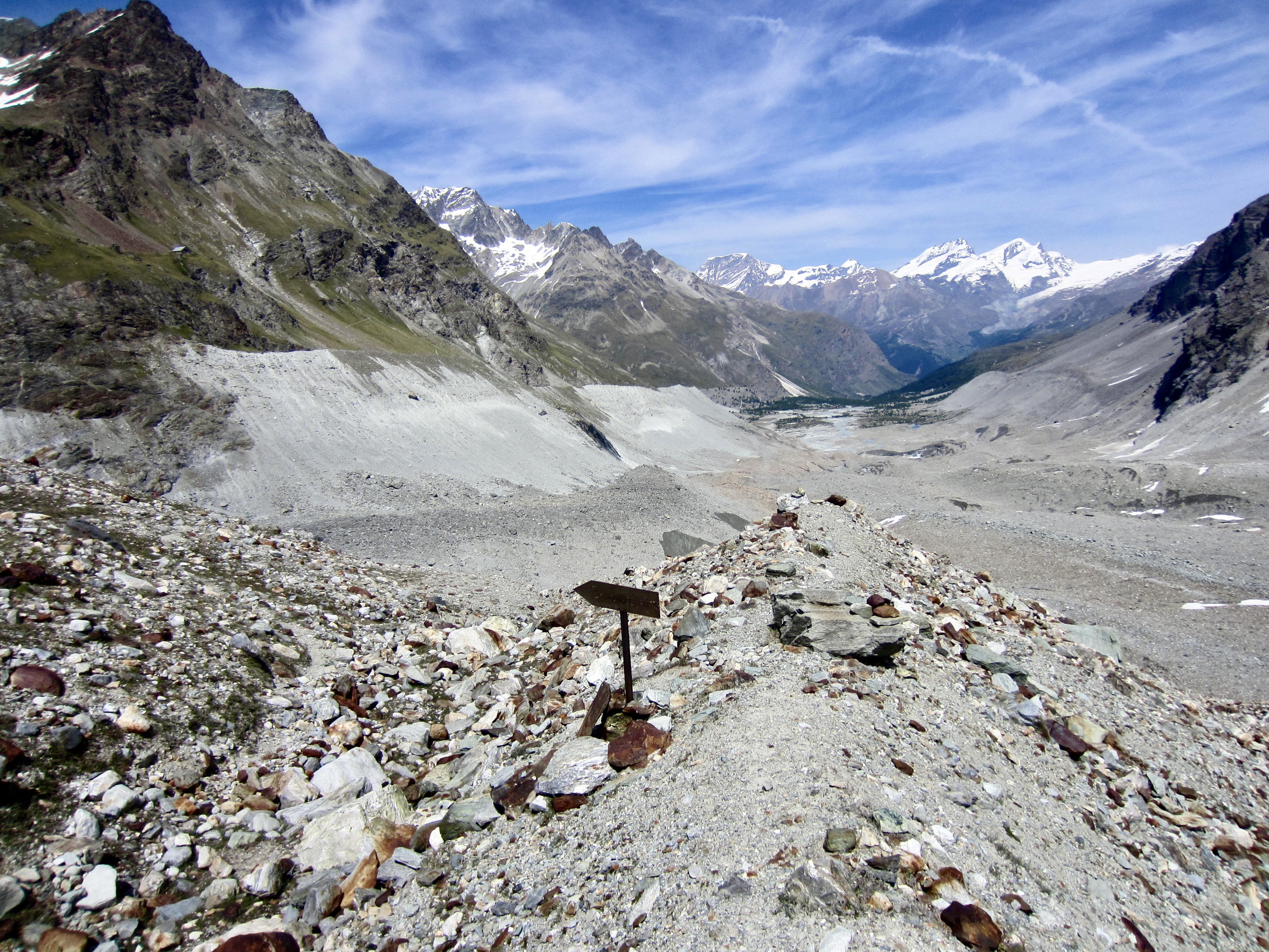
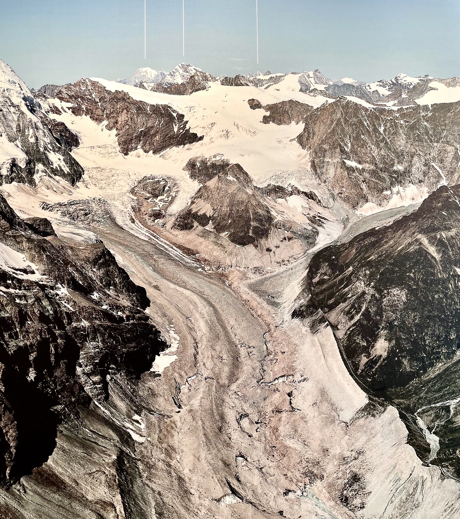
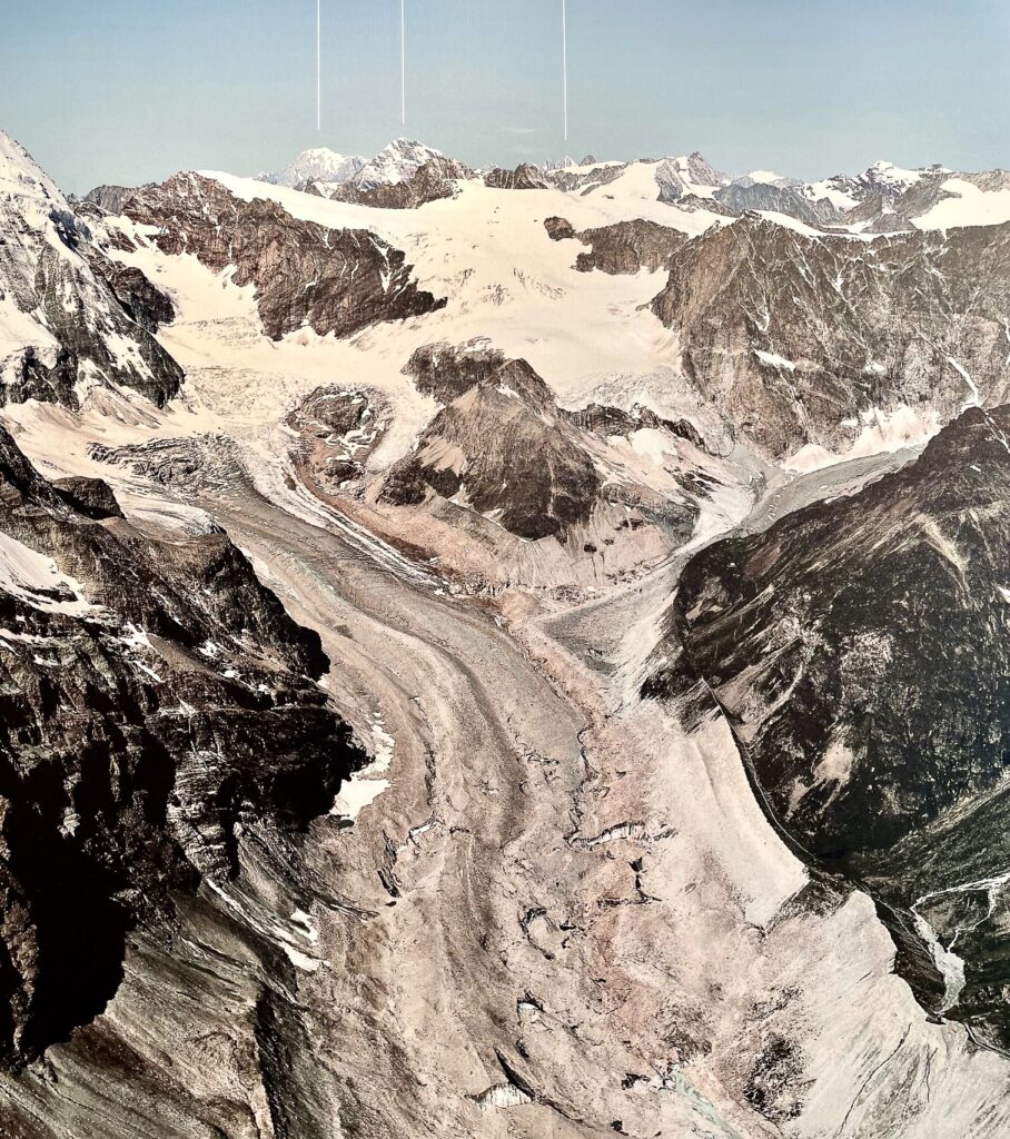
Our only option was to climb back up the glacier and try to get over The Stockje—a large landform that sits between the Stockje and Zmutt Glaciers. Geologically, The Stockje (or Stockji, on some maps) is a roche moutonee, which translates from French as “sheep rock.” The term stockje appears to be German for “small stock animal,” probably as a reference to the French term. The aerial photo below shows The Stockje and adjacent glaciers.
.
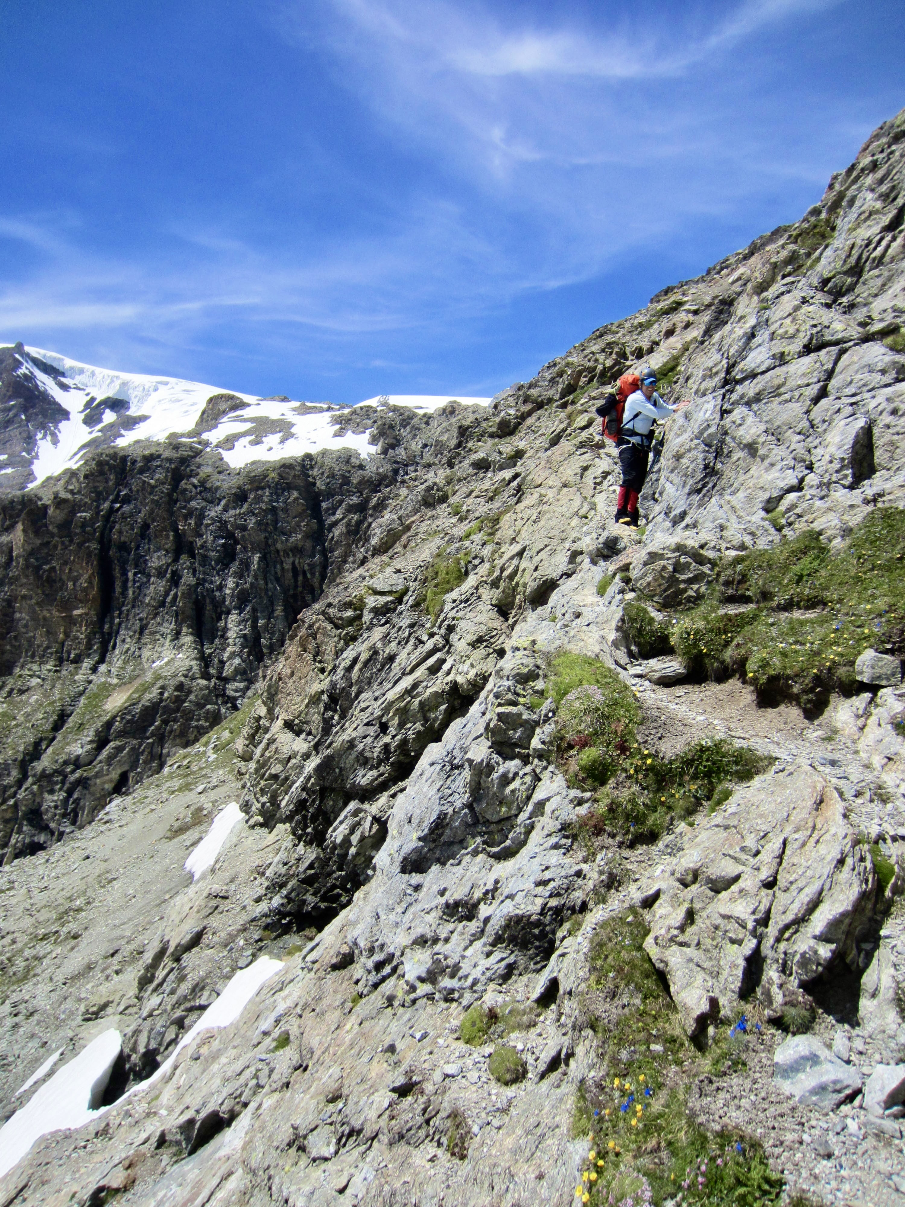
At the stoss, or up-gradient end, of The Stockje, we were delighted to find a well-marked climber’s path running up the crest and then down along the right (south) flank. For the next several hours, we followed this path across steep sidehills and down short cliff bands. New handline ropes were in place at any location that involved significant exposure or serious scrambling. Clearly, the local mountain guides were getting ready for a summer season on the Haute Route.

.
.

.
Upon reaching the lower end of The Stockje, we came to a marked path junction atop a moraine. A sign here indicated that the left fork led to Schonbiel Hut. Assuming that the right fork led directly down-valley, we chose that one. Very quickly, however, this fork ended at a steep slot-gully fitted with a scary old cable. We immediately backtracked to the junction and took the left fork.
.
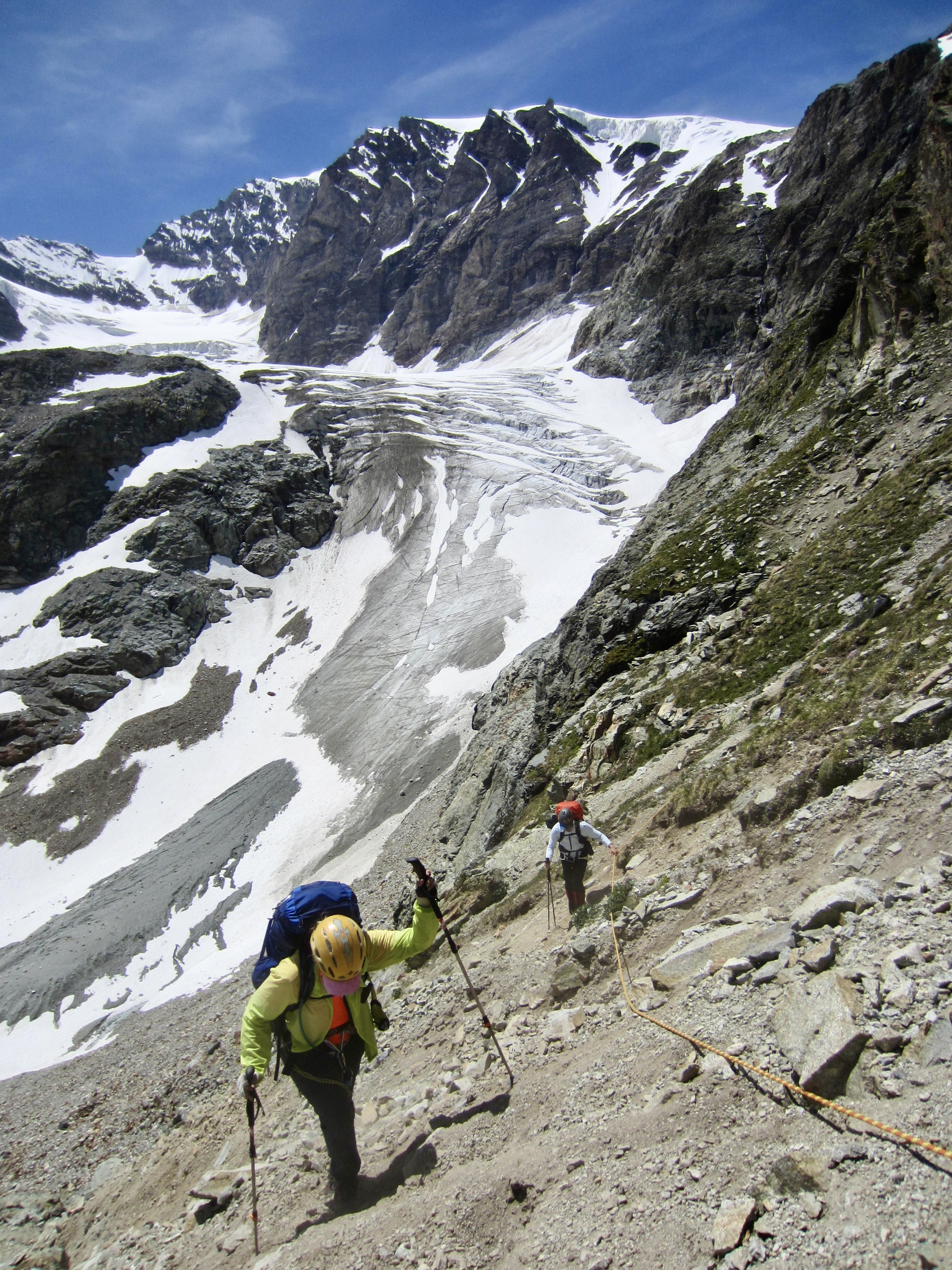
The left fork angled down toward the Stockje Glacier valley, with more handline ropes installed at steep locations. It was well-marked and easily followed until abruptly ending at the edge of a large landslide swath. Apparently, a recent debris flow completely obliterated the remainder of the climber’s path. We carefully hiked down the debris to reach the valley bottom.
.
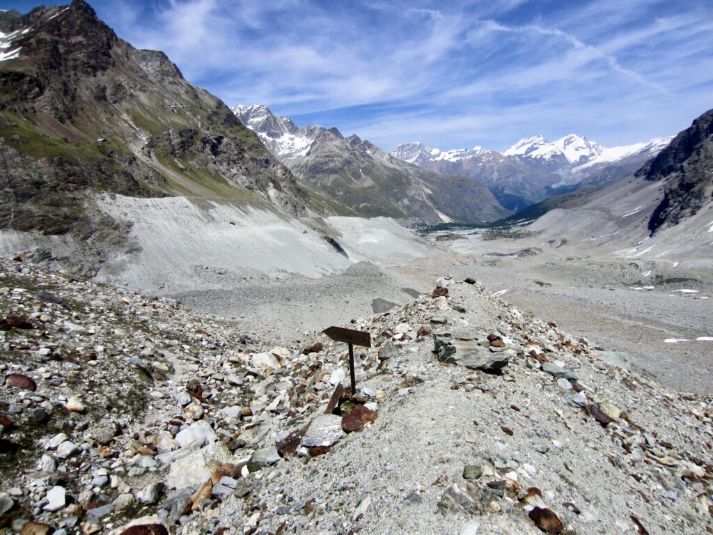
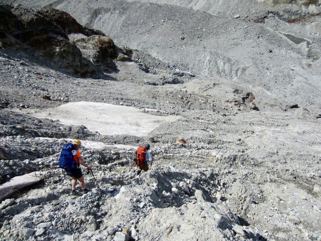
We had expected to find a decent footpath leading up the opposite valley wall and connecting with the Schonbiel Trail that leads out to Zermatt. However, such a path did not exist here; it was just a tall, steep, loose, and treacherous erosion slope. Our only exit option was to head straight down the Zmutt Glacier valley on the moraine slope. We spent the next three hours tediously working through the morainal rubble and post-glacial detritus, continually hopping from one unstable boulder to another while trying not to be crushed.
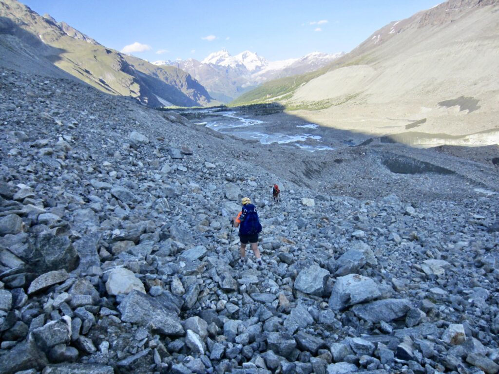
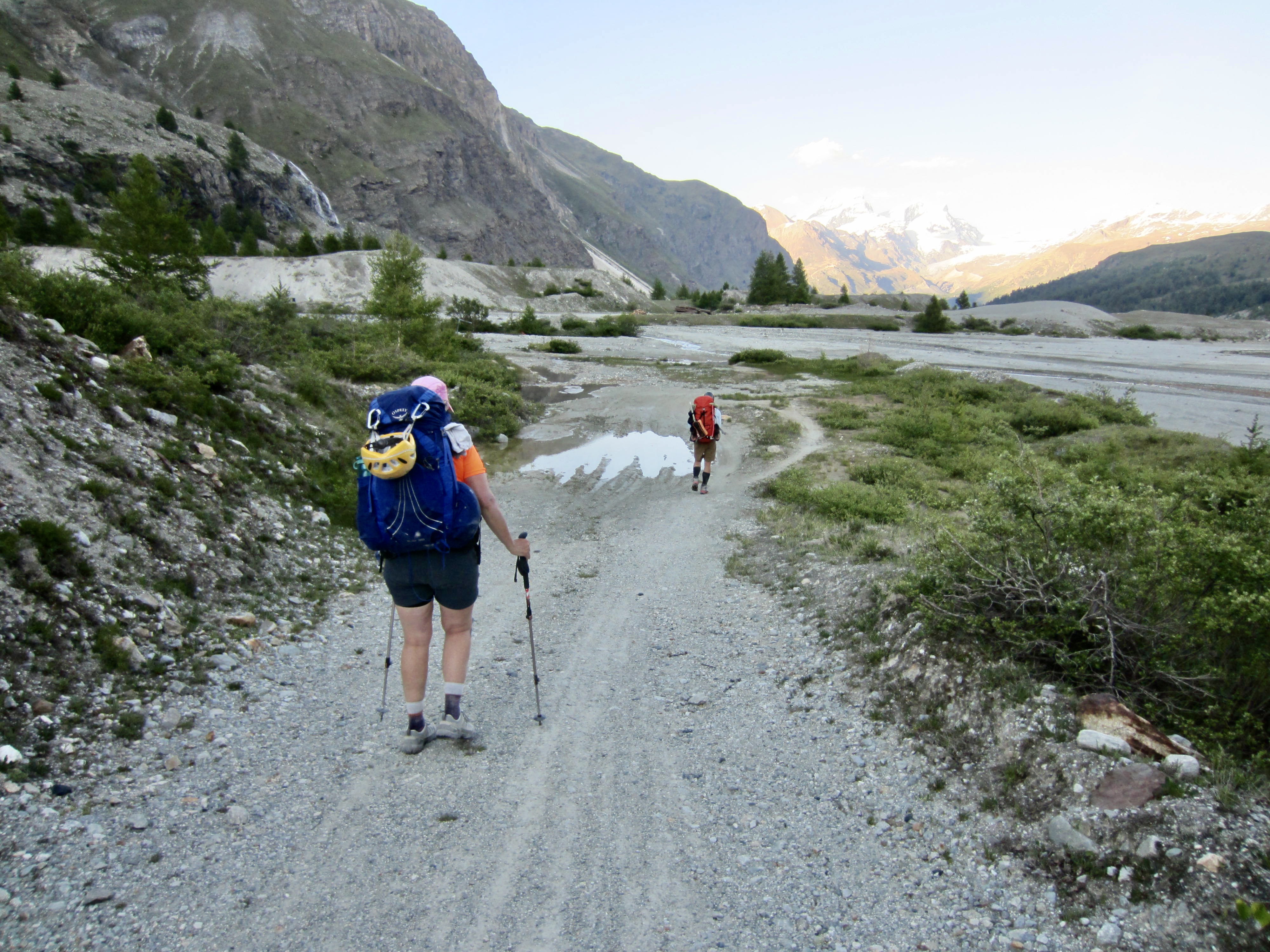
.
With great relief, we finally reached a riverside trail and then a gravel road. The road took us past a small dam and eventually to the Grand Dixence Pump Station near the hamlet of Ober-Stafel. It was now 8:30pm and Zermatt was still several hours away, but we did have cell phone reception. Jon started calling Zermatt taxi companies in the slight hope that someone would be willing to drive into the boondocks and pick us up. Miraculously, he hit paydirt on his second call. Although the price was steep—approximately US$225—our weary feet didn’t hesitate to accept.
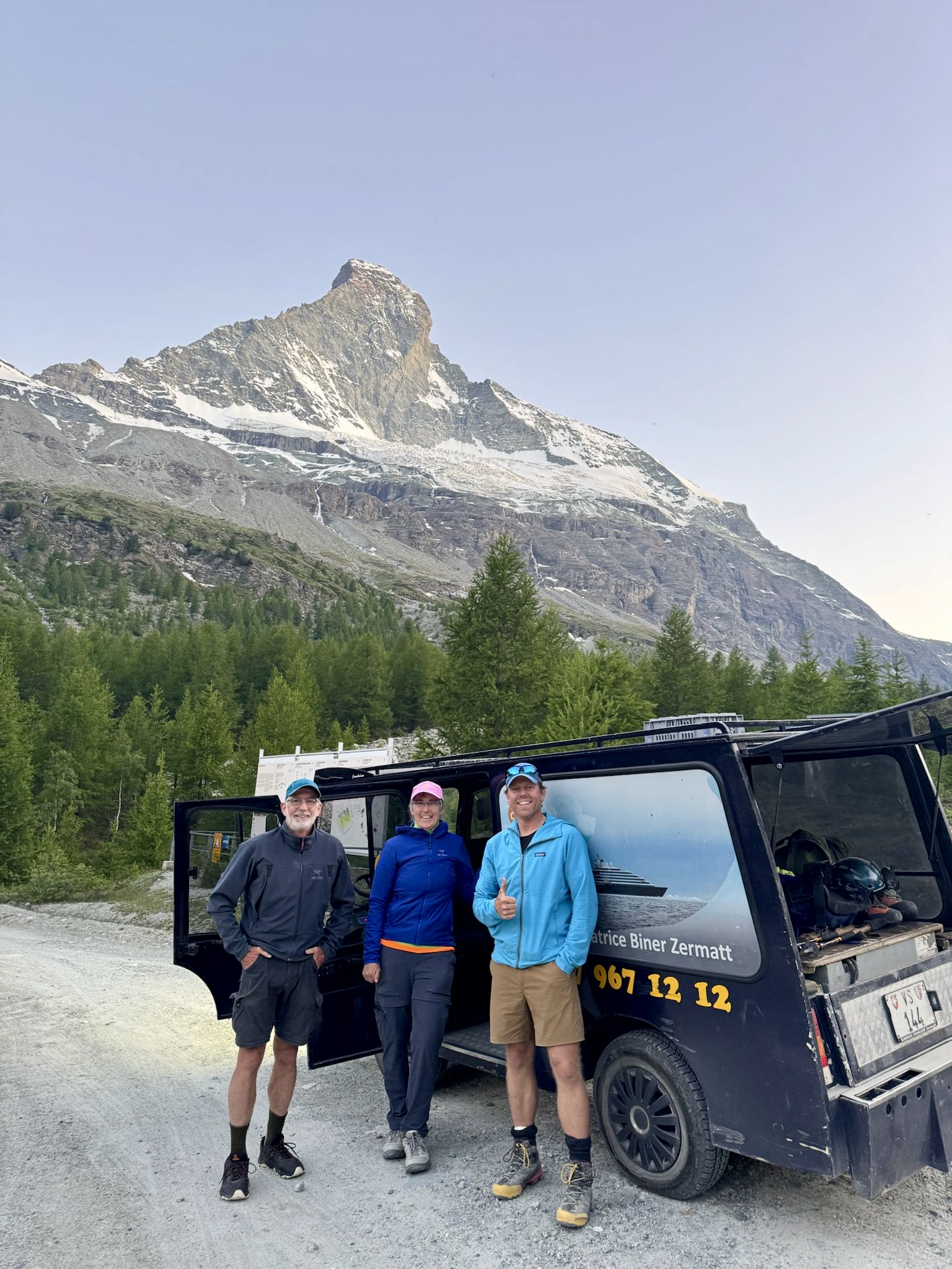
An hour later, we were bouncing down a rough road in a Schaller Taxi driven by a gregarious man who was intrigued by where we had been and what we had done. We tried to describe our journey over the past week, but I don’t think he fully understood. As the local climber at Bertol Hut had told us yesterday, “Nobody here does what you guys are doing.” And what a grand adventure it was!
.
Route Maps & Profiles
.
.
.
.
.
.
.
.
.
.
Photo Gallery
Click to enlarge…