Trip Date: June 29 – July 6, 2019
Inspiration–Isolation Traverse aka McAllister Traverse: Borealis Glacier to Inspiration Glacier to Colonial Glacier
Borealis Pass aka Lucky Pass
Primus Peak (8508′)
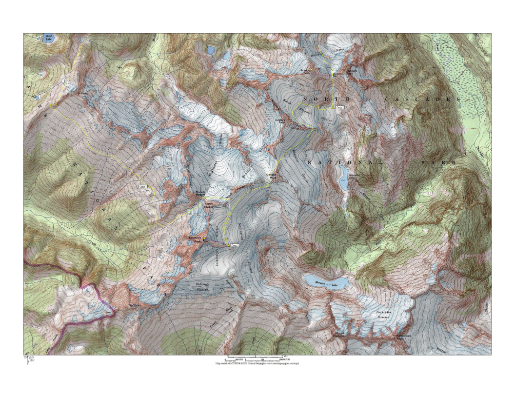
Klawatti Glacier
Inspiration Glacier
Eldorado Peak (8868′)
Tepeh Gap
McAllister Glacier
Dorado Col
Coccyx Col
Wilcox Tarns
Isolation Peak (7102′)
Isolation Lake
Snowfield Peak (8347′)
Neve Glacier
Colonial Glacier
- Trip Report Summary
- Related Posts
- Full Trip Report
- Day 1: Thunder Creek Trailhead to Borealis Ridge Step
- Day 2: Borealis Ridge Step to North Klawatti Glacier Moraine + Primus Peak Summit
- Day 3: North Klawatti Glacier Moraine to East Eldorado Rib
- Day 4 (AM): Eldorado Peak Summit Climb
- Day 4 (PM): East Eldorado Rib to Marble Creek Slope
- Day 5: Marble Creek Slope to Wilcox Tarns
- Day 6: Wilcox Tarns to Isolation Peak Summit to Isolation Lake Knoll
- Day 7: Isolation Lake Knoll to Pyramid Ridge Step + Snowfield Peak
- Day 8: Pyramid Ridge Step to Pyramid Lake Trailhead
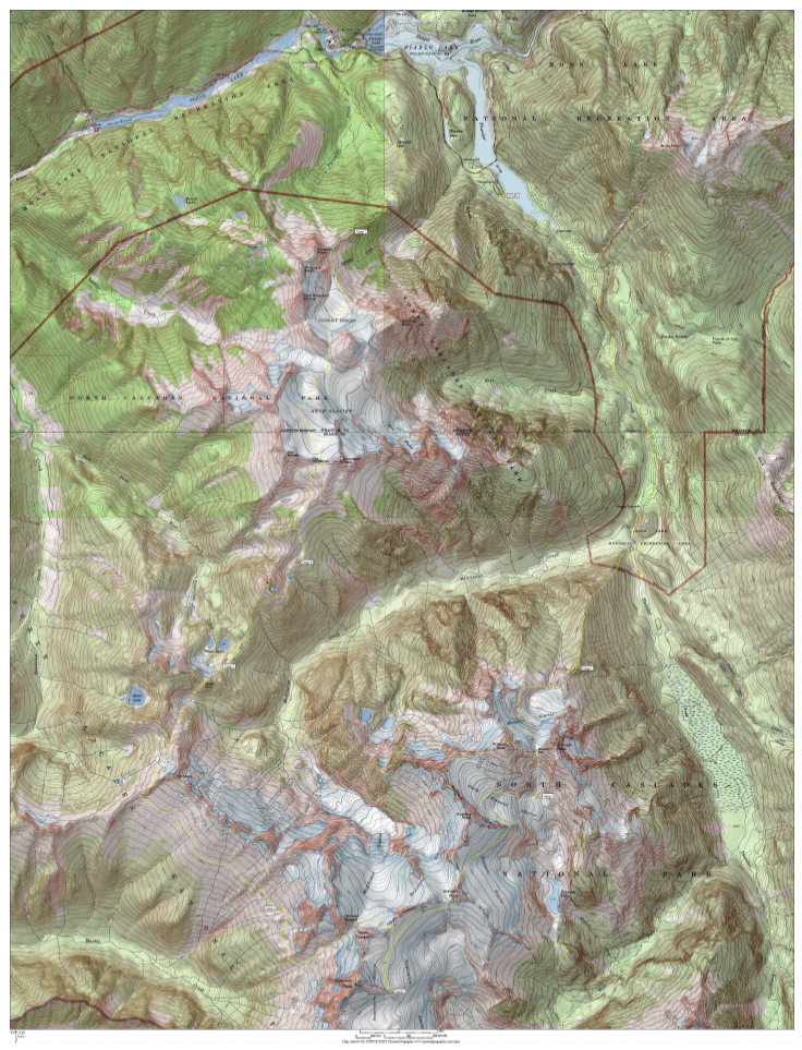
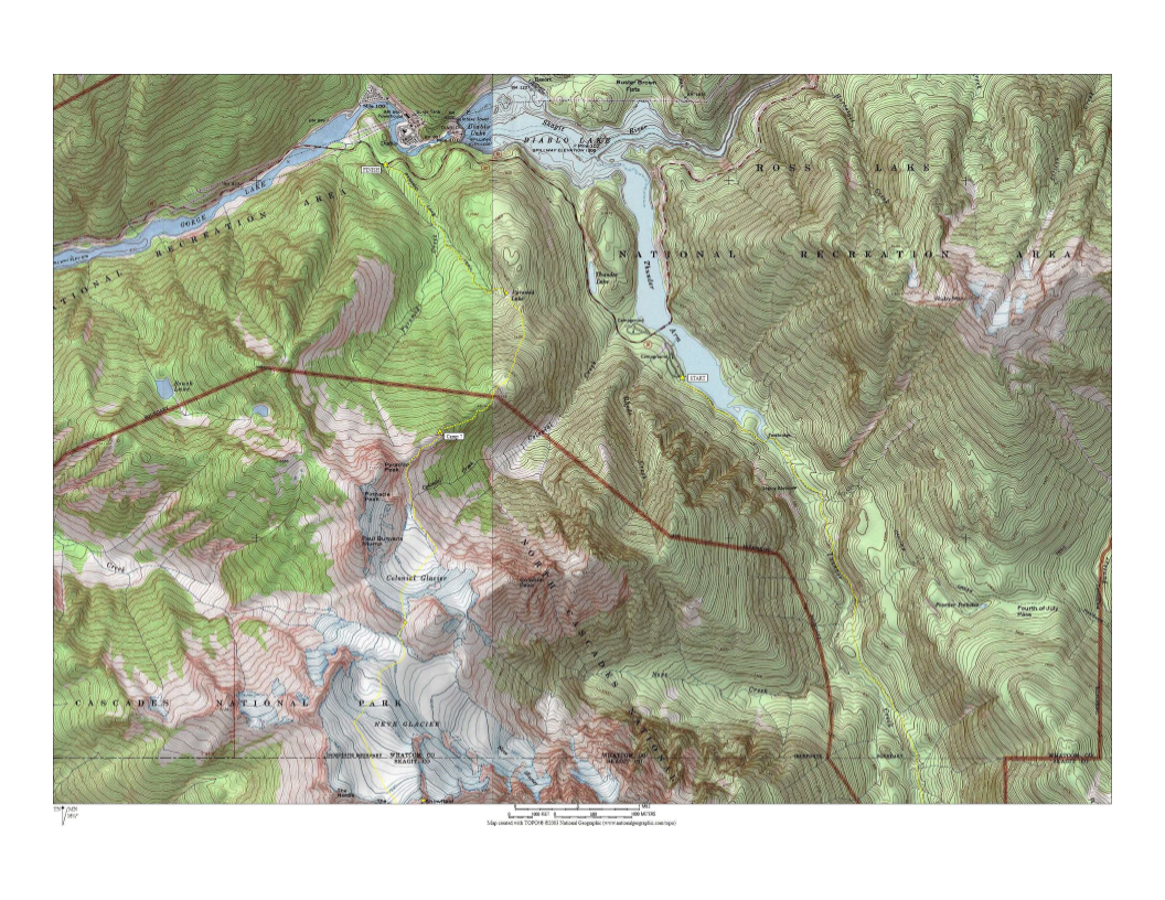
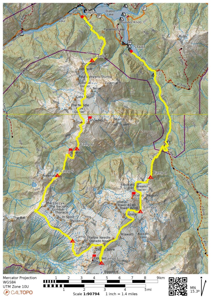
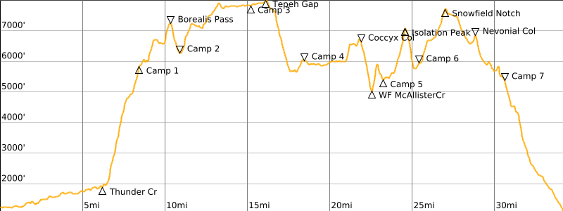
- Route Maps & Profile
- Photo Gallery
Trip Report Summary
Region: Northwestern Washington Cascades
Sub-Regions: McAllister Mountains & Thunder Mountains
Area: North Cascades National Park
Starting Point: Thunder Creek Trailhead at Colonial Creek Campground on Highway 20 (Elev. 1200 feet)
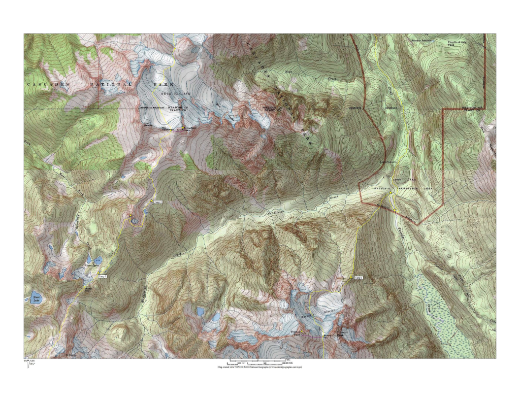
Way Points: Thunder Arm & Thunder Creek & McAllister Camp (trail hike & bushwhack); Borealis Ridge & Point 4835 & Borealis Glacier & Borealis Pass & North Klawatti Glacier Moraine & North Klawatti Glacier & Klawatti Glacier & North Klawatti Notch & South Klawatti Saddle & Inspiration Glacier & East Eldorado Rib & Tepeh Gap & Upper McAllister Glacier & Dorado Col & Marble Creek slope & Southwest Coccyx Ridge & Coccyx Col & West Fork McAllister Creek Cirque & Wilcox Pass & Wilcox Tarns & Isolation Peak summit & Isolation Lake & Point 6705 & West Snowfield Notch & Neve Glacier & Nevonial Col & Colonial Glacier & Colonial Creek Cirque & Pyramid Ridge & Point 4614 & Point 4555 & Pyramid Lake (off-trail hike & rock scramble & snow climb); Pyramid Creek & Highway 20 (trail hike)
High Point: Tepeh Gap (Elev. 8000 feet)
Low Point: West Fork McAllister Creek cirque (Elev. 5000 feet)
Ending Point: Pyramid Lake Trailhead on Highway 20 (Elev. 1100 feet)
Campsites: Borealis Ridge step & North Klawatti Glacier moraine & East Eldorado Rib & Marble Creek slope & Wilcox Tarns & Isolation Lake knoll & Pyramid Ridge step
Summit: Primus Peak (rock scramble via East Slope—East Face)
Summit: Eldorado Peak (snow climb via Upper Inspiration Glacier—Northeast Arete)
Summit: Isolation Peak (rock scramble via Southwest Slope; rock & snow descent via Southeast Ridge—Southeast Ramp)
Summit: Snowfield Peak (rock scramble via West Ridge)
Approximate Stats (excluding all sidetrips): 34 miles traveled; 16,600 feet gained; 16,700 feet lost.
Approximate Stats (including all sidetrips): 37 miles traveled; 19,600 feet gained; 19,700 feet lost.
Related Posts
Inspiration Traverse + Primus Peak + Austera Peak + Klawatti Peak + Dorado Needle – June 2003
Snowfield Peak via Pyramid Ridge–Colonial Glacier–Neve Glacier – May 2002
Eldorado Peak via Sibley Creek Pass—Eldorado Glacier—East Ridge – September 1993
Full Trip Report
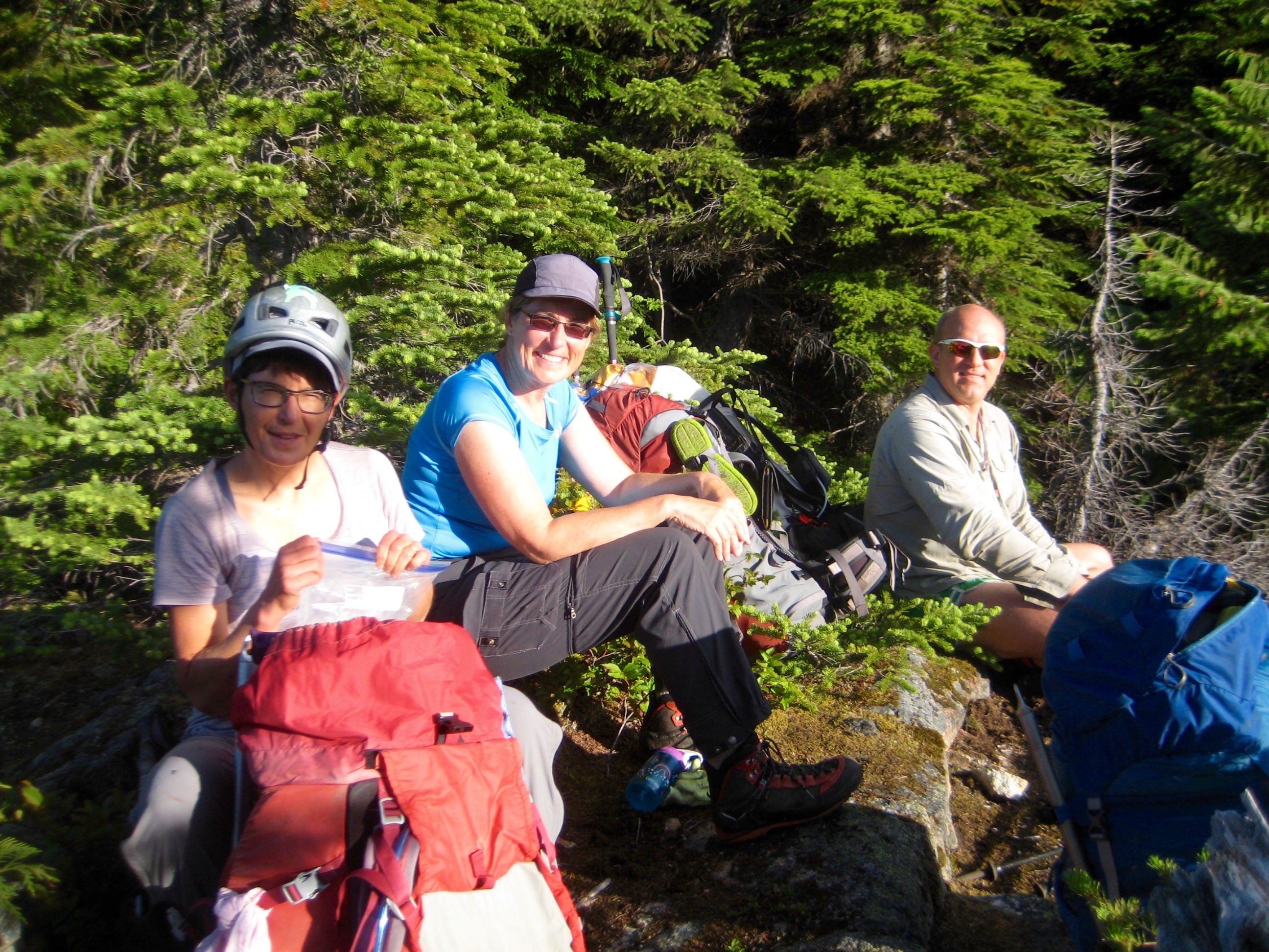
Last week, Eileen and Kevin K and I completed an eight-day link-up of the quite-popular Inspiration Traverse and the seldom-done Isolation Traverse. The combination of these two alpine traverses follows a “U” around the McAllister Creek watershed and is appropriately called the “McAllister Traverse.” Our friend Lisa joined us for the first half of our trek, and as a group, we tucked in the three “anchor tenant” peaks—Primus, Eldorado, and Snowfield—along with the eponymous Isolation Peak. We were plagued by poor weather throughout our week but had a fantastic trip nonetheless.
Day 1: Thunder Creek Trailhead to Borealis Ridge Step
After shuttling a car over to the Pyramid Lake Trailhead, we all left the Thunder Creek Trailhead at 7:30am. The morning was pleasantly cool as we hiked 6½ miles to McAllister Creek Horse Camp, where a bridge formerly crossed over Thunder Creek to provide access to McAllister Creek Hiker Camp. However, the bridge is now gone, leaving us to find another way across the rushing creek.
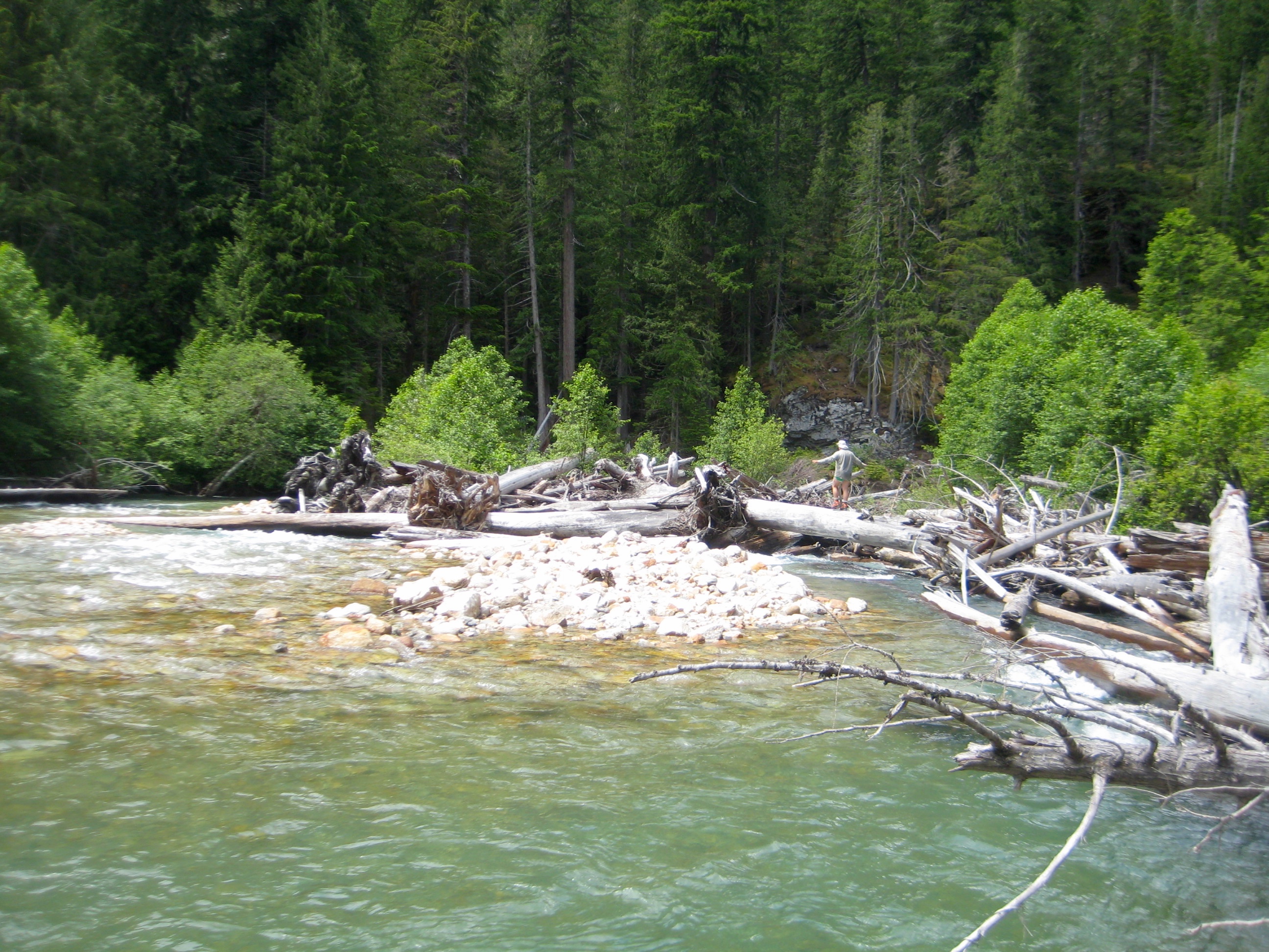
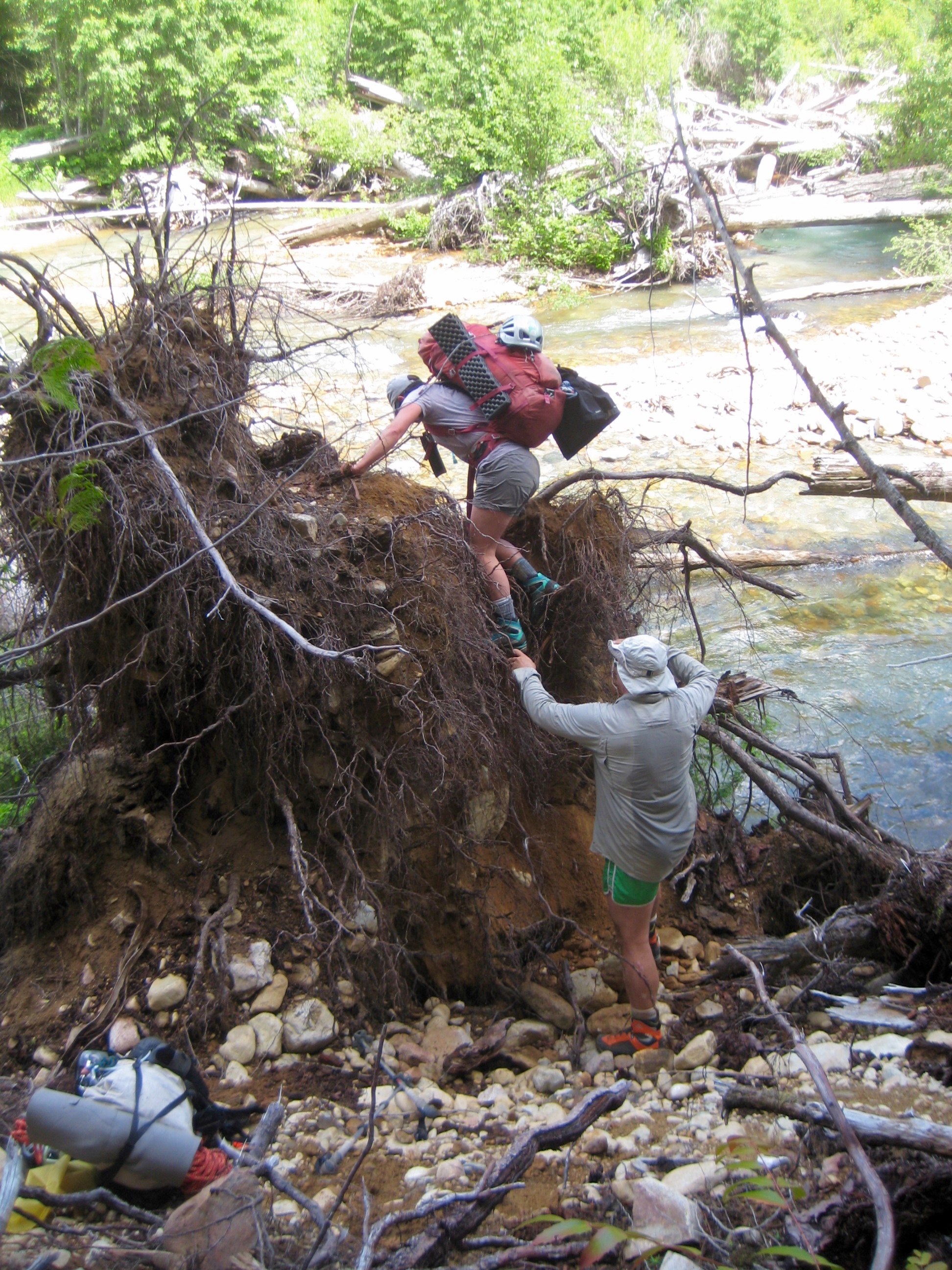
Nearly 2 hours of tramping through valley-bottom brush eventually revealed a log jam about ¼ miles upstream of the former bridge site. (Note: This log jam is located right at the park boundary shown on topo maps.) Crossing the creek involved zig-zagging across numerous sturdy logs and then carefully climbing over the final root ball.

- Thunder Creek Log Jam

- Lisa & Kevin Climbing Over Large Root Ball
Once across Thunder Creek, we bushwhacked ¼ mile back downstream to the now-abandoned McAllister Creek Hiker Camp (5.7 hours + 900 feet from TH). The only vestiges of the former bridge are two abutment pads, and it seems unlikely that the bridge will ever be replaced.
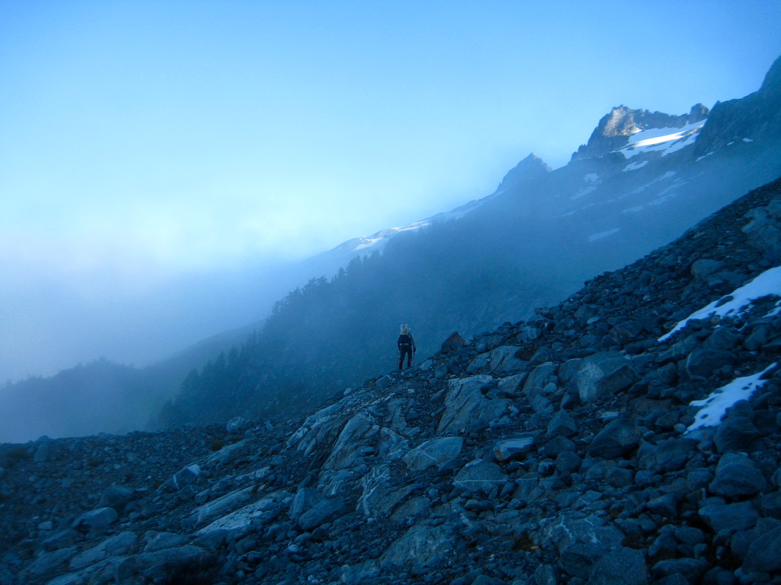
We quickly located the start of the climber’s path leading westward out of the campground before it turned southwestward and headed up Borealis Ridge. We spent the rest of the afternoon hauling heavy packs up the steep and subtly defined path, stopping for a long break at the first viewpoint around 4600 feet.
- Lisa & Eileen & Kevin On Borealis Ridge
Beyond the viewpoint, the slope gradient eased a bit but the path became harder to follow through tight trees. We trudged onward, hoping to find a campsite with water or snow nearby. However, this year’s substandard snowpack has pushed the current snowline farther uphill. It was after 9:00pm when we finally topped out on a flat heather step at 5800 feet (13.5 hours + 5000 feet from TH) with snowpatches available nearby. We were all more than ready to camp here for the night to end a long and arduous first day.
- Camp 1 On Borealis Ridge
Day 2: Borealis Ridge Step to North Klawatti Glacier Moraine + Primus Peak Summit
The morning was sunny and mild, which gave us no urgency in getting out of camp. Once underway at 10:00am, we continued hiking up the ridge crest to the outlet of newly formed “Borealis Lake.” We evaluated our route options and ultimately elected to work around the right (western) side of the lake in order to reach the northern edge of the Borealis Glacier.
- Heading Toward Borealis Pass
- Heading Rightward Toward Borealis Glacier
A high traverse across the glacier led us over the top of Borealis Lake and onward to 7200-foot Borealis (Lucky) Pass in mid afternoon (4.8 hours + 1600 feet from Camp 1).
- Borealis Lake From Borealis Glacier
- Tricouni Peak & Borealis Pass From Borealis Glacier
Although the afternoon was getting cooler and cloudier, we all felt obliged to scramble up nearby Primus Peak, which anchors the northeastern point of the McAllister Traverse. Backpacks were stashed and covered before we headed up the bouldery east slope.
- Forbidden Peak From Borealis Pass
- Heading Up Primus Peak From Borealis Pass
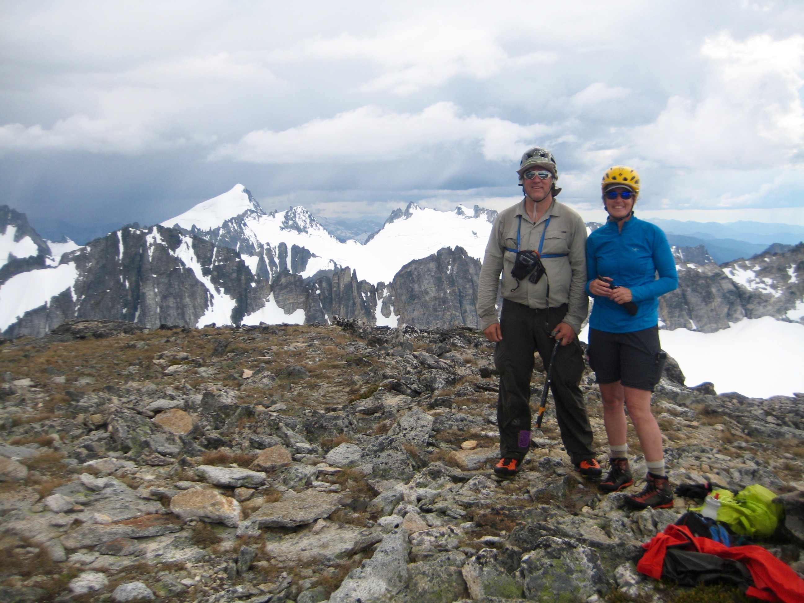
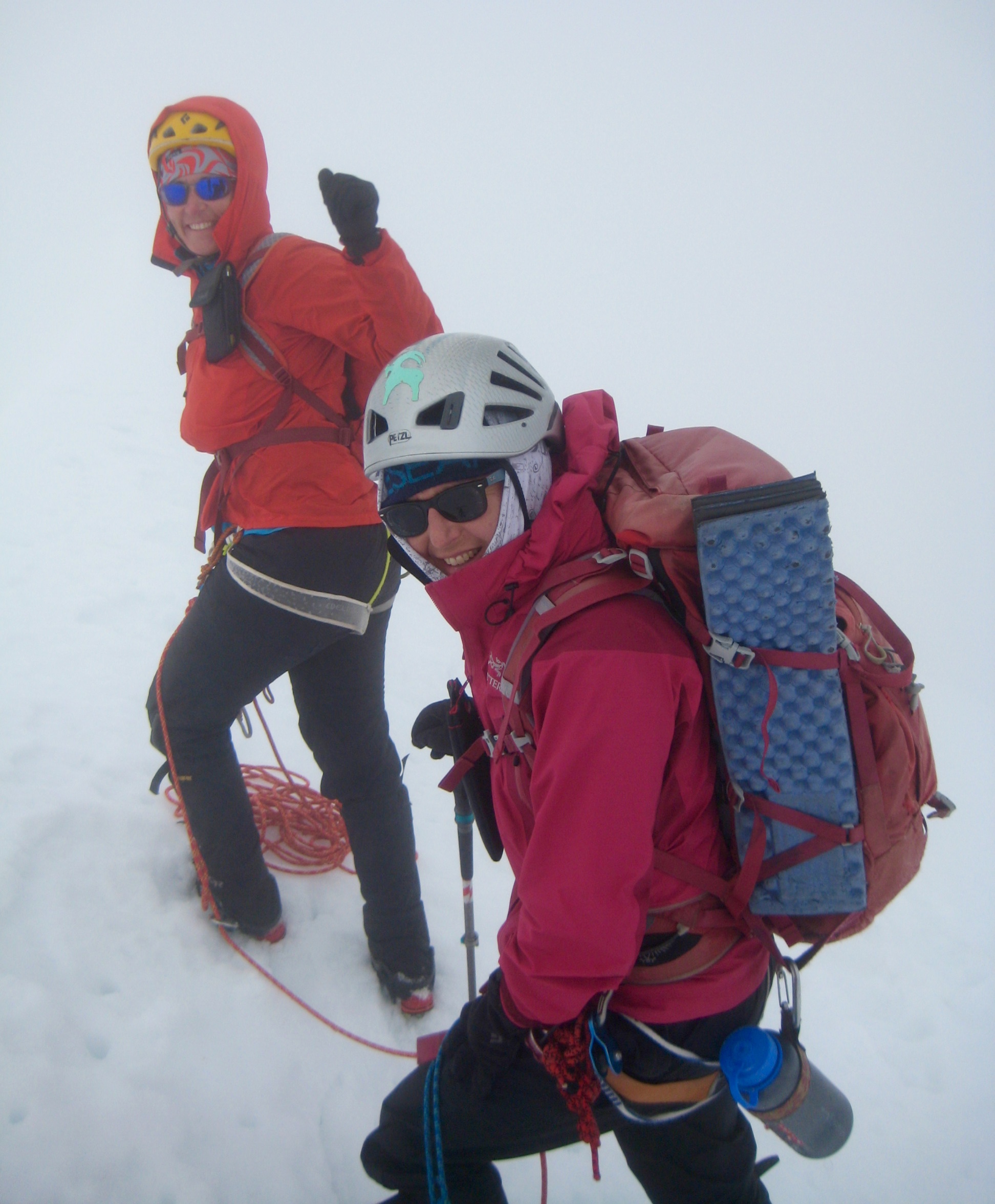
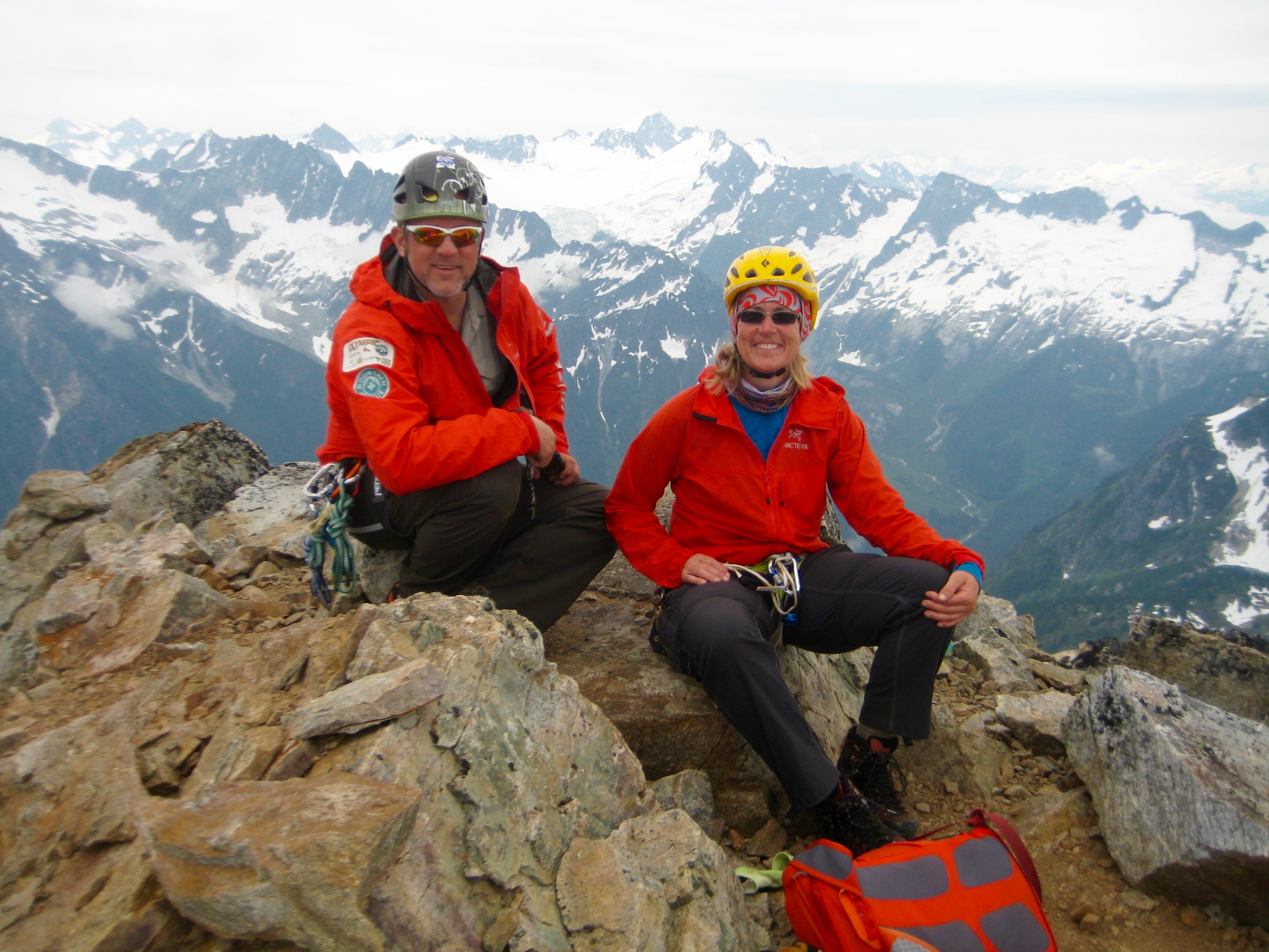
Halfway up the peak, the sight of thunderclouds building around us prompted Lisa to return to the pass. Kevin and Eileen and I kept scrambling upward on Class 3 rock along the right edge of the east face. The sky was growing quite dark when we reached the summit.
- Kevin & Eileen On Primus Peak Summit
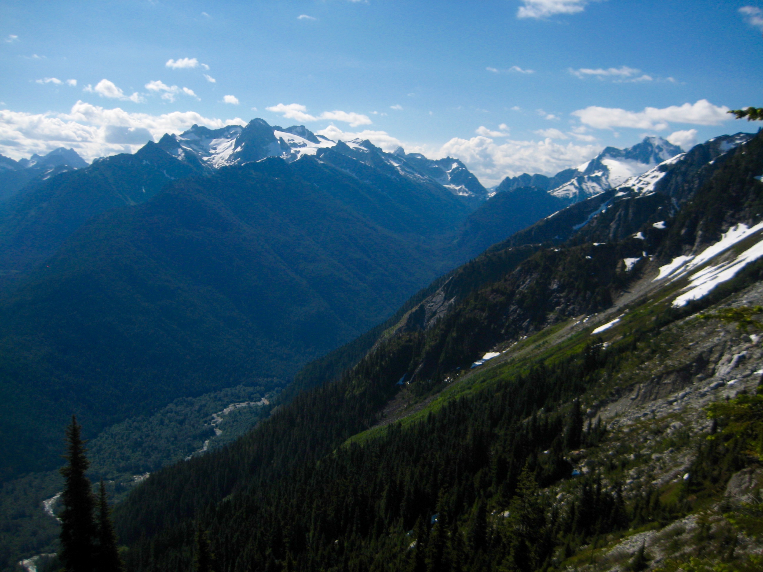
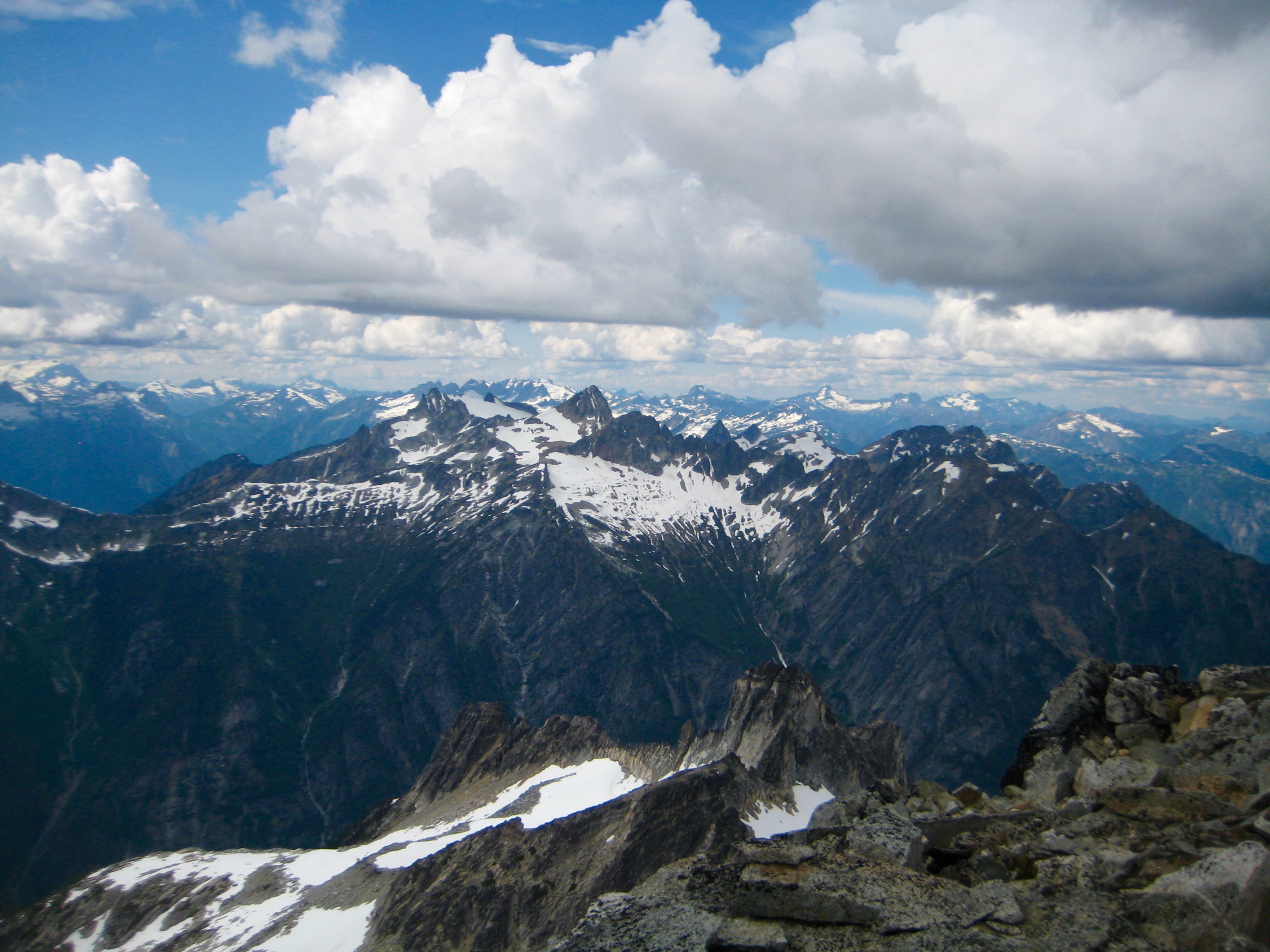
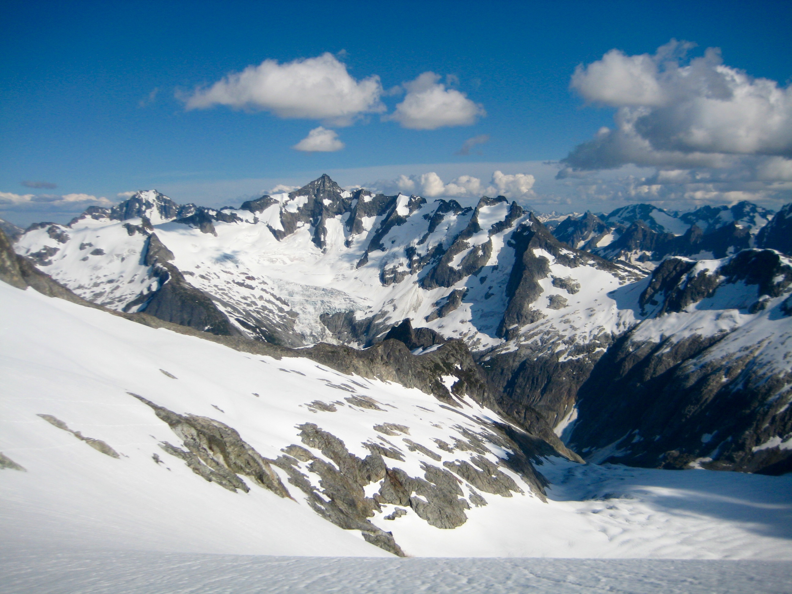
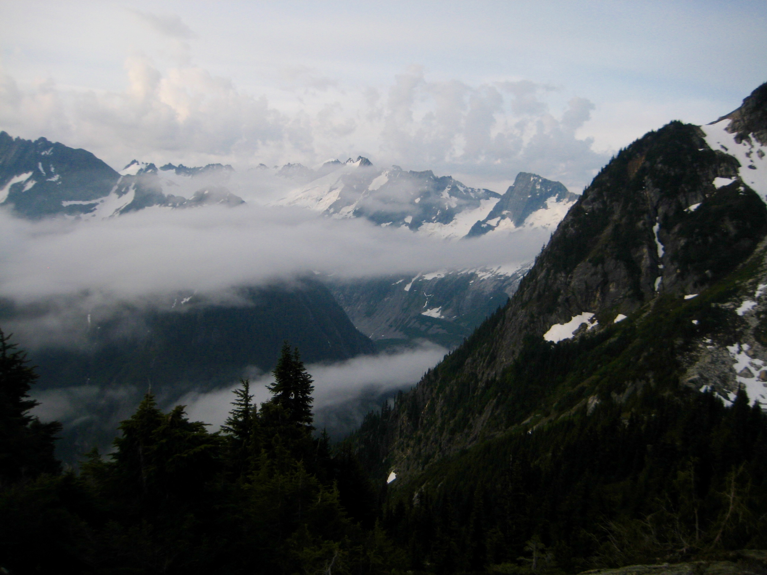
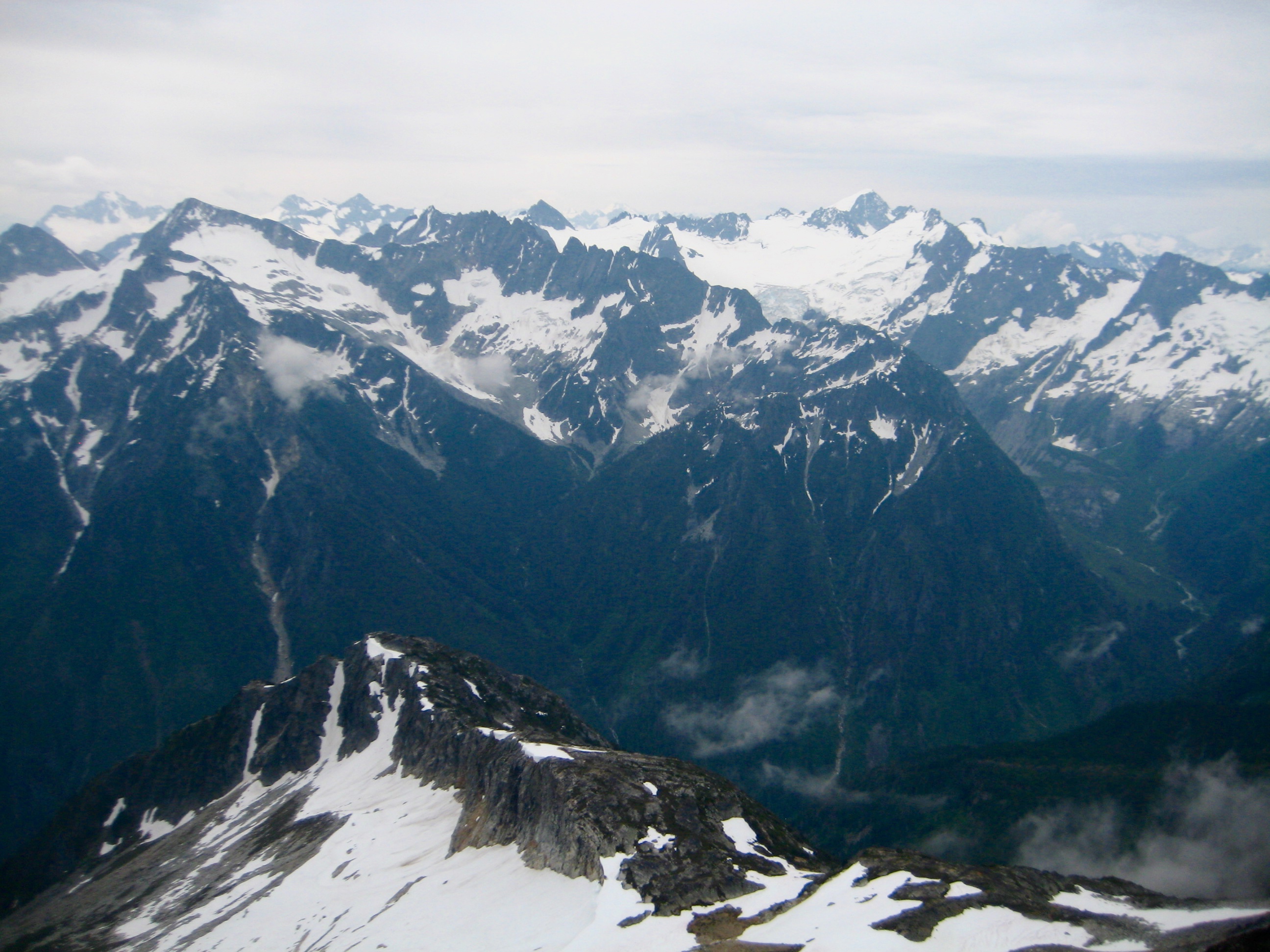
- Snowfield Peak From Primus Peak Summit
- Eldorado Peak From Primus Peak Summit
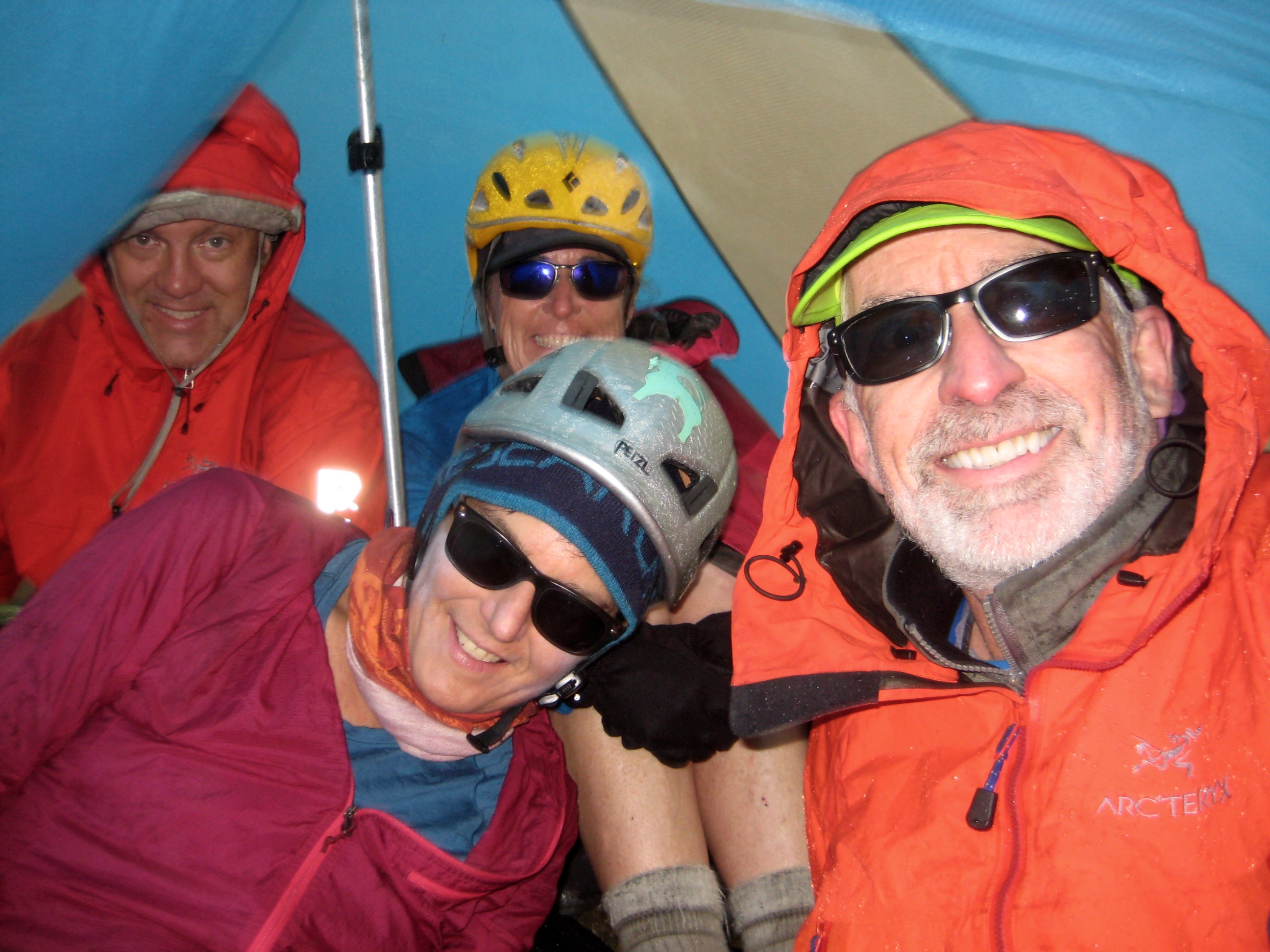
Shortly after we started descending, thunder could be heard in the distance, and light rain began falling. We hurried down, hoping to beat the impending storm, but it was moving in too quickly. By the time we reached our backpacks at Borealis Pass, the storm was in full swing. Fortunately, Lisa had pitched her tent while we were gone, so everyone piled in. We spent the next hour shivering in the tent while a ferocious thunderstorm battered us with wind and rain, and lightning bolts crackled loudly overhead. It was comically miserable and frightening!
- Tent Bound Group At Borealis Pass
As soon as the storm abated, we sprang out of the tent, hastily packed up, and charged down the southern side of Borealis Pass.

- Descending From Borealis Pass After Storm
An hour later, just as the weather cleared, we reached a moraine at 6250 feet below the North Klawatti Glacier. It was early evening, so we stopped and carved out a functional campsite on the moraine (10.3 hours + 3000 feet from Camp 1, including summit sidetrip).
- Camp 2 On North Klawatti Glacier Moraine
Day 3: North Klawatti Glacier Moraine to East Eldorado Rib
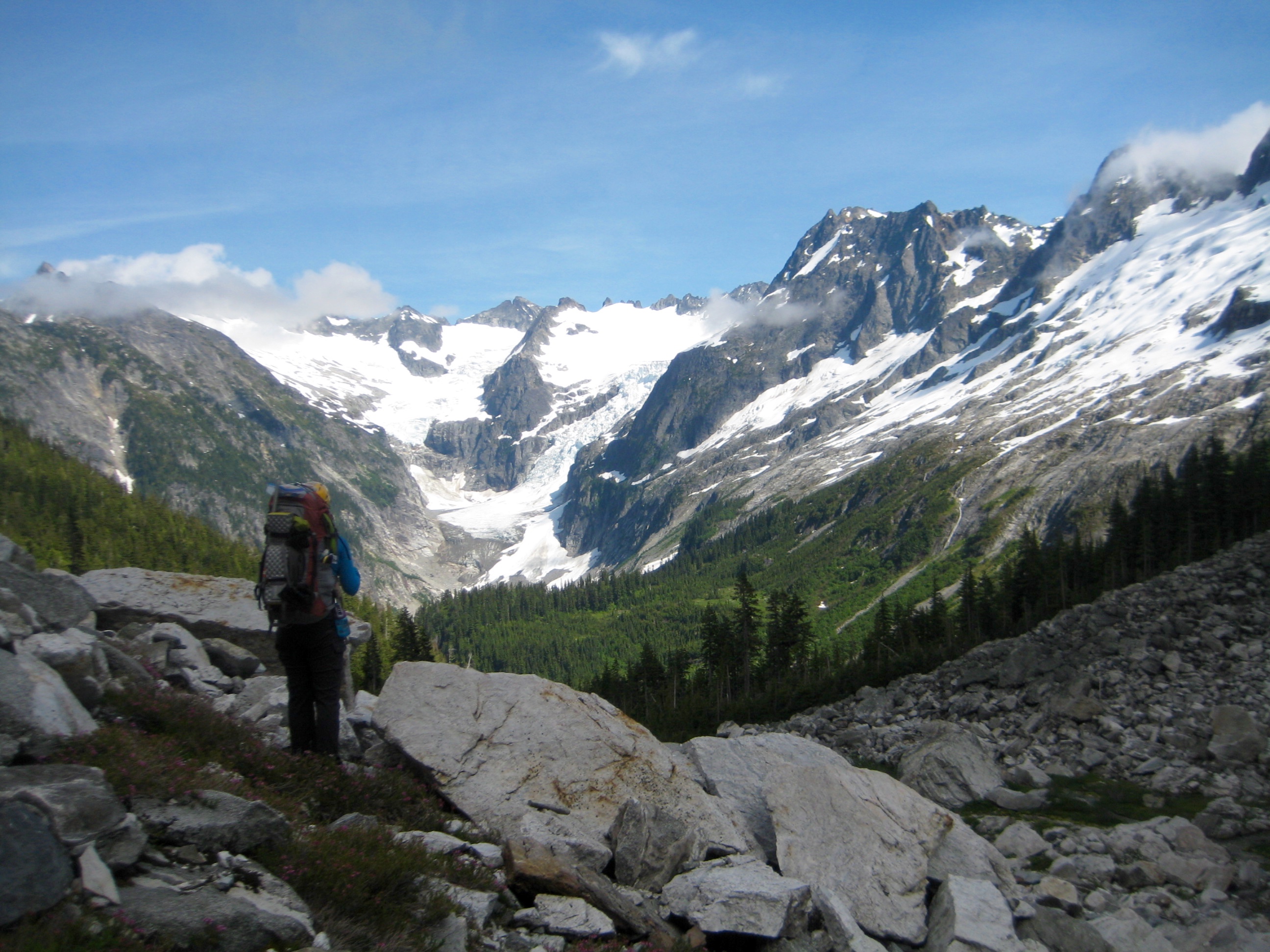
We awoke to clear skies and mild weather, with golden sun highlighting Forbidden Peak above Klawatti Lake.
- Forbidden Peak Above Klawatti Lake
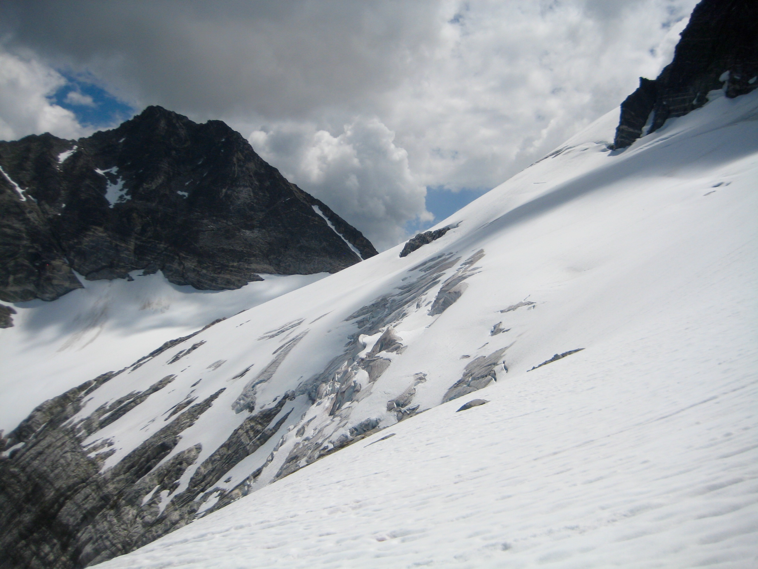
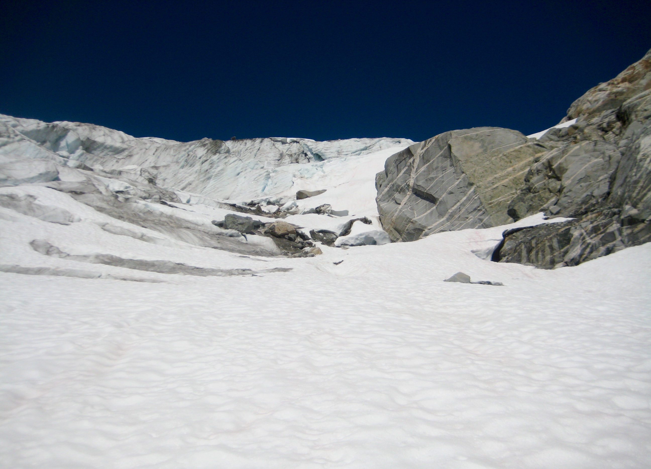
Our morning task was to navigate through the North Klawatti Glacier icefall, and it appeared that the right-hand margin provided a feasible route. I first tried leading up through the maze of ice caverns and ice aretes but was stopped by a disturbingly thin snow bridge over a huge void.

- Approaching North Klawatti Glacier Snout
For my second attempt, I led up a Class 4 rock outcrop adjacent to the glacier’s snout. This proved successful, and we were soon traversing above the icefall.
- Climbing Past North Klawatti Glacier Snout
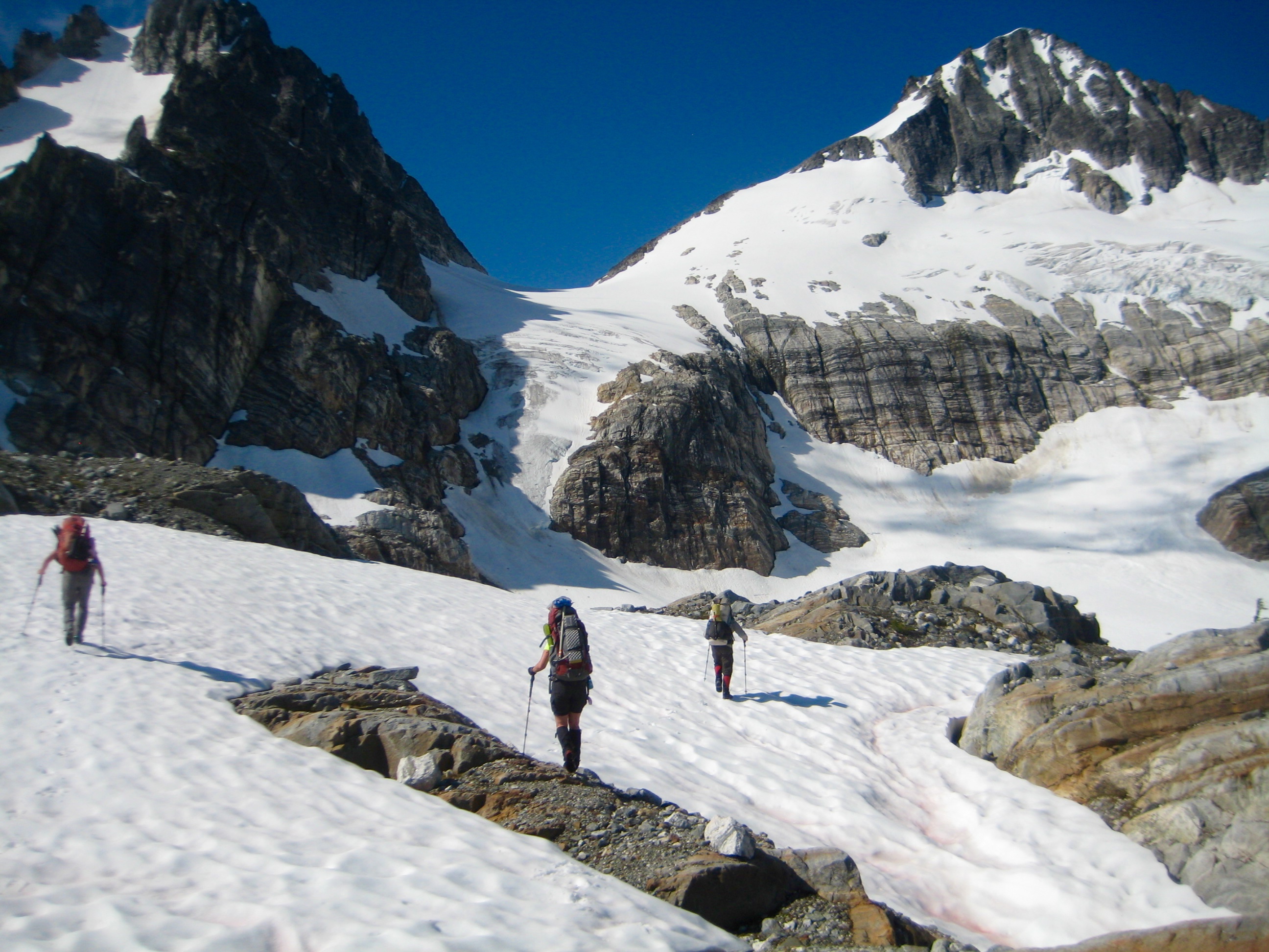
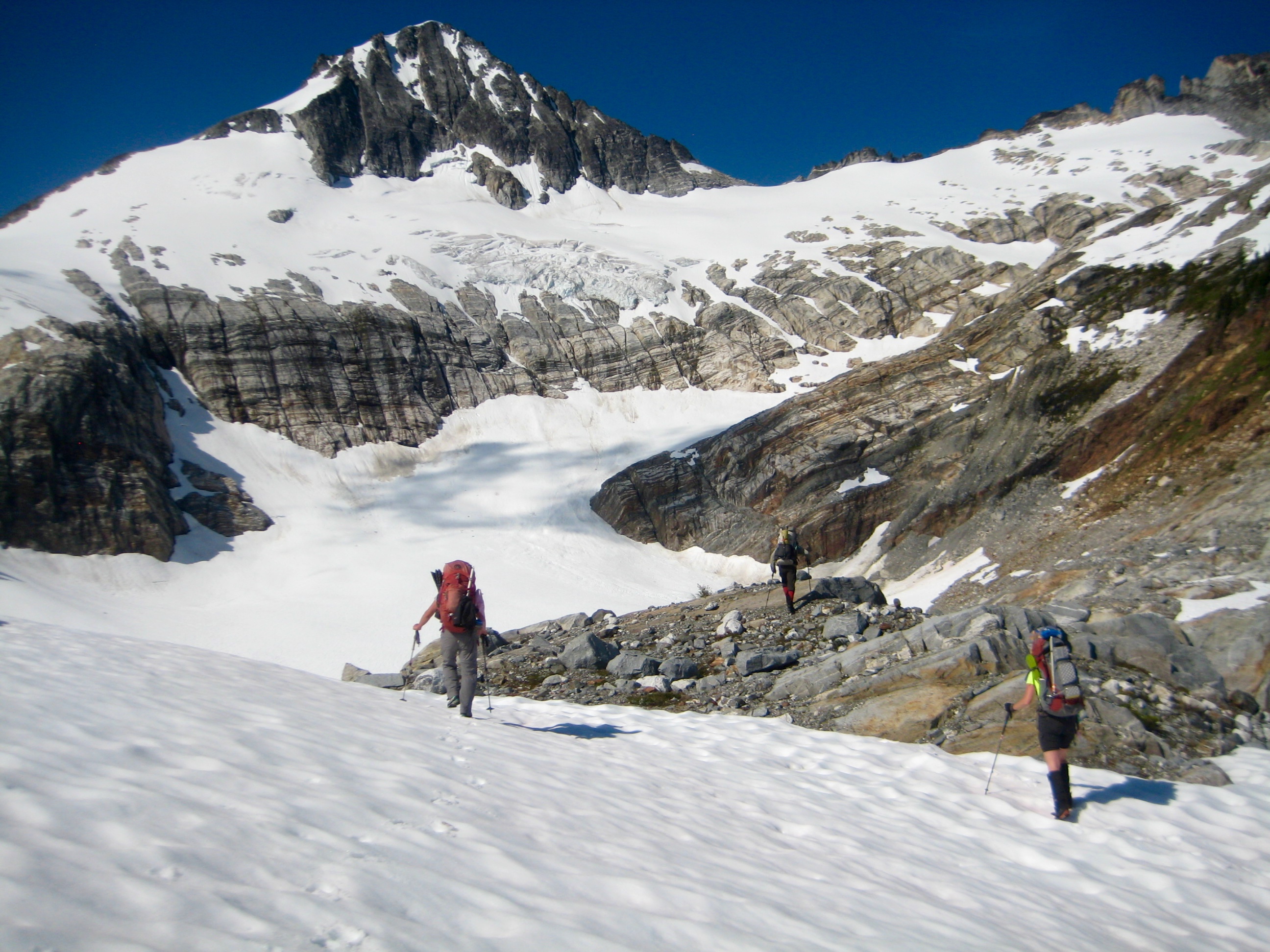
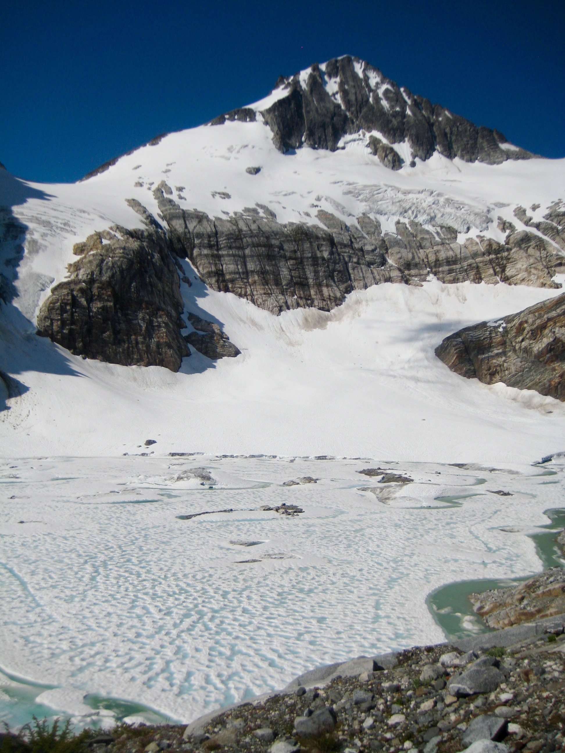
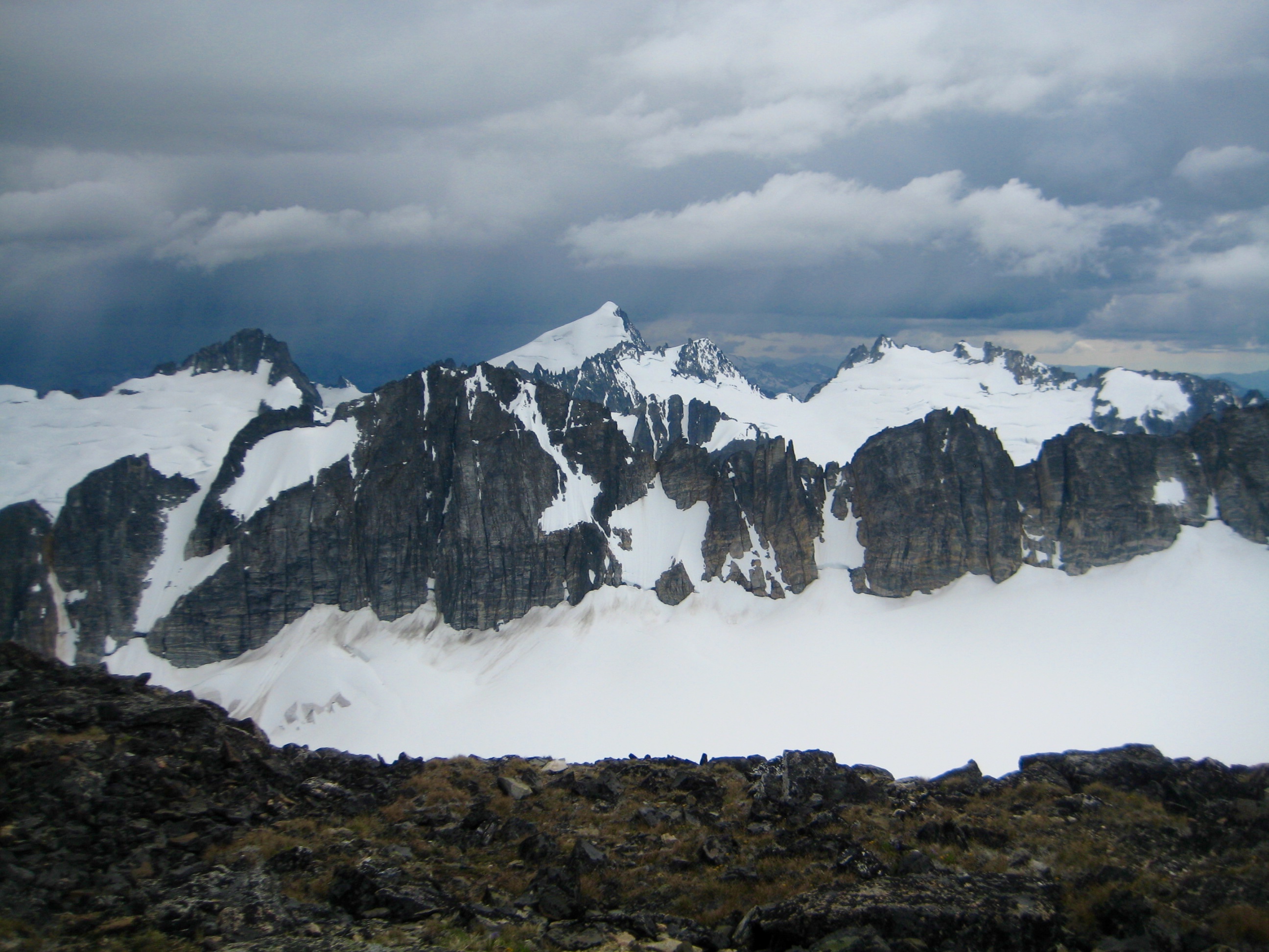
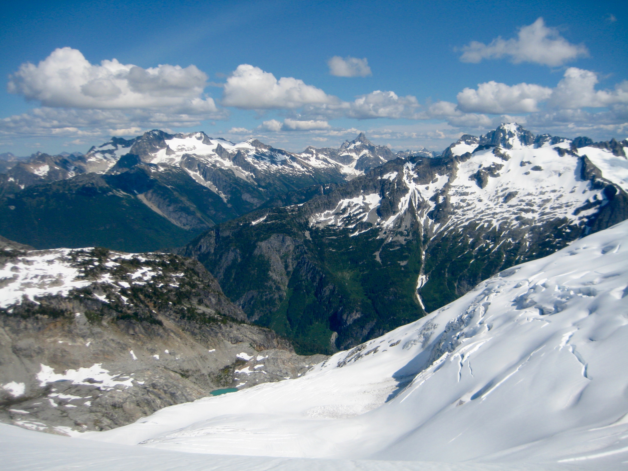
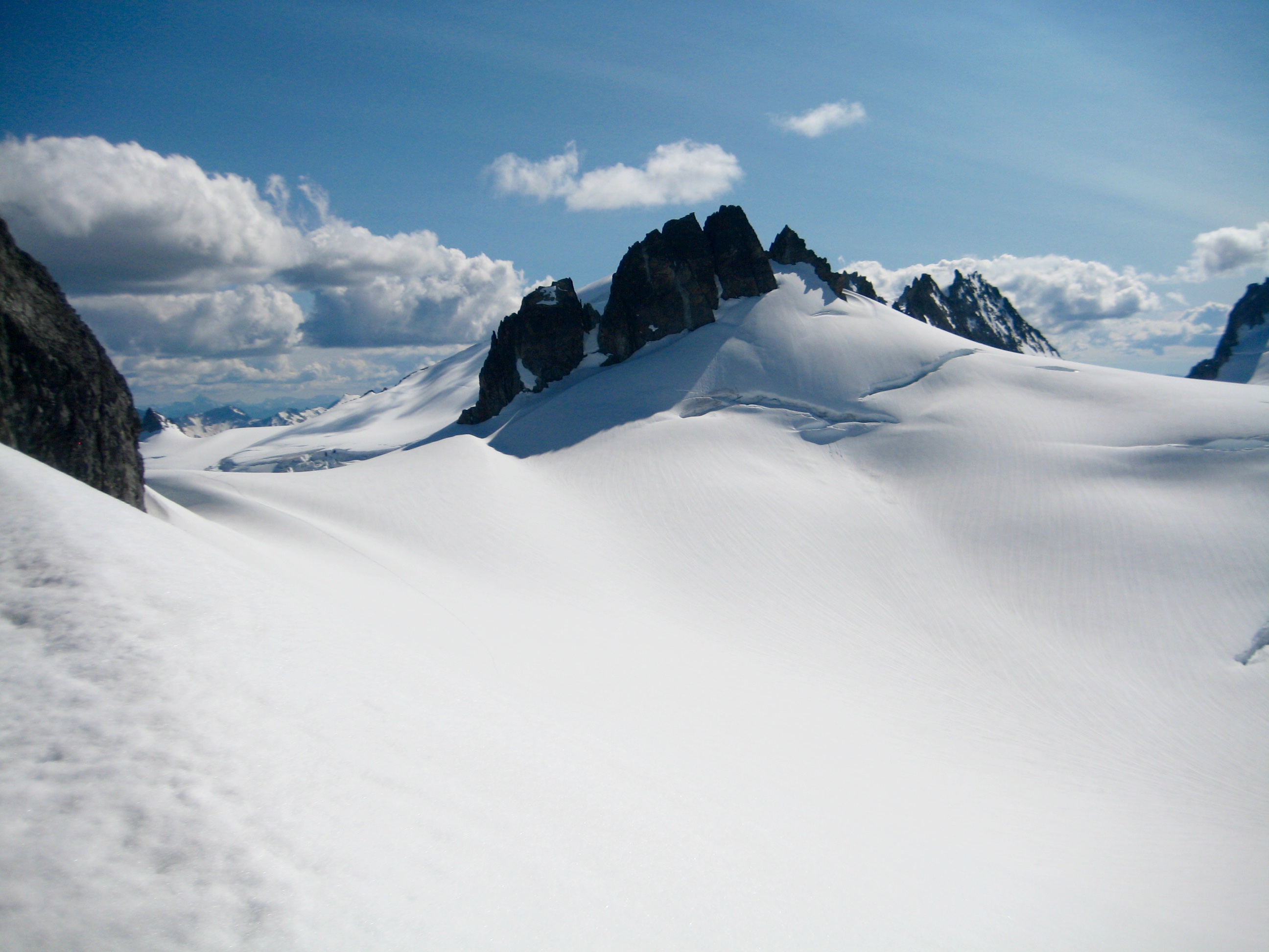
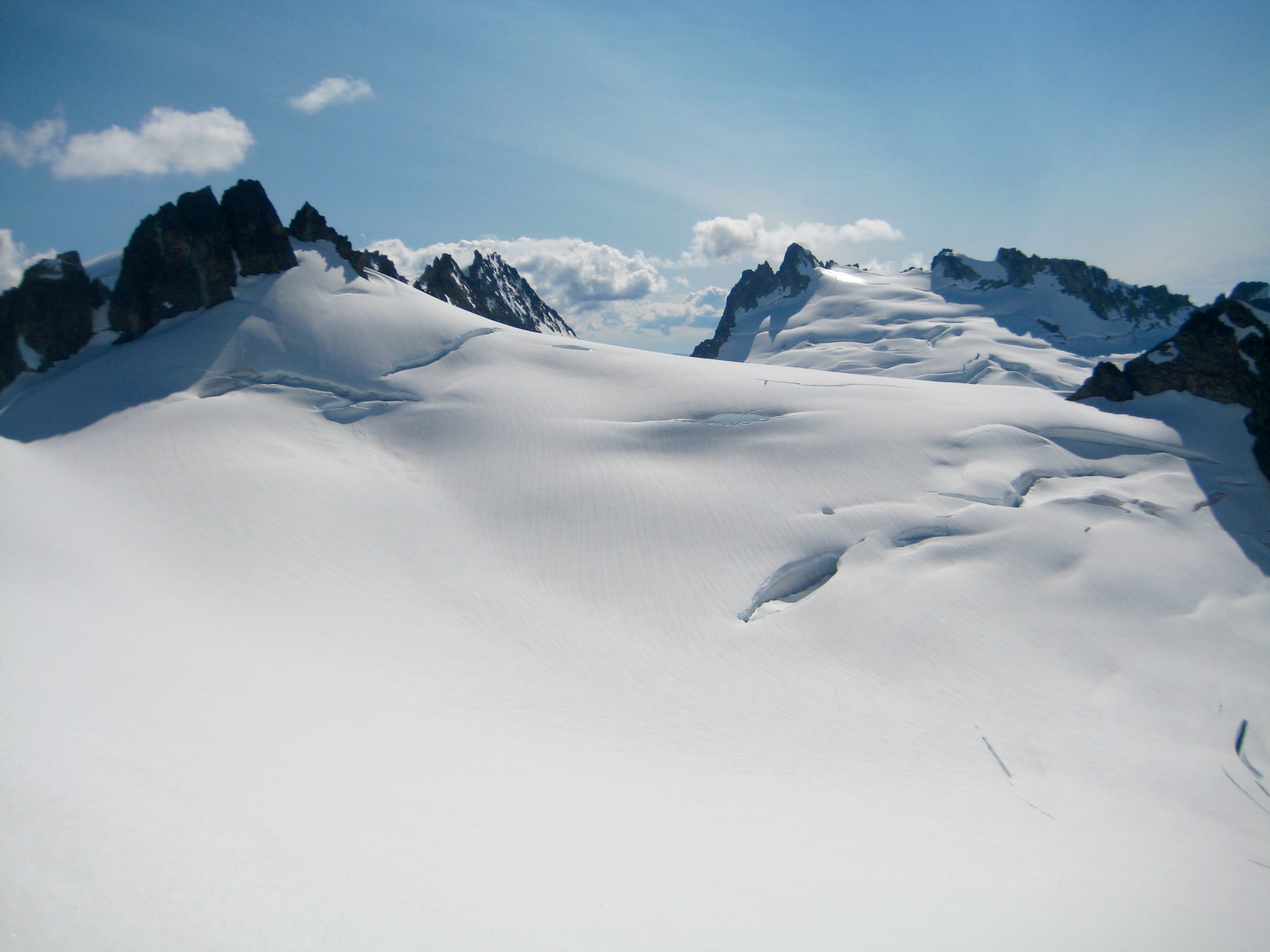
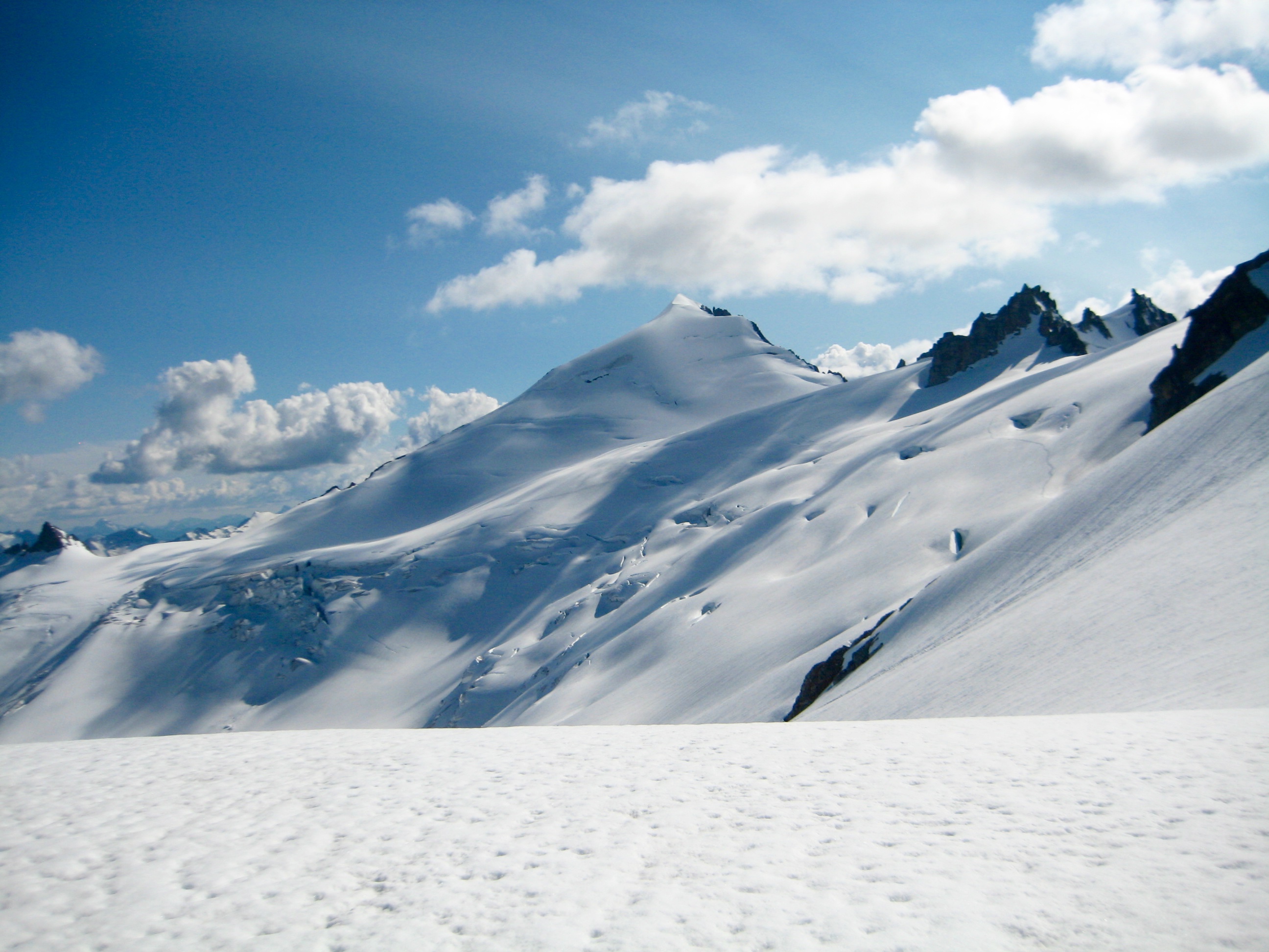
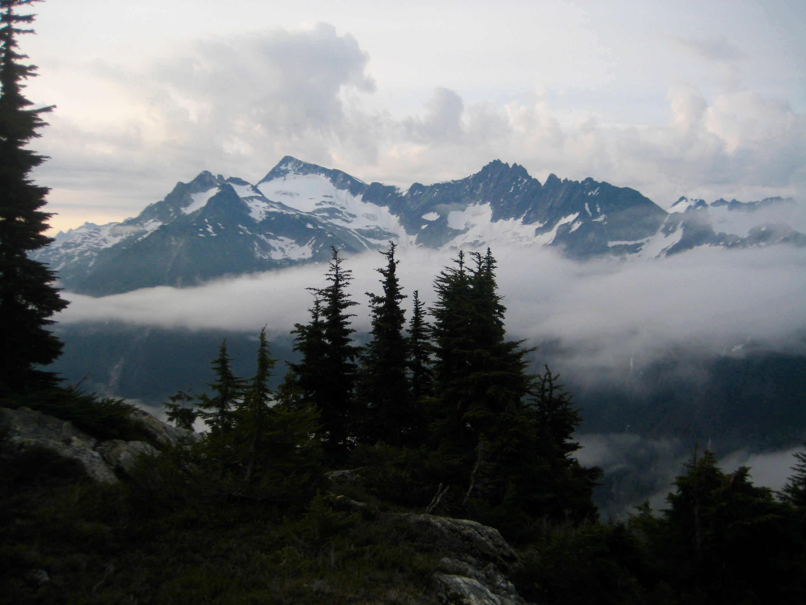
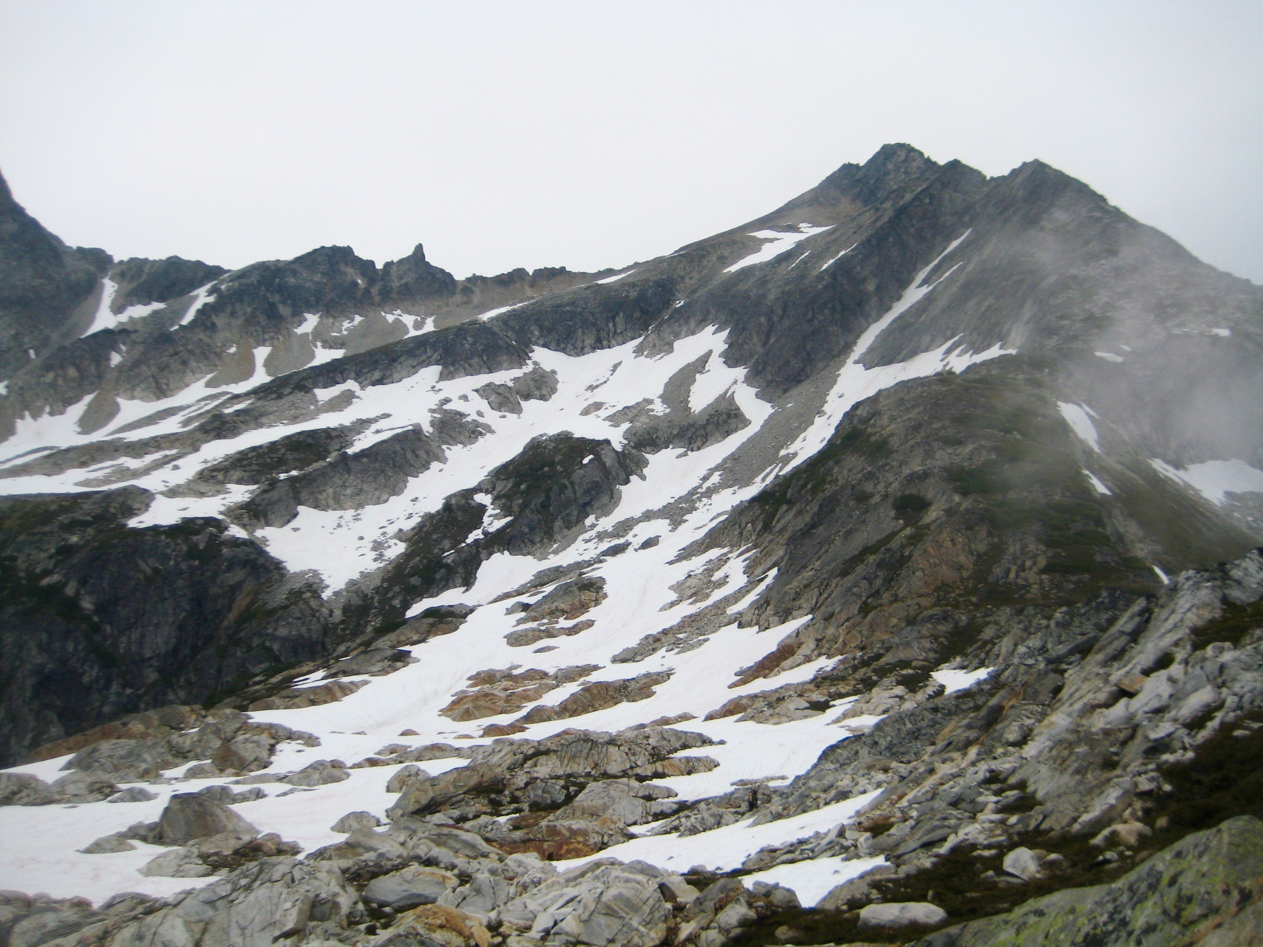
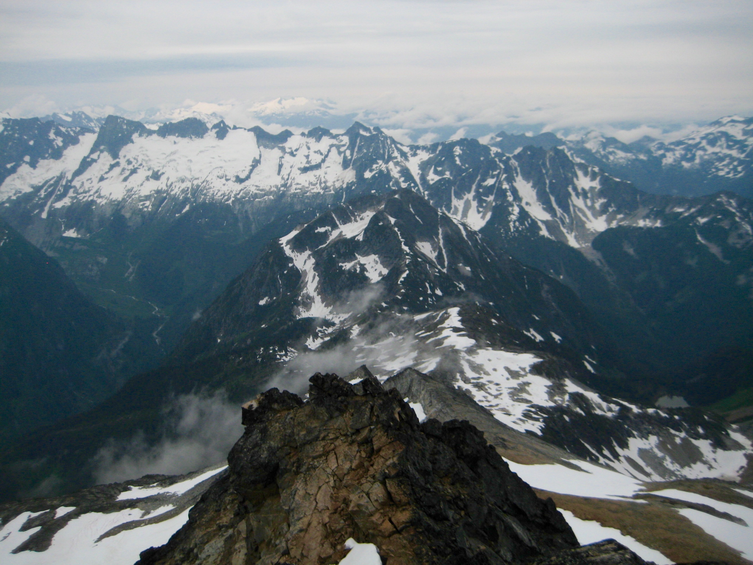
The weather and views were both excellent as we contoured around Austera Peak and angled up toward Klawatti Peak.
- Klawatti Peak & Klawatti Glacier
- Mt Goode & Mt Buckner & Forbidden Peak
- Forbidden Peak & Klawatti Glacier
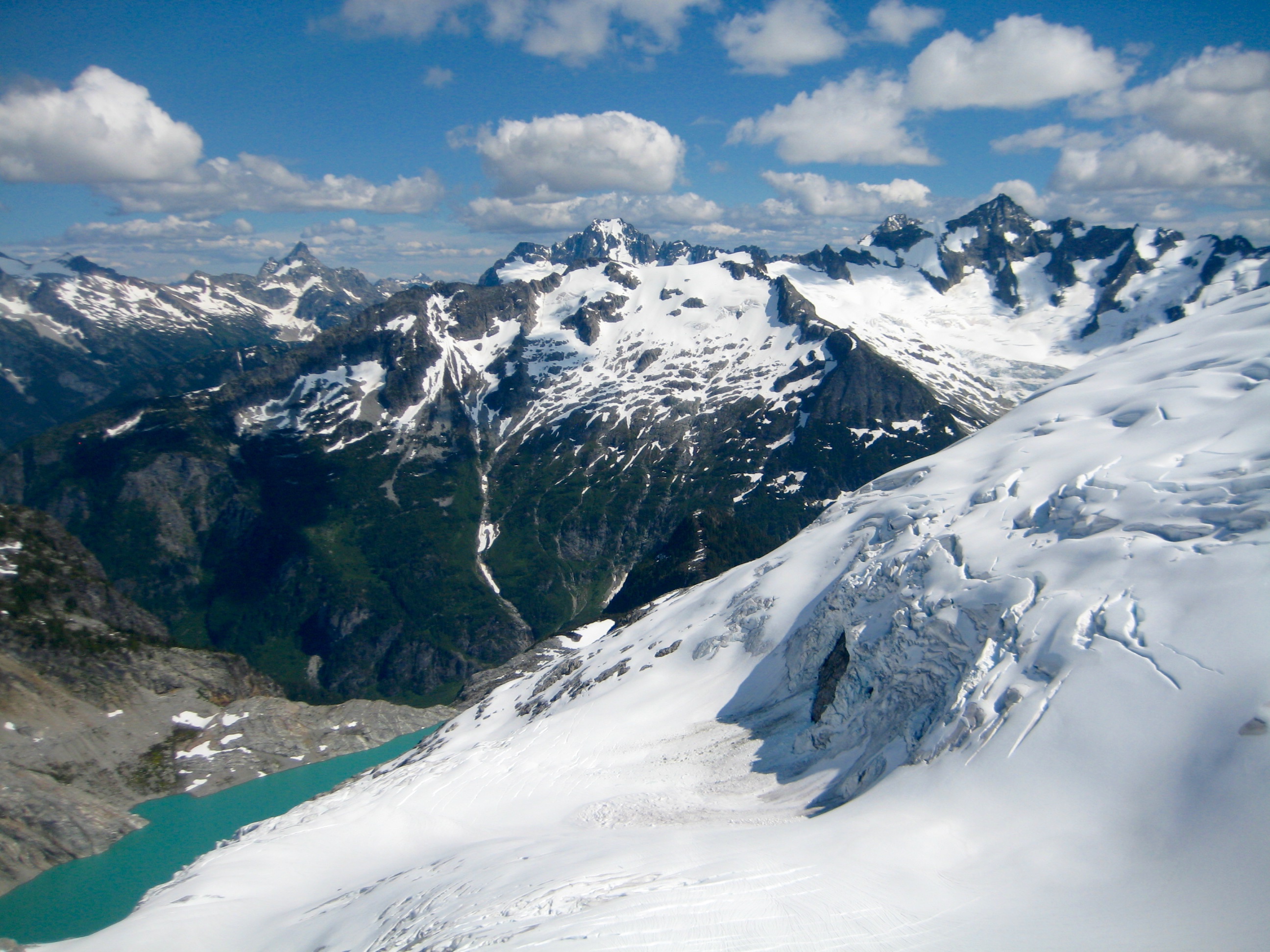
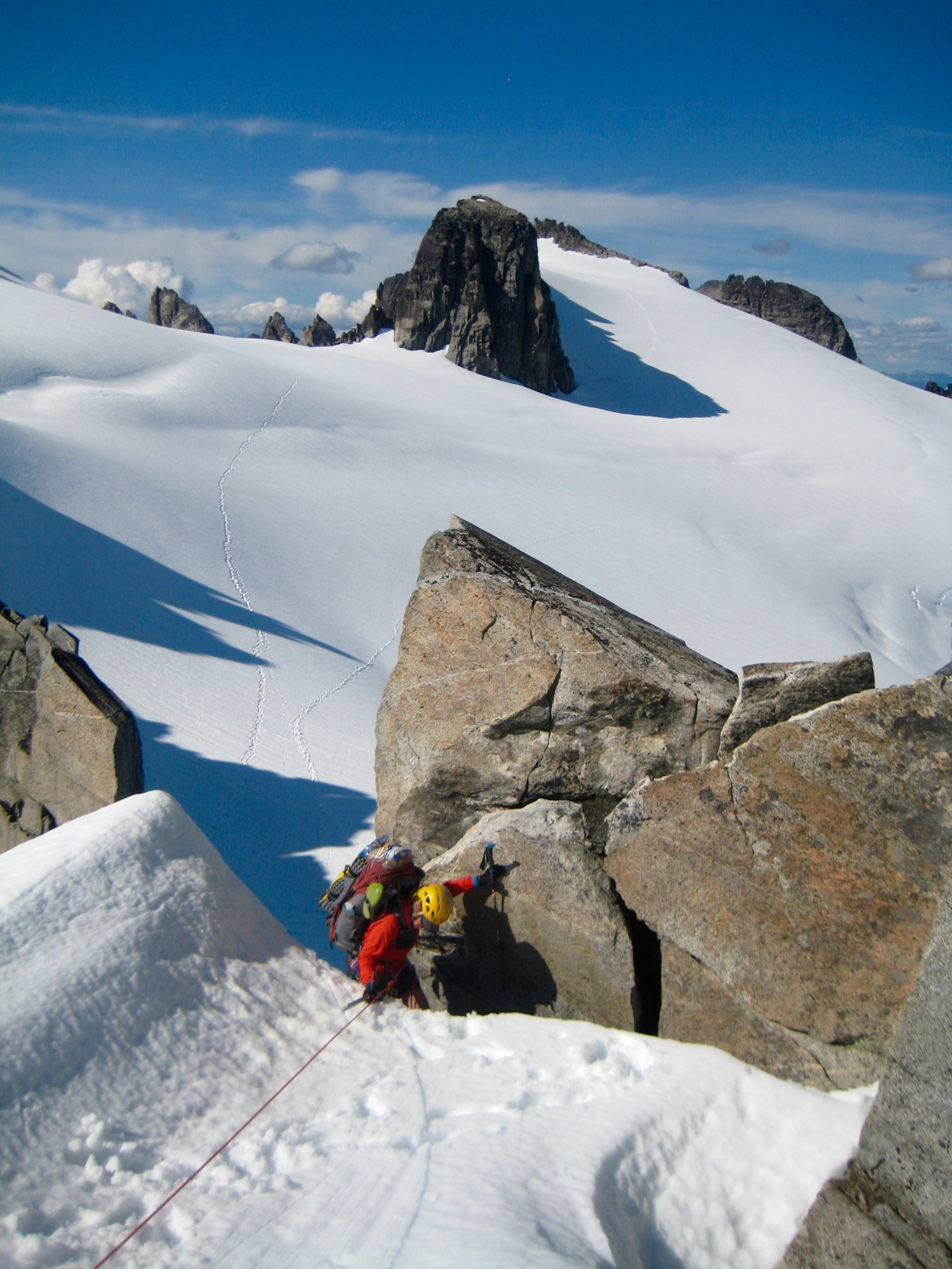
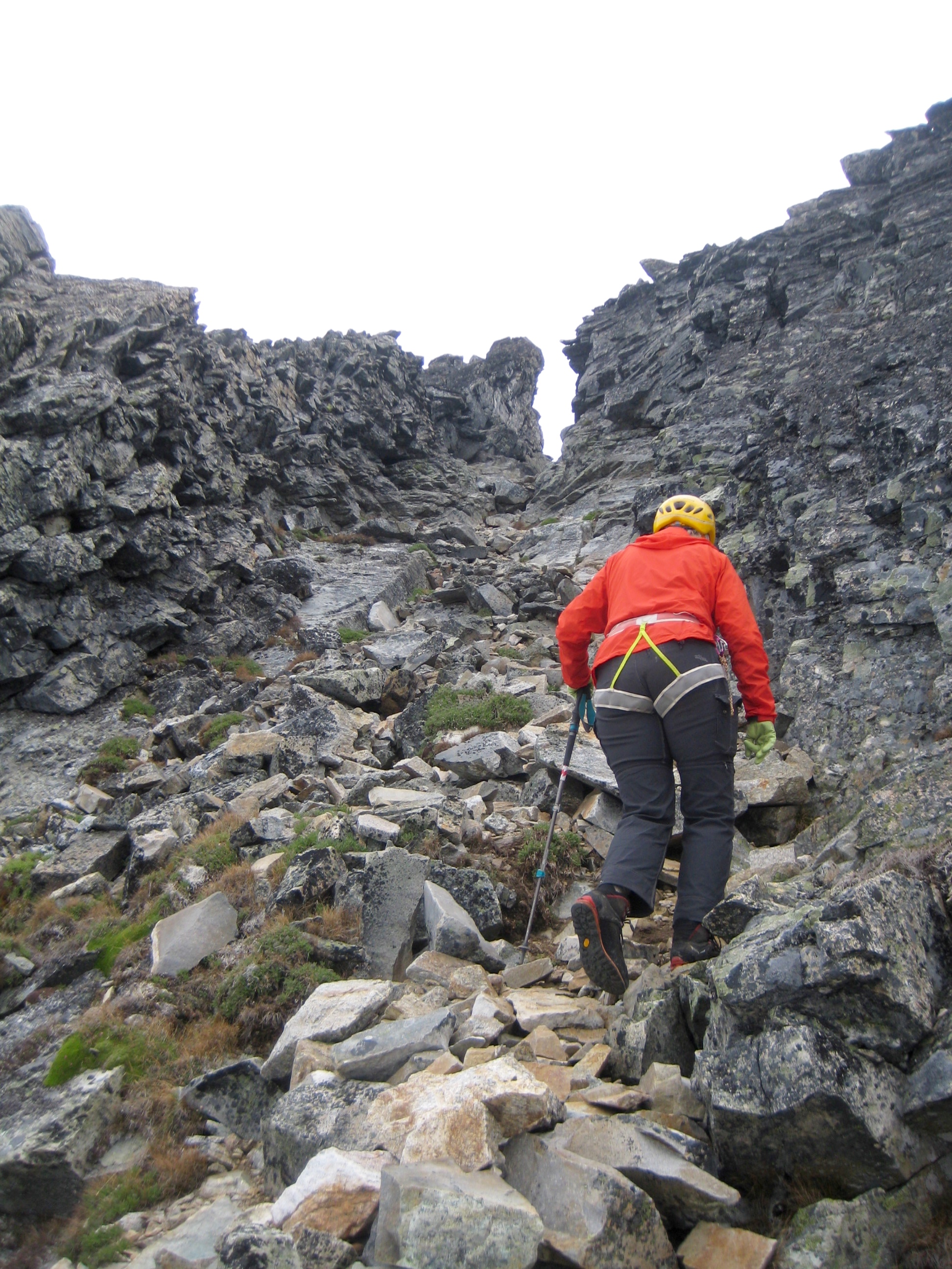
Upon reaching the cliff band at 7900-foot North Klawatti Notch, we scoped out several options for crossing the notch. We found a reasonable scramble route up the left side and finished by squeezing through a narrow moat at the top (6.9 hours + 1800 feet from Camp 2).
- Klawatti Peak & North Klawatti Notch
- Climbing Thru North Klawatti Notch
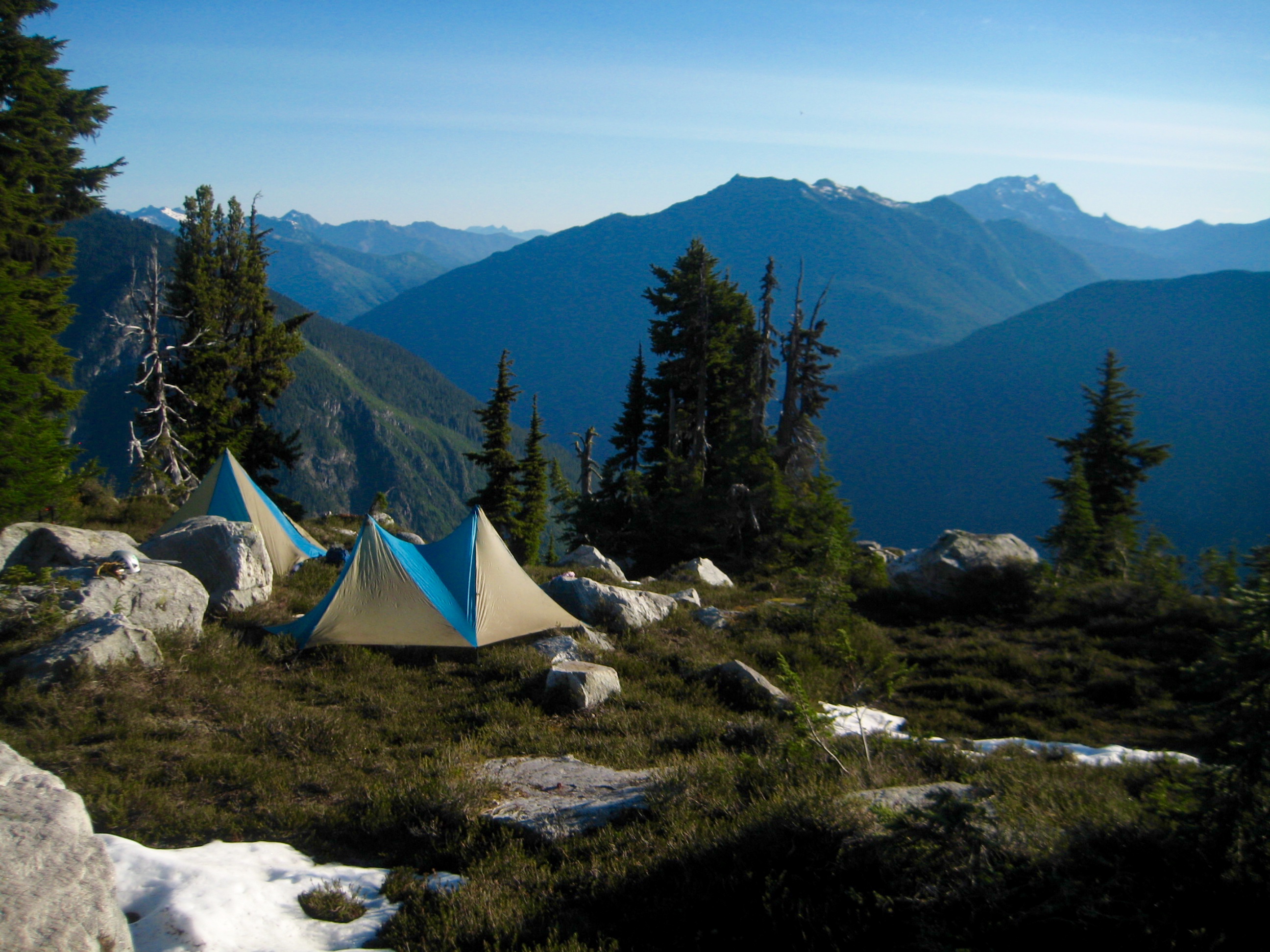
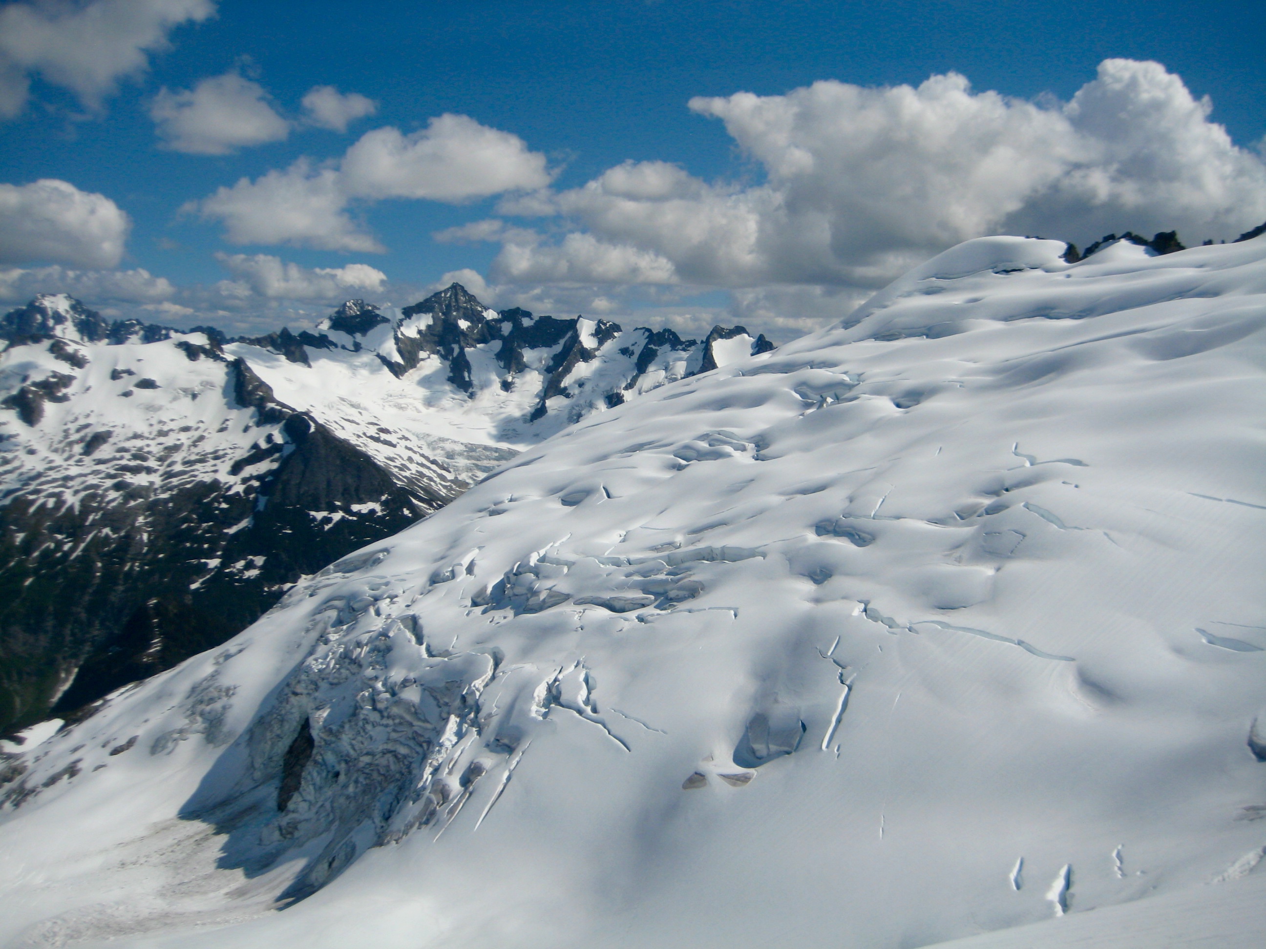
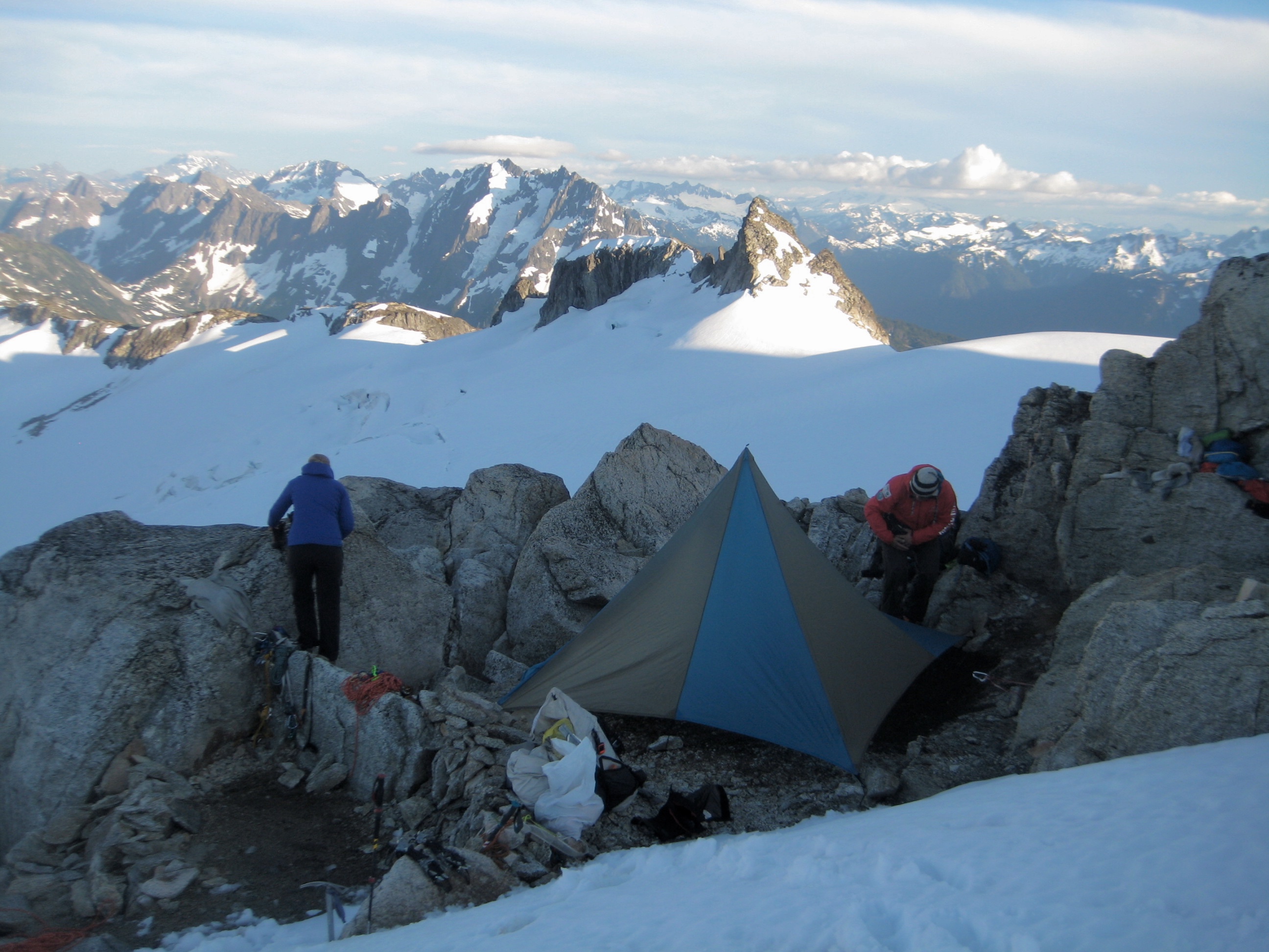
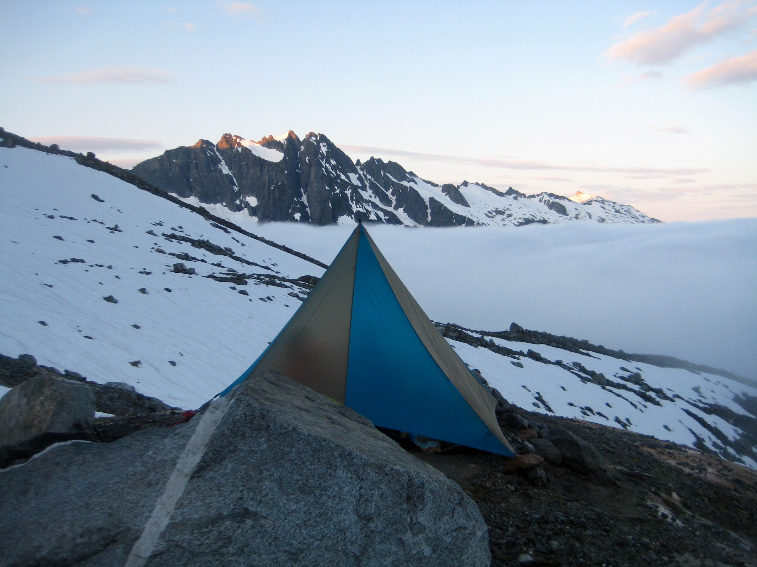
Our traverse continued over Southwest Klawatti Saddle and high across the Inspiration Glacier until reaching the east rib of Eldorado Peak. It was now cold and windy, so we pitched our tents at some sheltered campsites on the rib (9.3 hours + 2200 feet from Camp 2).
- Eldorado Peak From Southwest Klawatti Saddle
- Forbidden Peak From Southwest Klawatti Saddle
- Camp 3 On East Eldorado Rib
Day 4 (AM): Eldorado Peak Summit Climb
We awoke to dense valley fog and a dark, overcast sky. Lisa and Eileen and I headed out after breakfast to climb Eldorado Peak, whereas Kevin chose to sleep in. Swirling clouds shrouded the upper 1000 feet of the peak, so we were glad to have a veritable “boot track highway” to follow up the glacier.
- Eileen & Lisa Heading Up Eldorado Peak
Eileen led the upper 500 feet, placing two snow flukes along the wildly exposed summit arete. Probably a good thing that visibility was limited to 20 yards here!

- Eileen & Lisa On Eldorado Peak Summit
We returned to camp (2.4 hours + 1100 feet RT), where Kevin was awake and well-rested. After everyone packed up, we said goodbye to Lisa; her plan had been to complete only the Inspiration Traverse, so she headed southward to the Eldorado Creek climber’s path and her waiting car at the Cascade River Road.
Day 4 (PM): East Eldorado Rib to Marble Creek Slope
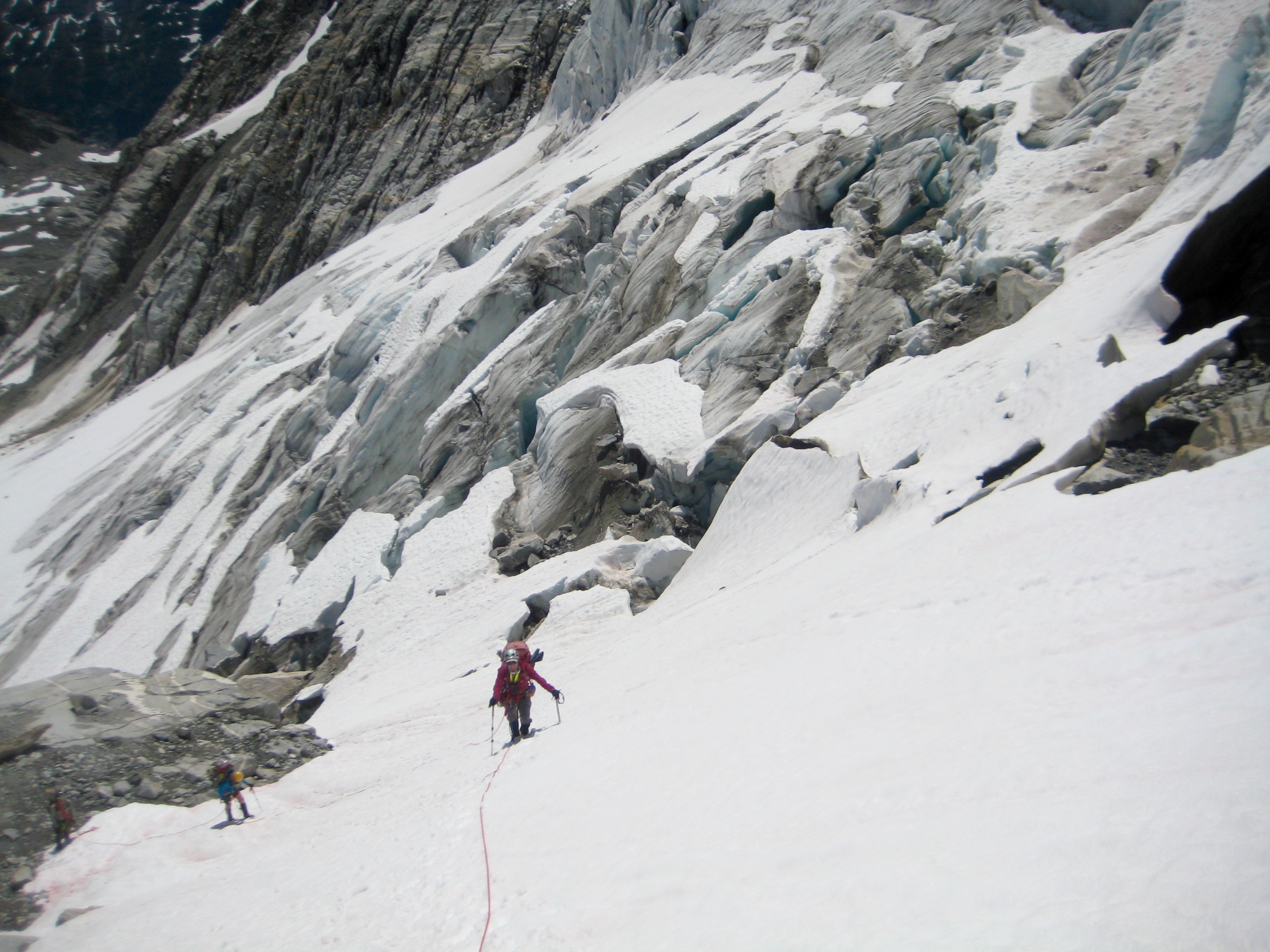
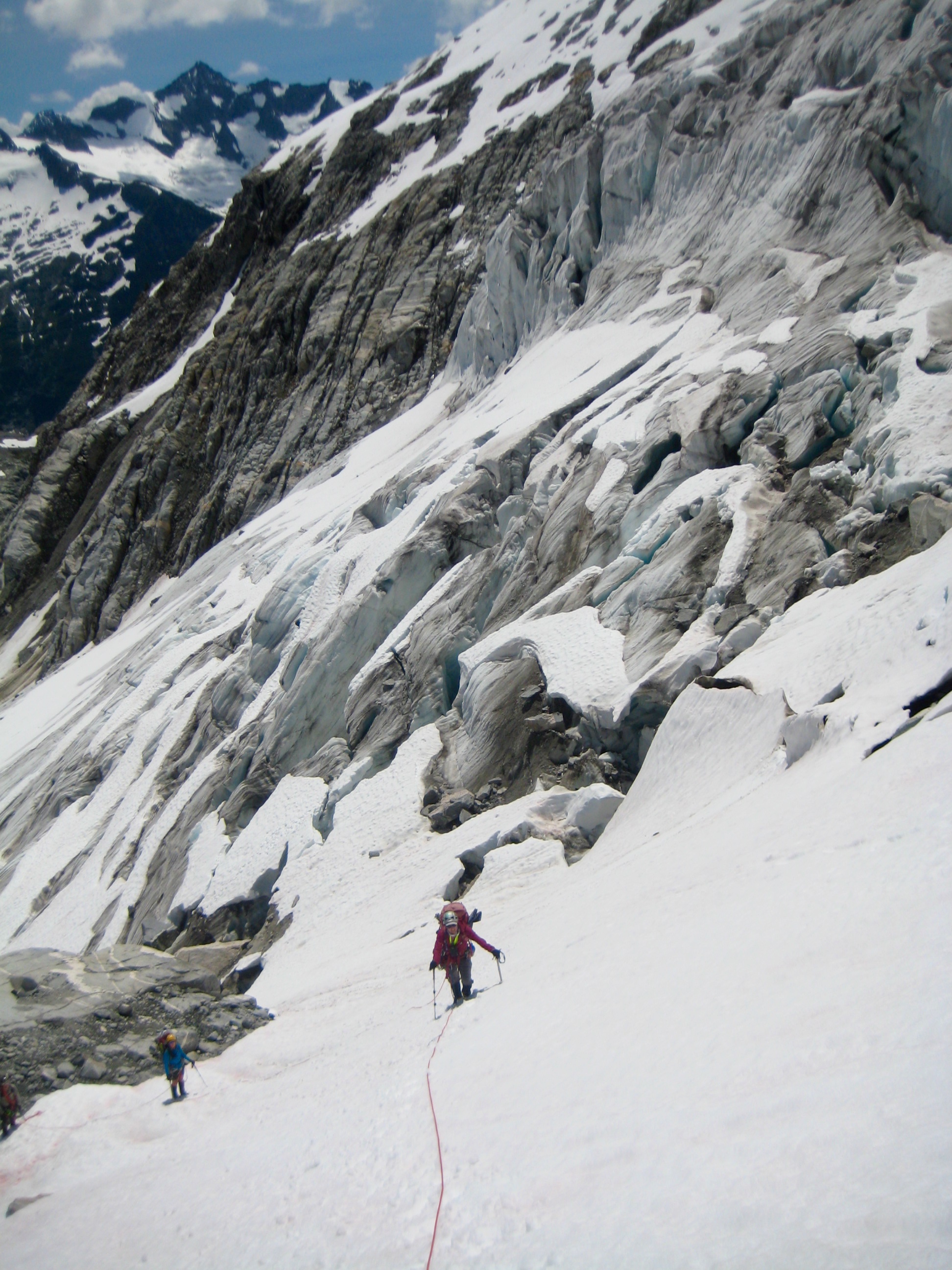
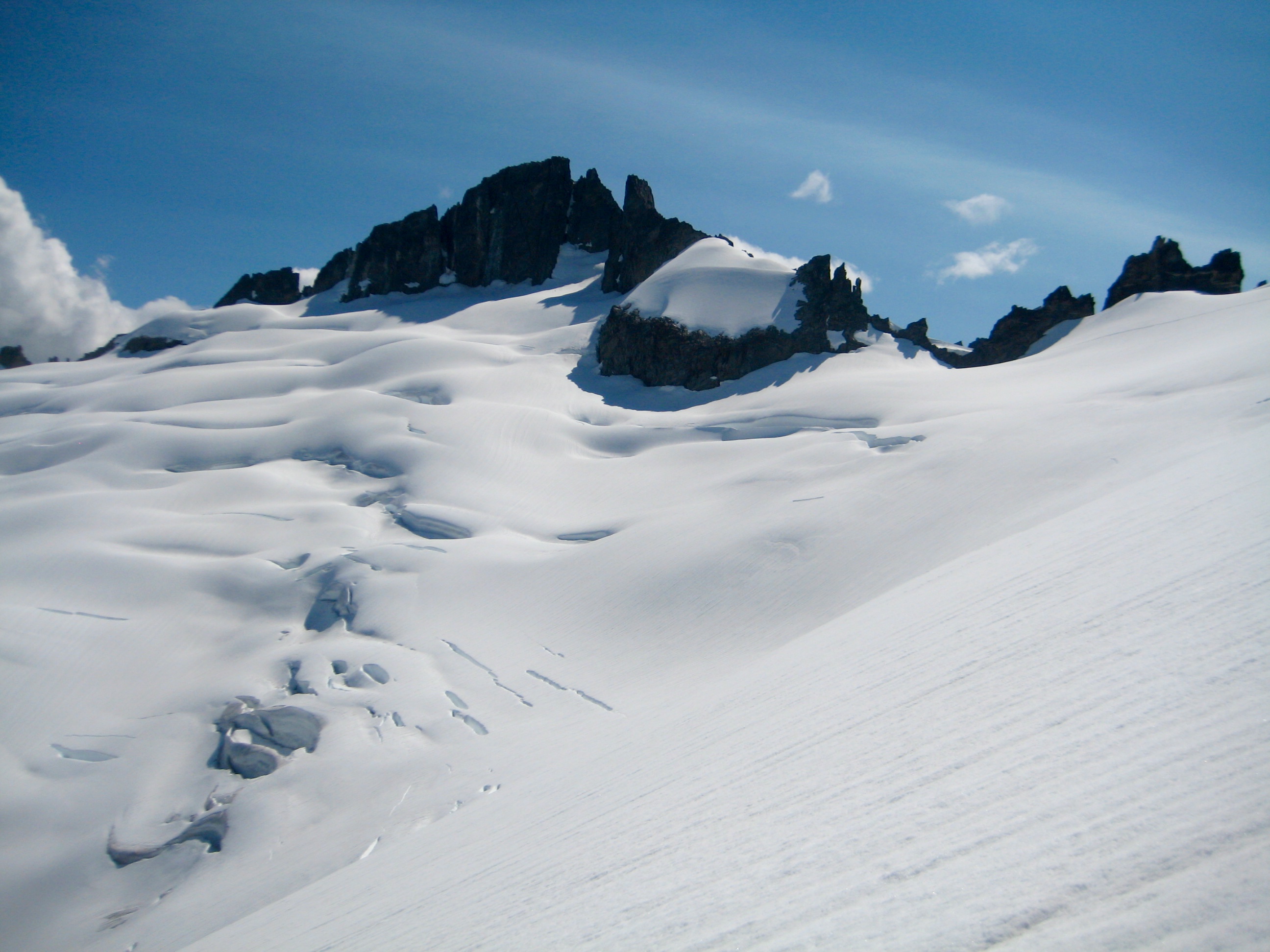
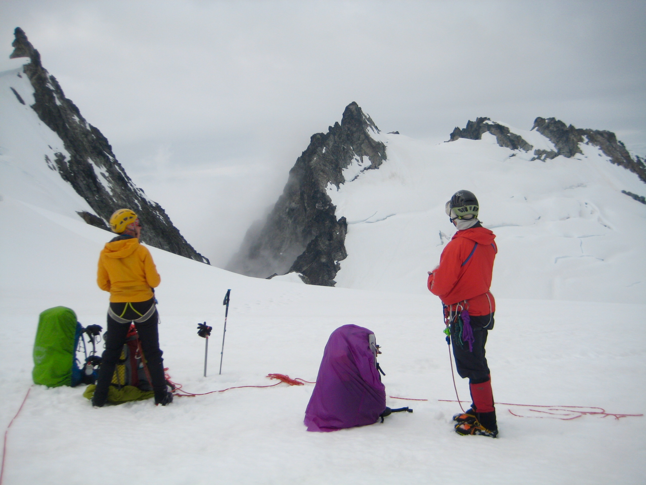
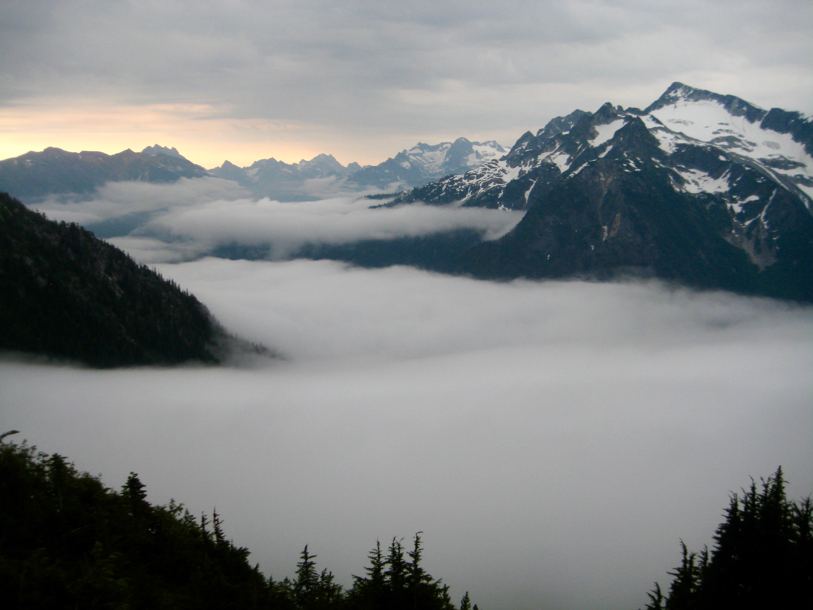
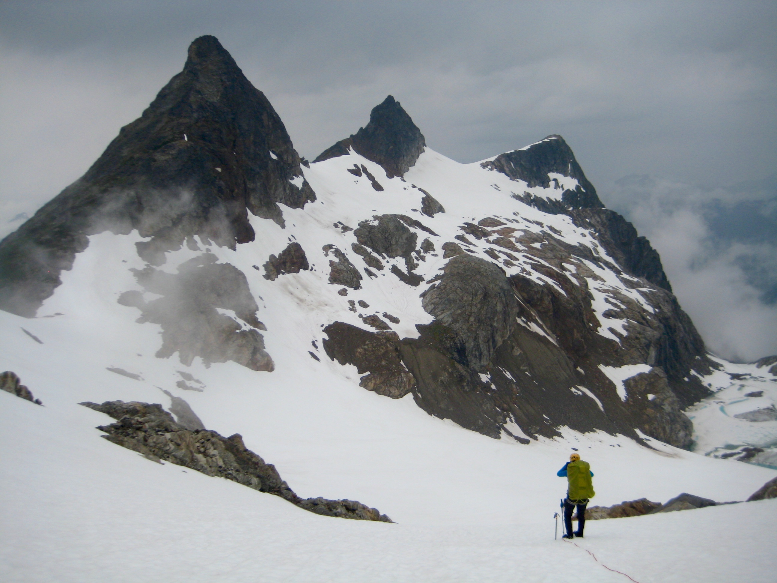
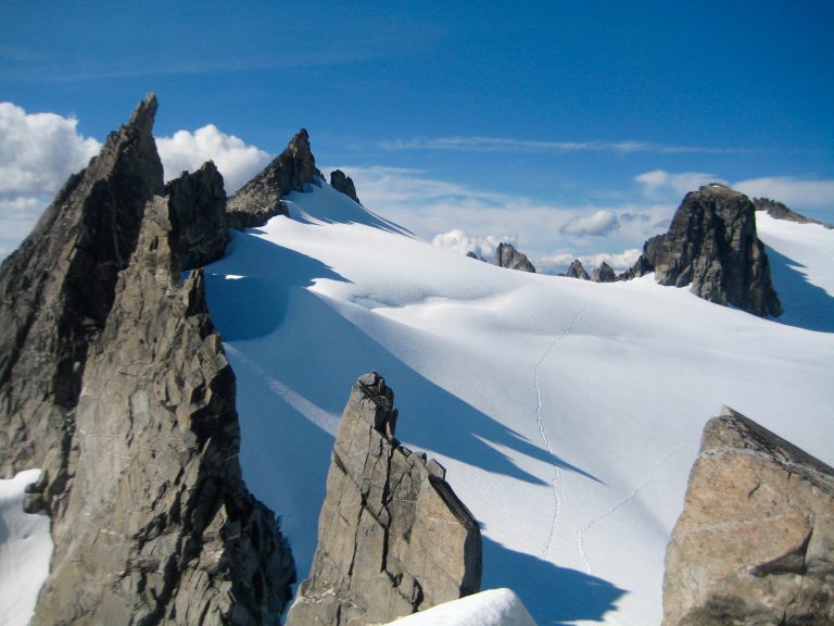
Kevin and Eileen and I headed northward across the Inspiration Glacier to gain 8000-foot Tepeh Gap—the high point of our traverse route. We got a short look at Dorado Col and Dorado Needle just before clouds engulfed us. In a total white-out, we descended to Dorado Col (2.0 hours + 300 feet from Camp 3), again benefitting from an old boot track on the glacier.
- Kevin & Eileen Heading Toward Tepeh Gap
- Scoping Out Dorado Col From Tepeh Gap
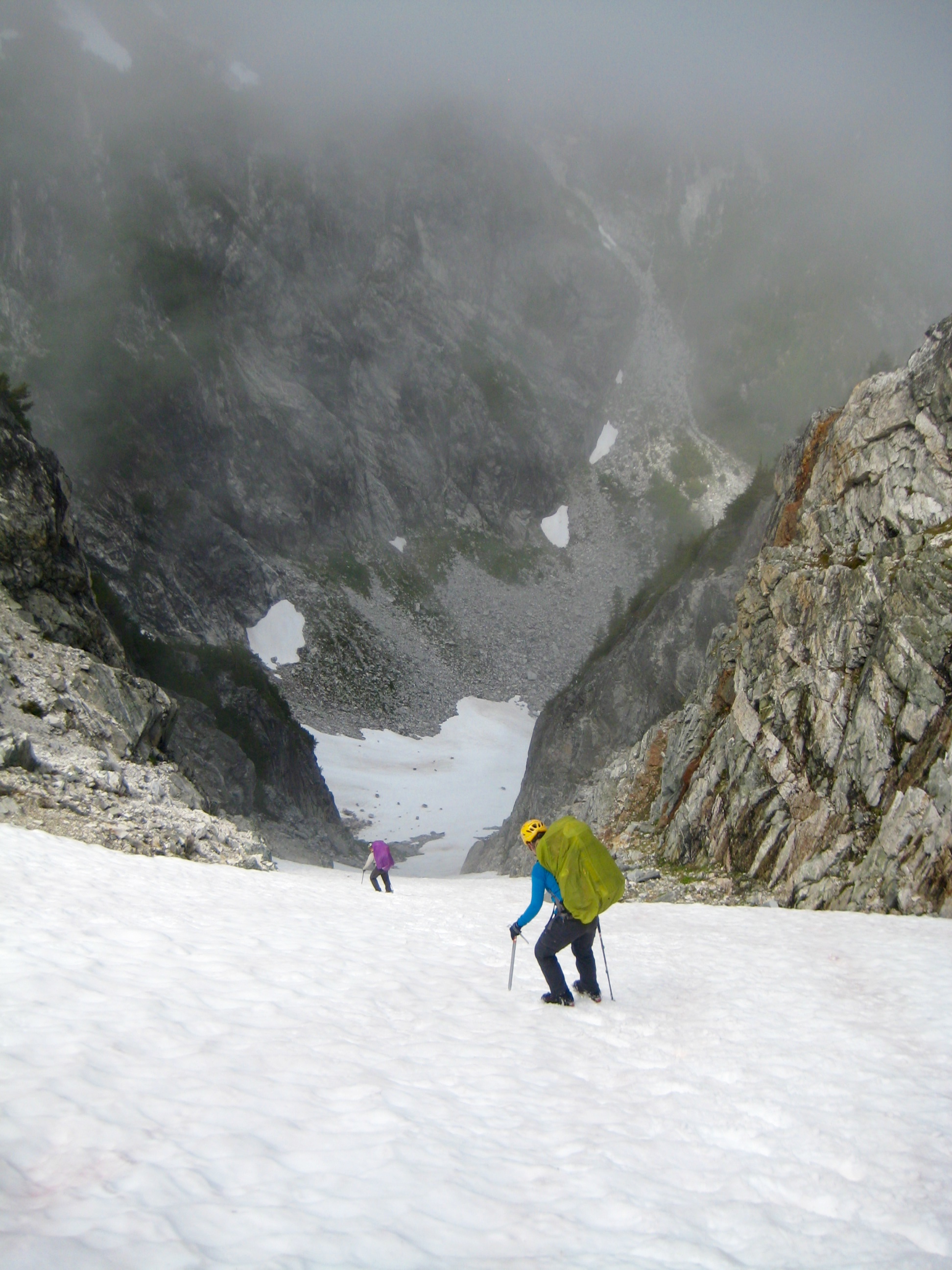
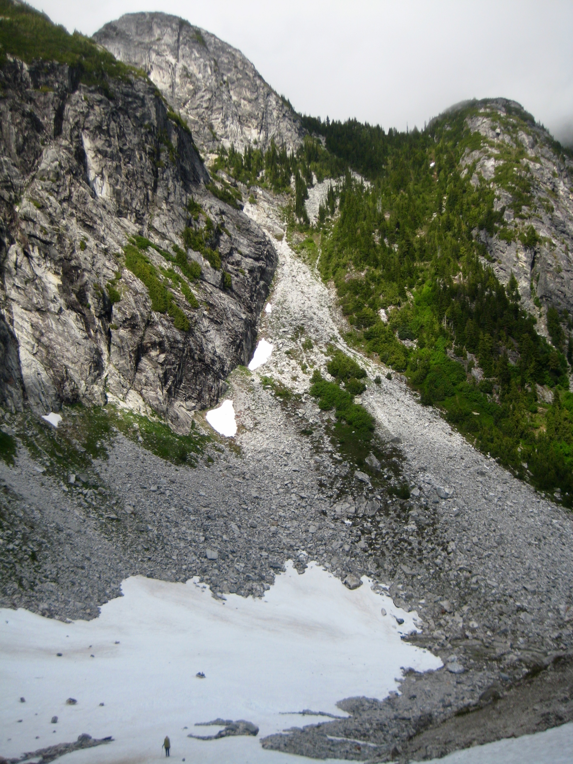
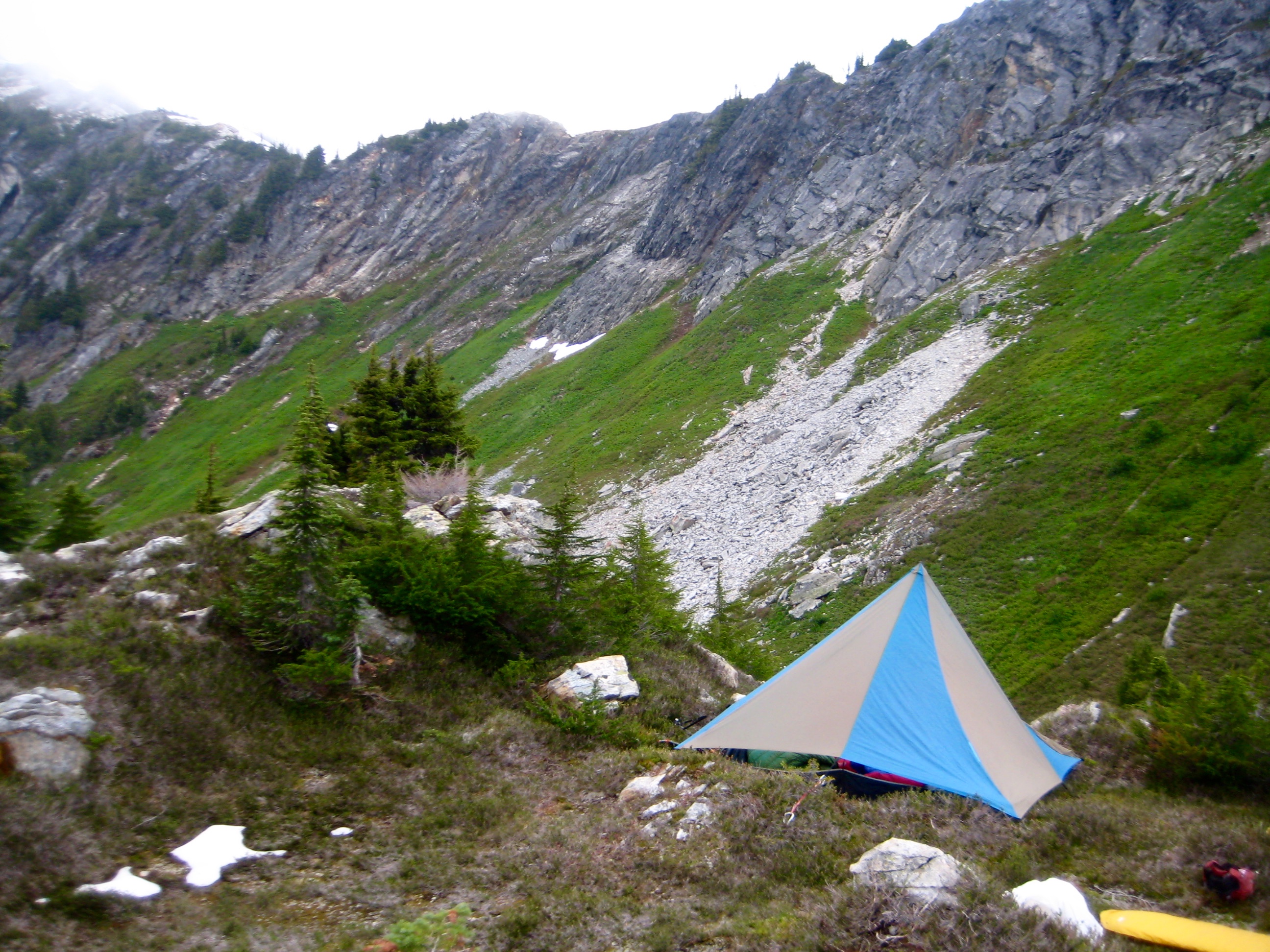
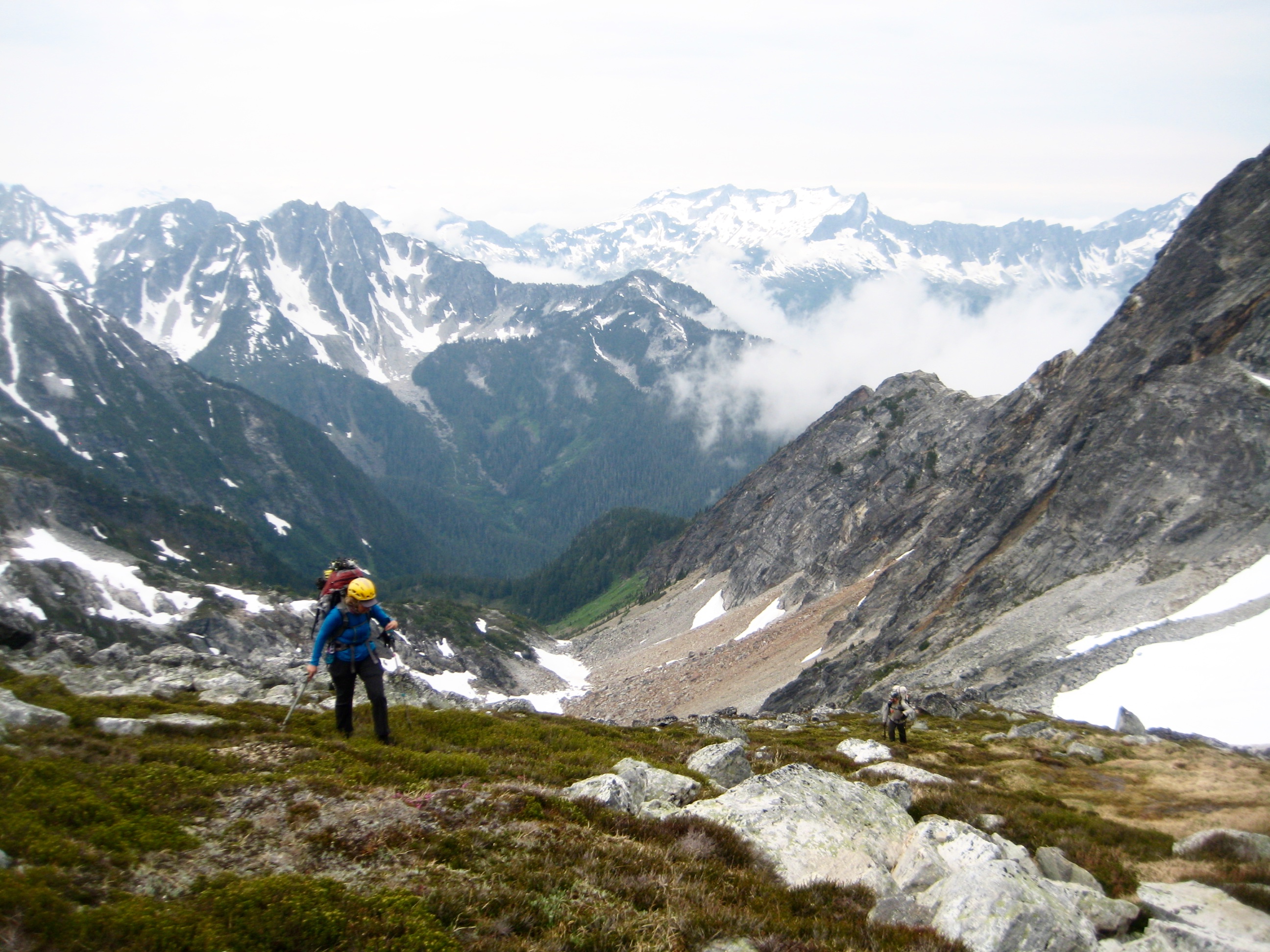
We crossed over Dorado Col and quickly plunged nearly 2000 vertical feet down a moderately steep snow couloir. At an elevation of 5700 feet, we turned right (westward) and began contouring across a series of rock slabs, tree ribs, and steep greenery. The weather was foggy and drizzly, the vegetation was wet and slippery, and we were cold, soggy, and frustrated. It was truly depressing. This would prove to be the emotional low point of our week.
Over the next hour, we managed to progress only ½ mile across the sketchy terrain of Marble Creek slope. When our route took us across a gravelly rock knob at 5900 feet, it was quickly decided to stop and camp (5.9 hours + 700 feet from Camp 3). This was a good decision; by the time we had leveled out a platform and pitched our tent, our spirits were on the upswing.
- Camp 4 In Marble Creek Cirque (“X” Marks The Spot)
Around 11:00pm, about an hour after retiring for the night, we were awakened by a sudden mountain squall. Kevin jumped into action, gathering large rocks for anchoring the guylines. Wind and rain pounded our tent for 45 minutes, then subsided as quickly as it had appeared.
Day 5: Marble Creek Slope to Wilcox Tarns
Following yesterday’s discouraging afternoon, it was emotionally uplifting to see mountains rising above valley fog at 5:15am. We were packed and underway before 7:30am (early for us!), continuing our traverse northwestward across the Marble Creek slope.
- Morning Sun On The Triad From Camp 4
- Traversing Toward The Coccyx On Day 5
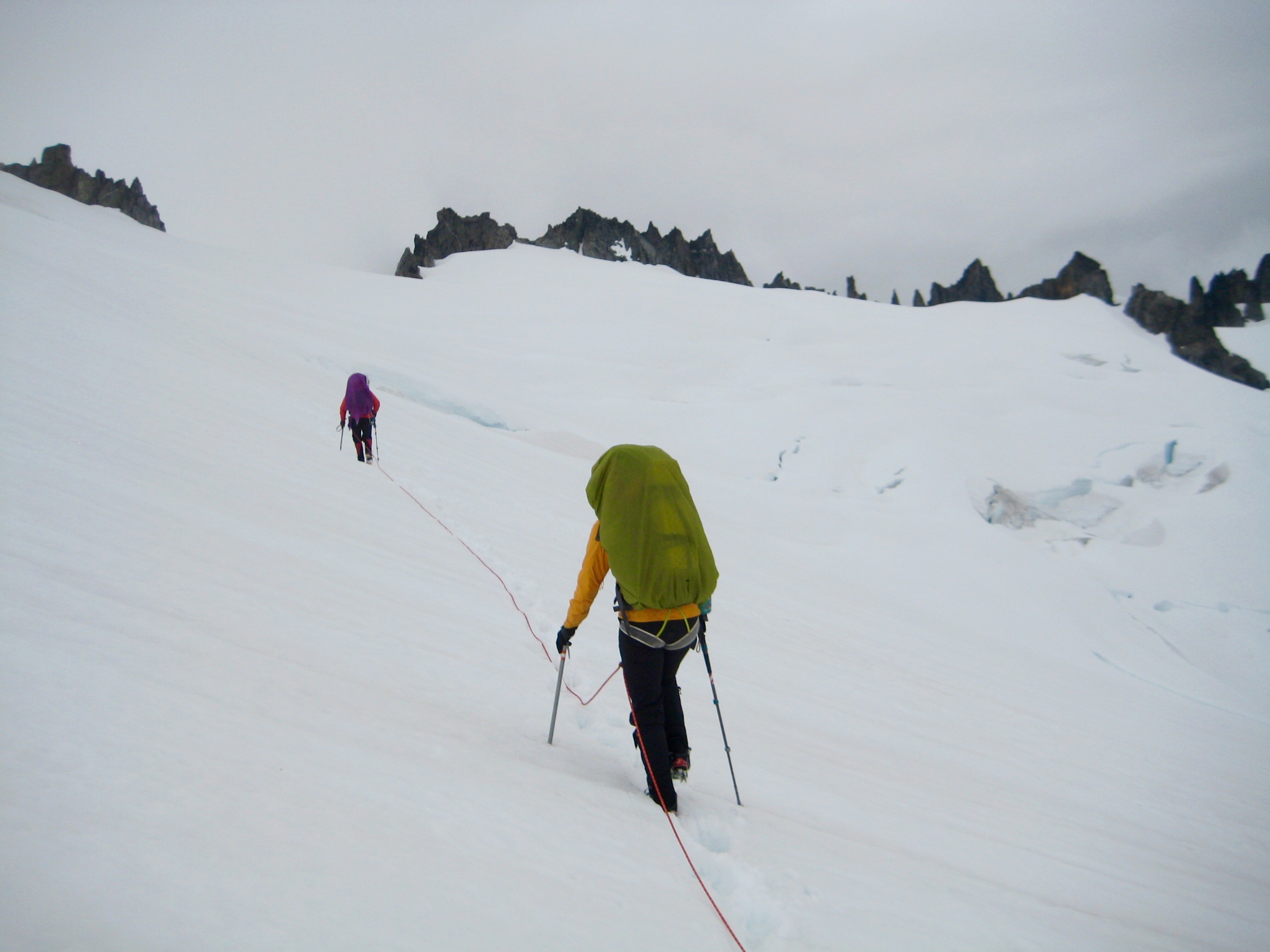
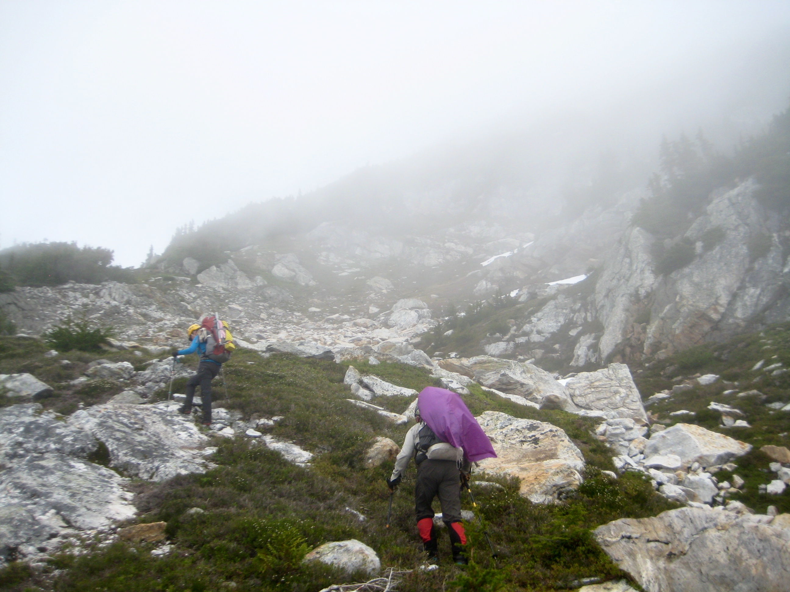
Sadly, the dreaded fog soon had us surrounded again, reducing visibility to 50 yards most of the time. However, we were now moving and had gained some critical momentum. All morning, Kevin did an admirable job of navigating us through the fog.
The morning’s traverse was pretty unremarkable: Cross a snowfield. Cross a rock rib. Cross a heather slope. Repeat numerous times, always staying at an elevation between 5700 and 6000 feet. Side-slope gradients gradually lessened to the northwest, allowing for a slight increase in speed as we proceeded.
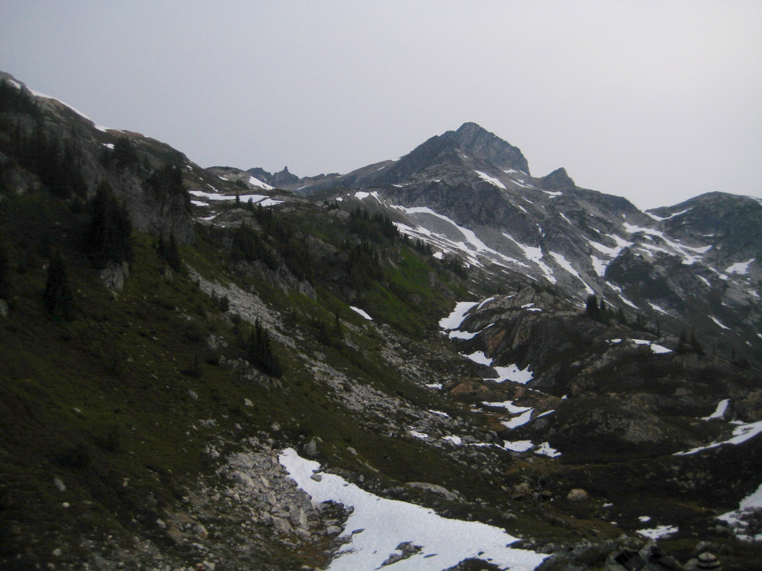
Our first milestone of the day was the southwestern ridge of The Coccyx. We gained this ridge at 6200 feet (4.3 hours from Camp 4), ascended the crest for 200 feet, then made a rising traverse across pleasant snow and heather slopes.
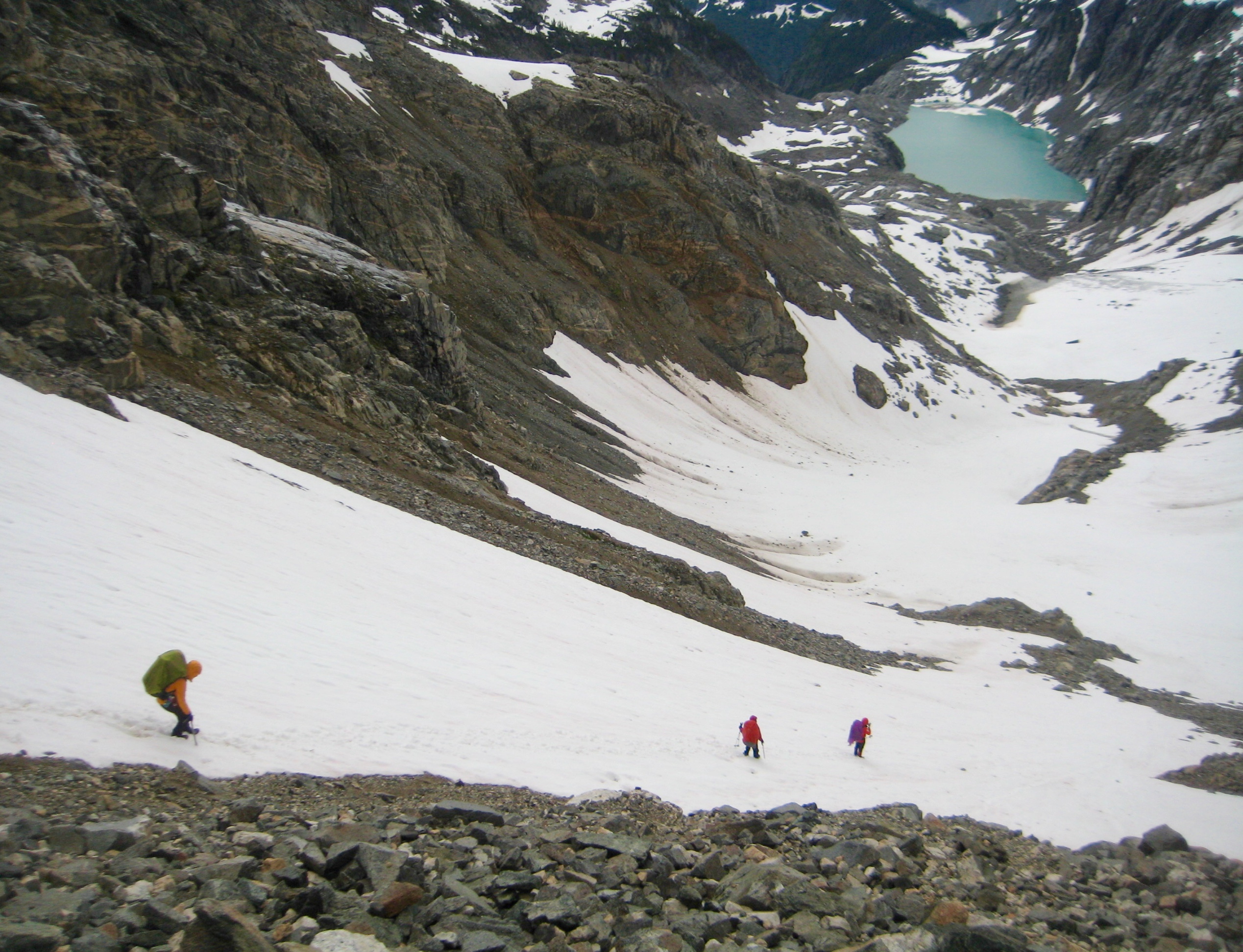
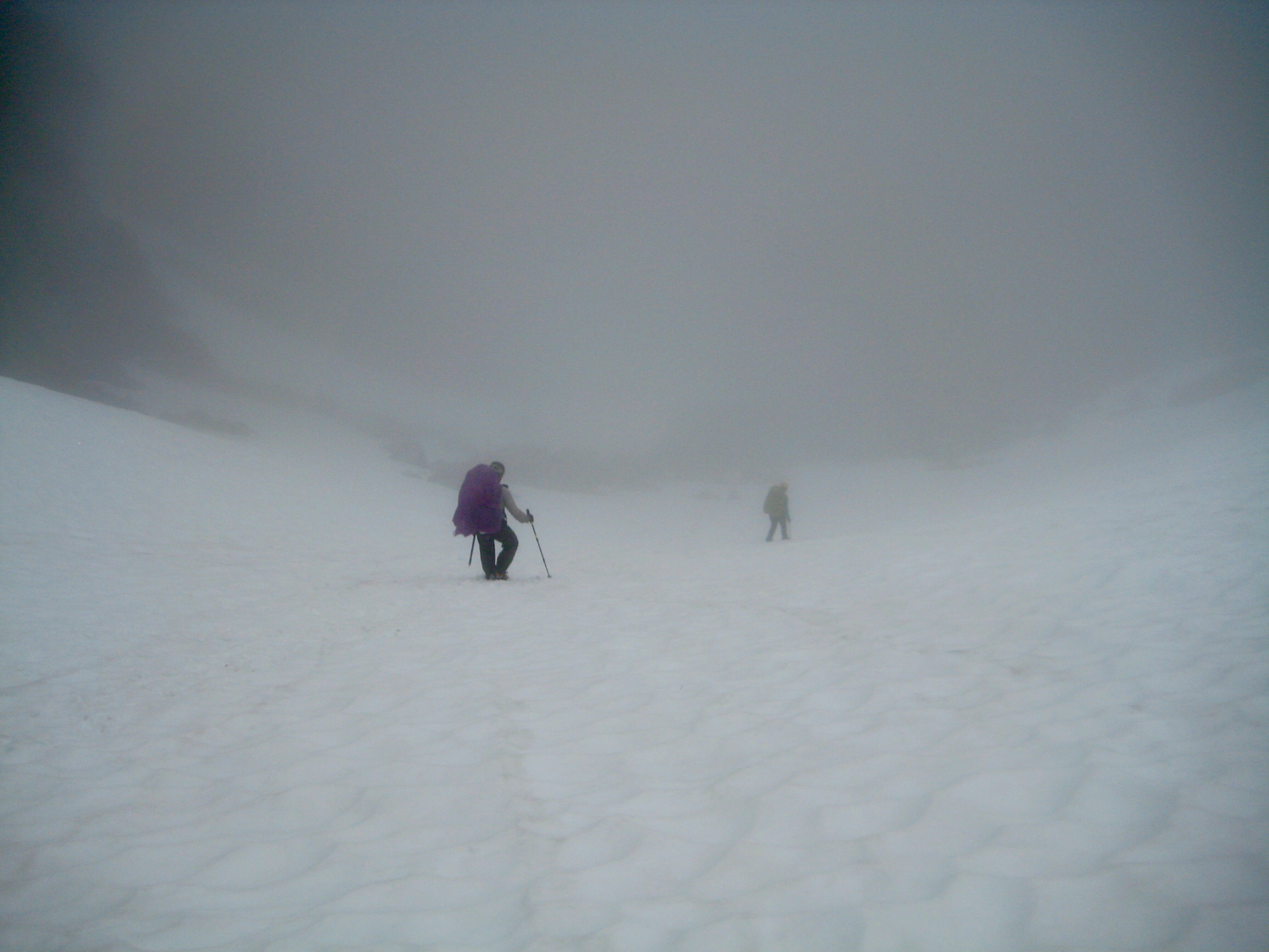
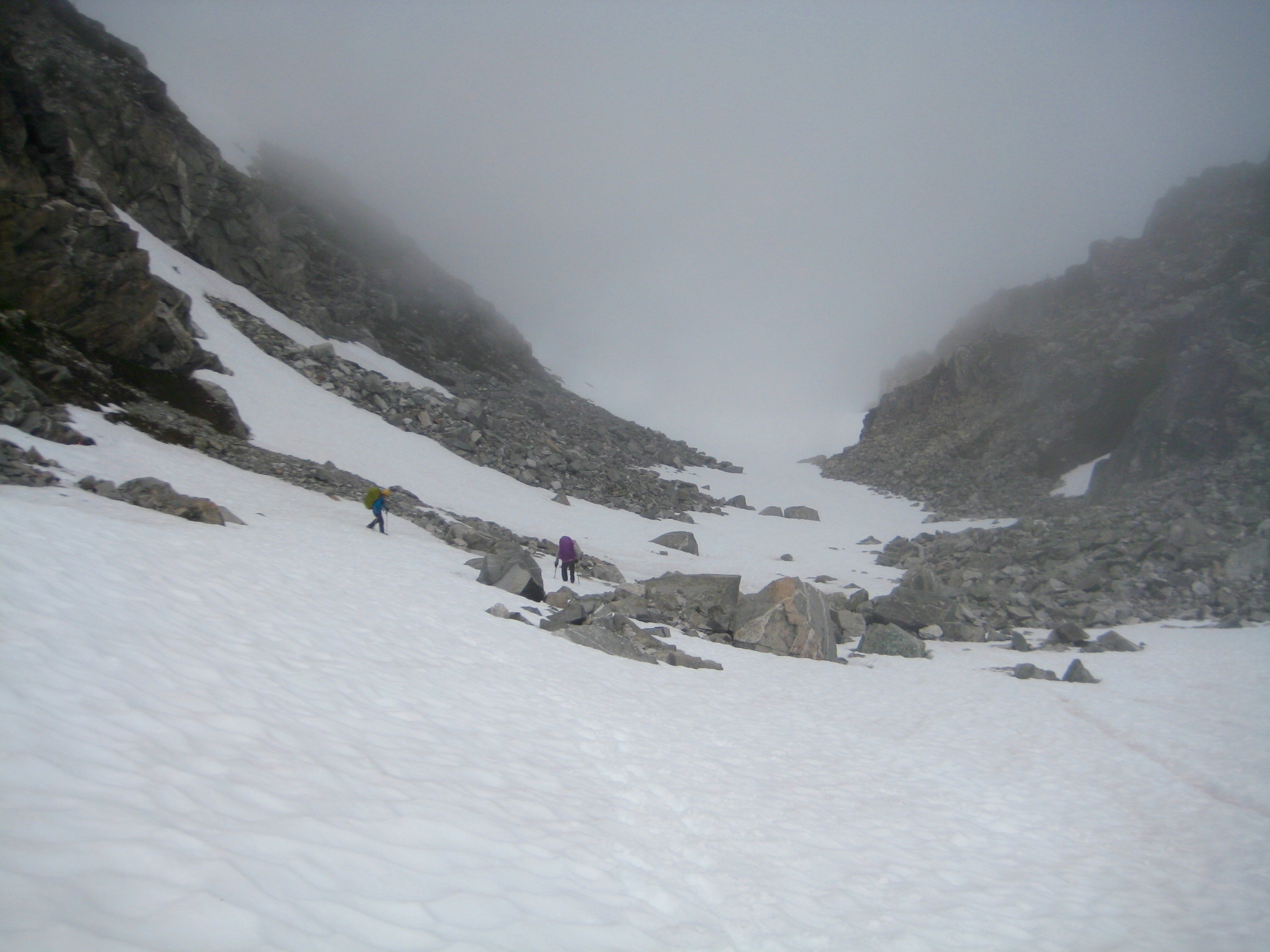
Our next milestone was Coccyx Col, a 6640-foot gap below the north ridge of The Coccyx. We crossed over the col in mid afternoon (7.3 hours + 1400 feet from Camp 4) and descended a steep snow chute for 1500 vertical feet to reach a cirque that feeds the westernmost fork of McAllister Creek. The 5000-foot floor of this cirque represented the low point of the alpine portion of our traverse.
- Crossing Over Coccyx Col In Heavy Fog
- Descending Snow Chute Below Coccyx Col
- Looking Deep Into McAllister Creek Headwaters From Western Cirque
Our third milestone was 5900-foot Wilcox Pass, which sits northeast of the cirque. We grunted up a steep couloir of heather, grass, and boulders for 800 feet to gain the pass in late afternoon (10.4 hours + 2200 feet from Camp 4).
- Wilcox Pass & Rock Couloir From Coccyx Snow Chute
- Coccyx Col & Snow Chute From Wilcox Pass
From Wilcox Pass, we could gaze down on beautiful Wilcox Lakes and Wilcox Tarns.
- Wilcox Lakes From Wilcox Pass
- Wilcox Lakes & Tarns From Wilcox Pass
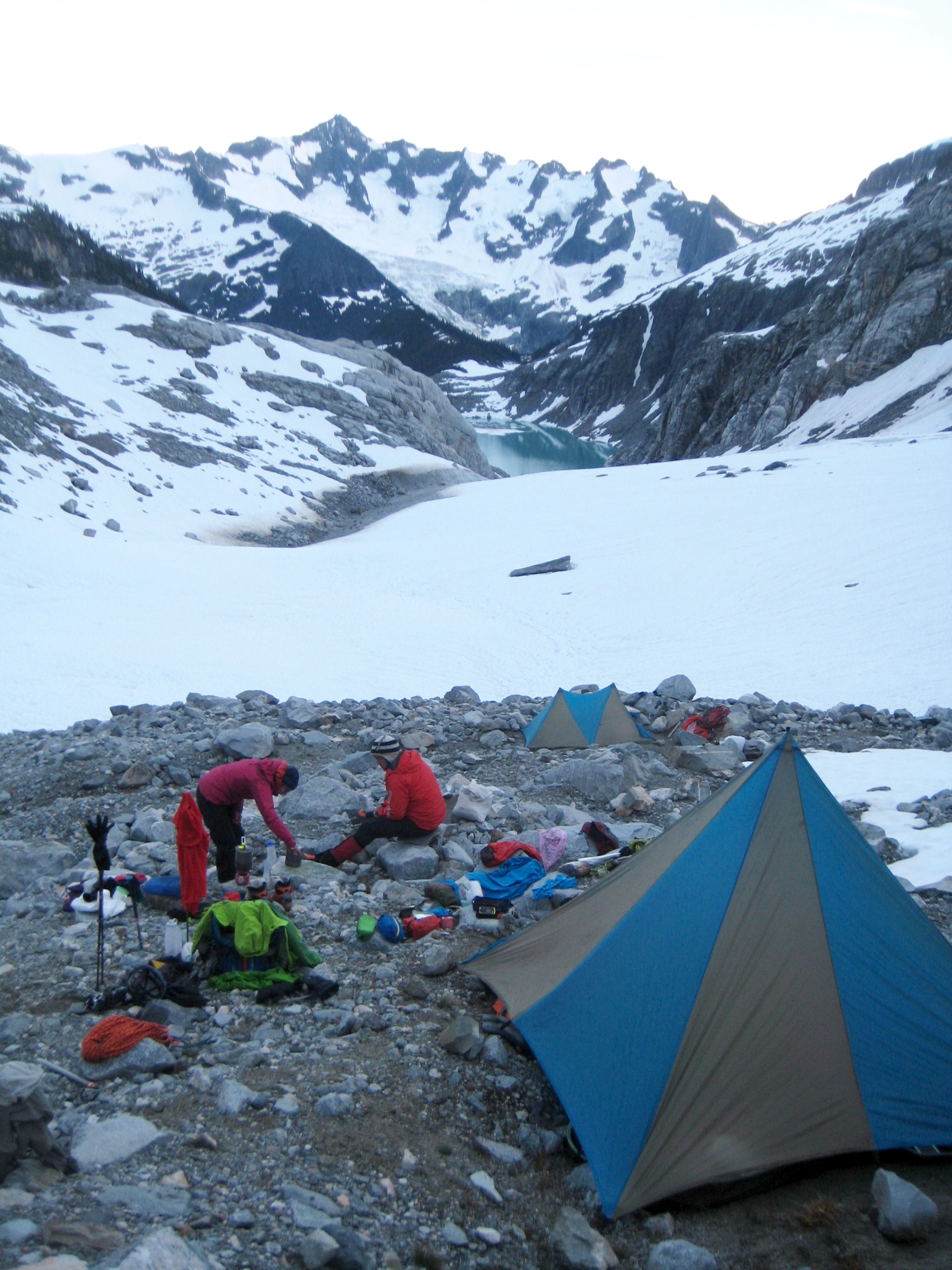
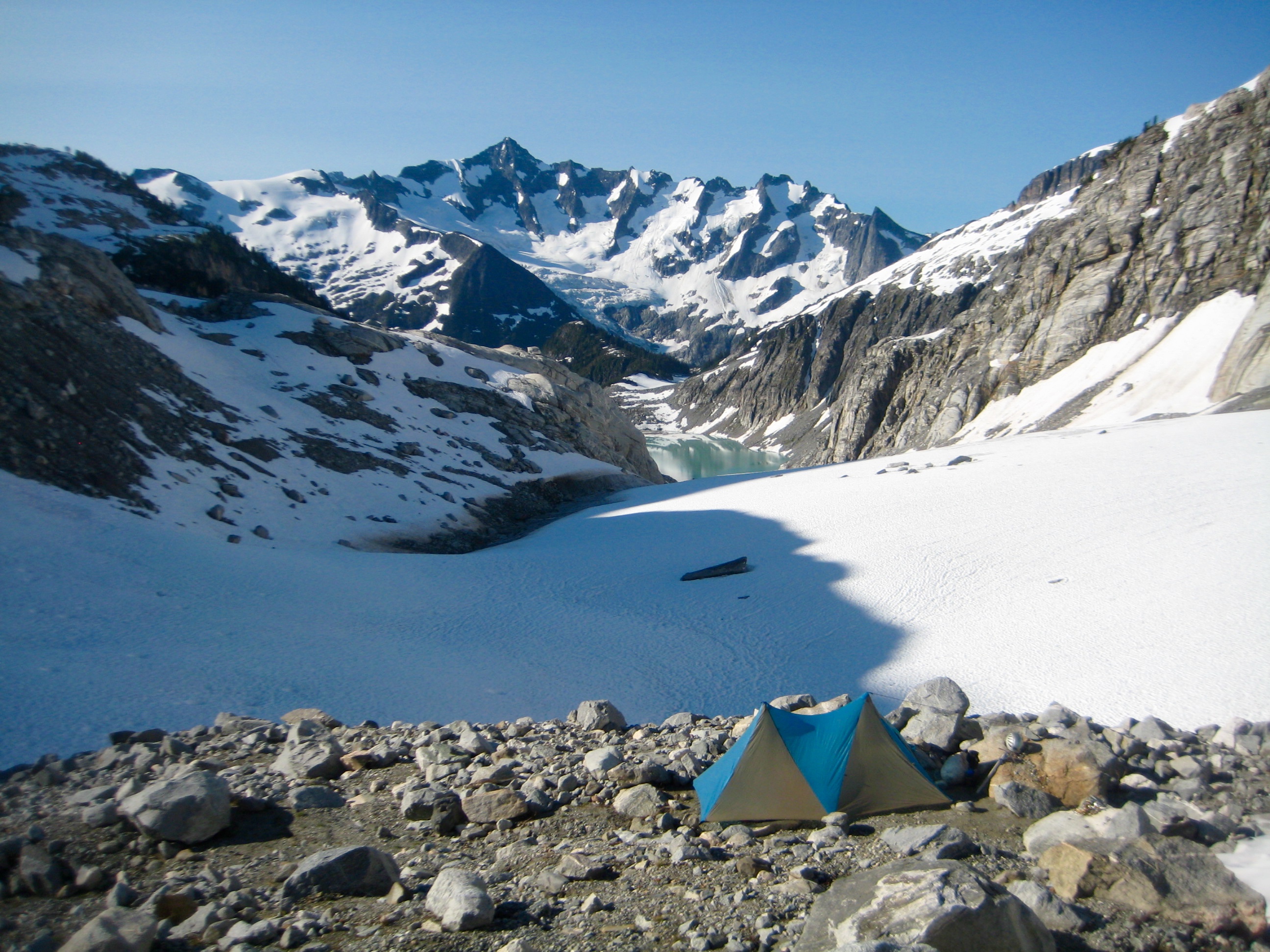
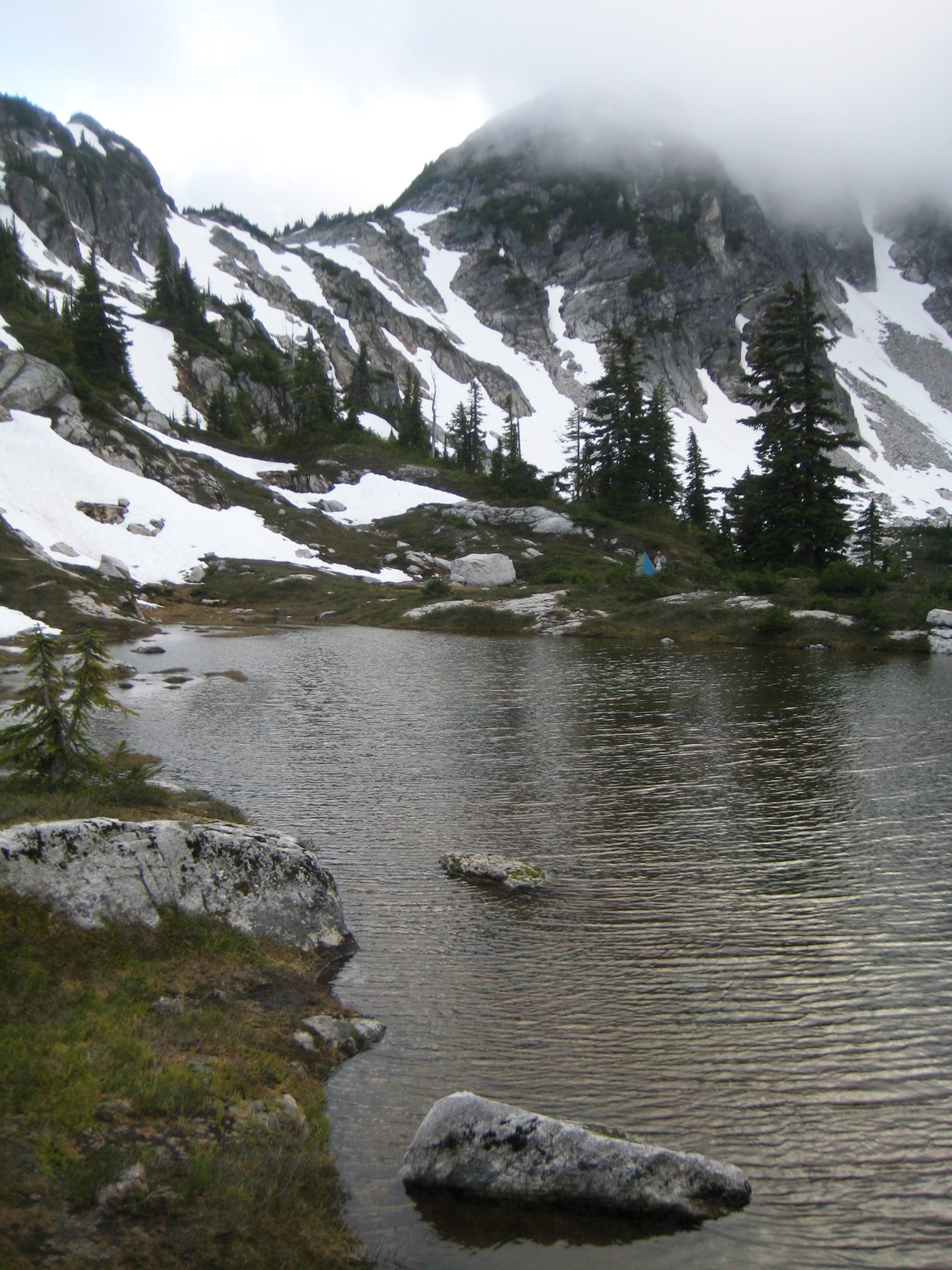
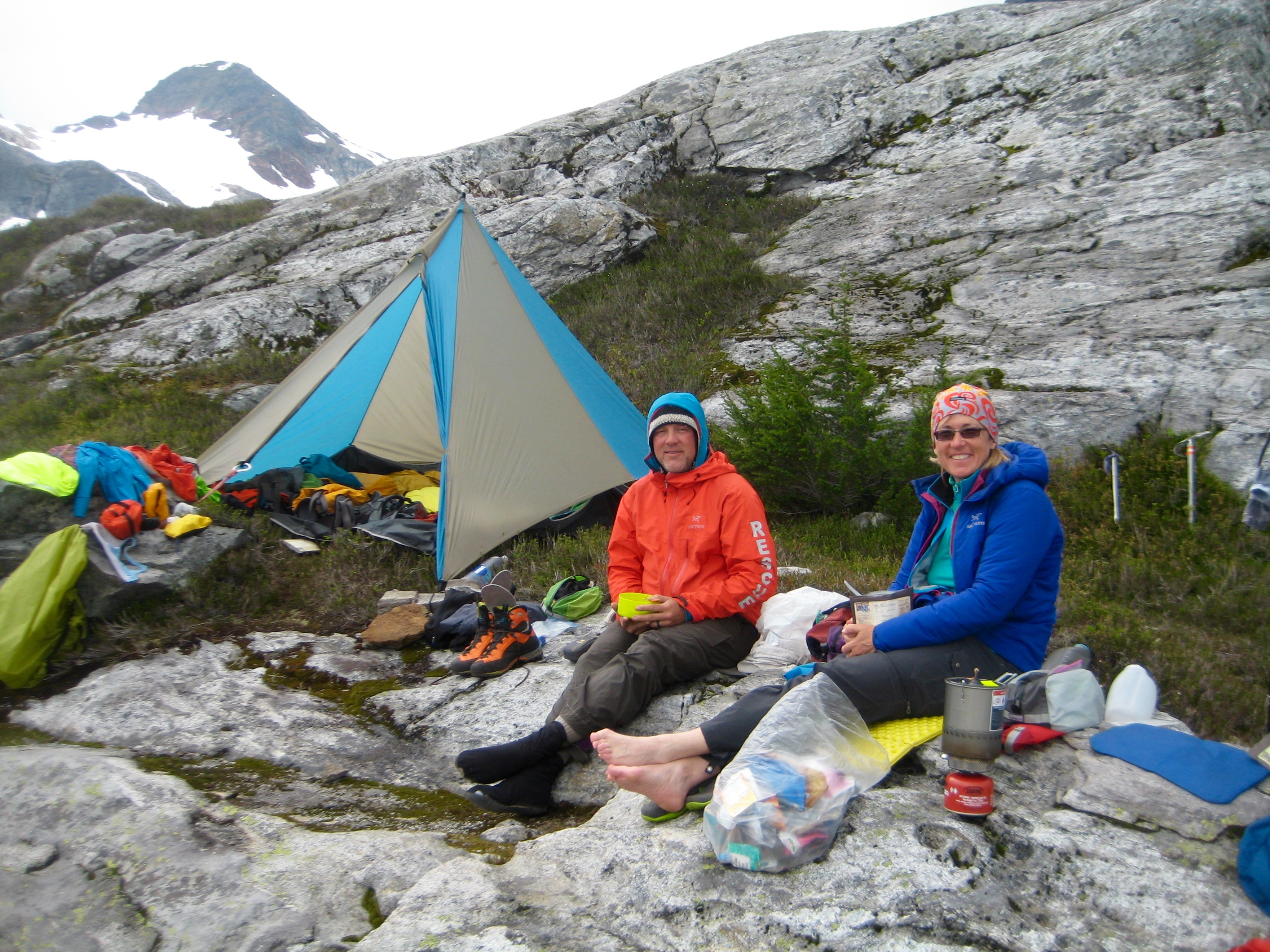
An easy 500-foot descent ended our day at the largest of the Wilcox Tarns, where we set up camp (11.1 hours + 2200 feet from Camp 4).
- Looking Down On Camp 5 At Wilcox Tarns
- Camp 5 At Wilcox Tarns
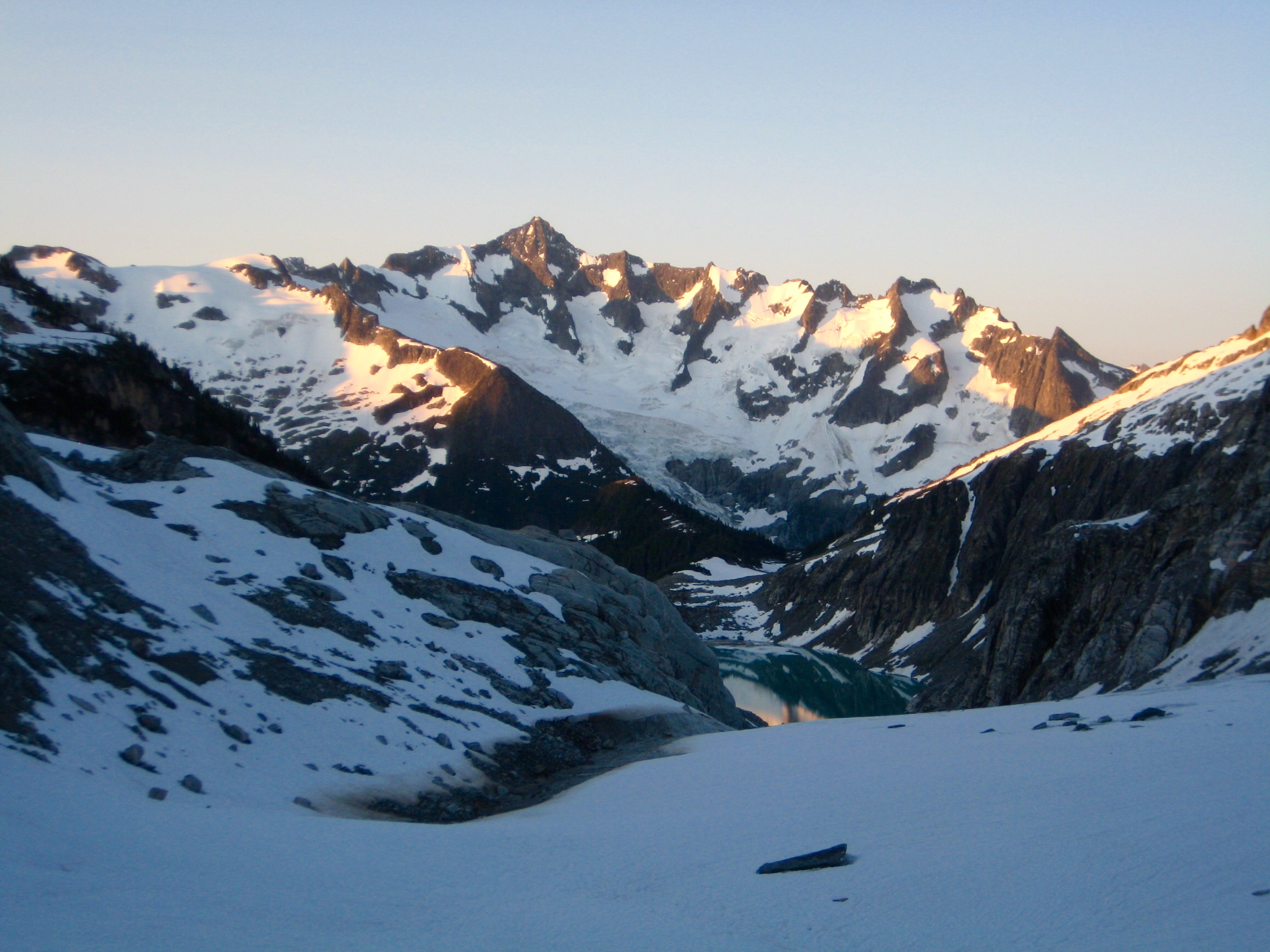
Before dinner, Eileen and I hiked up to the broad saddle closely northeast of camp and looked across McAllister Creek Valley to Primus Peak, near where our traverse had begun.
- Primus Peak From Wilcox Tarns
Day 6: Wilcox Tarns to Isolation Peak Summit to Isolation Lake Knoll
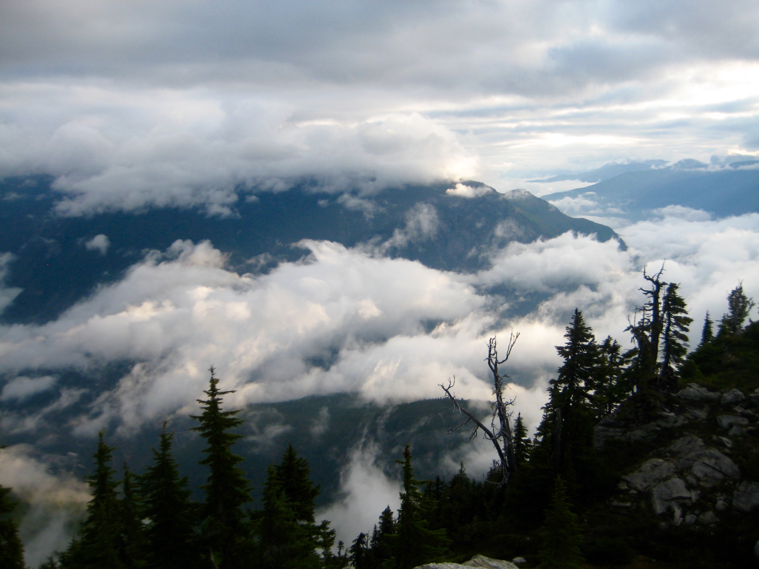
Our hopes for a sunny day—or at least for a mostly clear day—were dashed when we awoke to high valley fog and low-hanging clouds. Oh well, we were totally committed at this point, so there was no choice but to keep navigating with low visibility.
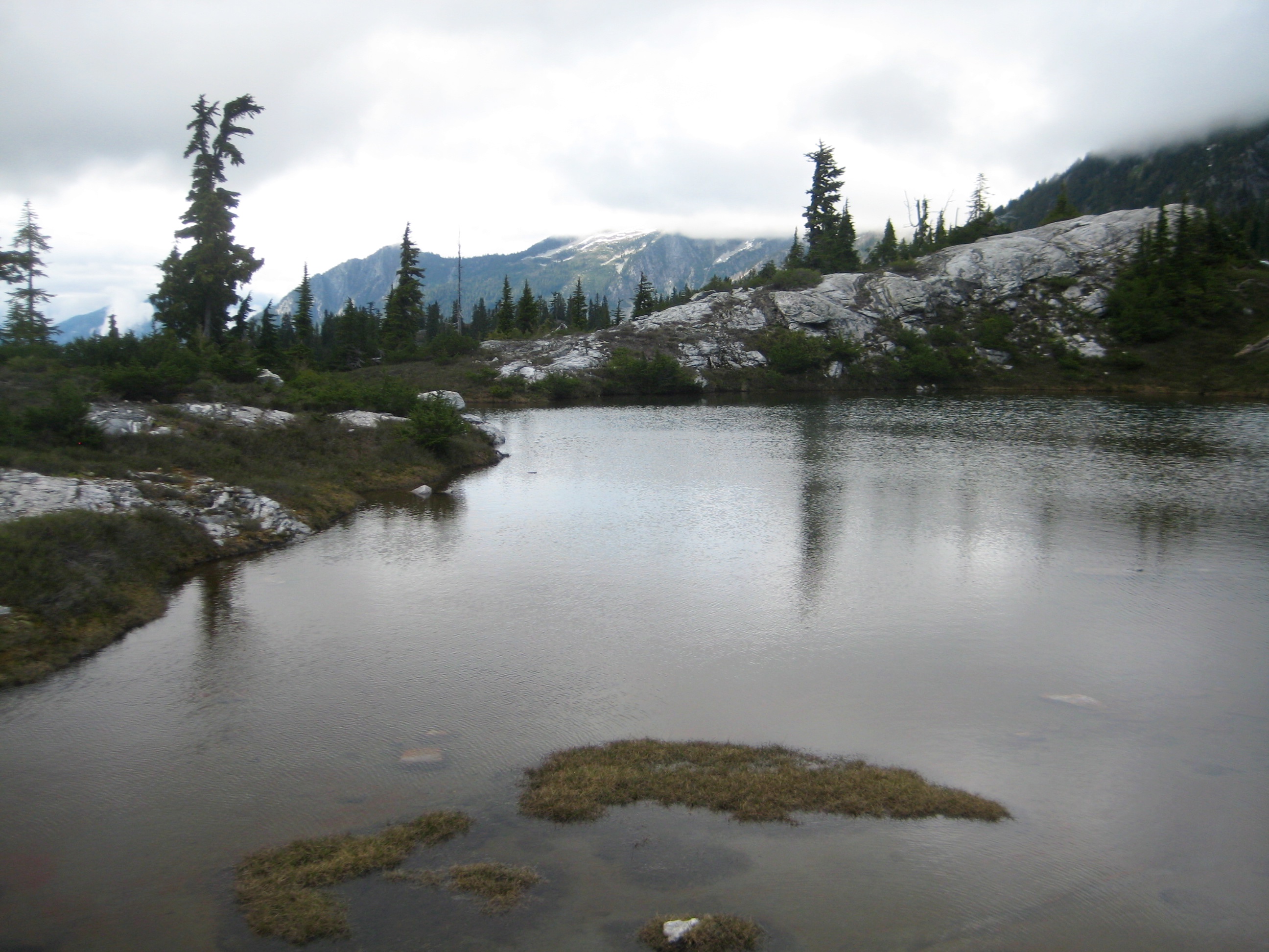
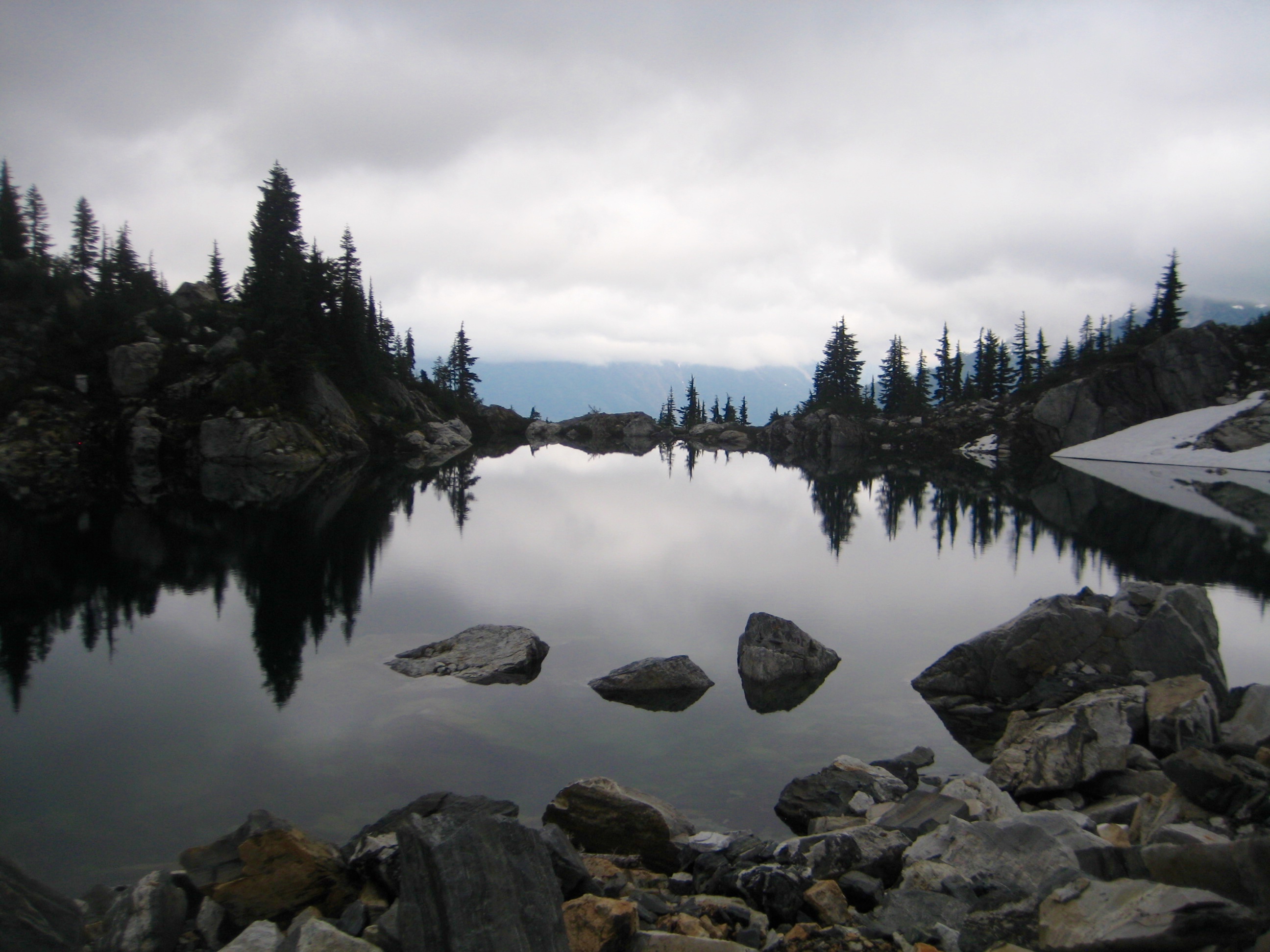
We hiked northward past numerous tarns of various sizes and shapes, all cradled in attractive heather bowls rimmed by white rock. The terrain here reminds me of Rampart Lakes, but without the maze of boot paths.
- Wilcox Tarns
We continued up the south ridge of Isolation Peak, following animal paths through scattered trees. This ridge gradually melded into the southwestern face, which featured nice heather slopes and rock outcrops.
- Heading Up Isolation Peak On Day 6
Shortly past noon, we stepped onto the foggy and rarely visited summit (3.7 hours + 1800 feet from Camp 5). There was no register, so we left a small one in the summit cairn. Interestingly, the cairn and a nearby rappel sling were the first signs of human existence that we observed since leaving Dorado Col.
- Eileen & Kevin On Isolation Peak Summit
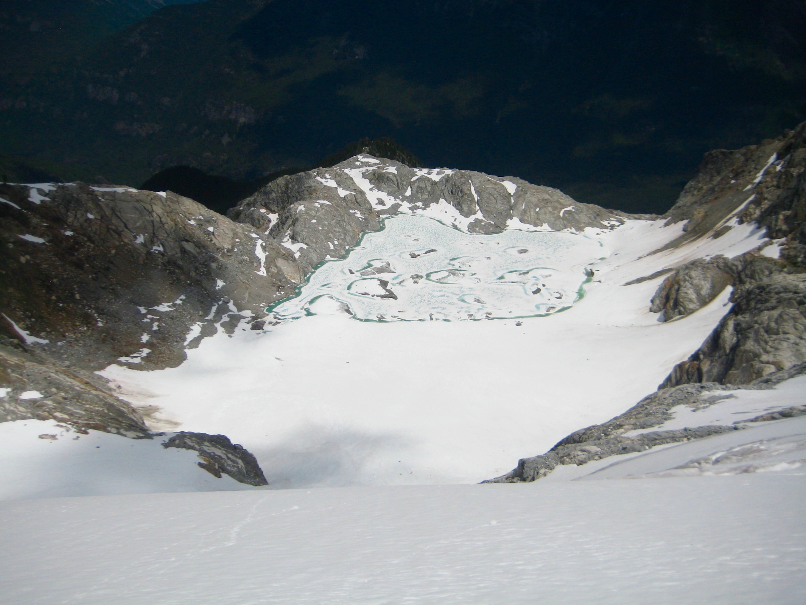
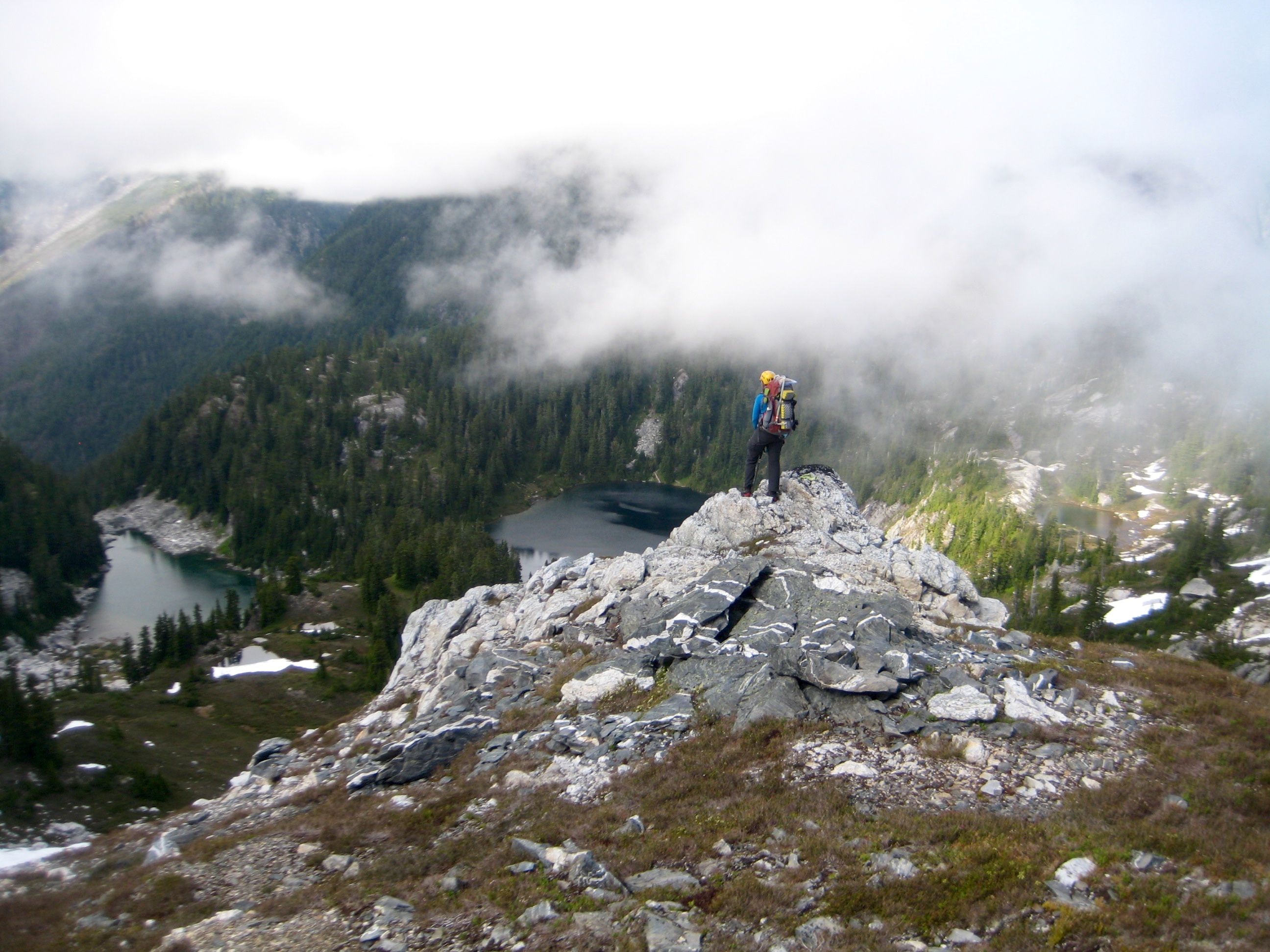
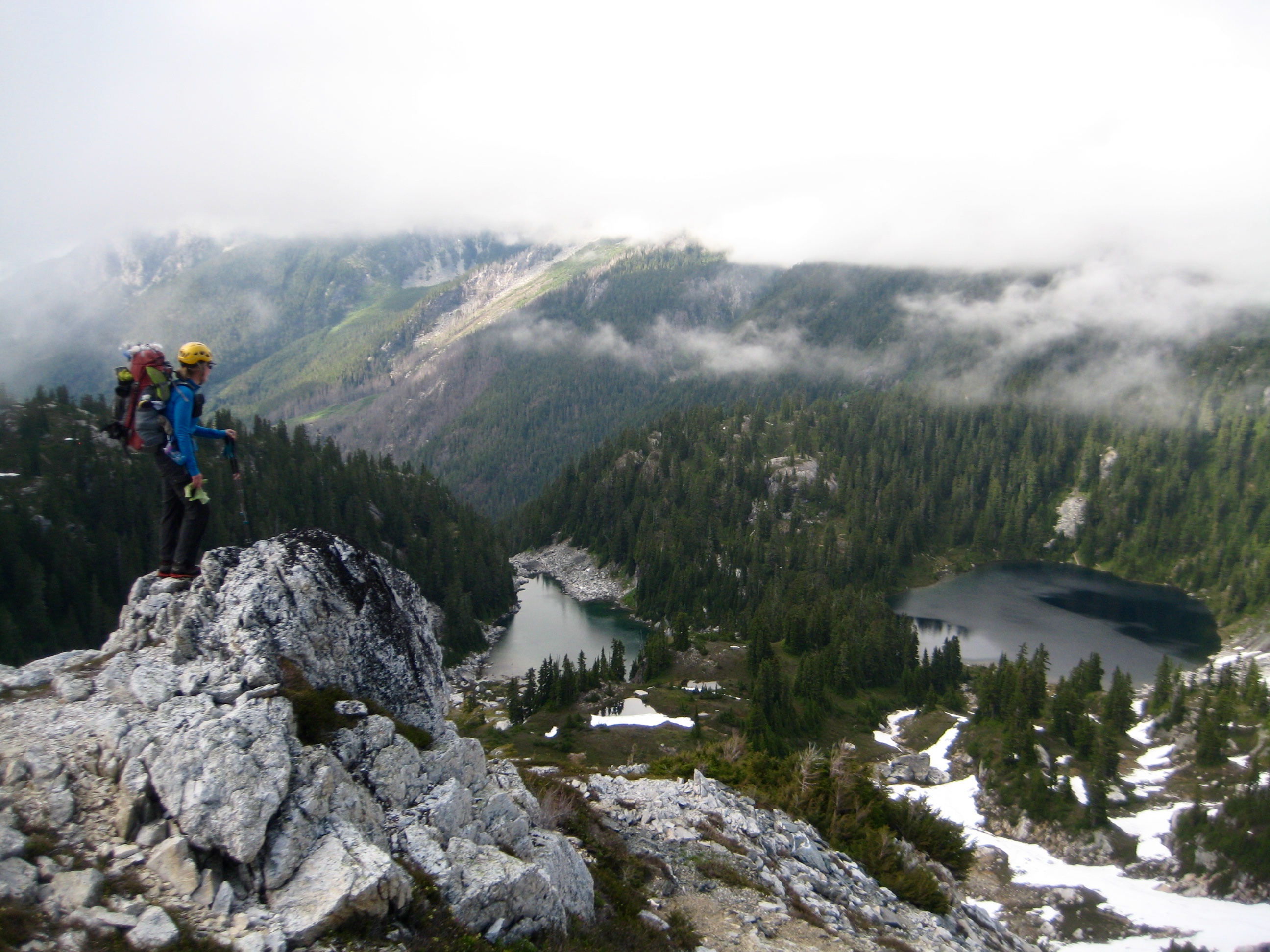
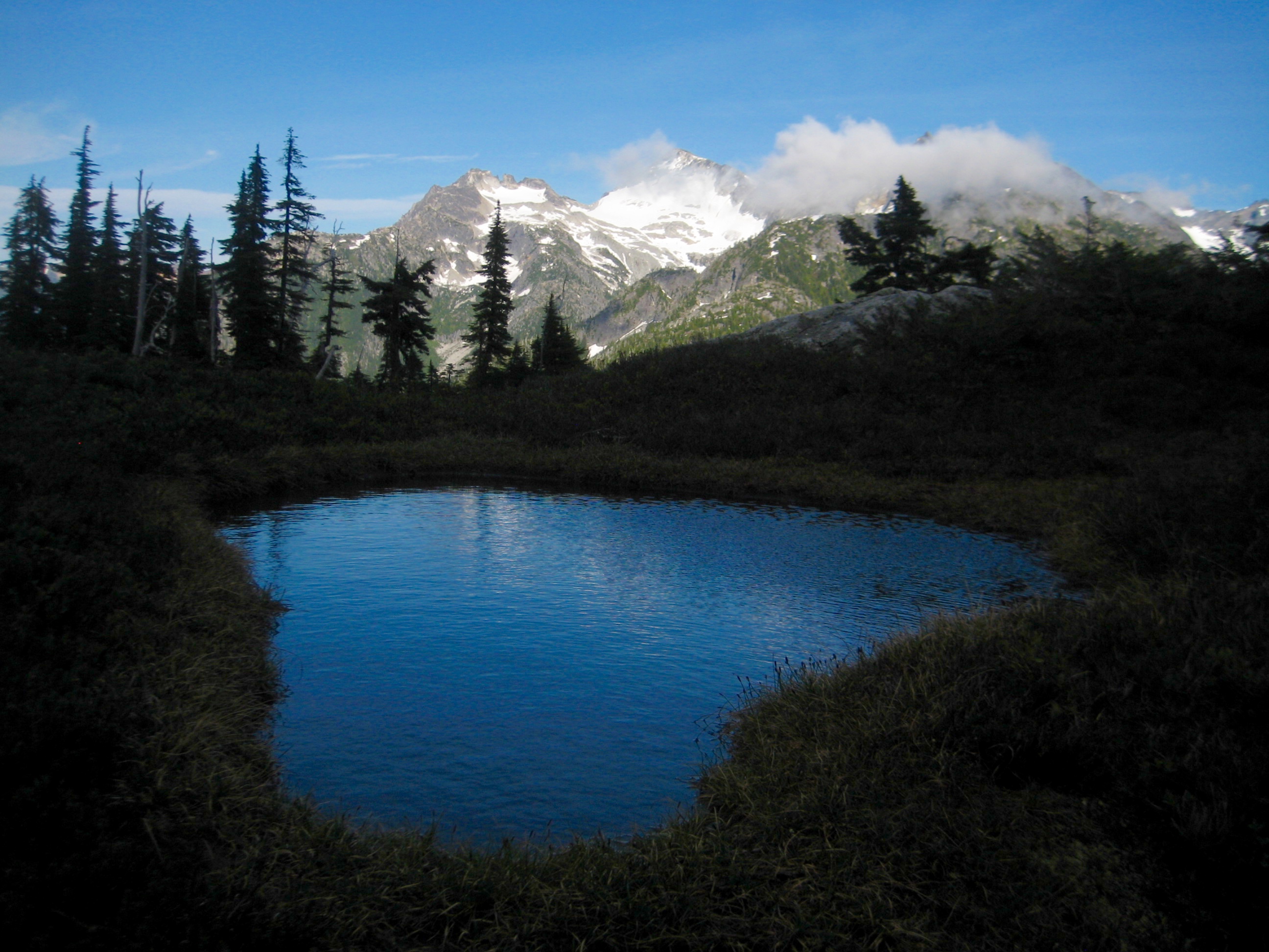
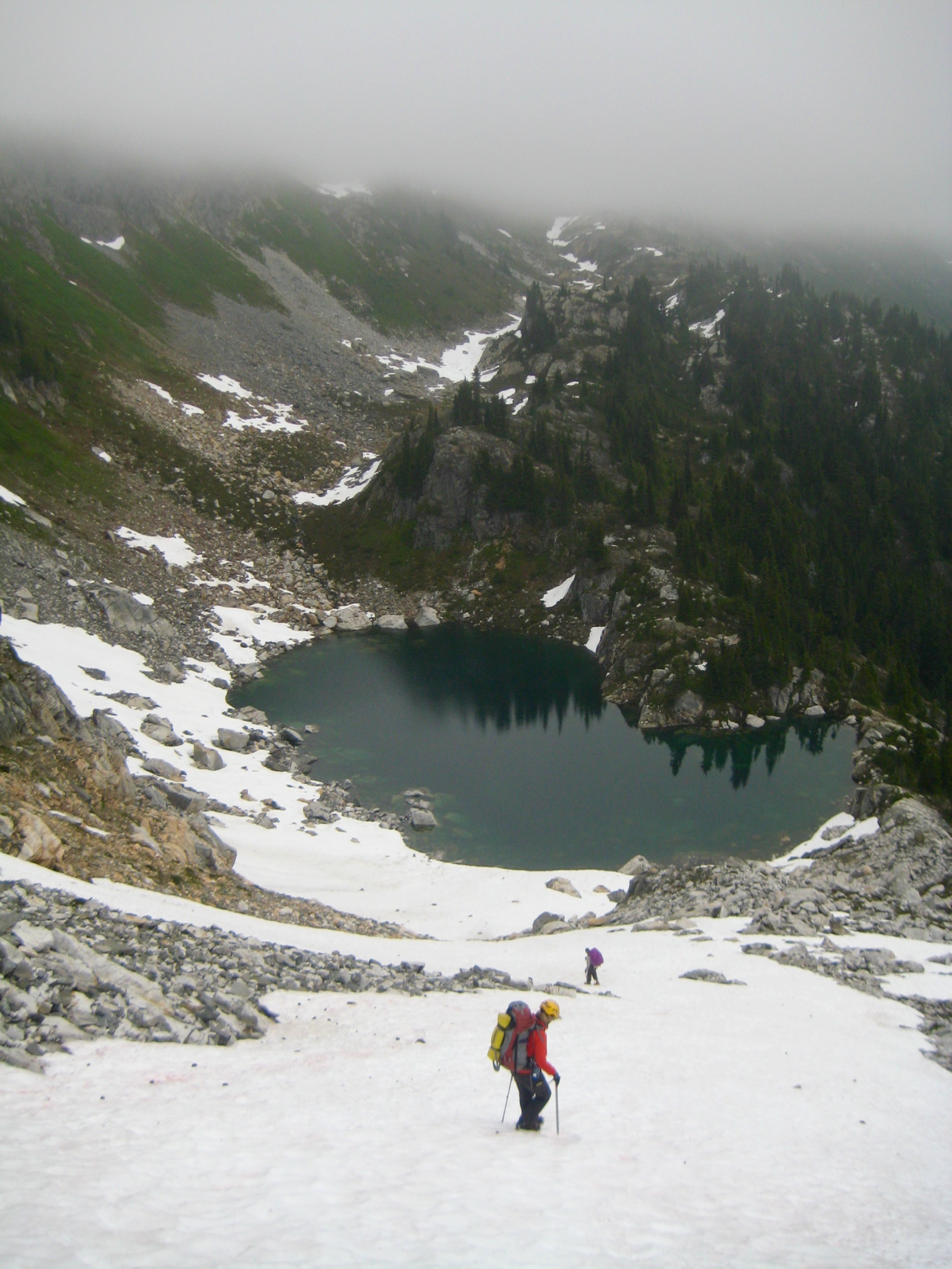
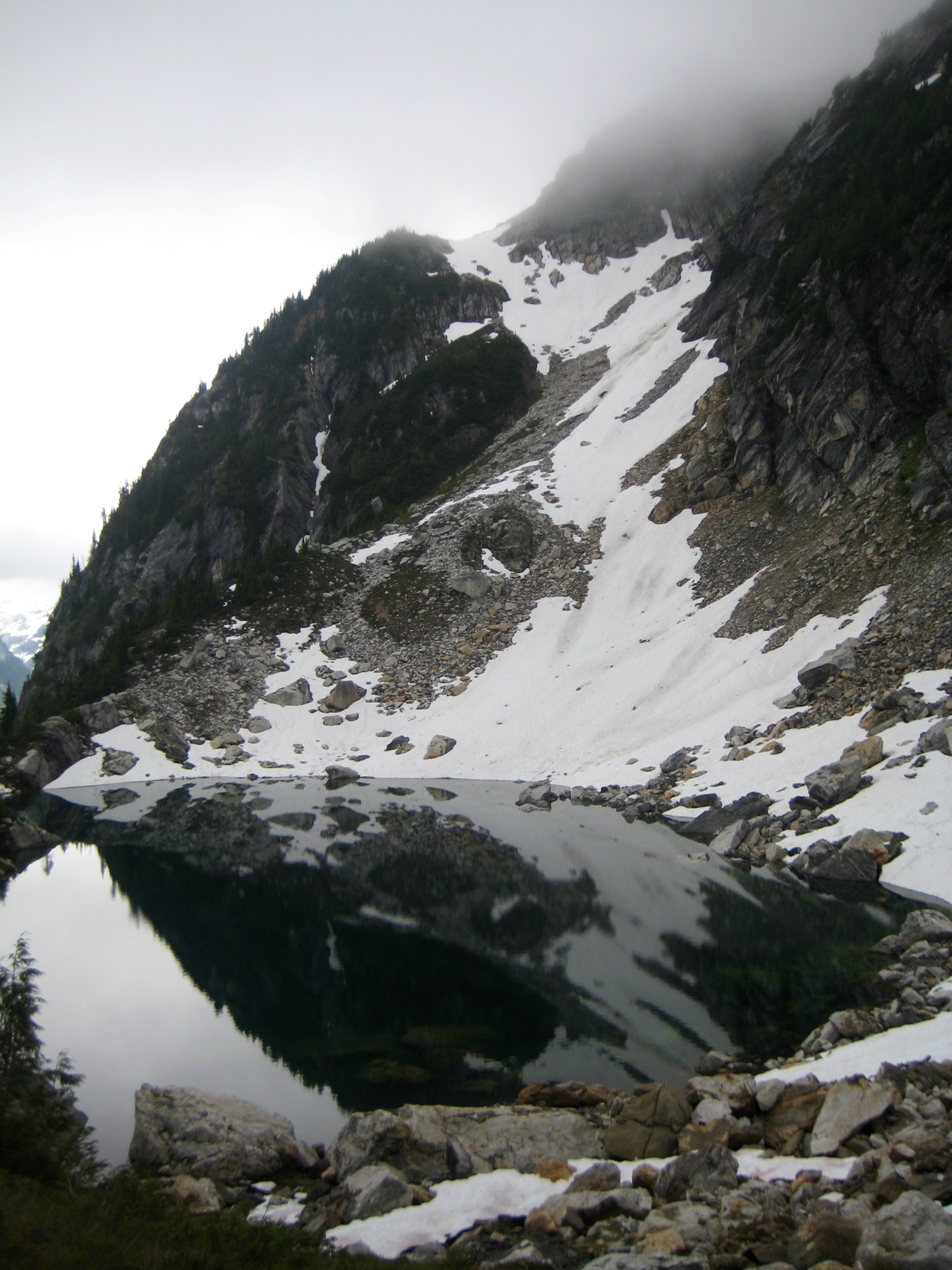
For our descent, we scrambled down the southwest ridge to a 6400-foot step in the crest. From there, a moderately inclined snow ramp led us easily down to Isolation Lake.
- Descending Snow Ramp To Isolation Lake
- Peaceful Water At Isolation Lake
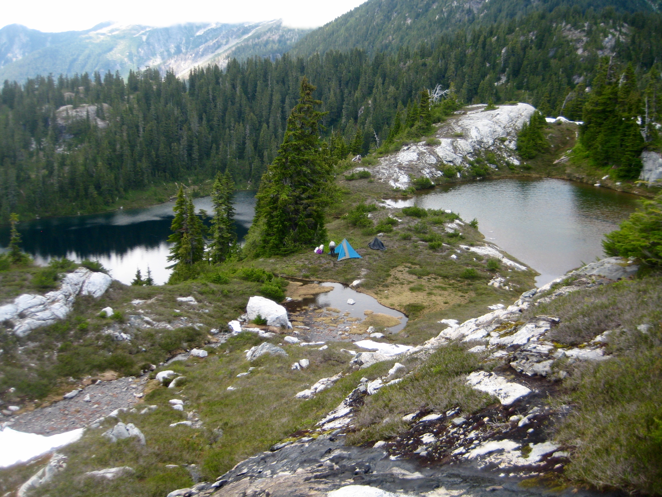
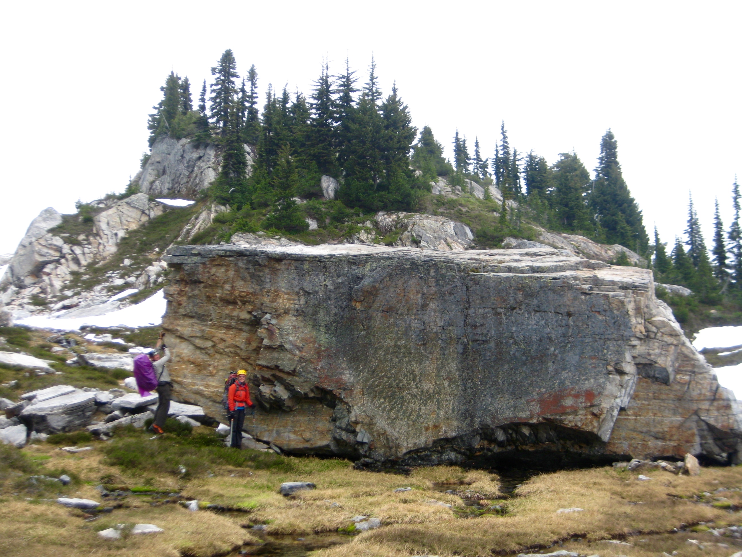
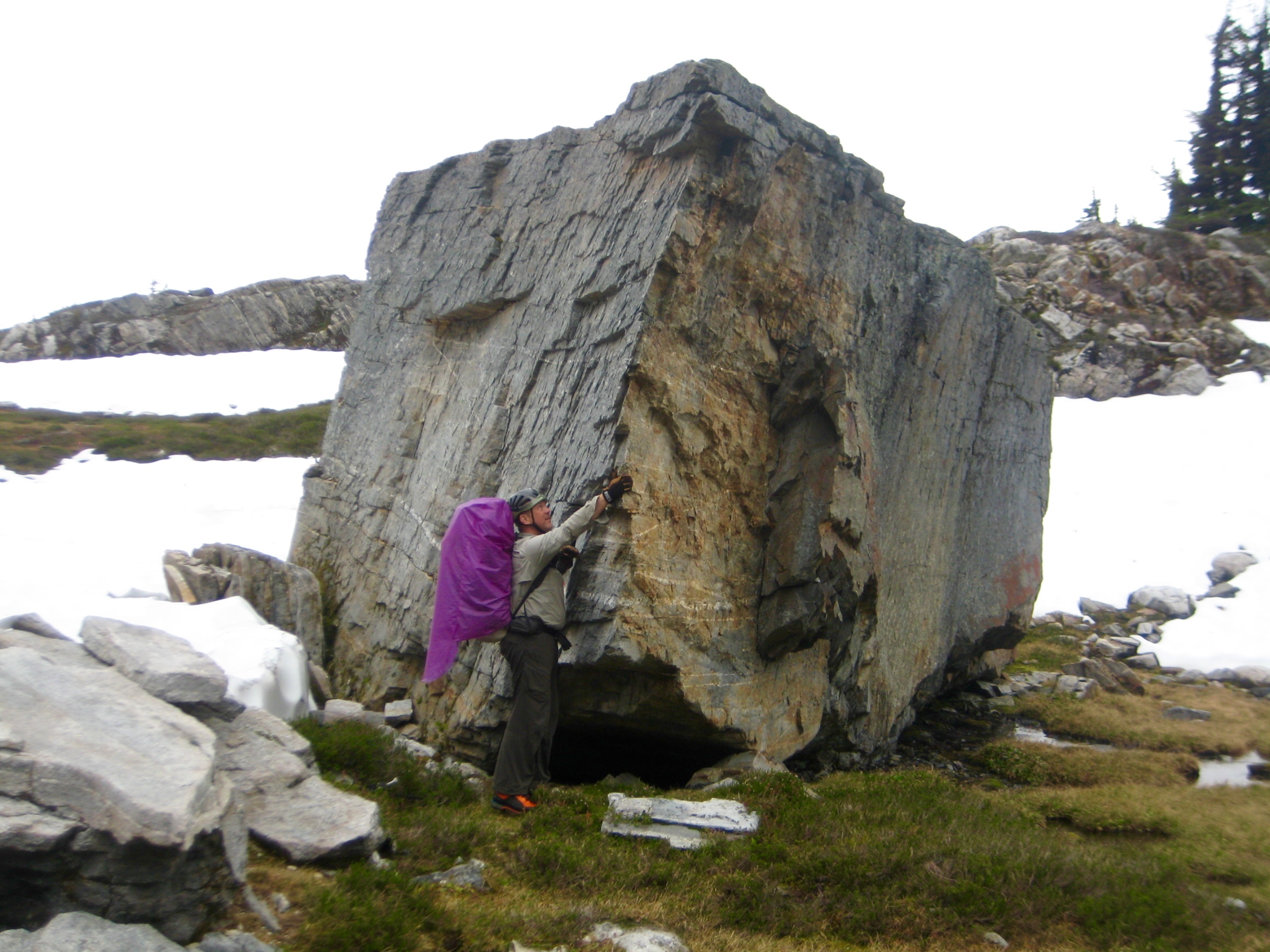
Camping options at the lakeshore were limited, so we continued hiking up a heather draw to the northeast. Along the way, we encountered a remarkably large, angular boulder of Isolation Peak schist. Wouldn’t this monolith look good in your backyard?!
- Schist Monolith At Isolation Lake
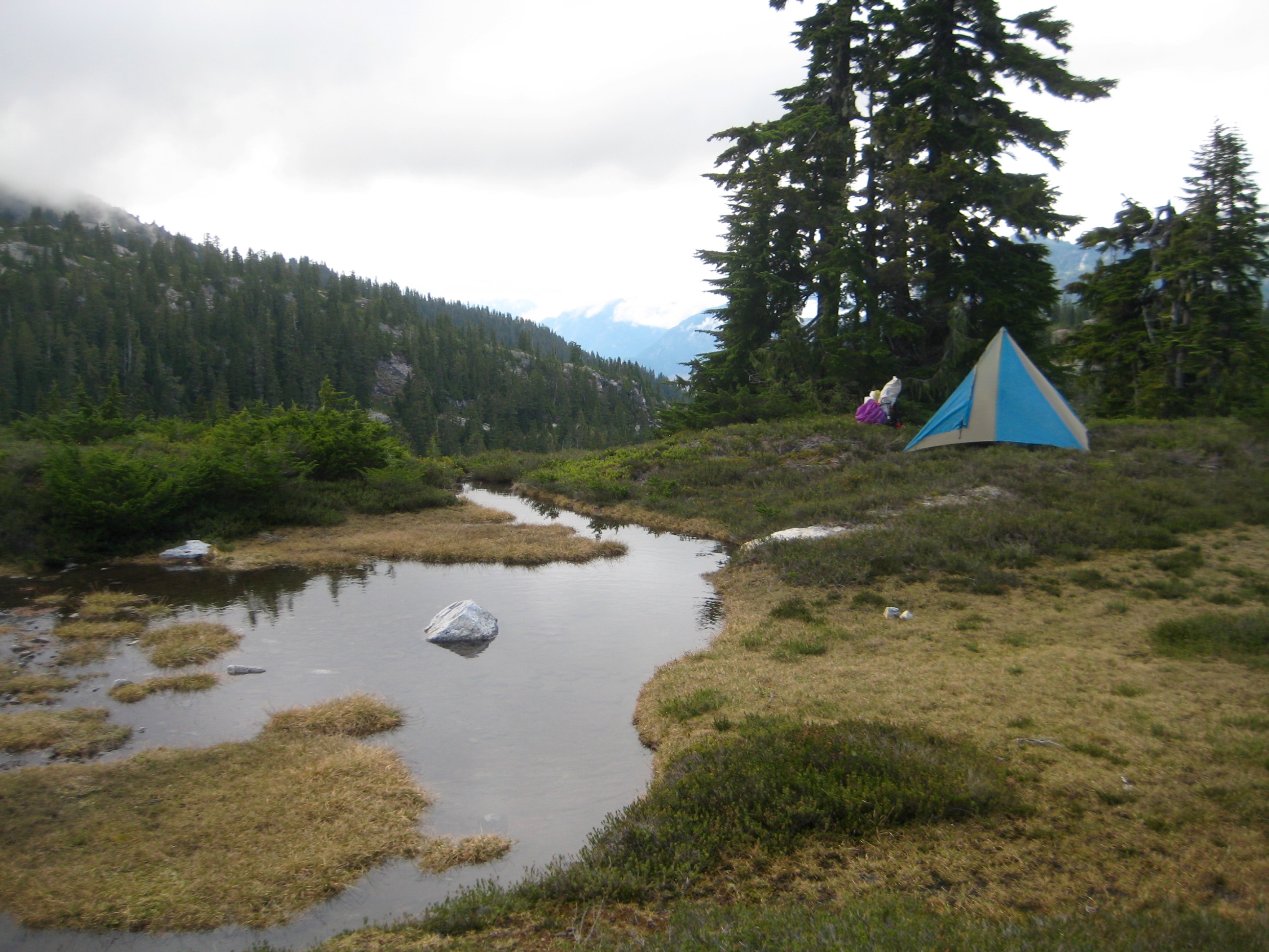
A rocky knoll 200 feet above the lake provided a wonderful campsite for the night (7.7 hours + 2200 feet from Camp 5).
- Camp 6 Near Isolation Lake
Day 7: Isolation Lake Knoll to Pyramid Ridge Step + Snowfield Peak
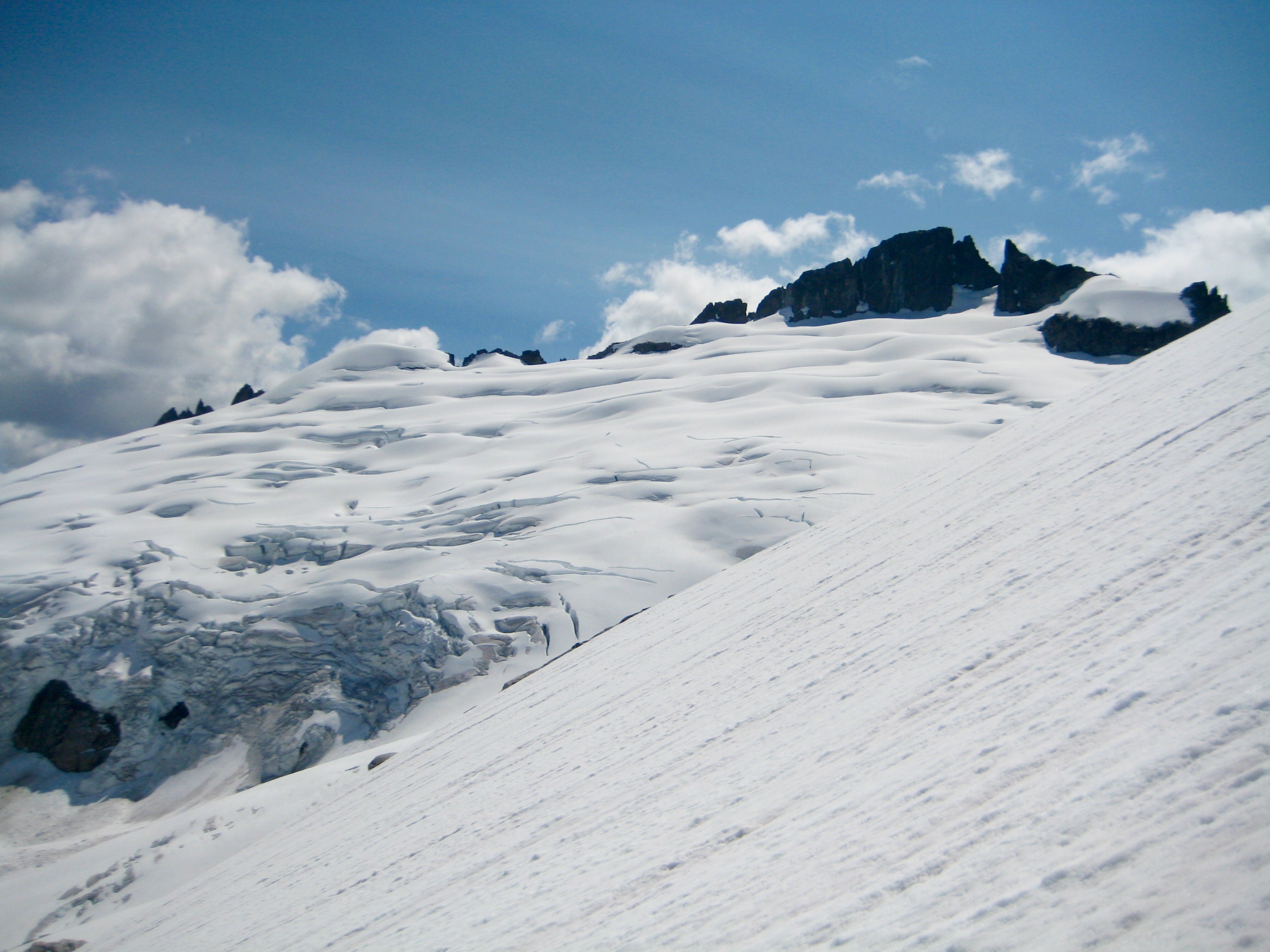
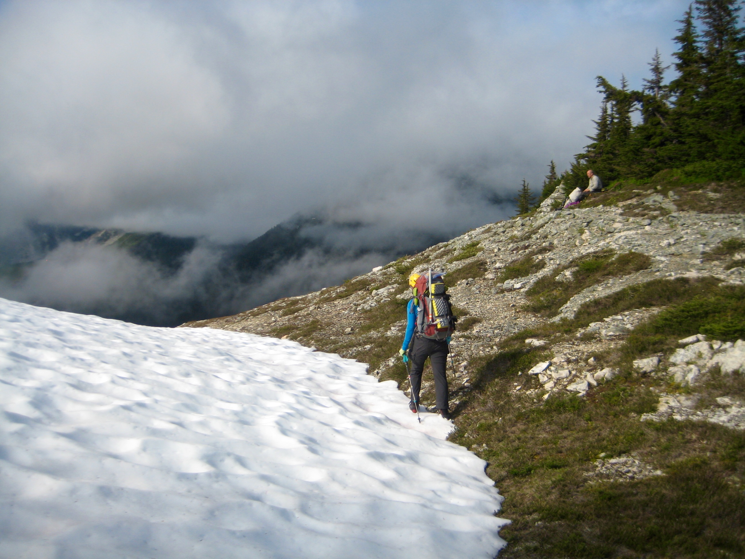
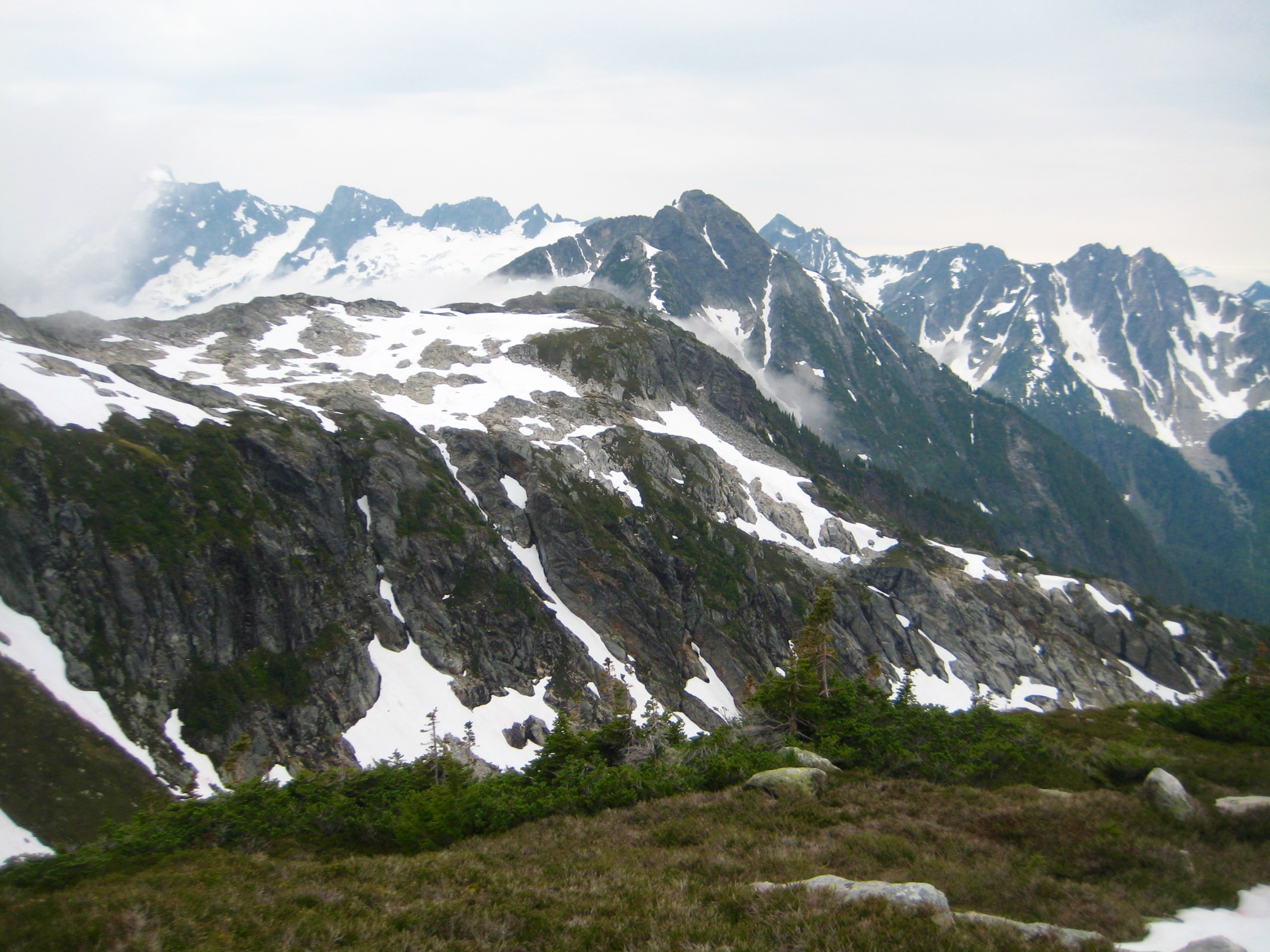
Visibility was slightly better this morning, so we were readily able to work our way northward up to Point 6705. Snowfield Peak towered above us, but rather than following the peak’s south ridge, we traversed leftward into a large basin southwest of the peak.
- Morning Fog In McAllister Creek Valley
- Primus Peak & Tillies Towers From Camp 6
- Snowfield Peak From Near Point 6705
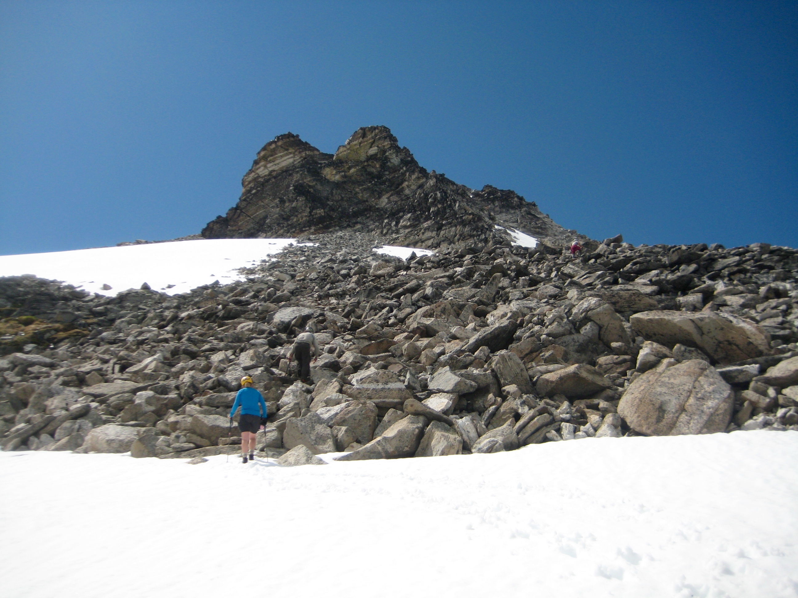
Gentle slopes of snow, heather, and scree led up to a 7750-foot notch in the west ridge of Snowfield Peak (3.1 hours + 1900 feet from Camp 6). We dropped backpacks and headed up the peak with summit packs.
- Hiking Toward Snowfield Peak
- Eileen Heading Up Snowfield Peak
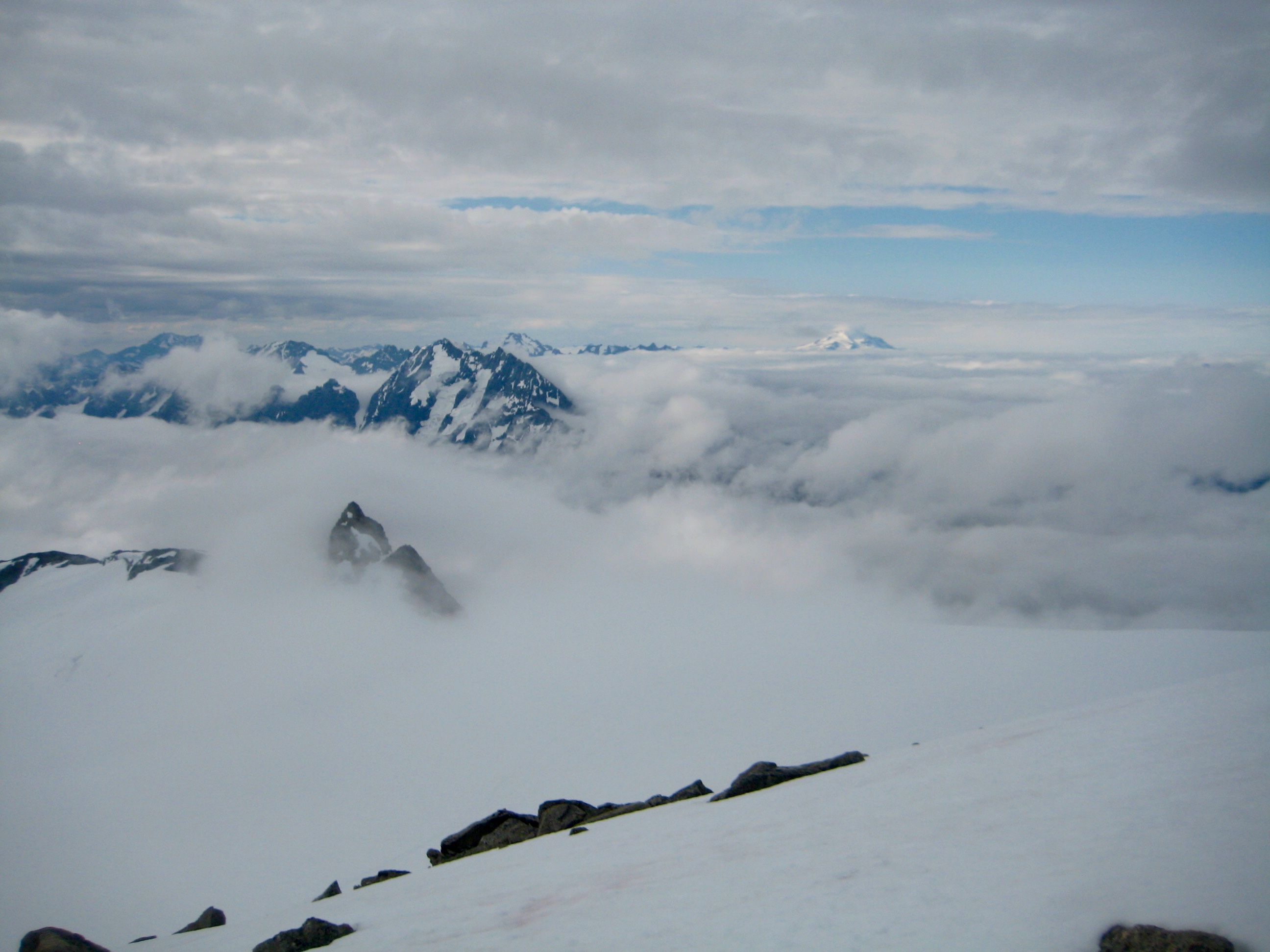
The west ridge route begins with a well-beaten climber’s path, then transitions into exposed but enjoyable Class 3 rock. Within an hour, we were on the summit. Although visibility was greatly reduced due to an excessive amount of moisture in the air, we were happy to escape the cloying fog.
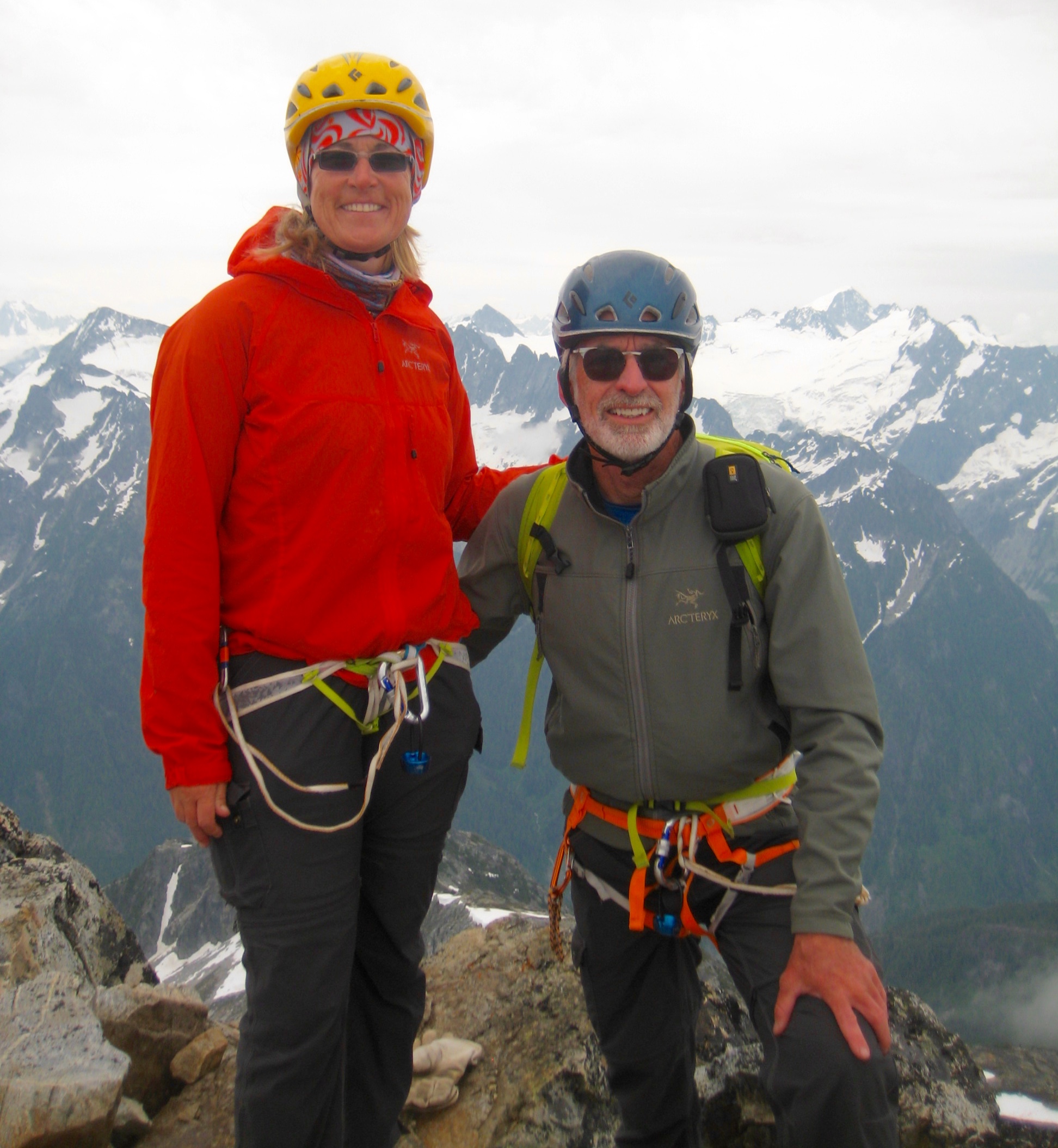
- Kevin & Eileen On Snowfield Peak Summit
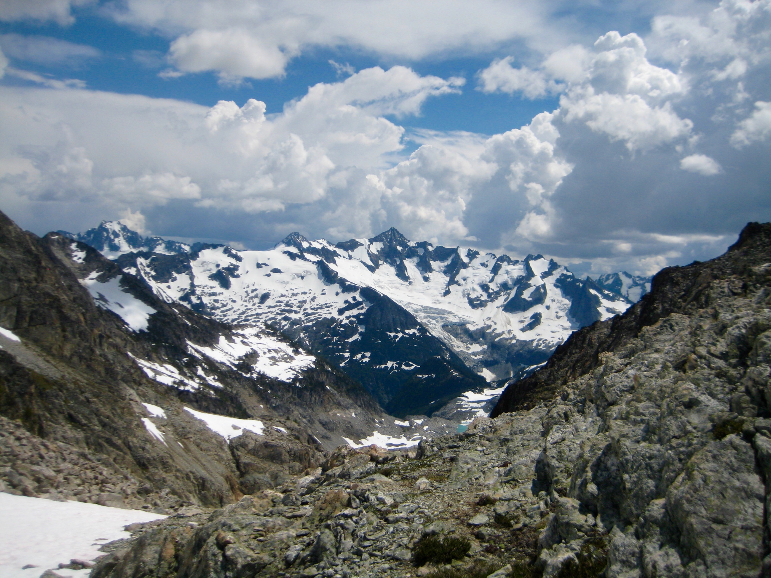
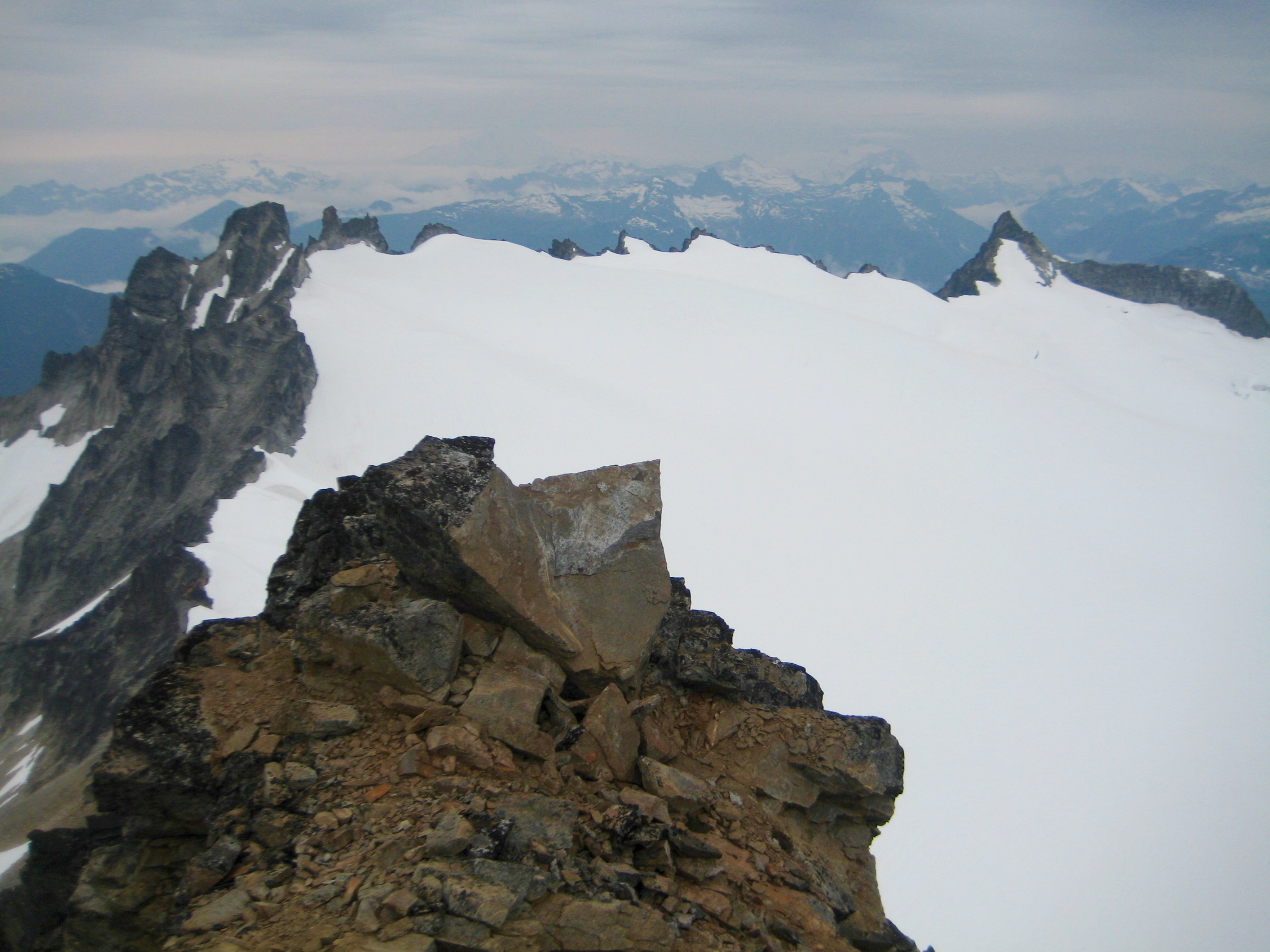
- Paul Bunyans Stump & Colonial Peak From Snowfield Peak Summit
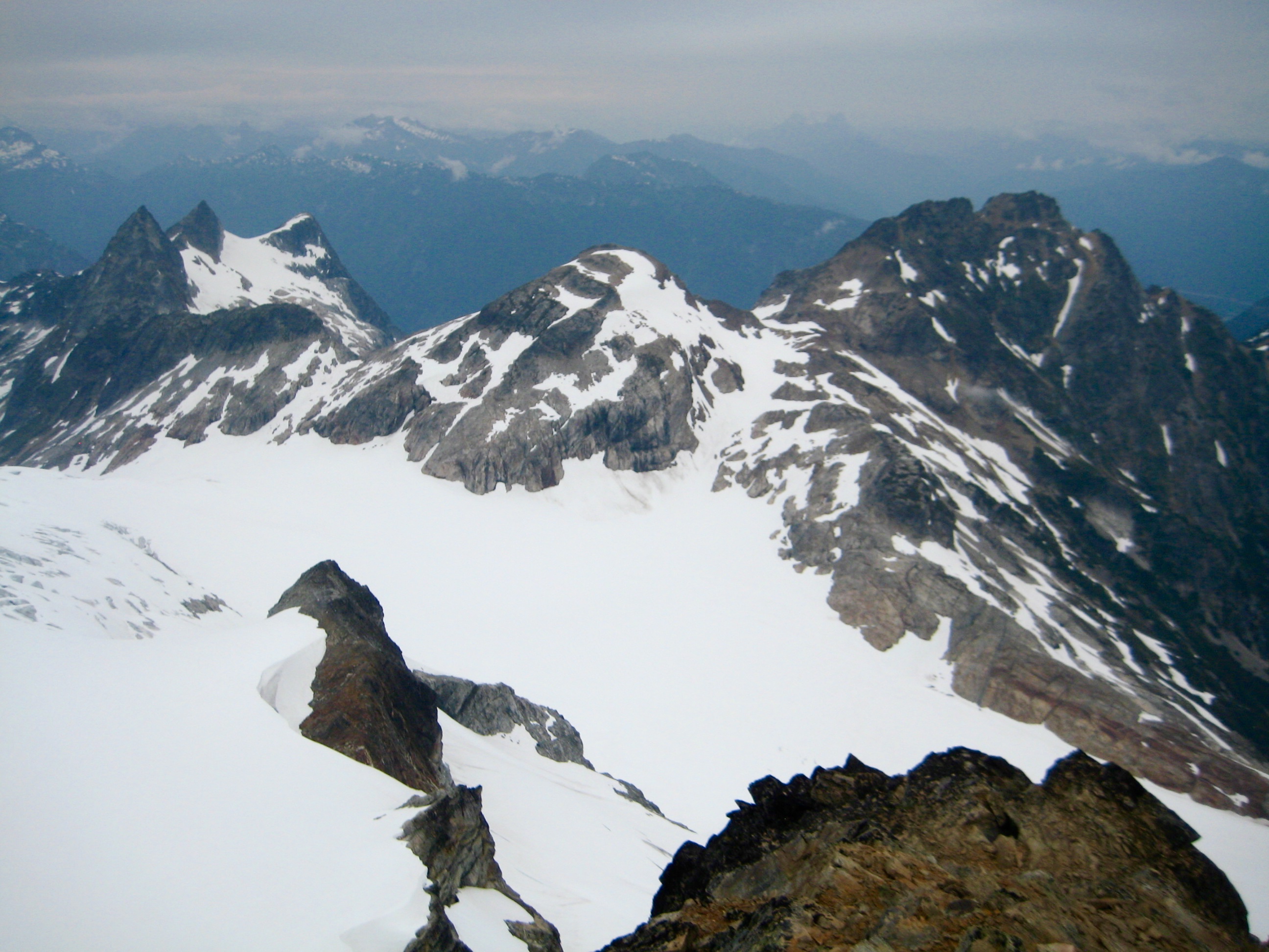
- Backbone Ridge & Isolation Peak From Snowfield Peak Summit
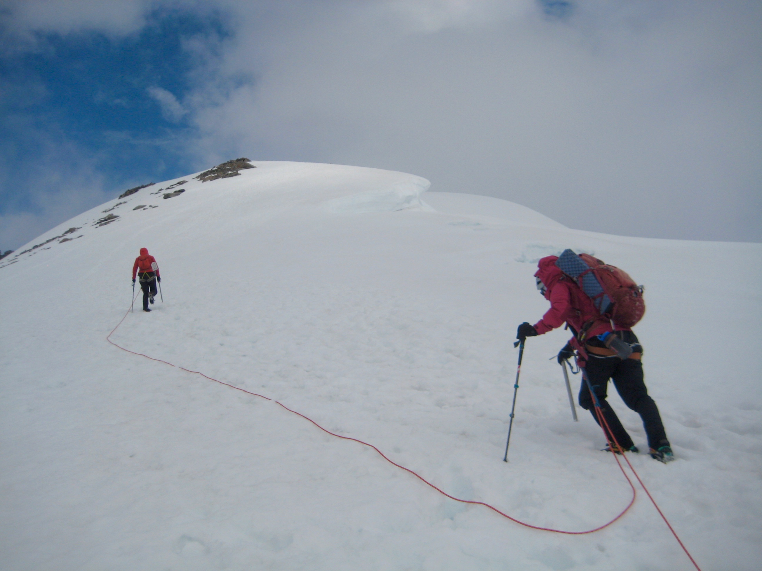
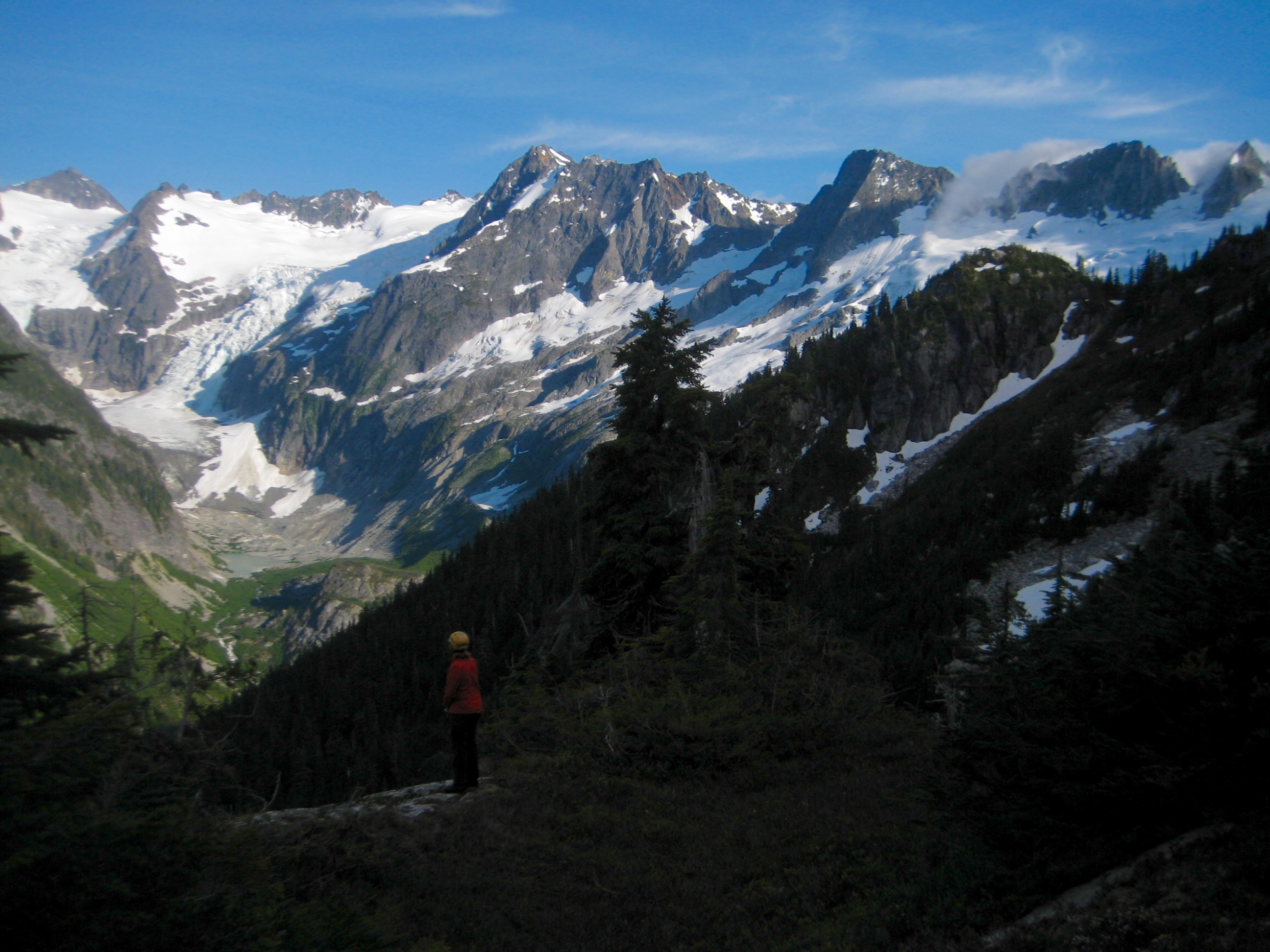
We down-climbed (no rope needed) back to the west ridge notch, shouldered our packs, and headed north. Eileen led us down the Neve Glacier, up to 6850-foot Nevonial Col (7.2 hours from Camp 6), and then down the Colonial Glacier.
- Paul Bunyans Stump & Pinnacle Peak & Pyramid Peak From Nevonial Col
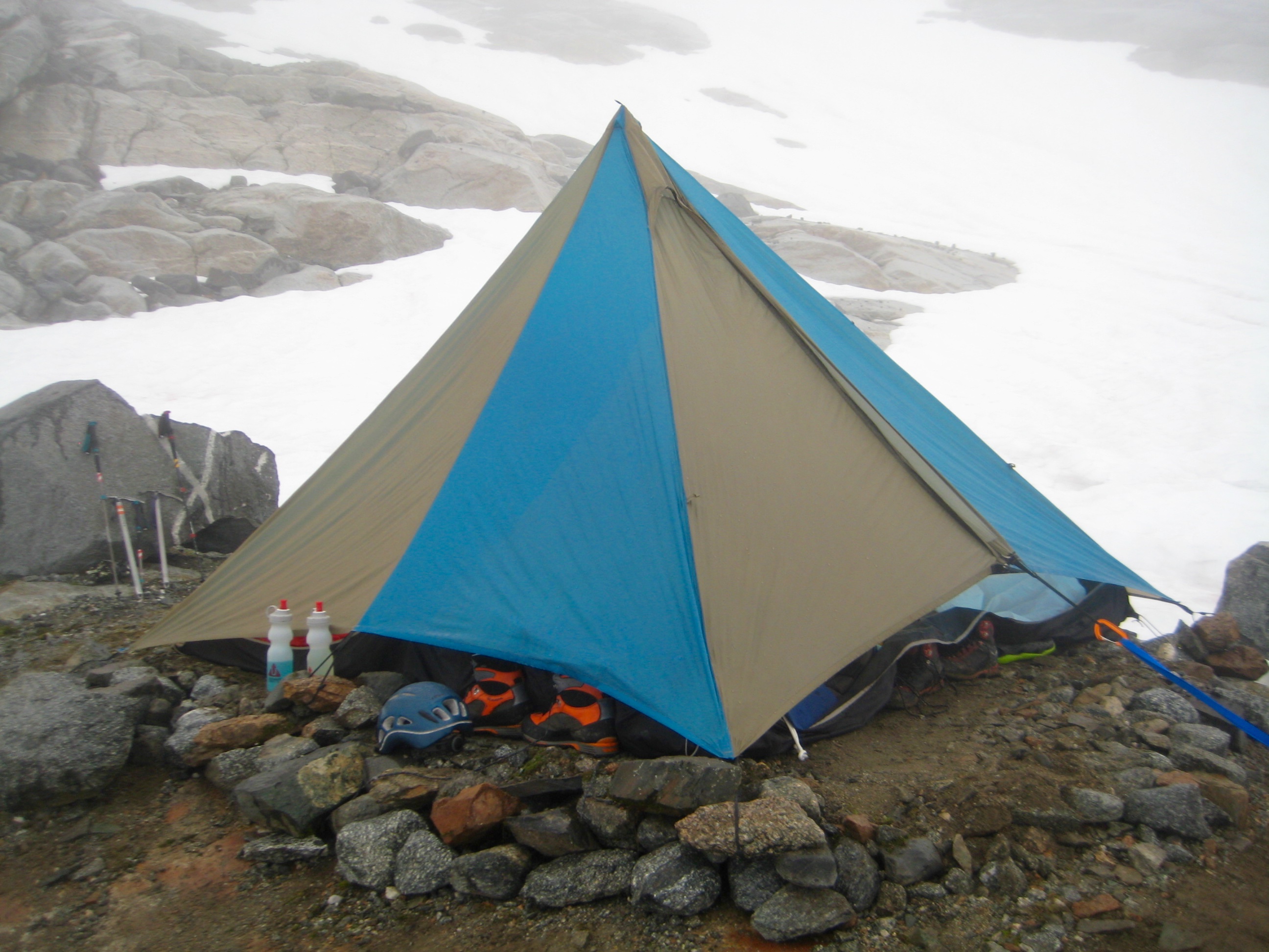
As the Colonial Glacier shrinks, “Colonial Lake” gets bigger, such that it is now necessary to detour around to the east on a rock rim. We crossed over the outlet stream and made an undulating traverse on snow and talus to reach Pyramid Ridge. A climber’s path led us down the ridge crest, and we stopped for the night on a scenic rock step at 5400 feet (10.2 hours + 3000 feet from Camp 6, including summit sidetrip). It was all smiles in camp that night.
- Kevin & Eileen At Camp 7 On Pyramid Ridge
Day 8: Pyramid Ridge Step to Pyramid Lake Trailhead
The prevailing theme of clouds and fog continued into our final morning, but we didn’t much care at this point. Our focus was entirely on getting down the steep (and sometimes super-steep) climber’s path leading to Pyramid Lake.
- Morning Fog From Camp 7
Shortly after attaining the Pyramid Lake Trail, we encountered a day-hiker. This was the first other person that we’d seen since leaving the Thunder Creek Trail eight days ago!
Minutes before noon, we arrived at Highway 20 (4.8 hours + 200 feet from Camp 7) to end a challenging, satisfying, and amazing traverse.
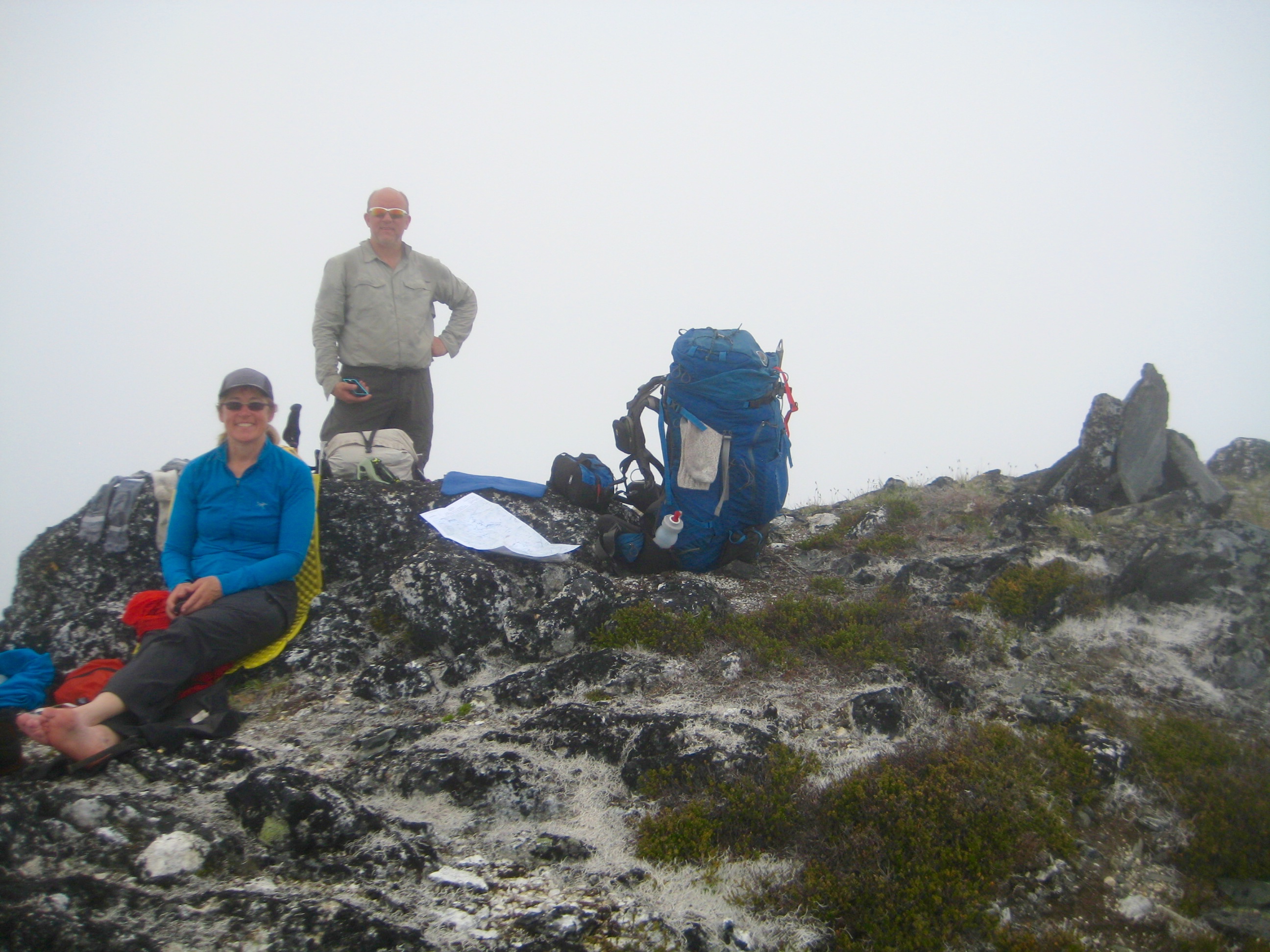
Route Maps & Profile
…
…
…
…
Photo Gallery
Click to enlarge…