Trip Date: September 17-19, 2018
Spider Mountain Climbing Trip
Cascade Pass
Mix-up Arm
Cache Col
Kool-Aid Lake
Spider–Formidable Col
Spider Mountain (~8300′)
Trip Report Summary
Region: North-Central Washington Cascades
Sub-Region: Ptarmigan Mountains
Areas: North Cascades National Park & Glacier Peak Wilderness
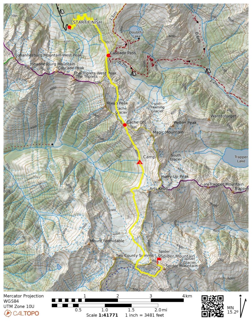
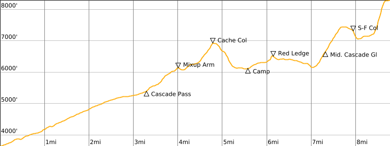
Starting & Ending Point: Cascade Pass Trailhead at end of Cascade River Road (Elev. 3650 feet)
Way Points: Cascade Pass & Mix-up Arm & Cache Glacier & Cache Col & Kool-Aid Lake (trail hike & off-trail hike & snow climb)
Campsite: Kool-Aid Lake (Elev. 6100 feet)
Sidetrip: Red Ledges & Art’s Knoll Meadows & Middle Cascade Glacier & Spider–Formidable Col & South Spider Mountain slope (off-trail hike & rock scramble & snow climb)
Summit: Spider Mountain (snow climb & rock scramble via Southeast Gully—East Ridge; descent via East Ridge—Southeast Rib)
Approximate Stats: 17.6 miles traveled; 9100 feet gained & lost.
Full Trip Report
Eileen and I took advantage of a short window of clear weather to tackle Spider Mountain in the Ptarmigan Mountains. This peak had attracted our attention during previous treks into the area, and we had gathered written climbing beta from Fred Beckey, Fay Pullen, and Paul Klenke, as well as anecdotal information from several other folks. All sources unanimously agreed on one thing: Spider Mountain is a big pile of horribly loose rock! At least there was a consistent opinion in that regard, rather than mixed reports. On a more positive note: if things went well, it would be Eileen’s tenth summit since her accident earlier this summer, thereby marking an important milestone in her recovery.
Day 1: Trailhead to Kool-Aid Lake
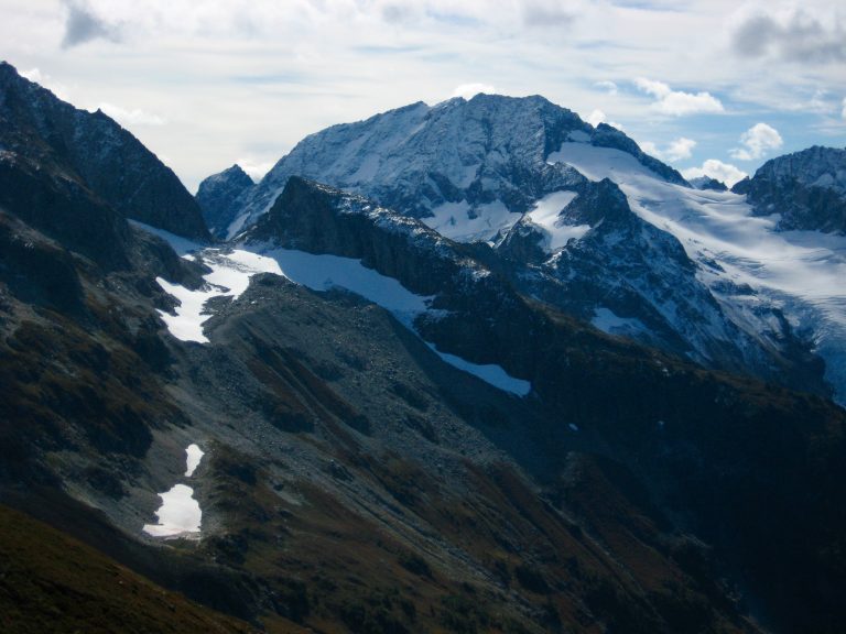
We arrived at the busy Cascade Pass Trailhead in late morning. It was a blue-bird Monday immediately following a weekend of cold and stormy weather. The dusting of snow on Mt. Johannesburg and other surrounding peaks added a dramatic splash to the scenery, but it also indicated that our climb was going to include a slightly wintry element.

- Fresh Snow On Johannesburg Mtn
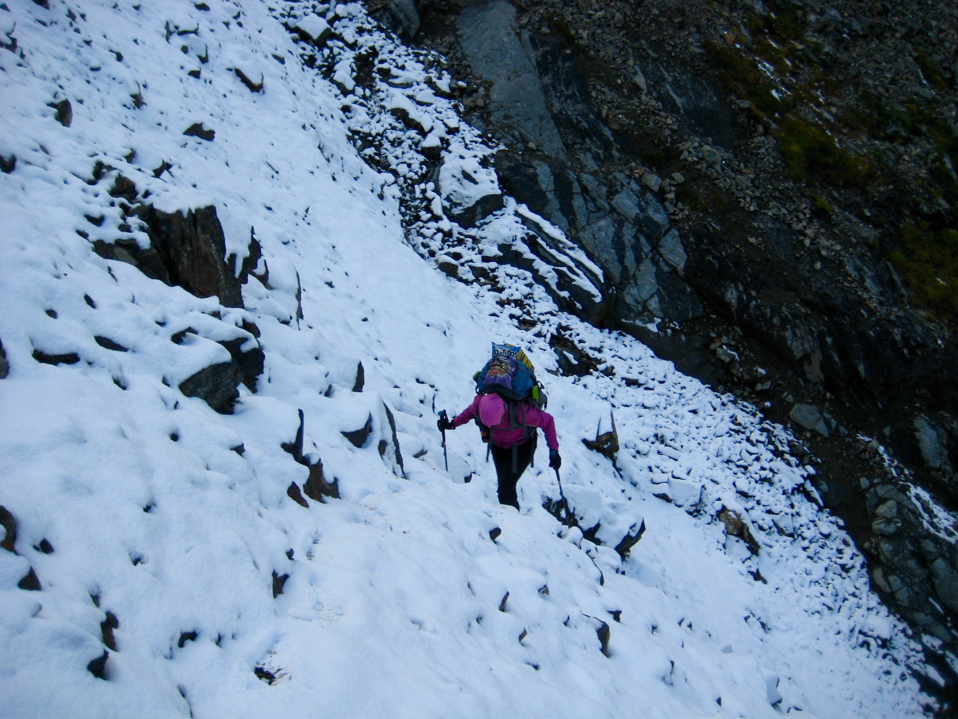
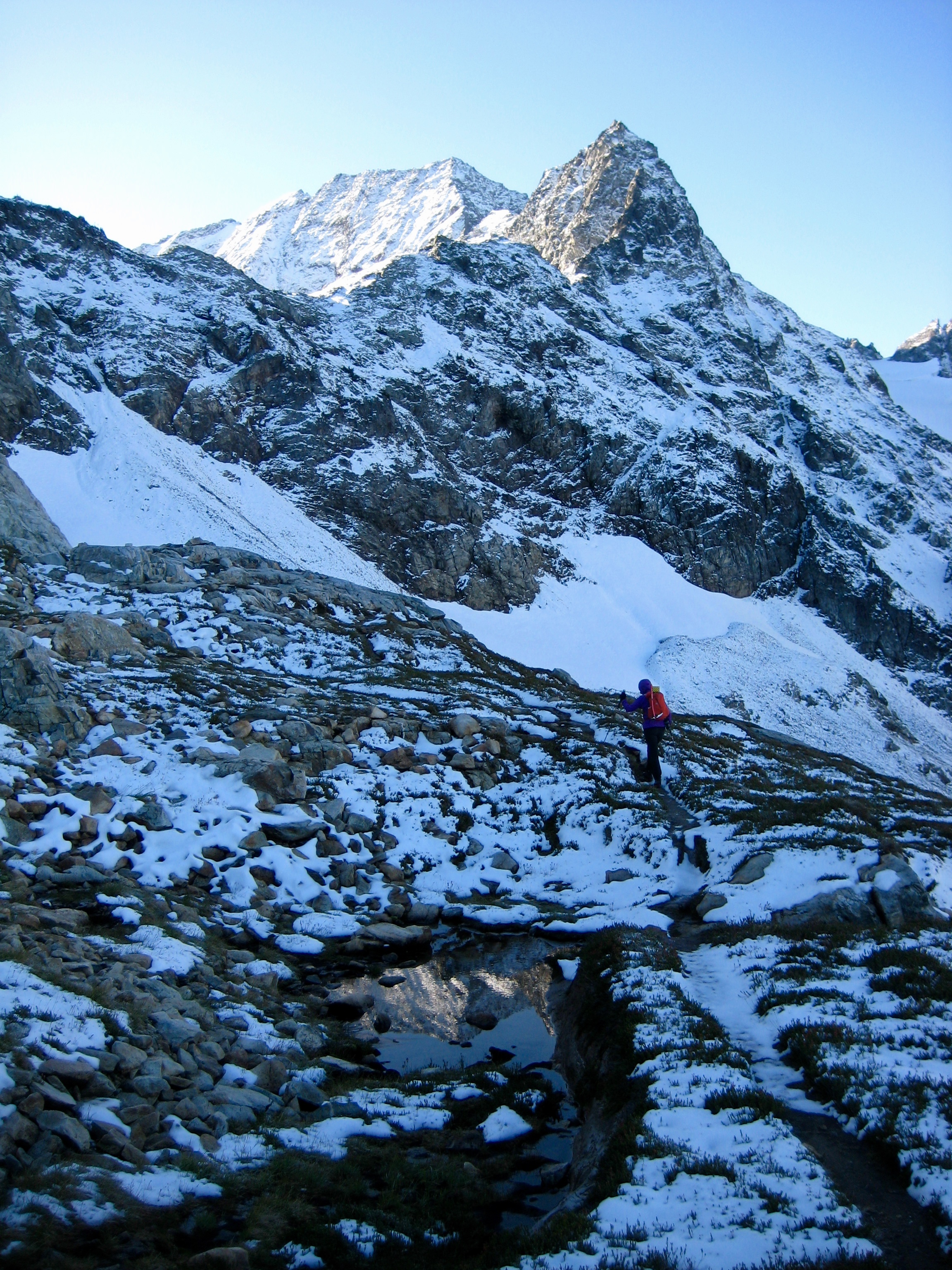
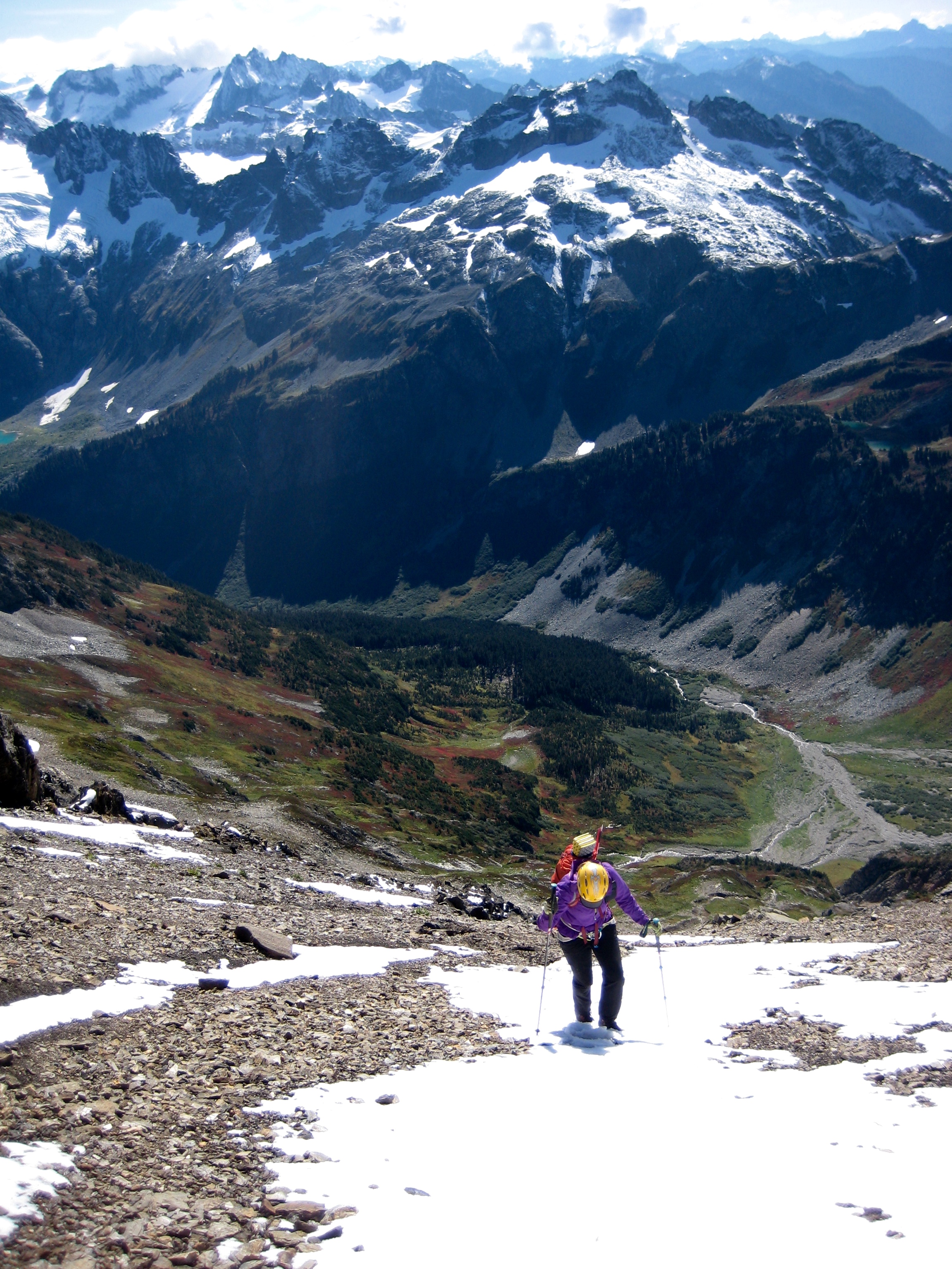
We hiked up to Cascade Pass (1.9 hours + 1750 feet from TH), then proceeded up the Ptarmigan Traverse path to Mix-up Arm. The erosion gully just below Mix-up Peak was still present—and still grungy—but not terribly difficult to cross, even with fresh snow.
- Eileen Hiking Out Of Mix-up Gully
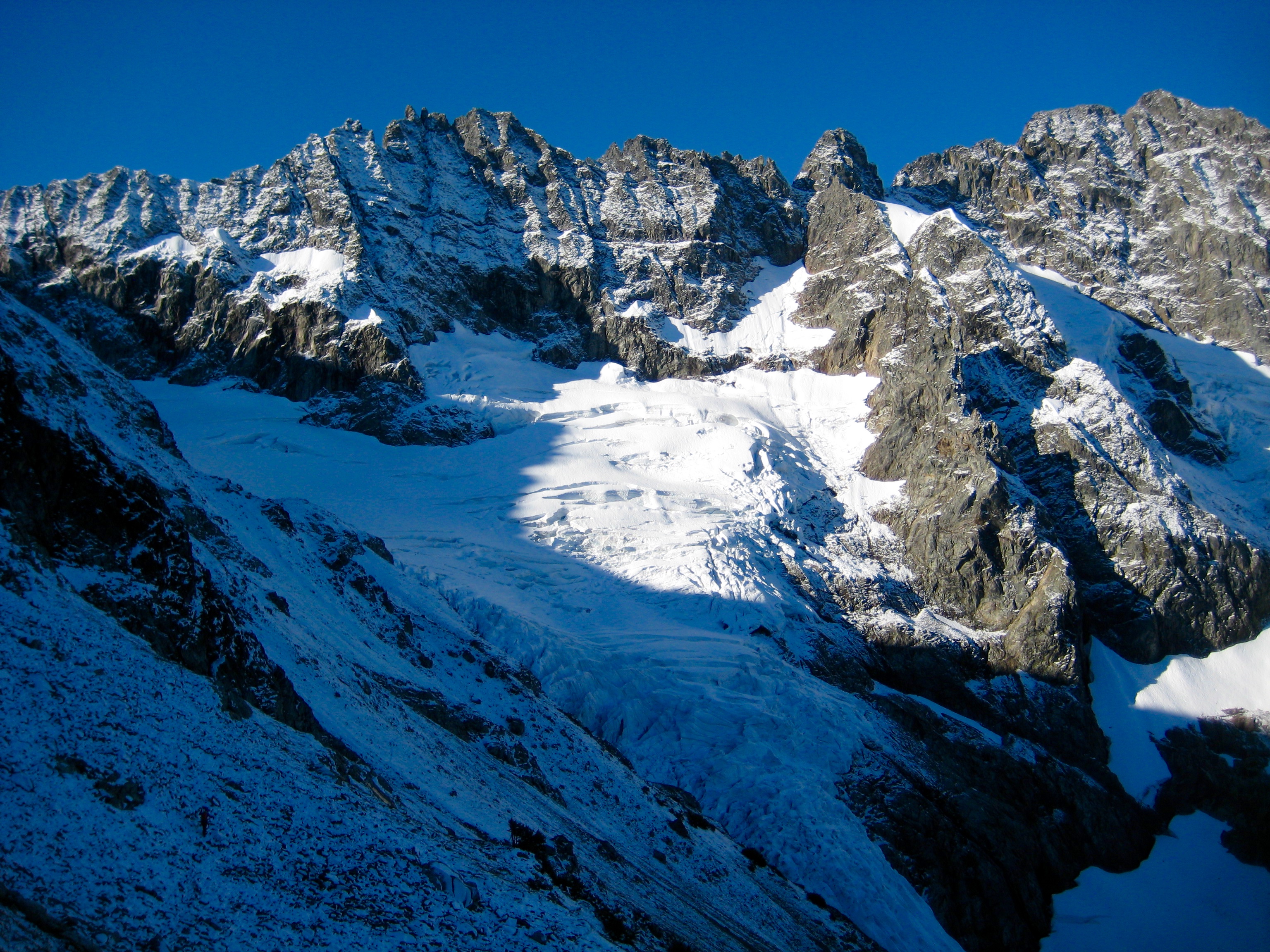
The layer of fresh snow on the Cache Glacier barely covered the ice, so we used crampons on the climb up.
- Cache Glacier From Mix-up Arm
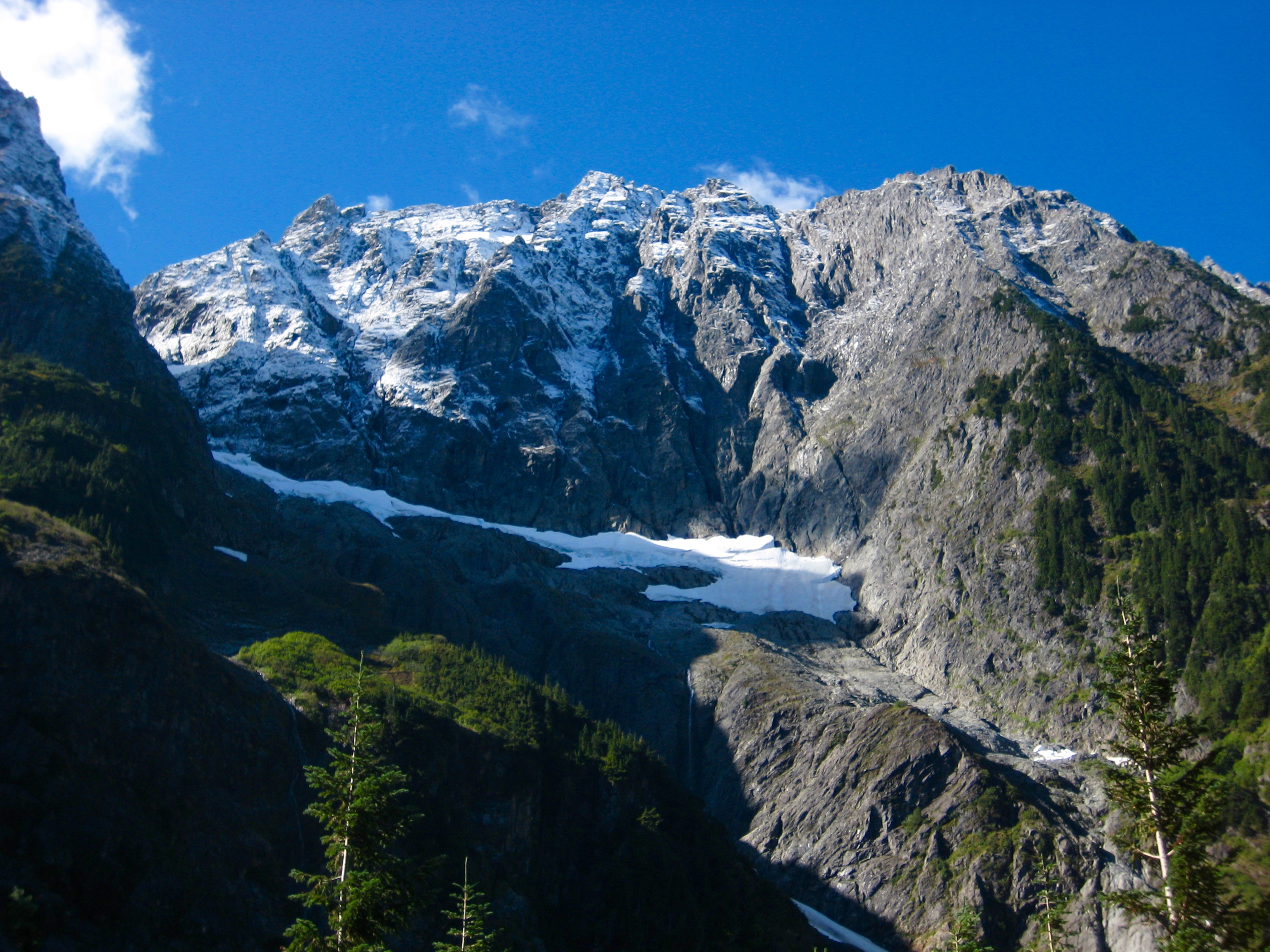
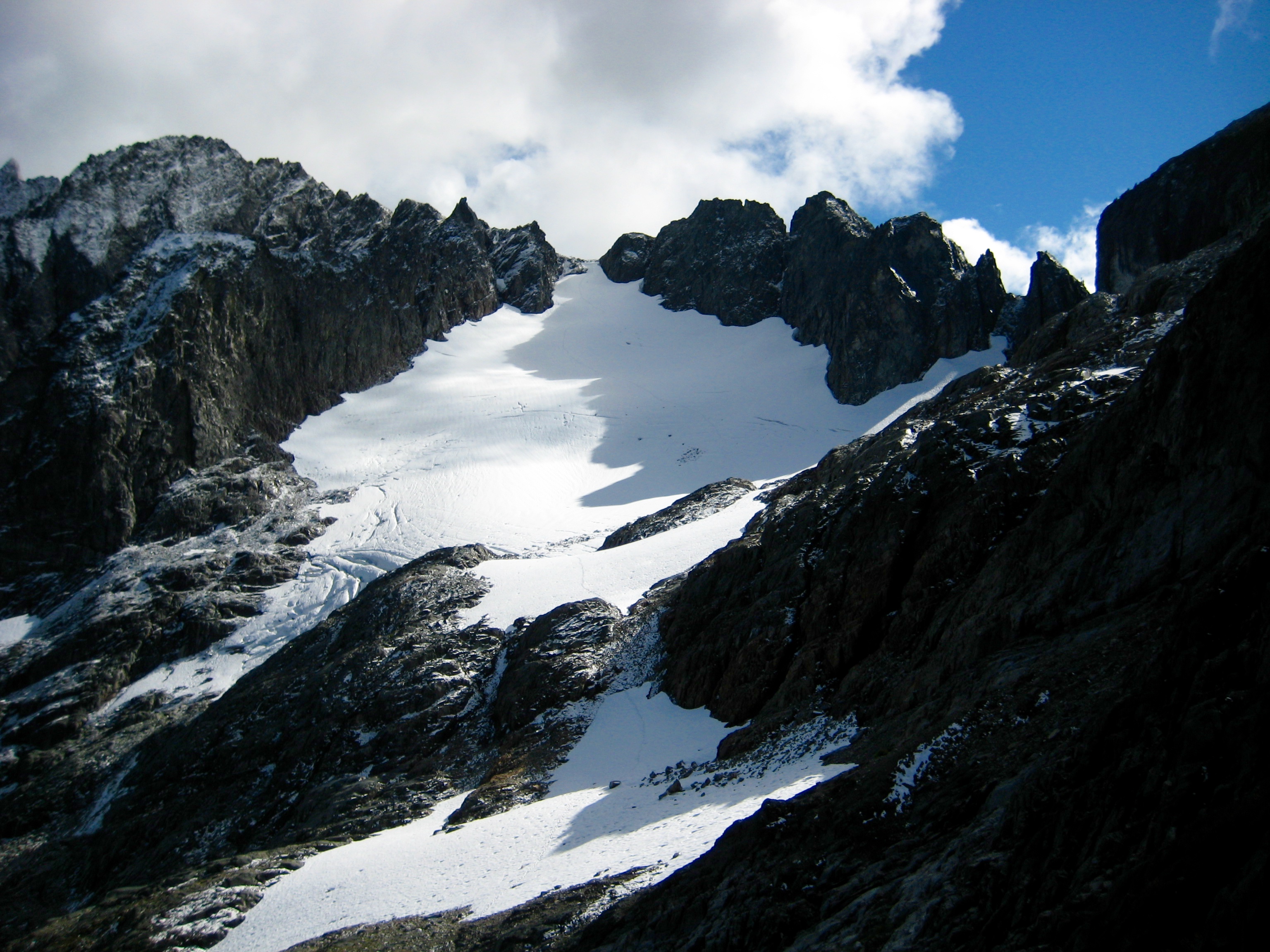
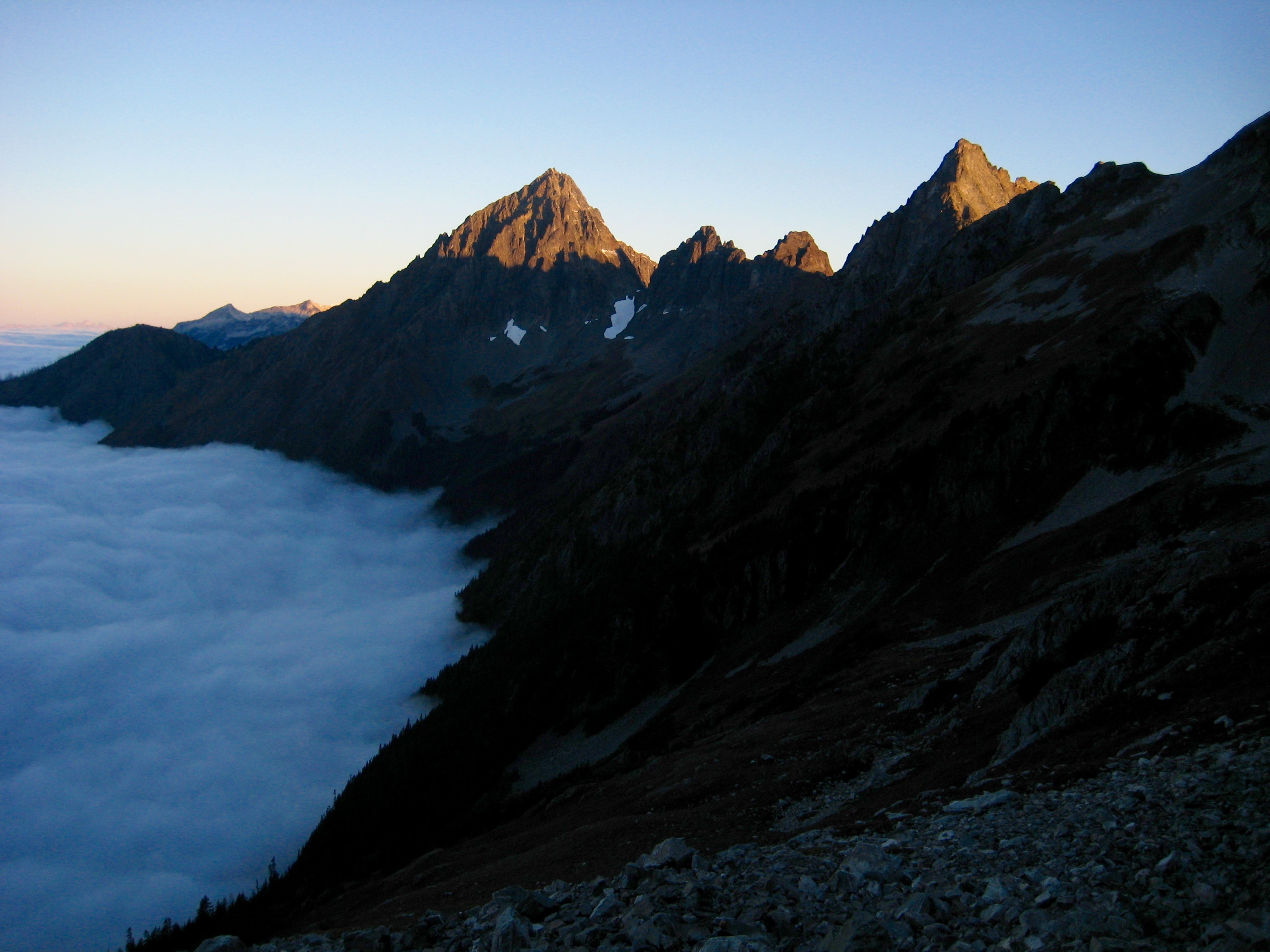
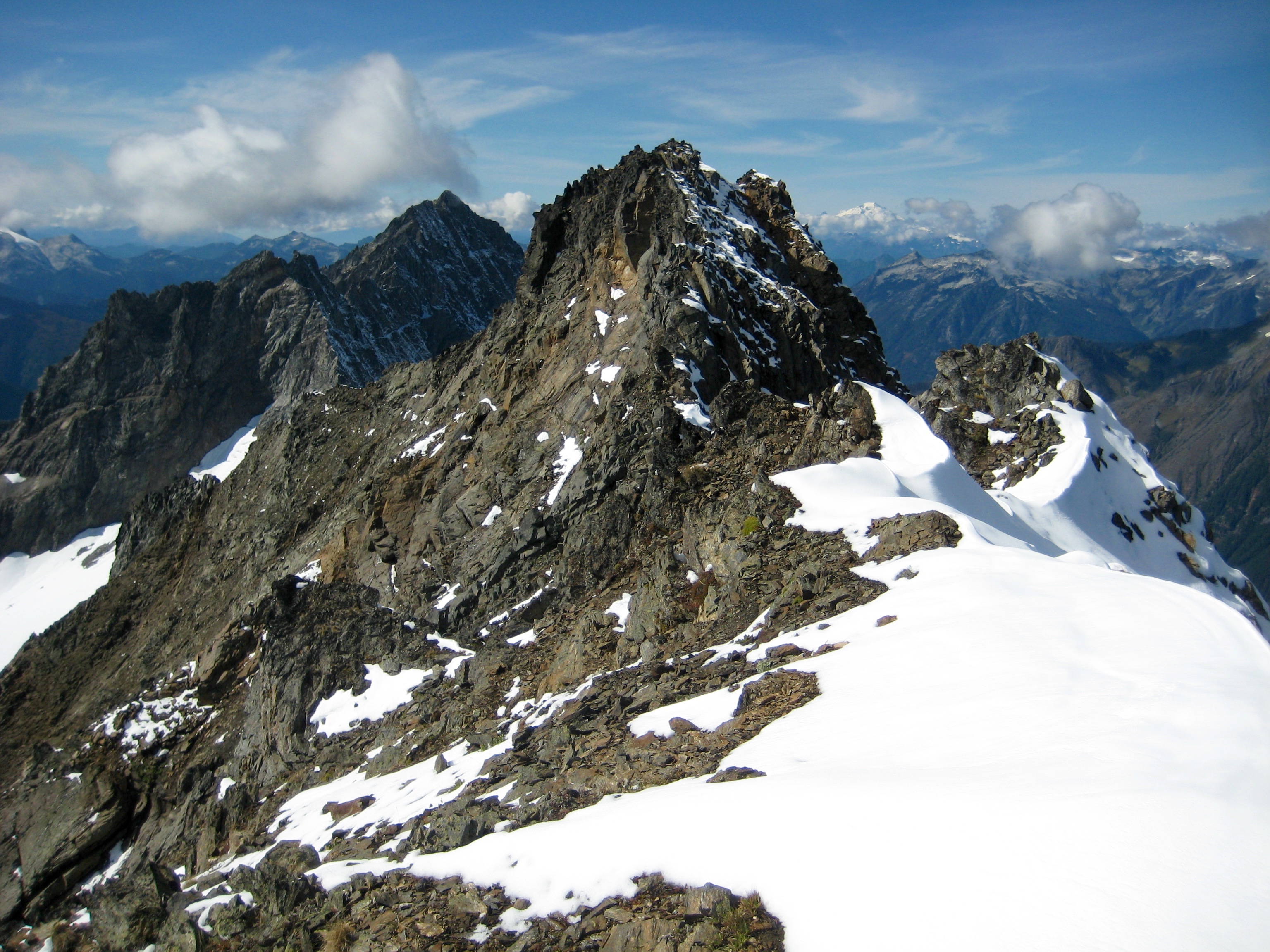
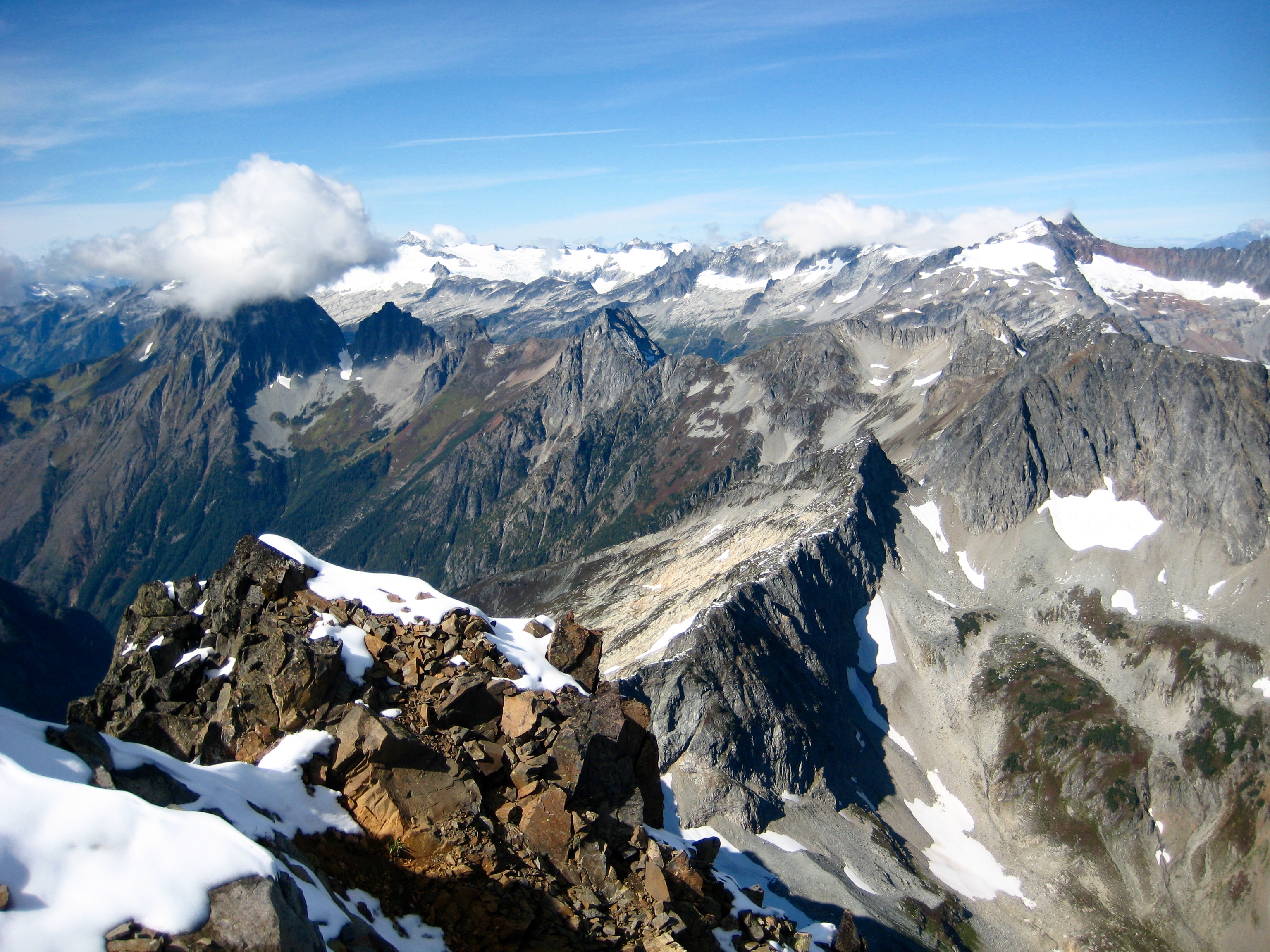
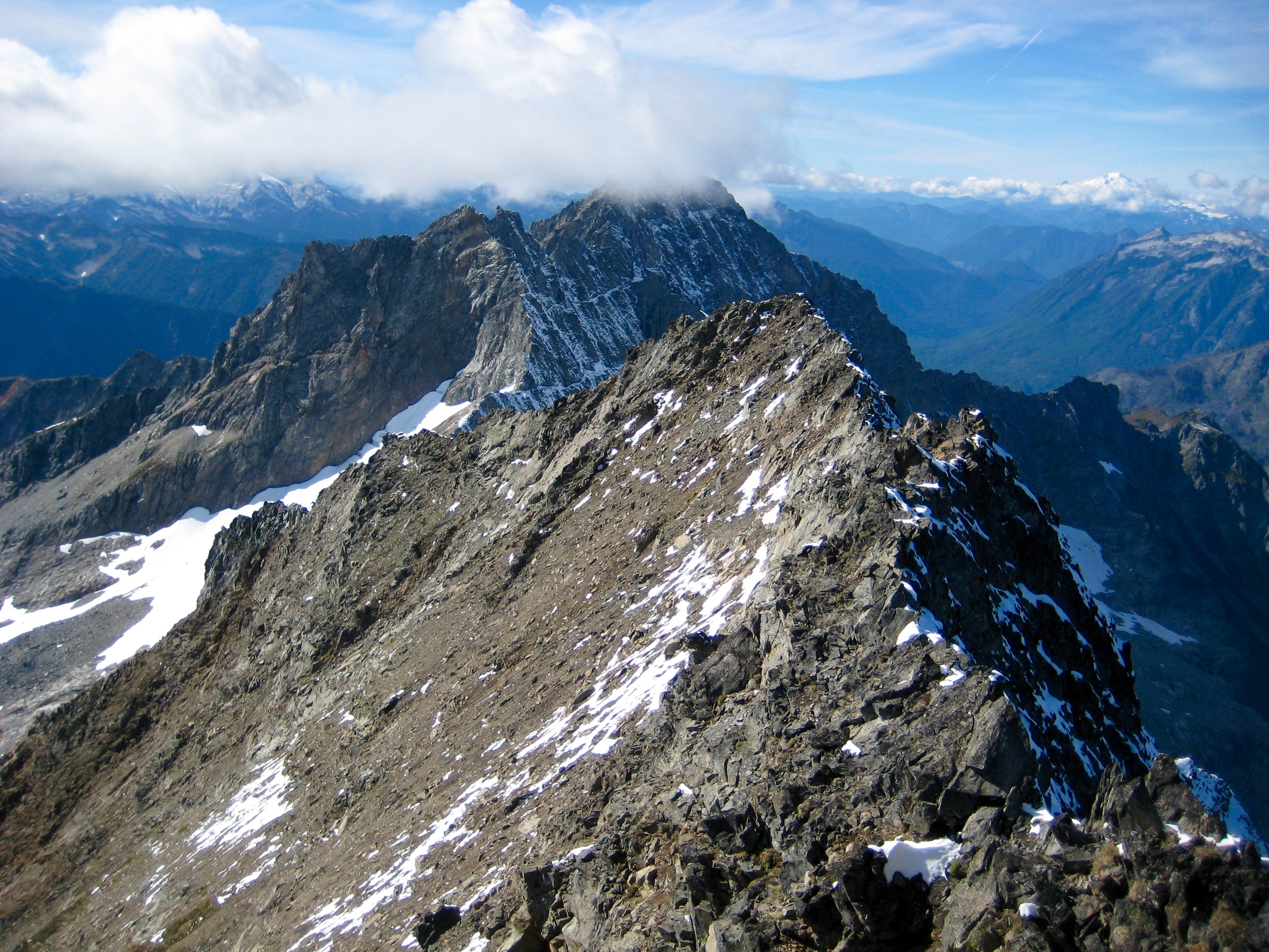
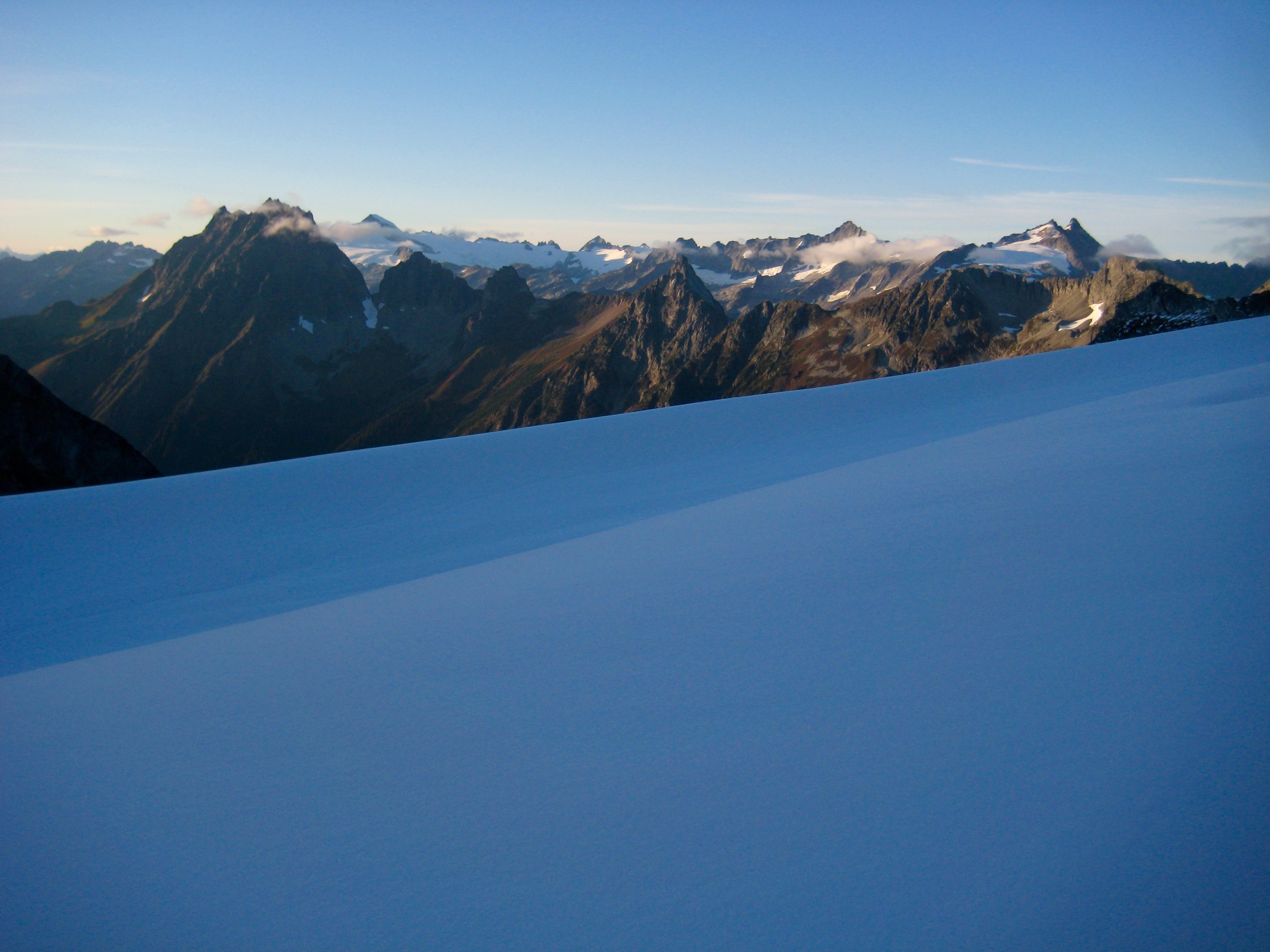
We gained Cache Col in late afternoon (5.2 hours + 3550 feet from TH). To the south, Spider Mountain and Mt. Formidable were shrouded in residual clouds.
- Cloud-Shrouded Peaks From Cache Col
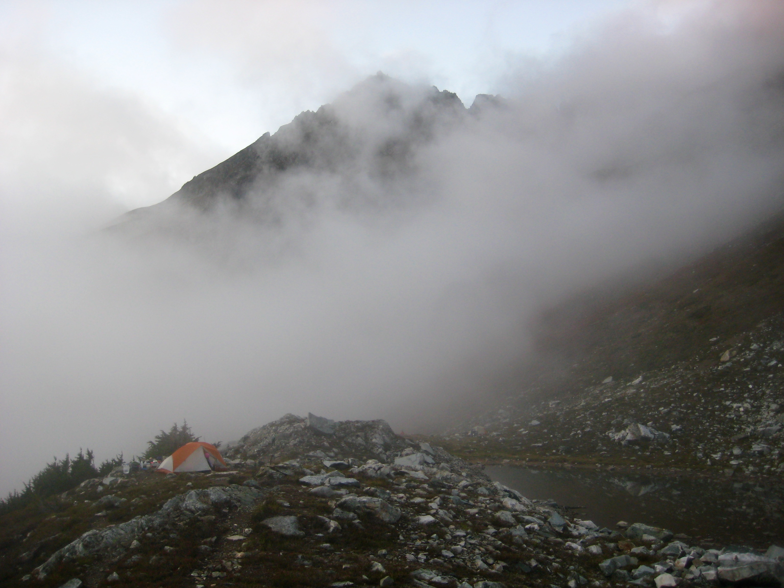
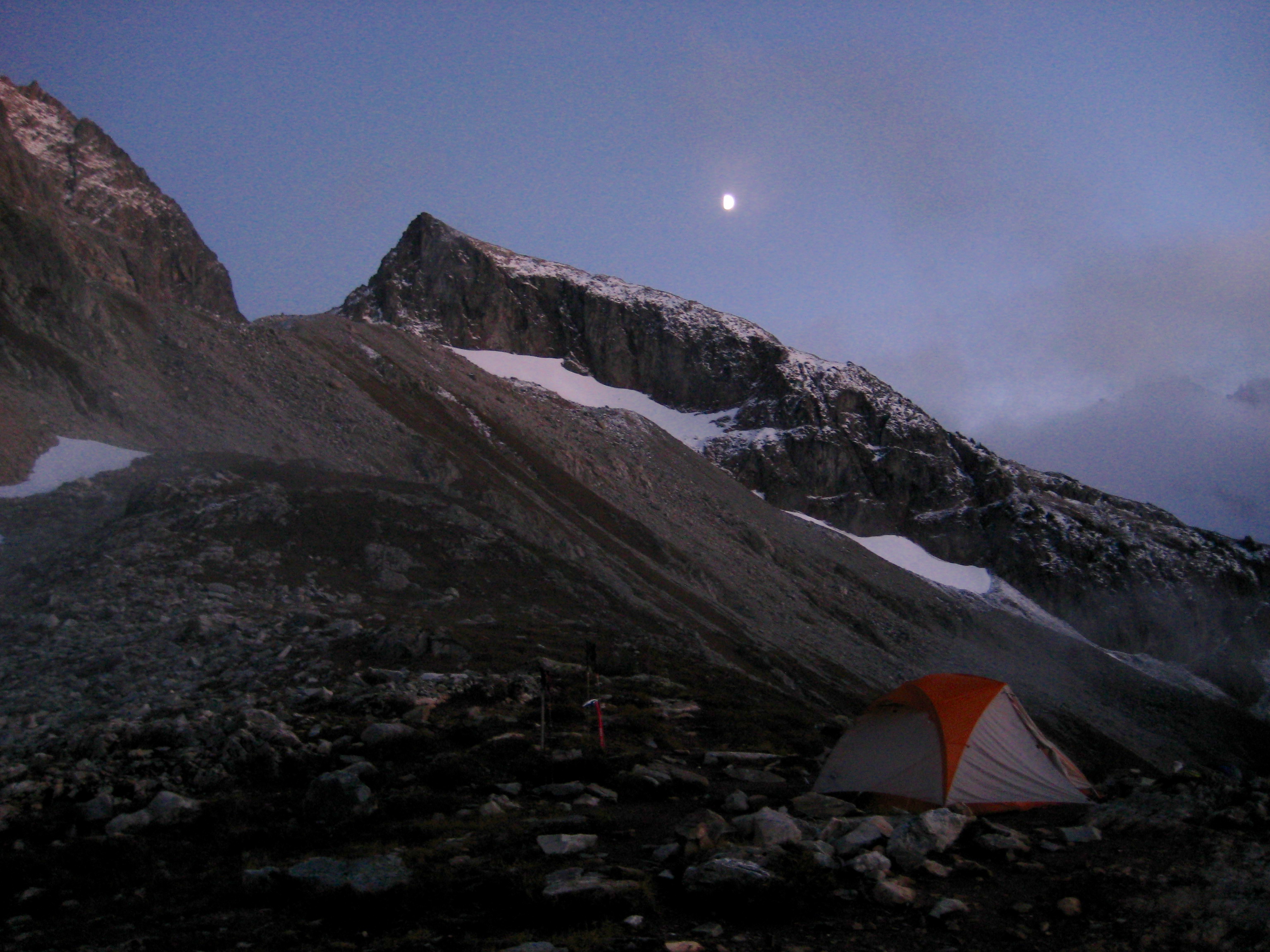
We descended to Kool-Aid Lake, arriving just before 6:30pm (6.9 hours from TH), and set up our tent on a bench above the lake. Cold fog wafted up from the valley.
- Foggy Camp At Kool-Aid Lake
There was one other tent already pitched nearby, and three people appeared shortly after we arrived. I walked over to chat with them before dinner. It turned out that one of the campers was Liz Schermer, a geology professor from Western Washington University. We exchanged the WWU Geology Department secret handshake, then Liz explained that she was doing geological research in hopes of clearing up some remaining mysteries regarding the North Cascades. This was a follow-on to Ned Brown’s lifetime of geological work.
Liz’s two companions (a student and a friend) were helping her gather and carry out rock samples from here, and several other students were camped on the south side of the Spider-Formidable Col to collect rock samples from there. (Not-so-funny geology joke: “If your backpack weighs more on the hike out than on the hike in, you might be a geologist.”)
When I stated that Eileen and I were attempting Spider Mountain the next day, Liz mentioned that she had tried to climb it some years ago but turned back due to awful loose rock. Hmmm…that wasn’t exactly the endorsement I was hoping for.
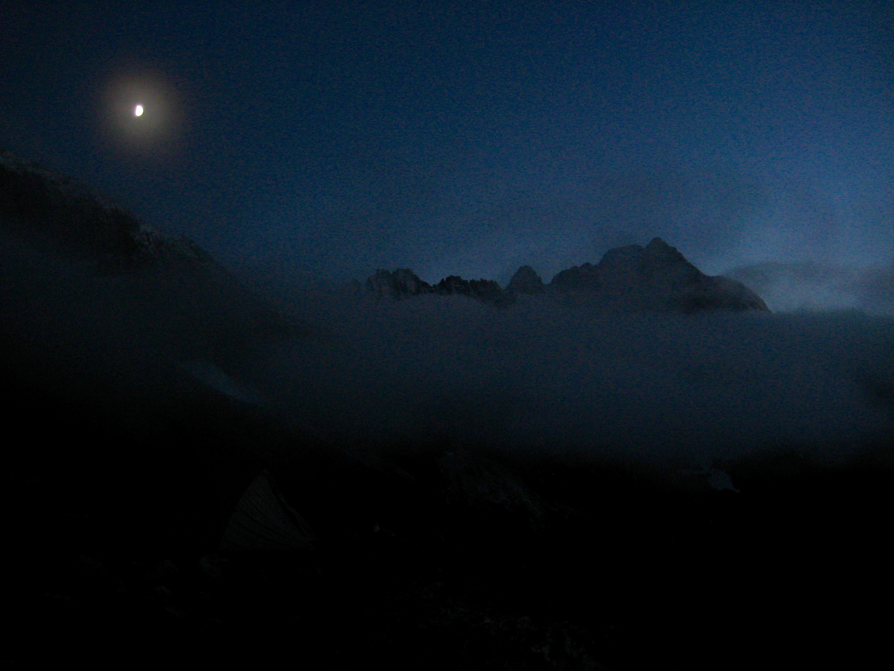
While eating dinner later in the evening, Eileen and I watched as the sky gradually cleared and a gibbous moon rose over Art’s Knoll and Mt. Formidable. We took this as an auspicious sign for tomorrow. We needed it.
- Moon Over Arts Knoll
- Moon Over Mt Formidable
Day 2: Spider Mtn Summit Climb
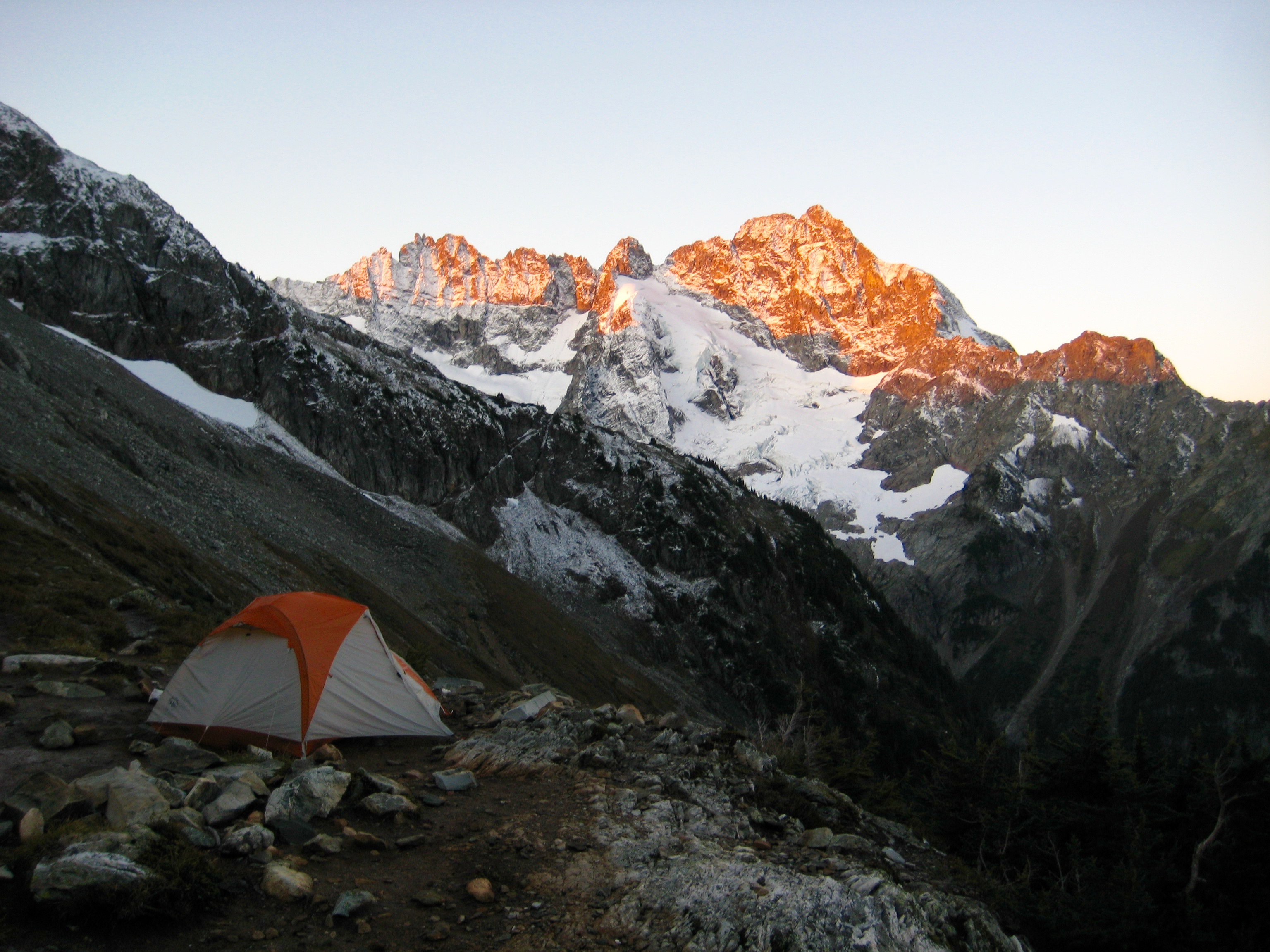
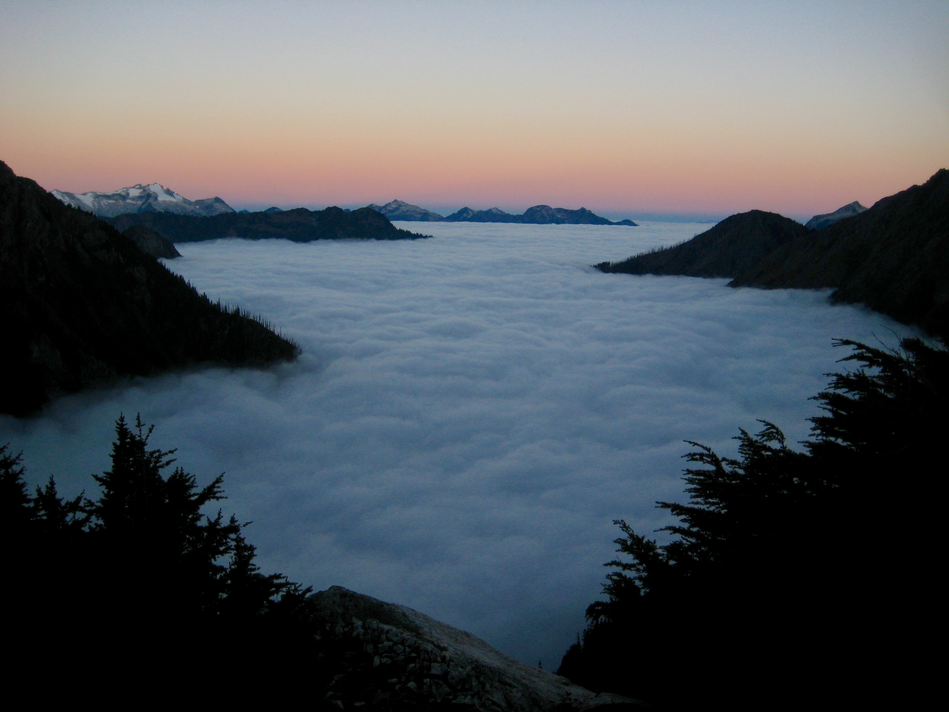
After a clear, cold, and calm night, we awoke at 5:30am to ice on our tent fly. The ground was frozen solid, and fog filled the valleys below.
- Morning Fog In Middle Cascade River Valley
- Morning Alpenglow On Mt Formidable
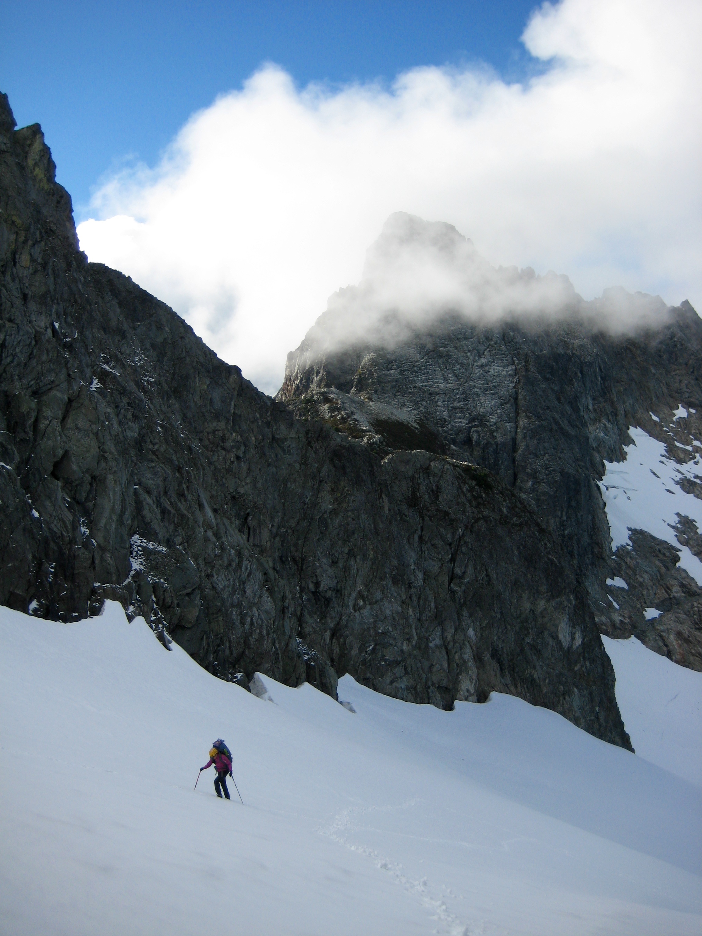
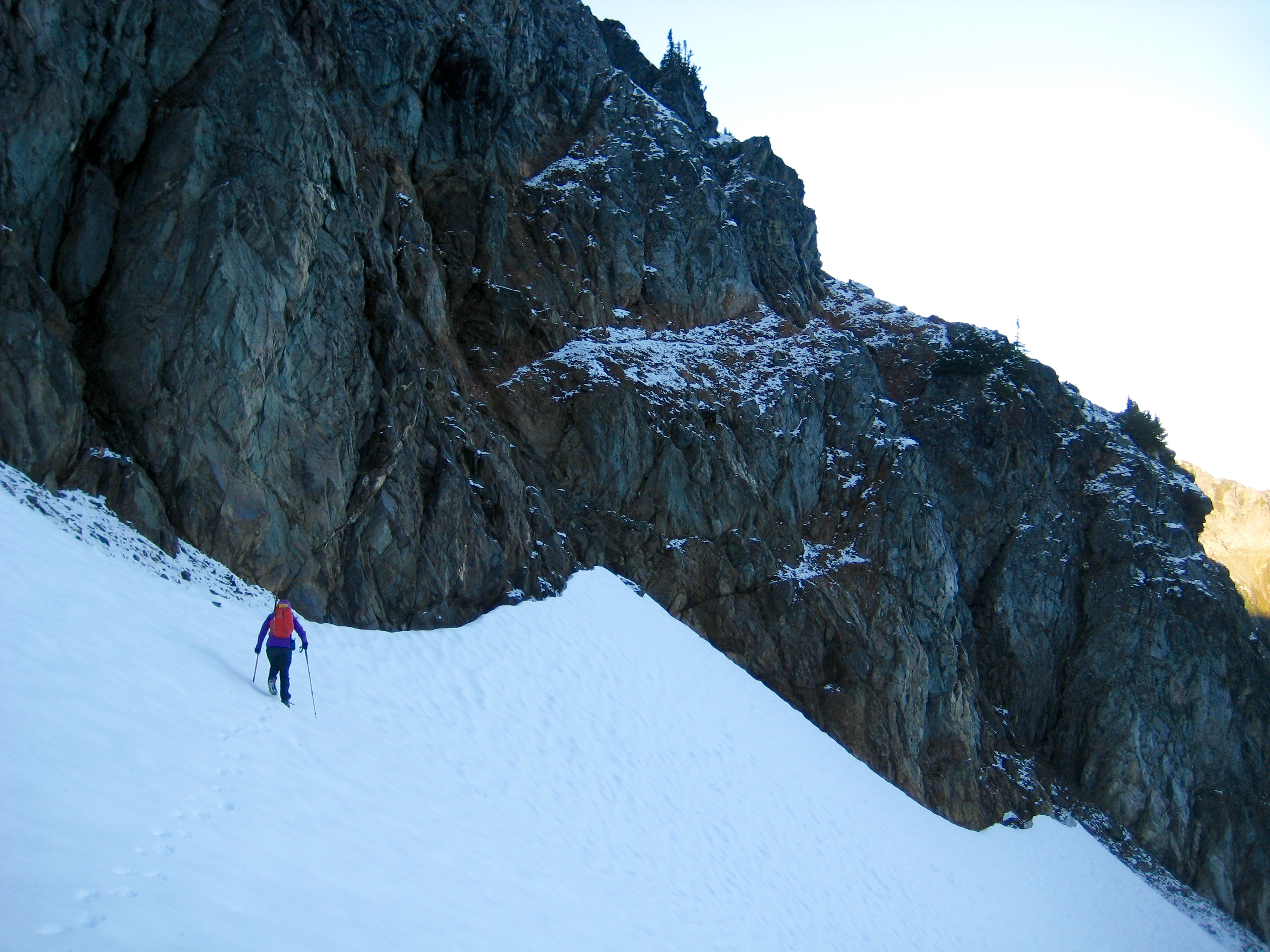
We left camp at 6:45am and headed south on the Ptarmigan Traverse path. Crossing the infamous Red Ledge was a bit spicy due to the open moat, fresh snow, and patchy verglas, but the path beyond was easy to follow.
- Eileen Crossing Snow To Red Ledge
- Hiking Around Arts Knoll
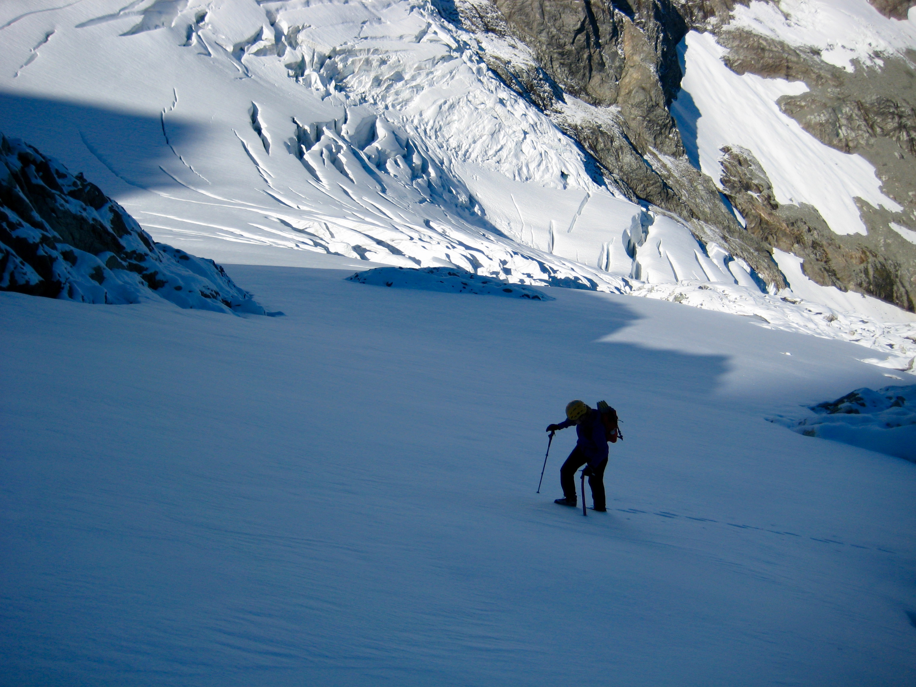
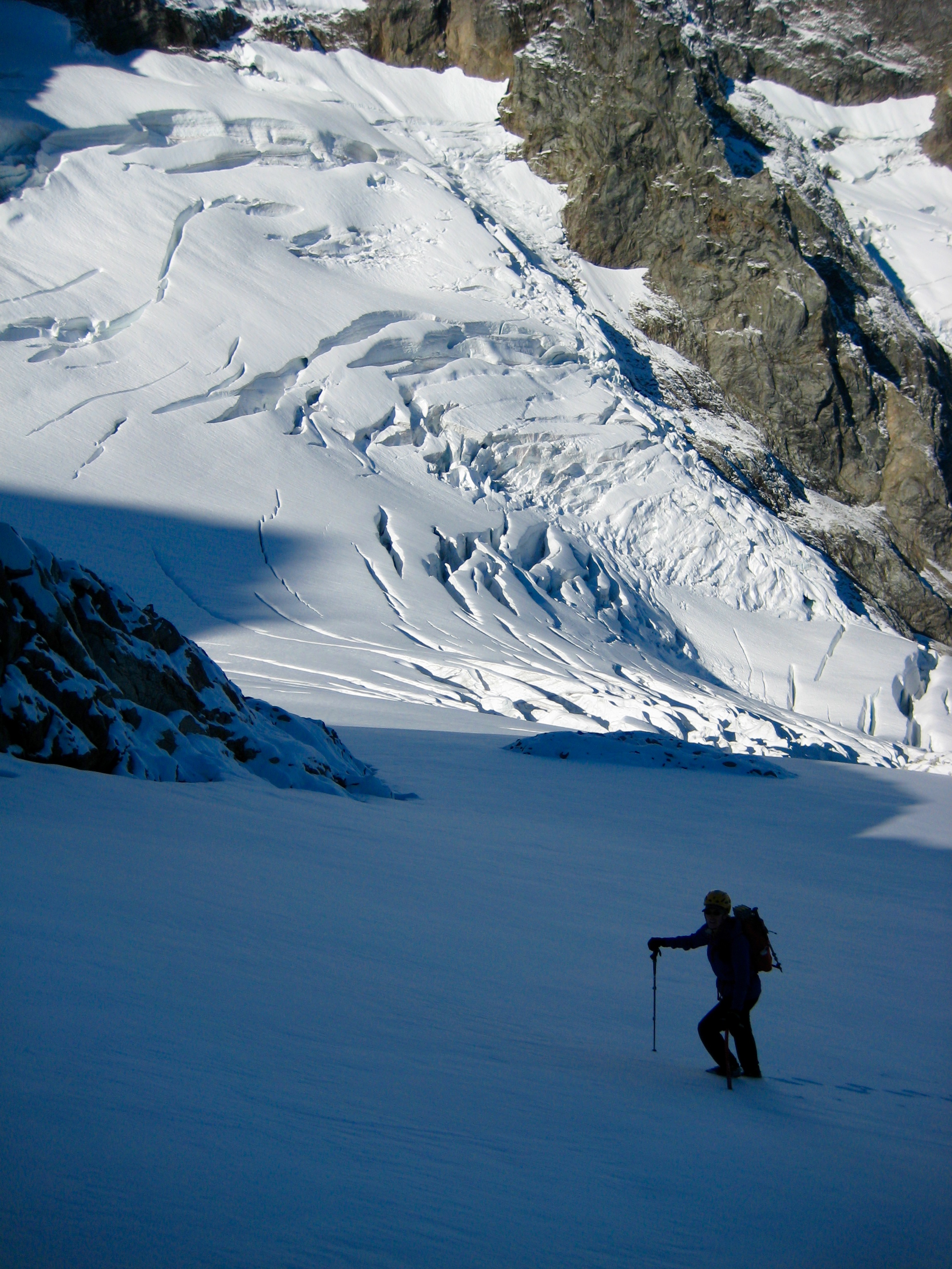
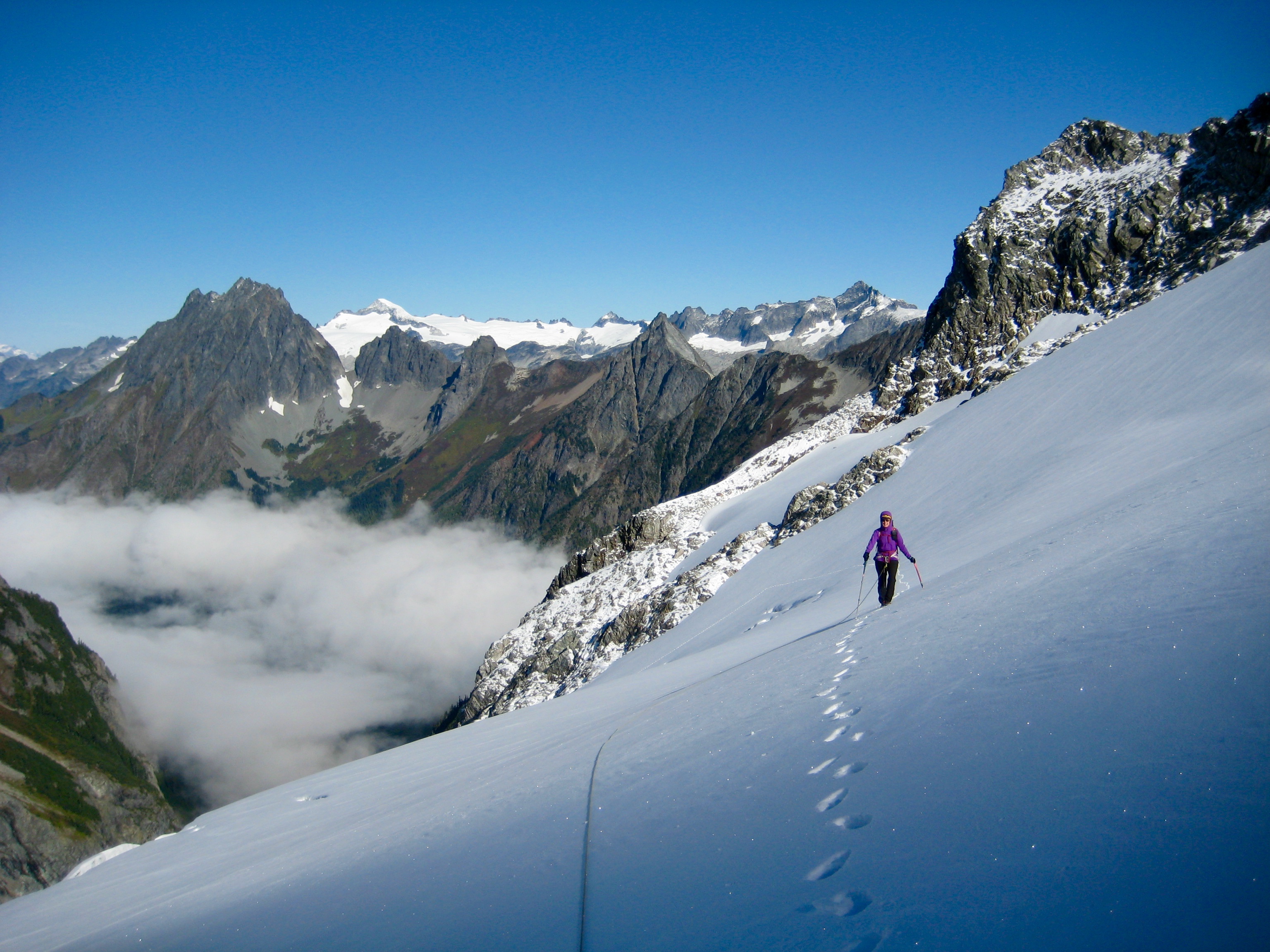
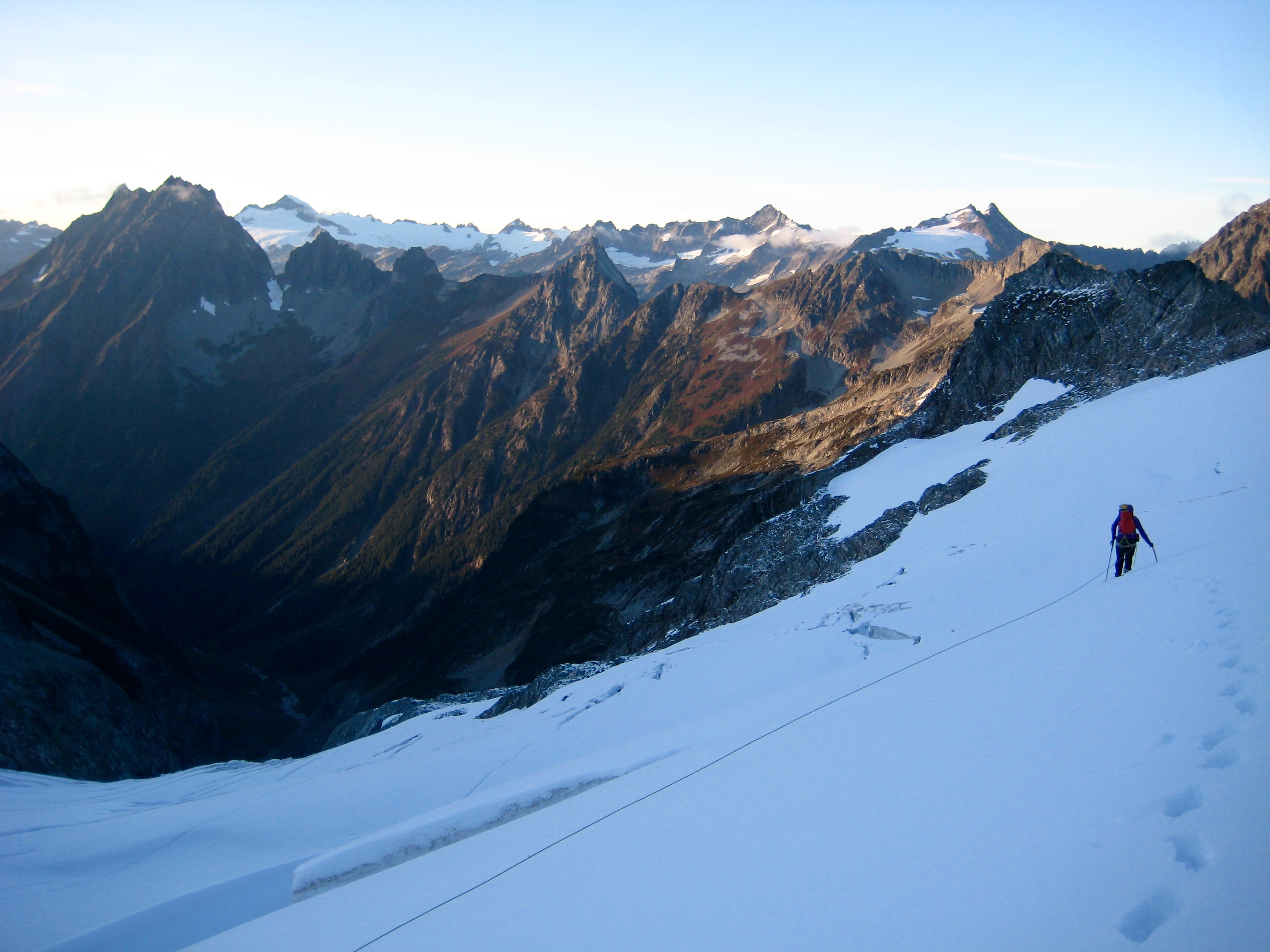
We roped up at the bottom of the Middle Cascade Glacier. The 6 inches of crusty snow that covered the glacial ice provided good traction, so we simply booted up; crampons were not needed.
- Climbing Middle Cascade Glacier
- Eileen High On Middle Cascade Glacier
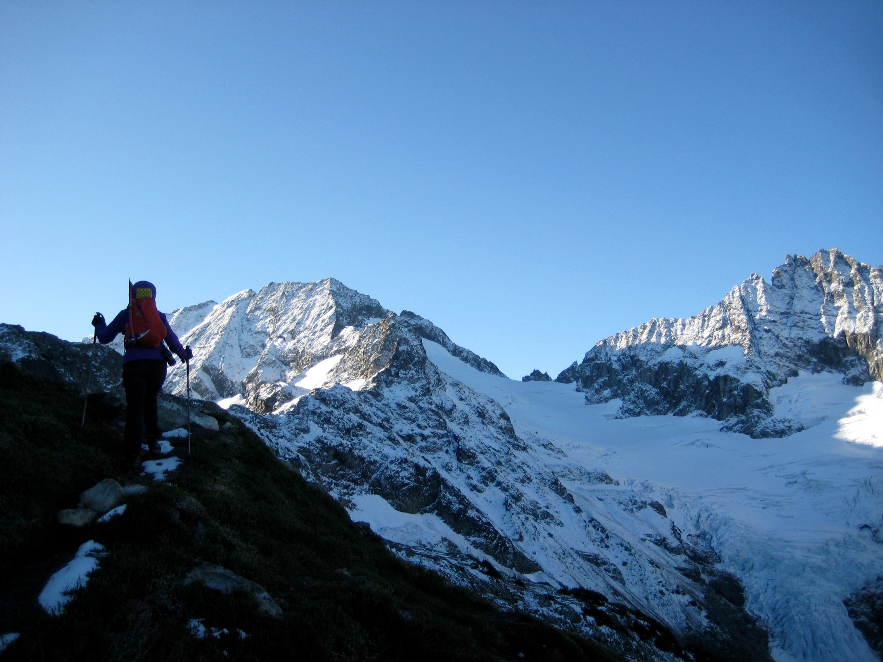
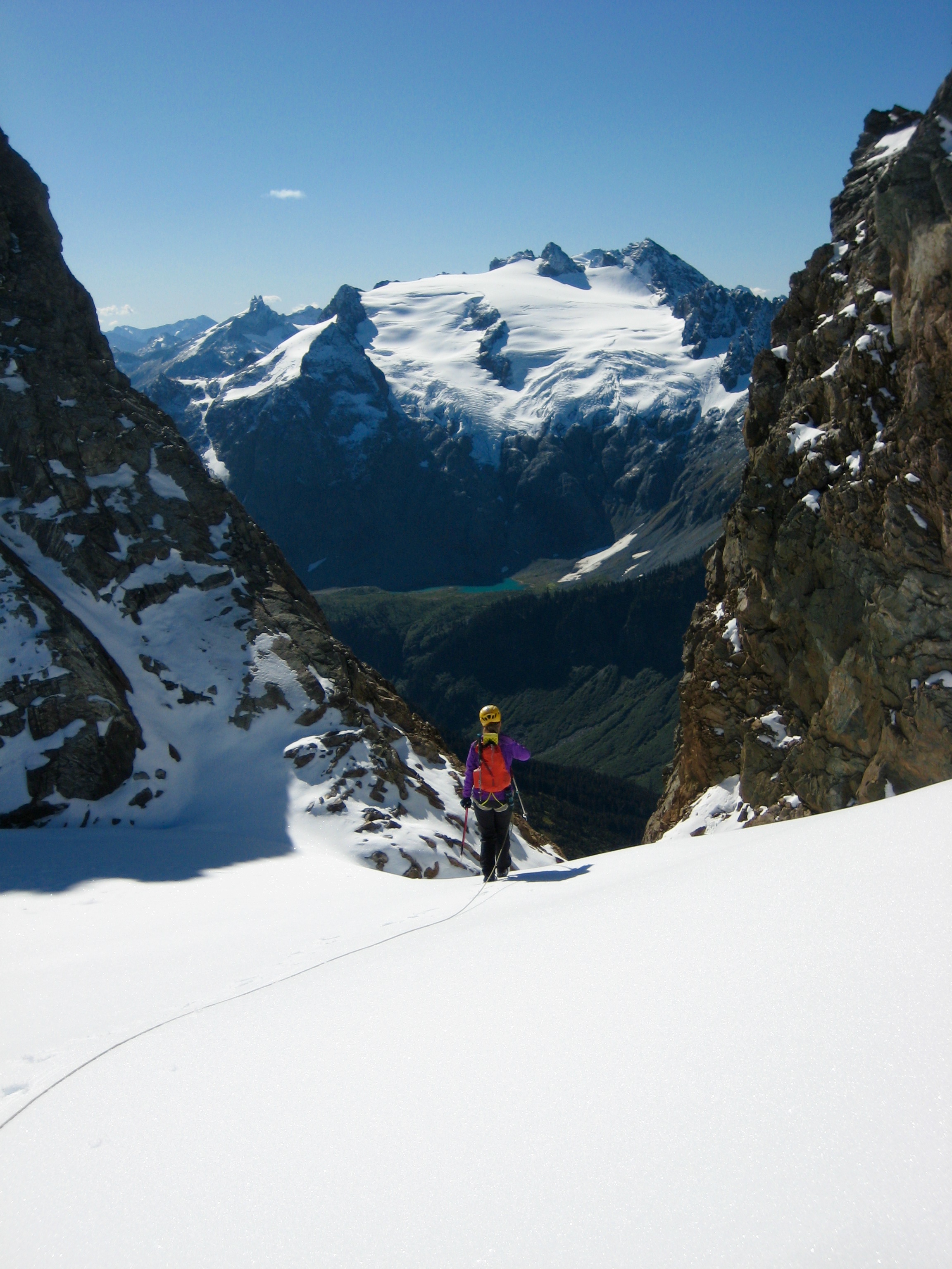
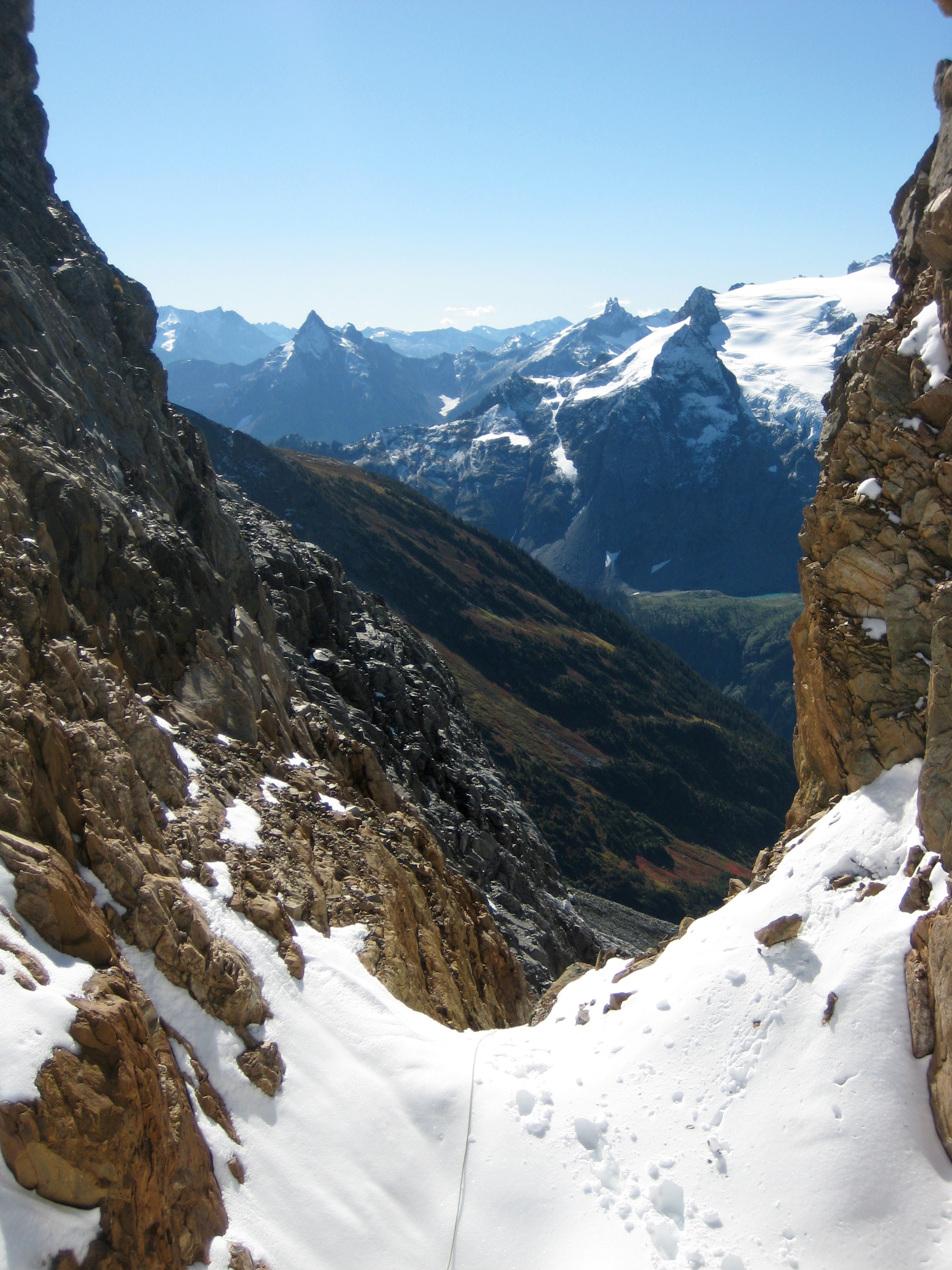
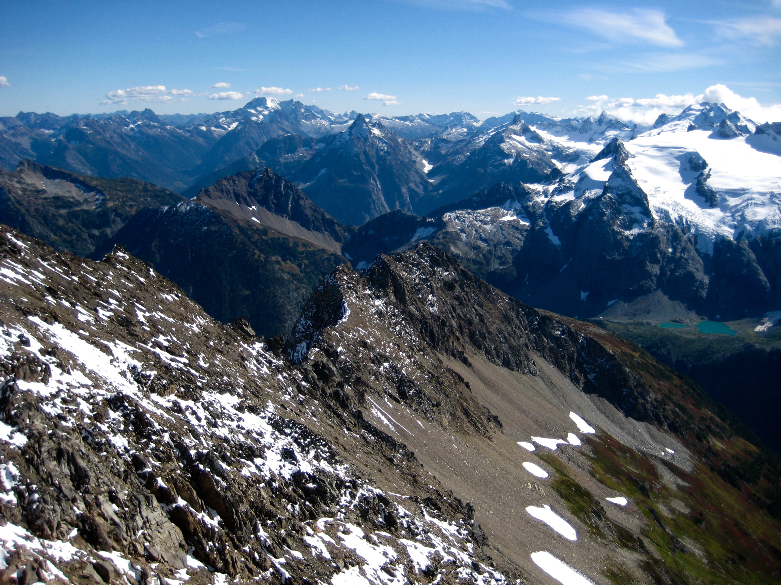
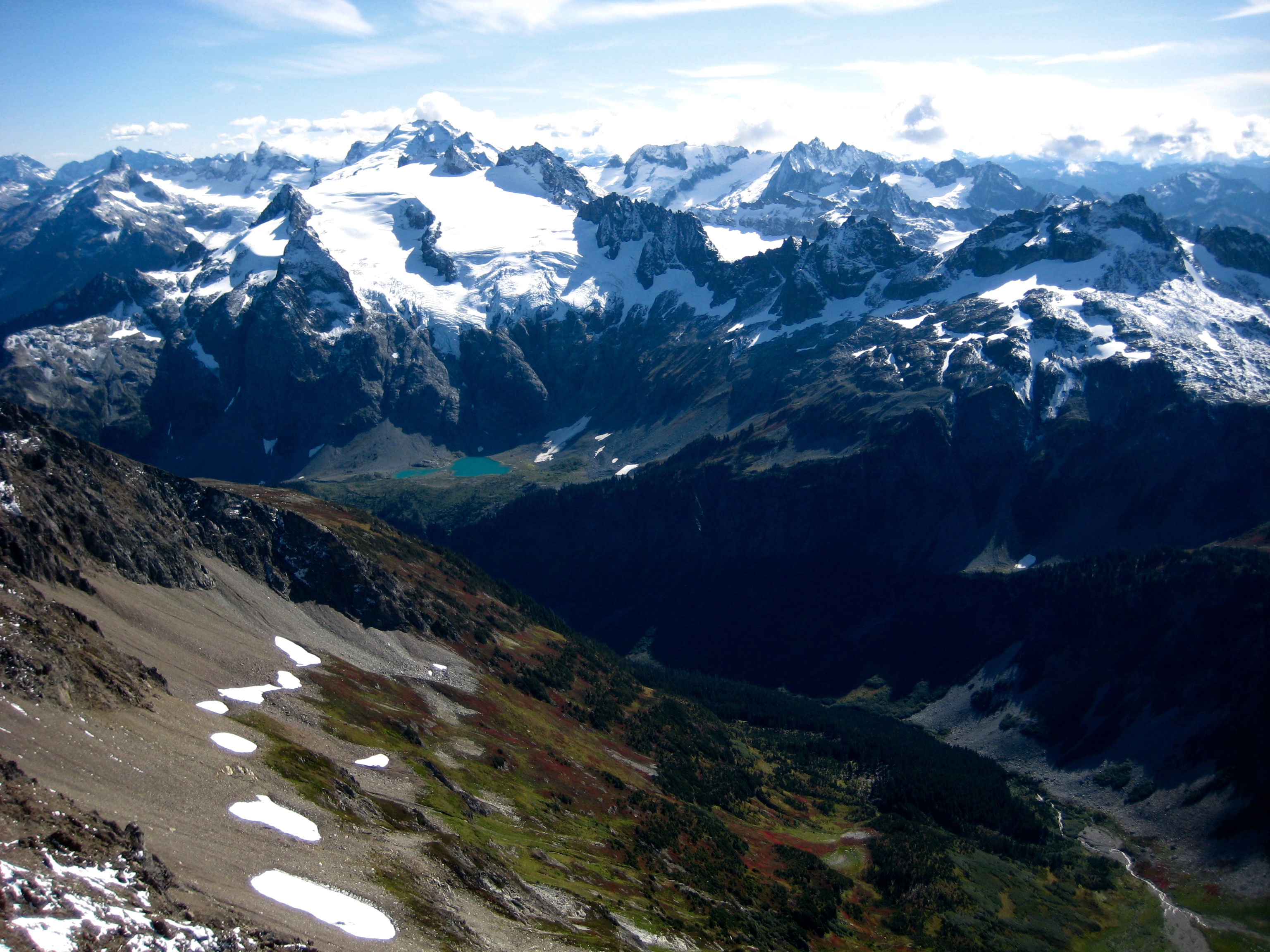
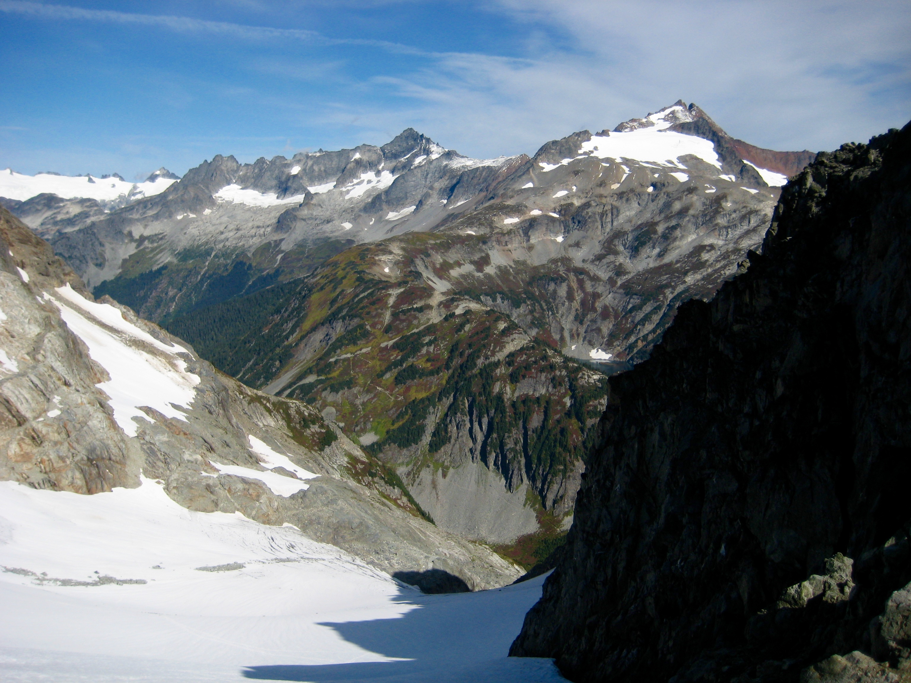
It was nearly 11:00am when we reached the Spider-Formidable Col (4.2 hours + 1900 feet from camp). This was later than we’d hoped. To the south, fresh snow on the LeConte Glacier—topped by Old Guard Peak and Sentinel Peak—glistened in the mid-day sun.

- Le Conte Glacier From Spider-Form Col
We carefully descended from the col by slithering down the shallow moat adjacent to the steep snow finger. The WWU geology students’ tent was visible on a rocky bench closely west of us.
- Snow Finger Below Spider-Form Col
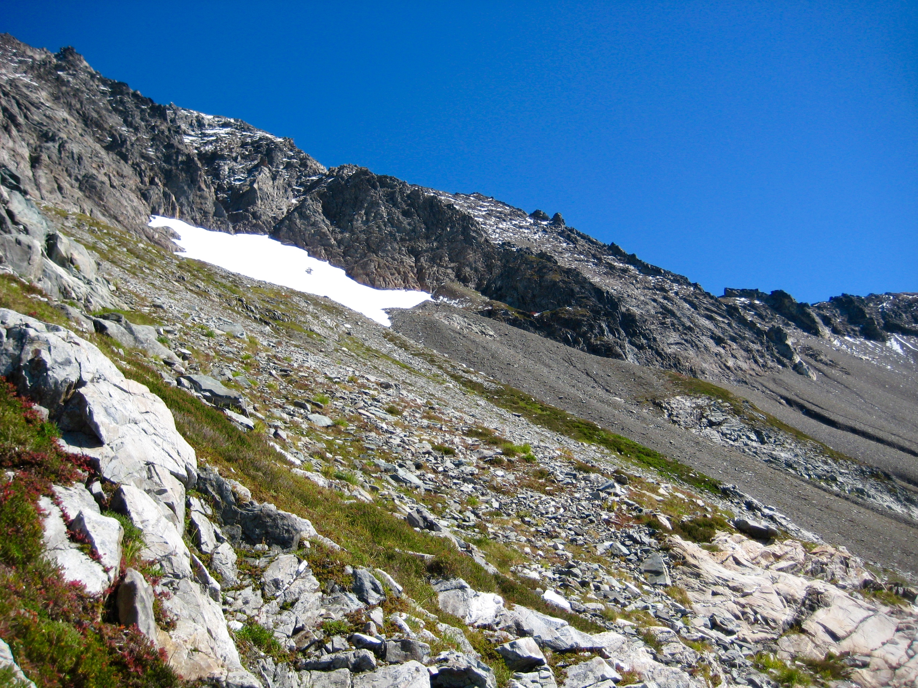
Our climbing route took us eastward across a broad slope of dirt, scree, and talus. Several erosion runnels created annoying obstacles along the way as we angled up toward the base of a prominent buttress that bisects the south face of Spider Mountain.
- Traversing Below South Face Of Spider Mtn Toward Central Buttress
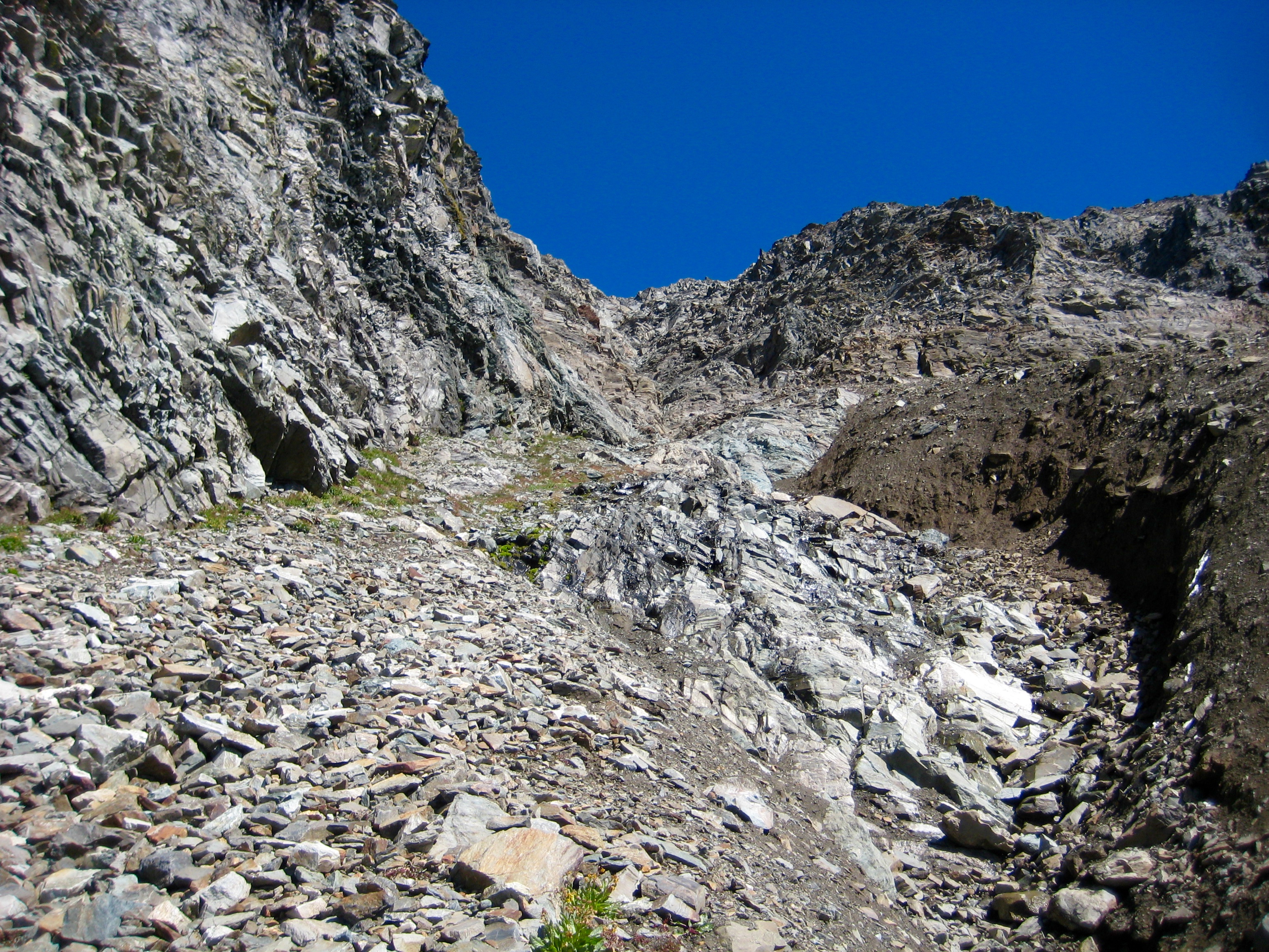
The standard climbing route up Spider Mountain follows a large gully immediately right (east) of the central buttress. This key gully can be readily identified by a deep, ugly erosion runnel that spews from the gully’s mouth. Fortunately, there is a talus ramp that leads upward and into the gully, so it is not necessary to cross the runnel.
- Looking Up Southeast Gully From Bottom
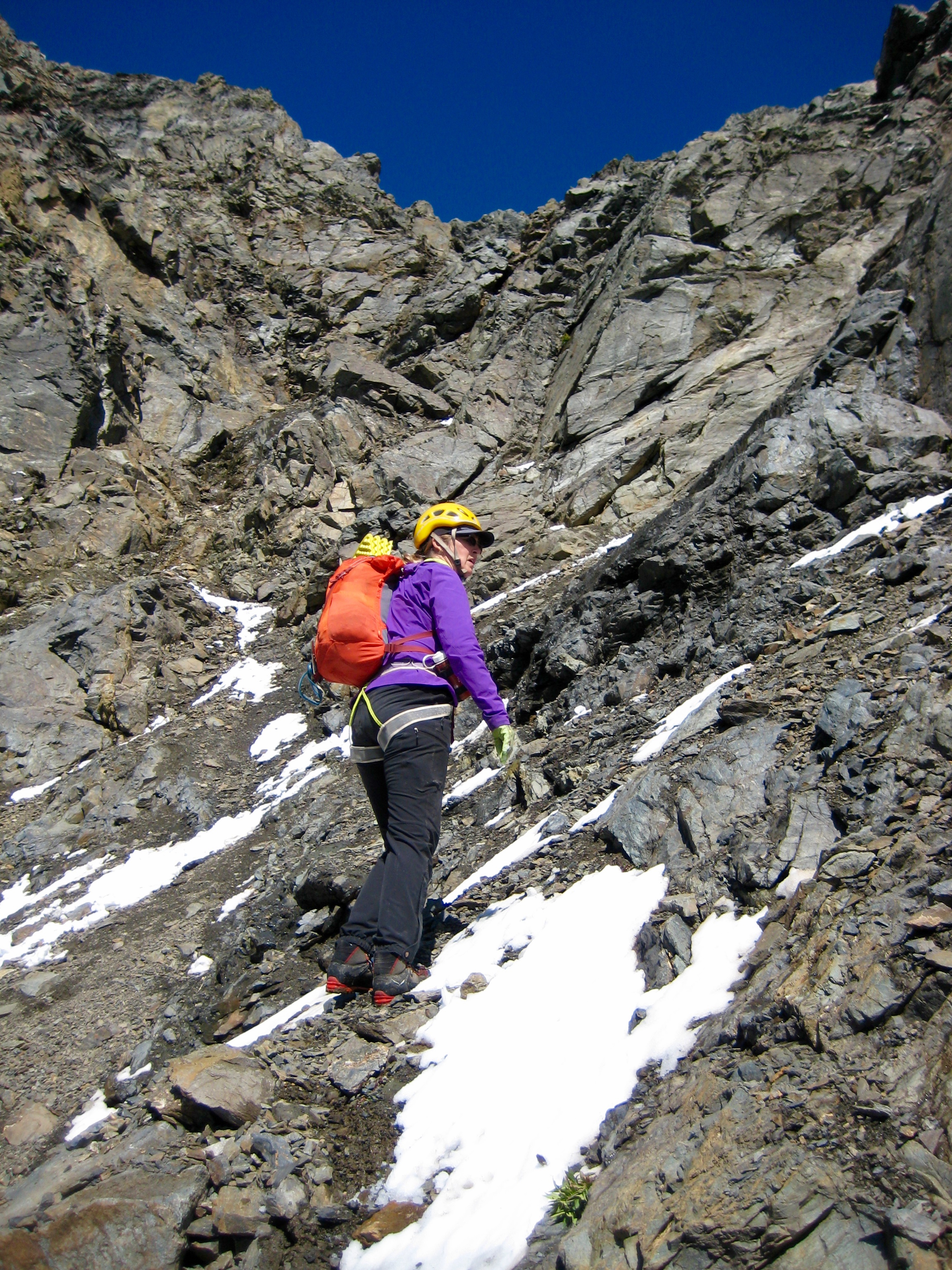
We started up the gully at 12:40pm (6.0 hours + 2300 feet from camp) and quickly discovered why this route has such a bad reputation: the gully is very narrow, fairly steep, and heavily choked with loose rocks. Because the early-season snow ribbon was now completely melted out, small Class 3 steps were exposed at irregular intervals, and most of these steps had water seeping over them.
Our progress up the gully was painstakingly slow as we climbed carefully and tried to avoid dislodging rocks on ourselves. Honestly, it wan’t the worst gully we’d ever climbed; we have been in many other gullies that were just as bad. What makes this one special is the distance—a full 800 vertical feet from bottom to top. For this reason, the route is not so much a test of one’s scrambling ability as it is a test of one’s mental tolerance for dealing with incessantly loose rock in a confined environment. Just imagine walking up a steep bowling alley.
- Eileen High In Southeast Gully
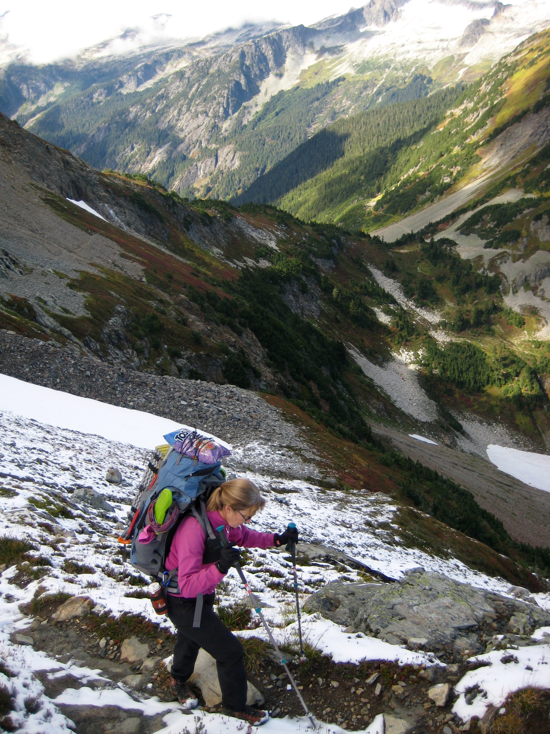
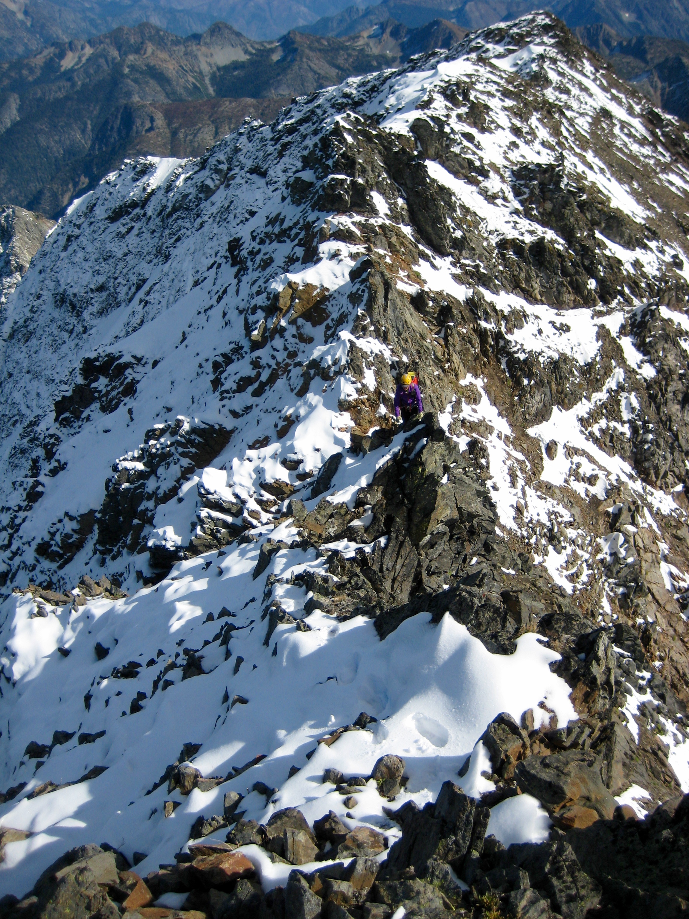
Our beta from Fred, Fay, and Paul indicated that it is desirable to exit the gully as soon as feasible—either to the buttress on the left or to the rib on the right. However, we never saw a favorable exit point until we were two-thirds of the way up the gully and feeling quite frazzled. At that point, we clawed our way out to the rib on the right. The crest of this rib is a wide, moderately inclined scree slope. Ascending the loose scree was exhausting, but at least we were out of the bowling alley. As if on cue, a volley of spontaneous rockfall crashed down our gully. Gulp!
- Eileen Approaching Summit Ridge
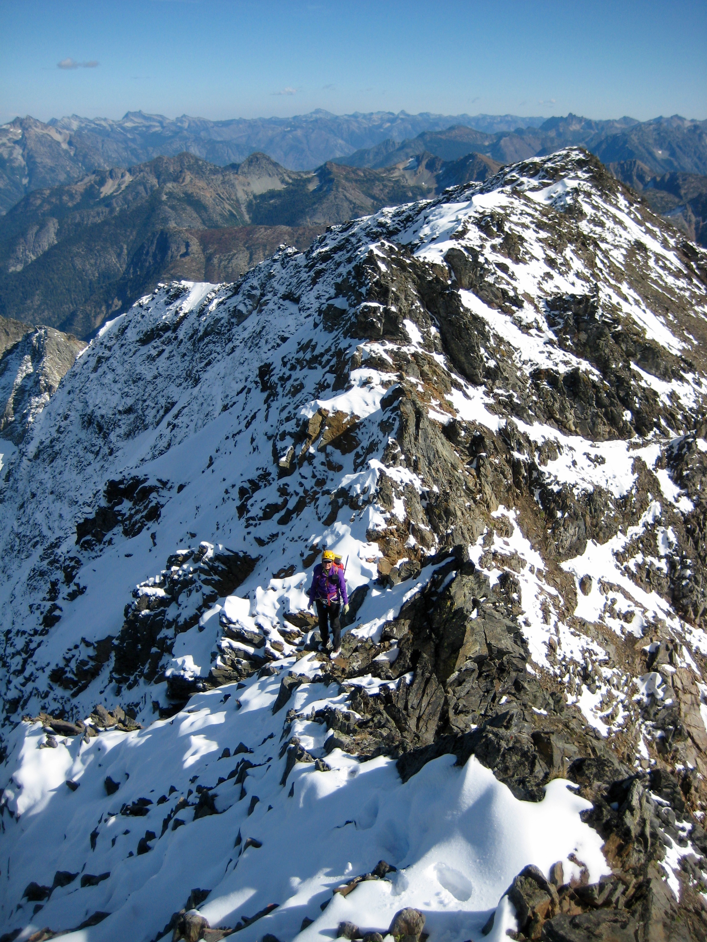
We eventually reached the summit ridge and then turned left (west) and followed the snowy crest. In a short distance, I stepped onto a high knob that appeared to be the summit. Success! But my feeling of exultation was instantly dashed when I saw a higher pinnacle of rock farther to the west. With fresh snow covering the steep rock, the pinnacle looked nearly impossible to climb. It was very discouraging. After coming this far, however, we were determined to finish the ascent.
- Spider Mtn Summit From Ridge Knob
We worked around the southern side of an intervening horn until able to gain a final notch below the summit block. From there, what initially looked like a difficult Class 4-5 climb turned out to be a fairly fun Class 3 scramble.
- Scrambling Up Summit Block
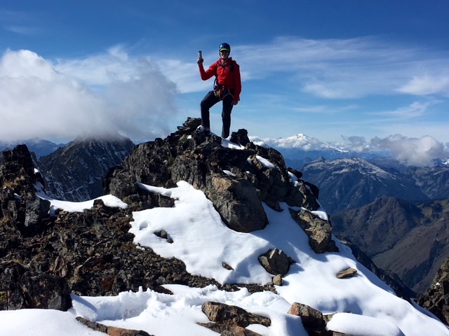
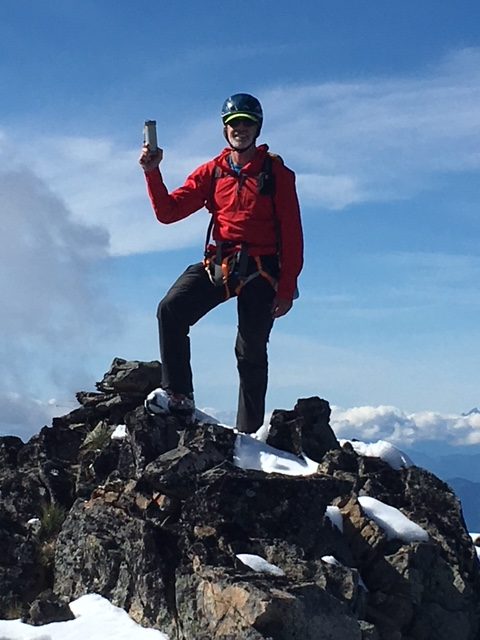
We stepped onto the tiny summit at 2:45pm (8.1 hours + 3500 feet from camp)
- Eileen On Spider Mtn Summit
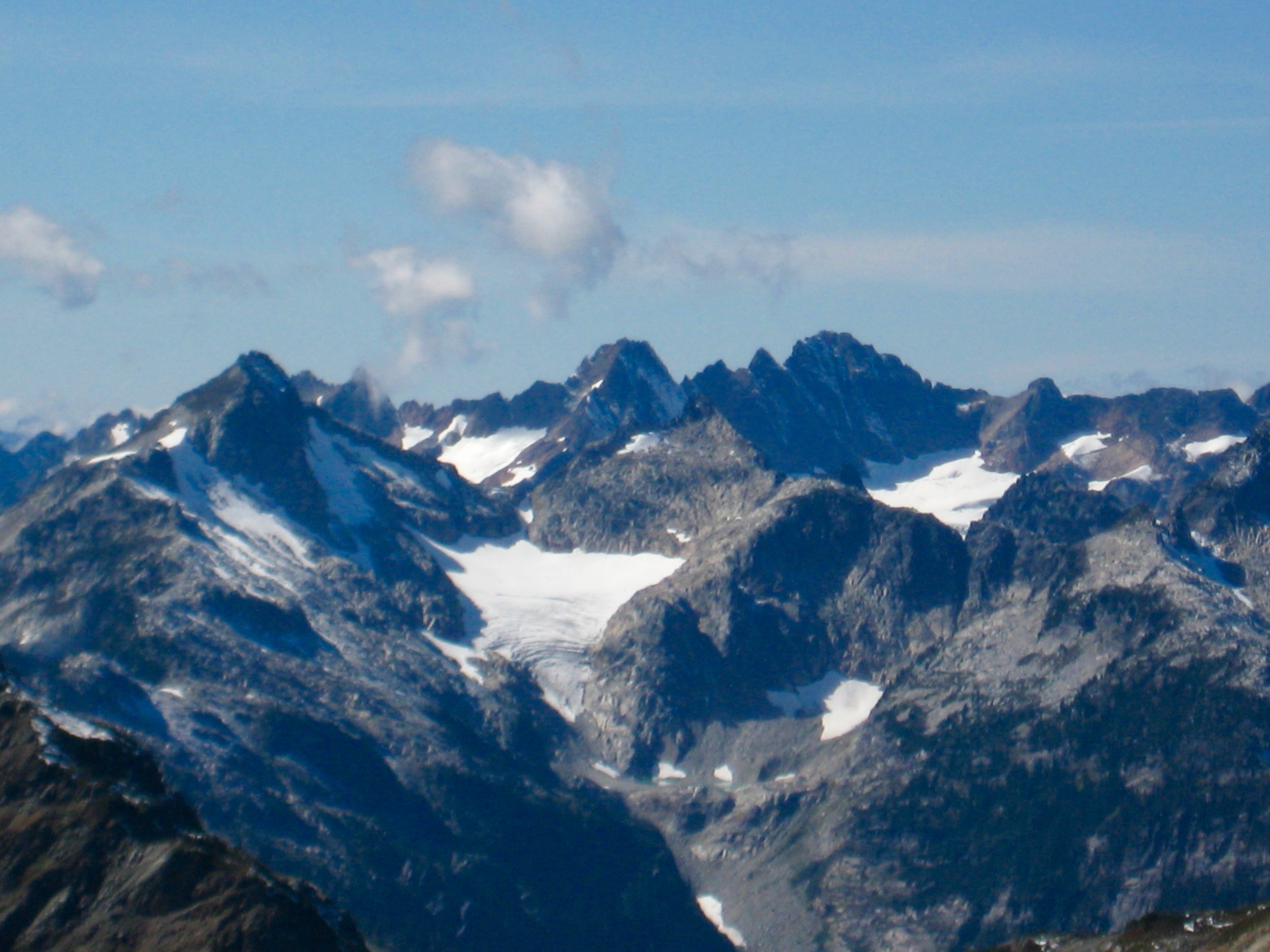
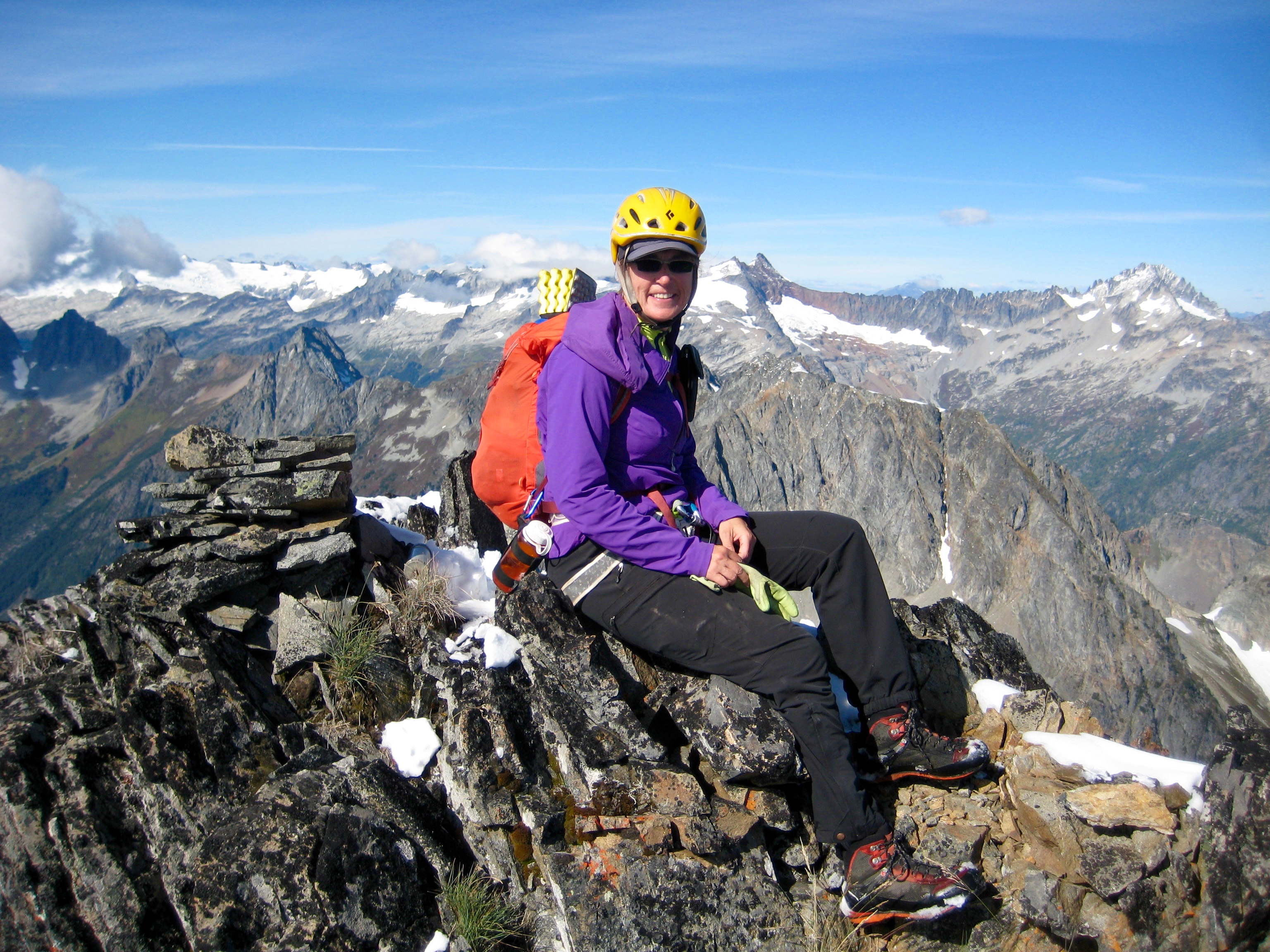
Fay had written that Spider Mountain is one of the finest viewpoints in the Cascades. We would heartily concur. The Ptarmigan Mountains, all blanketed with fresh snow, extend to the north and south, while the Thunder Mountains—from Eldorado Peak to Mt. Goode—spread out perpendicularly to the northwest and northeast.
- View South From Spider Mtn Summit
- View Northwest From Spider Mtn Summit
The summit register was placed in 1968, and now—50 years later—is down to its last page. We were the first party to sign in this year, and only one party had signed in each of the two previous years. It appears that Spider repels climbers quite aptly, either through its poor reputation or its crumbly flanks.

- Jim With Spider Mtn Summit Register (photo by Eileen)
Due to the late hour, we cut our summit stay to 15 minutes. Our descent began with a roped down-climb of the steep summit block, followed by a traverse back along the ridge crest. Neither of us was eager to retrace our up-route in the main gully, so we considered other options. Fay had descended a secondary gully to the left (east) of the main gully and reported marginally better conditions, so we elected to take her down-route.
The upper half of the secondary gully offered a relatively easy descent on loose scree. After dropping about 300 feet, however, we were confronted with steep, slabby, uninviting rock. To make matters worse, the WWU geology students suddenly appeared at the bottom of the gully. They were apparently attempting to climb the secondary gully and were right in our line of fire for loose rocks.
Eileen and I quickly decided to move out of the gully and onto the rib to our right (west). We then continued down the rib for several hundred feet until the angle steepened. Although it initially seemed that we would need to rappel into the main gully, we were able to tease out a zig-zag route into the gully instead. The footing was never very solid, but the scrambling was reasonable…once we adjusted to a lower level of security.
After a long hour of anxious down-climbing, we reached the bottom of the gully and then began traversing back toward the Spider-Formidable Col. Crampons aided our climb back up the snow finger to the col, which we reached at 6:30pm (3.4 hours + 500 feet from summit). From there, it was a race against the setting sun. We hurried down the glacier, doffed crampons, and hustled back along the Ptarmigan Traverse path in waning dusk.
- Sunset On Middle Cascade Glacier
- Descending Middle Cascade Glacier
Darkness caught us in the meadows below Art’s Knoll, so we had to cross the Red Ledge by headlamp. This was somewhat unnerving, but perhaps it was actually better not to see down! At 10:45pm (7.7 hours + 800 feet from summit), we reached our camp beside Kool-Aid Lake. A celebratory dinner was eaten in the cold moonlight.
Day 3: Kool-Aid Lake to Trailhead
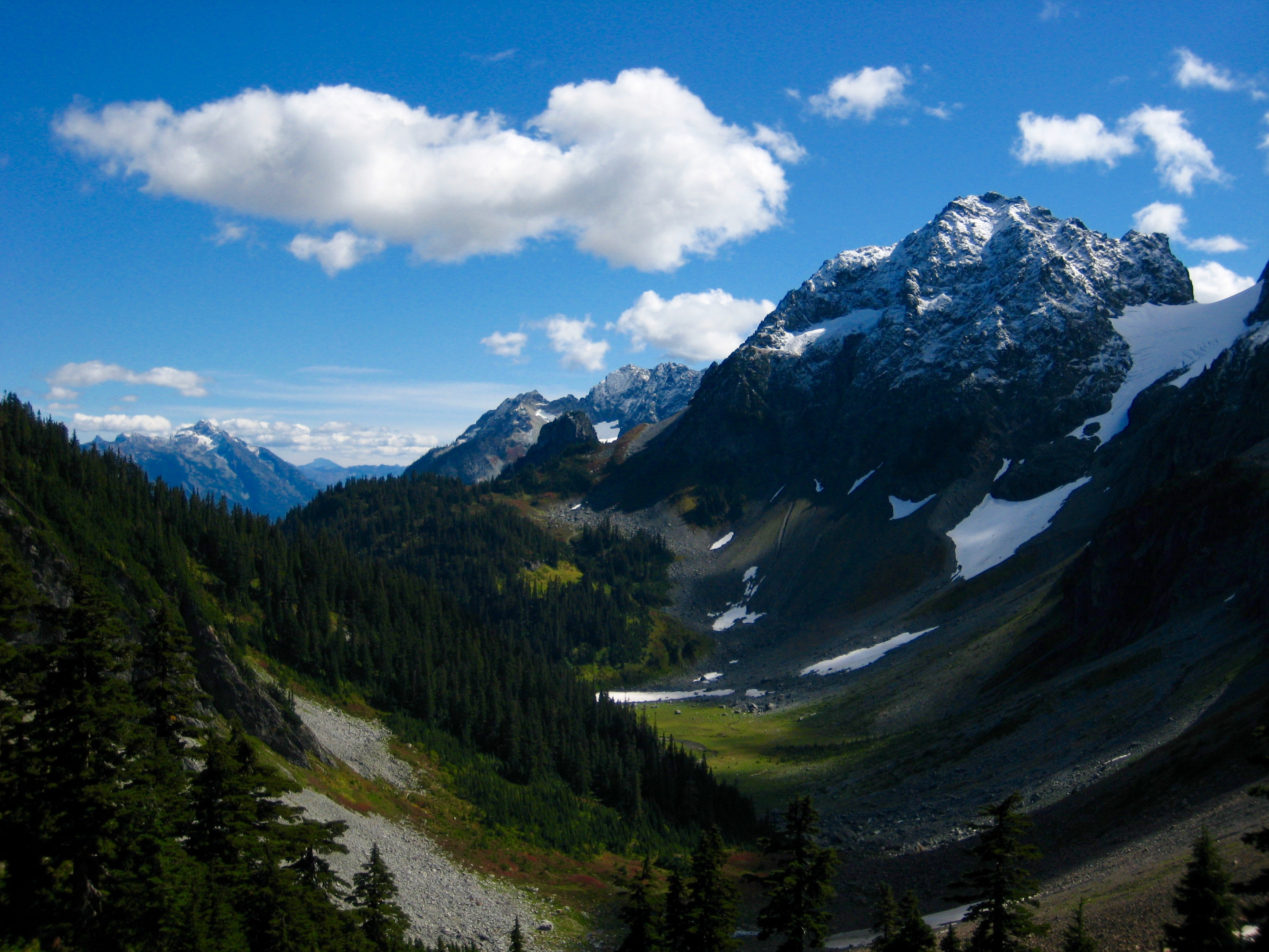
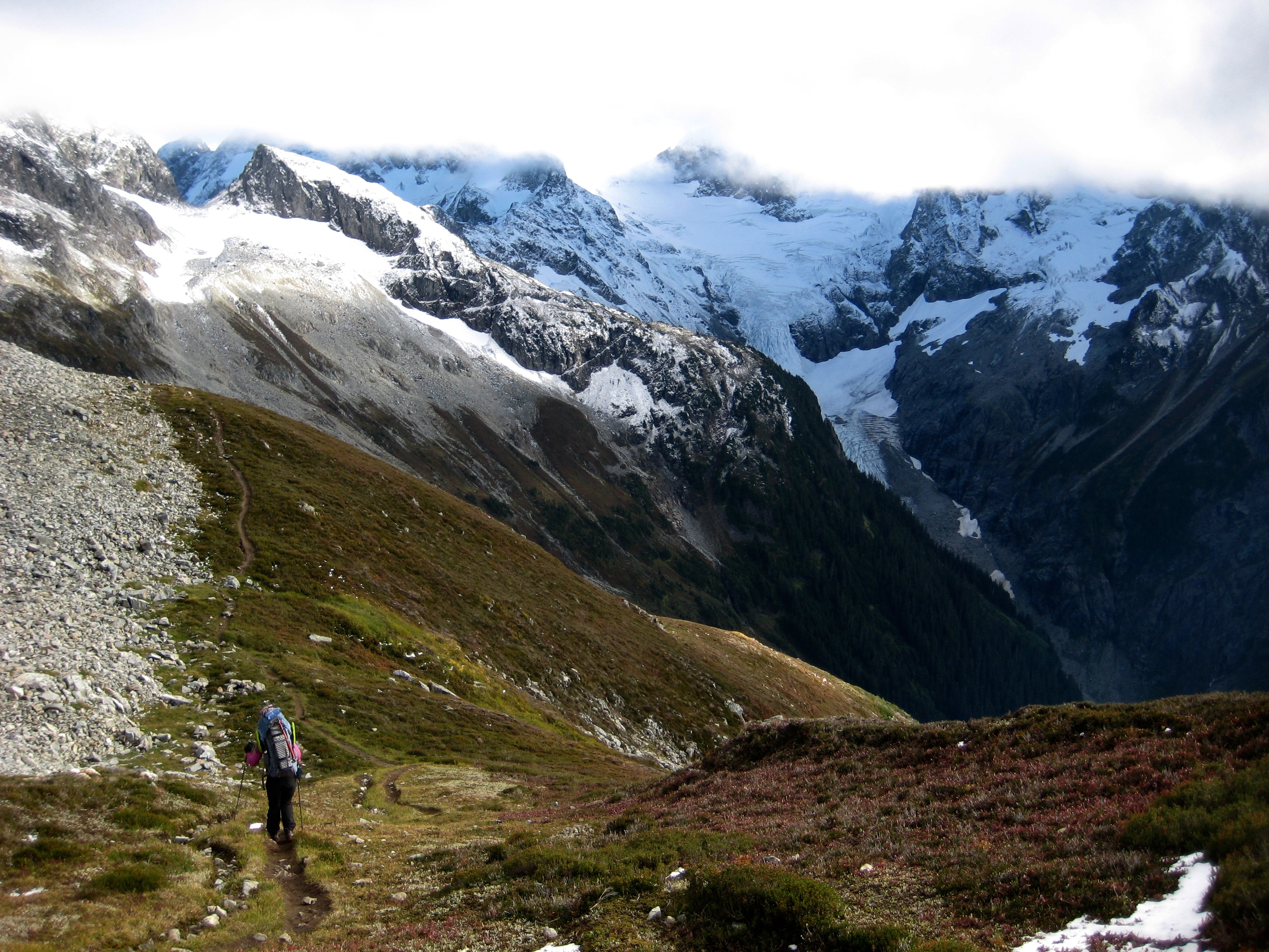
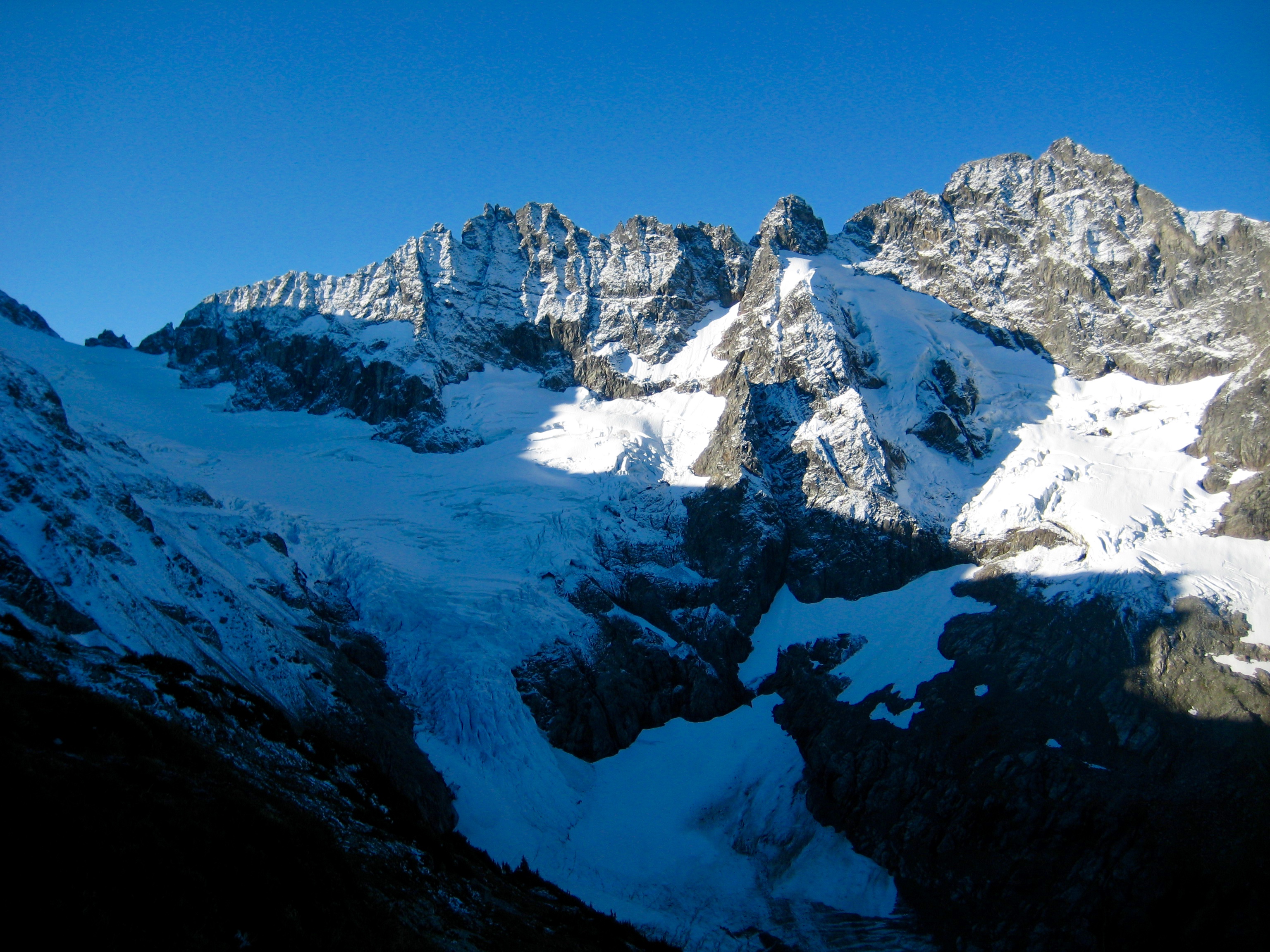
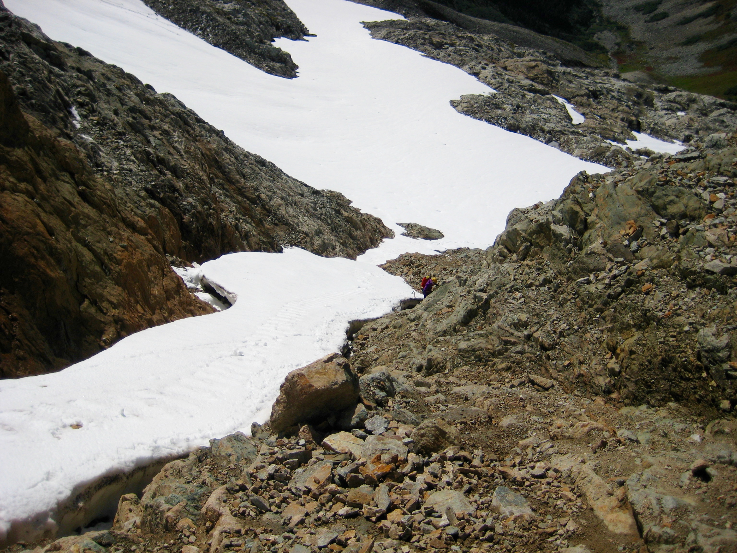
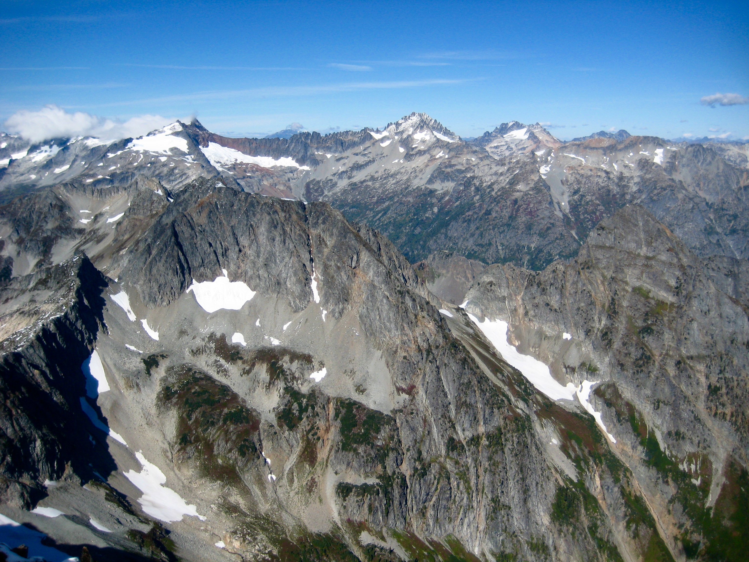
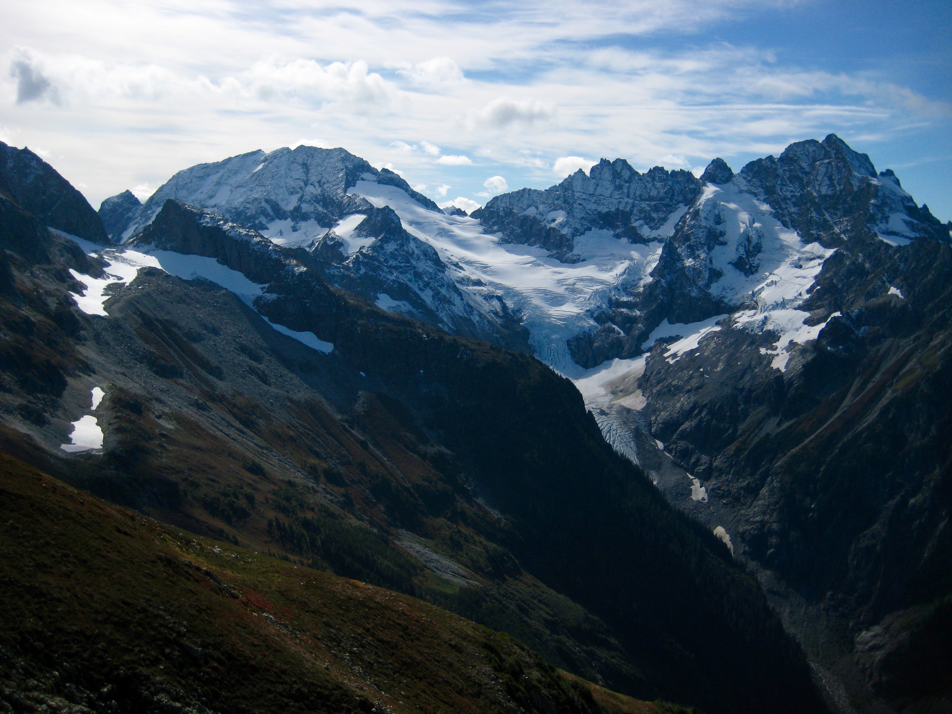
Having stayed up until after midnight, we had a leisurely morning in camp and didn’t get fully packed up until 9:30am. We hiked up to Cache Col, stopping to admire the still-snowy nordwands of Spider Mountain and Mt. Formidable.
- Spider Mtn & Mt Formidable From Cache Col
Our afternoon was spent hiking down to Cascade Pass and on down to the trailhead, which we reached shortly before 5:30pm (7.9 hours + 1200 feet from camp). The air was unseasonably cold, and it felt as though another snow storm was coming.
Route Map & Profile & Sketch
…
…
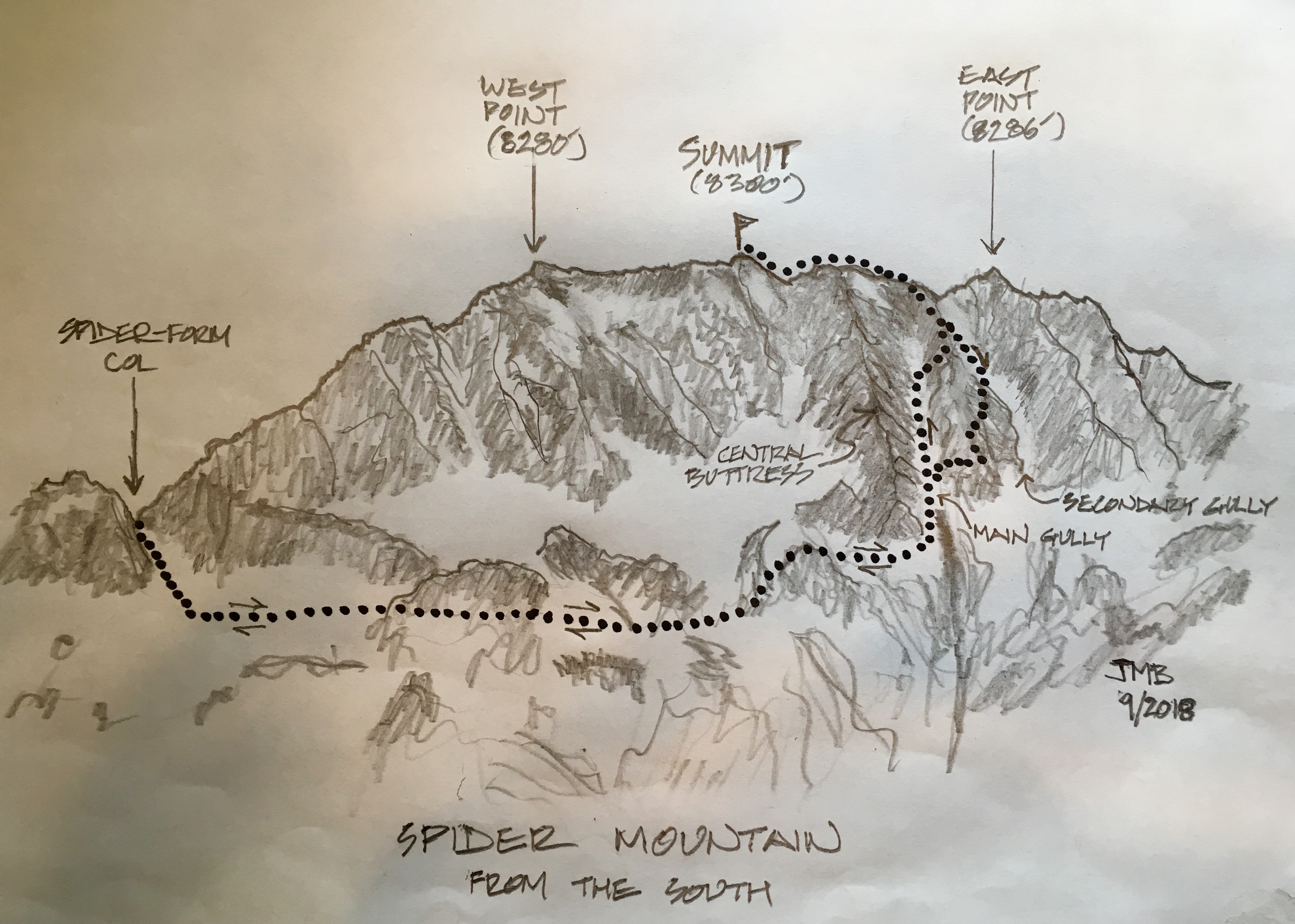
Photo Gallery
Click to enlarge…