Trip Date: October 16, 2025
2025 MT. CHARLESTON ADVENTURE VACATION
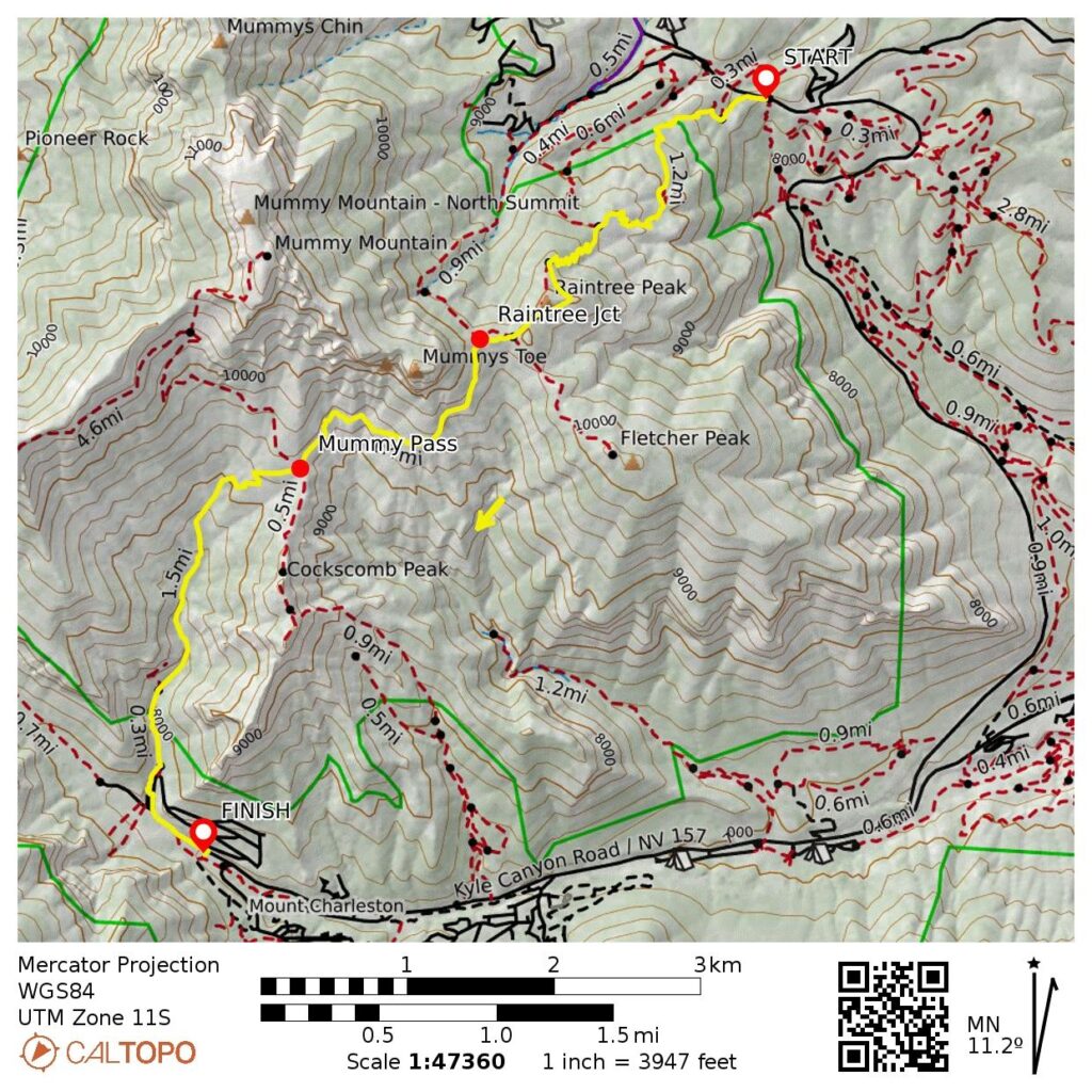
Raintree Trail Traverse: North Loop Trailhead to Echo Trailhead
Raintree Peak Shoulder
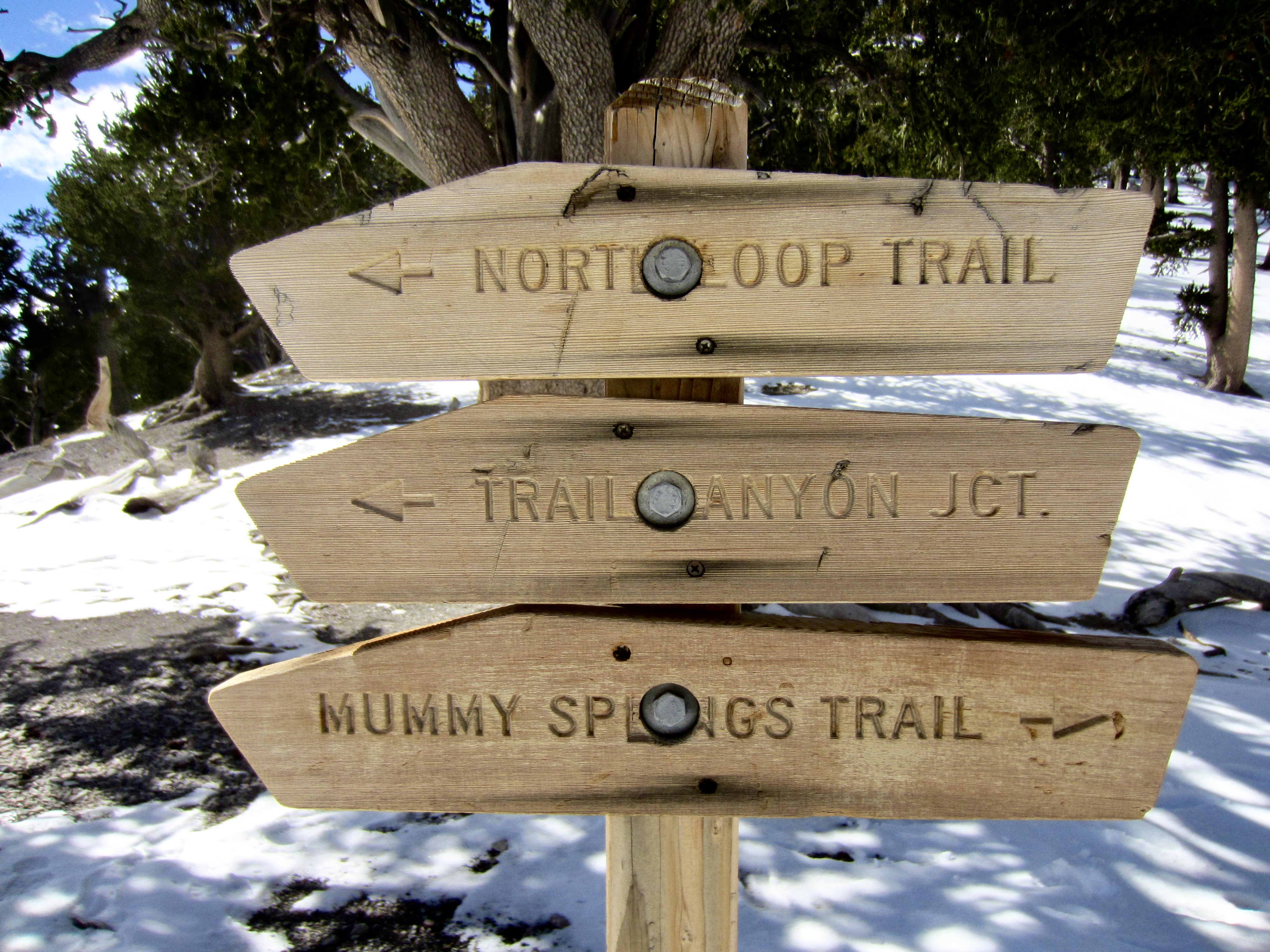
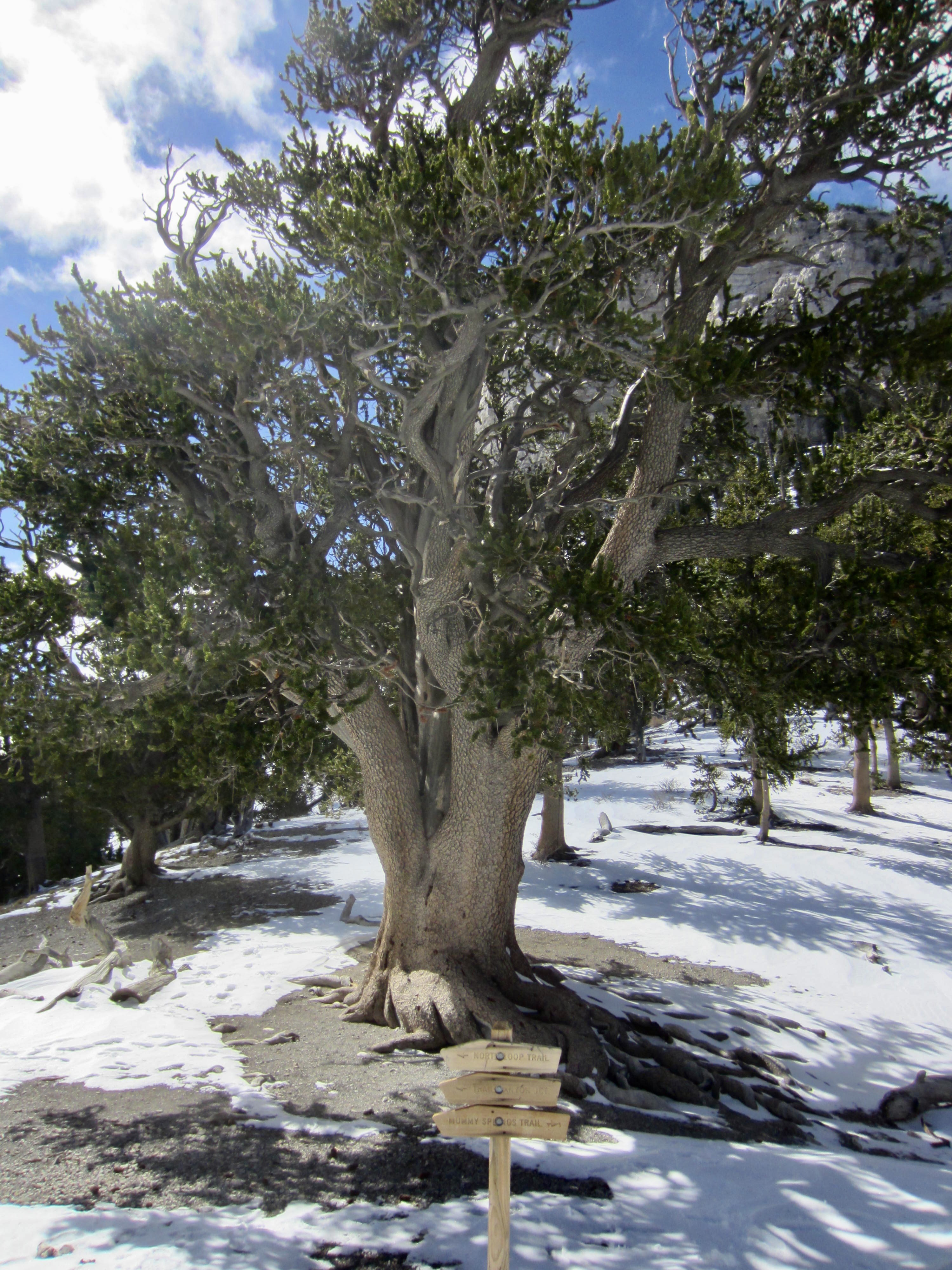
Raintree Junction / The Raintree
Mummy Pass
Trail Canyon
Trip Report Summary
Region: Nevada
Sub-Region: Spring Mountains
Areas: Spring Mountains National Recreation Area & Mt. Charleston Wilderness
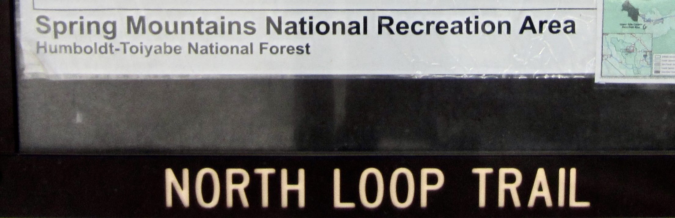
Starting Point: North Loop Trailhead on Deer Creek Road #158 (Elev. 8400 feet)
Way Points: wilderness boundary & Raintree Shoulder & Raintree Junction / The Raintree & Mummy Pass & wilderness boundary & Trail Canyon Trailhead & Echo Trailhead (trail hike)
High Point: Raintree Shoulder (Elev 10,000 feet)
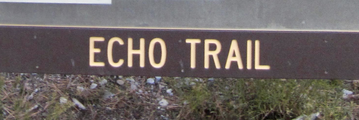
Ending Point: Echo Trailhead on Echo Road in Kyle Canyon (Elev. 7600 feet)
Approximate Stats: 6.3 miles traveled; 1800 feet gained; 2600 feet lost; 3.5 hours elapsed.
Full Trip Report
Eileen and I headed to southern Nevada for a week in mid-October expecting to enjoy some warm-weather hiking and climbing at Mt. Charleston. Much to our dismay, however, we arrived one day after a freak storm blanketed all of the hills with fresh snow and filled the valleys with frigid air. Thankfully, clear skies prevailed throughout our visit, allowing the sun to consolidate and melt the snow a little each day.
On our first full day in this unfamiliar area, I did a 6-mile trail traverse over Mummy Pass, from Deer Creek Road to Echo Road in Kyle Canyon. Eileen was on injured-reserve, so she dropped me off at the North Loop Trailhead and then planned to pick me up at the Trail Canyon Trailhead on the other side of the pass. We both figured that this would allow me to reconnoiter trail and snow conditions in preparation for subsequent hikes. It turned out to be not only a good reconnaissance but also a very scenic and, in several ways, very surprising hike.
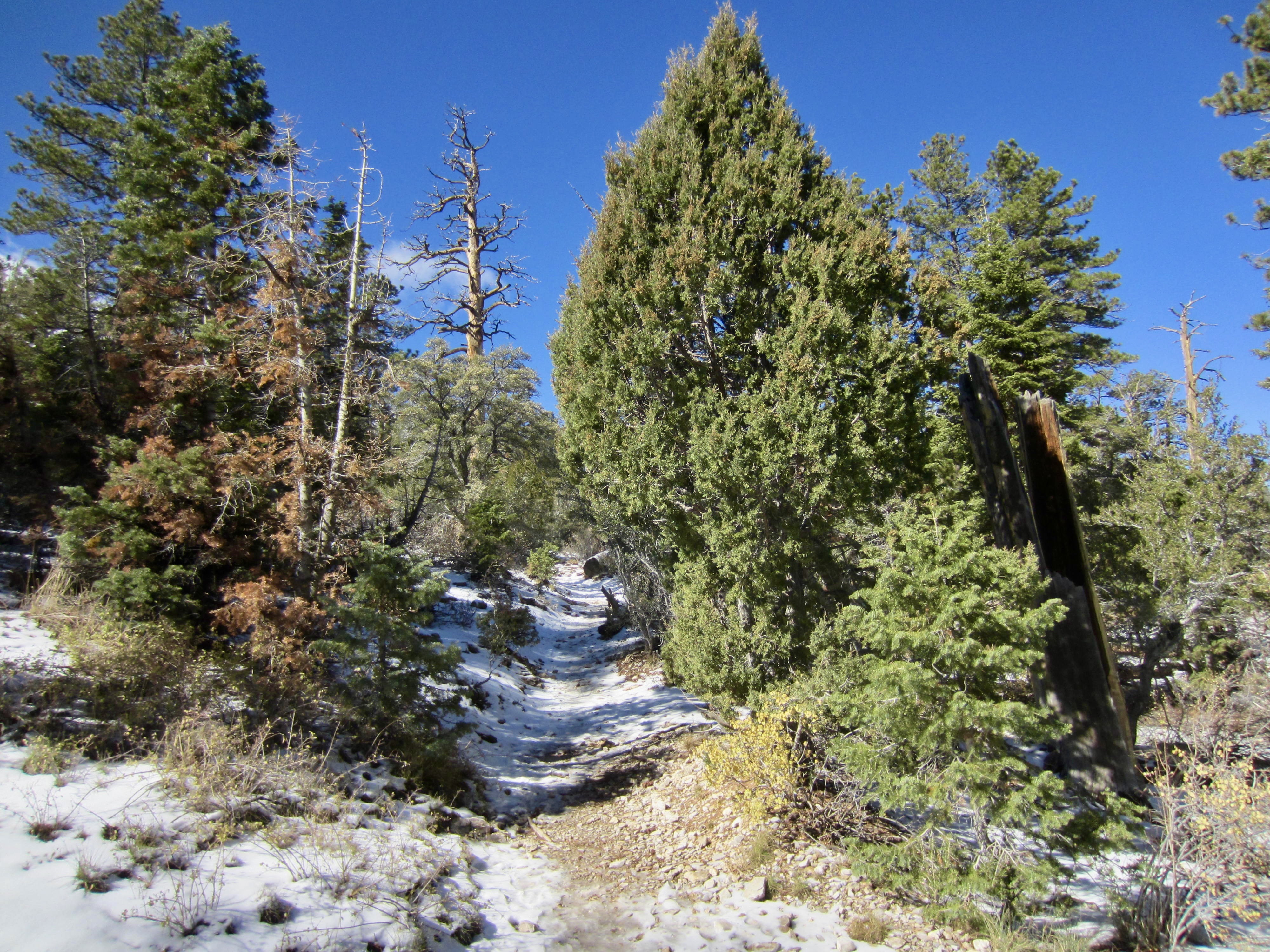
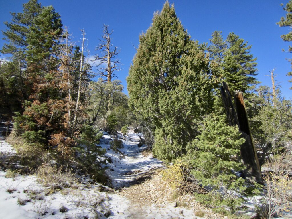
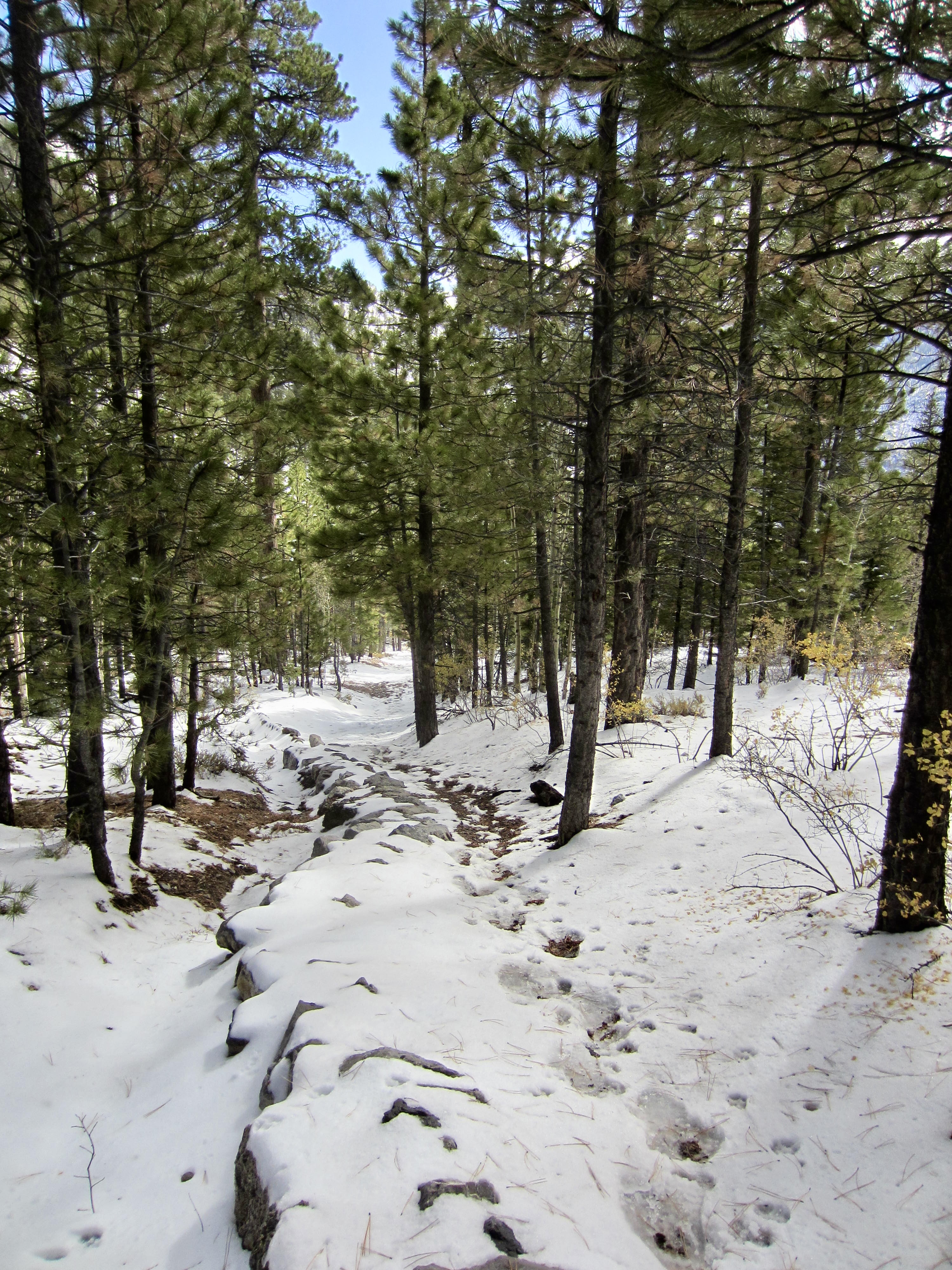
Starting at the North Loop Trailhead on a cold, sunny Thursday morning, I hiked up the southwest-trending trail and soon entered the Mt. Charleston Wilderness. Most of the trail was covered by a thin layer of compact snow and ice, so traction was sketchy. I wished that I’d brought my microspikes from home—a wish that became much more emphatic in the coming days.
.
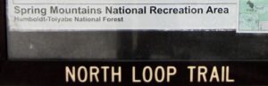
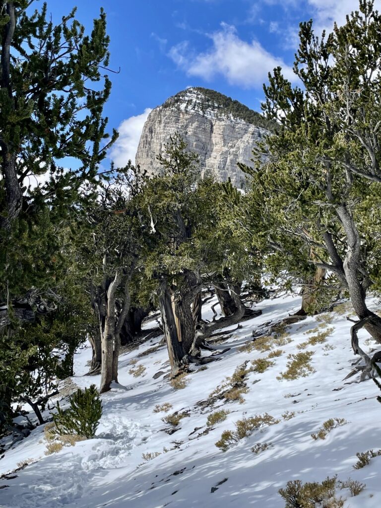
The North Loop Trail constitutes half of a National Recreation Trail (the South Loop Trail being the other half) that crosses over the summit of Charleston Peak. I quickly saw how it gained this national status, as I passed through forests of ponderosa and bristlecone pine trees with views of high peaks above and sprawling desert plains below.
.
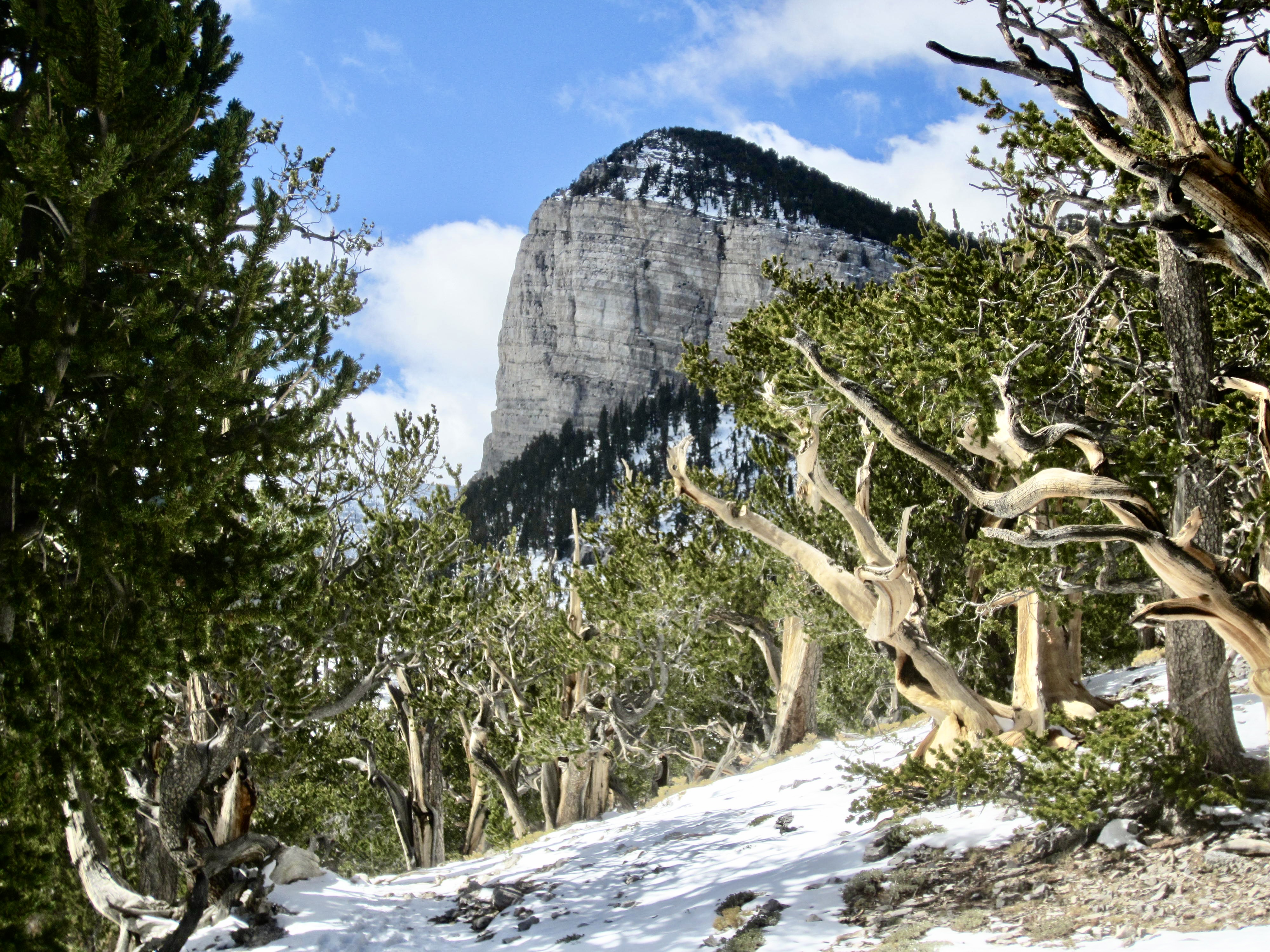
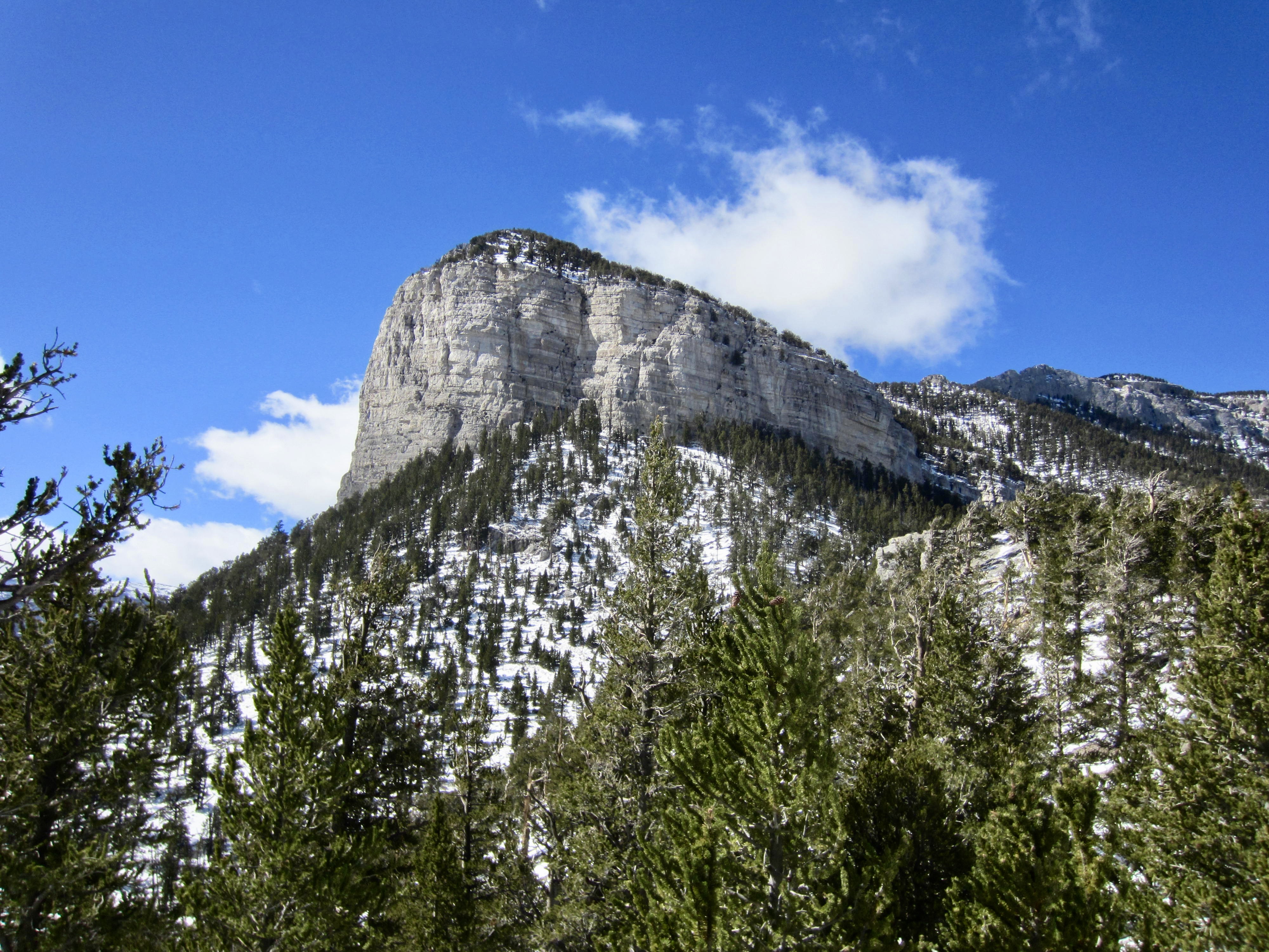
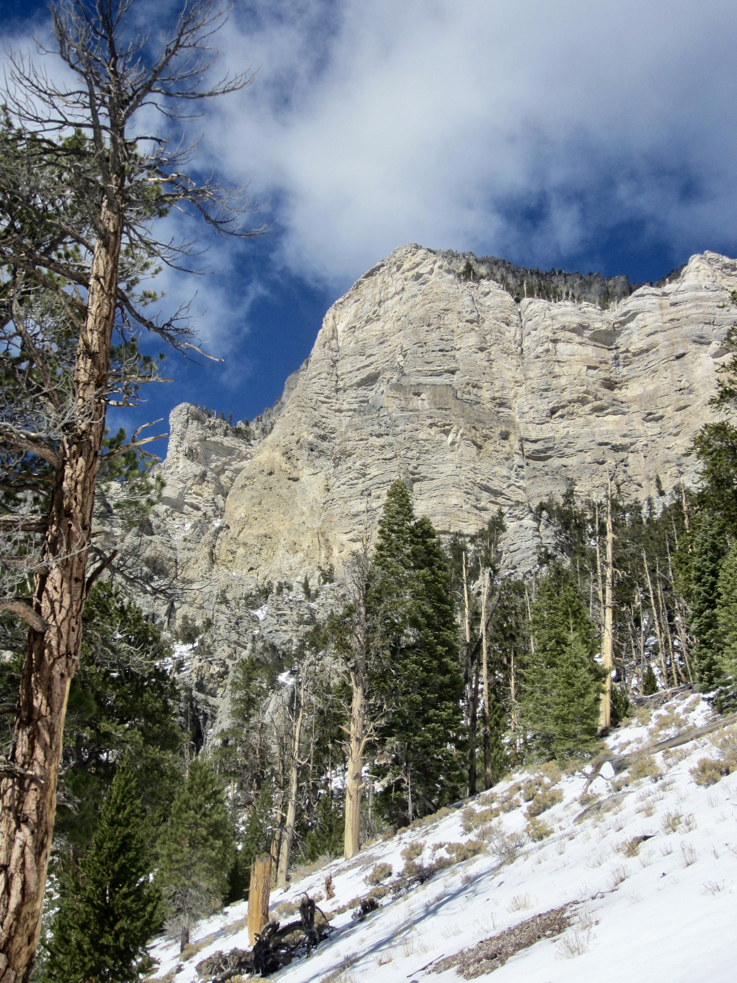
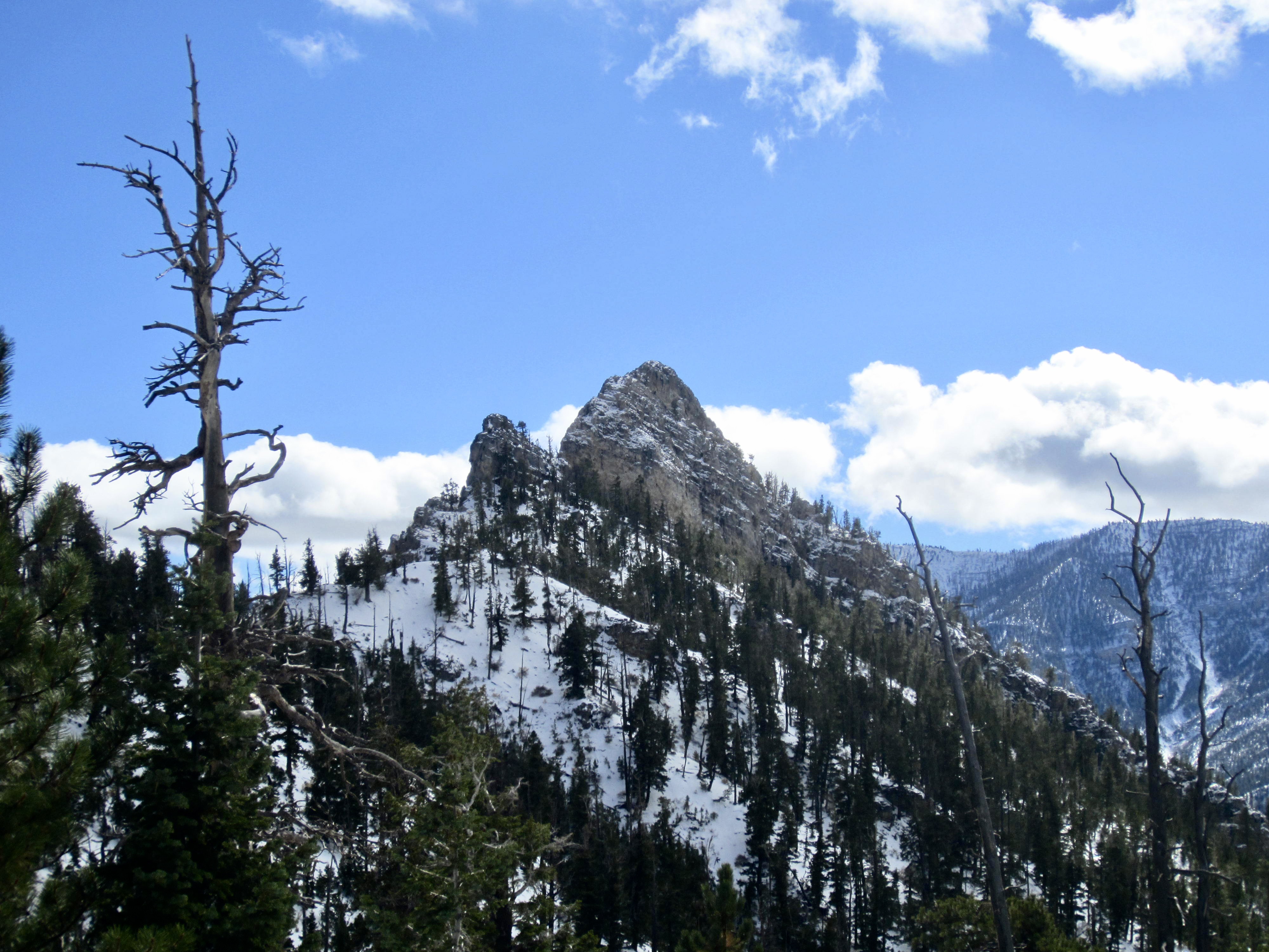
A series of tight switchbacks and a short traverse to took me over Raintree Shoulder on the eastern side of Raintree Peak (1.1 hours + 1600 feet from starting point). This 10,000-foot shoulder marked the highest point and deepest snowcover—about 6 to 8 inches—of my trail traverse. Through a gap in the bristlecone trees, I could see the distinctive bluff of Mummy’s Toe.
.
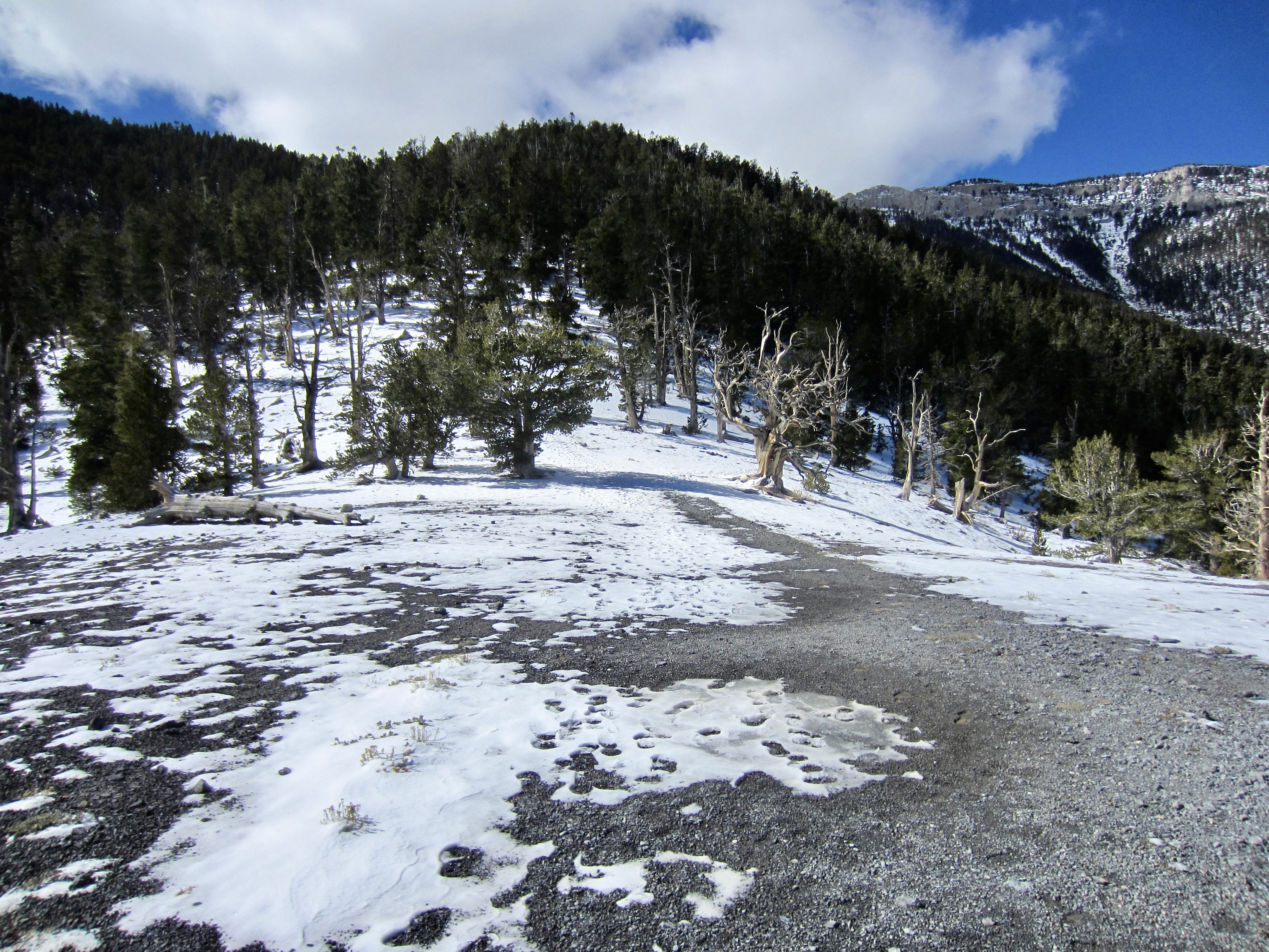
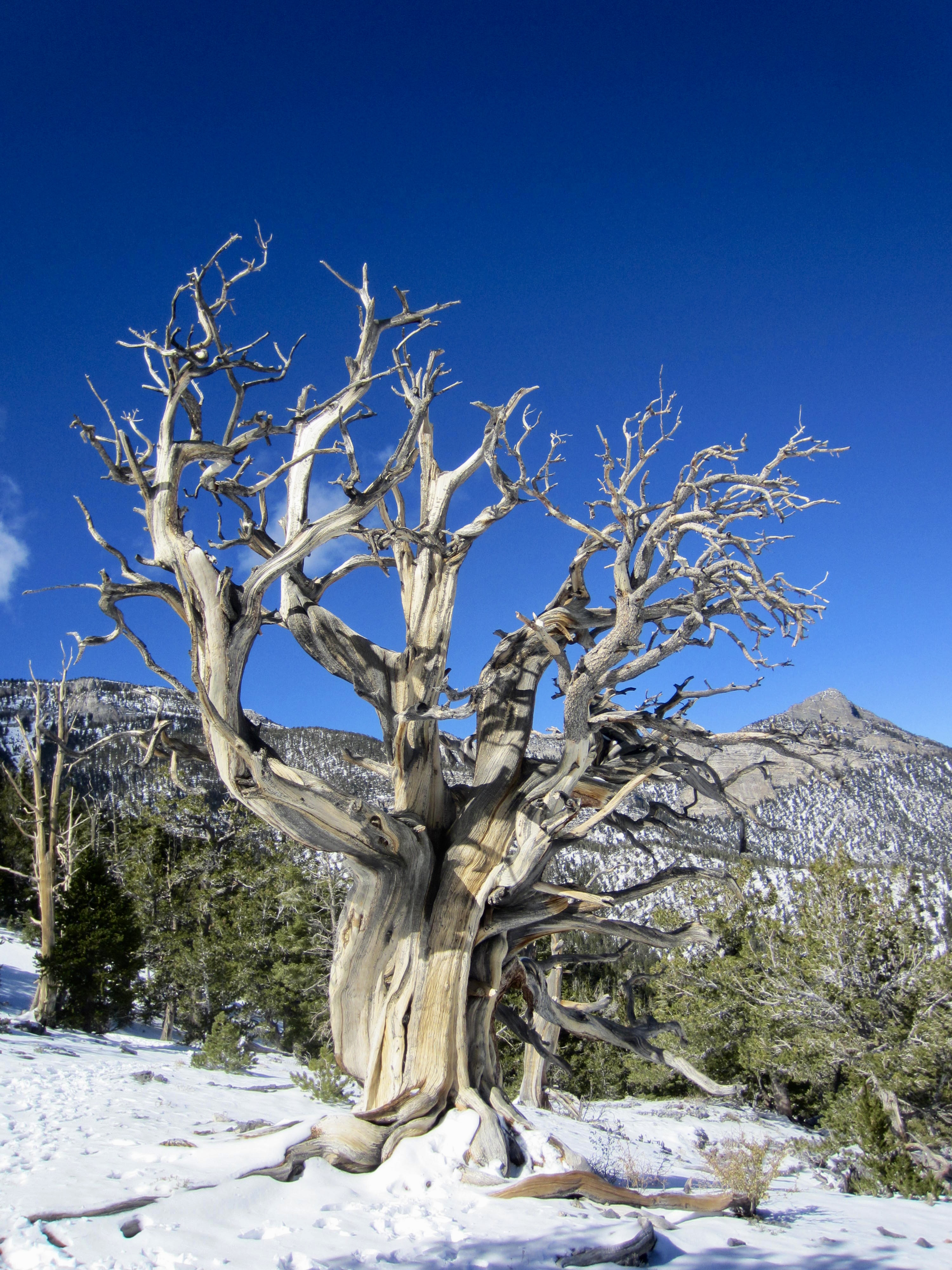
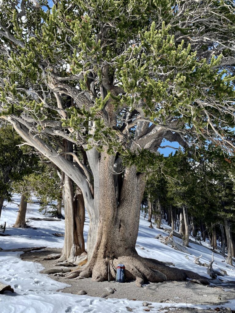
From Raintree Shoulder, the trail wove me through two closely spaced saddles in the ridge crest and quickly brought me to Raintree Junction at a third saddle. Here, a spur trail angles right (northwest) to Mummy Springs, and the North Loop Trail angles left (southwest) to Mummy Pass. Most notable, though, is a gigantic bristlecone pine tree that stands guard at the junction. This majestic specimen, formally known as The Raintree, has been estimated to be 3000 years old, making it the oldest living thing in Nevada!
.
.
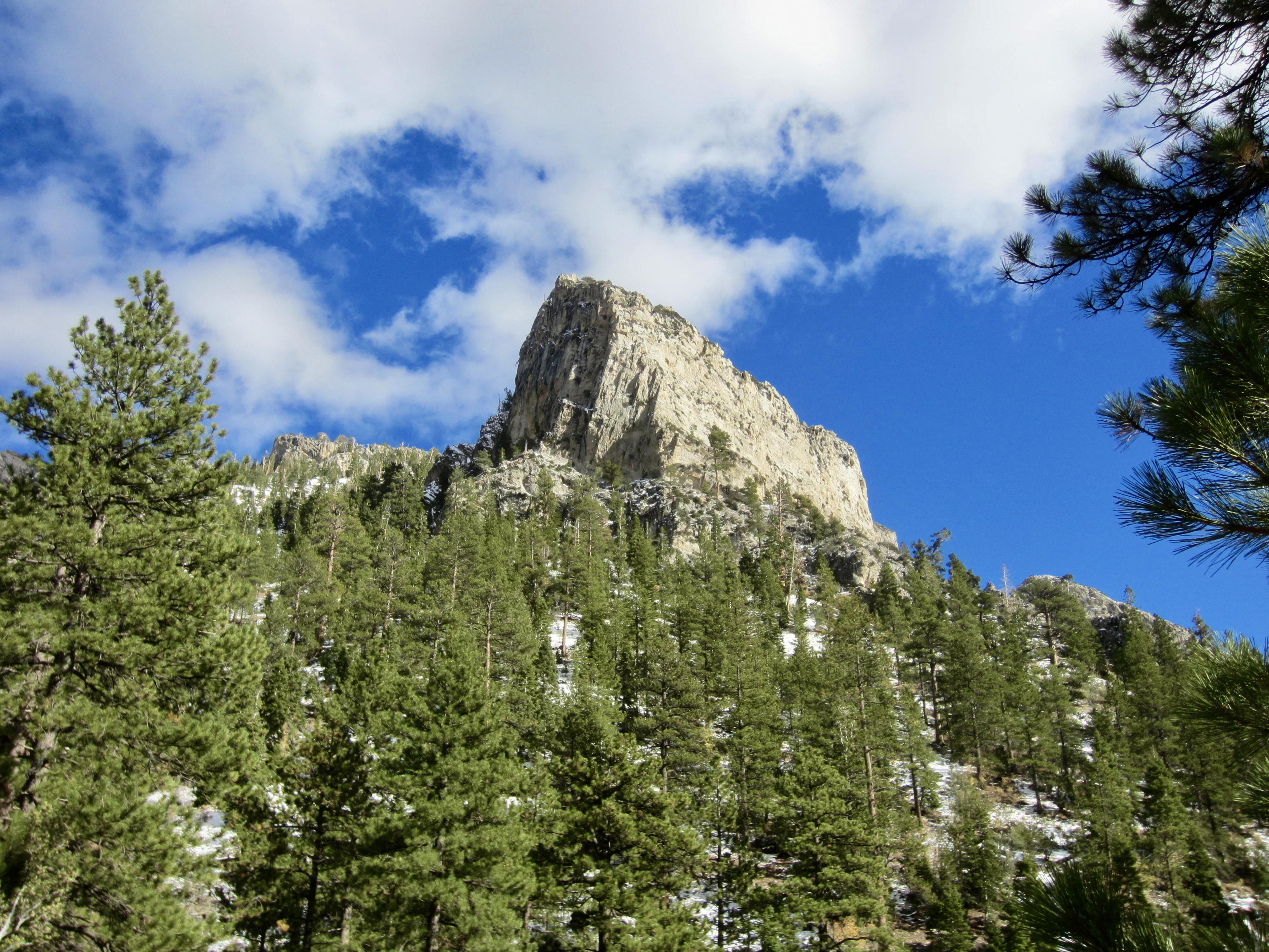
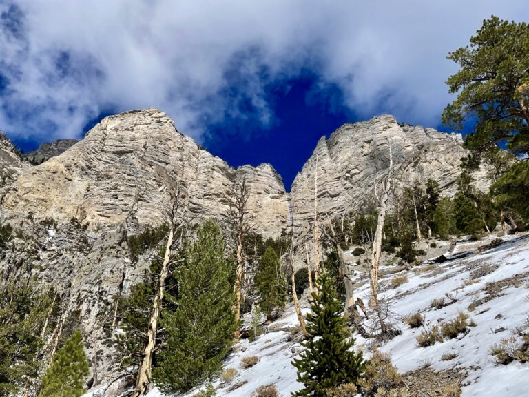
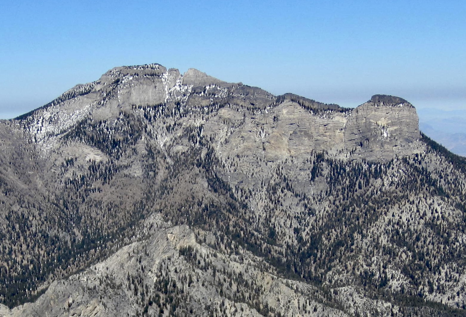
Continuing southwesterly on the North Loop Trail, I curved around the striking limestone cliffs of Mummy’s Toe. This impressive geologic feature represents the “foot” end of Mummy Mountain, which from certain vantages closely resembles a supine mummy wrapped in gray gauze.
.
.
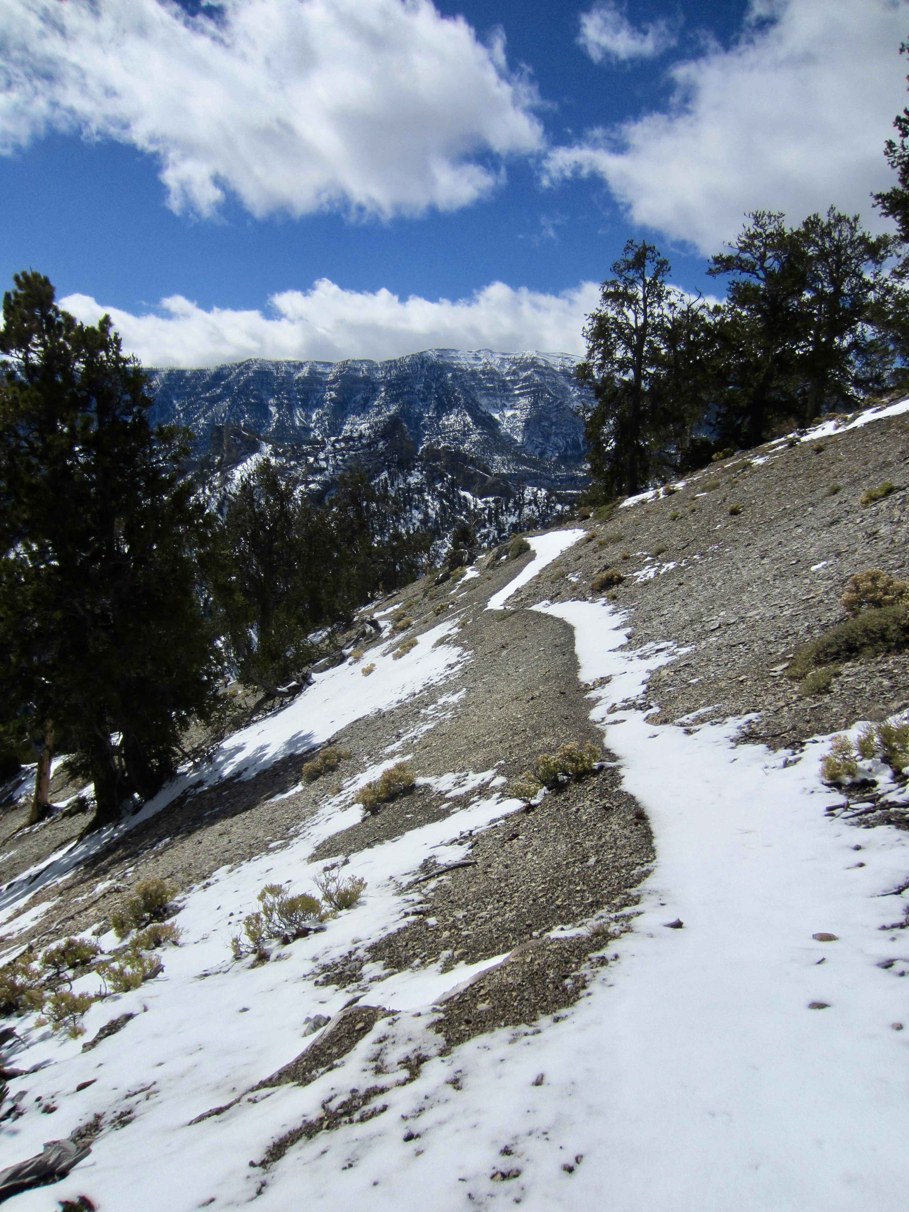
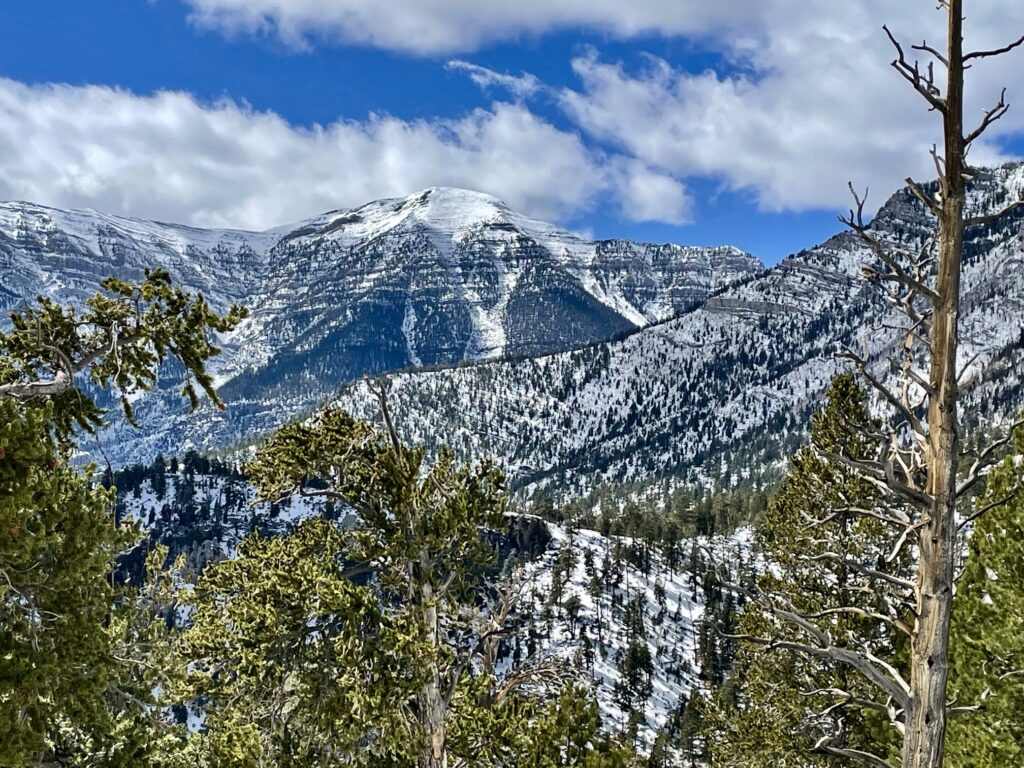
Farther along the trail, I got a clear view of Charleston Peak—with an elevation of nearly 12,000 feet, it is the highest point of the Mt. Charleston massif and the Spring Mountains. For me, the snow-capped summit, horizontal bedding, and snow-filled gullies represented an irresistible goal for another day. Mummy Pass was now visible in the foreground below.
.
A descending traverse brought me to 9350-foot Mummy Pass (2.5 hours + 1700 feet from starting point). At a four-way junction here, I departed from the North Loop Trail and veered onto the Trail Canyon Trail (a name apparently given by the Department of Redundancy Department.). This nicely maintained trail drops into the canyon invert and gives views of craggy Cockscomb Ridge high above. There were numerous fresh footsteps in the snow, indicating that several people had come up to Mummy Pass today.
.
.

.
As I neared the end of the canyon, I encountered Eileen hiking up the trail to meet me—and deliver some very surprising news. She reported that, according to trailhead signs, the Trail Canyon Trail was currently closed due to “hazardous conditions.” This was quite puzzling because the upper portion of trail that I’d just descended was in excellent condition (aside from a little snow), and she had found that the lower portion was also in excellent condition. Furthermore, there had been nothing posted in my direction of travel.
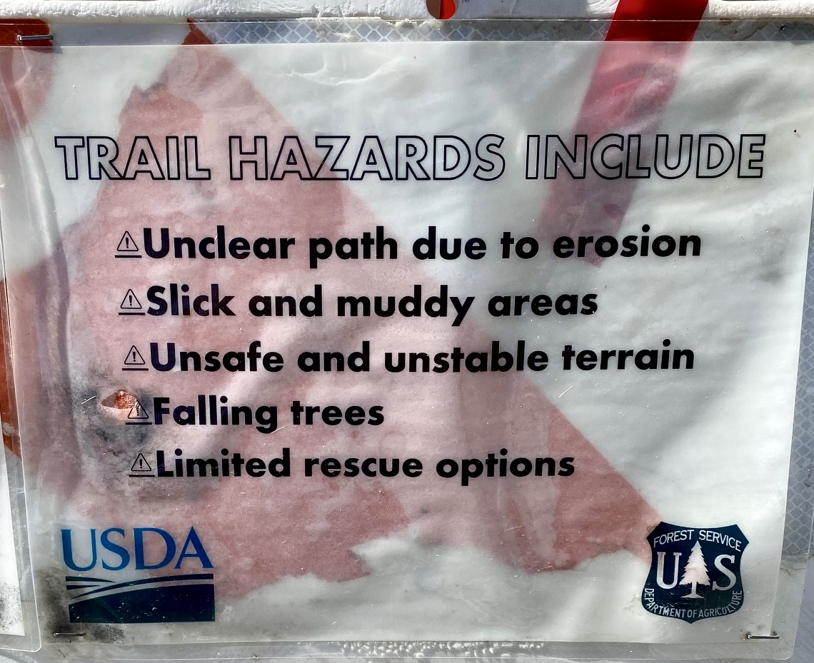
Upon reaching the Trail Canyon Trailhead, Eileen showed me the warning sign—a small sheet of paper attached to a temporary barricade. It listed five hazards, including an unclear path with slick and muddy areas and unstable terrain with falling trees. We both had to laugh, because none of these hazards even remotely described the current trail conditions!

.
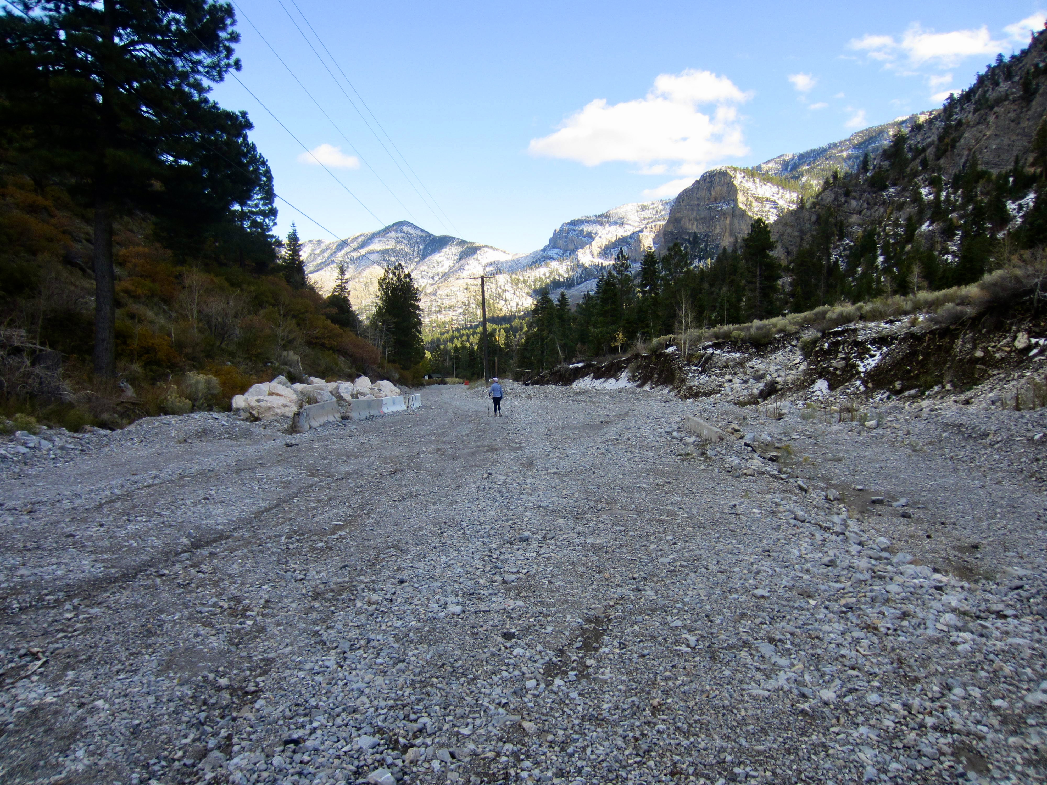
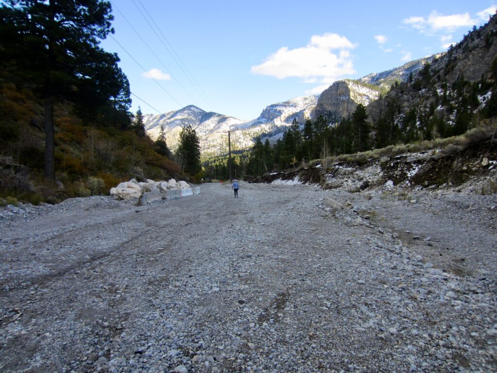
We walked through the vacant parking lot, which is shared by both the Trail Canyon and Mary Jane Falls Trailheads, and continued down Echo Road. It was obvious that this road had incurred considerable flood damage in the recent past. After ⅓ mile of walking, we arrived at the Echo Trailhead, where Eileen had parked. This concluded my very enjoyable trail traverse and mountain reconnaissance, but it left both of us puzzled as to why a perfectly good trail had been closed. It didn’t take long to get a plausible explanation.
.
.
Usage Considerations
Upon speaking with several local hikers, Eileen and I learned that a major flood had washed down Mary Jane Canyon in 2023, obliterating the Mary Jane Falls Trail and much of Echo Road. These locals speculate that the Trail Canyon Trail, which was virtually untouched by the flood, was officially closed only because it shares a parking lot with the Mary Jane Falls Trail. Clearly, this is a case of “guilt by association”!
Because there were no closure notices at the North Loop Trailhead nor at Mummy Pass, I had unknowingly hiked down a trail that was officially closed. I really try to heed closure rules, but this unintentional faux pas showed me that the entire trail is actually in excellent condition. It also became obvious that many local hikers understand the true situation and use the trail anyway. Unfortunately, due to the ongoing federal government shutdown, there were no rangers on duty to offer any clarification.
Route Map & Profile
…

…
Photo Gallery
Click to enlarge…