Trip Date: February 25, 2025
2025 MEXICO ADVENTURE VACATION
Pico Silla Norte Day Hike & Scramble
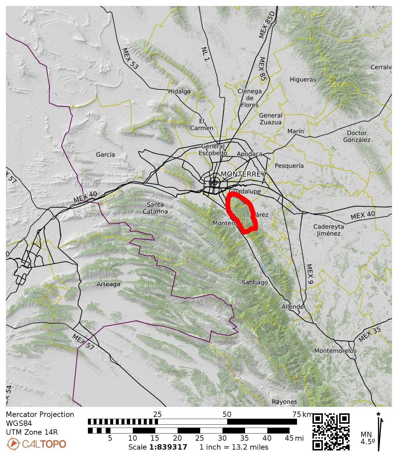
Cerro de la Silla Trail
Monterrey Teleferico/Gondola Station
Pico Silla Norte aka North Saddle Peak (5970 ft / 1820 m)
Trip Report Summary
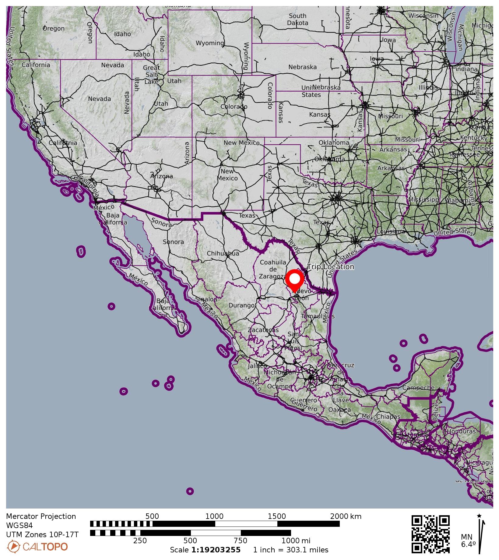
Region: Mexico
Sub-Region: Sierra Madre Oriental (“Eastern Mother Range”)
Sub-Sub-Region: Cerro de la Silla (“Saddle Mountain”)
Area: Cerro de la Silla Natural Monument
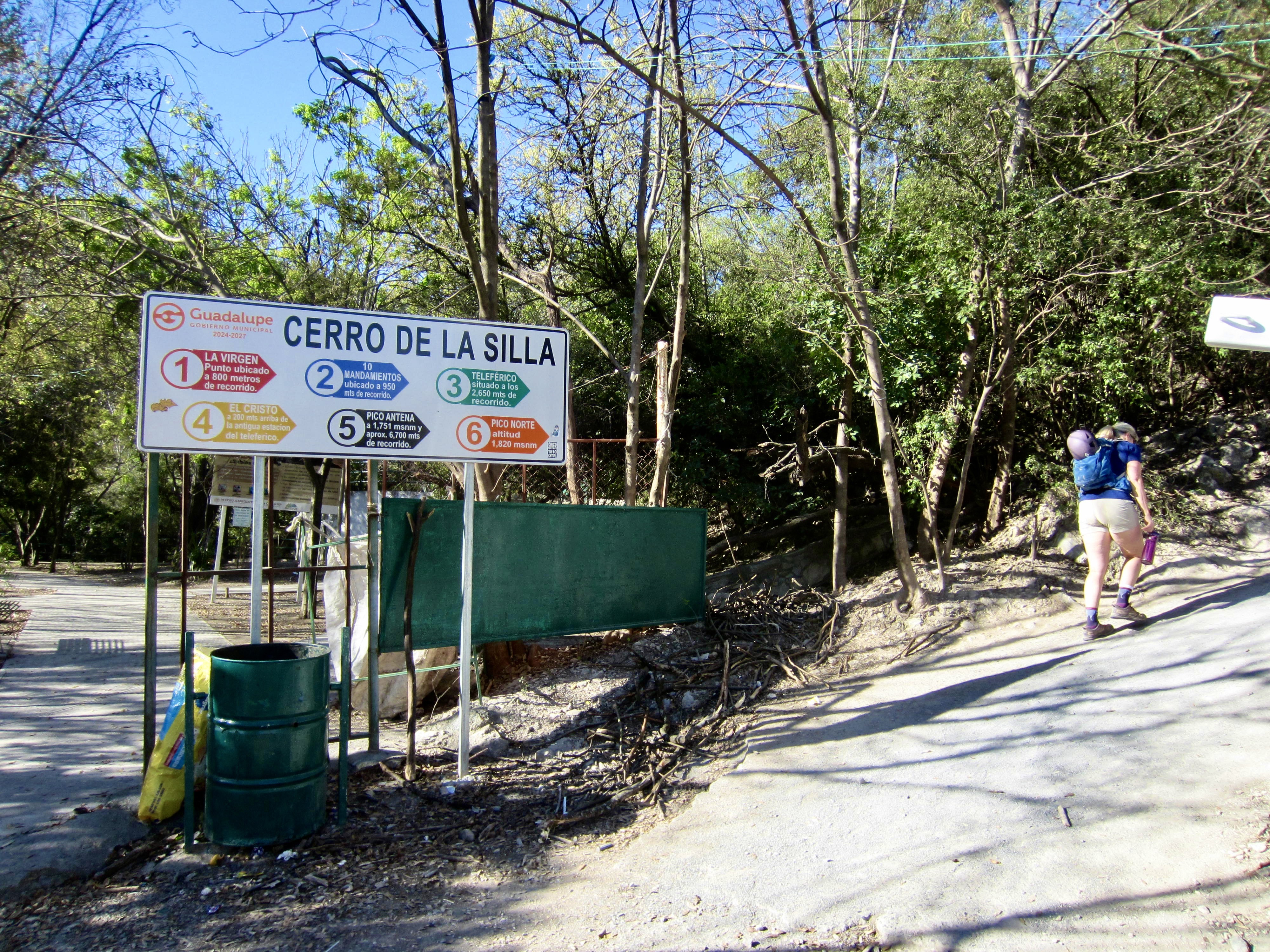
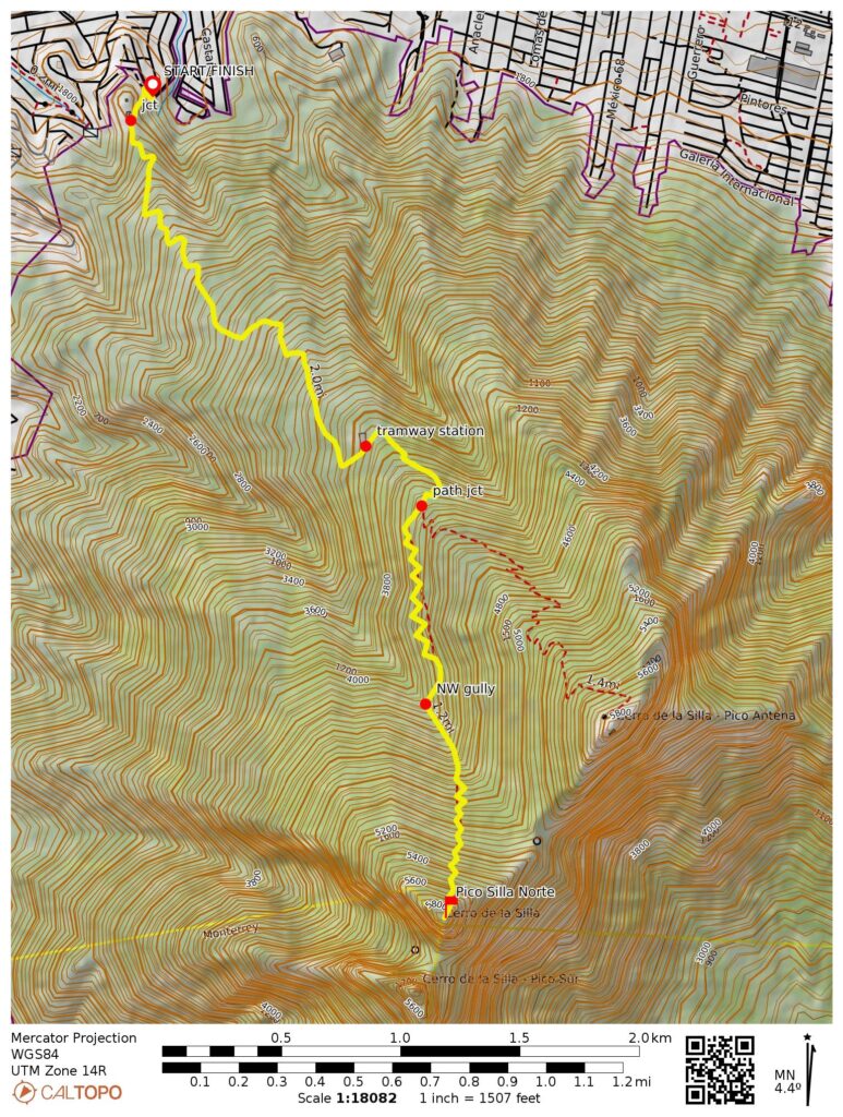
Starting & Ending Point: Cerro de la Silla Trailhead at intersection of Bosques de la Pastora & Bosques de la Silla streets (Elev. 1900 feet / 580 meters)
Way Points: 10 Commandments monument & abandoned teleferico/gondola station & Pico Silla Norte path junction & northwest gully invert & Pico Silla Norte summit (trail hike & trail scramble)
Summit: Pico Silla Norte (hike & scramble via North Slope)
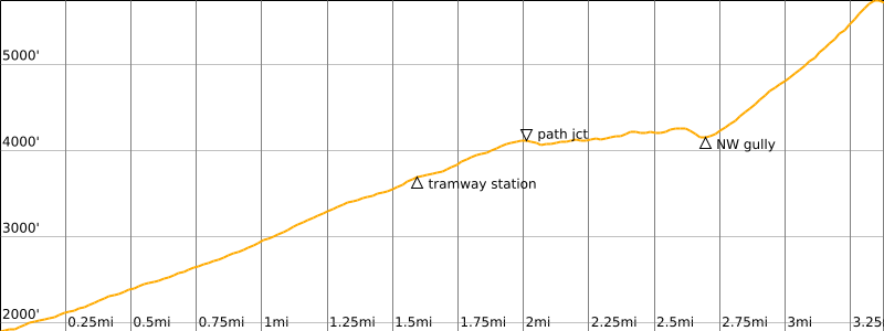
Approximate Stats: 6.8 miles / 11.0 kilometers traveled; 4550 feet / 1380 meters gained & lost; 5.3 hours up; 5.2 hours down.
…
Trip Overview
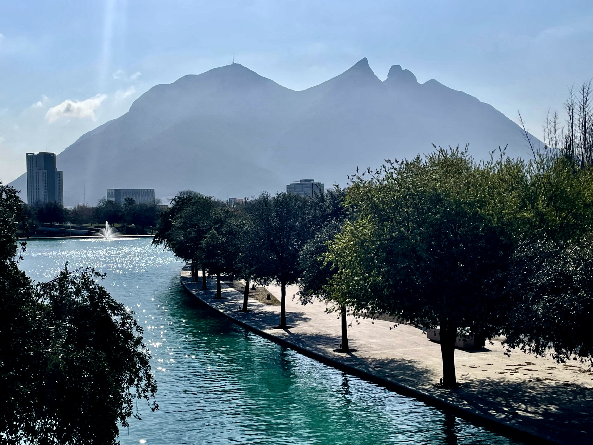
Cerro de la Silla is a prominent, forested mountain on the southeastern edge of Monterrey, Mexico. The name most directly translates to “Chair Hill,” but Saddle Mountain is the broadly accepted translation, given its distinctive topographic saddle in the summit ridge. By any name, it dominates the horizon from nearly any location in the city.
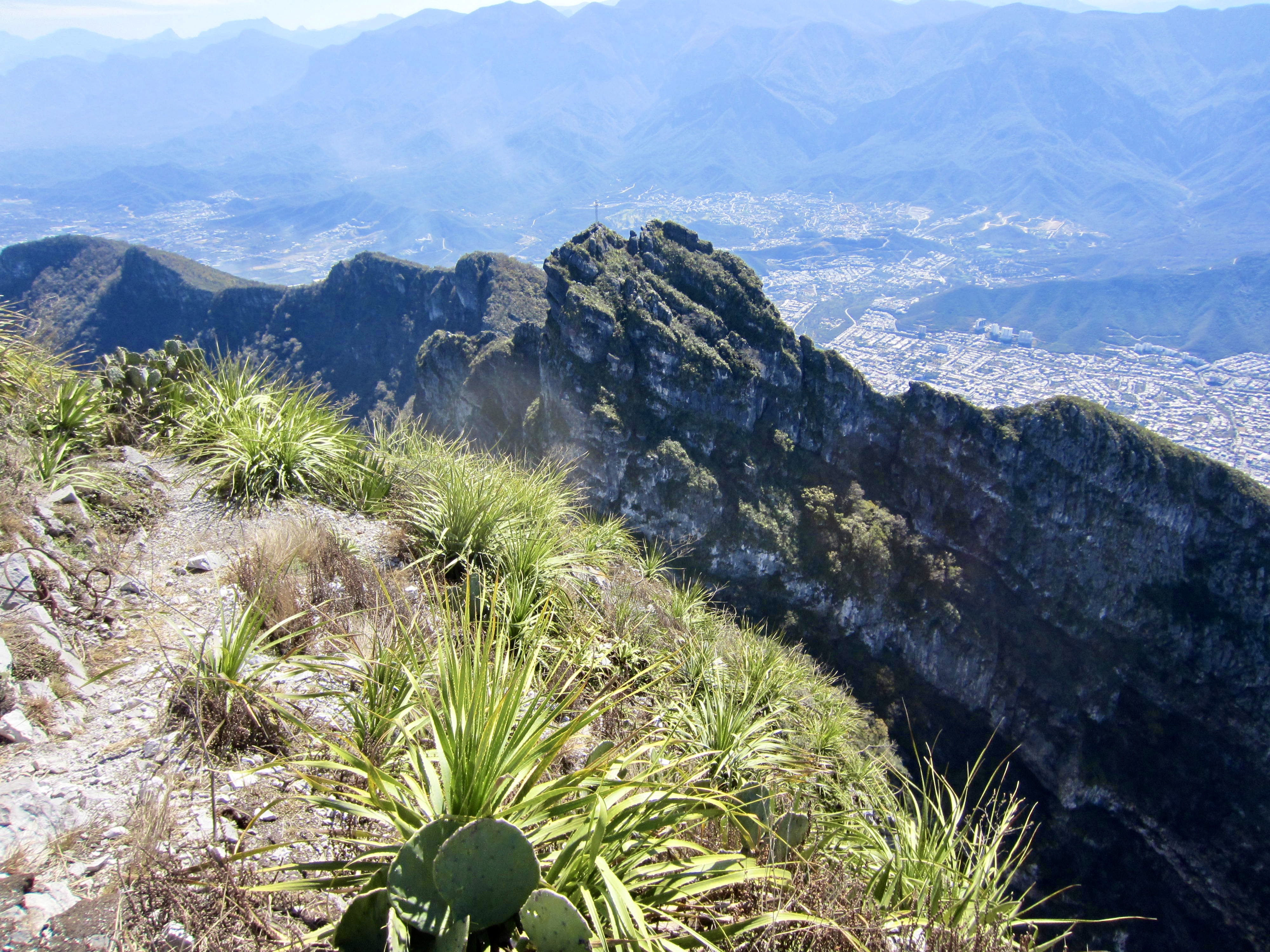
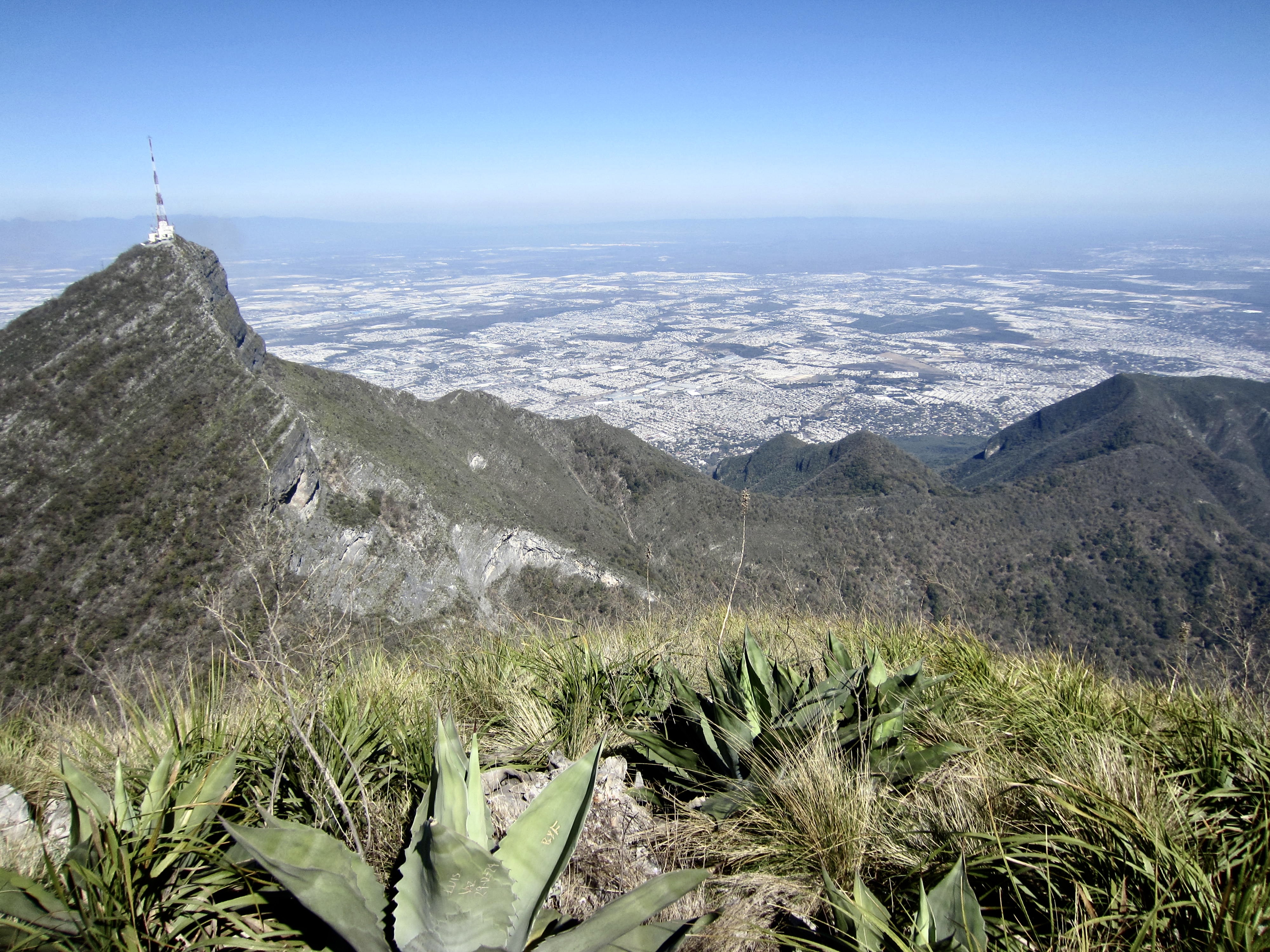
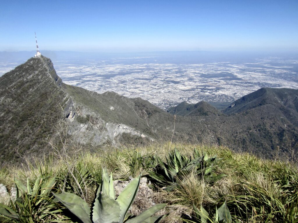
The mountain comprises several notable summits. At 5970 feet / 1820 meters, the highest summit is Pico Silla Norte (“North Saddle Peak”}, a visually striking horn of vegetated limestone. The next highest summit is Pico Silla Antena (5740 feet / 1750 meters), so named for its sky-piercing radio antenna. Pico Silla Sur is a lower, craggier summit situated closely south of the main peak.

.
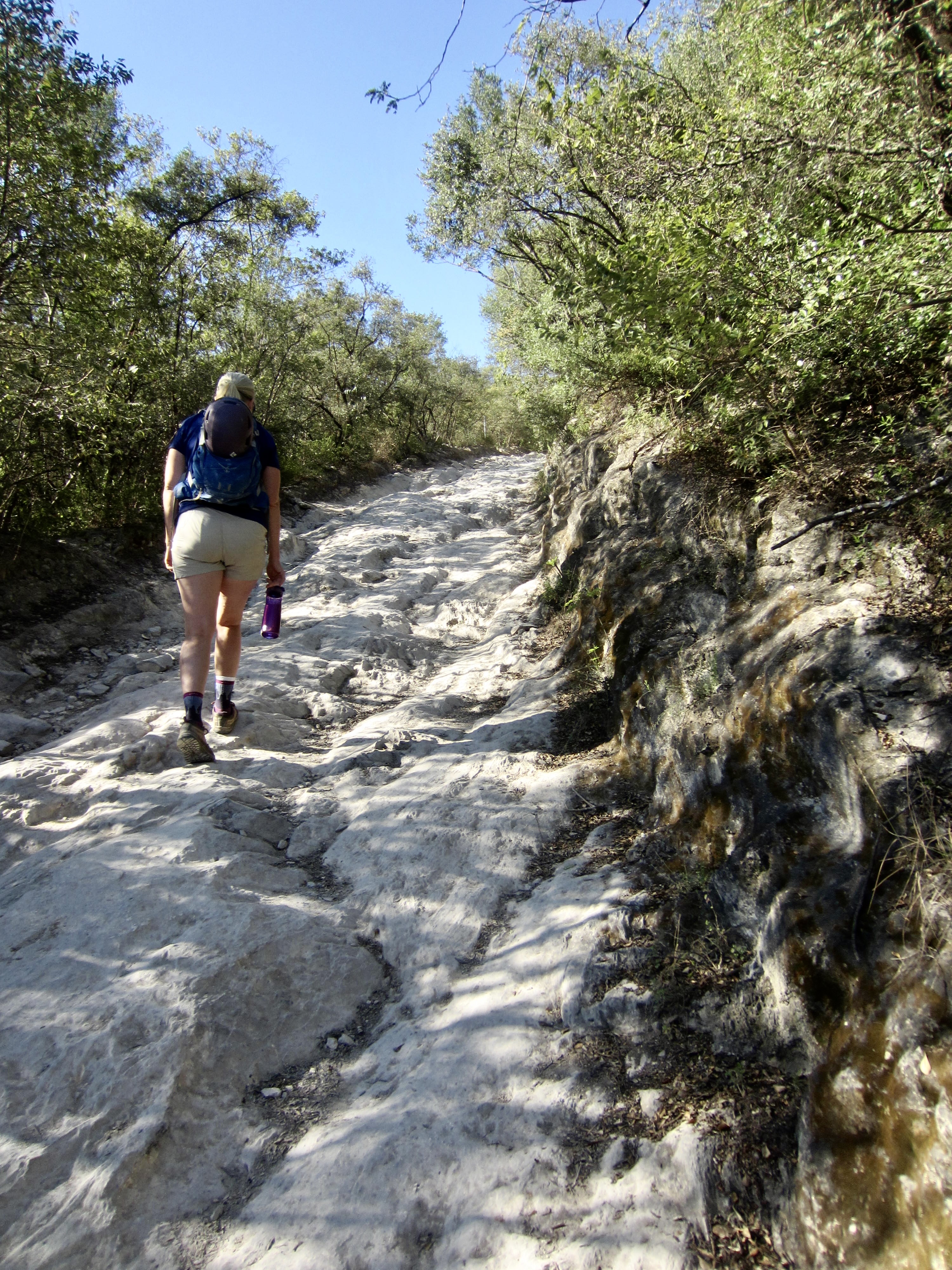
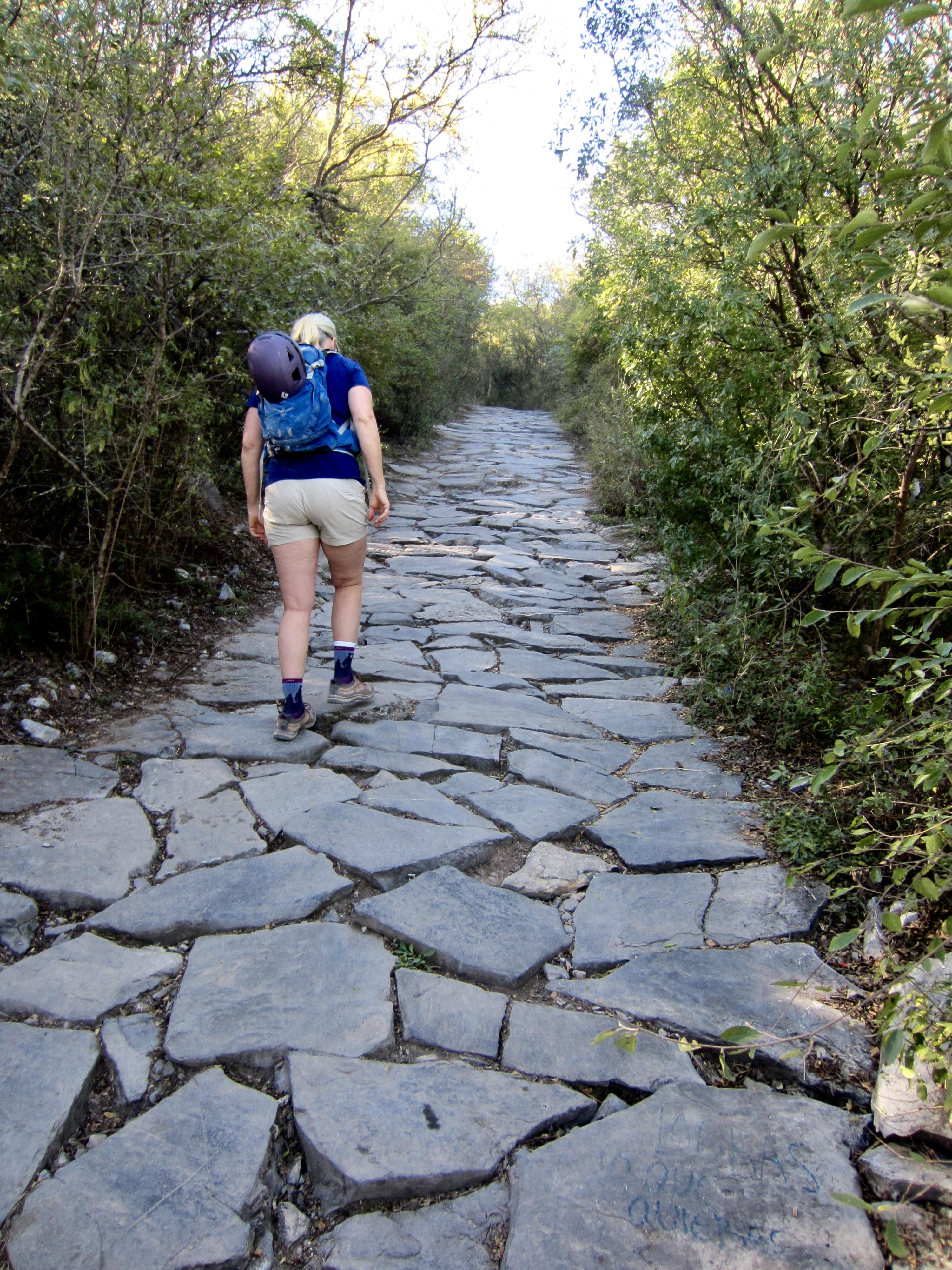
An ascent of Pico Silla Norte is a truly dichotomous trek. The first half of the route follows the Cerra de la Silla Trail, which is actually a 4X4 access road (closed to the public) that extends to the radio facility on Pico Silla Antena. Although steep and rough in many places, this mostly paved access road provides a straightforward hike to mid-mountain. The second half of the route follows a crude path that traverses into a northwest-trending gully and then heads steeply upward to the summit. This path is fairly well-trodden and well-marked but involves lots of Class 2 and Class 3 scrambling.
The Cerro de la Silla Trailhead is located at the upper end of a residential roadway called Bosques de la Pastora, where it intersects with Bosques de la Silla. There is no formal parking lot here, but some limited roadside parking is available. If these spots are taken, you will need to find a spot farther down the hill. An early start is advisable to maximize your parking chances.

.
Full Trip Report
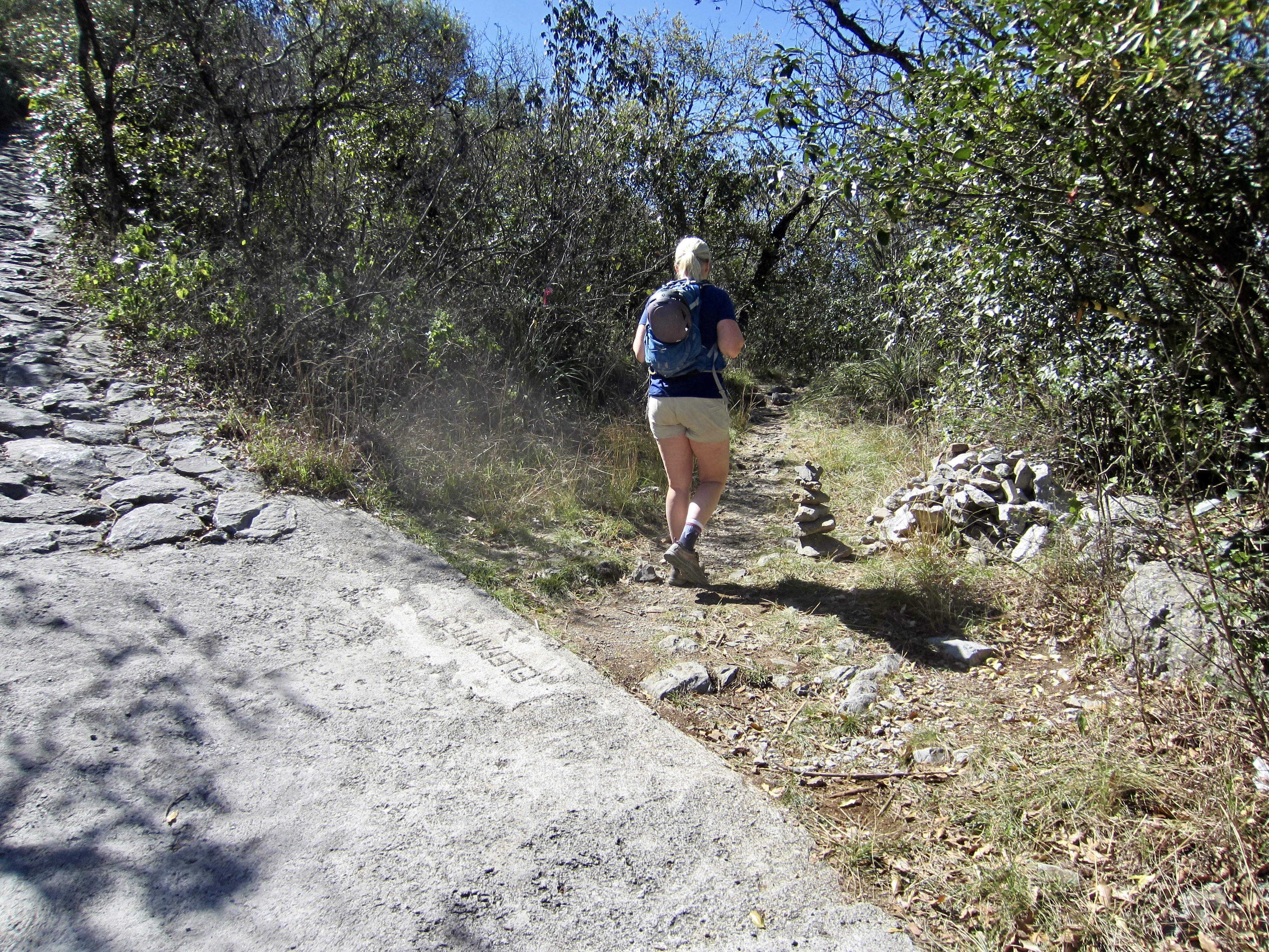
Eileen and I parked near the trailhead and began hiking up the Cerro de la Silla Trail on a mild, sunny Tuesday morning. The initial segment of this road-trail consists of lumpy limestone bedrock, but after the second switchback, most of the surface is paved with concrete or flagstones. We steadily gained elevation along with dozens of other trekkers. It became obvious that this is an extremely popular hike among Monterrey residents and tourists alike.
.
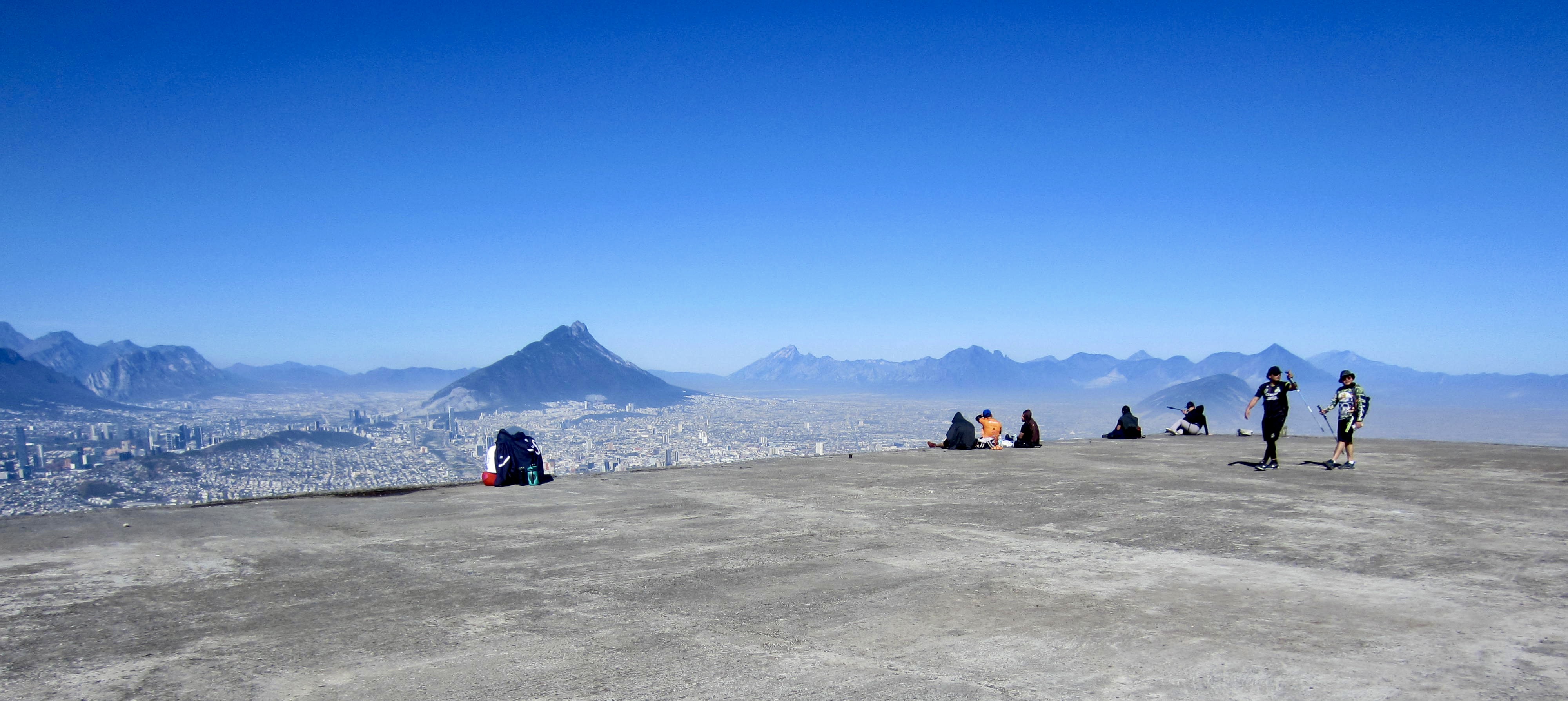
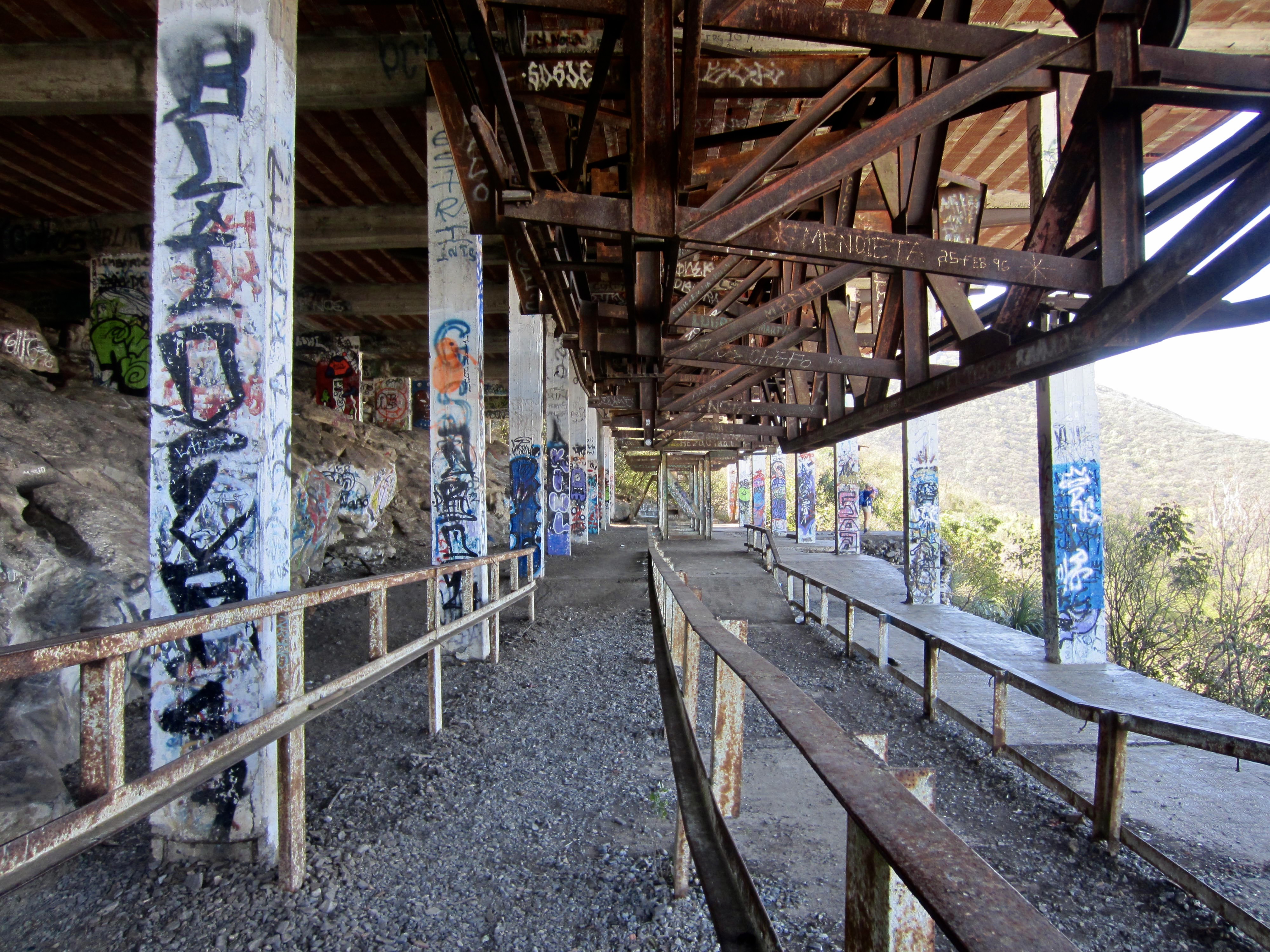
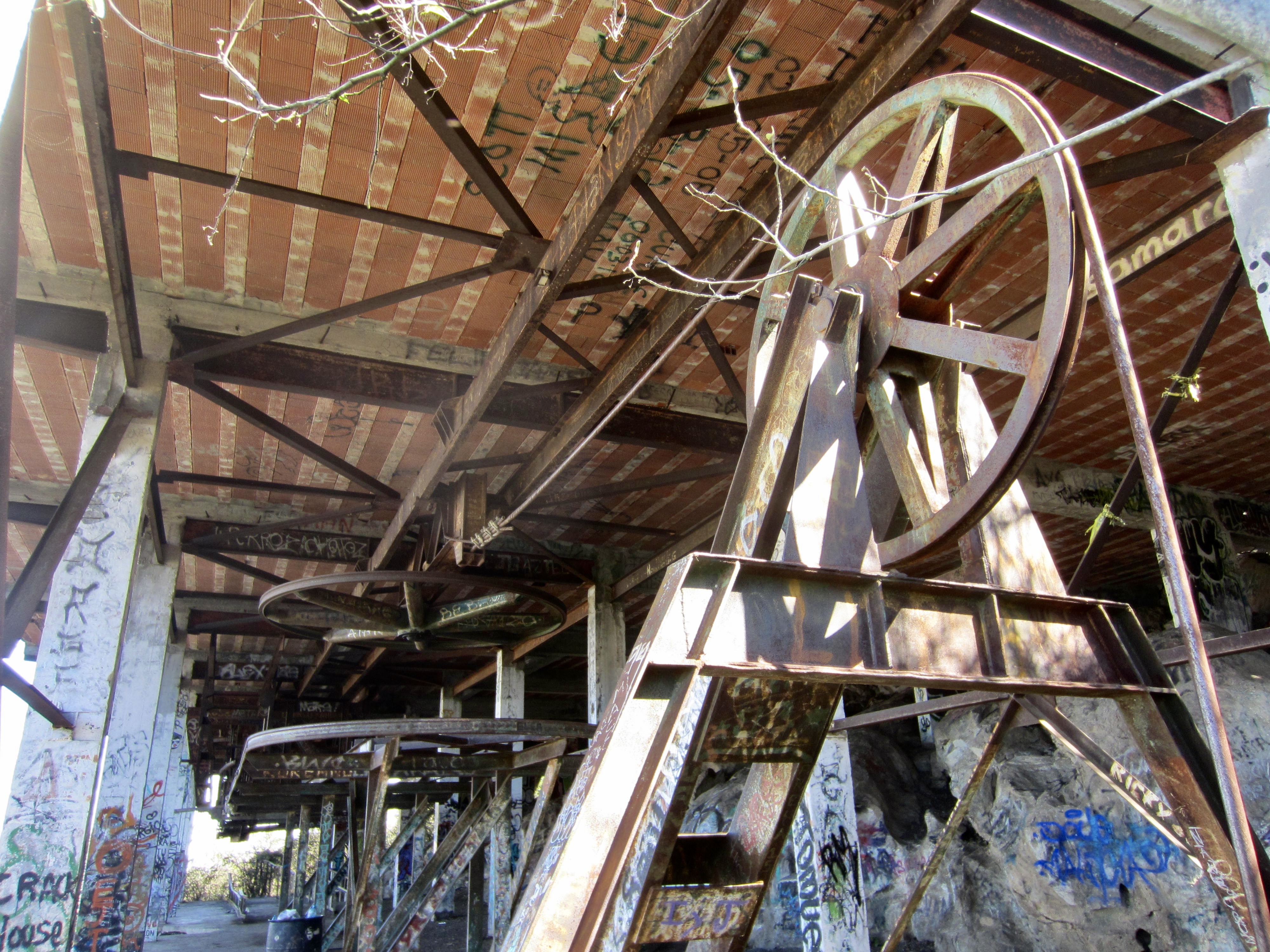
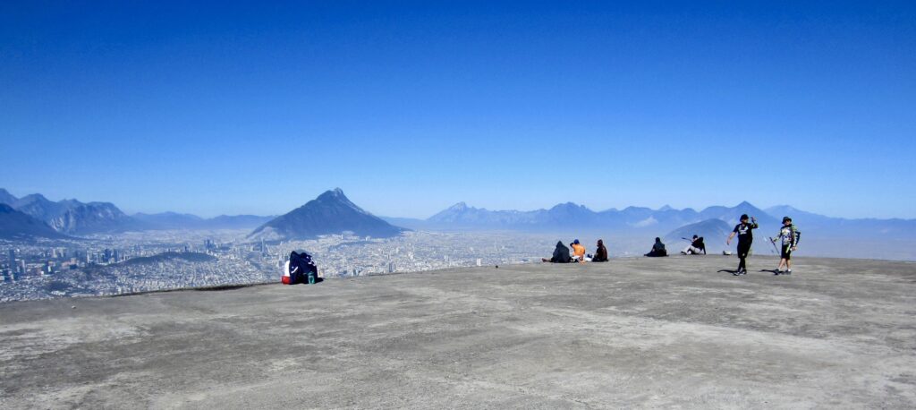
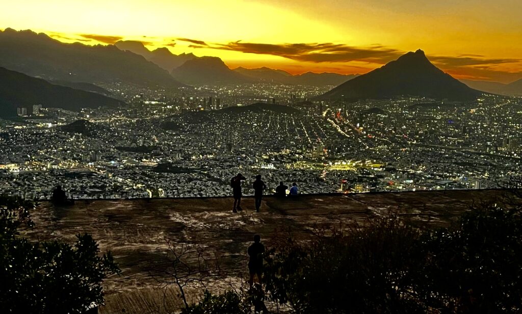
By mid-morning, we arrived at a short side-trail that leads down to an abandoned teleferico (gondola or aerial tramway) top station (1.3 hours + 1.6 mi / 2.6 km + 1700 ft / 520 m from TH). This gondola facility reportedly opened on June 2, 1961, to whisk residents and tourists up to a mid-mountain viewpoint. Tragically, it closed on the very same day when five people died due to a structural collapse. Now, the abandoned station serves as both an austere memorial and a marvelous viewpoint destination for thousands of hikers each year.
.
.
.
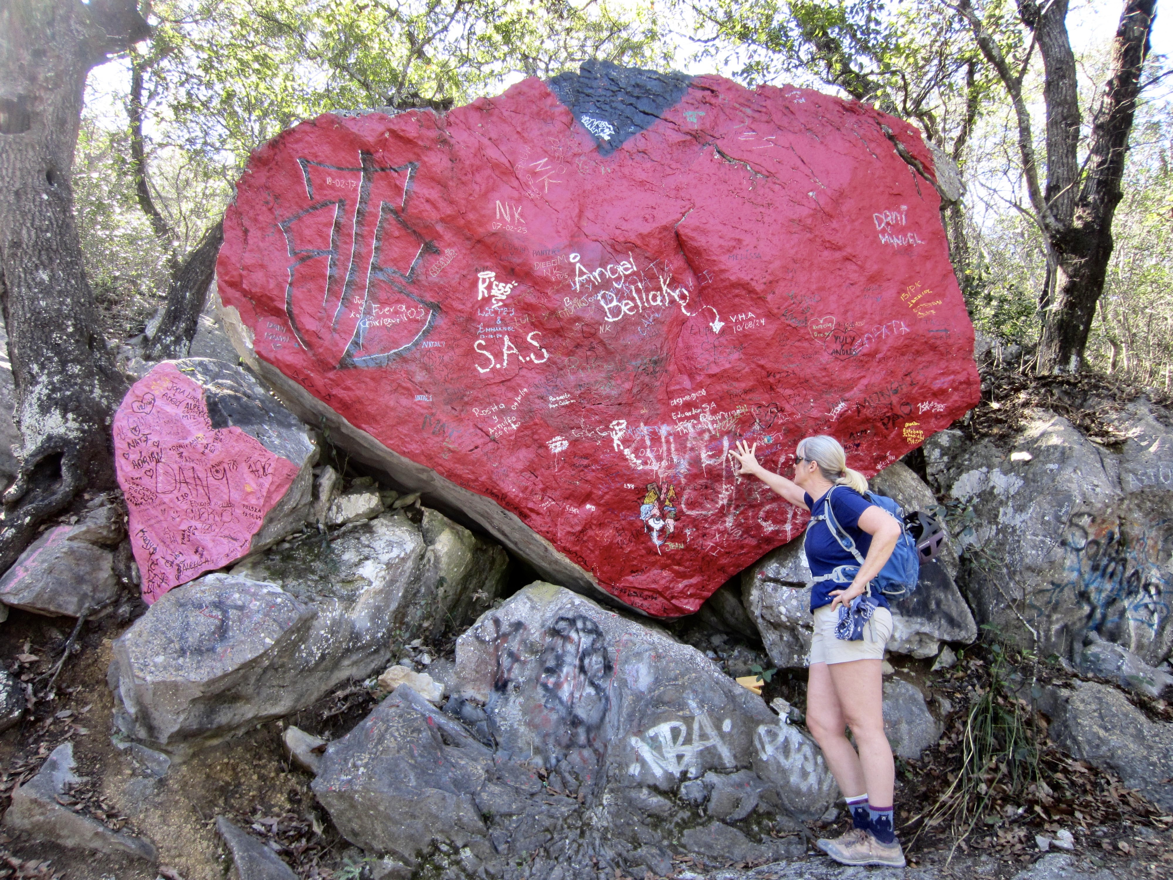
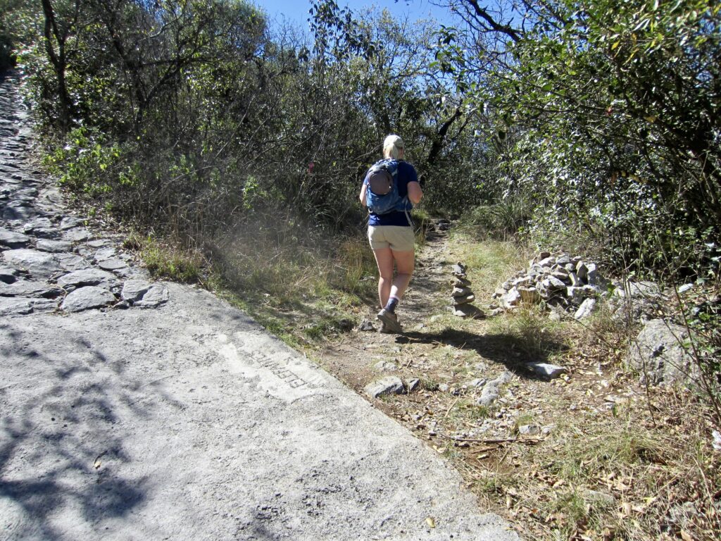
Beyond the gondola station, a series of tight switchbacks took us past a large, heart-shaped boulder sporting a flashy coat of scarlet paint. Soon after, we arrived at a junction with a primitive trail leading straight into the forest. This is the start of the Pico Silla Norte climber’s path.

.
.
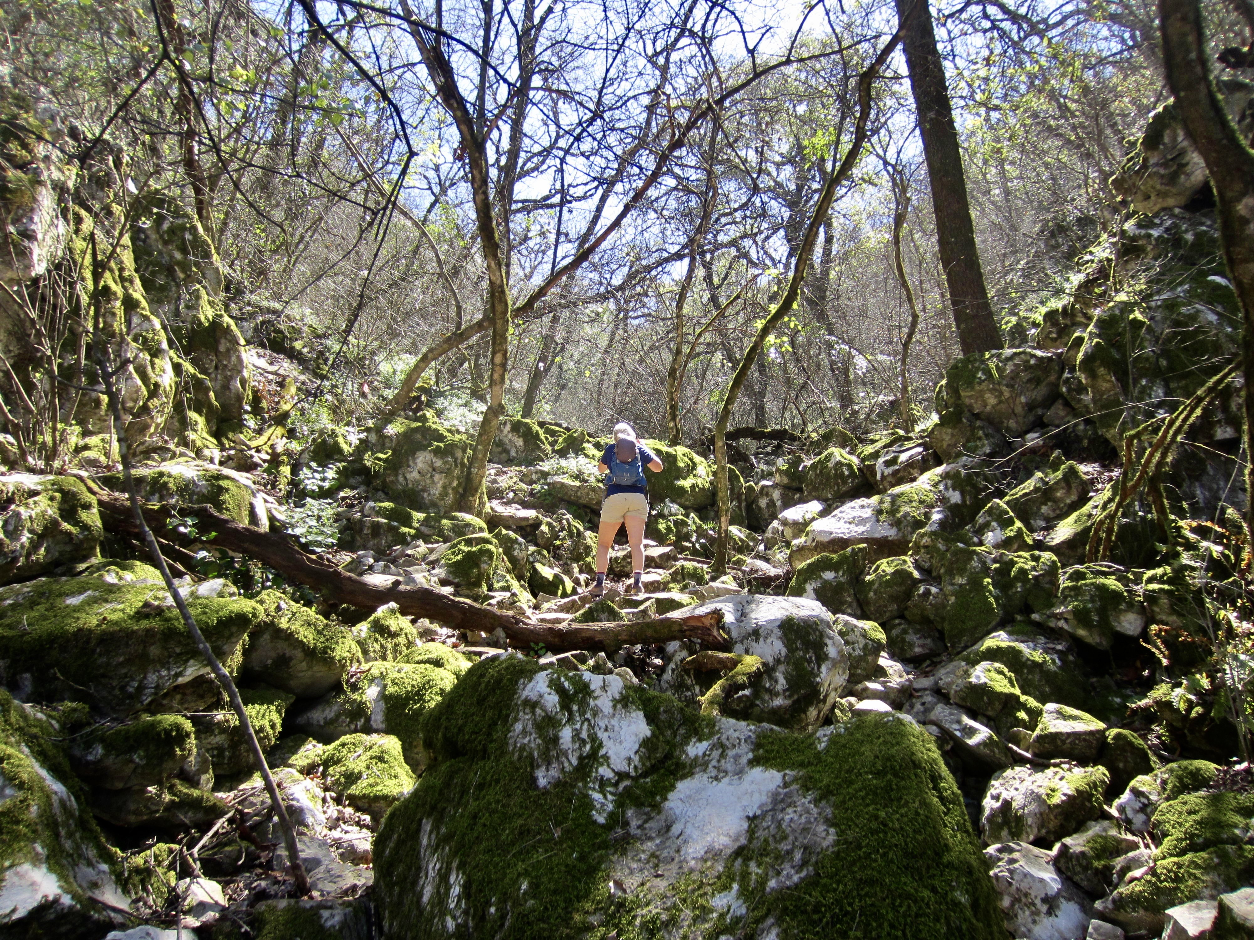
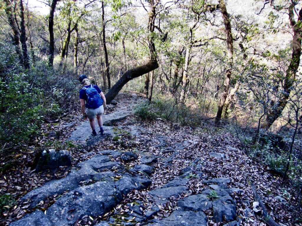
We followed the climber’s path as it made an undulating traverse across the forested hillslope. It began with a short descent, followed by a short ascent, then another descent, then another ascent, and so on. From our perspective, these incessant ups and downs serve little purpose other than to annoy climbers!
.
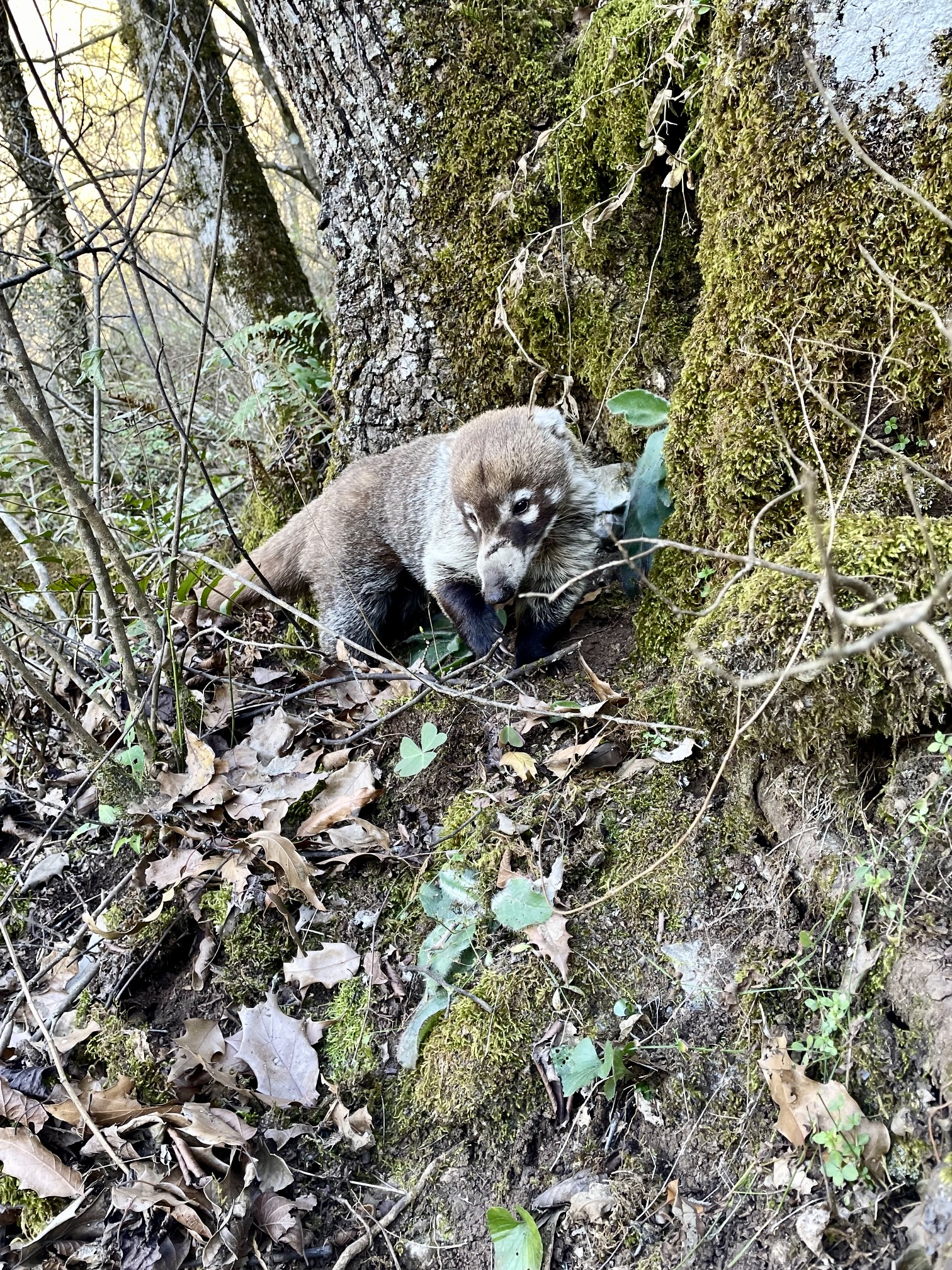
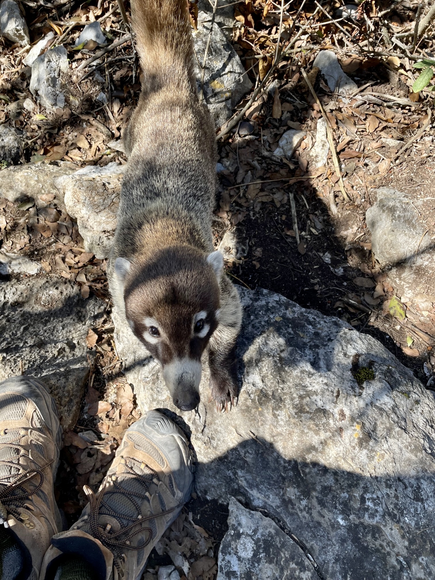
During our traverse, we encountered a strange little animal with a long tail and a pig-like snout. It seemed neither afraid nor threatening; instead, it seemed friendly and curious. Our later research revealed that it was a coati, informally known as a Mexican badger. The fuzzy little critter probably hoped that we would offer some snacks.
.
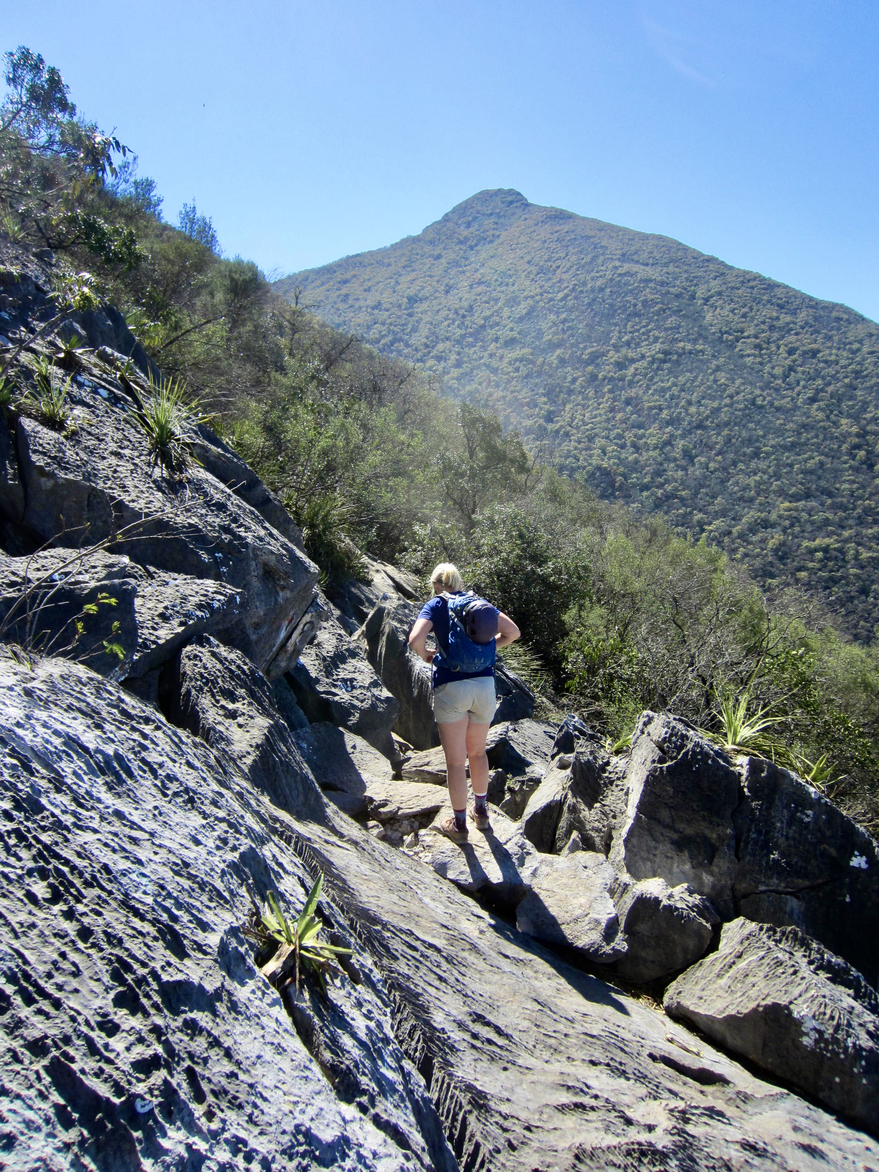
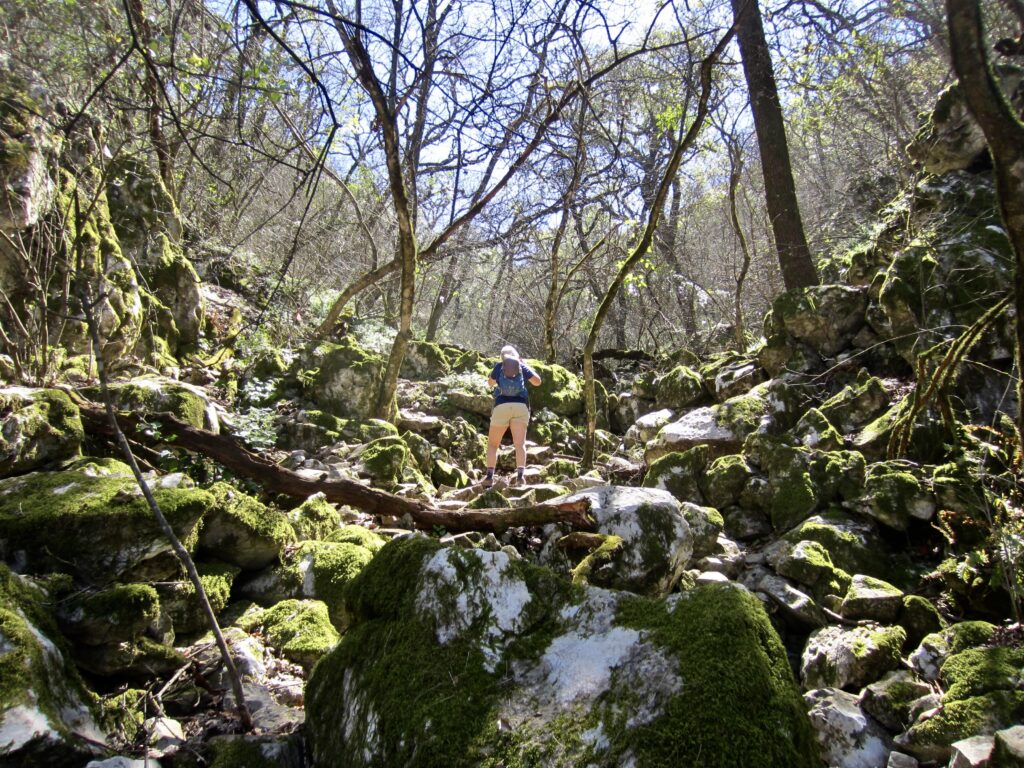
We continued our undulating traverse until a final descent put us into the invert of a mossy gully that runs between Pico Silla Antena and Pico Silla Norte (3.6 hours + 2400 ft / 730 m from TH). Here, the climber’s path turns sharply uphill and makes a beeline for the Norte summit.
.
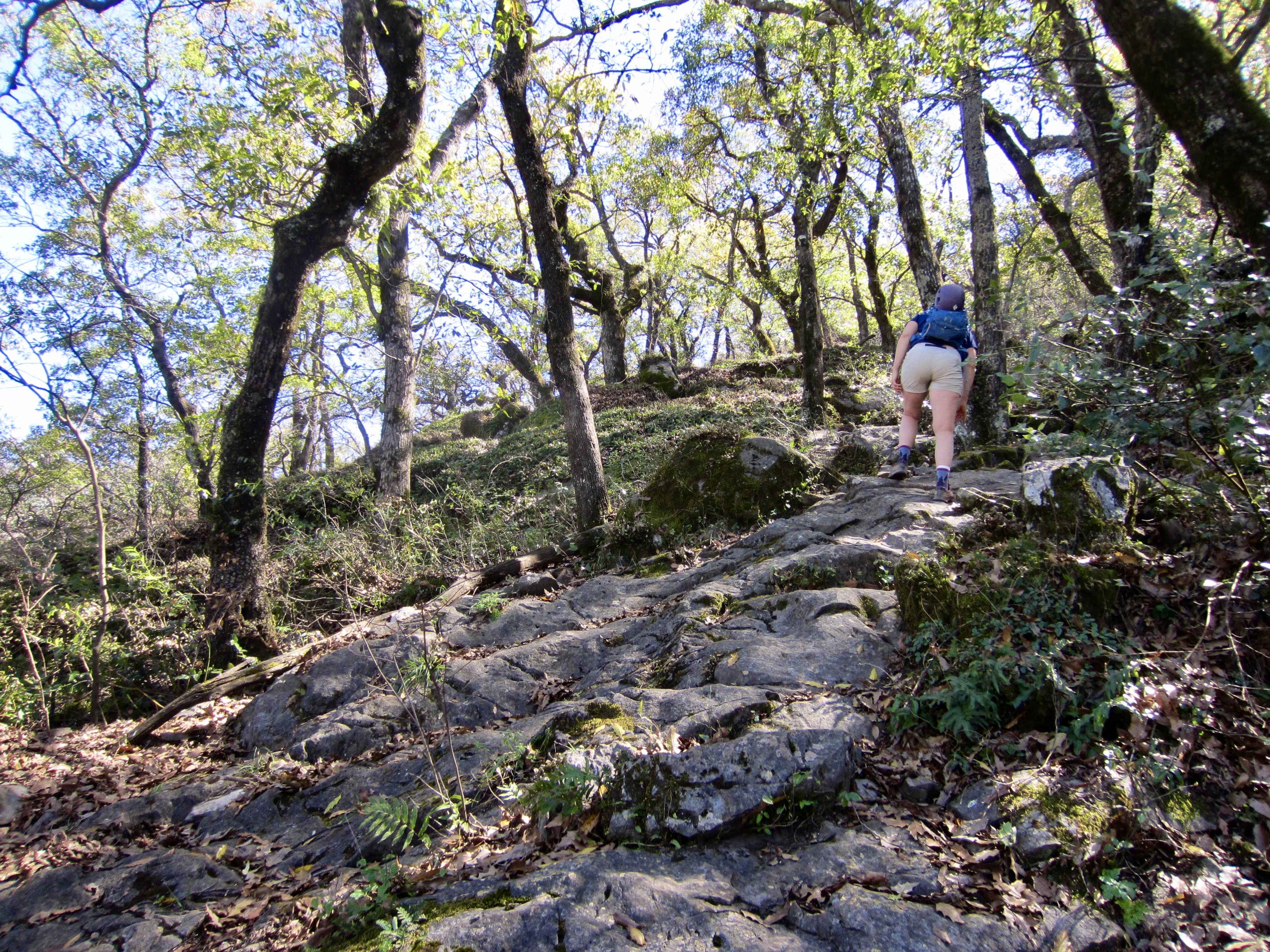
Our progress had been frustratingly slow during the traverse, but now we were gaining elevation rapidly as the steep path curved around oak trees and over limestone slabs. After an hour, however, Eileen waved me ahead due to concerns about our time required to finish the ascent and then make the entire descent.

.
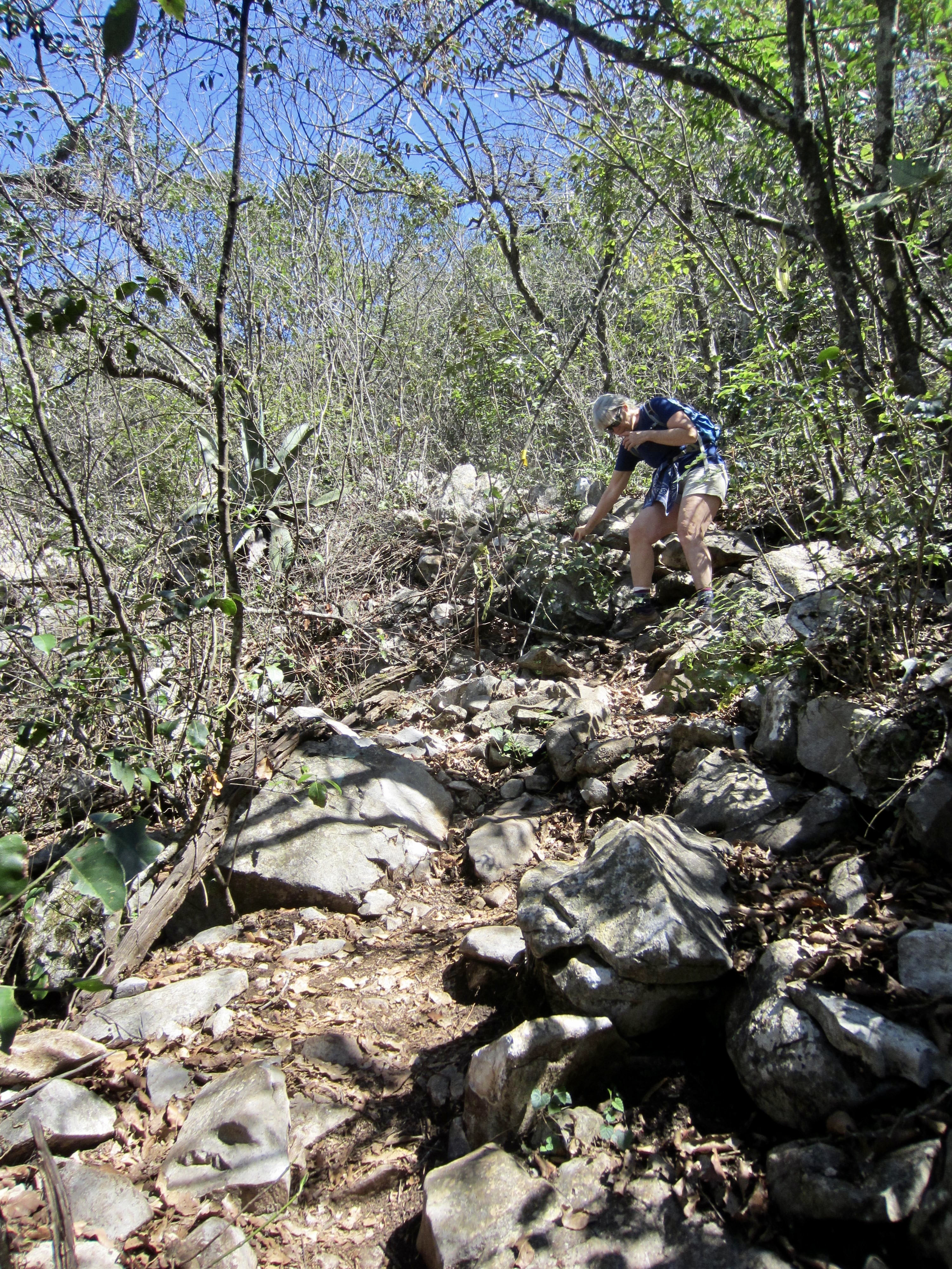
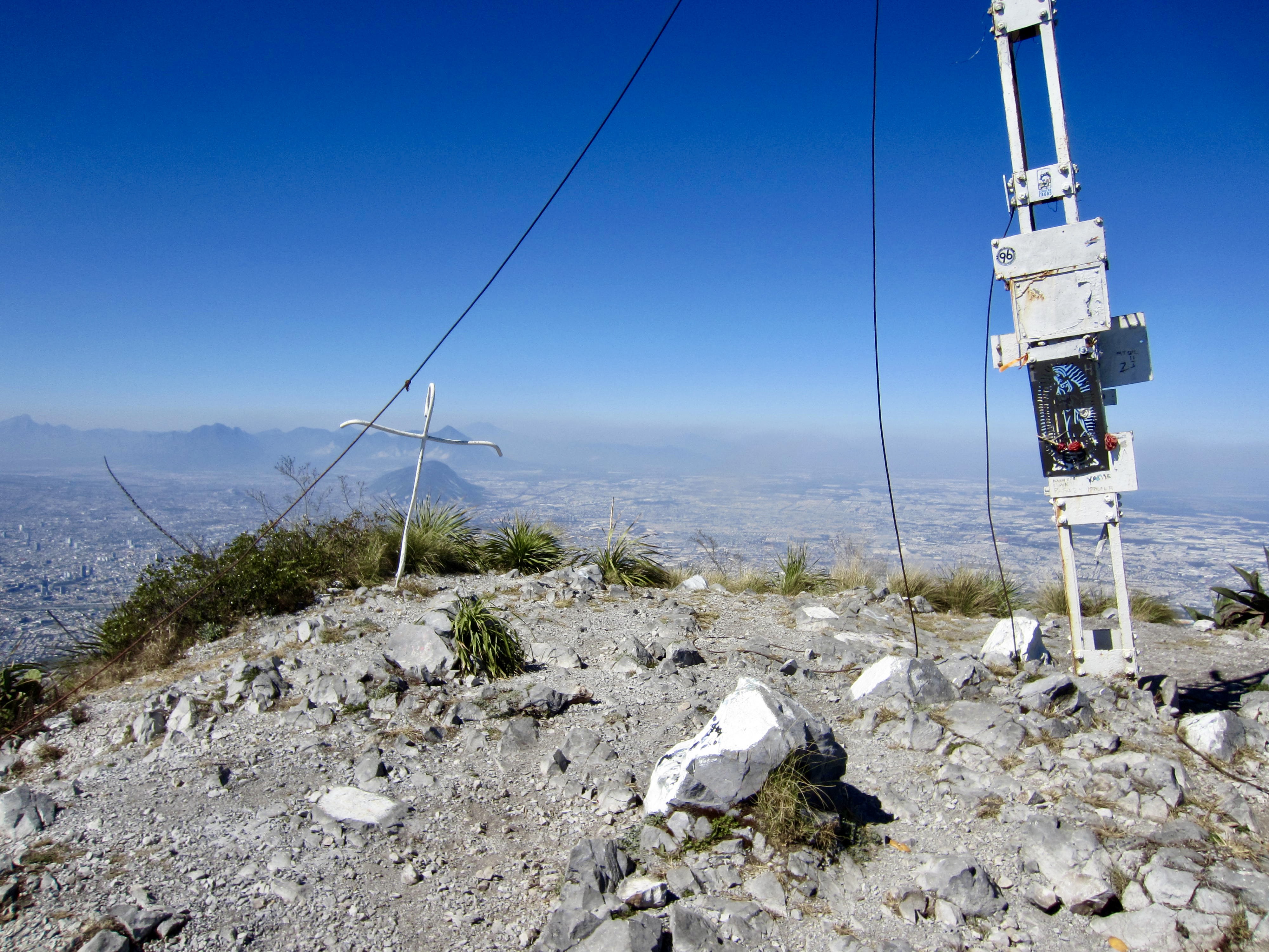
As I hurried uphill, the climber’s path became gradually steeper, with many small rock outcrops that required Class 2 and Class 3 scrambling. Eventually, I broke out of the forest and worked my way through tall grasses and spikey agave plants to top out in mid-afternoon (5.3 hours + 4250 ft / 1300 m from TH). The summit area features a small antenna, an artistic crucifix, and a scattering of painted rocks.
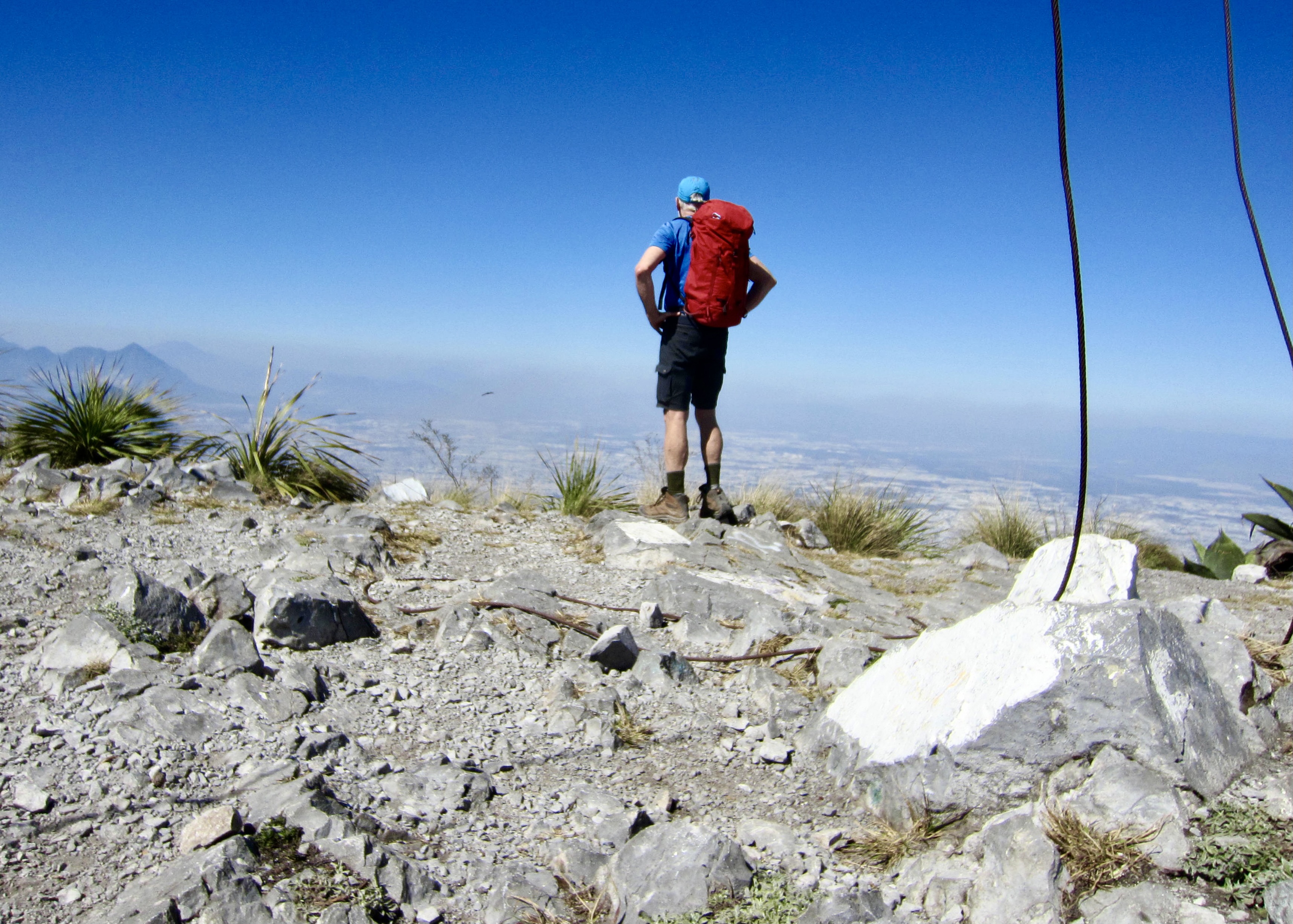
.
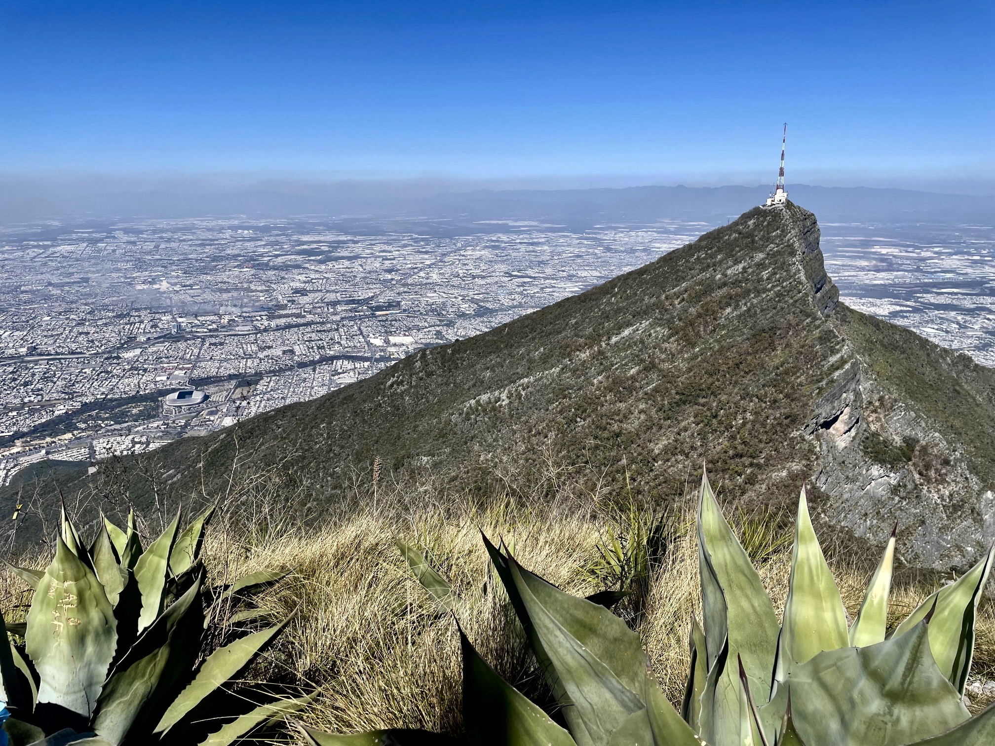
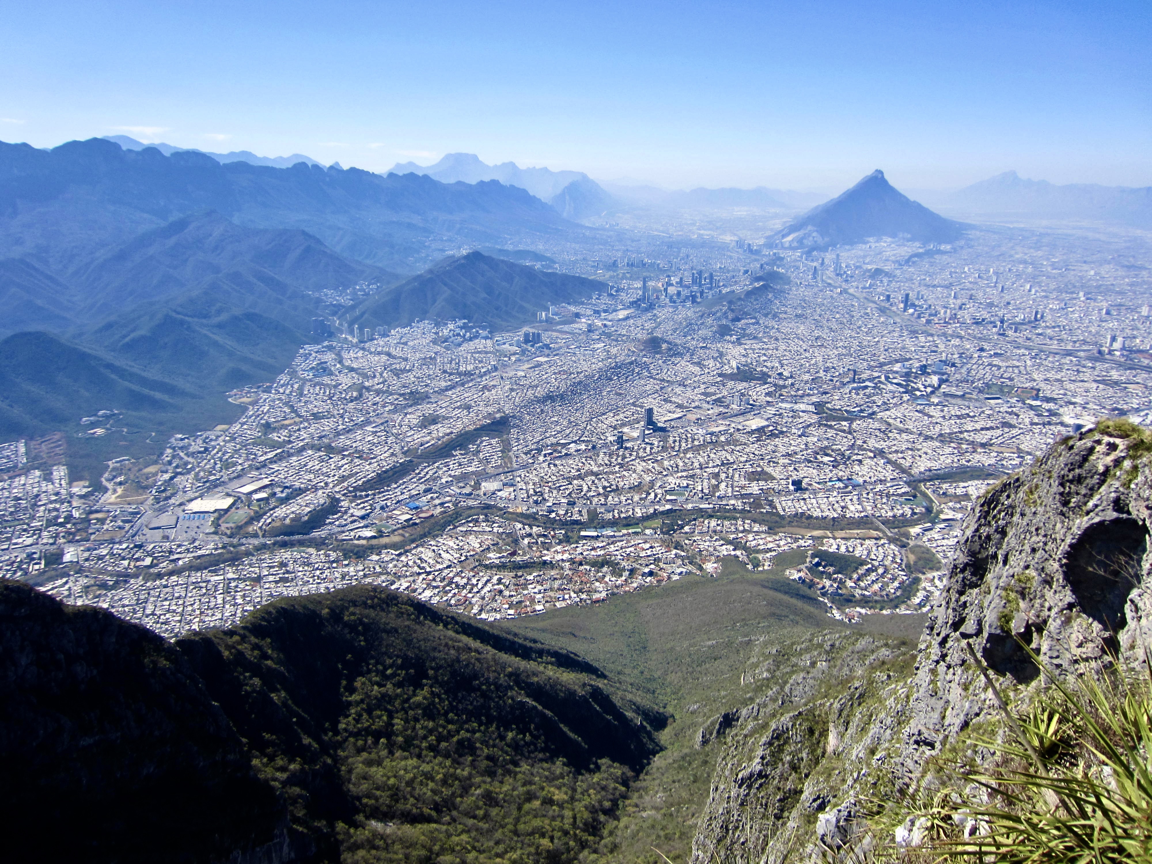
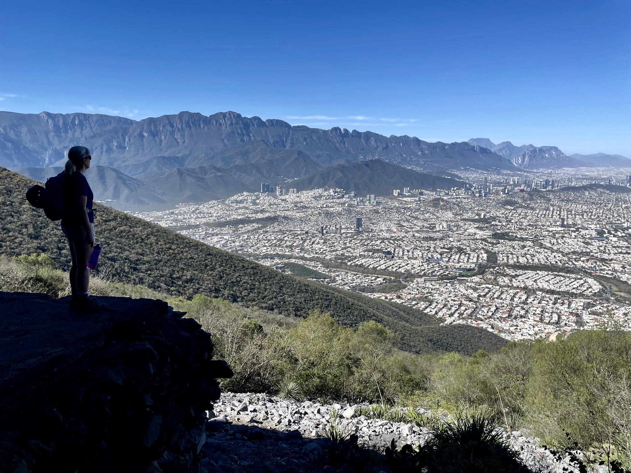
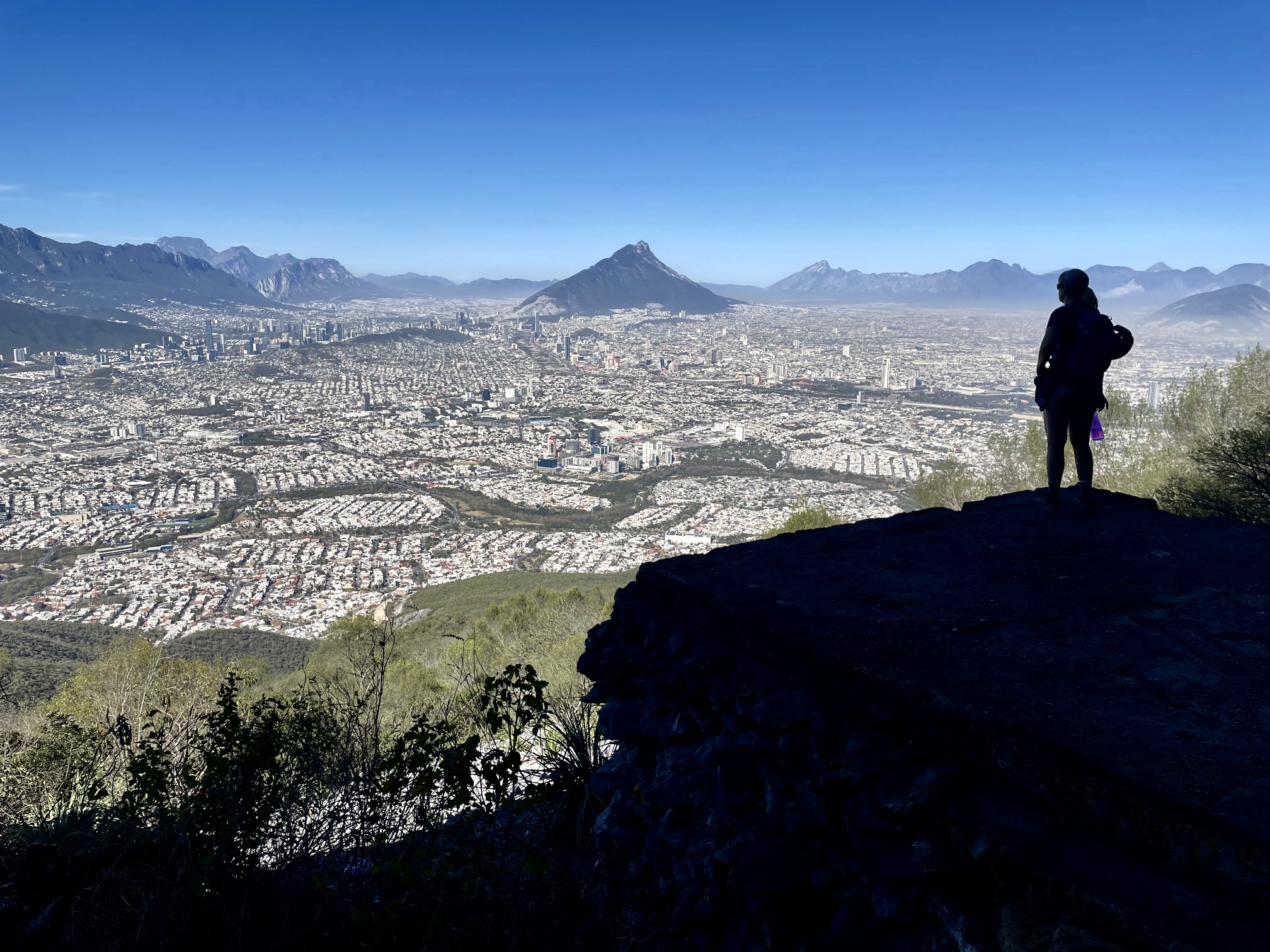
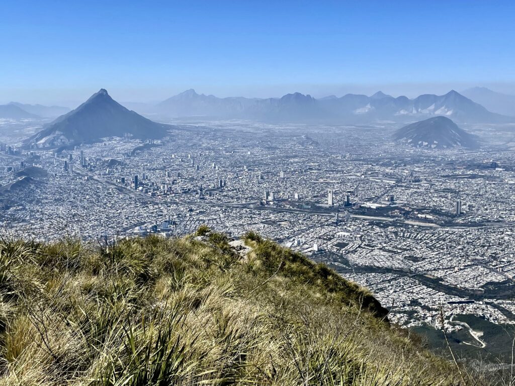
Thanks to its position on the southeastern fringe of Monterrey, this peak provides an outstanding vantage of the entire metropolitan area, which has a population exceeding 5 million. Amidst the urban sprawl, Cerro de las Mitras (“The Miters Mountains”) rise up like a breaking wave. Closely to my north and slightly lower, Pico Silla Antena displayed its summit communication structures.

.
.
.
Shortly after starting my descent, I encountered Eileen resting in the forest, and we continued down together. The path was covered with dry oak leaves, which made the ground surface as slippery as verglas, so we weren’t able to gain any time descending the gully. The undulating traverse was also equally slow and annoying. It was dusk when we reached the paved trail.
.
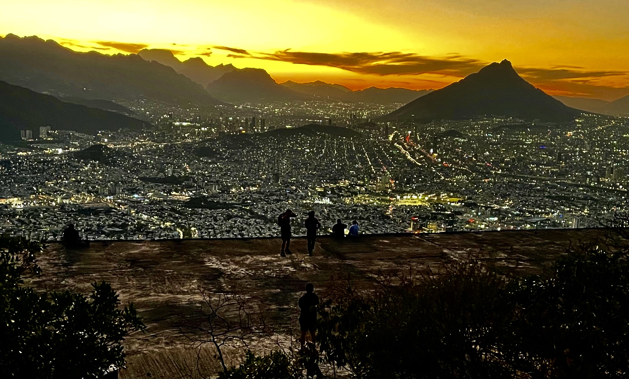
Our reward for the late descent was a stunning sunset view from the old gondola station. Dozens of other people were there to enjoy the same view, and we passed a hundred more hikers on the trail before we reached the trailhead long after dark (5.2 hours + 300 ft / 90 m from summit). It had been a long but very satisfying day, well worth the effort!
.
Route Map & Profile
…
…
Photo Gallery
Click to enlarge…