Trip Date: July 25-27, 2025
MID-SUMMER OUTING NO. 23: EAST SAUK MOUNTAINS
Painted Traverse: Red Mountain Lookout to Red Pass
Red Mountain Lookout Site
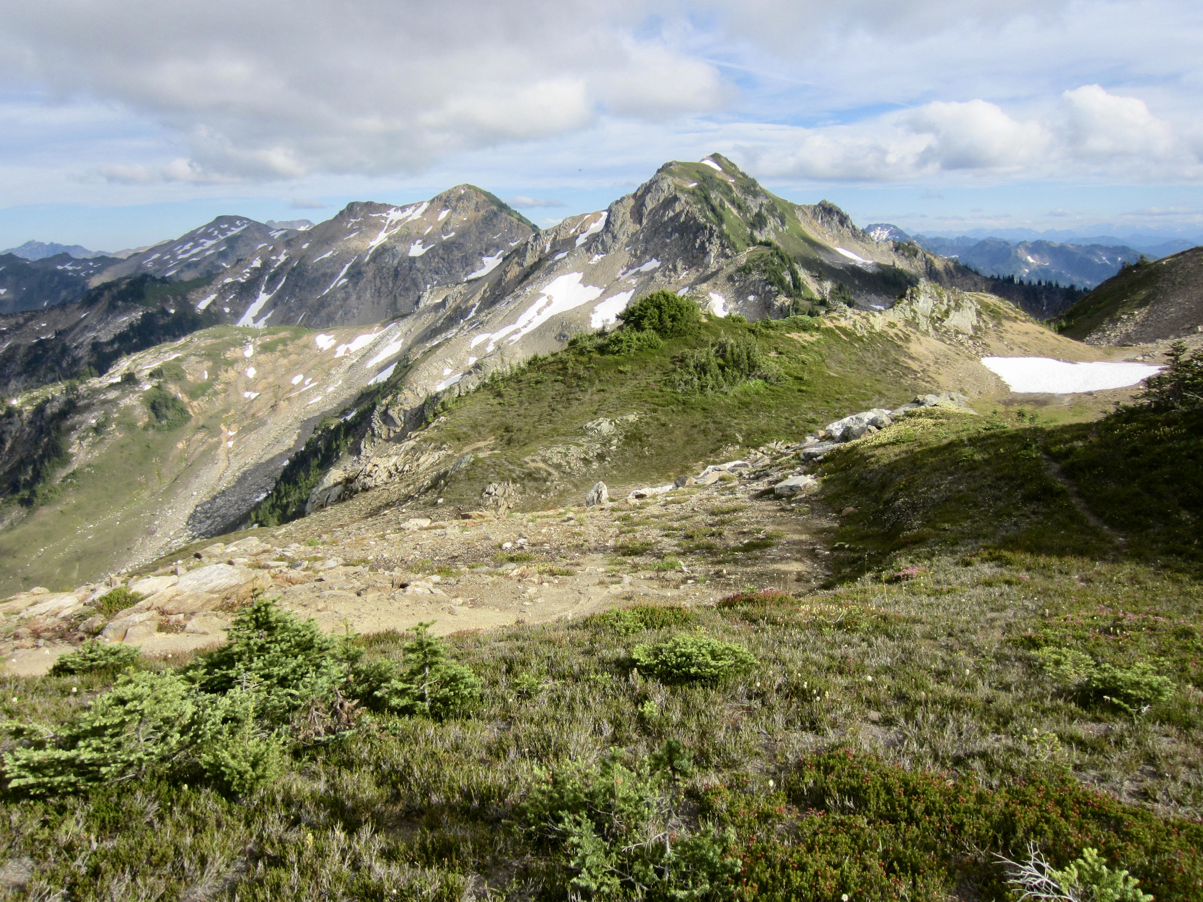
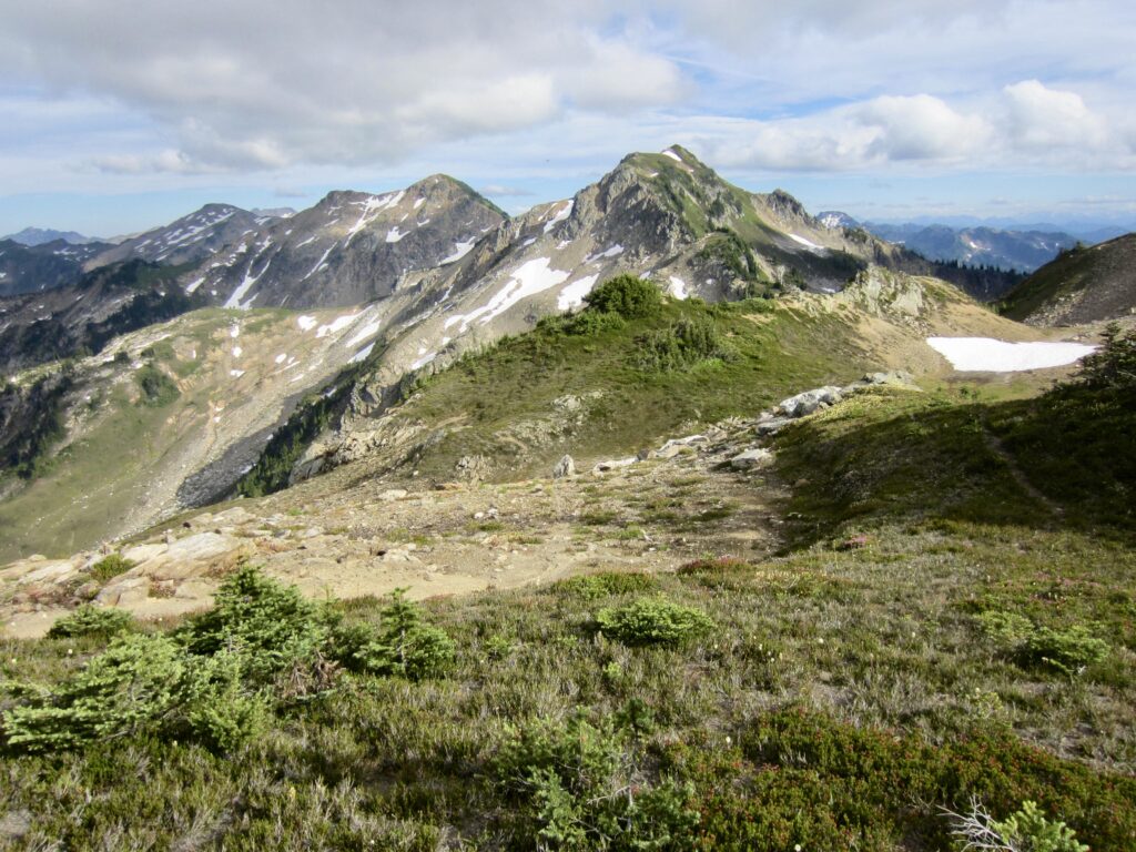
Painted Mountain fka Red Mountain (6975 ft)
Magenta Peak (6735 ft)
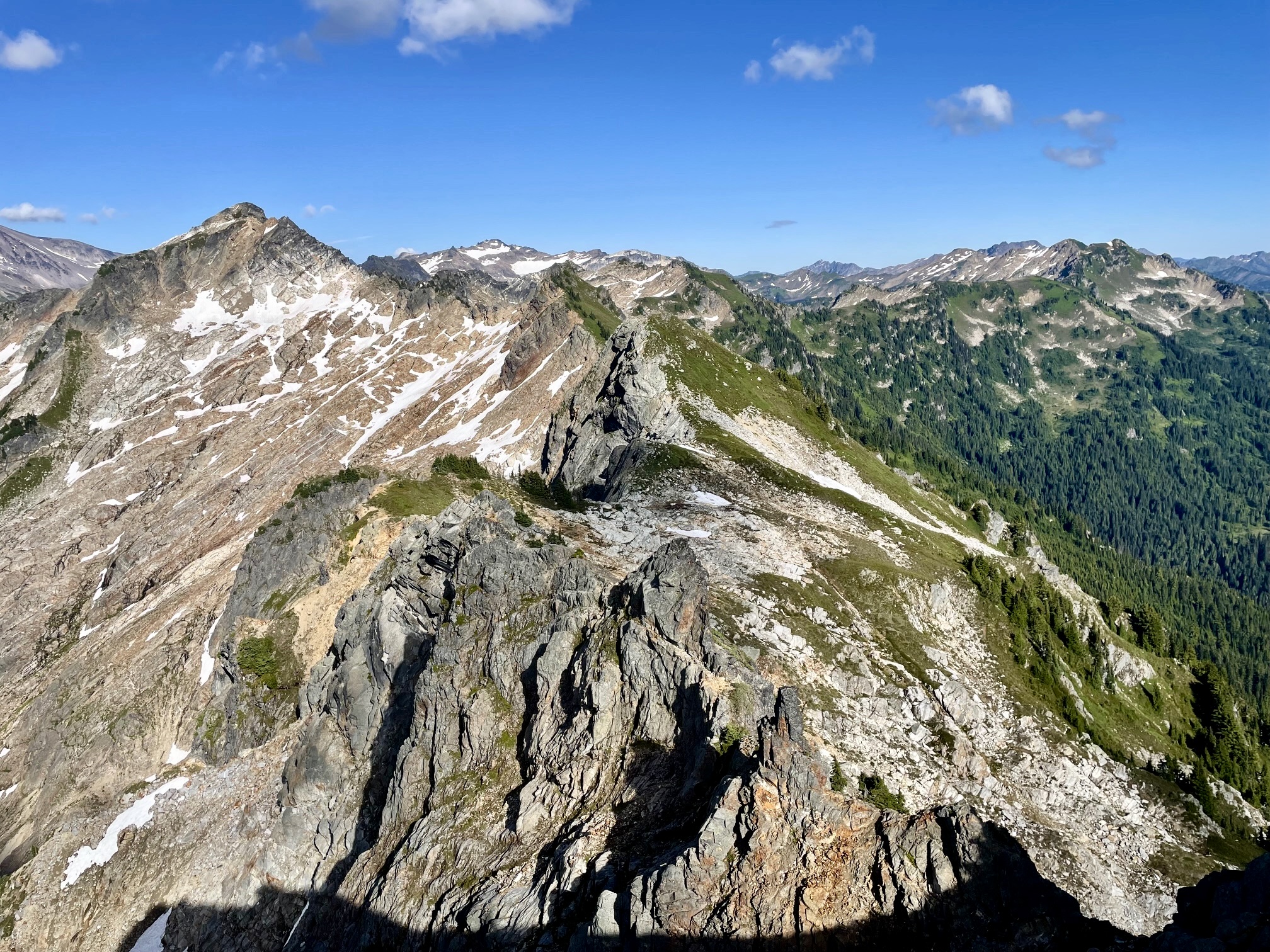
Black Mountain (7262 ft)
Skullcap Peak (6603 ft)
Purple Peak (6910 ft)
Portal Peak (6999 ft)
Red Pass / Pacific Crest Trail
Mackinaw Shelter Site
Trip Summary
Region: North-Central Washington Cascades
Sub-Region: East Sauk Mountains
Area: Glacier Peak Wilderness
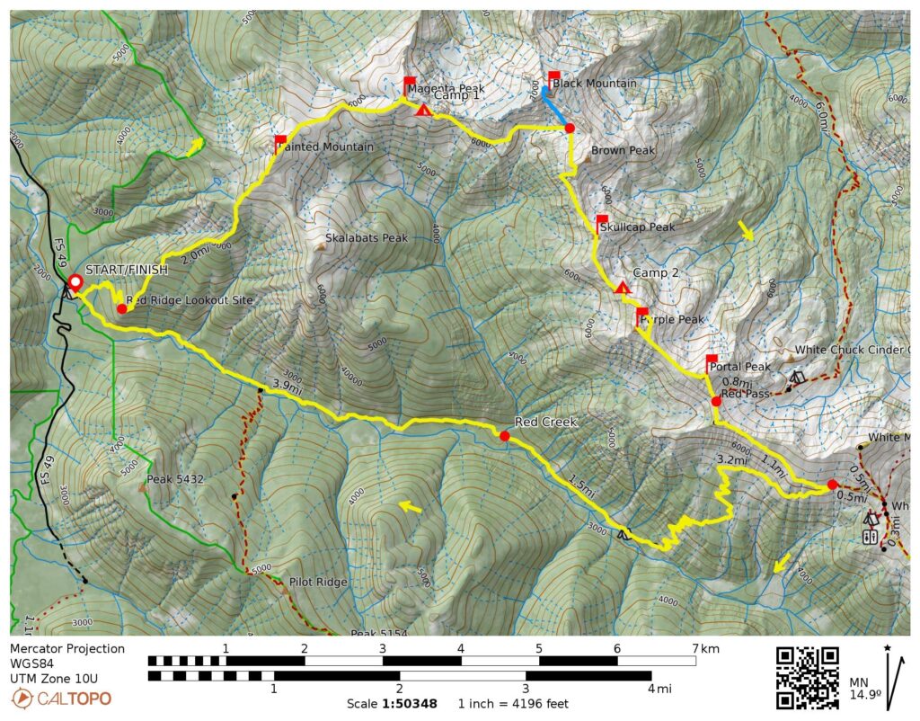
Starting & Ending Point: North Fork Sauk River Trailhead on Sloan Creek Road #49 (Elev. 2070 feet)
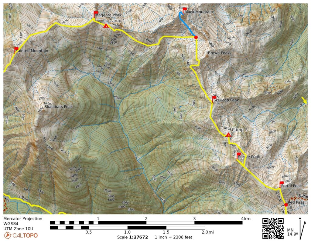
Traverse Way Points: Red Mountain Lookout Trail junction & Red Mountain Lookout site & Painted Mountain summit (trail hike); Painted–Magenta Saddle & Magenta Peak summit & Magenta – Point 6716 Saddle & Point 6824 arm & Black Basin & Point 6844 & Brown–Skullcap Saddle & Skullcap Peak summit & Skullcap–Purple Saddle & Purple Peak arm & Purple–Portal Saddle & Red Pass / PCT junction (off-trail hike & rock scramble & heather scramble); North Fork Sauk River Trail junction & Mackinaw Shelter site & Red Creek Bridge & Red Mountain Lookout Trail junction & North Fork Sauk River Trailhead (trail hike).
Traverse High Point: Portal Peak summit (Elev. 6999 feet)
Campsites: South side of Magenta – Point 6716 Saddle (Elev. 6500 feet) & east side of Skullcap–Purple Saddle (Elev. 6350 feet).
Summit 1: Painted Mountain (trail hike via South Ridge; descent via Northeast Ridge)
Summit 2: Magenta Peak (off-trail hike via Southwest Ridge; descent via Southeast Face)
Summit 3: Black Mountain (off-trail hike & heather scramble & rock scramble via Southwest Chute—Northwest Ridge)
Summit 4: Skullcap Peak (off-trail hike via Northwest Ridge; descent via South Ridge)
Summit 5: Purple Peak (off-trail hike via Southeast Ridge)
Summit 6: Portal Peak (off-trail hike & bushwhack via West Ridge; descent via South Ridge)
Approximate Stats (excluding sidetrips): 19.0 miles traveled; 9700 feet gained & lost.
Approximate Stats (including sidetrips): 20.0 miles traveled; 10,700 feet gained & lost.
Related Posts
>>> Black Mtn. via Lost Creek Ridge—Lake Byrne—Northwest Face – August 2013
>>> Black Mtn. via White Chuck River—Lake Byrne—Northwest Face – July 2002
Trip Overview
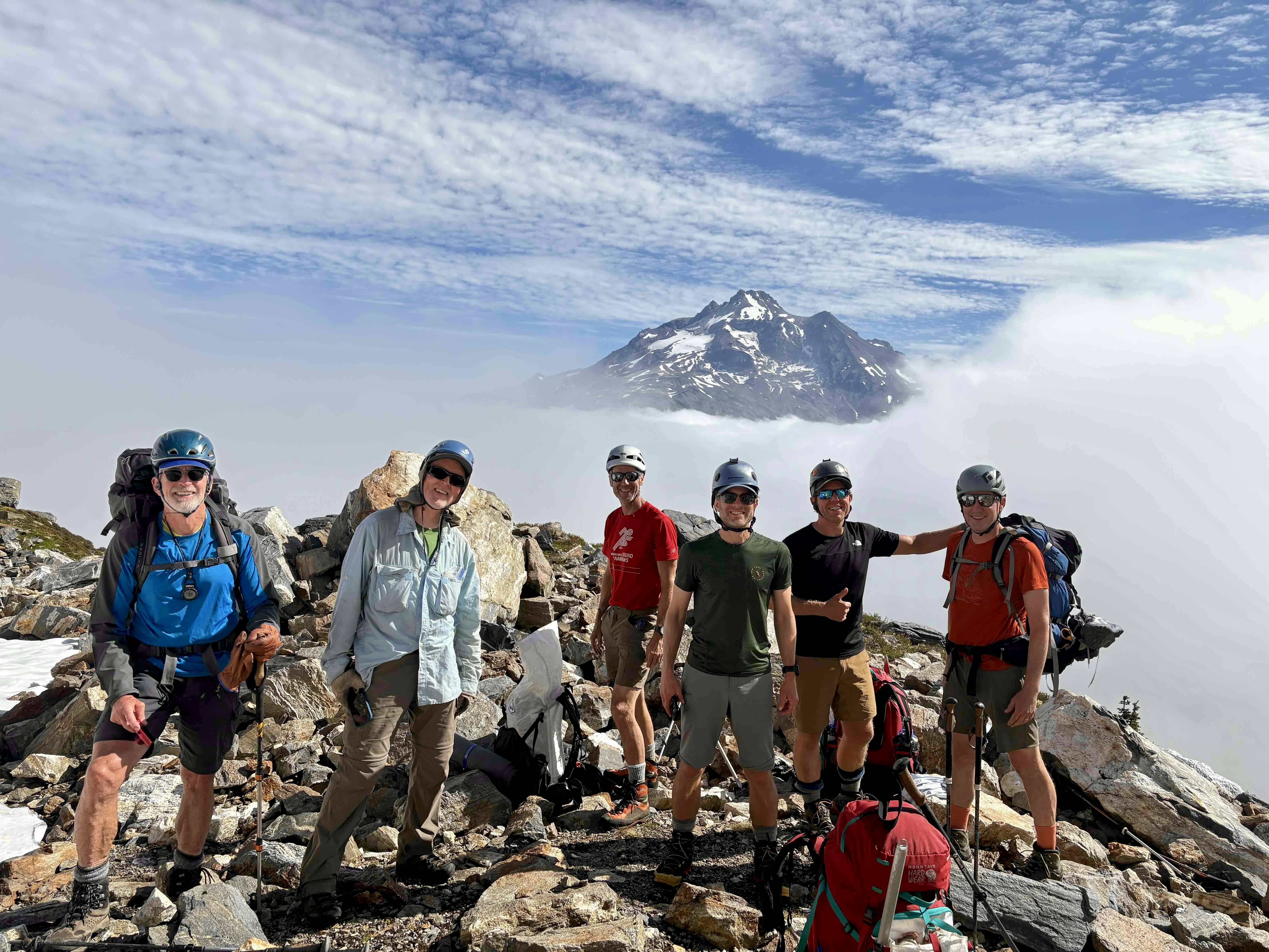
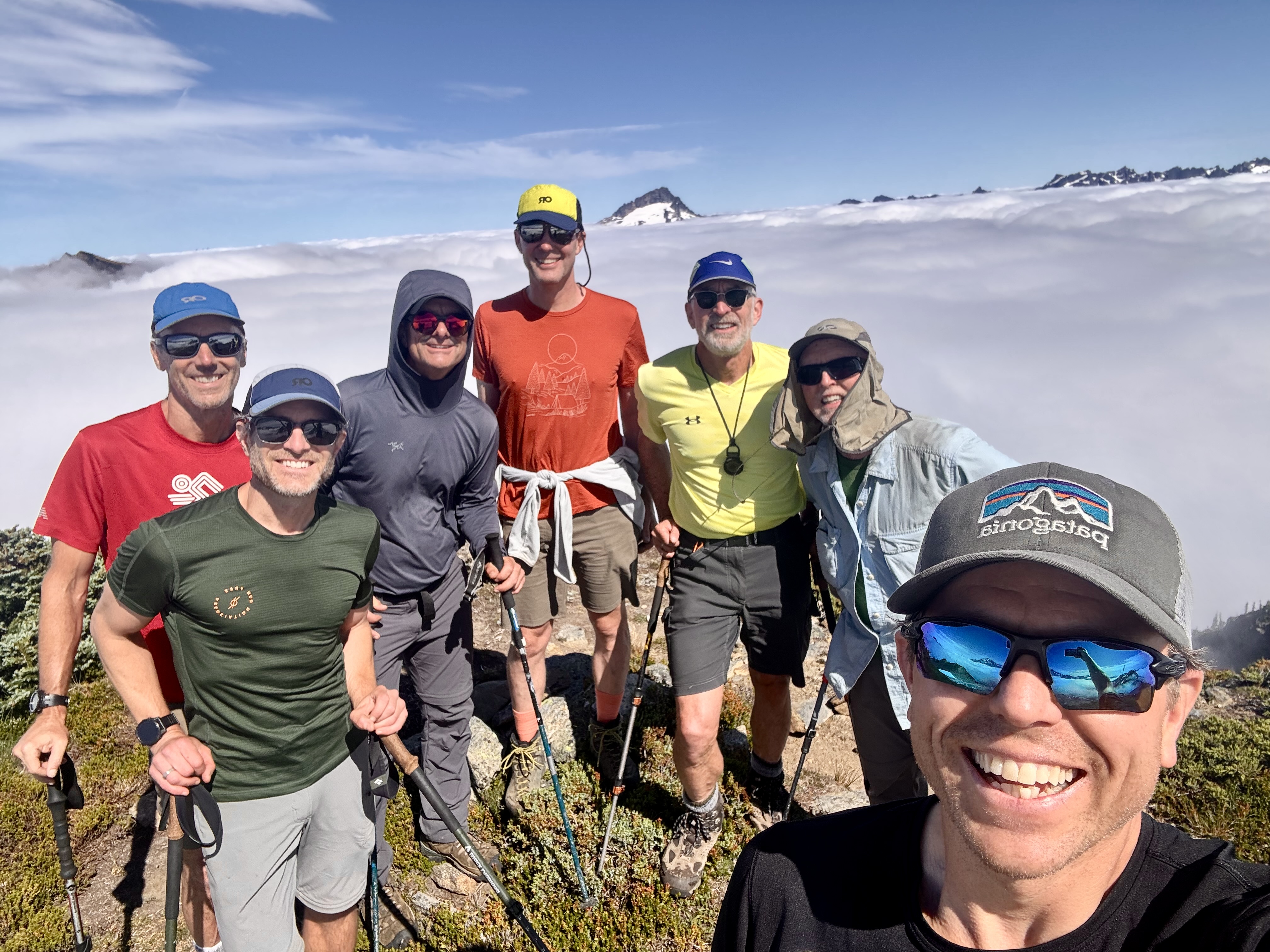
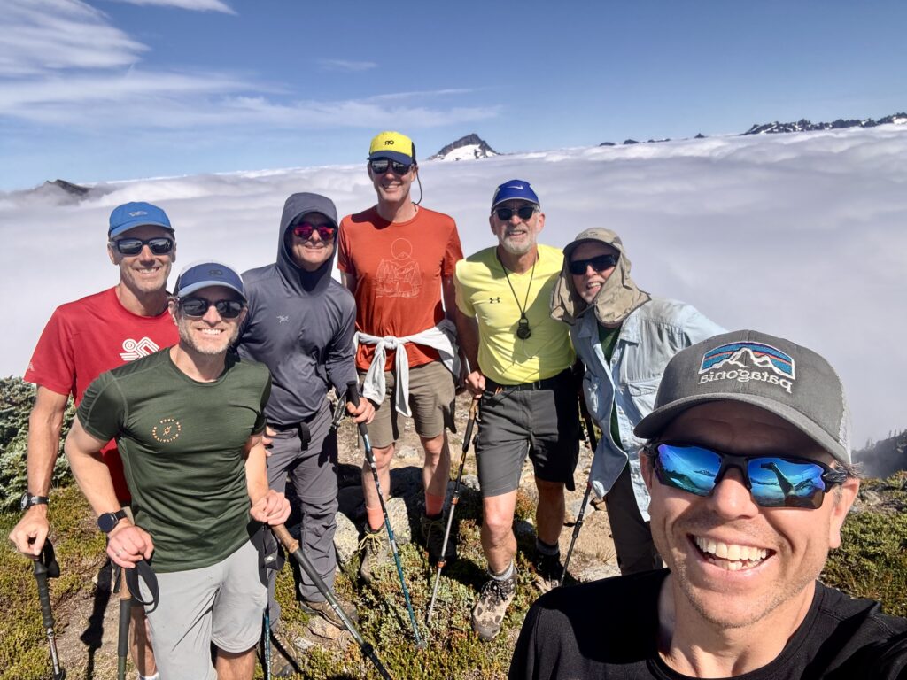
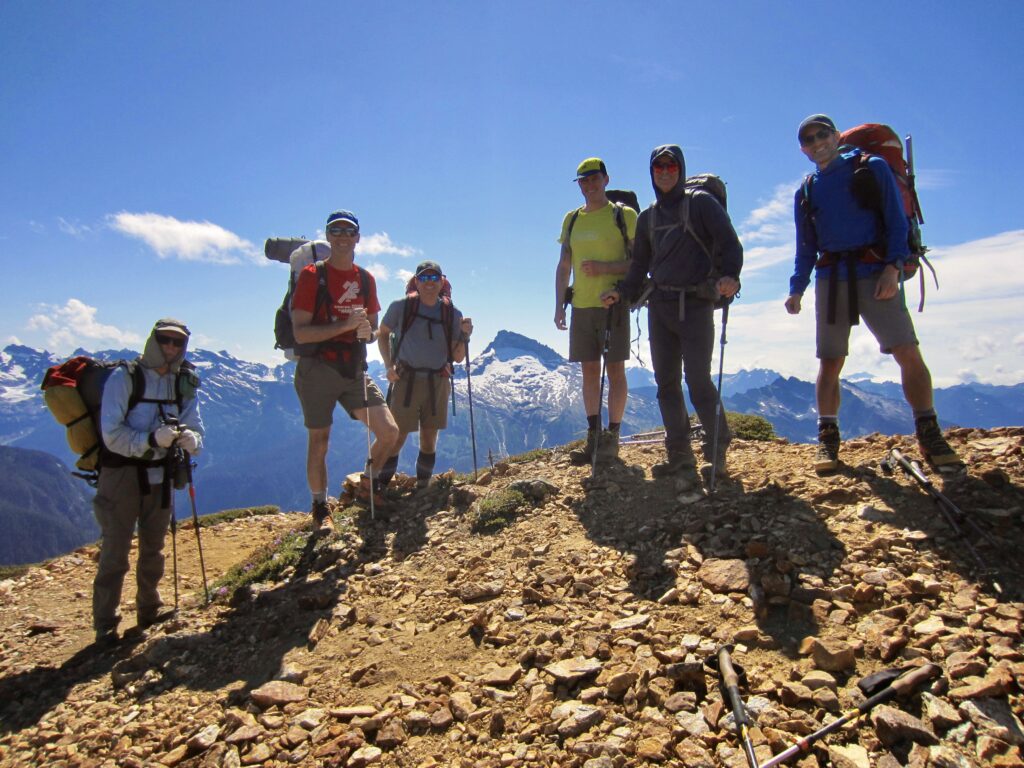
Seven of us signed up for the 23rd annual Mid-Summer Climbing Trip. Our group included long-time members Jon, Eric, Todd, and Adam, as well as two first-timers, Marcus and Sean. I was also a long-timer but had missed the past four trips due to either injuries or scheduling conflicts, so I was very happy to rejoin the group this year.
.
After considering several trip options, we elected to do the Painted Traverse in the Glacier Peak Wilderness. This scenic traverse traditionally extends from Painted Mountain to White Mountain (or vice-versa) and travels over or near seven other summits within the East Sauk Mountains. Along the way, trekkers cross vast wildflower slopes and are continually treated to marvelous views of both Glacier Peak and Sloan Peak. Because the route makes use of the North Fork Sauk River Trail to create a complete loop, no car shuttle is needed. Some parties complete the entire traverse in two days or even one long day, but that’s not our style; we chose to do it in three days to maximize our mountain time.

.
The Painted Traverse is regarded as a minor classic by experienced Cascadian mountaineers, yet it remains relatively unknown to the general hiking population. That’s probably a good thing, because the amiable name truly belies the difficulty of the traverse. The route involves a hefty elevation gain and loss; miles of side-hilling across steep heather slopes; lots of Class 2-3 scrambling on questionable-quality rock; and a slew of navigational challenges. For sure, it turned out to be far more difficult than any of us expected, but everyone’s positive attitude (and dinnertime appetizers) made the trip successful and fun!
Full Trip Report
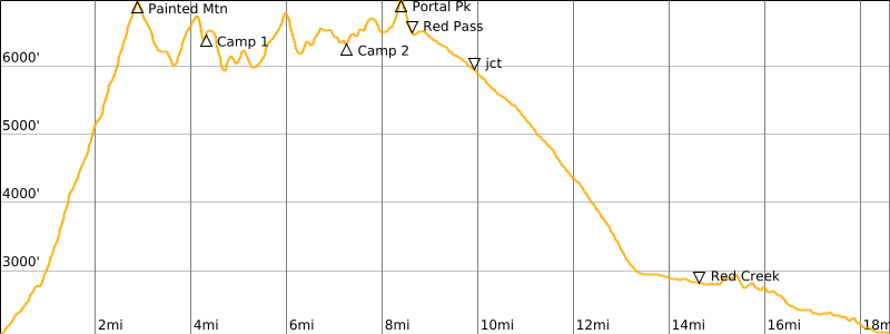
Day 1: Trailhead to Magenta–Point 6716 Saddle
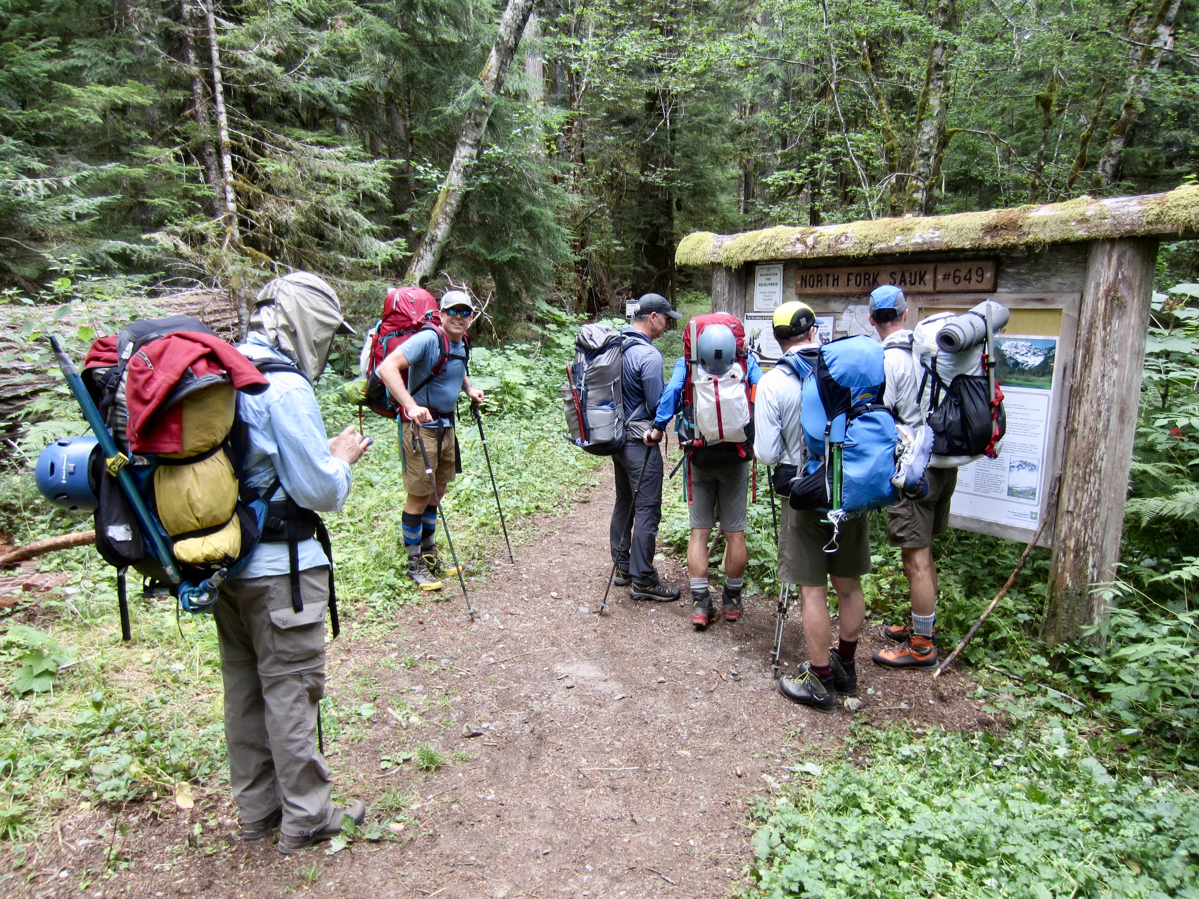
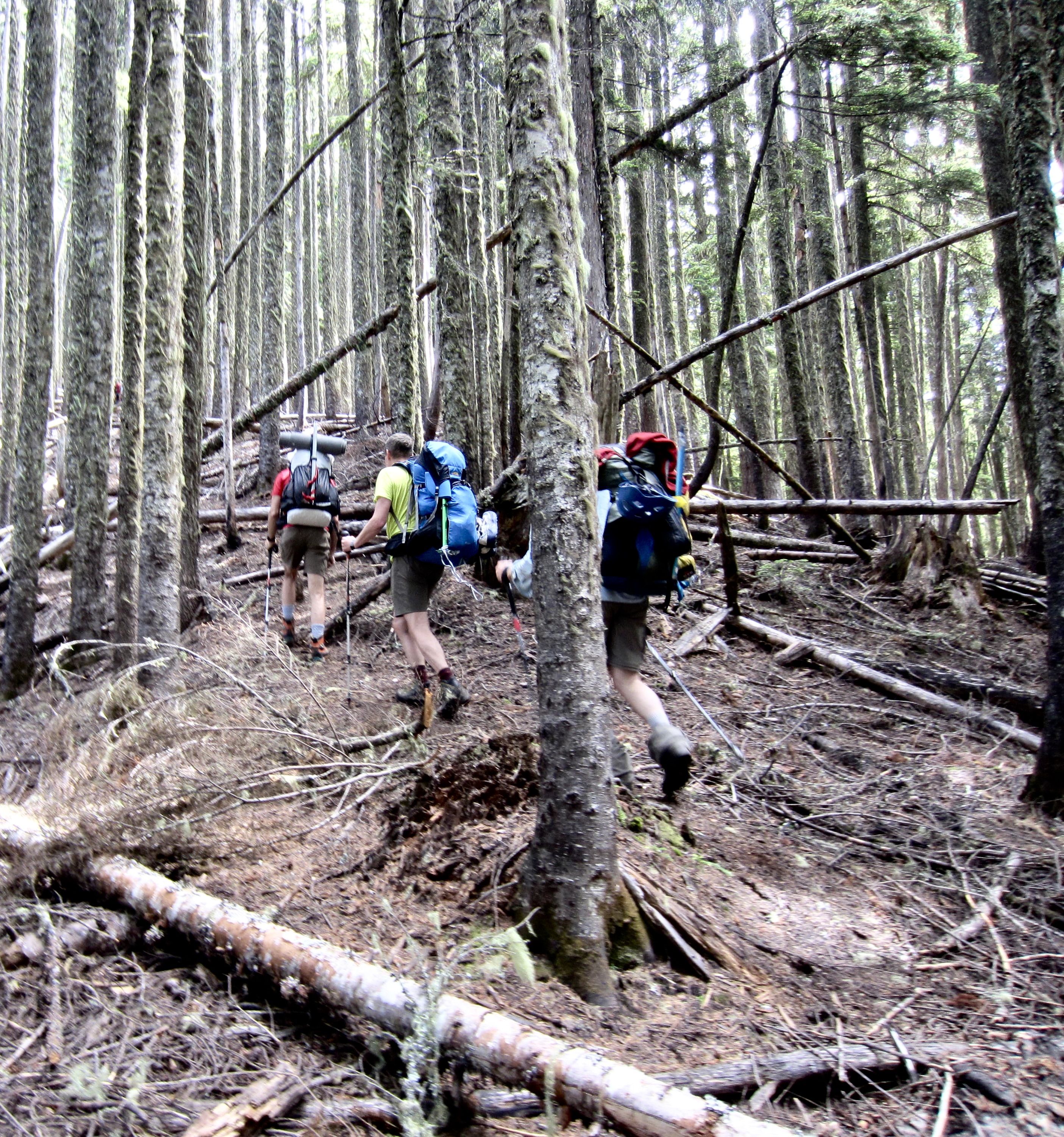
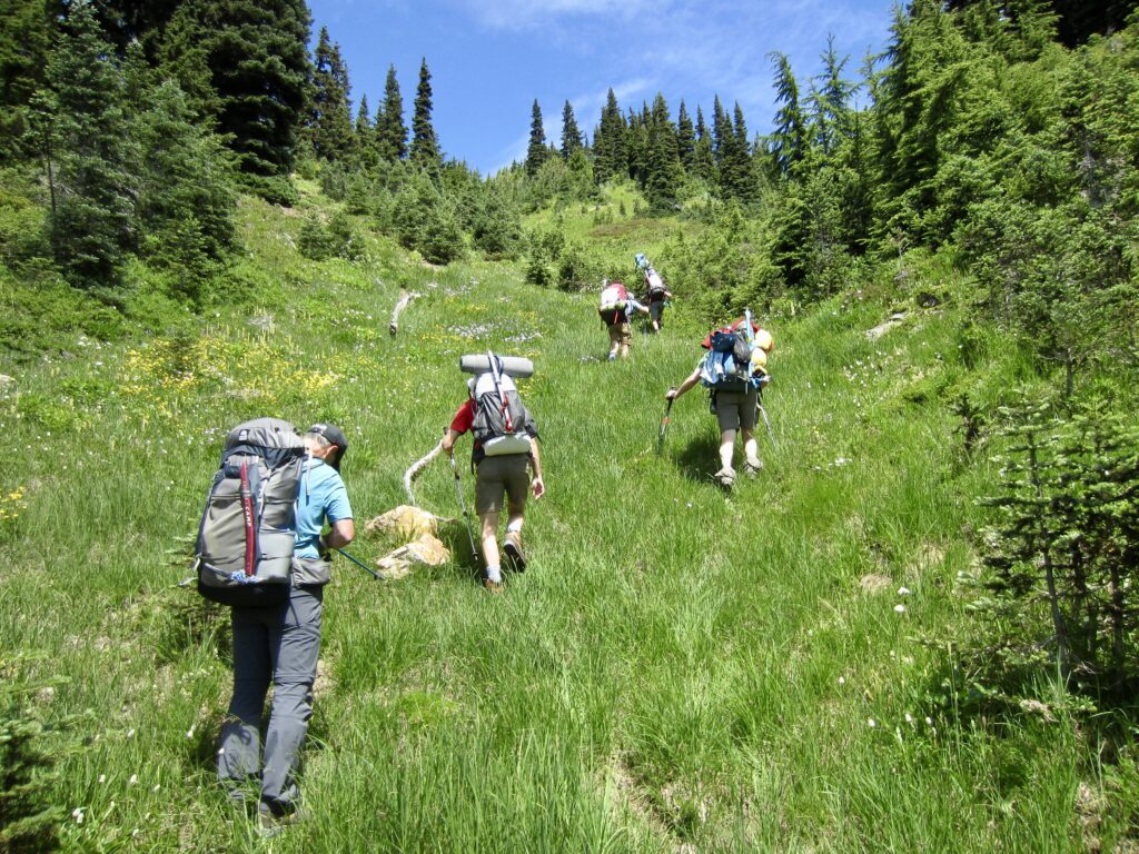
We pulled into the North Fork Sauk River Trailhead on a Friday morning and managed to find parking among the scads of other vehicles. Presumably, most of these vehicles belonged to people heading up to White Pass, Pilot Ridge, Glacier Peak, and other nearby destinations. (It soon became clear that few if any people were doing the Painted Traverse.)

.
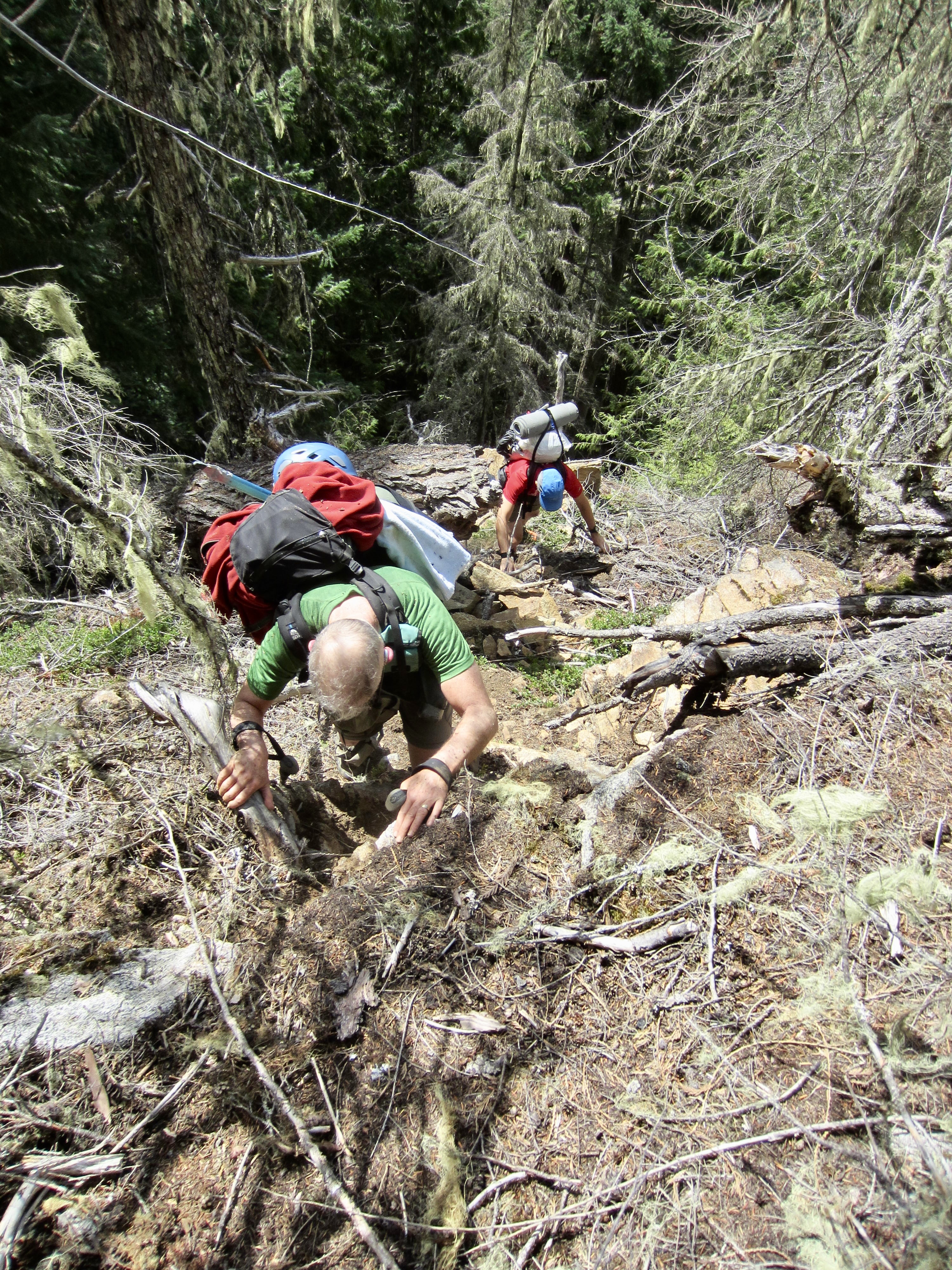
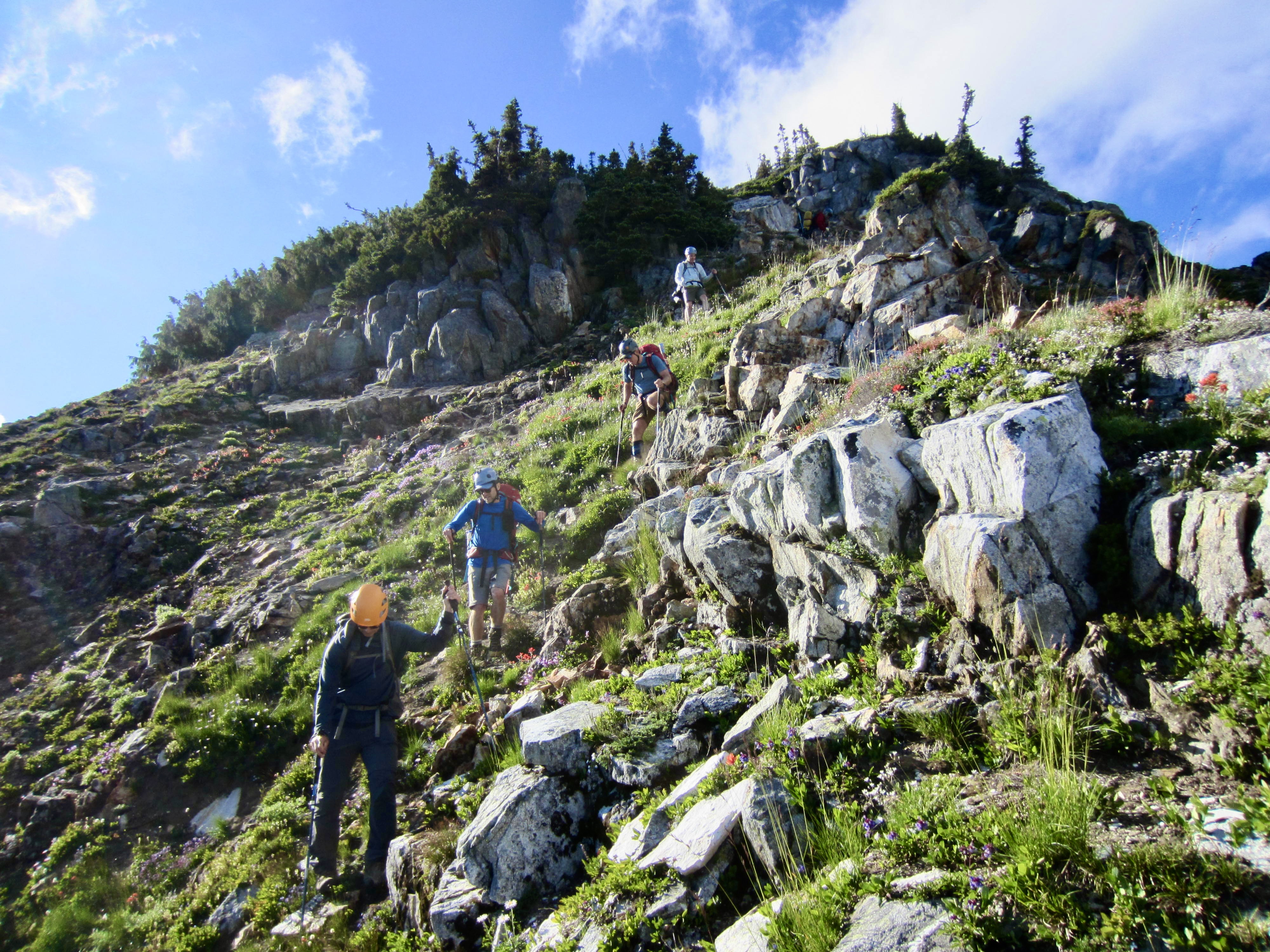
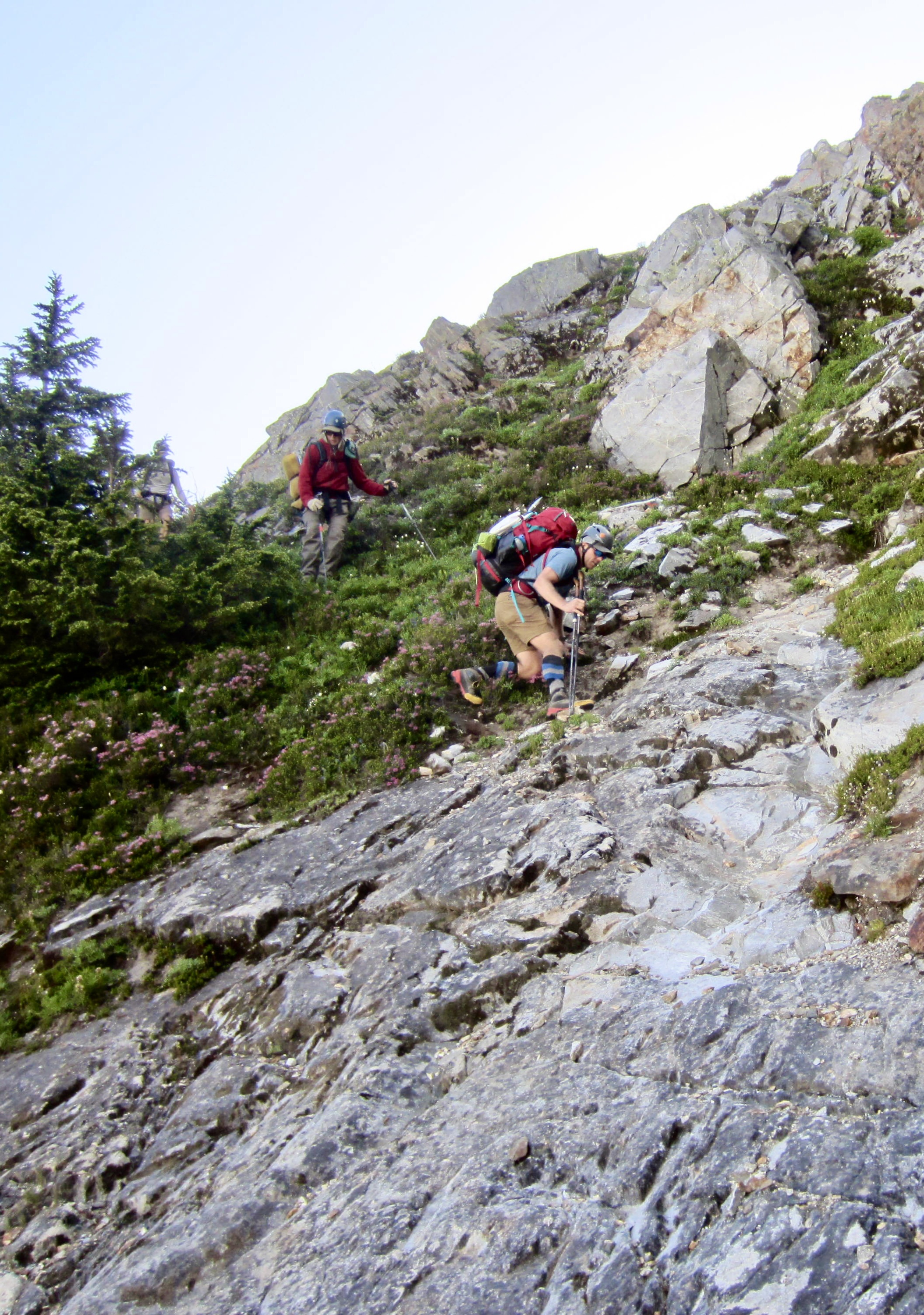
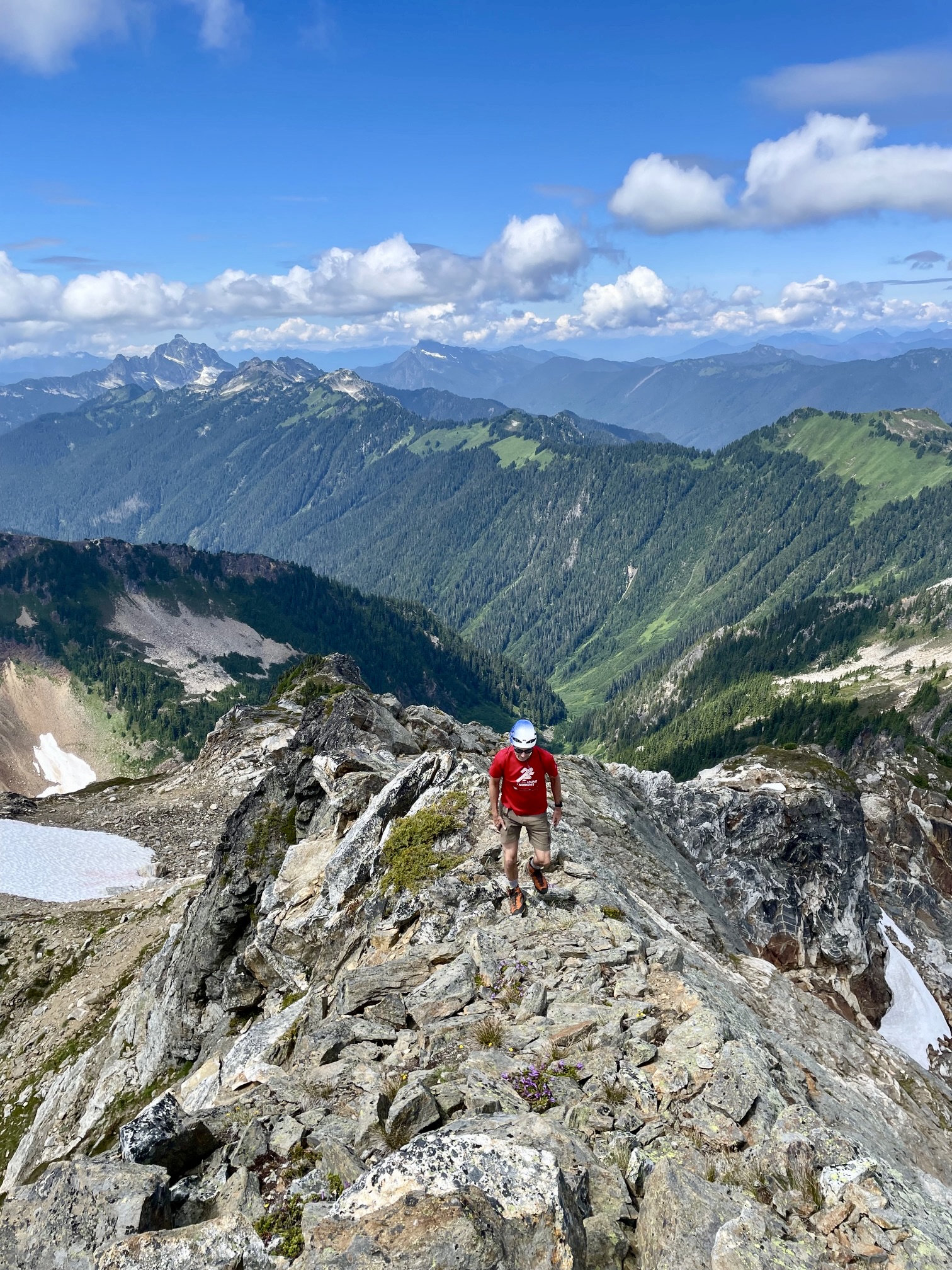
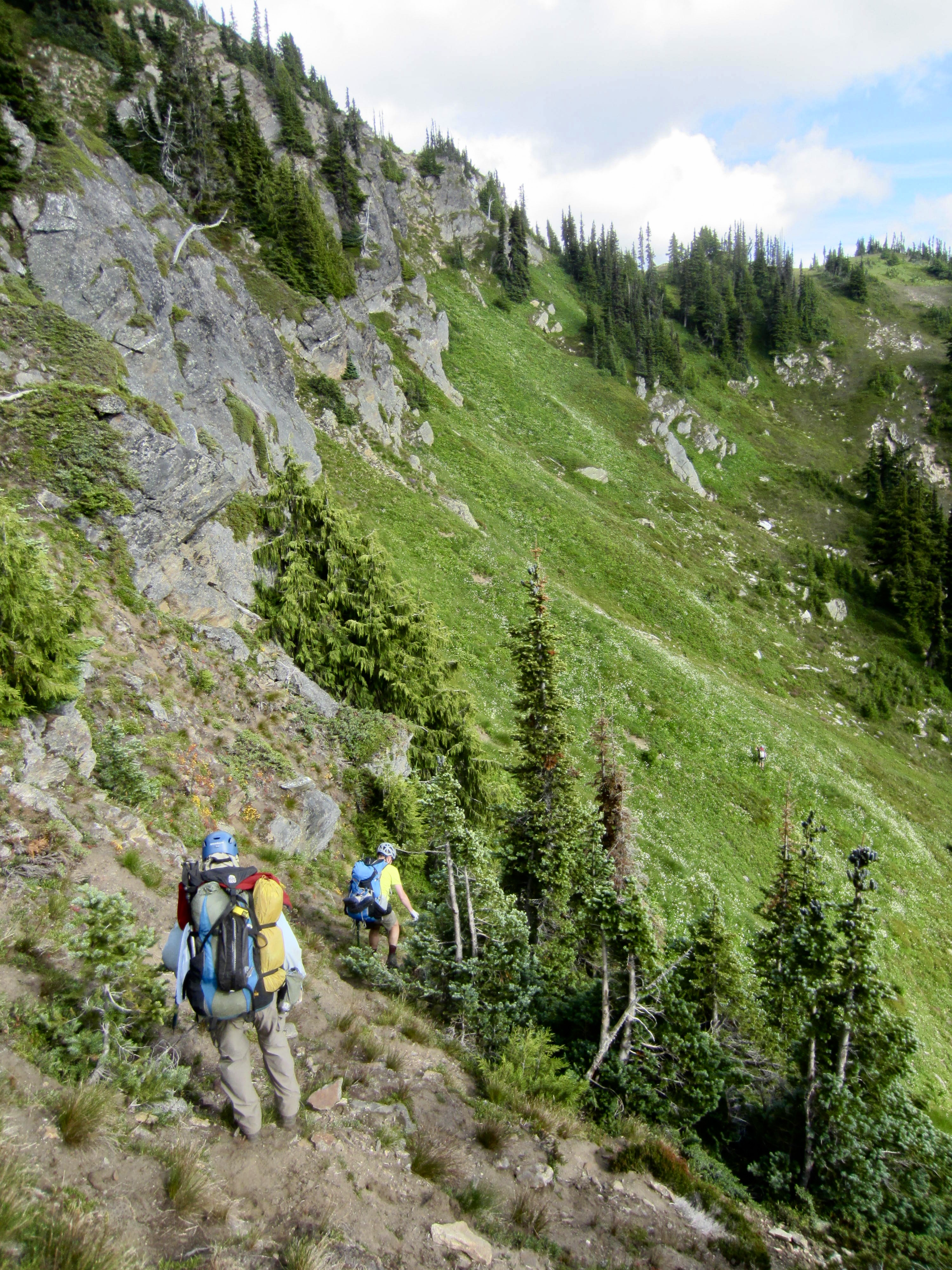
Soon after starting out, we turned left on the abandoned Red Mountain Lookout Trail and began ascending the forested hillside. The old lookout site now consists of a small flat area located at a high switchback one mile up the trail; some sort of structure—perhaps just a tent platform—reportedly sat here from 1936 to 1967. The old trail ends closely above this site, but a well-trodden climber’s/fisherman’s path continues steeply uphill, going over a small cliff band that requires some Class 3 scrambling.
.
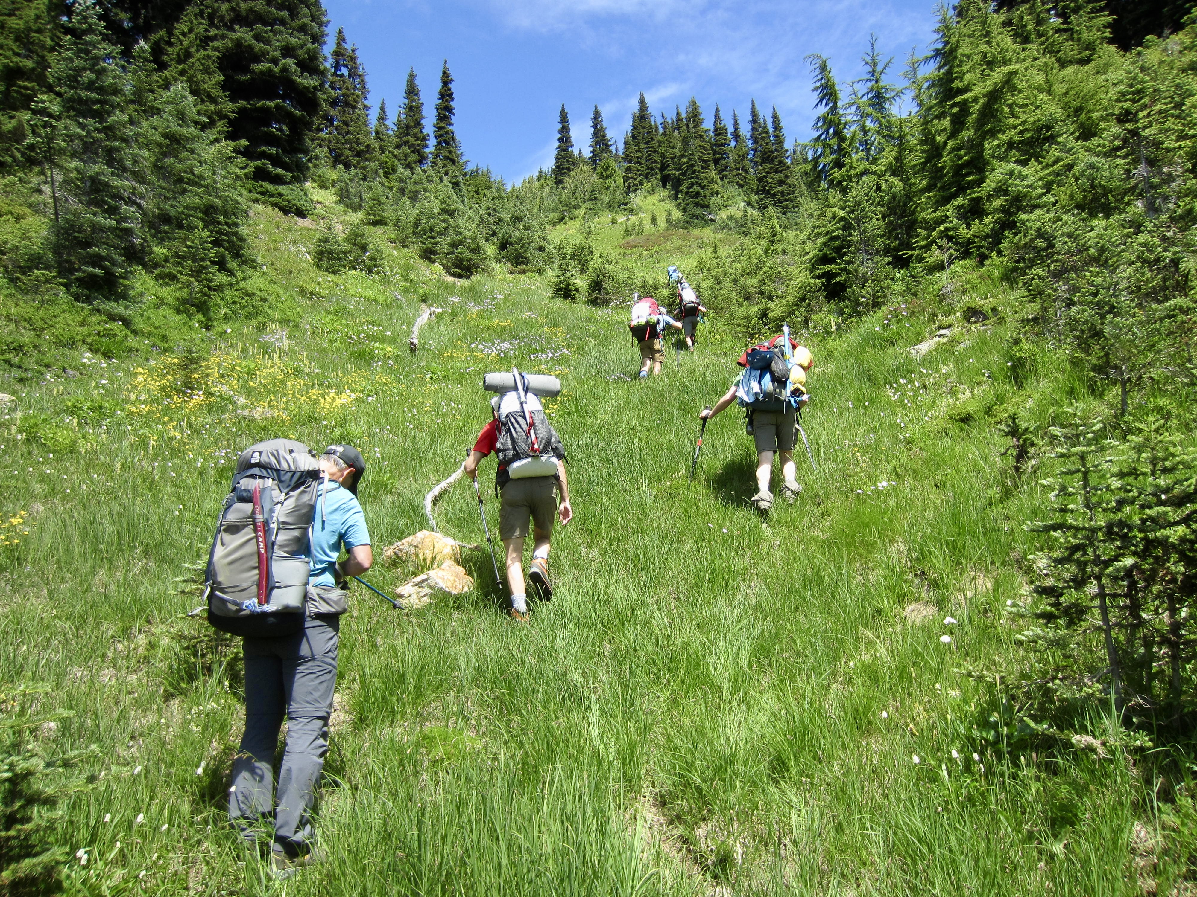
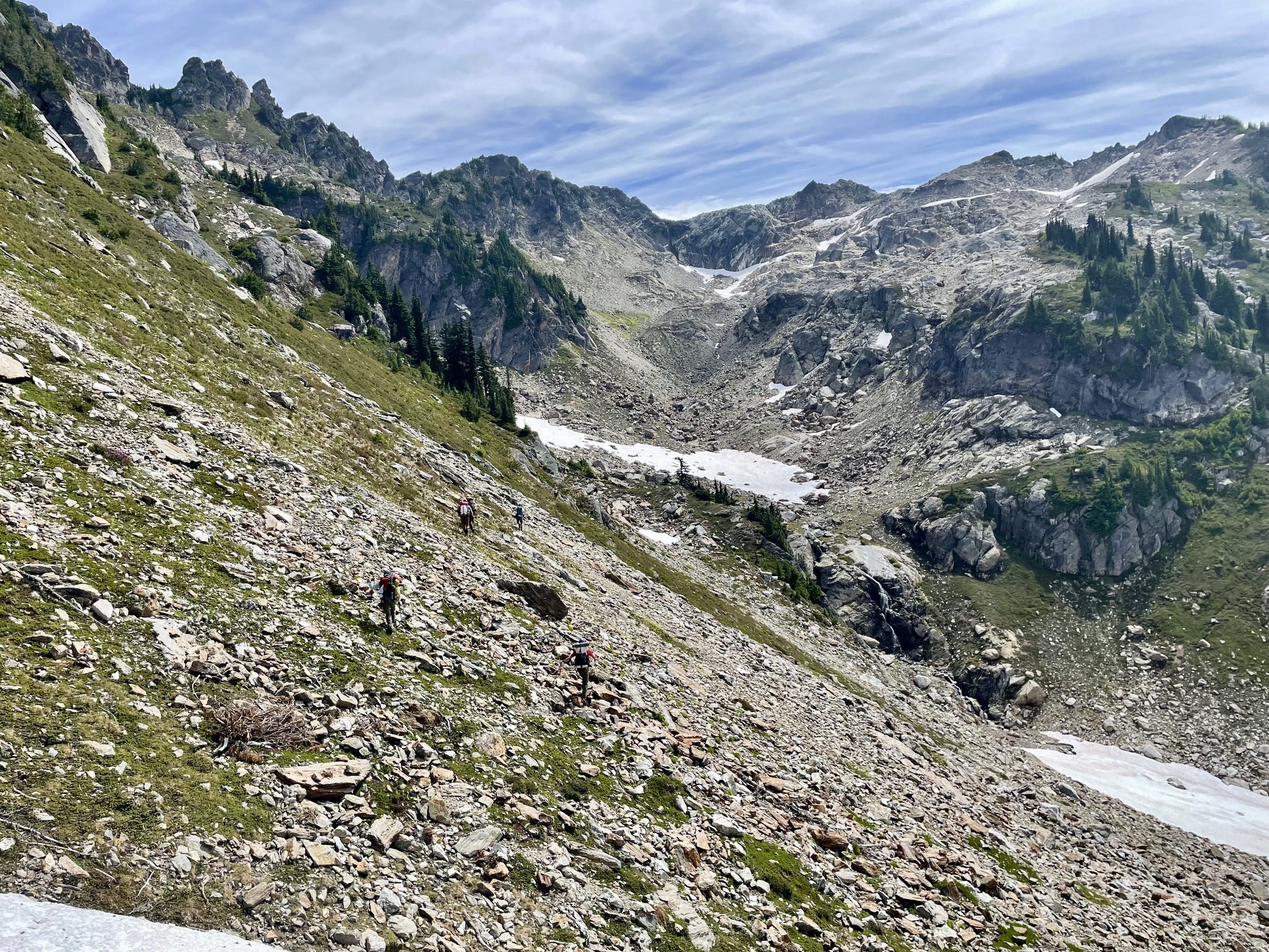
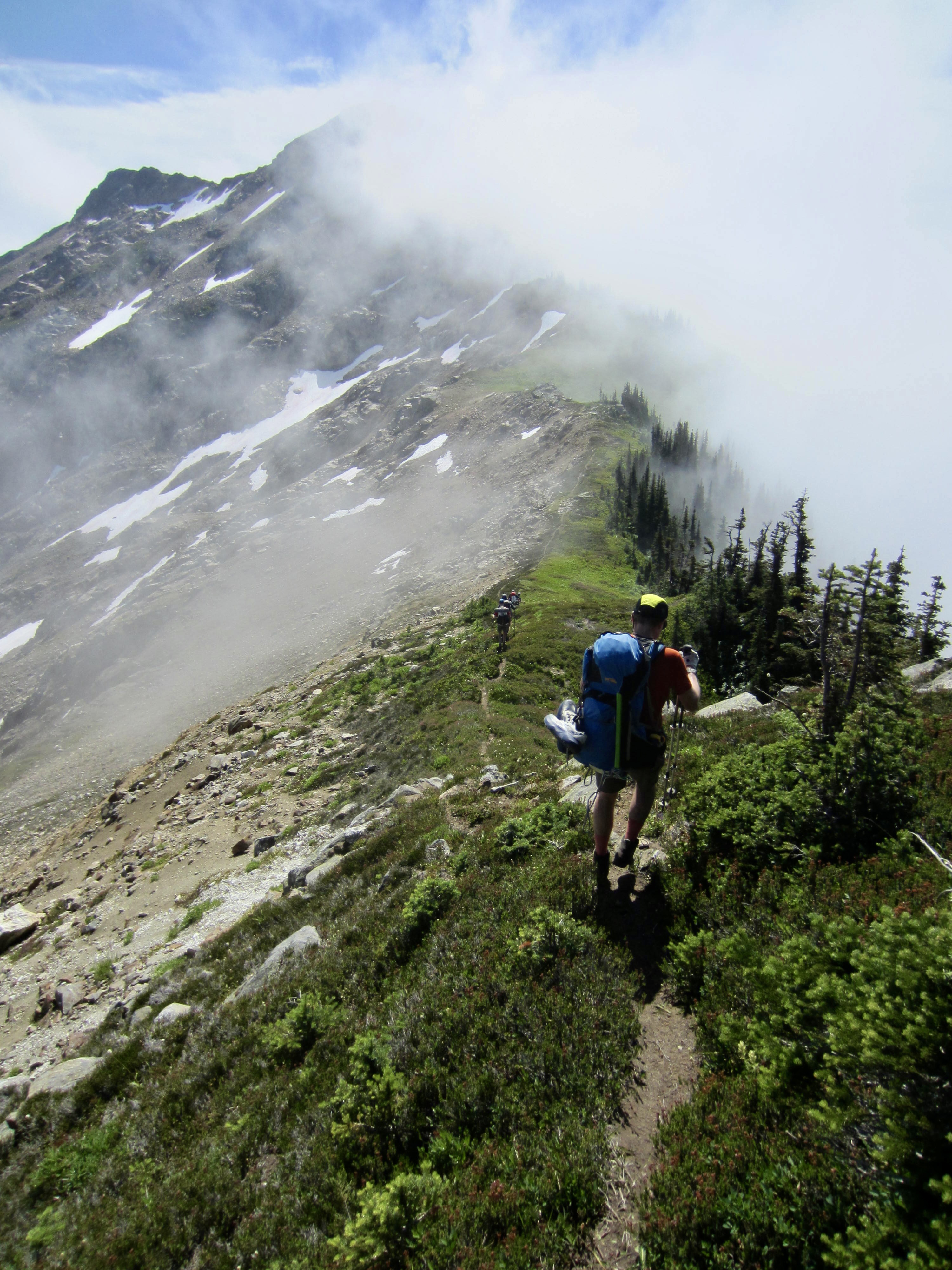
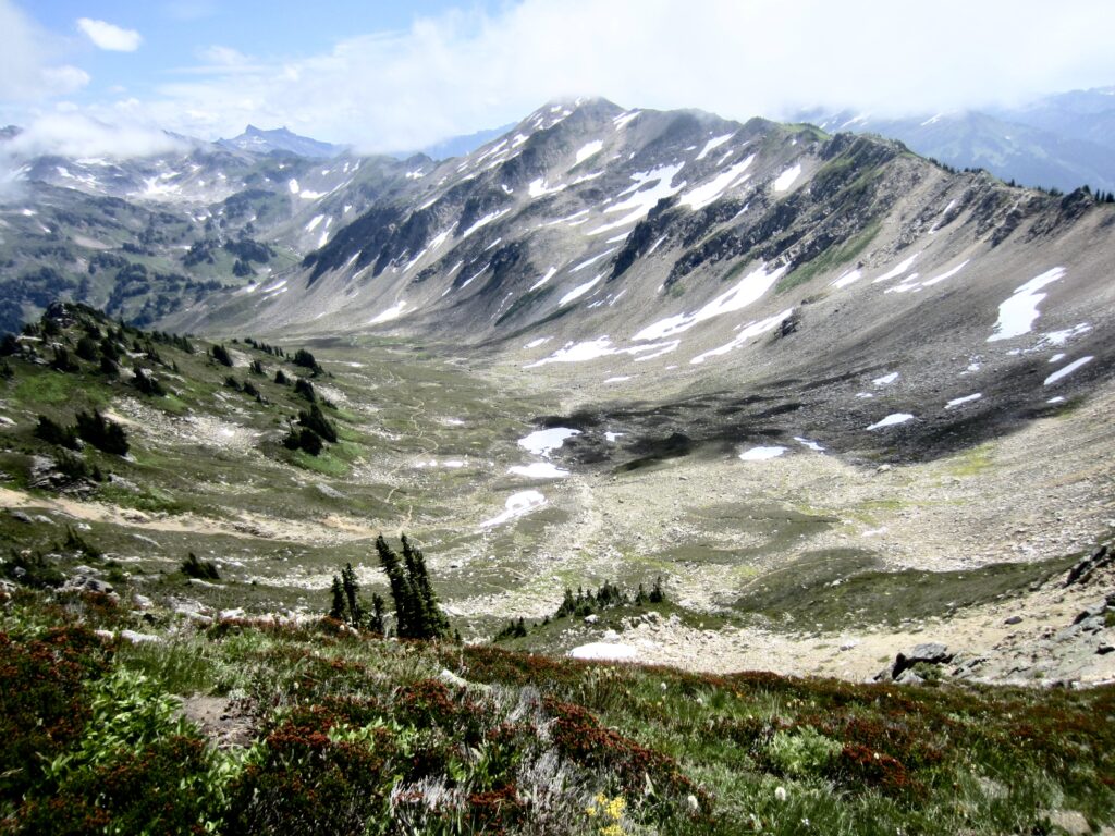
The climber’s/fisherman’s path eventually breaks out of the forest and proceeds up through steep meadows, passing high above Ruby Lake. Sloan Peak stands in dramatic fashion across the river valley.
.
.
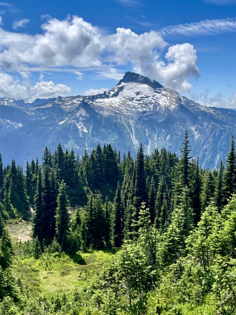
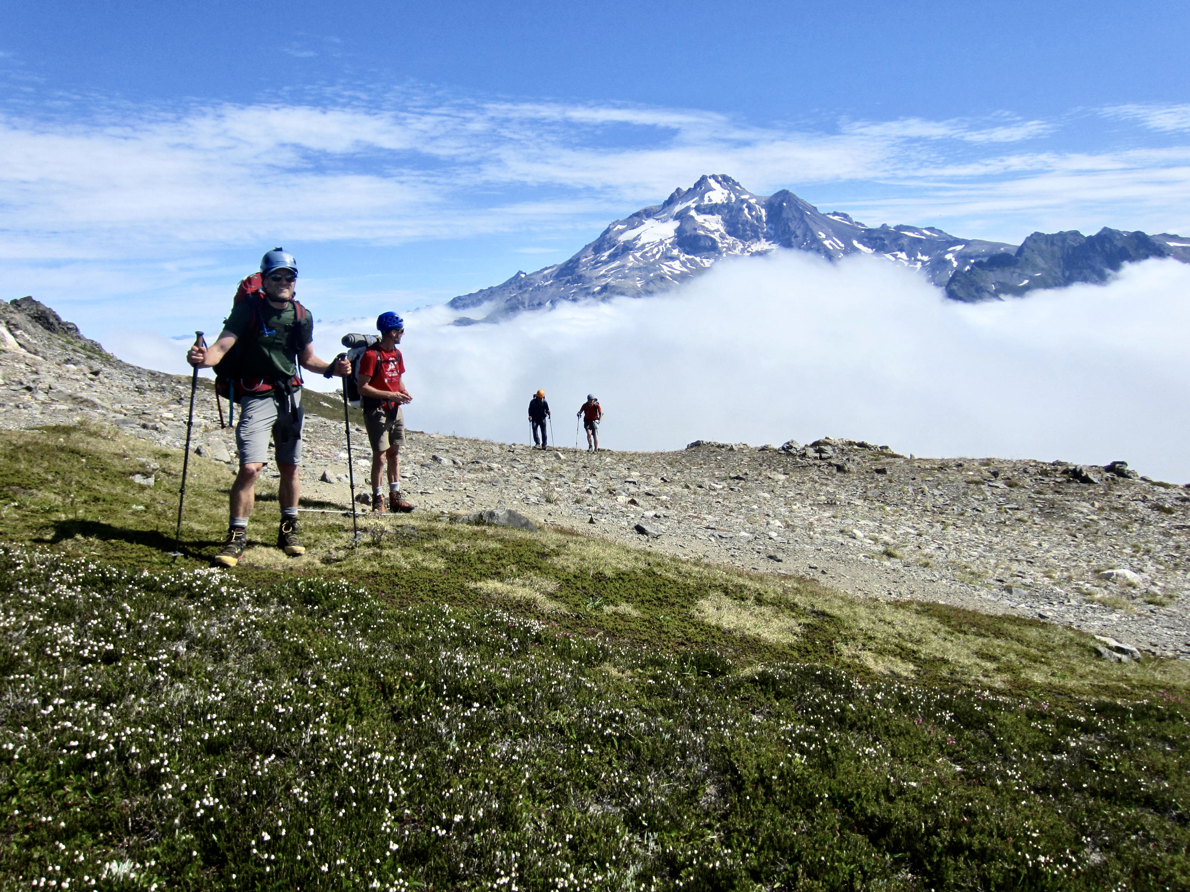
The path gradually eases back as it makes the final 1200-foot ascent of Painted Mountain, with its distinctive red dome resulting from iron oxide staining. By mid-afternoon, we were all gathered on the barren summit (5.0 hours + 4900 feet from TH).
.
.
After a snack break, we descended the northeast ridge of Painted Mountain, dipping into a broad saddle and then easily continuing up the southwest ridge of Magenta Peak. Everyone topped out in late afternoon (7.2 hours + 5600 feet from TH) and took another break on the flowery summit.

.

.
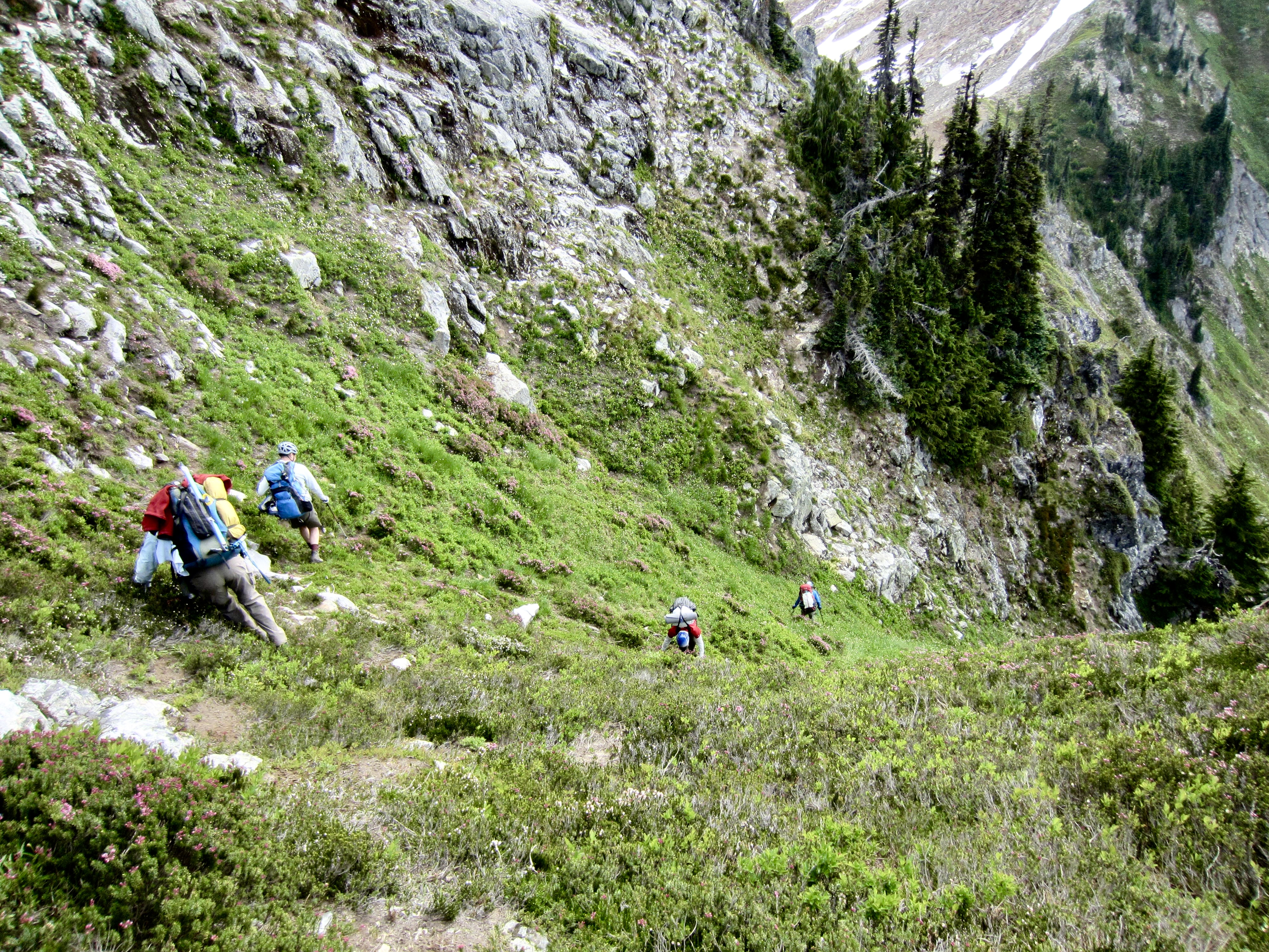
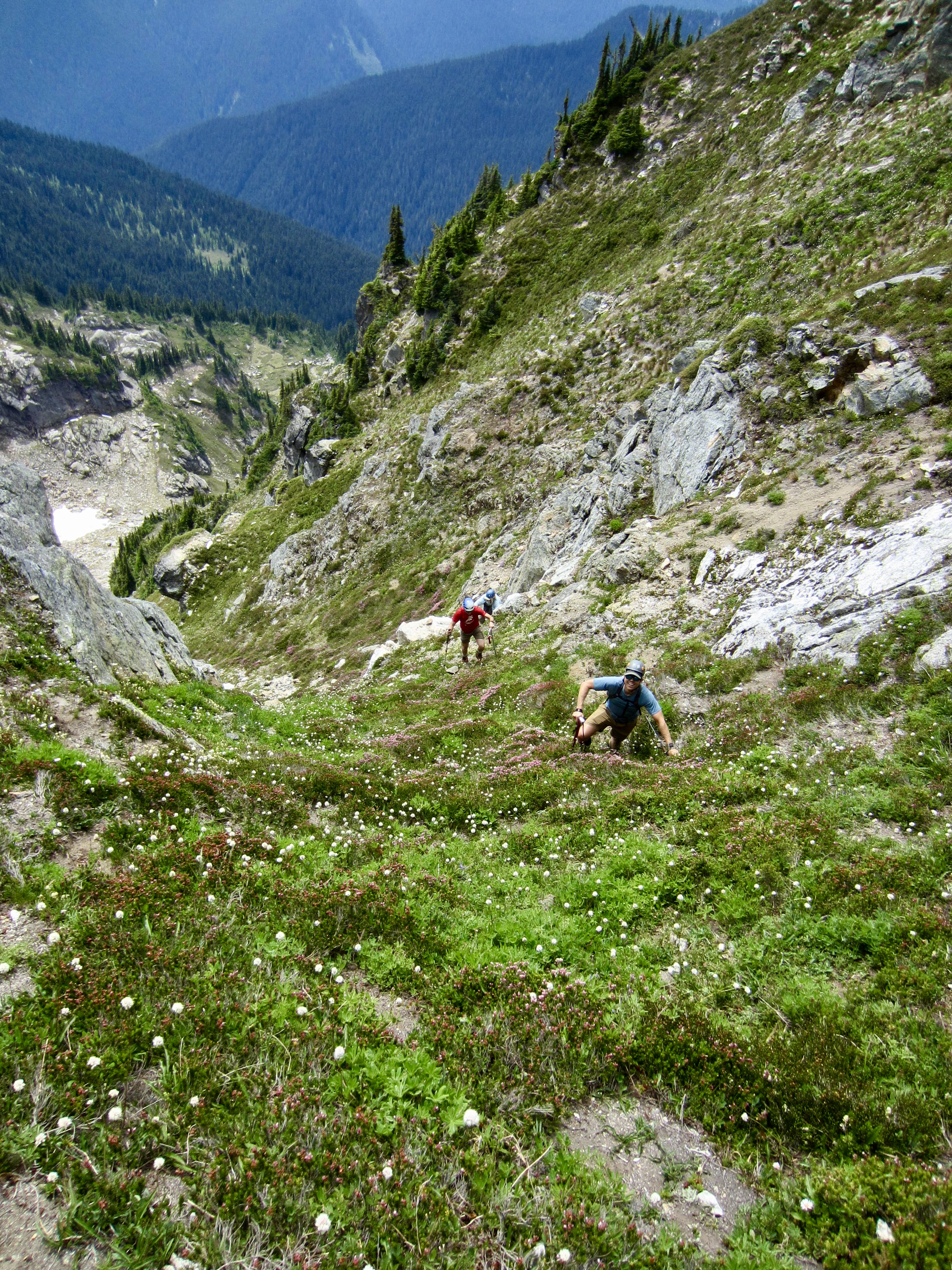
A row of sharp horns and pinnacles along the east ridge of Magenta Peak forced us to descend the southeast face, which involved steep down-climbing on heather and slabby rock. This was our first taste of the scrappy terrain that lay ahead. Anybody who has never been on a 45-degree heather slope probably can’t imagine how precarious it feels, especially when descending!

.
.
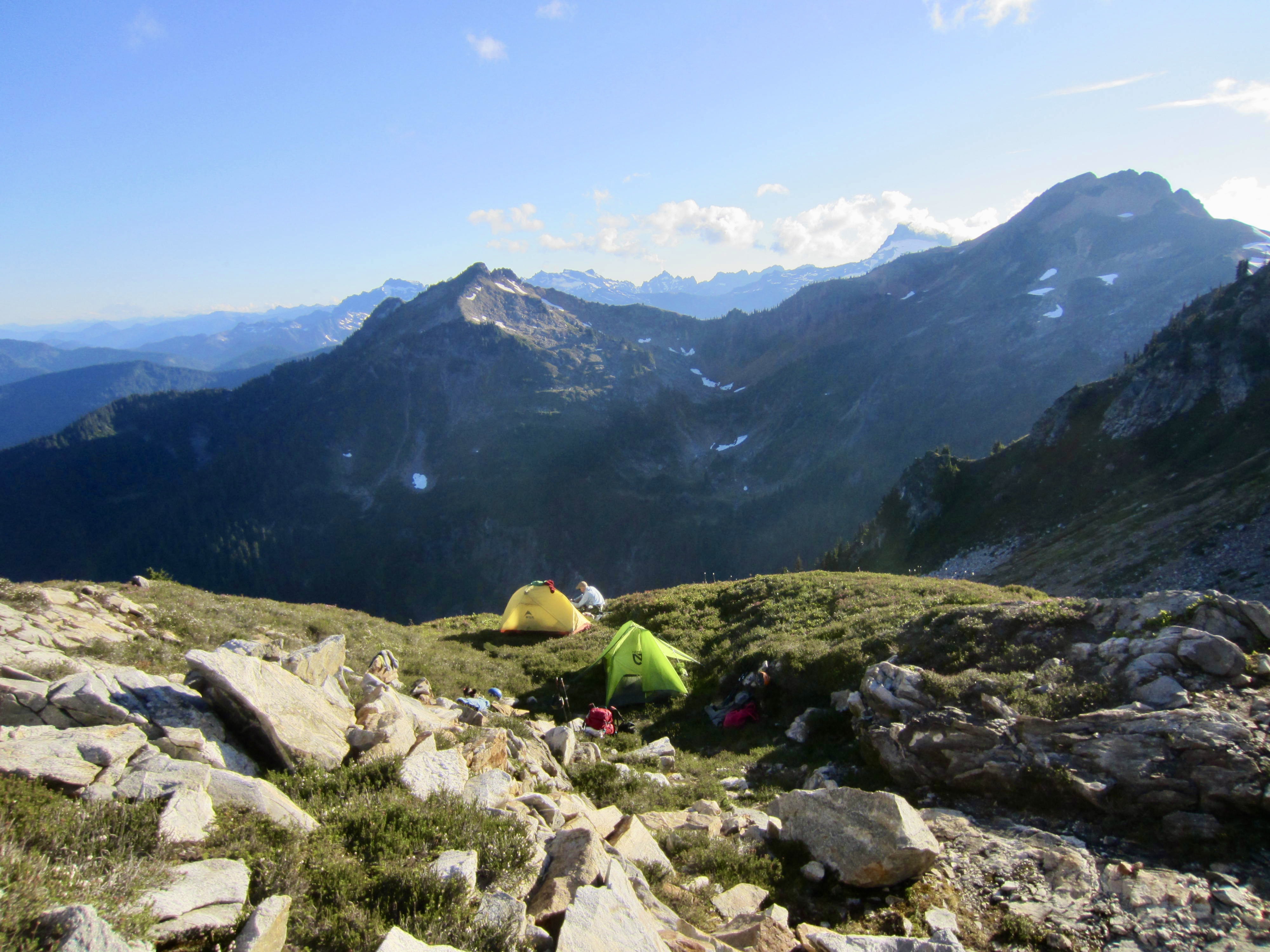
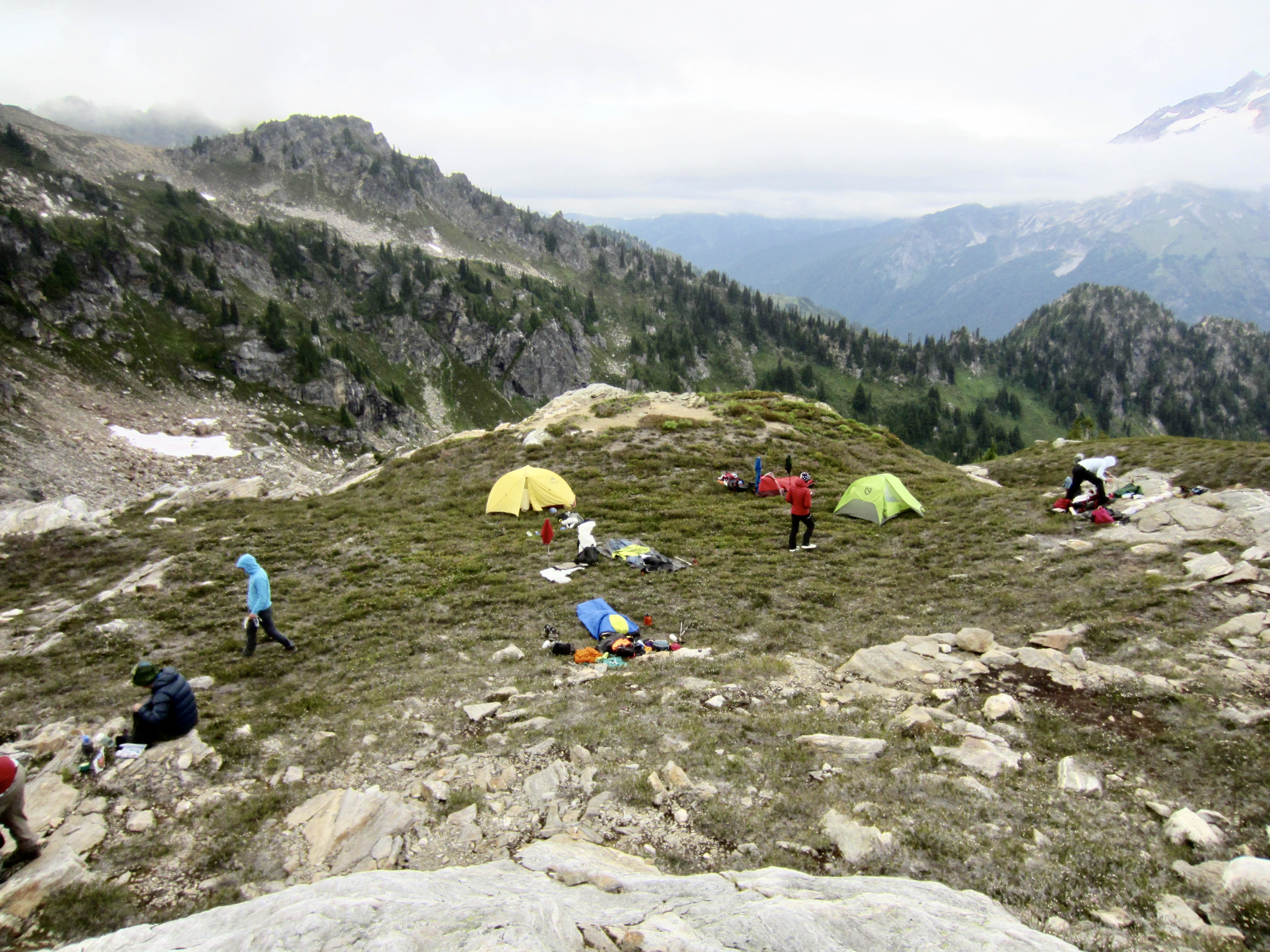
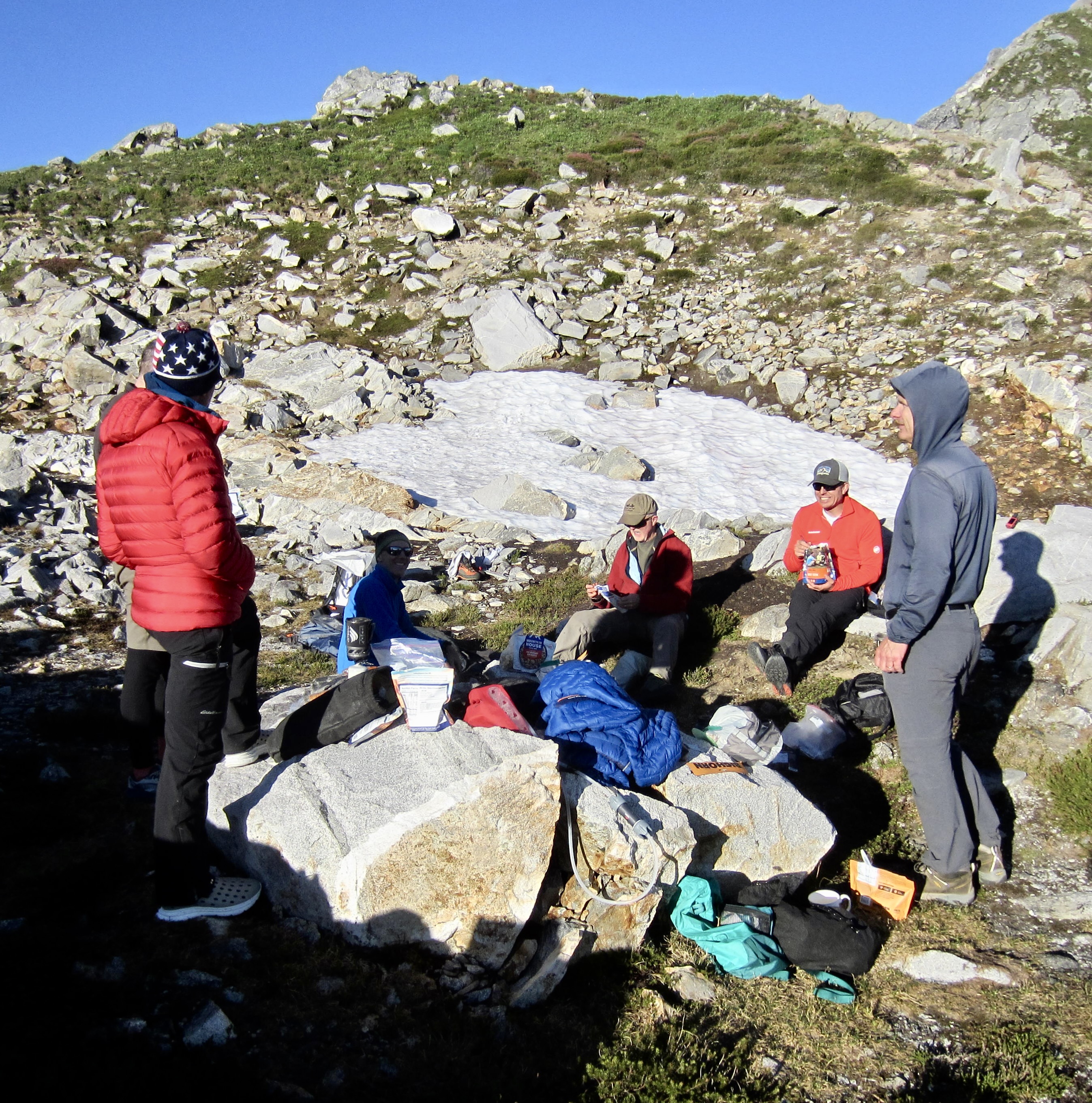
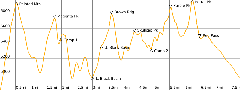
After ducking under a rock buttress, we made a rising traverse toward the saddle between Magenta Peak and Point 6716. A grassy bench situated closely below the saddle provided comfortable camping and a trickle of meltwater. We gladly dropped our backpacks here in early evening to end a strenuous first day (8.1 hours + 6000 feet from TH).
.

.
Large granitoid rocks served as tables and chairs for our dinner, which featured a full spread of appetizers and wines. By long-standing tradition, we endeavor to keep our mid-summer outings at least slightly civilized! It had been warm and sunny all day, but a cold northerly wind sent us into our tents and bivouac sacks shortly after sundown.
.
Day 2: Magenta–Point 6716 Saddle to Skullcap–Purple Saddle
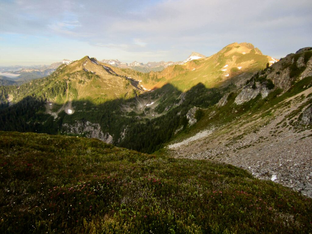
We awoke to partly cloudy skies at 6:30am, with alpenglow splashed across Skalabats Peak and Painted Mountain to the west. By 8:30am, we were packed and heading out of camp, fully expecting the same kind of easy to moderate travel as yesterday. It didn’t take long to discover that this traverse gets much more challenging!
.
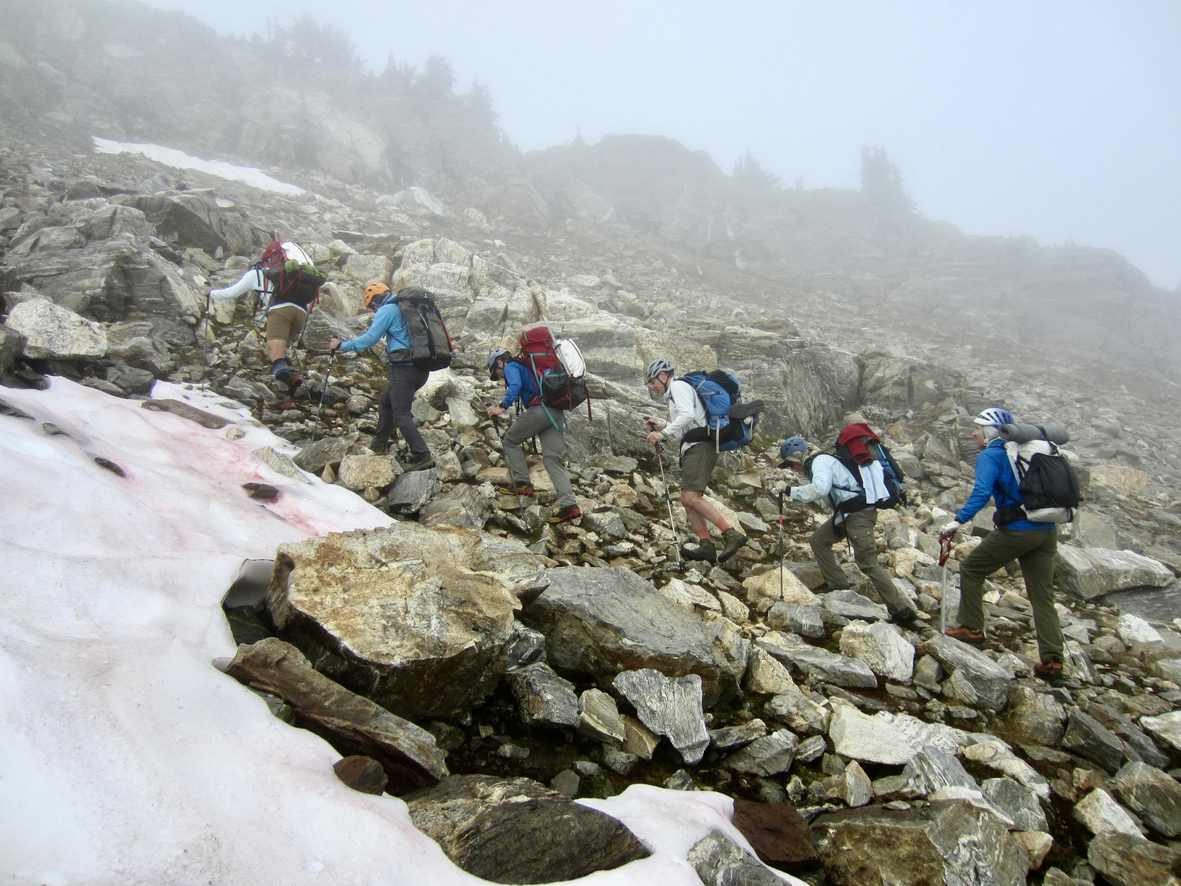
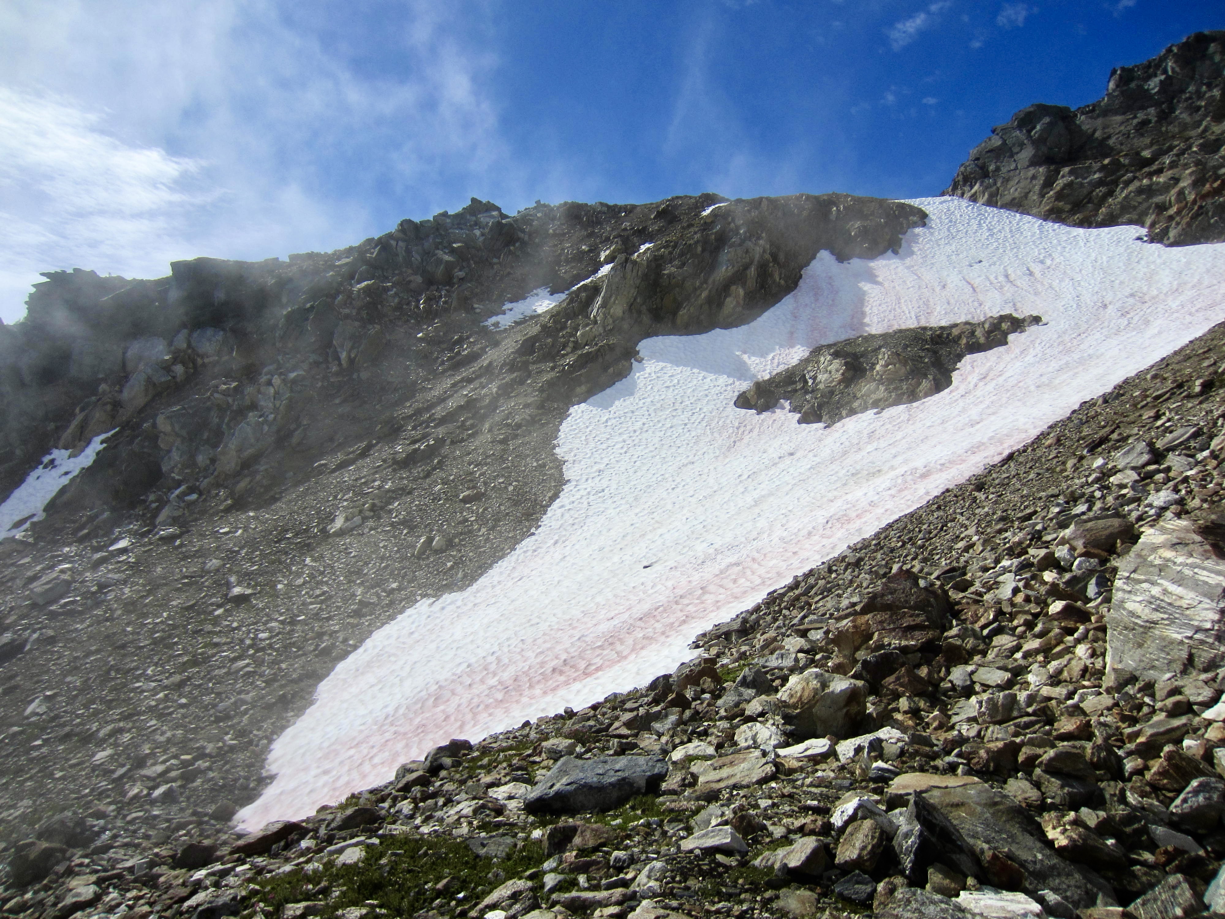
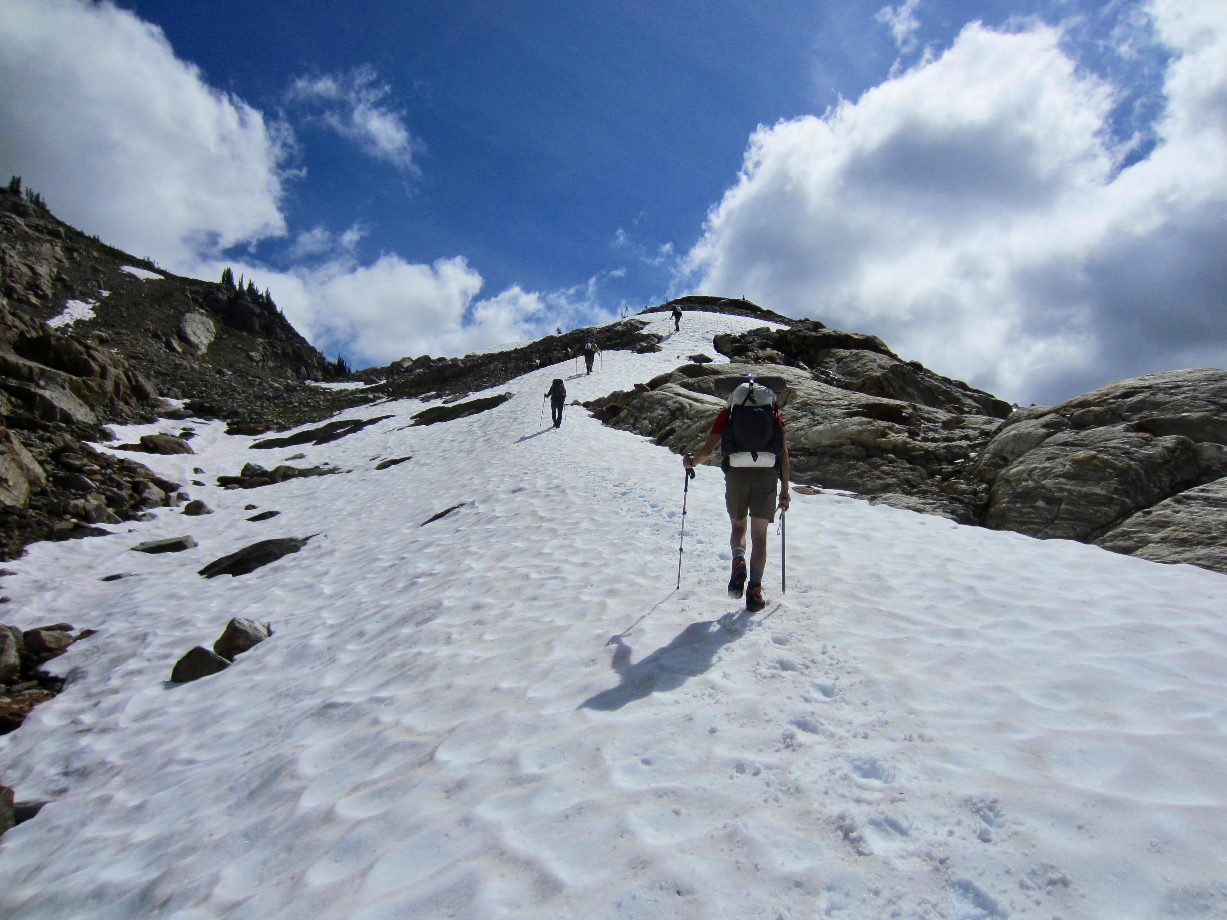
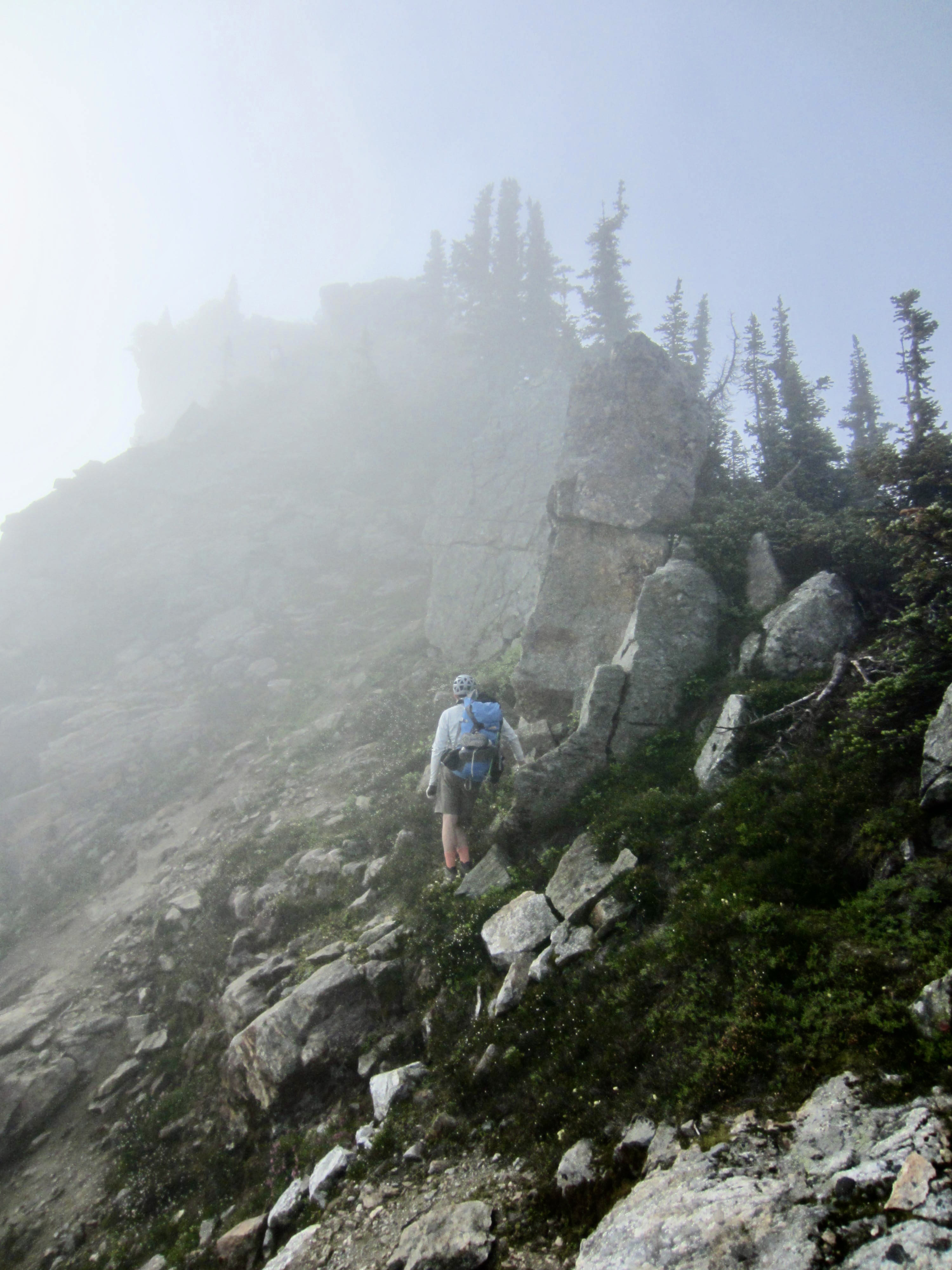
Our first order of business was to get past Point 6716. Jon, Adam, and Marcus opted to go over the top, while Todd, Eric, Sean, and I opted to go around the south flank. Both teams met up at an impasse on the craggy east ridge. Jon spent some time scouting out possible descent routes and ultimately determined that our best option was to scramble southeasterly down a gully consisting of very steep heather with scattered rock outcrops. We all used ice axes in the heather for extra security and to arrest a slide in case we lost traction.
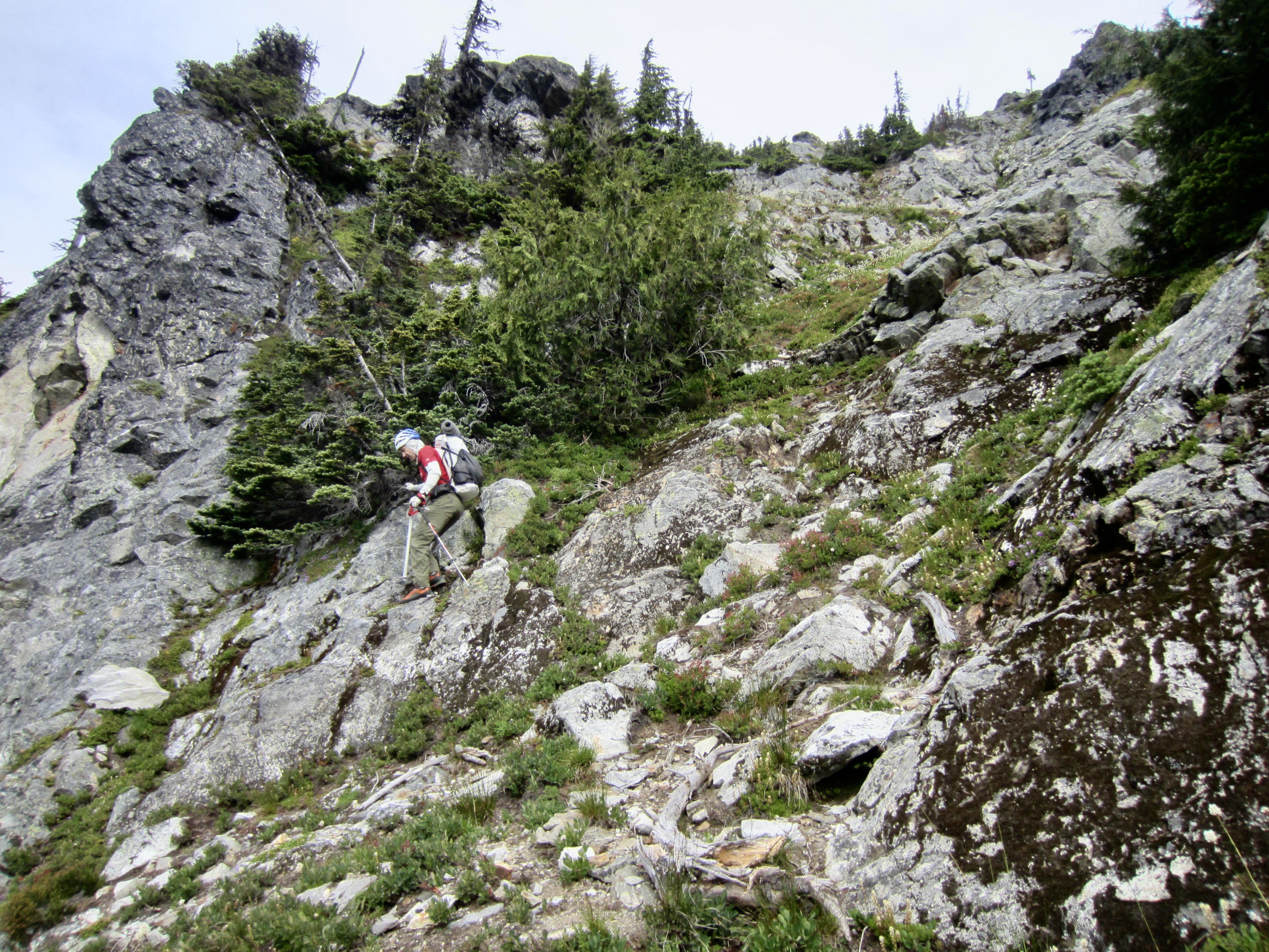
.
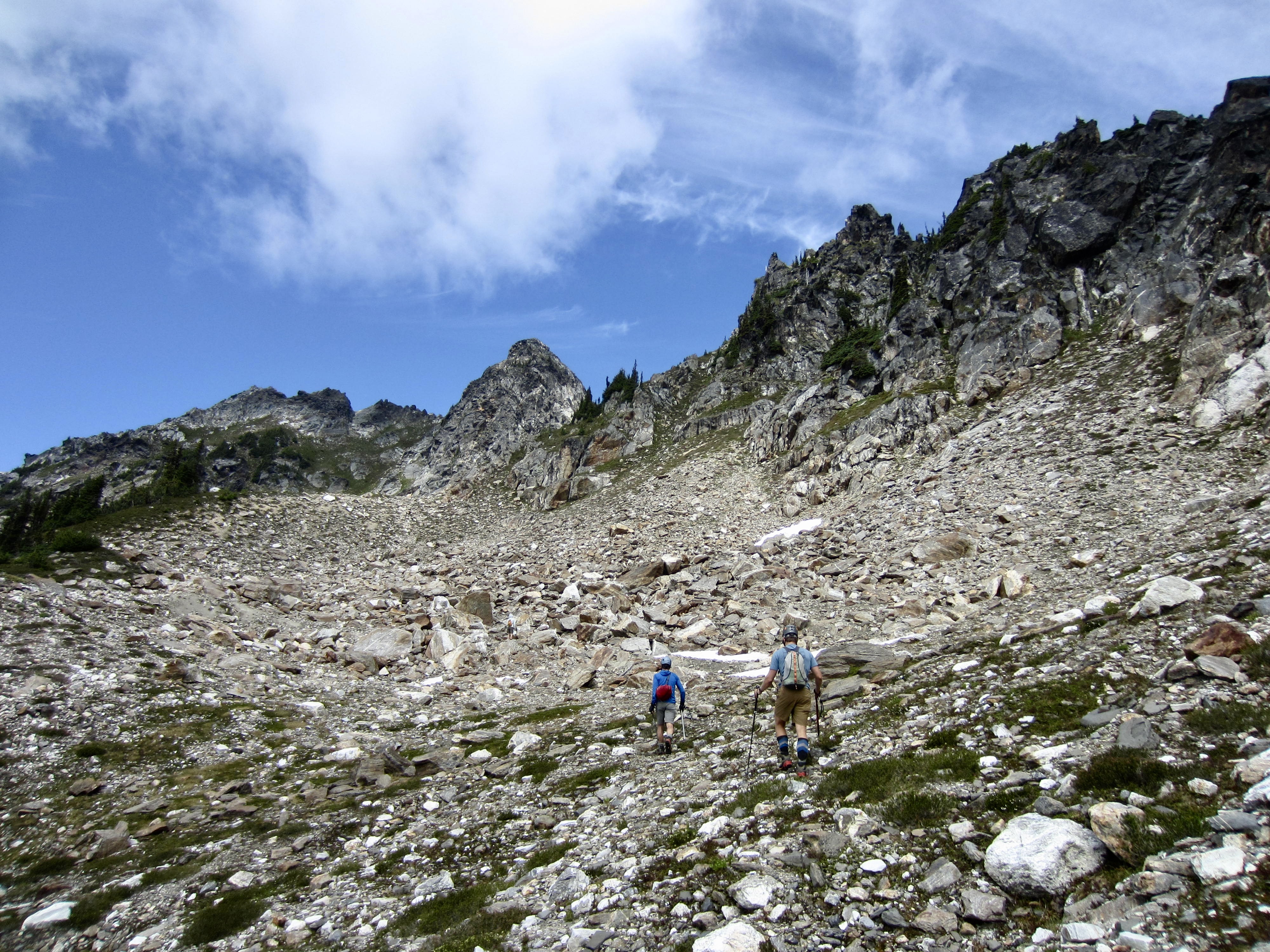
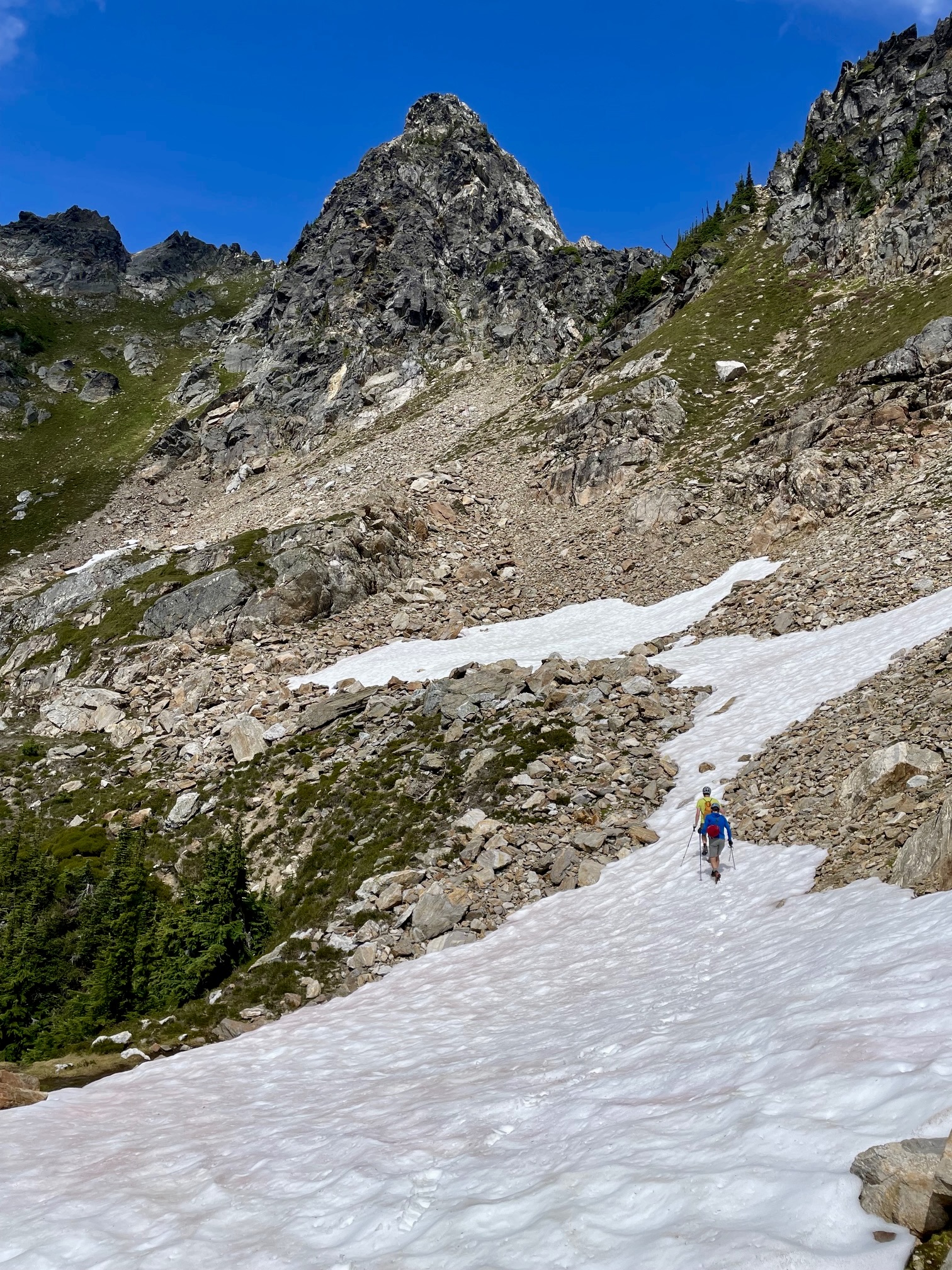
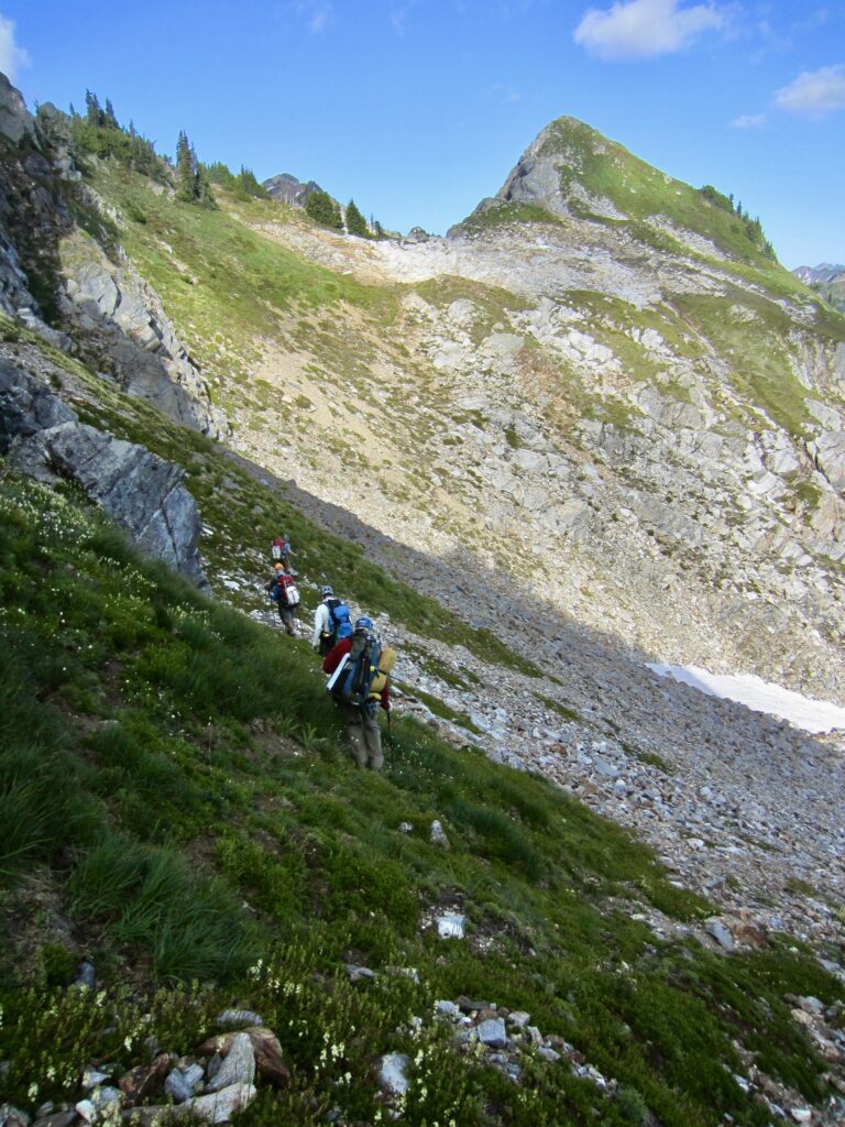
After carefully down-climbing the gully, we contoured eastward on moderately steep heather. A low-angle shoulder at 6200 feet allowed us to get around the southeast ridge of Point 6824. From there, we made a slightly descending traverse into Lower Black Basin at 6000 feet, then we climbed up a stream drainage to Upper Black Basin at 6400 feet (3.6 hours + 900 feet from Camp 1). This basin provides a reliable source of water and some flat campsites. We dropped our big backpacks and loaded up our summit packs.
.

.
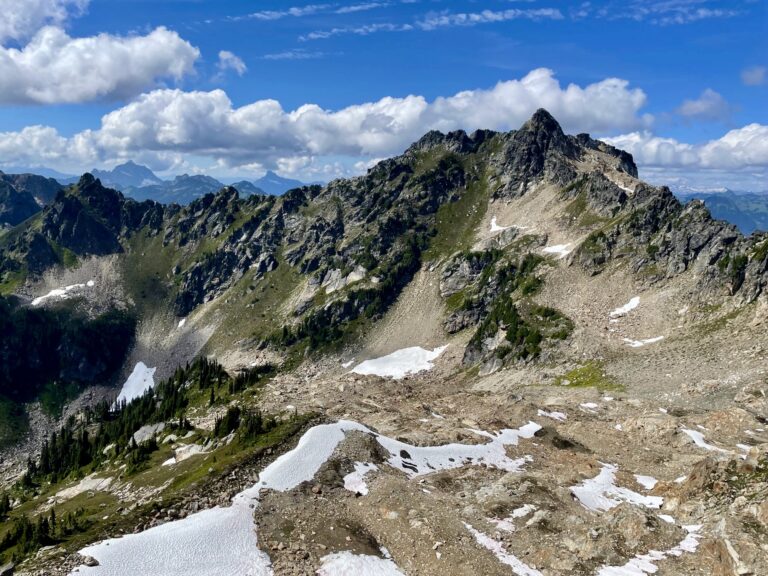
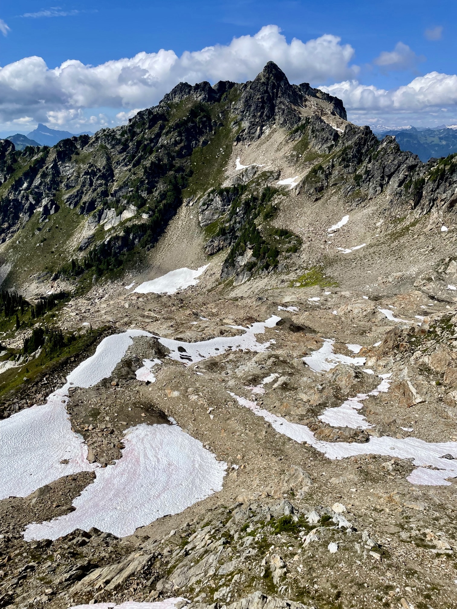
From Upper Black Basin, we made a rising northwesterly traverse across scree, talus, and snowfields, aiming for the bullet-shaped summit block of Black Mountain. I had climbed this peak twice in the past couple decades, both times approaching from Lake Byrne, but now coming from the south side made it feel like a whole new peak.

.

.
Before leaving the basin, we had debated over the best way to tackle the summit block. Was it better to (1) cross over the southeast ridge and then climb the east face or (2) cross over the southwest ridge and then climb the west face? Upon closer inspection, we decided on the latter option. This involved scrambling up a steep 500-foot heather chute—again aided by ice axes.
.
The heather chute ended at a small col immediately west of the summit block. From there, a short, exposed, and very fun Class 3 scramble up the northwest ridge put us all on top of Black Mountain in early afternoon (0.8 hours + 900 feet from pack stash). It felt so secure to be on solid rock after spending so much time on steep heather!
.
.
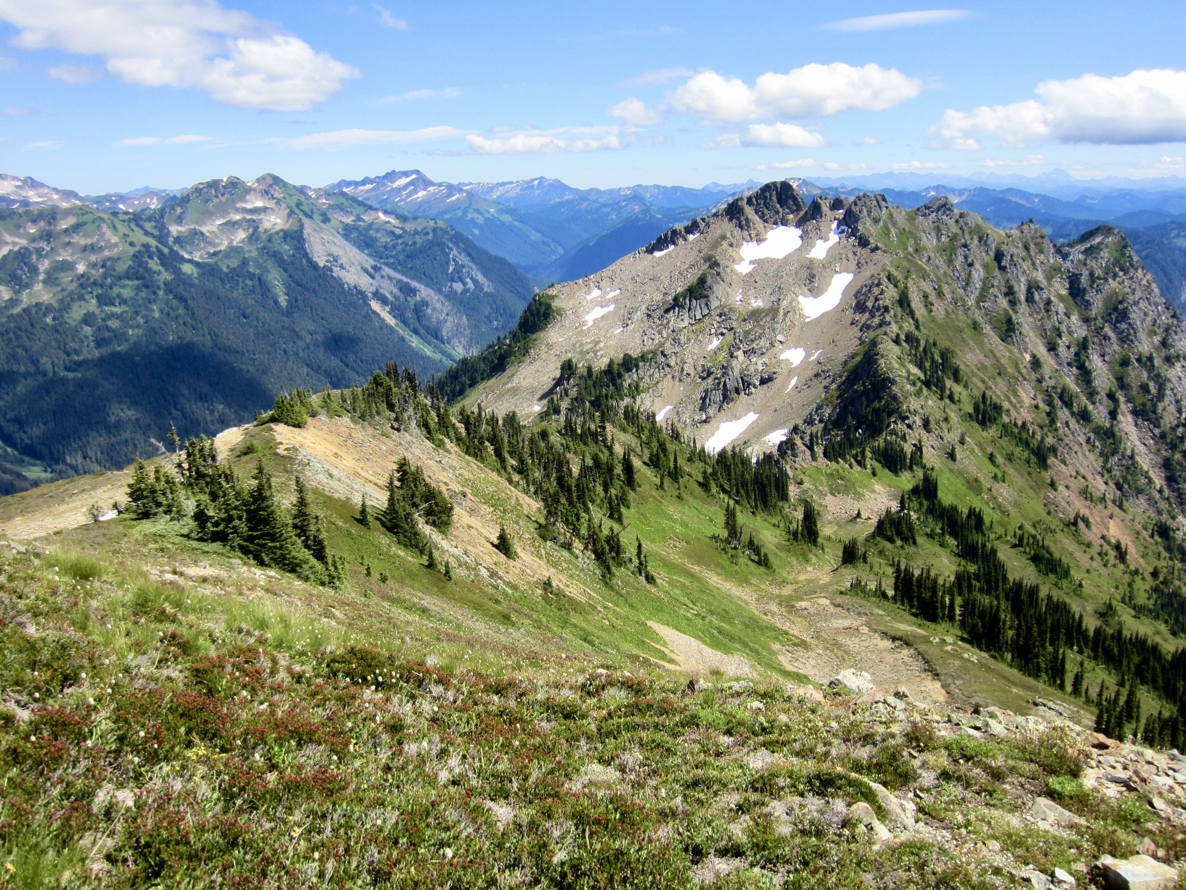
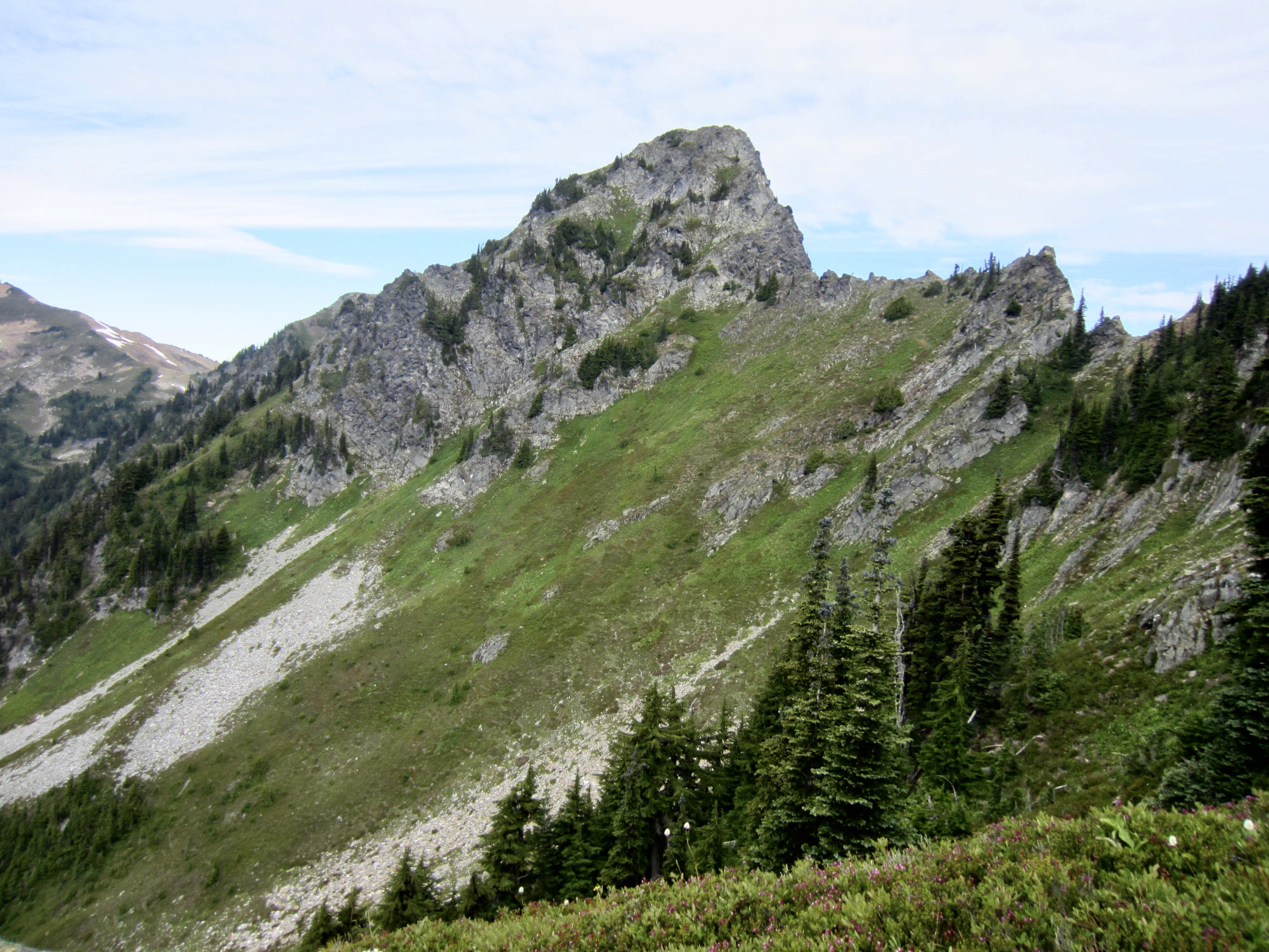
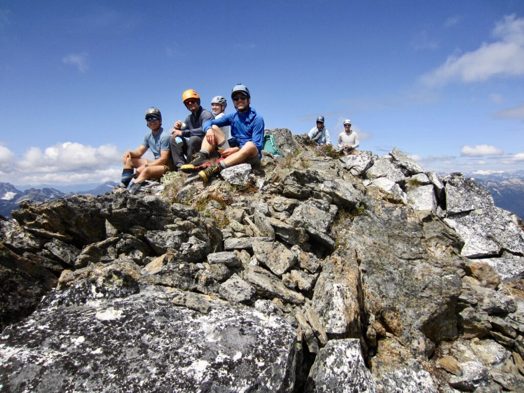
Black Mountain is the highest and most rugged peak along the Painted Traverse, making it the most coveted summit. However, its location near the midpoint of the traverse makes it the least accessible, as revealed by the summit register. We were only the third party signing in this year, and only three parties had signed in each of the previous two years.
.
After returning to our backpack stash in Upper Black Basin, we booted up a snow ramp to gain the summit ridge of Brown Peak near Point 6844. This position gave us a marvelous view back at Black Mountain, with its sharp summit horn standing atop broad shoulders.
.
Based on the topo map, we anticipated an easy descent of Brown Peak’s south ridge. Within minutes, however, we discovered that this mellow-looking ridge is actually very craggy. Jon and Adam tried to find a suitable descent route but ultimately deemed it too risky. Eric and Todd then dropped down to the west on steep heather, looking for a better route, but they soon encountered a cliff band. In a last-gasp effort, Eric reconnoitered a possible traverse route out to the south. He returned 15 minutes later and announced that it was very steep but doable. We carefully followed his route across super-steep heather and dirt slopes.
.
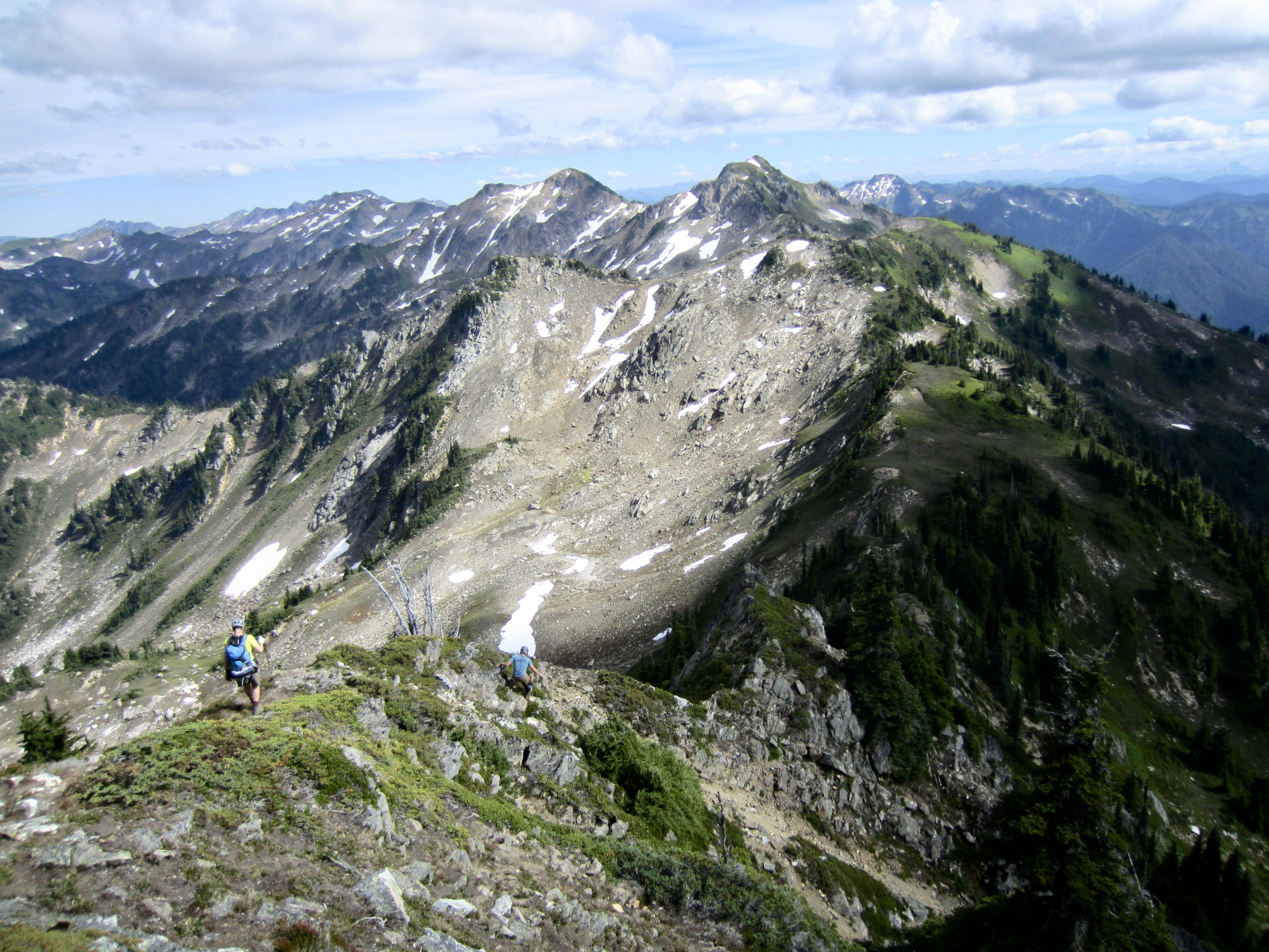
The super-steep hillslope gradually eased back to garden-variety steep heather, leaving us with just an ankle-twisting traverse toward Skullcap Peak. Upon reaching the Brown–Skullcap Saddle and looking back at Brown Peak’s rugged southwest slope and south ridge, we could clearly see why our descent had been so problematic. In many ways, this felt like the navigational crux of the whole traverse.
.
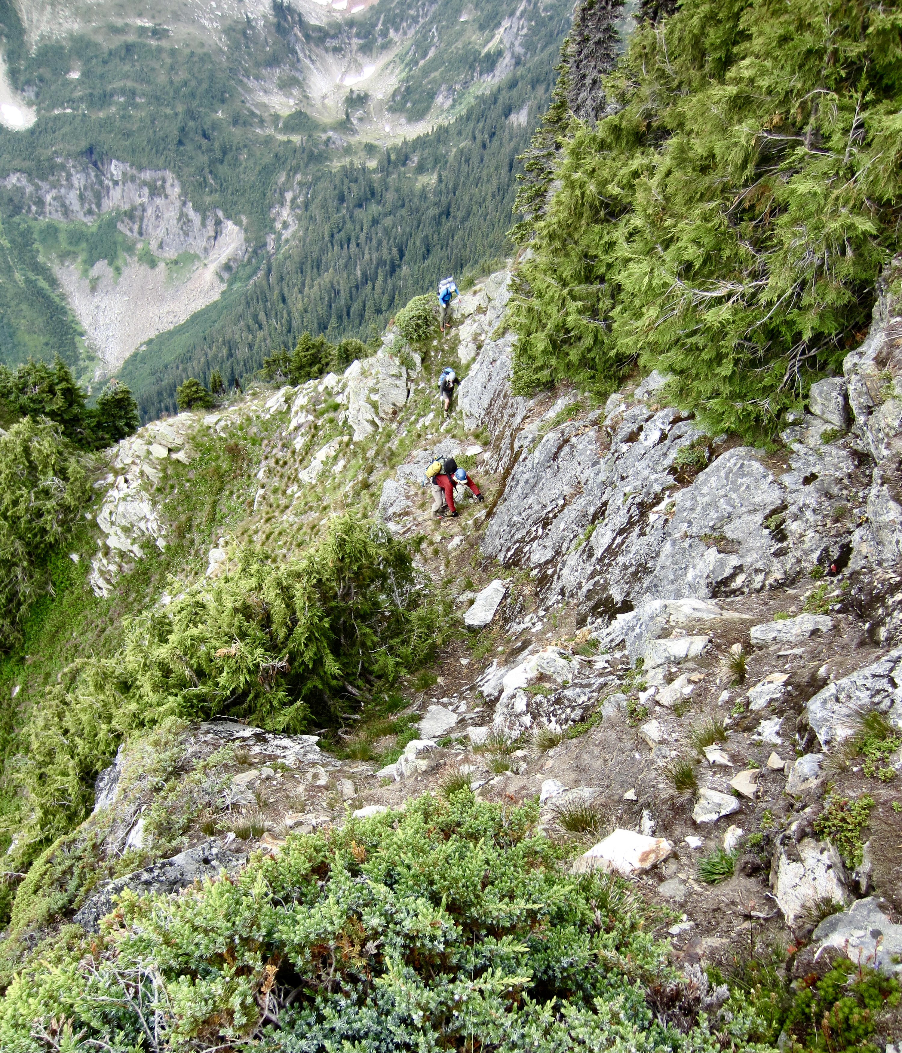
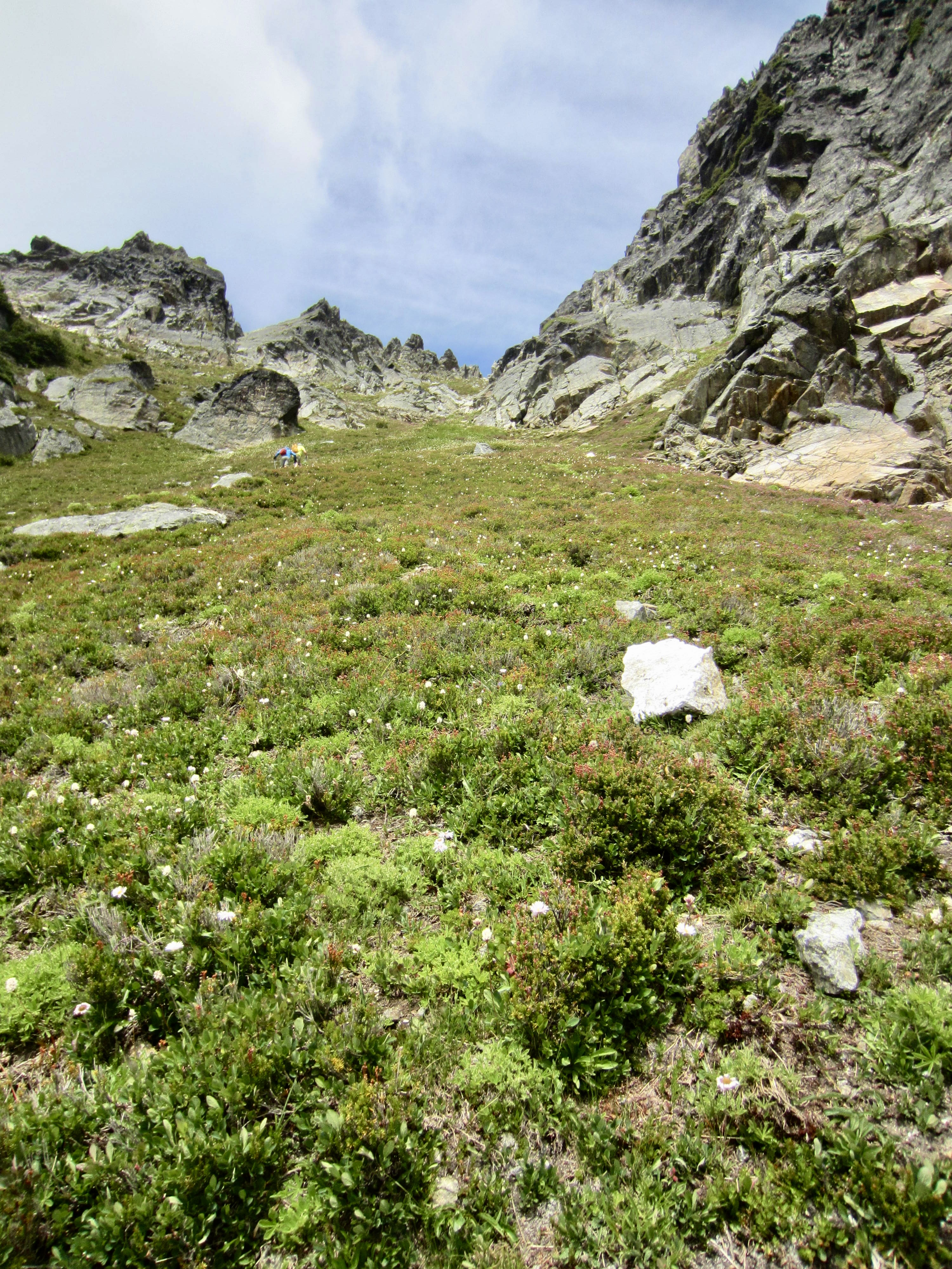
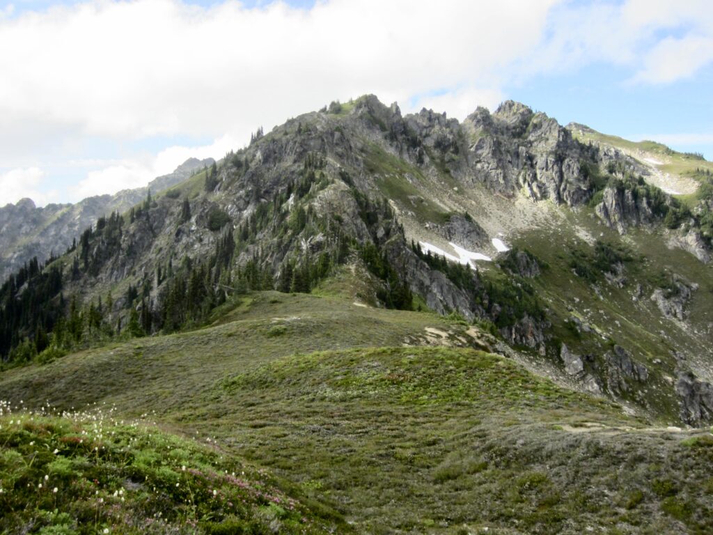
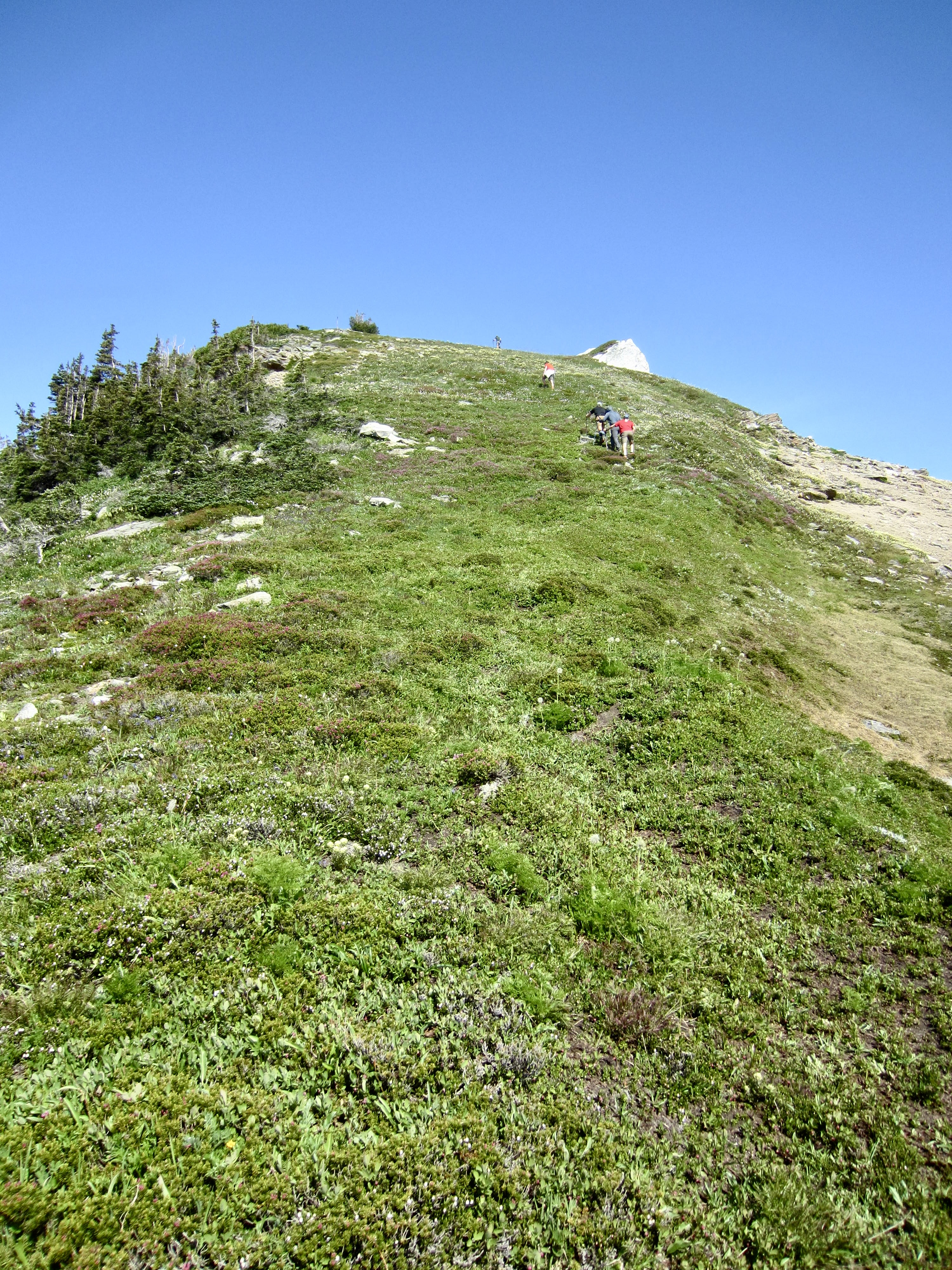
For the first time since leaving Painted Mountain’s summit yesterday afternoon, we encountered a bootpath cutting through the heather. This bootpath led us over the gentle summit “cranium” of Skullcap Peak and down to the Skullcap–Purple Saddle.
.
Earlier in the day, we had spotted several large snow patches at the Skullcap-Purple Saddle and hoped that this would provide a good campsite. We could now see a nice heather bench and running water closely below the eastern side of the saddle. It was early evening when we dropped our packs on the heather bench (10.1 hours + 3200 feet from Camp 1). Our day’s travails were quickly smoothed over by wine and appetizers.

.
Day 3: Skullcap–Purple Saddle to Trailhead
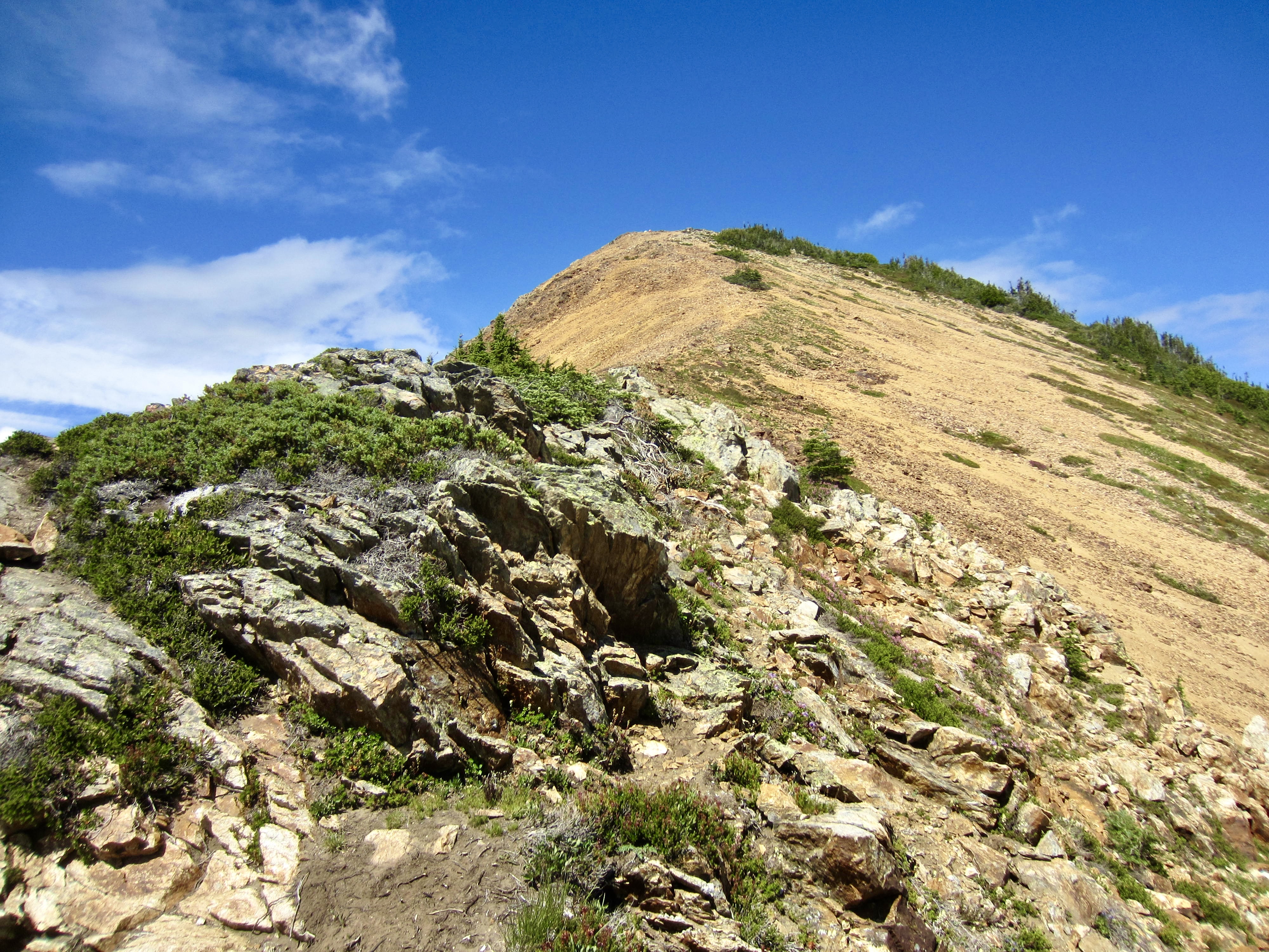
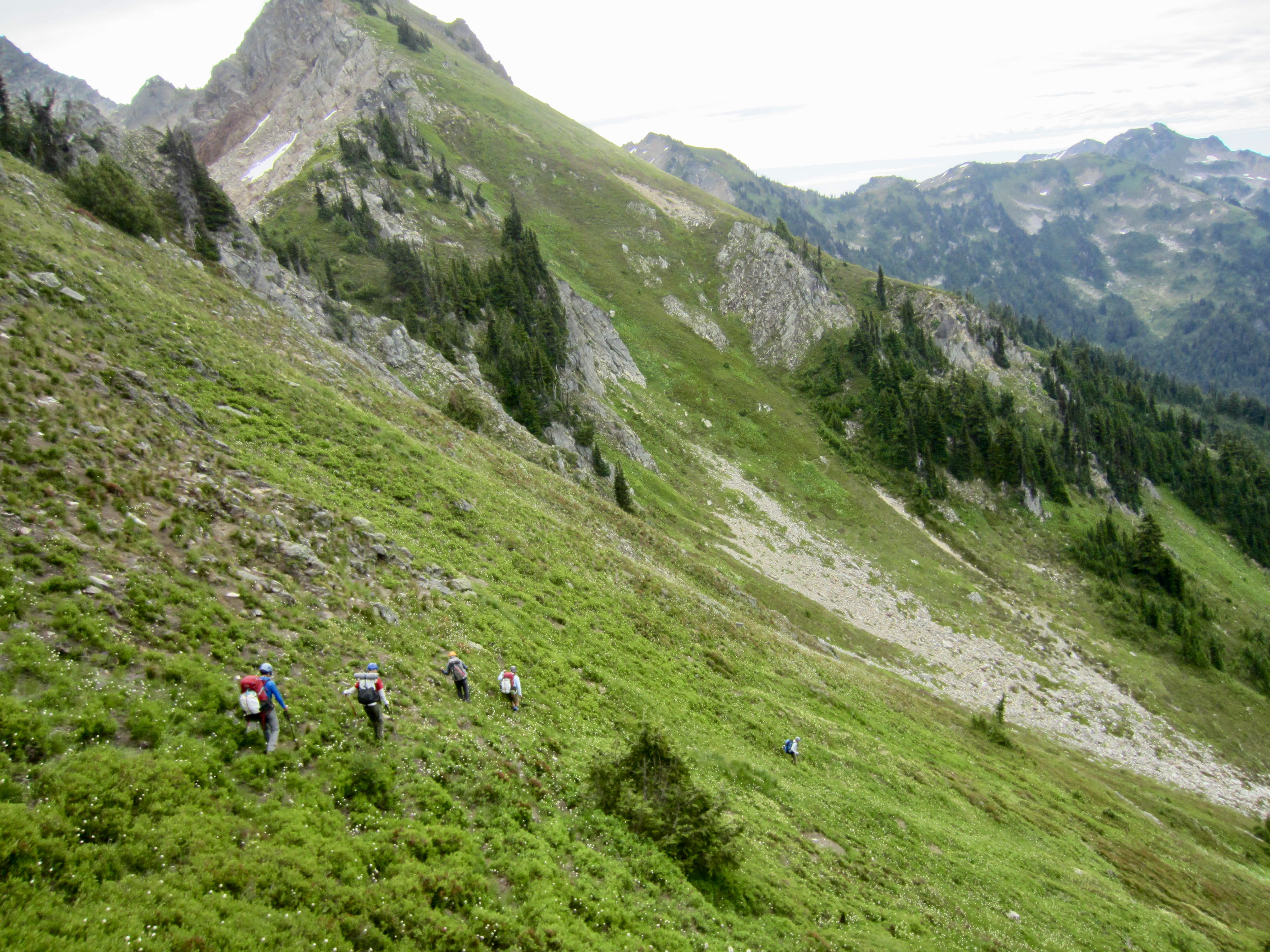
A cold fog shrouded our camp all night, and we awoke to find water droplets covering every surface. Surely, this was not going to make the steep heather any easier! We broke camp at 8:40am and began heading up the north ridge of Purple Peak.

.
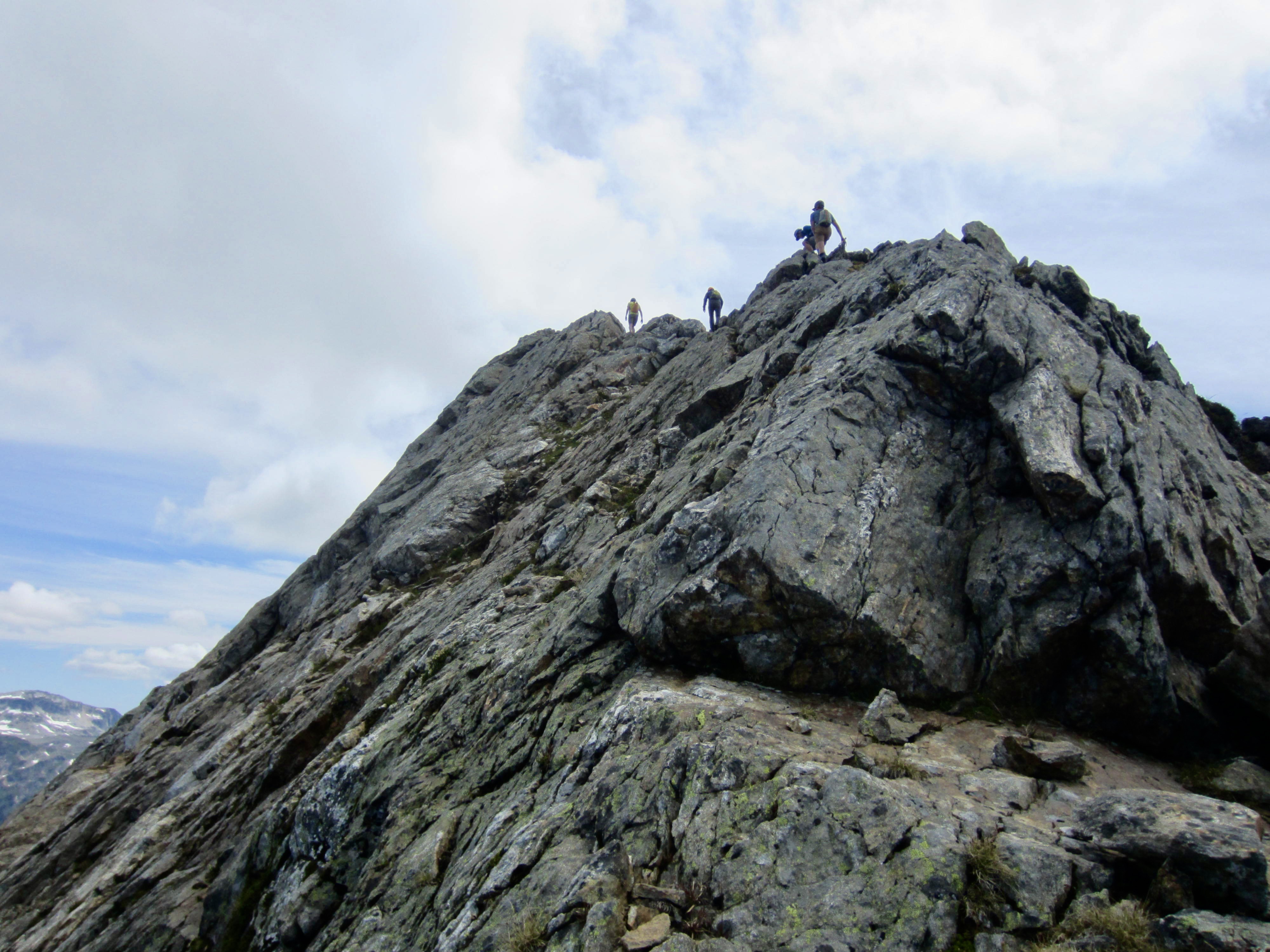
Very quickly, we were presented with a row of pinnacles stepping up the ridge crest and disappearing into the fog. Adam volunteered to scope out the route ahead, so he scrambled upward for 100 yards. When he came back and announced that there were a lot of Class 3-4 moves, we decided to instead skirt around the eastern flank of the peak. This initially involved a straightforward traverse across talus and scree slopes.
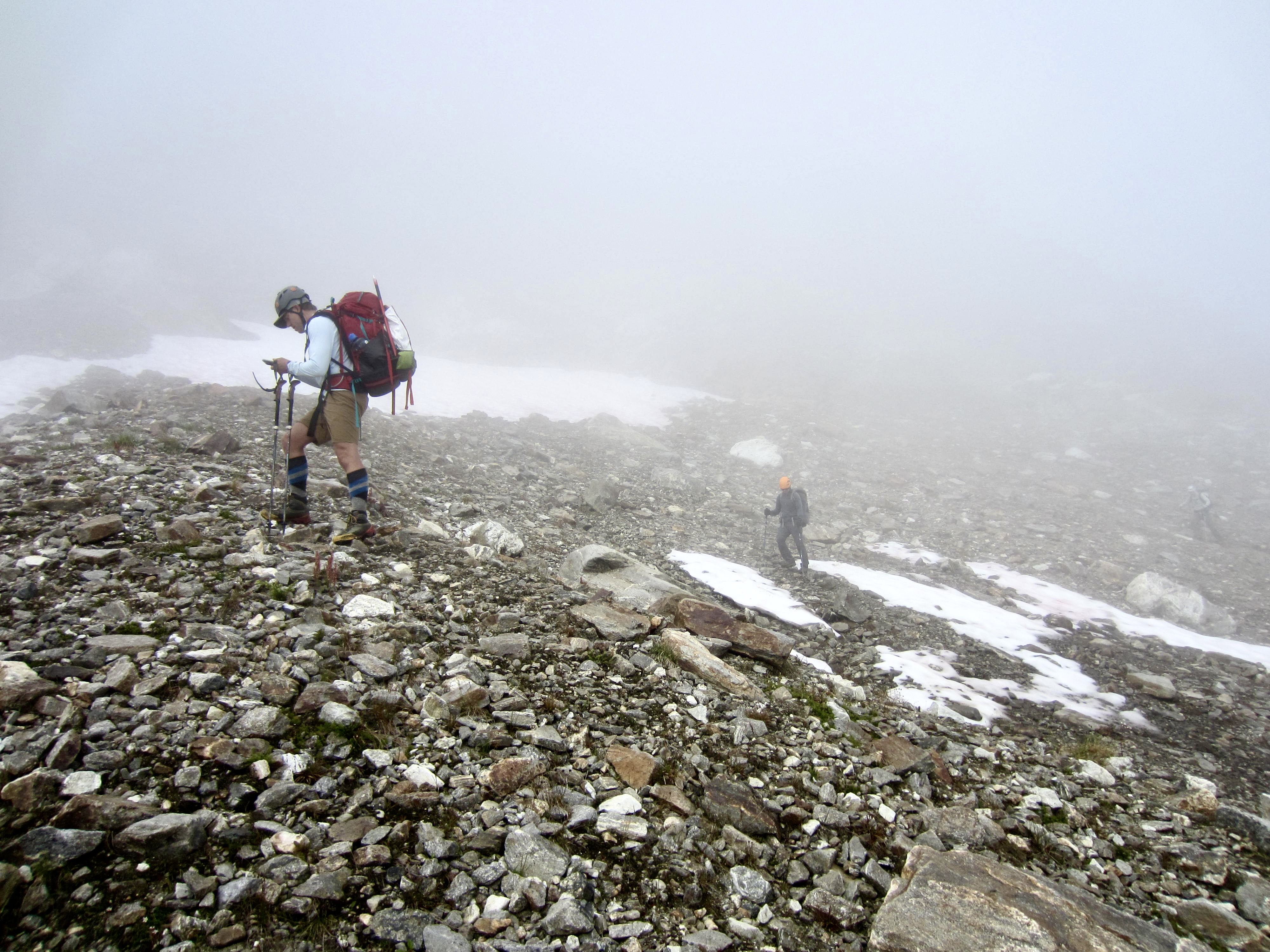
.
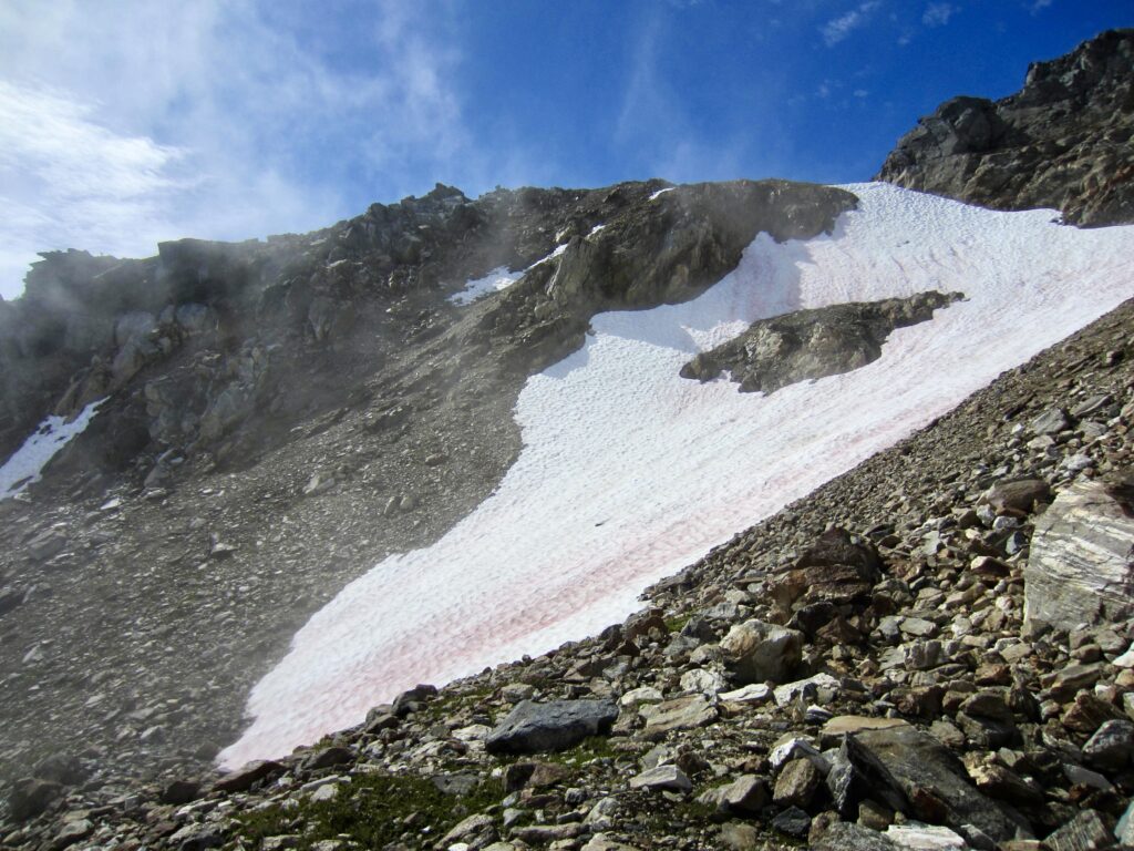
Visibility steadily improved as we traversed around to the peak’s east ridge, thereby revealing several possible ways to cross over the ridge. After considering all options, it was decided to contour below a large snowfield and then ascend a right-slanting ramp that ends at a flat step in the crest. This required some unpleasant groveling up loose scree but succeeded in getting everyone over the ridge.
.
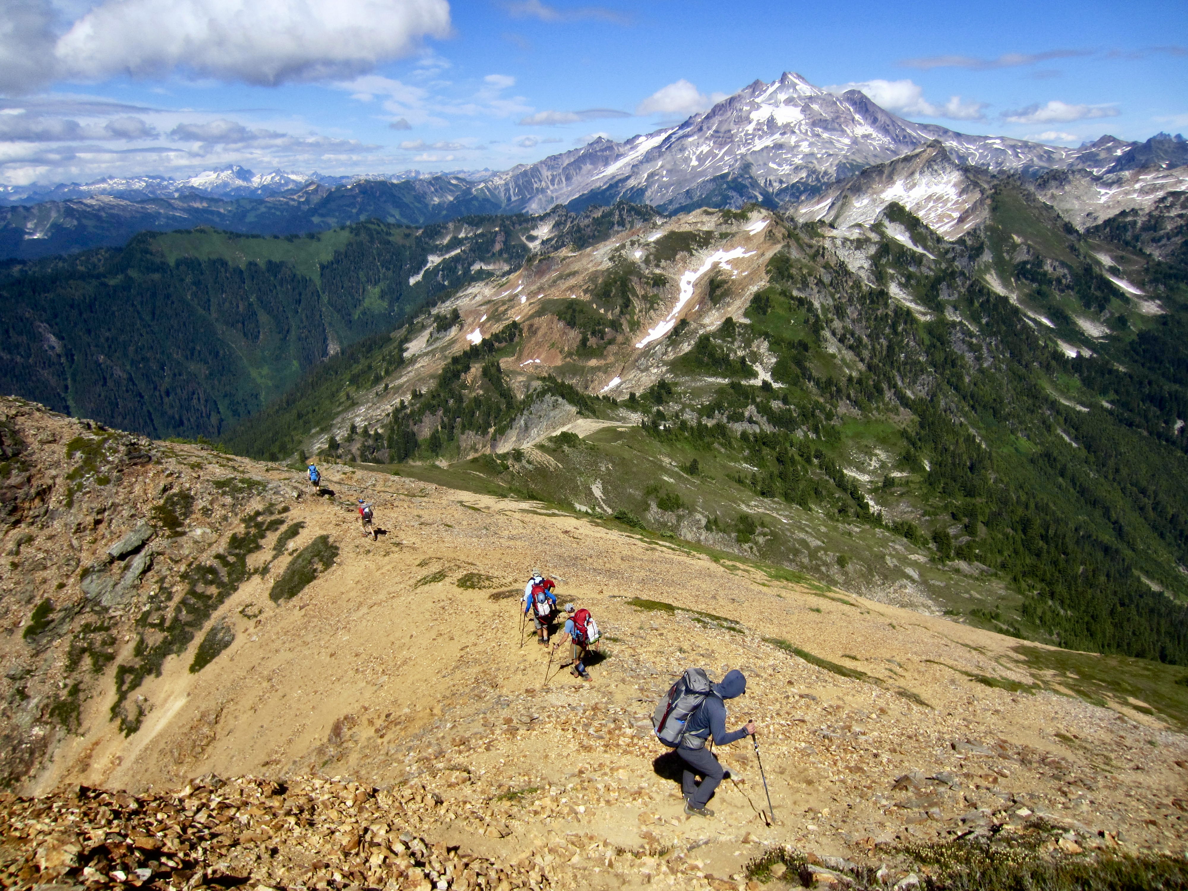
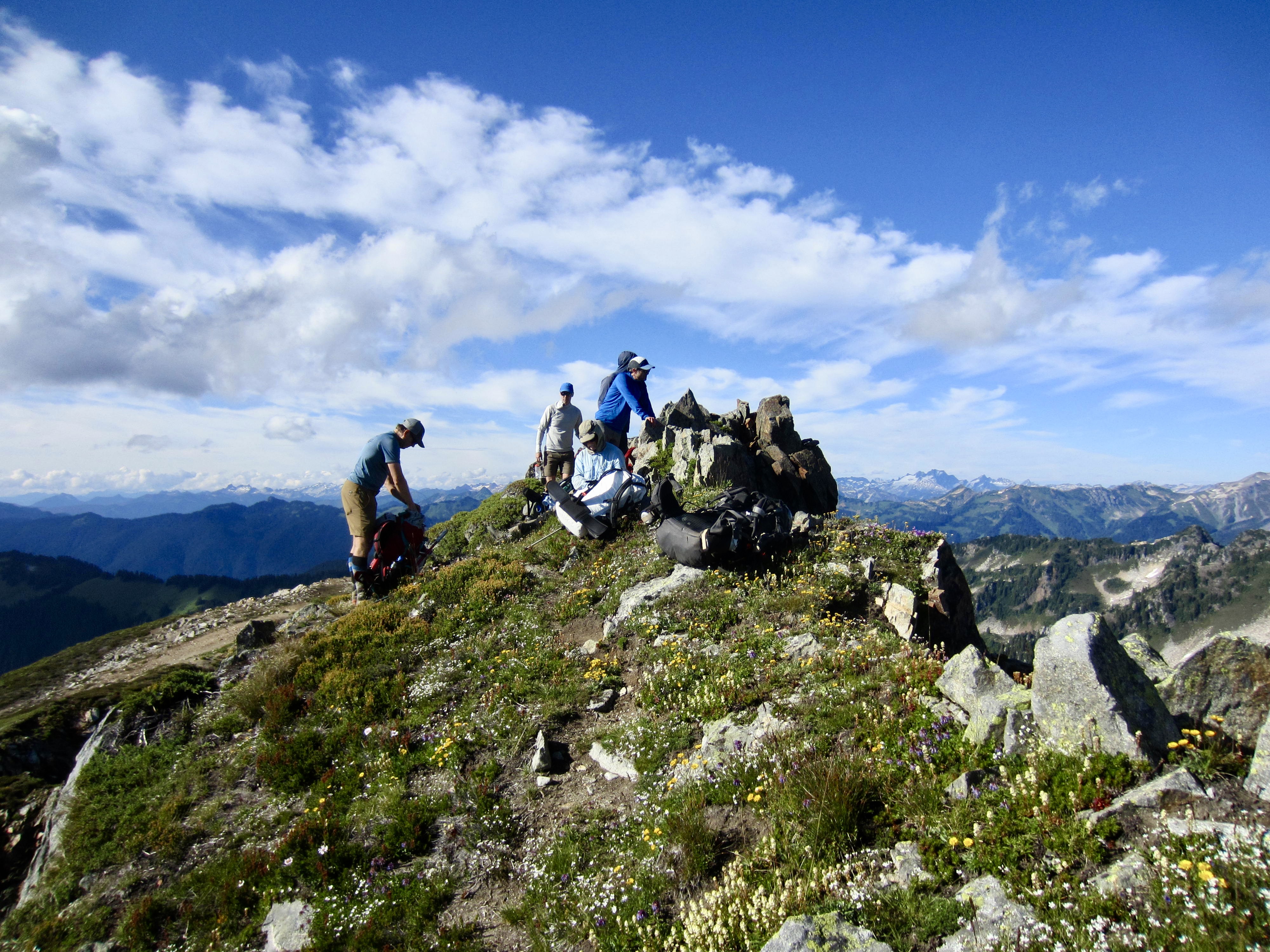
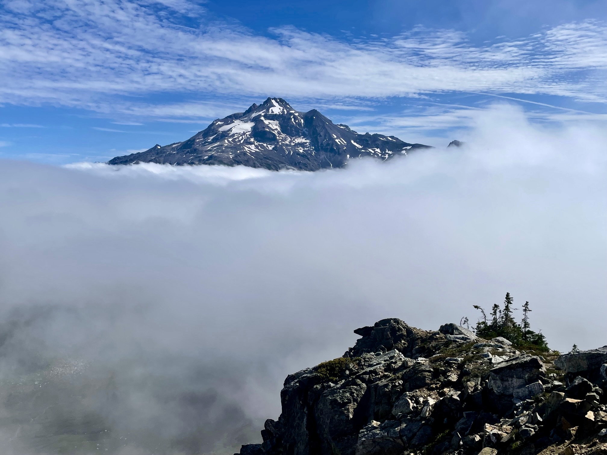
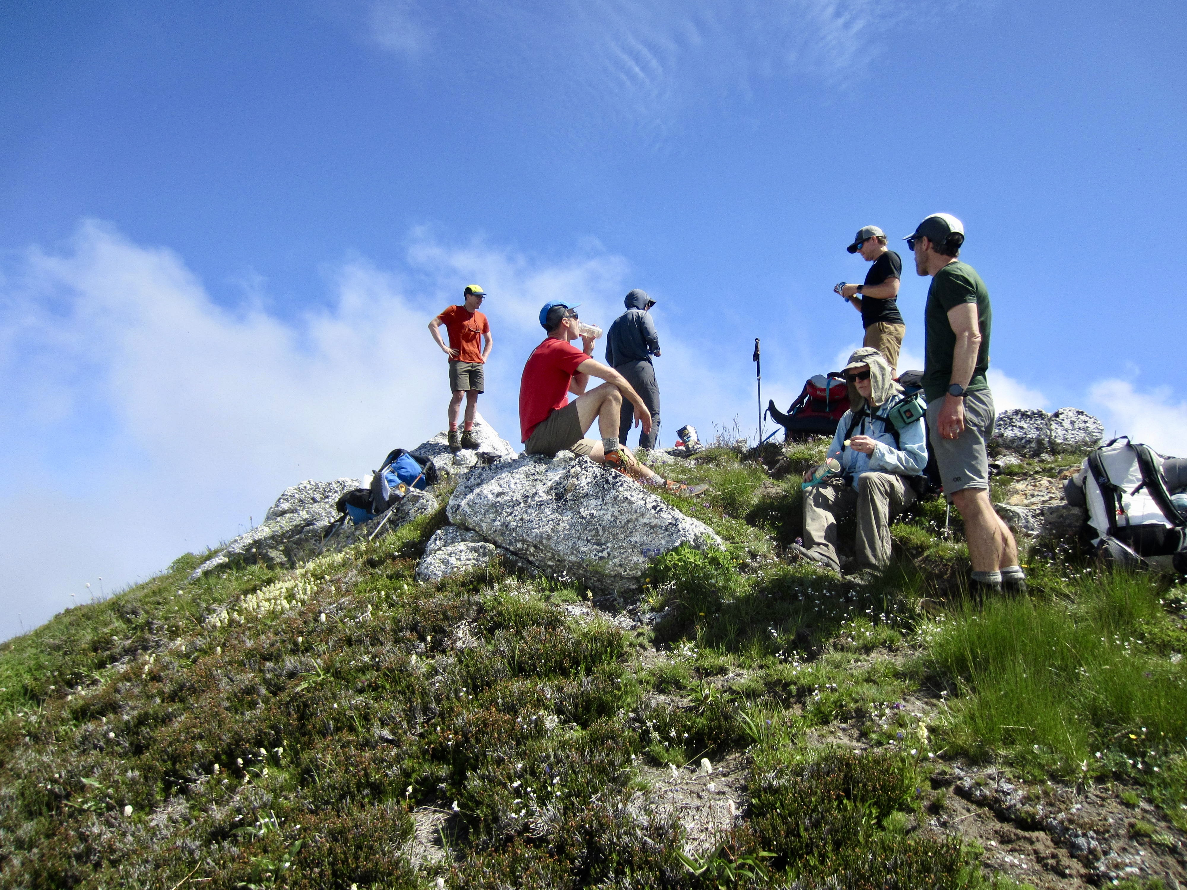
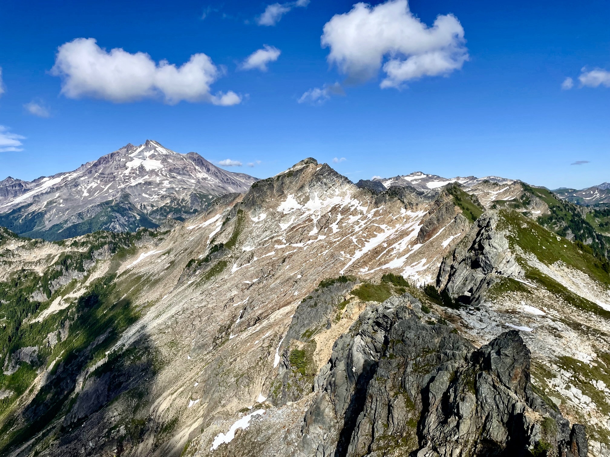
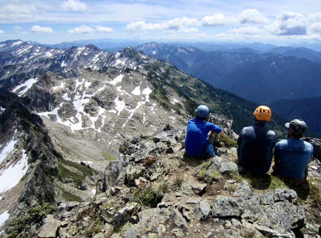
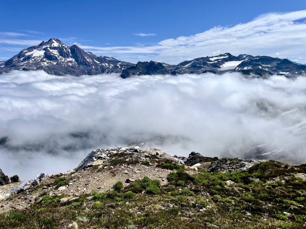
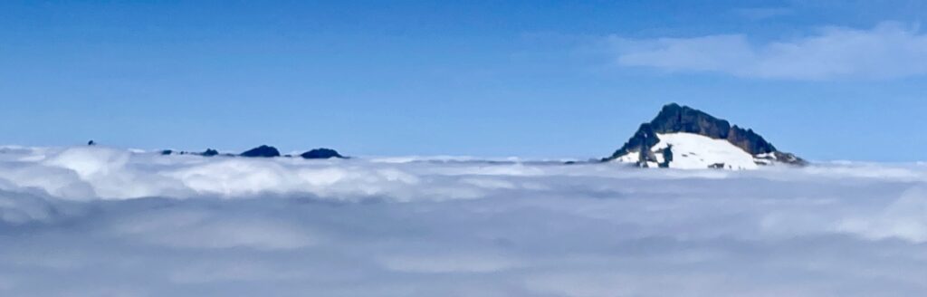
Once atop the east ridge, a short traverse across mellow slopes brought us to the southeast ridge. We dropped packs and hiked up to the summit of Purple Peak, which stood above the cloud deck. All of the high surrounding peaks poked their heads through the clouds.
.
.
.
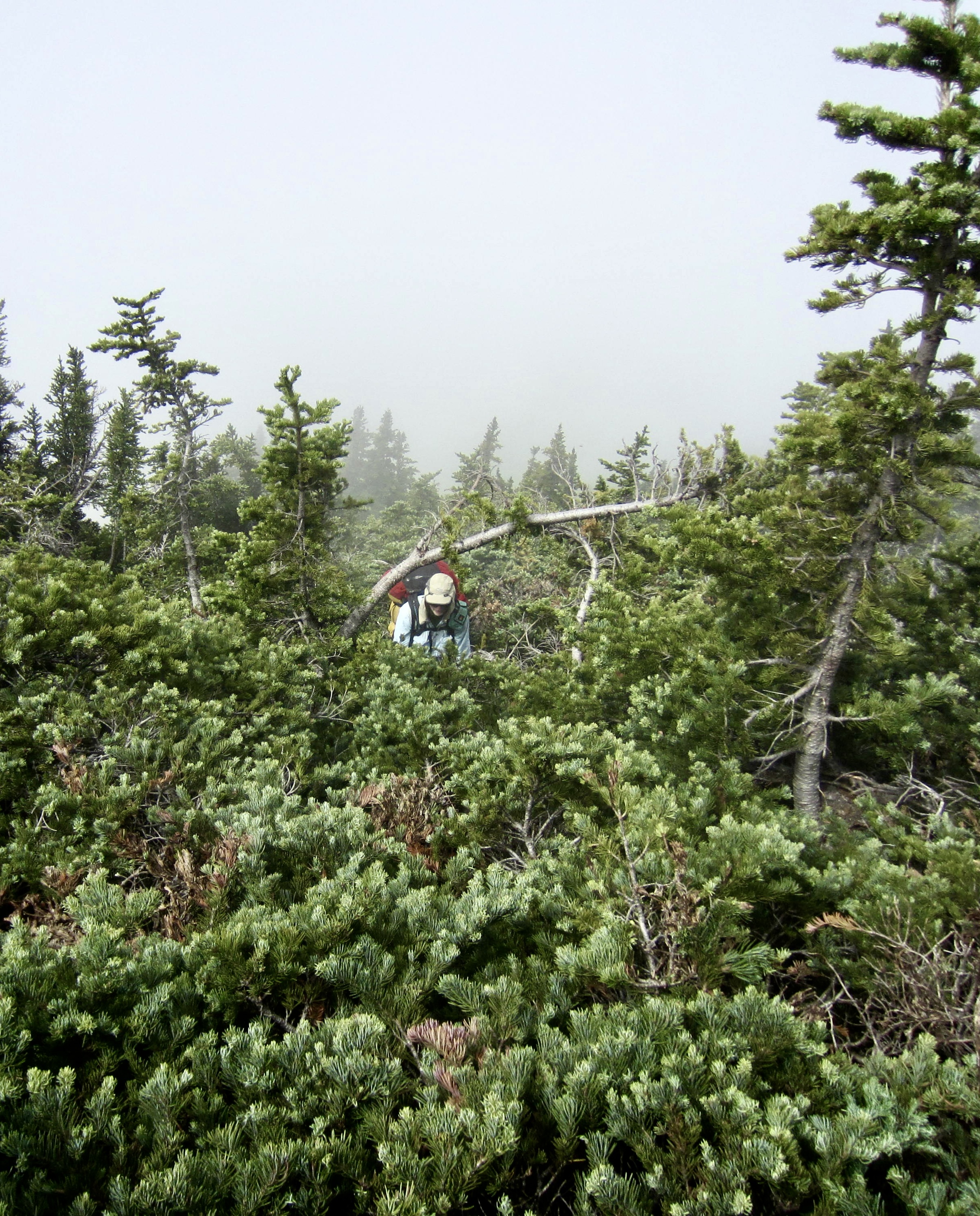
We returned to our packs and continued descending to the Purple-Portal Saddle. The ascent of Portal Peak’s northwest ridge started as a simple hike through low-growing vegetation but abruptly turned into a frustrating bushwhack through dense krummholz. Once again, the Painted Traverse managed to throw an unexpected obstacle in our way! Everyone arrived at the summit of Portal Peak with a variety of minor battle wounds.
.

.
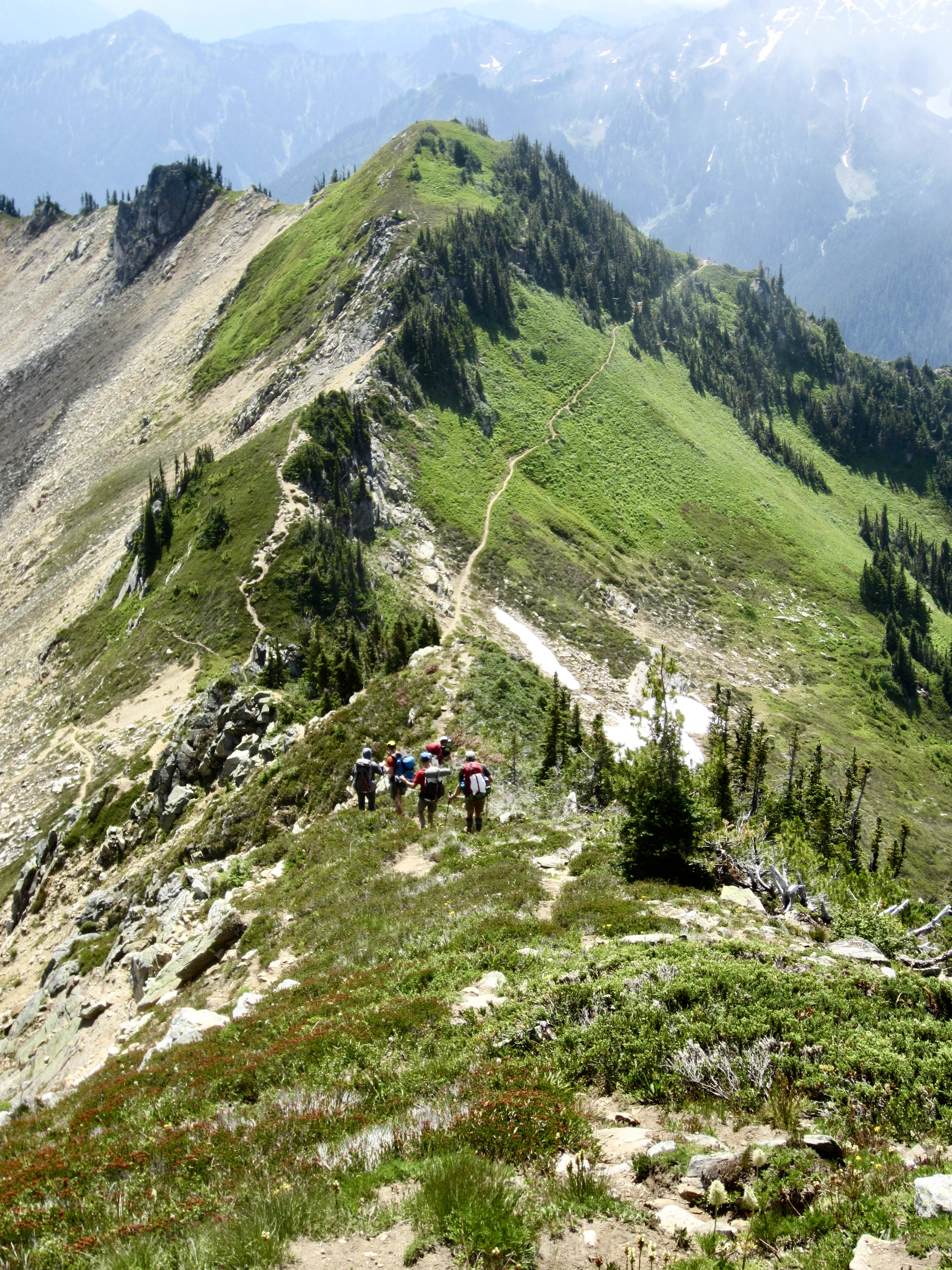
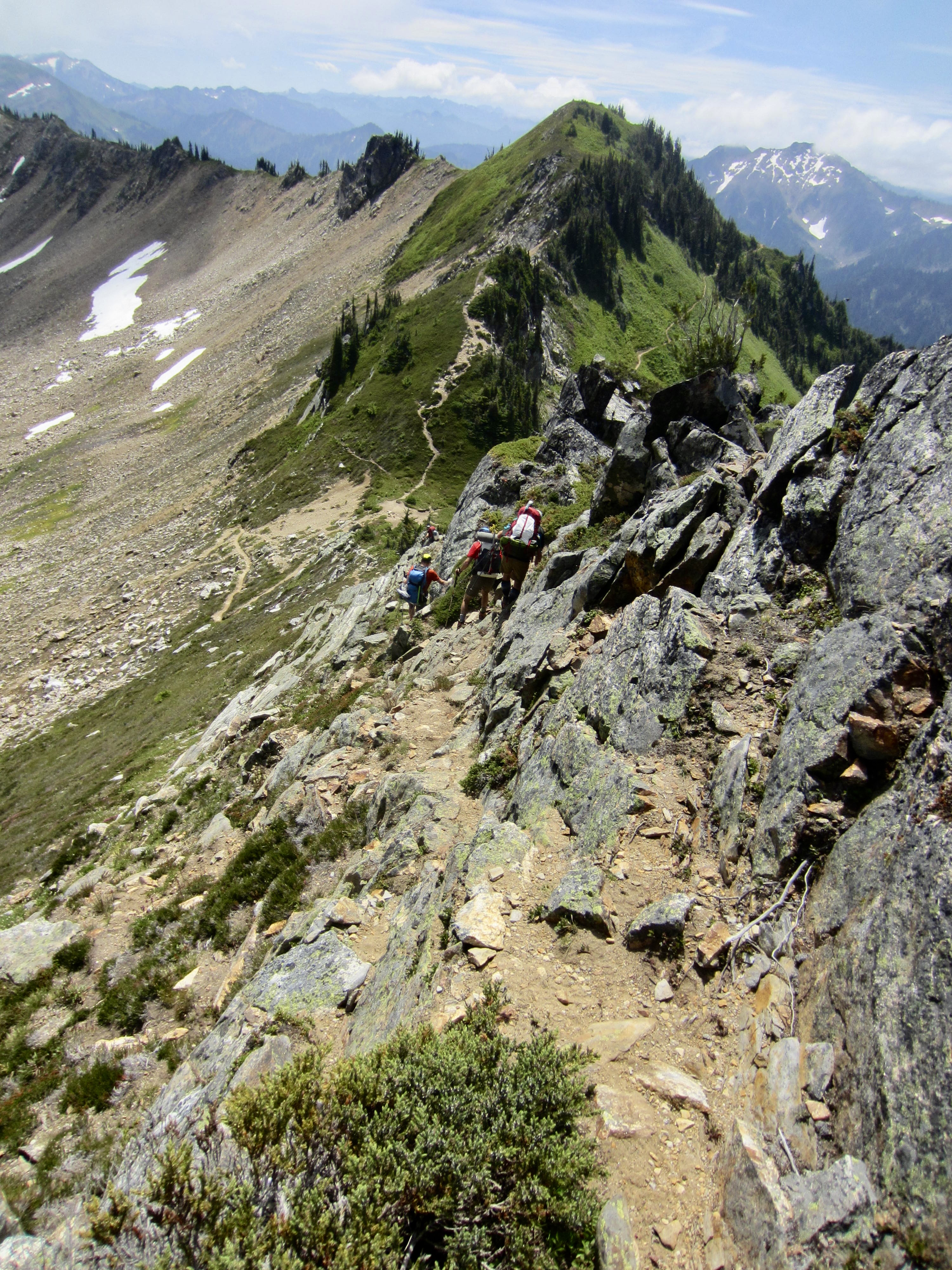
From the summit of Portal Peak, we followed a well-worn path down a heathery and rocky ridge to intersect the Pacific Crest Trail at Red Pass (3.7 hours + 1200 feet from Camp 2). A purist would insist on finishing the traverse with a hike up White Mountain, but we were more interested in getting to a hamburger joint before closing time. Besides, this trail-accessed summit would seem a little anticlimactic after our previous challenges.
.
.
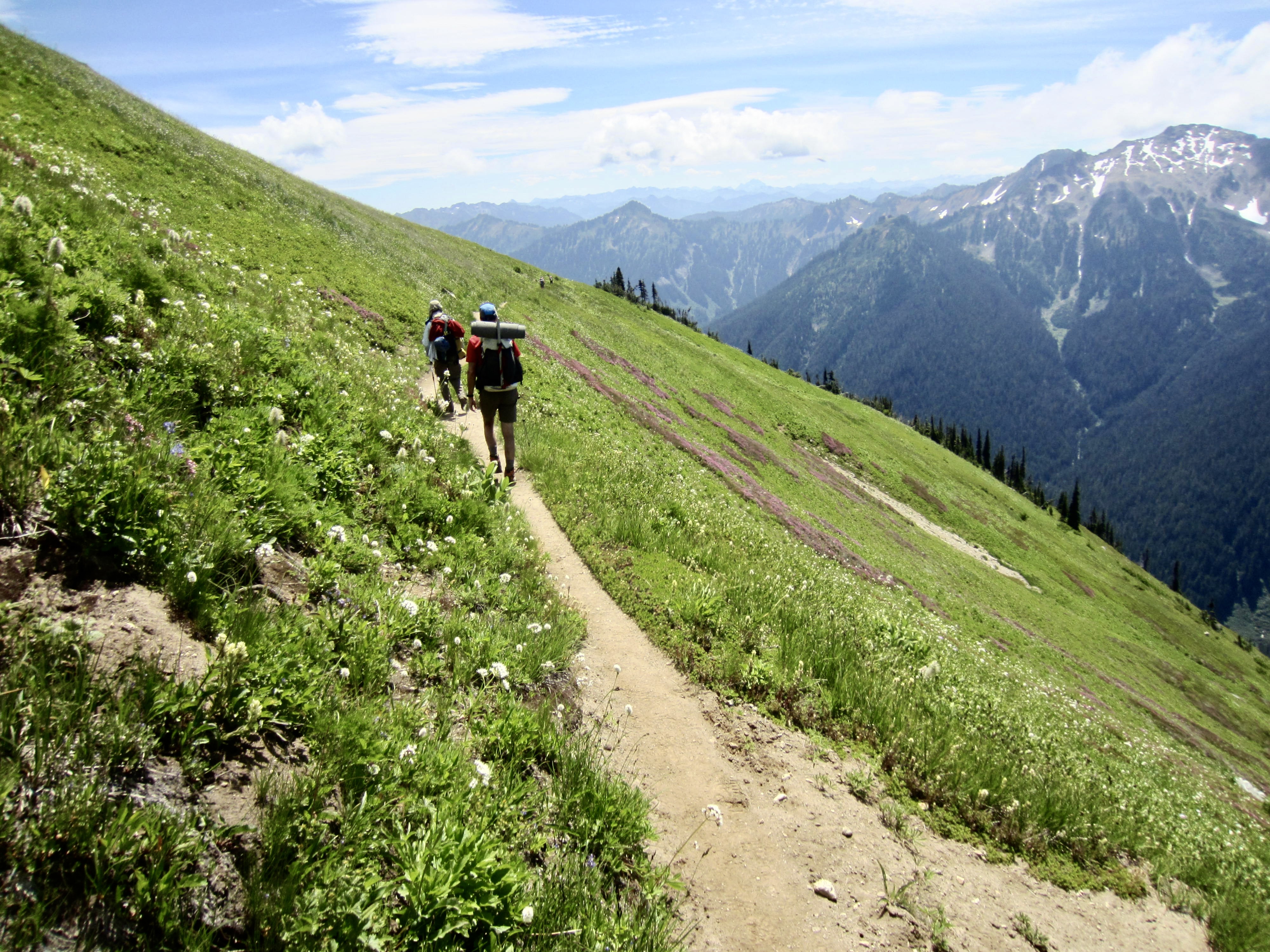
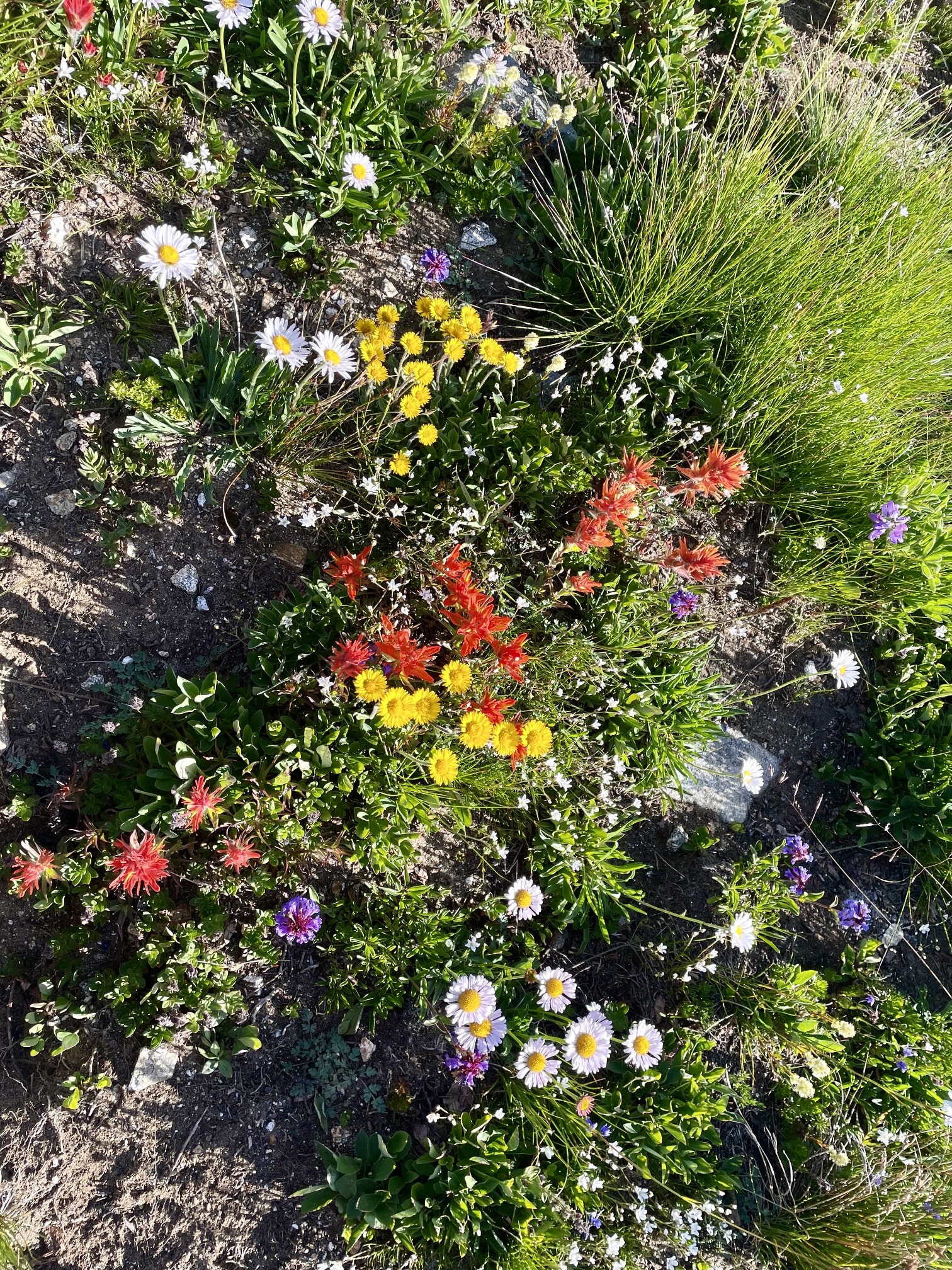
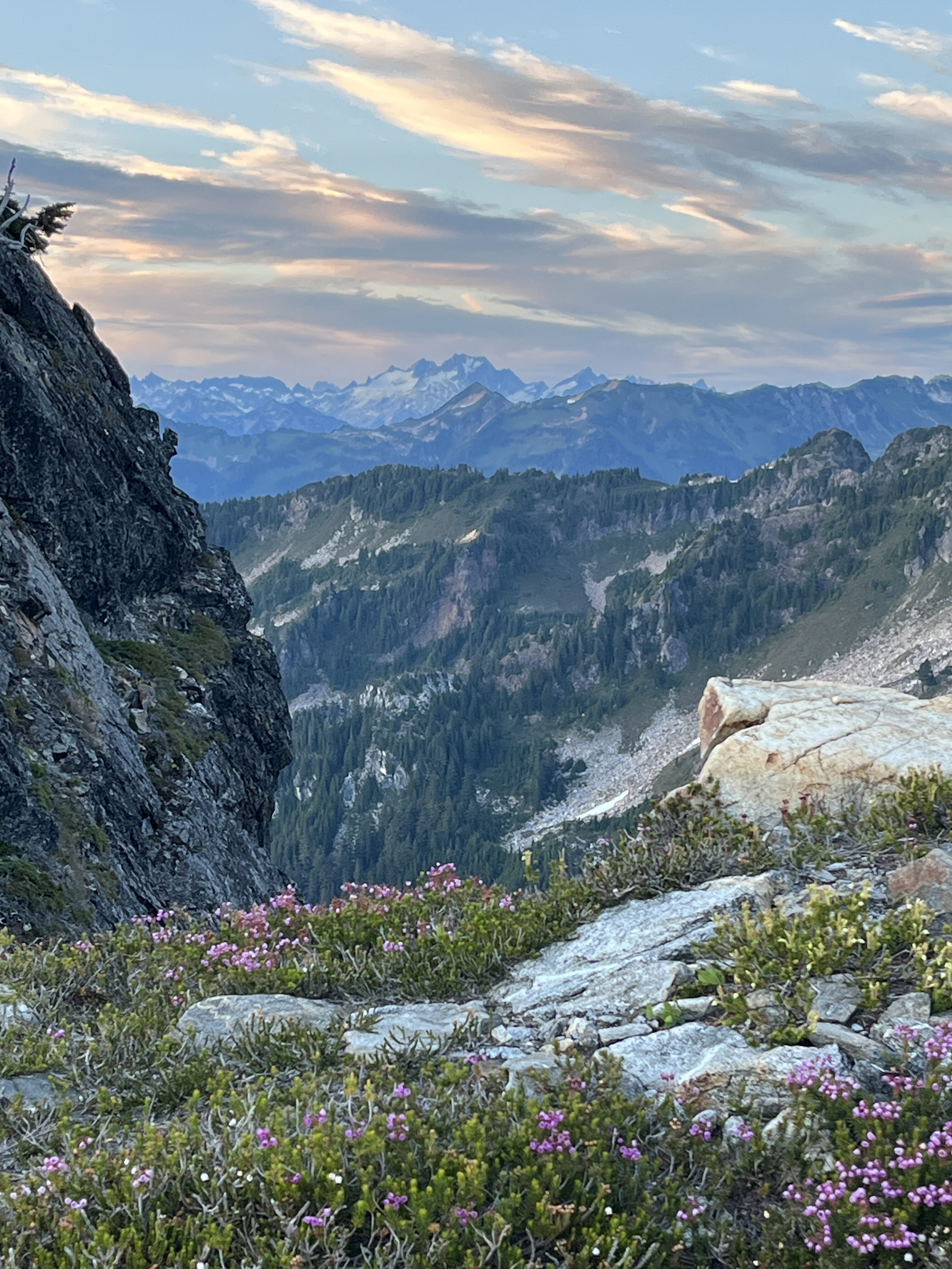
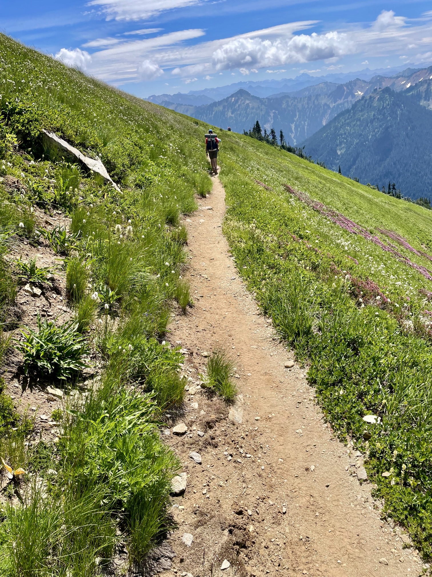
The short section of PCT heading away from Red Pass turned out to be one of the scenic highlights of our traverse. This trail cuts across an expansive green hillslope decorated with a dazzling display of wildflowers, several thousand feet above the North Fork Sauk River Valley.
.

.
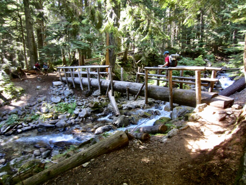
A few hours later, we all took a long break in shady forest at the former Mackinaw Shelter site, where some of us changed into trail sneakers. From there, it was a steady march out to the trailhead, arriving at 5:00pm (8.7 hours + 1400 feet from Camp 2). A dip in the cold river washed off the trail grime and put a refreshing cap on Mid-Summer Climbing Trip No. 23.
.
In the end, we all felt that three days was a reasonable time frame for the Painted Traverse, given the distance, elevation gain and loss, steep terrain, and micro-navigational challenges. Furthermore, our two chosen campsites not only provided flat ground and running water (at least with this year’s snowpack), they also divided the trek into three nearly equal time increments. If doing the traverse in two days, Upper Black Basin would probably be the ideal campsite.
The traverse could be done in either direction, and we chose to do it in a clockwise direction for two reasons. First, beginning the trip with a 5000-foot ascent of Painted Mountain was more appealing than ending it with a 5000-foot descent. Second, in case our last day involved a headlamp finish, we preferred to travel on the well-maintained North Fork Sauk River Trail rather than on the primitive Painted Mountain path. However, in retrospect, I think that our navigation might have been somewhat easier if doing the traverse in a counterclockwise direction, because we would have ascended rather than descended the steep terrain on Magenta Peak and Brown Peak.
Route Maps & Profiles
…
…
…
…
Photo Gallery
Click to enlarge…