Trip Date: July 18-20, 2025
KERRY KALE MOUNTAIN OUTING NO. 3
Outer Constance Peak Climbing Attempt
Dosewallips River Valley
Lake Constance
Avalanche Canyon
Chute’s Notch
Mount Constance: outer peak aka Outer Constance Peak (7756 ft) attempt
Trip Summary
Region: Olympic Mountains (Washington)
Sub-Region: Constance–Buckhorn Group
Area: Olympic National Park
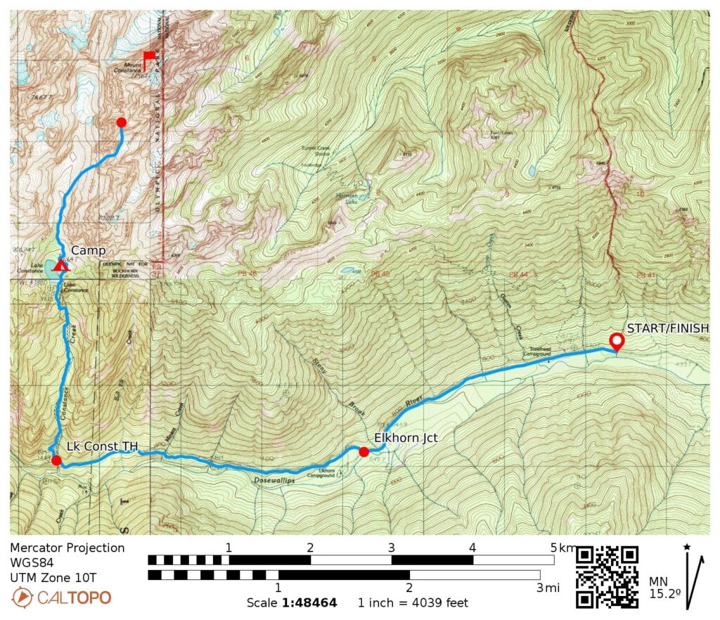
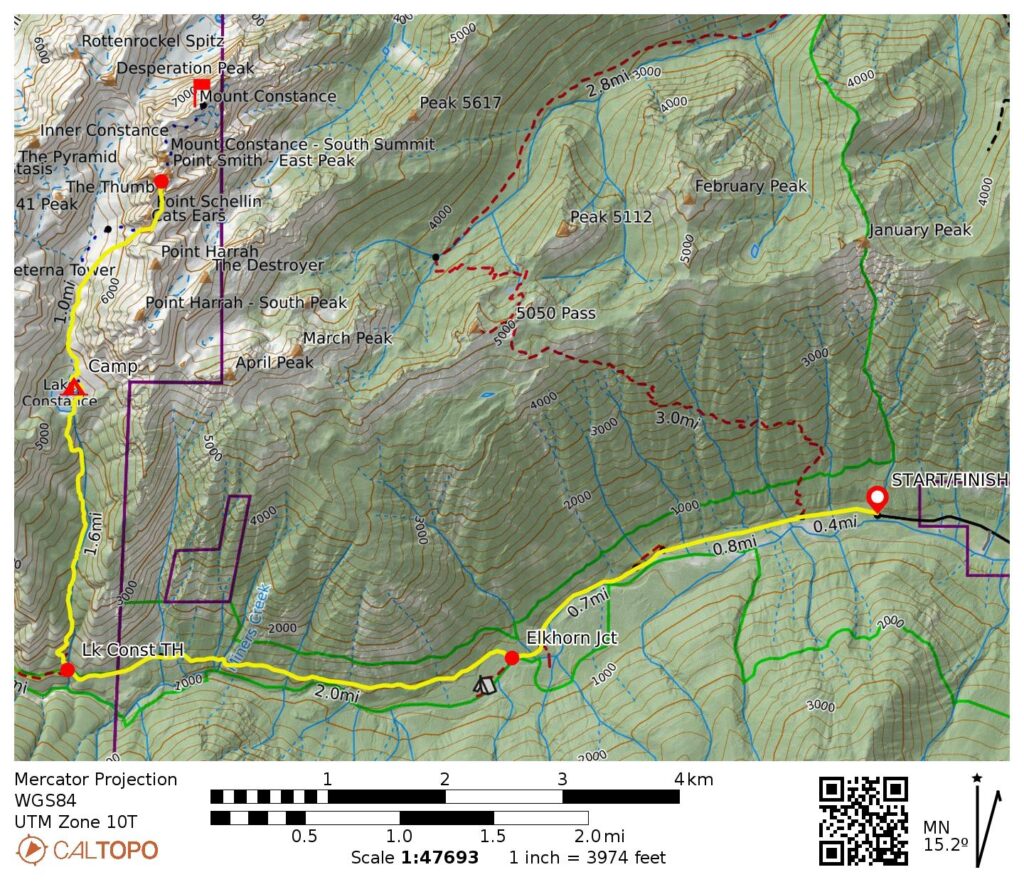
Starting & Ending Point: Dosewallips River Road blockade at creek washout (Elev. 550 feet)
Approach Way Points: Gamm Creek crossing & Dosewallips River washout & Stony Brook crossing & Elkhorn Junction & Miners Creek crossing & Bull Elk Creek crossing & Constance Creek Bridge & Lake Constance Trailhead & Constance Creek & Lake Constance (road hike & trail hike & off-trail hike & trail scramble)
Campsite: North end of Lake Constance (Elev. 4670 feet)
Sidetrip: Dead Man’s Gap & Avalanche Canyon (off-trail hike)
Summit Attempt: Outer Constance Peak (hike & climb to 7200 feet via South Chute—Chute’s Notch—Southeast Couloir)
Approximate Stats: 15.6 miles traveled; 6700 feet gained & lost.
Related Posts
>>> Mt. Constance: outer peak via South Chute—Finger Traverse – July 2013
>>> Mt Constance: inner peak via South Gully—East Ridge – July 2004
>>> Mt Constance: outer peak via South Chute—Finger Traverse – September 1998
Full Trip Report
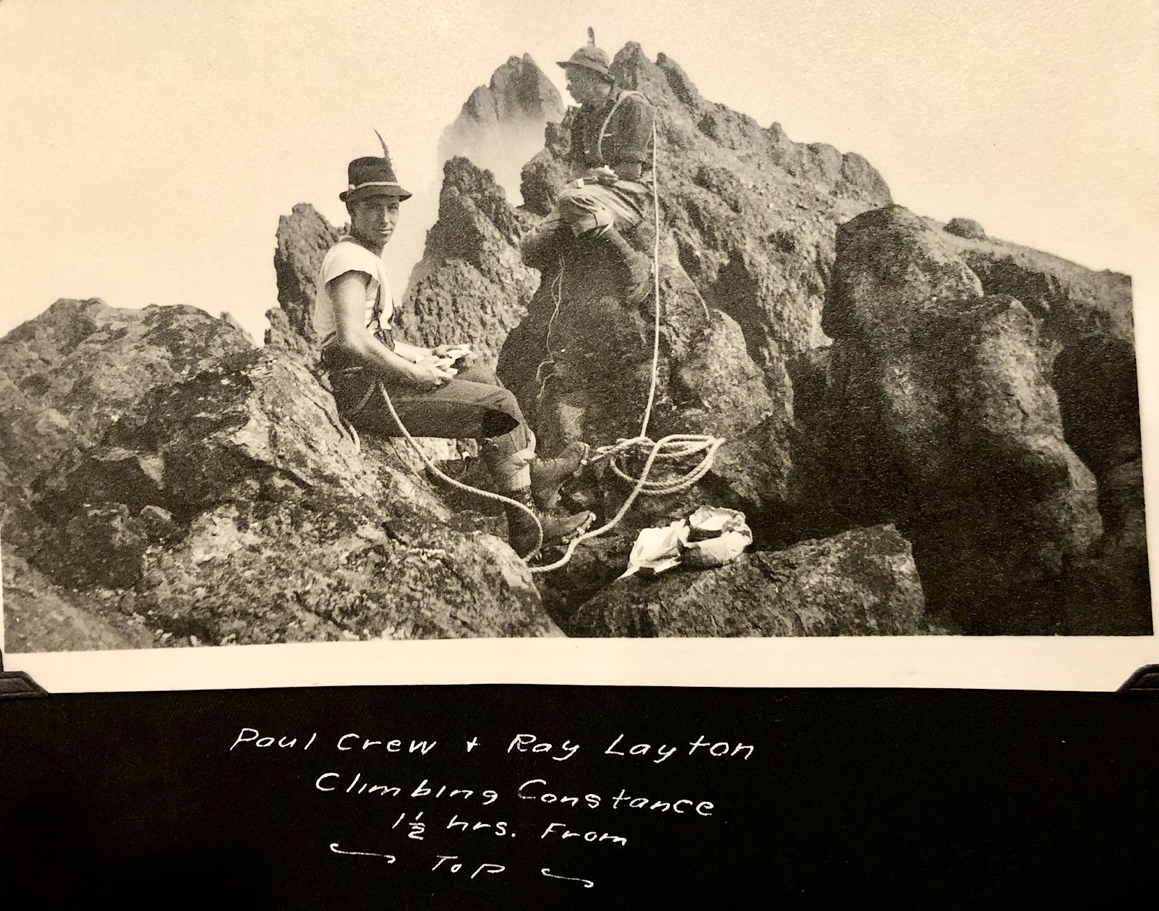
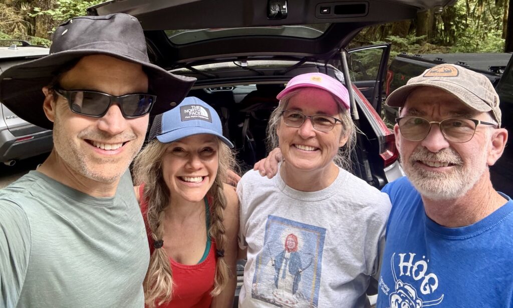
For our third annual “Kerry Kale Mountain Outing,” Eileen and I met up with Kerry and Mike to attempt a climb of Mt. Constance’s outer (main) peak. Kerry became interested in this peak after seeing an old photo of her grandfather, Ray Layton, and his friend, Paul Crews, sitting on the summit ridge. Ray and Paul famously made the first ascent of Mt. Cruiser in 1937. Unfortunately, we weren’t able to reach the summit on this trip, but everyone had a memorable journey and gained an intimate look at the incredibly rugged Mt. Constance massif.

.
.
Day 1: Road Blockade to Lake Constance
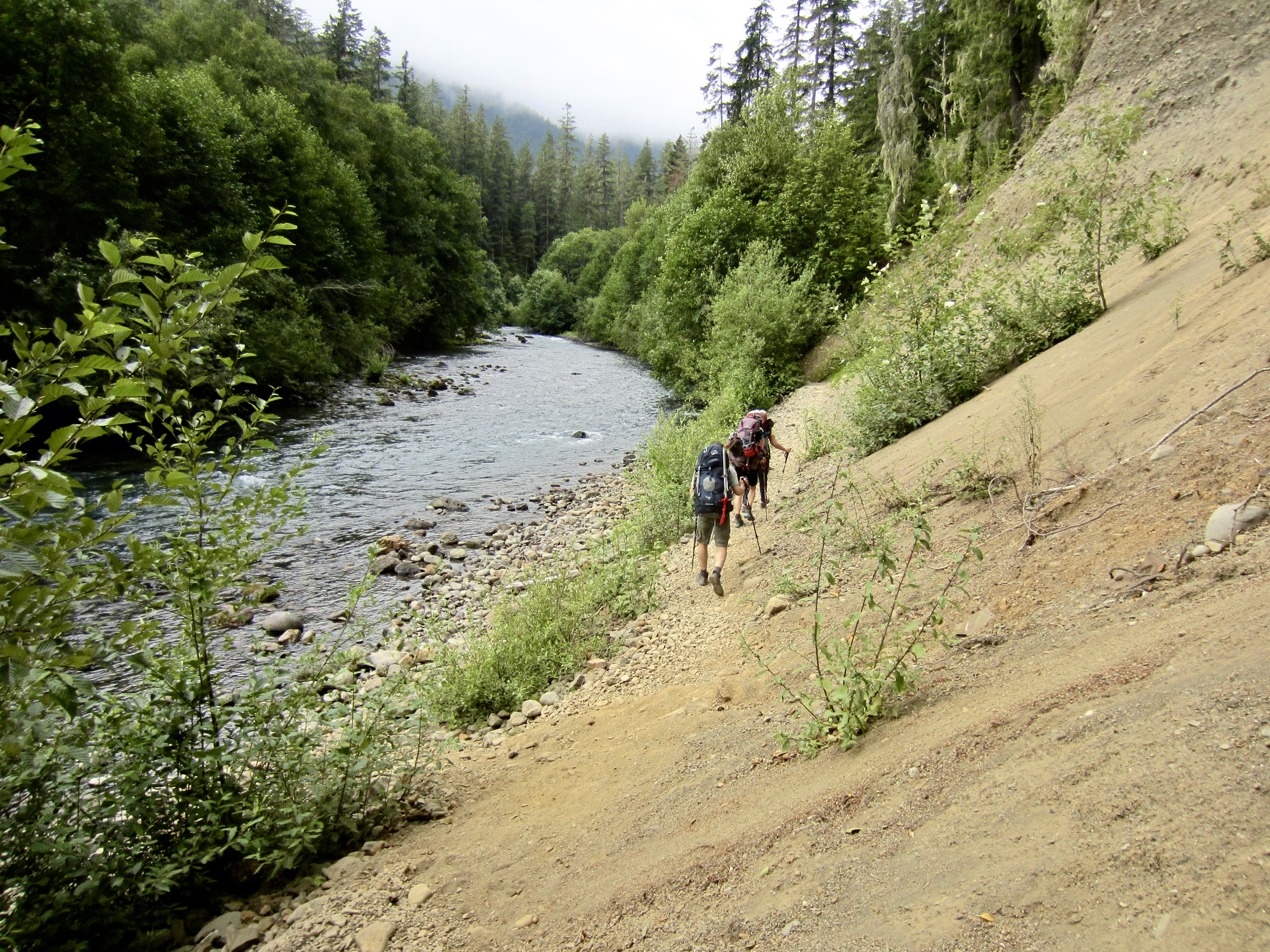
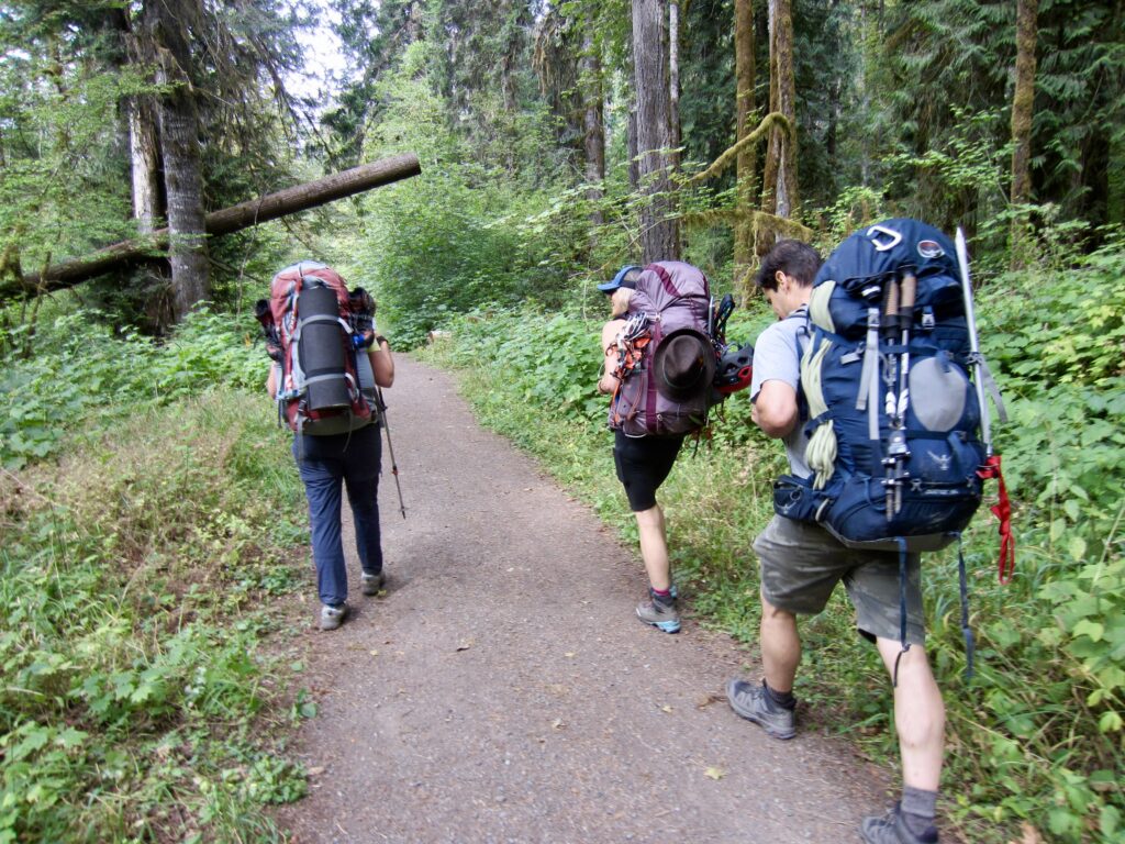
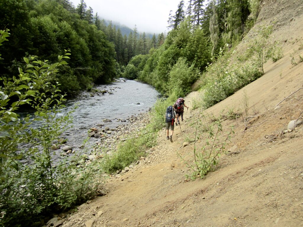
We parked at the Dosewallips River Road blockade adjacent to a small creek washout on a warm, overcast Friday morning and started walking up the overgrown road. At the old river washout area, where hikers have the option of a low path or a high path, we chose the more-scenic low path.
.
.
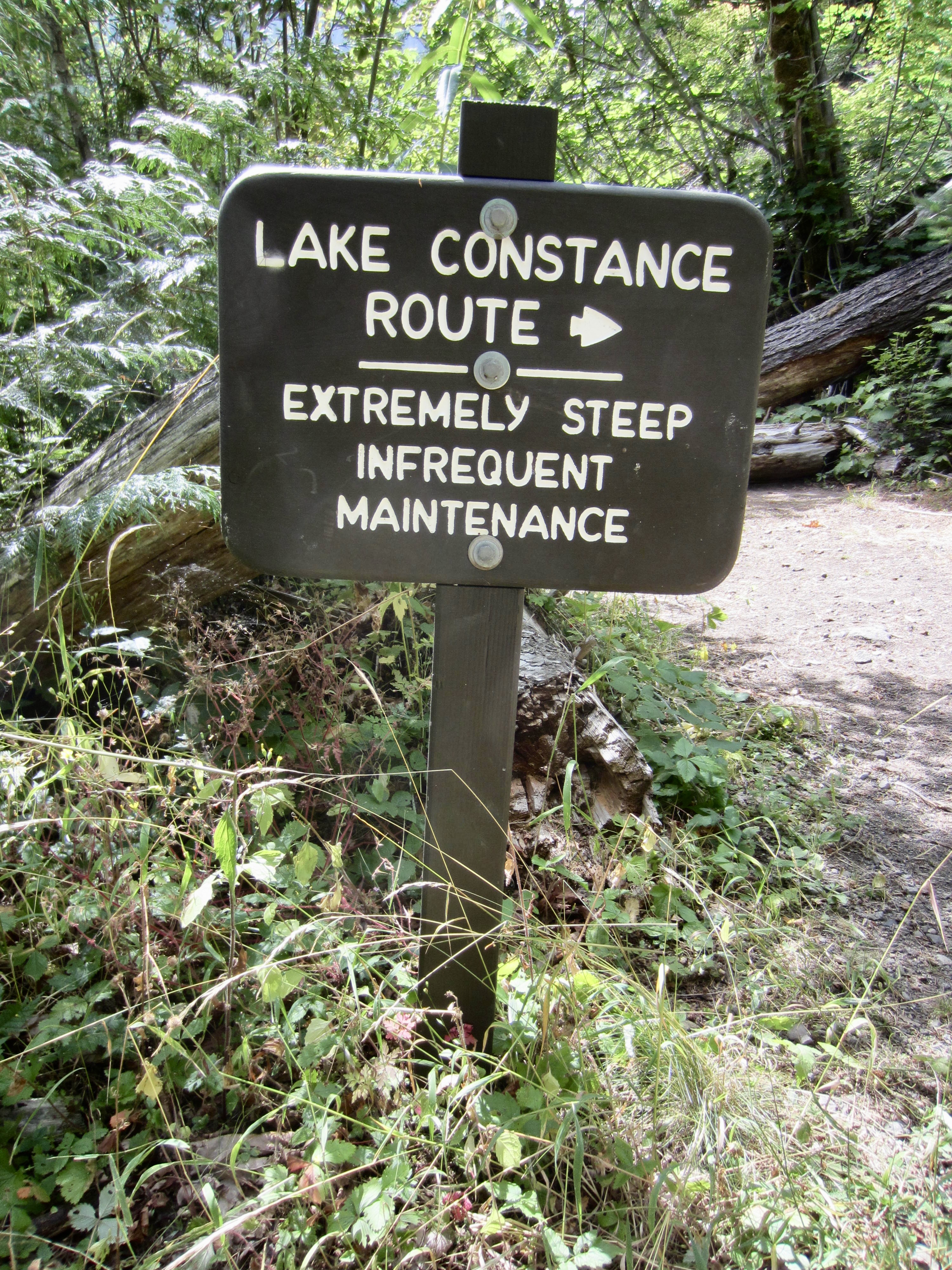
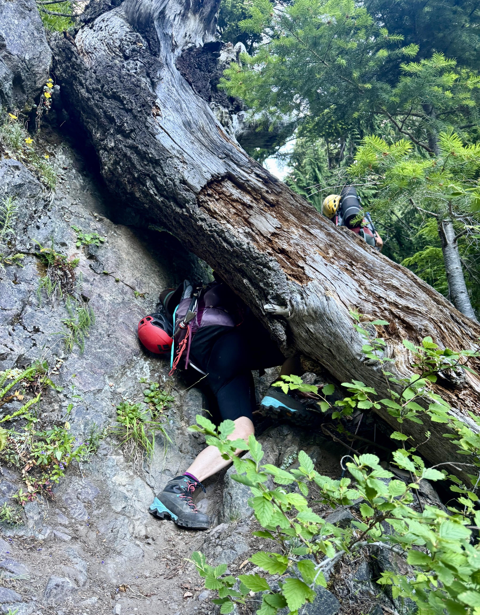
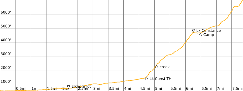
Just after crossing Constance Creek on a sturdy wooden bridge, we arrived at the Lake Constance Trailhead (2.8 hours + 4.75 miles + 900 feet from cars). As a warning to hikers, the trailhead sign here refers to this as a route rather than a trail and states that it is “extremely steep.” Sure enough, the trail immediately heads straight up the steep hillside.
.
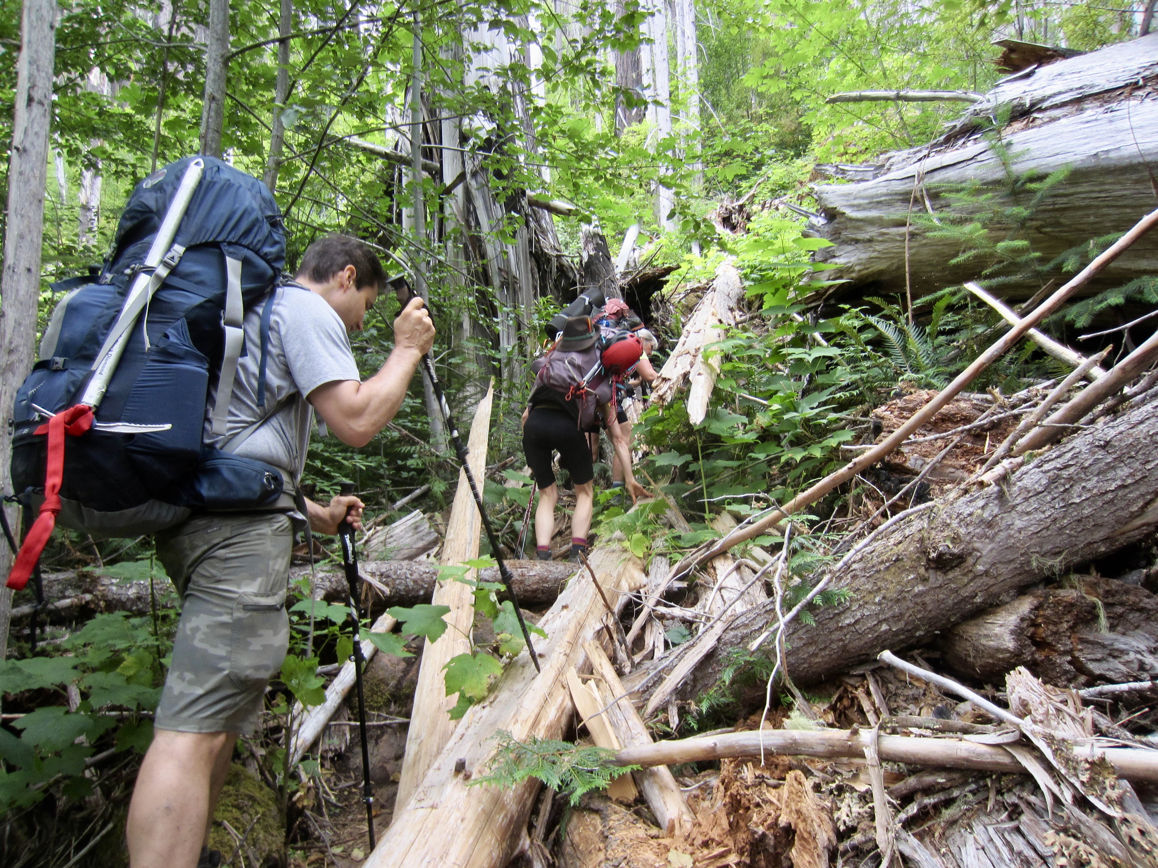
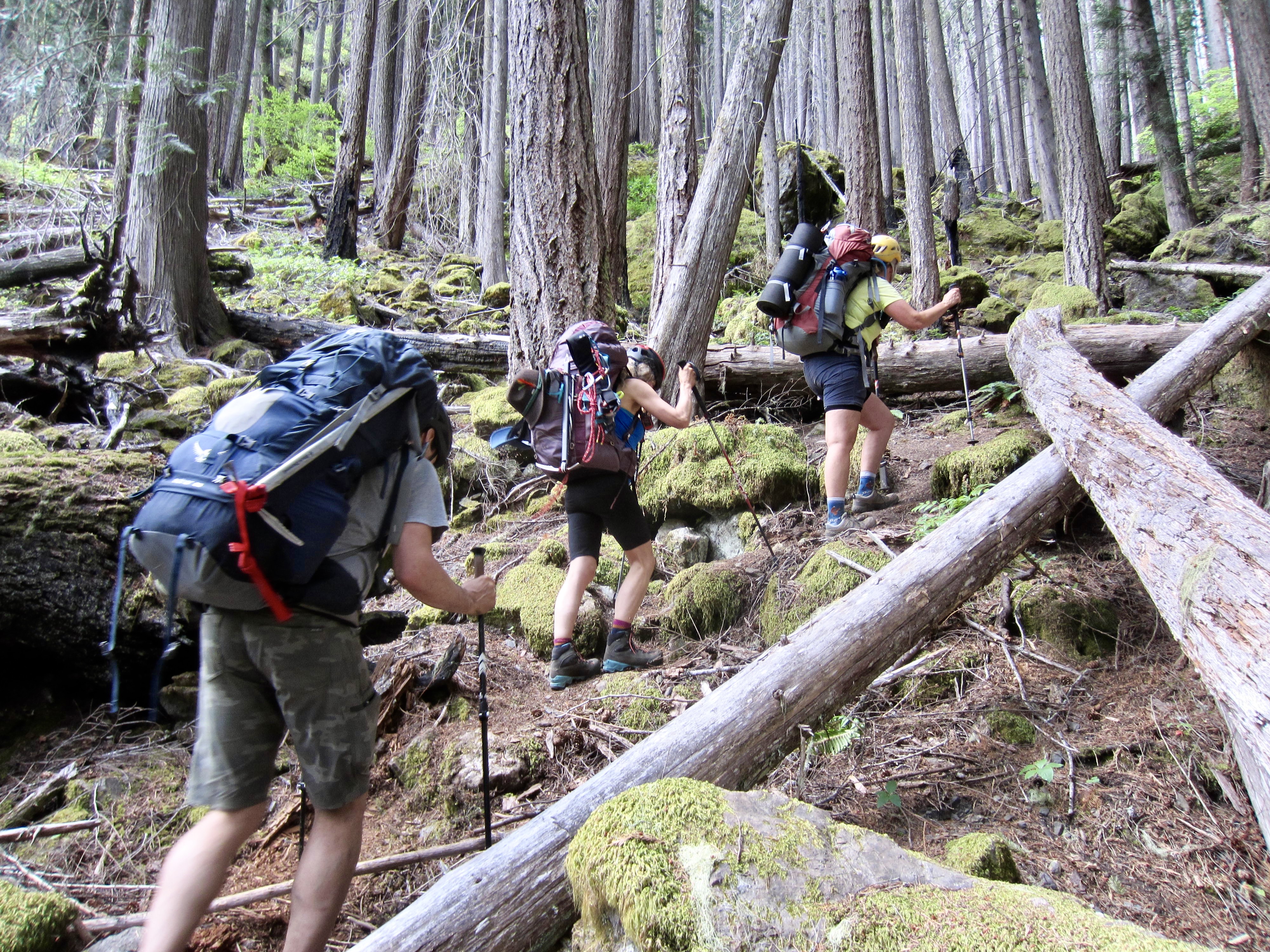
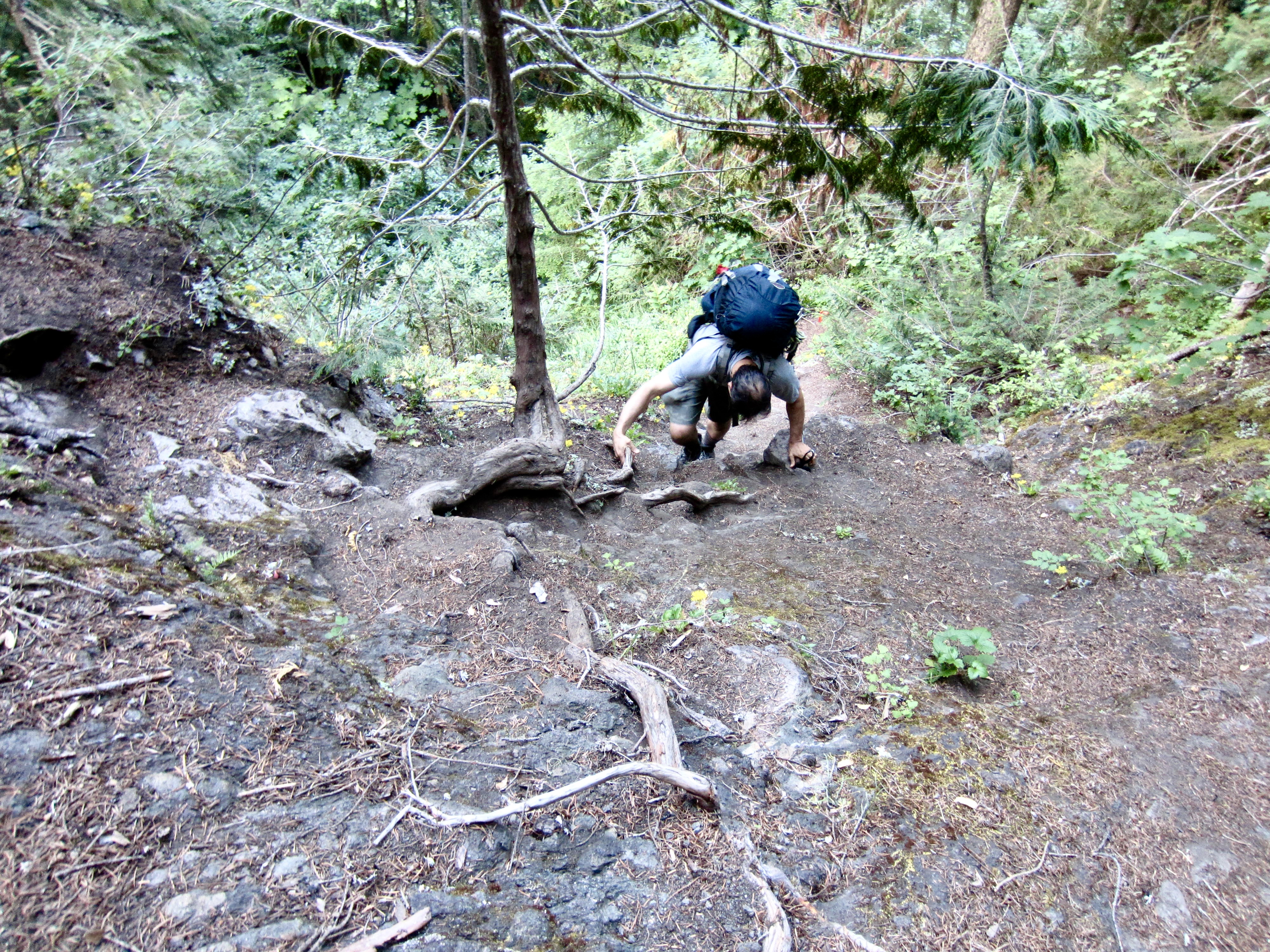
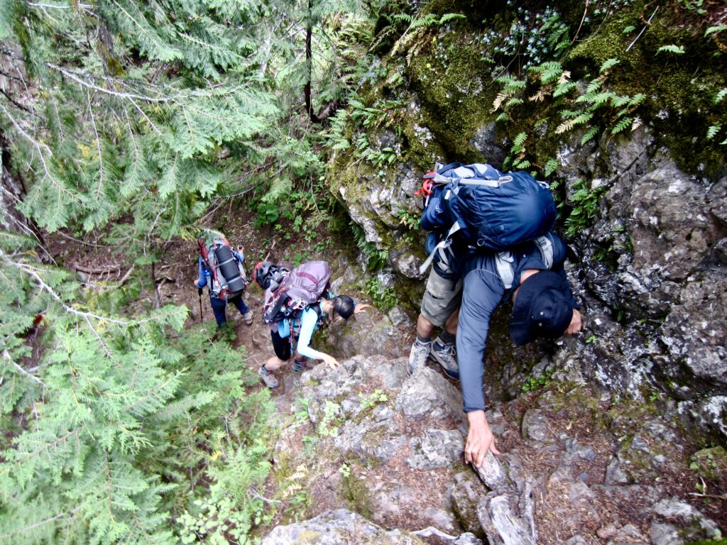
After gaining a mere 150 feet, we managed to lose the actual trail and ended up on an even-steeper and very brushy bootpath with numerous downed logs. We spent the next hour scratching and clawing our way uphill until finally regaining the trail. It continued at a moderately steep grade to Elev. 2400 feet and then eased back within an area of old-growth forest, where Constance Creek tumbles between delightfully mossy rocks.
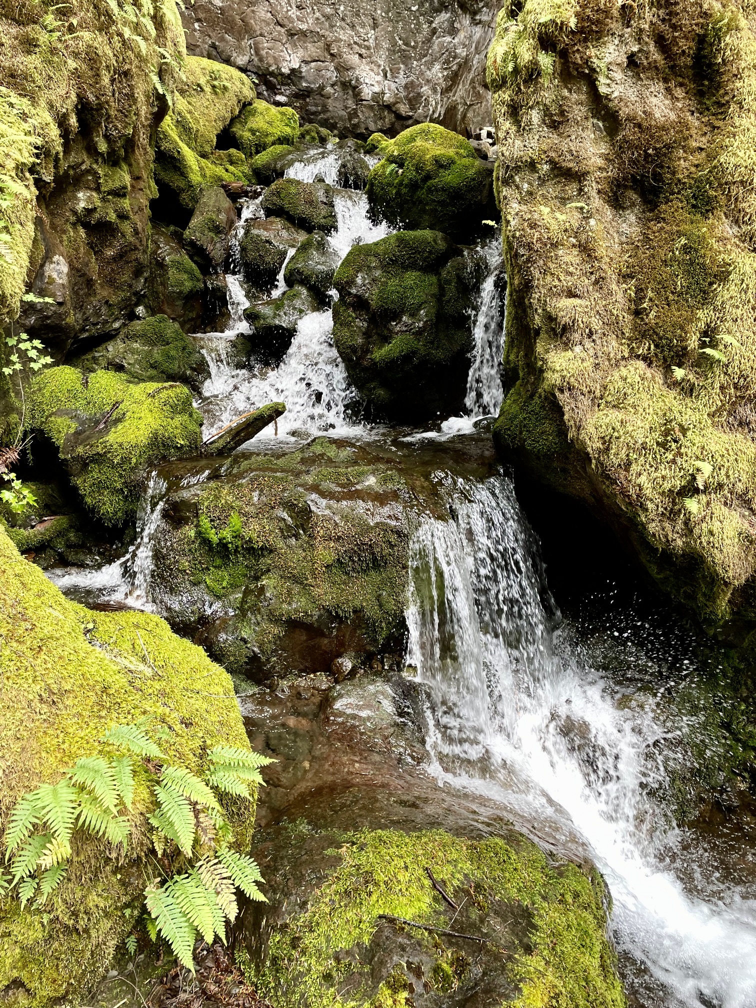
.
We followed the pleasant trail alongside Constance Creek for 1000 vertical feet, admiring the moss-covered boulders ranging from house-size to condominium-size. The trail then abruptly angles up a super-steep headwall that requires lots of Class 2 and Class 3 scrambling for an additional 1000 feet. The trailhead warning of an “extremely steep” route hardly does justice to the terrain here!
.
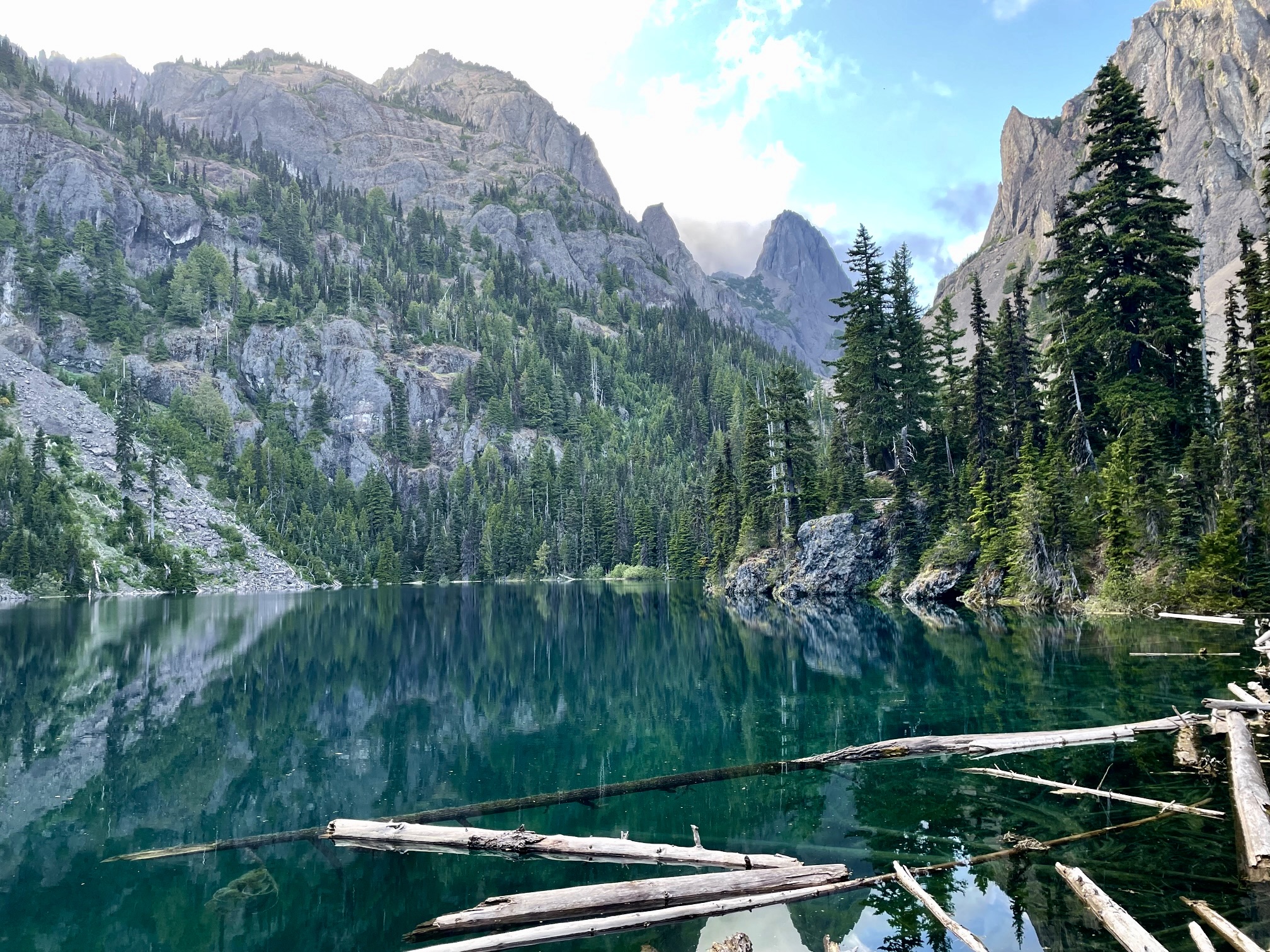
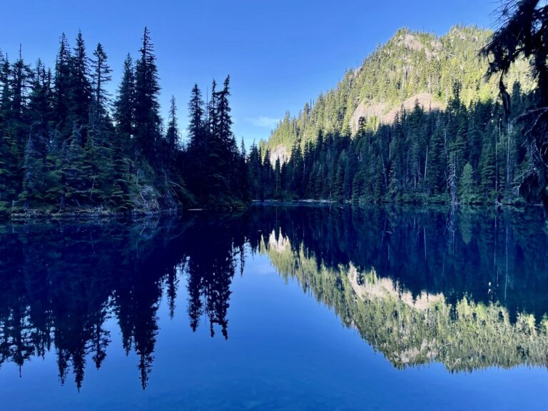
In early evening, we arrived at the shore of Lake Constance (9.2 hours + 4150 feet from cars). This small, sub-alpine lake occupies a rocky bowl surrounded by soaring cliffs of basaltic pillow lava, and the water has an extraordinarily beautiful dark-teal color. In my mind, it is the quintessential Olympic Mountains lake.

.
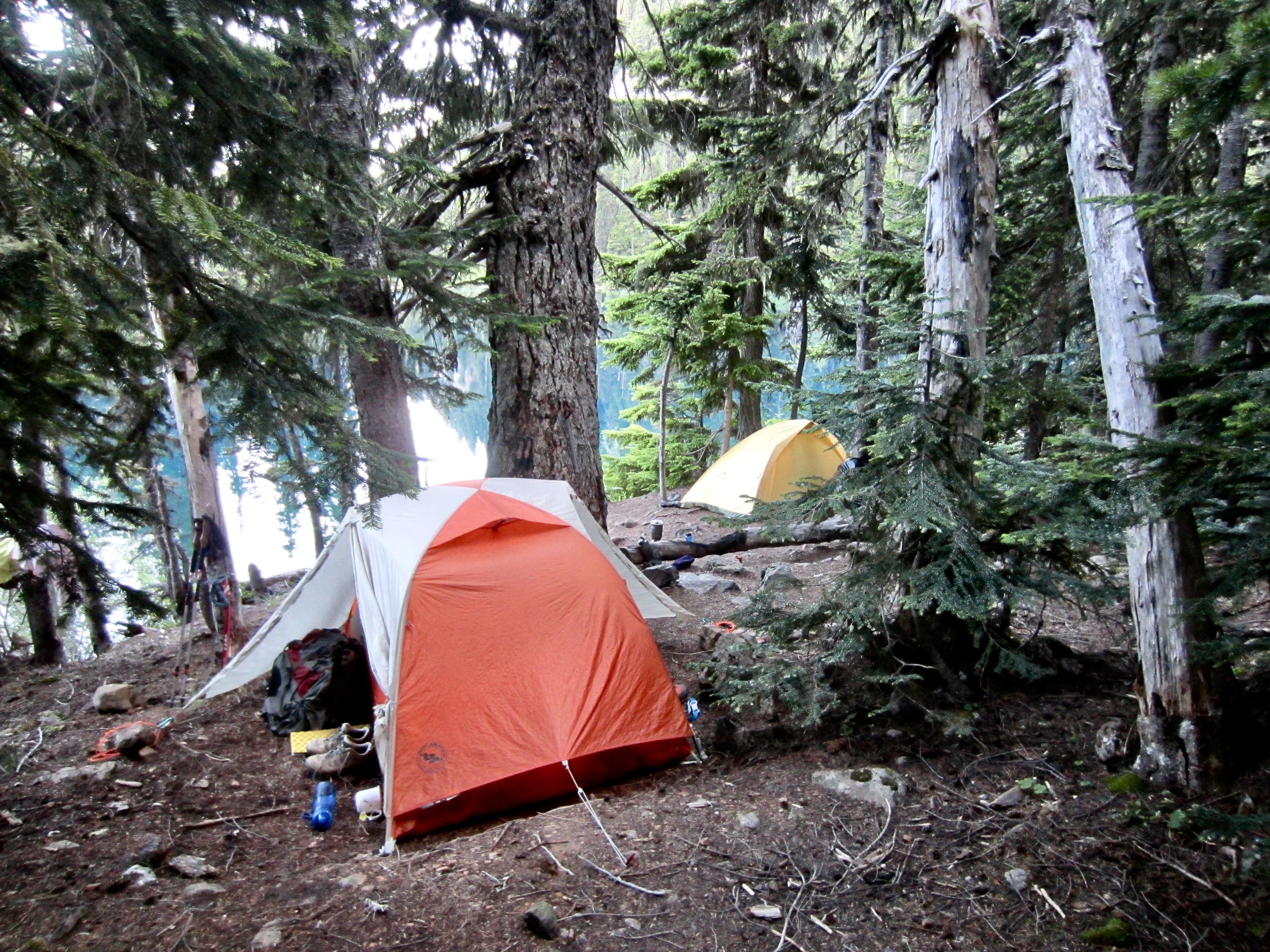
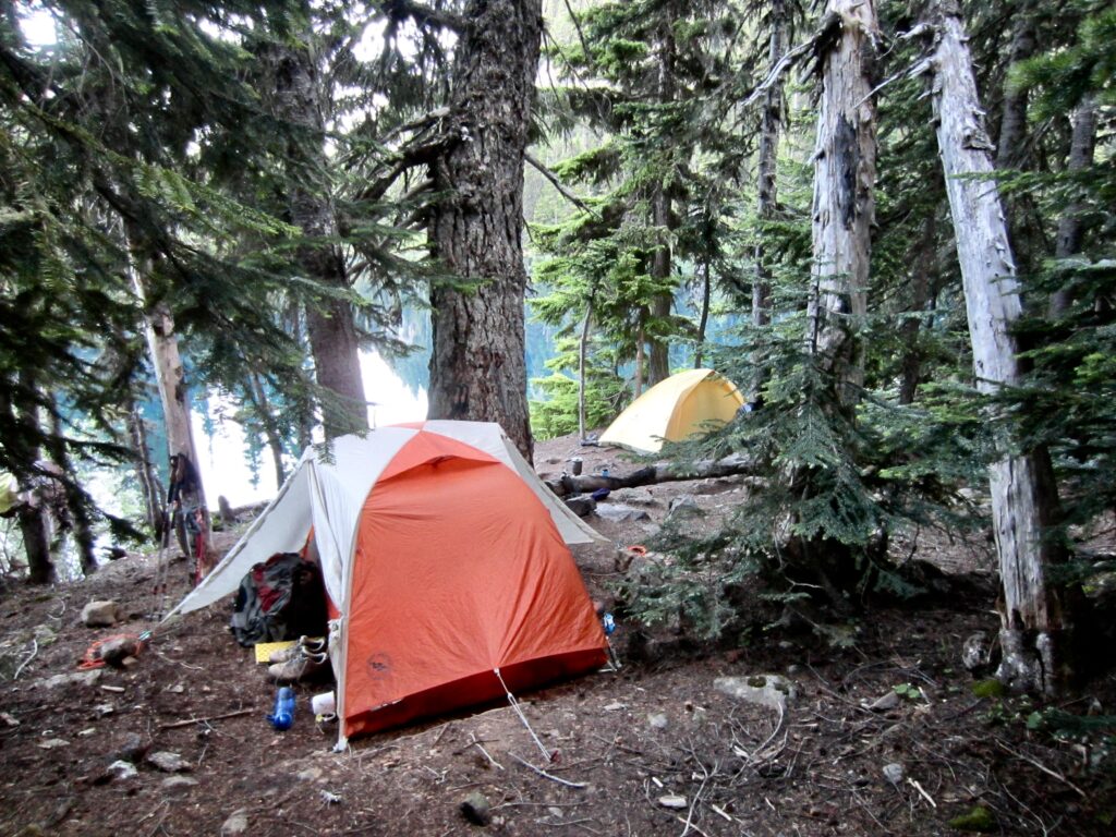
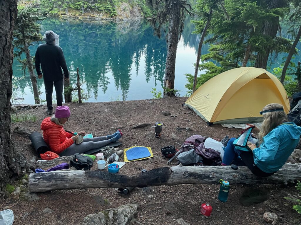
An additional 30 minutes of rough hiking around the right shore brought us to an established campsite at the north end of the lake. The amenities here include a composting toilet and a bear wire. We pitched our tents and ate dinner as an evening fog drifted over the lake.
.
Day 2: Mt. Constance Summit Attempt
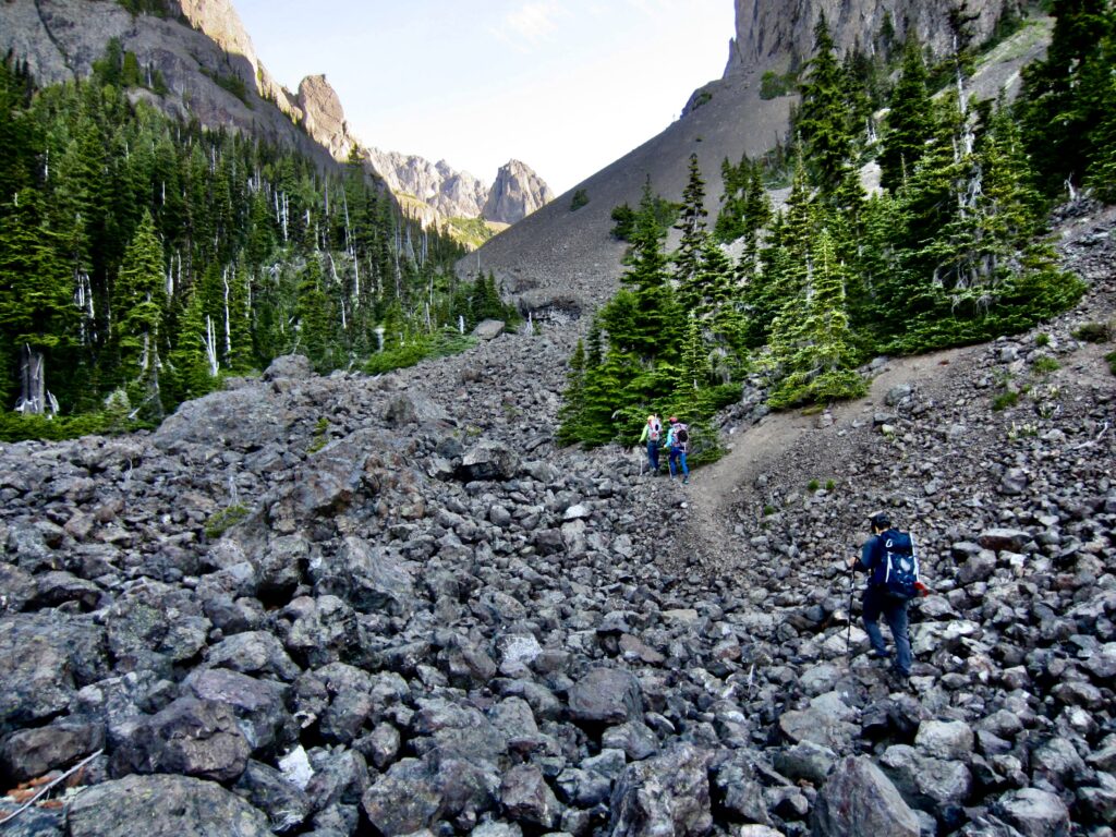
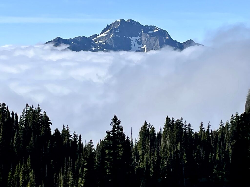
We awoke to clear skies above and valley fog below. At 8:15am, we left camp and headed up through Dead Man’s Gap and into Avalanche Canyon on a combination of talus, scree, and residual snow. Behind us, The Brothers magically hovered atop a fog bank.
.
.
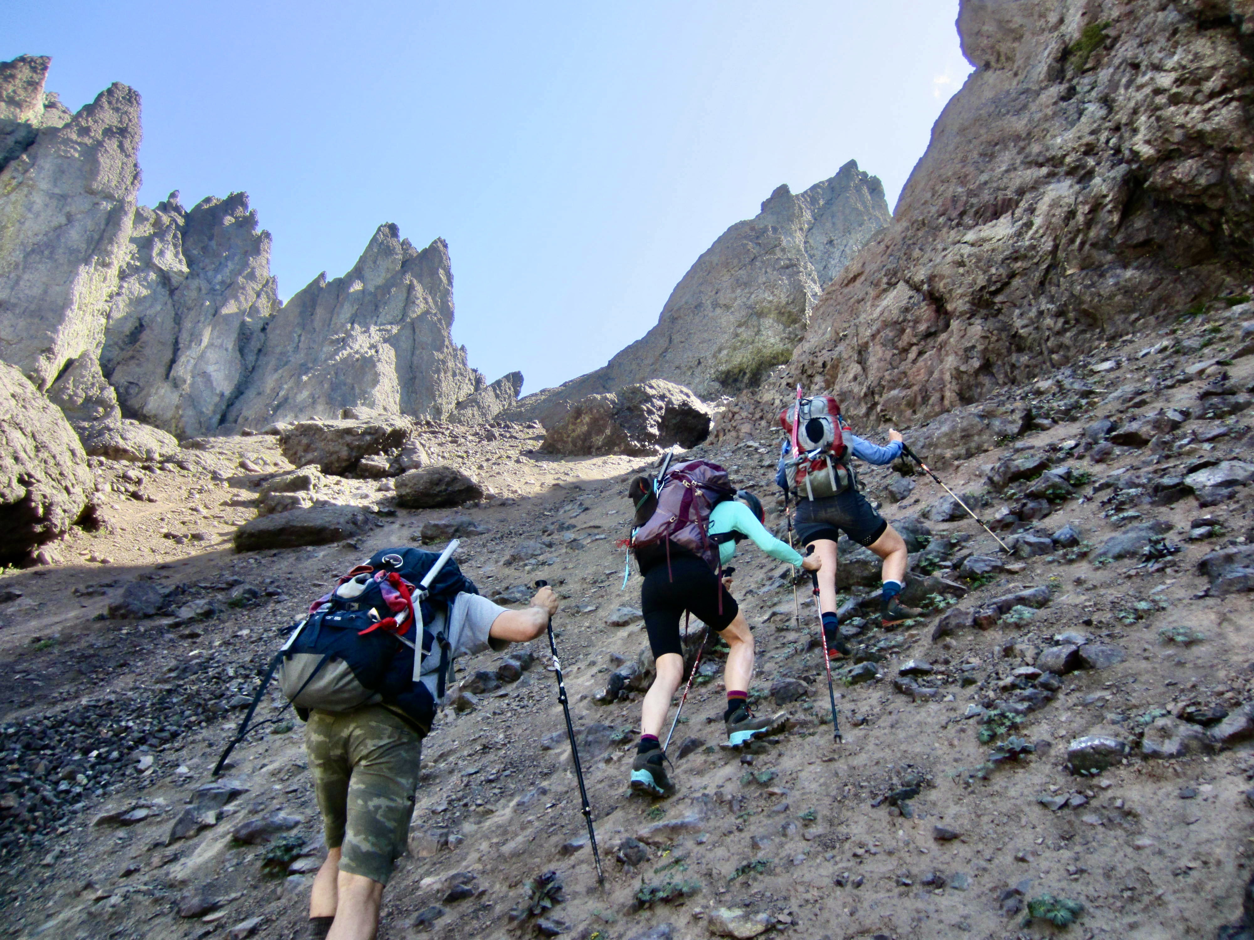
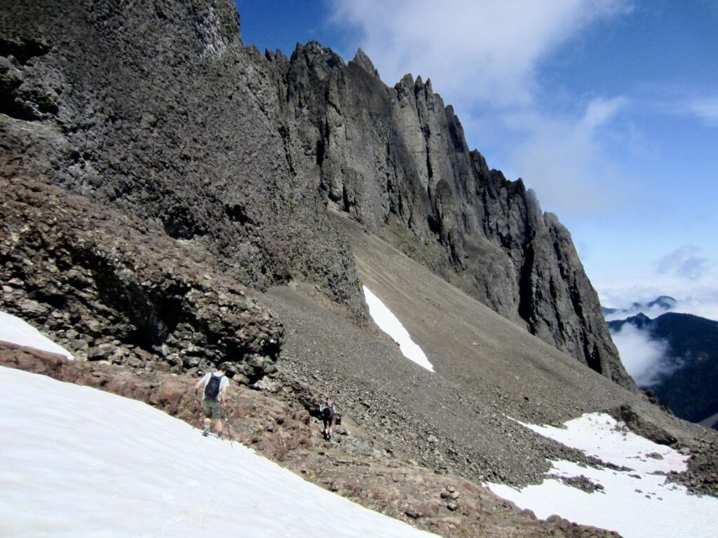
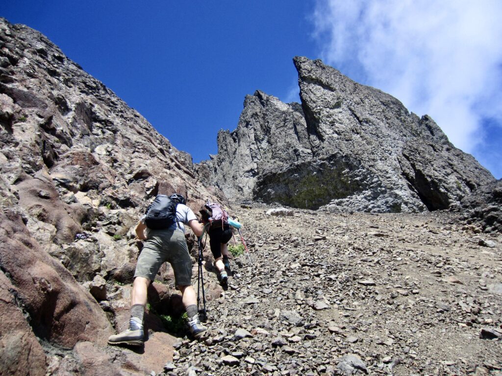
At 5200 feet, we left the canyon invert and angled up to the right, following a discontinuous series of climber’s paths across barren scree and talus slopes. Upon reaching the base of a steep rock buttress, we began traversing over toward the broad South Chute. The scree and talus slopes transitioned to hard dirt embedded with loose rocks.
.

.
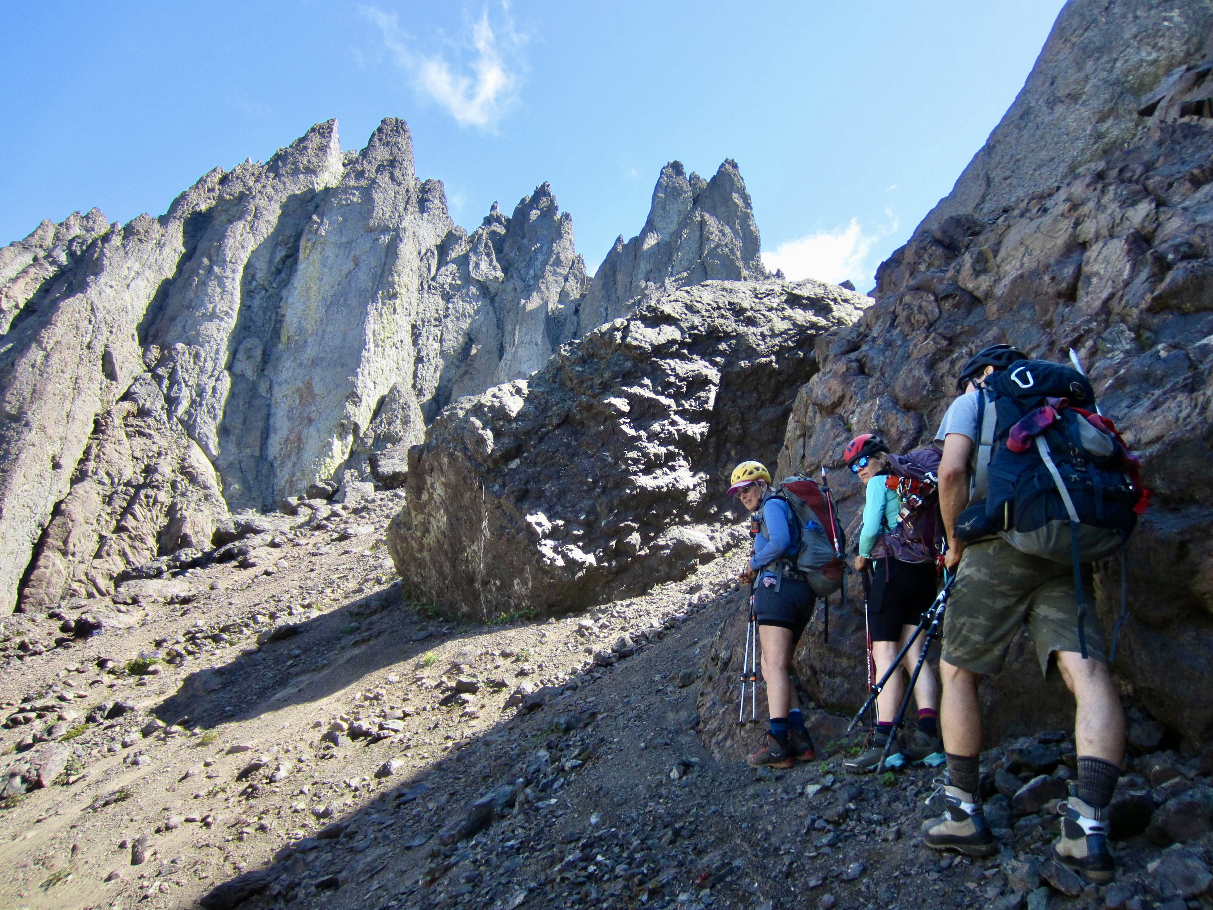
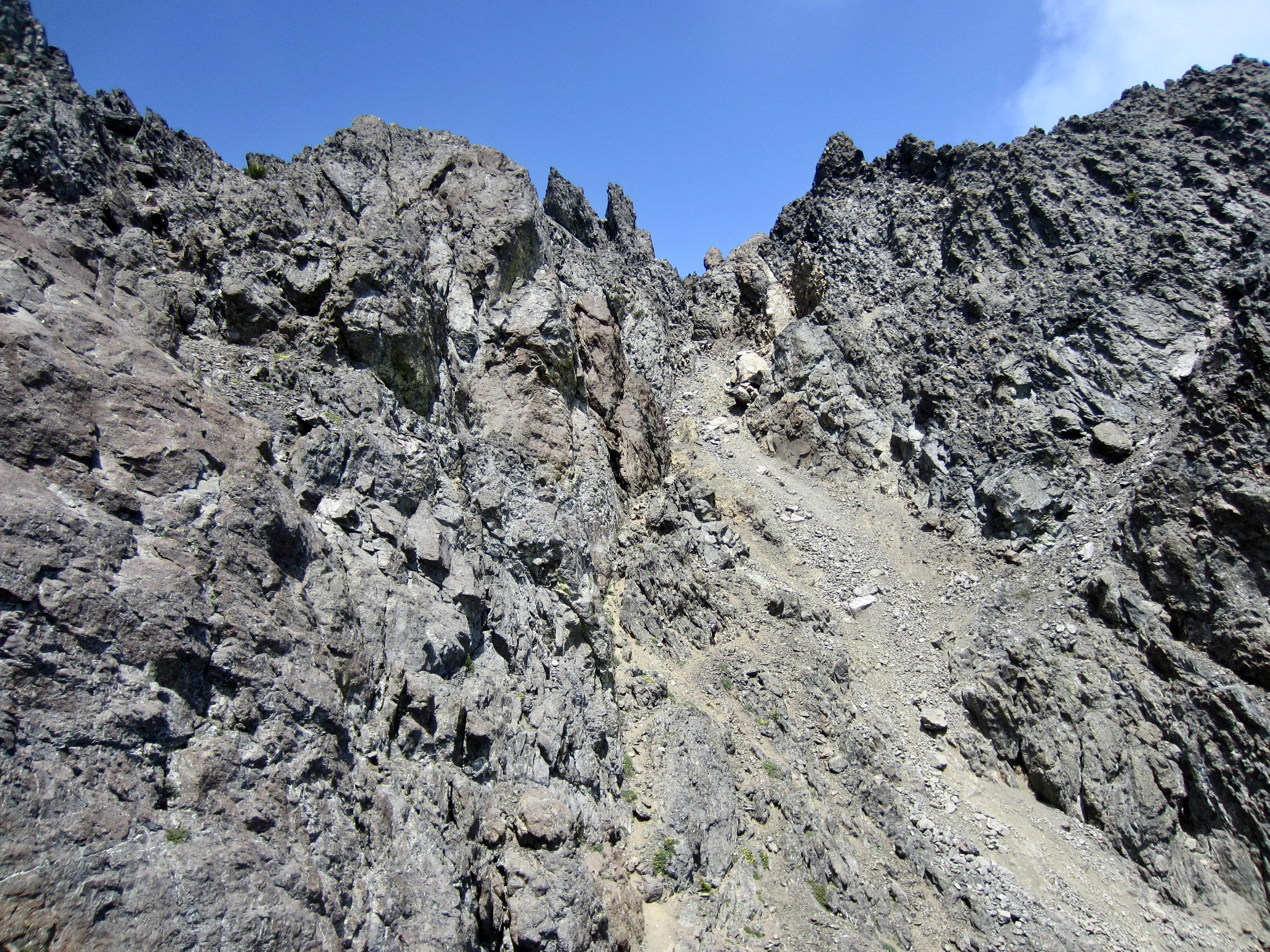
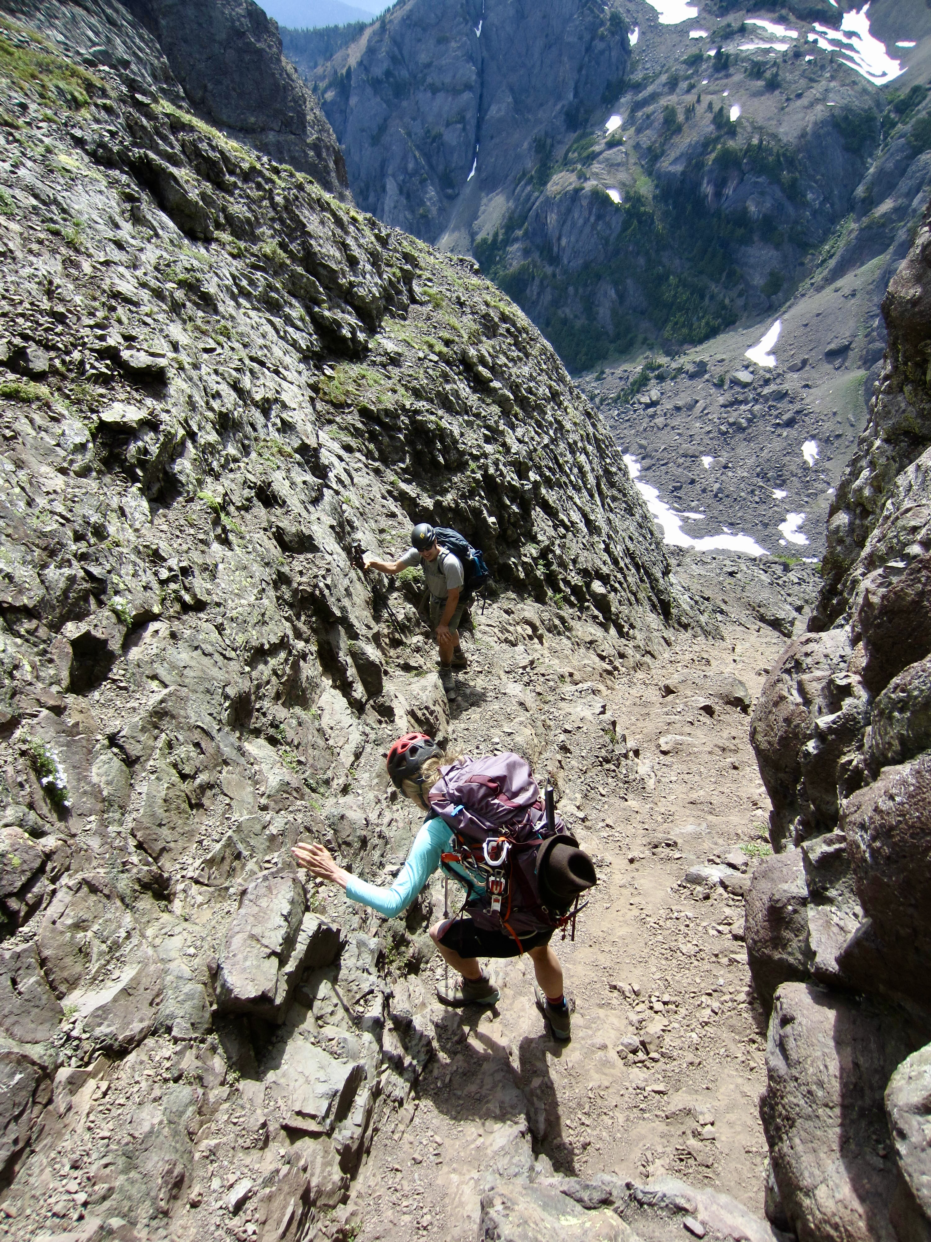
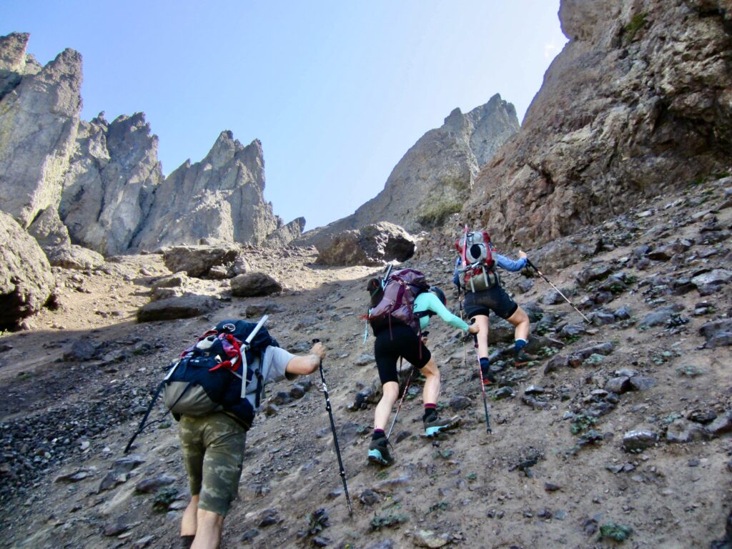
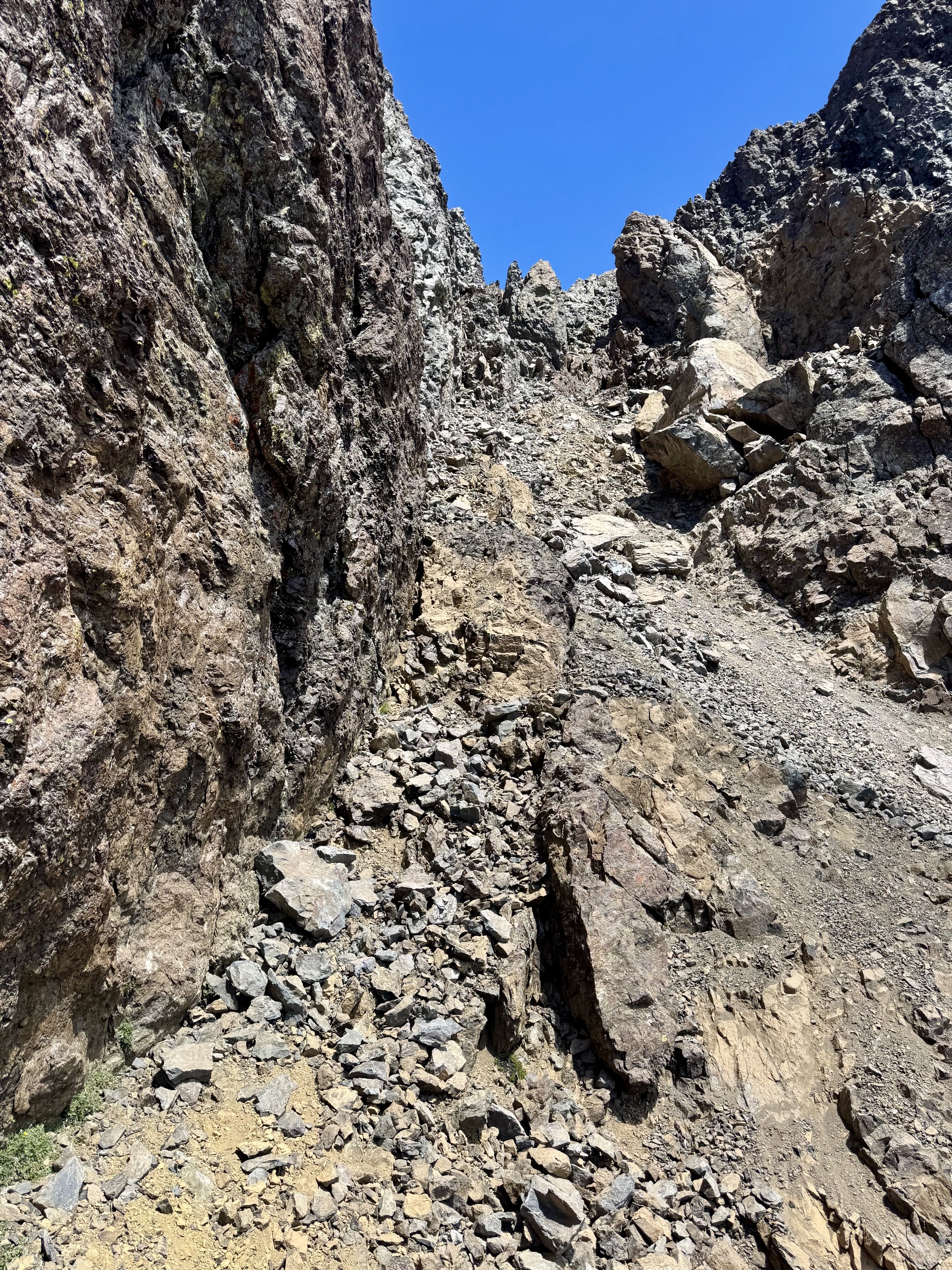
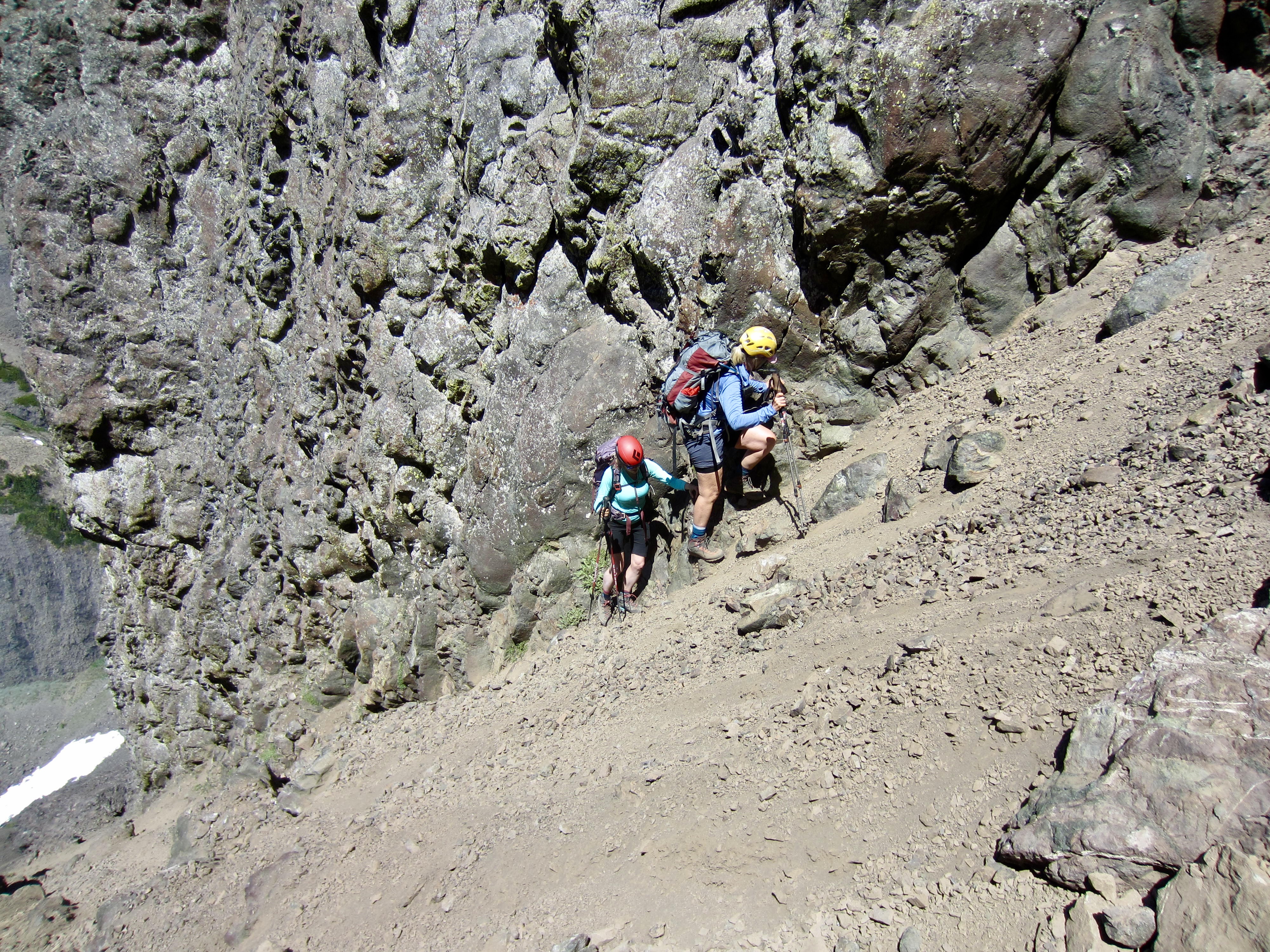
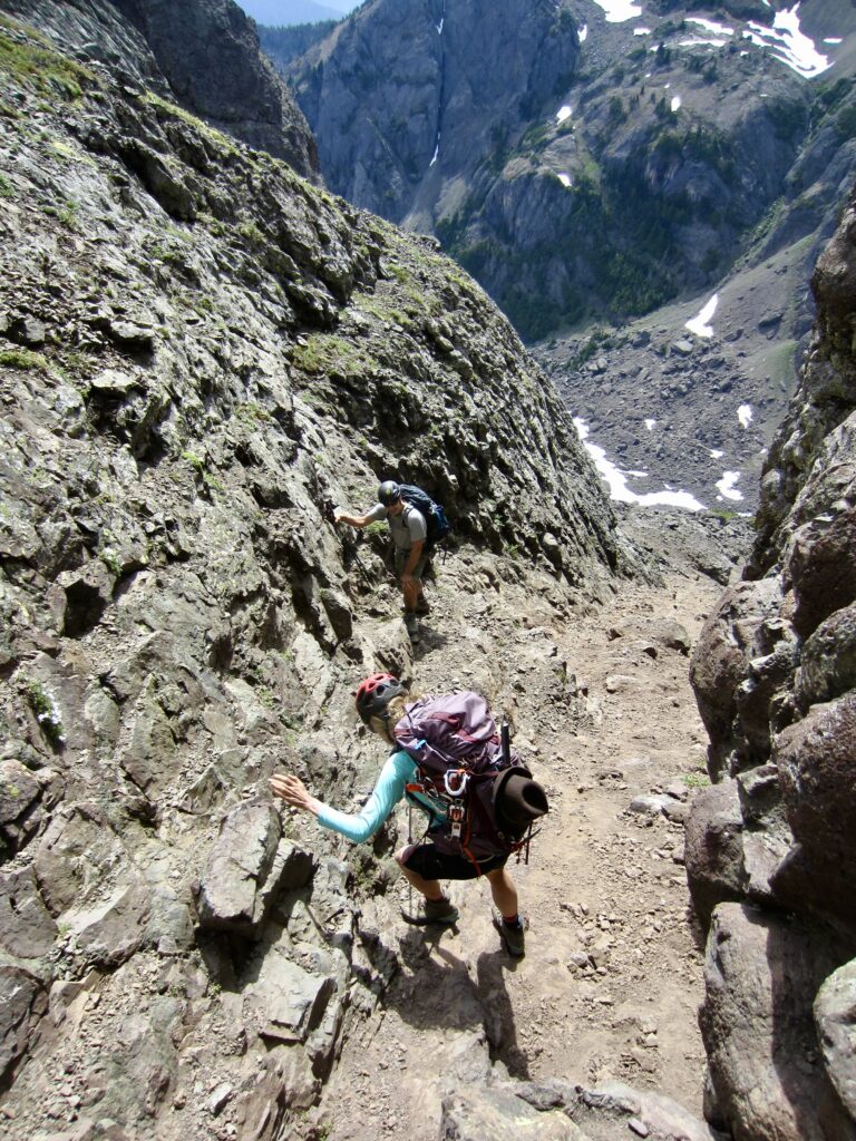
Our slow traverse across the sketchy dirt slope brought us up against a tall cliff on the left (north) edge of the South Chute. We were now able to see Chute’s Notch directly above. However, this final 200 feet consisted of a steep, narrow slot filled with small to medium-size boulders. We carefully picked our way up the slot, often moving one or two at a time in order to minimize rockfall hazards. It was white-knuckle scrambling the whole way!
.
.

.
Shortly past noon, we finally gained 6600-foot Chute’s Notch—coincidentally named after Mr. L. Chute, not the South Chute (4.2 hours + 1950 feet from camp). The grungy ascent had taken twice as long as expected, such that our summit success now looked doubtful. I figured that our only chance was to make up time ascending the southeast couloir. Eileen had been suffering from a hip injury, so she elected to hang back at the notch.
.
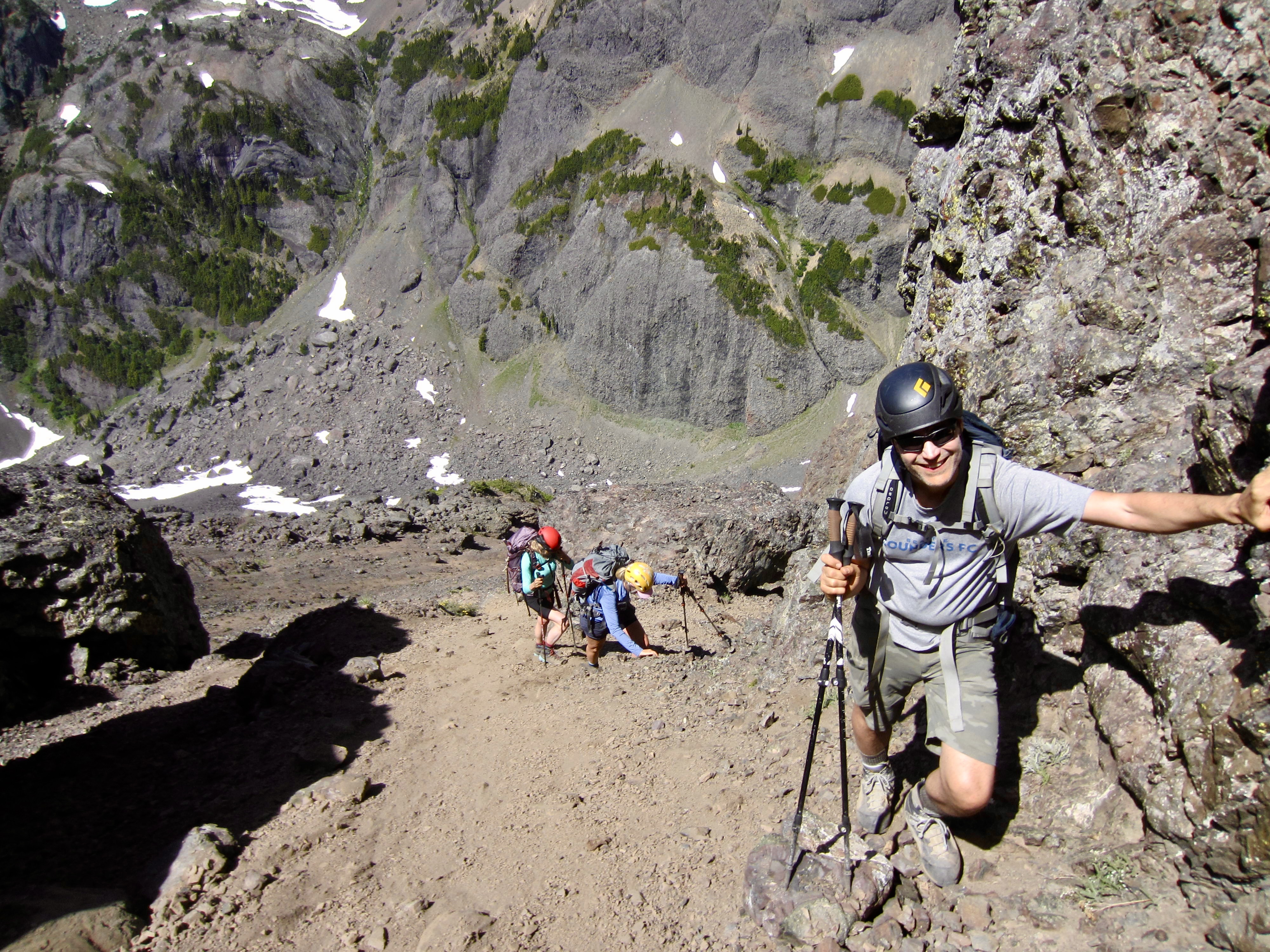
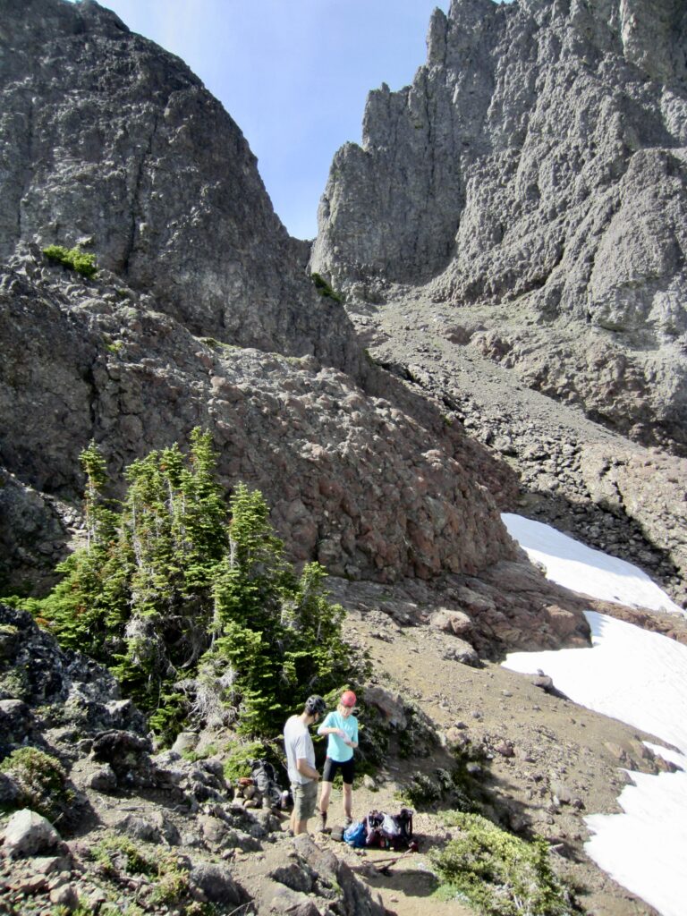
Now feeling considerable time pressure, Kerry and Mike and I made a descending traverse across snow and talus to duck under a low buttress. This got us into the bottom of the fan-shaped southeast couloir.
.
We began ascending the left edge of the couloir, which initially consisted of scree and small talus. Due to the constantly shifting surface, it was two-steps-up-and-one-step-down progress—therefore, impossible to move quickly. Our hopes of gaining time in this couloir were fading with every hard-won footstep.
.
As we slowly scrambled up the couloir, the gradient increased and the footing became worse, so we moved toward the center, which consisted of large talus. This gave us some encouraging progress until we dislodged a color-TV-size boulder that crashed downhill and sent a shiver through our spines! Seeing more of the same ahead of us, I reluctantly announced that we were ending our climb here. Kerry and Mike were understandably disappointed, but they also realized that we were in a dangerous situation here and were still far from the summit.

.
We retraced our steps down the couloir, over to Chute’s Notch, and down the South Chute. Descending the uppermost steep, narrow slot was even worse than the ascent. In fact, it was in worse condition now than on my previous two climbs of this route.
I have witnessed this same sort of terrain degradation on other routes that I’ve repeated in recent years. Loss of snowcover due to global warming is an obvious cause, but I also suspect that climber traffic is another factor. Every climber creates a little bit of erosion, and over time the natural millennia-old cover of scree and talus is gradually stripped off, thereby exposing the underlying surface of hard dirt and smooth bedrock. If this holds true, future generations of peak-baggers will be subjected to increasingly sketchy conditions on non-technical routes.
.
Kerry, Mike, and I reunited with Eileen on a rock outcrop above Avalanche Canyon, and we all finished our descent together. It was late afternoon when we reached camp (3.6 hours from high point). Surprisingly, despite being a Saturday evening, no other hikers or climbers had arrived at the lake. We enjoyed a quiet evening overlooking the glassy water surface.
.
Day 3: Lake Constance to Road Blockade
We awoke to another clear morning and had a leisurely breakfast before heading out at 9:30am. Our exit hike and scramble was tedious but uneventful, and we reached the Dosewallips River Road in early afternoon (5.4 hours from camp). It was then a straightforward march down to our cars, arriving in late afternoon (7.8 hours from camp).
.
Route Maps & Profile
…
…
…
Photo Gallery
Click to enlarge…