Trip Date: September 21-23, 2025
2025 JORDAN ADVENTURE VACATION
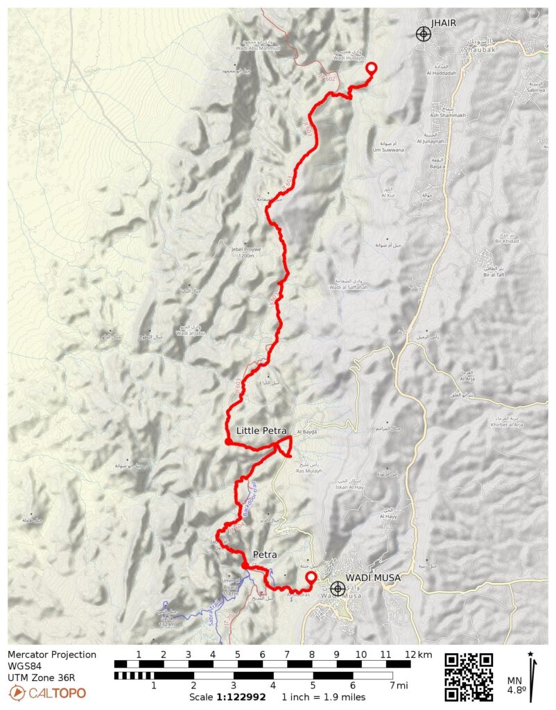
Jordan Trail Traverse: Jhair-Feid Road to Wadi Musa
Shara/Sharah Mountains
Little Petra
The Monastery
The Great Temple
The Royal Tombs
The Treasury
The Petra Siq
Trip Report Summary
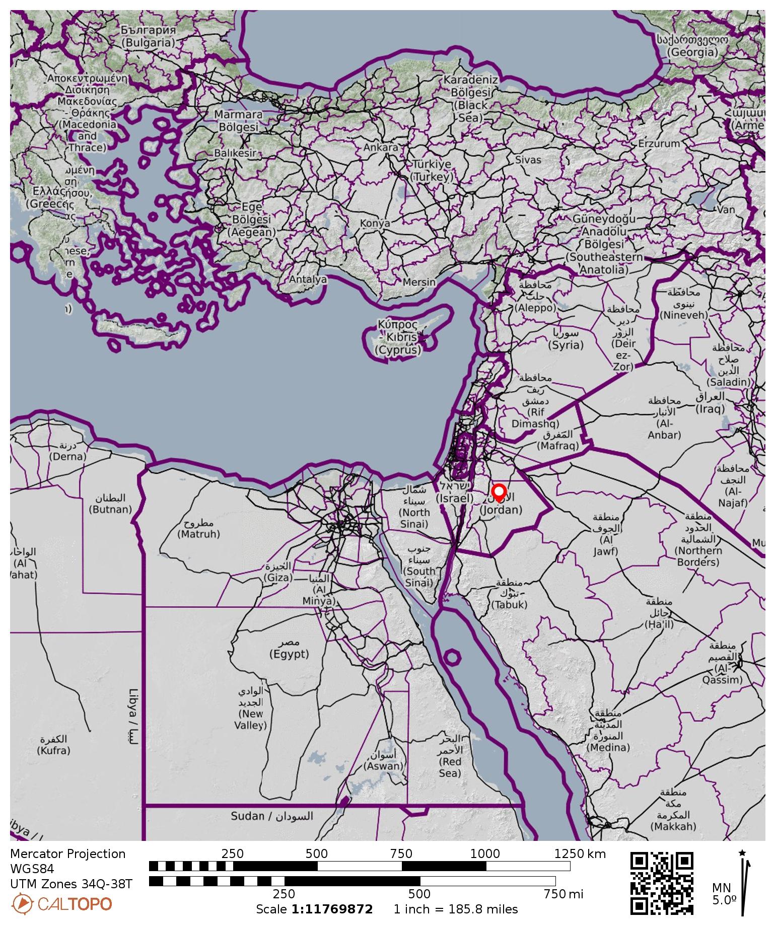
Region: Jordan
Sub-Region: Central Jordanian Highlands
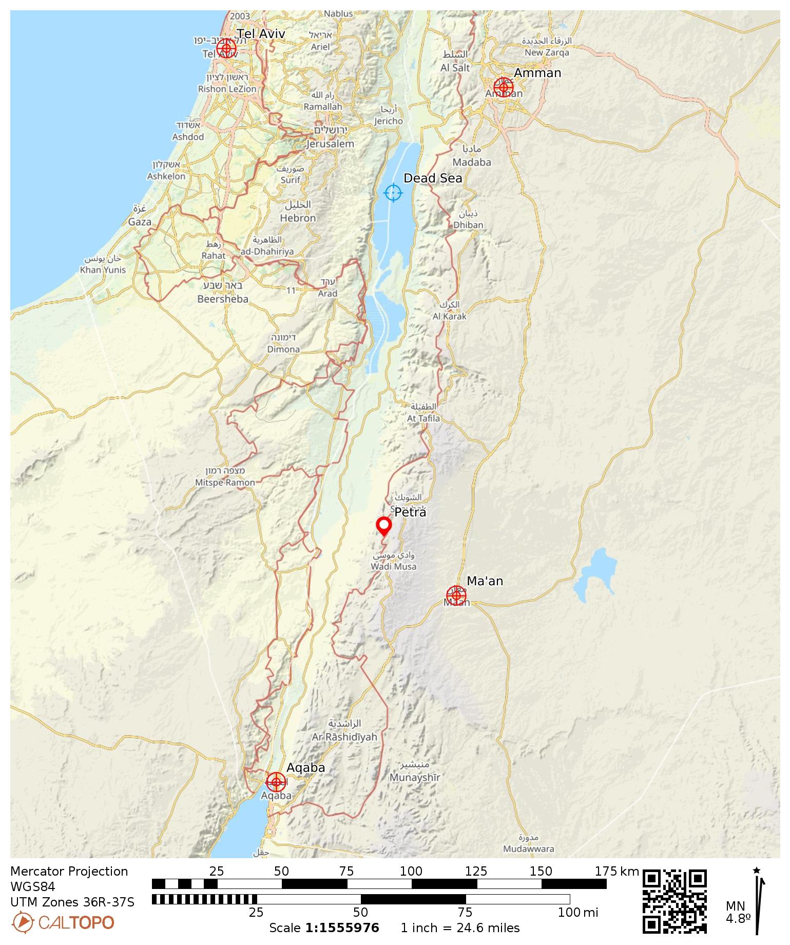
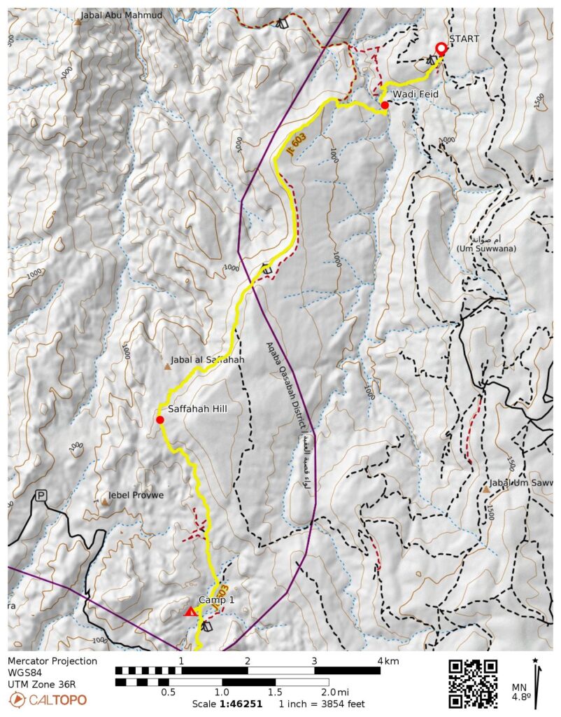
Starting Point: Wadi Feid connector trailhead on Jhair-Feid Road below village of Jhair (Elev. 3300 feet / 1000 meters)
Way Points: Wadi Feid crossing & cuesta point & Saffahah Hill flank & Ghbour Whedat Wild Camp & broad saddle & geodesic dome colony & top of canyon & Little Petra gap & Little Petra entry gate & Little Petra Luxury Bedouin Camp & Little Petra entry gate (trail hike & trail scramble & road walk); Jordan Trail junction (truck ride); Deir Hill flank & The Monastery & Petra Village & The Church & The Royal Tombs & The Theatre & The Treasury & The Dam & The Djin Blocks & Petra entry gate (trail hike & trail scramble & road walk)
Low Point: Wadi Feid invert (Elev. 2600 feet / 790 meters)
High Point: Saffahah Hill flank (Elev. 3960 feet / 1205 meters)
Ending Point: Petra entry gate & visitors center in town of Wadi Musa (Elev. 3350 feet / 1020 meters)
Accommodations: Ghbour Whedat Wild Camp & Little Petra Luxury Bedouin Camp
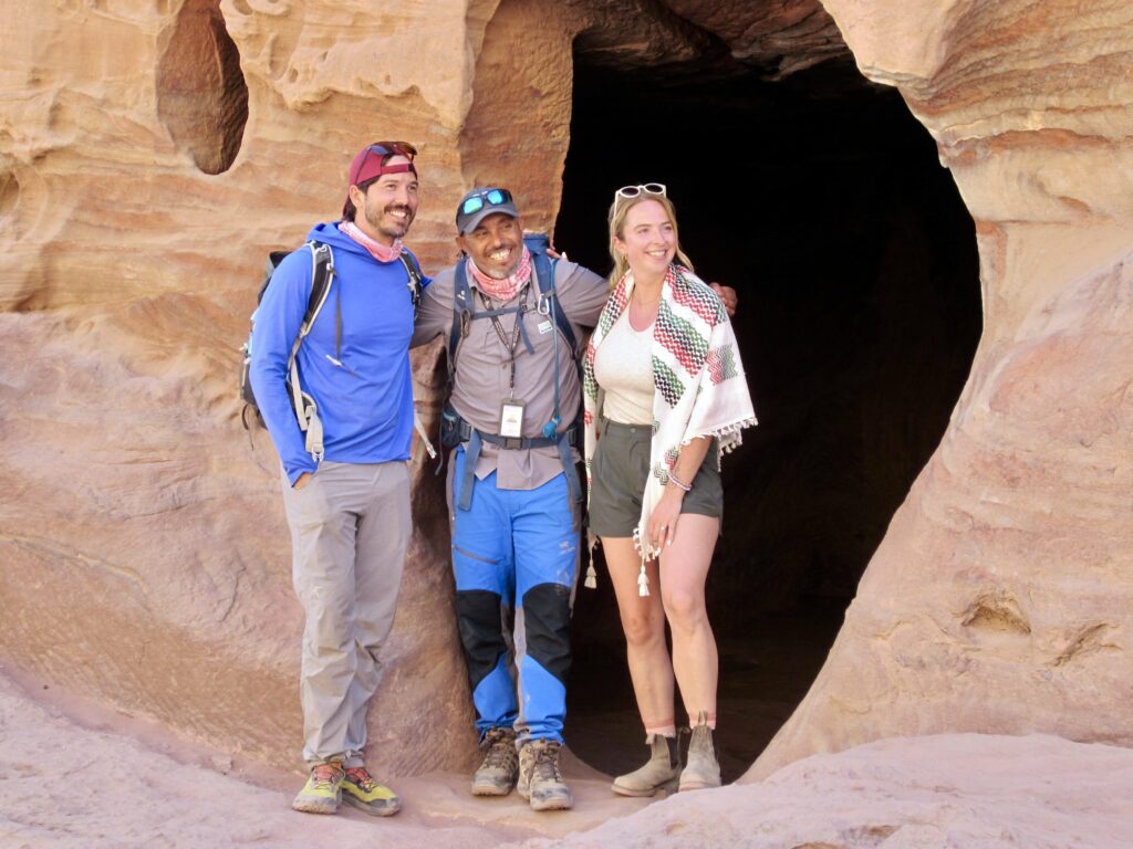
Executive Guiding Service & Guides: Adventures Beyond; Brooke Brisbine & James Slaton
Regional Guiding Service & Guide: Experience Jordan Adventures; Mahmoud Bdoul
Approximate Traverse Stats: 22.8 miles / 36.7 kilometers traveled on foot; 1.6 miles / 2.6 kilometers traveled in truck; 4600 feet / 1400 meters gained on foot; 4450 feet / 1360 meters lost on foot.
…
Related Post
>>> Petra Madhbah High Place Hiking Loop via Al Madras Trail–Wadi Farasah Trail – September 2025
Trip Overview
The Jordan Trail is a relatively new long-distance hiking route that extends more than 400 miles / 650 kilometers between Jordan’s northern and southern borders. The idea of a border-to-border trail was first envisioned in 2015 and officially christened in 2017, but the entire route was reportedly not traversed until very recently. Often called the “Inca Trail of the Middle East,” it takes hikers on a remarkable journey through mountains and deserts while connecting small communities and historical artifacts. The undisputed highlight is the ancient city of Petra, a UNESCO site and one of the Seven Wonders of the World.
Brooke and James completed a five-day guided traverse along a middle portion of the Jordan Trail in 2024 and were so enthralled that they decided to organize a three-day traverse under the auspices of their new Adventures Beyond trekking company (provisional name). They acted as executive guides for the traverse, while partnering with Mahmoud of Experience Jordan Adventures to serve as the regional guide. This partnership provided full logistical coordination and invaluable cultural knowledge.
.
When Brooke and James advertised their three-day guided traverse along a short segment of the Jordan Trail, Eileen and I were surprisingly quick to sign up. I say “surprisingly“ because we knew little about the country other than that it was somewhere in the political and climatic hotbed of the Middle East. However, Brooke assured us that Jordan has remained a politically neutral and relatively safe place amidst the regional turmoil. In regard to the climate, she admitted that it would indeed be hot and arid—in great contrast to our typical alpine purlieu. Over the past decade, though, Eileen and I have gained an appreciation for desert hiking, thanks to annual trips to arid locations such as Arizona, Utah, Nevada, Mexico, and Tasmania So, we were all in!
Our three-day traverse focused on the portion of Jordan Trail between Jhair and Wadi Musa—a 25-mile / 40-kilometer segment that is widely considered the creme de la creme and one of the best hiking routes in the world. We trekked southward through the Sharah Mountains wilderness on Day 1, entered Little Petra via the “back door” on Day 2, and hiked through Petra on Day 3. This itinerary provided an experience not obtained by the vast majority of Petra visitors. In retrospect, it was a truly incredible journey!
.
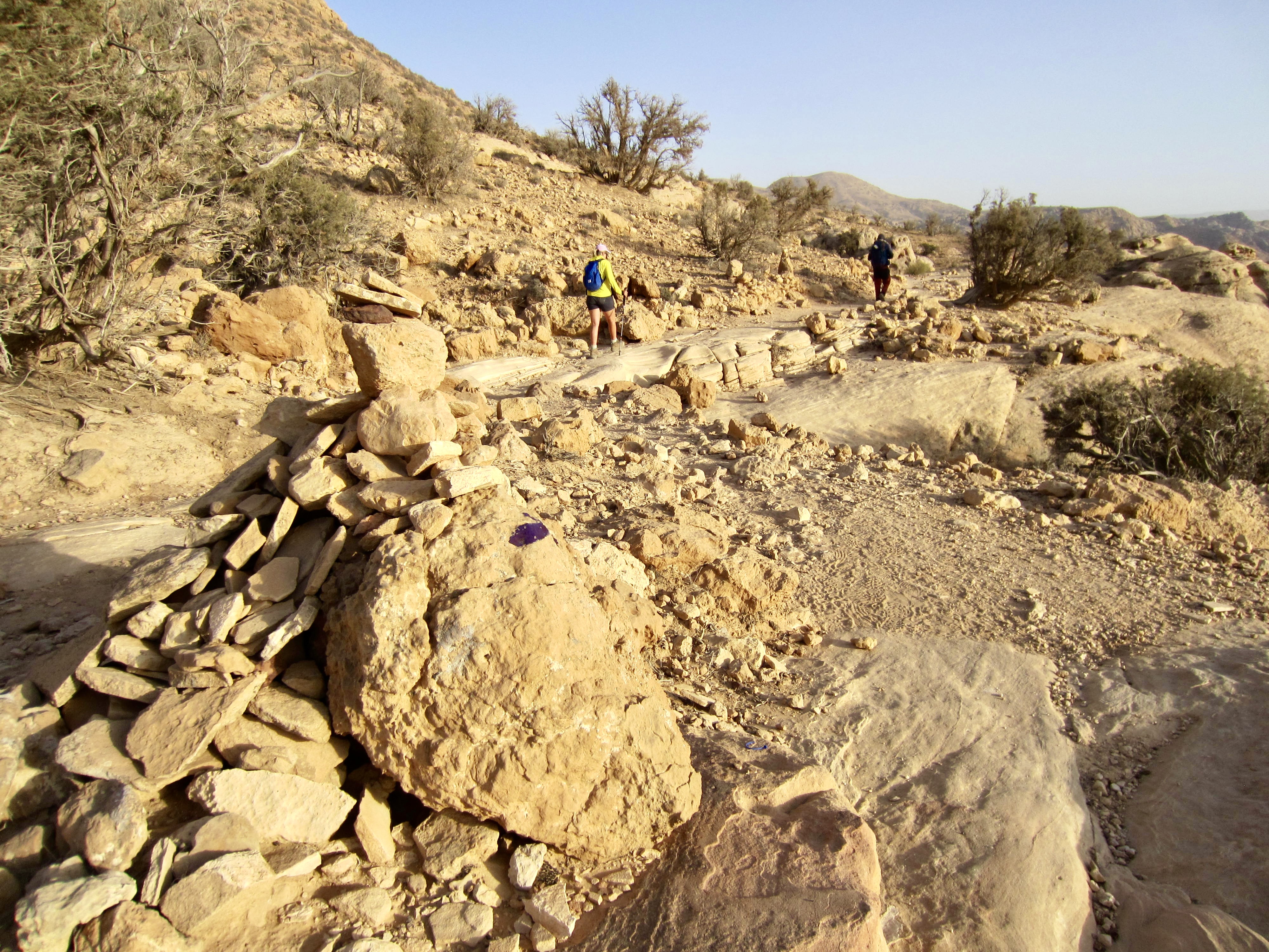
Future trekkers should be aware that the Jordan Trail is not a well-defined and straight-forward hiking route. It actually comprises numerous trail and road segments that have been cartographically joined to create a continuous route. The prevalence of confusing side trails and the scarcity of directional signs make navigation very difficult. Employing a qualified regional guide, such as Mahmoud, is highly recommended for anyone attempting a multi-day trek on the Jordan Trail.
Nomenclature Comments
All of the English geographic names used on maps, on signs, in books, and various other sources throughout Jordan were transliterated from the original Arabic names. As such, there is little agreement on the spelling of many names, especially those associated with lesser-known features. For instance, different sources might refer to Shara or Sharah Mountains, Wadi Musa or Wadi Mousa, and Jabal al-Deir or Jebel al-Deir. Until transliterations are standardized (which is unlikely to ever happen), it is advisable to keep a flexible attitude with respect to spellings used here and elsewhere.
Full Trip Report
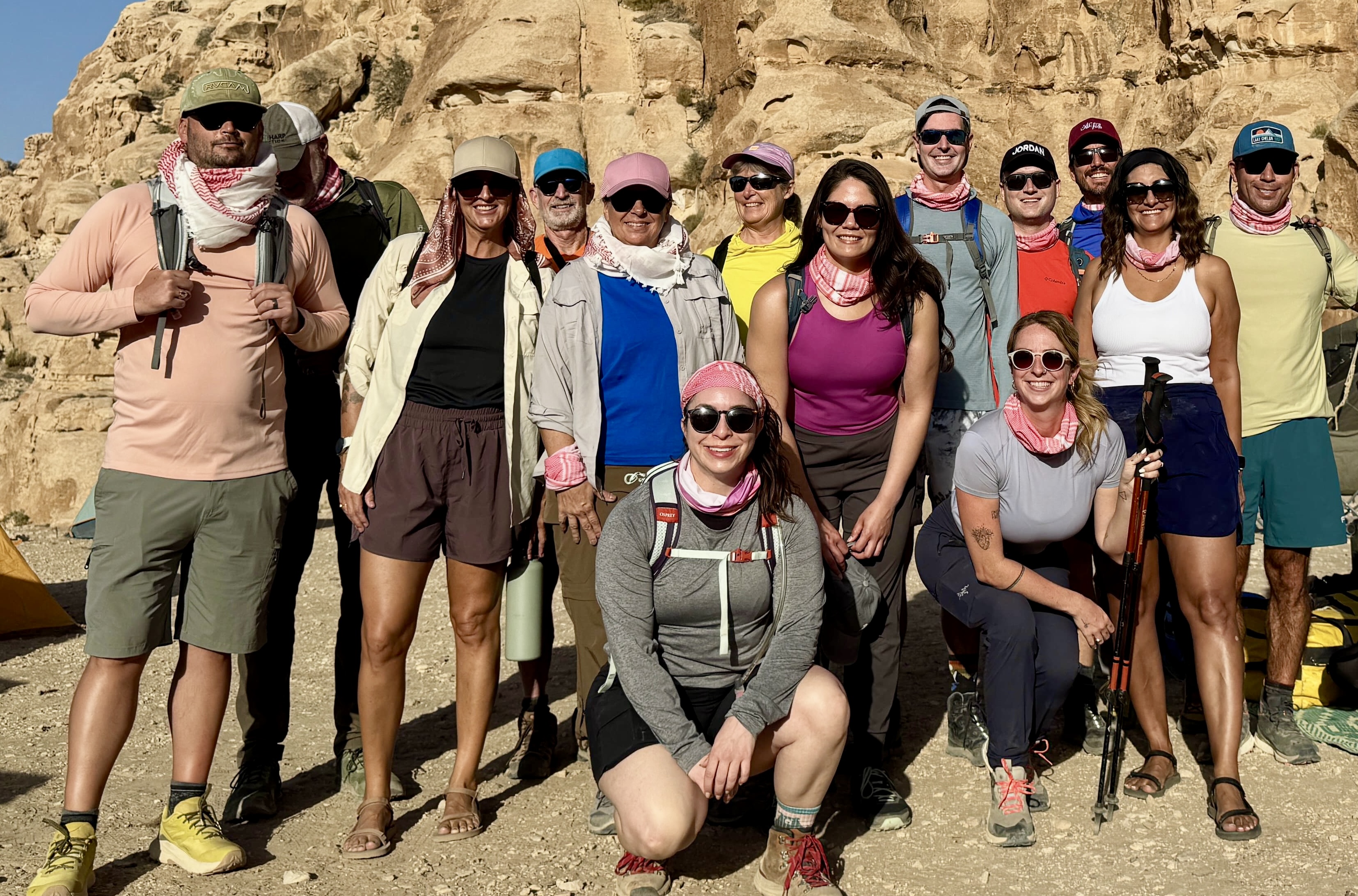
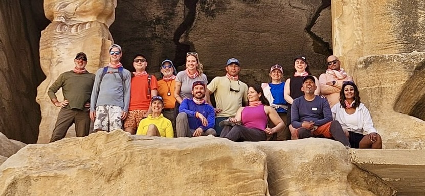
Eileen and I arrived in Jordan’s bustling capital city of Amman several days before our starting date. There, we congregated to form a 15-person trekking group that included Brooke and James, our executive guides; Mahmoud, our regional guide; and ten other clients: Barbara, Brian, Courtney, Edwin, Elizabeth, Josh, Laura, Melissa, Stephen, and Storm. Some of these folks knew Brooke and James from previous treks, whereas others were new trekkers. Mahmoud is a full-blooded Bedouin—part of a tribe that has inhabited this region for many centuries—and is a wealth of Jordanian information.

.
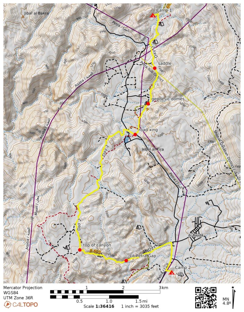
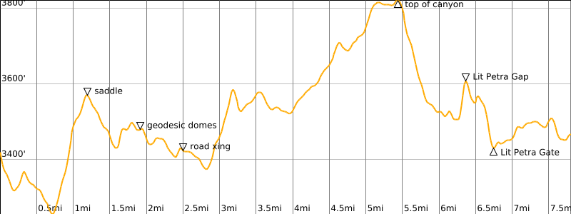
Day 1: Amman to Jhair to Ghbour Whedat
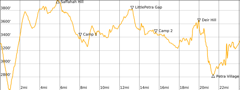
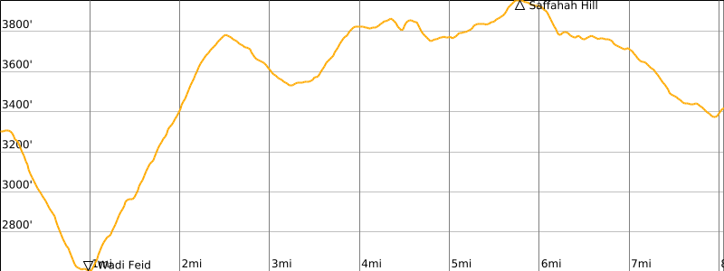
Approximate Daily Stats: 8.1 miles / 13.0 kilometers hiked; 1900 feet / 580 meters gained; 1800 feet / 550 meters lost.
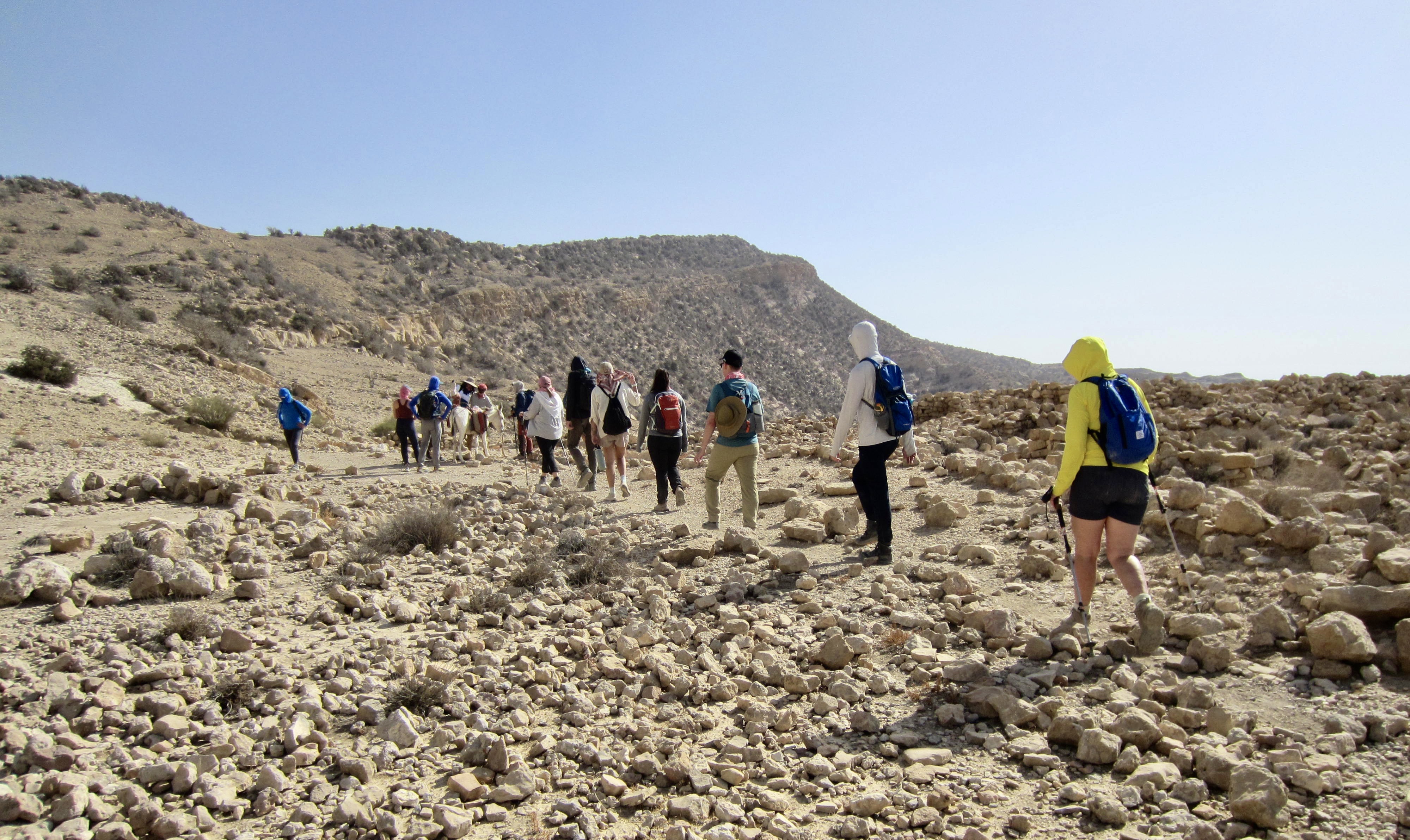
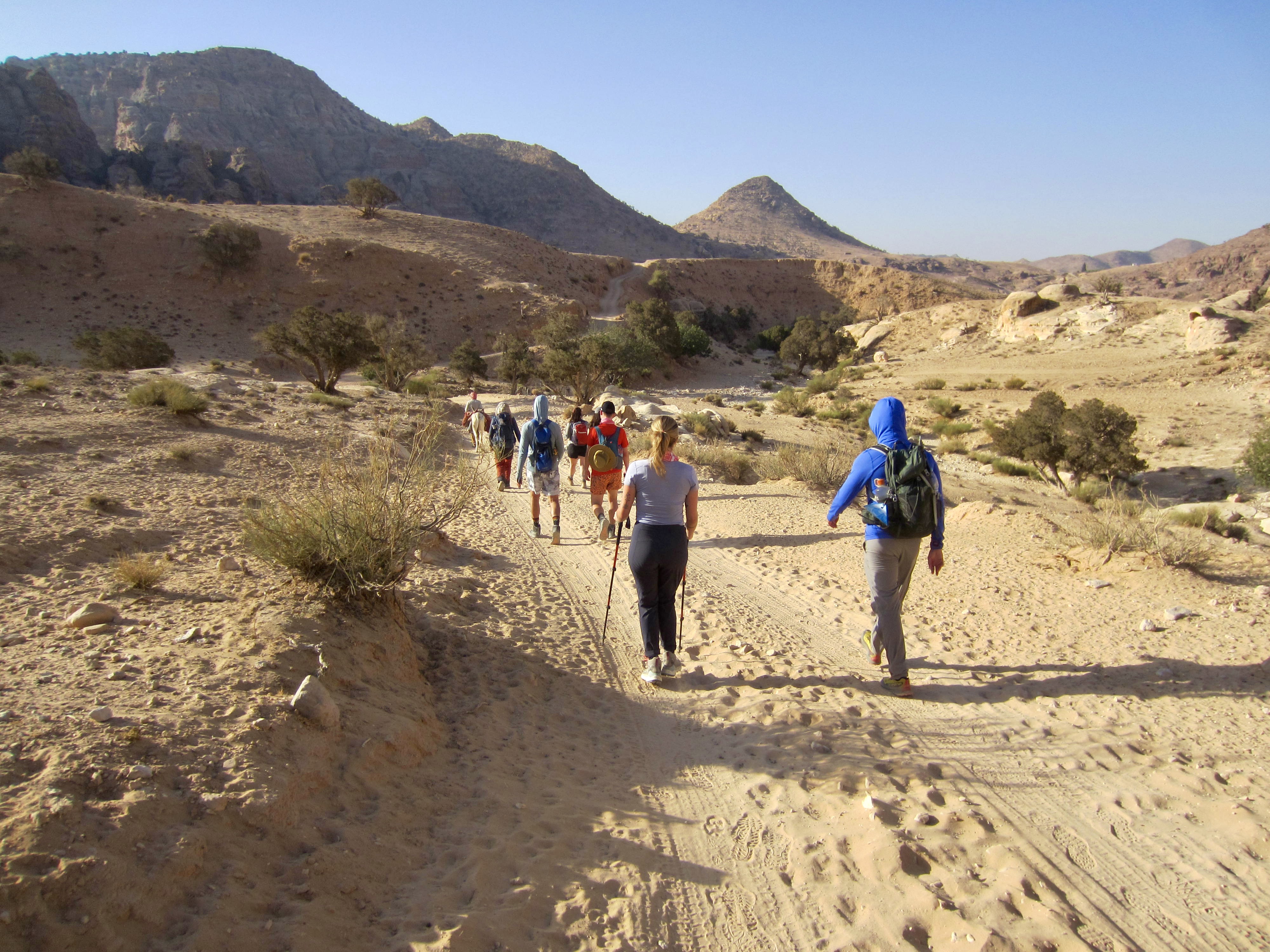
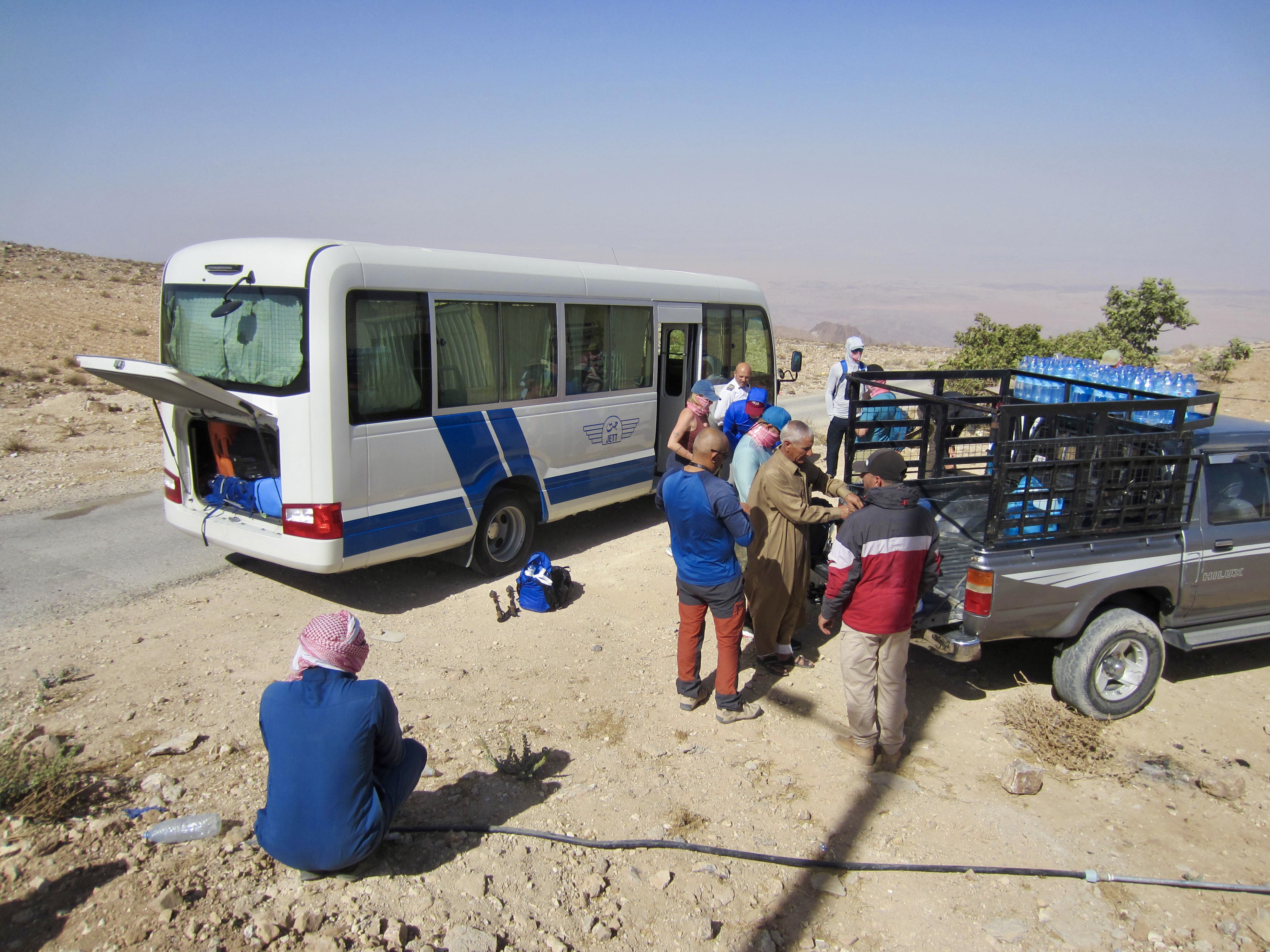
Our group of three guides and twelve clients boarded a small tour bus in Amman and rode to Jhair, a village situated on the western brink of the Jordanian Highlands. There, we transferred to 4X4 trucks and rumbled down a steep, rough, dirt road to a rocky arm overlooking the Wadi Feid (Feid Valley). It was now late morning and getting quite hot.
.
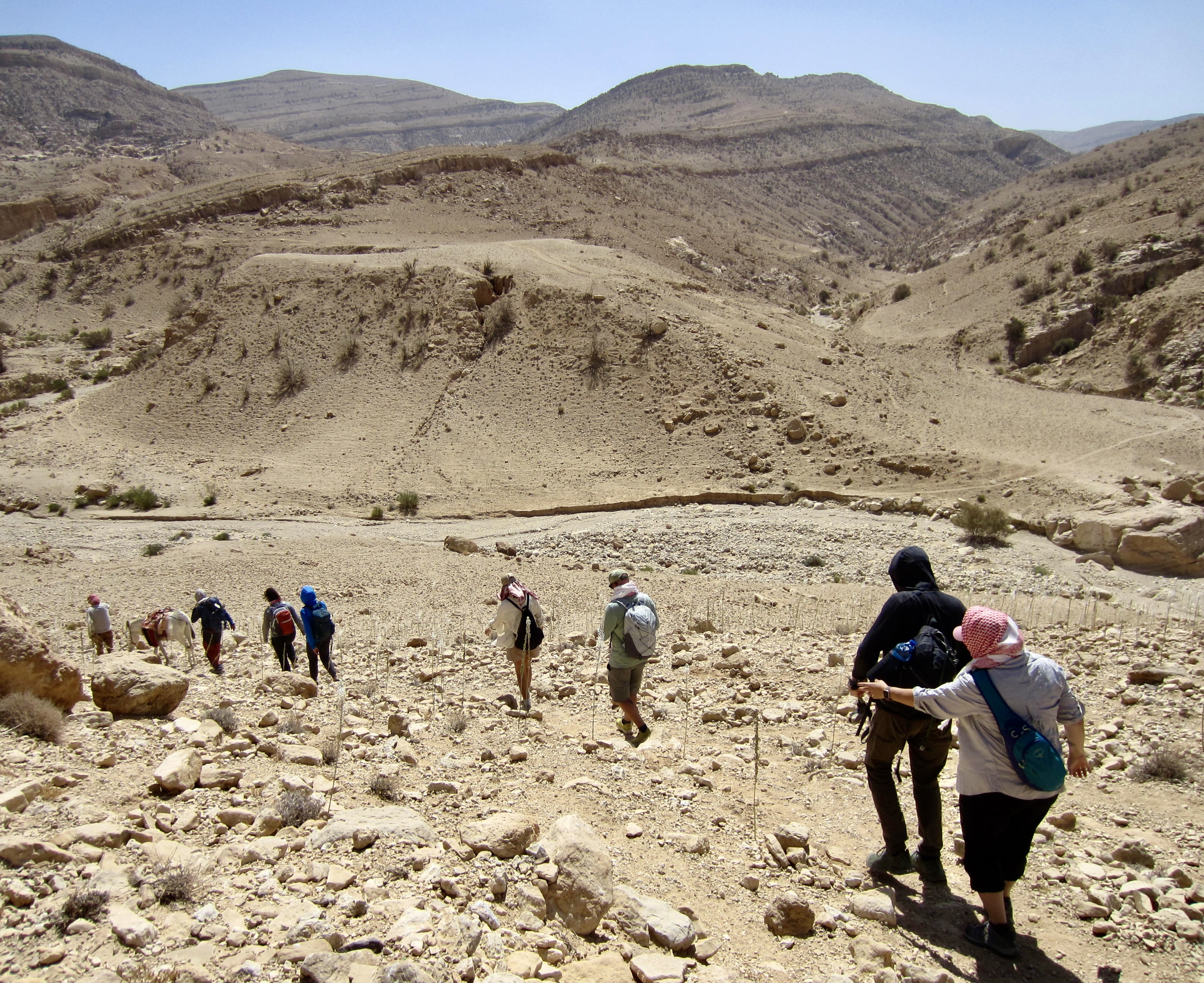
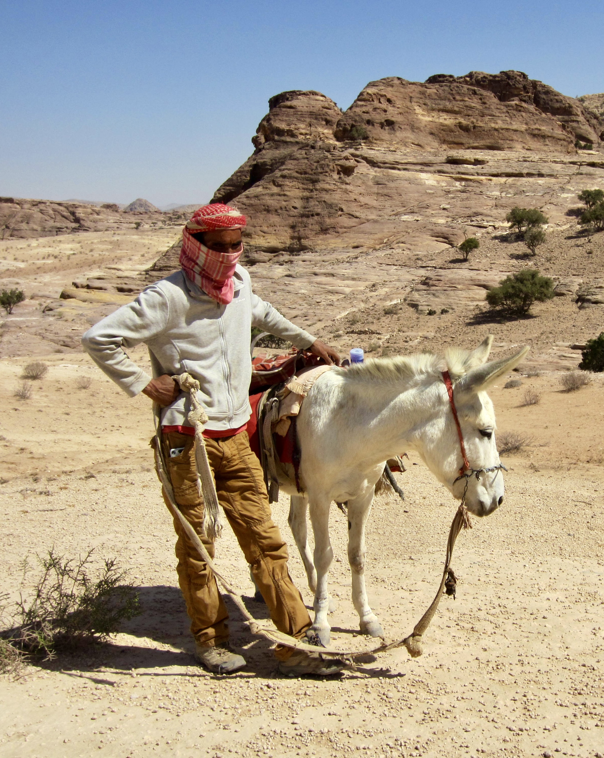
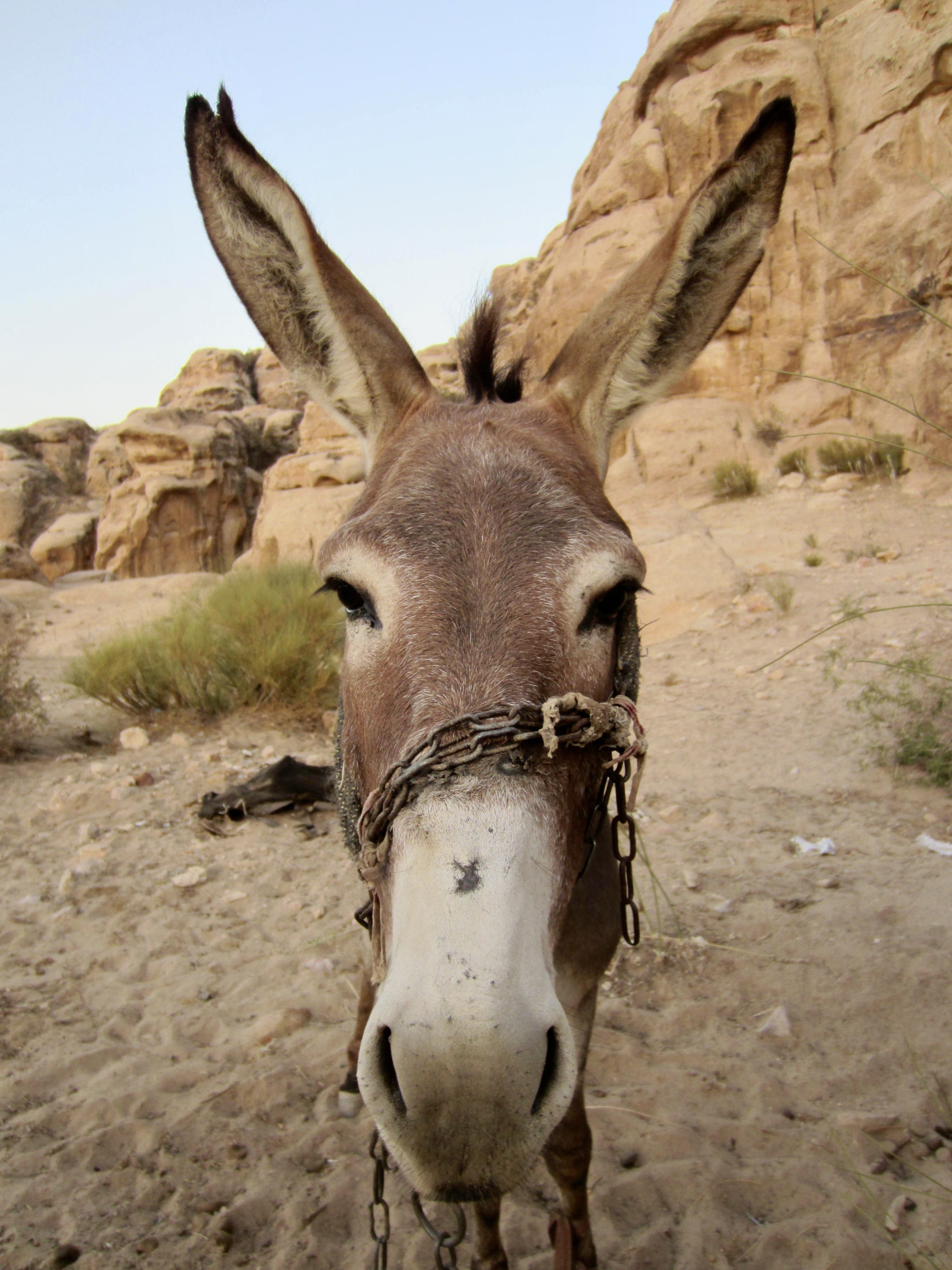
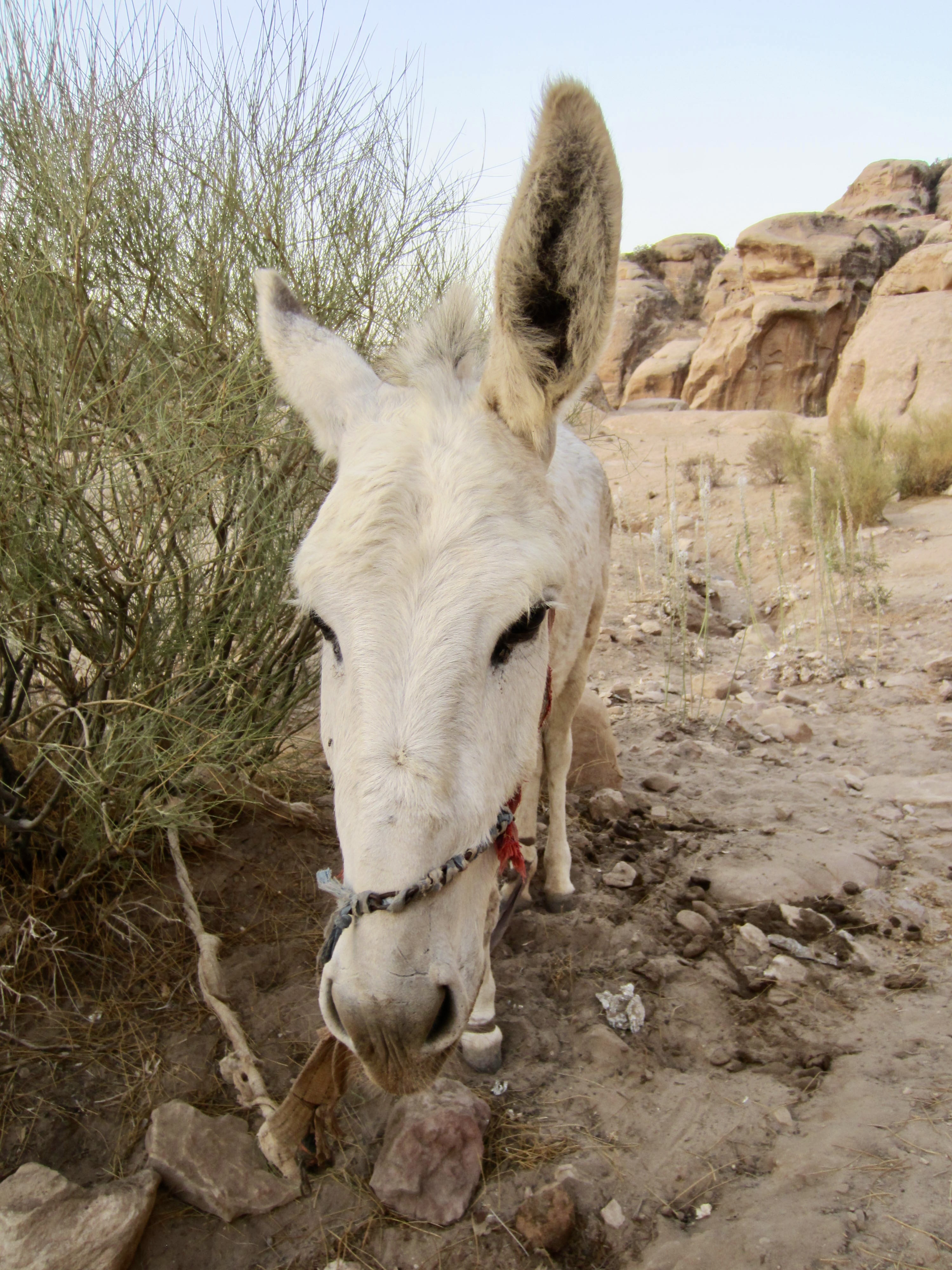
Shouldering rucksacks containing only food, water, and a few personal items, we began our hike at this point, accompanied by two local men (Audi and Muhammed) and two donkeys (Wilbur 1 and Wilbur 2) who carried large jugs of water. The remainder of our luggage was then driven to our first campsite.
.
.
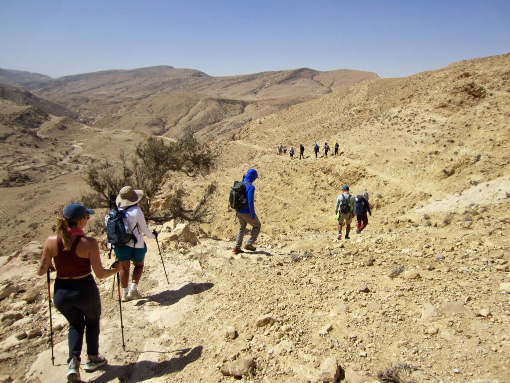
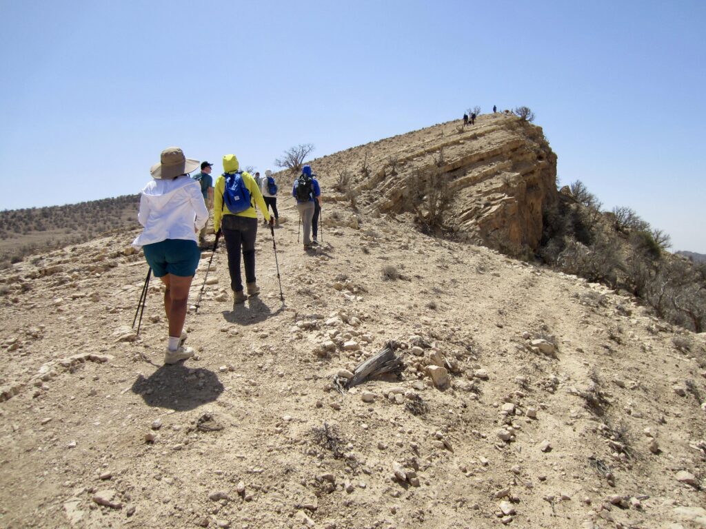
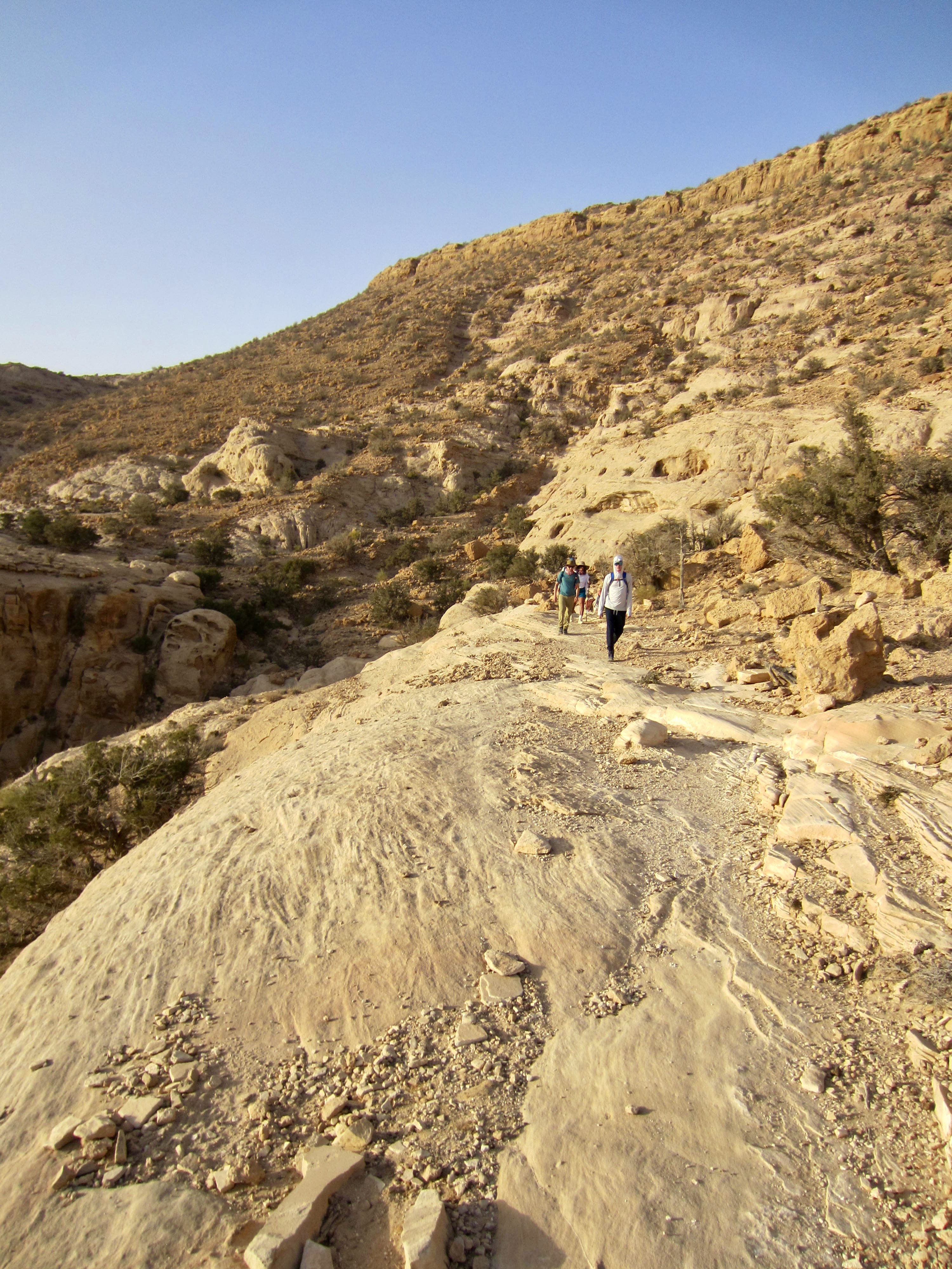
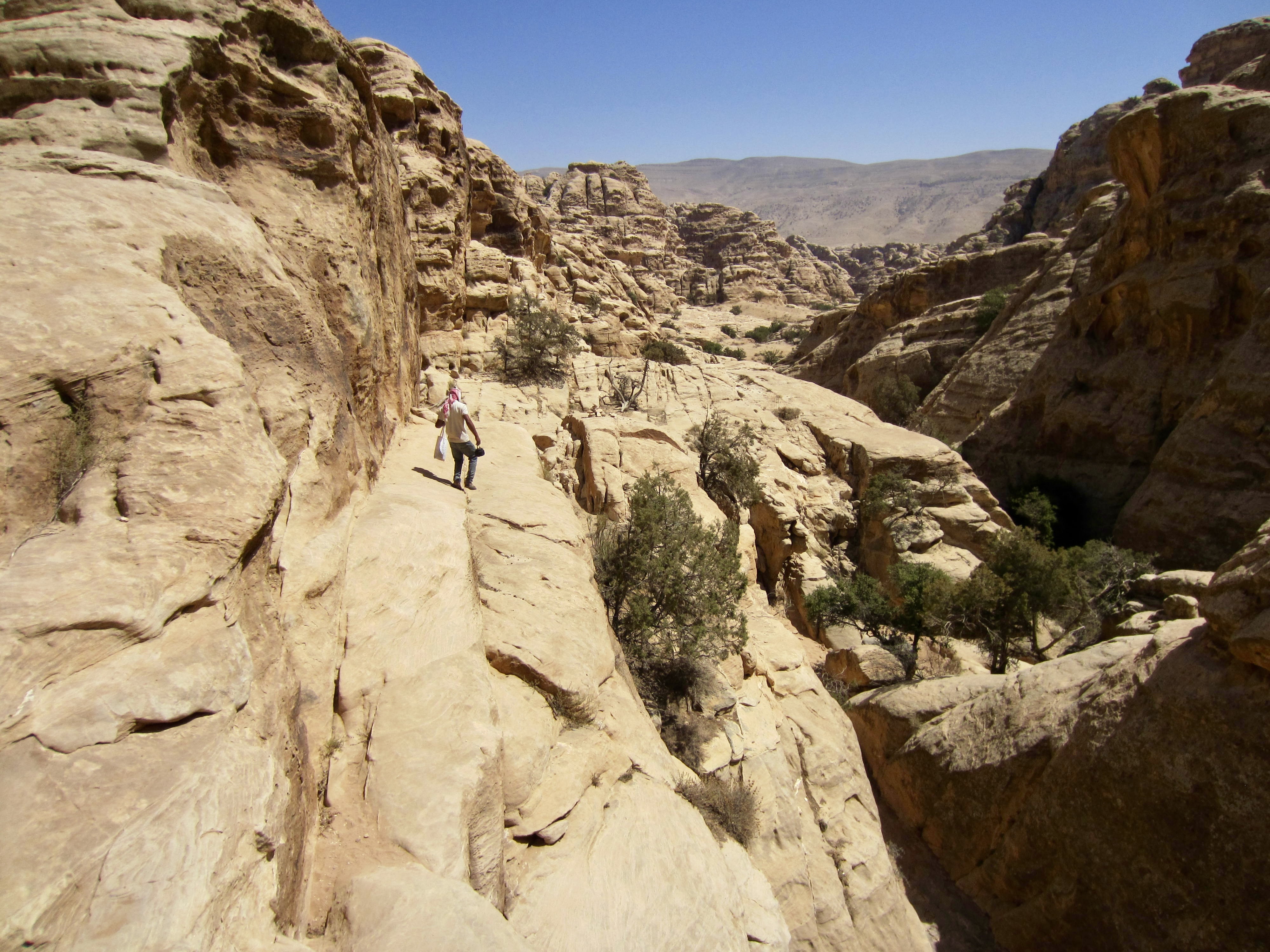
An unmarked connector trail led us down to the dry stream channel of Wadi Feid and back uphill to a junction with the Jordan Trail proper. We then began hiking southward on the latter trail as it climbed onto a ridge crest. The bedrock changed from limestone to sandstone as we gained elevation along the ridge.

.
.
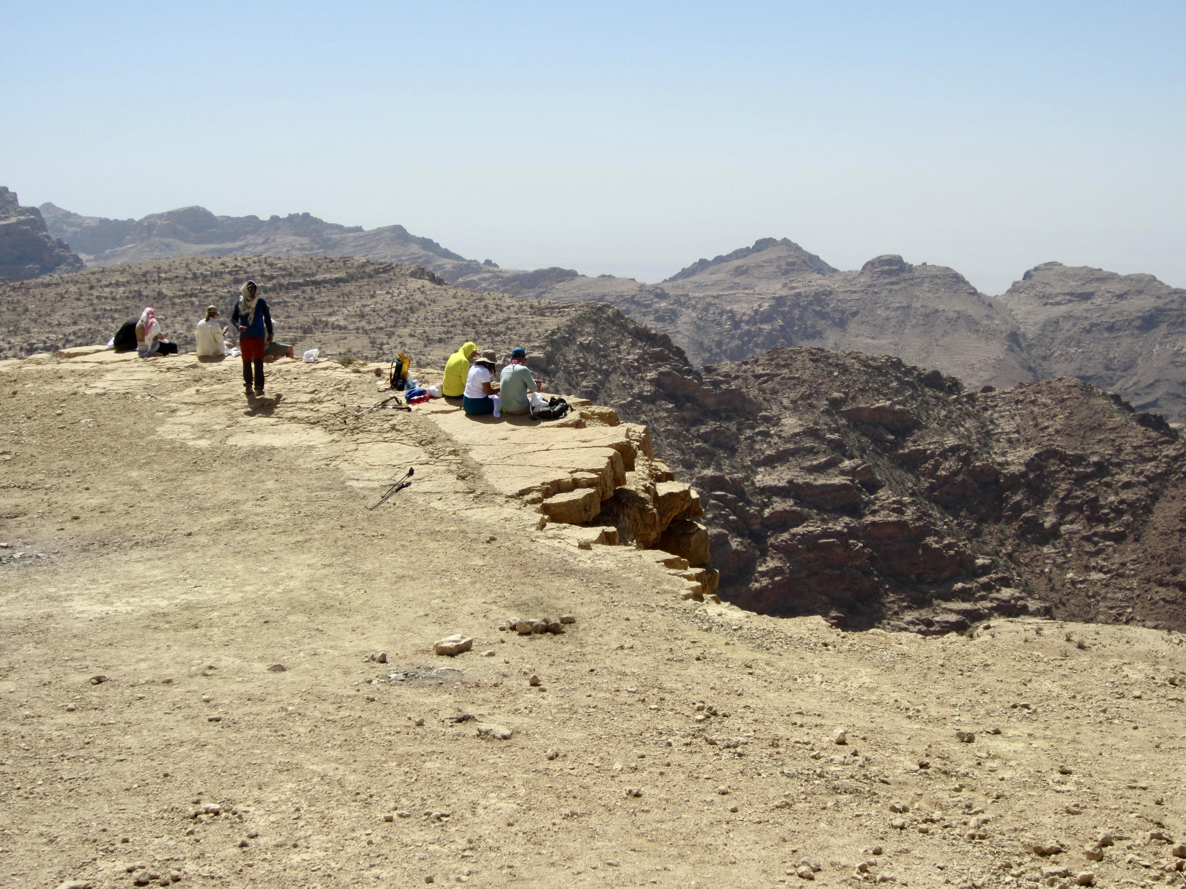
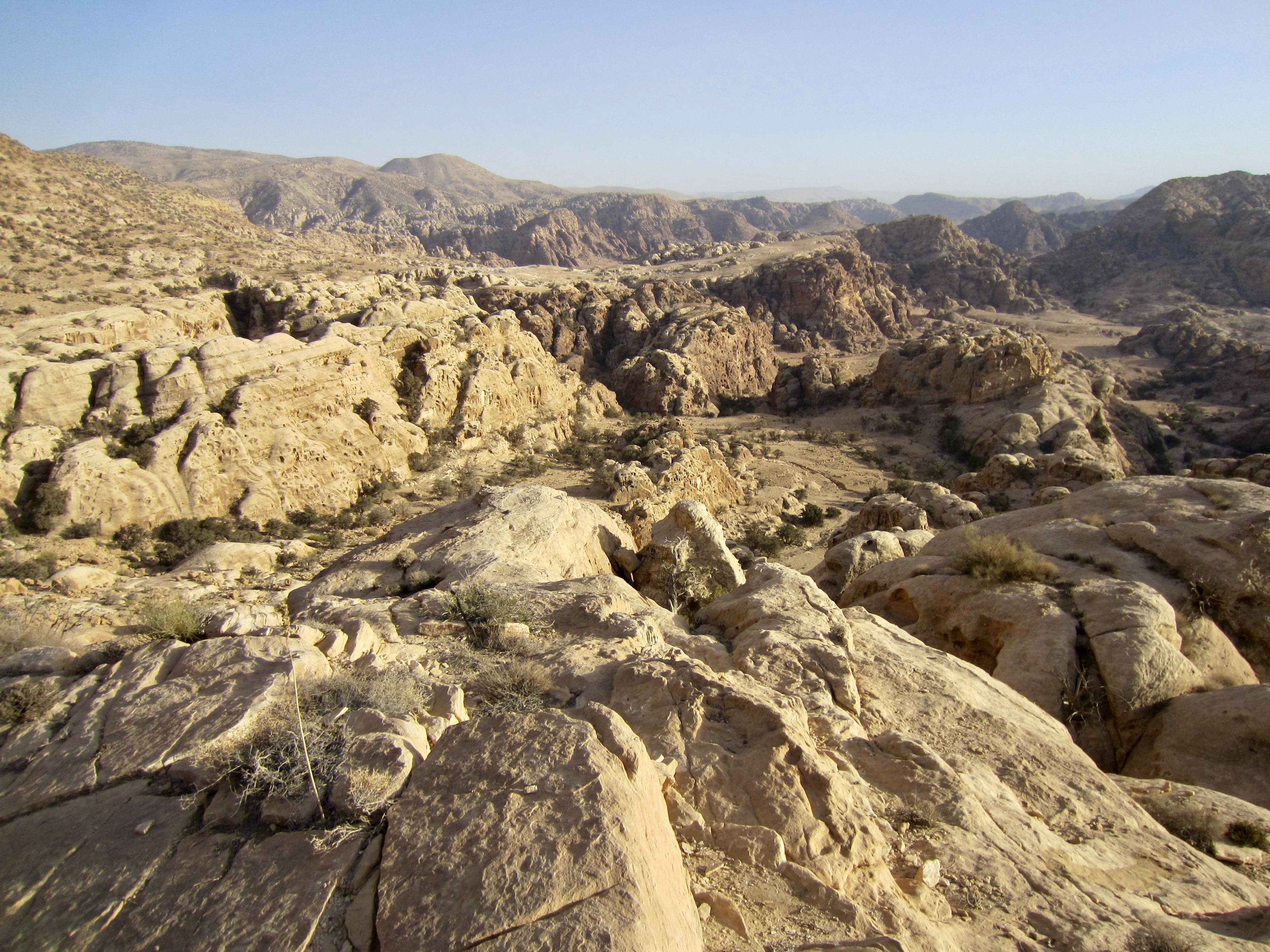
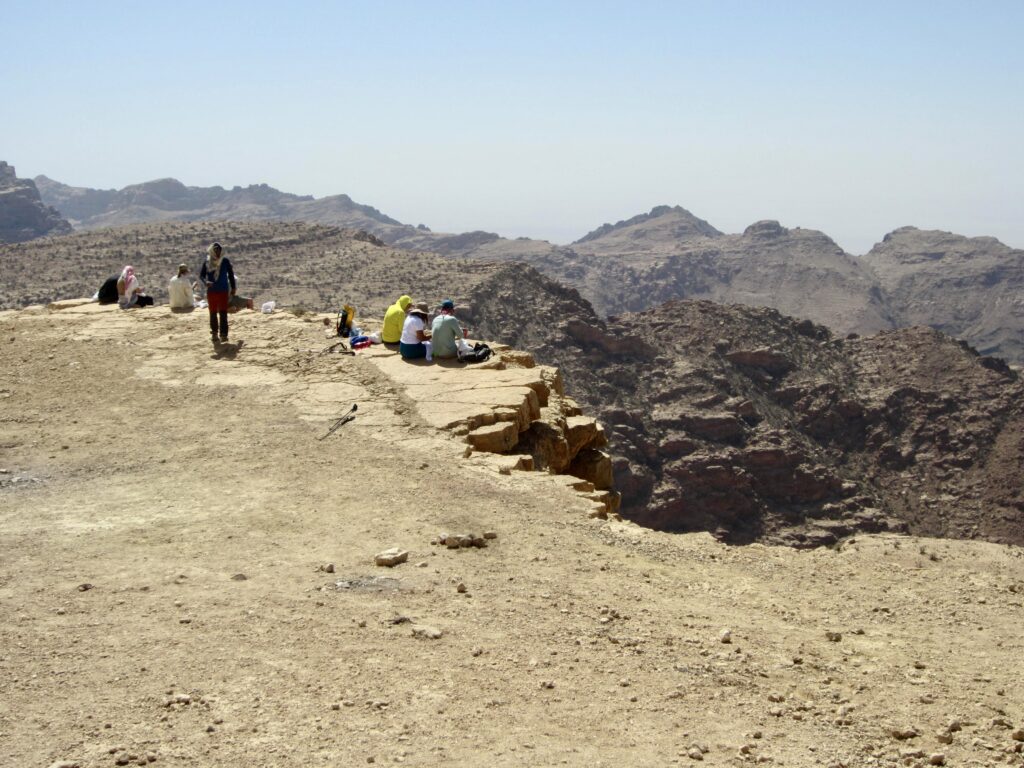
Lunch was taken on a tilted sedimentary hill—a geologic cuesta—directly across from a jagged ridge of volcanic rock. Farther out to the west, the expansive Jordan Rift Valley could be seen through hazy air. This rift valley, which extends from the Sea of Galilee to the Red Sea, was formed by the Arabian plate pulling away from the African plate.
.
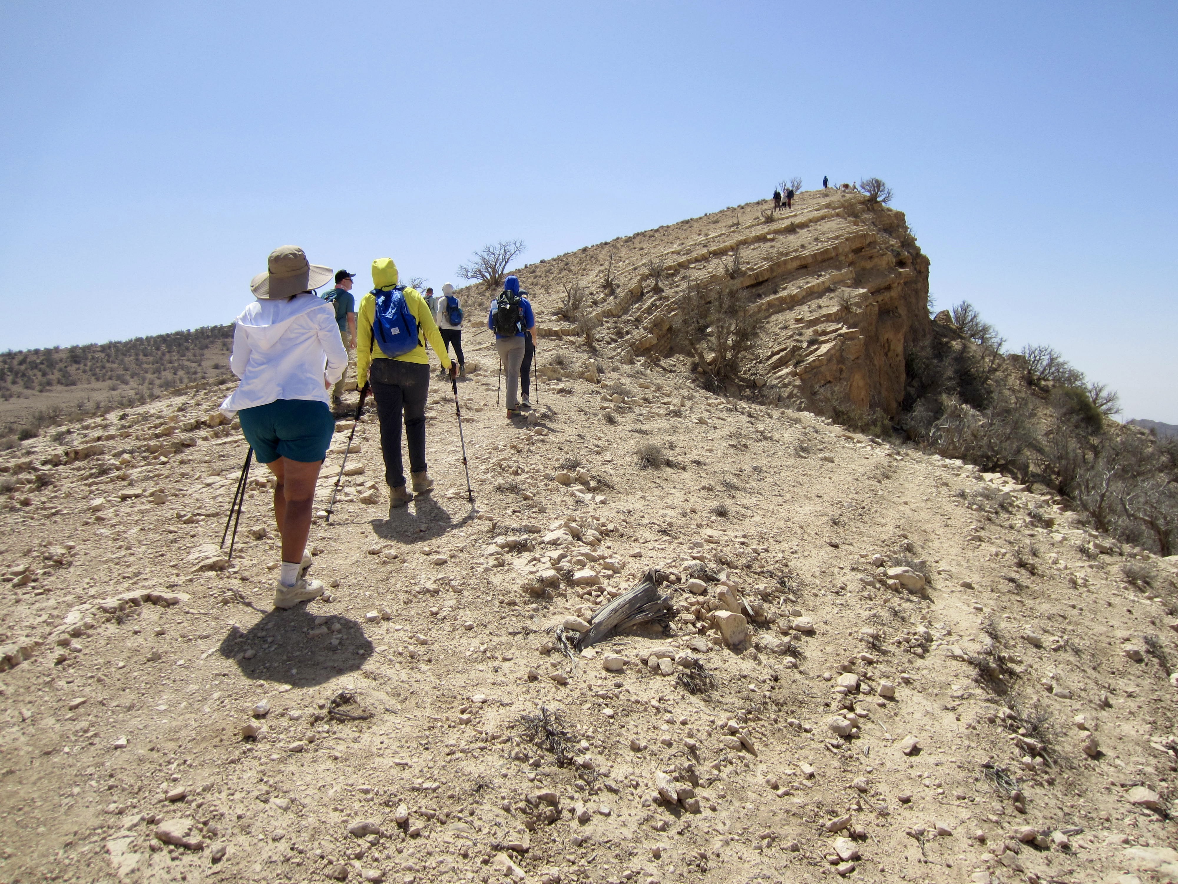
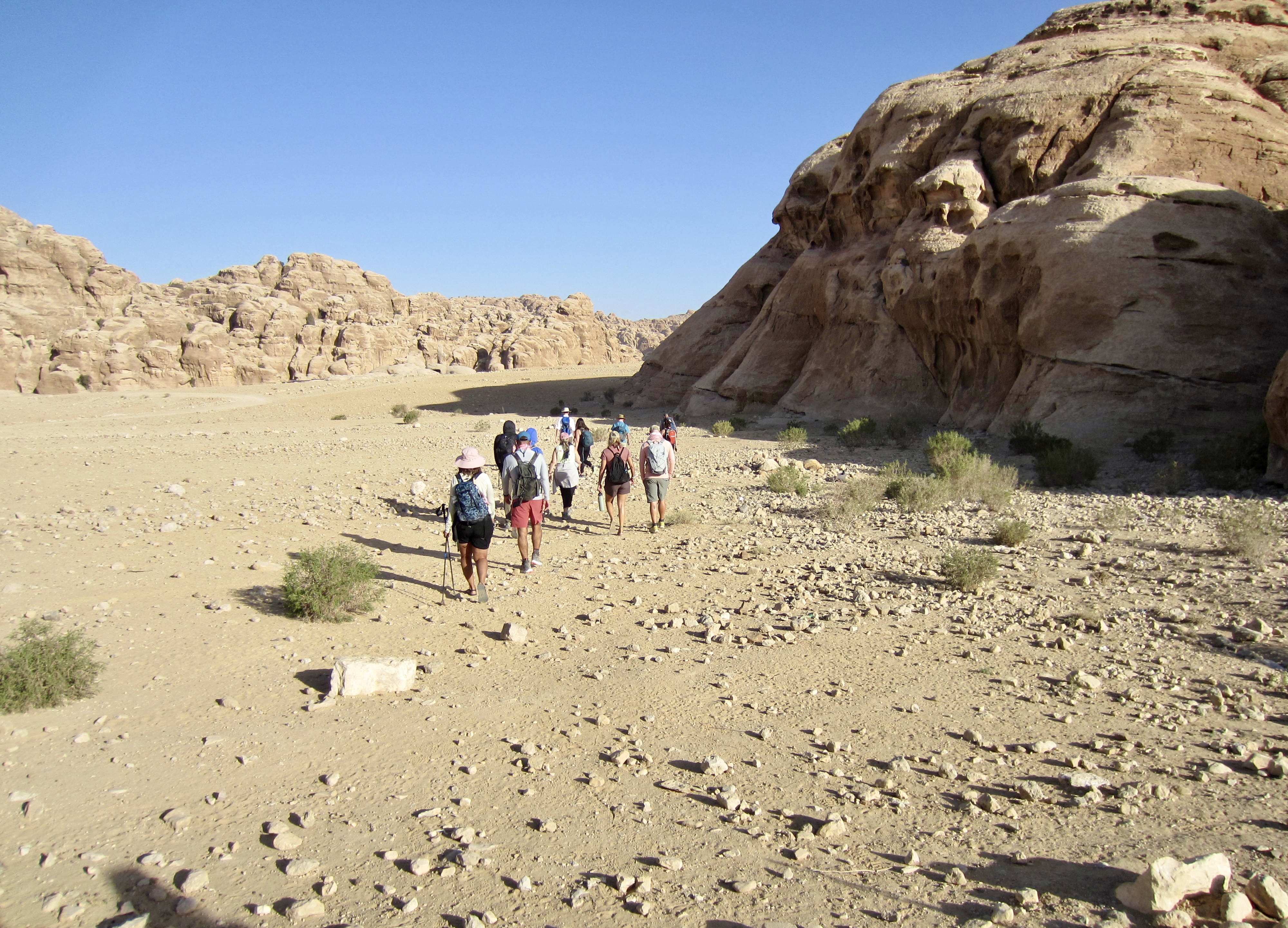
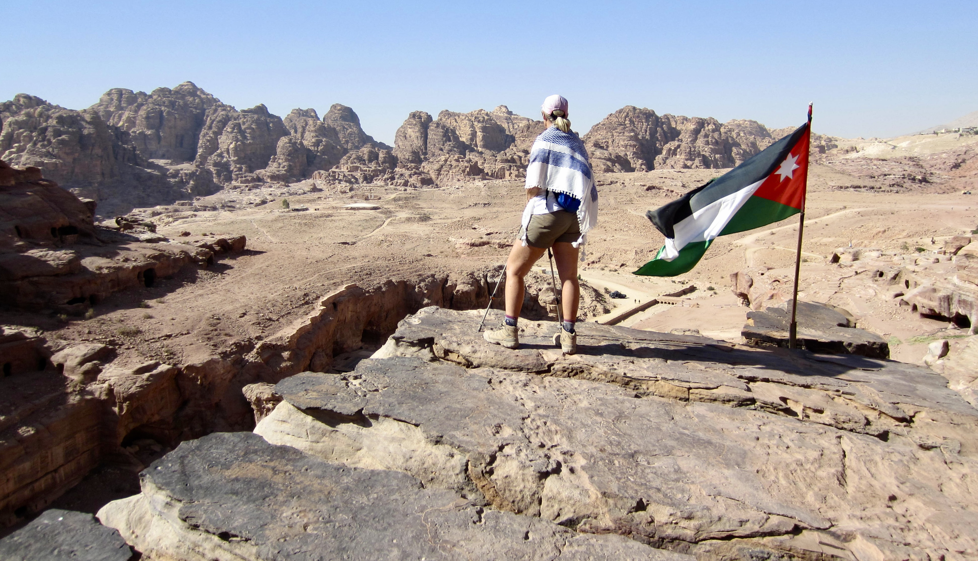
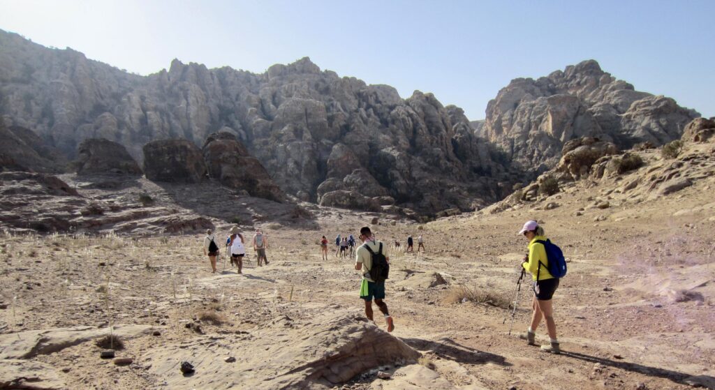
For the rest of the afternoon, we followed the “flat” trail over a series of ribs and ridges (Mahmoud explained that flat is the Jordanian word for “many ups and downs”). We soon reached the highest point of our entire traverse on the flank of Jebel Saffahah, or Saffahah Hill. Relentless sunshine and lack of shade made these numerous undulations feel much harder.

.
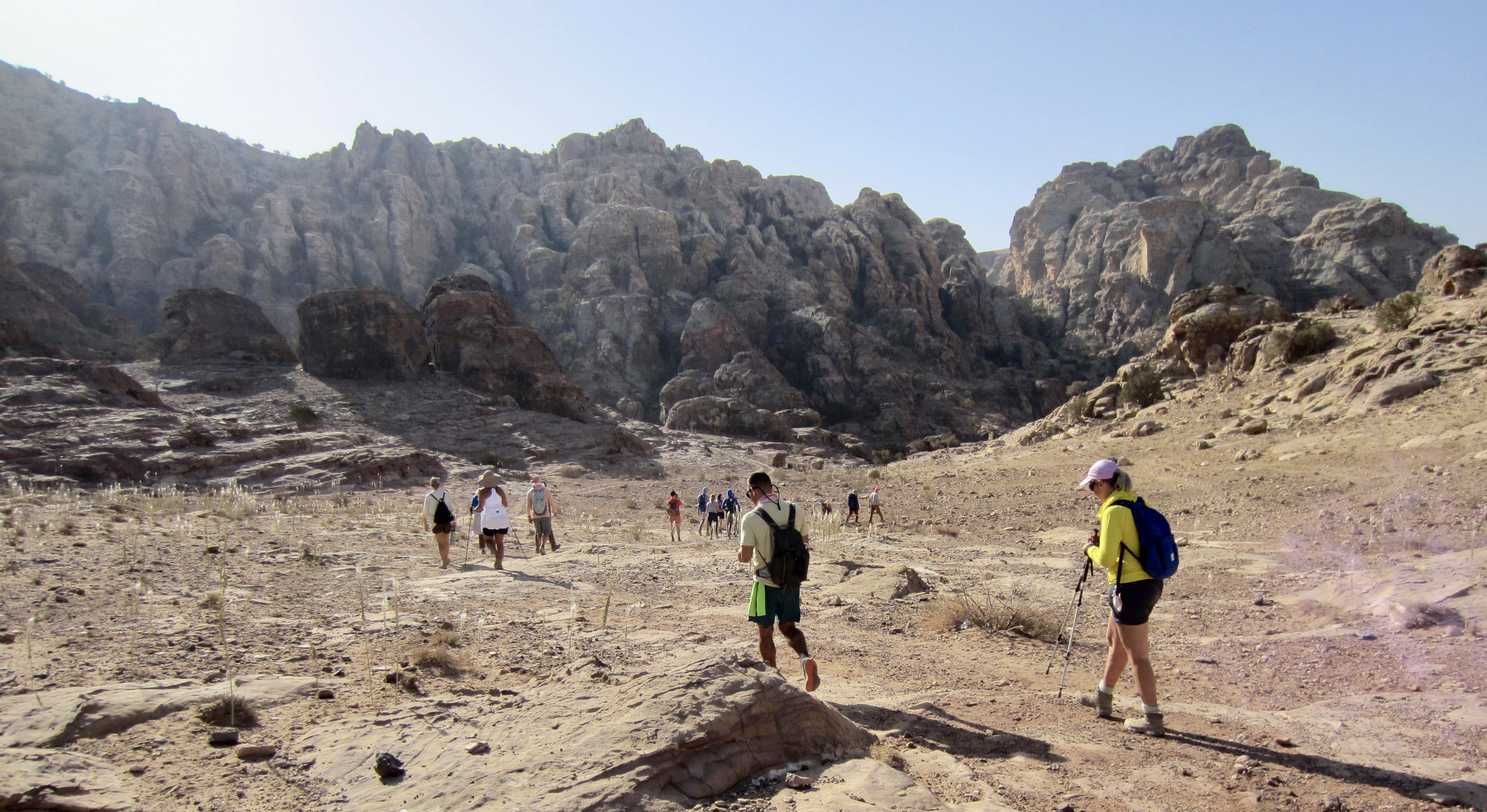
The Jordan Trail led us into a landscape of sandstone formations that have been eroded into rounded shapes variously resembling hamburger buns, dinner rolls, and mushrooms. This area was very reminiscent of the Needles District in Canyonlands National Park.

.
.
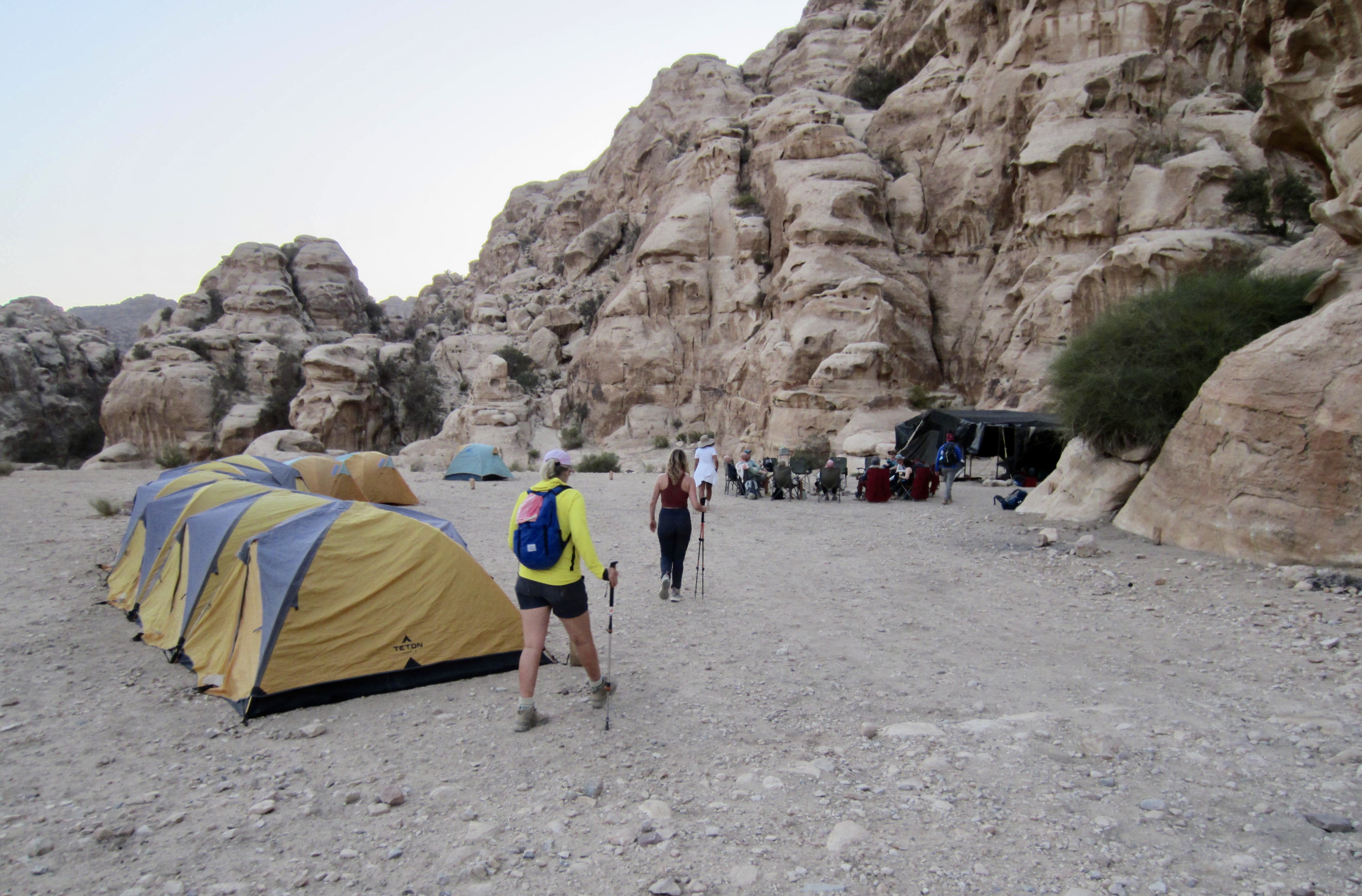
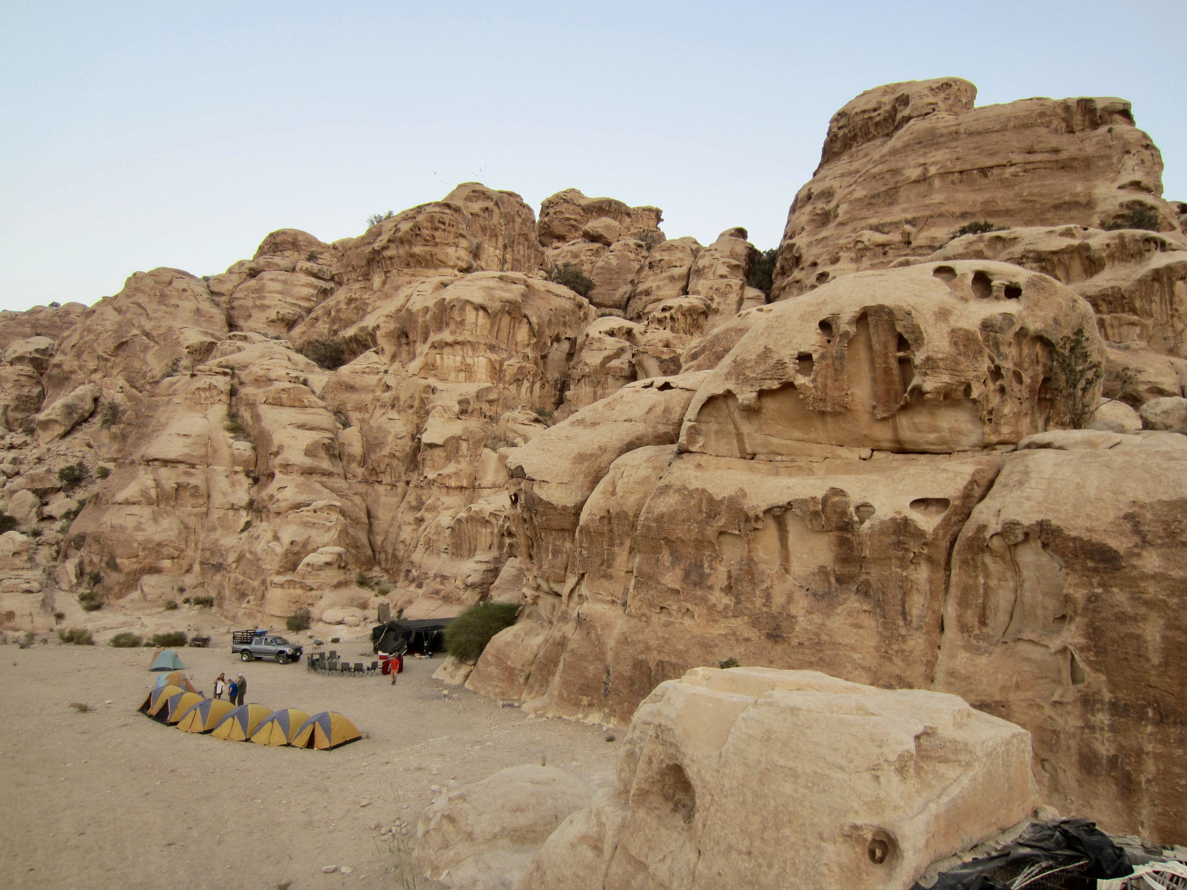
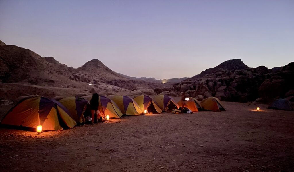
In early evening, we arrived at Ghbour Whedat Wild Camp (7.2 hours from starting trailhead). This comfortable backcountry campsite, tucked up against a sandstone wall, comprises a large communal tent and a row of personal tents. The Experience Jordan Adventures staff had previously arrived with our luggage, set up a shower and latrine, positioned candles around the site, and cooked a tasty Jordanian dinner. We all sat in a circle and recounted the day’s events while eating.

.
.
.
Day 2: Ghbour Whedat to Little Petra
Approximate Daily Stats: 7.8 miles / 12.6 kilometers hiked; 1350 feet / 410 meters gained; 1300 feet / 395 meters lost.
Before heading out in the morning, we had time to explore the area immediately surrounding our camp. I was fascinated by the adjacent sandstone cliffs, which look like layers of candle wax that are slowly melting. This texture, geologically known as tafoni, is caused by extreme differential erosion and weathering due to variable crystalization and expansion of calcium salts within the rock.

.
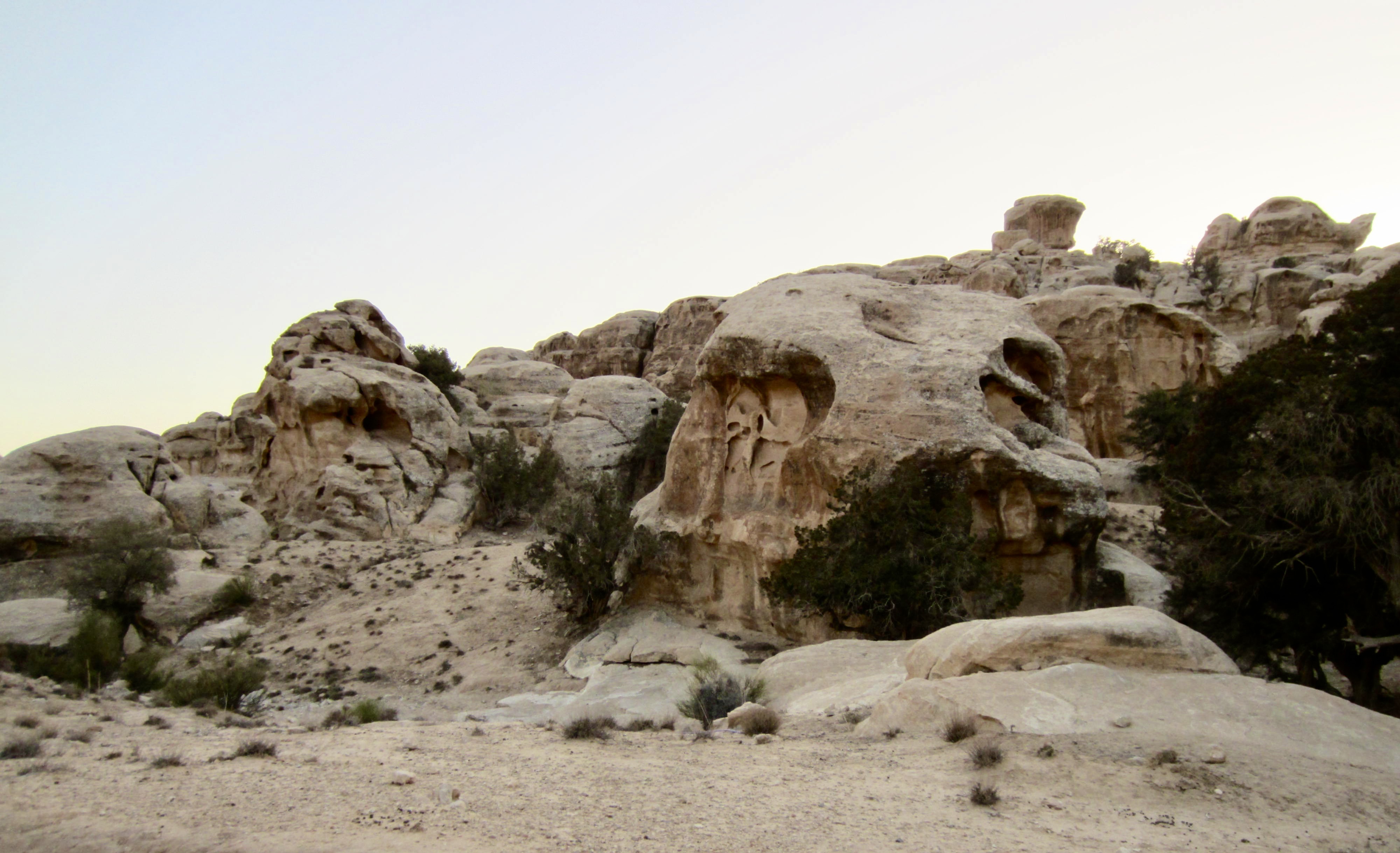
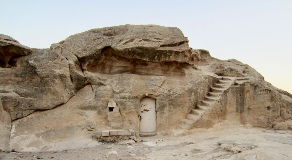
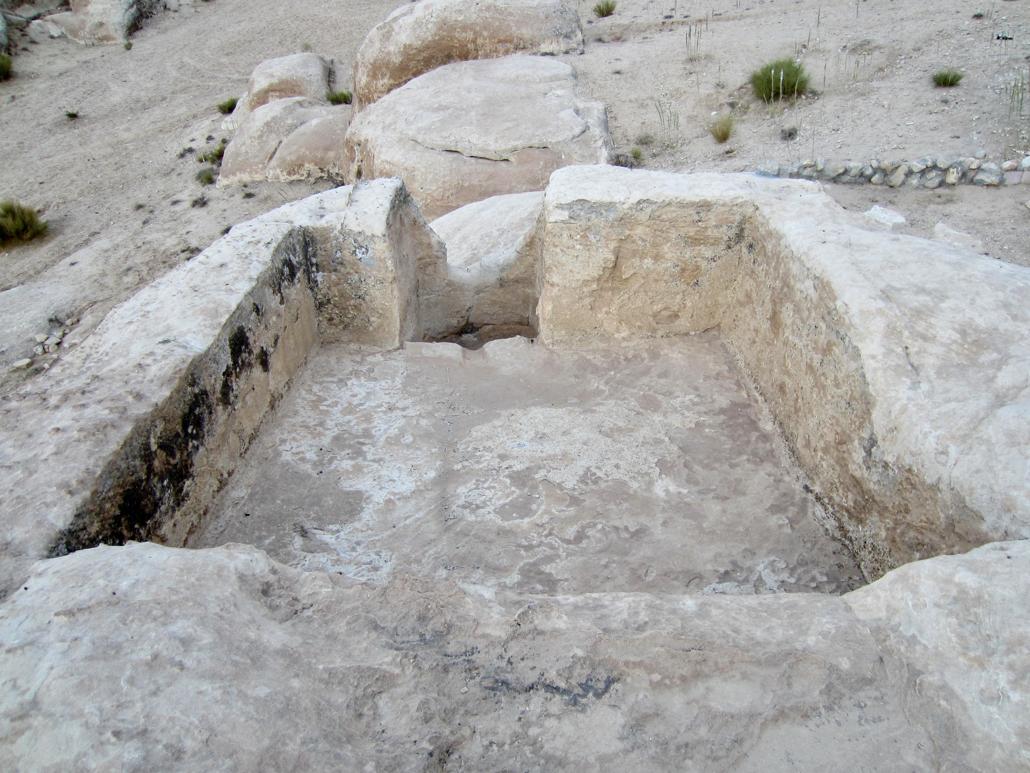
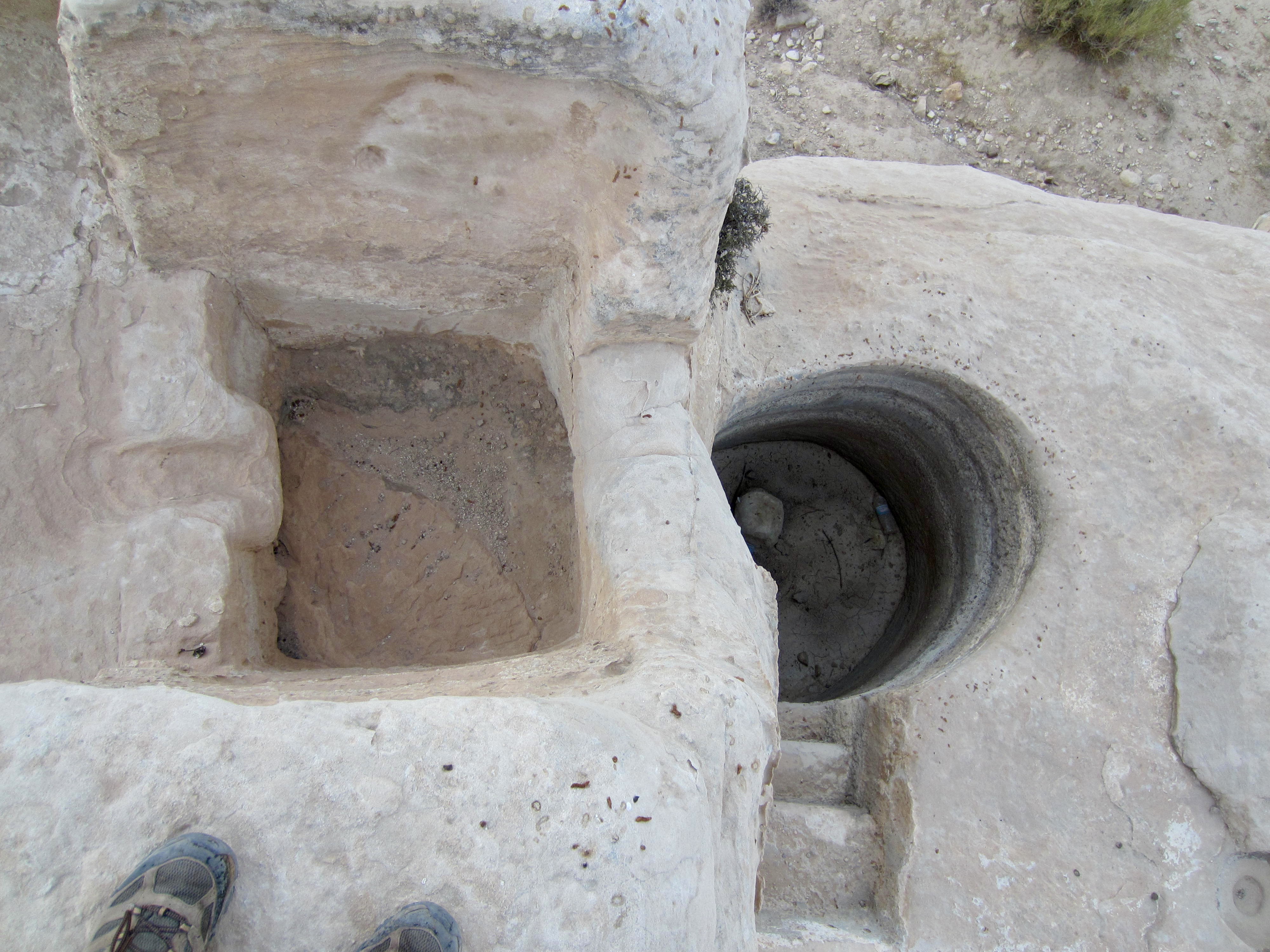
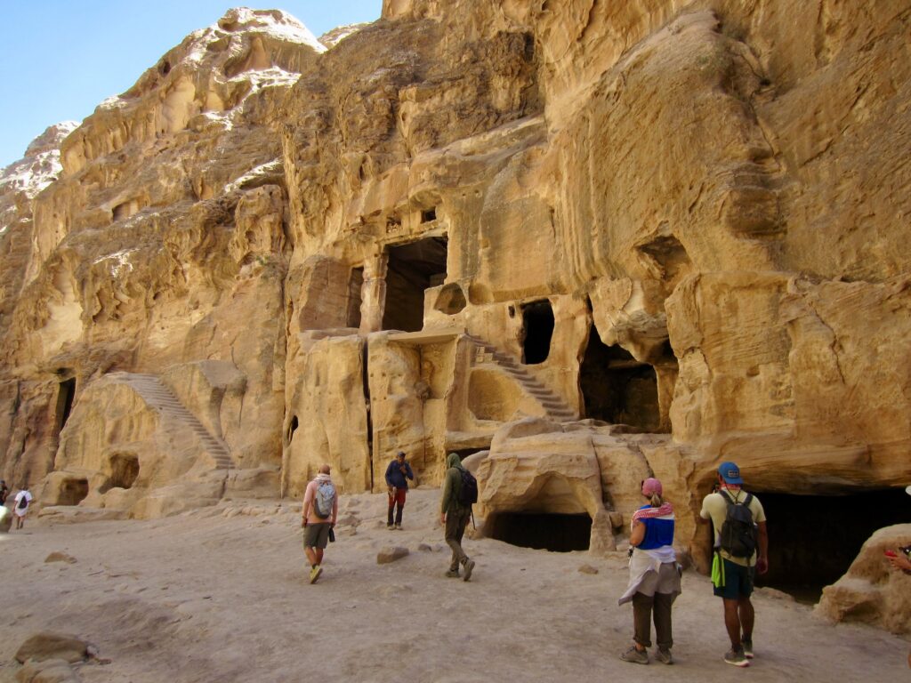
Nearby were several ancient Nabatean caves that have been hollowed out of sandstone outcrops to serve as abodes or storage rooms. Carved into one outcrop is a series of pits that were apparently used for pressing grapes. The early inhabitants were not to be denied their daily vino!
.
.
Once underway in the cool morning air, we hiked down a road past several Bedouin camps, then veered onto a rough trail that took us over a broad saddle and down through a small community with farms and orchards.

.
.
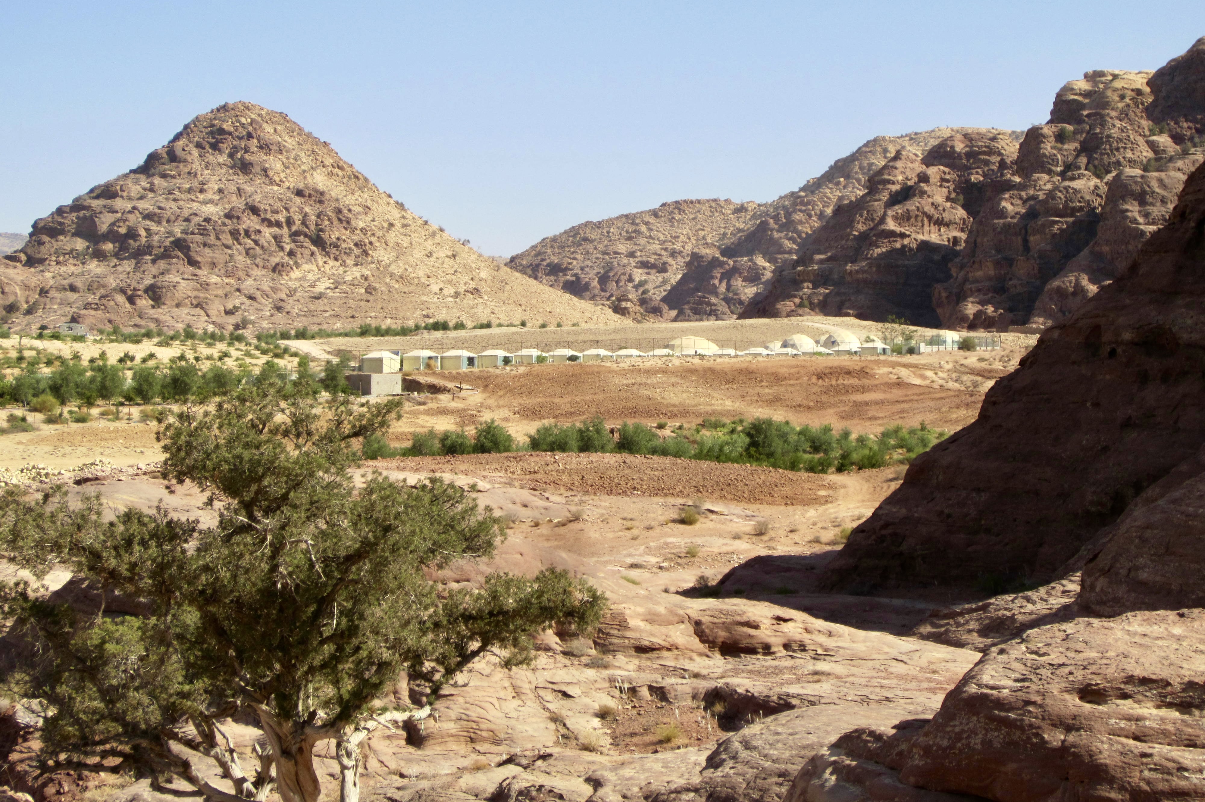
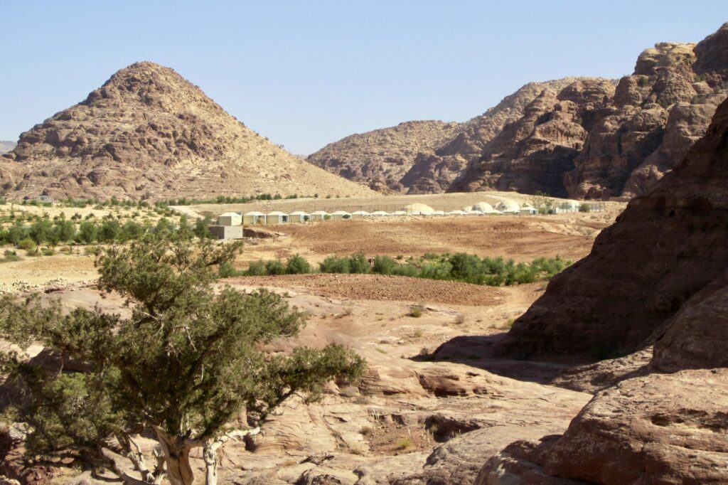
Amidst these Bedouin settlements was, strangely enough, a fenced compound containing a dozen or so geodesic domes and a bunch of smaller yurt-like structures. Mahmoud explained that these domes had been constructed for the movie set of The Martian. Additional filming had occurred in Wadi Rum, farther to the south.
.
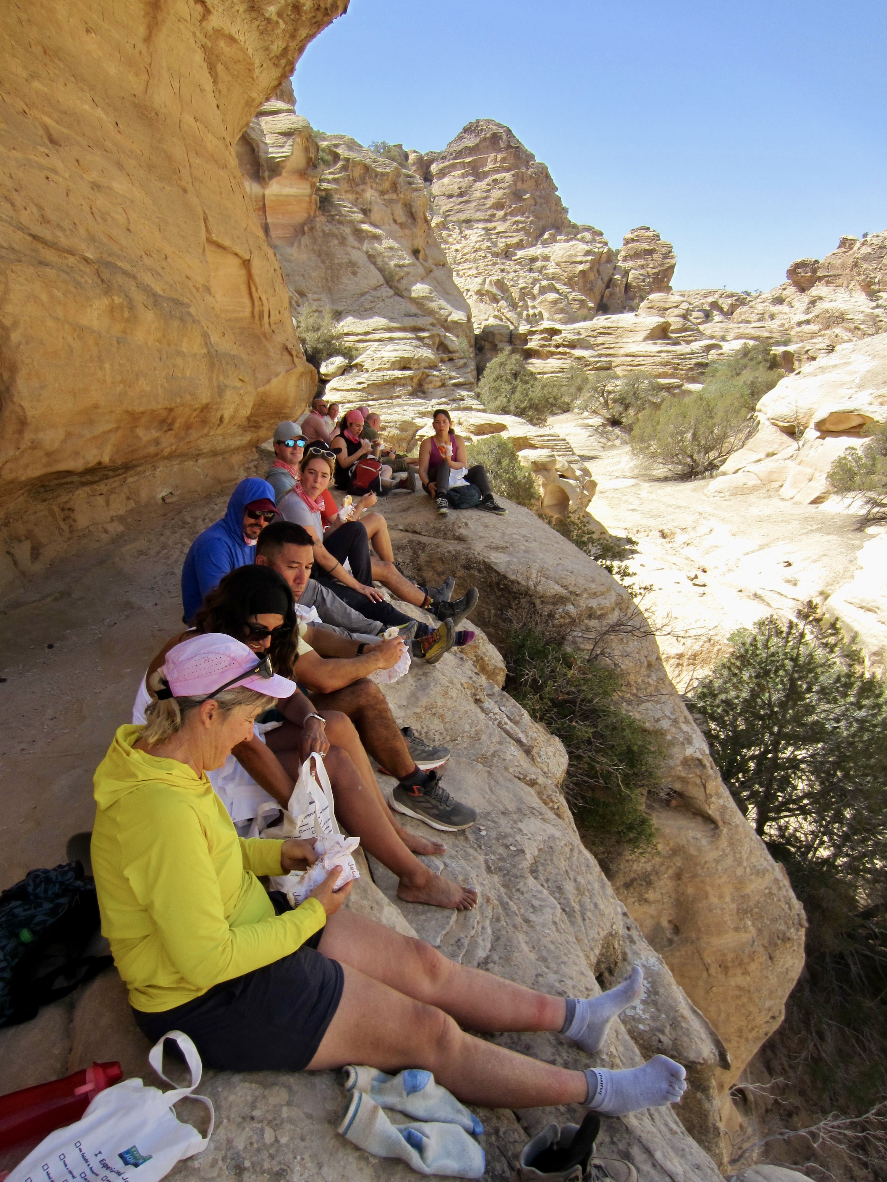
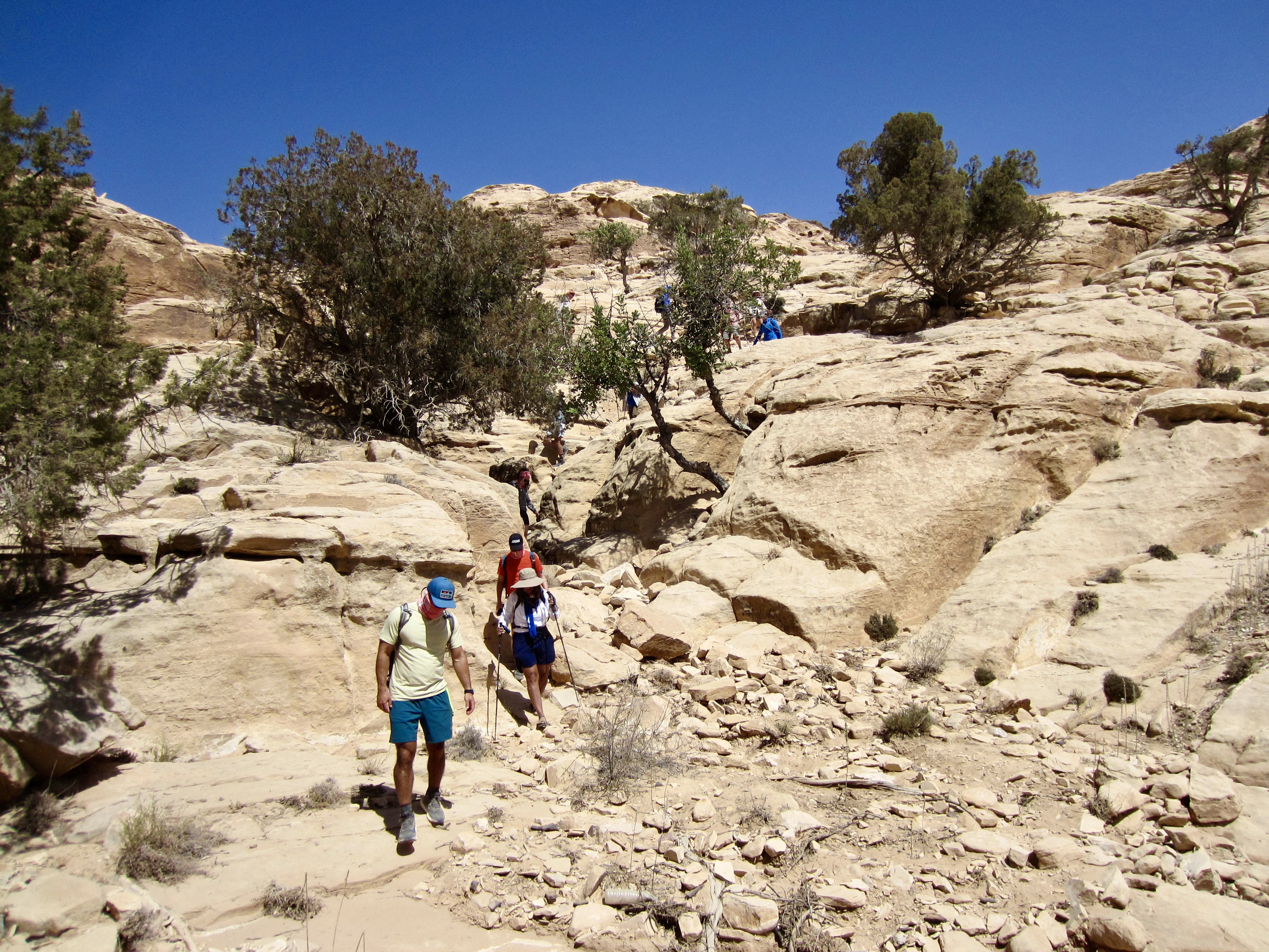
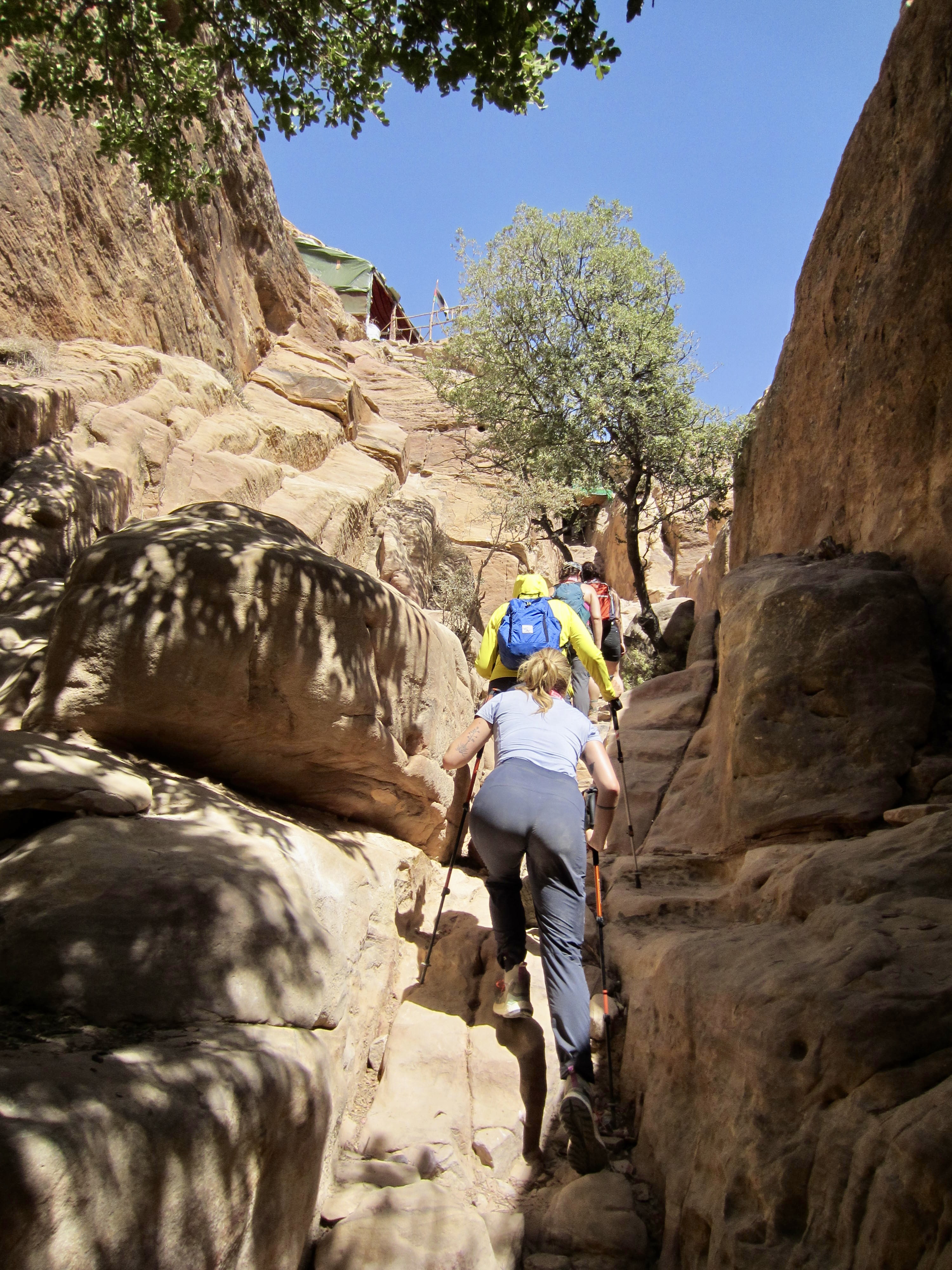
Upon reaching the top of a sandstone canyon, our two donkeys and their handlers parted ways. The canyon is too steep even for sure-footed donkeys, so we now had to pack our own water. This canyon descent required a combination of hiking and Class 2 (easy) scrambling. Today’s lunch took place on a shady ledge above the canyon invert.
.

.
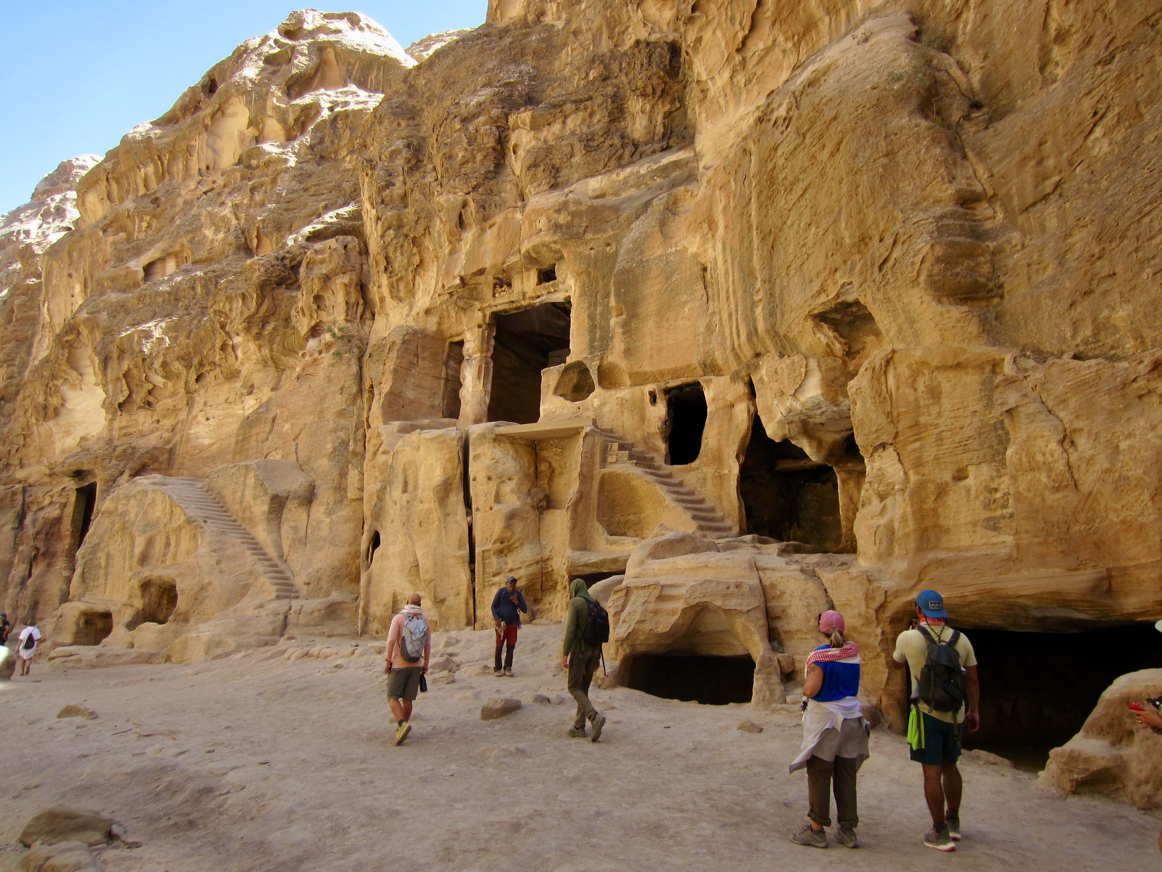
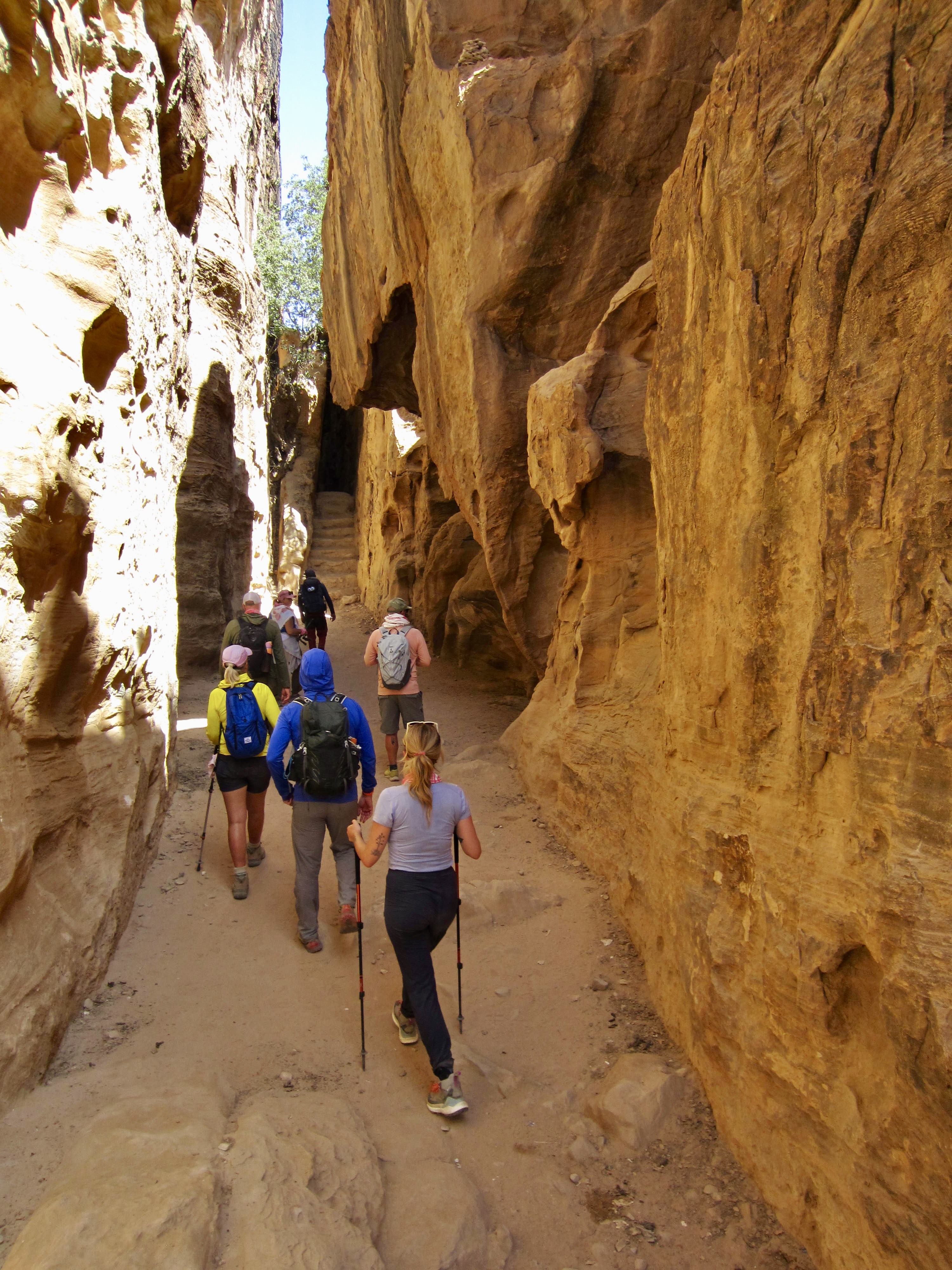
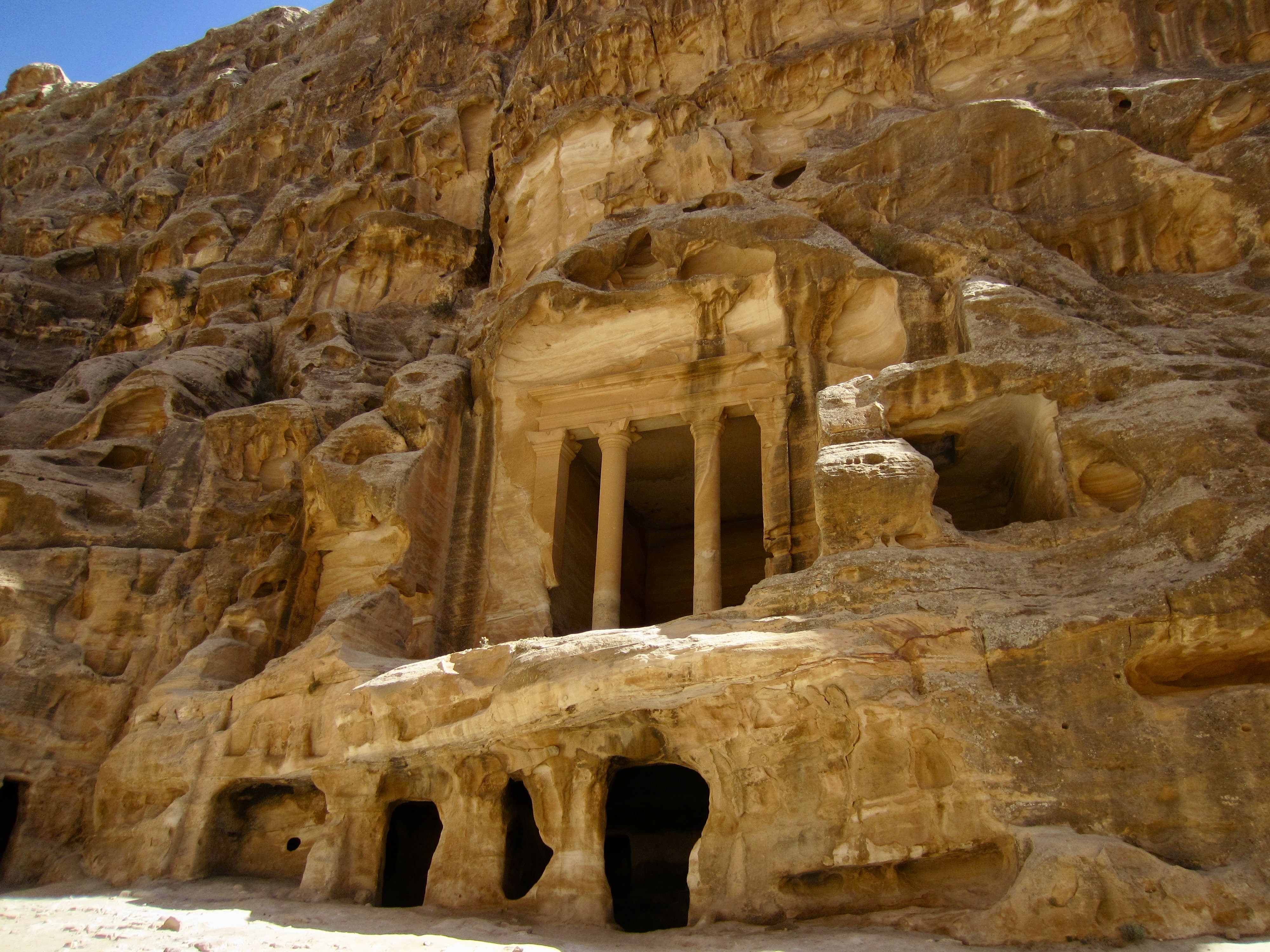
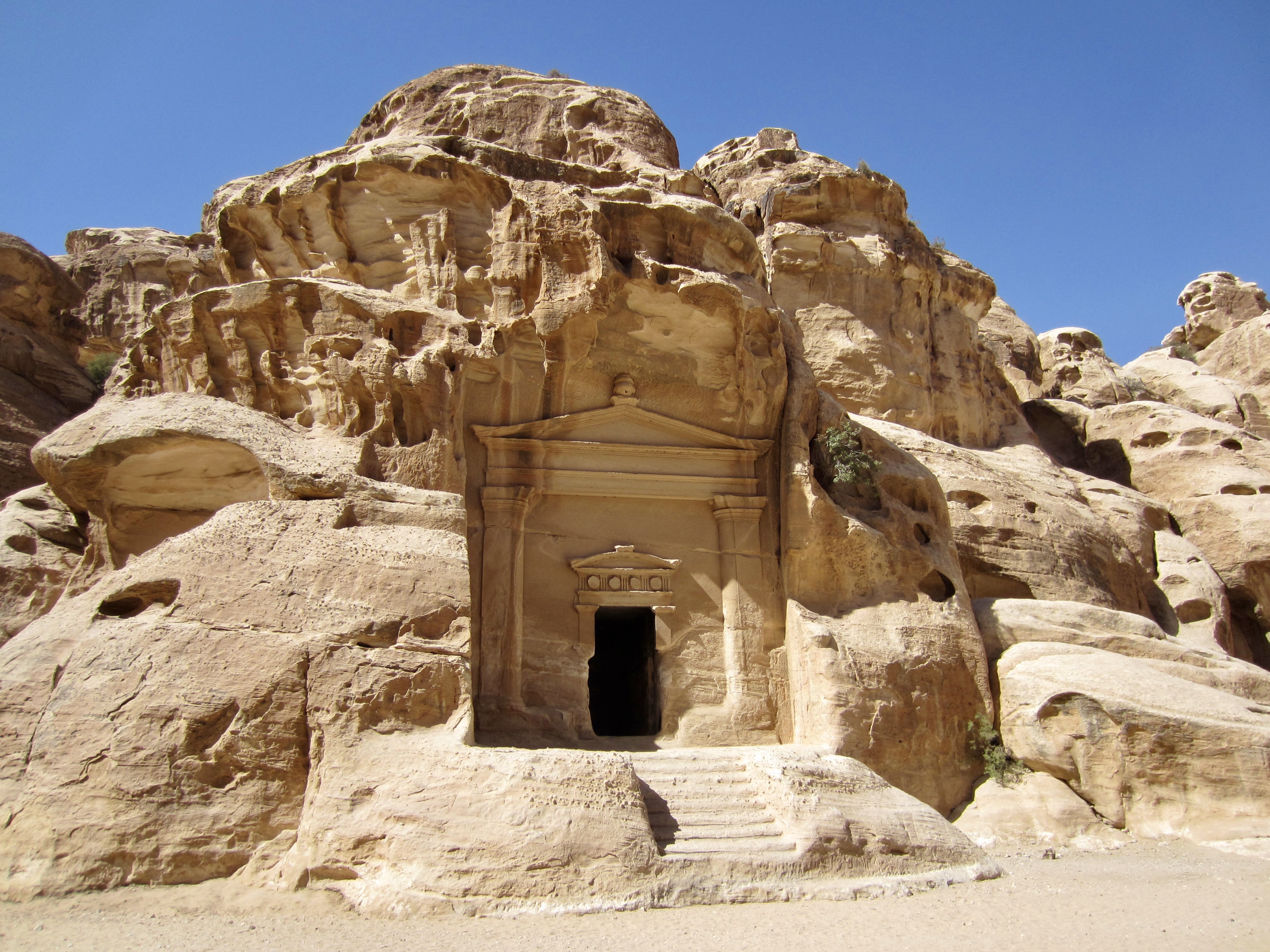
Upon reaching the bottom of the canyon, we ascended a stone stairway to gain a rocky gap filled with souvenir shops and eager merchants. This high gap in the canyon represents the “back door” to Little Petra. From there, we made a dramatic descent into a narrow slot canyon framed by vertical sandstone walls. The name Little Petra was coined by tourists because of its similarity to the main entrance of Petra—albeit on a much smaller scale.
.
The narrow slot canyon gradually widened out and took us past several ancient Nabatean caves that had been carved into the sandstone walls. Although impressive, this was merely a sneak preview of things to come.
.
.
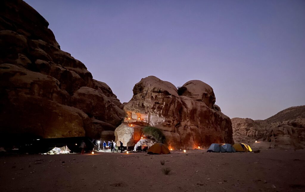
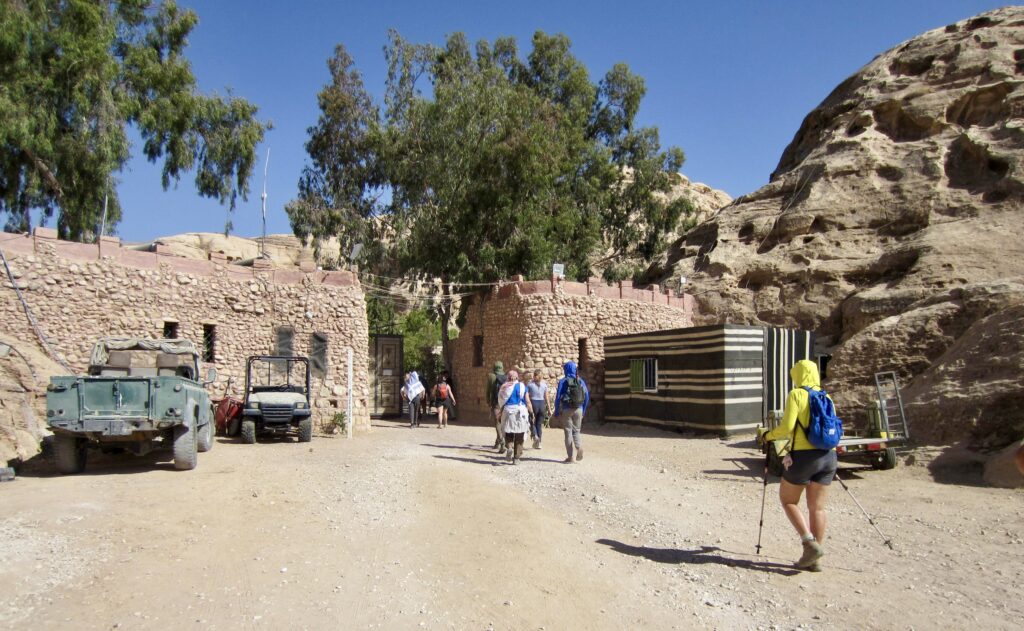
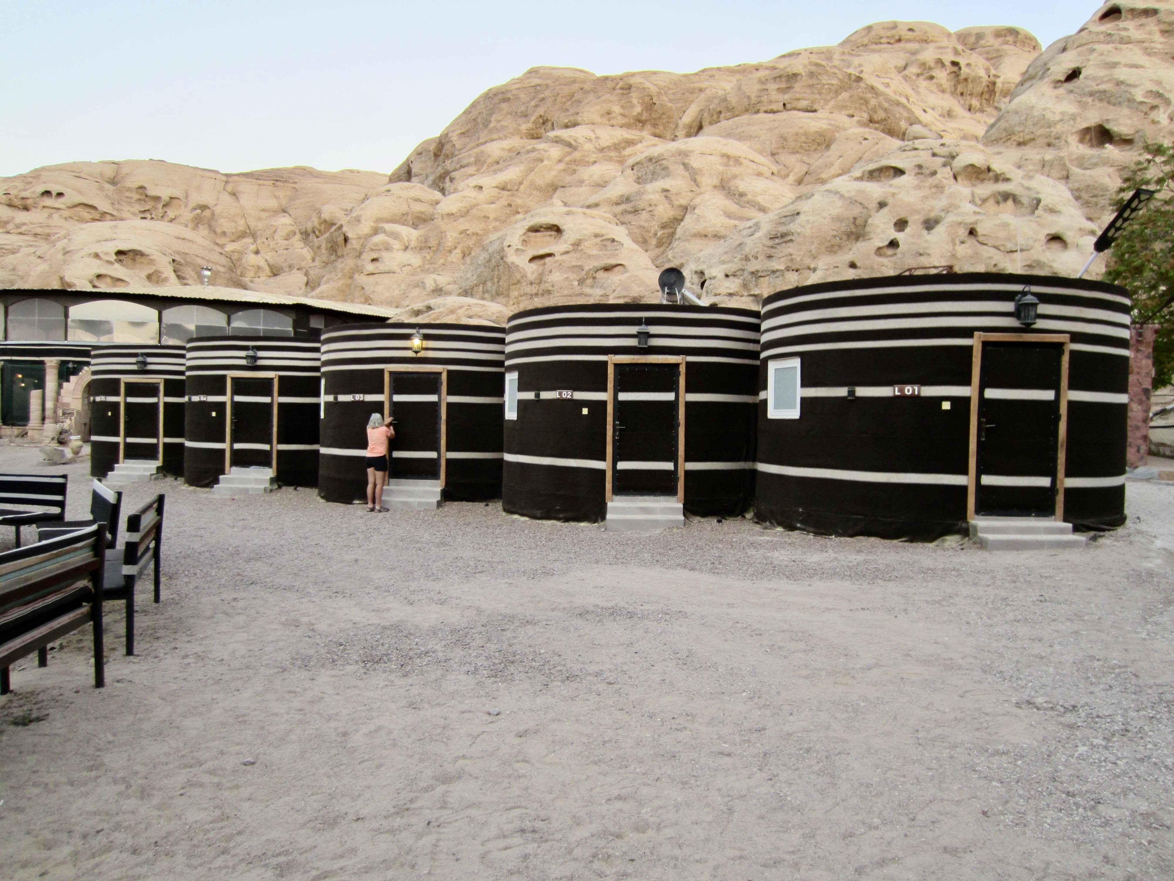
We eventually exited the slot canyon, passed through Little Petra’s entry gate, and walked along a paved road to reach the Little Petra Luxury Bedouin Camp in mid-afternoon (7.1 hours from Camp 1).
.
Because our assigned “basic” tents had no air conditioning, most of us elected to upgrade to a “luxury“ tent. Although quite modest-looking from the outside, these upgraded tents were truly luxurious on the inside—by far the nicest accommodations of our entire Jordan vacation. Our group spent the rest of the afternoon sipping cold drinks and chatting in the large conversation ring. Later in the evening, a delicious dinner was served in the dining hall.
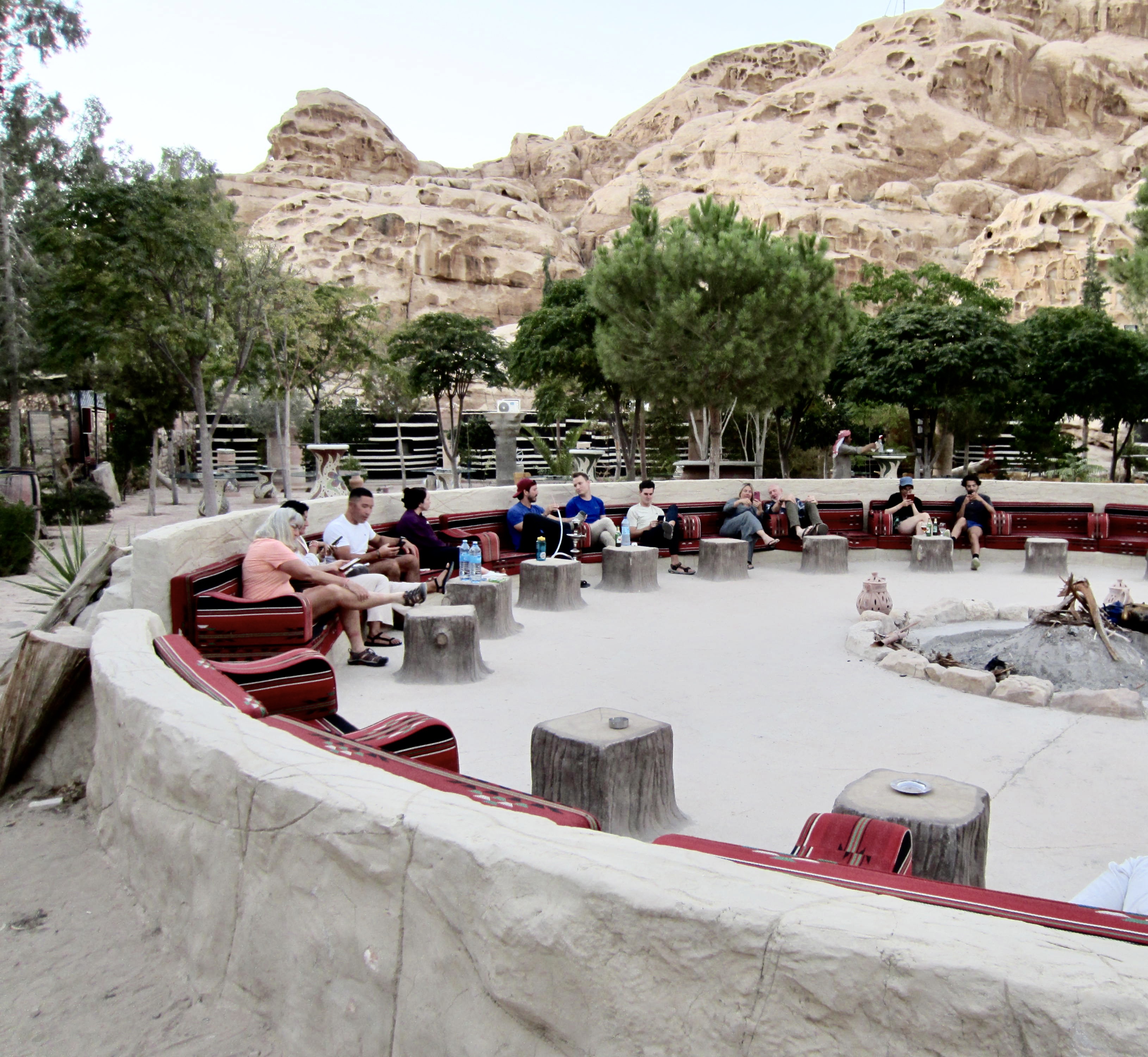
.
Jordan is ruled by free-range cats, and this camp had its share. One particular kitty, whom I dubbed “Little Petra,” dominated our attention and Melissa’s lap.


.
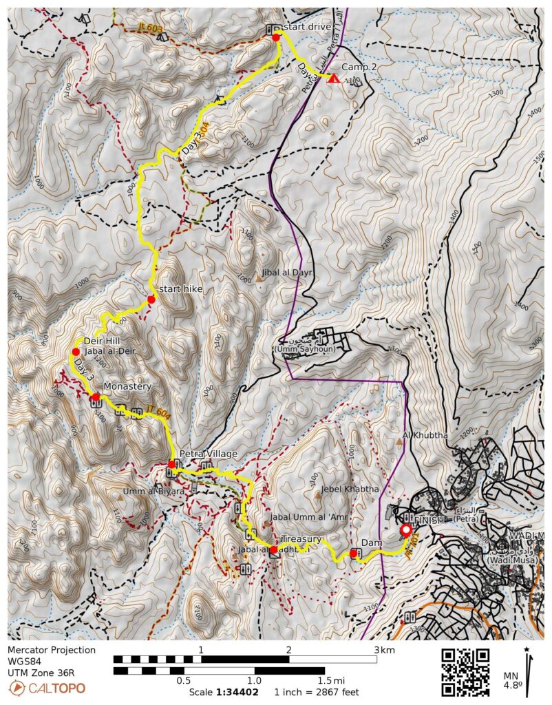
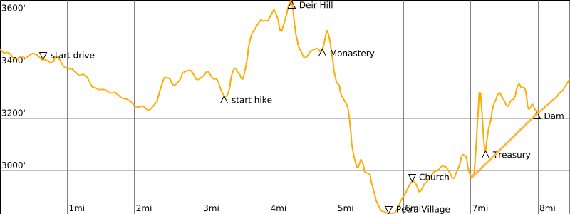
Day 3: Little Petra to Petra to Wadi Musa
Approximate Daily Stats: 6.9 miles / 11.1 kilometers hiked; 1.6 miles / 2.6 kilometers driven; 1350 feet / 410 meters gained; 1350 feet / 410 meters lost
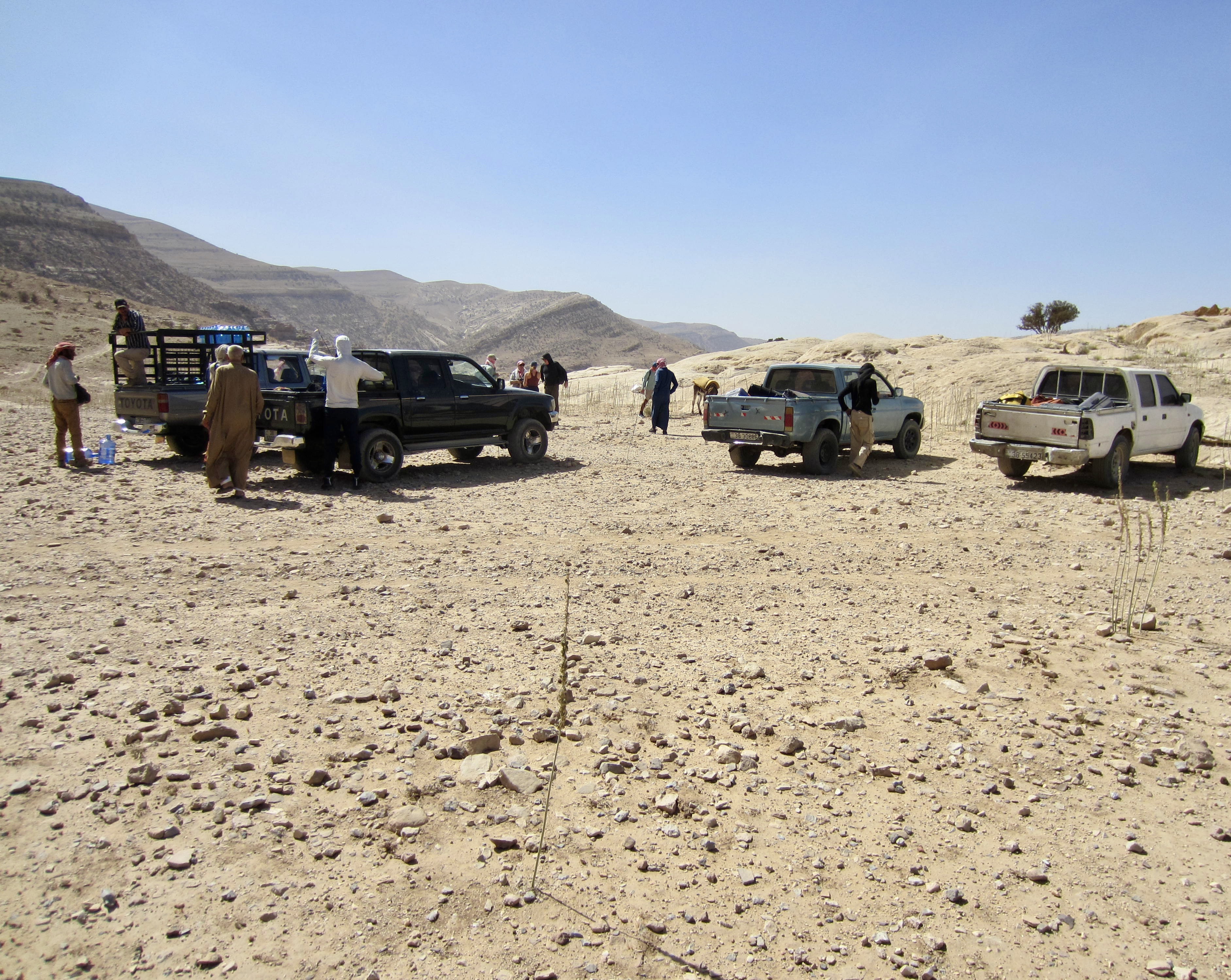
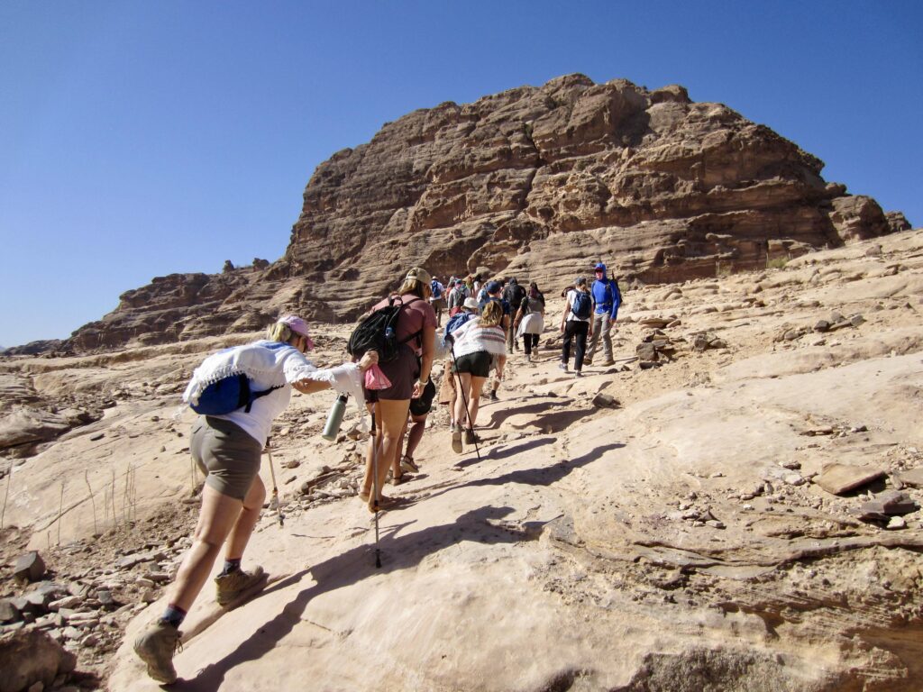
We began our morning with a march back over to the Little Petra entry gate. There, we squeezed onto a 4X4 transit truck that drove us down a rough road for about 1½ miles / 2½ kilometers to a trail junction. We were now back on the Jordan Trail, which led us over the flank of Jebel al-Deir, or Deir Hill, our day’s high point, and down into a large canyon.

.
.
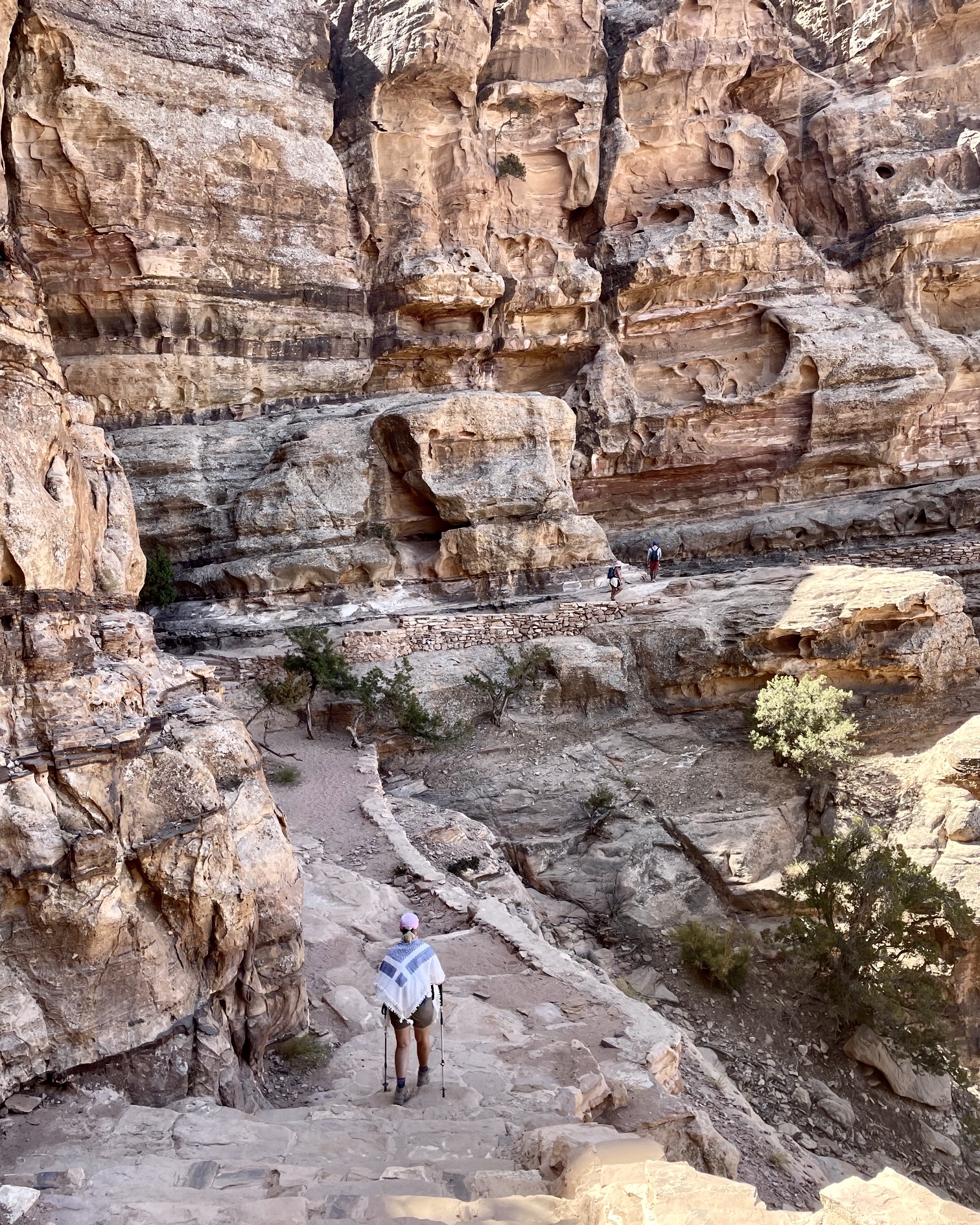
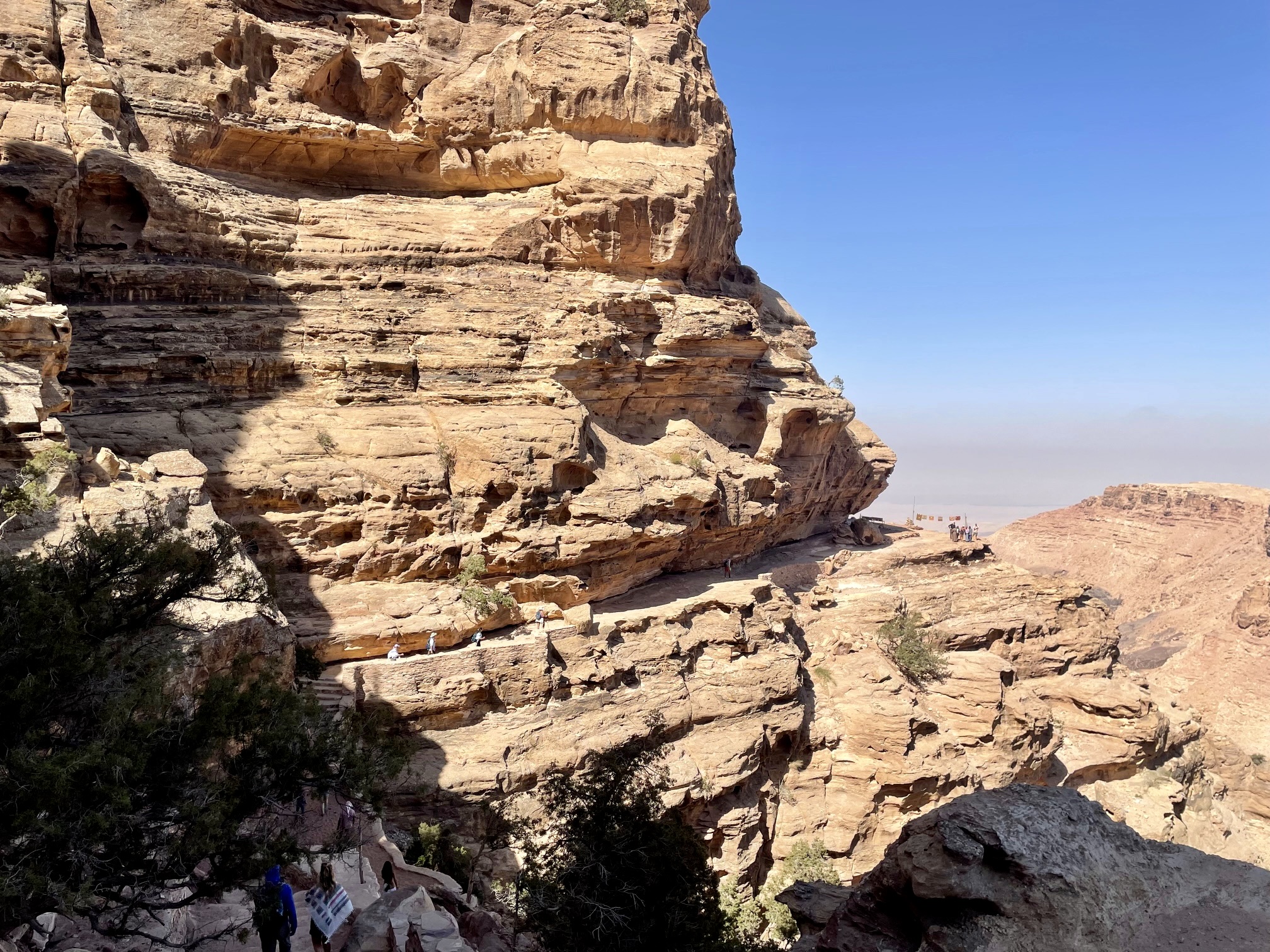
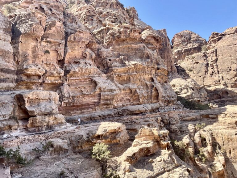
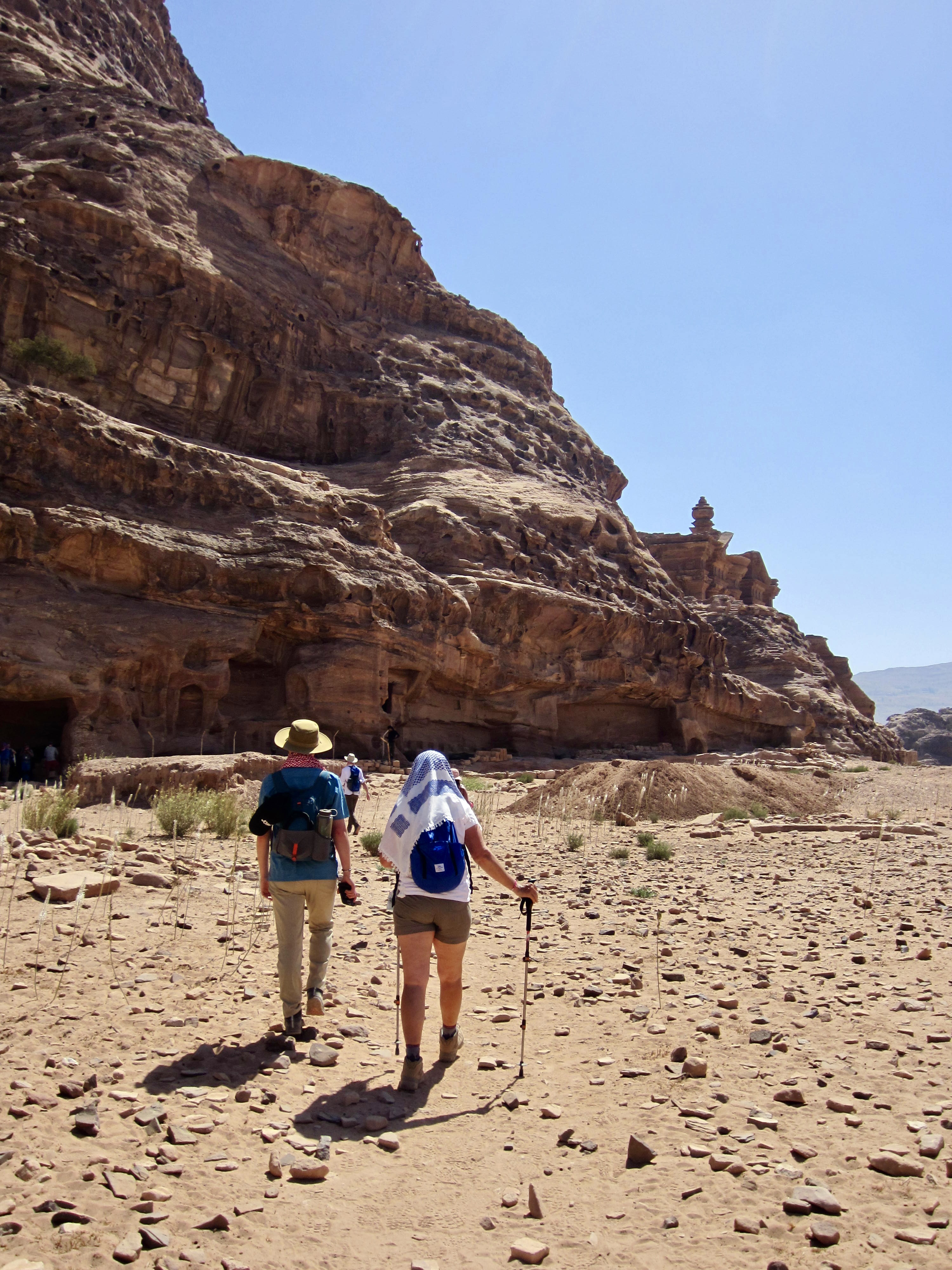
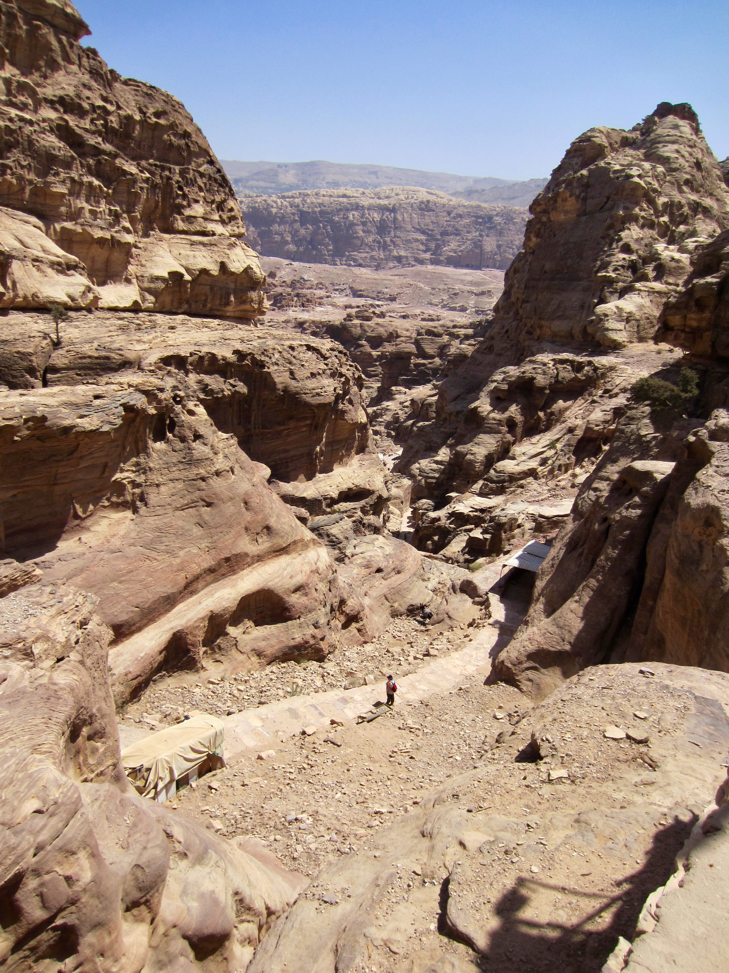
The trail went up and down numerous steps and across a massive tafoni cliff on exposed (but wide) rock ledges above the canyon invert. This was the geologic highlight of our traverse, and our collective anticipation was building!

.

.
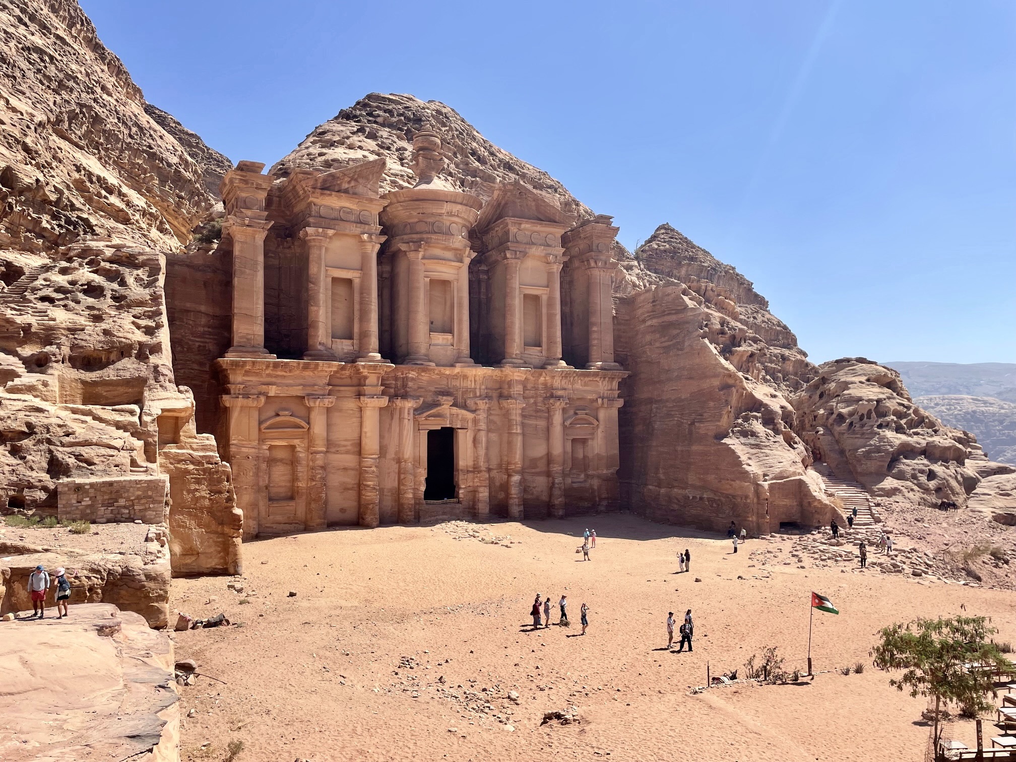
A lengthy stairway brought us up to the first of Petra’s human-made marvels: The Monastery. This outstanding facade, like everything in Petra, was carved and sculpted into the sandstone cliff by the Nabatean peoples approximately 2000 years ago. The size and detail are nothing short of incredible!
.
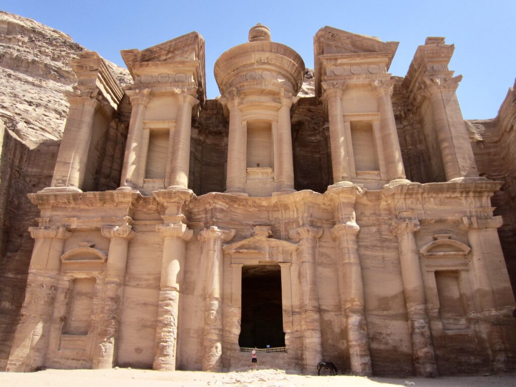
.
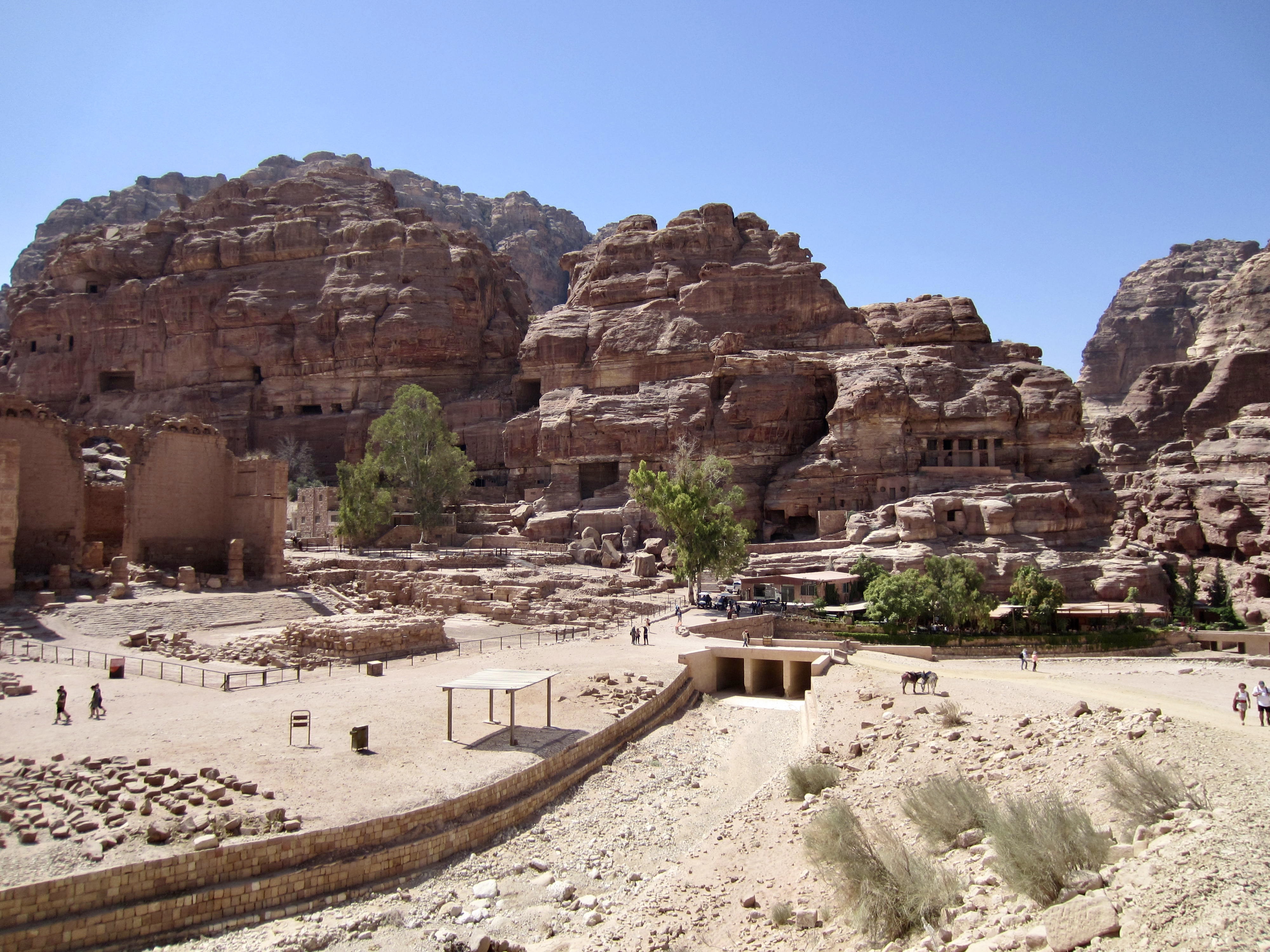
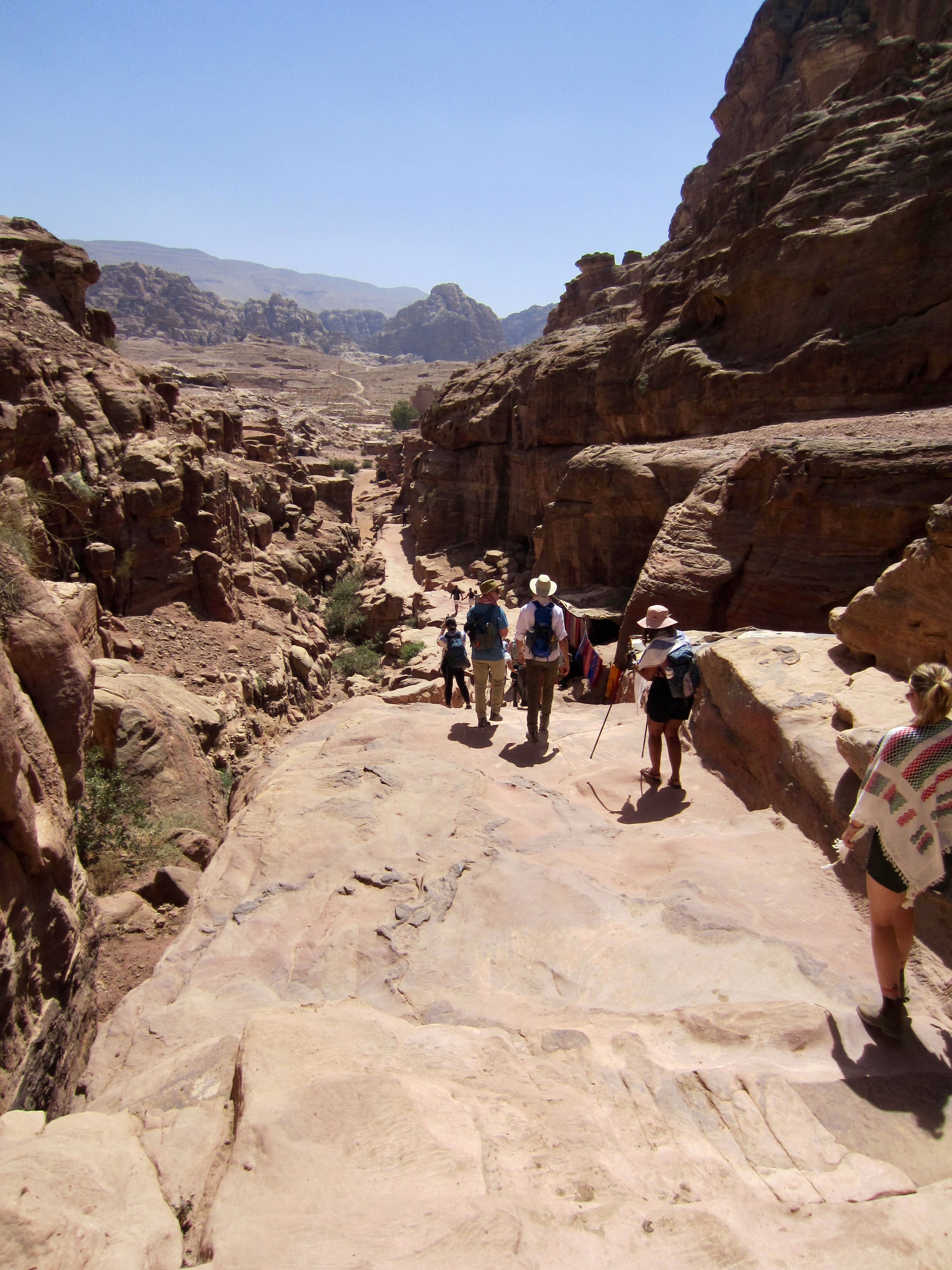
From The Monastery, a very long stairway took us down the narrow canyon until it opened onto a broad expanse bustling with tourists. This is Petra’s central village today, just as it was 2000 years ago. Standing proudly amidst the fray is a huge Nabatean monument known as The Great Temple.
.

.
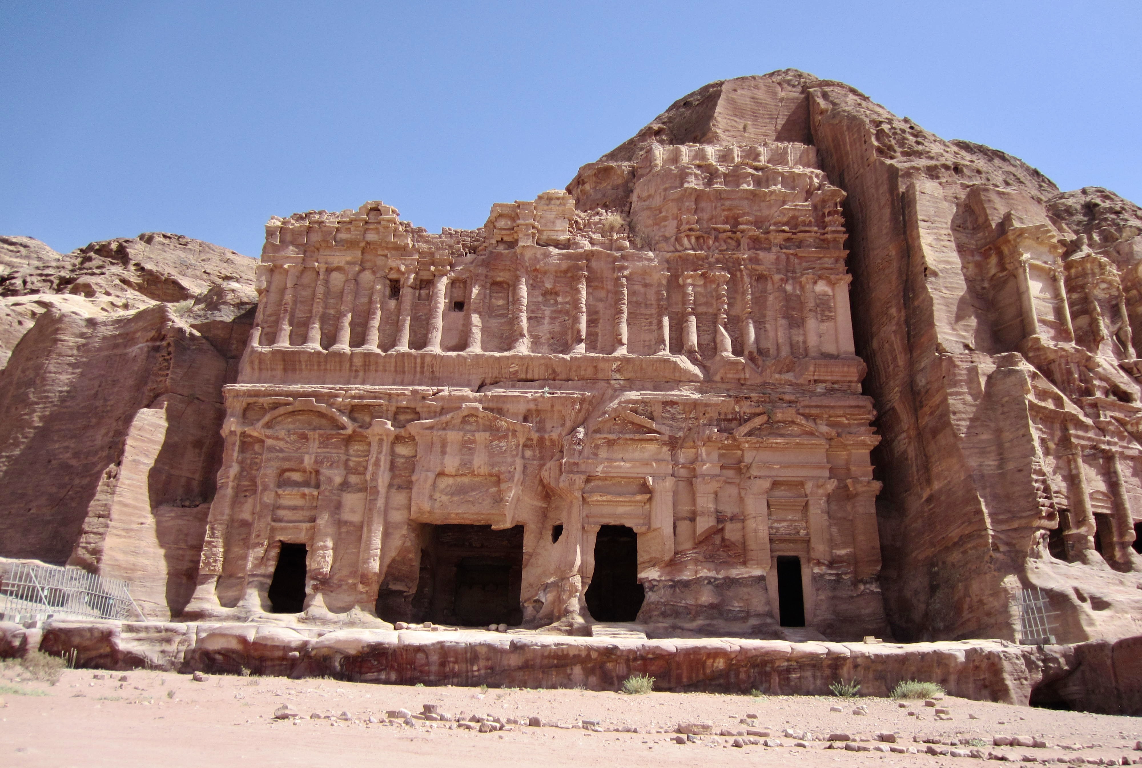
Mahmoud led us uphill to a covered ruin known simply as The Church, then over to a row of great facades that represent The Royal Tombs. We wandered around and into these tombs, marveling at both the workmanship and the natural sandstone textures.
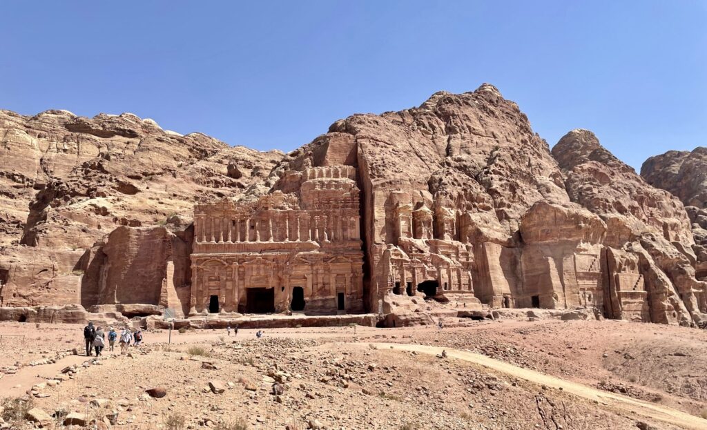
.

.
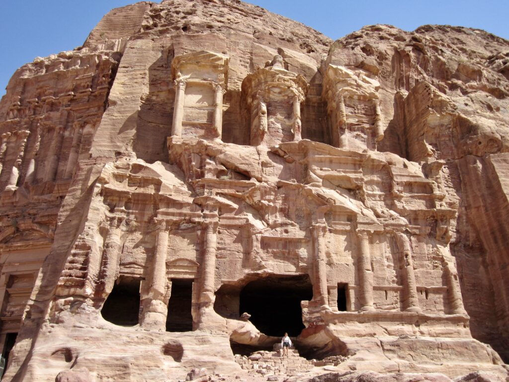
.
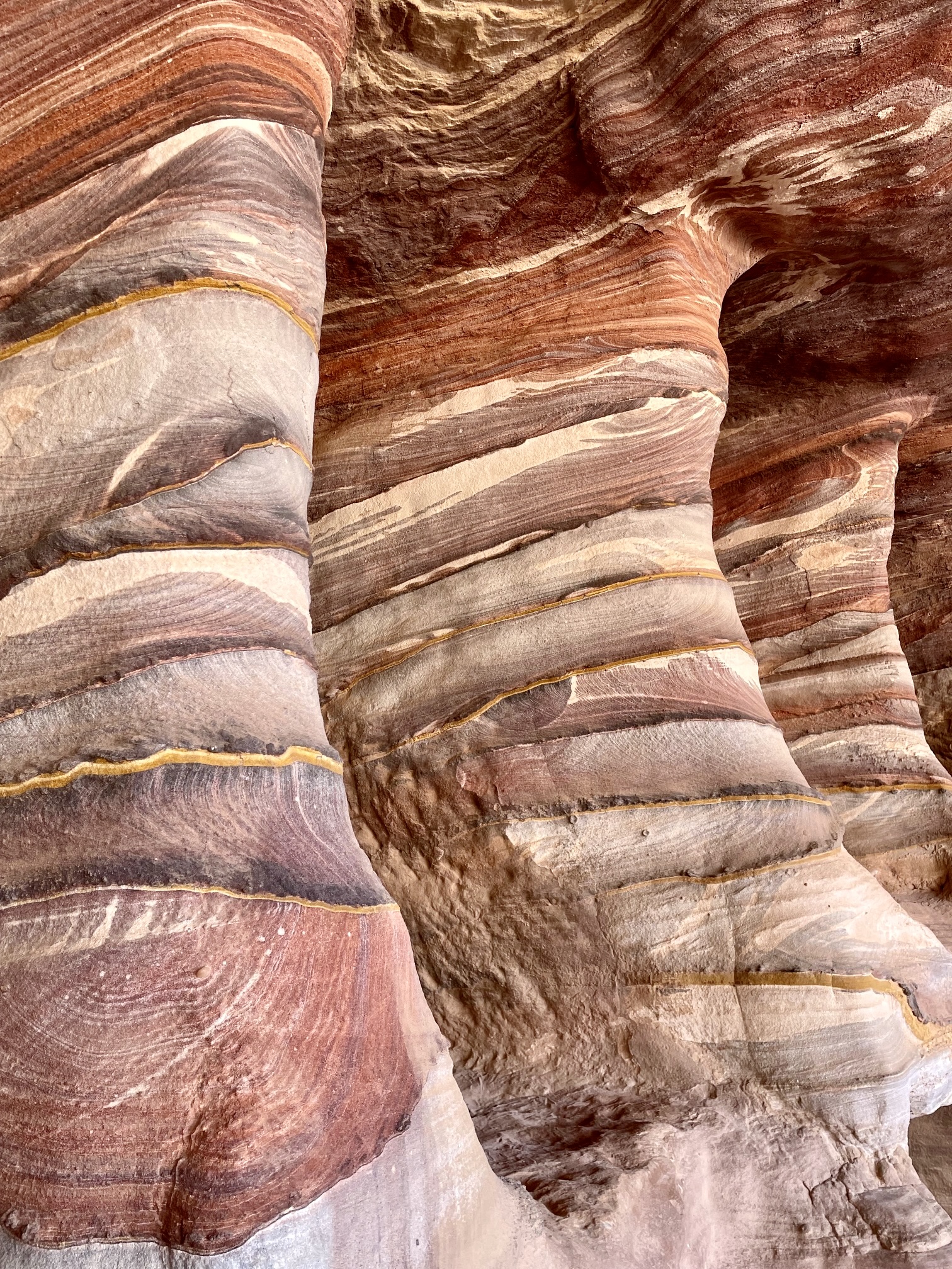
The sandstone interiors of these tombs displays some fantastic natural colors and textures. The tiger-stripes, swirls, and fans seen here—a geologic feature called liesegang banding—are caused by various minerals being carried through the semi-porous rock by groundwater and then precipitating between the grains. In particular, manganese, iron, and sulfur result in distinctive black, red, and yellow bands, respectively.

.
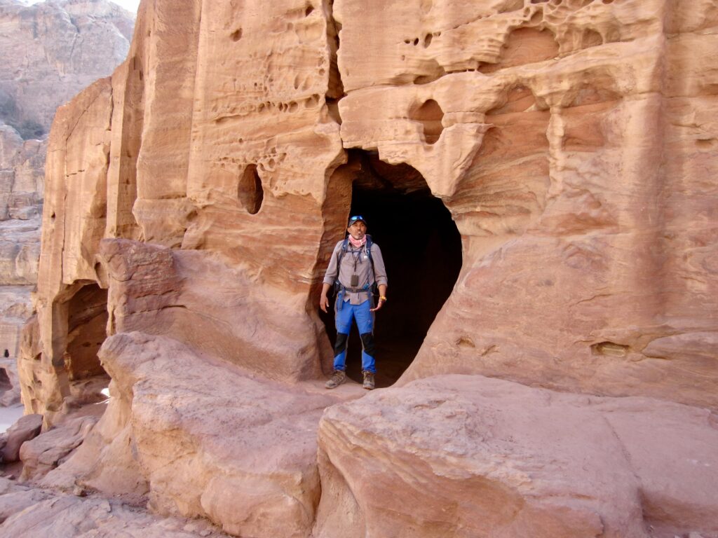
Continuing past The Royal Tombs, we crossed over a high viewpoint overlooking the central village. Shortly beyond, we came to a rather unremarkable cave excavated into a low cliff. It was a surprise to learn that Mahmoud had been born and raised in this very cave!

.
.
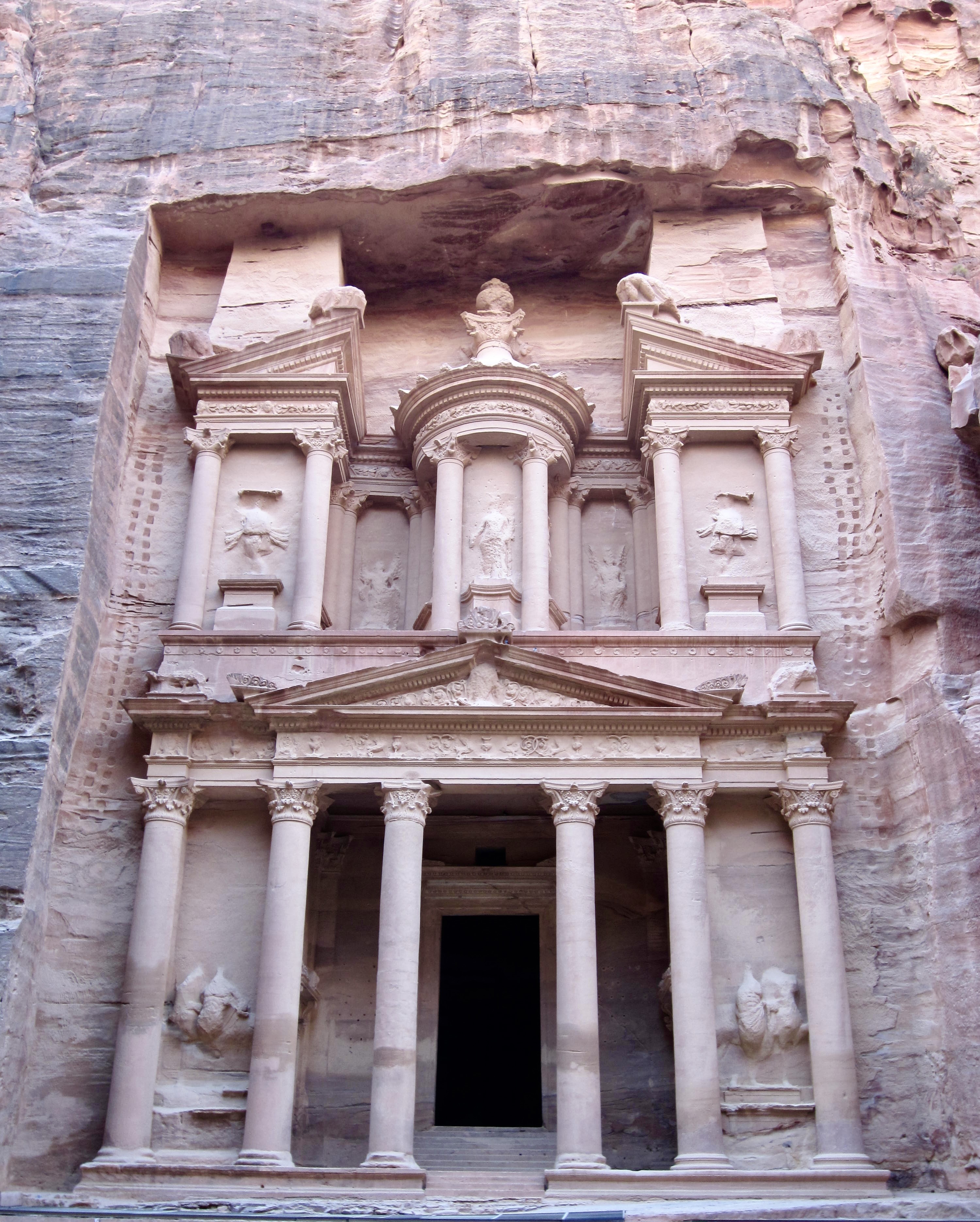
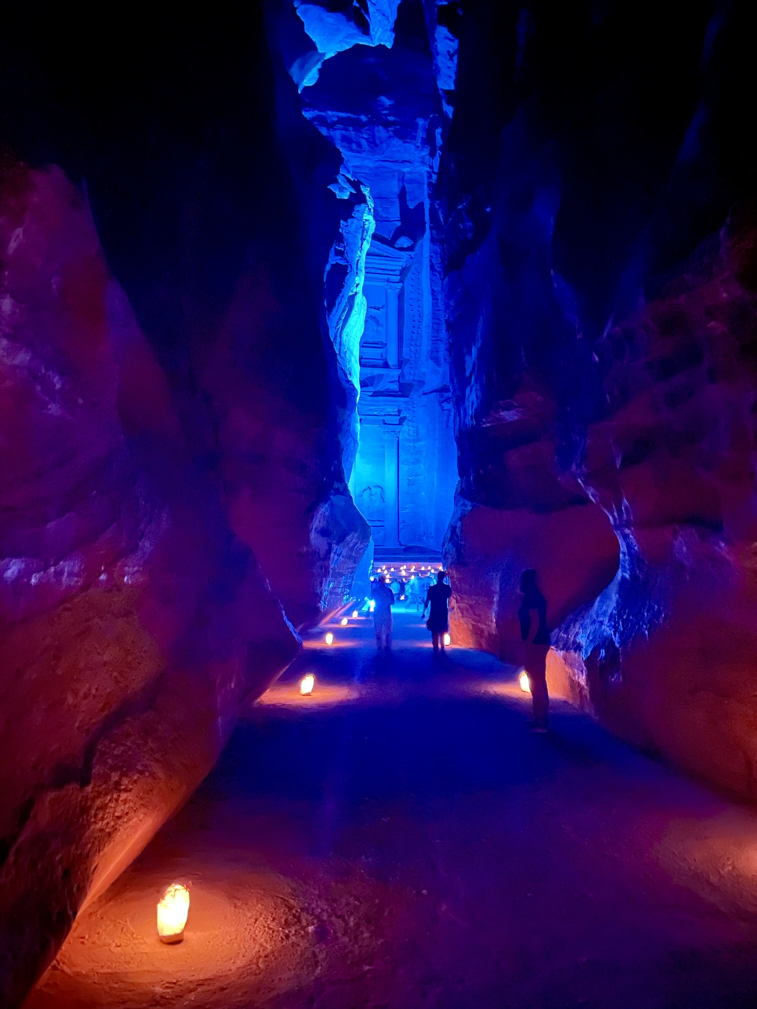
After descending to the main street, we walked past The Theatre, proceeded into a narrow canyon, and finally arrived at the most famous landmark in Petra: The Treasury. This grand facade features superb detailing and draws crowds much like the Mona Lisa does at the Louvre.
.
.
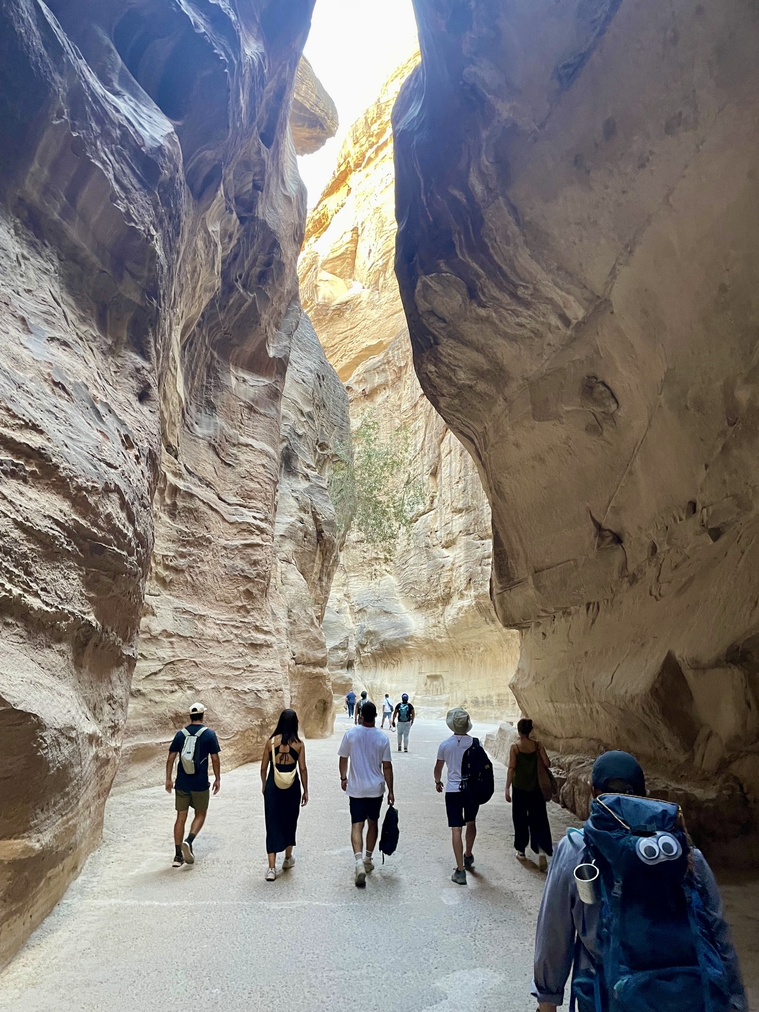
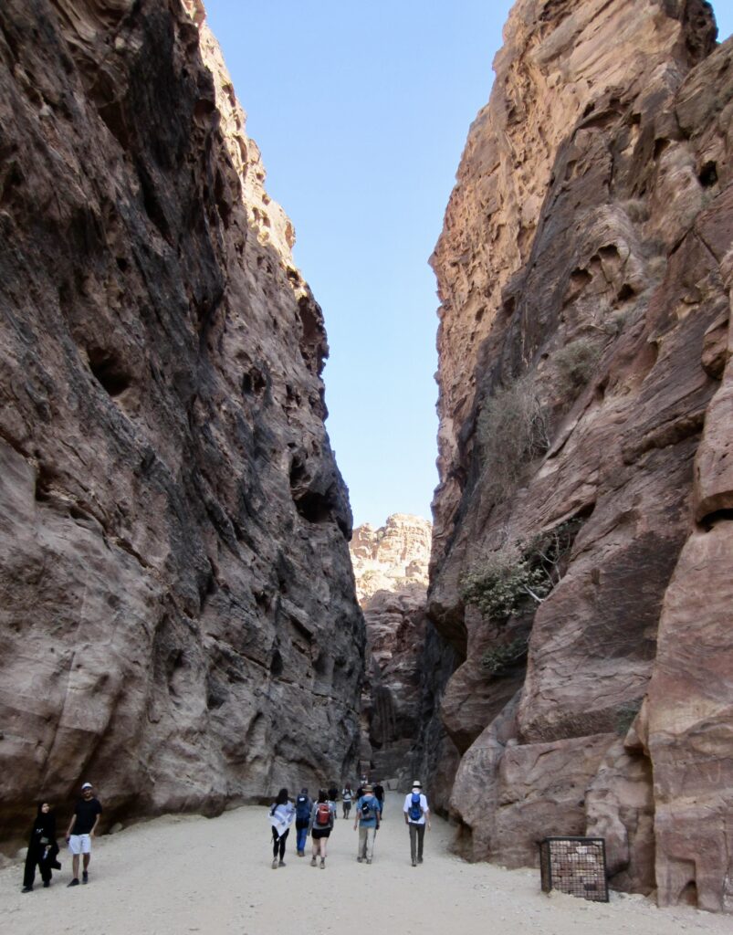
From The Treasury, we made a long walk through an amazing slot canyon known as The Siq. This narrow, twisting passageway, with vertical walls soaring more than 400 feet / 100 meters high, served as Petra’s original entrance and still remains its main entrance.

.
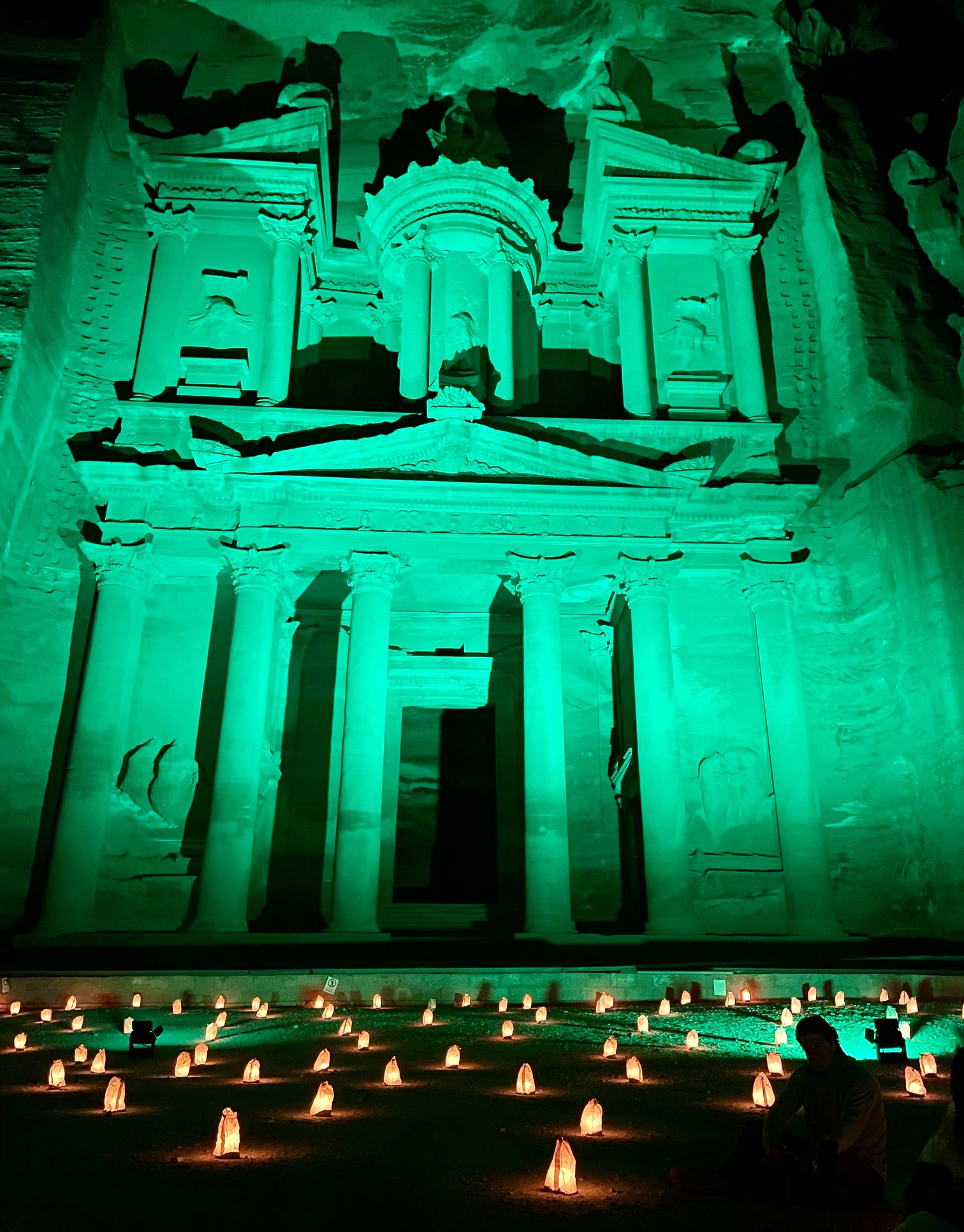
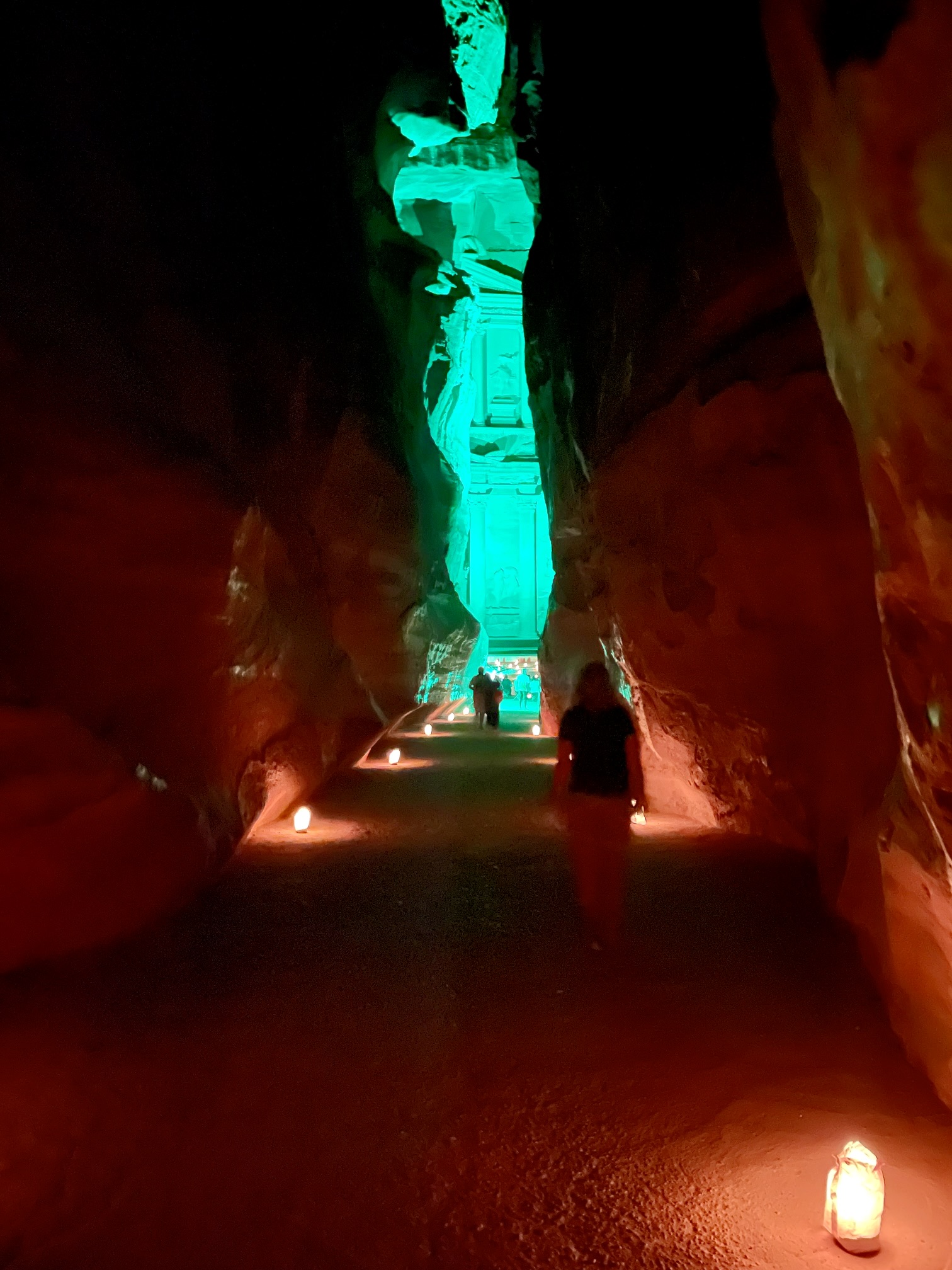
The Siq abruptly opened onto a gravel road that took us out to the entry gate and visitors center in the town of Wadi Musa (9.0 hours from Camp 2). Many of our group returned to The Siq after dark to witness an excellent video presentation projected upon the exterior of The Treasury.
.
.
This officially ended our three-day traverse on the Jordan Trail. It was a fantastic experience that left us all in a state of amazement. But our Jordan adventure vacation was not over yet; Brooke, James, and Mahmoud had more thrills waiting for us!
Route Maps & Profiles
…
…
…
…
…
…
…
Photo Gallery
Click to enlarge…