Trip Date: May 31, 2025
Updated: December 2025
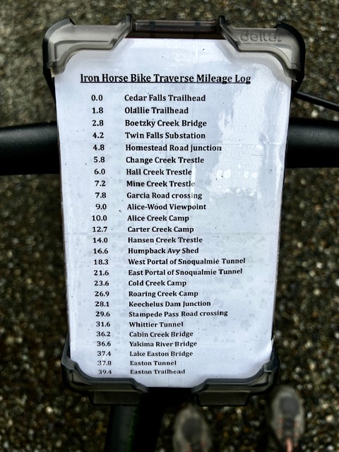
Iron Horse Bike Traverse: Cedar Falls Trailhead to Easton Trailhead
Change Creek Trestle
Hall Creek Trestle
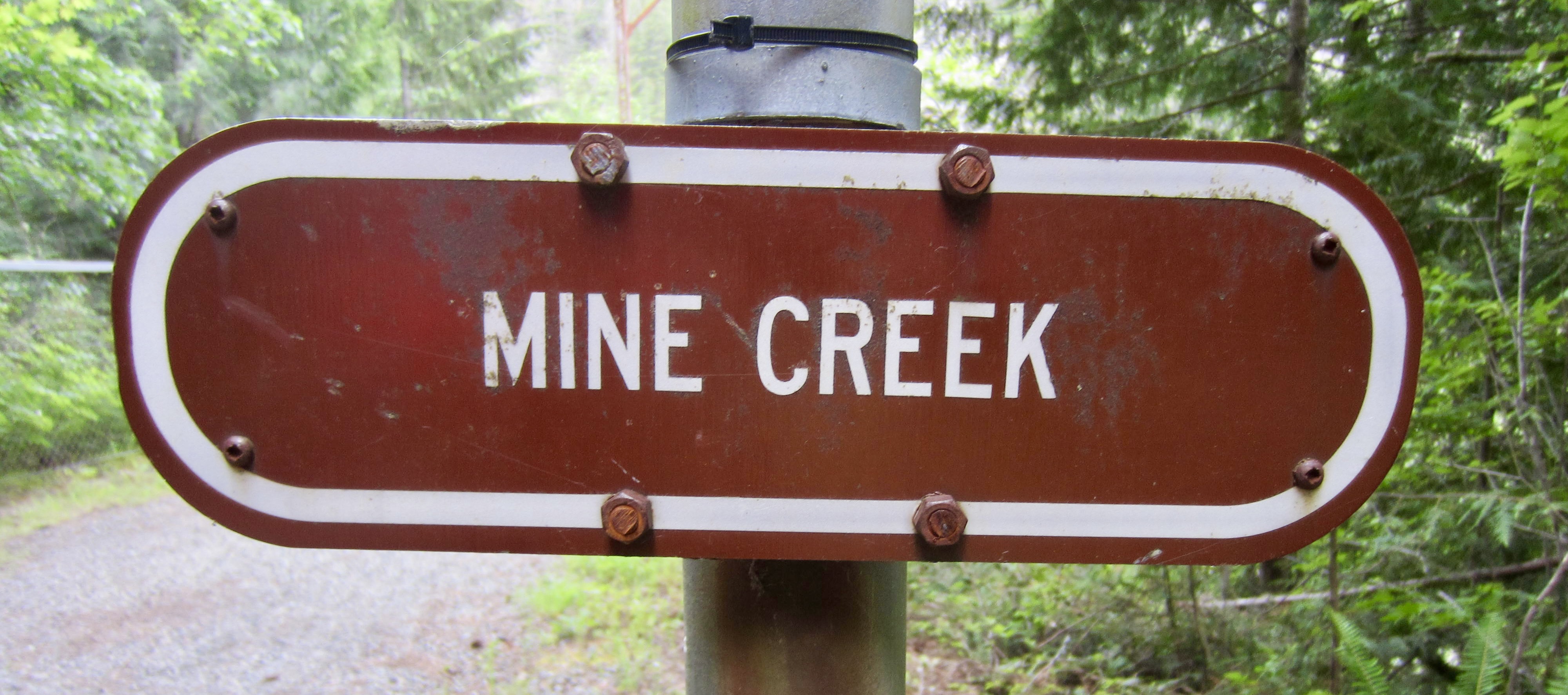
Mine Creek Trestle
Hansen Creek Trestle
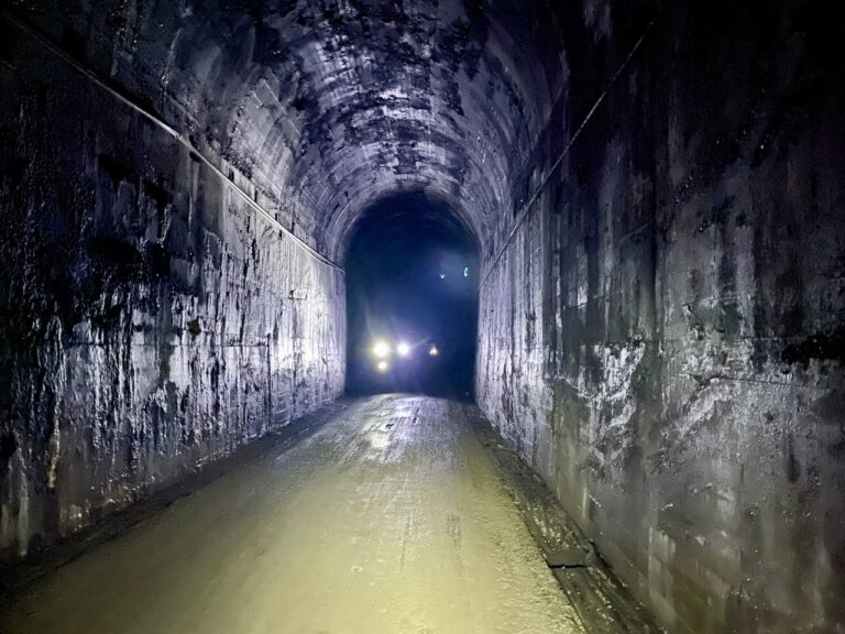
Snoqualmie Tunnel
Keechelus Lake
Whittier Tunnel
Lake Easton
Easton Tunnel
Trip Report Summary
Region: Central Washington Cascades
Sub-Regions: Iron Horse Mountains & Kittitas Mountains
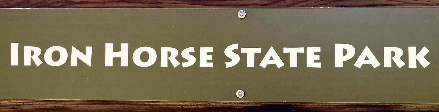
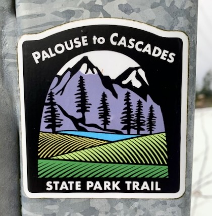
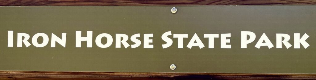
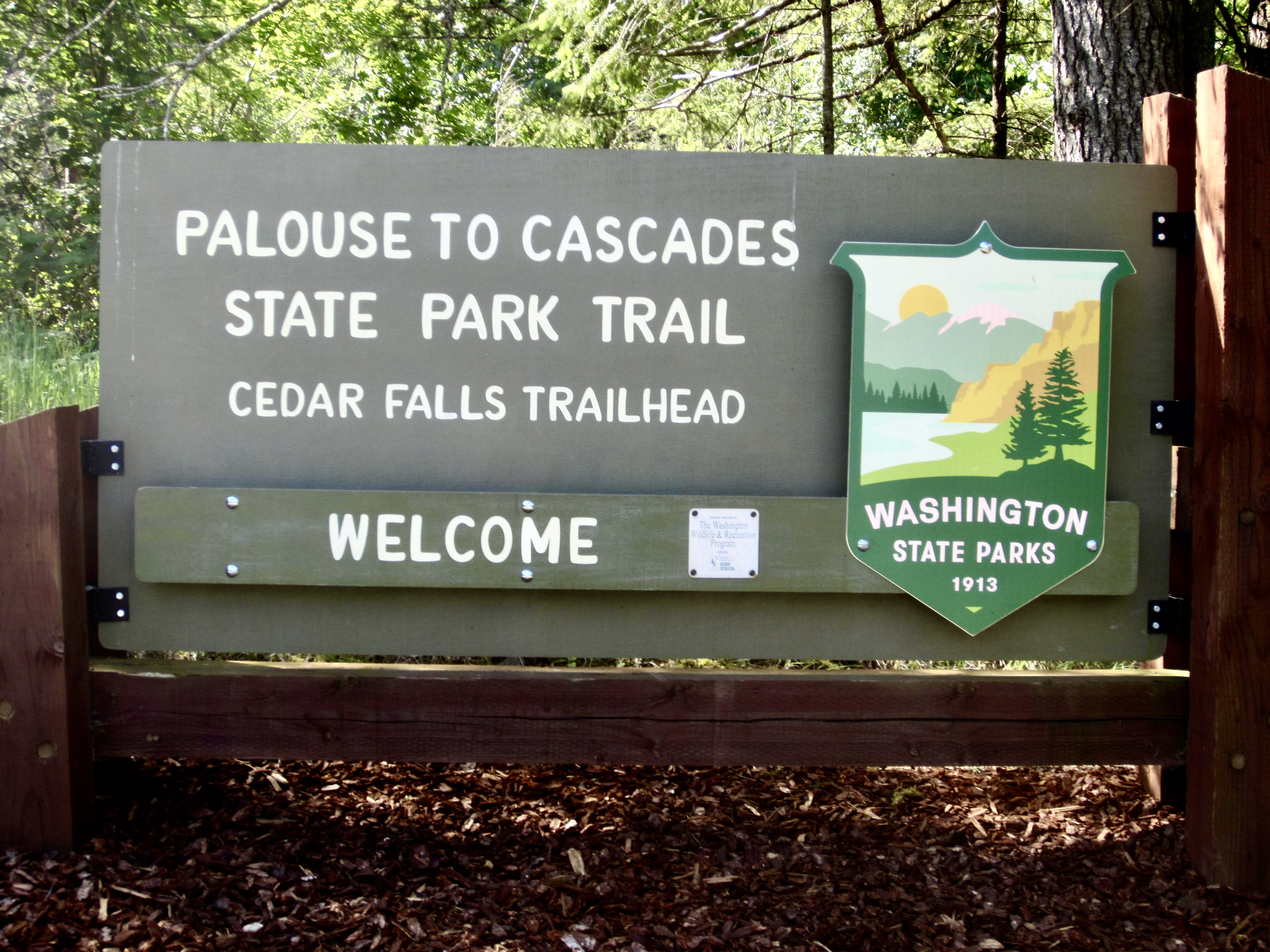
Area: Palouse-to-Cascades State Park
Starting Point: Cedar Falls Trailhead near Rattlesnake Lake (Elev. 960 feet)
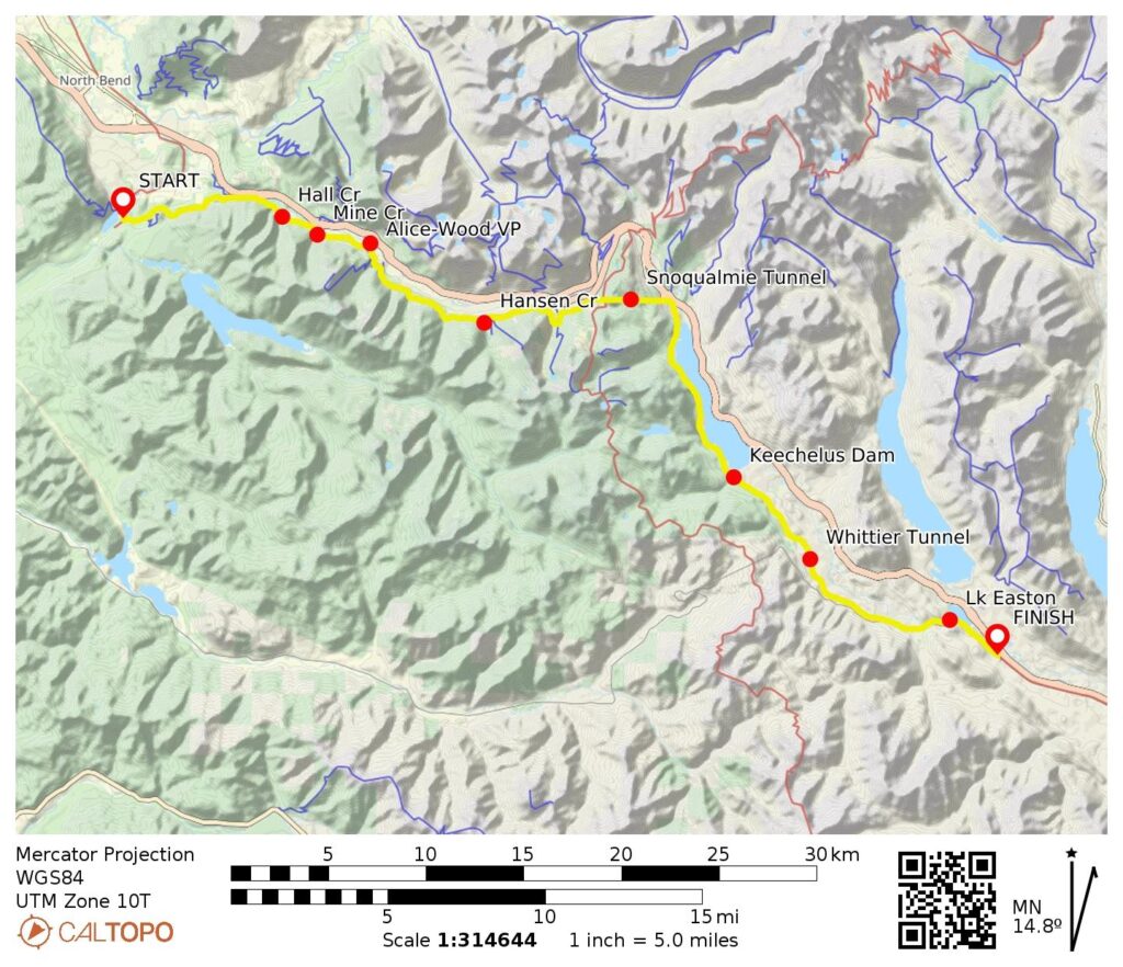
Way Points: Boxley Creek Bridge & Boetzke Creek Bridge & Twin Falls Substation & Change Creek Trestle & Hall Creek Trestle & Mine Creek Trestle & Garcia Road crossing & Alice-Wood Viewpoint & Alice Creek Camp & Carter Creek Camp & Hansen Creek Trestle & West Portal of Snoqualmie Tunnel & East Portal of Snoqualmie Tunnel & Hyak Trailhead & Cold Creek Camp & Roaring Creek Bridge & Roaring Creek Camp & Meadow Creek Bridge & Keechelus Dam Junction & Mosquito Creek Bridge & Stampede Pass Road crossing & Whittier Tunnel & Cabin Creek Bridge & Yakima River Bridge & Lake Easton Bridge & Easton Tunnel & Cabin Creek Road crossing & Easton Trailhead (bike ride)
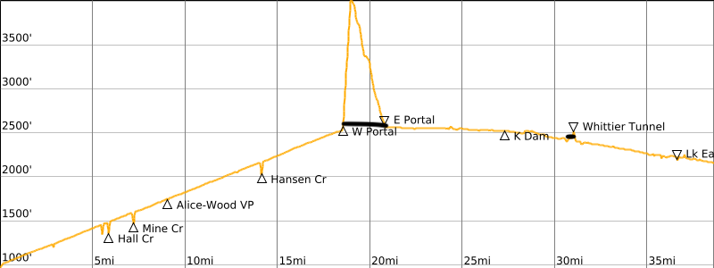
High Point: Snoqualmie Tunnel (Elev. 2560 feet)
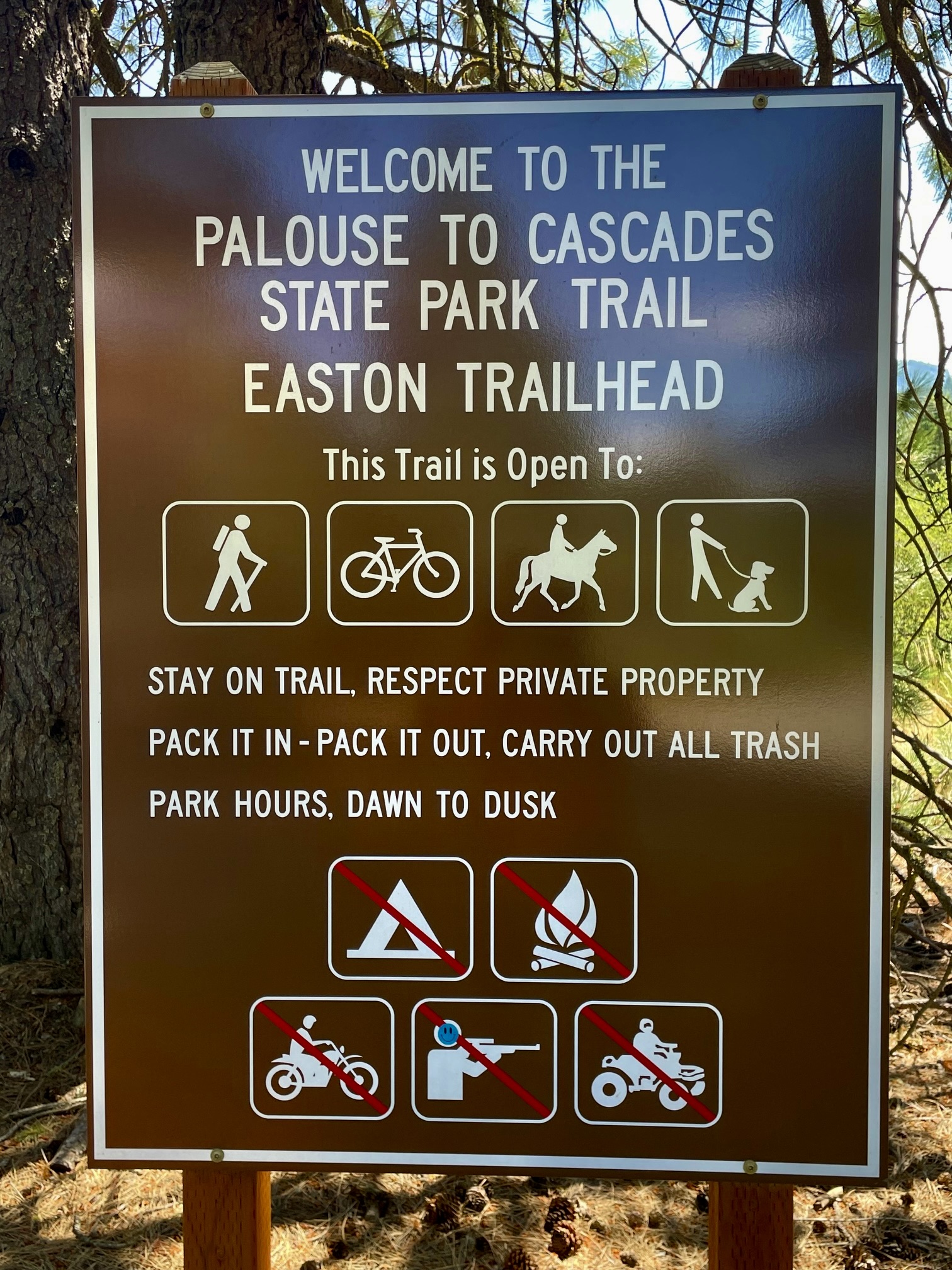
Ending Point: Easton Trailhead near the Town of Easton (Elev. 2160 feet)
Approximate Stats: 38.5 miles traveled; 1600 feet gained; 400 feet lost; 6.0 hours elapsed.
Trip Overview
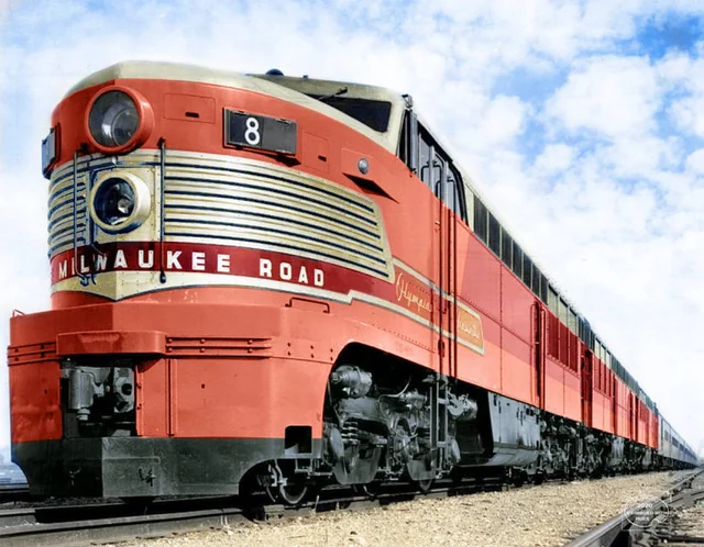
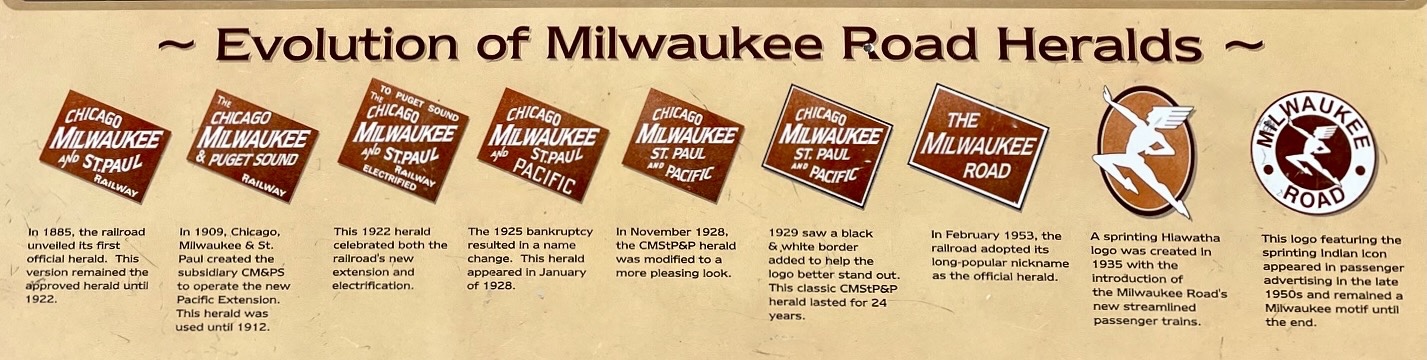
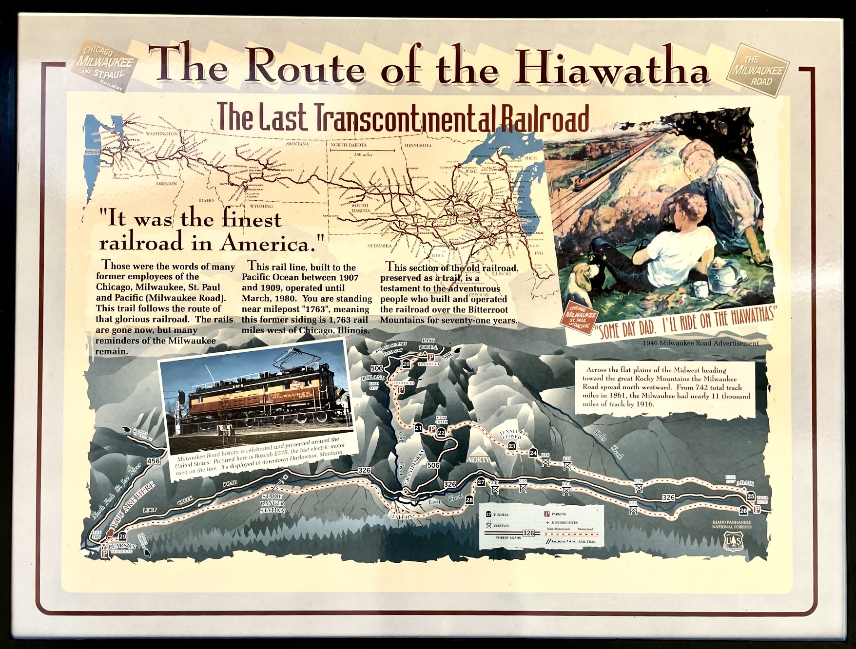
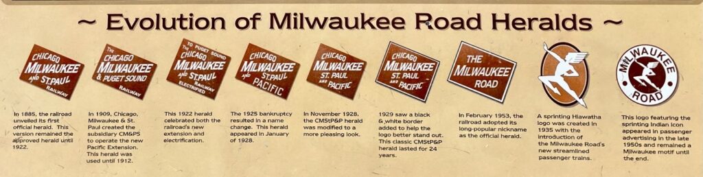
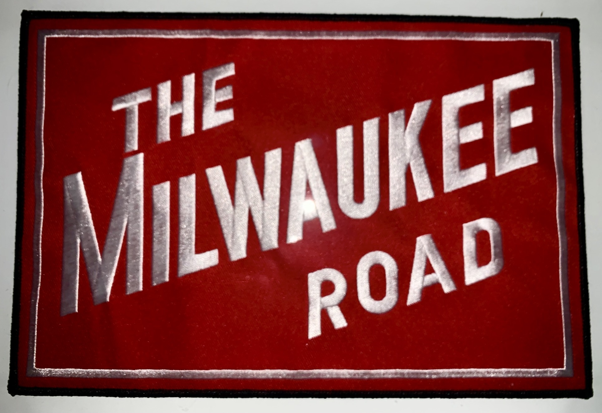
The Palouse-to-Cascades Trail (P2C Trail) is a 251-mile-long, multi-use trail that extends eastward from the Washington/Idaho border to Rattlesnake Lake near North Bend. It entirely follows the route of the old Chicago, Milwaukee, St. Paul and Pacific Railroad—fondly known as The Milwaukee Road—which operated freight and passenger trains between Chicago and Puget Sound throughout much of the 20th Century. In the 1980s, various segments of the railbed were successively converted to a recreational trail and eventually designated as a Washington State Park. These two geographic features were originally called the John Wayne Pioneer Trail and Iron Horse State Park, respectively, but both were given a Palouse-to-Cascades moniker in 2018.
.
From a modern recreational standpoint, the premier portion of the current Milwaukee Road rail-trail is a 15-mile segment that straddles the Idaho/Montana border. This short segment, advertised as The Route of the Hiawatha, serves up seven high trestles and ten narrow tunnels through the Bitterroot Mountains. In recent years, it has become one of the most popular gravel rides in the entire country.

.
I believe that the next-best portion of the Milwaukee Road is a 38-mile segment through the Cascade Mountains, extending between Easton and North Bend. This stretch of the P2C Trail delivers four high trestles, six or more girder/truss bridges, and three narrow tunnels, including the 2.3-mile-long Snoqualmie Tunnel—by far the longest tunnel along the entire railroad alignment. I like to call this popular gravel ride the Iron Horse Bike Traverse, because it pays homage to the original name of the state park. For anyone who likes gravel biking, railroad history, or civil engineering, the traverse rolls out like a highlight reel!
.
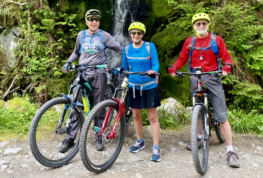
Ever since doing the Hiawatha Bike Traverse in 2024, I became stoked to do a west-to-east Iron Horse Bike Traverse from North Bend to Easton. When I mentioned it to friends Lisa and Kevin, they didn’t hesitate to sign on, and then Eileen kindly offered to run the car shuttle for us (she was temporarily sidelined by a case of bursitis). After waiting for the Snoqualmie Tunnel to open in late spring—it is typically closed from November 1 through May 1 every year—we just needed a day of nice weather in order to launch. Ultimately, the weather didn’t play out well for us, but everything else did.
.
Full Trip Report
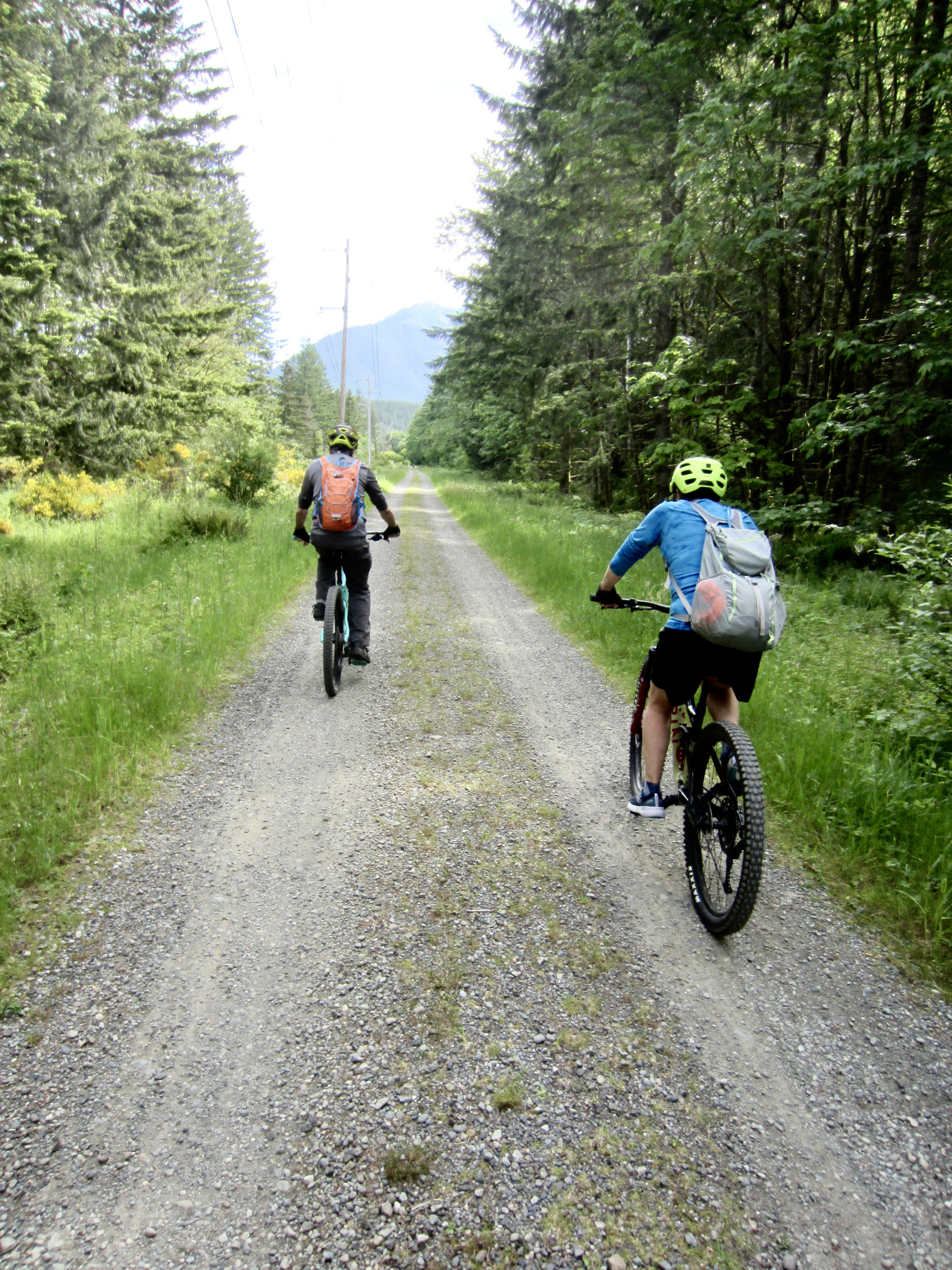
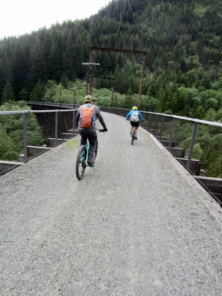
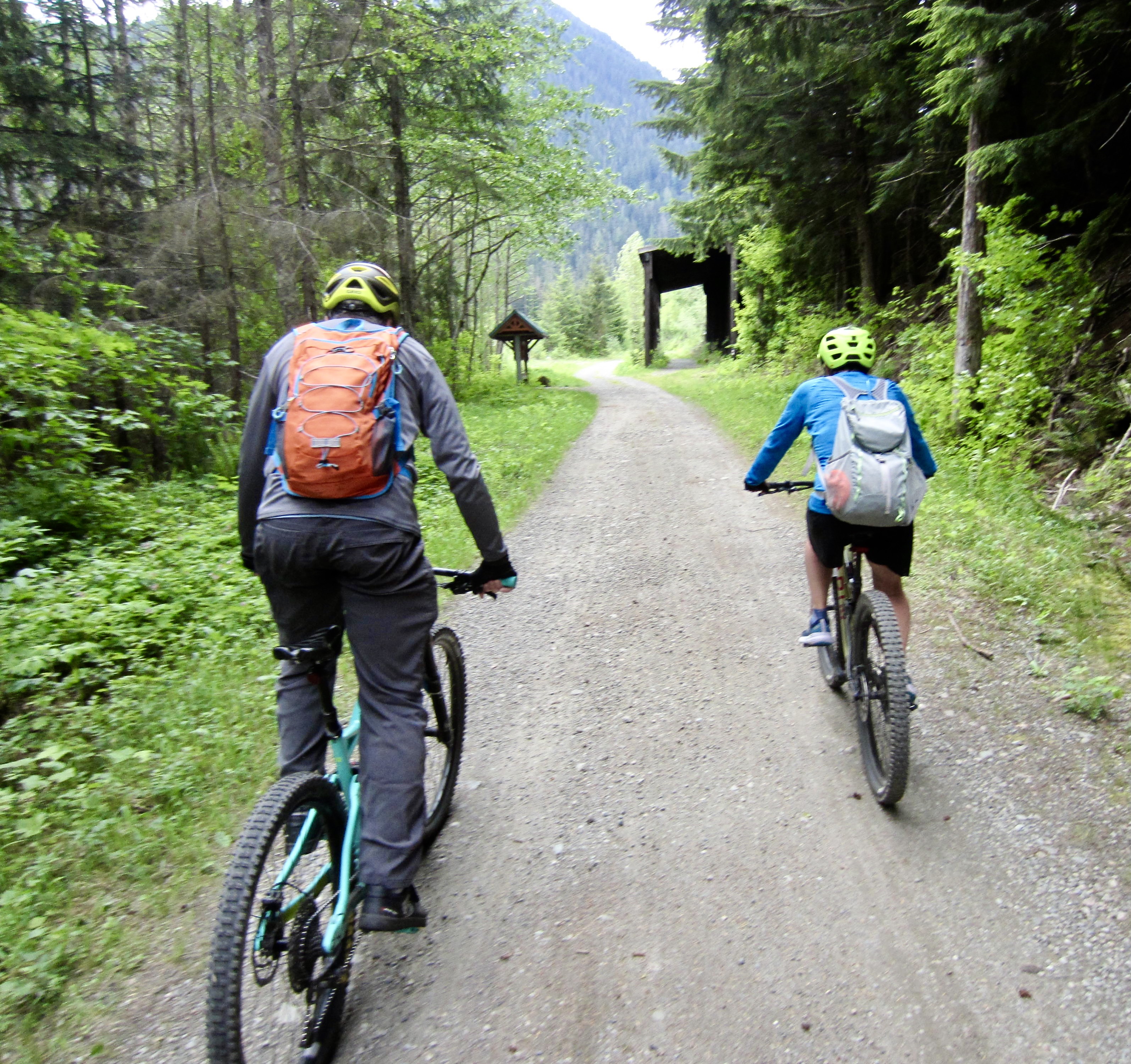
Lisa, Kevin, and I headed out from the Cedar Falls Trailhead near Rattlesnake Lake on a cool, partly sunny, Saturday morning. None of us own a true gravel bike, so we all rode full-suspension mountain bikes. Although not as fast and efficient as a gravel bike, they offered a little more comfort for the Iron Horse Bike Traverse. Besides, we had no reason to rush through it.
.
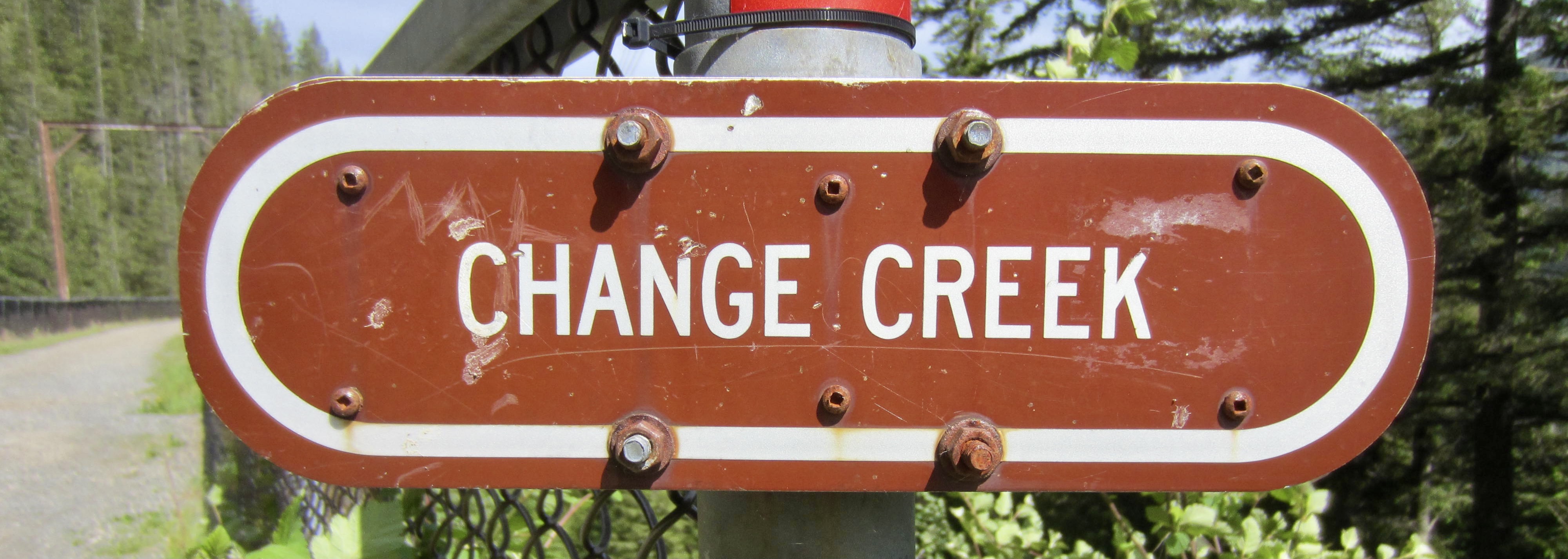
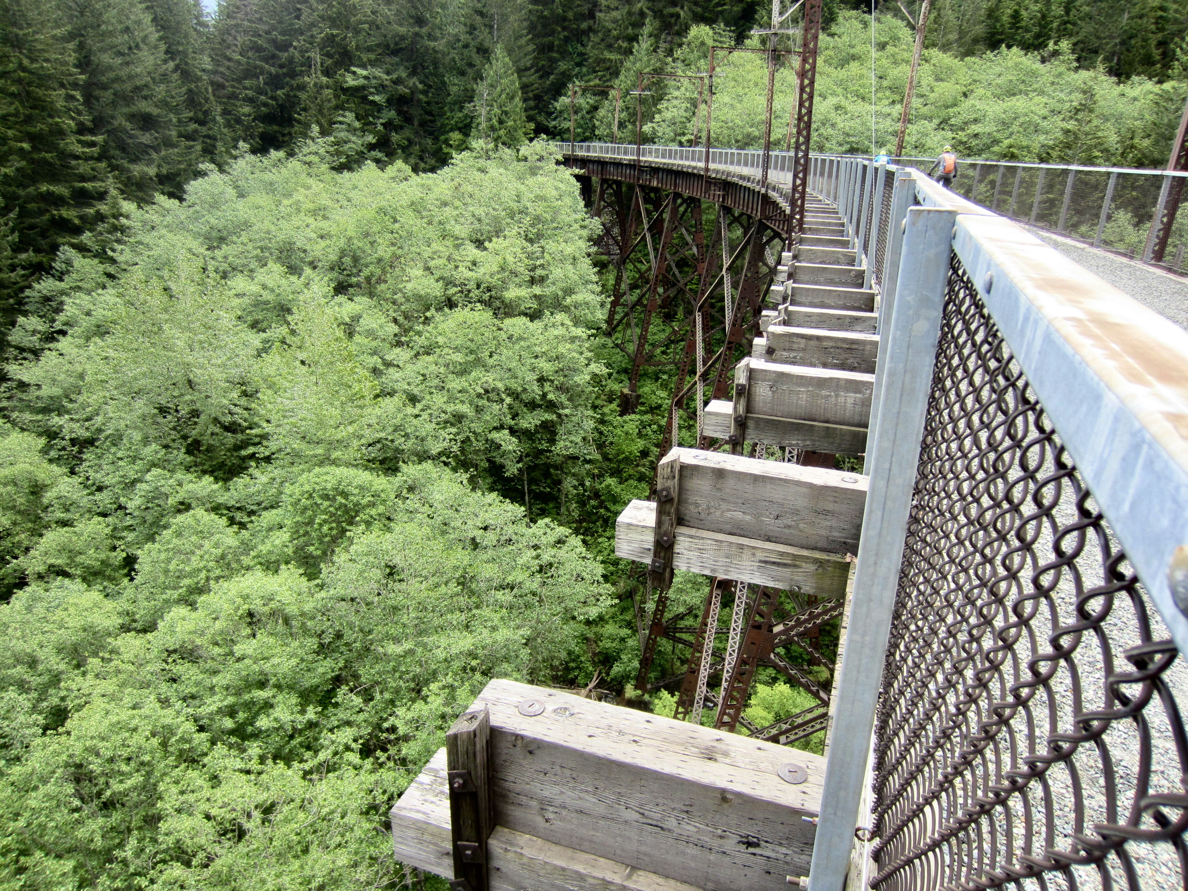
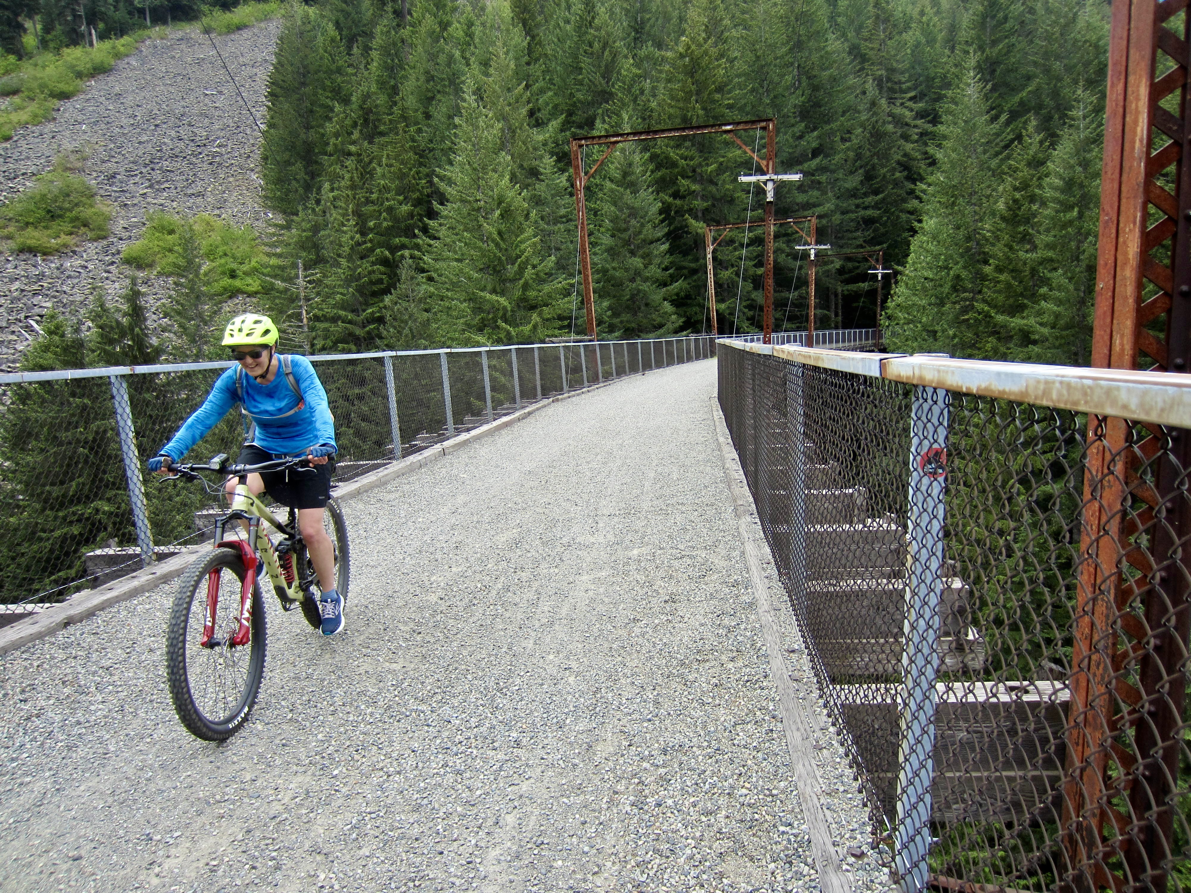
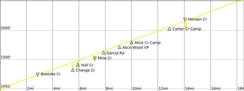
The P2C Trail begins by contouring around Mt. Washington, which anchors the western end of the Iron Horse Mountains. After 6 miles of easy pedaling, we crossed the Change Creek Trestle. This high, century-old steel-and-wood bridge structure was the first in a series of major historical features along our traverse route.

.
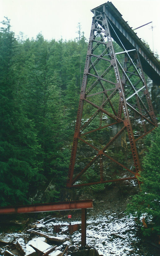
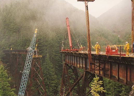
Minutes later, we crossed the Hall Creek Trestle. The original trestle here was severely damaged in 1988 when a wintertime mudslide wiped out the middle portion, leaving a 170-foot gap. In an impressive display of high-level crane work, Boss Construction bridged the gap with a long steel girder in January 1999. This particular trestle will always have a special place in my heart; I was fortunate to have played a small part in the engineering effort for the repair, and I observed the girder installation with my daughter on her fifth birthday.
.
.
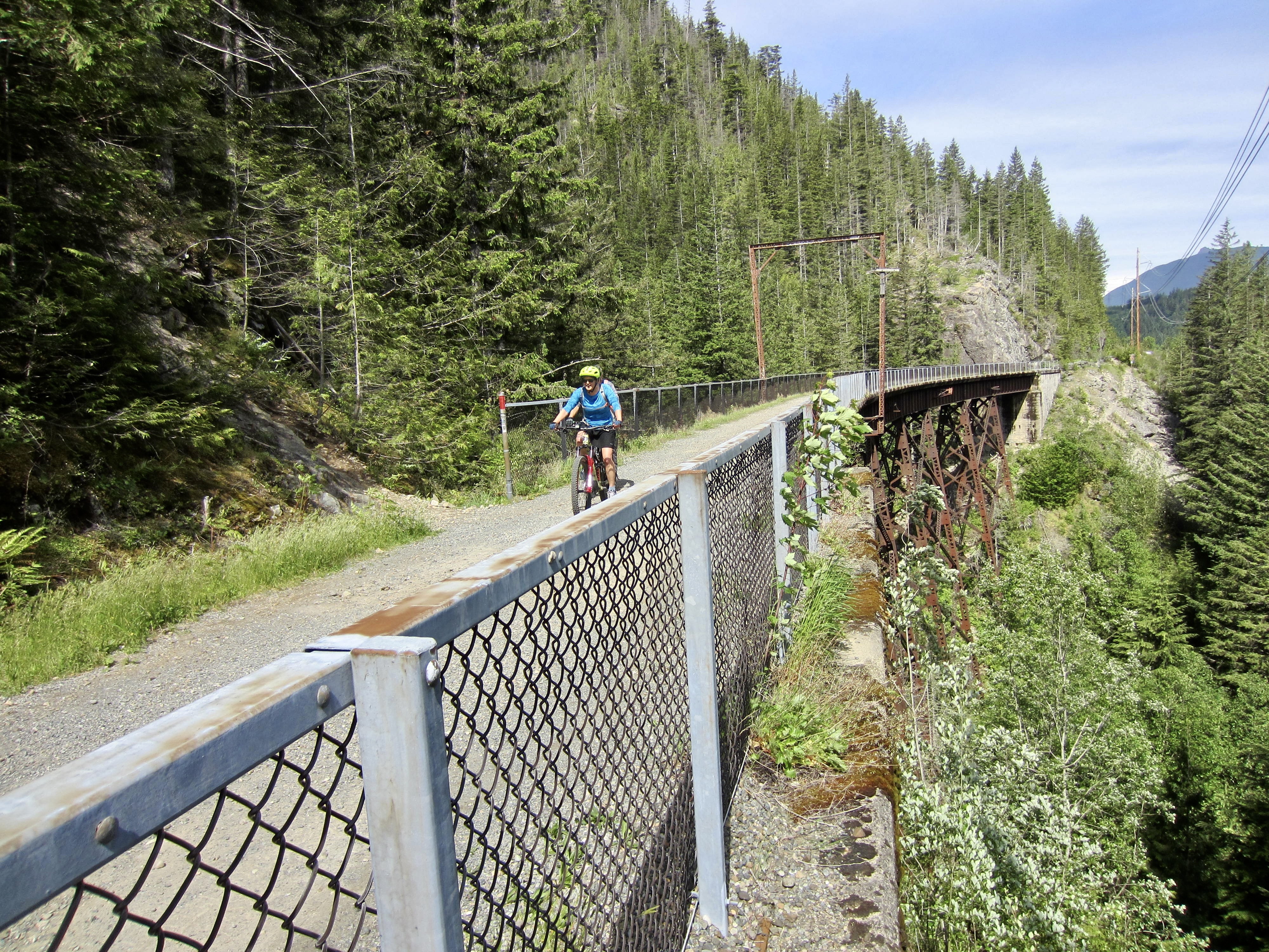
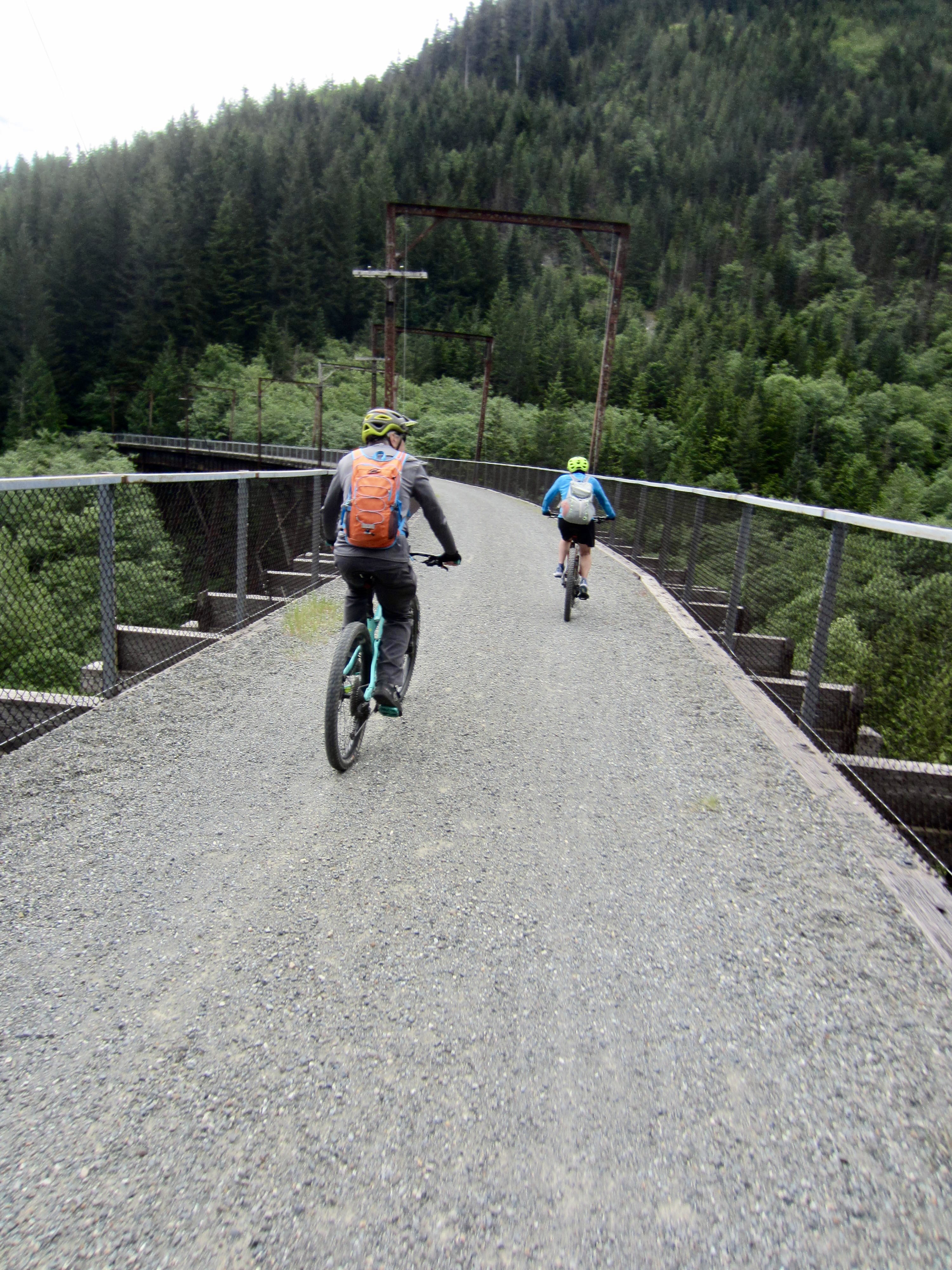
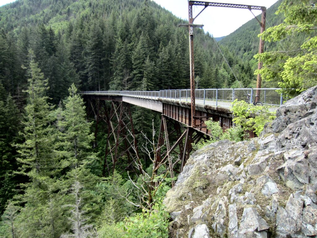
Next in the procession was the Mine Creek Trestle. Given its long, graceful curvature, this may be the most photogenic of the four high trestles. Regardless of looks, each one of them constitutes a marvel of early-1900s engineering and construction.
.

.
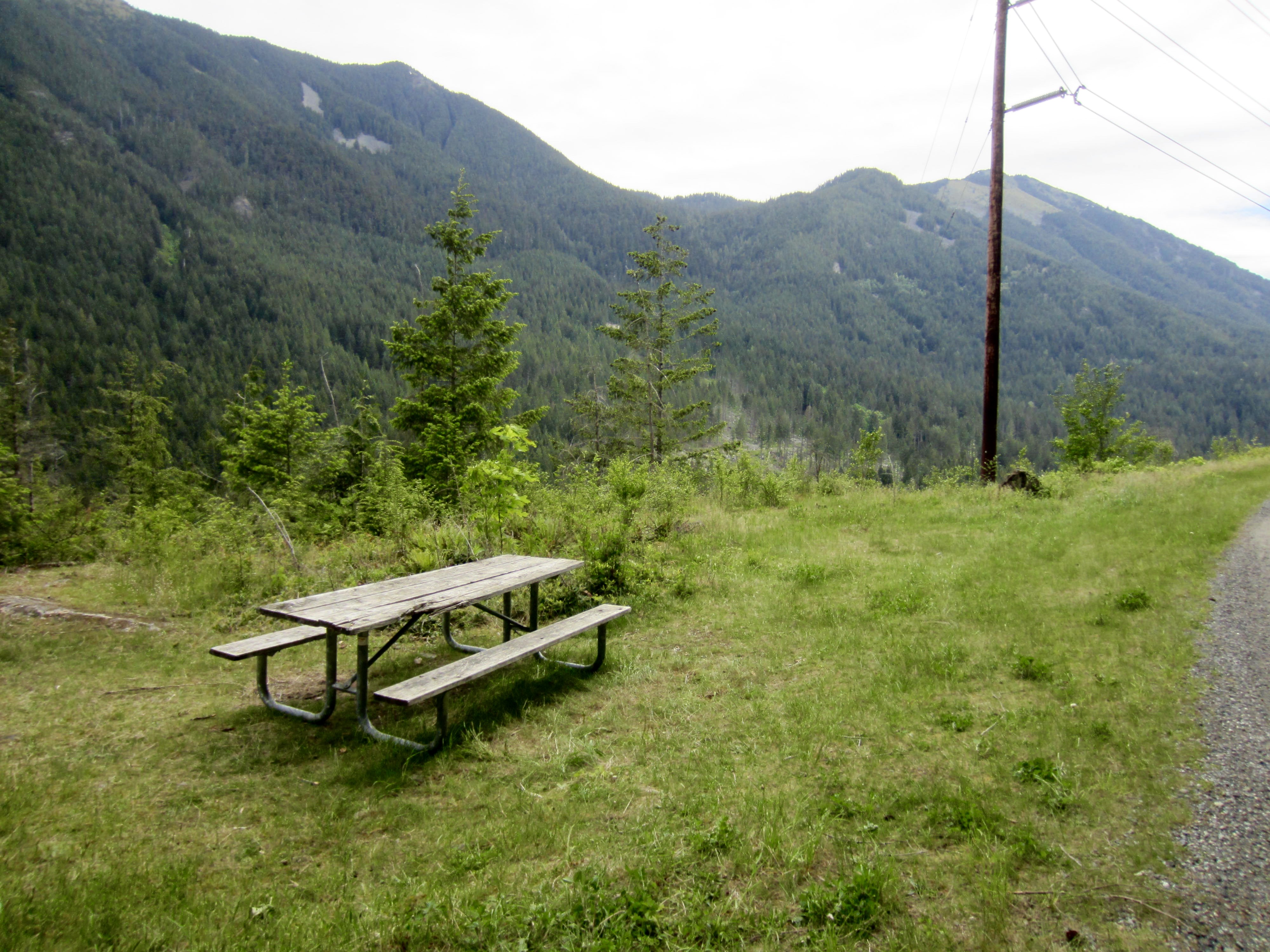
We took our first snack break at the Alice-Wood Viewpoint (1.4 hours + 9.0 miles + 780 feet from start). This outward bend in the P2C Trail offers a simple picnic table and a good view of the Lower Snoqualmie Range across Interstate-90. It also marks the halfway point between Cedar Falls Trailhead and the West Portal. Because the P2C Trail slopes upward at such an imperceptible grade, we were a bit surprised to find that we’d already gained nearly 800 feet—half of our total elevation gain for the entire traverse.

.
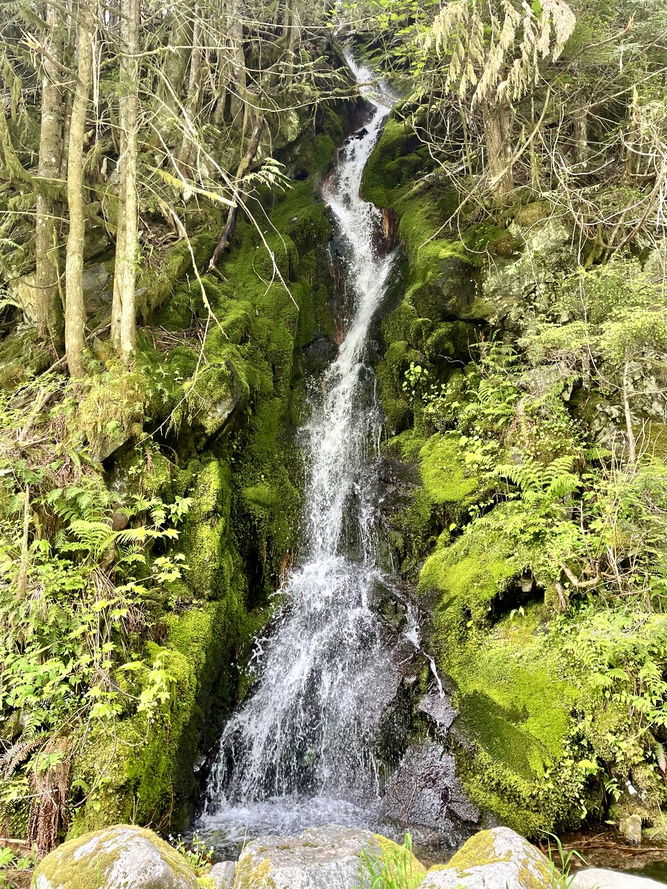
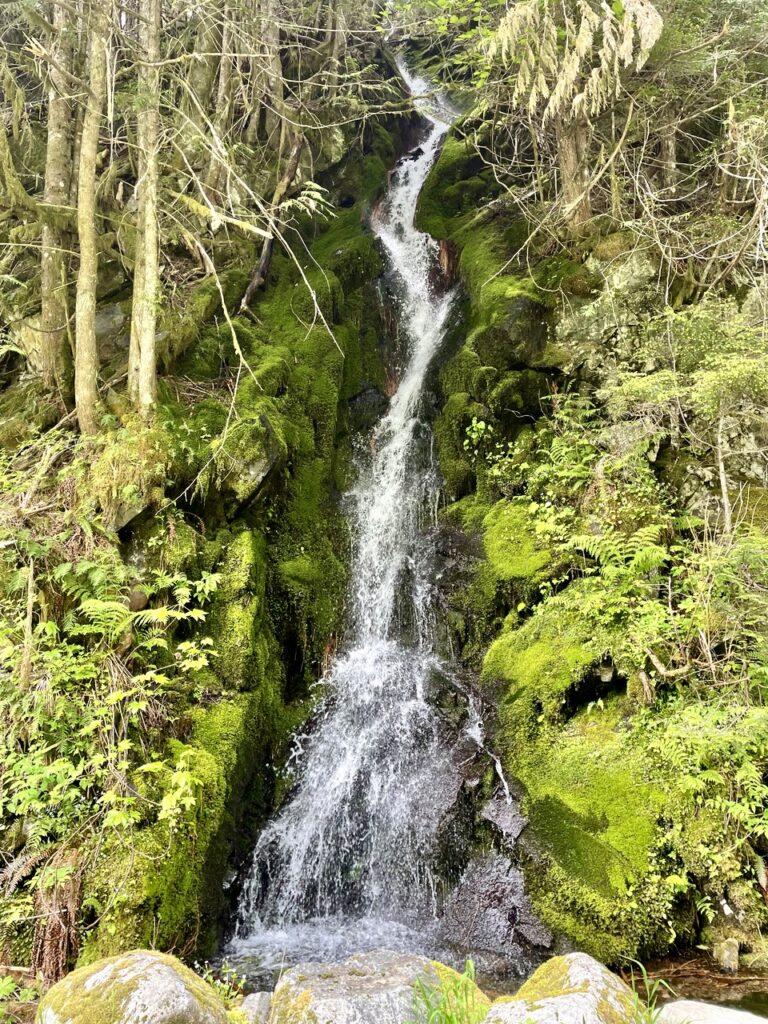
The segment of P2C Trail between North Bend and Easton abounds with man-made points of interest, but there are also a few noteworthy natural features along the way. One of my favorites is a little waterfall located at Mile 11.7, between Alice Creek Camp and Carter Creek Camp. This slender ribbon of water cascading down mossy rocks in a woodsy nook creates a truly sublime image.
.
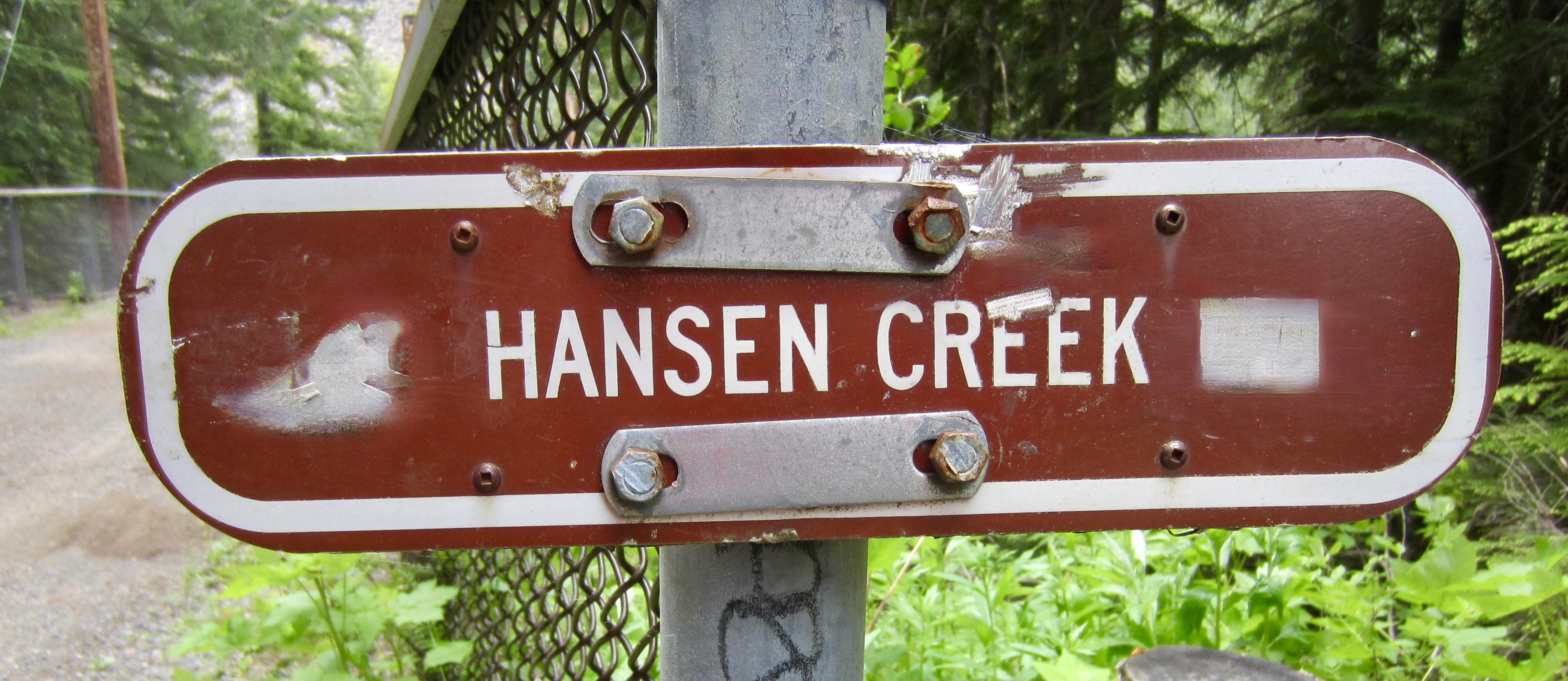
Our fourth and final high trestle was the Hansen Creek Trestle at Mile 14.0. This is the only one that crosses over a road, so its substructure is a familiar sight to people who frequent locations such as Hansen Creek Pass or Humpback Mountain.
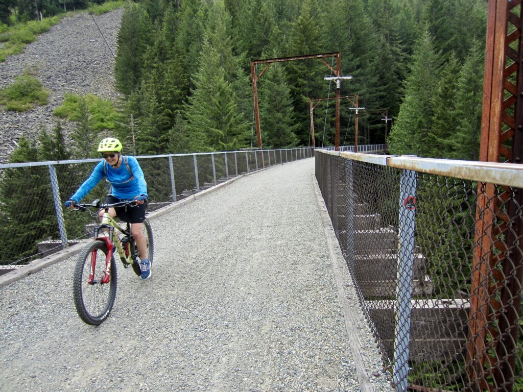
.
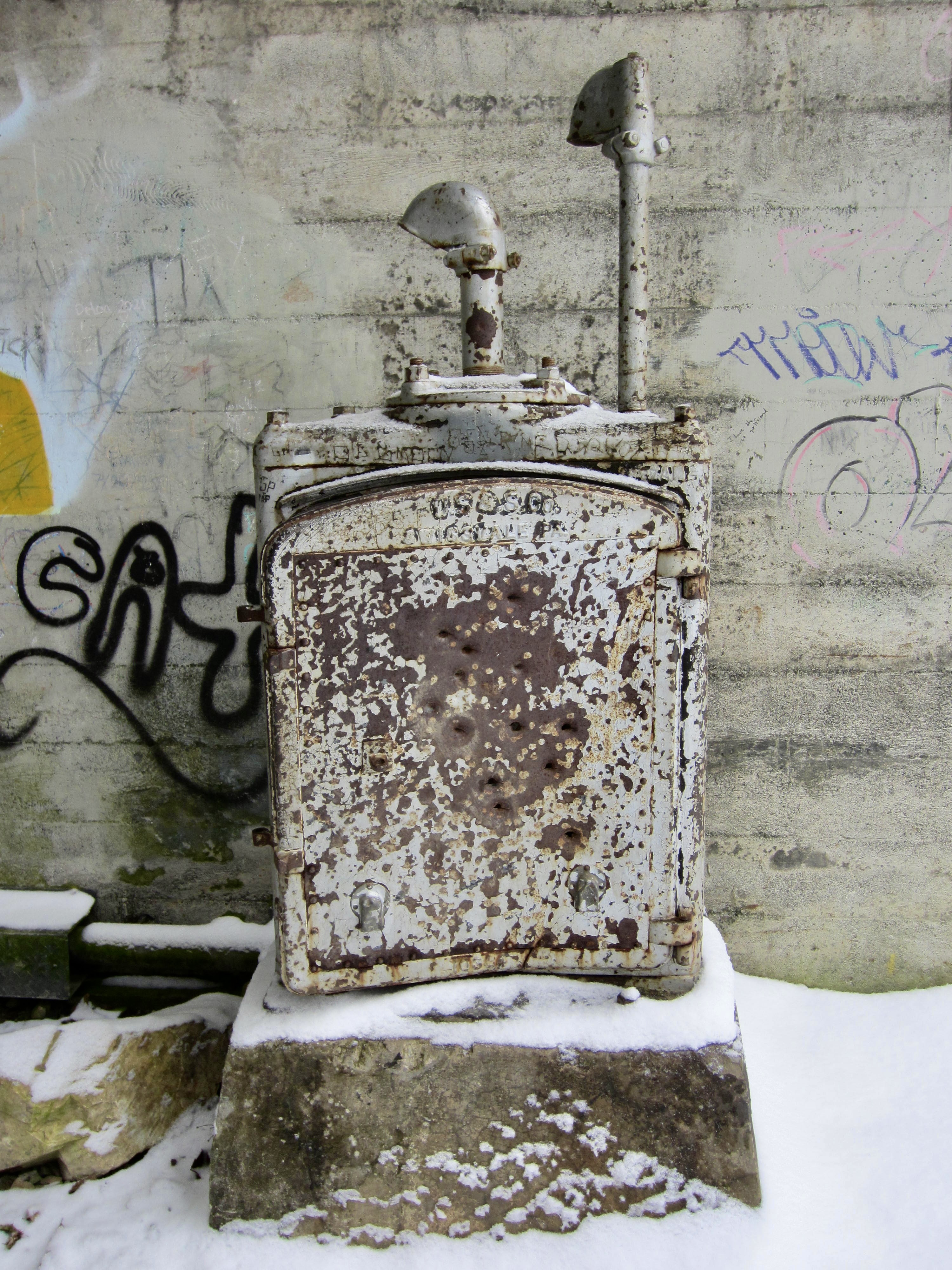
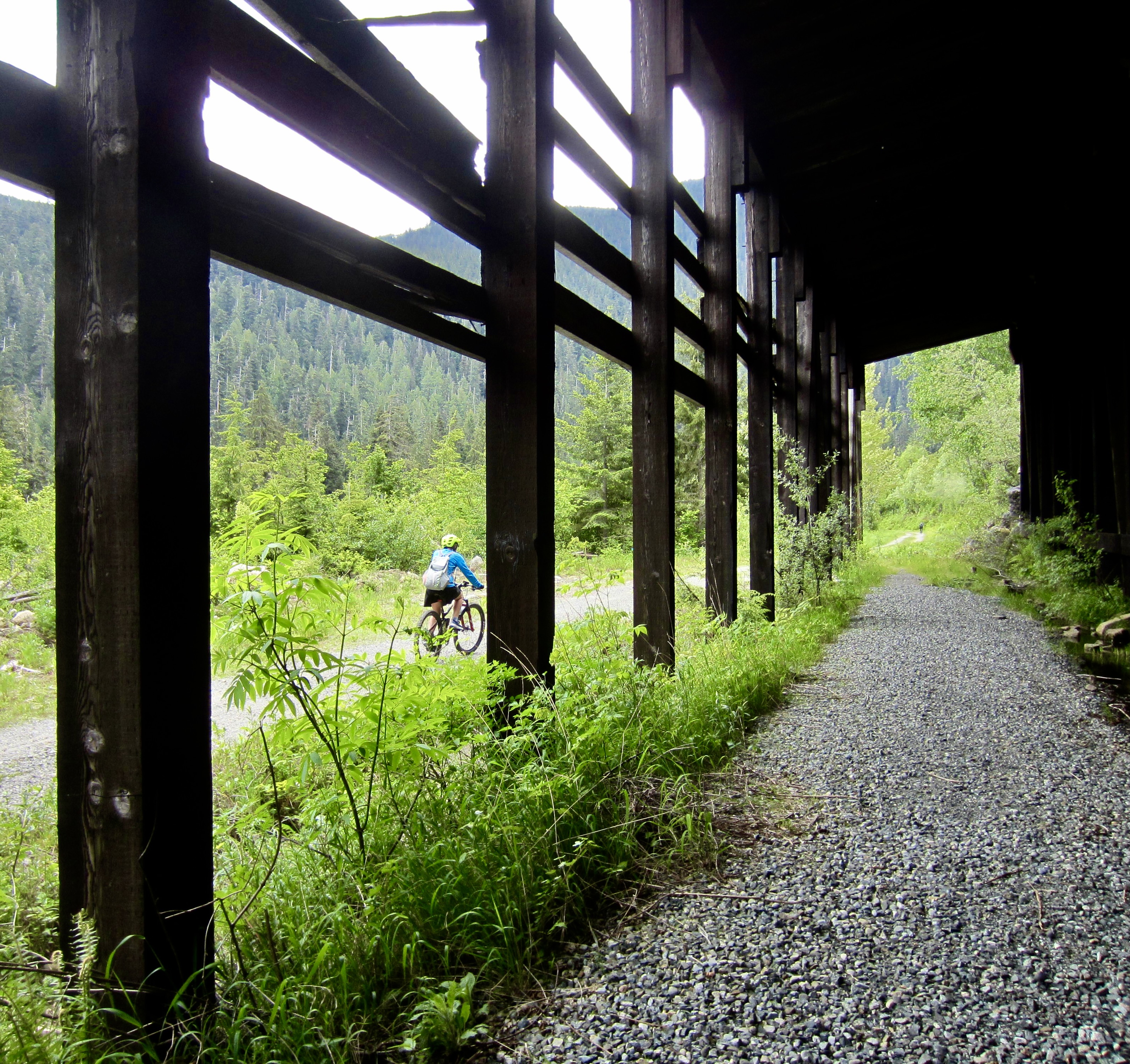
Numerous avalanche sheds were built along the Milwaukee Road during or after the original railway construction. Most of them are gone now, but at Mile 16.6, just before the crossing of Humpback Creek, one of these sheds is being preserved as a sort of museum piece.
.
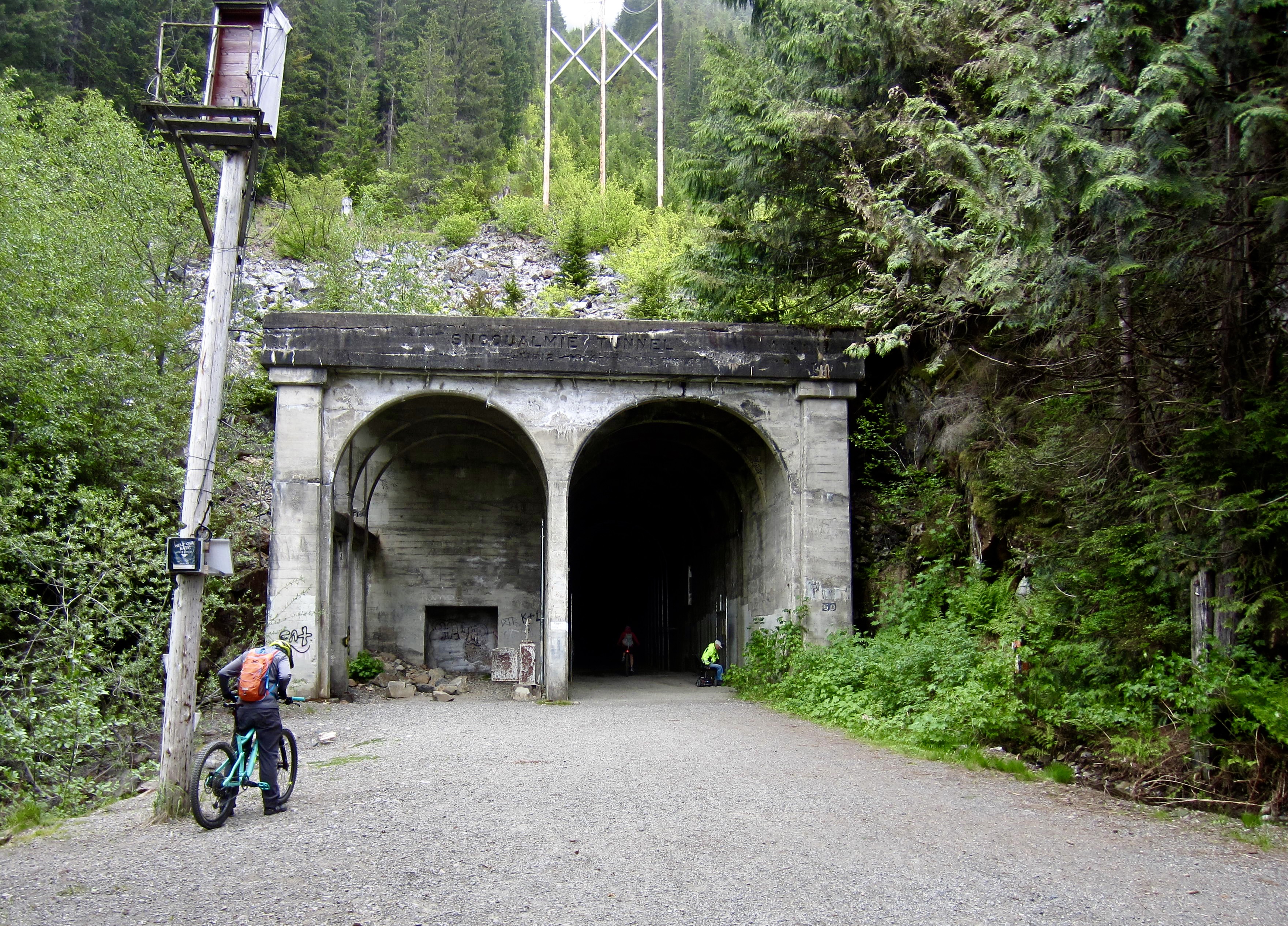
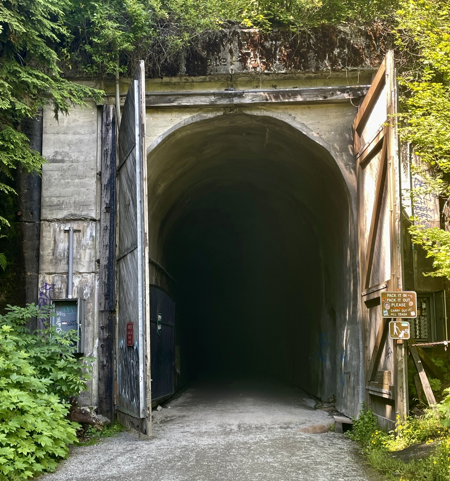
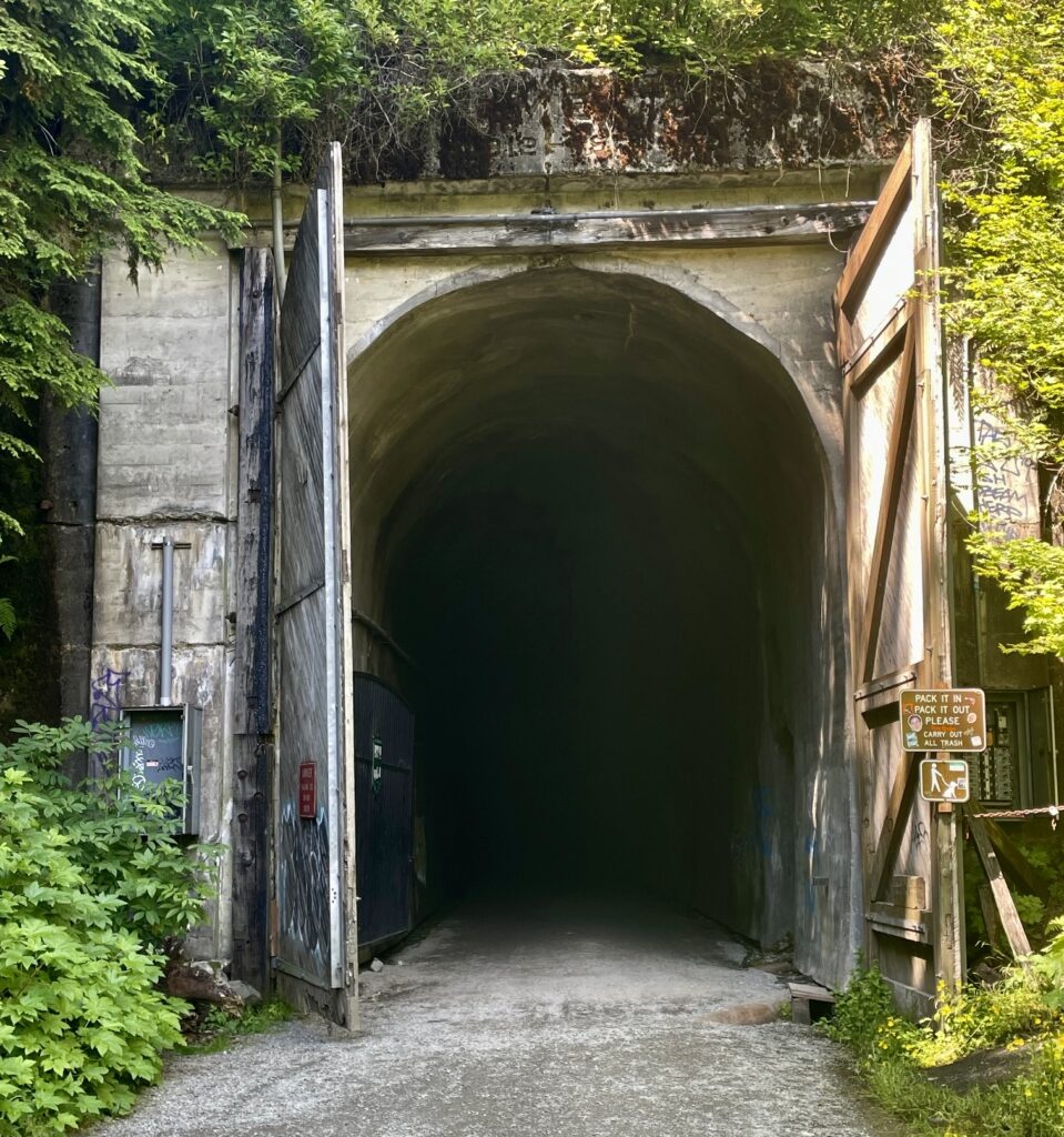
With much anticipation, we arrived at the Rockdale Picnic Area and the West Portal of the historic Snoqualmie Tunnel (3.1 hours + 18.3 miles + 1600 feet from start). This 2.3-mile-long tunnel was constructed during the years 1912-14, and for the next 65 years, it served as a critical link in the Milwaukee Road. Nowadays, the tunnel is open to hikers, bikers, and horses, although safety concerns keep it closed throughout the winter months.
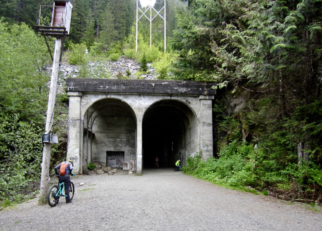
.
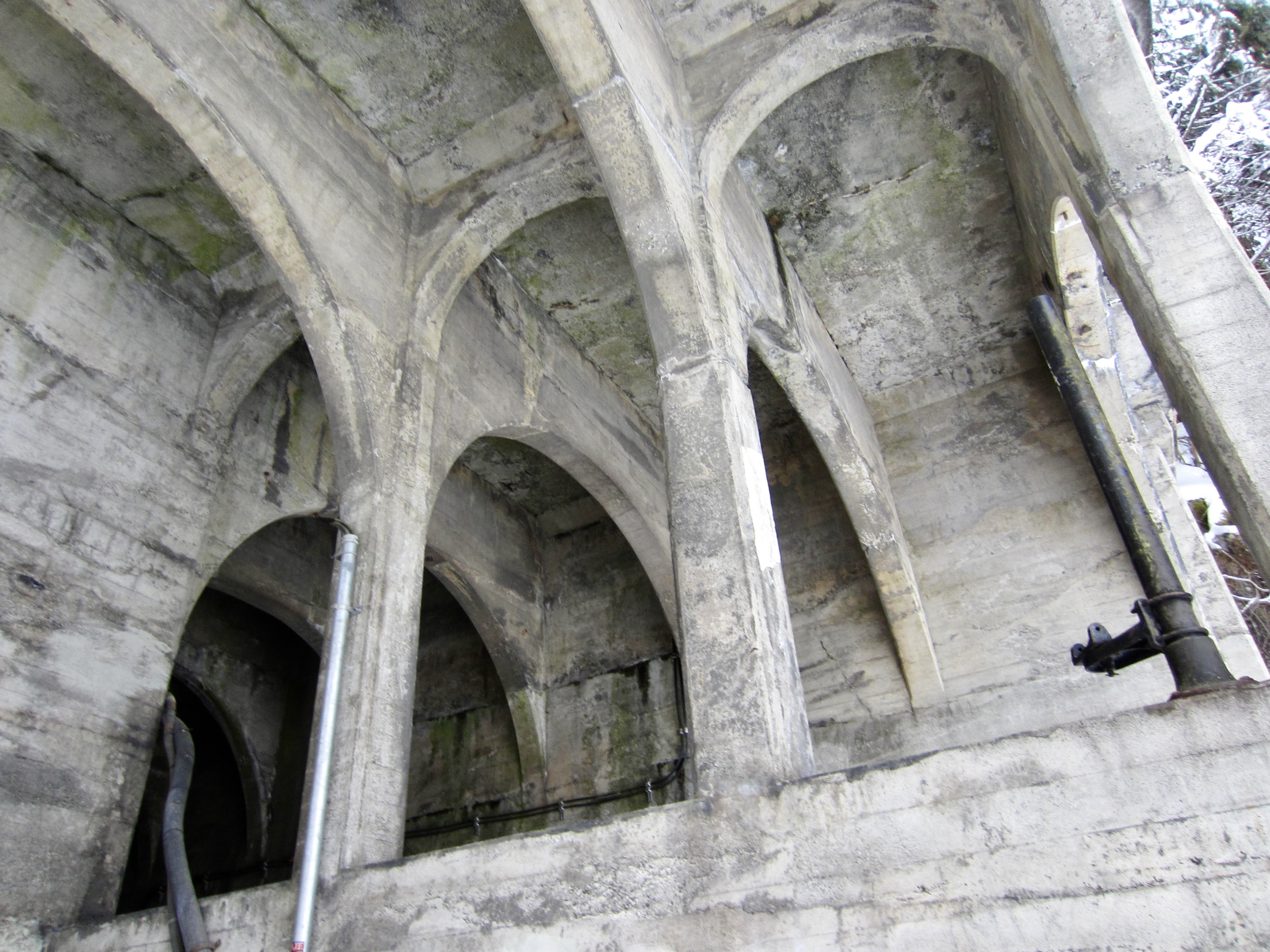
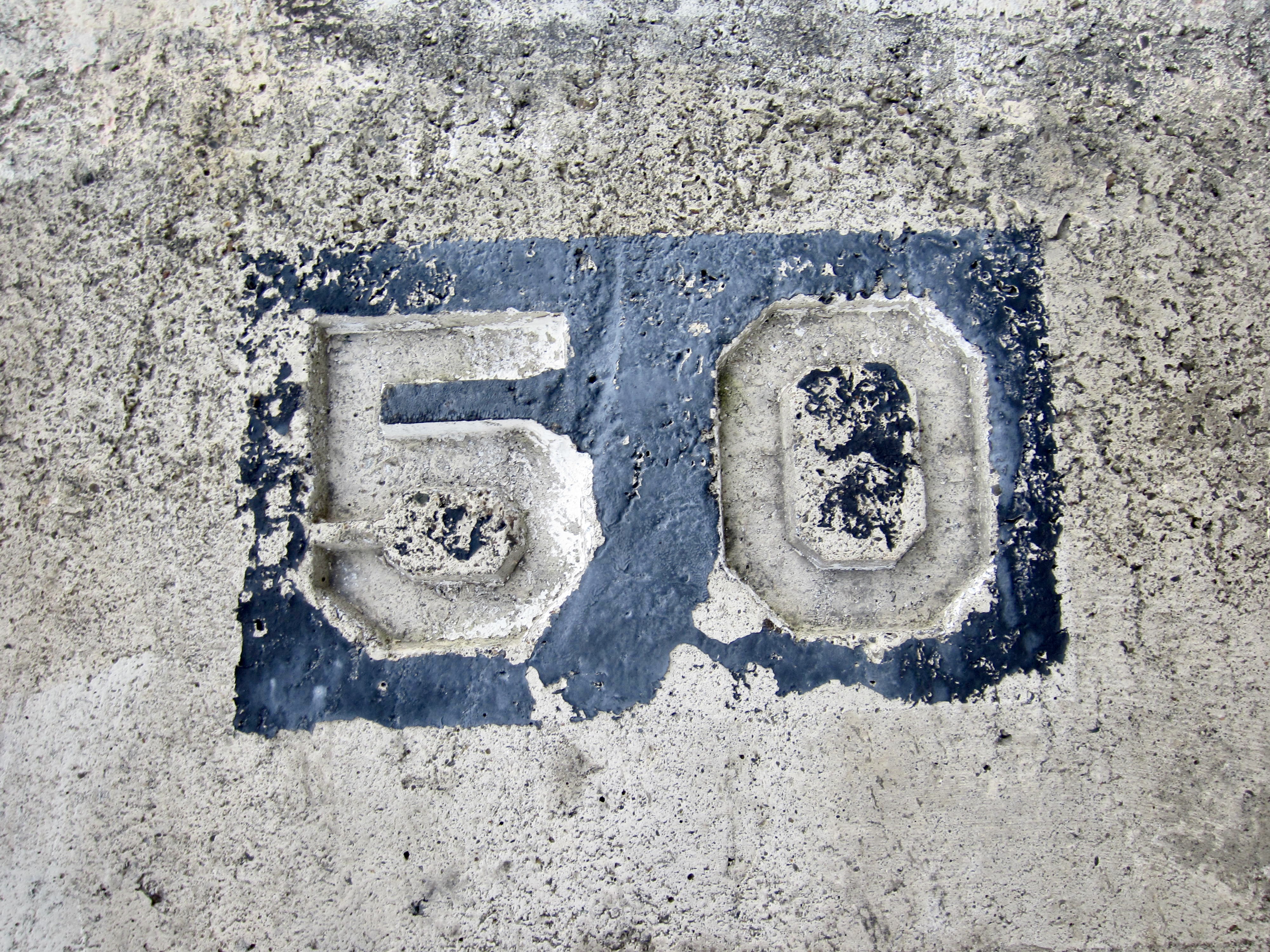
The West Portal displays some impressive architecture in the form of criss-crossing concrete arches, as well as a few interesting railroad artifacts. On the right side of the portal is a “50” stamped into the headwall. Between Chicago and Puget Sound, there were 51 tunnels originally constructed along the Milwaukee Road, consecutively numbered (with some exceptions) from east to west. Snoqualmie Tunnel No. 50 was the penultimate tunnel in the sequence and was the longest by far. (Landsburg Tunnel No. 51, located near Maple Valley, was the very last tunnel.)
.
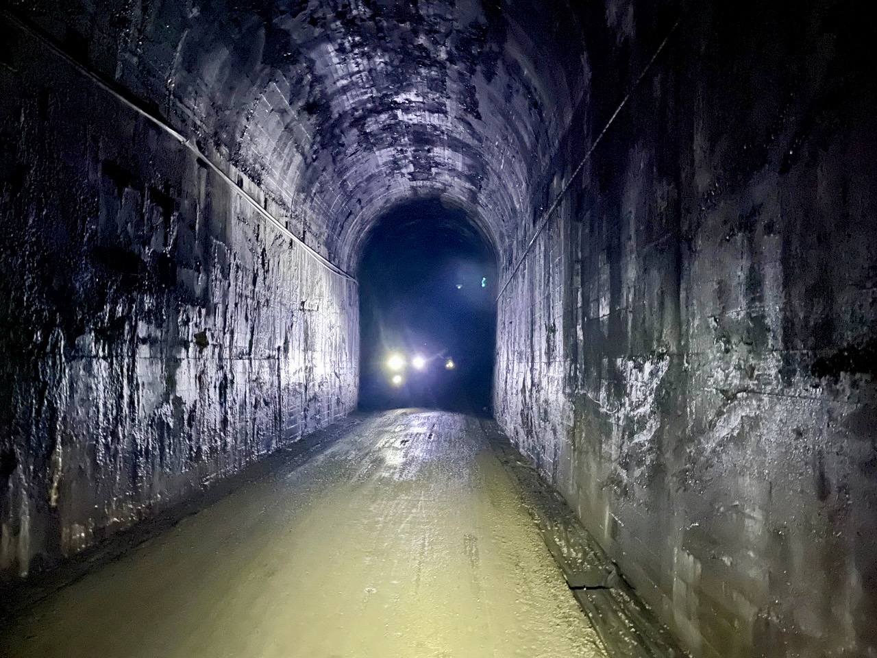
Before entering the tunnel, we rugged up with warm clothes. A mountain tunnel this long acts like a refrigerator, such that inside temperatures remain chilly even on hot summer days. We also attached bright headlights to our handlebars. I’ve previously ridden through the tunnel with only a dim flashlight and found that the concrete walls and gravel bed create a disorienting “gray-out.”
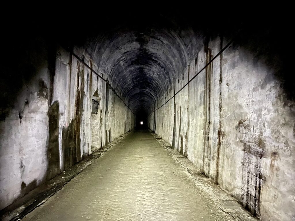
.
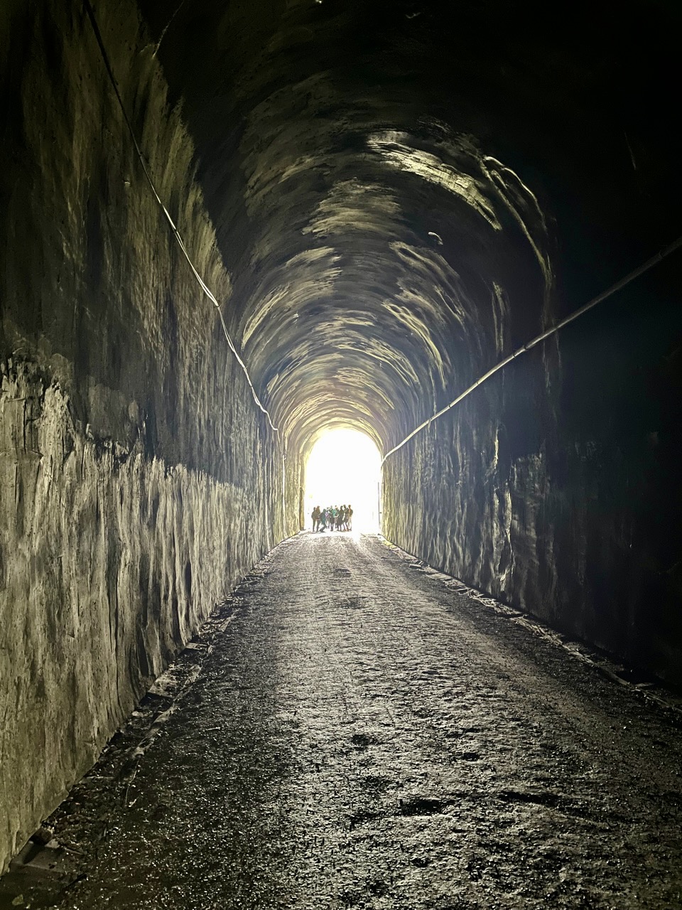
After an eerily quiet ride through the damp interior, we popped out the other end of the tunnel and into welcome daylight of the East Portal. Well, maybe not completely welcome; it had been dry and somewhat sunny during our morning’s ride up to the tunnel, but by the time we exited, a steady drizzle had started. We donned whatever raingear we’d brought and continued our eastward ride.

.
.
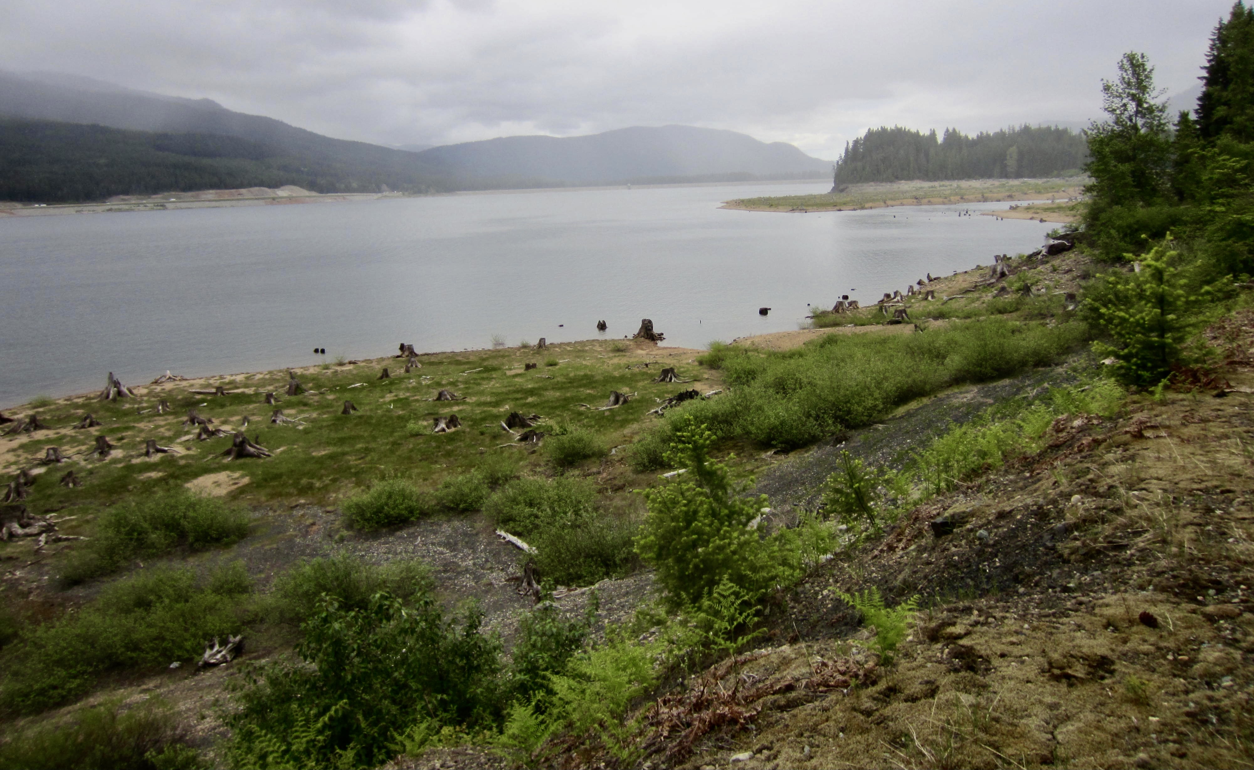
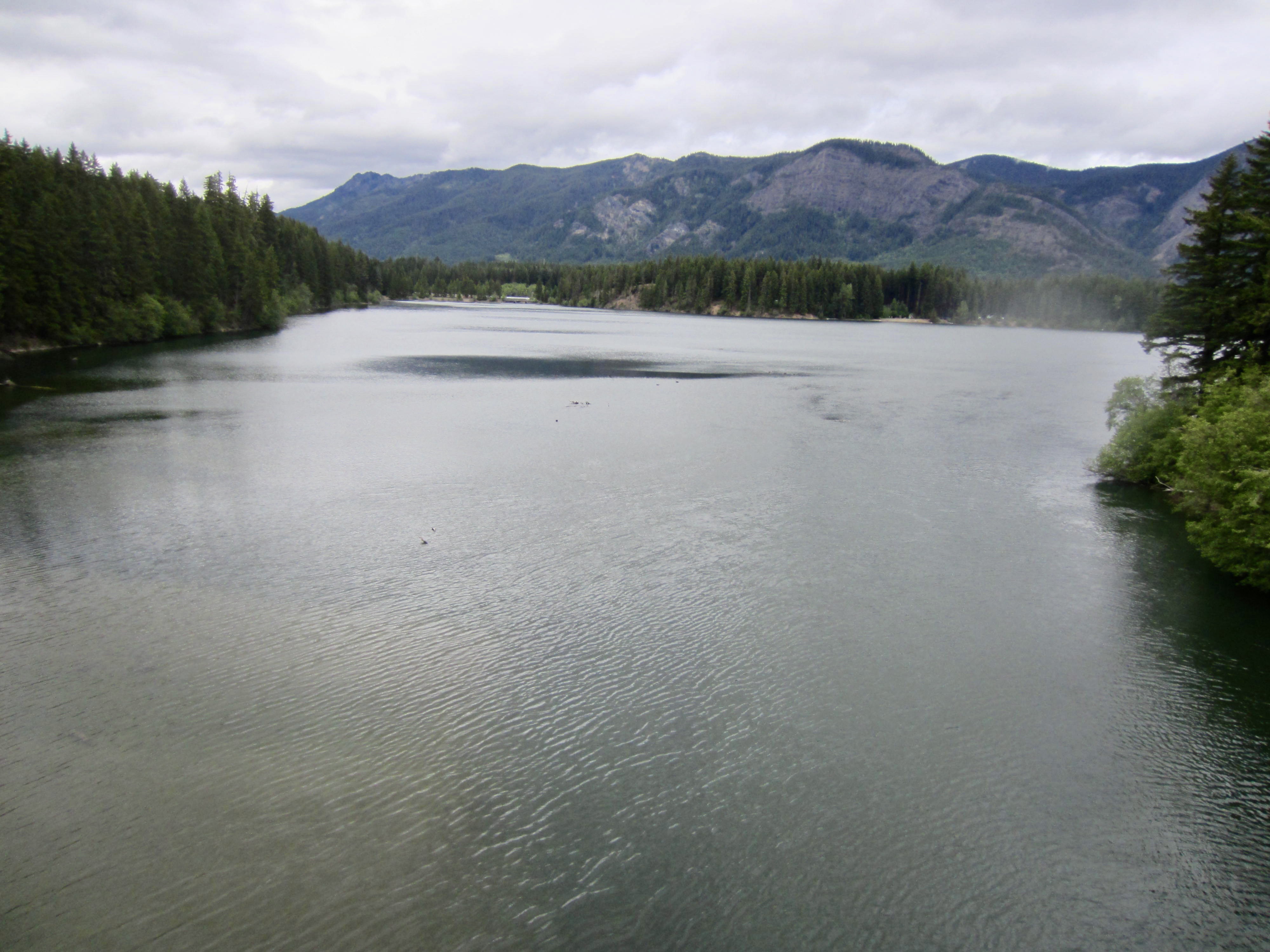
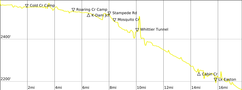
Just past the East Portal is the Hyak Trailhead, with its large parking lot, and shortly beyond is Keechelus Lake. This was originally a natural lake of respectable size, but it was greatly enlarged when Keechelus Dam was built at the lake outlet in 1917. The lake now serves as an irrigation-water reservoir for the Yakima Valley. Fun fact: The word keechelus (pronounced KITCH-i-lus) means “few fish” in Chinook jargon.

.
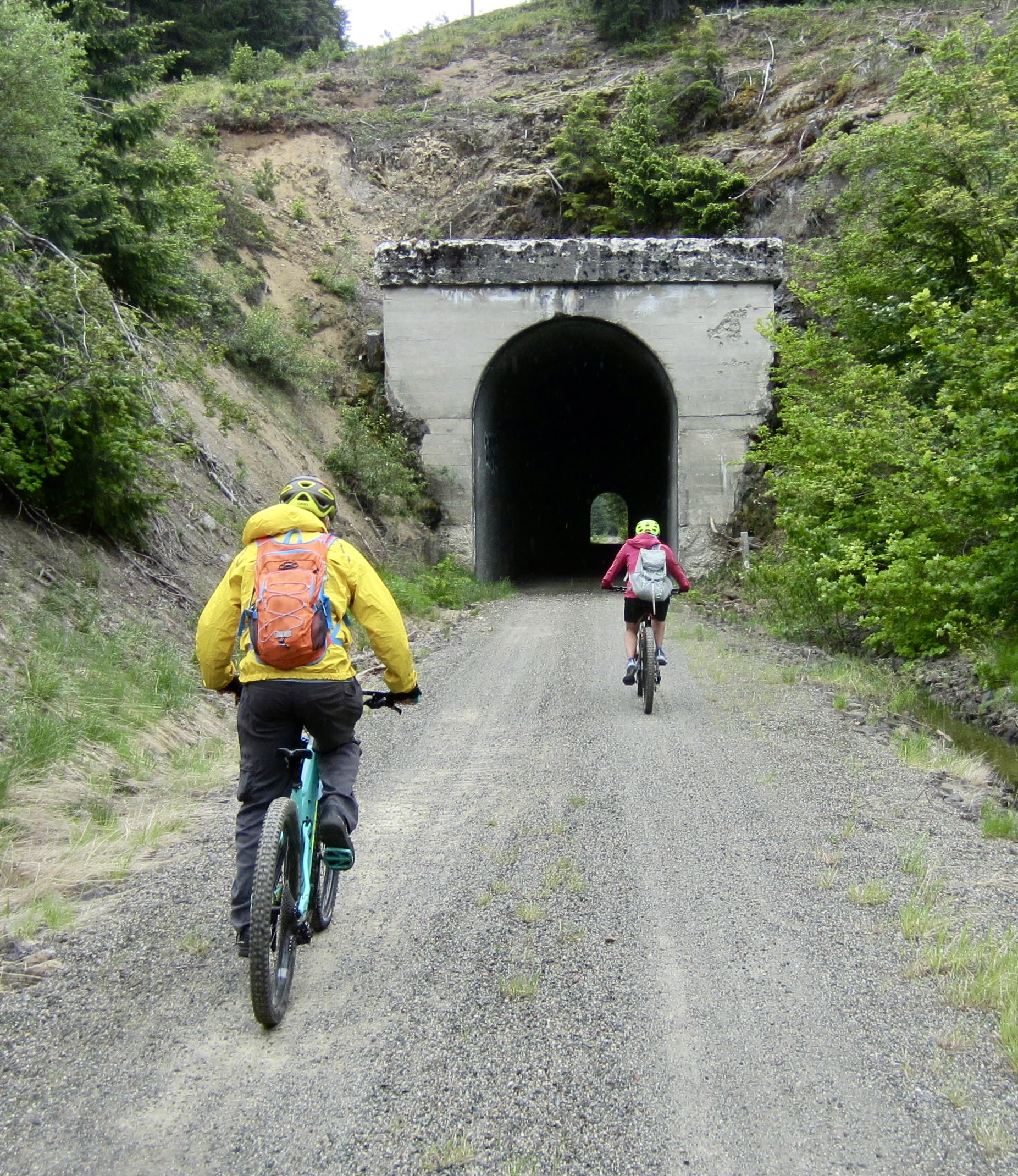
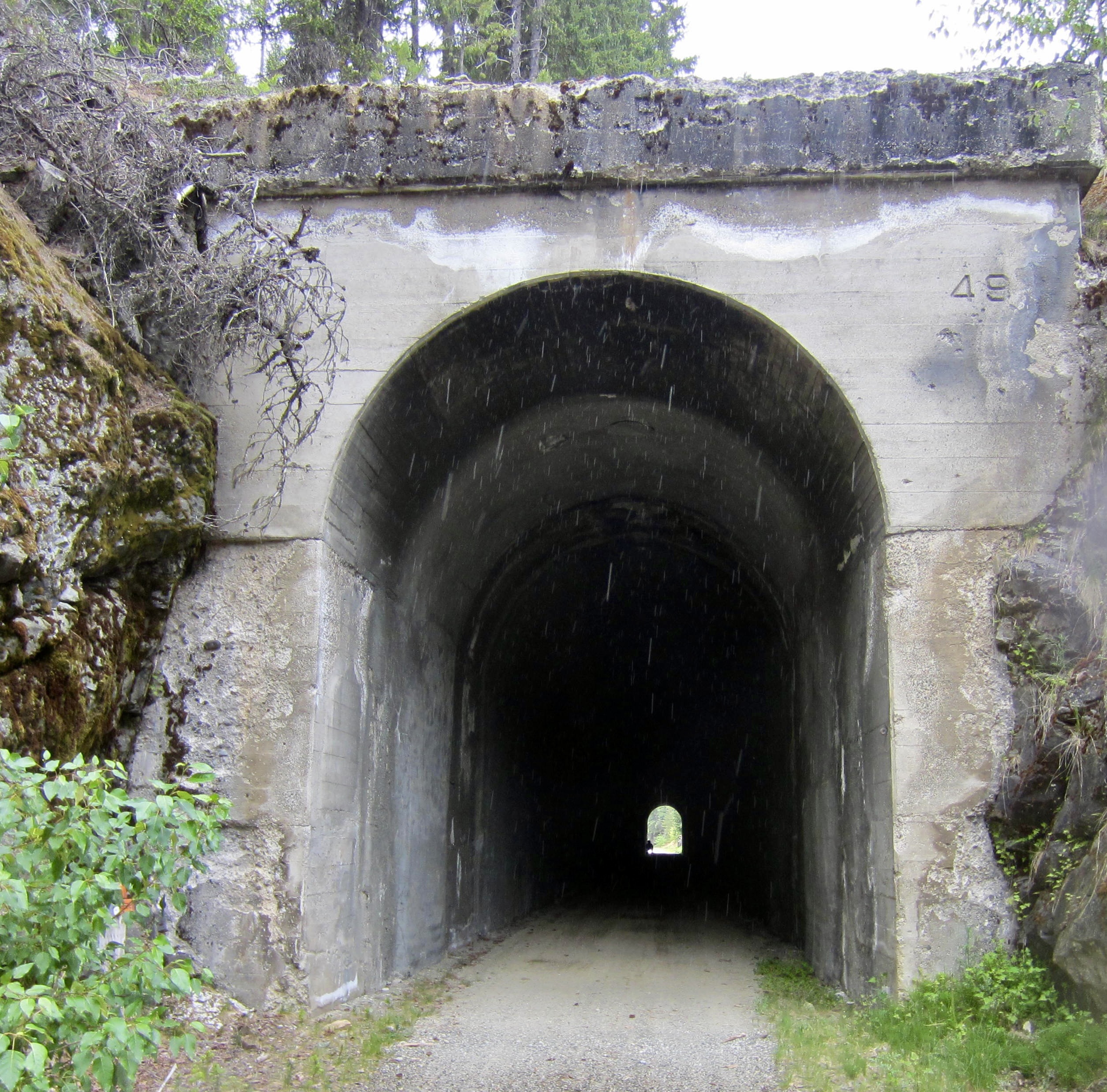
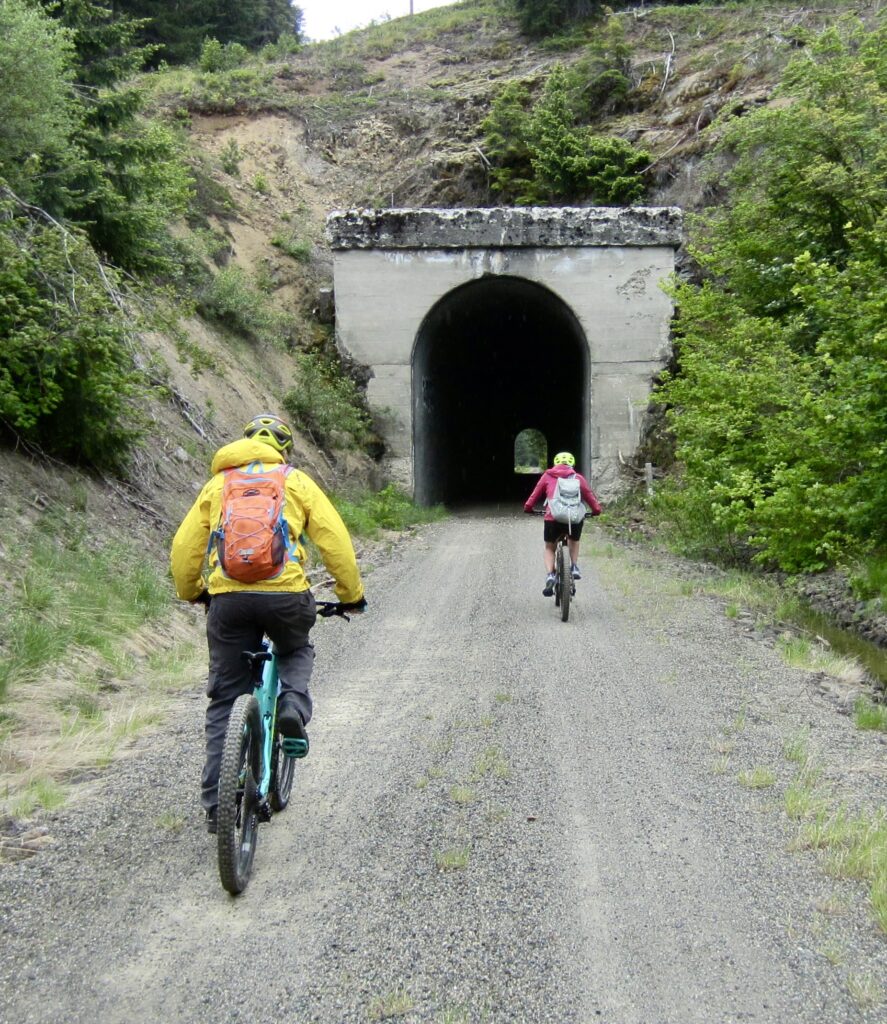
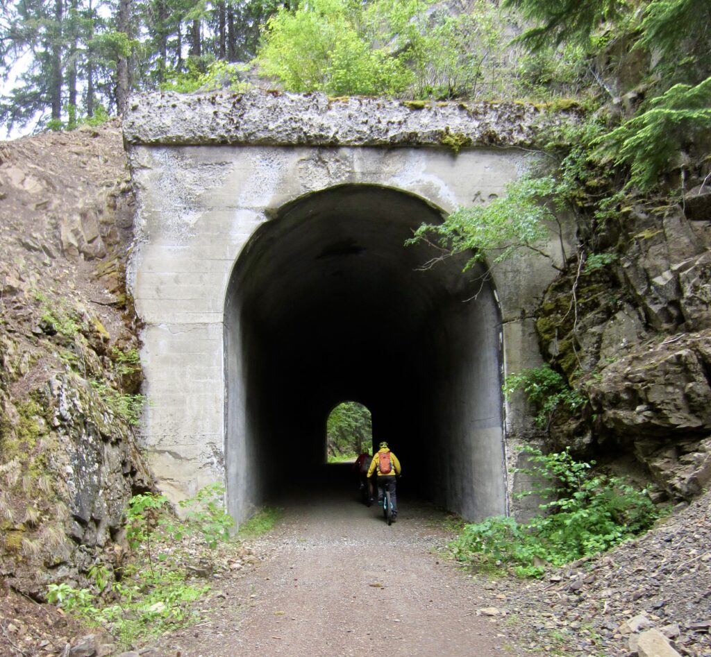
From Hyak, the P2C Trail levels out for 8 miles until passing Keechelus Dam Junction, then it begins an ever-so-slight descent. We pedaled through Whittier Tunnel No. 49 in early afternoon (5.0 hours + 31.6 miles from start). This 500-foot-long tunnel cuts through a small knob of bedrock and roughly marks the transition from the Iron Horse Mountains to the Kittitas Mountains.
.

.
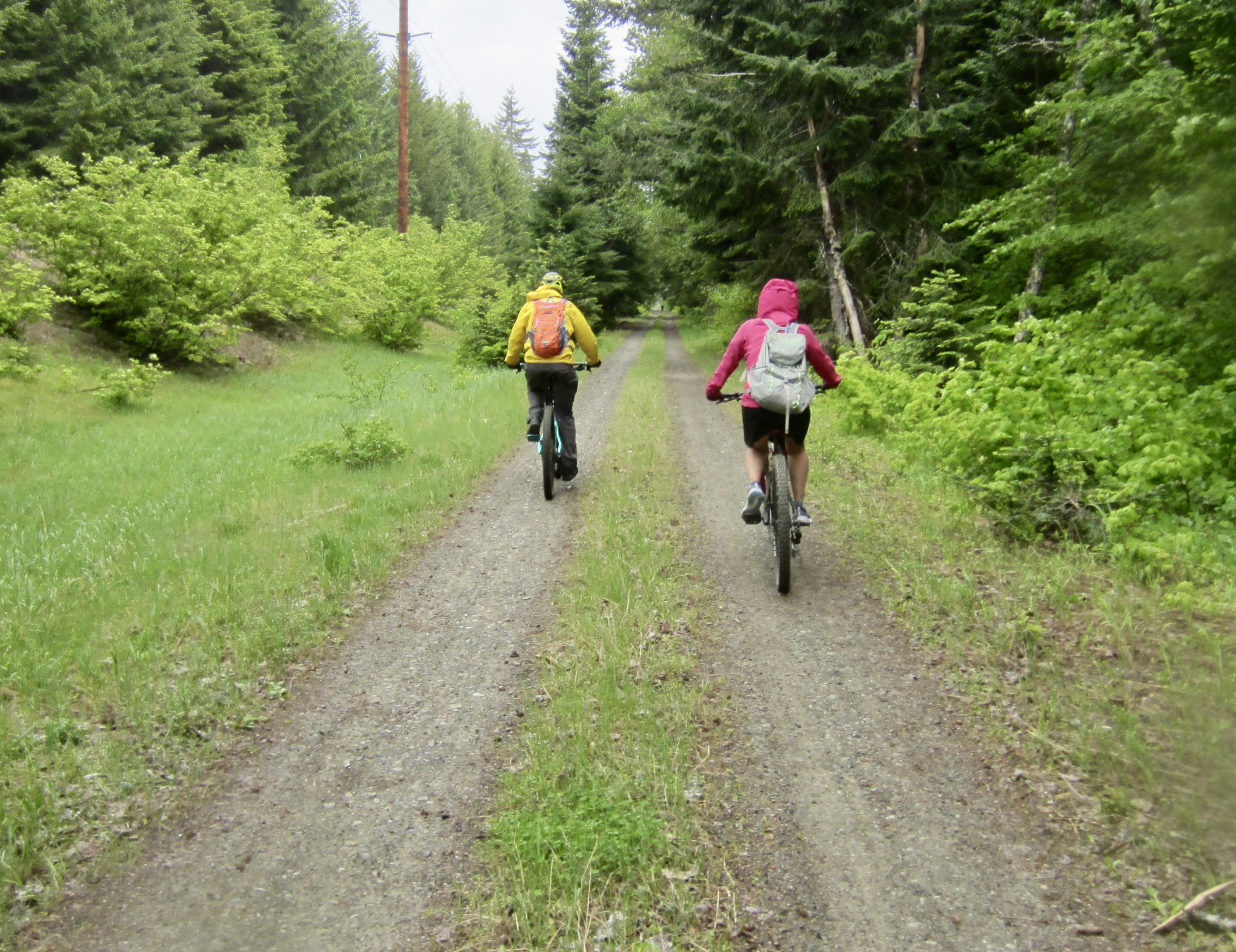
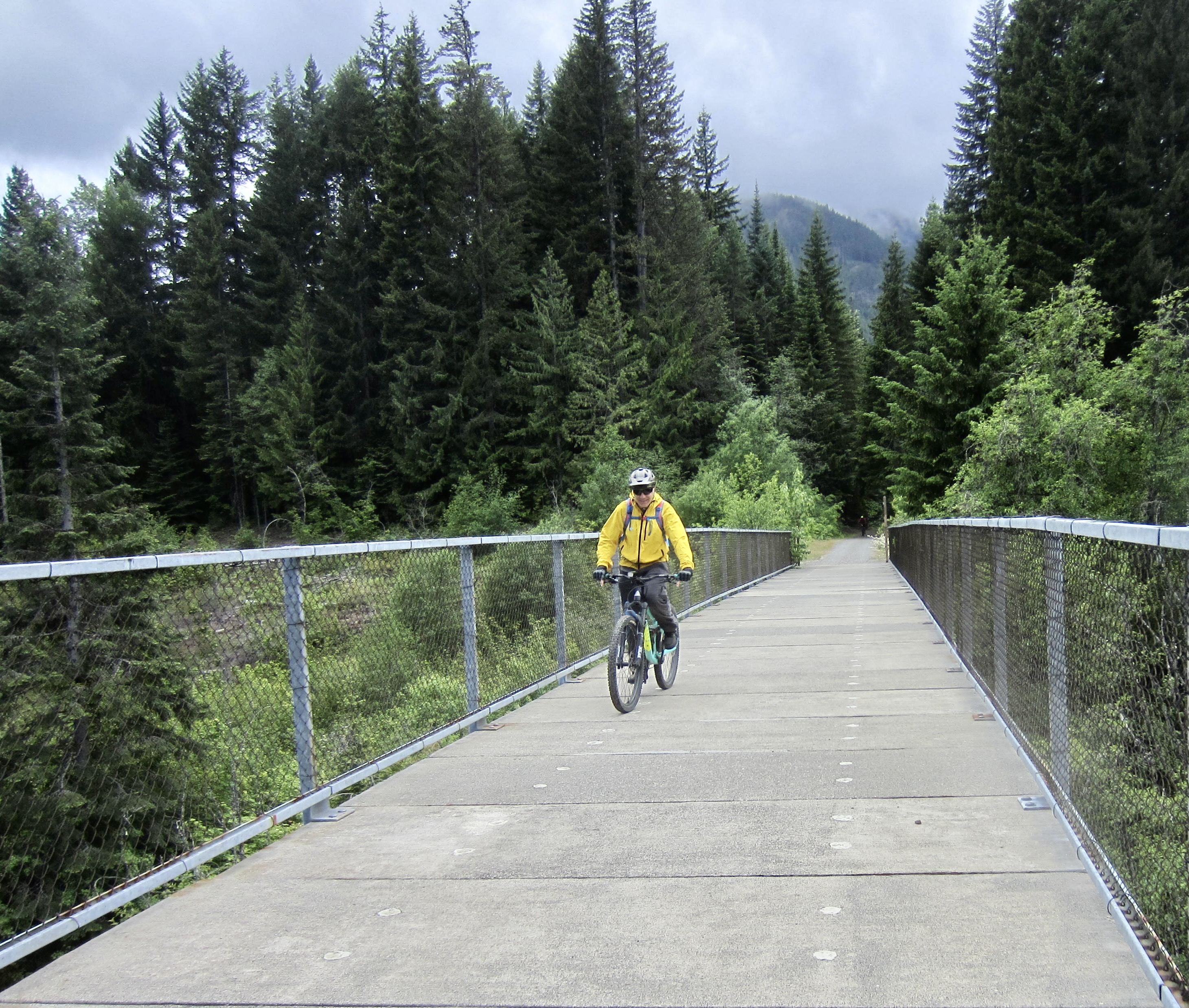
The 4-mile segment of P2C Trail east of the Whittier Tunnel lacks any interesting historical railway features, but the trail itself becomes a pleasant double-track bordered by grass and vine maples. From a pure riding standpoint, this was my favorite part of the traverse.

.
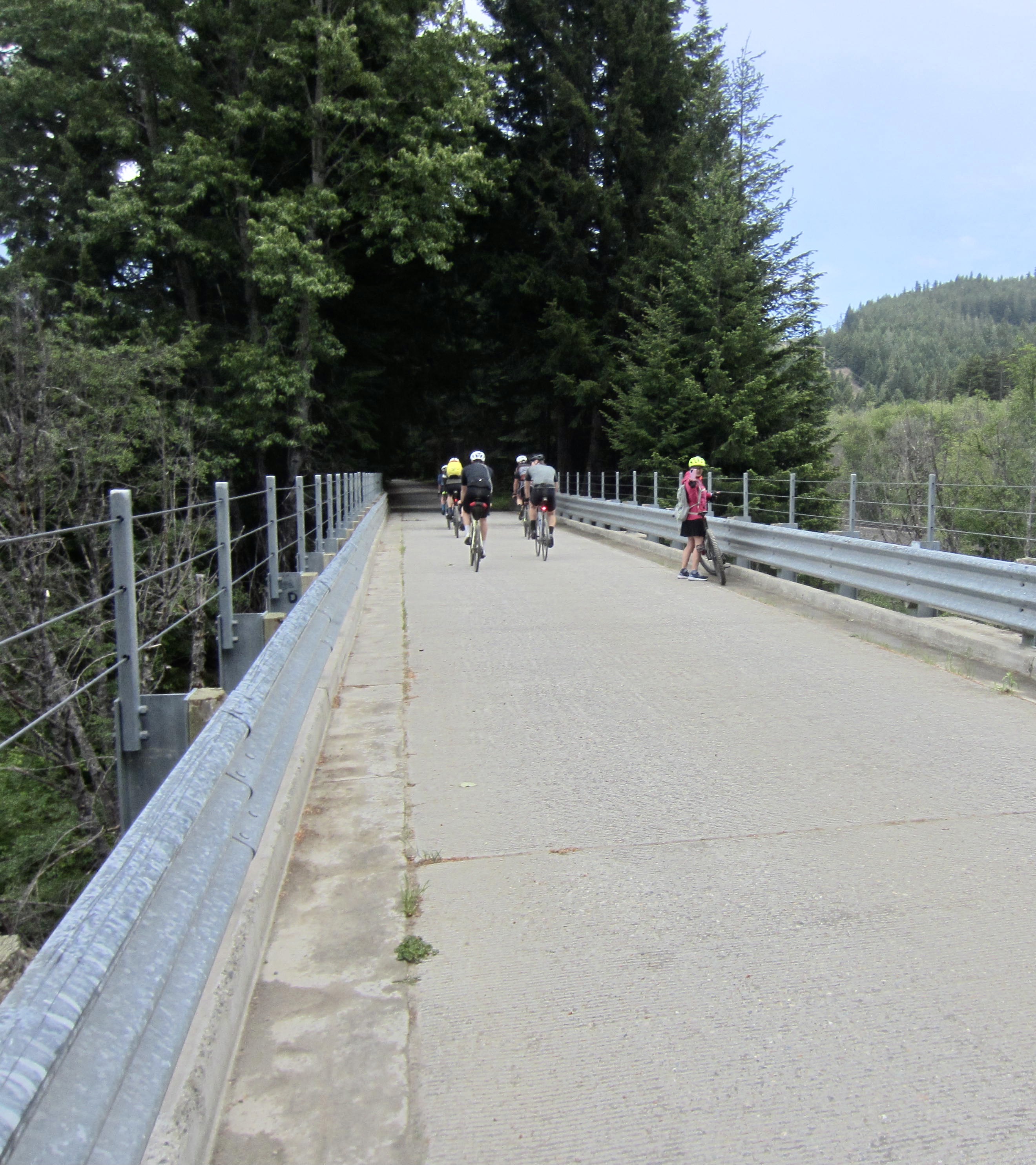
Shortly after Mile 35, we encountered a quick succession of modern constructed features. First is a girder bridge over Cabin Creek, closely followed by a girder bridge over the Yakima River. A bit farther east, we crossed over an arm of Lake Easton on an interesting truss bridge.
.
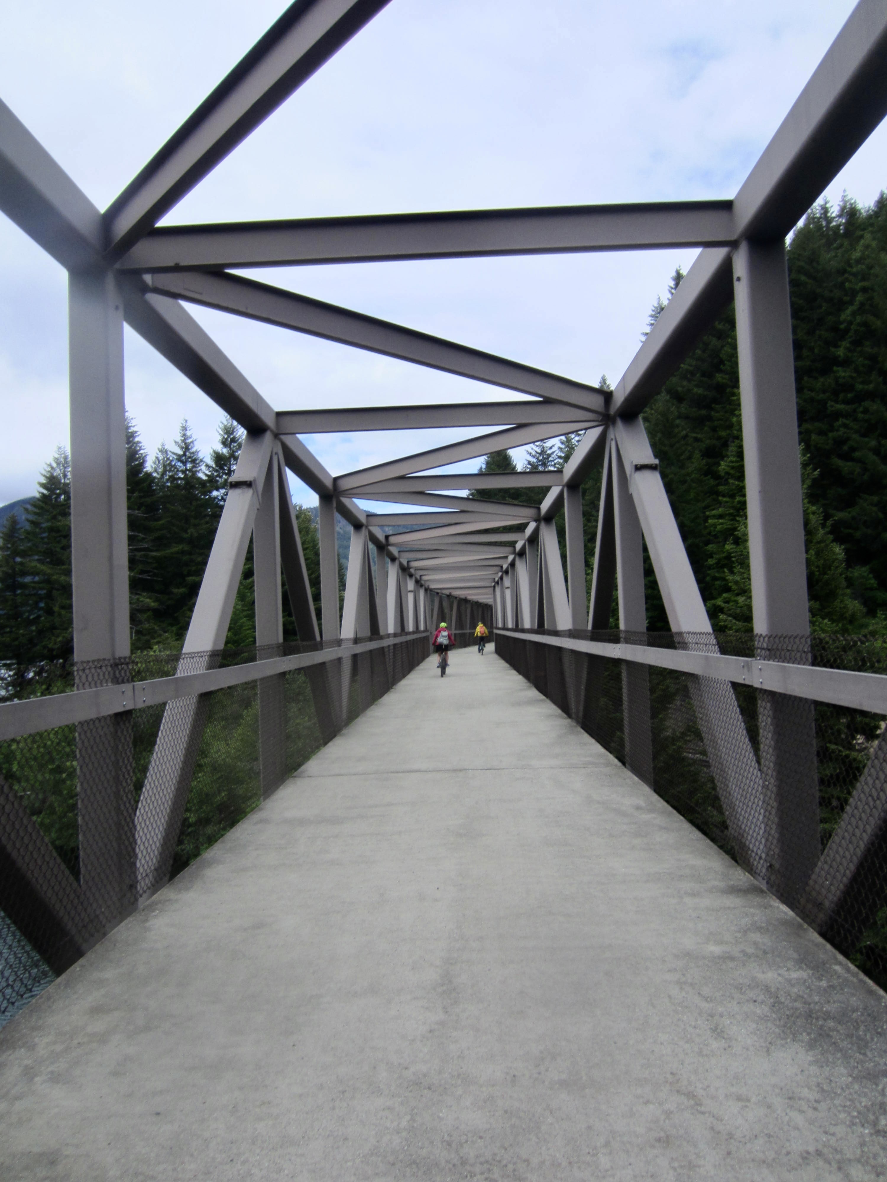
.
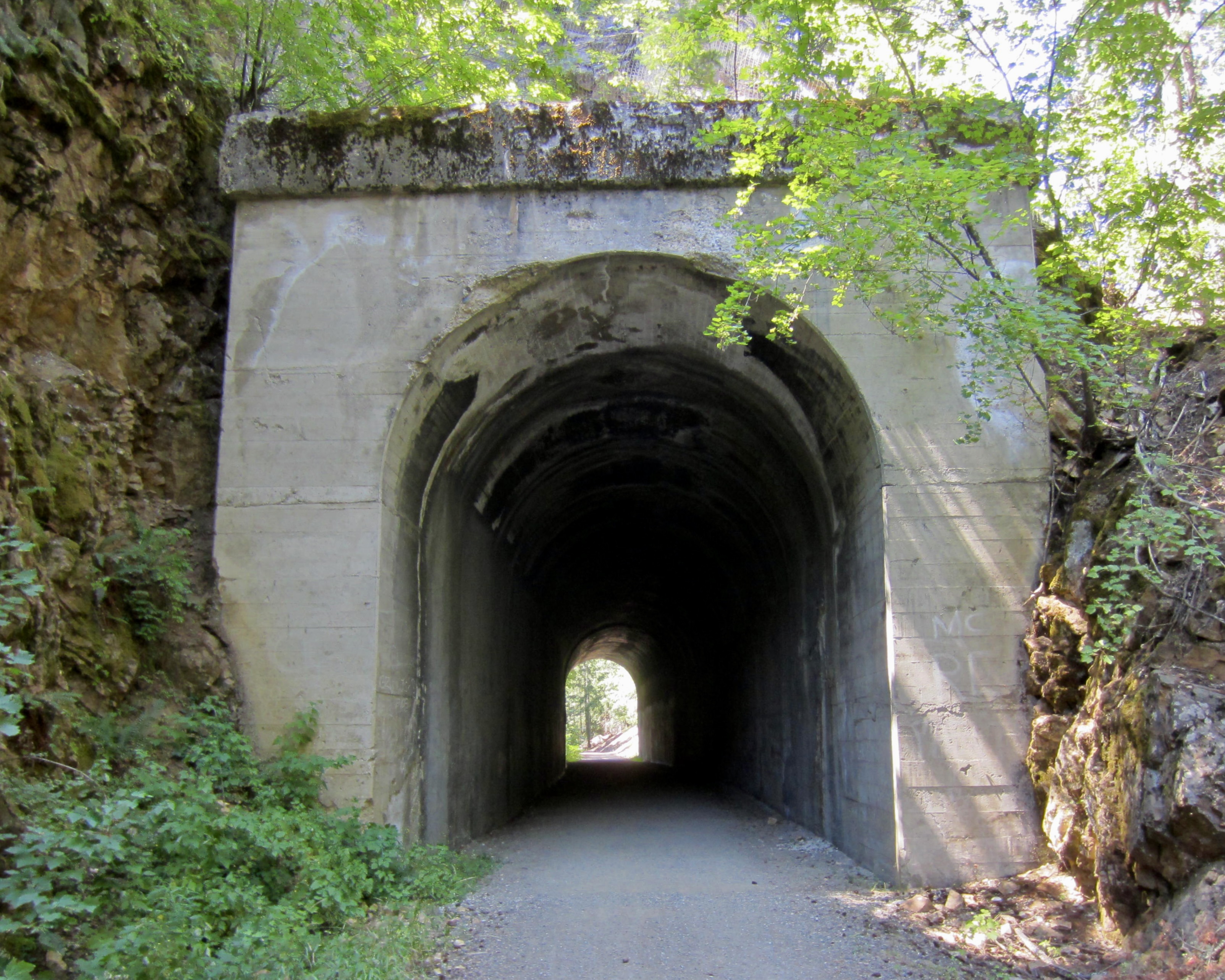
Our last significant historical feature of the traverse was Easton Tunnel No. 48 at Mile 37.8. This 200-foot-long passageway slices through a narrow rock rib on the shore of Lake Easton.
.
.
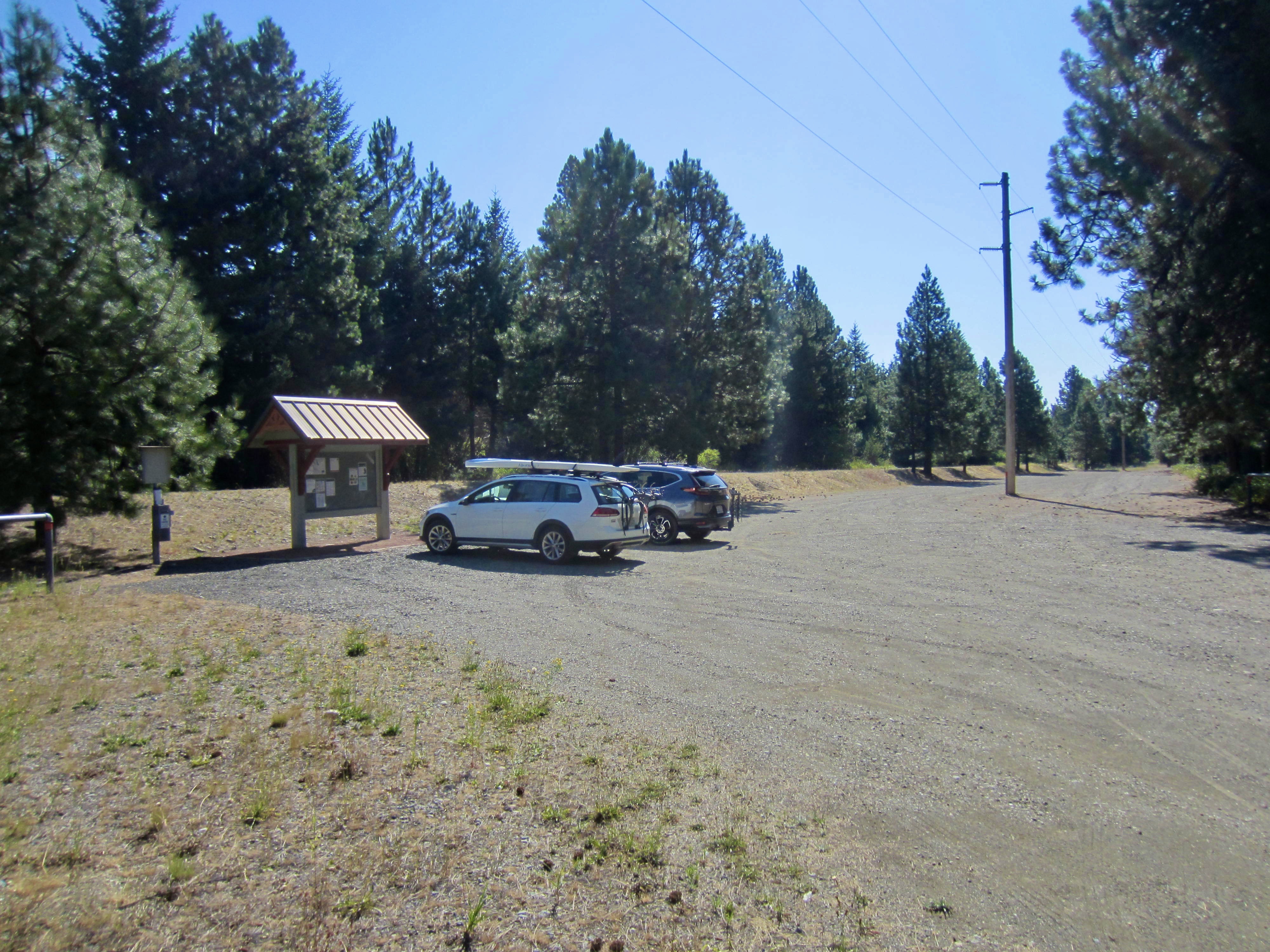
We pulled into the Easton Trailhead parking lot in mid afternoon (6.0 hours + 39.4 miles + 1600 feet – 400 feet from start). This inconspicuous trailhead is located on a gravel road ¼ mile east of Cabin Creek Road and the Easton Fire Station. We were a little wet but still reveling in this outstanding history-rich bike traverse. Eileen was there to pick us up and drive us back to the Cedar Falls Trailhead. You better believe that she will be on the next traverse!
.
Route Map & Profile
…
…
…
…
Photo Gallery
Click to enlarge…