Originally Posted: August 2025
Updated: November 2025
Hall–Change Divide Day Hikes & Scrambles
Hall Creek Trestle
Olallie Saddle
Olallie Knob
Hall Point
Easter Island Crags
Songbird Peak (4240+ ft)
North Greenway Peak (4371 ft)
Greenway Mountain (4440+ ft)
Machu Picchu Crag
Hall Creek Valley
- Route Summary
- Route Overview
- Full Route Descriptions
- Trailhead to Olallie Saddle
- Olallie Saddle to Olallie Knob
- Olallie Saddle to Hall Point
- Hall Point to Easter Island
- Easter Island to Songbird Peak
- Songbird Peak to Greenway Peaks
- Return via Hall–Change Divide
- Return via Machu Picchu & Hall Creek
- Usage Considerations
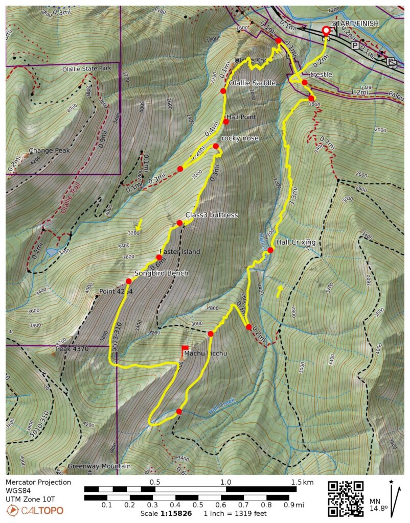
- Route Maps & Profiles
- Photo Gallery
Route Summary
Region: North-Central Washington Cascades
Sub-Region: Iron Horse Mountains
Areas: Mt. Baker – Snoqualmie National Forest & Palouse-to-Cascades State Park
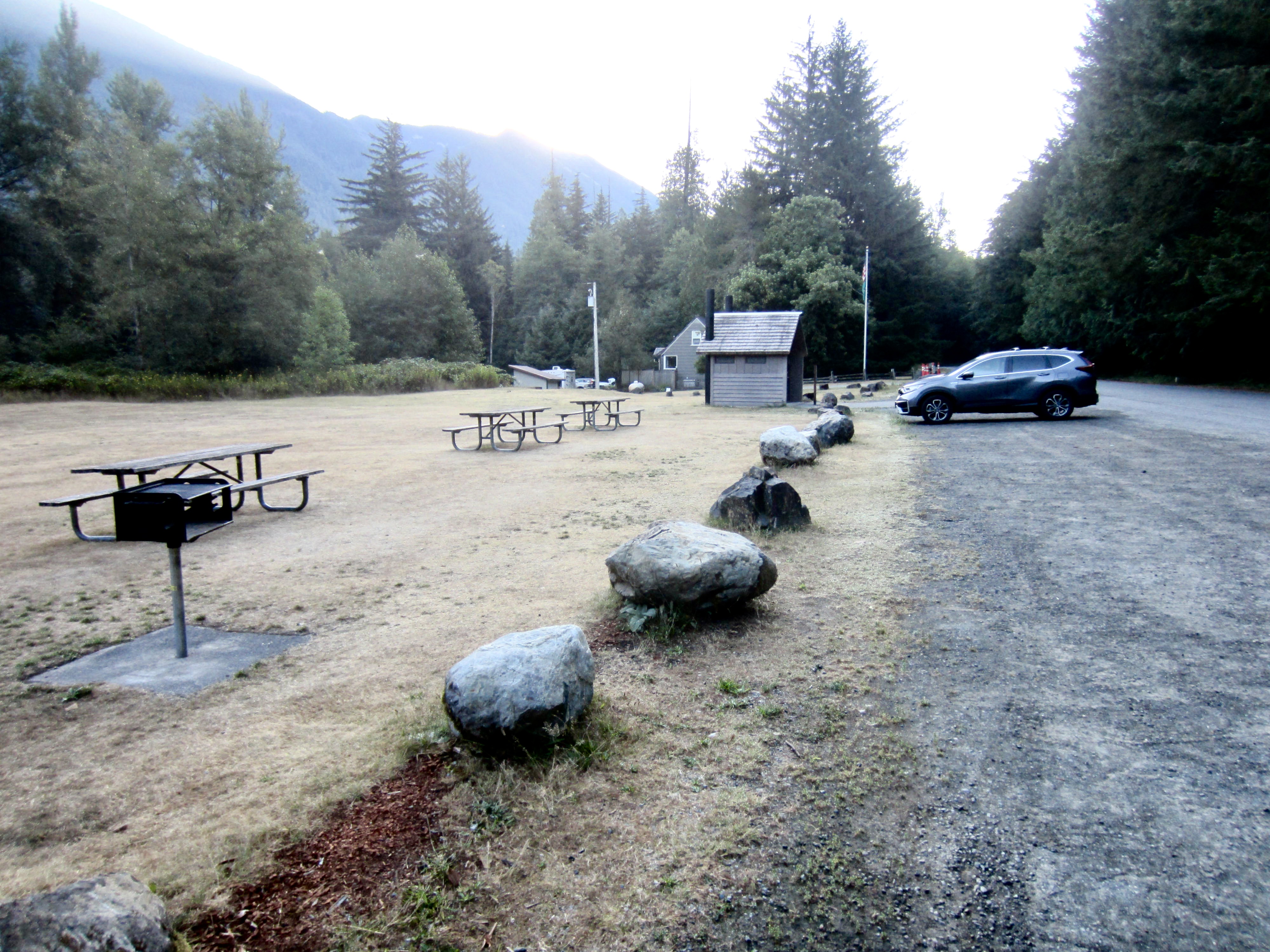
Starting & Ending Point: Hall Creek Trailhead on SE Homestead Valley Road adjacent to Olallie State Park – South Fork Picnic Area (Elev. 1220 feet)
Option A: Up & Back Trek
Ascent Way Points: Palouse-to-Cascades Trail junction & Hall Creek Trestle & Change Creek Trail junction & Hall Creek Viewpoint & big block & Olallie Saddle & Hall Point Trail junction & Songbird Peak Trail junction & rocky nose & Class 3 buttress & Easter Island notch & The Incisors & Songbird Bench & Songbird Peak summit & Greenway Saddle & Greenway Mountain summit (trail hike & trail scramble & off-trail hike).
Sidetrip 1: Olallie Knob (trail hike & trail scramble)
Sidetrip 2: Hall Point (trail hike)
Summit 1: Songbird Peak (trail hike & off-trail hike via Northeast Ridge)
Summit 2: North Greenway Peak (off-trail hike via South Ridge)
Summit 3: Greenway Mountain (off-trail hike via West Slope)
Approximate Stats for Olallie Knob (round trip): 2.6 miles traveled; 1250 feet gained & lost.
Approximate Stats for Hall Point (round trip): 2.6 miles traveled; 1400 feet gained & lost.
Approximate Stats for Easter Island (round trip): 5.0 miles traveled; 2600 feet gained & lost.
Approximate Stats for Songbird Peak (round trip): 5.6 miles traveled; 3200 feet gained & lost.
Approximate Stats for North Greenway Peak (round trip): 6.7 miles traveled; 3450 feet gained & lost.
Approximate Stats for Greenway Mountain (round trip): 7.4 miles traveled; 3550 feet gained & lost.
Option B: Songbird – Machu Picchu Loop
Loop Way Points: Palouse-to-Cascades Trail junction & Hall Creek Trestle & Change Creek Trail junction & Hall Creek Viewpoint & big block & Olallie Saddle & Hall Point Trail junction & Songbird Peak Trail junction & rocky nose & Class 3 buttress & Easter Island notch & The Incisors & Songbird Bench & Machu Picchu Saddle & Road 9023 / Road 9023-310 junction & Machu Picchu Trail junction & Hall Creek Trail junction & West Fork Hall Creek crossing & Hall Creek crossing & Zigzag Trail junction & Hall Creek Trestle abutment & Hall Creek Trailhead (trail hike & trail scramble & off-trail hike).
Summit Sidetrip 1: Songbird Peak (trail hike & off-trail hike via Northeast Ridge)
Summit Sidetrip 2: Machu Picchu Crag (rock scramble via Northwest Ridge)
Approximate Stats for Loop Only: 6.3 miles traveled; 3100 feet gained & lost.
Approximate Stats for Loop & Sidetrips: 6.6 miles traveled; 3450 feet gained & lost.
Route Overview
The Hall–Change Divide offers a series of worthwhile day hiking and scrambling destinations within the Interstate-90 corridor closely east of North Bend. Hall Point, one of the two closest destinations, is accessible via a well-graded trail, which makes it suitable for even casual hikers. Olalllie Knob, the other closest destination, requires a bit of easy but somewhat exposed scrambling near the top, thereby requiring slightly more confidence. Easter Island Crags, Songbird Peak, North Greenway Peak, and Greenway Mountain are farther destinations that require careful navigation on steep, primitive, overgrown trails and roads, and they involve some Class 2-3 scrambling. As such, these are more suitable for experienced hikers who can appreciate a challenge.
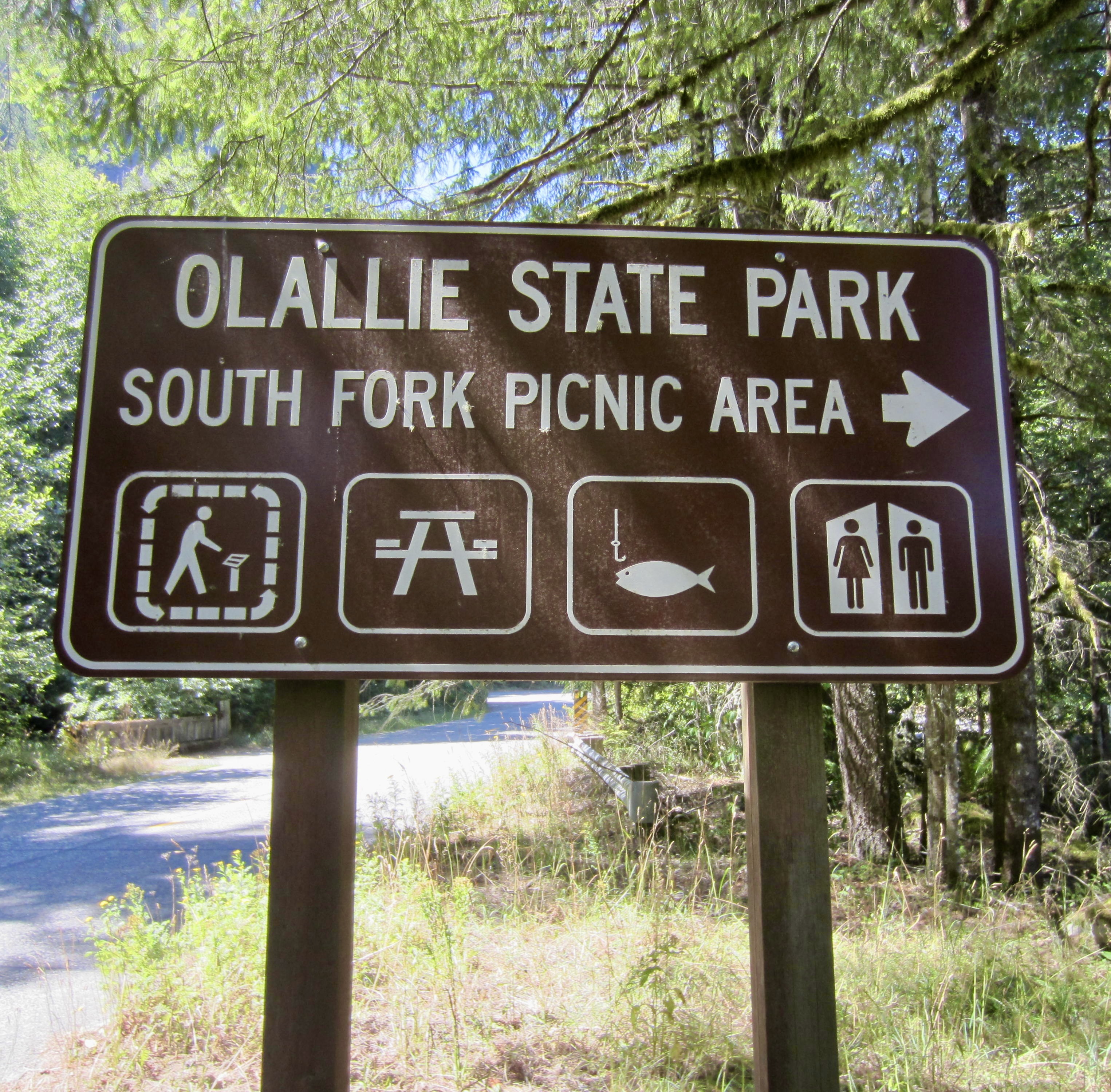
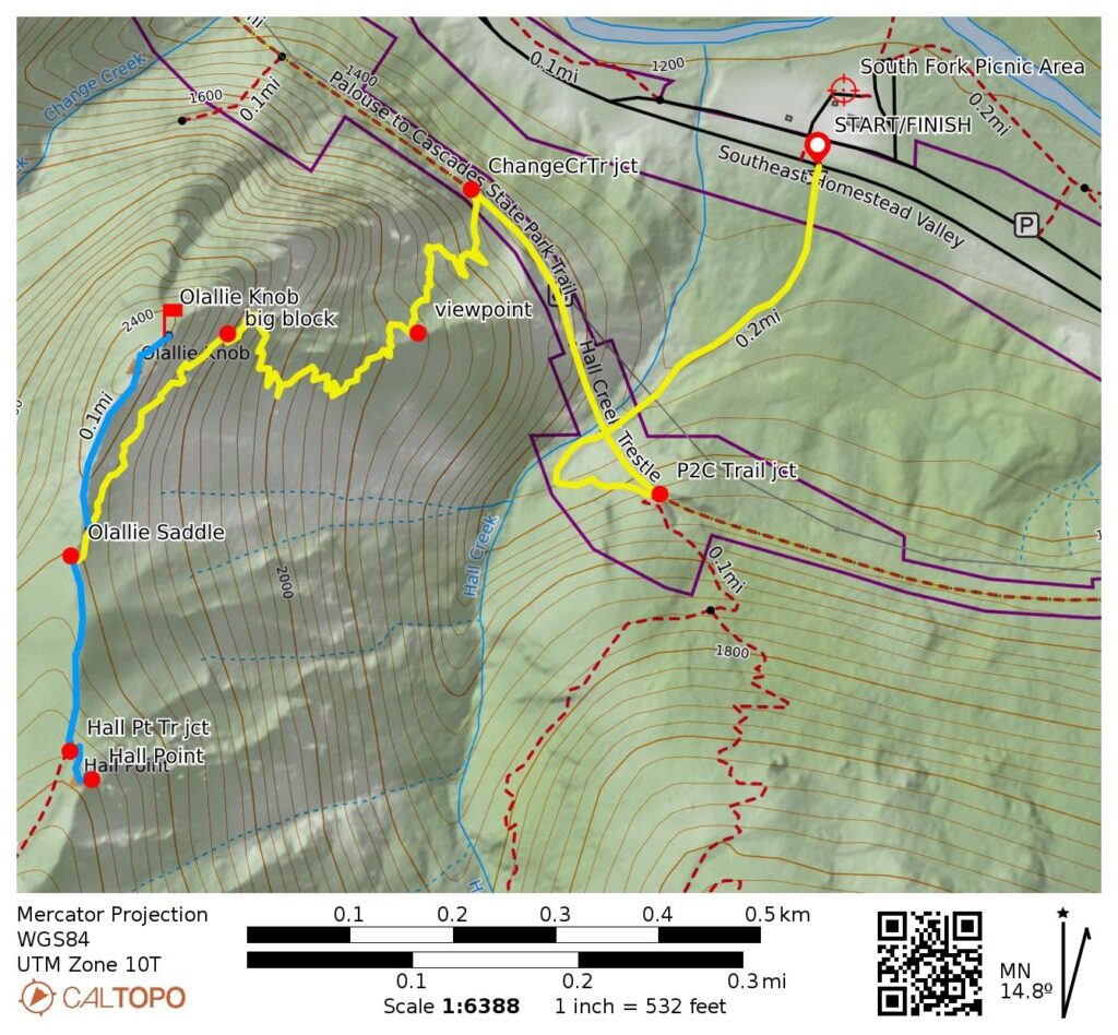
All treks begin at the Hall Creek Trailhead near Olallie State Park. To reach this trailhead, take Exit 38 off Interstate-90 and follow SE Homestead Valley Road to Olallie State Park’s South Fork Picnic Area. Ample parking is available within the picnic area itself (a Discover Pass is required here). From this parking lot, walk southward across the road and go left a short distance to the trailhead. Alternatively, limited parking is available on the southern side of the road, directly across from the picnic area and adjacent to the trailhead (no permit needed).
.
Note: If you have seen a warning on the Washington Trails Association website in regards to this route, and if it has given you concerns about hiking here, please see my comments in the Usage Considerations section near the end of this post.
Full Route Descriptions
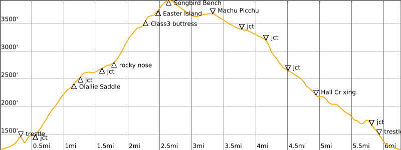
The route descriptions for the various destinations are presented in six separate segments: (1) Hall Creek Trailhead to Olallie Saddle; (2) Olallie Saddle to Olallie Knob; (3) Olallie Saddle to Hall Point; (4) Hall Point to Easter Island; (5) Easter Island to Songbird Peak; and (6) Songbird Peak to North Greenway Peak. Additional descriptions are included for (7) a descent via the same route on the Hall–Change Divide, to complete an up-and-back trek, or (8) a descent via the Machu Picchu and Hall Creek Trails, to create a big loop.
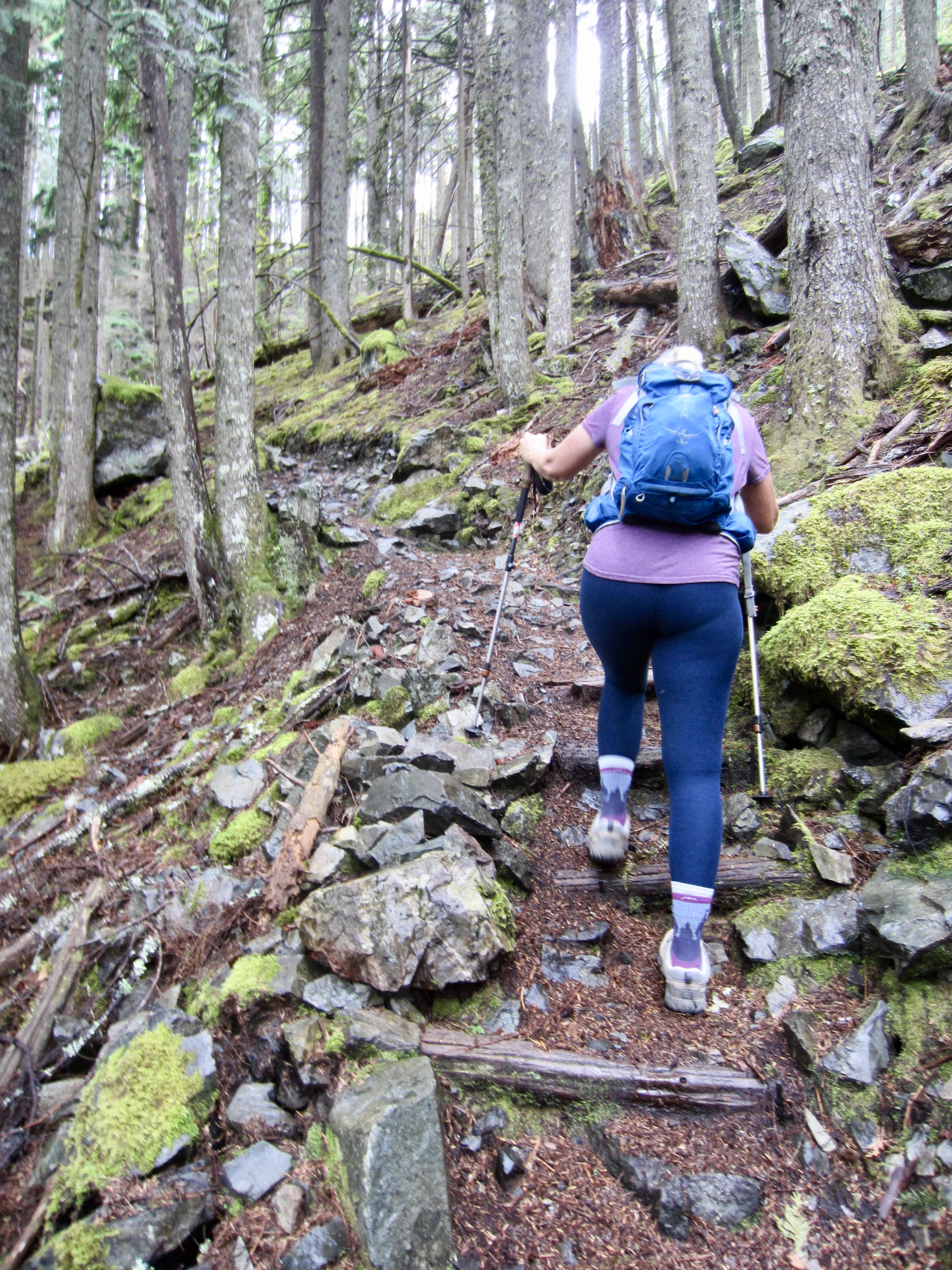
Trailhead to Olallie Saddle
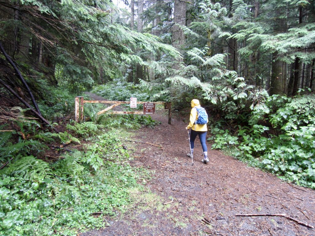
The Hall Creek Trail begins unceremoniously on an abandoned spur road that extends southward from SE Homestead Valley Road. This discreet spur road can be identified by a rusty iron gate with several warning signs. Rest assured that none of these signs restricts hiking.
.
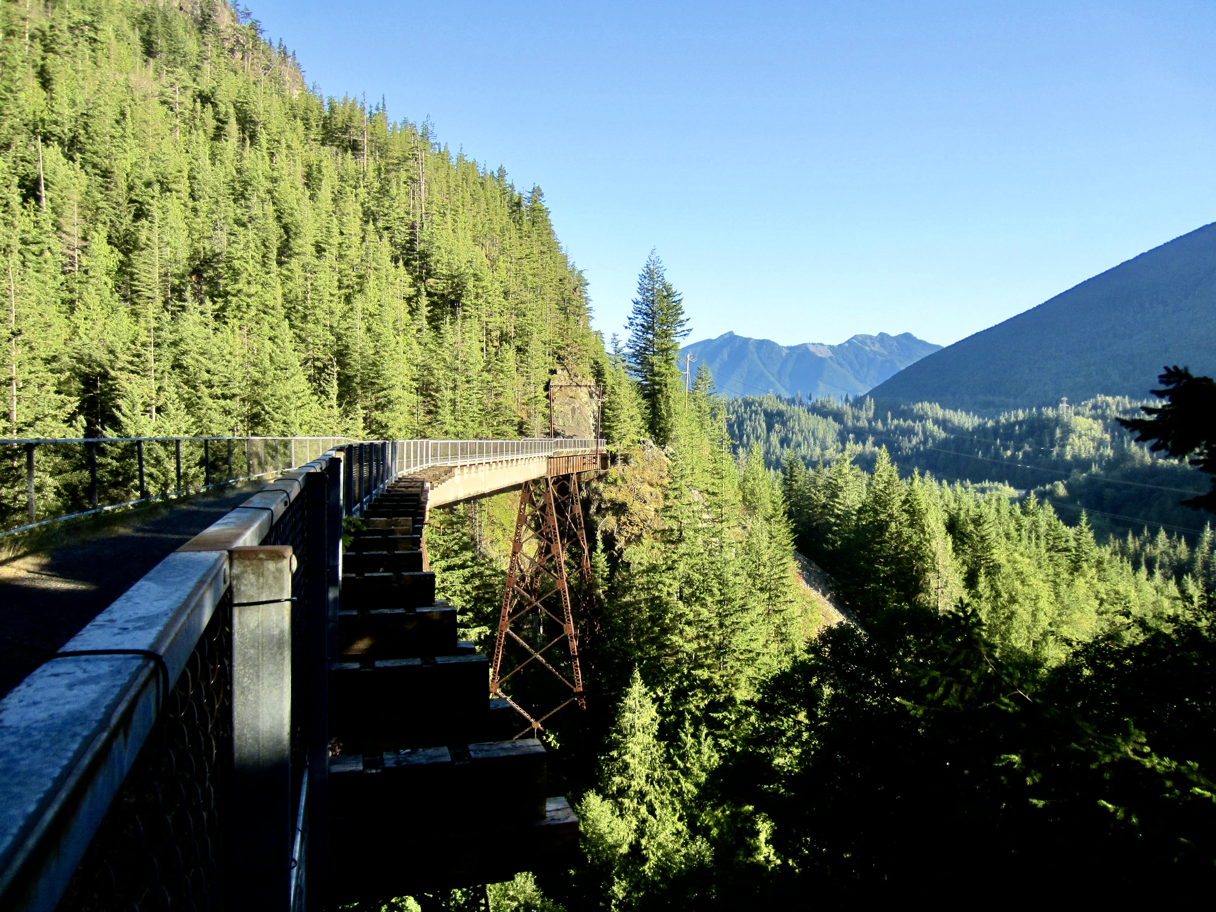
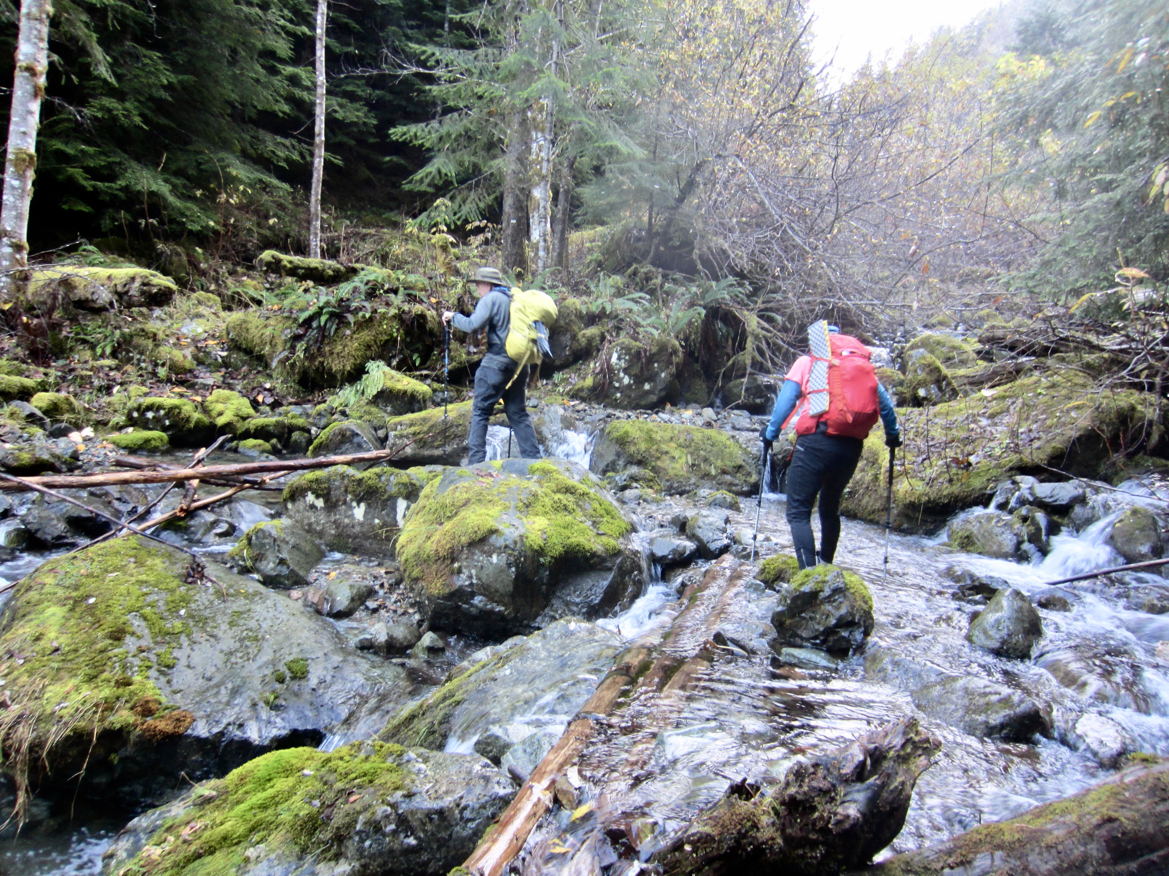
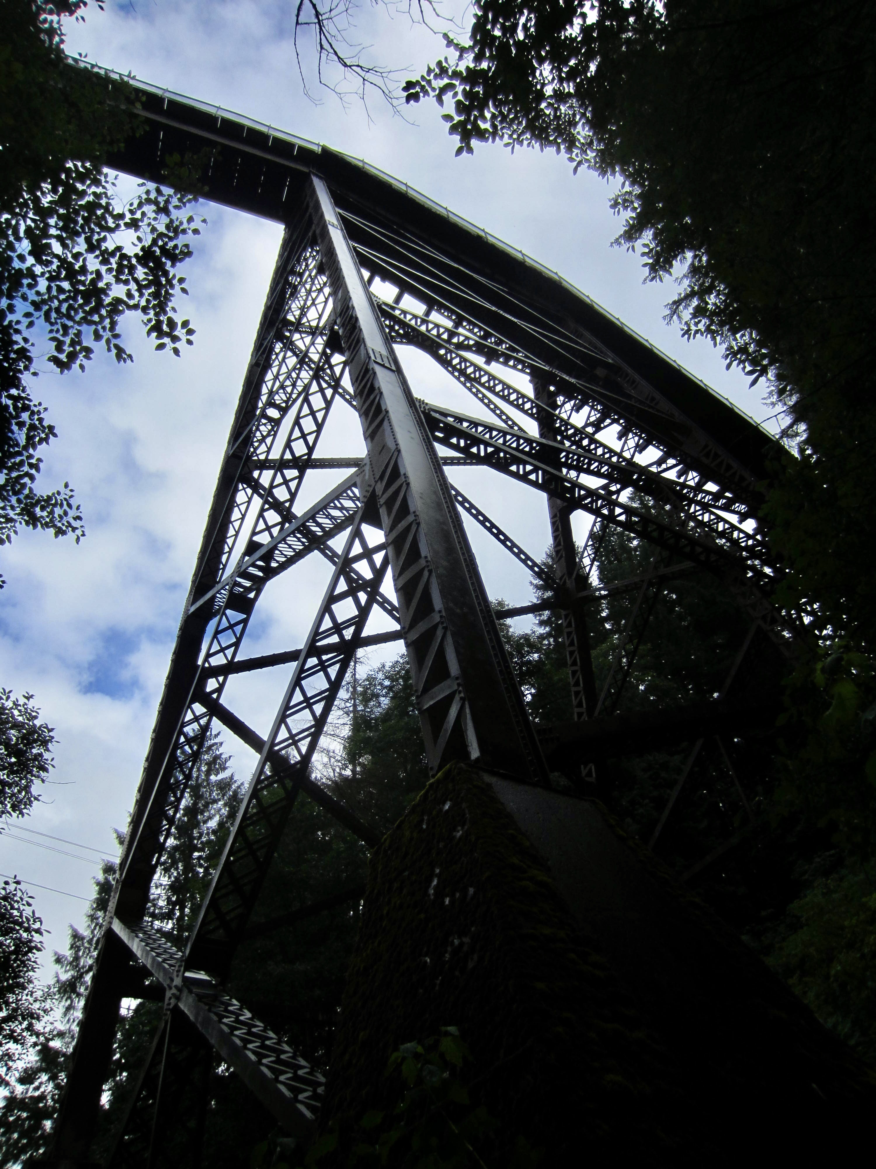
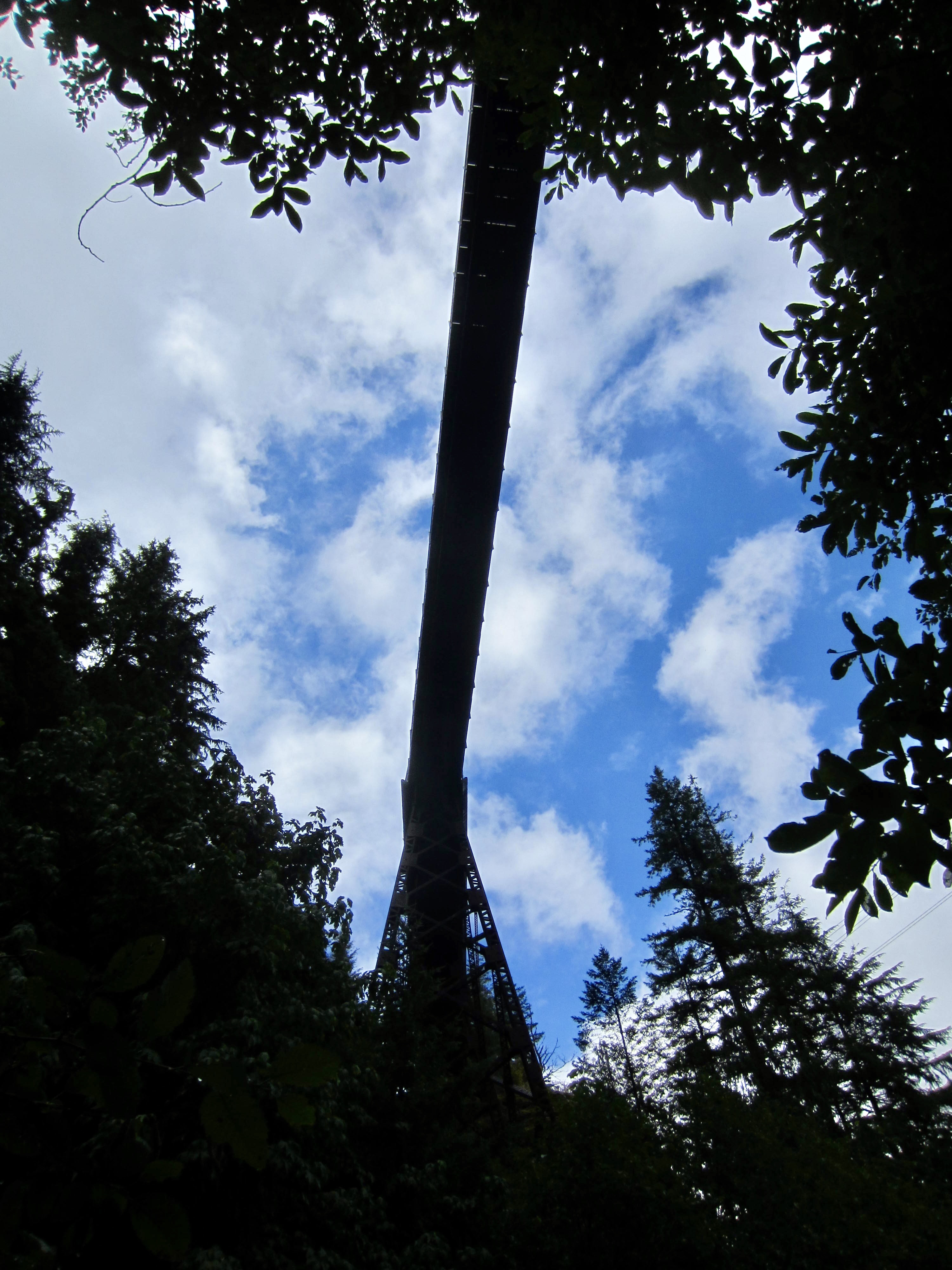
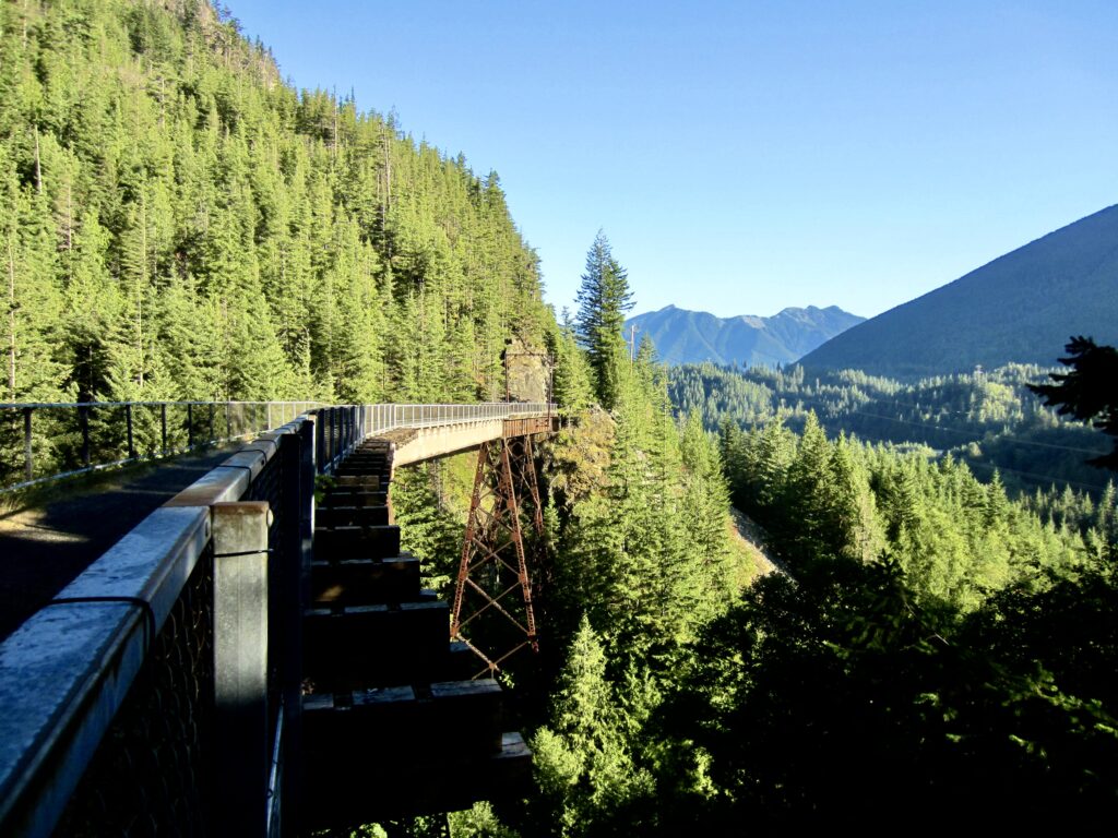
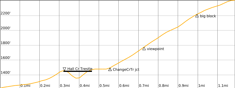
The trail heads uphill at a gentle inclination while angling toward Hall Creek. Very soon, you will pass by the tall lattice support towers of the Hall Creek Trestle. Look up to see a girder bridge 200 feet above your head. This girder was installed in 1999 to replace a portion of the original trestle, which was swept away by a massive mudslide in 1988.
.
After passing under the trestle bridge, the Hall Creek Trail switchbacks up to the left and arrives at the bridge’s eastern abutment. Turn left (west) here and walk across the bridge. You are now on the Palouse-to-Cascades (P2C) Trail. For many years, this splendid “rail-trail” was officially called the John Wayne Pioneer Trail and unofficially known as the Iron Horse Trail.
.
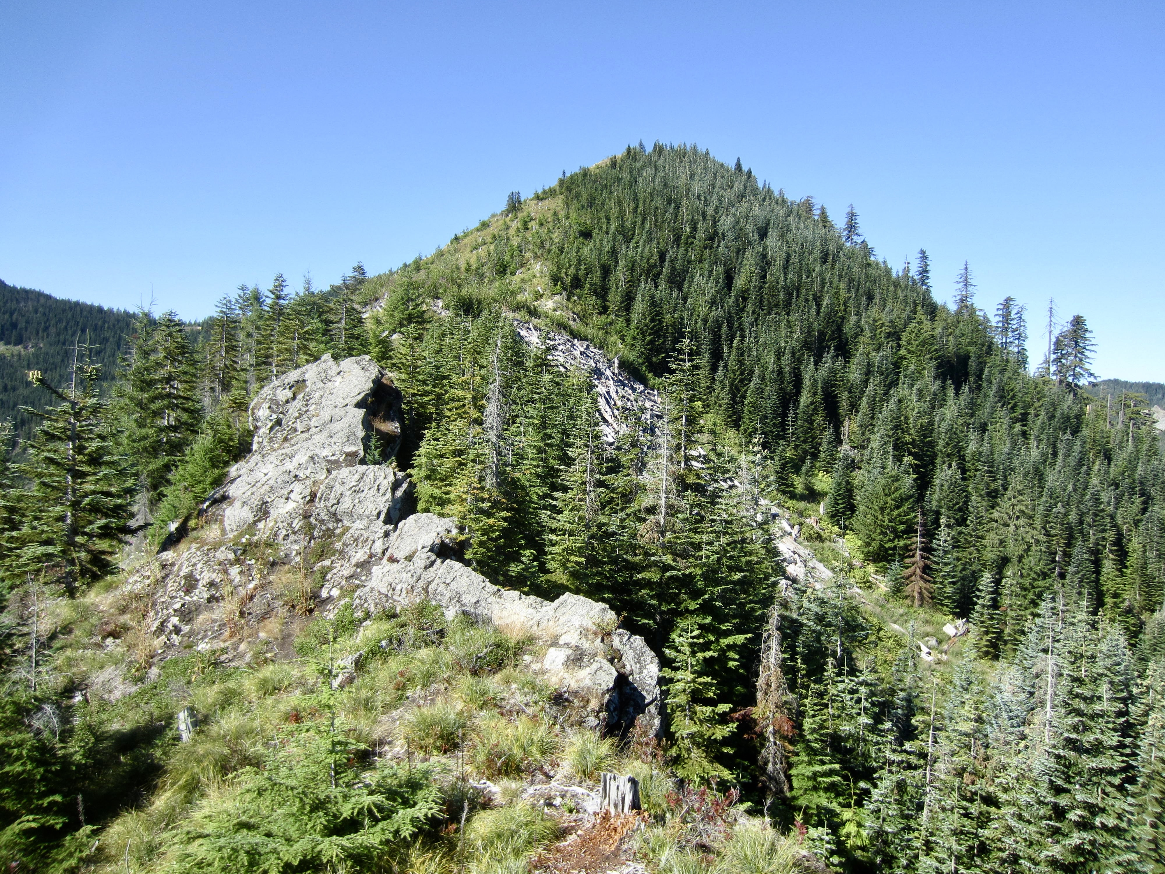
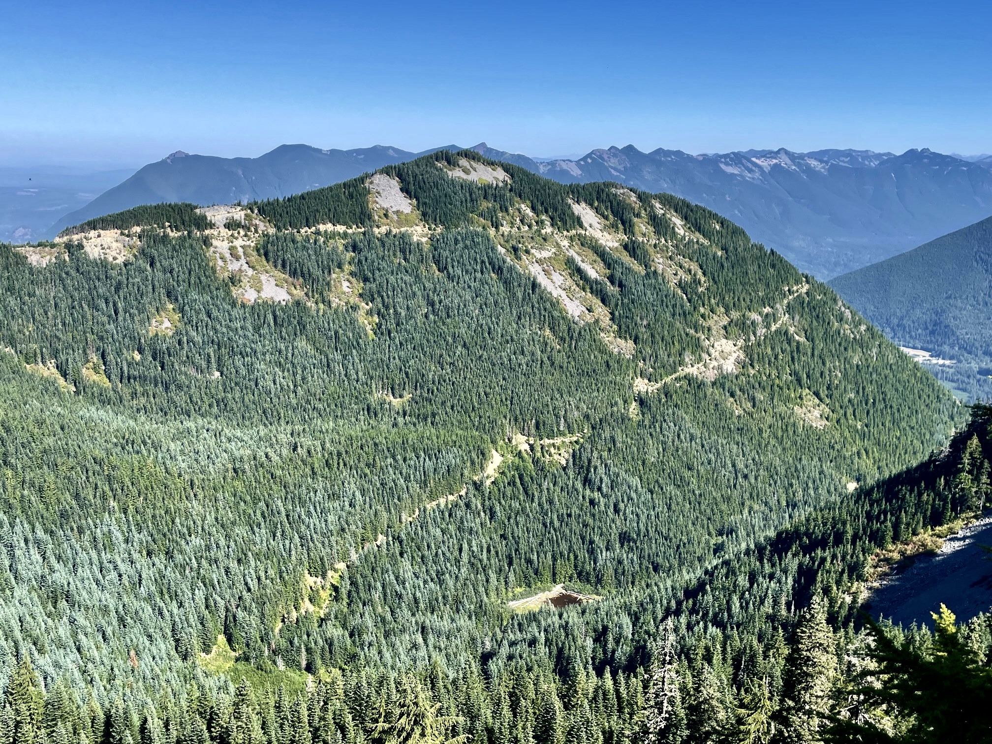
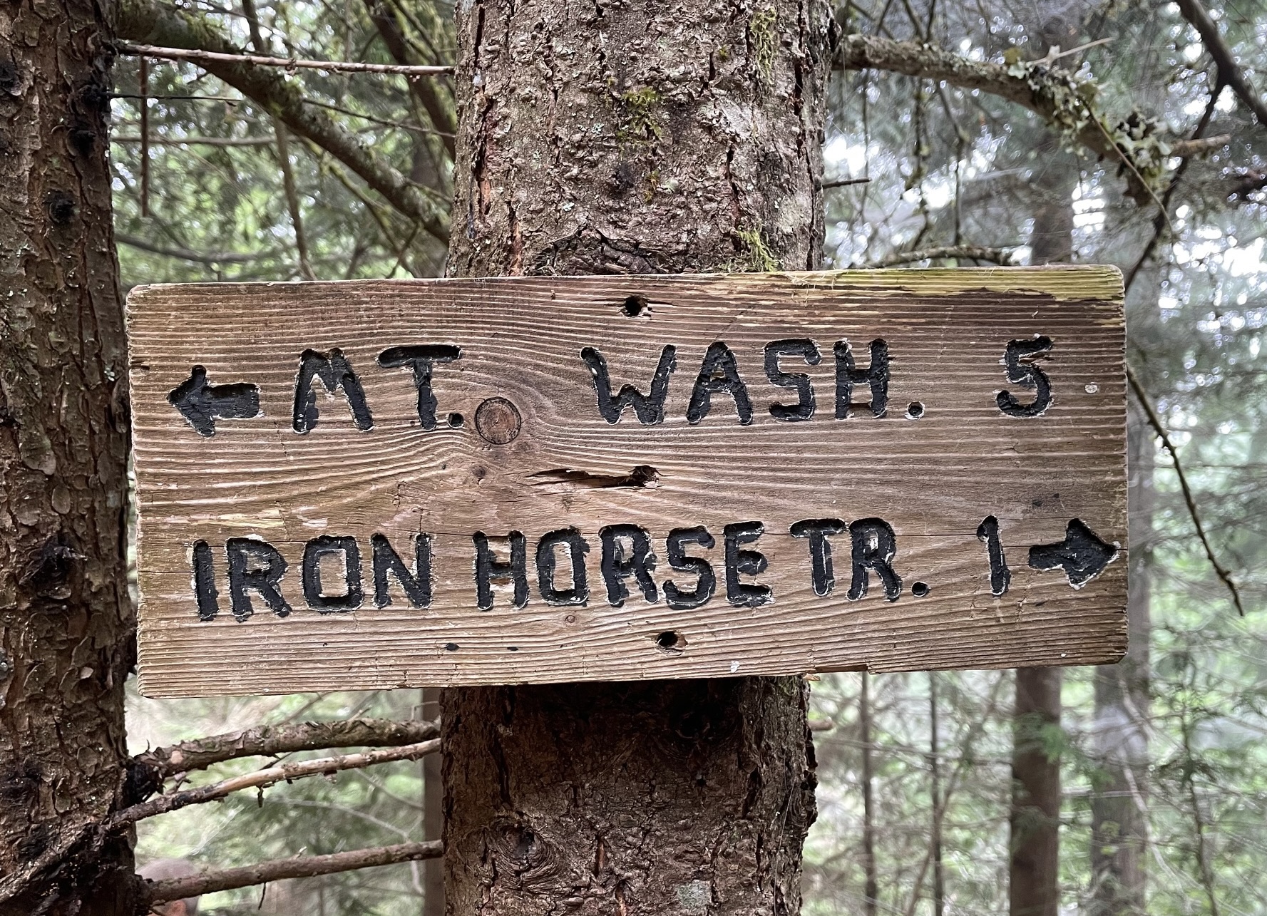
As you cross the Hall Creek Trestle, the Hall–Change Divide comes into view above and to your left. Look for a rounded cliff rising out of the forest is Olallie Knob, and the broad dip on its left side is Olallie Saddle. Hall Point is farther up to the left and obscured by the forest.
.
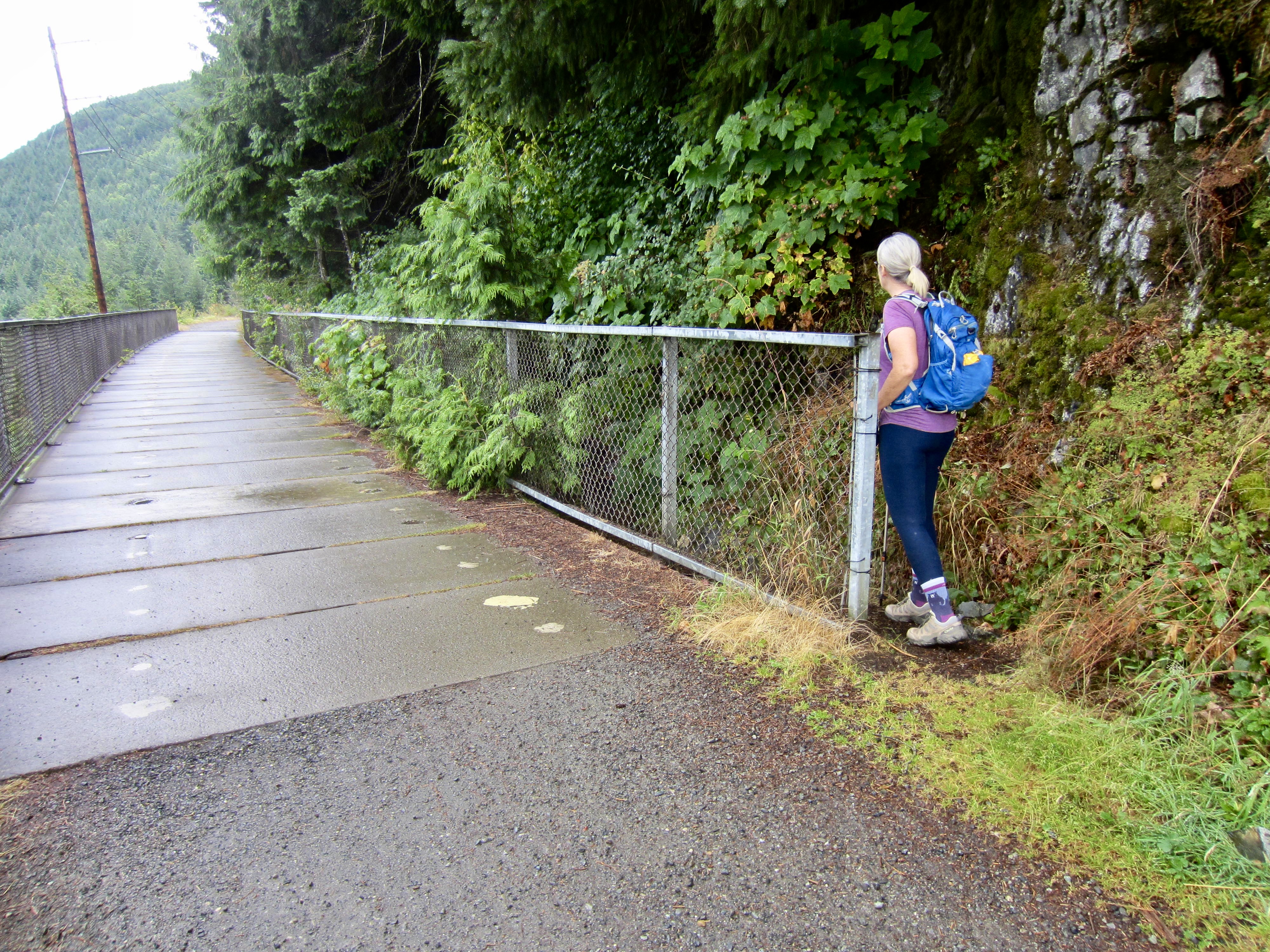
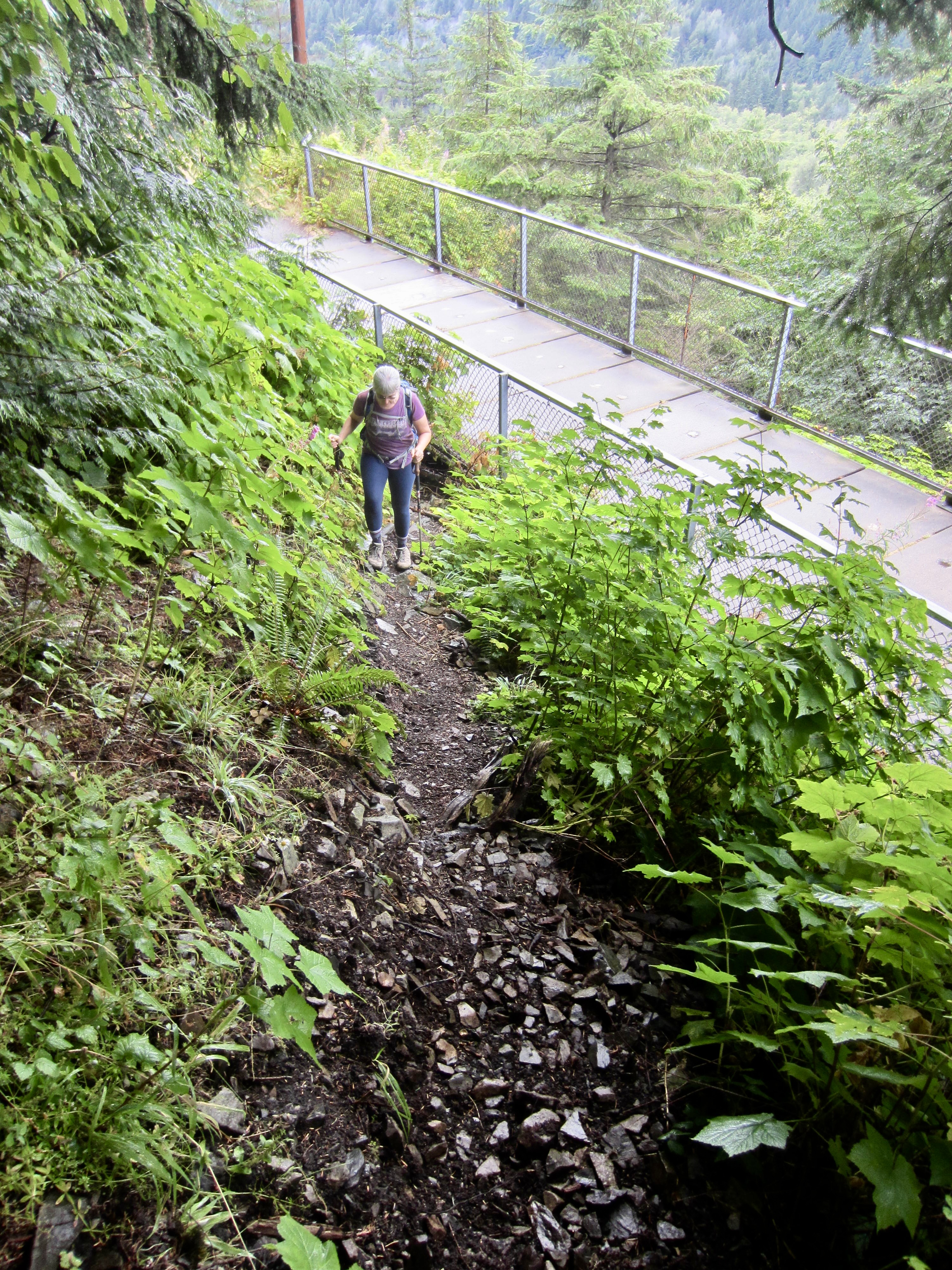
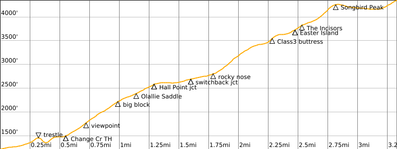
On the far side of the high trestle, you will arrive at a long rock wall that is part of the Deception Crags rock-climbing area. Continue walking for approximately 150 yards, past the climbing wall and across a low concrete-surfaced bridge. At the end of this low bridge, look for a footpath that cuts back sharply to the left (south) behind the uphill fence. This is the beginning of the unofficial Change Creek Trail (0.6 miles + 250 feet from starting point).
.
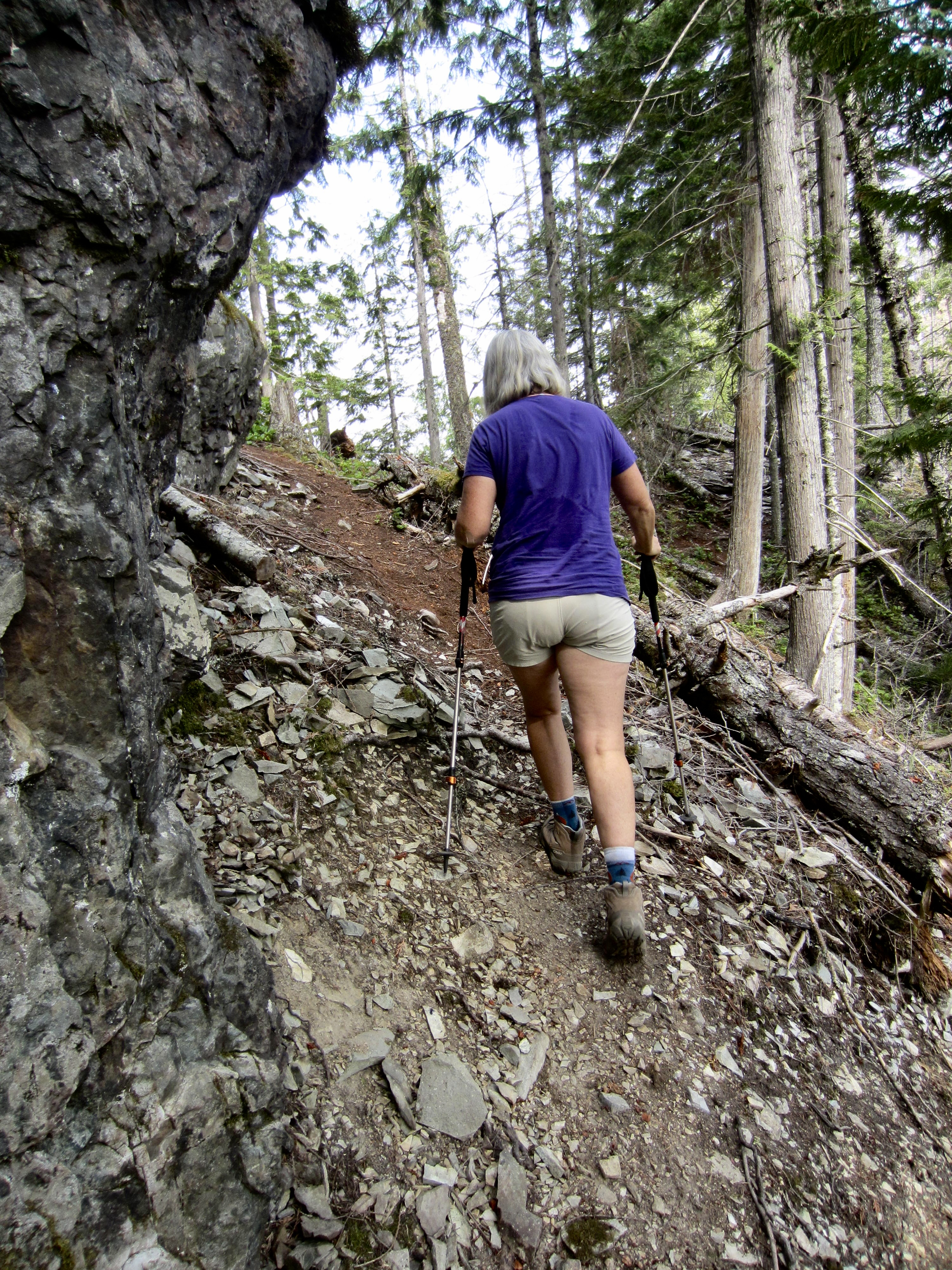
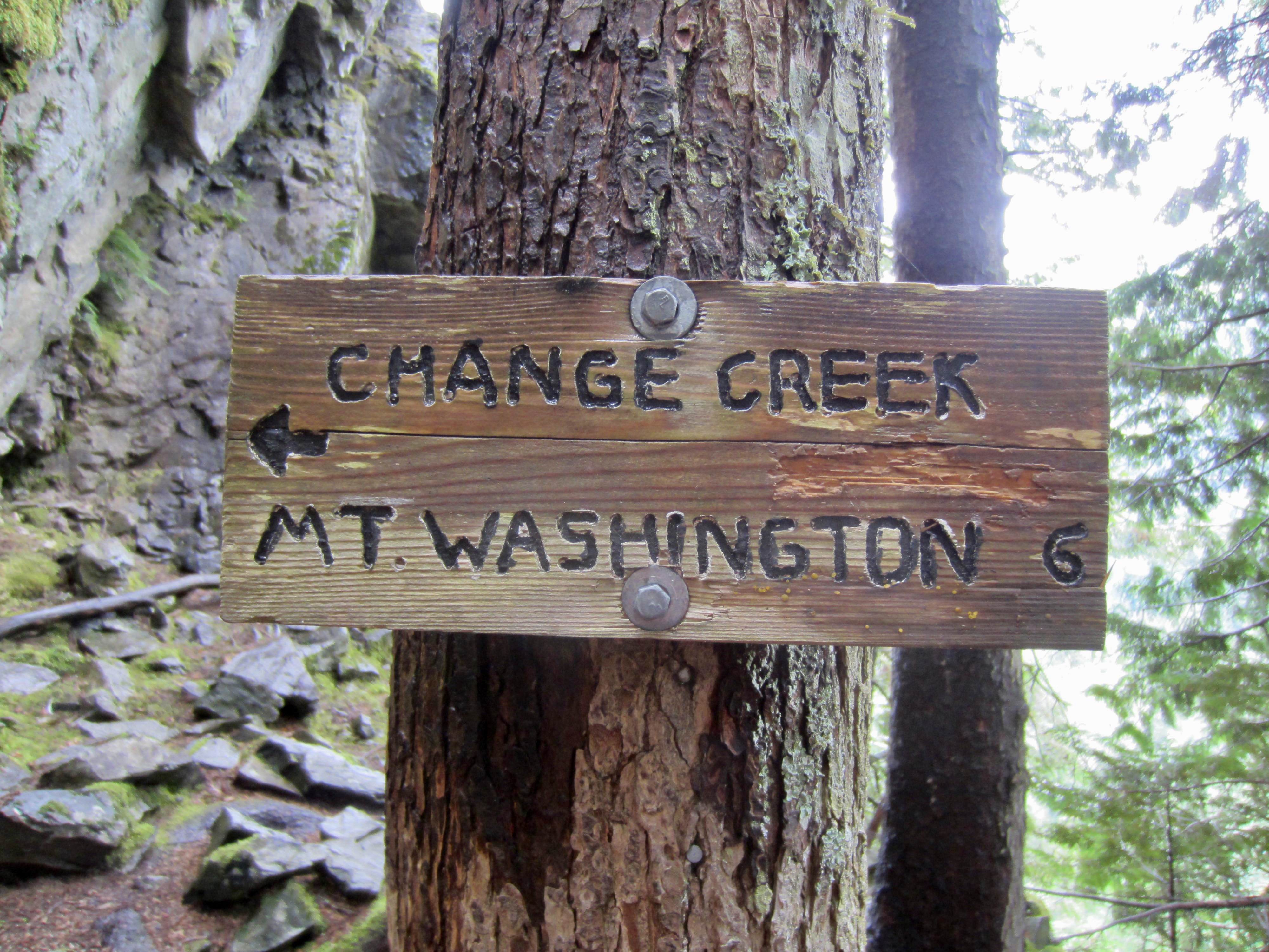
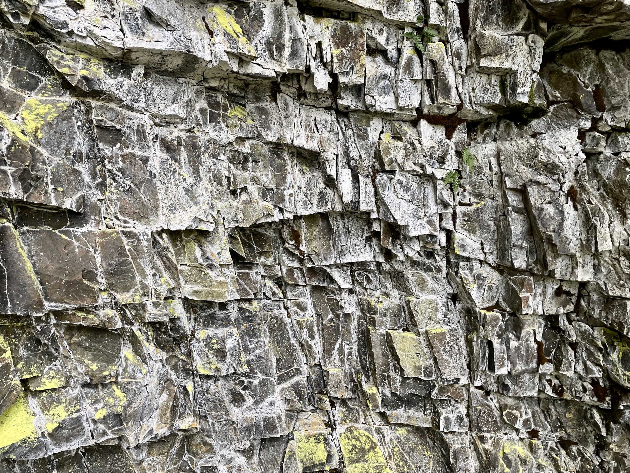
After a short brushy section, the Change Creek Trail enters pleasantly open second-growth forest and continues switchbacking up the steep hillslope at a comfortable grade. A wooden sign at the second switchback indicates that you are heading toward Change Creek and Mt. Washington. Farther uphill, you will pass alongside outcrops of meta-volcanic rocks exhibiting a variety of interesting textures.
.
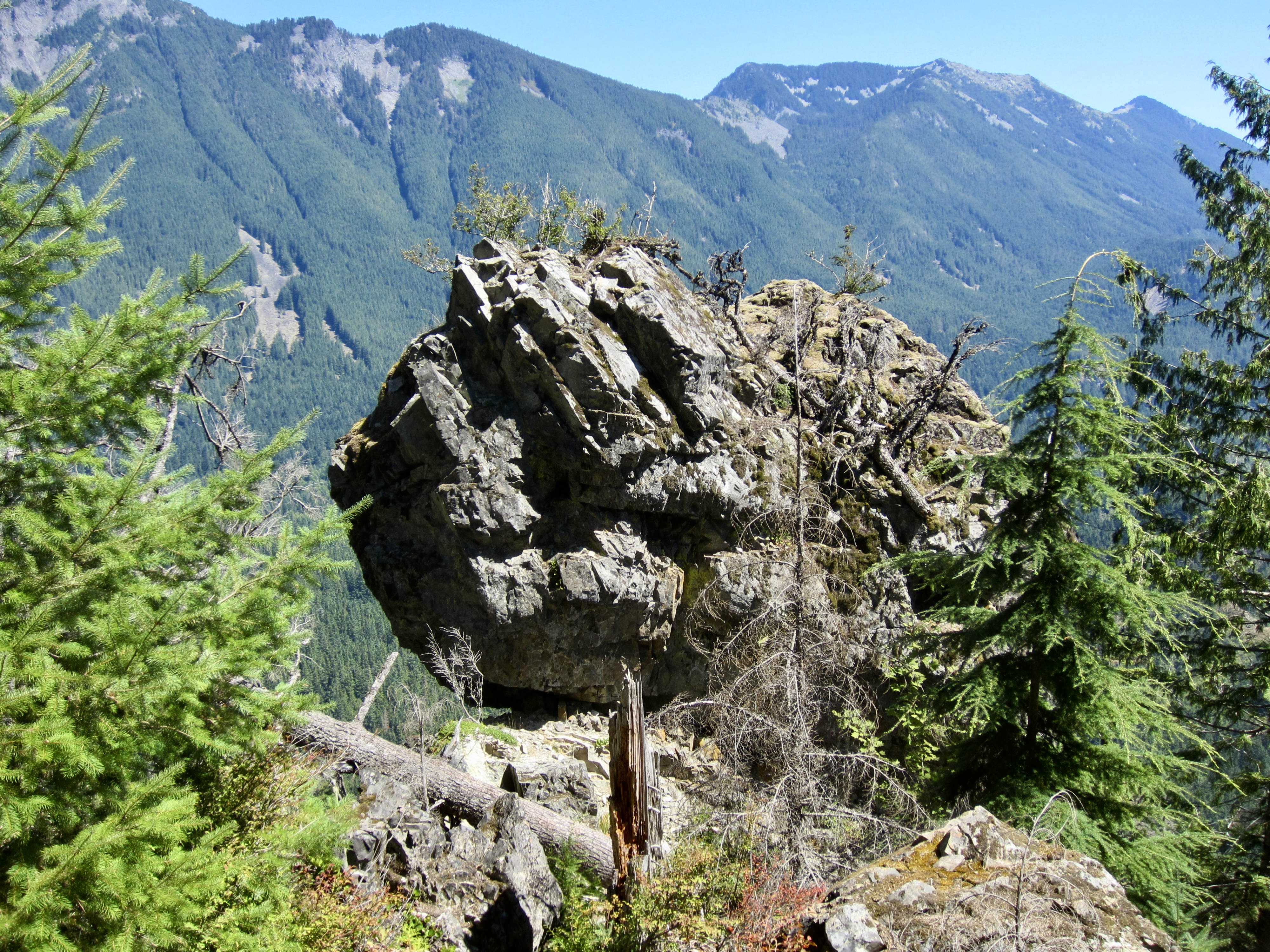
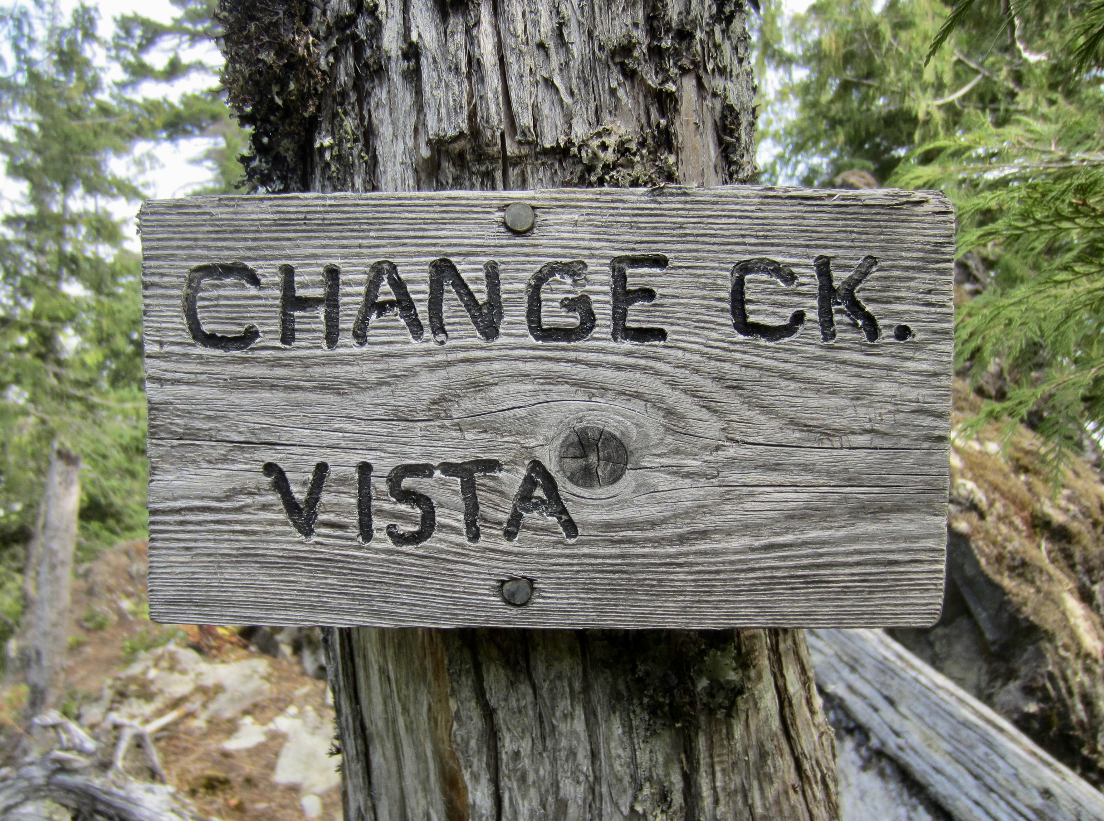
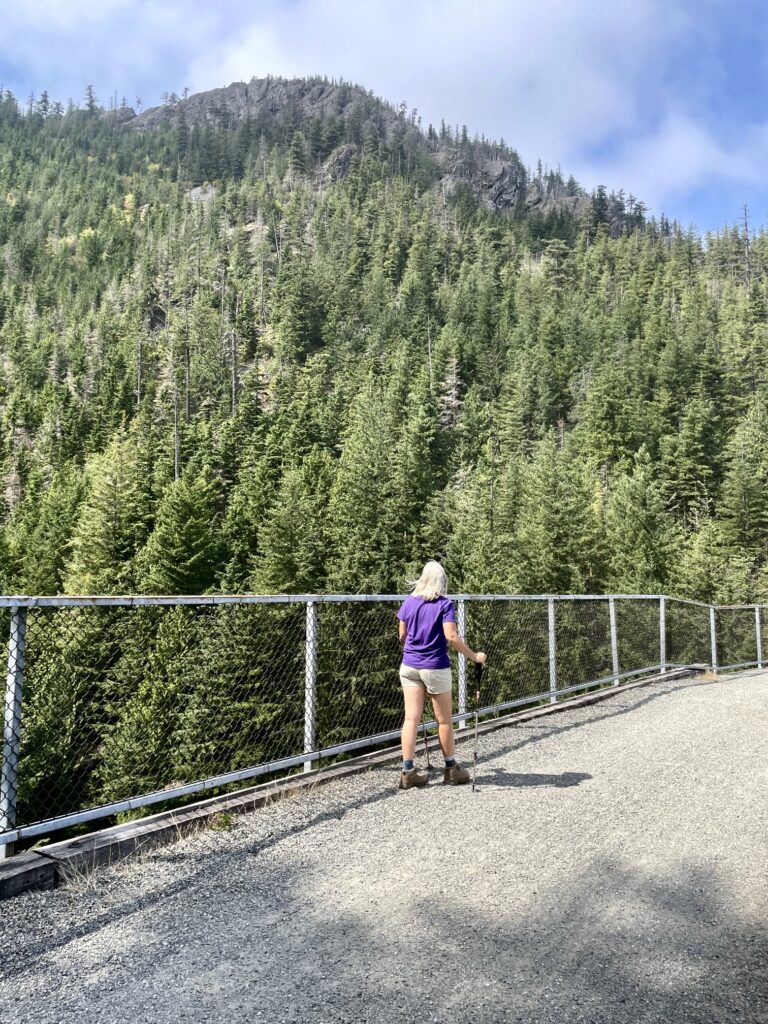
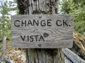
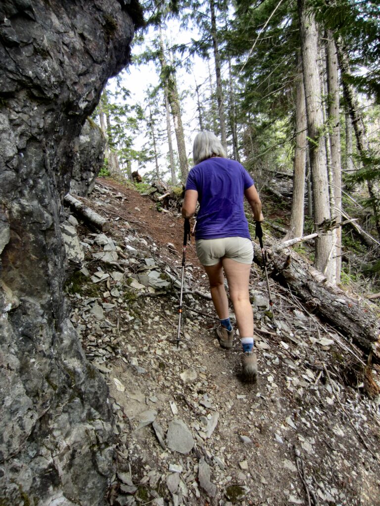
In several locations, the trail reaches the edge of a high cliff that overlooks the Hall Creek Valley. At a higher point, the trail comes close to a rock outcrop that appears to be a giant, precariously perched stone block. Farther up, the trail reaches 2400-foot Olallie Saddle (1.2 miles + 1200 feet from starting point). A small sign here reads “Change Creek Vista” due to its location overlooking Change Creek Valley.

.
Olallie Saddle to Olallie Knob
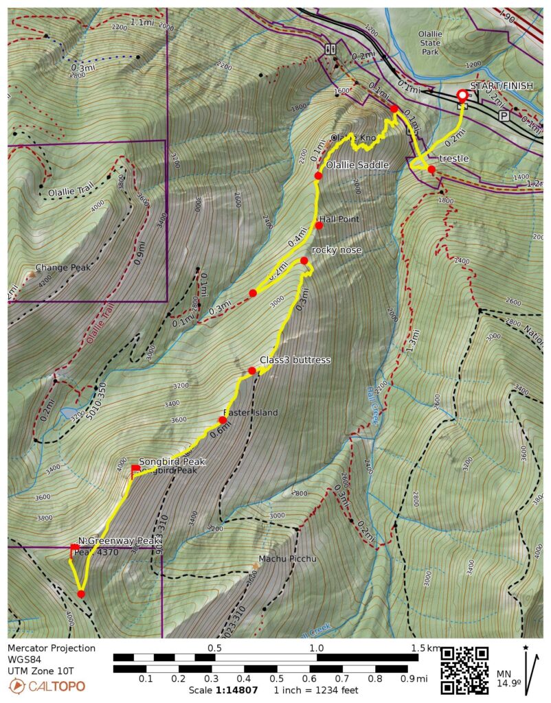
From Olallie Saddle, hike back down the trail for about 20 yards and look for a spur trail angling uphill, adjacent to an overhanging rock face. Follow this spur trail up to the crest, then continue rightward (north) as it wanders along the narrow ridge. At one location, the ridge necks down to form a sharp hogback requiring a little Class 2 scrambling. Beyond here, the ridge widens out and you will soon come to the broad summit of Olallie Knob (1.3 miles + 1250 feet from starting point). Enjoy the excellent view of the Interstate-90 corridor from atop this high bluff, which makes a worthy destination for hikers who don’t mind a bit of exposure.
.
.
.
Olallie Saddle to Hall Point
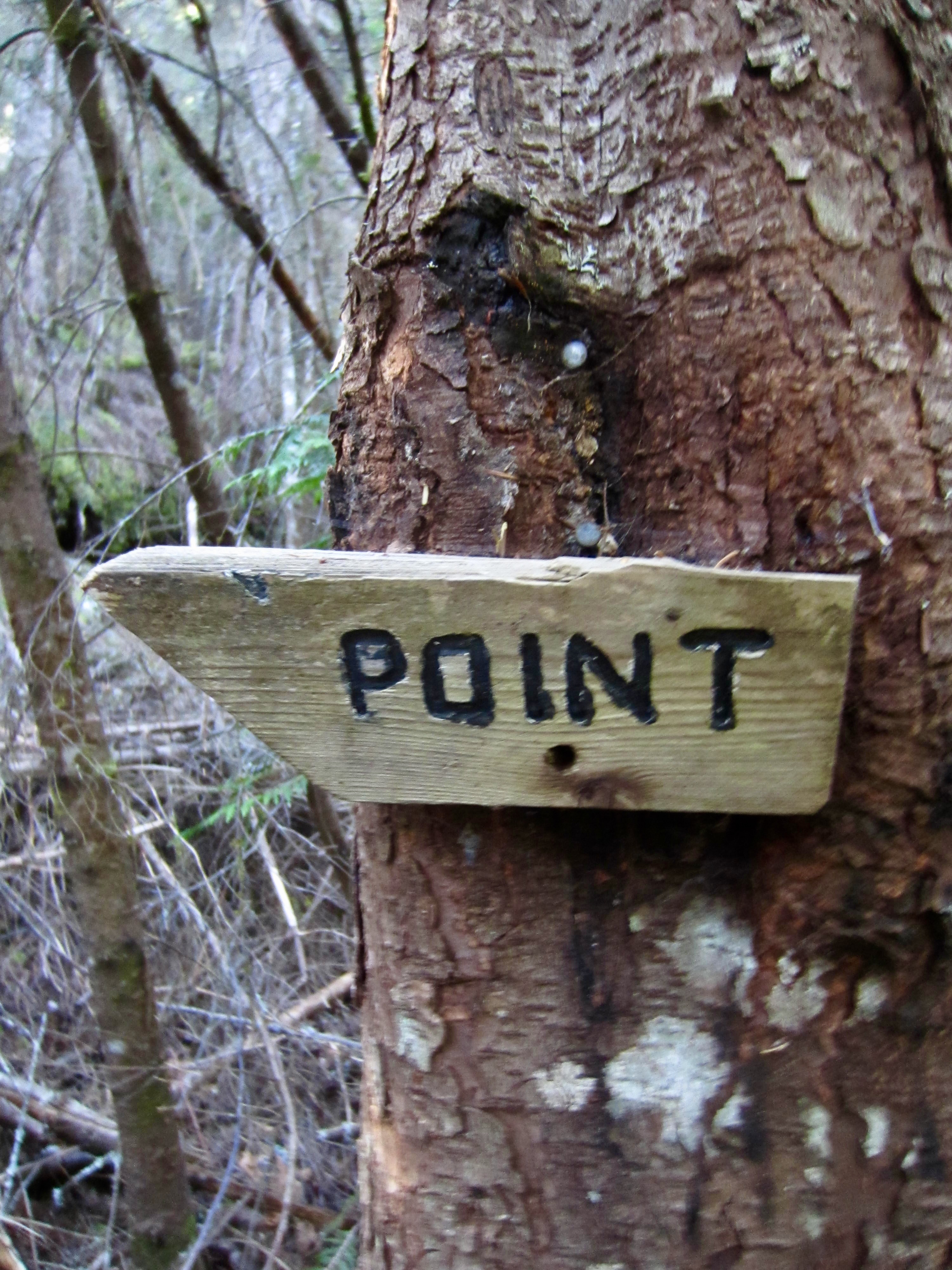
From Olallie Saddle, the main trail continues in a southerly direction up the ridge crest, then crosses over to the right (western) side and traverses through dense forest. In approximately 300 yards, the trail arrives at a junction marked with a wooden sign that points forward to Mt. Washington and a wooden arrow indicating that a “Point” is up to the left. The latter trail switchbacks uphill for 50 yards to reach Hall Point (1.3 miles + 1400 feet from starting point). This high viewpoint provides an excellent destination for casual hikers who prefer not to deal with any exposure. Hall Creek lies far below, and Interstate-90 can be seen snaking its way eastward to Snoqualmie Pass.
.
.
Hall Point to Easter Island
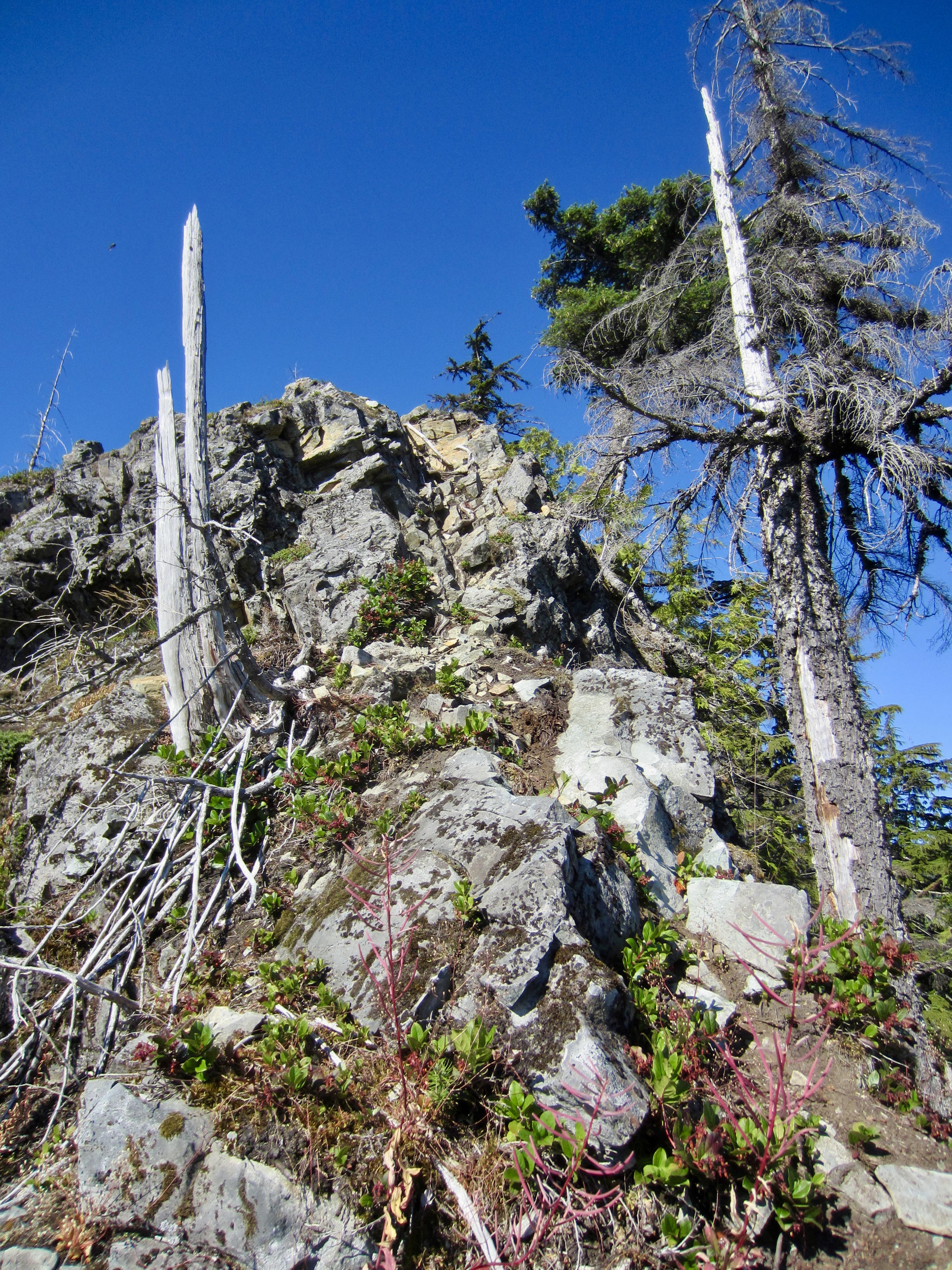
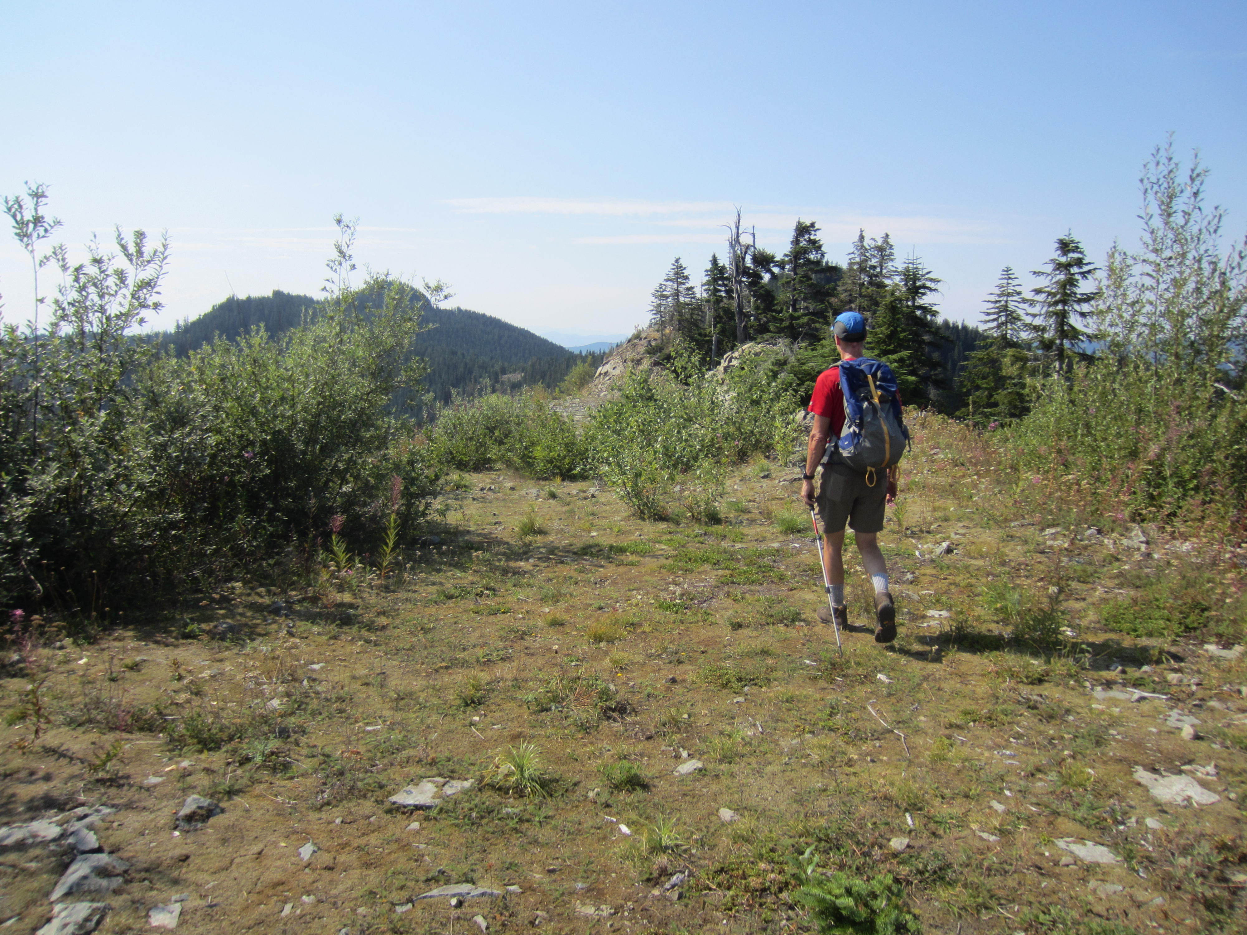
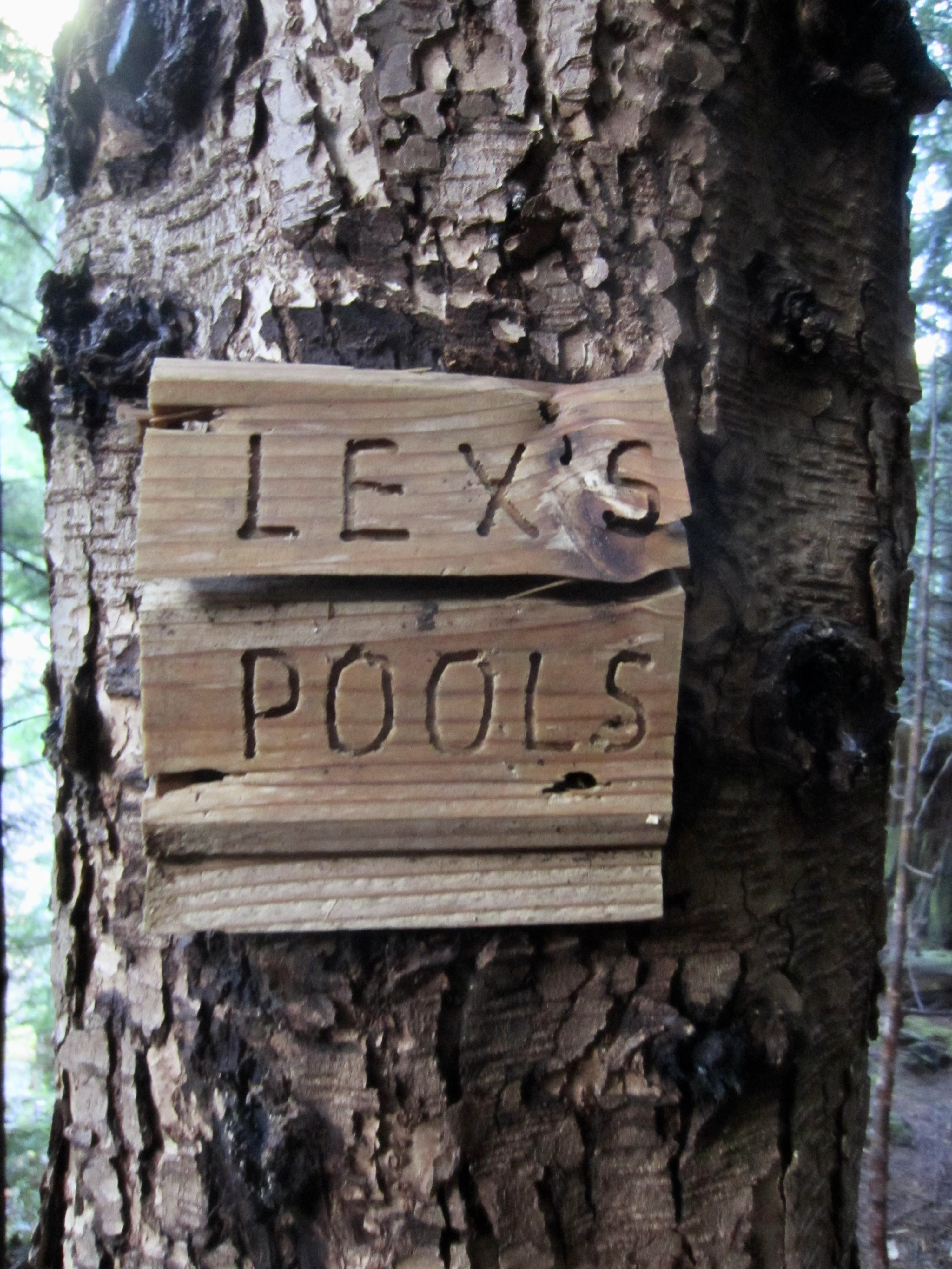
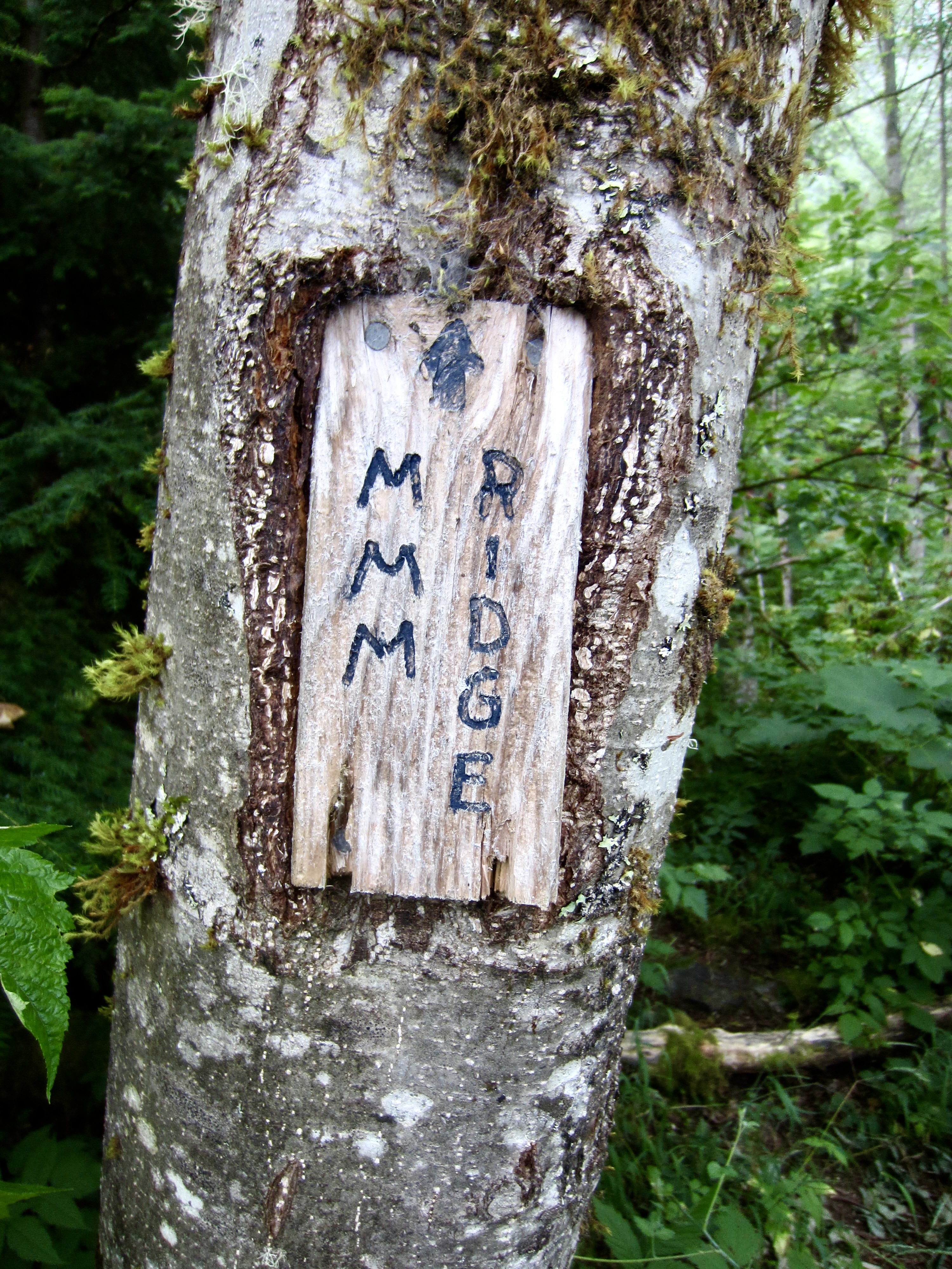
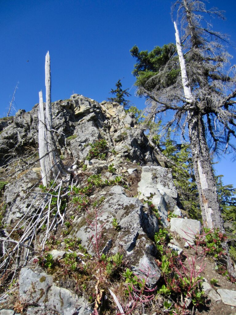
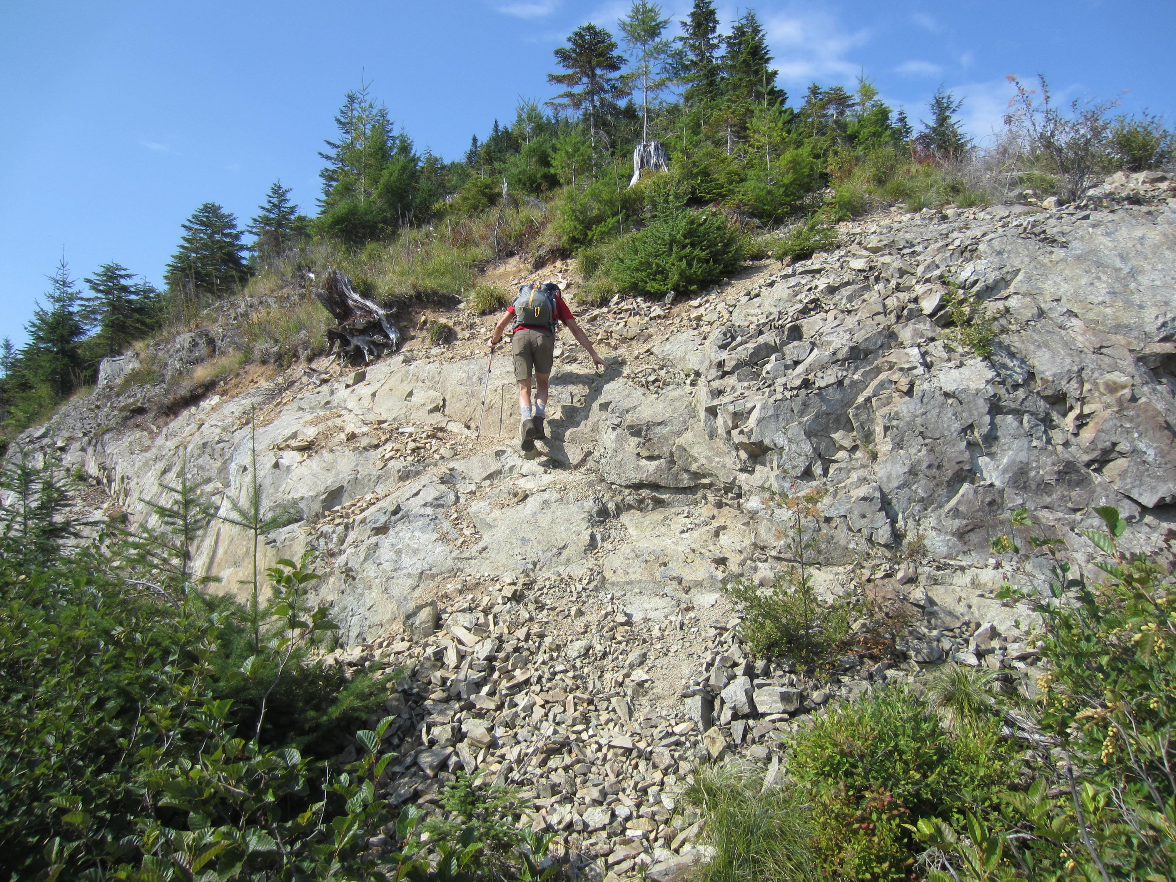
After descending back to the marked junction below Hall Point, turn left and continue hiking southward in the direction of Mt. Washington. From this junction onward, the Change Creek Trail follows an overgrown logging road that traverses across the forested hillside. In ¼ mile, keep your eyes peeled for an inconspicuous junction marked with a small wooden sign that reads “MMM Ridge.” (There as several theories as to what “MMM” means; one is that it refers to the 3M Corporation.) Turn left here and follow another overgrown spur road that angles you back to the ridge crest at a rocky nose (1.8 miles + 1650 feet from starting point).
.
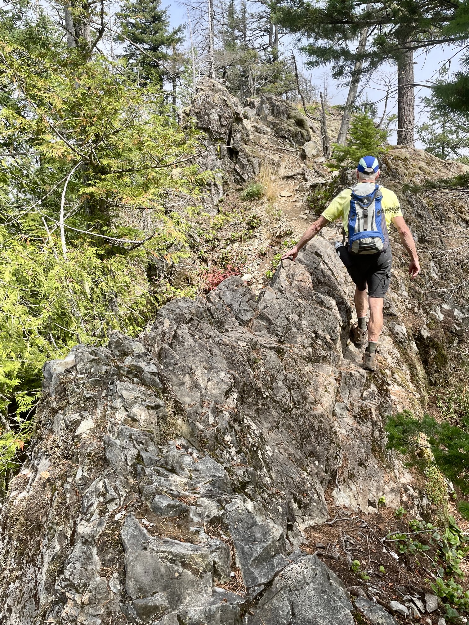
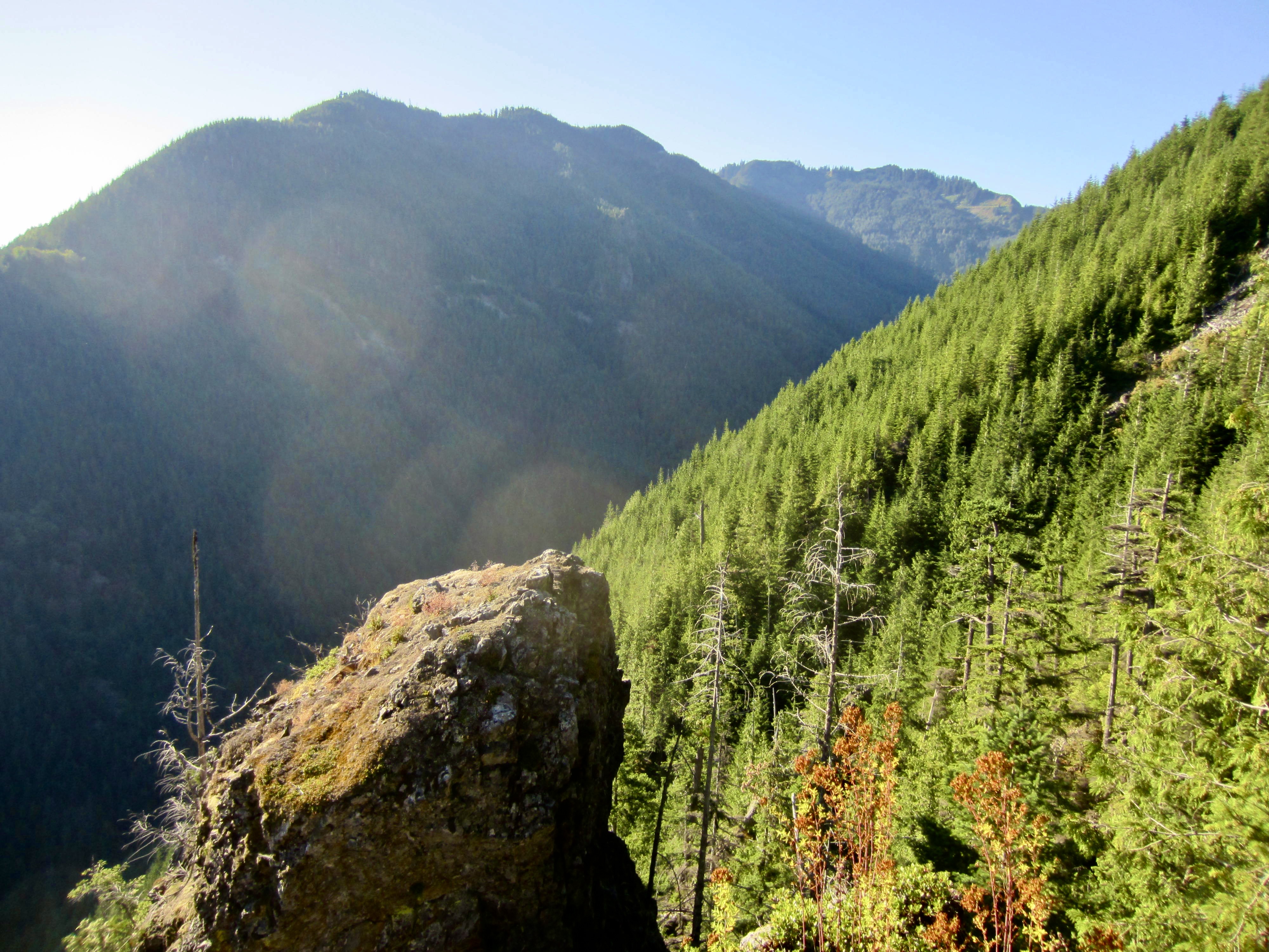
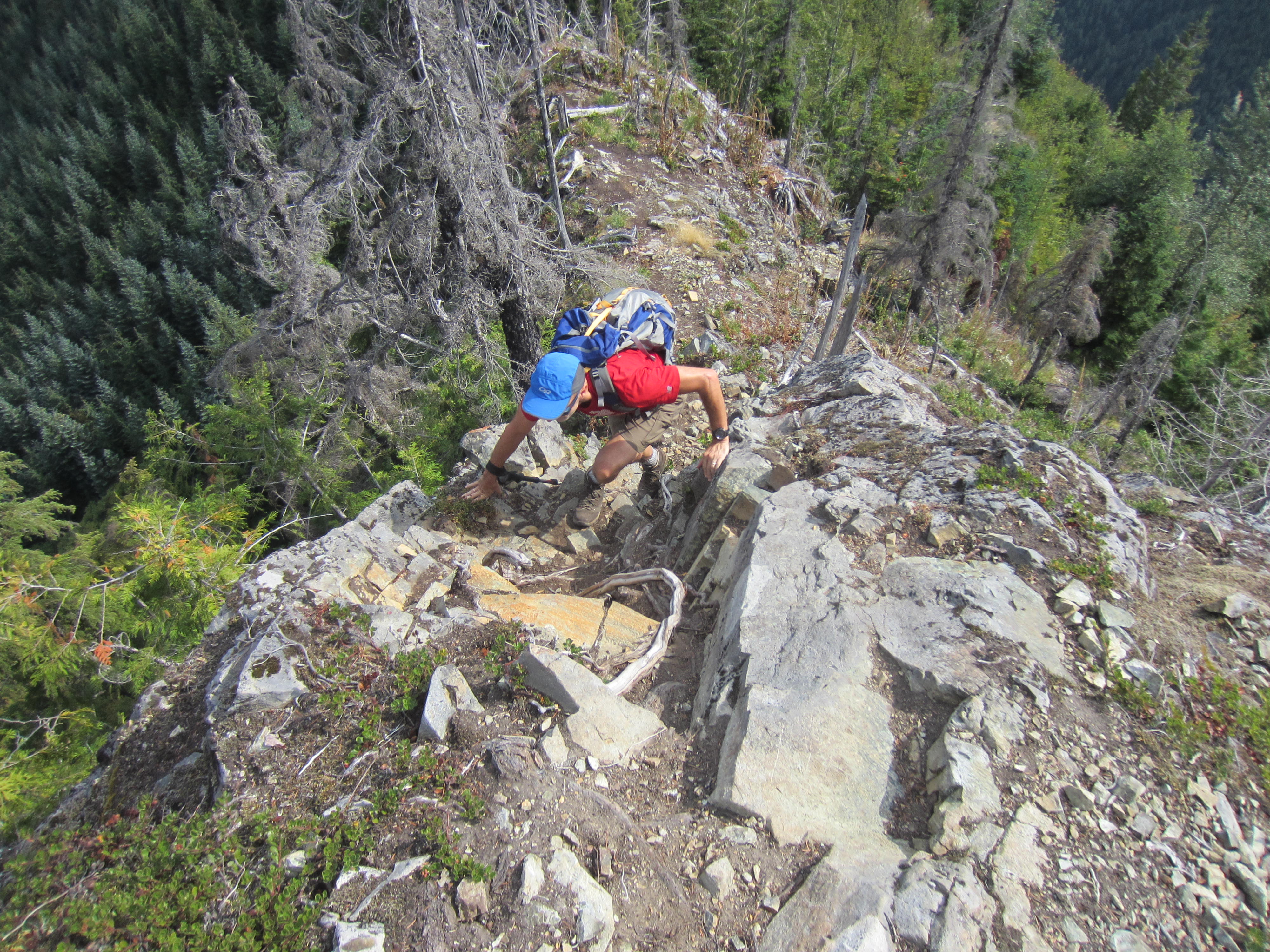
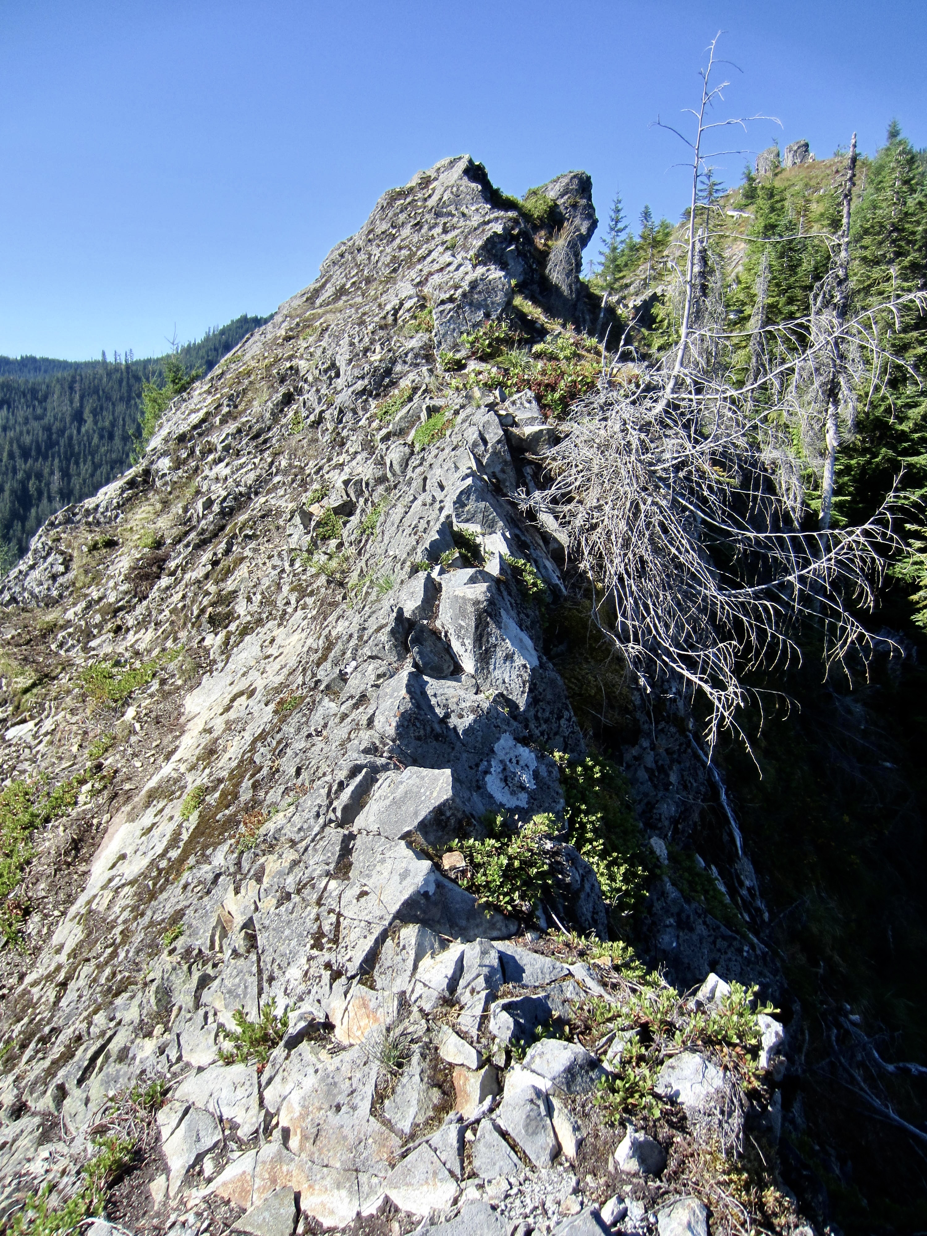
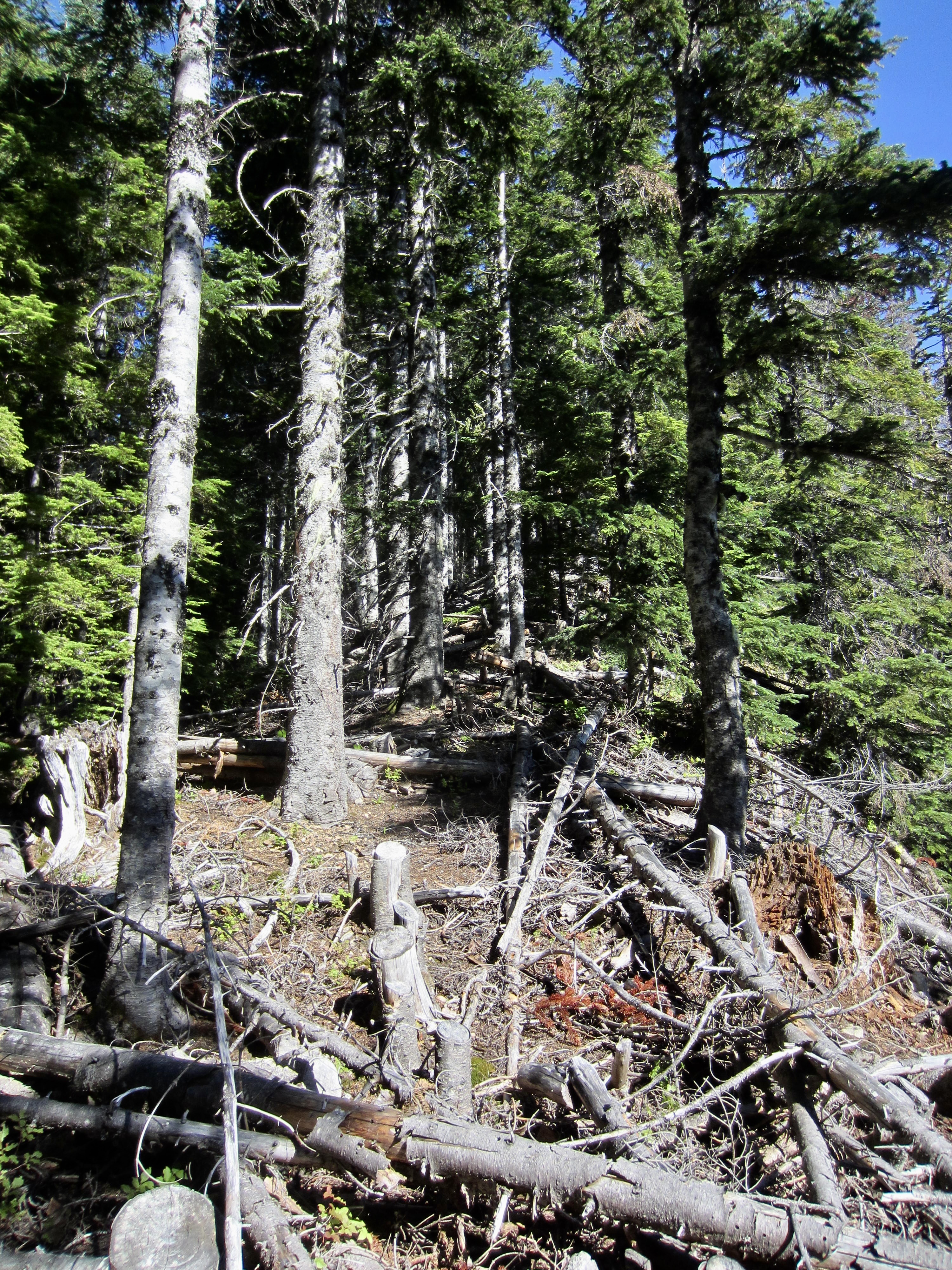
The overgrown spur road ends at the rocky nose, but a brushy trail wraps around the ridge and continues in a southerly direction. This trail, which I call the Songbird Peak Trail, generally stays on or closely left (east) of the ridge crest. In some locations, the crest is remarkably narrow, with steep cliffs plunging into Hall Creek on the left side and Change Creek on the right side. Navigation can be tricky through here; try to stay on the most heavily trodden path.
.
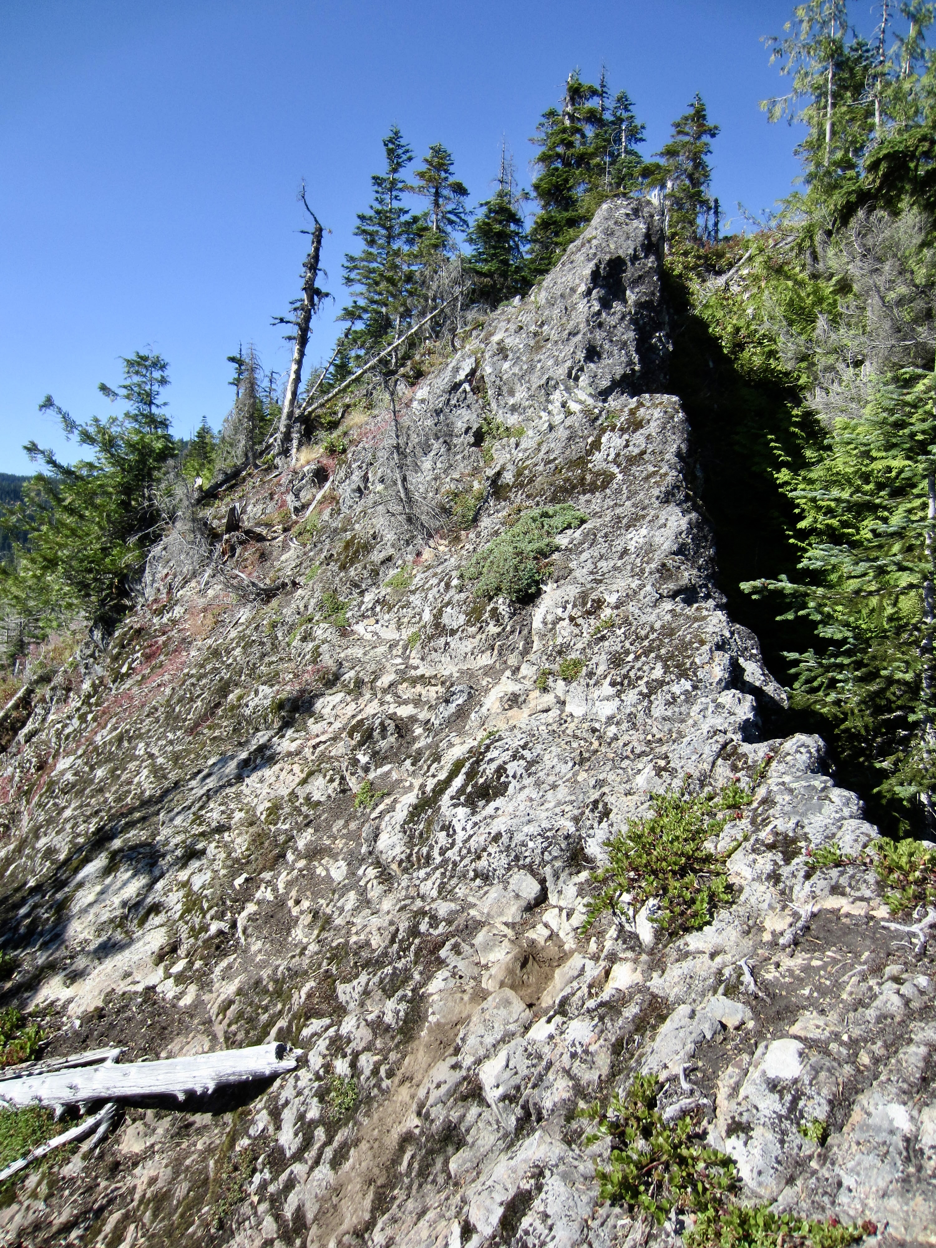
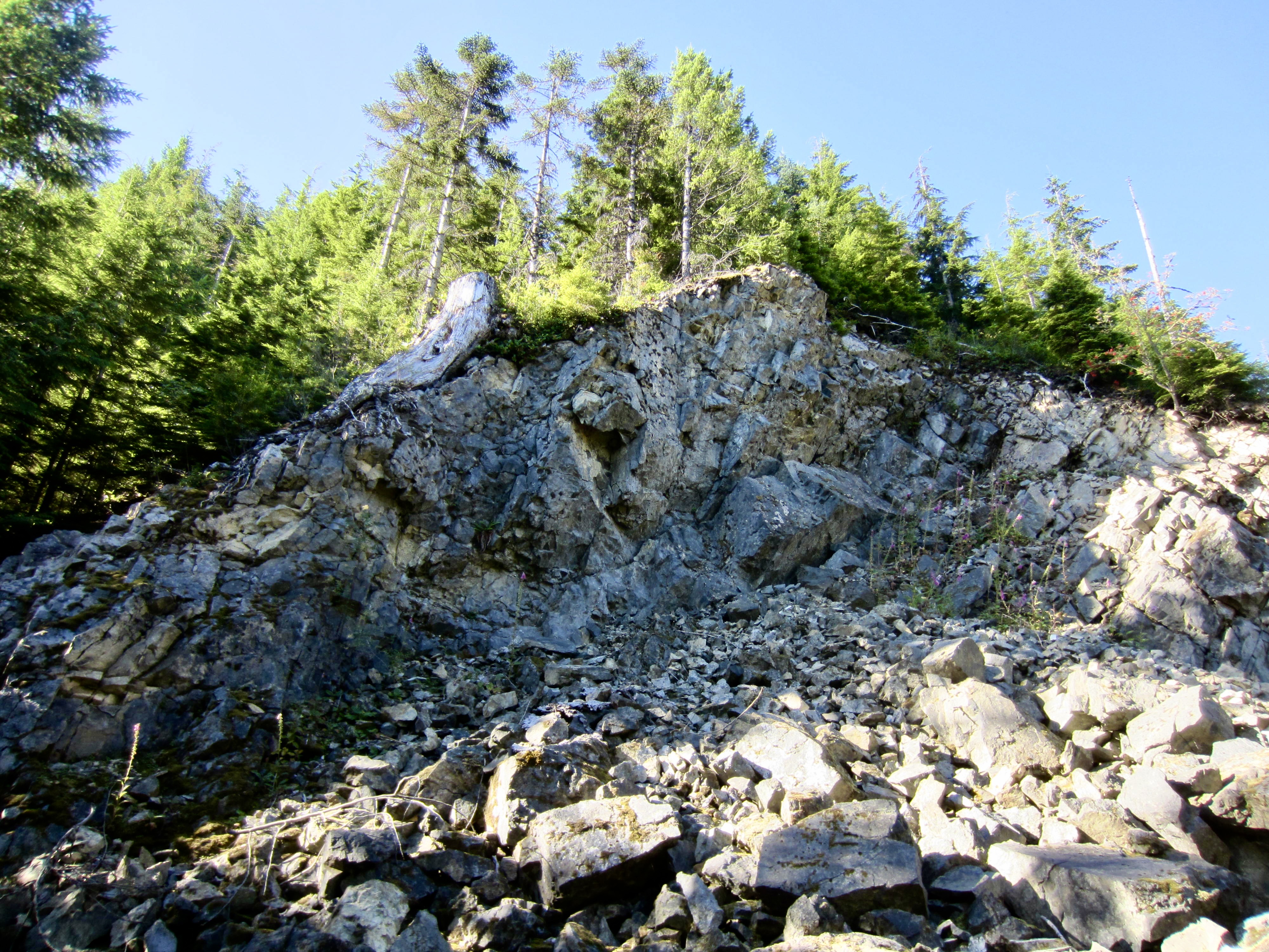
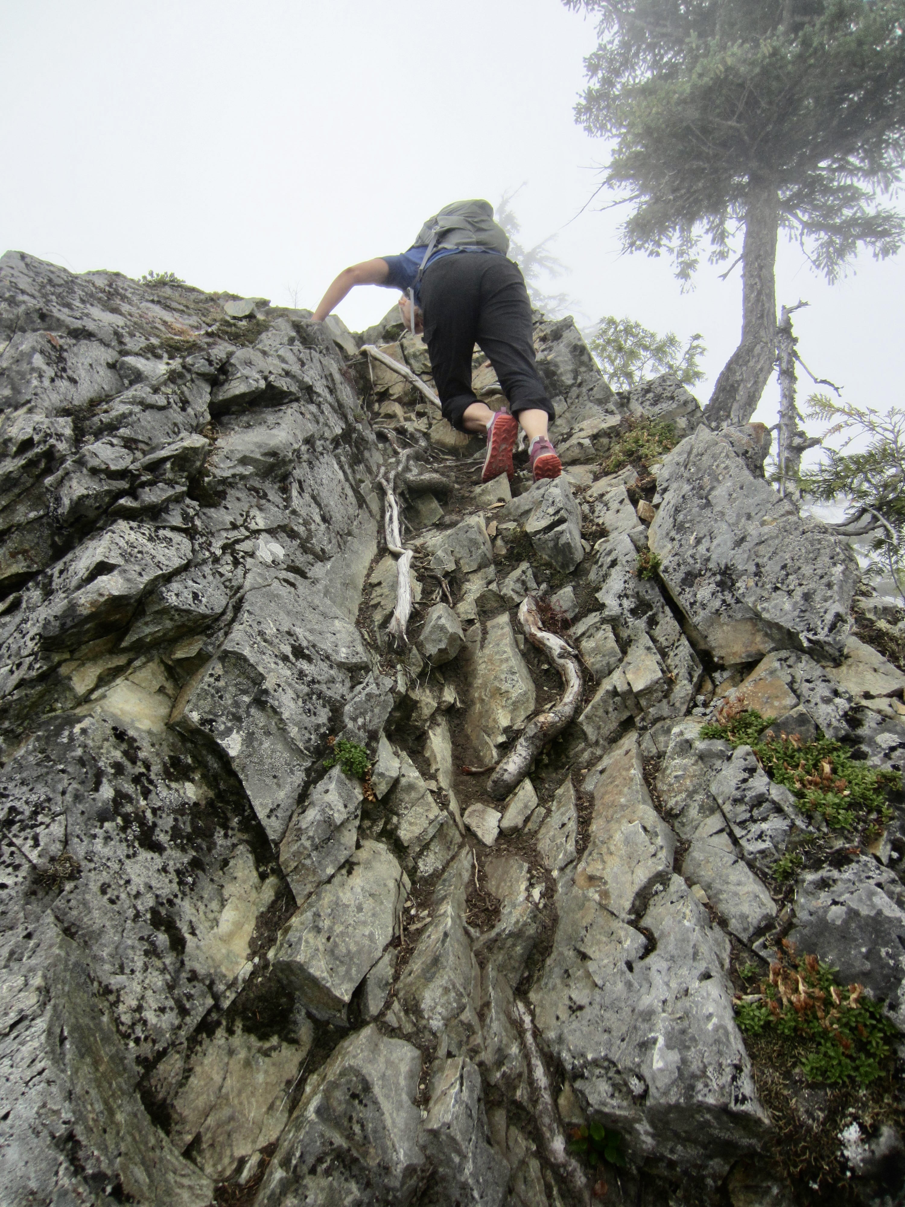
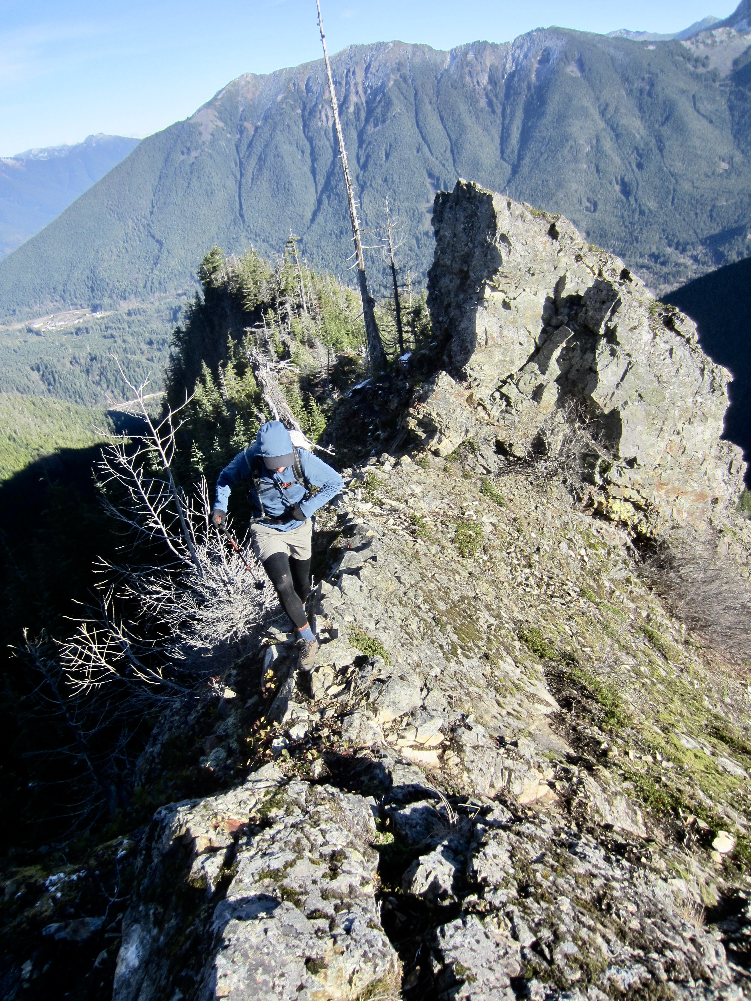
The Songbird Peak Trail eventually intersects a very overgrown logging road. Follow this road for a short distance until some tight switchbacks allow you to scramble back up to the crest. Soon, you will come to a steep buttress that appears to bar passage along the ridge crest (2.3 miles + 2250 feet from starting point). A shallow cleft in the middle of this buttress provides a short but steep Class 3 scramble over the top. This constitutes the technical crux of the entire route.
.
.
Immediately past the steep buttress is a lumpy cliff that slopes down to the left. This initially looks very sketchy but turns out to be fairly easy if you can stay on the faint ledge leading across the cliff. Once across, find the trail again and keep hiking up the crest. Songbird Peak comes into view far ahead.

.
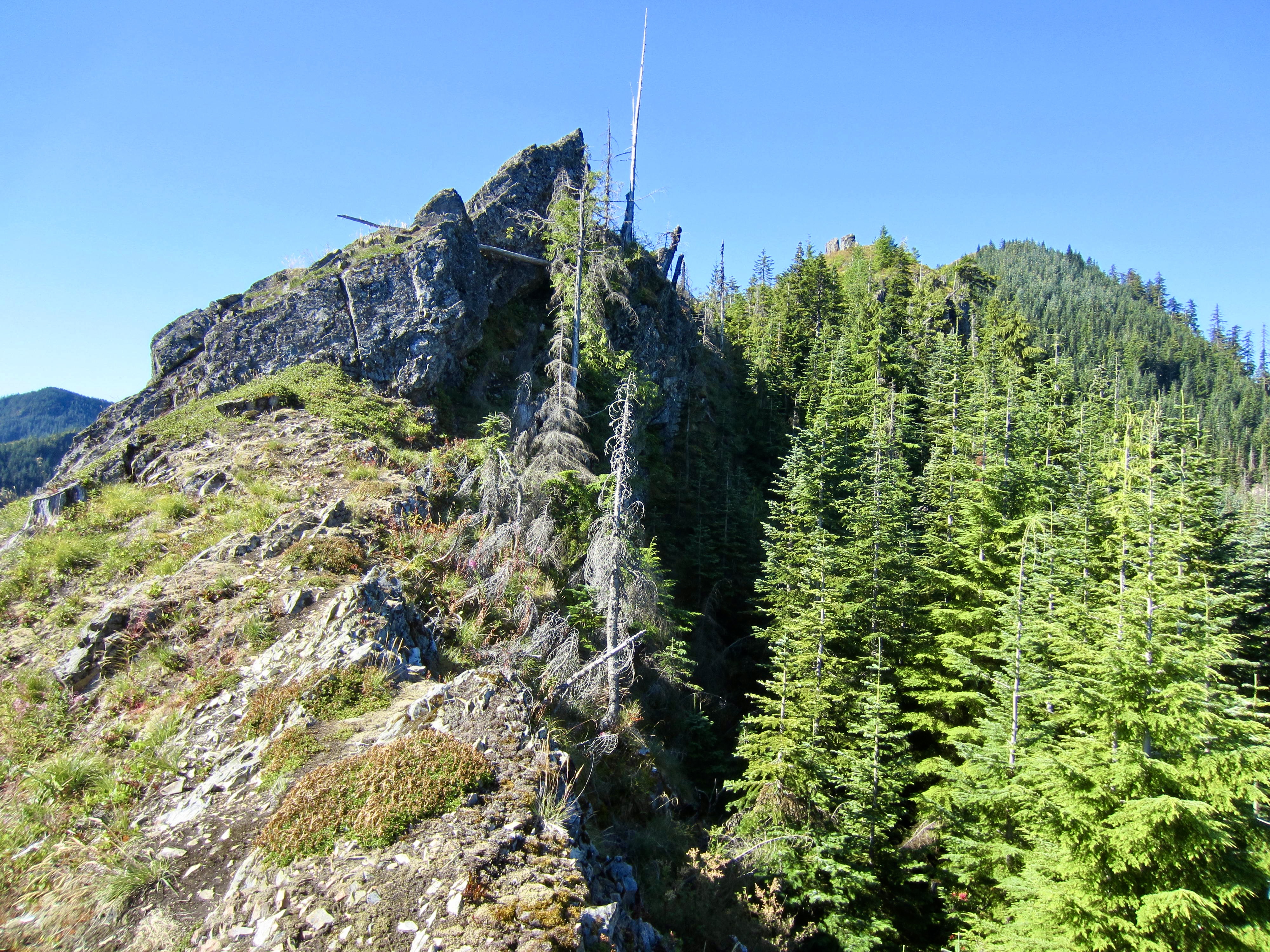
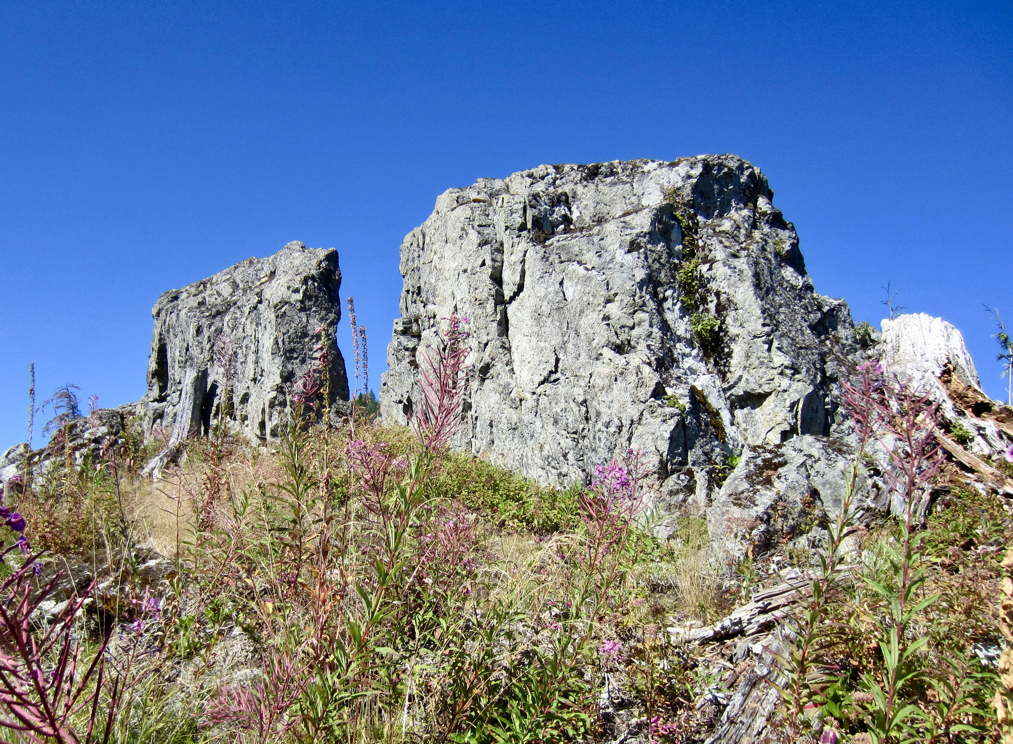
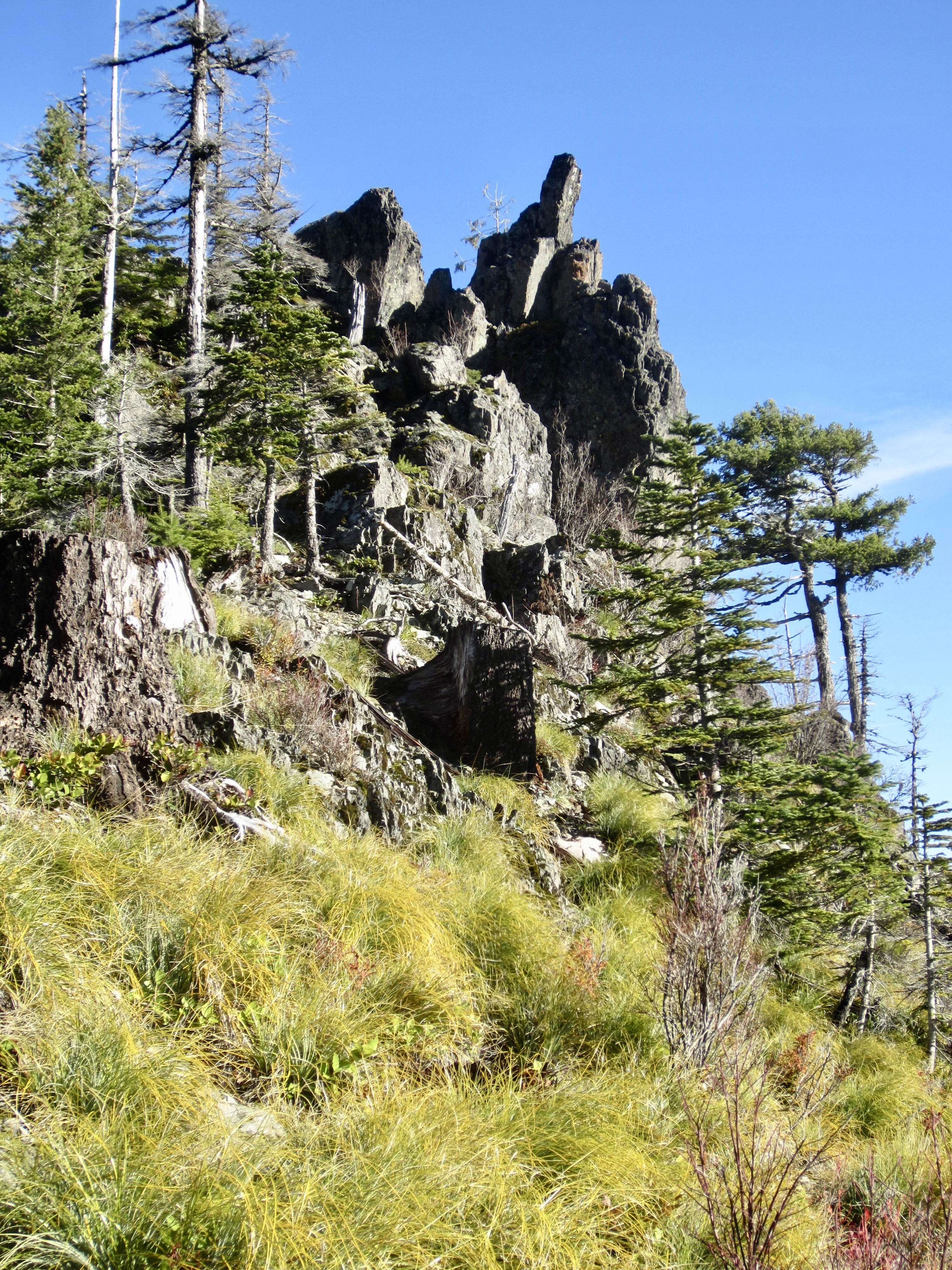
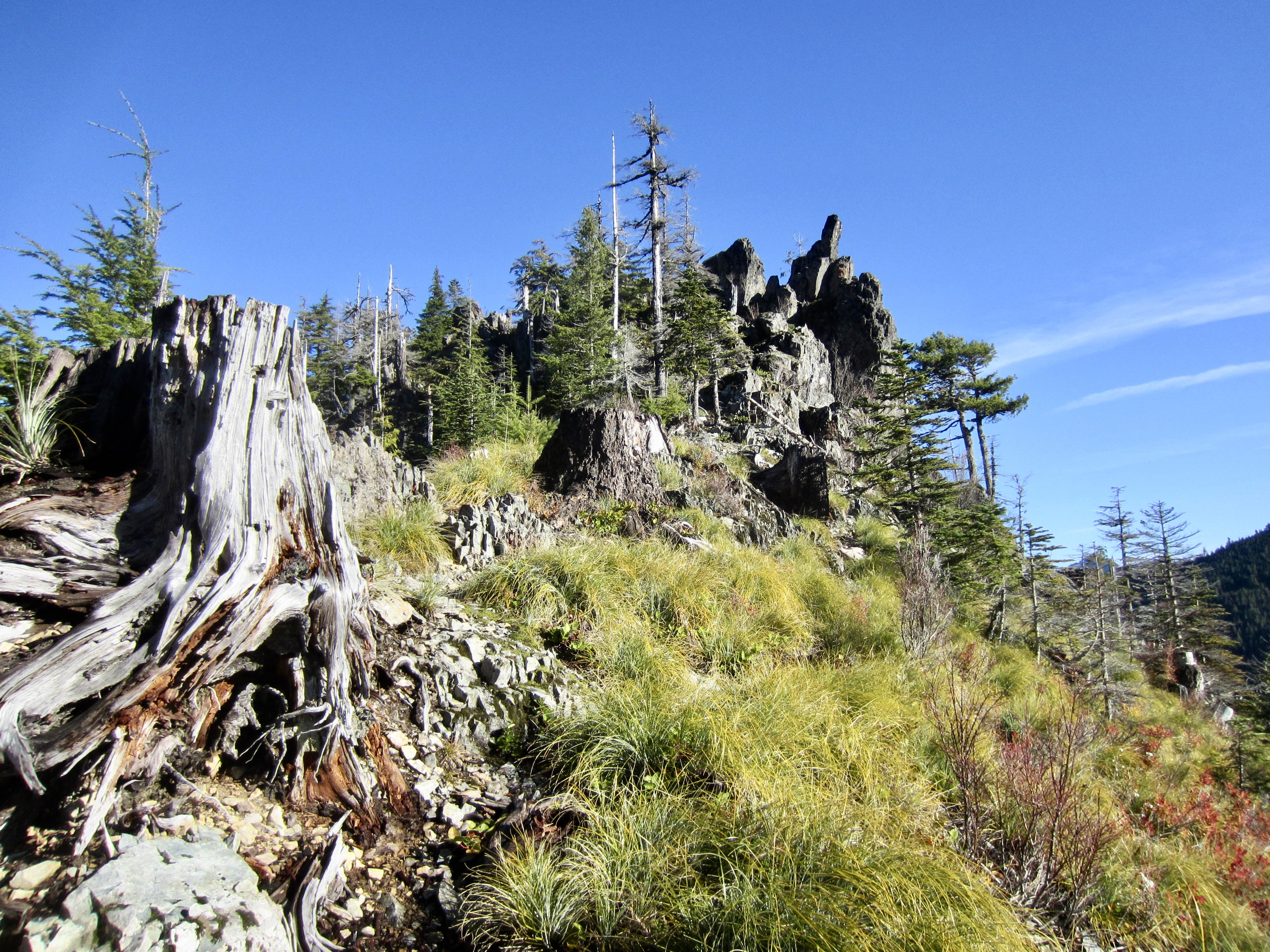
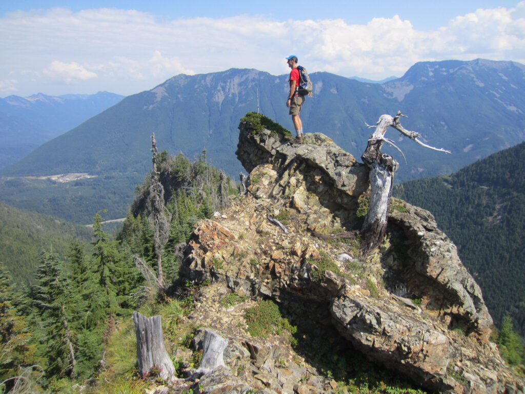
At an elevation of 3650 feet, you will arrive at the base of two leaning rock horns known as Easter Island Crags (2.5 miles + 2500 feet from starting point) due to their slight resemblance to the famous edifices on Easter Island. A faint bootpath sneaks around the right (western) side of the first horn and then goes over the top of the second horn. Although the scrambling is not difficult—only Class 2—the exposure is considerable. This is not a place for inattention! However, it is possible to circumvent the second horn by dropping down a small gully to the left (east) and then re-ascending to the ridge crest beyond.
.
.
.
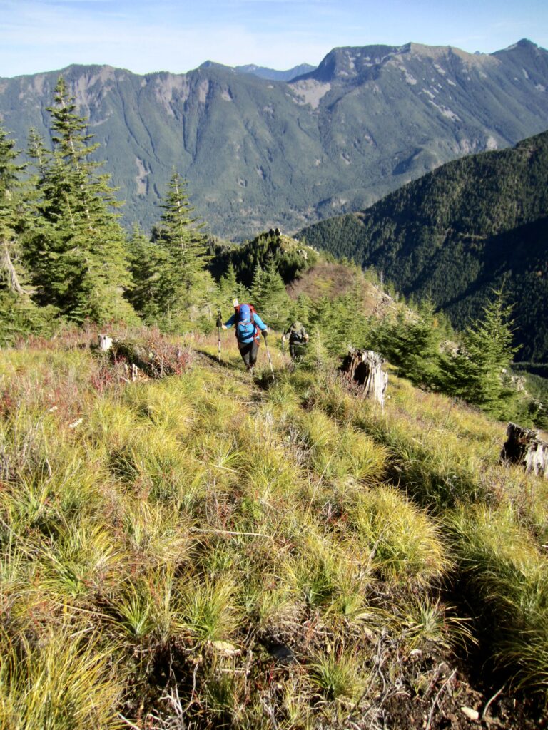
Easter Island to Songbird Peak
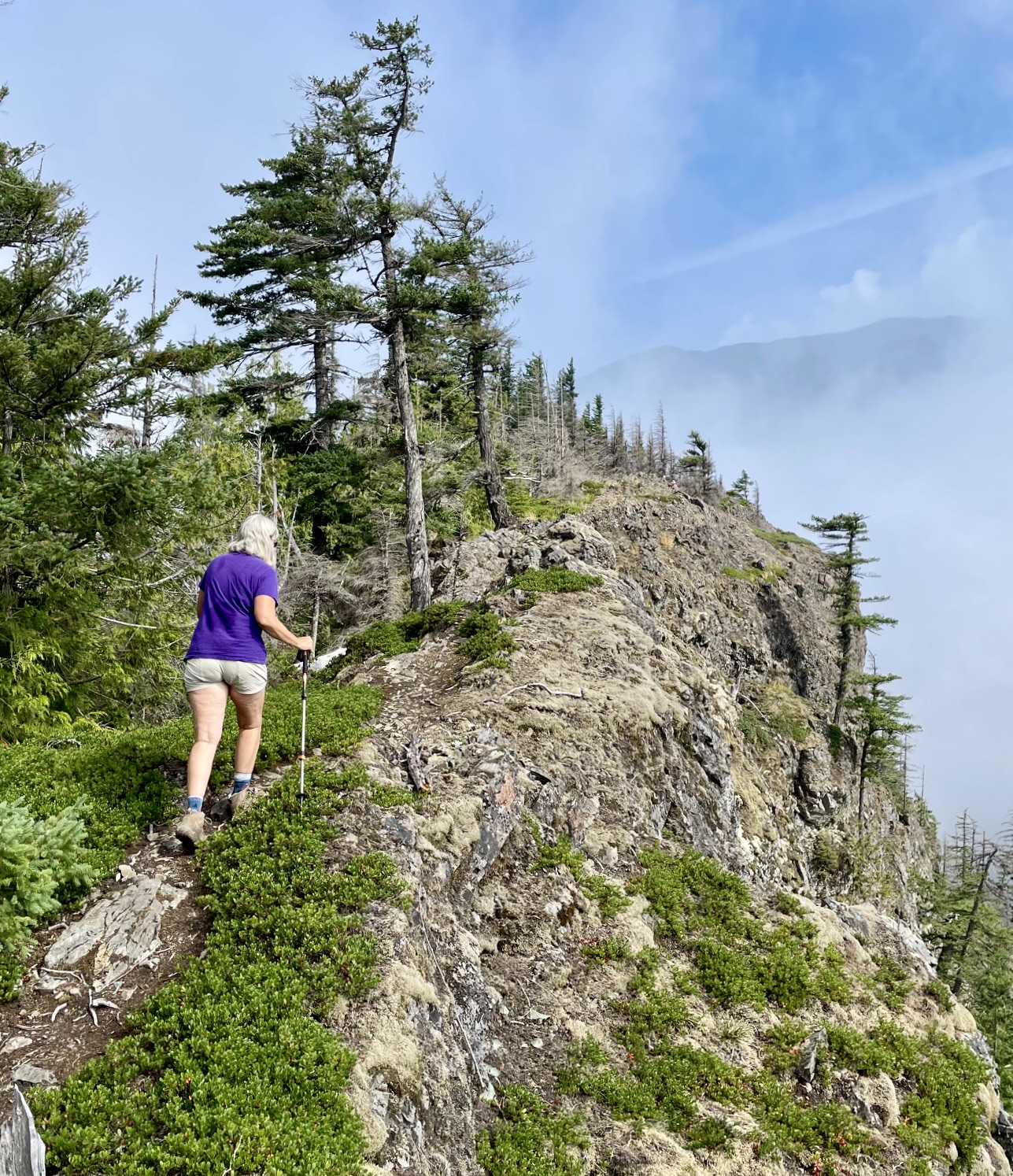
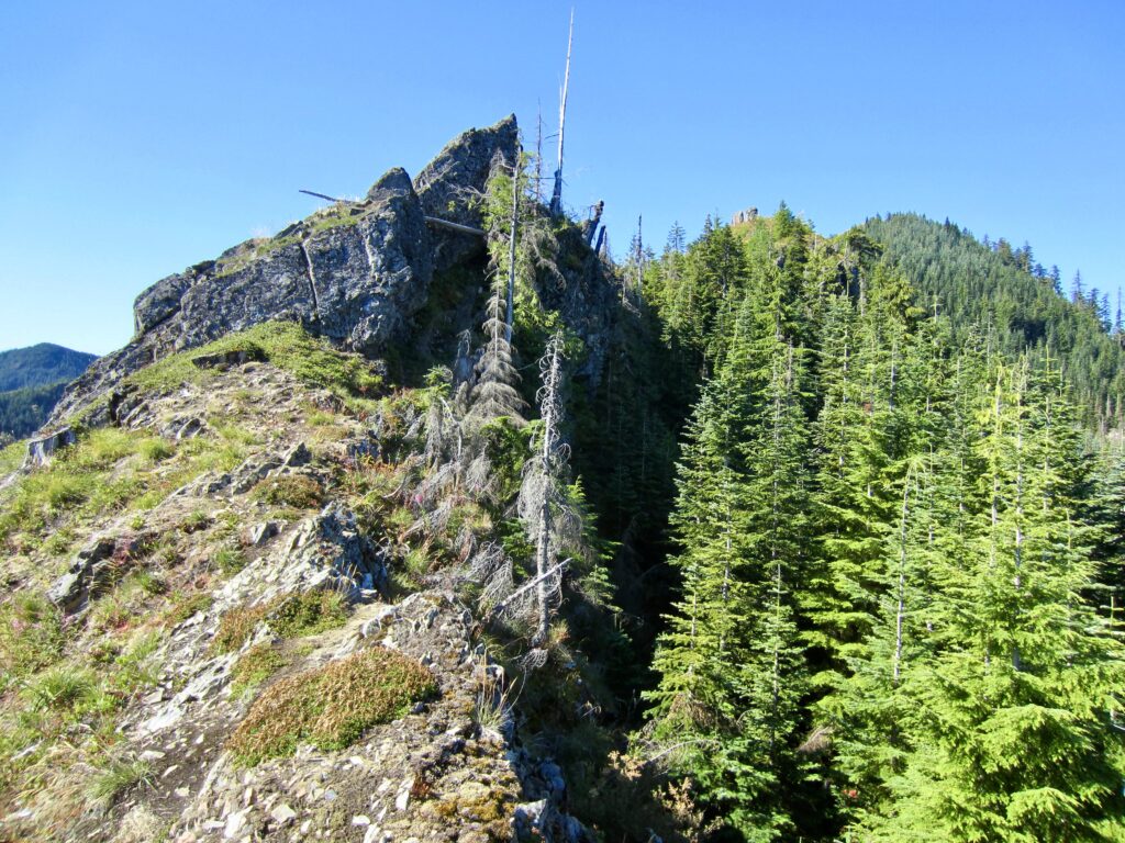
Farther uphill from Easter Island are The Incisors—a pair of distinctive rock fins that have the appearance of two huge teeth. Could these are associated with a giant Easter bunny? Anyway, the Songbird Peak Trail leads easily along the left side of these fins.

.
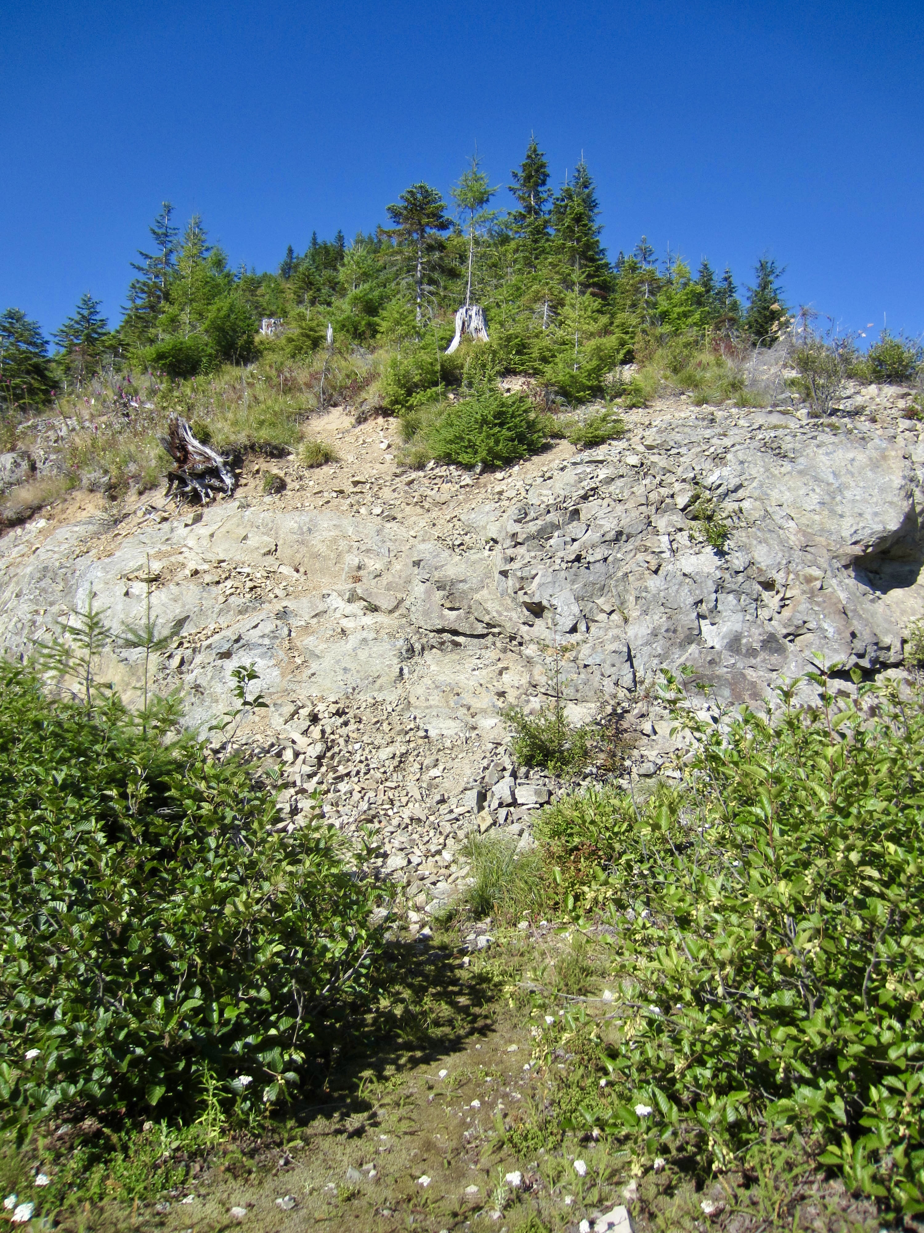
From The Incisors, Songbird Peak can be clearly seen straight ahead. Keep hiking upward on a rough path until intersecting yet another abandoned logging road. Go rightward on this road for a dozen yards to reach the crest at Songbird Bench (2.65 miles + 2750 feet from starting point), where there is a big, flat, mossy bench and a 30-foot cliff. Scramble directly up the cliff (Class 2), then continue hiking steeply up the grassy hillslope on a vague path.

.
.
.
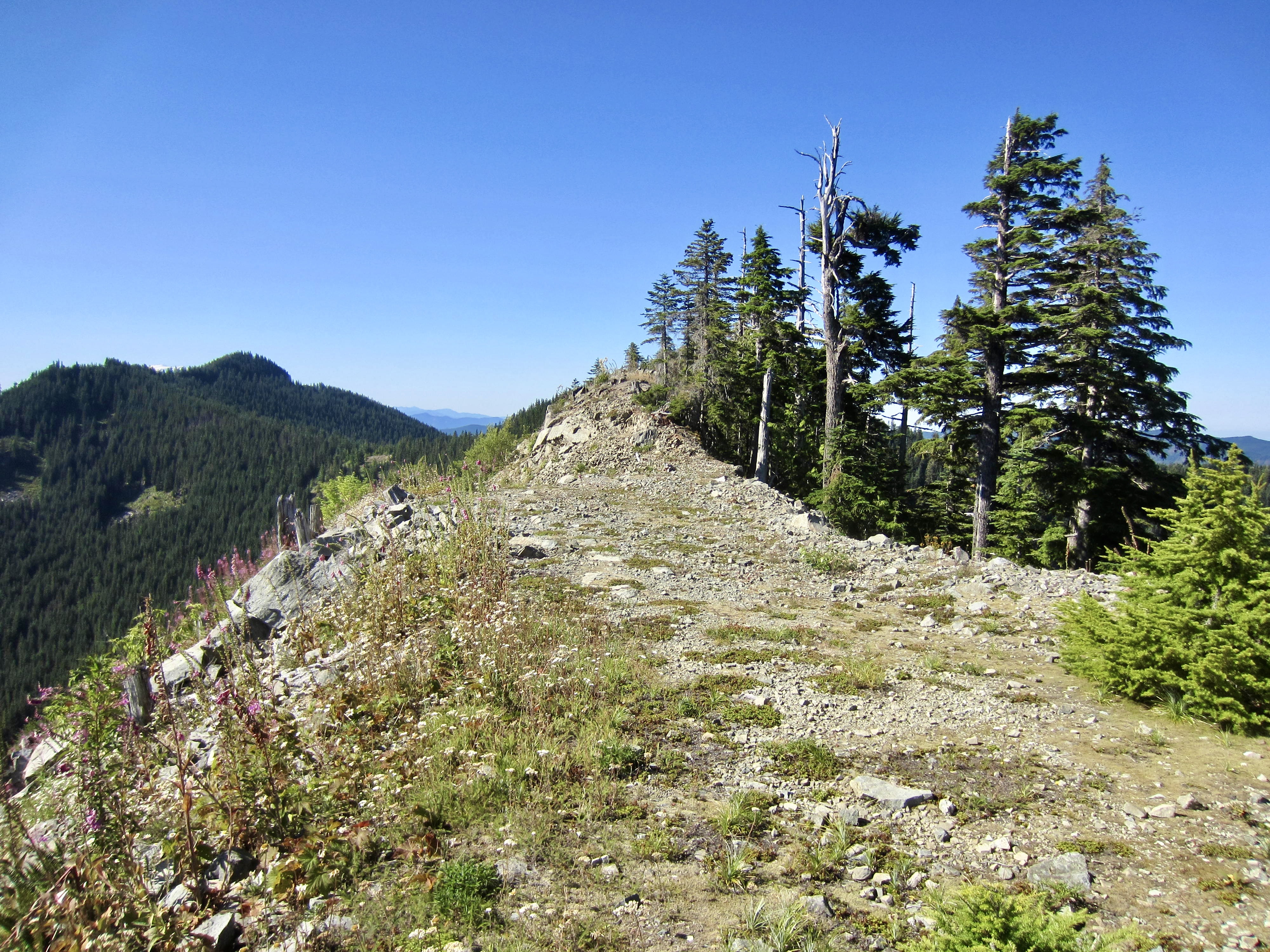
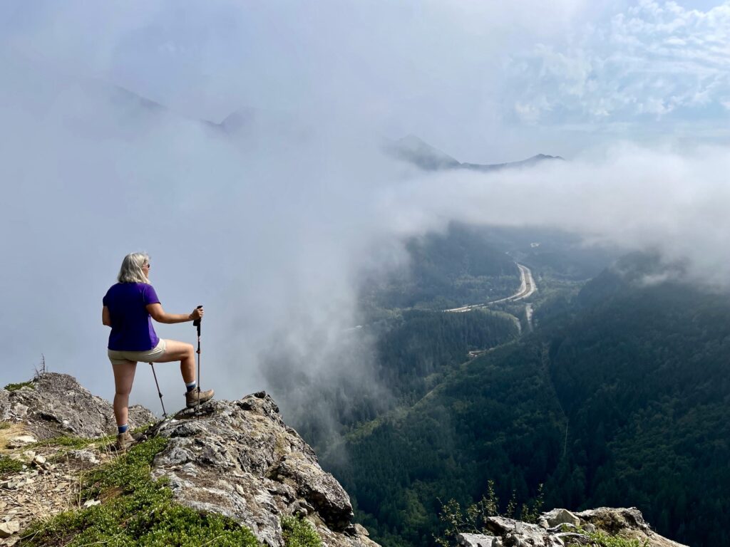
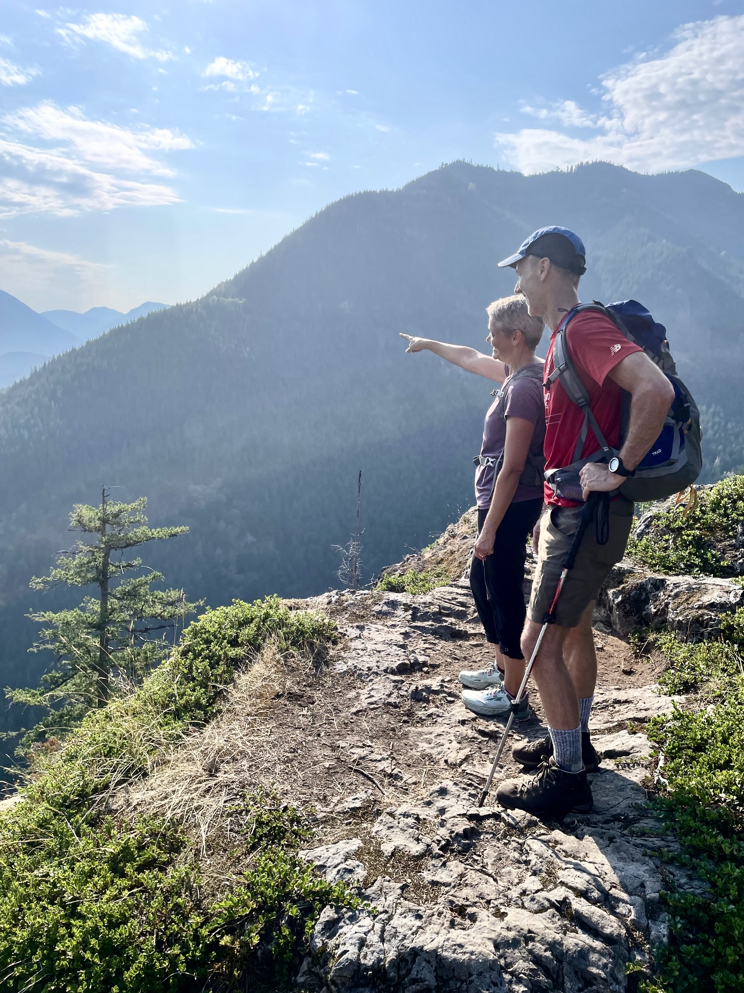
The grassy hillslope abruptly flattens out on the summit plateau of Songbird Peak (2.8 miles + 3100 feet from starting point). A spur road was carved into the summit many decades ago, creating two adjacent humps. The southern hump appears to be the highest point.

.
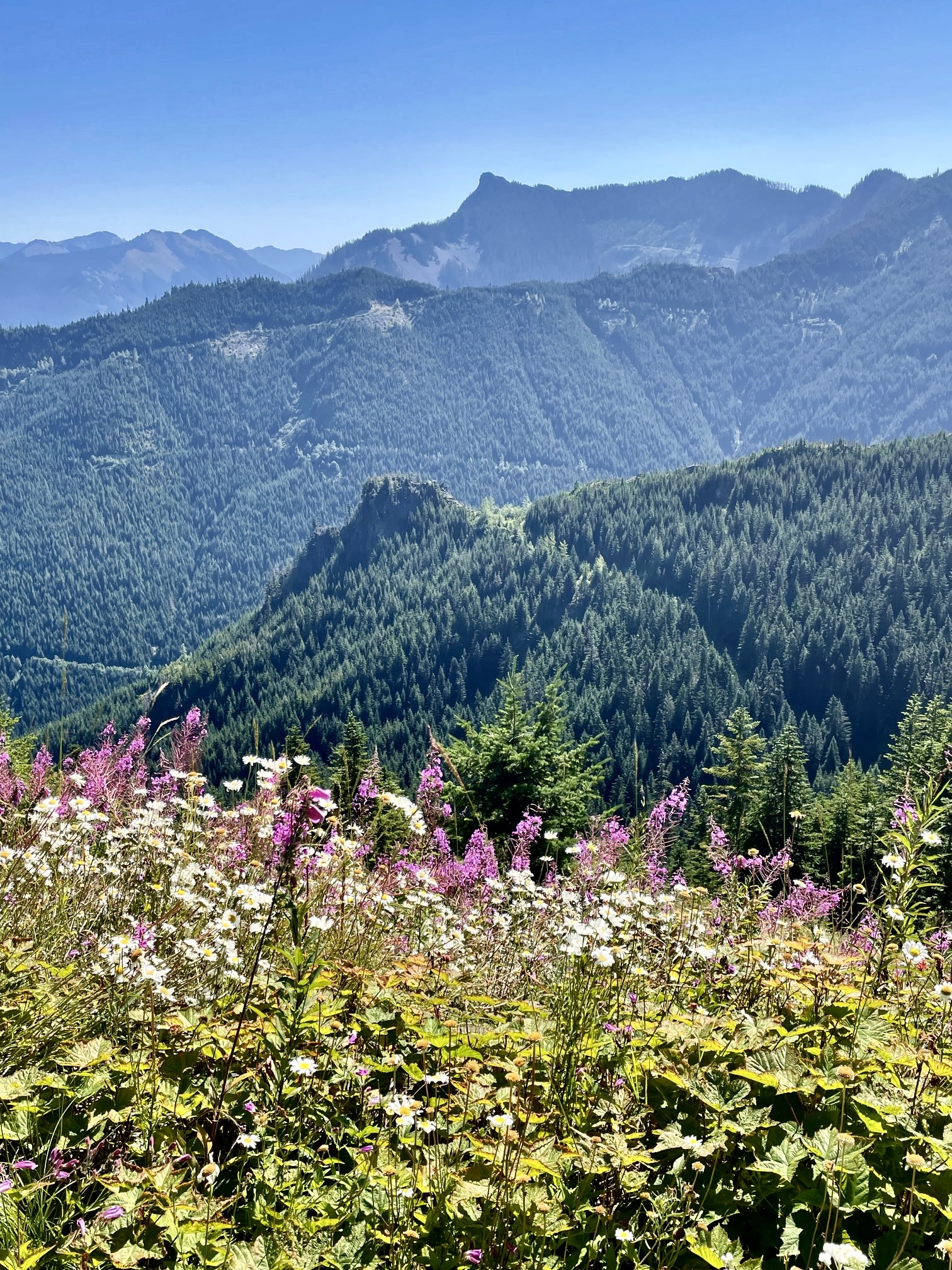
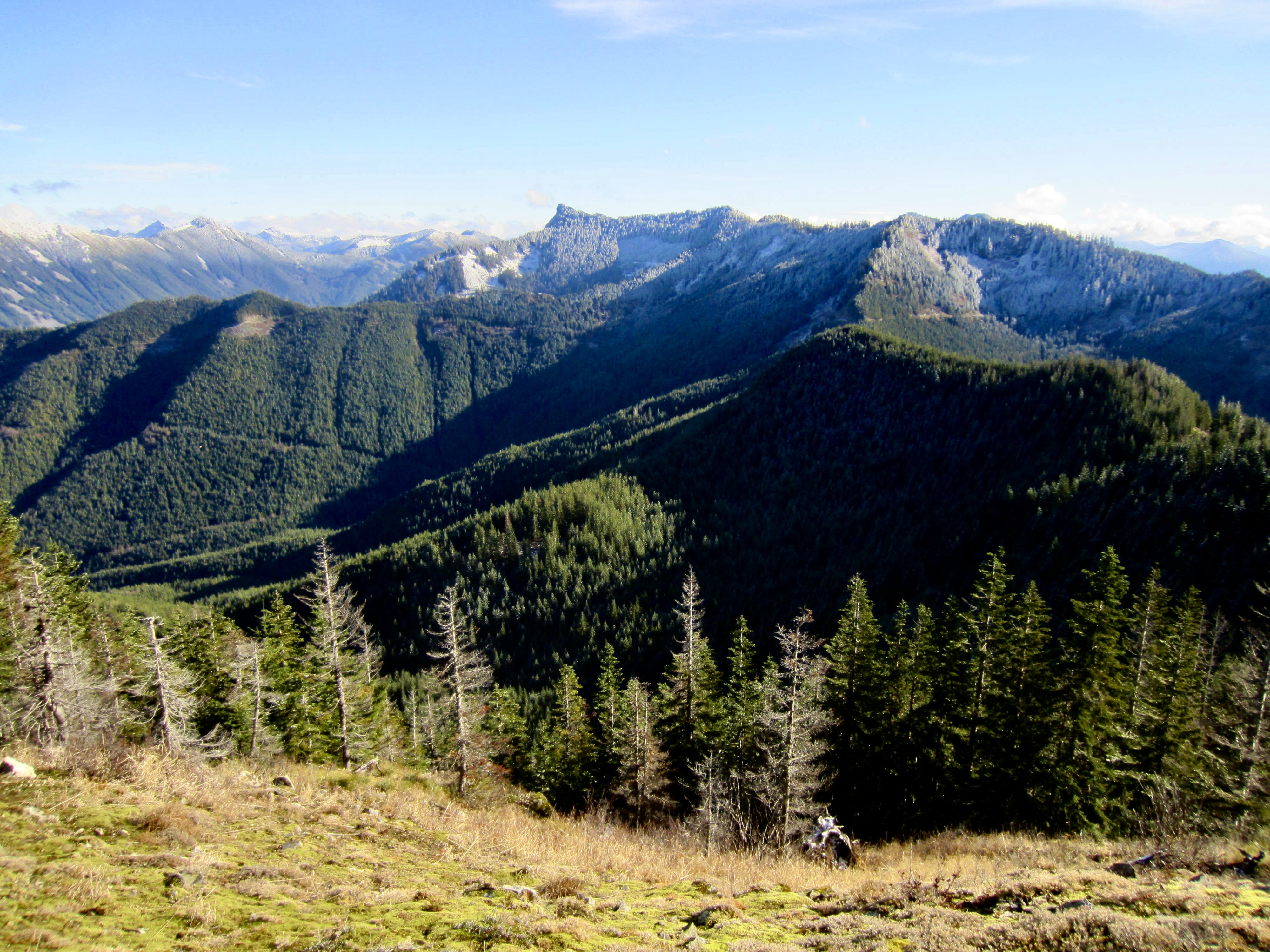
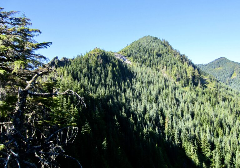
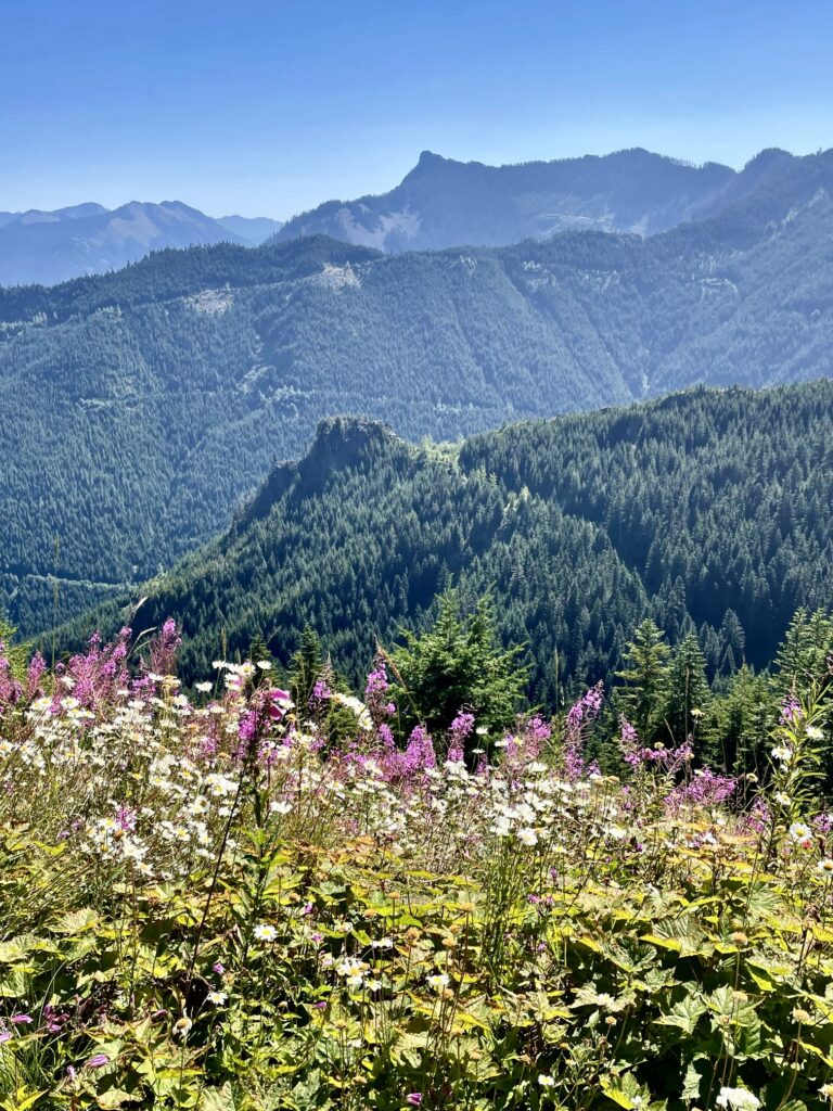
From this summit, you can see the rocky horn of McClellan Butte rising to the east, with the wooded hump of Machu Picchu closely below. Across Interstate-90, the Lower Snoqualmie Range stretches out from Mailbox Peak to Granite Mountain. North Greenway Peak and Greenway Mountain are forested hills located closely to the southwest and south, respectively.
.
Songbird Peak to Greenway Peaks
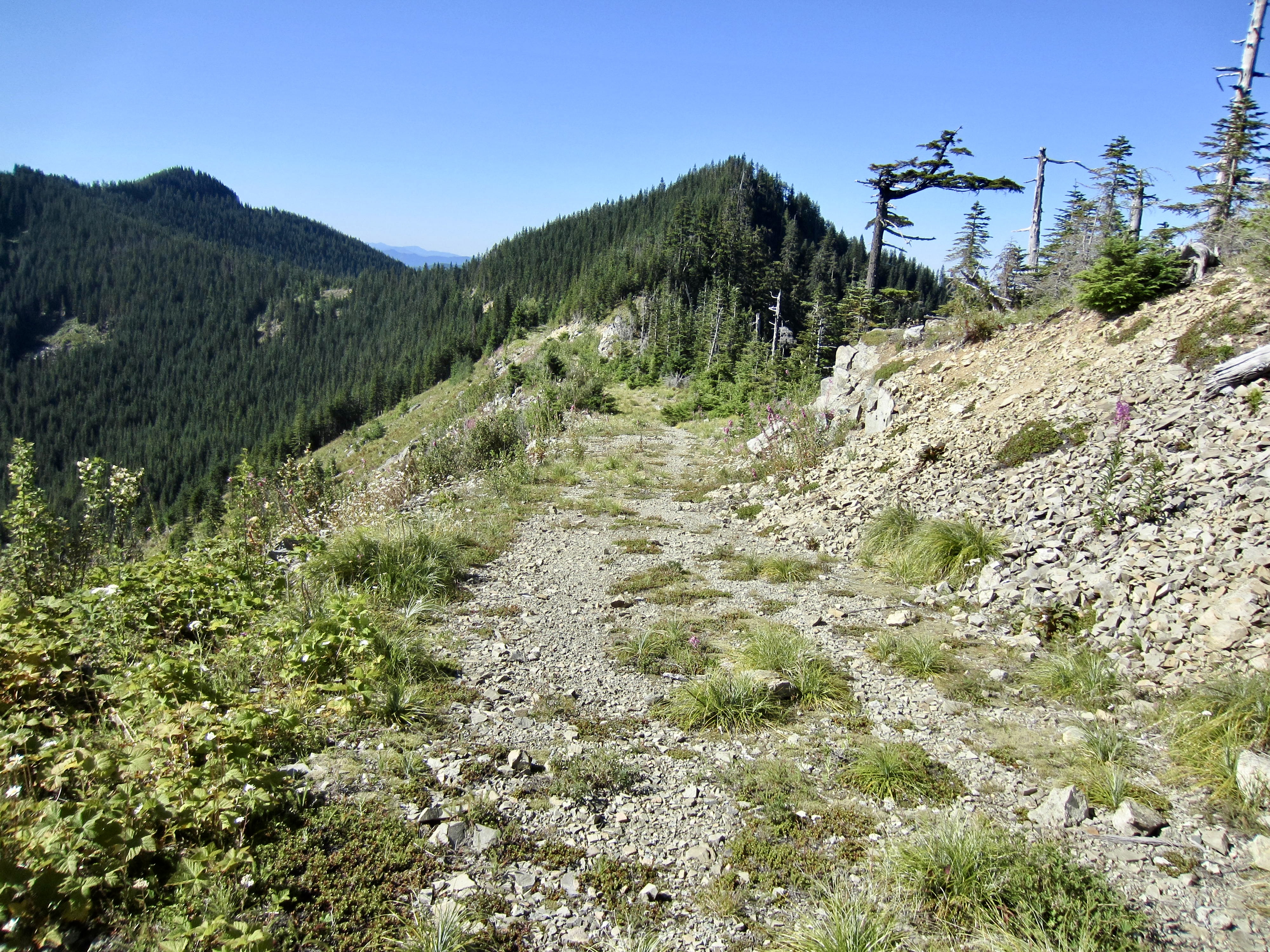
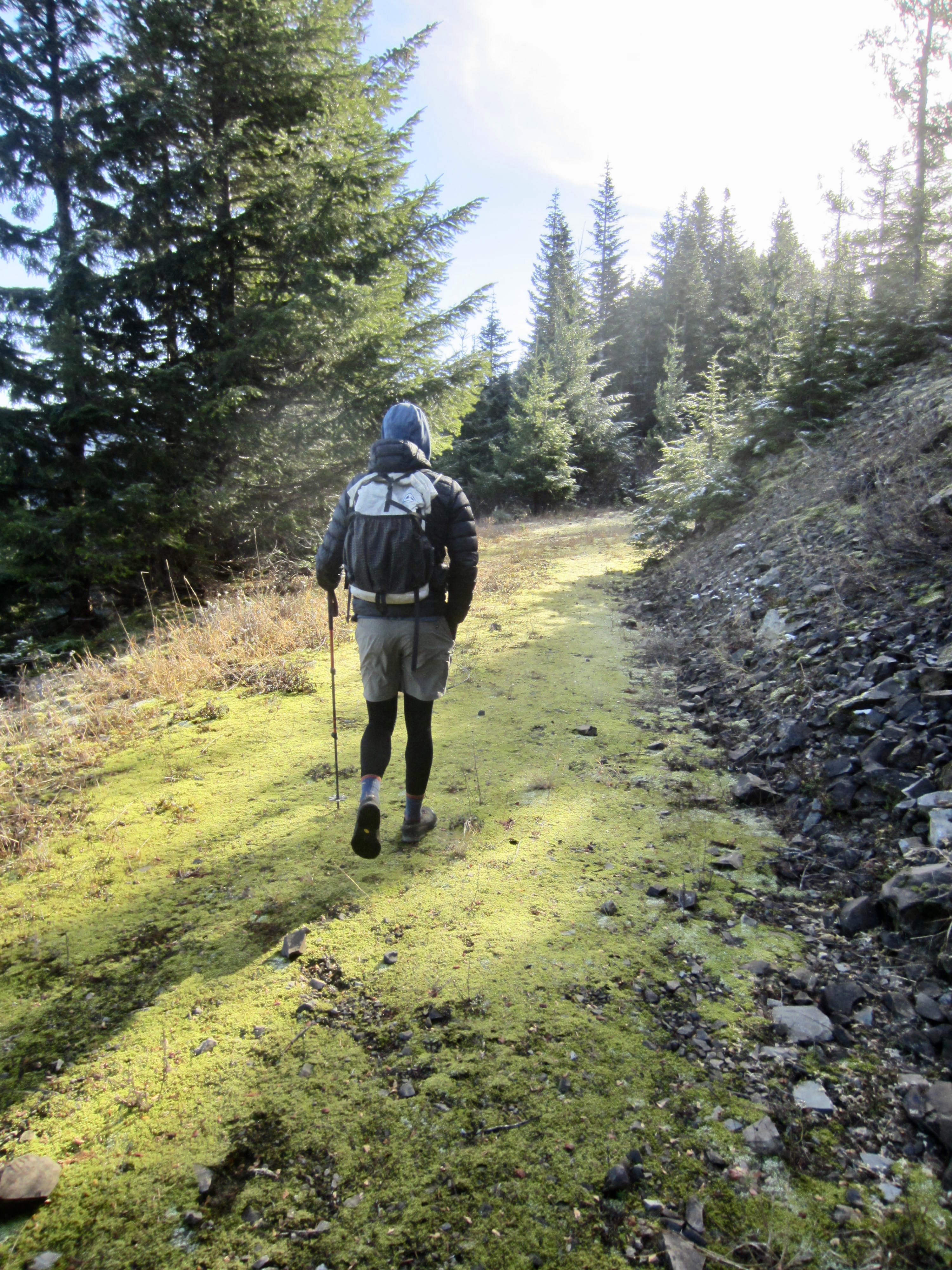
If you are primarily interested in good views, Songbird Peak serves as a suitable ending point for your trek. However, if you desperately feel the need for a summit with more prominence, then North Greenway Peak and/or Greenway Mountain should be your destination. To reach these higher summits, follow the spur road southward for ⅓ mile to Greenway Saddle, a broad dip in the ridge crest.
To reach North Greenway Peak, turn right and proceed up the ridge, but be prepared for a chaotic mess of small jackstraw trees. The travel is slow and tedious. Also, be careful to avoid wandering onto the left (west) side of the crest, because that would take you into the prohibited Cedar River Watershed. After 200 vertical feet of thrashing about, you will arrive at the woodsy summit (3.3 miles + 3300 feet from starting point). Views to the south and east are blocked by trees, but you can see Mt. Washington, Change Peak, Mailbox Peak, and other landforms to the west and north. Far below is the tiny puddle of Change Lake.
.

.
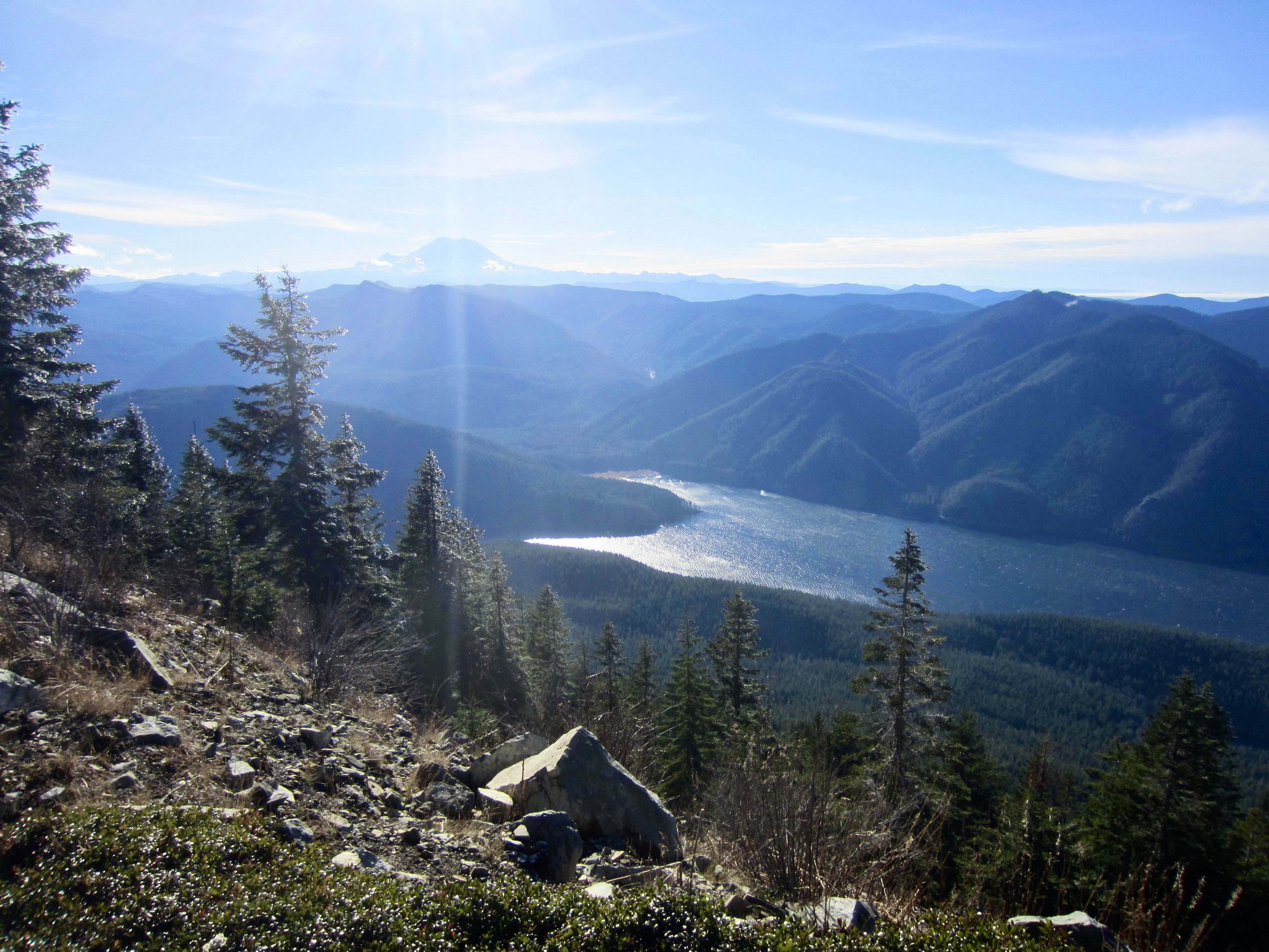
To reach Greenway Mountain, continue walking southward on the mossy road as it makes a gently rising traverse along the ridge. Again, be careful to avoid wandering off the right (west) side of the road, because that would take you into the prohibited Cedar River Watershed. Pick a convenient location to leave the road and climb up the steepen bank on your left, using tree limbs and bushes for assistance. A short, easy hike through young trees gets you to the wooded summit (3.7 miles + 3400 feet from starting point). By moving around, you can get good views of Chester Morse Reservoir and Mt. Rainier to the south, and the Central Cascades to the northeast.
.

.
Return via Hall–Change Divide
Whether your destination was Easter Island, Songbird Peak, North Greenway Peak, or Greenway Mountain, you can return to the trailhead by retracing your route back down the Hall–Change Divide. This will, of course, involve down-climbing the Class 2 and Class 3 sections, which can be a little tricky—especially when the rock is wet. Also, be very careful to stay on track and not get lured away on the many spur roads and side paths, particularly on the upper part of the ridge. Once you reach the rocky nose, the trail becomes much easier to follow.
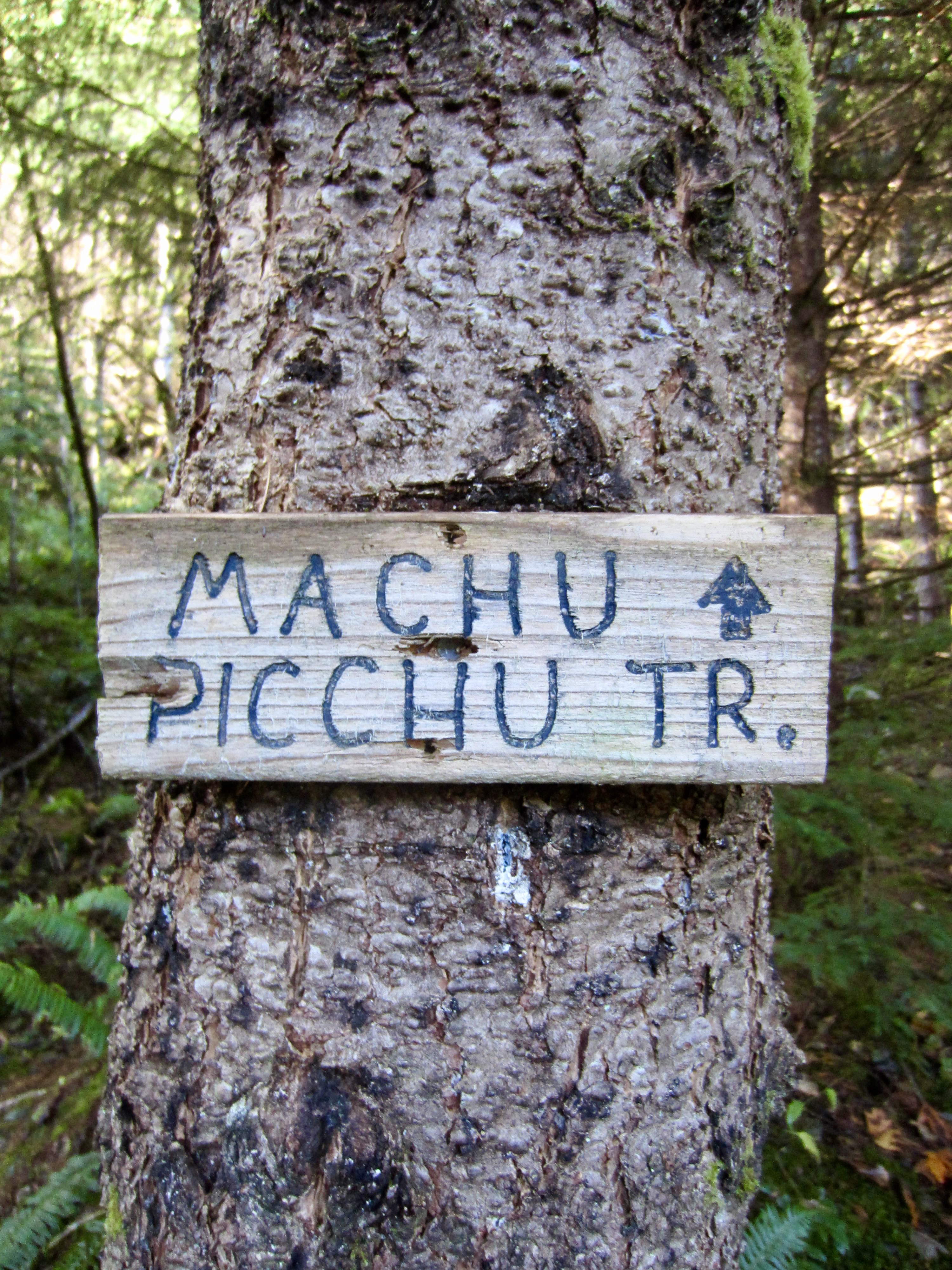
Return via Machu Picchu & Hall Creek
Rather than retracing your route back down the ridge, it is possible to instead descend the Machu Picchu Trail and Hall Creek Trail farther to the east. This alternative descent route offers two advantages: (1) it provides the esthetic benefit of doing a full loop, and (2) it eliminates the need to down-climb the tricky Class 2 and Class 3 ridge sections. I recommend this during the summer and fall, when Hall Creek is at low flow.
Begin your loop at Songbird Bench, which is located on the ridge 350 feet below the summit of Songbird Peak as previously described. From the bench, follow the overgrown southward as it makes a gradual descent into a high bowl and then ascends to Machu Picchu Saddle (0.7 miles from bench). This saddle is named for the distinctive rock pinnacles situated closely to the northeast. The highest pinnacle can be reached by a short Class 2-3 scramble.
.
.
Continue hiking down the overgrown road into a creek drainage, then head northward to the ridge crest below Machu Picchu. Leave the road here and descend the steep Machu Picchu Trail to an easy crossing of West Fork Hall Creek. A bit farther down, rock-hop across the main channel of Hall Creek (2.3 miles – 1700 feet from bench). This can be difficult when the creek is flowing full, such as in the springtime or late fall.

.
Once across the creek, keep hiking down the Hall Creek Trail, through shady second-growth forest on the eastern bank. You can’t help but notice that this trail segment was built to a remarkably high standard despite, presumably, being unsanctioned.
.
Eventually, you will pass a junction with the Zigzag Trail and arrive at the Hall Creek Trestle, thereby closing your loop. From here, follow the Hall Creek Trail down to the creek, under the trestle, and back to the trailhead (3.7 miles – 3100 feet from bench).
Usage Considerations
Shortly after posting this route description, a friend alerted me regarding the following admonitions on the Washington Trails Association (WTA) website: The route to Songbird Peak is illegally built. Please refrain from use. The route to Songbird Peak is not an official trail and leads into the watershed. Please refrain from use.
Having hiked to Songbird Peak and beyond, I found these statements quite perplexing, and I suspect that they were written by someone who is unfamiliar with the actual route. However, as a long-time supporter of WTA, both philosophically and financially, I felt a need to respond respectfully on this matter.
The route to Songbird Peak involves a rather complex combination of boot-beaten paths, purposefully constructed trails, and abandoned logging roads. From what I can see, the constructed trails extend only as far as Hall Point, which is a full 2 miles from the Cedar River Watershed boundary. Were these trails constructed illegally? It would probably be more accurate to say that they were “unsanctioned” in the sense that they were not officially authorized by any governmental agency, such as DNR or USFS. But then, the same could be said for the original trails up Mt. Si, Mt. Teneriffe, Dirty Harry’s Peak, Mailbox Peak, and Mason Lake. Most of these original trails were crude, steep, and prone to erosion, so they were later replaced or supplemented with sanctioned, well-constructed trails, but the original unsanctioned trails are still in use. I would deem the constructed portion of the trail leading to Hall Point to be very well-graded and not in need of any replacement.
Beyond Hall Point, the continuation route to Songbird Peak follows a combination of informal bootpaths and abandoned logging roads. There is no evidence of any significant trail construction on these, aside from the occasional cut branch or sapling. All bootpaths end at the summit of Songbird Peak, which is still ⅓ mile from the watershed boundary. To easily reach the boundary, it is necessary to walk along an abandoned logging road. The only attractive summits accessible from this road are the Greenway Peaks, which sit directly on the boundary, such that there is little reason to cross into the watershed itself. It is also worth mentioning that the current trails up nearby Mt. Washington and McClellan Butte actually bump up against the watershed boundary, yet they are fully accepted.
Given the above-mentioned considerations, I don’t see a valid reason for WTA to discourage use of the trails, bootpaths, and logging roads leading to Songbird Peak. In my opinion, the existing route simply provides access to a viable hiking destination in the heavily used I-90 corridor—and we certainly need more of those!
Route Maps & Profiles
…
…
…
…
…
…
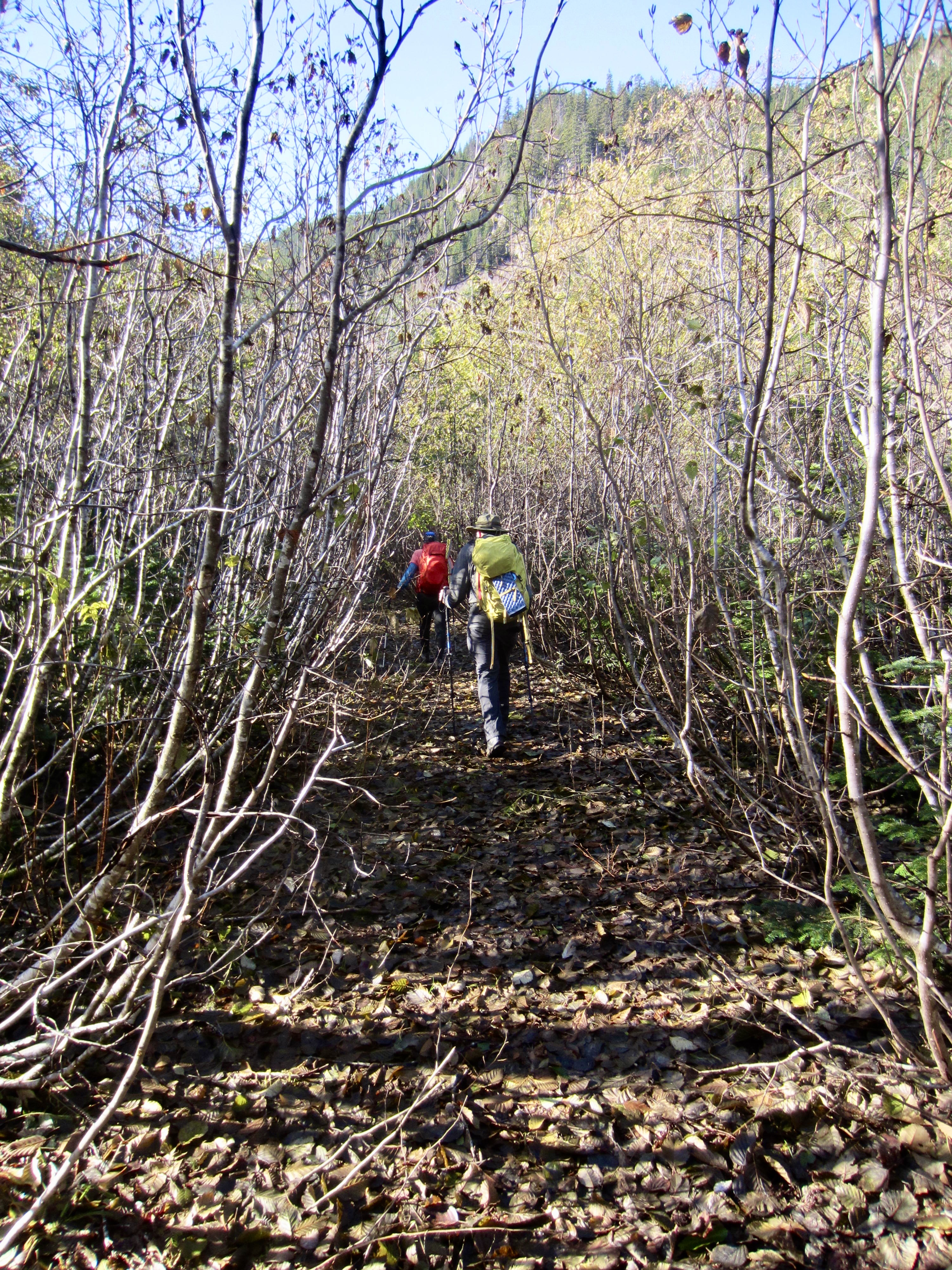
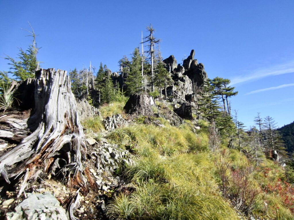
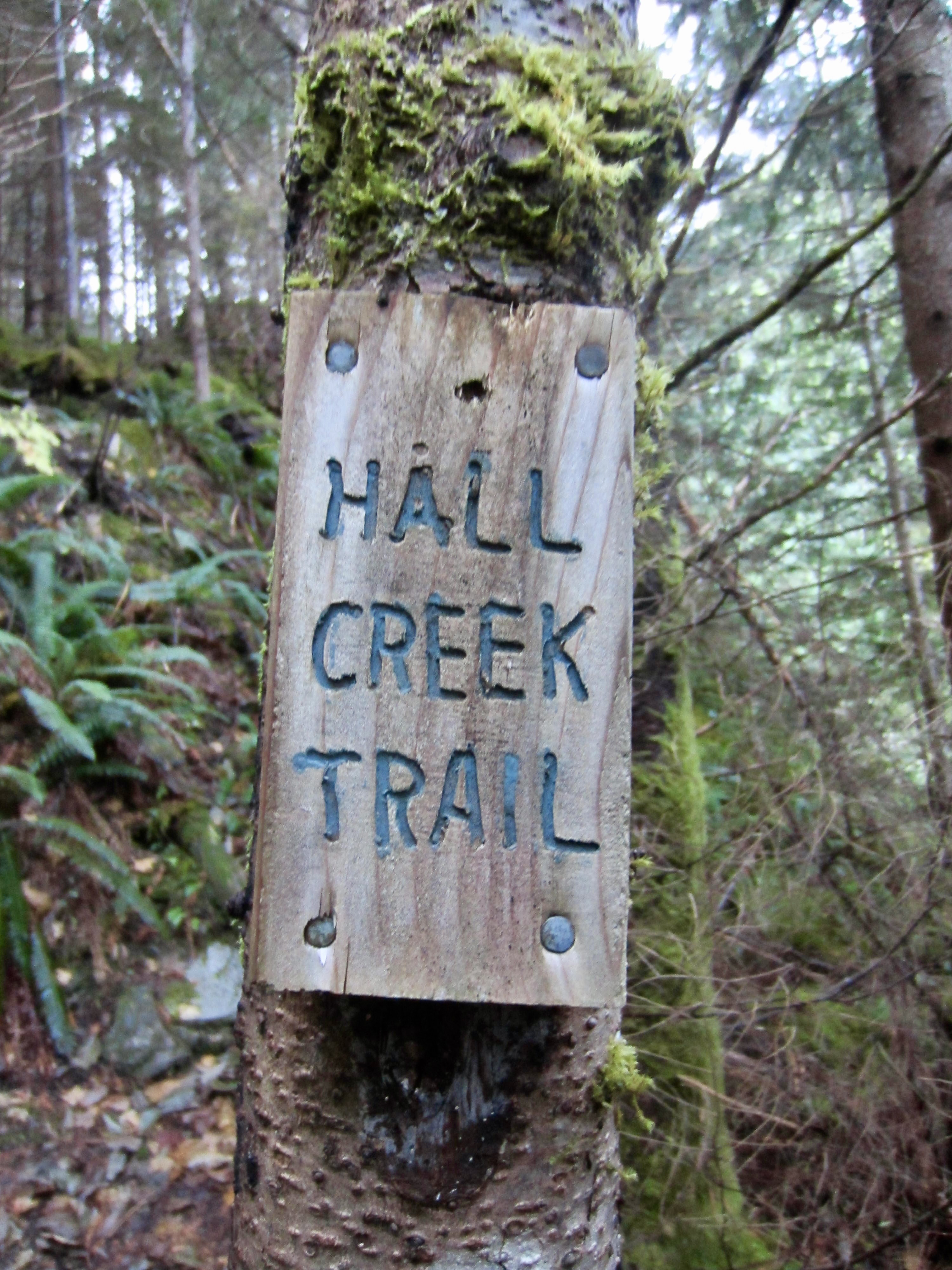
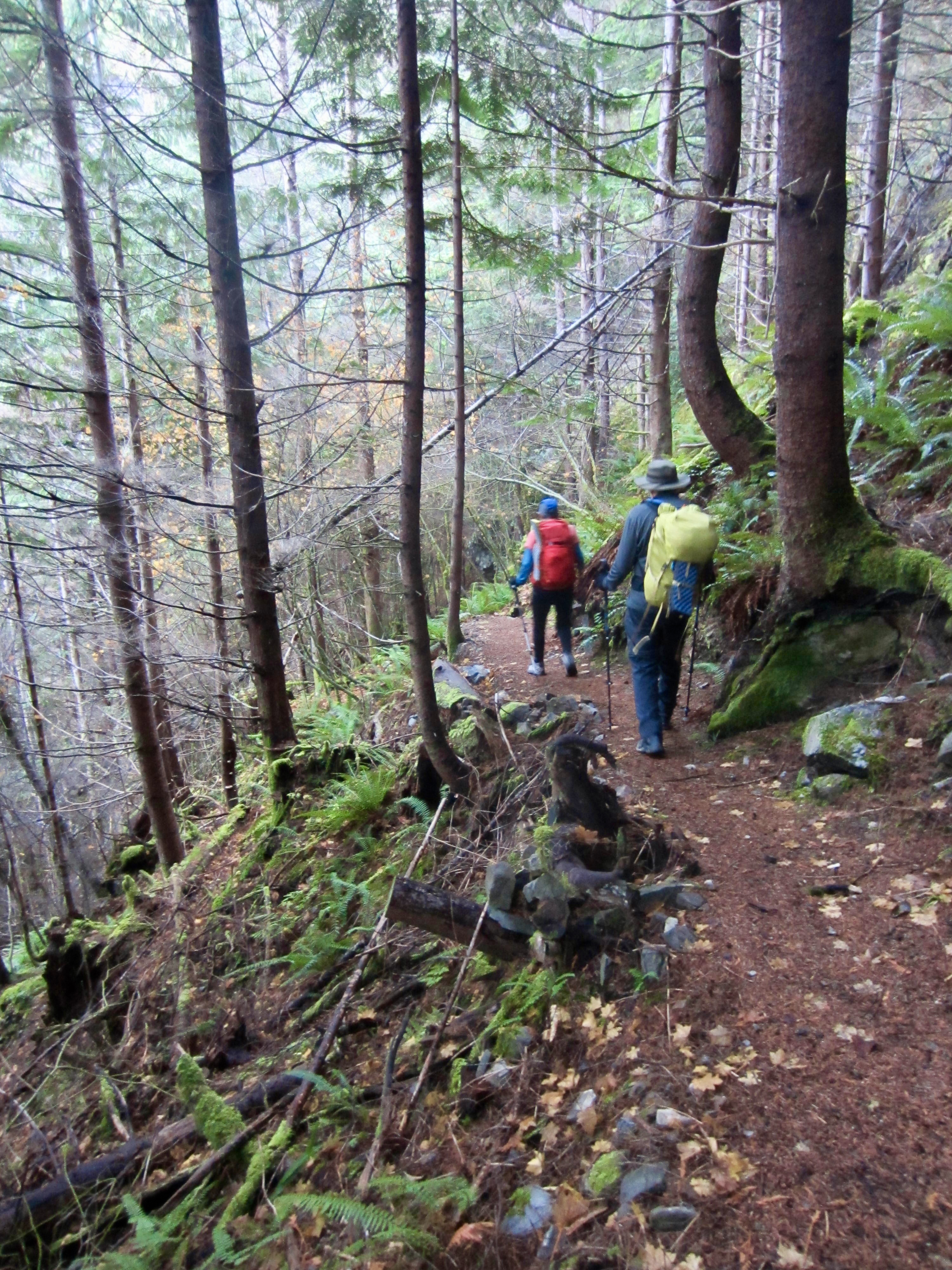
Photo Gallery
Click to enlarge…