Trip Dates: June 23 & 24, 2025
2025 WESTERN ALPS ADVENTURE VACATION
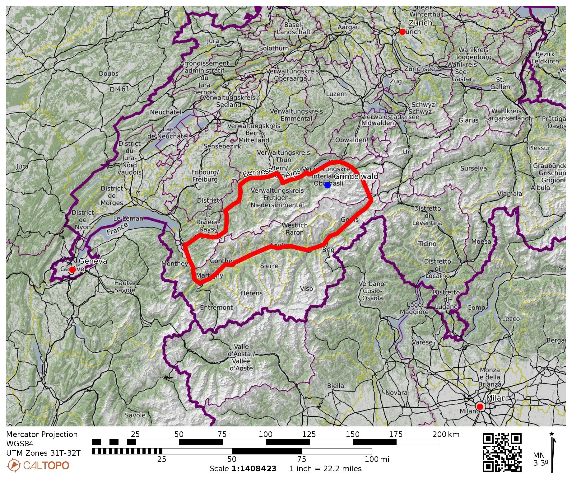
Eiger Trail Hiking Traverses
Alpiglen Station to/from Kleine Scheidegg
Kleine Scheidegg to/from Eigergletscher Station
Eigergletscher Station to/from Alpiglen Station
Route Summary
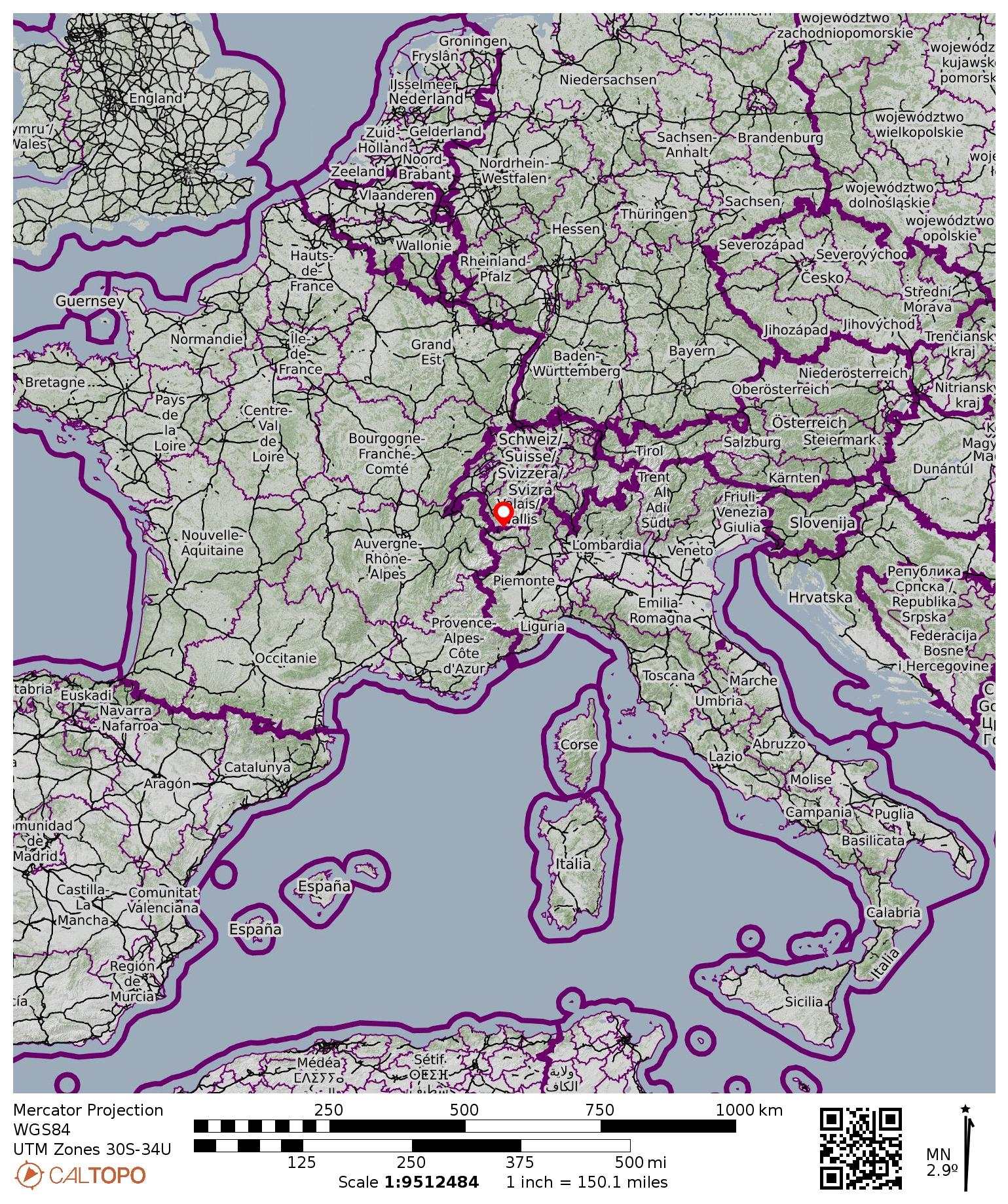
Region: Switzerland
Sub-Region: Bernese Alps
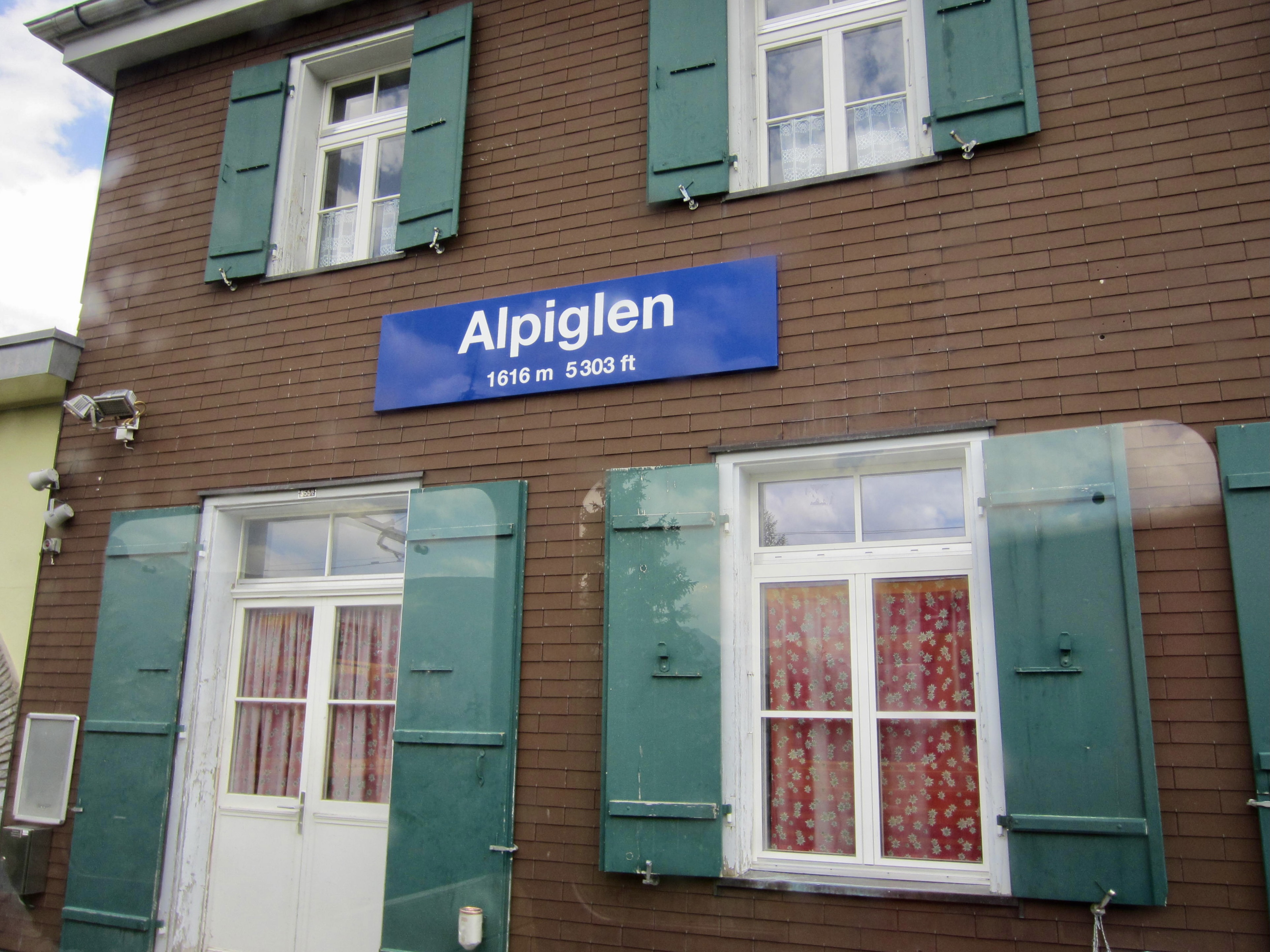
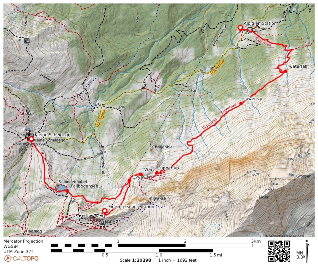
Starting/Ending Point 1: Alpiglen Station (Elev. 5300 feet / 1615 meters.
Starting/Ending Point 2: Kleine Scheidegg (Elev. 6770 feet / 2065 meters)
Starting/Ending Point 3: Eigergletscher Station (Elev. 7700 feet / 2345 meters)
Hike Option 1A: Alpiglen Station to Kleine Scheidegg
Approximate Stats: 4.6 miles / 7.3 kilometers traveled; 2200 feet / 670 meters gained; 750 feet / 230 meters lost.
Hike Option 1B: Alpiglen Station to Eigergletscher Station
Approximate Stats: 3.6 miles / 5.8 kilometers traveled; 2500 feet / 760 meters gained; 150 feet / 45 meters lost.
Hike Option 2A: Kleine Scheidegg to Alpiglen Station
Approximate Stats: 4.6 miles / 7.3 kilometers traveled; 750 feet / 230 meters gained; 2200 feet / 670 meters lost.
Hike Option 2B: Kleine Scheidegg to Eigergletscher Station
Approximate Stats: 1.9 miles / 3.0 kilometers traveled; 900 feet / 270 meters gained; 30 feet / 10 meters lost.
Hike Option 3A: Eigergletscher Station to Alpiglen Staton
Approximate Stats: 3.6 miles / 5.8 kilometers traveled; 150 feet / 45 meters gained; 2500 feet / 760 meters lost.
Hike Option 3B: Eigergletscher Station to Kleine Scheidegg
Approximate Stats: 1.9 miles / 3.0 kilometers traveled; 30 feet / 10 meters gained; 900 feet / 270 meters lost.
…
…
Route Overview
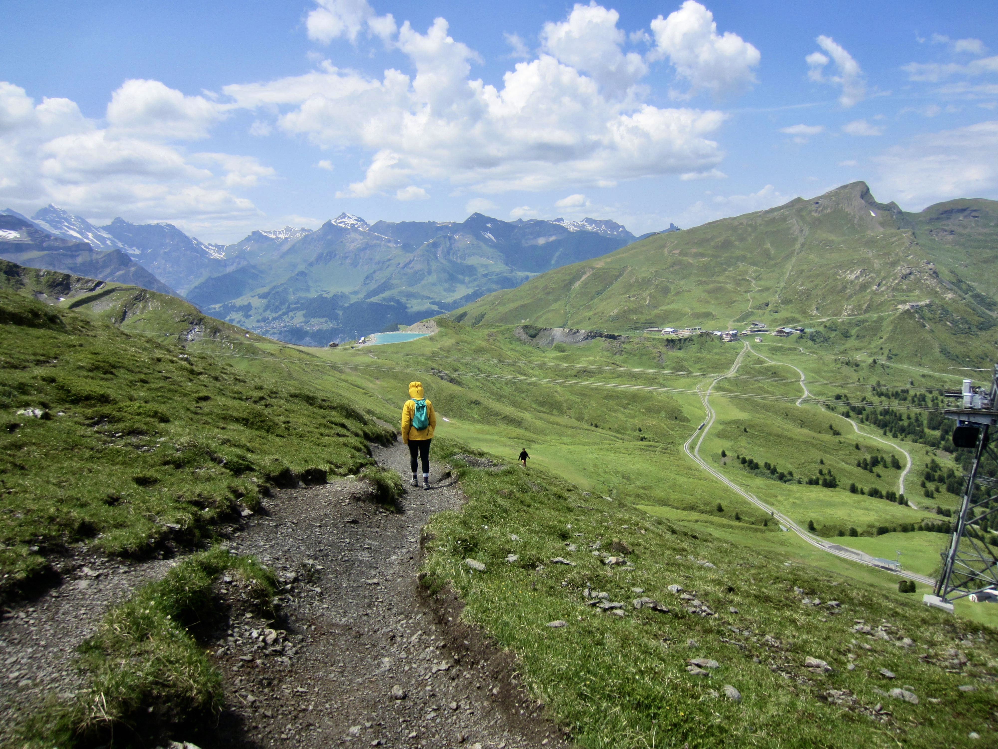
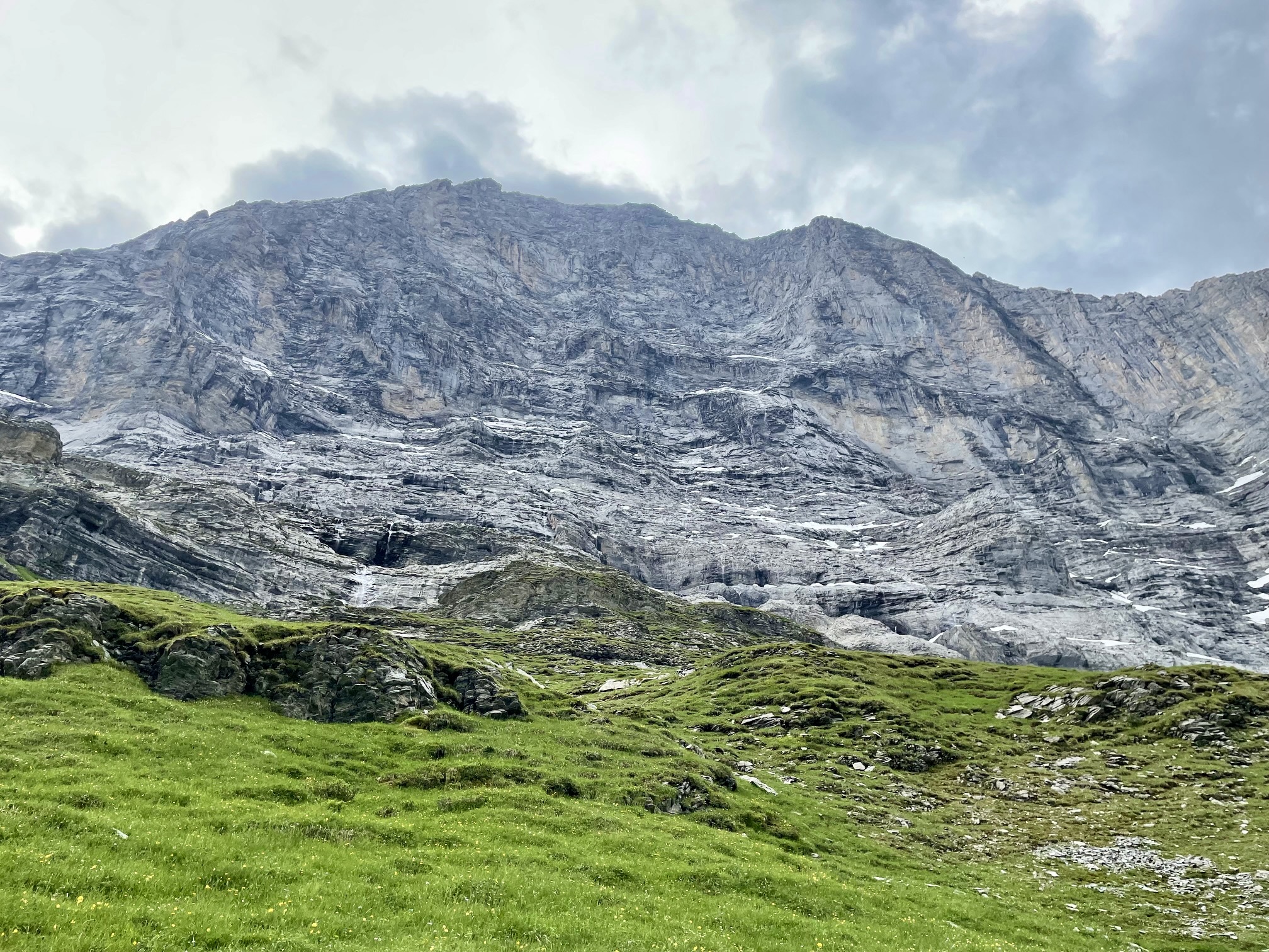
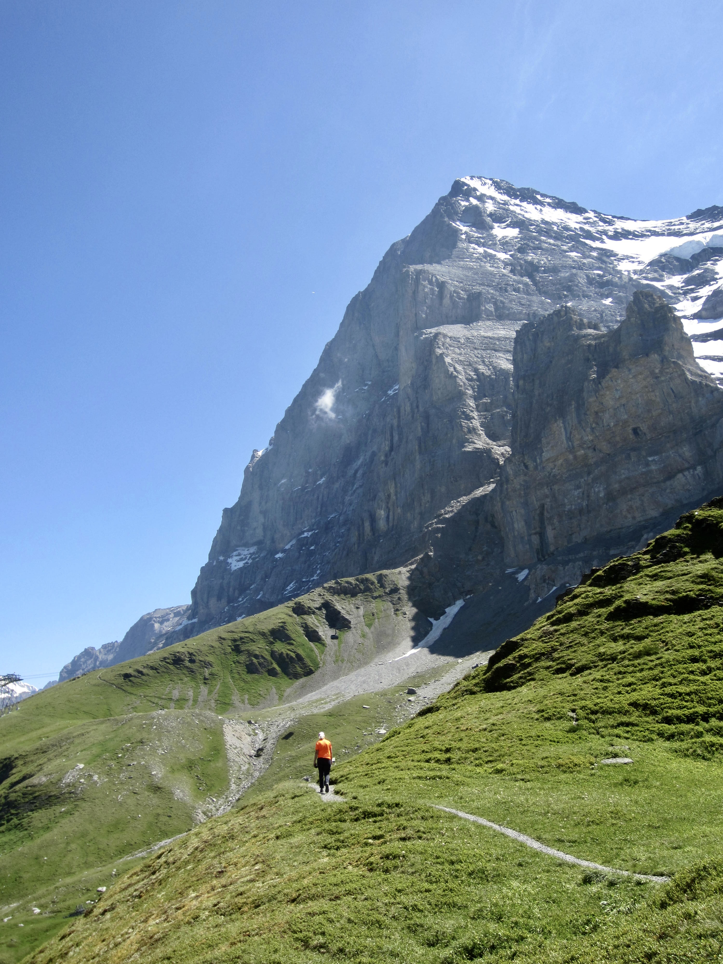
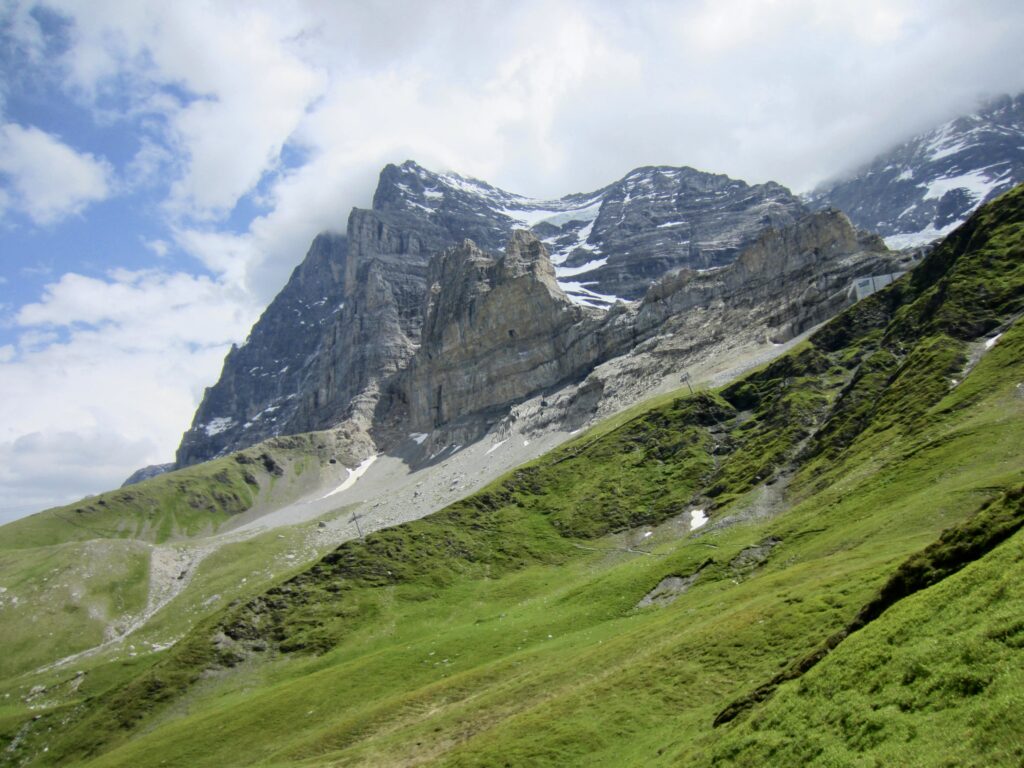
The Eiger Trail is a very popular hiking route in the Bernese Alps of south-central Switzerland. Due to the wishbone configuration of the trail, it offers three possible starting and ending points. This provides six different hike options, ranging from one hour to several hours, thereby accommodating a variety of itineraries. All options give hikers a close-up view of the massive and ominous north face, or nordwand, of the legendary Eiger. Furthermore, any of the starting and ending points is accessible by either train or gondola, which makes it very convenient to do a one-way traverse.

.
Trailhead & Approach Options
The three possible starting and/or ending points for an Eiger Trail hike are as follows: (1) Alpiglen Station, (2) Kleine Scheidegg, and (3) Eigergletscher Station. These stations and trailheads are described below.
Regardless of where you choose to start your hike, you will be approaching your trailhead from the Grindelwald Grund Terminal located closely west of downtown Grindelwald. Both the Jungfrau-bahn cog train and the Eiger Express gondola depart from this terminal.
The Jungfrau-bahn train provides access to the Alpiglen Station and Kleine Scheidegg trailheads. The Eiger Express gondola, on the other hand, provides access only to the Eigergletscher Station trailhead. However, it is possible to ride the gondola to Eigergletscher Station and then take a train to the other trailheads.
.
Route Options
Starting Point 1: Alpiglen Station
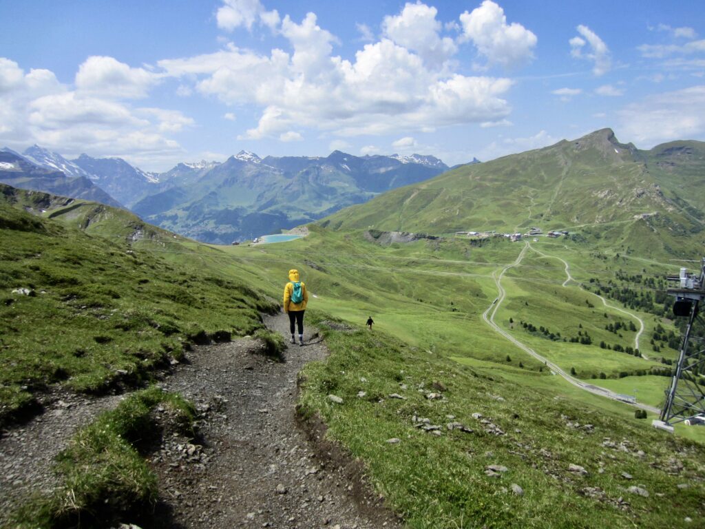
Alpiglen Station lies on the route of the Jungfrau-bahn cog train that runs uphill from the Grindelwald Grund Terminal. The Eiger Trailhead is located at the northern end of the depot building here. From this trailhead, the trail makes a switchbacking climb up a grassy hillside.
.
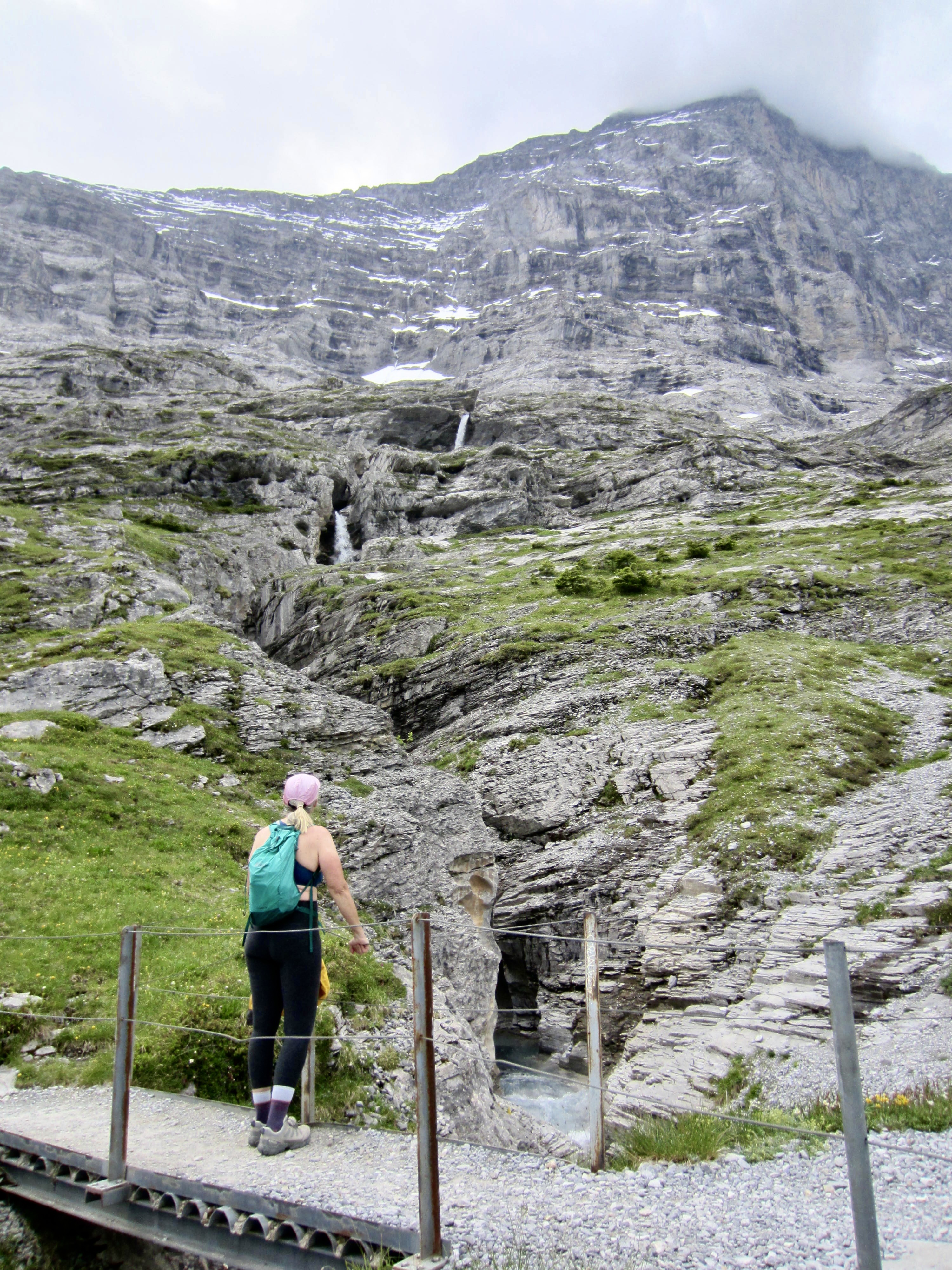
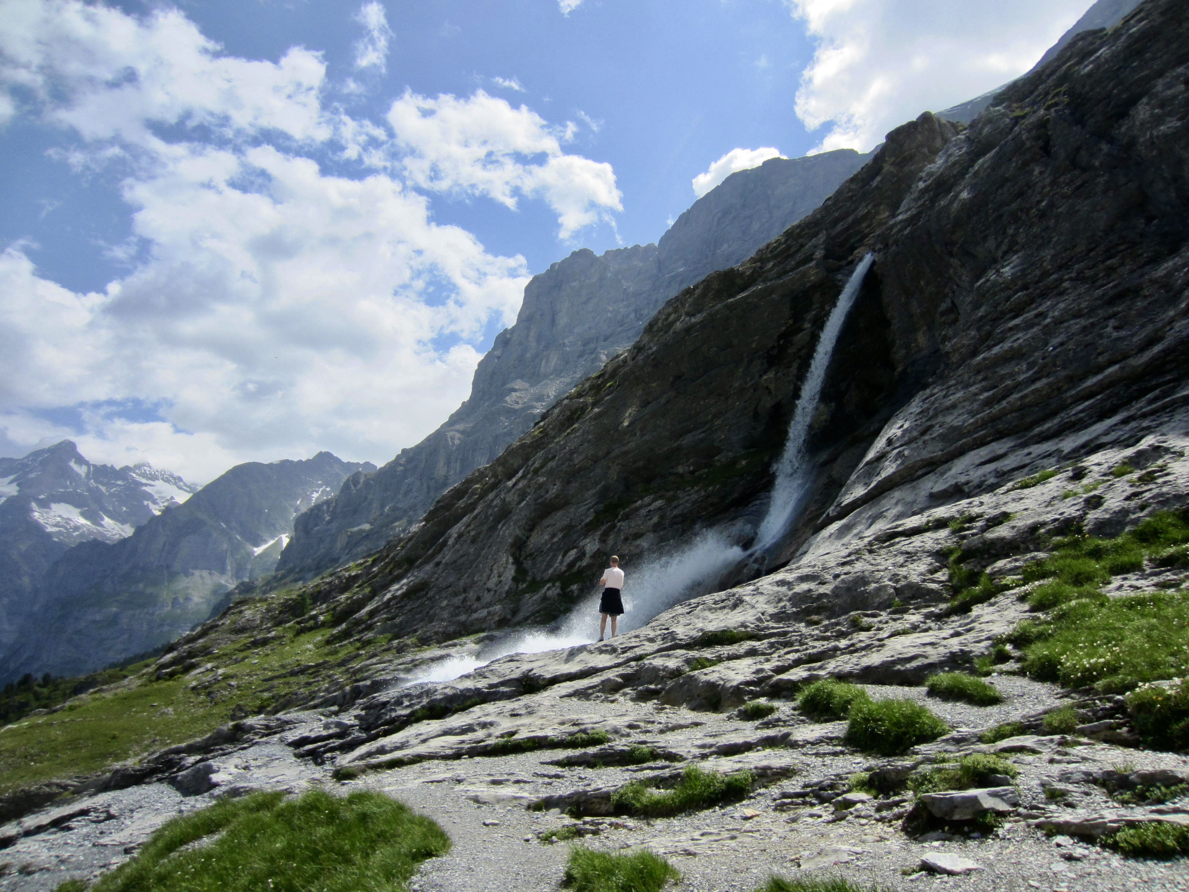
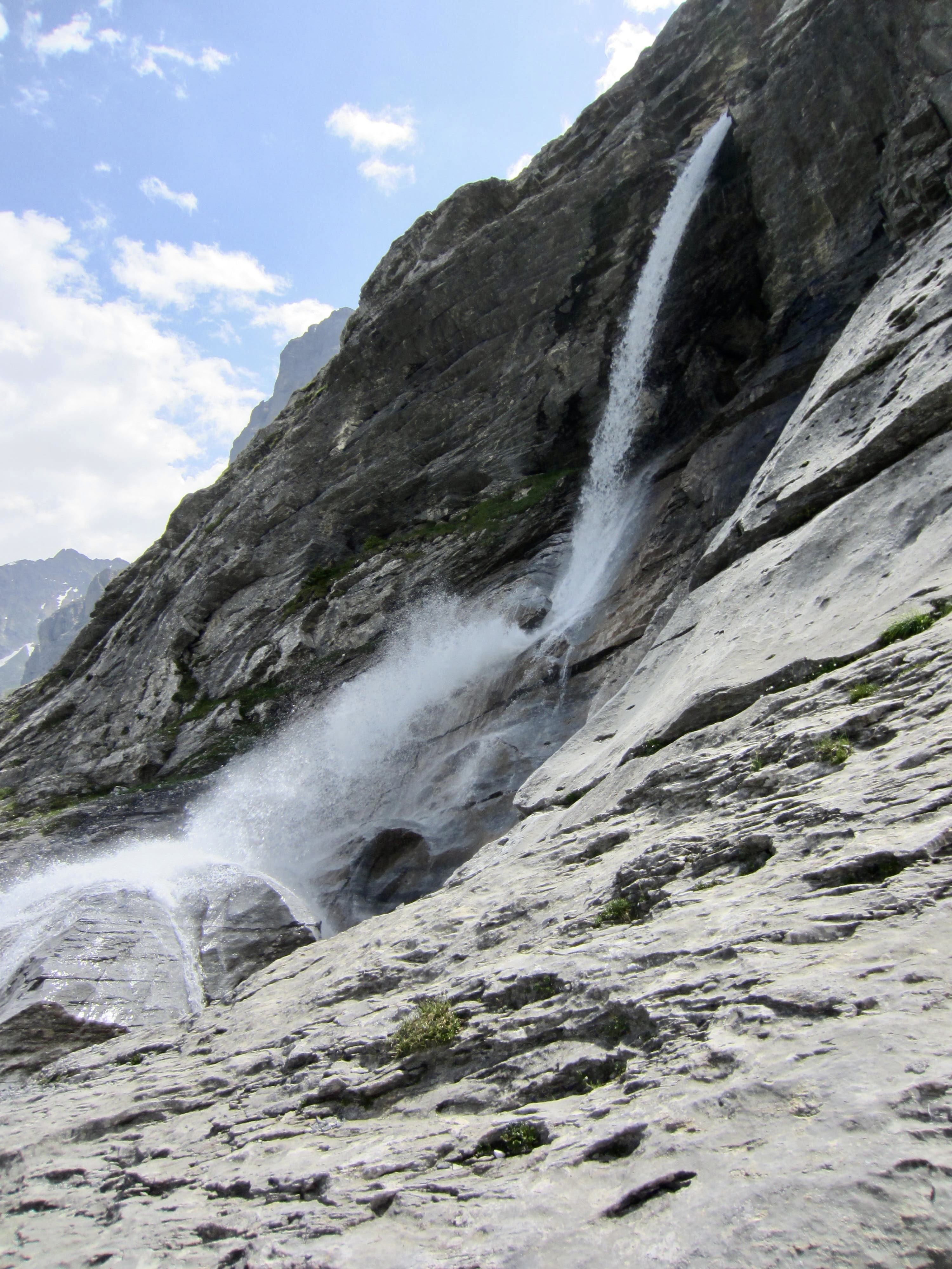
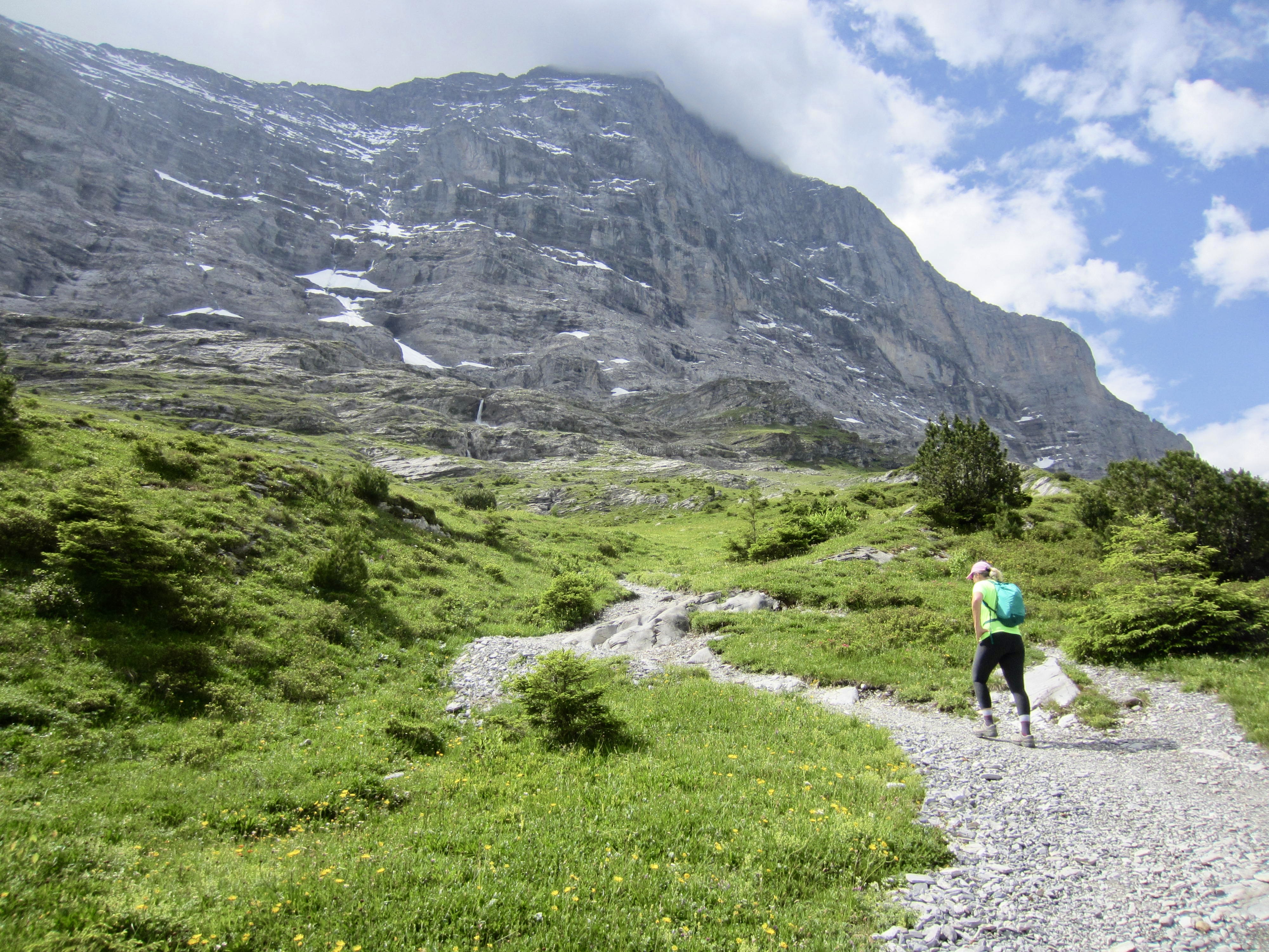
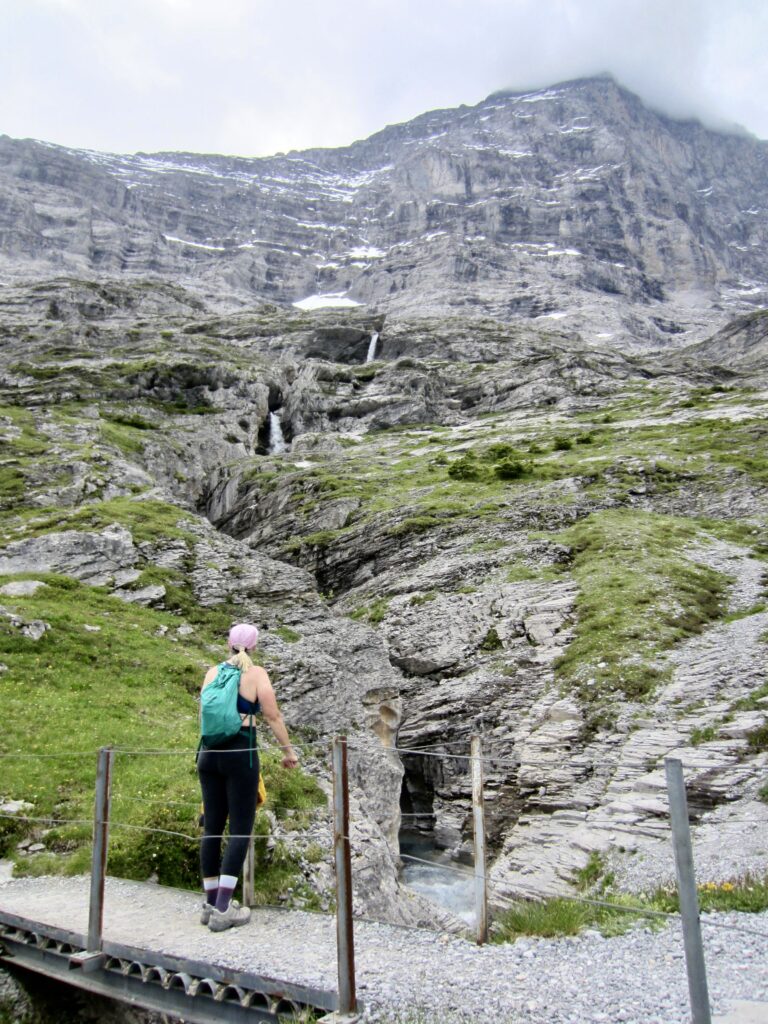
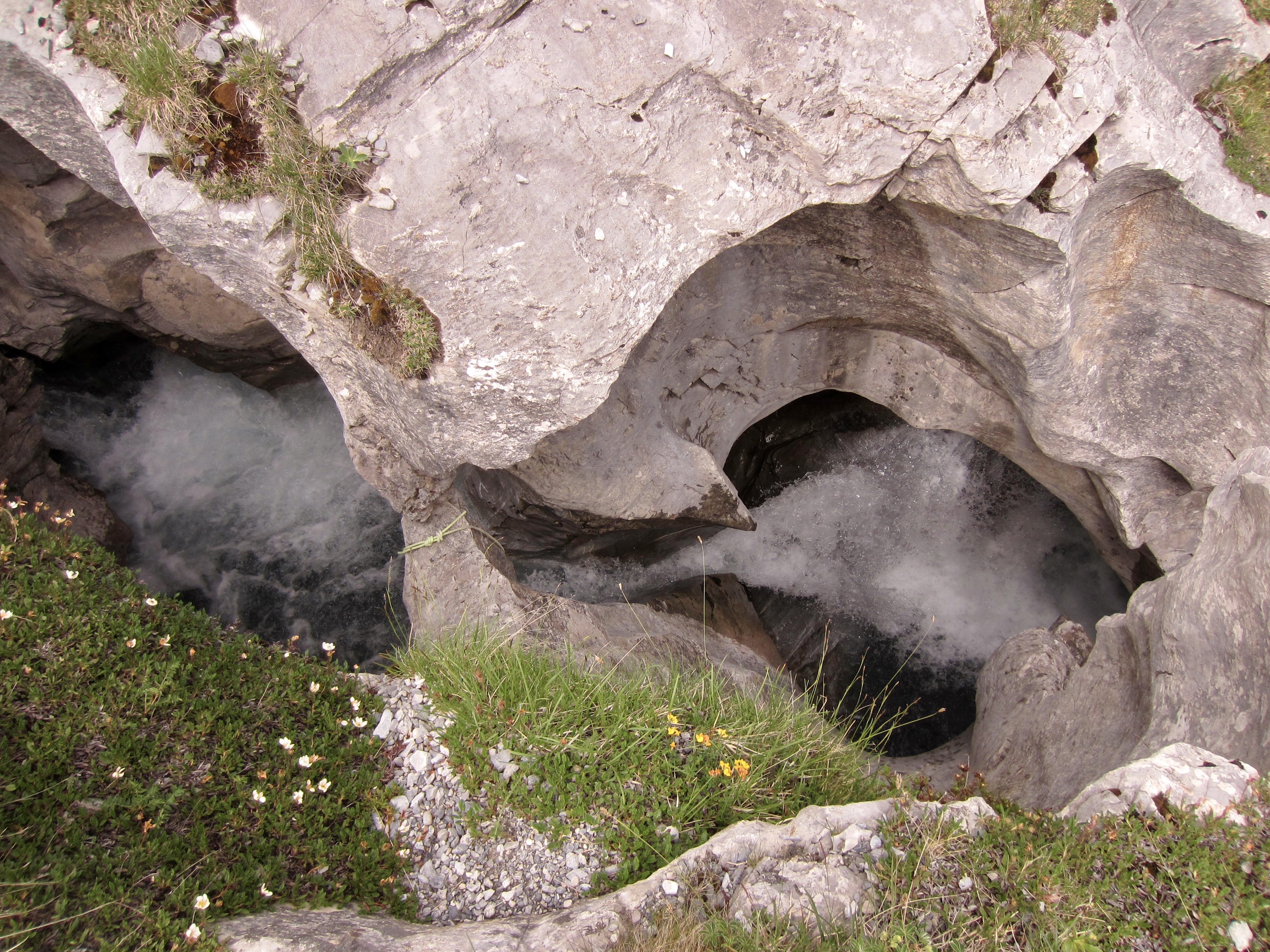
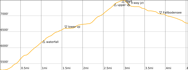
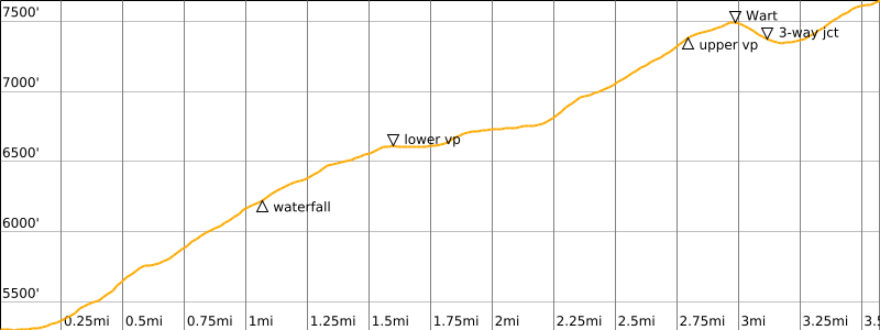
The trail soon passes a small but vigorous stream that has carved an impressive slot into the limestone bedrock. Farther uphill, this same stream creates a striking waterfall where it cascades over a cliff.
.
.

.

.
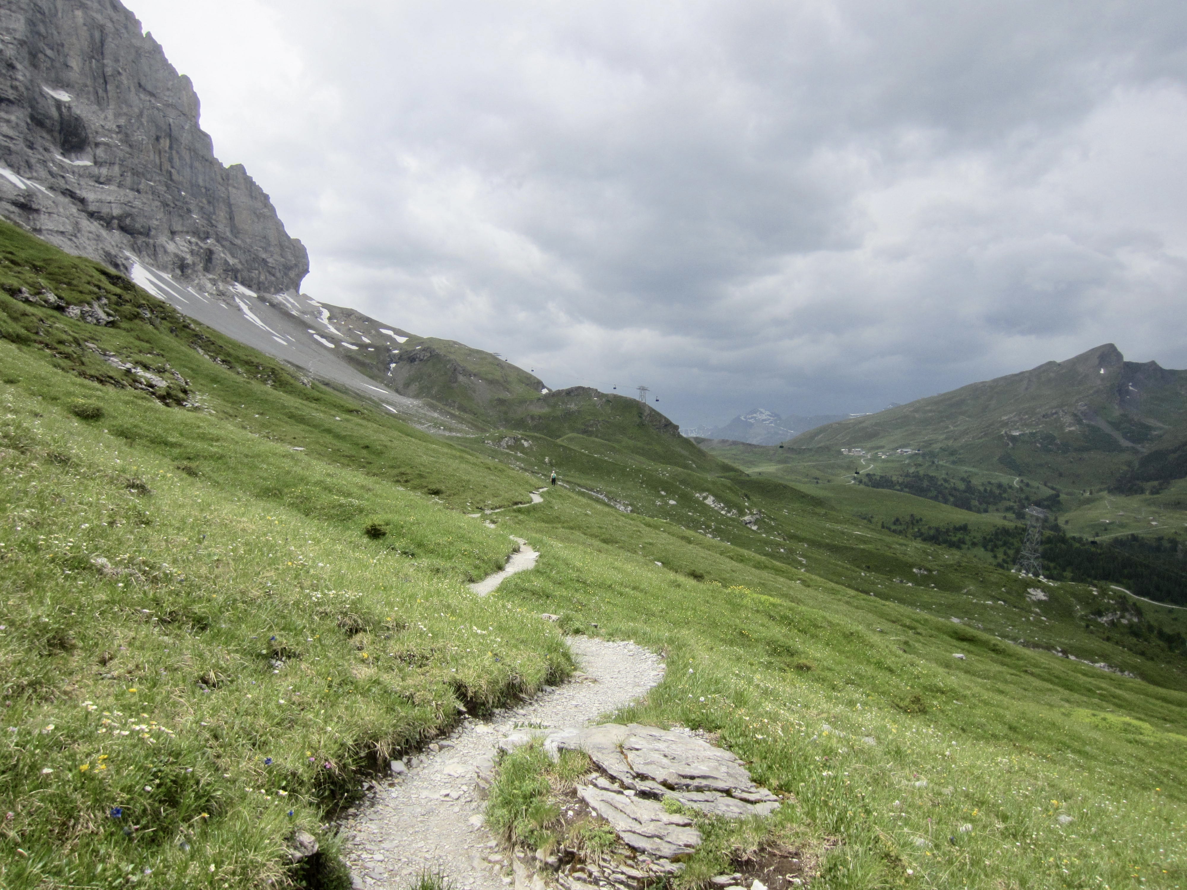
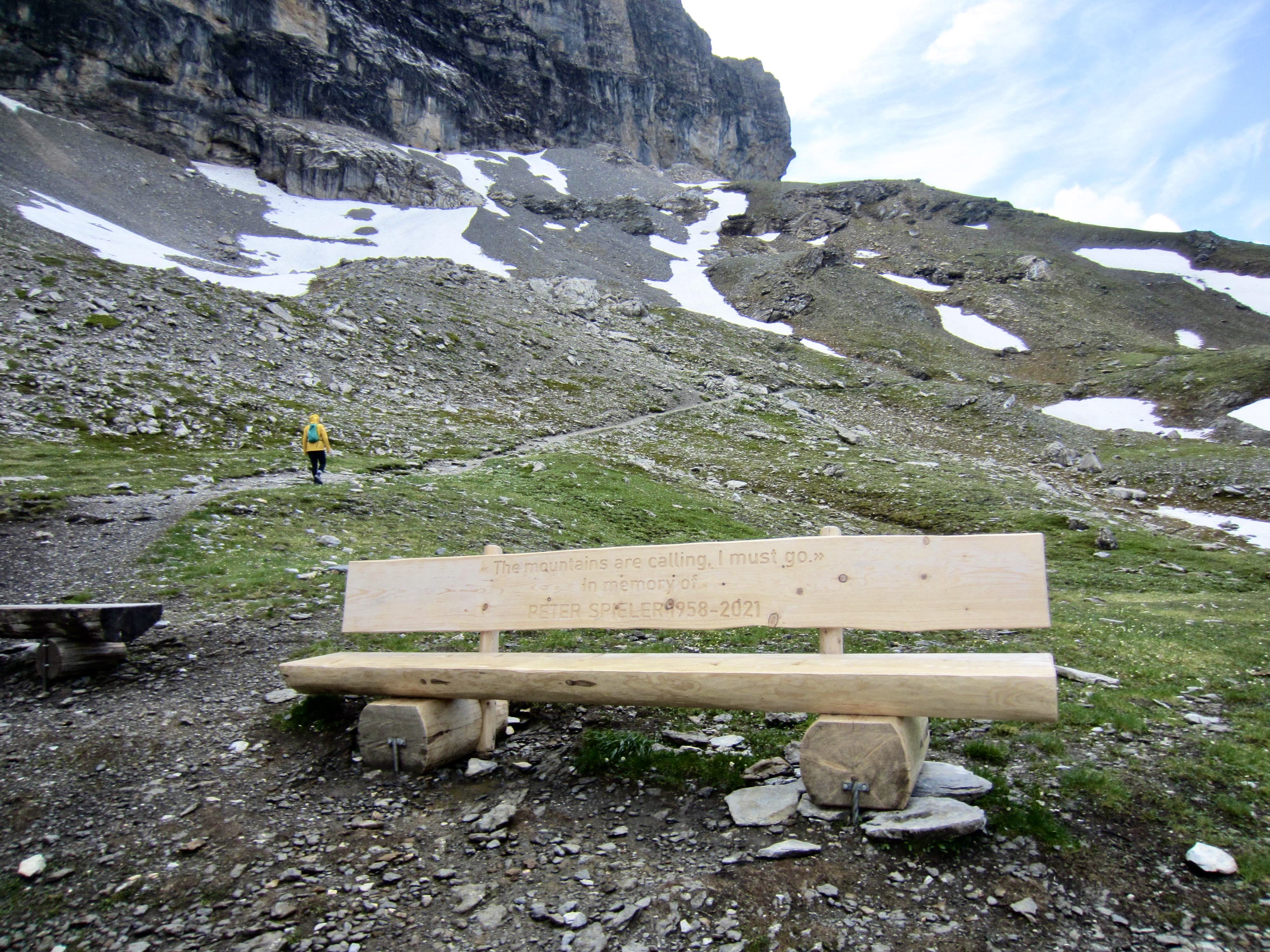
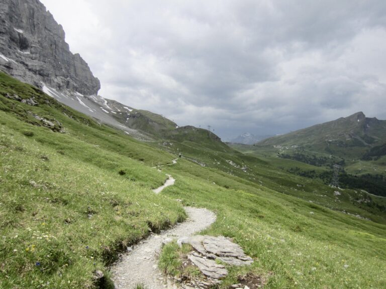
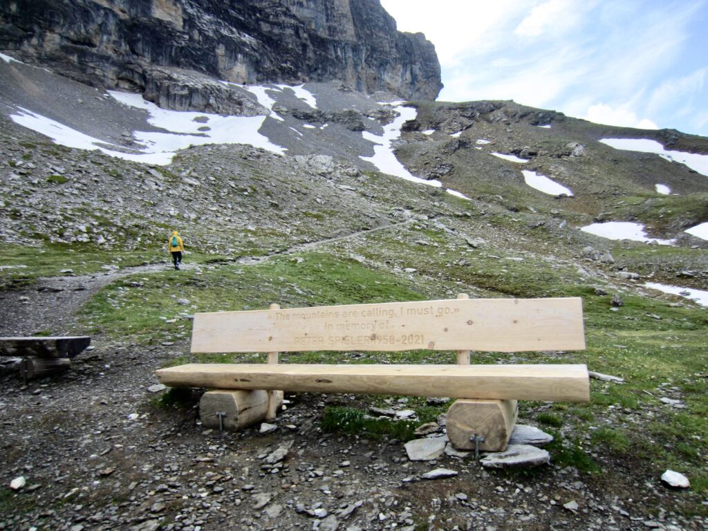
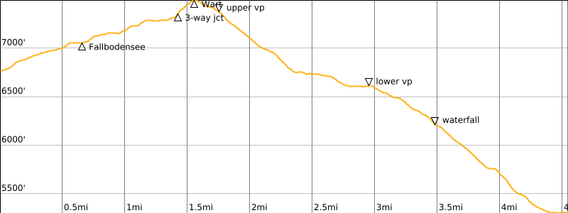
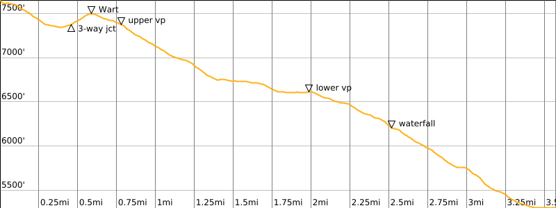
A long traverse then leads hikers over two ridges that offer excellent views of the beautiful valley below. There are two established viewpoints with sitting benches along the way. The trail reaches a local high point at Wart Ridge, then begins descending.
.
.
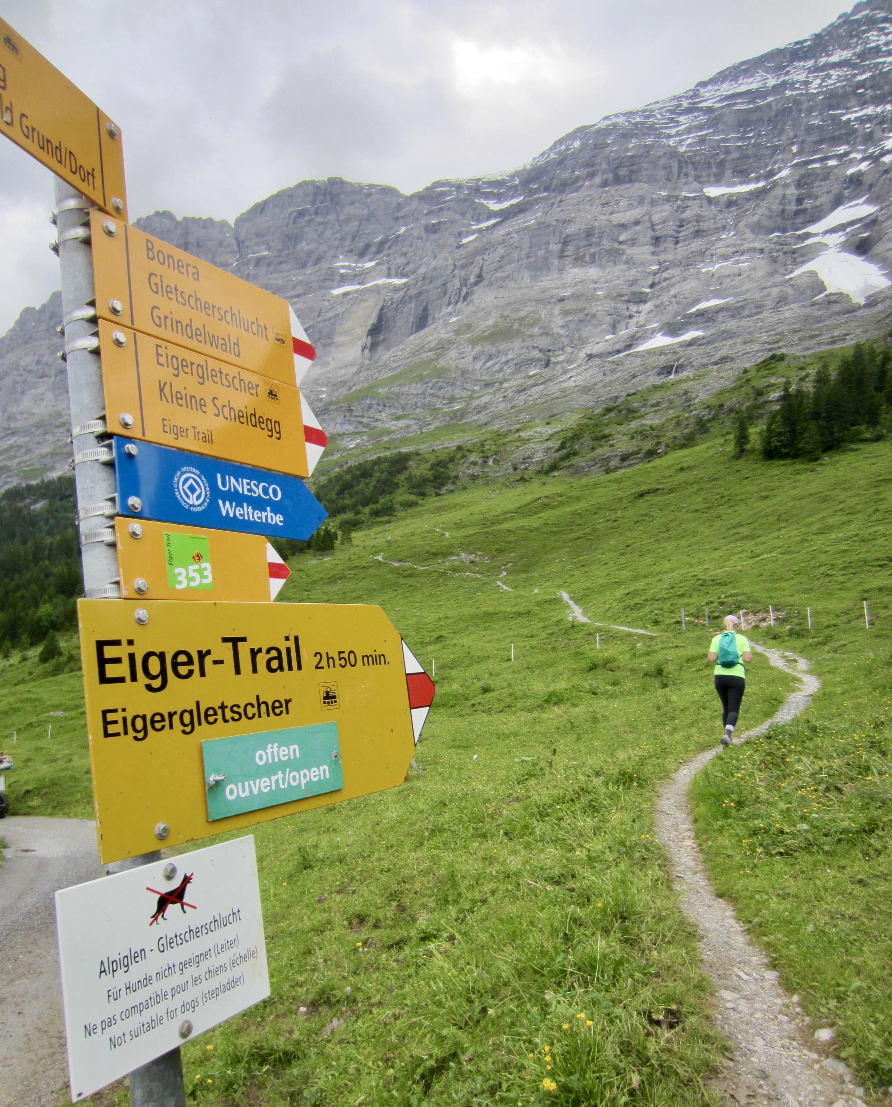
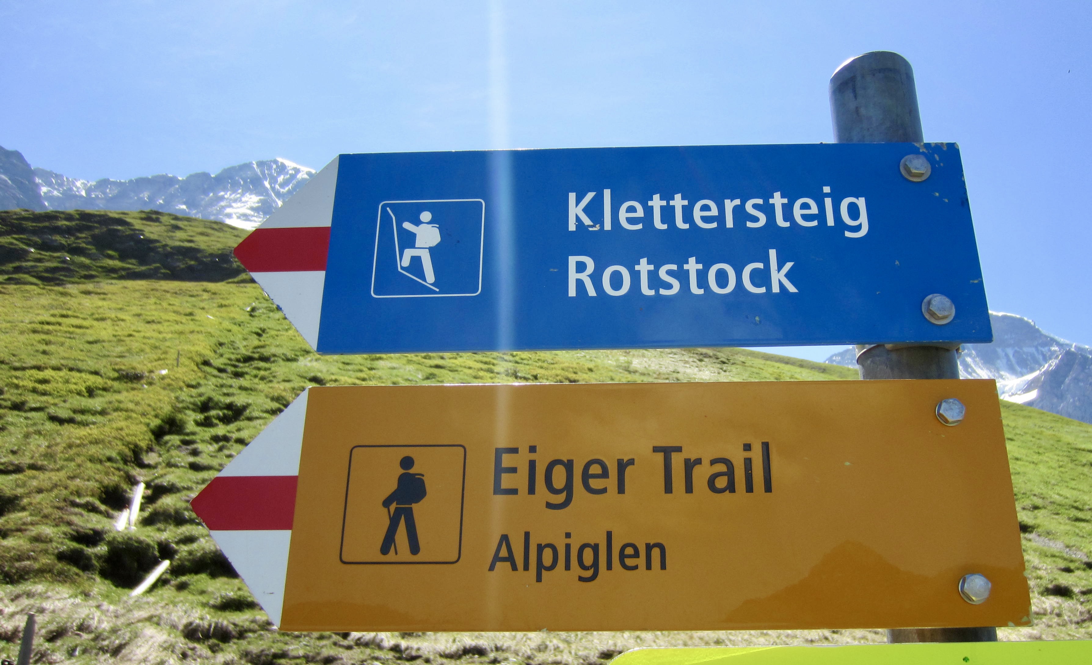
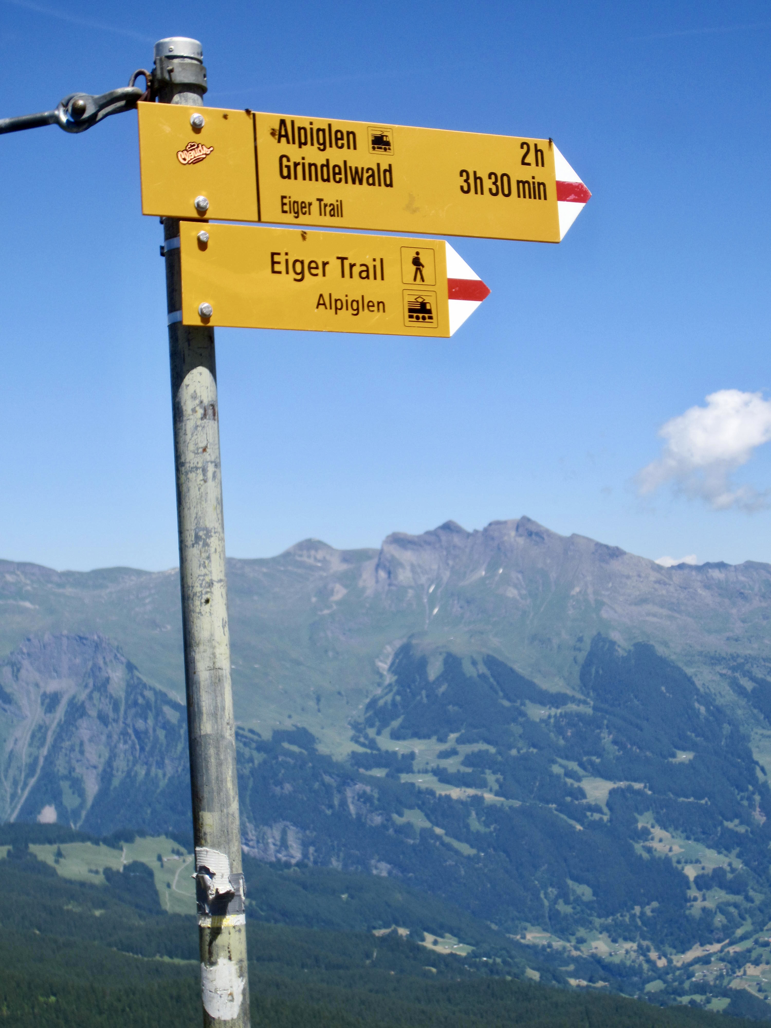
After hiking 3.2 miles / 5.1 kilometers from Alpiglen, you will arrive at a three-way junction. The right fork descends to Kleine Scheidegg in 1.4 miles / 2.3 kilometers, and the left fork ascends to Eigergletscher Station in 0.45 miles / 0.7 kilometers.
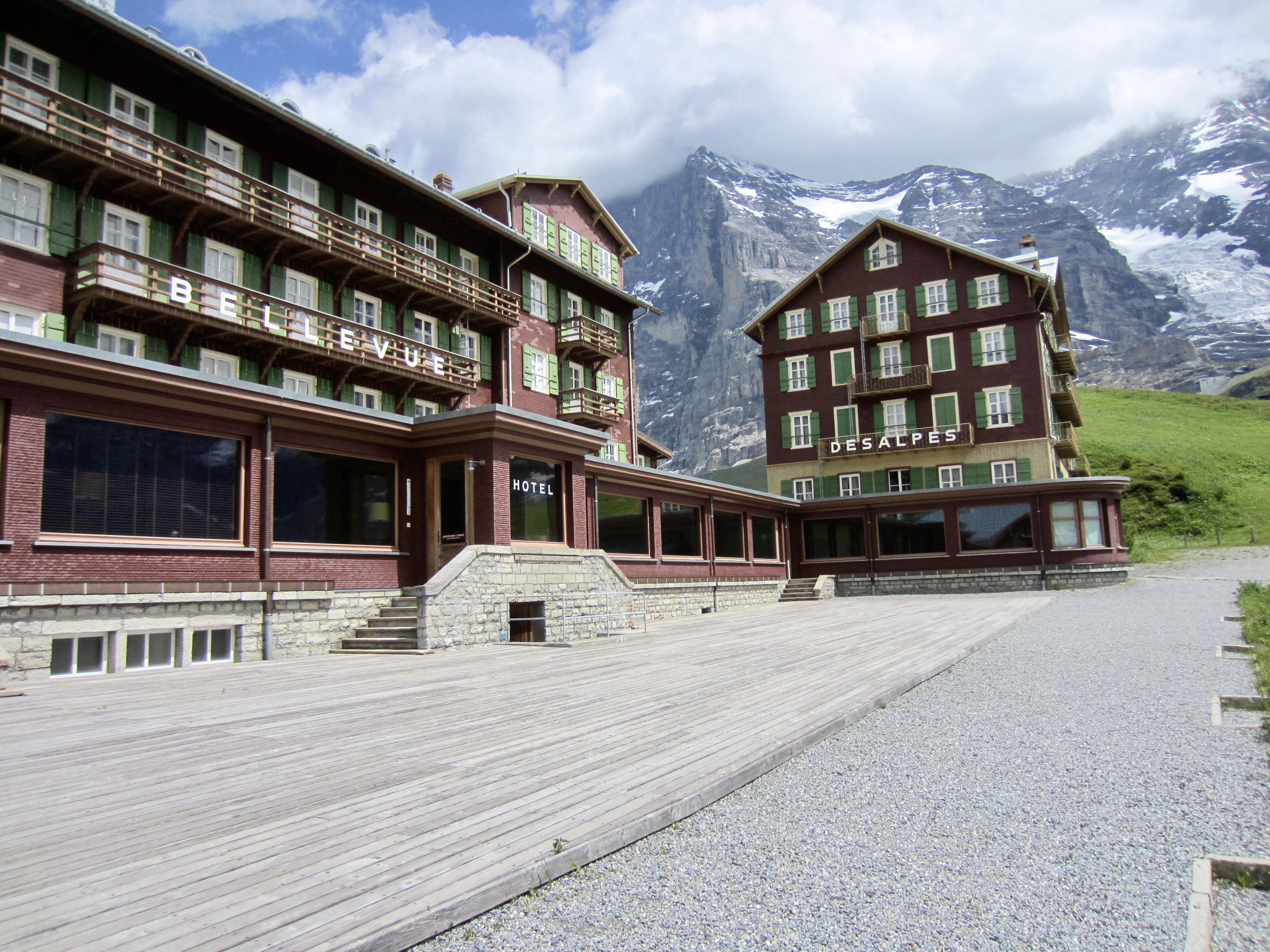
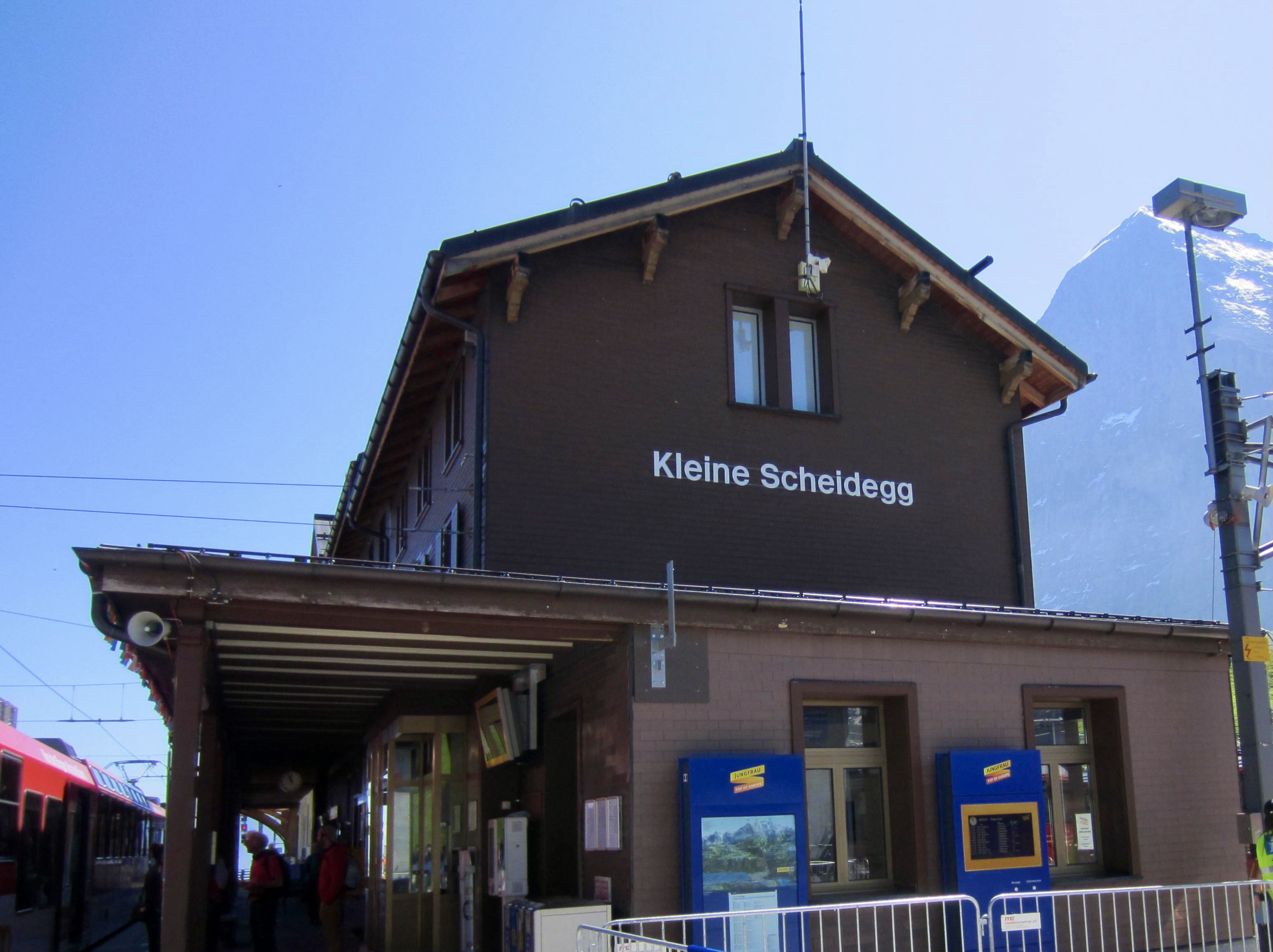
Starting Point 2: Kleine Scheidegg
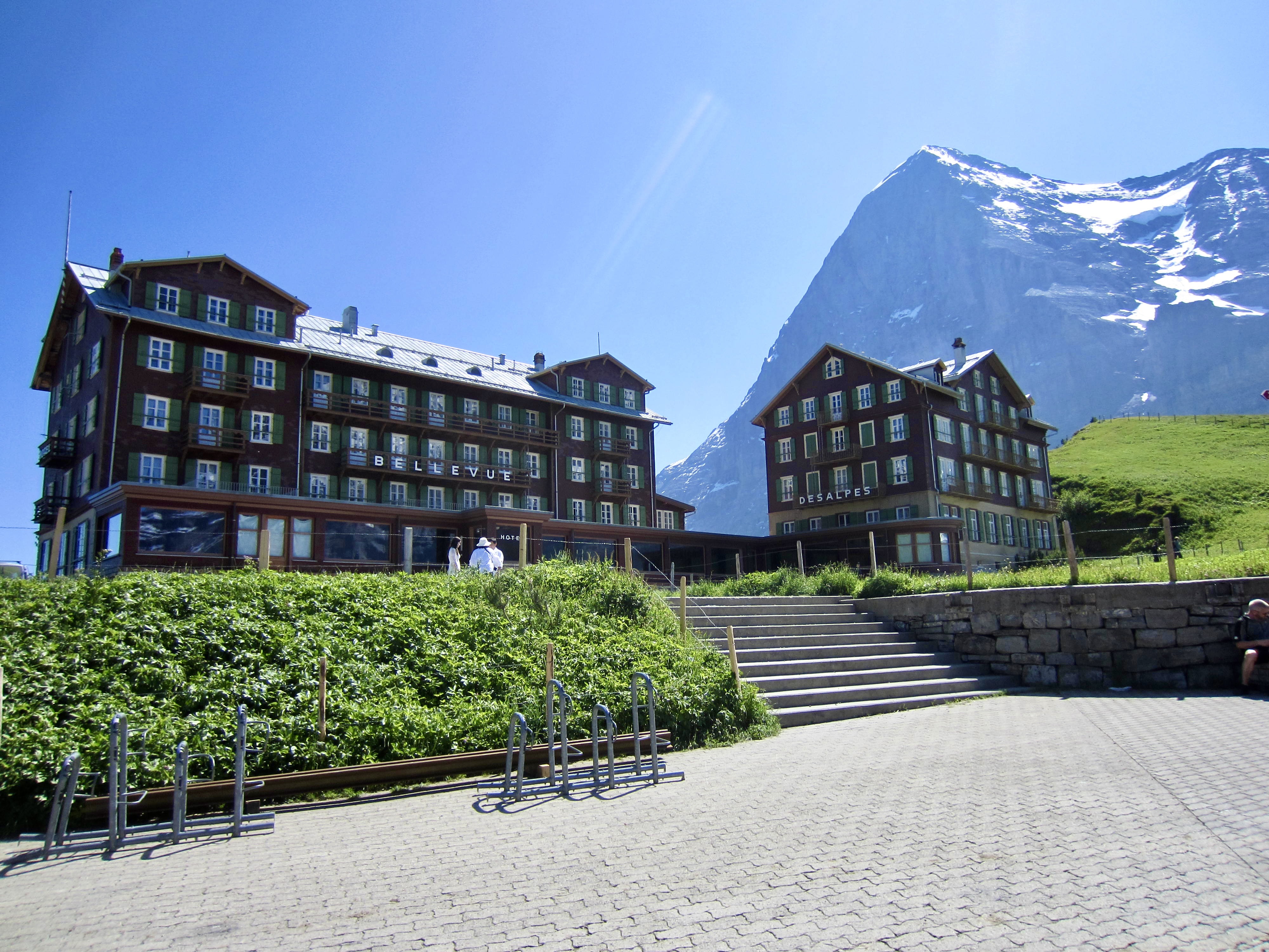
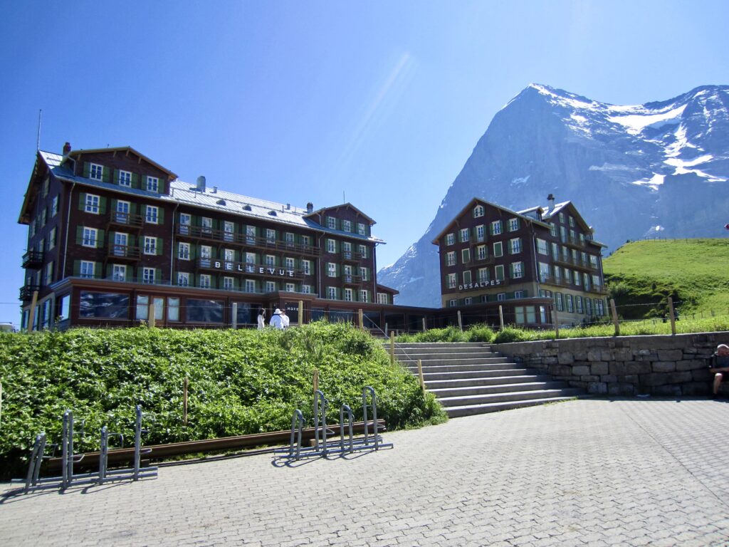
The little resort village of Kleine Scheidegg lies at the end of the Jungfrau-bahn cog train that runs up from the Grindelwald Grund Terminal. The Eiger Trailhead is located on the south side of the Bellevue and Des Alpes hotel buildings here. Both of these hotels were prominently displayed in Clint Eastwood’s cinematic masterpiece, The Eiger Sanction.
.
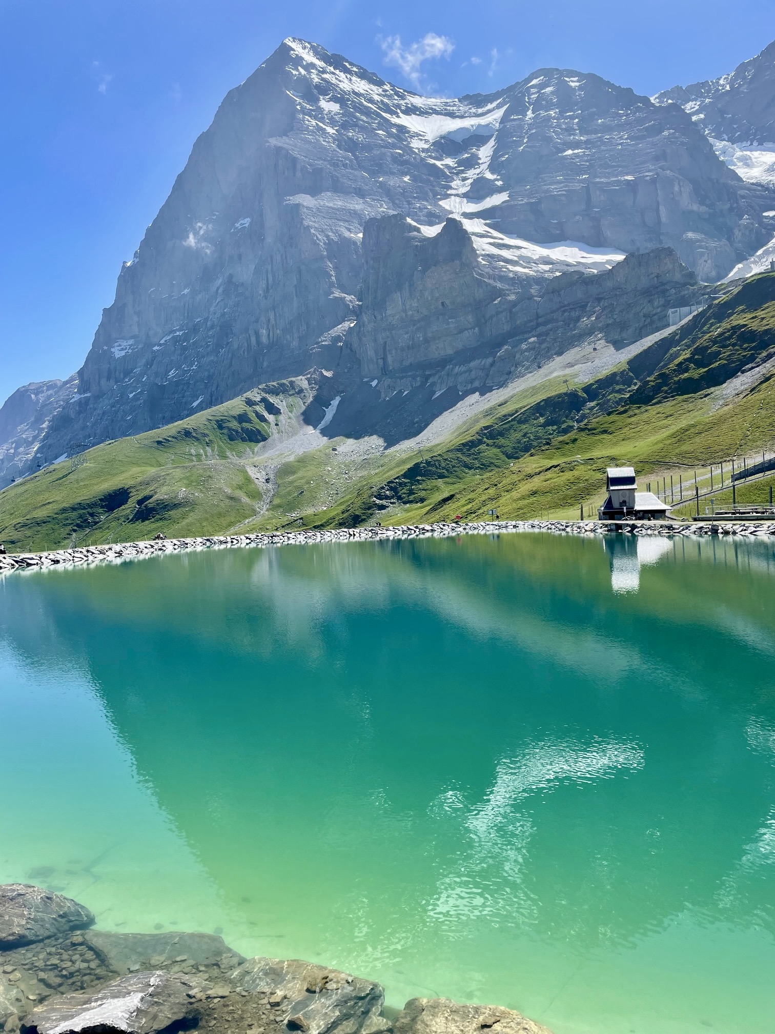
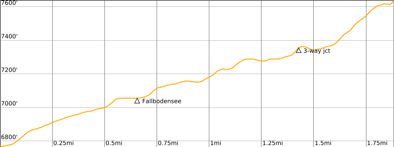
From the hotel buildings, a gravel road (signed as Eiger Walk) winds uphill to a water reservoir called Fallbodensee. This reservoir serves as a fine reflective surface for photographing the nearby Eiger.

.
On the far side of the reservoir, a signpost marks the formal start of the Eiger Trail. The first part of this trail makes a gently rising eastward traverse across the grassy hillside, curving around several small basins and ribs.
.
.
After hiking 1.4 miles / 2.3 kilometers from Kleine Scheidegg, you will reach the three-way junction. A right turn here takes you up a moderately steep and rocky trail to Eigergletscher Station in another 0.45 miles / 0.7 kilometers. A left turn at the junction takes you over a ridge and down to Alpiglen in another 3.2 miles / 5.1 kilometers.
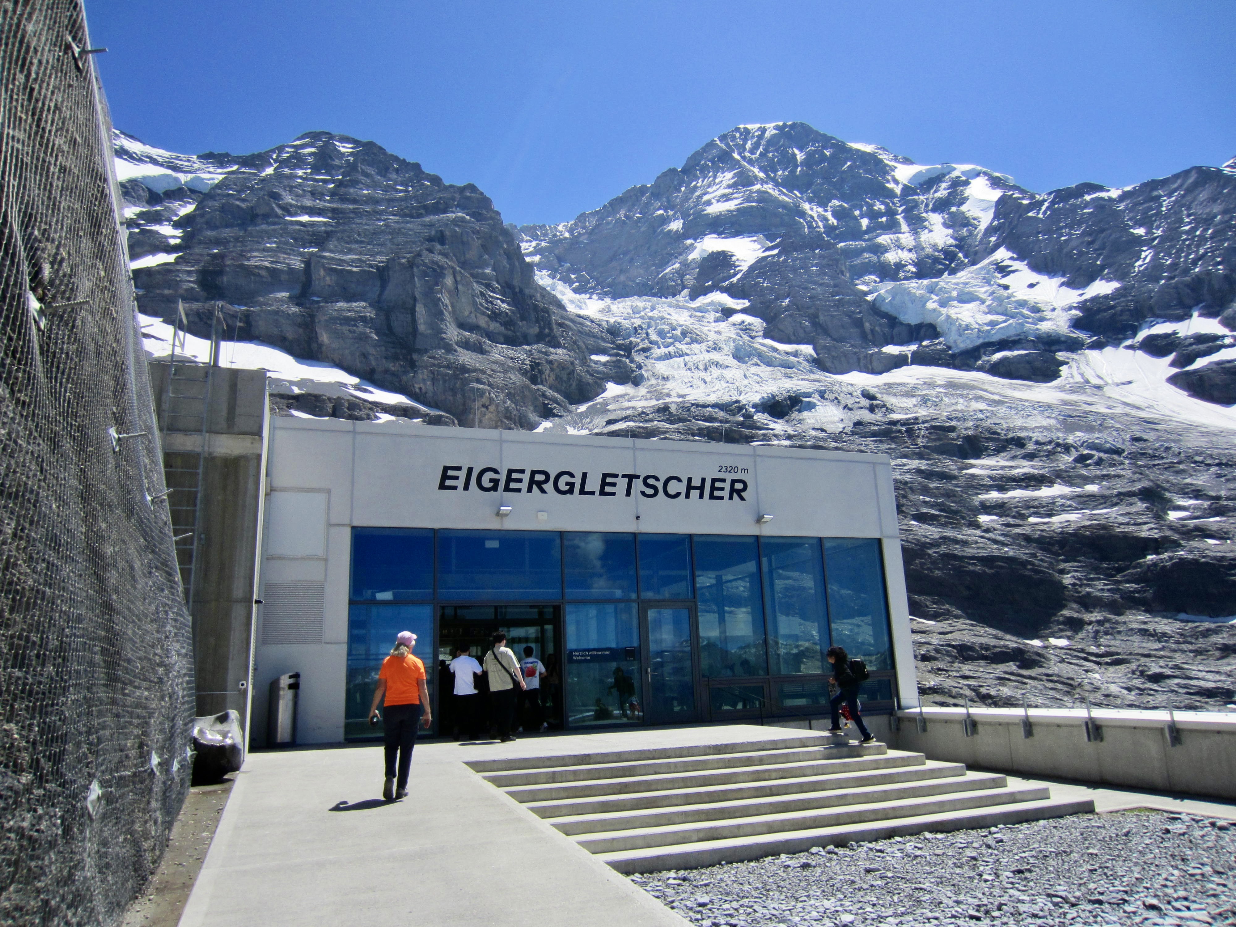
Starting Point 3: Eigergletscher Station
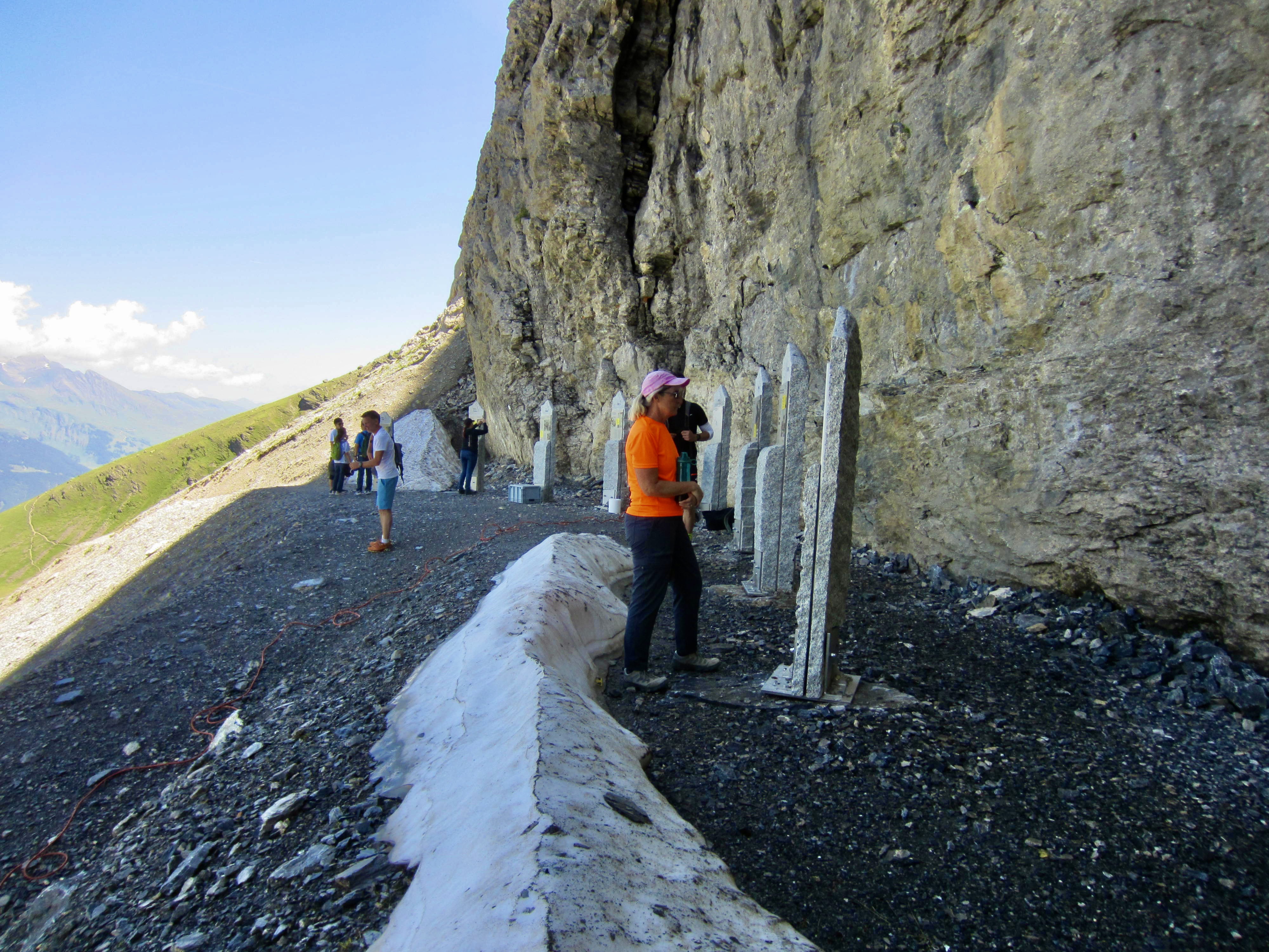
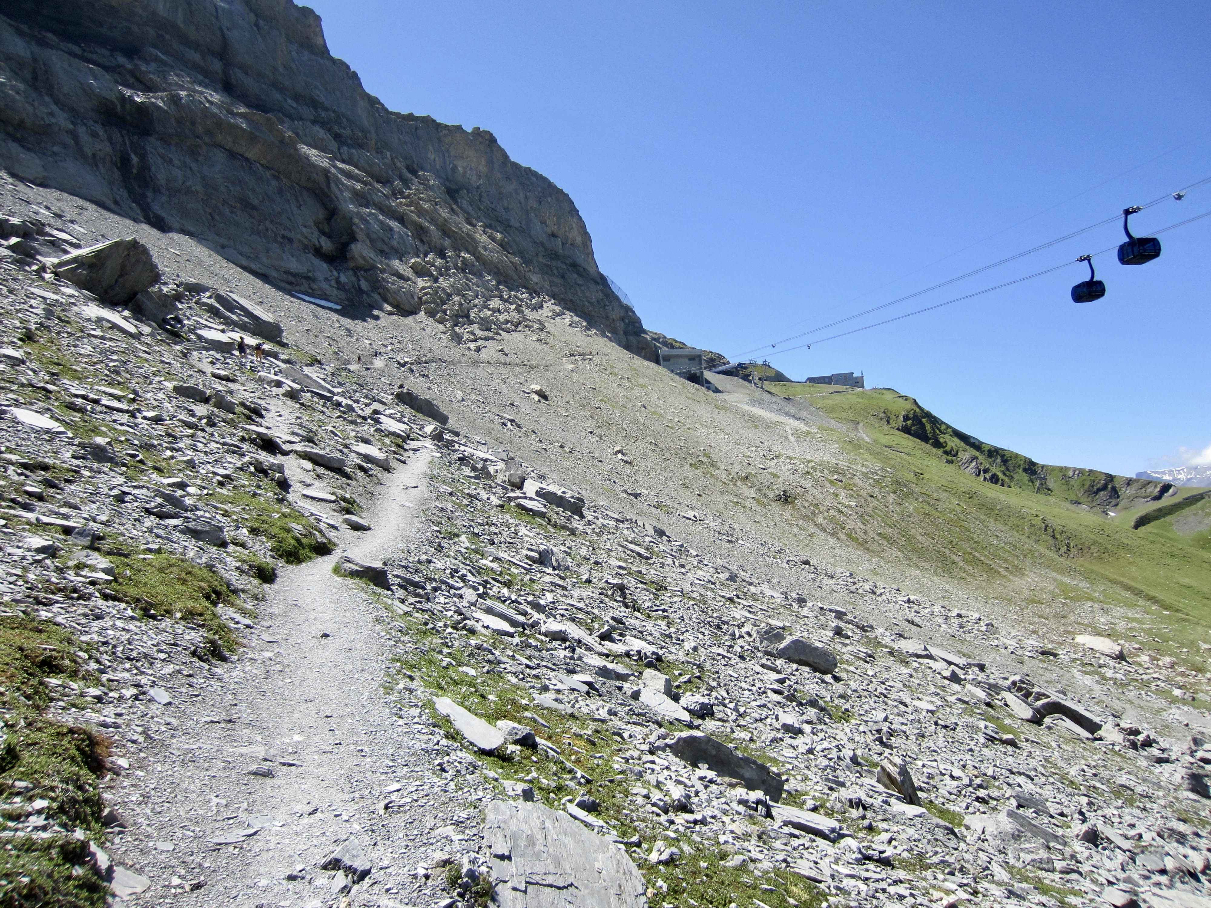
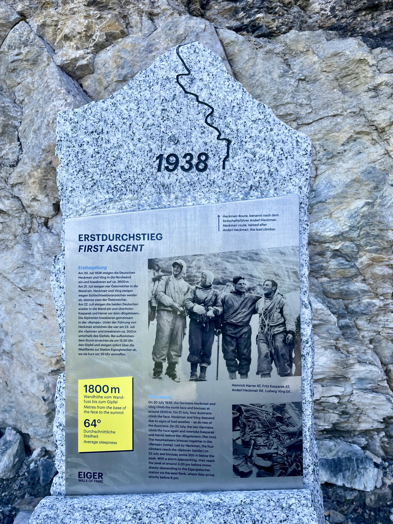
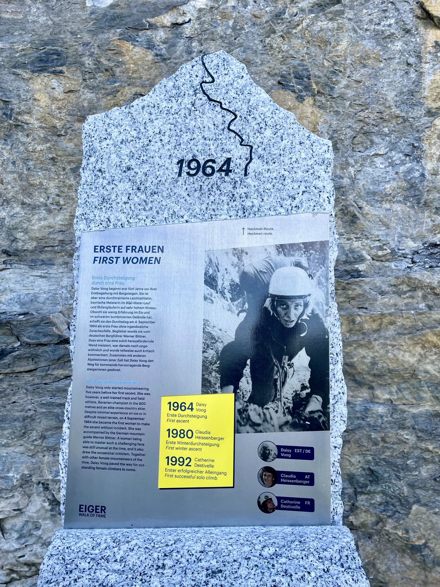
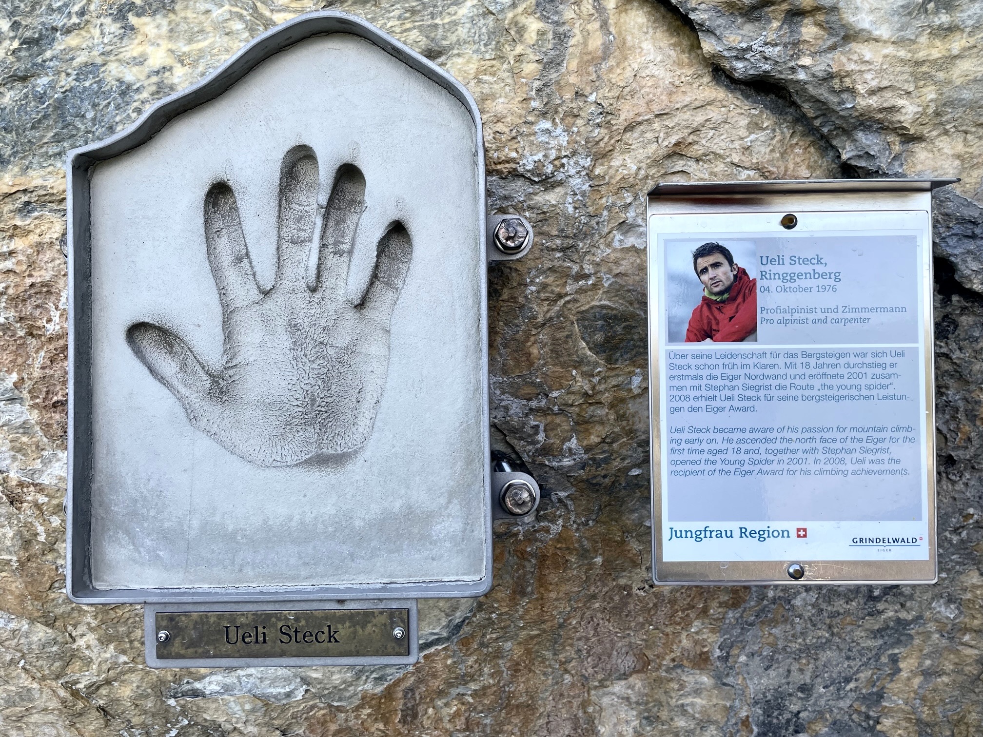
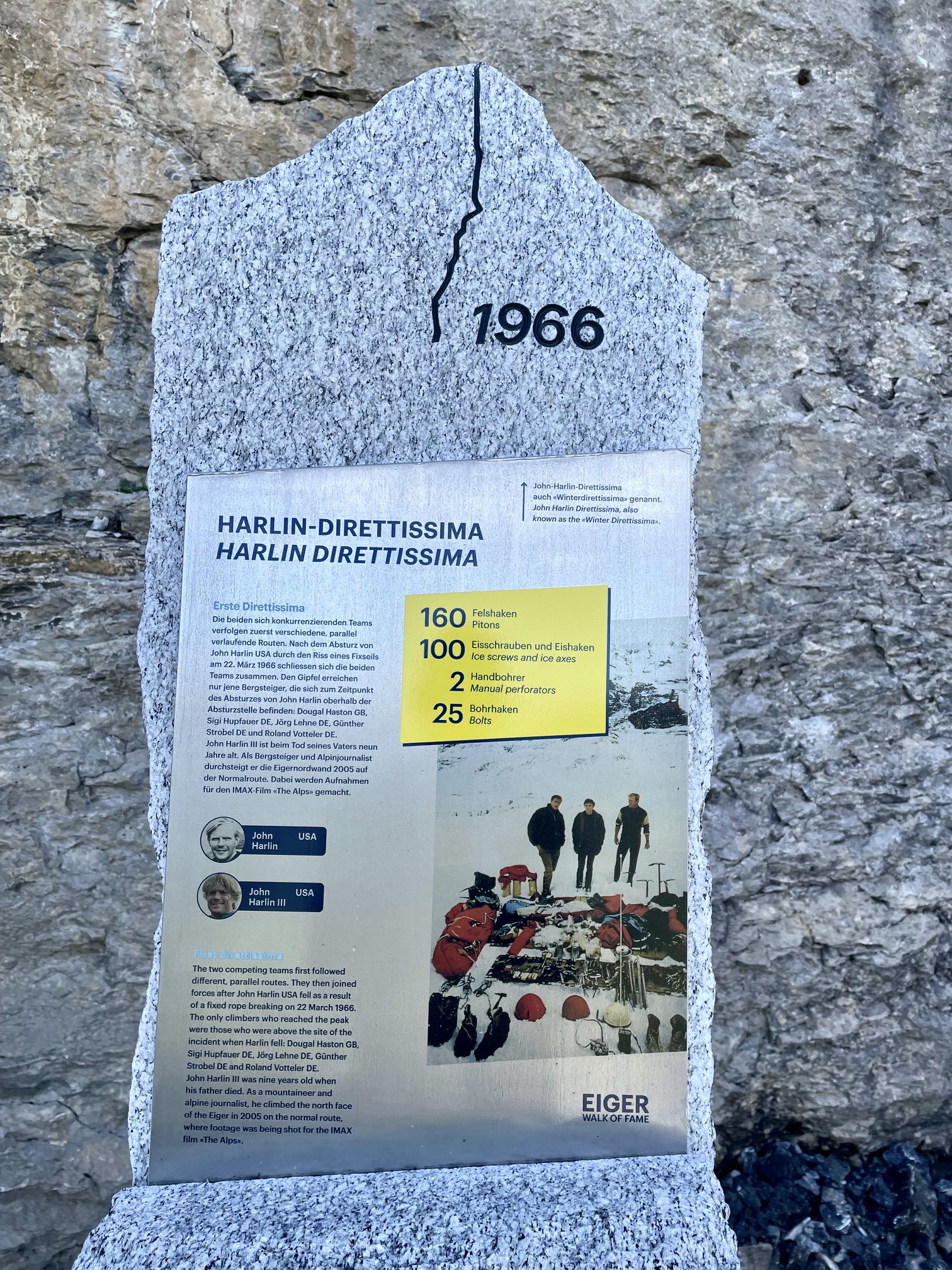
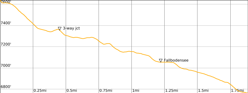
Eigergletscher Station lies at the upper terminus of the relatively new Eiger Express gondola, which whisks hikers to an elevation of 7650 feet / 2330 meters. From this high station, the Eiger Trail curves around the building and up to a gravel landing called The Walk of Fame.
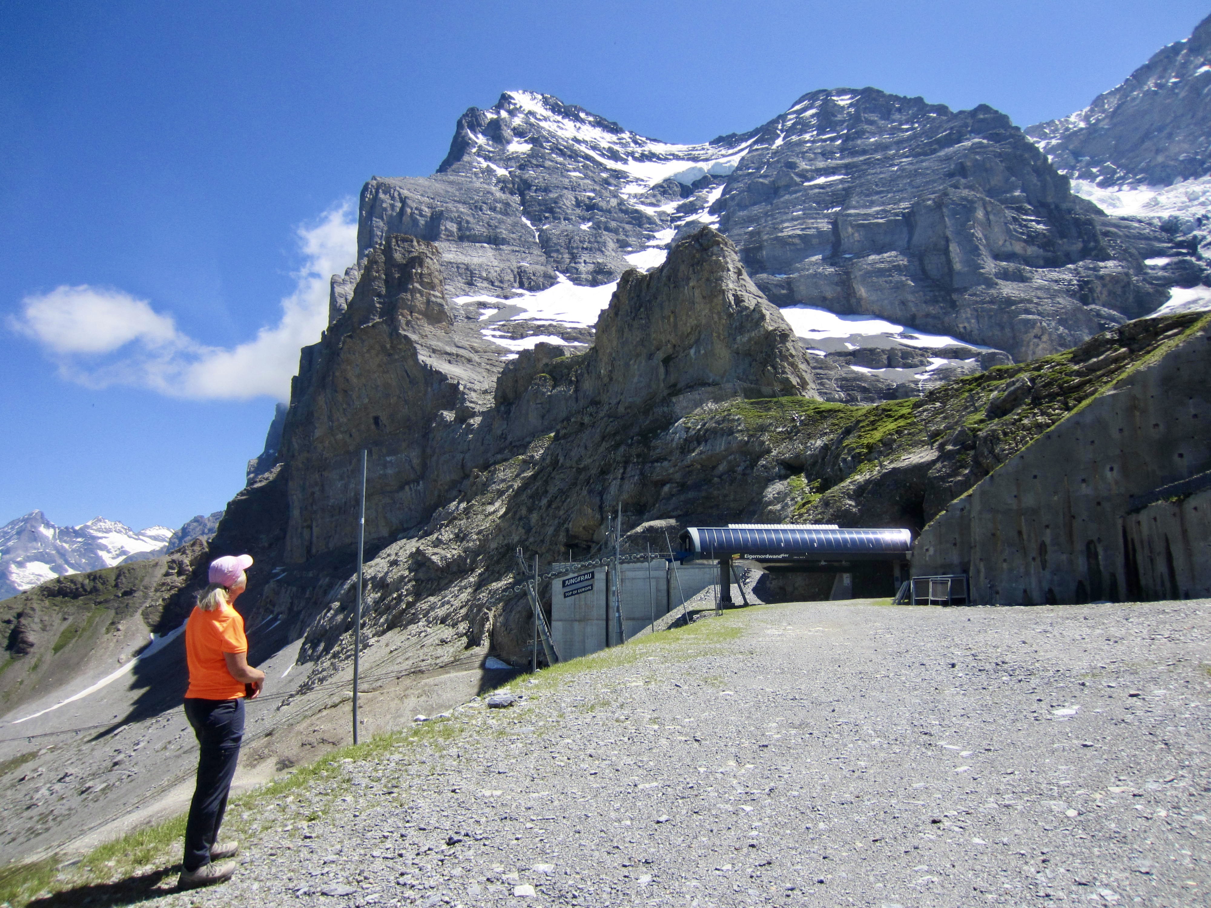
.
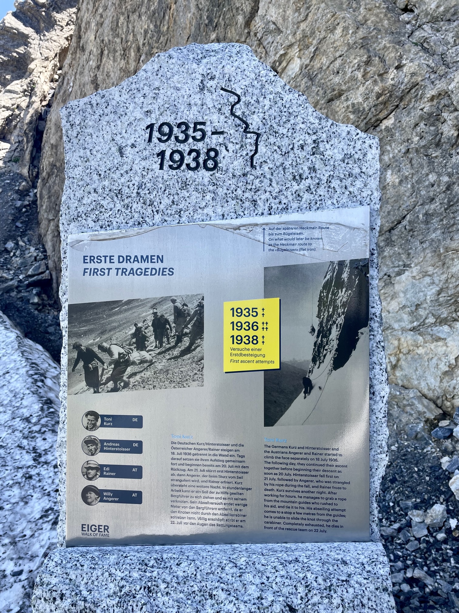
The Walk of Fame displays numerous monuments dedicated to key events and people associated with the Eiger’s north face. These events include the first attempt, the first successful ascent, and the first women’s ascent.

.
.
.
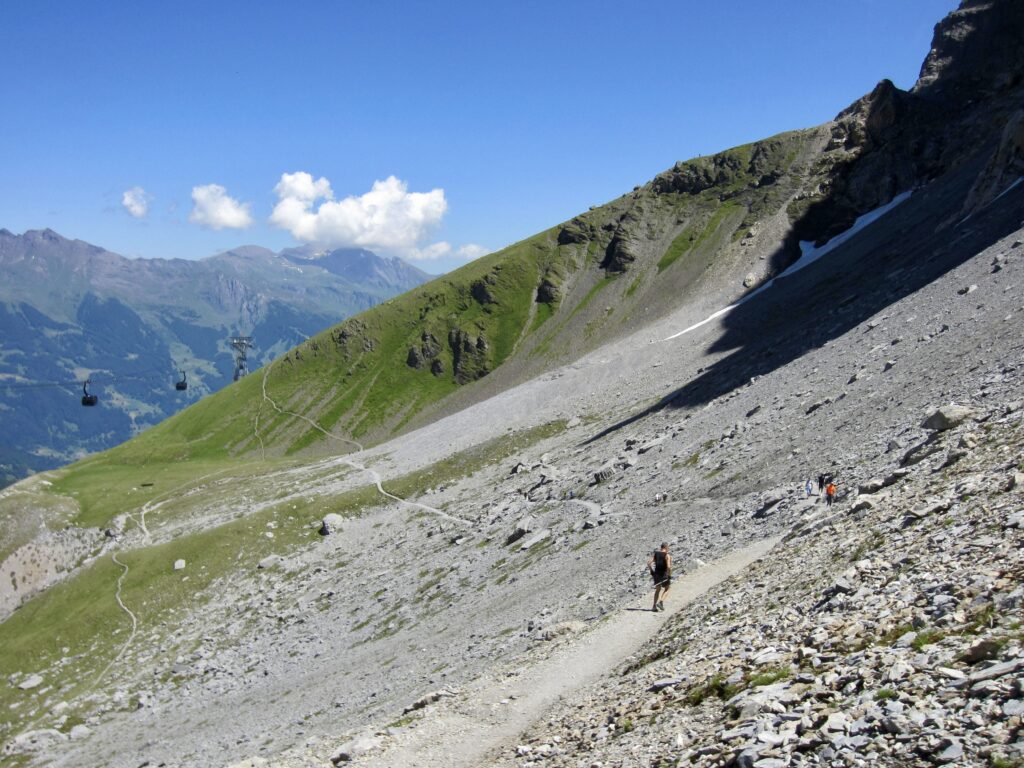
Beyond the historical monuments, the Eiger Trail descends a broad talus and scree slope, staying almost underneath the Eiger Express gondola. After hiking 0.45 miles / 0.7 kilometers from Eigergletscher Station, you will arrive at the three-way junction.
.

.
Continuing straight ahead at the three-way junction takes you over Wart Ridge and down to Alpiglen in another 3.2 miles / 5.1 kilometers. Turning sharply to the left takes you on down to Kleine Scheidegg in another 1.4 miles / 2.3 kilometers.
Route Map & Profiles
…
…
…
…
…
…
…
Photo Gallery
Click to enlarge…