Trip Date: September 1-3, 2024
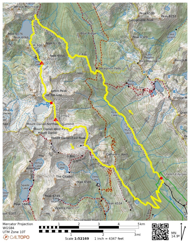
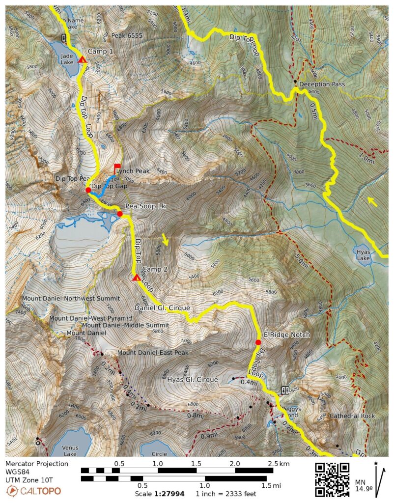
Dip Top Loop: Deception Pass to Dip Top Gap to Cathedral Pass
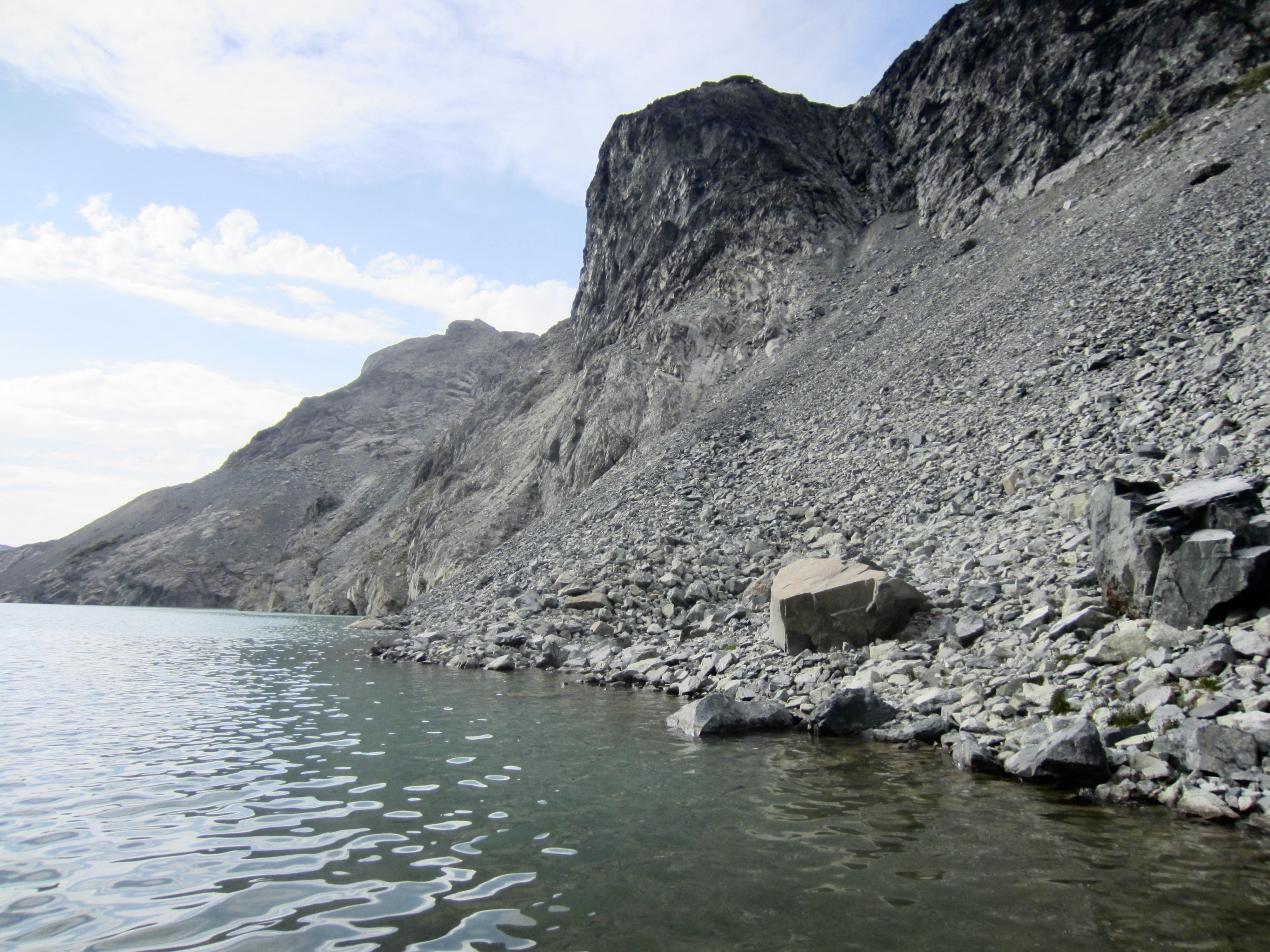
Hyas Lake
Deception Pass
Marmot Lake
No-Name Lake & Jade Lake
Dip Top Gap
Lynch Peak (7280+ ft)
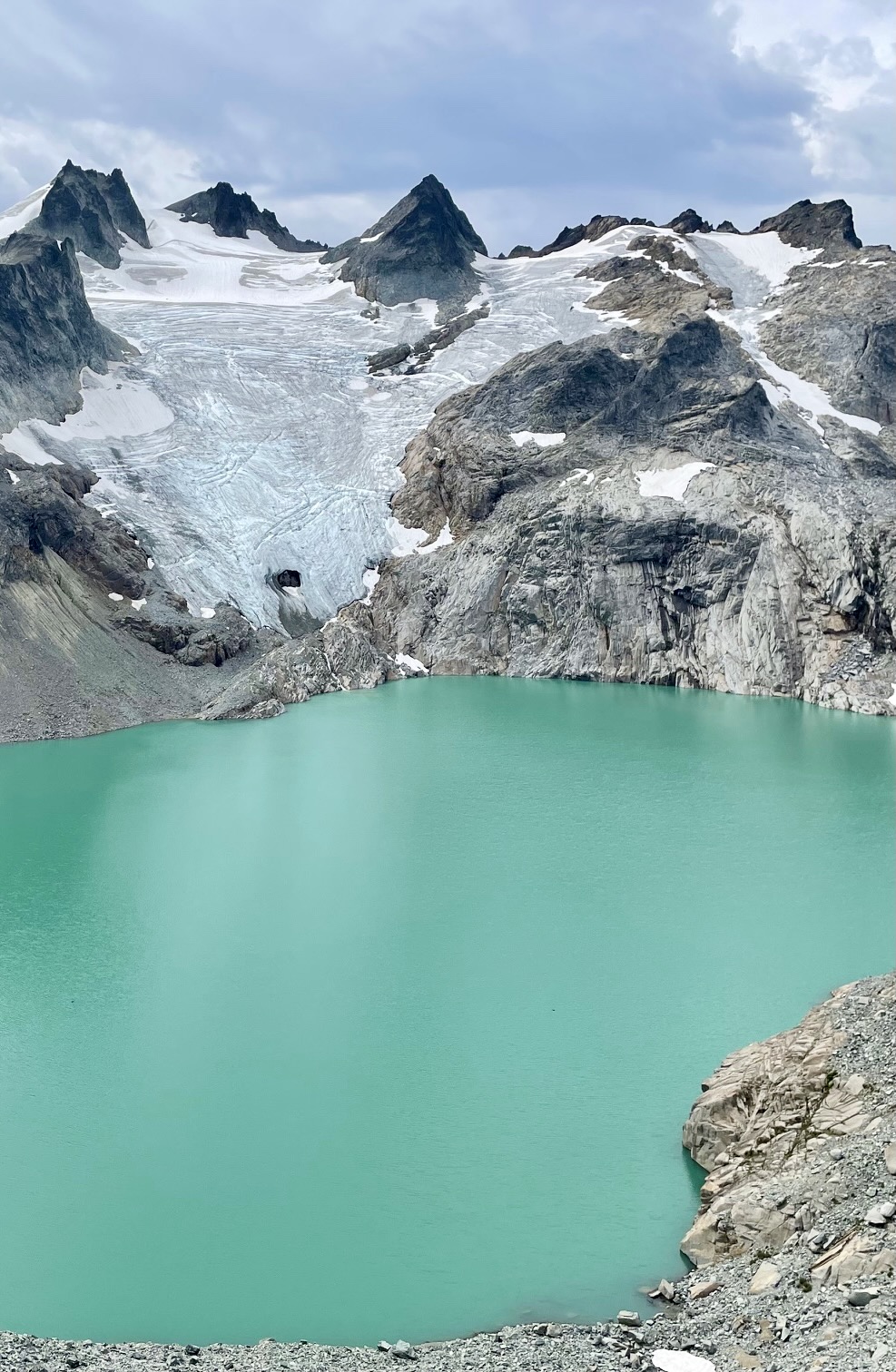
Pea Soup Lake
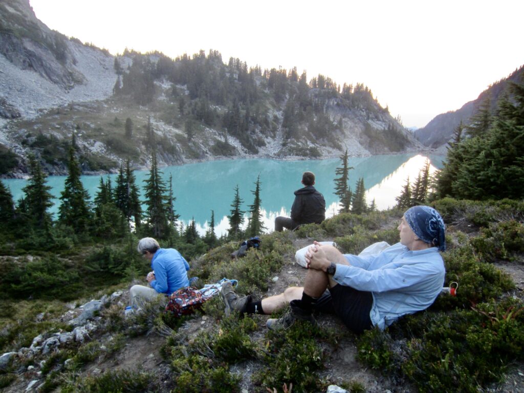
Peggy’s Pond
Cathedral Pass
Squaw Lake
Trip Report Summary
Region: Central Washington Cascades
Sub-Regions: Miller–Foss Mountains & Snoqualmie Range
Area: Alpine Lakes Wilderness
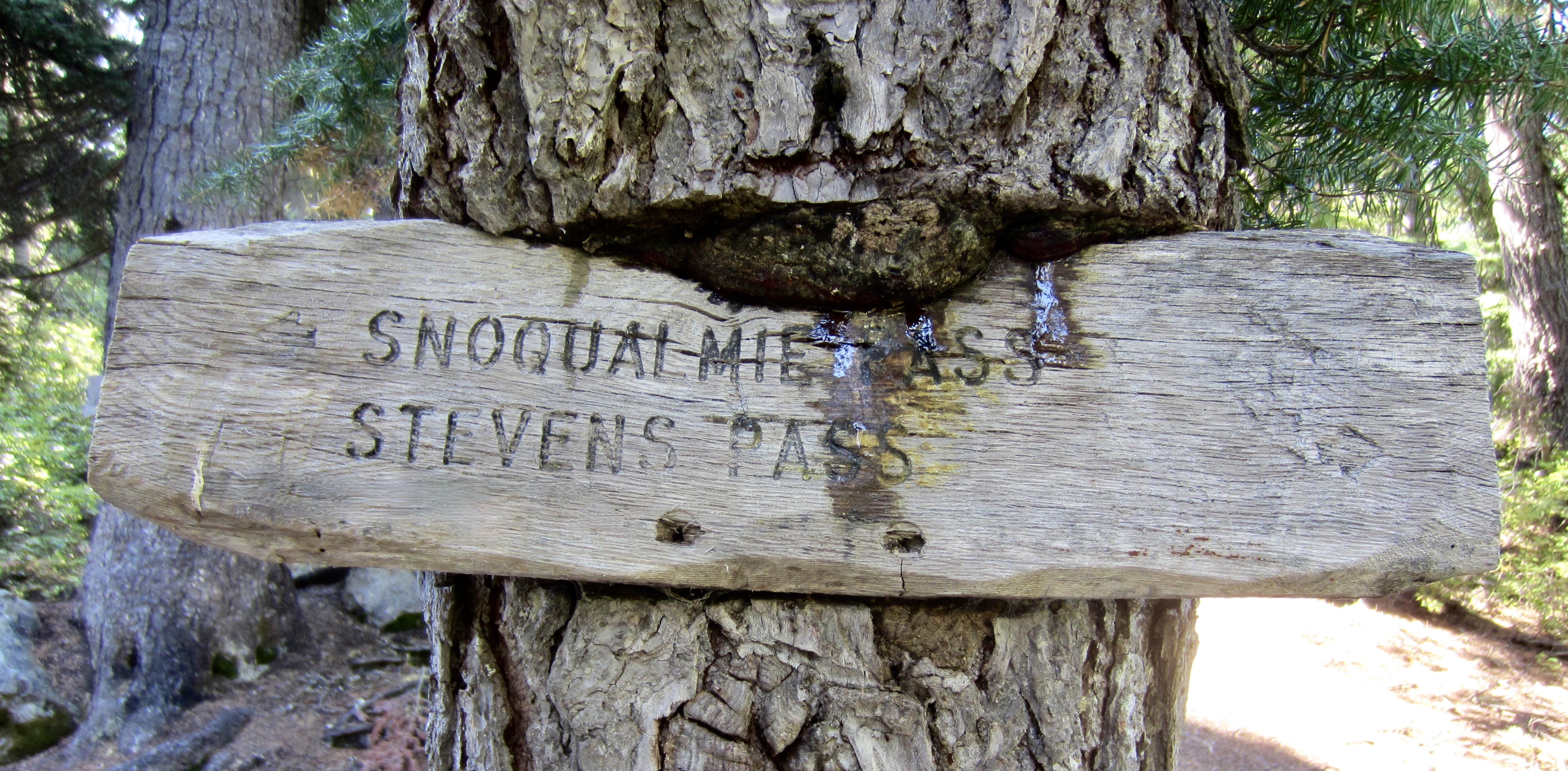
Starting & Ending Point: Tucquala Meadows Trailhead at end of Cle Elum River Road (Elev. 3400 feet)
Way Points: Hyas Lake & Deception Pass & Marmot Lake & No-Name Lake & Jade Lake & Dip Top Gap & Pea Soup Lake & Daniel Glacier Cirque & Bowl 6200 & East Daniel Ridge notch & Upper Hyas Creek crossing & Peggy’s Pond & Cathedral Pass & Squaw Lake & Cle Elum River footbridge (trail hike & off-trail hike & rock scramble)
High Point: Dip Top Gap (Elev. 6650 feet)
Campsites: Jade Lake & Daniel Glacier Cirque
Summit: Lynch Peak (rock scramble via Lower Southwest Buttress—Upper Southwest Slope)
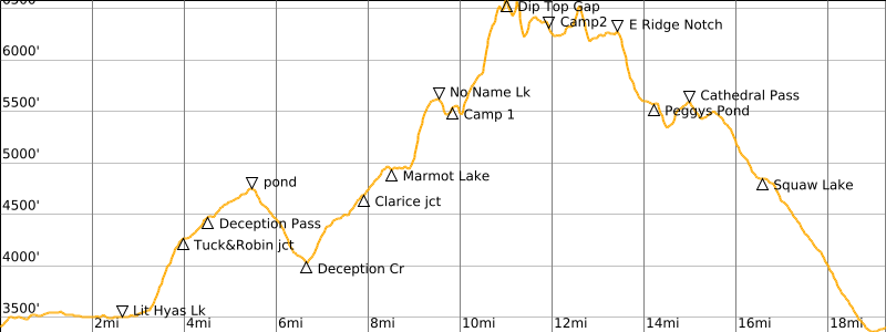
Approximate Stats (excluding summit sidetrip): 19.3 miles traveled; 5300 feet gained & lost.
Approximate Stats (including summit sidetrip): 19.9 miles traveled; 6150 feet gained & lost.
Related Posts
>>> Dip Top Loop + Mt. Daniel Carryover via Lynch Glacier – July 1984
>>> Dip Top Loop: Marmot Lake to Peggys Pond – August 1978
Trip Overview
The Dip Top Loop is a moderately classic mountaineering trek in the heart of the Alpine Lakes Wilderness. Traditionally, it begins and ends at Tucquala Meadows Trailhead in the Cle Elum River Valley. The core of this loop consists of an alpine high route from Marmot Lake, over Dip Top Gap, down to Pea Soup Lake, around Mt. Daniel, and down to Peggy’s Pond. Accessible summits along the way include Lynch Peak, Dip Top Peak, Mt. Daniel, and Cathedral Rock.
Lisa, Kevin, and Andrew joined me for Labor Day Weekend installment of the Dip Top Loop. This was my fourth time doing the loop, after previous trips in 1978, 1984, and 1996. I was shocked to witness the changes in glaciers and snowfields that have occurred since my last trip 28 years ago. The disappearance of ice and snow has completely altered the character of the alpine terrain—and definitely not for the better! Whereas much of the route previously traveled up, down, and across enjoyable snow slopes, it now involves large areas of unstable talus, loose scree, and hard dirt. Consequently, I can now recommend the Dip Top Loop only as an early-season trek with an adequate snowpack.
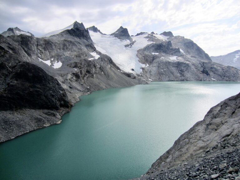
As a quick illustration of how the terrain has evolved over the past several decades, consider the three photos below. The left and middle photos show conditions on the northern side of Mt. Daniel in 1978 and 1984, respectively, whereas the right photo shows the conditions we encountered in 2024. You can see that the Lynch Glacier has shrunk dramatically, and Pea Soup Lake has lost both its ice floes and its characteristic color.

.
Full Trip Report
Knowing that Labor Day Weekend would bring a lot of hikers to the Tucquala Meadows Trailhead, we elected to shift our three-day trip to a Sunday-Monday-Tuesday schedule, in the hopes of avoiding many other weekend parties. This strategy made sense until we approached the trailhead on Sunday morning and discovered a mile-long line of cars alongside the roadway! Miraculously, though, there was one open spot for us in the jam-packed parking lot. Would this auspicious beginning continue through our trip, or was this our sole get-out-of-jail card?
Day 1: Trailhead to Jade Lake
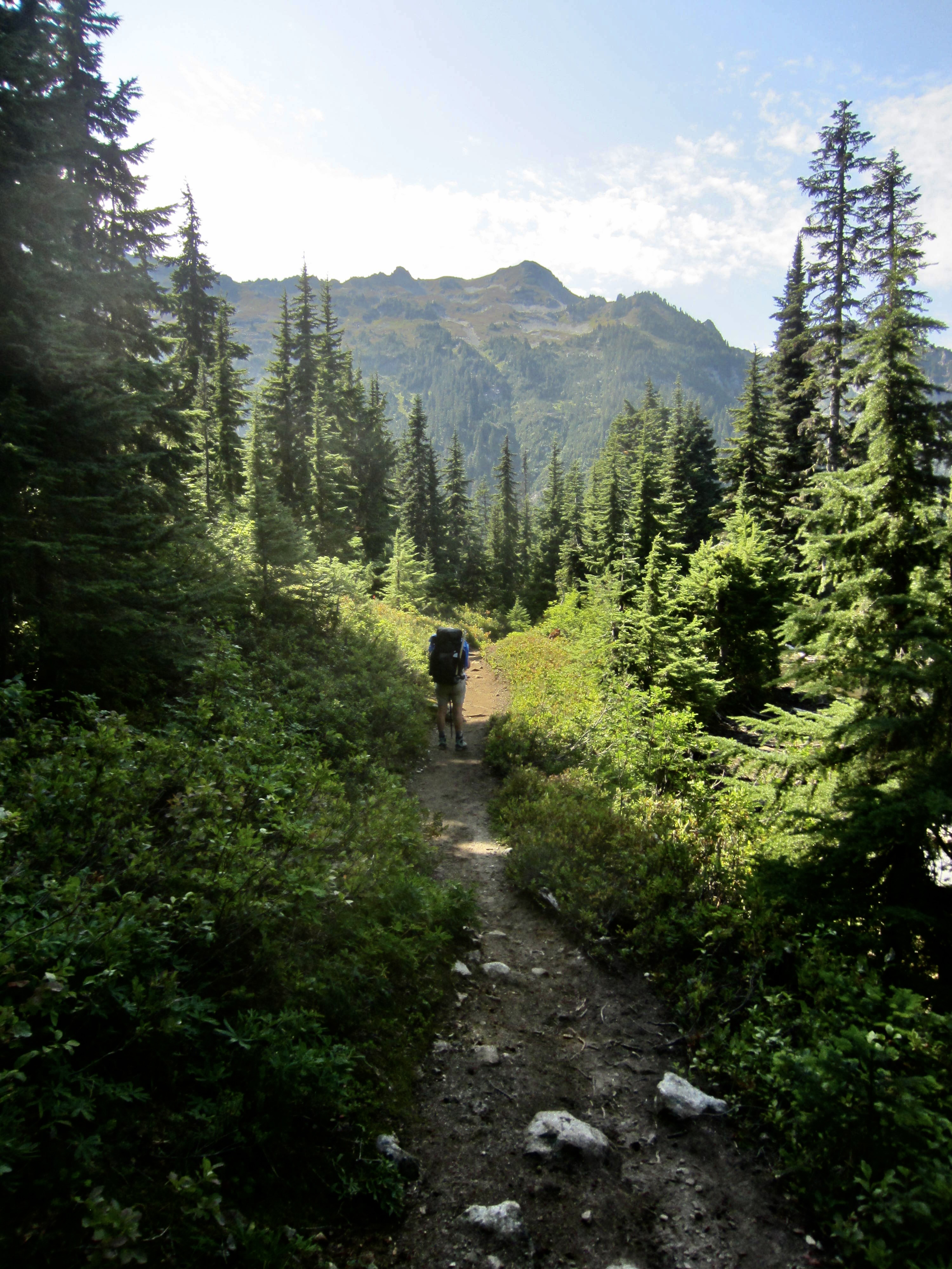
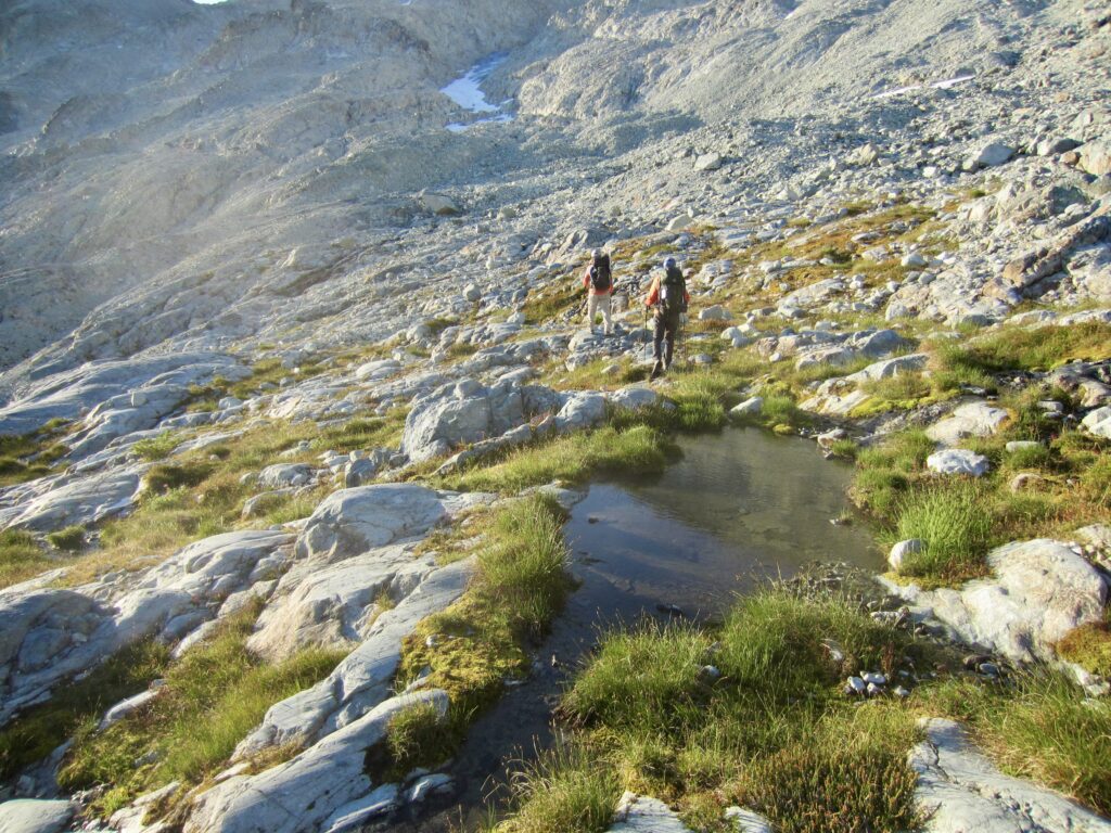
Our foursome headed up the Deception Pass Trail together at noon, but Andrew soon hurried ahead for the purpose of making a few sidetrips today. Lisa, Kevin, and I proceeded through the afternoon heat at a slower but steady pace, encountering scores of hikers coming out from either Tuck and Robin Lakes or Marmot and Jade Lakes. We reached Deception Pass in mid-afternoon (2.5 hours + 1100 feet from TH) and turned onto the Marmot Lake Trail.
.
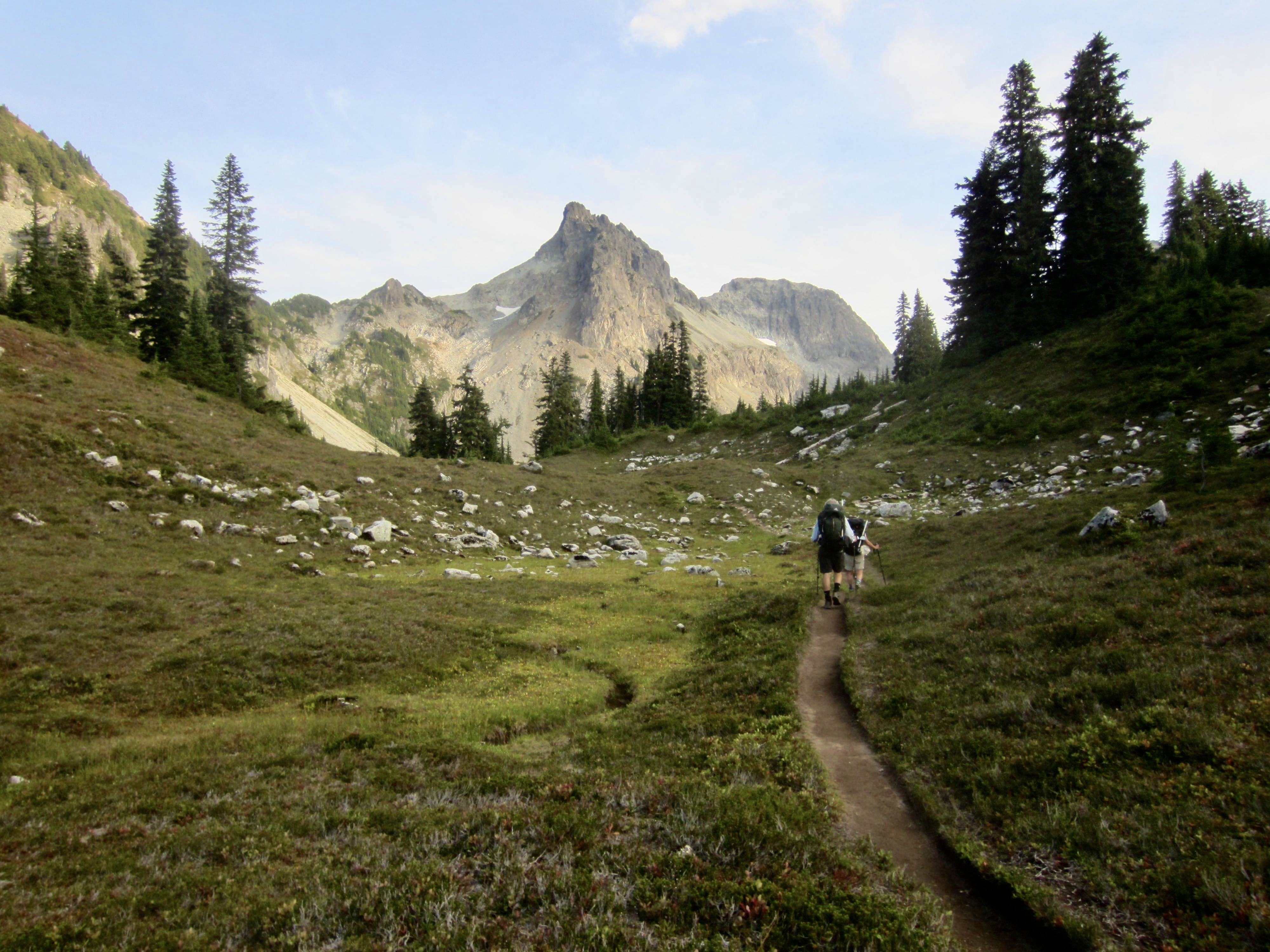
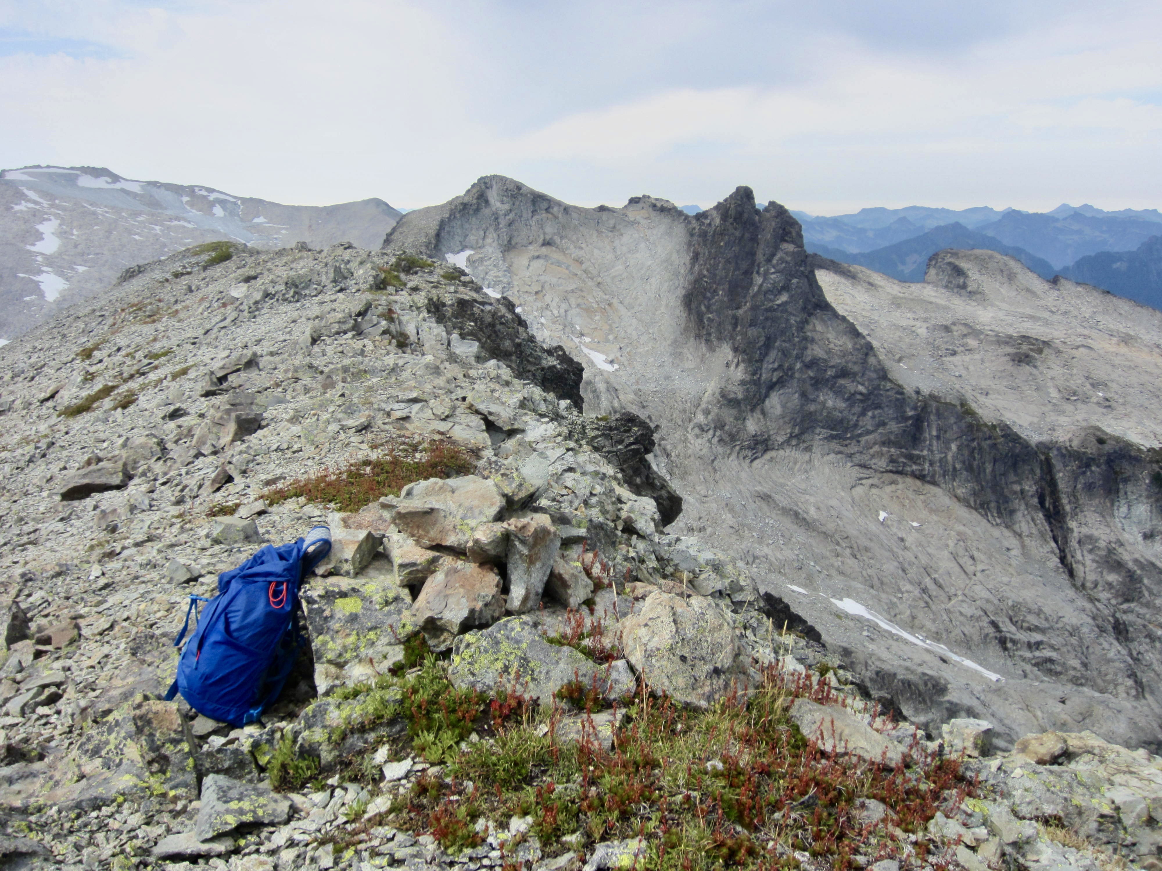
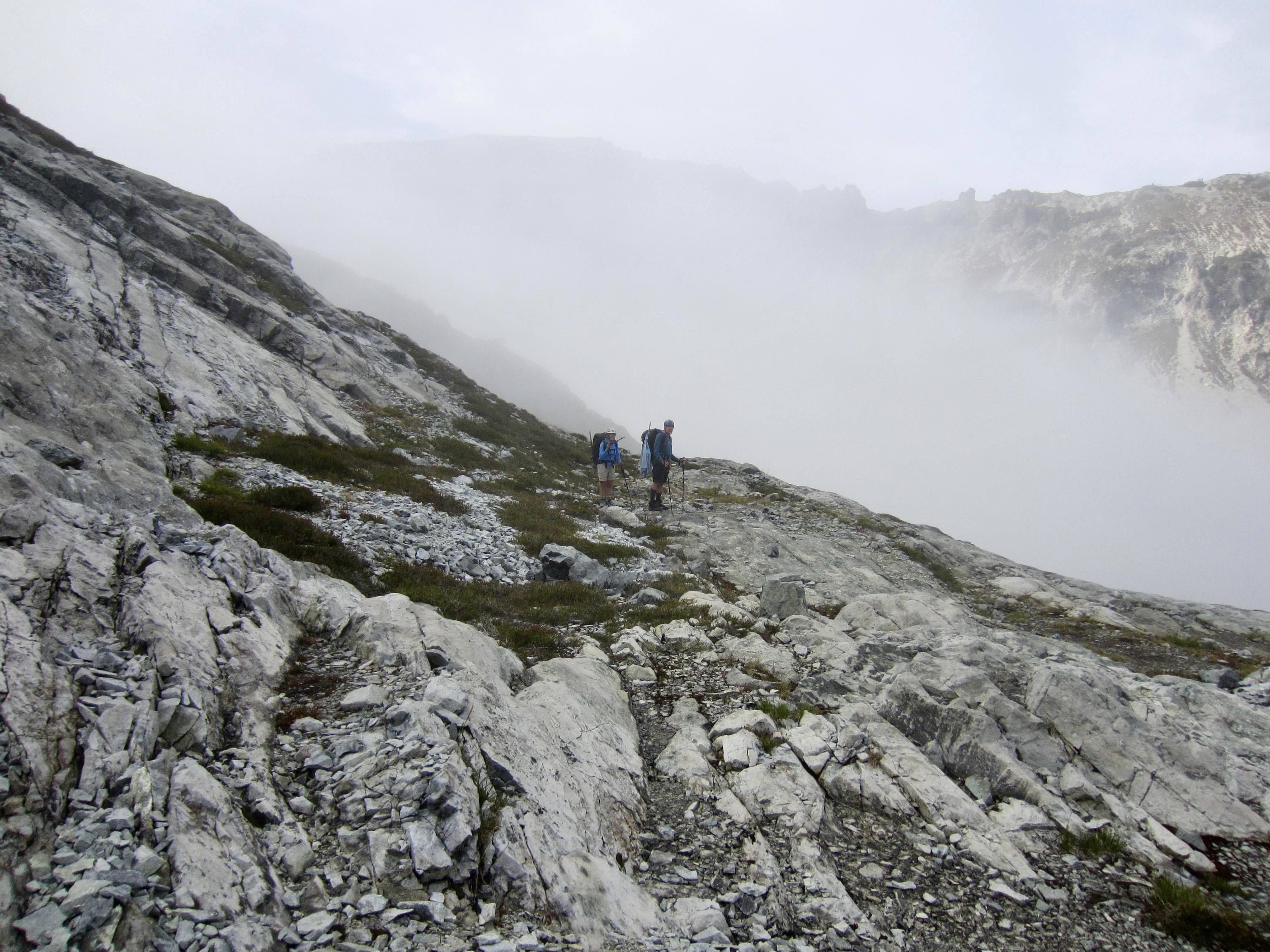
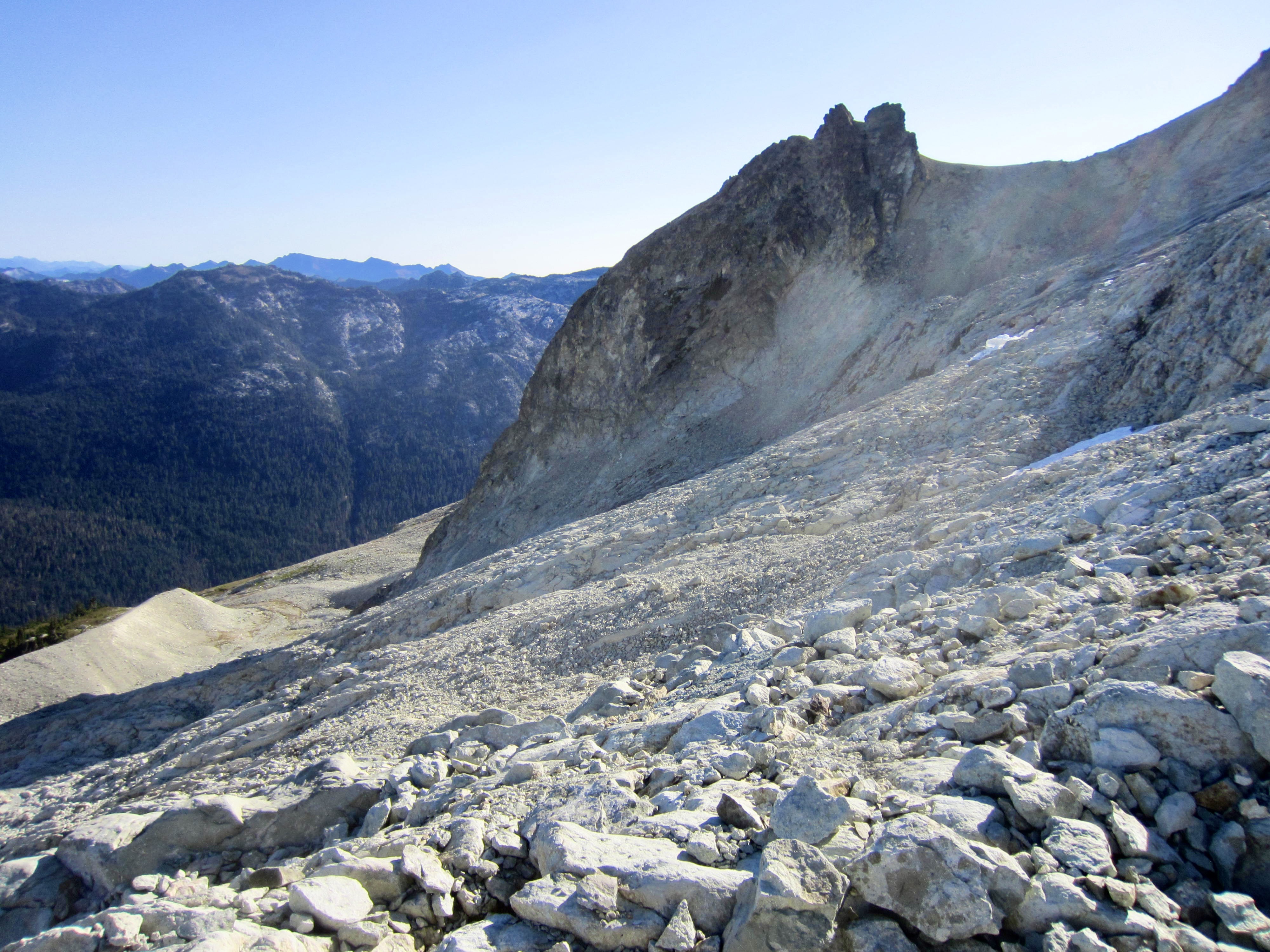
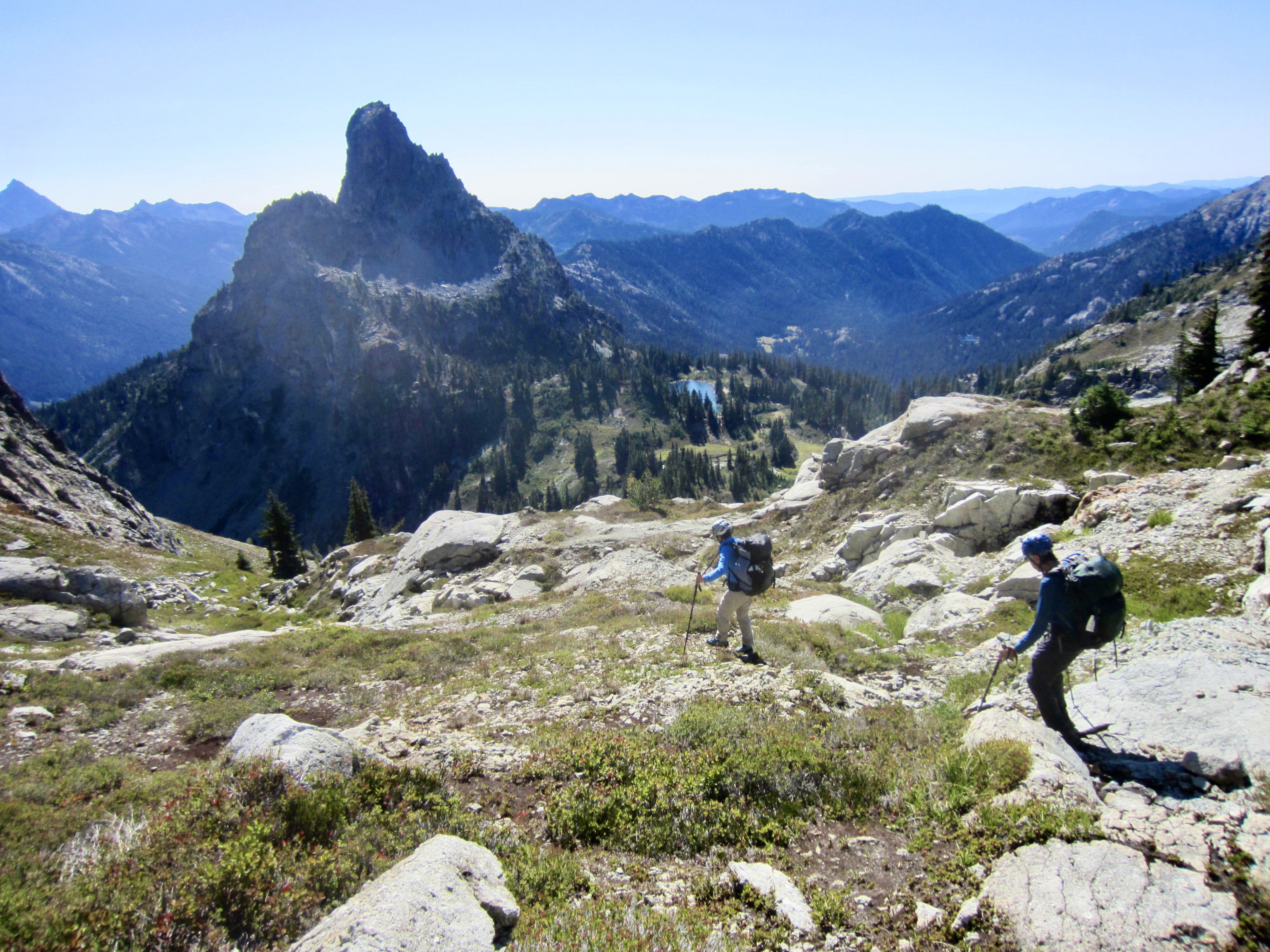
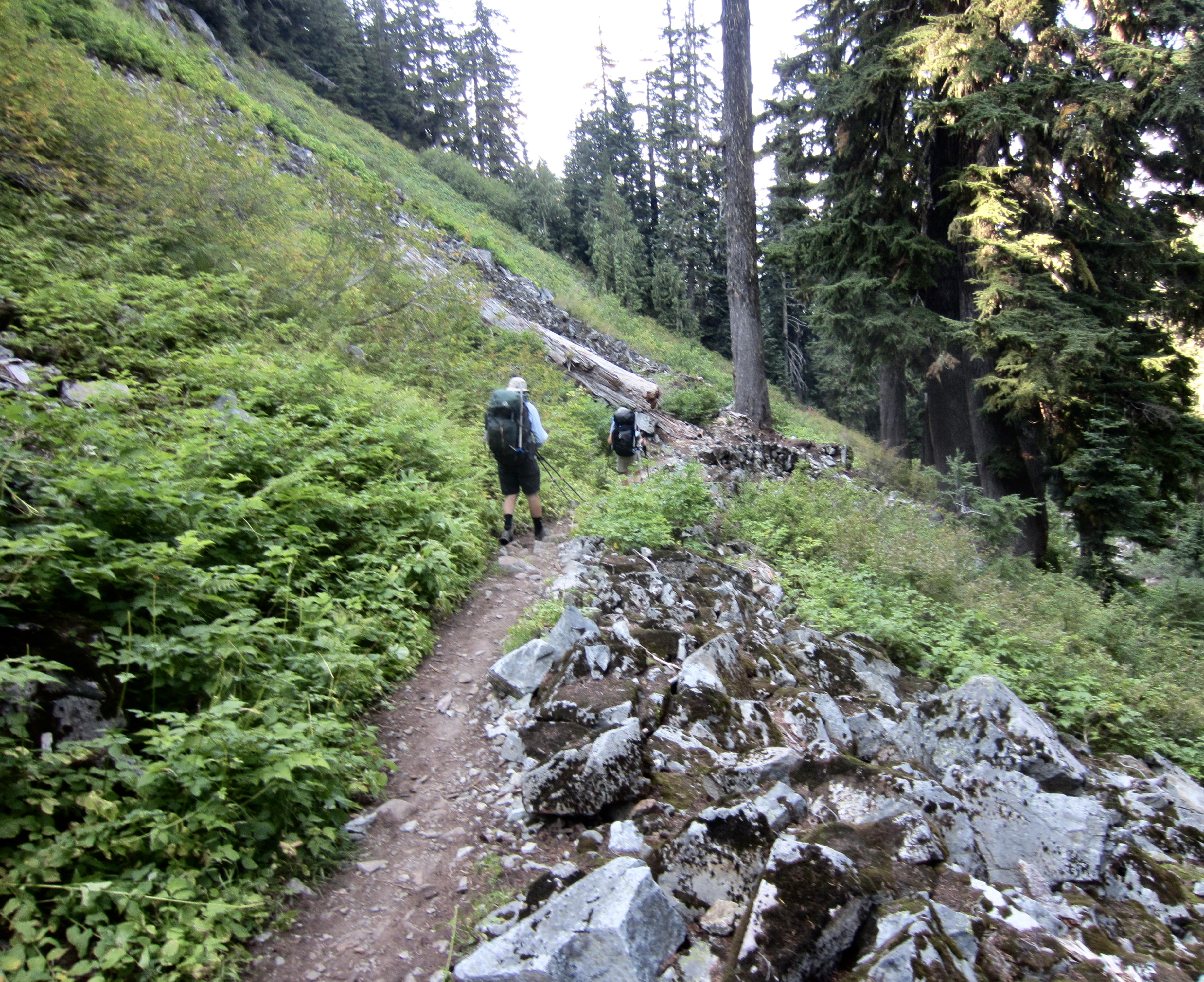
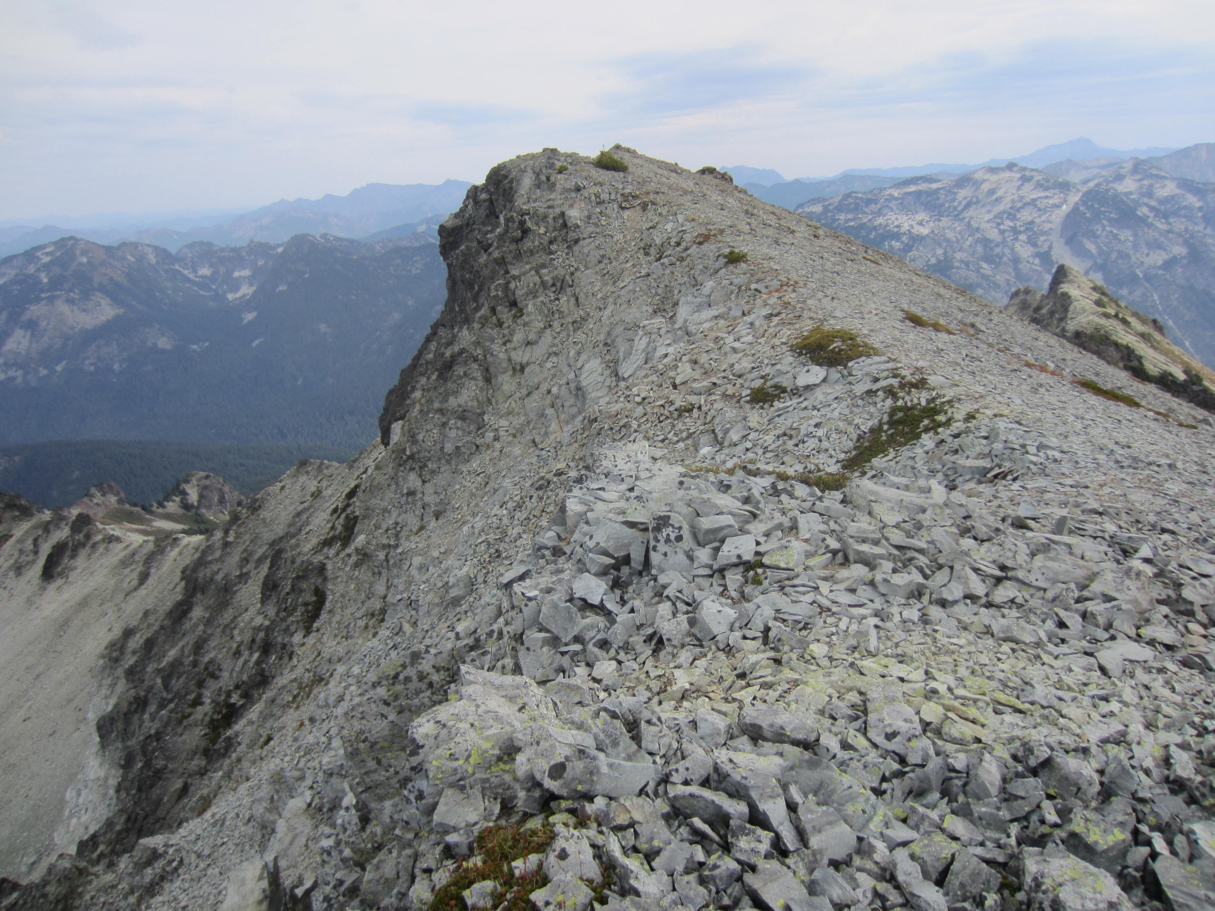
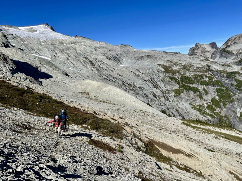
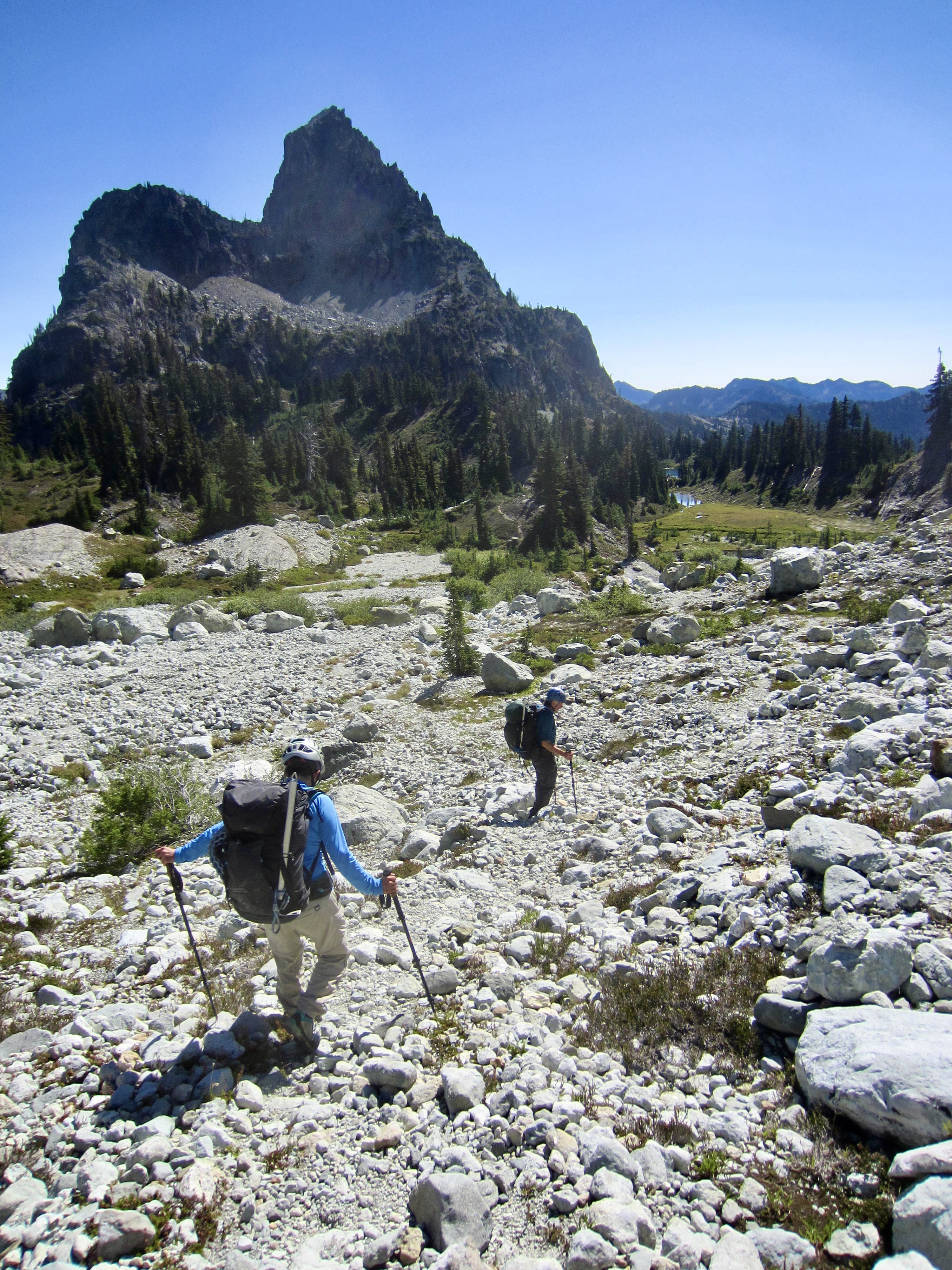
We passed Marmot Lake in late afternoon, then continued on a rough fisherman’s path that curves around the eastern shore and climbs upward through a narrow boulderfield. This path is steep and rocky but well-marked with ducks and cairns. It tops out in the delightful heather meadows surrounding No-Name Lake, which was surprisingly free of campers today. The sharp horn of Lynch Peak—one of our summit goals for the trip—towered in front of us.
.
.

.
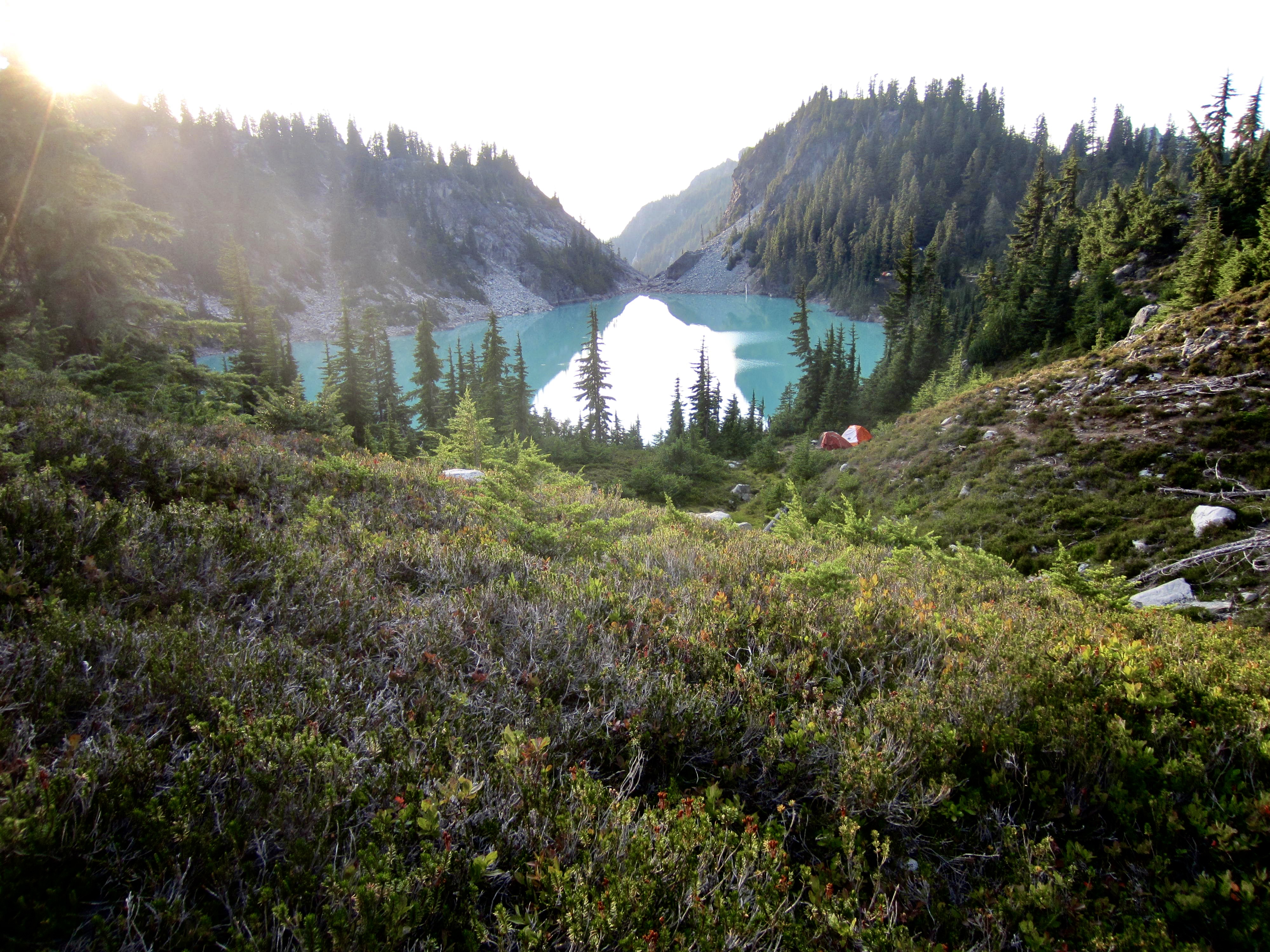
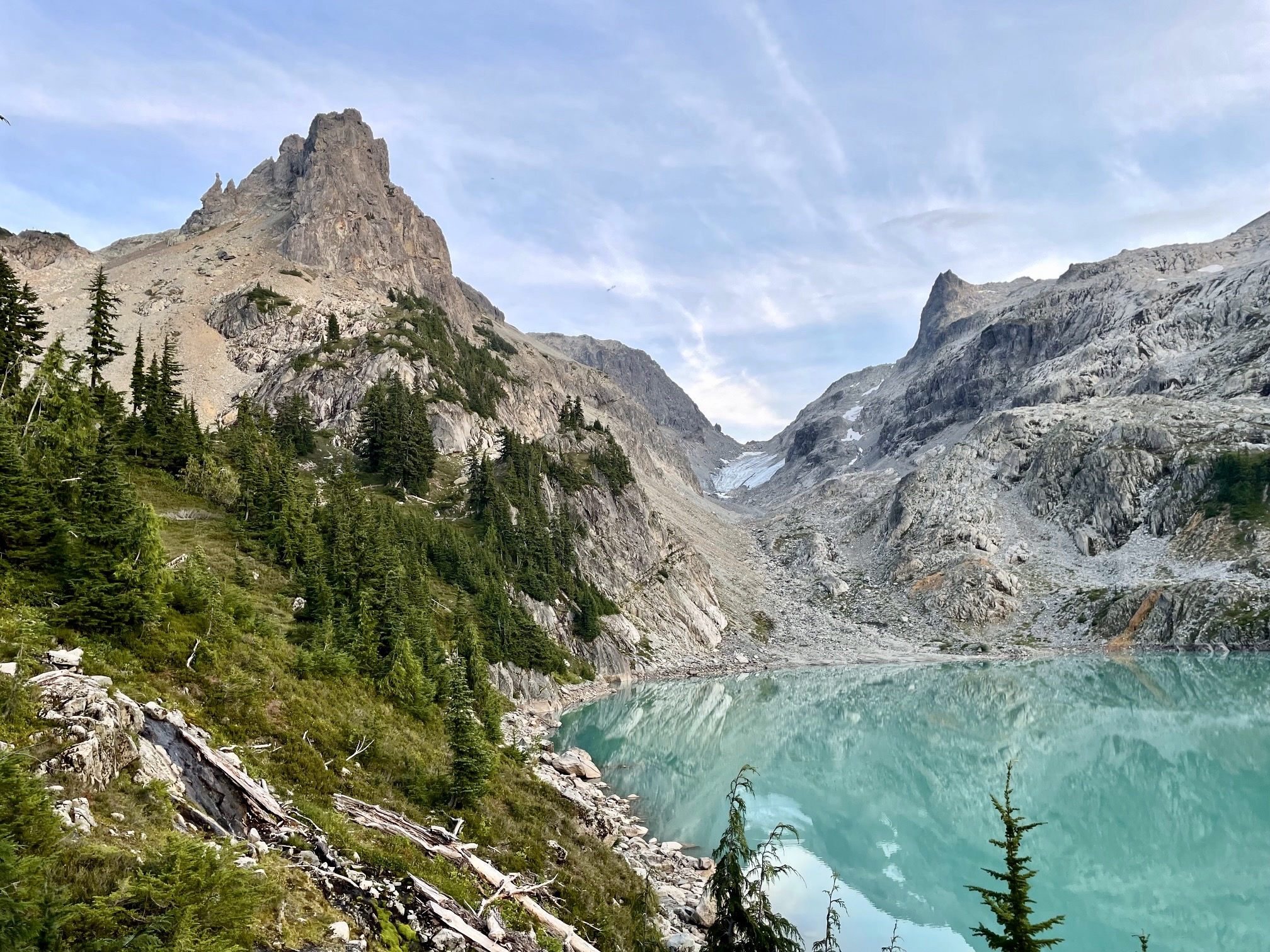
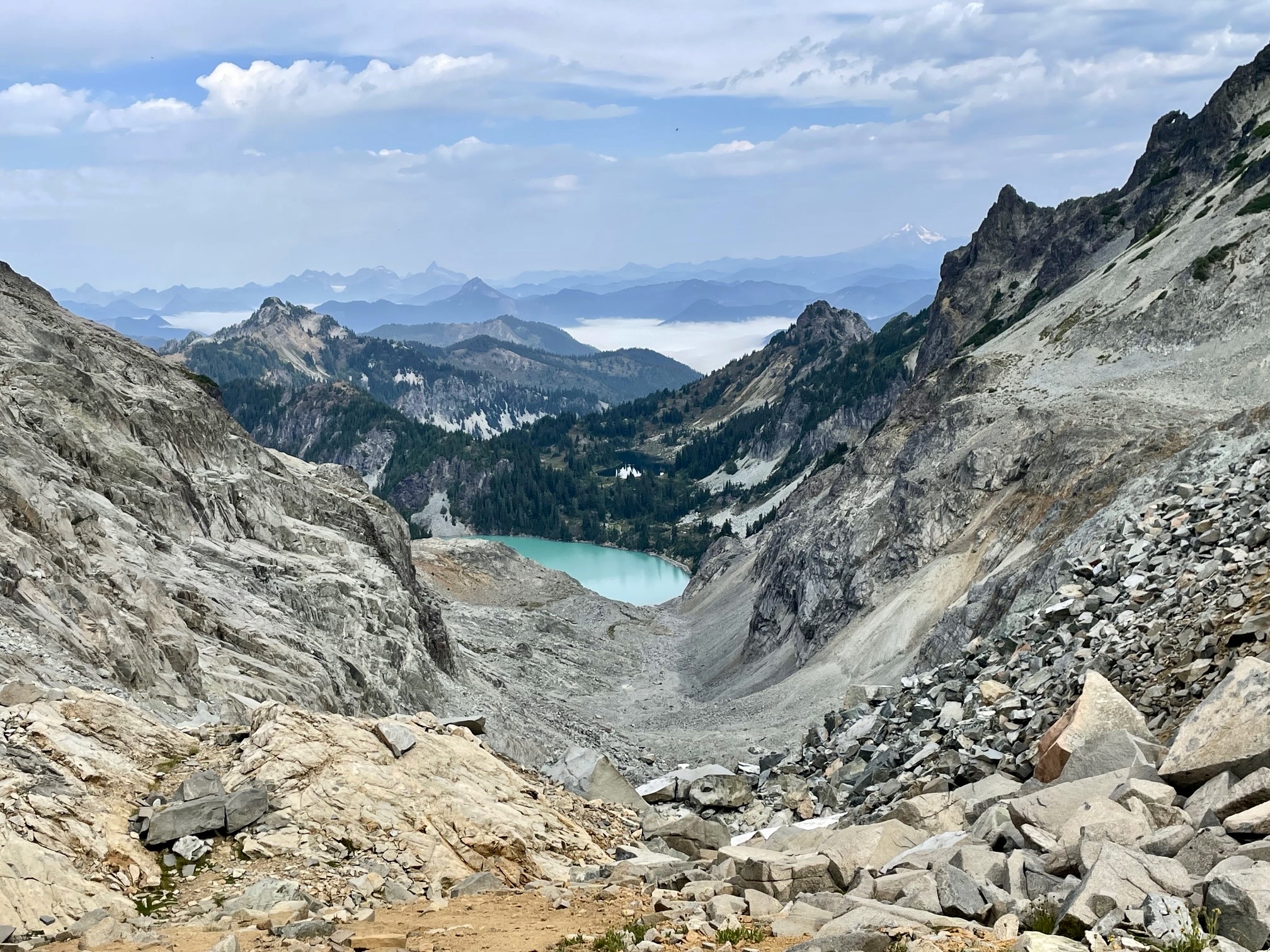
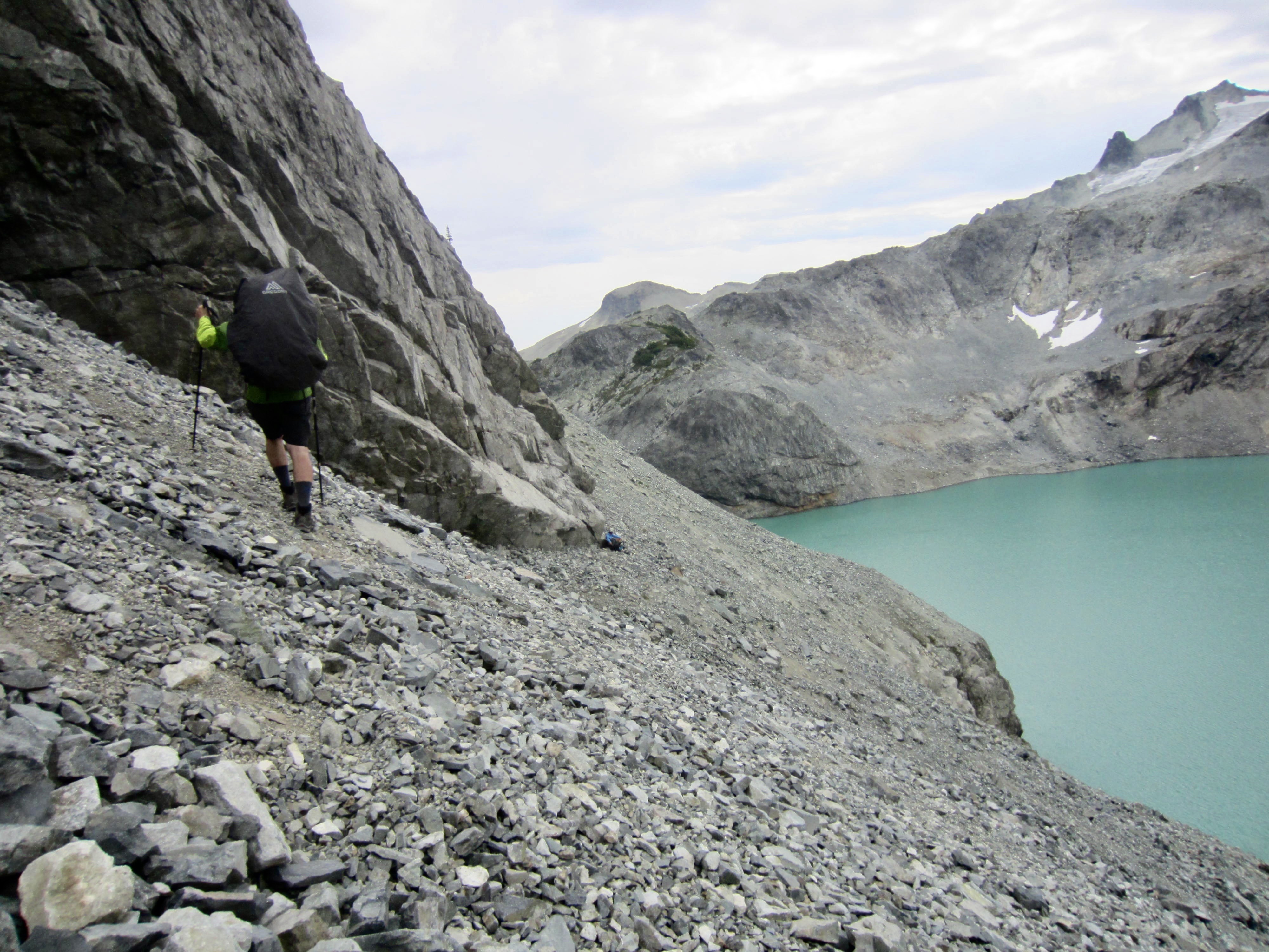
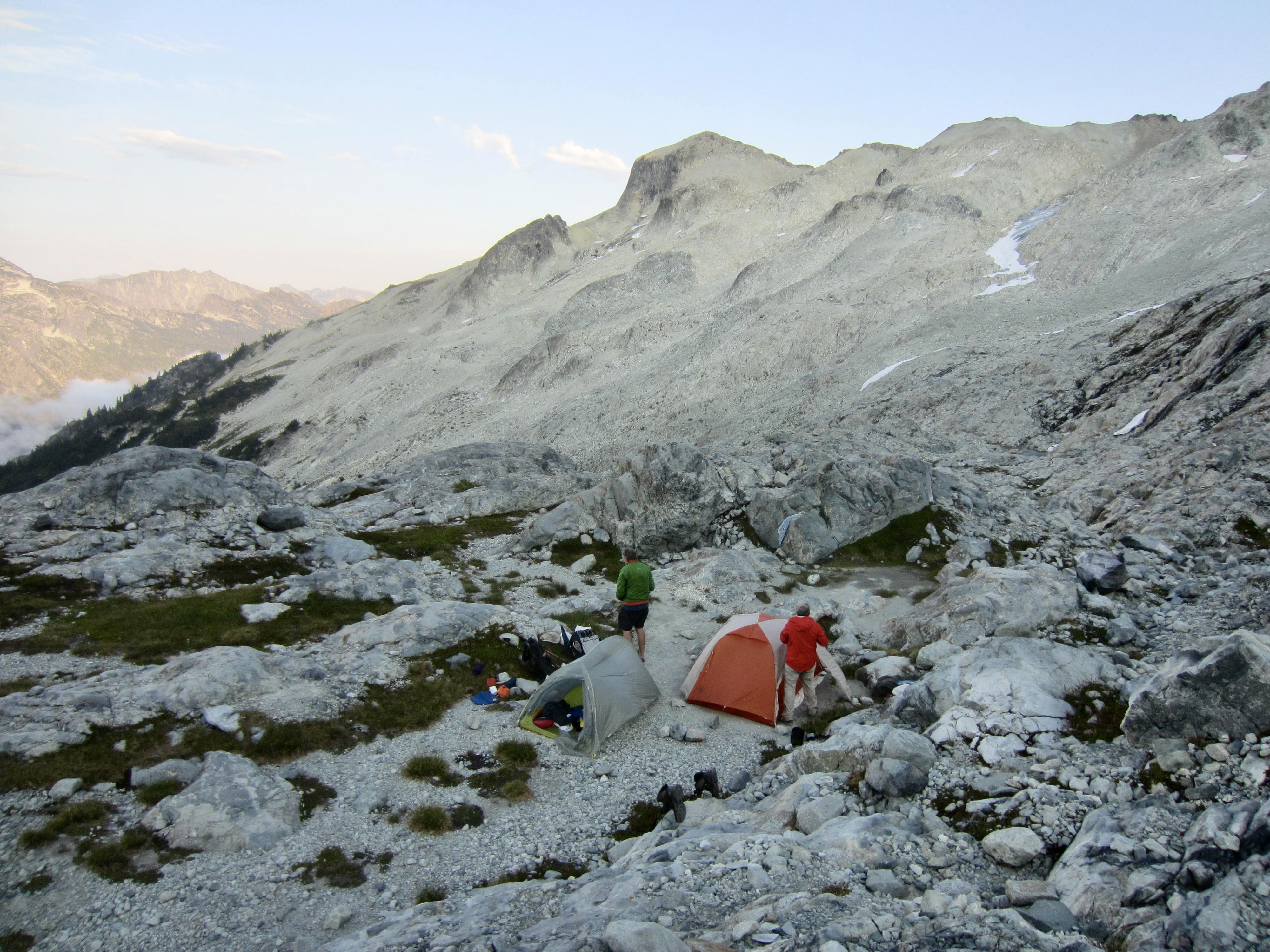
At the far edge of the meadow, we got our first view of Dip Top Gap and Jade Lake. A short descent took us down to the lakeshore, where we met up with Andrew in early evening (7.2 hours + 9.8 miles + 3050 feet from TH). He had spent his extra time making a sidetrip to Lake Clarice (always spoken in the voice of Hannibal Lecter) and exploring Jade Lake basin. Although there were numerous parties camped in the basin, luck was with us once again; we were able to find a good campsite overlooking the lake.

.
.
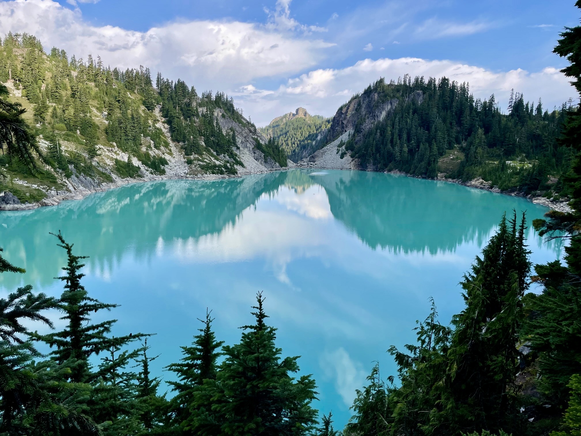
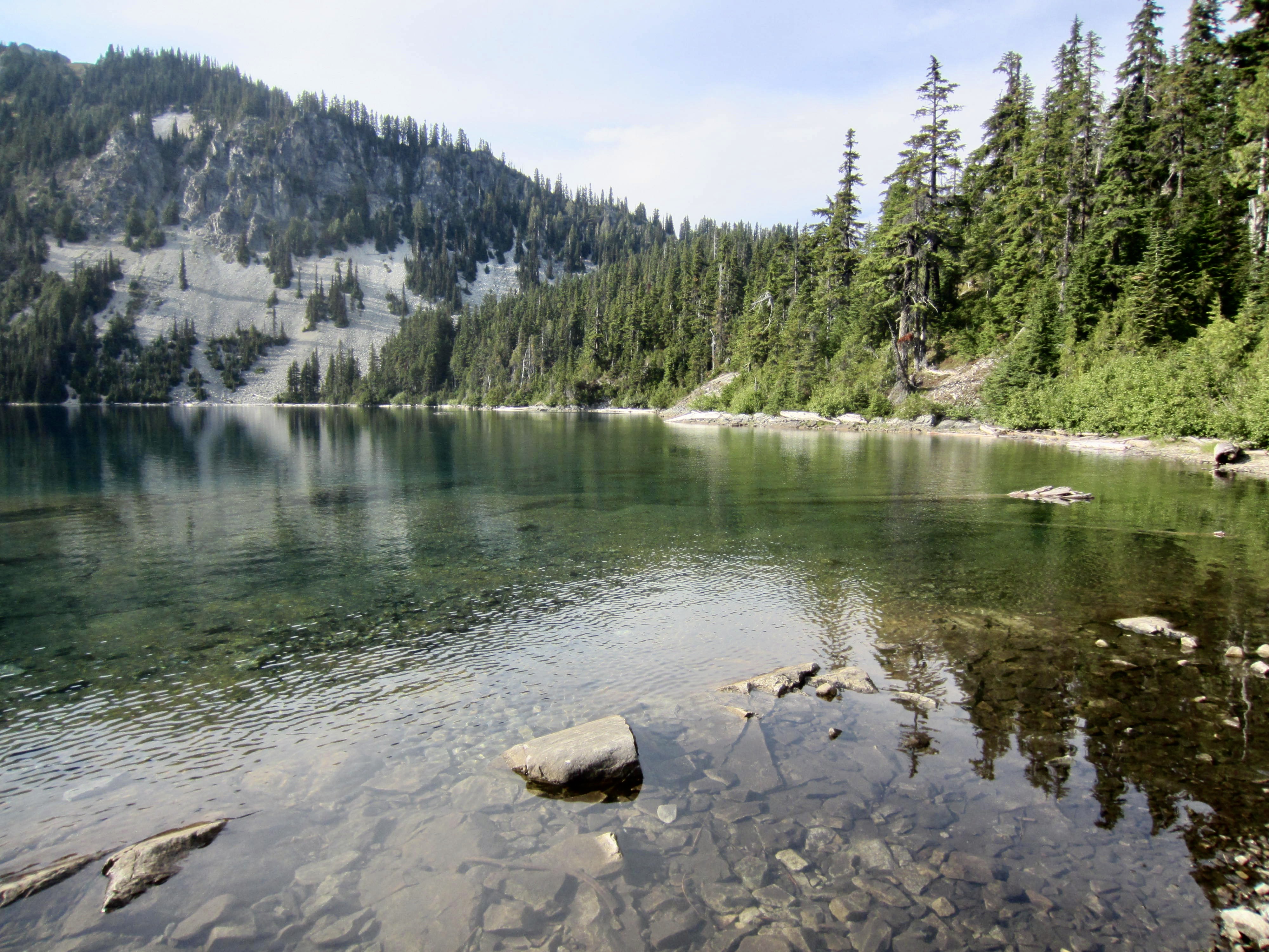
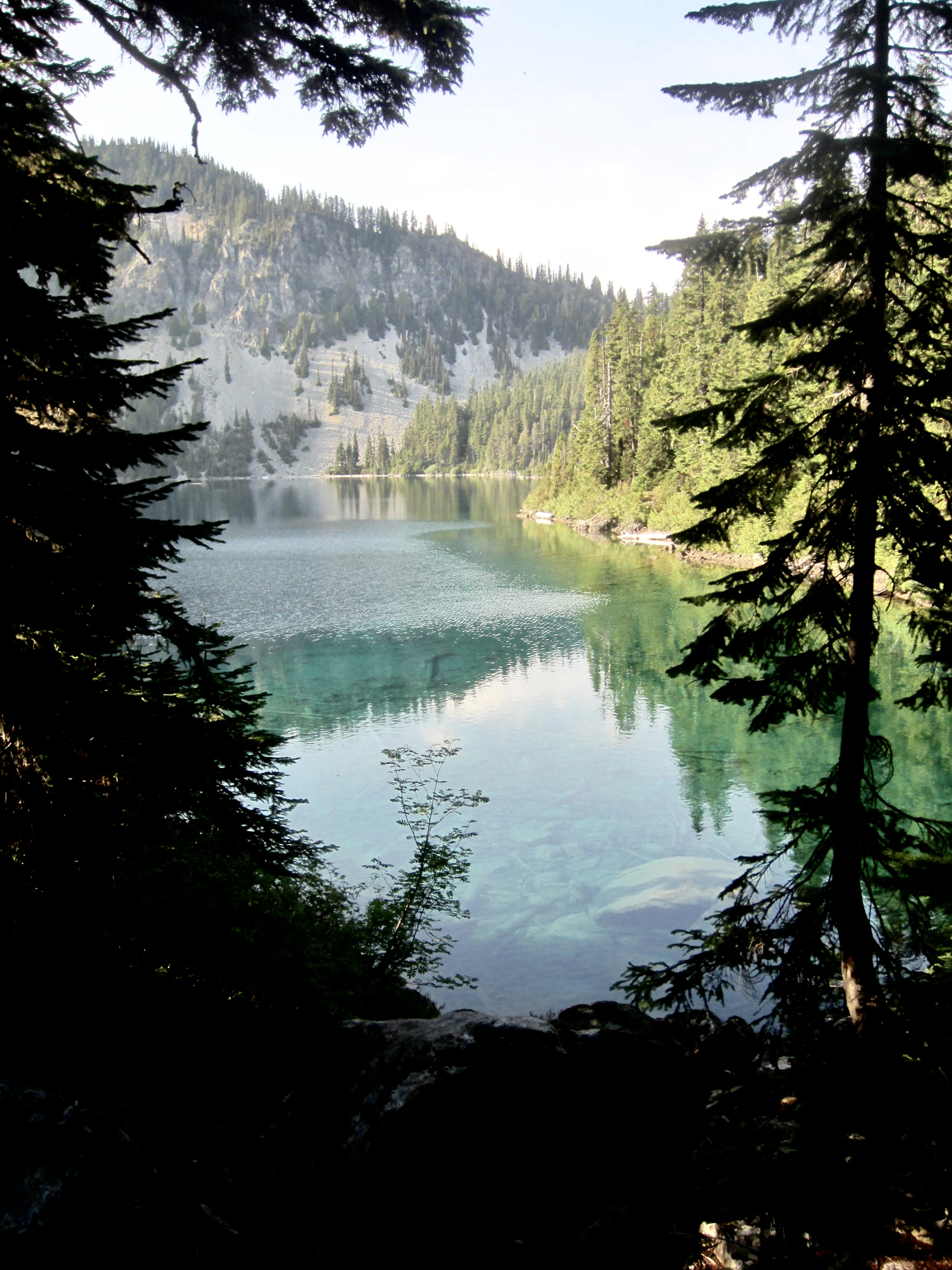
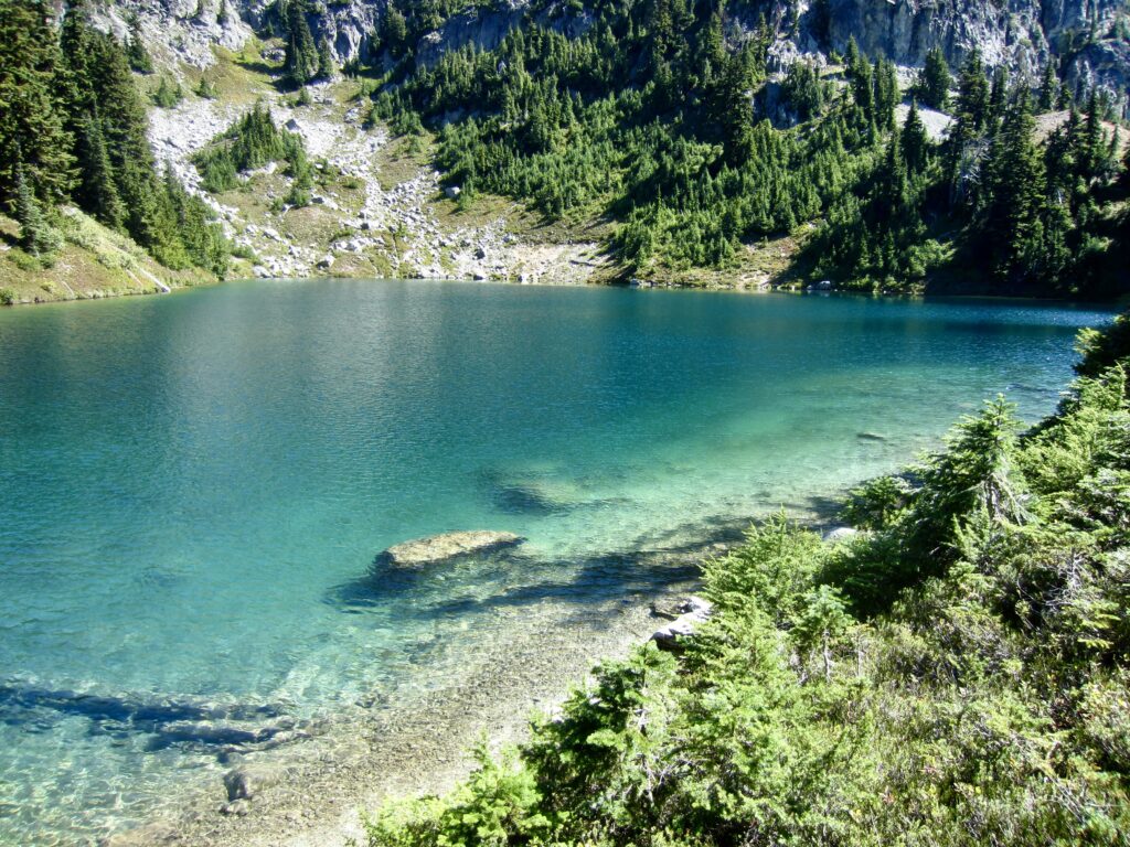
Jade Lake has become famous for its color, which ranges from jade-green to turquoise-blue, depending on cloud cover and one’s viewing angle. Regardless of conditions, this is a gorgeous—but greatly overused—destination. Given the popularity of Jade Lake, we were very pleased to discover that there are now TWO latrines to serve the large number of visitors.

.
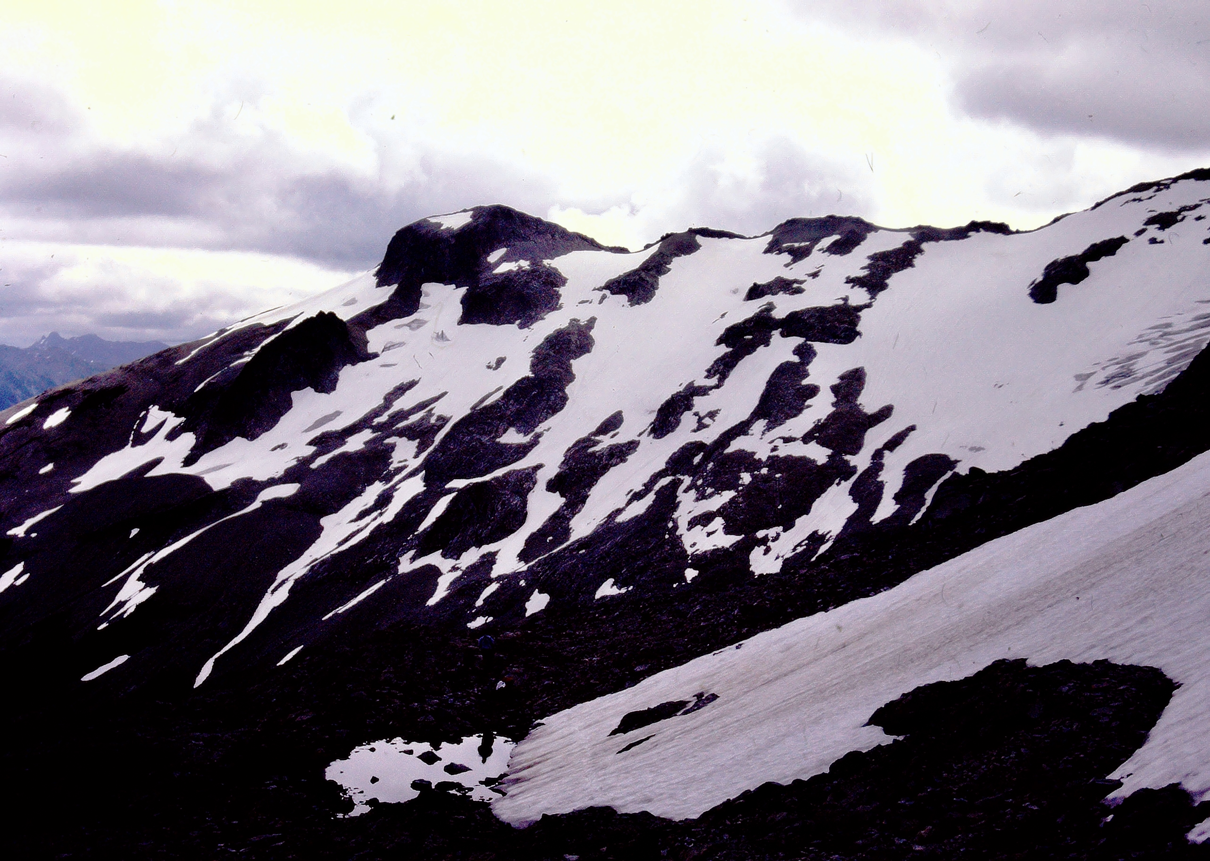
Our campsite gave us an unobstructed view of Dip Top Couloir, which separates Lynch Peak from Dip Top Peak. In prior decades, this couloir offered an efficient snow route to Dip Top Gap, as shown in the 1978 (left) photo below. Today (right photo), the couloir was barren except for a small patch of remnant ice near the top. Nonetheless, we met many people who climbed up to the gap this weekend.

.
Day 2: Jade Lake to Daniel Glacier Cirque
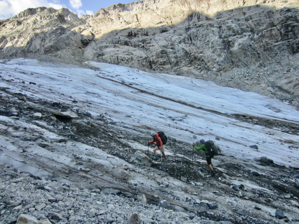
We awoke to mostly clear skies, but there was a chance of thunderstorms in the weather forecast. Would our luck hold out? Andrew hoped to climb Mt. Daniel today, so he sped out of camp and up Dip Top Couloir, leaving Lisa, Kevin, and me to ascend at a more relaxed pace. We followed a crude trekking path around the lake, down to the inlet delta, and then up the rocky couloir.
.
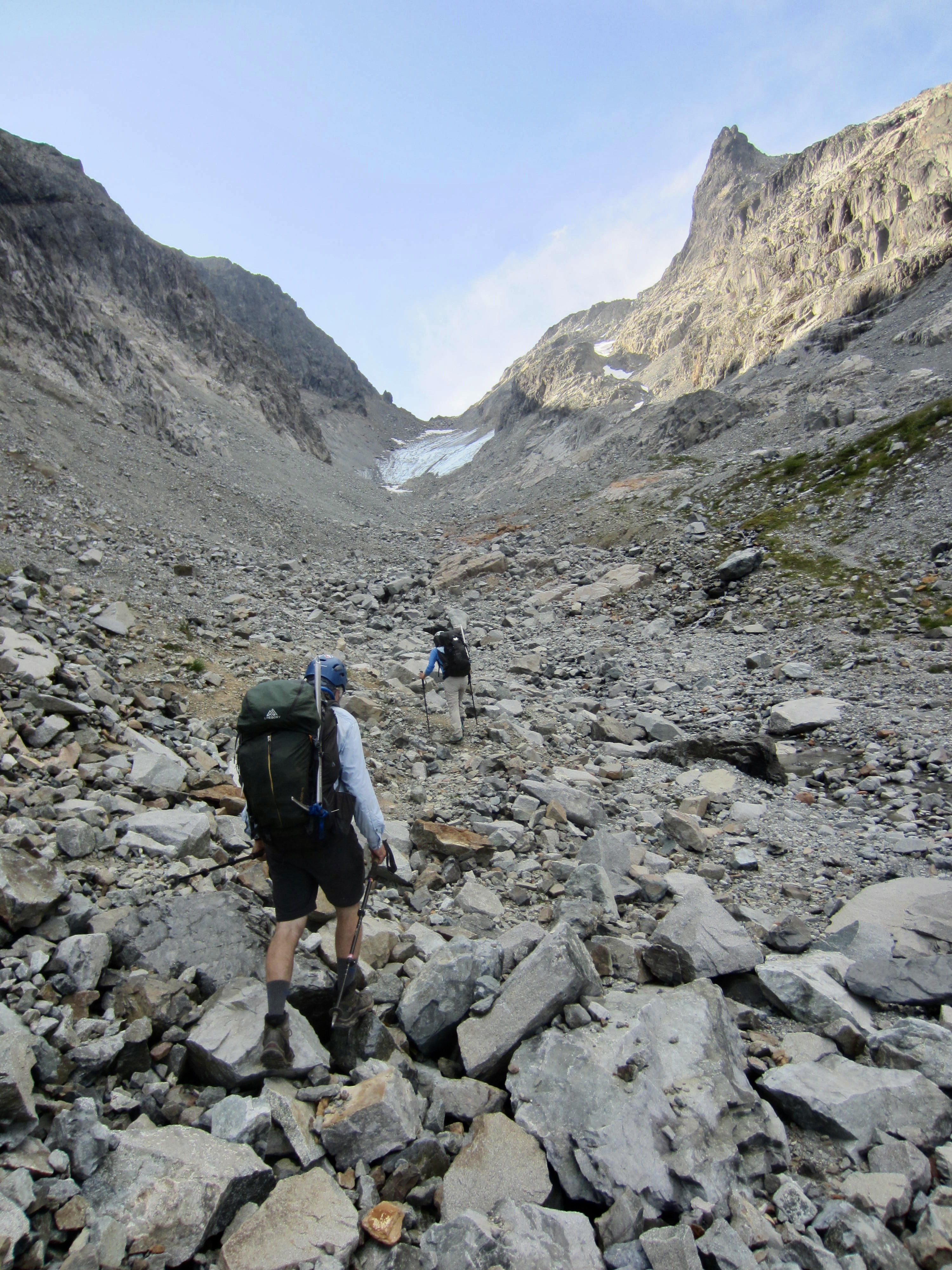
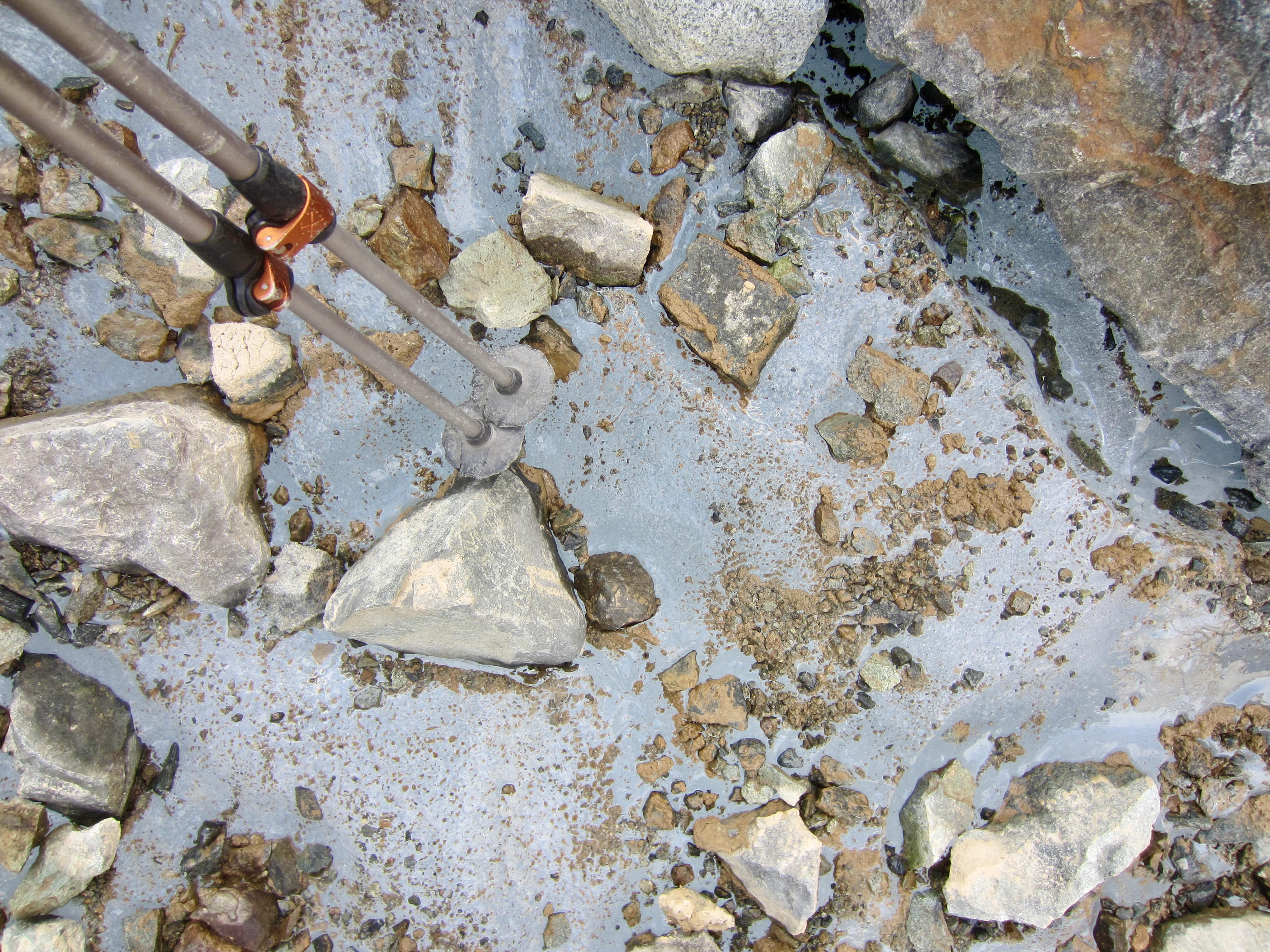
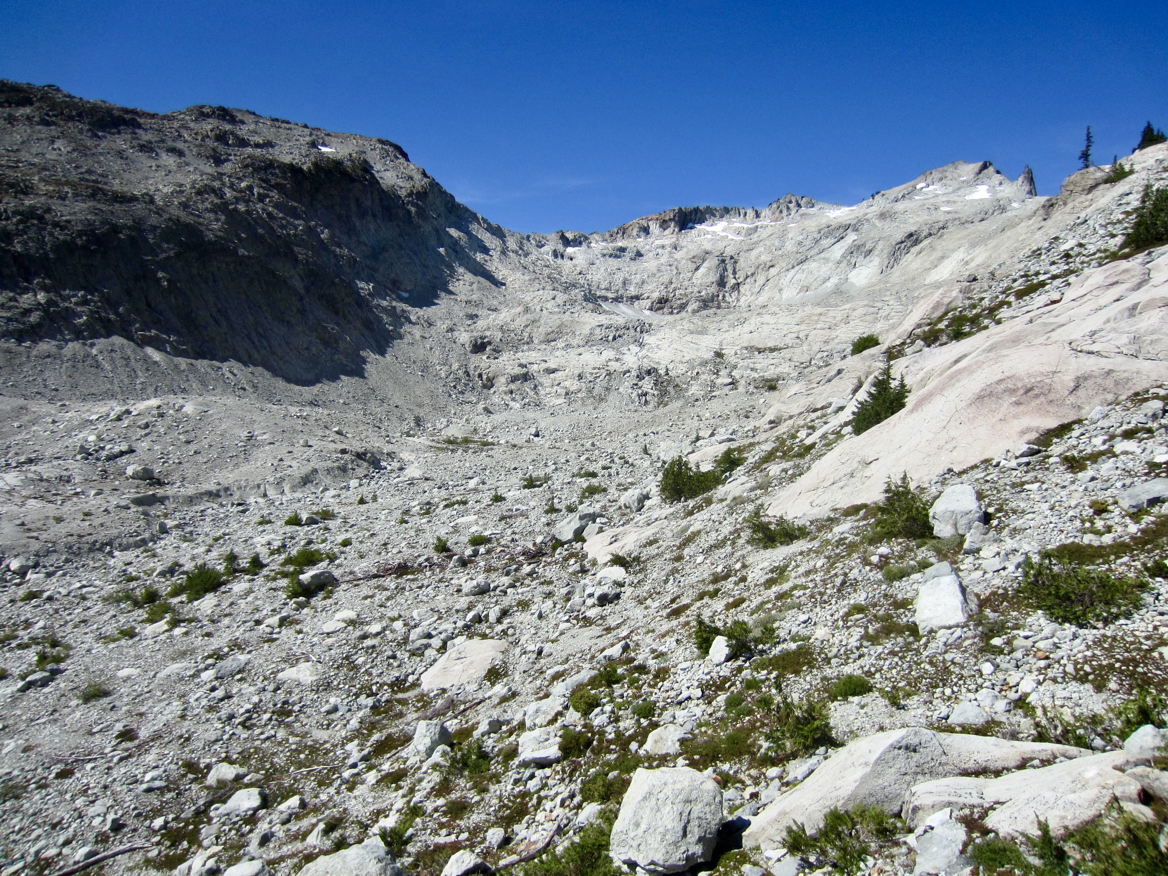
Numerous stone ducks and cairns mark the path through the lower and middle parts of the couloir. Farther up, we encountered the remnant icefield and began working around its left edge. Because the adjacent boulders (a combination of talus and morainal debris) were frighteningly unstable, we found it better to walk on the ice margin. Close inspection revealed that the icefield consists of crystal-clear ice embedded with angular rocks—much like an “ice breccia.” Our chosen route succeeded, but in retrospect, it would have been even safer and faster to crampon directly up the center of the icefield (Andrew wisely took this approach on his climb).

.
.
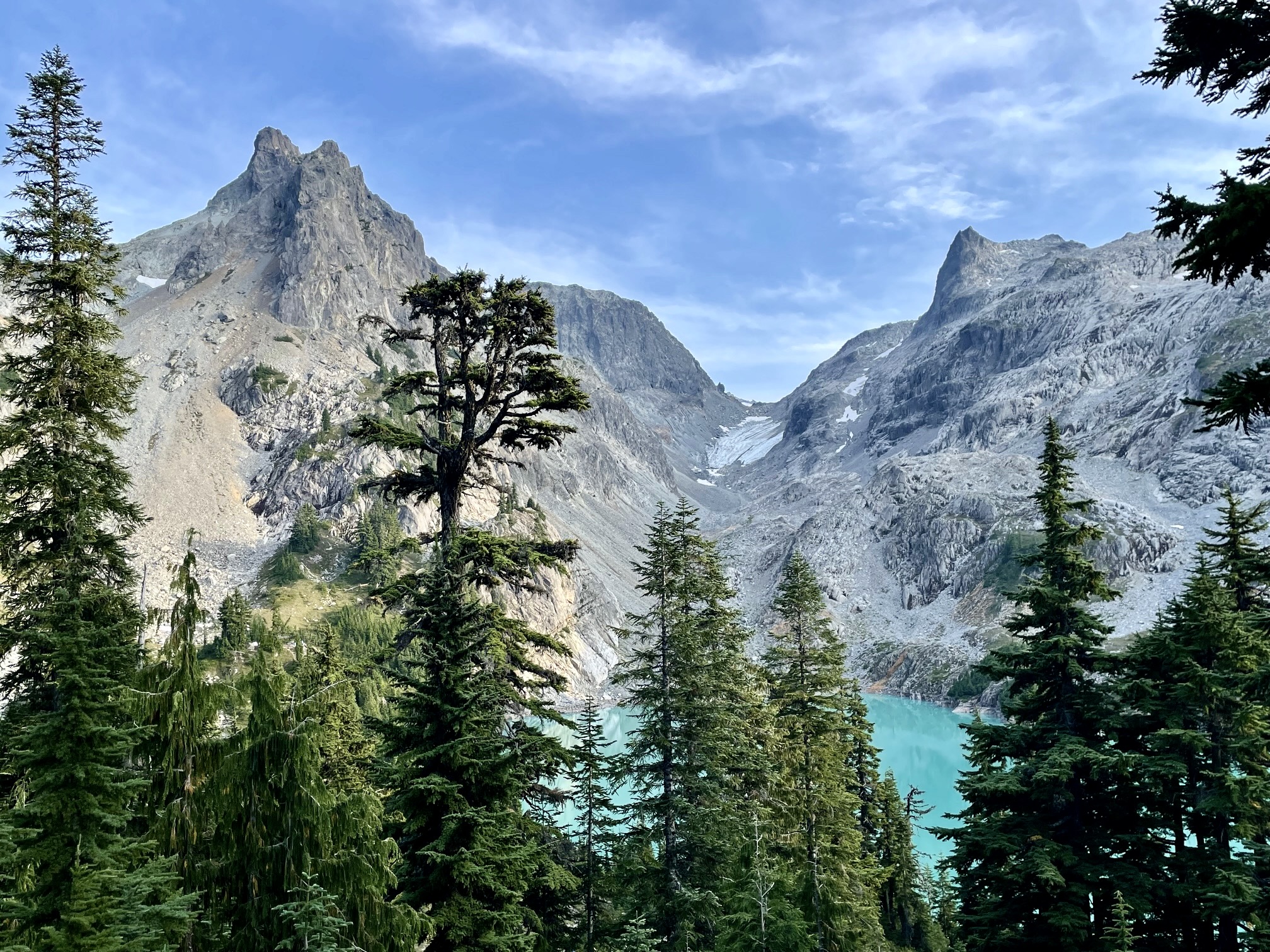
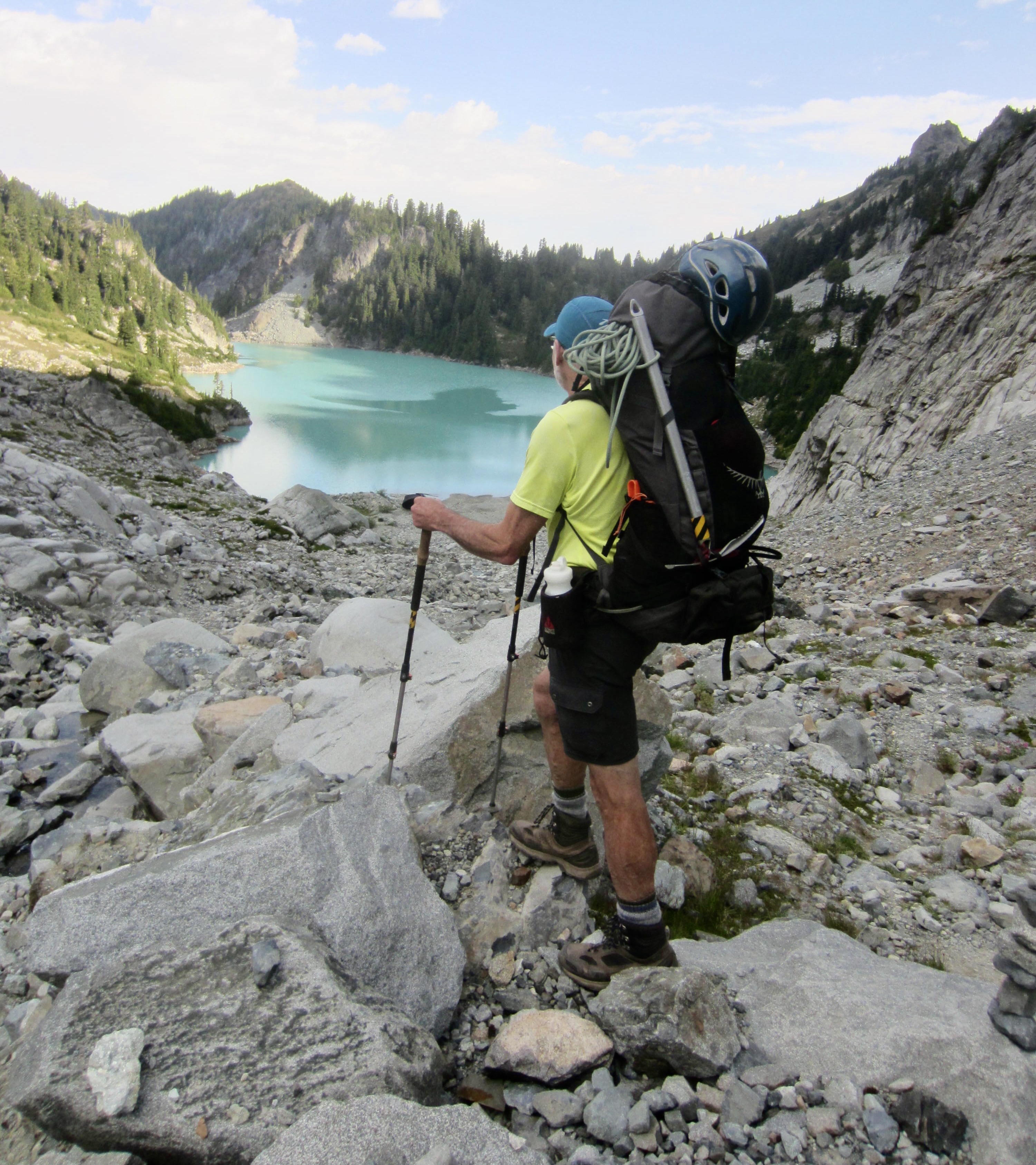
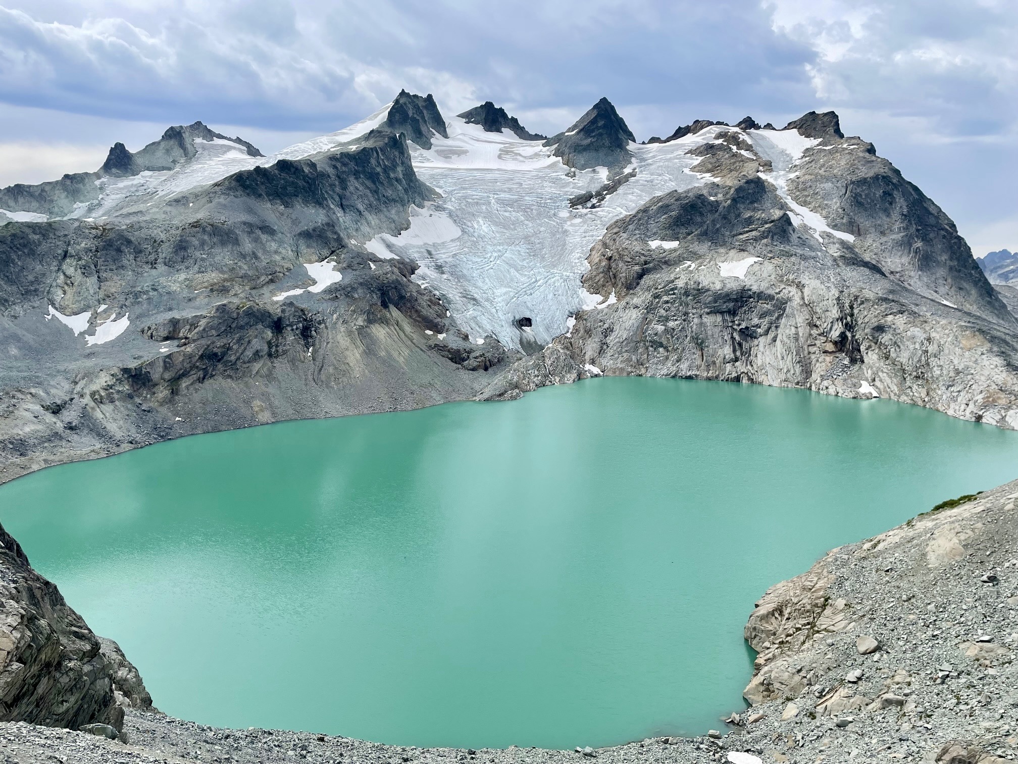
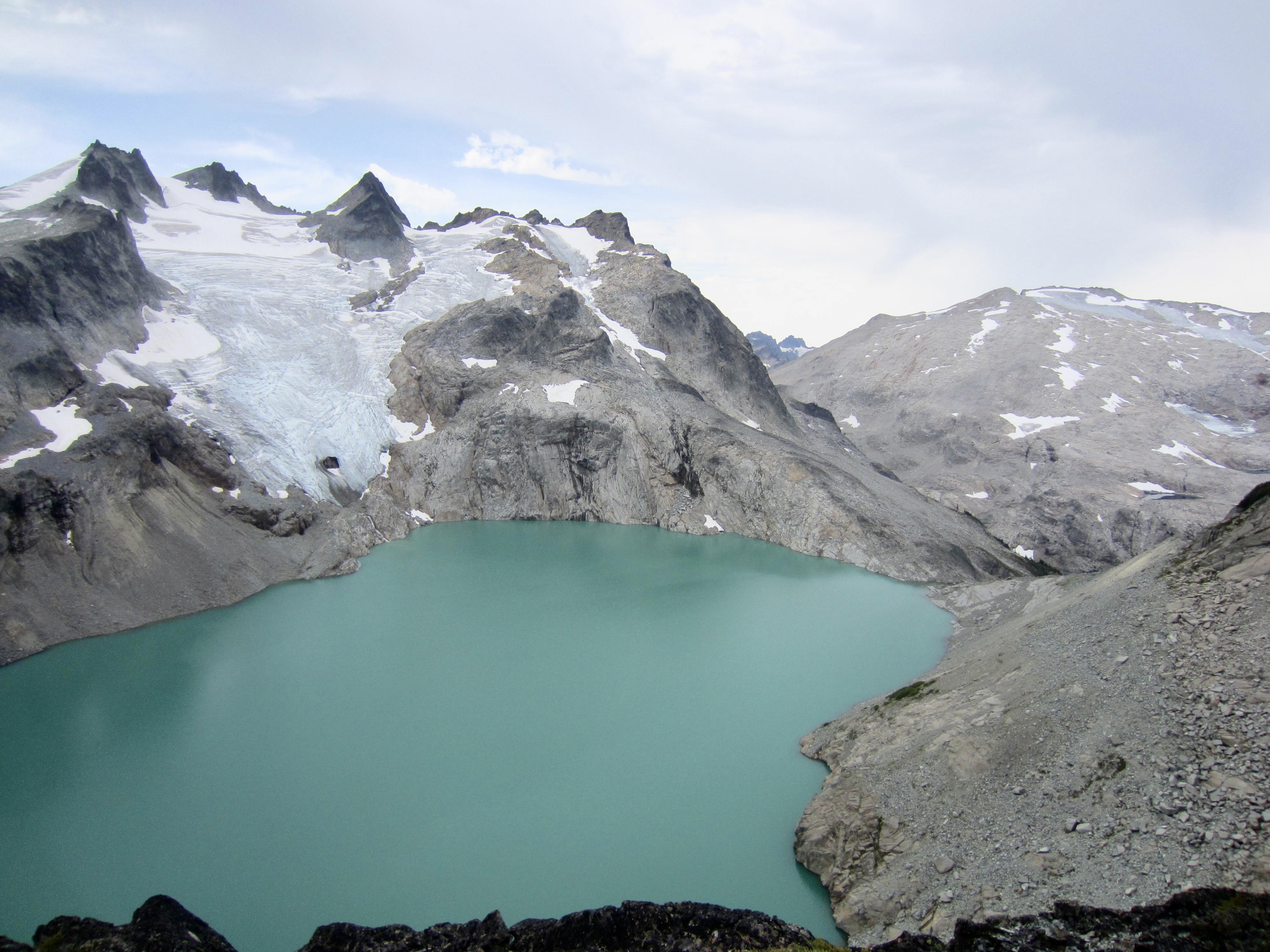
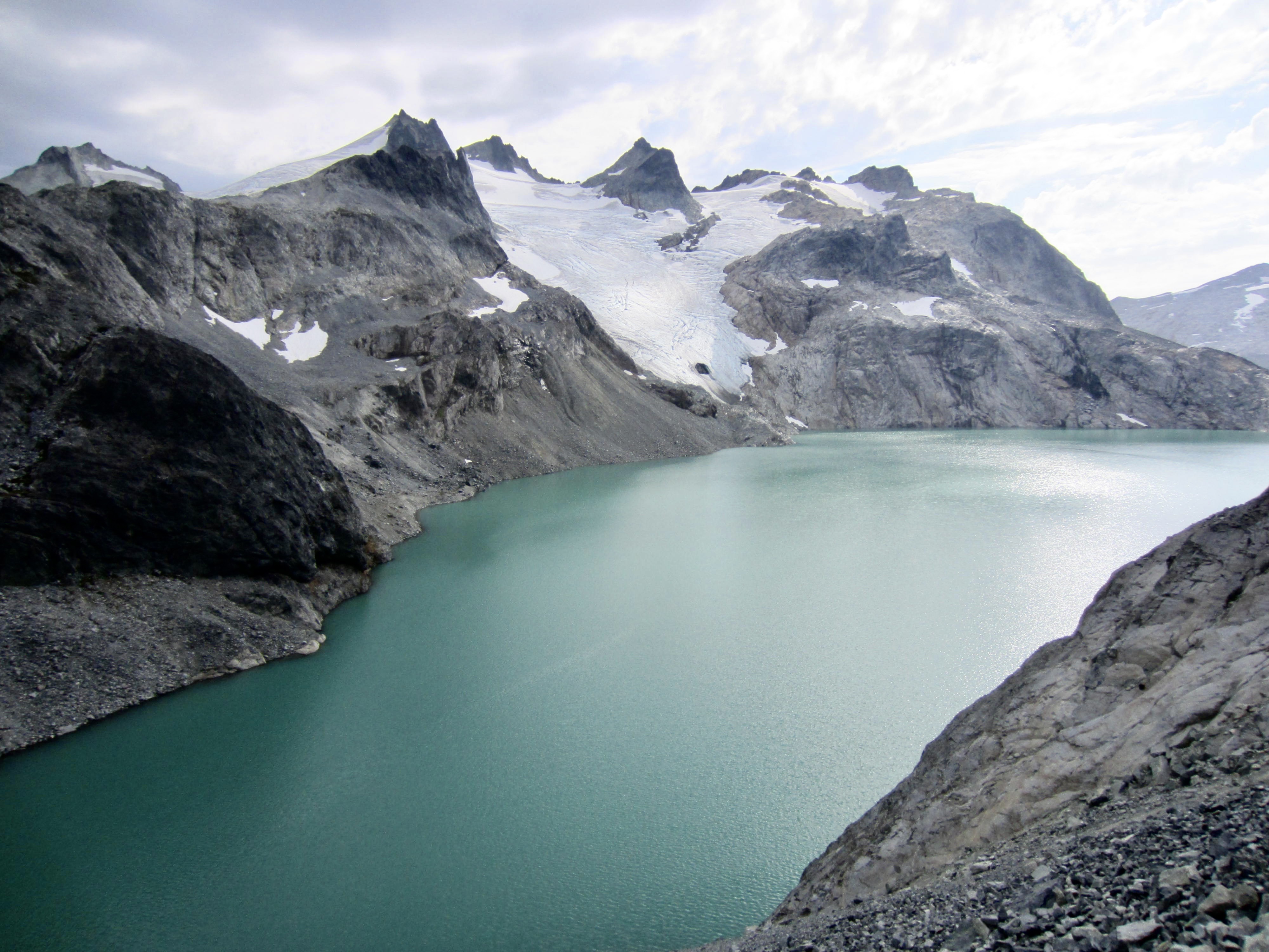
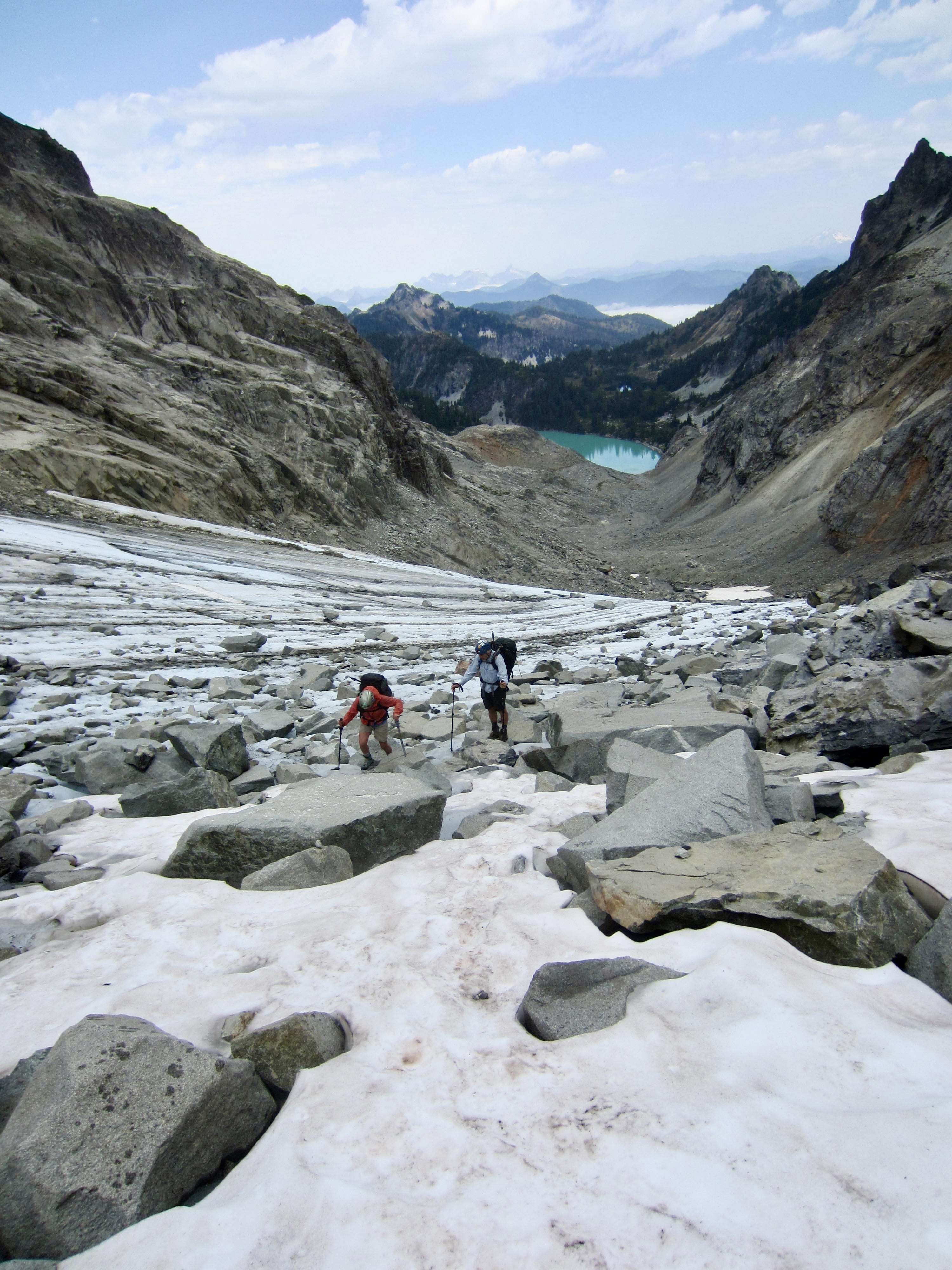
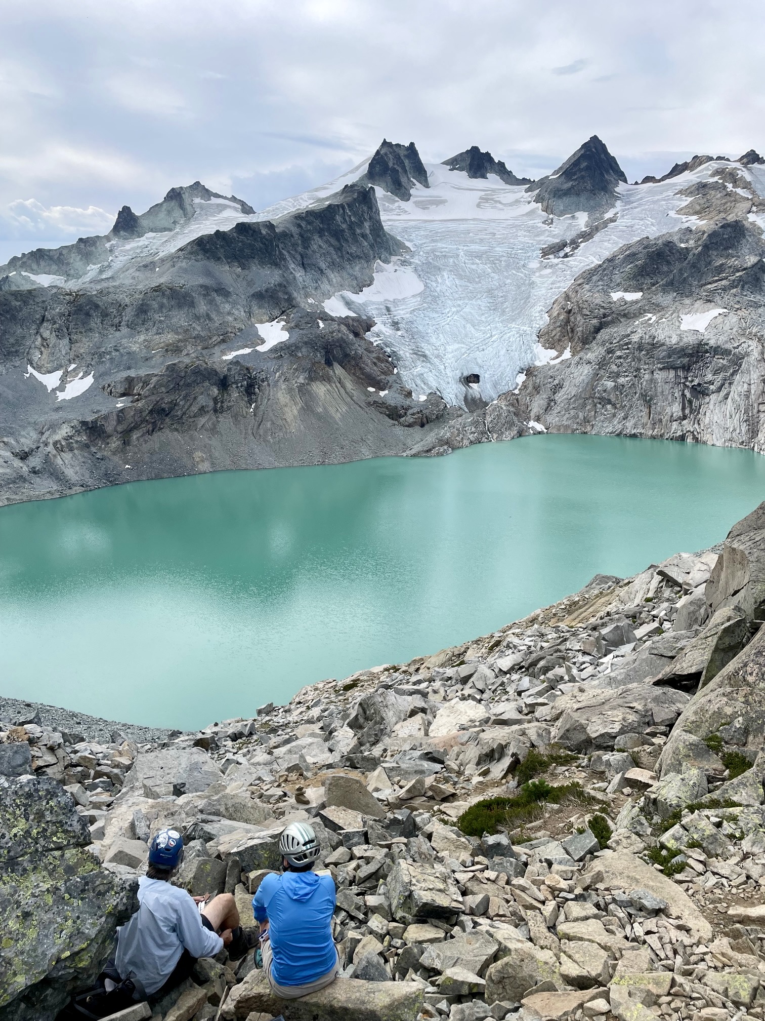
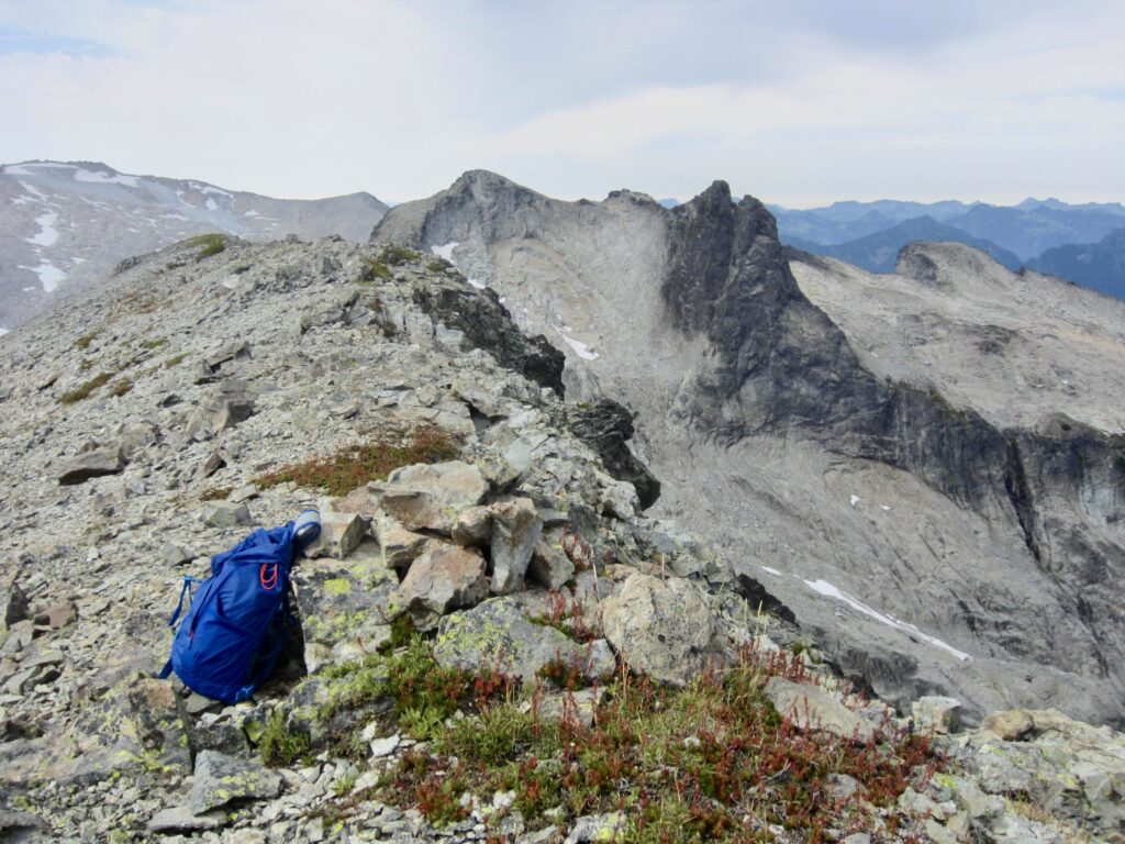
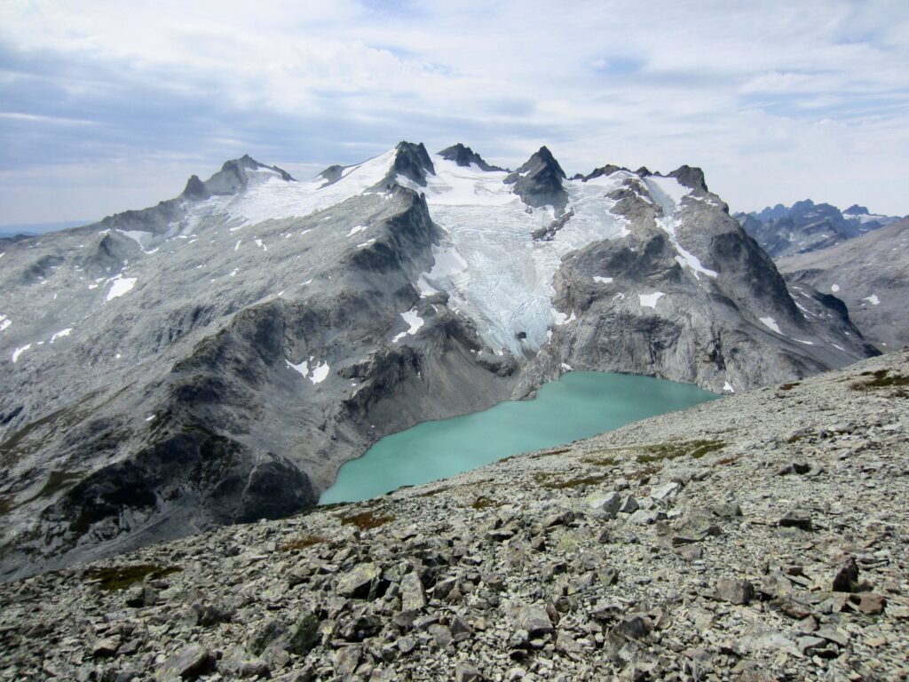
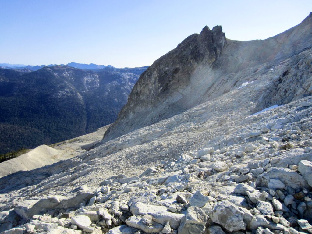
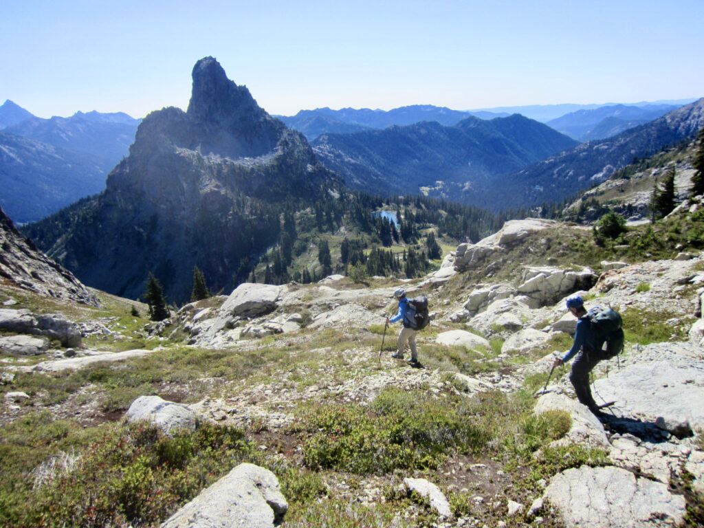
A final bit of snow and rock scrambling brought us to 6650-foot Dip Top Gap in mid-morning (2.6 hours + 1000 feet from Camp 1). We were instantly smacked in the face by a breathtaking view of Mt. Daniel, with its multiple summit horns piercing the sky, and the Lynch Glacier spilling into Pea Soup Lake. This was my fourth visit to the gap, and it still delivered a feeling of WOW! There is a good reason why so many trekkers are willing to make the rugged ascent from Marmot Lake to Dip Top Gap every summer. Hardy trekkers who want an exceptionally memorable camping experience can take advantage of an established tent pad at the gap.
.

.
While Kevin and Lisa hung out at the gap, I made a sidetrip up nearby Lynch Peak. My ascent route began with a descending traverse over to the base of a southwest-trending buttress, followed by a Class 3 scramble up a dirty cleft for 50 feet. Above the cleft, I continued scrambling up moderately steep, broken Class-2-3 rock until the slope angle eased back, then I veered rightward up a broad talus slope that ended at the summit ridge. It was an easy stroll over to the highest point.
.
Lynch Peak provides a great view over to Dip Top Peak and Mt. Daniel and down the Dip Top Couloir to Jade Lake. Unfortunately, there was a lot of haze in the air today, along with threatening clouds overhead. Rainfall began minutes later. The summit register was placed in 2021 and showed only one or two ascents per year. I was the first person to sign in this year.
.
.
.
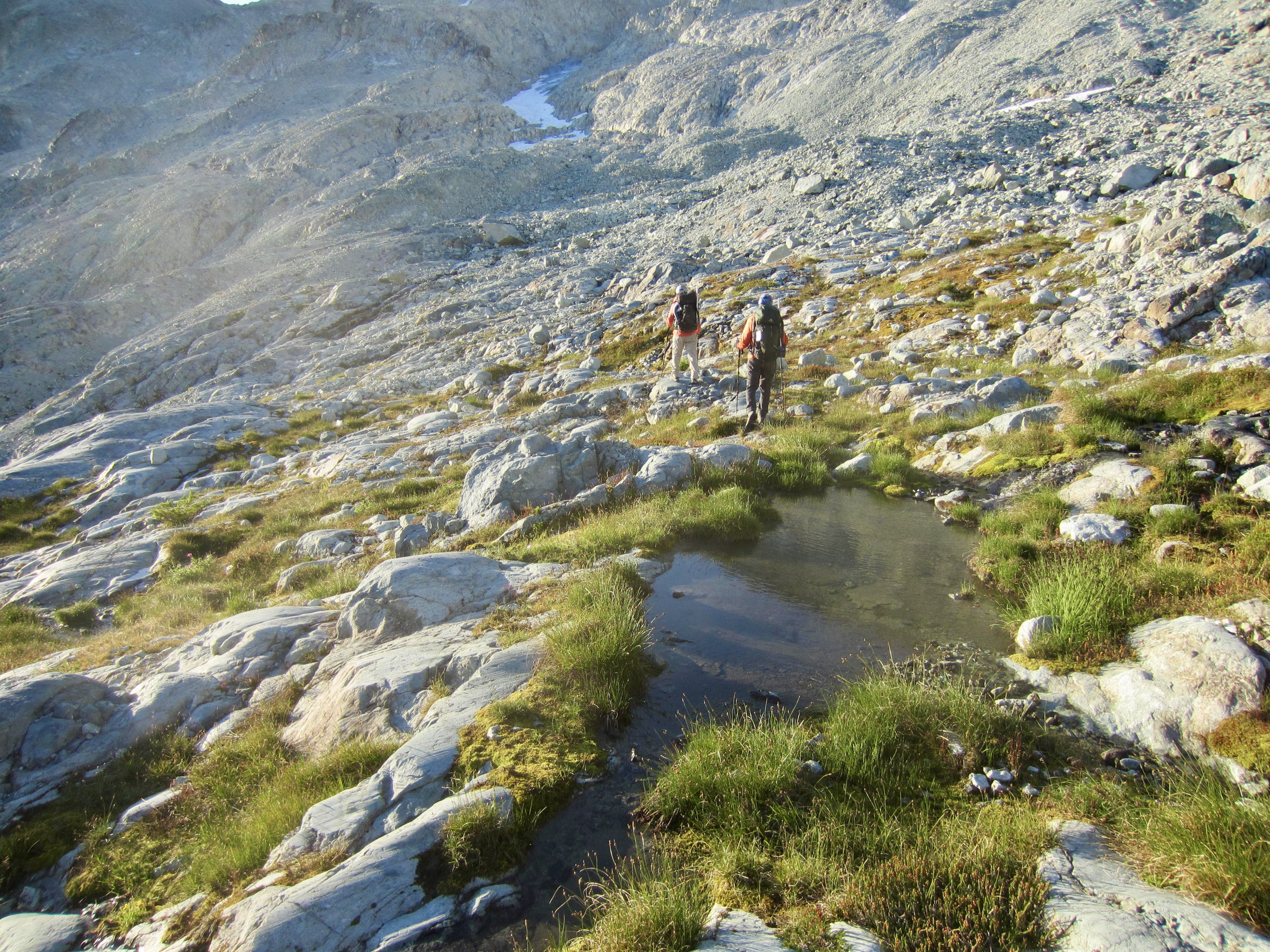
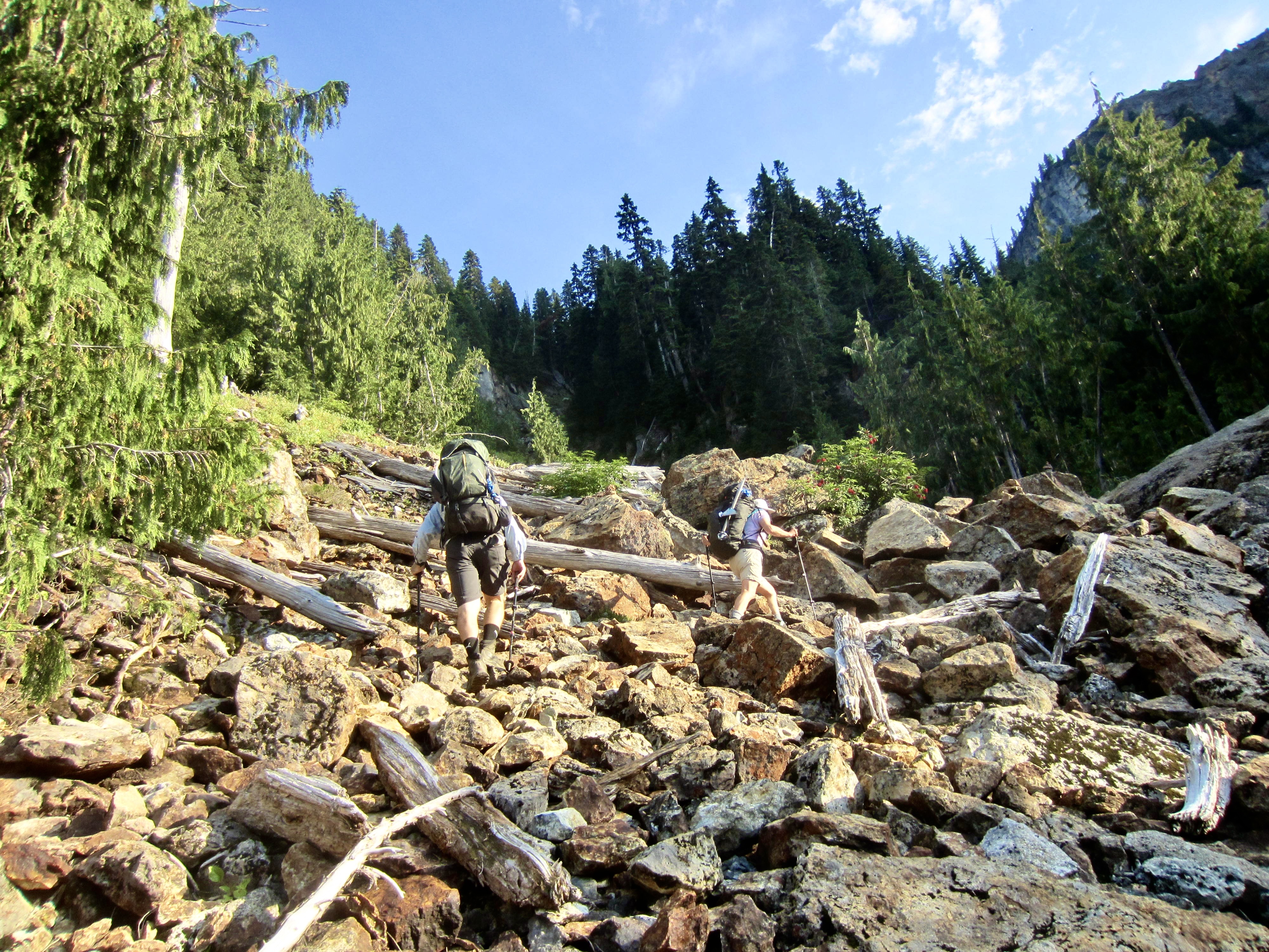
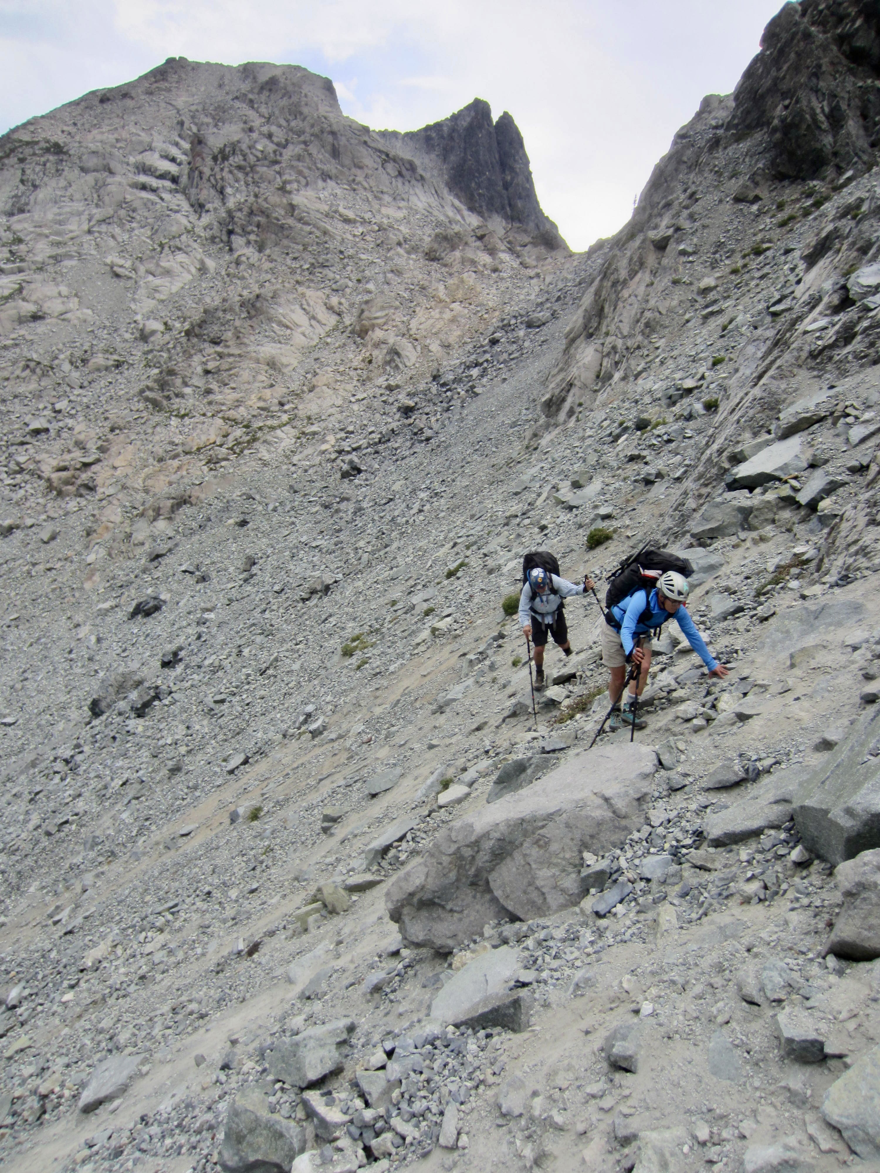
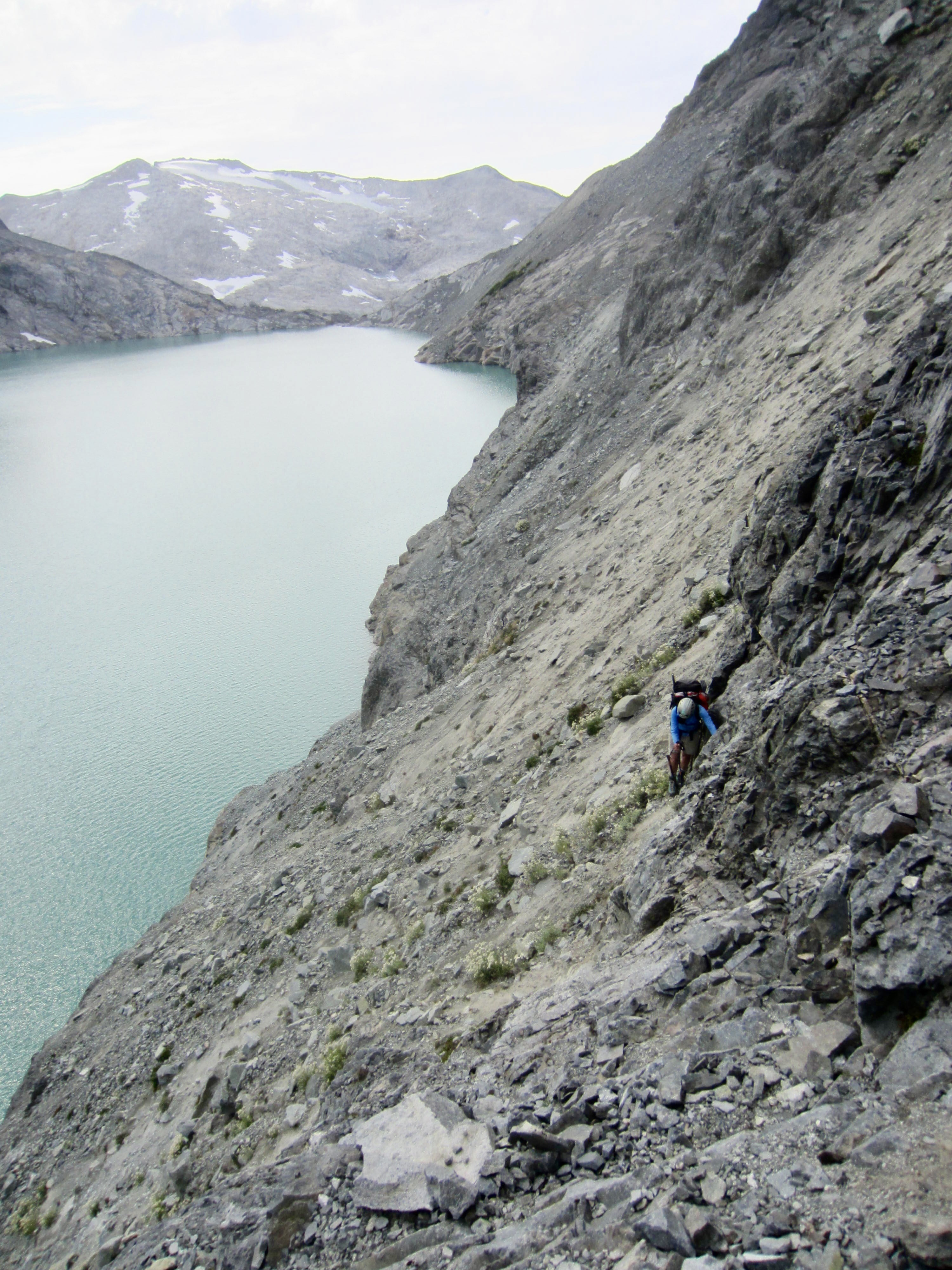
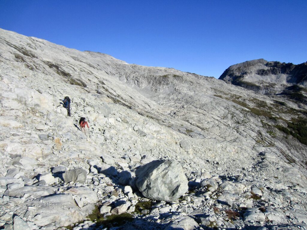
Big raindrops pelted me as I carefully retraced my up-route back to Dip Top Gap, arriving at 1:00pm (1.8 hours + 850 feet RT). Lisa and Kevin were ready to go, so I quickly packed up, then we started a descending eastward traverse above Pea Soup Lake. The first part of our traverse involved loose talus, which was slow but not difficult. Farther along, however, we found ourselves struggling to get purchase on hard dirt slopes embedded with precarious boulders.
.
During previous treks over Dip Top Gap, I had been able to boot down and across large patches of snow. Today, we were left with only steep, barren slopes of scree, talus, and dirt, perched above scary cliffs. It was truly unpleasant and treacherous terrain! Fortunately, the rainstorm was short-lived, so we at least had dry weather all afternoon.

.
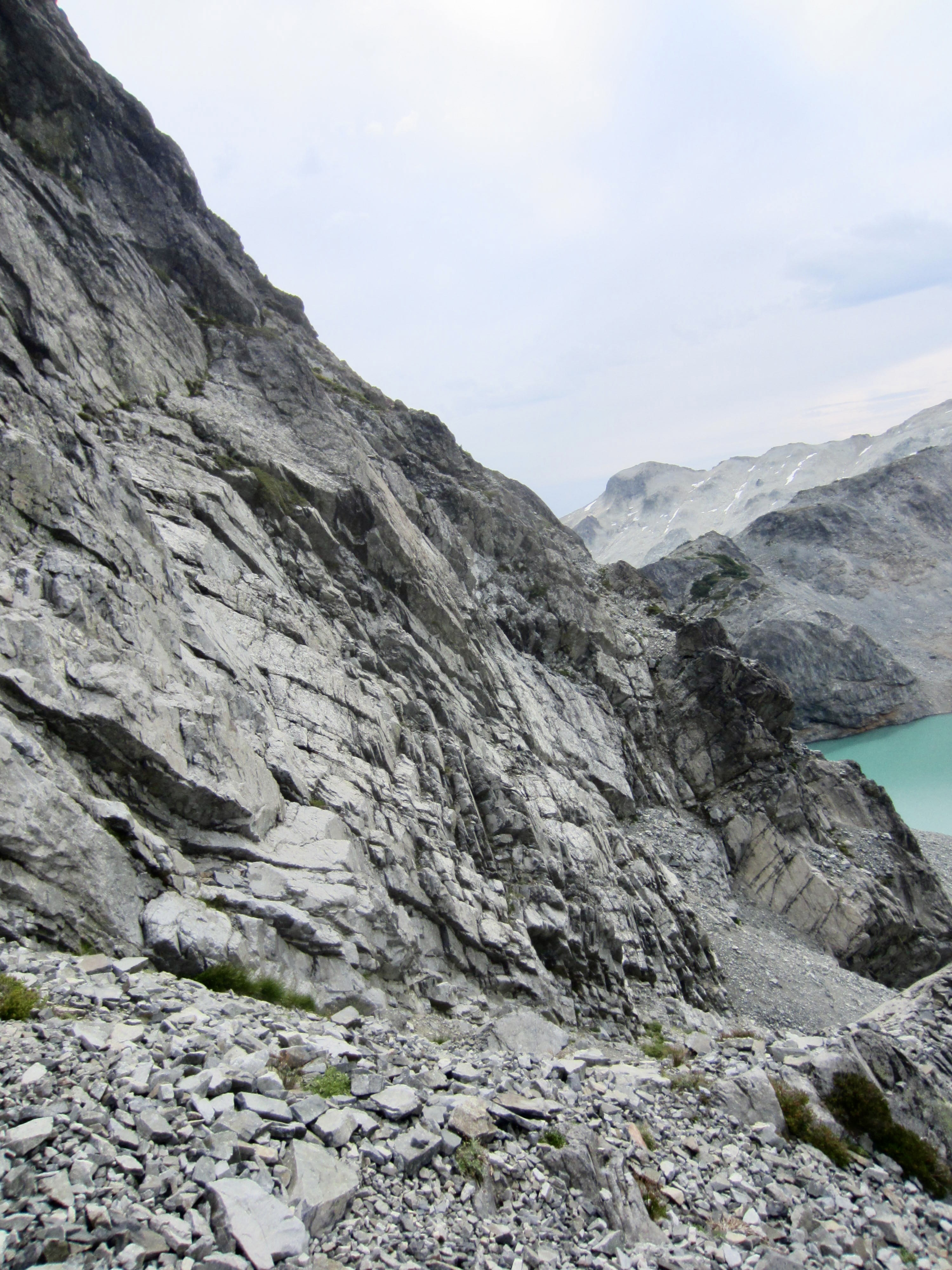
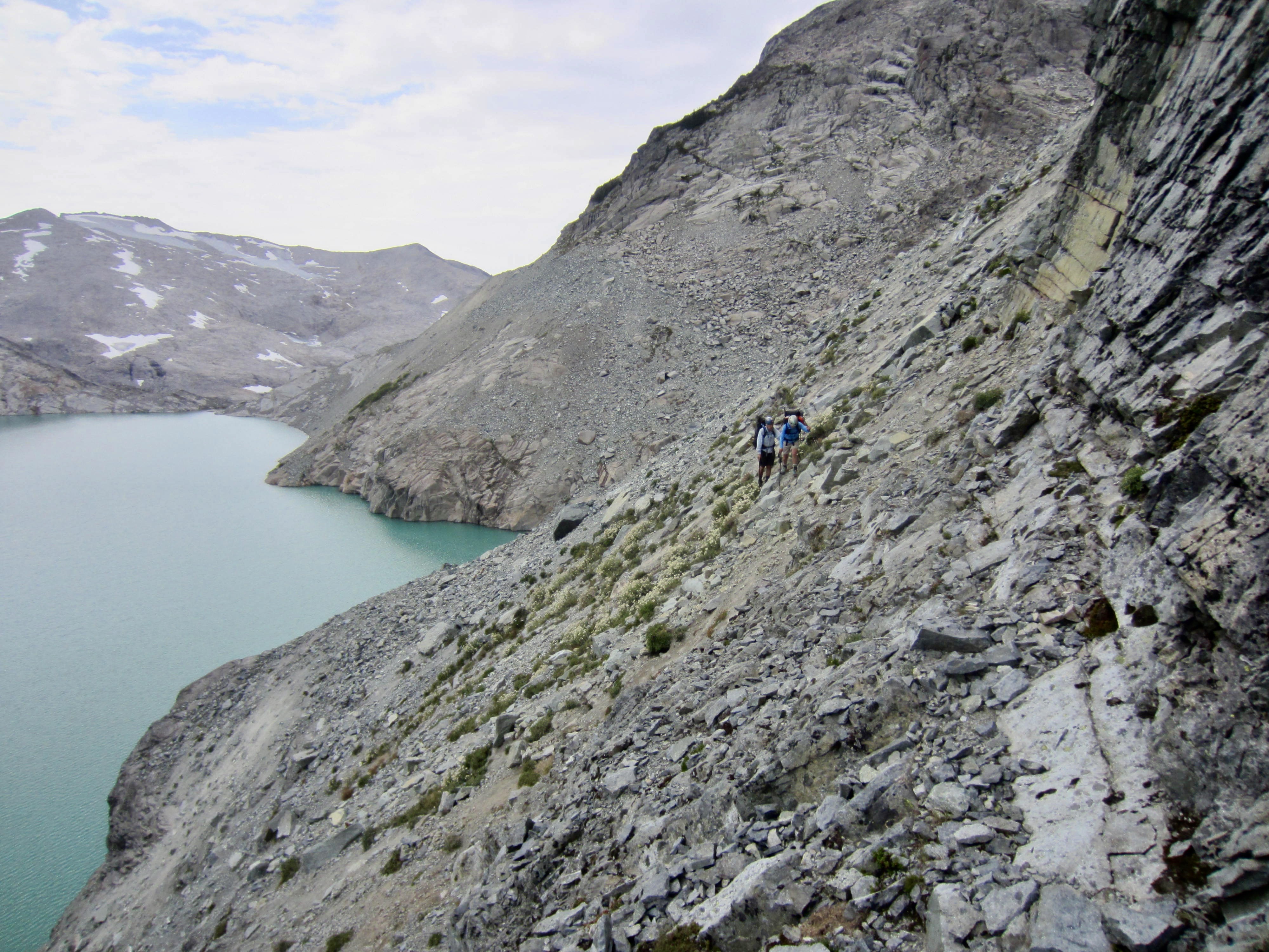
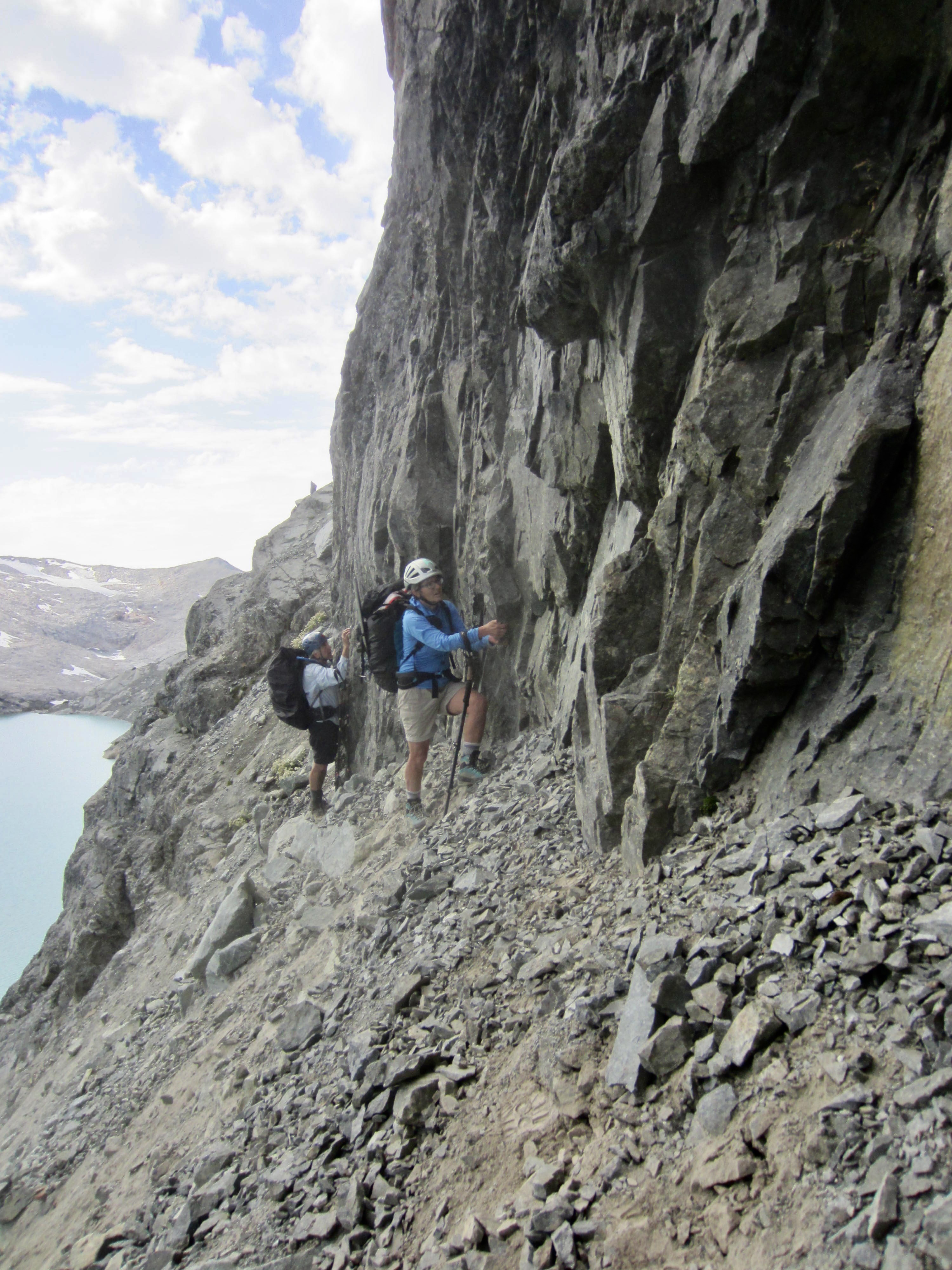
The most difficult part of our traverse occurred as we got closer to the eastern end of the lake, where a super-steep dirt slope squeezes between upper and lower sets of cliff bands on Lynch Peak’s southern flank. We hugged the base of the upper cliff band, desperately groping for handholds in the rock while trying to kick footholds in the hard dirt.
.
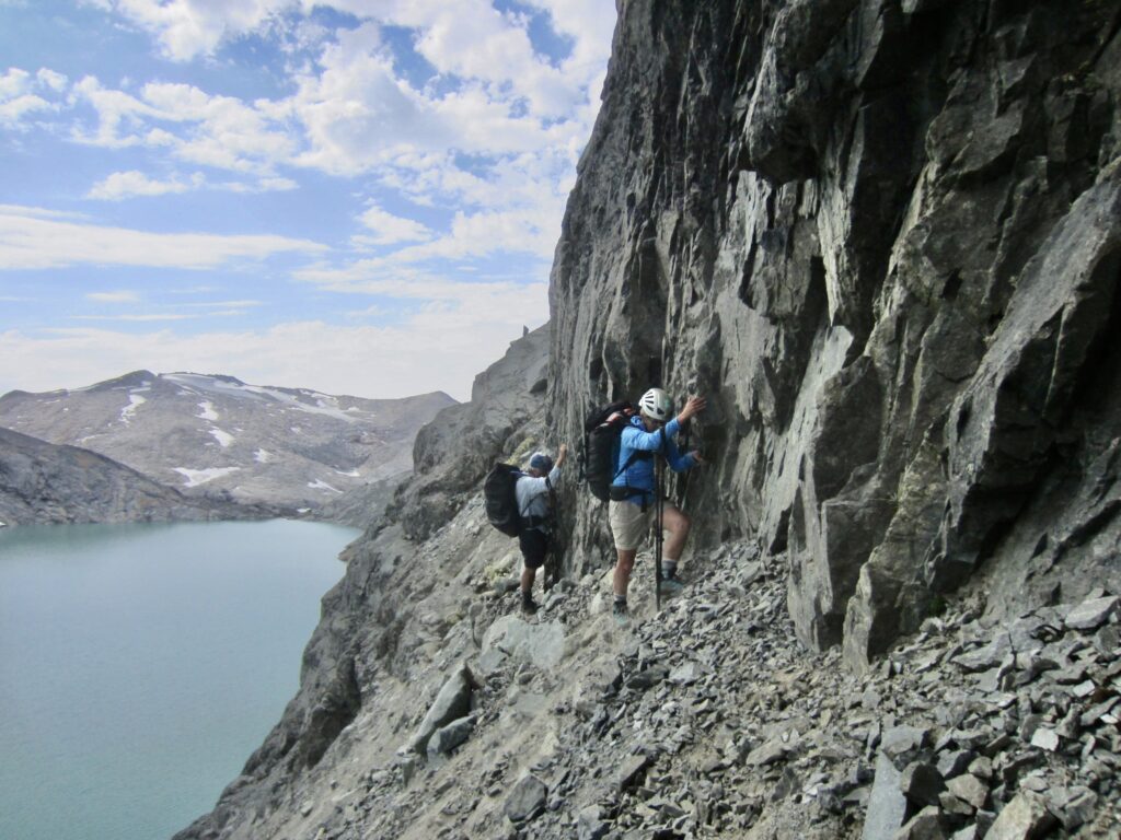
.
At one location, we used our 30-meter scramble rope as a handline in order to drop under a tongue of near-vertical rock and then climb back over an adjacent rock rib. Much of our traverse could be considered no-fall territory, but this area was REALLY no-fall territory, because a slip here would send us over the lower cliff and directly into Pea Soup Lake!
.
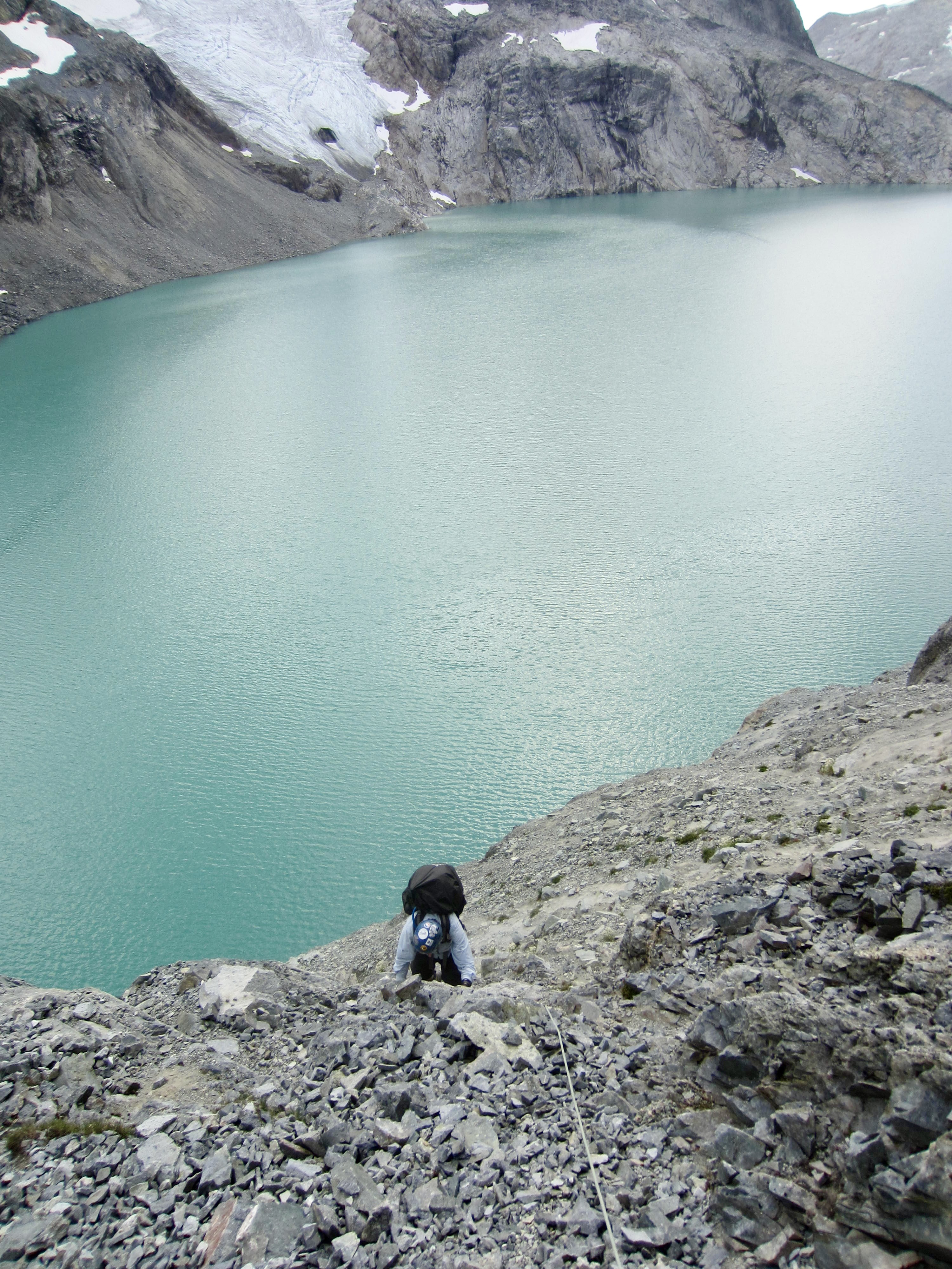
Once across the rock rib, we finally put the treacherous terrain behind us and had only to cross a broad slope of talus and scree in order to reach Pea Soup Pass. This didn’t necessarily equate to an easy crossing, however; the unstable slope tended to form small avalanches below our feet, and Lisa took a long ride atop a “screevalanche” at one point.
.
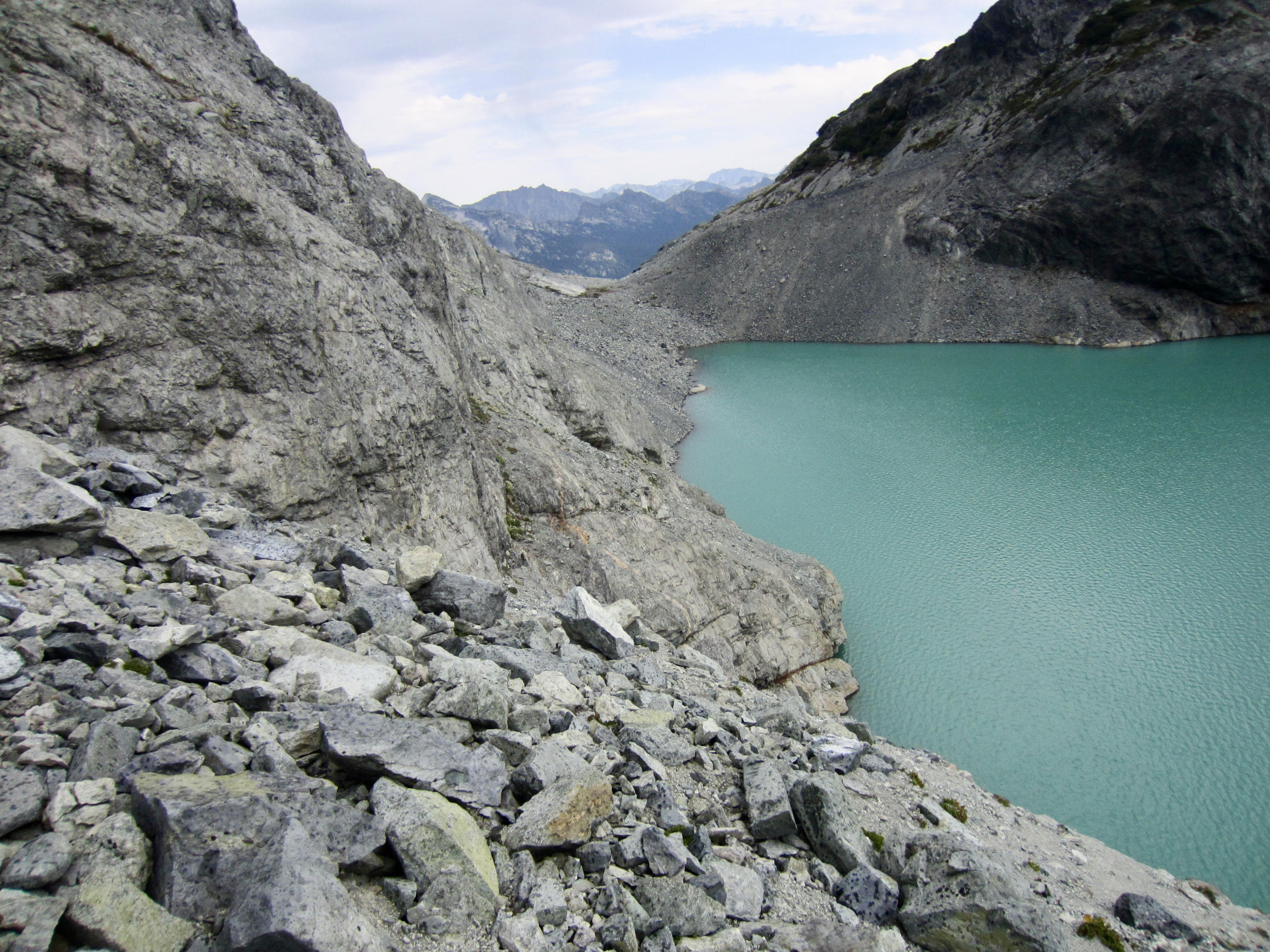
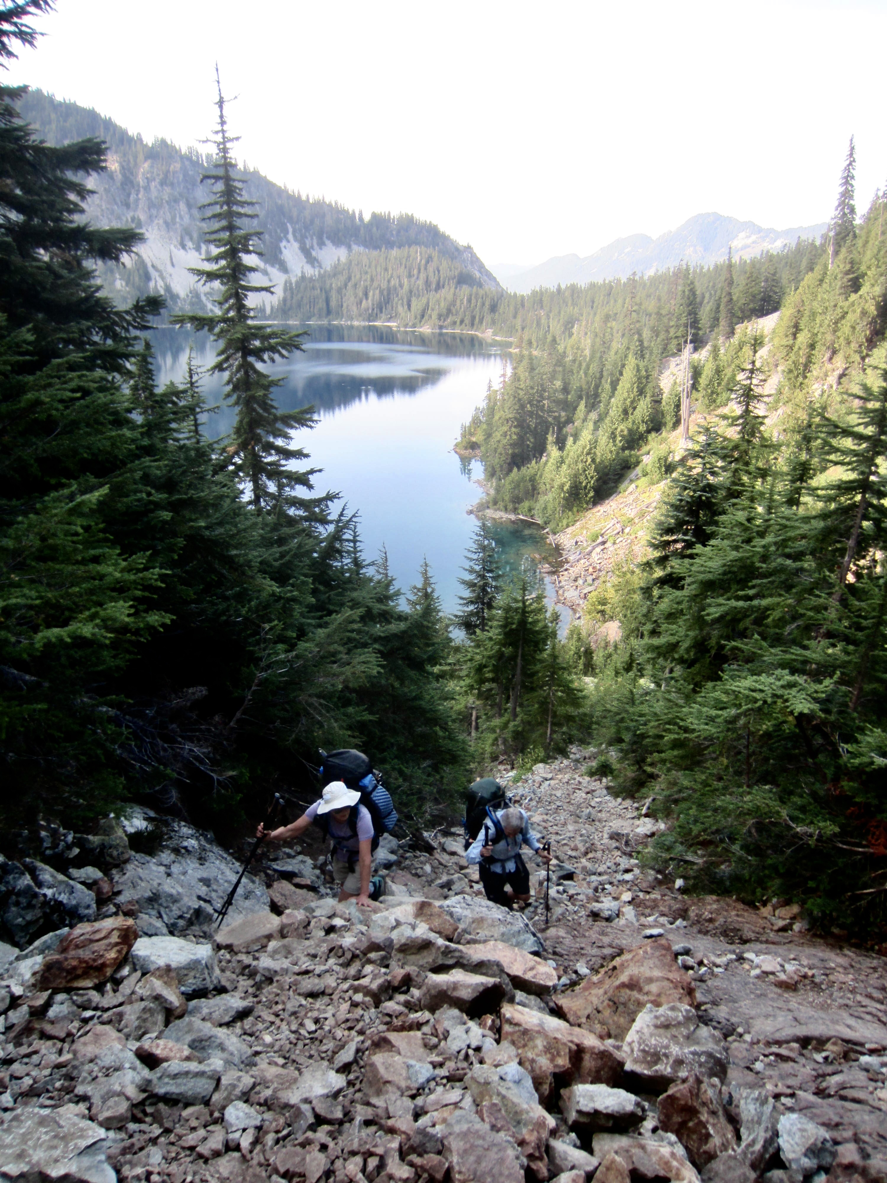
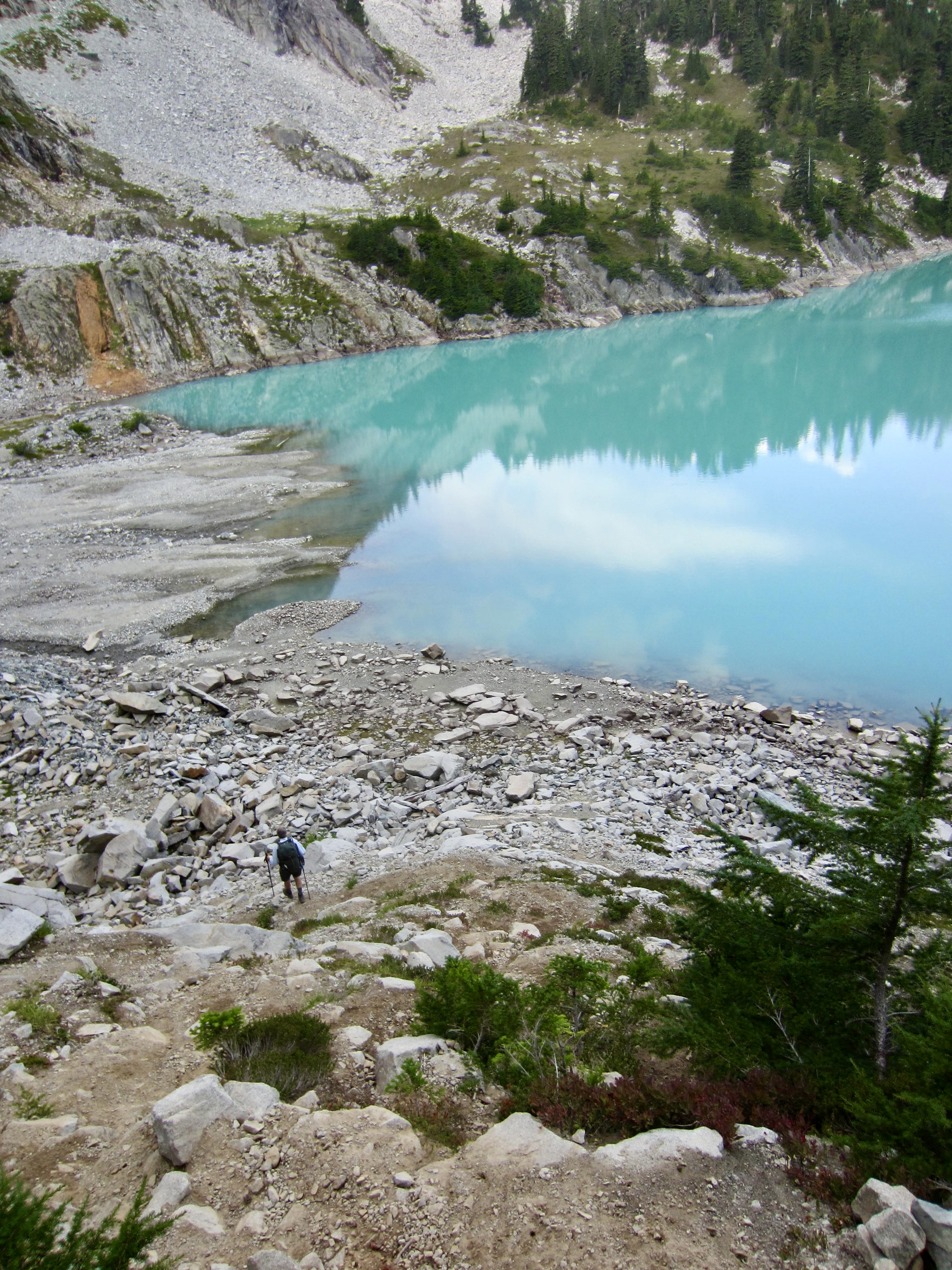
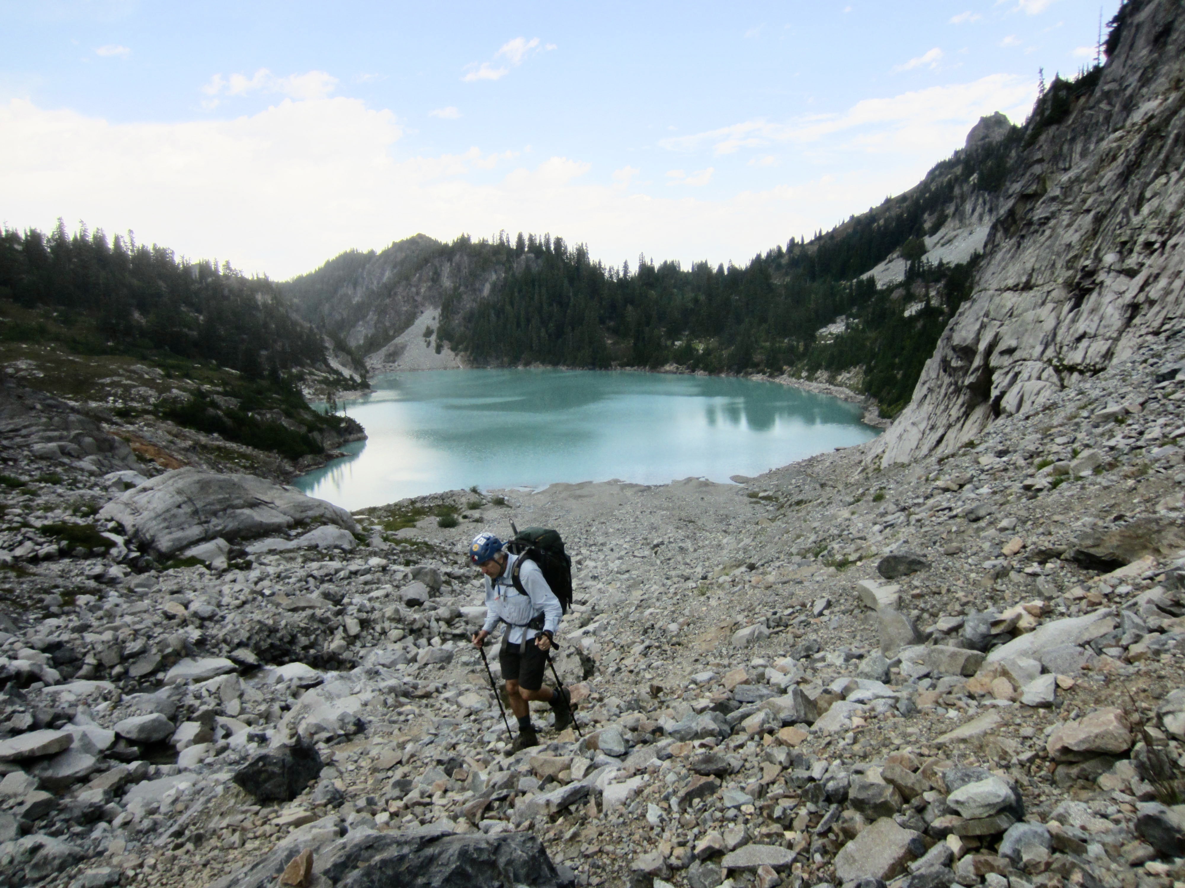
We eventually reached the end of Pea Soup Lake and stopped to refill water bottles in mid-afternoon (6.5 hours + 1150 feet from Camp 1, excluding summit sidetrip). It was a great relief to have completed the traverse from Dip Top Gap without any serious mishaps. Looking back across the hillside, none of us could even see a feasible traverse route through the cliffs! The “then & now” photos below show that the traverse previously involved a reasonable descent of snowfields, followed by a walk along the snow-covered shoreline. It’s a whole new ballgame now.
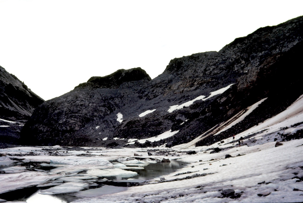
.
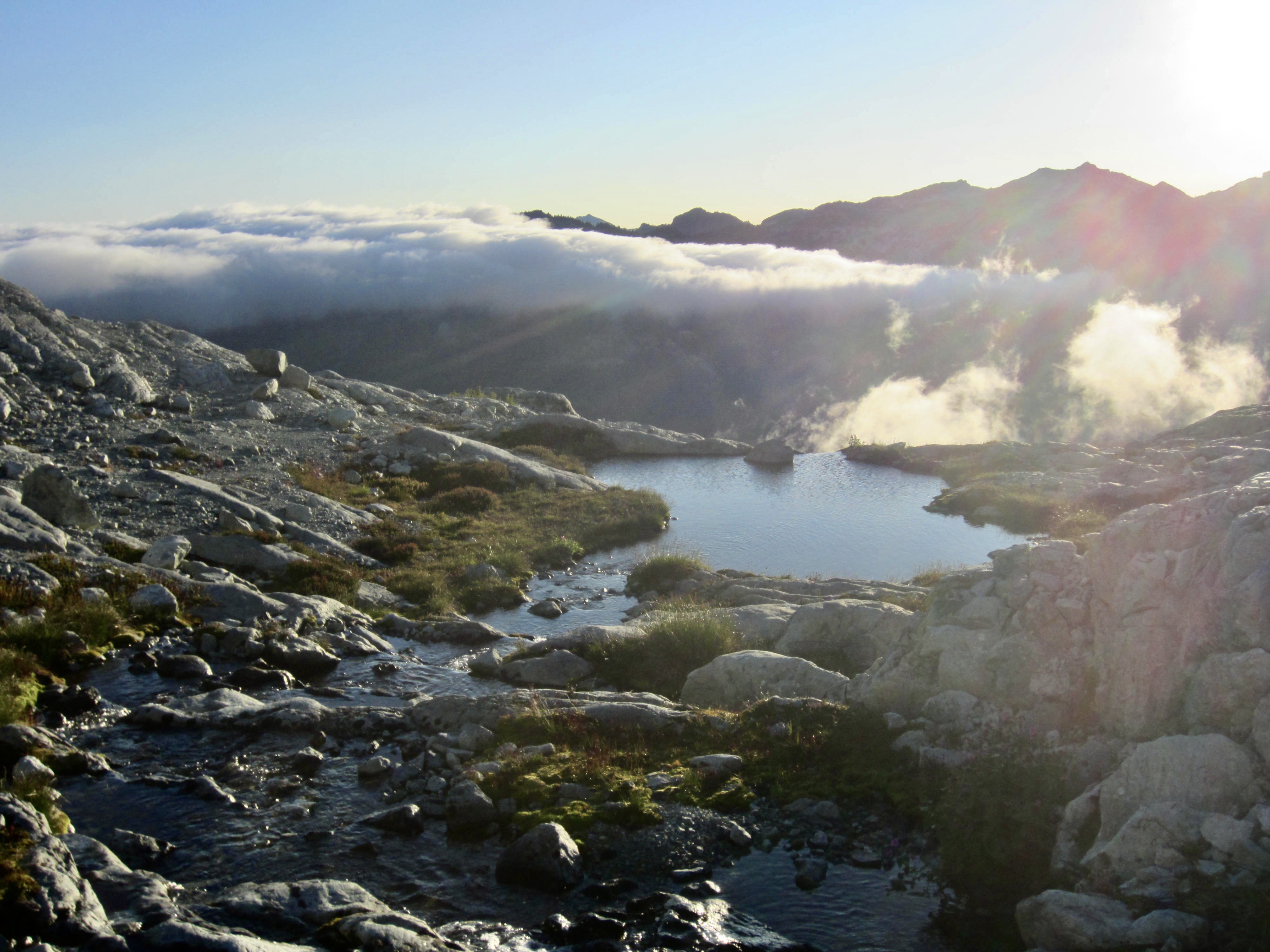
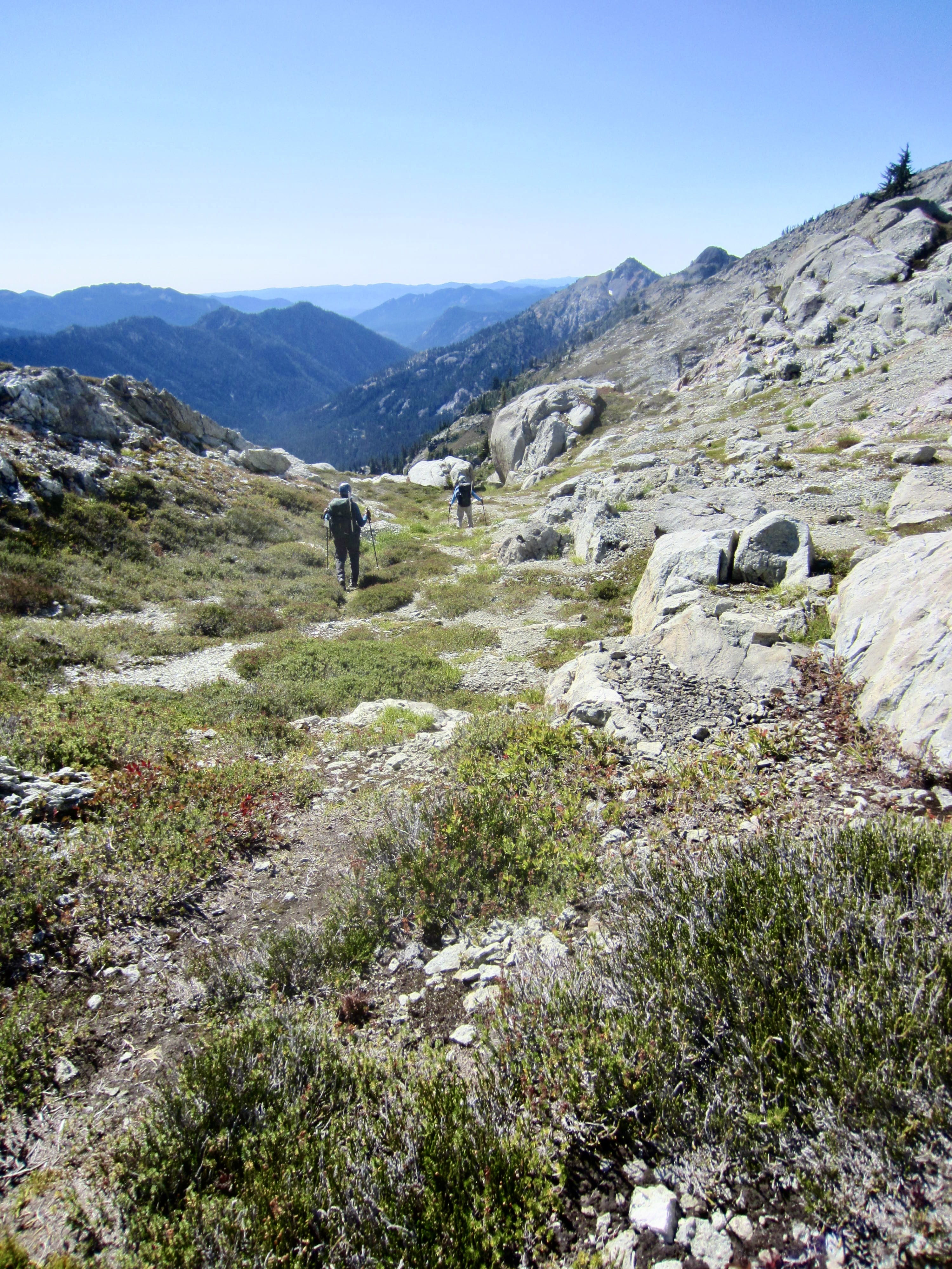
As we sat on the lakeshore, filtering water and snacking, an ominous fog crept over the western end of the lake. This did not bode well for our navigation around Mt. Daniel. We shouldered backpacks and began contouring southward along Daniel’s northeastern ridge, leaving the fog behind. A continuous chain of heather benches at 6400 feet provided a most welcome change from our previous terrain.
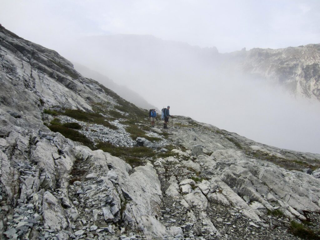
.
Our traverse route took us into the Daniel Glacier Cirque, which had a healthy stream cascading down the cliffs. Fearing that this might be our only water source in the cirque, we stopped and made camp on a gravel bench at 6300 feet in early evening (8.1 hours + 1350 feet from Camp 1, excluding summit sidetrip). There was a cold wind swirling around the cirque, but the overall setting of our campsite was marvelous, with meandering streams, grassy flats, and little tarns.

.

.
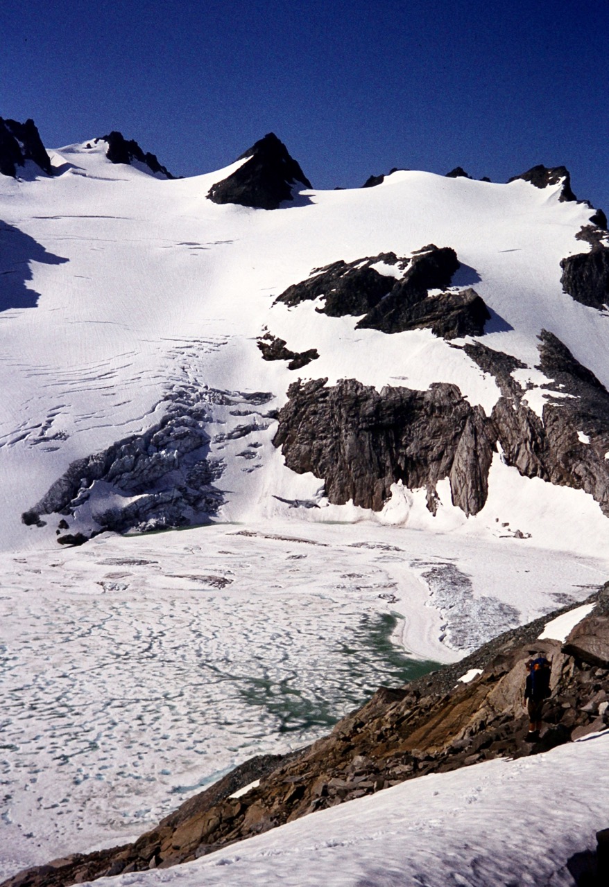
Once again, I was struck by the sharp contrast between current and past conditions. The left-hand photo below shows that Mt. Daniel’s east ridge was largely snow-covered in mid-August of 1978, allowing a straightforward snow climb over the ridge crest. Today (right photo), we were staring at a barren hillslope with only a few tiny patches of residual ice. What would tomorrow’s traverse be like, I wondered?
.
Day 3: Daniel Glacier Cirque to Trailhead
After a night of gusty winds, we awoke to a completely clear sky and were on the move by 7:15am. Our morning involved a long, curving traverse across the cirque, initially on benches of glacially polished bedrock at an elevation of approximately 6300 feet.
.
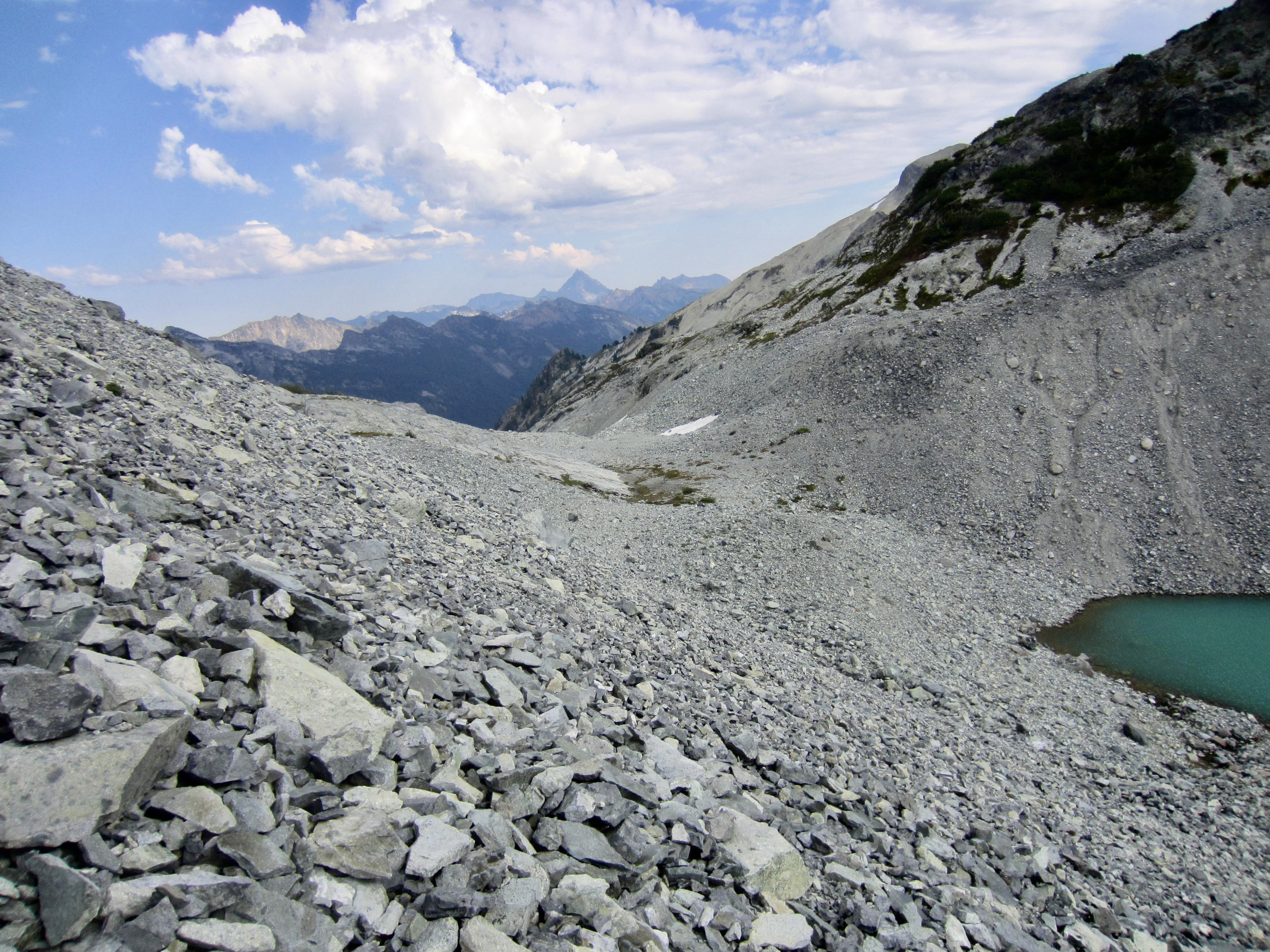
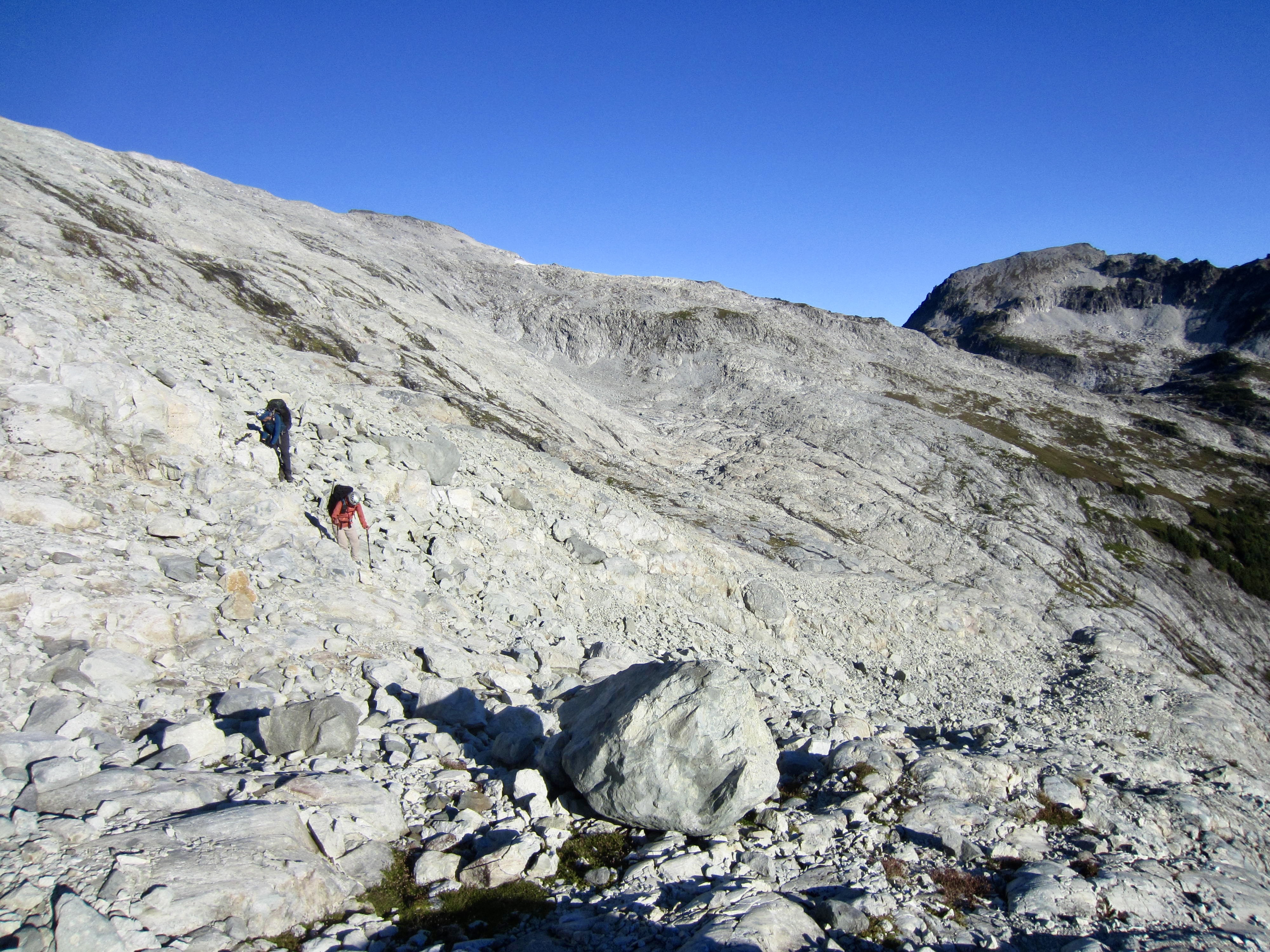
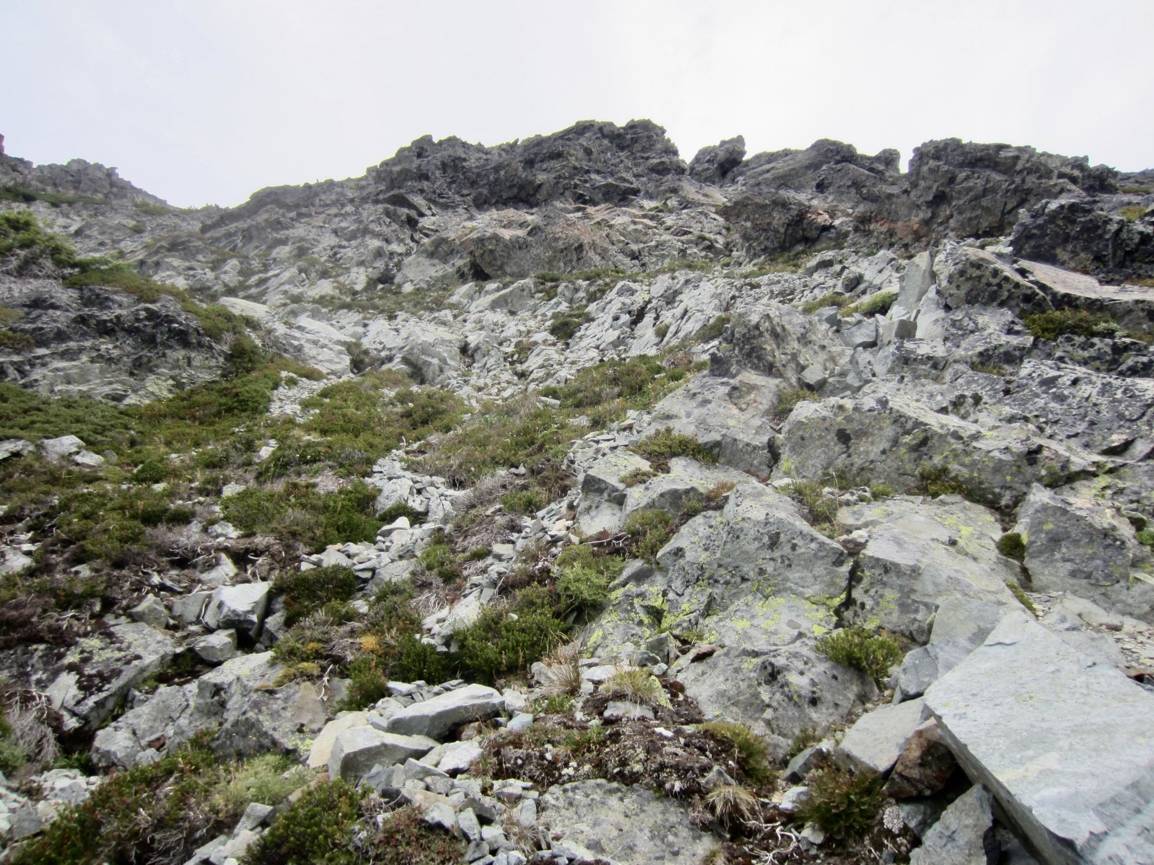
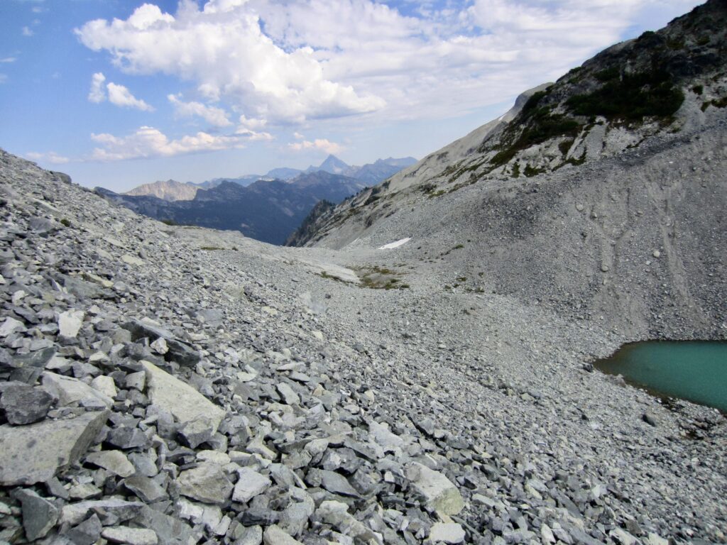
As we progressed through the cirque, our pleasant benches transitioned to moderately steep slopes of decomposing volcanic rubble. A series of ravines and ribs forced us upward incrementally until reaching an elevation of 6600 feet. Straight ahead, we could see two options: (1) descend to a gravelly bowl at 6200 feet and then make a low-level traverse around the ridge, or (2) ascend to an obvious saddle at 6650 feet and then make a high-level traverse around the ridge. After a short debate, we chose Option 1.
.
.
We descended slabs and talus to reach the 6200-foot bowl, which is cradled by a distinctive terminal moraine. This bowl has some flat ground and a few water trickles, so it would provide a decent campsite for future trekkers. We continued contouring around the nose of the ridge, staying at 6300 feet most of the way.
.
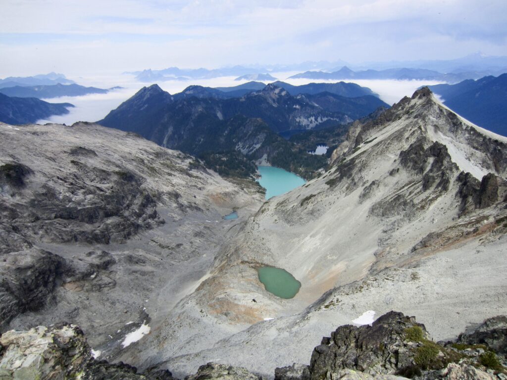
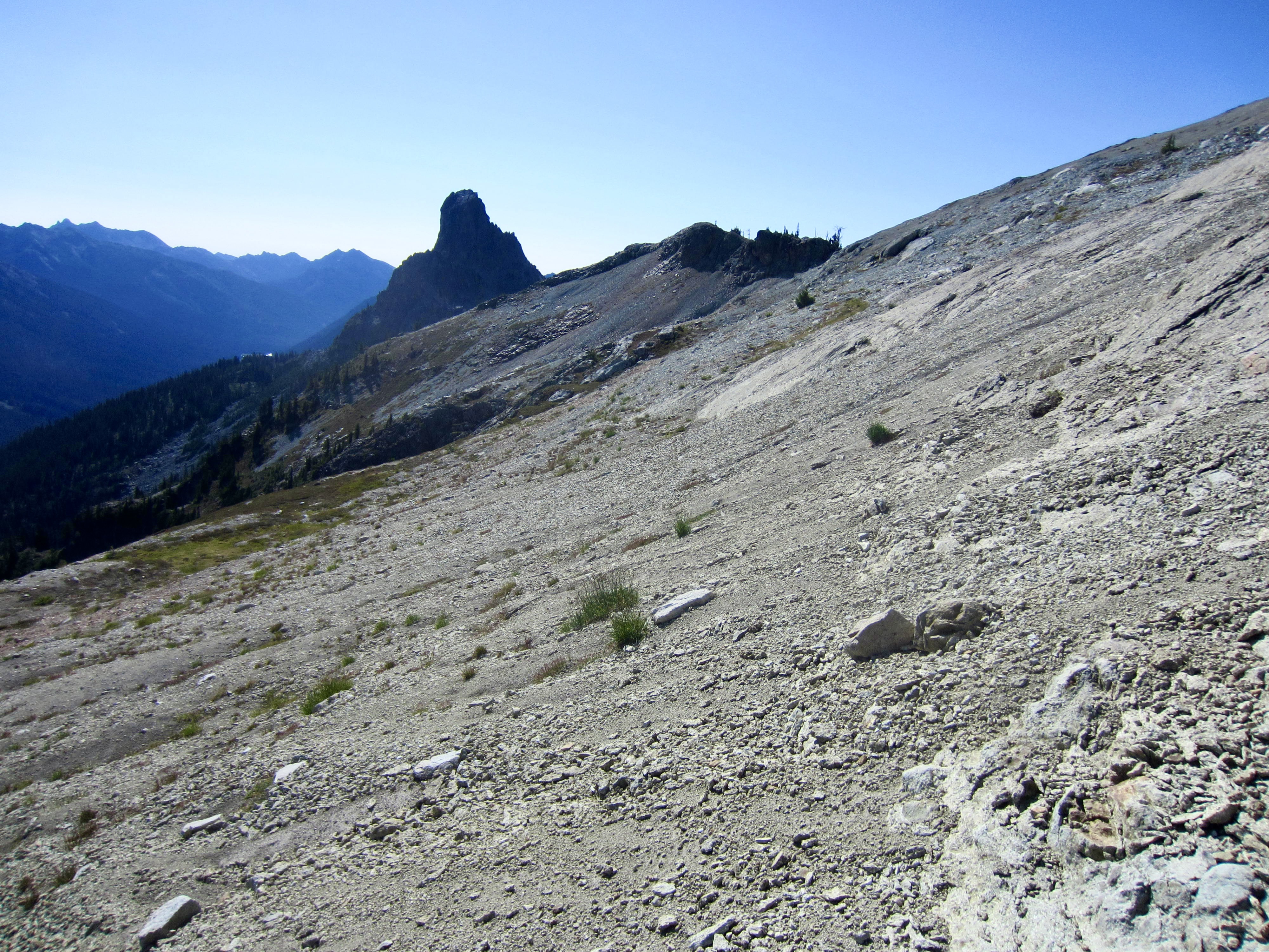
As we curved around the ridge and headed southward, the beacon-like pinnacle of Cathedral Rock came into view. Just to its right was the broad uplift of Point 6350. More sidehilling across loose, rotten scree and hard dirt brought us to a small notch immediately right (west) of Point 6350. We crossed through this notch and gazed at the splendid oasis of Peggy’s Pond far below.
.
.
We found a right-slanting, heathery draw that easily took us down to the floor of the Hyas Glacier Cirque. It was sad to look up into this cirque and see that the glacier has almost completely disappeared. What used to be a popular snow-climbing route up Mt. Daniel is now a rubble-scrambling route. Moving on, we crossed Hyas Creek at 5800 feet and intersected the well-used climber’s path, which led us down to Peggy’s Pond shortly after noon (5.0 hours + 600 feet from Camp 2).
.
.
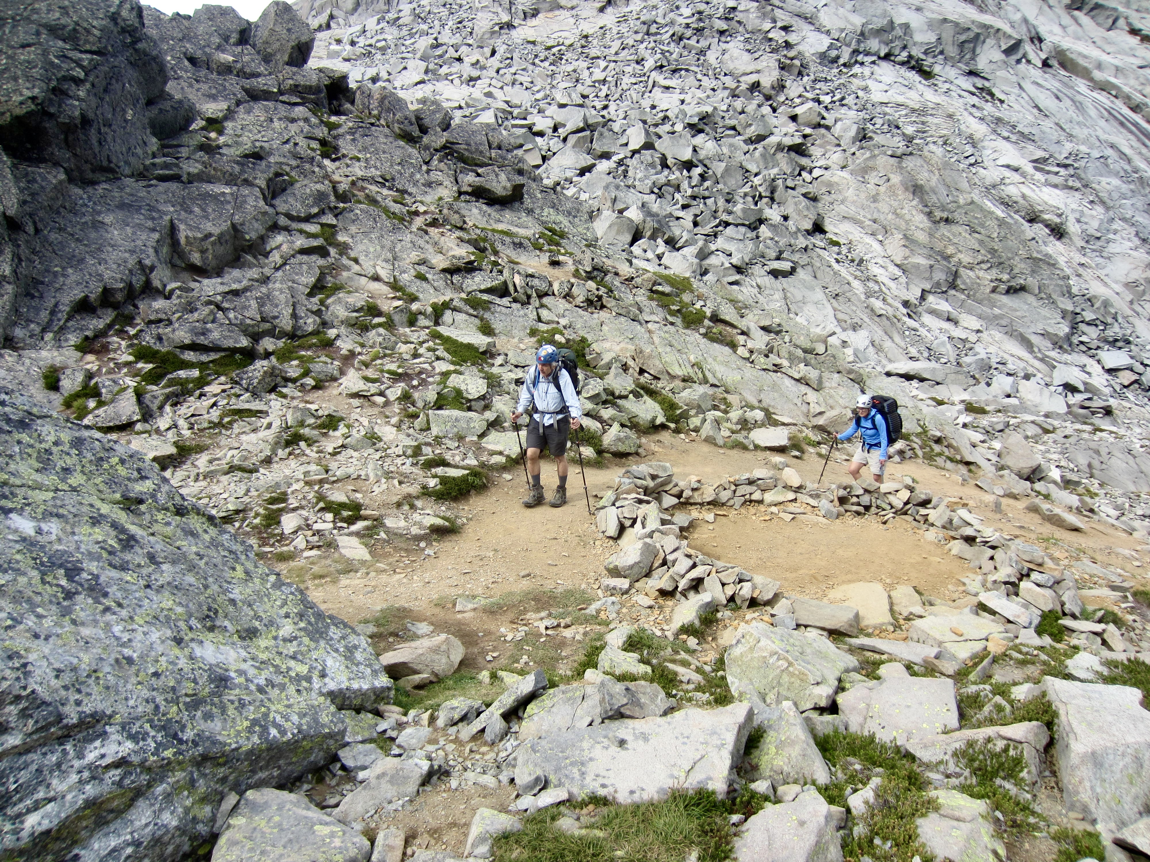
From Peggy’s Pond, we located the exit trail and hiked over to Cathedral Pass, then down past Squaw Lake to our starting point at Tucquala Meadows Trailhead (9.0 hours + 900 feet from Camp 2). Andrew was waiting for us there, having climbed Mt. Daniel yesterday and spent the night at Peggy’s Pond. Our routes from Jade Lake to Peggy’s Pond were very different, but both of them had served up all the adventure that we could handle!
Route Maps & Profile
…
…
…
Photo Gallery
Click to enlarge…