Trip Date: August 16-21, 2025
Bath Lakes Traverse: Miners Pass to Sulphur Pass
Suiattle River Valley
Miners Ridge Lookout
Image Lake
Canyon Lake
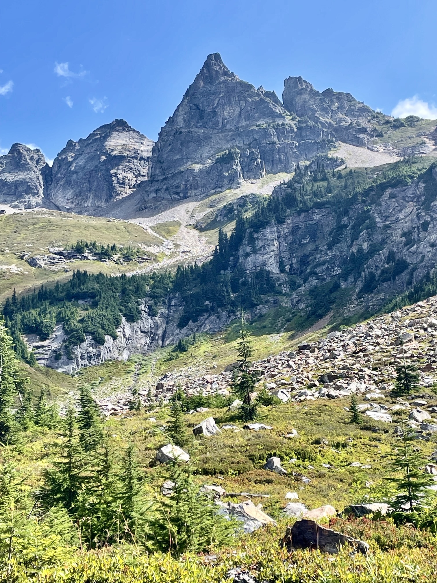
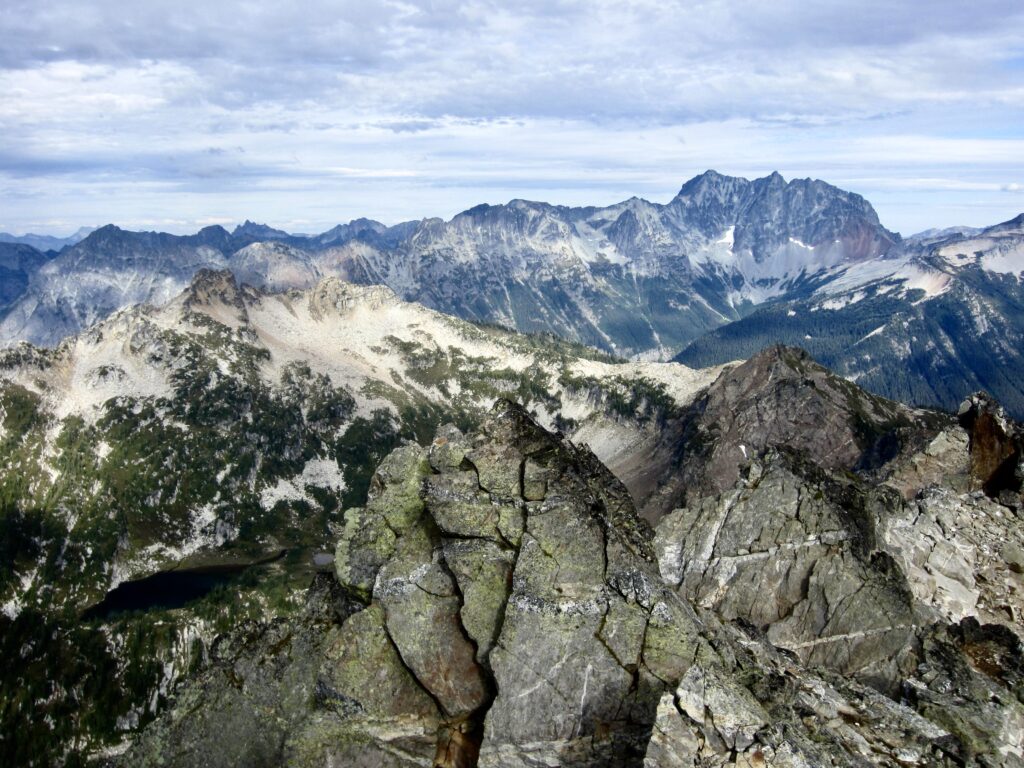
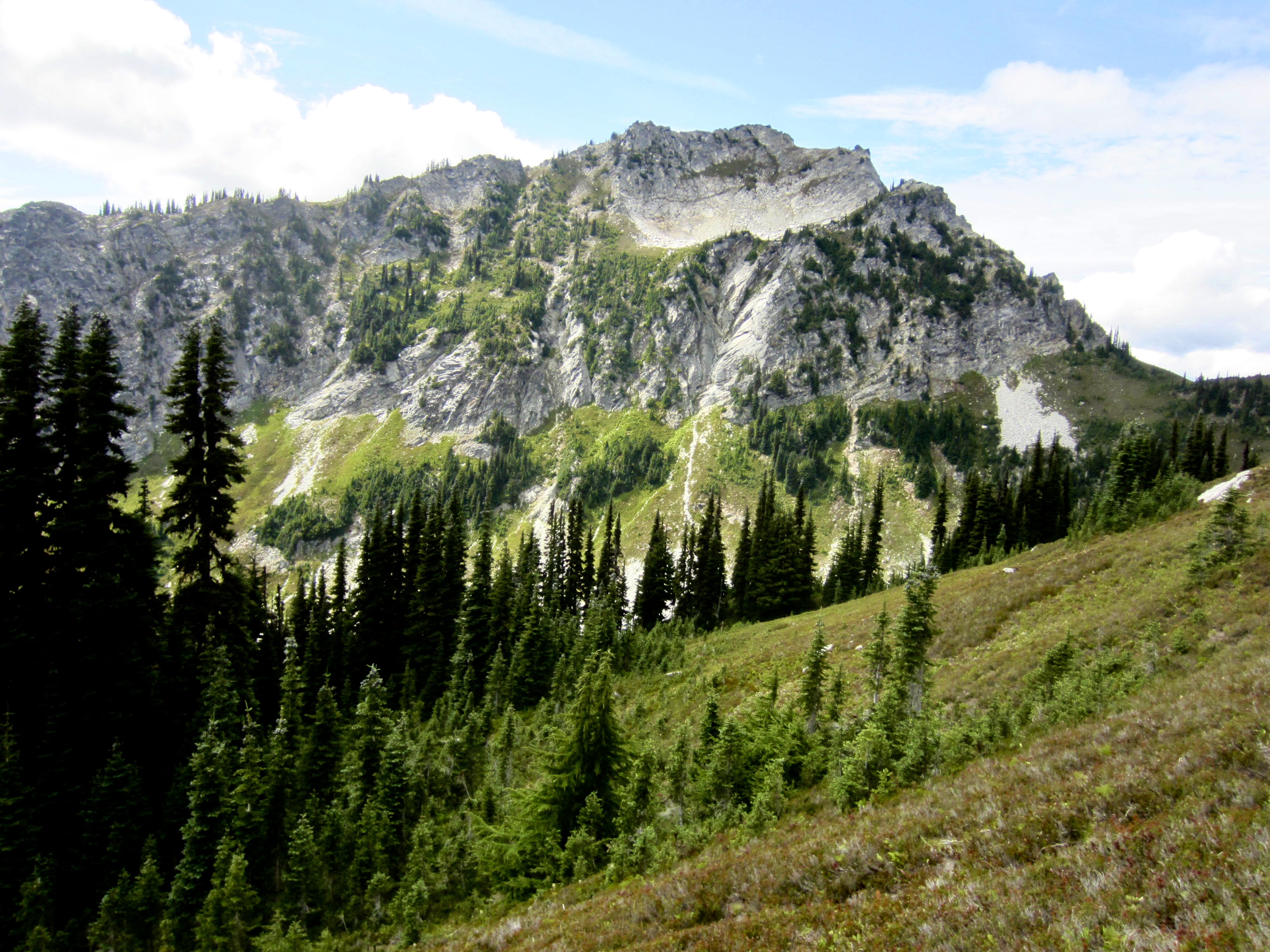
Bannock Mountain (7760+ ft)
The Great Wall
Bath Lakes
Sulphur Park
Sulphur Point Lookout Site
- Trip Report Summary
- Related Post
- Trip Overview
- Full Trip Report
- Day 1: Suiattle Trailhead to Canyon Creek Camp
- Day 2: Canyon Creek Camp to Miners Pass Mdw
- Day 3: Miners Pass Mdw to Canyon Lake + Bannock Mtn
- Day 4: Canyon Lake to Upper Bath Lake
- Day 5: Upper Bath Lake to Sulphur Park
- Day 6: Sulphur Park to Suiattle Trailhead
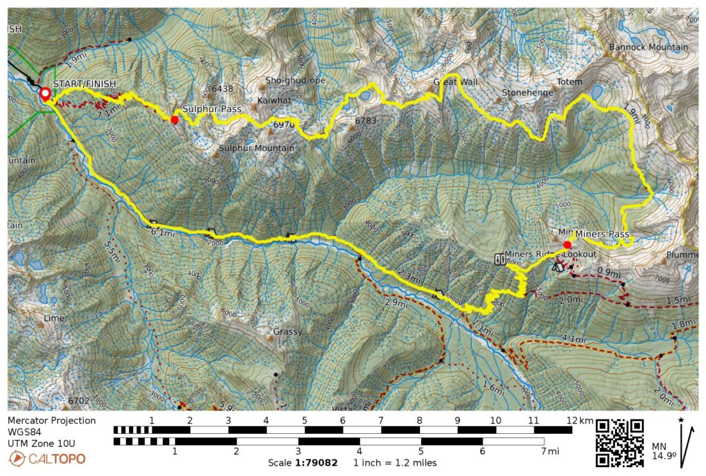
- Route Maps & Profiles
- Photo Gallery
Trip Report Summary
Region: North-Central Washington Cascades
Sub-Region: Ptarmigan Mountains
Area: Glacier Peak Wilderness
Starting & Ending Point: Suiattle Trailhead at end of Suiattle River Road #26 (Elev. 1600 feet)
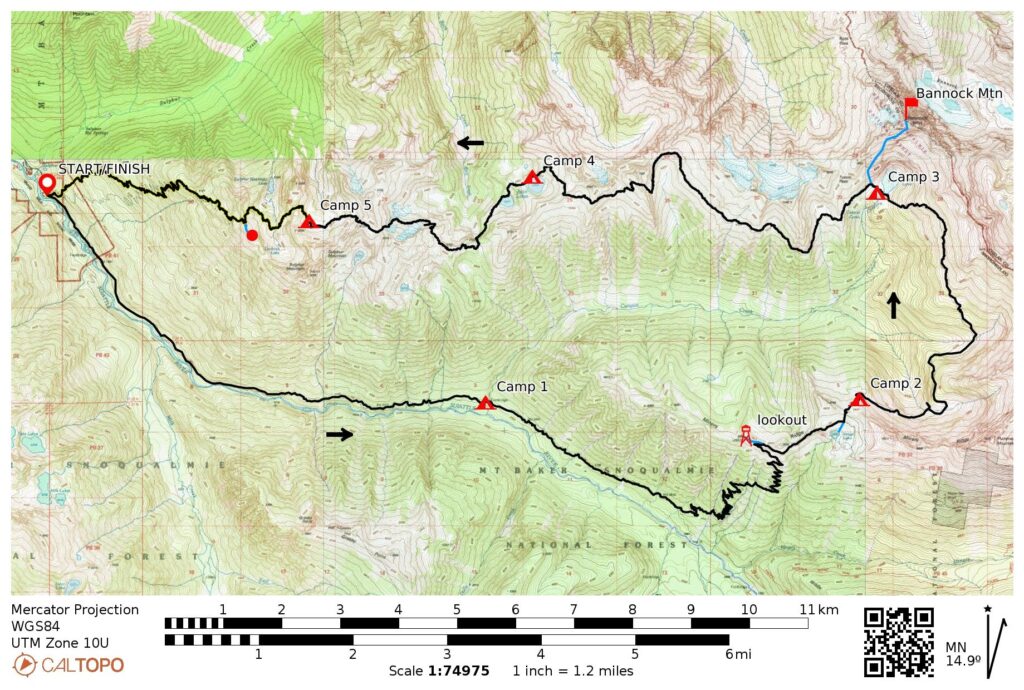
Traverse Way Points: Four-Mile Camp & Canyon Creek Camp & Canyon Creek Bridge & Miners Ridge Junction & Image Lake & Miners Pass & Miners Pass Meadow & West Plummer Basin & Sitting Bull Basin & Sundown Park & Canyon Lake & Totem Basin & Stonehenge Basin & Great Wall Basin & Great Wall Notch & East Basin 6400 & West Basin 6400 & Bath Lakes Saddle & Upper Bath Lake & Lower Bath Lake & East Bath Creek Pass & West Bath Creek Pass & East Kaiwhat Saddle & Kaiwhat Rock Table & West Kaiwhat Saddle & Sulphur Park & Lookout Creek crossing & Sulphur Pass & Sulphur Mountain Trail / Suiattle River Trail junction & Suiattle Trailhead (trail hike & off-trail hike & heather scramble & rock scramble)
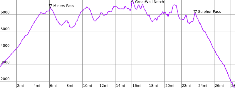
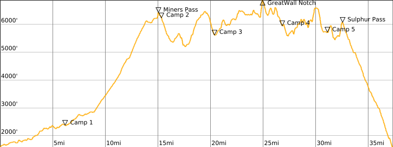
Traverse High Point: Great Wall Notch (Elev. 6880 feet)
Campsites: Canyon Creek Camp & Miners Pass Meadow & Canyon Lake & Upper Bath Lake & Sulphur Park
Sidetrip: Miners Ridge Lookout (trail hike)
Summit: Bannock Mountain (off-trail hike & heather scramble & rock scramble via Southwest Slope–South Face)
Sidetrip: Sulphur Point Lookout (trail hike)
Approximate Stats (excluding sidetrips): 37.6 miles traveled; 12,300 feet gained & lost.
Approximate Stats (including sidetrips): 41.0 miles traveled; 15,000 feet gained & lost.
Related Post
>>> Sitting Bull Mtn. + Plummer Mtn. + Image Lake Loop – September 2017
Trip Overview
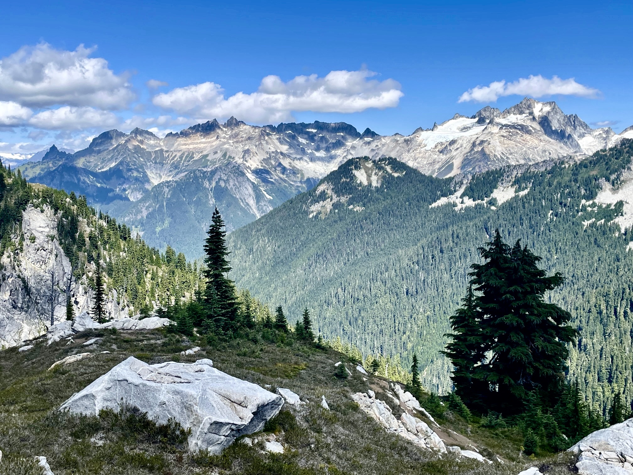
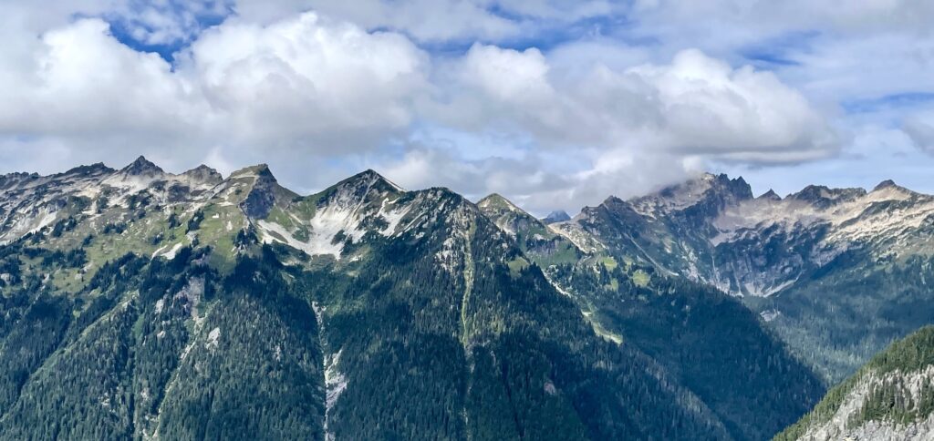
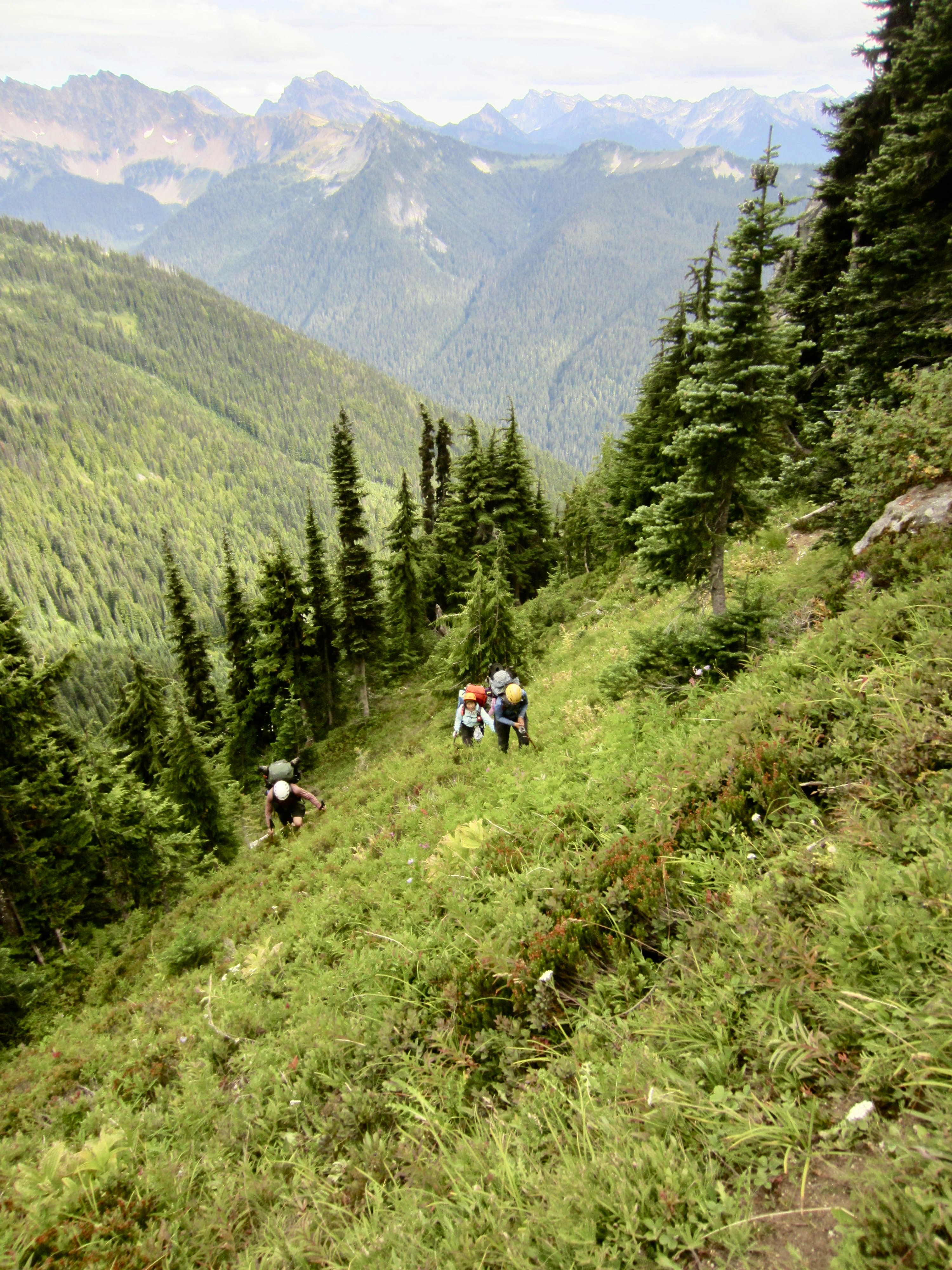
The Bath Lakes Traverse is a marvelous alpine high route located within the Glacier Peak Wilderness at the southern fringe of the Ptarmigan Mountains. Over the course of 18 miles from Miners Pass to Sulphur Pass (or vice-versa), it travels through numerous scenic meadows and basins, passes by or near several remote lakes, and crosses under countless rugged peaks. A 20-mile connection via the well-maintained Suiattle, Miners Ridge, and Image Lake Trails forms a complete loop and brings the total trek distance up to 38 miles. The highlight, however, may very well be the stunning views of Spire Point, Dome Peak, and Sinister Peak closely to the north, and Glacier Peak itself closely to the south.
.
.
Despite its many attributes, the Bath Lakes Traverse is not well-known outside of local hiking and climbing circles. Certainly, its renown is heavily overshadowed by the nearby world-famous Ptarmigan Traverse. As a result, there seems to be relatively little useful information concerning the route and terrain. The best source, to my knowledge, is still Tabor and Crowder’s Routes and Rocks (R&R) book from 1965. They rate the traverse as “difficult” due to its many ups and downs, as can be seen in the profile below, but the real challenge is negotiating the steep hillsides of rock, heather, grass, and huckleberry bushes.
.
After more than a decade of aborted plans to do the traverse, Eileen and I were finally able to pull it together during a week in mid-August. Yoko and Andrew eagerly joined us for the adventure. A major decision in our trip strategy was to complete the traverse in an east-to-west (counterclockwise) direction. The advantage of this direction was that we would be ascending rather than descending The Great Wall—a large and intimidating cliff that constitutes the technical crux of the entire route. Unfortunately, it also meant that we would be traveling in the opposite direction of the R&R description. However, because The Great Wall ultimately lived up to its fearsome reputation (Eileen and I deemed it to be a beast!) we were happy with our decision.

.
Full Trip Report
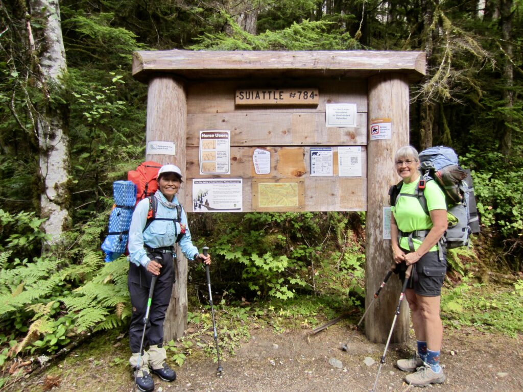
Day 1: Suiattle Trailhead to Canyon Creek Camp
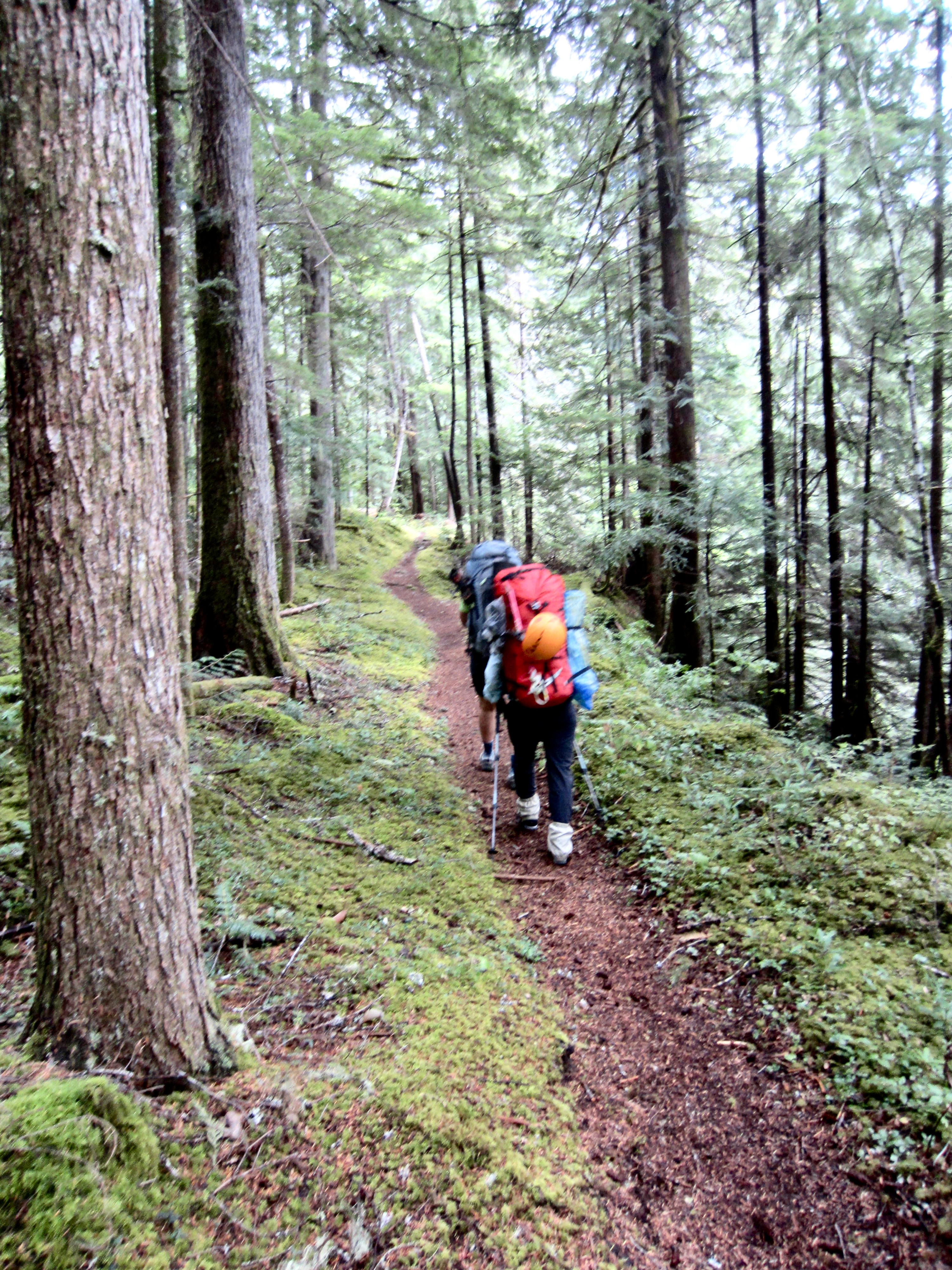
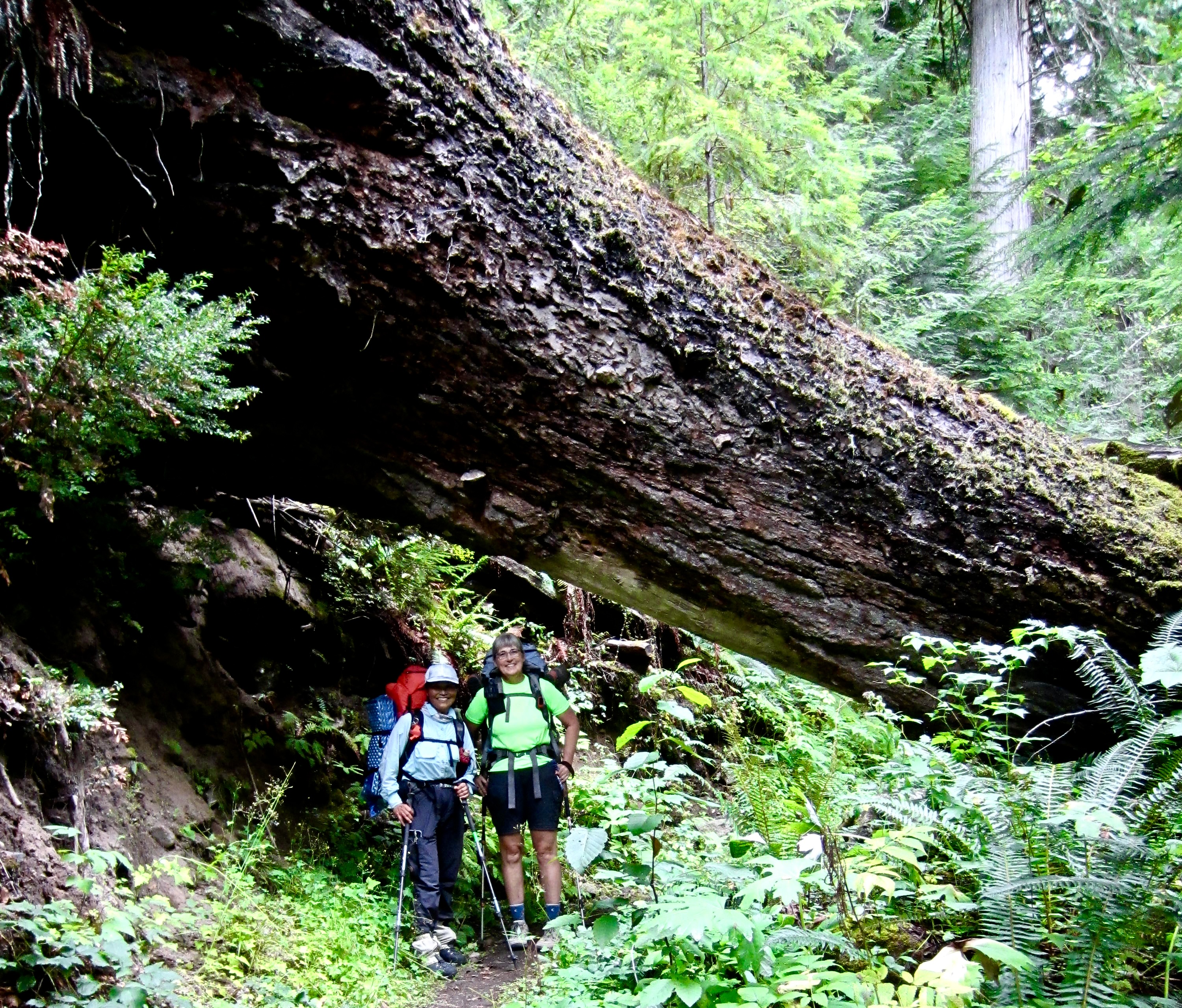
Eileen, Yoko, and I headed out from the Suiattle Trailhead on a cool Saturday afternoon. (Andrew had work constraints so would be joining us tomorrow.) Due to a major rainstorm yesterday and a threat of showers today, there were few people on this normally busy trail.
.
The Suiattle Trail is presently in excellent condition and provided a delightful hike through the mature forest, with its scattering of huge old-growth evergreens and its wall-to-wall carpet of moss. Among valley trails, I regard this as the finest in the Cascades and probably second only to the Hoh River Trail in all of Washington.
.
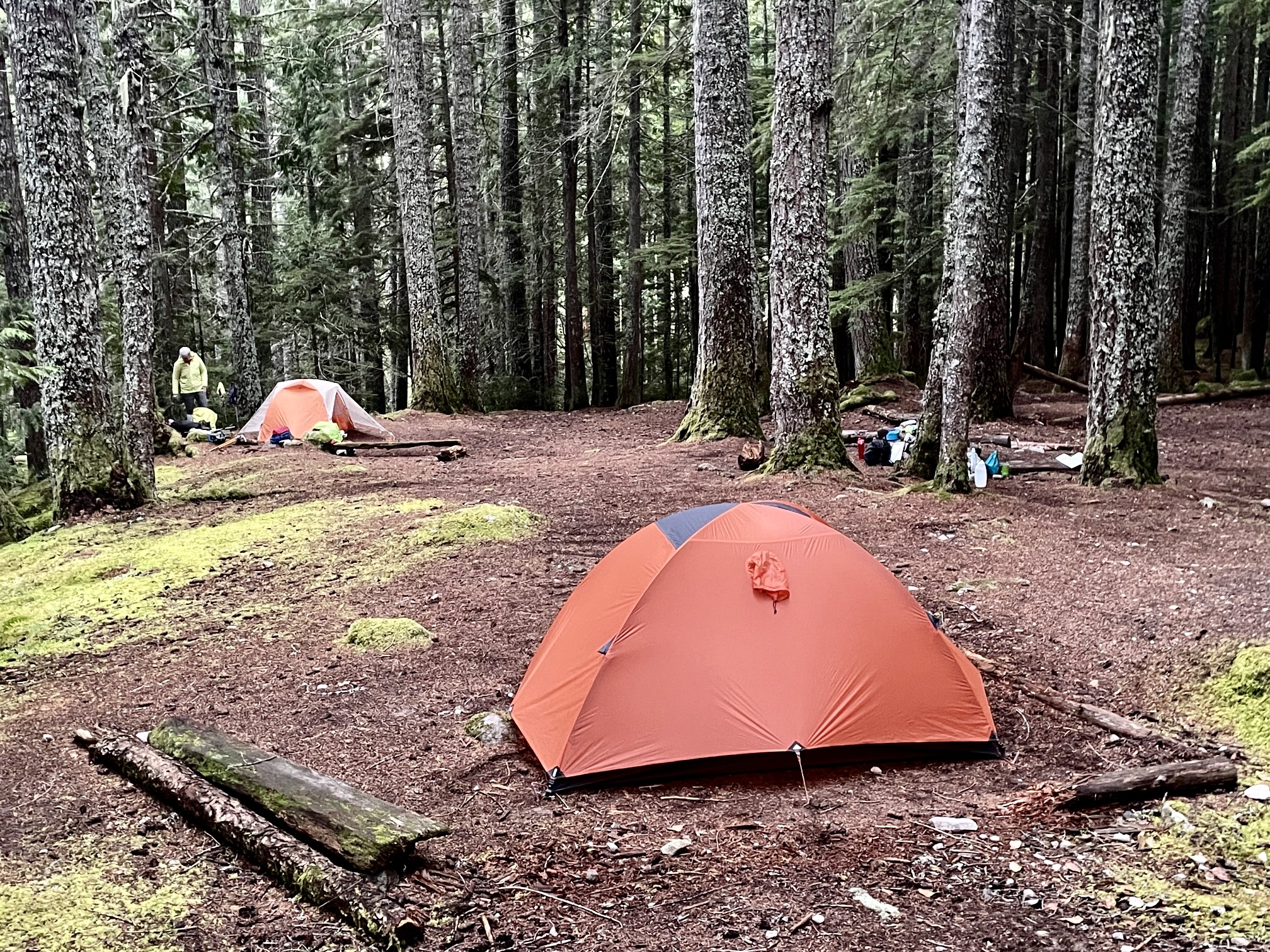
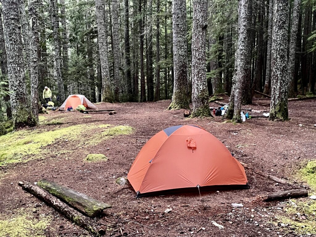
We rolled into the commodious Canyon Creek Camp at dinnertime and stopped for the night (3.4 hours + 6.1 miles + 950 feet from TH). It was strangely deserted for a Saturday evening.
.
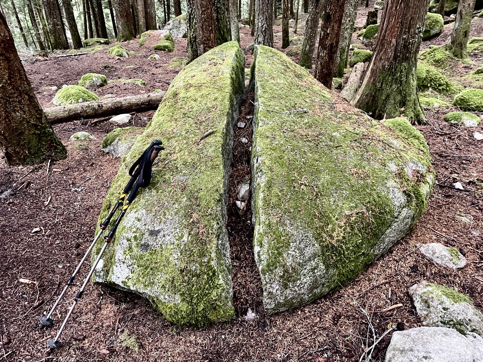
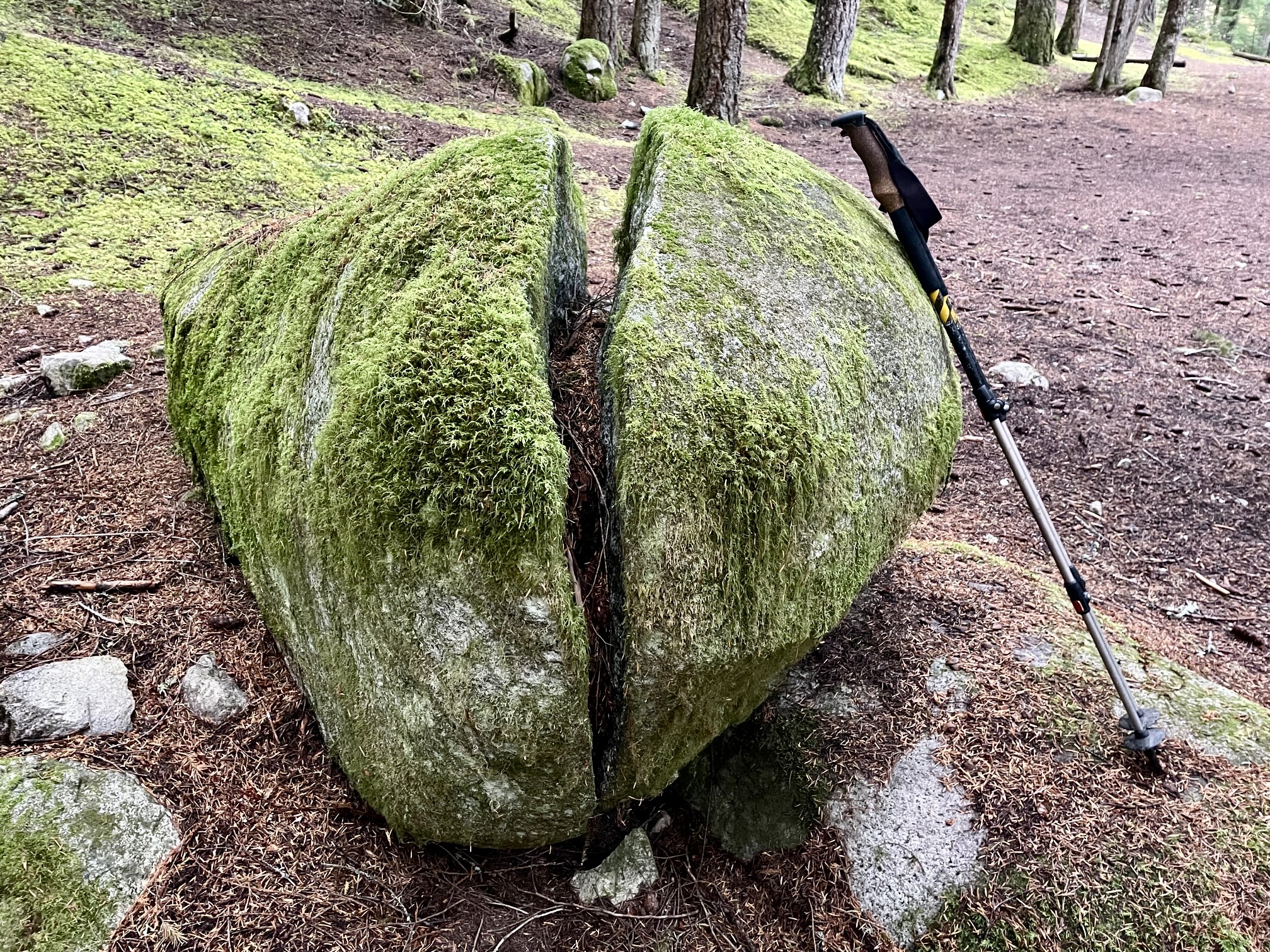
Near our tents, I found a fun geological curiosity: a large, mossy, egg-shaped boulder that has split neatly in half. It was easy to imagine that some enormous prehistoric creature might have hatched from this boulder millions of years ago!
.
Day 2: Canyon Creek Camp to Miners Pass Mdw
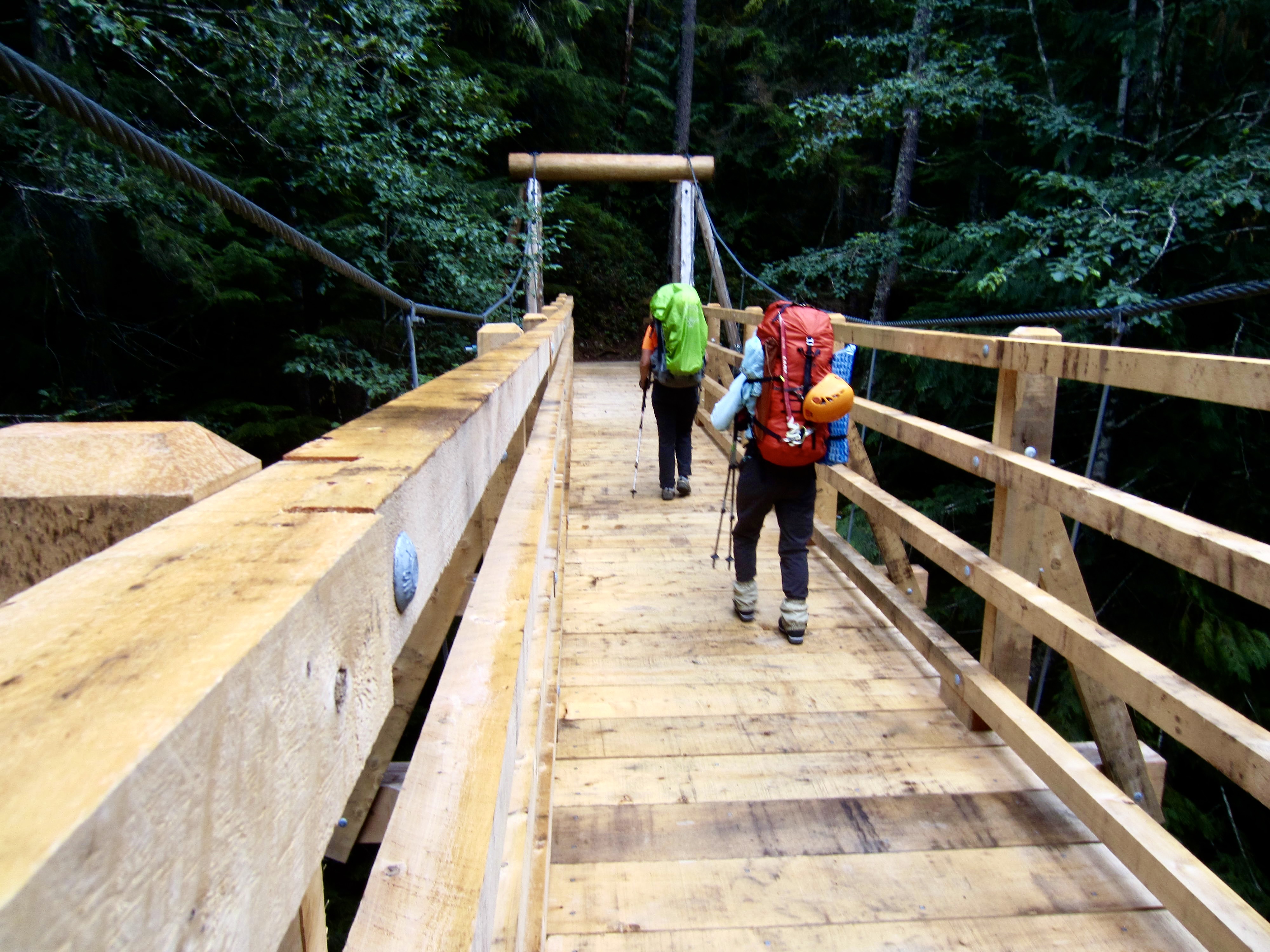
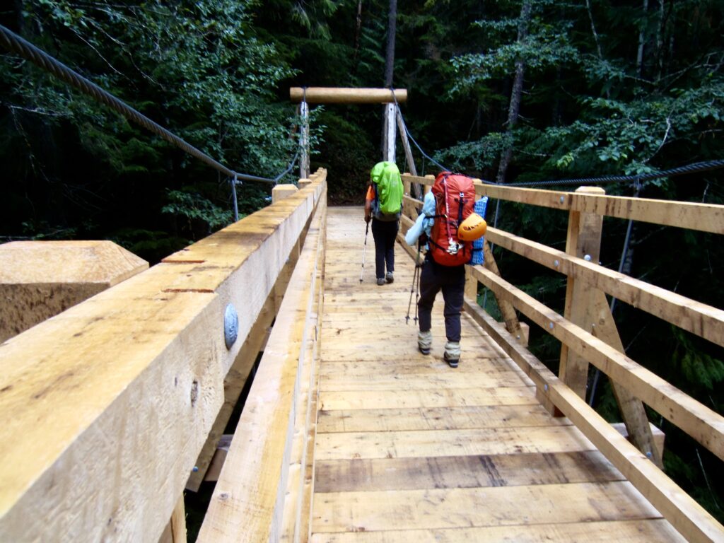
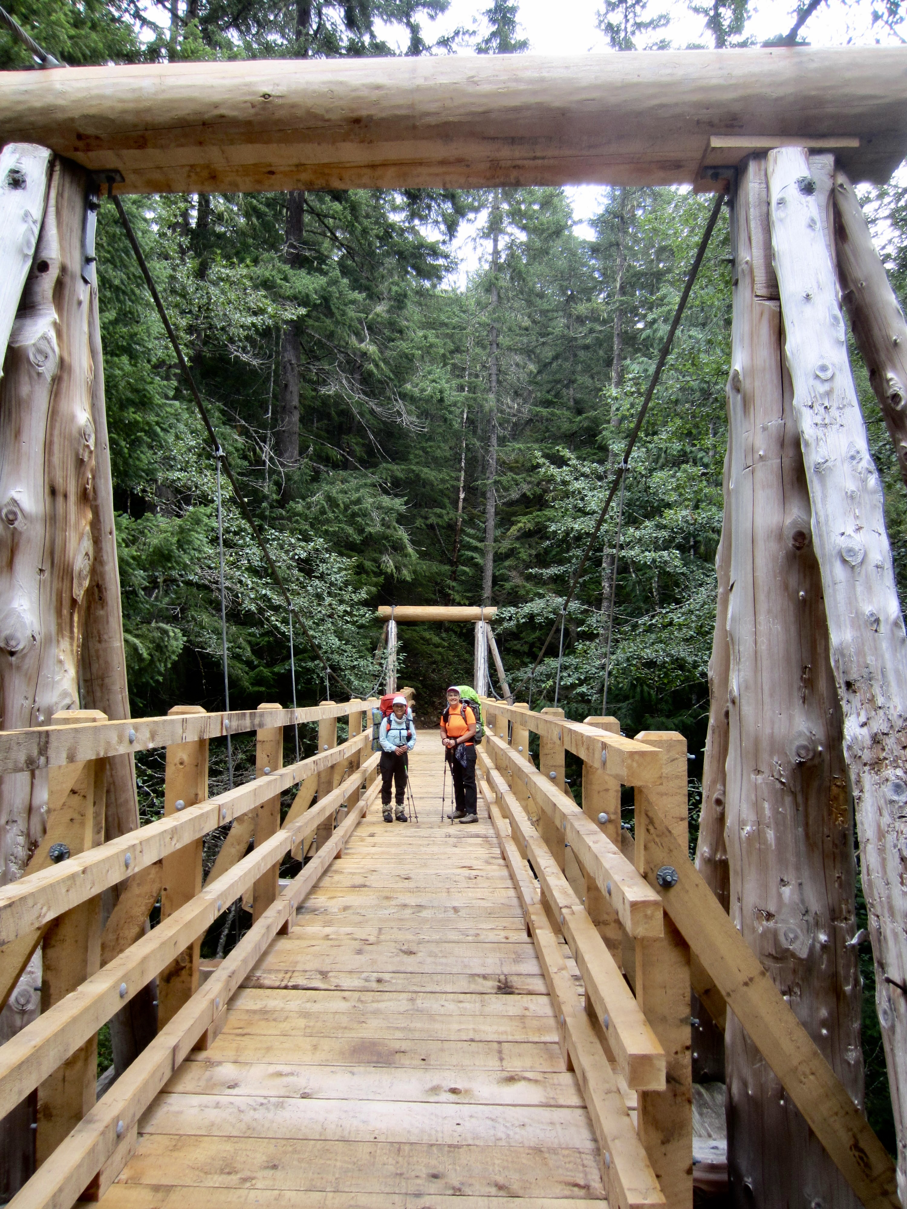
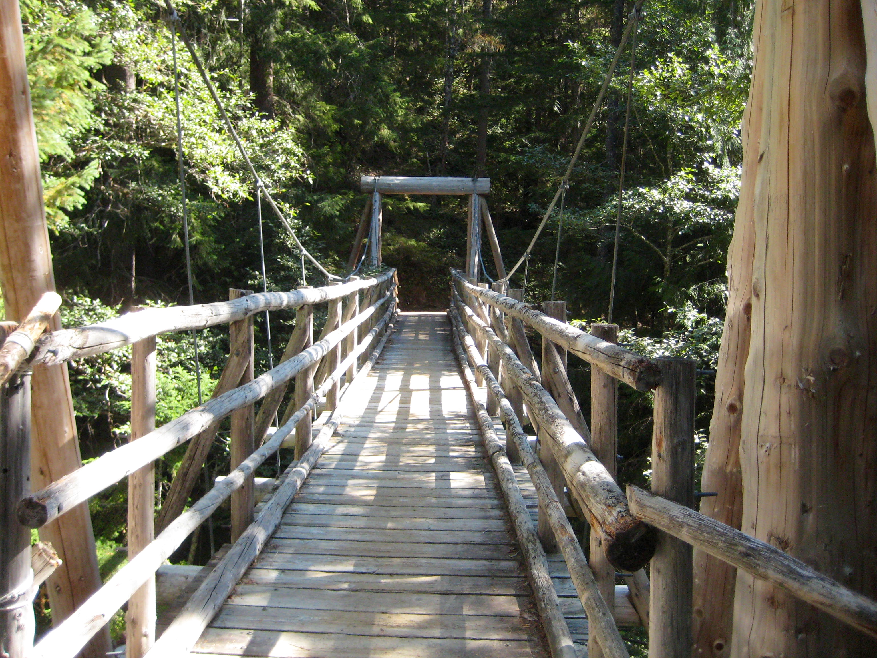
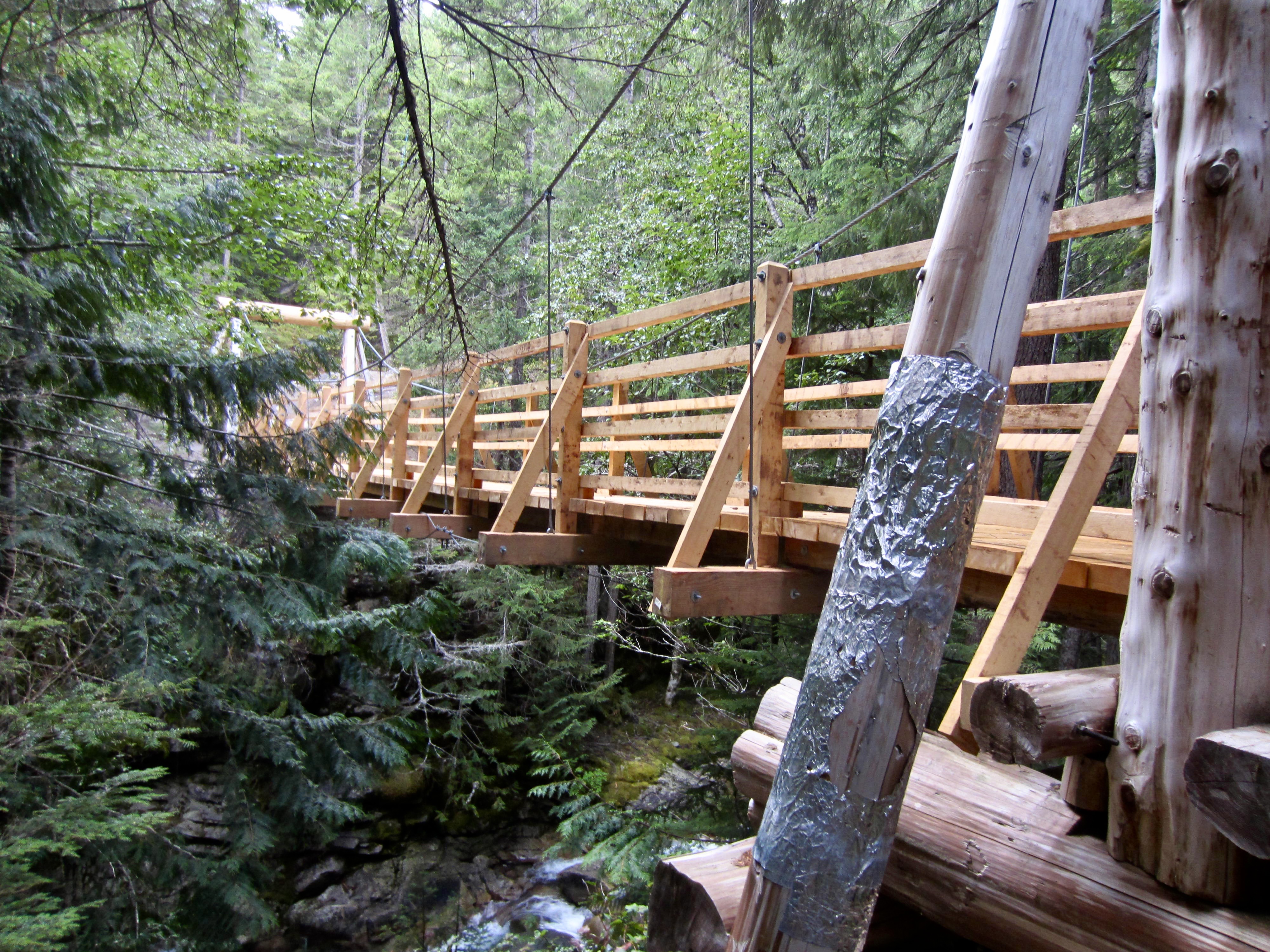
Following a cloudy night with, happily, no rain, we were back on the trail at 8:00am. We immediately crossed the impressive suspension bridge over Canyon Creek, and I was surprised to see that it has been completely rebuilt since I was last here in 2017. Except for the wooden towers at each end, all of the former rustic timbers have been replaced with modern dimensional lumber.
.
.
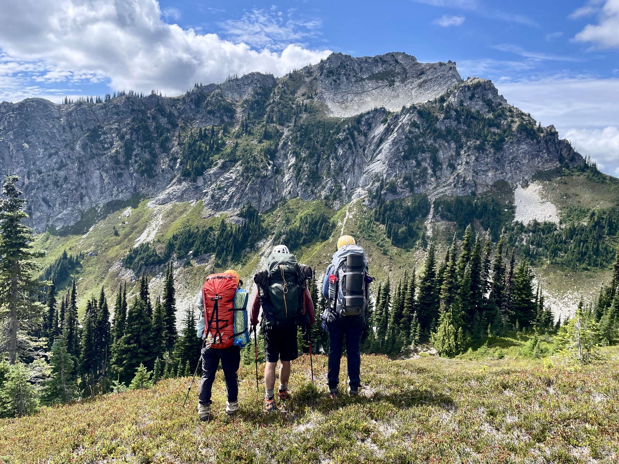
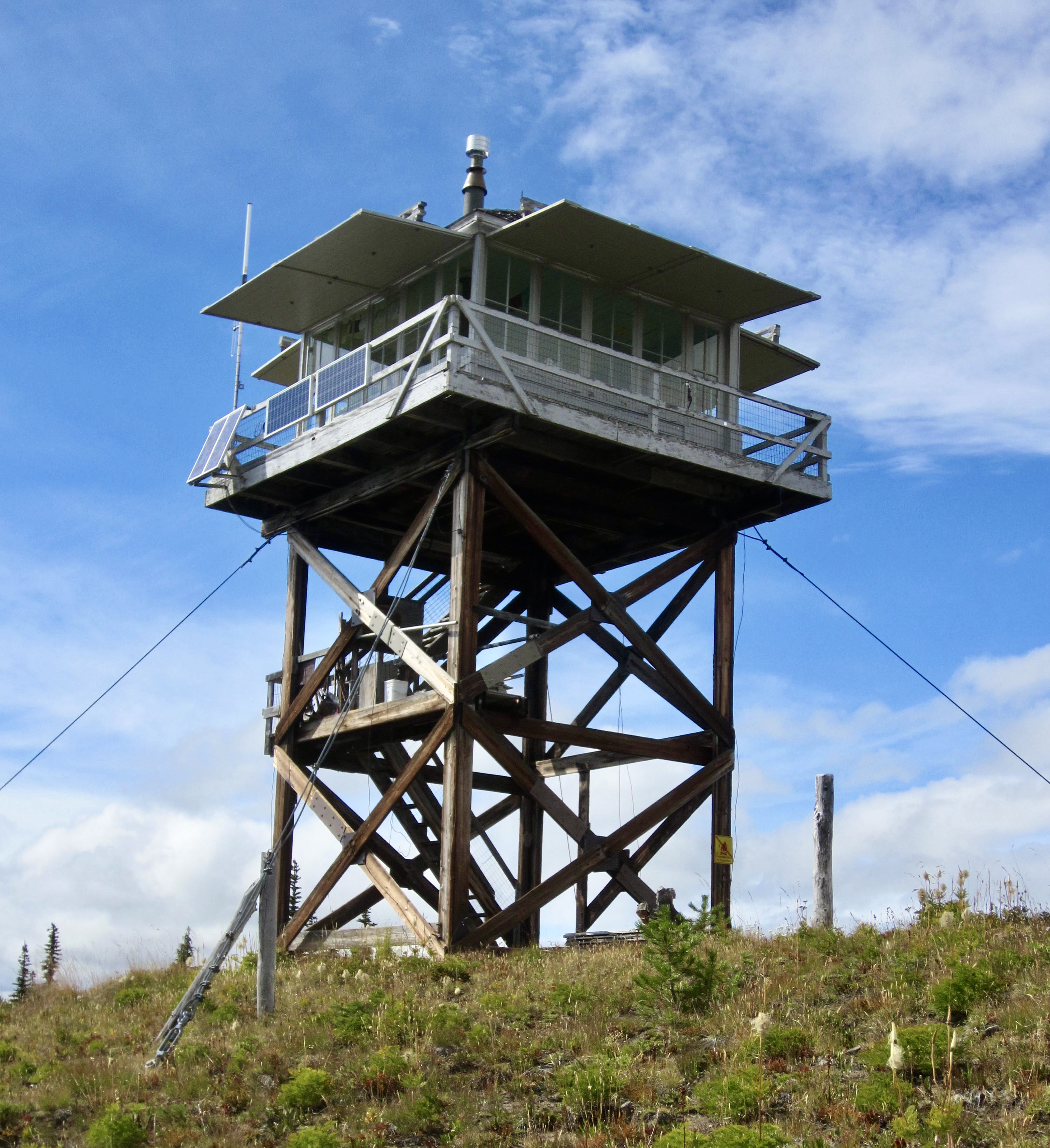
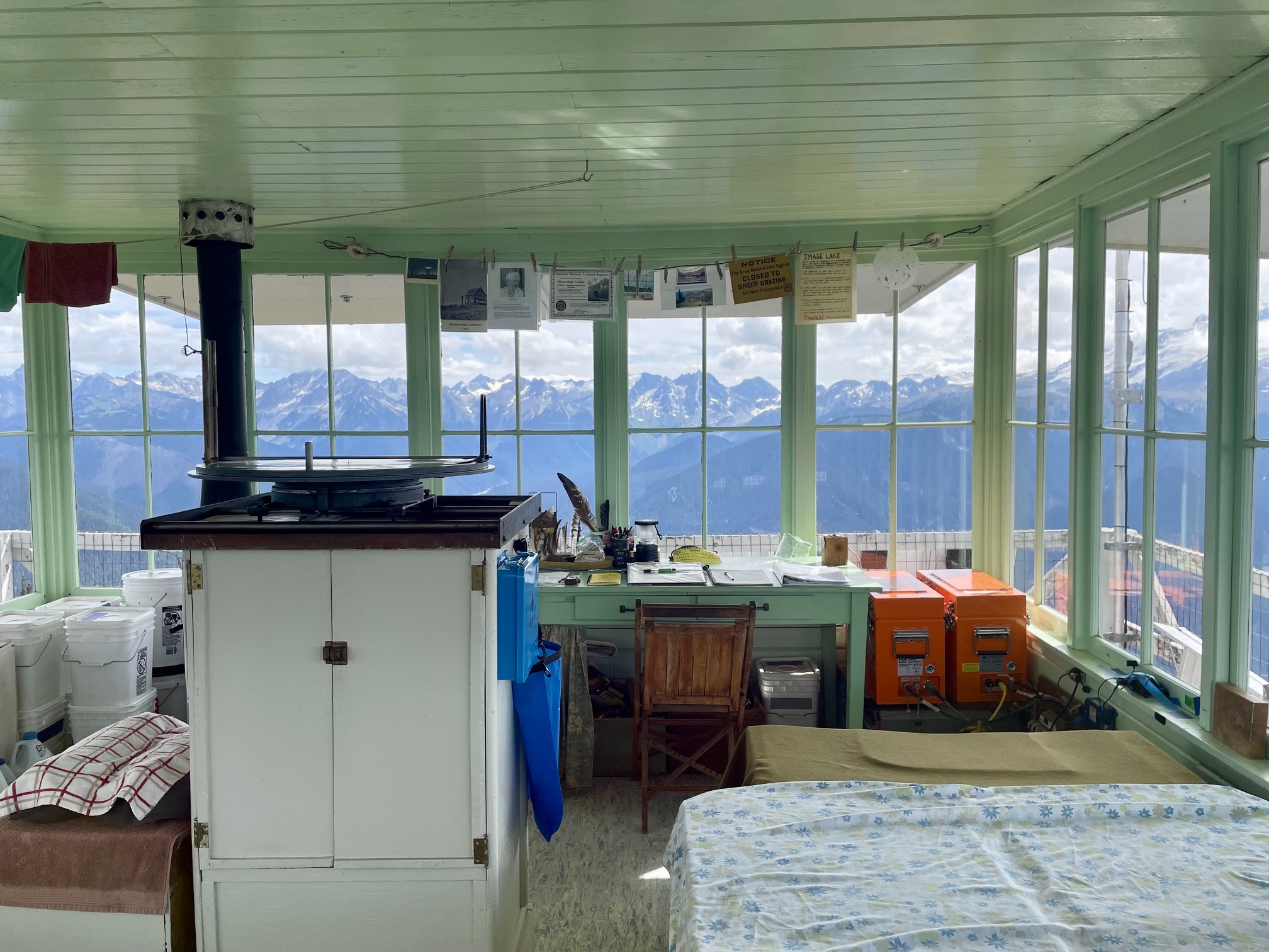
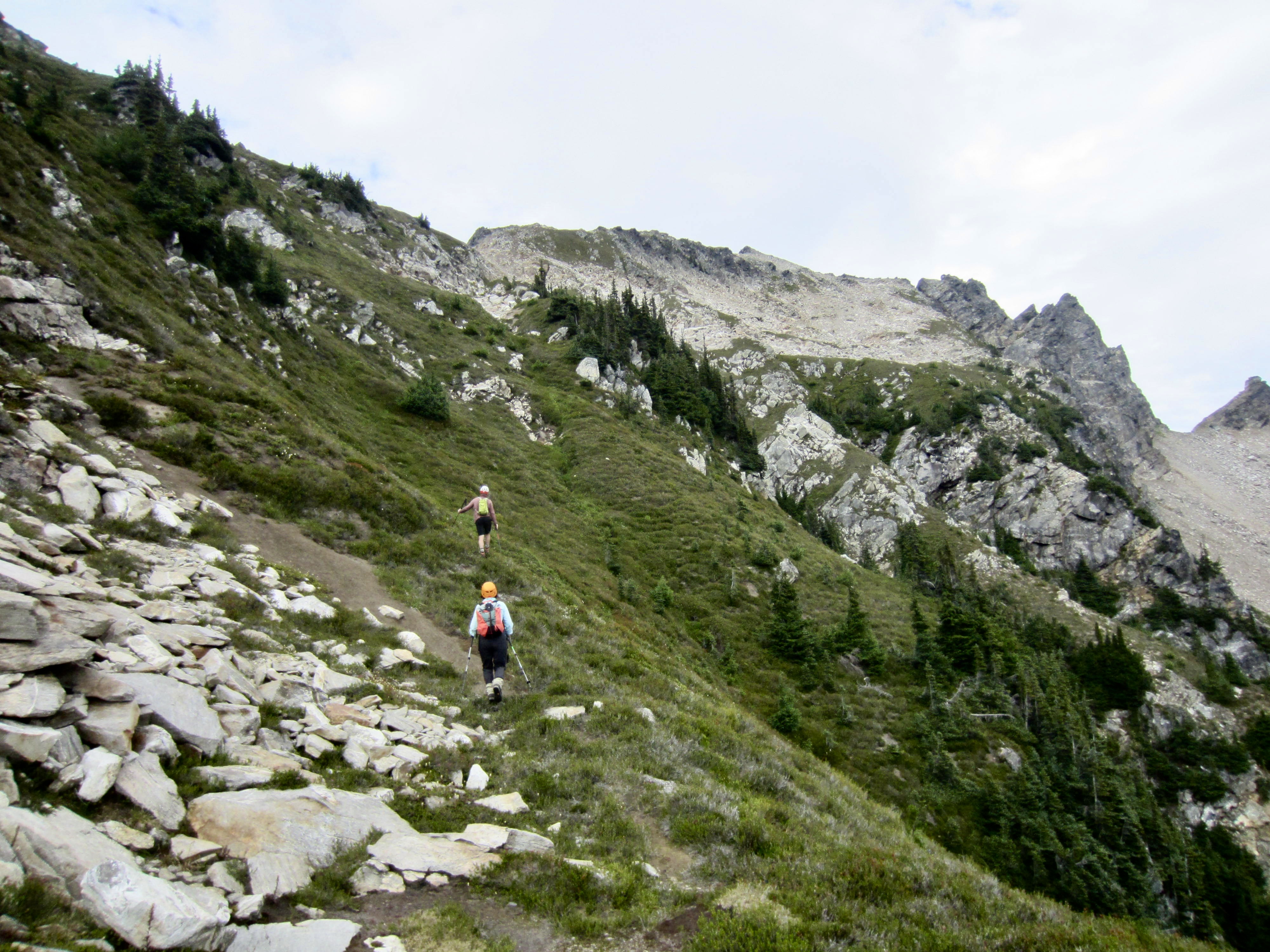
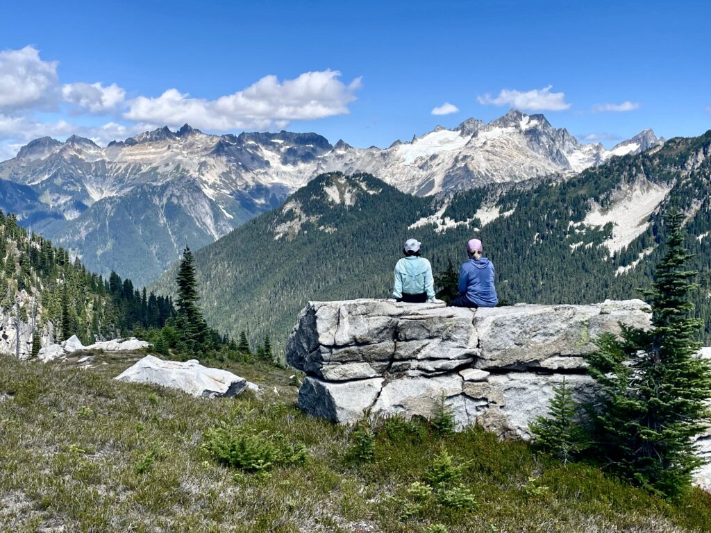
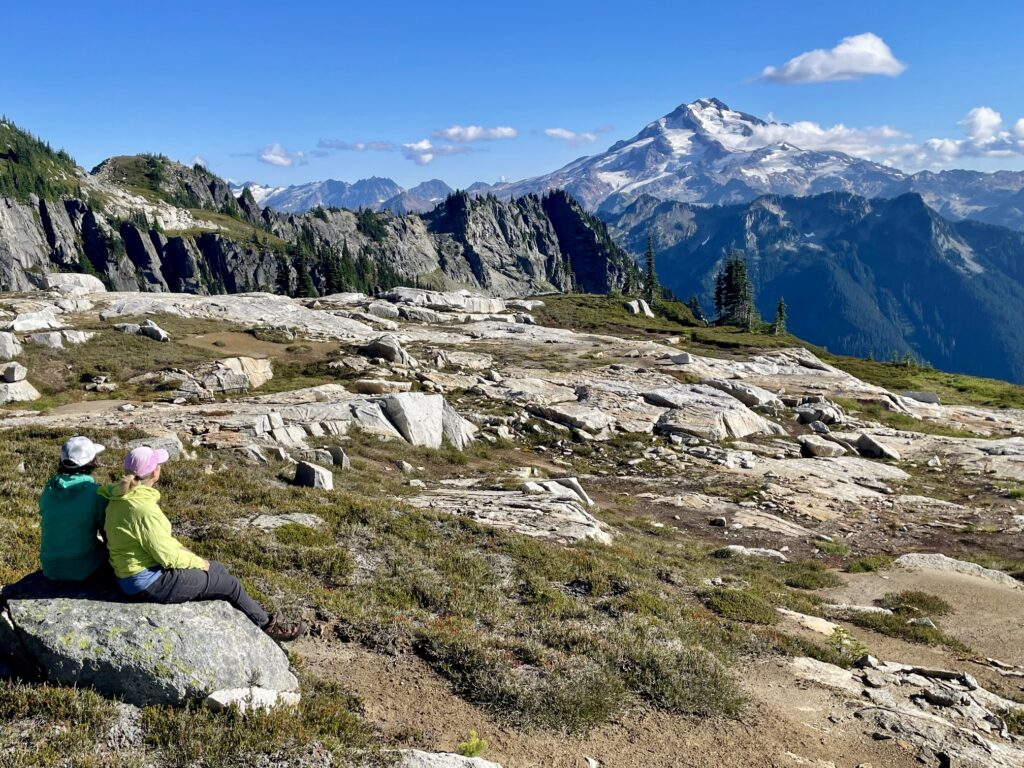
We made a gradual ascent for several miles to a junction with the Miners Ridge Trail, then we began switchbacking uphill for 3500 feet to gain the ridge crest (7.0 hours + 3800 feet from Camp 1). Yoko had never seen Miners Ridge Lookout, so I accompanied her on a short jaunt over to the tower. From there, we could see almost the entirety of the Bath Lakes Traverse route, from West Sitting Bull Basin to Sulphur Mountain. Damn, it looked far!
.
.
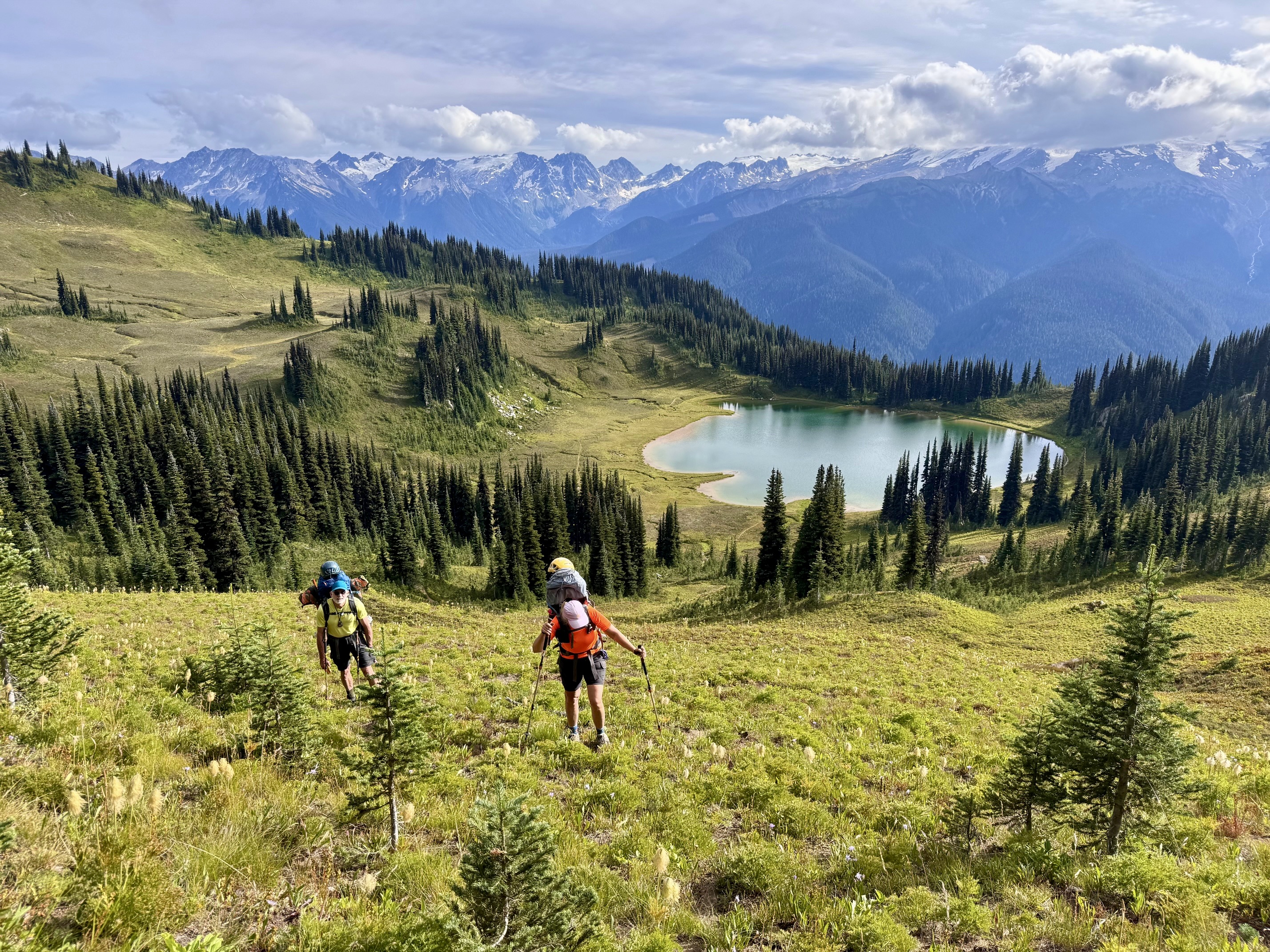
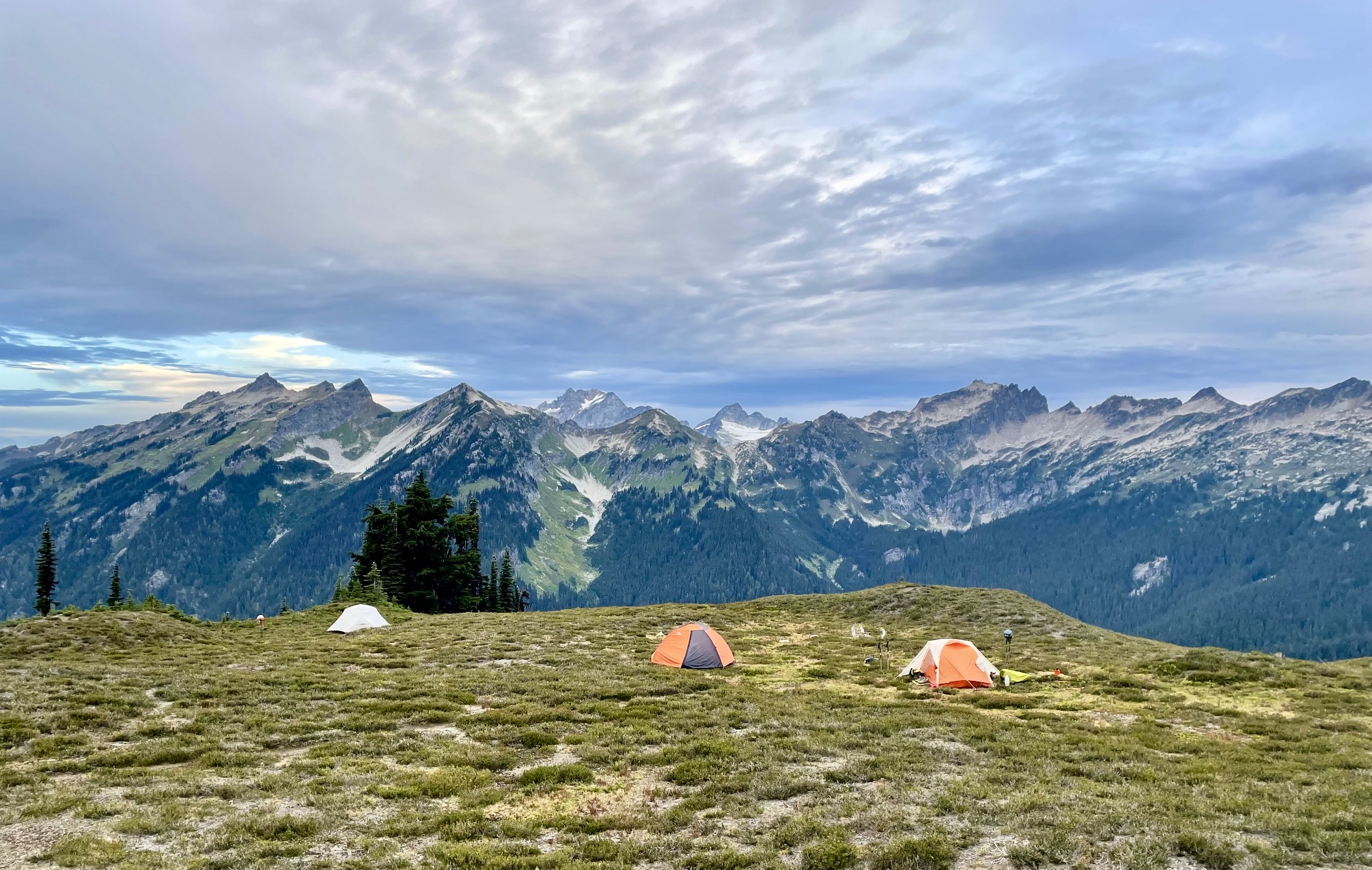
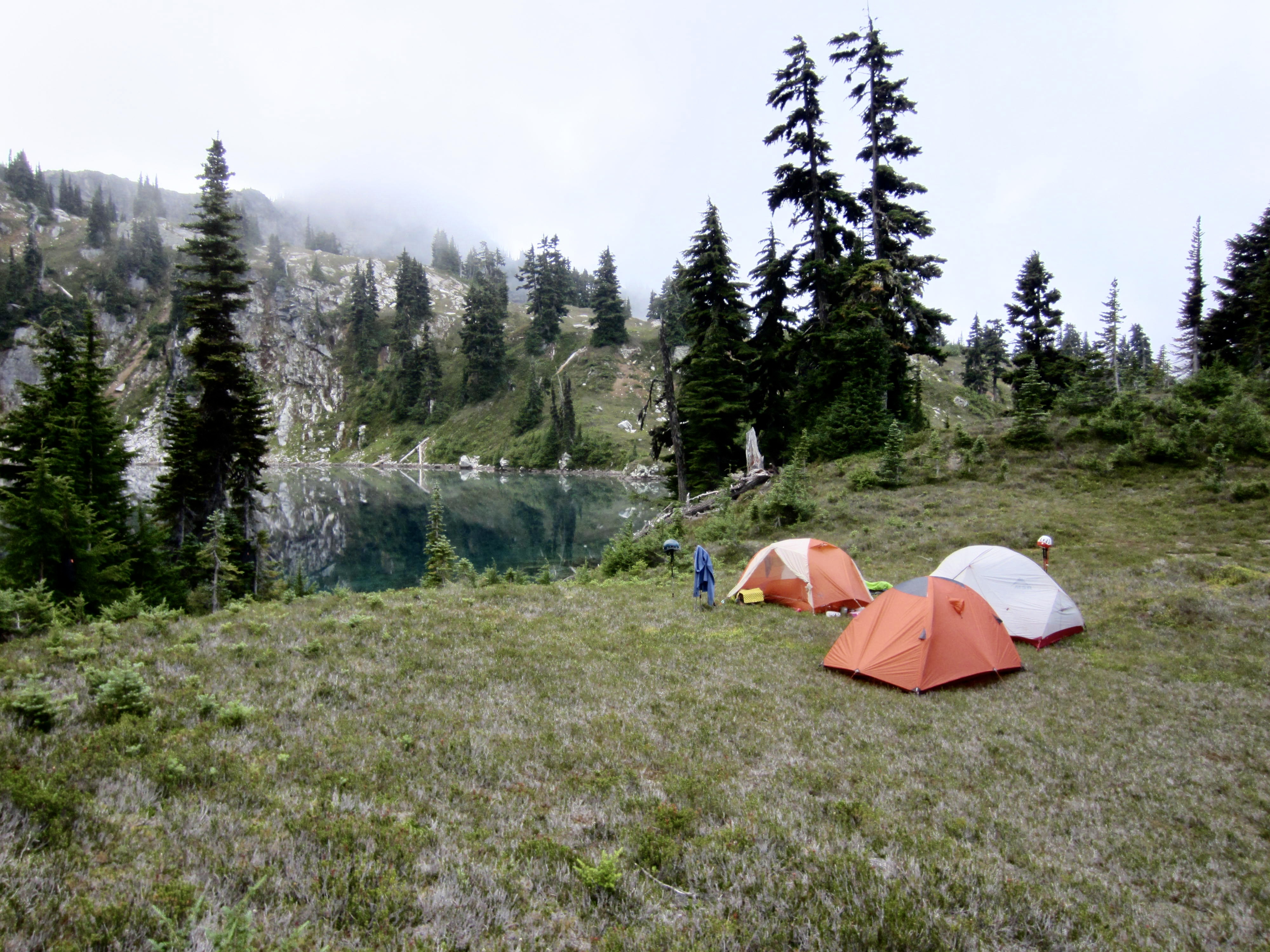
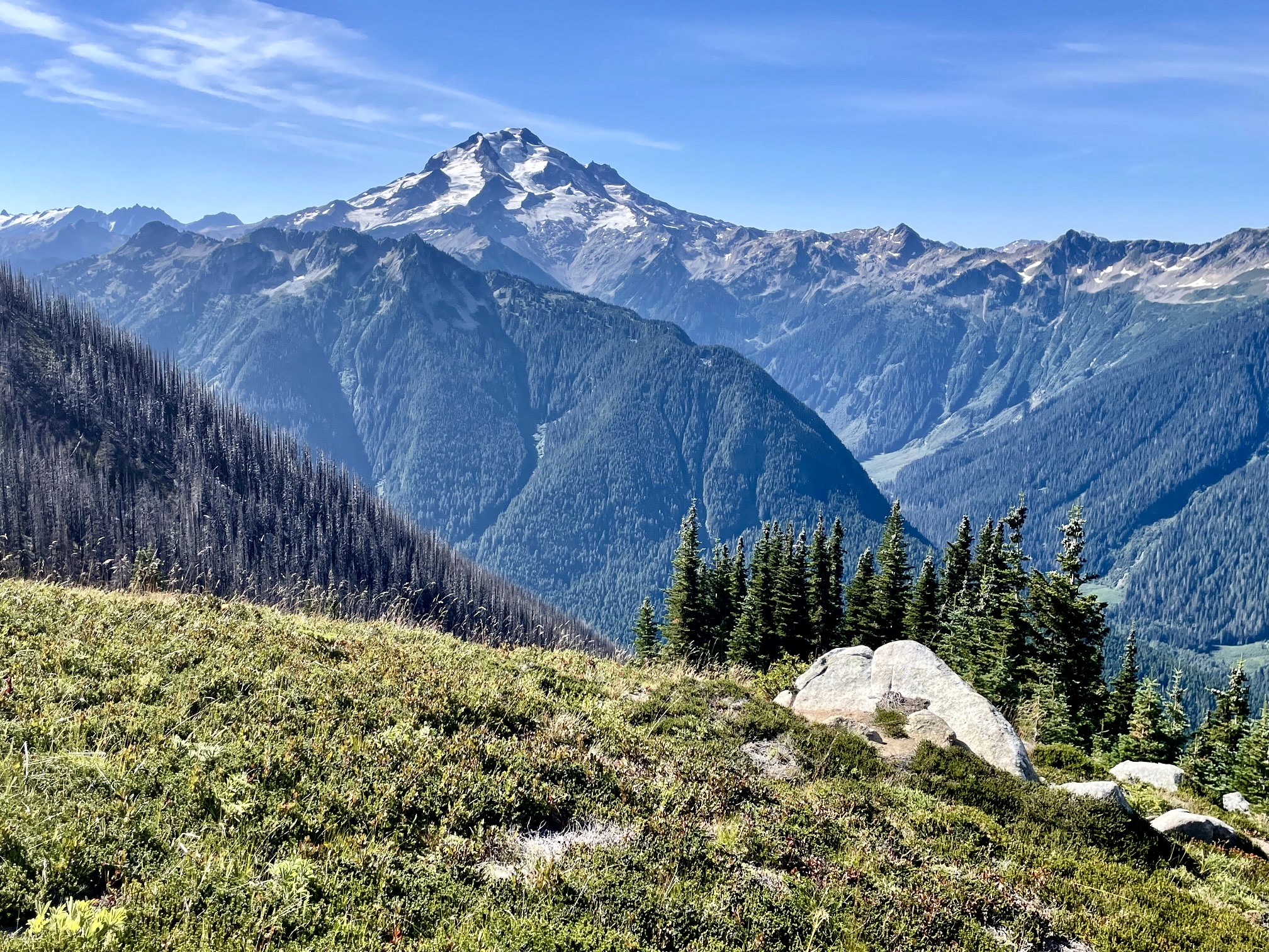
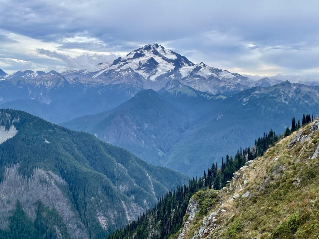
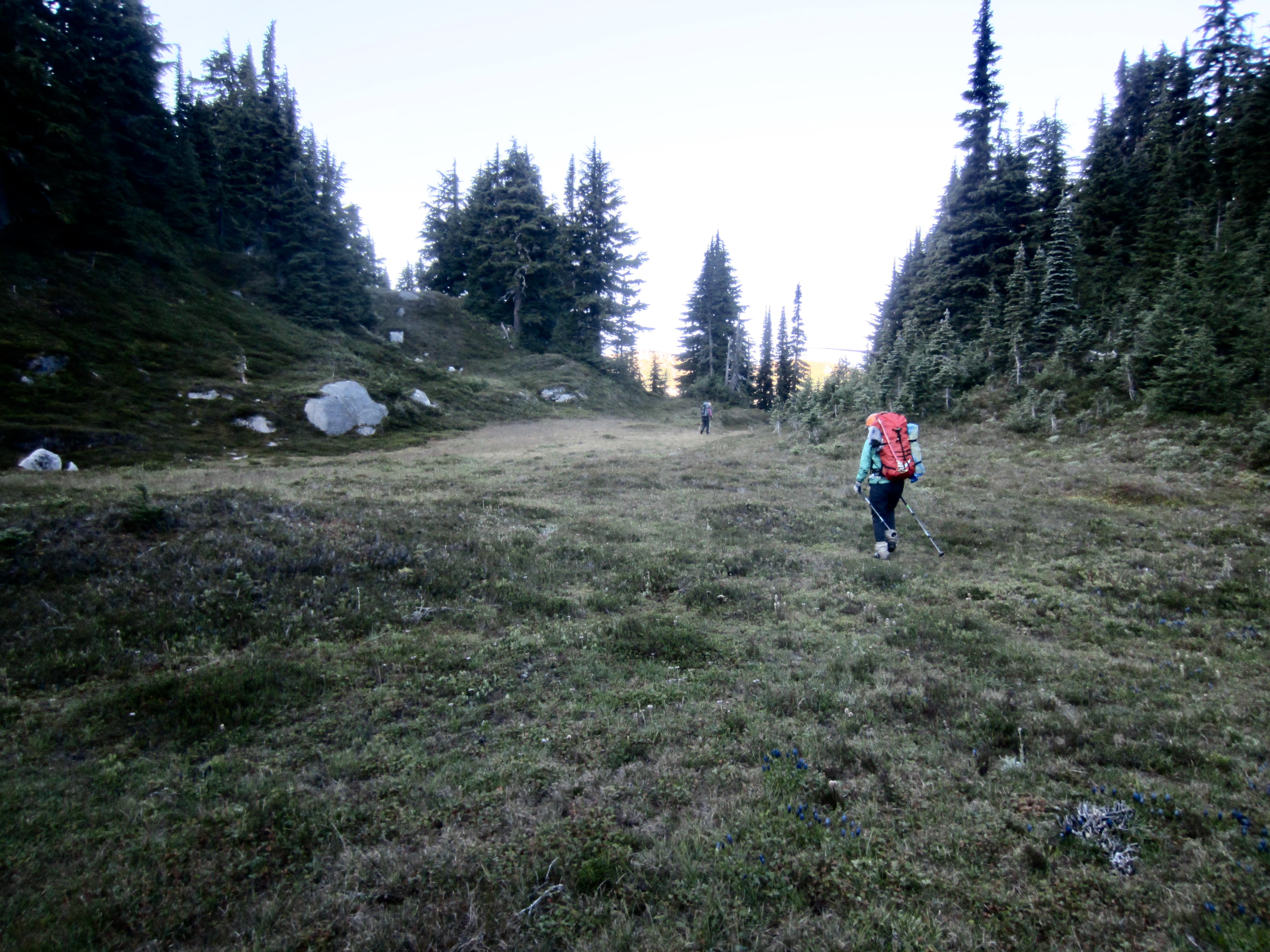
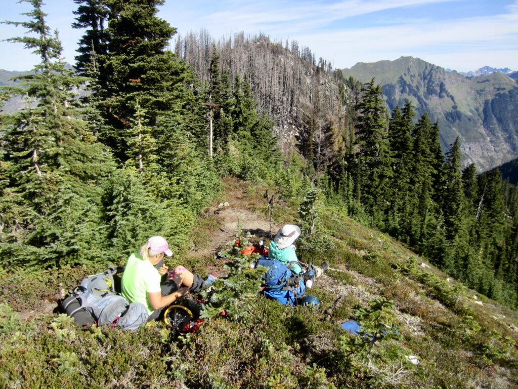
The three of us continued hiking over to the vast green bowl of Image Lake. Glacier Peak was engulfed in clouds, so we didn’t get treated to that iconic view, but the DaKobed Range was fully visible. Yoko and I made a sidetrip down to the lake to load up on water for tonight’s dry camp, then we all proceeded over 6400-foot Miners Pass and down 150 feet to Miners Pass Meadow (9.4 hours + 4450 feet, including sidetrips).

.
.
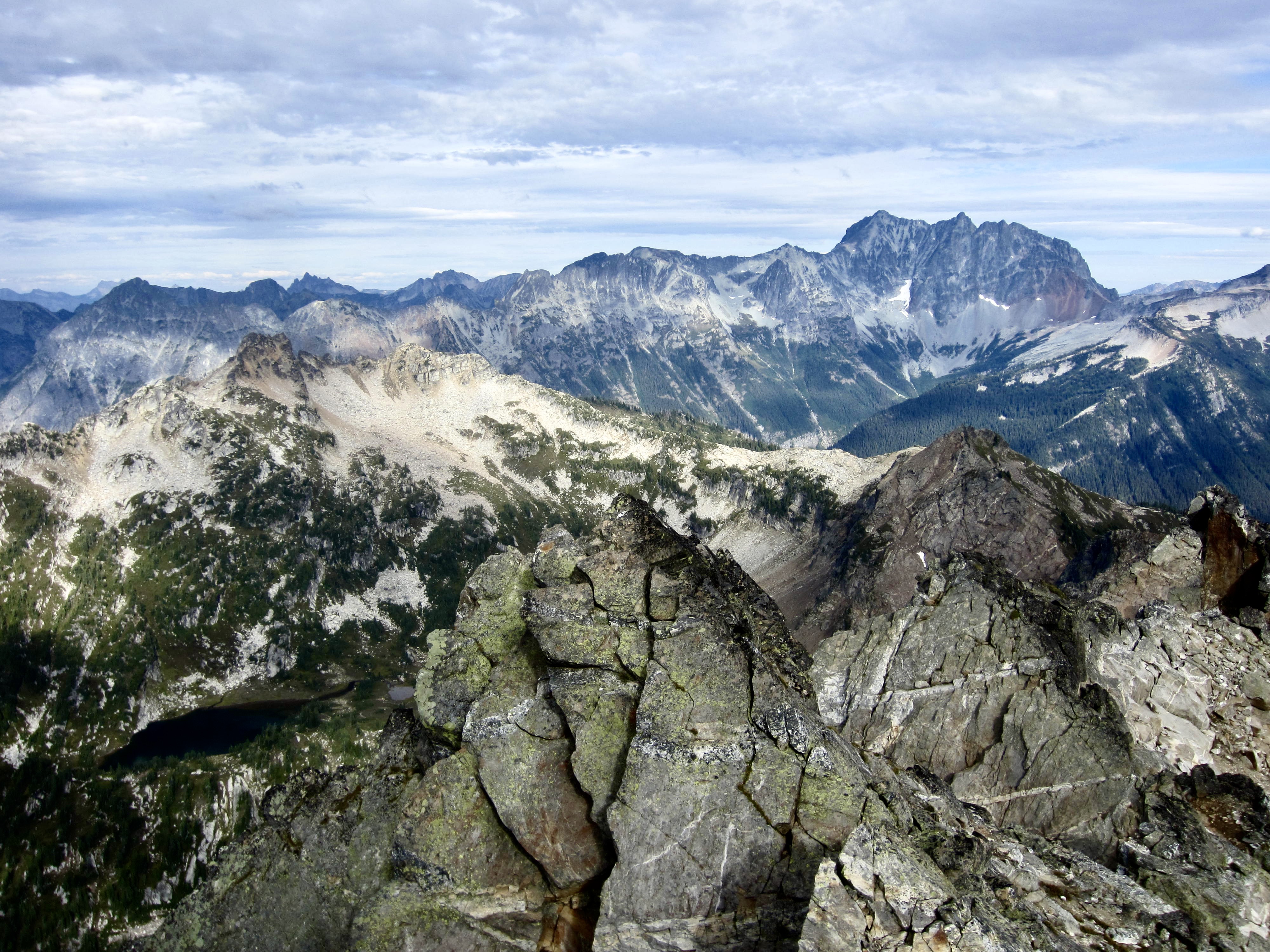
Andrew arrived shortly afterwards, and we were able to spread out all three tents amongst the grass and heather. Our campsite provided a slightly different perspective on the traverse route, along with good views of Bannock Mountain, Stonehenge Ridge, and The Great Wall. Farther north, Dome Peak and Sinister Peak poked their heads above the ridge, as if to ask, “What do y’all have in mind over there?”

.
.
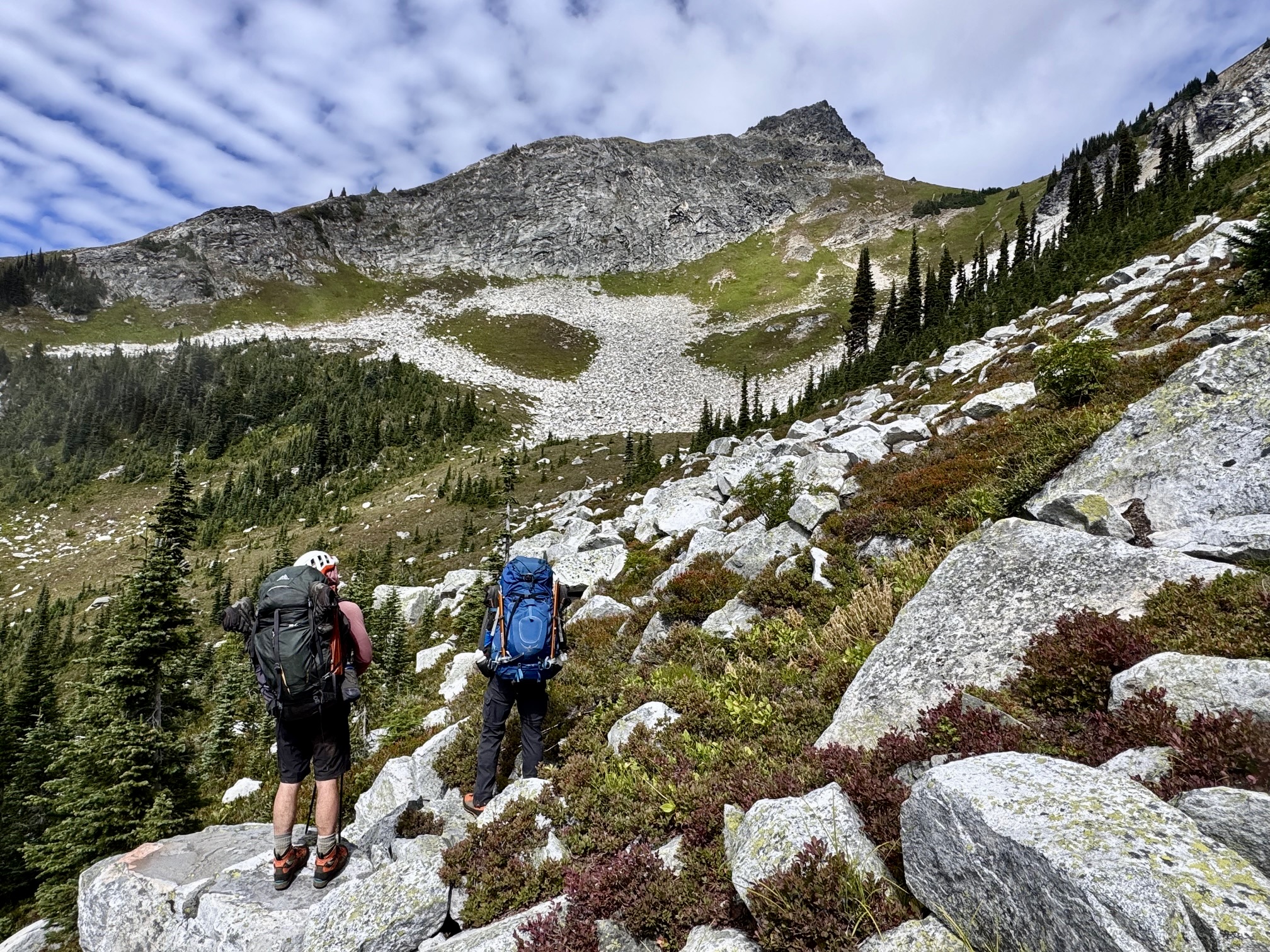
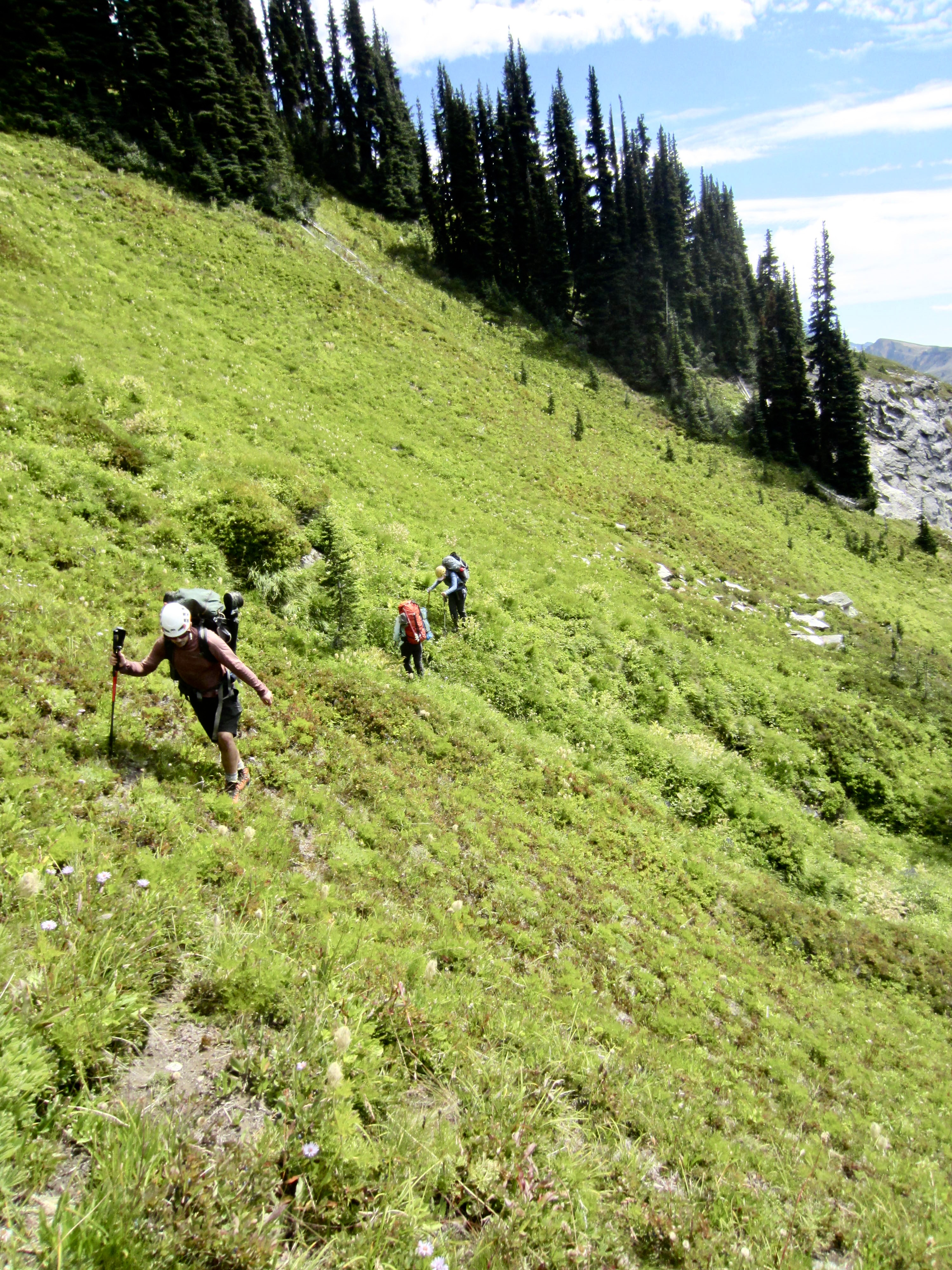
Day 3: Miners Pass Mdw to Canyon Lake + Bannock Mtn
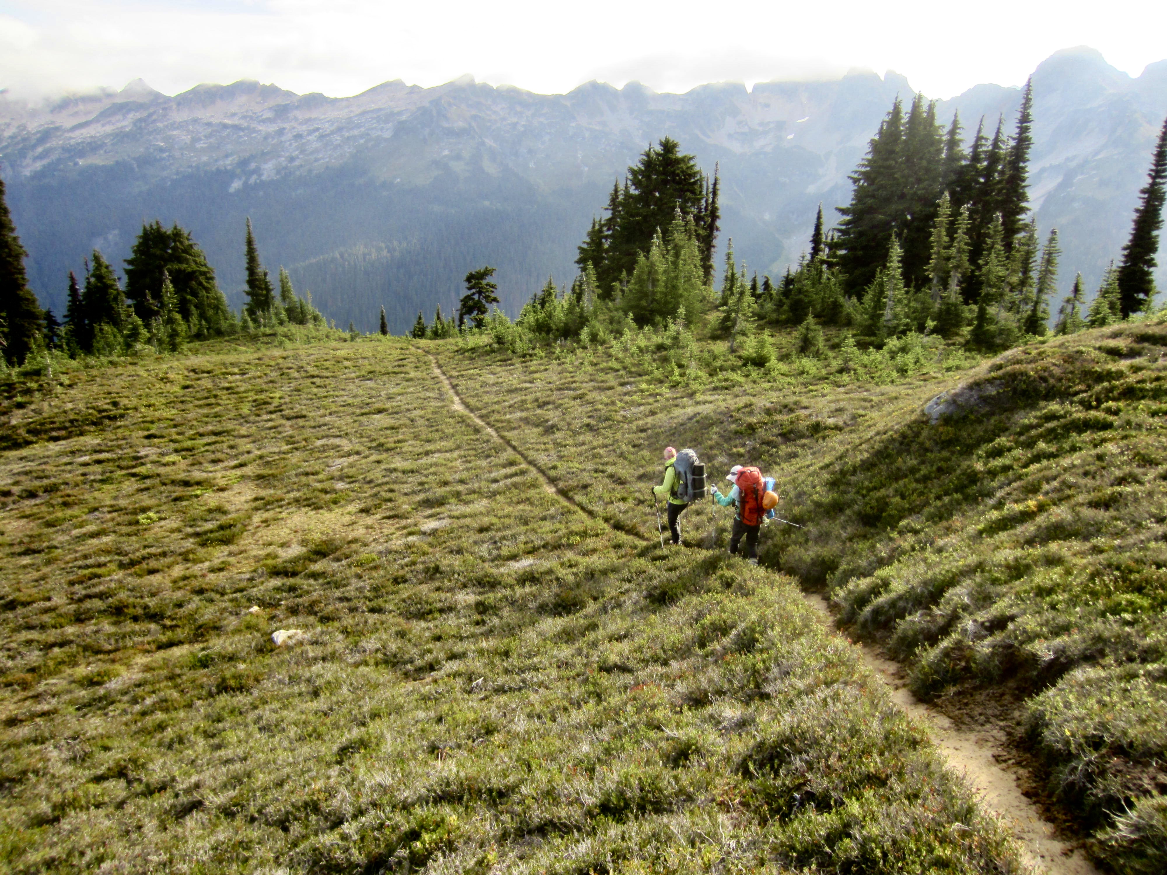
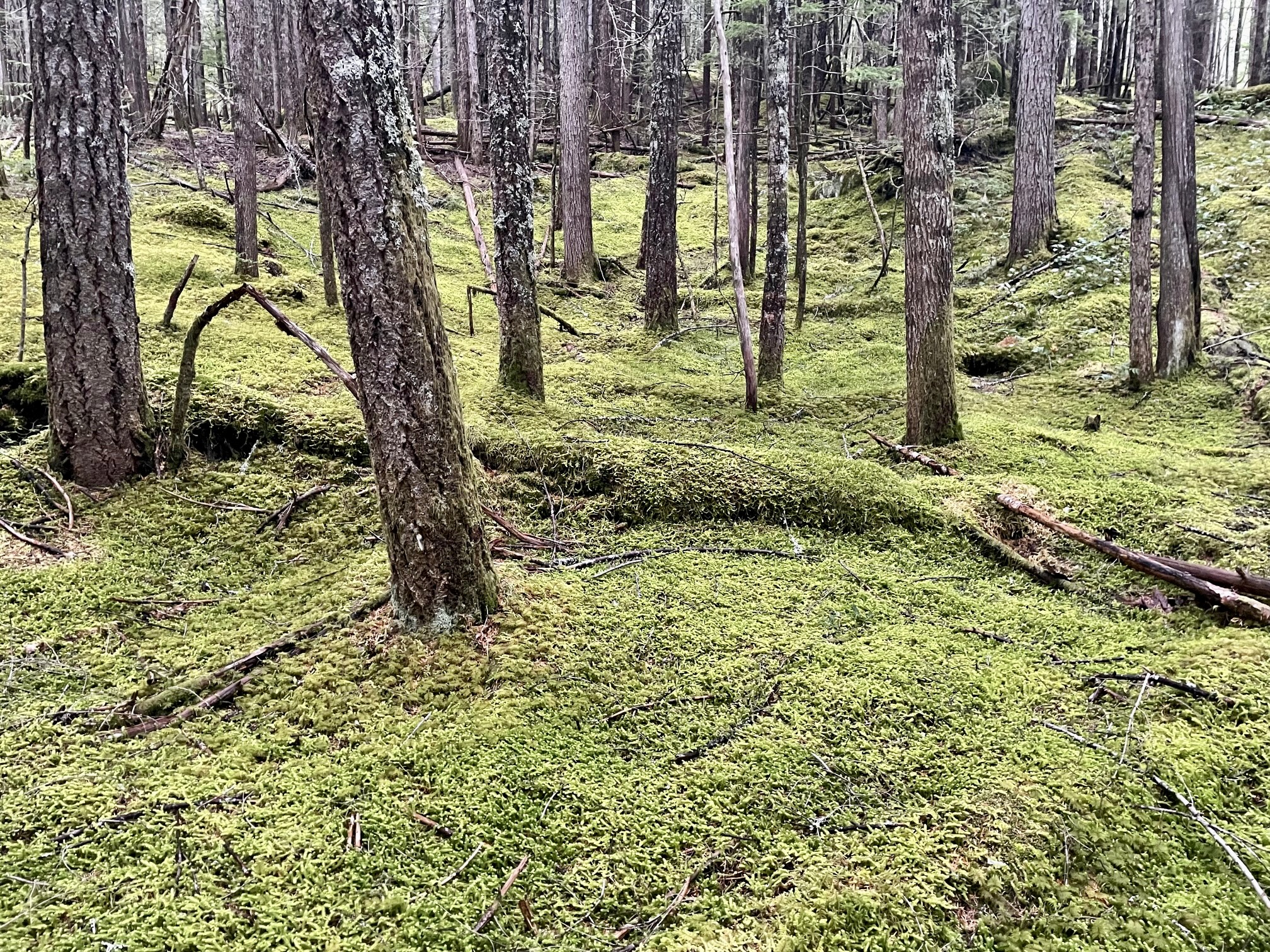
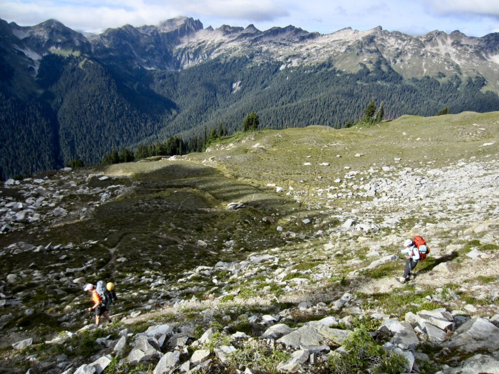
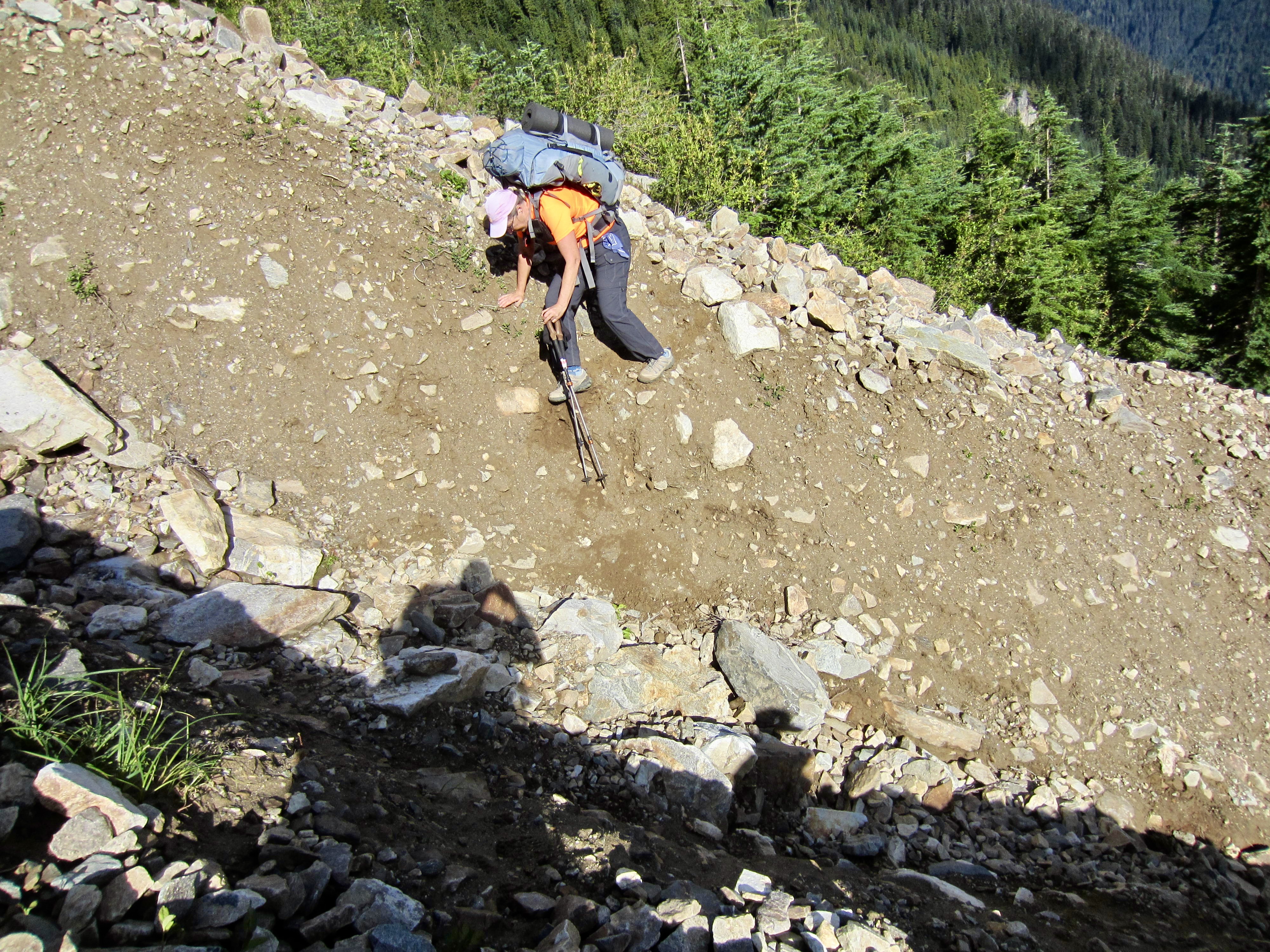
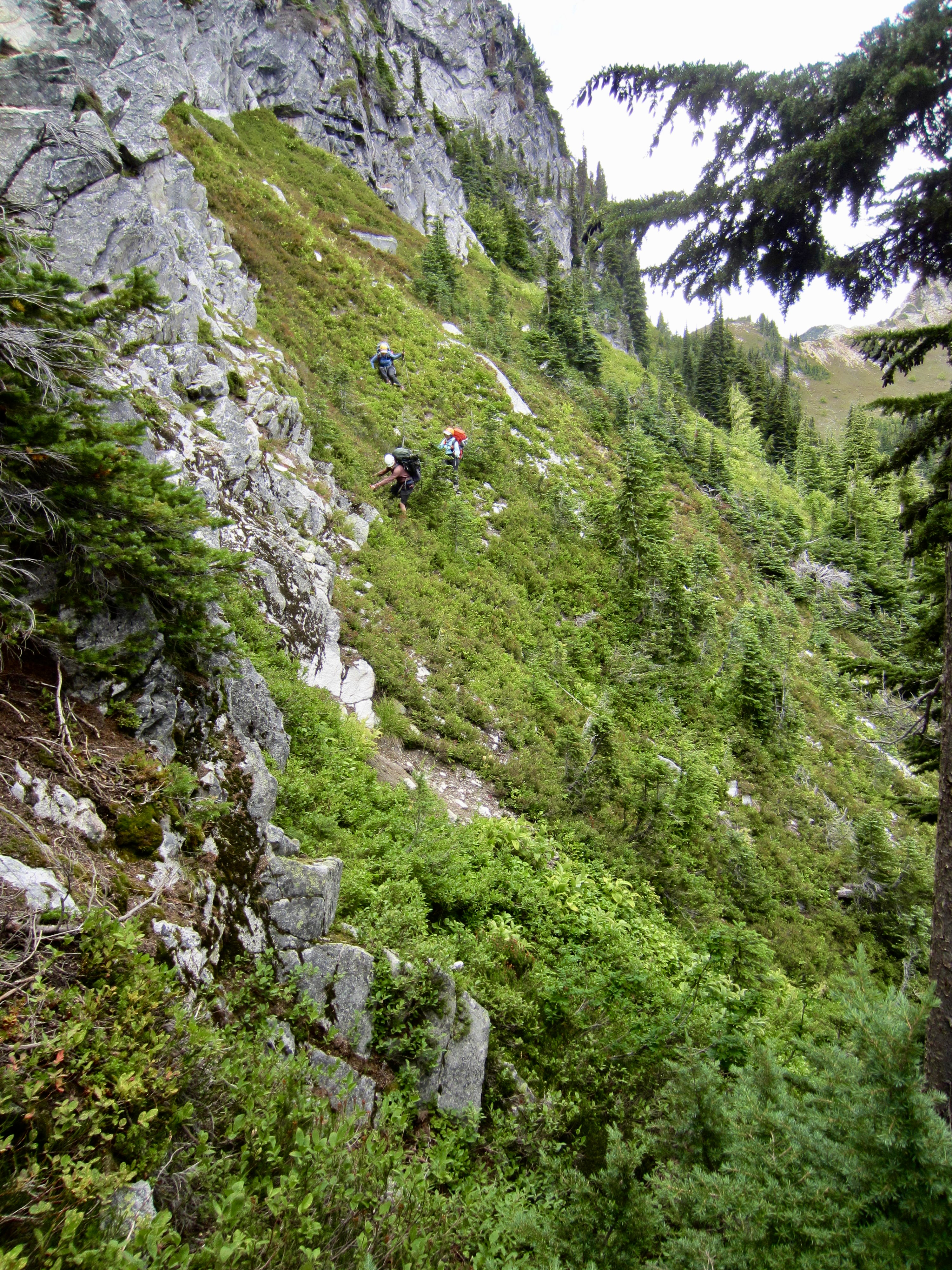
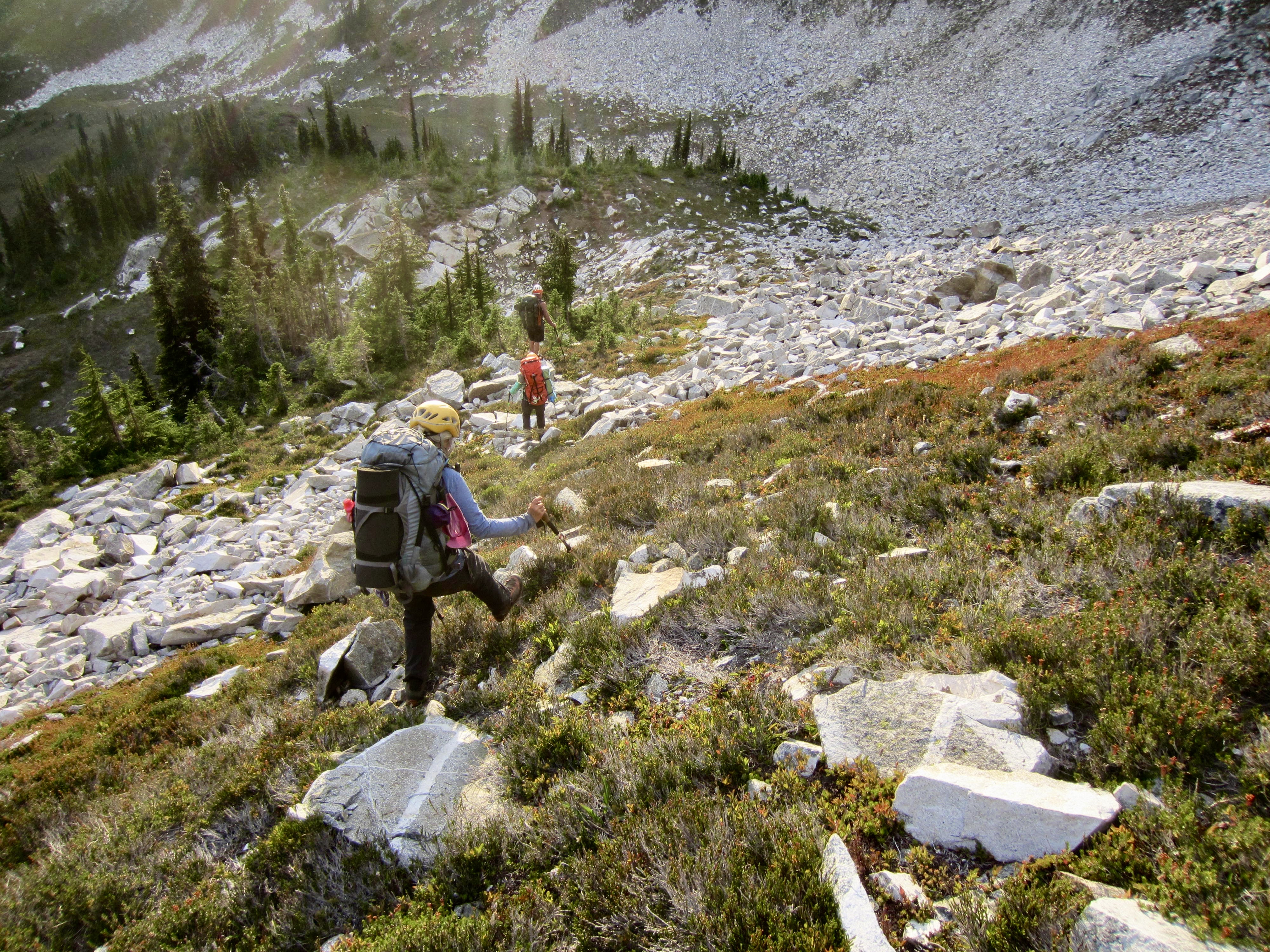
While Andrew caught up on sleep, Eileen, Yoko, and I left camp at 8:00am and headed down the abandoned Canyon Lake Trail. This trail began as a nice track through heather meadows but soon became partially obscured by a series of debris flows.

.
.
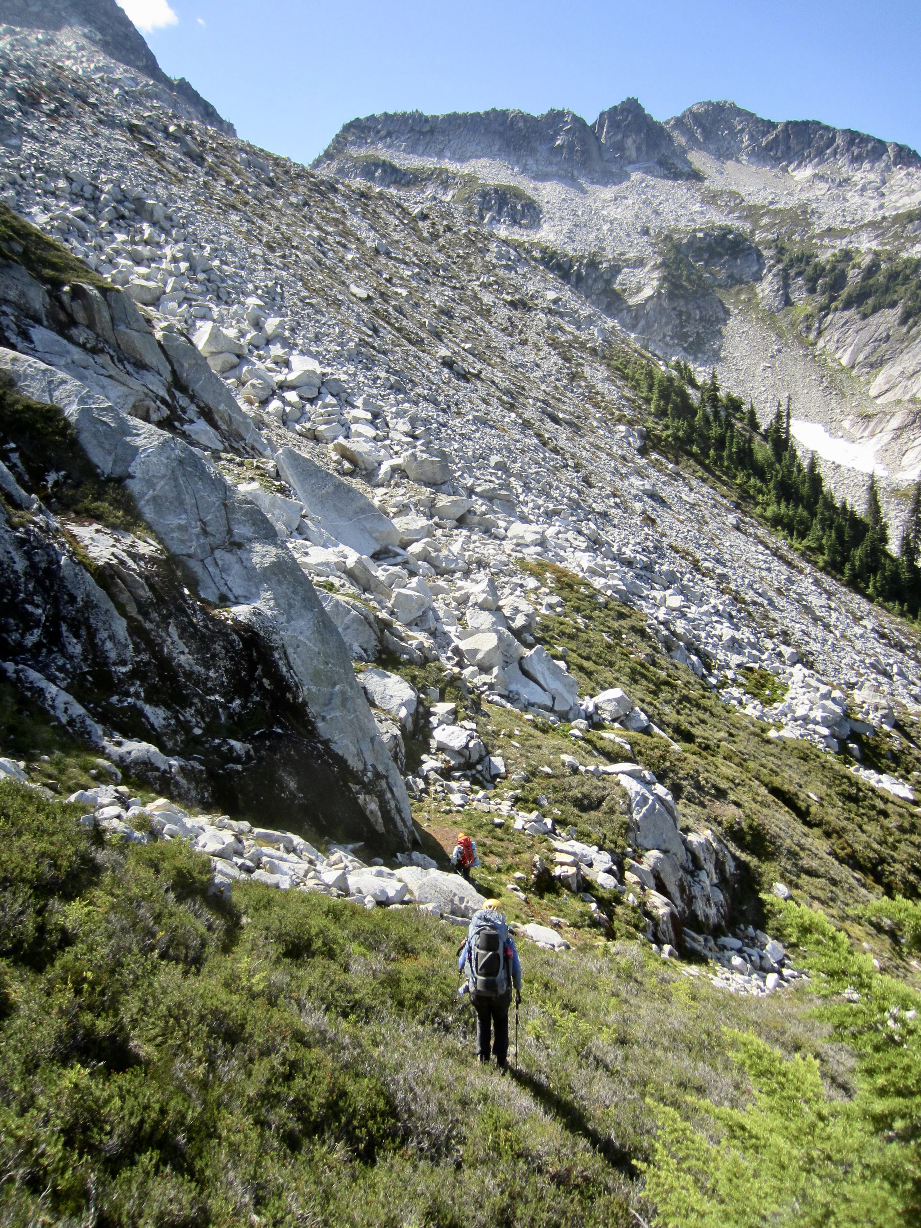
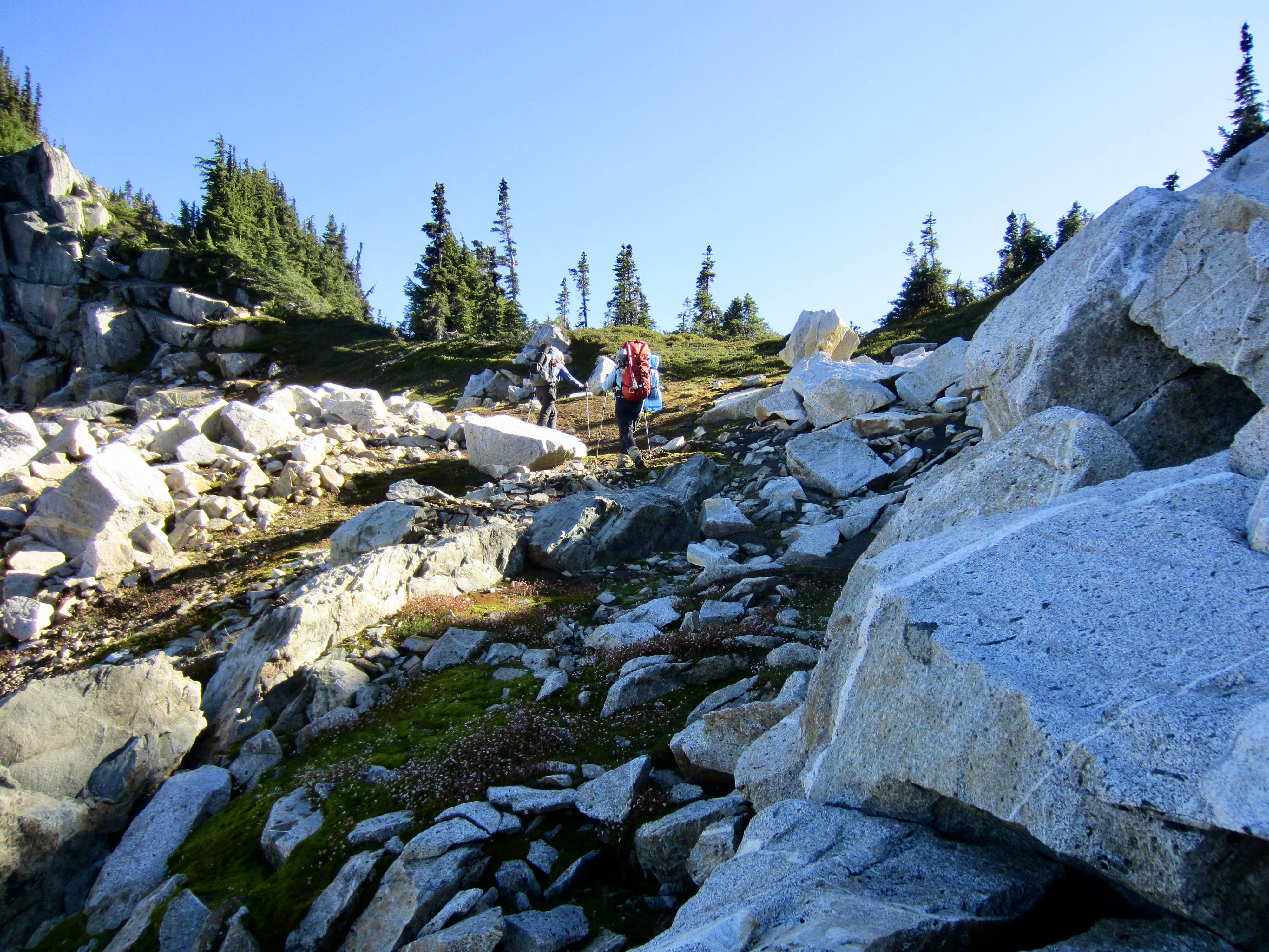
Upon entering a large boulderfield in West Plummer Basin, we attempted to navigate using our various maps (USGS, CalTopo, and Gaia), all of which show the trail traversing northward at an elevation of 5600 to 5700 feet. However, this misled us into brushy forest 300 to 400 feet above the actual trail. We eventually realized the gross mapping error and descended to intersect the trail at 5250 feet, then followed it into beautiful Sitting Bull Basin beneath the dramatic pinnacle of Sitting Bull Mountain.
.
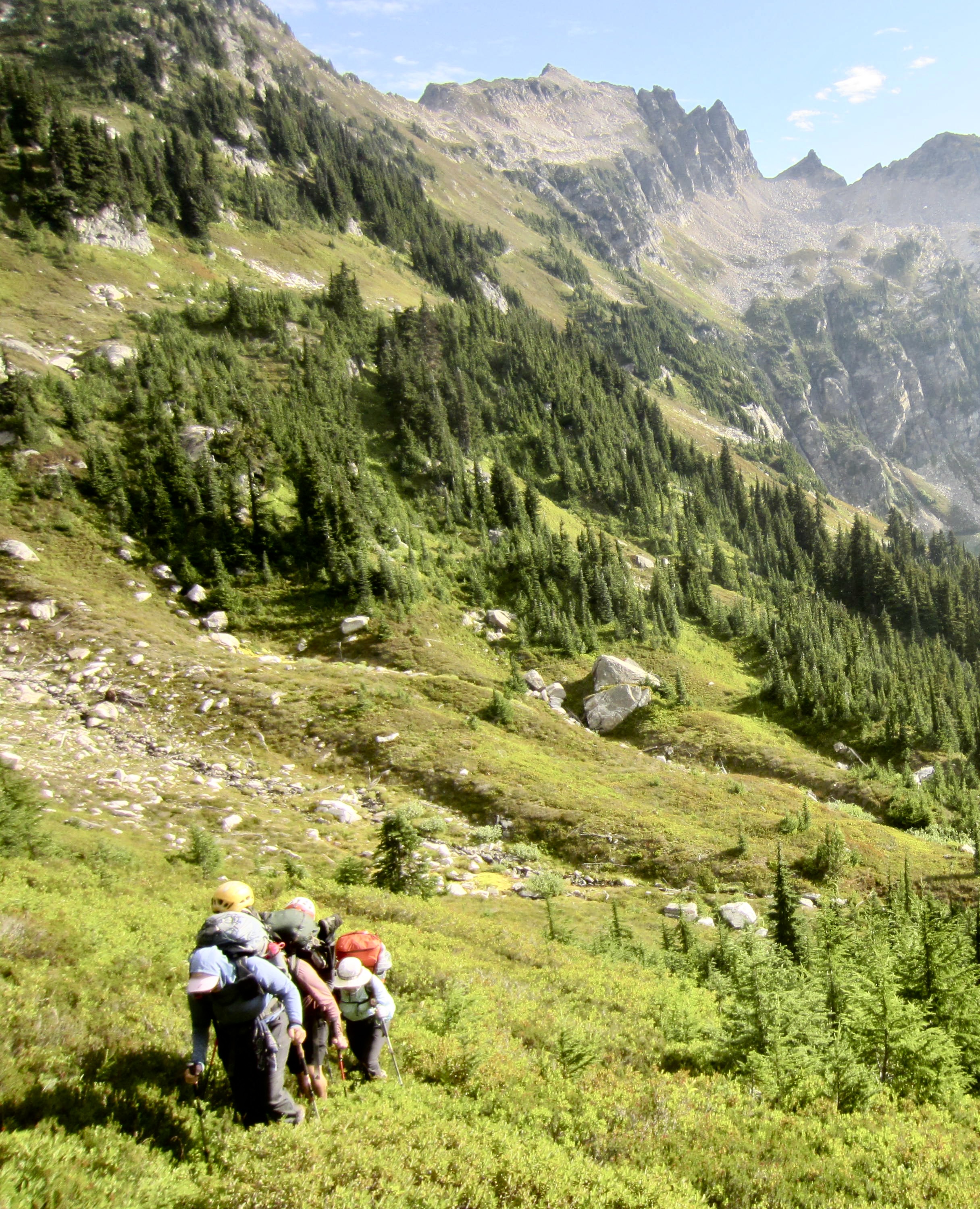
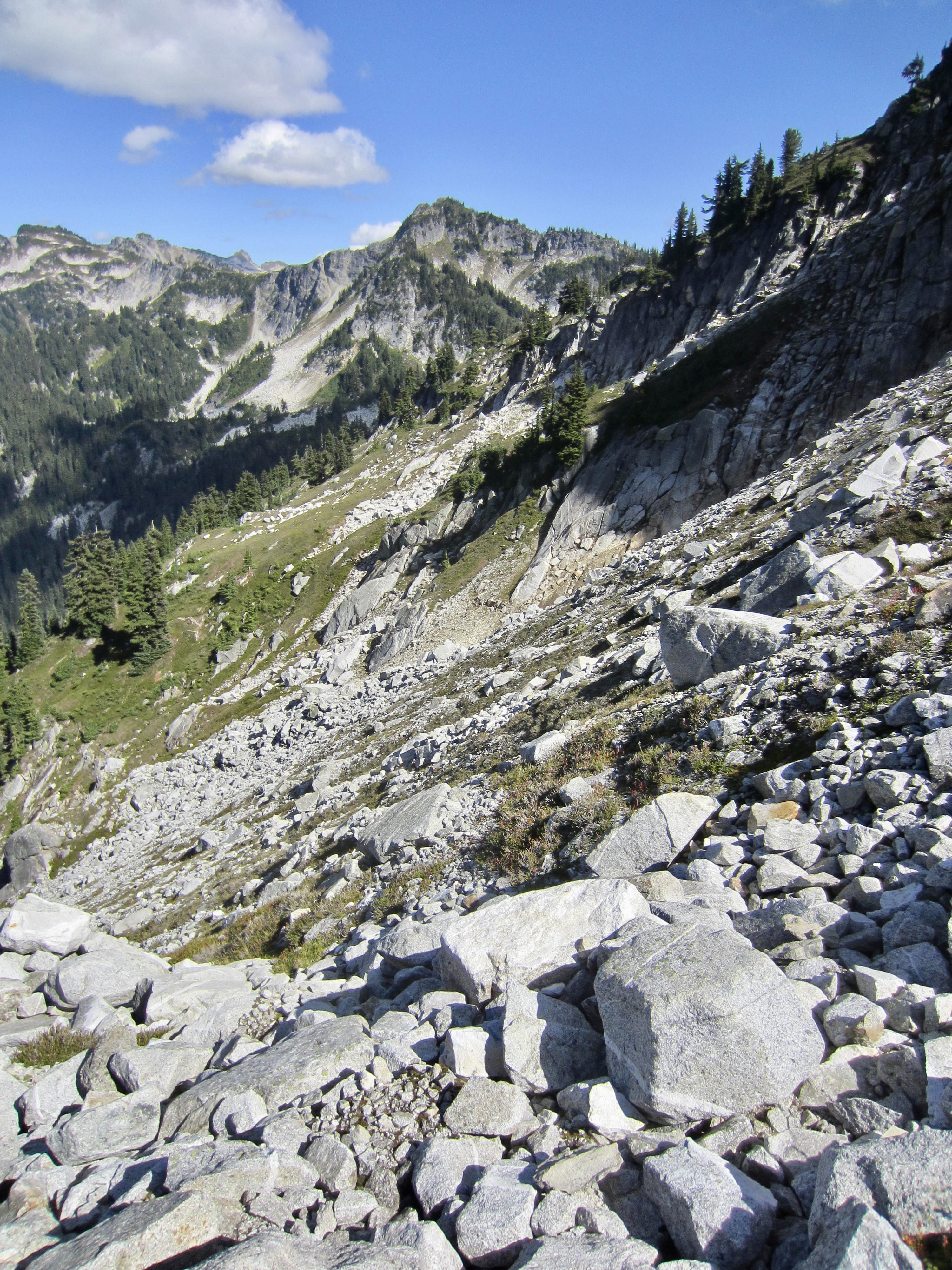
While we filled up water bottles in “Sitting Bull Creek” (the only reliable water source between Image Lake and Canyon Lake), Andrew caught up with us. He had also lost the trail in West Plummer Basin but managed to regain it more quickly. The four of us then continued hiking toward Canyon Lake. After a steep 800-foot climb out of the basin, we enjoyed a mile-long traverse through the splendid meadowland of Sundown Park. This tasty cup of alpine nectar serves up rolling heather fields dotted with strikingly white gneissic granite outcrops.

.
.
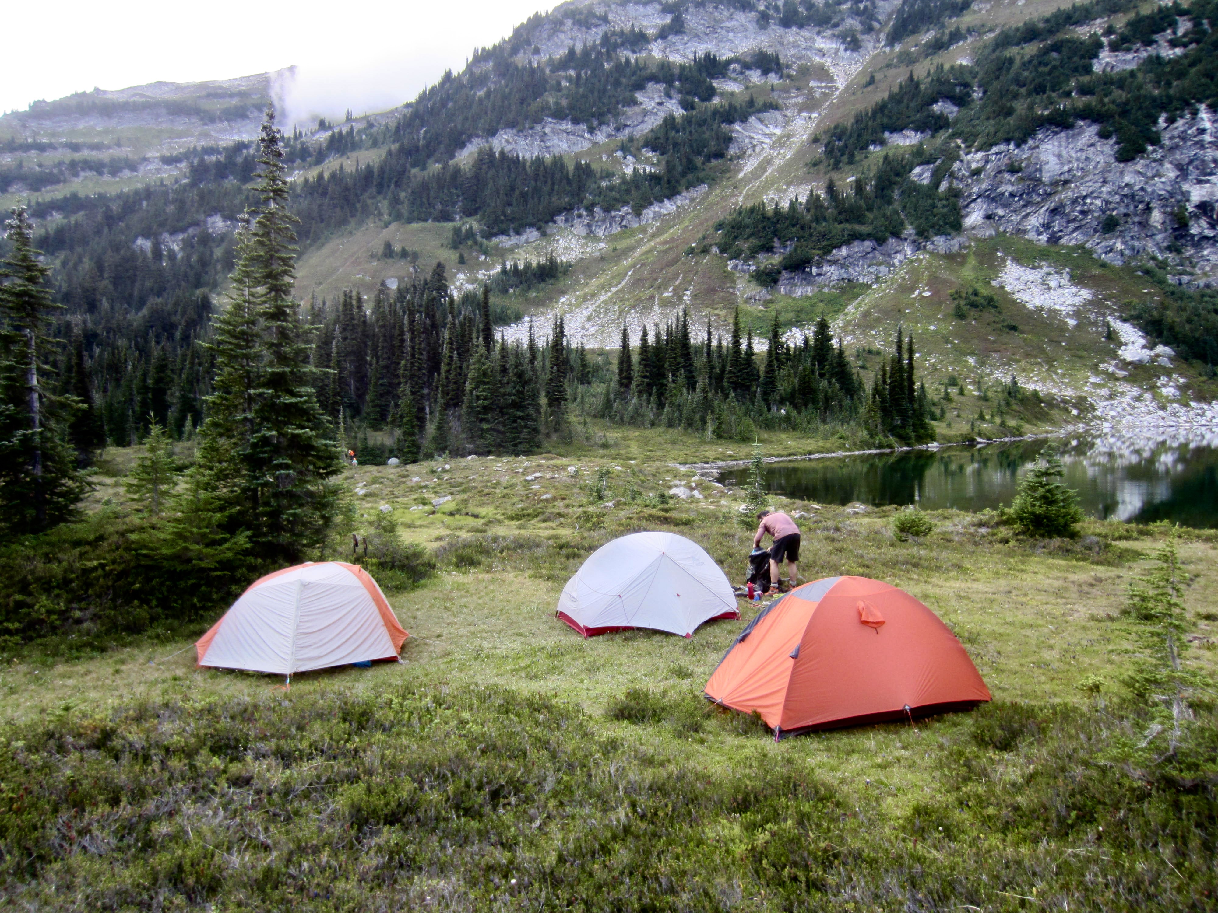
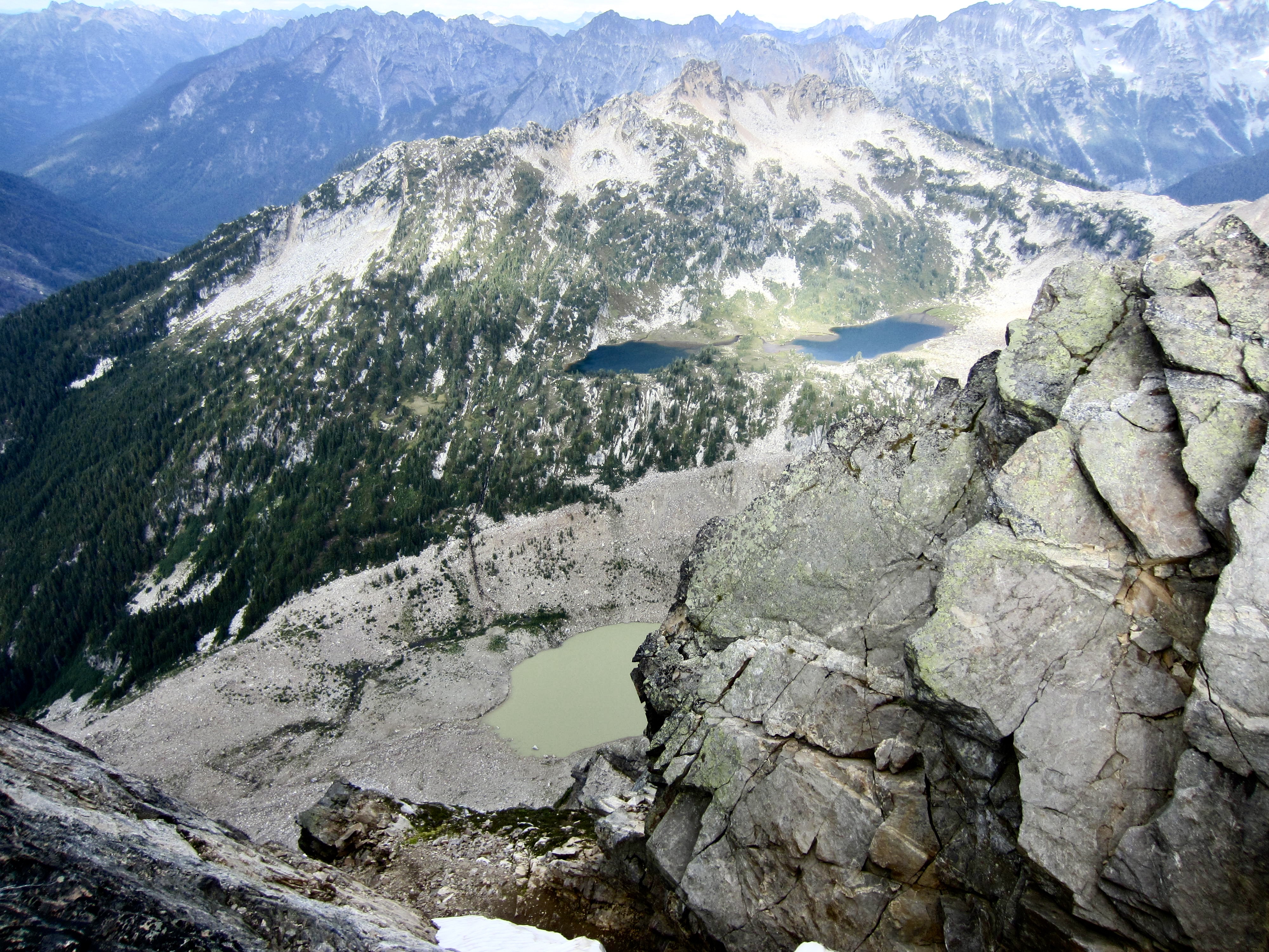
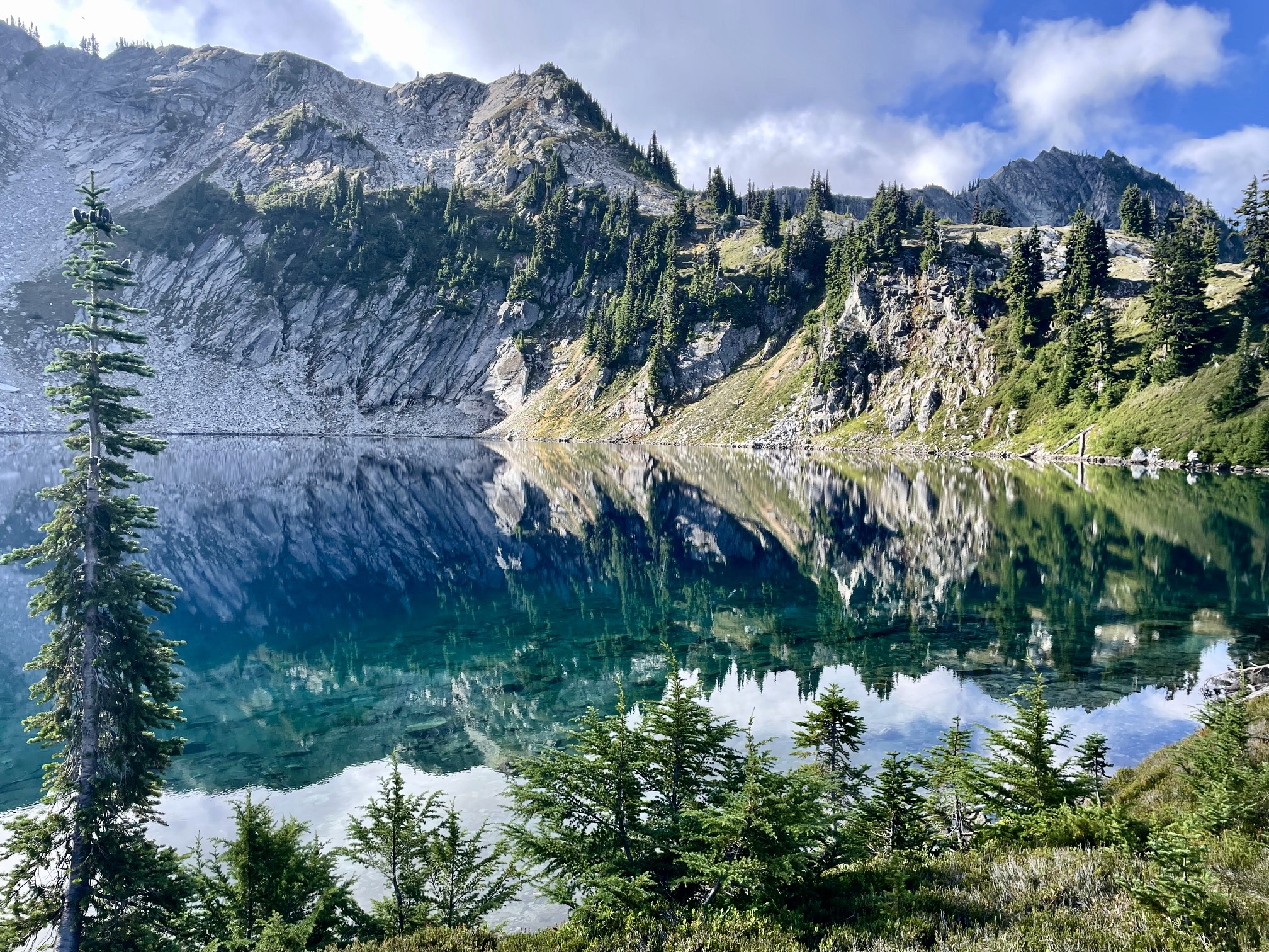
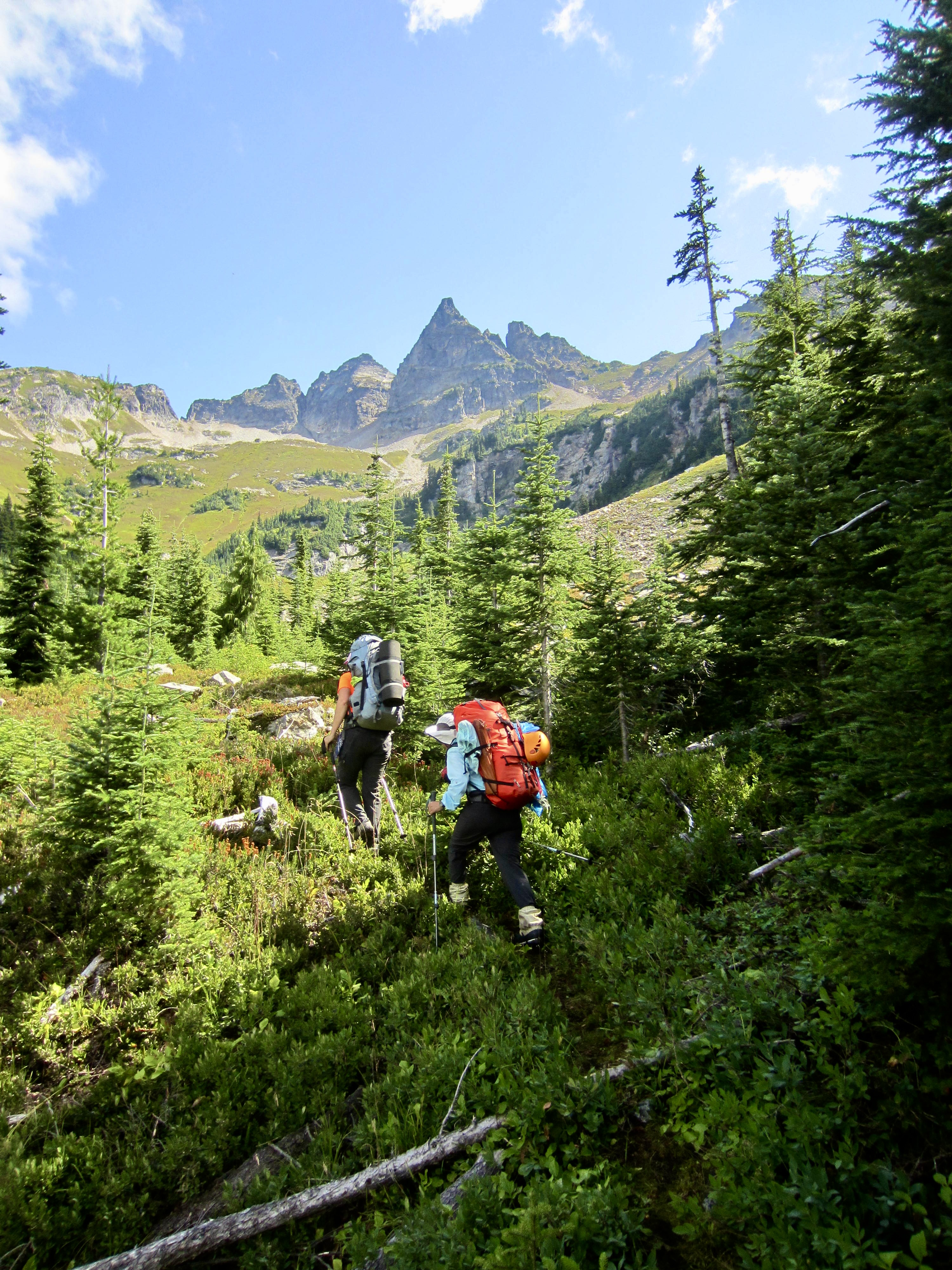
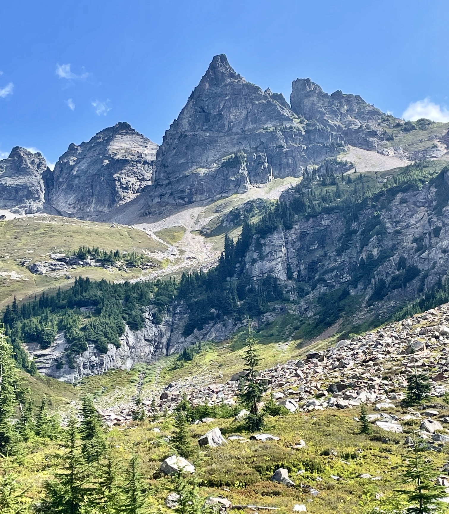
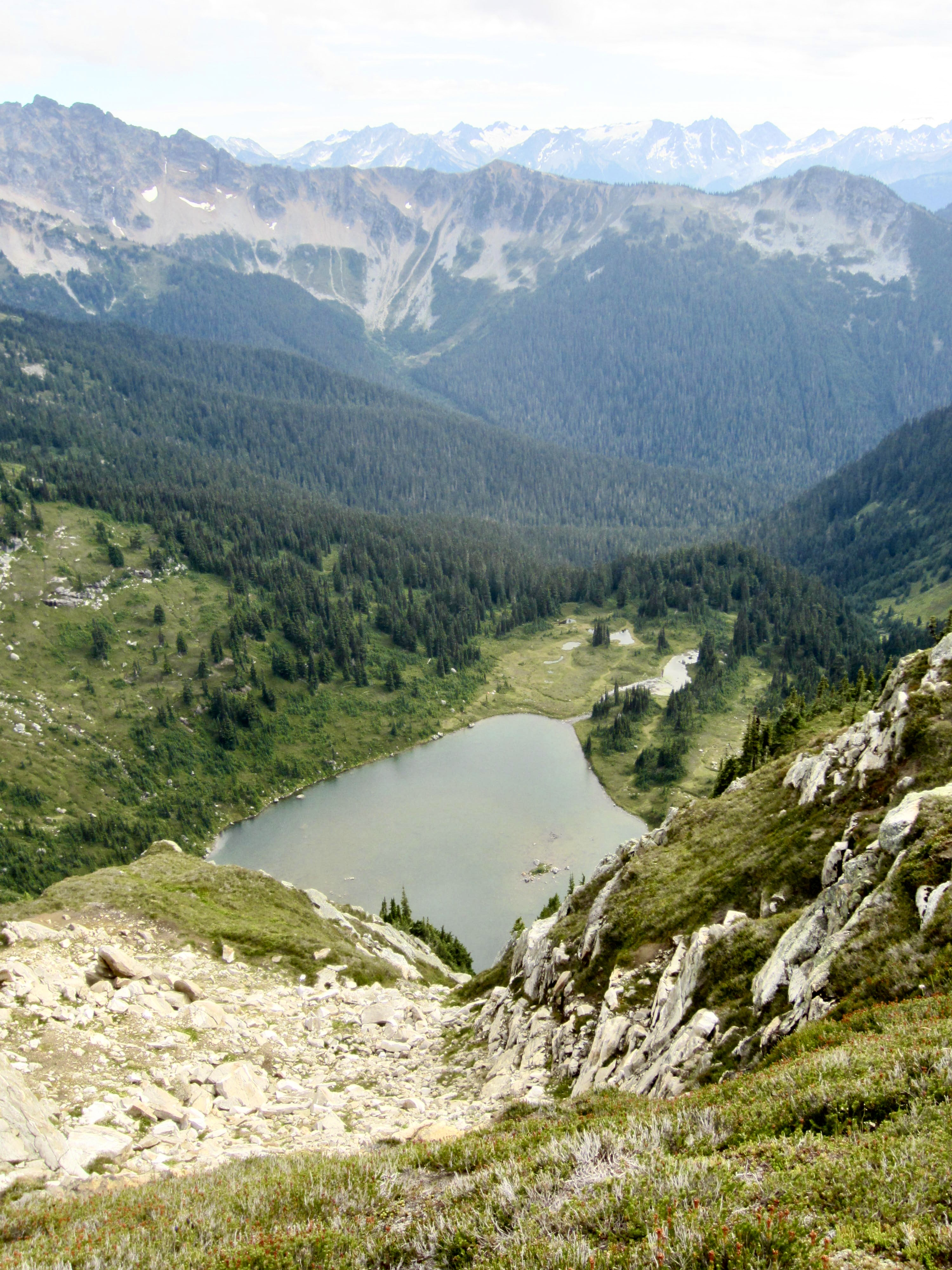
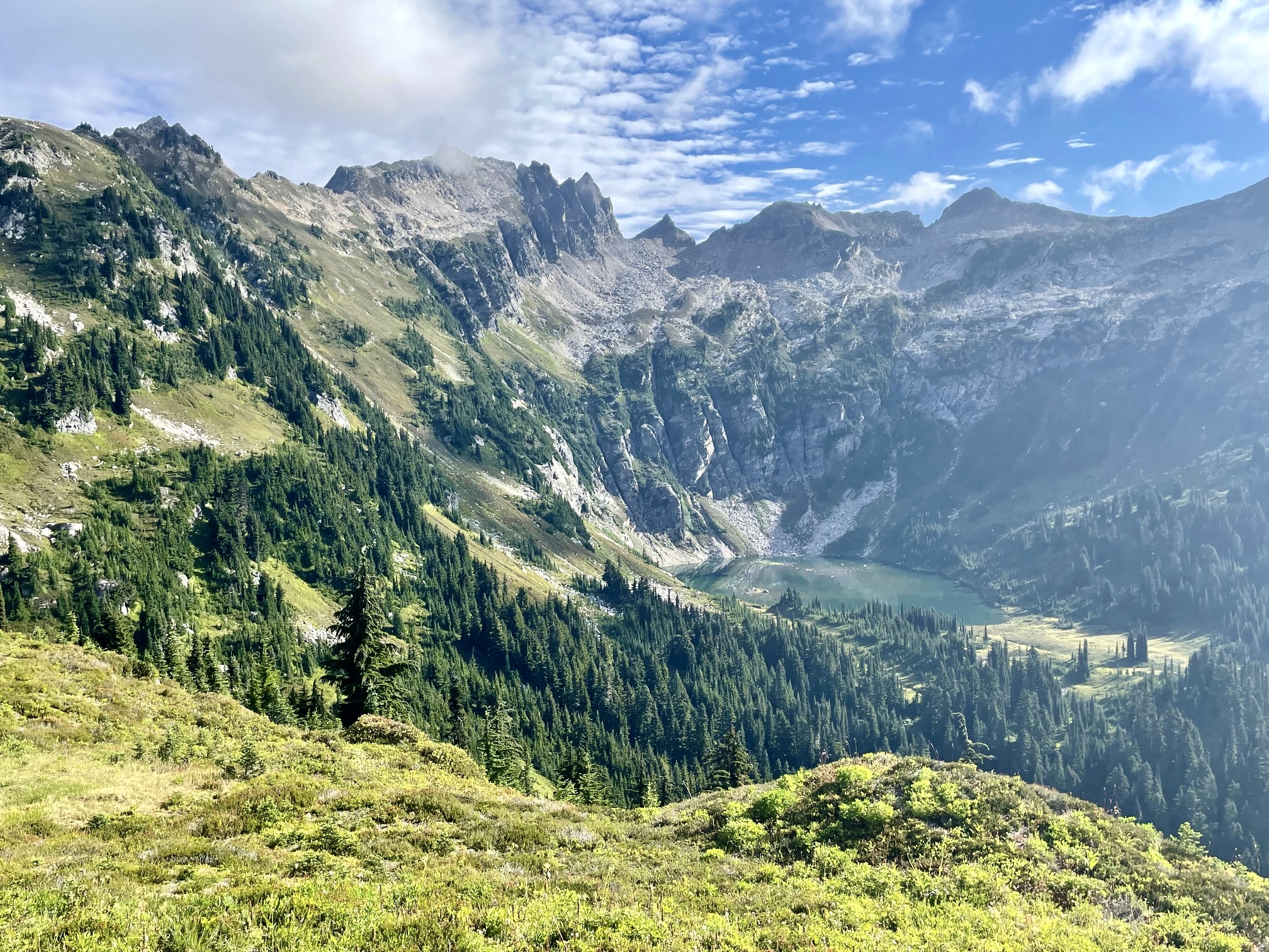
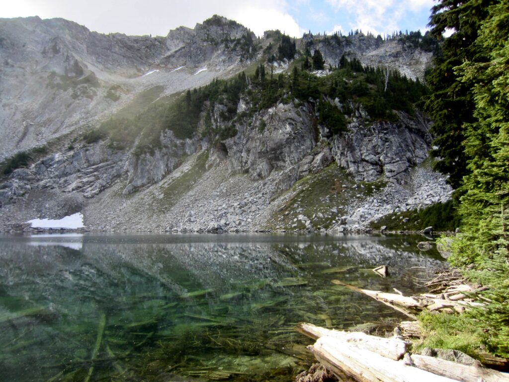
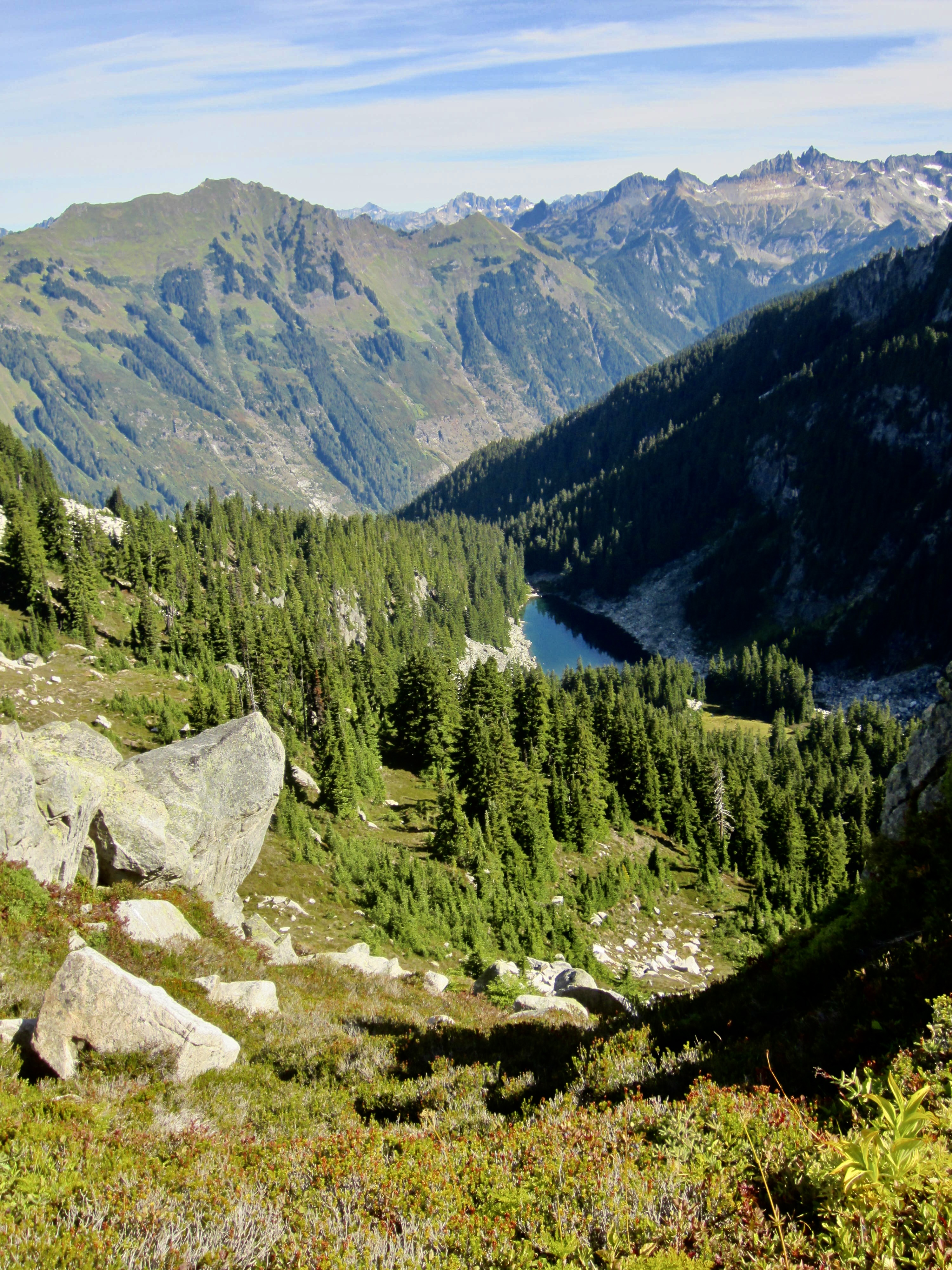
At the northern edge of Sundown Park, the trail made an 800-foot plunge that brought us to Canyon Lake in early afternoon (6.0 hours + 1500 feet – 2150 feet from Camp 2). Tall cliffs bordering the far side of the lake rose up and melded with the craggy wall of Bannock Mountain—our summit goal for today.
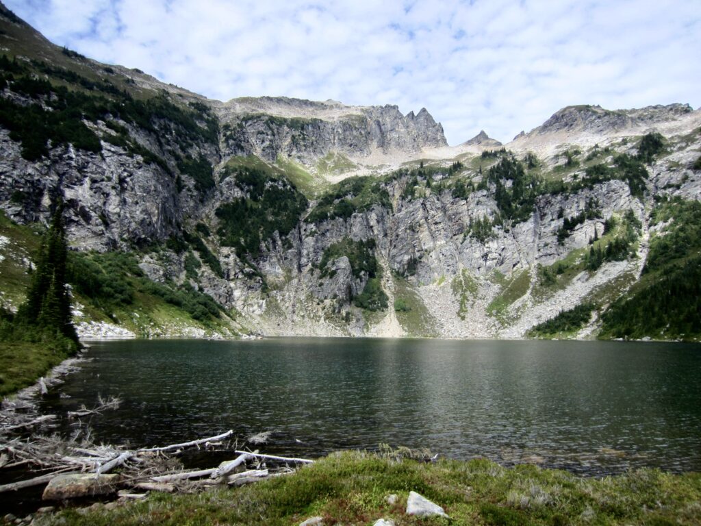
.
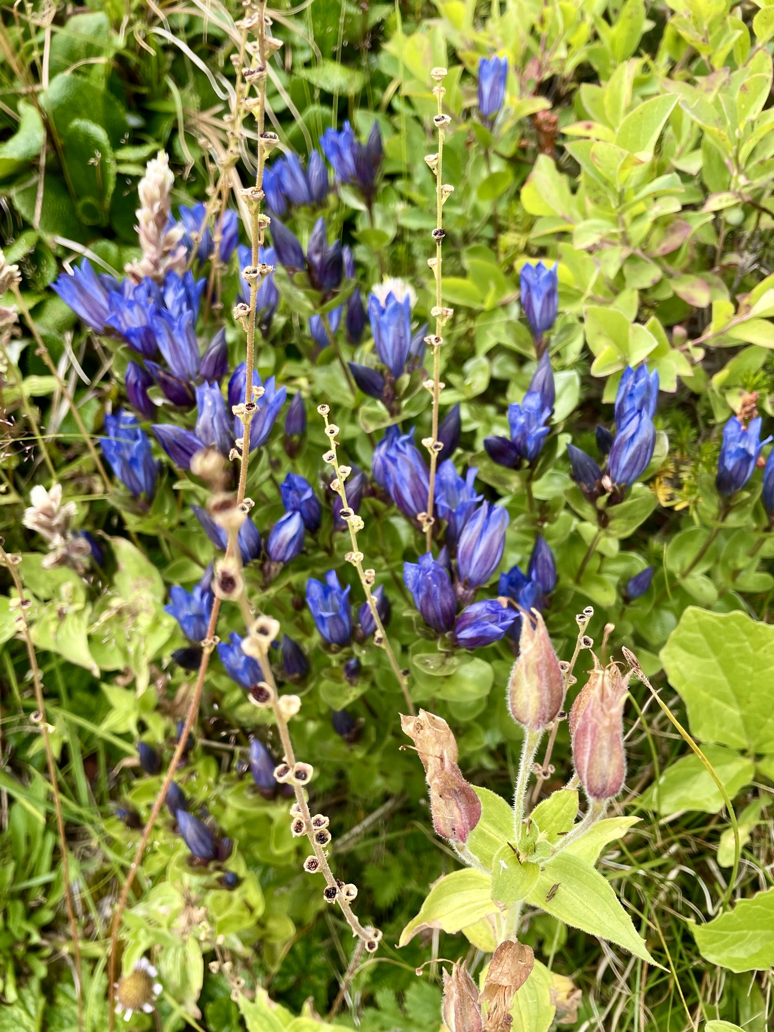
We quickly pitched our tents and loaded summit packs, then headed up a heathery hillslope on the western side of the lake. A spring-fed creek flowing down this hillslope provided a good water source, and wildflowers and huckleberries were abundant along the way. In fact, we all feasted on a bumper crop of ripe huckleberries throughout our entire traverse.
.
.
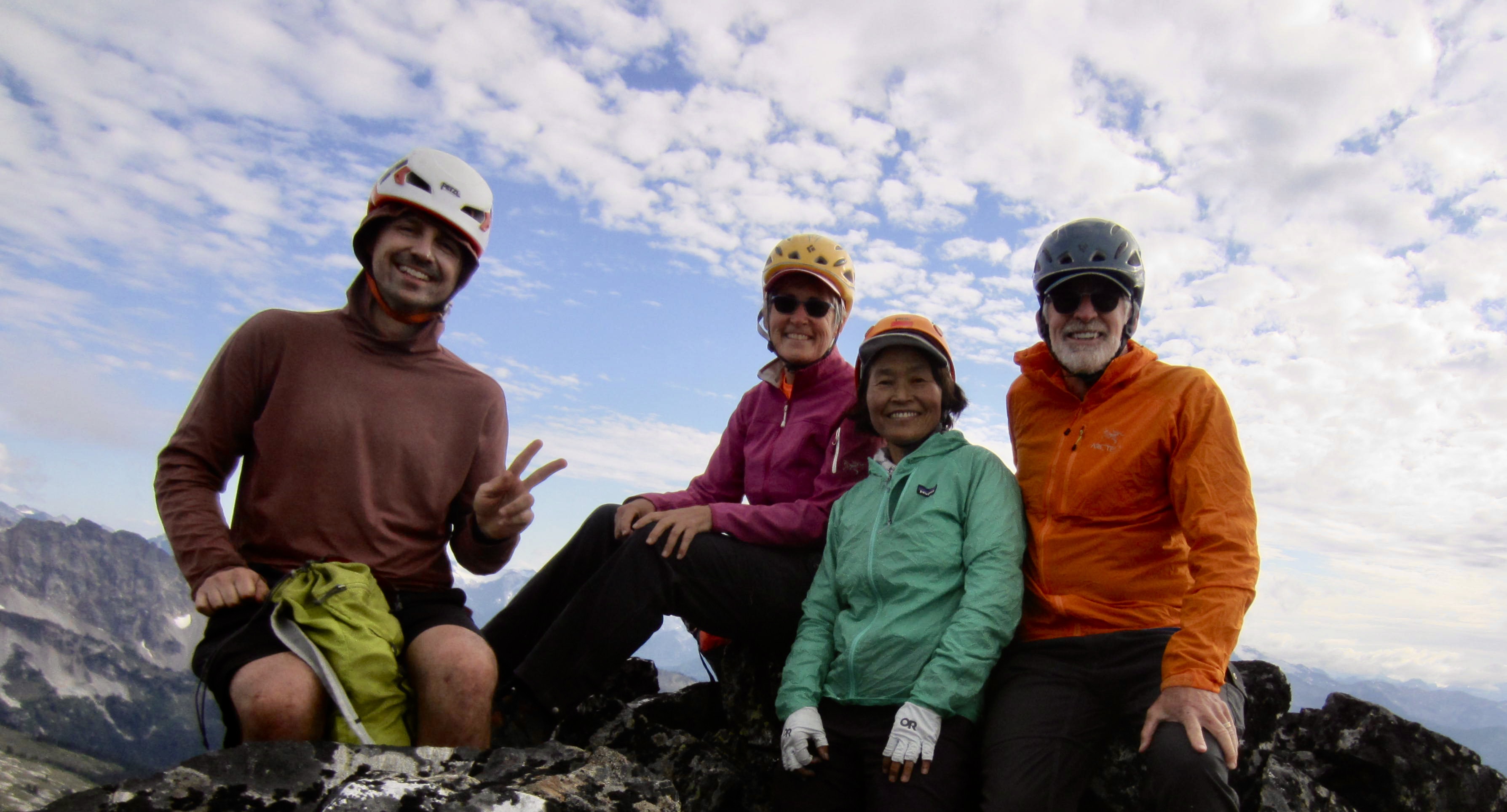
After gaining 1500 feet on the heathery hillslope, we angled over to the right until able to hike straight up talus on the south face. A short Class 2-3 scramble brought us to the summit of Bannock Mountain in late afternoon (2.4 hours + 2150 feet from Camp 3). The register had been placed by Fay Pullen and revealed that this peak averages only about two ascents per year.
.

.
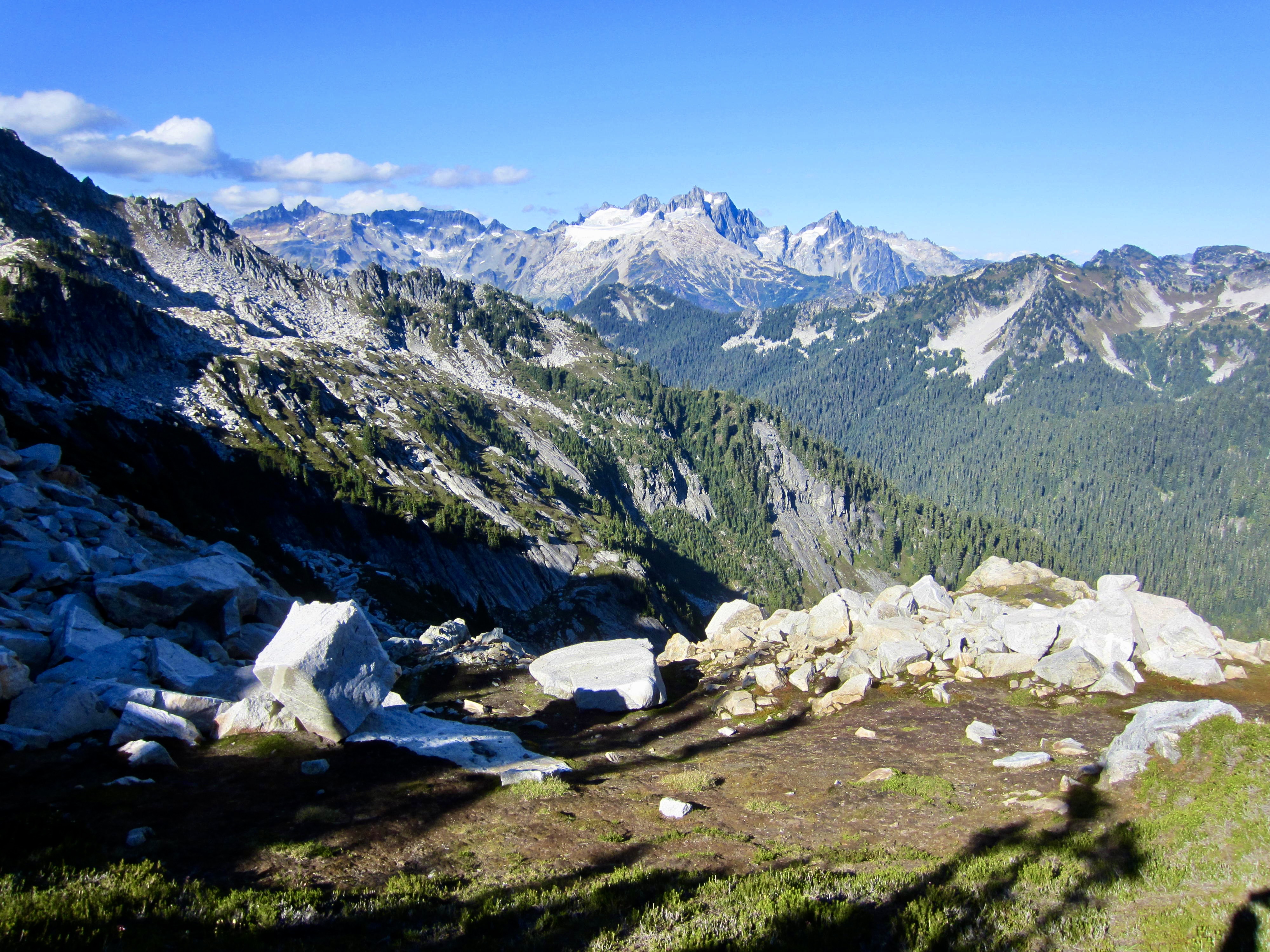
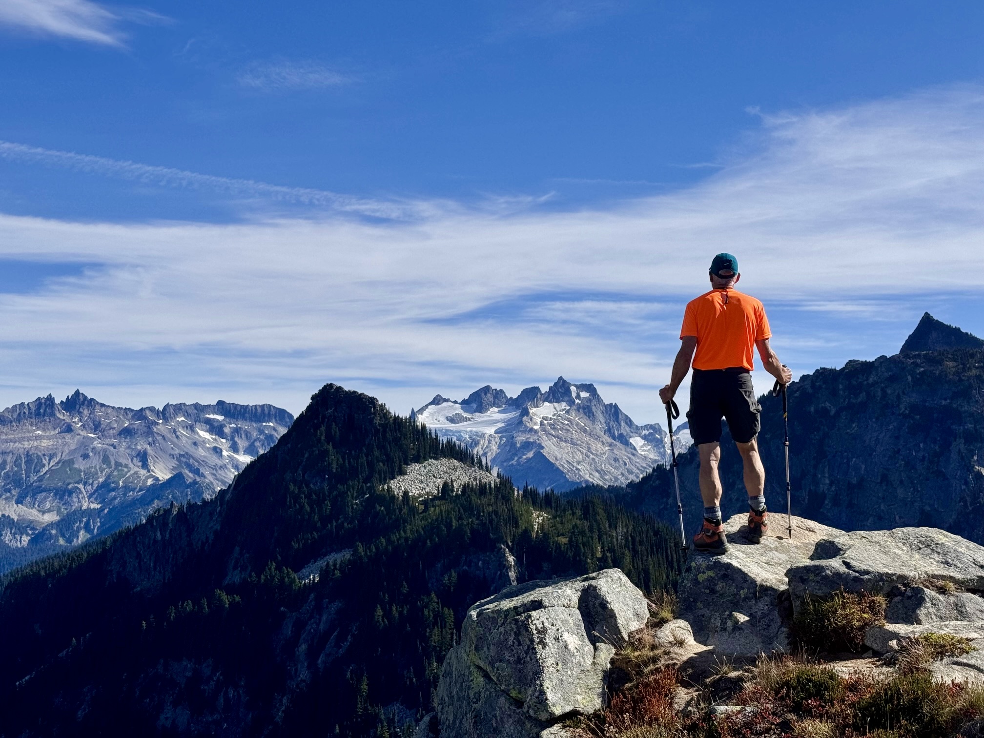
Residual clouds and haze still hung around many of the surrounding mountains, but we were able to clearly see the massive west face of Bonanza Peak, as well as other summits in the Stehekin and Entiat Mountains. Three of the four Bannock Lakes were visible far below.
.

.
We descended via our up-route and were back in camp by early evening (2.2 hours from summit). A near-absence of mosquitoes allowed us to eat dinner unbothered near the lakeshore. In my experience, this entire summer has been abnormally bug-free.

.
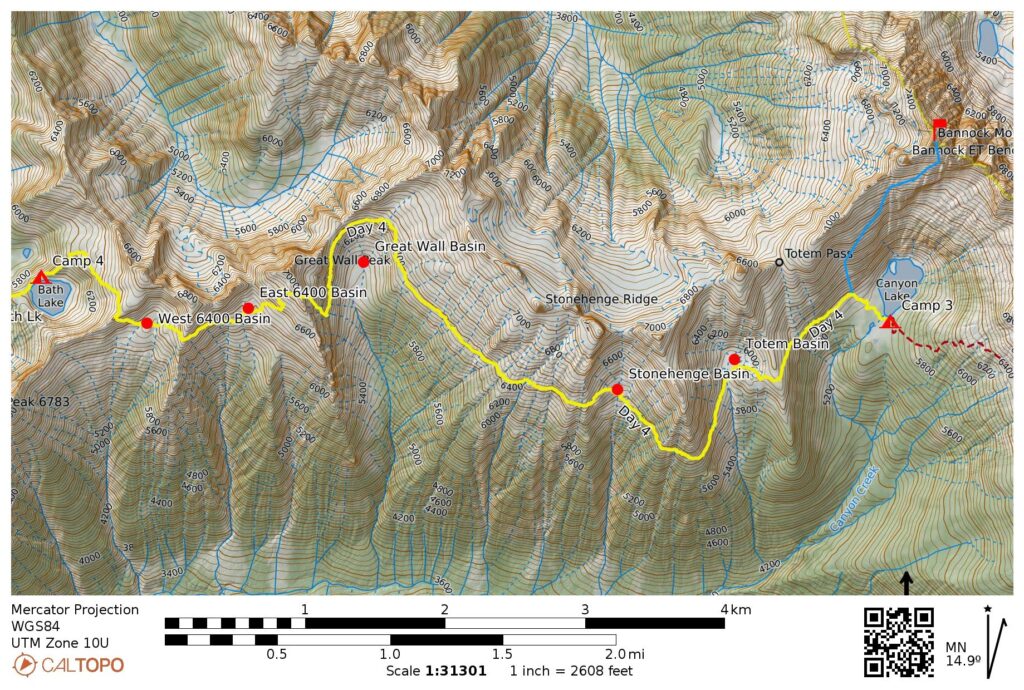
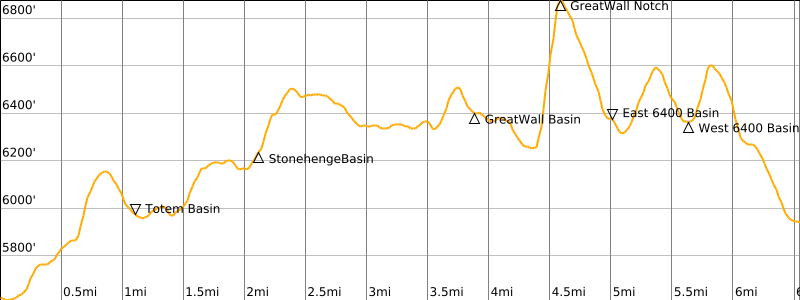
Day 4: Canyon Lake to Upper Bath Lake
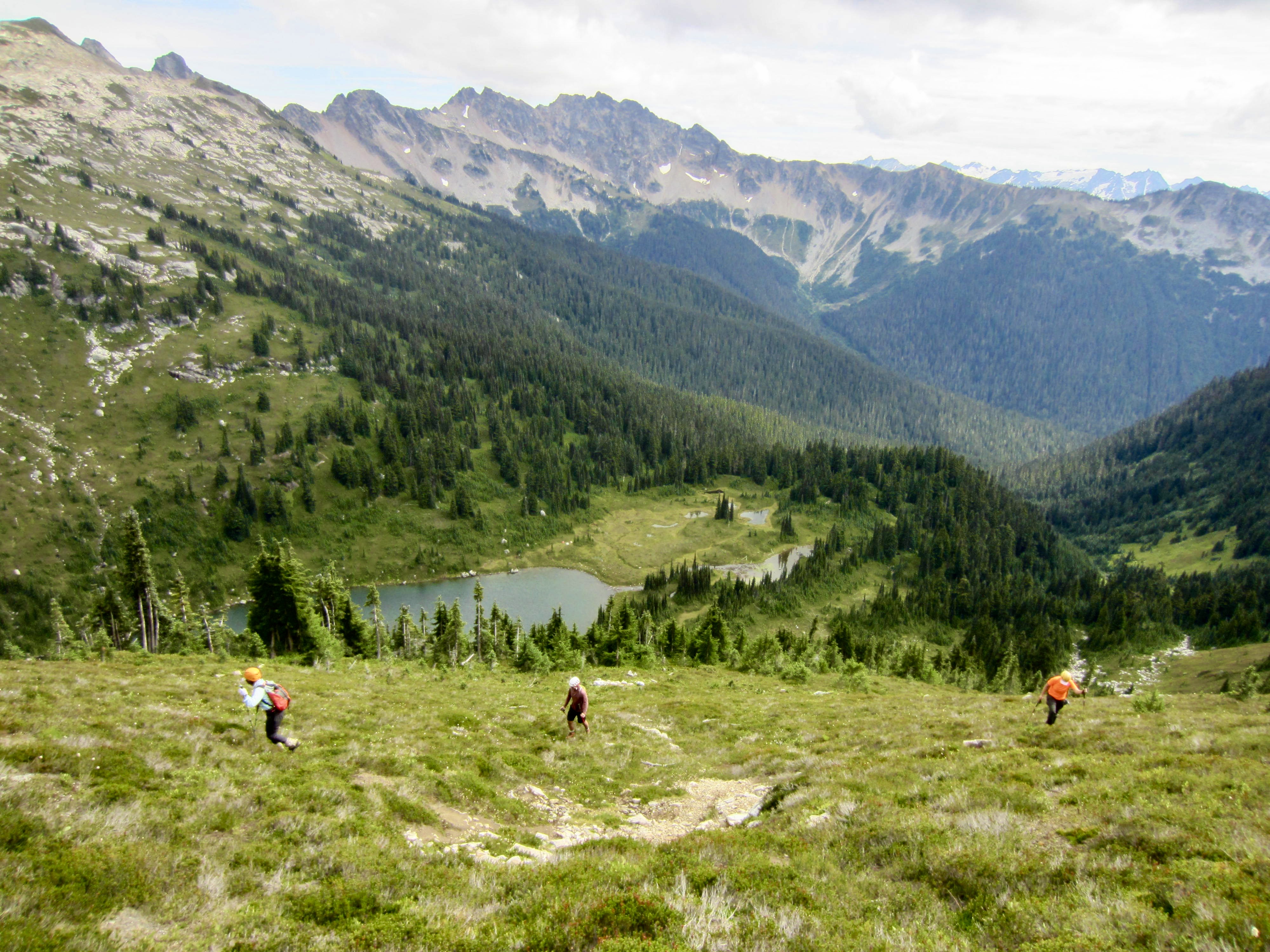
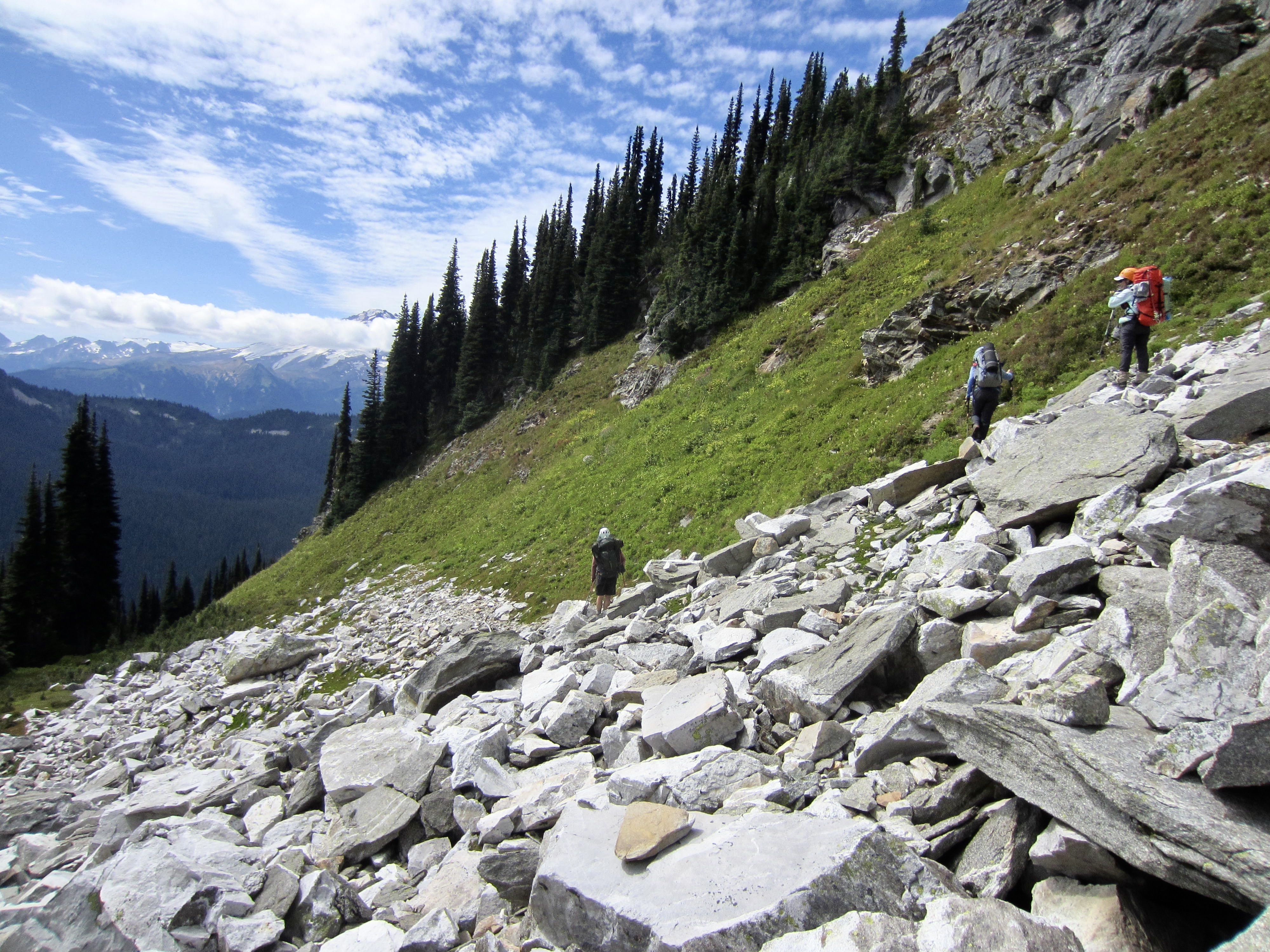
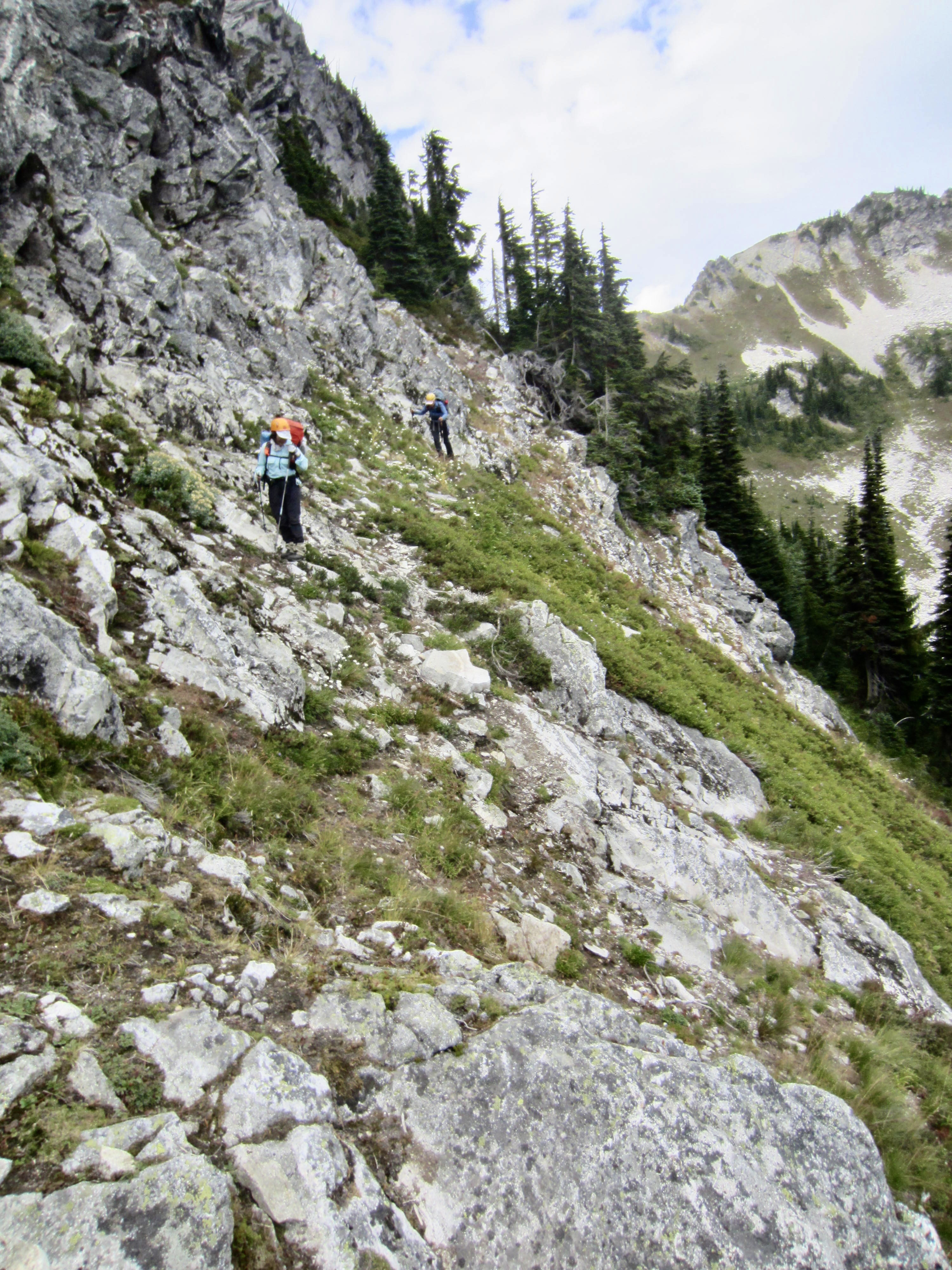
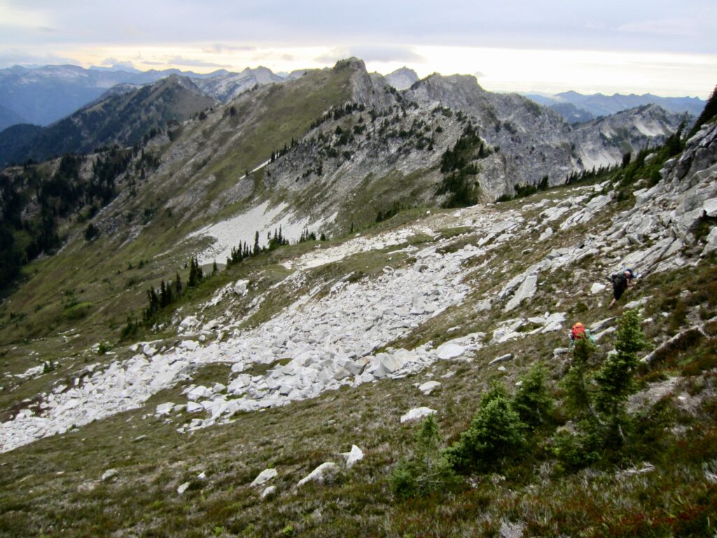
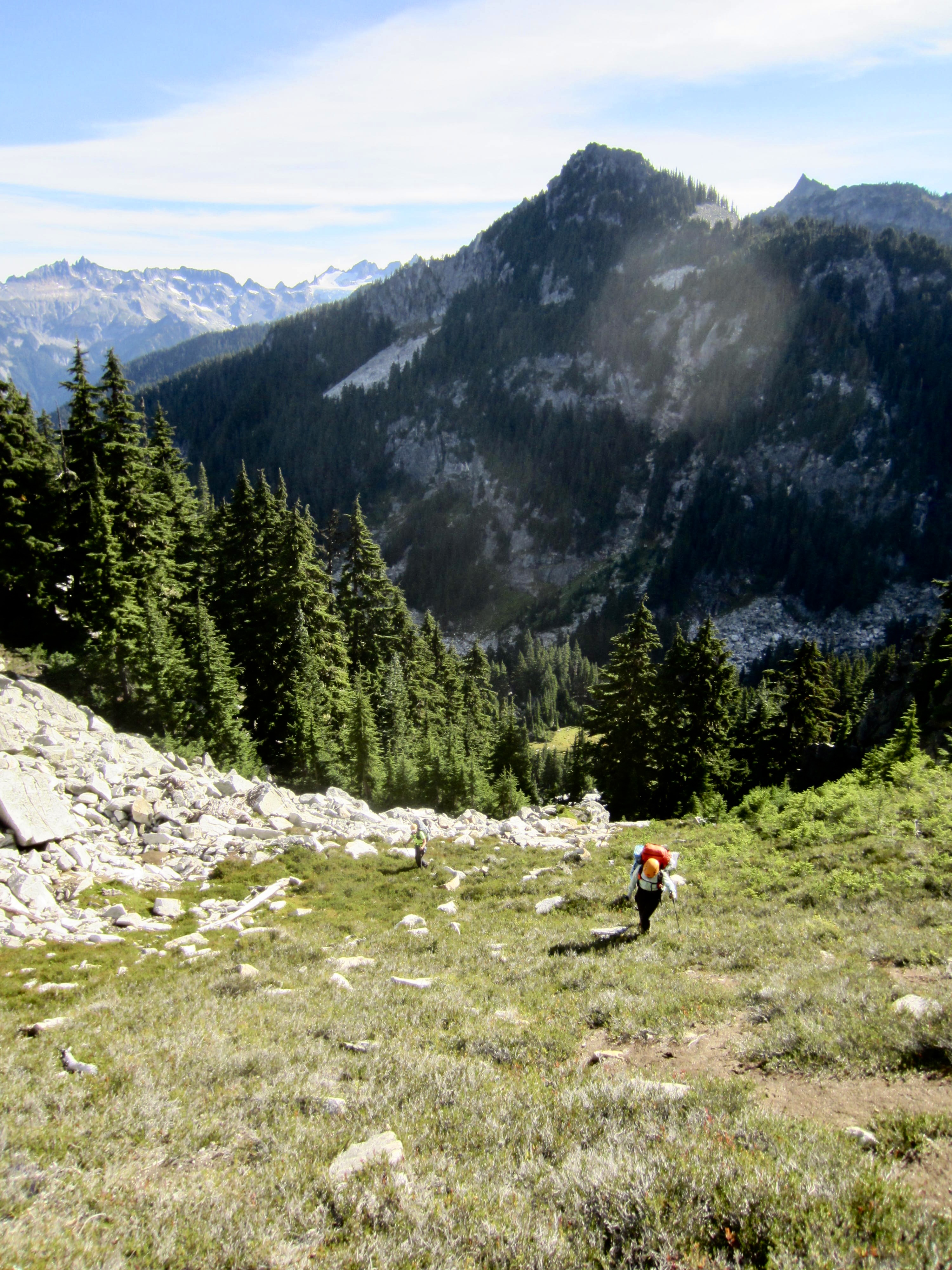
Following a fairly warm night, we awoke to clearing skies and the knowledge that it would be a long, arduous day. From Canyon Lake, we traversed southwesterly on game paths to reach a grassy shoulder at 6150 feet, then descended 200 feet into flat-bottomed Totem Basin.
.

.
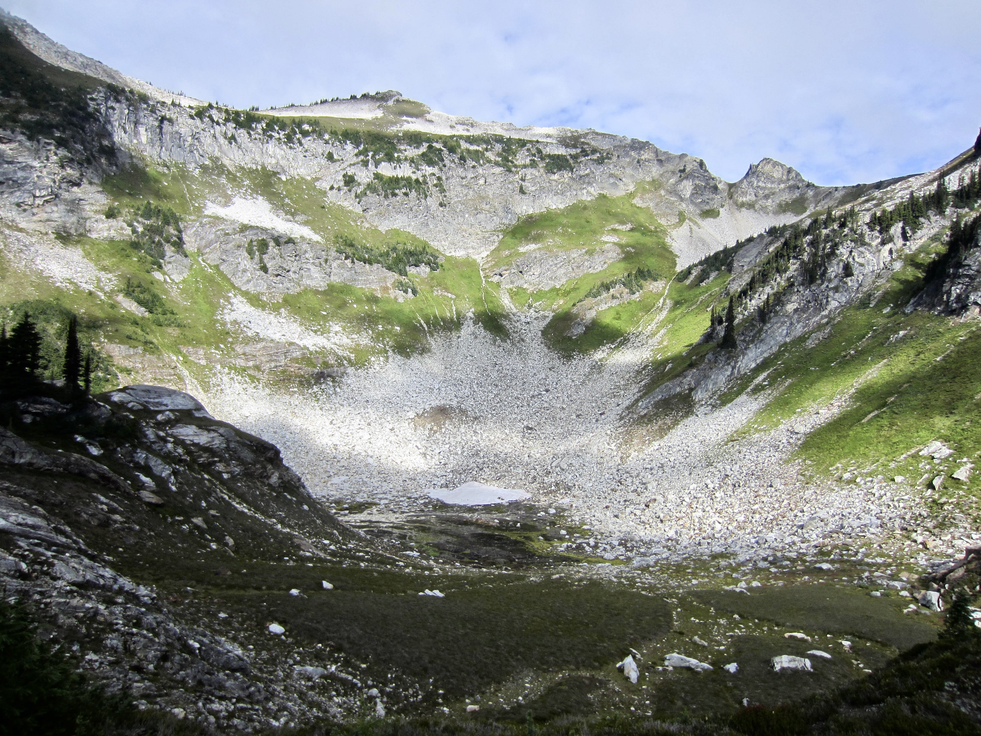
From Totem Basin, we contoured southwesterly across steep heather slopes and went around two adjacent ribs at 6150 feet. We then contoured northwesterly to Stonehenge Basin at 6200 feet (4.2 hours + 850 feet from Camp 3). A small creek flowing through the basin allowed us to top off water bottles. (This was the only water encountered between Canyon Lake and Upper Bath Lake.)
.
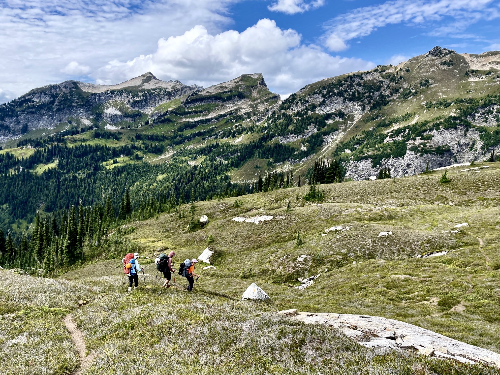
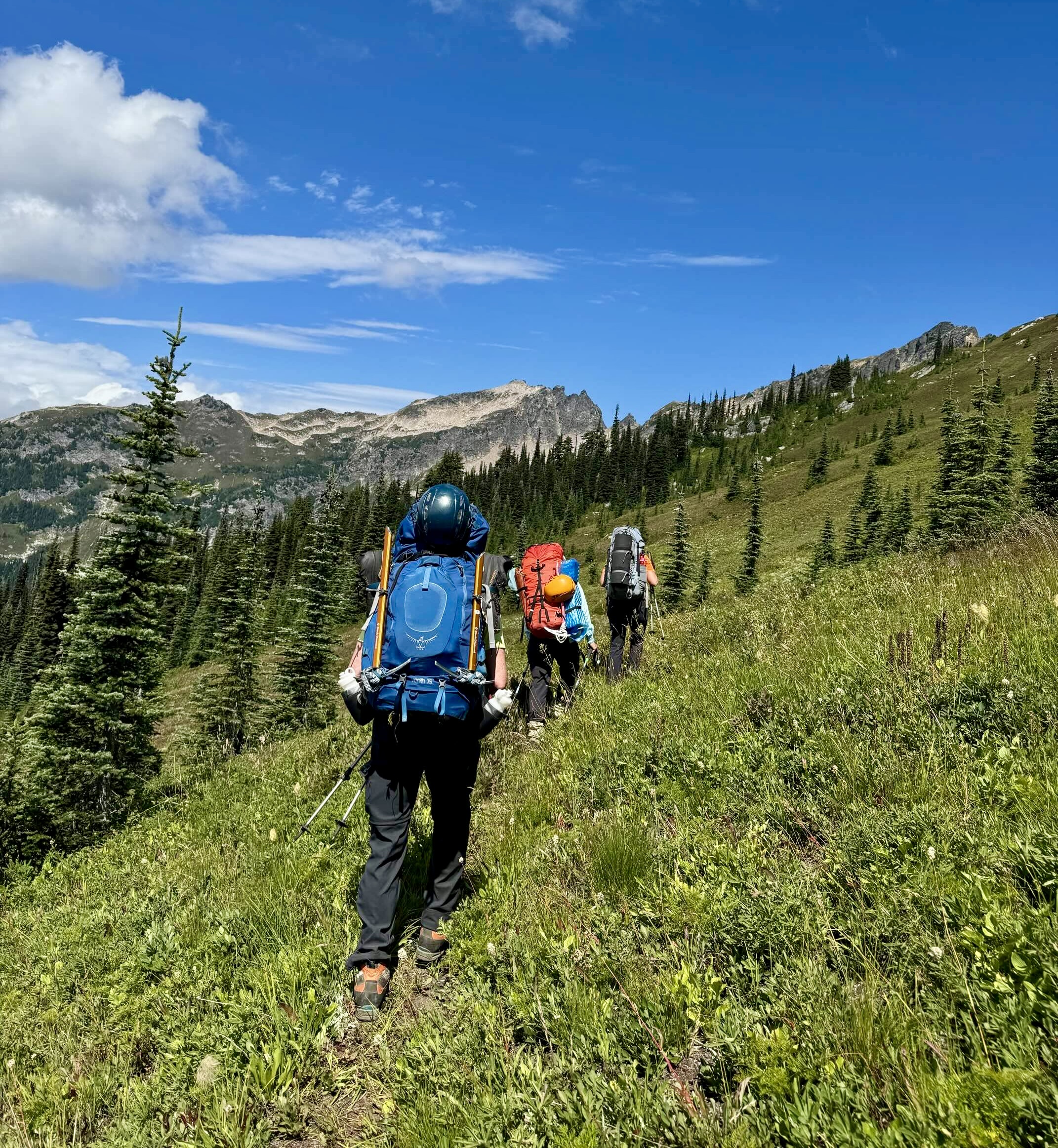
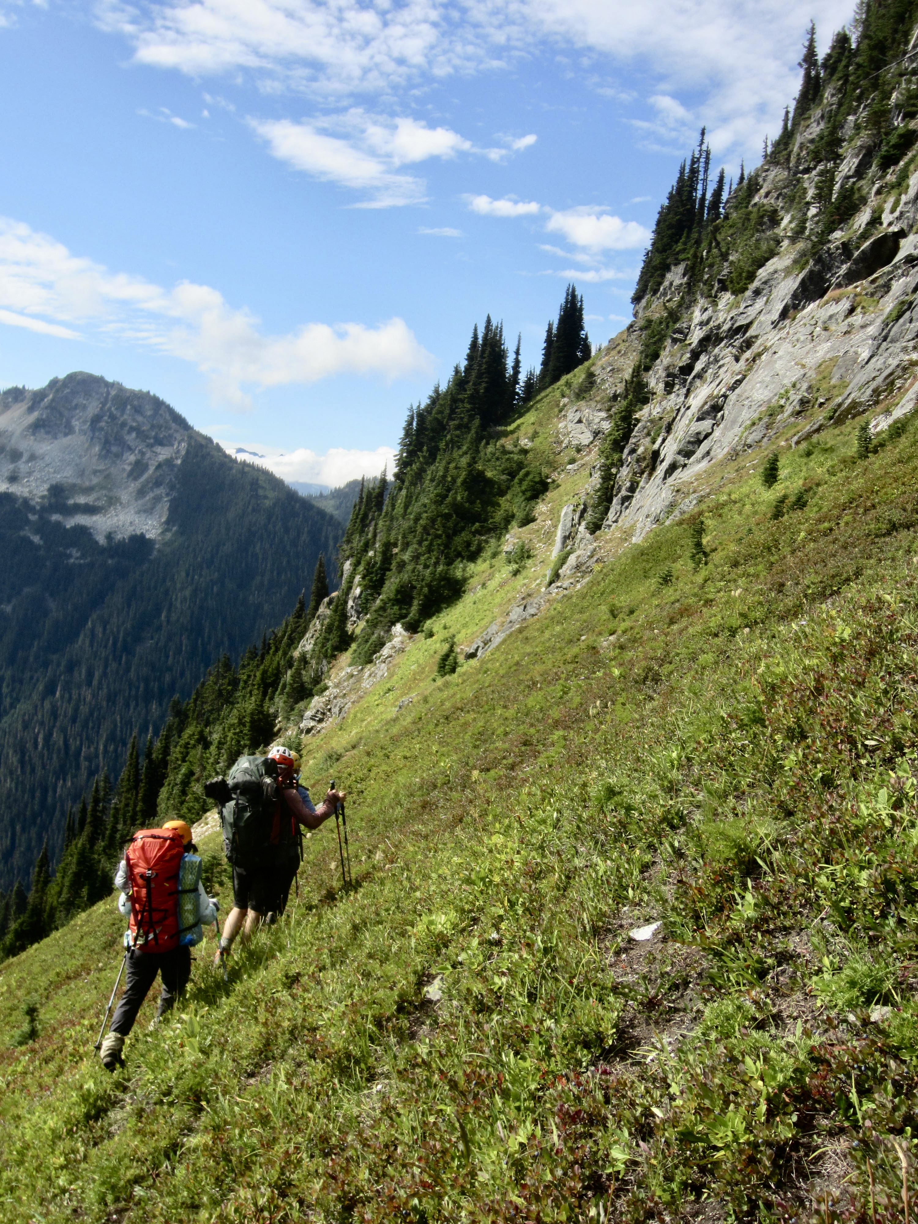
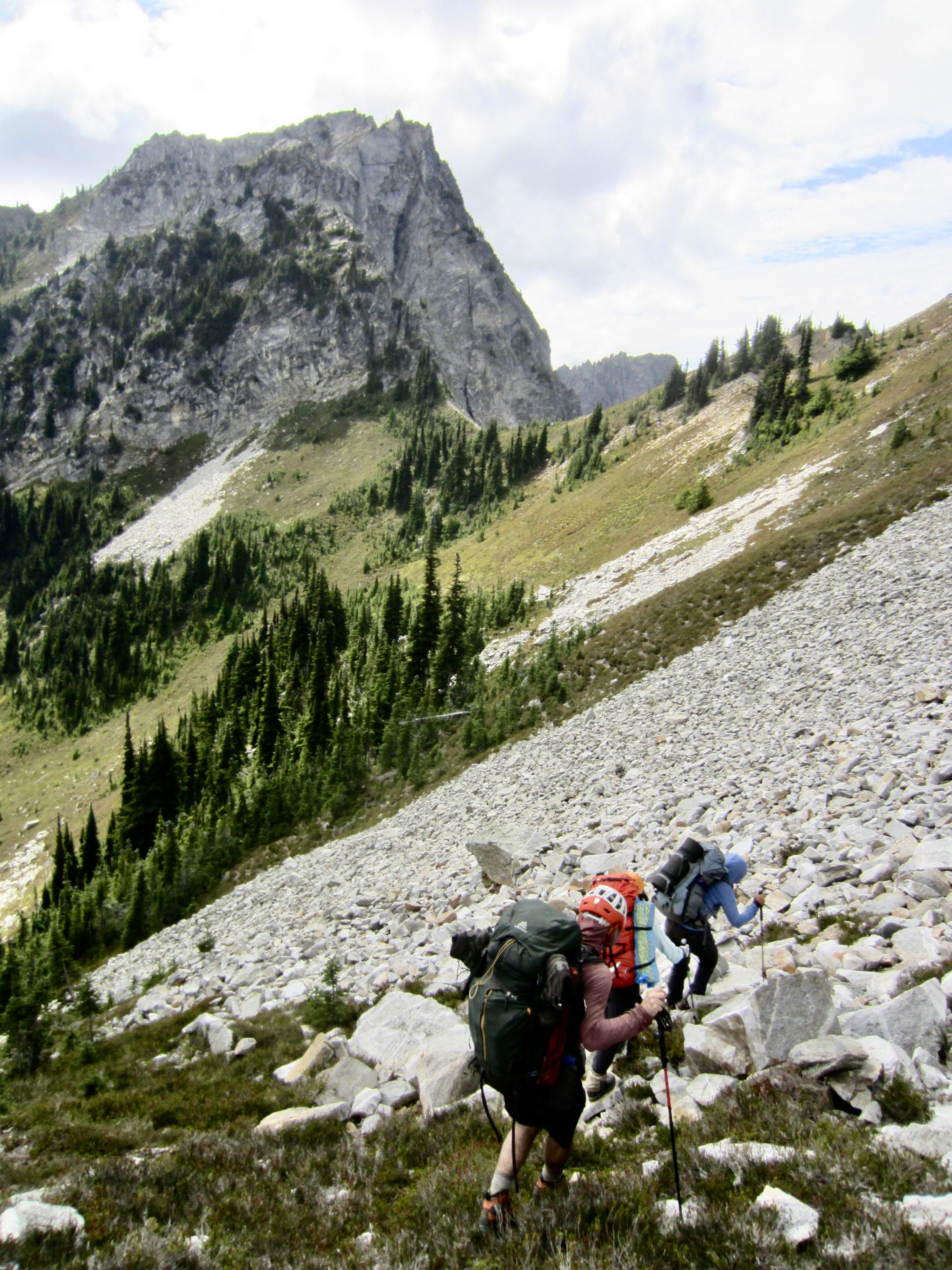
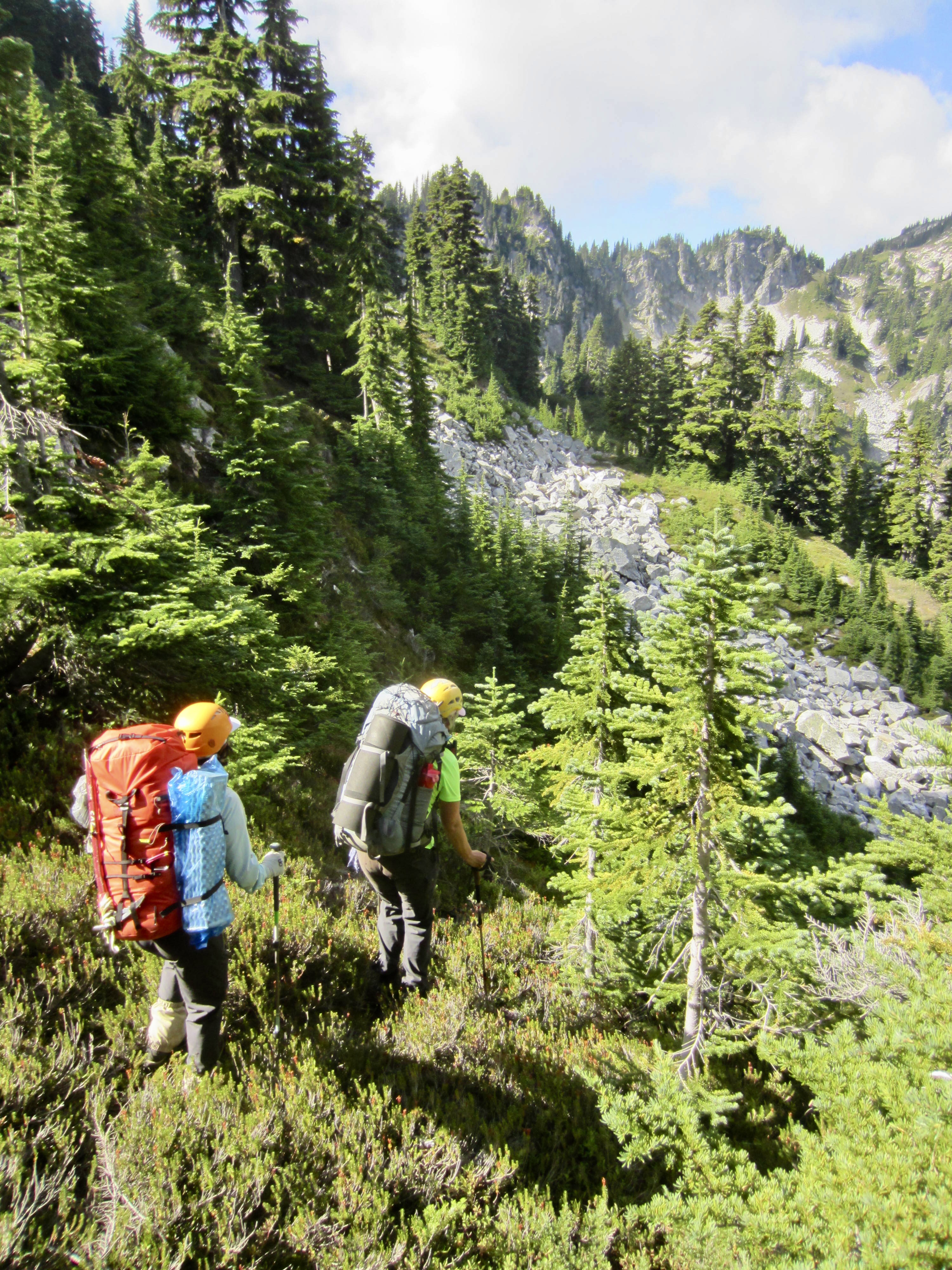
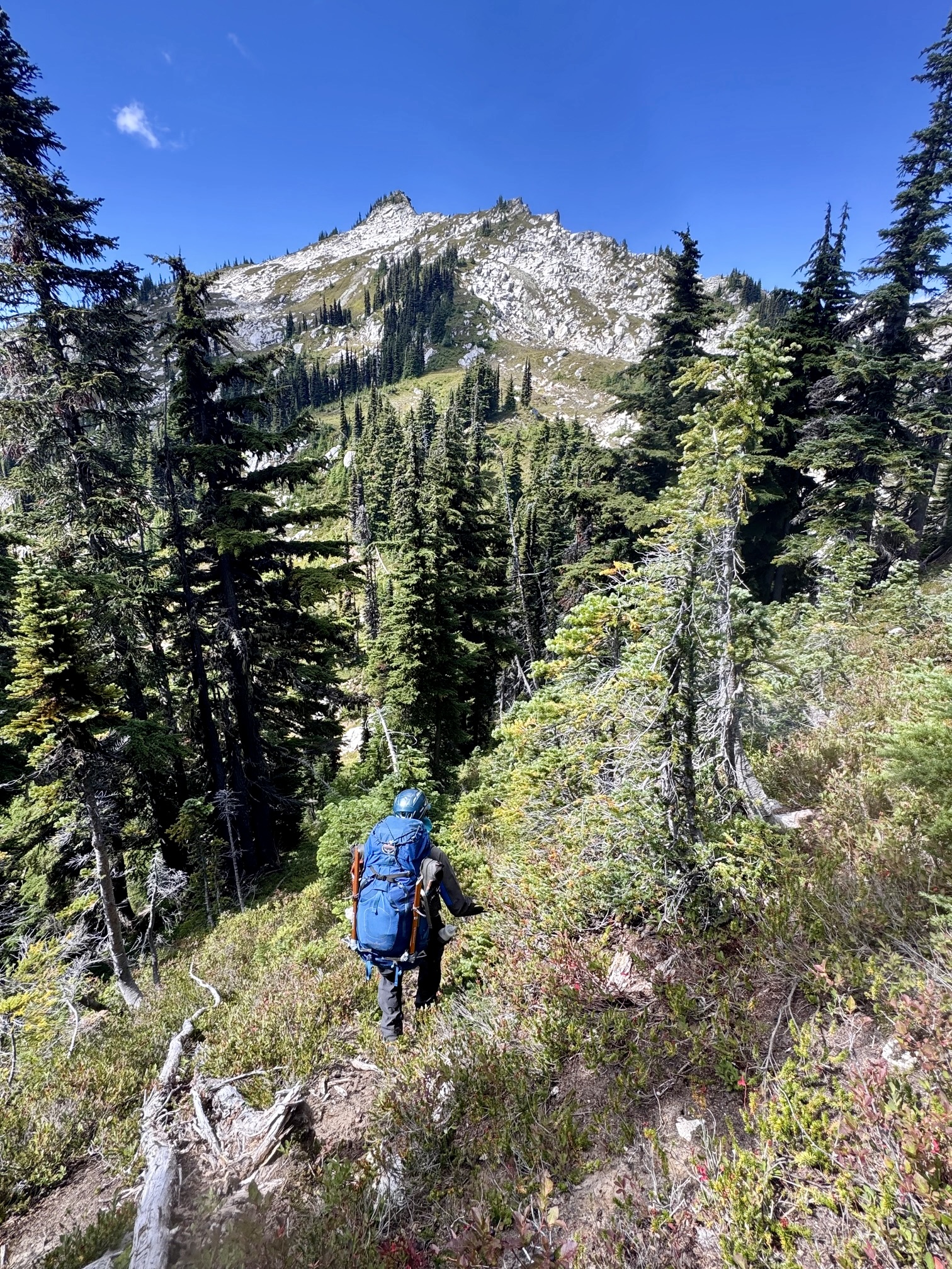
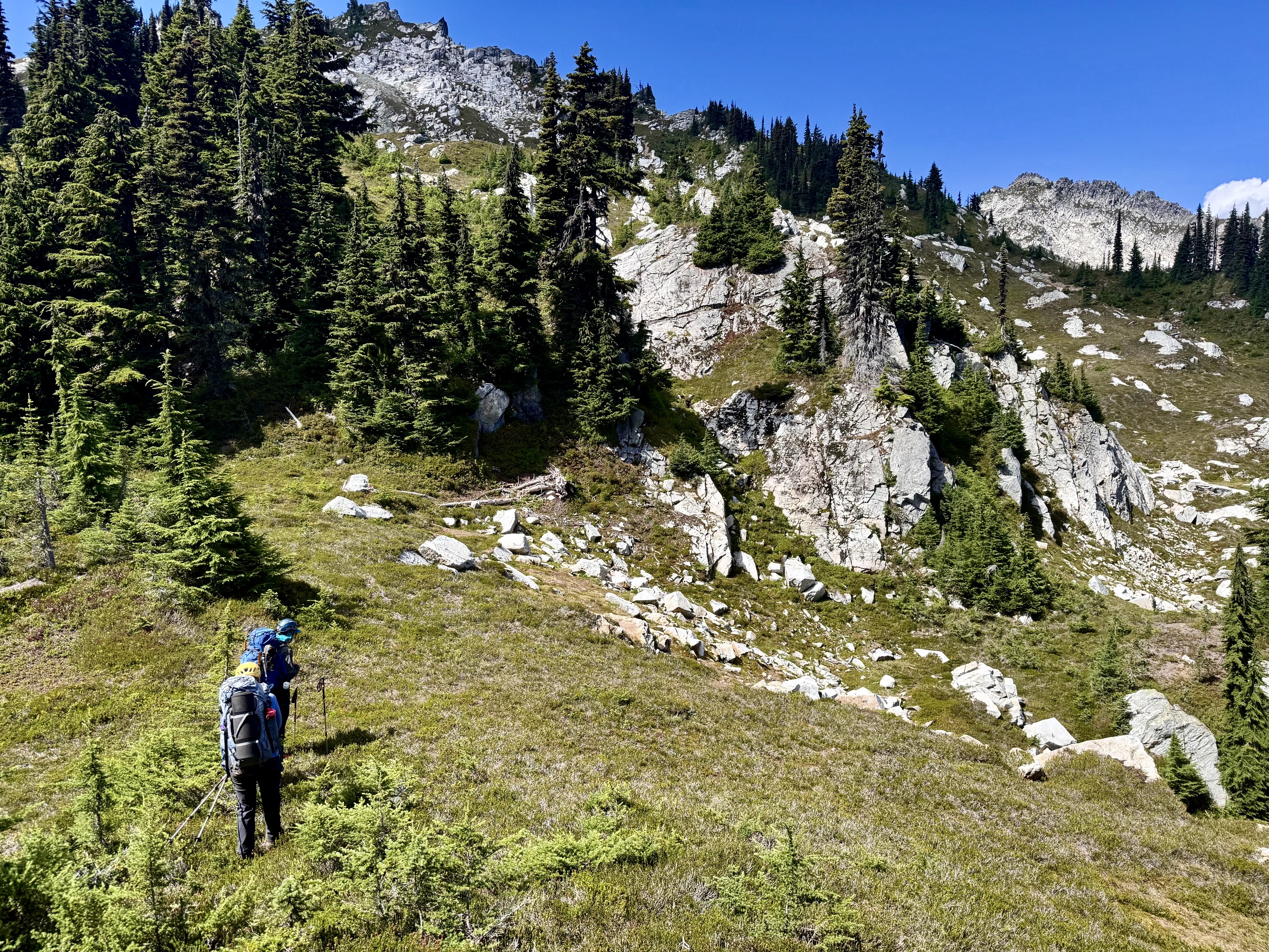
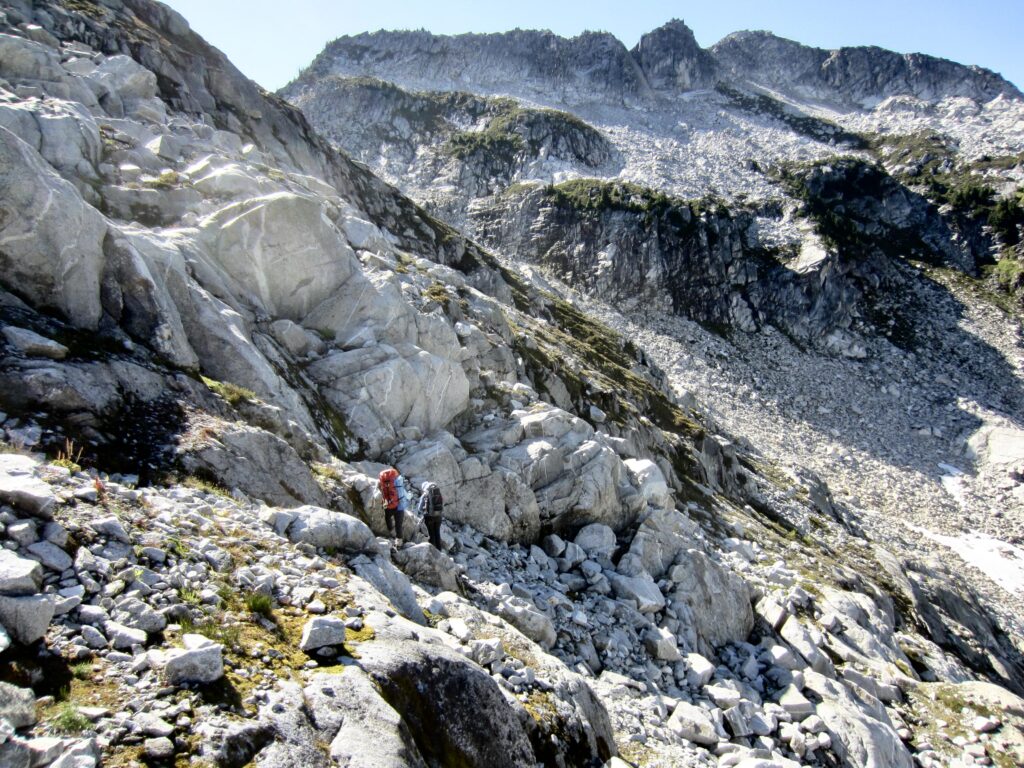
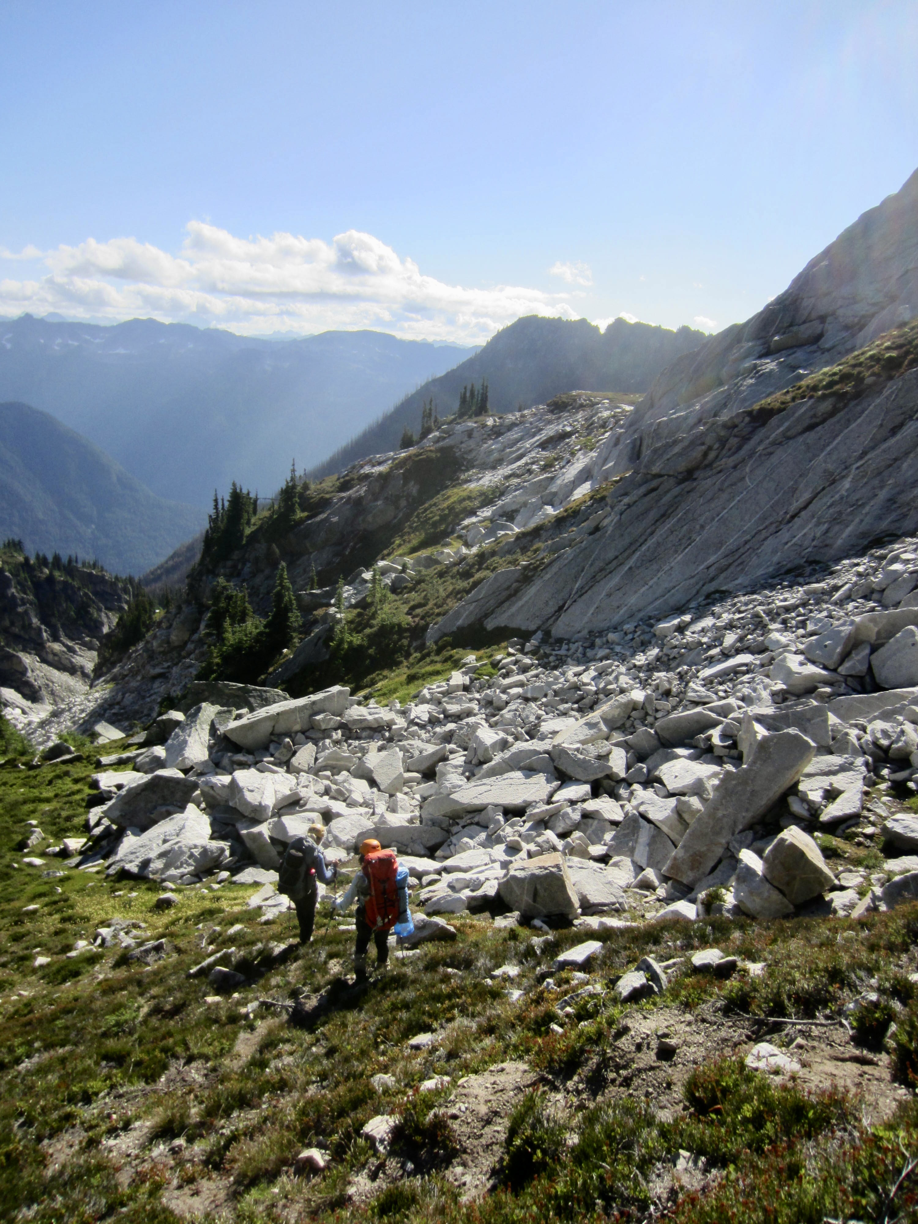
We exited Stonehenge Basin by climbing 200 feet up a talus slope and then traversing southwesterly to a rib shoulder at 6450 feet. From there, we made a mile-long northwesterly traverse across numerous small ribs and draws, generally staying at an elevation between 6350 and 6450 feet. Sloping benches along the way gave us some relief from the morning’s steep sidehilling.
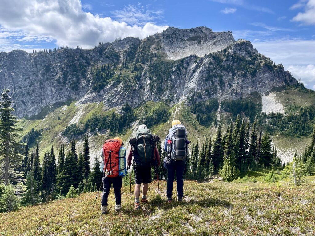
.
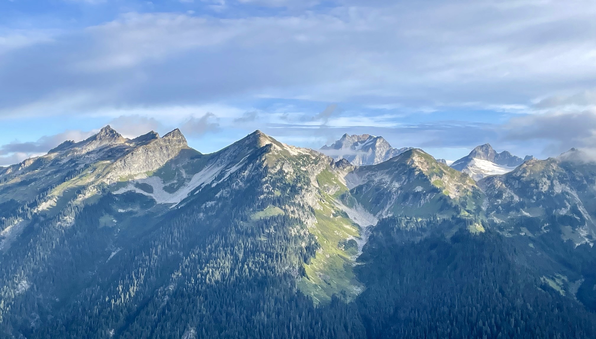
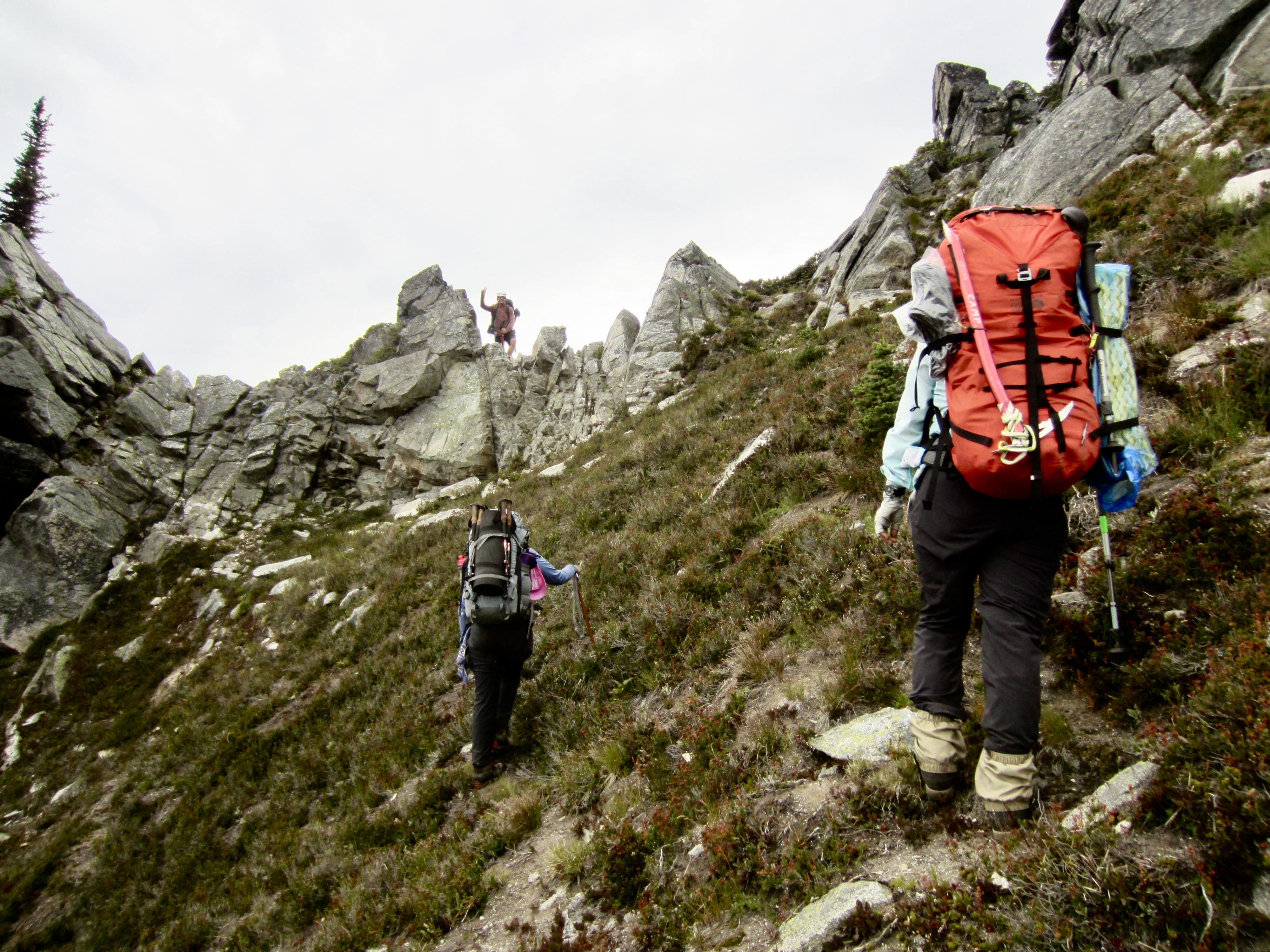
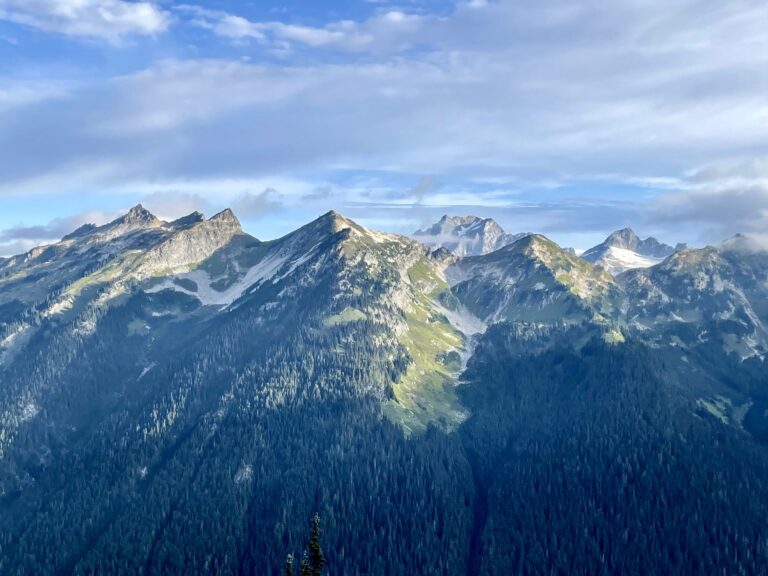
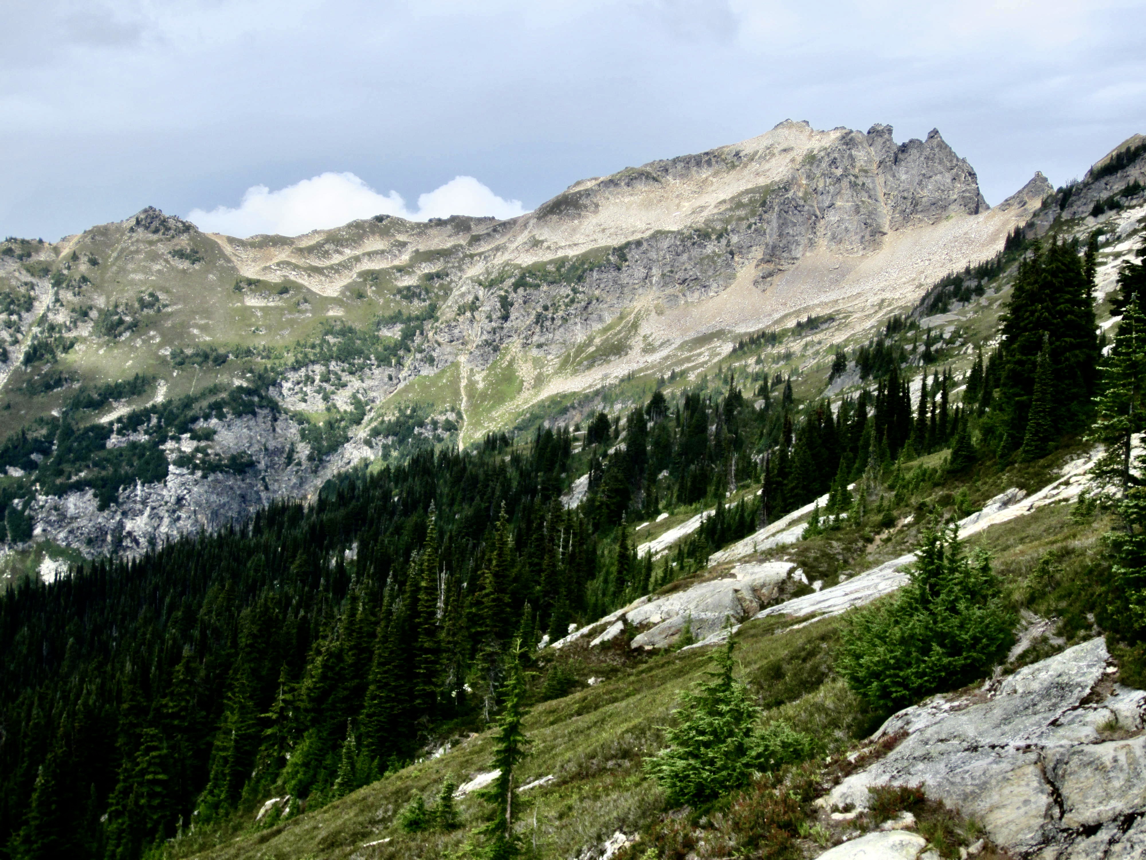
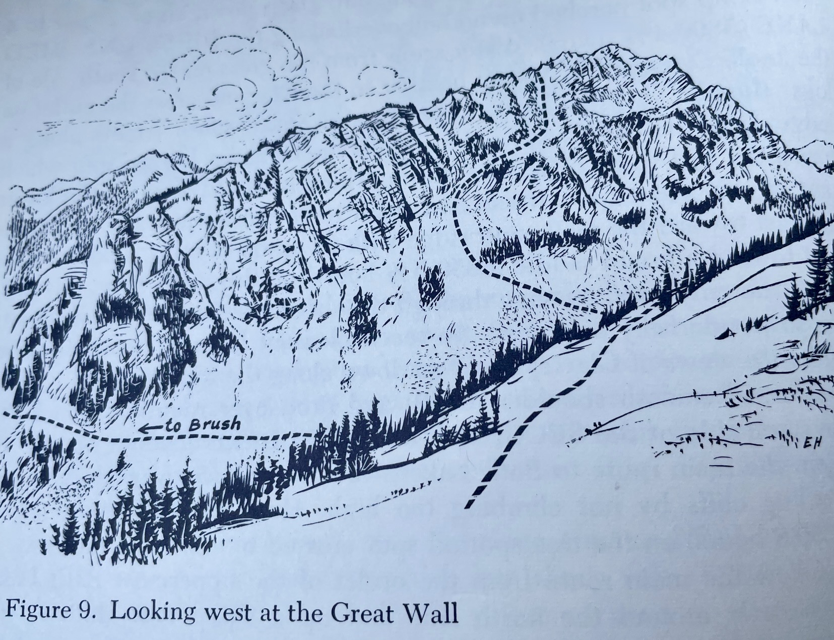
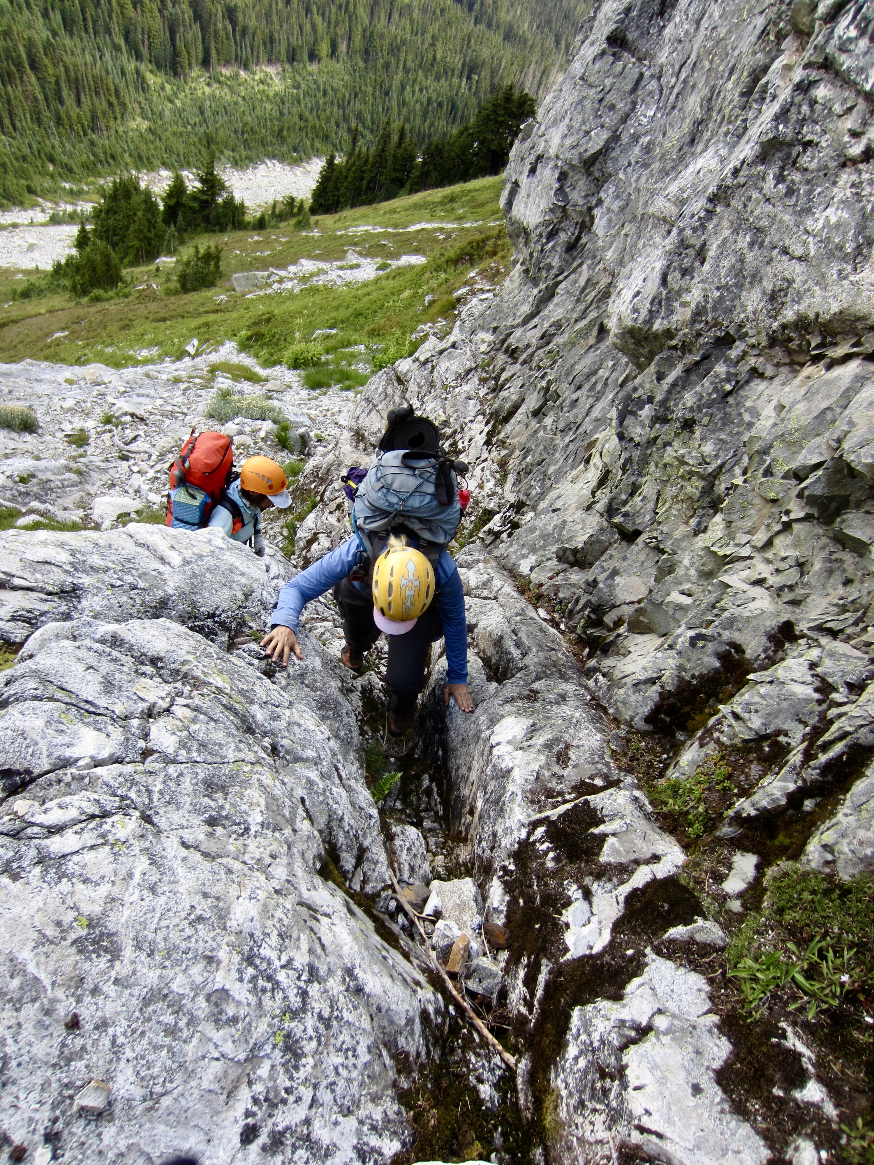
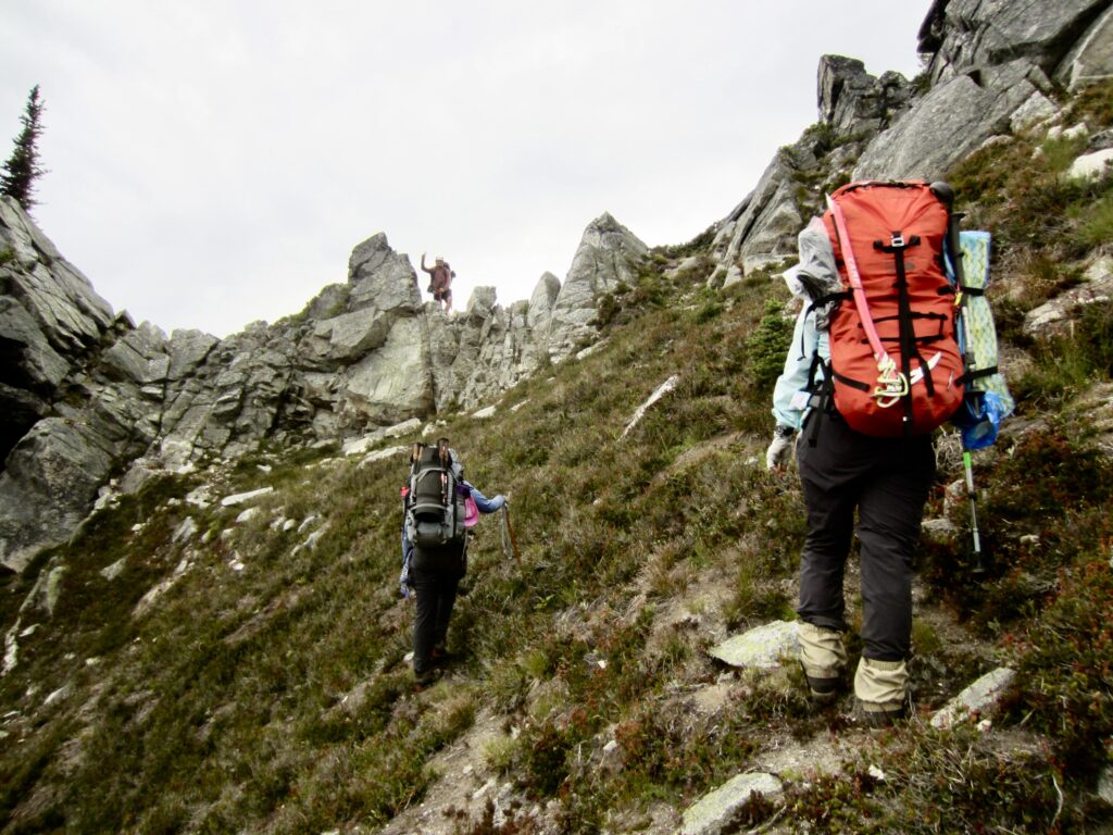
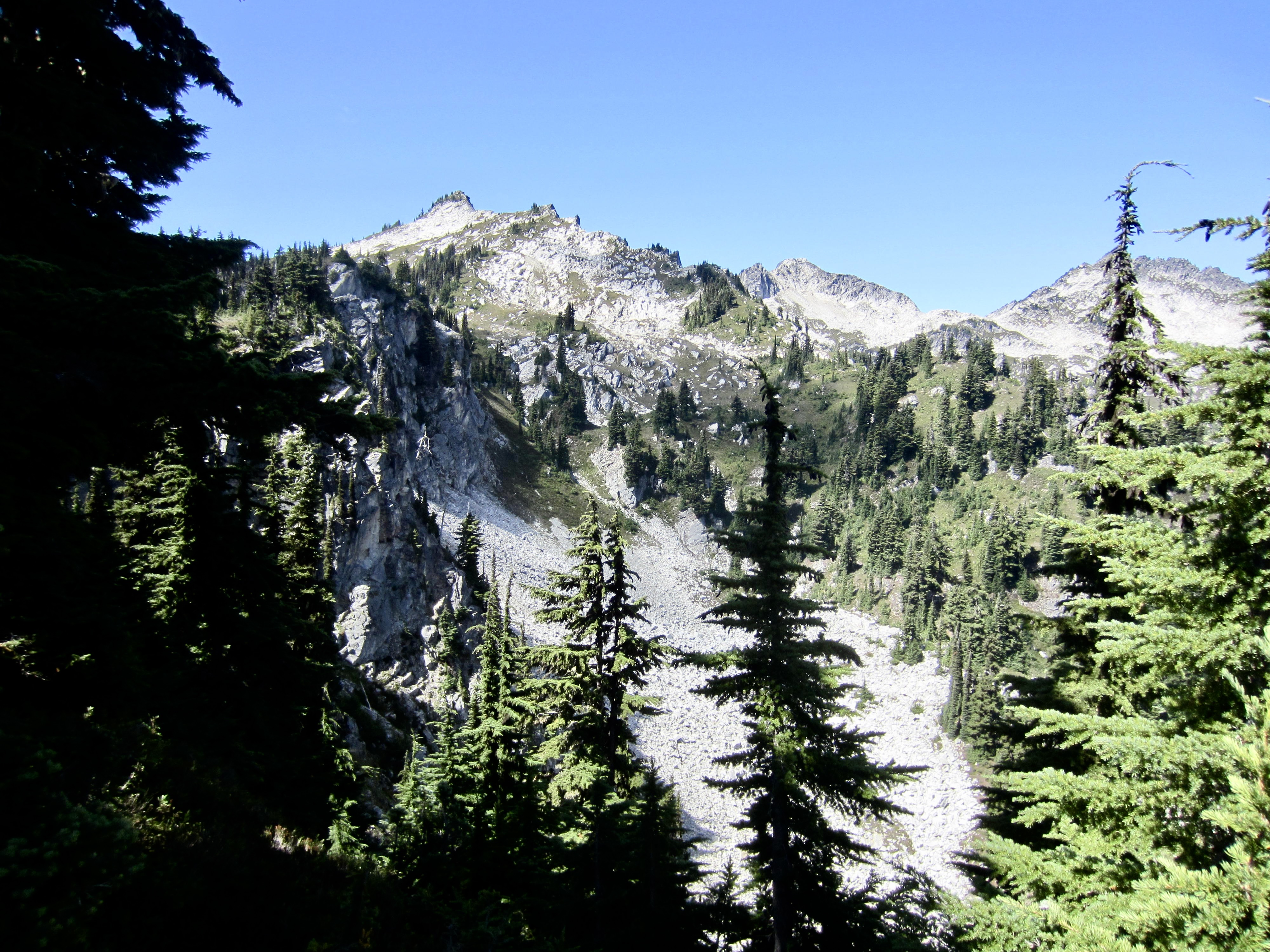
As we proceeded across the hillside, a large and imposing cliff gradually came into view. We soon found ourselves face-to-face with The Great Wall (play ominous music here). By carefully studying the wall from across Great Wall Basin, we could match visible features with a sketch shown in R&R. The key route feature is a right-slanting heather ramp that slices through the face and connects with a narrow chute leading up to the crest. From a distance, it appeared to be steep but reasonable.

.
.
.
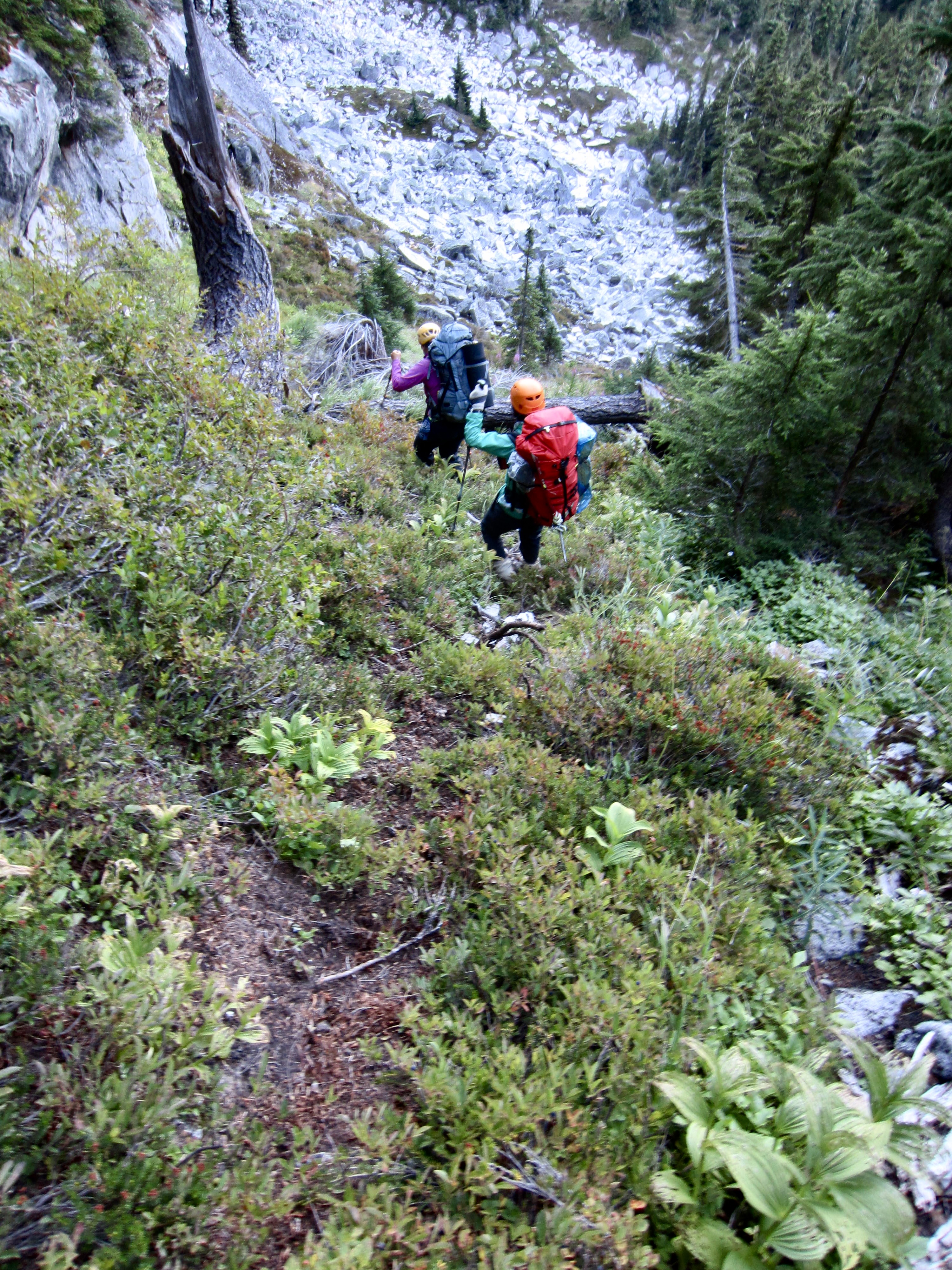
Rather than dropping into Great Wall Basin and then climbing up the other side, we elected to contour around the head of the basin and continue along the base of the wall. This strategy saved us 500 feet of loss and gain but probably didn’t save any time. The worst part was that it forced us to traverse across very steep heather, huckleberry, and rock below the wall. This tenuous traverse required a full hour.
.
.
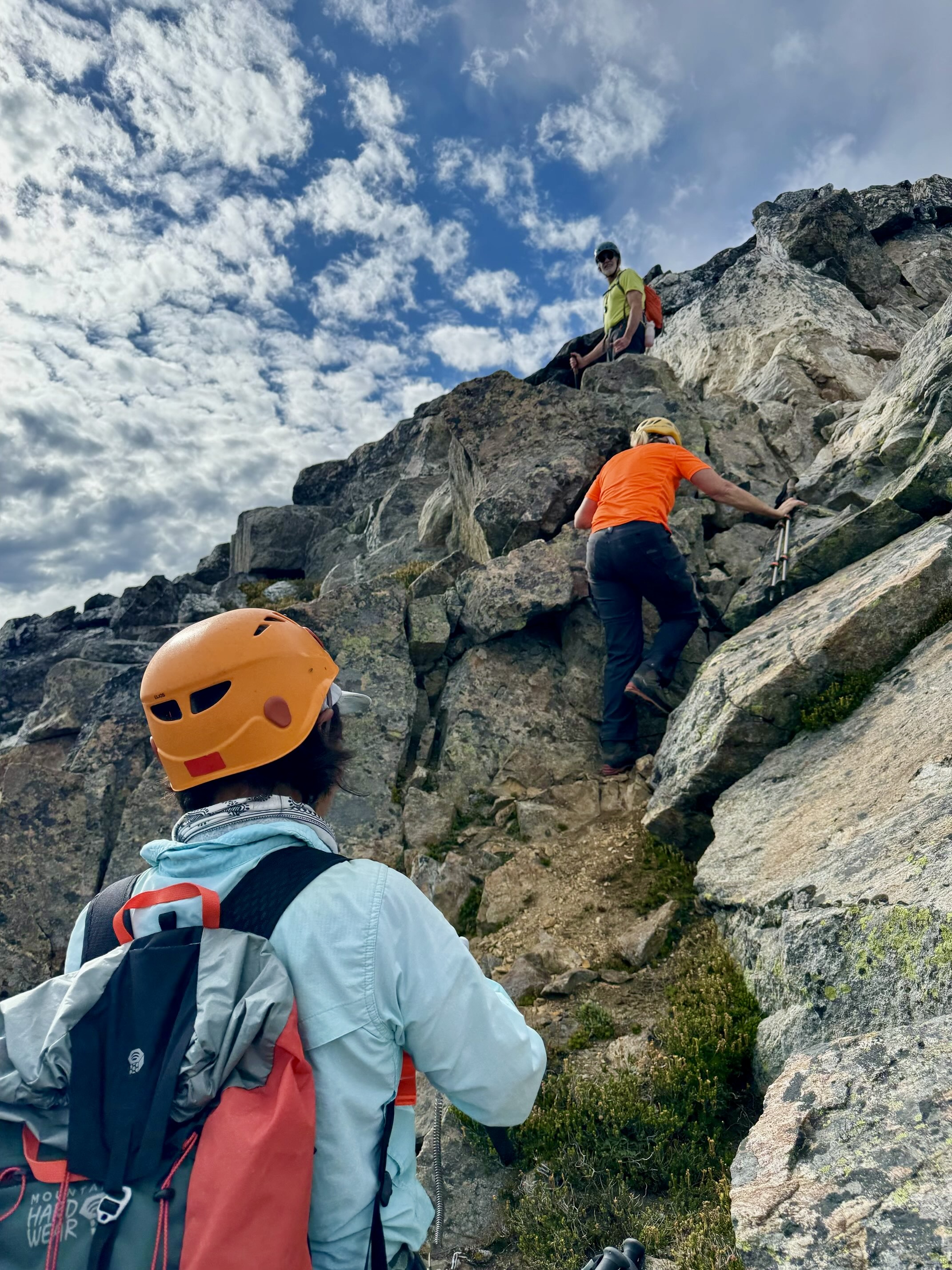
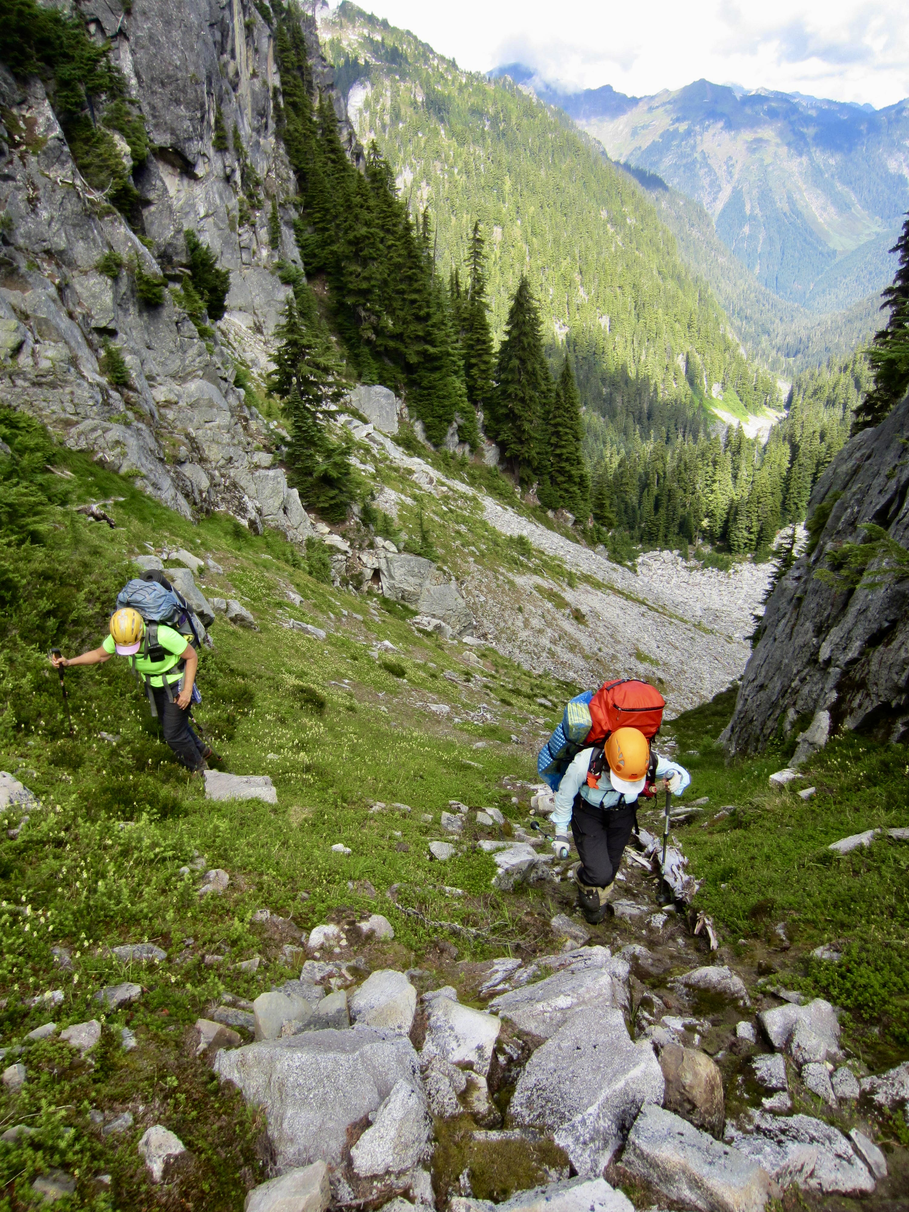
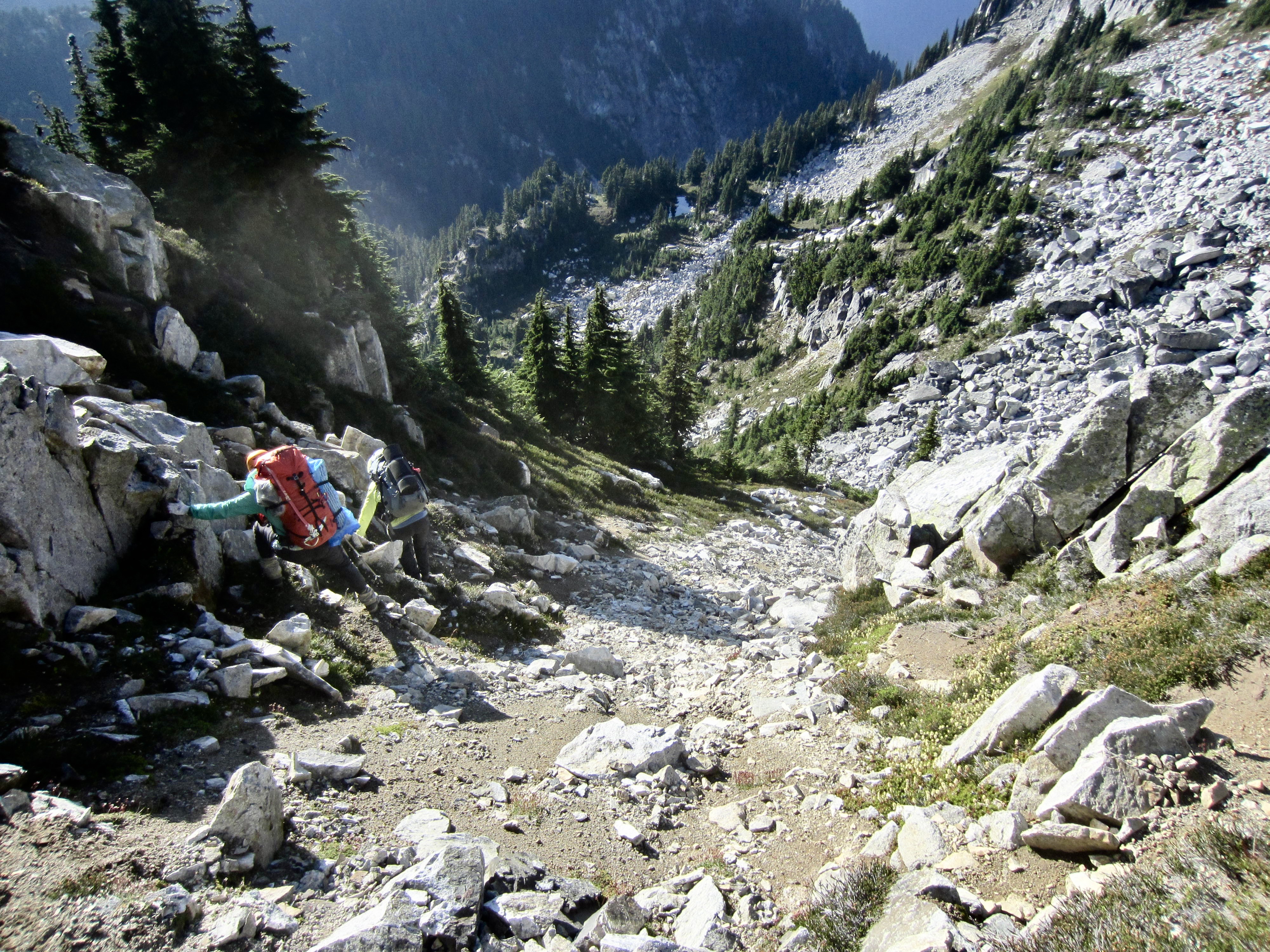
Upon reaching the base of the heather ramp, we could see that it is very steep and contains a lot of exposed rock. The ascent started with a short Class 3 rock scramble, then transitioned to a Class 3 grass scramble. Farther up, we used our 12-meter panic rope for a handline at a Class 3+ dirt step. Don’t slip here; this is serious terrain!
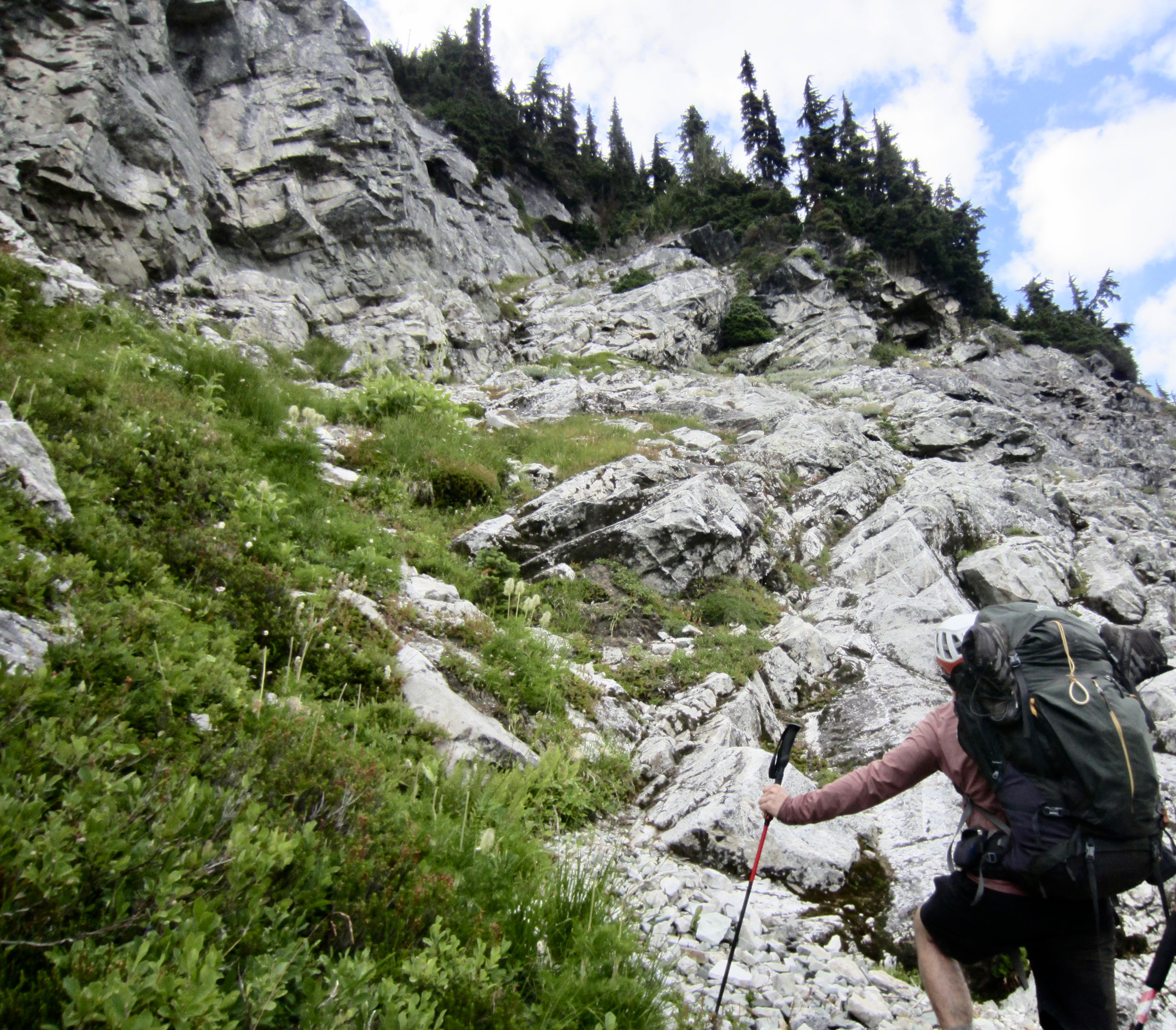
.
.
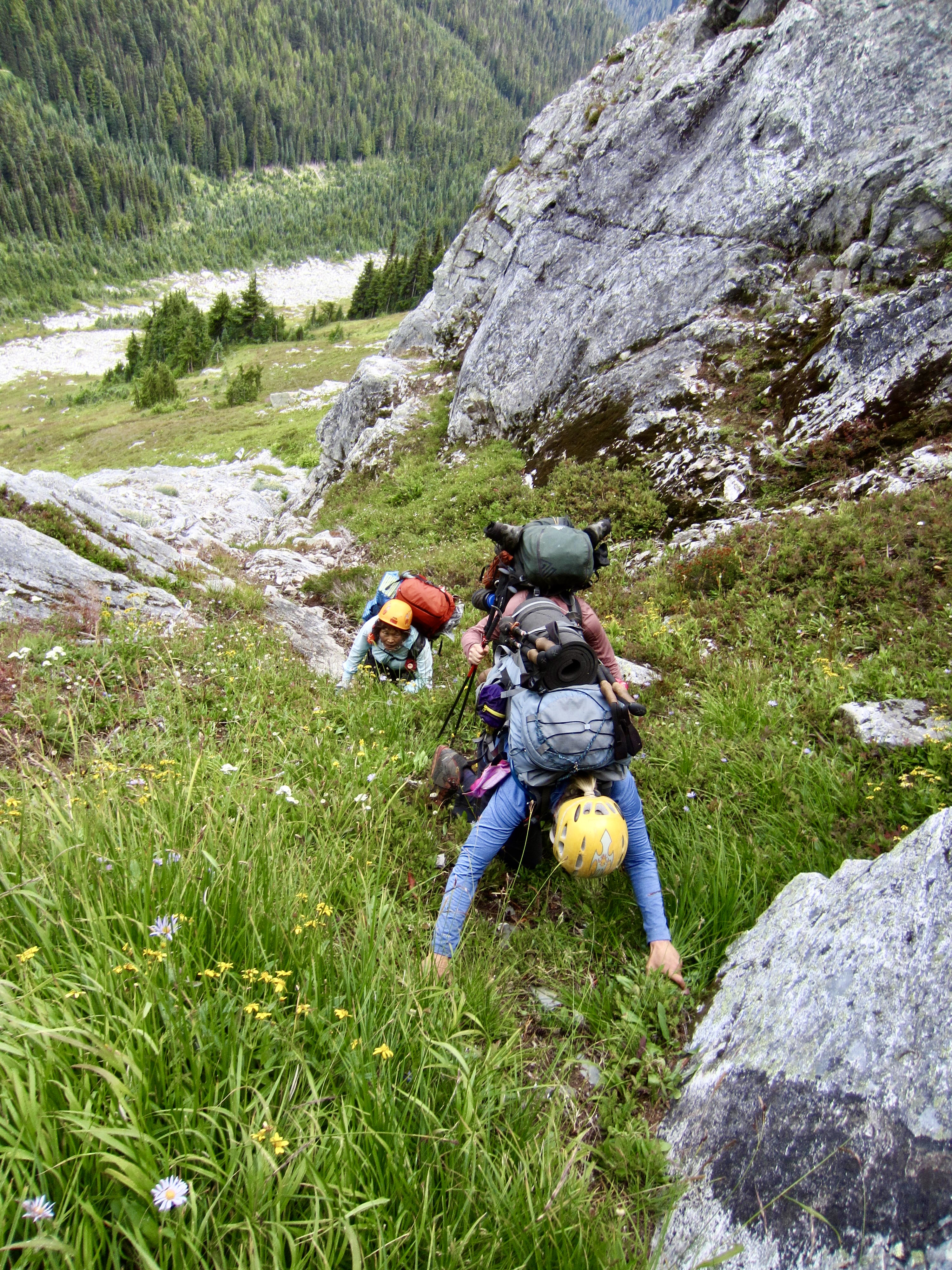
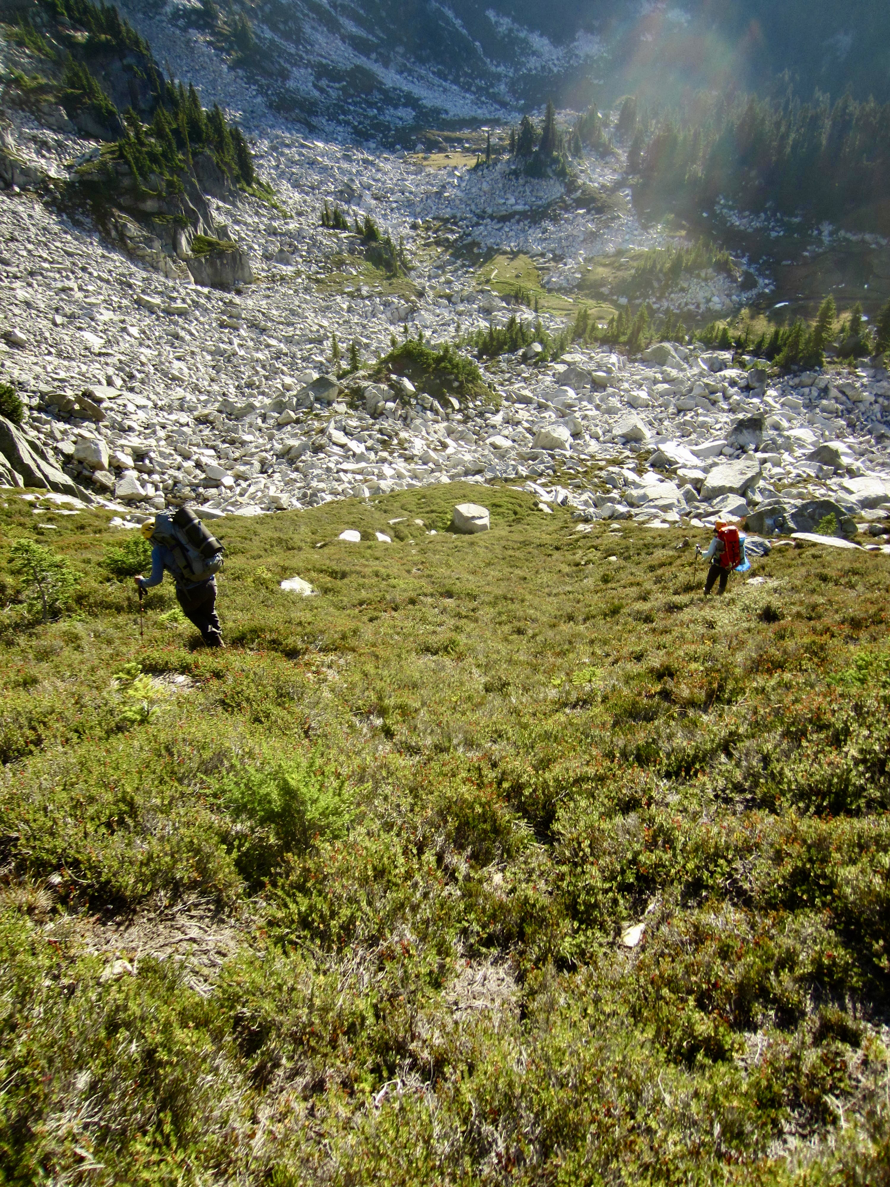
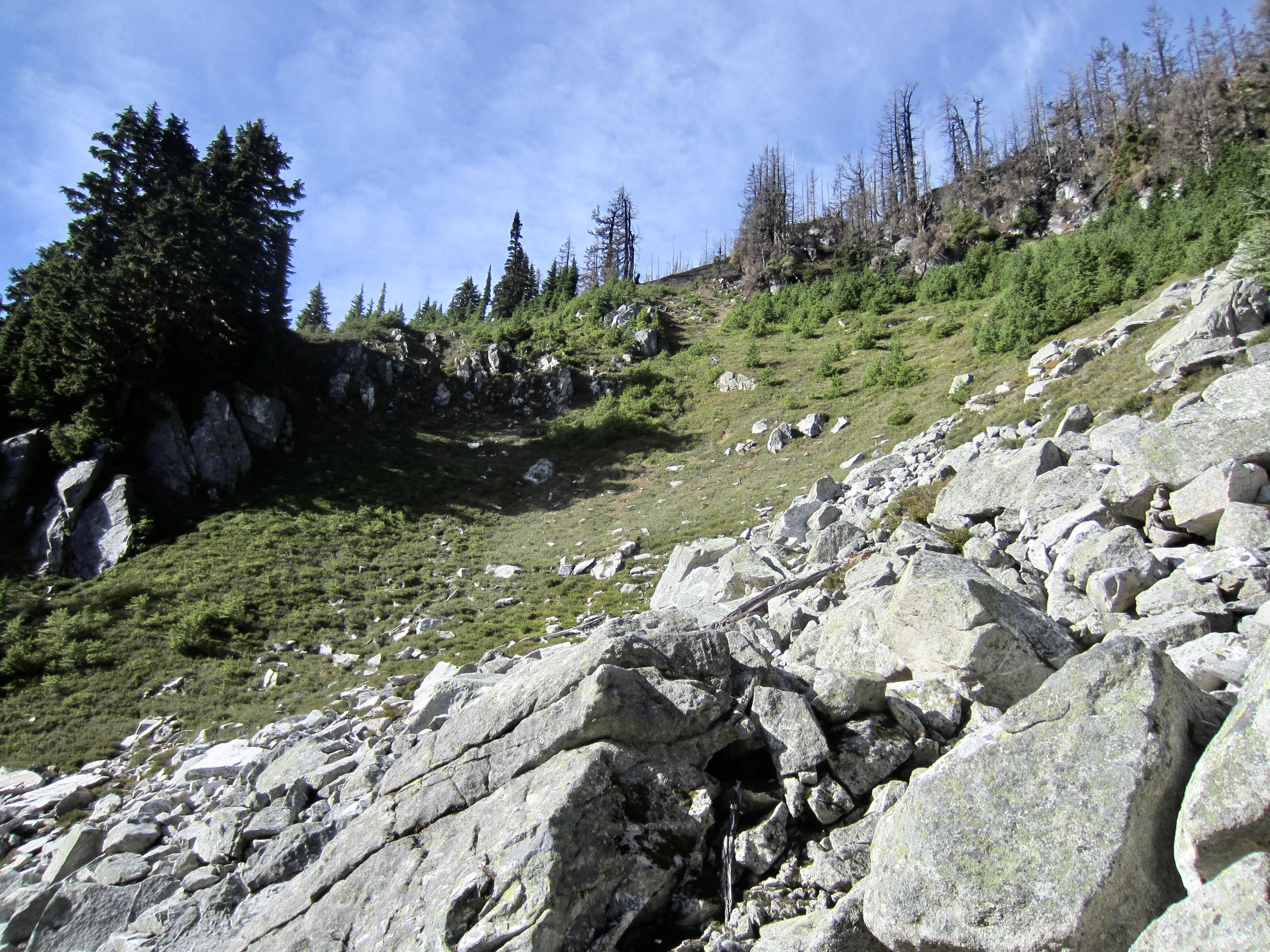
At the top of the ramp, we pushed through a small cluster of trees and traversed rightward across a green hillslope that R&R describes as “awesomely steep”—and it is. Eileen and I deployed our ice axes to assist with the crossing. After traversing for approximately 100 yards, we came to the bottom of an extremely steep heather chute and headed straight up. This chute ends at a 6900-foot notch in the rocky crest (10.1 hours + 2050 feet from Camp 3).
.
.
From the high notch, we surveyed the route ahead. It was nearly 6:00pm, and Bath Lakes were almost 2 miles away, so darkness would be nipping at our heels. We zigzagged down heather and talus slopes to a shallow basin at 6300 feet, then veered up to a rocky shoulder at 6600 feet on the south ridge of Point 6966.
.
.
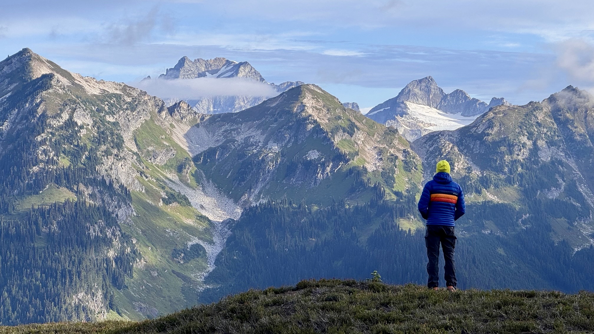
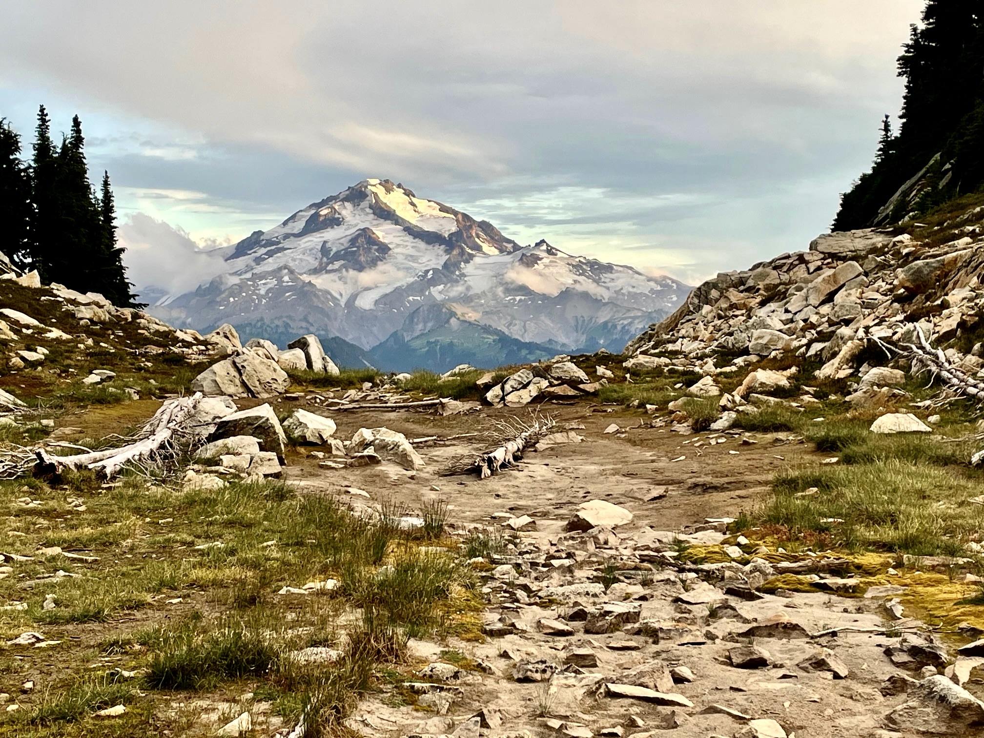
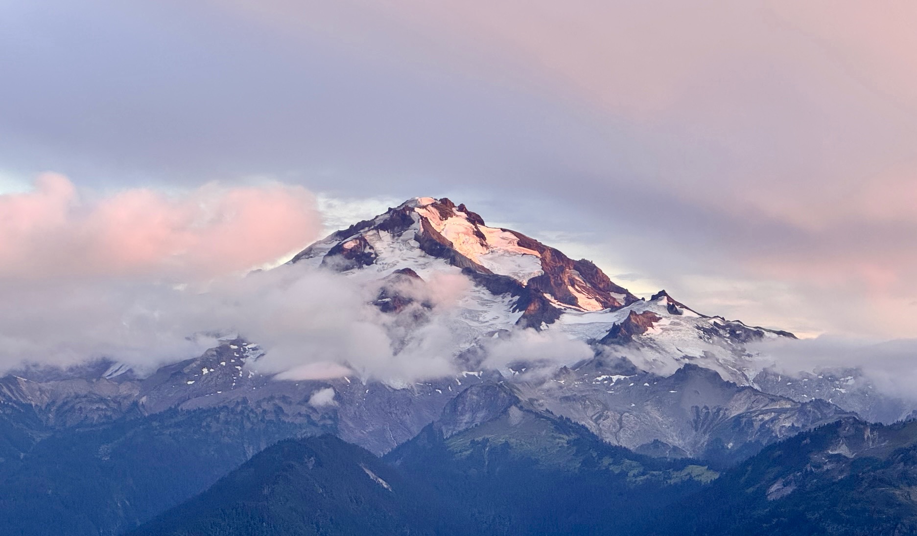
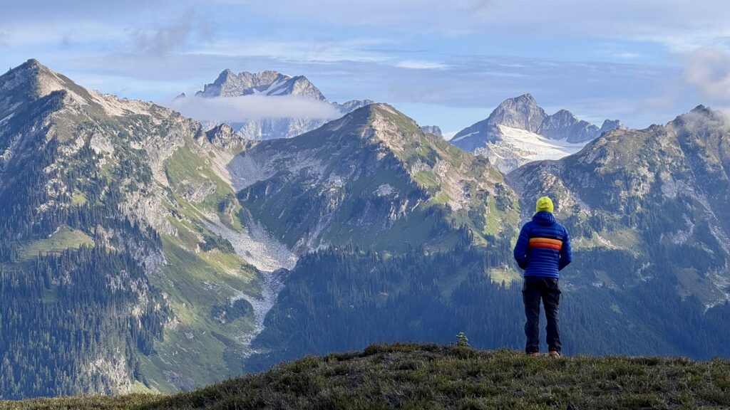
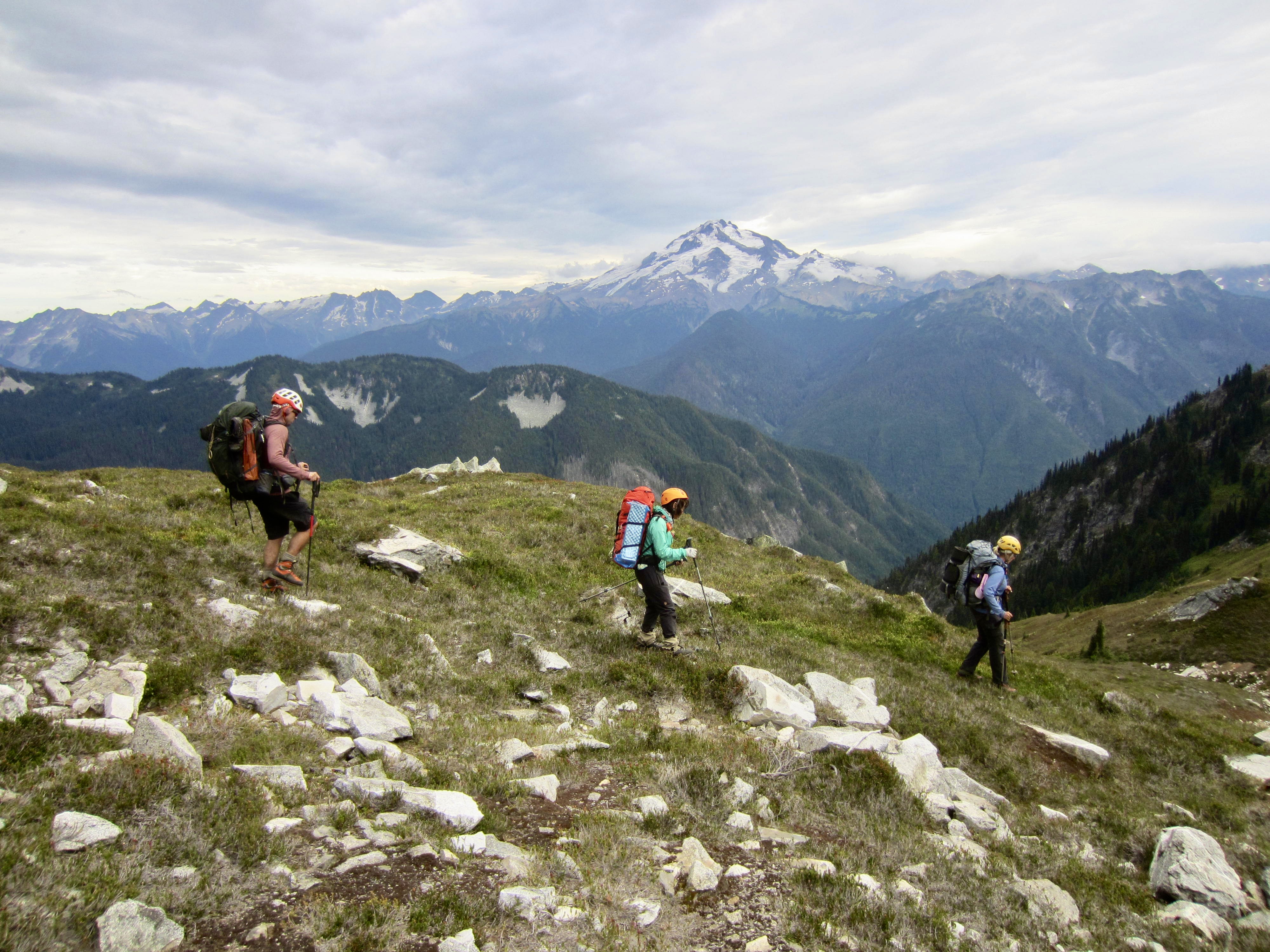
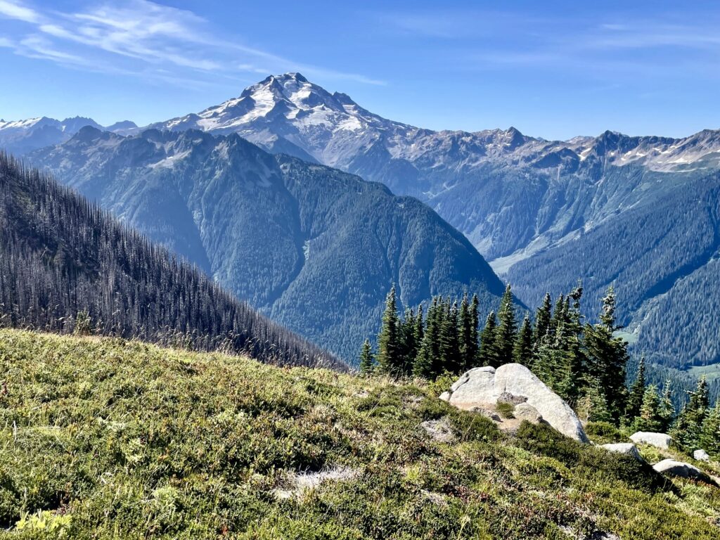
Glacier Peak, or DaKobed, had remained visible during our entire traverse, and we were presented with steadily changing light and cloud conditions throughout the day. If this had not always been my all-time favorite stratovolcano, it certainly would have earned that distinction today!
.
After rounding the corner of Point 6966, we descended into a flat-bottomed basin at 6400 feet. A touch of alpenglow on Glacier Peak gave us fair warning that sundown was imminent.
.
.
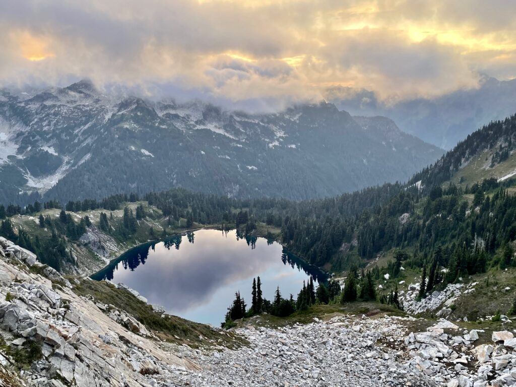
Our final ascent of the day involved hiking westerly up to a ridge crest at 6600 feet. Nestled in a shallow bowl 700 feet below was Upper Bath Lake, with its unblemished glassy surface reflecting colorful clouds. Coming at the end of a long day, it was an incredibly ethereal and tantalizing sight! We hustled down a curving path and arrived at the lakeshore in the last hint of twilight (13.4 hours + 2600 feet – 2250 feet from Camp 3).
.
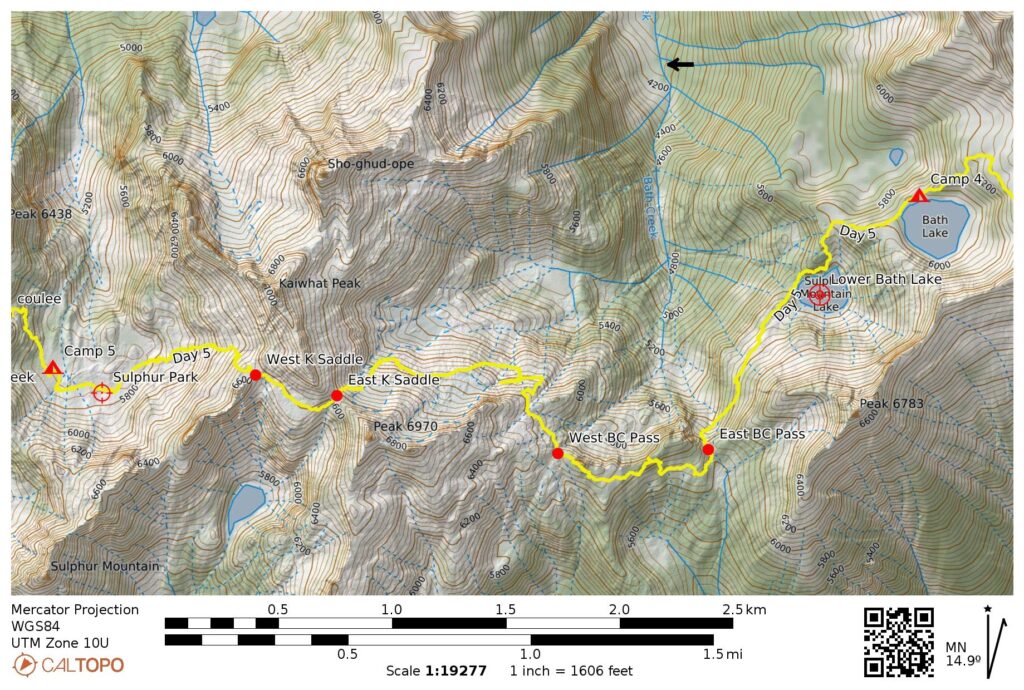
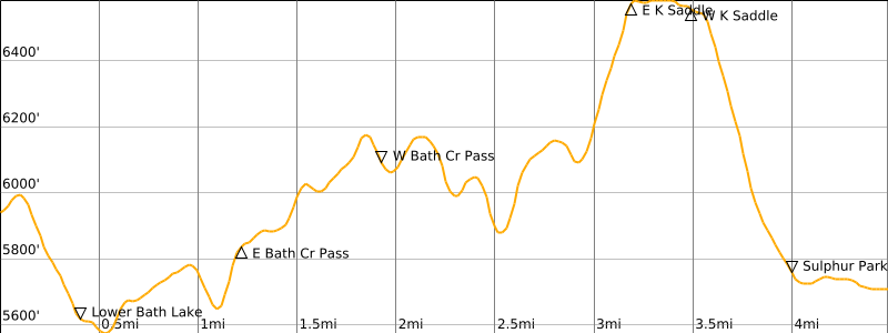
Day 5: Upper Bath Lake to Sulphur Park
Due to yesterday’s late arrival, we had a leisurely morning that gave us time to absorb the wonderful ambiance at Upper Bath Lake. It was a special privilege to be camped in such a seldom-visited location.

.

.
After finally breaking camp at 9:00am, we hiked and slithered down steep slopes to Lower Bath Lake. This lake sits in a deep bowl surrounded by tall cliffs, making it somewhat less appealing than the upper lake. Given the remote location, it was quite a surprise to see a solo hiker (Tyler) camped here. Andrew obtained some route information from Tyler and then sped off to the Suiattle Trailhead; his work obligations required him to combine our last two days into a one-day push.
.
Because Tyler had visited Bath Lakes several times before and knew the best exit route, he kindly led Eileen, Yoko, and me on a southwesterly traverse across a steep, wooded hillslope covered with huckleberry bushes. When our traverse ended at the bottom of a mossy chute, Tyler zoomed ahead, leaving the three of us to climb up the chute at our own pace. We topped out at 5850-foot East Bath Creek Pass in late morning (2.5 hours + 500 feet from Camp 4).
.
.
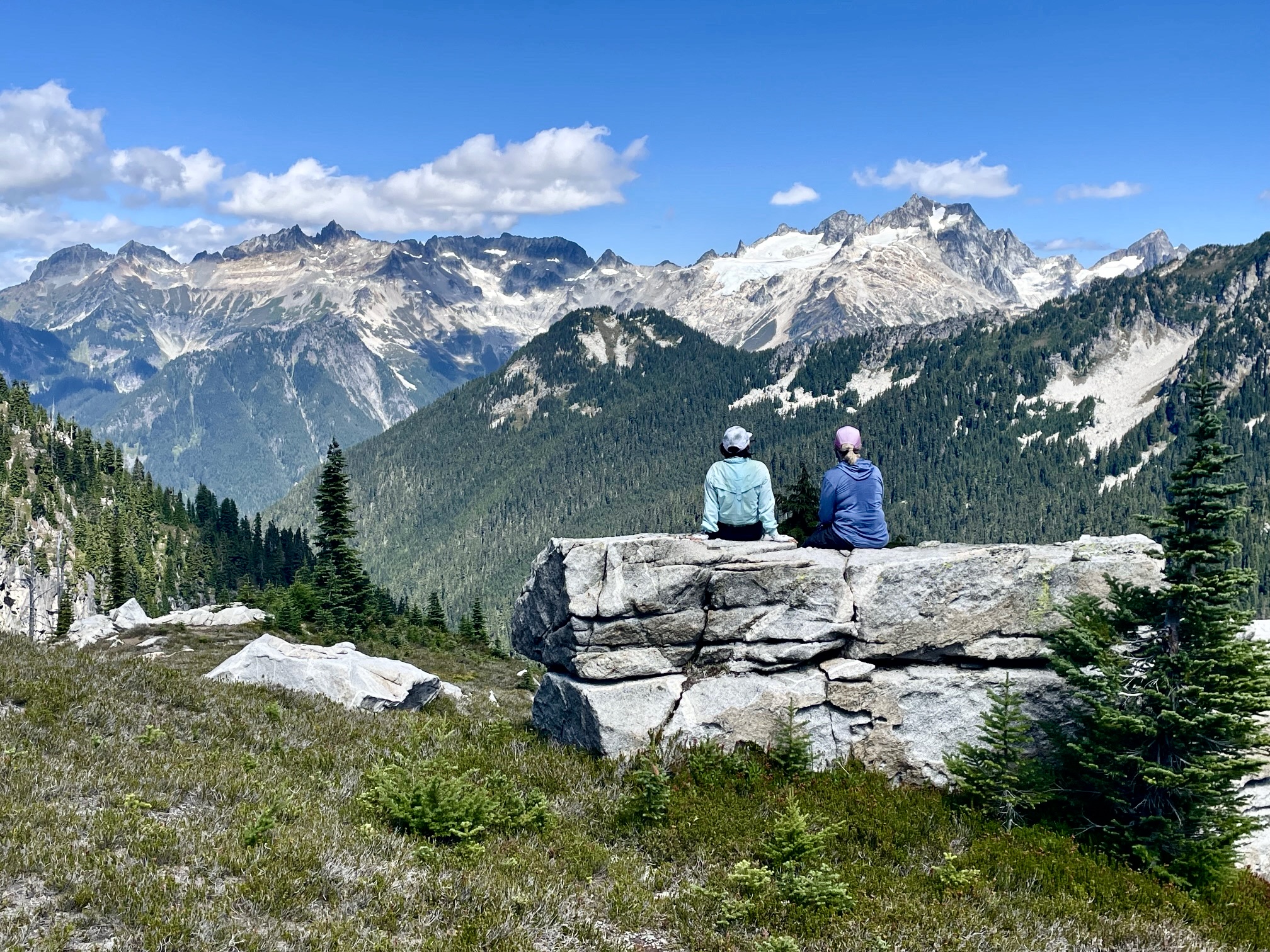
From the pass, we made a brushy traverse around Point 6102 and then went over the top of adjacent Point 6265 before dropping to 6100-foot West Bath Creek Pass (4.0 hours + 900 feet from Camp 4). It was early afternoon, so we stopped for lunch in view of Spire Point and Dome Peak.
.
.
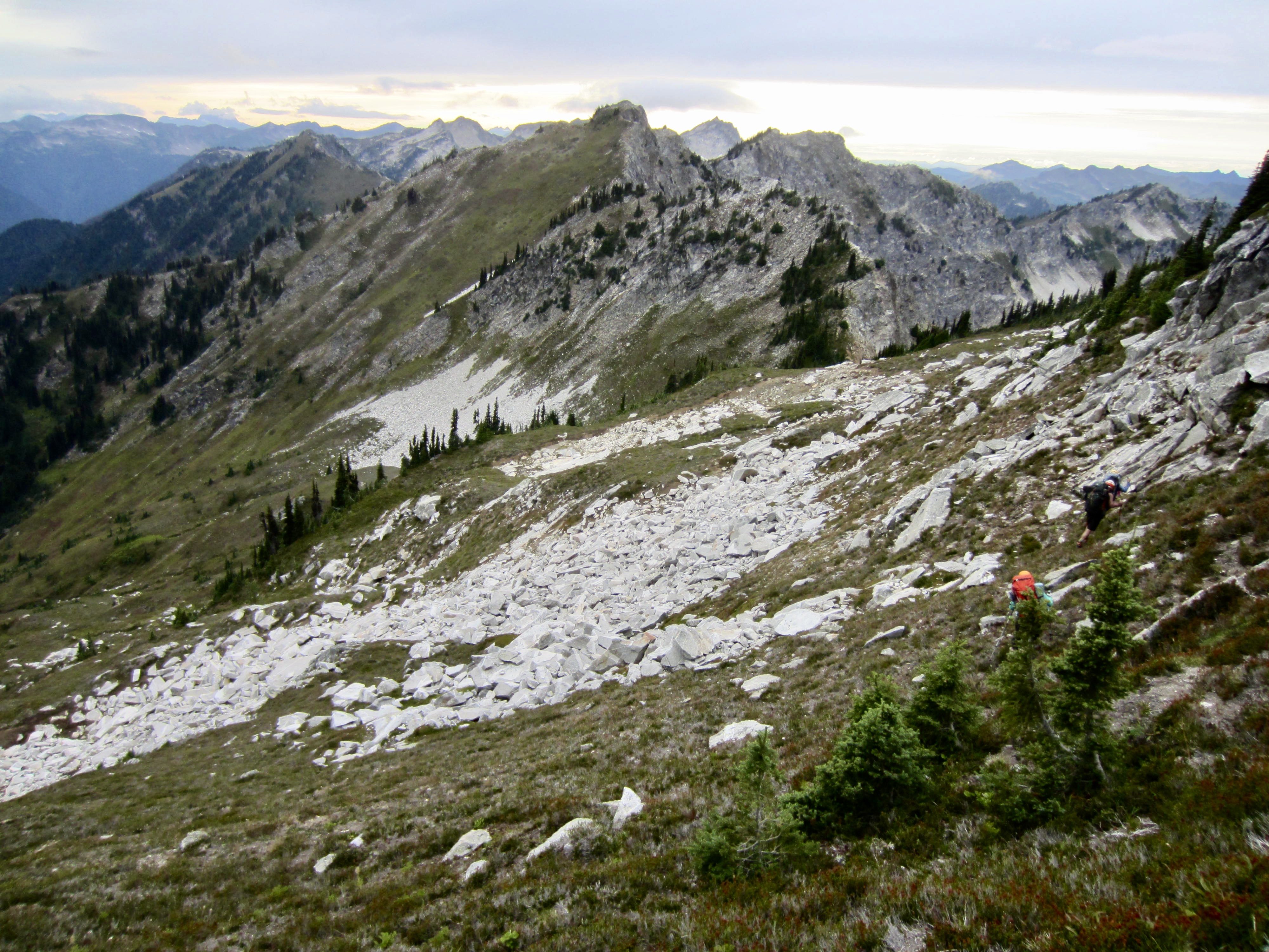
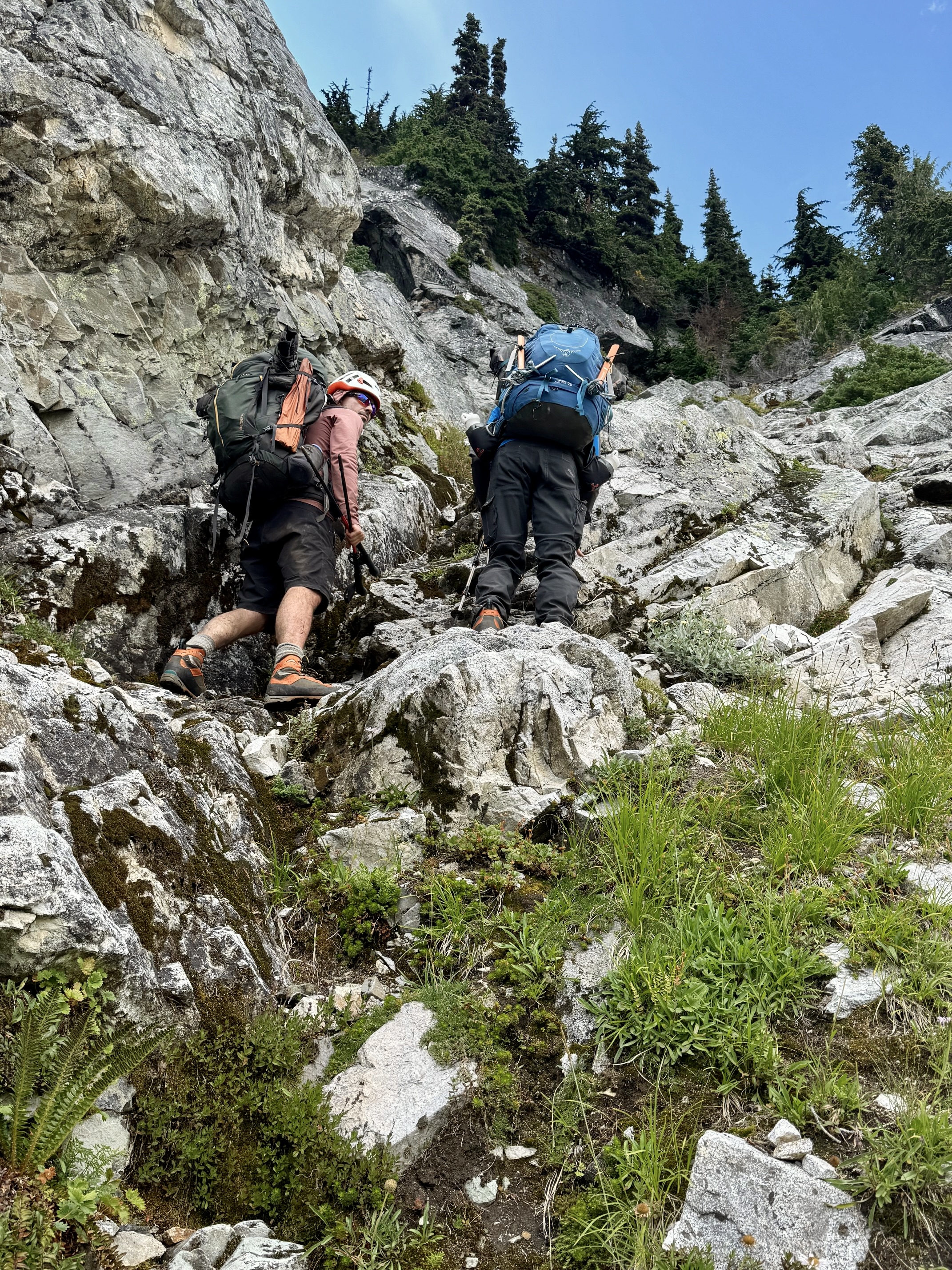
Continuing westward from West Bath Creek Pass requires some careful micro-navigation, starting with a rock buttress next to the pass. Although R&R gives a fairly detailed description of the route through here, it provided very little help because we were traveling in the opposite direction. After multiple attempts at a high crossing of the buttress, we finally conceded and simply made a 300-foot descent to get underneath it. From our low point at 5900 feet, we angled upward to gain the crest of an ancient lateral moraine.
.
Contouring westward across the moraine slope, we came to a second buttress of slabby rock. As described by R&R, a break in this buttress at 6100 feet allowed for an easy crossing. More importantly, a small creek here provided much needed water. (This was the only water source between Lower Bath Lake and Sulphur Park.)
.
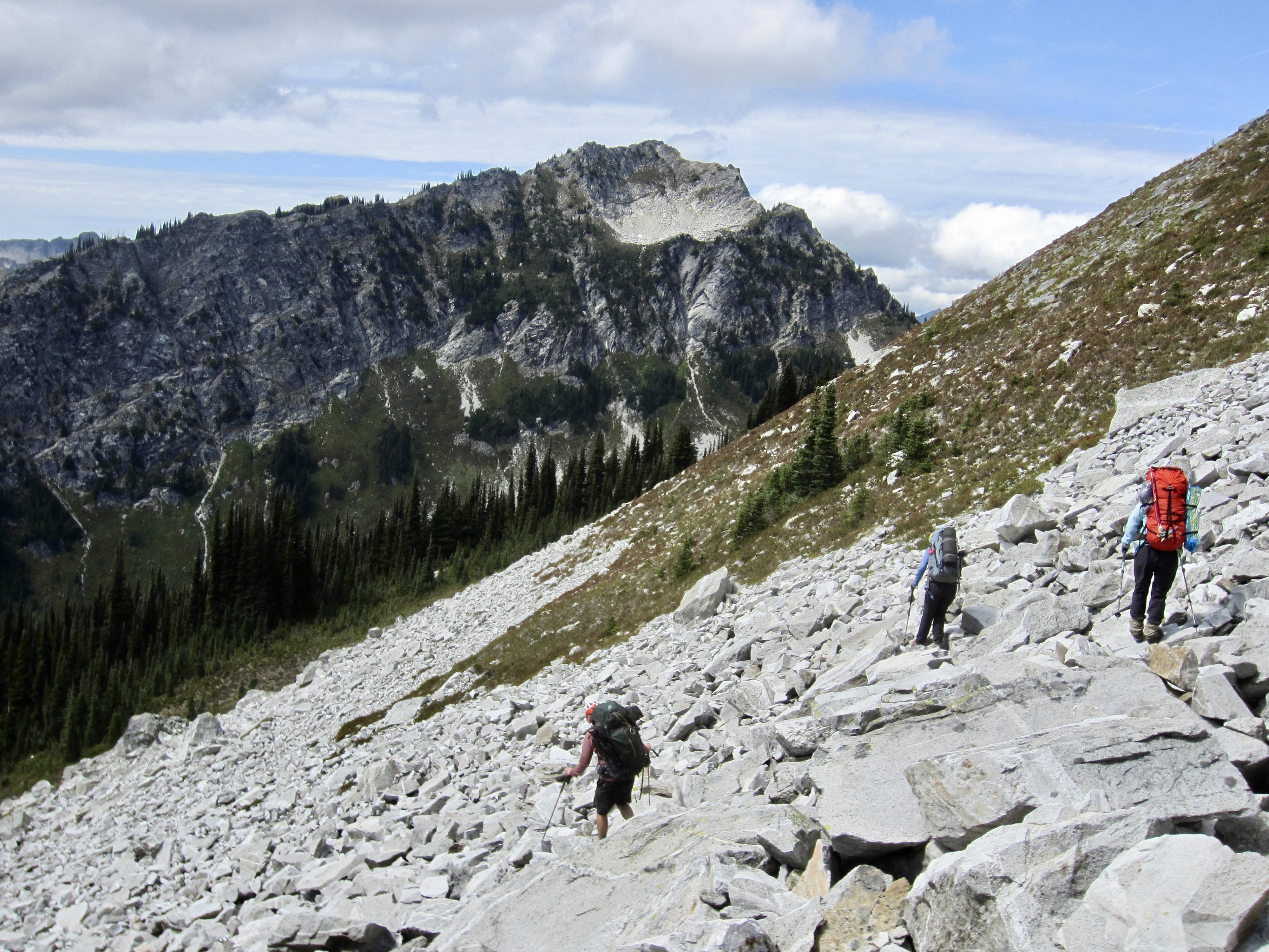
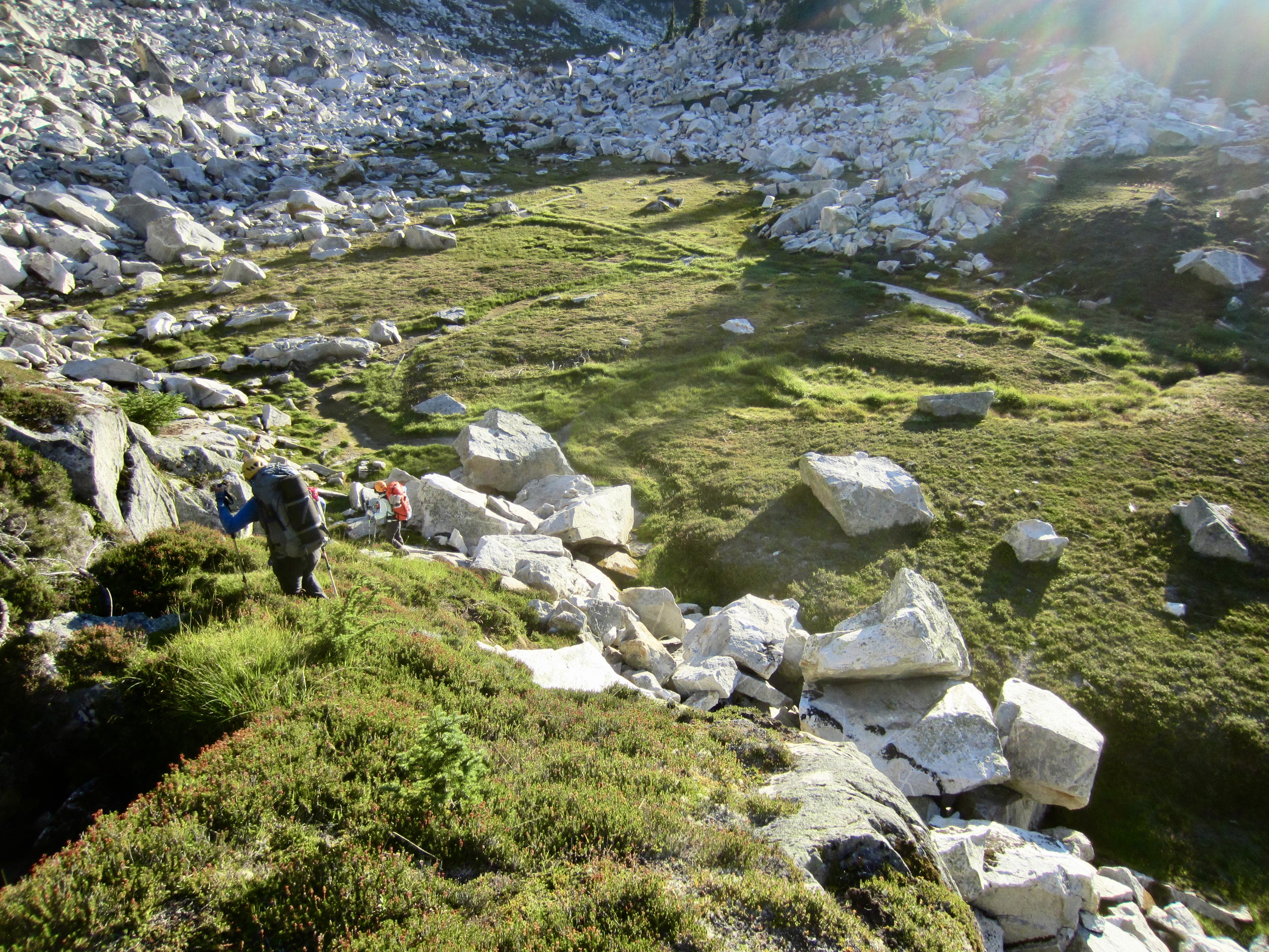
Once across the second rock buttress, we made a 600-foot ascent of talus, bedrock, and soil within a large gully. This ended at East Kaiwhat Saddle, a broad, heathery sag on the southeast side of Kaiwhat Peak (8.0 hours + 1900 feet from Camp 4).
.
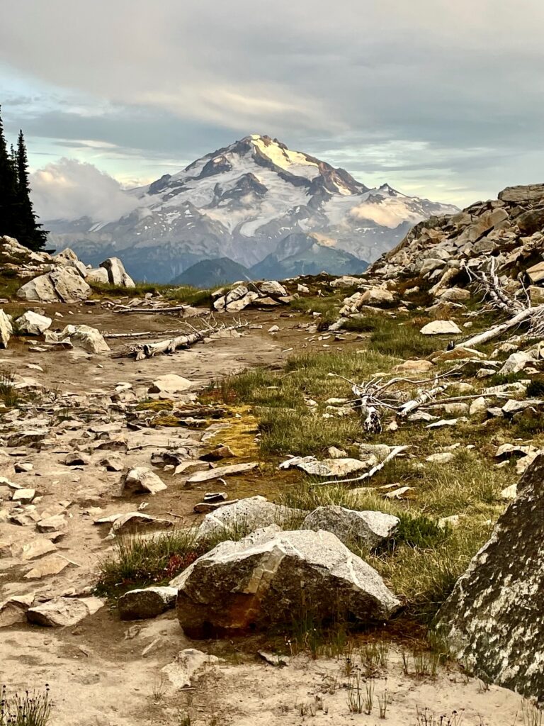
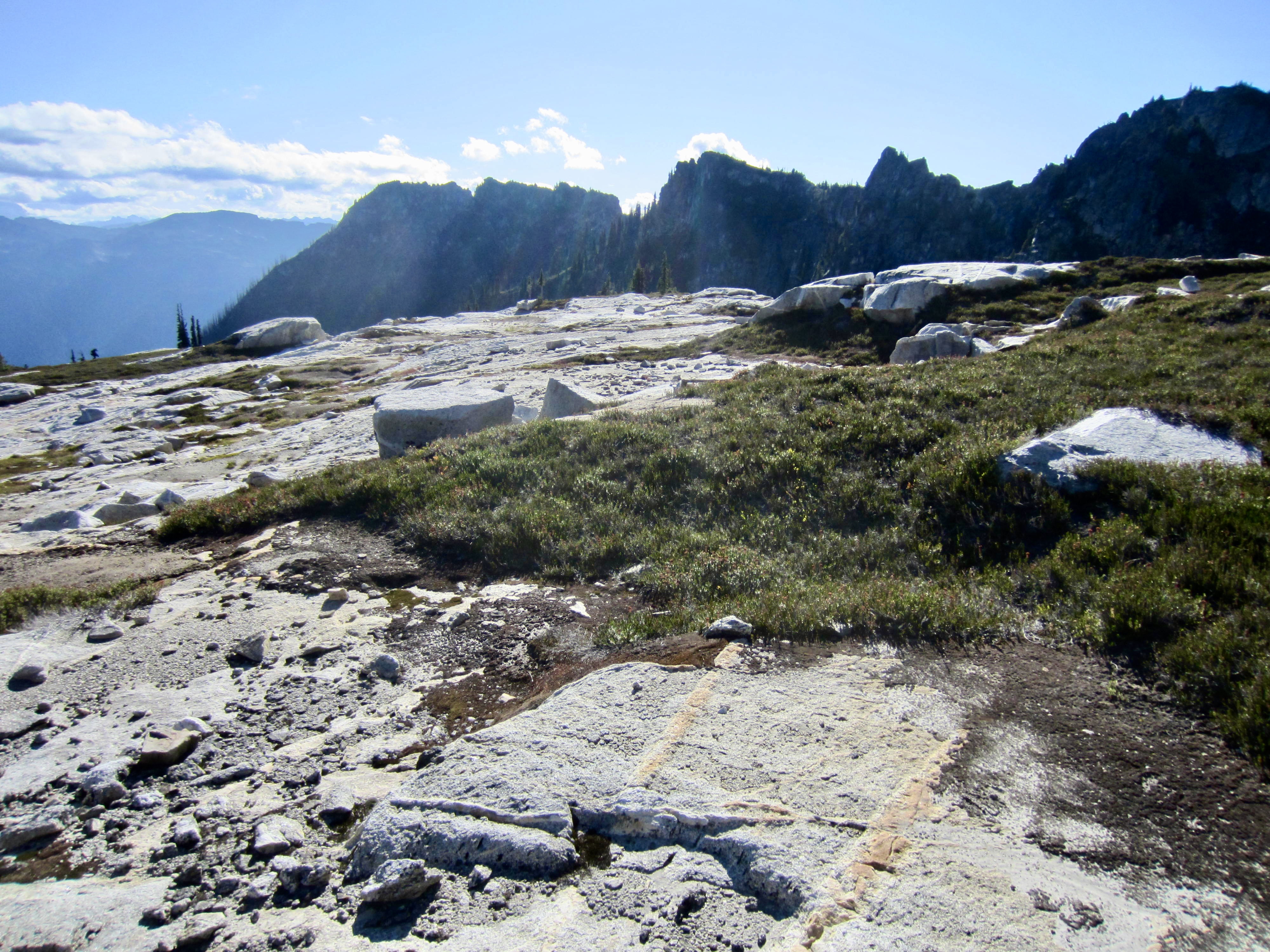
A short traverse led us over to a huge shelf of relatively flat, white bedrock. R&R refers to this remarkable geological feature as a rock table. Given the vast area and excellent view of Glacier Peak from here, it would be a fabulous campsite if not for the absence of water.
.
.
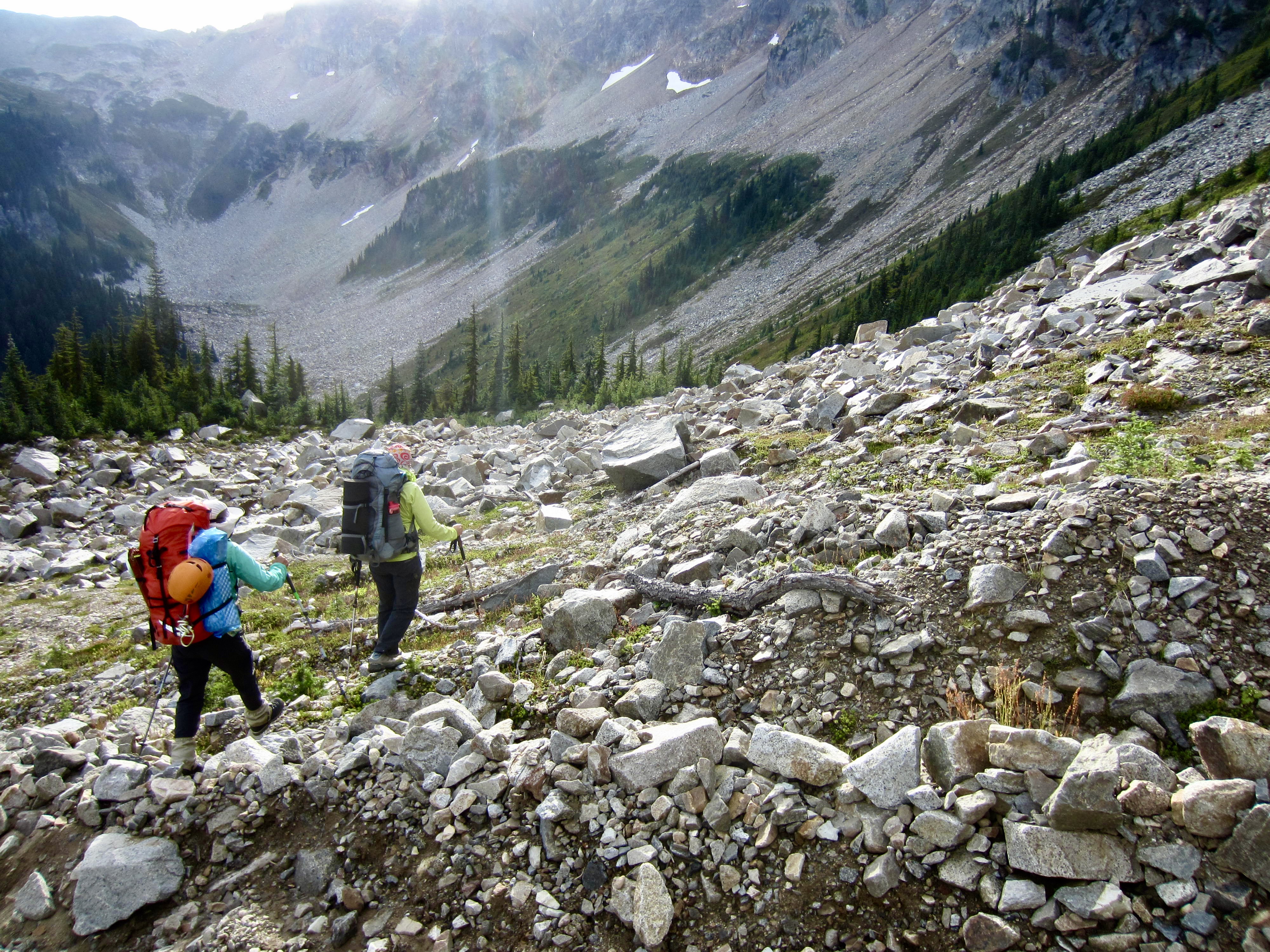
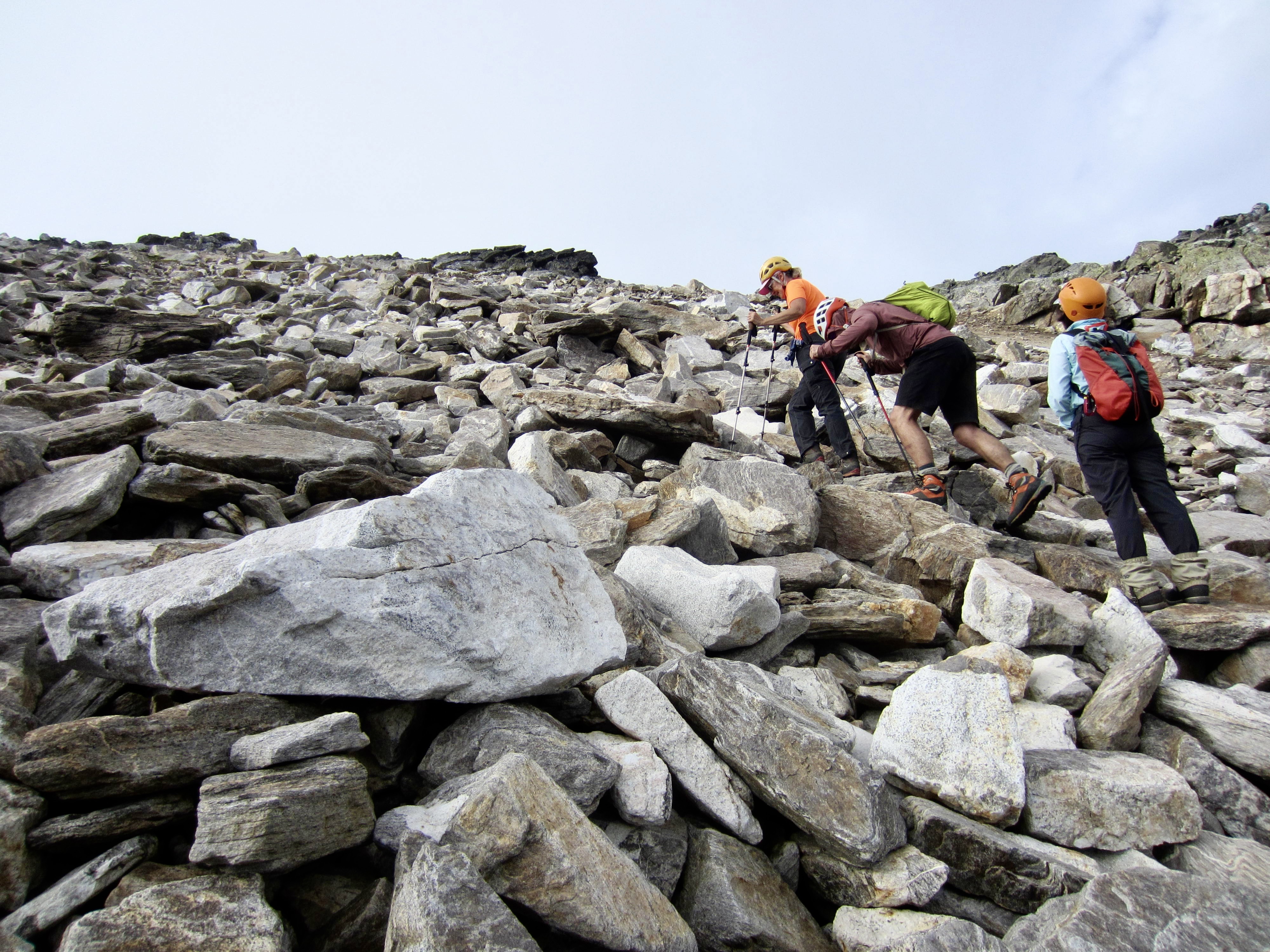
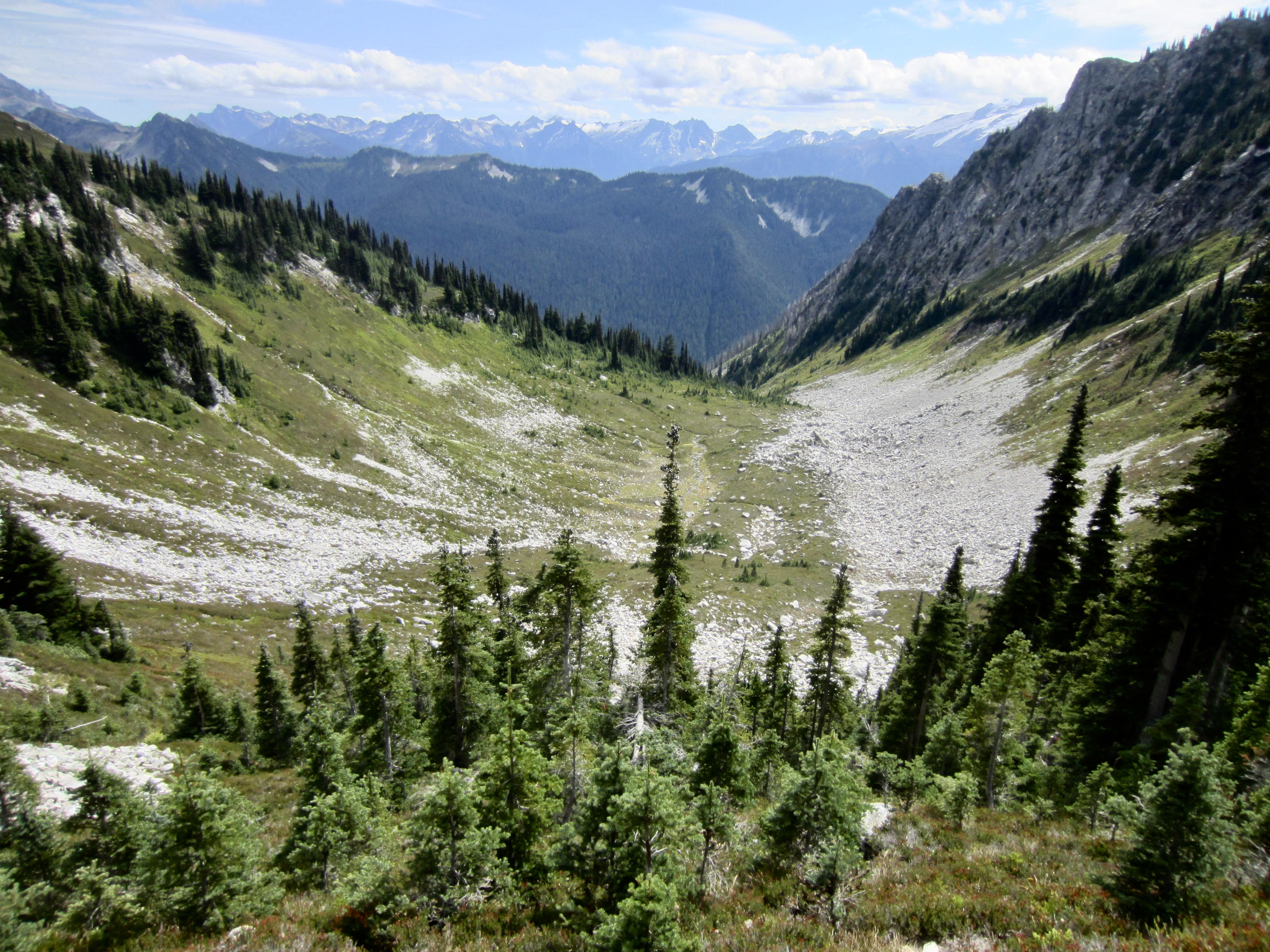
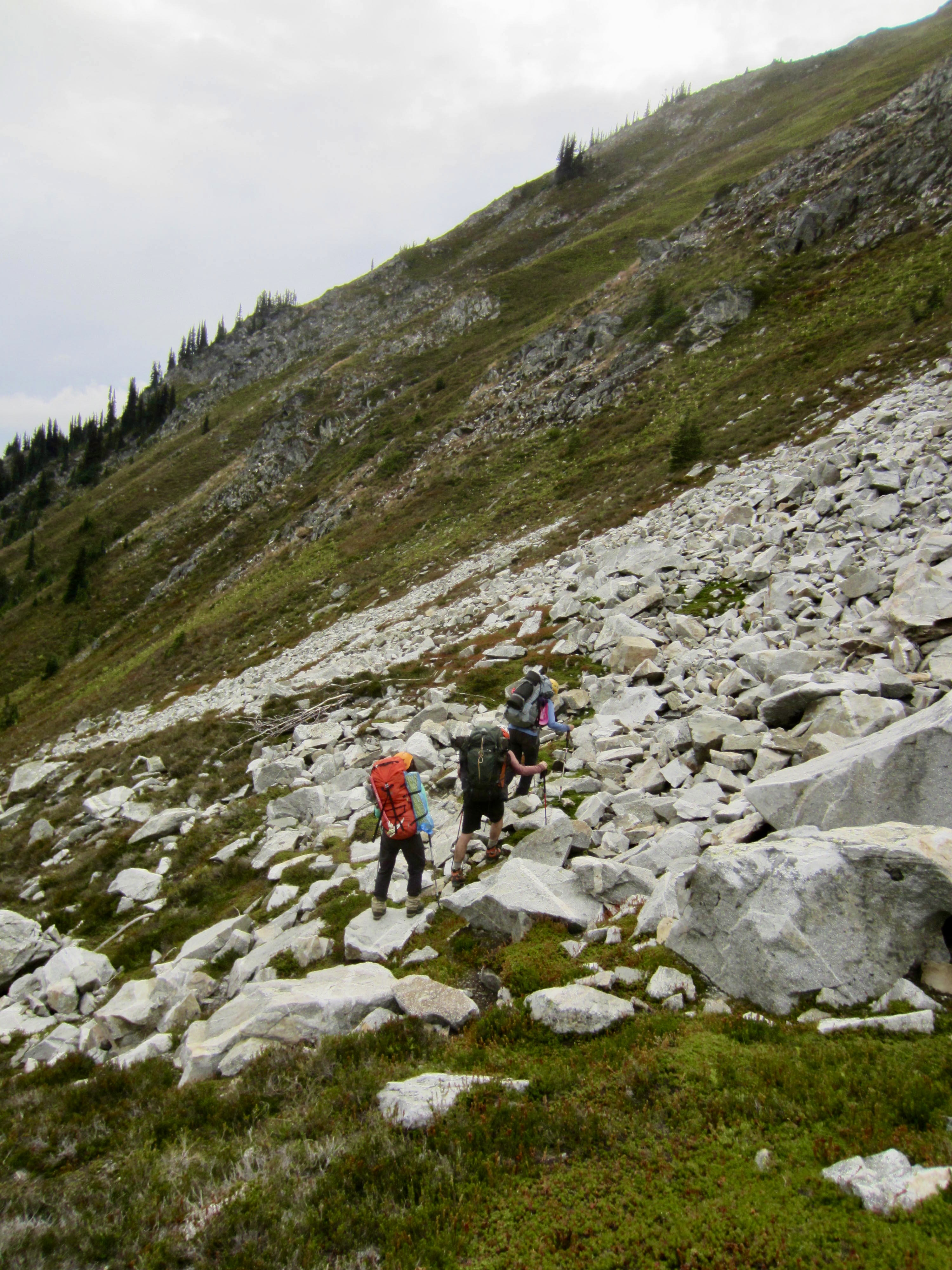
Another broad saddle at the western side of the rock table gave us access to a gravelly chute that curves down to the right and opens onto a talus couloir. We descended the chute, then the talus, then a heather slope, and then more talus. The lowest talus consisted of enormous granitoid blocks—many of which were the size of an Econoline van!
.
Our descent abruptly ended in the flat, grassy plain of Sulphur Park. This verdant, U-shaped park occupies a large basin directly below the northern flank of Sulphur Mountain. For obvious reasons, Tyler referred to it as “the football field.”

.
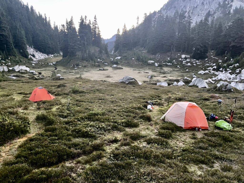
We stopped for the night in the southwestern corner of the park (10.4 hours + 1950 feet – 2200 feet). There were no flowing creeks in the park, but we were able to obtain standing water from a tiny channel nearby.
.
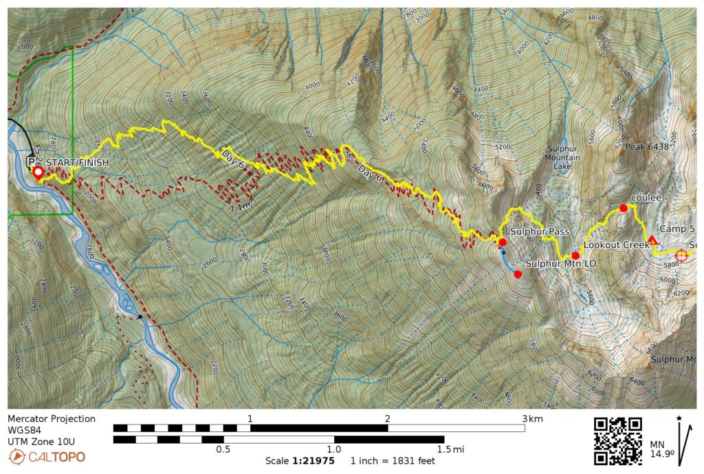
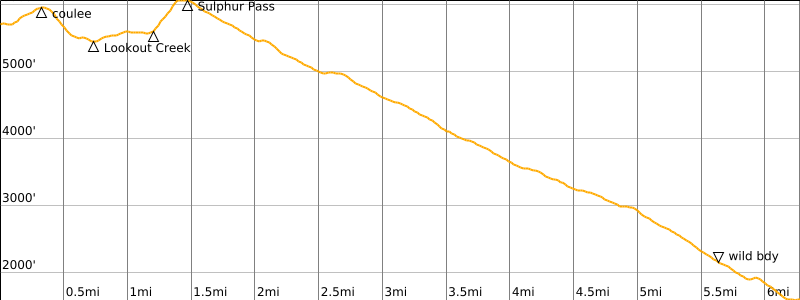
Day 6: Sulphur Park to Suiattle Trailhead
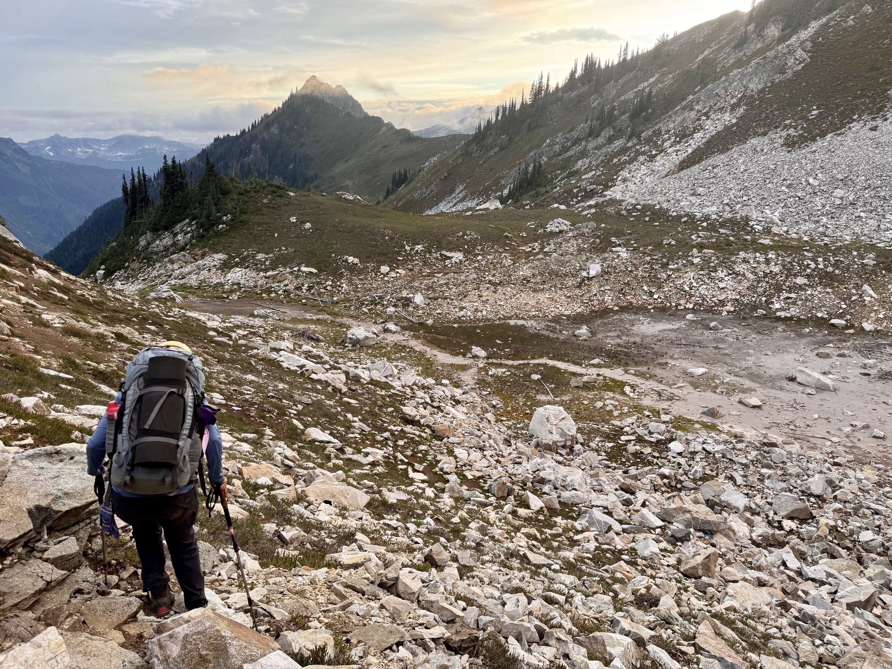
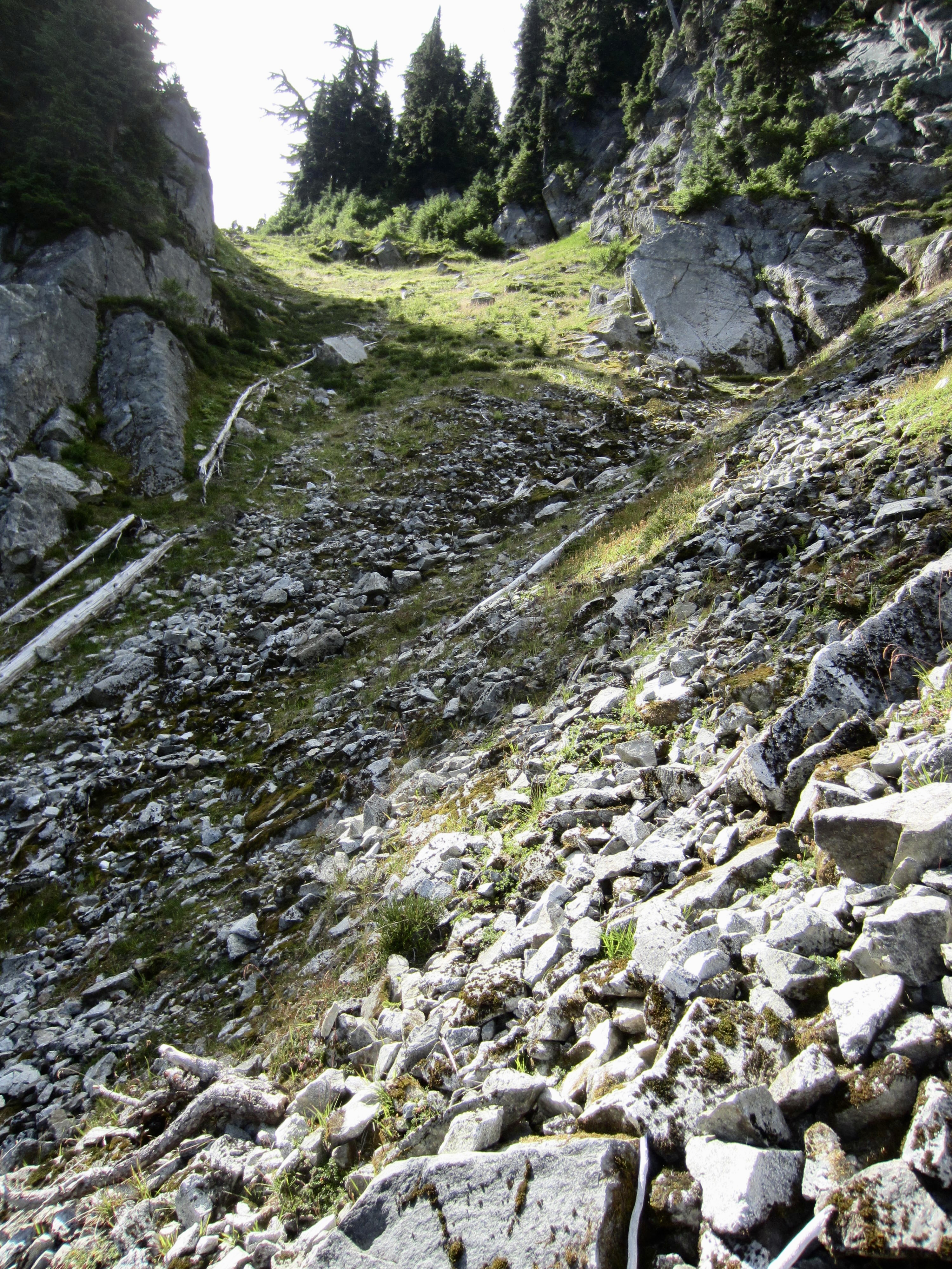
After a surprisingly cold night, we awoke to find frost on our tents and other gear. Was this August or October?! By 6:50am, we were on the move, heading northwesterly up to an elongated, grassy, 5950-foot saddle—a small coulee, really—in the ridge above. A steep drainage draw at the other end of the coulee led us down to a narrow valley that contains both Sulphur Mountain Lake and Lookout Lake.
.
From a small creek in the valley invert, we traversed upward to the northwest through brushy forest and over several humps. Upon reaching a talus-filled gully, we turned southwesterly and followed it upward. A final slope of super-steep heather and dirt brought us to the ridge crest adjacent to 6000-foot Sulphur Pass (3.0 hours + 950 feet from Camp 5).
.
.
Yoko and I took the time for a short sidetrip up to the Sulphur Point Lookout site. There was never any structure built for this lookout—probably nothing more than a temporary tent—so it is uncertain which of the two adjacent humps is the actual site. Regardless, there is a fine view of Sulphur Mountain Lake, Glacier Peak, and many other summits from both humps.
.
.
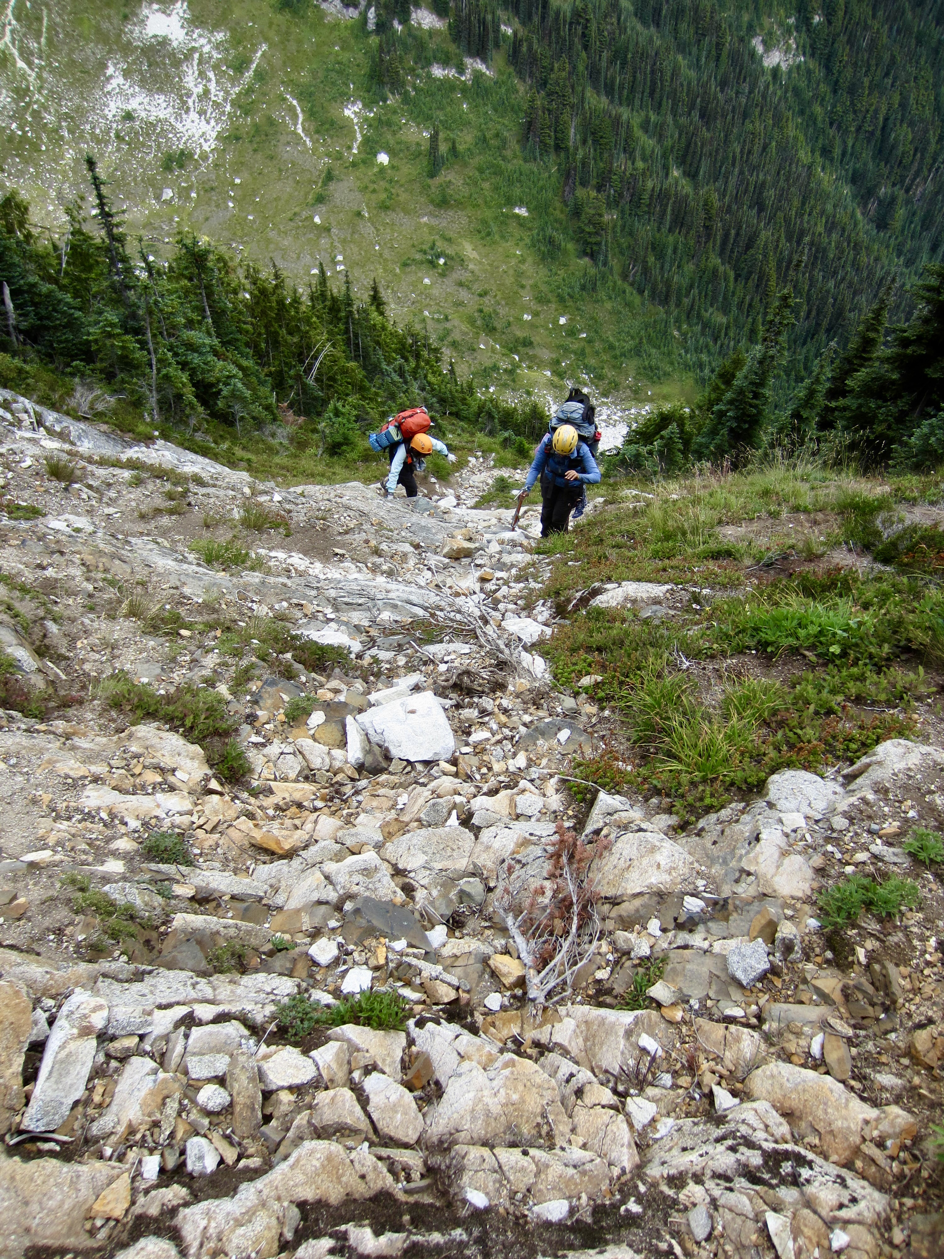
After returning to Sulphur Pass, we started our long descent to the Suiattle Trailhead. This began as an overgrown trail and then soon entered a very recent burn area. We temporarily lost the trail through here but managed to stay on course as the trail switchbacked down through mature, shady forest. (Interestingly, none of our maps showed the trail at its correct location.) The lower part of trail entered an older burn area with numerous fallen logs, which required us to perform a variety of gymnastic maneuvers.
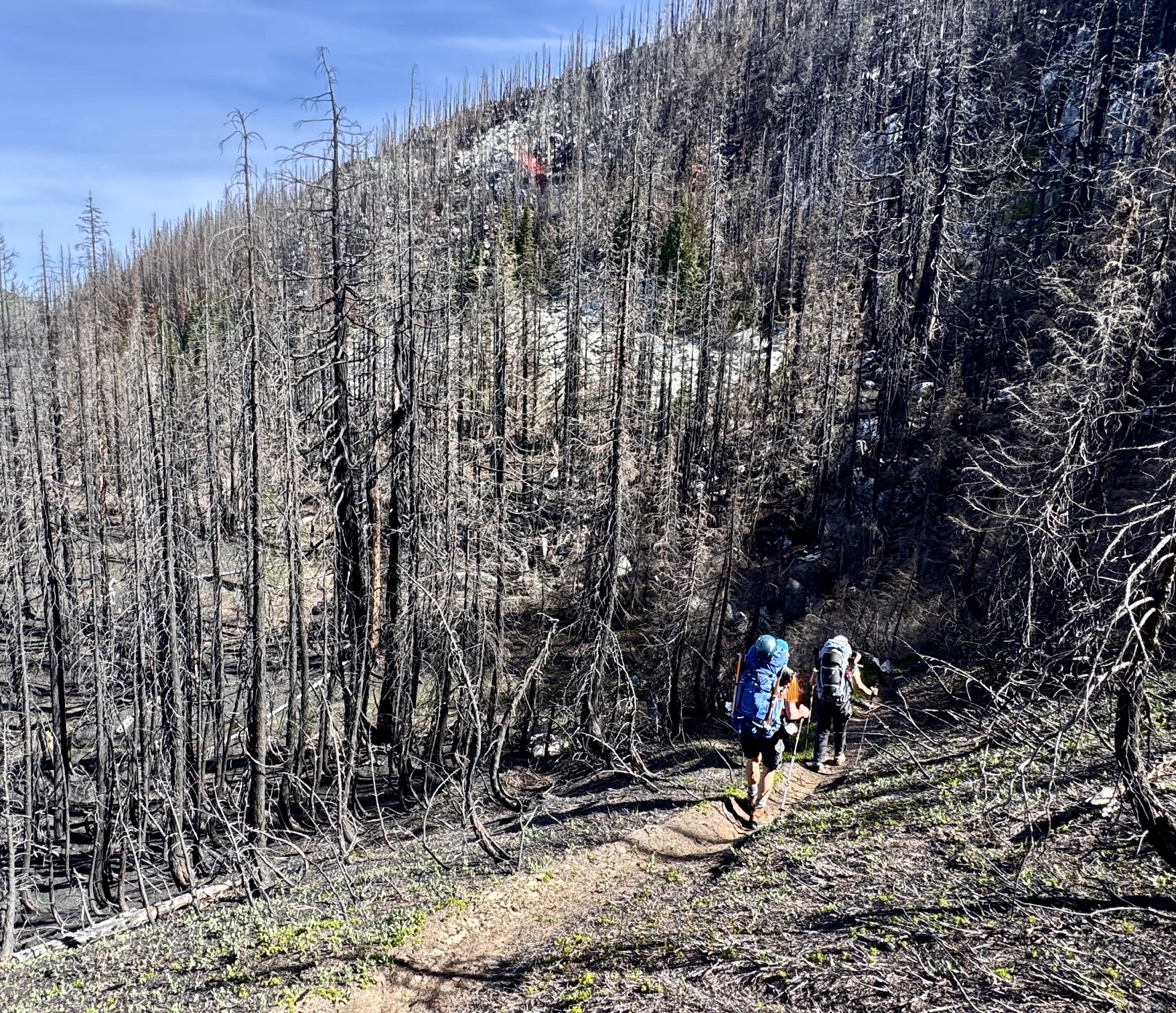
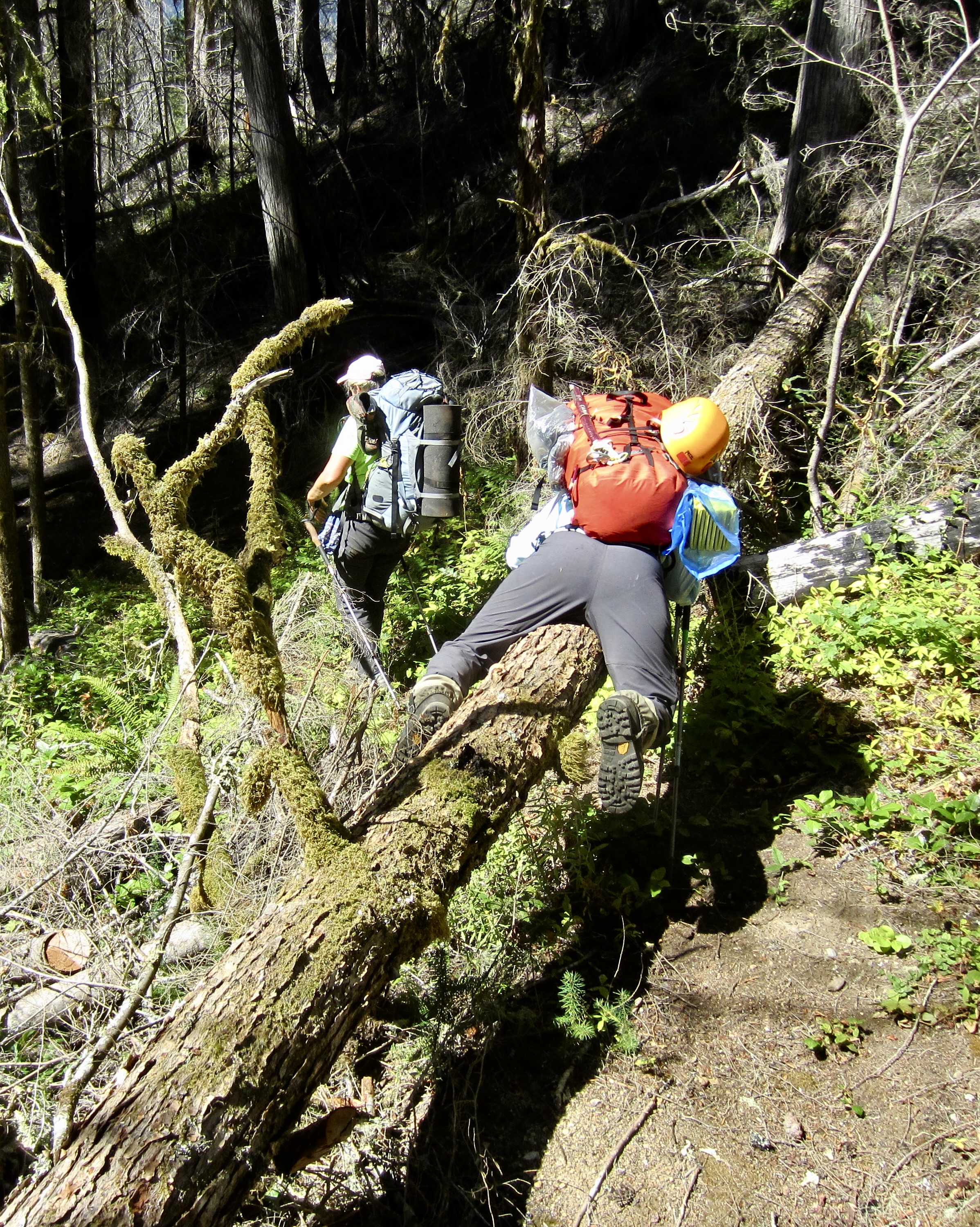
.
In early afternoon heat, we reached the junction with the Suiattle Trail. A short walk then brought us over to the Suiattle Trailhead (7.5 hours + 1200 feet – 5200 feet). It had been a marvelously scenic traverse with all manner of navigational challenges and enough steep terrain to provide an unforgettable mountaineering adventure!

.
Route Maps & Profiles
…
…
…
…
…
…
…
…
Photo Gallery
Click to enlarge…