Originally Posted: February 2025
West Portal Snowshoe Trek
Annette Lake Snowshoe Trek
Humpback Creek Valley
Palouse To Cascades Trail
Snoqualmie Tunnel: West Portal
Annette Lake
Route Description Summary
Region: Central Washington Cascades
Sub-Region: Iron Horse Mountains
Areas: Mt. Baker – Snoqualmie National Forest & Palouse-To-Cascades State Park
Starting & Ending Point: Annette Lake Sno-Park off Interstate-90 at Exit 47 (Elev. 1900 feet)
Option 1: West Portal
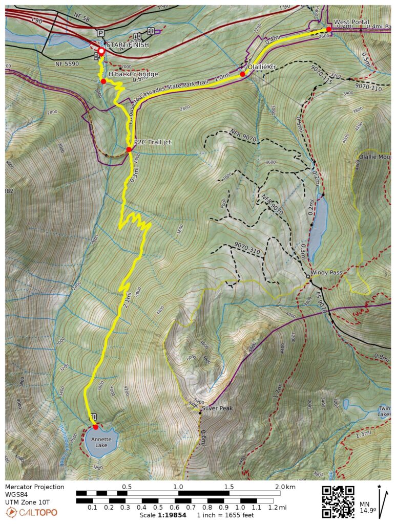
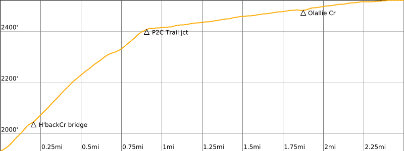
Way Points: Humpback Creek Bridge & first powerline undercrossing & second powerline undercrossing & Palouse-To-Cascades Trail junction & Ollallie Creek crossing & West Portal of Snoqualmie Tunnel (snowshoe hike)
Approximate Stats: 5.0 miles traveled; 600 feet gained & lost.
Option 2: Annette Lake
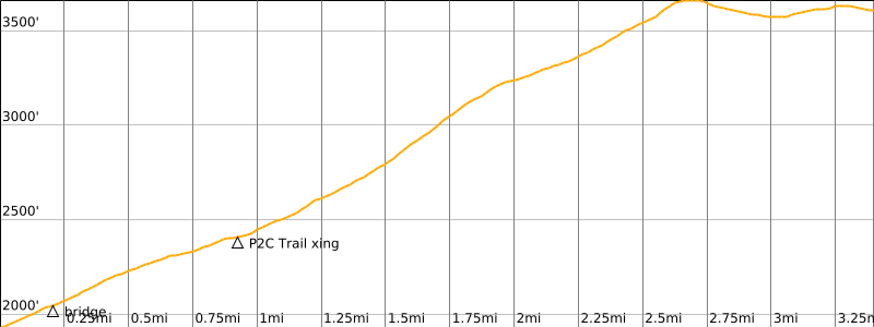
Way Points: Humpback Creek Bridge & first powerline undercrossing & second powerline undercrossing & Palouse-To-Cascades Trail crossing & Annette Lake (snowshoe hike)
Approximate Stats: 6.8 miles traveled; 1900 feet gained & lost.
Information Sources
The following links provide helpful information for planning either snowshoe trek. Even these information sources, however, should not be taken as a substitute for having the fitness, knowledge, equipment, and clothing required for snowshoe trekking.
>>> WSDOT road condition reports for Interstate-90 and Snoqualmie Pass
>>> National Weather Service weather forecast for Snoqualmie Pass area
>>> Northwest Avalanche Center avalanche forecast for Snoqualmie Pass area
>>> Other easy to intermediate snowshoe treks in the I-90 / Snoqualmie Pass corridor
Parking Comments
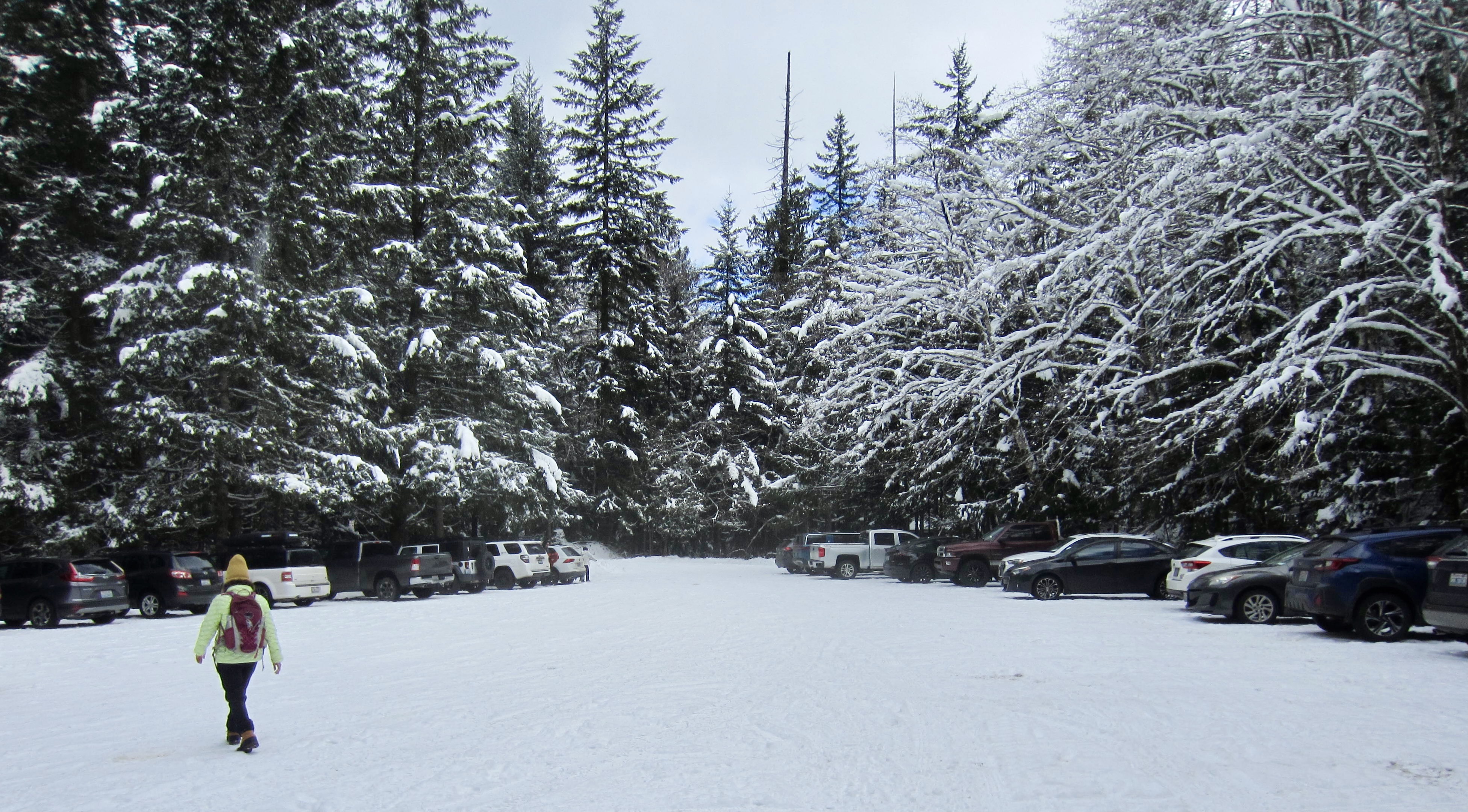
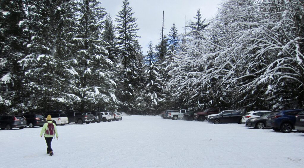
Parking for both snowshoe treks can be found at Annette Lake Sno-Park, which is located on the south side of Interstate-90 across from the Asahel Curtis Picnic Area. To reach this sno-park, get off the freeway at Exit 47 and go south to a “T” intersection. Go left (east) on Forest Road 5500 for approximately ⅓ mile, then turn right into the large parking lot. Be aware that a Washington State Sno-Park permit is required here.
Route Overview
For backcountry skiers and snowshoers, Annette Lake Sno-Park provides convenient access to several different destinations in the Interstate-90 corridor. Among these, the West Portal of the Snoqualmie Tunnel is suitable for novice snowshoers, and Annette Lake is suitable for intermediate snowshoers. Either destination could be reached by backcountry skiers, but I find the narrow hiking trails much more appropriate for snowshoeing than skiing.
The entire trek to the West Portal is virtually free of avalanche hazards, so it can be completed during a broad range of weather and snow conditions. In contrast, the route to Annette Lake crosses several potential avalanche chutes in the last 2 miles. As such, this trek should not be undertaken during a period of unstable snow conditions. Even when snow conditions are fairly stable, it is advisable to make a site-specific stability assessment before crossing these chutes.
Full Route Description
The following three subsections describe (1) the shared route from Annette Lake Sno-Park to the Palouse-To-Cascades (P2C) Trail junction, (2) the continuation route to the West Portal, and (3) the continuation route to Annette Lake
Sno-Park to P2C Trail Junction
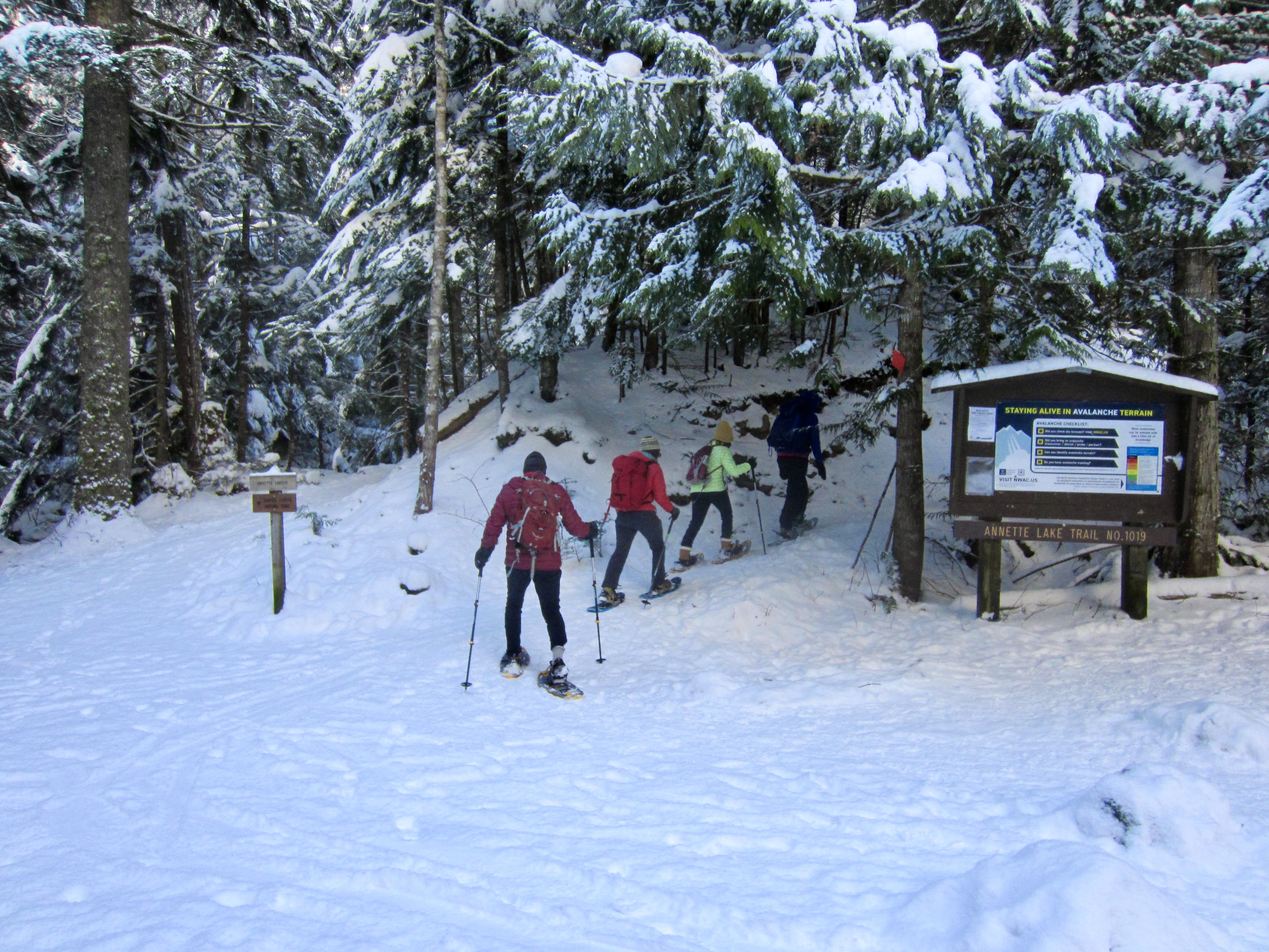
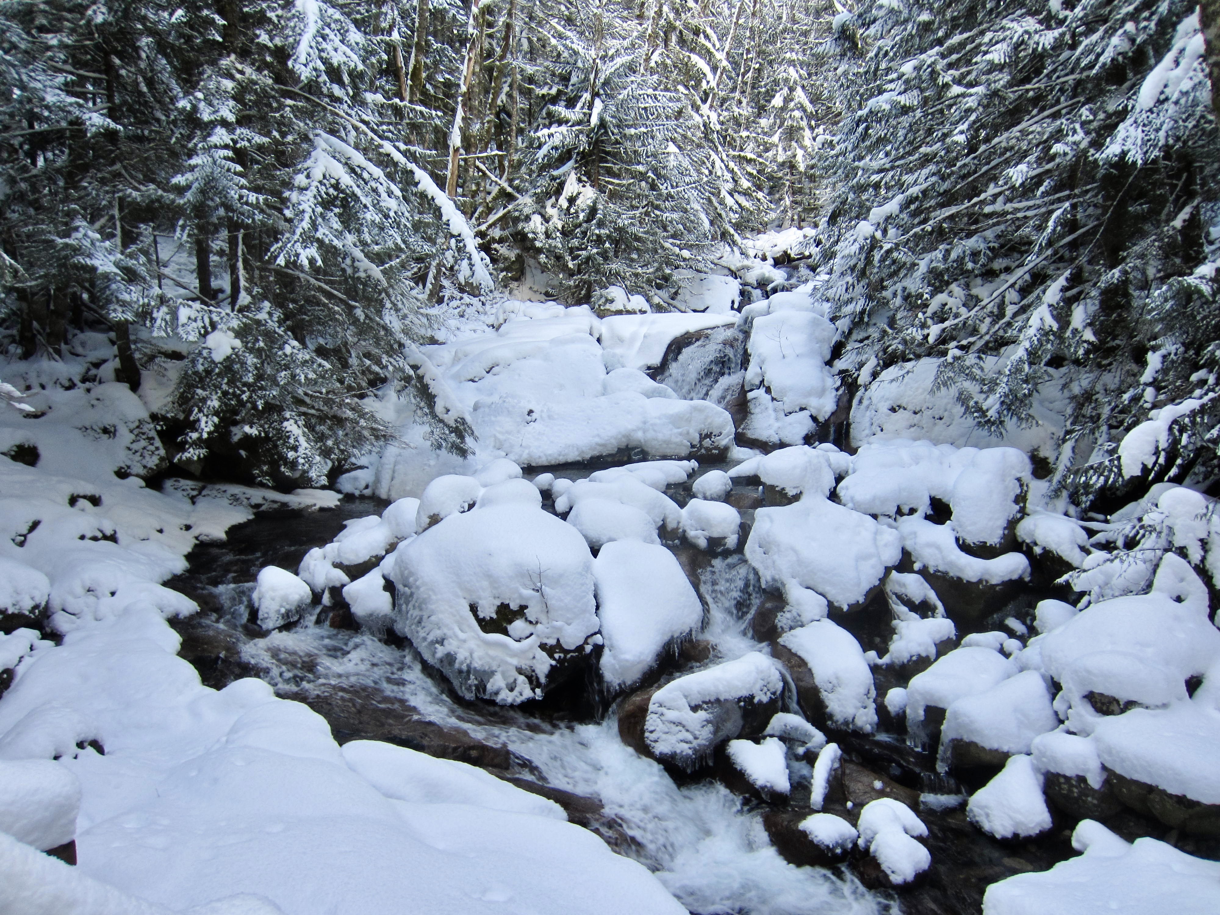
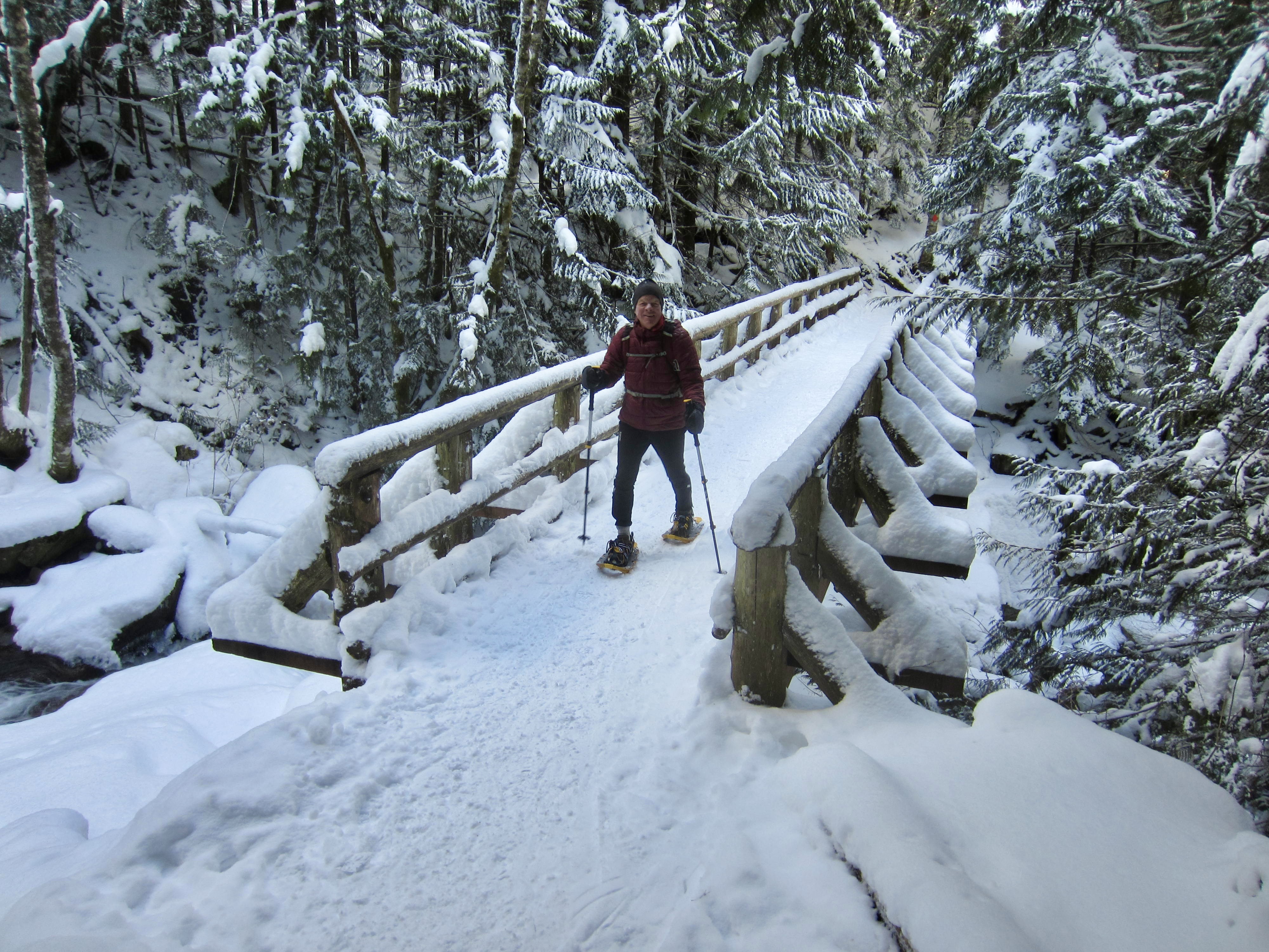
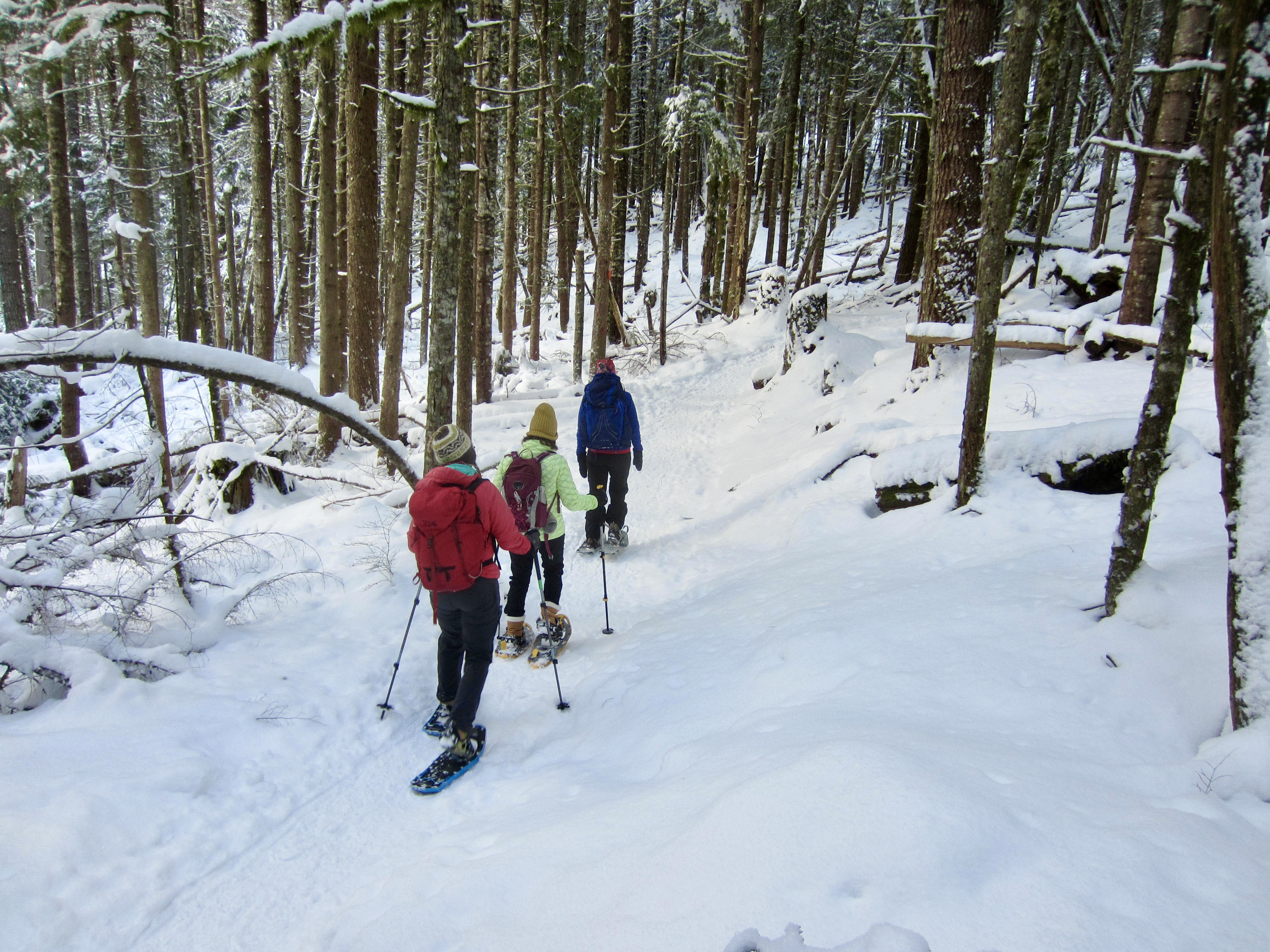
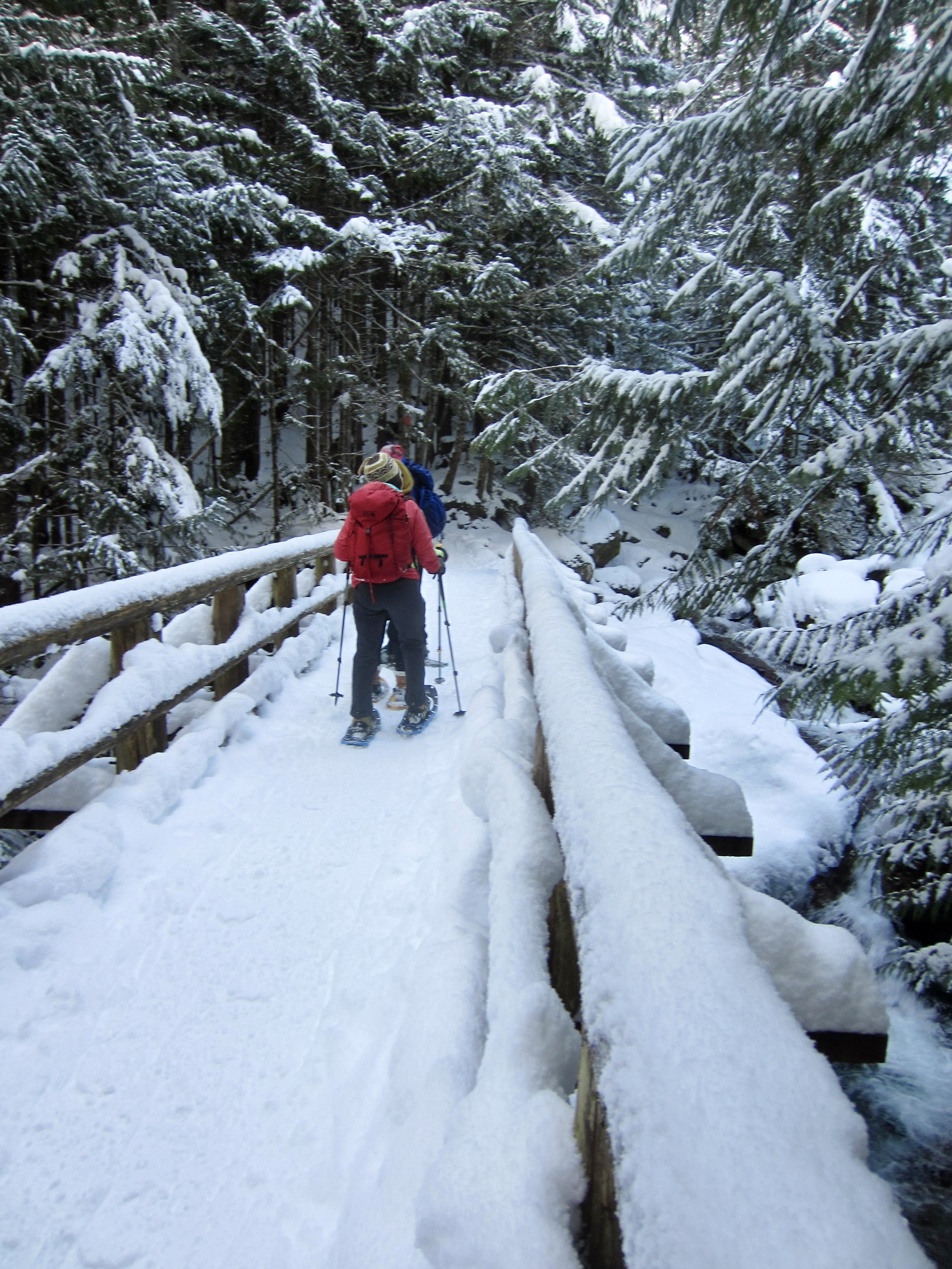
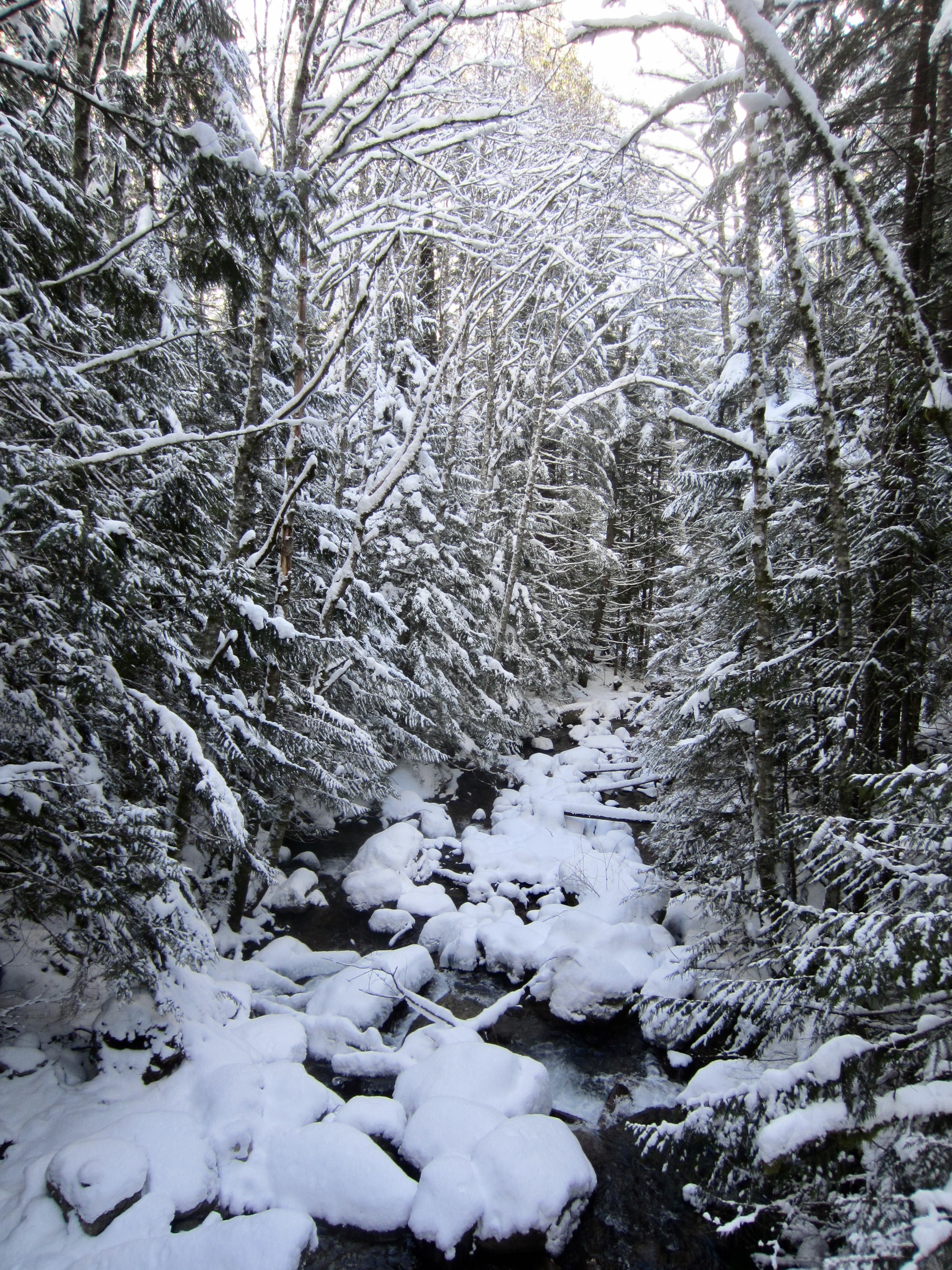
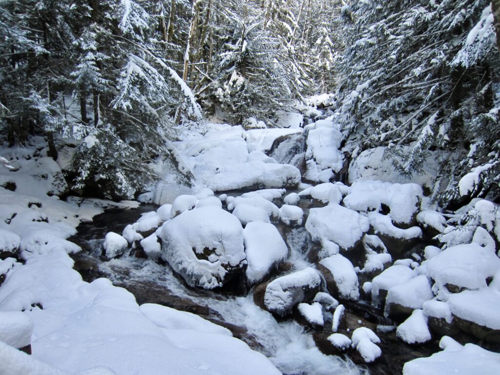
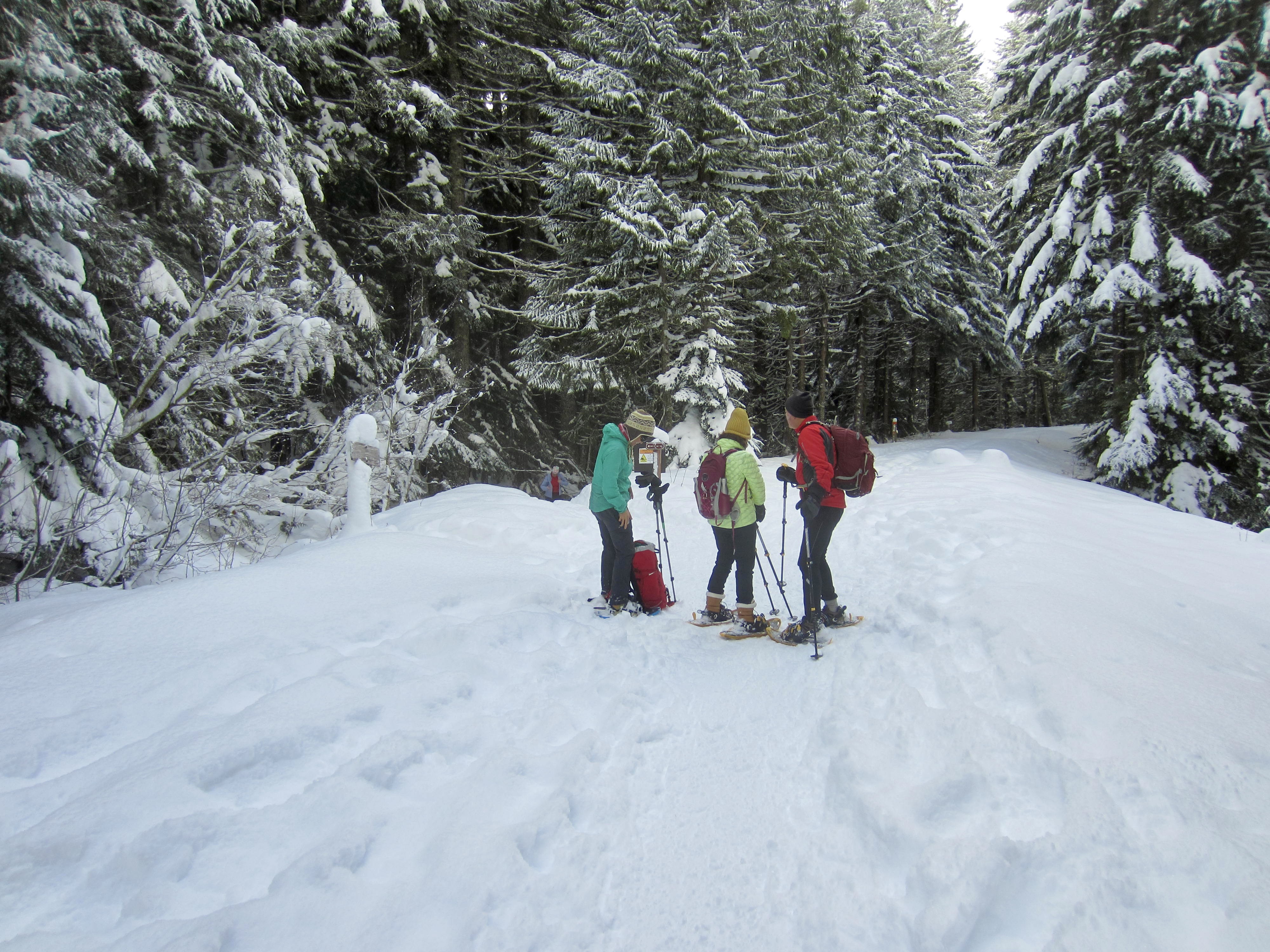
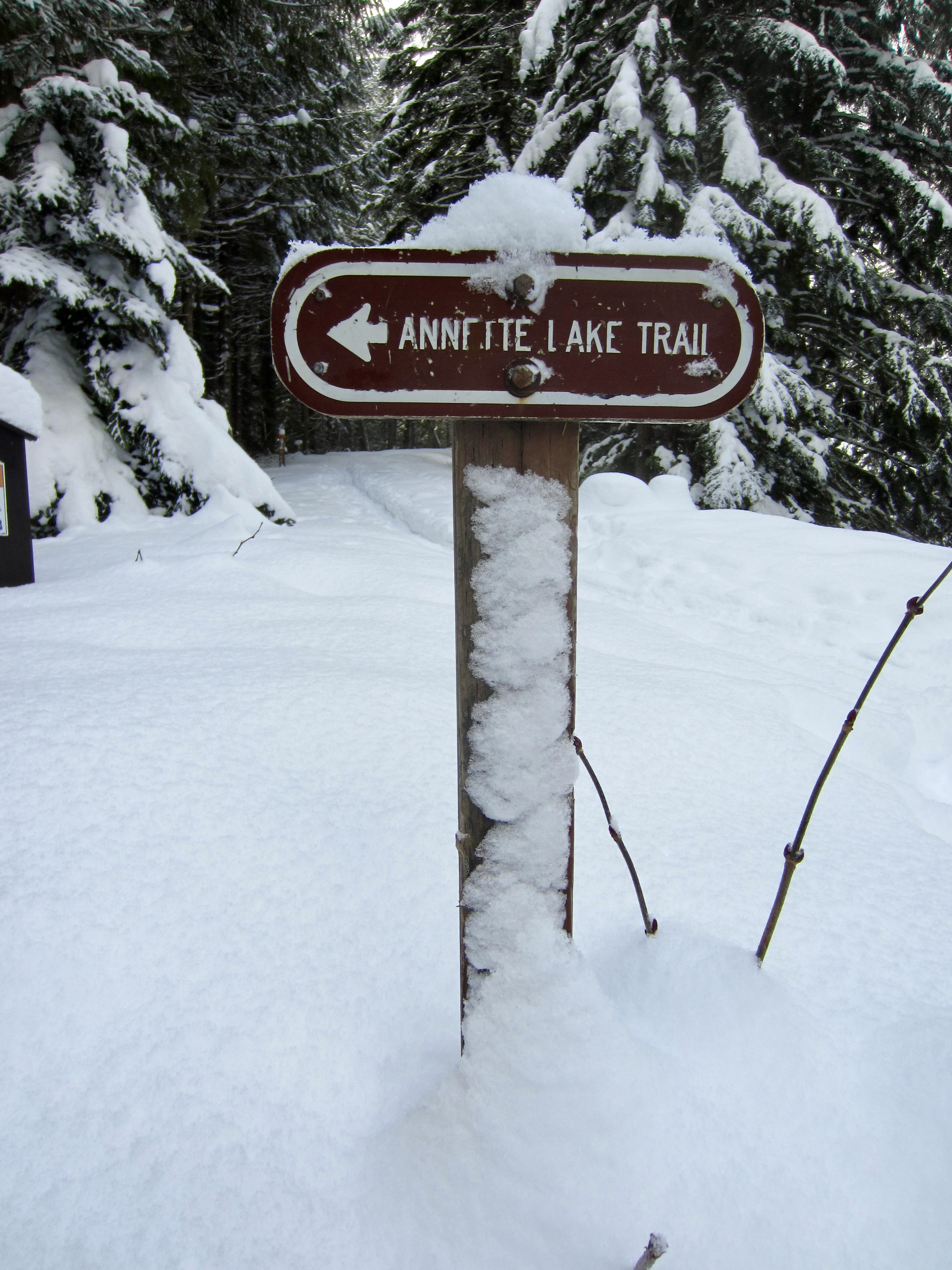
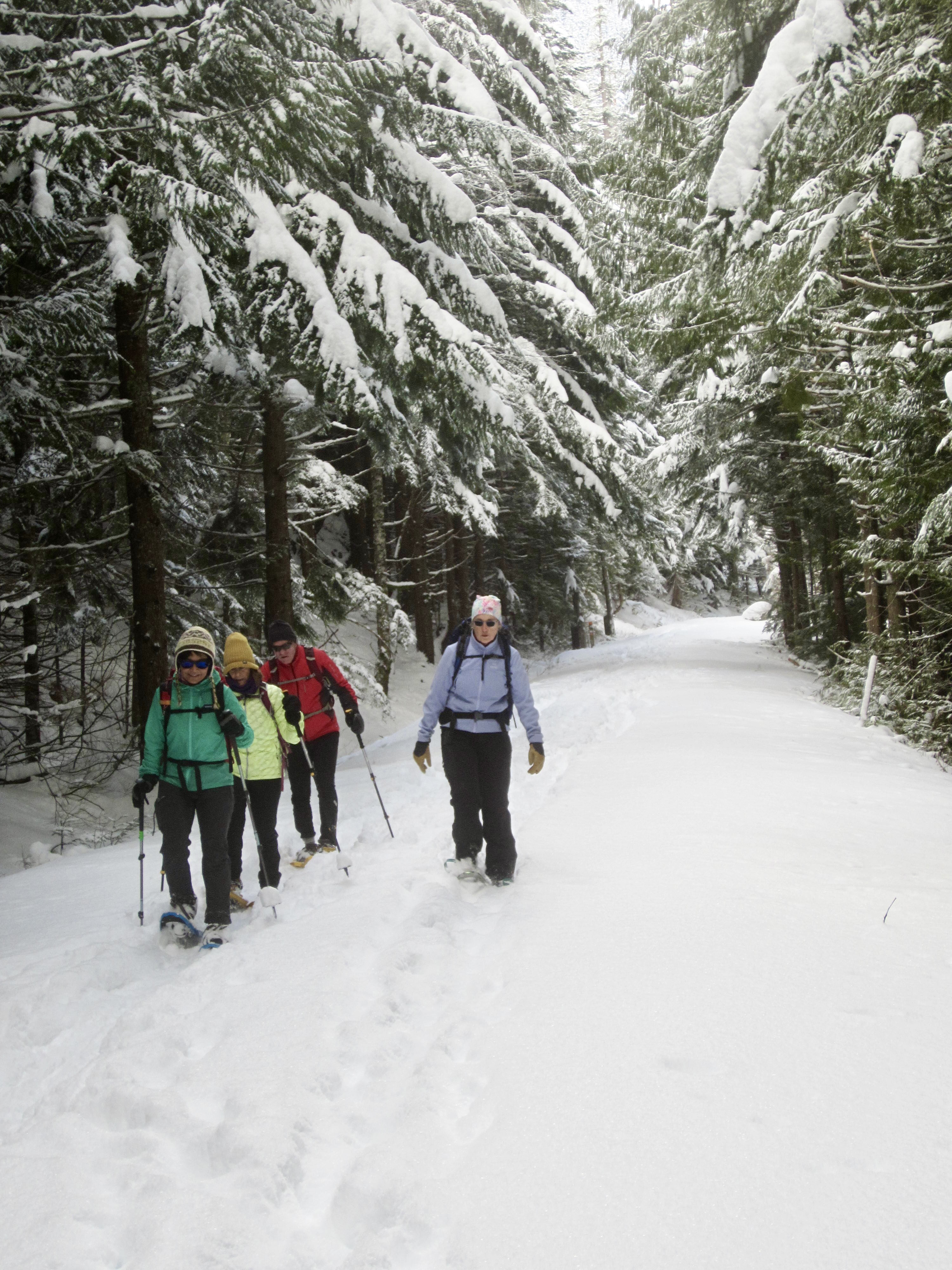
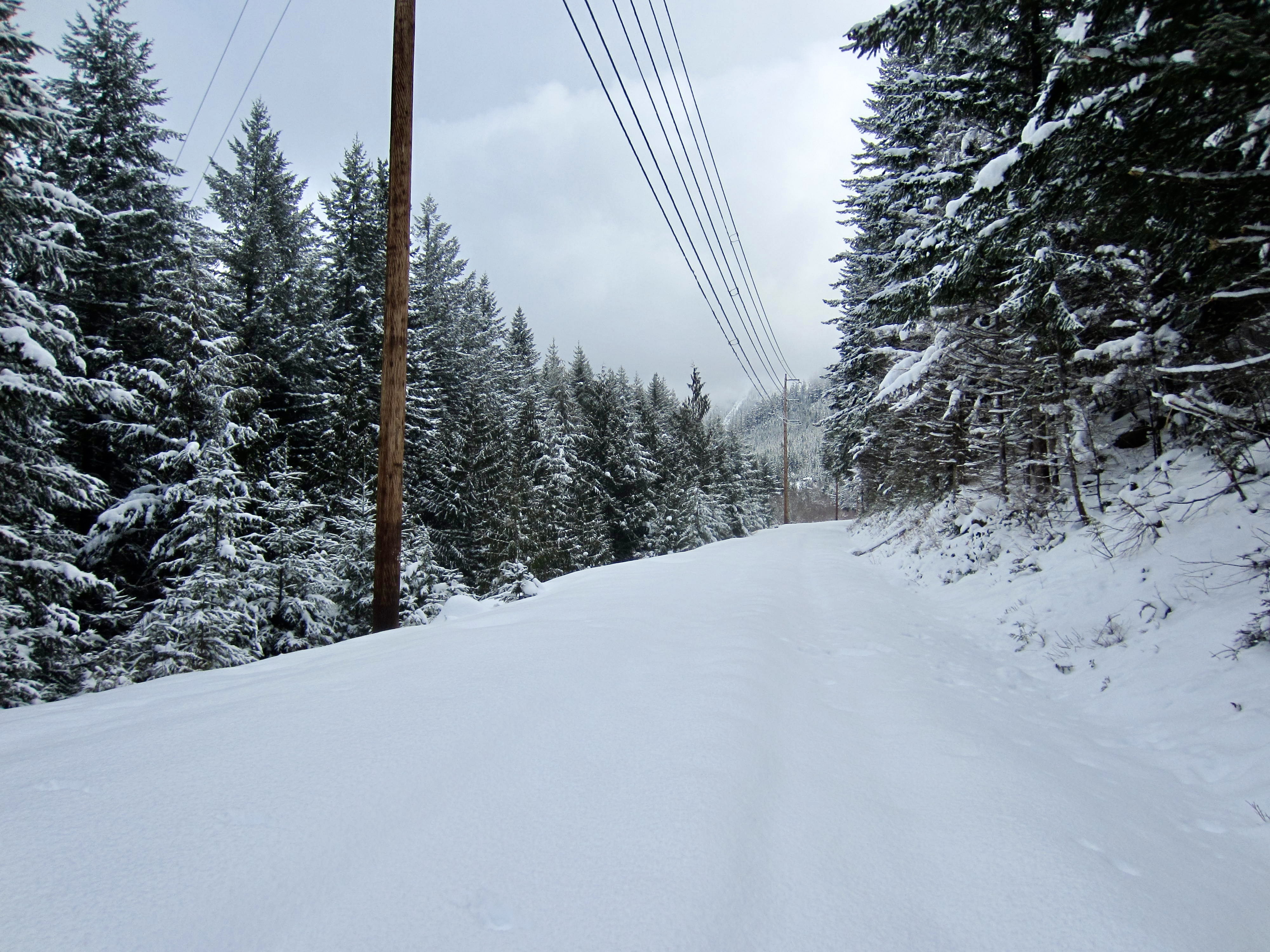
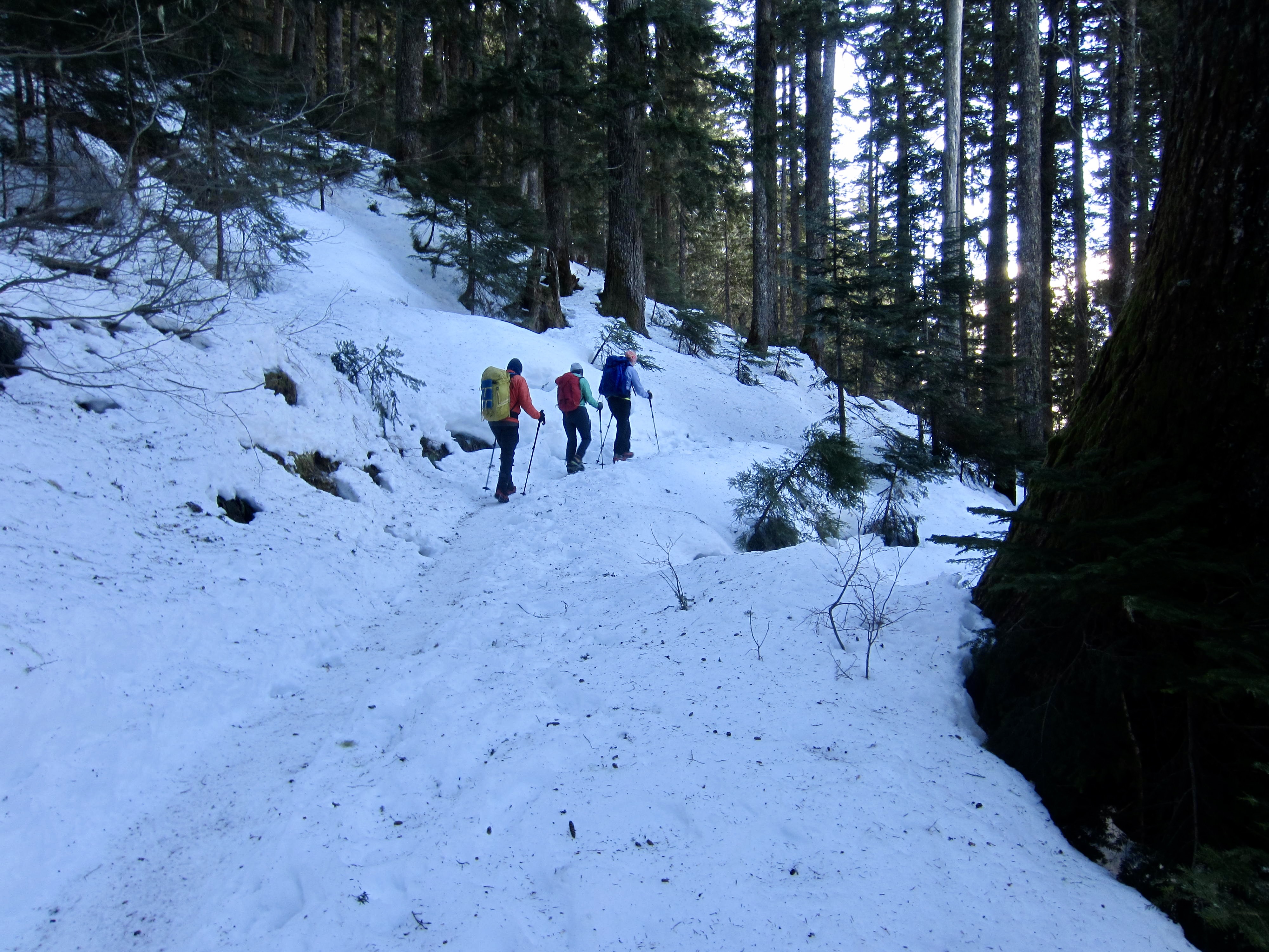
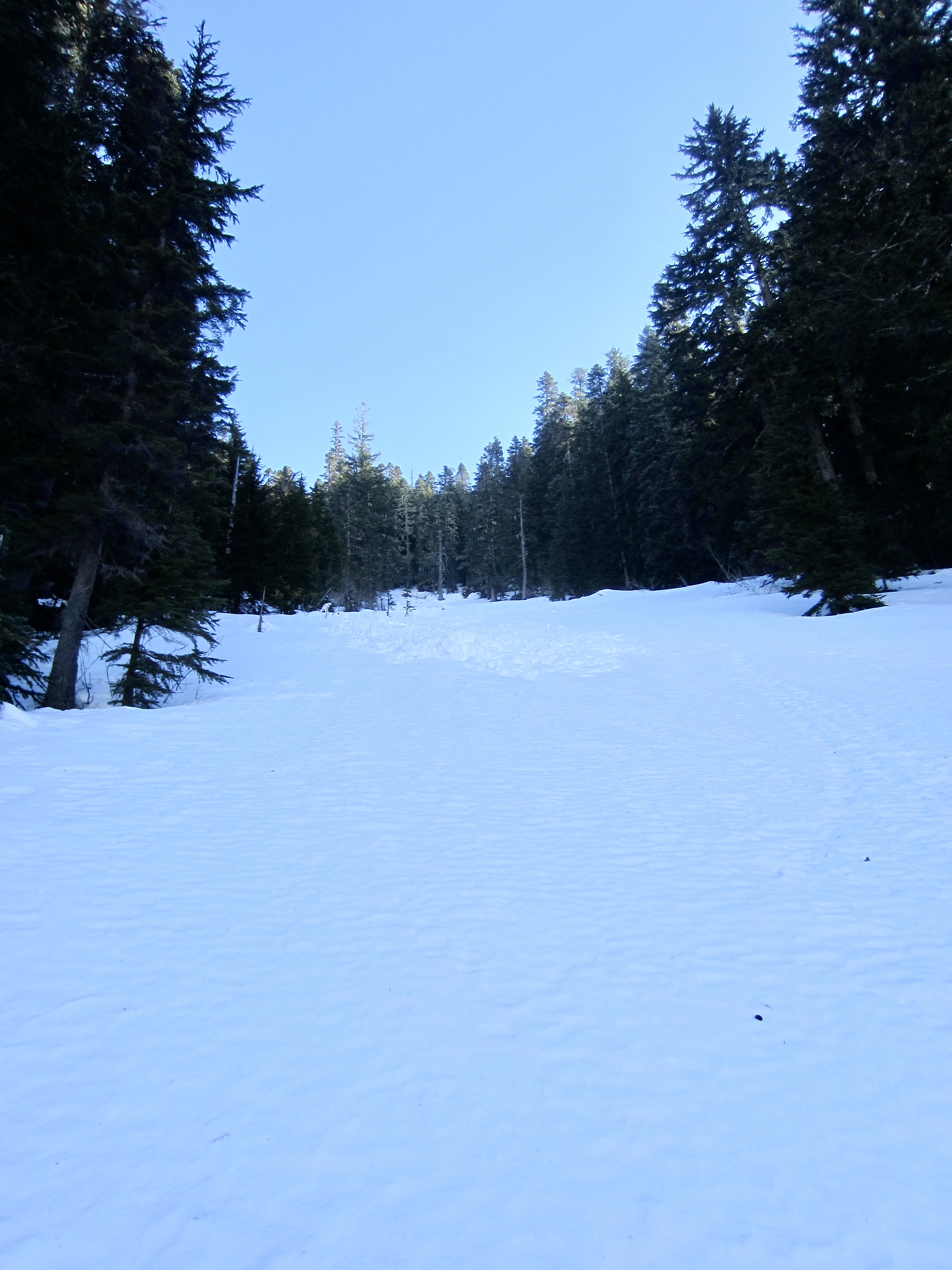
Both snowshoe treks begin by following the Annette Lake Trail, which switchbacks upward through dense forest. Very soon, the trail crosses Humpback Creek on a long wooden bridge. Pause to enjoy the view of this beautiful creek spilling over smooth slabs and rounded boulders.

.
.
.
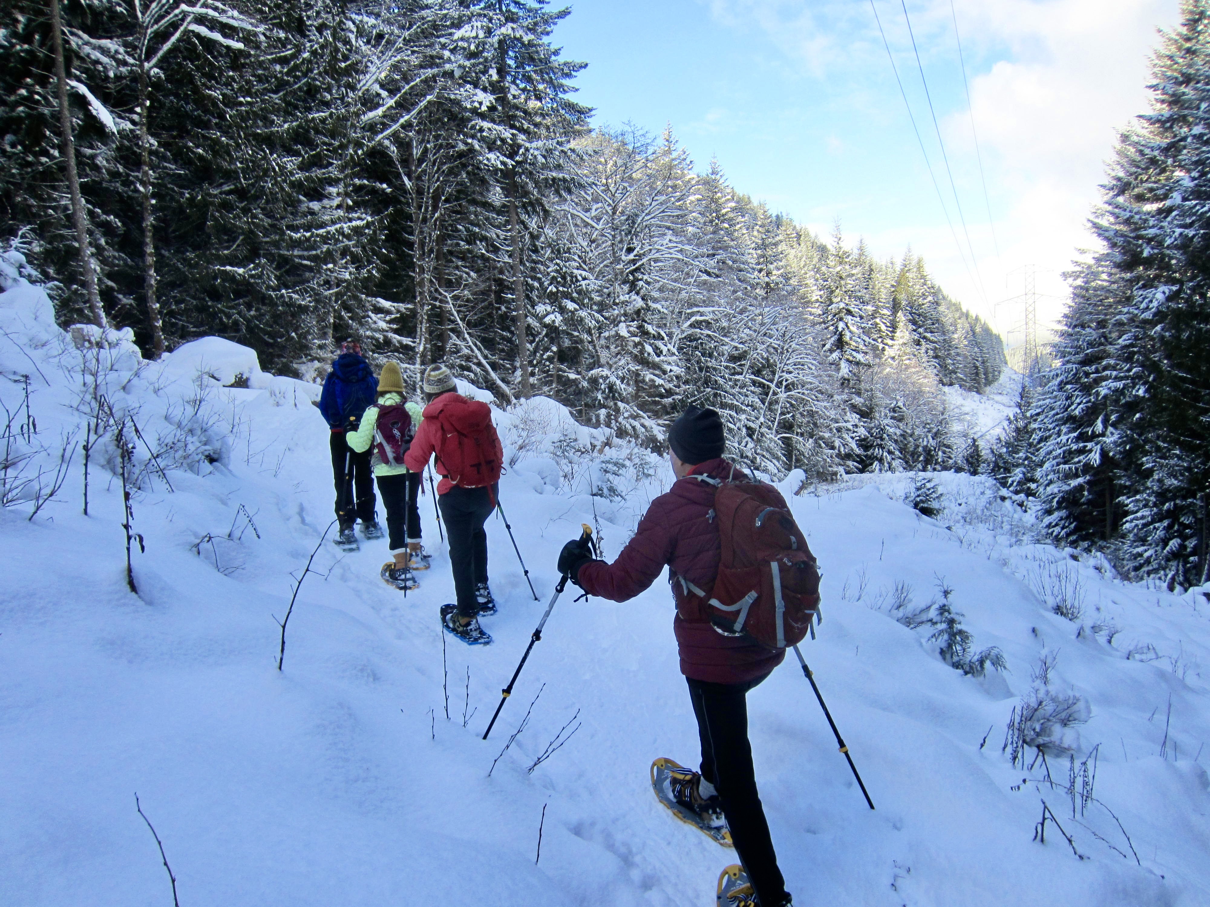
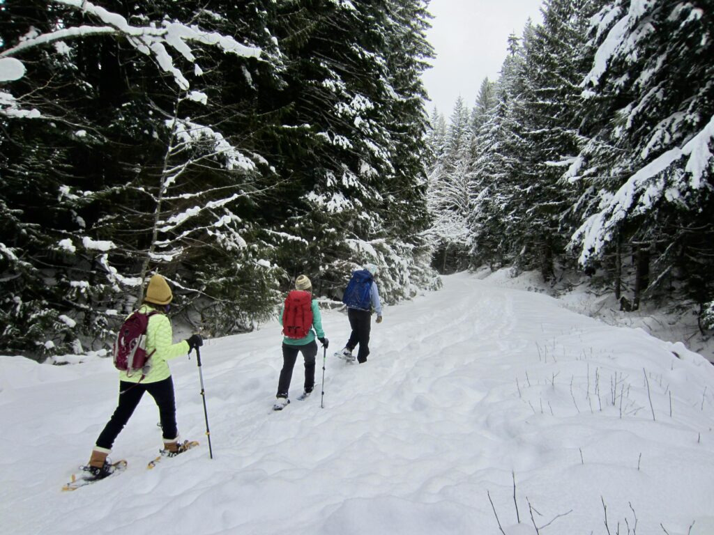
The trail continues climbing steadily through groves of young, slender evergreen trees, and in quick succession, it crosses under two different powerlines. The clearcut swaths at these powerline crossings offer some limited views out to the west.

.

.
A bit farther uphill, the Annette Lake Trail comes to a junction with the Palouse-To-Cascades (P2C) Trail, which occupies an old railbed (0.9 miles + 500 feet from sno-park). For many decades, this railbed served as the route of the former Chicago, Milwaukee, St. Paul, and Pacific Railroad—fondly known as The Milwaukee Road—before being converted to a recreational trail and designated as a state park. These two geographic features were originally called the John Wayne Pioneer Trail and Iron Horse State Park, respectively, but both were recently given a Palouse-To-Cascades moniker.
.
P2C Trail Junction to West Portal
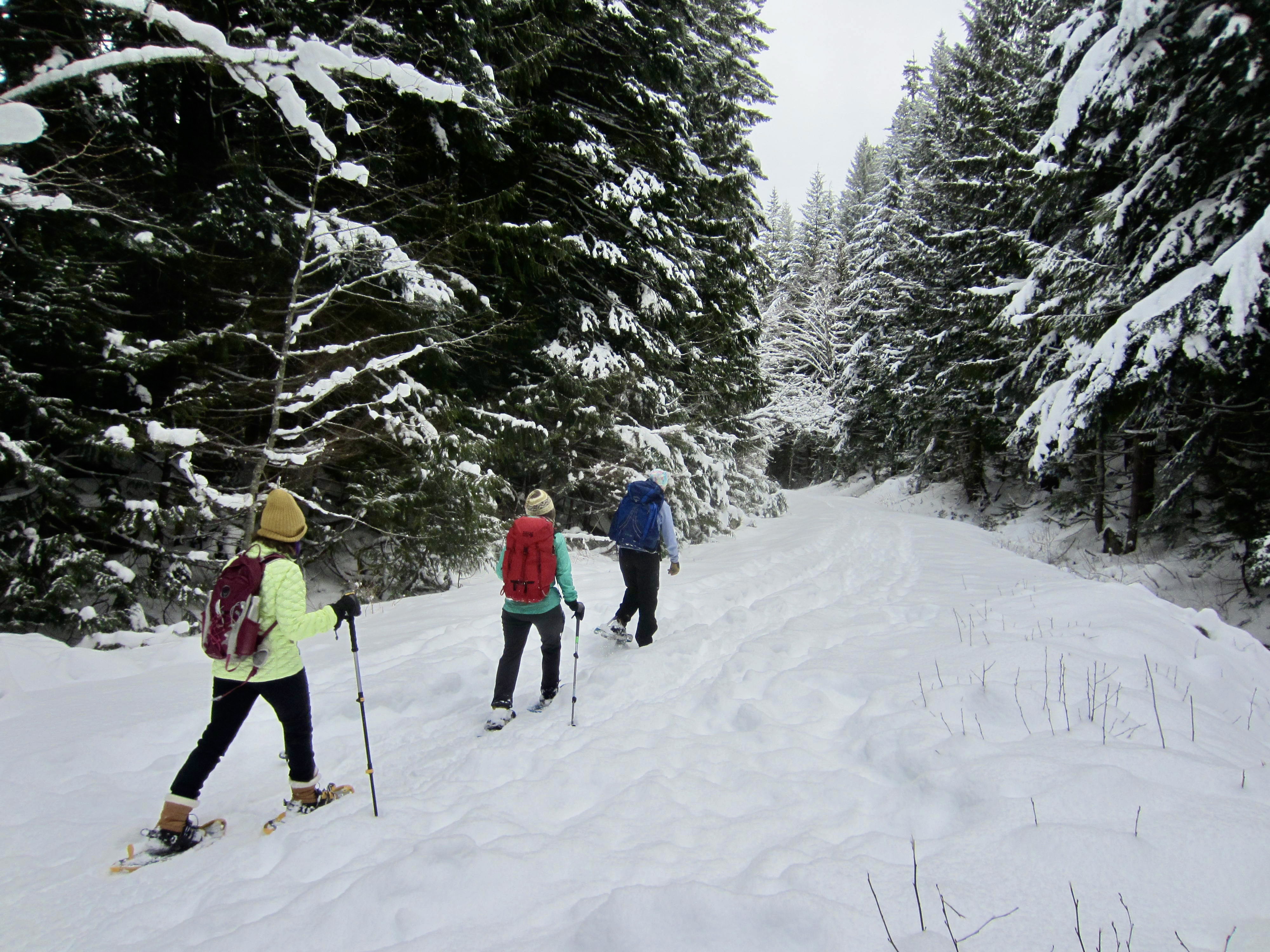
If your goal is the West Portal, turn left at the Annette Lake Trail / P2C Trail junction and follow the latter trail as it contours across the woodsy hillside. You will initially be heading north, then curving to the east and traveling parallel to Interstate-90. The P2C Trail remains wide and flat, gaining elevation only at an imperceptible rate.
.
.
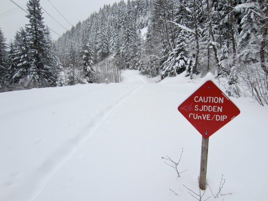
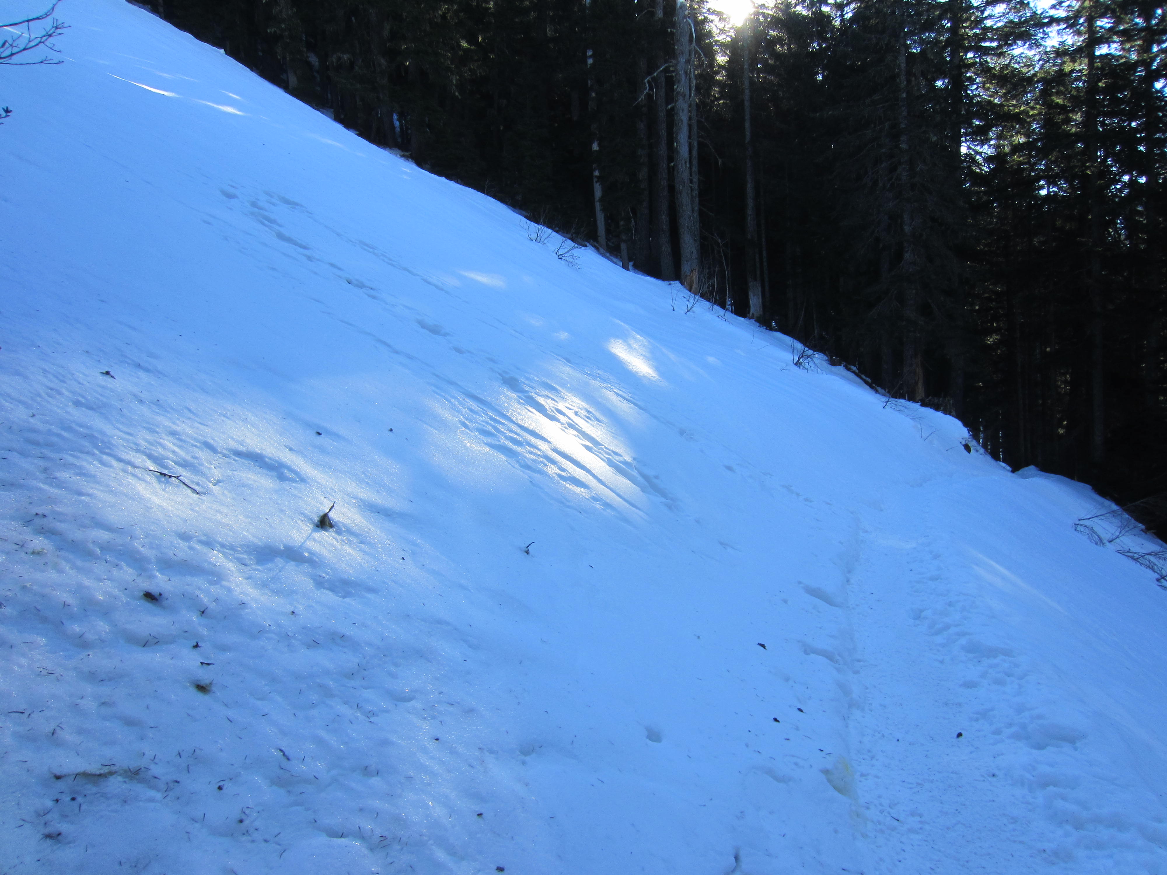
After a mile of easy hiking, the P2C Trail dips down to cross Olallie Creek and curves to the left. Contrary to a warning sign here, neither the dip nor the curve is at all sudden—at least, not when you are snowshoeing!. Shortly beyond, Interstate-90 can be seen and heard far below.
.
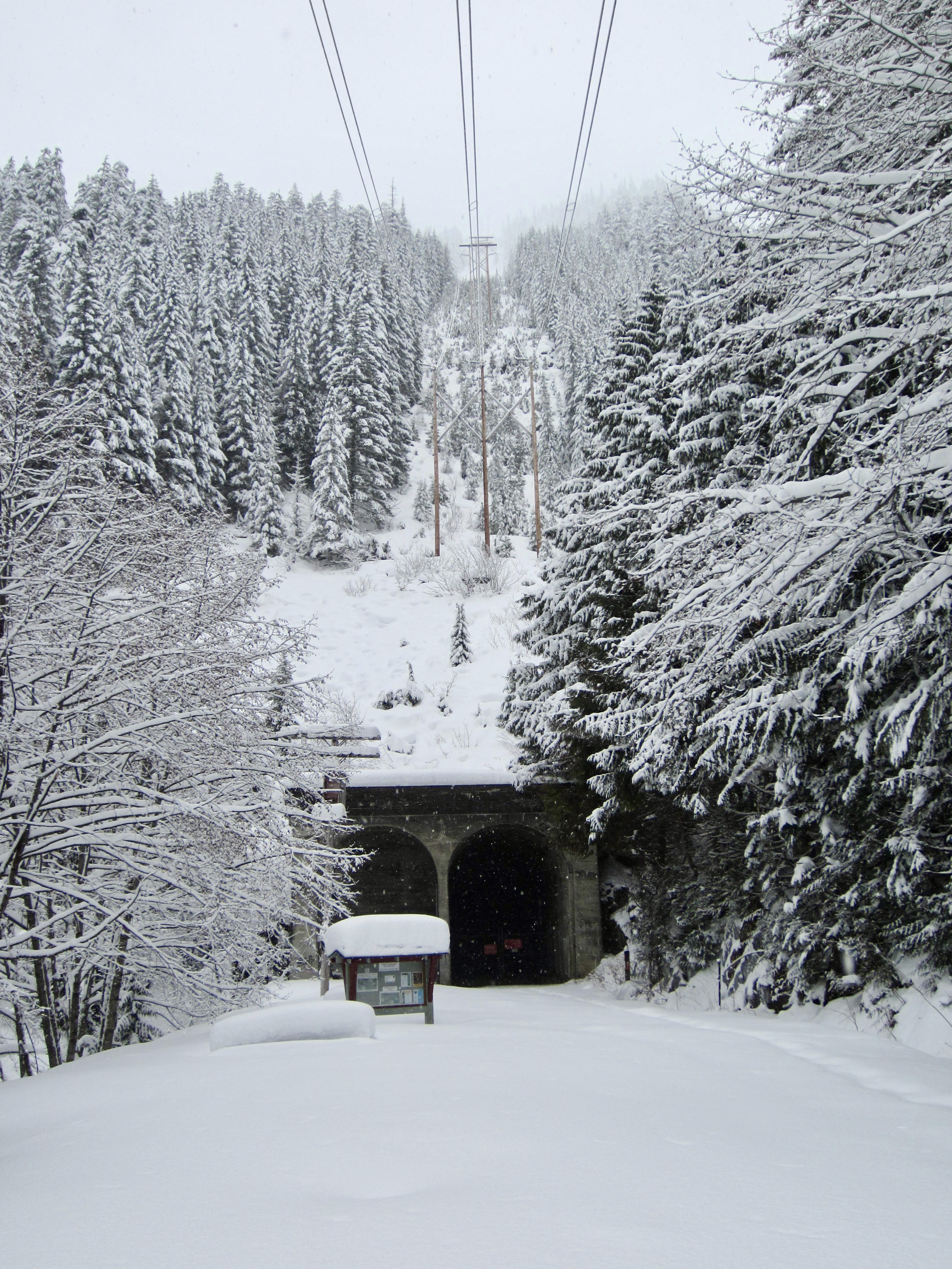
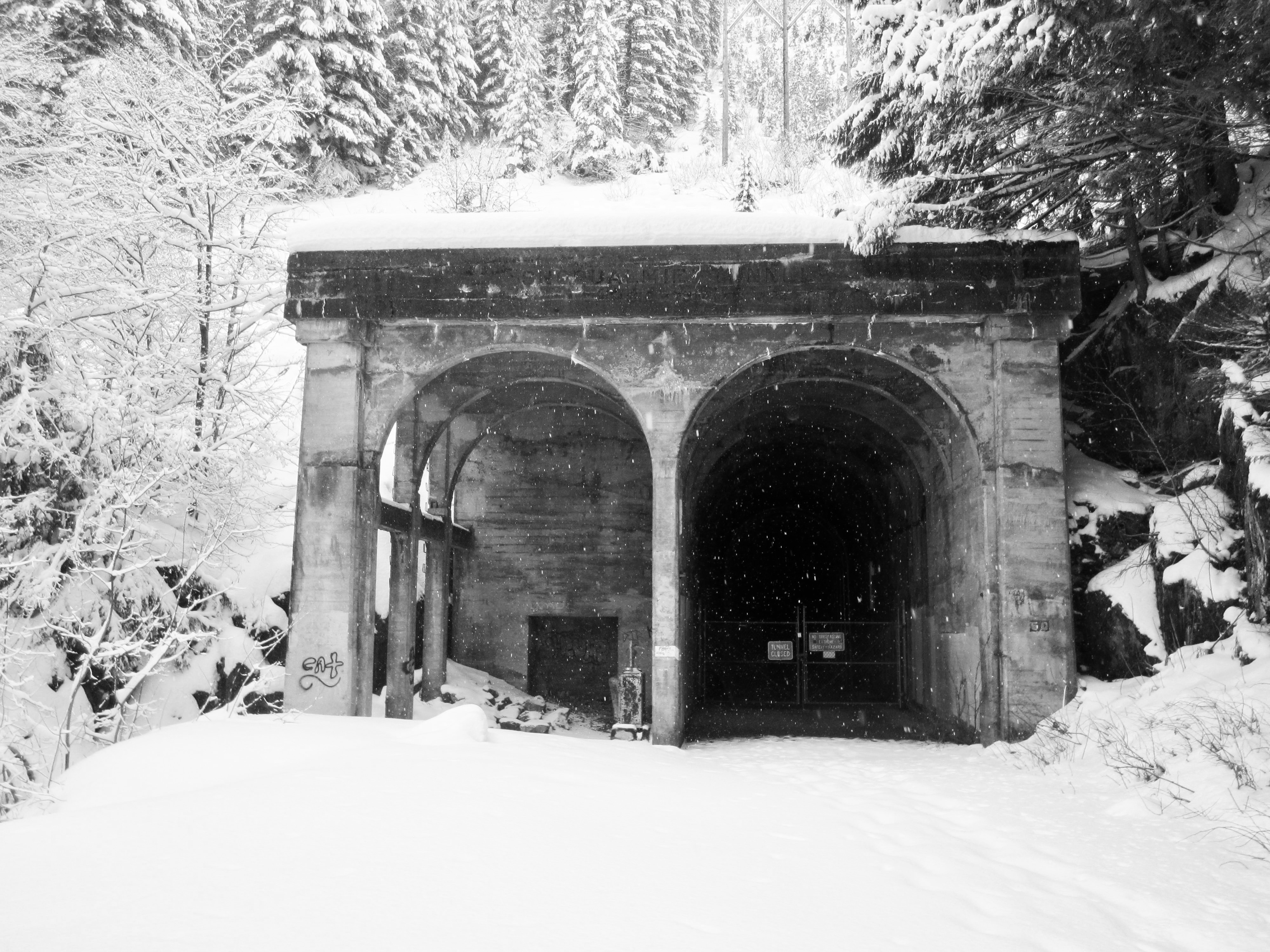
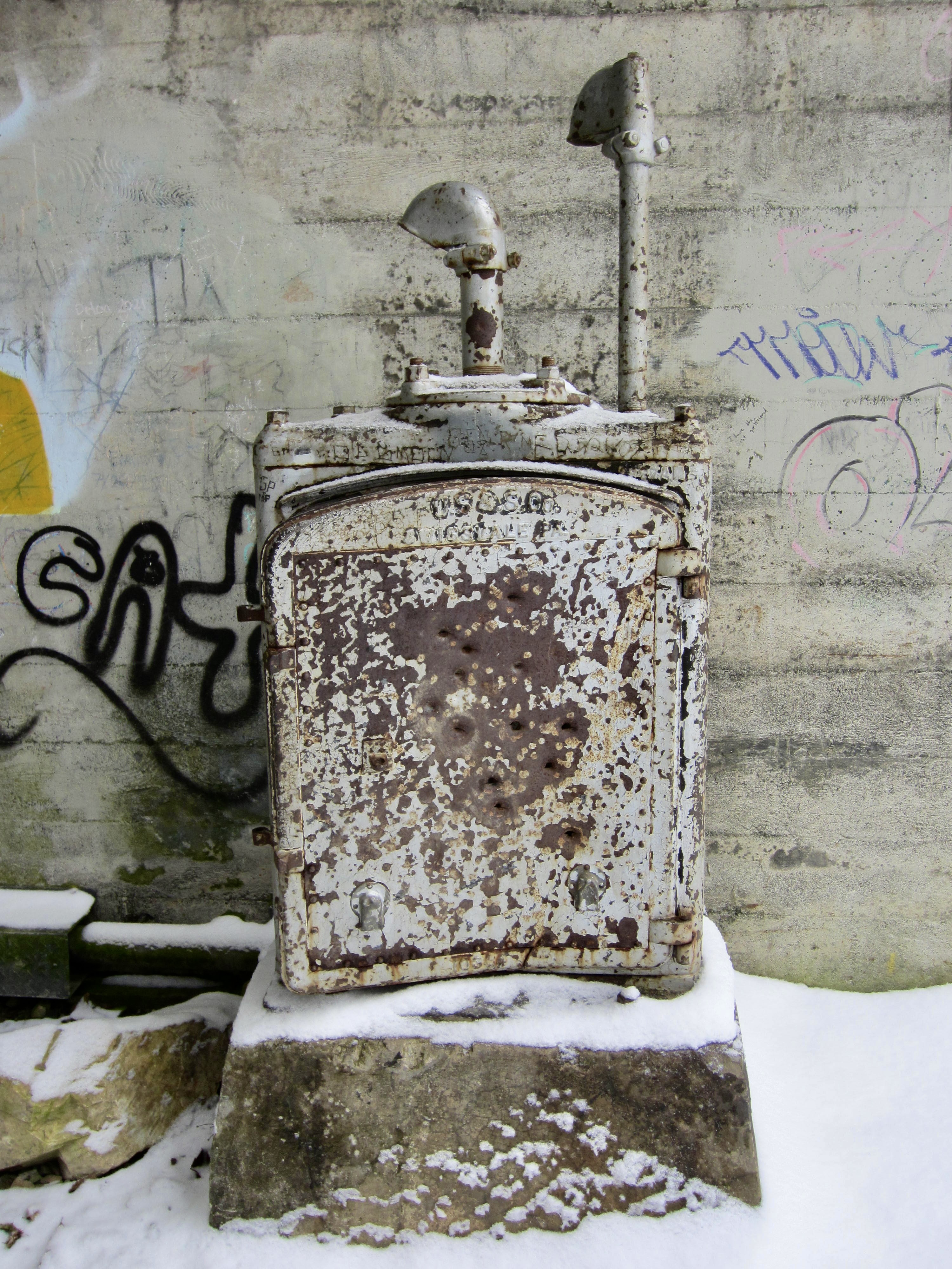
A final straightaway brings you to Rockdale Picnic Area and the West Portal of the historic Snoqualmie Tunnel (2.5 miles + 600 feet from sno-park). This 2.3-mile-long tunnel was constructed during the years 1912-14 and served as a critical segment of The Milwaukee Road for approximately 65 years. Nowadays, the tunnel is open to hikers, bikers, and horses, although safety concerns keep it closed throughout the winter months.

.

.
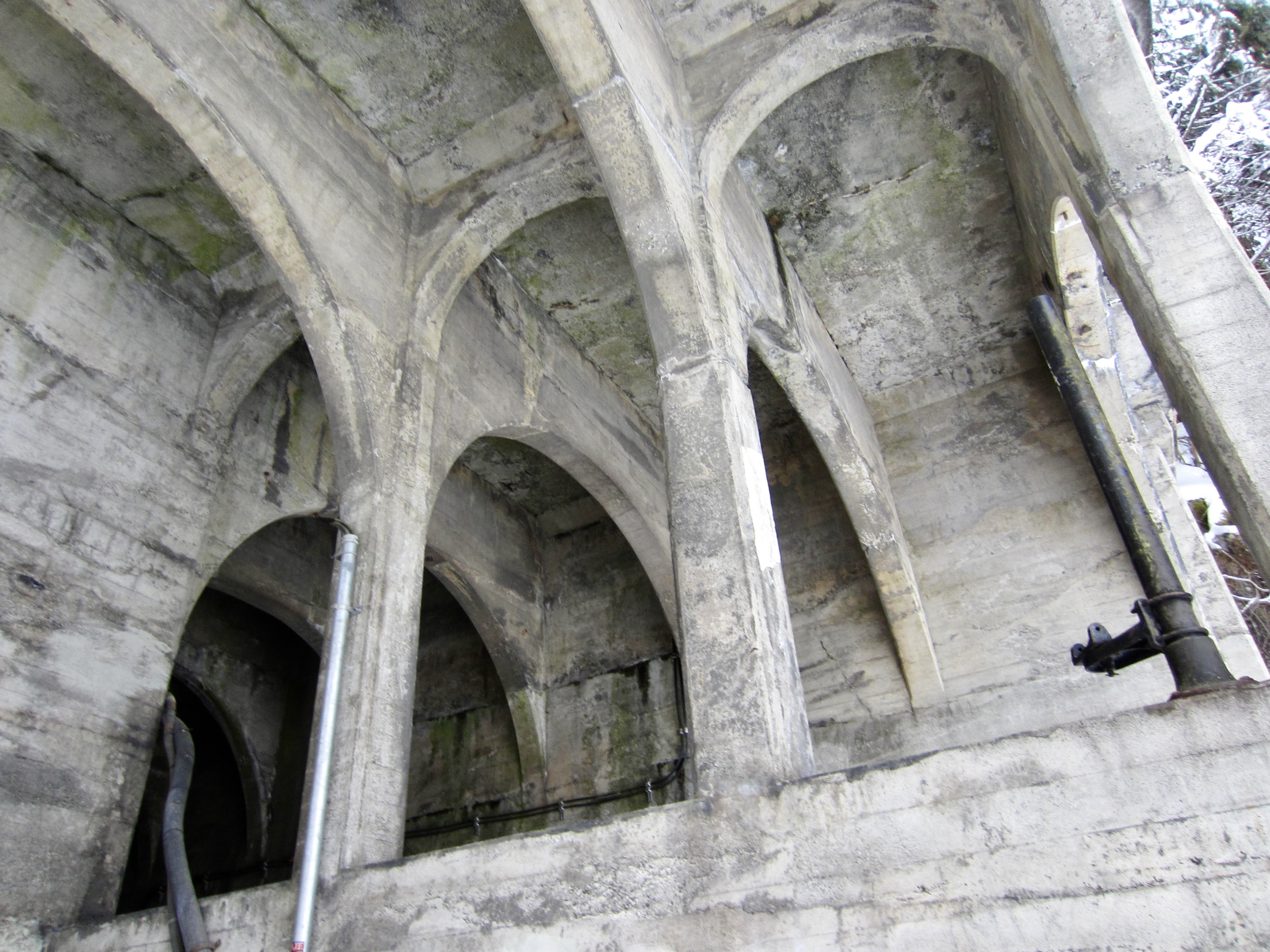
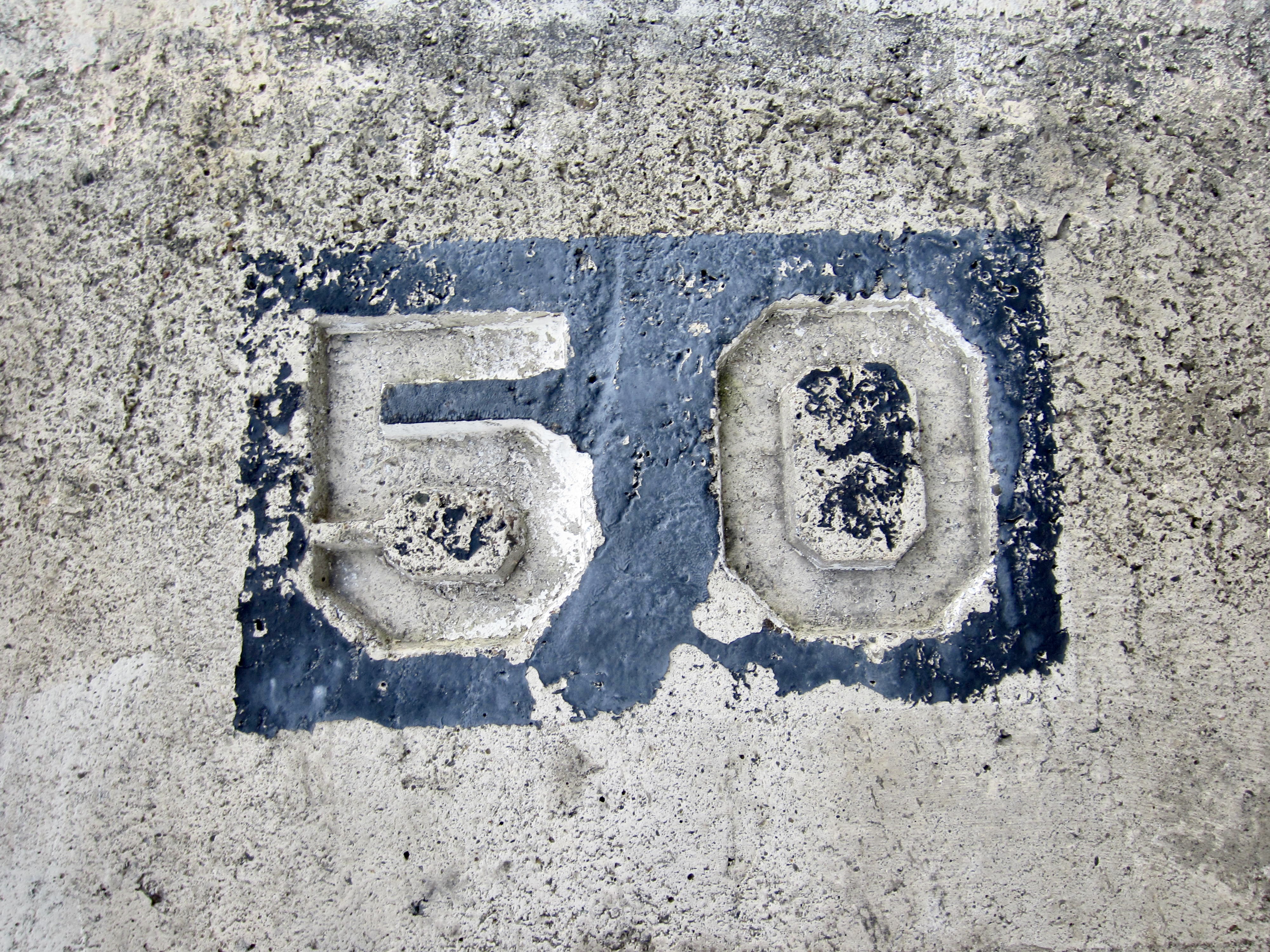
The West Portal displays some impressive architecture in the form of criss-crossing concrete arches, as well as some interesting railroad artifacts. Also, on the right side of the portal, you will see a “50” stamped into the concrete. Between Chicago and Seattle, there were 51 tunnels constructed along The Milwaukee Road, consecutively numbered (with some exceptions) from east to west. Snoqualmie Tunnel No. 50 was the penultimate tunnel in the sequence and was by far the longest. (Whittier Tunnel No. 49 is located about 10 miles to the east. Landsburg Tunnel No. 51, located near Maple Valley, was the very last tunnel.)
.
P2C Trail Junction to Annette Lake
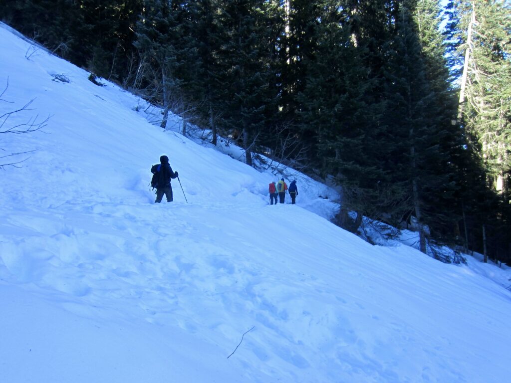
If your goal is Annette Lake, stay on the the Annette Lake Trail as it diagonally crosses the old railbed and continues a gradual ascent into the Humpback Creek Valley. Occasional gaps in the forest allow for views of Humpback Mountain over to the west.
.
.
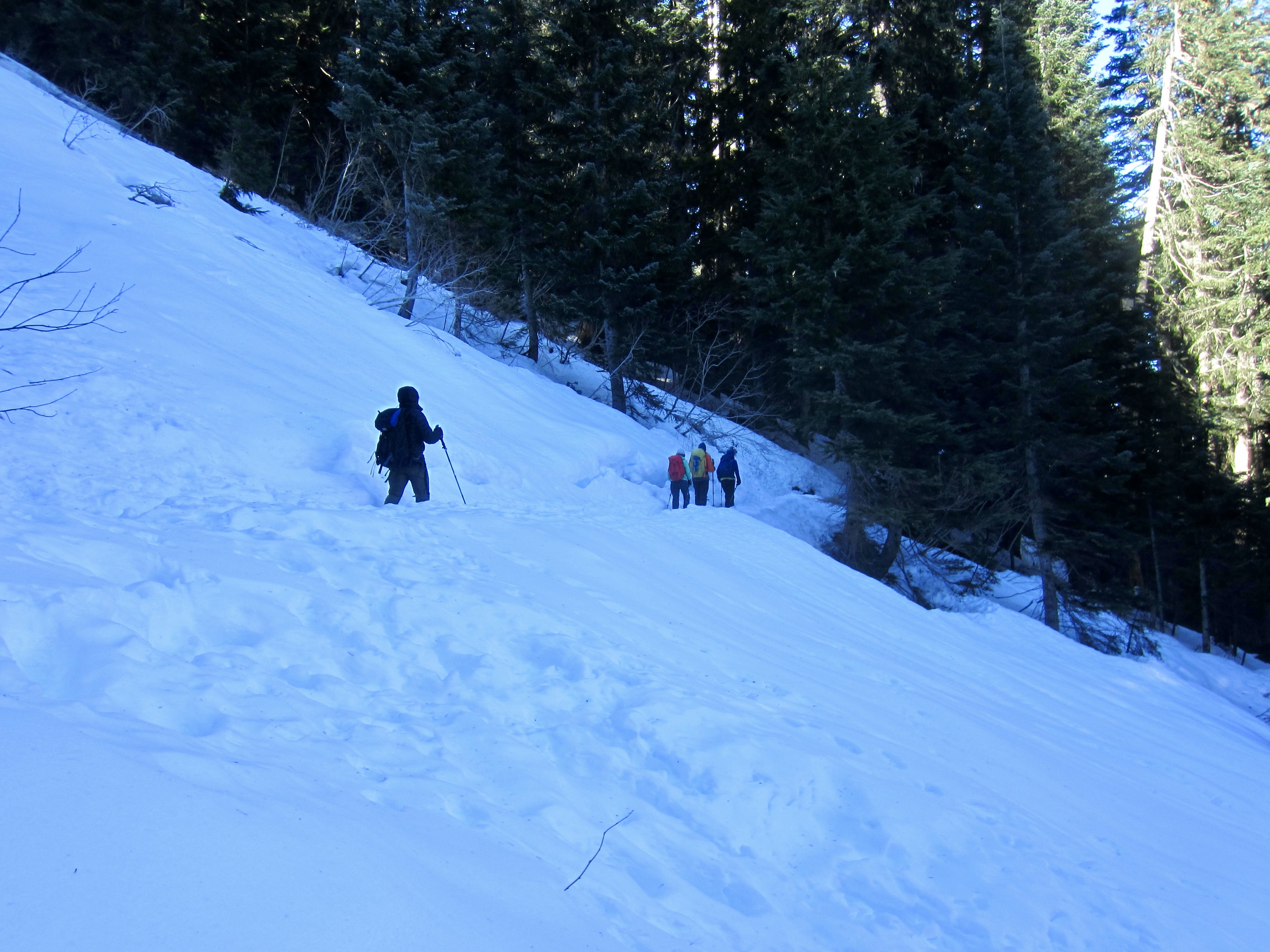
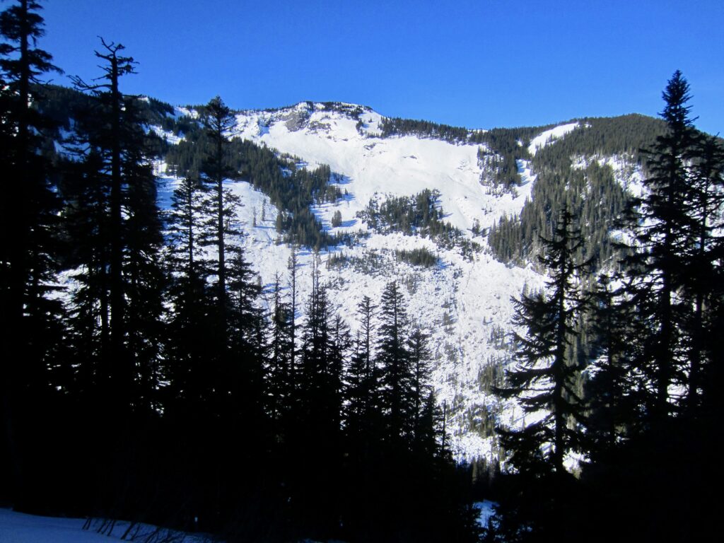
Farther along, the trail passes through a series of long, narrow clearings that can become avalanche chutes during the winter and spring. Make a careful assessment of snow stability before heading across any of these chutes, and be prepared to turn around if conditions are unstable.
.
.
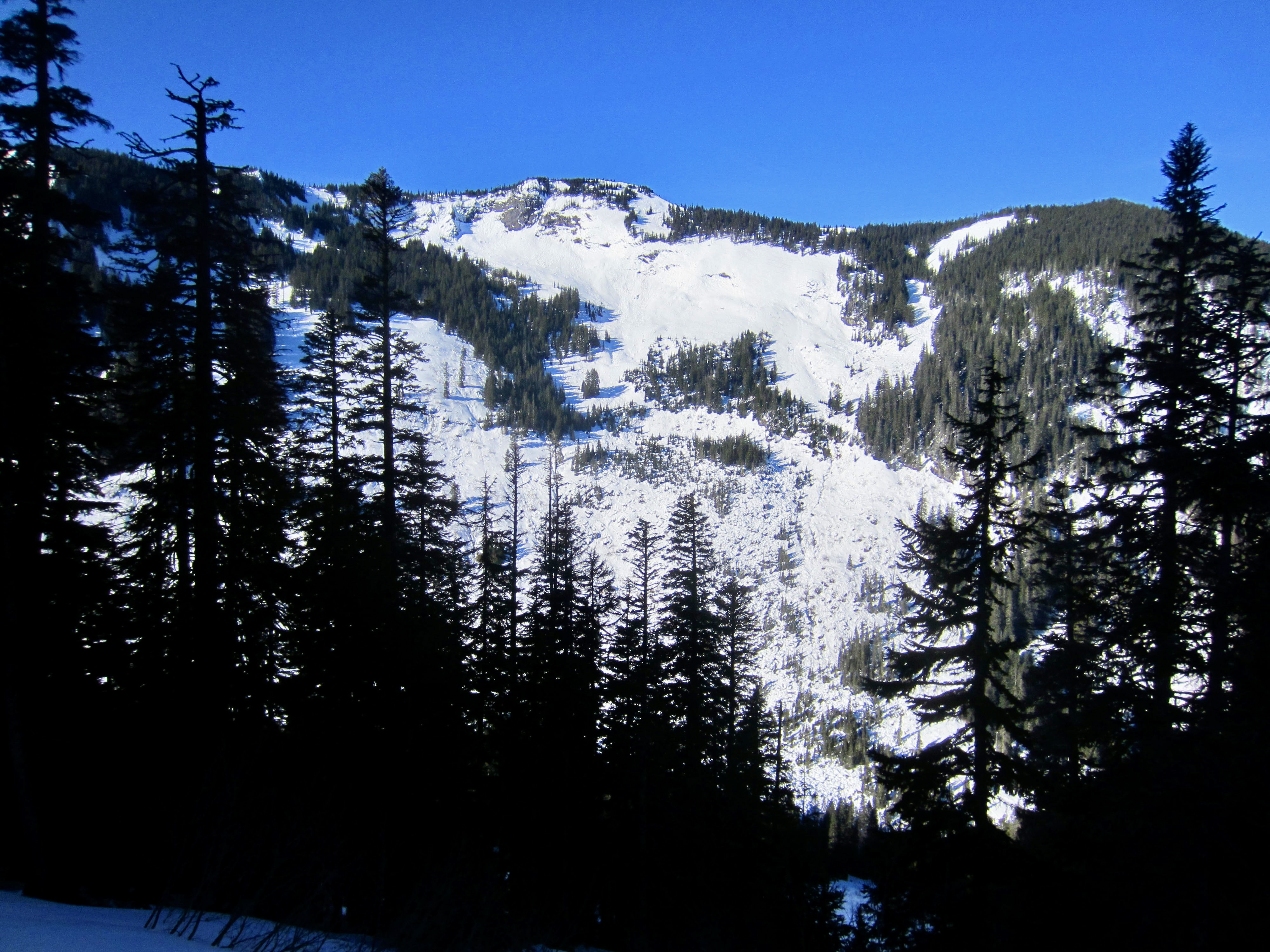
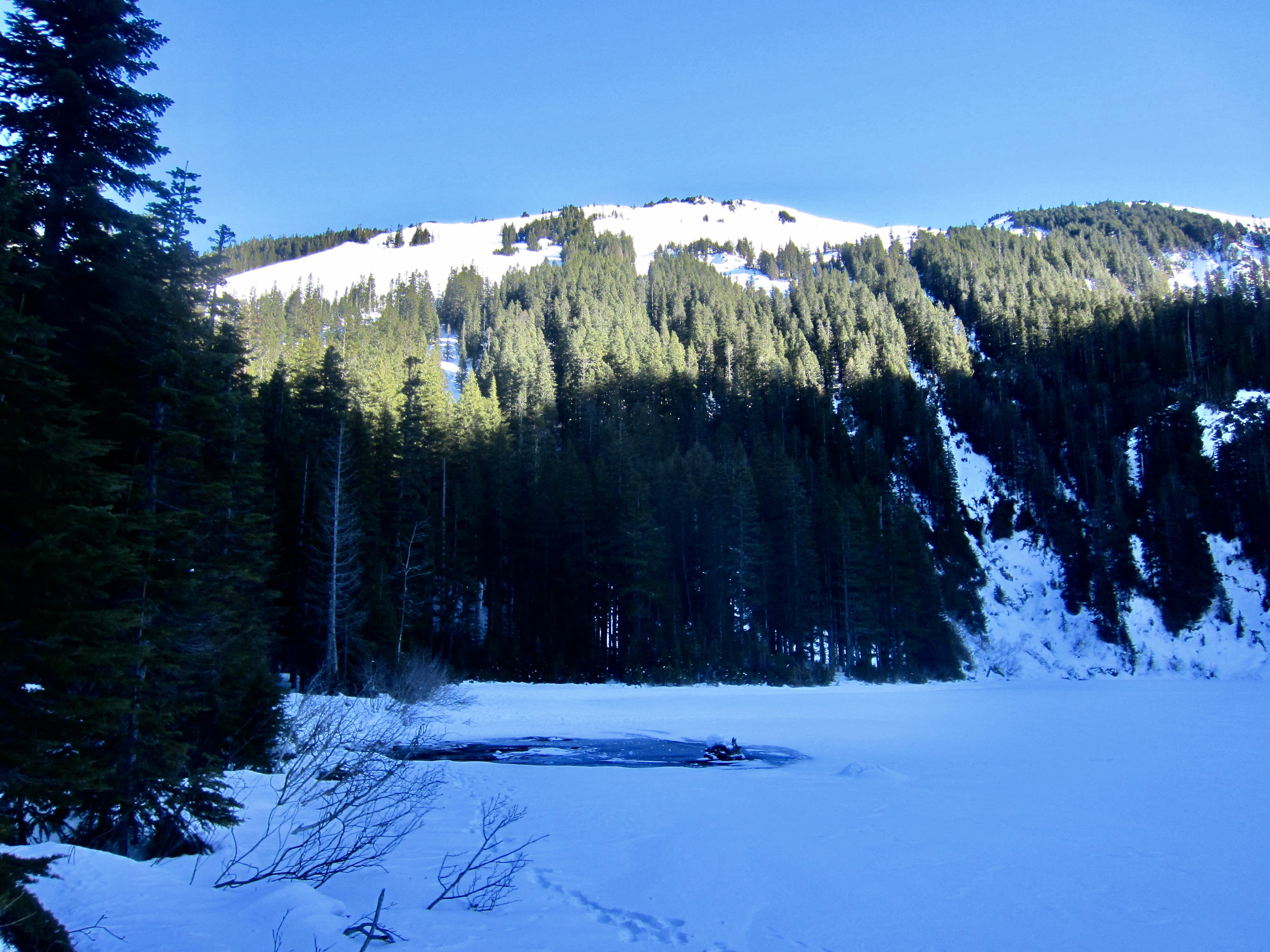
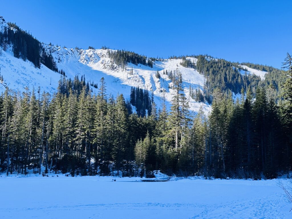
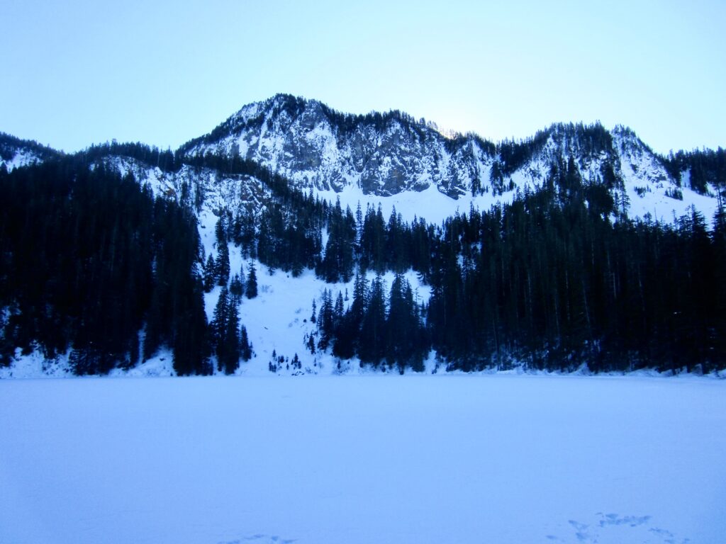
After climbing steadily for 2½ miles, the trail tops out and makes a nearly level traverse for an additional mile before arriving at Annette Lake (3.4 miles + 1850 feet from sno-park). This pretty little lake sits in a shallow bowl that is bounded by Silver Peak on the left (east), Humpback Ridge on the right (west), and Abiel Peak straight ahead.

.
.
.
Route Map & Profile
…
…
…
Photo Gallery
Click to enlarge…