Trip Date: May 14, 2024
2024 SLOVENIA ADVENTURE VACATION
Vintgar Gorge – King of Triglav Trail Loop
Reka Radnova aka Radovna River
Soteska Vintgar aka Vintgar Gorge
Slap Sum aka Sum Waterfall
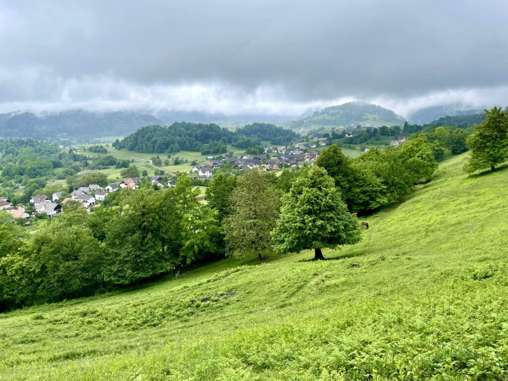
Zasip Viewpoint
Trip Report Summary
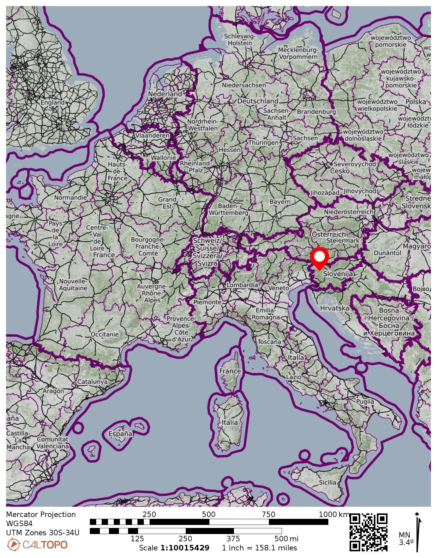
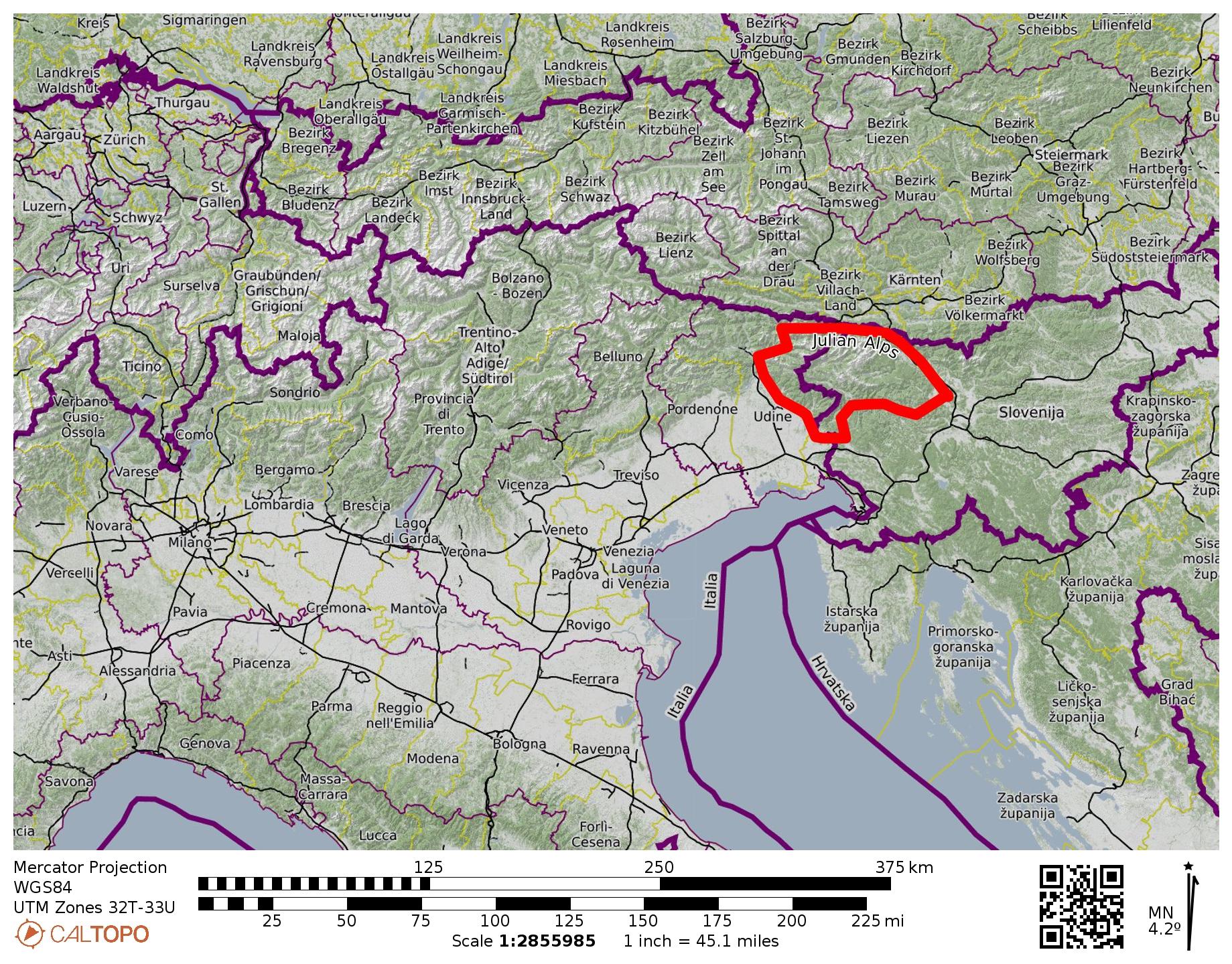
Region: Julian Alps (Slovenia)
Area: Triglavski Narodni Park aka Triglav National Park
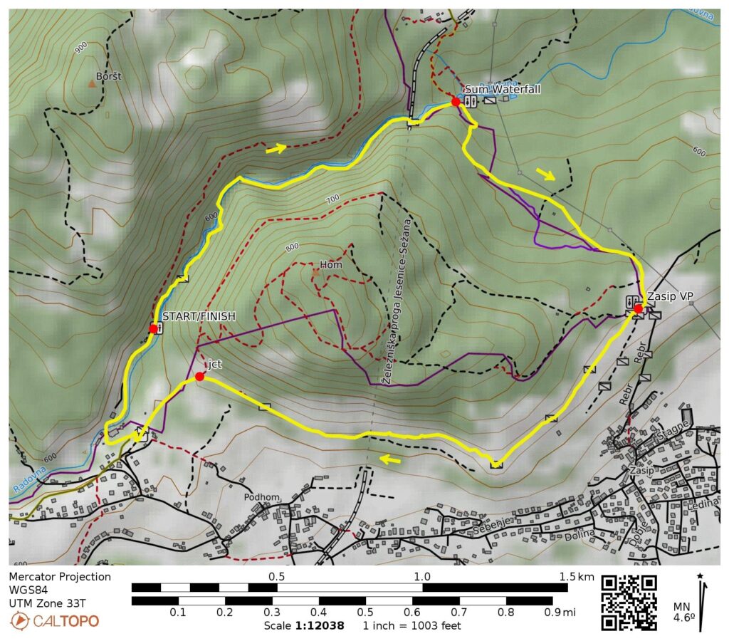
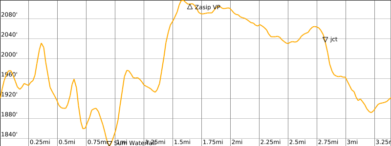
Starting & Ending Point: Vintgar Gorge Visitor Center & Trailhead (Elev. 1900 feet / 580 meters)
Way Points: Sum Waterfall & King of Triglav Trailhead & Hom Hill Trailhead & Zasip Viewpoint & Vrsce (trail hike); Vintgar Gorge Visitor Center (road walk)
Approximate Stats: 3.5 miles / 5.7 kilometers traveled; 700 feet / 210 meters gained & lost; 2.0 hours elapsed.
…
Full Trip Report
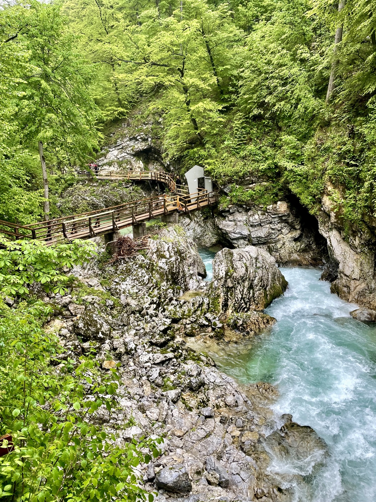
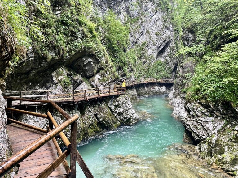
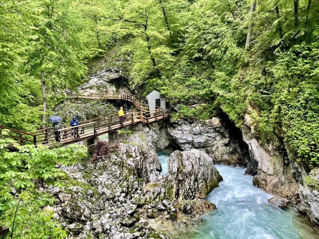
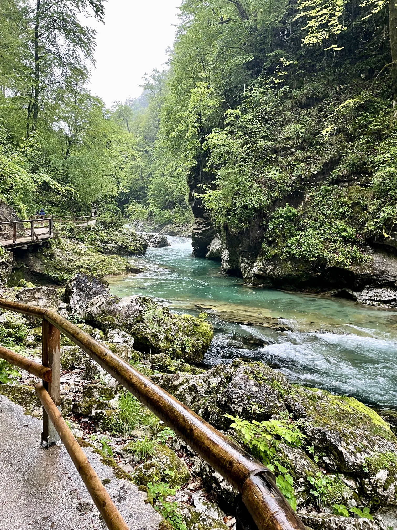
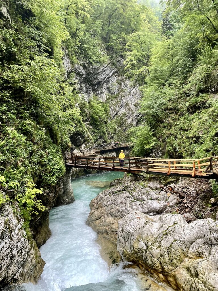
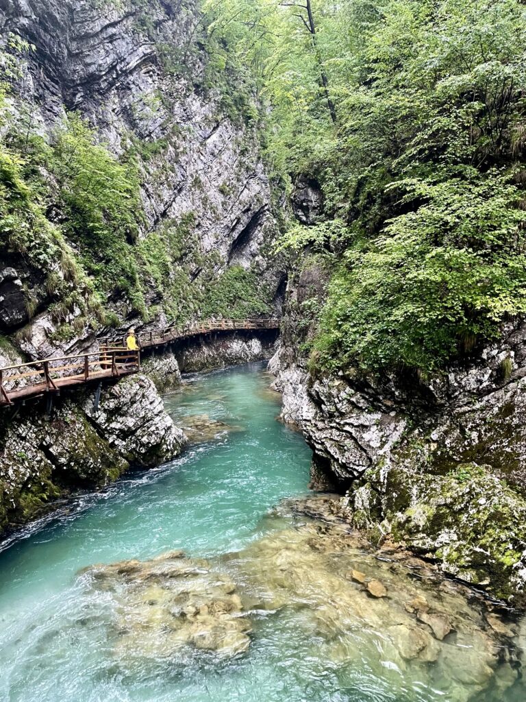
One of the most popular natural attractions near the Slovenian town of Bled is Vintgar Gorge. This wonderfully scenic gorge was carved into solid limestone bedrock by the Radovna River, which flows through the eastern tip of Triglav National Park. For the benefit of the myriad visitors who come to see it, a 1.0-mile / 1.6-kilometer trail has been constructed through the heart of the gorge. This splendid trail wanders back and forth across the gorge, staying closely above river level and providing trekkers with a uniquely intimate experience. I regard the trail to be a man-made marvel in its own right.
.
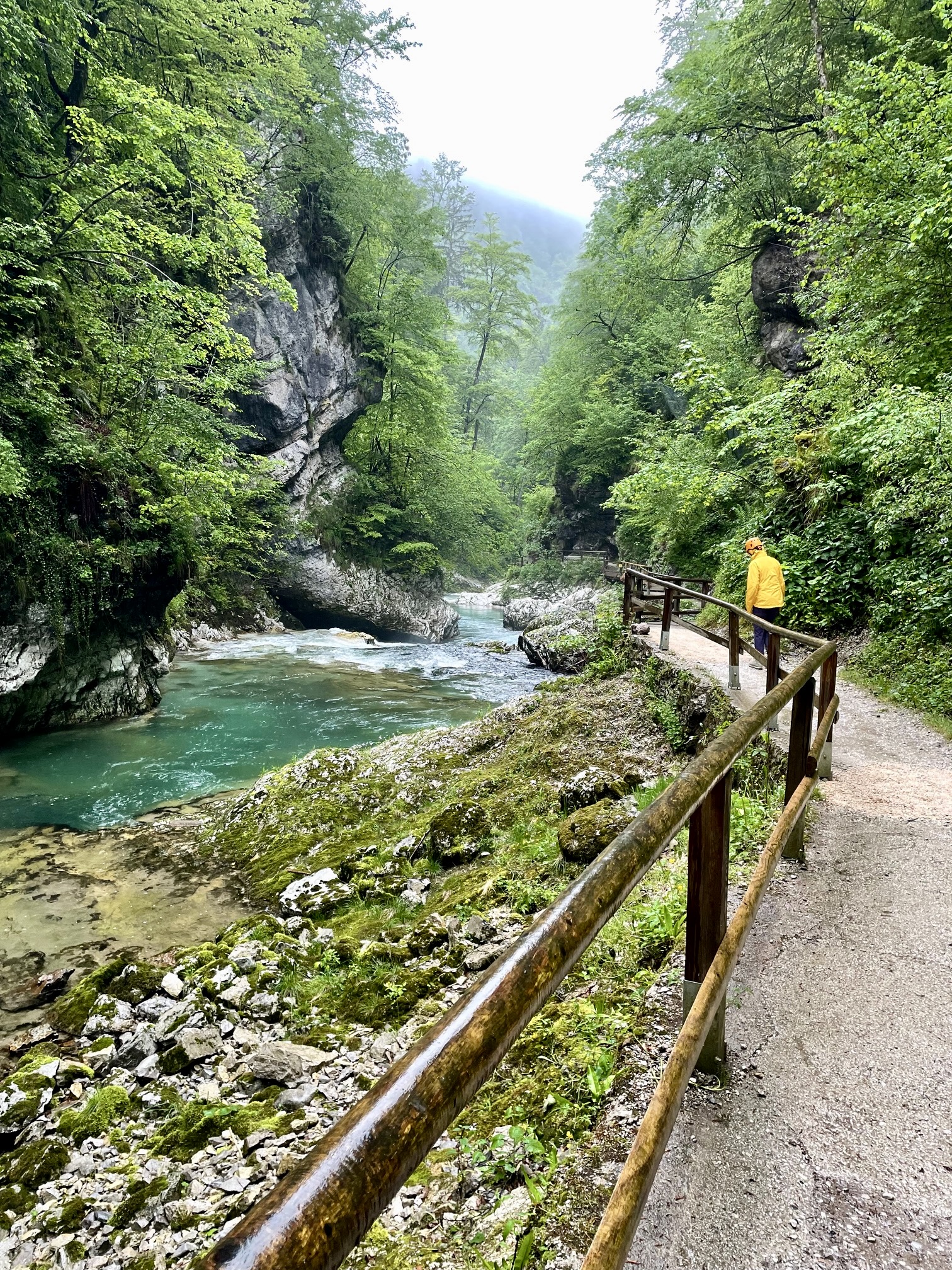
Eileen and I began our trek at the Vintgar Gorge Visitor Center near the village of Vrsce. The national park issues timed-entry permits (10 euros per person) in order to reduce congestion on the narrow one-way trail, but overcrowding was hardly a concern on this rainy Tuesday morning. We passed through the turnstiles at our appointed time and were given helmets to wear. Helmets? What was the purpose of those, we wondered. As it turned out, the answer came soon enough.
.
Within minutes of entering the gorge, we found ourselves stopping repeatedly to gape at the view ahead and behind. This highly advertised tourist attraction had managed to exceed our expectations! The crystal-clear river twists and turns through the rocky channel, crashing over boulders of white limestone. The steep limestone sidewalls are covered by ferns and moss.
.
Most of the trail was cut into the channel’s sidewalls by drilling, blasting, and chipping. However, at locations where the sidewalls are vertical, wooden boardwalks have been hung onto the rock and supported with piles or knee braces. It’s an impressive display of engineering and construction. As for the helmets? After nearly banging our heads into low-clearance overhangs at numerous locations, Eileen and I realized why they are required!
.
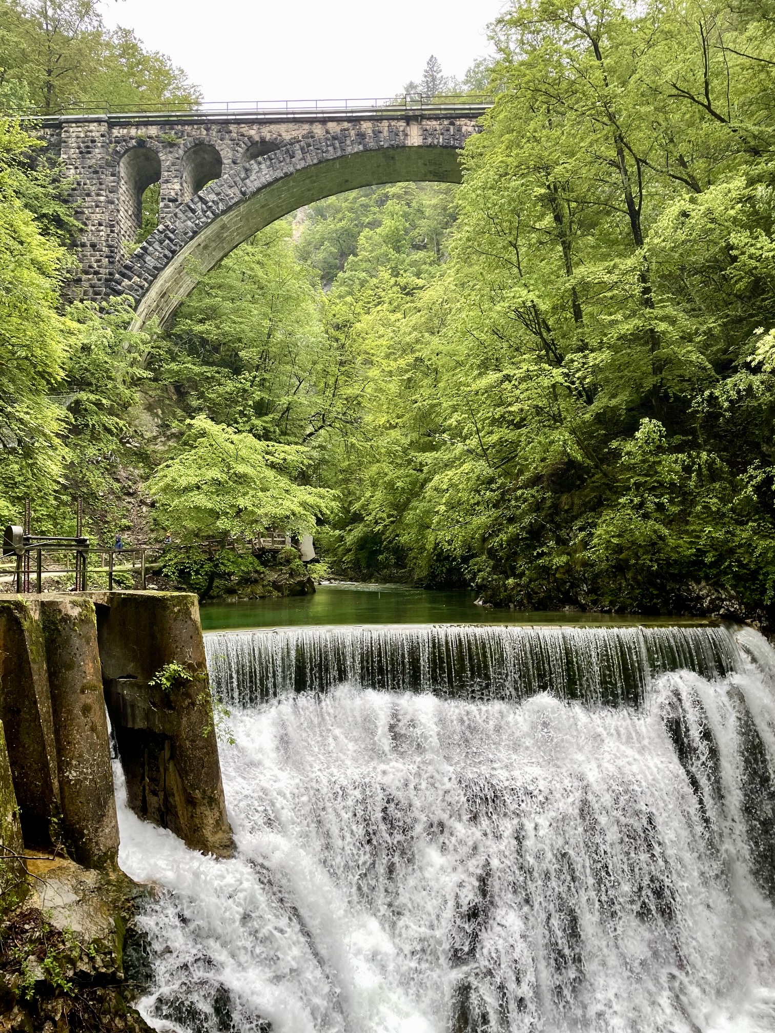
All too soon, we arrived at Sum Waterfall and its associated concrete dam, marking the end of the gorge trail. From here, we had the option of looping back to the left (west) on a fairly gentle forest trail or looping back to the right (east) on a hilly path called the King of Triglav Trail. We chose the latter trail, of course; who could resist a name like that?

.
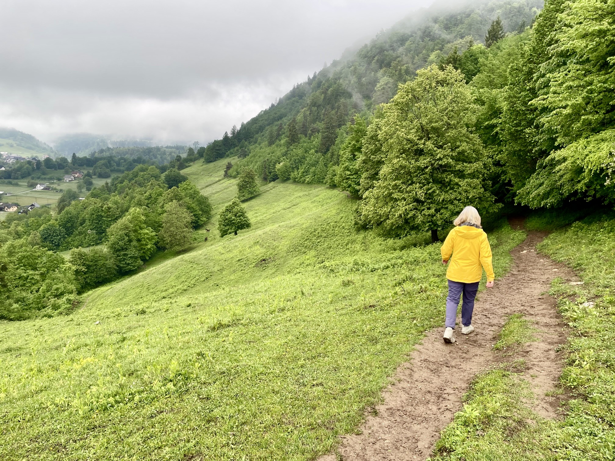
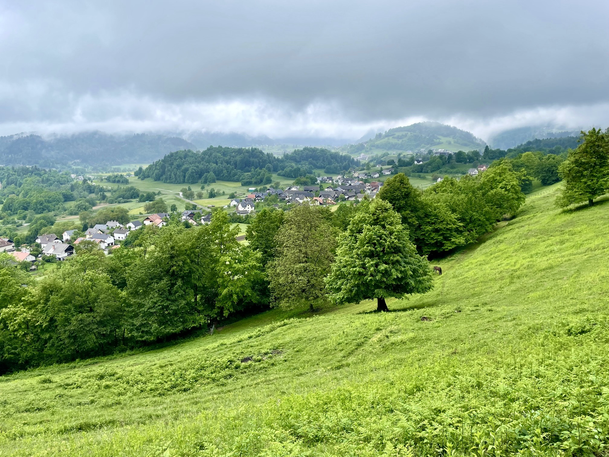
Our return trail began with a steep climb through pleasant beech forest on the northern flank of Hom Hill. It then swung around a ridge, past a viewpoint overlooking the village of Zasip, and traversed across the southern flank of Hom Hill. The pastoral landscape below us was quite nice, but the thick layer of saturated clay covering our trail was not. We struggled to stay upright on the slippery surface, and by the time we stepped onto solid ground near Vrsce, our boots were caked with a full pound of sticky mud!
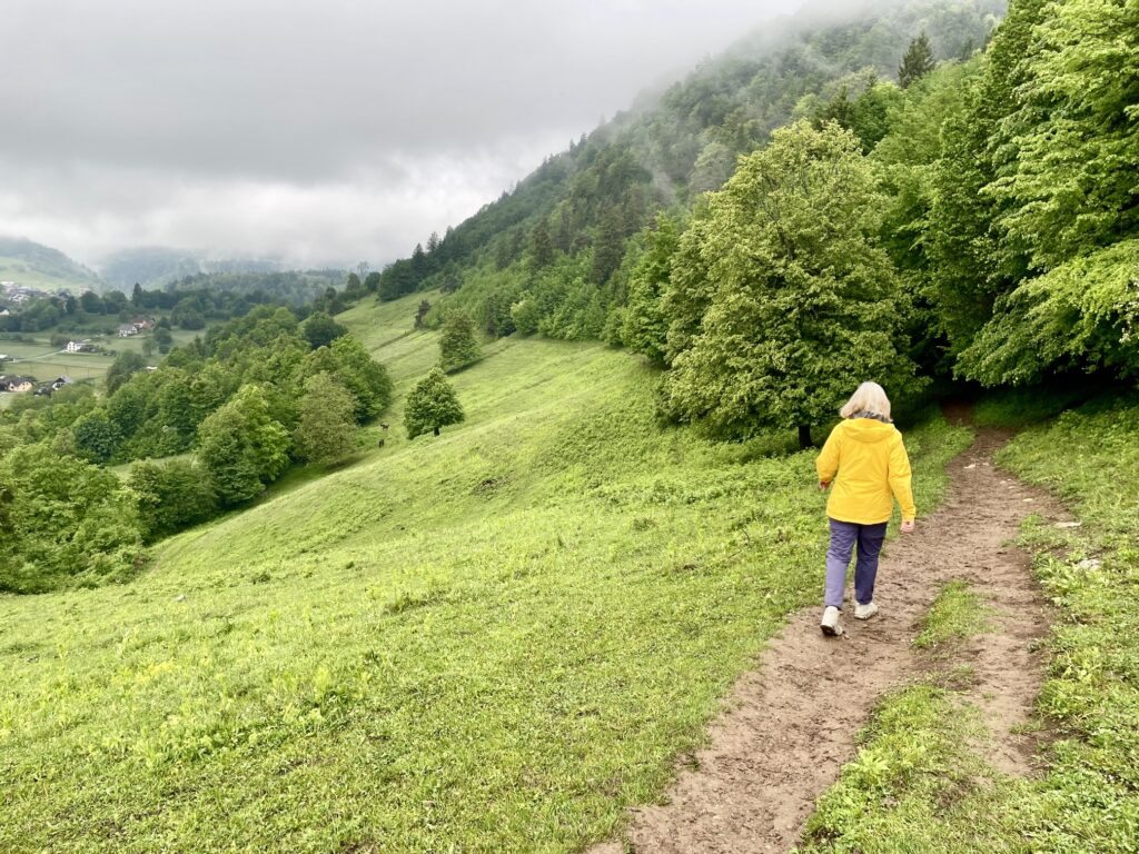
.
.
We finished our loop with a short walk down paved roads leading back to the visitor center. It had been a visually stunning trek, but I would offer this travel tip: The forest trail would probably be a better option during “mud season.”
Route Map & Profile
…
…
Photo Gallery
Click to enlarge…