Originally Posted: June 13, 2024
Updated: August 13, 2025
Otter Falls Slab Sport-Climb
Taylor River Valley
Lipsy Lake
Otter Falls
Poppy’s Peril Route (Class 5.8)
Trip Report Summary
Region: Central Washington Cascades
Sub-Region: Taylor-Tolt Mountains
Locale: North Bend, WA
Setting: Taylor River Valley
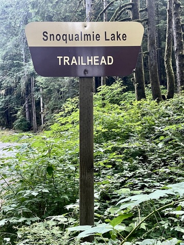
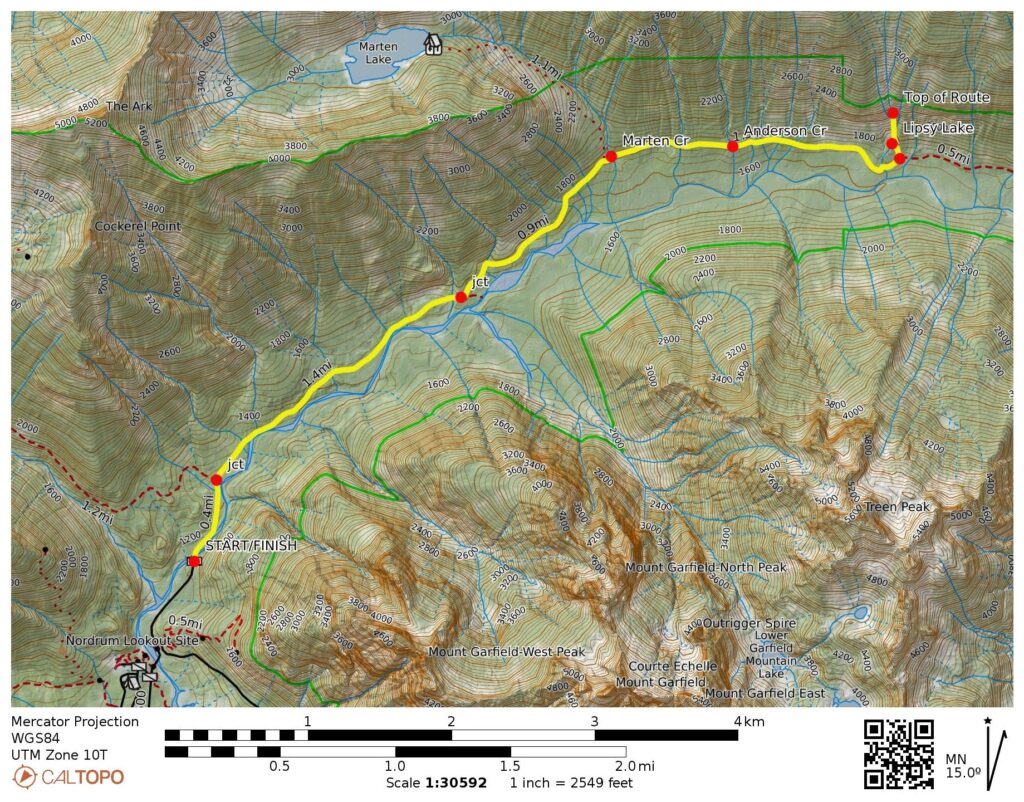
Approach Starting & Ending Point: Snoqualmie Lake Trailhead at end of Taylor River Road (Elev. 1150 feet)
Approach Way Points: Taylor River Bridge & Snoqualmie Lake Trail / Quartz Creek Trail junction & Marten Creek Bridge & Anderson Creek crossing & Otter Creek crossing & Otter Falls Trail junction & Lipsy Lake (trail hike)
Feature: Otter Falls Slab (Base Elev. 1700 feet)
Route: Poppy’s Peril (5 pitches of sport climbing)
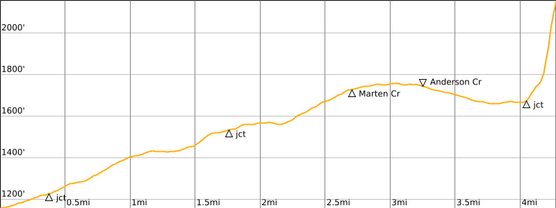
Approximate Stats for Approach (one way): 4.1 miles traveled; 650 feet gained; 100 feet lost.
Approximate Stats for Climb & Descent: 380 feet gained & lost; 2.3 to 4.3 hours elapsed.
Related Posts
>>> Spouse Wall Sport-Climb via Fusarium Route + Aspergillus Route – July 2025
>>> Golden Hour Wall Sport-Climb via Solar Storm – May 2025
Full Trip Report
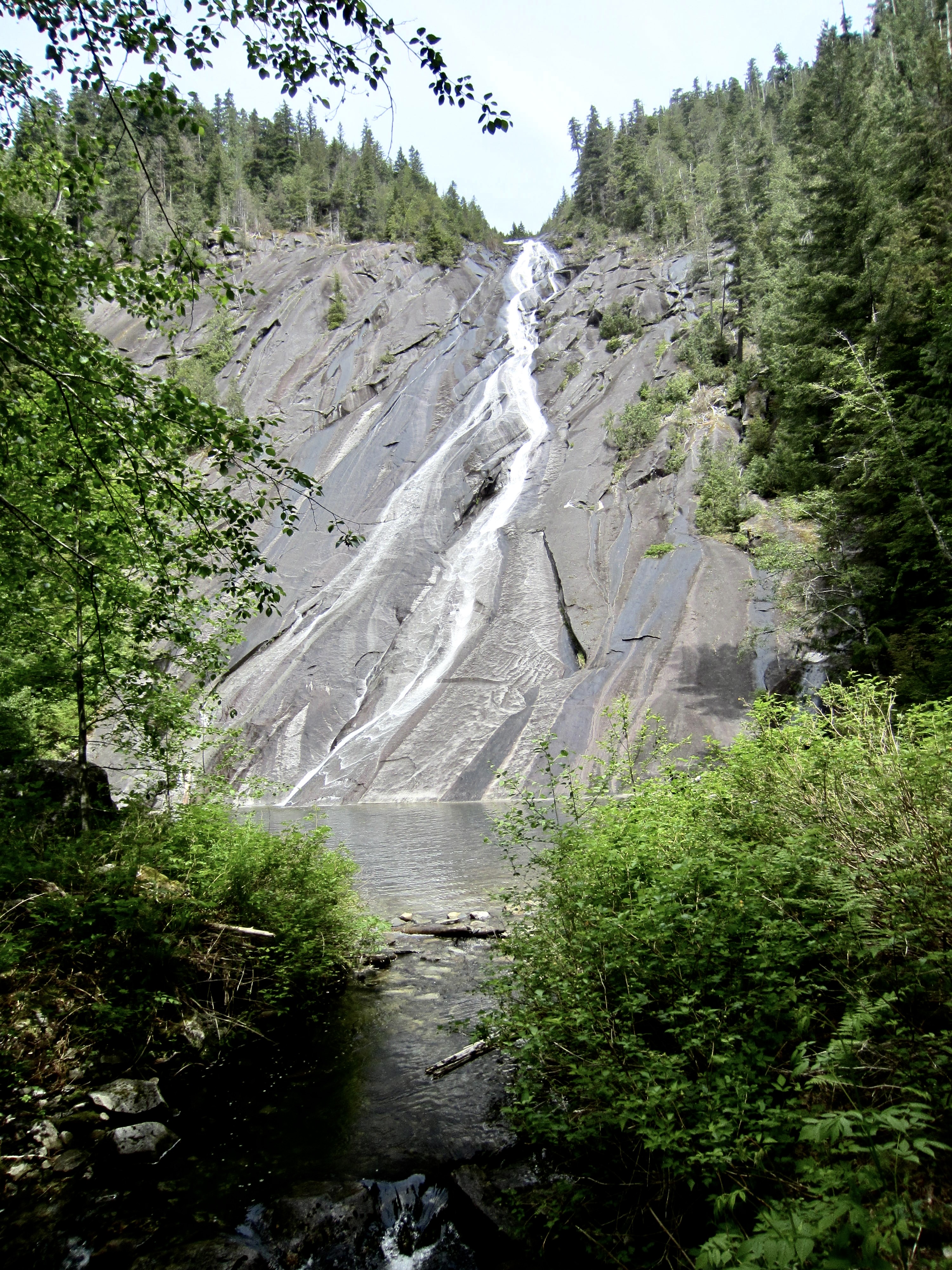
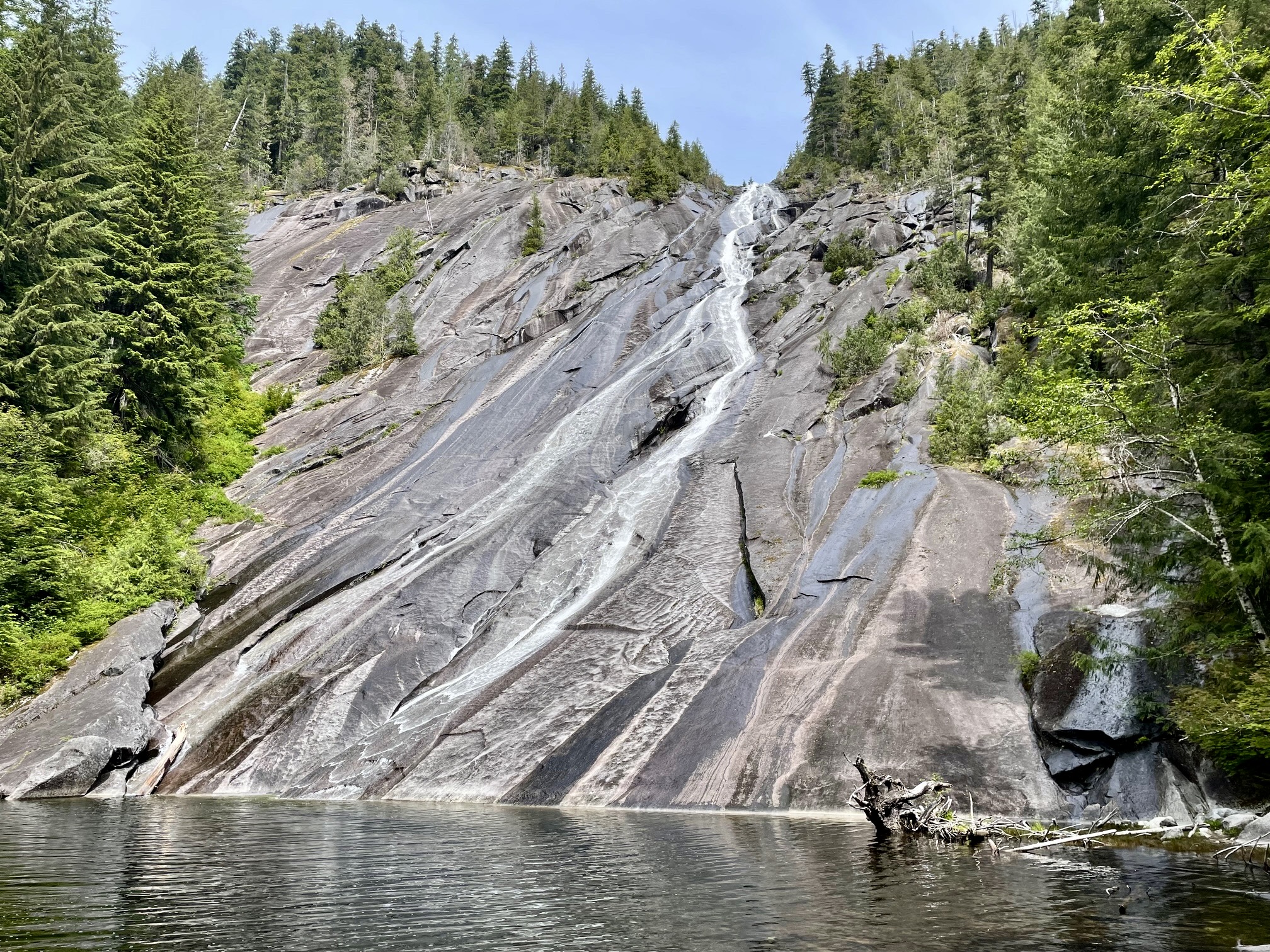
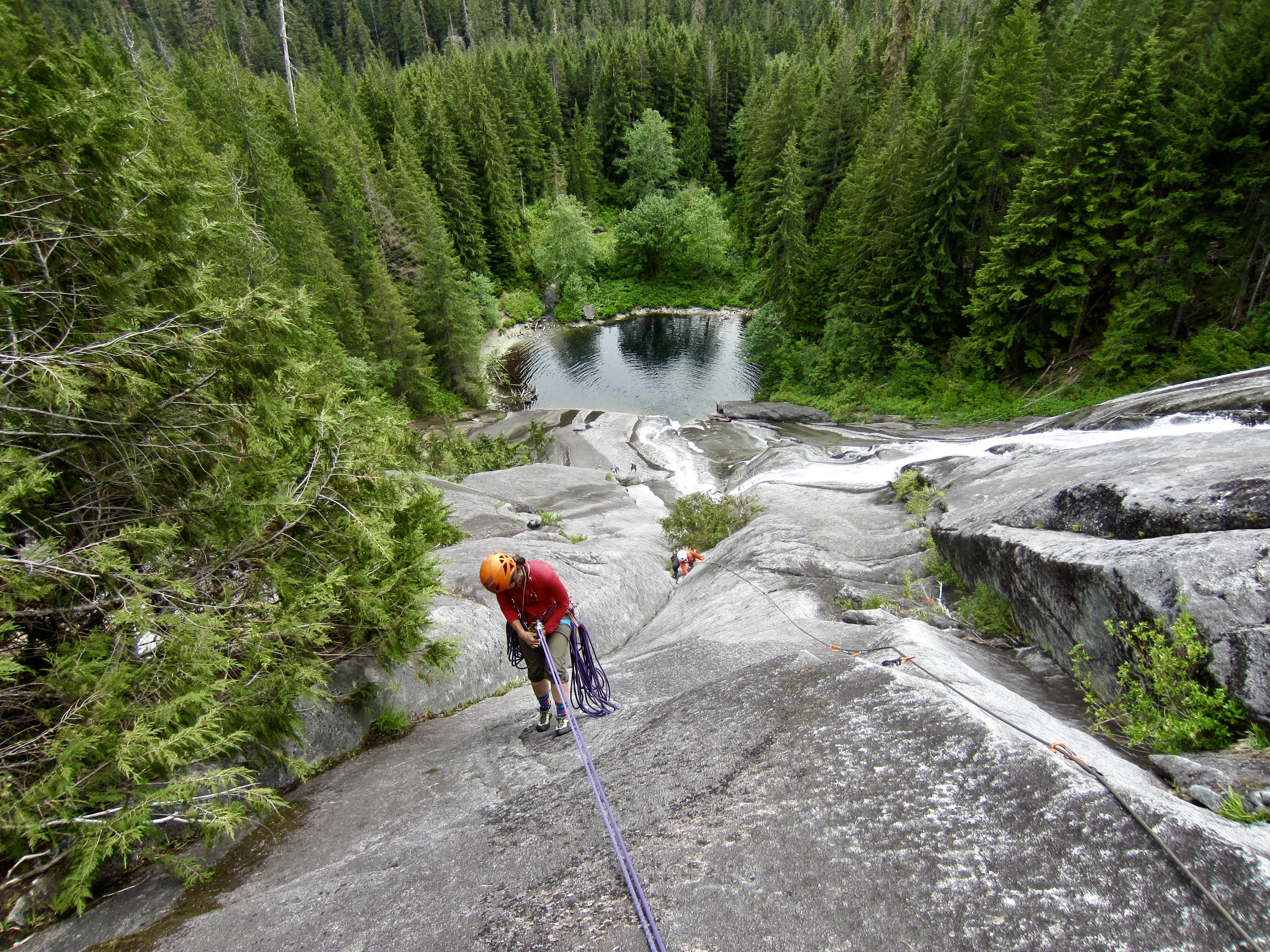
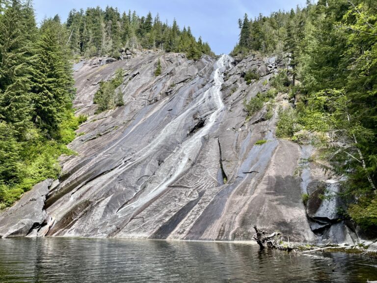
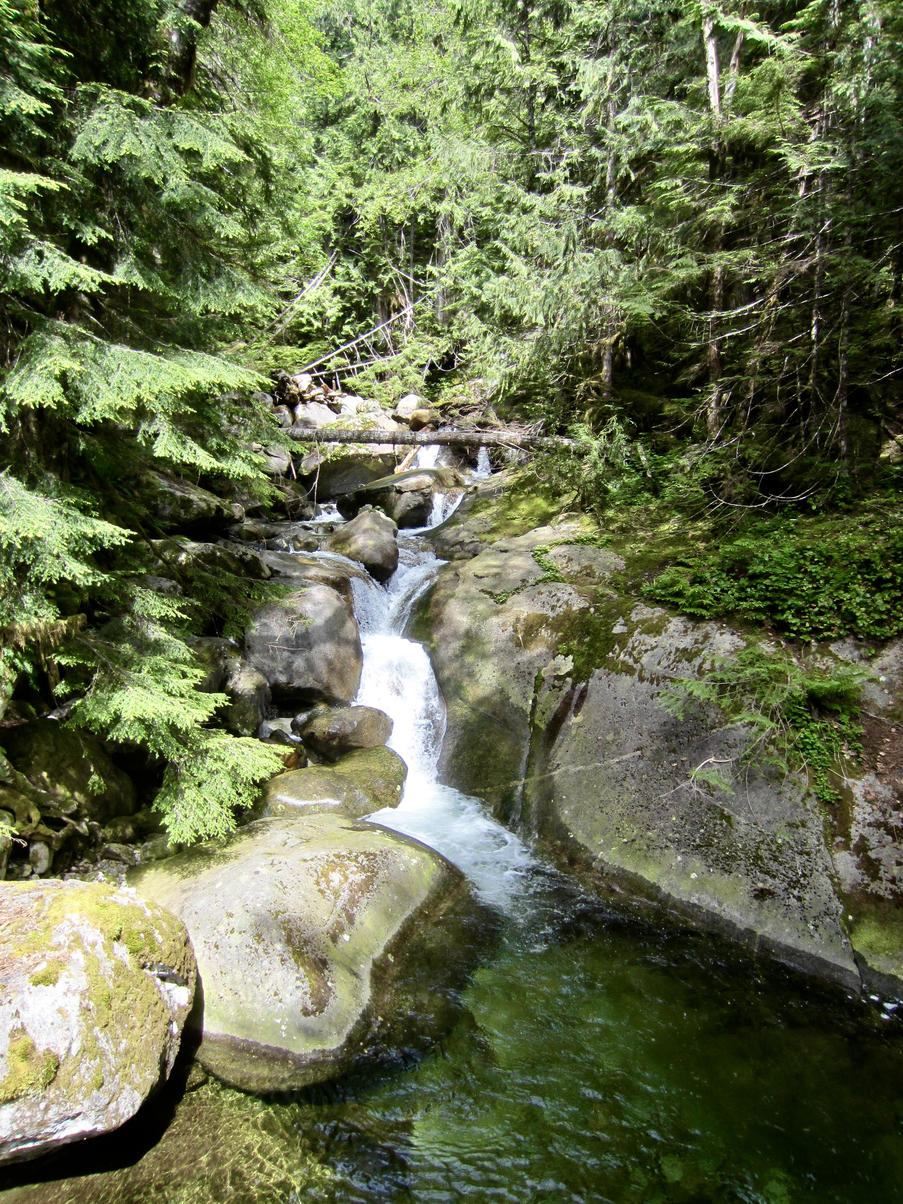
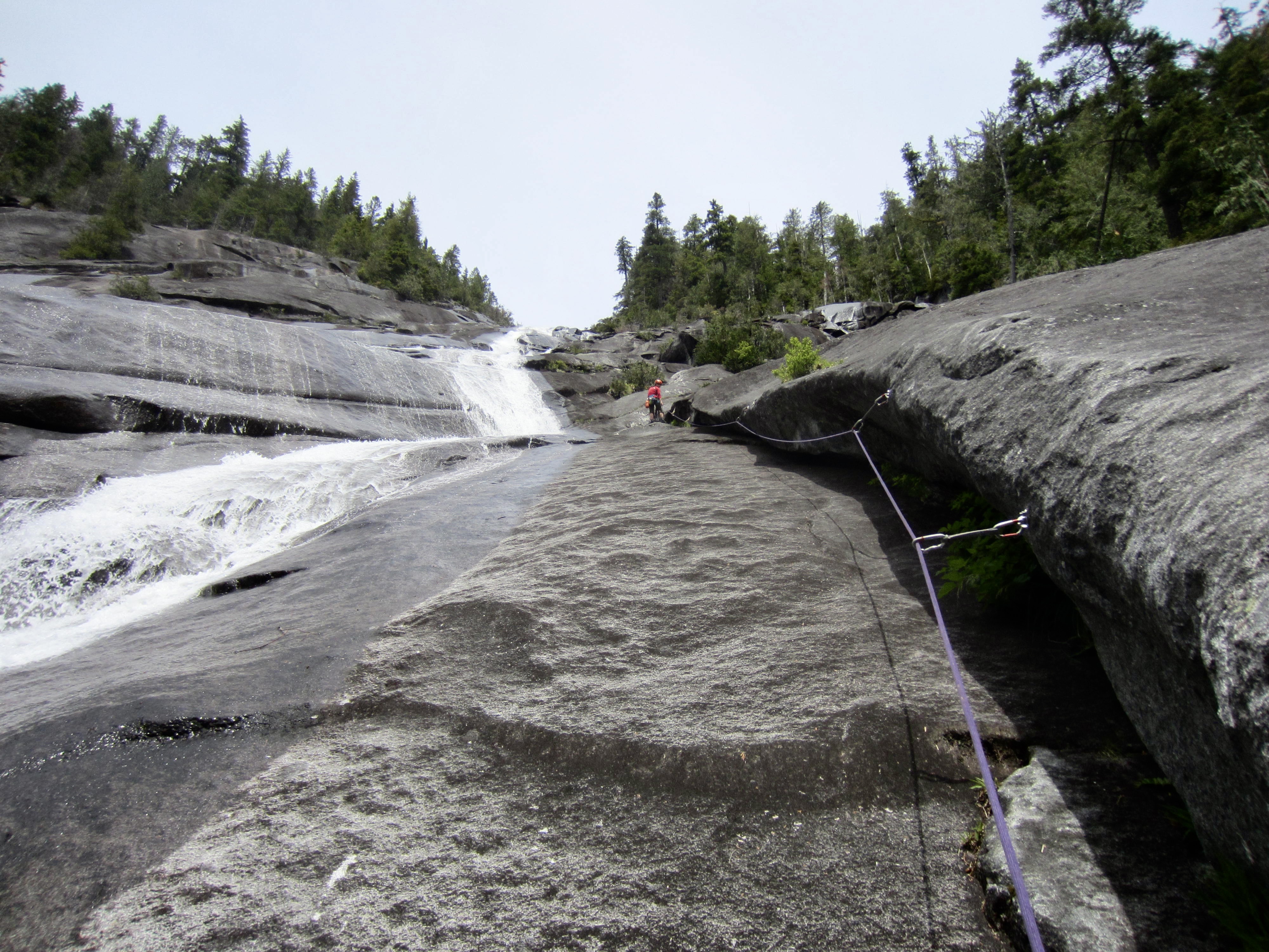
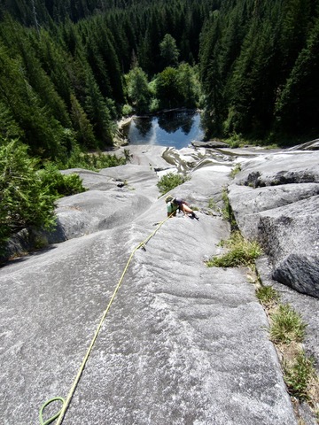
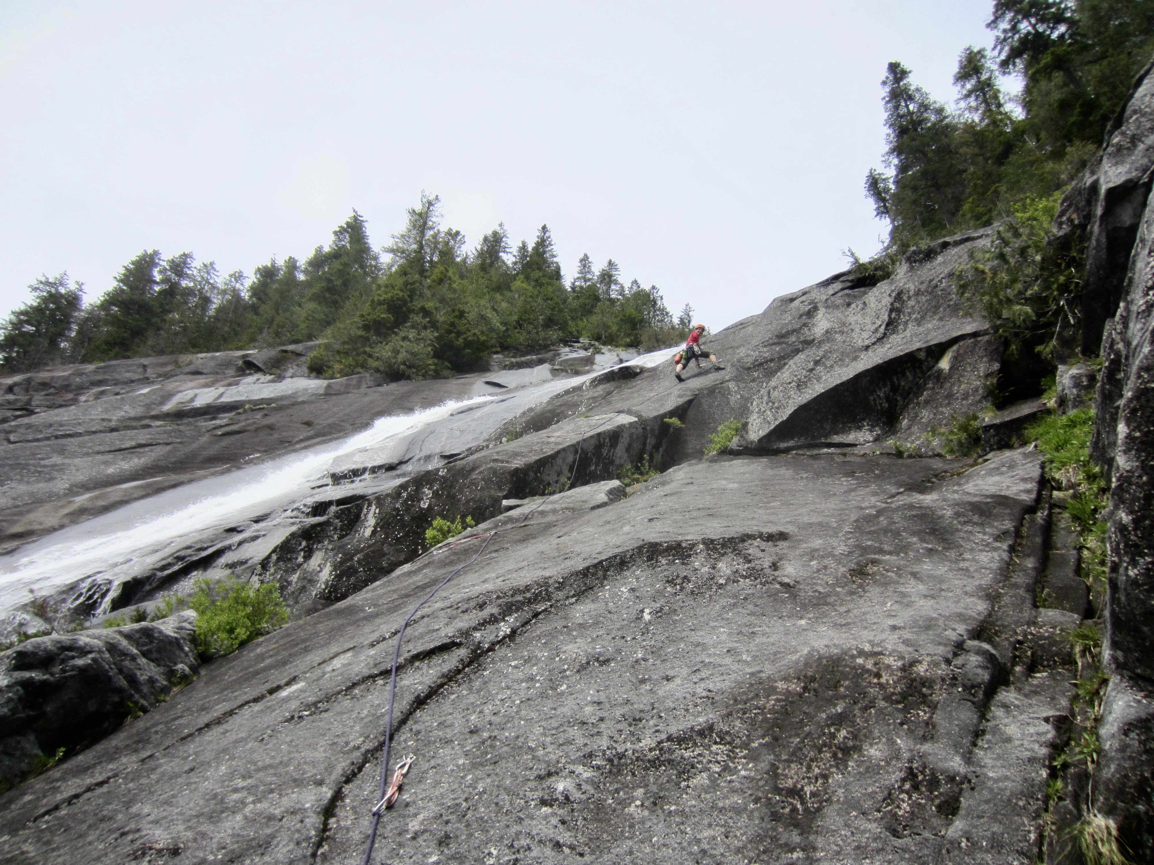
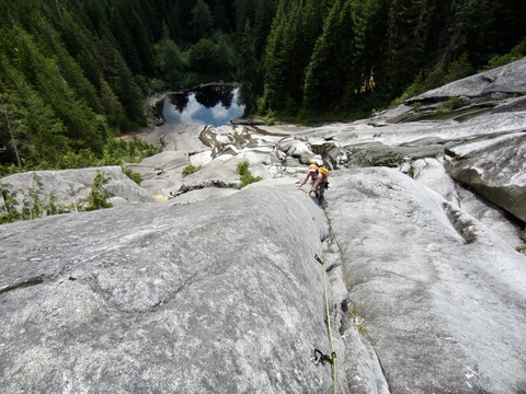
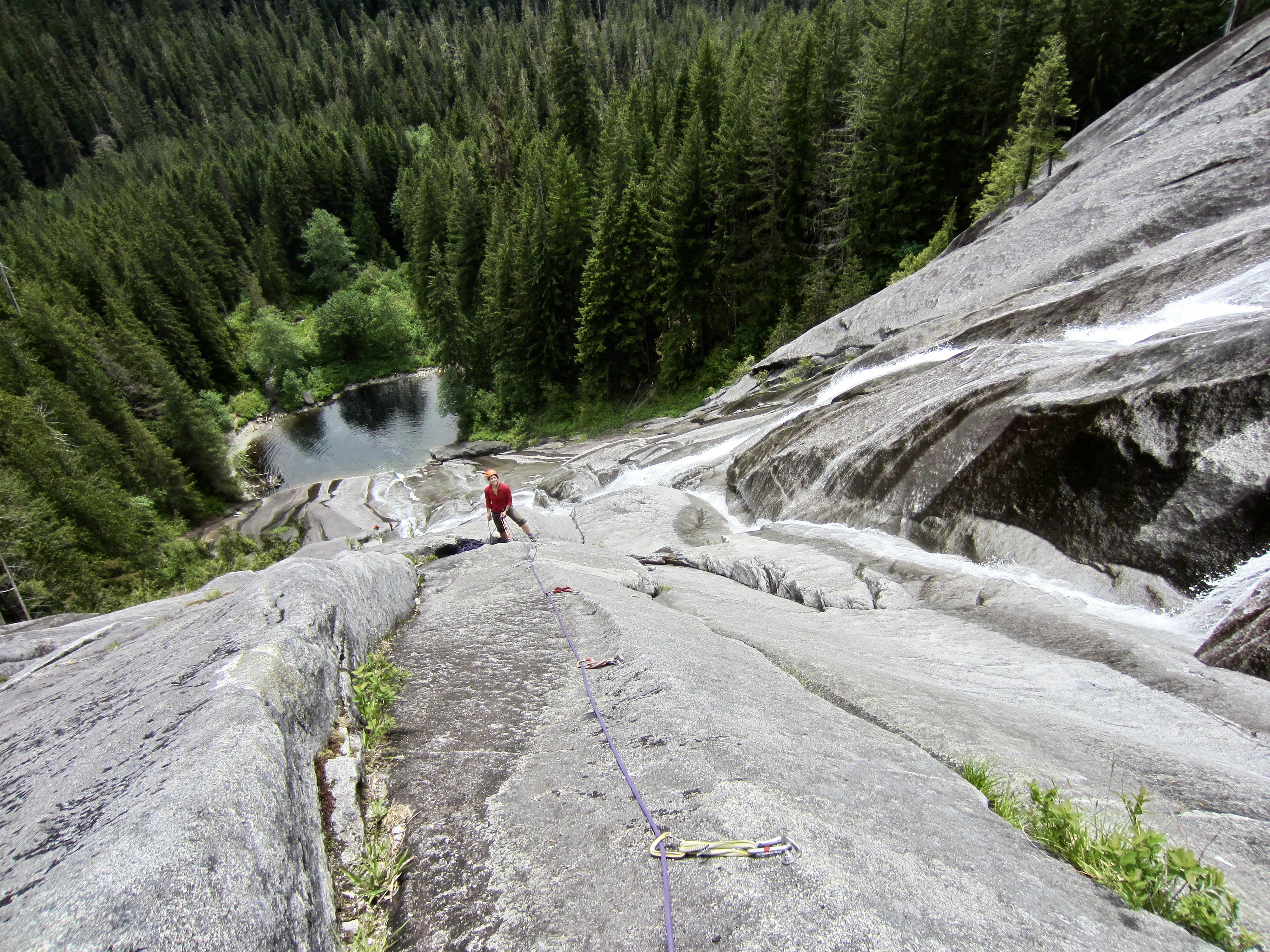
Otter Falls is a popular hiking destination located in the Taylor River Valley northeast of North Bend. These falls consist of a long, braided waterslide that flows over a large granite slab with a total vertical drop of about 600 feet. At the bottom of this granite slab is a cute little pond called Lipsy Lake, which can be reached by a 4-mile hike on the Snoqualmie Lake Trail.
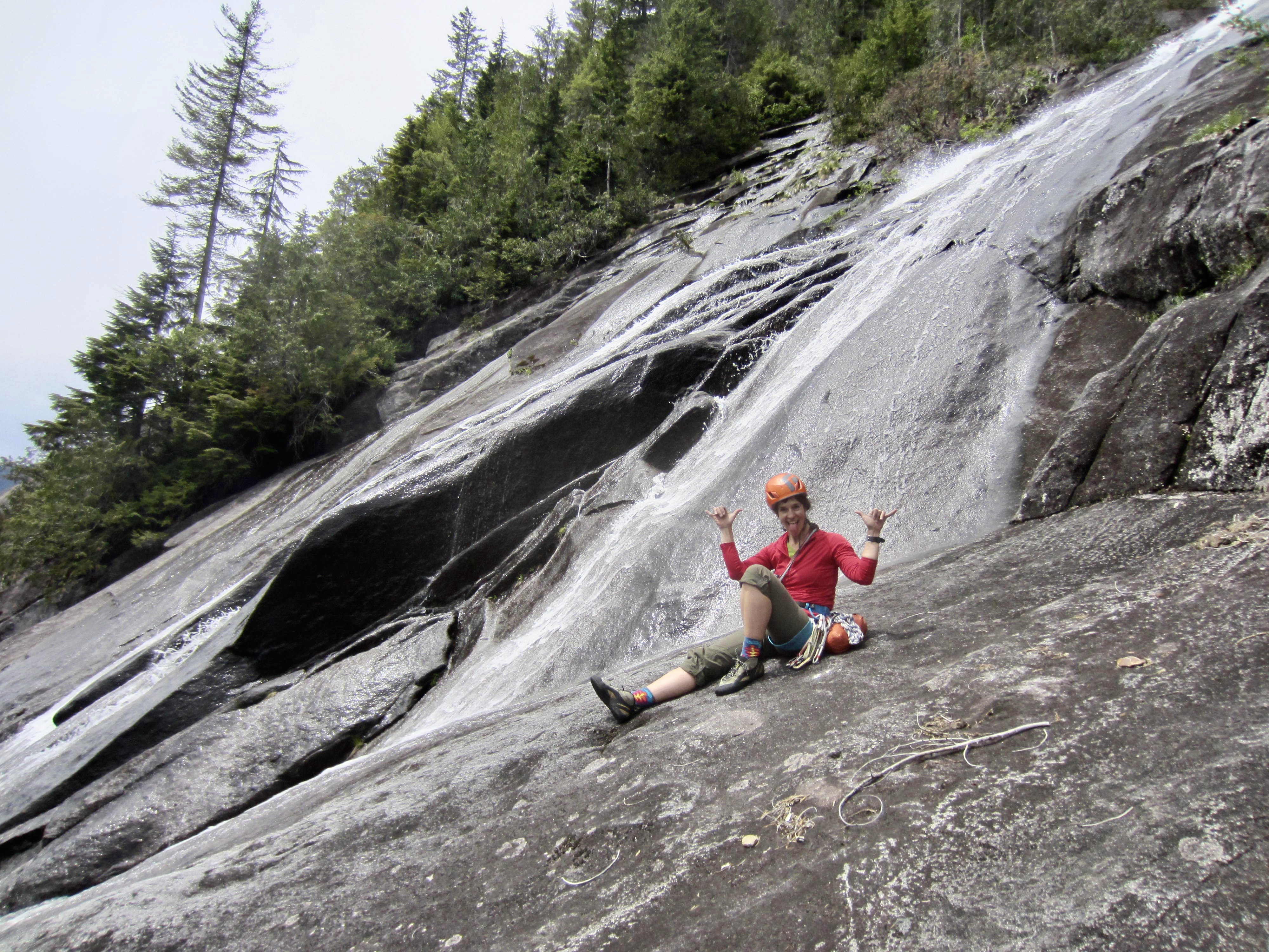
The dramatic setting and solid rock of Otter Falls Slab has attracted a handful of trad climbers over past decades. Then, in 2023, a multi-pitch sport-climbing route called Poppy’s Peril was established closely right of the waterslide. This new route comprises five pitches of delightful friction climbing, with a reported difficulty ranging from Class 5.2 to 5.8. Every pitch is well-protected with modern stainless-steel hardware, and every pitch ends at a two-bolt anchor station. Given its spectacular location, moderate rating, and generous bolting, Poppy’s Peril offers an exceptionally fun and unique backcountry sport-climb suitable for a broad range of abilities.
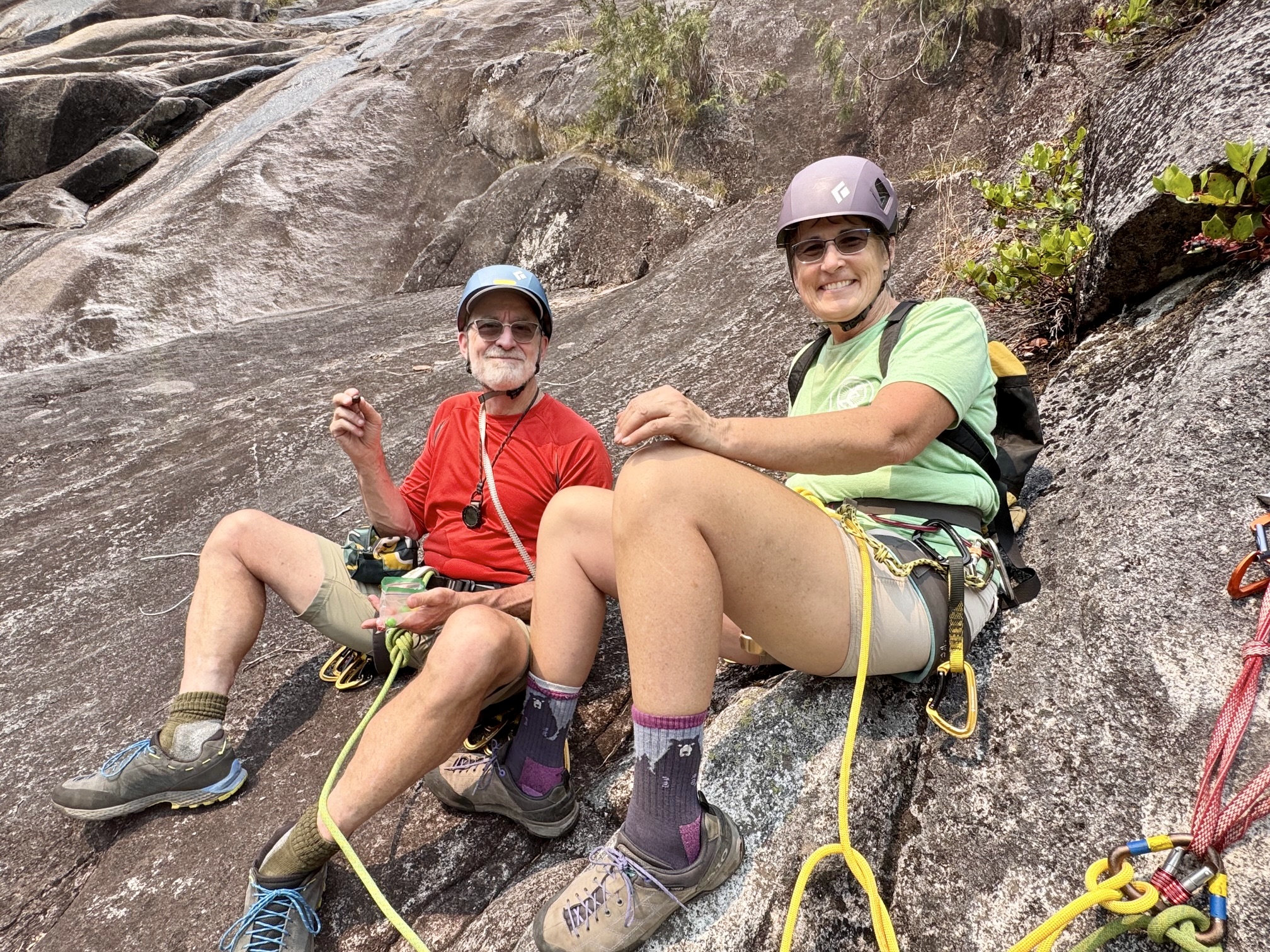
Plenty of information regarding the approach and climb for Poppy’s Peril is available from Mountain Project and probably other sources. Nonetheless, an alternative viewpoint can oftentimes be very helpful. The following paragraphs and photographs serve to describe the experience that I’ve had during two visits to Otter Falls Slab, first with Kellie in 2024 and then with Eileen and Yoko in 2025.
The Approach
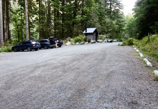
Ample parking is available in the large Snoqualmie Lake Trailhead parking lot located at the end of the Taylor River Road, which branches off from the Middle Fork Road just past the Middle Fork Trailhead and Campground. A Northwest Forest Pass is required to park here.
.
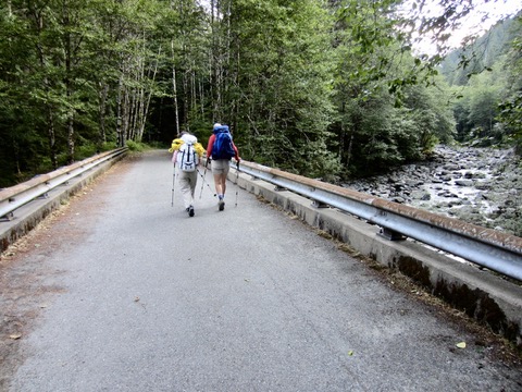
From the parking lot, walk around the vehicle gate and immediately cross the Taylor River on a large concrete vehicular bridge. Once across the bridge, head up the river valley on the Snoqualmie Lake Trail, which follows an abandoned road that ascends at a very gentle gradient. Distances from the trailhead to key waypoints along the approach trail are noted below.
- 0.37 miles: Pass a junction with Quartz Creek Trail. Continue straight ahead on the Snoqualmie Lake Trail.
- 1.75 miles: Pass a side trail that leads down to the Taylor River.
- 2.70 miles: Cross Marten Creek on a sturdy wooden bridge.
- 3.25 miles: Cross Anderson Creek by rock-hopping. This creek can be identified by a 2-foot-diameter culvert that has washed out of the streambed.
- 4.00 miles: Cross Otter Creek by rock-hopping. This creek can be identified by a 6-foot-diameter culvert that is partially exposed in the streambed.
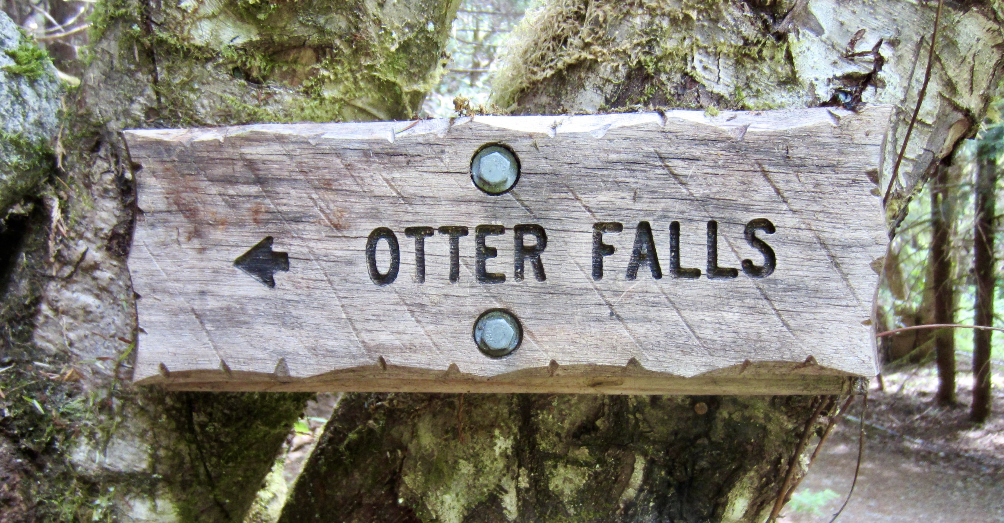
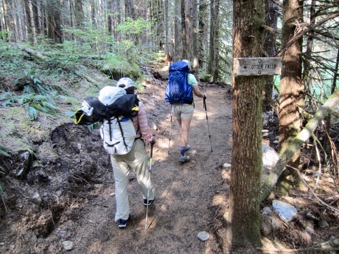
- 4.05 miles: Arrive at a marked turnoff to Otter Falls. Turn left here and ascend a new (as of 2025) well-graded trail that switchbacks up through dense forest.
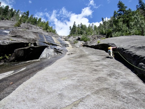
- 4.10 miles: Arrive at Lipsy Lake. Walk around the right-hand shoreline to the base of the large slab.
.

.
.

.
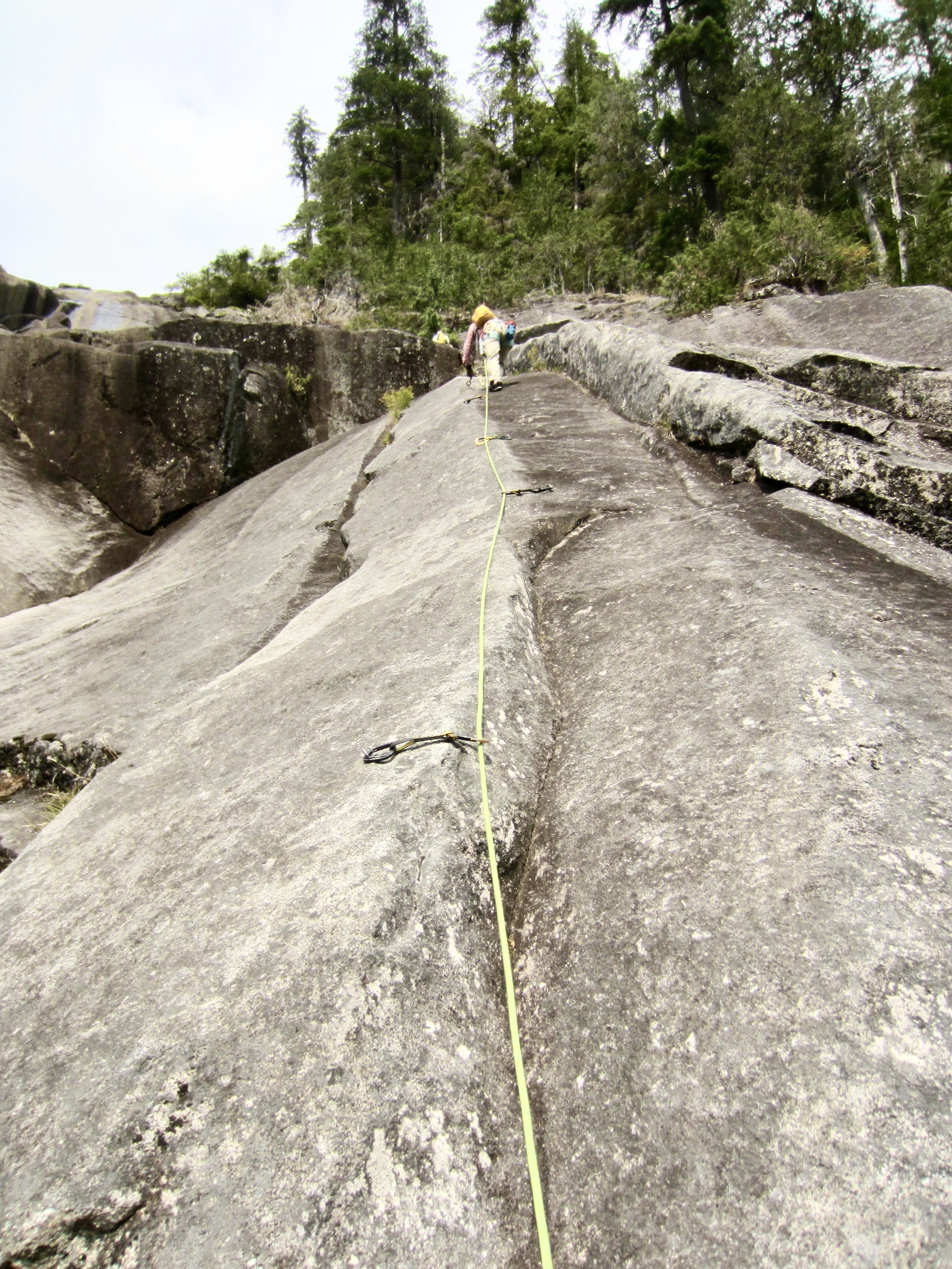
The Climb
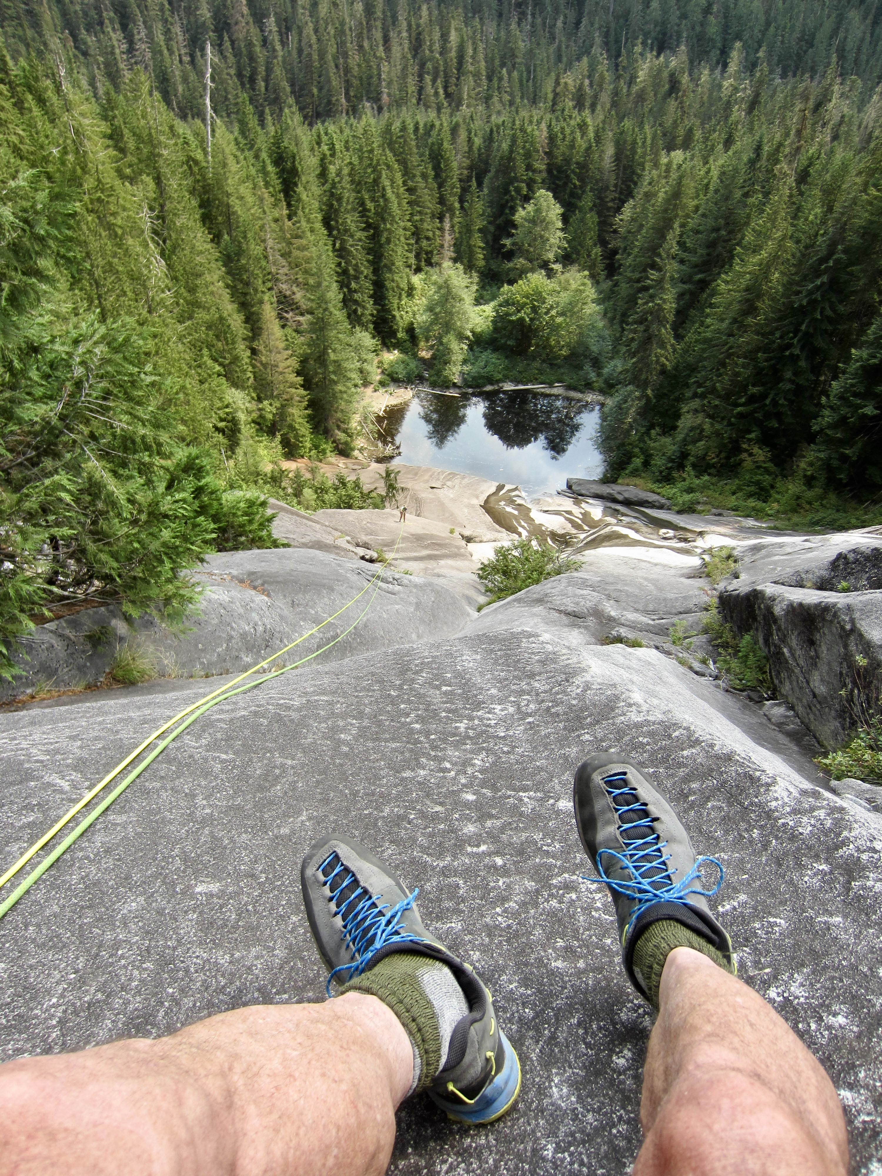
The official starting point for Pitch 1 of Poppy’s Peril is a belay station located at the bottom of an obvious crease about 75 feet up the slab, so it is necessary to make a diagonally leftward traverse up to the anchors. I regard this traverse to be “Pitch 0” of the climb. It really isn’t as difficult as it first appears, but there might be one or more water streaks that must be crossed along the way, especially in early season. Thankfully, it was recently retrofitted with two bolts on the traverse. Whether you clip the bolts or not, be careful. The day Kellie and I were here, a climber slipped on the traverse and took a 10-foot slide toward the lake!
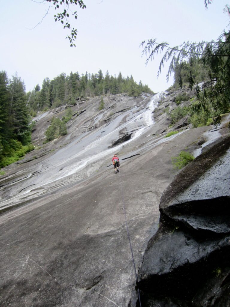
.
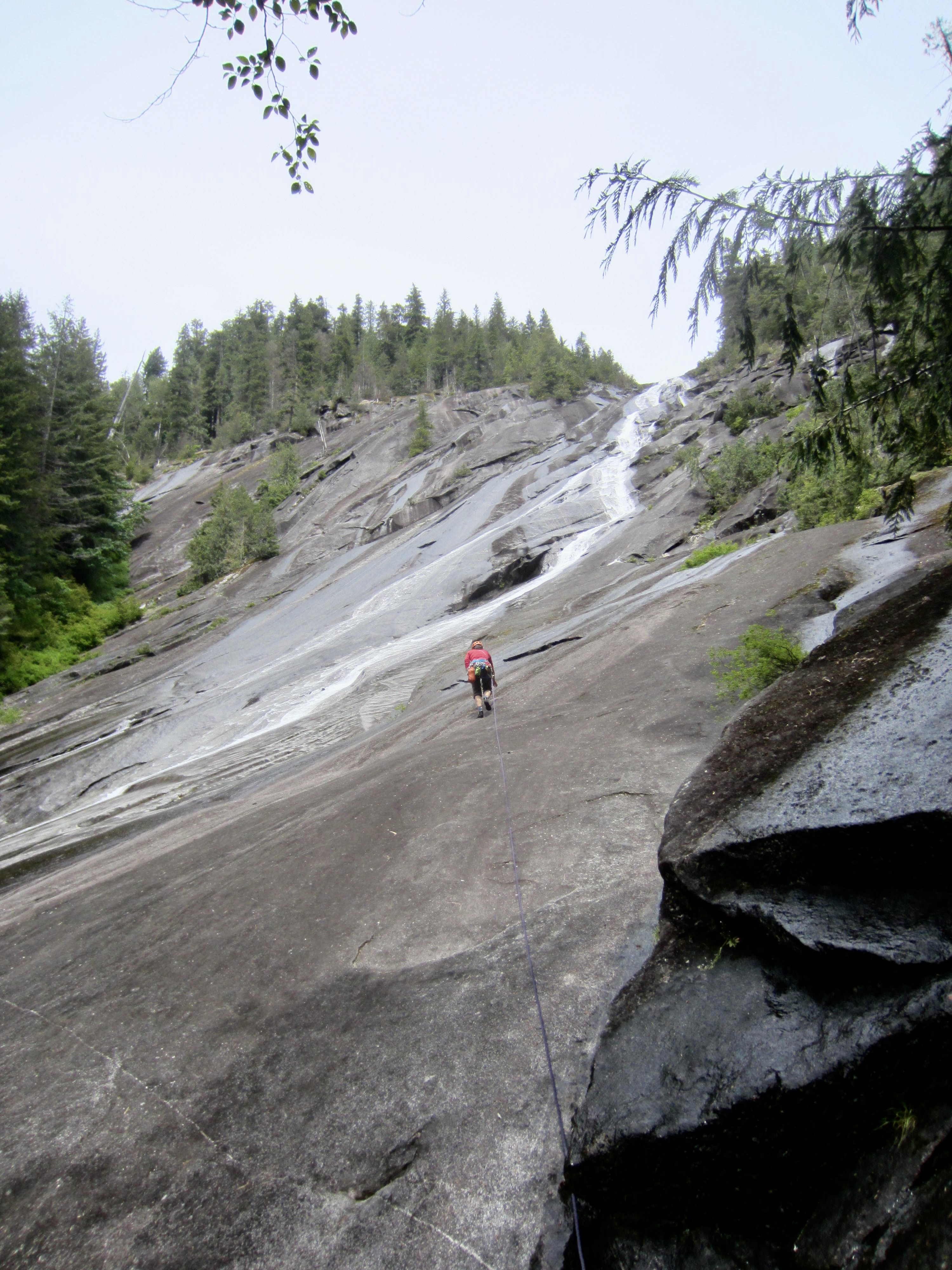
Pitches 1 and 2 follow a low-angle dihedral that runs parallel to the waterslide. There are numerous bolts in place on the right-hand lip of this dihedral. These two pitches are rated at Class 5.2 and 5.6, respectively, but both ratings felt overstated to me; I would estimate them to be closer to 5.0 and 5.4.
.
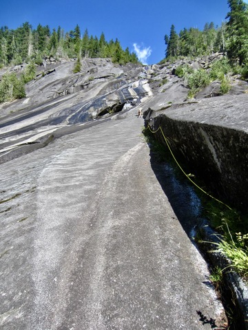
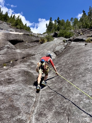
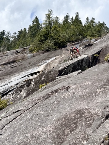
Pitch 3 wanders up a series of slabs, cracks, and ribs on steeper and more irregular terrain. This pitch is rated at Class 5.8, and the difficulty generally increases as you climb. The crux occurs close to the top, where it is necessary to surmount a steeply inclined hogback. Protection is very good, with thirteen bolts in place before reaching the anchor. Be aware that this pitch is particularly long, such that a 60-meter rope will be almost completely stretched out.
.
.
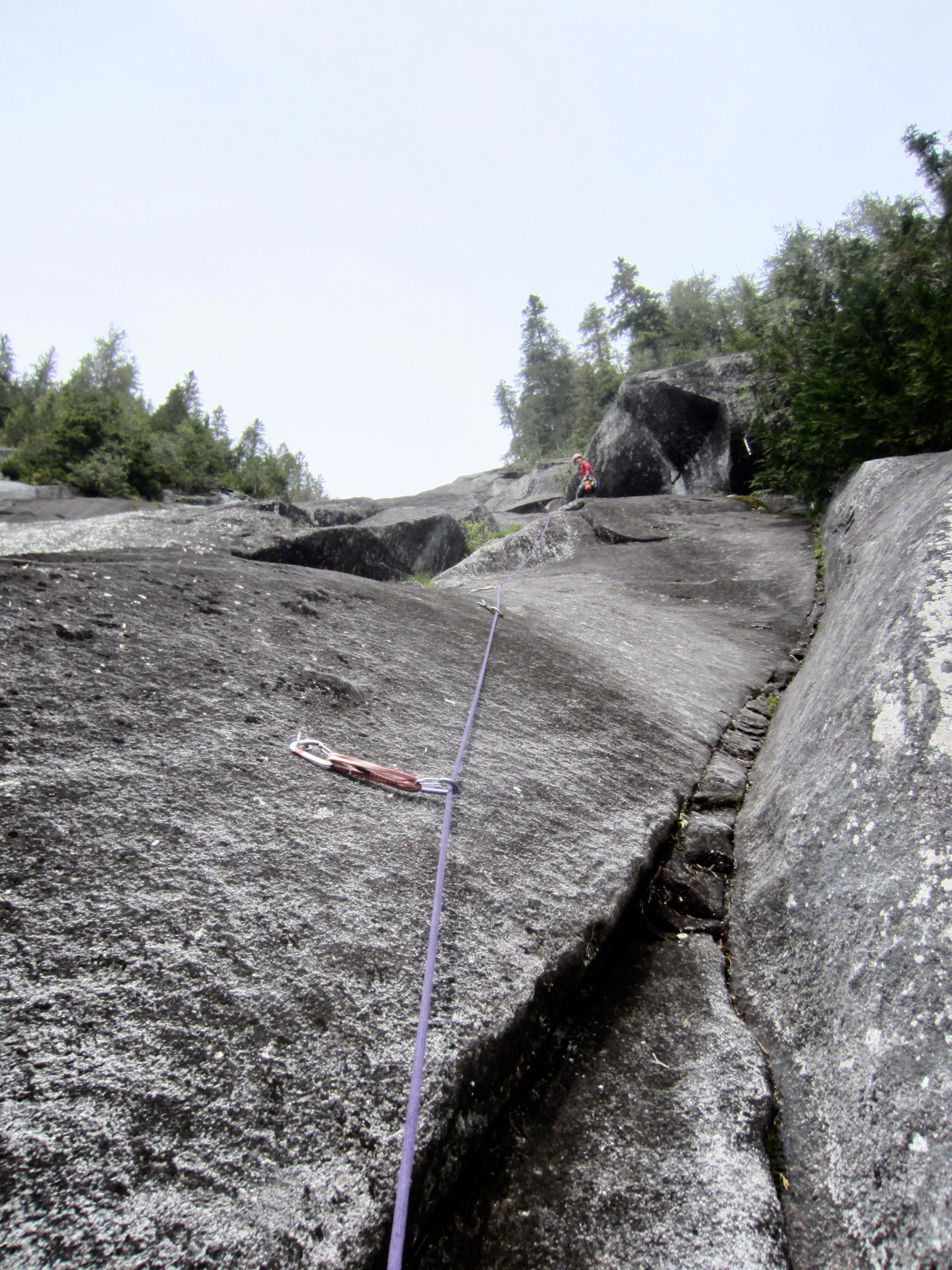
Pitch 4 angles over to the left before heading straight upward on more steep and irregular terrain. It is rated at Class 5.7 due to numerous delicate friction moves, but most of the climbing is lower Class 5. There are nine bolts in place.
.
.
Pitch 5 extends straight up a shallow rib feature and ends at a small headwall. This final pitch is relatively short and is rated at Class 5.6. Protection is excellent, as usual.
.

.
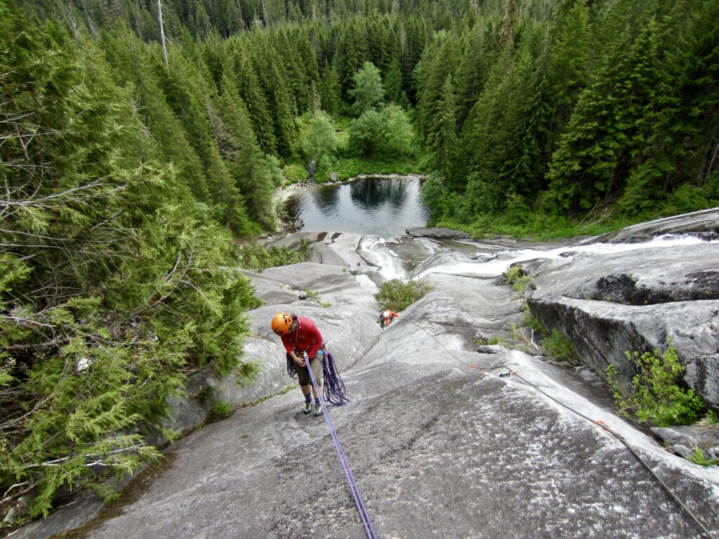
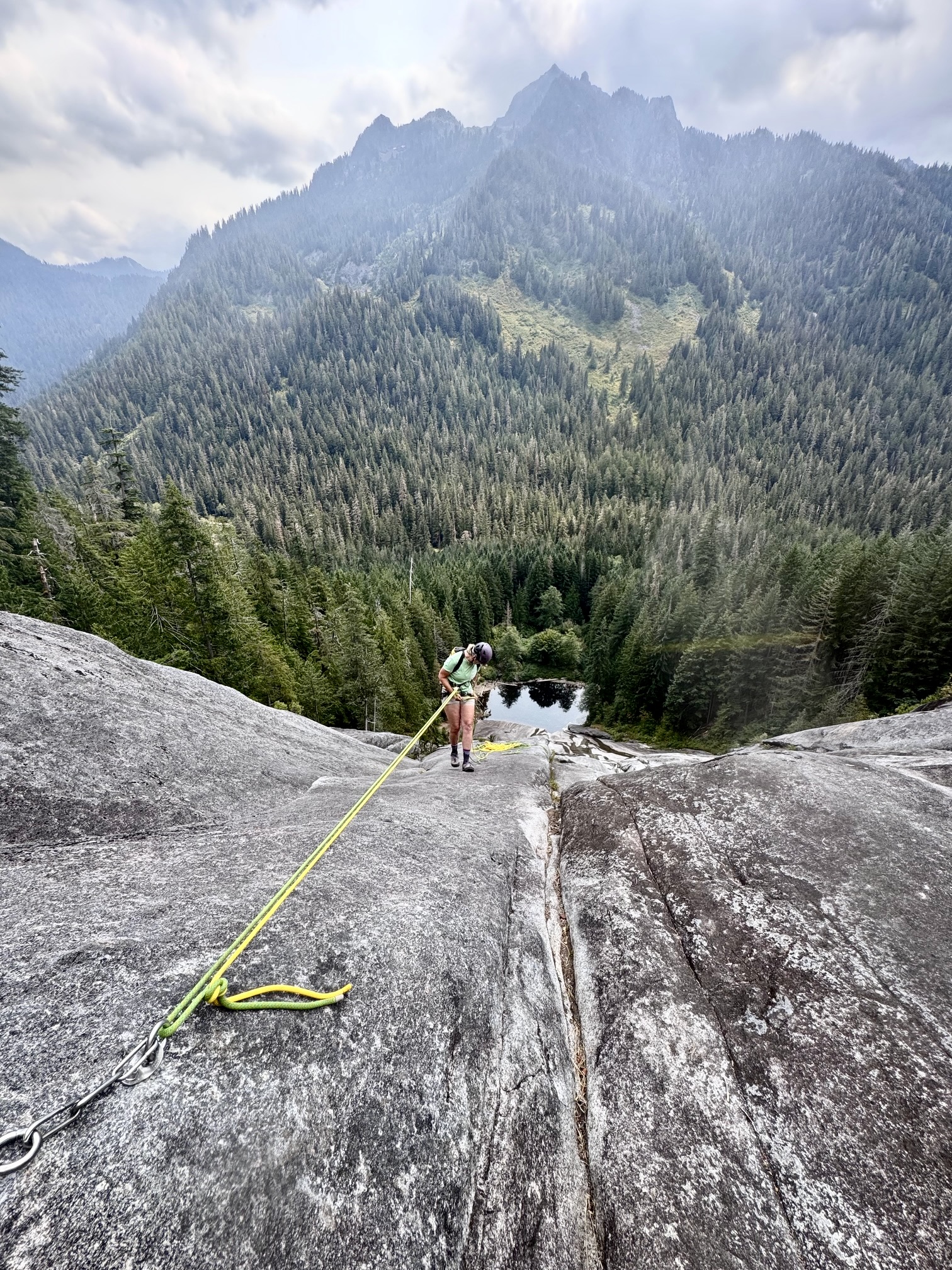
The Descent
The route developers correctly predicted that Poppy’s Peril would become a very popular route, so they installed a separate set of rappel anchors to climber’s-right (descender’s-left) of the belay anchors. Each anchor comprises two bolts with chains and/or rings.
The spacing of these rappel anchors allows you to reach the lakeshore via six single-rope rappels using a 60-meter rope. Alternatively, you can perform three double-rope rappels and one single-rope rappel to reach the lakeshore. In either case, it is feasible to skip the final rappel and simply walk down the lowest portion of slab, as Kellie and I did.
.
Equipment Comments
Kellie and I used a single 60-meter rope during our 2024 climb, whereas Eileen, Yoko, and I used two 60-meter ropes during our 2025 climb. It should be emphasized that a 60-meter rope barely reaches between the belay anchors and rappel anchors on Pitch 3, but it does indeed reach. As such, a 50-meter rope would not be adequate, but a 70-meter rope is truly not necessary.
For both climbs, we used twelve quickdraws, as well as several extended draws to reduce rope drag on Pitches 3 and 4. As previously mentioned, there are thirteen bolts on Pitch 3 and nine bolts on Pitch 4.
Kellie wore conventional rock shoes on our 2024 climb, whereas Eileen, Yoko, and I wore technical approach shoes (mine were La Sportiva TX Guide shoes, reviewed here). In the end, we were all happy with our footwear choices. The fine-grained granite provided adequate friction for our shoes, even where the slab was wet.
Route Map & Profile
…
…
Photo Gallery
Click to enlarge…