Trip Dates: March 12, 2016 & April 15, 2017
Updated: December 2025
Mt. Catherine Snowshoe Climb
Hyak Lake
Hyak Flats
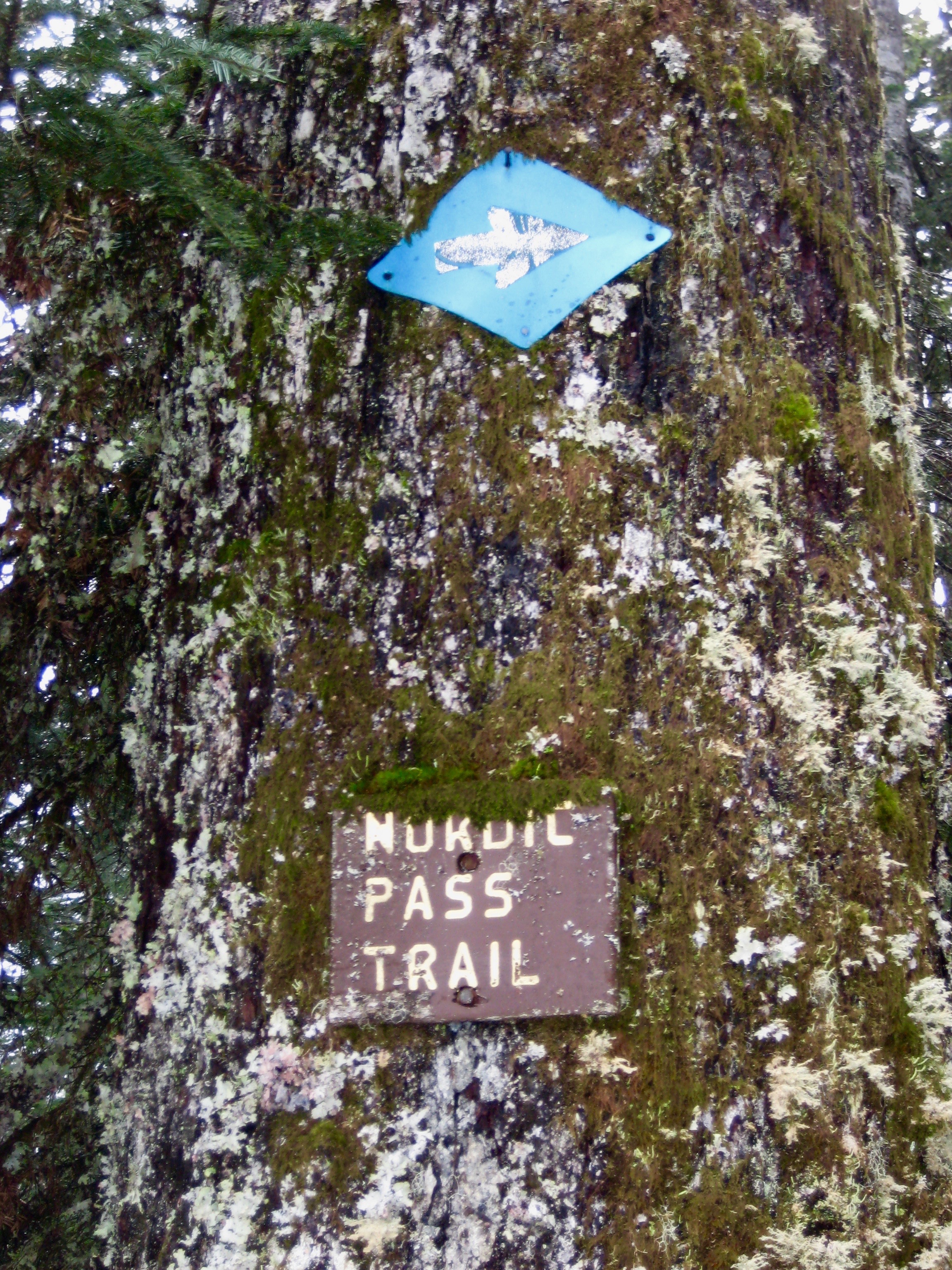
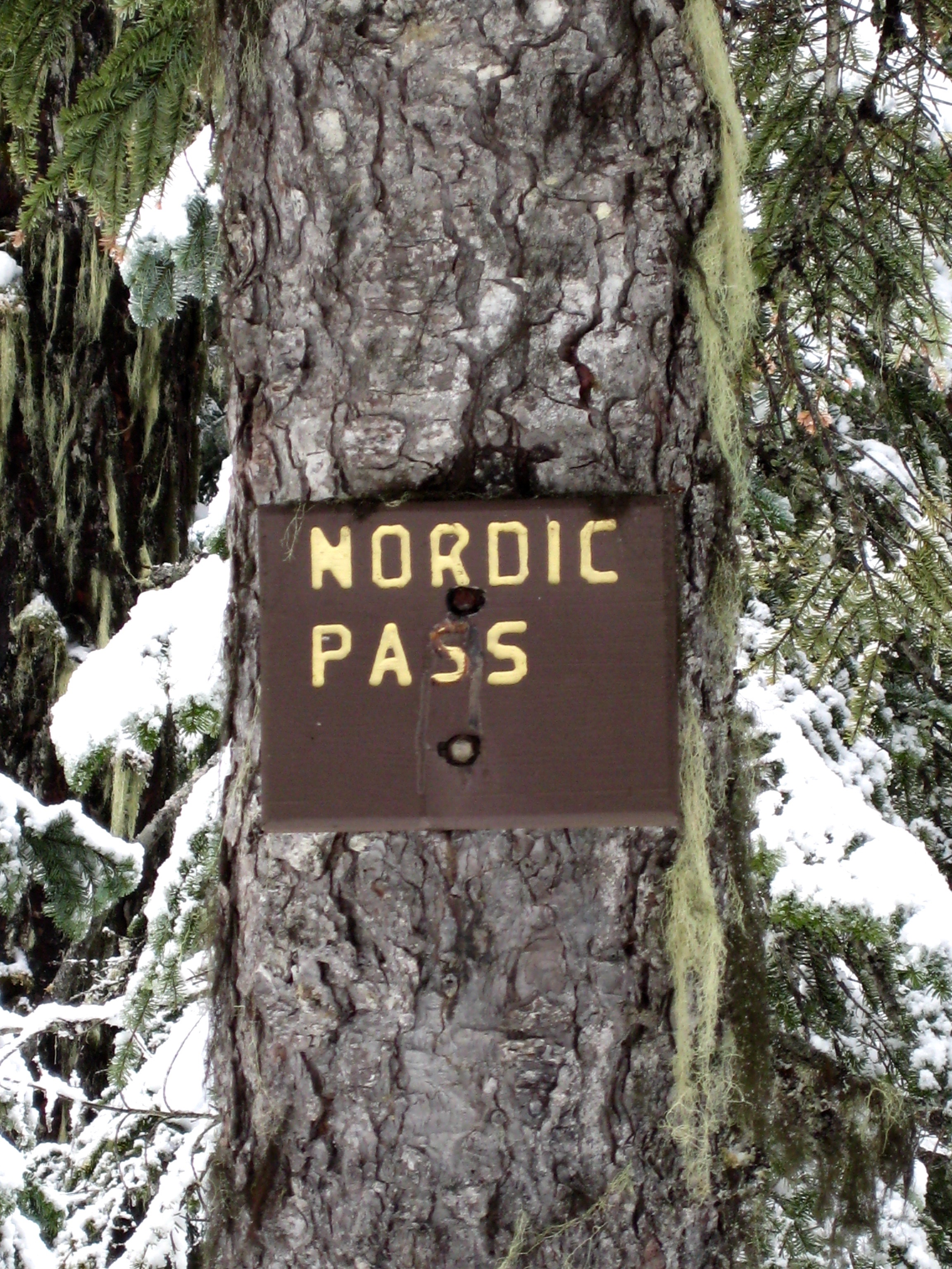
Nordic Pass
Mount Catherine (5052 ft)
Route Summary
Region: Central Washington Cascades
Sub-Region: Iron Horse Mountains
Area: Okanogan–Wenatchee National Forest
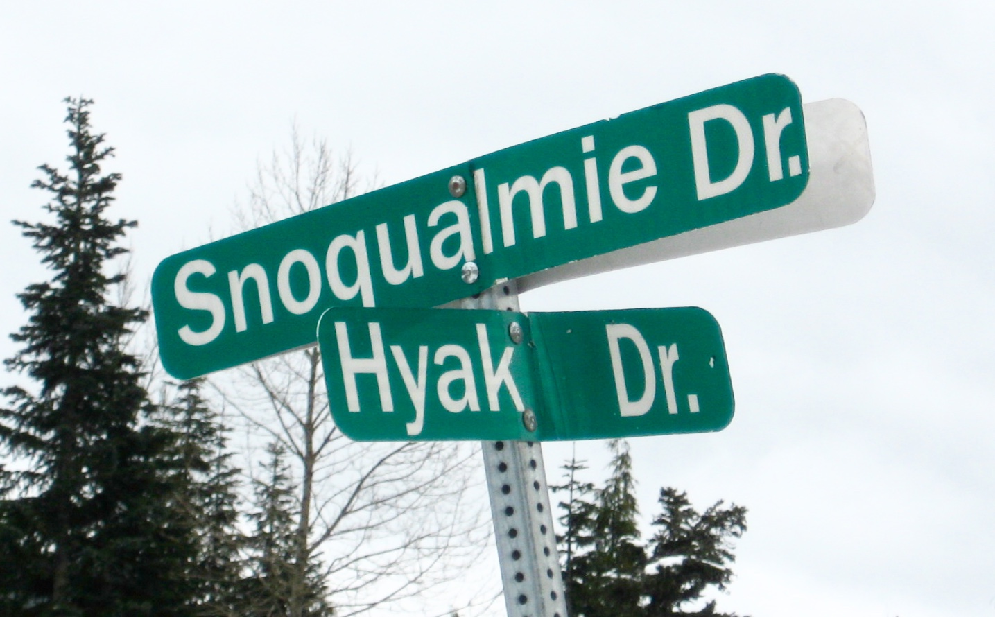
Starting & Ending Point: Snoqualmie Drive / Hyak Drive intersection off Interstate-90 at Exit 54 (Elev. 2640 feet)
Way Points: Snoqualmie Drive / Cascade Place intersection & Nordic Pass Trailhead (road walk); Little Hyak Creek & Hyak Creek & Lower Crossover Ski Trail & InterSummit-90 Ski Trail & Hyak Lake & Hyak Flats & Mill Creek Basin & Nordic Pass (snowshoe hike via Nordic Pass Trail)
Summit: Mt. Catherine (snowshoe climb via West Ridge)
Approximate Stats: 10 miles traveled; 2750 feet gained & lost.
Related Posts
>>> Nordic Pass Snowshoe Trek & Ski Loop (detailed route description)
>>> Surveyors Hill Snowshoe Trek / Ski Tour (detailed route description)
Information Sources
The following links provide helpful information for planning this snowshoe trek. Even these information sources, however, should not be taken as a substitute for having the fitness, knowledge, equipment, and clothing required for snowshoe trekking.
>>> WSDOT road condition reports for Interstate-90 and Snoqualmie Pass
>>> National Weather Service weather forecast for Snoqualmie Pass area
>>> Northwest Avalanche Center avalanche forecast for Snoqualmie Pass area
>>> Other easy to intermediate snowshoe treks in the I-90 / Snoqualmie Pass corridor
Parking Comments
Convenient parking for skiers and snowshoers can be found in the Summit East (Hyak) overflow parking lot (Lot E-2) located near the intersection of Hyak Drive and Snoqualmie Drive. This overflow lot is just north of the main Summit East Ski Area parking lot. No Washington State Sno-Park permit is required here, but starting with the 2025-26 winter season, the ski area has implemented a new parking policy. The good news is that this new policy is less restrictive and less costly than the former policy. The bad news is that it is more convoluted than before. You can read the full official version here, but I will attempt to summarize the key points below.
- Parking costs $15 on every Friday, Saturday, and Sunday throughout the operating season, as well as during Christmas break, MLK Day, and Presidents Day.
- Parking is free on Monday through Thursday throughout the operating season, except for the special days noted above.
- Parking is always free for season-pass holders and lift-ticket holders.
- Parking is always free before the operating season begins and after it ends.
If you must must do the trek on a “fee day” but don’t want to pay for parking, there are a couple reasonable legal options:
- Park at the Gold Creek Sno-Park, which is located approximately ¼ mile away on the other side of Interstate-90. This is a good option if you arrive early, when ample parking is available. Be aware that a Washington State Sno-Park permit is needed here.
- Park at the Hyak Sno-Park, which is located approximately ½ mile away on the same side of Interstate-90. Be aware that a Washington State Sno-Park permit and a “special groomed-area sticker” are needed here.
Warning: Don’t be tempted to park on the residential streets within the Hyak residential neighborhood. This is strictly prohibited and will earn you a hefty fine.
.
Full Route Description
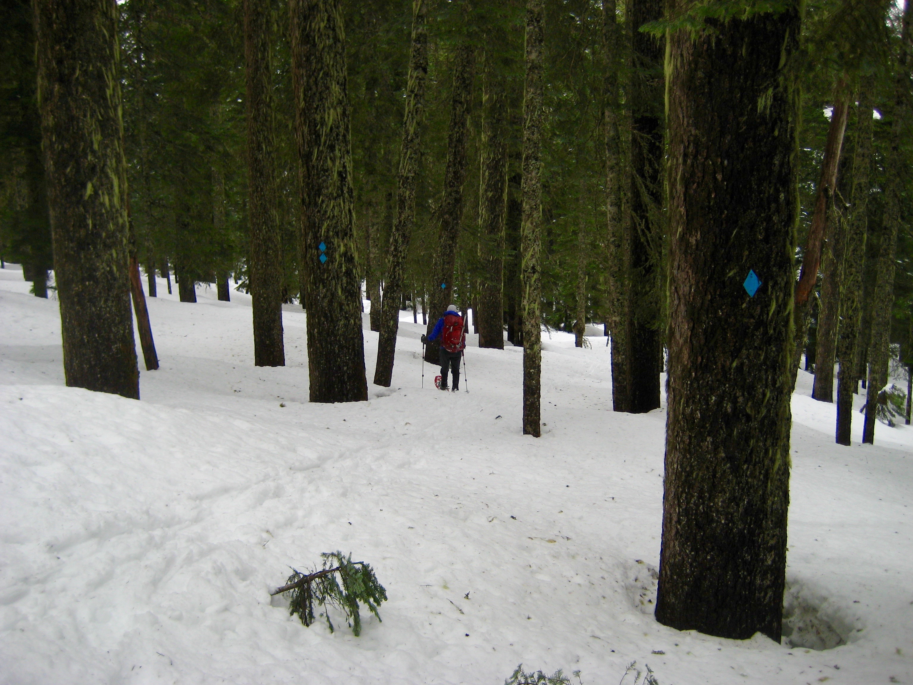
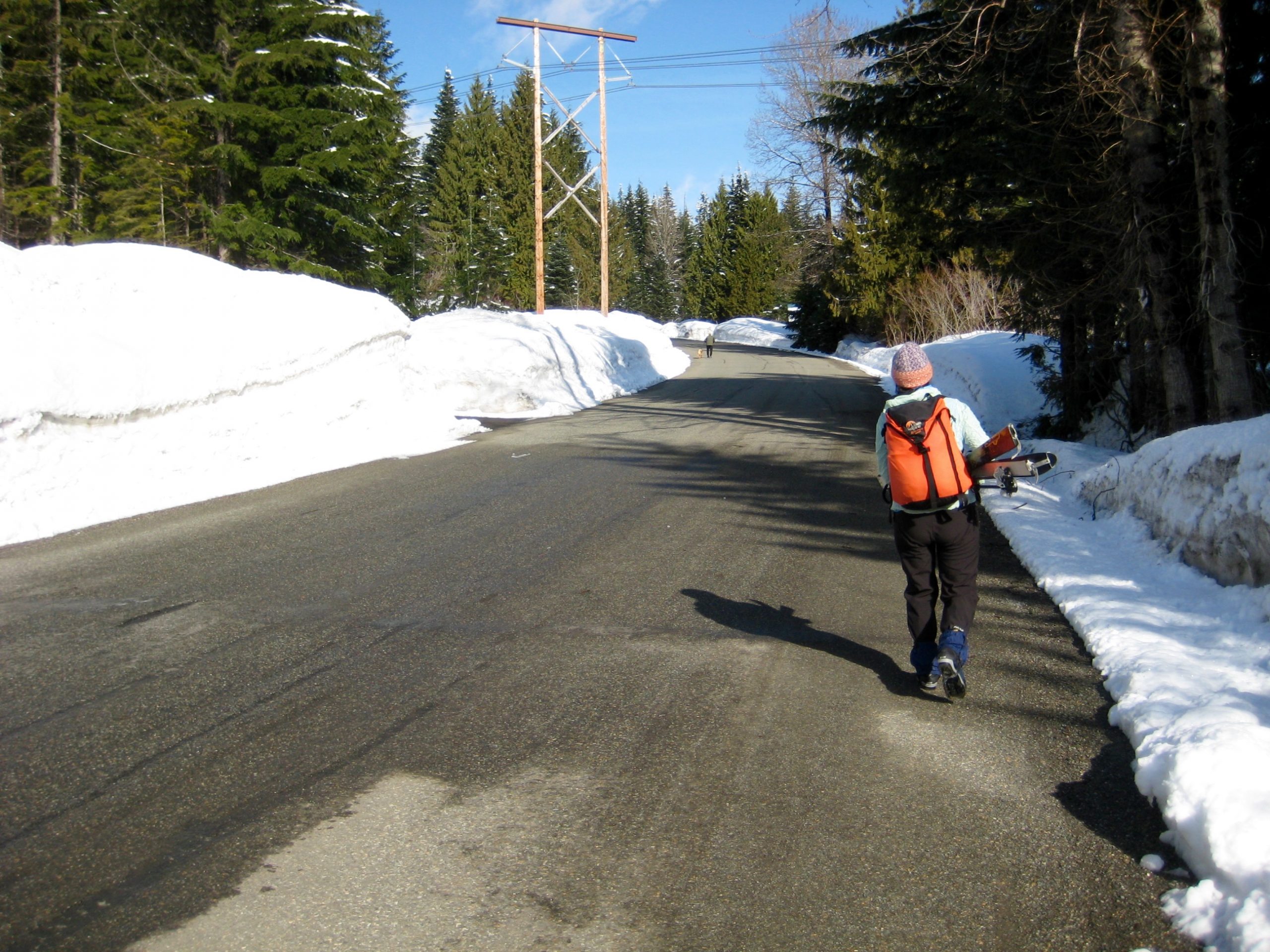
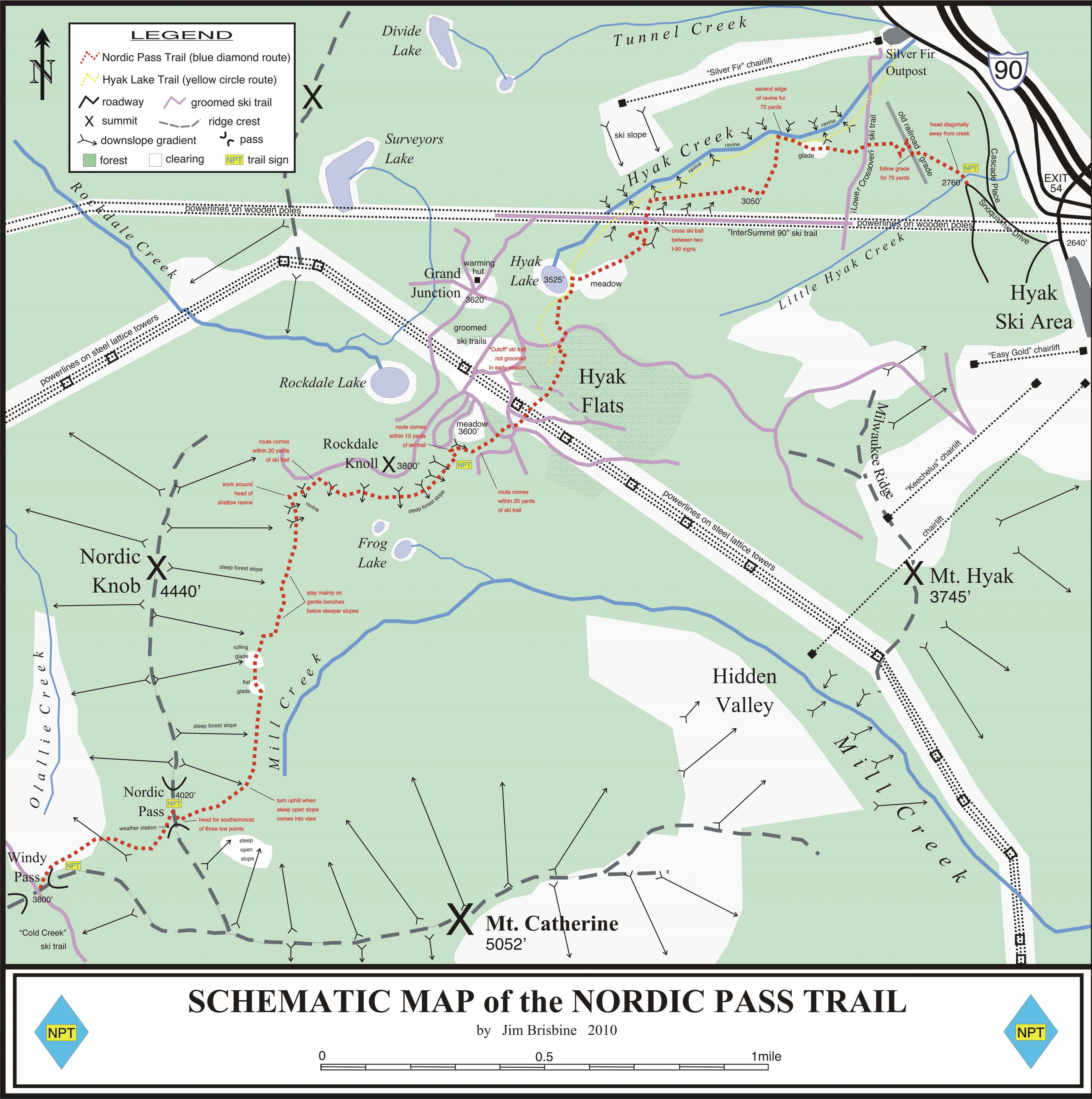
From the Hyak overflow lot, walk up Snoqualmie Drive to the hairpin, where the Nordic Pass Trail begins. This is not a heavily traveled trail, but those who do use it know what a little gem it is. For those of you who aren’t familiar, see the attached schematic map that I drafted up several years ago to show the route and navigation landmarks. During high-risk avalanche periods, this is my safe, go-to snow tour.
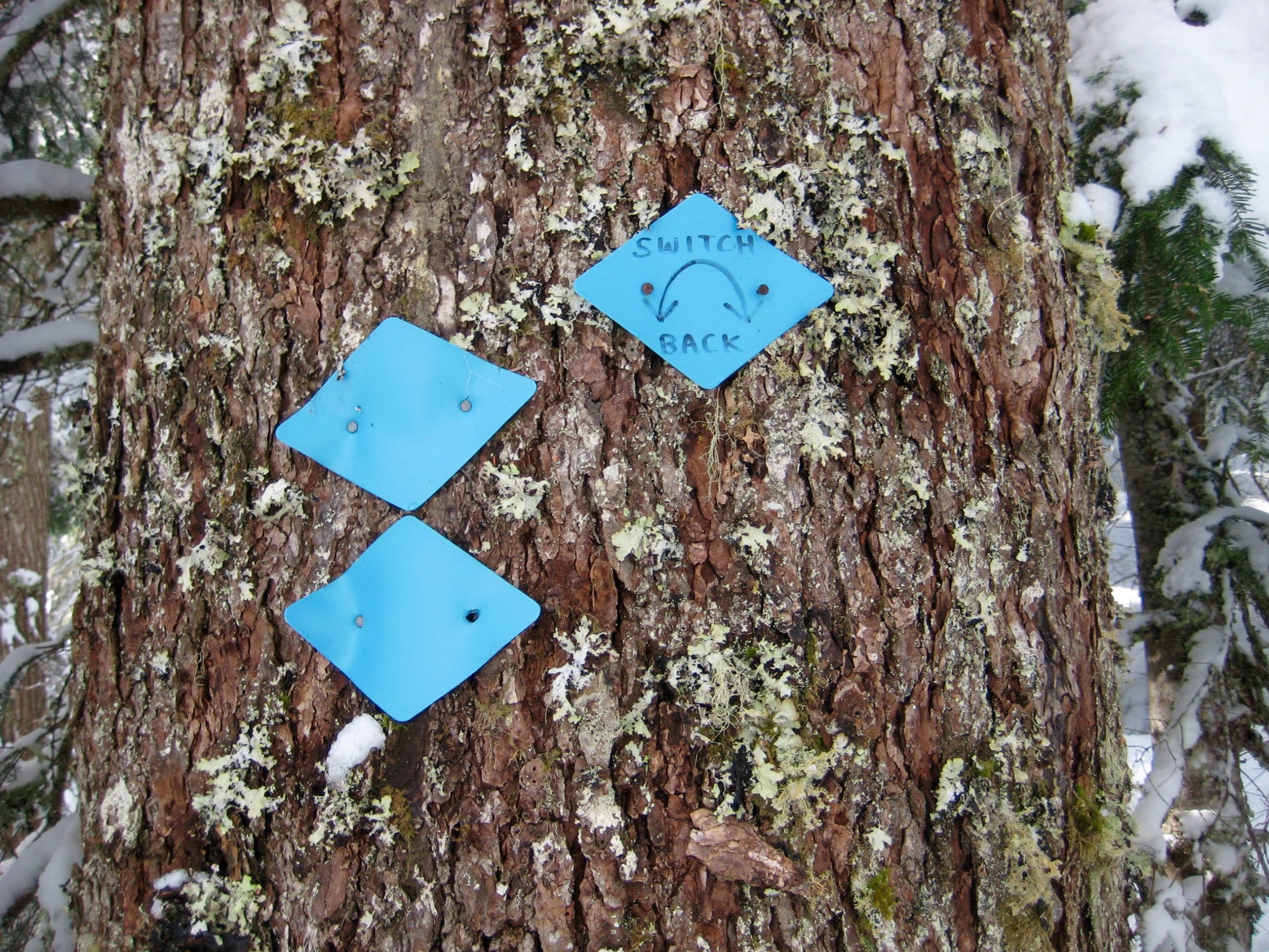
Most of the route is well-marked with blue diamonds, although a few sections are a bit sketchy. It’s fun to go “diamond hunting” and see how many you can collect. Bonus points for finding the many-decades-old wooden signs along the way too.
.

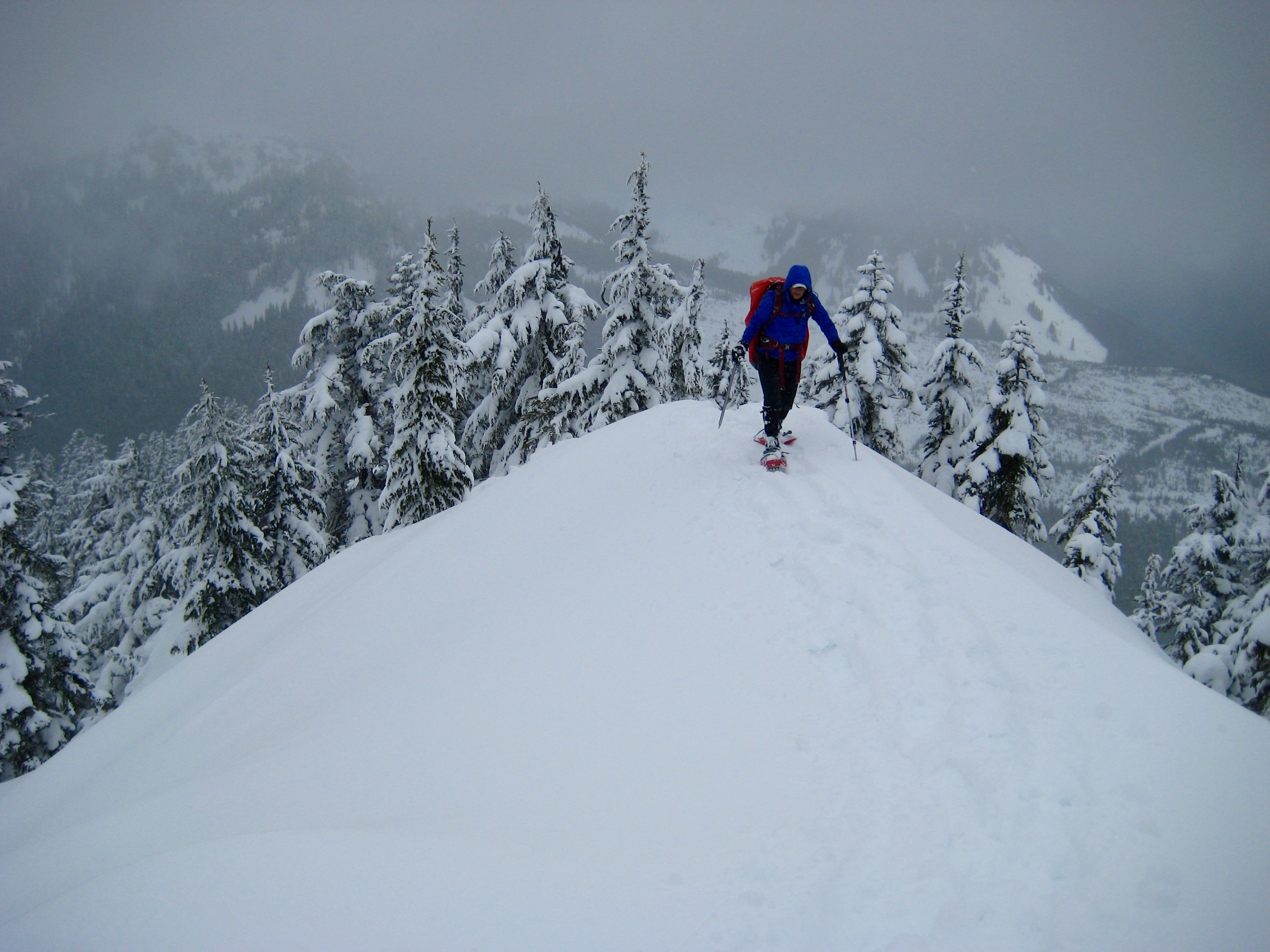
- Snow Trail Thru Old Growth Forest
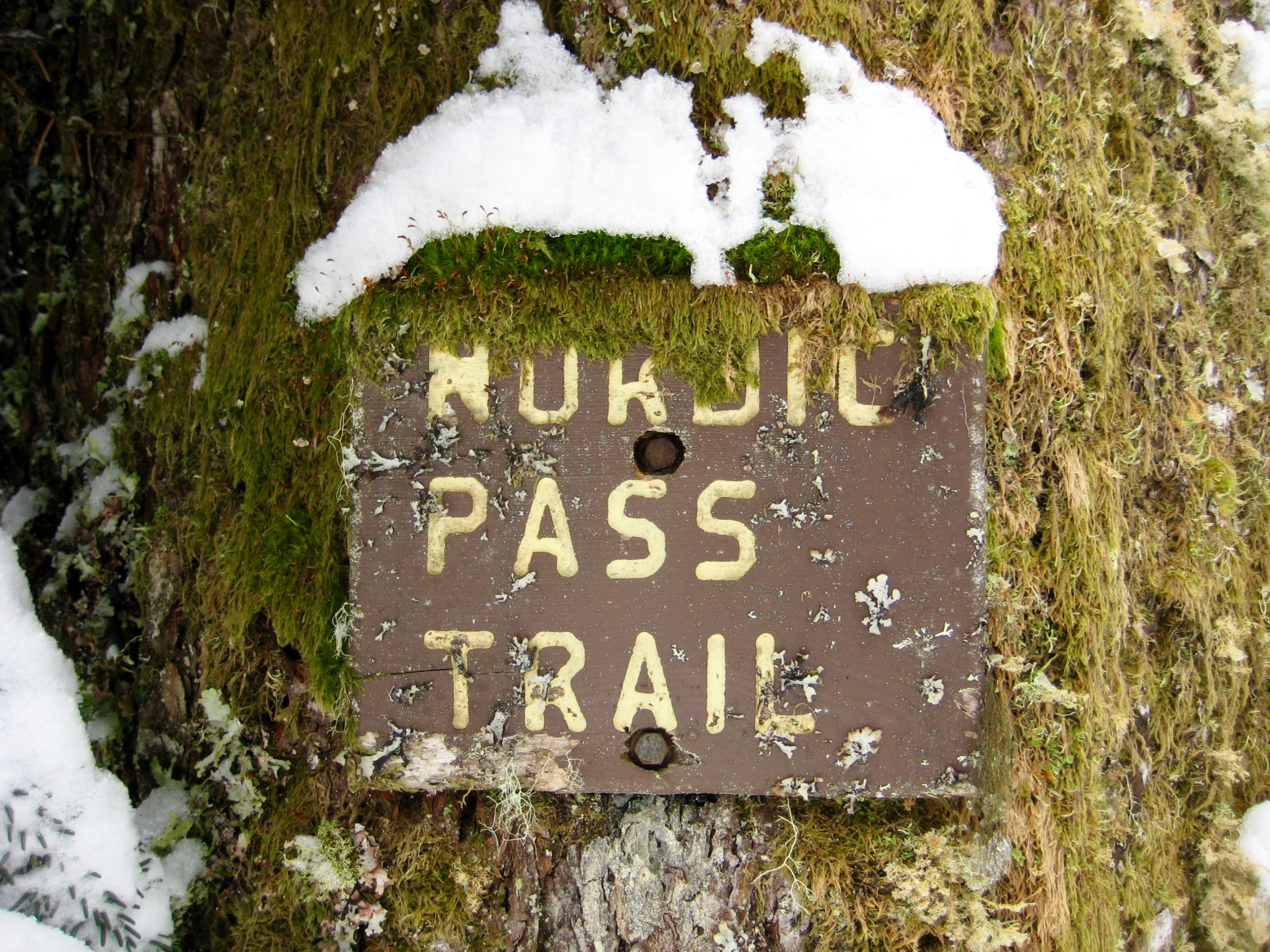
Upon reaching Nordic Pass, locate the old sign a few dozen yards north of the low point. This is a rewarding destination in its own right, especially when the weather is foul or the snow is unstable.
.
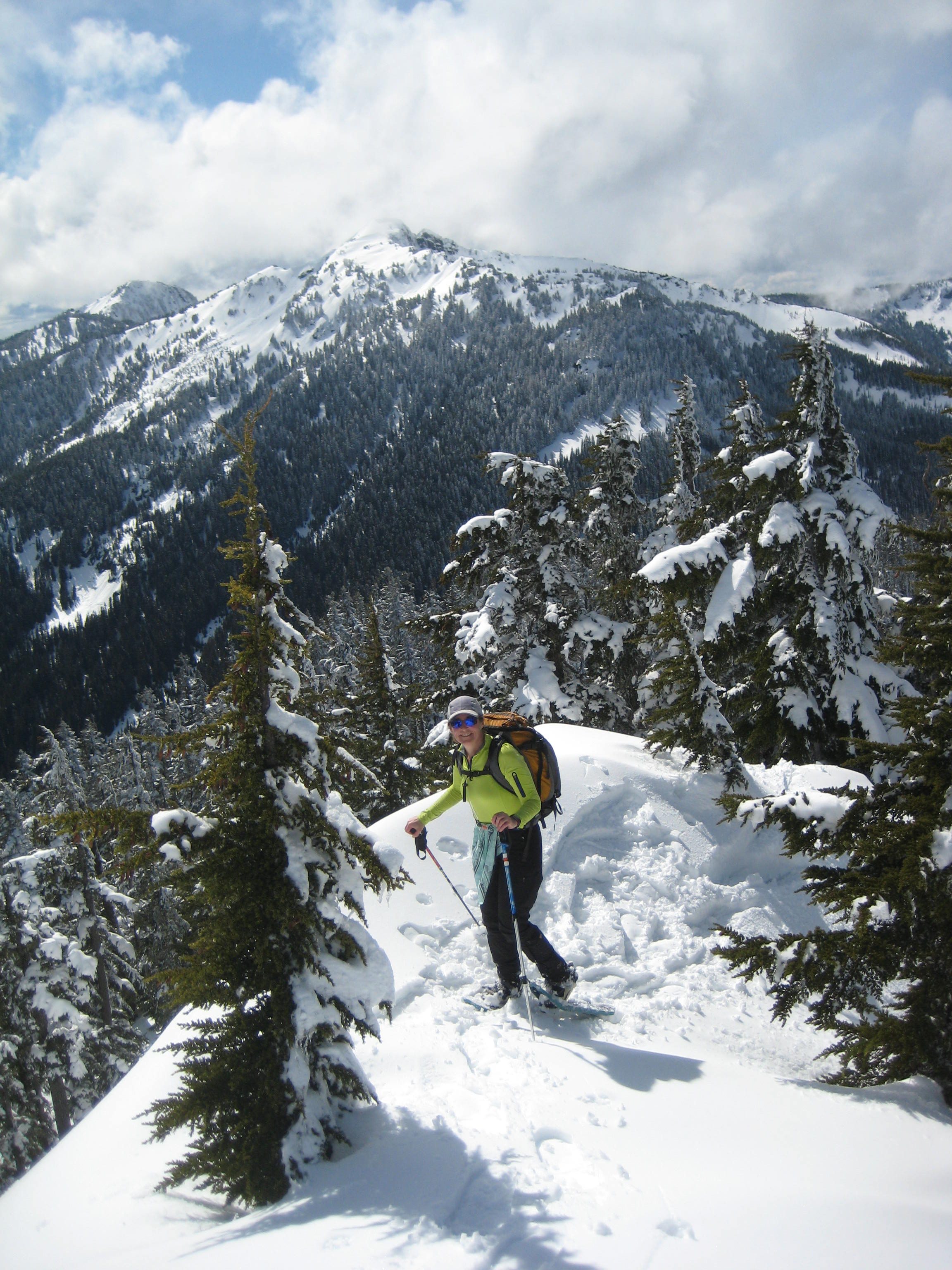
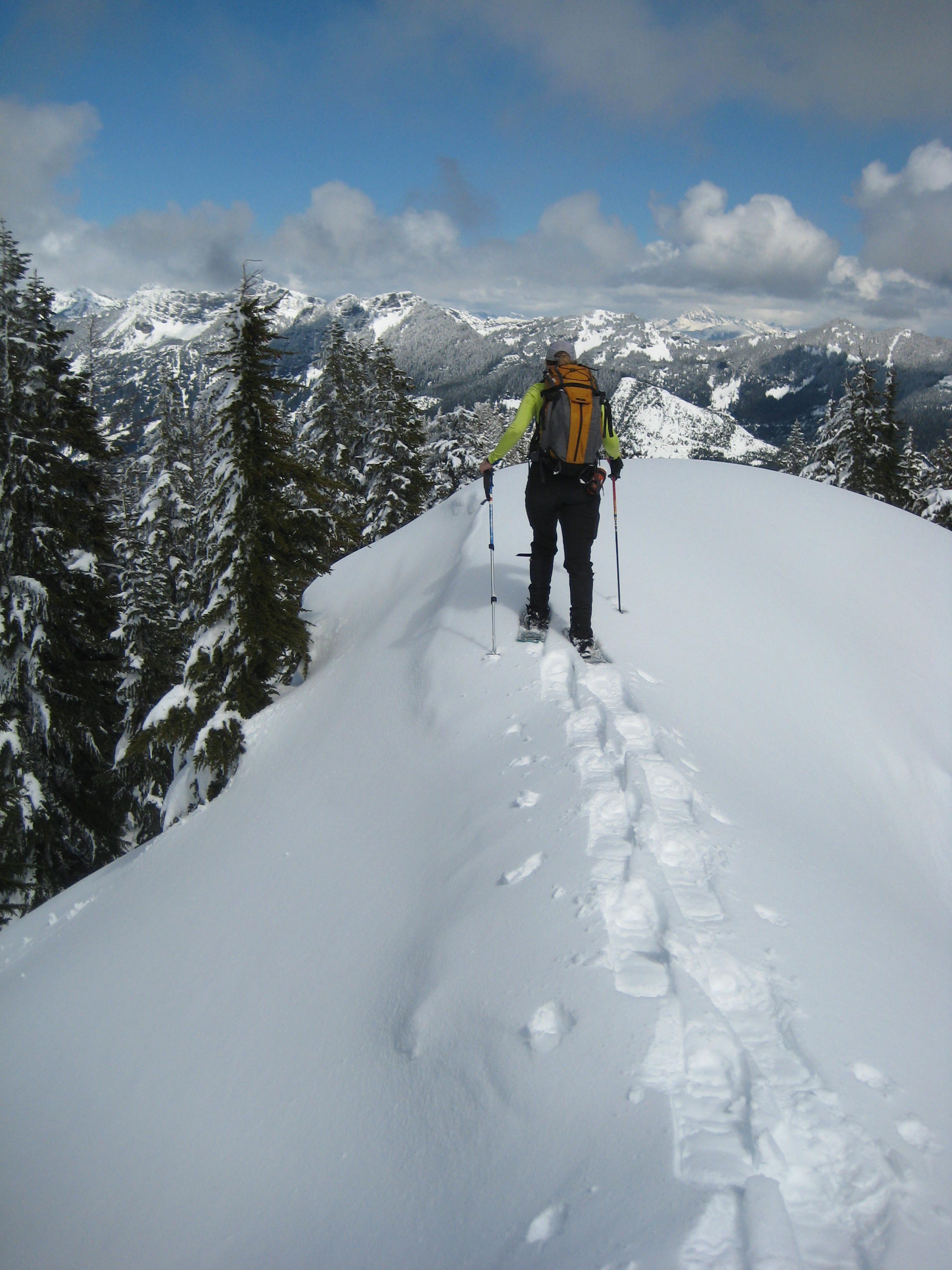
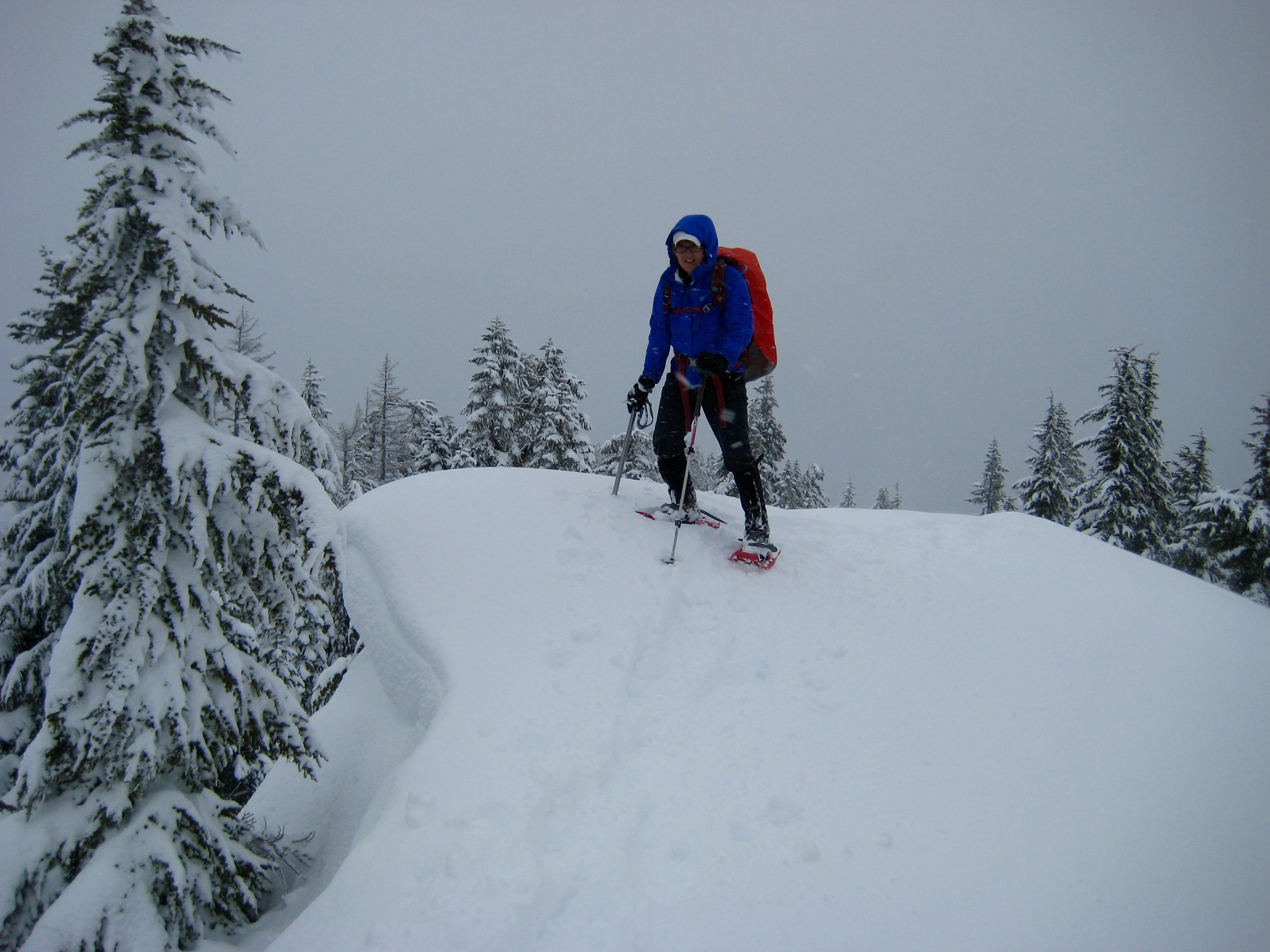
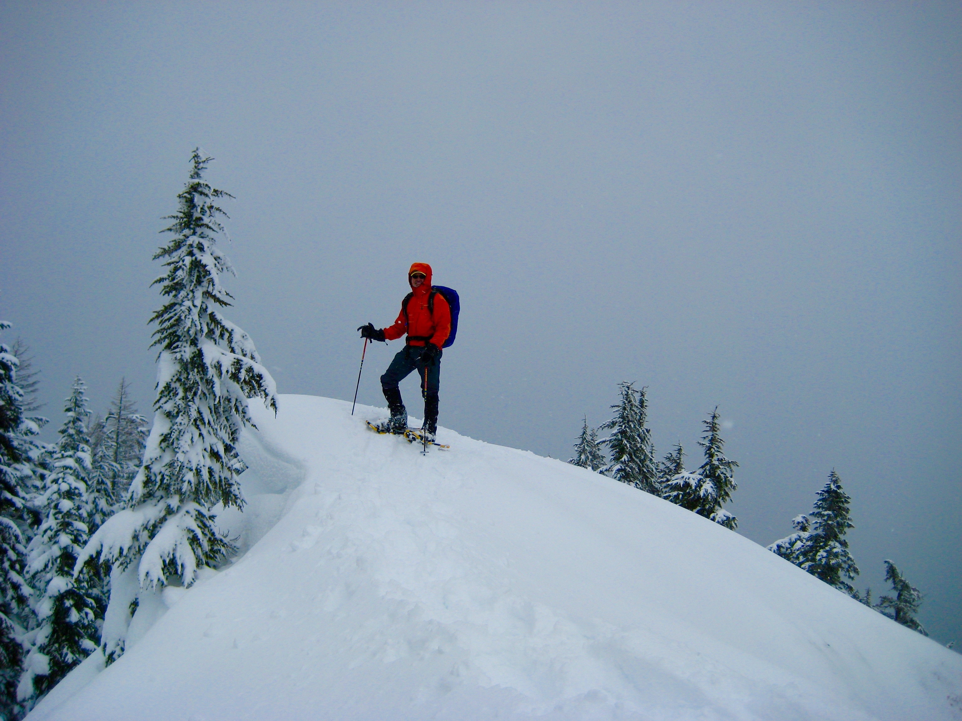
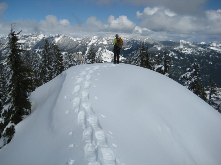
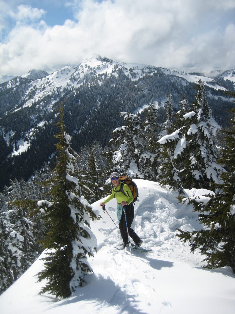
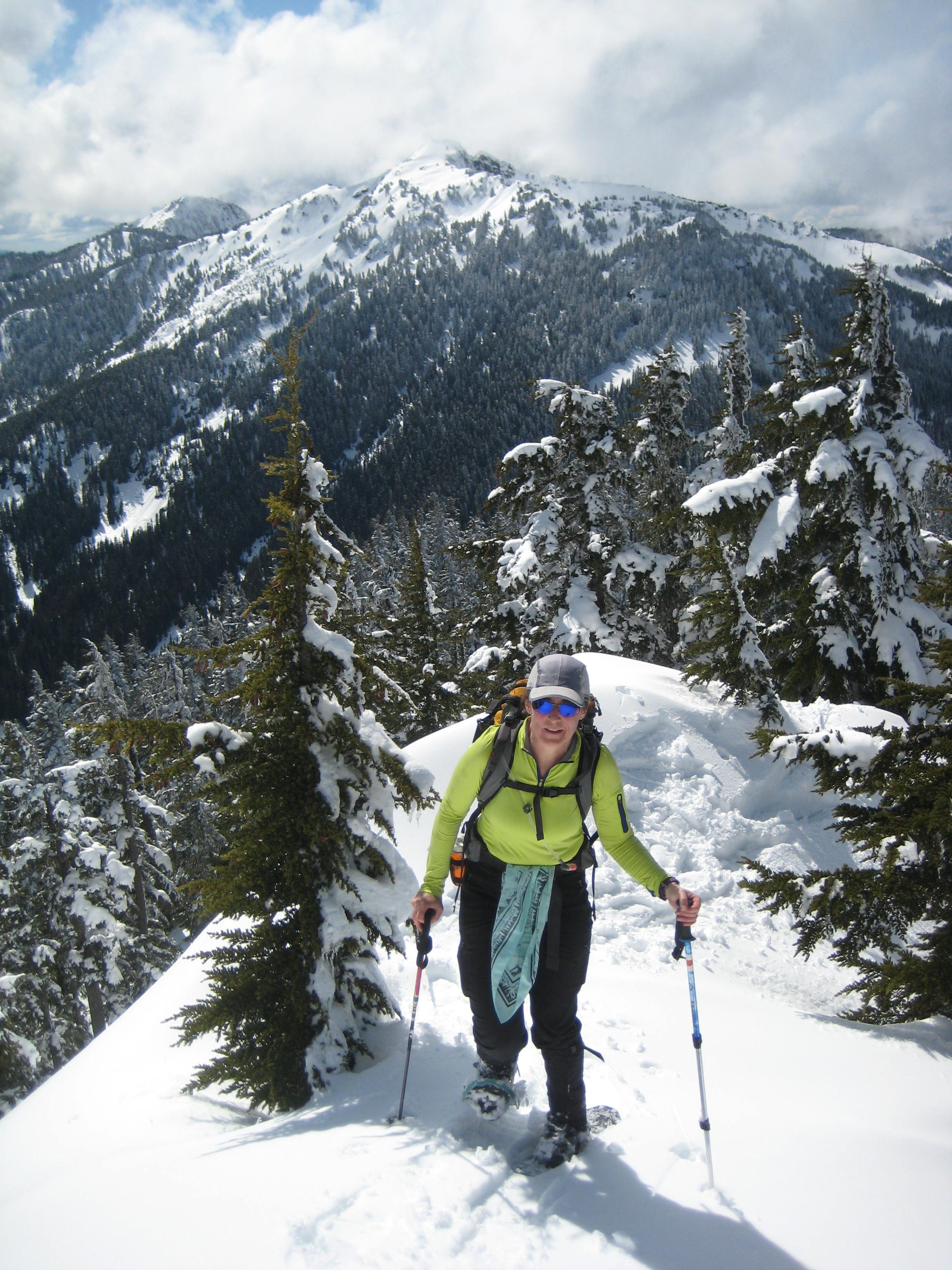
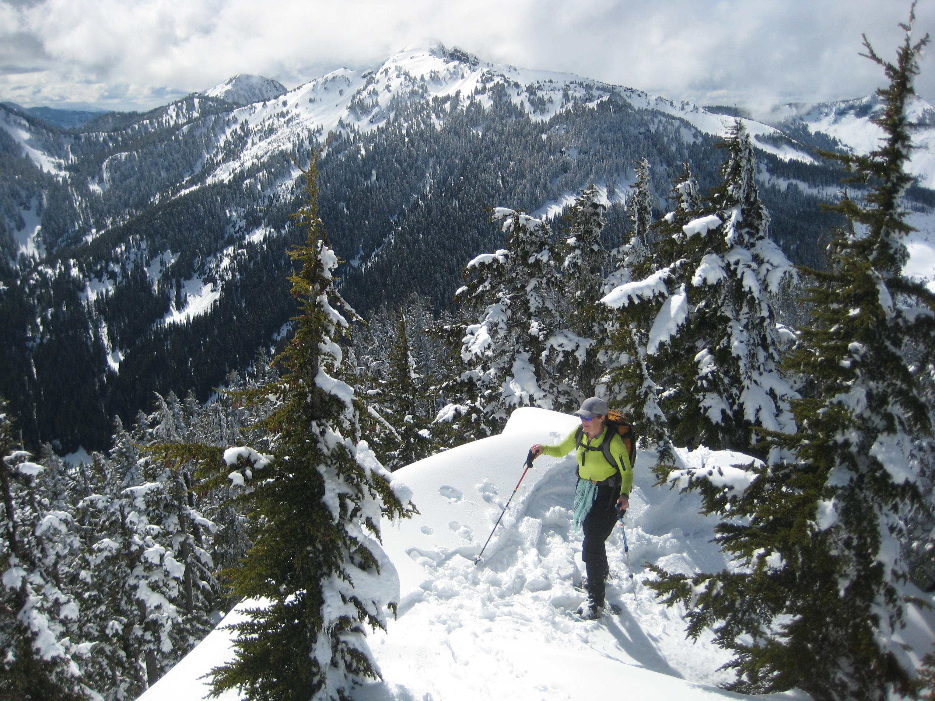
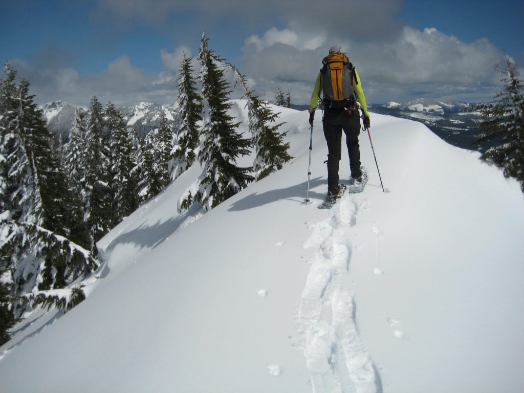
From Nordic Pass, traverse southward through open forest for a short distance, then turn left and continue up the west ridge of Mt. Catherine. This is an excellent snow route through widely spaced trees, and the final summit crest is wonderfully narrow and scenic.
.
.
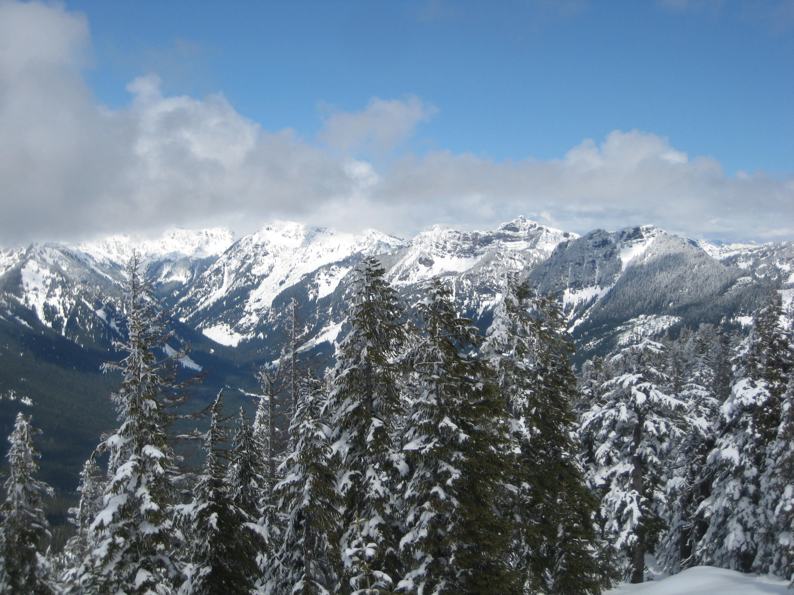
When the weather is clear, the summit offers great views of the Snoqualmie Range and Keechelus Mountains to the north, with Keechelus Lake stretching out far below. Closely to the south are Tinkham Peak, Silver Peak, and other summits in the Iron Horse Mountains.
.
- Jim On Mt Catherine Summit
.

.
For the descent, simply retrace your tracks back to the parking lot.
Equipment Comments
Due to the steep terrain encountered on the upper part of this route, I feel that a mountain snowshoe rather than a trail snowshoe is needed. Trekking poles and an ice axe are also highly recommended. For more information regarding the various equipment that I used for this particular trip and that I typically use for this type of trip, see my gear discussions and reviews on the following pages:
>>> Trail & Mountain Snowshoes
>>> Backcountry Ski & Snowshoe Packs
>>> Wintertime Comfort Accessories
Route Map
Click here for a high-rez printable PDF version of the map shown below.
…
Photo Gallery
Click to enlarge…