
Trip Date: August 7-11, 2014
Little Big Chief Peak Climbing Trip & La Bohn – Tank Loop: La Bohn Lakes to Tank Lakes
East Fork Foss River Valley
Necklace Valley
La Bohn Lakes
La Bohn Gap
Chain Lakes
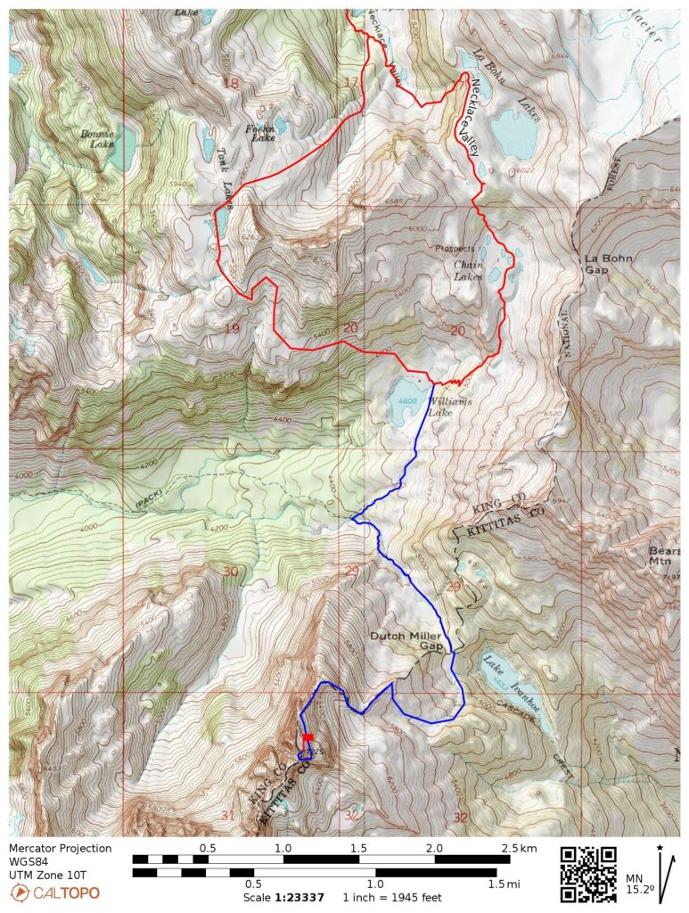
Williams Lake
Dutch Miller Gap
Little Big Chief Peak (7225 ft)
Tank Lakes
Trip Report Summary
Region: Central Washington Cascades
Sub-Region: Miller–Foss Mountains & Snoqualmie Range
Area: Alpine Lakes Wilderness
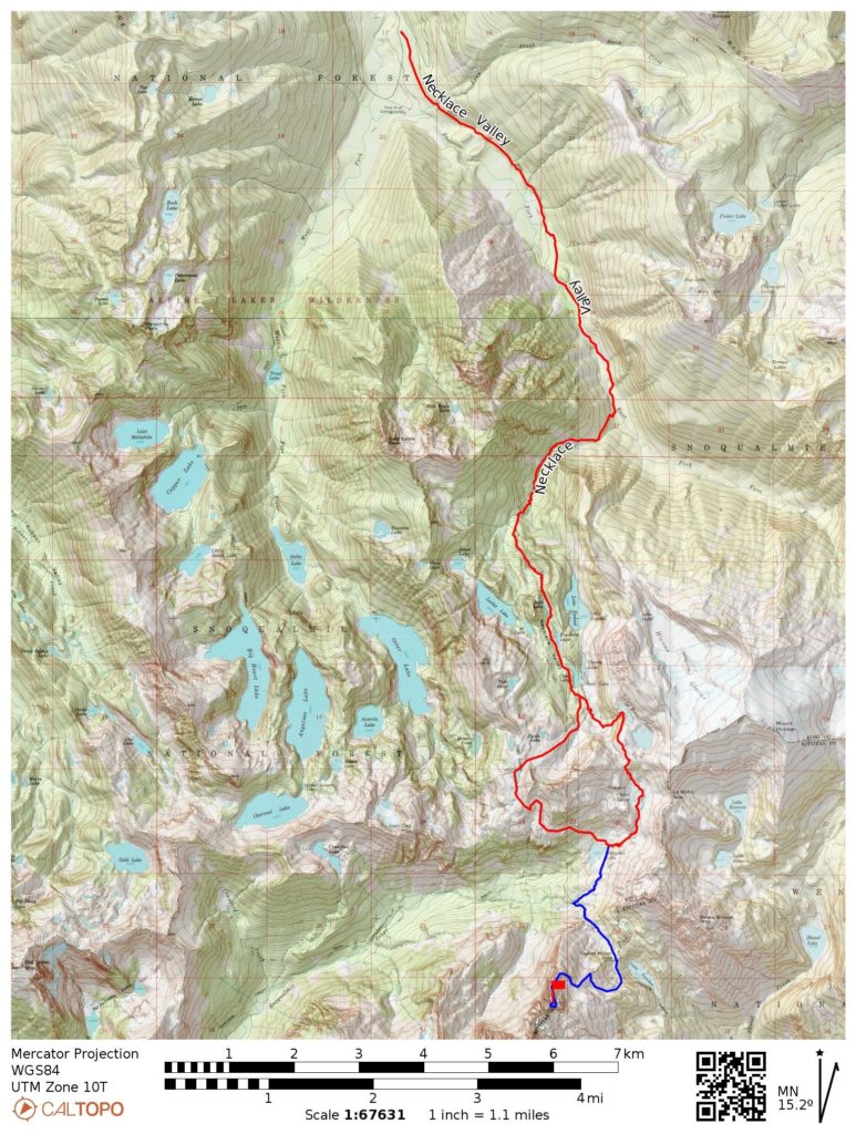
Starting & Ending Point: East Fork Foss River / Necklace Valley Trailhead on Foss River Road (Elev. 1650 feet)
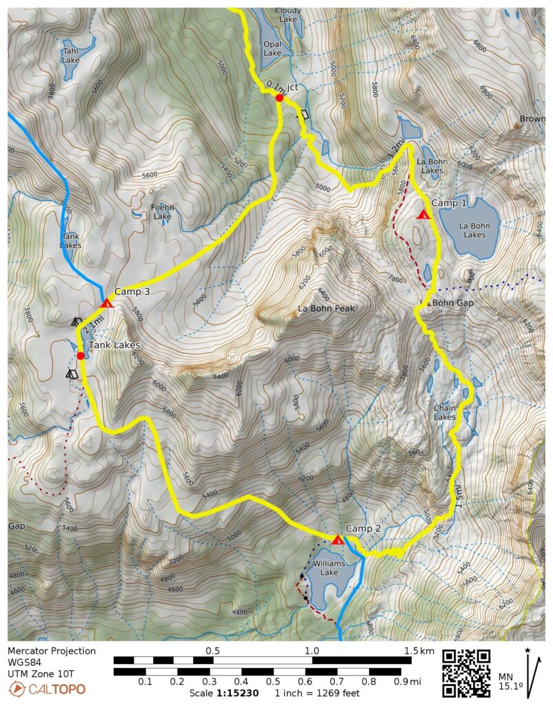
Way Points: East Fork Foss River & Necklace Creek & Necklace Valley & Jade Lake & Emerald Lake & Opal Lake & Upper Necklace Valley & La Bohn Creek & Lower La Bohn Lake & Upper La Bohn Lake & La Bohn Gap & Chain Lakes & Williams Lake & South Tank Lake & Tank Pass & Necklace Valley & Opal Lake & Necklace Cabin & Jade Lake & Necklace Creek & East Fork Foss River & Alturas Lake & Burn Creek Bridge (trail hike & off-trail hike & rock scramble)
High Point: Upper-Upper La Bohn Lake (Elev. 5950 feet)
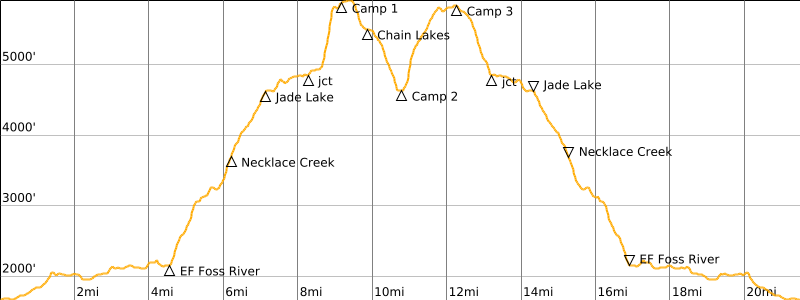
Campsites: Upper La Bohn Lake & Williams Lake & Tank Pass
Sidetrip: Middle Fork Snoqualmie River Trail junction & Middle Fork Snoqualmie River headwaters & Dutch Miller Gap (trail hike)
Summit: Little Big Chief Peak (rock scramble & rock climb via East Slope—Northeast Ridge—East Face—Southeast Face)
Sidetrip: North Tank Lake & Otter Ridge (off-trail hike & rock scramble)
Approximate Stats (excluding all sidetrips): 22 miles traveled; 6500 feet gained & lost.
Approximate Stats (including all sidetrips): 29 miles traveled; 10,000 feet gained & lost.
Related Posts
>>> Alpine Lakes Traverse: Myrtle Lake to Chetwoot Lake to Necklace Valley – August 2021
>>> Mt. Hinman via Necklace Valley—La Bohn Gap—Foss Glacier – August 2002
Full Trip Report
Last weekend, I joined Steve, Deb, Sandra, and Eileen on a trek into the gorgeous core of the Alpine Lakes Wilderness. Deb was the trip architect, and she did a great job picking scenic routes and campsites over a span of five days. I missed Day 1 of the full trip, due to work demands, but caught up with the peloton on their second day.
Day 1: Trailhead to La Bohn Lakes
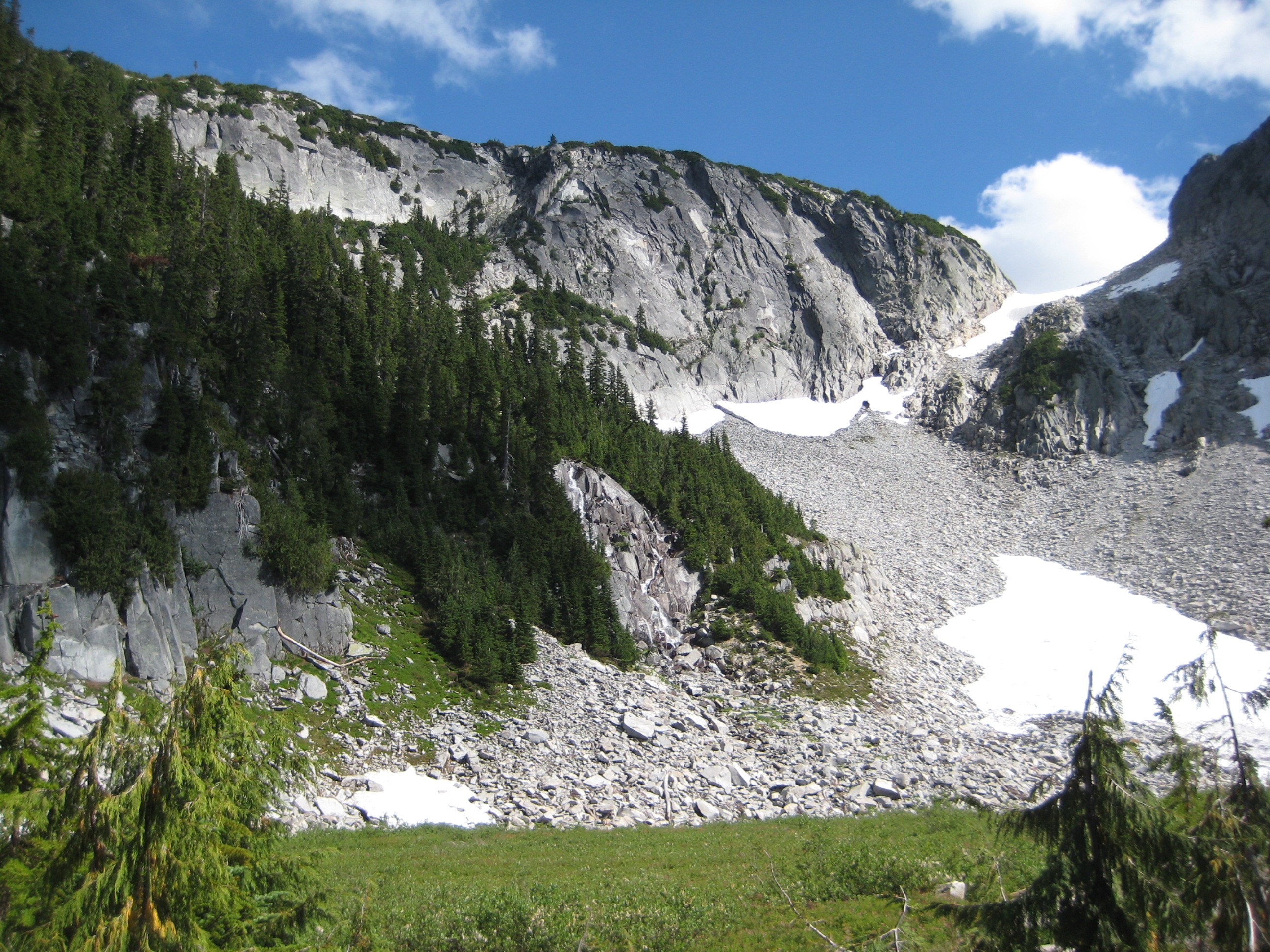
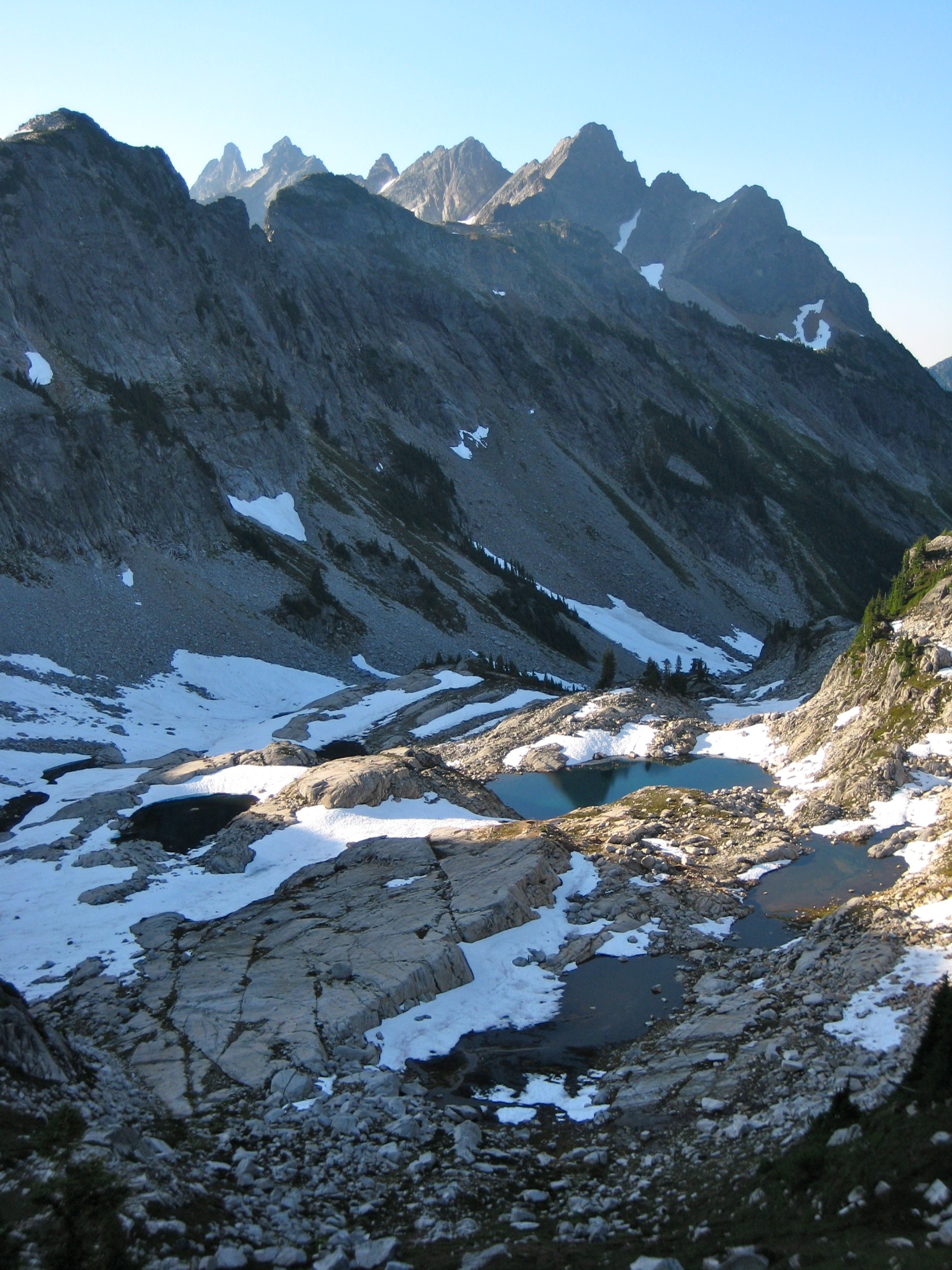
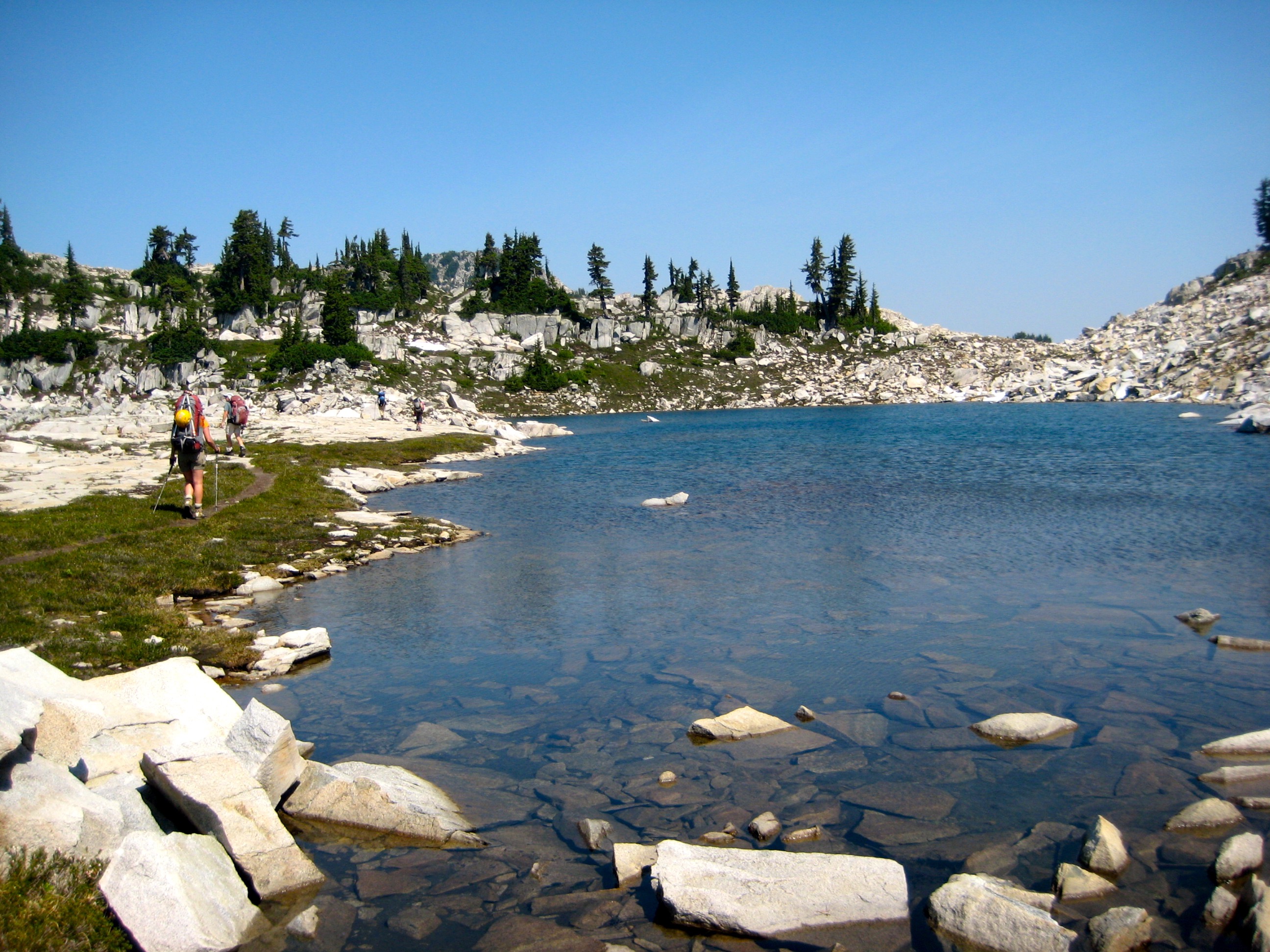
Starting at the East Fork Foss River Trailhead, I hiked up the nicely maintained trail 8 miles into Necklace Valley. The day was very warm, but surprisingly, the mosquitoes and flies were almost non-existent. After traveling another mile to the very head of the valley, I turned sharply to the left and followed a crude bootpath up “La Bohn Creek,” the exit stream for La Bohn Lakes. This west-facing drainage slope feels terribly steep and hot at the end of a full day. I was very glad when the path finally eased at the lip of the lowest lake (7.1 hours from TH).

- La Bohn Creek and La Bohn Pass From Upper Necklace Valley
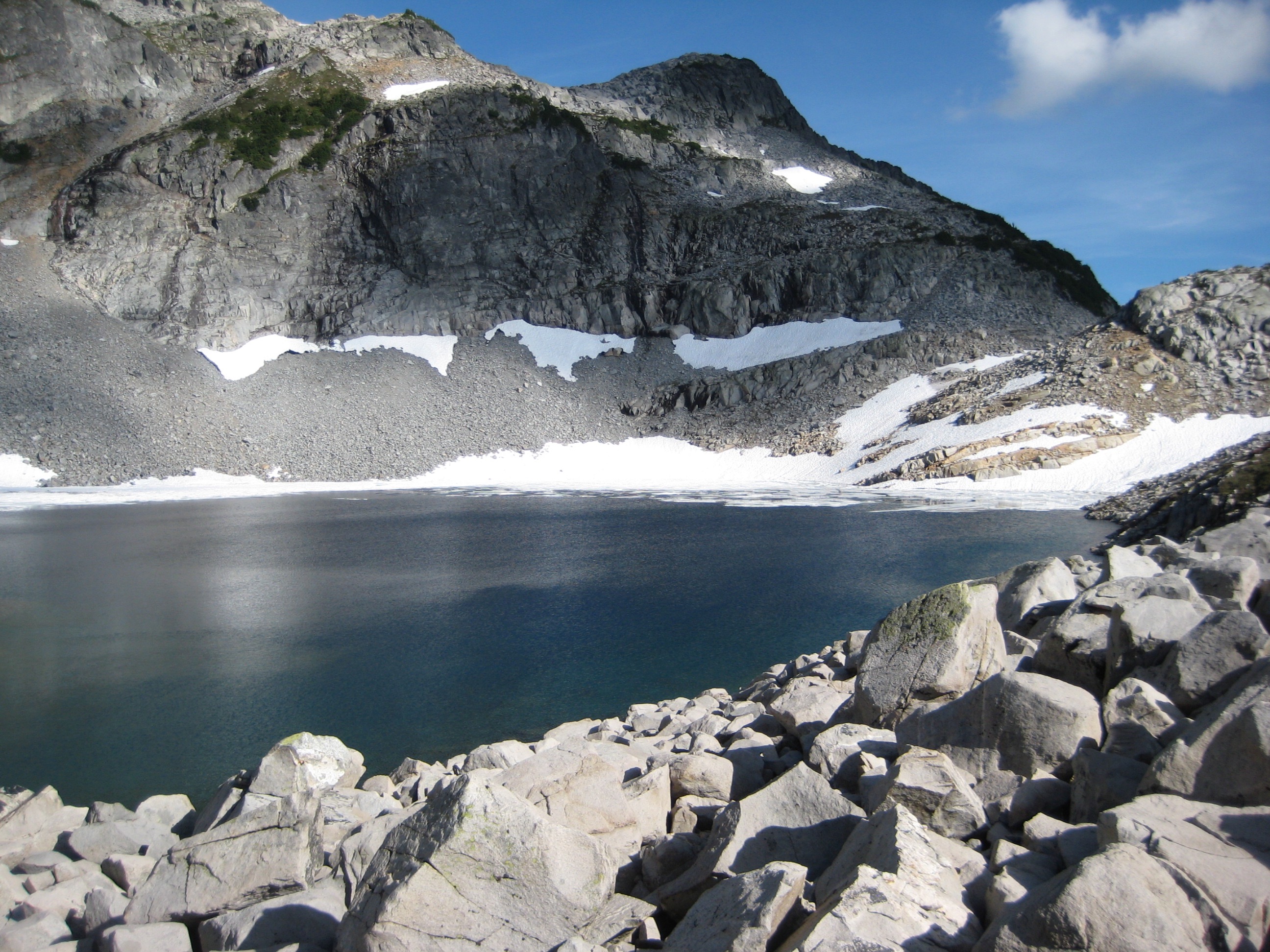
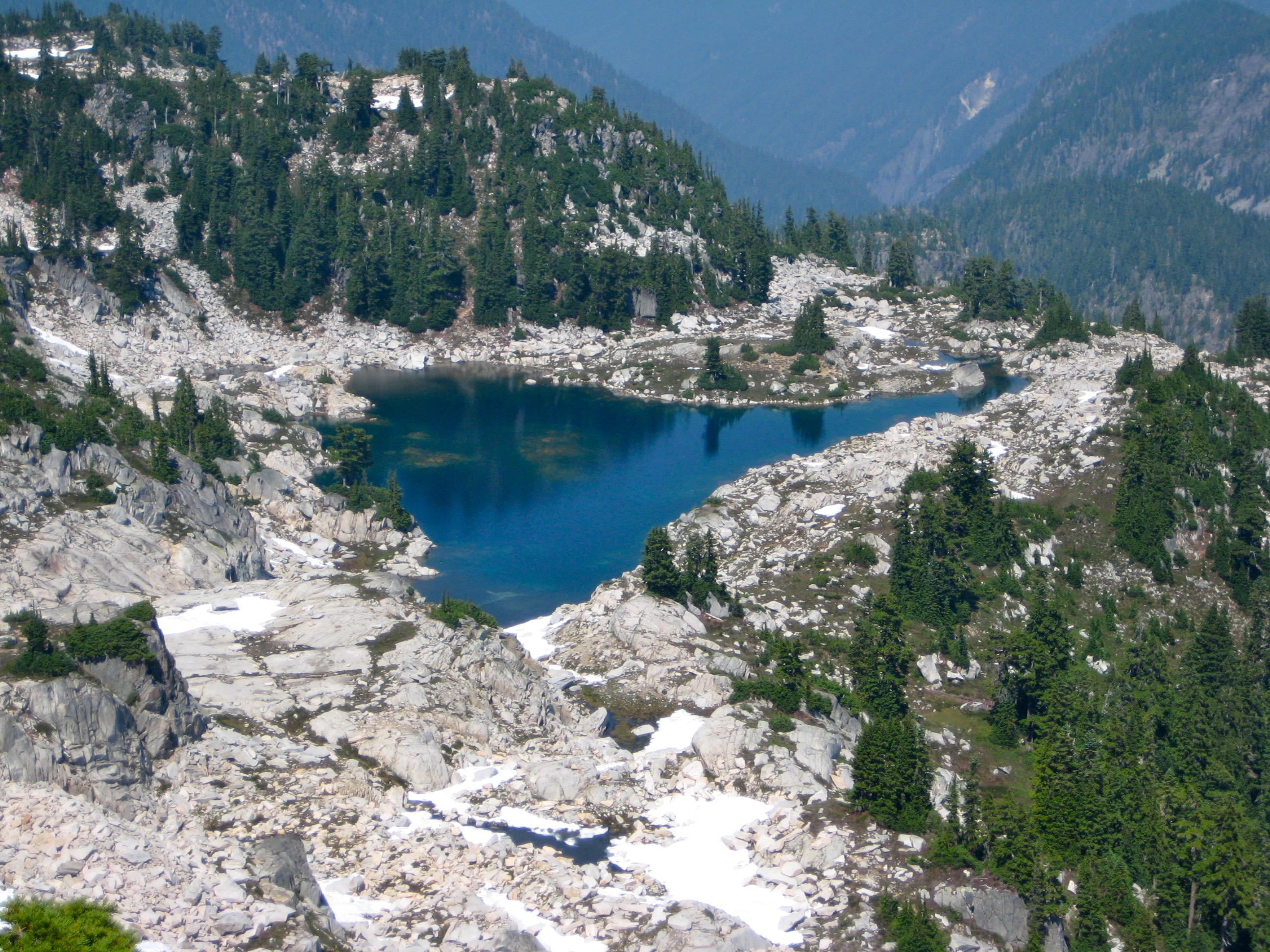
From the lowest La Bohn Lake, I wandered northward and found our team campsite on a heather bench overlooking the large, upper lake. Steve, Deb, Sandra, and Eileen came strolling into camp an hour later, having just returned from climbing Mt. Hinman and La Bohn Peak.
- Upper La Bohn Lake From Camp 1
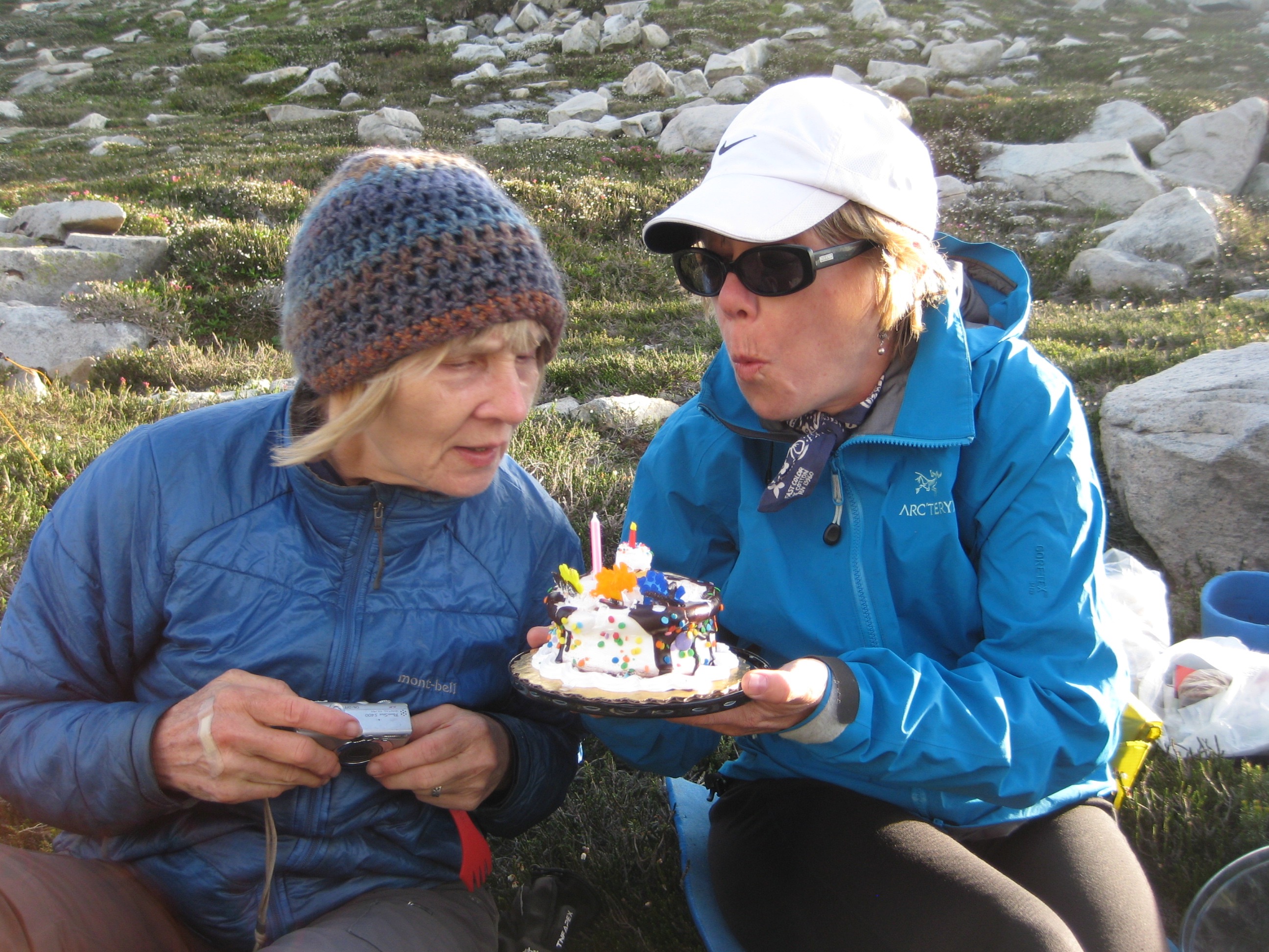
This was a birthday weekend for both Deb and Sandra. I surprised them by producing a birthday cake that had largely survived the 10-mile approach trek crammed in my backpack. Fortunately, it tasted better than it looked.
- Sandra and Deb With La Bohn Cake
Day 2: La Bohn Lakes to Williams Lake
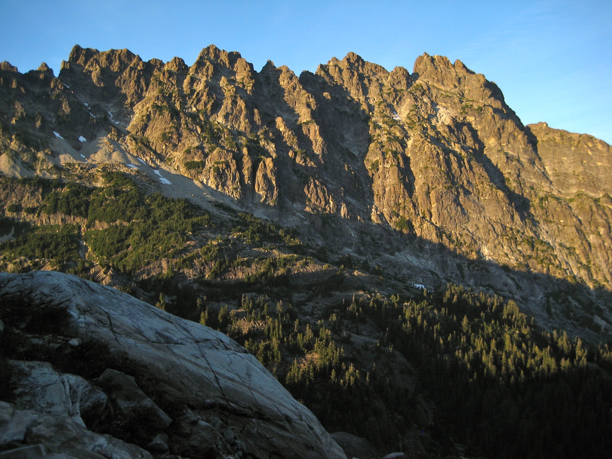
After an unexpectedly cold night, we awoke to a clear, calm morning. Sunshine highlighted the jagged summit crest of Bears Breast Mountain and bounced it off a glass-flat tarn near camp.
- Bears Breast Mountain Above La Bohn Tarn
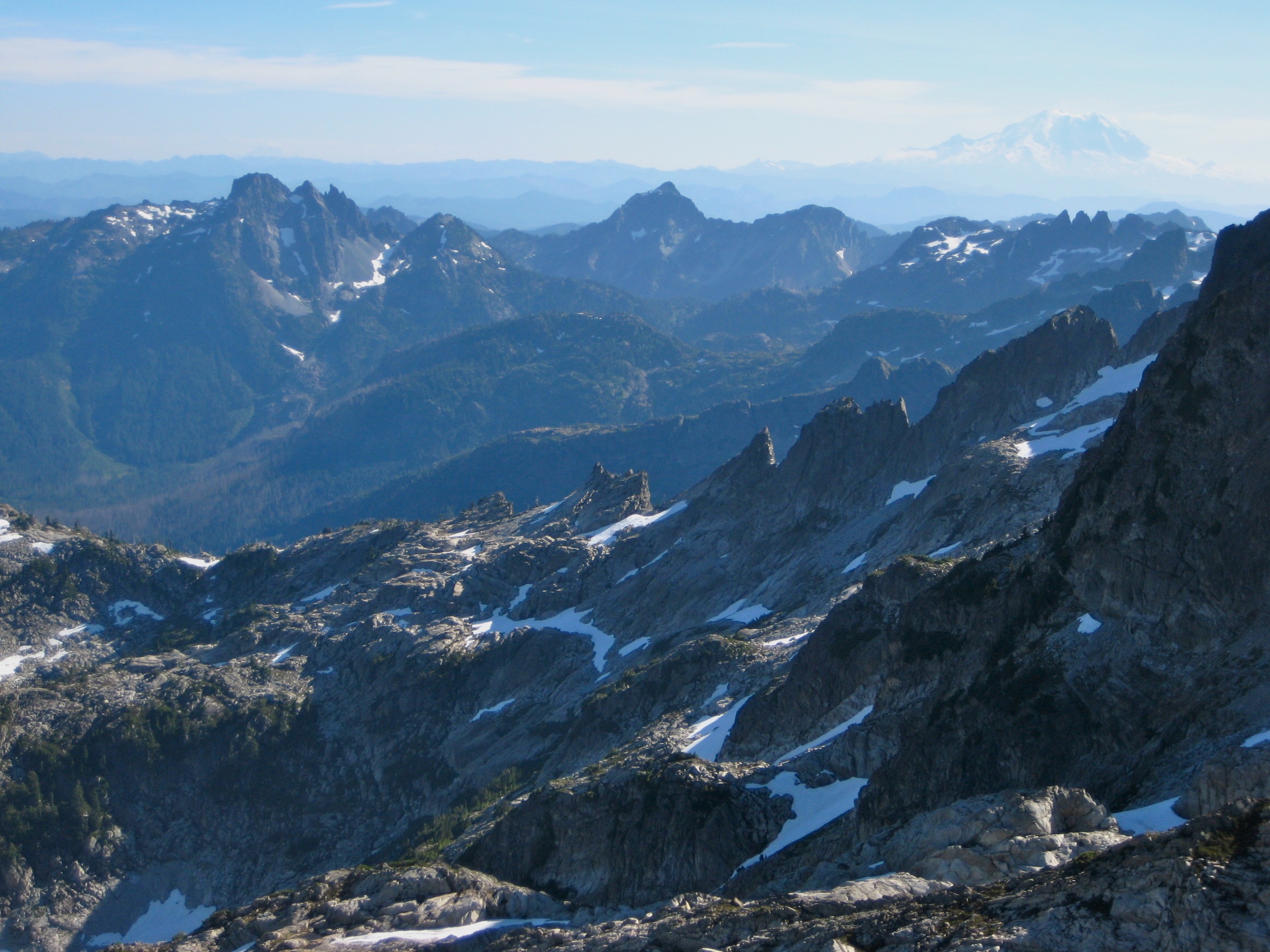
Deb’s itinerary called for a short traverse over to La Bohn Gap, from where we could look down on Chain Lakes to the south and down Necklace Valley to the north. La Bohn Gap has always had a special meaning to me; if not the geographic center of the Alpine Lakes Wilderness, it must at least be the spiritual center.

- Chain Lakes From La Bohn Gap
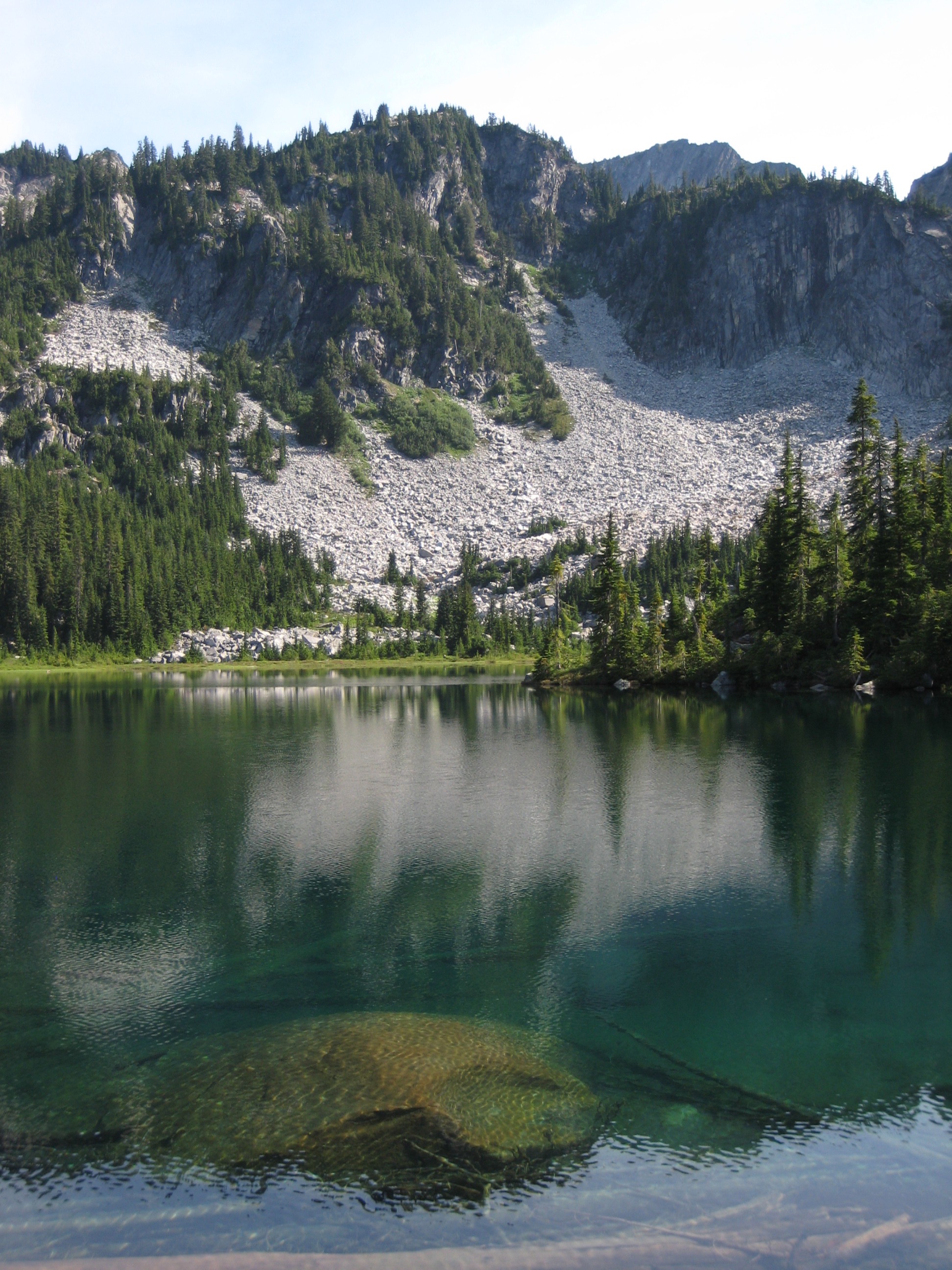
From the gap, we easily dropped to Chain Lakes and then descended huge talus boulders to the greenery of Williams Lake. Eileen and I quickly pulled out climbing gear, stashed our backpacks, and headed off to Dutch Miller Gap. Our goal was to climb Little Big Chief Peak (the northeastern peak of Summit Chief Mountain) and then return to Williams Lake before dark.
- Williams Lake
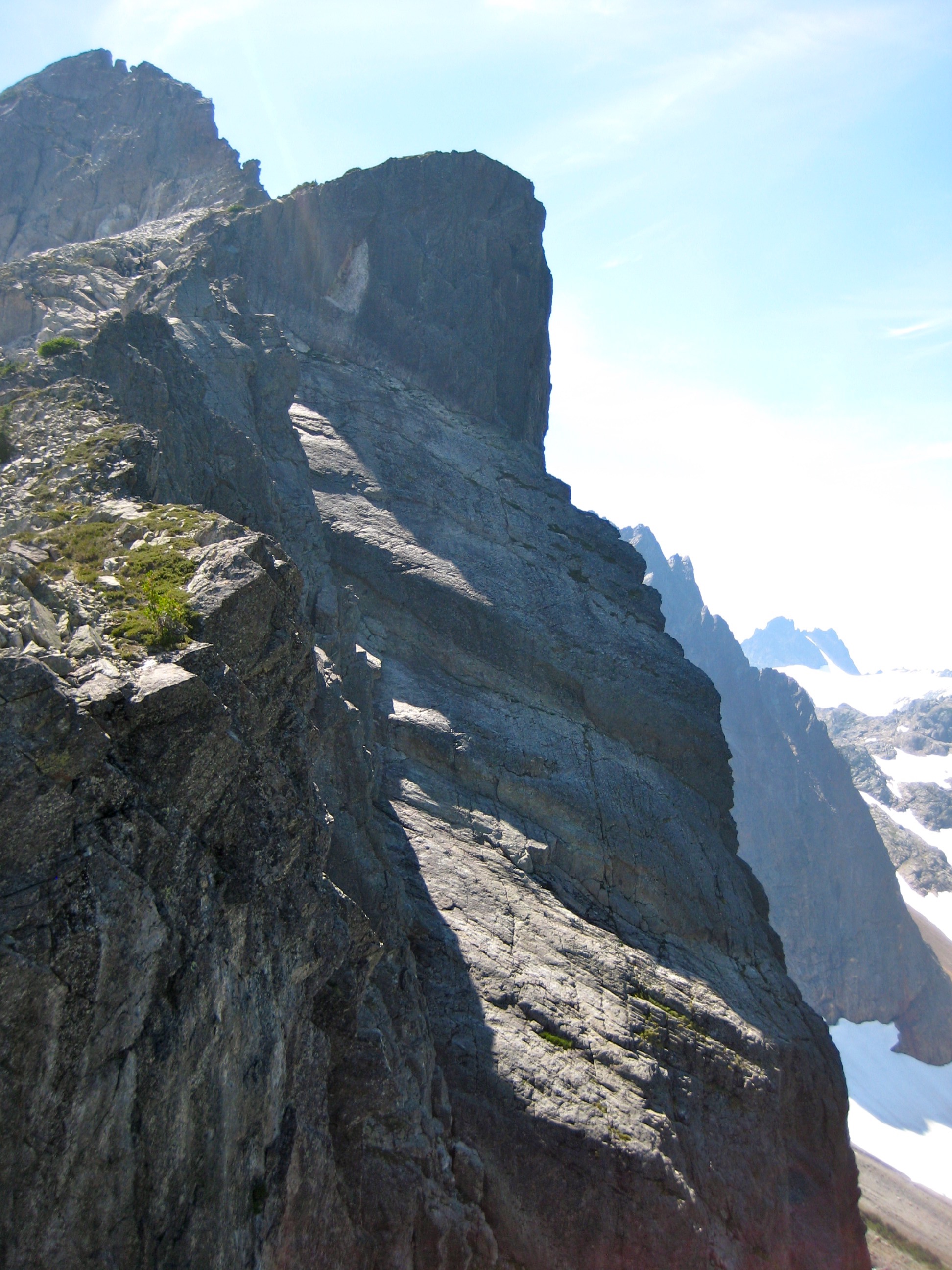
Little Big Chief Peak is overshadowed by the many better-known peaks in the Alpine Lakes Wilderness, but it is visually impressive and worthy of attention. The peak’s cute name belies its scrappy attitude. The crux of the climb is a wildly exposed Class 4 notch in the northeast ridge, which is vertical—or even slightly overhanging—on its north side.
- On Northeast Ridge Of Little Big Chief Peak
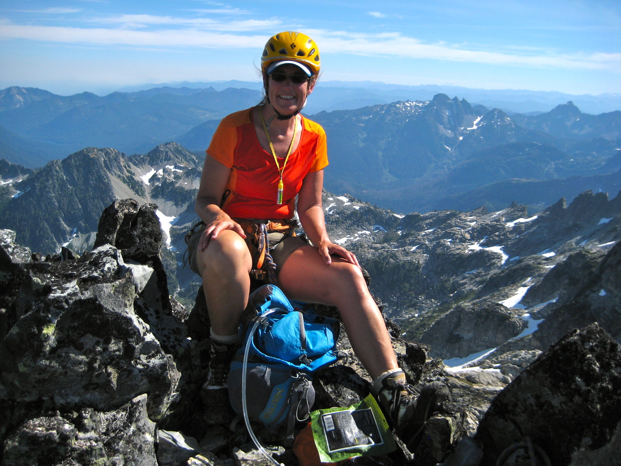
We got a bit off route on the summit tower and ended up on the steep southwest face, which had a few Class 4-5 moves. This was all good fun, but we didn’t reach the top until almost 4pm (5.5 hours from Williams Lake). We enjoyed great views of surrounding peaks and lakes before heading down the easier (Class 3) east face.
- Eileen On Little Big Chief Peak Summit
- Three Queens and Hibox Peak From Little Big Chief Peak
Farther down, in an effort to make up time, we gambled on descending a couloir that angled northeasterly toward the trail, rather than descending easterly to Dutch Miller Gap. Our gamble did not pay off; we got cliff-bound 600 feet above the valley floor and eventually had to traverse back over to the east-facing slope. The last rays of sun were playing with the furrowed face of Bears Breast Mountain as we hurried down the steep easterly slopes. Darkness met us right at Dutch Miller Gap, and we hiked back to Williams Lake by headlamp.
- Evening Light On Bears Breast Mountain
Day 3: Williams Lake to Tank Pass
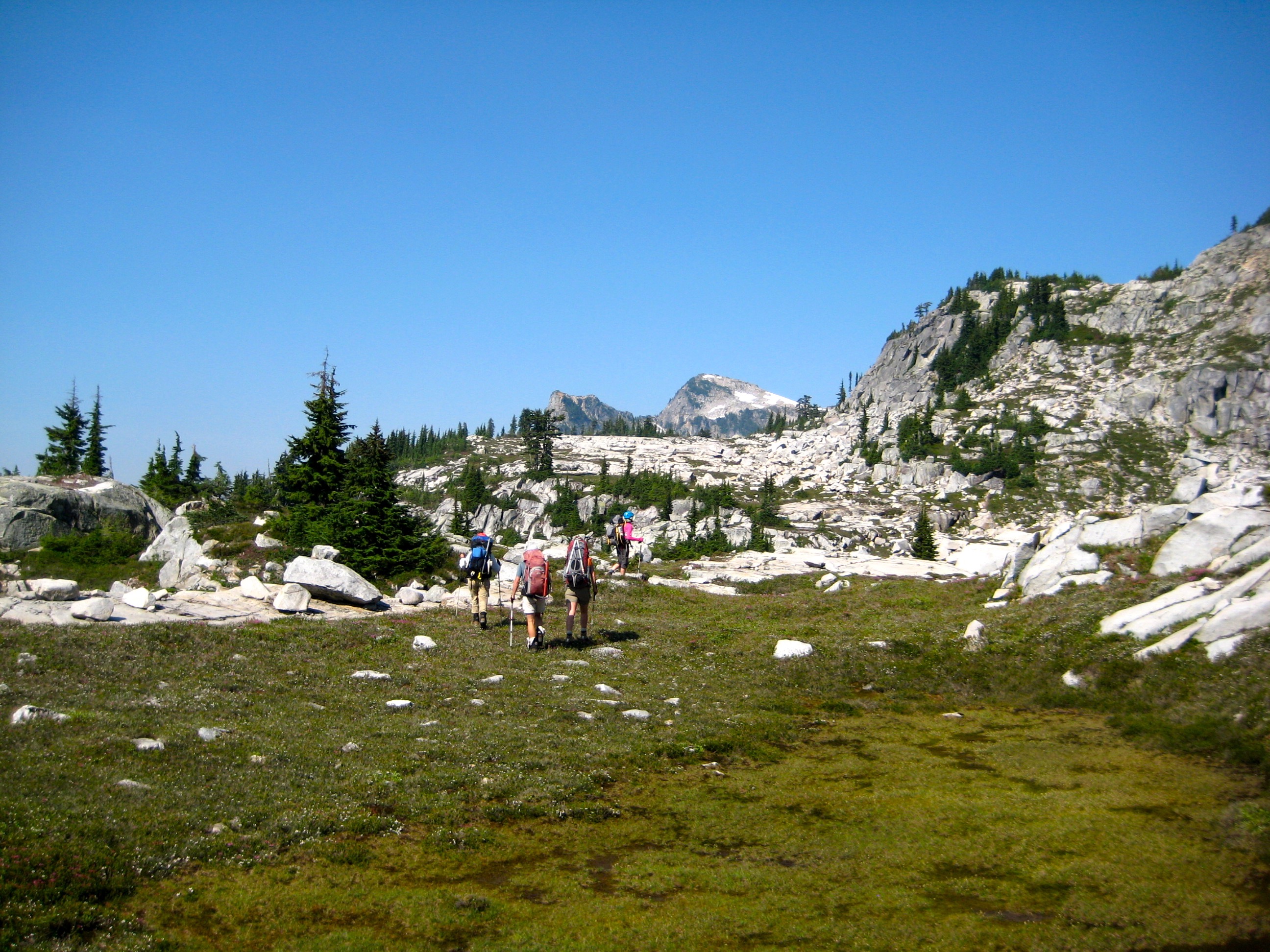
Today was planned to be more relaxing, and it turned out to be much warmer too. We climbed up a talus slope above Williams Lake and then wandered up a gentle bench of heather and rock, en route to Tank Lakes. This was splendid alpine terrain with fabulous views of the Snoqualmie Mountains.
- Hiking Up Meadows To Tank Lakes
- Little Big Chief Peak and Summit Chief Mountain From High Meadows
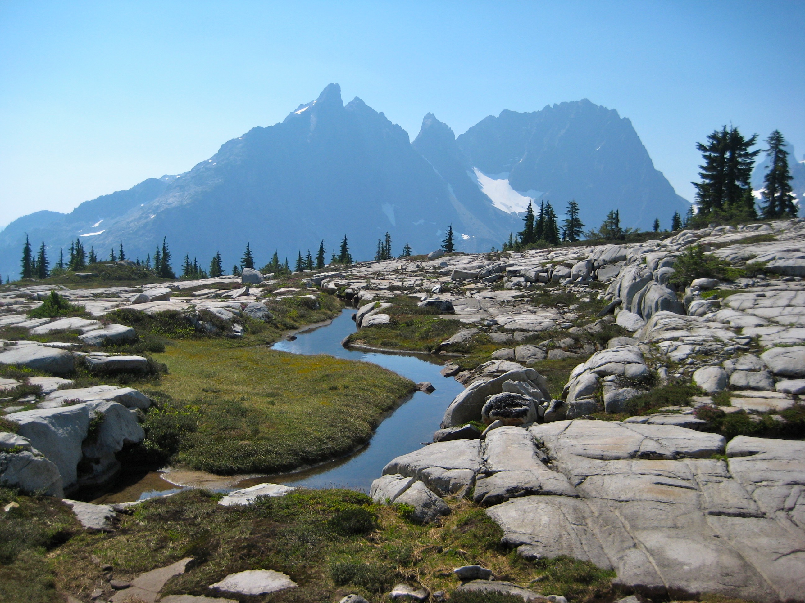
It was nearly noon when we passed by Upper Tank Lake and made camp on smooth rock slabs at “Tank Pass” (3.3 hours from Williams Lake).
- Hiking Past Upper Tank Lake
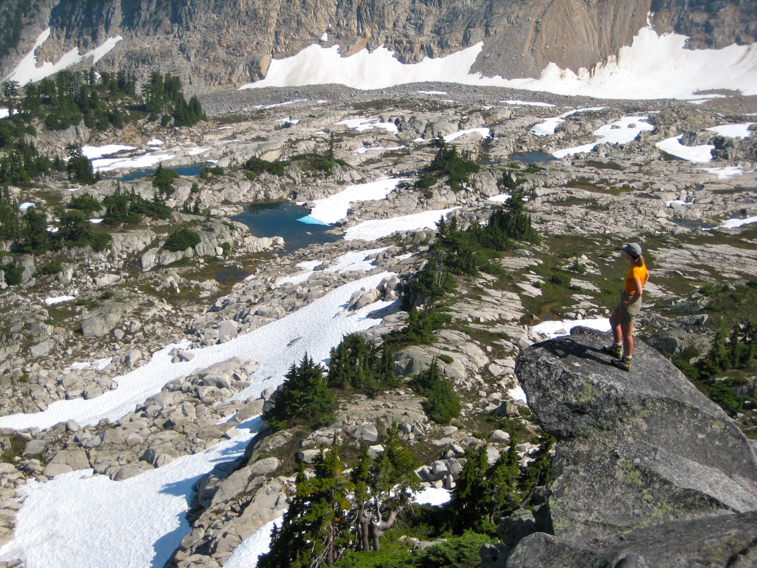
Our hot afternoon activities included a sidetrip up Otter Ridge for views of manta-ray-shaped Tahl Lake and the various tarns surrounding Tank Lakes.
- Tahl Lake From Otter Ridge
- Tank Tarns From Otter Ridge
Back in camp, a warm evening breeze carried in distant forest fire smoke to create a slight haze. This added a soft glow to the fading light. From our camp kitchen, we marveled at the horns, faces, aretes, and glaciers of the Snoqualmie Mountains across the valley.
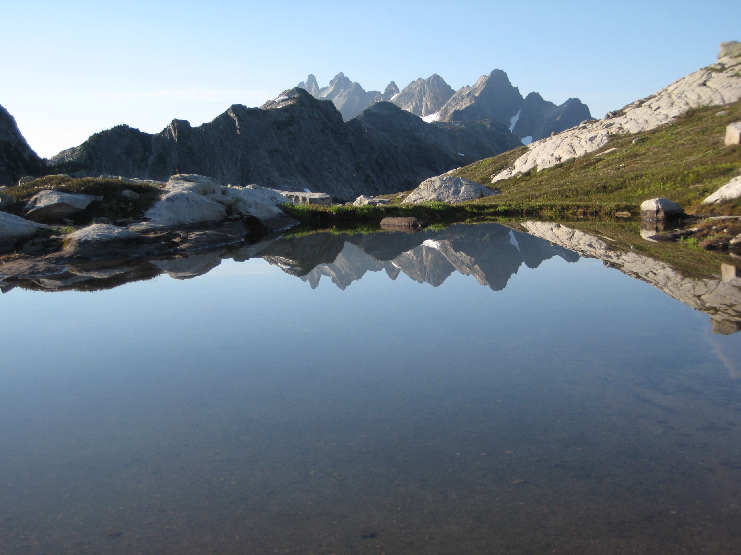
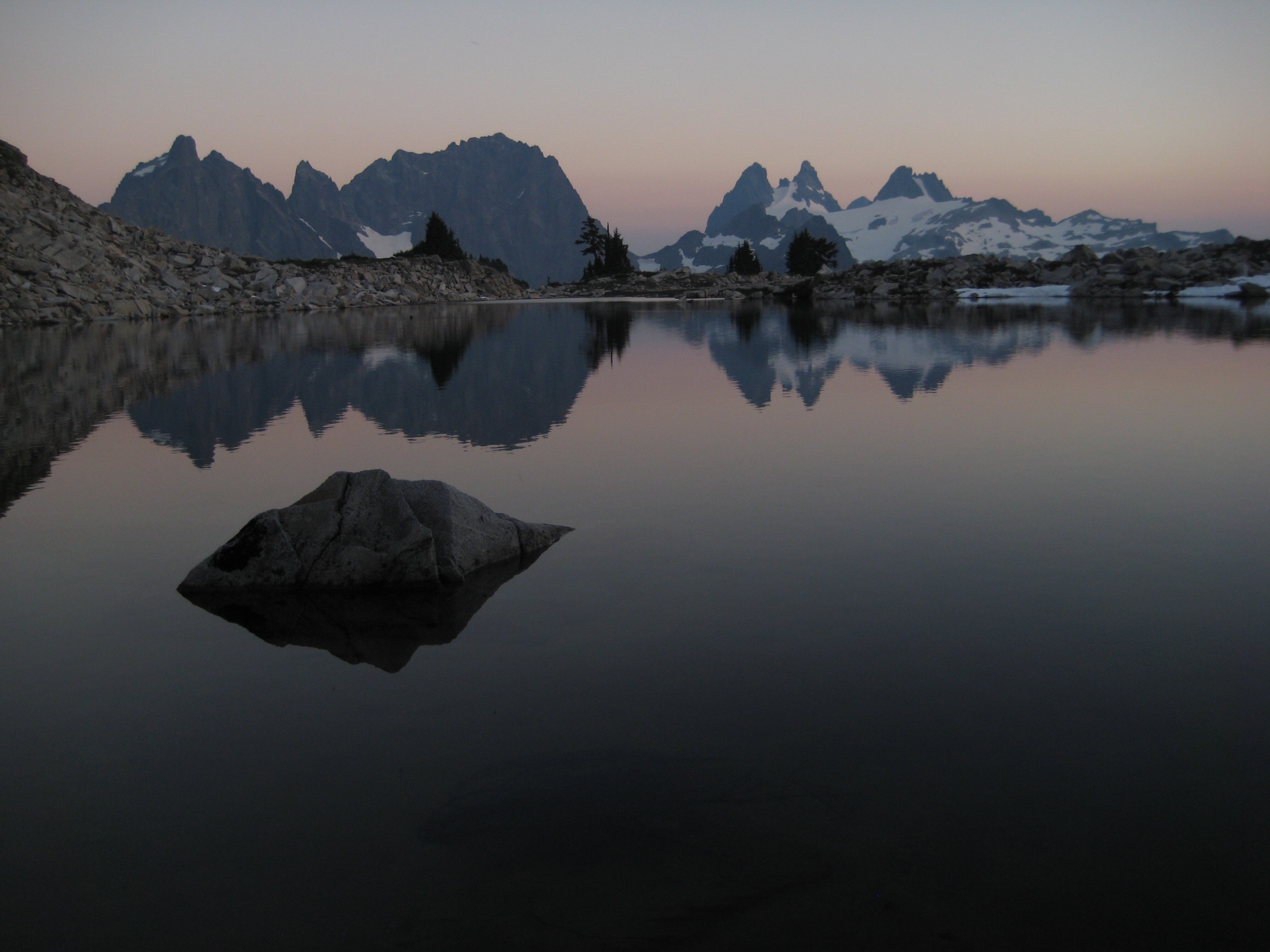
- Little Big Chief Peak, Summit Chief Mountain, and Chimney Rock From Tank Pass
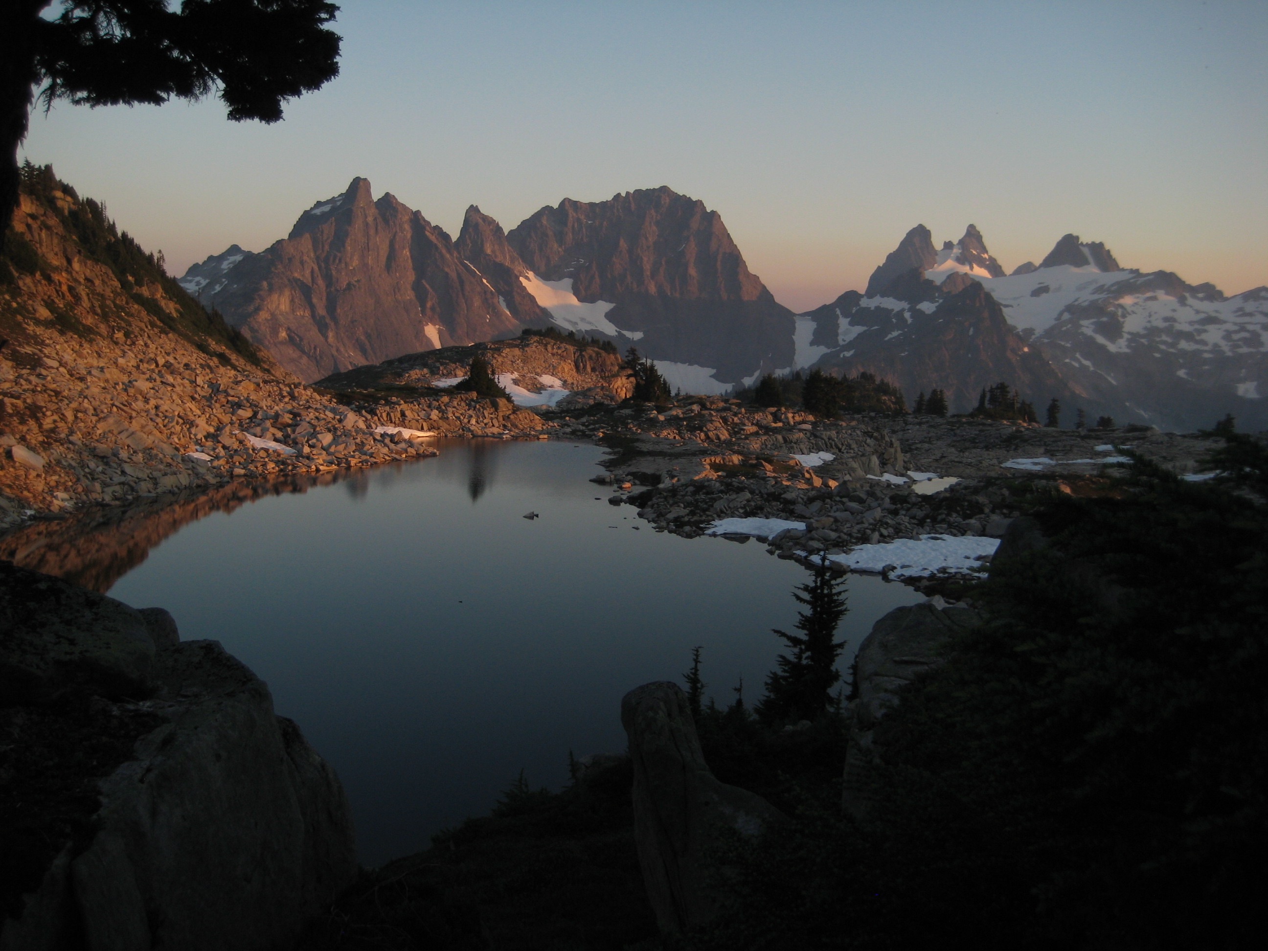
- Little Big Chief Peak, Summit Chief Mountain, and Chimney Rock Reflected In Tank Lake
Day 4: Tank Pass to Trailhead
The morning was very warm and smokey as we packed up and then headed down moraine slopes to Necklace Valley. Once in the valley, we left the smoke behind and hiked out the remaining 8 miles in sweltering heat to end a wonderful trip.
Route Maps & Profile
…
…
…
…
Photo Galleries
Click to enlarge…
Necklace Valley to La Bohn Lakes to Williams Lake


Little Big Chief Peak Summit Climb


WIlliams Lake to Tank Lakes to Necklace Valley


