Trip Date: August 31 – September 5, 2023
Buck Creek – Spider Gap Loop Hiking & Climbing Trip
Chiwawa River Valley
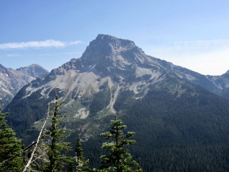
Fortress Mountain (8760′)
Buck Creek Pass
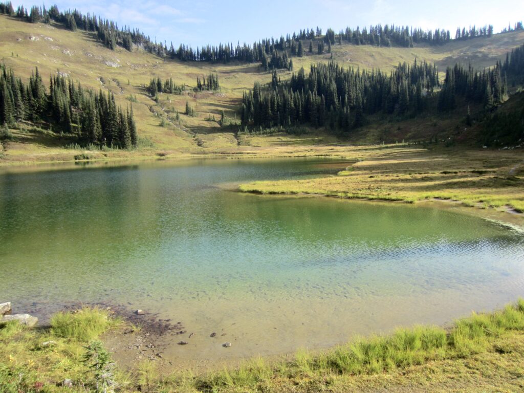
Image Lake
Miner’s Ridge Lookout
Suiattle Pass
Cloudy Pass
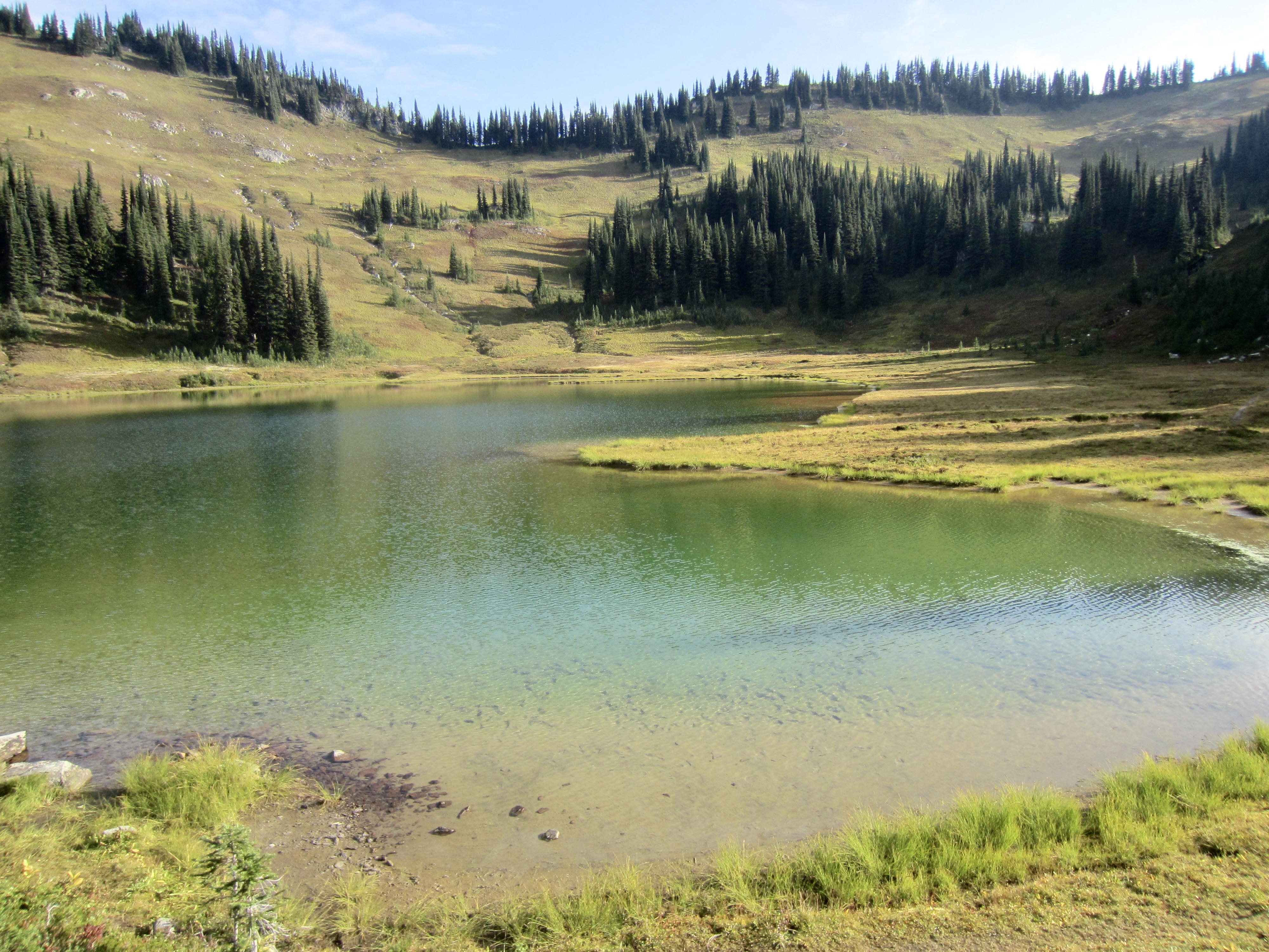
Lyman Lakes
Spider Gap
Spider Meadow
- Trip Report Summary
- Related Posts
- Trip Overview
- Full Trip Report
- Day 1: Chiwawa River Trailhead to Pass No Pass Basin
- Day 2 (AM & early PM): Fortress Mtn Summit Climb
- Day 2 (late PM): Pass No Pass Basin to Small Creek
- Day 3: Small Creek to Image Lake + Miners Pass
- Day 4 (AM): Miners Ridge Lookout Hike
- Day 4 (PM): Image Lake to Cloudy Pass Basin
- Day 5: Cloudy Pass Basin to Phelps Creek
- Day 6: Phelps Creek to Chiwawa River Trailhead
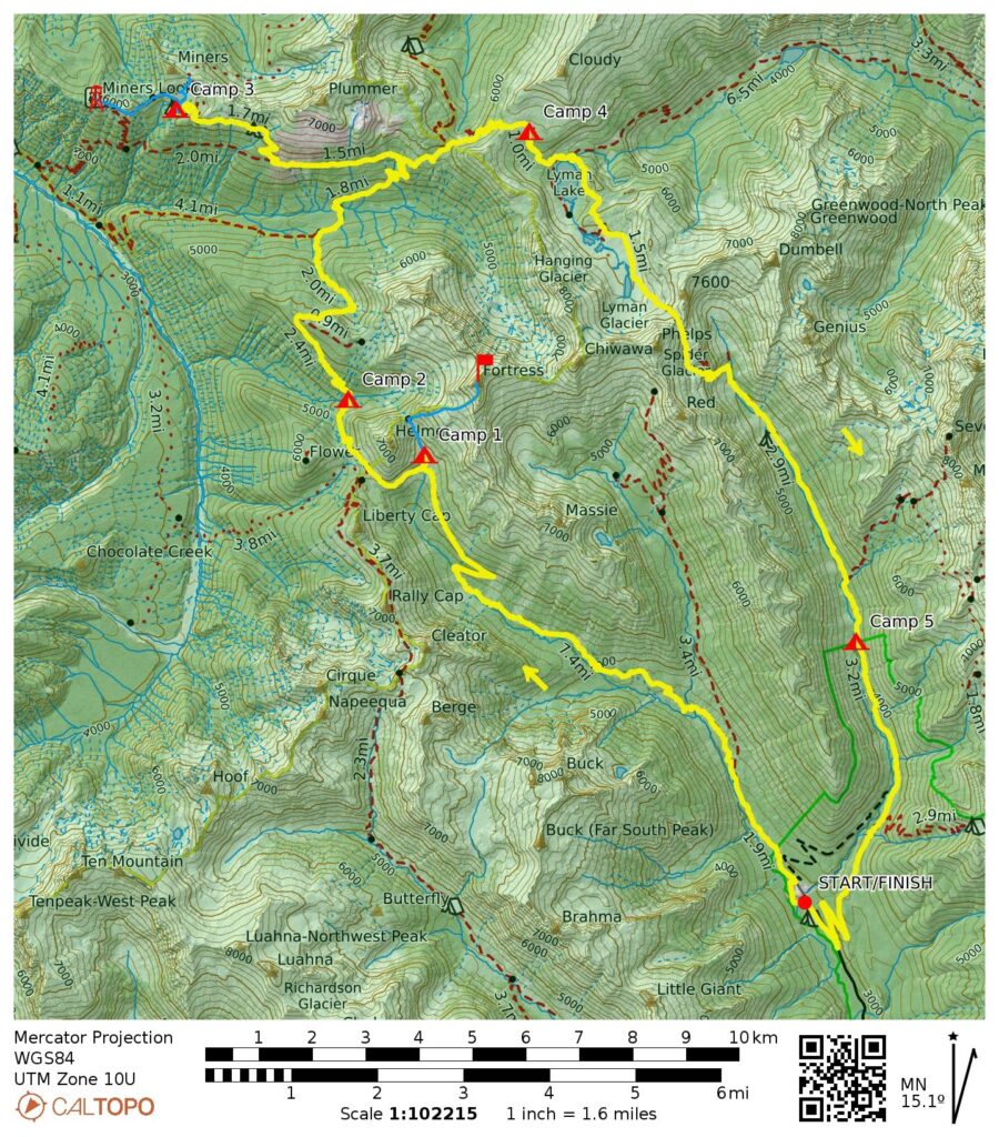
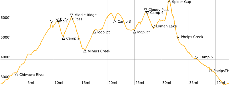
- Route Map & Profile
- Photo Gallery
Trip Report Summary
Region: North-Central Washington Cascades
Sub-Region: Chiwawa Range
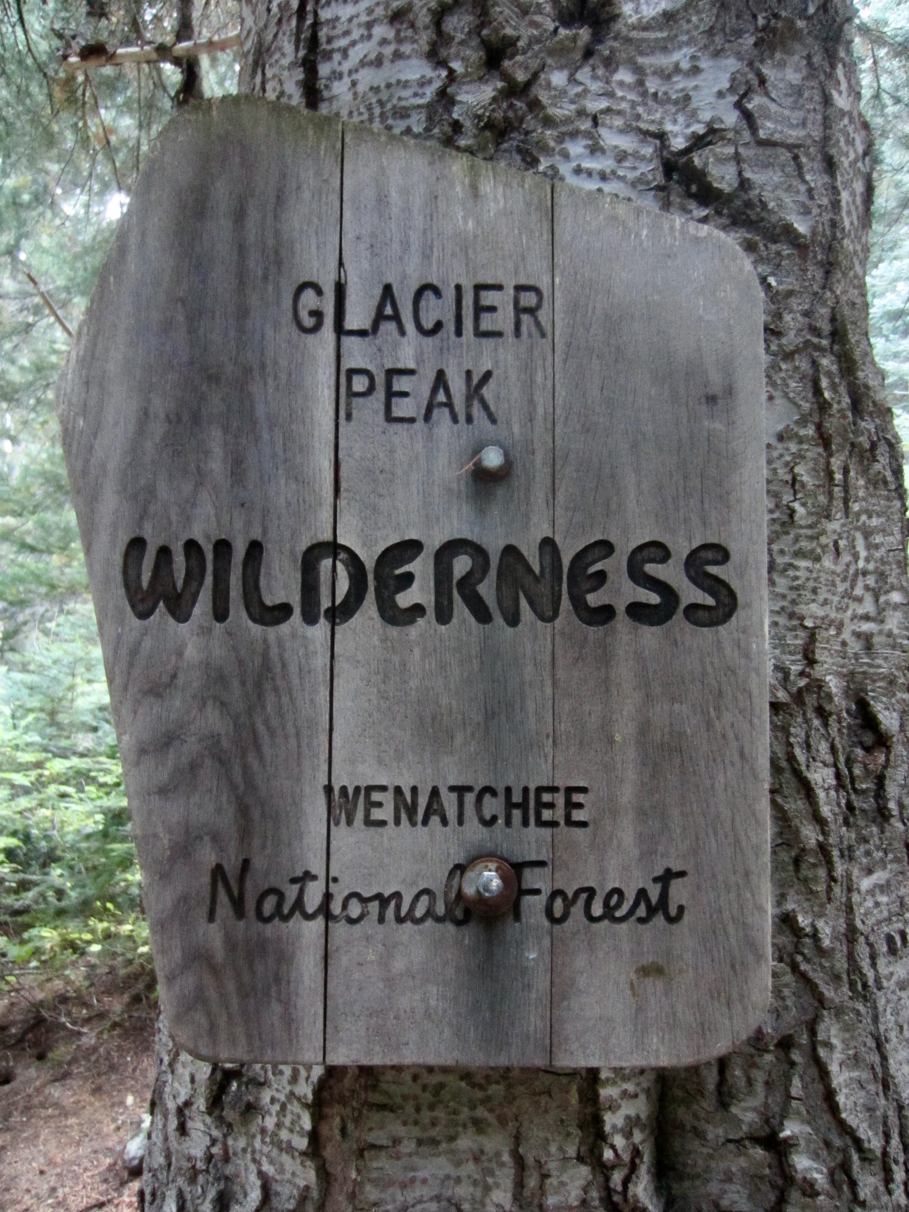
Area: Glacier Peak Wilderness
Starting & Ending Point: Chiwawa River Trailhead near Trinity on Chiwawa River Road (Elev. 2800 feet)
Way Points: Phelps Creek Bridge & Chiwawa River crossing & Lower Pass No Pass Basin & Buck Creek Pass & Small Creek & Middle Ridge & PCT junction & Miners Creek Bridge & Miners Ridge Trail junction & Lady Camp & Image Lake & Lady Camp & PCT junction & Suiattle Pass & Cloudy Pass & Cloudy Pass Basin & Lyman Lake & Upper Lyman Lakes & Spider Gap & Spider Bench & Upper Phelps Creek & Spider Meadow & Phelps Creek Trailhead (trail hike & off-trail hike & rock scramble); Chiwawa River Road junction & Chiwawa River Trailhead (road walk)
High Point: Spider Gap (Elev. 7050 feet)
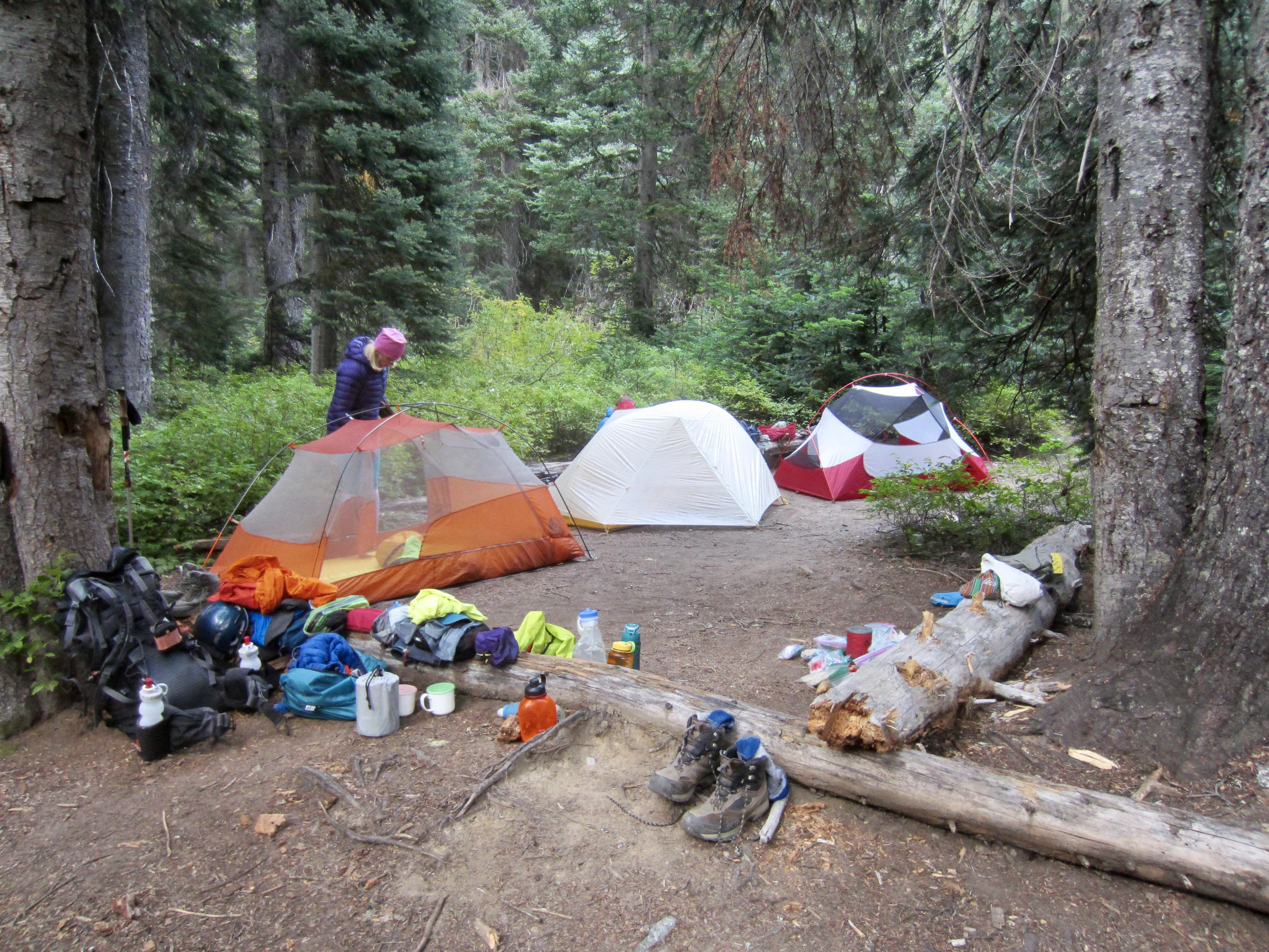
Campsites: Lower Pass No Pass Basin & Small Creek & Image Lake Group Camp & Cloudy Pass Basin Camp & Phelps Creek Trail at wilderness boundary
Sidetrip: Upper Pass No Pass Basin & Pass No Pass (trail hike & off-trail hike)
Summit: Fortress Mountain (off-trail hike & rock scramble via Southwest Ridge—Southwest Face)
Sidetrip: Miner’s Pass (trail hike & off-trail hike)
Sidetrip: Miner’s Ridge Lookout (trail hike)
Approximate Stats (excluding sidetrips): 42 miles traveled; 9650 feet gained & lost.
Approximate Stats (including sidetrips): 49 miles traveled; 13,100 feet gained & lost.
Related Posts
Chiwawa Mountain – Fortress Mountain Summit Loop – June 1980
Sitting Bull Mtn via Image Lake—Miners Pass – September 2017
Trip Overview
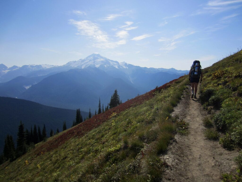
The Spider Gap – Buck Creek Loop is a classic hiking circuit around Fortress Mountain in the eastern Glacier Peak Wilderness. Over its 34-mile course, this very popular circuit links numerous scenic locations, including Spider Meadow, Spider Gap, Lyman Lakes, Cloudy Pass, and Buck Creek Pass, while providing stellar views of Glacier Peak, Bonanza Peak, and other nearby mountains. Many trekkers also make a 4-mile sidetrip over to ultra-famous Image Lake near the midpoint of the circuit, which brings the total distance up to 42 miles.
Although the vast majority of the trek follows well-maintained trails, there is a 2-mile off-trail segment that crosses over 7050-foot Spider Gap—the high point of the entire circuit. This short segment through rugged alpine terrain (rock, snow, and/or ice, depending on season) presents various difficulties that elevate the circuit above the level of a simple hiking loop. There is also a 3-mile segment of dirt roads that connect the starting and ending trailheads. Obviously, this road walk can be avoided if a car shuttle is executed.
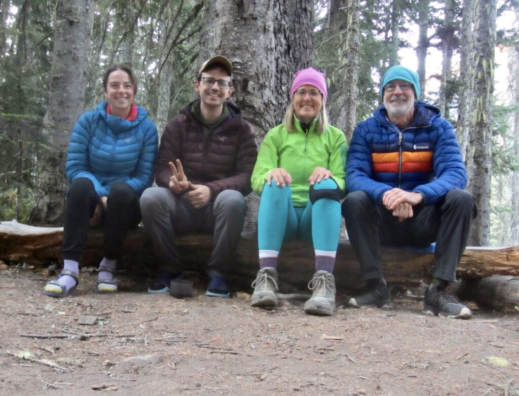
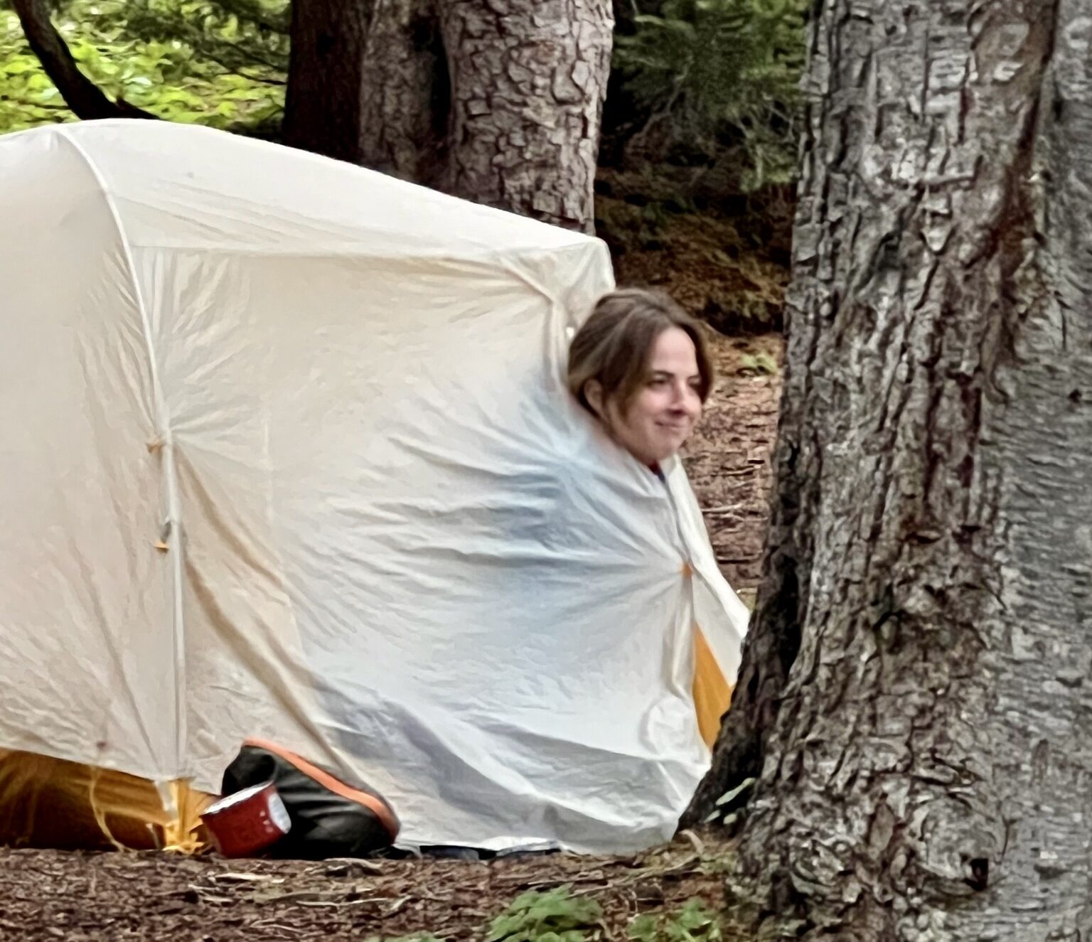
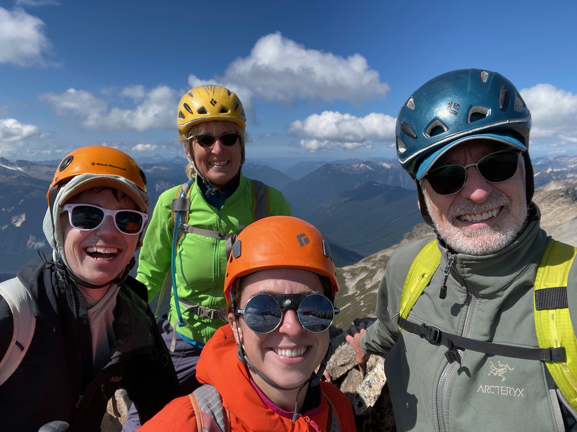
Eileen, Brooke, Andrew, and I completed the classic loop, including the obligatory sidetrip to Image Lake, as a six-day trip over Labor Day Weekend. Our extended schedule allowed us to climb Fortress Mountain—the highest peak in the Chiwawa Range—and to visit the famous Miner’s Ridge Lookout. Rather than traveling in the traditional counter-clockwise direction, however, we chose to travel in a clockwise direction because it meshed better with our itinerary and the weather forecast.
Unsettled weather and wildfire smoke were pervasive throughout the week, but neither was bad enough to spoil our trip. We had two spells of nighttime rainfall, on Day 1 and Day 4, and a few hours of fog on Day 5. Westerly winds kept most of the smoke at bay, although long-range views were always limited. In the end, we all had a marvelous experience doing this outstanding trek for the first time!
…
Full Trip Report
Day 1: Chiwawa River Trailhead to Pass No Pass Basin
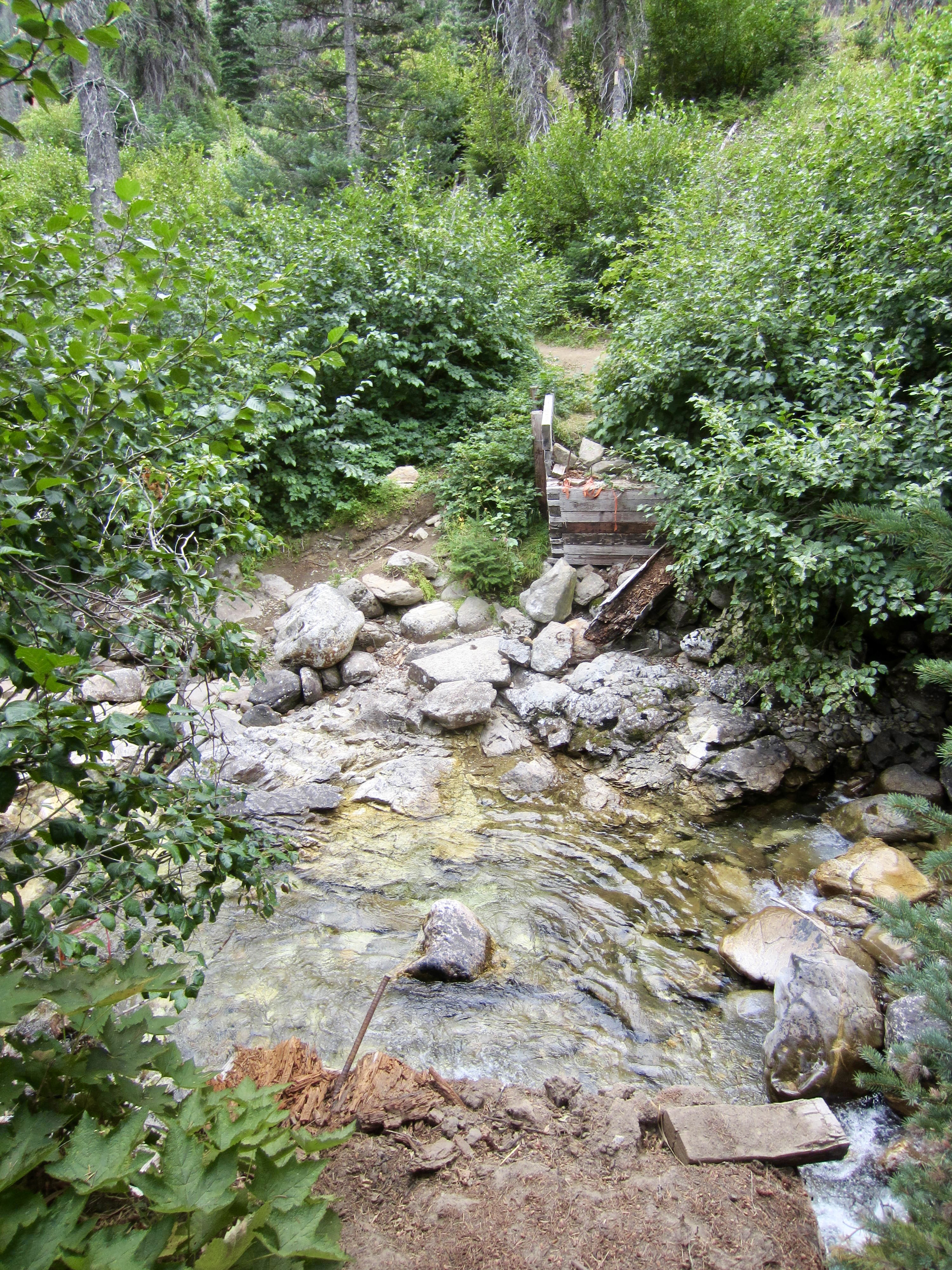
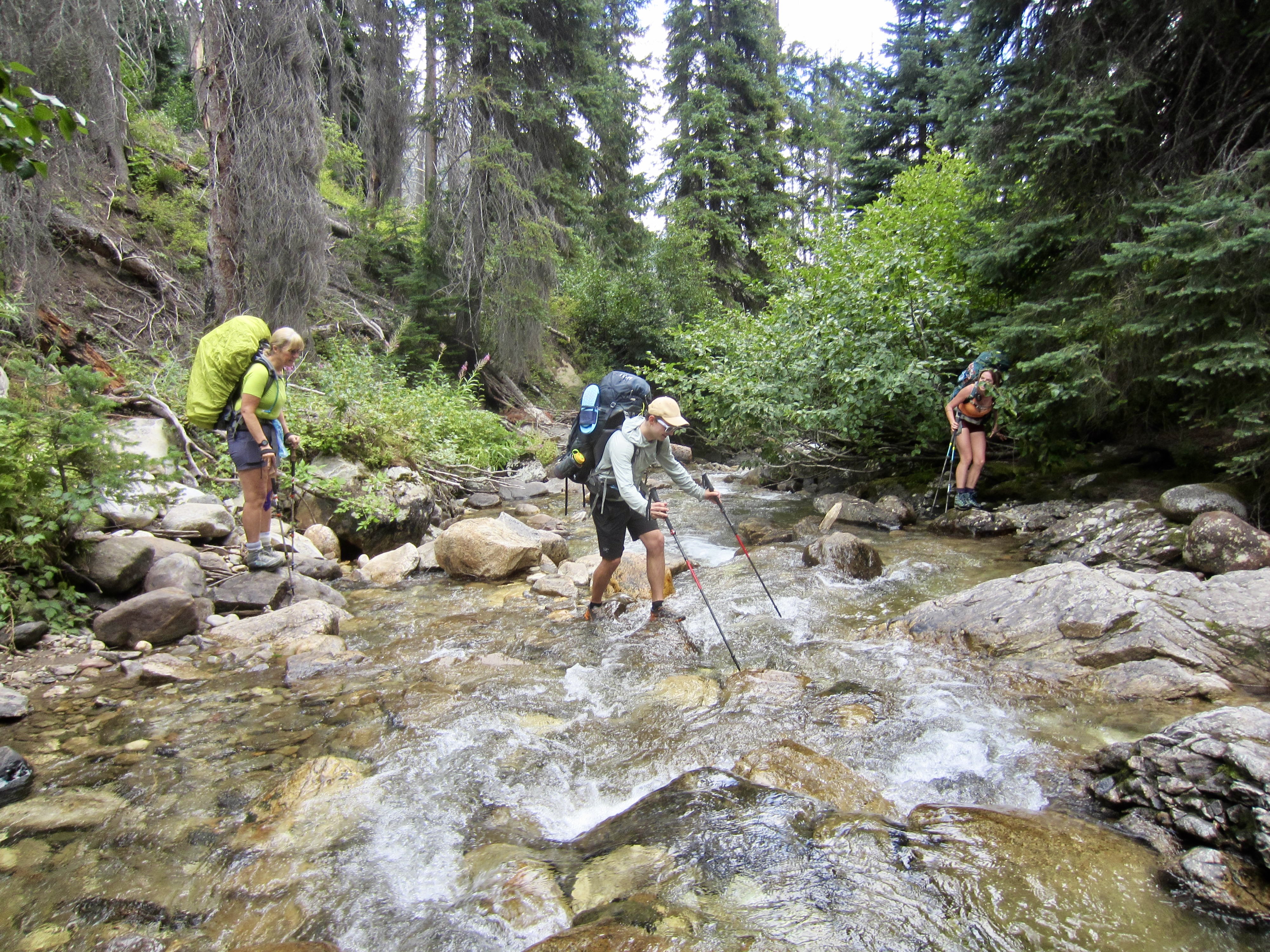
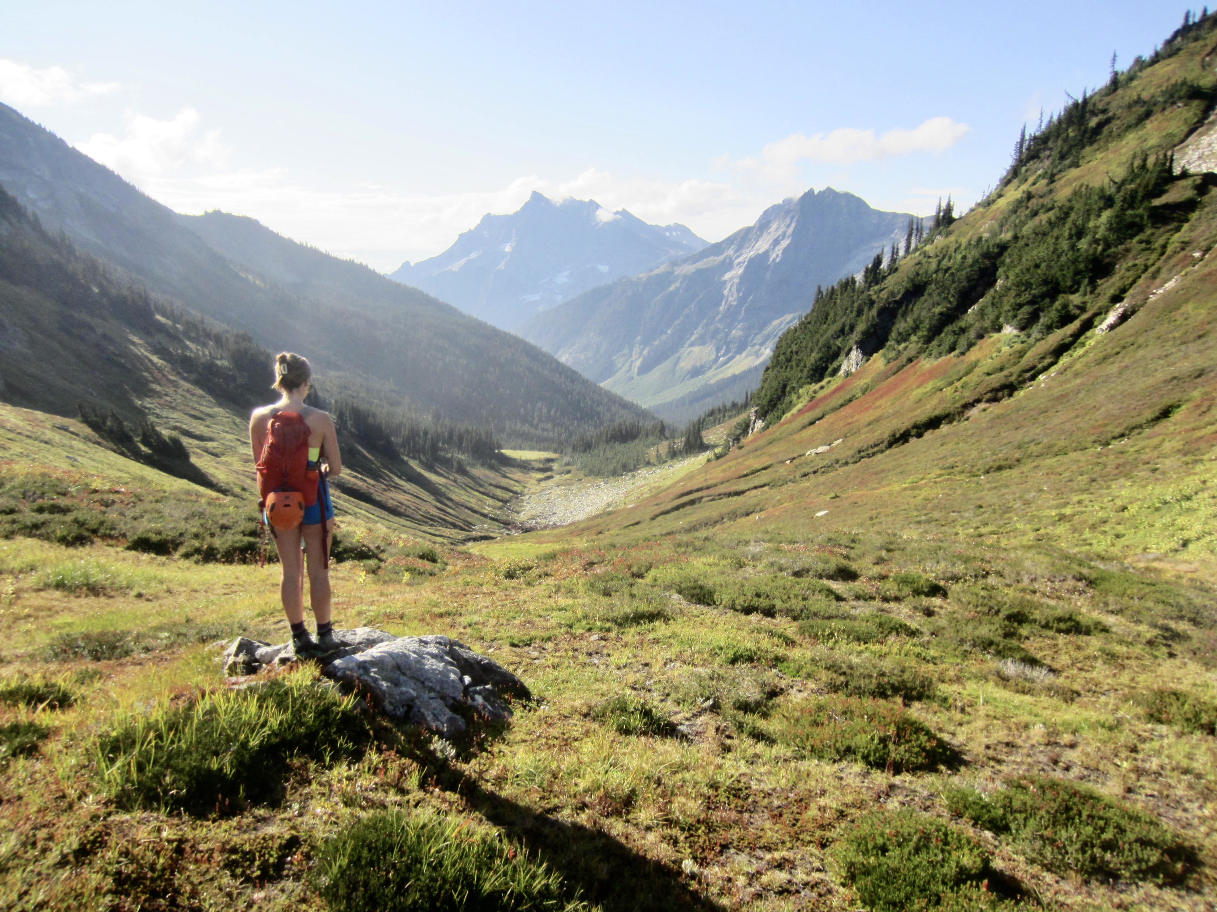
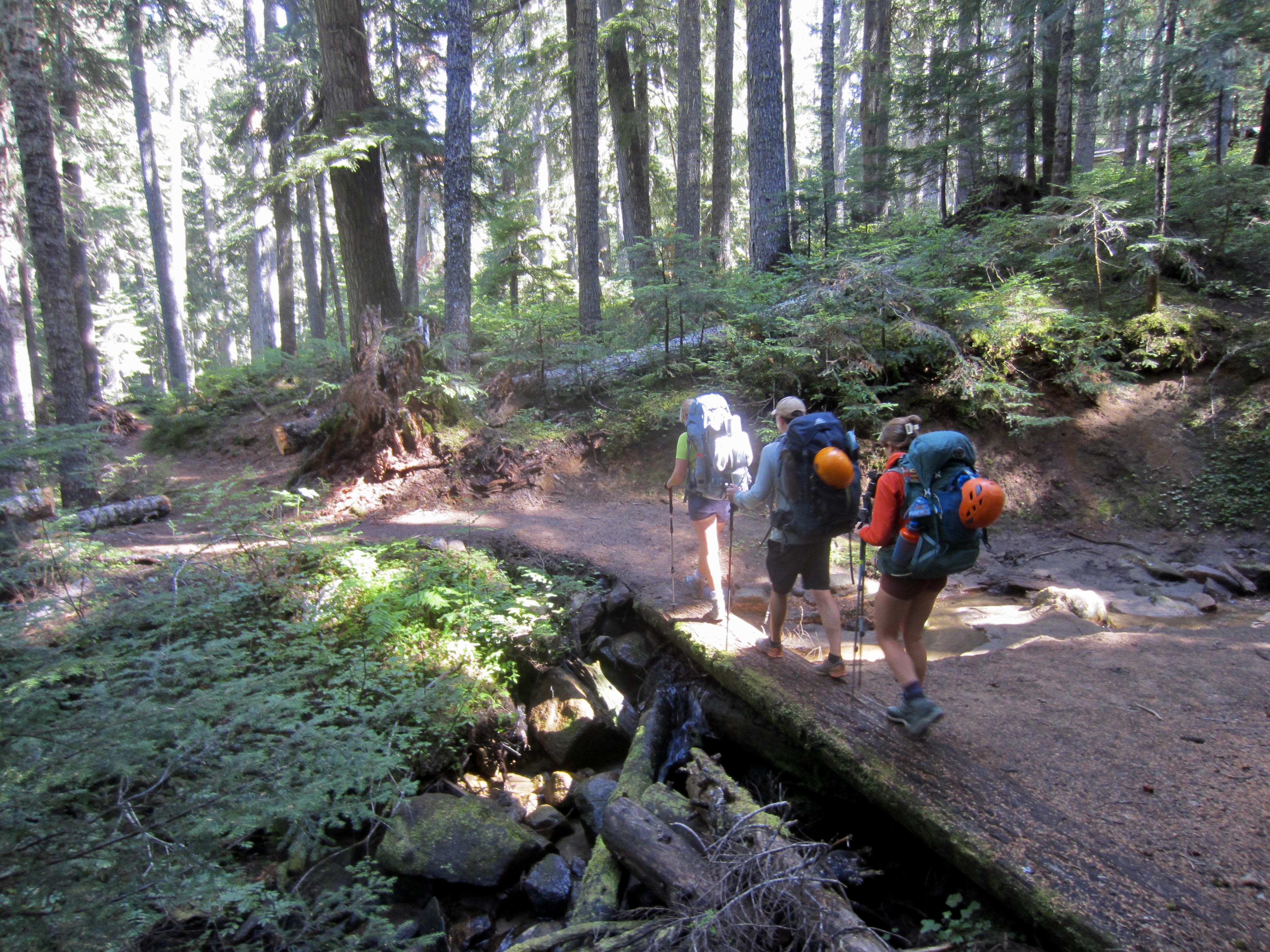
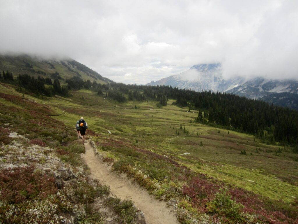
We left the Chiwawa River Trailhead at noon on a partly sunny Thursday and hiked up-valley through the abandoned Trinity Mine townsite. After veering onto the Buck Creek Trail, we came to a crossing of the Chiwawa River. The bridge that formerly spanned the river here had been hanging on by a single stringer for several years and is now completely gone. Fortunately, the late-season water level was low enough to allow rock-hopping, albeit just barely. The alternative would be an easy ford.
.
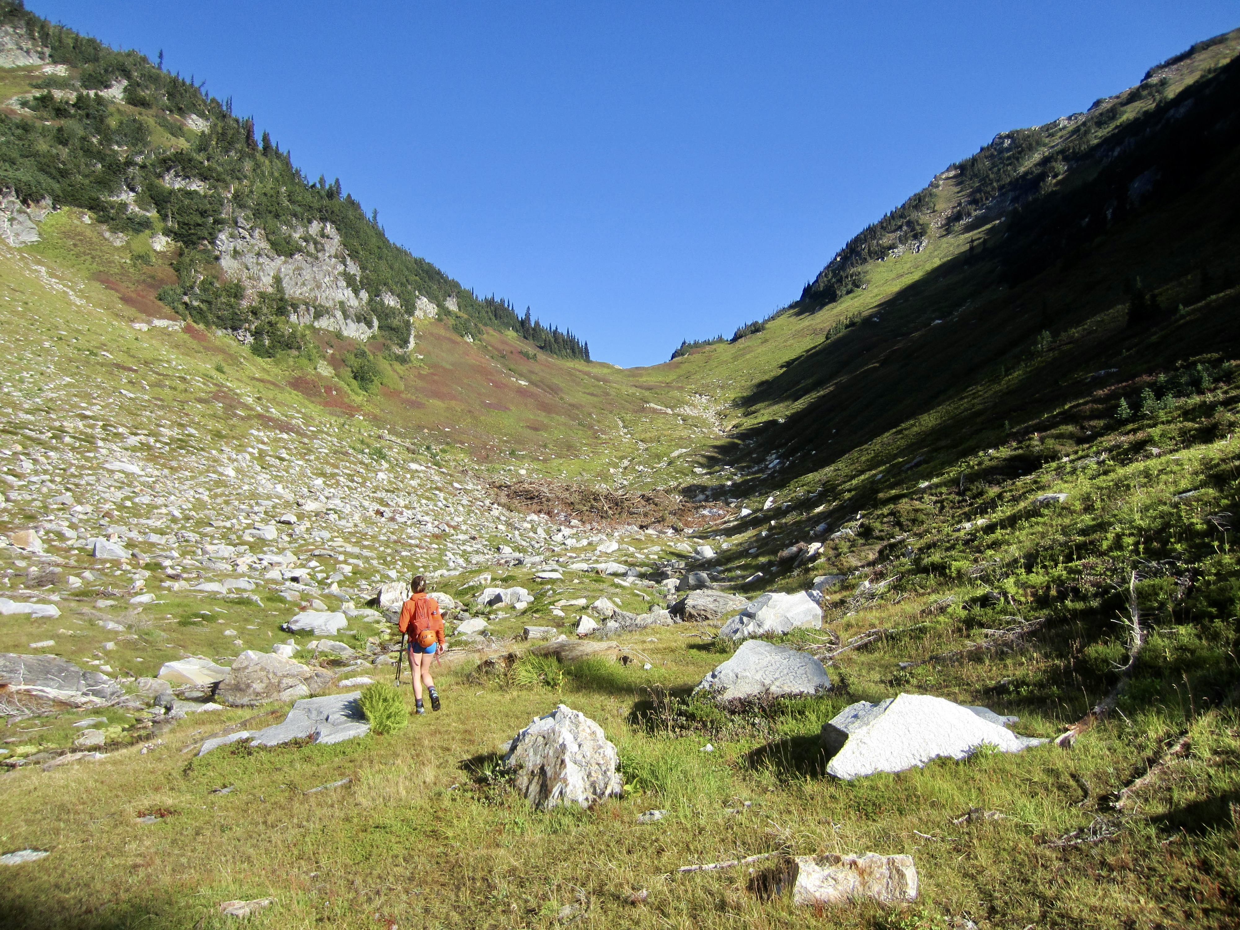
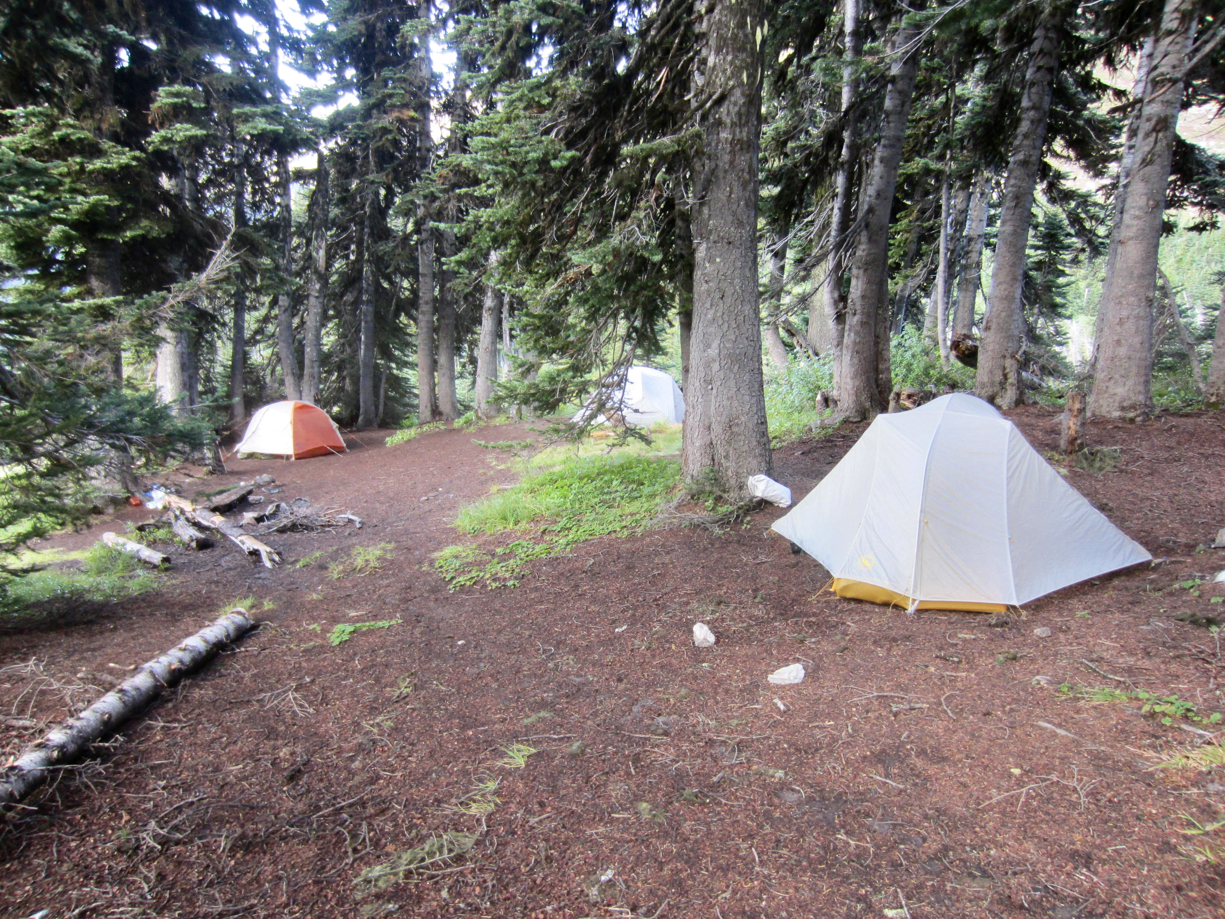
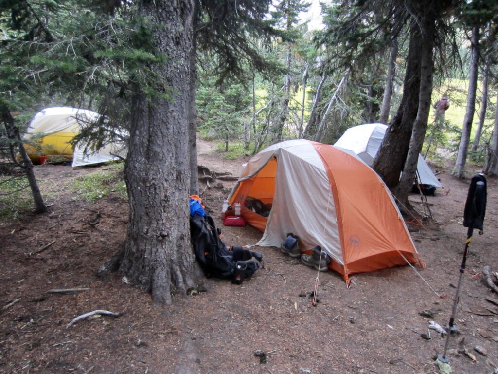
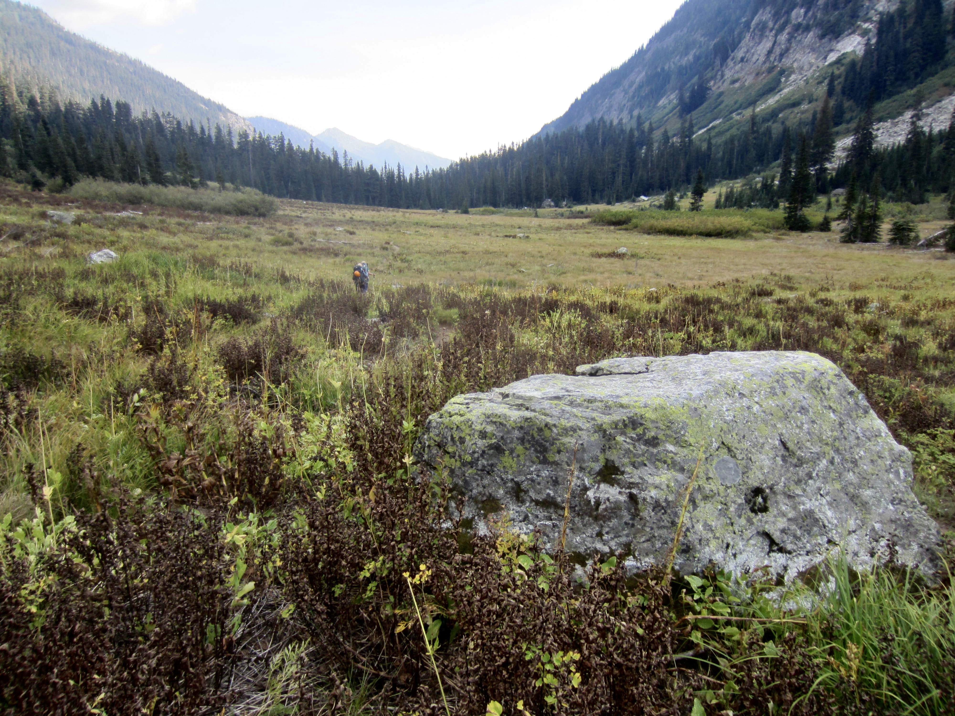
For the next few miles, our trail passed through burned forest resulting from the 2016 Buck Creek Fire. The absence of shade trees made us appreciate the cool air and steadily increasing cloud cover. Upon re-entering green forest, we continued another few miles to the headwaters of Buck Creek. At the first creek branch, we stepped off the trail and headed uphill on a bootpath that soon faded away, leaving us to plunge through dense huckleberry bushes. A better bootpath to our left (west) led us to a roomy campsite at the lower edge of Pass No Pass Basin (5.8 hours + 3250 feet from TH).
.
Day 2 (AM & early PM): Fortress Mtn Summit Climb
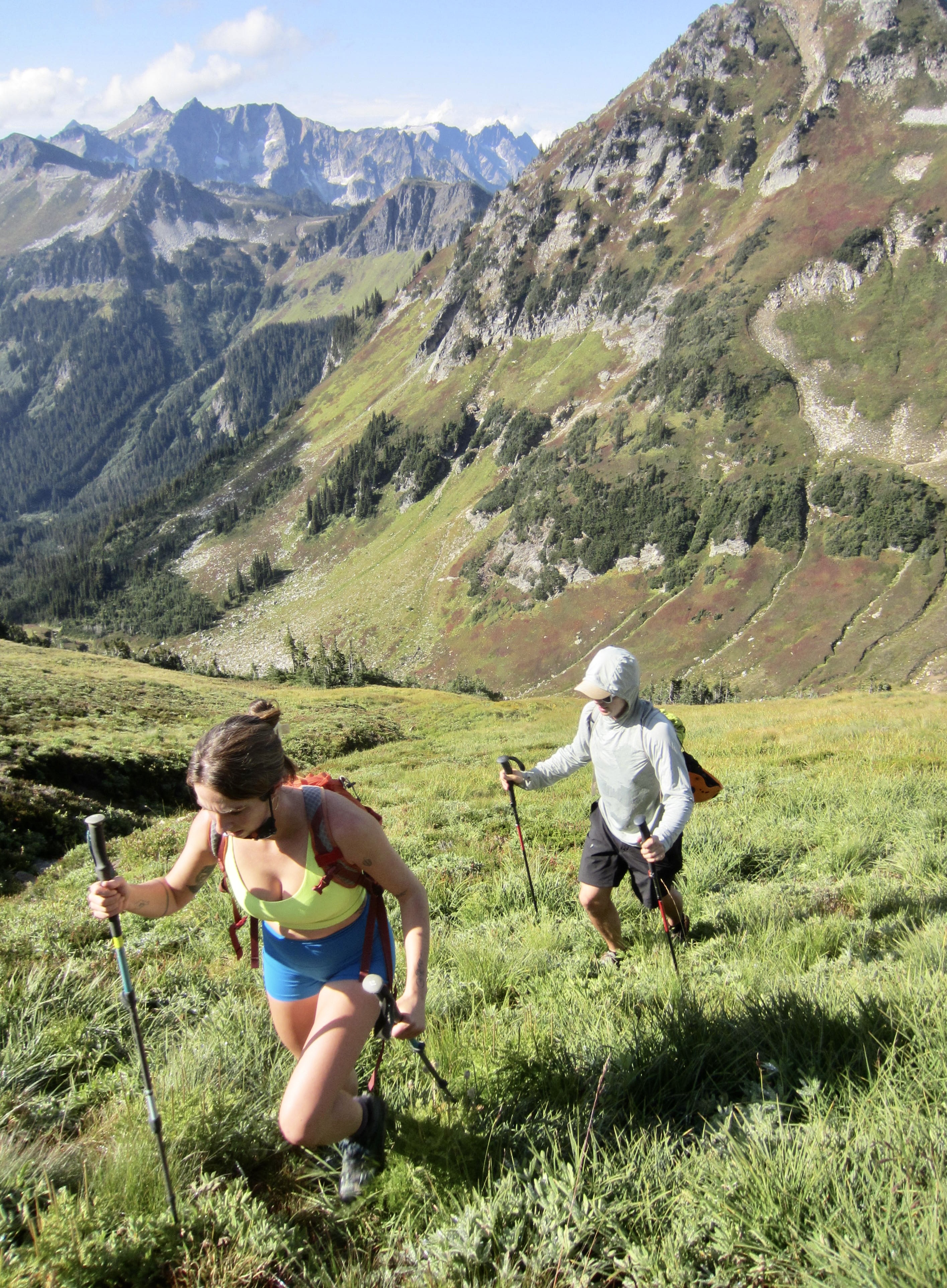
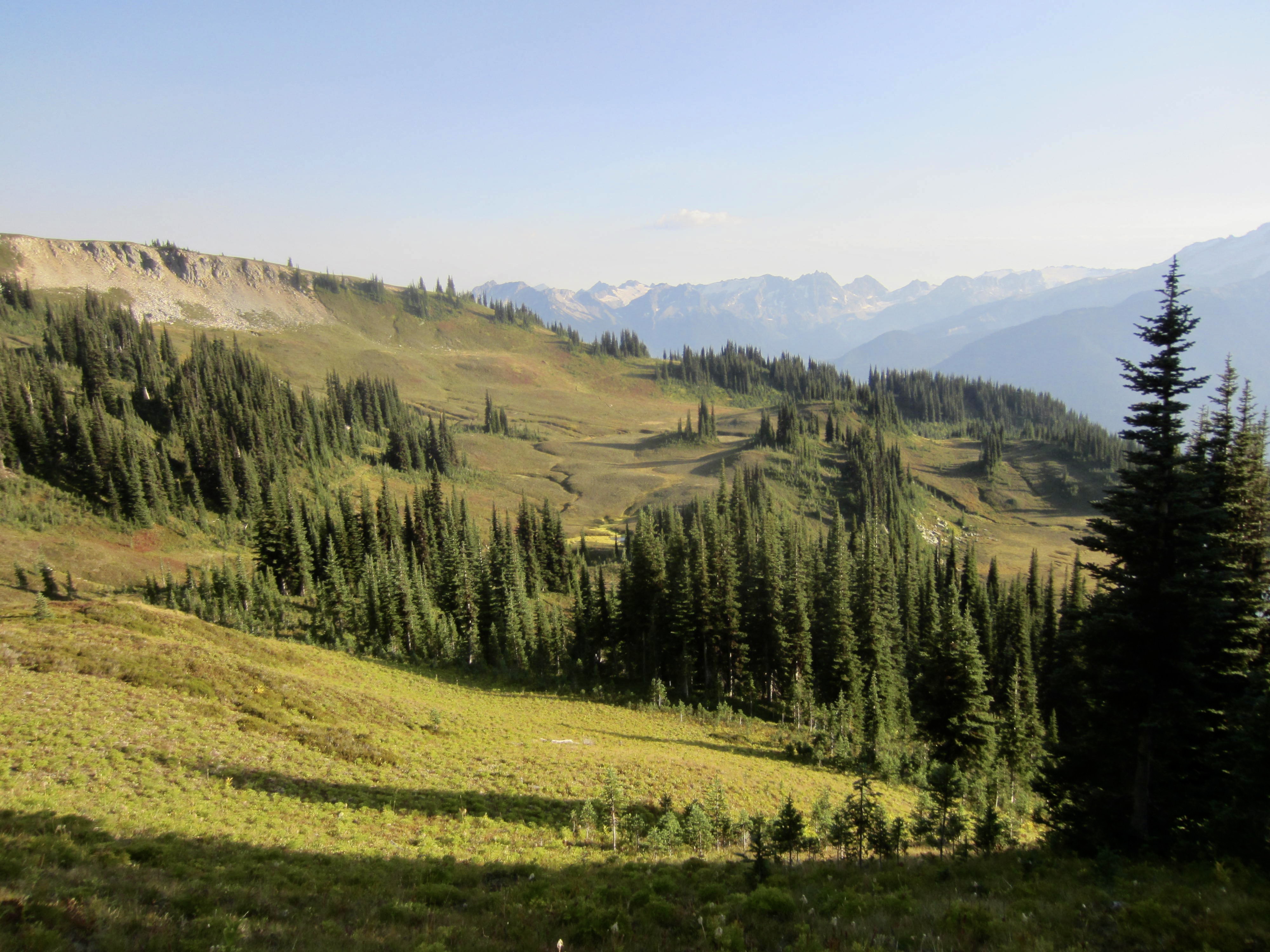
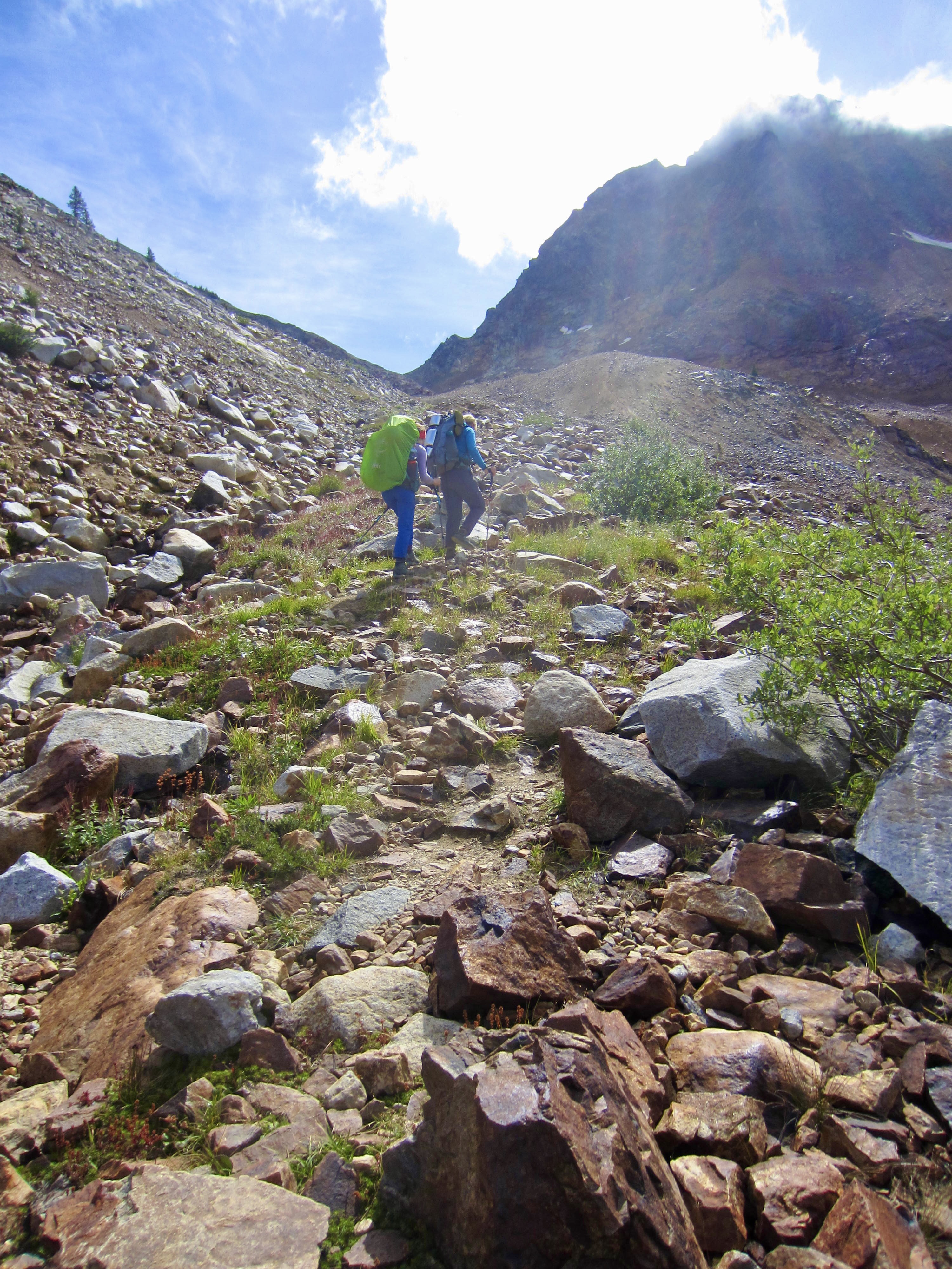
After a night of light rain, the morning brought us a bright blue sky. We loaded summit packs and headed out of camp, following a discontinuous path through the delightful basin below Pass No Pass. This grassy pass earned its unusual name because it has an invitingly gentle slope on the southern side but an uninvitingly steep slope on the northern side.
.
.
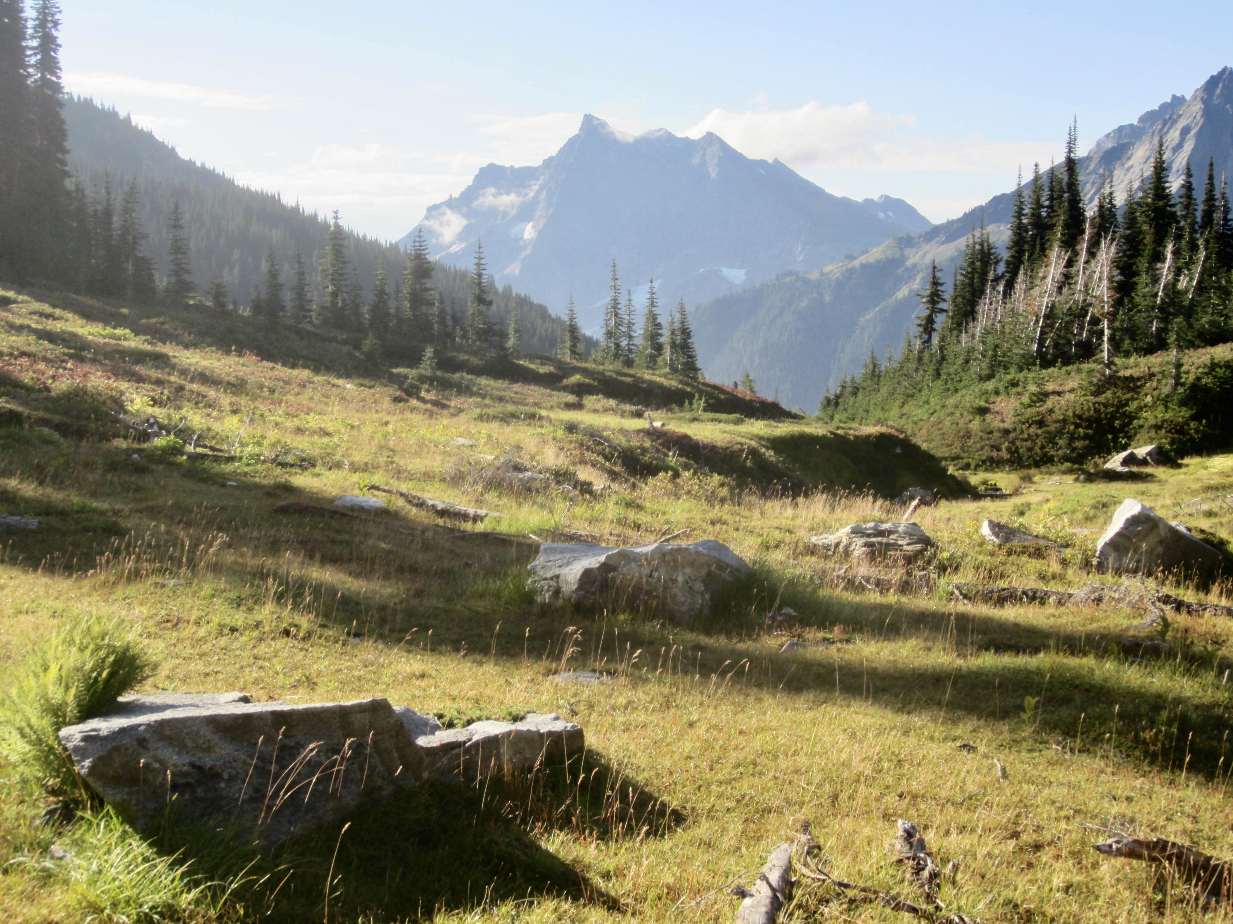
From Pass No Pass, we turned right and ascended green slopes easterly toward Fortress Mountain. Heather and grass transitioned to scree and talus as we gained elevation and eventually got a look at the mountain’s summit ridge.
.
.
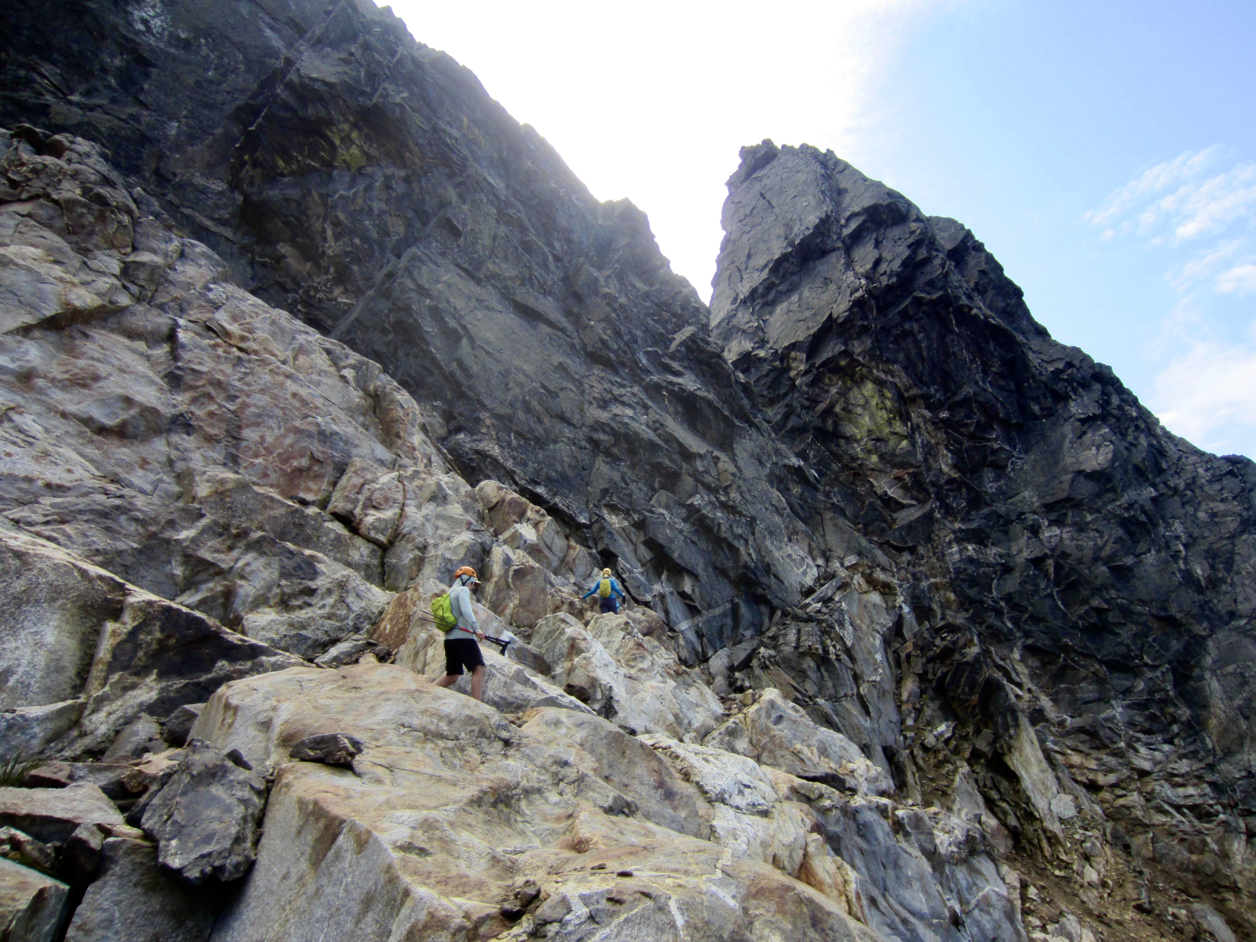
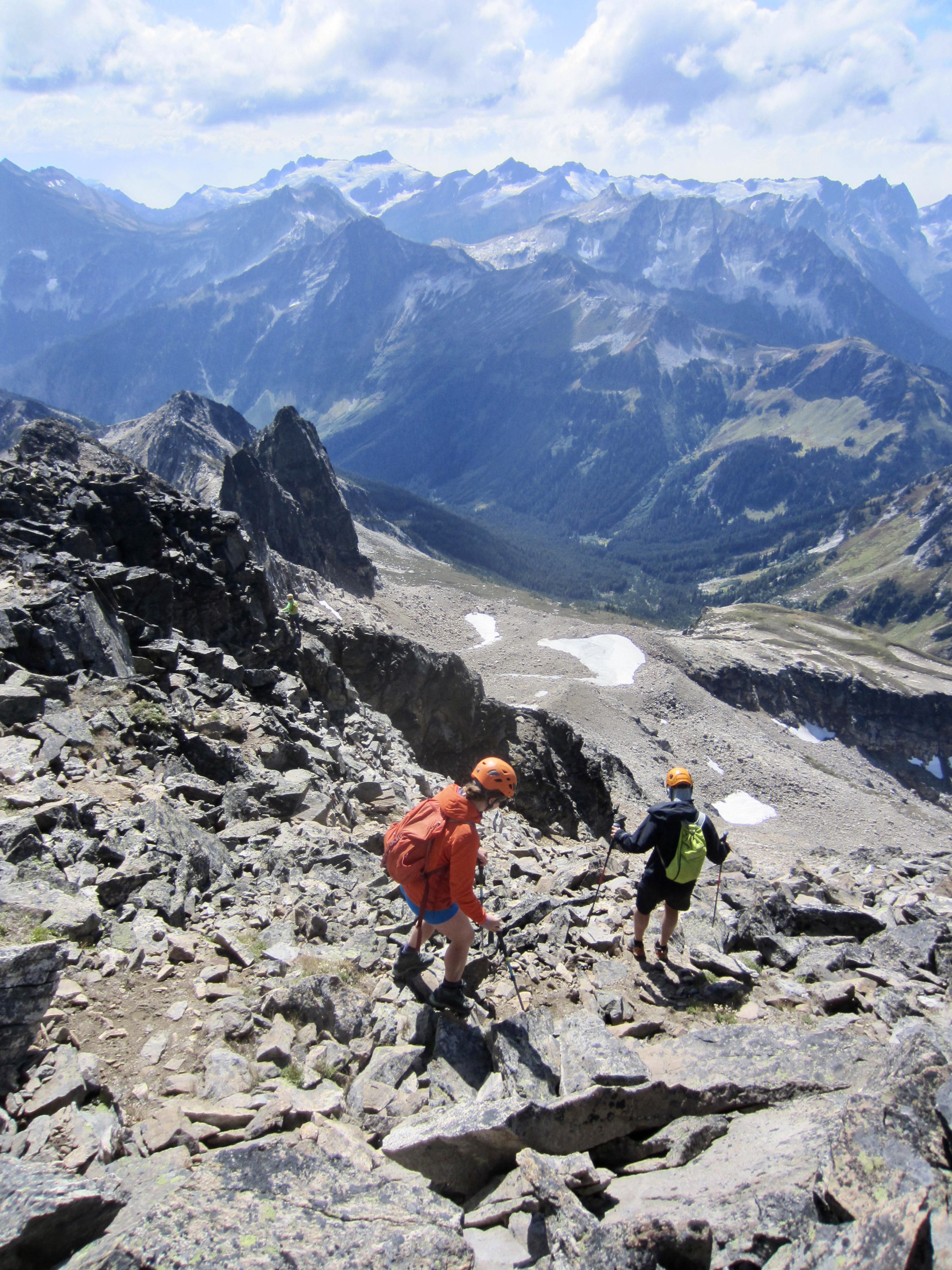
The broad southwest face of Fortress Mountain looks steep, loose, and unappealing, so we angled over to the right on slabby Class 3 rock in a search for better conditions. Upon butting up against a steep cliff beneath Point 8432, we turned left and scrambled up the mountain’s south ridge and upper southwest face on Class 2-3 rock.

.
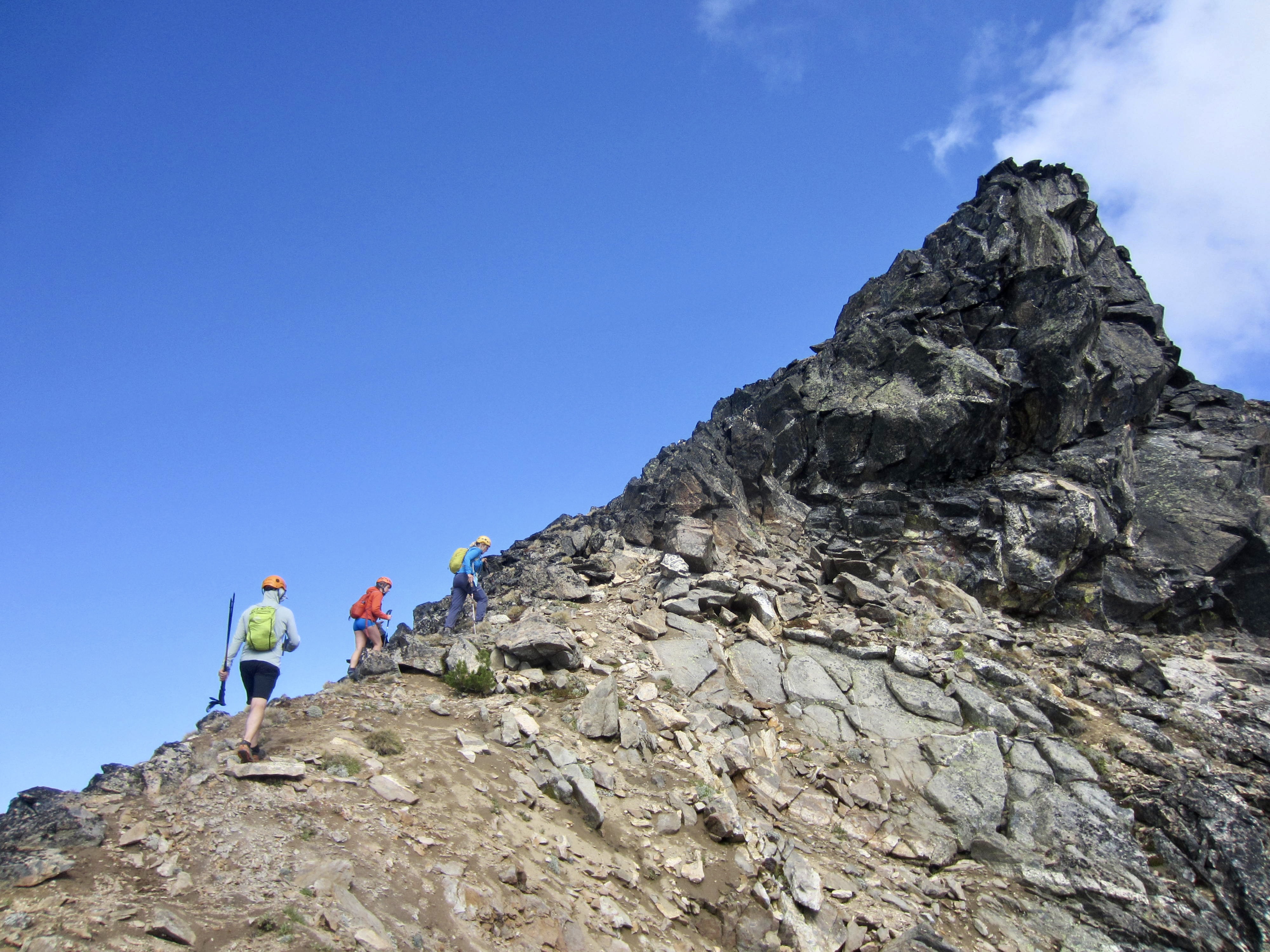
.
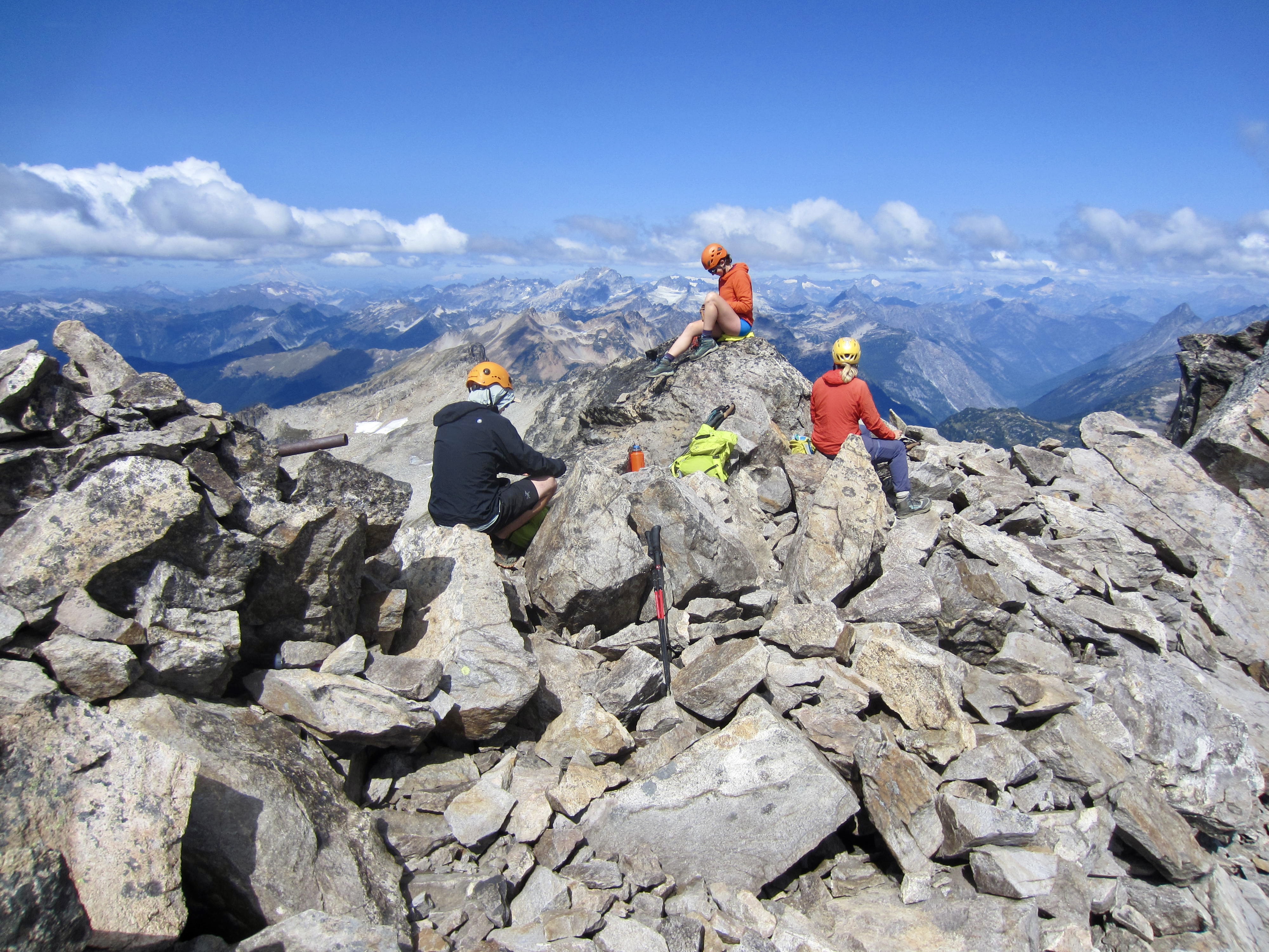
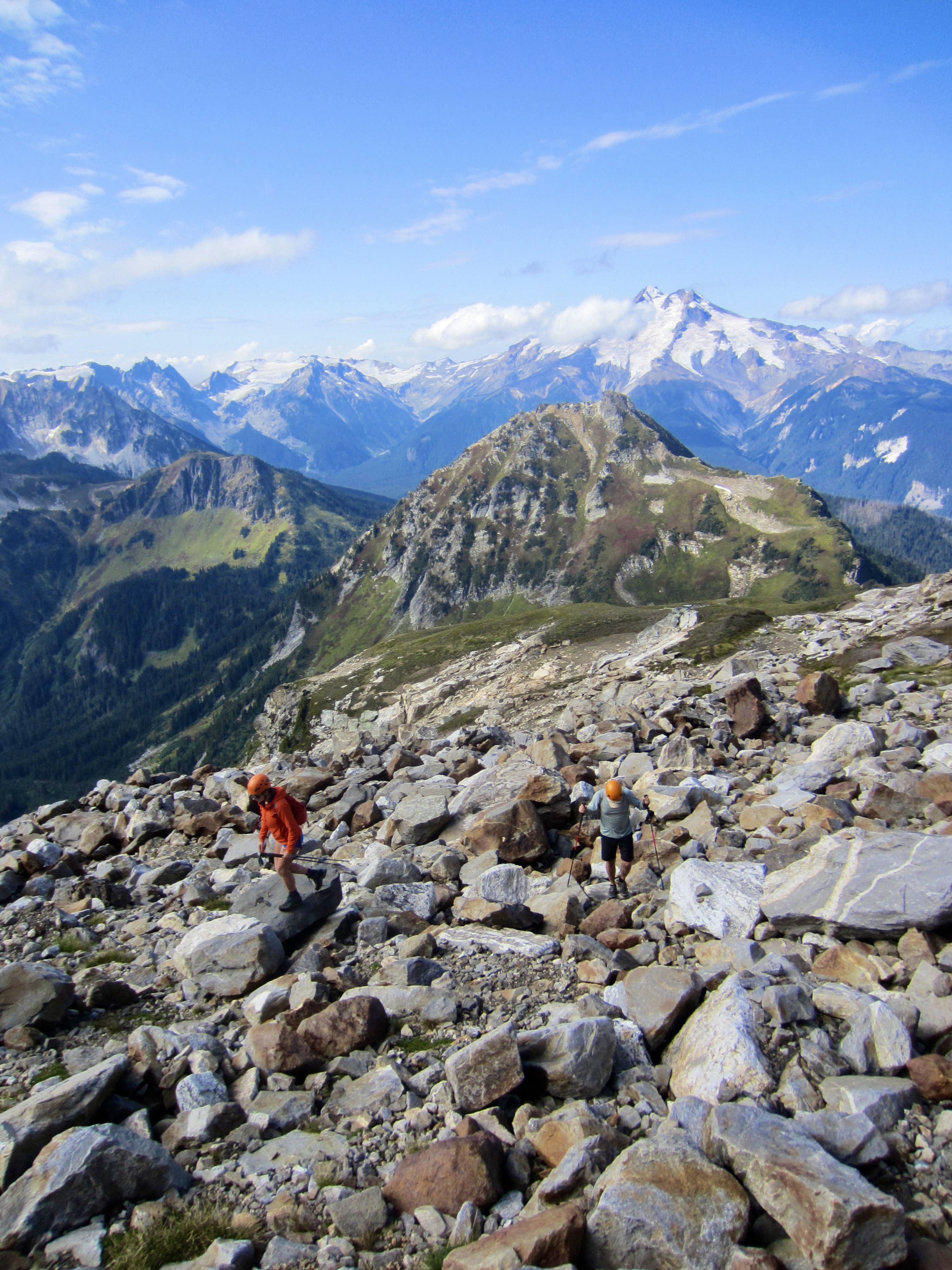
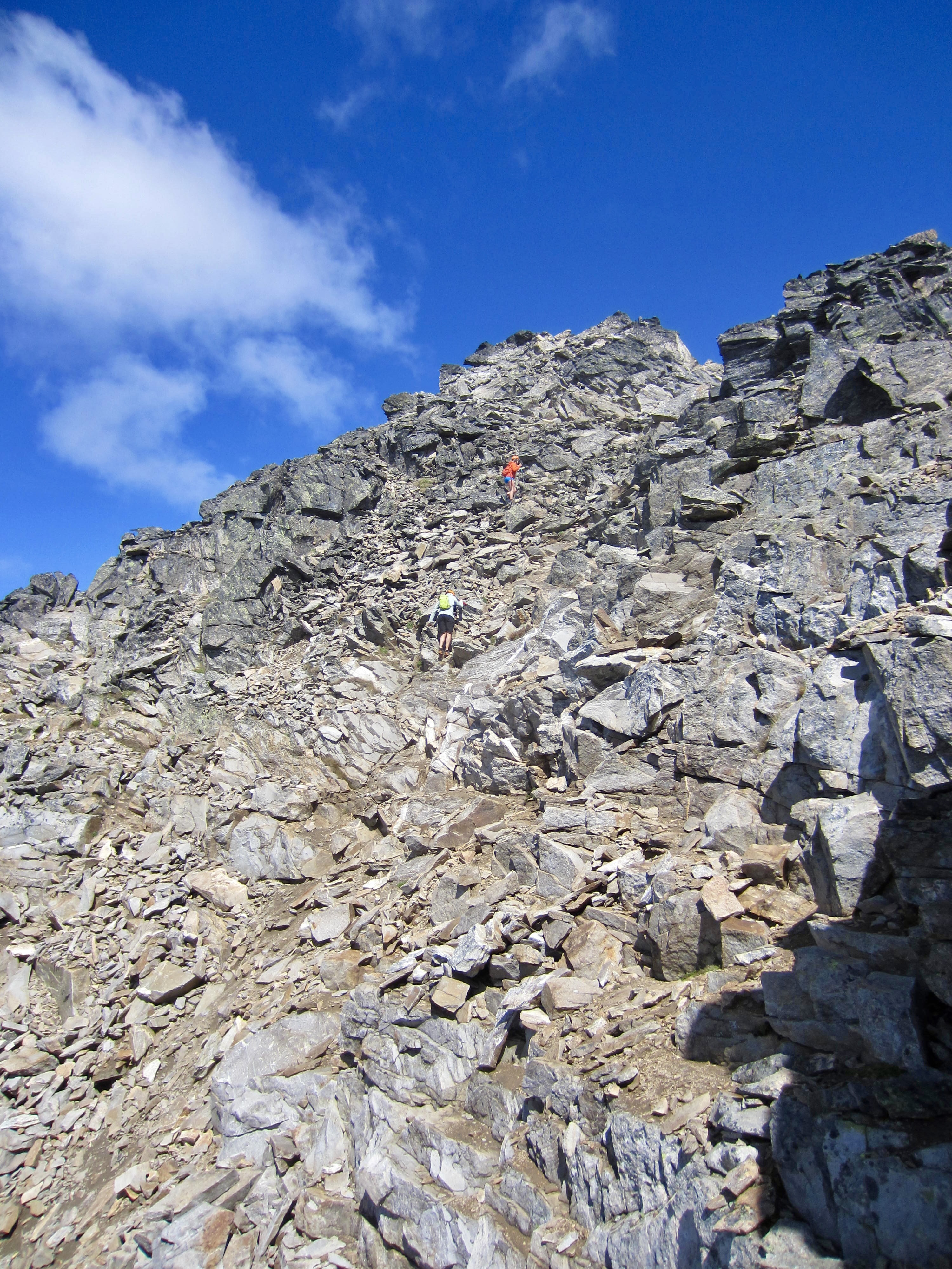
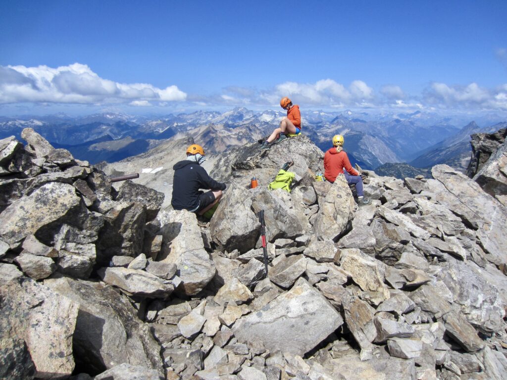
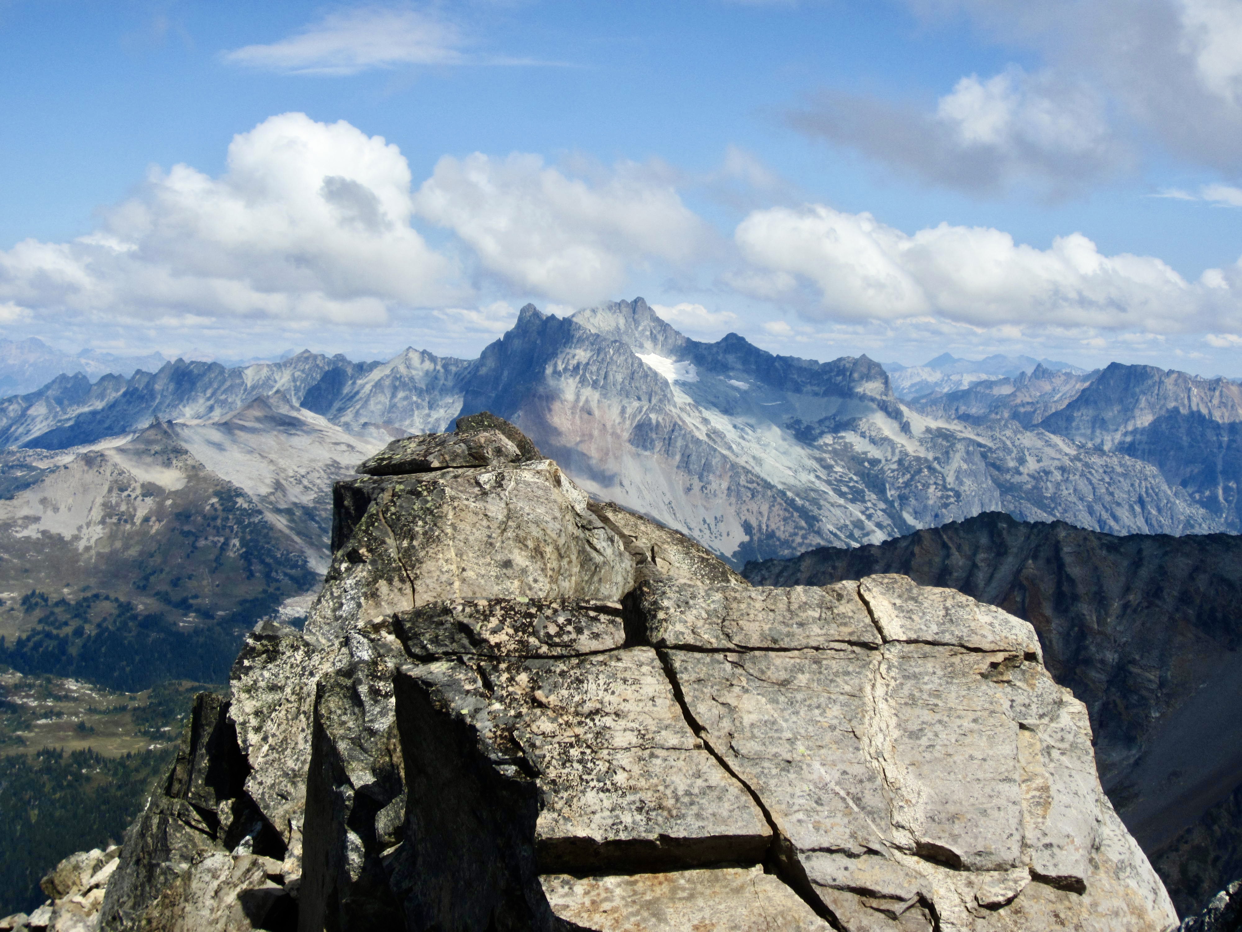
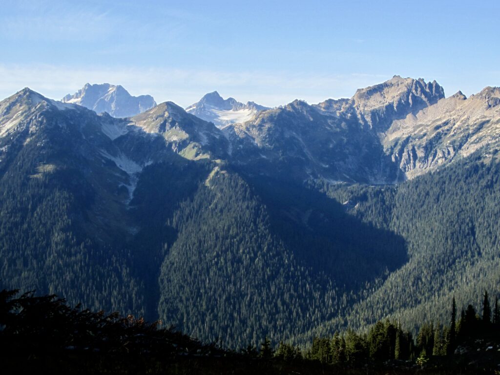
We topped out in early afternoon (3.7 hours + 2800 feet from camp) and enjoyed better-than-expected views, thanks to a cold wind that had pushed out most of the prevailing wildfire smoke. A new register notebook stashed in the large summit cairn showed fairly regular weekly ascents throughout this summer.
.
.
To descend, we stayed farther to the right (west) of our up-track and found that the broad southwest face is indeed steep and loose but fairly straightforward. Numerous bits of boot tread on this face indicated that it serves as the standard (but uninteresting) ascent and descent route. Farther downhill, we dropped into Pass No Pass Basin more directly and arrived back in camp at 4:00pm (2.7 hours from summit).

.
Day 2 (late PM): Pass No Pass Basin to Small Creek
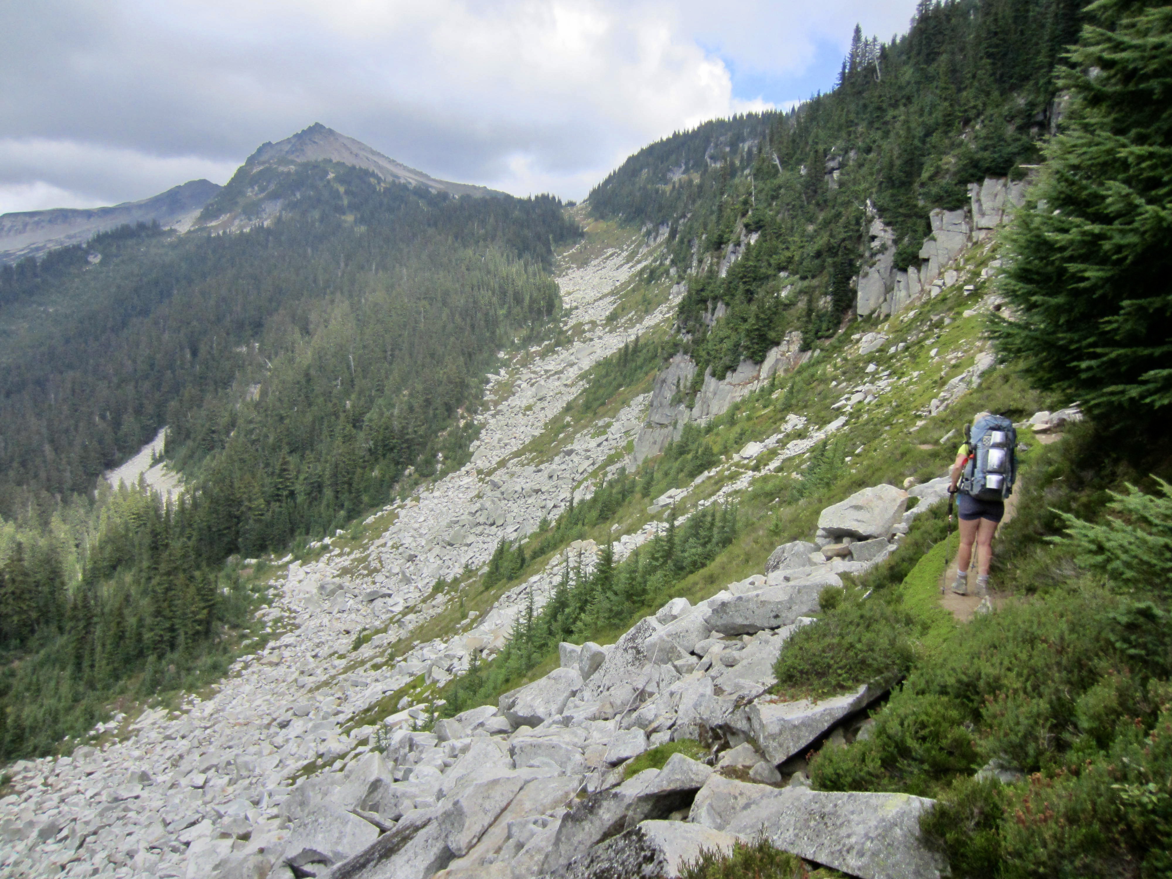
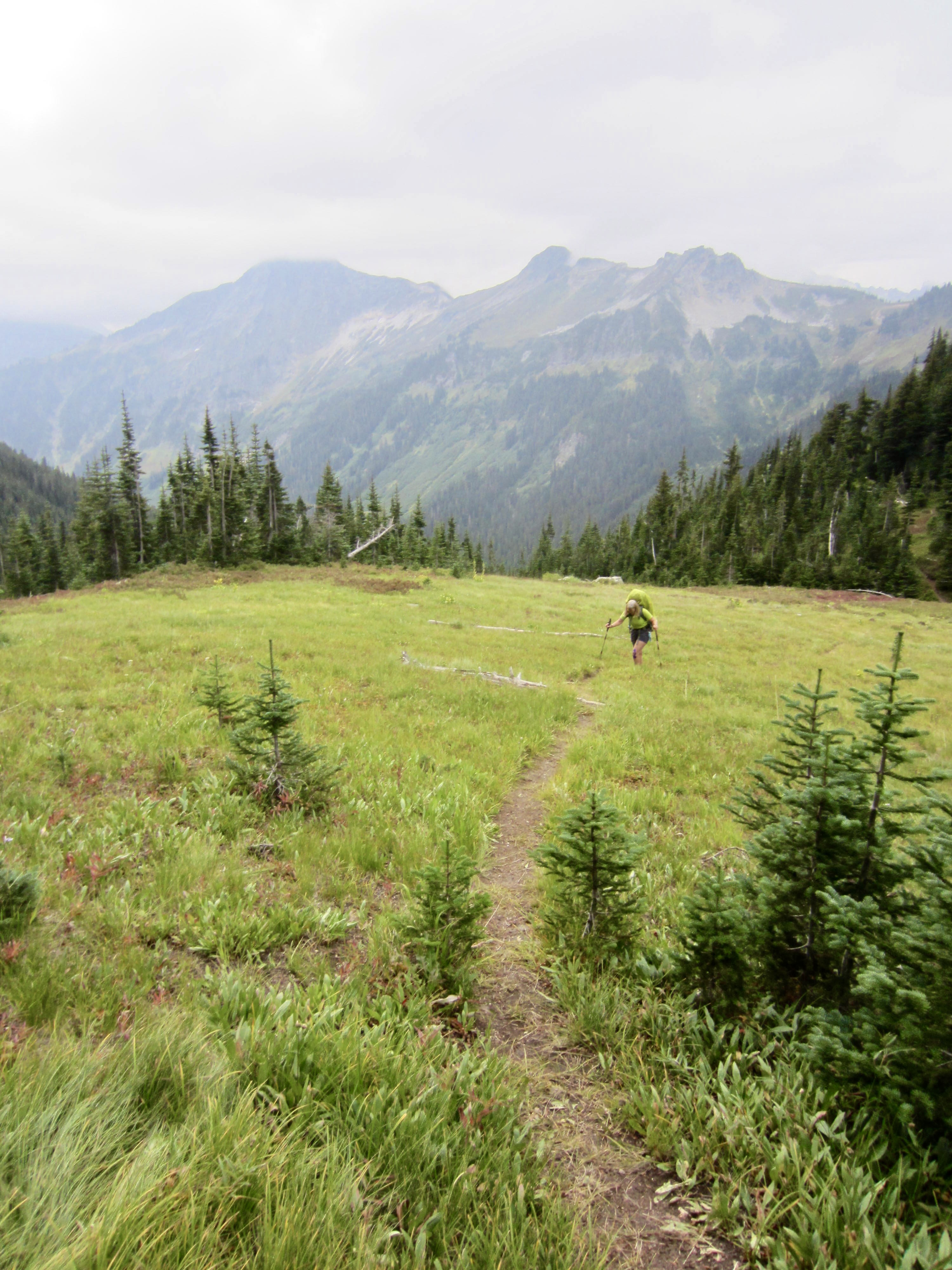
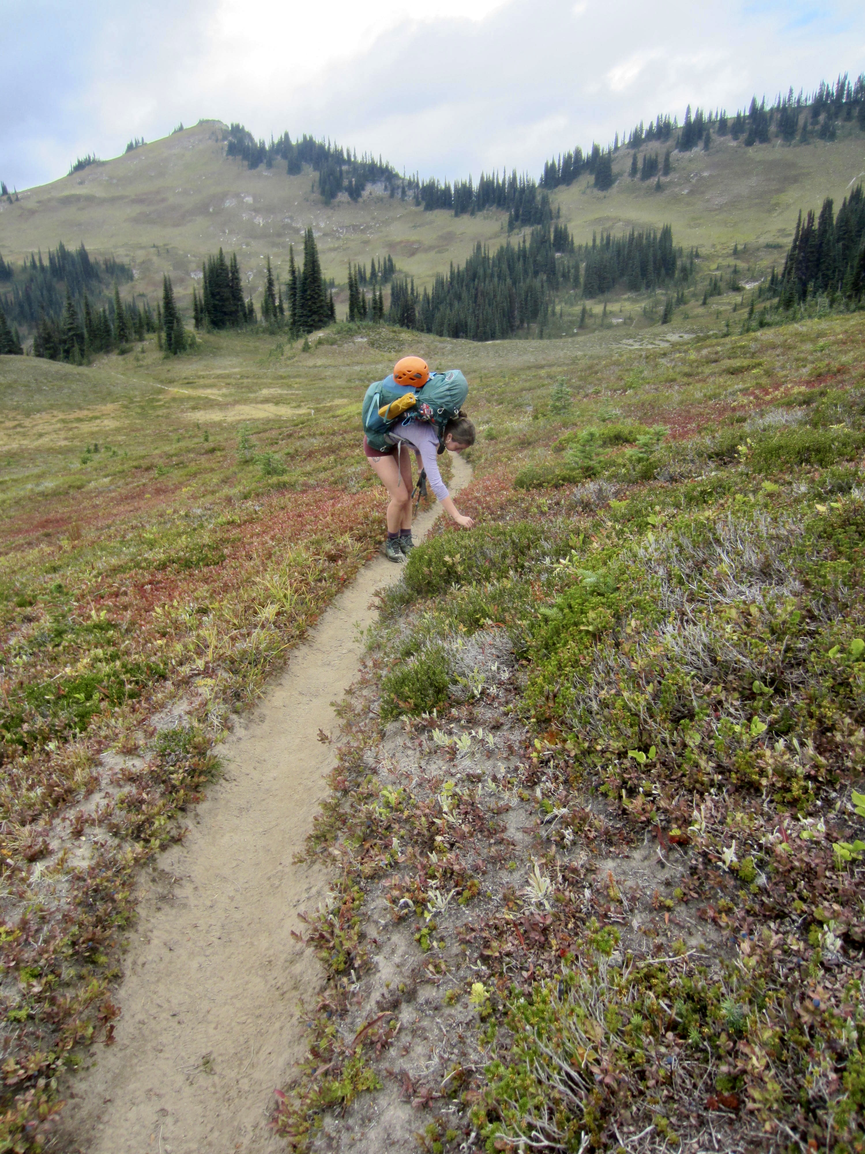
Wanting to get a few miles behind us today, we quickly broke camp and hiked back down to the main trail by following a well-defined climber’s path through the brush. (When coming up the main trail, go beyond the first branch of Buck Creek and look for this path just before crossing the second branch.) We hiked over colorful Buck Creek Pass, stopping frequently to dine on ripe huckleberries, then descended to a nice campsite beside Small Creek (1.3 hours + 350 feet from Camp 1).

.

.
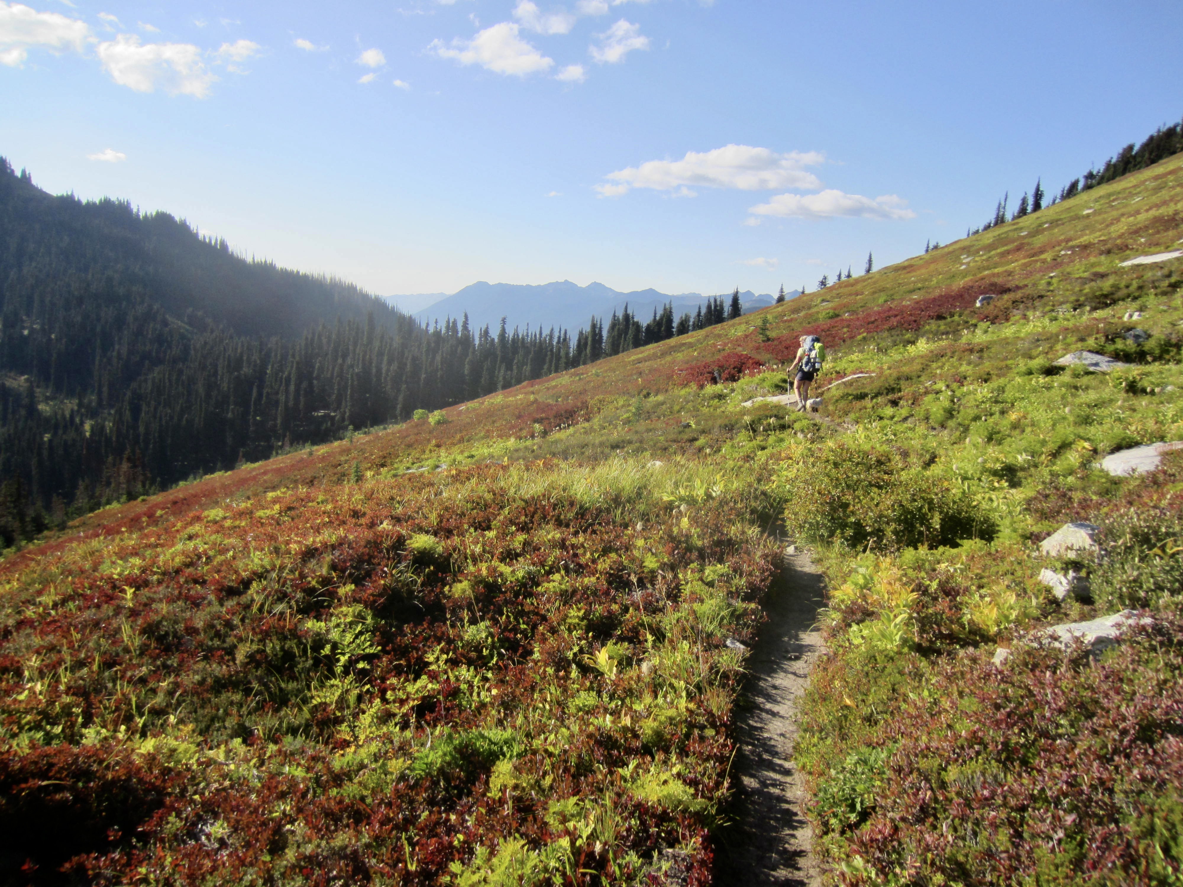
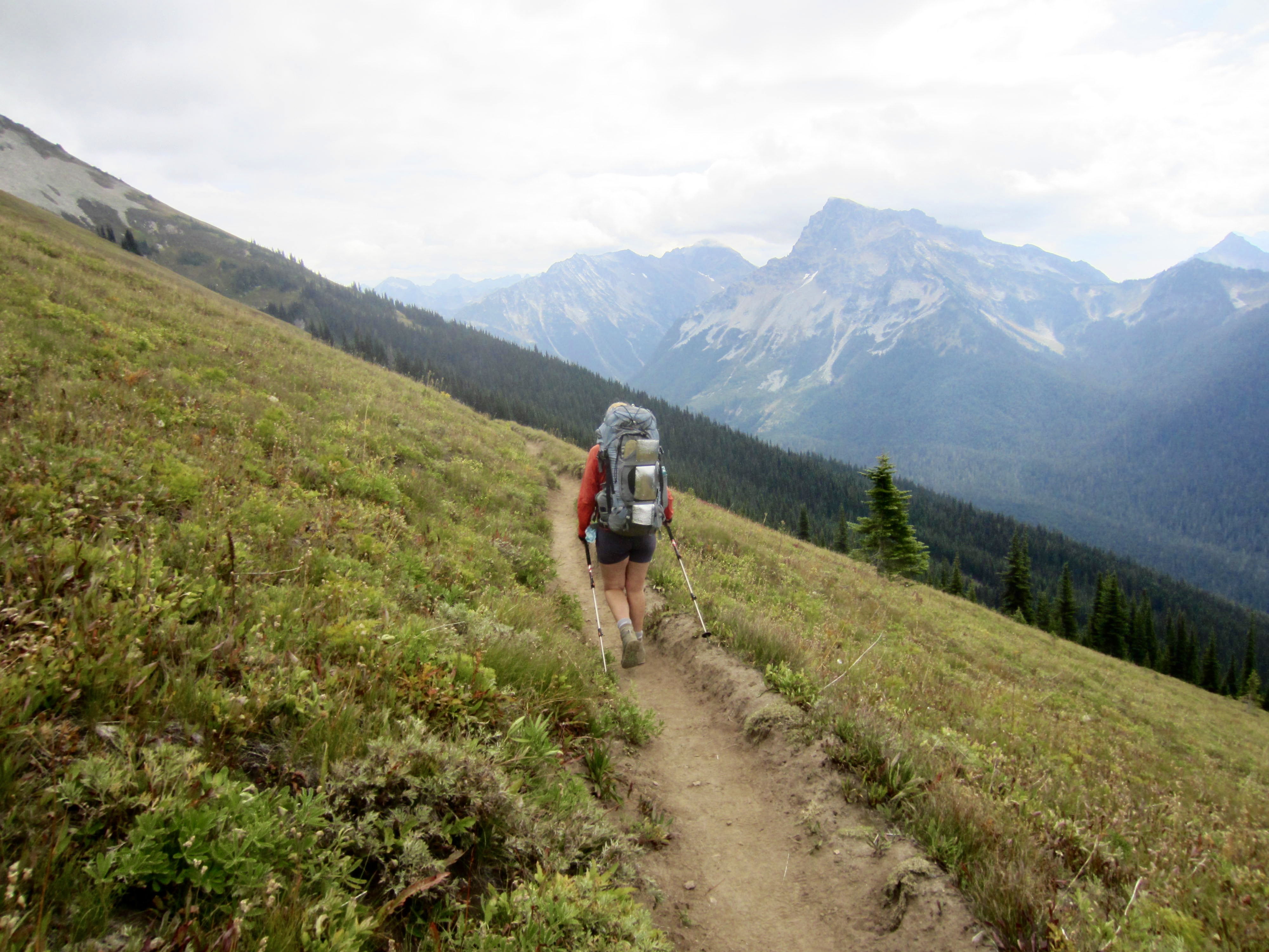
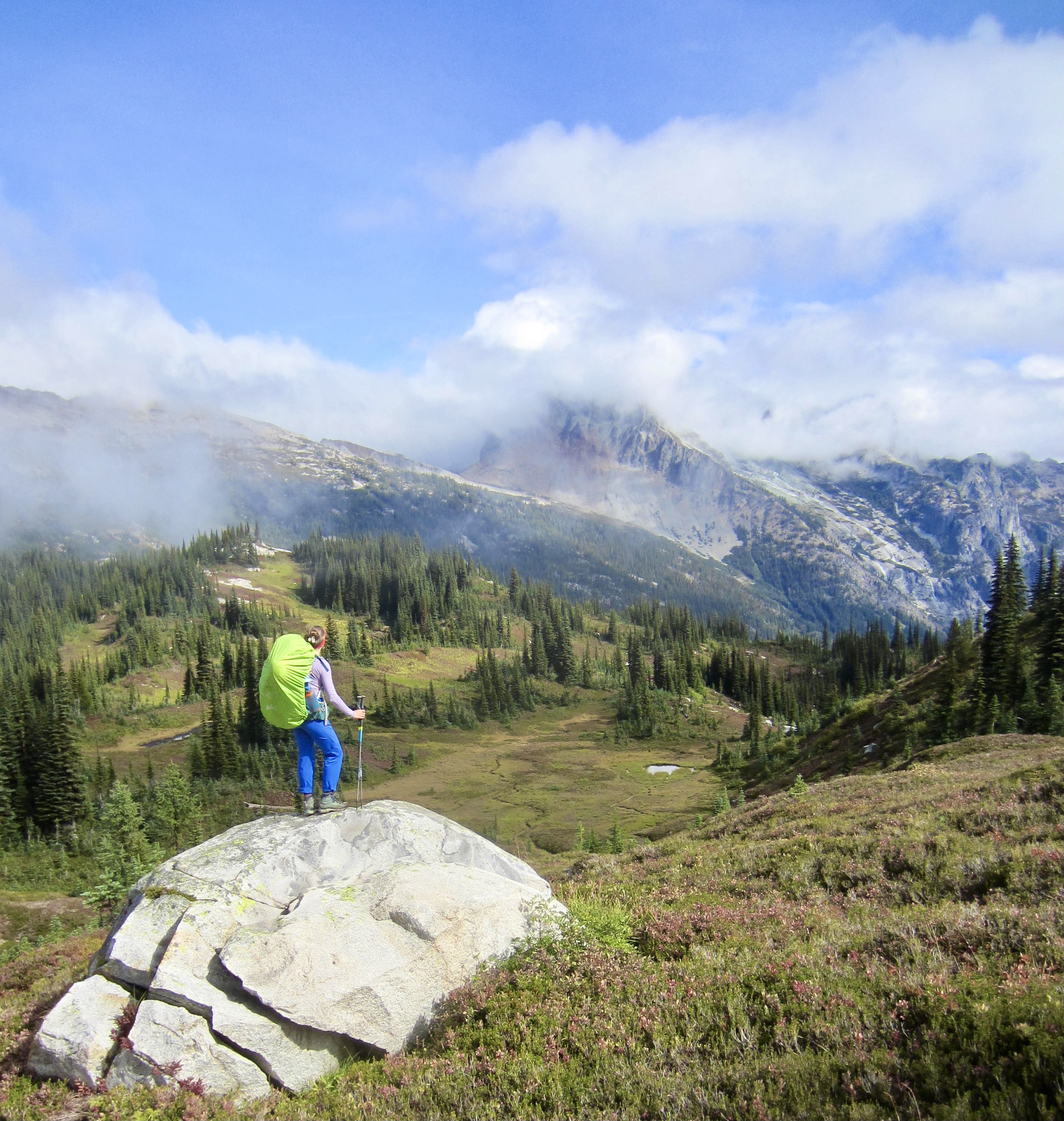
Day 3: Small Creek to Image Lake + Miners Pass
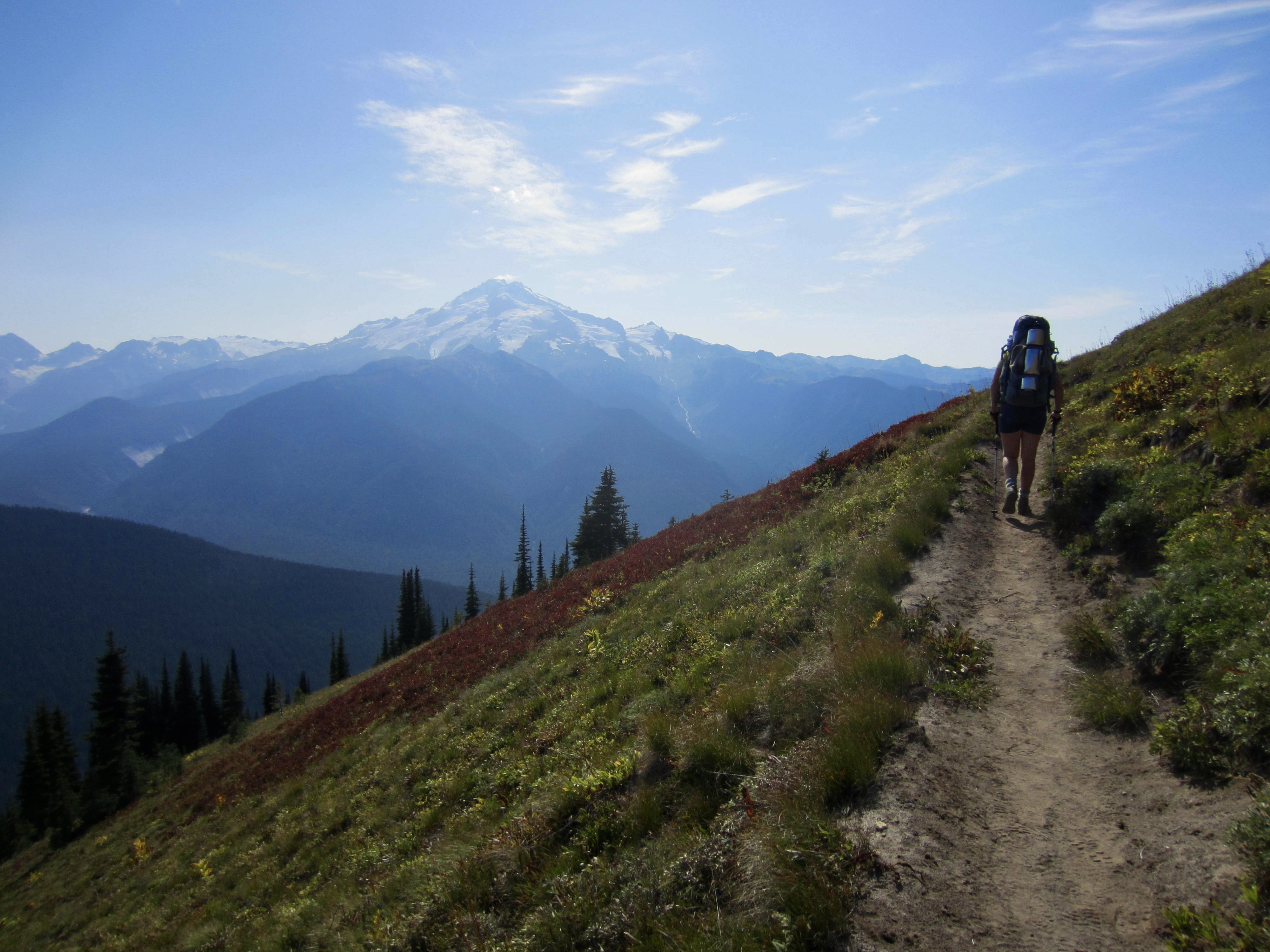
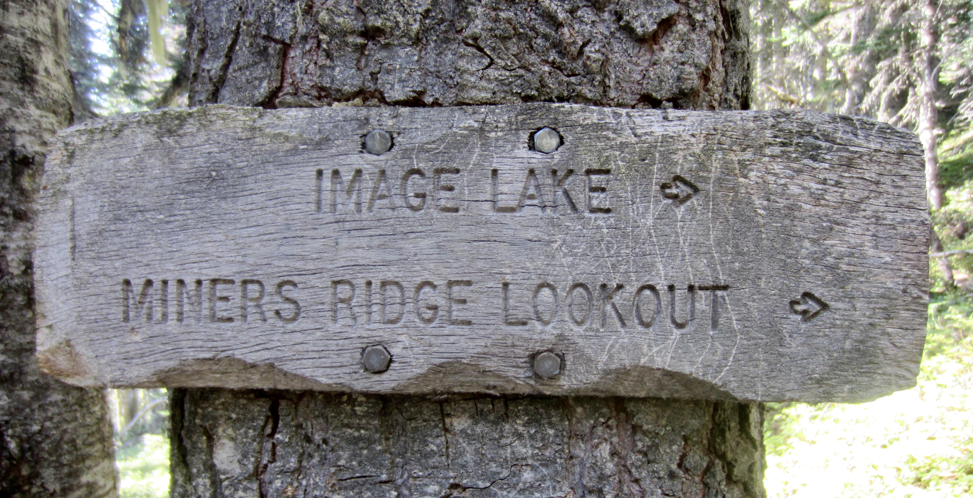
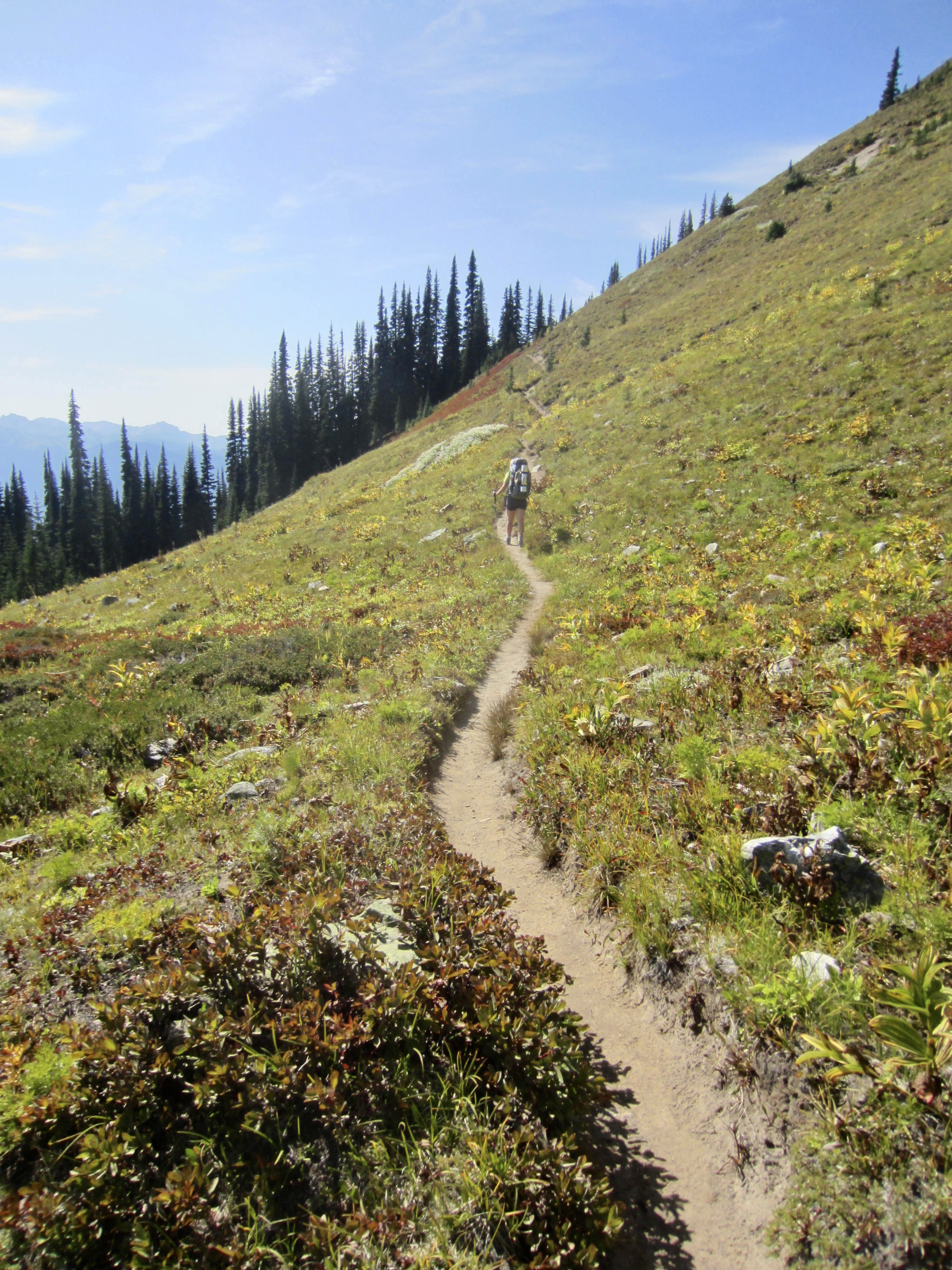
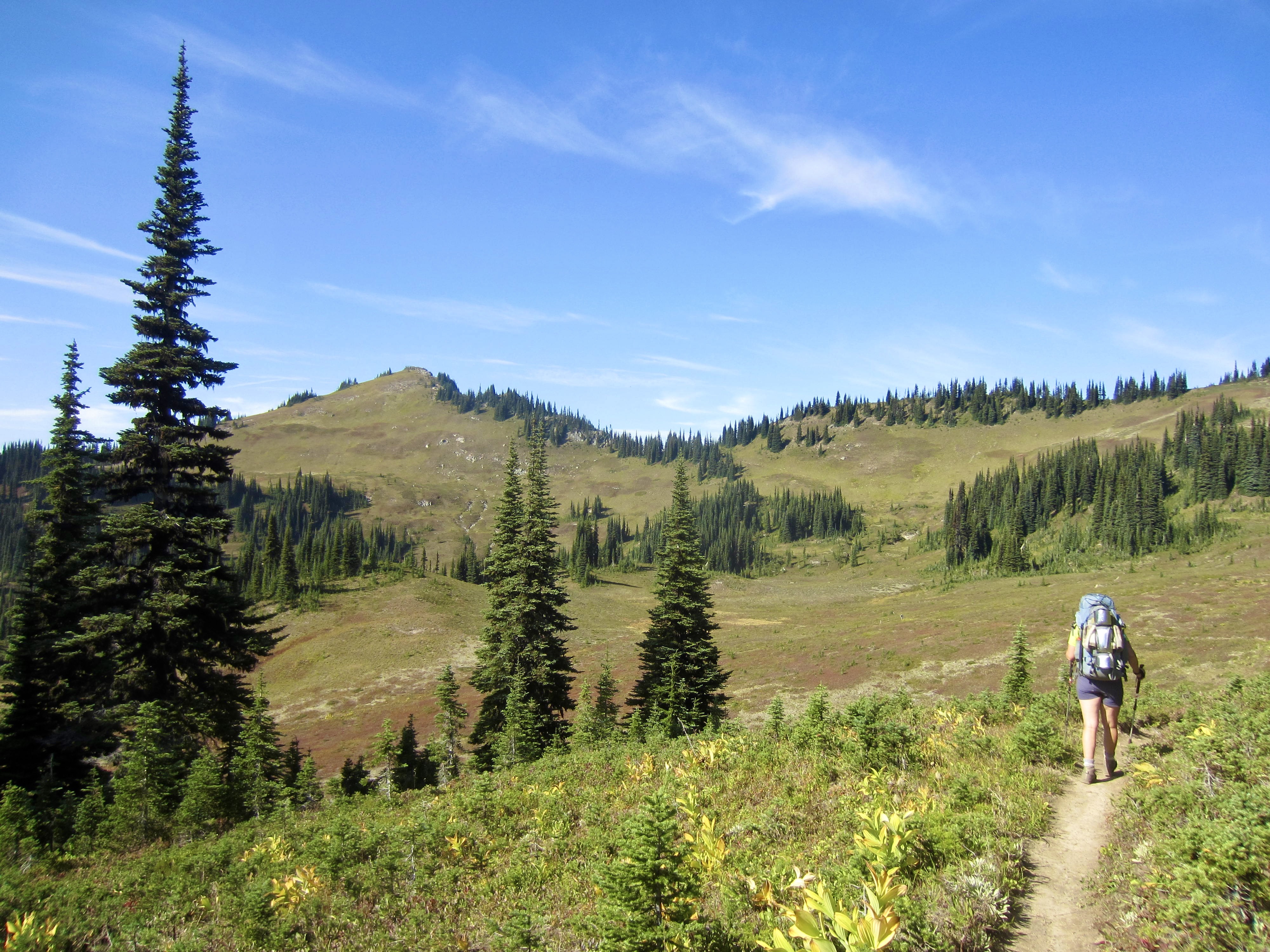
Today began with a steep hike up to Middle Ridge, followed by a long descent into Miner’s Creek Valley, where we joined the Pacific Crest Trail. Another ascent brought us to a junction with the Miner’s Ridge Trail. Hiker traffic increased considerably on these latter two trails, prompting Brooke and Andrew to hurry ahead in hopes of securing a good campsite at Image Lake.
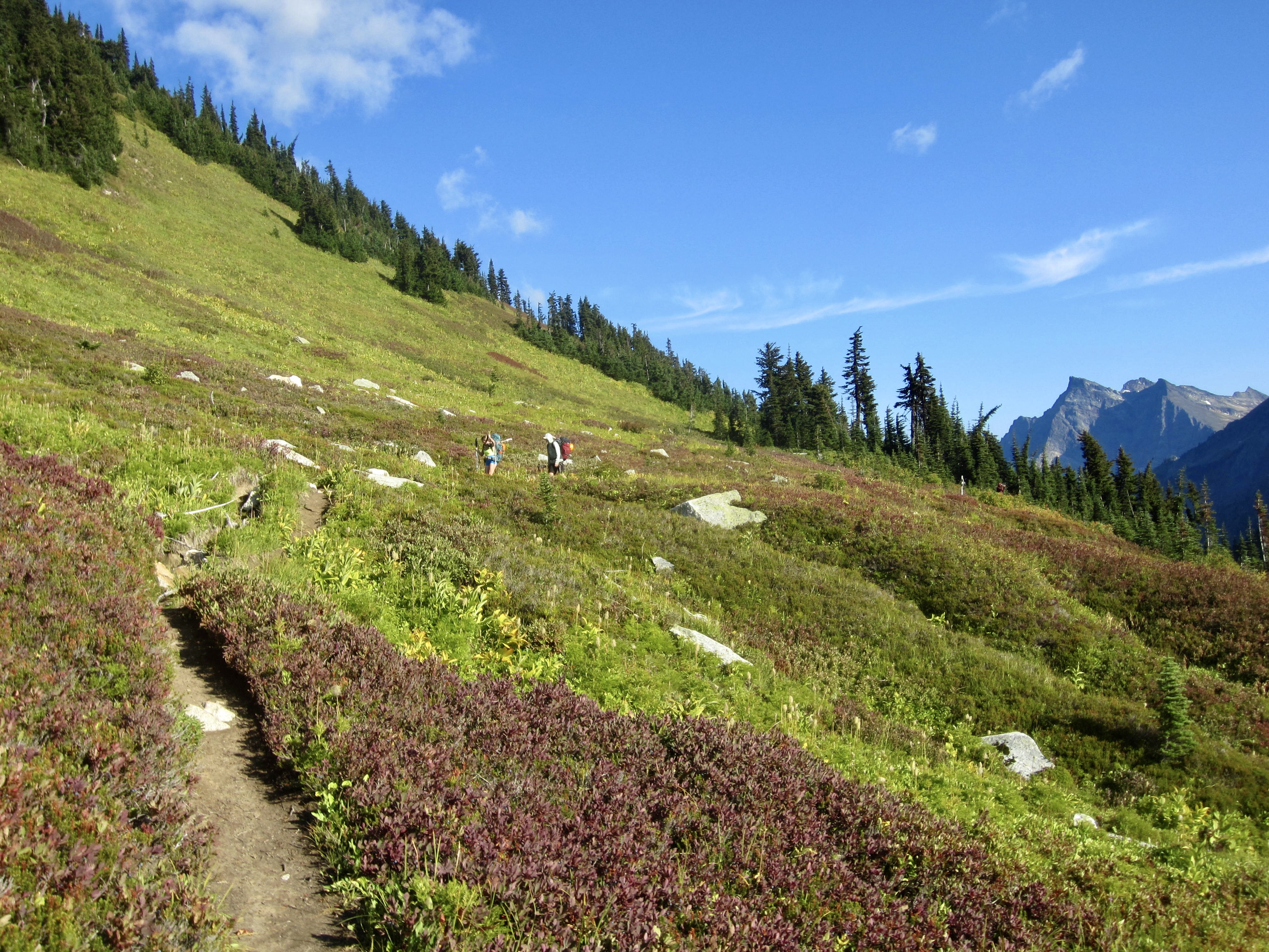
.
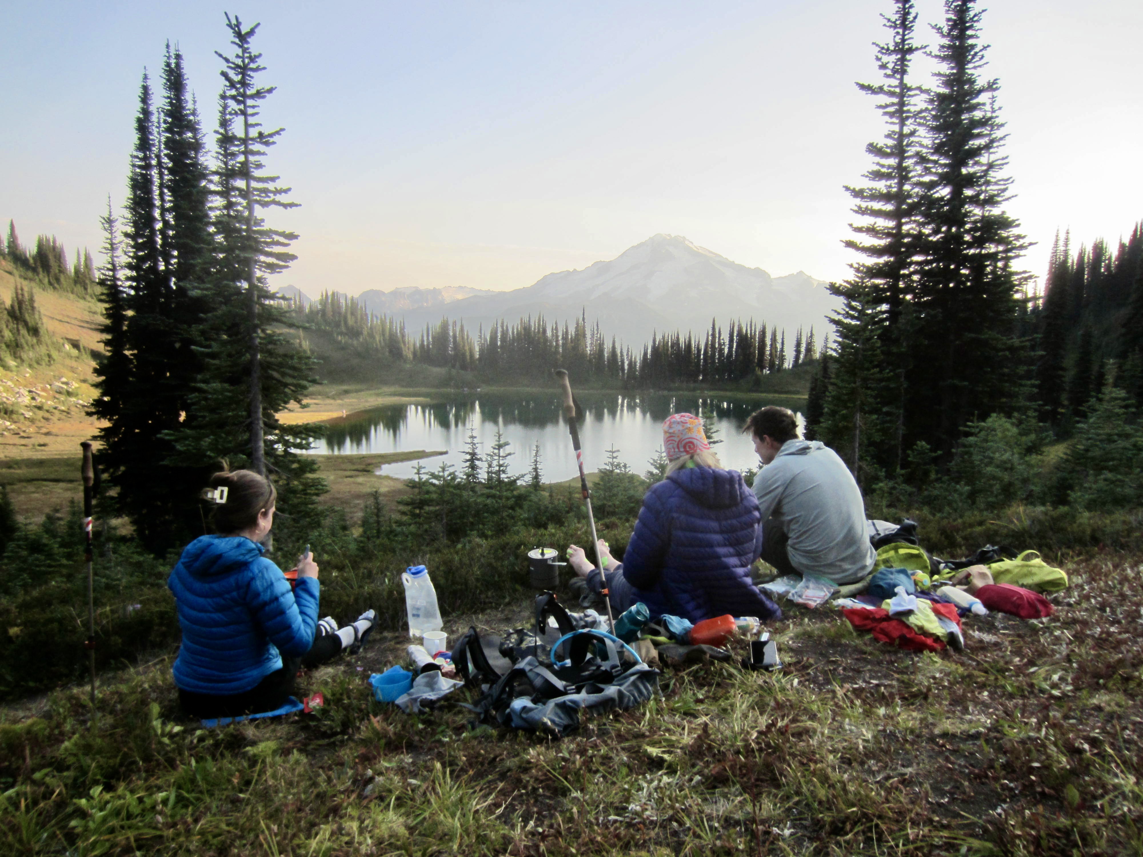
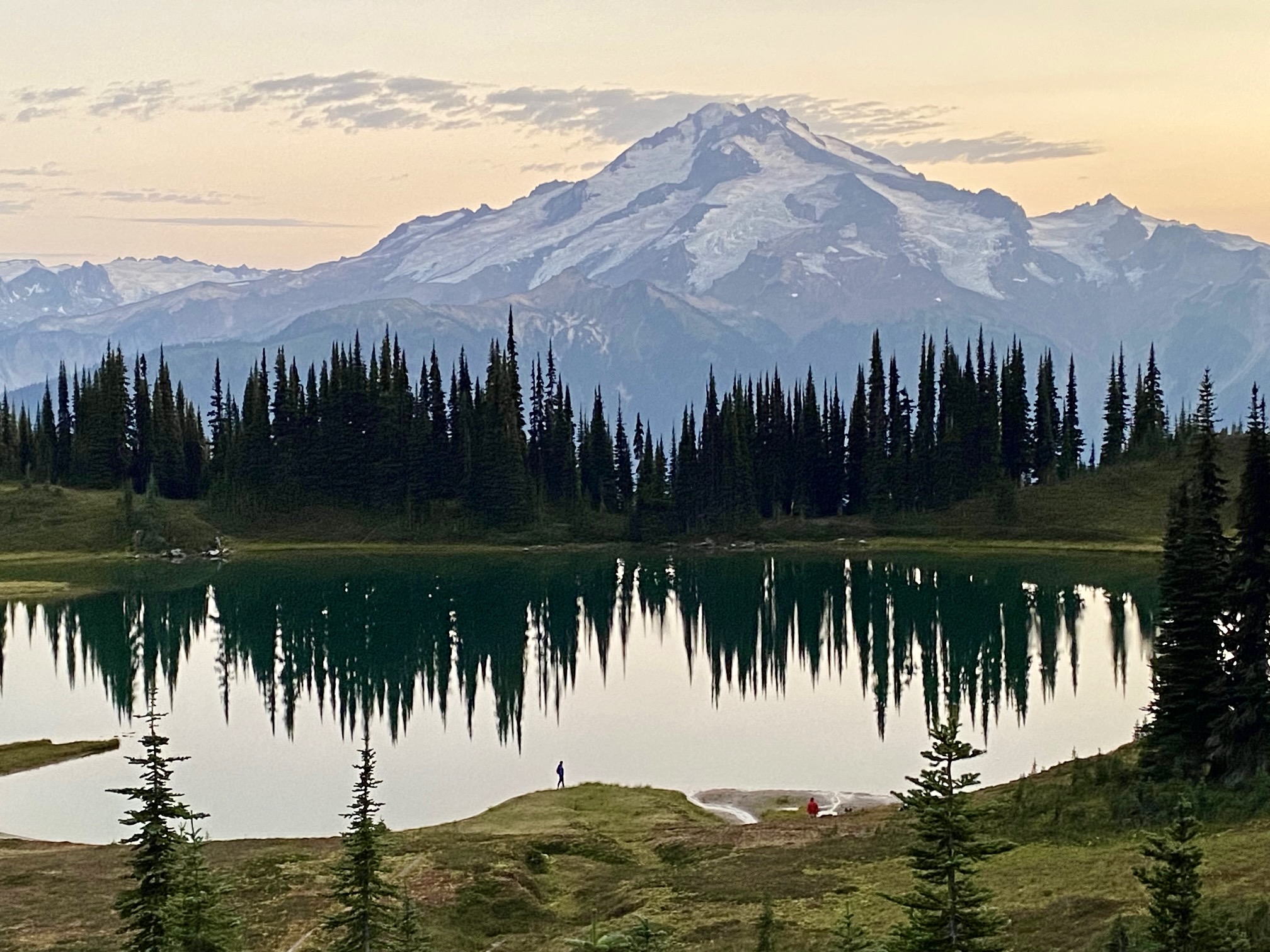
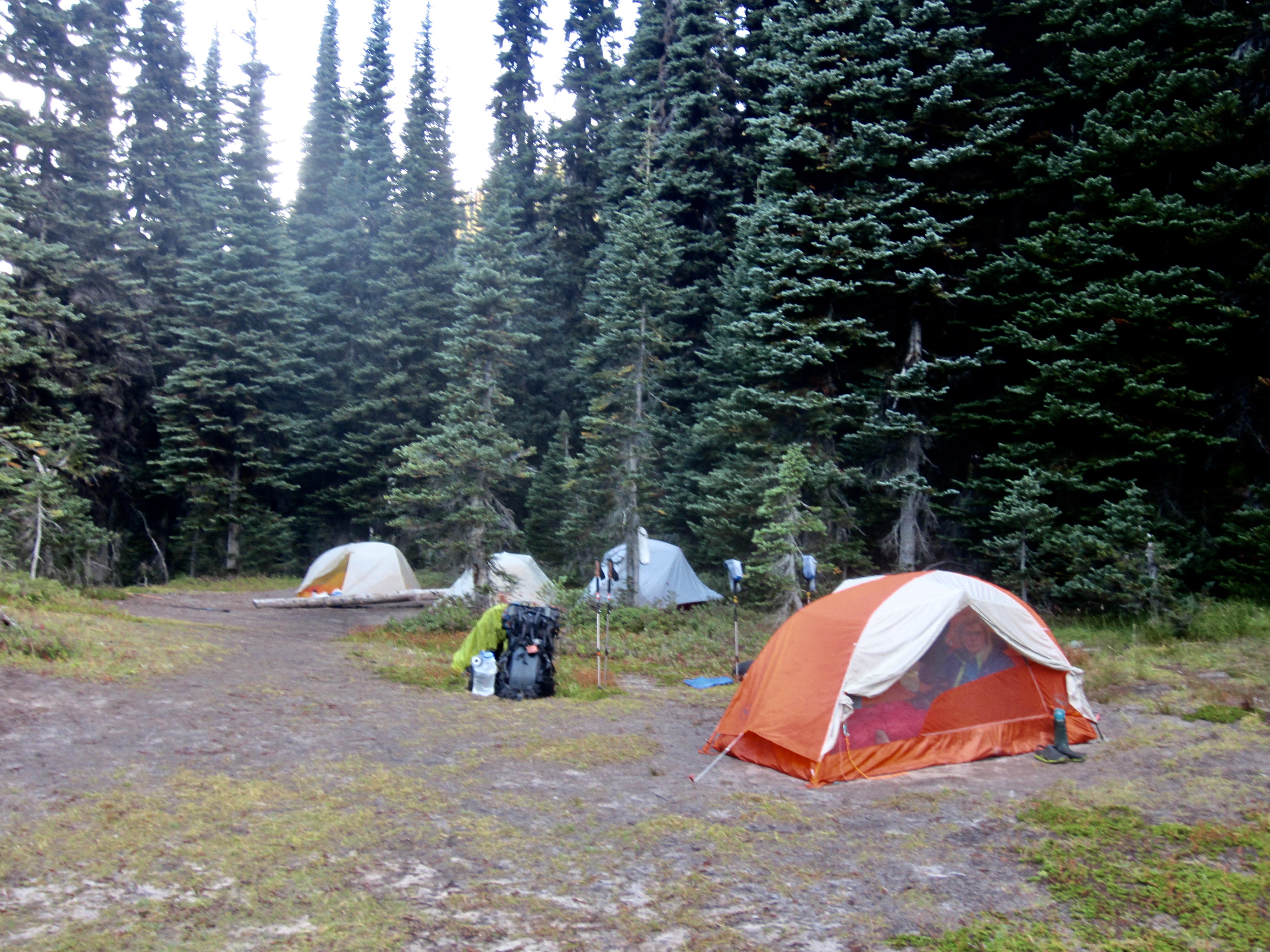
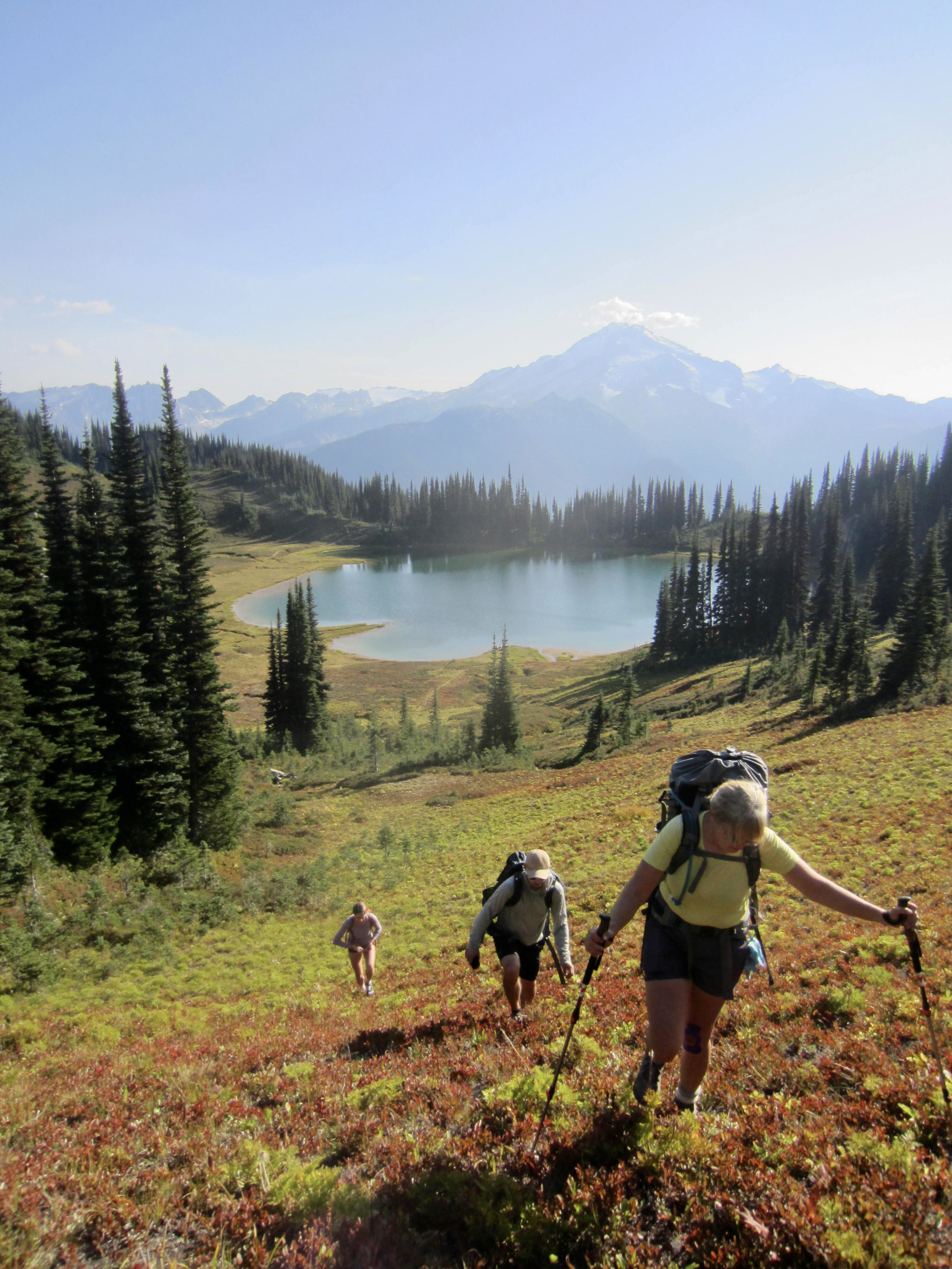
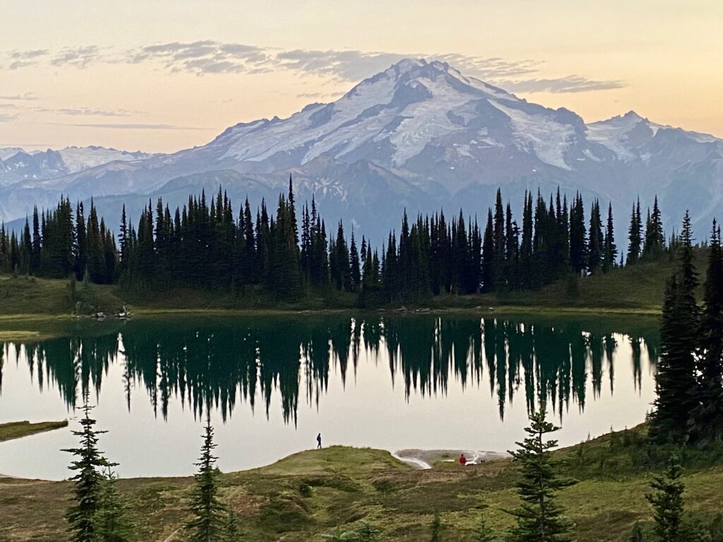
Eileen and I adopted a slower pace that allowed us to soak up the park-like ambience of Miner’s Ridge and the slightly hazy views of Glacier Peak. This place has a magical feeling. We dropped into Image Lake Basin and found our comrades relaxing at a large group campsite below the lake (7.4 hours + 2850 feet from Camp 2).

.
.
.
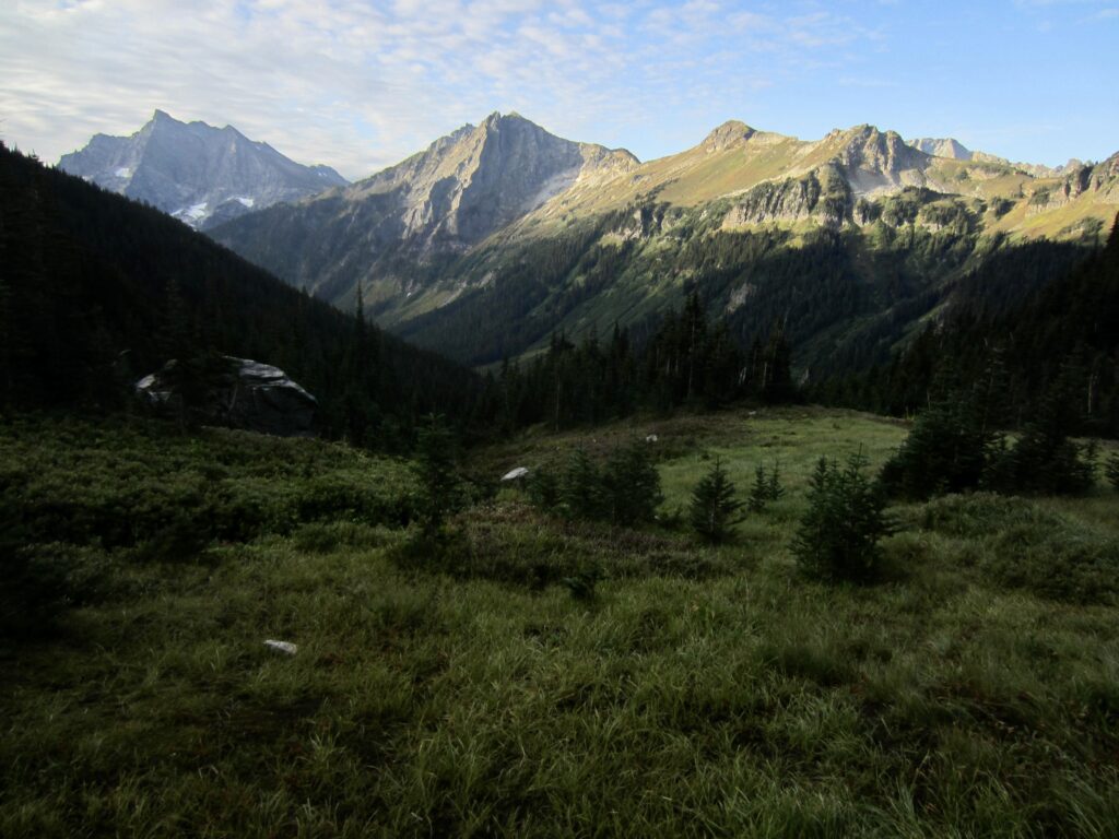
After unloading backpacks, we all filled our summit packs with dinner sundries and hiked up to 6400-foot Miner’s Pass for a northerly view across Canyon Creek Valley. From our ridgetop vantage, craggy Bannock Mountain could be seen standing guard over Canyon Lake, and the tops of Dome Peak and Sinister Peak were visible behind Totem Pass.
.
.
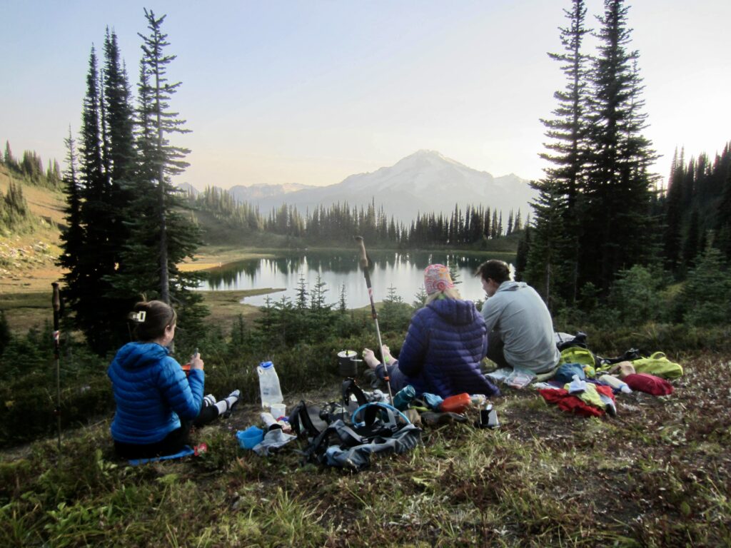
We dropped halfway back down the hillside and ate dinner on a trail spur while watching twilight drape over Glacier Peak and Image Lake. The evening was pleasantly mild, calm, and bug-free, which created an idyllic setting for this iconic view.
.
.
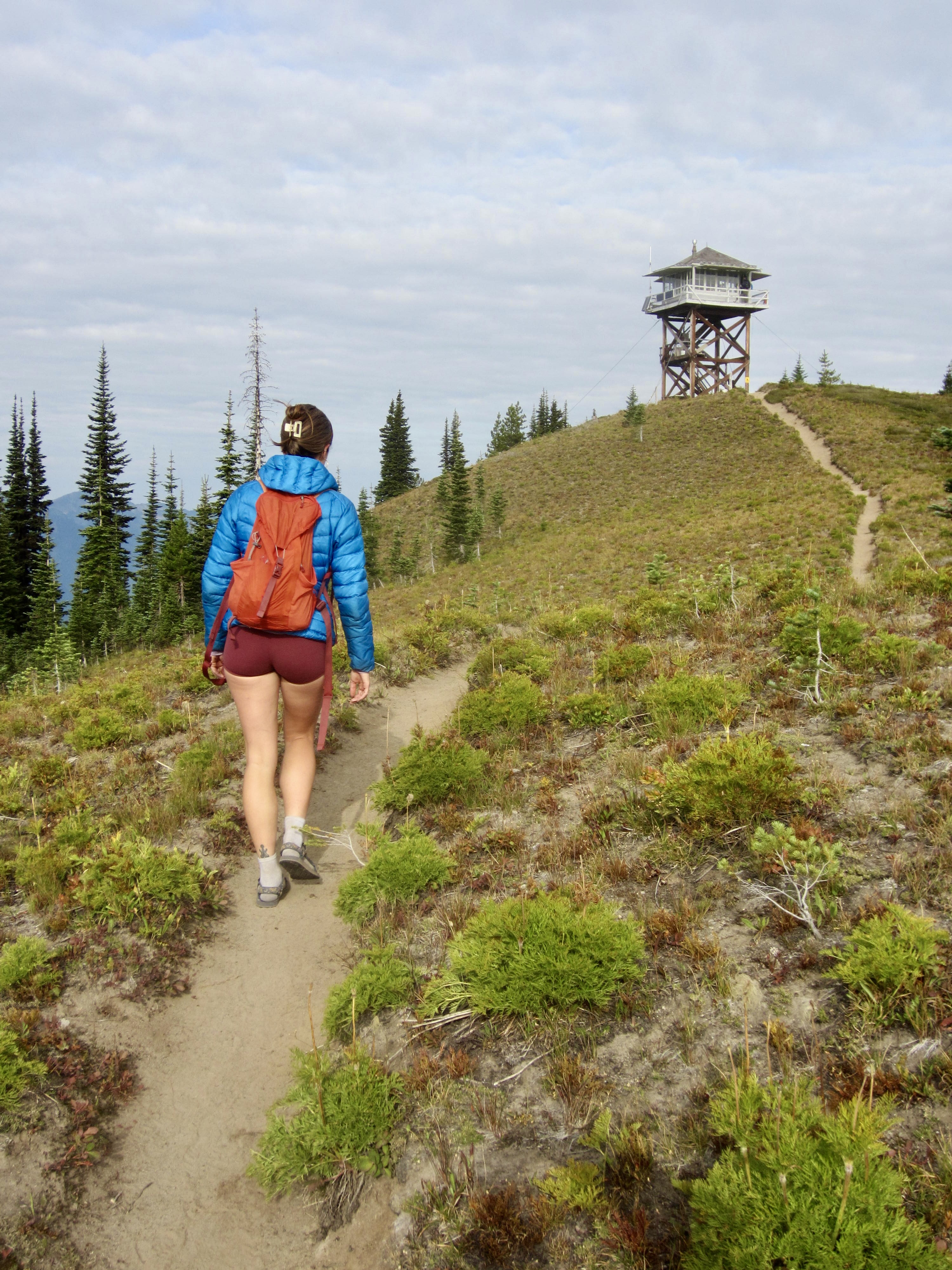
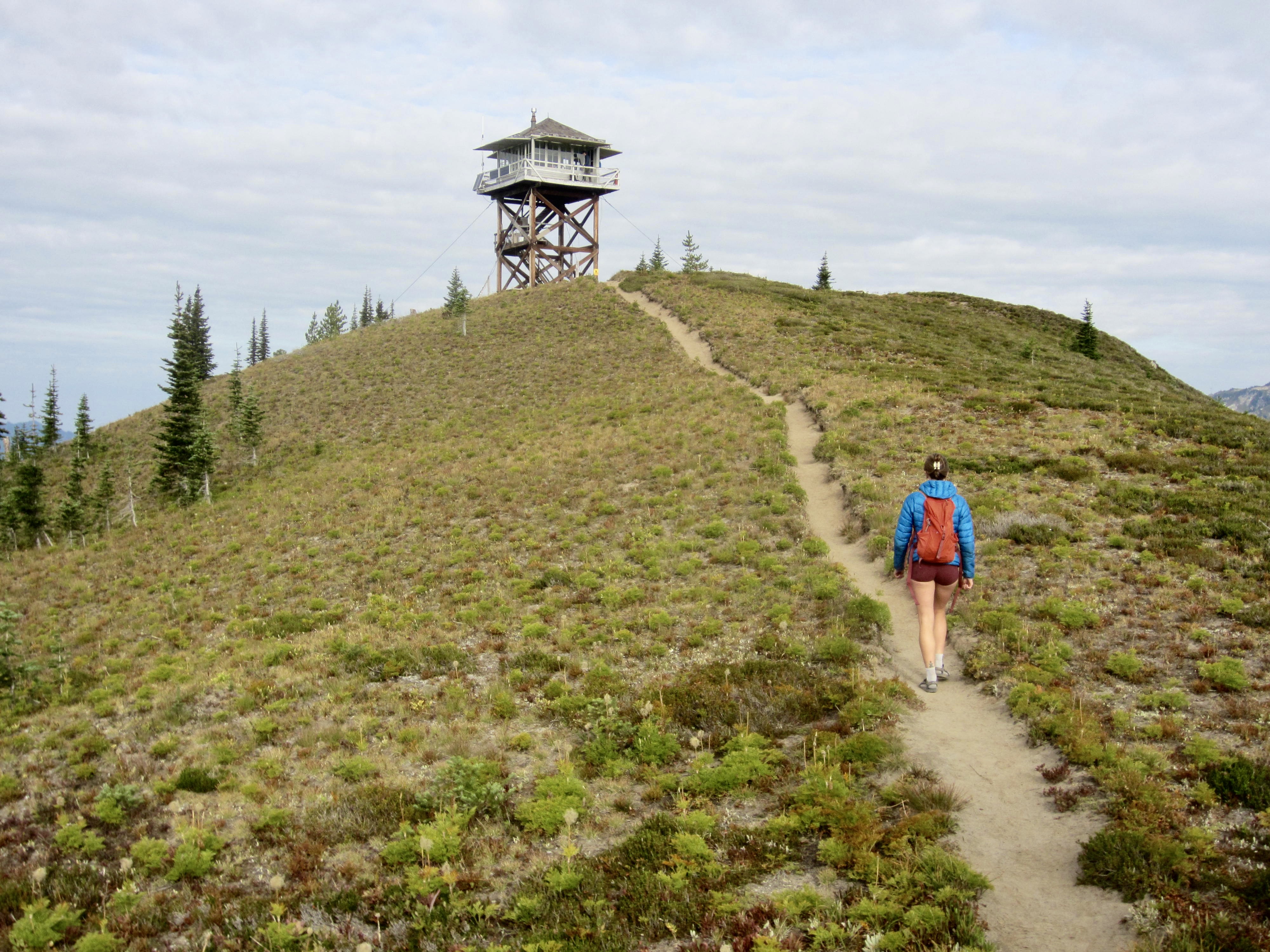
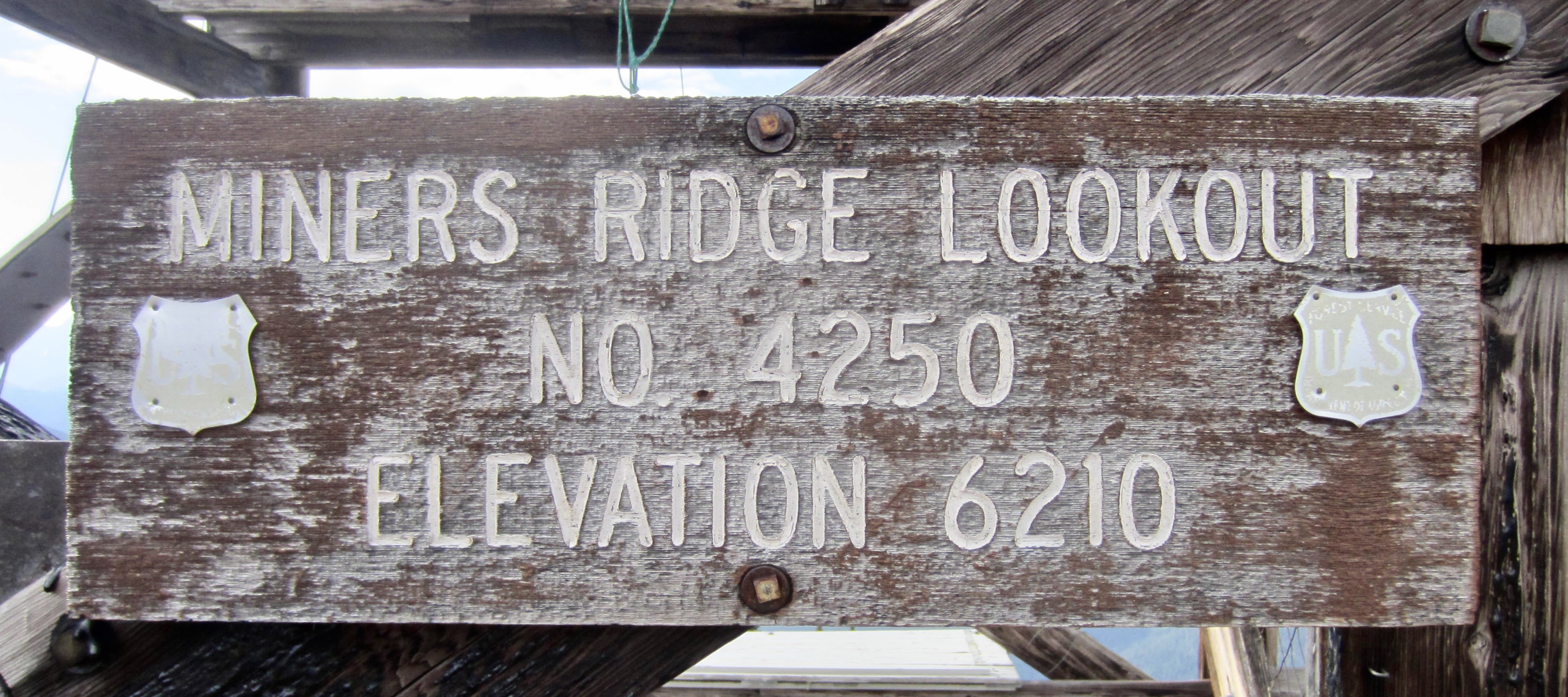
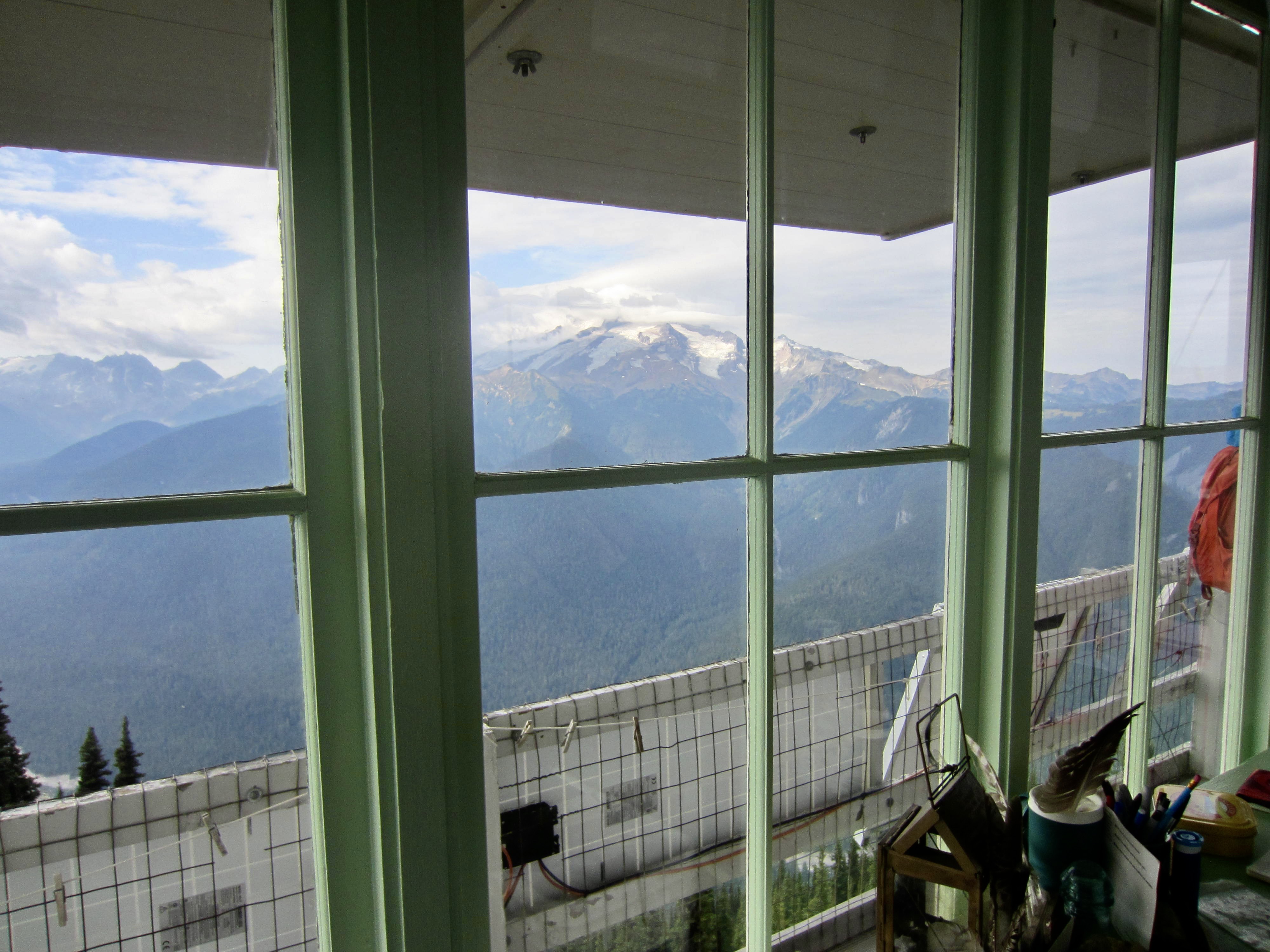
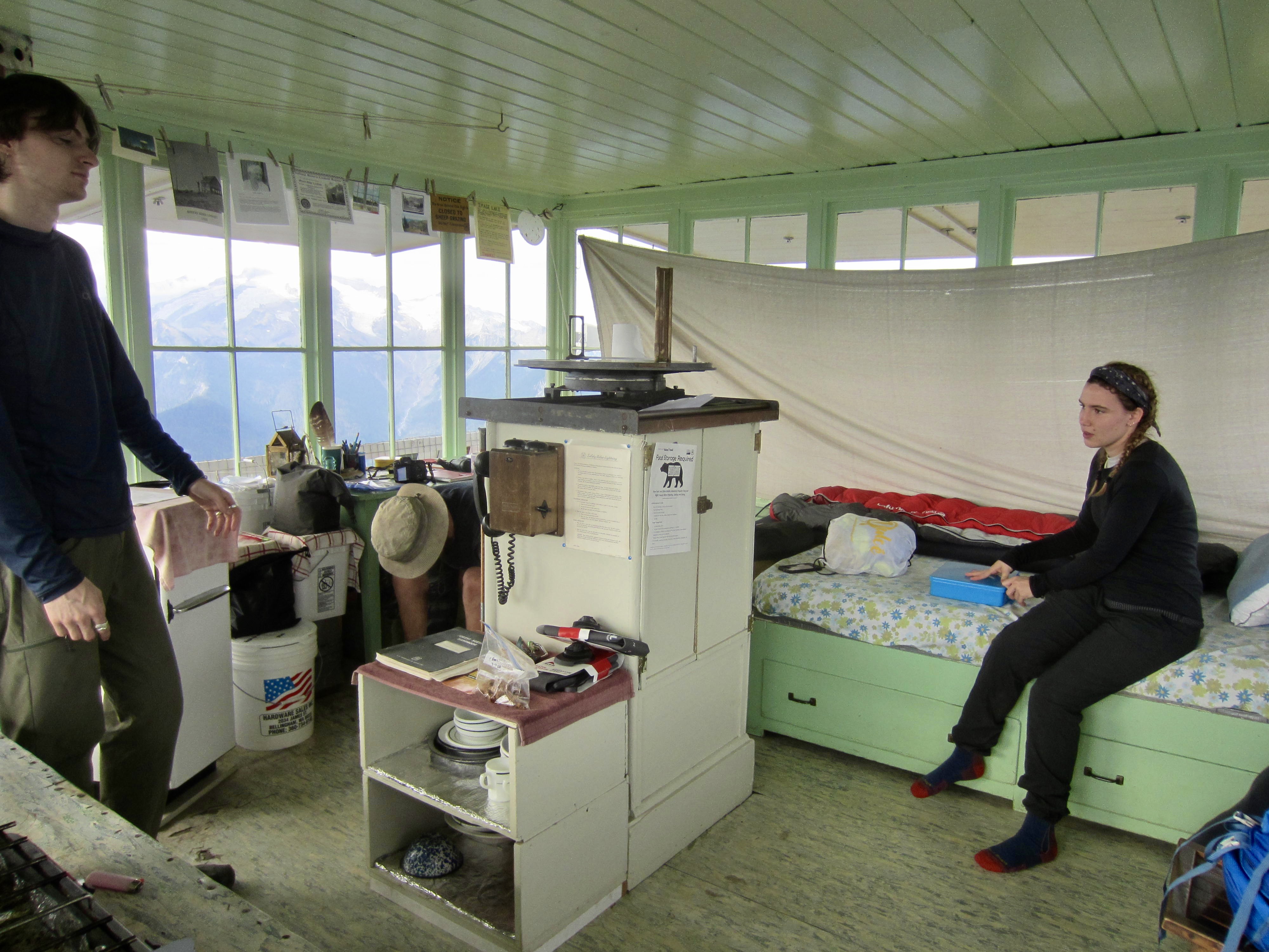
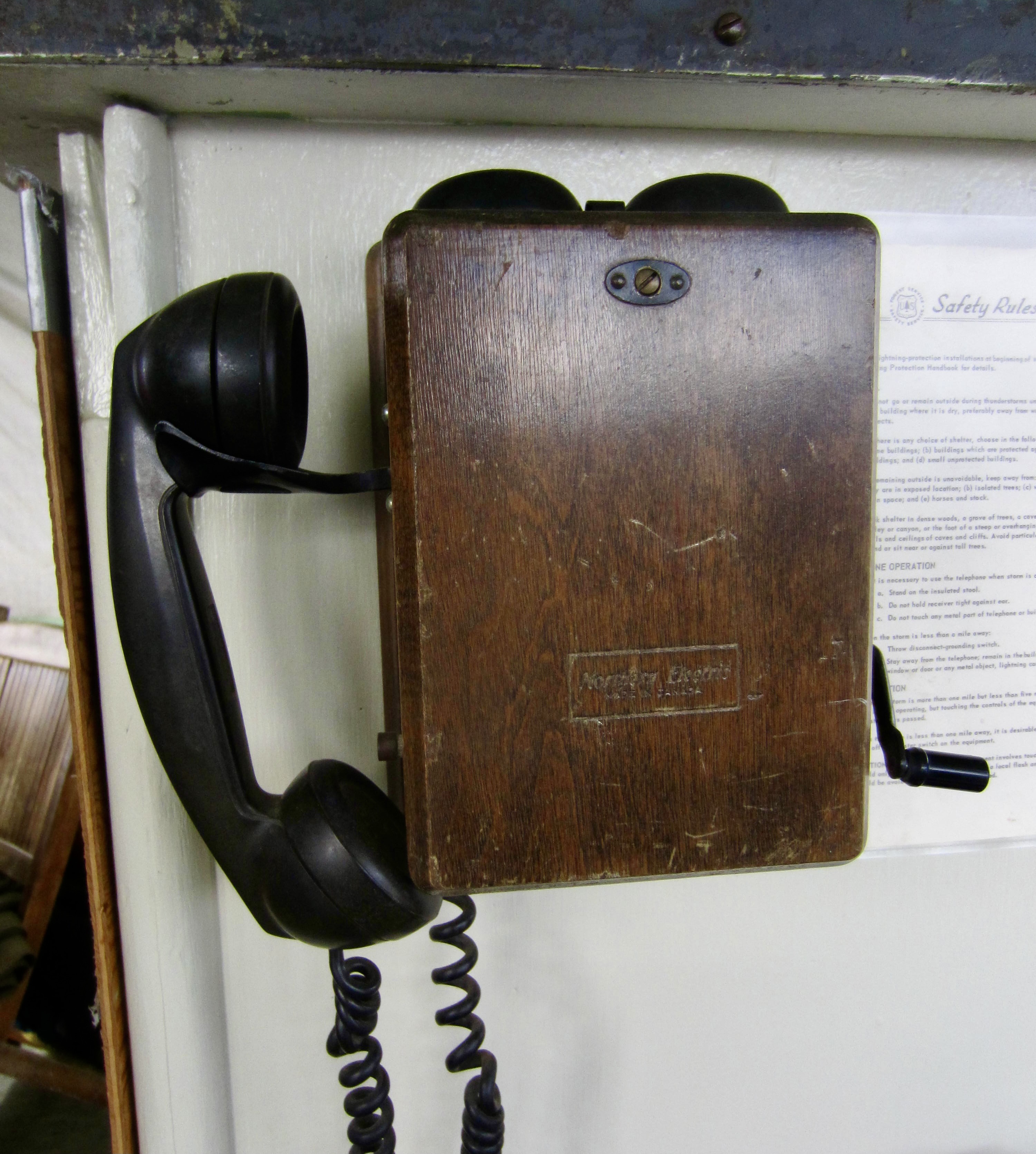
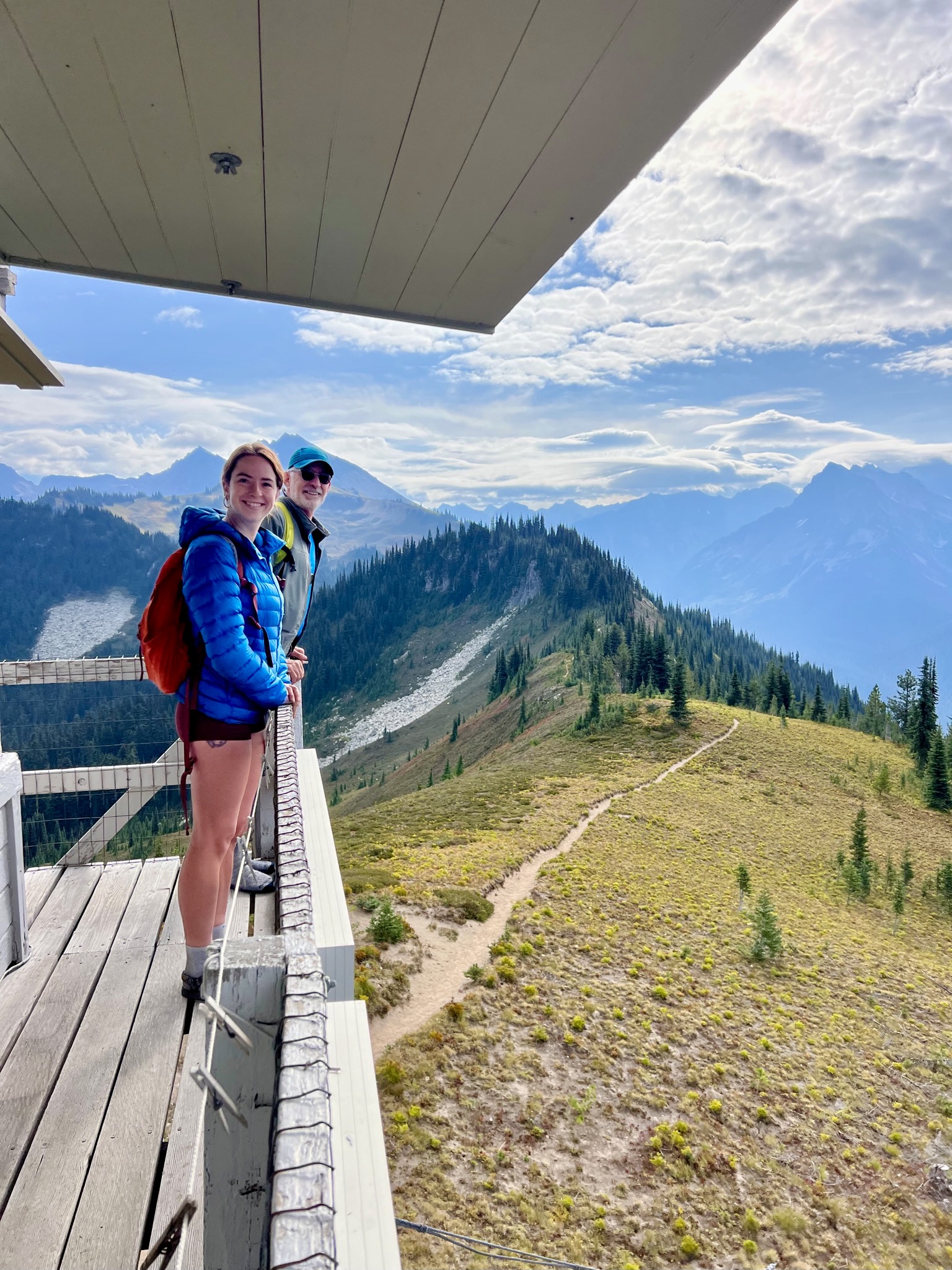
Day 4 (AM): Miners Ridge Lookout Hike
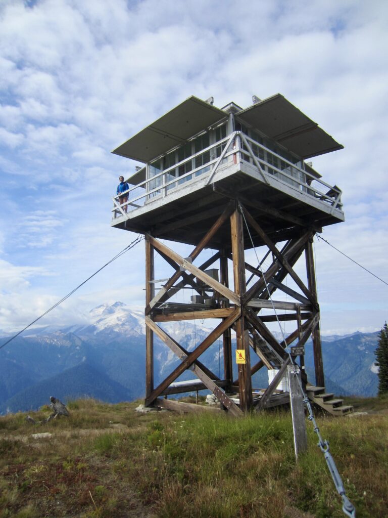
Our morning agenda included a visit to the historic Miner’s Ridge Lookout—one of a few staffed lookout cabins remaining in the Cascades. From Image Lake, this worthy destination is easily reached via a 1¼-mile trail that contours westward along Miner’s Ridge. We arrived in time to chat with the lookout staff before they left on their daily patrol.
.
.
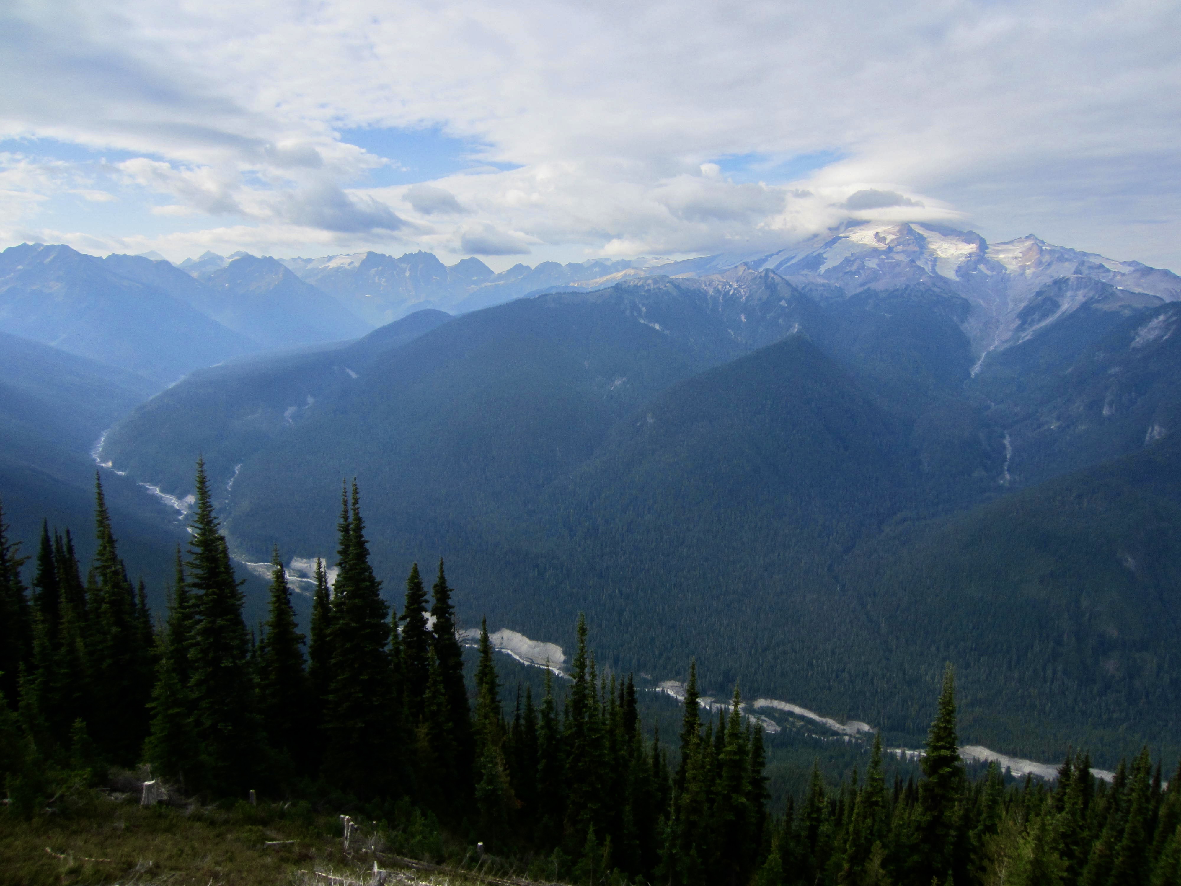
Perched on the high, open ridge crest, this fire lookout structure offers a commanding view of Glacier Peak and the curving Suiattle River Valley. The hip-roofed lookout cabin, which sits atop a 20-foot wooden tower, was reportedly built in 1938 and reconstructed in 1953. It appears to be well-maintained and well-poised for many more decades of service.
.
.
.
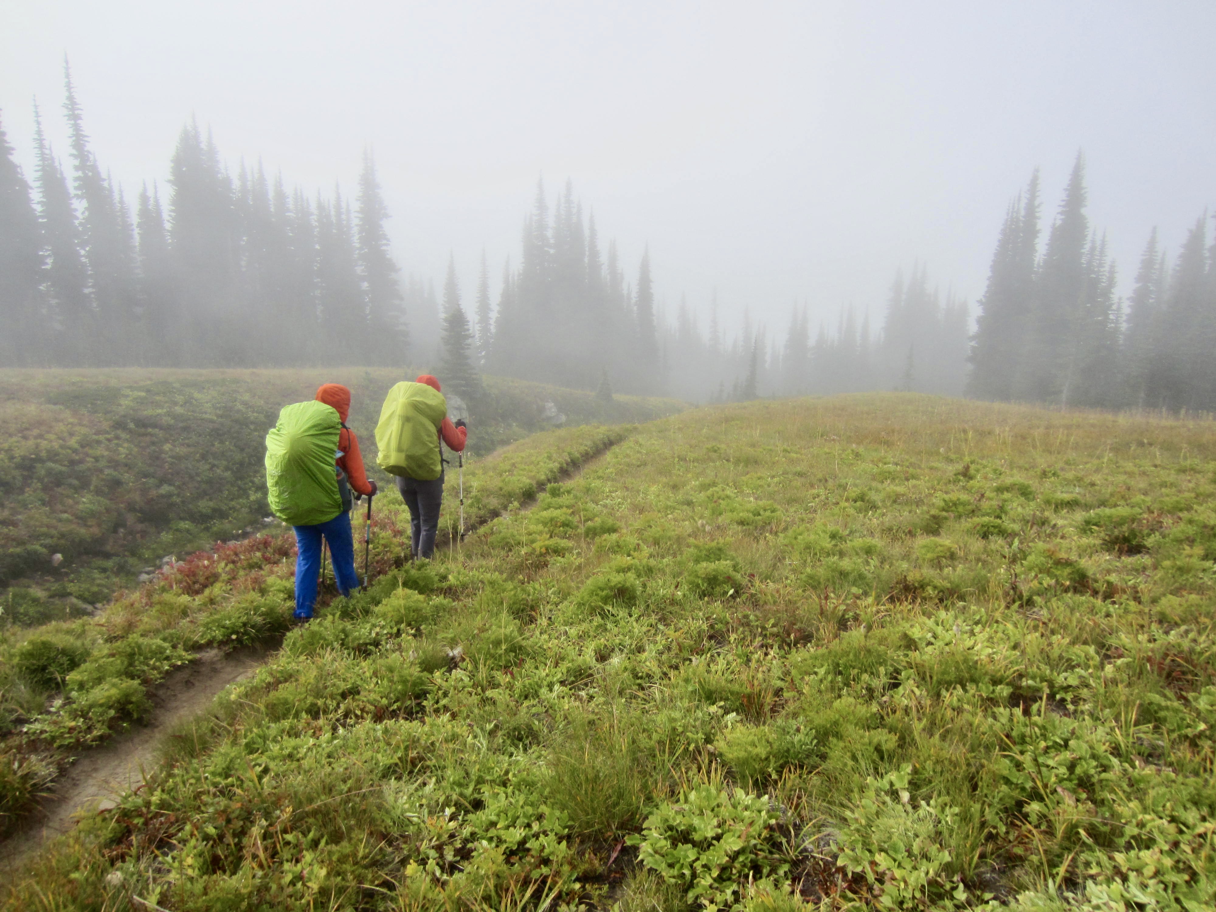
Day 4 (PM): Image Lake to Cloudy Pass Basin
After returning from our morning lookout visit, we packed up camp and hiked eastward to Suiattle Pass and Cloudy Pass. The sky grew darker and more threatening throughout the afternoon, and an icy wind hastened us over Cloudy Pass in search of shelter.
.

.
.
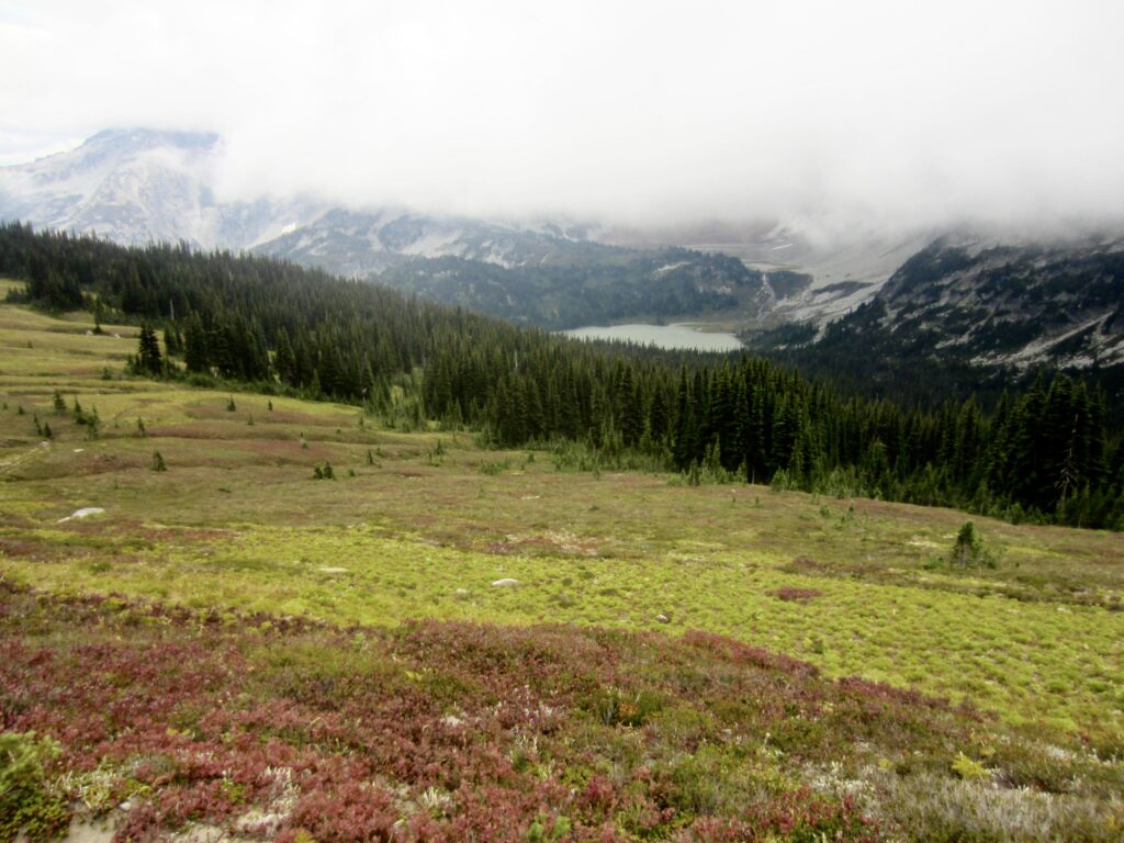
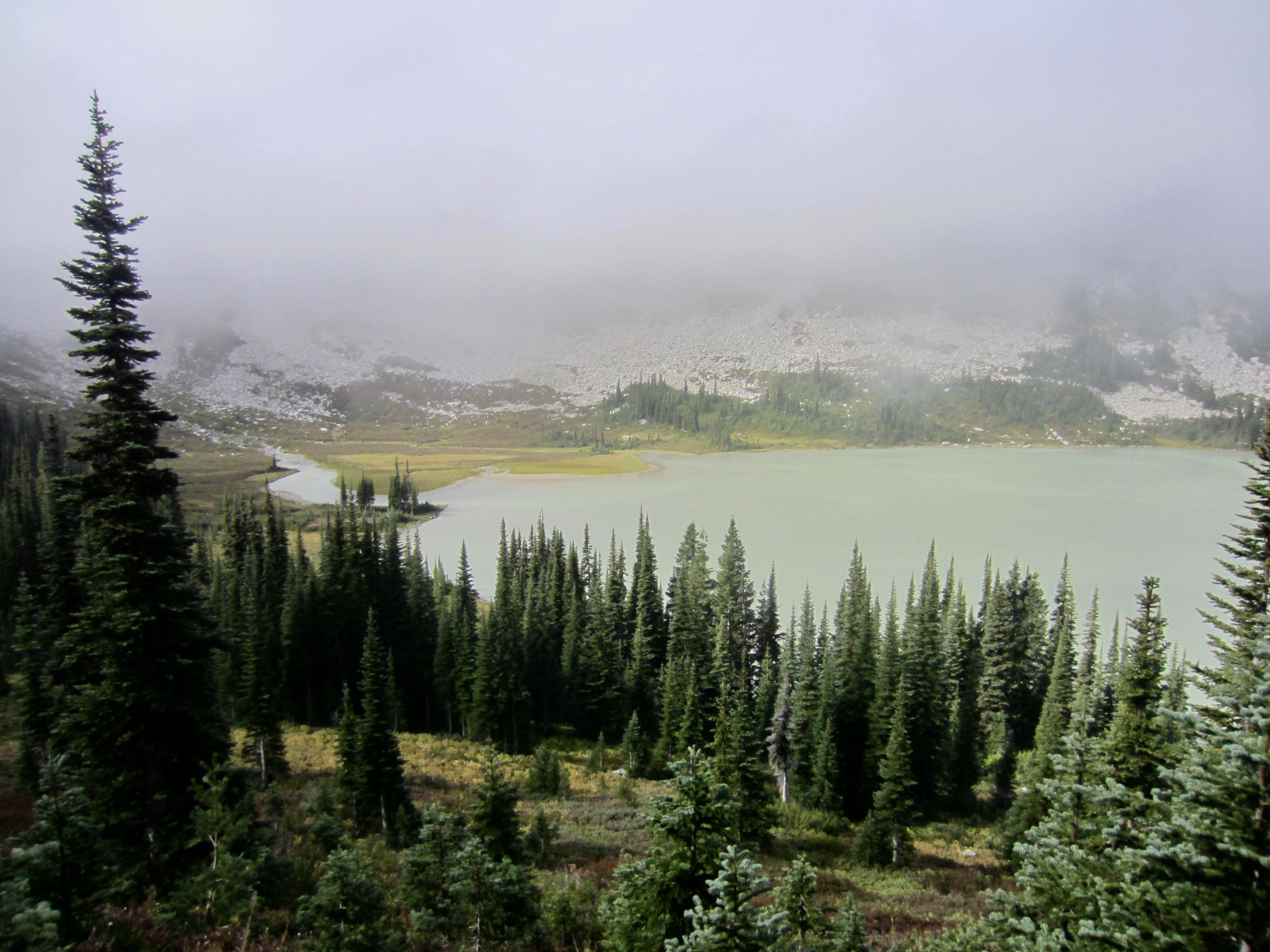
We stopped for the day at an established campsite nestled in a tree grove within Cloudy Pass Basin (4.7 hours + 1500 feet from Camp 3). For me, this expansive meadowland overlooking Lyman Lakes provided an unexpected scenic highlight of the trip. A light rain started during our dinnertime and continued throughout the night.
.
.
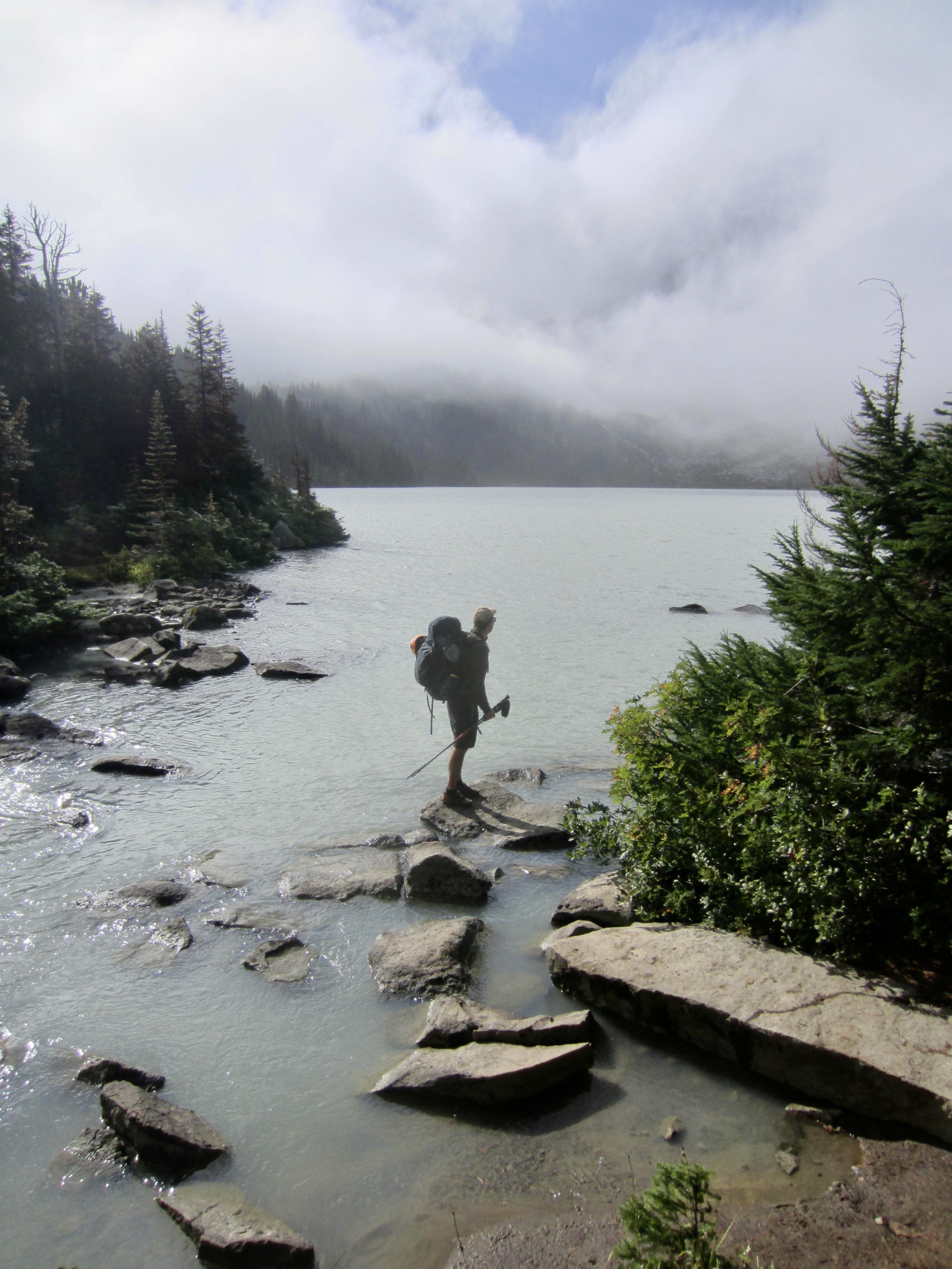
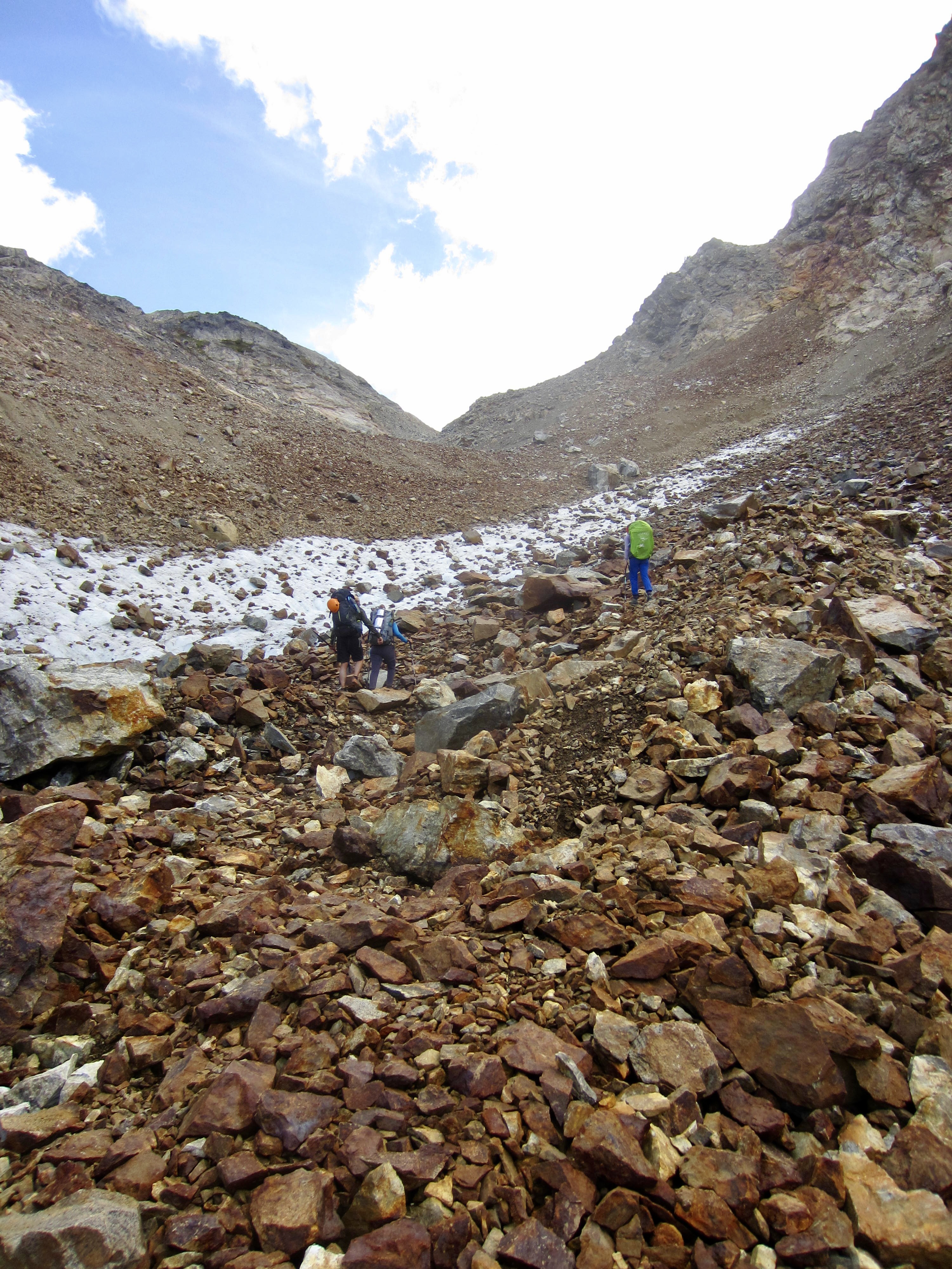
Day 5: Cloudy Pass Basin to Phelps Creek
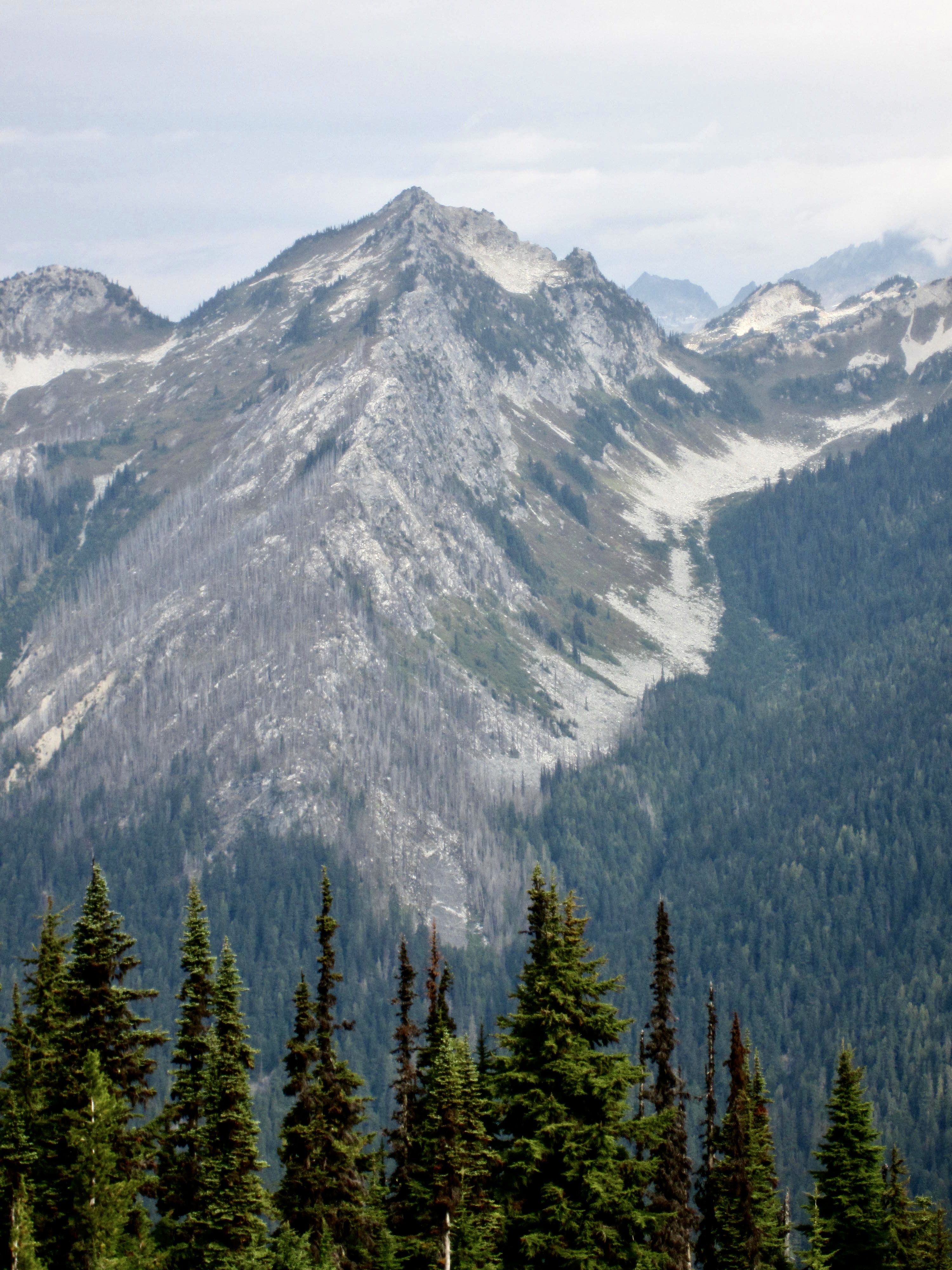
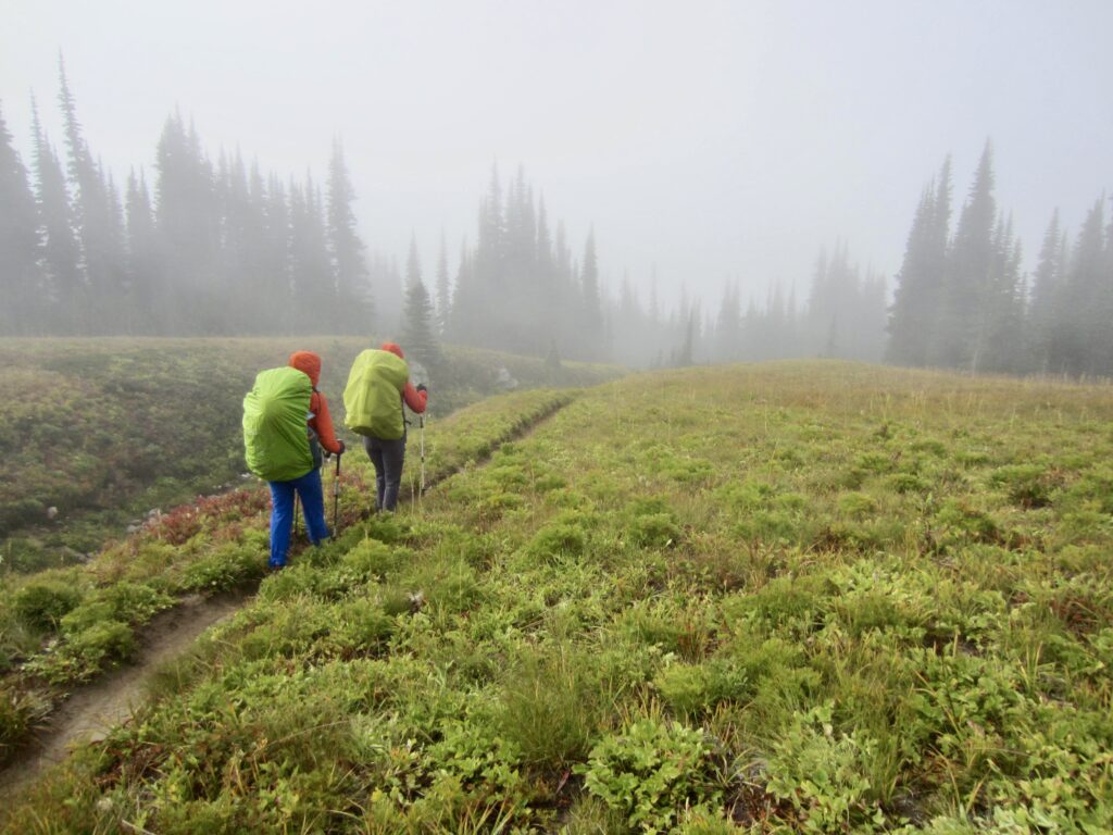
The rain stopped before dawn, but we awoke to moderately dense fog. Our morning’s route took us downhill to Lyman Lake before ascending into Upper Lyman Basin. The fog and clouds steadily dissipated as we hiked farther into this elongated basin below the cliffs of Chiwawa Mountain.
.

.
.
.
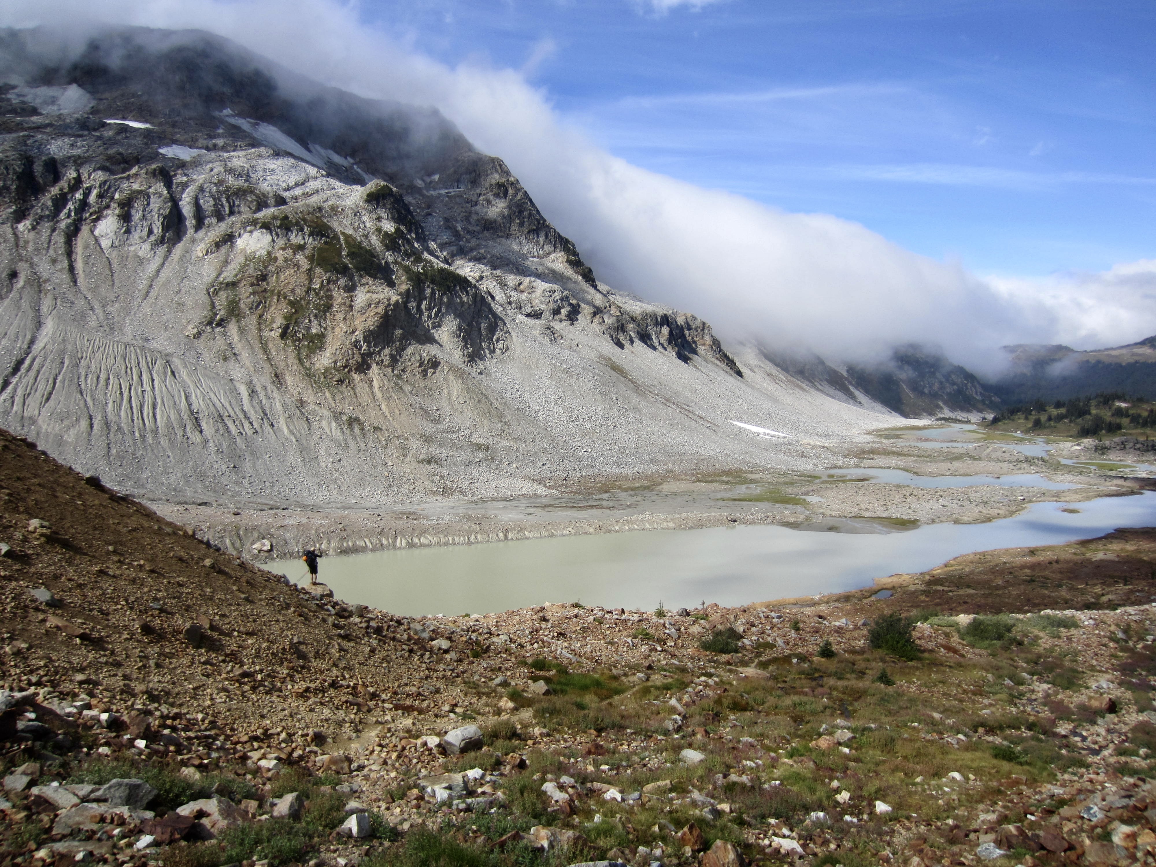
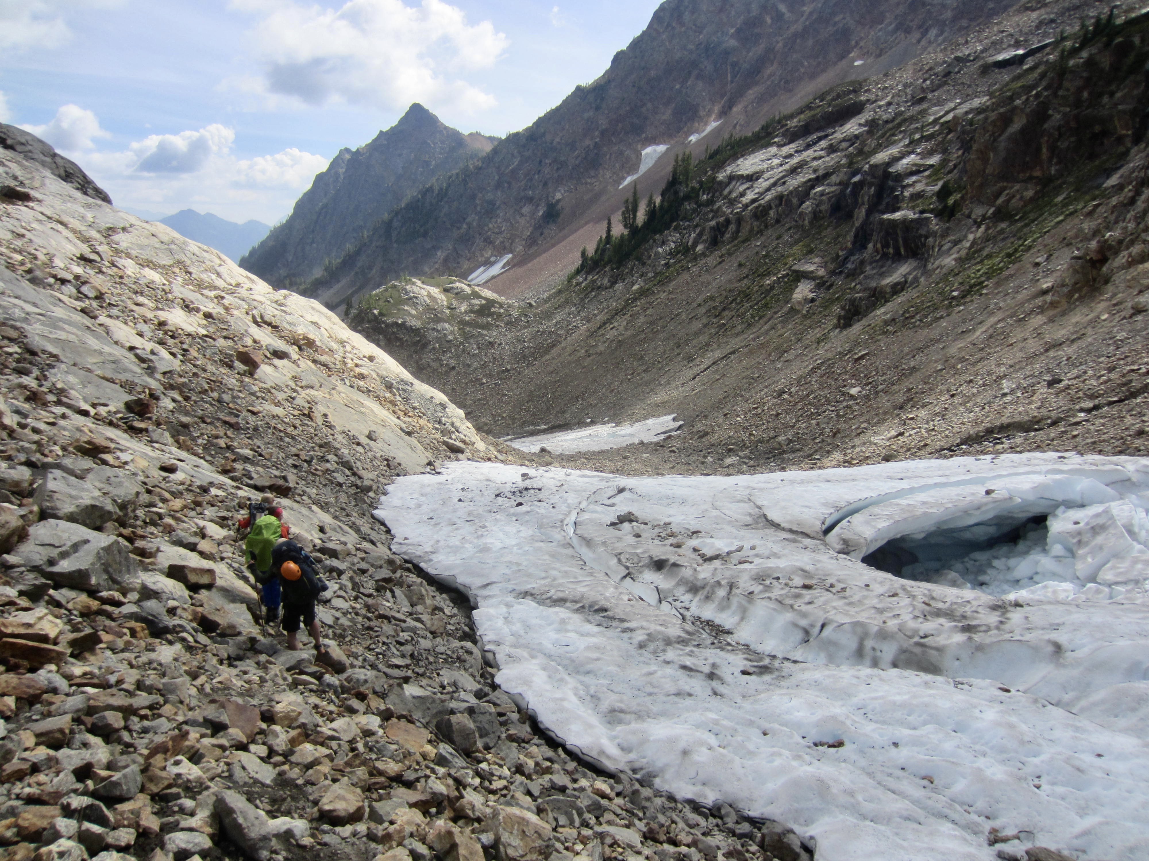
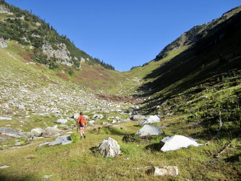
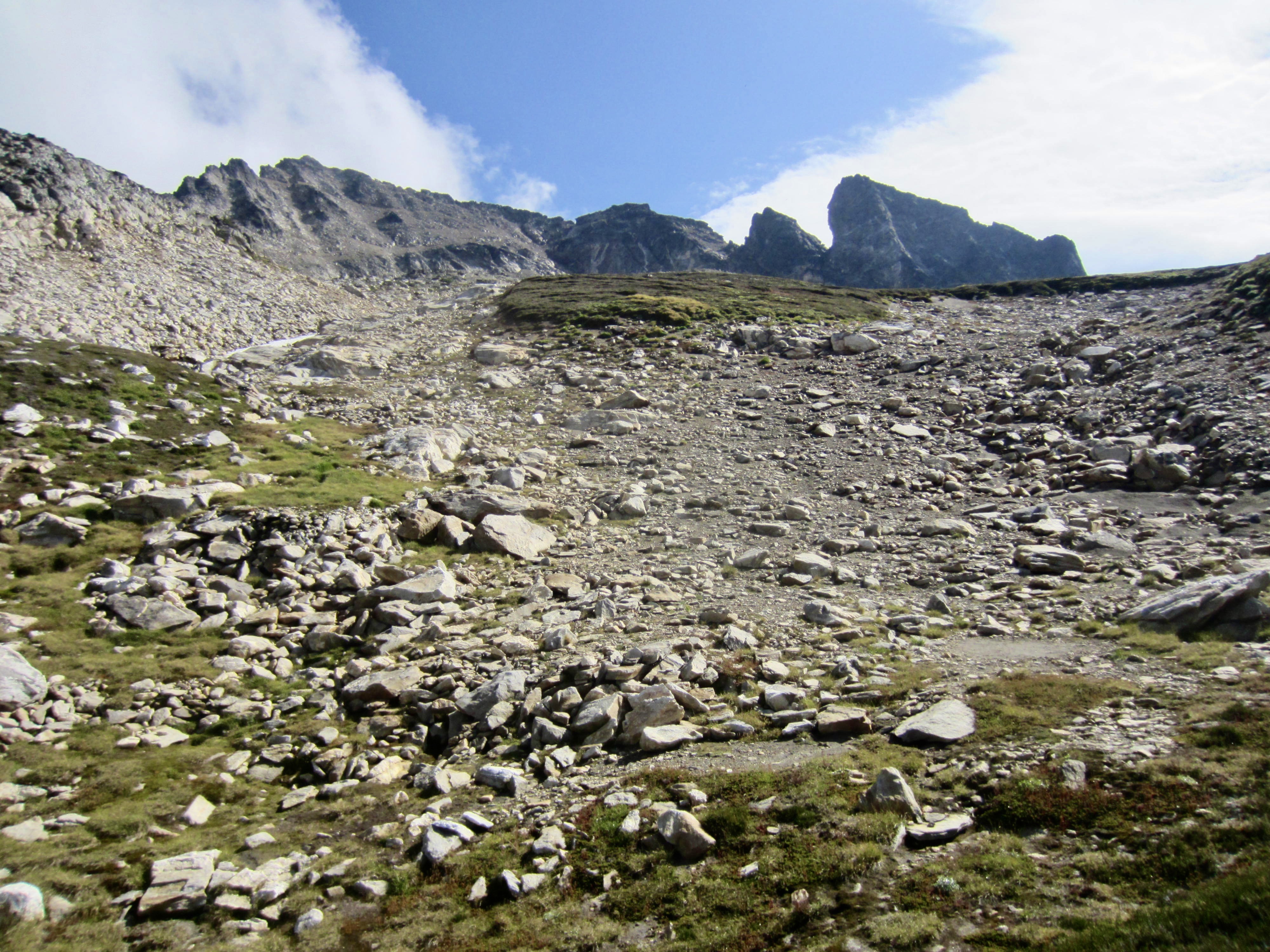
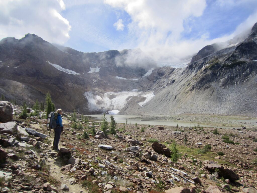
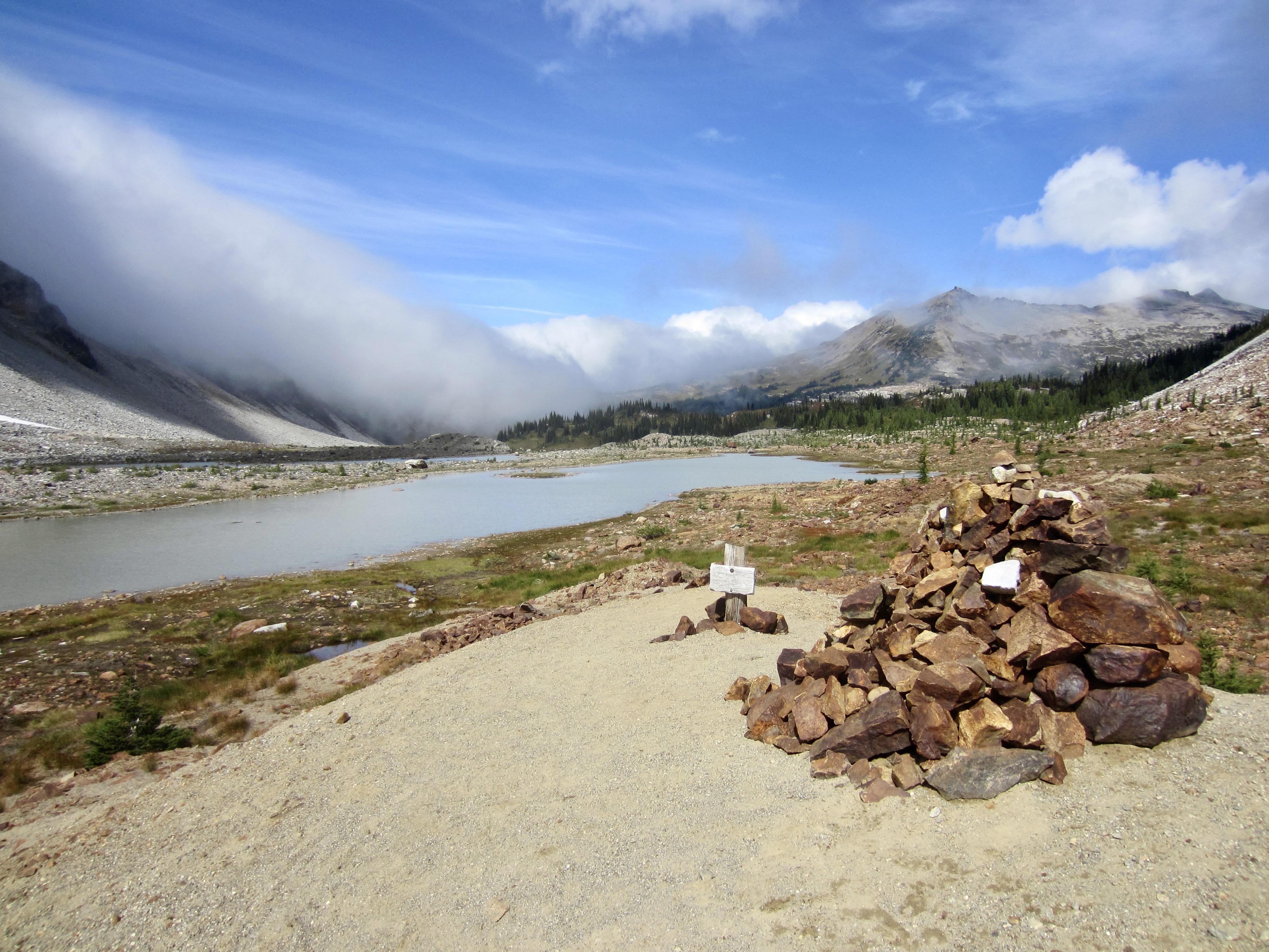
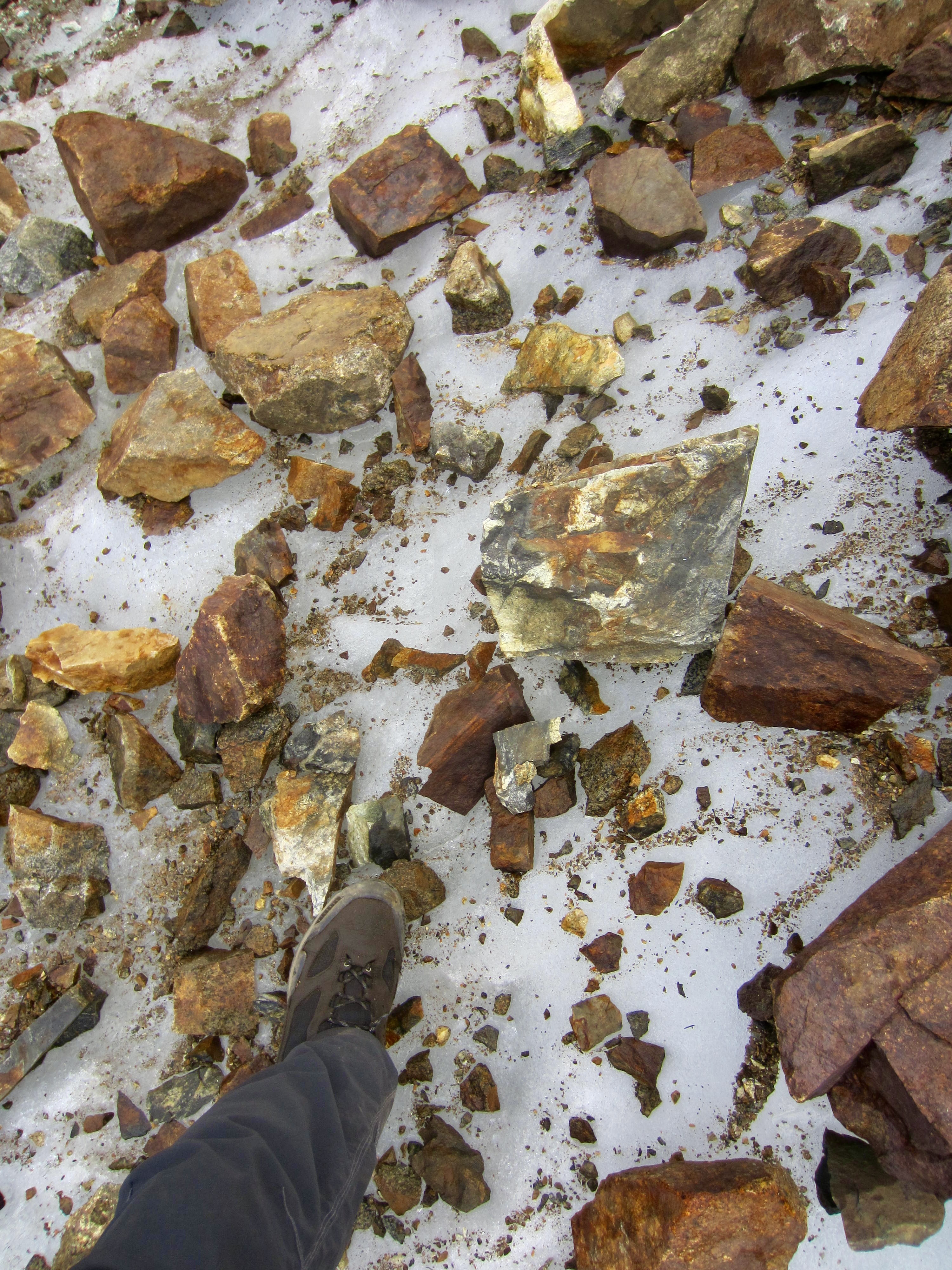
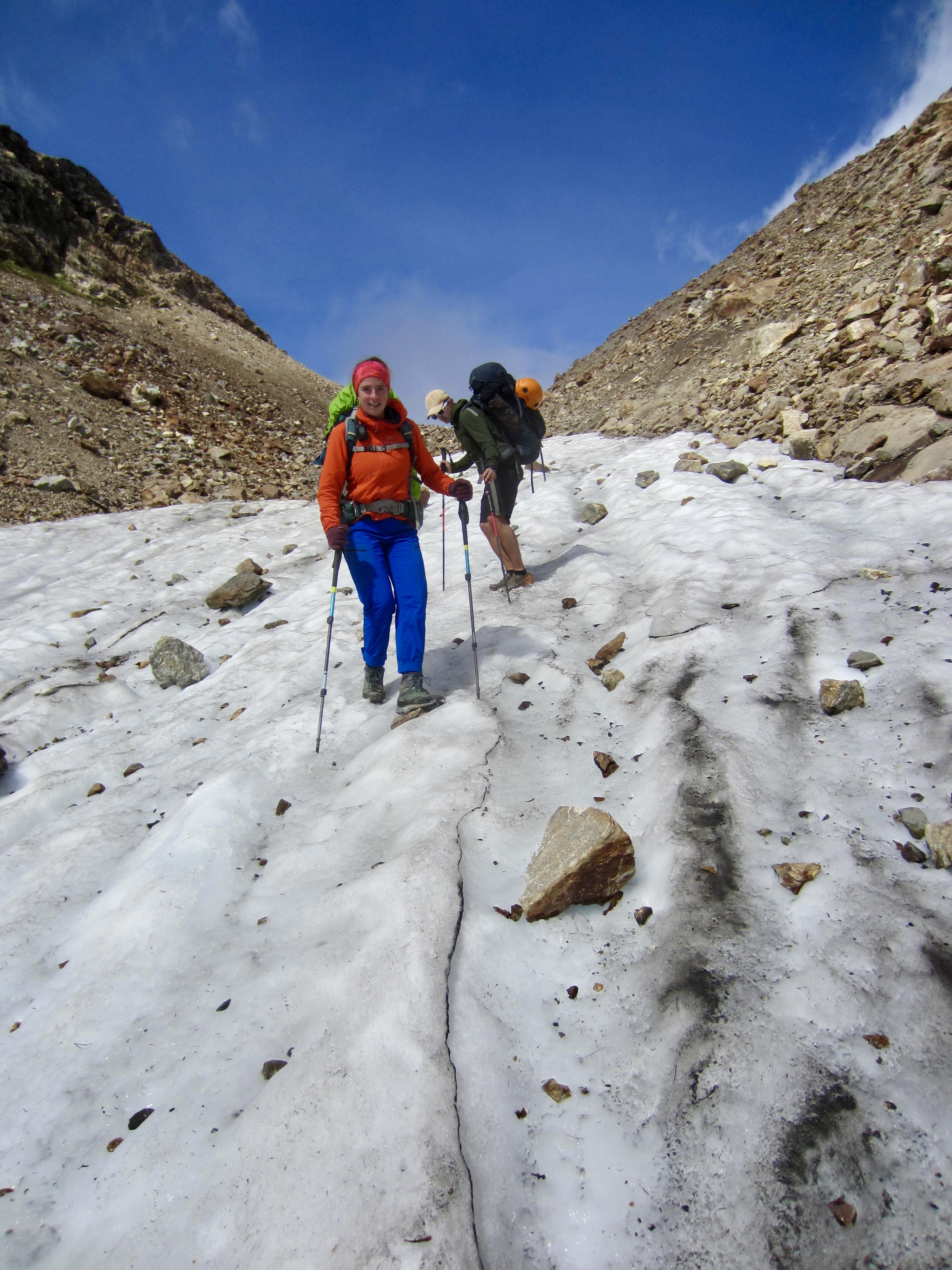
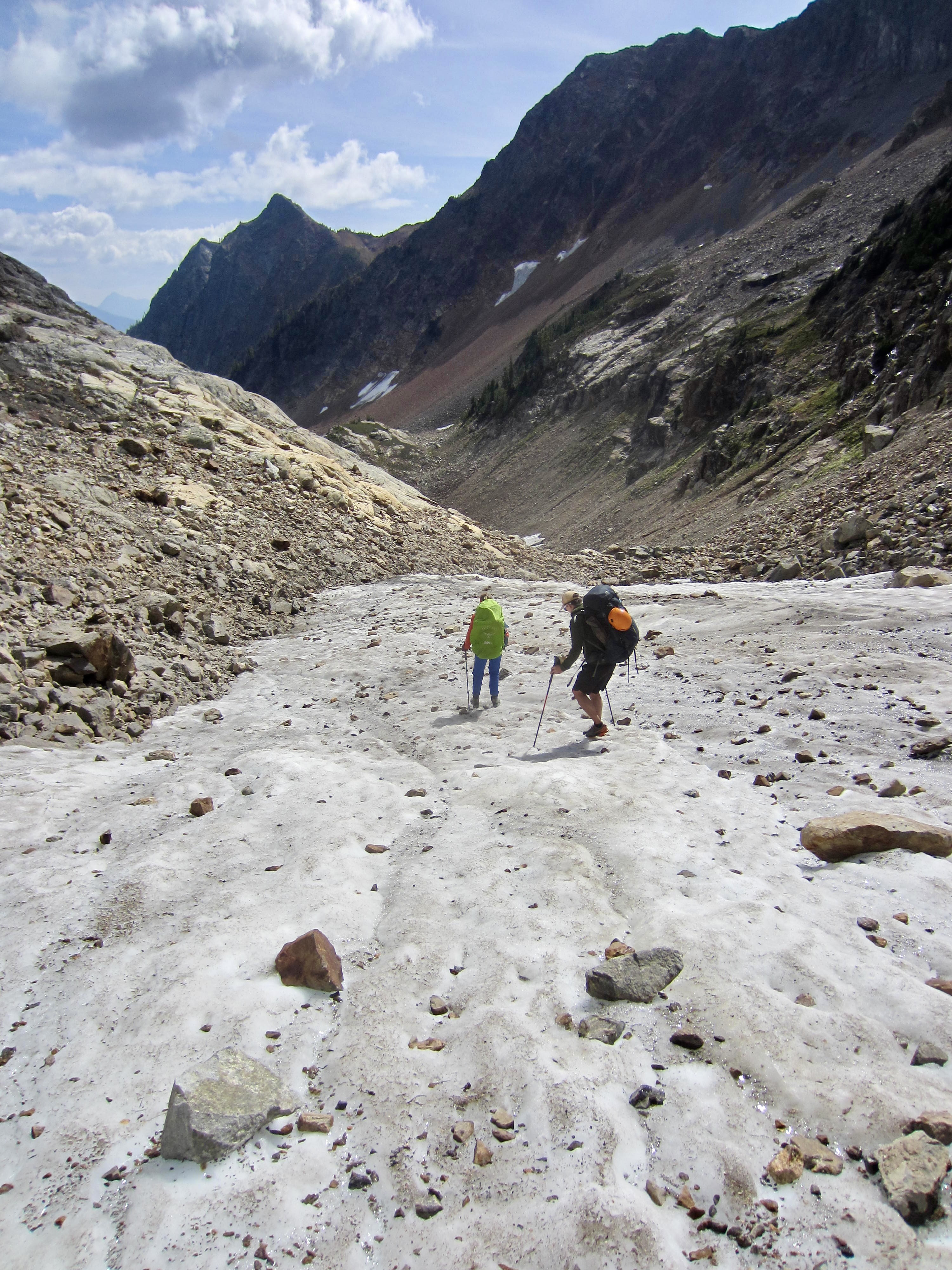
The end of the formal trail in Upper Lyman Basin is marked by a small sign and large cairn. From this point, a primitive trail continues up a rocky couloir toward Spider Gap. The terrain here consists of loose talus and morainal debris, which obscures the trail in many locations. Keep your eyes open for stone ducks marking the route. Higher in Lyman Couloir, we encountered solid ice beneath the debris, probably representing a remnant of the nearby Lyman Glacier.
.

.
.
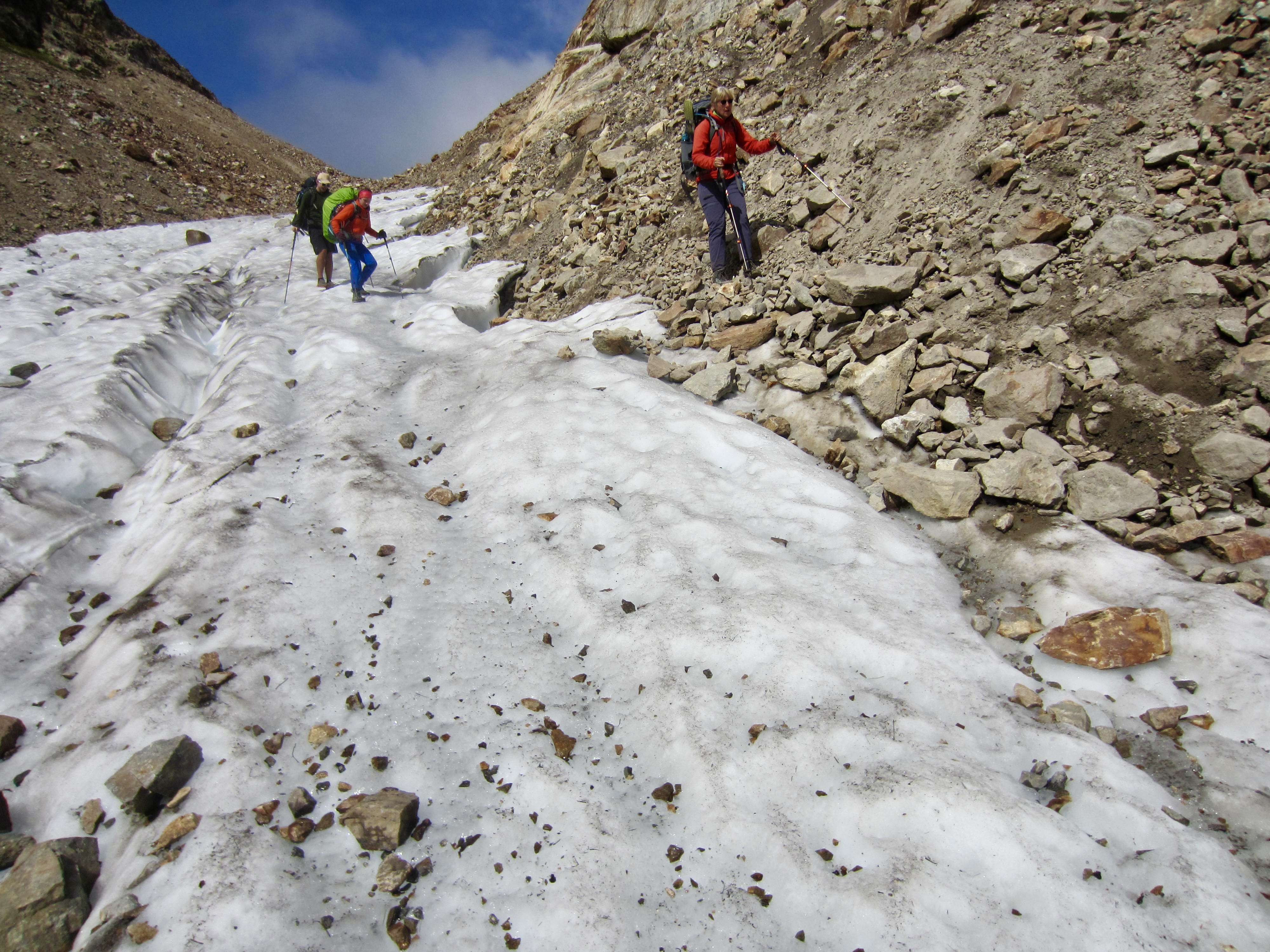
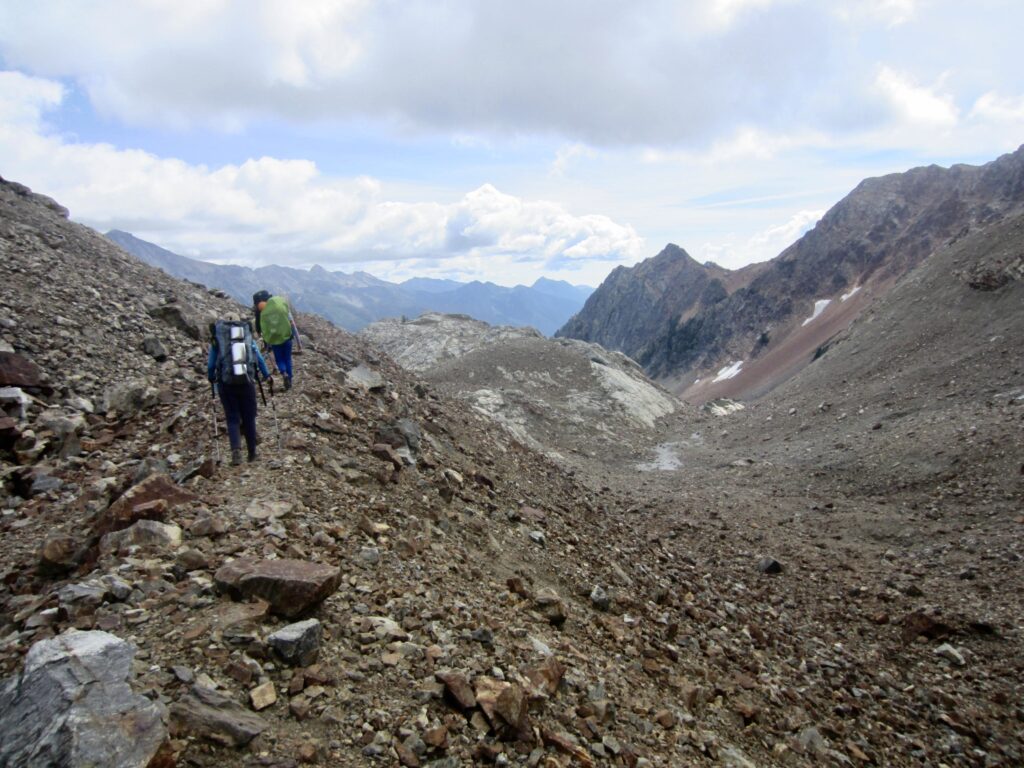
We crossed over Spider Gap in early afternoon (3.8 hours + 1600 feet from Camp 4) and stopped for lunch. Several other trekkers passed by us in the opposite direction, allowing us an opportunity to trade information about our respective conditions ahead. They warned us that the Spider Glacier was dicey to negotiate without micro-spikes or crampons, and they suggested that we stay on the rock margins. None of it sounded like fun.
.
We headed down the Spider Couloir, picking our way through unstable rocky terrain before reaching the first patch of ice. Because the surface had softened very slightly in the afternoon sun, Brooke, Andrew, and I chose to carefully step down the glacier, whereas Eileen chose to stay on the adjacent rock. Both tactics worked adequately, but there was no question that this couloir constitutes the technical crux of the entire trek.

.
.
After an hour of slow travel, we reached Spider Bench Camp and the upper terminus of the Phelps Creek Trail. We were now left with only a steep hike down the trail to Phelps Creek and then an easier hike through Spider Meadow. Unfortunately, wildfire smoke had settled into the open meadow, prodding us to continue down-valley in a quest for better air quality.
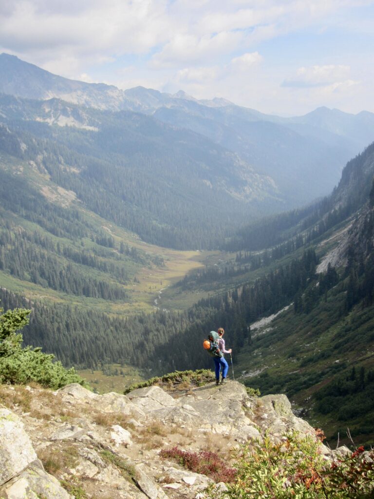
.
.
We passed by a small campsite at Leroy Creek and continued for another mile before stopping at a larger campsite on the Glacier Peak Wilderness boundary (8.7 hours + 1650 feet from Camp 4). This would be a very nice trailside campsite if not for the fact that there is no convenient access to water; I had to walk a mile back up to Leroy Creek to fetch water for dinner and breakfast. Sheesh! At least the air was pretty much smoke-free here.
.
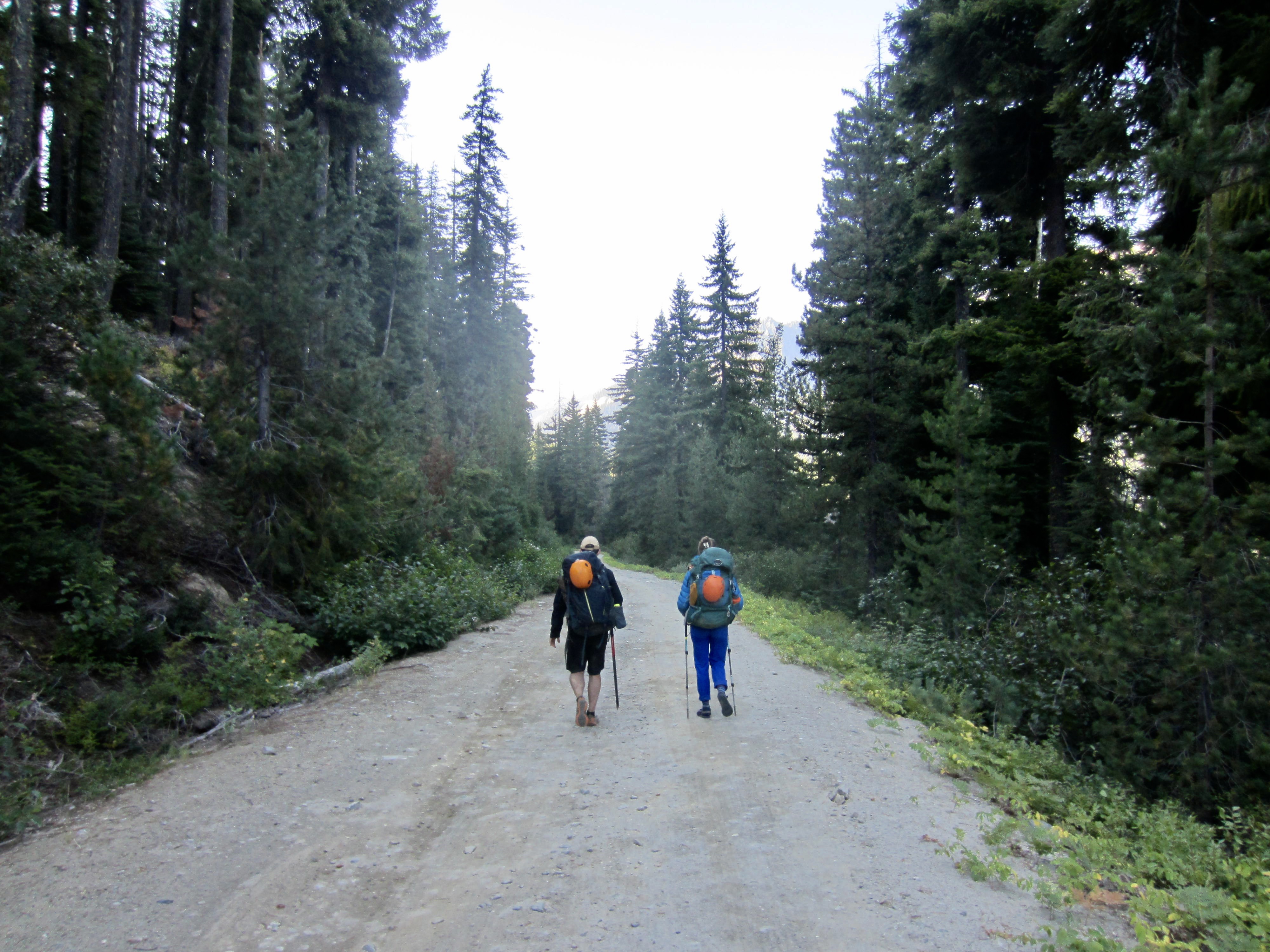
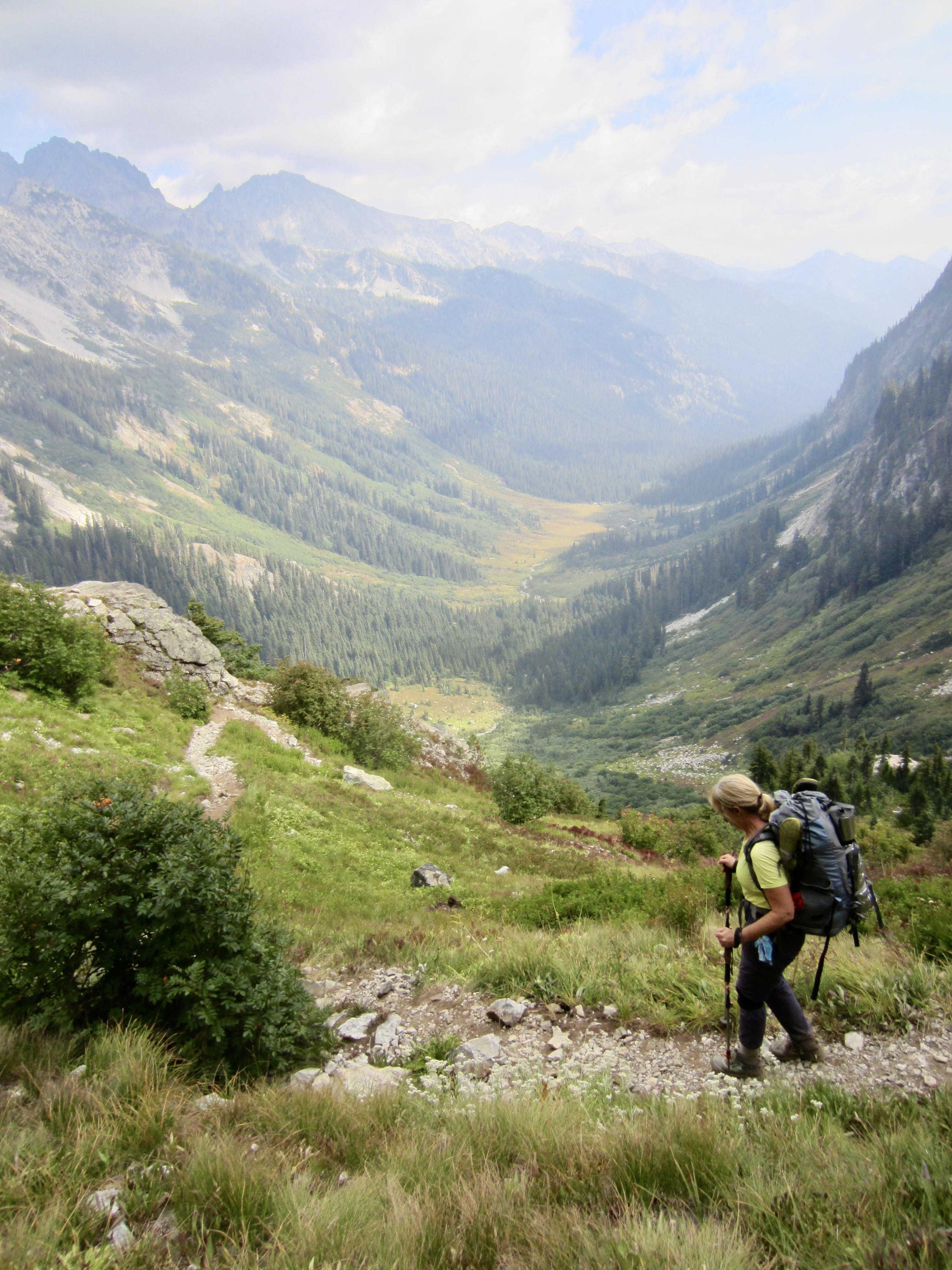
Day 6: Phelps Creek to Chiwawa River Trailhead
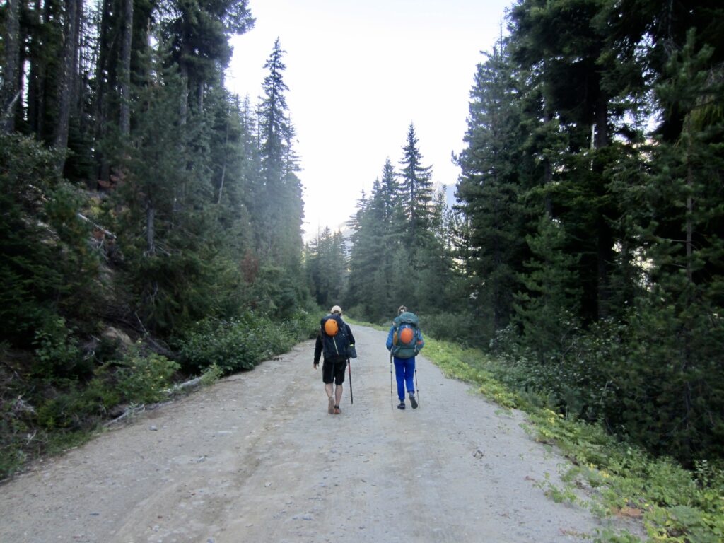
Following a clear, chilly night, we were all up at first light and back on the trail soon after. We reached the quiet Phelps Creek Trailhead parking lot within an hour and proceeded down the dirt road. At 9:30am (1.8 hours from Camp 5), we arrived at our car at the Chiwawa River Trailhead parking lot, thereby closing our loop and putting a bow on this excellent trek.
.
Route Map & Profile
.
.
Photo Gallery
Click to enlarge…