Trip Date: August 22-26, 2021
Alpine Lakes Traverse: Myrtle Lake to Chetwoot Lake to Necklace Valley
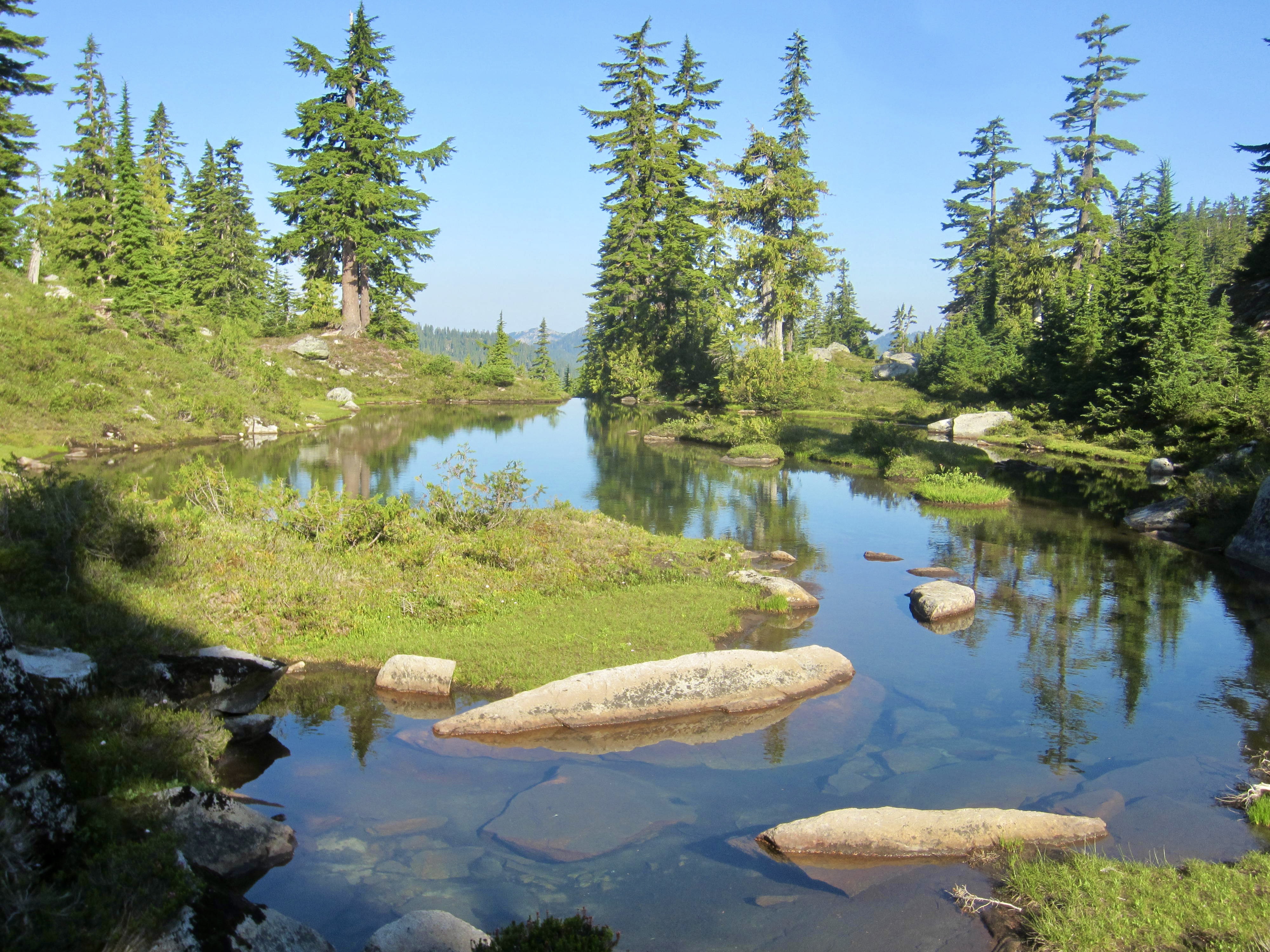
Myrtle Lake
Big Snow Lake & Snowflake Lake
Big Snow Mountain (6680 ft)
Hardscrabble Gap
Gold Lake
Wild Goat Peak (6305 ft)
Chetwoot Lake
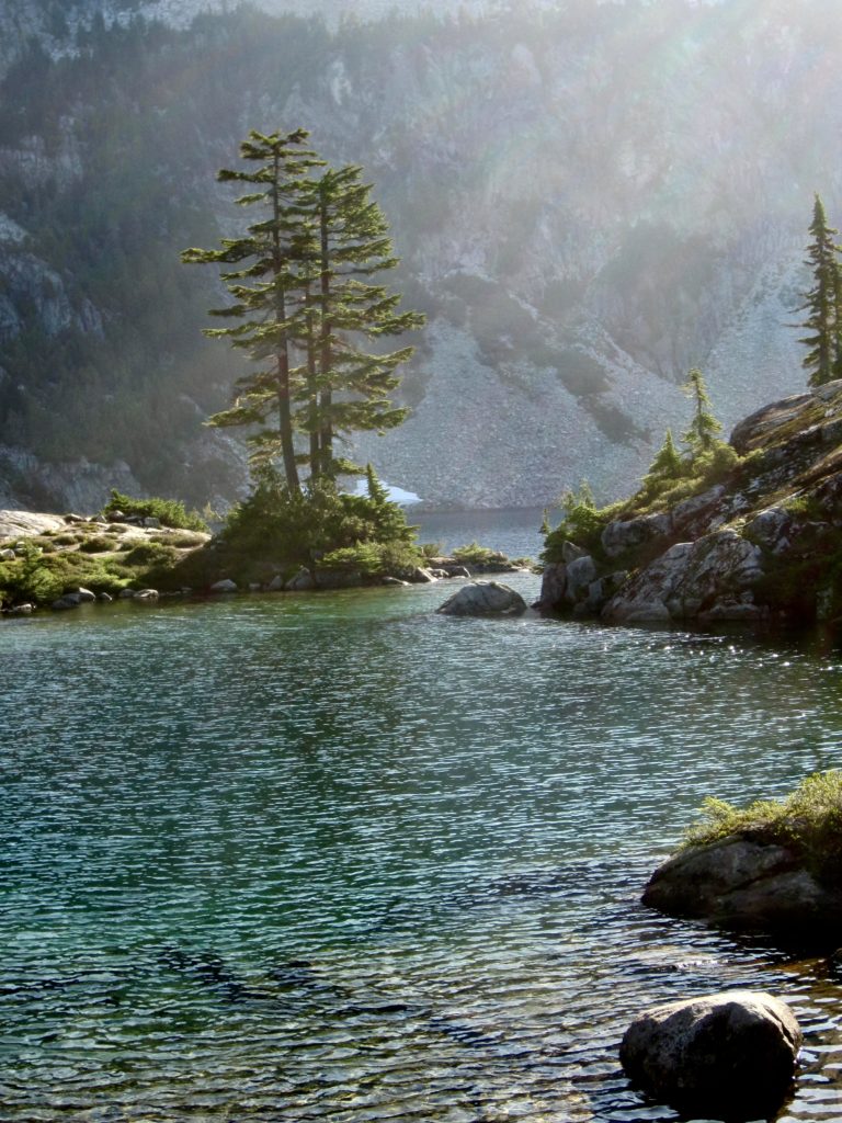
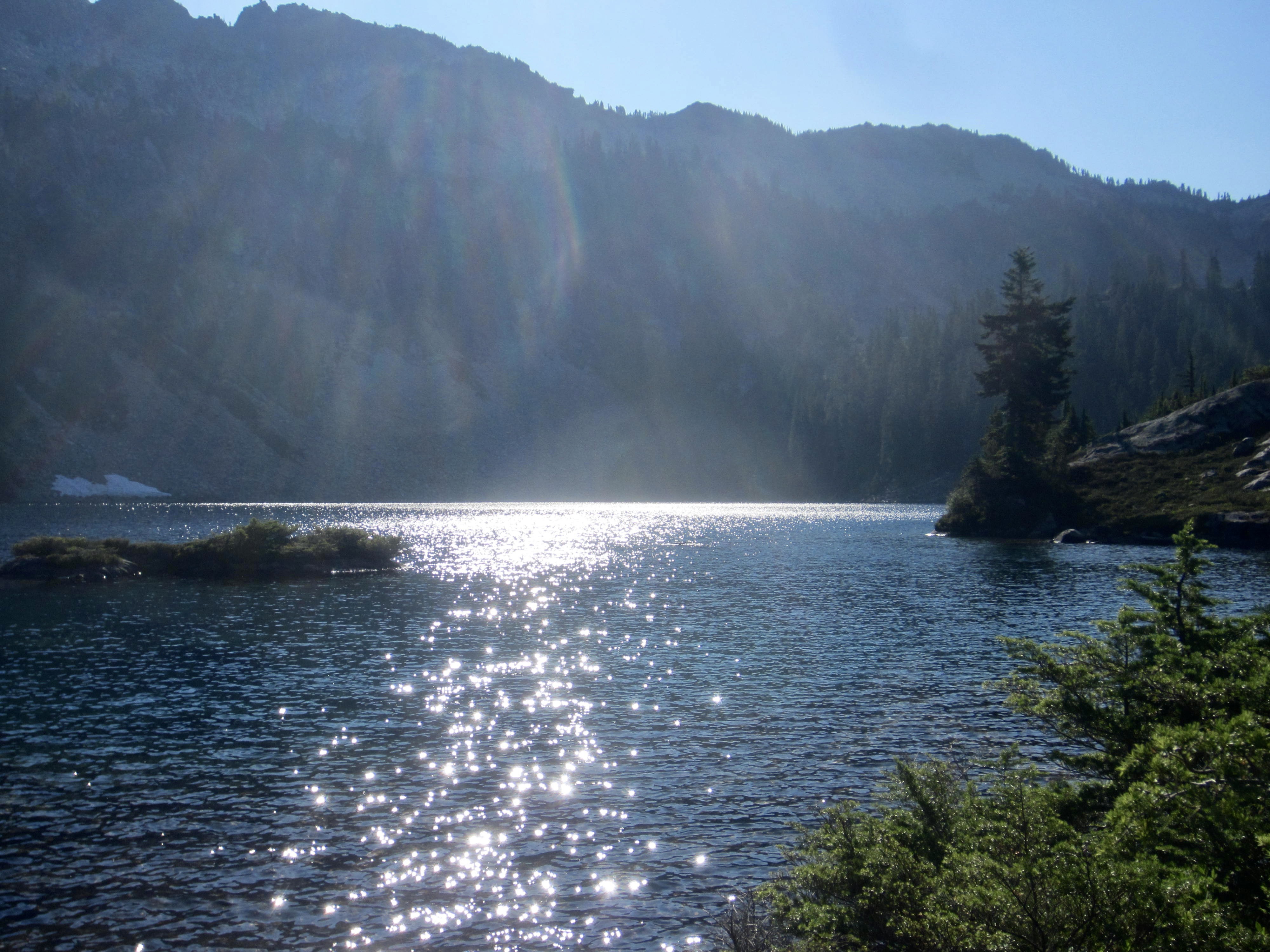
Azure Lake
Iron Cap Lake
Iron Cap Mountain (6347 ft)
Iron Cap Pass
Tank Lakes
Necklace Valley
Trip Report Summary
Region: Central Washington Cascades
Sub-Region: Miller–Foss Mountains
Area: Alpine Lakes Wilderness
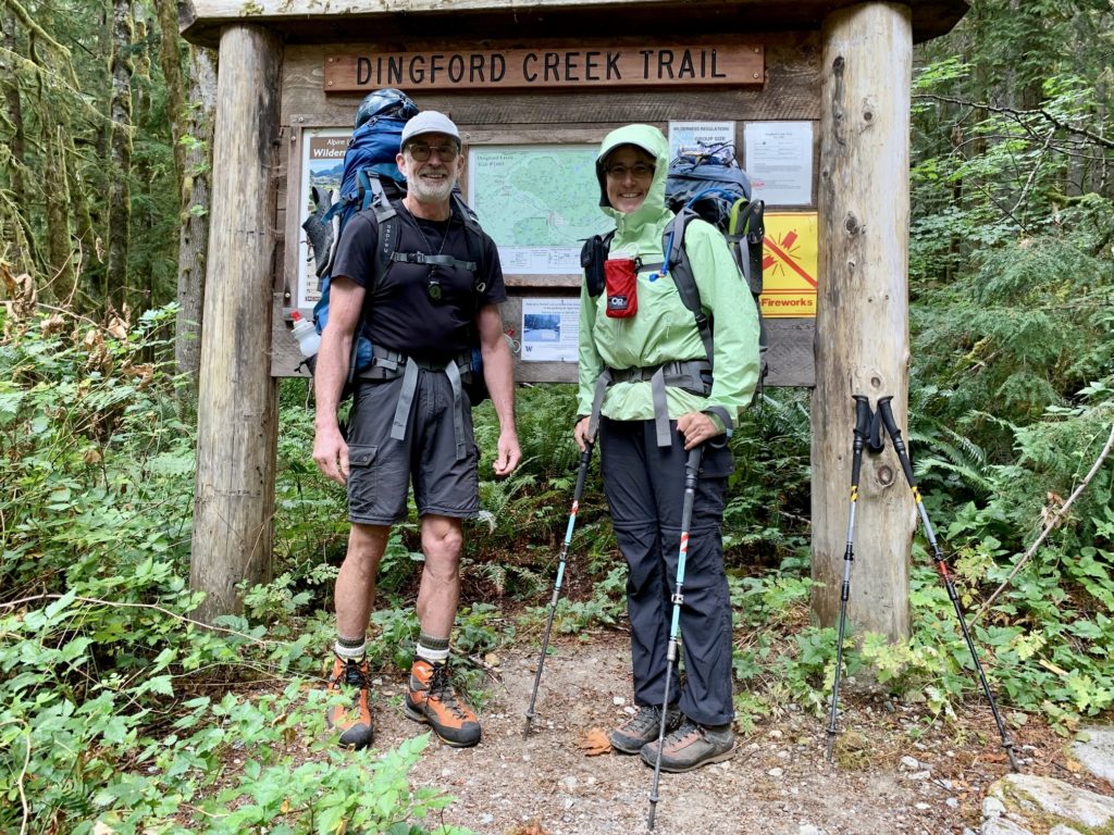
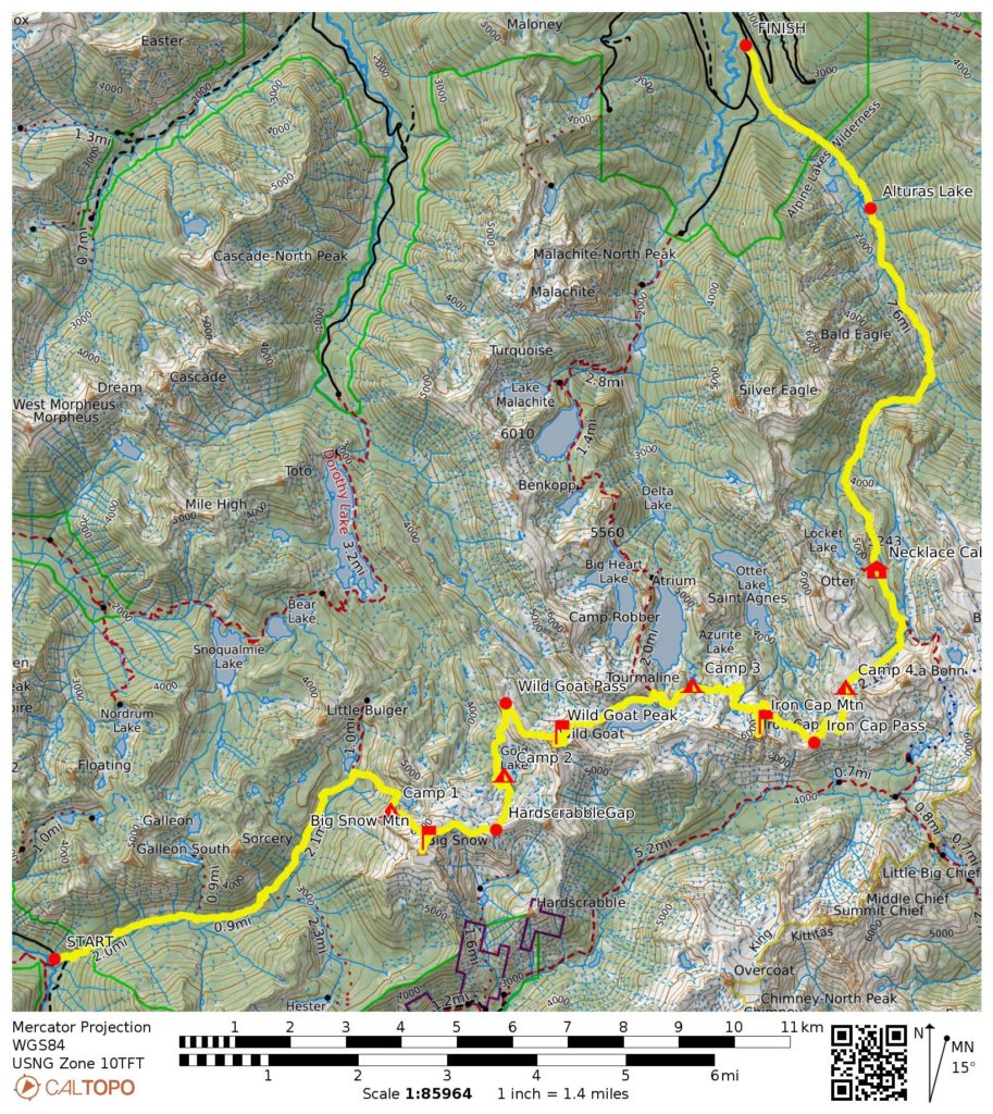
Starting Point: Dingford Creek Trailhead on Middle Fork Snoqualmie River Road (Elev. 1400 feet)
Way Points: Dingford Creek & Goat Creek & Myrtle Lake & Big Snow Creek & Big Snow Lake & Snowflake Lake & Big Snow Mountain summit & Hardscrabble Gap & Gold Lake Tarns & Gold Lake Knoll & Gold Lake & Wild Goat Pass & Wild Goat Peak slope & Chetwoot Lake & Little Chetwoot Lake & Azure Tarns & Azure Lake & Iron Cap Knob & Iron Cap Lake & Iron Cap Mountain slope & Iron Cap Basin & Iron Cap Pass & Tank Lakes Plateau & South Tank Lake & Tank Pass & Necklace Valley & Opal Lake & Necklace Cabin & Jade Lake & Necklace Creek & East Fork Foss River & Alturas Lake & Burn Creek Bridge (trail hike & bushwhack & off-trail hike & rock scramble)
Ending Point: East Fork Foss River / Necklace Valley Trailhead on Foss River Road #68 (Elev. 1650 feet)
Campsites: Snowflake Lake & Gold Lake Knoll & Azure Lake & South Tank Lake
Summit: Big Snow Mountain (rock scramble via Northwest Slope—Northeast Ridge; descent via Northeast Ridge)
Summit: Wild Goat Peak (rock scramble via Northwest Slope—East Ridge; descent via East Ridge—Northeast Slope)
Summit: Iron Cap Mountain (rock scramble via Northwest Slope—North Ridge; descent via North Ridge—Northeast Nose)
Approximate Stats (including all sidetrips): 28 miles traveled; 11,100 feet gained; 10,850 feet lost.
Related Posts
>>> Big Snow Mtn Loop + Summit Camp: Dingford Creek to Hardscrabble Creek – July 2017
>>> LaBohn Lakes — Tank Lakes Loop + Little Big Chief Peak – August 2014
>>> Big Snow Mtn via Dingford Creek–Myrtle Lake – July 2004
Trip Overview
Anybody who has thoroughly perused Volume 1 of the Cascade Alpine Guide (CAG) has probably seen the sketch showing an “Alpine Lakes High Route” winding curvaceously through the heart of the Alpine Lakes Wilderness. This enticing cross-country route begins at Lake Dorothy and ends in the Necklace Valley. Over the course of about 10 miles, it touches ten named lakes and at least as many smaller, unnamed lakes. When considering that the route passes within a mile of a dozen other named lakes, it begins to look like a high-laker’s delight. Peak-baggers will also notice the opportunity for tucking in several worthy summits along the way.
The complete traverse presented in the CAG covers about 20 miles total (10 miles on trail + 10 miles off trail) and requires a 30-mile car shuttle between trailheads on the Miller River and East Fork Foss River. A more popular variation, however, begins at the West Fork Foss River Trailhead rather than Lake Dorothy Trailhead. This variation involves more trail miles, fewer cross-country miles, a few more lakes, and—perhaps best of all—a car shuttle of only about 3½ miles. In fact, the two trailheads are so close together that many trekkers simply walk the road rather than hassle with a car shuttle.
Eileen and I had been drooling over the Alpine Lakes Traverse for many years, but we really wanted to do an extended version starting at the Dingford Creek Trailhead on the Middle Fork Snoqualmie River. This would allow us to tuck in Big Snow Mountain—a peak high on Eileen’s wish list—while avoiding the notoriously unsavory bushwhack from Lake Dorothy to Gold Lake. The main problem with such an extended traverse, however, was the need for a long car shuttle between trailheads on the Snoqualmie River and Foss River. It remained an unsolved problem year after year until, rather suddenly, we fell into an opportunity for a drop-off by Fay P. and a pick-up by Jim A. Problem solved!
Full Trip Report
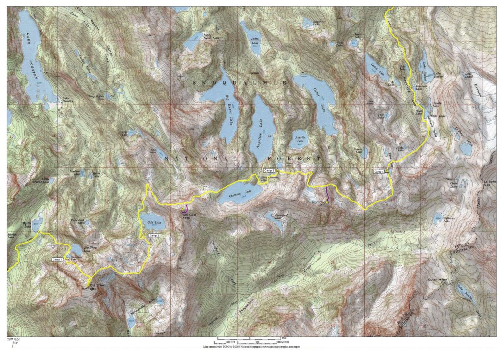
Day 1: Dingford Creek Trailhead to Snowflake Lake
Fay dropped off Eileen and me at the Dingford Creek Trailhead on a cool, gray, drizzly Sunday morning. We arrived just as Middle Fork aficionado Monty V. was heading up the road with a work party, and we were all surprised by the large number of vehicles parked here—more than any of us had ever seen before. It seems to be a sign of current times that even unpopular trailheads are crowded on marginal-weather days.
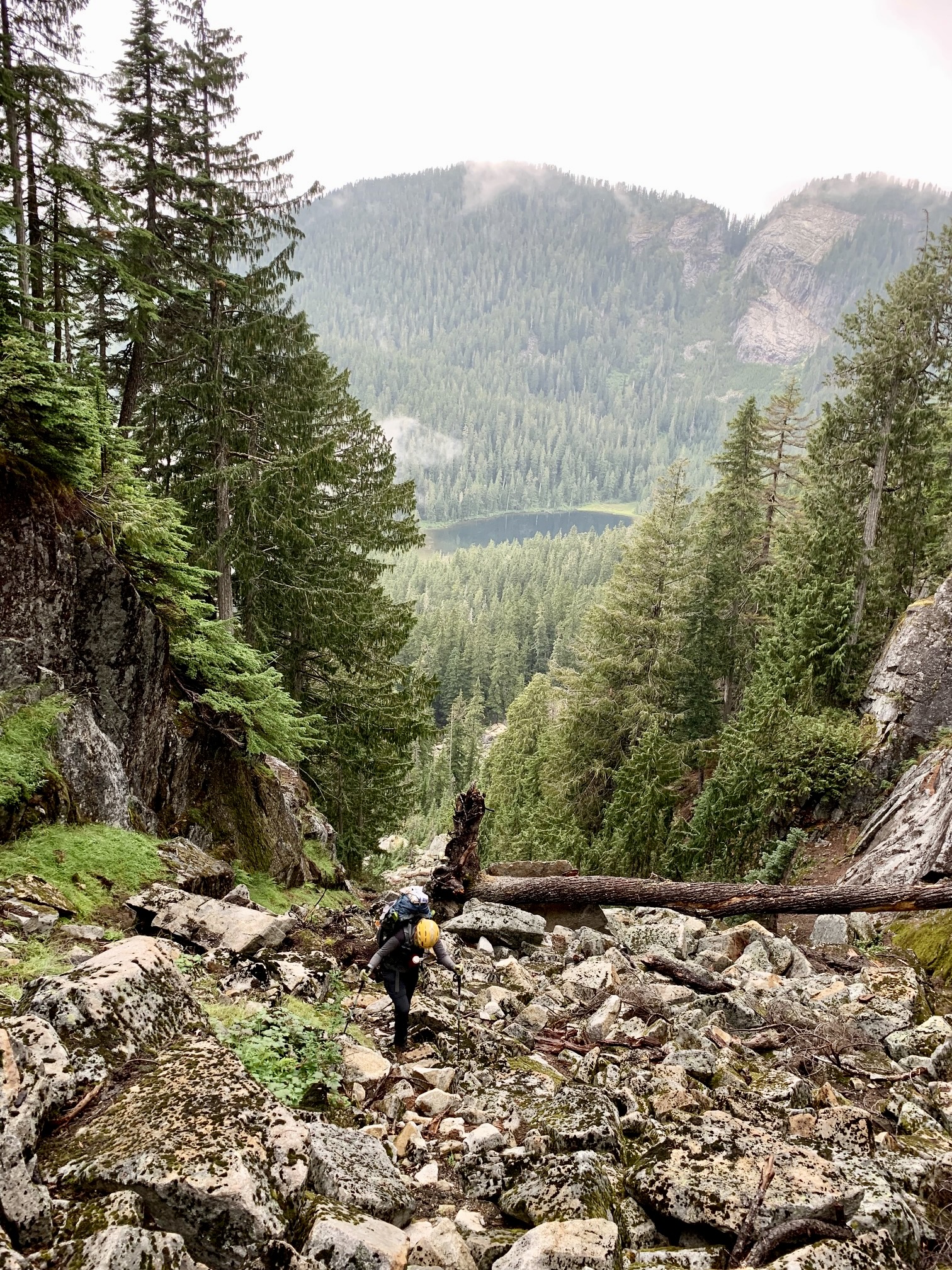
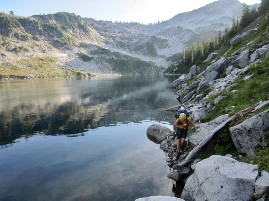
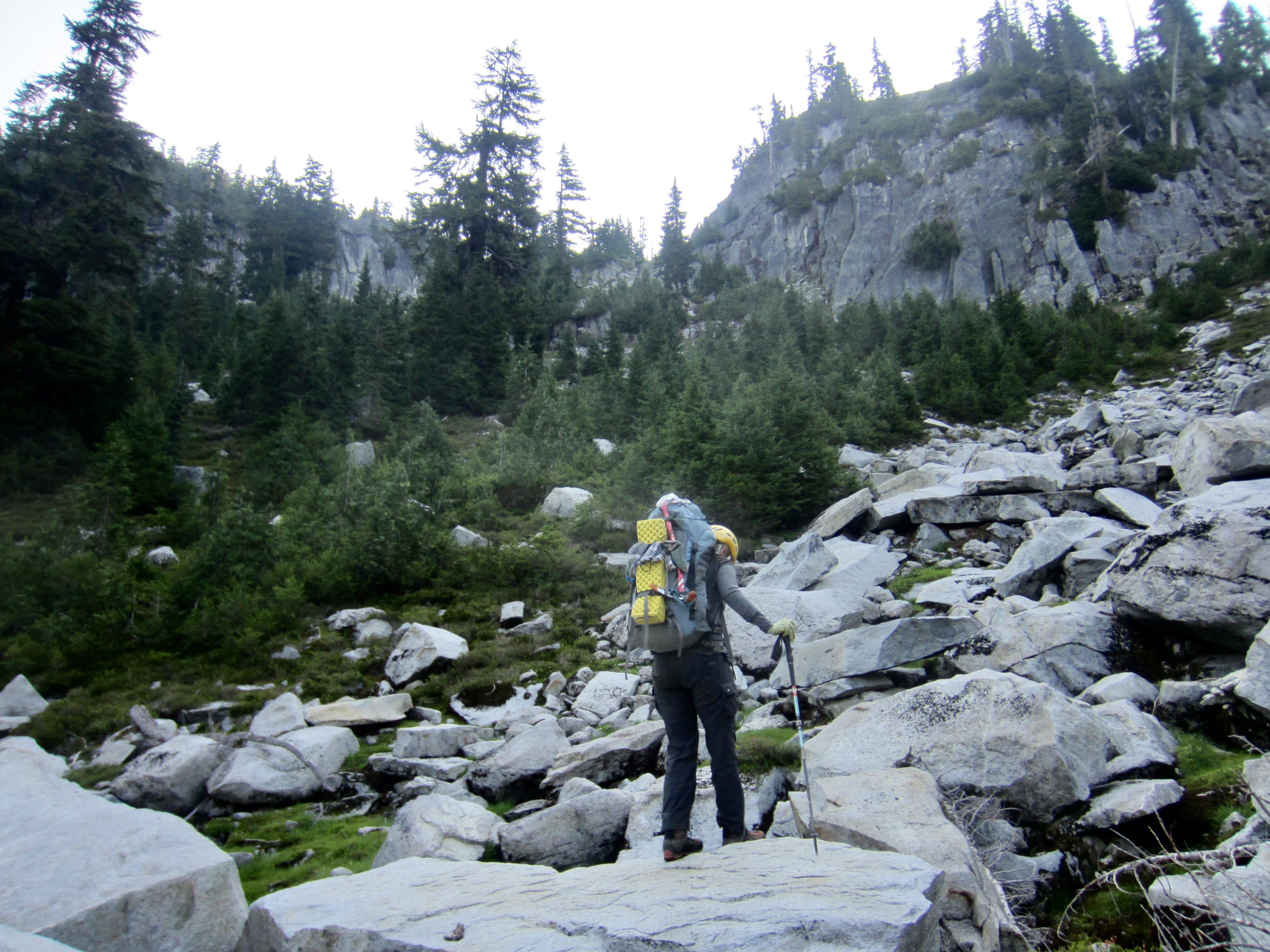
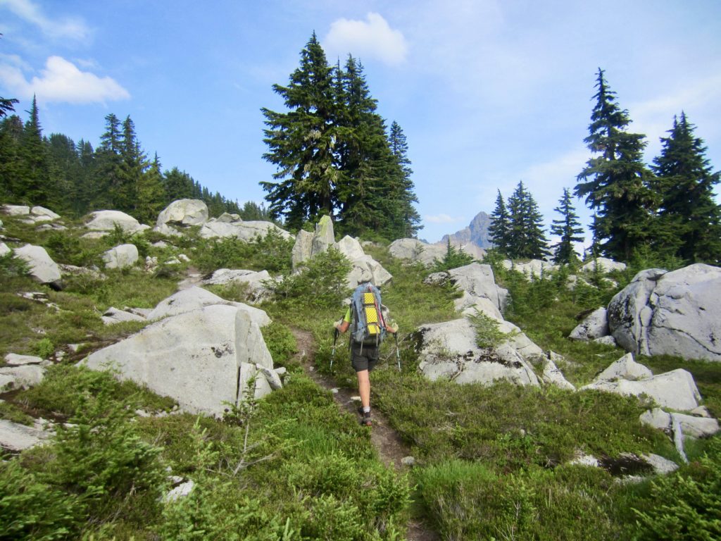
Eileen and I hiked up to Myrtle Lake, then took a hard right turn and plunged into the brush. Although it had stopped raining by now, all of the vegetation was saturated; we both got drenched while struggling through the huckleberry bushes, firs, and scrub cedars.

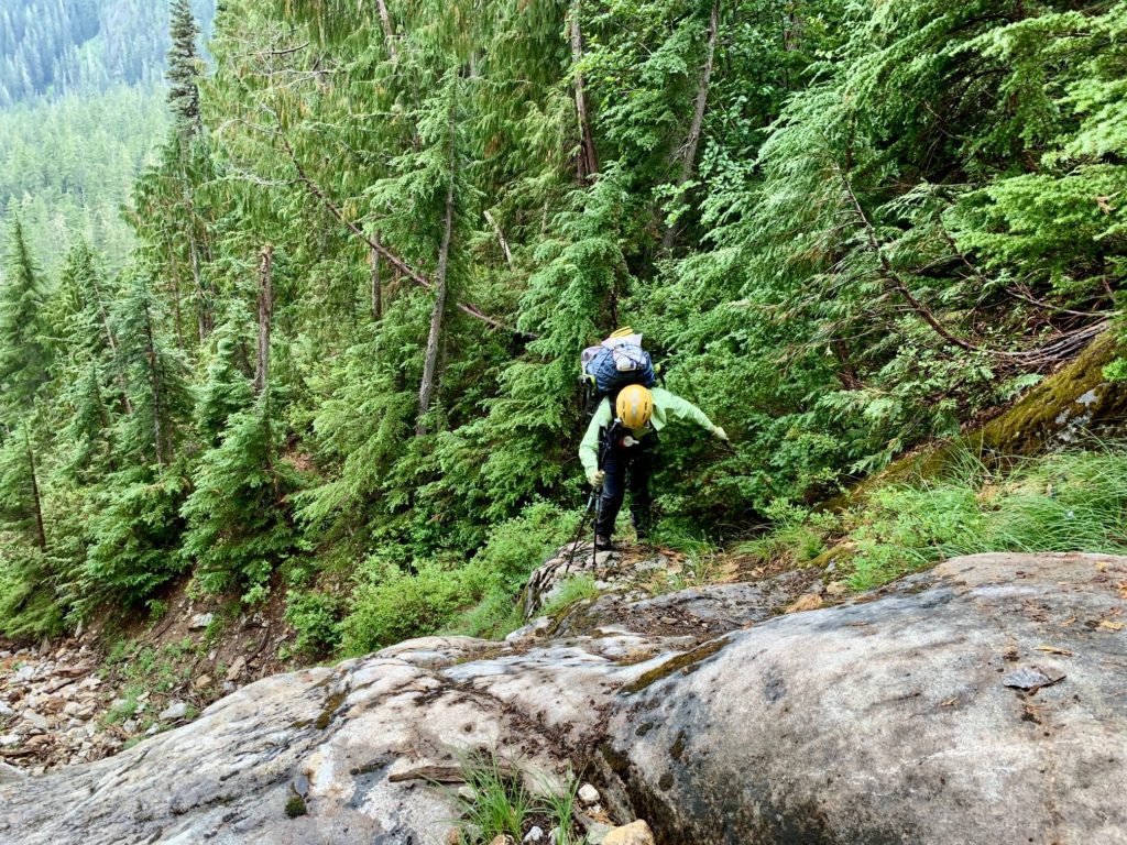
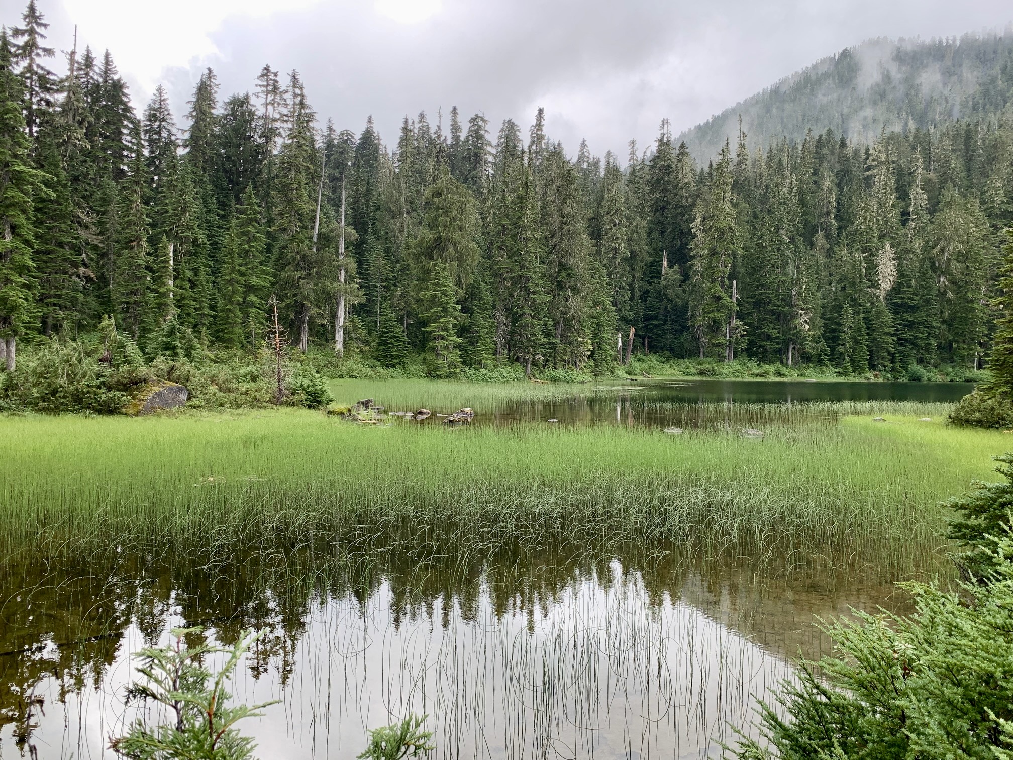
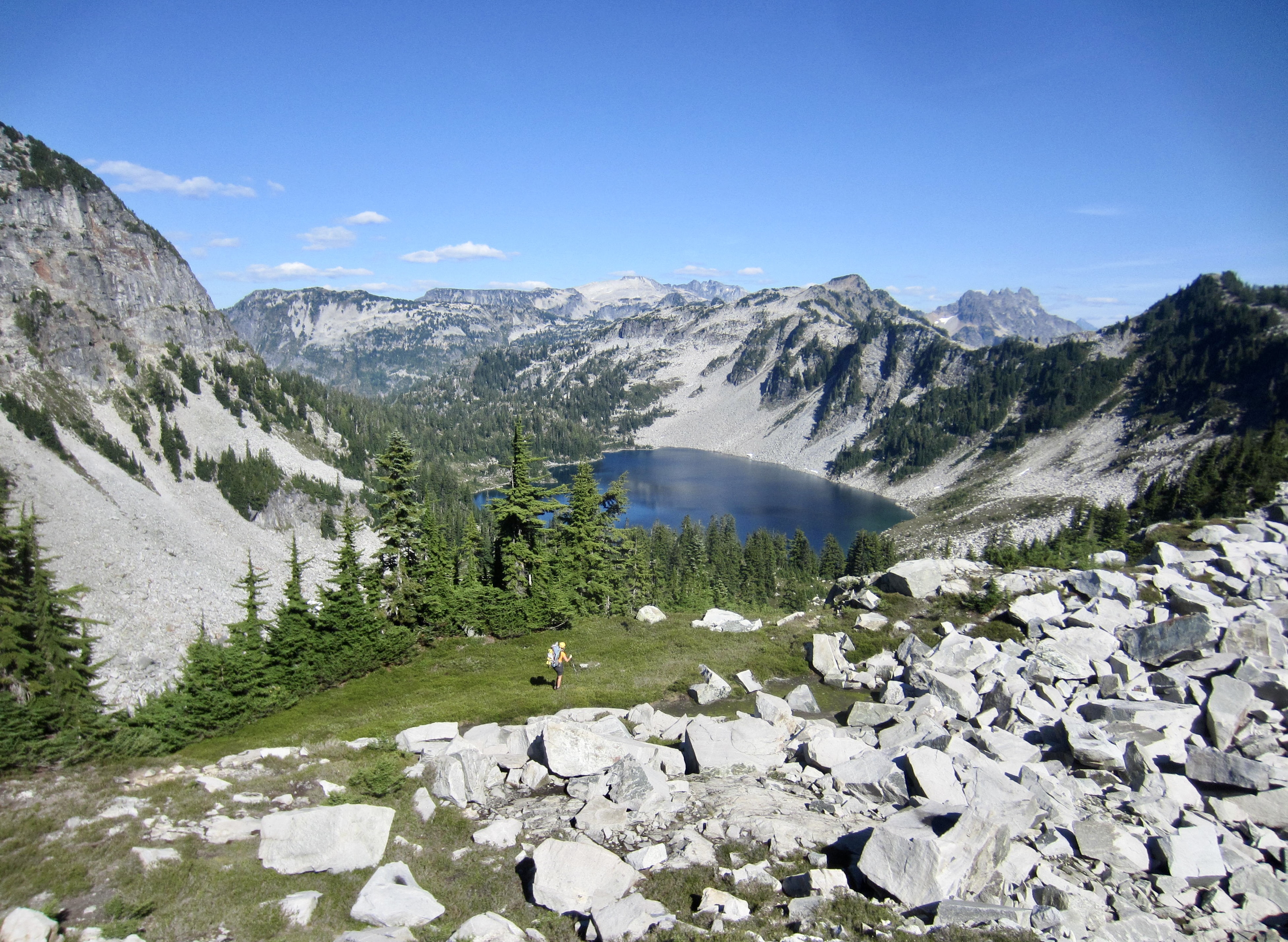
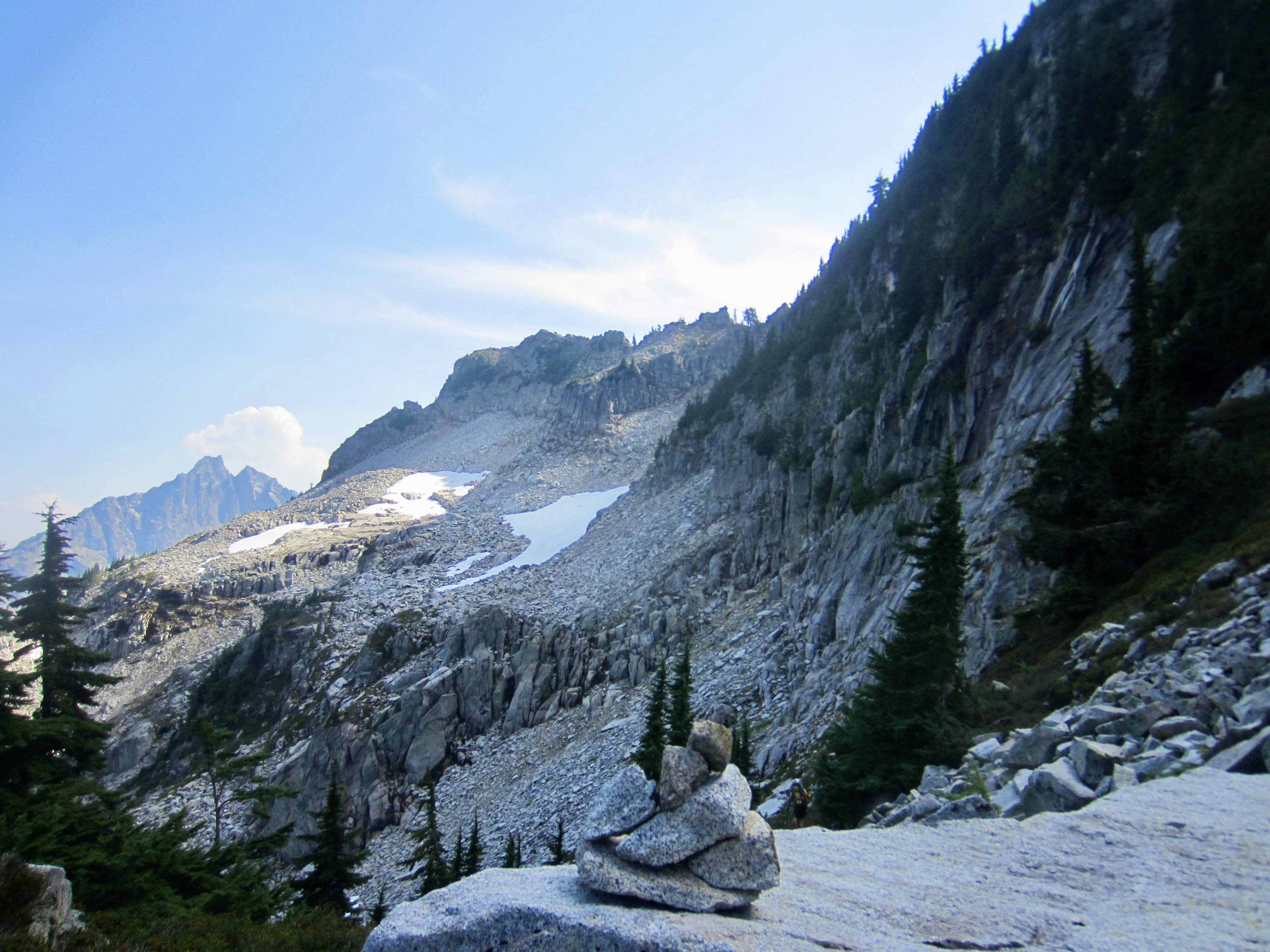
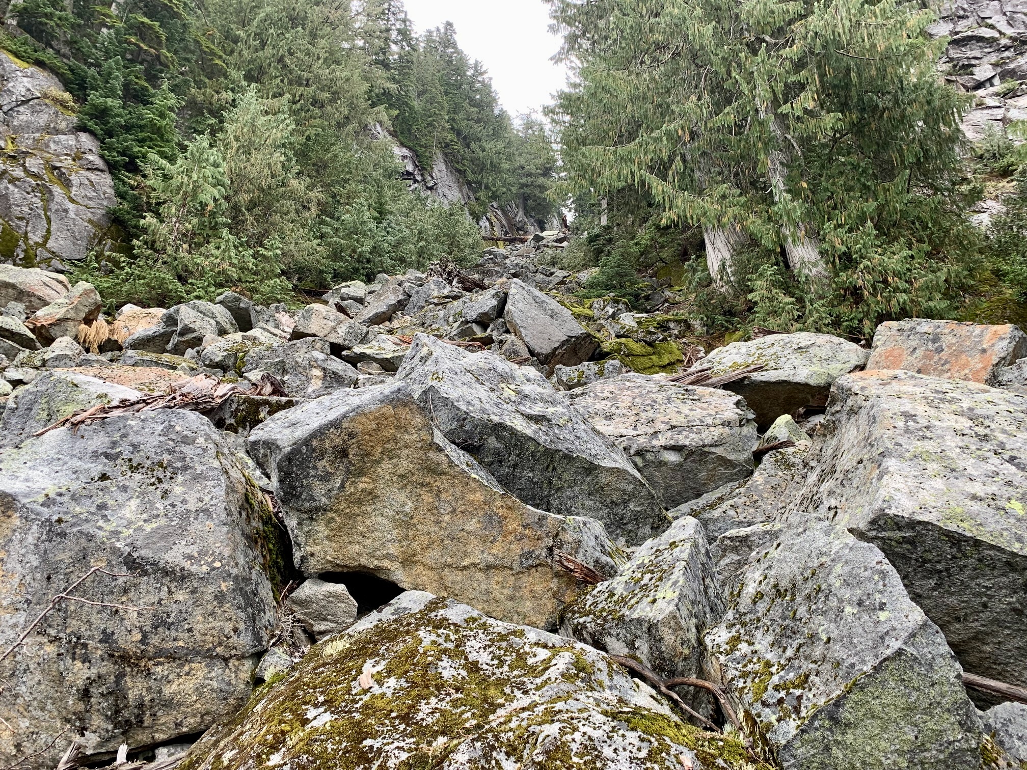
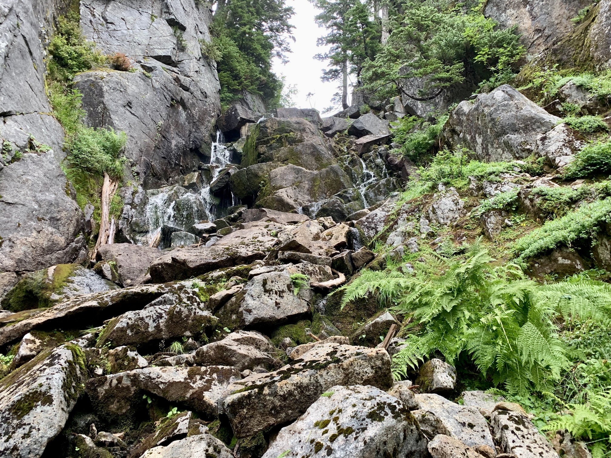
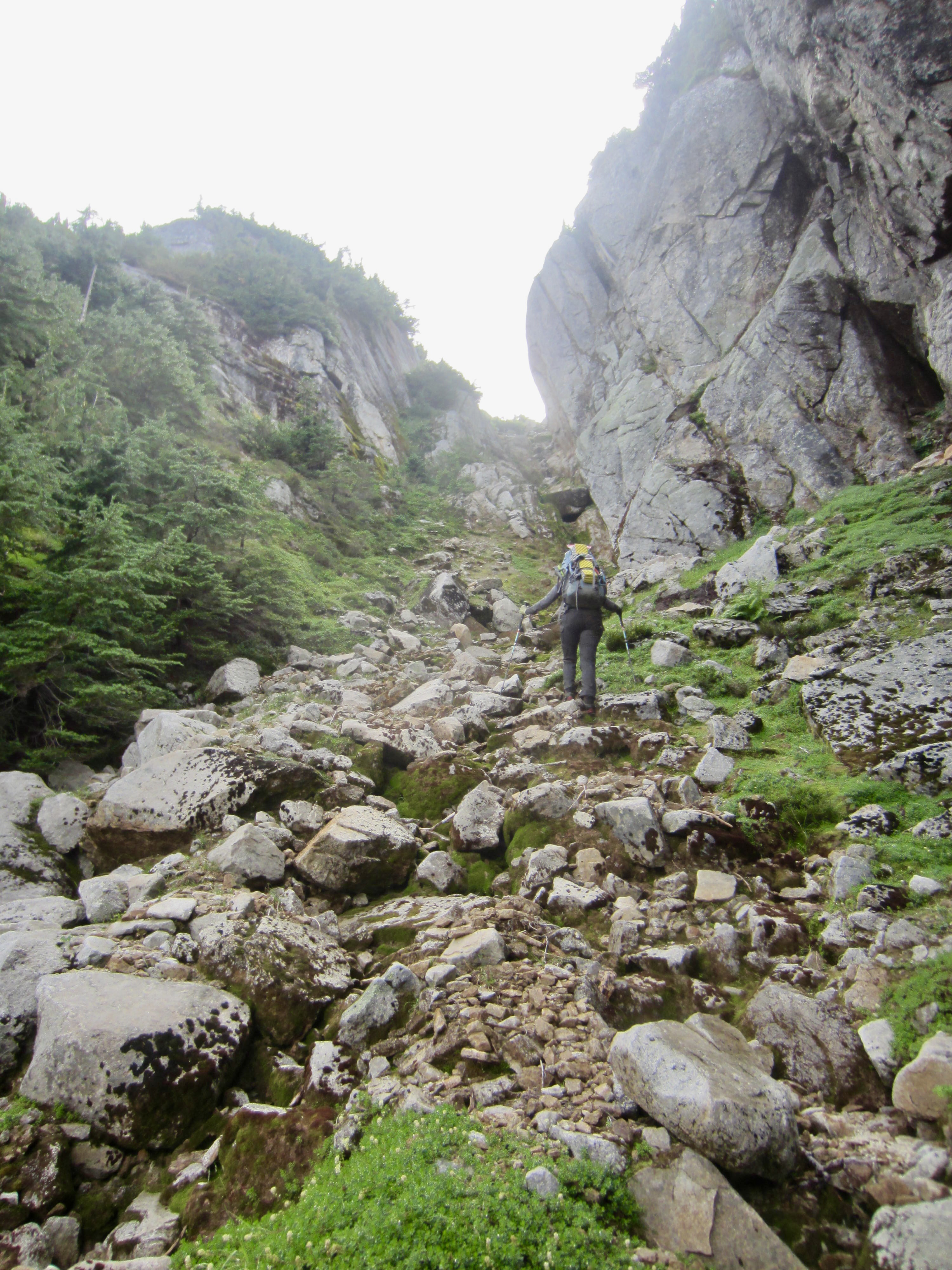
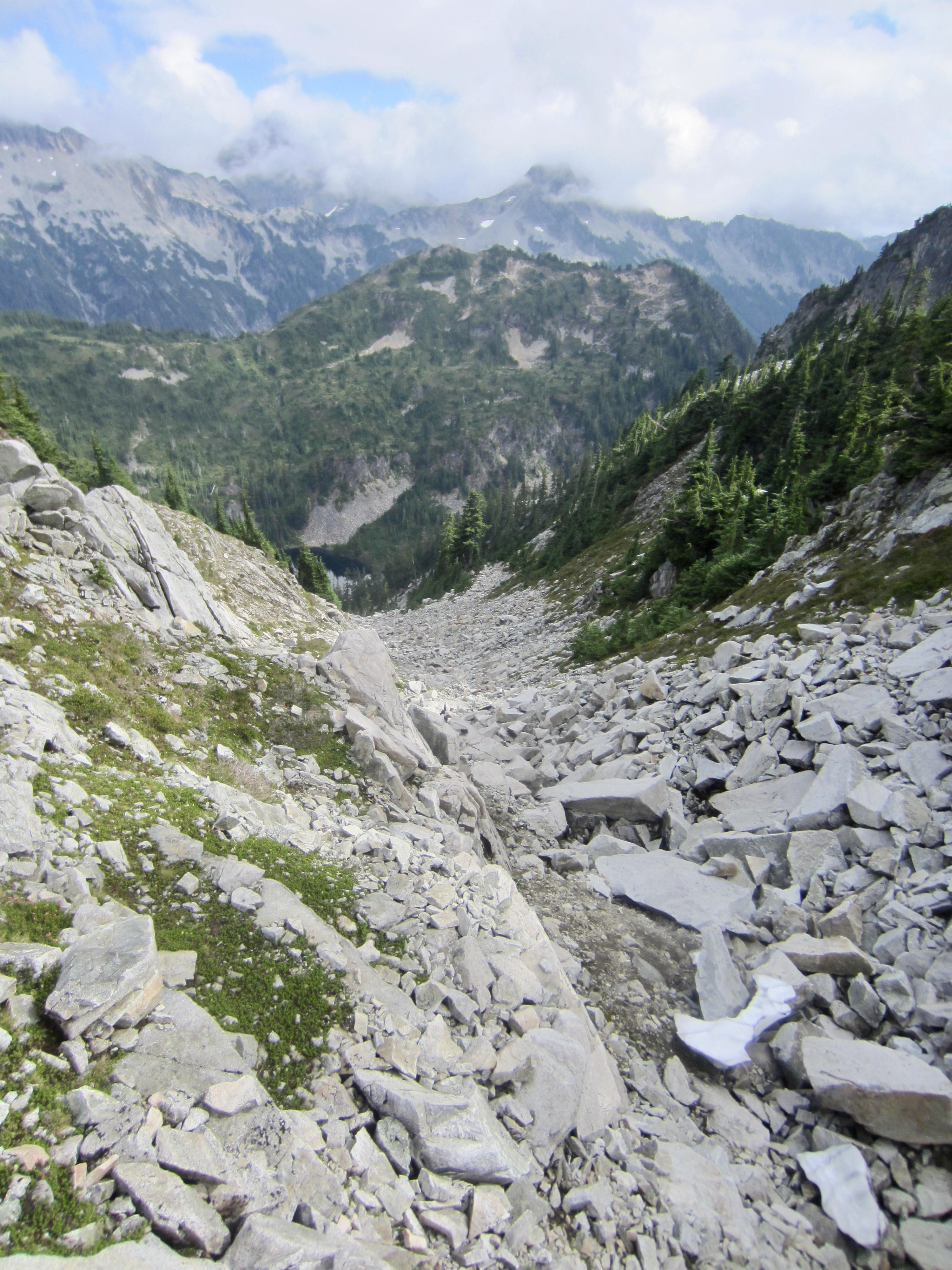
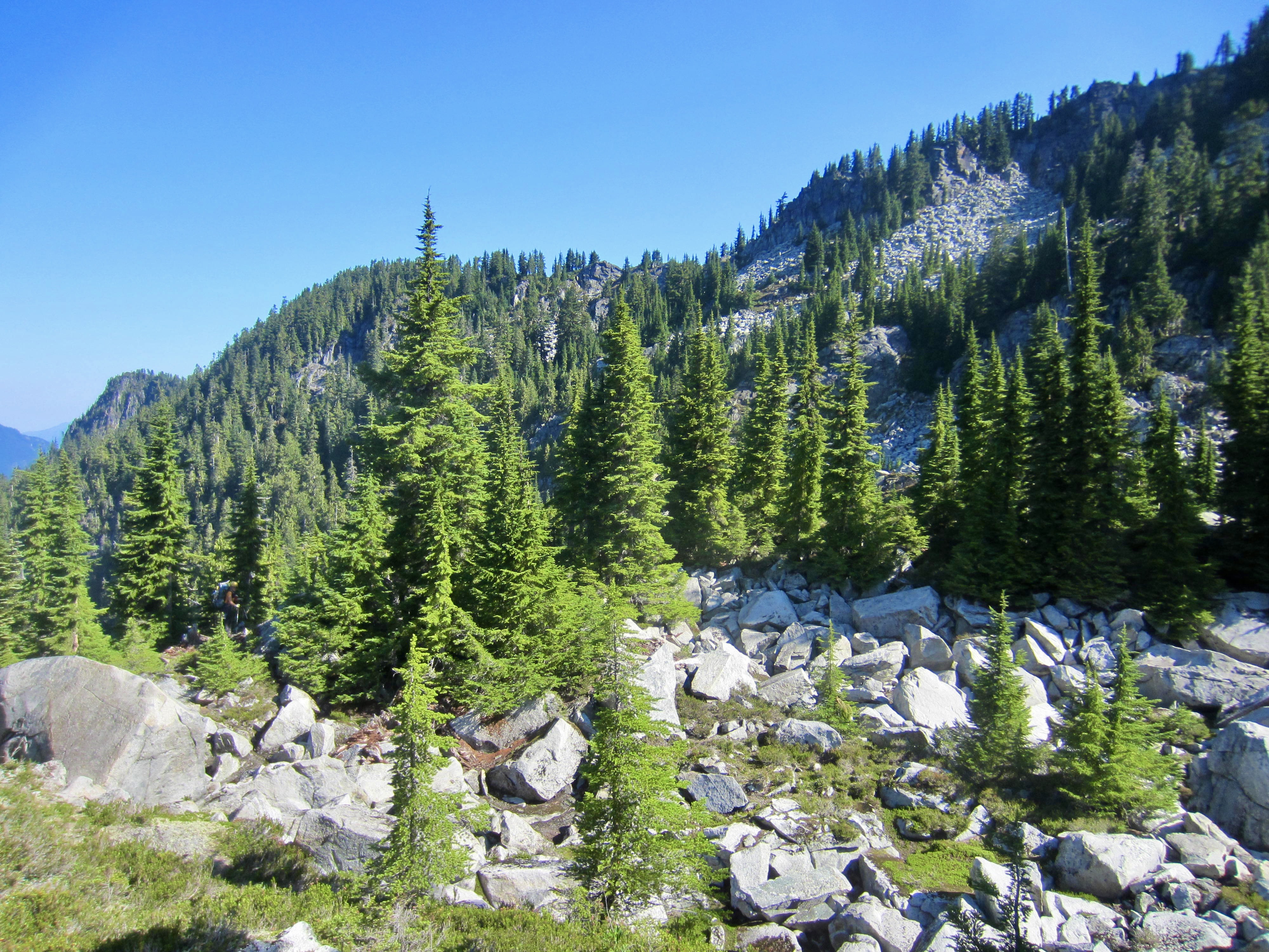
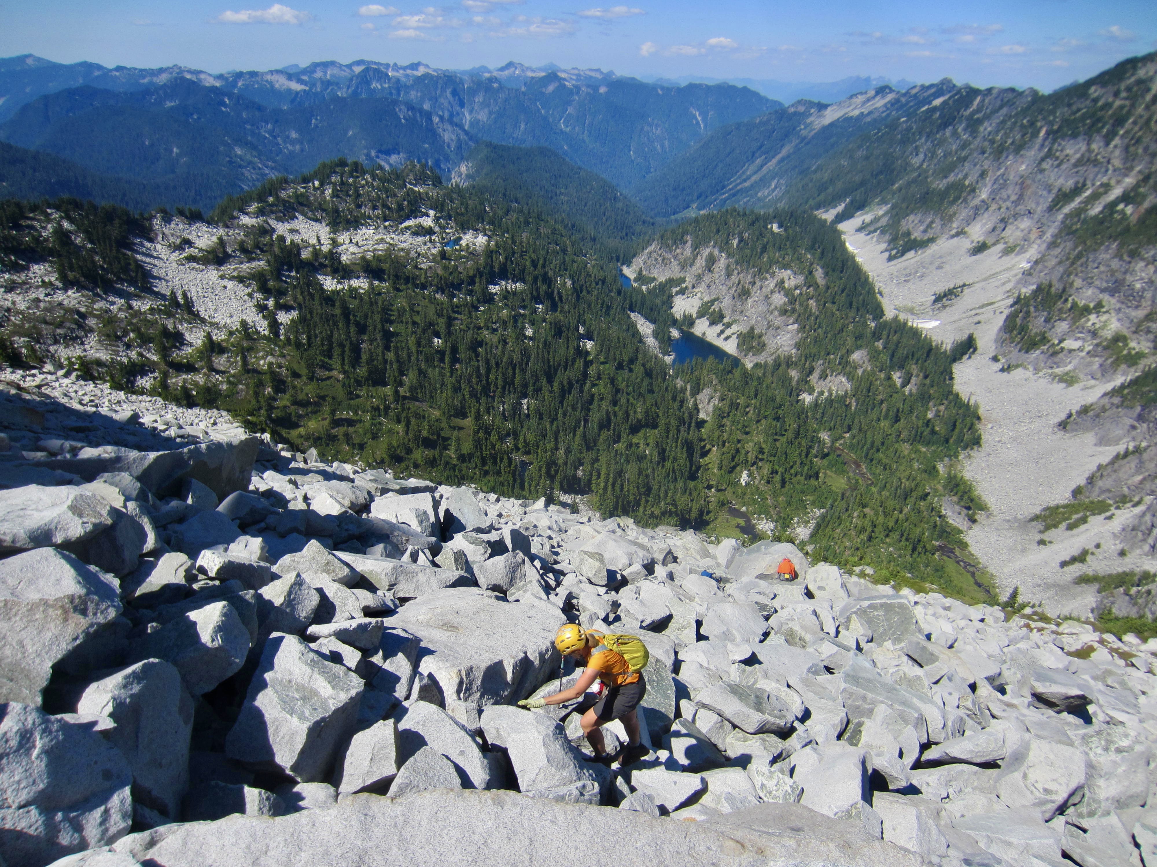
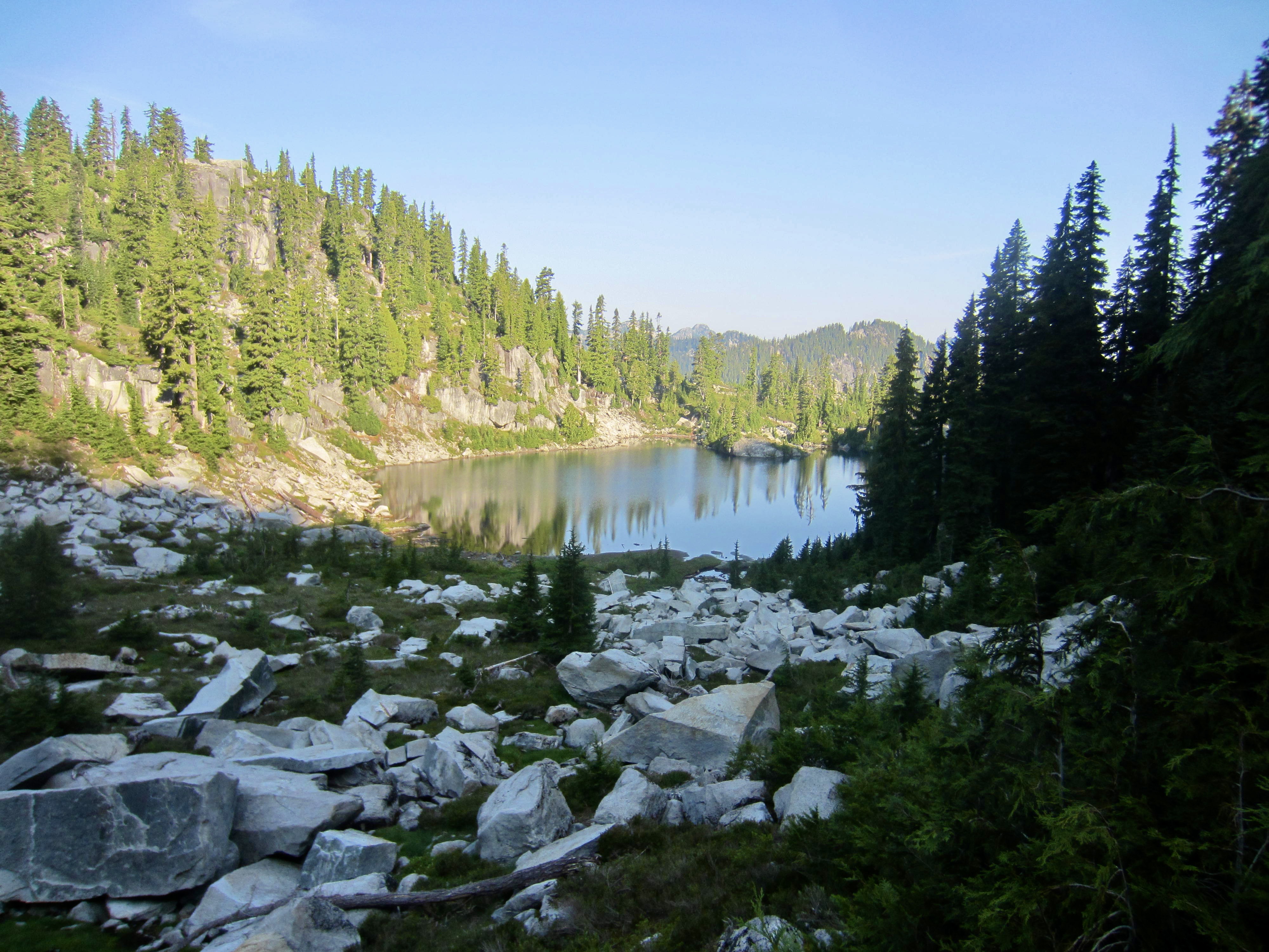
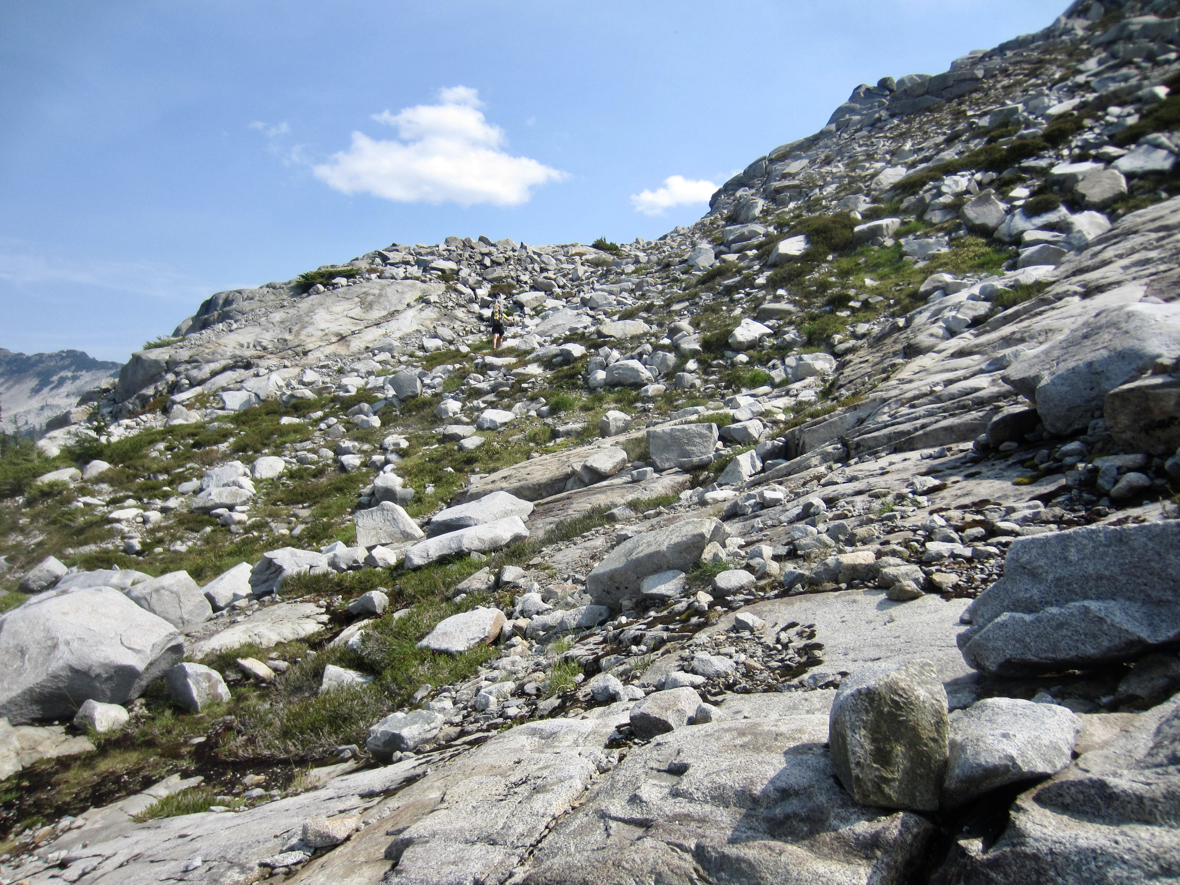
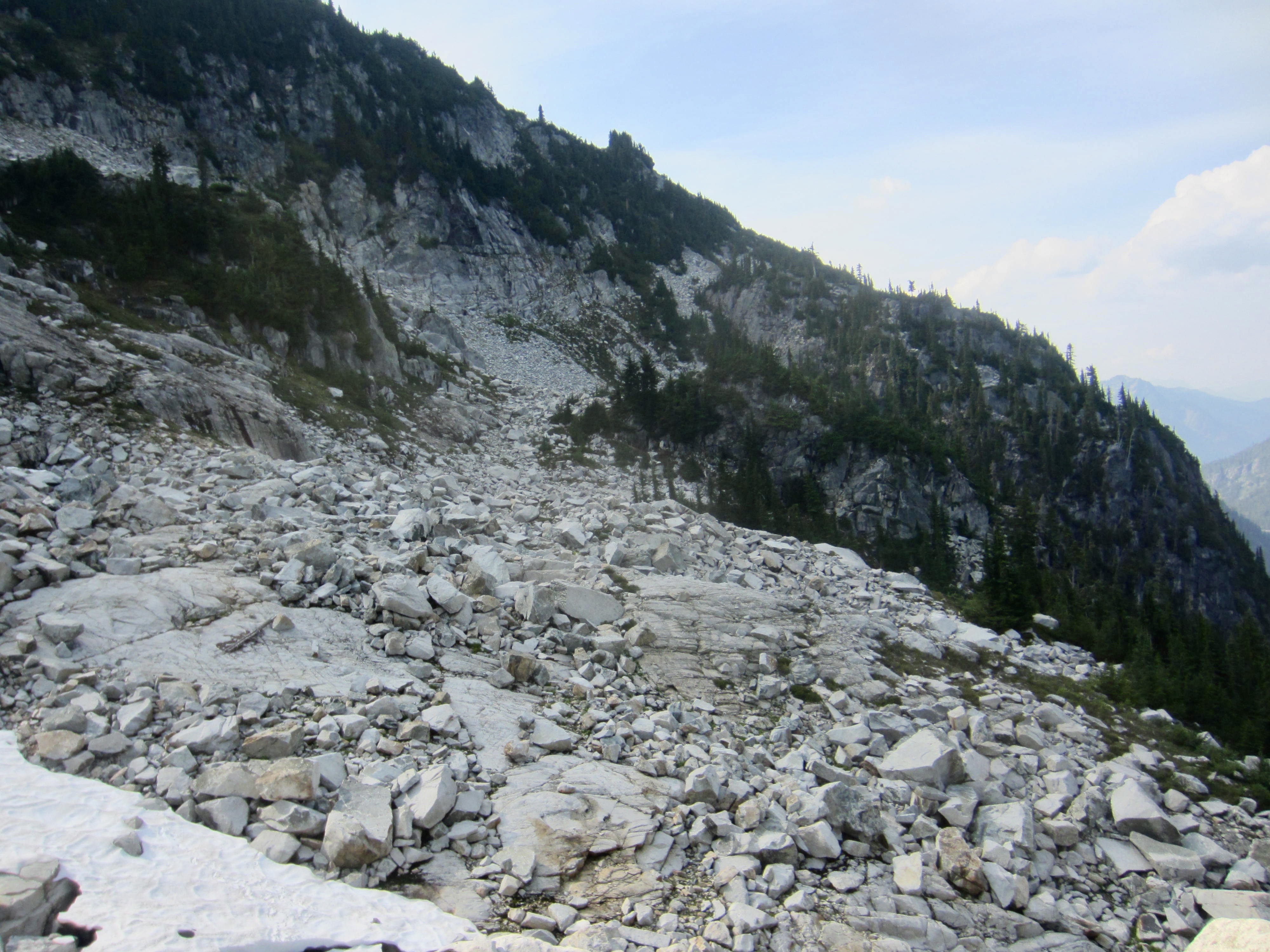
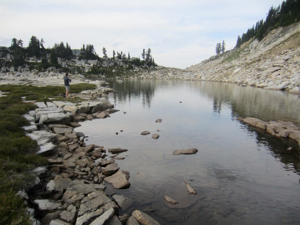
After gaining 400 feet through the vegetative car-wash, we happily broke out onto an open field of large boulders. This boulderfield funneled us into a gully (fondly known as “Snowflake Lane”) that carries Big Snow Creek. Another 700 feet of hiking and easy scrambling, as well as a few tricky Class 3 moves at the top, took us to Big Snow Lake—the first of many beautiful alpine lakes encountered during our traverse.
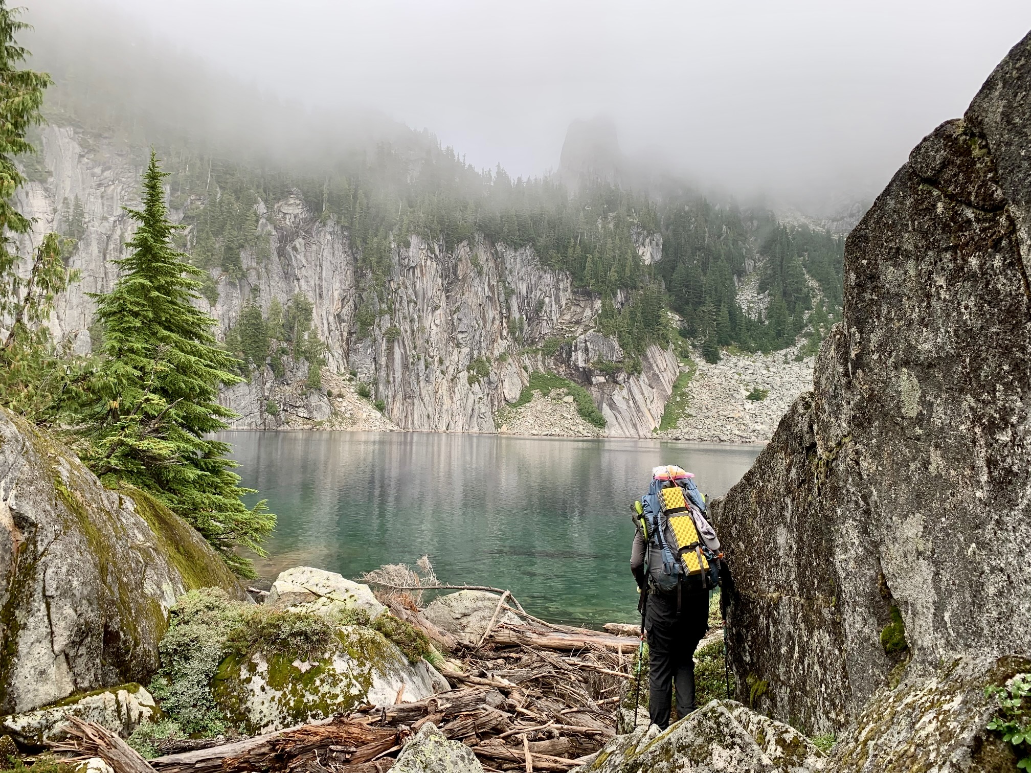

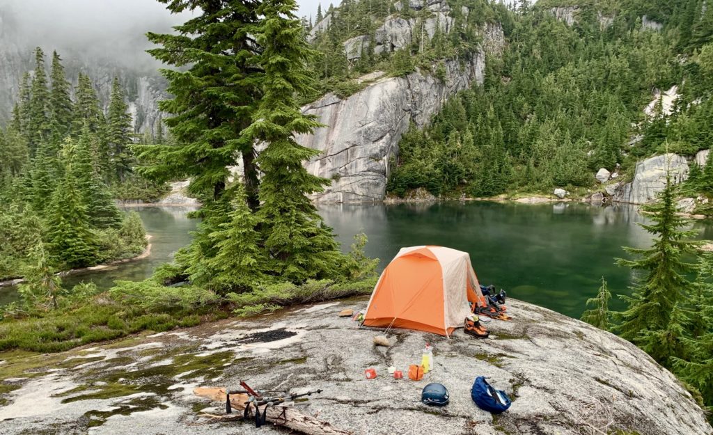
A short path led us over to Snowflake Lake (7.4 hours + 6.3 miles + 3600 feet from TH), where we made camp on a rock outcrop. Dismal weather and wet clothing was not how we envisioned the start of this five-day trek, but the forecast did call for sunshine by noon tomorrow.
Day 2: Snowflake Lake to Gold Lake
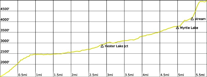
We were disappointed to awake to low clouds and swirling fog in the morning. Banking on the favorable midday weather prognostication, we delayed our departure for Big Snow Mountain until 10:40am.

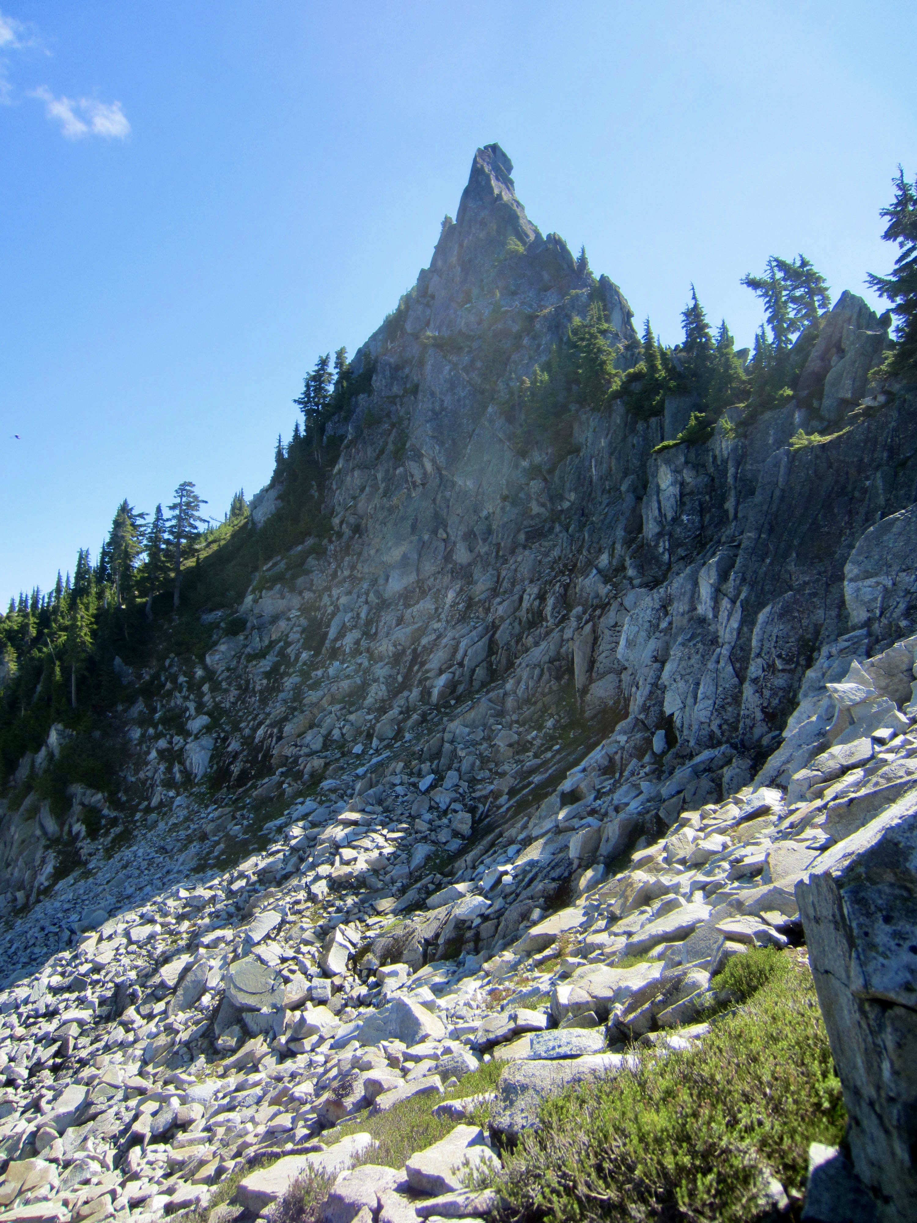
From Snowflake Lake, we followed a vague bootpath up to a heather bench overlooking the lake, then scrambled up a green gully that cuts through a large cliff band. Broad slopes of heather, boulders, and slabs allowed for a relatively easy ascent to Big Snow’s northeastern ridge. Along the way, we passed by “The Raptor,” a distinctive rock pinnacle perched on the mountain’s northwest rib.
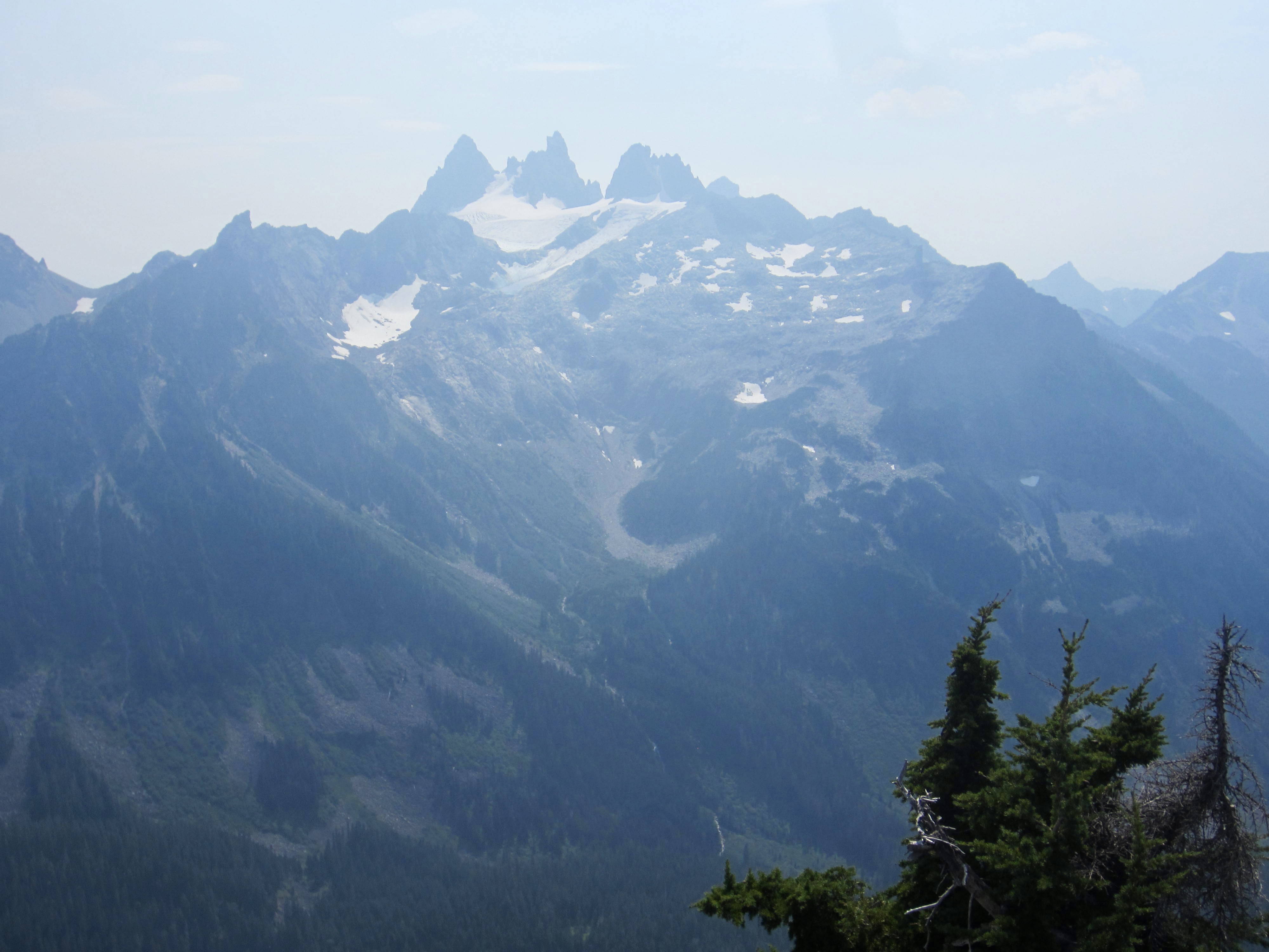
Upon reaching the ridge crest, we turned right and made a short scramble to the summit (2.7 hours + 1600 feet from Camp 1). It was now early afternoon but there was no evidence of improving weather; low clouds still shrouded all of the surrounding peaks. At least the valley fog had cleared enough to allow views down to Gold, Dorothy, Big Snow, and Myrtle Lakes.
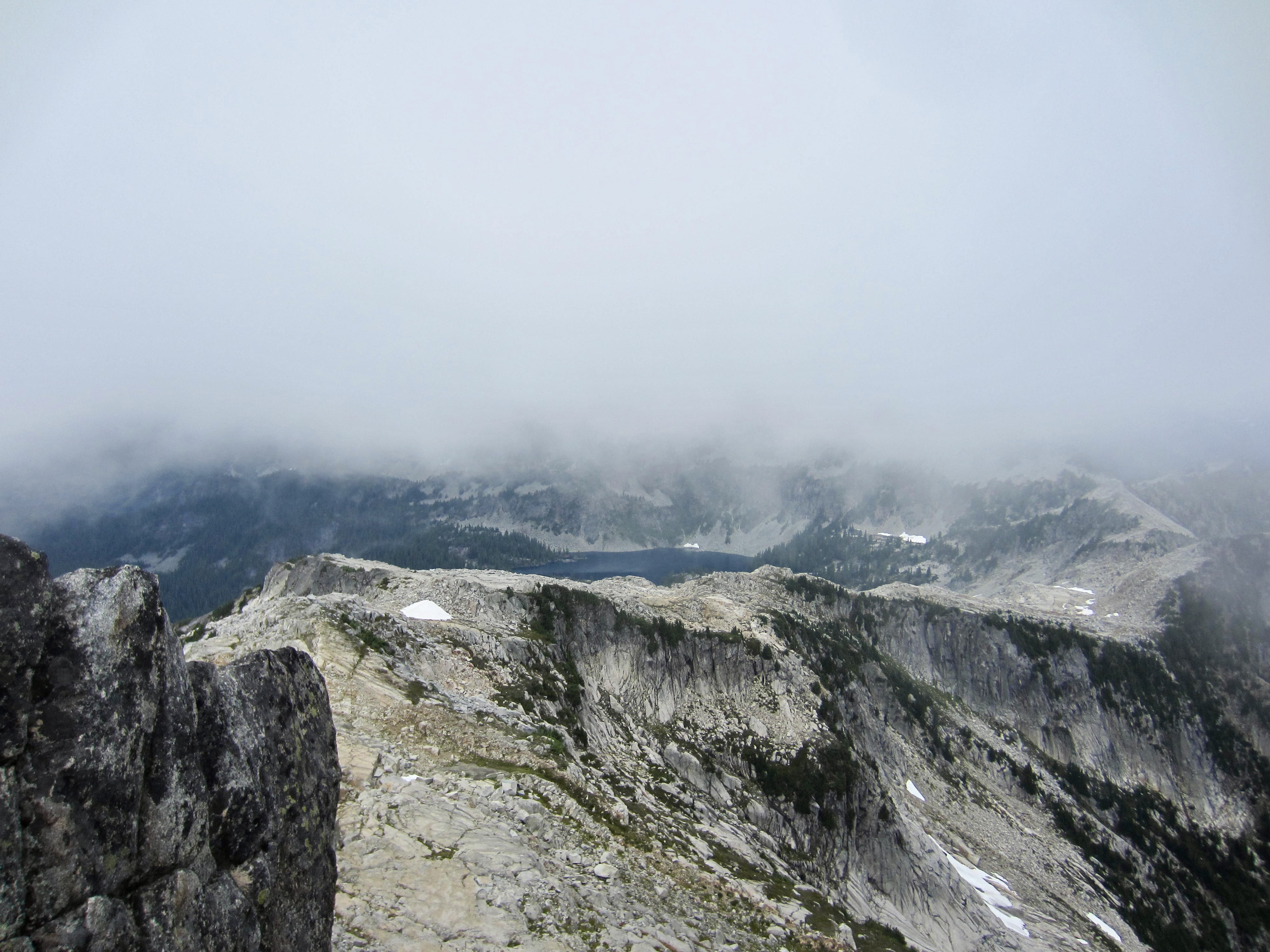
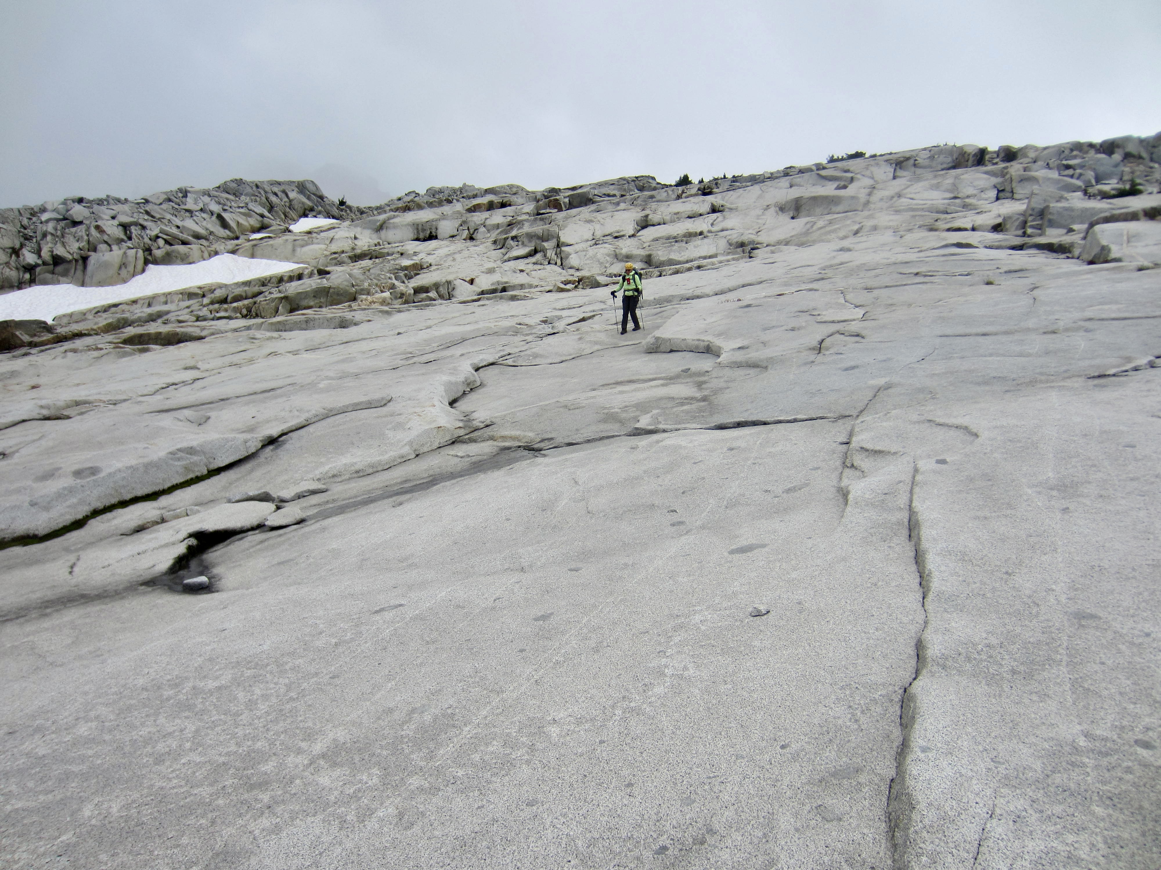
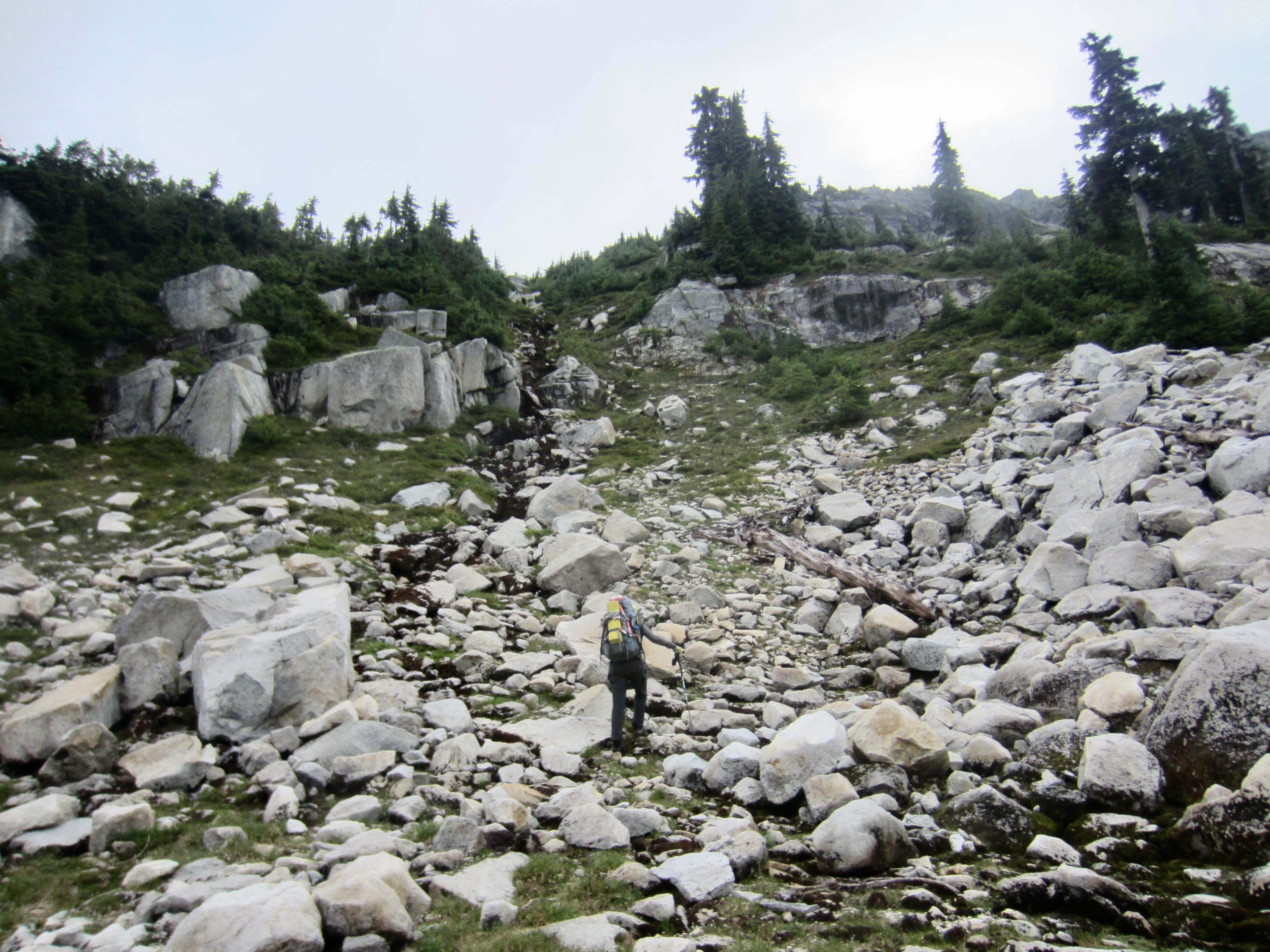
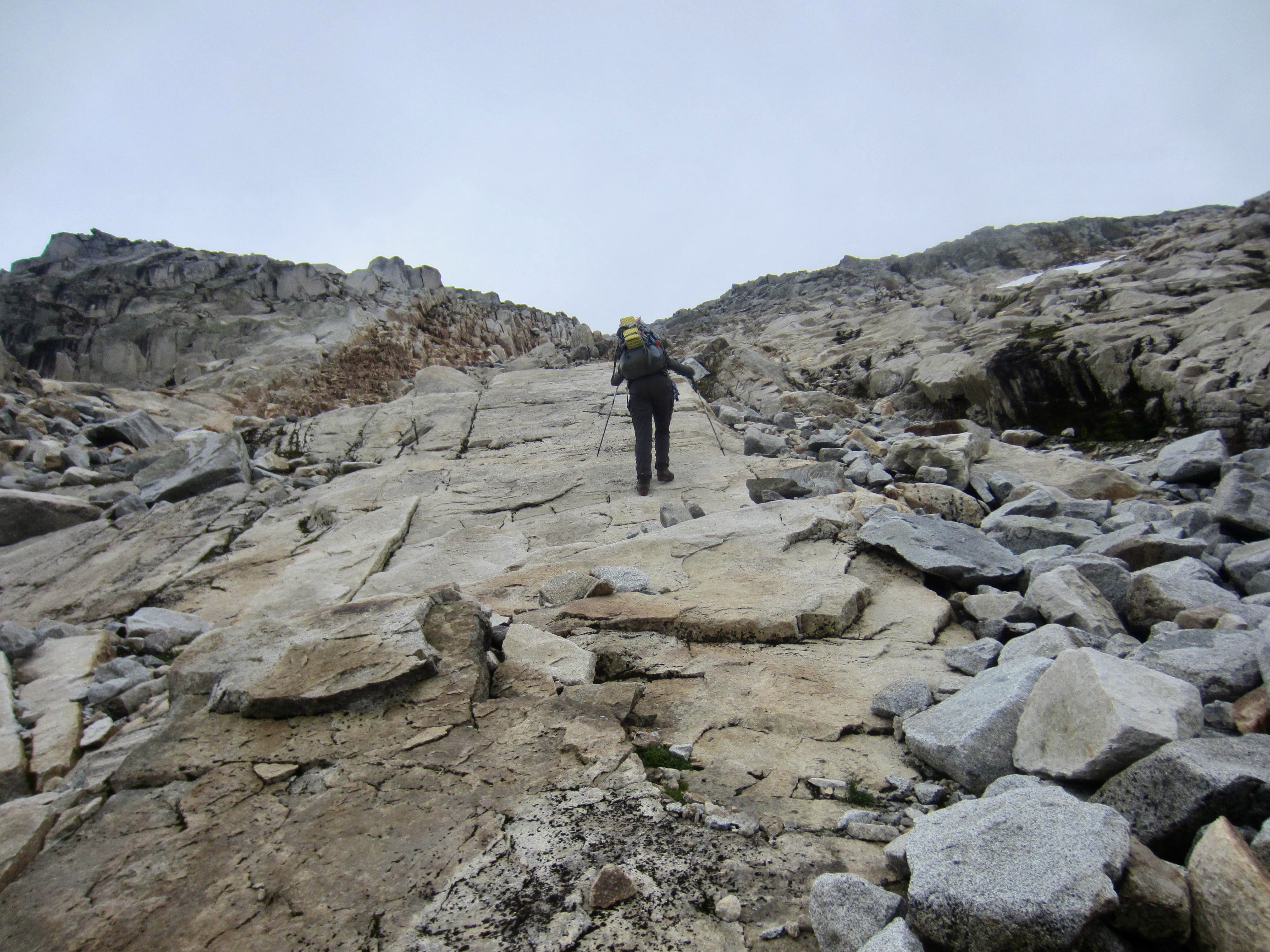
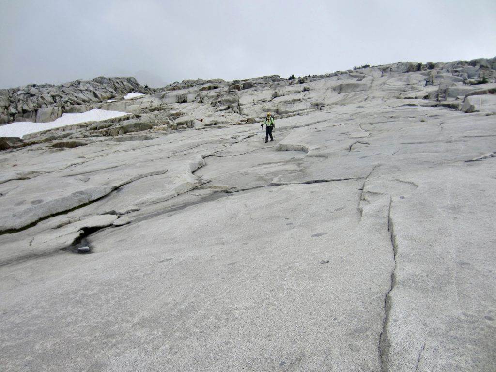
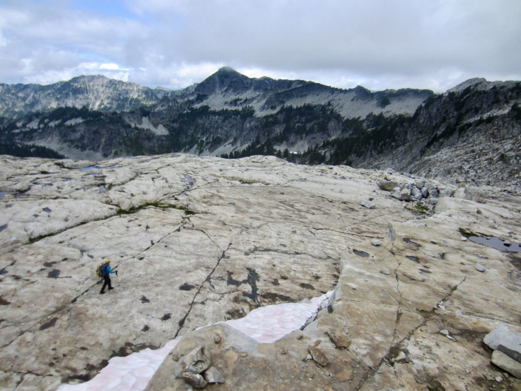
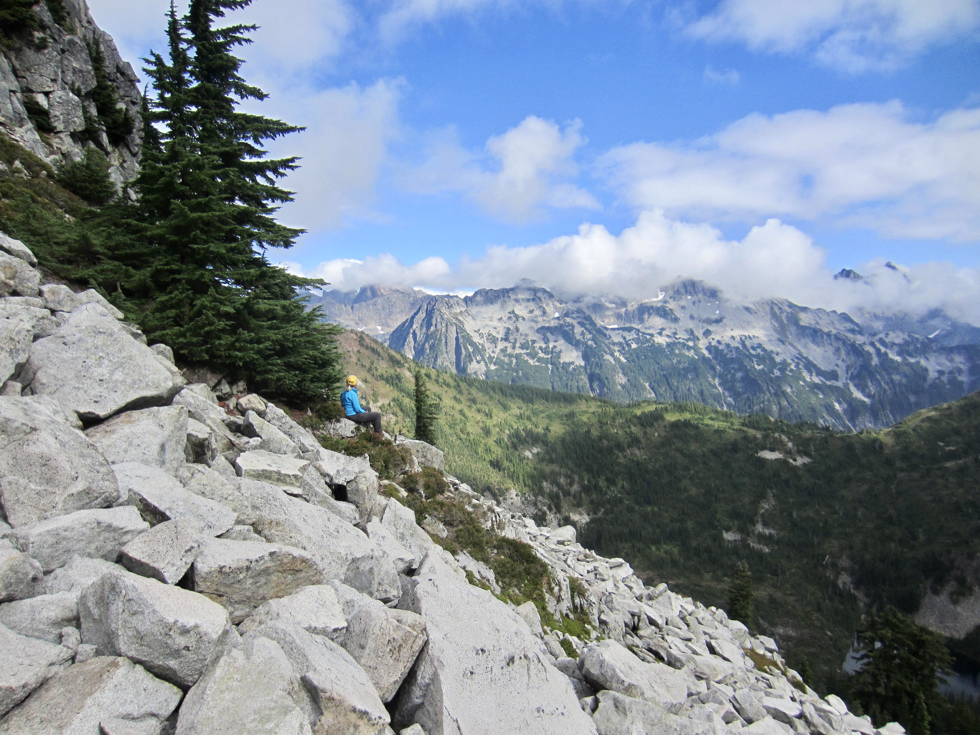
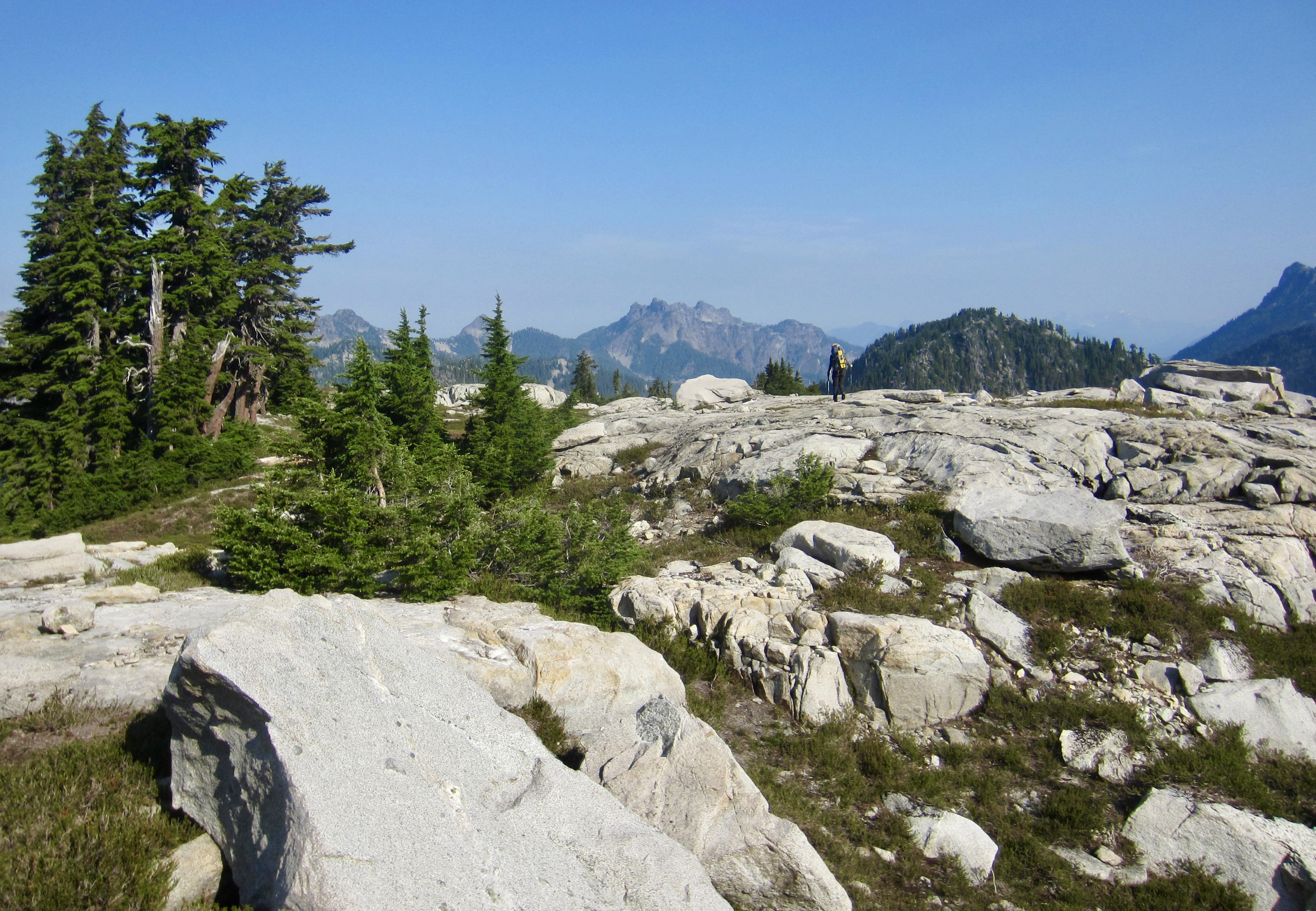
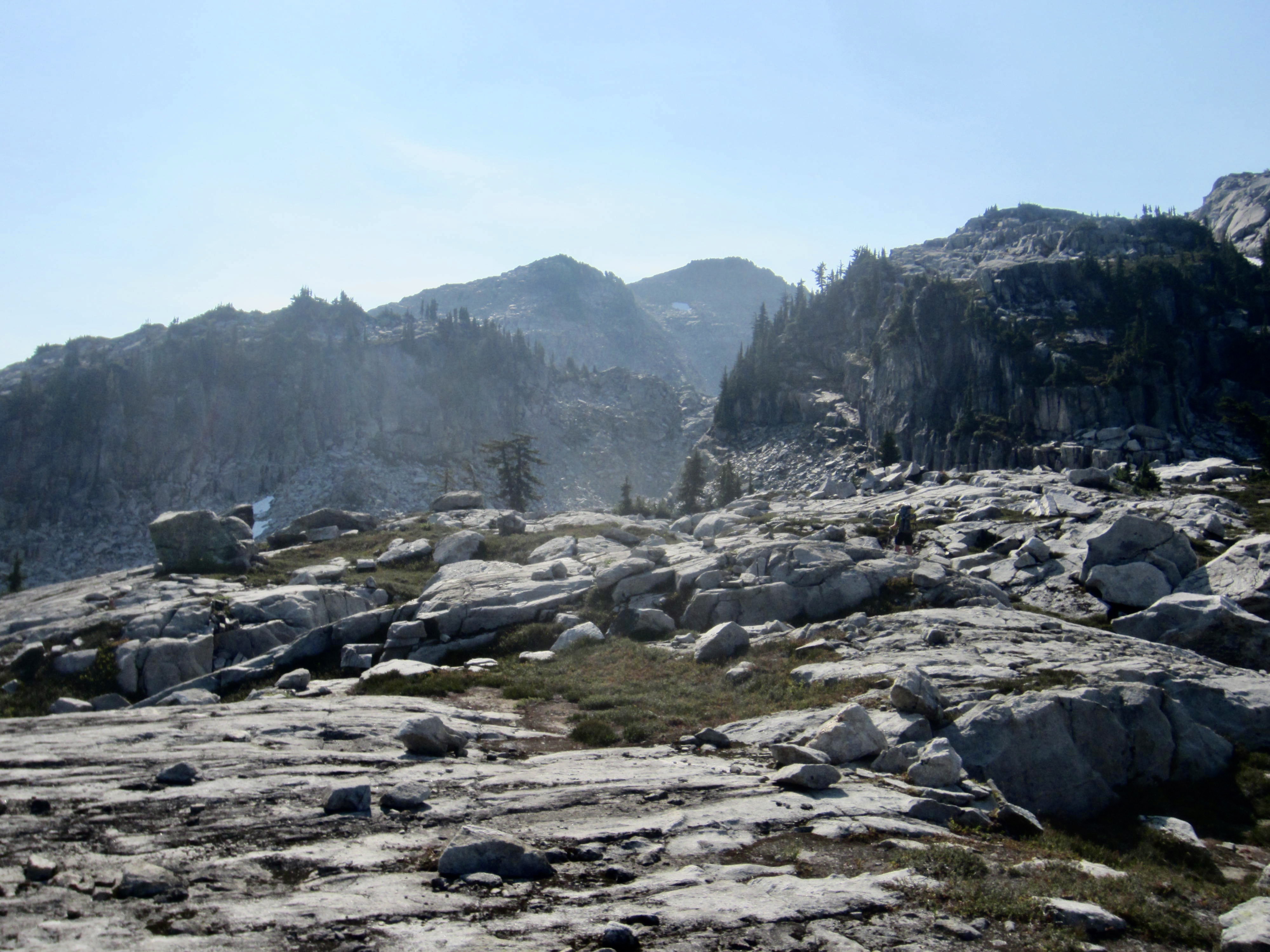
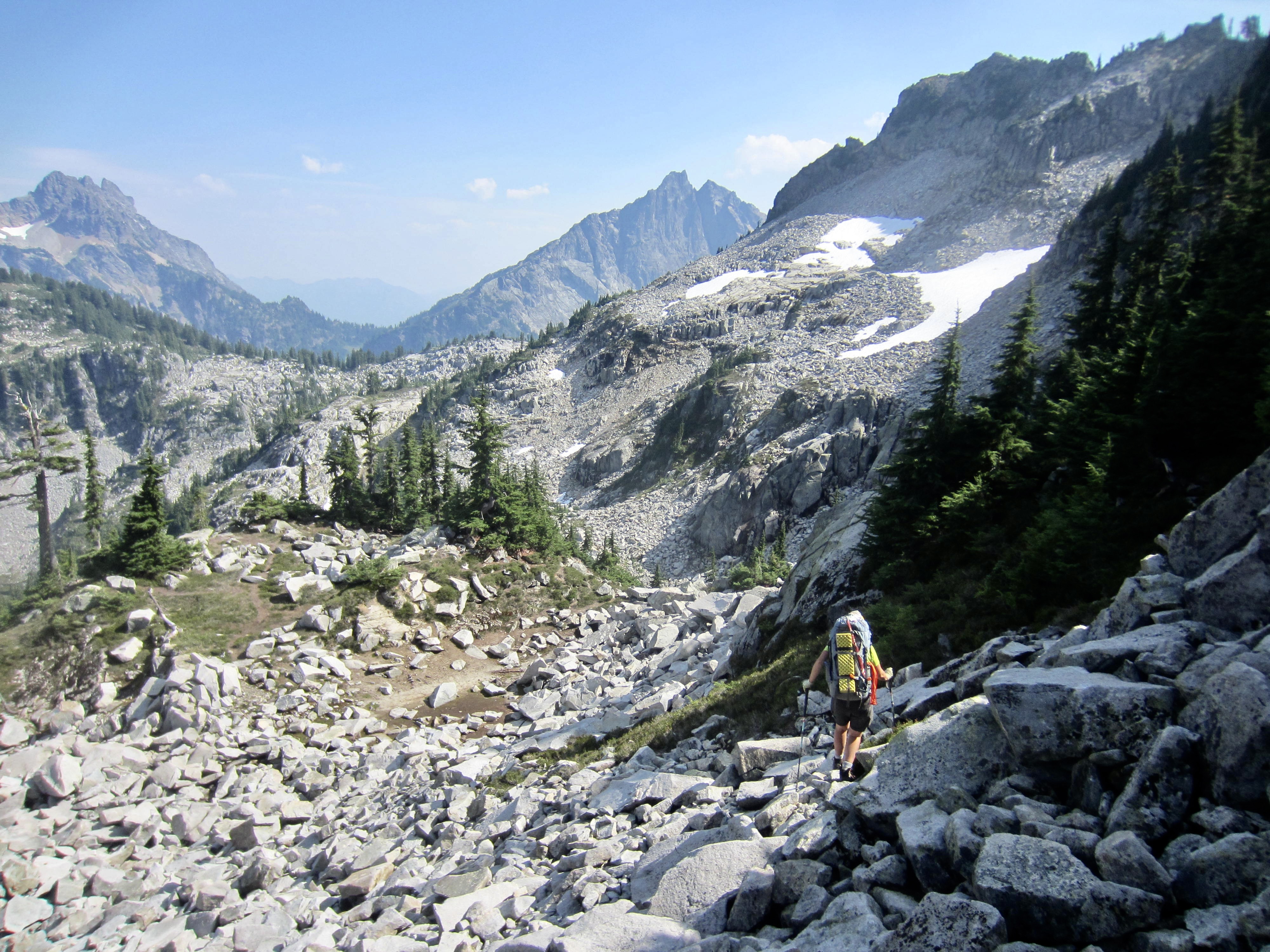
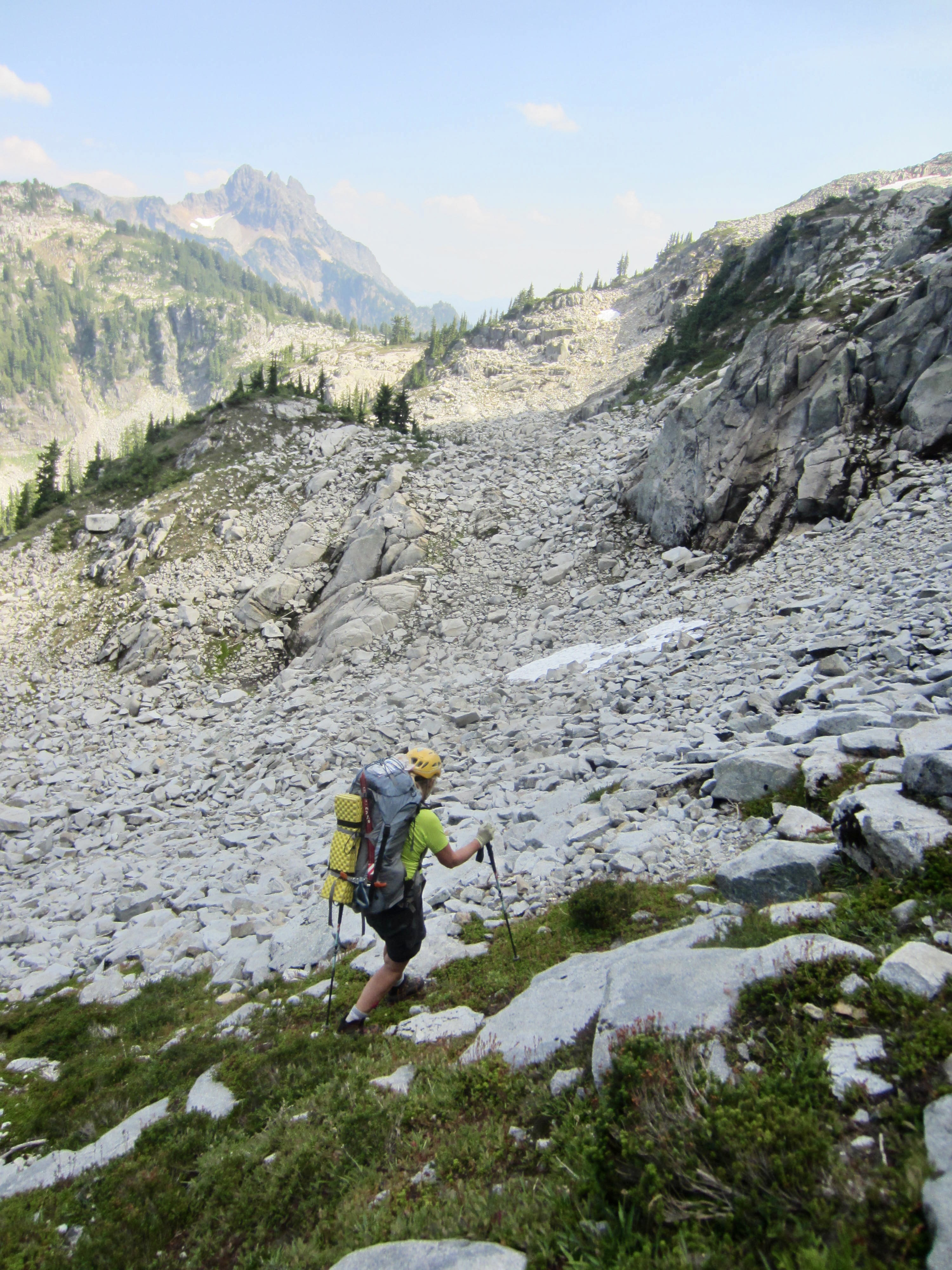
Today’s destination was Gold Lake, so we began descending in a northeasterly direction, first scrambling down a narrow ridge and then walking down a broad shoulder. This shoulder features a series of huge, low-angle granite slabs and nearly level granite shelves—the largest I’ve ever encountered in the Cascades. The simple pleasure of strolling down these remarkable slabs and shelves was adequately entertaining to overshadow the gloomy weather!
During our descent, we took a short detour over to Hardscrabble Gap to get a view of Upper Hardscrabble Lake. Now past mid-afternoon, we were encouraged to see patches of blue sky overhead and flanks of mountains across the Middle Fork Valley.
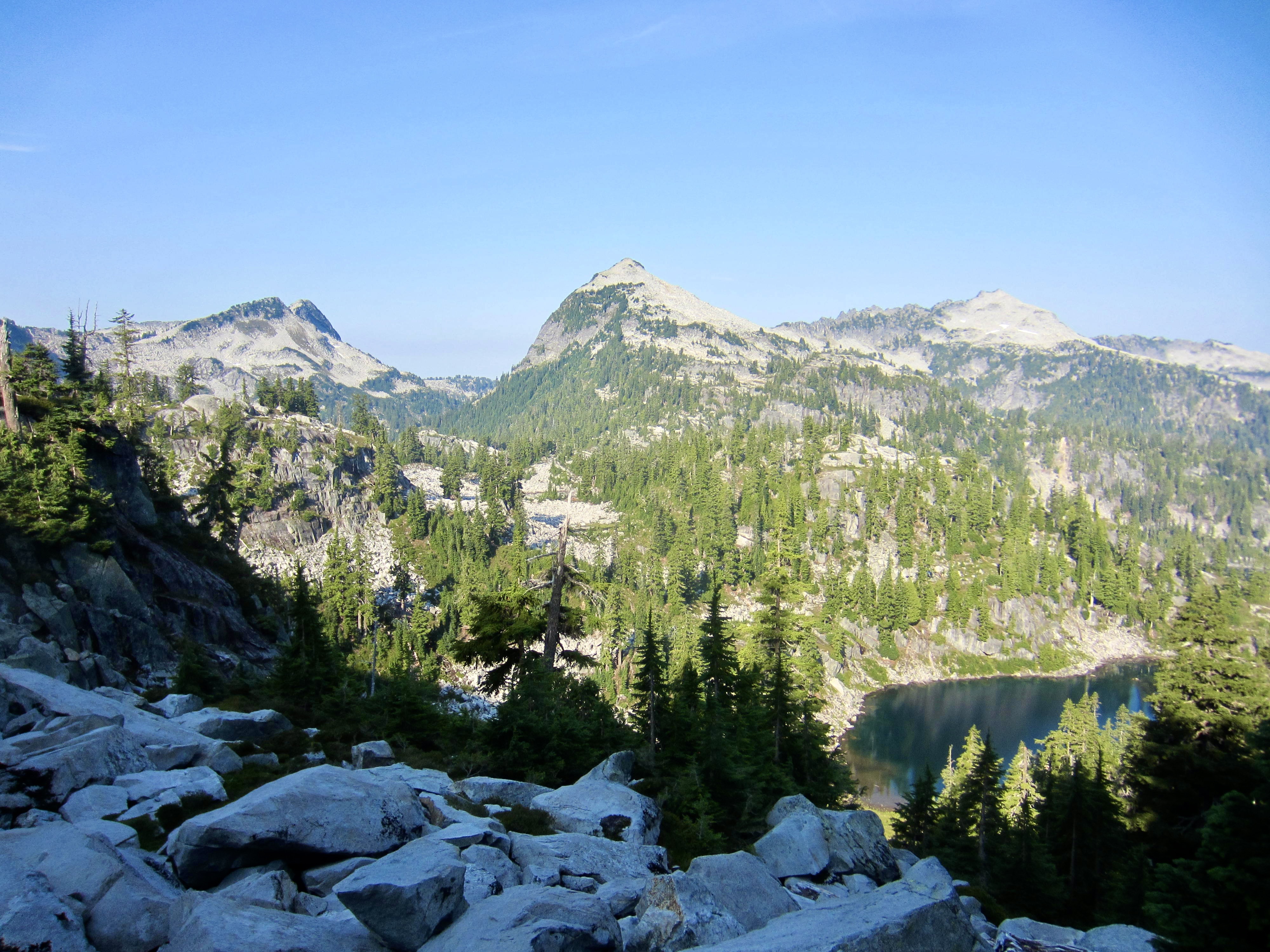
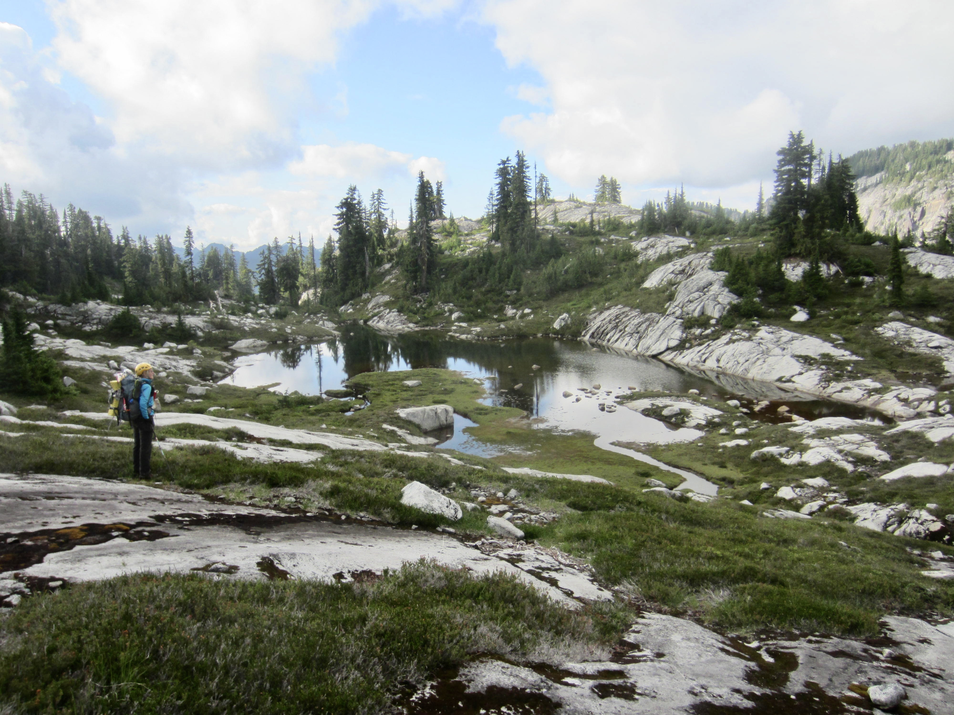
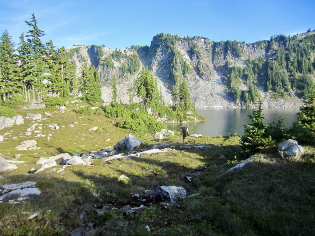
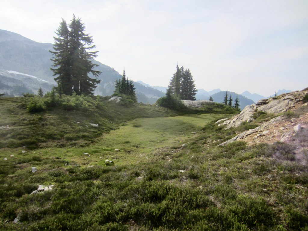
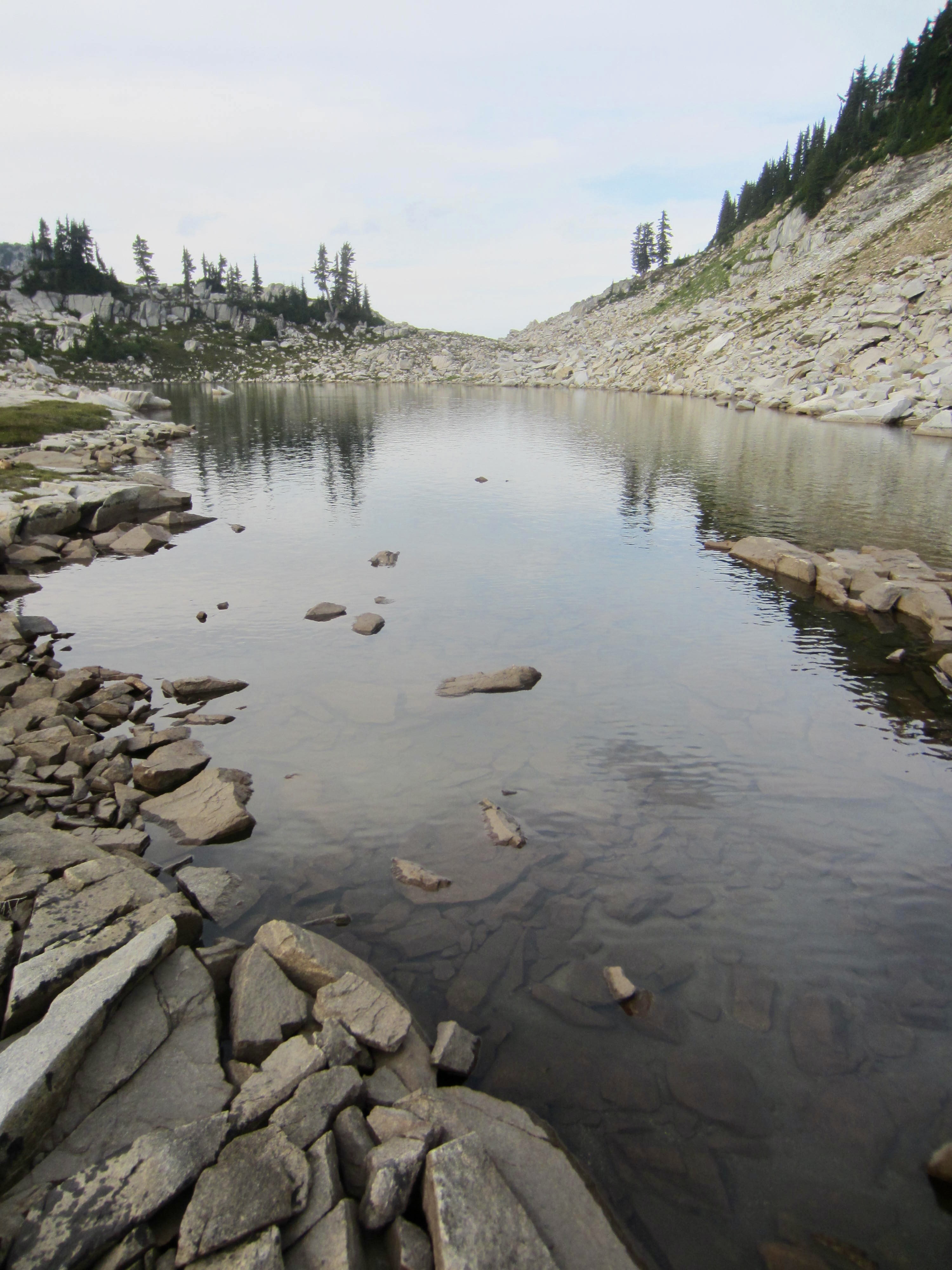
The weather continually improved as we progressed down a broad, white talus gully toward Gold Lake. Gradually, talus boulders gave way to heather meadows and a delightful collection of tarns. Just before reaching the lake, we angled up to a small knoll and established Camp 2 overlooking the water. After many years of waiting, we were now camped at one of the most coveted lakes in the Alpine Lakes Wilderness on a perfect summer evening—and it was worth the wait!

Day 3: Gold Lake to Azure Lake
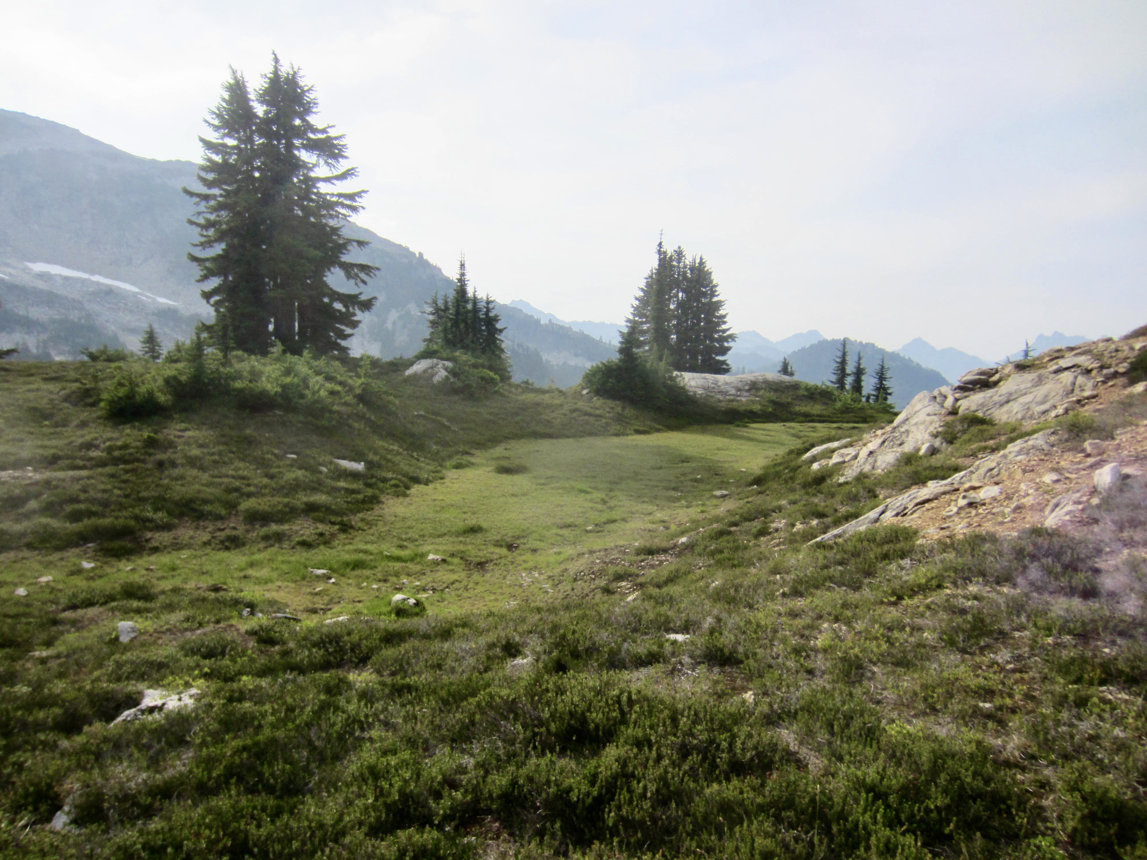
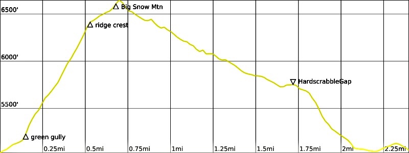
We awoke to blue skies and were underway by 8:30am. Our day began by dropping off the knoll and winding around numerous scenic tarns, then wrapping around the scalloped lakeshore. It became clear that an alpine lake enthusiast could spend several days exploring the bays, inlets, meadows, pools, and other marvelous attractions in Gold Lake basin.

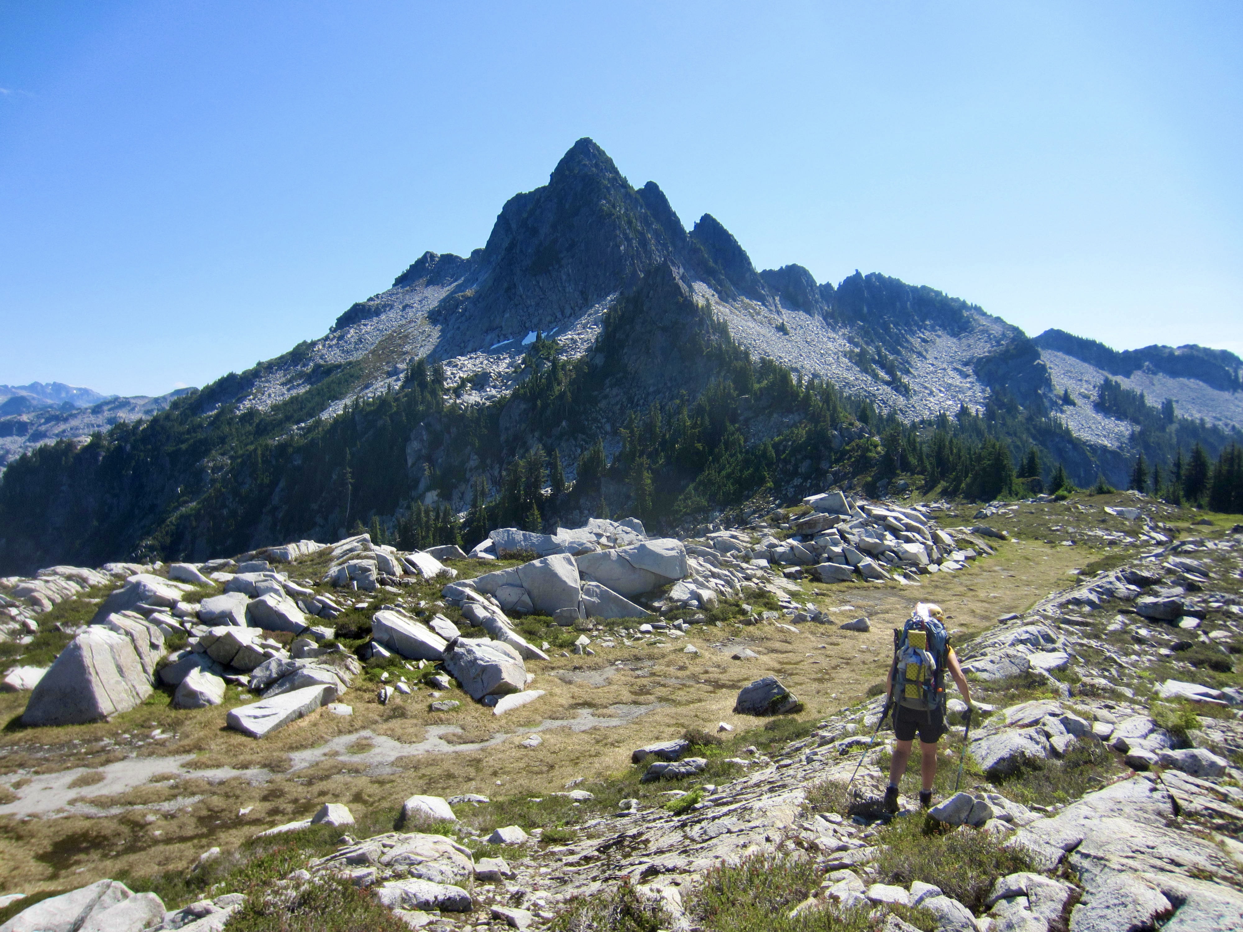
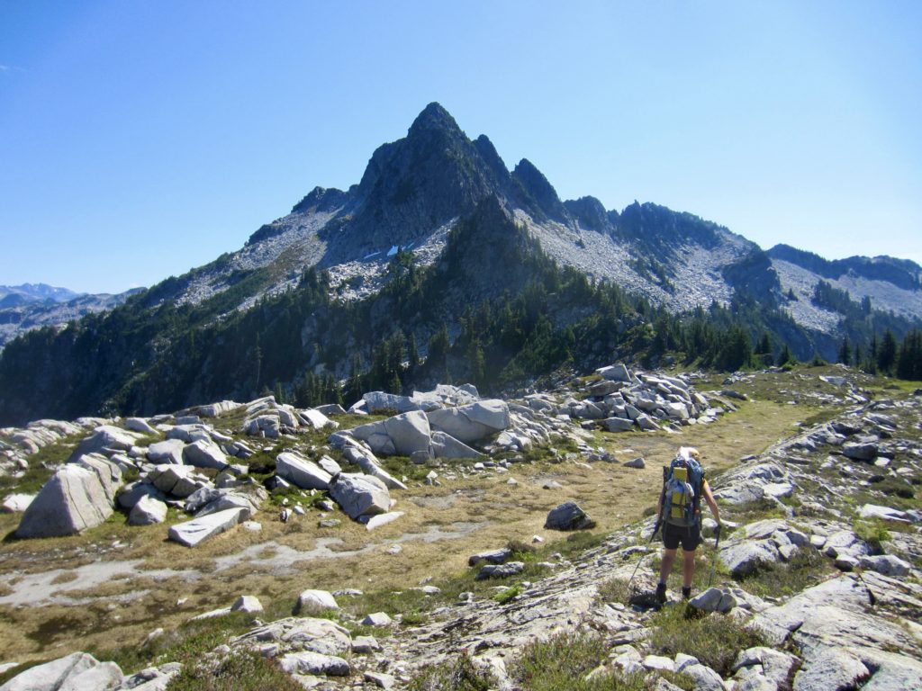
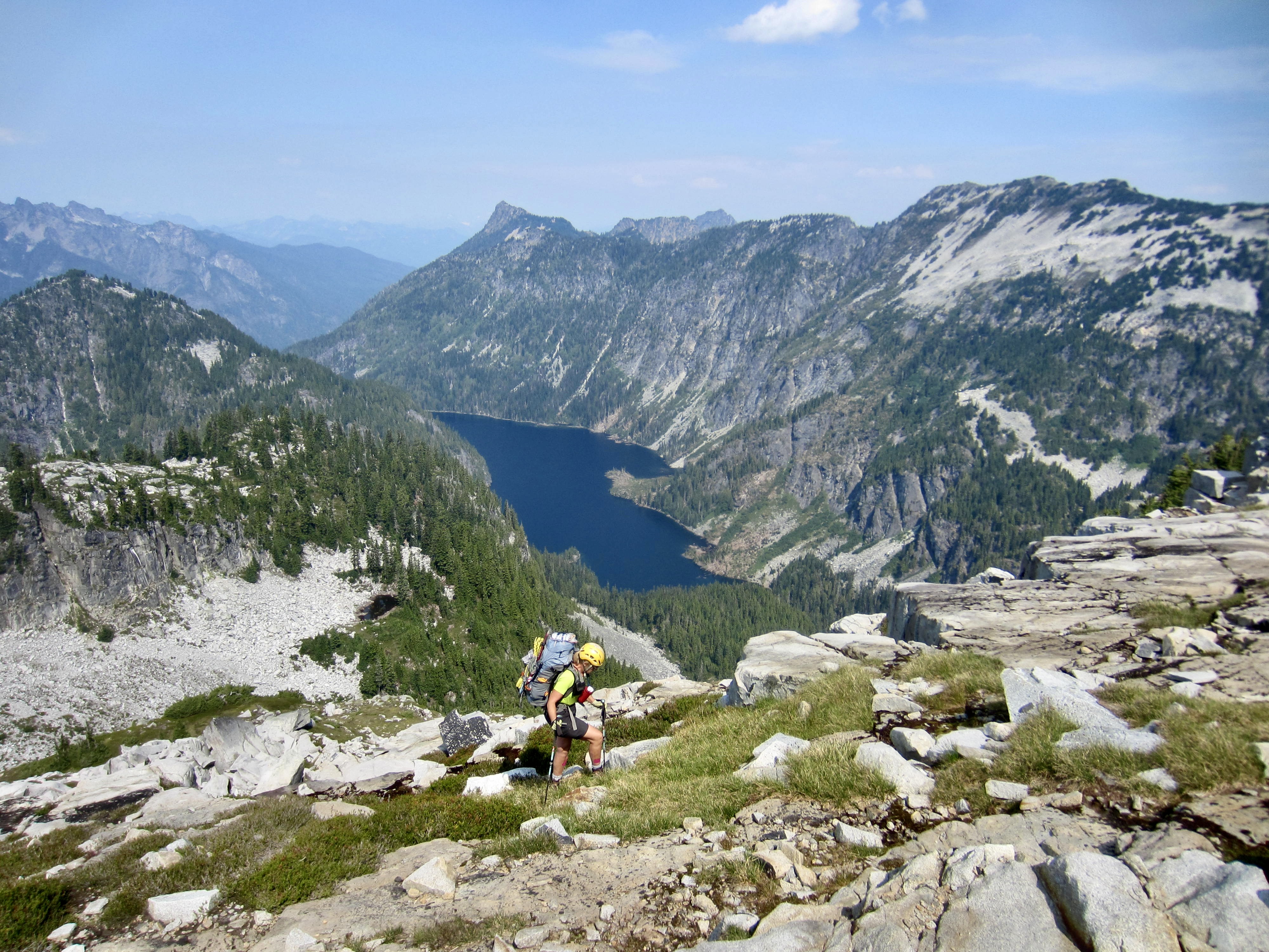
We rounded the lake’s outlet stream, hiked over a small knob, and scrambled northward up to 5250-foot Wild Goat Pass. This gave us a view of Camp Robber Peak and Tourmaline Peak across the valley, and of Wild Goat Peak to the southeast. Gus Lake sat out of view in the valley below.
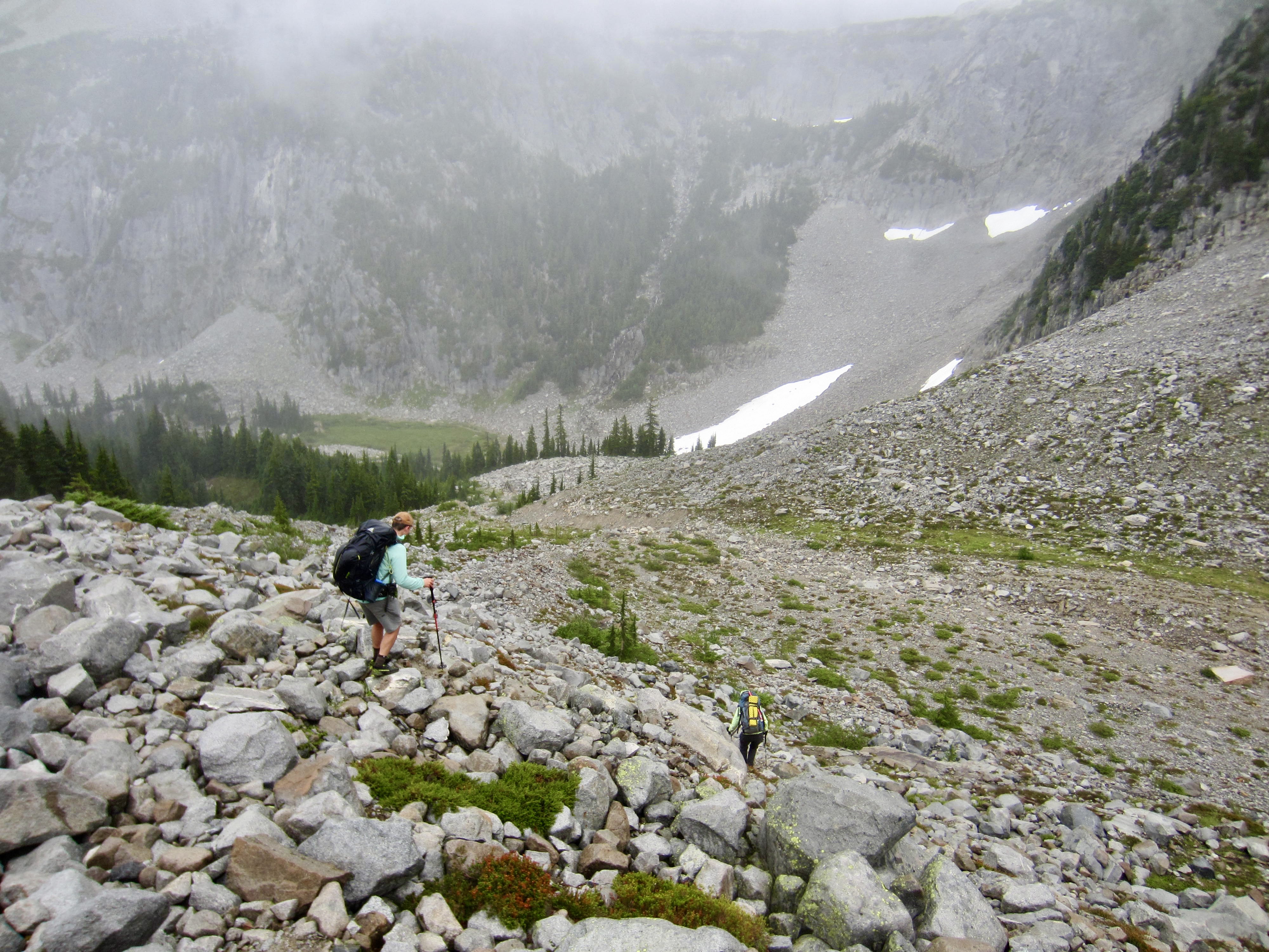
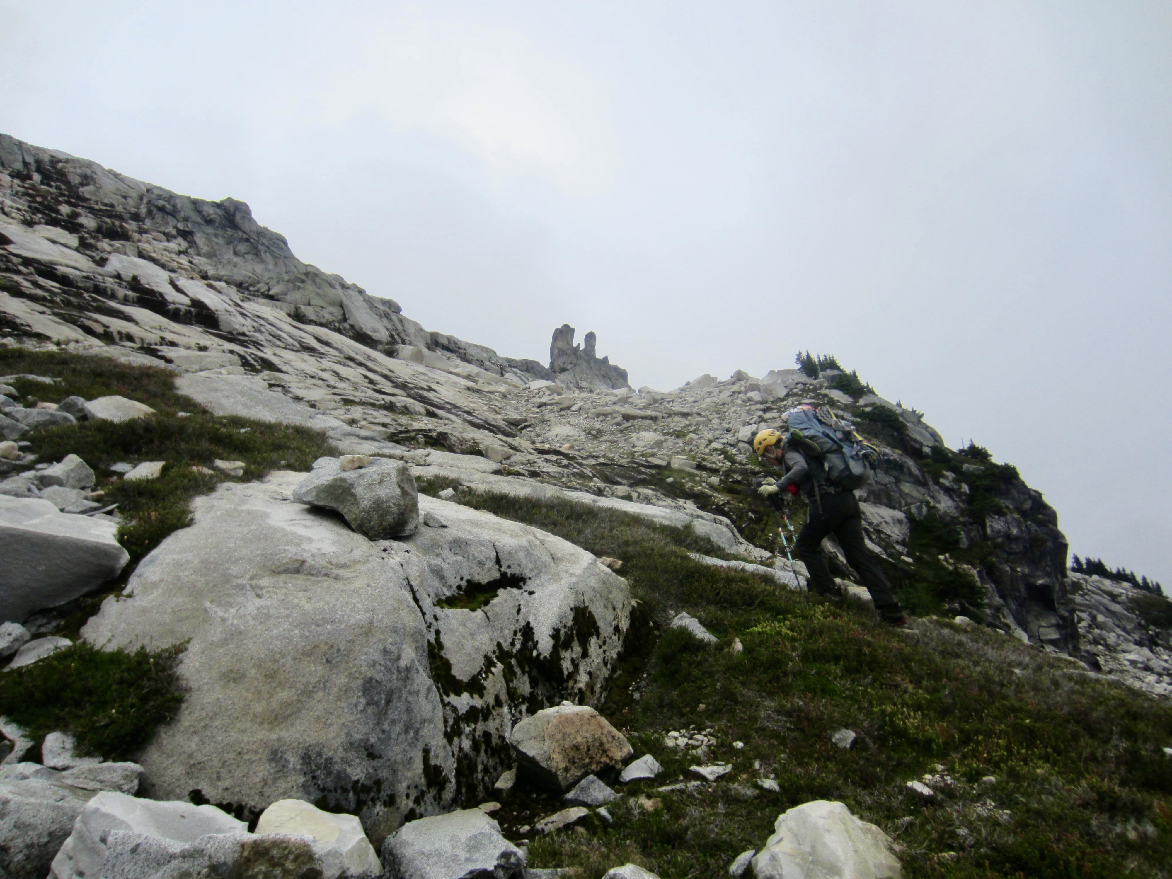
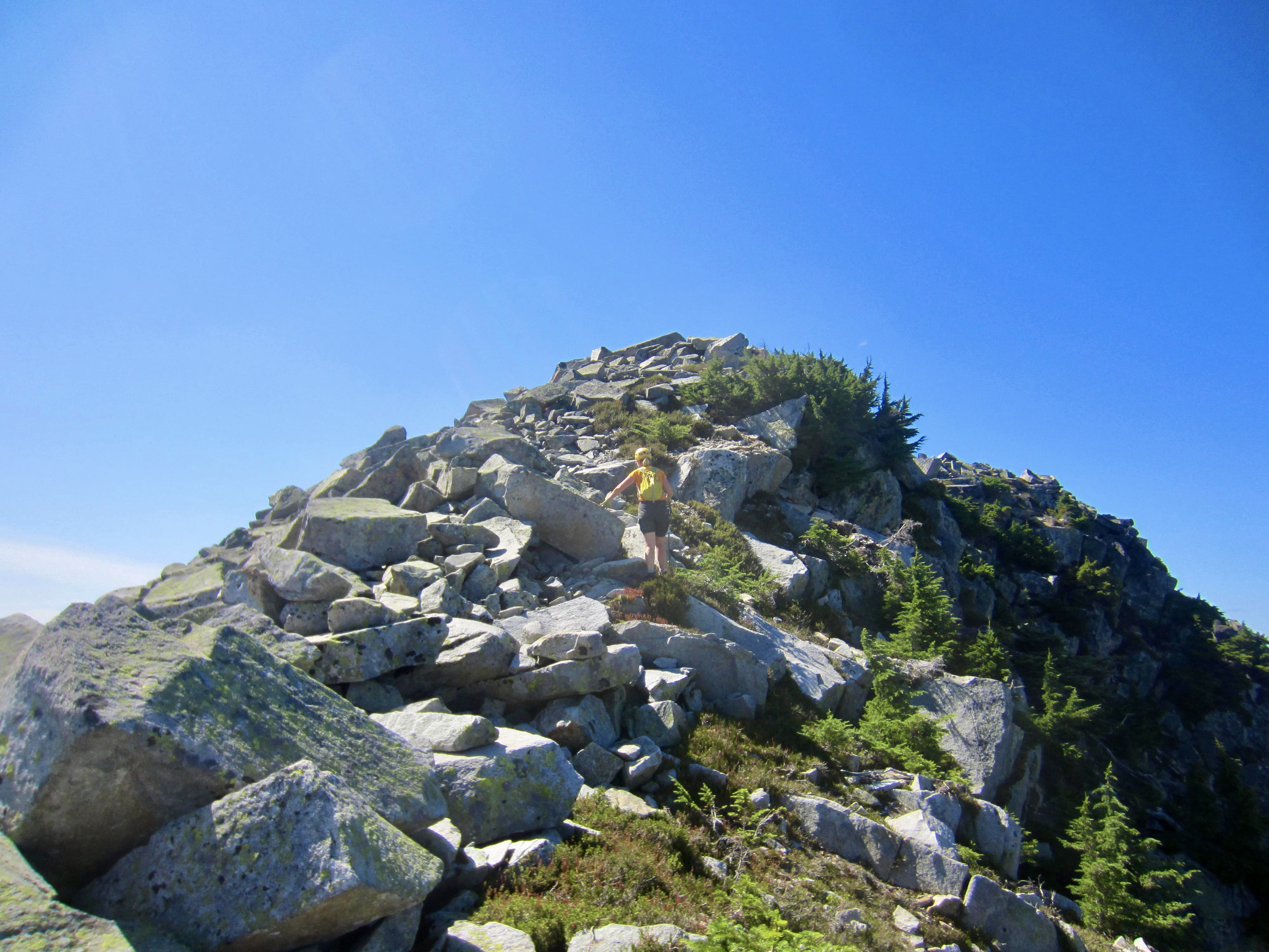
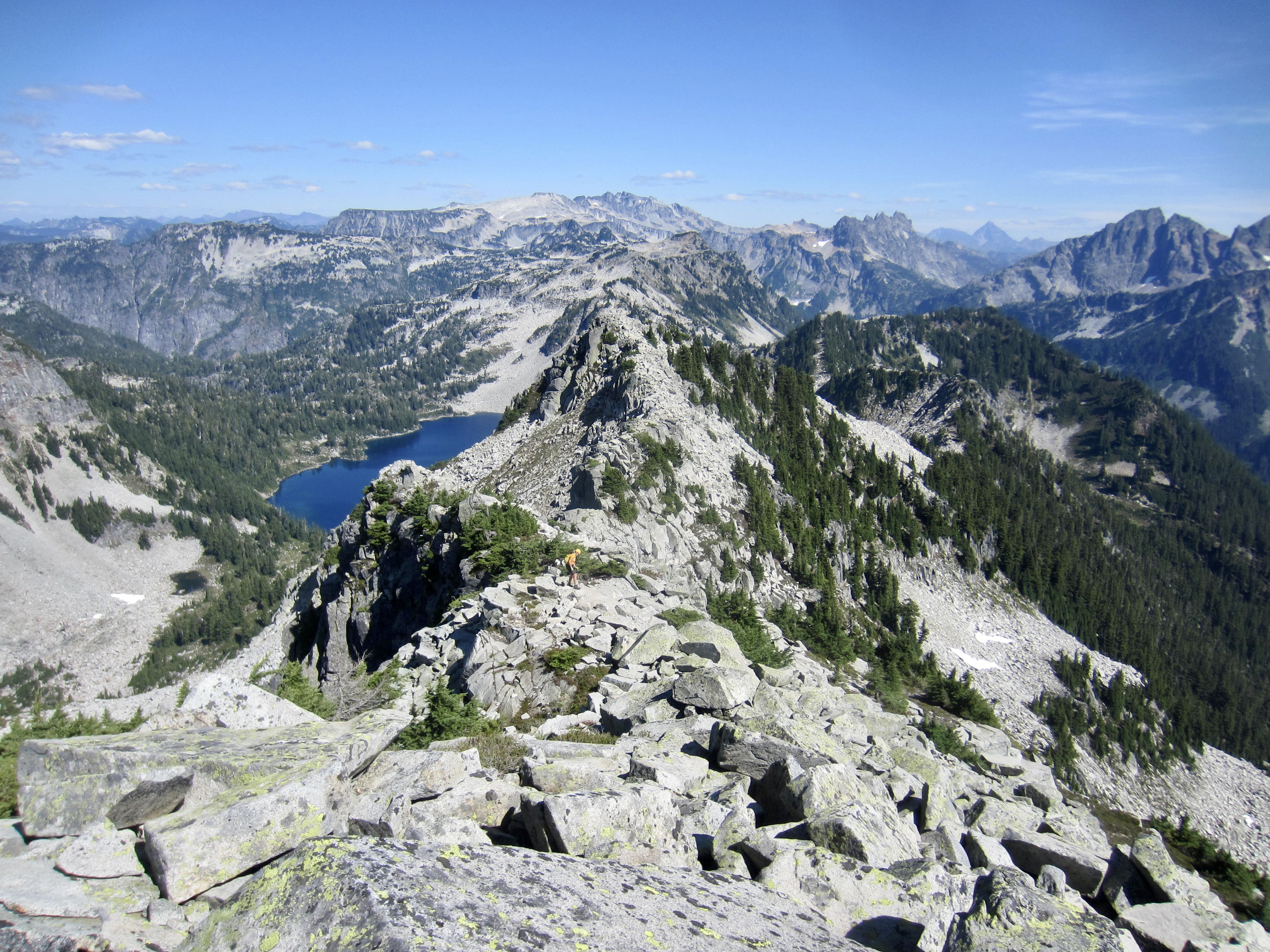
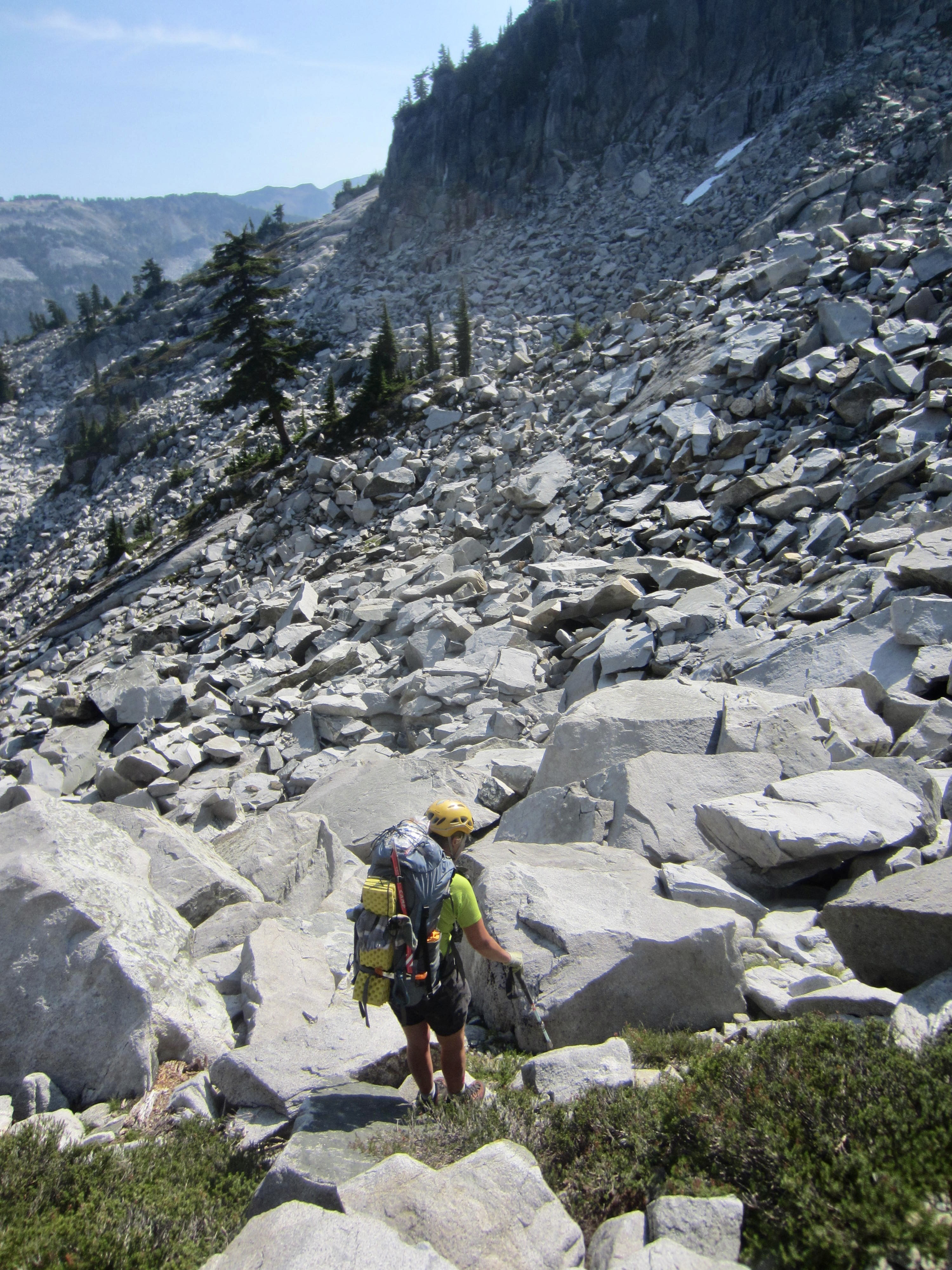
Turning right (south) at the pass, we followed the ridge crest toward the imposing horn of Wild Goat Peak. The ridge gradually tapered down to a narrow crest but then abruptly widened into a heathery parkland before finally sweeping upward in a row of sharp gendarmes. We angled to the left and began traversing across the eastern slope on big, white, granitic talus boulders. Our path soon appeared to be blocked by a cliff band, but we were able to cut up through this on a ramp system.

After passing completely underneath the north face of Wild Goat’s summit horn, we stashed backpacks and headed straight uphill to a small notch in the east ridge. A pleasant scramble on the southern flank brought us to the summit at 2:00pm (5.6 hours + 1750 feet from Camp 2).
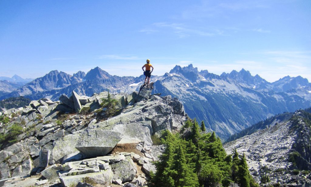
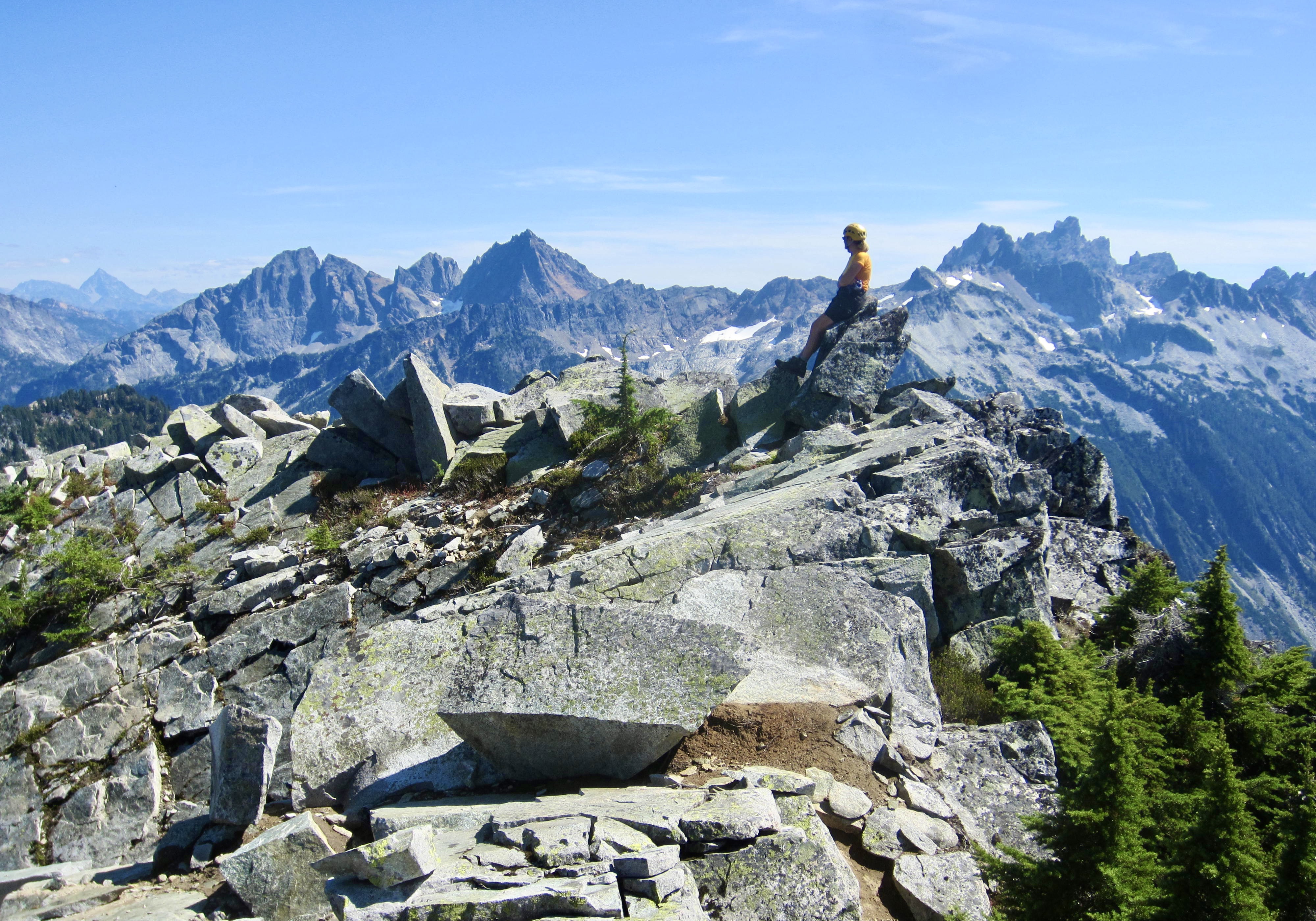
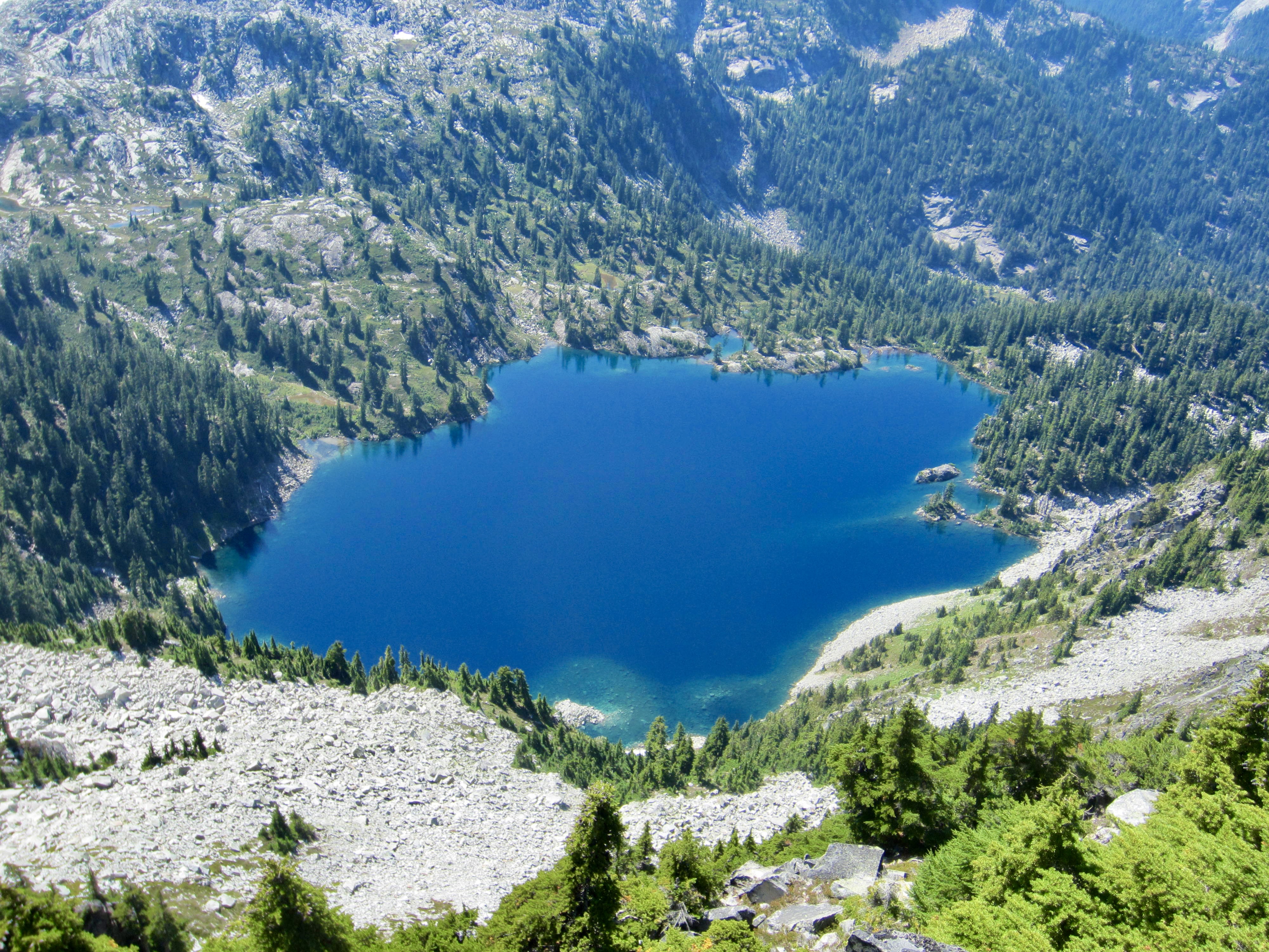
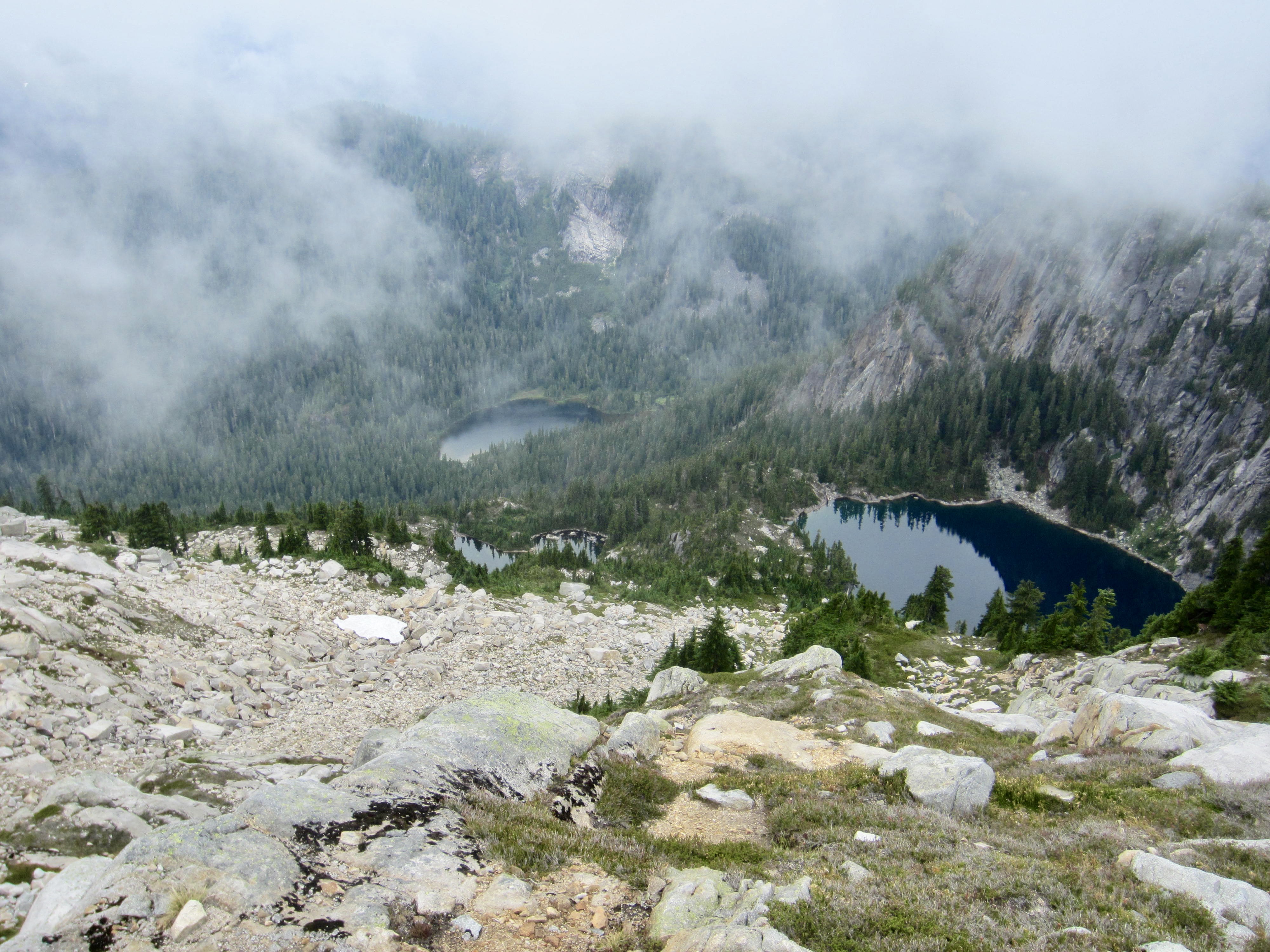
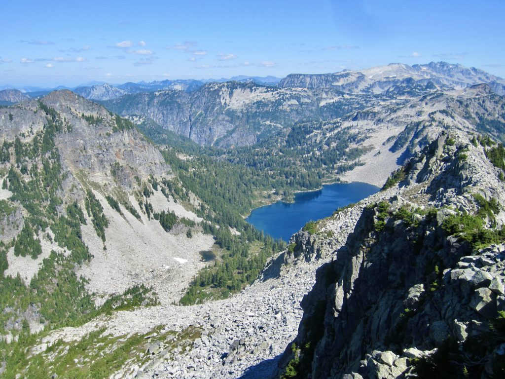
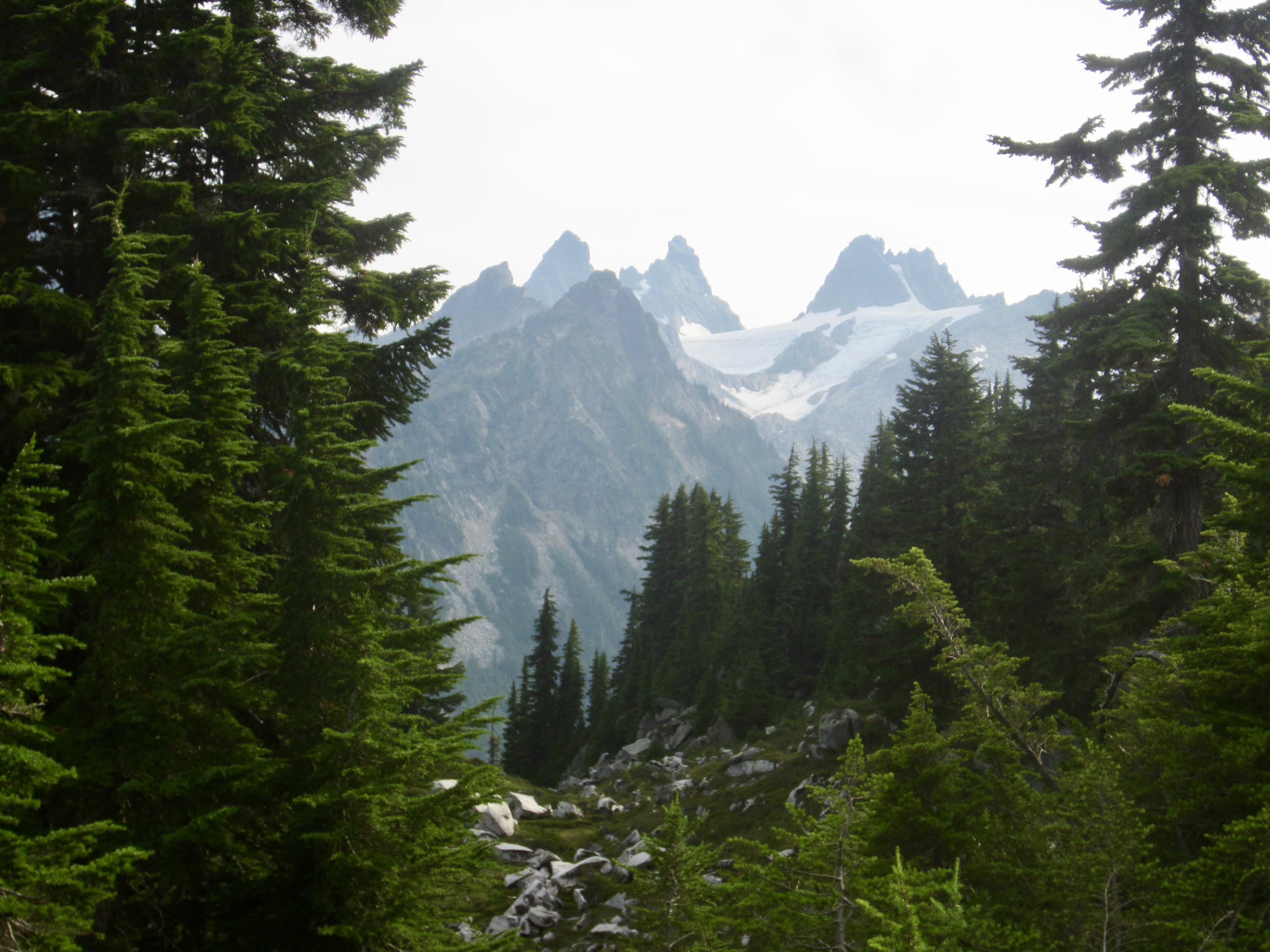
Today’s clear air afforded us excellent views in all directions. The outstandingly rugged Snoqualmie Mountains, extending from Mt. Daniel to Chikamin Peak, dominated the southern horizon and helped us to almost forget about the views we did not get on Big Snow Mountain yesterday. Seeing the impossibly blue waters of Gold Lake and Chetwoot Lake far below helped too.

We reluctantly returned to our backpack stash and began working our way toward Chetwoot Lake. This involved lots of boulder-hopping down white talus and slithering down steep heather, all the while being tantalized by the indigo swatch of water below.

Upon approaching Chetwoot Lake, we had the option of contouring around the north shore or south shore. We chose the north shore because that’s what the CAG sketch shows, and things initially went well. Before long, however, we found ourselves mired in thickets of scrub cedar (scientific name: Thuja gawdawfulus) on a steep sideslope about 50 feet above lake level. It became an ugly battle, and our progress slowed to a crawl; we gained barely more than 100 yards in an hour. Thinking that the lakeshore must surely be easier, we dropped down an open corridor to the water’s edge and began hiking along the shoreline. This actually worked nicely…for about 50 yards…then we encountered a stretch of low cliffs and were forced back uphill to the scrub-cedar purgatory. Oh, what we would have given for a pack-raft at this moment!
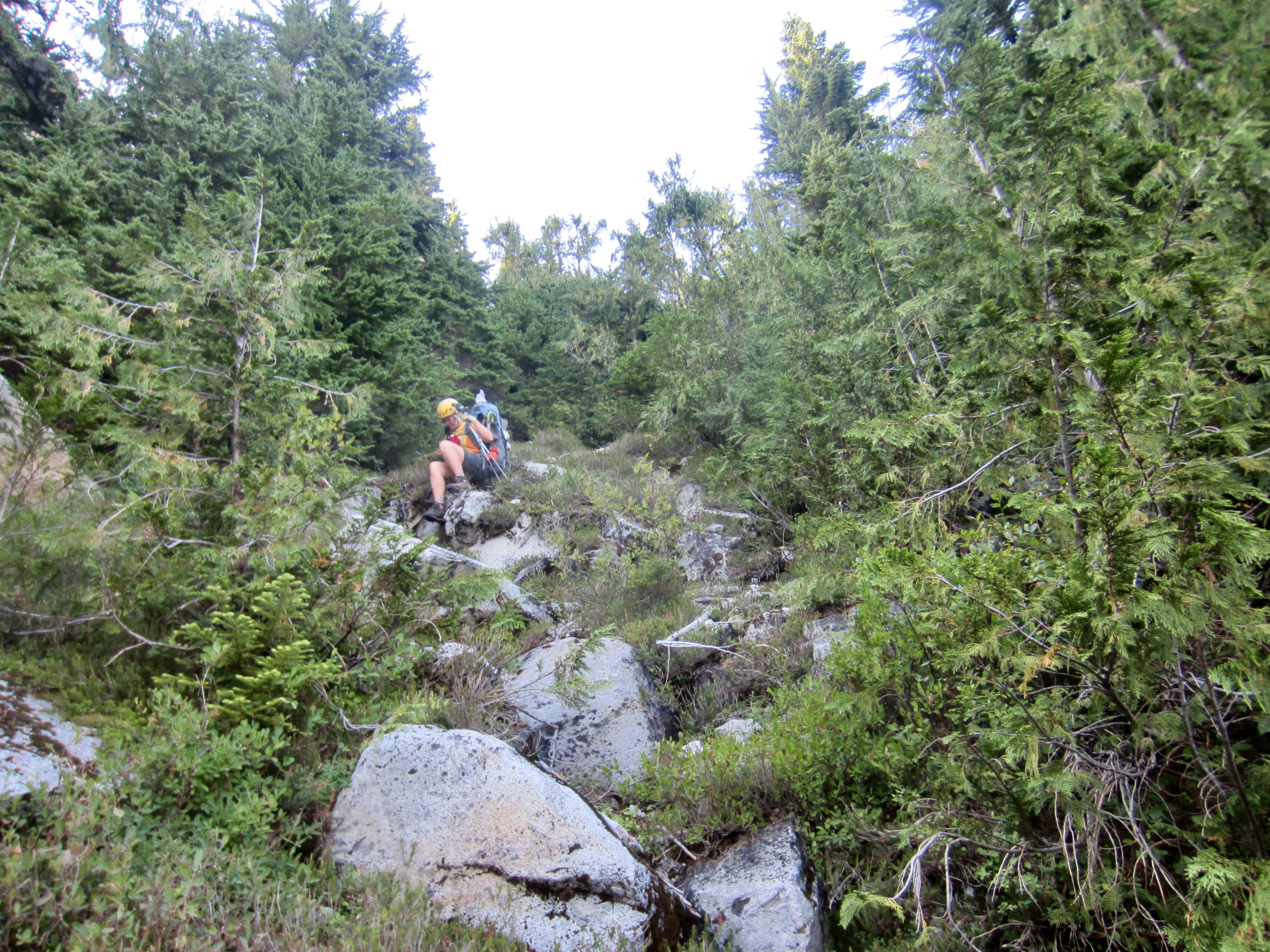
After an eternity of struggling through the dense cedars (and kicking ourselves for not choosing the south shore option), the trees finally opened onto a small clearing. This clearing led to a larger clearing, followed by a large meadow. We were finally free of the horrible green tentacles. Eileen unequivocally declared it to be the worst bushwhacking experience of her life, and I put it firmly in my Top 5 worst!
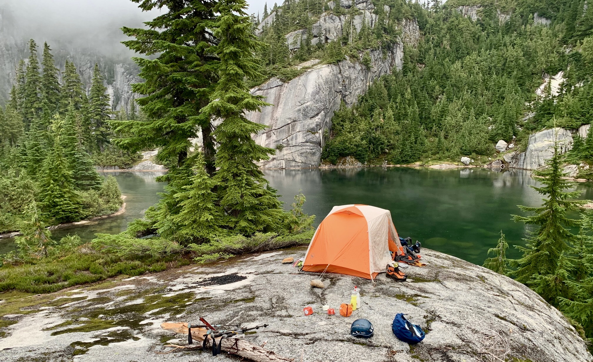
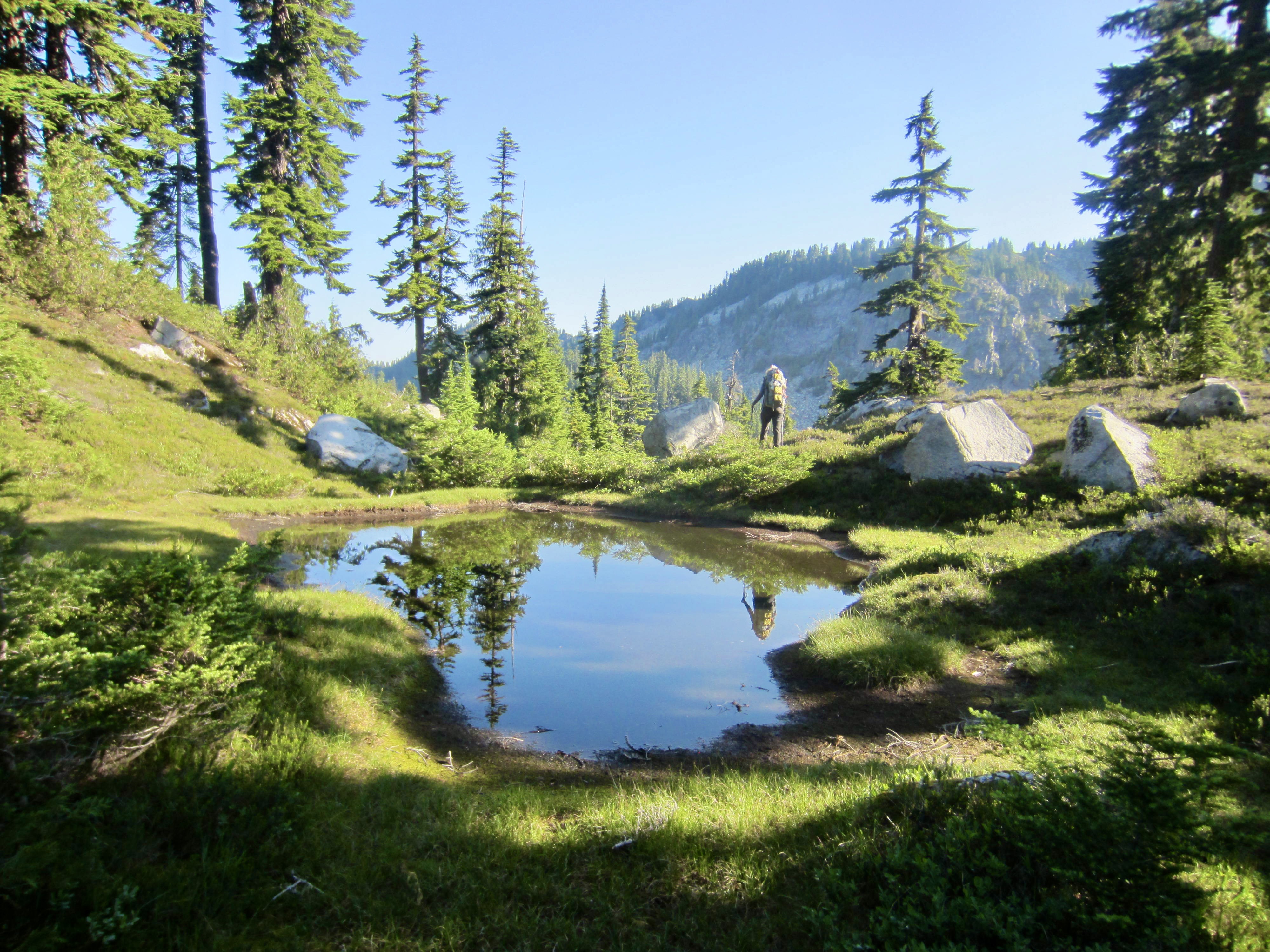
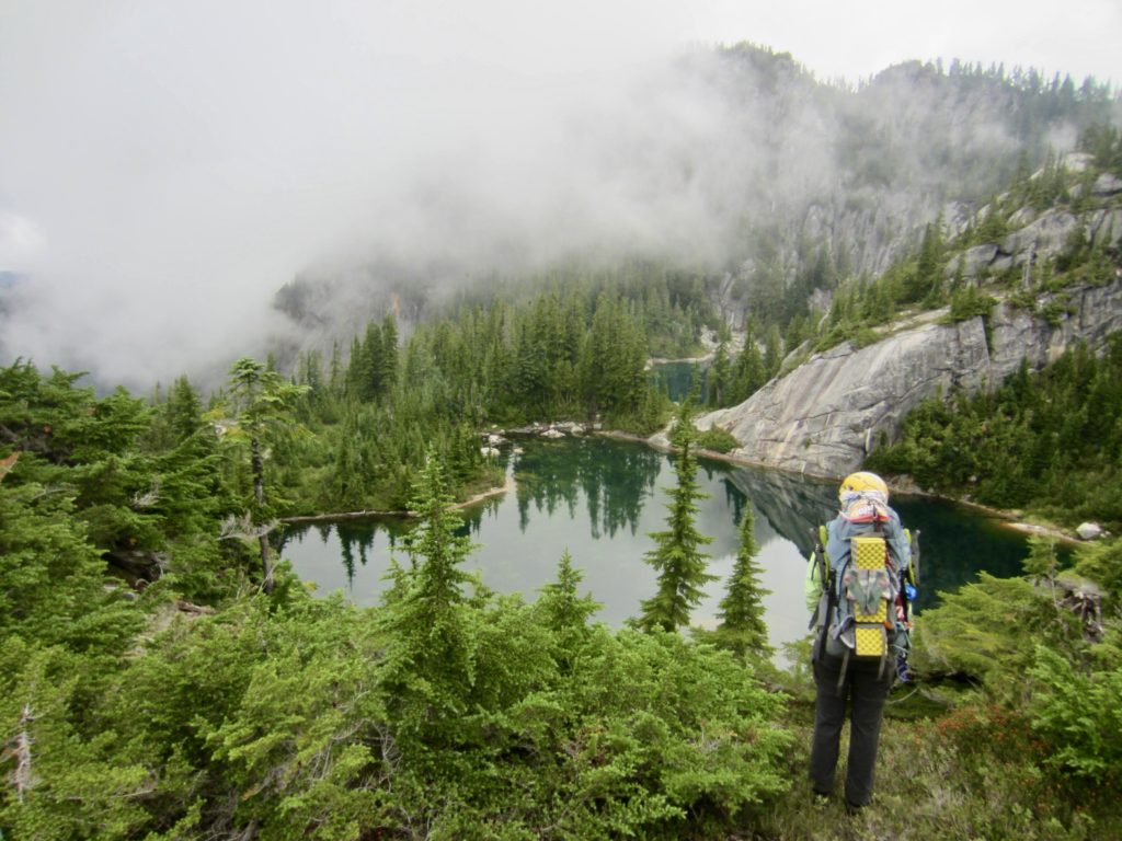
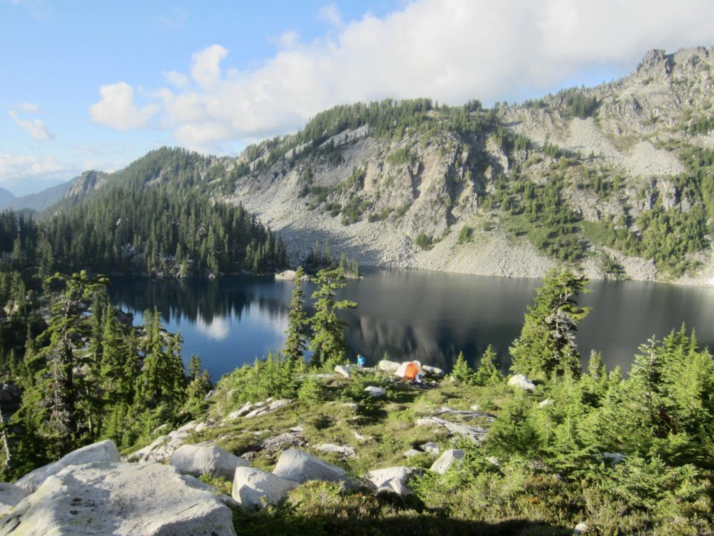
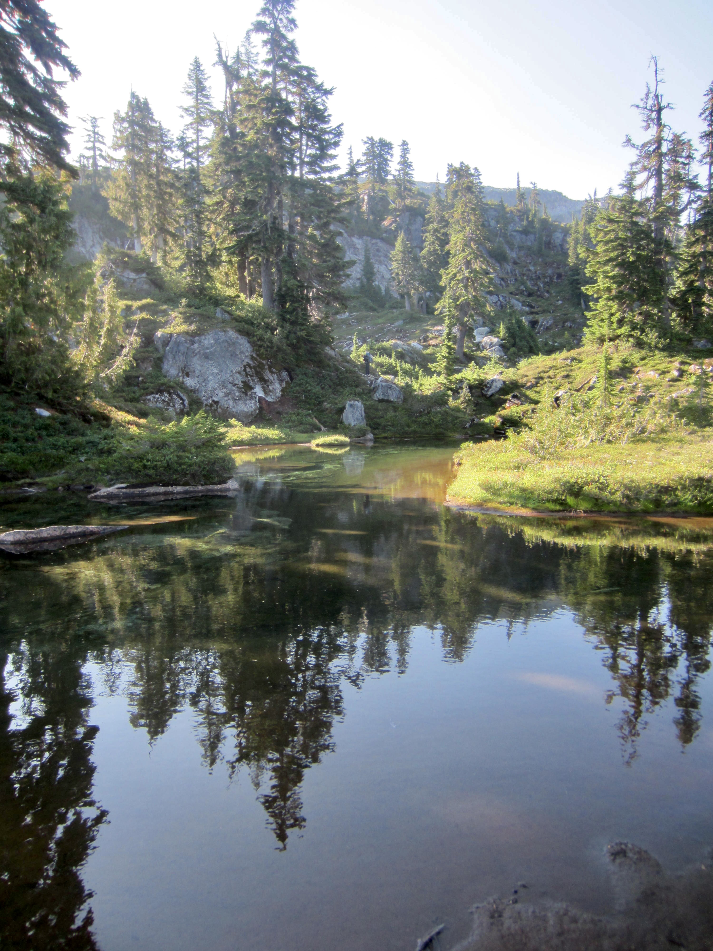
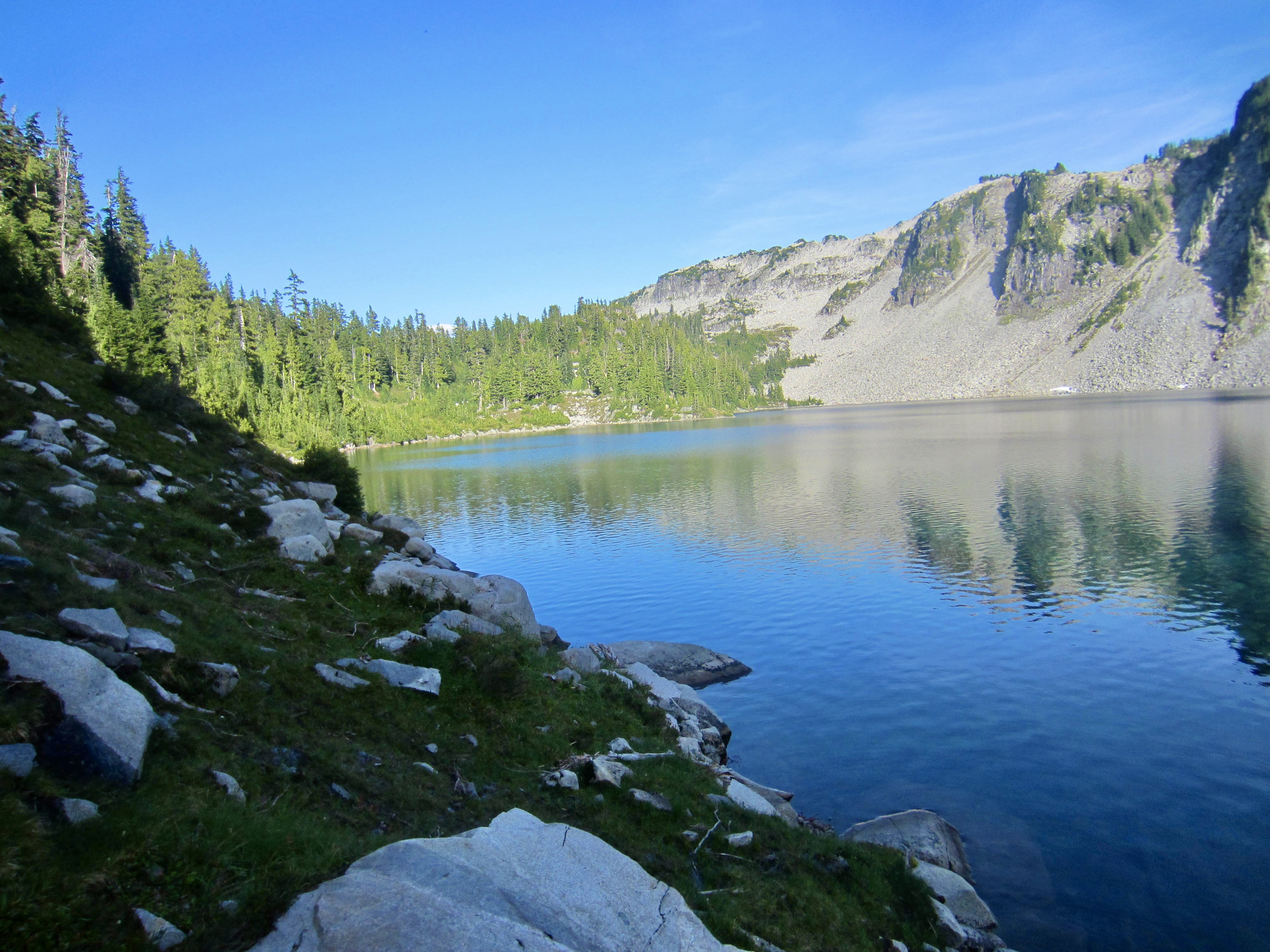
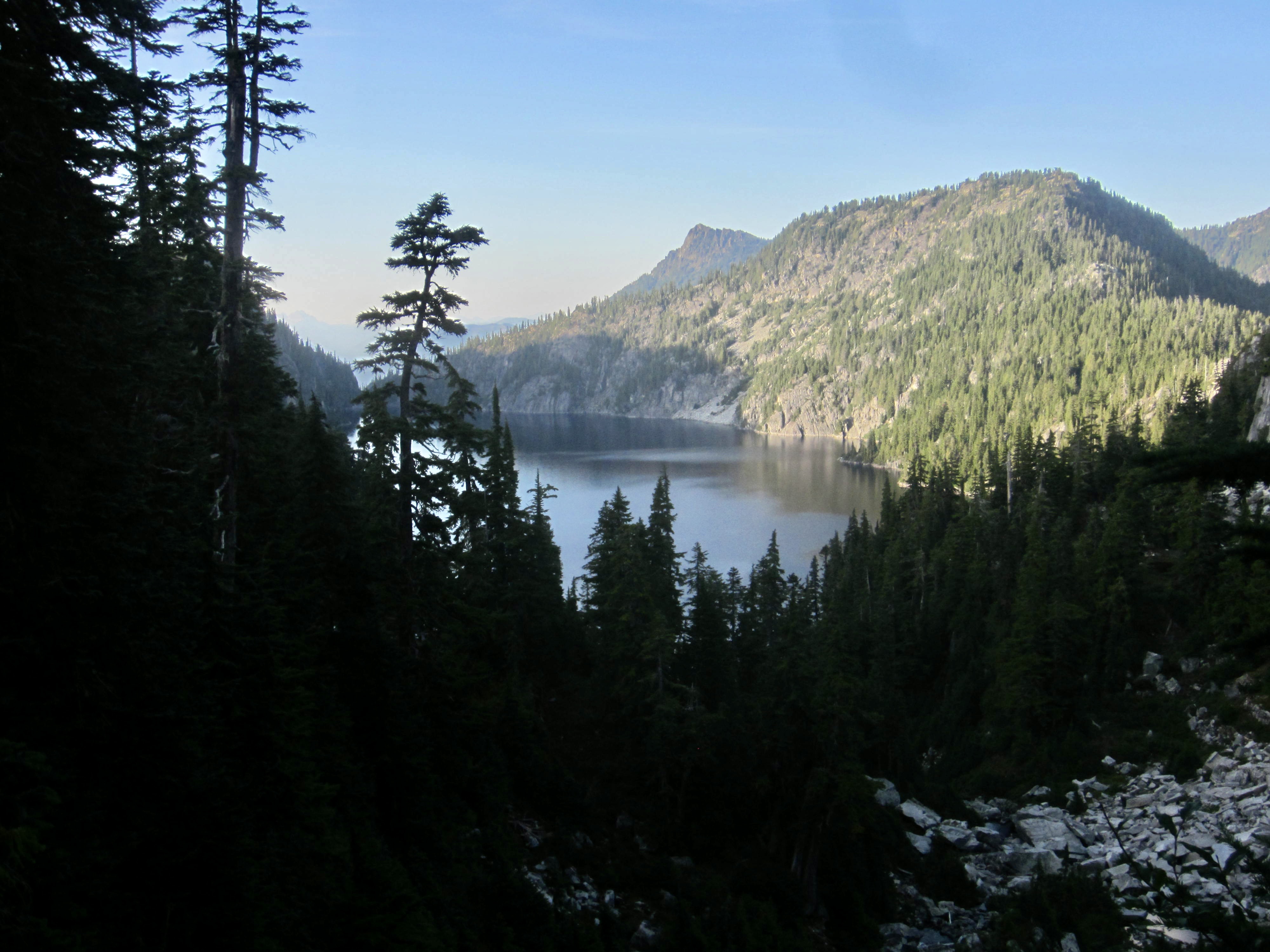
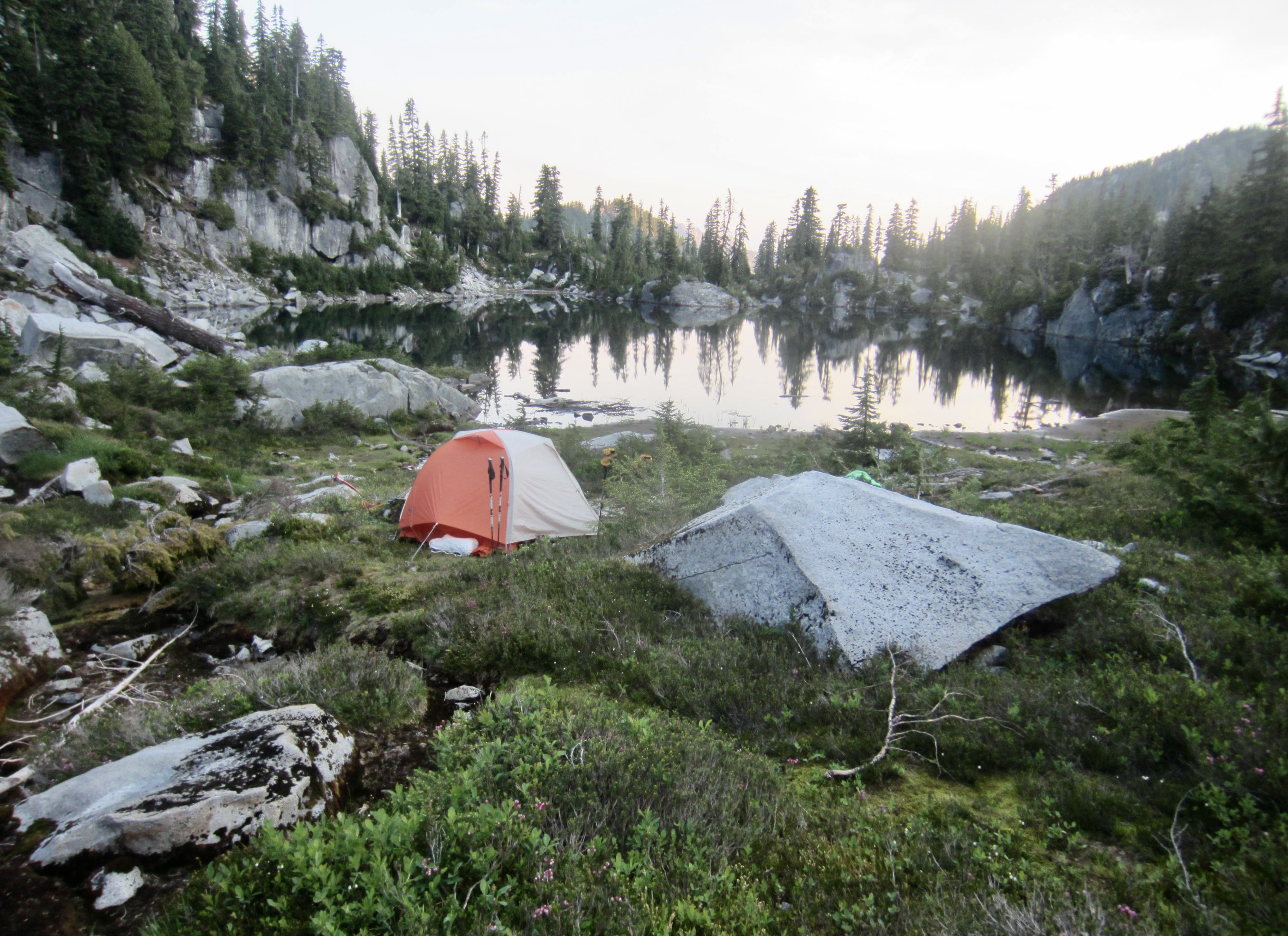
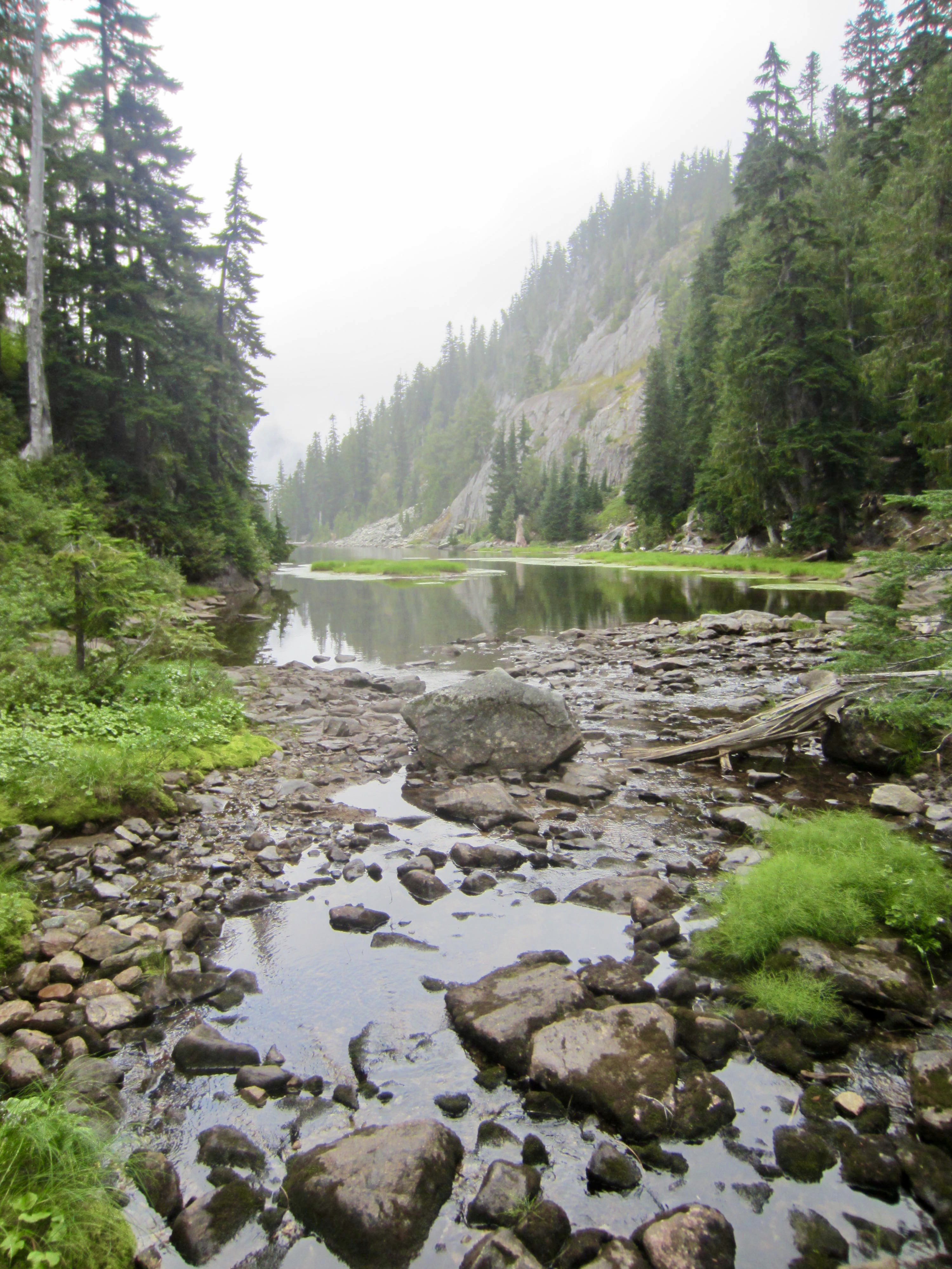
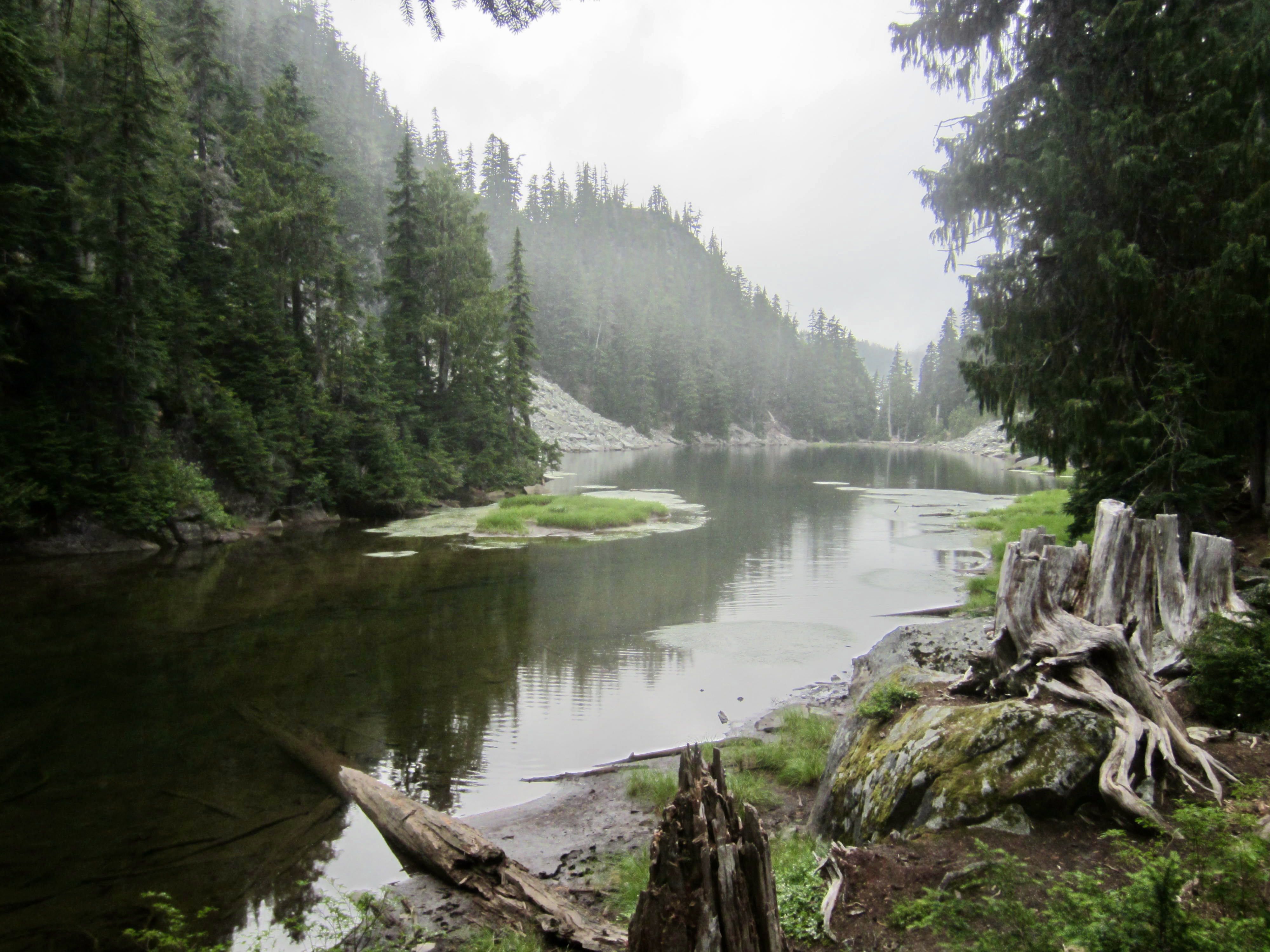
A faint bootpath in the meadow took us over a woodsy knoll to an intersection with a well-defined path, which in turn led us down to Little Chetwoot Lake, across a stream, and northeasterly over a ridge. We passed above Angeline Lake and between a pair of large tarns before descending to Azure Lake in late evening (11.2 hours + 4.6 miles + 2300 feet from Camp 2). Eileen and I used our last few minutes of twilight to hop in the lake and wash off the cedar grime. It was a soothing end to a long day with many emotional ups and downs.
Day 4: Azure Lake to Tank Lakes
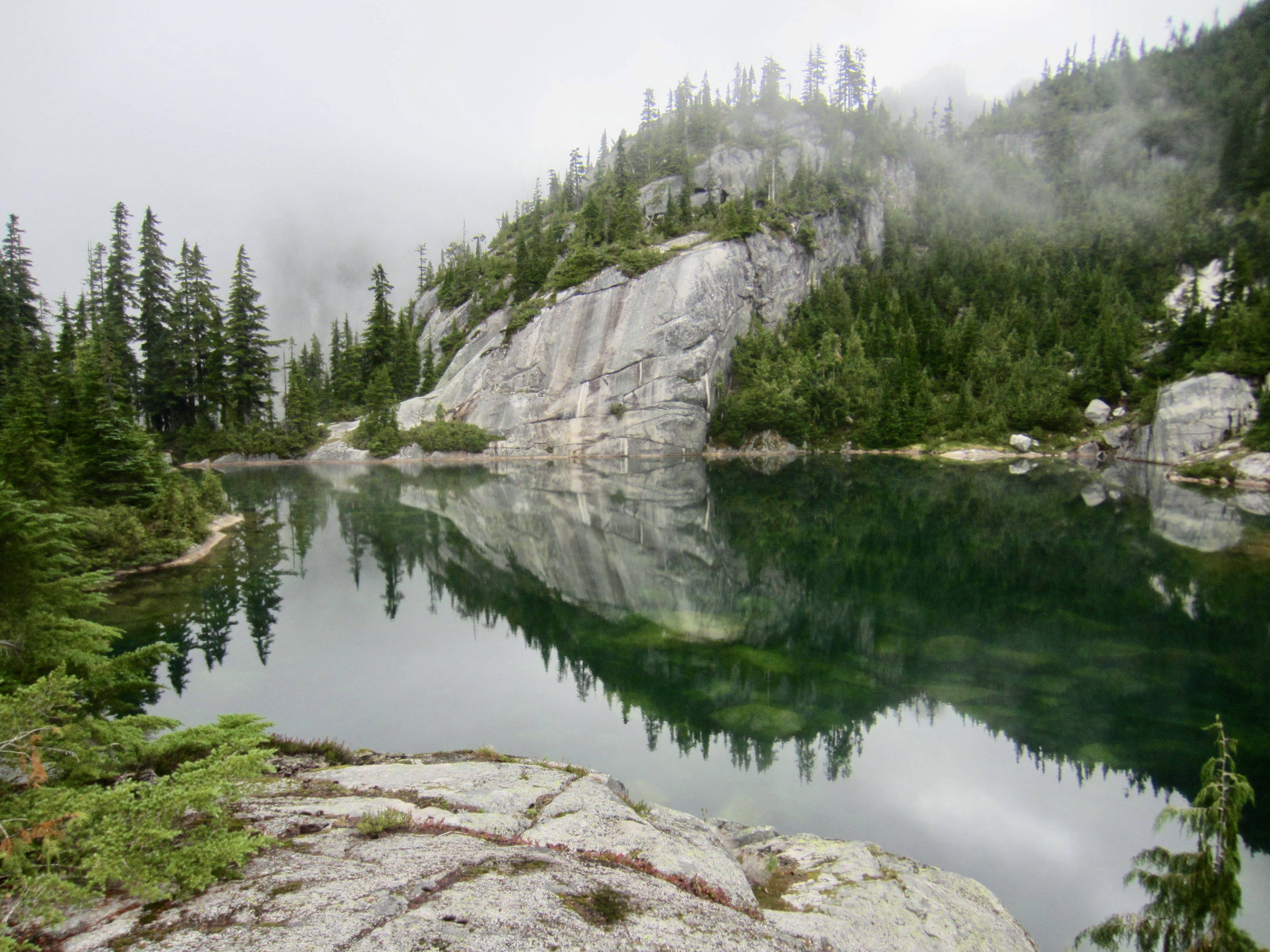
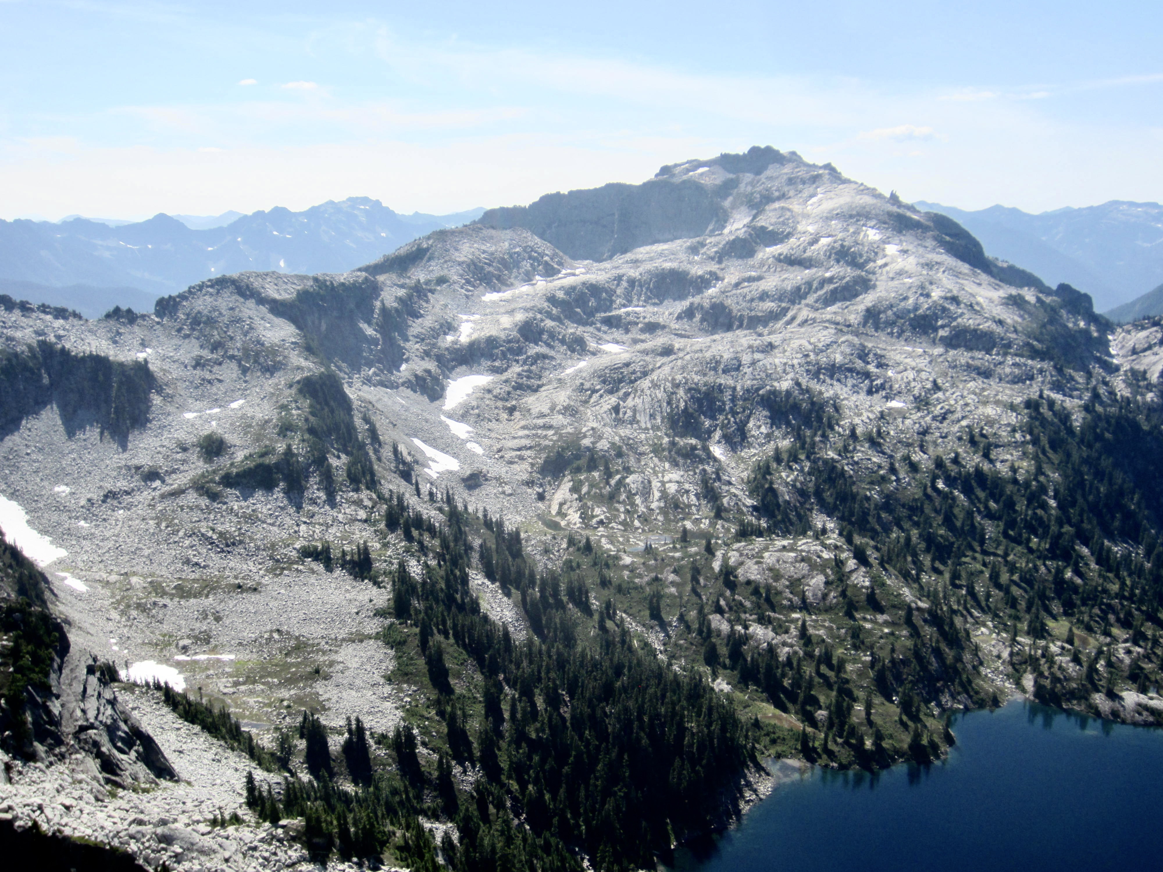
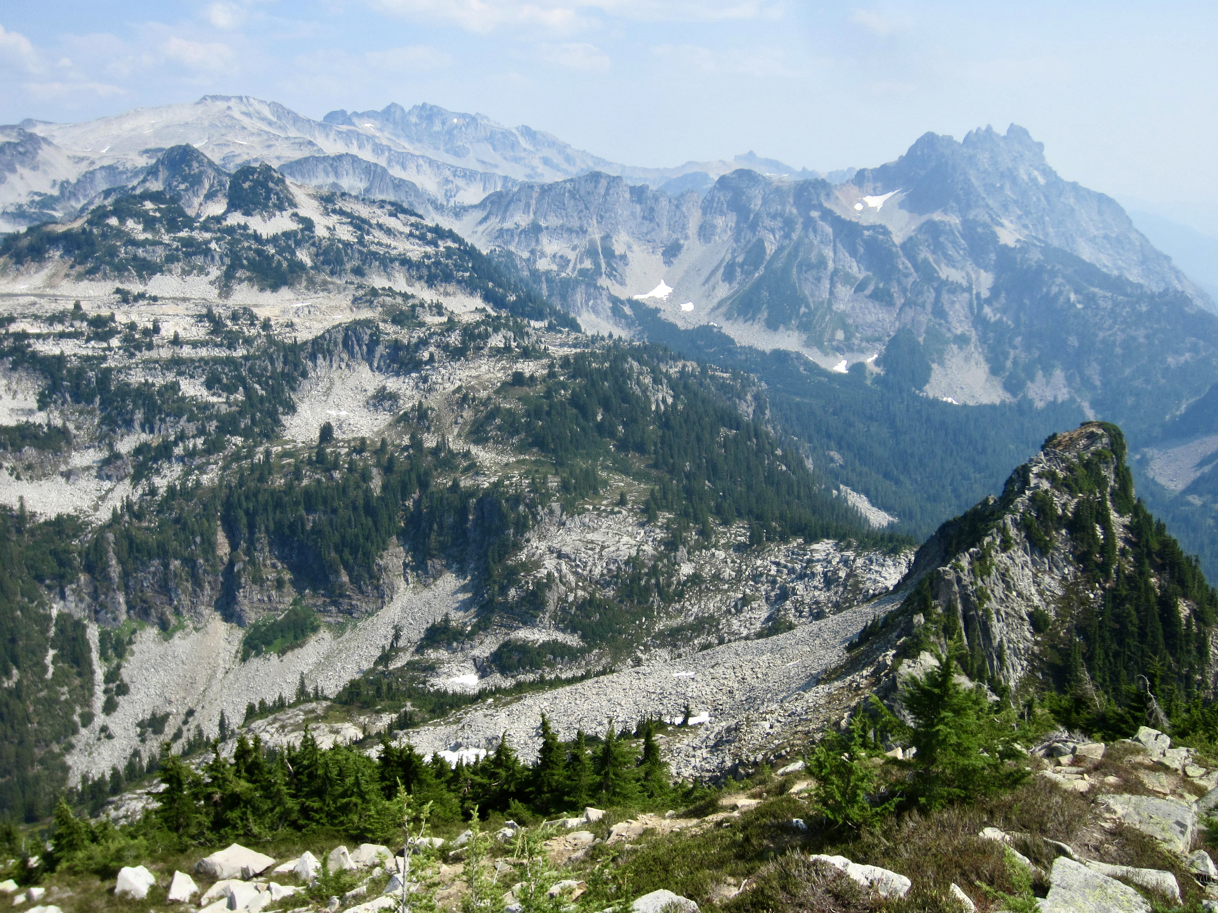
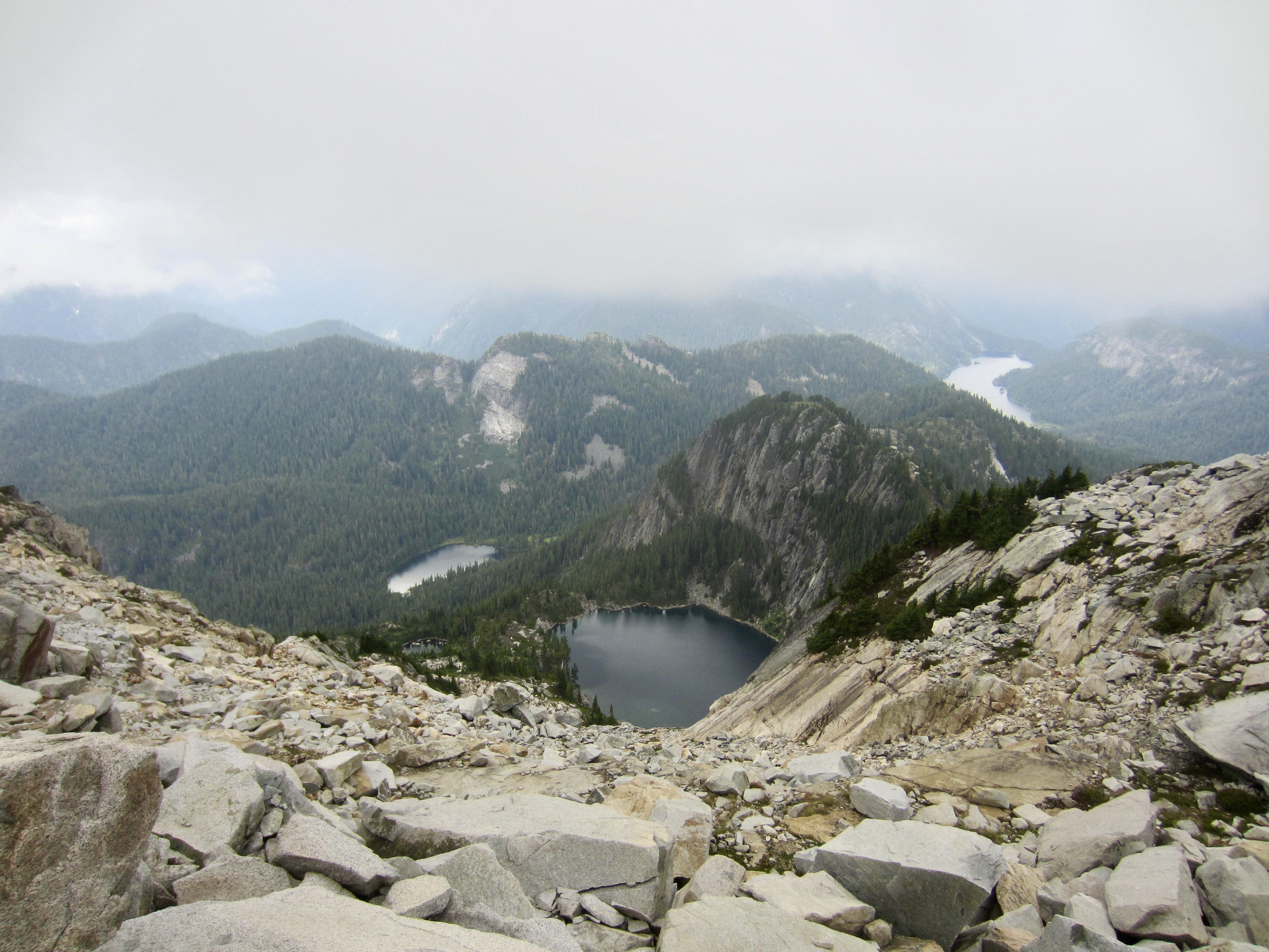
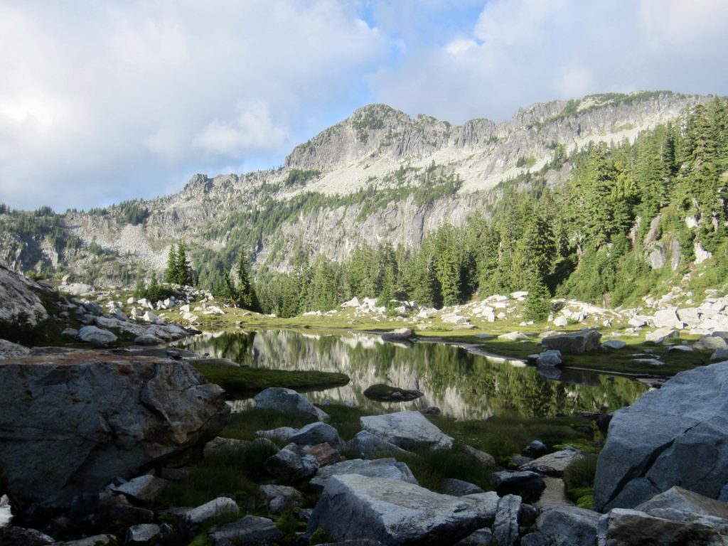
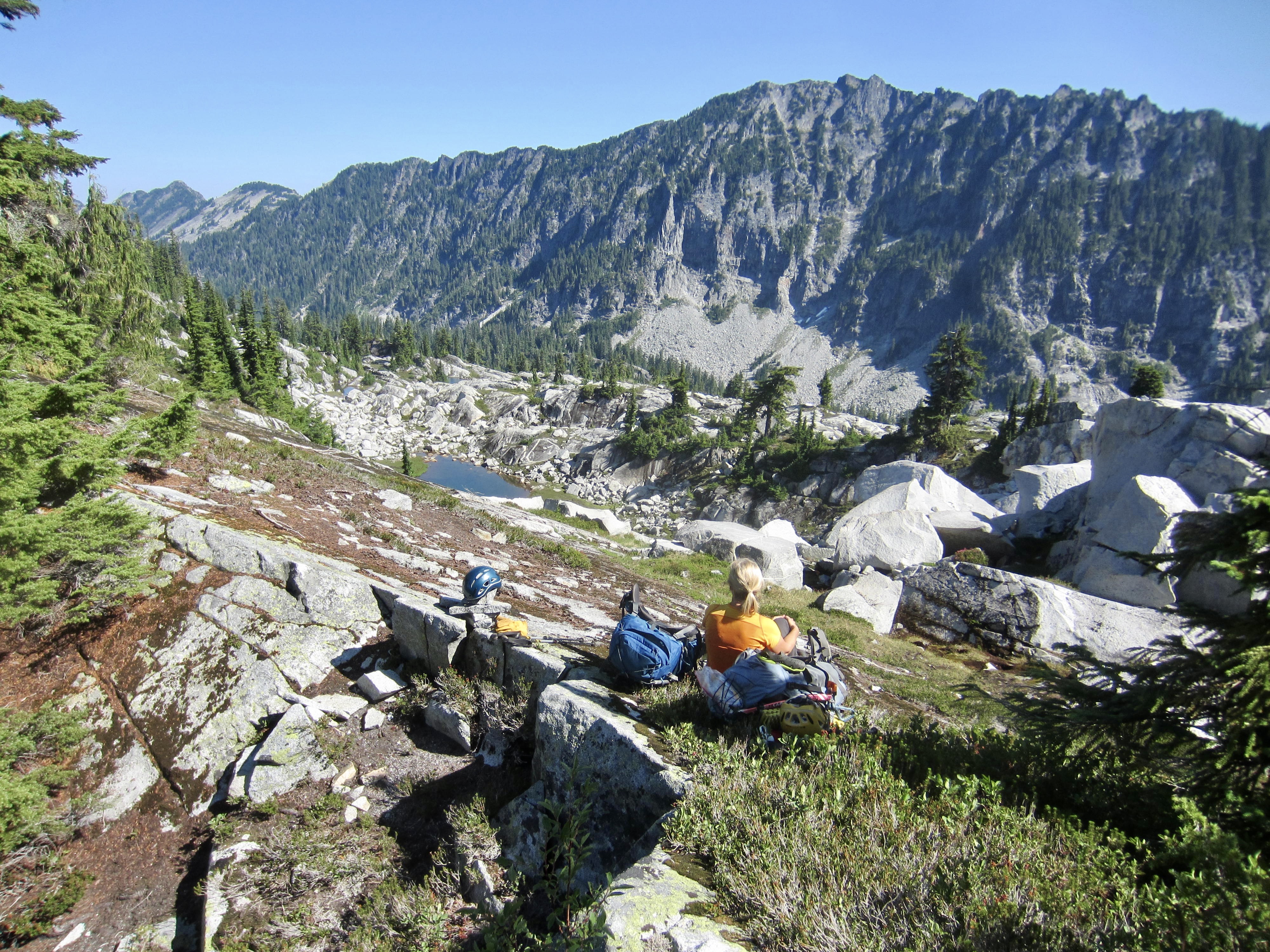
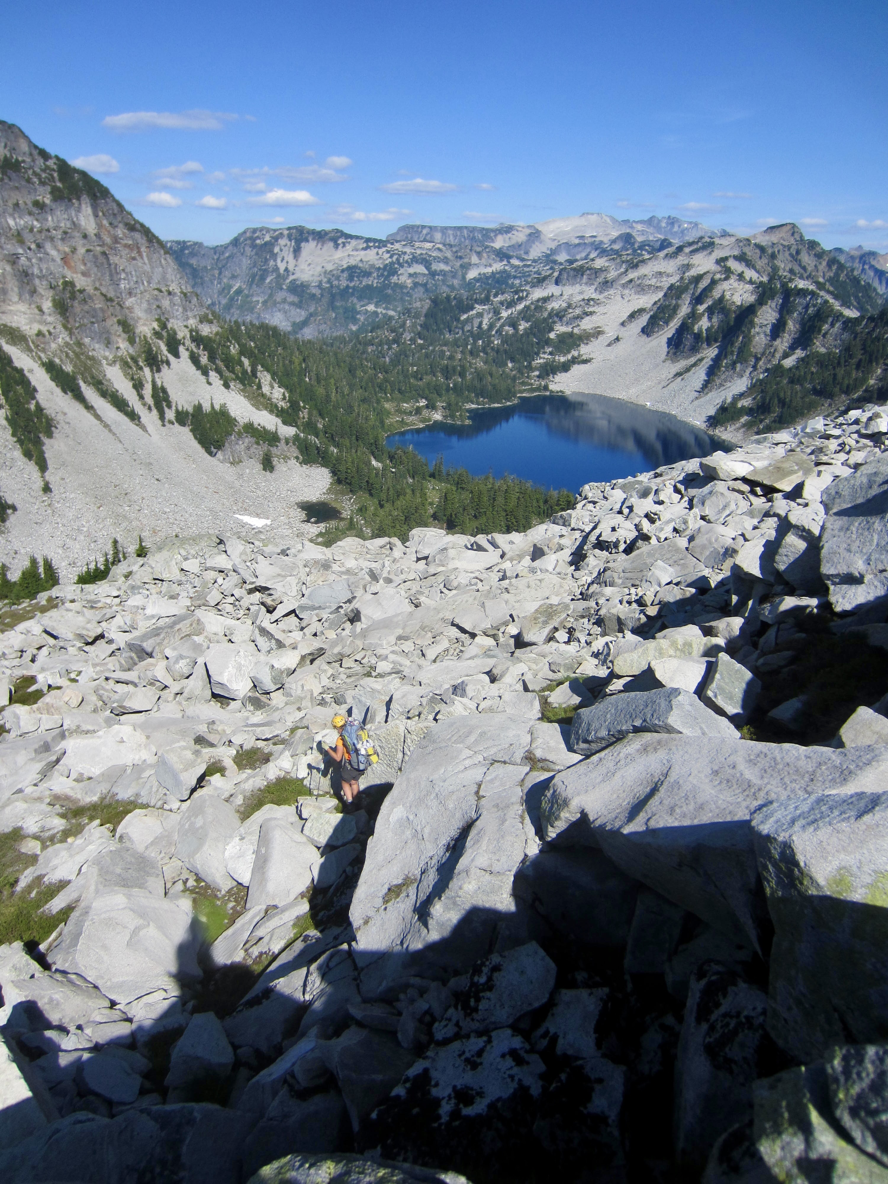
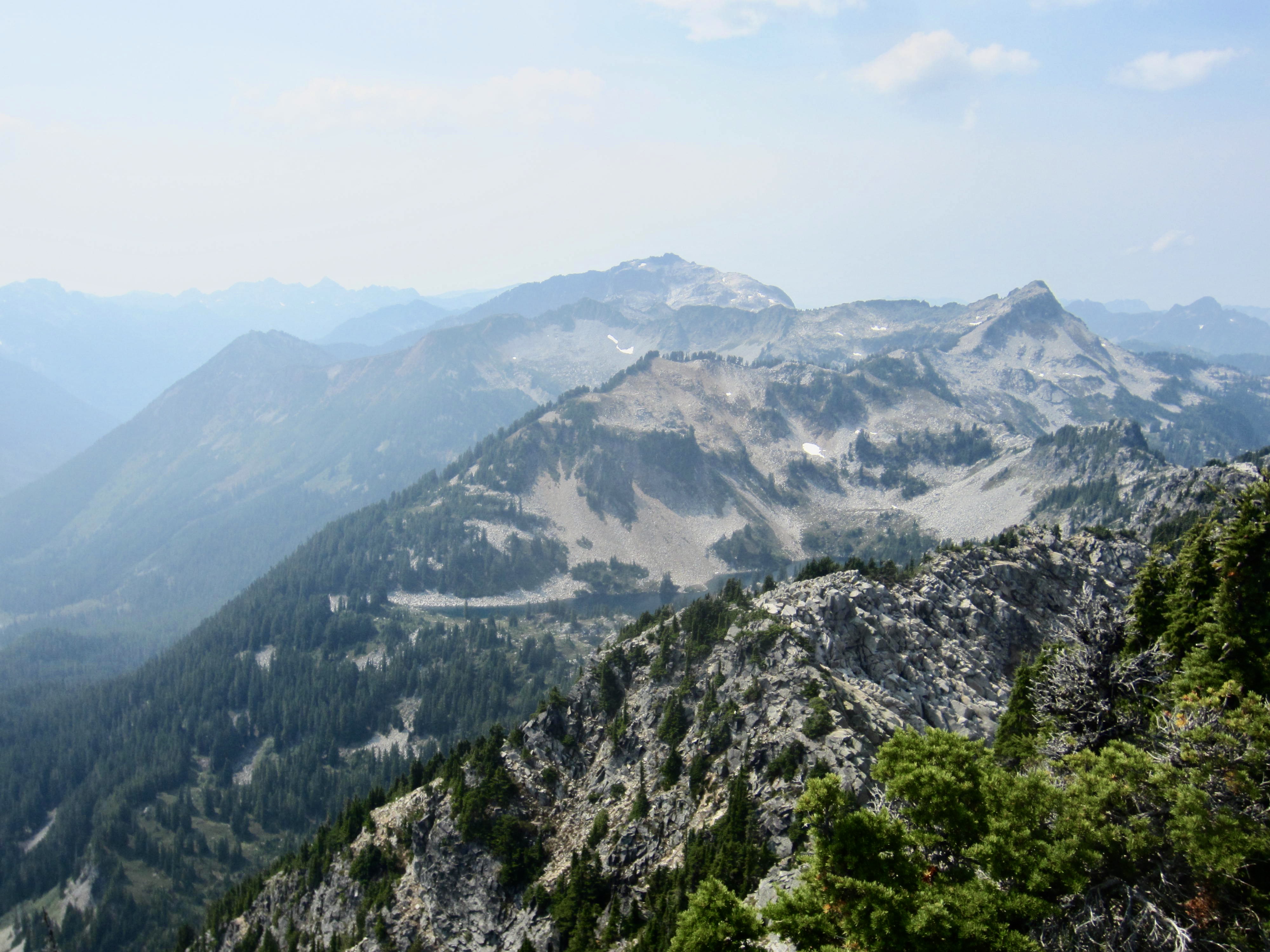
Under hazy skies, we left Azure Lake at 8:45am and headed eastward up to a slight saddle in the ridge above. This saddle gave access to a large bench of slabby rock that overlooks Azurite Lake and Otter Lake—two seldom-visited gems in the Alpine Lakes Wilderness. The Miller-Foss trio of Wild Goat Peak, Tourmaline Peak, and Camp Robber Peak stood out to the west.
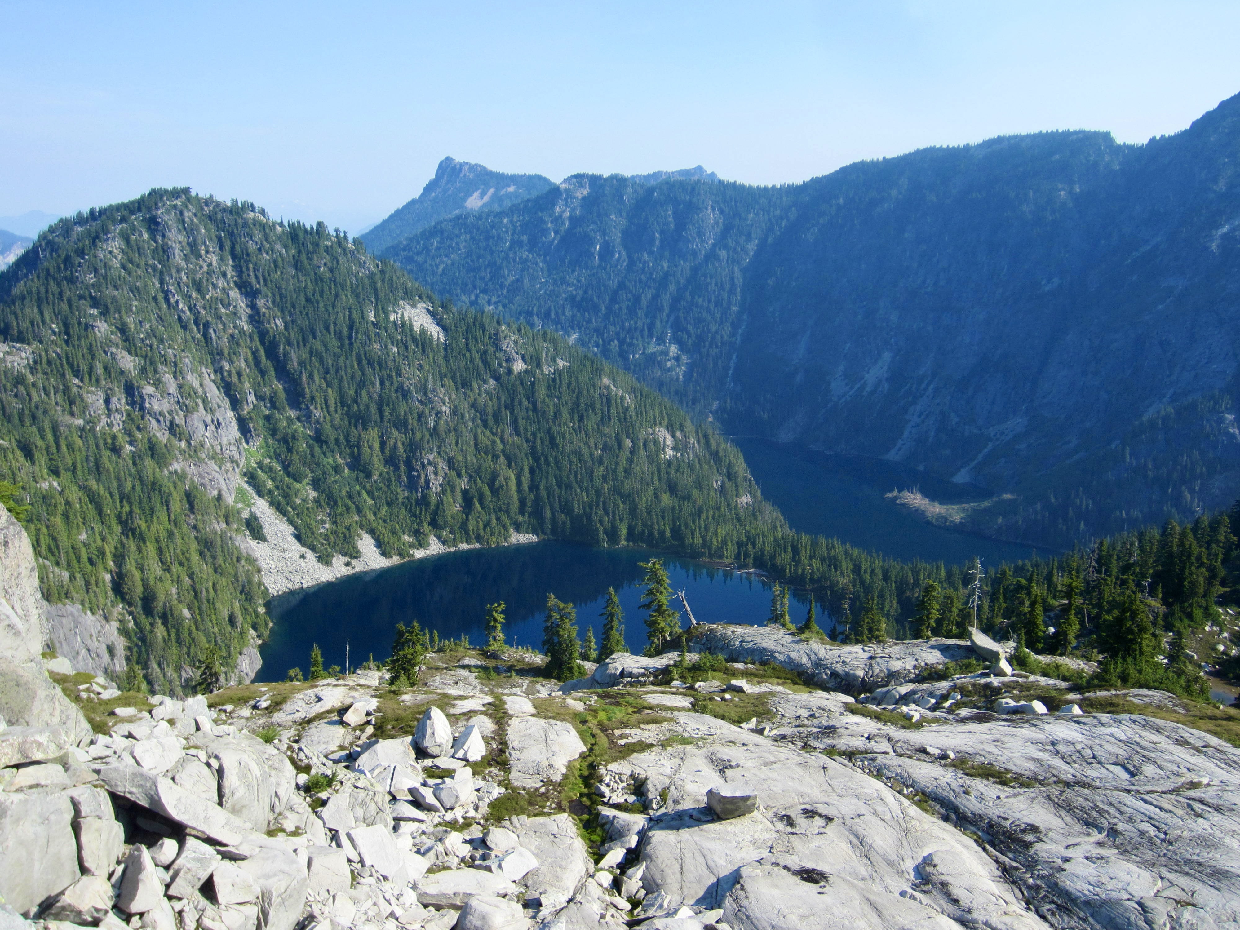

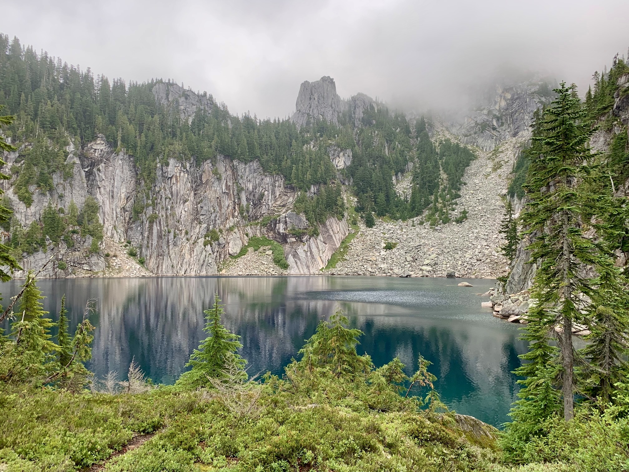
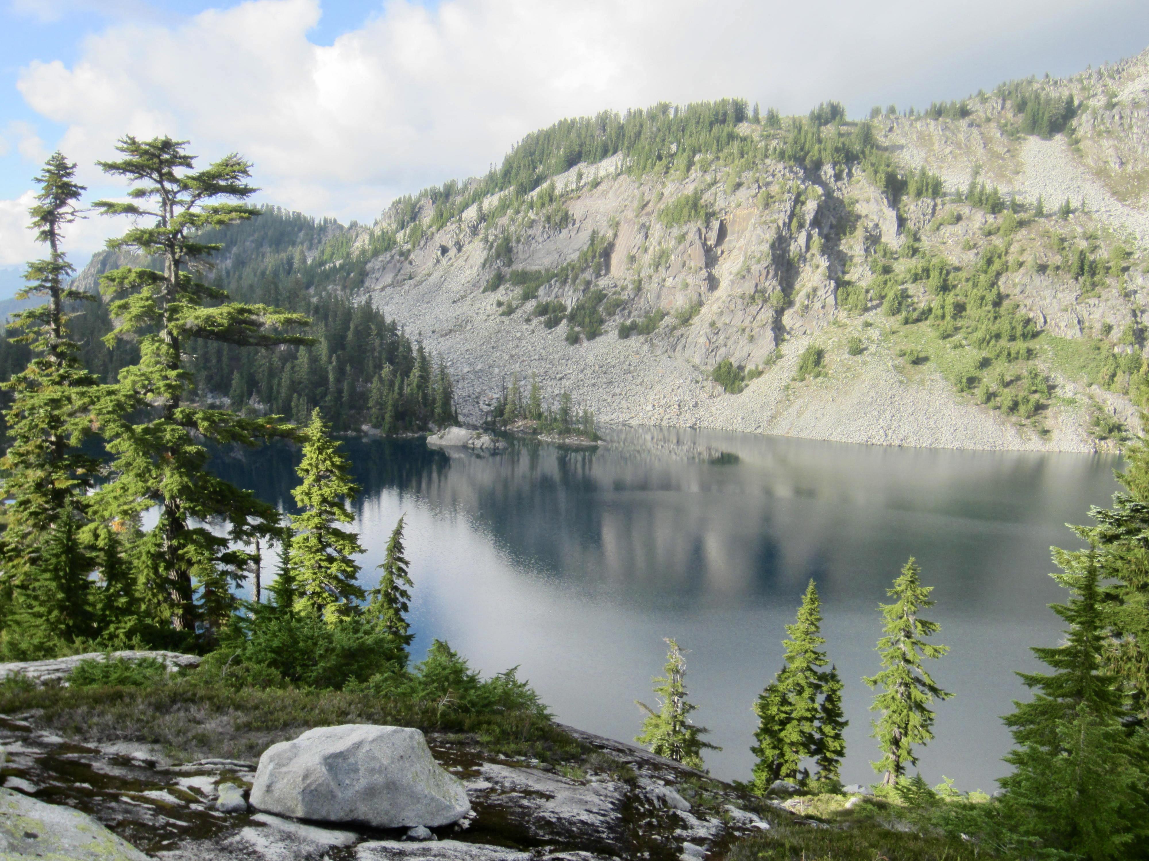
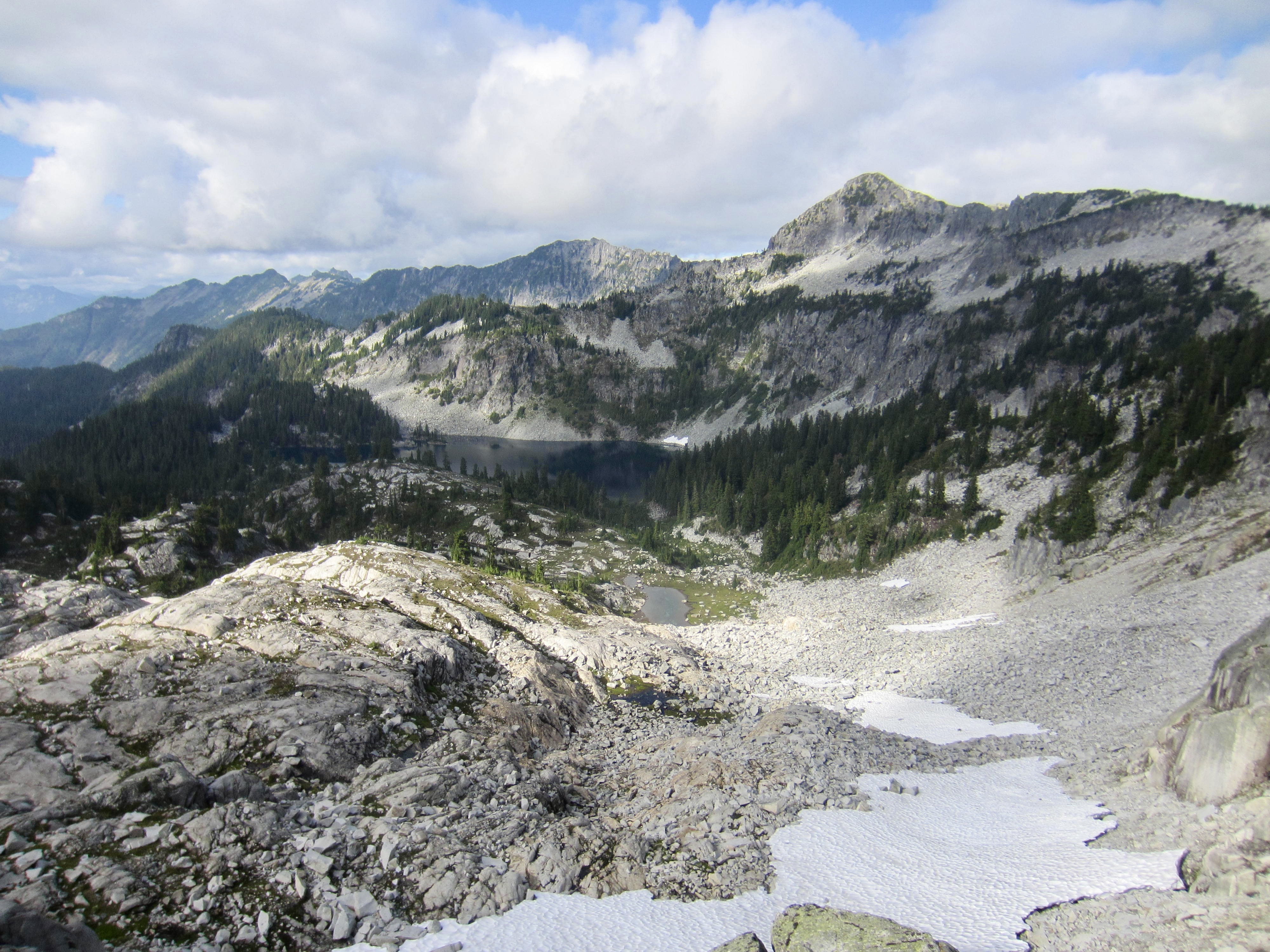
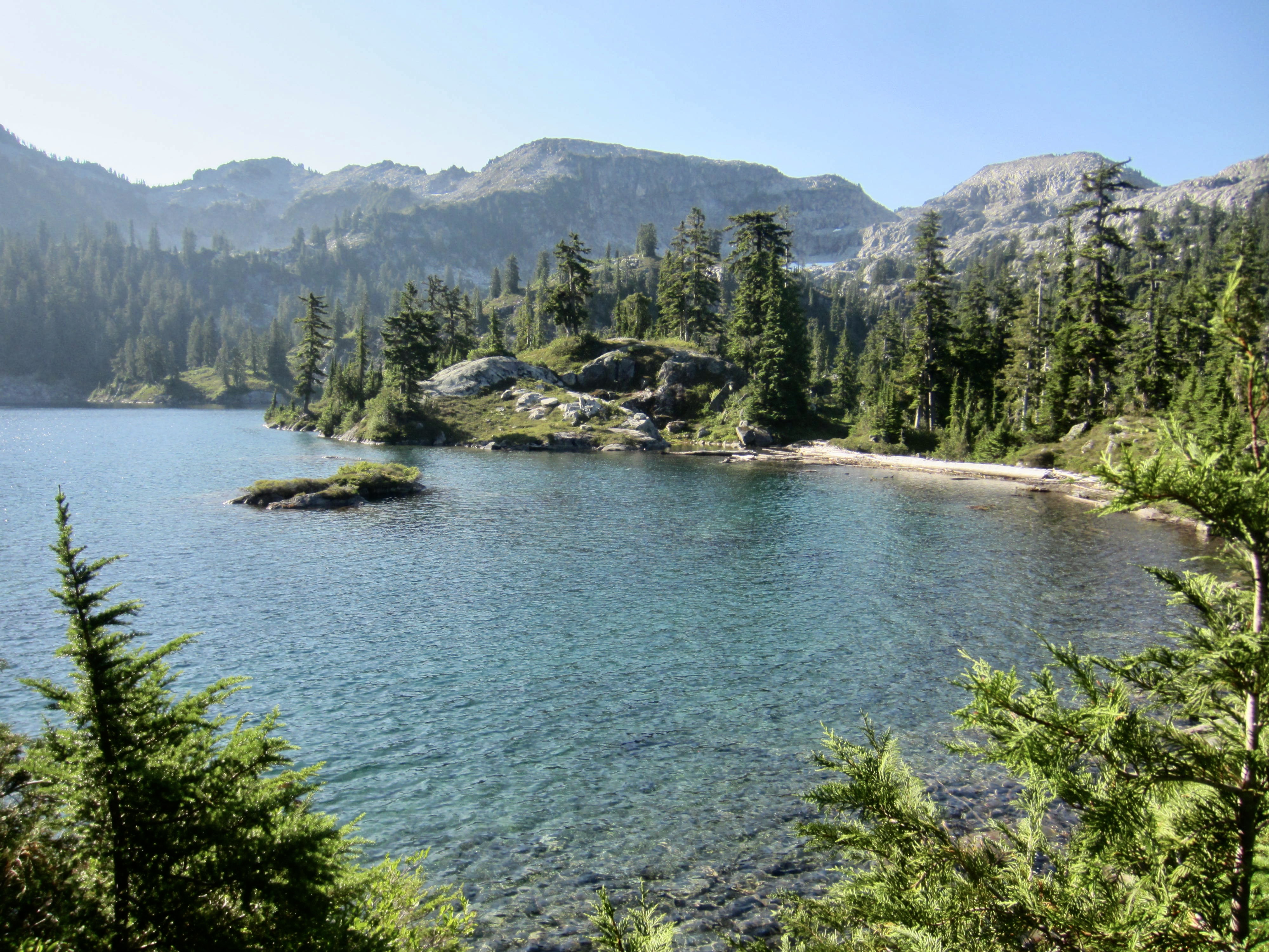
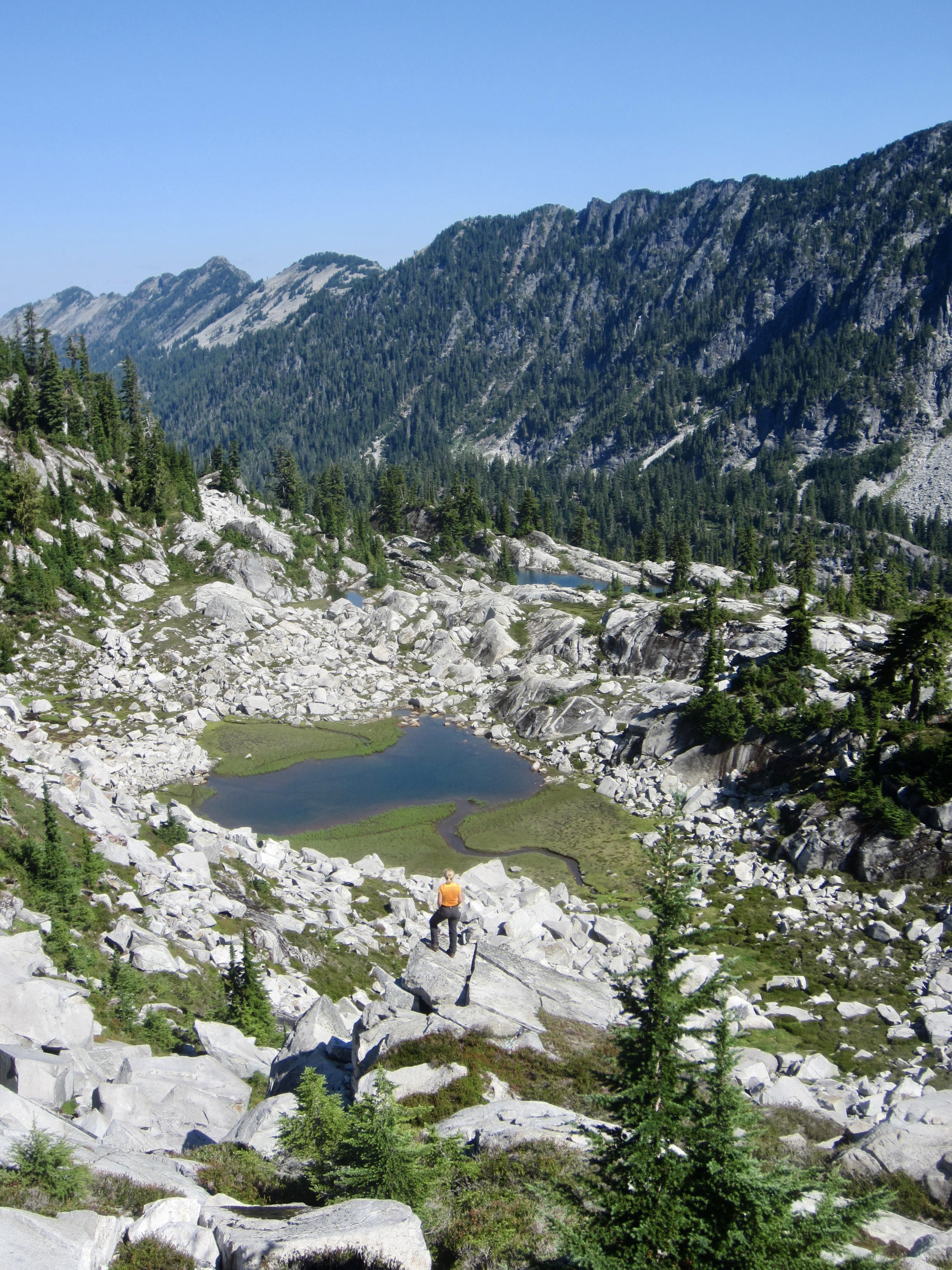
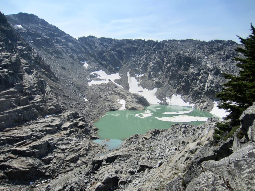
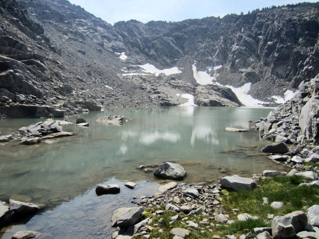
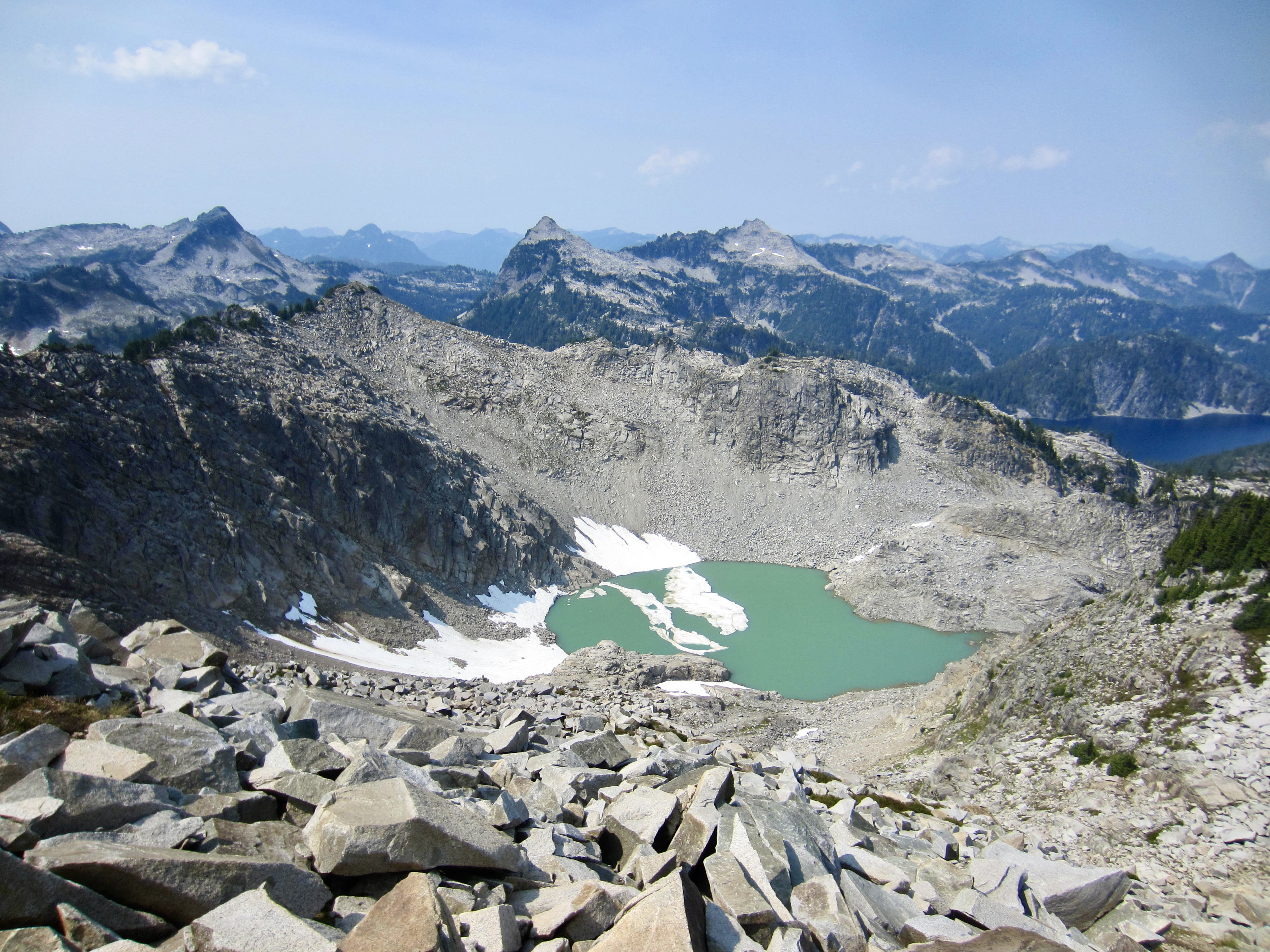
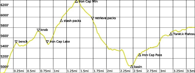
We continued eastward along the slabby bench, then across a white talus basin and around a rock buttress before hiking southward over an elongated rock knob. At the southern end of the knob, we could see Iron Cap Mountain above and Iron Cap Lake below. A Class 2-3 scramble took us down to the lake, which has floating ice slabs and a strikingly opaque jade-green color—all very reminiscent of Pea Soup Lake.
We crossed the outlet stream and began working upward to the southeast on a series of rock ledges. The rock was solid, the scrambling was enjoyable, and—best of all—there were no scrub cedars! After curving around the nose of Iron Cap Mountain’s north ridge, we stashed our backpacks and proceeded up with summit packs, reaching the top in early afternoon (4.6 hours + 1800 feet from Camp 3).
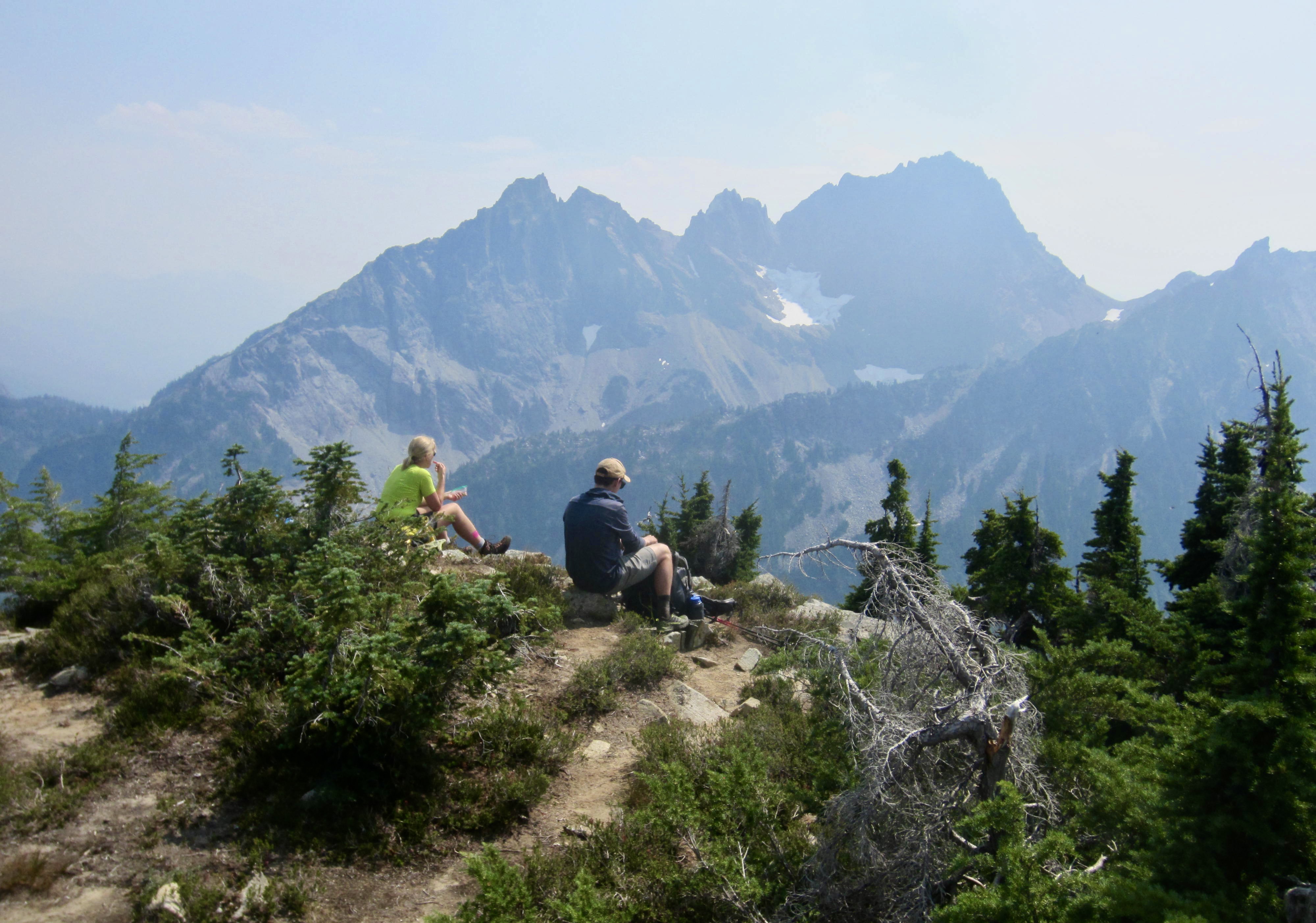
After being alone in the mountains for the last three days, we were a bit surprised to see another person on the summit. We struck up a conversation and learned that he was Andrew, a tech worker from Colorado. He had started at the West Fork Foss River Trailhead yesterday and was doing the shorter, more popular version of the Alpine Lakes Traverse. Unfortunately for all of us, wildfire smoke had now greatly diminished the long-range visibility from this splendid viewpoint.

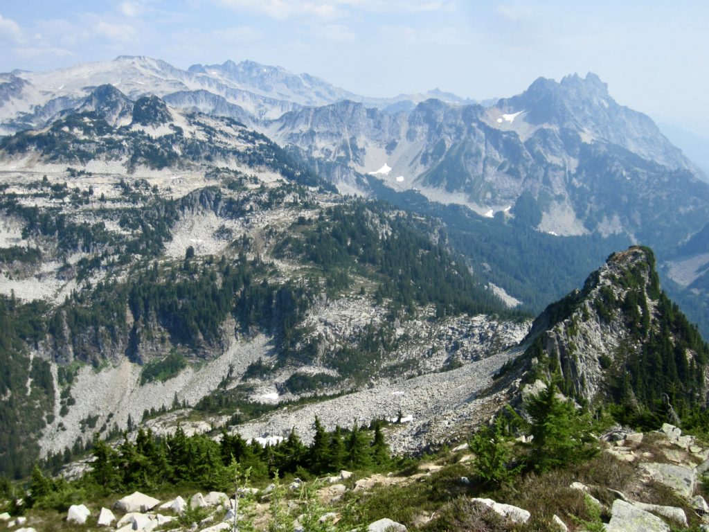
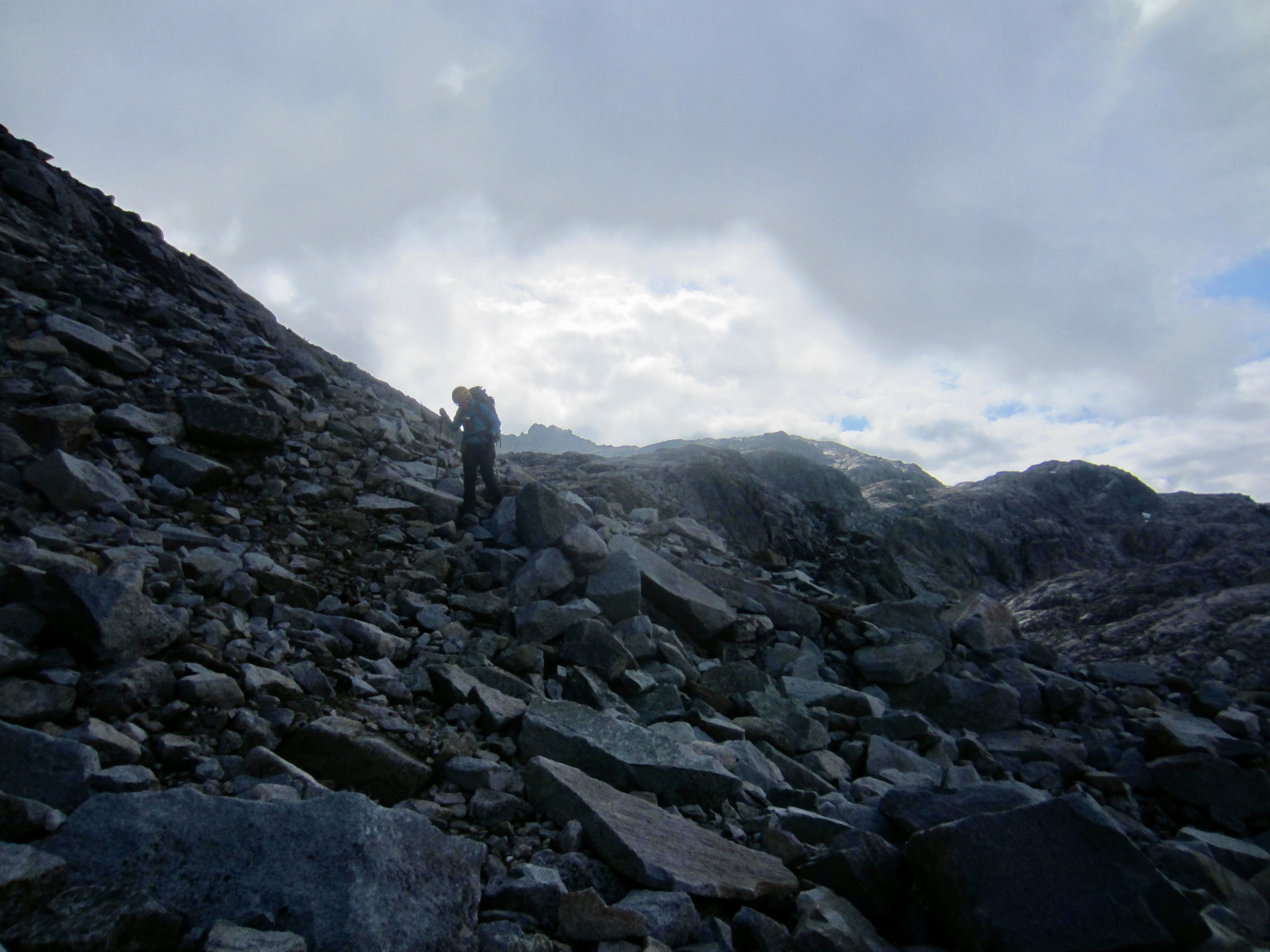
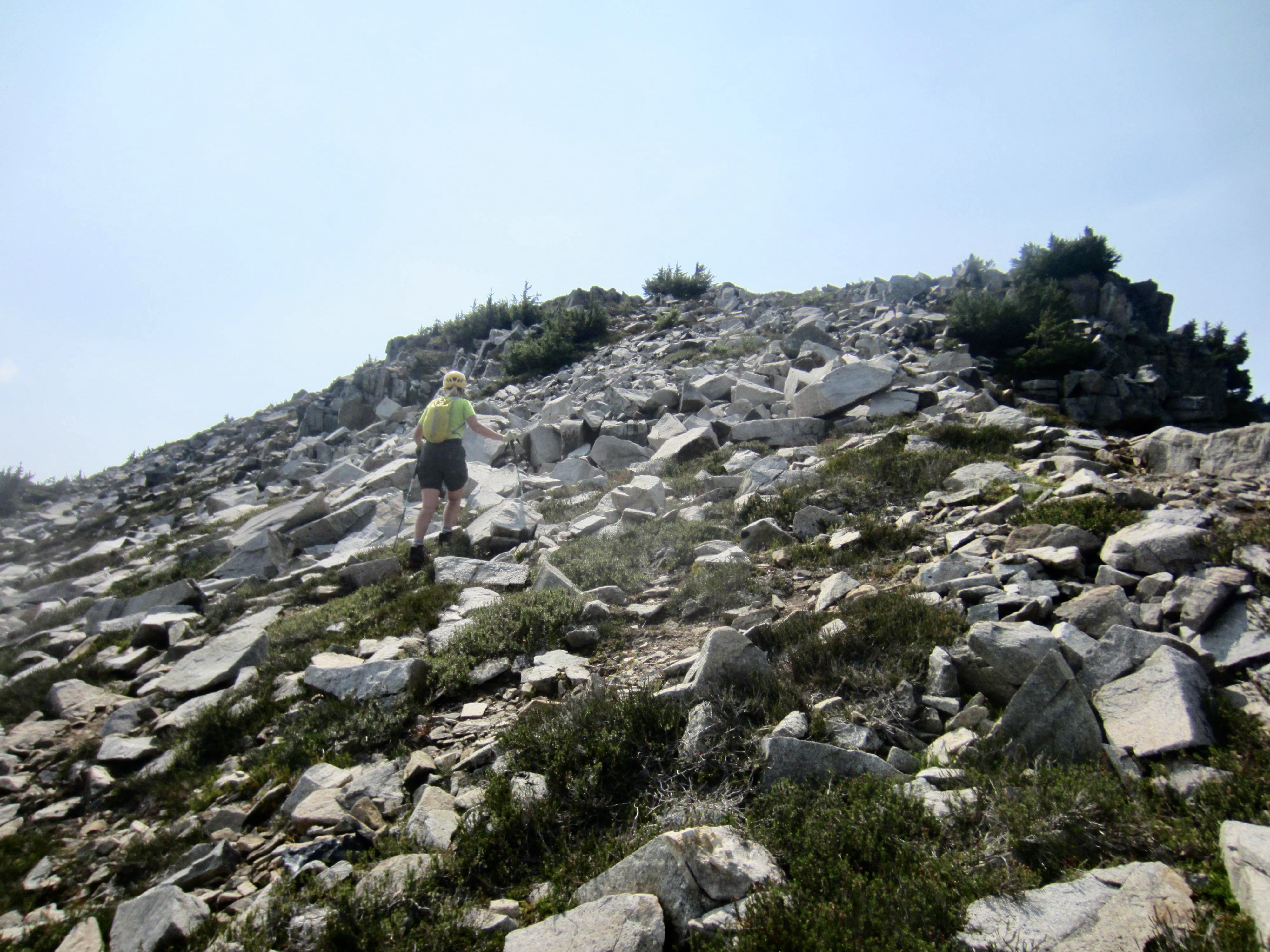
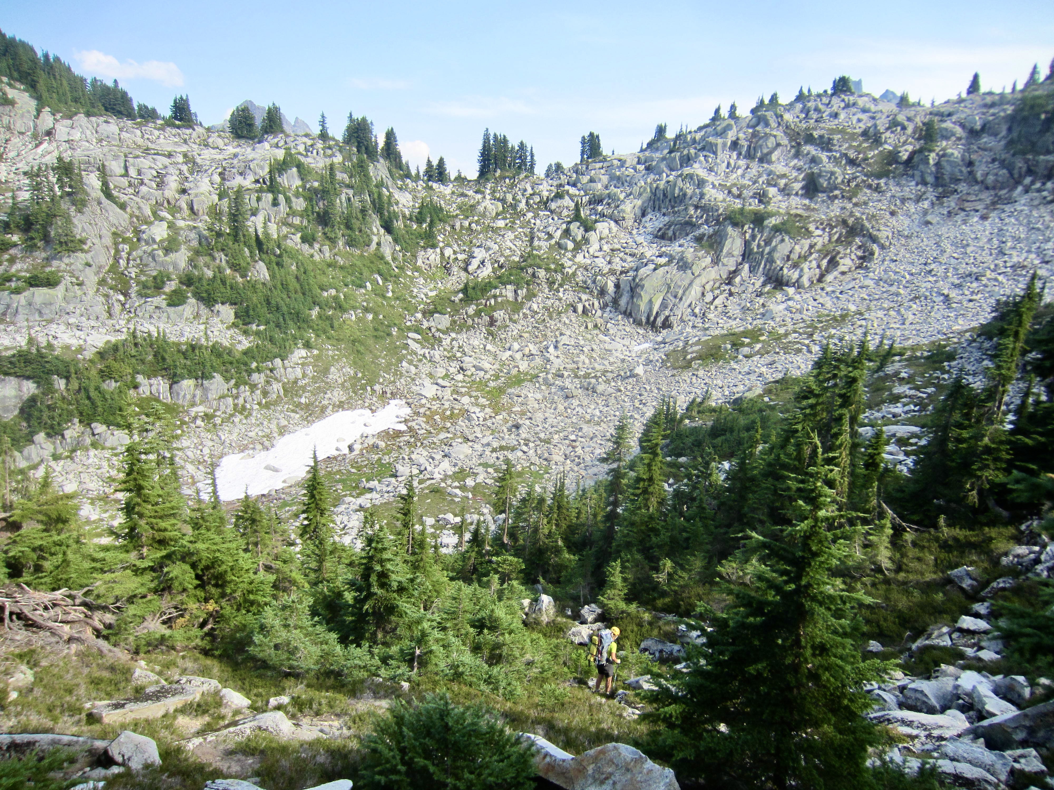
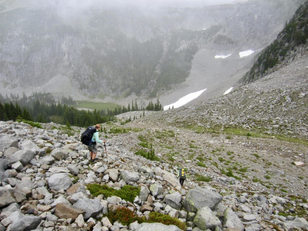
Because we were all heading to Tank Lakes today, Andrew, Eileen, and I left the summit together. Almost immediately, we encountered a pair of trekkers also heading to Tank Lakes, so we temporarily joined forces with them to solve the trickiest part of the entire traverse: getting off Iron Cap Mountain’s eastern flank. The terrain here gets quite steep, and there are multiple possibilities heading in various directions. We soon divided into three groups again and tried three different routes, all of which ultimately worked out. Eileen and I chose a route that went straight down the northeastern nose and then veered to the right, following boot tracks and marker ducks through alternating patches of dense fir trees and white boulders.
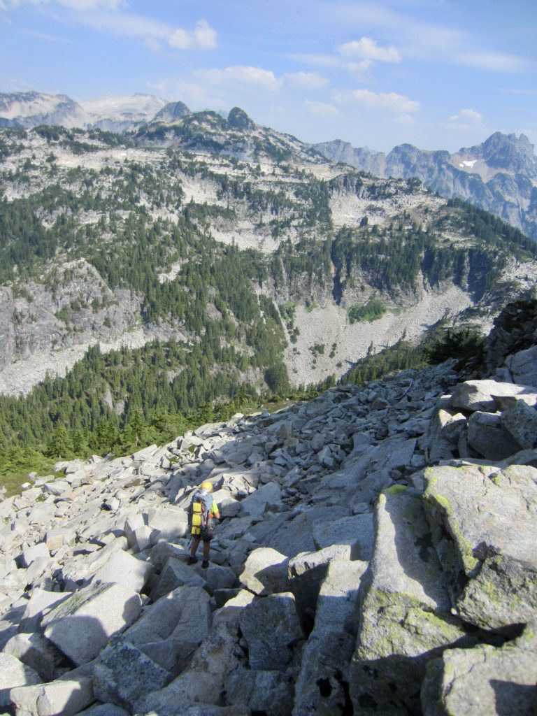
After dropping 300 feet, our route began angling across expansive slopes of—you guessed it—white talus. This overall route could be appropriately nicknamed the “White Talus Traverse”! We eventually bottomed out in Iron Cap Basin, then followed a well-defined bootpath up to 5300-foot Iron Cap Pass (8.0 hours + 2200 feet from Camp 3). Andrew arrived at the pass a few minutes later, having taken a slightly different route off the mountain, and the other couple arrived 20 minutes after him.
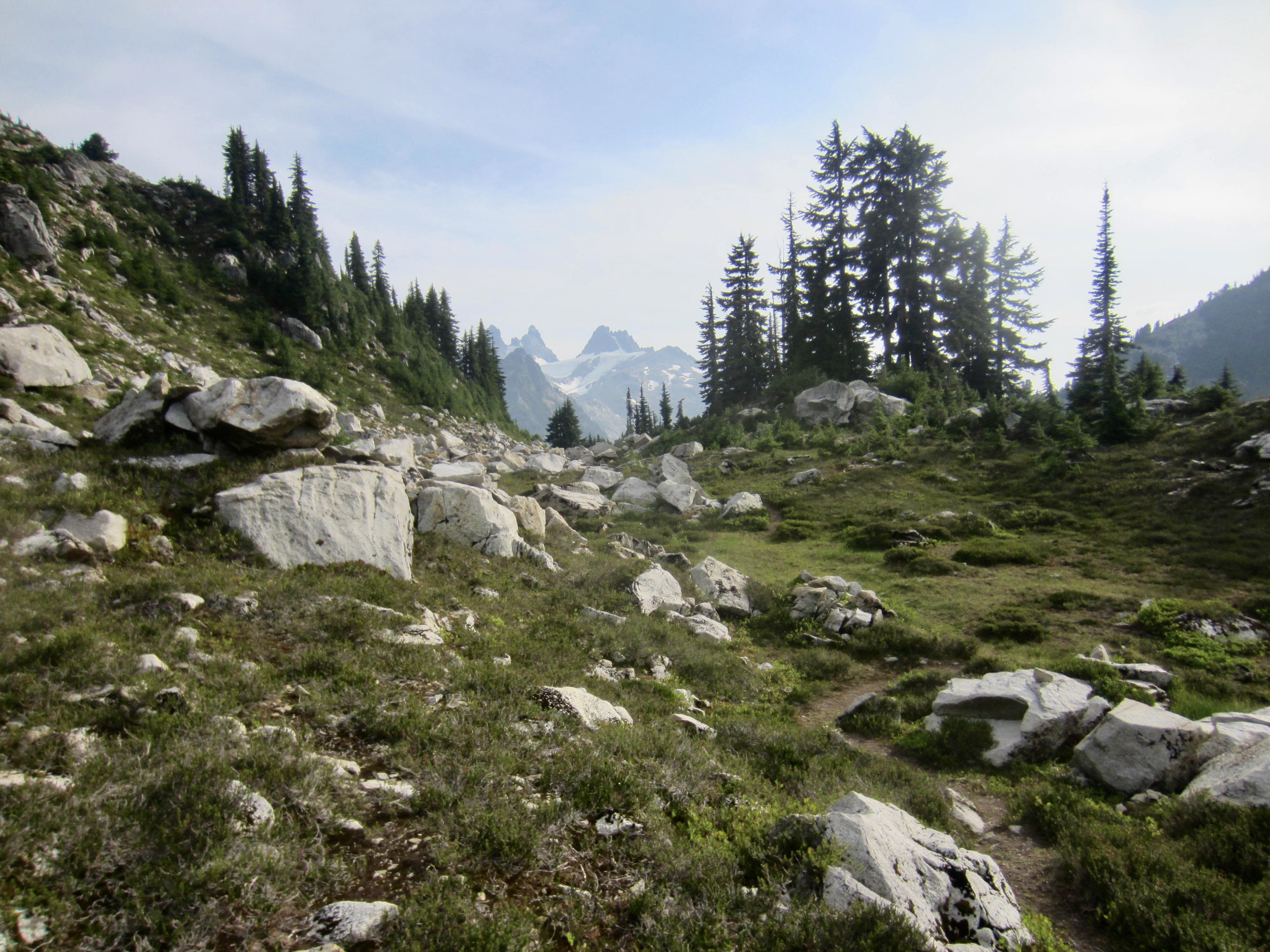
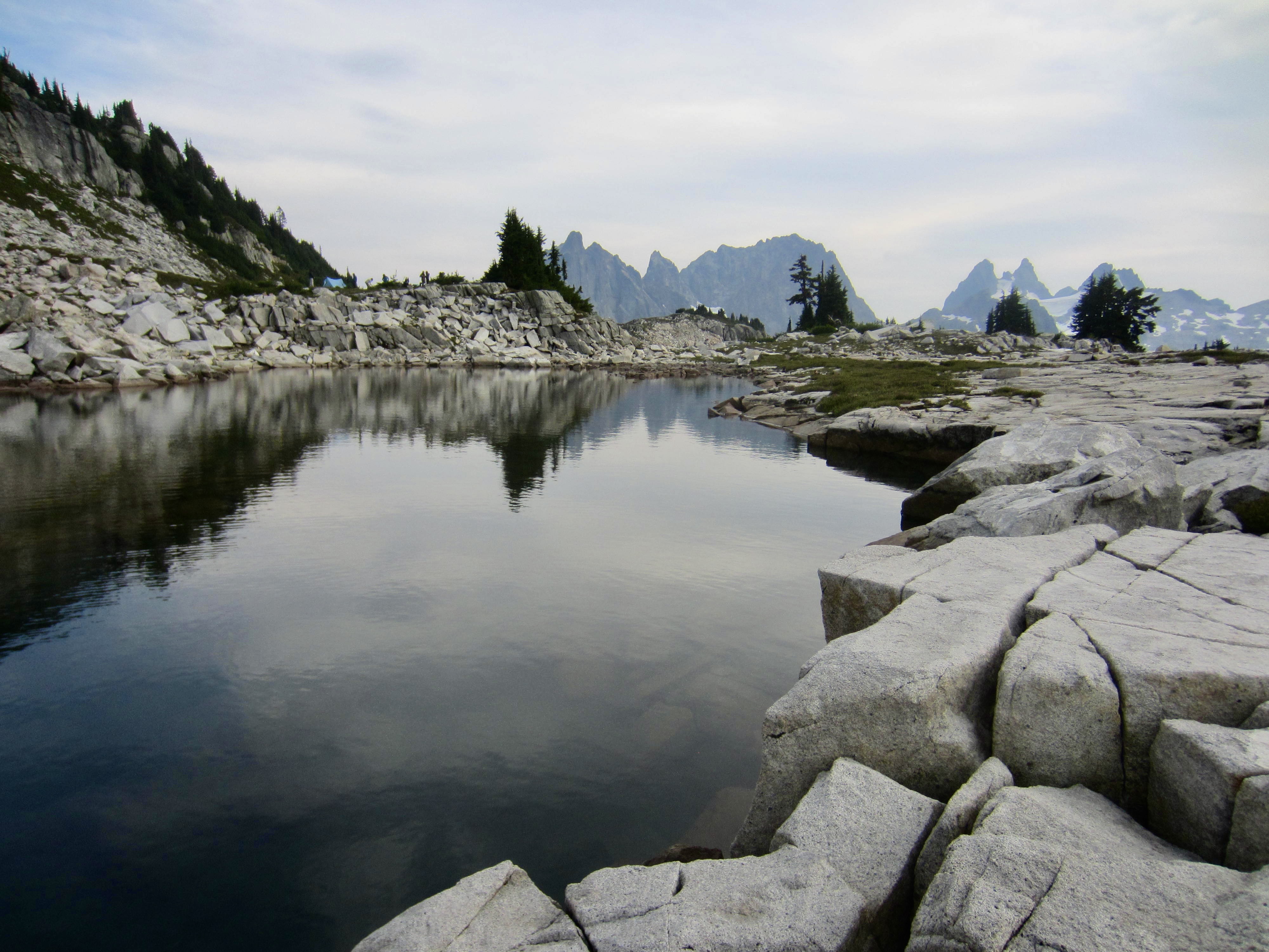
We all finished our day with a 1-mile hike up to Tank Lakes on a well-used path that zigzags through a delightful series of heathery meadows and grassy parks. Without a doubt, the ascent from Iron Cap Pass to Tank Lakes is one of the scenic highlights of the whole traverse.
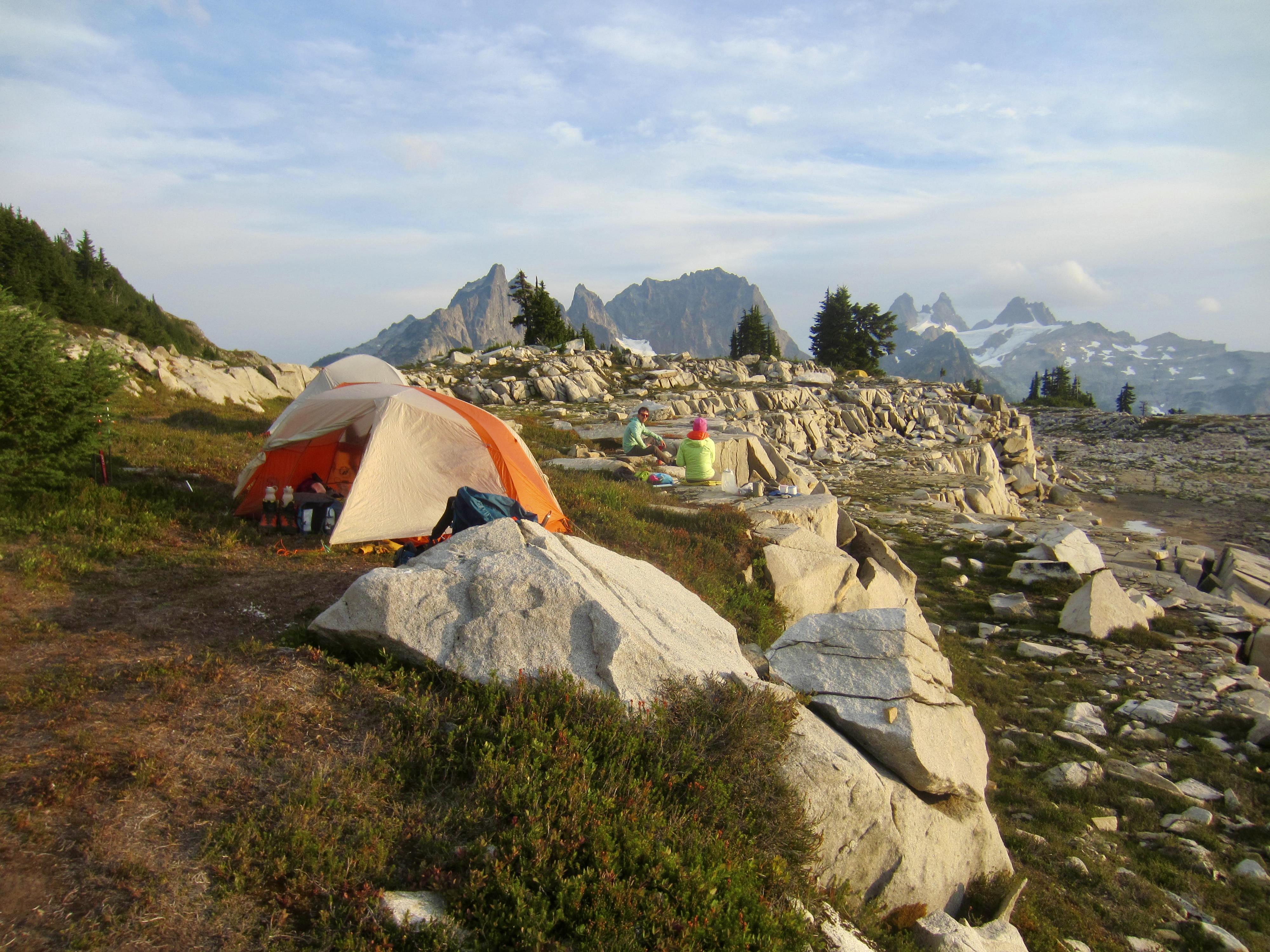
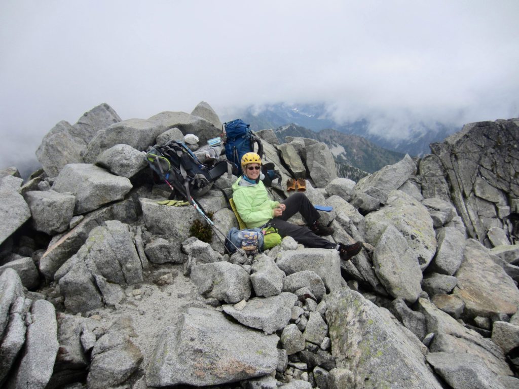
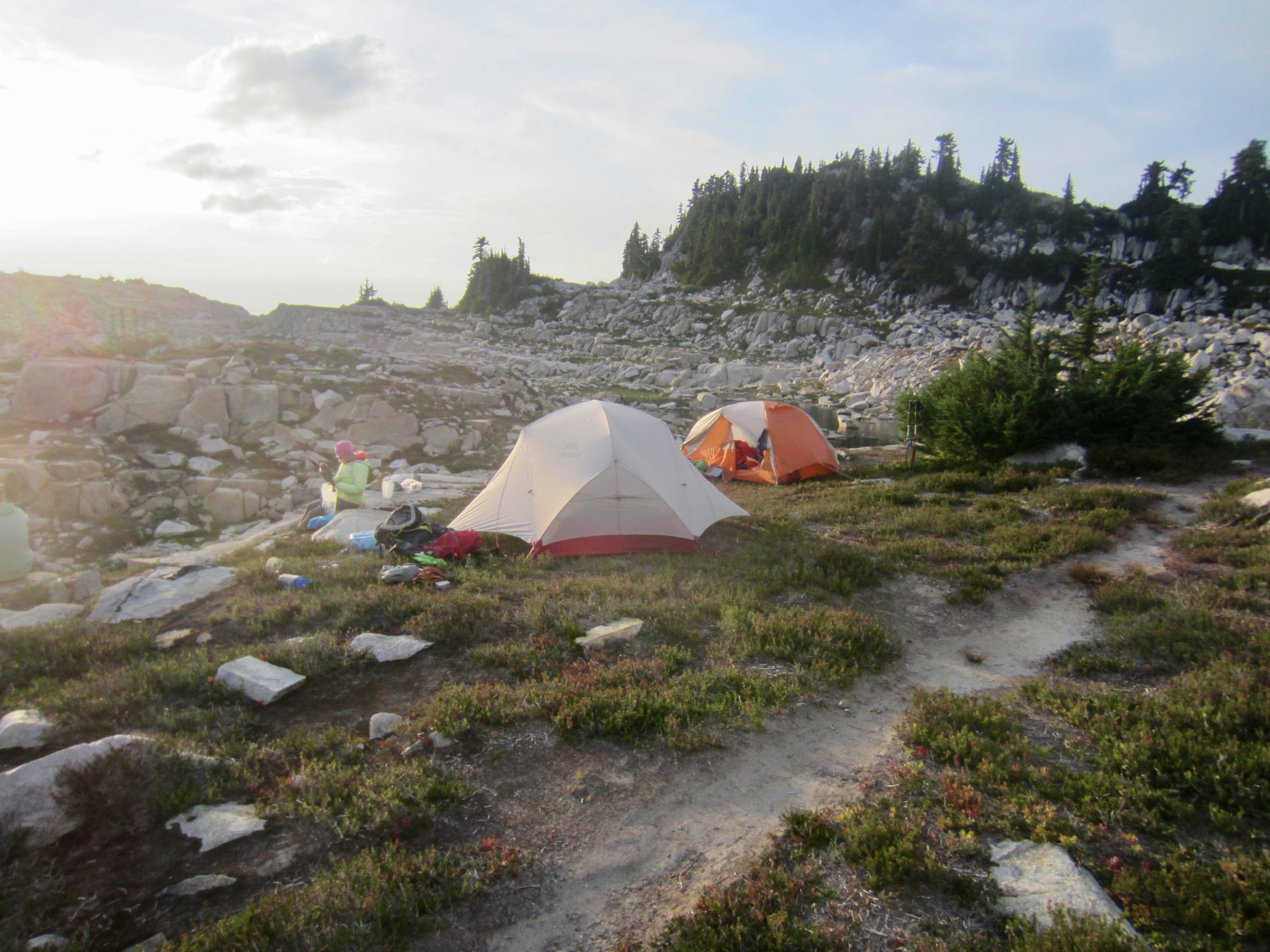
We arrived at South Tank Lake just before 6:00pm (9.0 hours + 4.3 miles + 2800 feet from Camp 3) and were a bit shocked to find 15 or 20 other campers there, including one group of eight. Tank Lakes is obviously no secret anymore! Nonetheless, we were all able to find ample space for our tents and a sunset dinner.

Day 5: Tank Lakes to Necklace Valley Trailhead
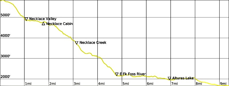
Rain showers and light fog moved in during the early morning hours, prompting us to pack up rather hastily at dawn. Eileen and I headed out with Andrew and the other couple. We followed boot tread and scattered ducks out of the lake basin, then descended 1000 feet on moraine rubble to reach Necklace Valley. Good trail took us through the valley and down to the East Fork Foss River Trail, from where it was a straightforward 5-mile hike out to the trailhead. Jim A. met us on the trail and joined us for the last ¼ mile. We arrived at the parking lot in mid-afternoon (7.4 hours + 10.0 miles + 500 feet from Camp 4) to conclude a very memorable traverse.
…
Route Maps & Profiles
…
…
…
…
…
…
…
Photo Gallery
Click to enlarge…