Trip Date: August 19, 2024
Yak Peak Day Climb
Coquihalla Pass
Yak–Nak Saddle
Yak Peak (6640+ ft)
Trip Report Summary
Region: Canadian Cascades (British Columbia)
Sub-Region: Coquihalla Range
Area: Coquihalla Summit Recreation Area
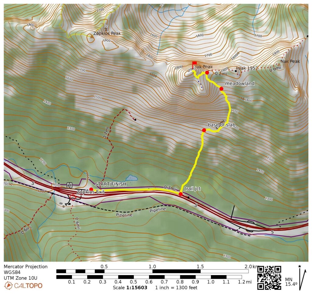
Starting & Ending Point: Zopkios truck stop off Coquihalla Highway 5 at Exit 217 (Elev. 3950 feet)
Way Points: Yak Peak Trail junction (road shoulder walk); Yak Peak south face slab base & Yak-Nak Saddle & Yak Peak summit (trail hike & trail scramble & rock scramble)
Summit: Yak Peak (trail hike & trail scramble via Southeast Face)
Approximate Stats: 2.6 miles traveled; 2800 feet gained & lost; 3.4 hours up; 2.8 hours down.
Full Trip Report
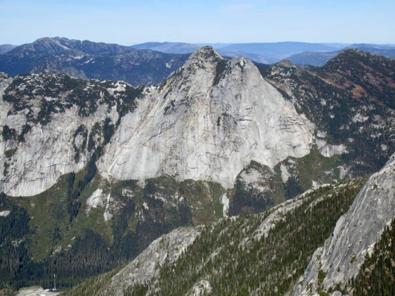
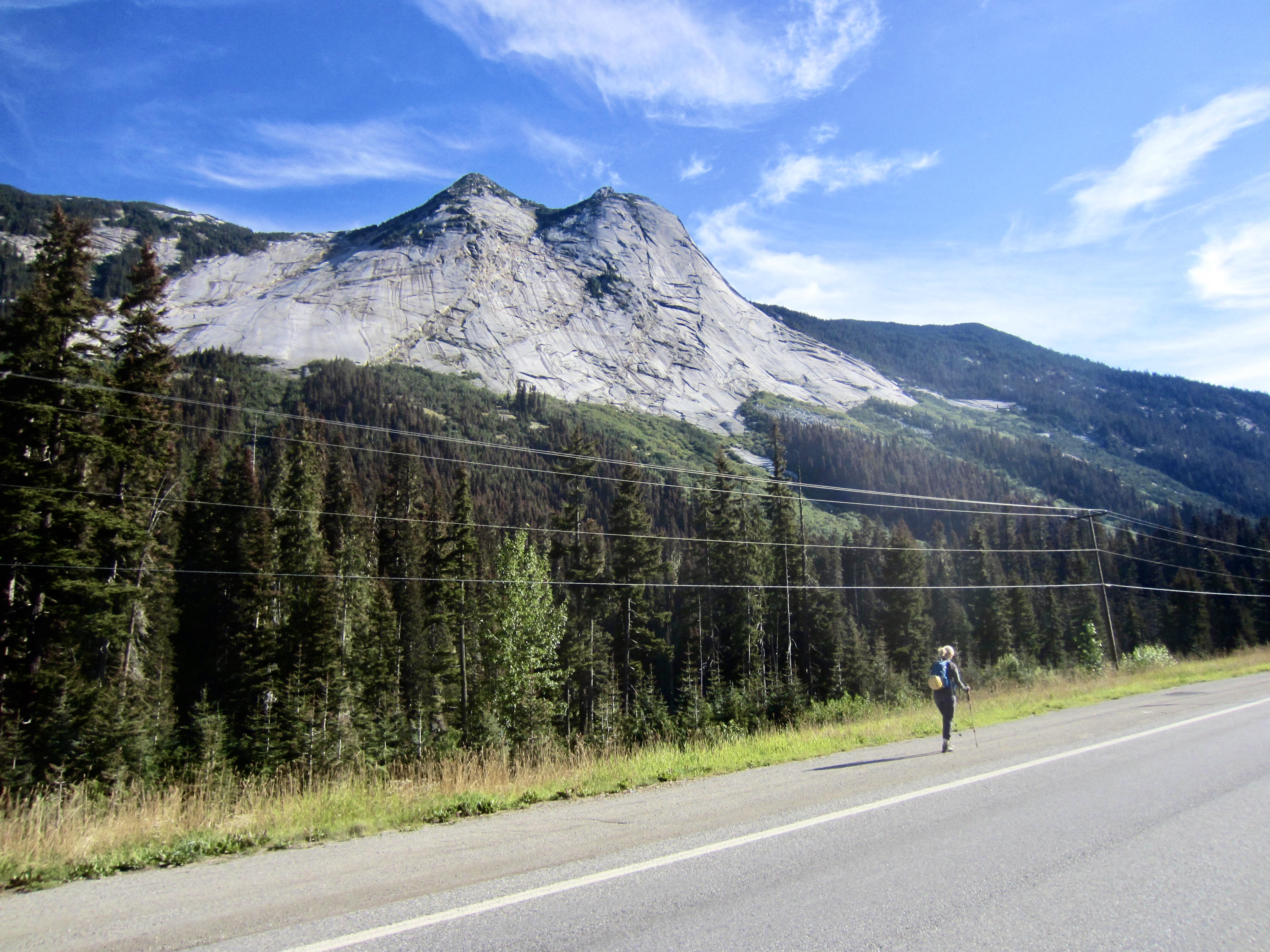
Yak Peak is one of the most visually striking mountains along Coquihalla Highway 5 in British Columbia. It’s nearly impossible to drive over Coquihalla Pass without marveling at this massive dome of pale gray granite protruding from a dark green hillslope. Thanks to relatively easy access, Yak Peak is also one of the most popular ascents in the Coquihalla Range—for both scramblers and technical rock climbers alike.
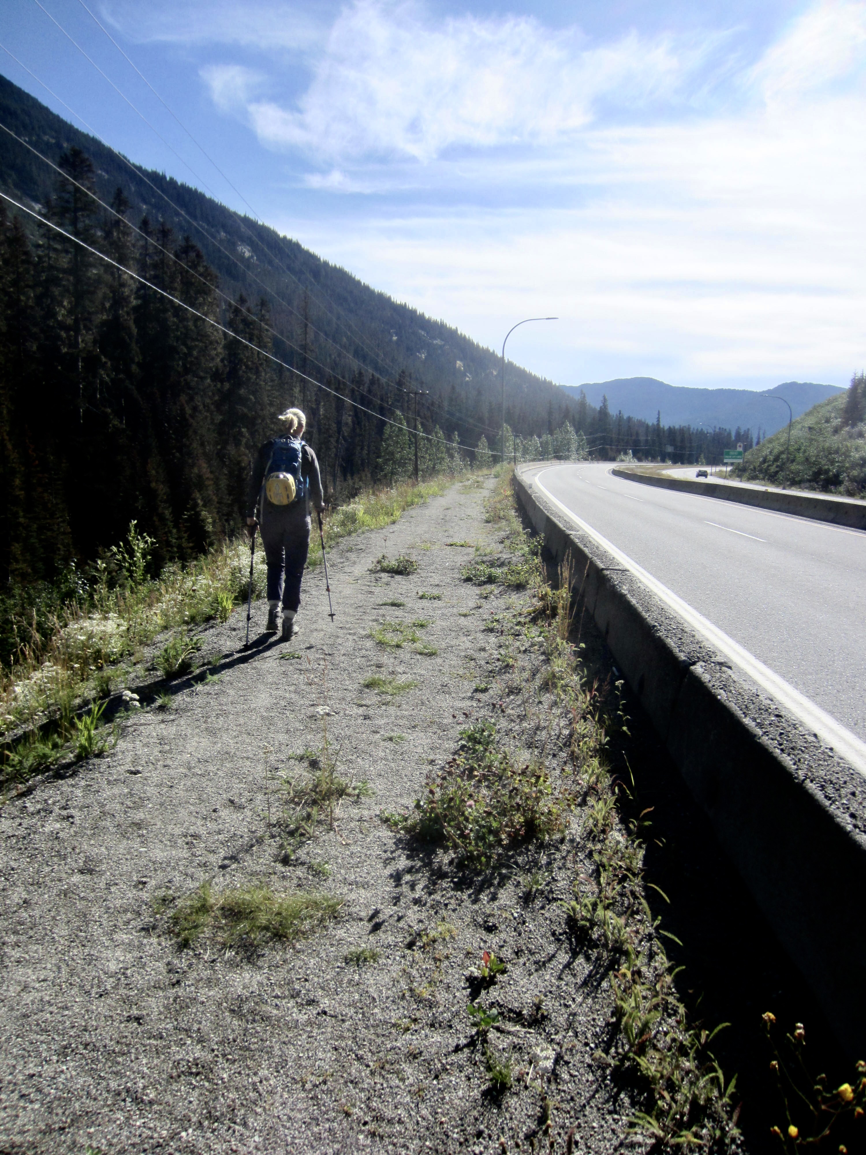
Eileen and I began our Yak Peak ascent at the Zopkios truck stop off Highway 5 (Exit 217) on a sunny Monday morning. A large parking lot on the northern side of the highway provides ample room for many cars. We walked eastward up the adjacent off-ramp and then along the highway itself. This isn’t as dangerous or unpleasant as it might sound; there is a concrete traffic barrier and a wide gravel shoulder here.
.
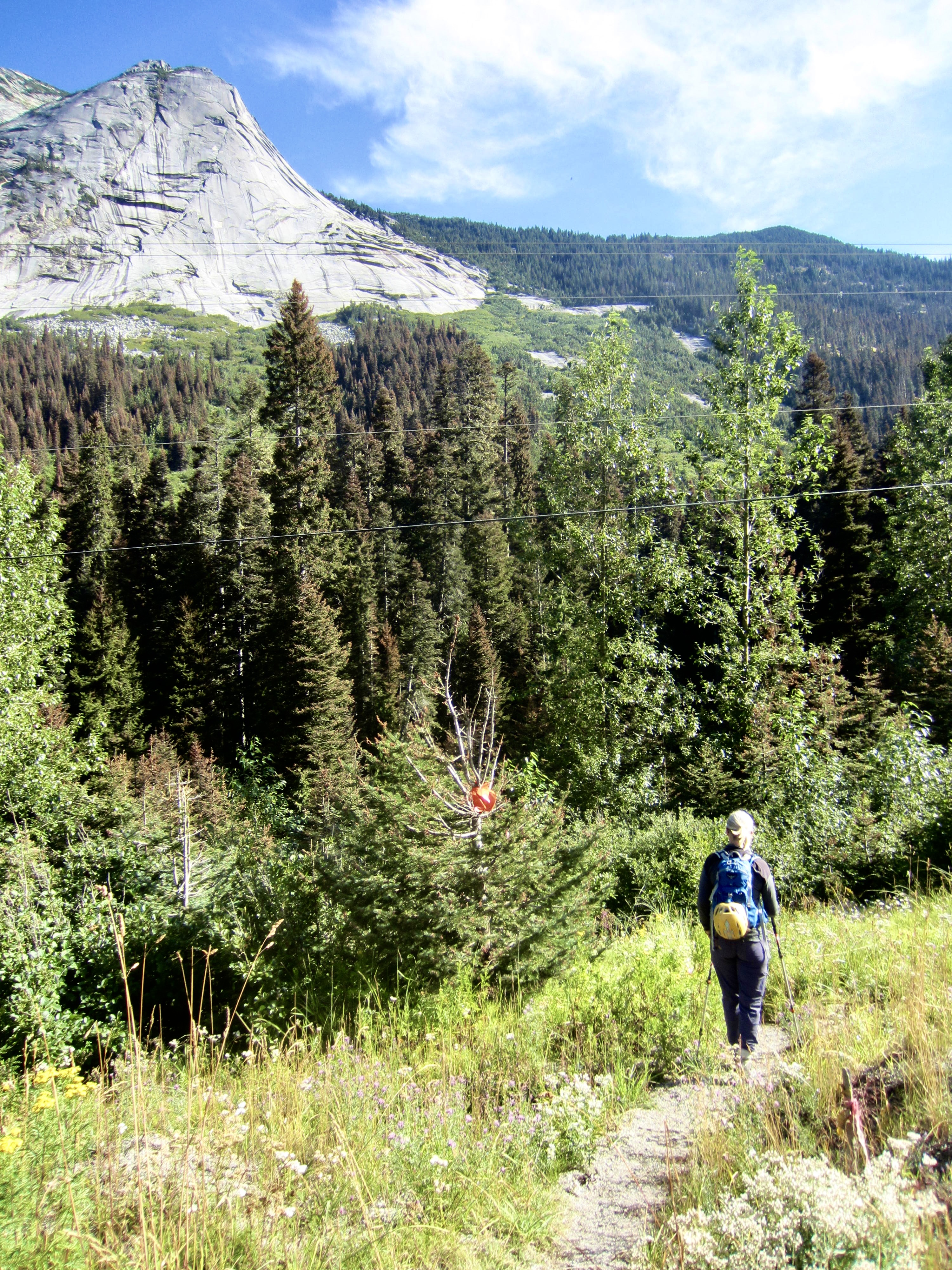
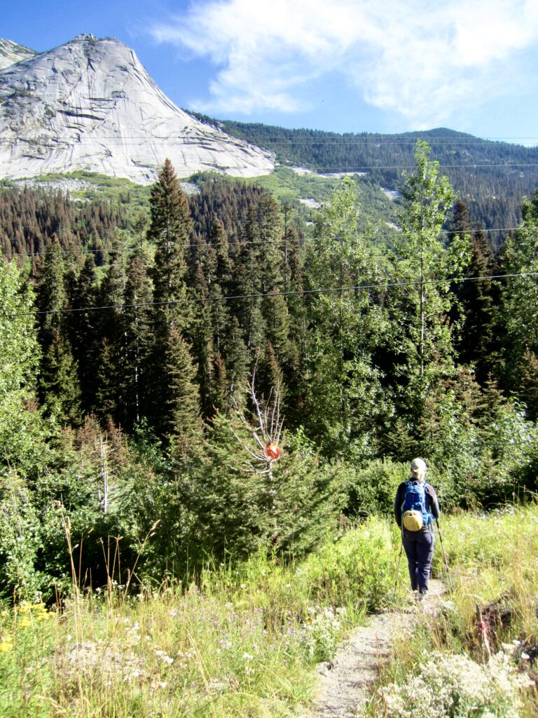
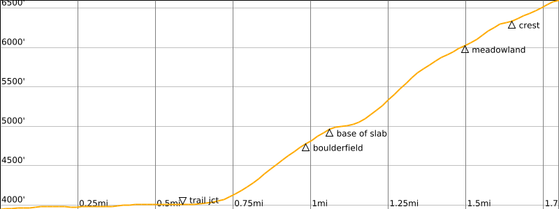
After walking 0.6 miles / 1.0 kilometers from the parking lot, we arrived at the start of the Yak Peak Trail. This well-trodden trail initially drops into a marshy depression and then zigzags steeply upward through a narrow strip of mature forest, which can be clearly seen from the highway.
.
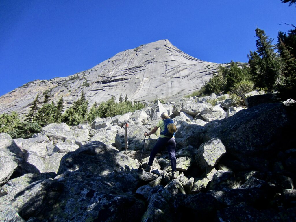
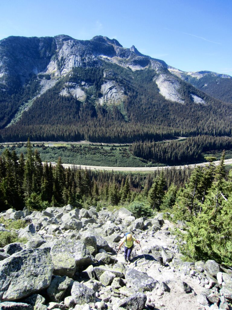
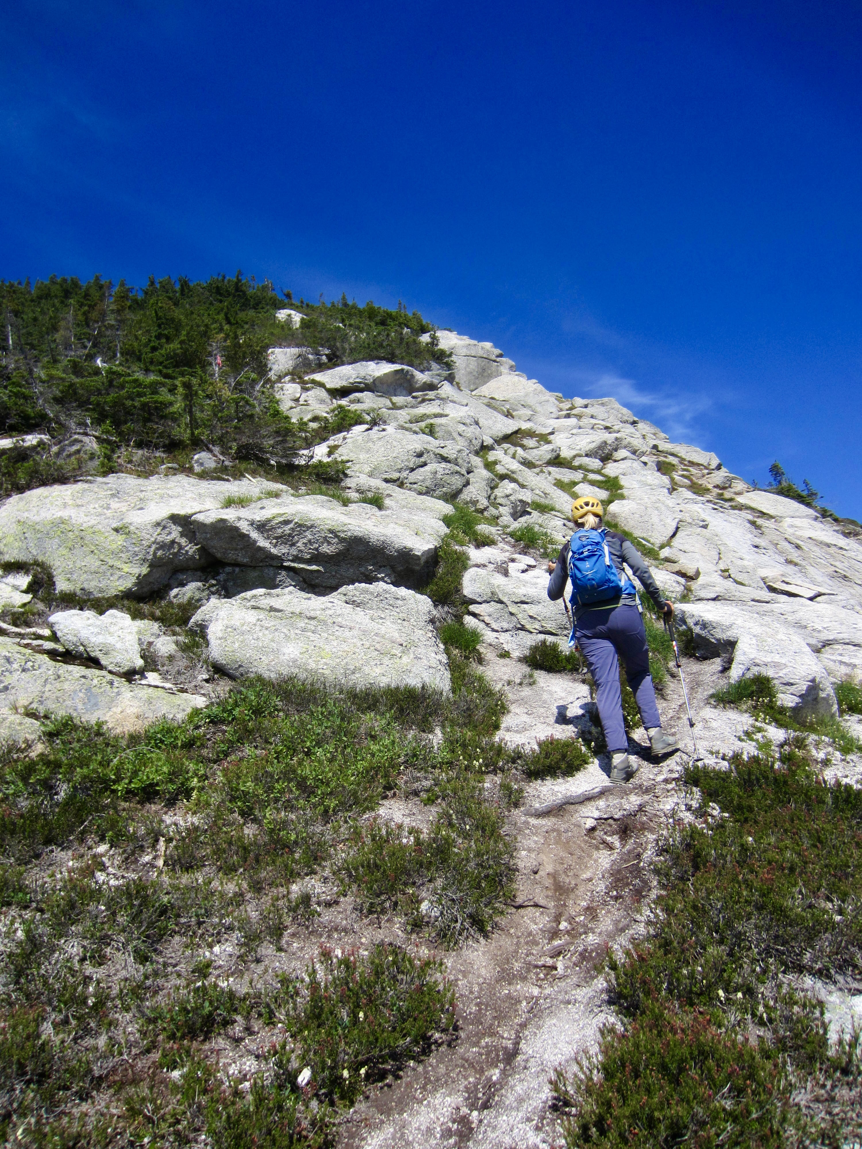
After a vertical gain of 800 feet, the trail opens onto a boulderfield. A combination of stone ducks, cairns, and marker sticks led us over to the left side of the boulderfield and then straight up to the bottom edge of Yak Peak’s impressive south face (1.6 hours + 1000 feet from car).
.
.
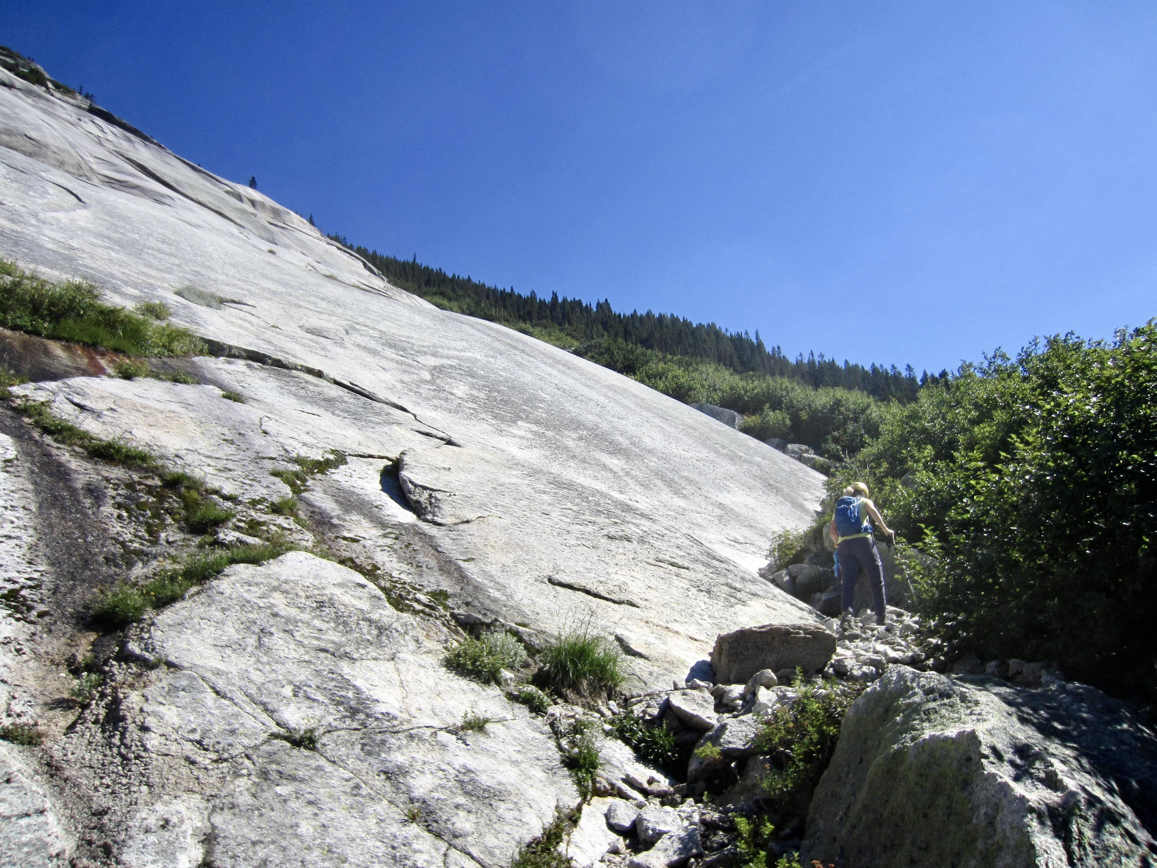
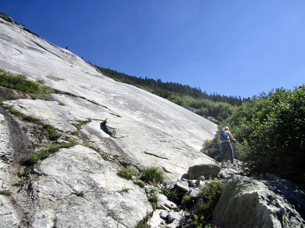
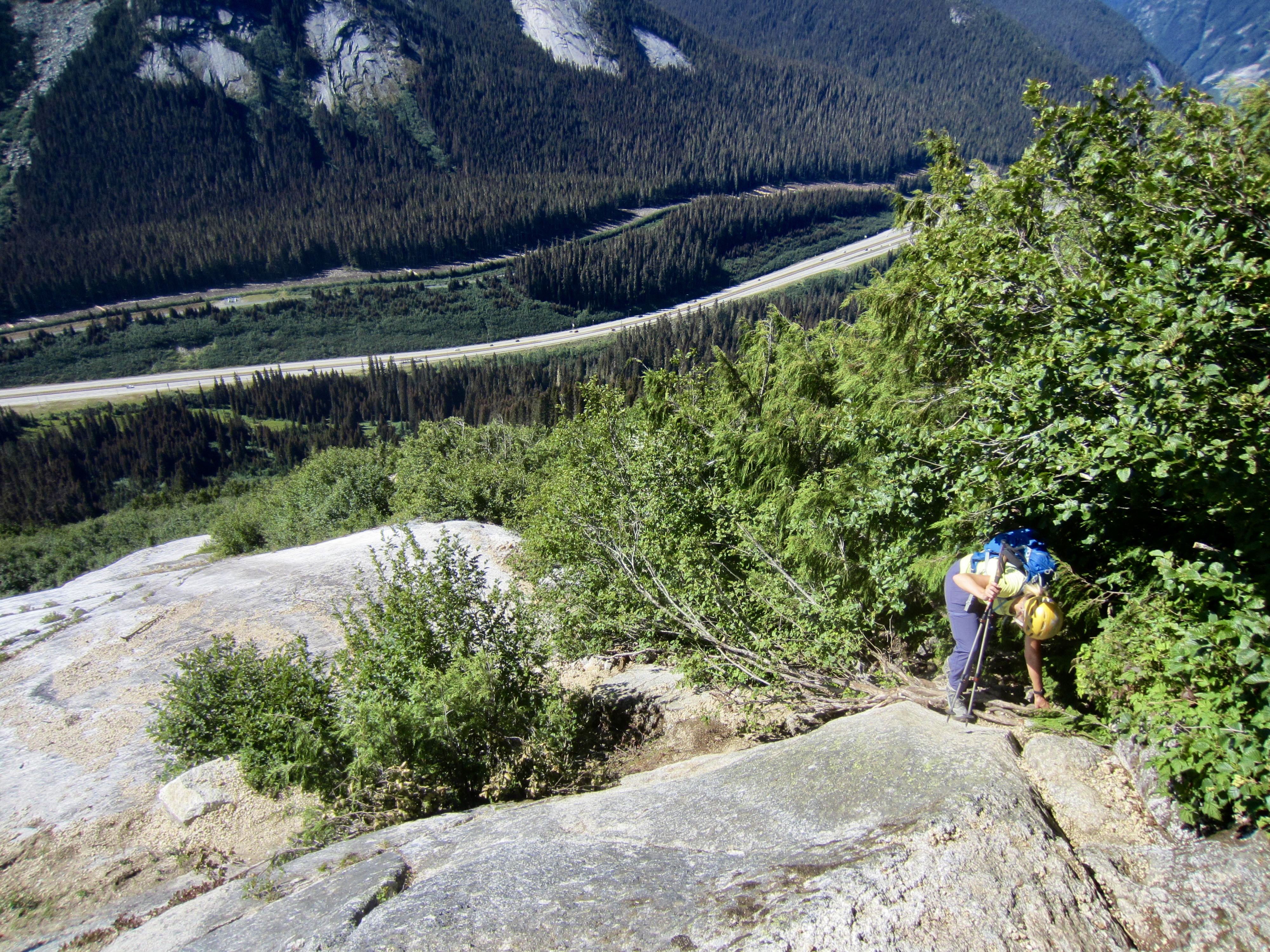
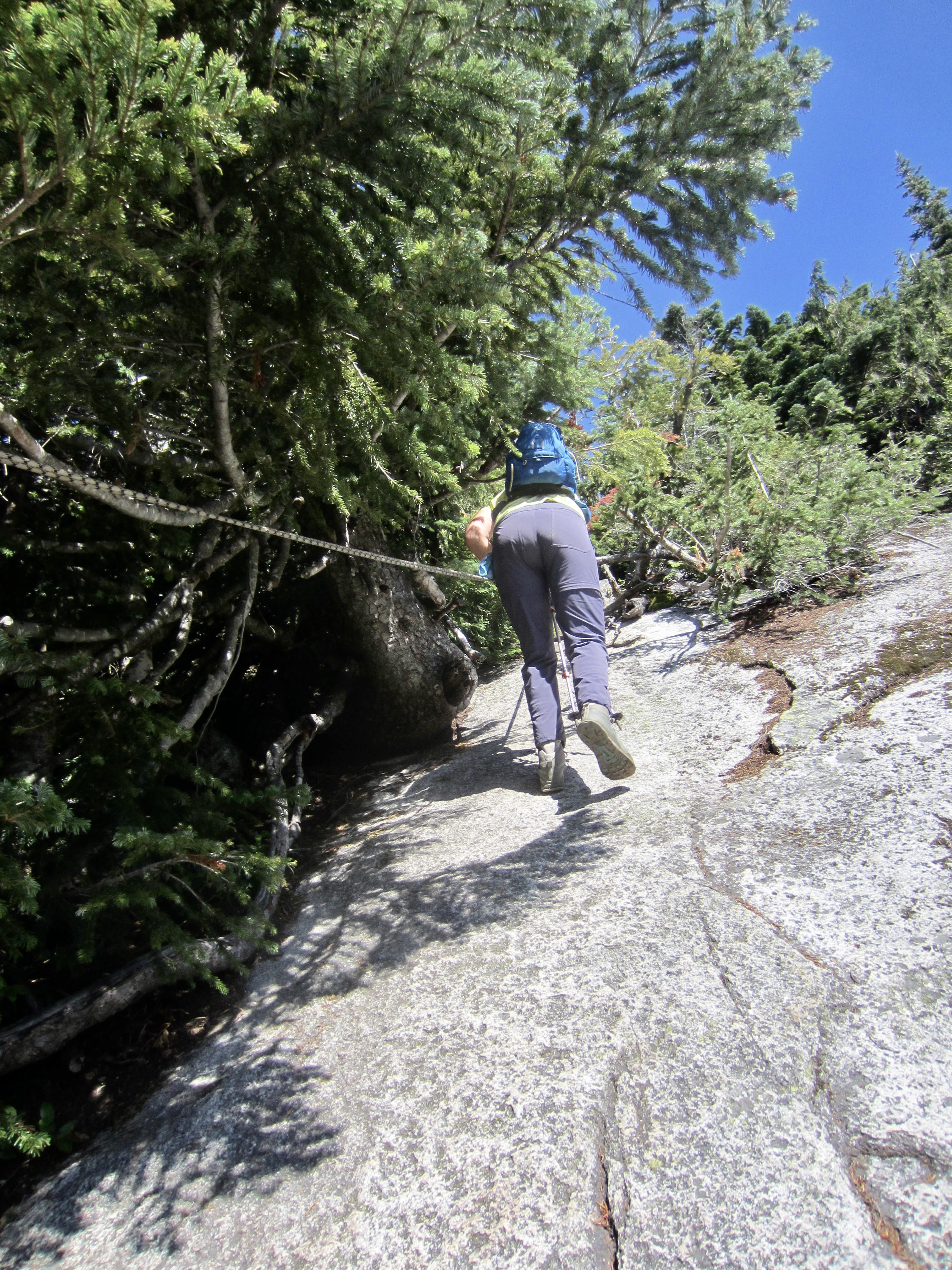
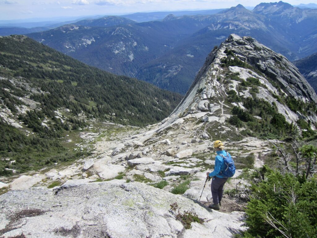
The trail turns right and continues along the lower edge of a sweeping granitic apron that curves around the peak’s eastern flank. We followed the trail through dense thickets of brushy vegetation and over numerous rock outcrops. A fixed rope was in place to assist people in surmounting one particularly steep, slippery outcrop.
.
.
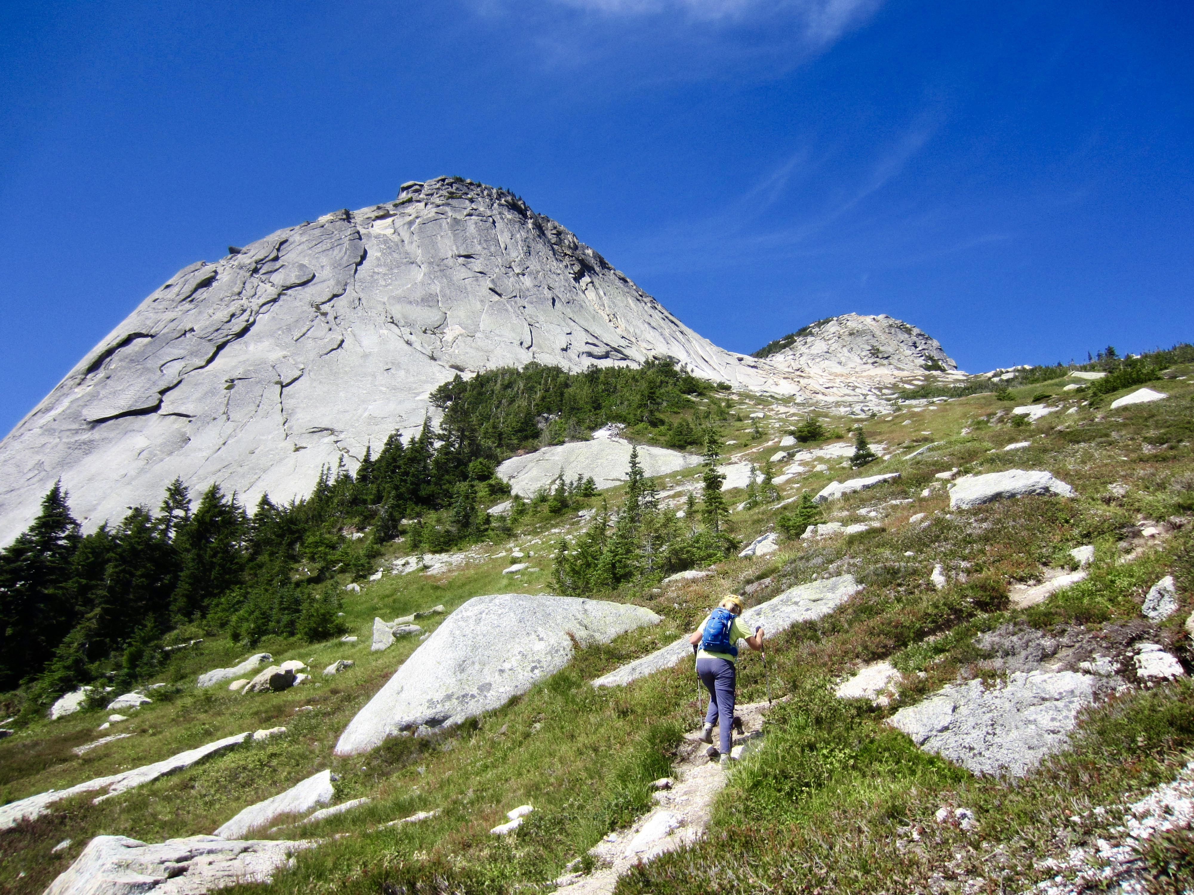
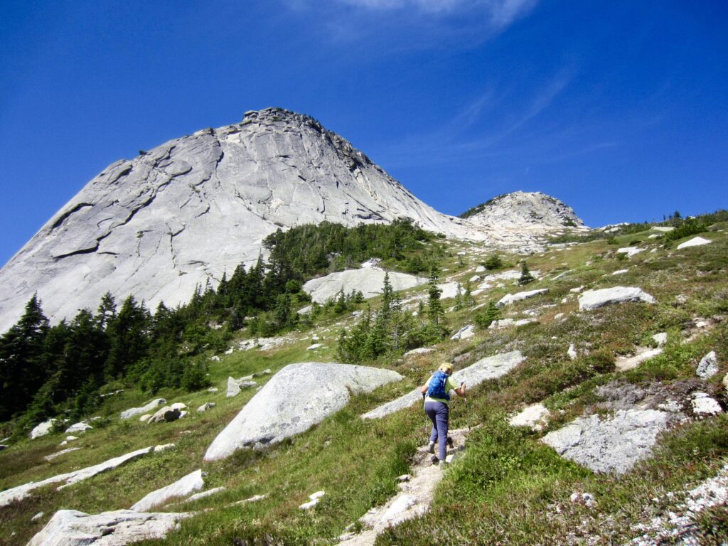
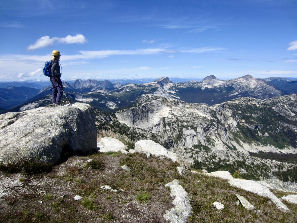
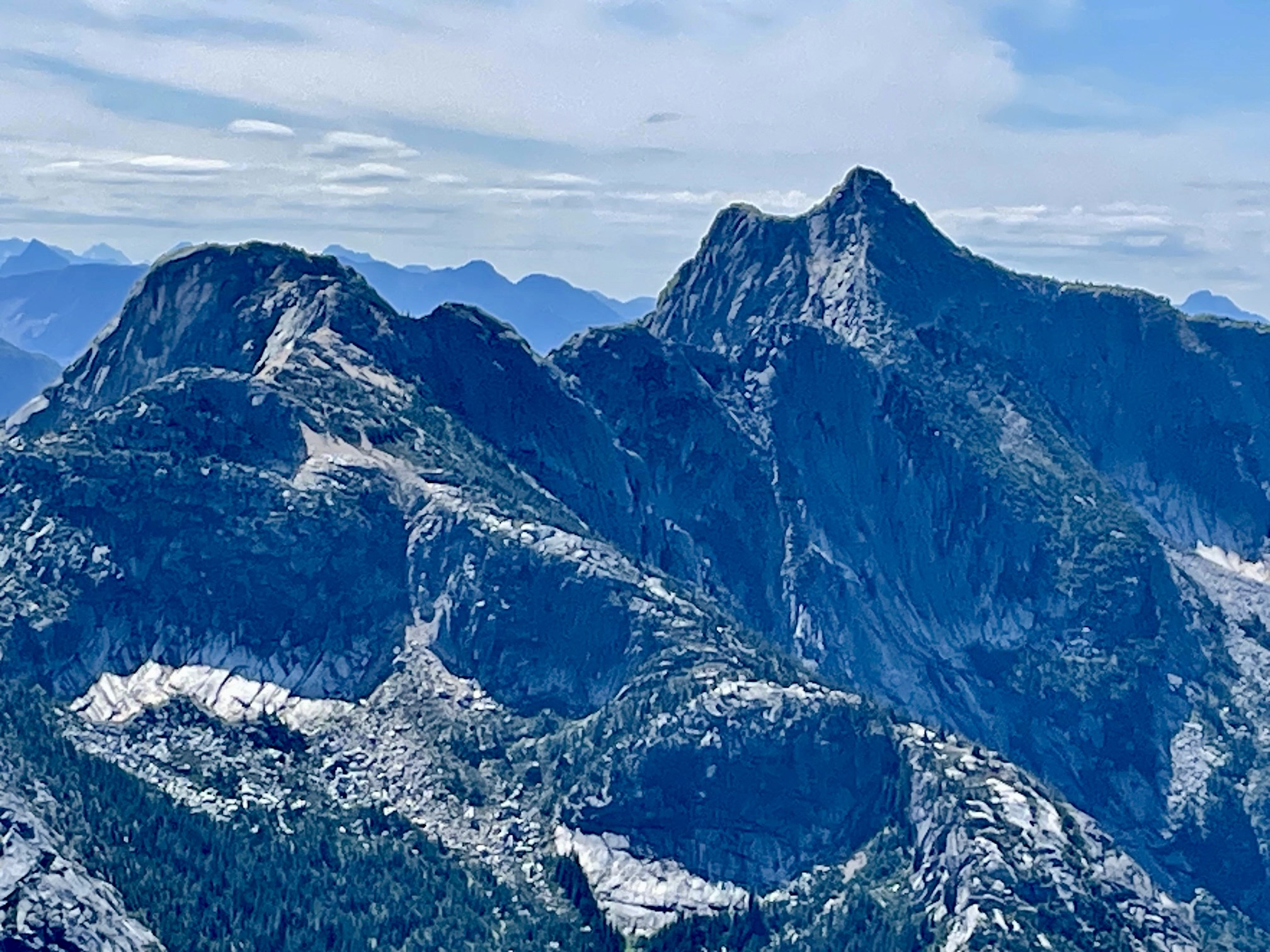
At 6000 feet, we emerged from the brush and entered open meadowland. The true summit of Yak Peak came into view behind, and just right of, the slabby “climber’s summit,” and Nak Peak (a nak is a female yak) could be seen closely to the east. We followed the trail up to the Yak-Nak Saddle.
.

.
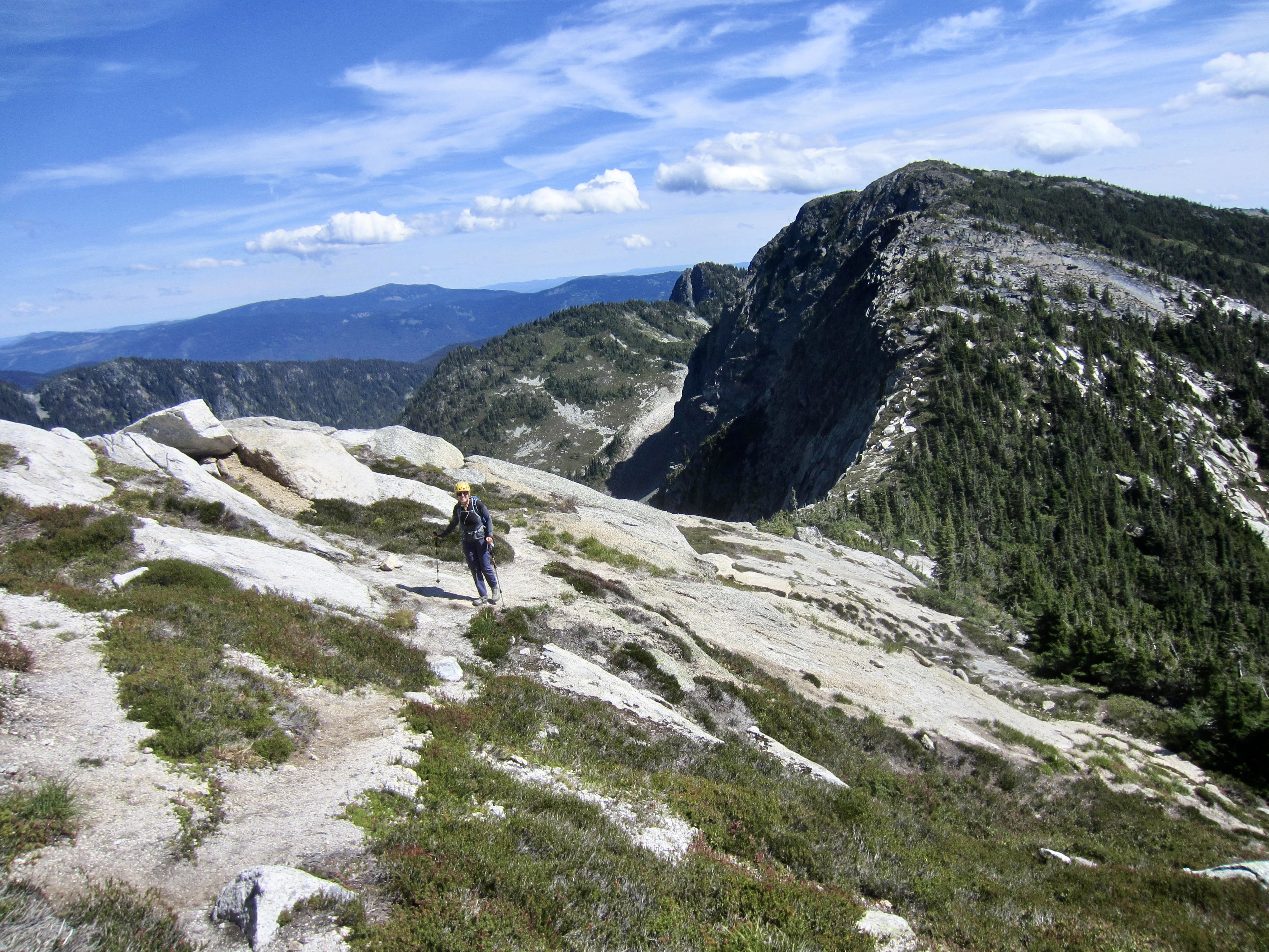
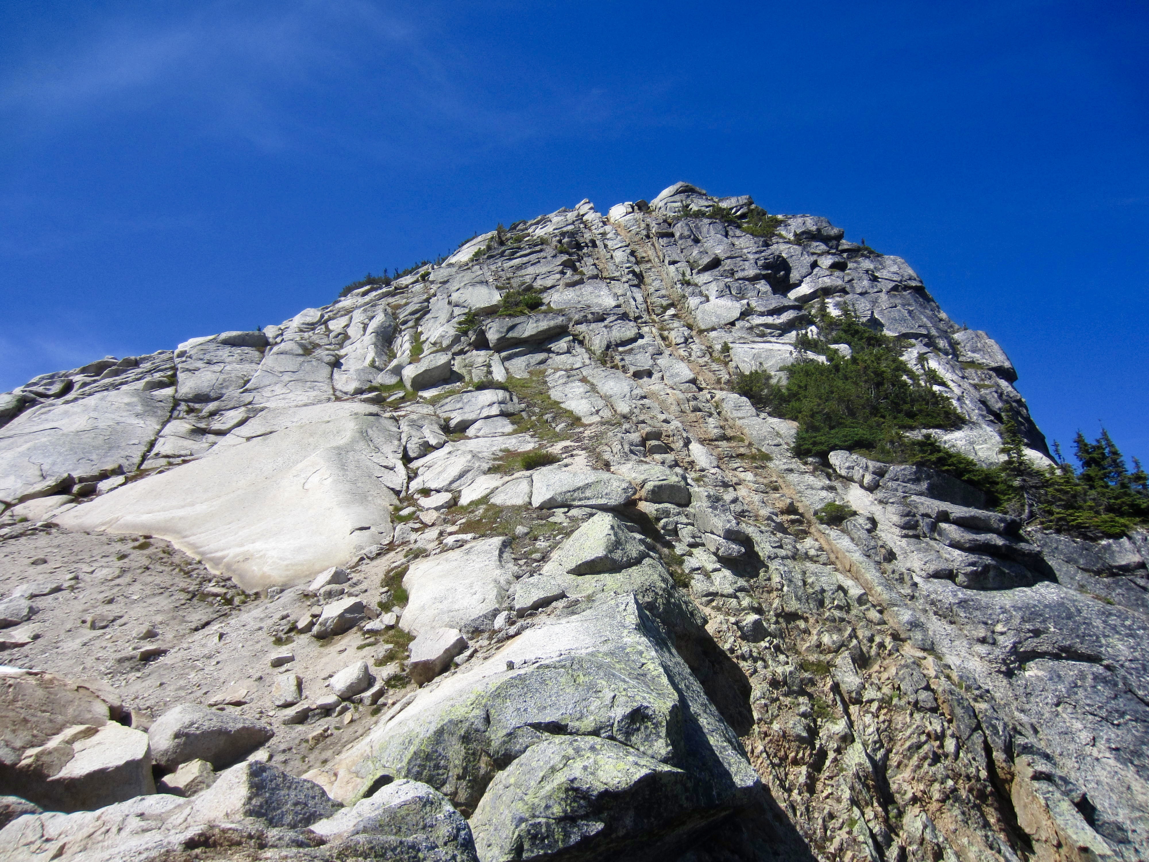
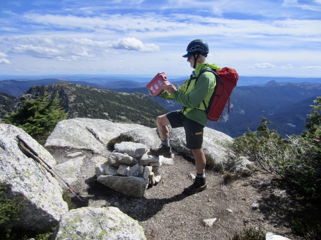
A short hike and easy scramble up the southeastern face of the true summit ended our ascent of Yak Peak in early afternoon (3.4 hours + 2750 feet from car). The summit register was contained in a fuchsia-colored ammo box, and not surprisingly, it showed that Yak Peak gets a lot of visitors every year.
.
.
.
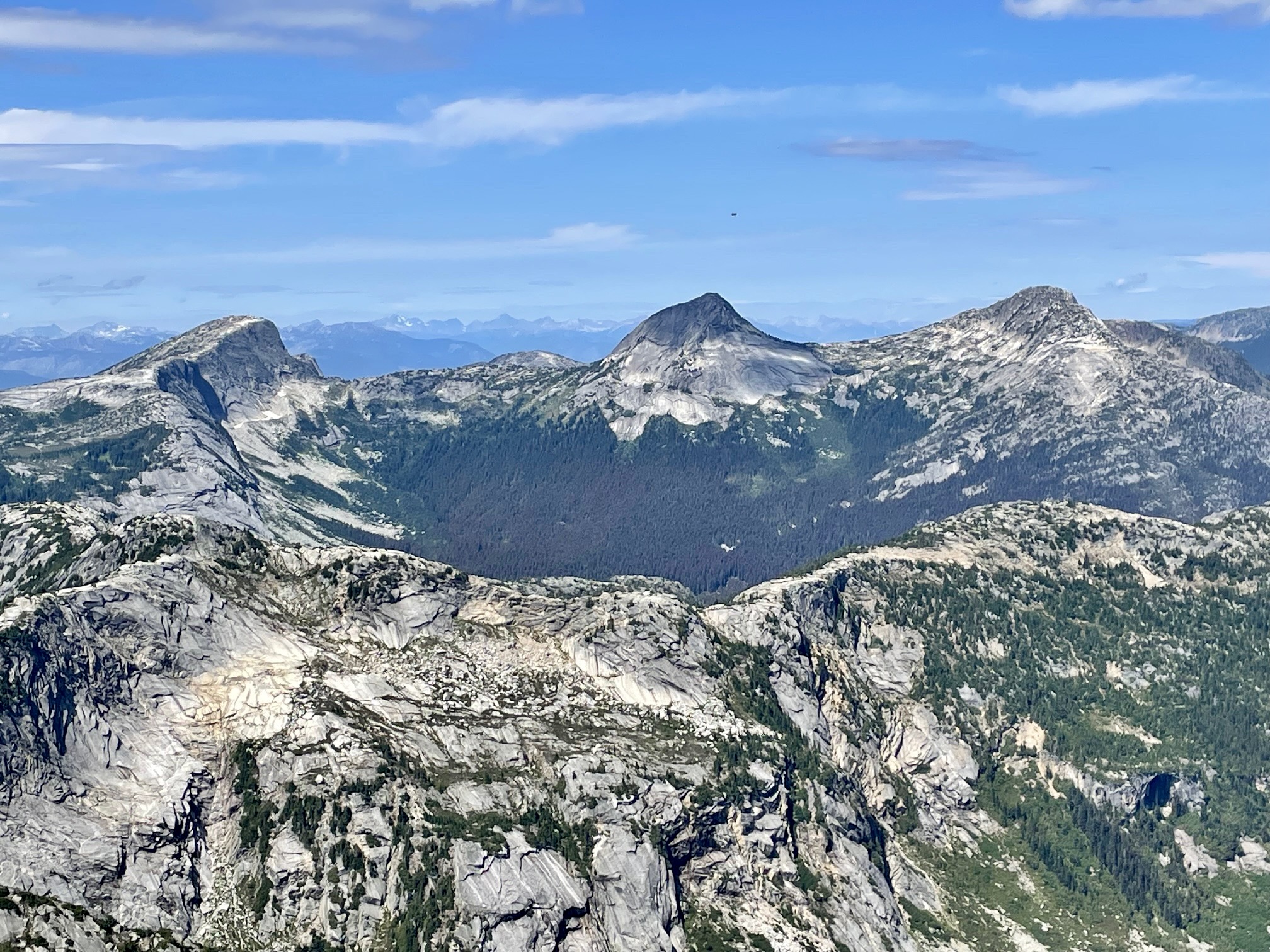
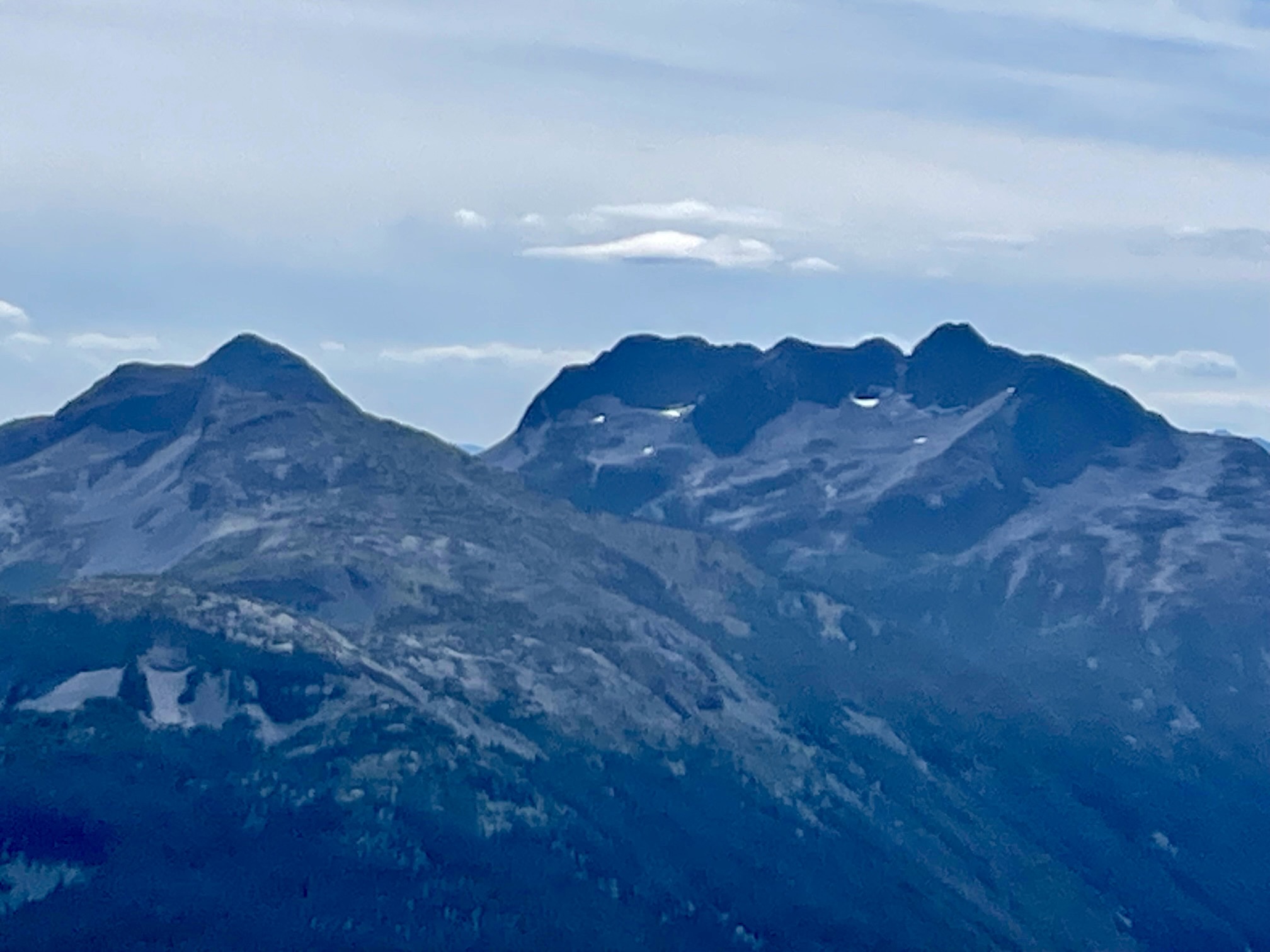
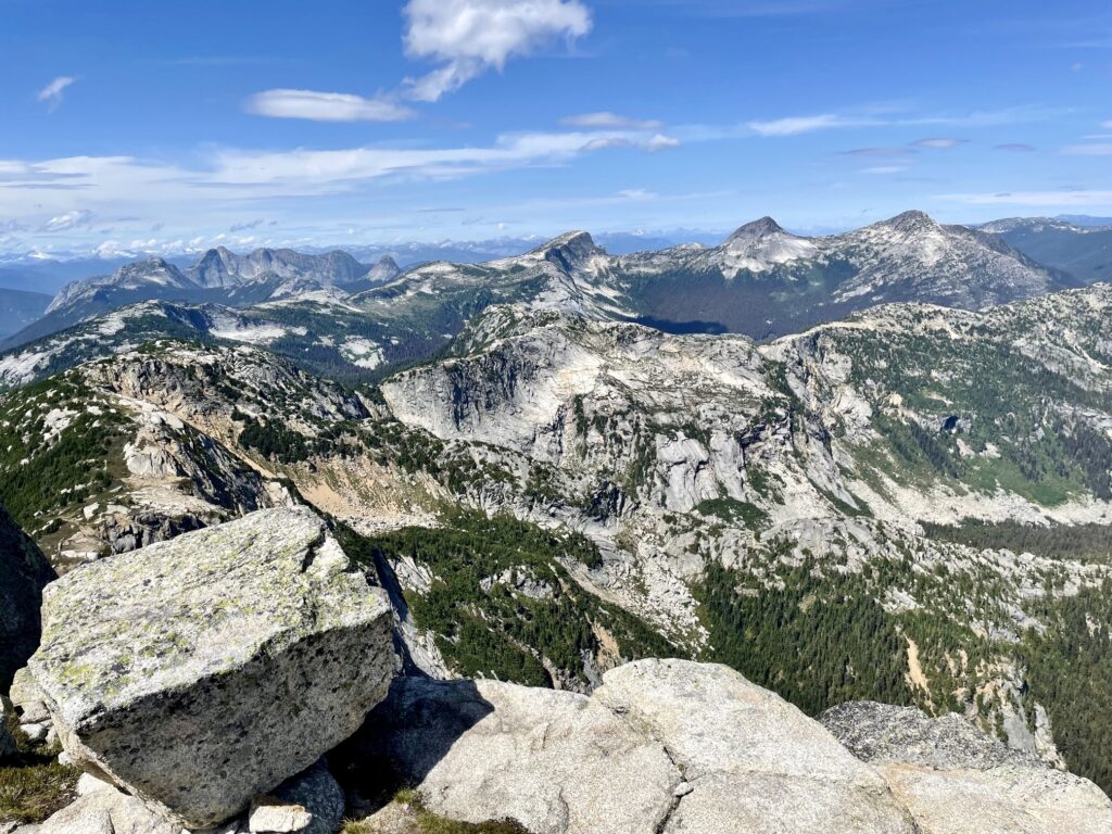
Given its central location, Yak Peak provides excellent views of many other Coquihalla summits. These include Markhor Peak and Needle Peak to the south; Jim Kelly Peak and Coquihalla Mountain to the southeast; Llama Peak, Alpaca Peak, Vicuna Peak, and Guanaco Peak (the “South American ruminant group”) to the north; and Steinbok Peak, Ibex Peak, Chamois Peak, and Gemse Peak (the “Euro-African ruminant group”) far to the northwest.
.
.
An uneventful descent took us back to our car at Zopkios truck stop in late afternoon (2.8 hours + 50 feet from summit). Considering the convenient access, interesting ascent route, and splendid view potential of this famous Coquihalla landmark, we agreed that Yak Peak delivers a big reward for a moderate effort.
.
Route Map & Profile
…
…
Photo Gallery
Click to enlarge…