Trip Date: October 13-16, 2024
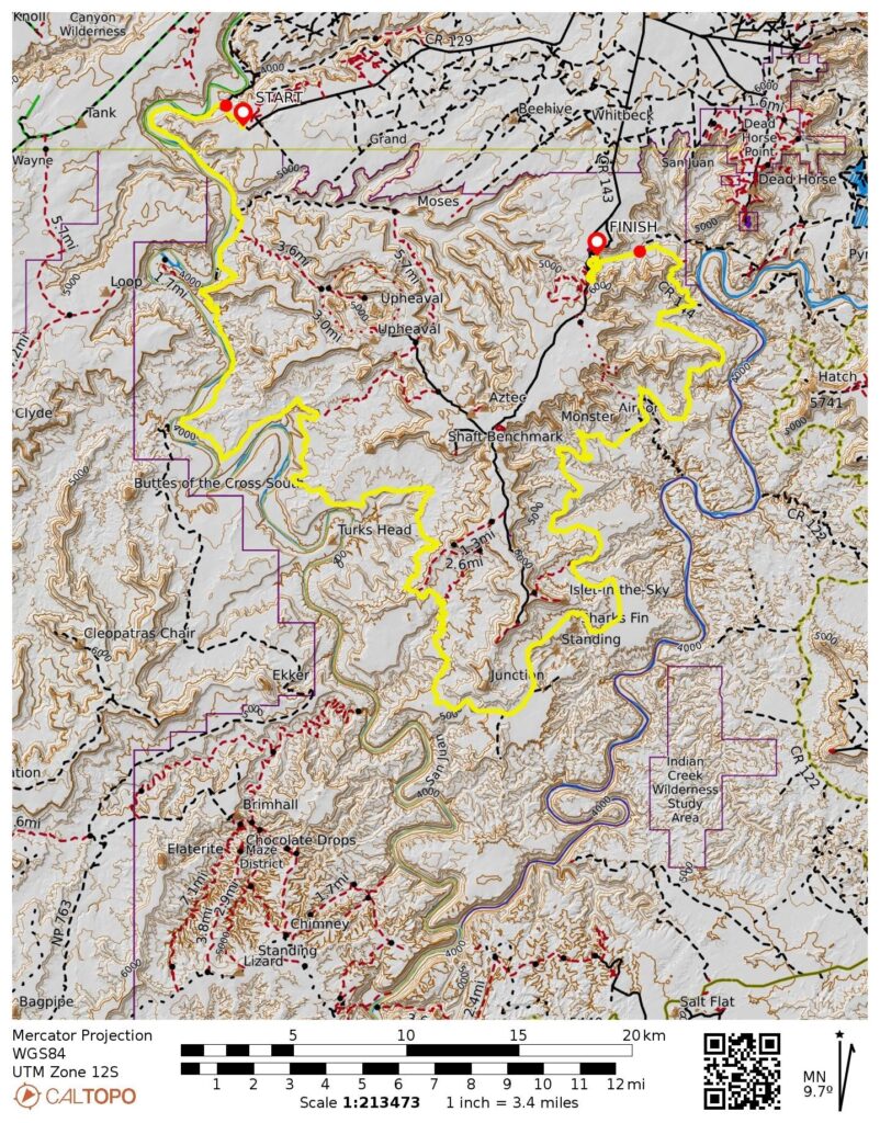
White Rim Bike Traverse: Mineral Bottom Parking Lot to South Fork Shafer Canyon Viewpoint
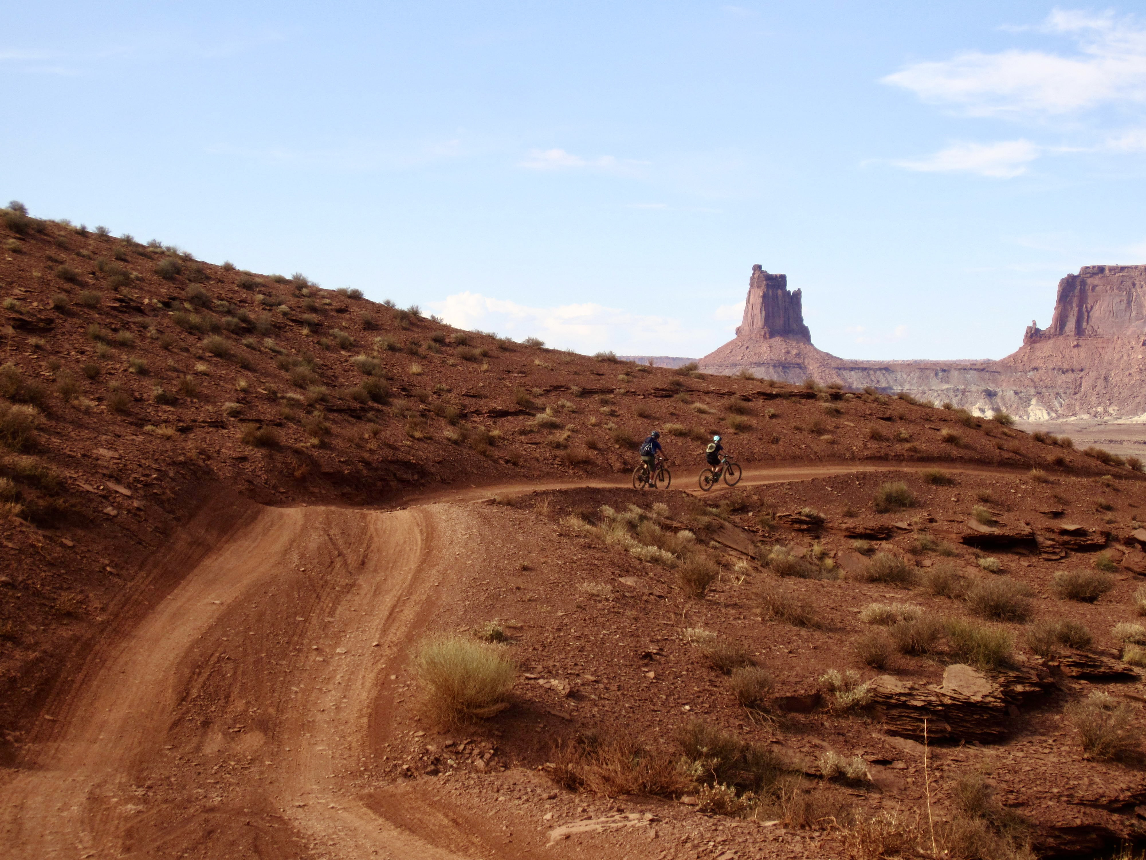
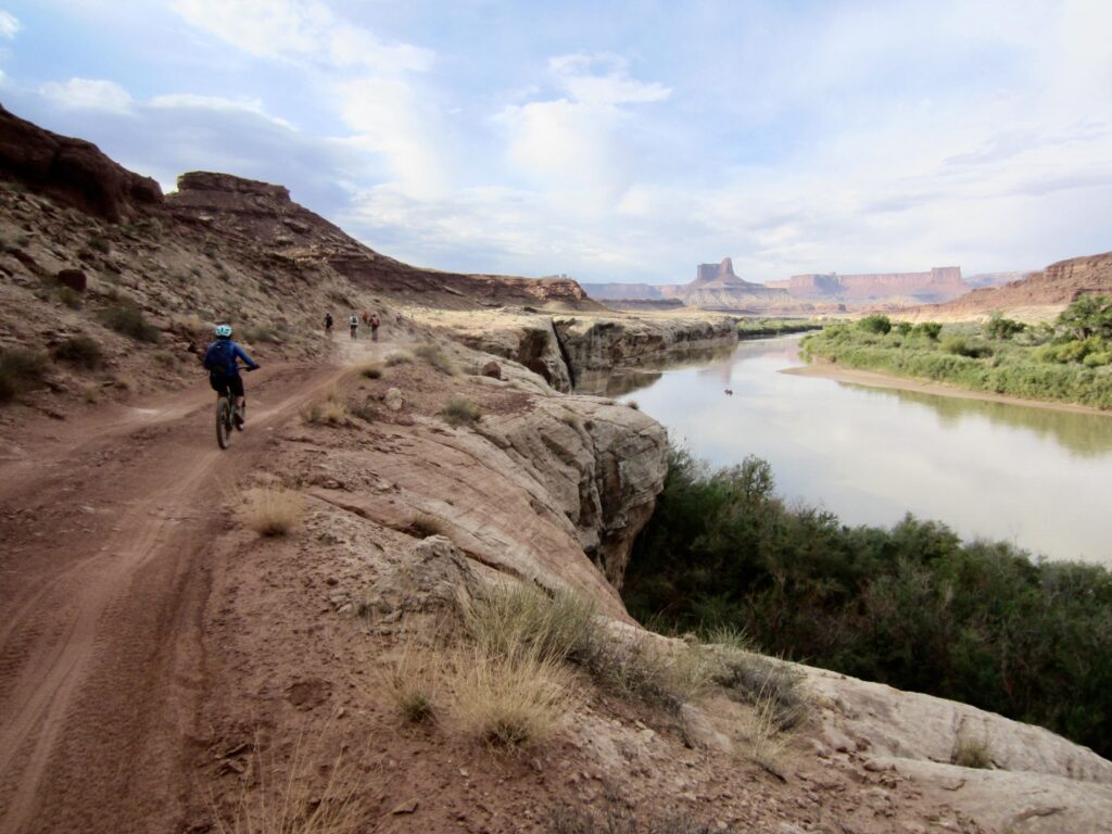
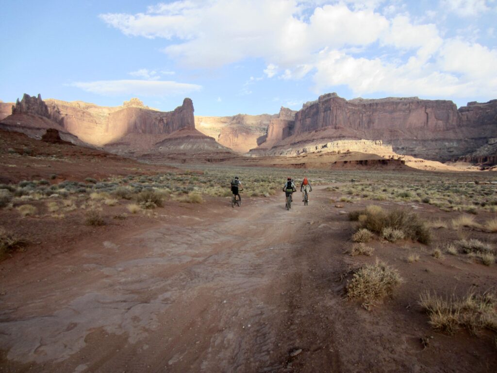
White Rim Road
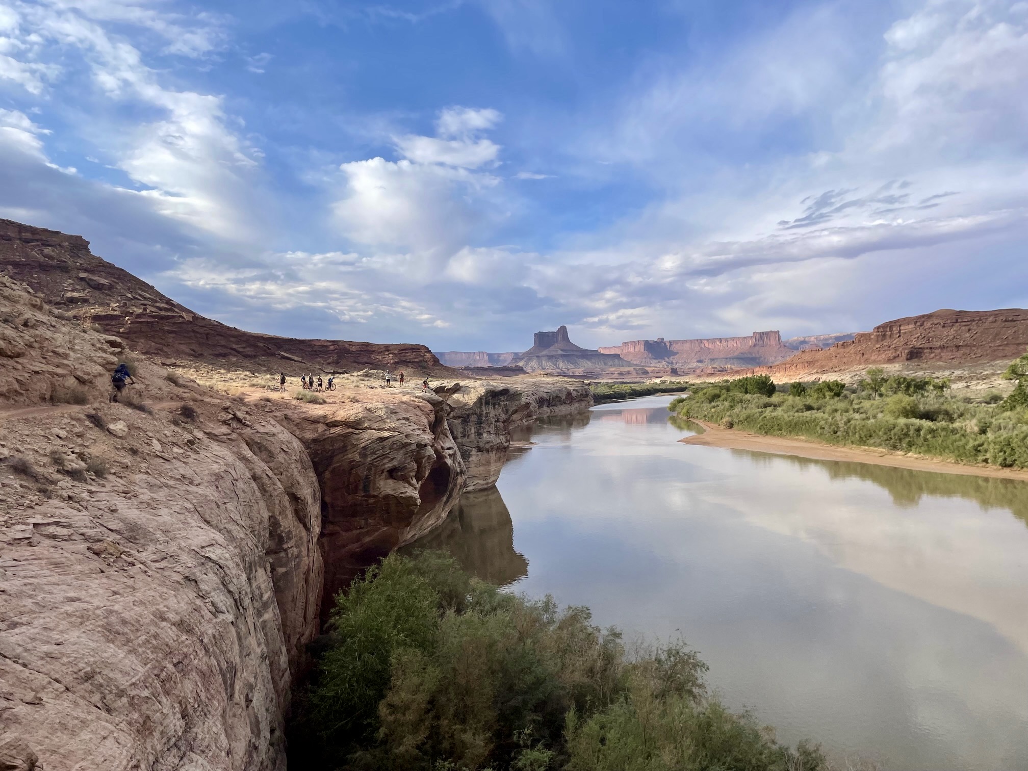
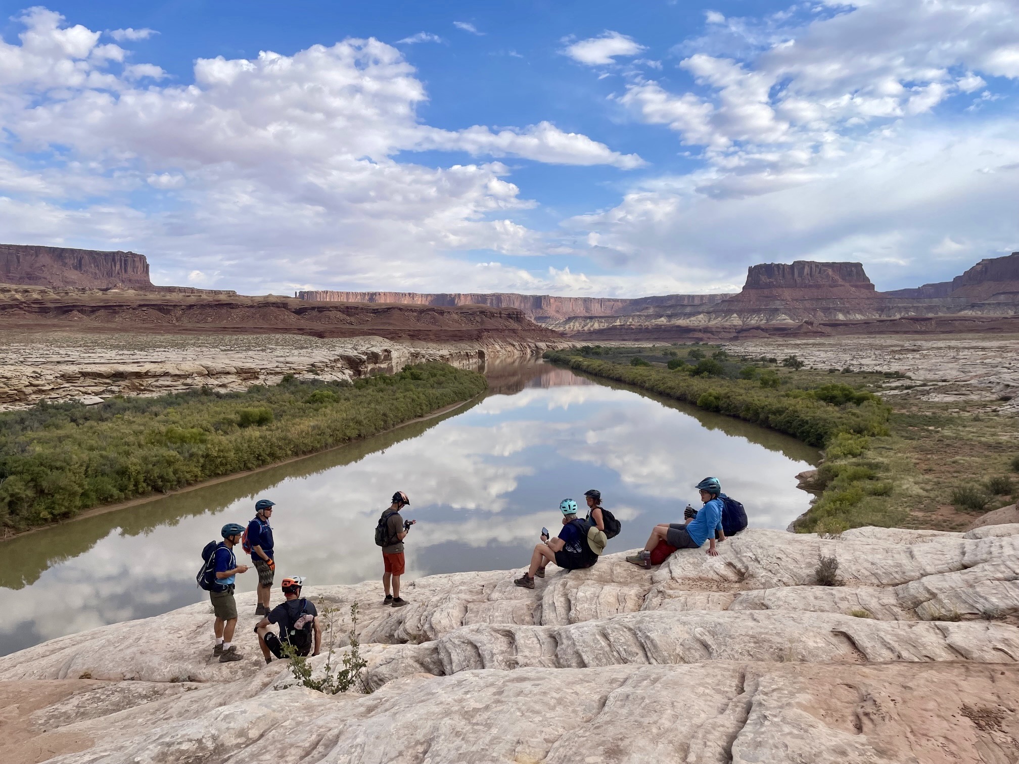
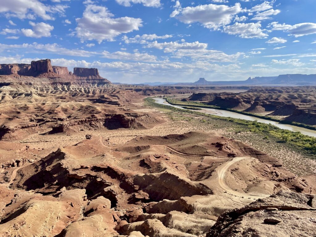
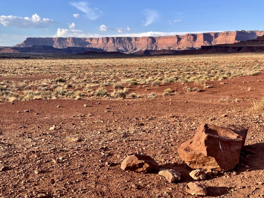
Green River Valley
Colorado River Valley
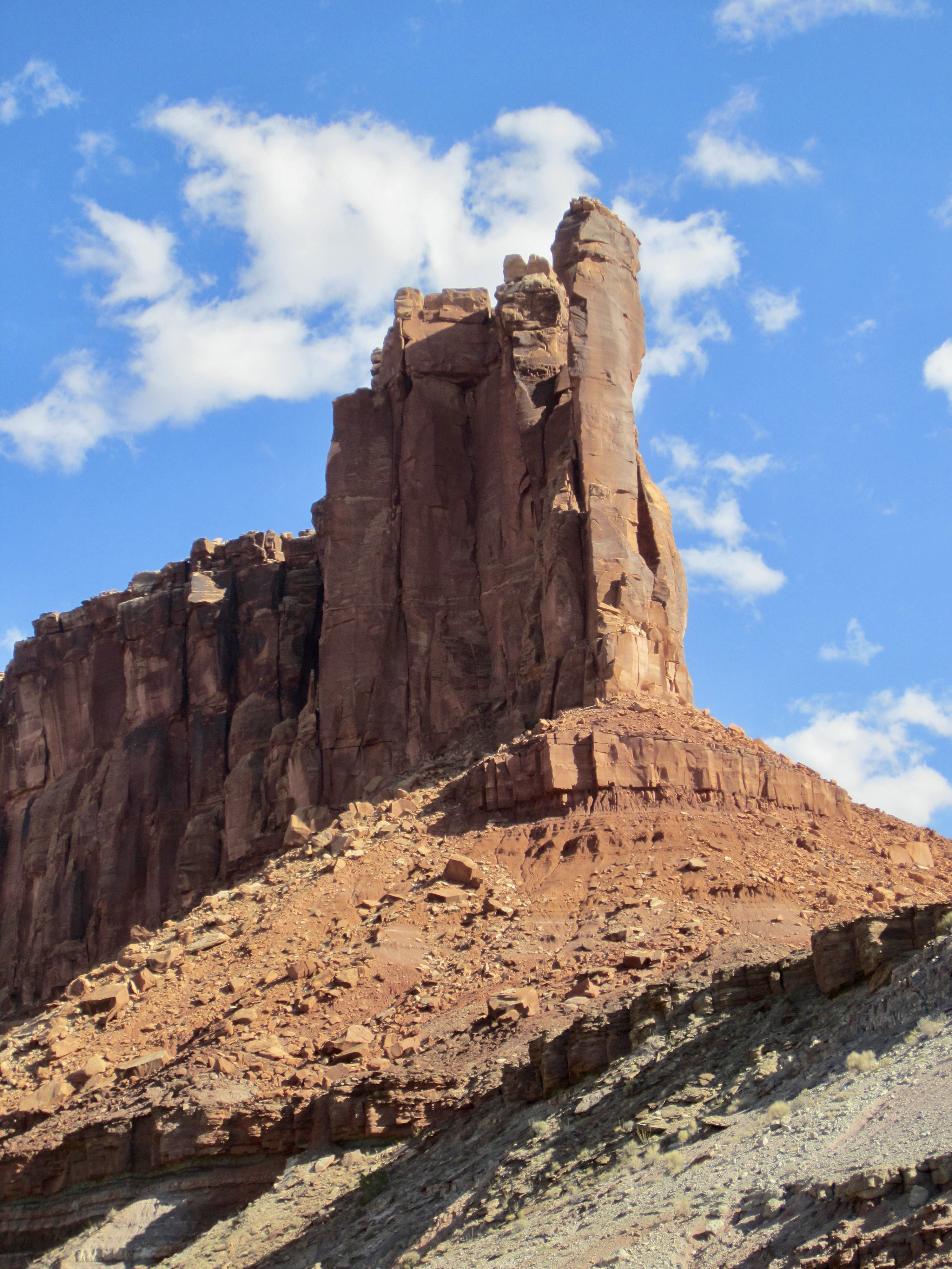
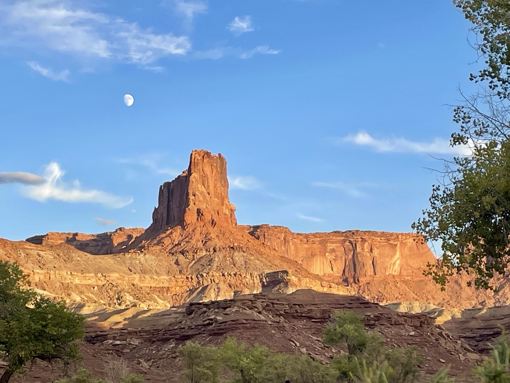
Murphy Hogback
Musselman Arch
Trip Report Summary
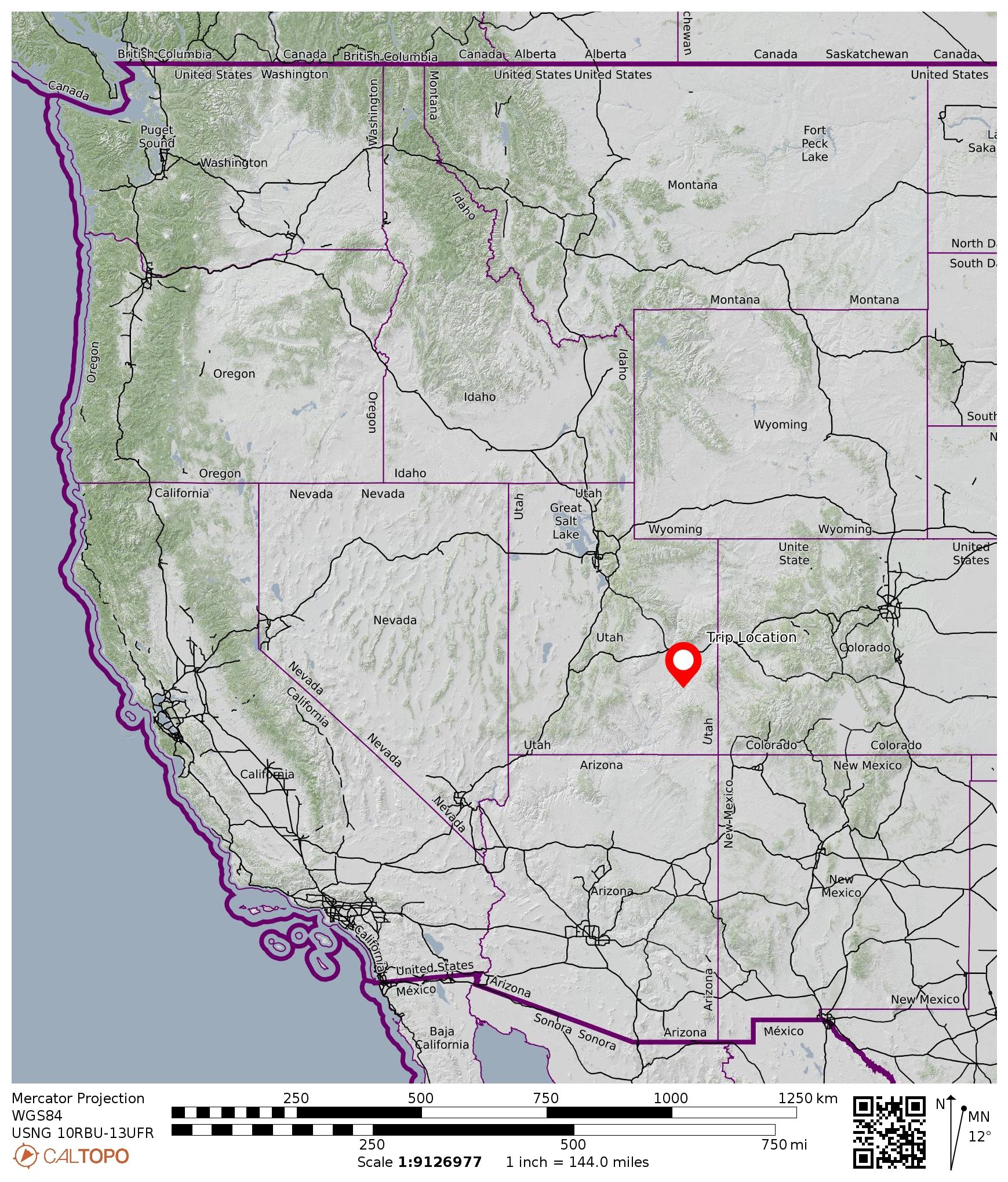
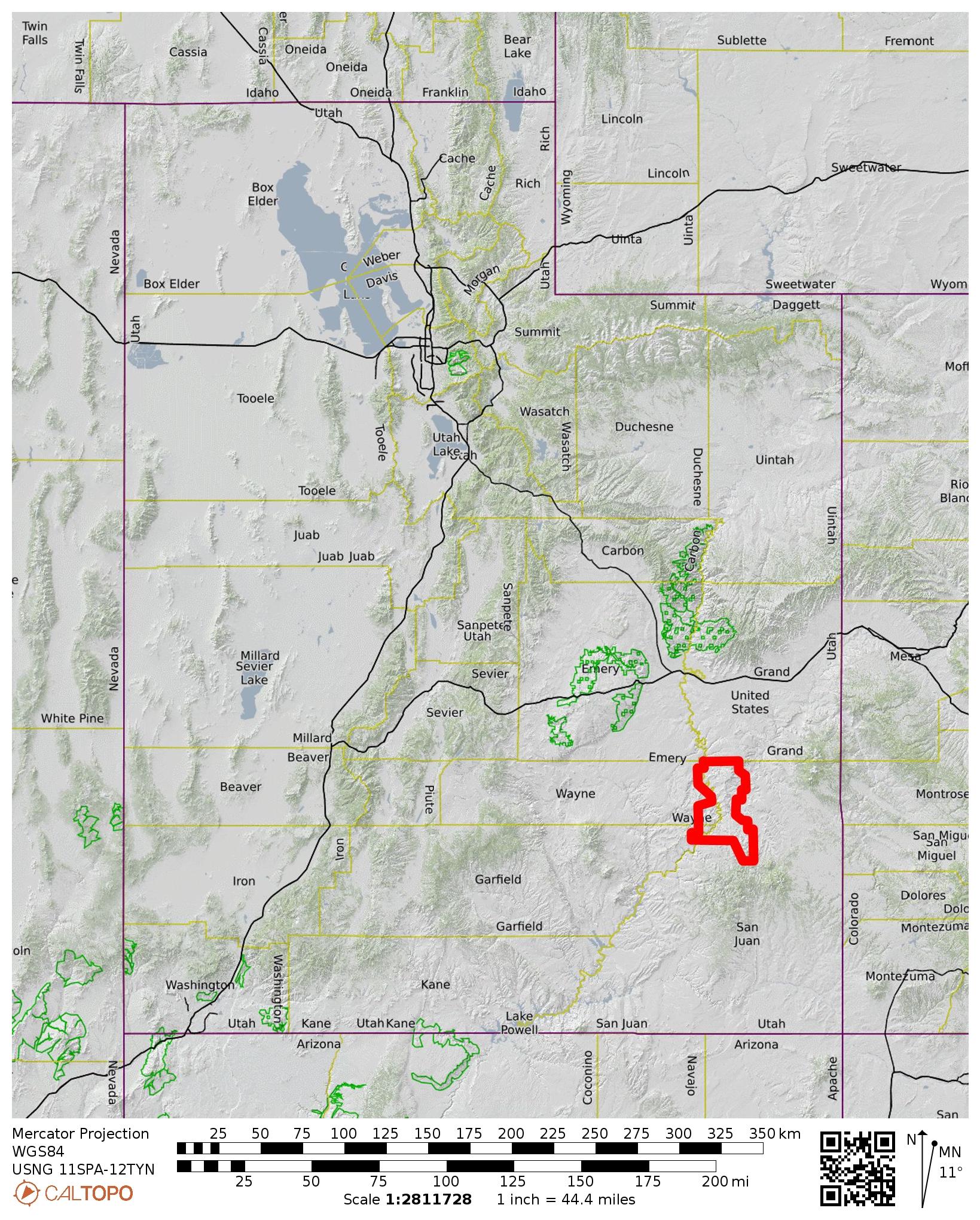
Region: Utah
Sub-Region: Southeastern Utah
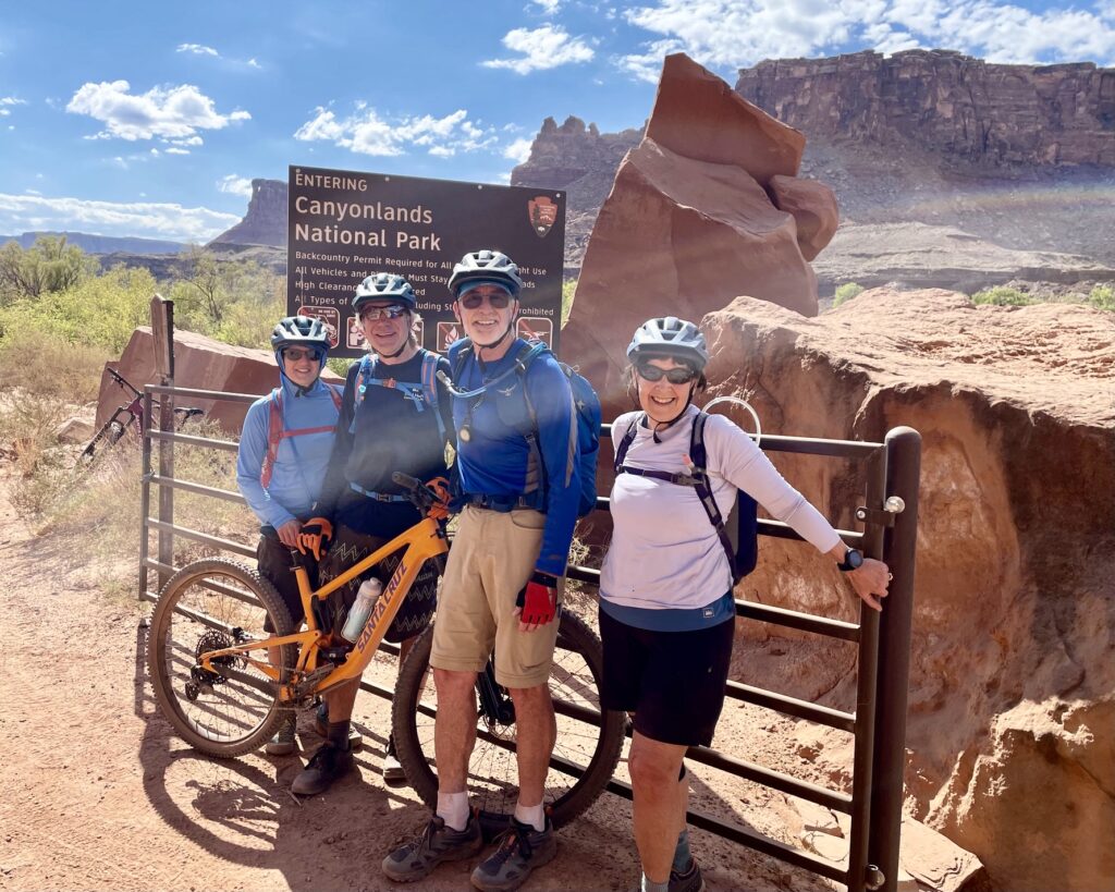
Area: Canyonlands National Park
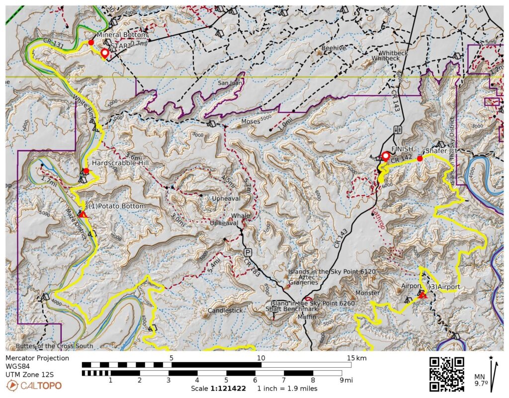
Starting Point: Mineral Bottom upper parking lot on Mineral Bottom Road / Horsethief Trail Road (Elev. 4850 feet)
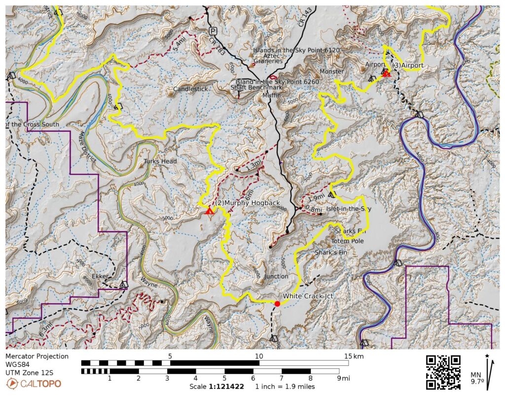
Way Points: Mineral Bottom Junction & Labyrinth Camp & Hardscrabble Camp & Hardscrabble Hill & Potato Bottom Camp & Art Murray’s outcrop & Holeman Slot & Candlestick Camp & Black Crack pullout & Murphy Hogback / Murphy Camp & White Crack Junction & Gooseberry Camp & Airport Camp & Musselman Arch parking lot & Shafer Junction & South Fork Shafer Canyon overlook (bike ride & bike push via Mineral Bottom Road—White Rim Road—Shafer Trail Road)
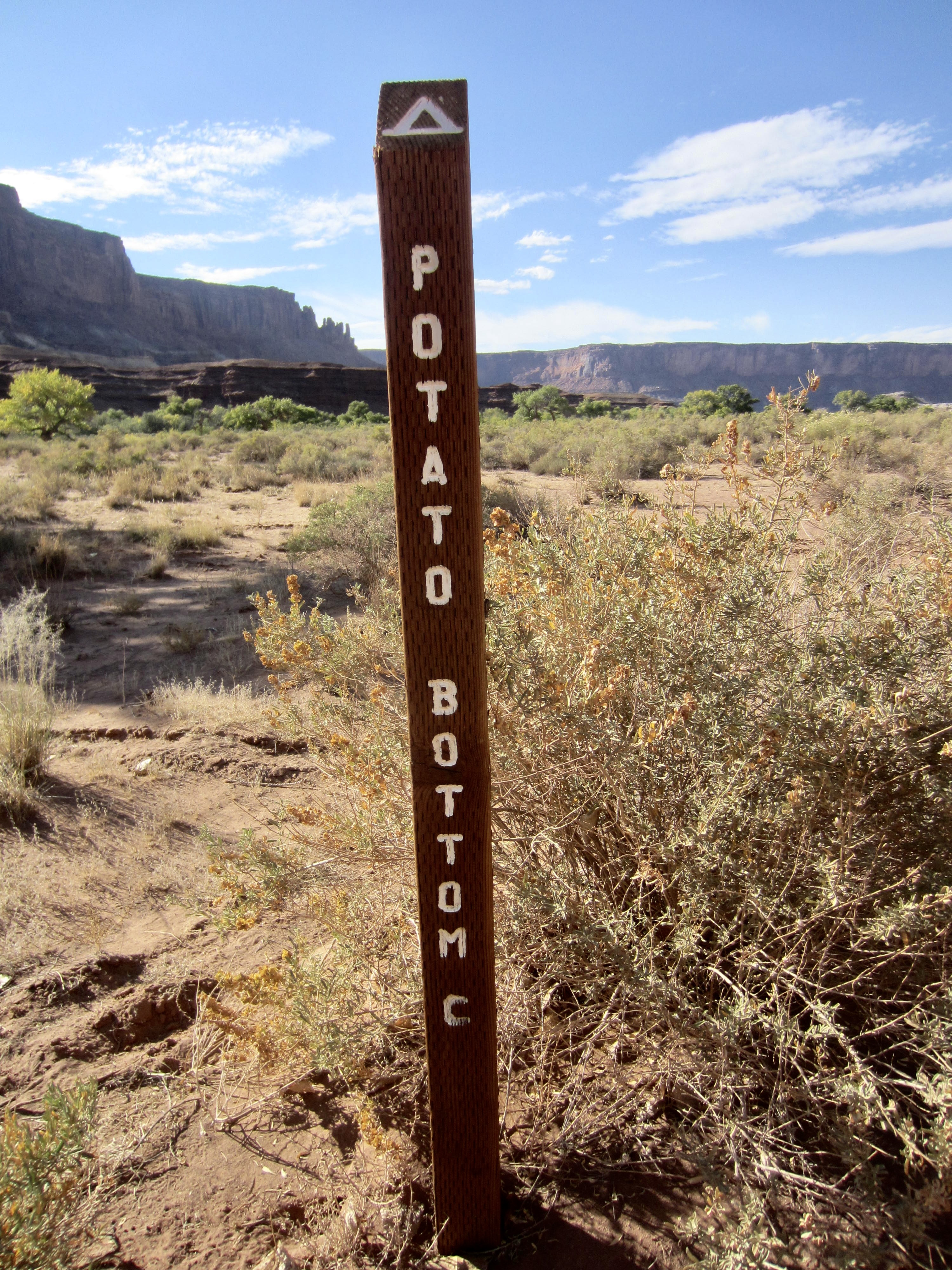
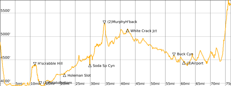
Low Point: Potato Bottom (Elev. 3950 feet)
Intermediate High Point: Murphy Hogback (Elev. 5250 feet)
Ending Point: South Fork Shafer Canyon viewpoint on Shafer Trail Road (Elev. 5650 feet)
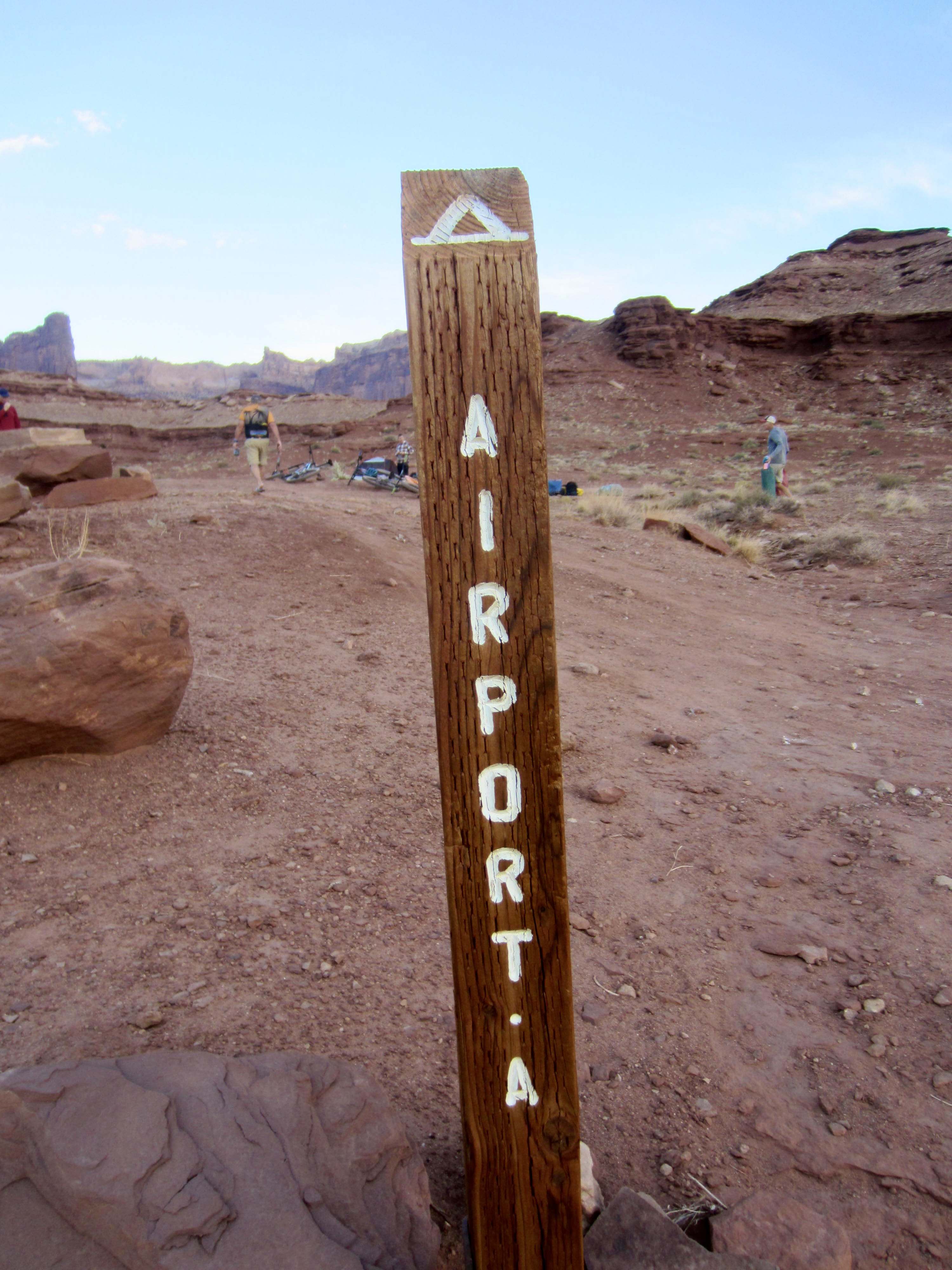
Campsites: Potato Bottom Camp ‘C’ & Murphy Camp ‘A’ & Airport Camp ‘A’
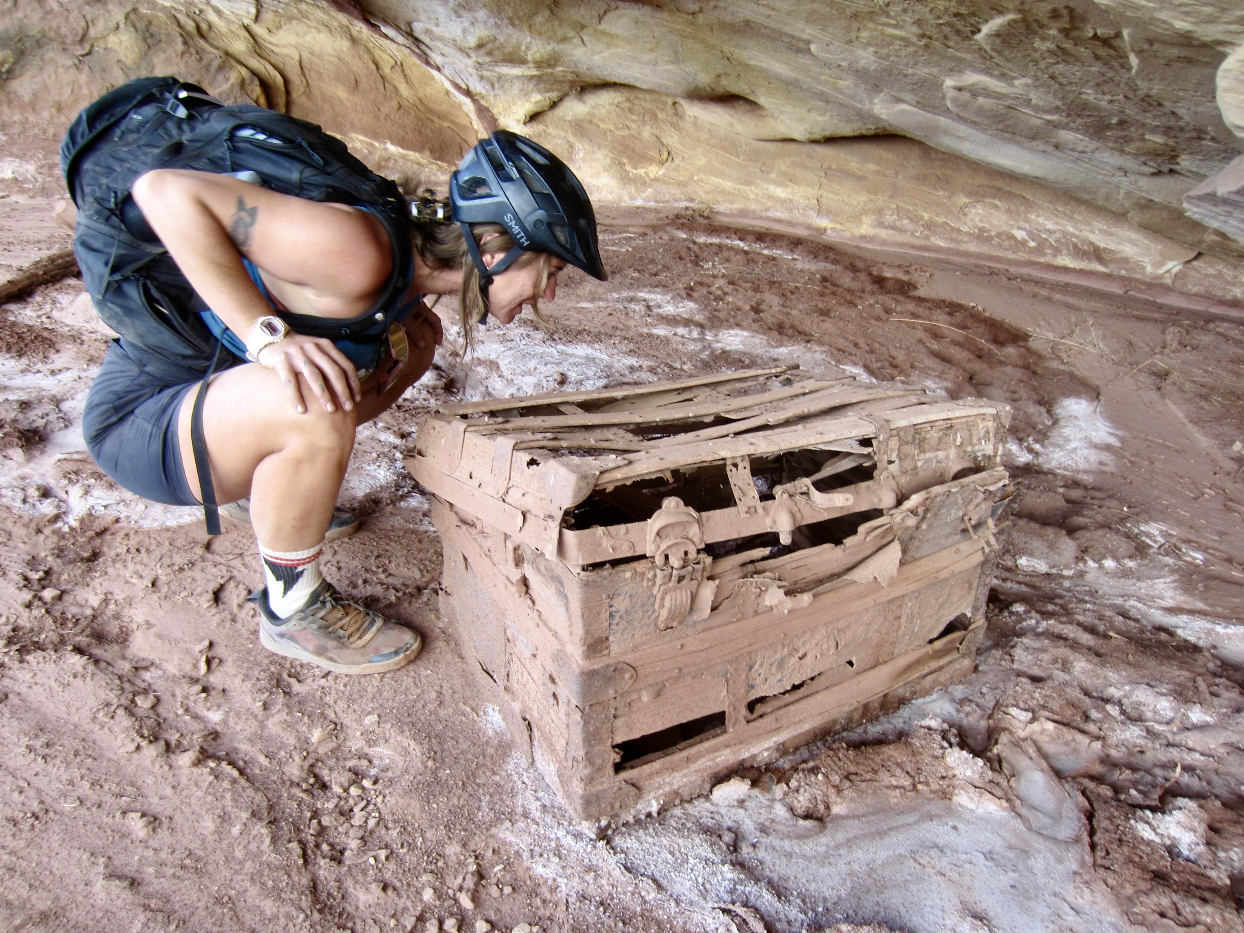
Sidetrips: Art Murray’s chest & Pueblo granary & Holeman Slot & Black Crack & Musselman Arch
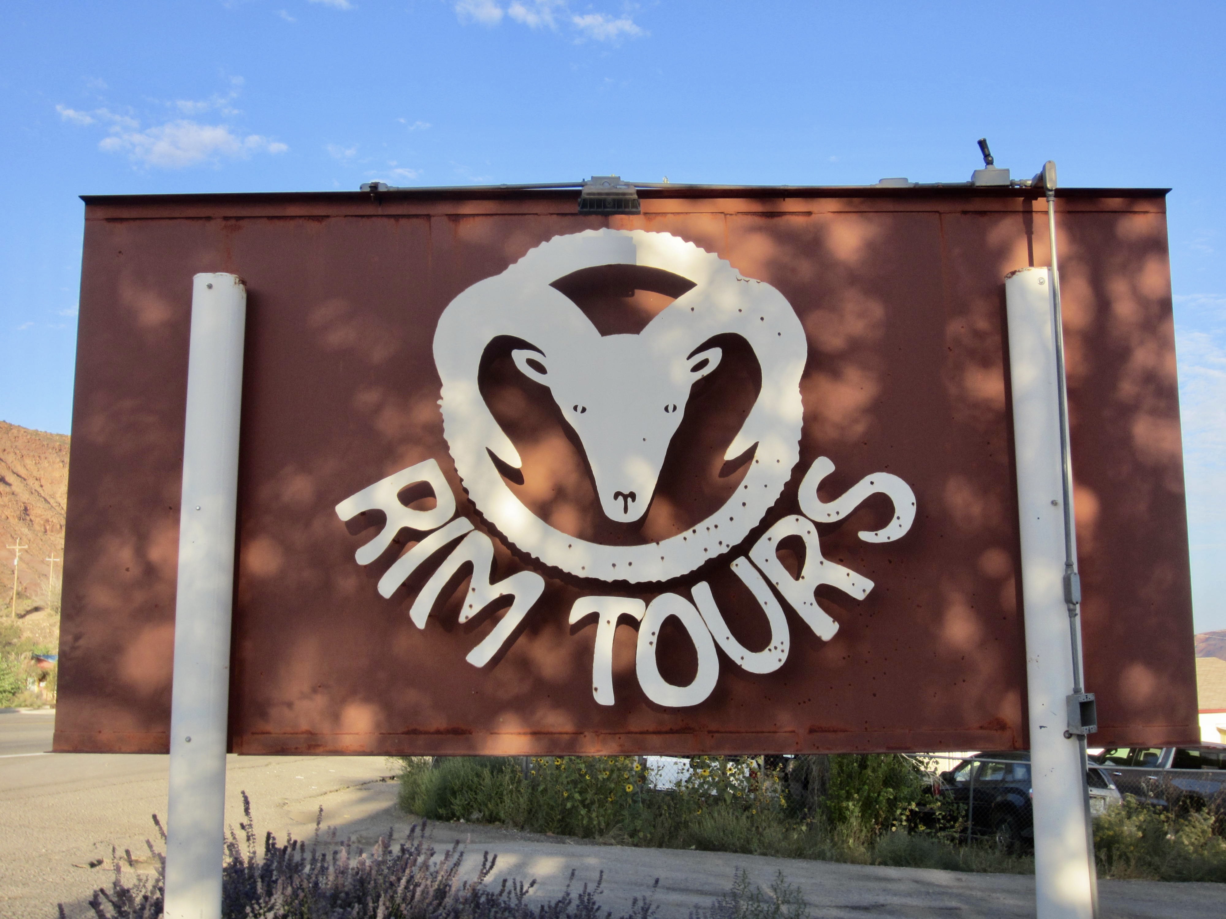
Guiding Company / Guides: Rim Tours Mountain Bike Adventures / Jeff Lefebvre & Shelby Eldridge
Approximate Stats (excluding sidetrips): 77.2 miles traveled; 5350 feet gained; 4550 feet lost.
…
Trip Overview
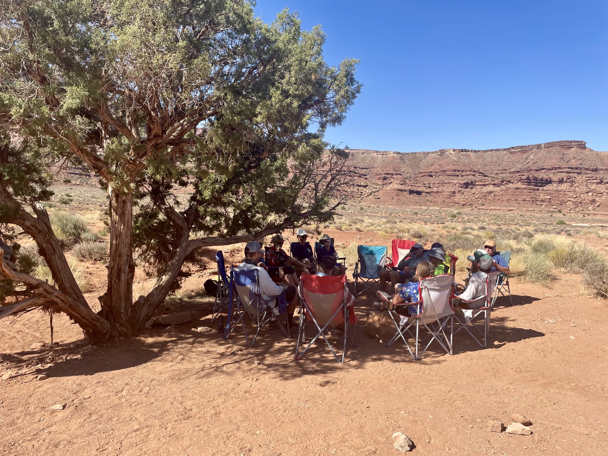
Lisa, Kevin, Debra, and I joined Rim Tours on a four-day, guided, and fully supported bike traverse along White Rim in Canyonlands National Park. This Moab-based adventure company offers a variety of mountain-bike tours throughout the Desert Southwest, including three-day and four-day versions of a White Rim Traverse. Our group opted for the longer version because, well, why rush! Our Washington State contingent was accompanied by John, Kent, Ross, and Kerry from Montana; Brian from Kansas; Ryan from California; Bob from Florida; and Anders and Eva from Sweden. In the end, we all agreed that four days on the Rim was a good choice.
.
Guiding Service & Guides
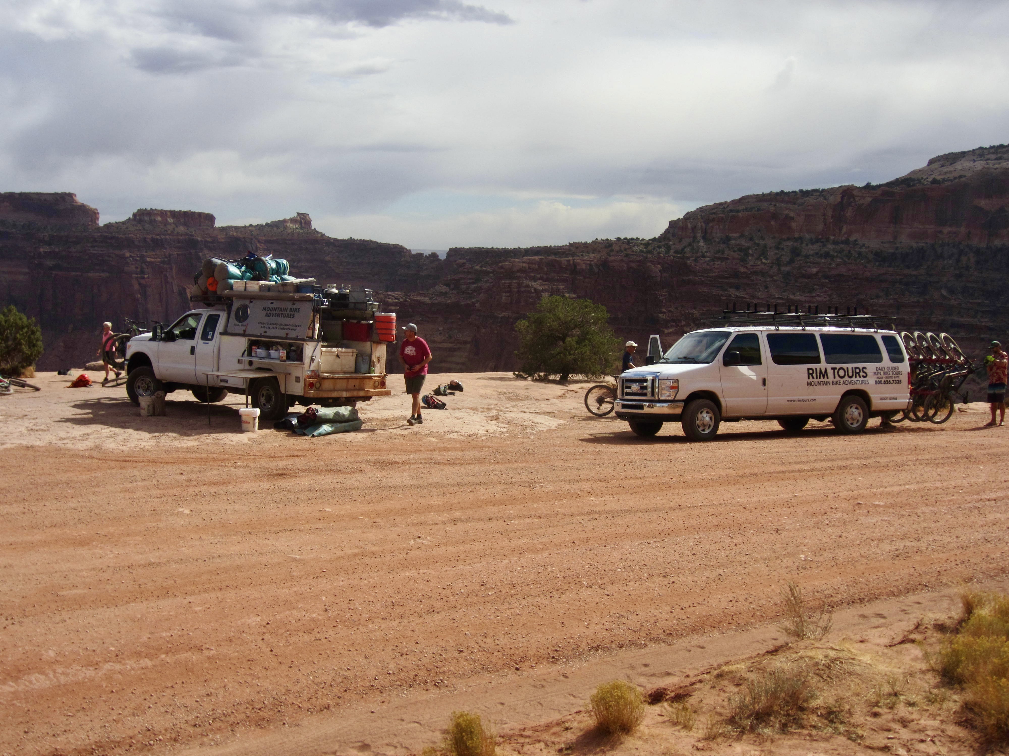
Rim Tours makes the White Rim Traverse not only fun and educational but also logistically convenient. We rented mountain bikes and helmets for a reasonable charge ($300), so there was no hassle getting our own bikes to Moab. They also rent camping kits (tent, sleeping bag, and sleeping pad), although we supplied our own gear for camping. Transportation from Moab to the starting point, and from the ending point back to Moab, is included in their fee.
.
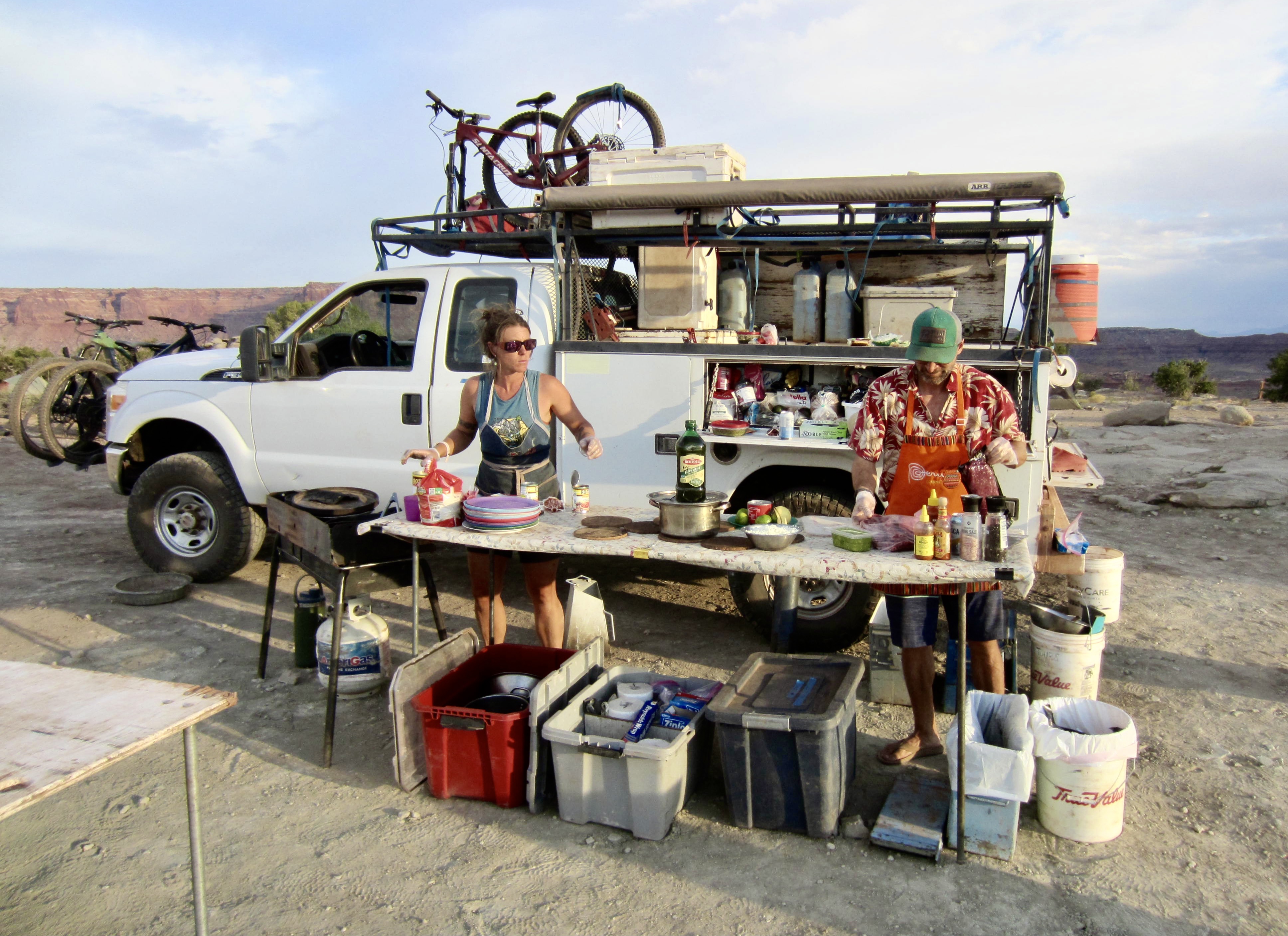
Jeff and Shelby, both Moab residents, were our two guides for the traverse. Jeff is a longtime biking guide, and Shelby is a former river guide turned biking guide. During the traverse, one of them would ride with us while the other one drove a support truck. They provided breakfast, lunch, dinner, snacks, water, and entertainment each day. The meals were always hearty and tasty, the coffee was always fresh, and the drinks were always cold. It felt like a touch of luxury in the desert!
.
.
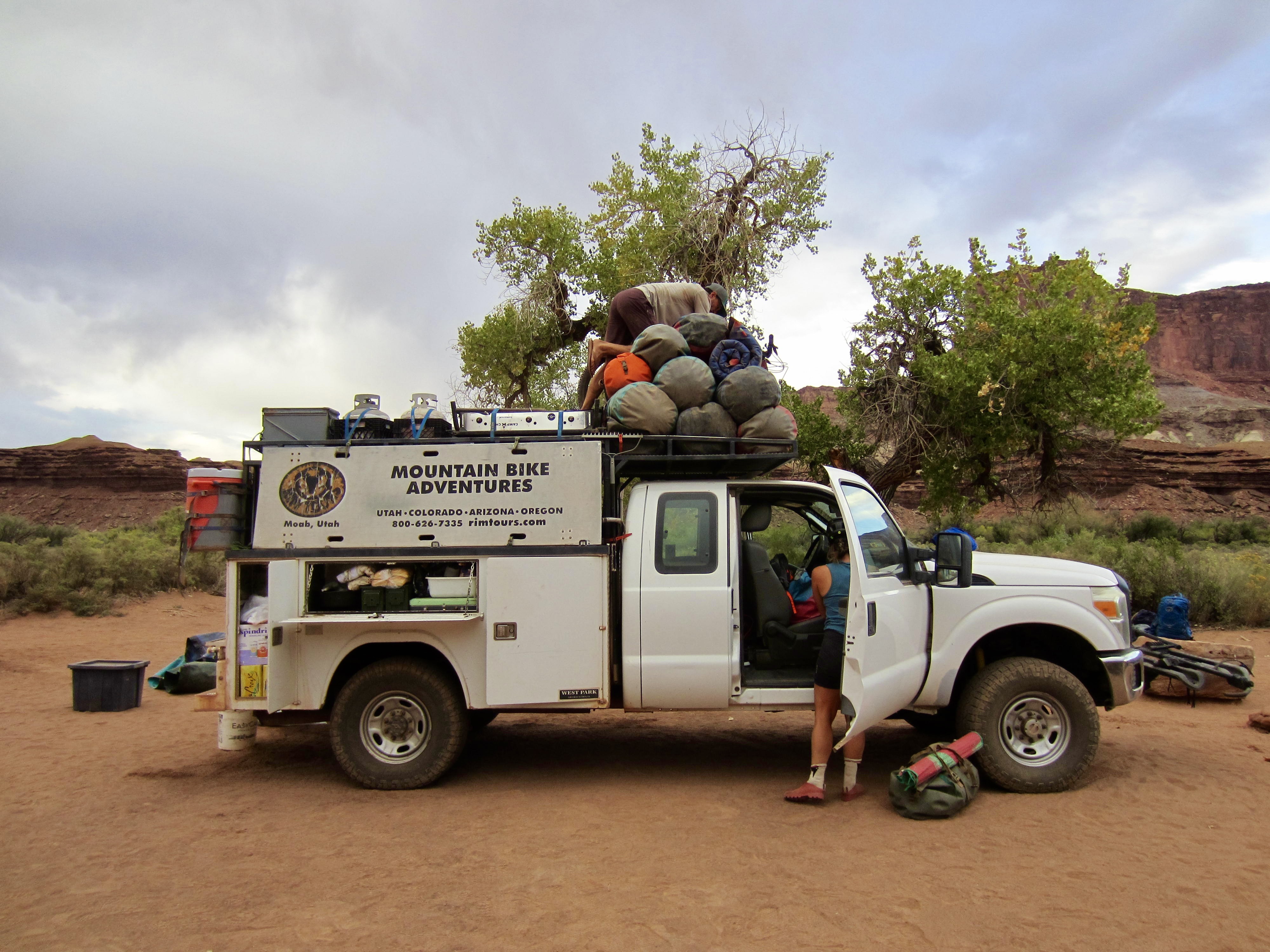
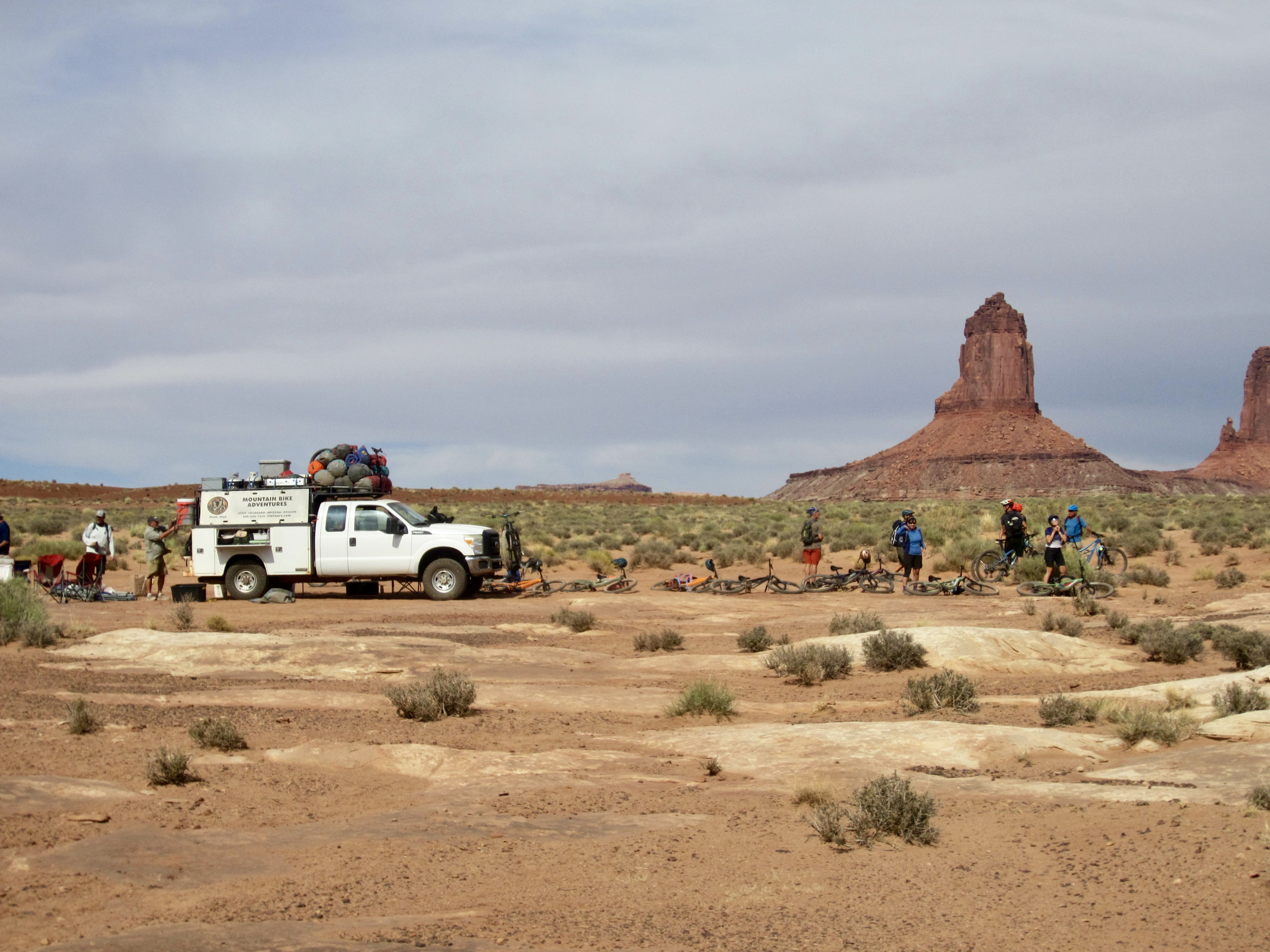
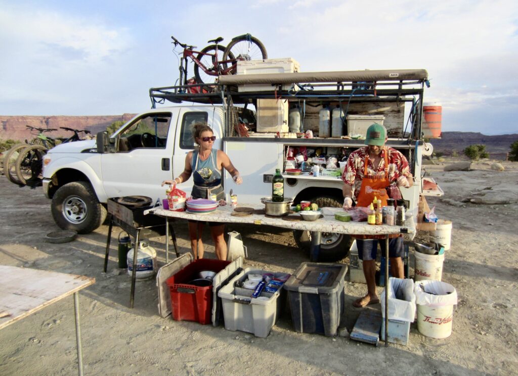
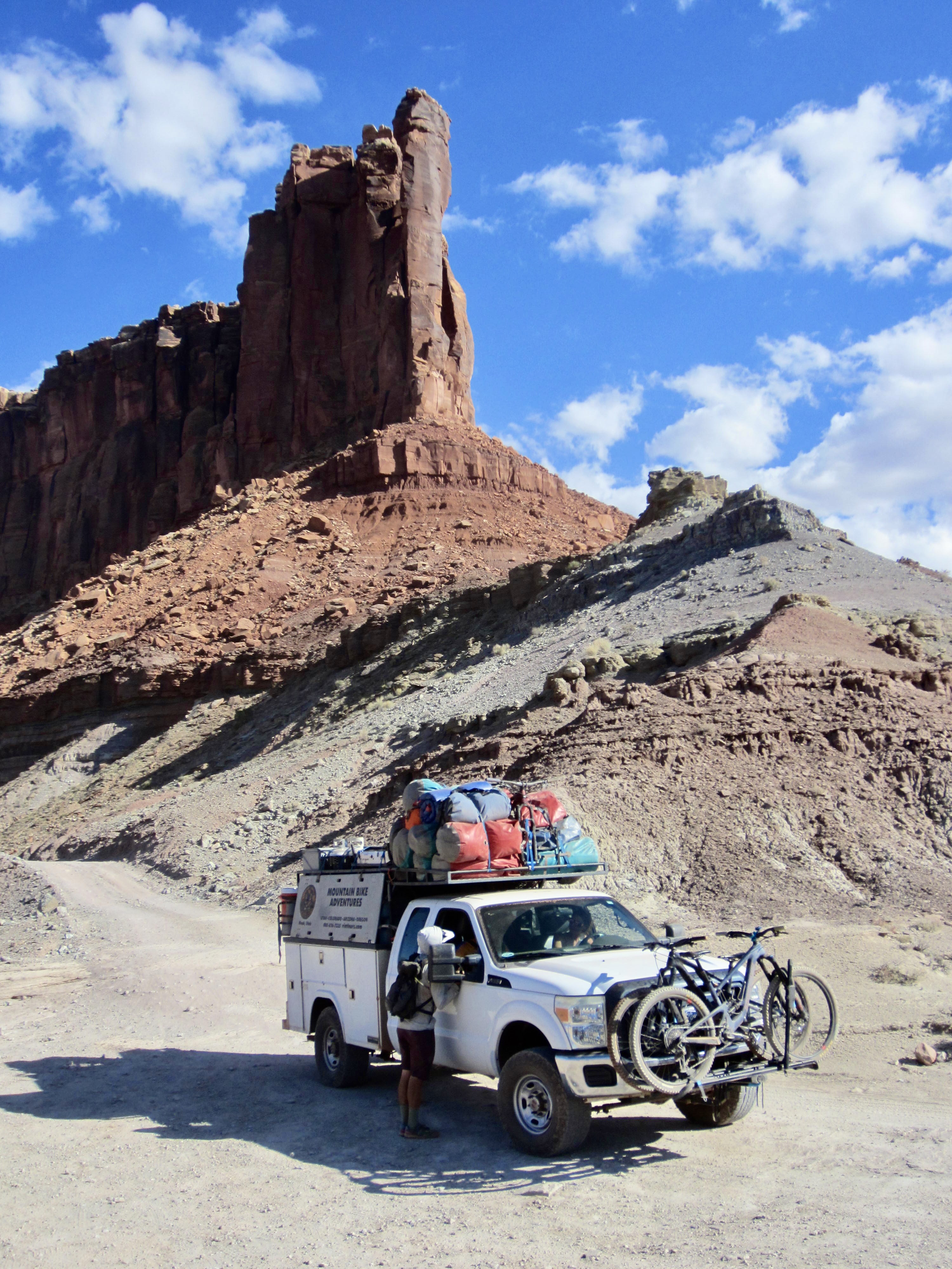
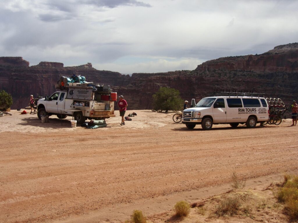
The support truck continuously followed our peloton throughout each day in order to handle any mechanical or medical problems. It was a big Ford F-350 with a service bed and storage racks. When fully loaded, it looked like a veritable beast of burden—piled high with bins and gear bags and bikes, yet still able to navigate the roughest 4X4 road segments. We were all amazed at the amount of food, drinks, and equipment that Jeff and Shelby were able to pull out of the it at each stop. Eva likened the truck to Sarrimer, a mythological Norse animal that magically provided an endless supply of meat to its attendants.

.
Geographic Setting
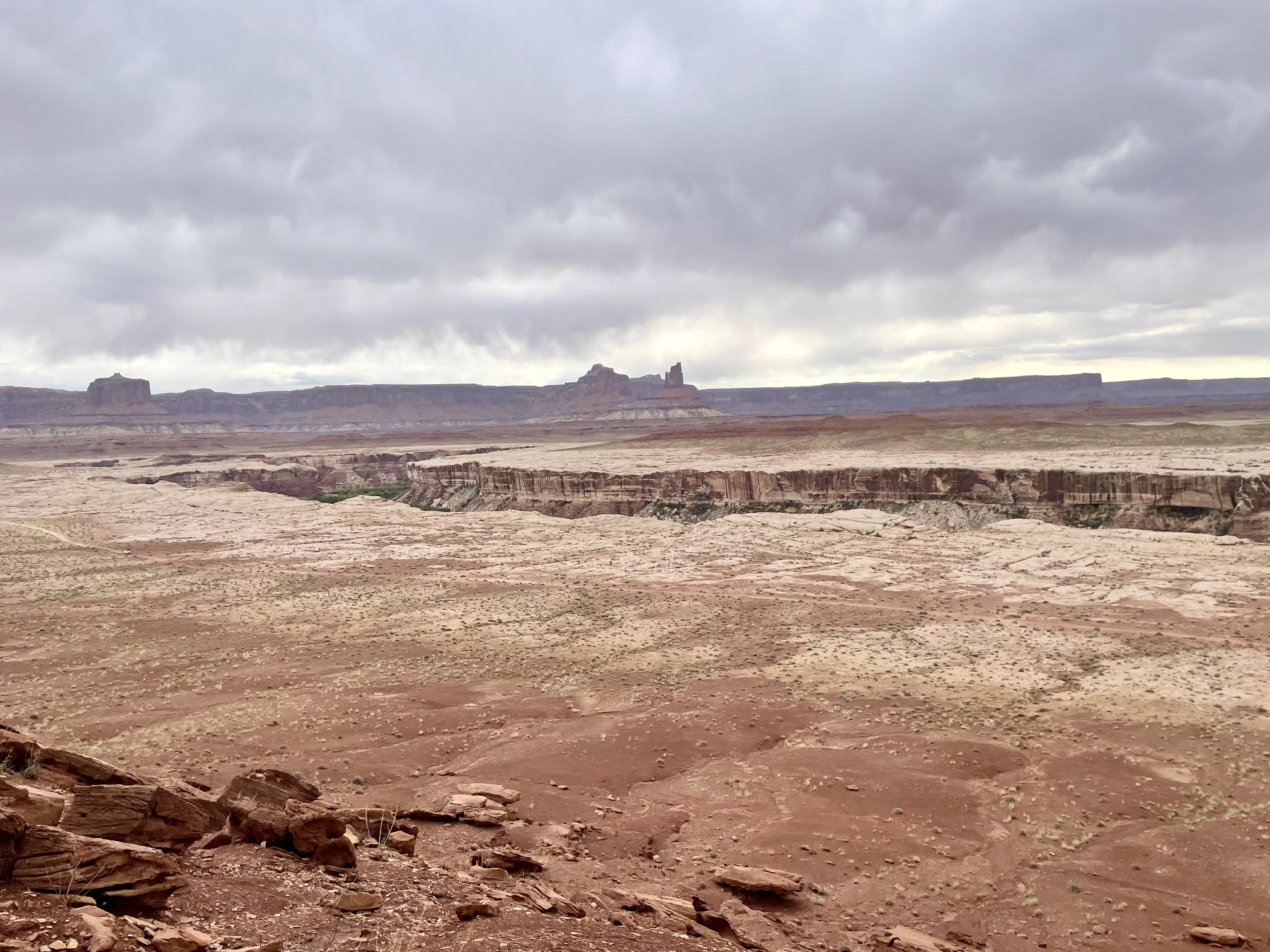
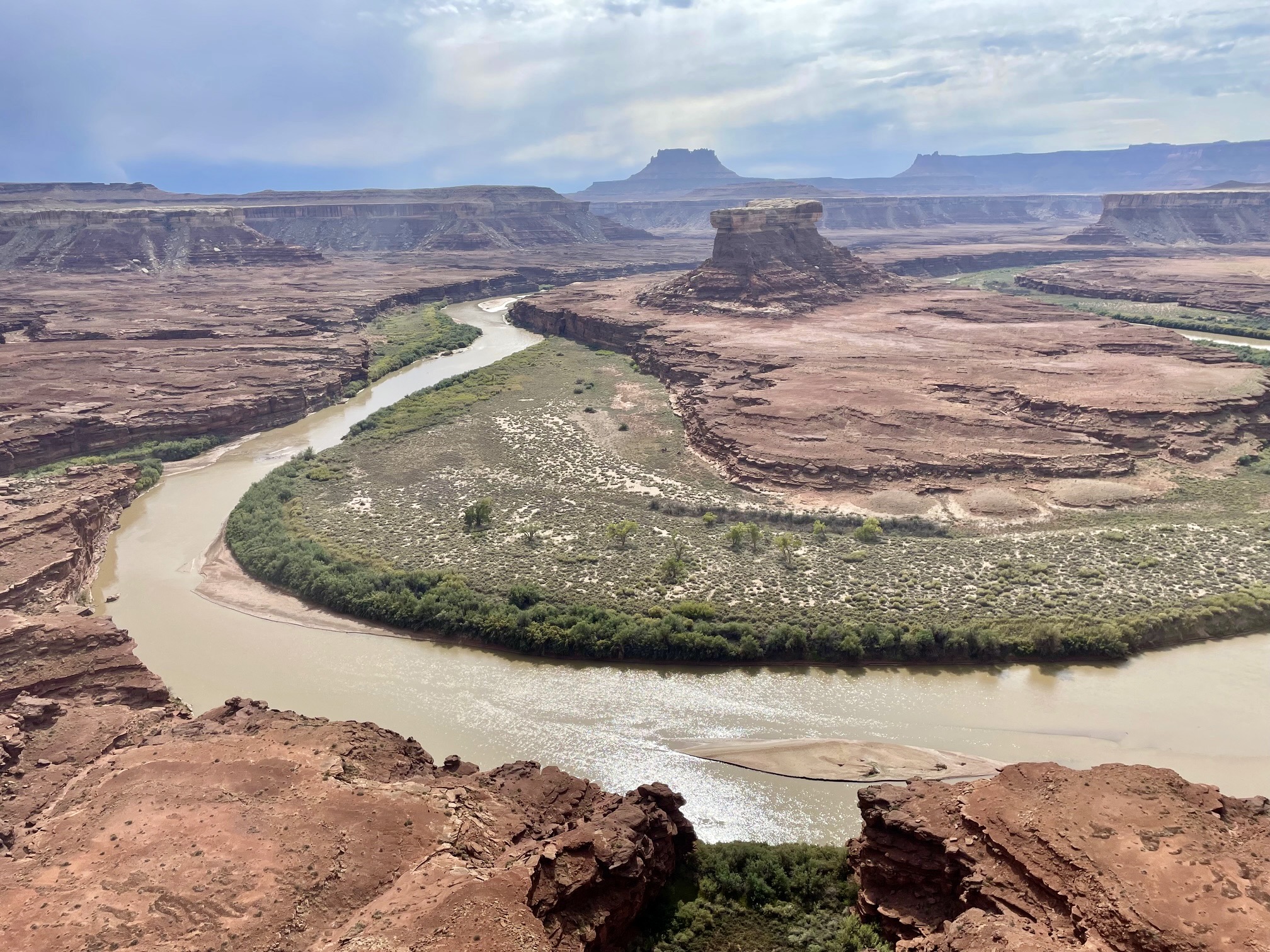
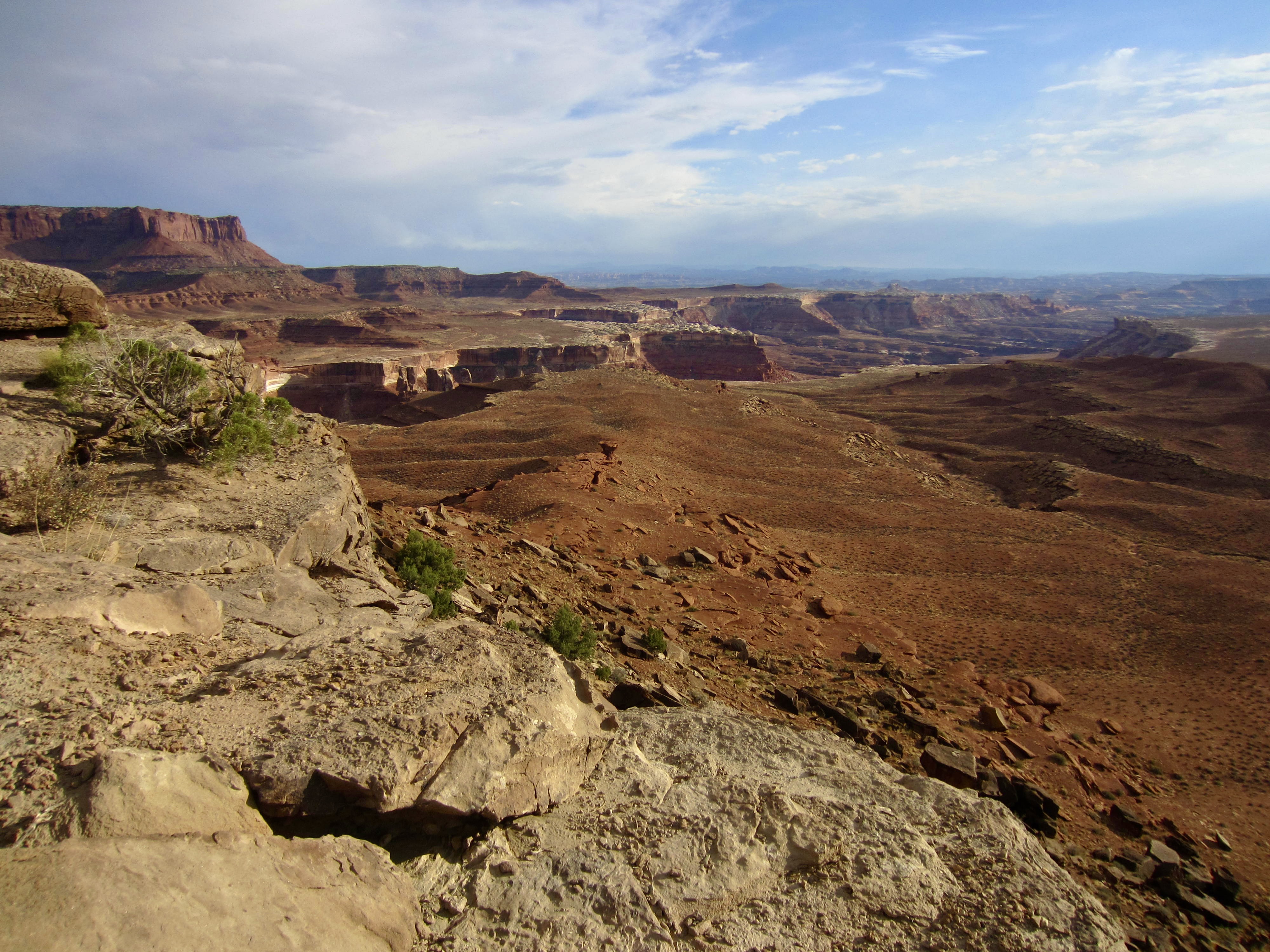
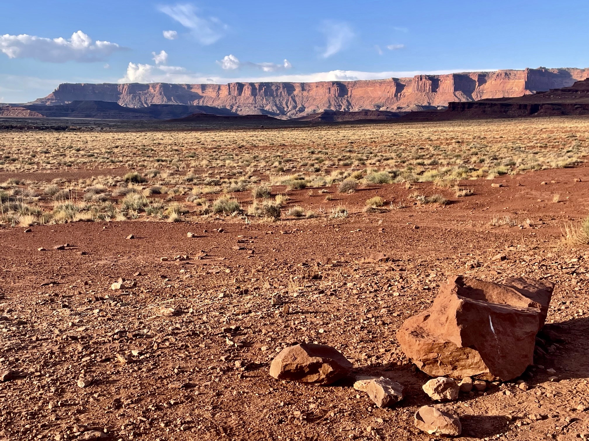
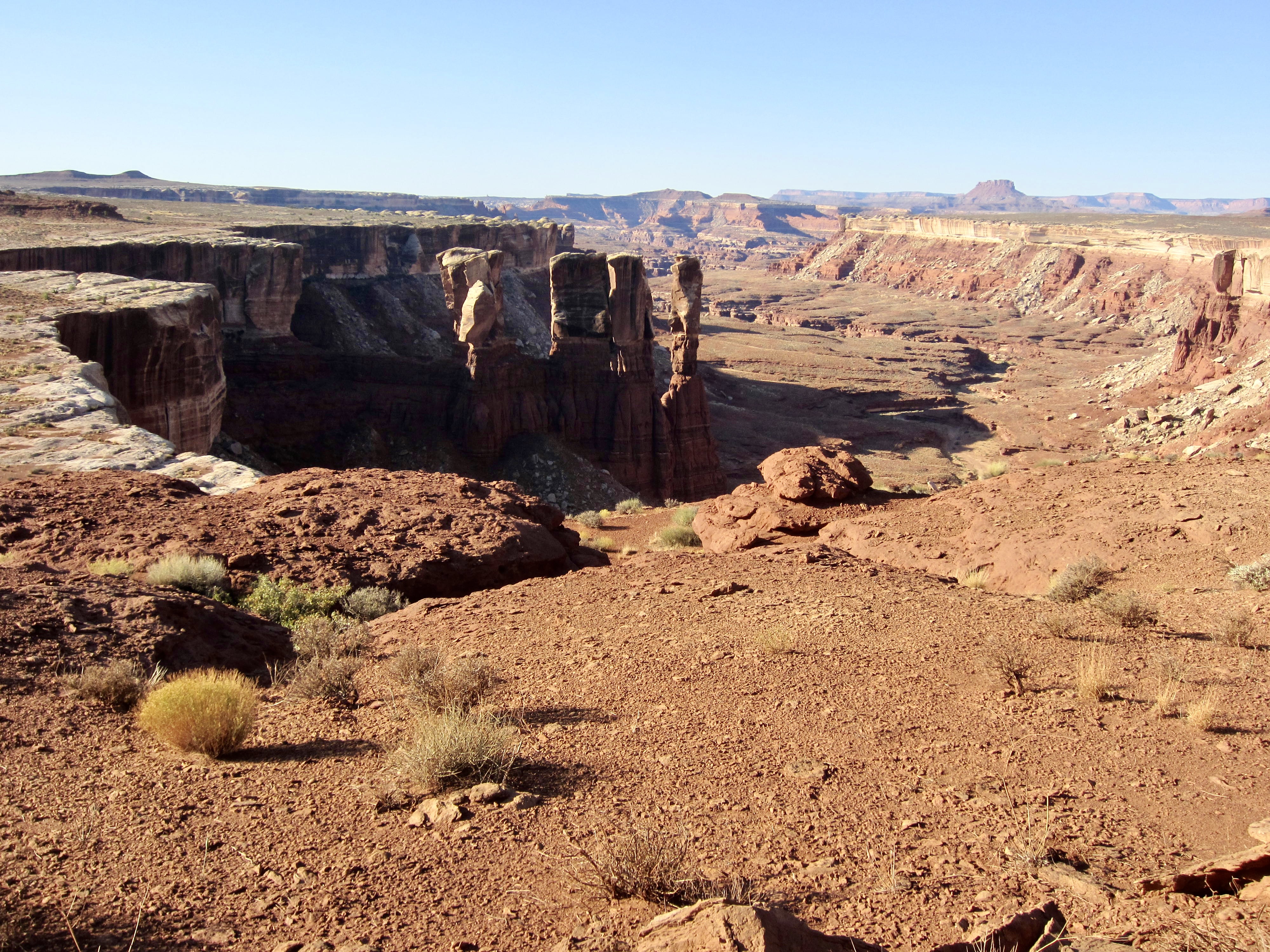
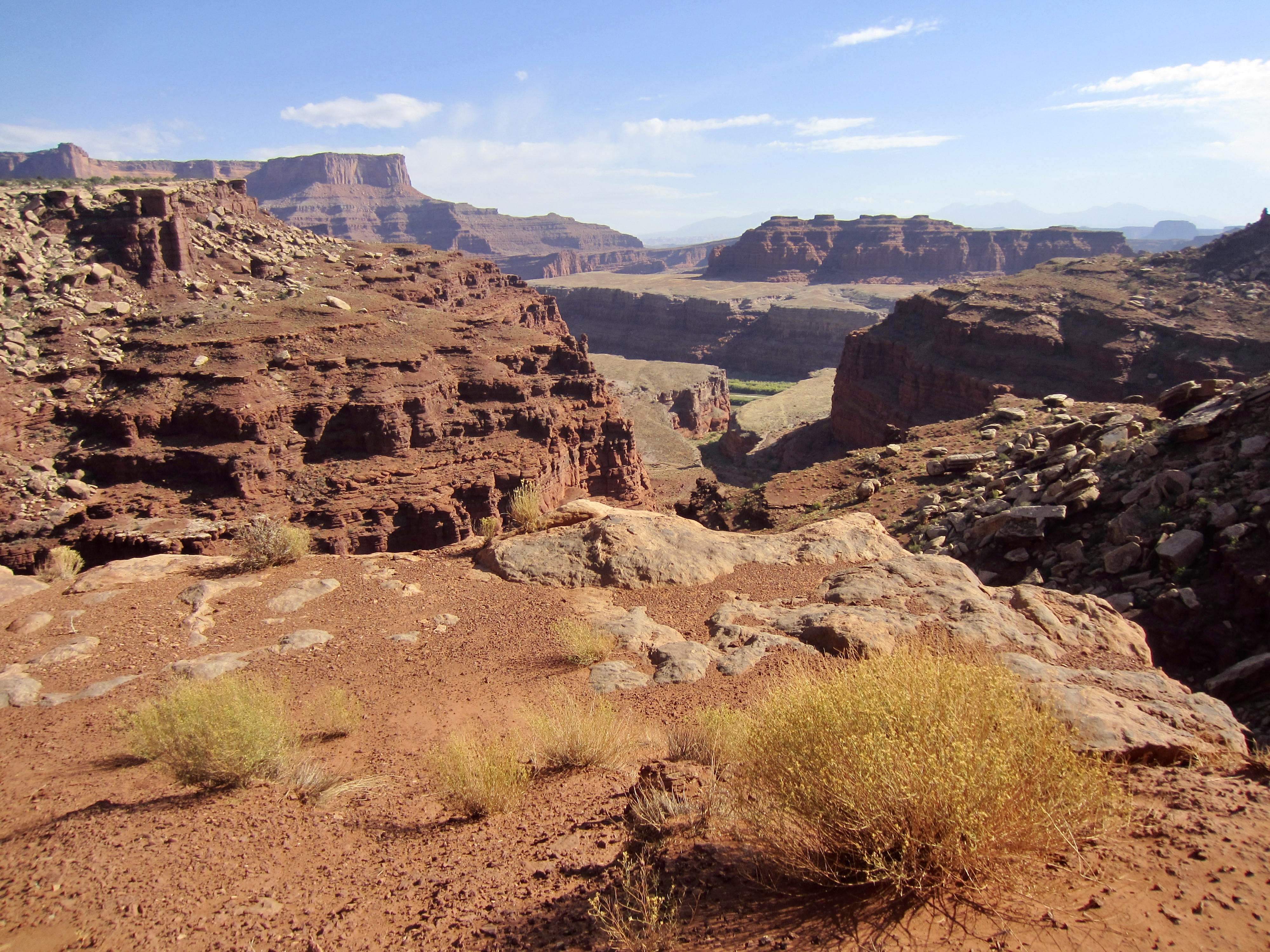
Canyonlands National Park lies at the confluence of two major rivers in Southeastern Utah. The Green River flows in from the northwest, and the Colorado River flows in from the northeast. They combine to form a much larger Colorado River, which continues flowing southwesterly into Lake Powell and, ultimately, the Grand Canyon. This trio of waterways carves a giant wishbone shape into the park’s desert landscape.
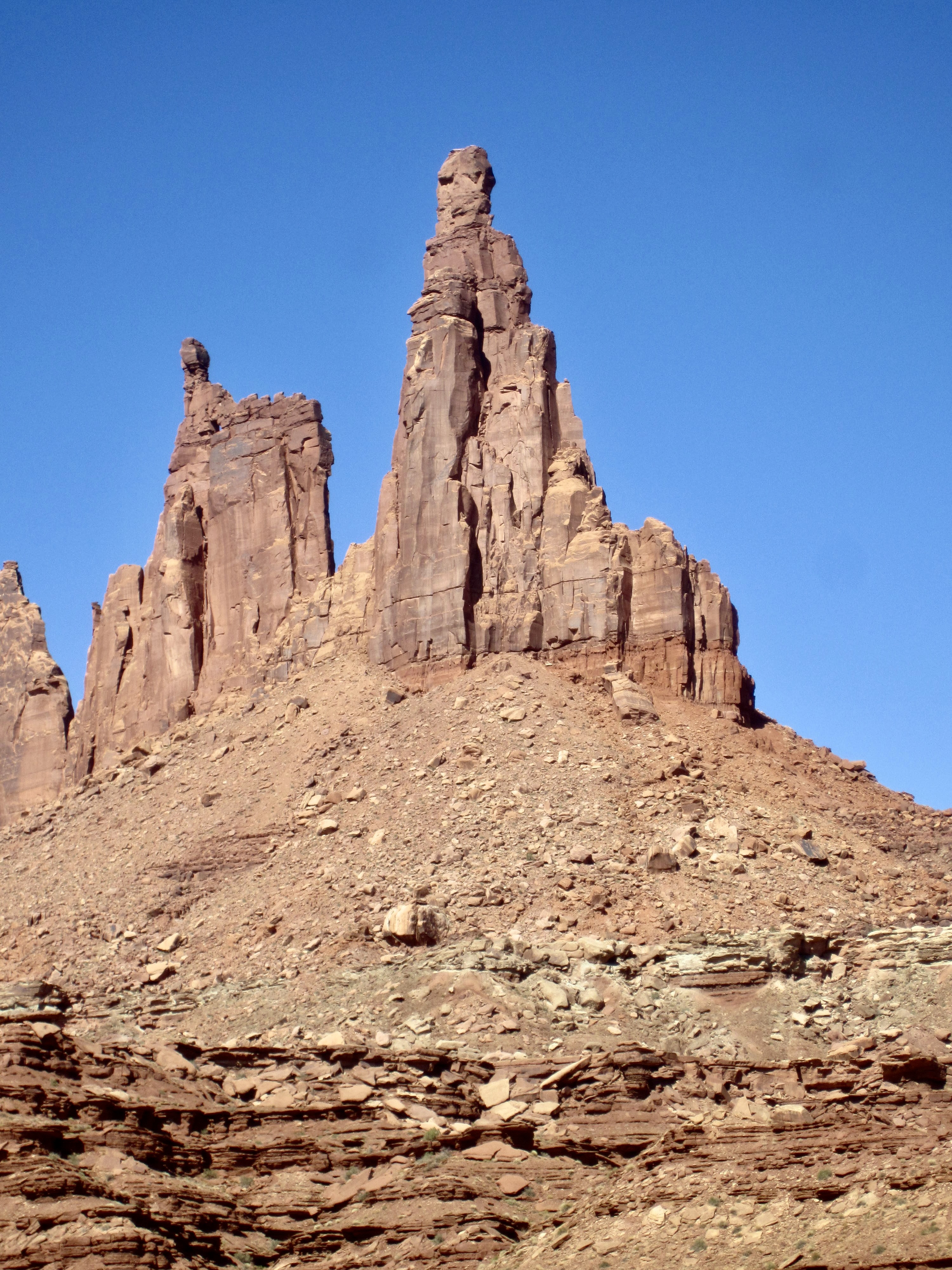
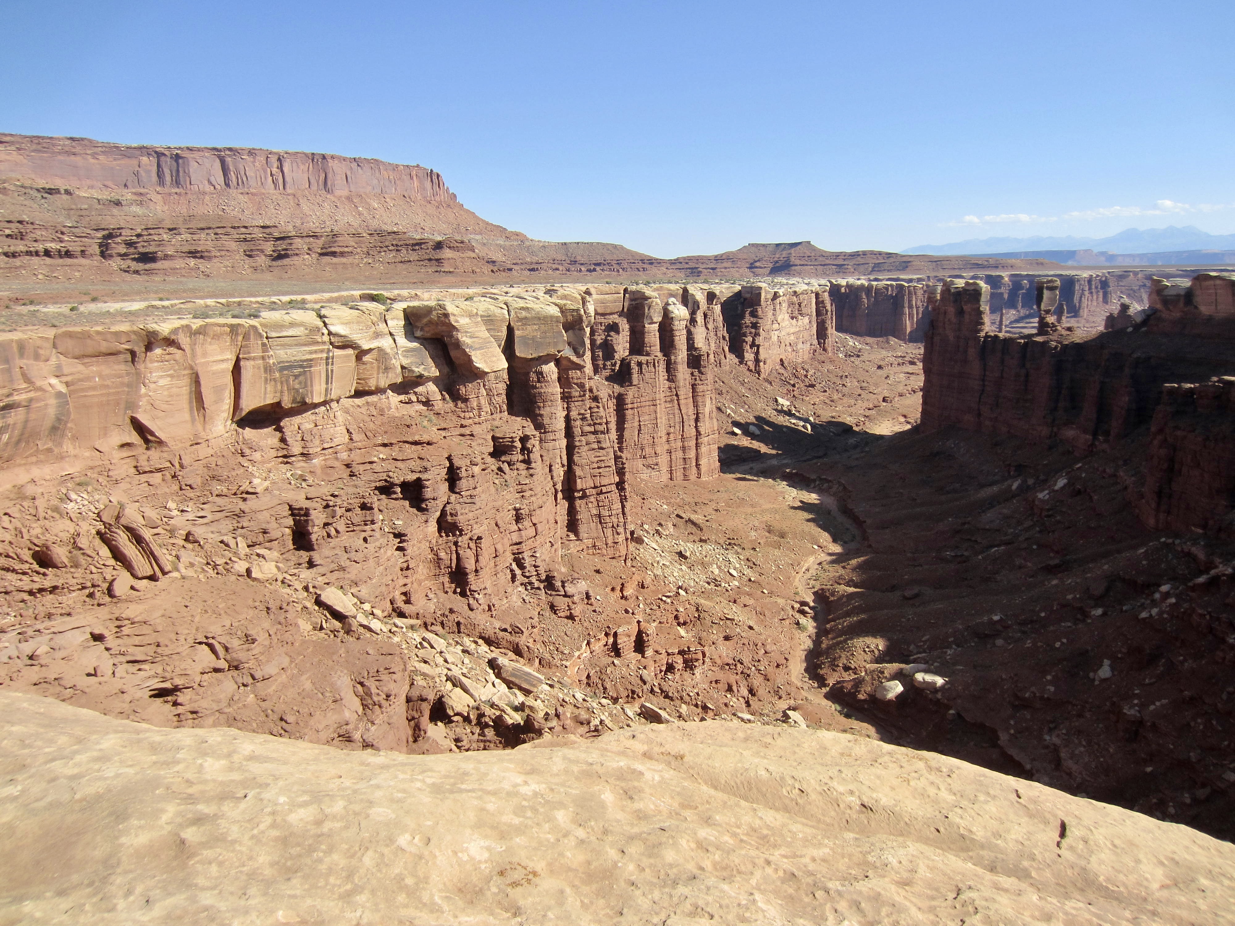
Canyonlands is divided into three geographical areas, or districts. The area situated west of the wishbone is called The Maze; the area east of the wishbone is called The Needles; and the upland peninsula cradled within the wishbone’s arms is called Island in the Sky. Surrounding Island in the Sky, at an elevation somewhere between the peninsula and the two river channels, lies a large shelf of light-colored sandstone. This sandstone shelf is known as White Rim.
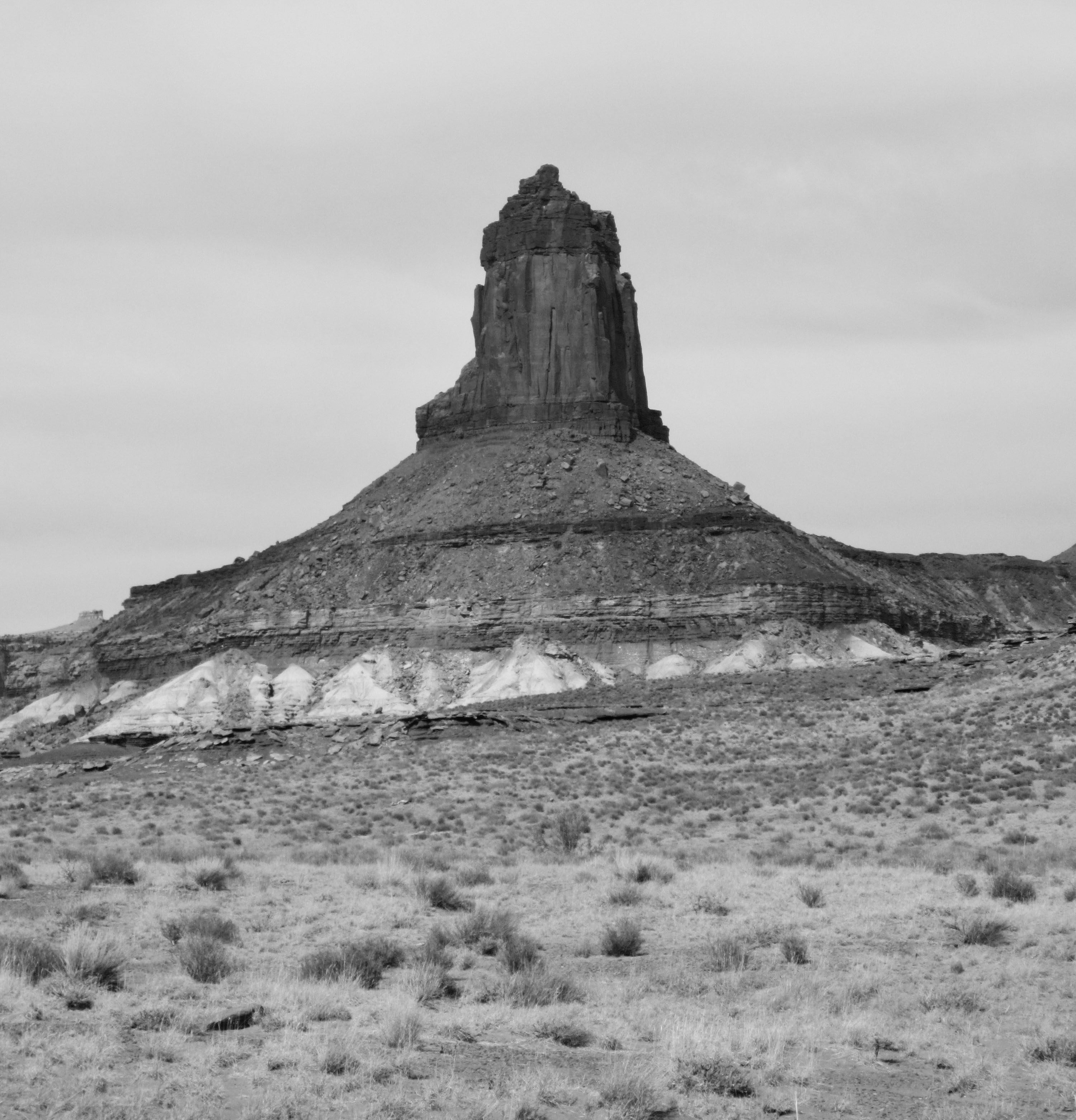
White Rim traces a rough “V” that extends for approximately 70 miles from one end to the turning point to the other end, with access roads only at each end. The abundance of visually stunning buttes, towers, fins, arches, walls, cracks, canyons, and other geomorphic features along White Rim render it a fantastic setting for recreation. Given the end-to-end distance, a multi-day mountain-bike ride offers an ideal mode of exploration.
.
Route Conditions
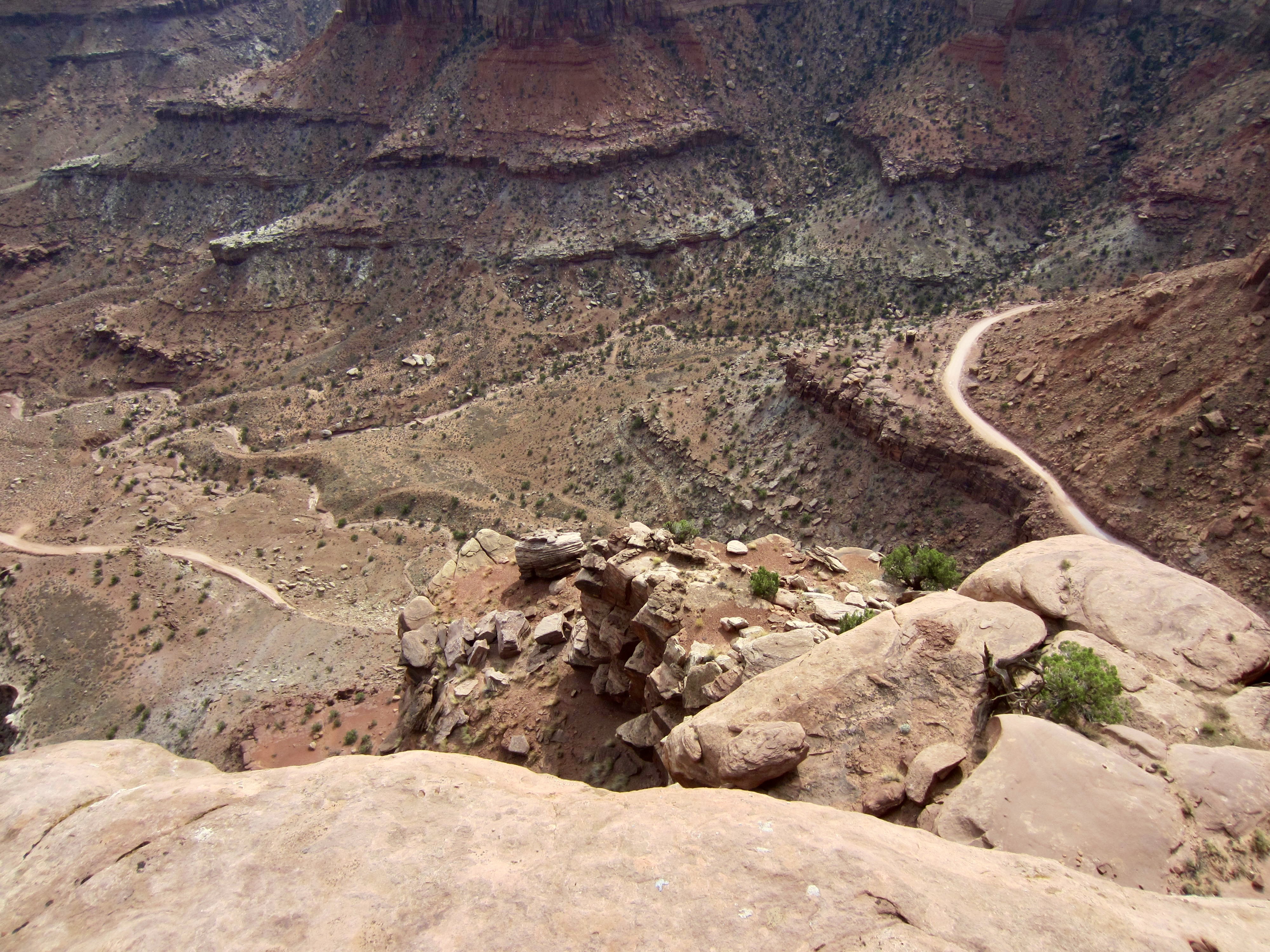
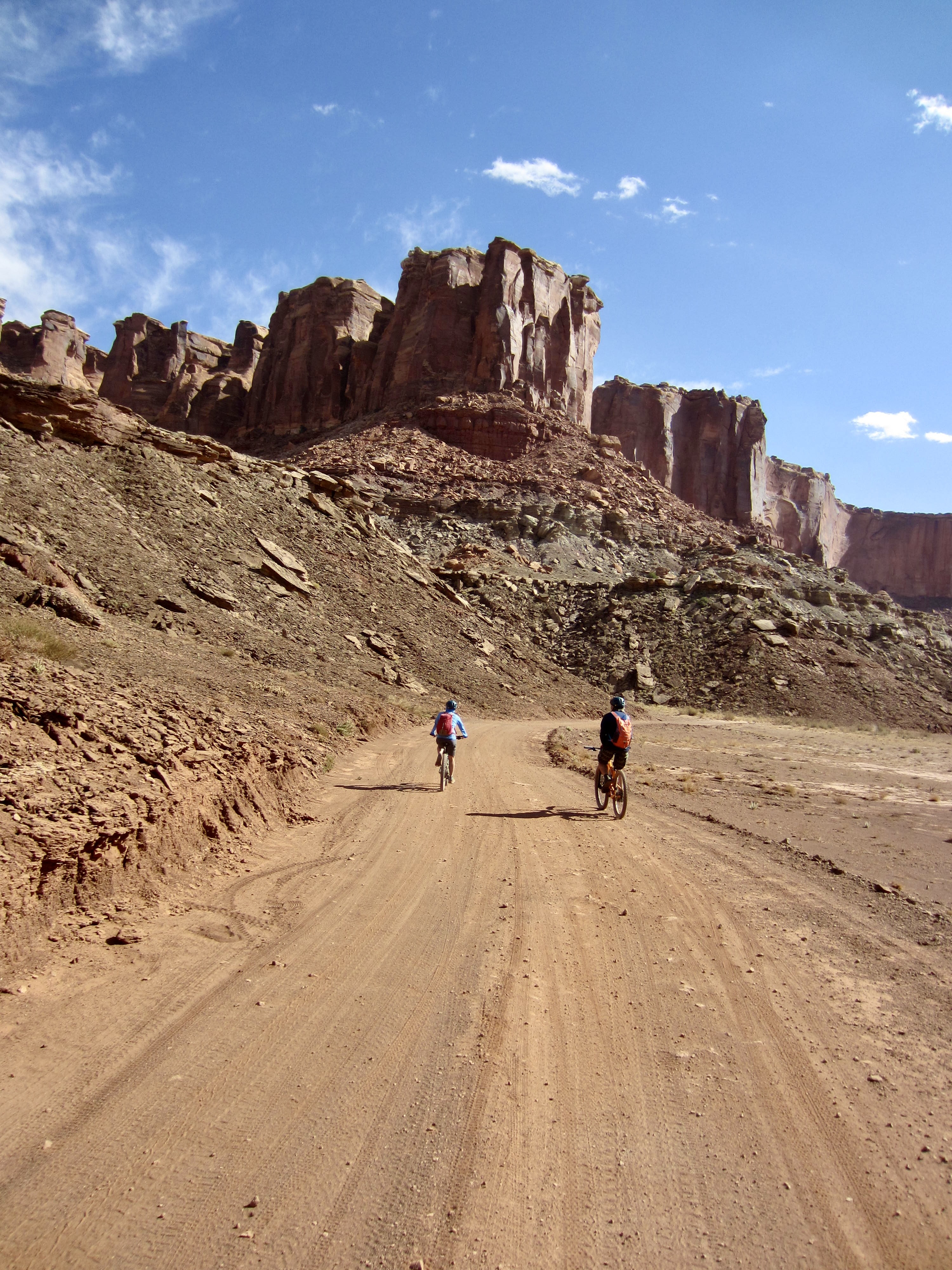
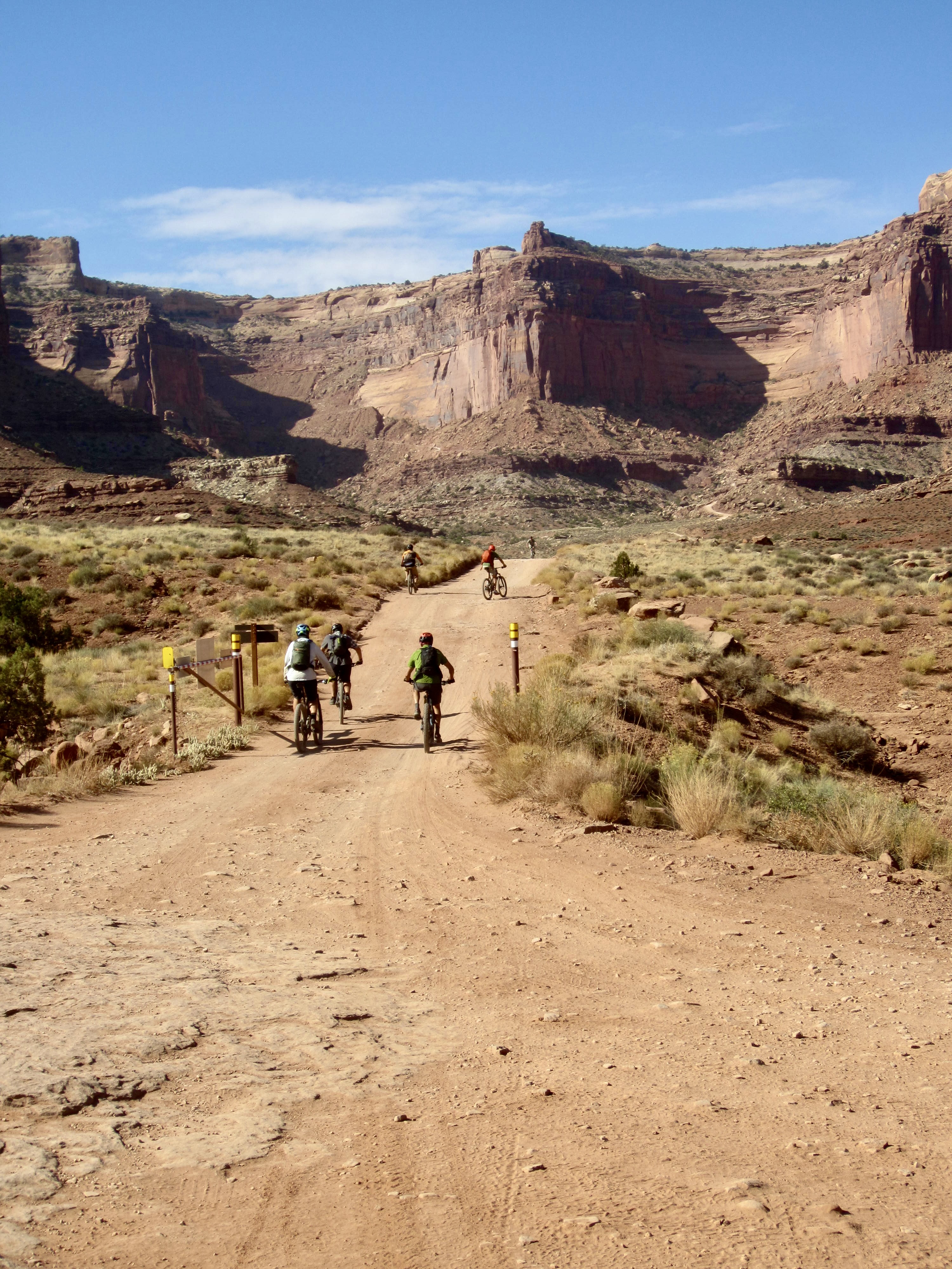
Rim Tours routinely guides the White Rim Bike Traverse in both an east-to-west direction and a west-to-east direction, depending on available campsites. Our group did a west-to-east traverse, beginning at the Mineral Bottom parking lot and ending at the head of South Fork Shafer Canyon. Regardless of direction, the vast majority of the route follows the historic White Rim Road. This road is accessed by Mineral Bottom Road at the western end and by Shafer Trail Road (that’s not a mistake) at the eastern end.
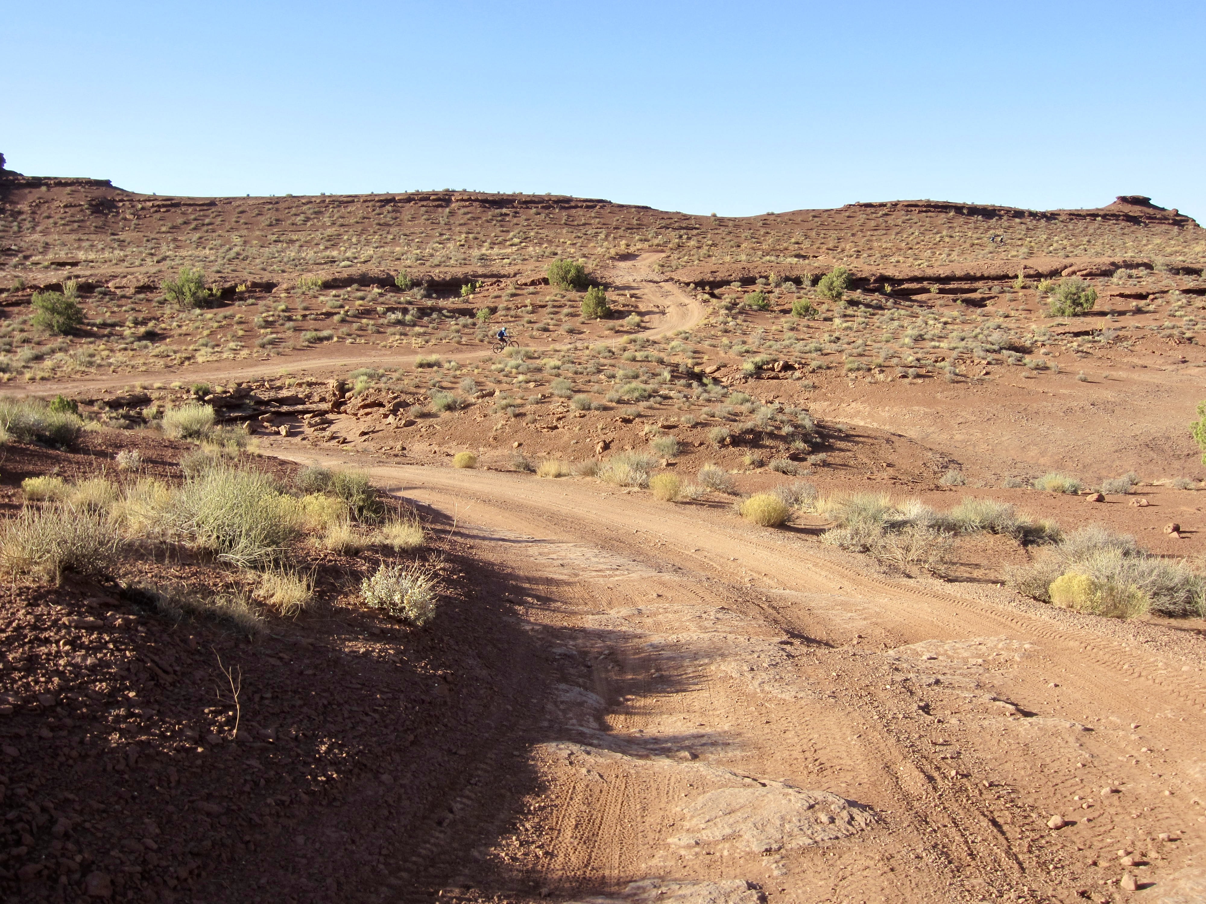
White Rim Road was constructed in a piecemeal fashion over several centuries. Parts of it were built by local Indians for trading purposes, then it was improved by cattle ranchers during the early 1900s. When uranium was discovered in the area circa 1950, the road was greatly improved and extended to facilitate mining operations. Additional improvements were made by oil companies in the 1960s. Today, the roadway gets only recreational use, mainly by mountain bikers, motorcyclists, and 4X4 drivers.
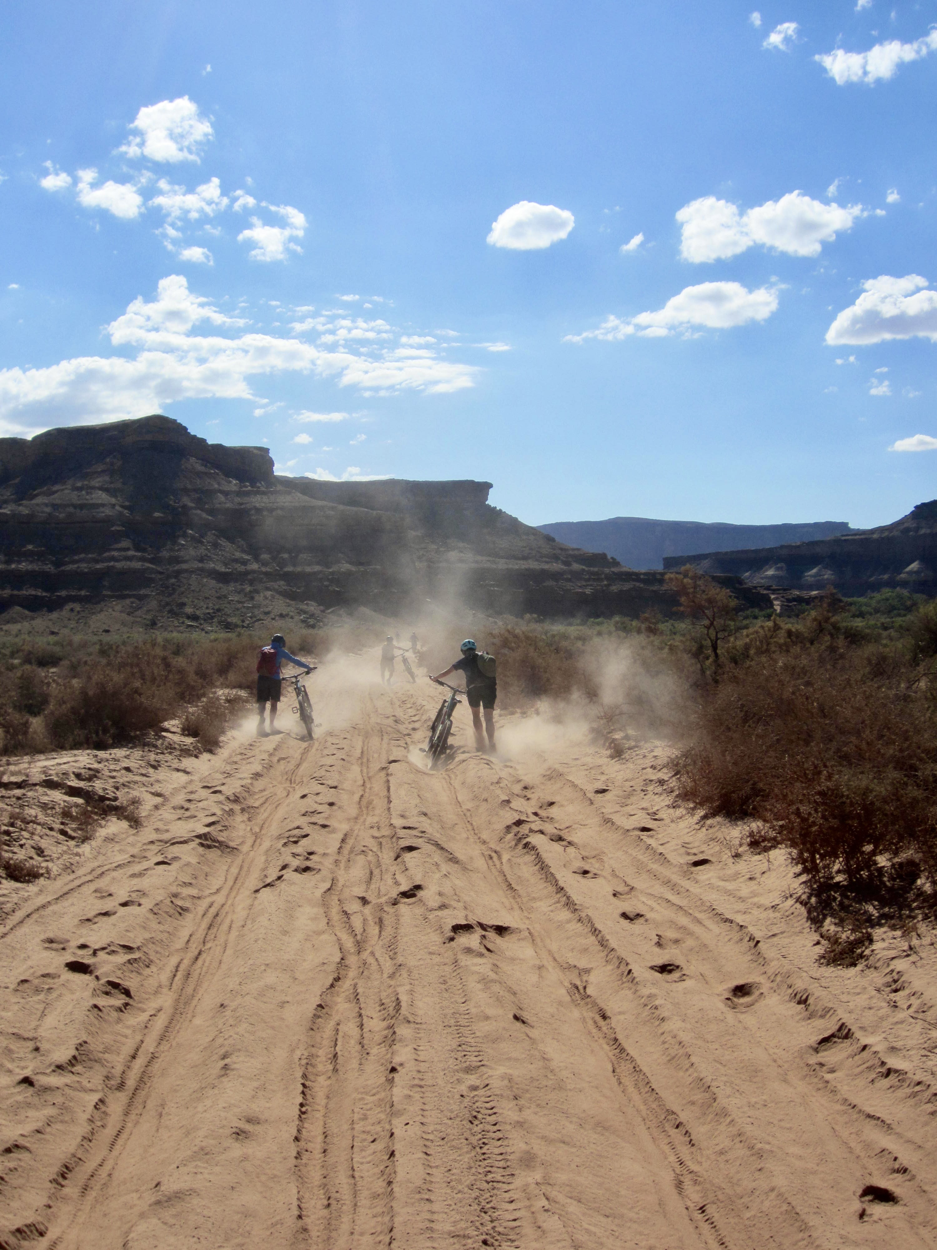
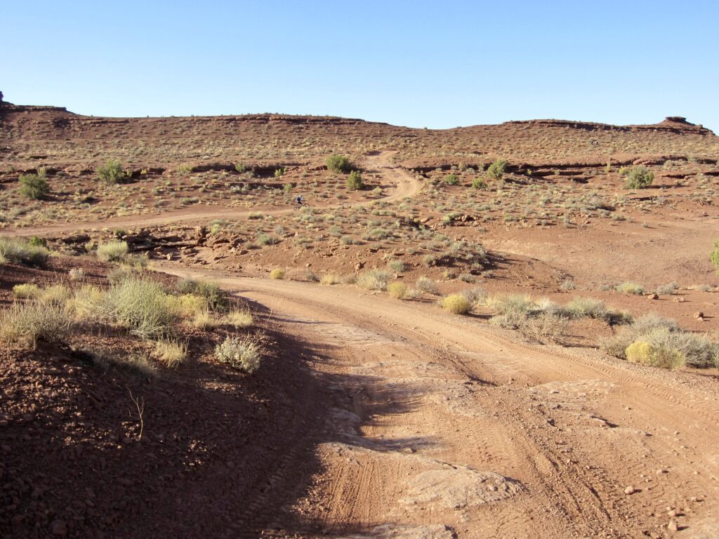
White Rim Road still remains in a fairly primitive state, with scattered areas of rocks, ruts, and sand, as well as steep grades in a few locations. For mountain bikers, it serves as an easy to moderately difficult double-track trail. Our group and probably most other groups regard the worst parts of the road to be the innumerable pockets of loose, dry silt and fine sand. These “sand bogs” have the consistency of powdered sugar, and they have the ability to drain both your momentum and energy. They were thoroughly despised by all.
.
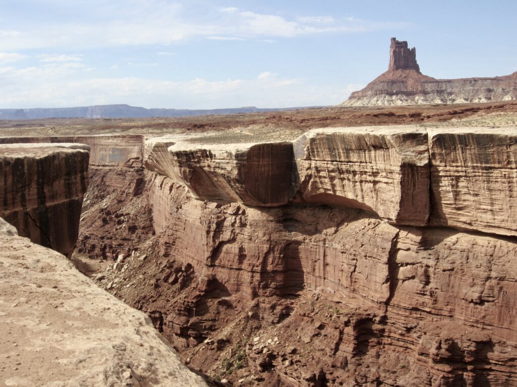
Geologic Setting
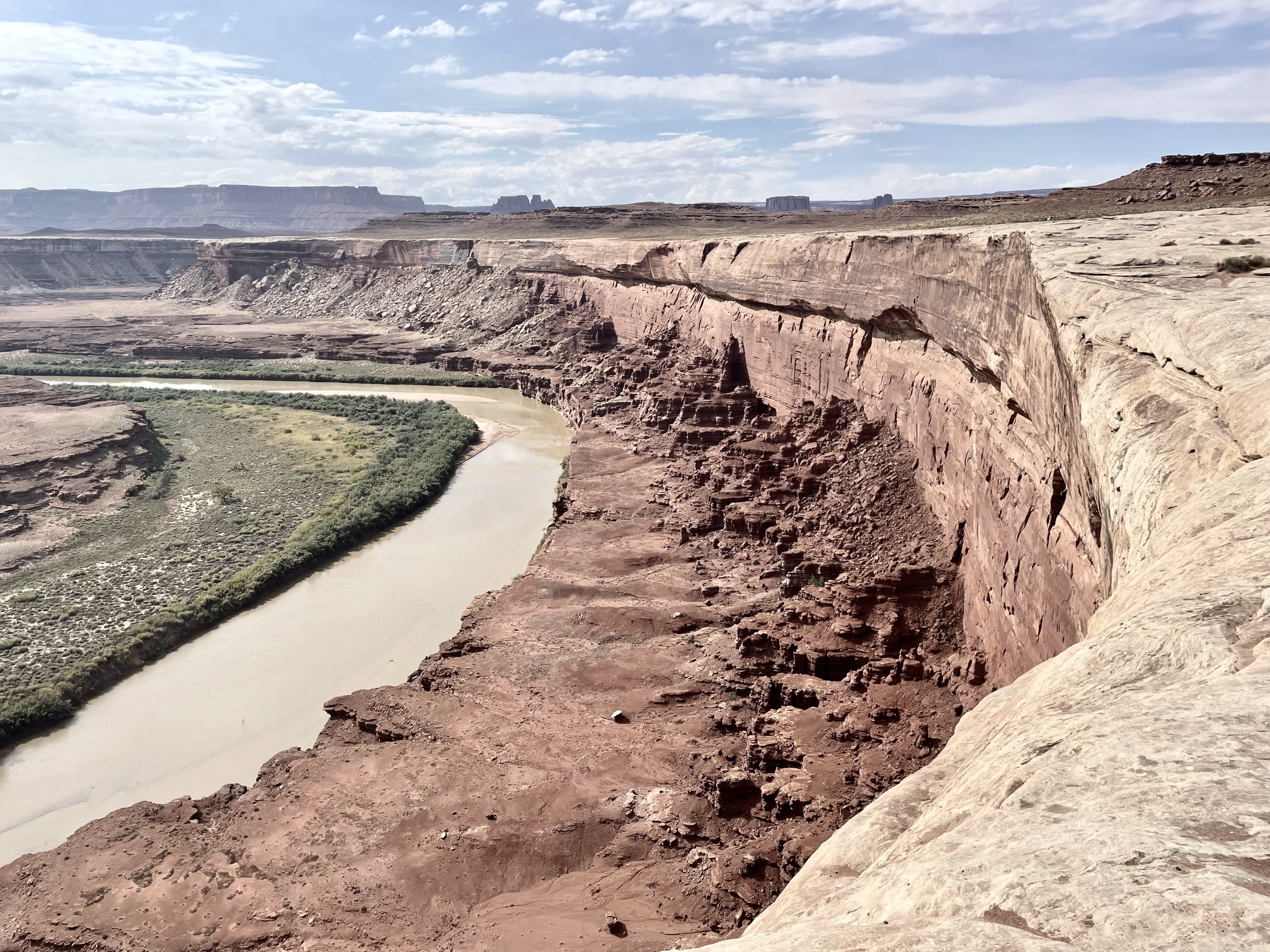
The White Rim Sandstone formation was deposited 250 million years ago in a beachfront environment. Due to its hardness and erosion resistance, this sandstone exhibits broad, flat benches and vertical or overhanging cliffs. It has a surface elevation ranging from approximately 4000 to 5000 feet, generally rising from west to east. This positions it close to the Green River and about 1000 feet above the Colorado River, as well as 1000 to 2000 feet below Island in the Sky.
Our guide Shelby shared with us a funny mnemonic device for remembering the sequence of stratigraphic units prevalent in southeastern Utah: Every New Kangaroo Wants Chocolate Milk. These words correspond to the following geologic formations, in order of youngest to oldest: Entrada, Navajo, Kayenta, Wingate, Chinle, and Moenkopi. By adding the words With Rum, it’s easy to remember that the White Rim Sandstone comes next in the sequence. It is in turn underlain by a weak, erodible deposit known as Organ Rock Shale.
.
.
Weather Conditions
Desert weather runs the gamut from very hot to very cold, from clear and dry to gray and wet, and from dead calm to fiercely windy. Over the span of our four-day ride, we experienced generally benign conditions, with sunny or partly cloudy skies, temps ranging from the high 70s to low 50s, and only short periods of strong winds or rain sprinkles. Mornings and evenings were totally pleasant for social dining. Nonetheless, the afternoon sun felt harsh on clear days, especially when it coincided with a steep ascent. Nobody wanted to do this ride during truly hot weather!

.
Full Trip Report
Day 1: Mineral Bottom Parking Lot to Potato Bottom Camp
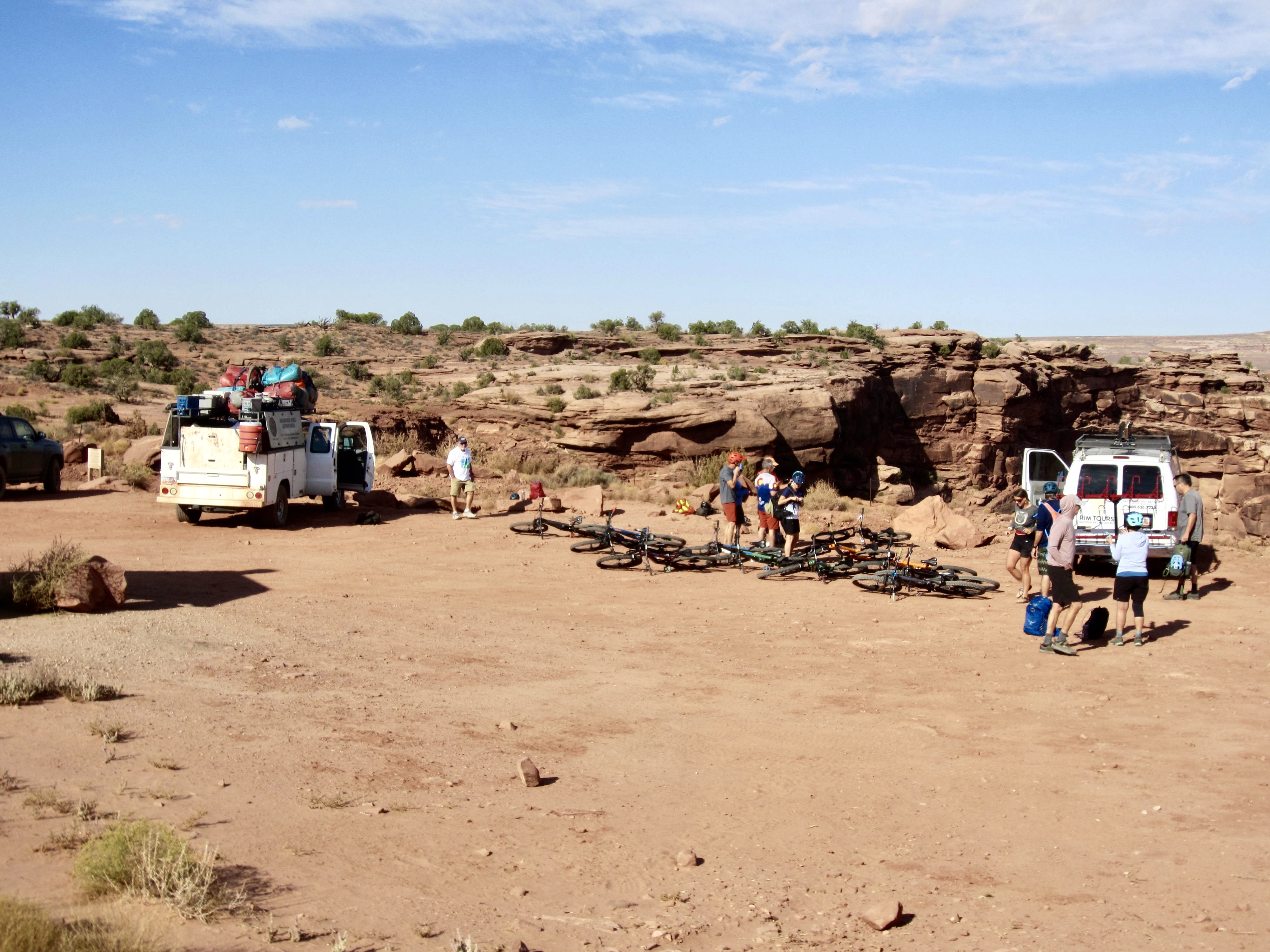
We all met at the Rim Tours office in Moab to check in and get assigned any rental gear. All of our rental bikes were high-quality Santa Cruz models with carbon-fiber frames—much better than my own bike at home. We racked up the bikes, piled into a van, and drove out Mineral Road to the upper parking lot. Upon arriving, it was discovered that Debra’s rental bike had fallen off the rear rack! Jeff made a phone call to his office and arranged to have a new bike delivered later in the day. Meanwhile, Debra used Jeff’s bike.

.
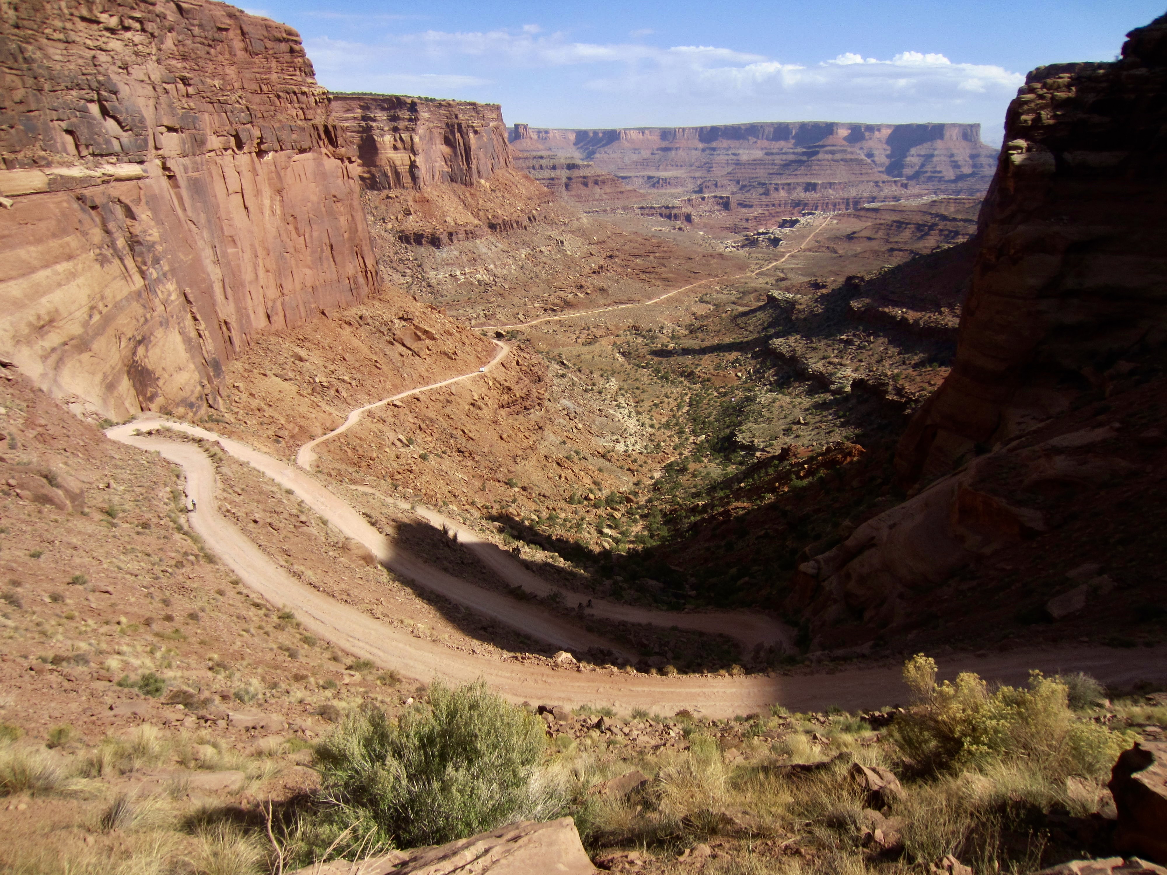
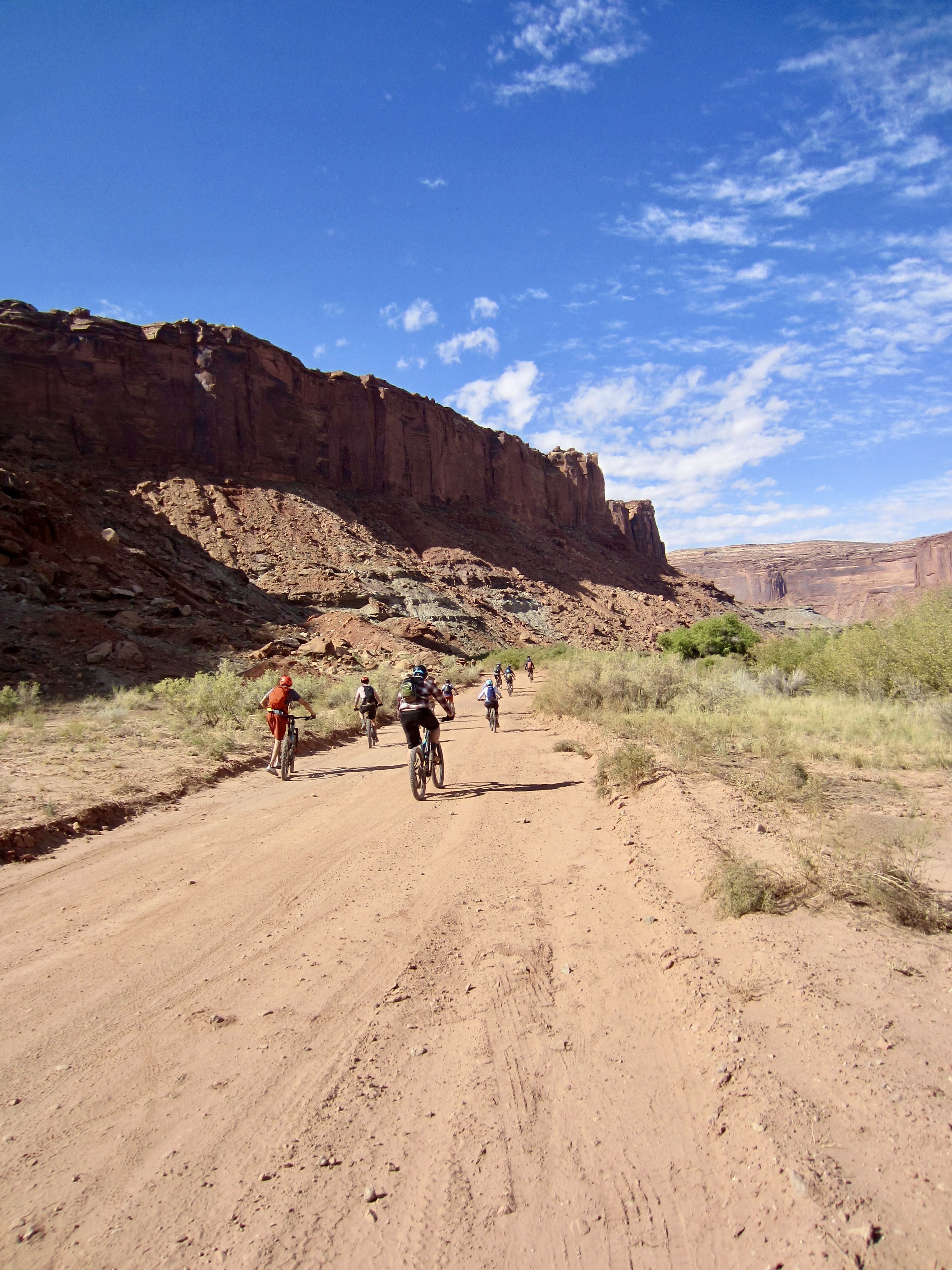
Our ride began with a steep descent of switchbacks leading down to Mineral Bottom. At a low junction, we turned onto White Rim Road and proceeded southward, closely beside the Green River. Most of the road offered enjoyable cruising on a smooth, firm surface, but there were also numerous pockets of dry, powdery dirt (silt and fine sand) along the way. These “sand bogs” would wrestle control of our front wheel, sending us weaving erratically from side to side, and would oftentimes bring us to a frustrating halt.
.
.
After several miles, we stopped at Labyrinth Camp for lunch. Jeff soon arrived in the support truck with a replacement bike for Debra. Her AWOL bike had been found beside Mineral Road in a damaged condition, but a bike-tastrophe was averted. Continuing onward, we made a steep climb over Hardscrabble Hill, which required most of us to push our bikes up the rough double-track grade. The heat and sun made this climb extra difficult. From the top, we could see the Green River cutting between Island in the Sky on the left (east) and The Maze on the right (east).
.
.
Steep switchbacks took us over the other side of Hardscrabble Hill and back down to river level. Jeff and Shelby explained that this hill lies within crumbly siltstone and mudstone formations that turn to sticky silt and clay during a heavy rain. They and other guides tell horror stories about bikers having to walk both sides of the hill, and support trucks needing to install chains to keep from sliding off the roadway!
.
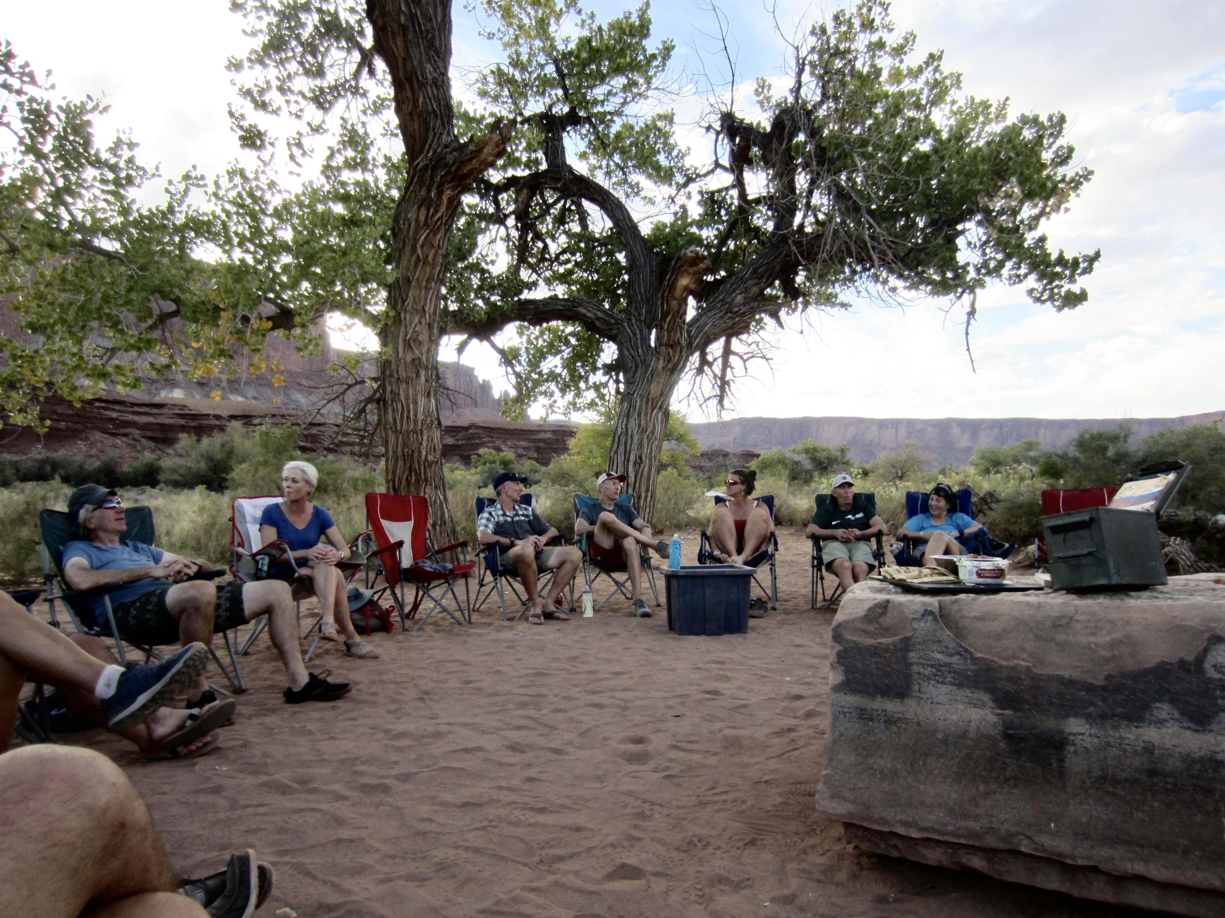
A short ride along the river brought us to Potato Bottom Camp in late afternoon. We pitched our tents among the large cottonwood trees and scrubby desert bushes, then gathered around a flat boulder for appetizers and drinks. Jeff and Shelby served up an outstanding dinner of blackened pork with grilled vegetables and pasta–my favorite meal of the whole trip.
.
Approximate Day 1 Stats: 5.2 hours elapsed; 13 miles traveled; 600 feet gained; 1500 feet lost.
Day 2: Potato Bottom Camp to Murphy Camp
Following an overcast night with rain sprinkles, we awoke to partly cloudy skies and hopes for slightly cooler weather. Today’s task involved a 22-mile ride with a net gain of 1300 feet to reach Murphy Hogback. It began as a relatively flat ride along the Green River guided by Shelby, while Jeff drove the truck. We were now officially riding on White Rim, and Shelby planned for several stops to show us a few interesting features along the road.
.
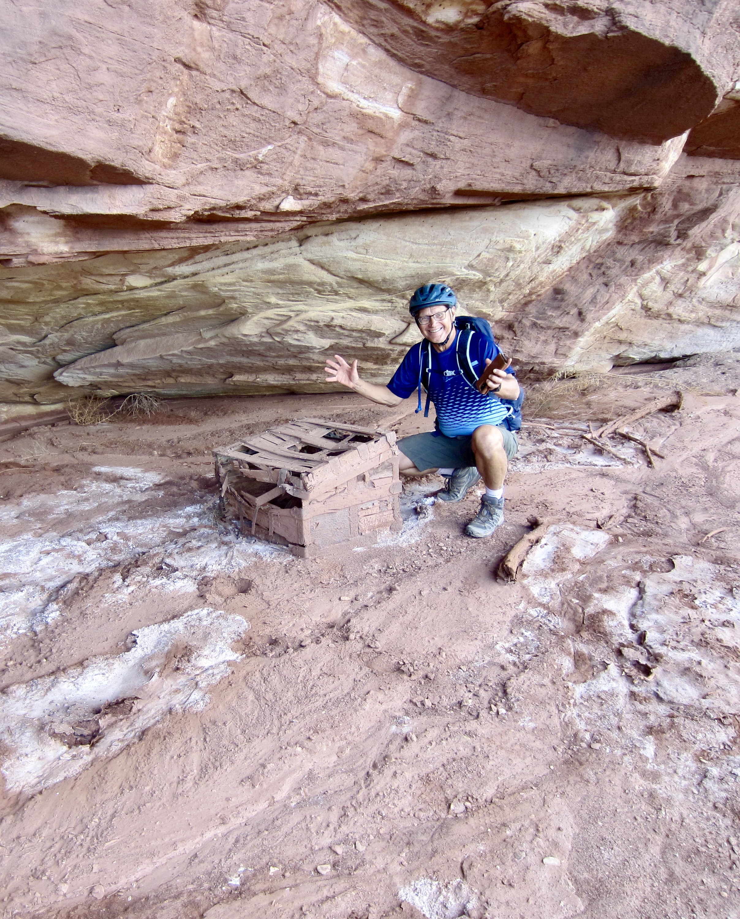
Our first stop was at a nondescript rock outcrop close to the river. Shelby led us down the outcrop and over to a dilapidated chest tucked under a large overhang. This chest was placed here in the early 1900s by Art Murray, a local cattle rancher. Unfortunately, we were a century too late to nab any good booty.
.
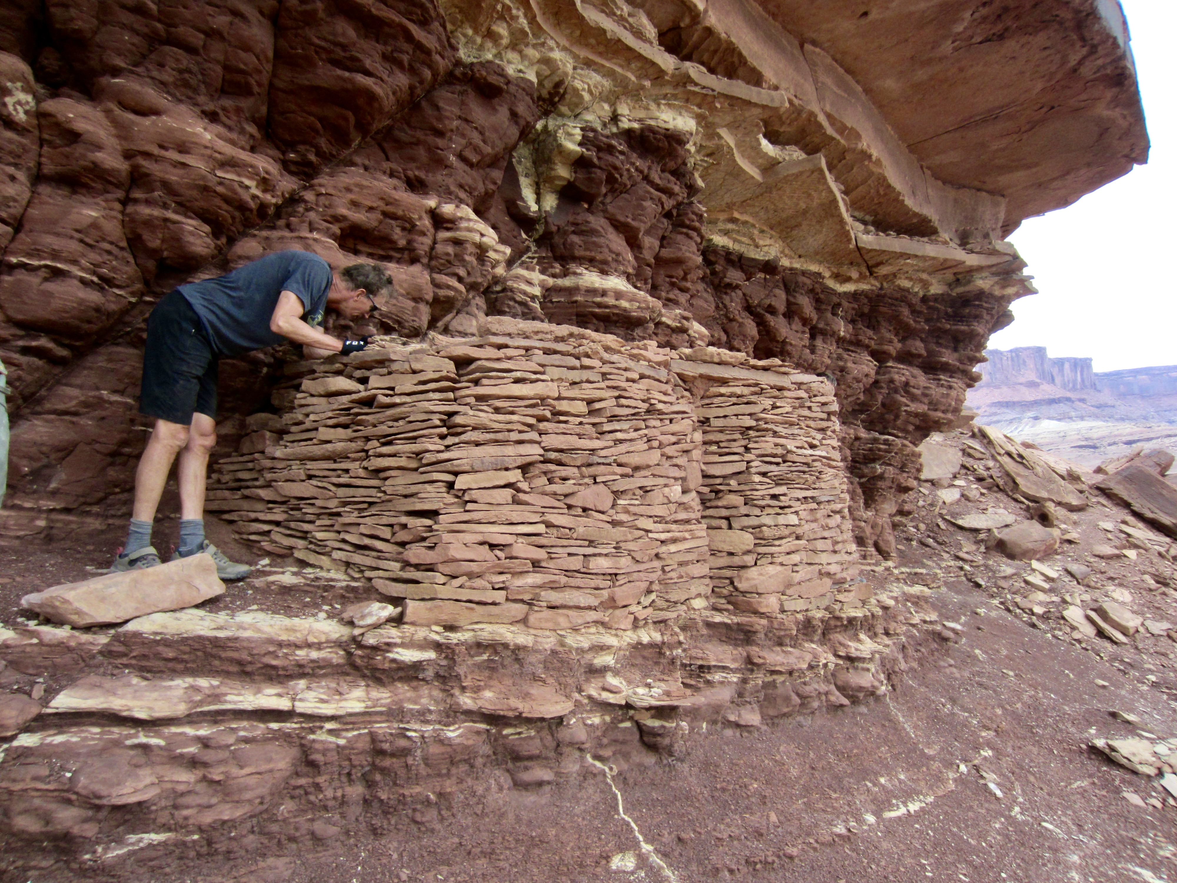
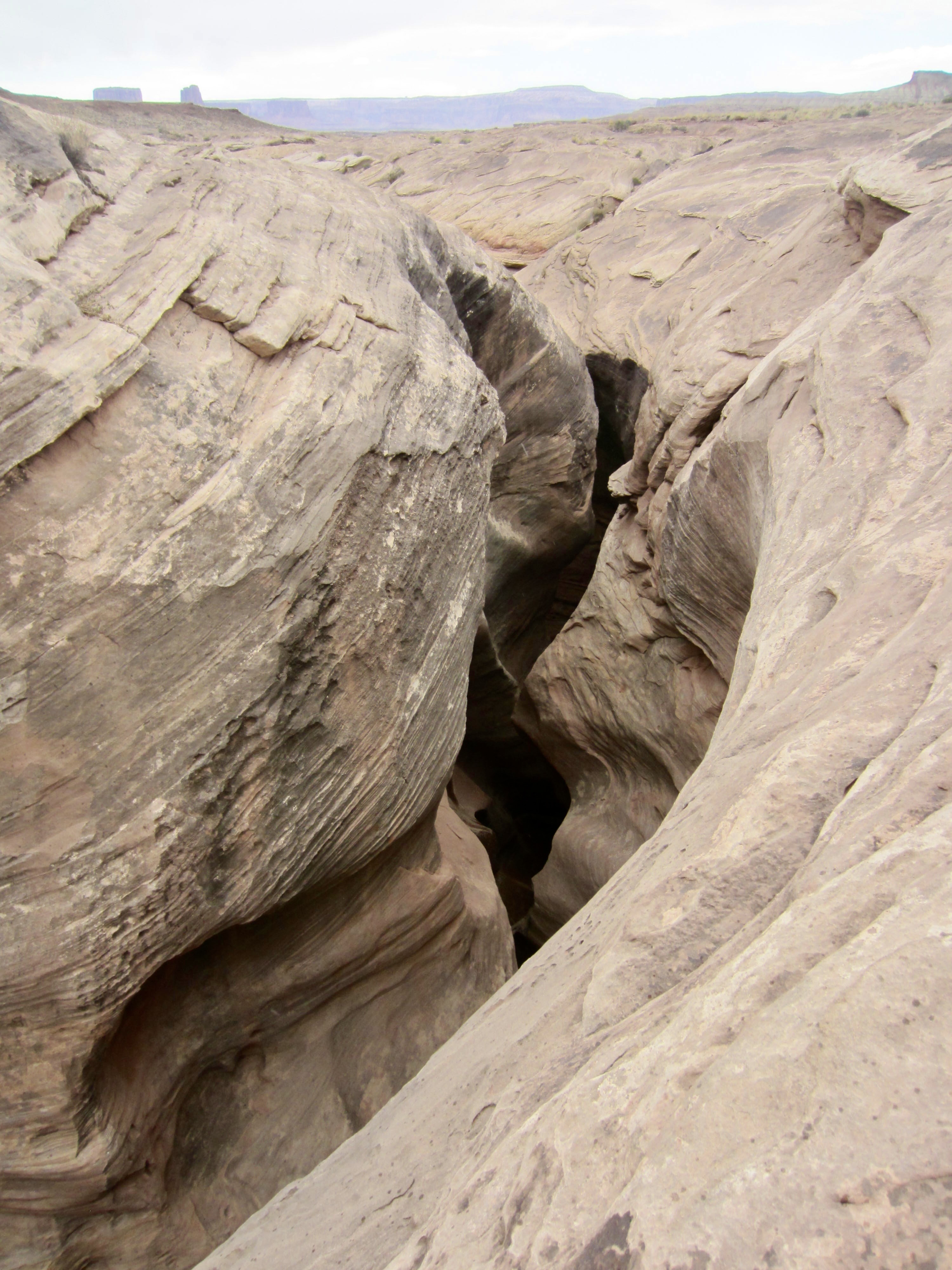
Our next stop required a short hike uphill to examine an ancient granary built by Pueblo Indians. This interesting stone structure was used to store grains after a harvest. A bit farther down the road, we stopped at Holeman Slot, a twisty slot canyon that slices through the White Rim Sandstone.
.
Our weather was indeed a bit cooler today than yesterday, which gave some relief from the fact that we were gradually climbing all day. However, there was still an incessant series of sand bogs that made the ride considerably more tiring. One rider accurately described them as “soul sucking.” Our only defense was to make frequent stops along the way.

.
Shortly after noon, we crossed over a low but steep rock rib and descended toward our planned lunch spot at Black Crack. Misfortune reared its ugly head during this descent, as Lisa inadvertently locked her front brake and went flying over the handlebars. She was badly shaken up and came away with a lacerated chin, a slightly separated shoulder, a mild concussion, and assorted scratches. We escorted her down to the lunch spot, where Shelby got her bandaged up. She spent the next two days riding in the support truck.

.
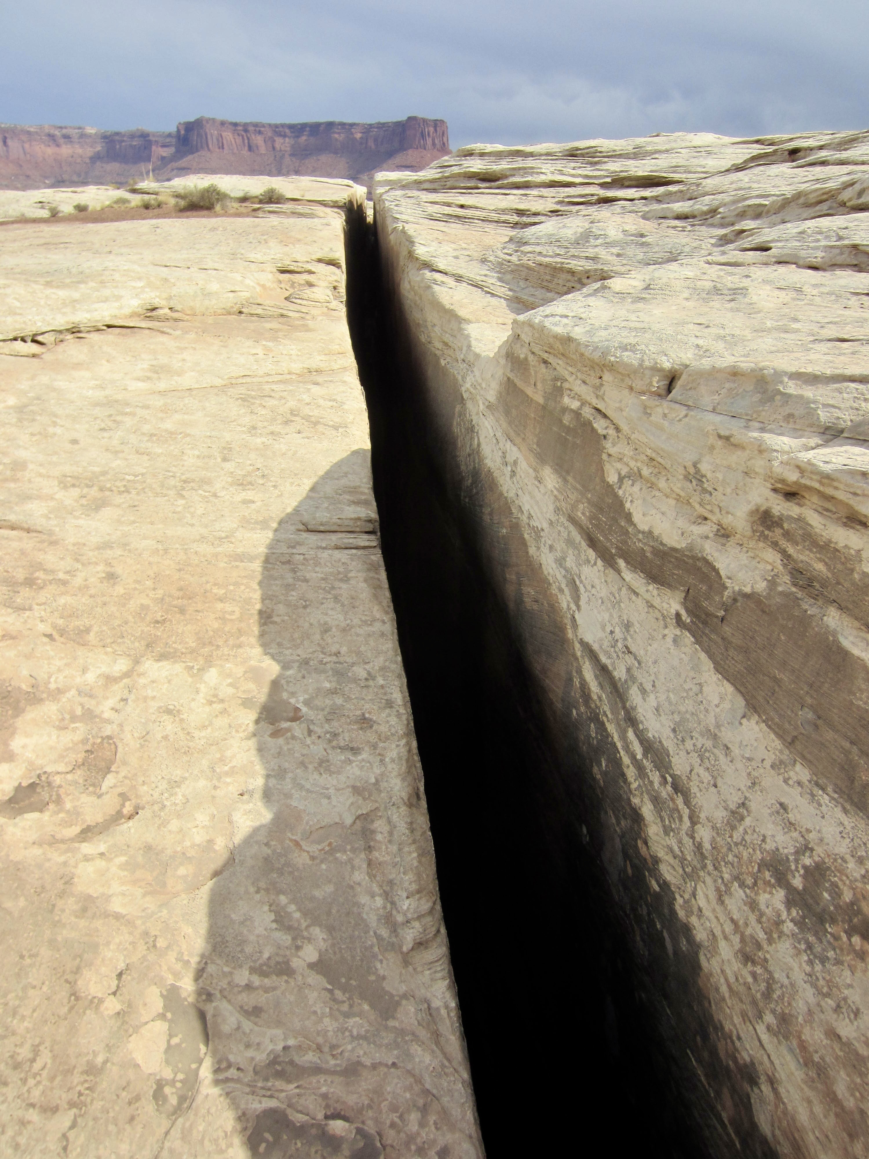
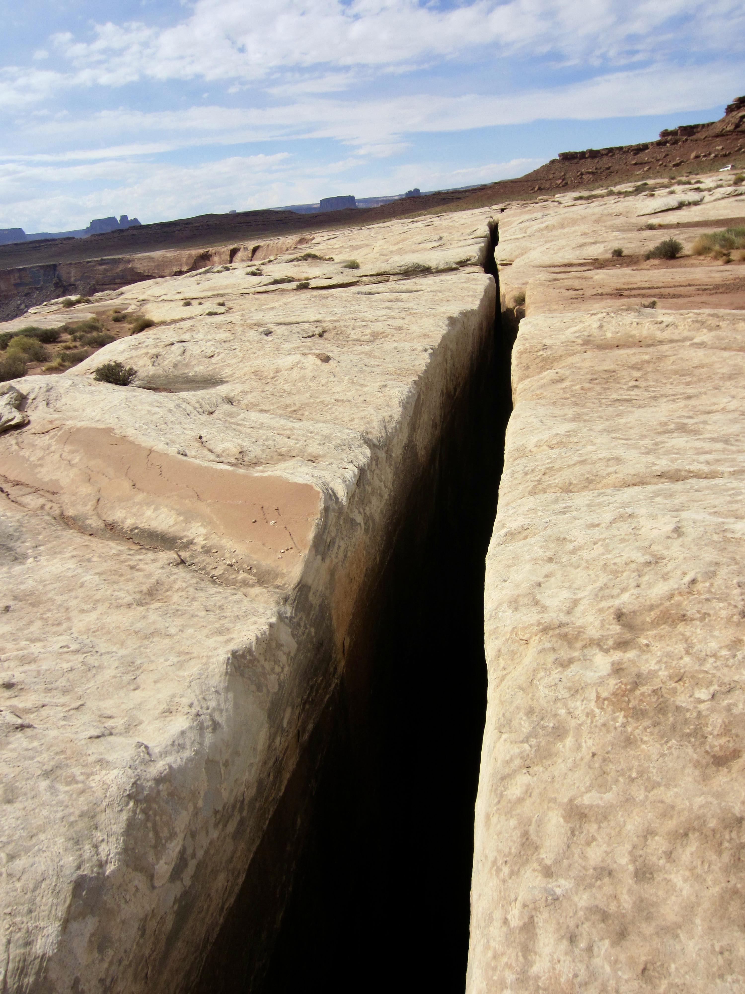
Adjacent to our lunch spot was a fascinating geologic feature known as Black Crack. This earthquake-generated fissure runs through the White Rim Sandstone for hundreds of yards but never gets more than 2 or 3 feet wide. It extends downward for an unknown depth, disappearing into eerie blackness. The thought of falling into this crack sent a shiver up my spine!
.
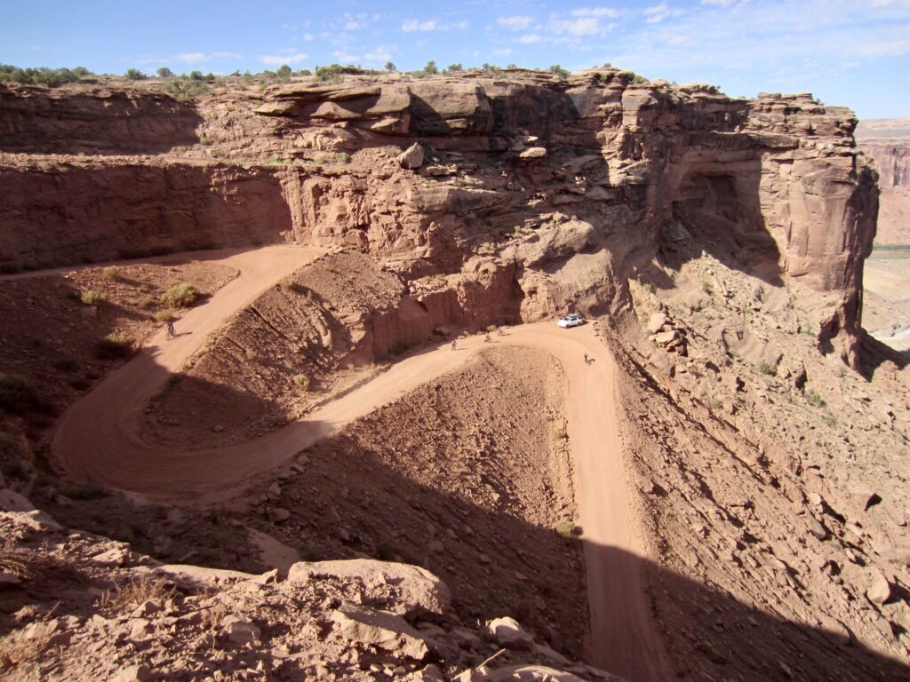
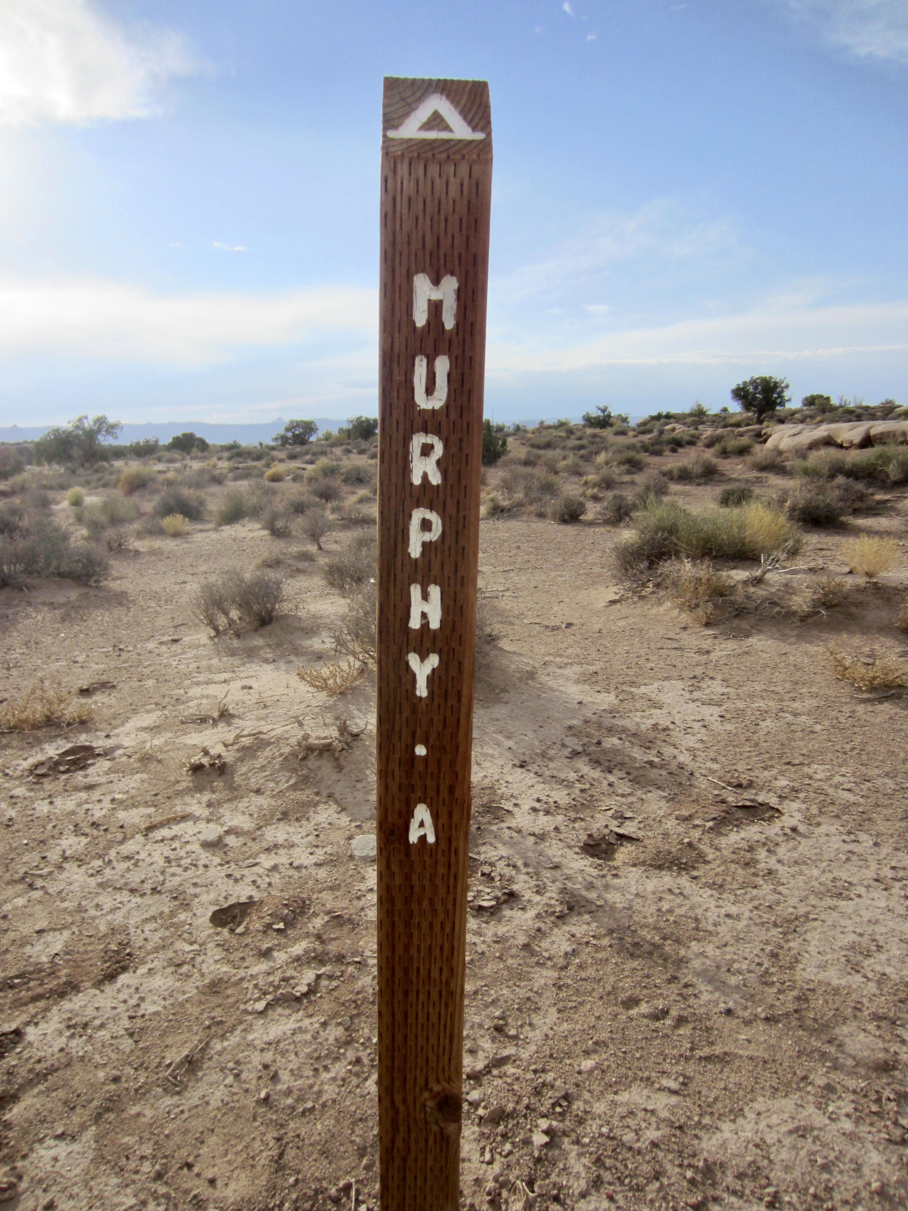
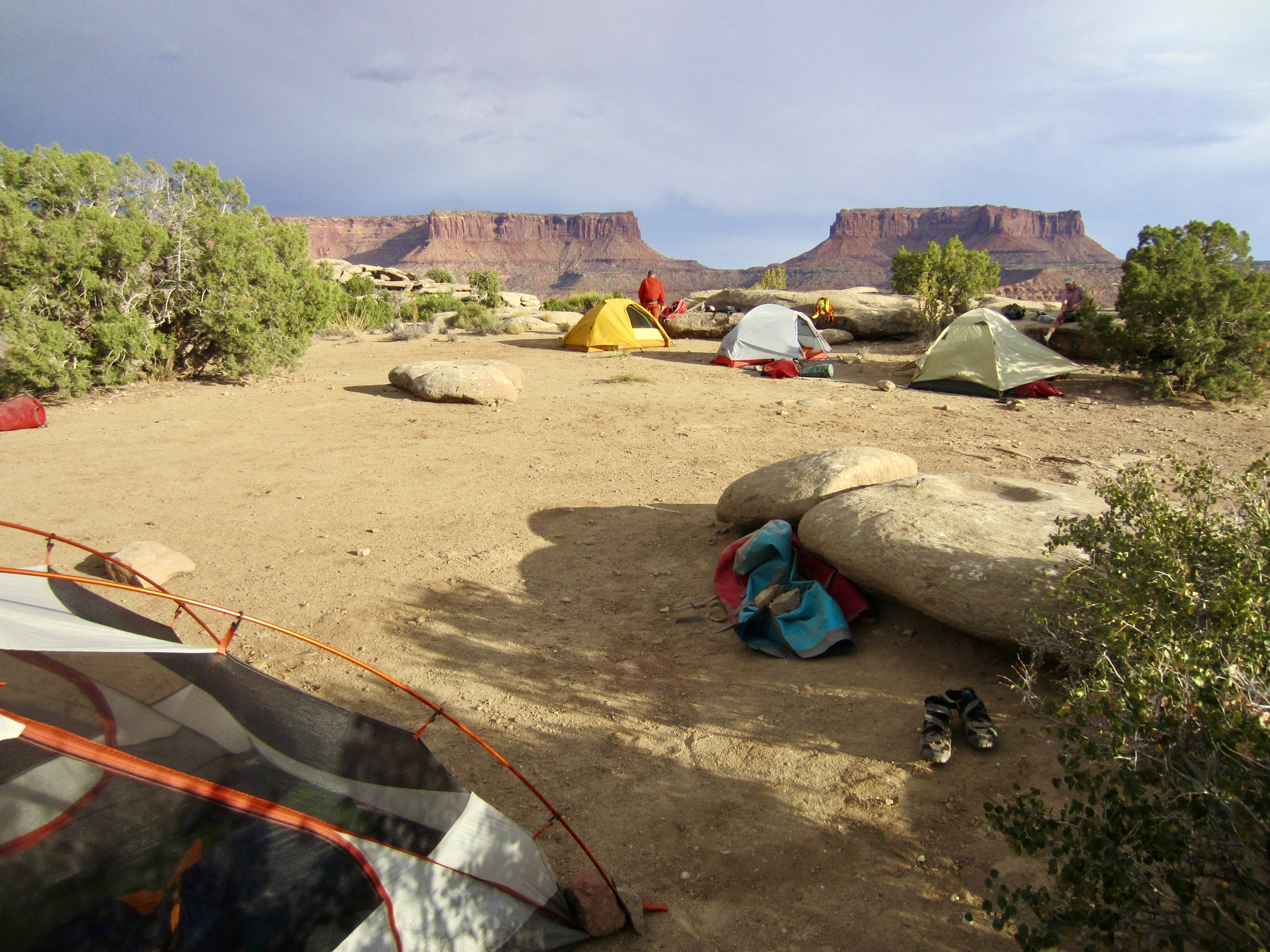
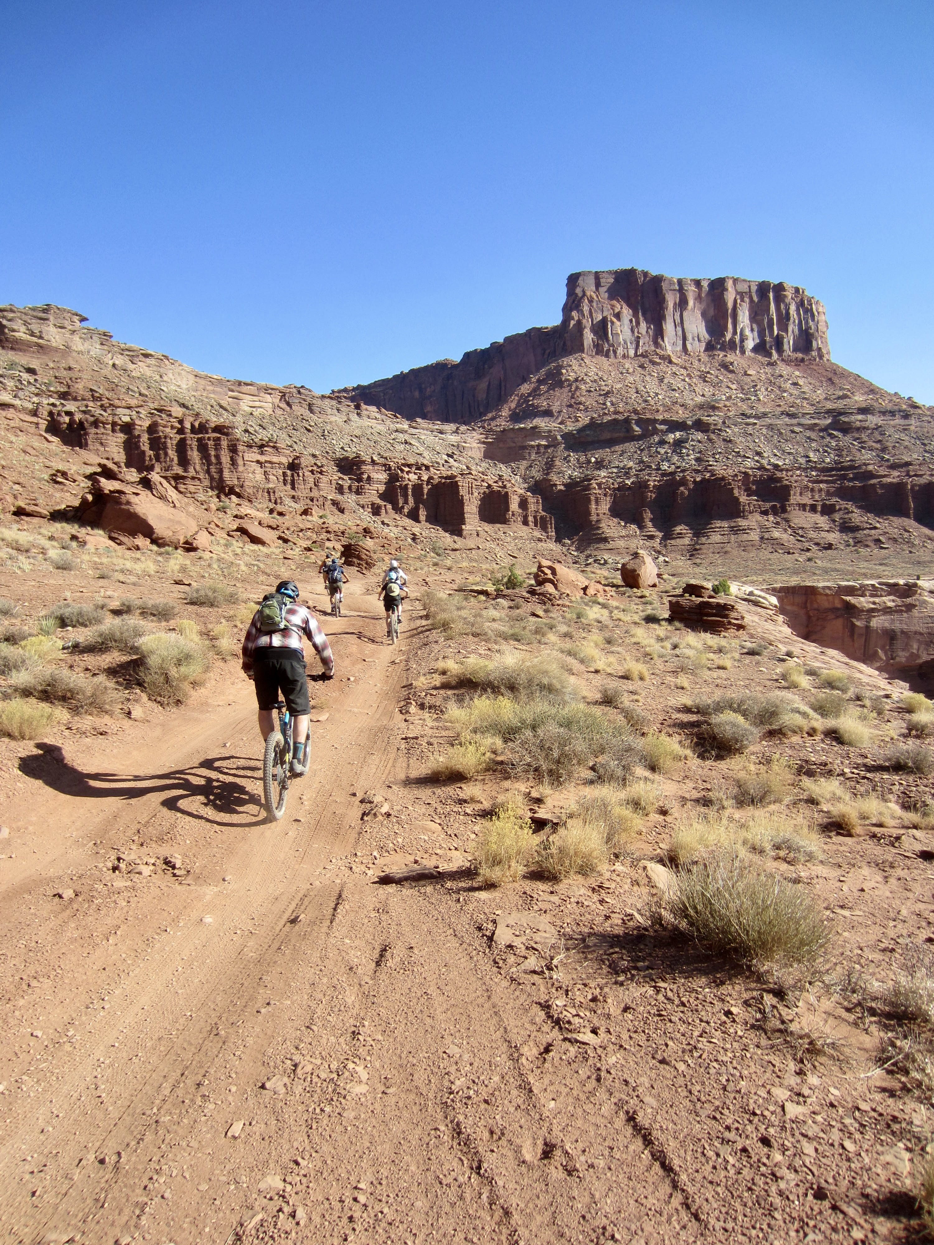
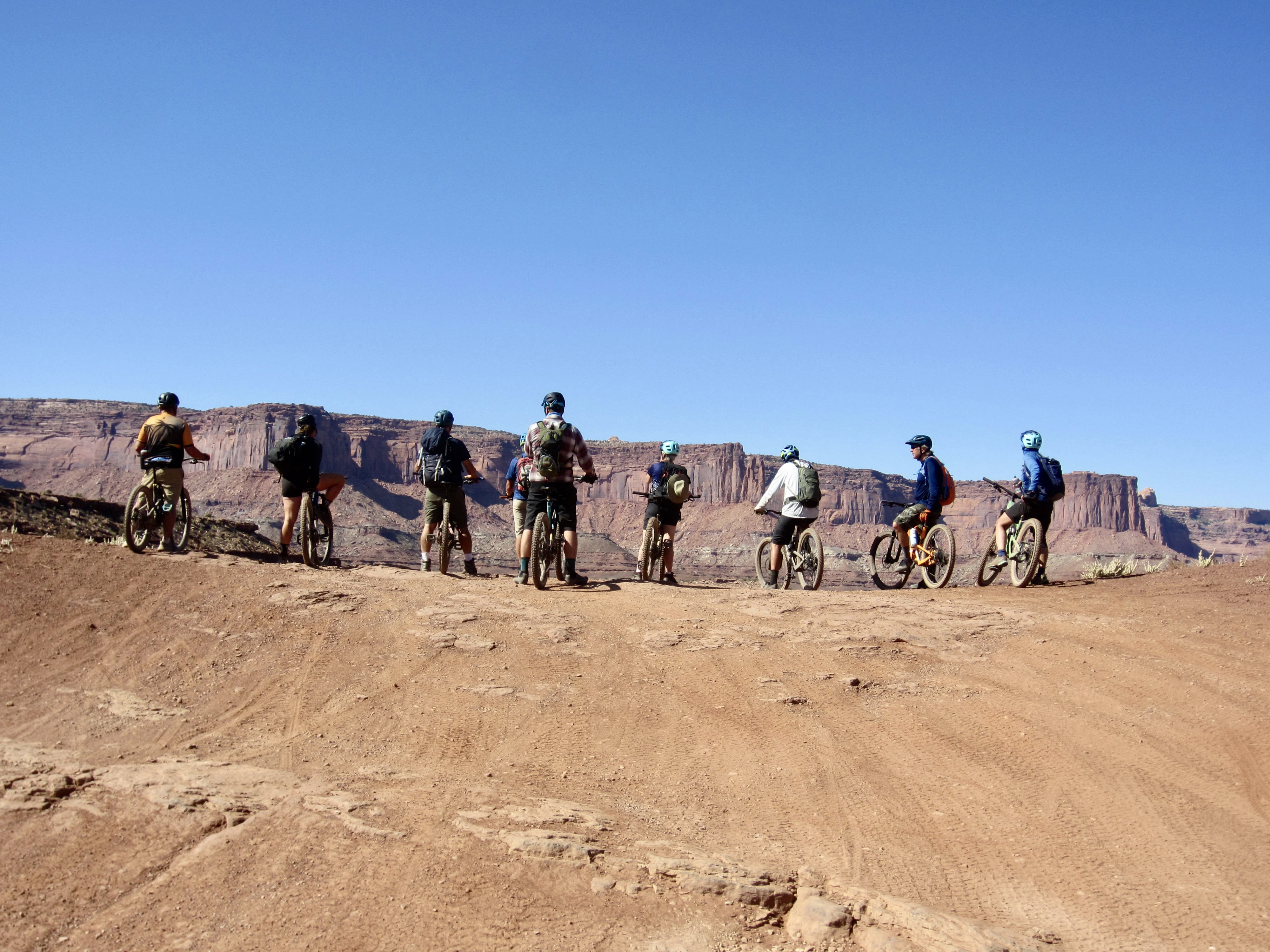
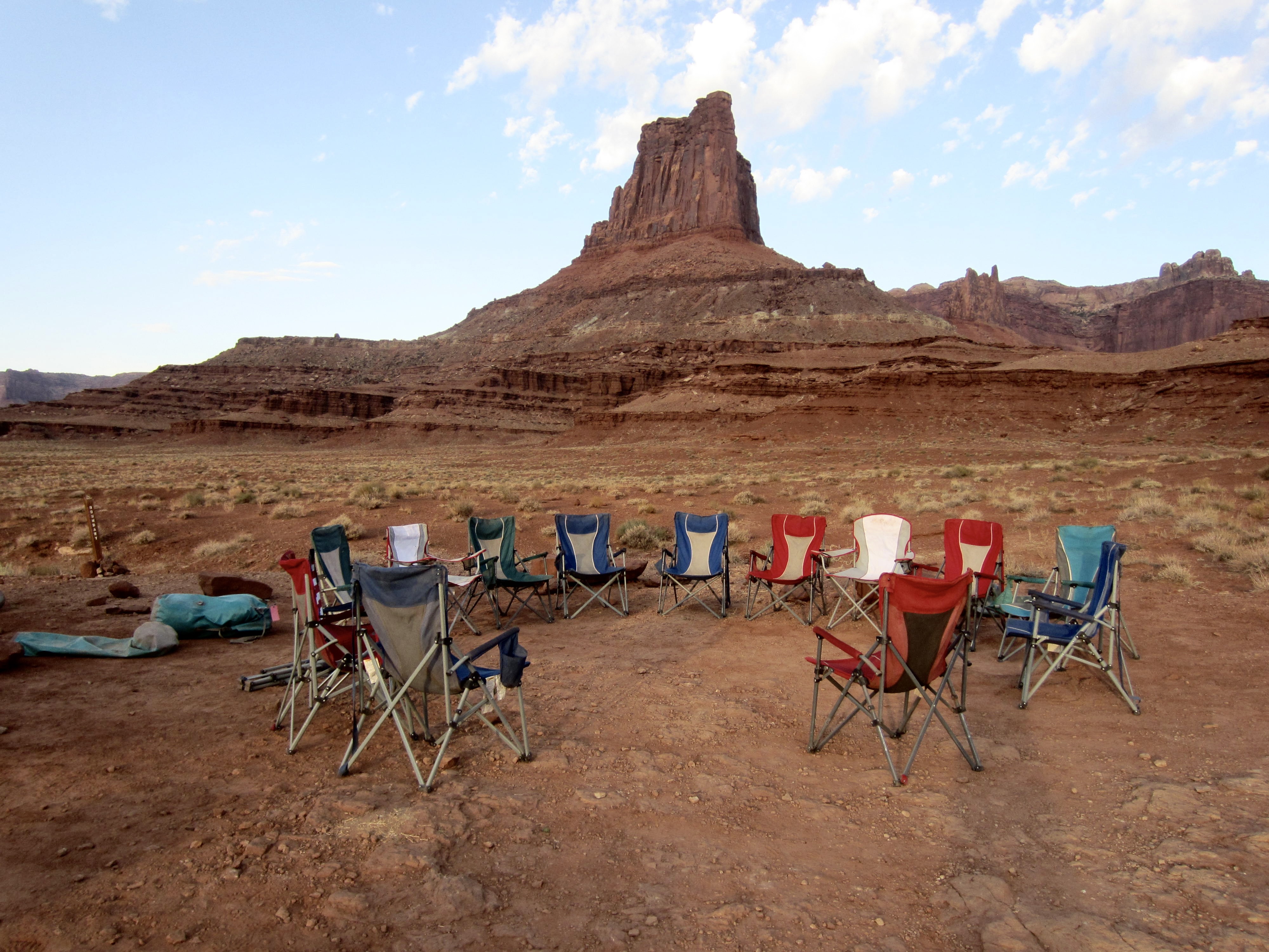
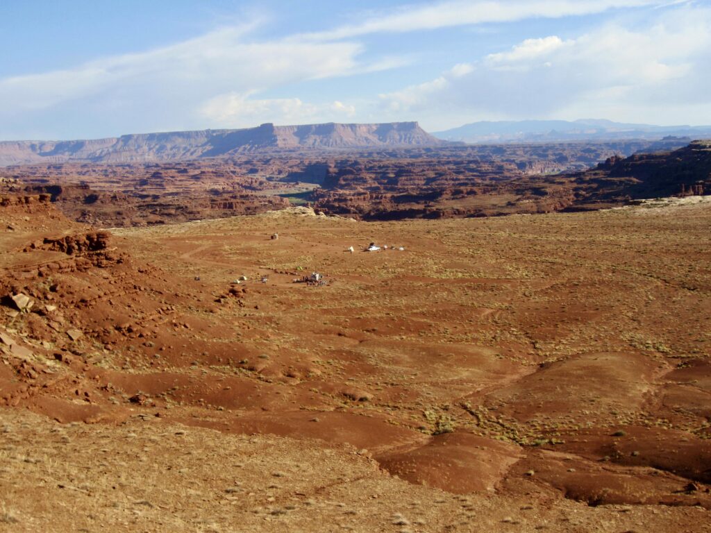
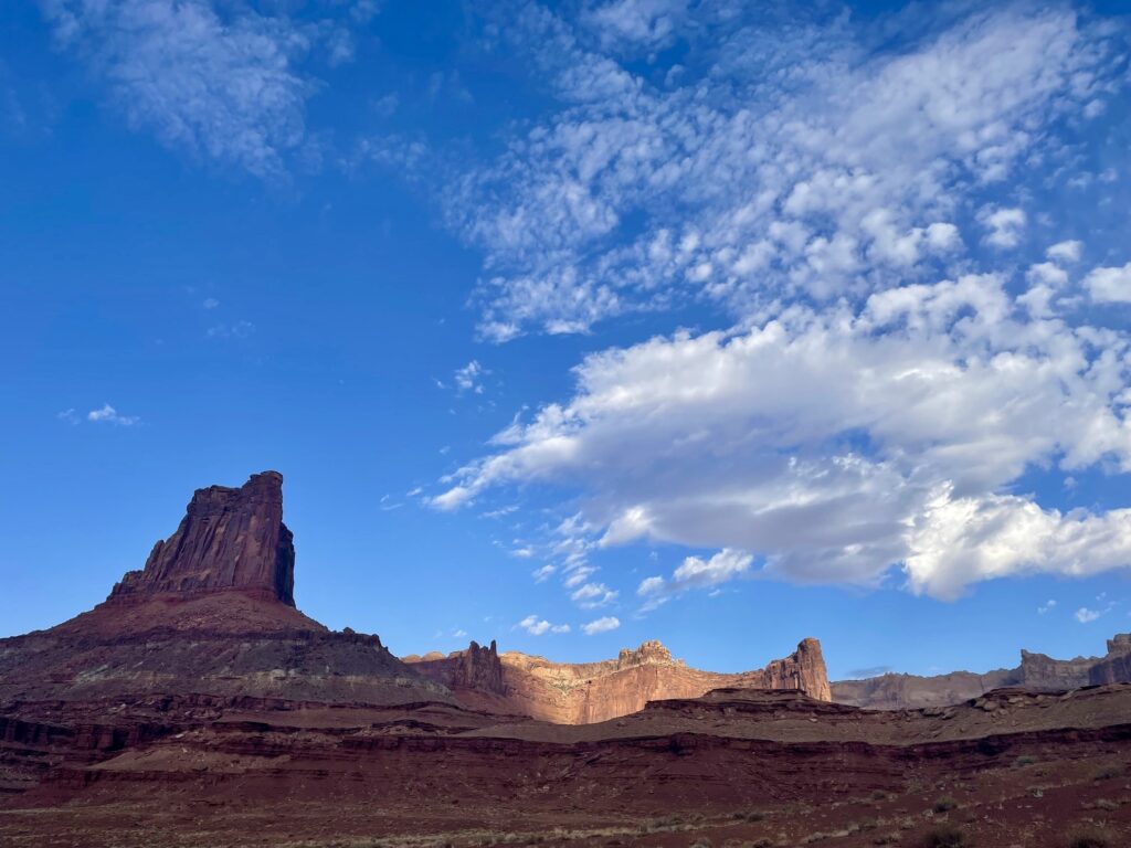
Our day ended with a steep climb up Murphy Hogback, which marks the highest point on White Rim Road proper. The climb gains 500 feet over a mile of rough roadway and required lots of bike pushing. Upon reaching the top, we cruised over to Murphy Camp. This 5250-foot campsite offers a large area of flat ground and a sweeping view of the Green River Valley. For obvious reasons, Murphy Camp is a favorite of the biking guides.
.
.
A stiff wind was blowing across the hogback as we all pitched our tents, but the rest of the night was surprisingly calm. Jeff and Shelby laid out an impressive taco bar for dinner. As we munched on our tacos in perfect weather at this marvelous location, Jeff informed us that we were all becoming spoiled brats. We couldn’t disagree.
Approximate Day 2 Stats (including sidetrips): 7.0 hours elapsed; 22 miles traveled; 1900 feet gained; 600 feet lost.
Day 3: Murphy Camp to Airport Camp
After two hot days of riding through countless sand bogs and up some steep hills, we were delighted to hear that today would be cooler, that the road would be better, and that the ride would be mostly downhill. Of course, we first needed to get off Murphy Hogback. This involved a dicey 500-foot descent on a rocky, rutted roadway. Once everyone was safely down, we shifted into cruise mode and enjoyed 25 miles of splendid riding conditions.
.
.
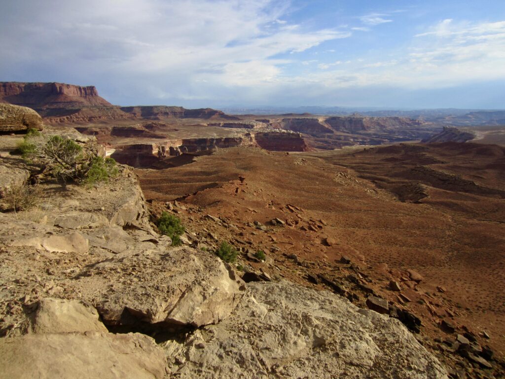
Our morning ride brought us down to White Crack Junction, which marks the turning point of the “V” scribed by White Rim Road. Up to now, we had been generally heading southeastward, but for the rest of ride, we would be generally heading northeastward. This new direction took us around the head of Monument Basin, which features many intriguing rock pinnacles and the famous Keyhole.
.

.
After 15 miles, we stopped for lunch at Gooseberry Camp. The day was heating up now, so we all clustered in the shade of a lone juniper tree—much like cows in a hot pasture.
.
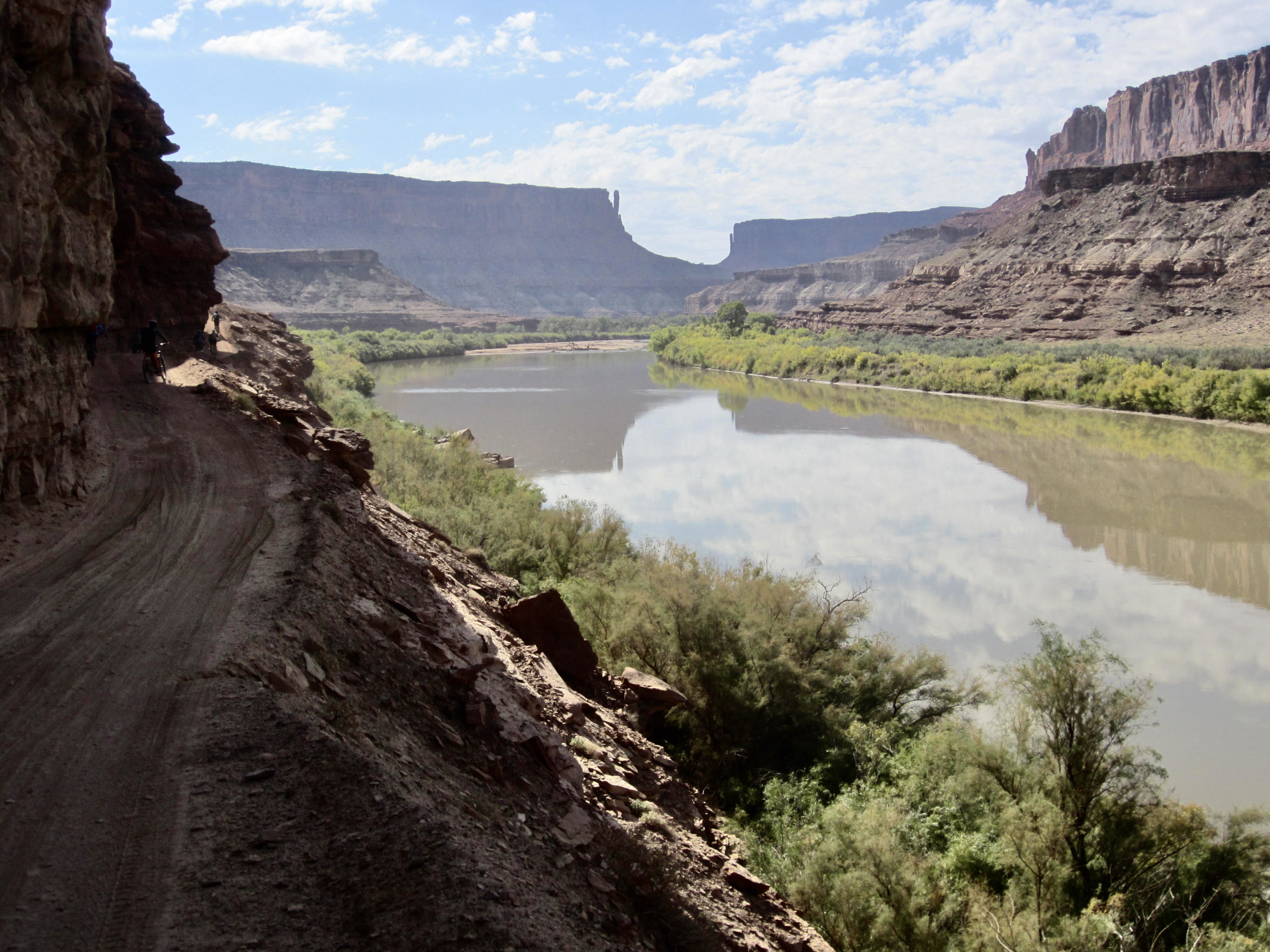
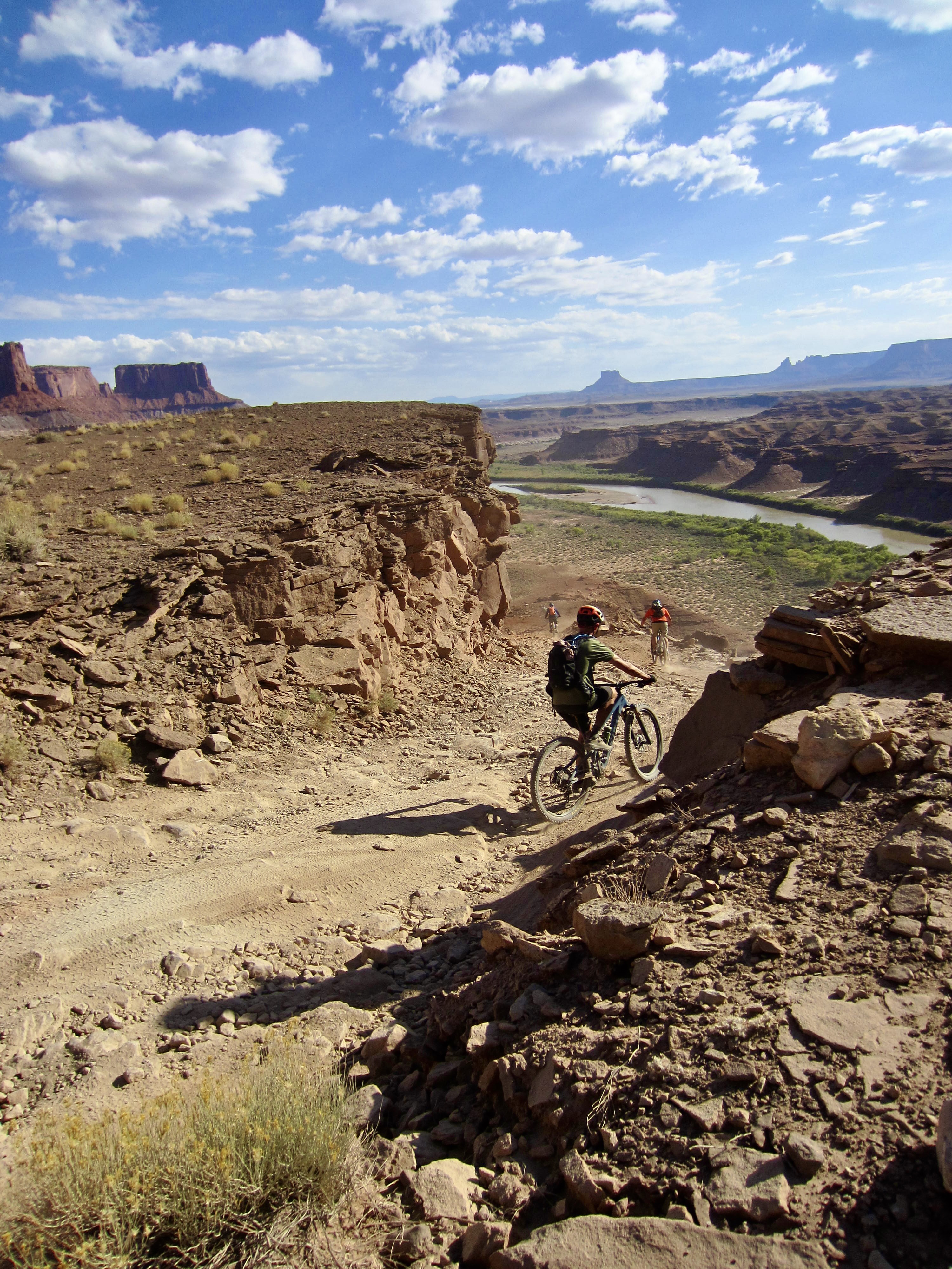
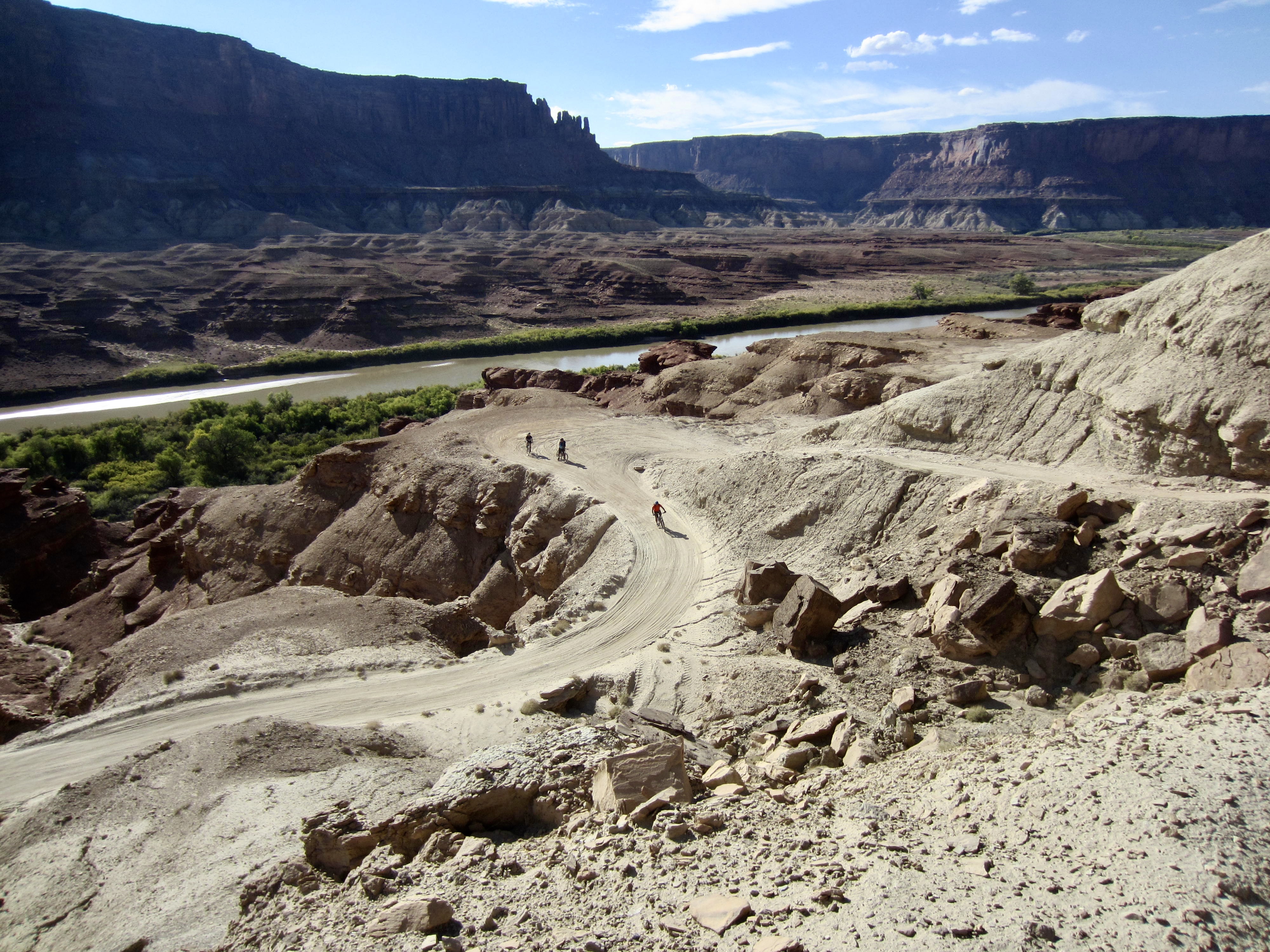
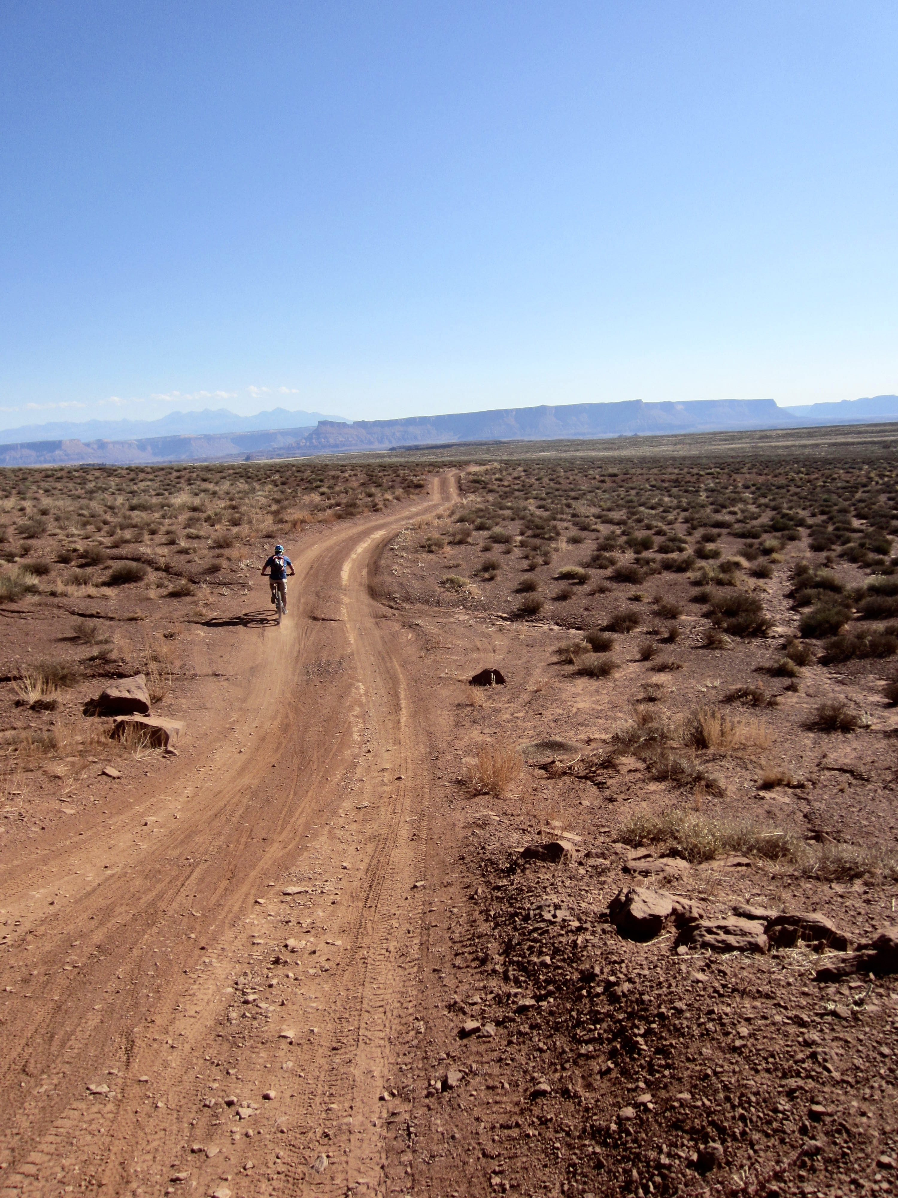
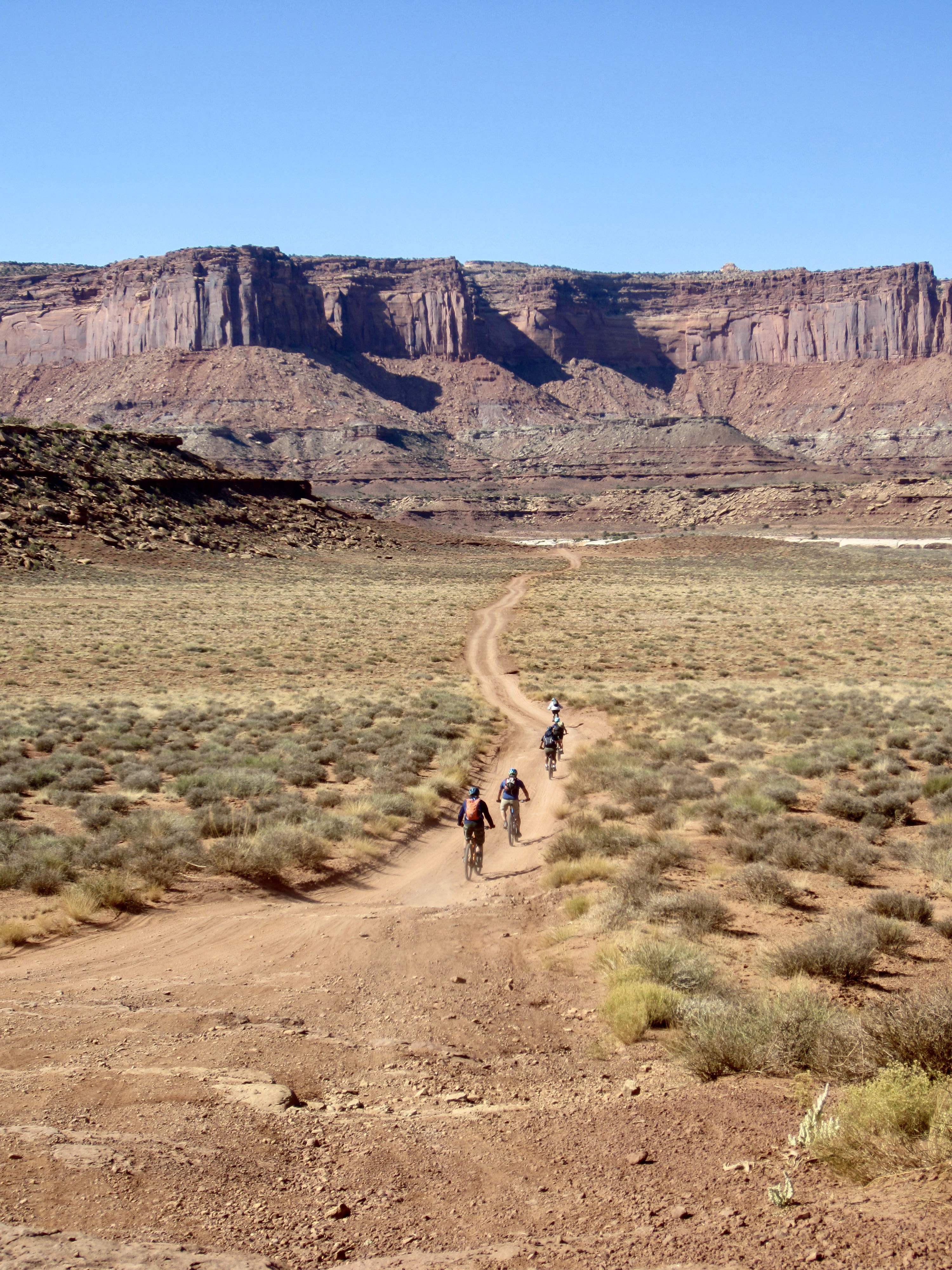
We continued down White Rim Road, roughly parallelling the Colorado River but never getting more than a glimpse of it. The terrain opened up through here, so we now felt like cowboys riding across the desert plain on our carbon-fiber steeds, accompanied by our gasoline-powered Conestoga wagon.
.
We rolled into Airport Camp in mid-afternoon under a hot sun. Maria, a staff member from Rim Tours, was waiting there when we arrived. She had driven in from Moab to pick up Lisa and Kevin. We were very sad to see them leave our group but knew that Lisa needed to have more medical care than we could provide in the field.
.
.
Airport Camp sits on a large, flat bench that formerly served as an airfield during the years of uranium mining. The view from here is dominated by Airport Tower and the scalloped walls of Island in the Sky. At night, we could see the headlights of cars driving along Grand View Point.
Approximate Day 3 Stats: 6.4 hours elapsed; 27 miles traveled; 900 feet gained; 1650 feet lost.
Day 4: Airport Camp to Shafer Canyon Viewpoint
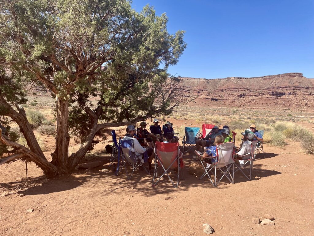
Keeping with tradition, we were all awaken at 7:00am by Jeff’s protracted call of “CAAAAHHHHH-FEEEEEEE,” indicating that the jumbo-size French press had finished steeping a gallon of java. Everybody slowly migrated over to the support truck to partake in coffee, tea, breakfast sandwiches, and our final “map talk” of the trip. It was another beautiful morning—pleasantly cool, with patchy clouds decorating a vivid blue sky.
.
.
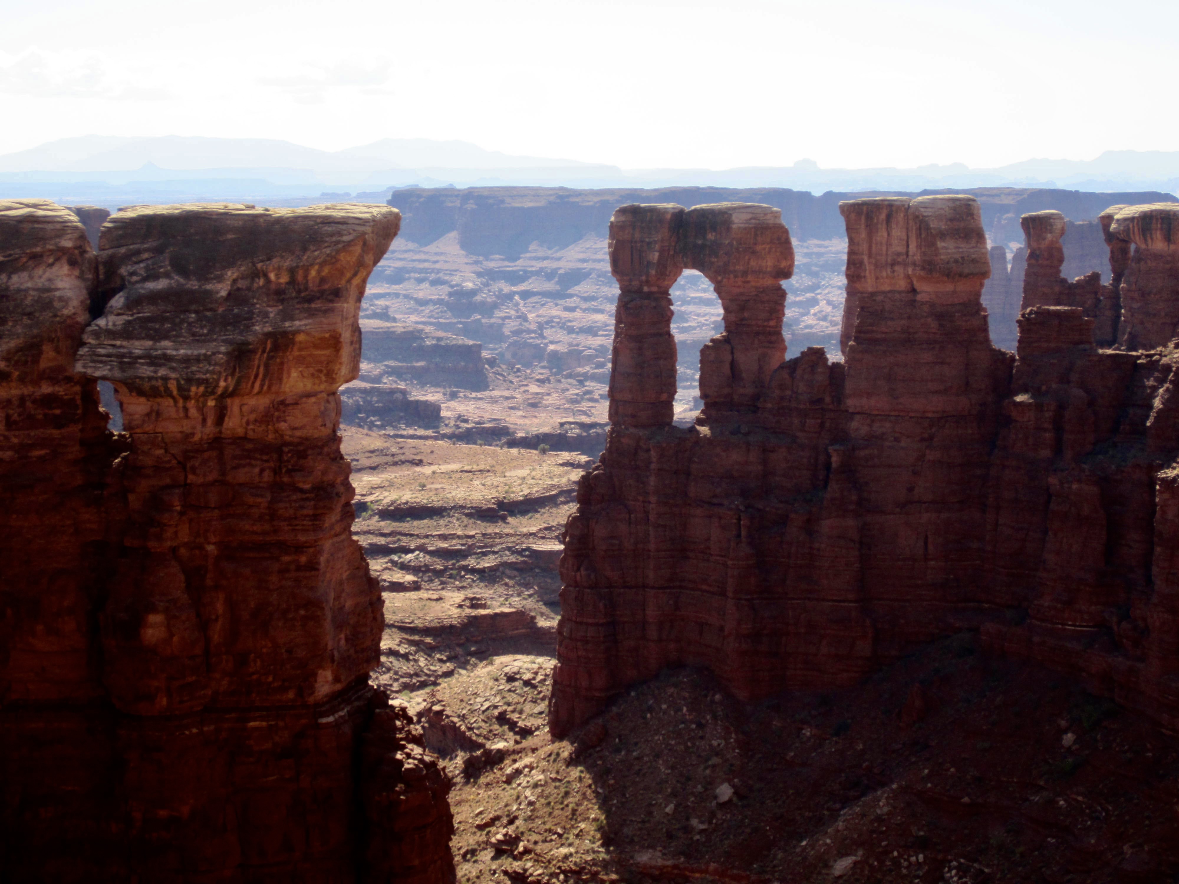
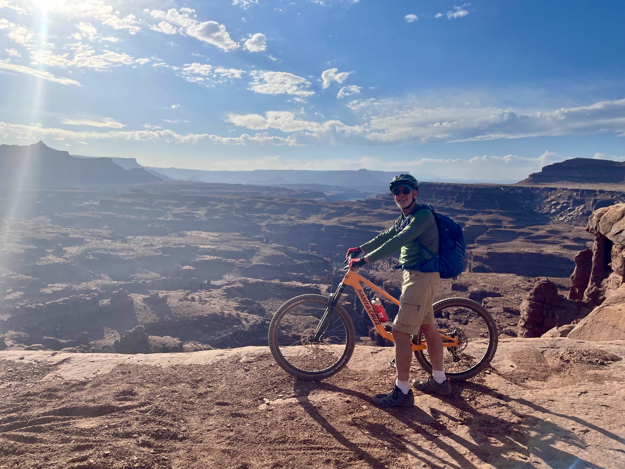
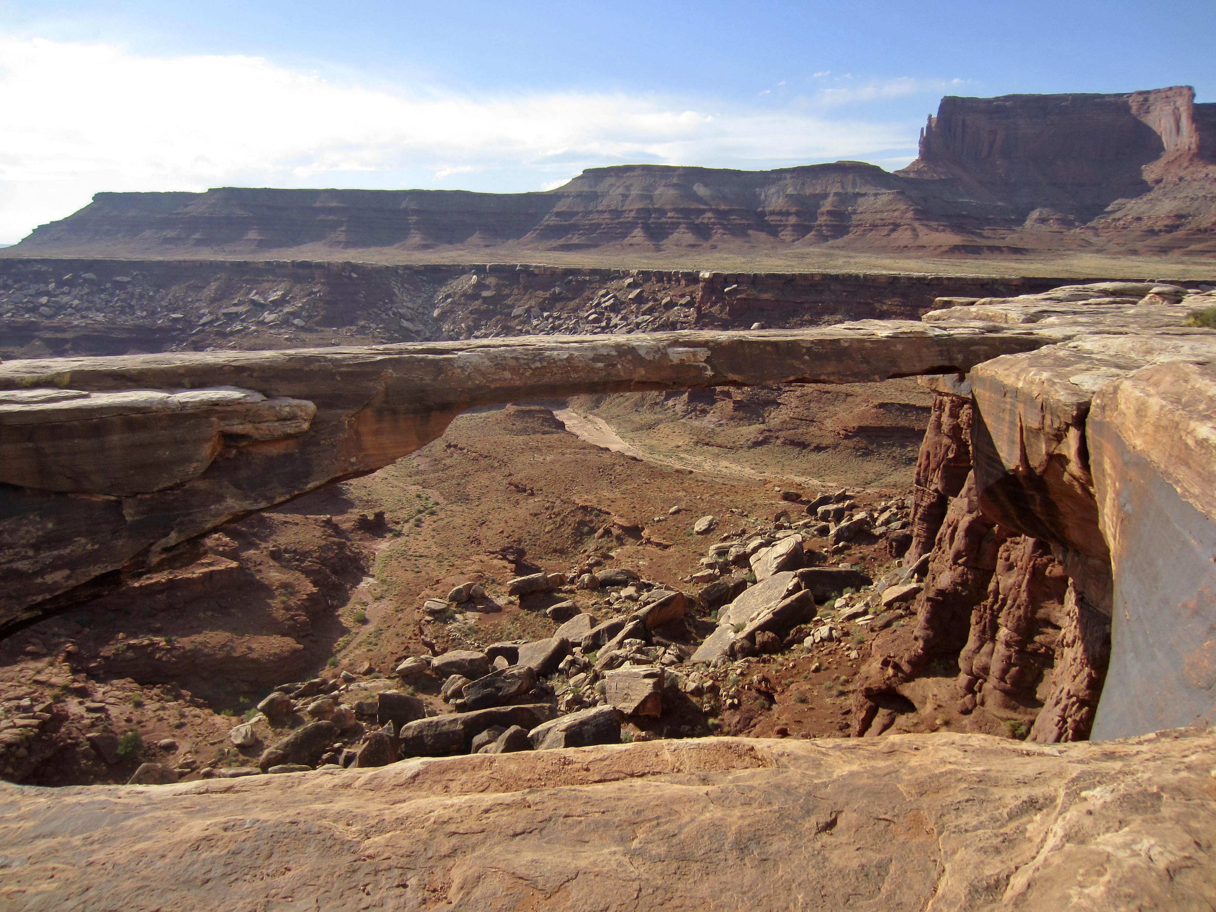
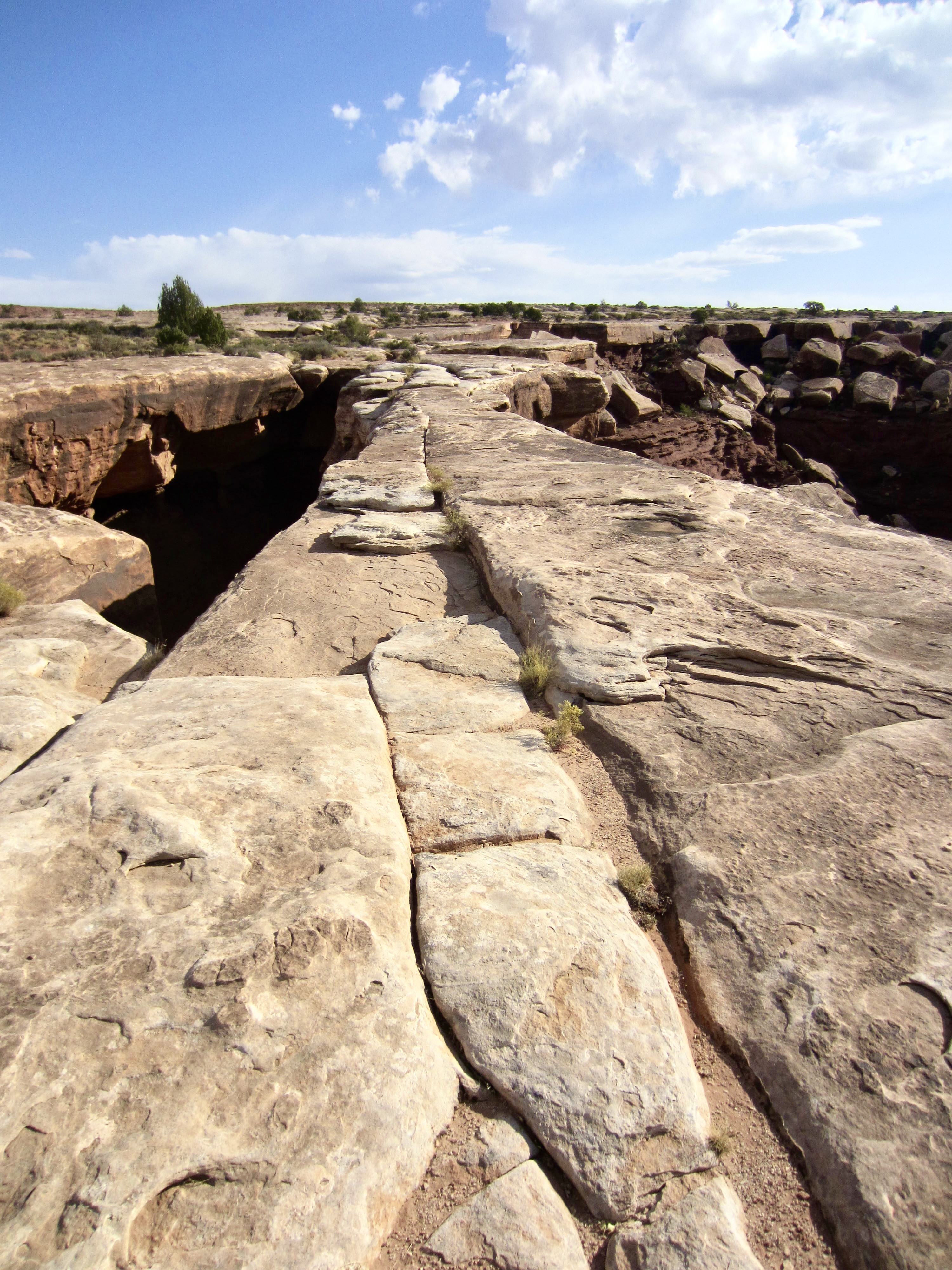
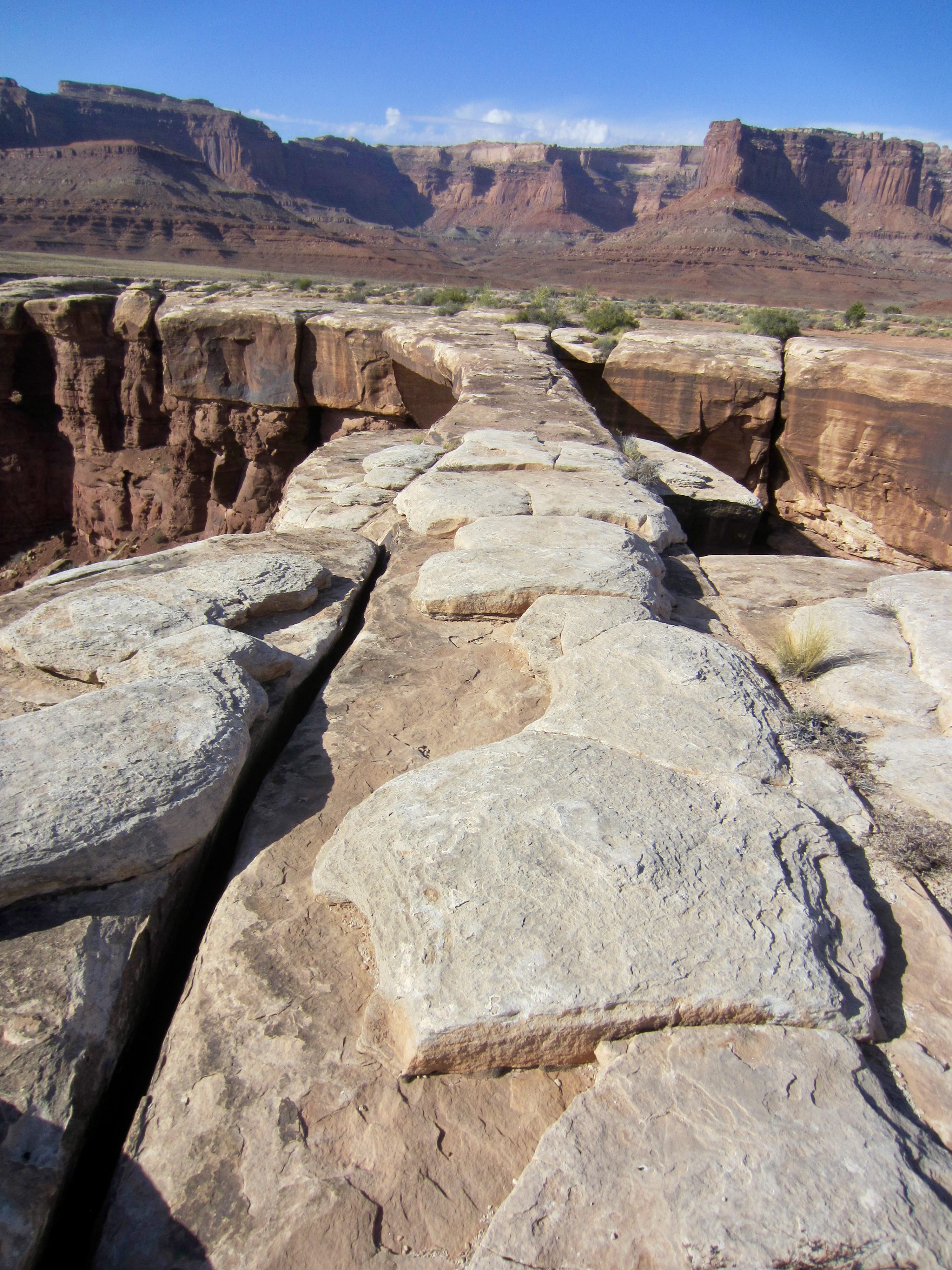
Today began with an undulating ride around Lathrop Canyon, Little Bridge Canyon, and Musselman Canyon. Our first planned stop was at Musselman Arch, a remarkably slender sandstone “girder” that spans a 120-foot-wide gap between two walls. The top is very flat and level, giving the impression of a walkway as you approach from either end. Per park regulations, pedestrians and bikes are prohibited from crossing the arch.
.

.
.
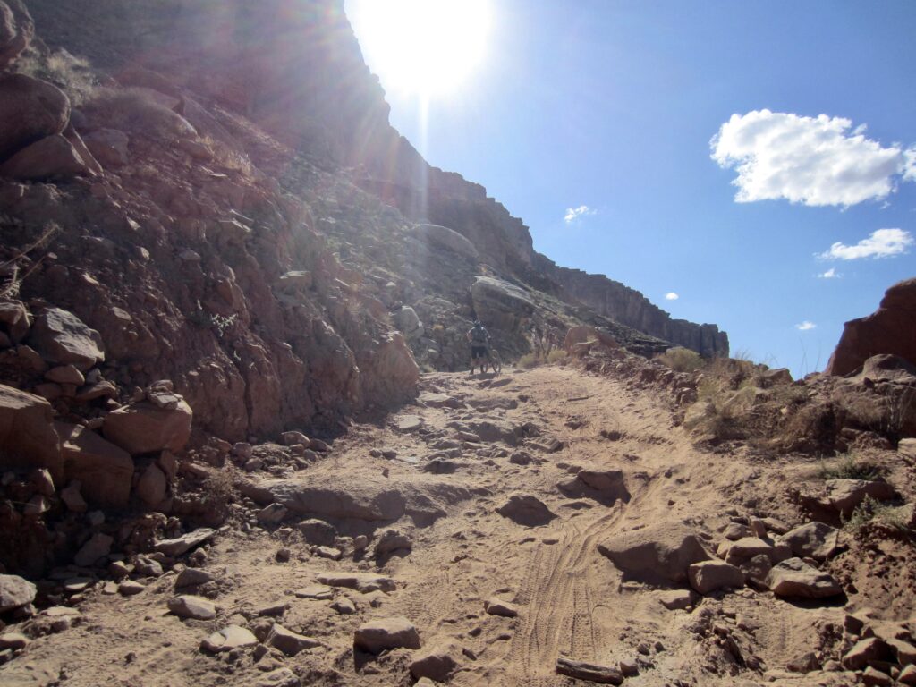
A few miles past Musselman Arch, White Rim Road curves into Shafer Canyon and formally ends at Shafer Junction. We were now staring directly at the daunting headwall of South Fork Shafer Canyon. Our last climb of the traverse was a 1300-foot ascent of this headwall via Shafer Trail Road. We had been thinking about this final challenge for the past three days, and now there was nothing left to do but grind it out. Each of us found our own cadence up the road, which switchbacks steadily upward at a moderate grade.
.

.
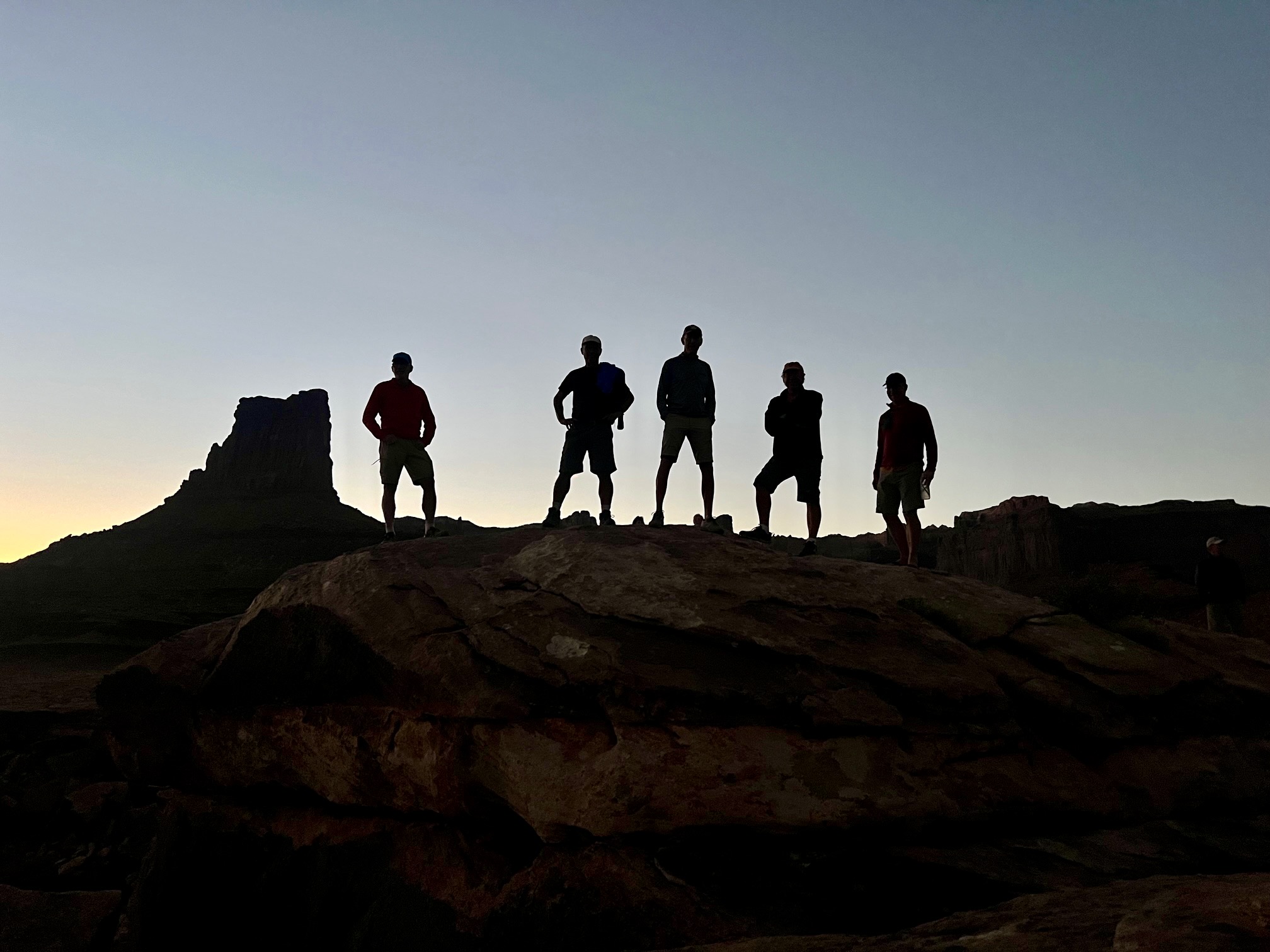
After the last switchback, Shafer Trail Road levels out and contours across a wide bench. We easily pedaled over to a viewpoint high above the canyon. Our support truck and a Rim Tours van were waiting for us there, and Shelby had laid out a final lunch spread. We all celebrated the end of an outstanding bike traverse with food, drinks, laughs, photos, and fist bumps.
.
Approximate Day 4 Stats: 3.3 hours elapsed; 15 miles traveled; 2100 feet gained; 950 feet lost.
Route Maps & Profile
…
…
…
…
Photo Gallery
Click to enlarge…