Trip Date: February 2, 2025
Weaver’s Needle Trail Circuit
Peralta Canyon
Fremont Saddle
East Boulder Canyon
Upper Black Top Mesa Pass
Needle Canyon
Terrapin Pass
Bluff Saddle
Bark’s Canyon
Trip Report Summary
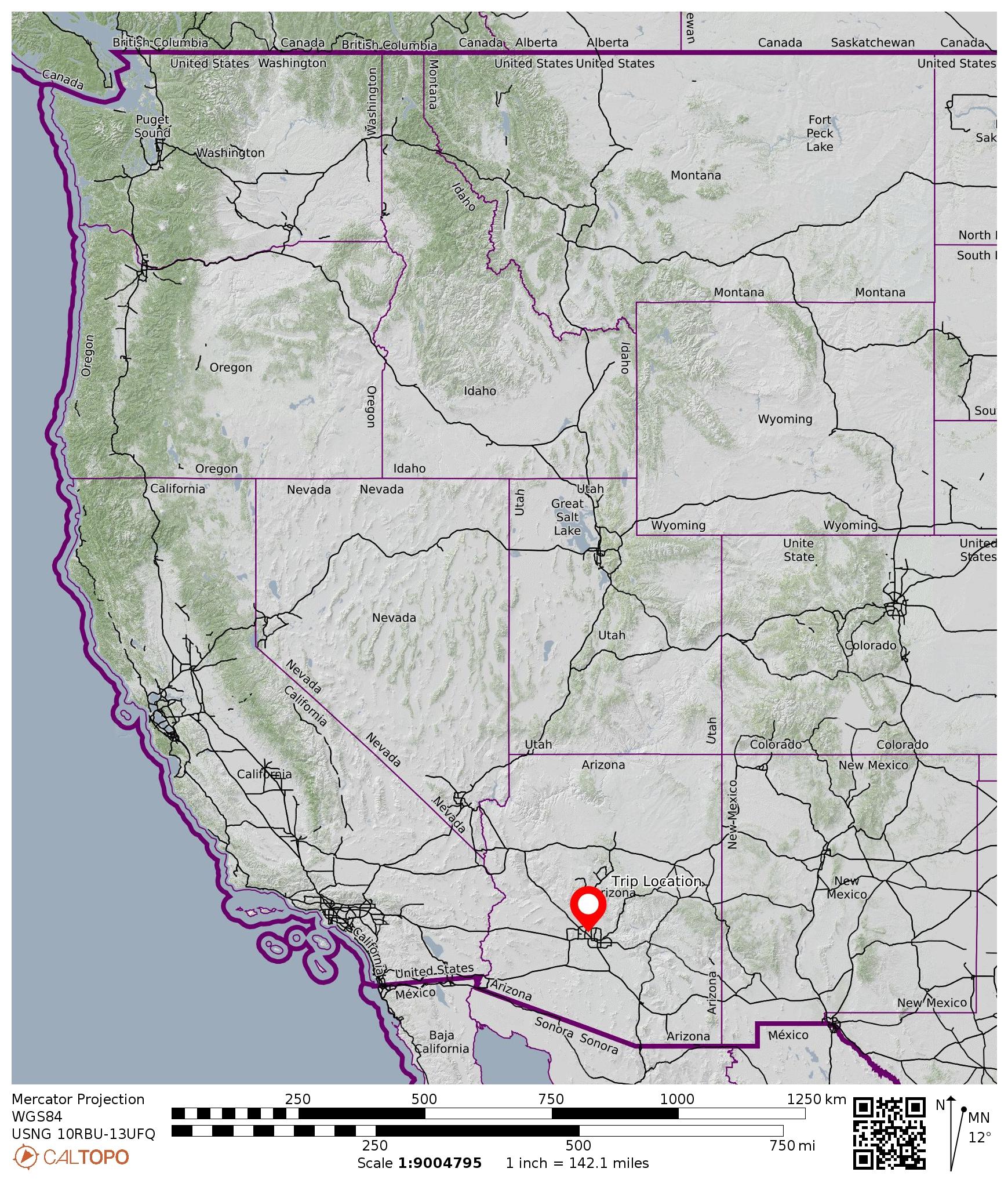
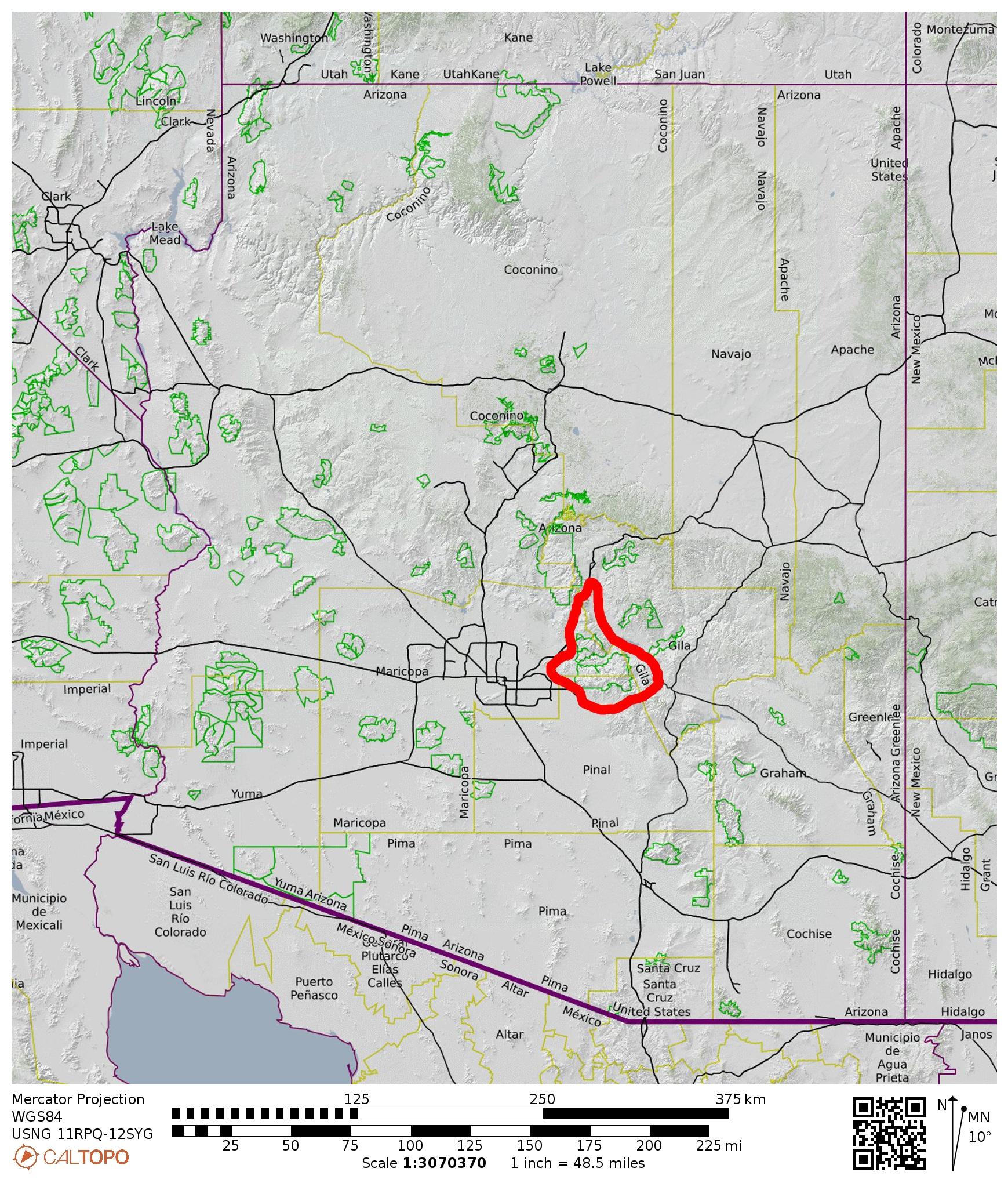
Region: Arizona
Sub-Region: Central Arizona
Sub-Sub-Region: Superstition Mountains
Area: Superstition Wilderness
Starting & Ending Point: Peralta Trailhead at end of Peralta Road #77 (Elev. 2400 feet)
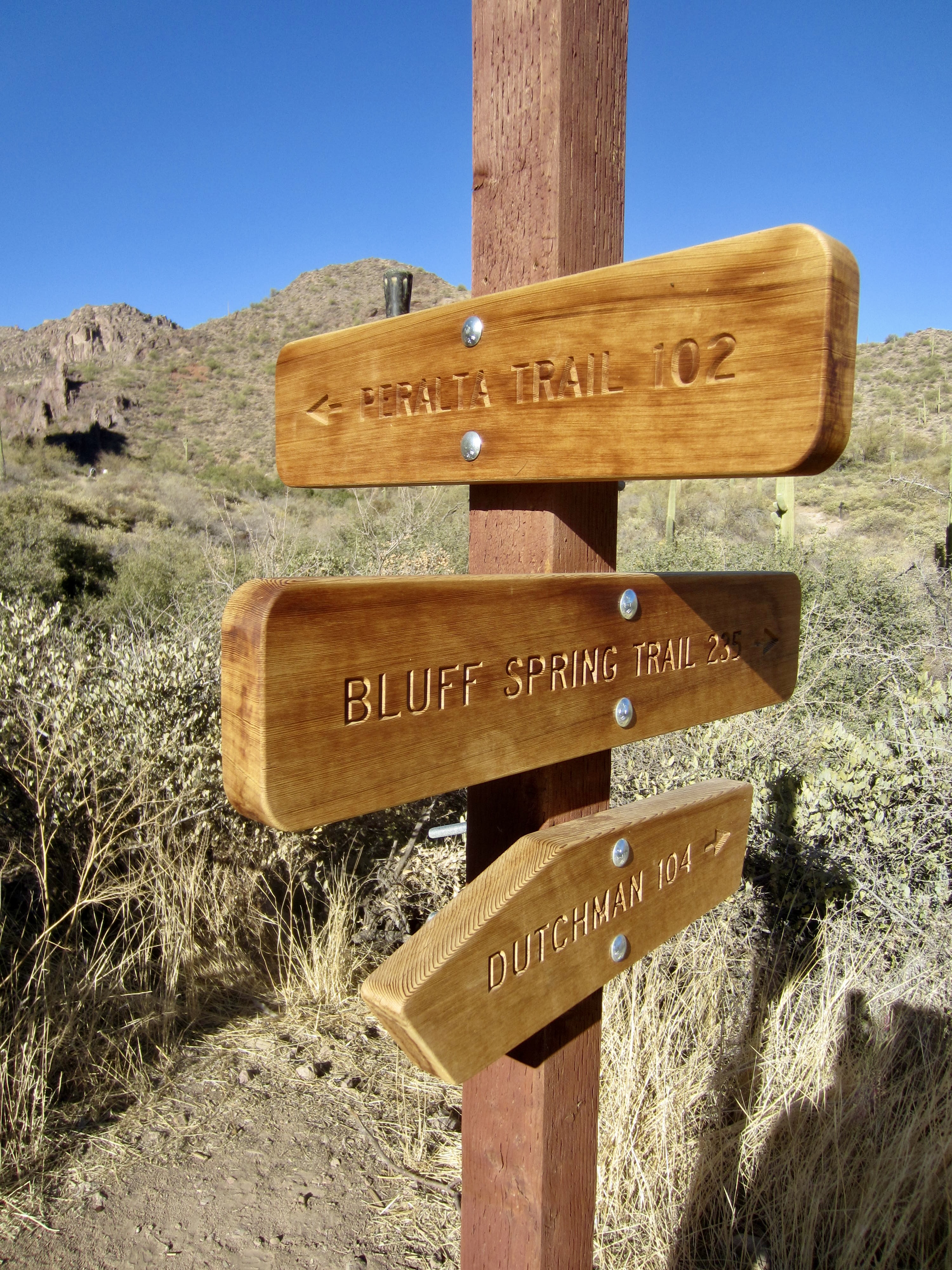
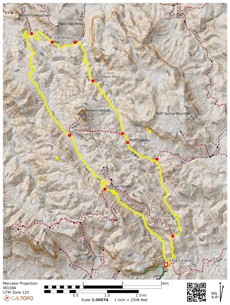
Way Points: Fremont Saddle & Pinion Camp & Dutchman’s Trail junction & Upper Black Top Mesa Pass & Terrapin Trail junction & Terrapin Pass & Bluff Saddle & Bluff Spring Trail junction & Dutchman’s Trail junction & Peralta Trailhead (trail hike & trail scramble)
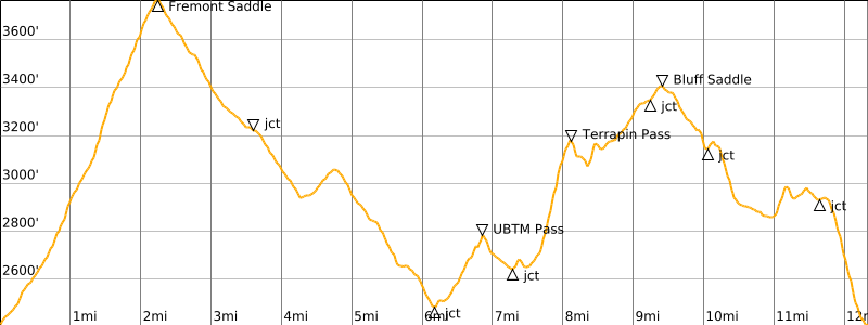
High Point: Fremont Saddle on Peralta Trail (Elev. 3770 feet)
Intermediate Low Point: Peralta Trail / Dutchman’s Trail junction in East Boulder Canyon (Elev. 2480 feet)
Approximate Stats: 12.3 miles traveled; 2900 feet gained & lost; 6.9 hours elapsed.
…
Trip Overview
The Weaver’s Needle Trail Circuit is a top-notch 12-mile hiking loop in the Superstition Mountains closely east of Phoenix. It comprises an elongated loop that follows four different trail segments: Peralta Trail, Dutchman’s Trail, Terrapin Trail, and Bluff Spring Trail. These trail segments take hikers through four different desert canyons: Peralta Canyon, East Boulder Canyon, Needle Canyon, and Bark’s Canyon. At the center of this loop is Weaver’s Needle—the most dramatic peak in the entire mountain range.
Several of the various geographic names involved in the Weaver’s Needle Trail Circuit reflect the rich gold-mining history of the area. Pauline Weaver was an intrepid explorer of the Desert Southwest throughout the 1800s. Jacob “The Dutchman” Waltz was a German immigrant who ardently prospected for gold in the Superstition Mountains. The Peralta family from Mexico also prospected for gold here before (allegedly) being massacred by Apaches circa 1848. Jim Bark was a local ranch owner and gold hunter.
.
The Weaver’s Needle Trail Circuit can be hiked in either a clockwise or counterclockwise direction. I chose a clockwise direction because it allowed me to complete the single biggest ascent (the climb to Fremont Saddle) in the cool of morning. Regardless of direction, your hike will begin and end at the Peralta Trailhead, which is located at the terminus of Peralta Road #77. This two-lane dirt road is relatively smooth and can be easily navigated in a low-clearance passenger car. No permit is needed to park at the trailhead.
It is worth noting that all of the drainage channels and groundwater springs were completely dry at the time of my hike, presumably due to an unusually dry winter in central Arizona. In contrast, I spoke to several other hikers who had encountered prevalent water on previous trips through the area. Play it safe; unless you have reliable, up-to-date information about water availability along the trails, it is wise to carry plenty of water for this circuit.
Full Trip Report
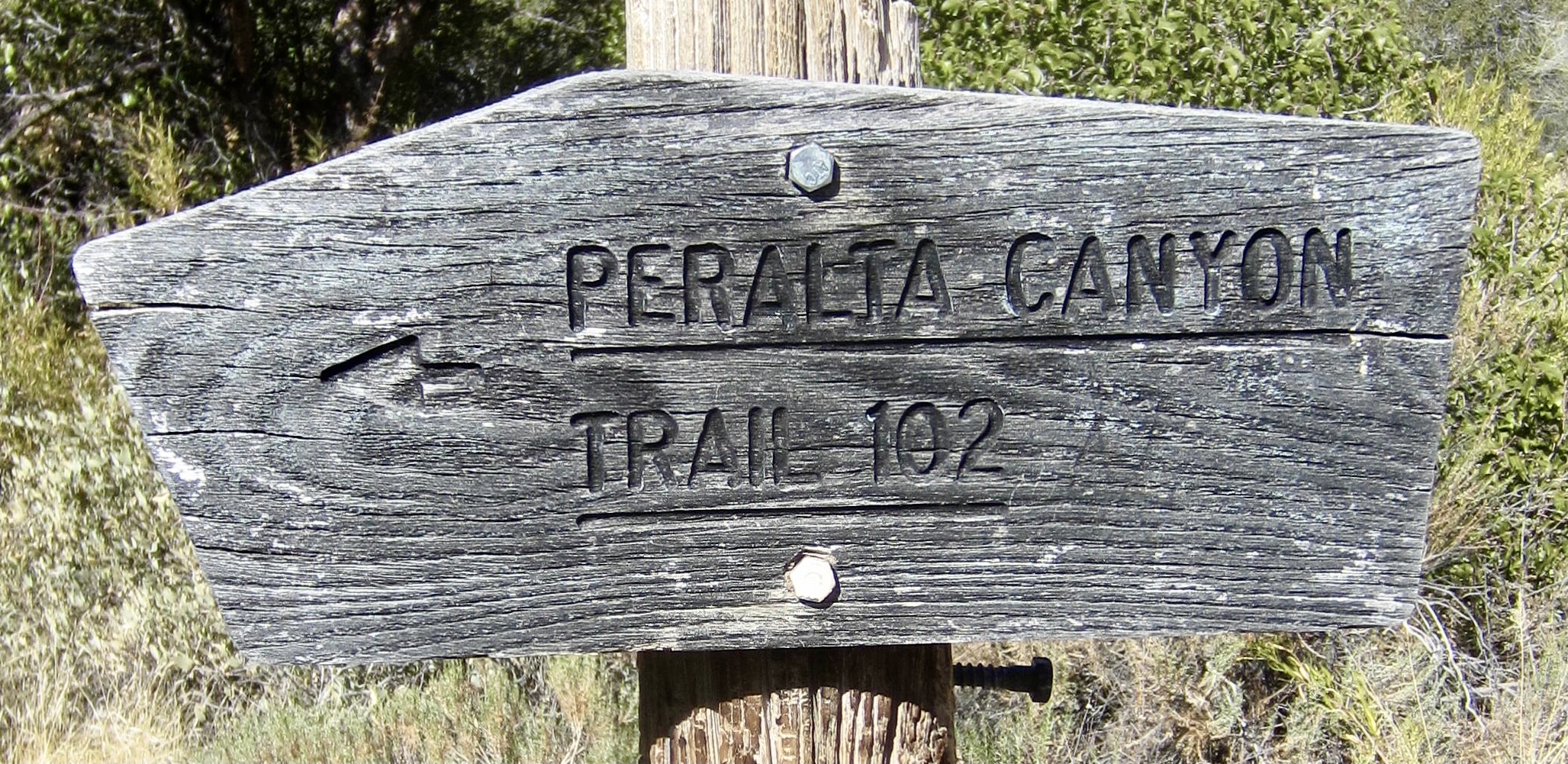
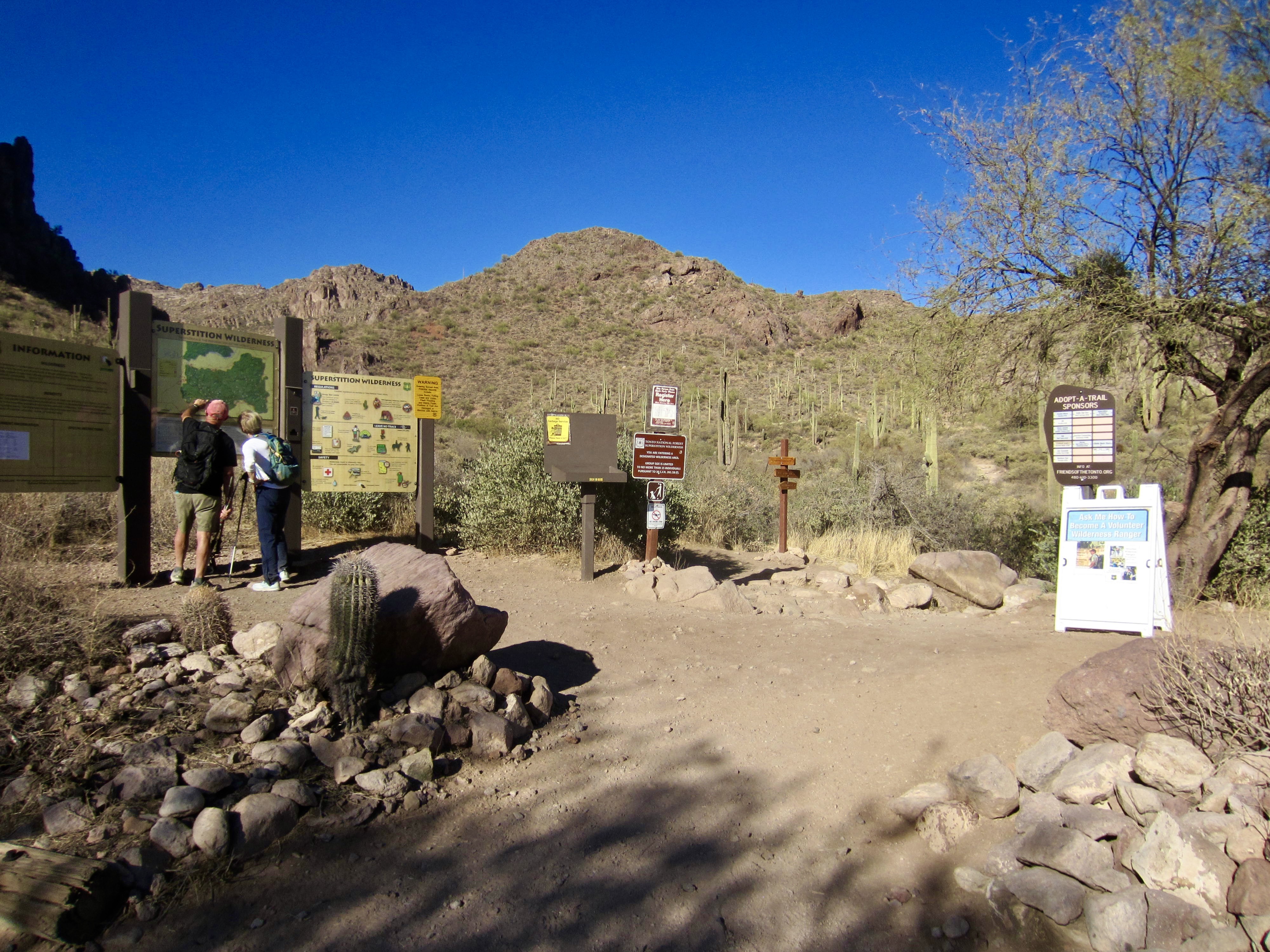
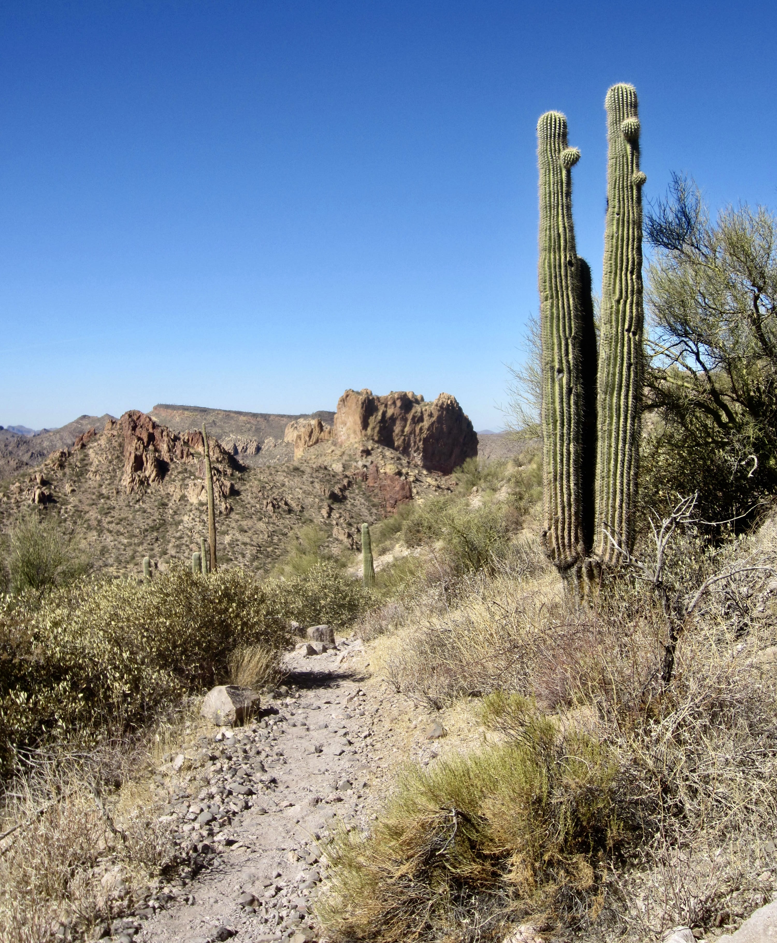
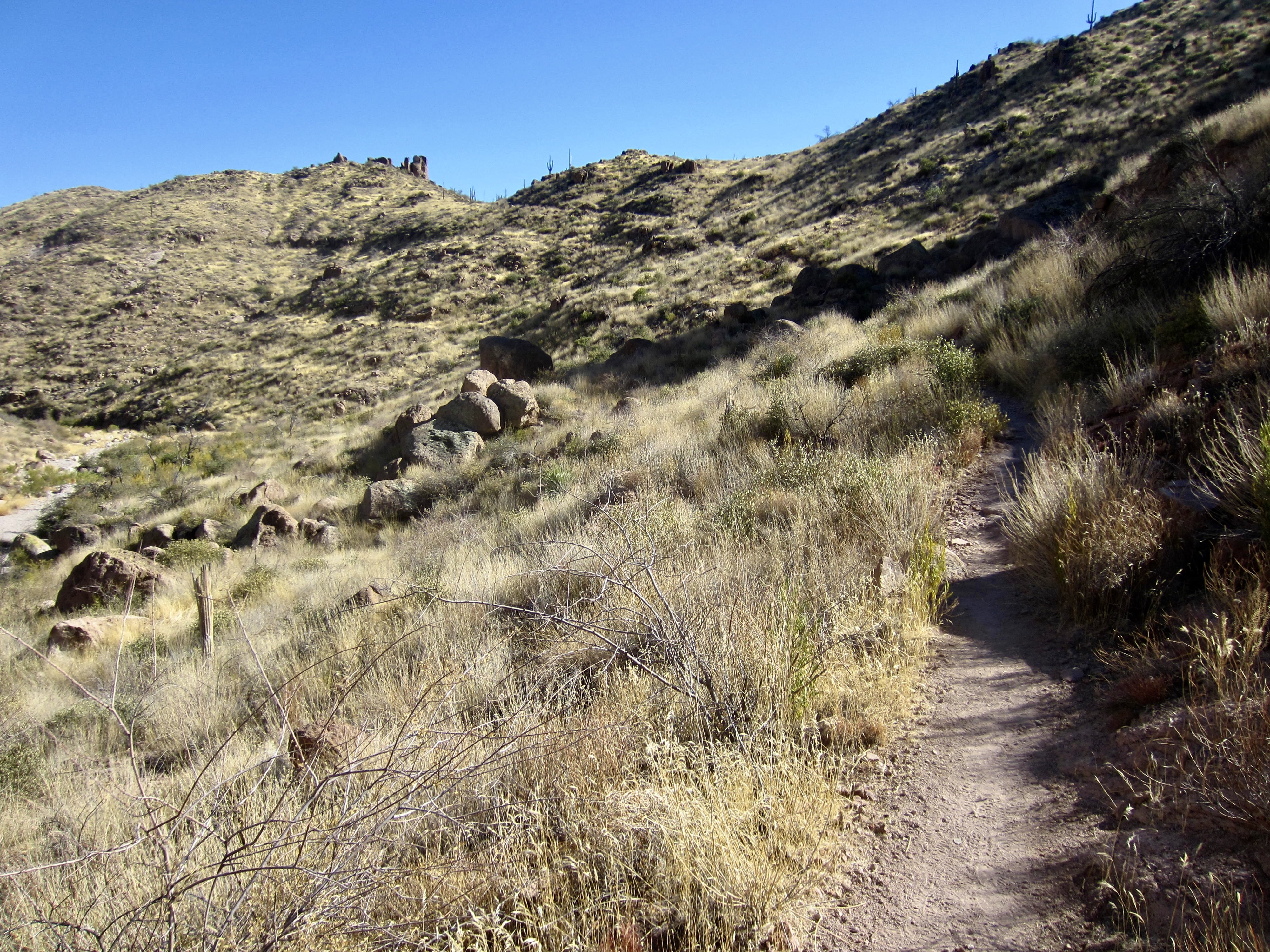
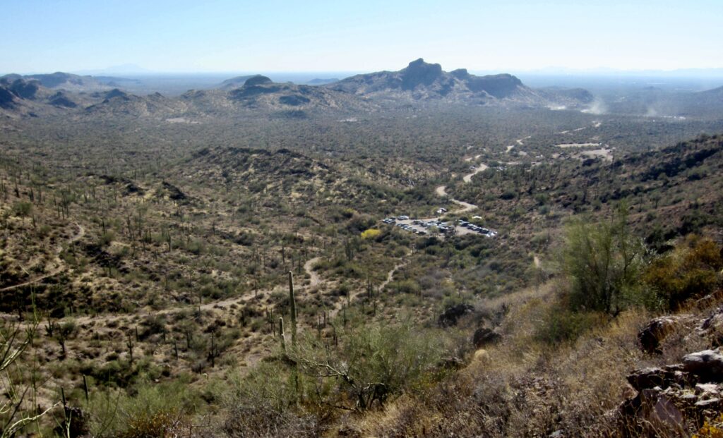
I pulled into the Peralta Trailhead at 8:15am on a sunny Sunday morning and nabbed one of the last remaining parking spots. Obviously, this is a popular trailhead—reportedly, the most popular in all of the Superstition Mountains—so an early start is recommended. I checked in with the Forest Service rangers on duty and then headed up Peralta Canyon on the well-trodden Peralta Trail #102.
.
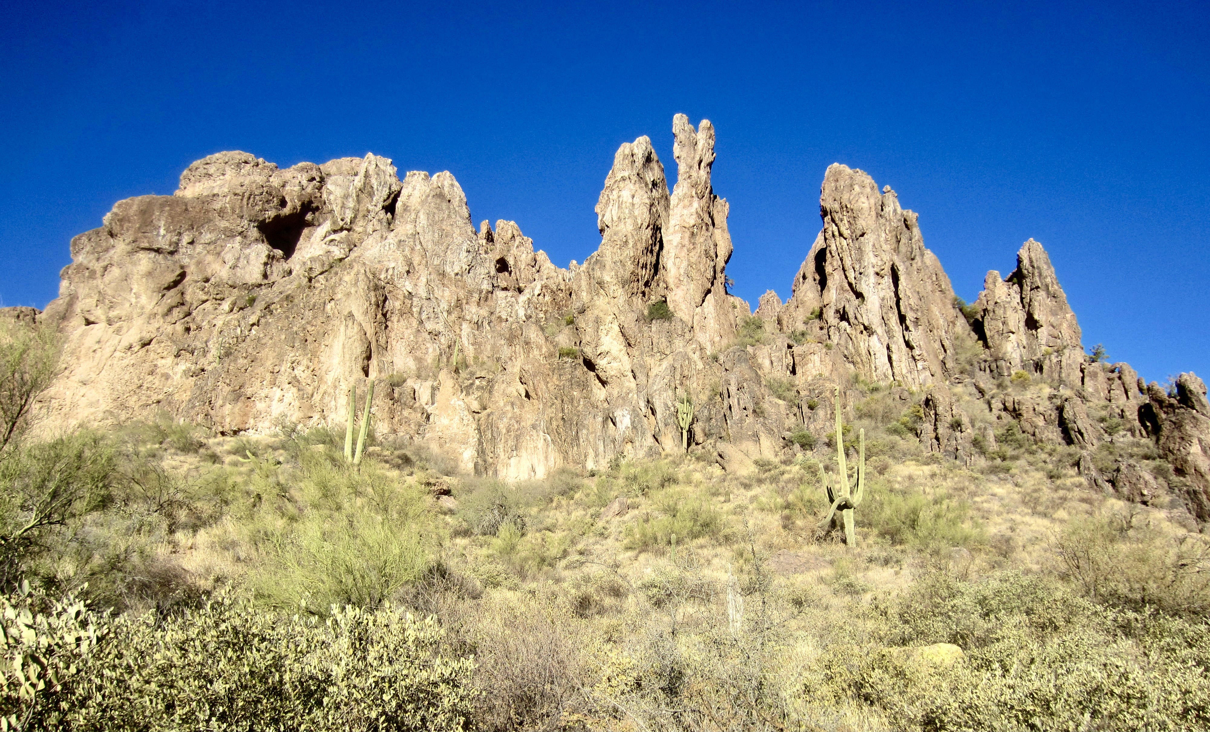
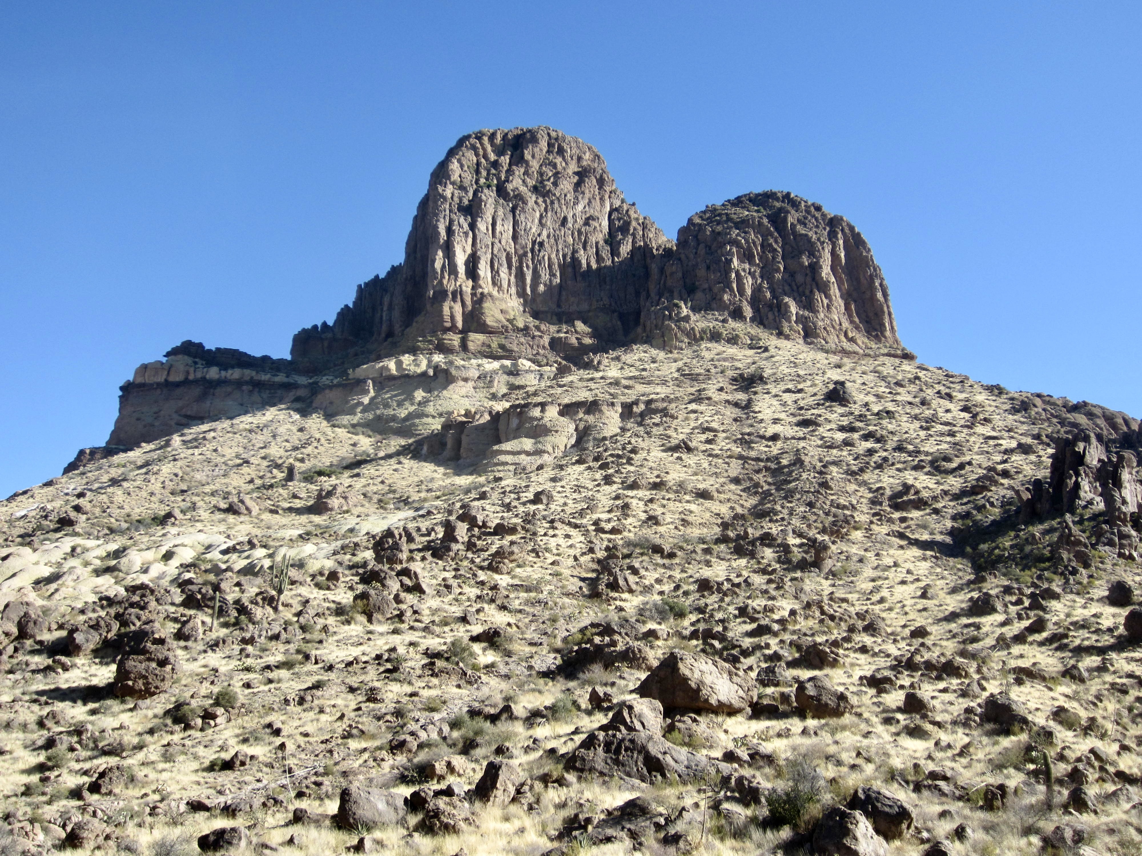
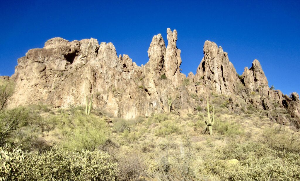
Very quickly, I passed directly below the rugged Dacite Cliffs, with their wildly shaped rhyo-andesite pinnacles. The trail continued climbing steadily up-canyon, occasionally crossing gravelly stream beds (all dry) and ascending slabby rock. There were a few scrambly sections but nothing more than Class 2. The morning was pleasantly cool, and I encountered lots of two-way hiker traffic.
.

.
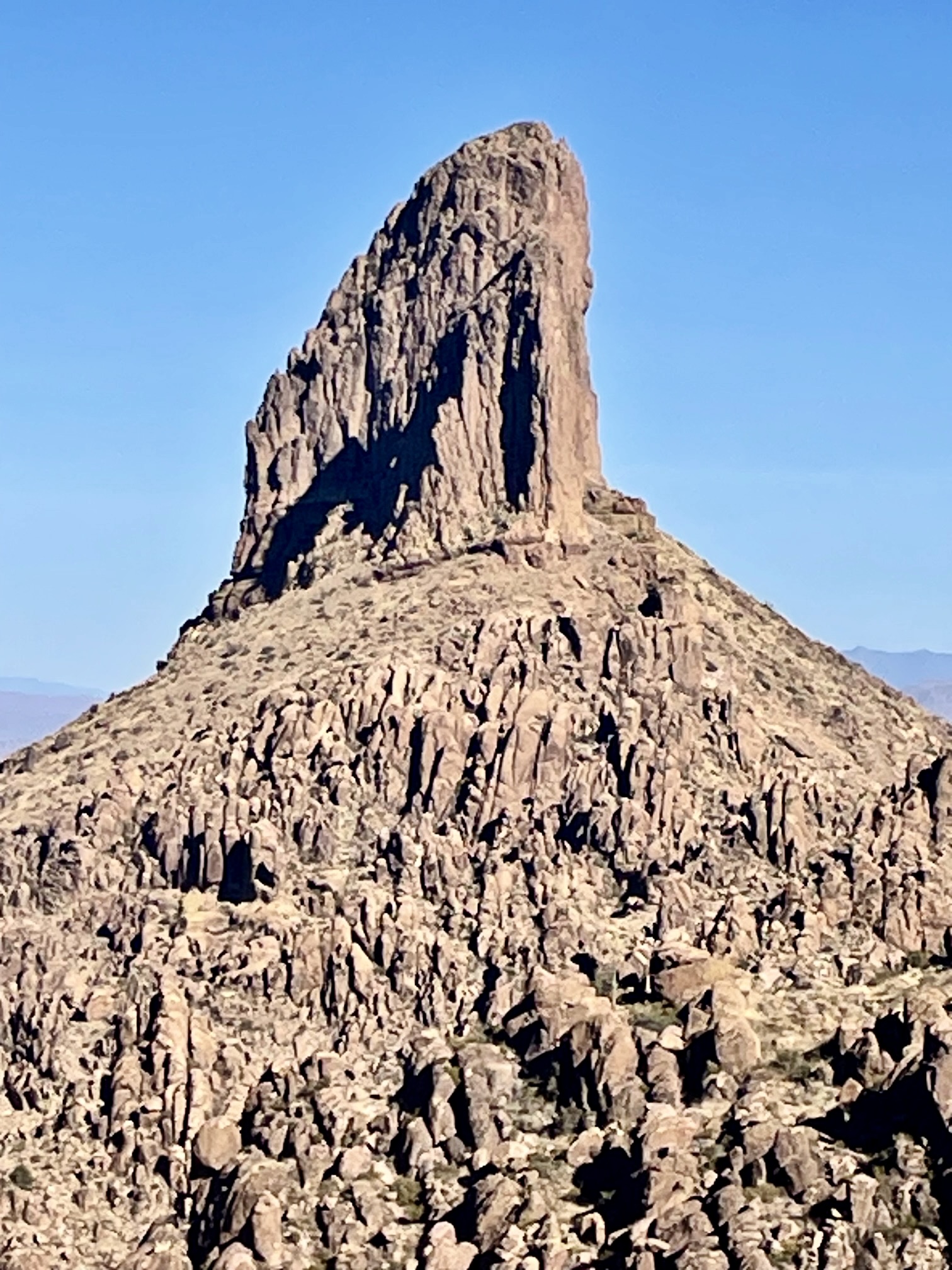
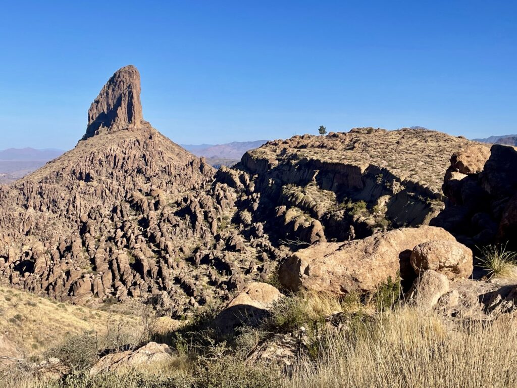
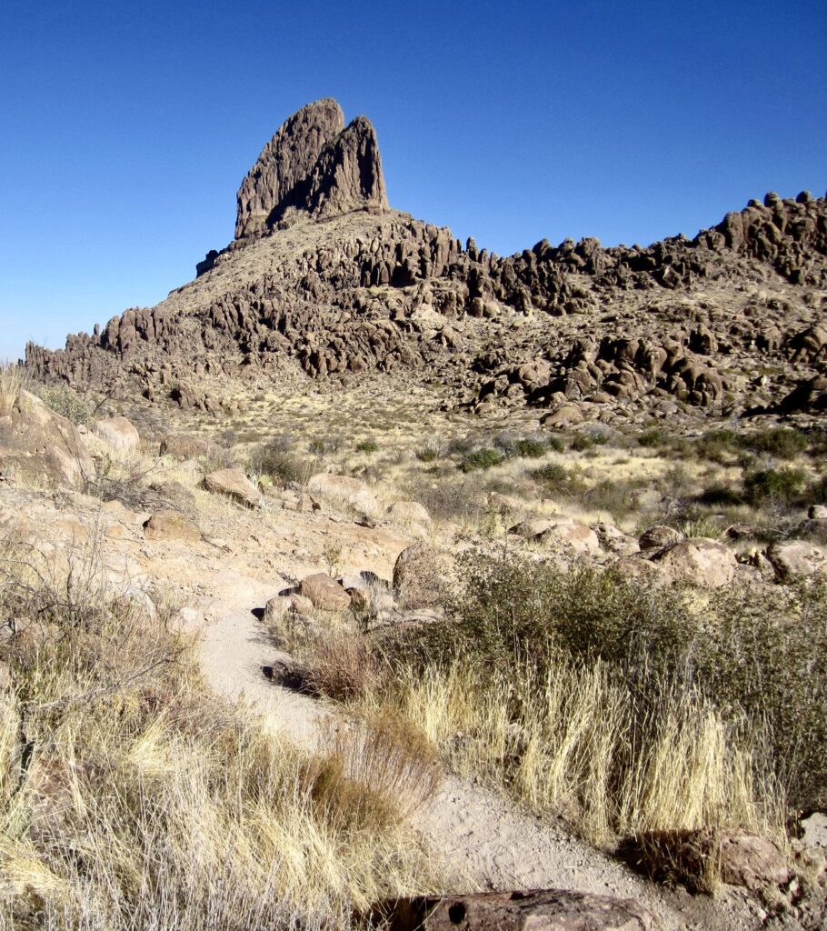
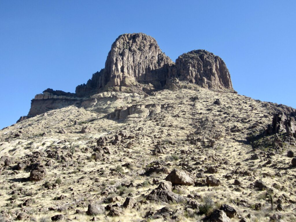
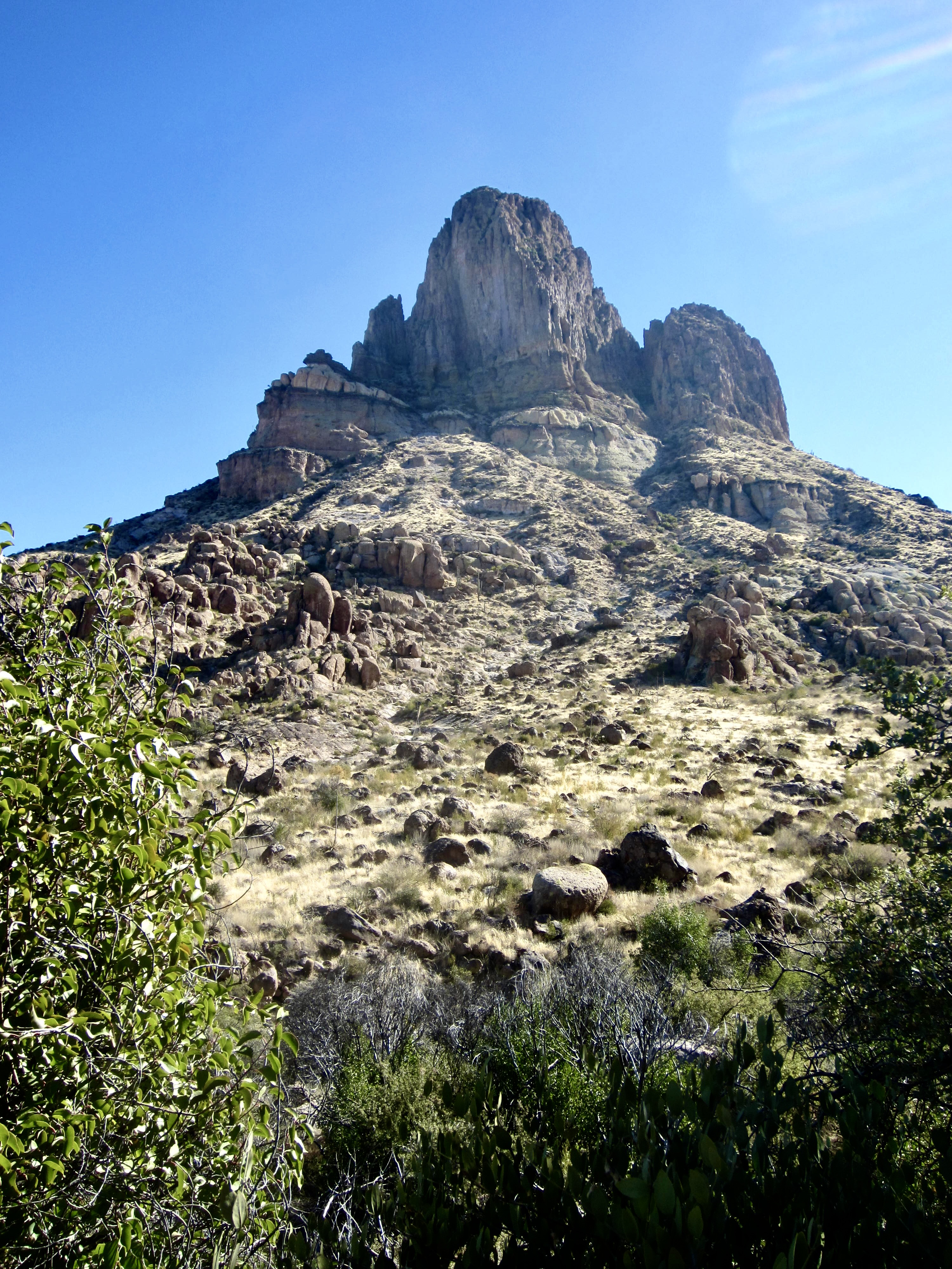
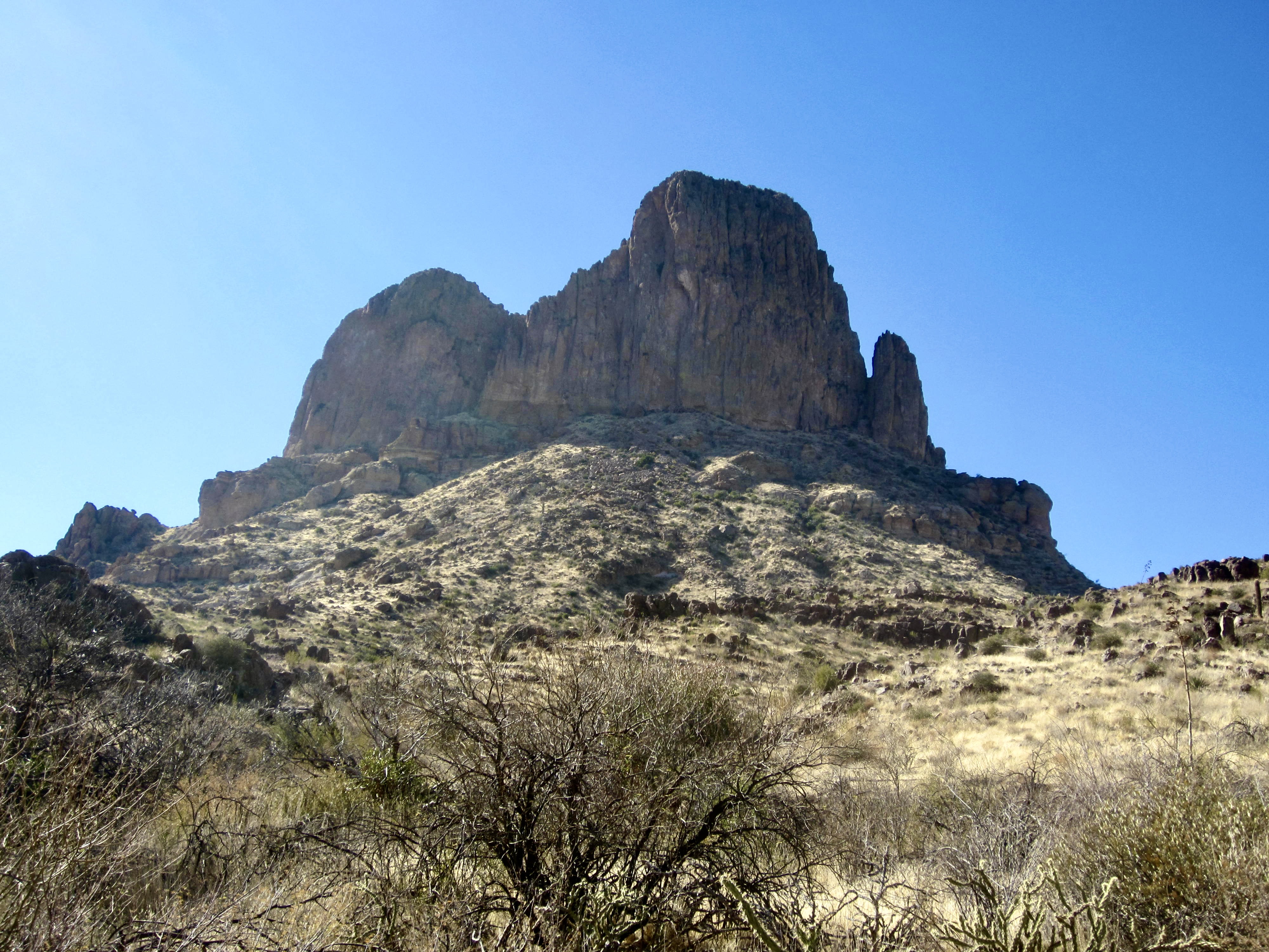
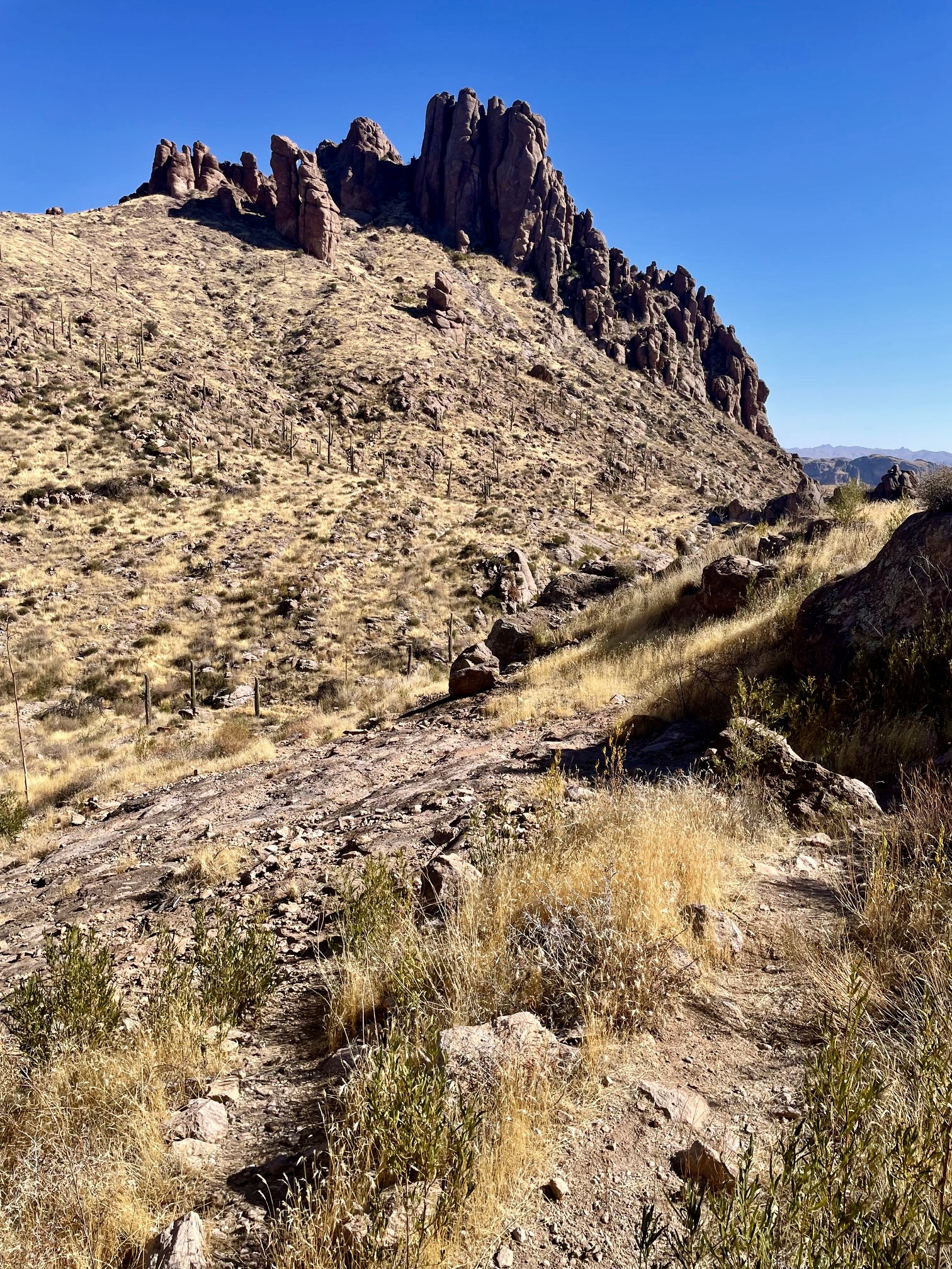
In mid-morning, I topped out at Fremont Saddle (1.1 hours + 2.3 miles + 1300 feet from TH). This 3770-foot saddle represents the high point of the entire circuit, as well as the final destination for most day-hikers. The main attraction here is the stunning view of Weaver’s Needle, an ancient volcanic plug of welded tuff. From this southern vantage, it looks like the prow of a steamship perched atop a rock hill. Wow!

.
.
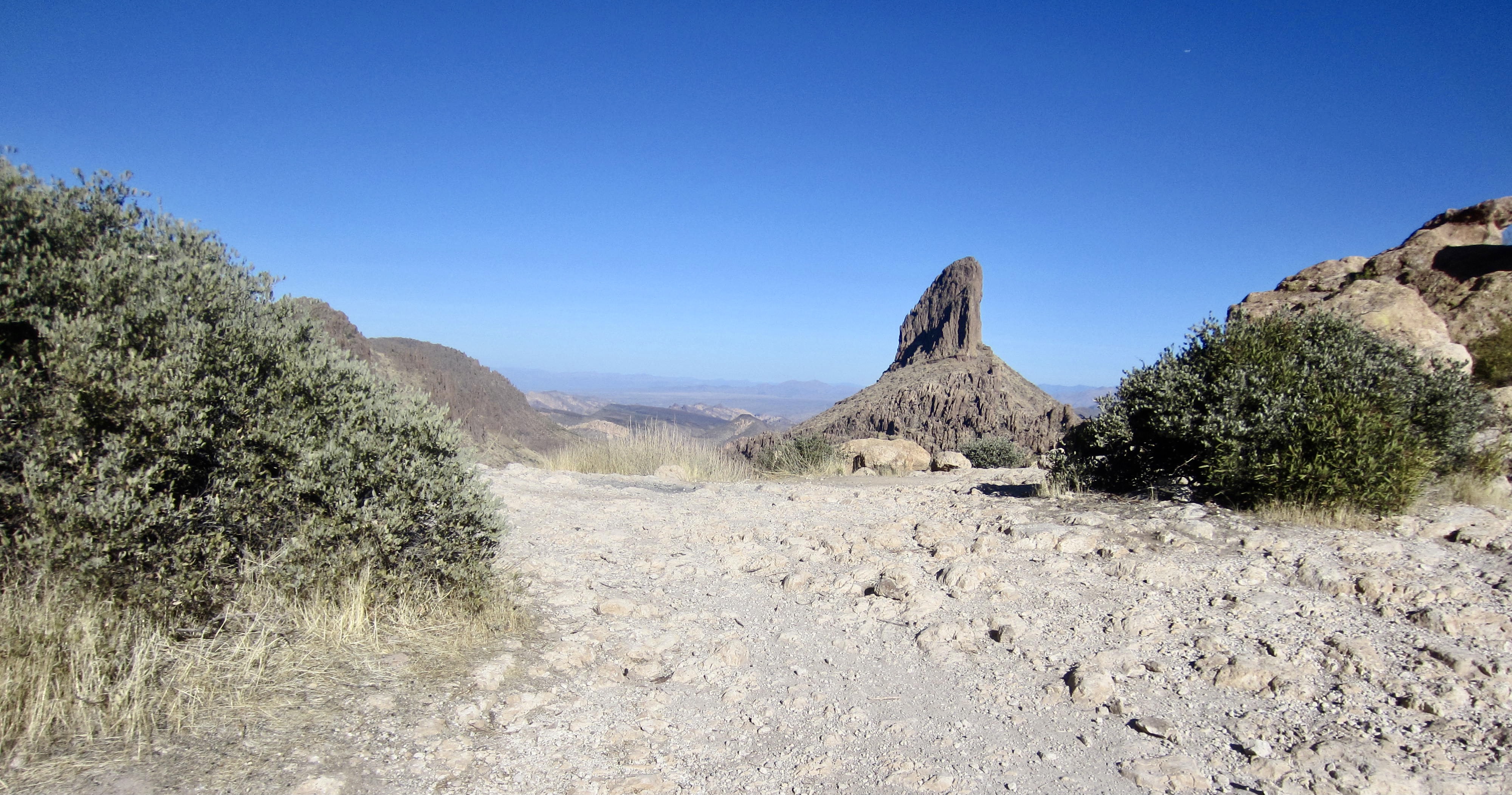
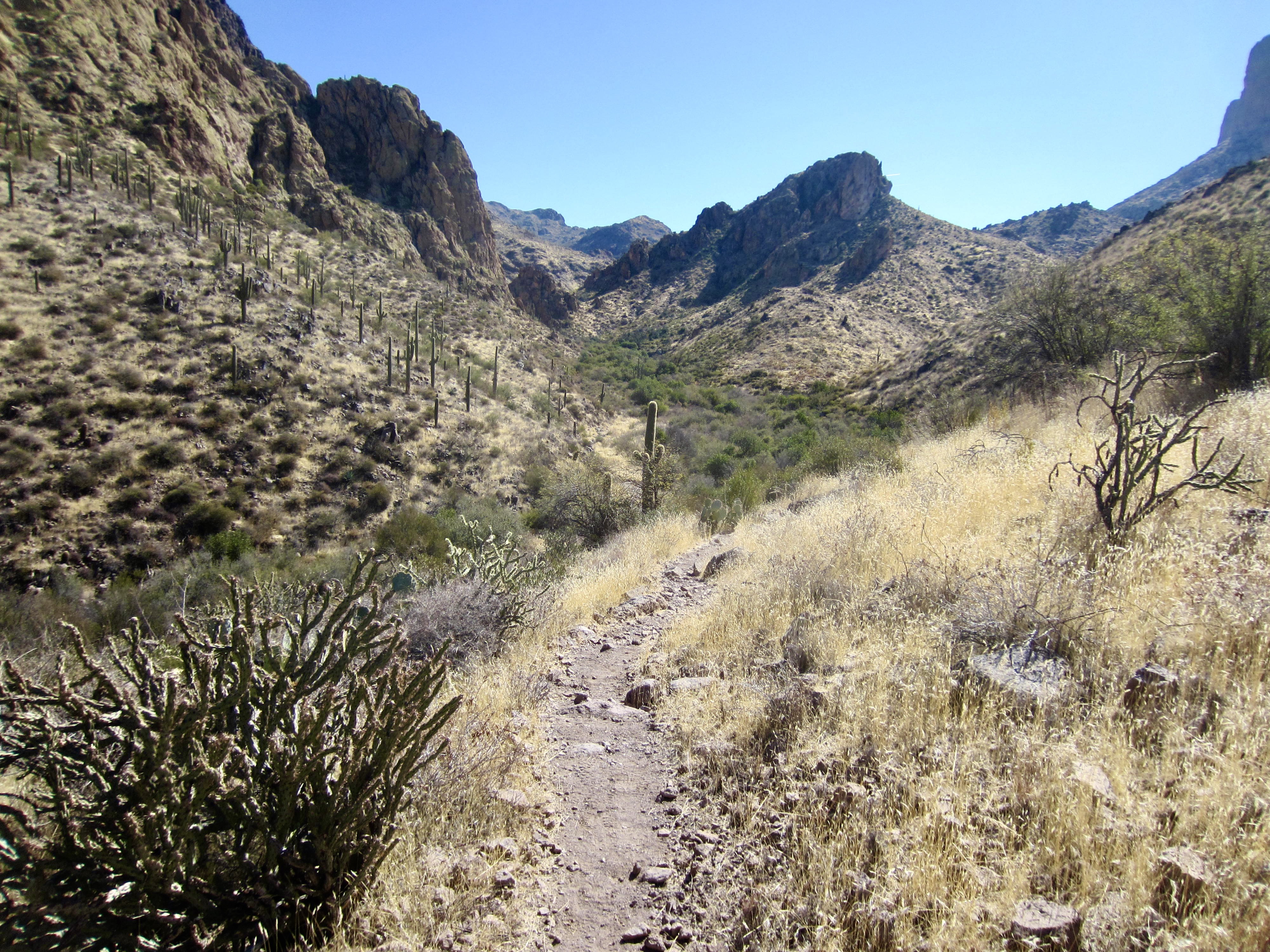
From Fremont Saddle, the Peralta Trail—now noticeably rougher and less trodden—makes a 4-mile descent through East Boulder Canyon. This descent took me closely beneath the western face of Weaver’s Needle and provided a continuous perspective from south to north. I could see that the formation consists of two separate wedges of furrowed rock: a higher northern wedge and a lower southern wedge.
.
.
.
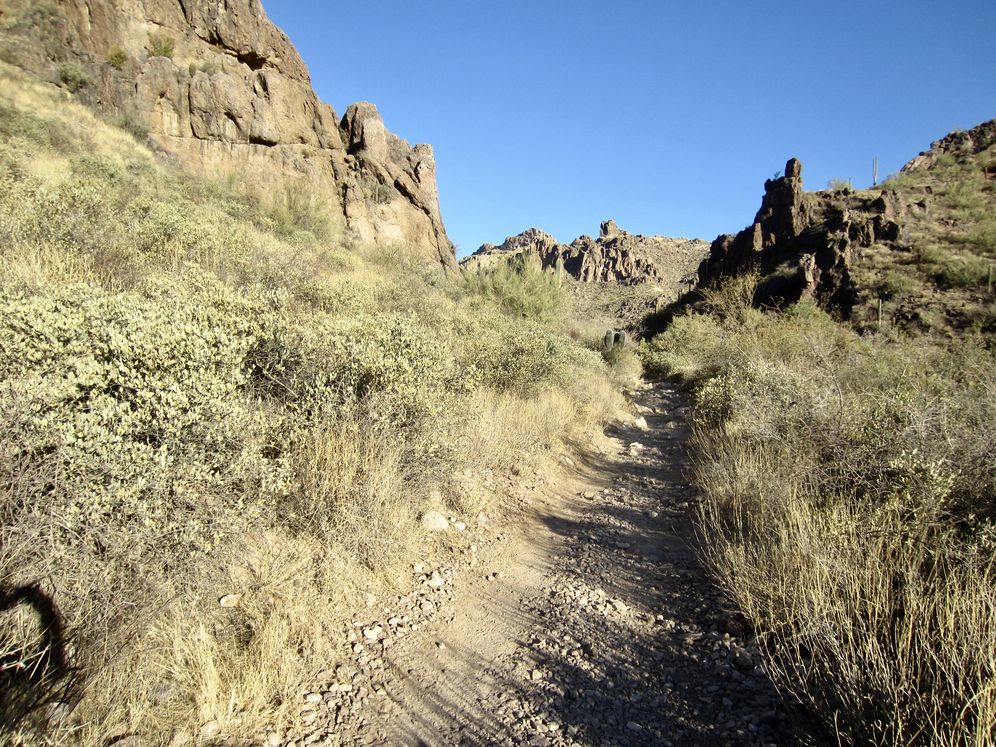
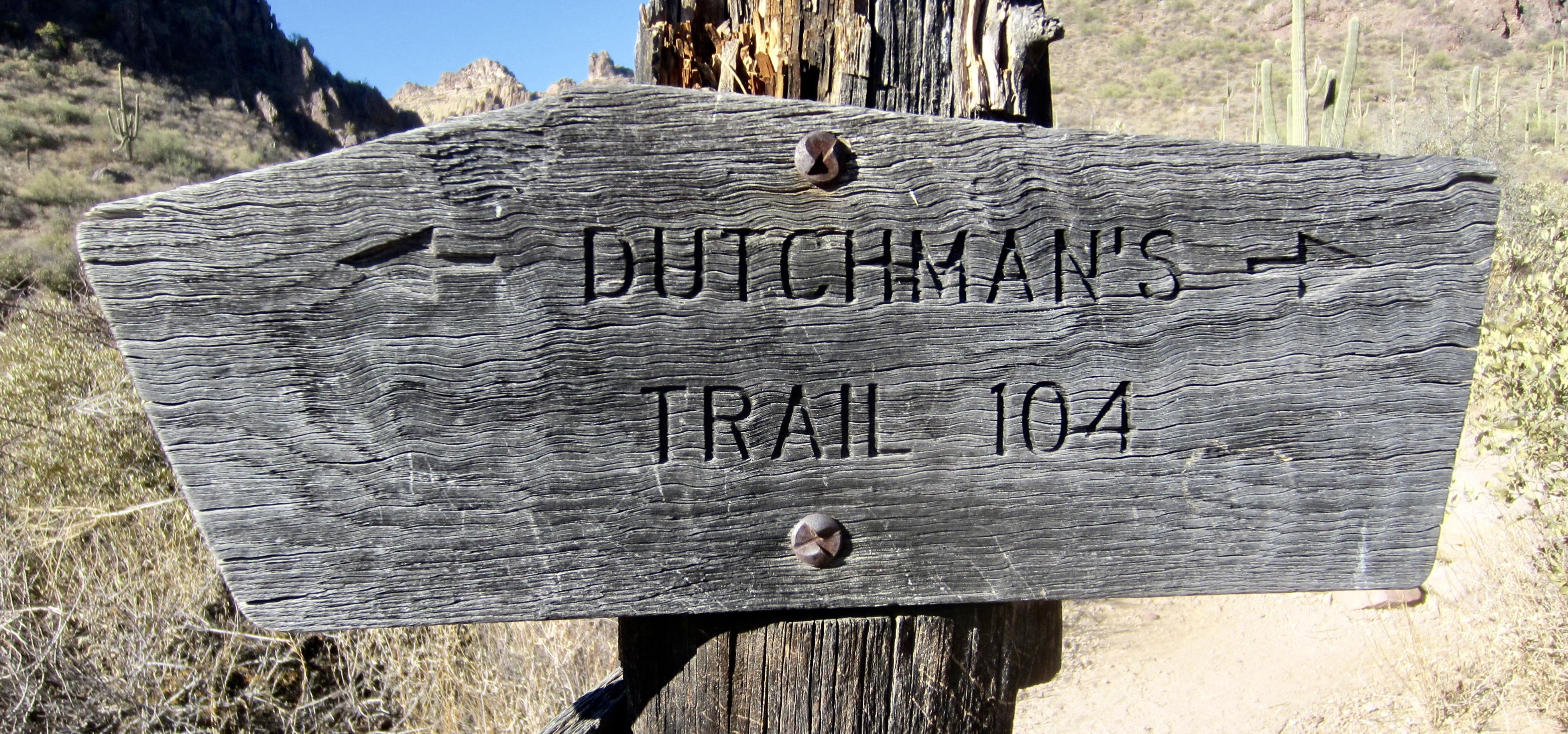
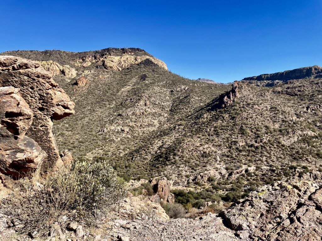
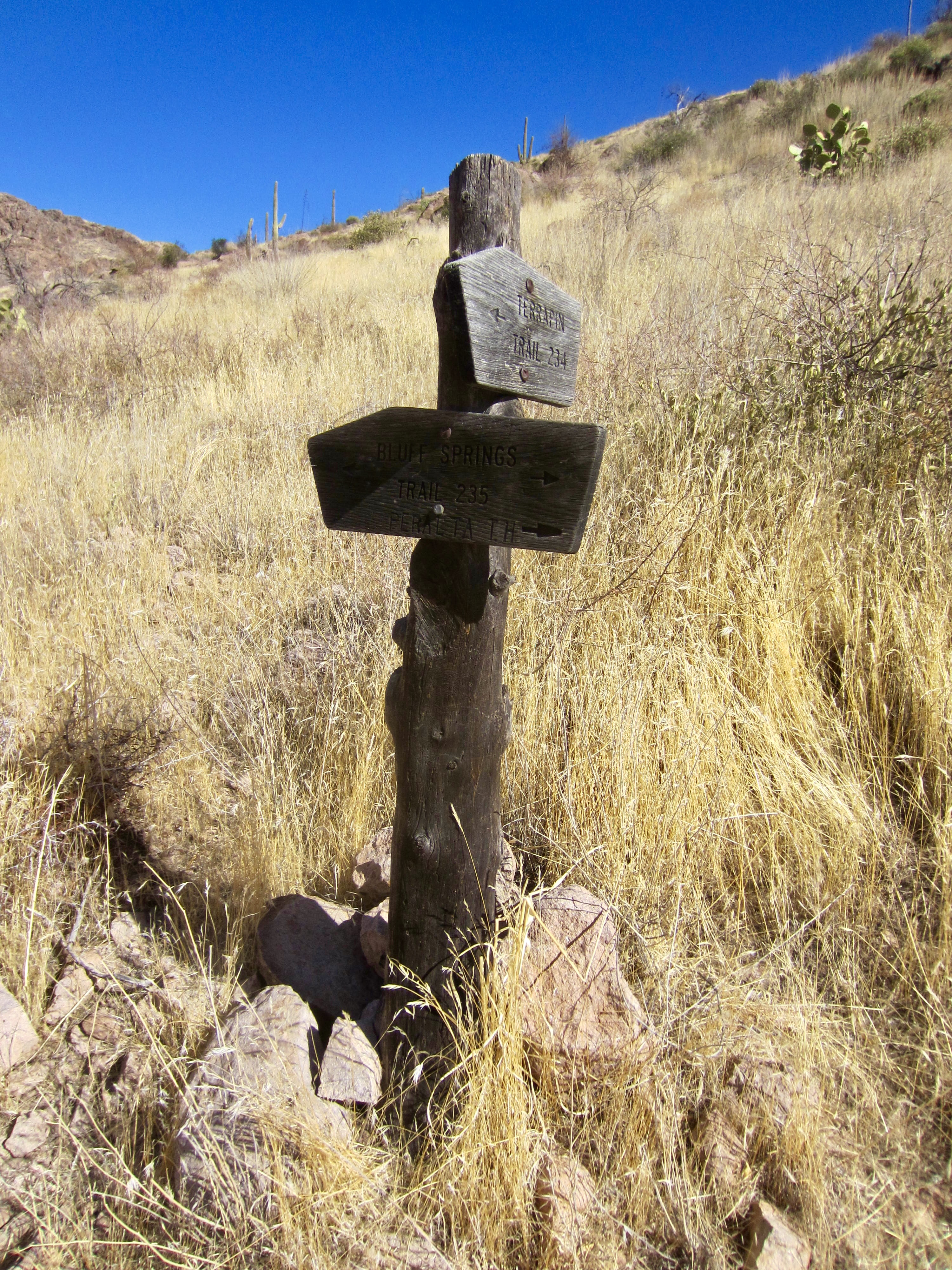
Farther down-valley, I could see the distinctive layered geology of Black Top Mesa and the gentle sag of Upper Black Top Mesa Pass on the opposite side of East Boulder Canyon. The Peralta Trail dropped into the canyon invert and came to a junction with Dutchman’s Trail #104.
.
A short climb on the Dutchman’s Trail brought me to Upper Black Top Mesa Pass at noon (3.4 hours + 6.9 miles + 1700 feet from TH). The fortress-like facade of Palomino Mountain and the horn-like silhouette of Weaver’s Needle were visible from here. I took a short lunch break in the shade of a manzanita bush, knowing that I was in store for a hot afternoon.
.
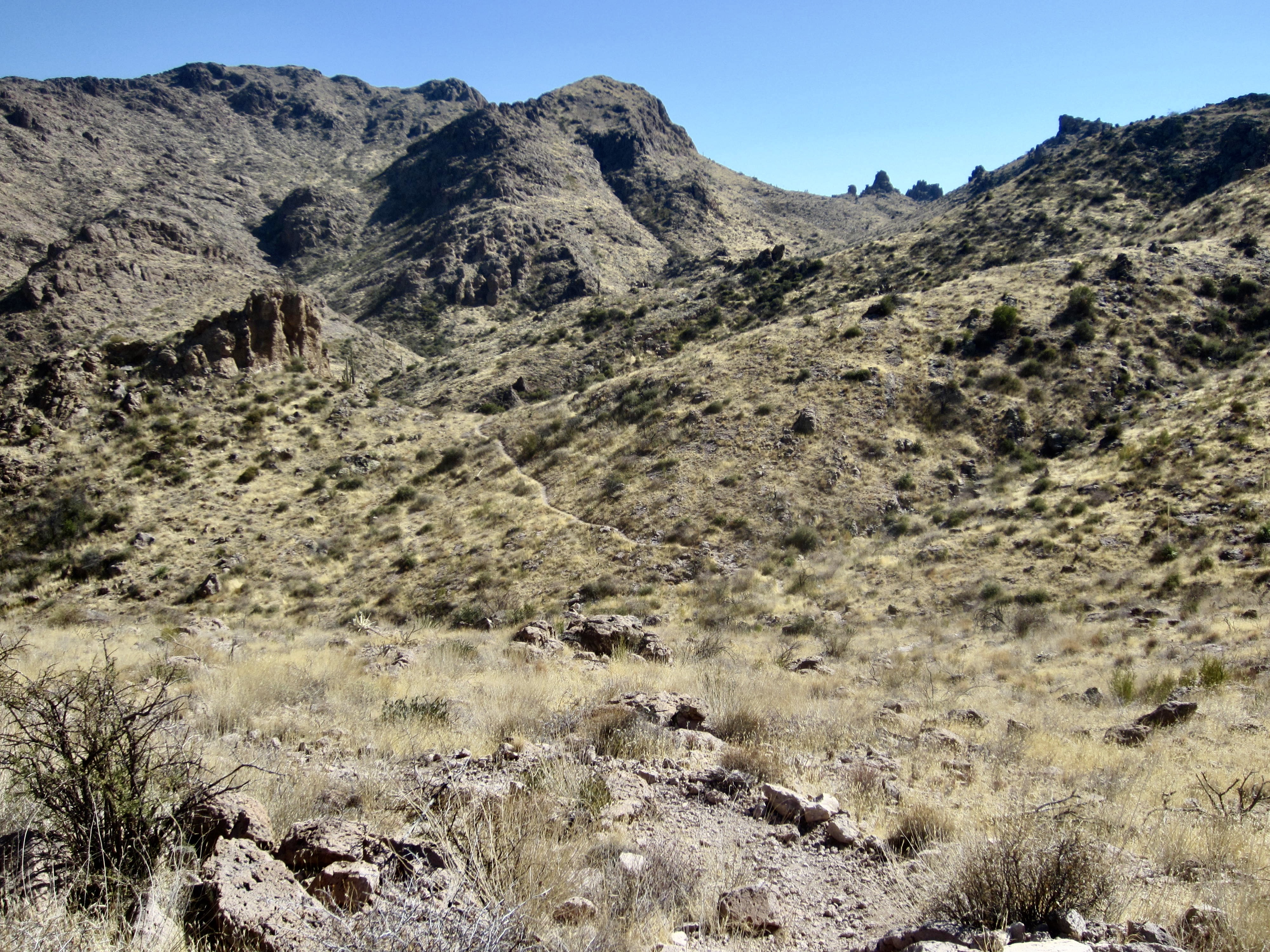
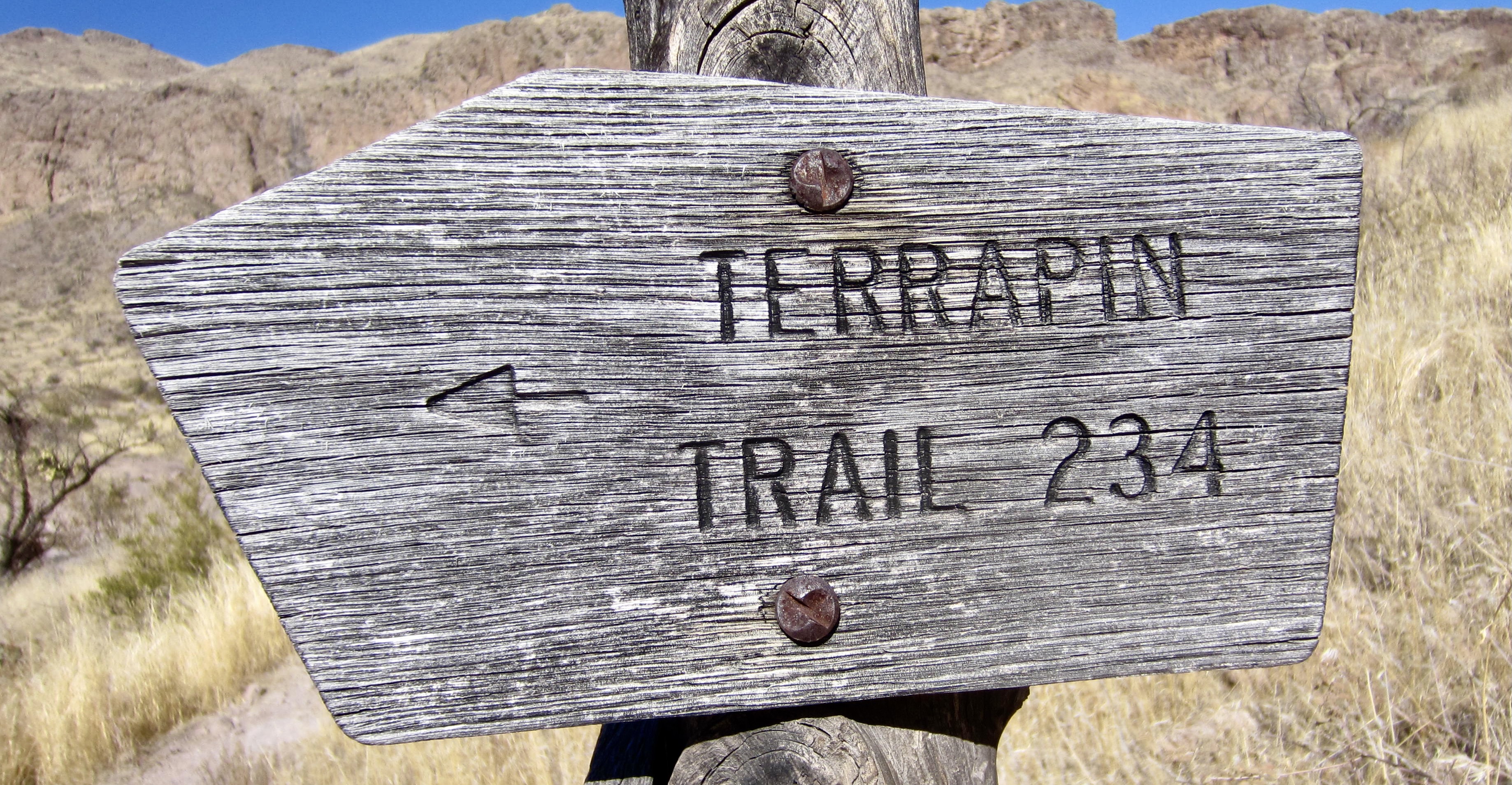
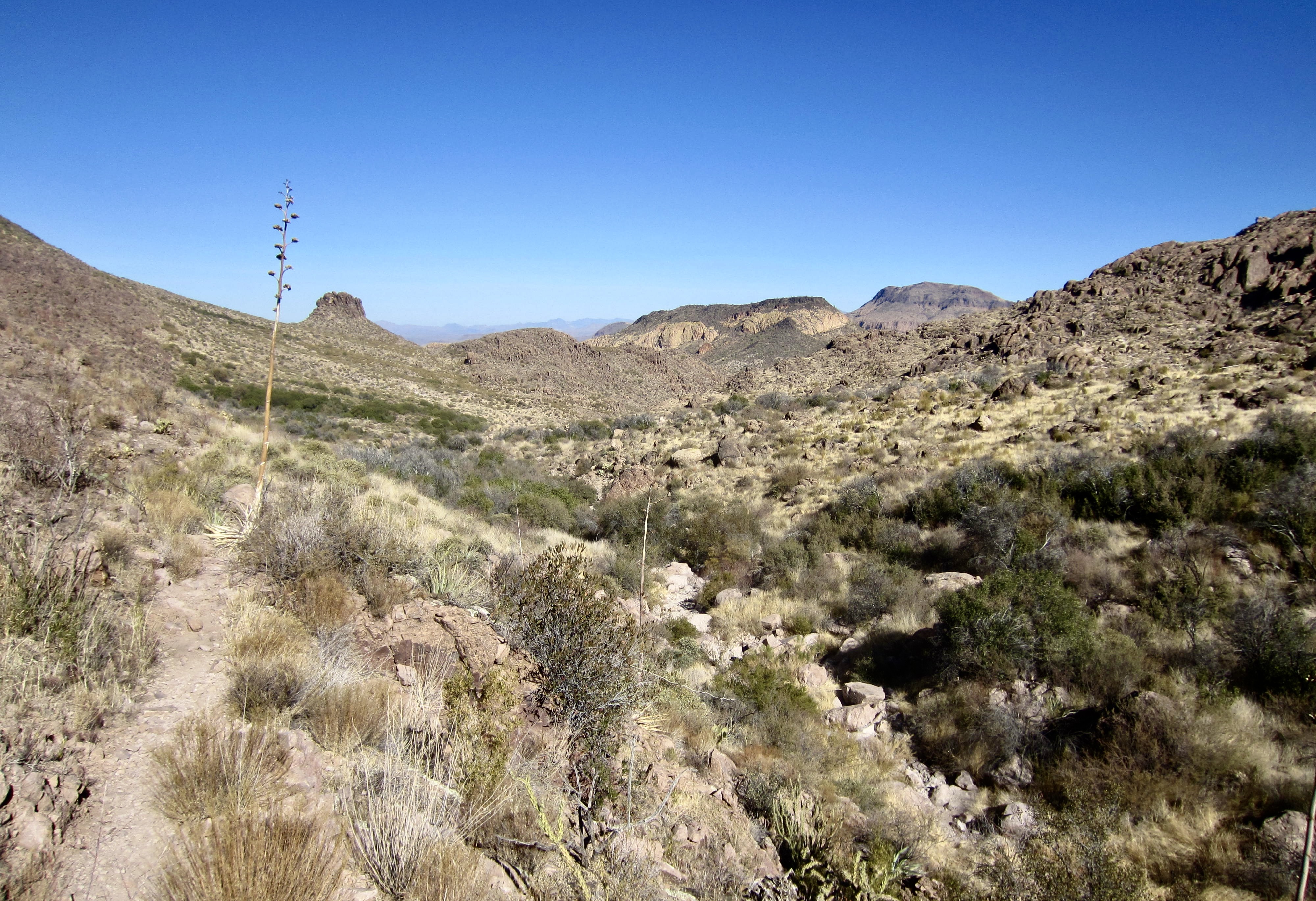
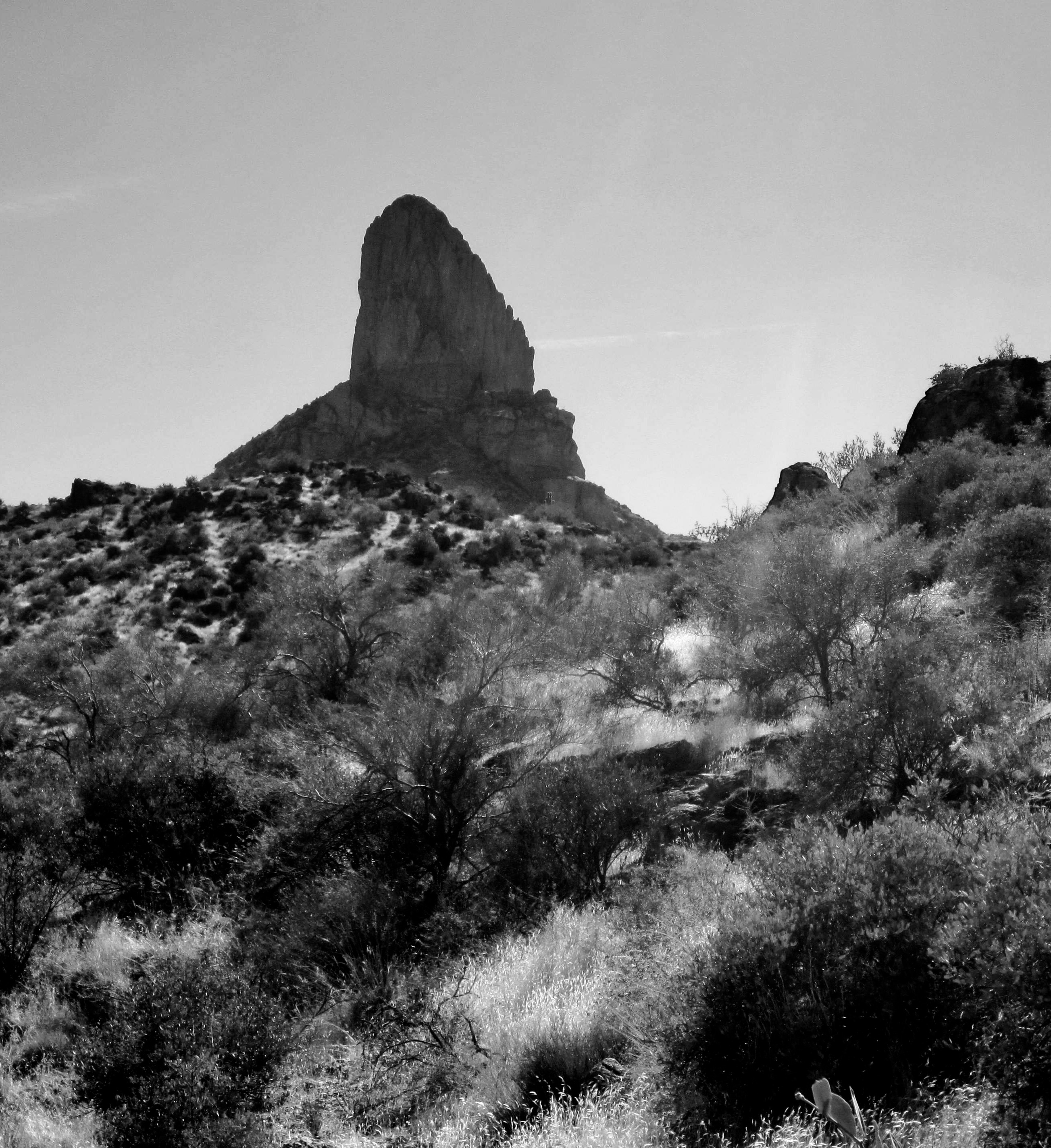
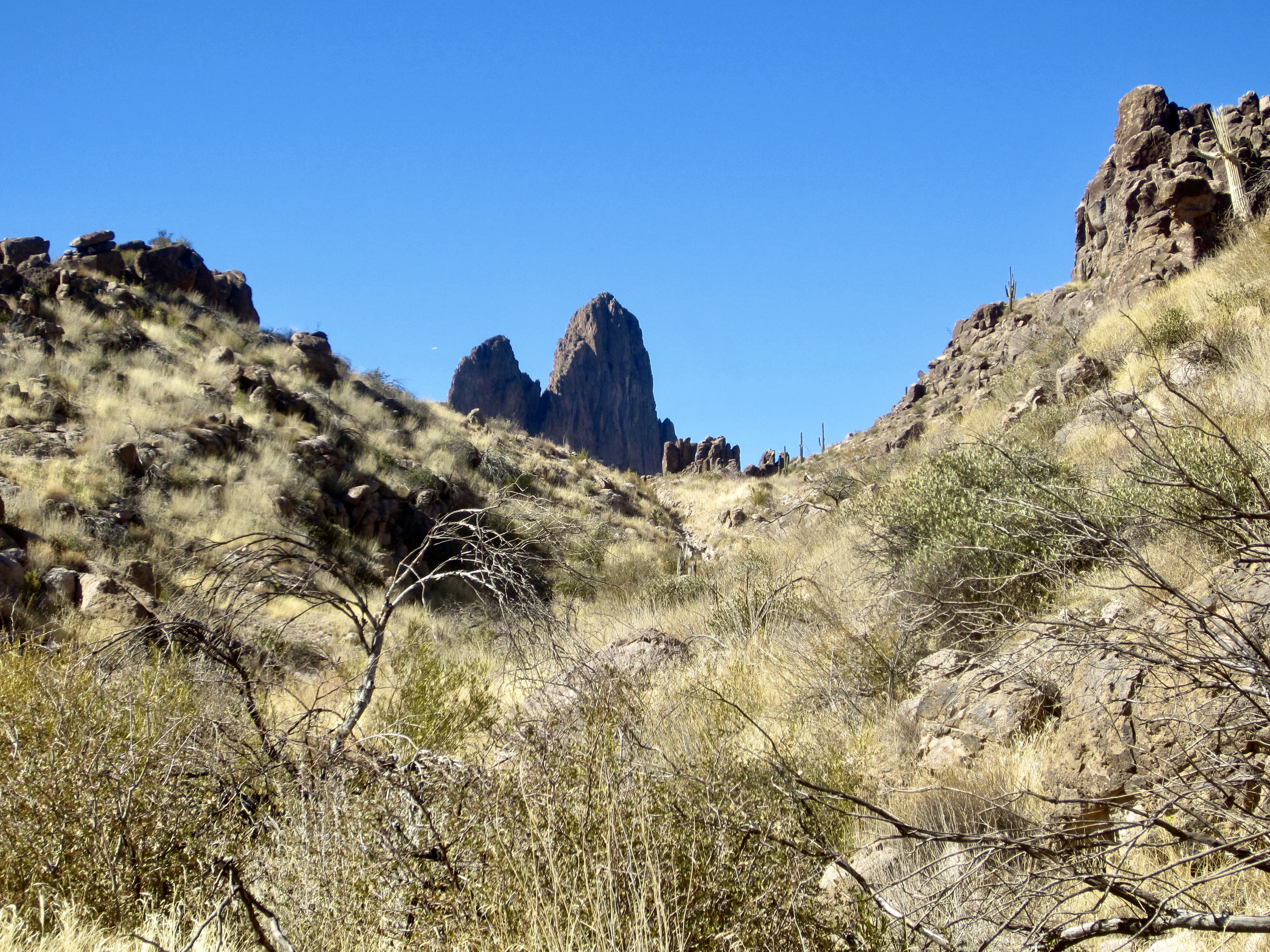
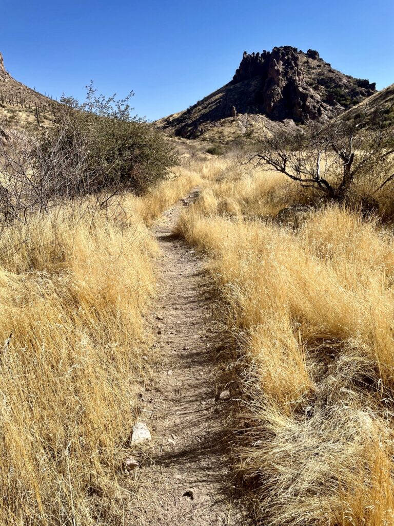
My afternoon began with a short descent to a junction with Terrapin Trail #234 in Needle Canyon. Turning southward on this rocky and somewhat overgrown trail, I made a 600-foot ascent to Terrapin Pass, which offers a view over to the northeastern side of Weaver’s Needle. Straight ahead, Bluff Saddle could be seen at the head of Needle Canyon. It was easy to envision sun-broiled gold prospectors trudging through here 150 years ago, hoping to find the mother lode.

.
.
.
Vegetation in Needle Canyon is limited to low grasses and shrubs, such that shade is very scarce. I made a short but hot climb to reach Bluff Saddle in early afternoon (5.1 hours + 9.4 miles + 2700 feet from TH). This 3400-foot saddle represents the highest point on the eastern half of the trail circuit.
.
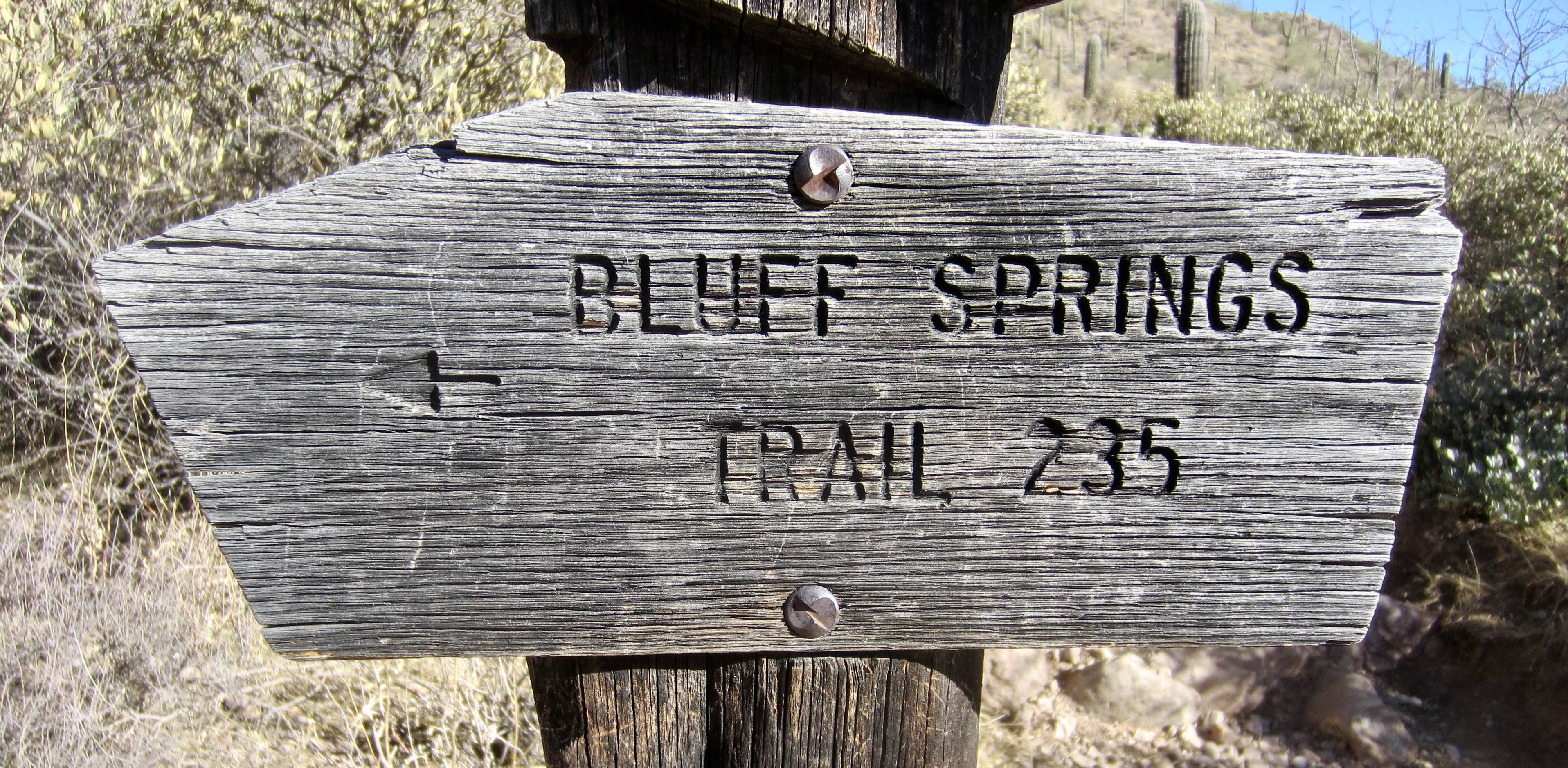
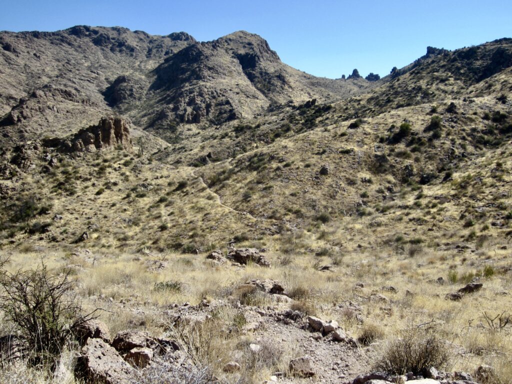
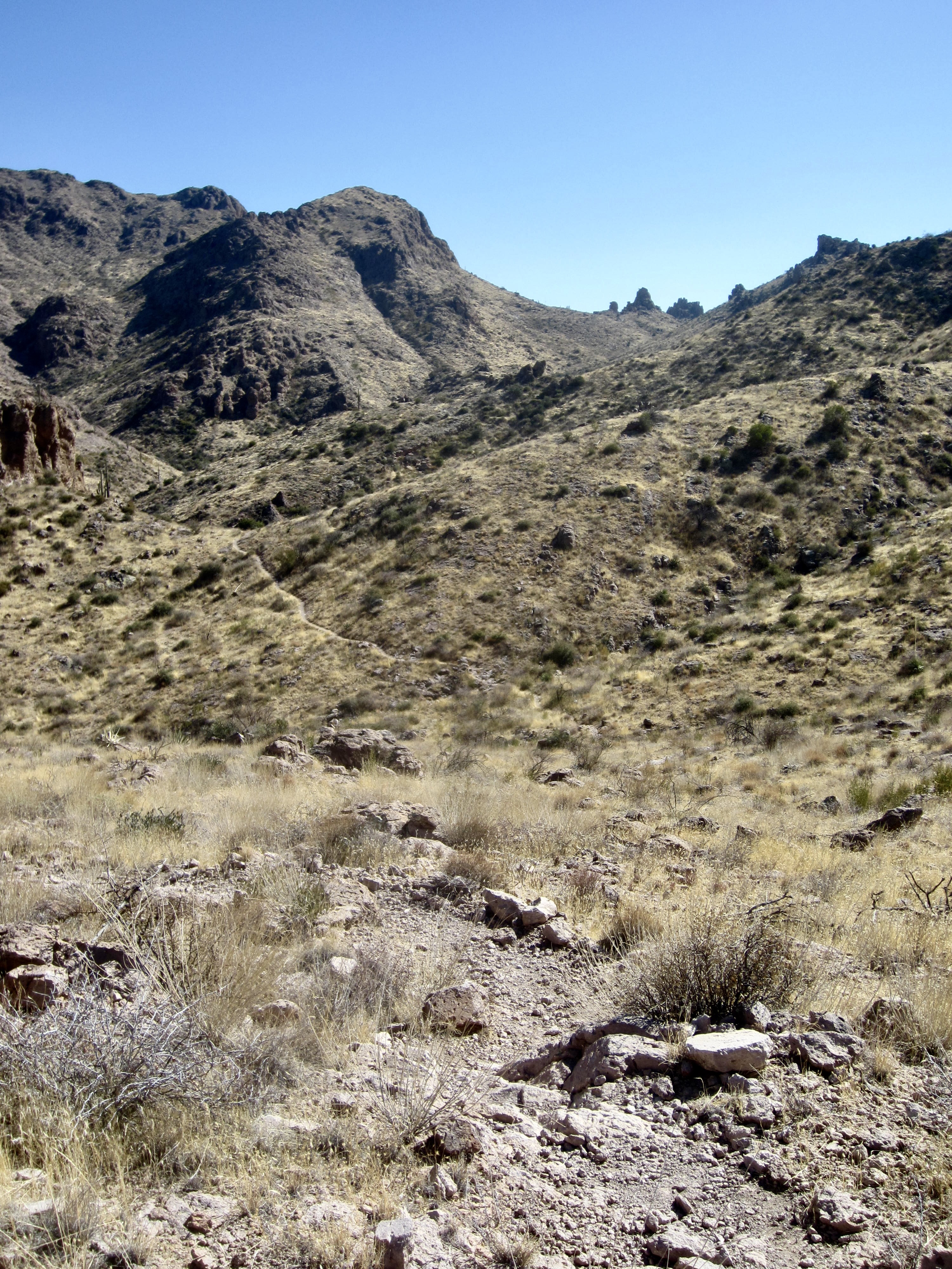
Beyond Bluff Saddle, the Terrapin Trail drops 250 feet to a junction with Bluff Spring Trail #235 in Bark’s Canyon. From this junction, the Peralta Trailhead is a 2½-mile jaunt with a net loss of 750 feet, but there are several small climbs along the way.
.
.
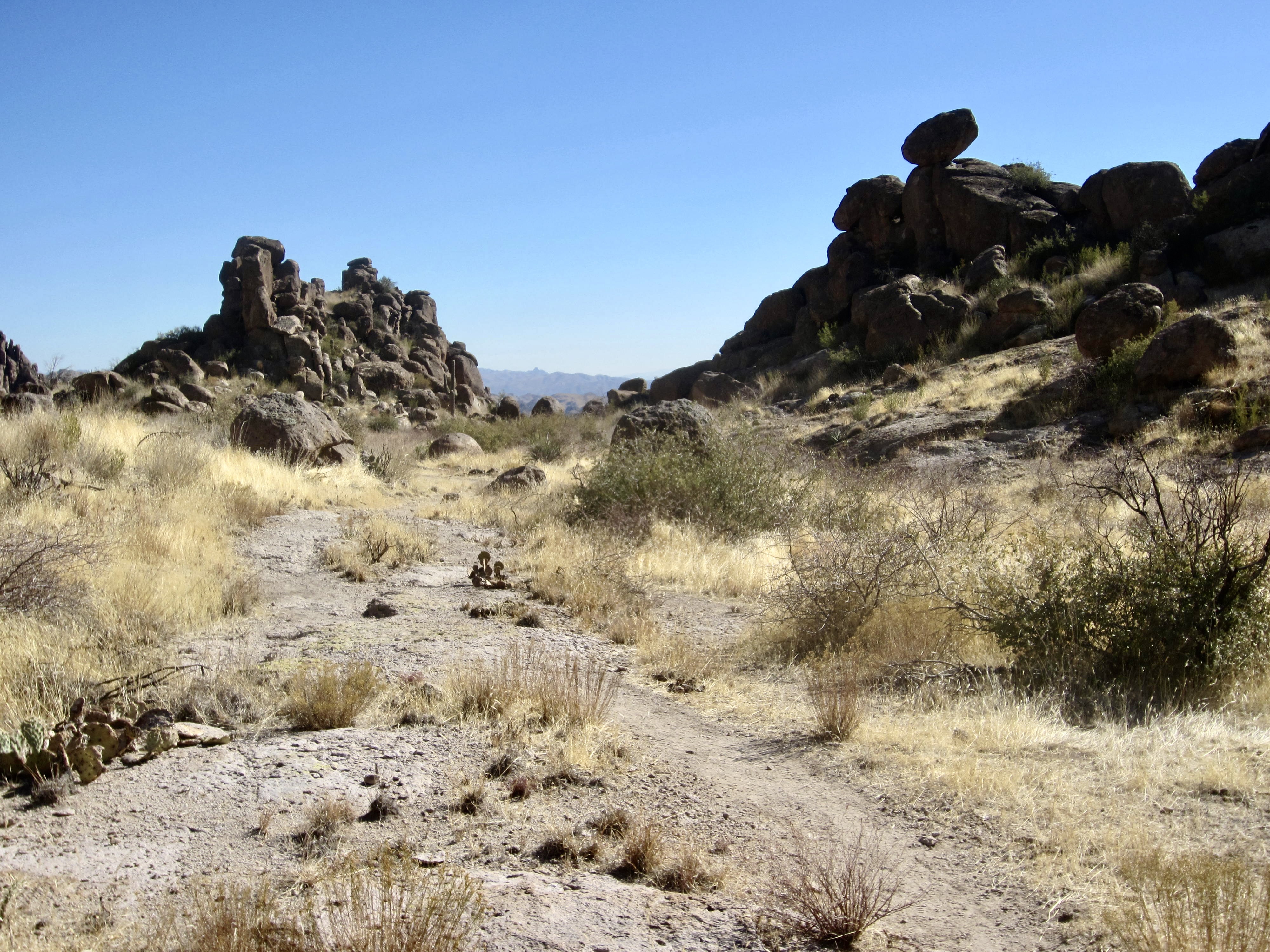
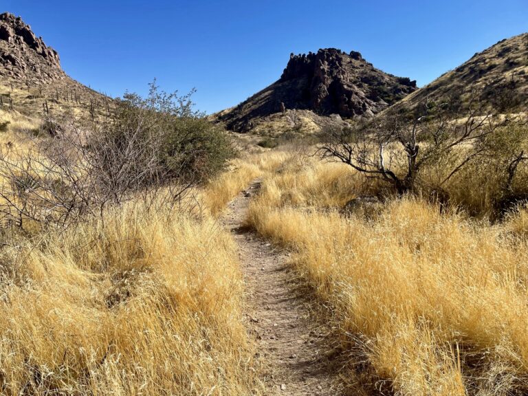
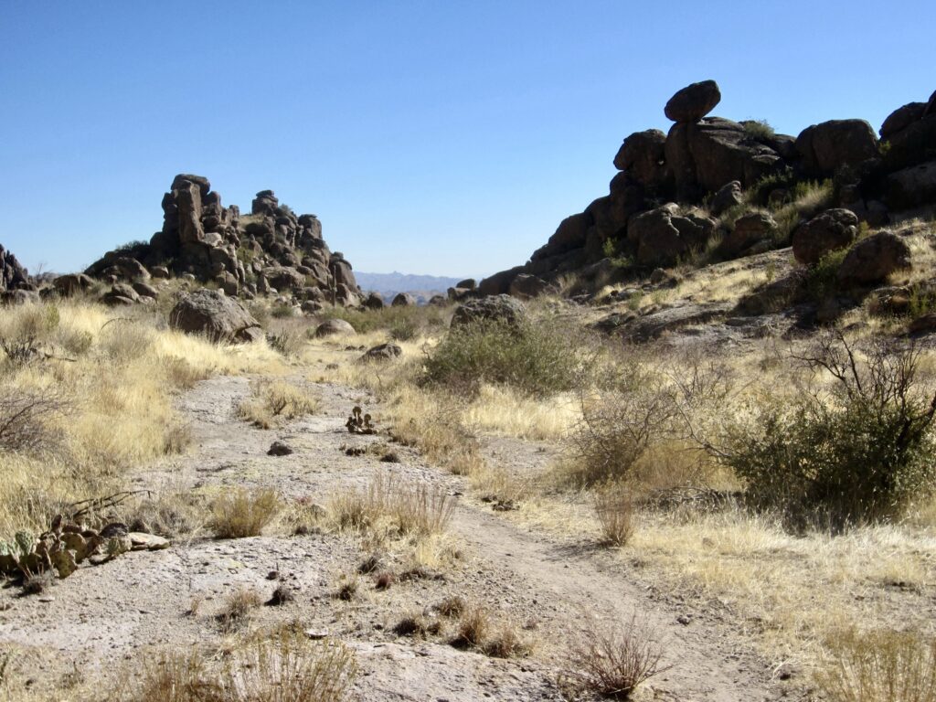
Bark’s Canyon was my favorite part of the circuit. Here, the Bluff Spring Trail wanders up and down through grassy flats and around craggy rock formations, delivering pleasant little surprises at every turn. Another surprise was the scarcity of hikers on this outstanding circuit; since leaving Fremont Saddle 8 miles ago, I had seen only a half-dozen other people.
.
After climbing over a series of small spur ridges, the Bluff Spring Trail makes a final steep descent to the desert floor. I passed several groups of day-hikers and crag climbers in this last mile before arriving at the still-busy Peralta Trailhead in mid-afternoon (6.9 hours + 12.3 miles + 2900 feet for total loop).
.
Route Map & Profile
…
…
Photo Gallery
Click to enlarge…