Originally Posted: February 2024
Updated: December 2025
Tinkham Pass Ski Tour
Mill Creek Bridge
Jim Brooks Warming Hut
Windy Pass
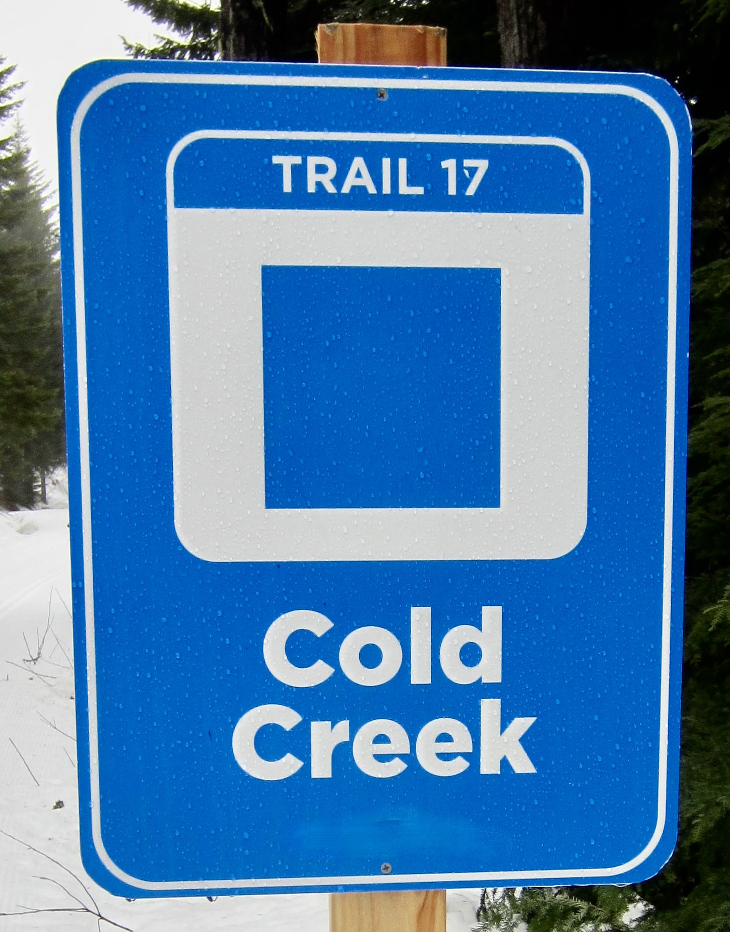
Cold Creek Saddle
Cold Creek Pond
Tinkham Pass
- Route Summary
- Related Post
- Information Sources
- Route Overview
- Parking Comments
- Full Route Description
- Segment 1A: Hyak Sno-Park to Mill Creek Bridge
- Segment 1B: Hyak Ski Area to Mill Creek Bridge
- Segment 2: Mill Creek Bridge to Windy Pass
- Segment 3: Windy Pass to Tinkham Pass
- Return from Tinkham Pass to Hyak
- Equipment Comments
- Route Maps & Profiles & Photogram
- Photo Gallery
Route Summary
Region: Central Washington Cascades
Sub-Region: Iron Horse Mountains
Area: Okanogan–Wenatchee National Forest
Option 1: Hyak Sno-Park to Tinkham Pass
Starting & Ending Point: Hyak Sno-Park off Interstate-90 at Exit 54 (Elev. 2550 feet)
Way Points: Connector Trail junction & Cold Creek Trail junction & Mill Creek Bridge & Jim Brooks Warming Hut & Windy Pass & Cold Creek Saddle & Cold Creek Pond & Tinkham Pass (ski tour)
Approximate Stats: 15.2 miles traveled; 2400 feet gained & lost.
Option 2: Hyak Ski Area to Tinkham Pass
Starting & Ending Point: Hyak (Summit East) Ski Area base lodge off Interstate-90 at Exit 54 (Elev. 2600 feet)
Way Points: Cold Creek Trail junction & Connector Trail junction & Mill Creek Bridge & Jim Brooks Warming Hut & Windy Pass & Cold Creek Saddle & Cold Creek Pond & Tinkham Pass (ski tour)
Approximate Stats: 15.2 miles traveled; 2550 feet gained & lost.
Related Post
>>> Tinkham Pass Ski Tour via Roaring Creek—Lost Lake—Mirror Lake (detailed route description)
Information Sources
The following links provide helpful information for planning this ski tour. Even these information sources, however, should not be taken as a substitute for having the fitness, knowledge, equipment, and clothing required for ski touring.
>>> Grooming report for Summit at Snoqualmie nordic trails & Mt Catherine Loop
>>> WSDOT road reports for Interstate-90 and Snoqualmie Pass
>>> National Weather Service weather forecast for Snoqualmie Pass area
>>> Northwest Avalanche Center avalanche forecast for Snoqualmie Pass area
>>> Other easy to intermediate ski tours in the I-90 / Snoqualmie Pass corridor
Route Overview
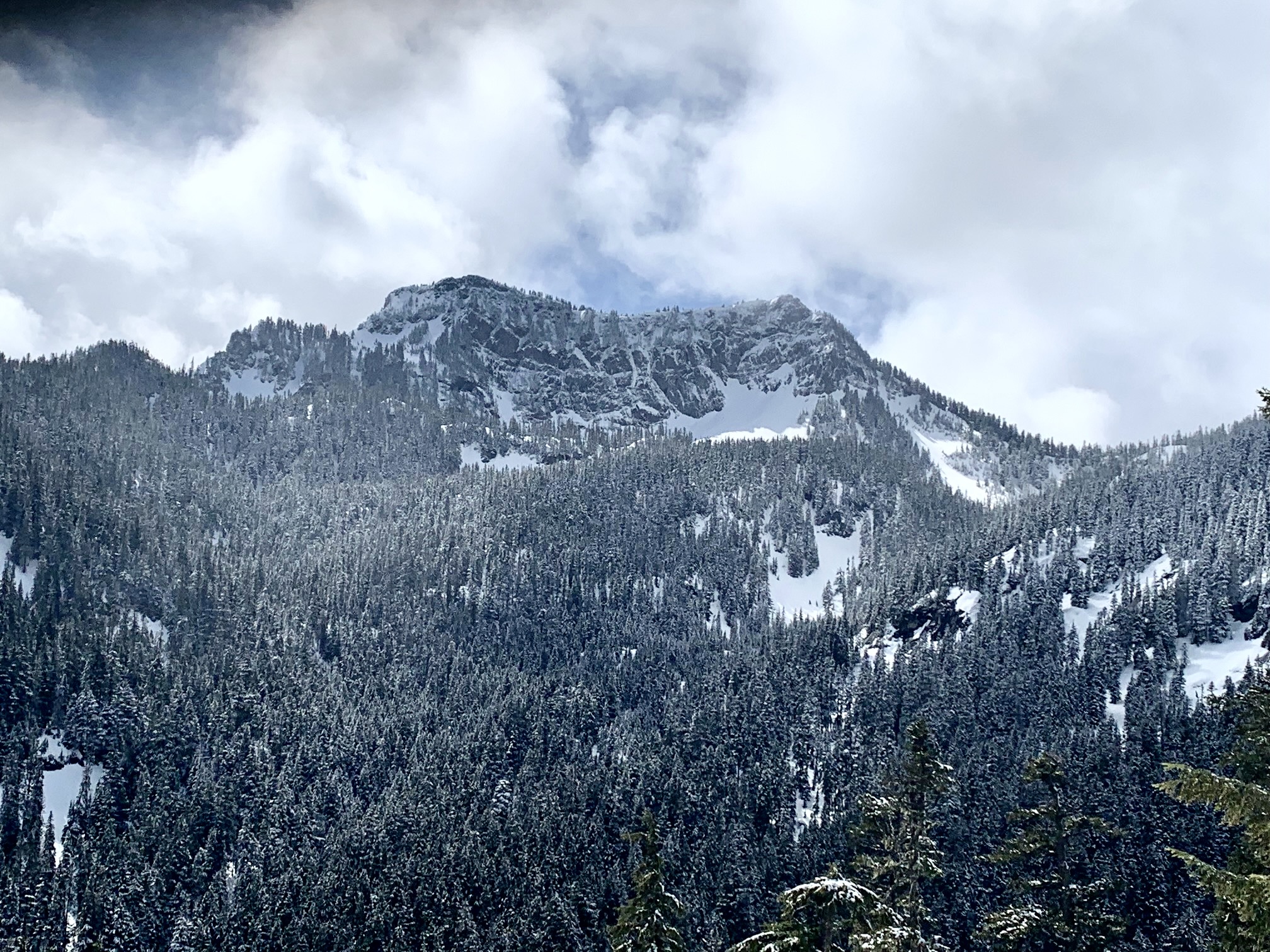
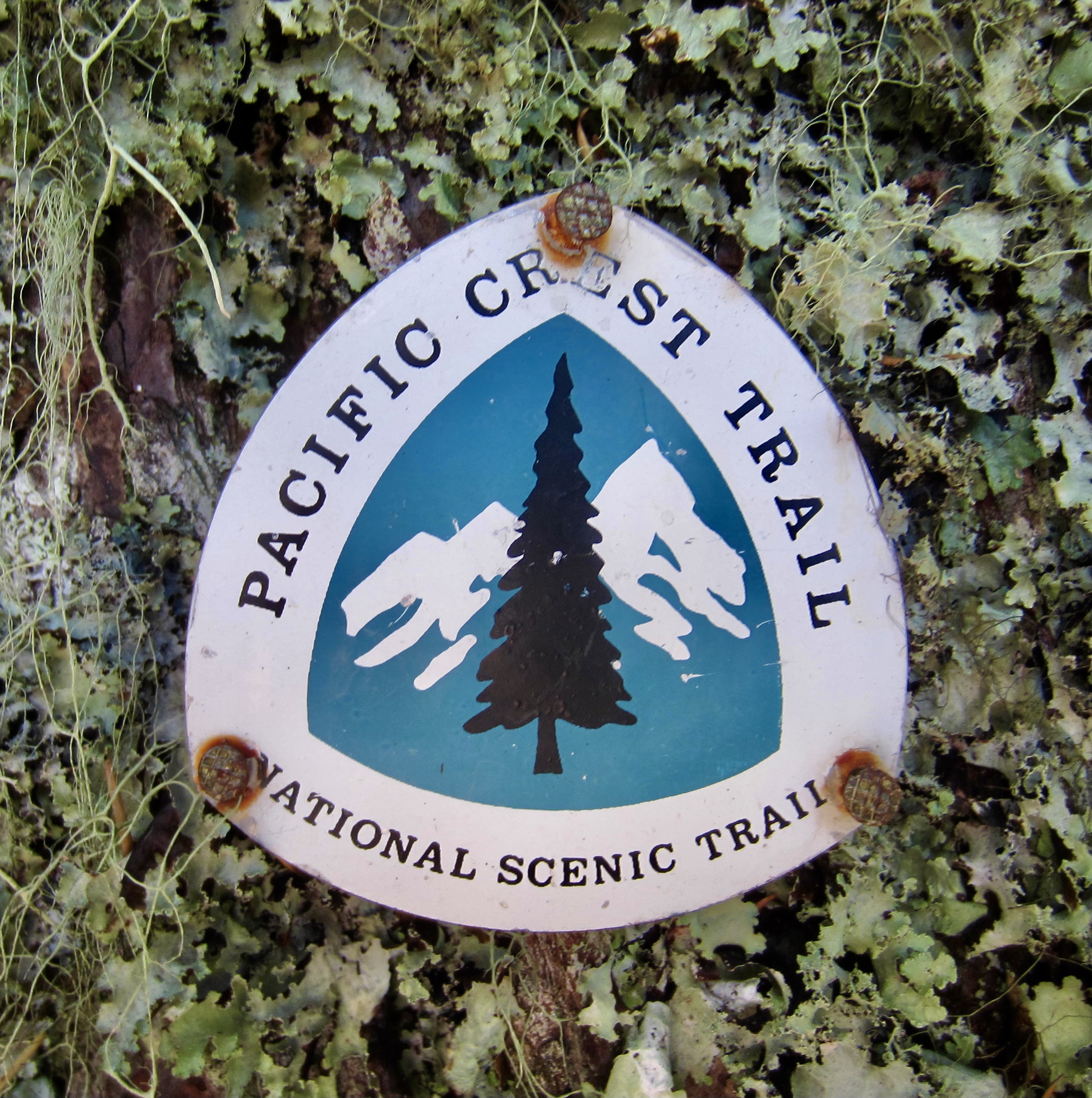
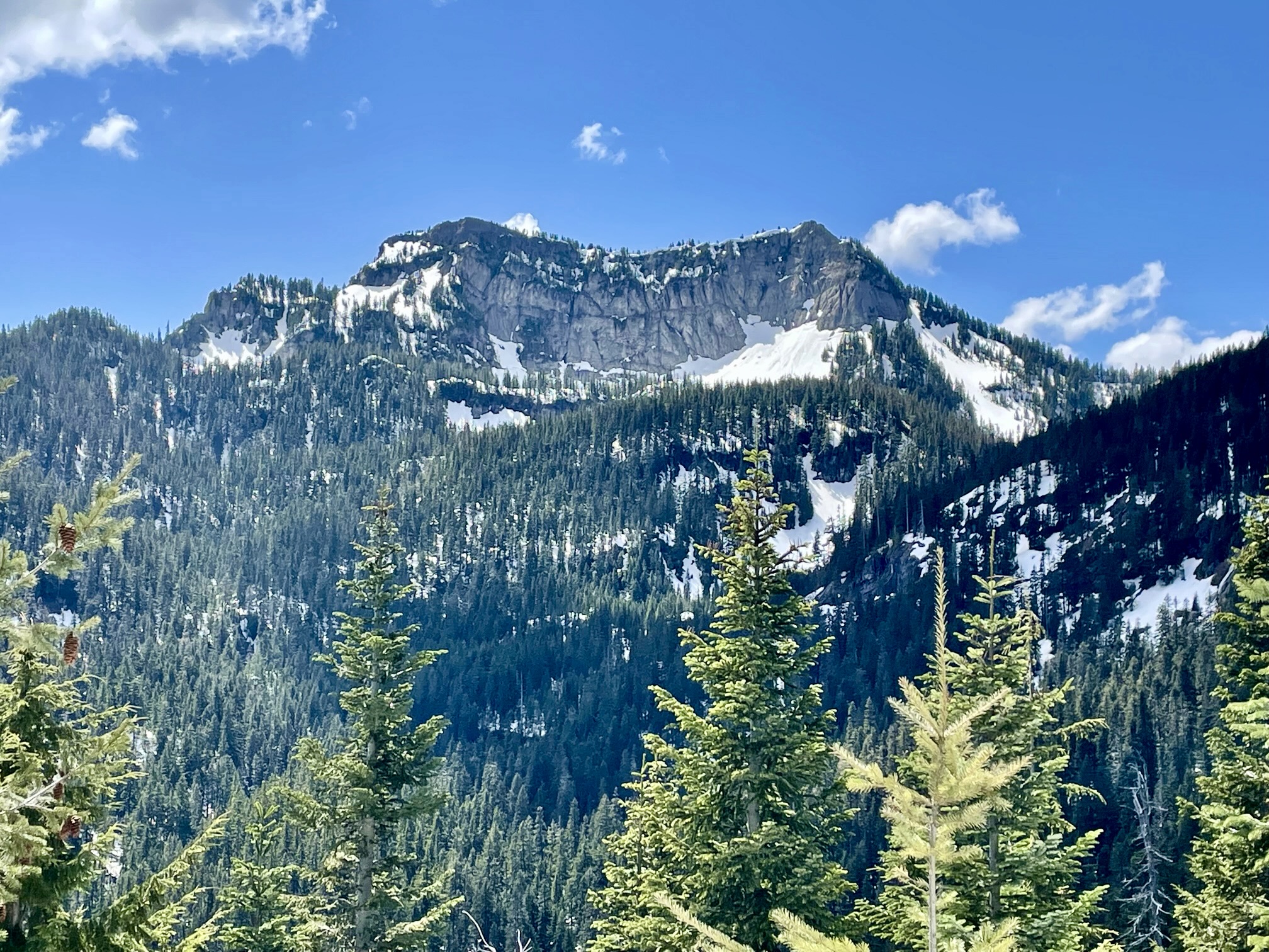
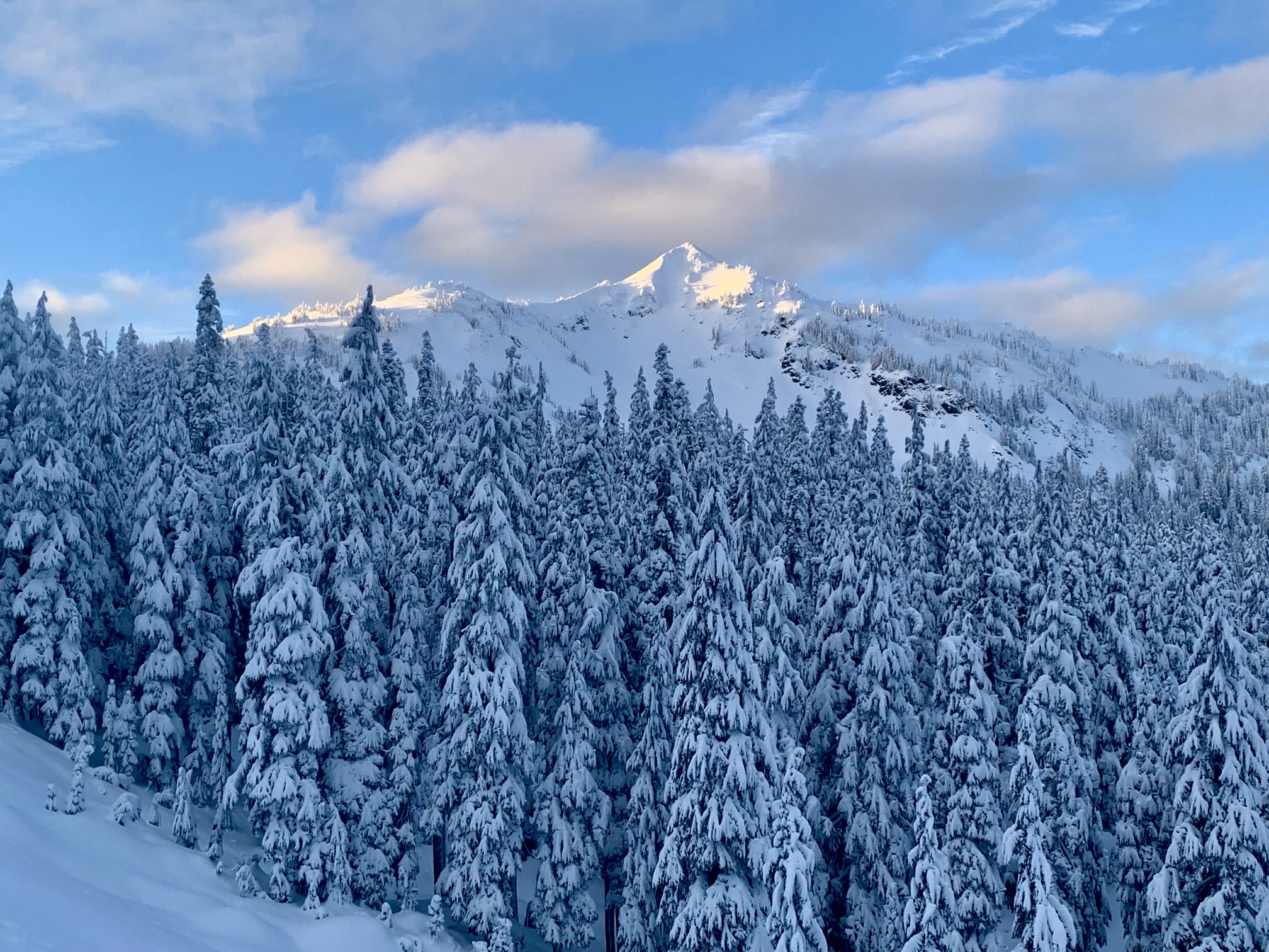
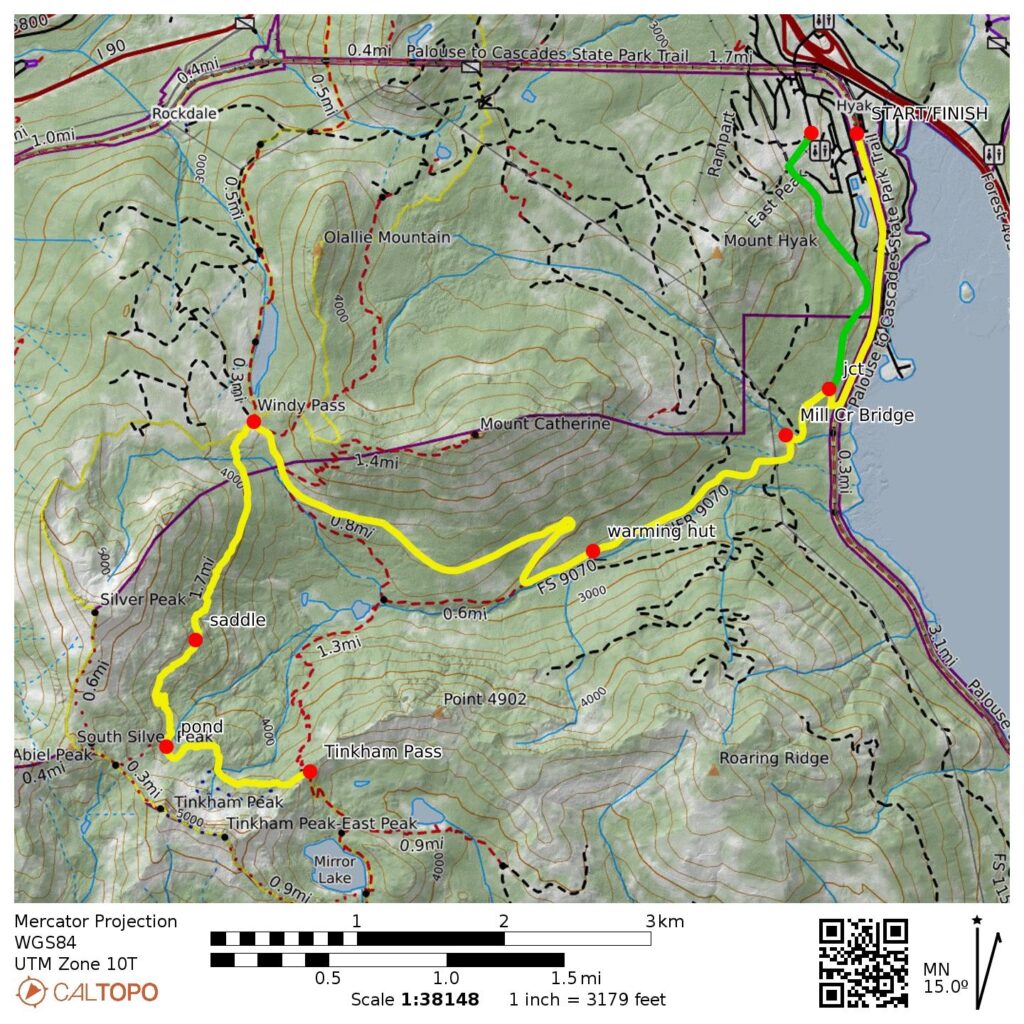
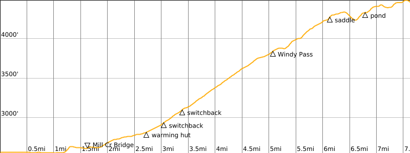
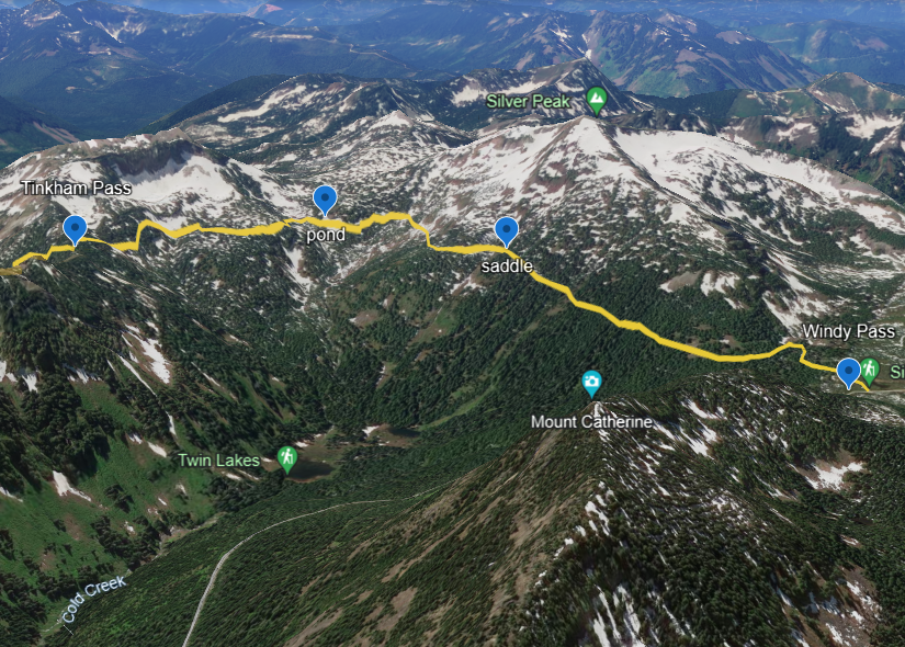
Tinkham Pass is a 4500-foot saddle located in the Iron Horse Mountains south of Snoqualmie Pass and west of Keechelus Lake. Summertime hikers know it as the place where the Pacific Crest Trail (PCT) crosses over the northeastern ridge of Tinkham Peak. As a backcountry ski-touring destination, however, it might be the best-kept secret in the Snoqualmie Pass area. The round-trip distance from Hyak to Tinkham Pass is approximately 15 miles, with a cumulative elevation gain approaching 2600 feet, all of which makes for a fairly strenuous but satisfying ski tour.
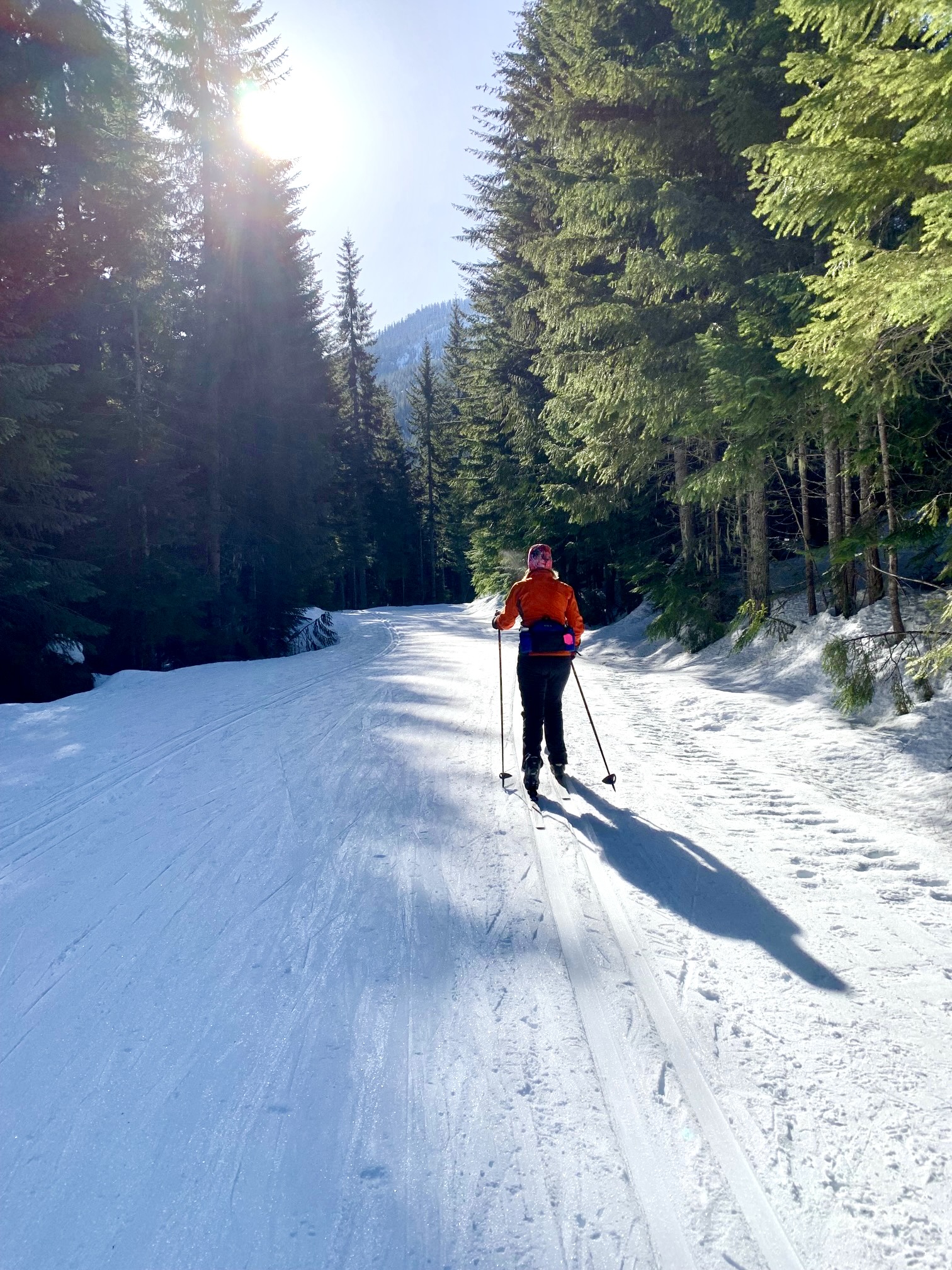
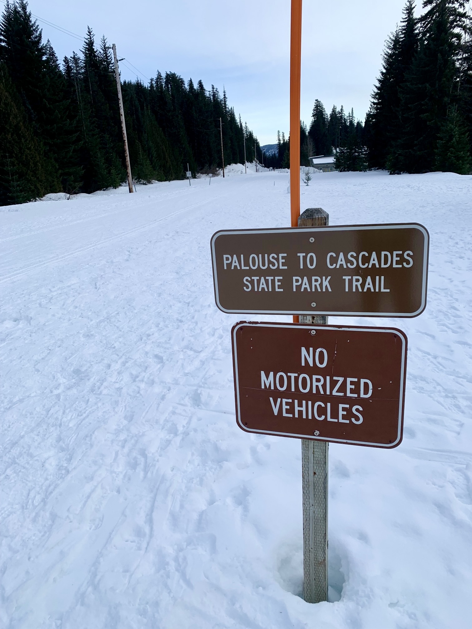
The Tinkham Pass Ski Tour is a “hybrid tour” in the sense that it involves two distinctly different types of terrain. The first 5-mile segment, from Hyak to Windy Pass, follows the Palouse-to-Cascades Trail (P2C Trail) and/or Cold Creek Trail, both of which are typically well-groomed for cross-country skiing. Please note that dogs are not allowed on either of these ski trails. The last 2½-mile segment, from Windy Pass to Tinkham Pass, roughly follows the PCT through backcountry forest and across some steep, open slopes. As such, good mountain skills and avalanche awareness are required. This tour should never be attempted during periods of unstable snow.

…
Parking Comments
There are two possible starting points for the Tinkham Pass Ski Tour, each of which involves certain parking challenges. Specifically, these are (A) the Hyak Sno-Park and (B) the Hyak (Summit East) Ski Area. Both are accessed from Exit 54 on Interstate-90.
Hyak Sno-Park requires a Washington State Sno-Park permit with a “special groomed-area sticker.” This is a large parking lot, but be aware that it fills up quickly on weekends and holidays, so it is advisable to arrive early (before 10:00am). Also, be aware that the parking lot does not open until 8:00am and is closed and gated at dusk, so plan your tour accordingly—especially during the short days of December and January.
Hyak (Summit East) Ski Area does not require a sno-park permit. However, when the ski area is operating (lately, this has been Fridays, Saturdays, Sundays, Christmas break, MLK Day, and Presidents Day, from 9:00am to 4:00pm), a nordic trail pass (purchased in advance) is required to park in the lot and use the northernmost mile of the Cold Creek Trail. If you don’t want to buy a pass, you have three options:
- Complete the loop in early winter, before the ski area opens for the season (usually in late December or early January), or later in the springtime, after the ski area closes for the season (usually in late March or early April).
- Complete the loop on one of the non-operational days (typically Monday through Thursday, except for the special days mentioned above).
- Take a detour that bypasses the private part of the groomed road by using the Palouse-to-Cascades Trail (formerly called the John Wayne Trail). This bypass involves the hassle of a short boot descent through moderately steep forest, a 1-mile ski to the Hyak Sno-Park, and a ½-mile walk on paved roads back to your starting point. However, it does not add much total distance.
Full Route Description
My recommended skiing route to Tinkham Pass is described in four segments, as follows: Hyak Sno-Park (starting point “A”) to Mill Creek Bridge; Hyak Ski Area (starting point “B”) to Mill Creek Bridge; Mill Creek Bridge to Windy Pass; and Windy Pass to Tinkham Pass.
Segment 1A: Hyak Sno-Park to Mill Creek Bridge
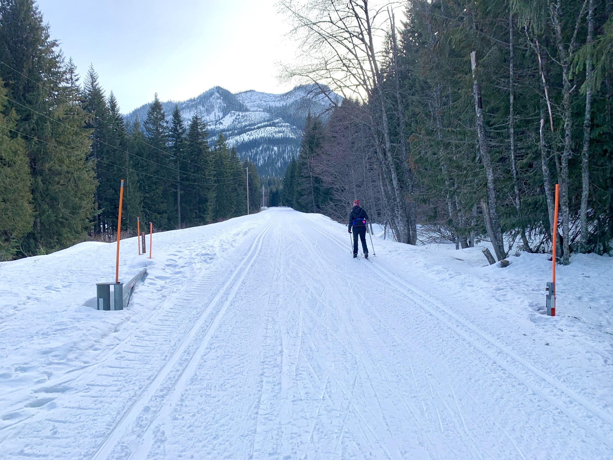
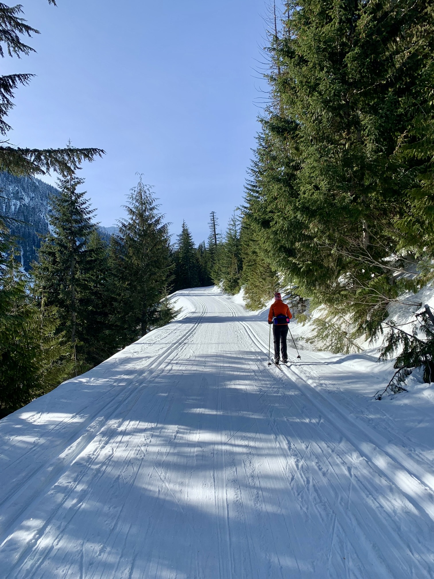
If starting from Hyak Sno-Park, ski southward on the wide, flat P2C Trail. The first mile of this trail makes a series of very slight right-hand curves as it bends around the hillside, and you will eventually pass through an open steel gate marked with orange poles. This gate is located on a long straightaway.
.
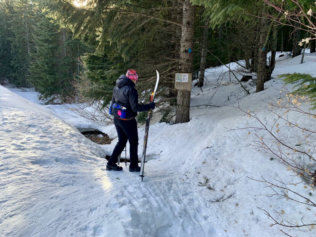
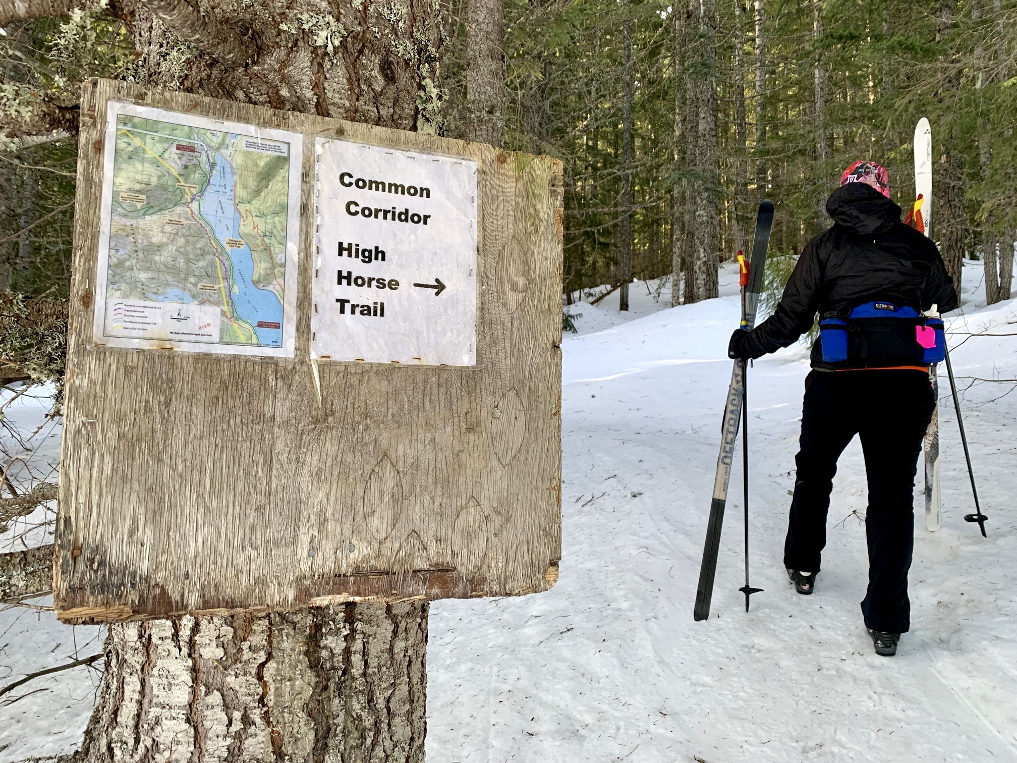
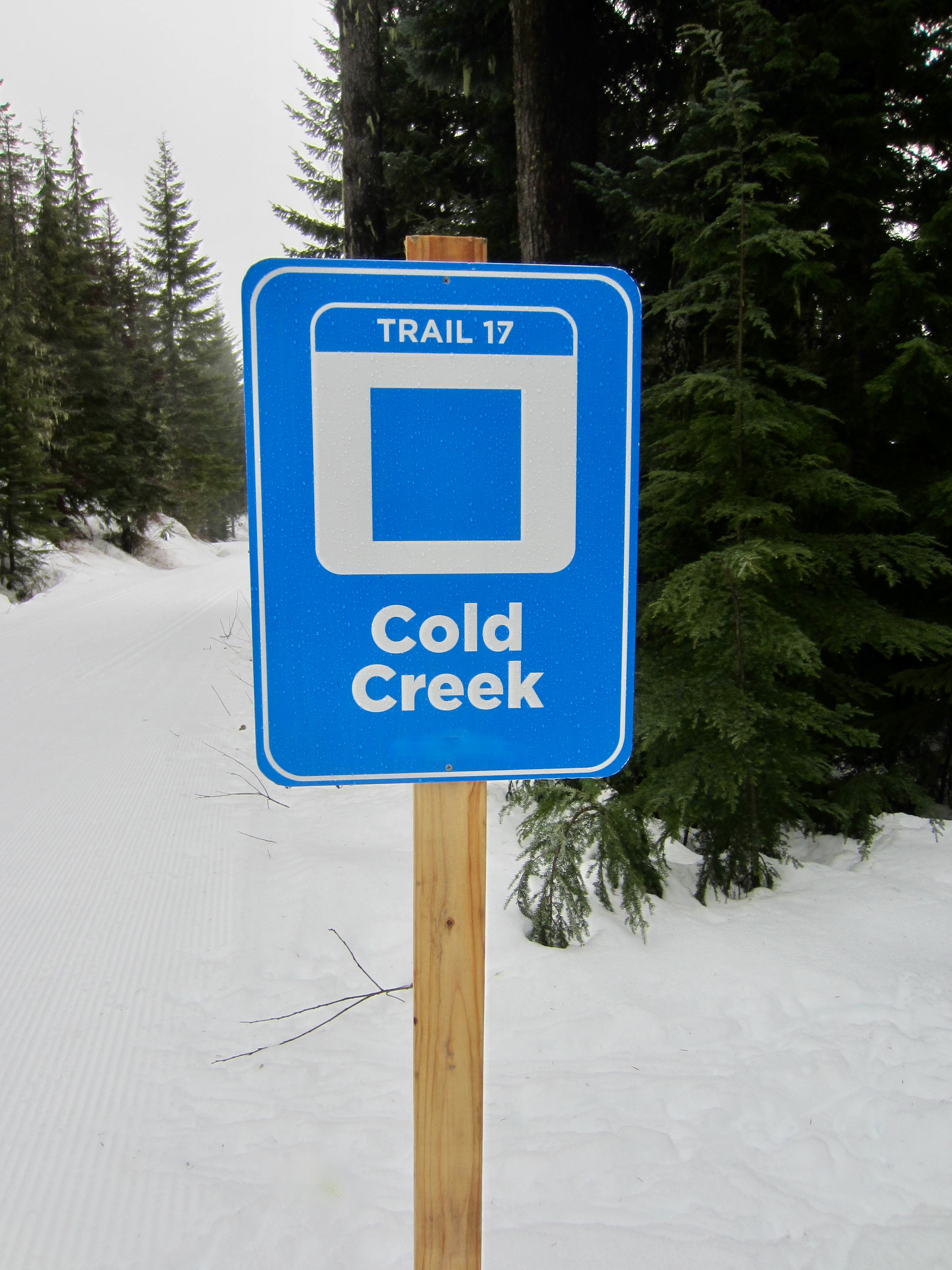
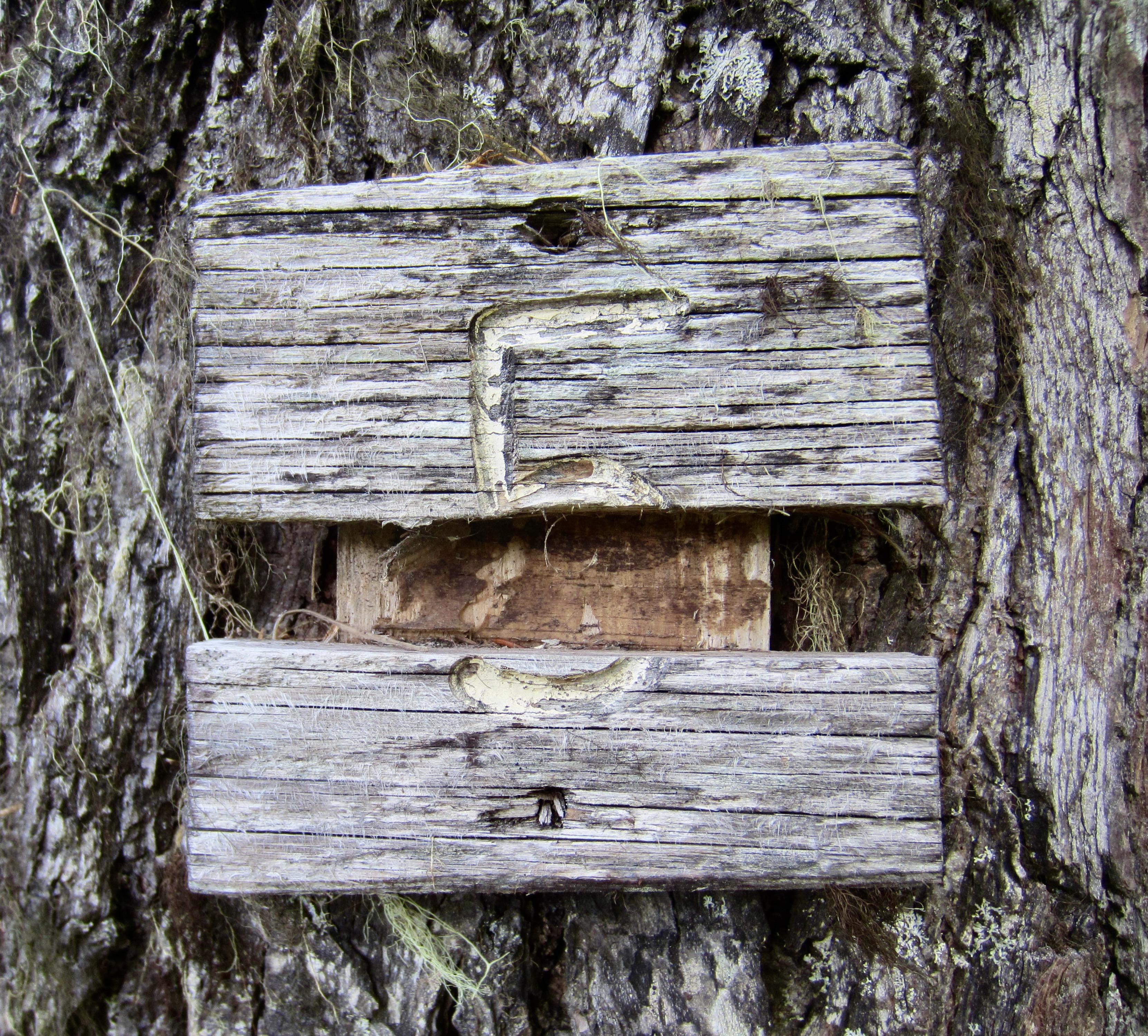
At the end of the long straightaway, the P2C Trail curves slightly back to the left. Just before this left-hand curve (at a point 1¼ miles from the sno-park) look closely to your right for the Connector Trail heading across a ditch and into the forest. This vague trail can be identified by a plywood signboard and a blue diamond nailed to a tree. It is easy to miss the start, so keep a sharp eye out. If you come to a small restroom building on the right side of the P2C Trail, you have gone too far; go back ¼ mile and look for the signboard.
.
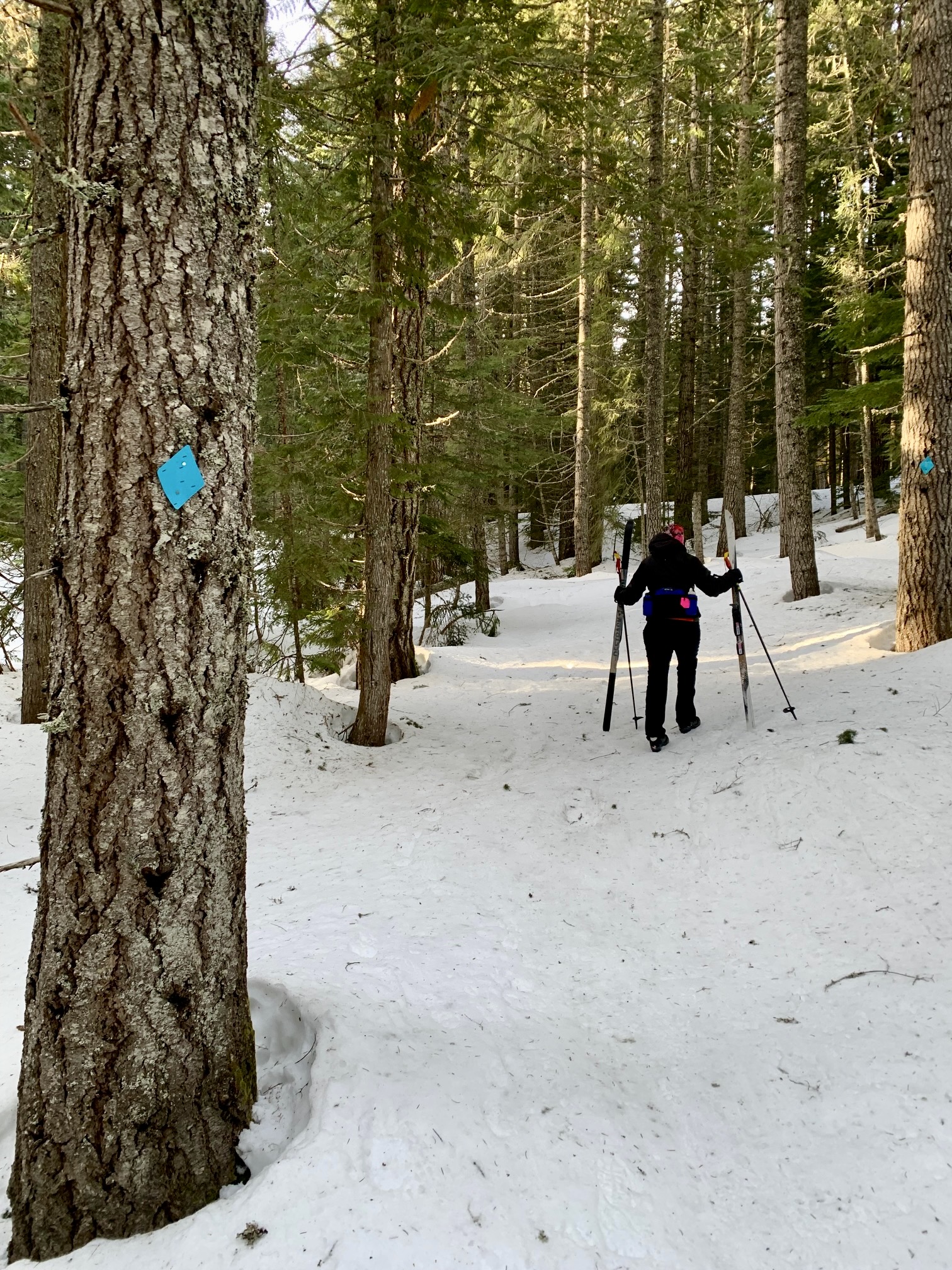
The Connector Trail is little more than a passageway leading up through the forest. Usually, but not always, it will be tracked out by skis and boots, creating a firm crust. I typically elect to remove my skis and simply boot up this trail, following tracks and blue diamonds the whole way.
.
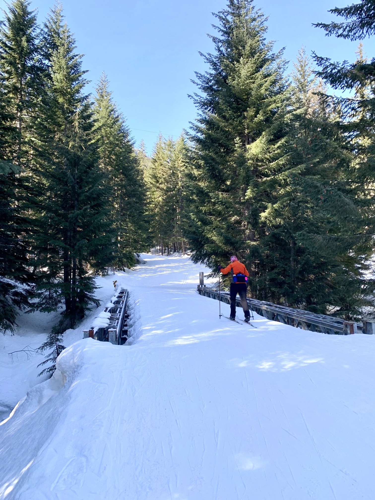
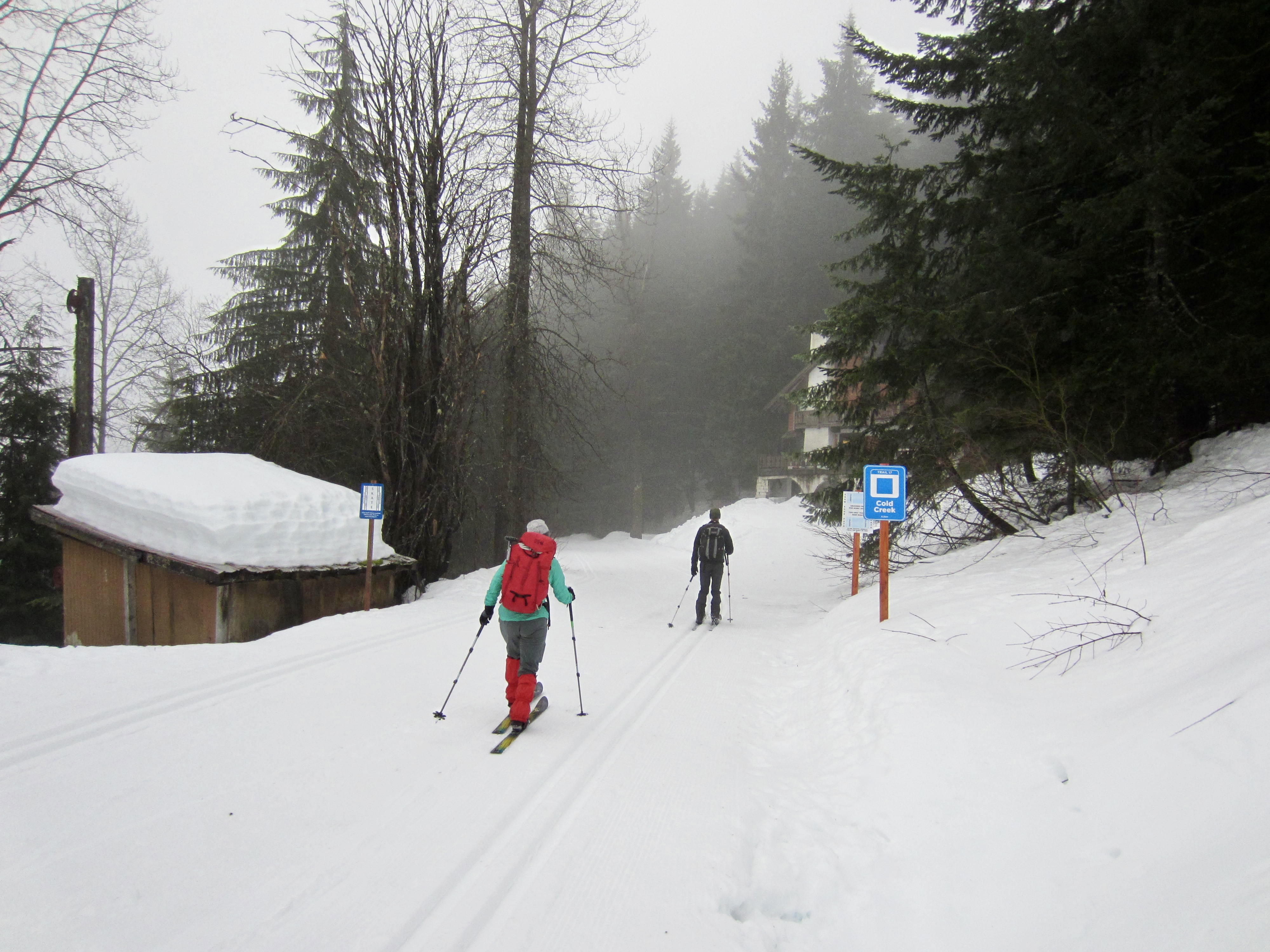
After a short skiing or walking distance of 150 yards, you will arrive at the Cold Creek Trail and beginning of the Common Corridor. Turn left here and start skiing southward on this wide, flat trail, which is part of the popular Mt. Catherine Loop. As such, it is regularly groomed throughout the ski season. You will immediately pass an oddly shaped pumphouse building, then make a sweeping right-hand curve and cross Mill Creek on a steel bridge.
.
Segment 1B: Hyak Ski Area to Mill Creek Bridge
If starting from the Hyak (Summit East) Ski Area, ascend the ski run for about 150 vertical feet from the base lodge. Angle toward the left edge, aiming for a point where the forest margin intersects a horizontal access road. Climbing skins make easy work of this moderately steep slope, but I usually manage to zigzag up using just my fishscale-base skis.
.
Upon reaching the horizontal access road, you will find yourself on the Cold Creek Trail. Turn left here and start skiing southward on this wide, flat trail, which is part of the popular Mt. Catherine Loop. It is regularly groomed throughout the ski season.
.
After 1 mile, you will pass the aforementioned pumphouse building and enter the Common Corridor. No nordic trail pass is required beyond this point. Shortly beyond, you will make a sweeping right-hand curve and cross Mill Creek on a steel bridge.
Segment 2: Mill Creek Bridge to Windy Pass
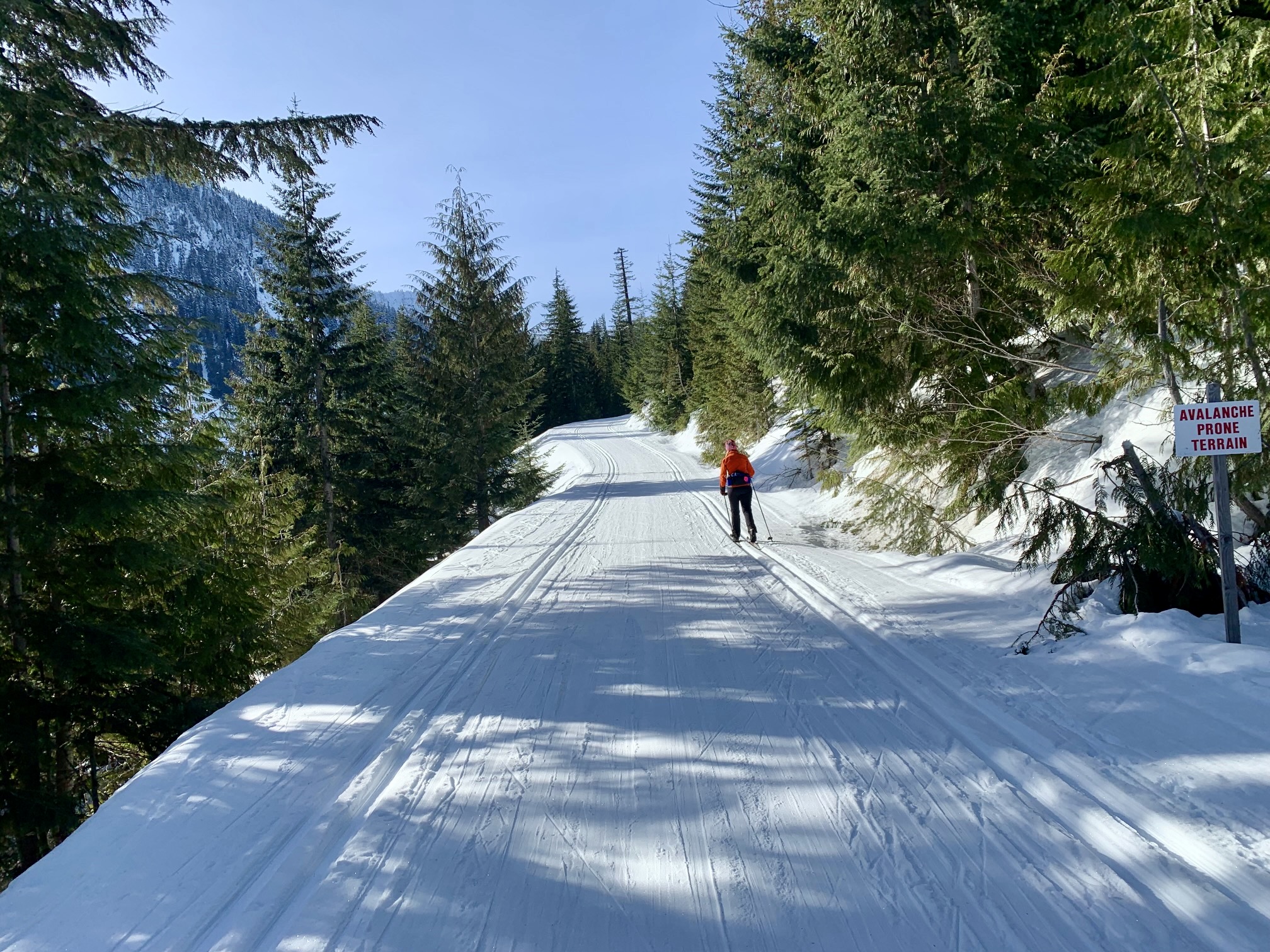
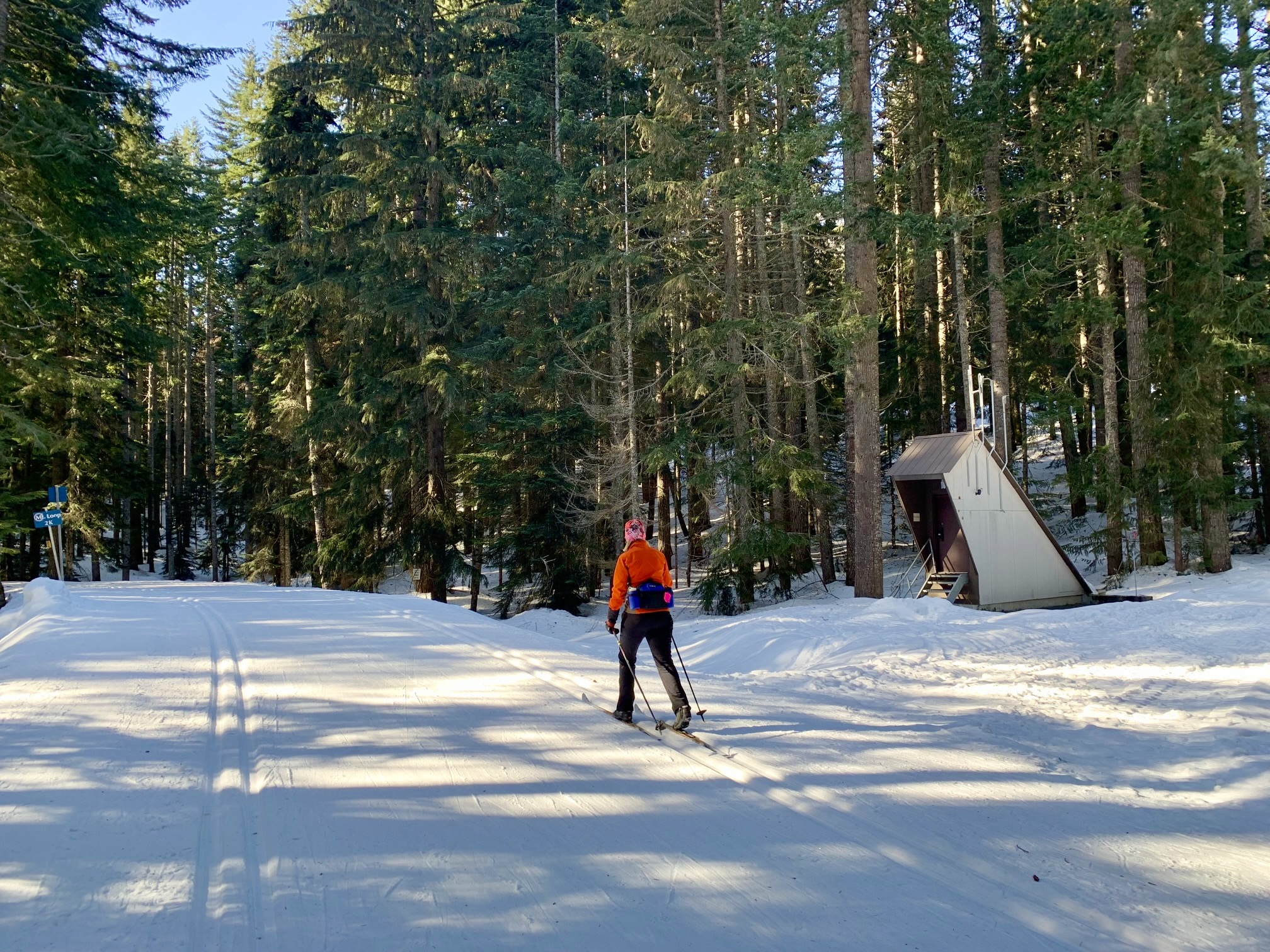
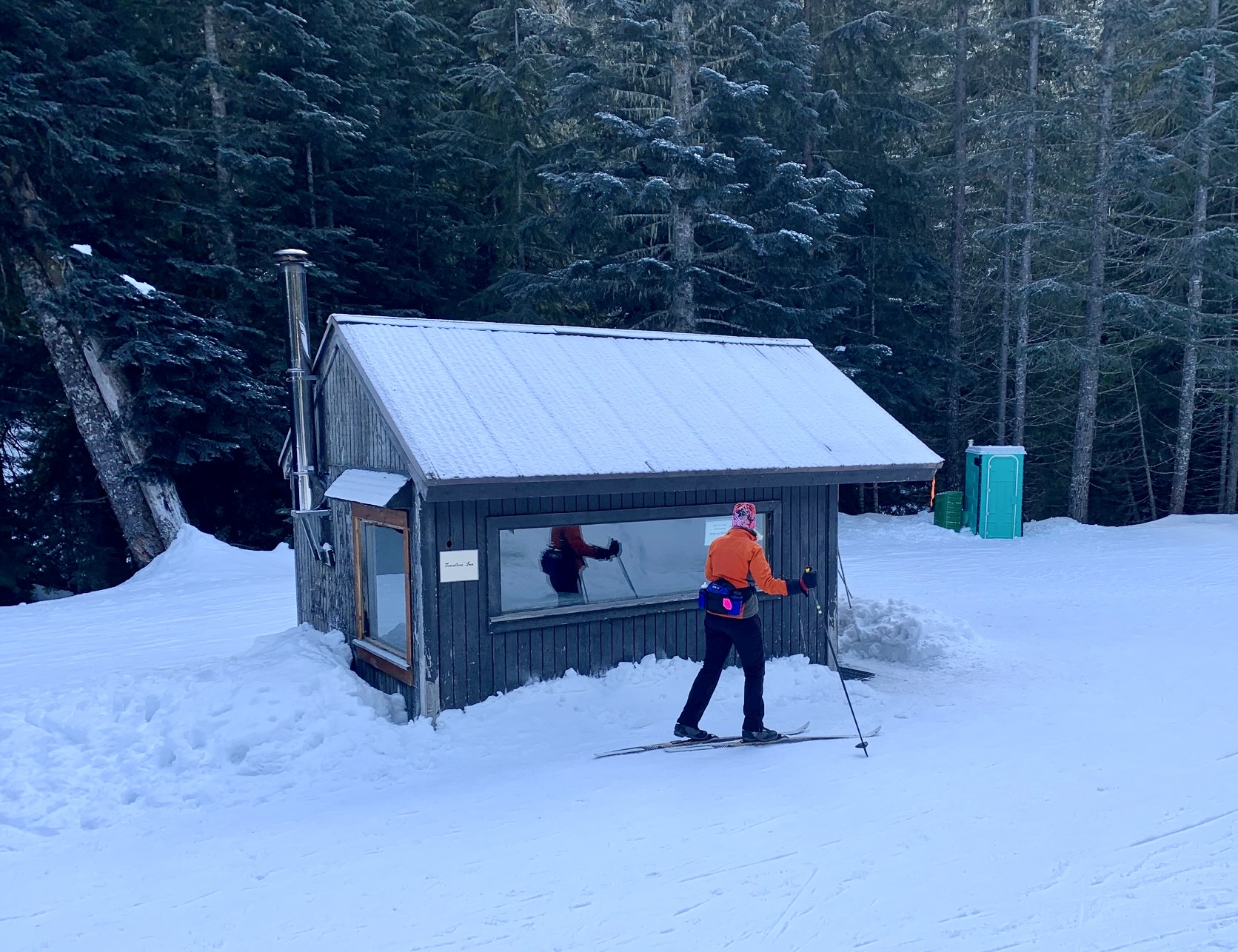
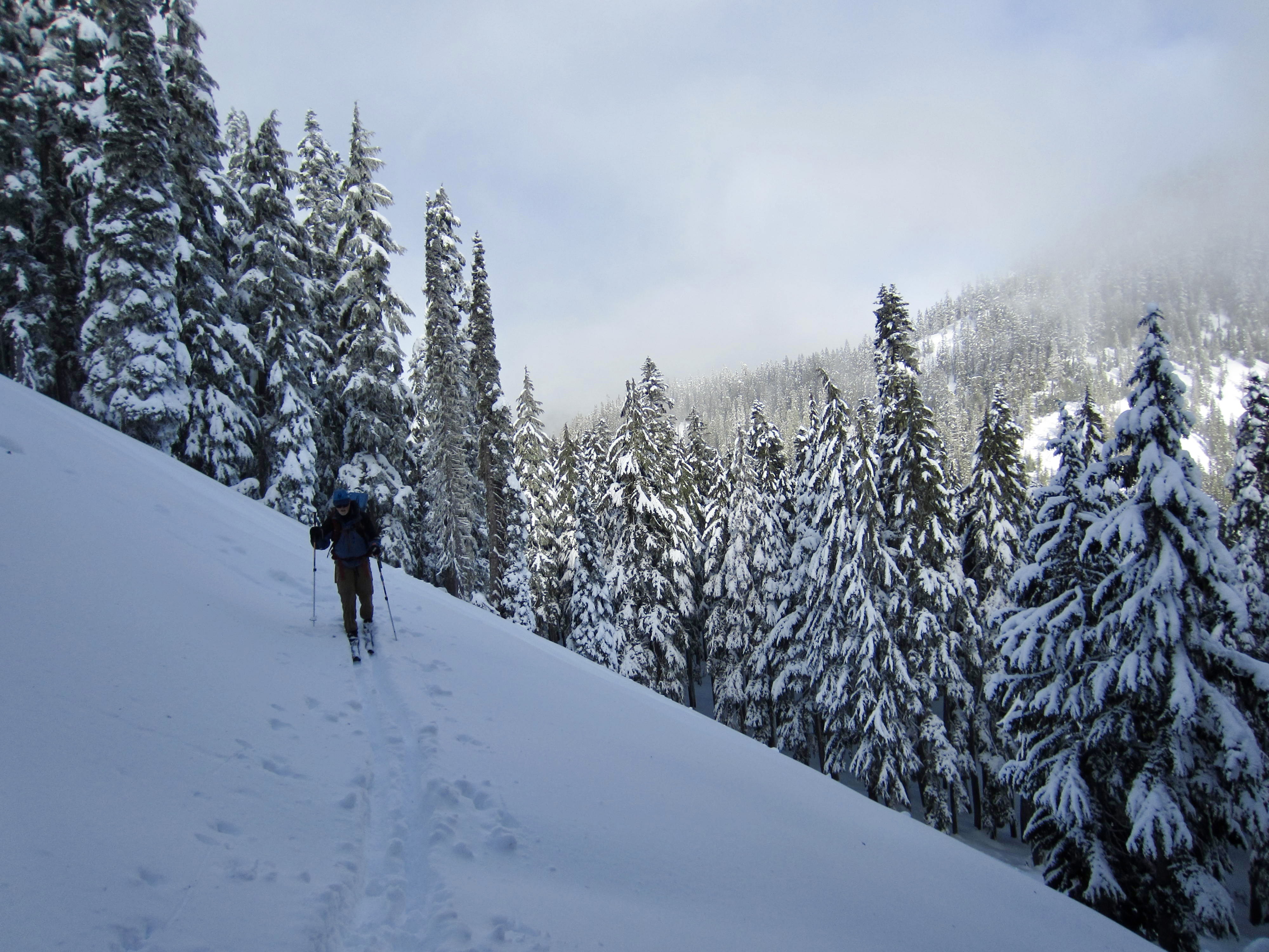
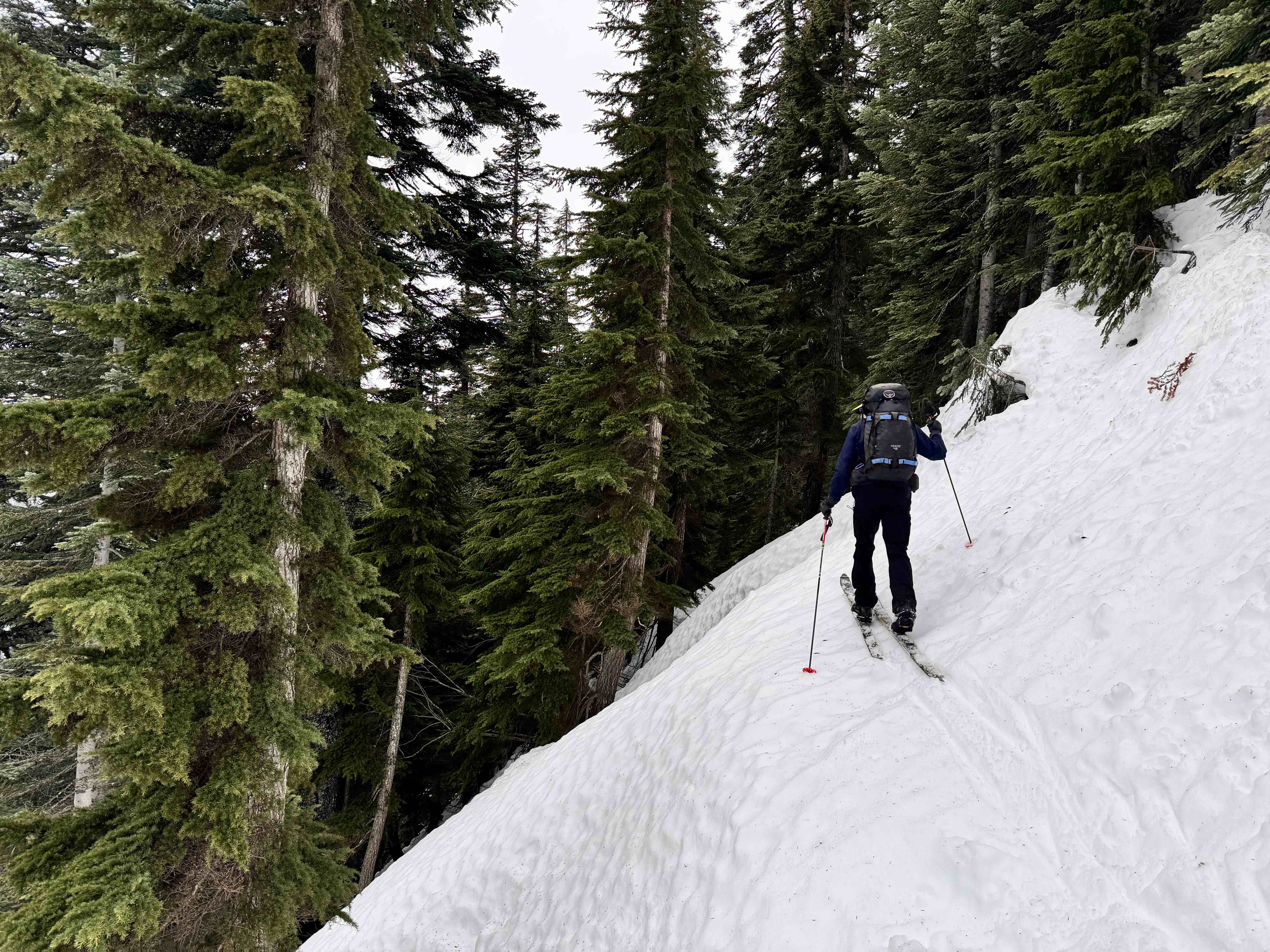
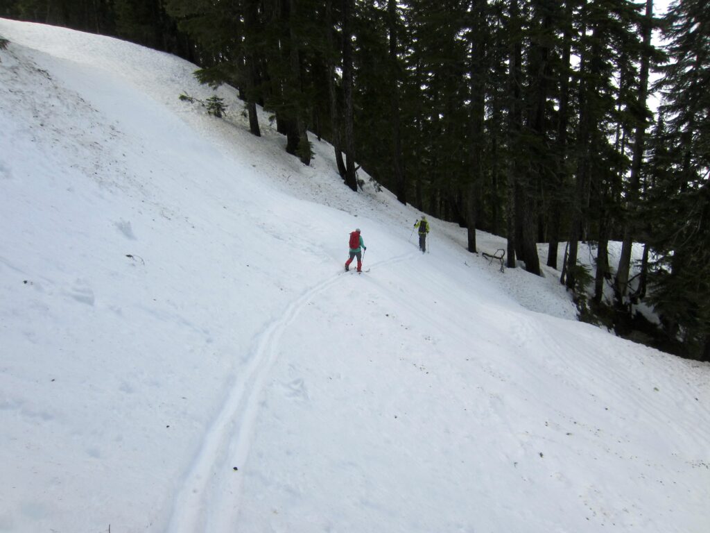
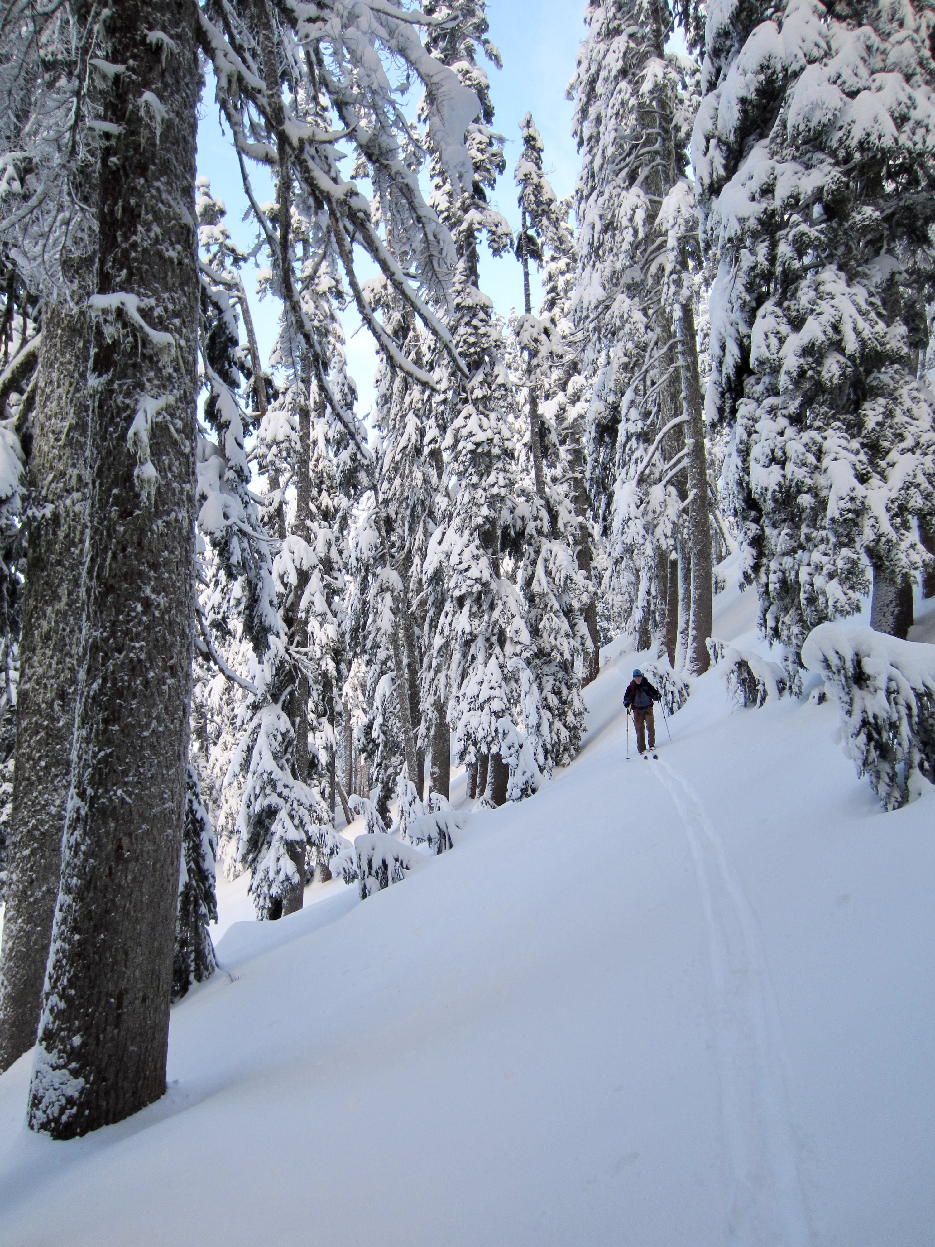
Immediately after crossing Mill Creek, continue skiing on the Cold Creek Trail as it heads uphill at a moderate gradient. In another mile, you will pass the Jim Brooks Warming Hut on your left. Further beyond, the trail makes a double switchback, then settles into a long, rising traverse across the forested hillslope of Cold Creek Valley. Fishscale-base skis are usually ideal for this entire ascent; otherwise, climbing skins will be needed.
.
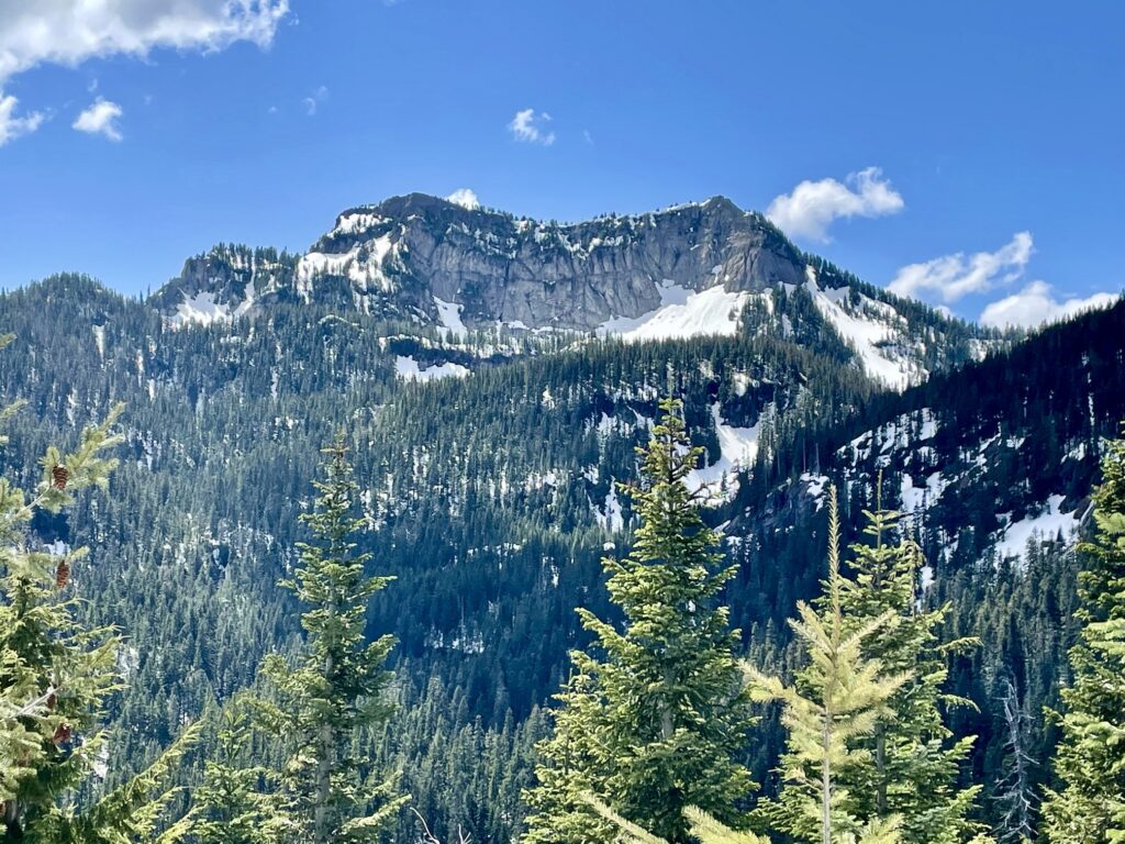
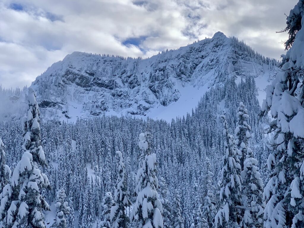
Views improve steadily as the trail gains elevation. On a clear day, you will be treated to a view of Tinkham Peak’s impressive north face, which is bordered by Tinkham Pass on the left and Cold Creek Pass on the right. Although not visible from here, the PCT cuts across the hillside just below this towering cirque.
.
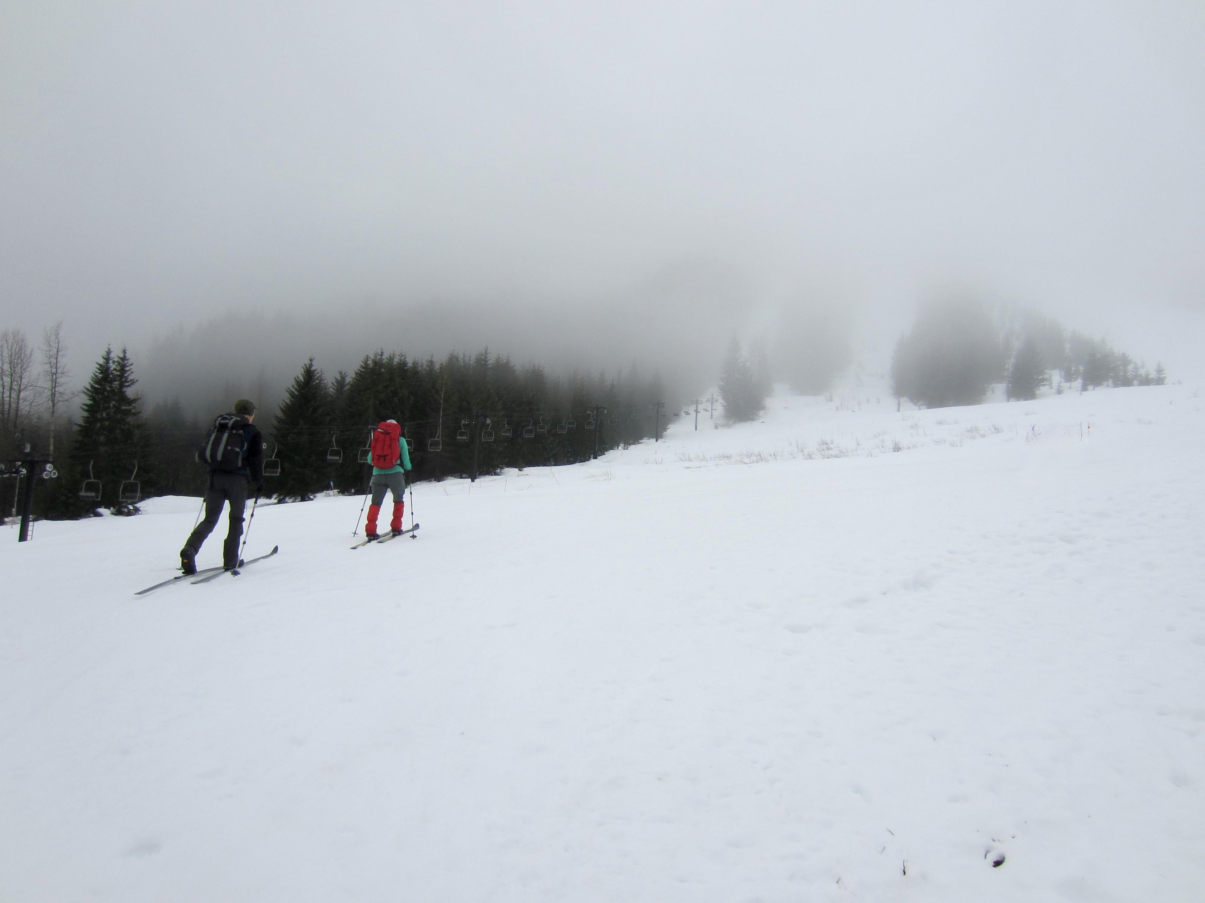
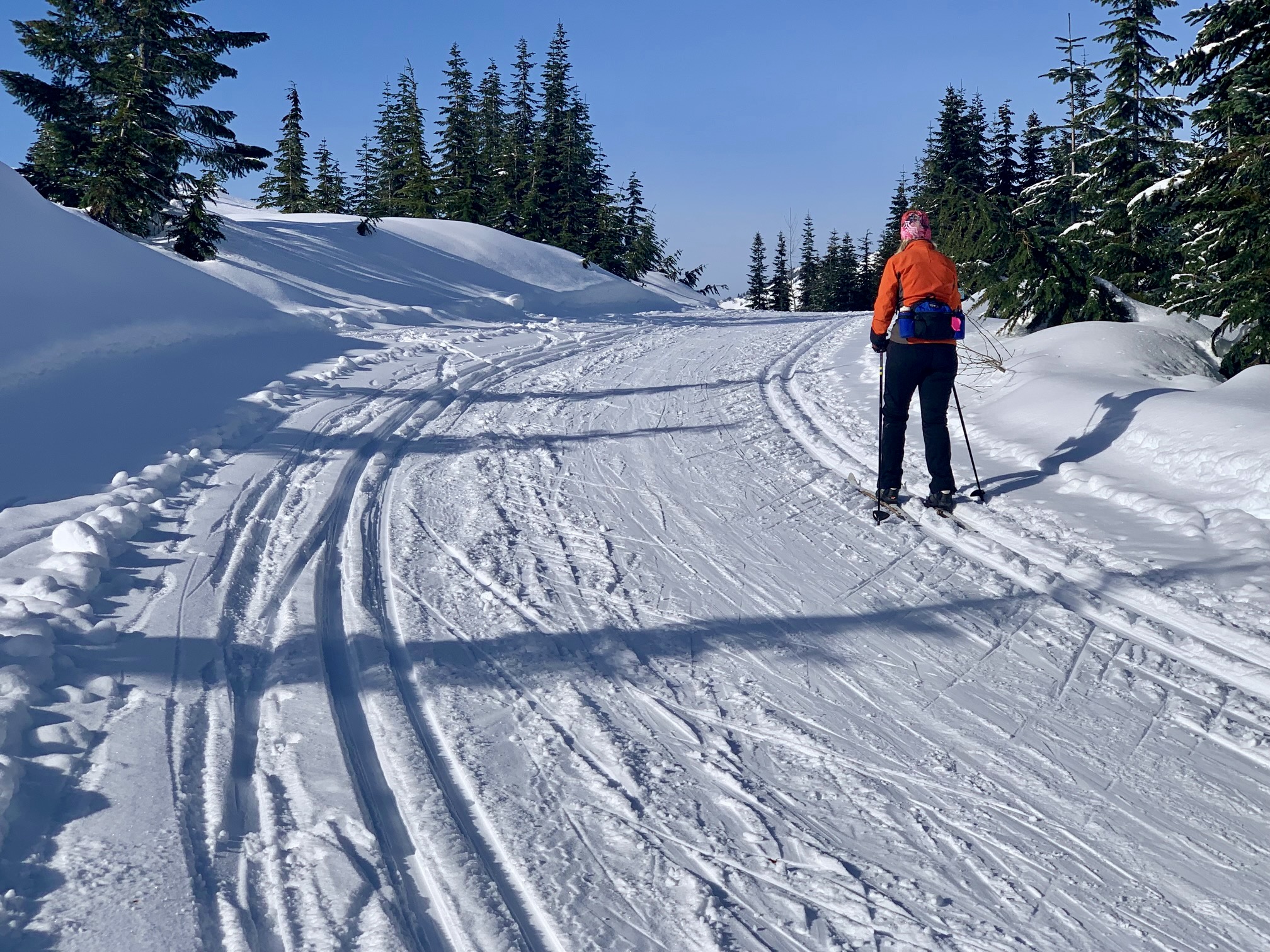
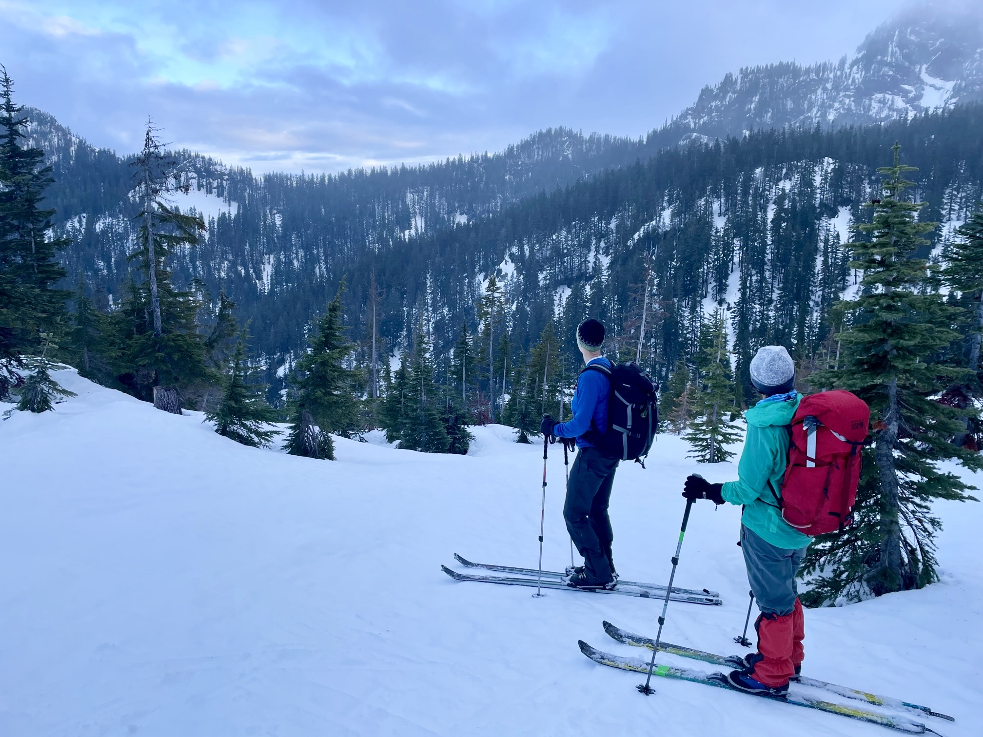
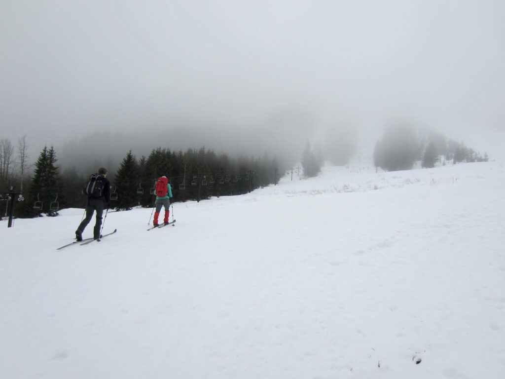
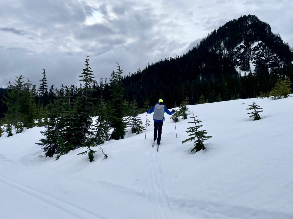
Eventually, the dense forest opens up and you will enter the sparsely forested expanse of Windy Acres—a not-so-old clearcut that is gradually growing back. Shortly beyond, the Cold Creek Trail tops out at 3800-foot Windy Pass (5.1 miles + 1350 feet from Hyak). This is a good place to deploy your climbing skins if you haven’t already done so.

.
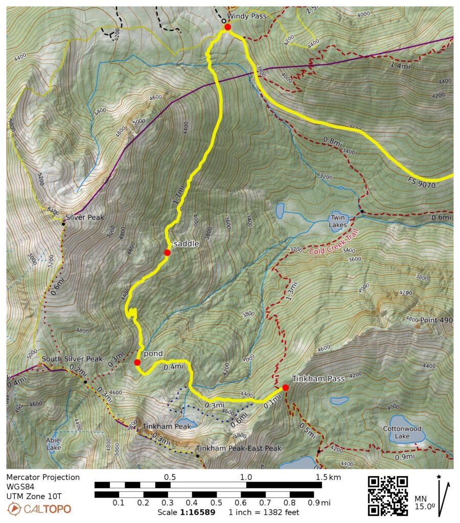
Segment 3: Windy Pass to Tinkham Pass
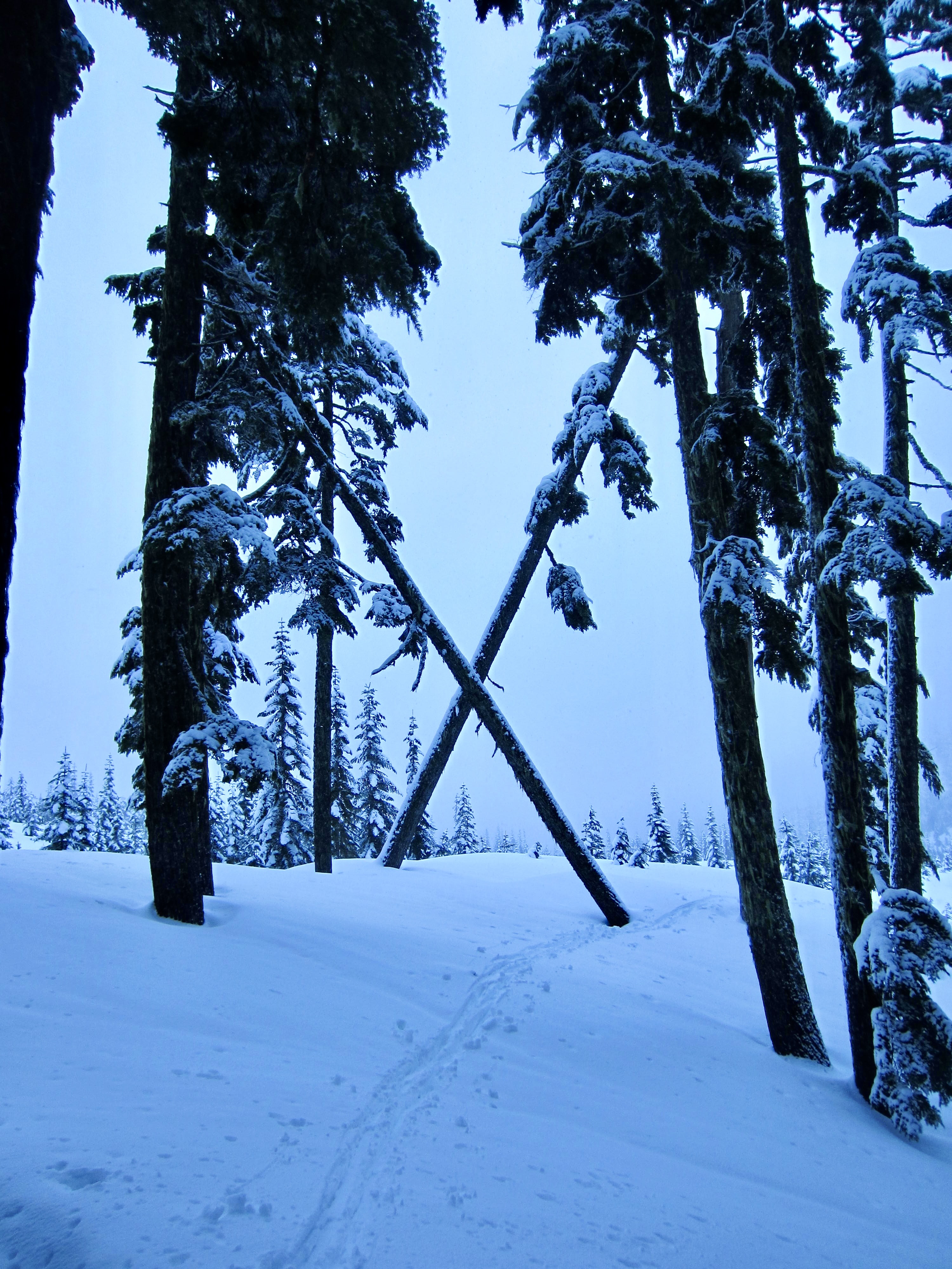
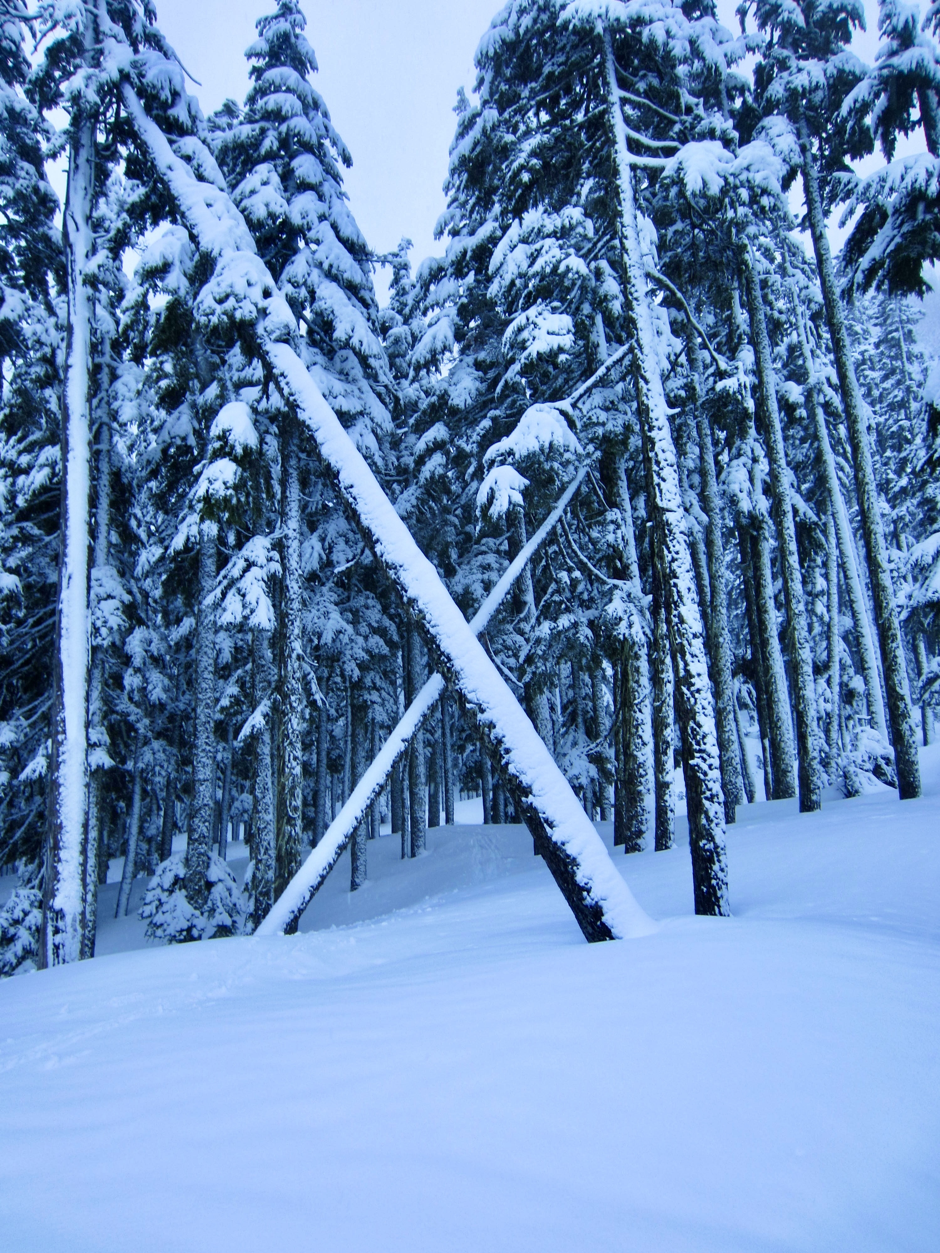
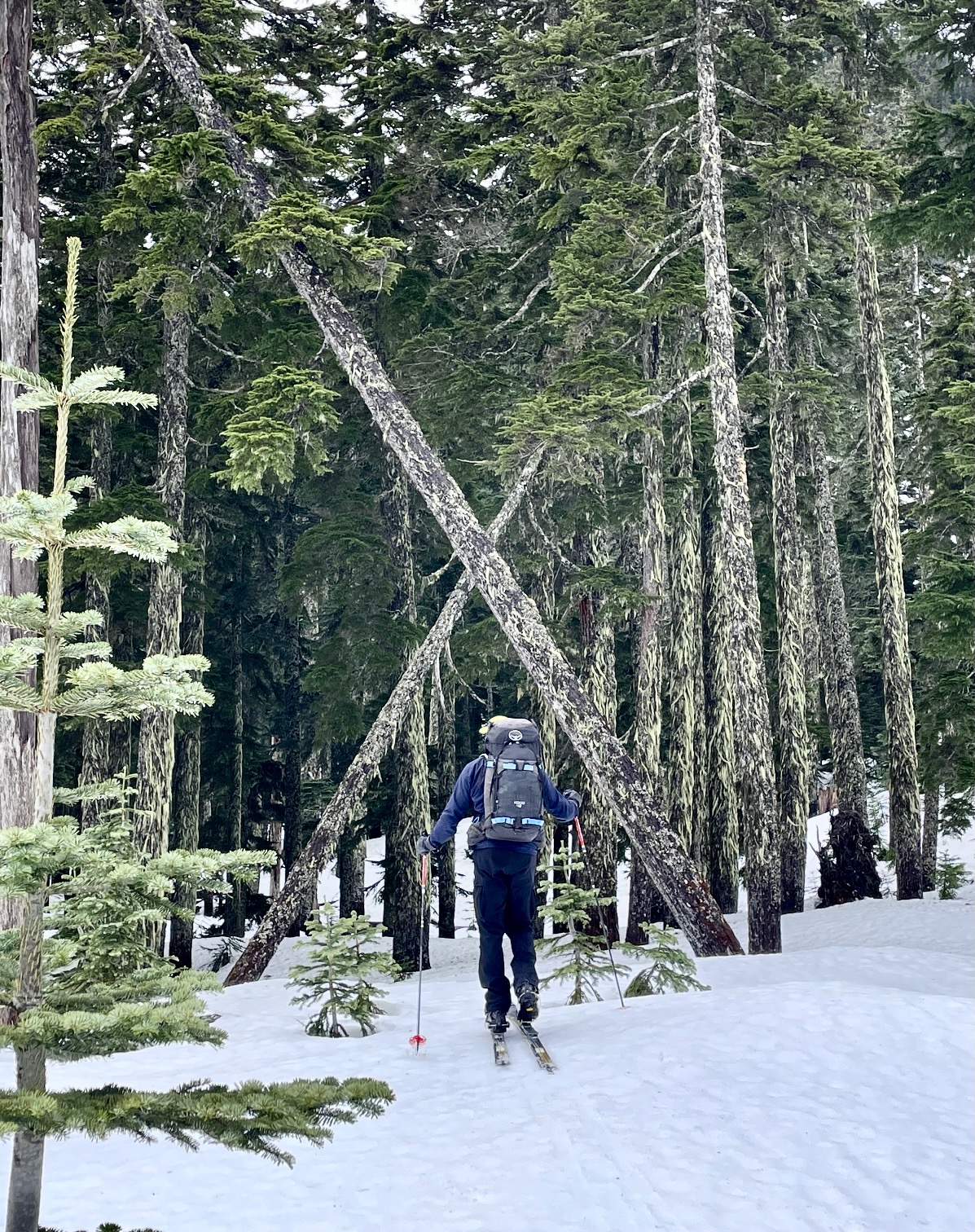
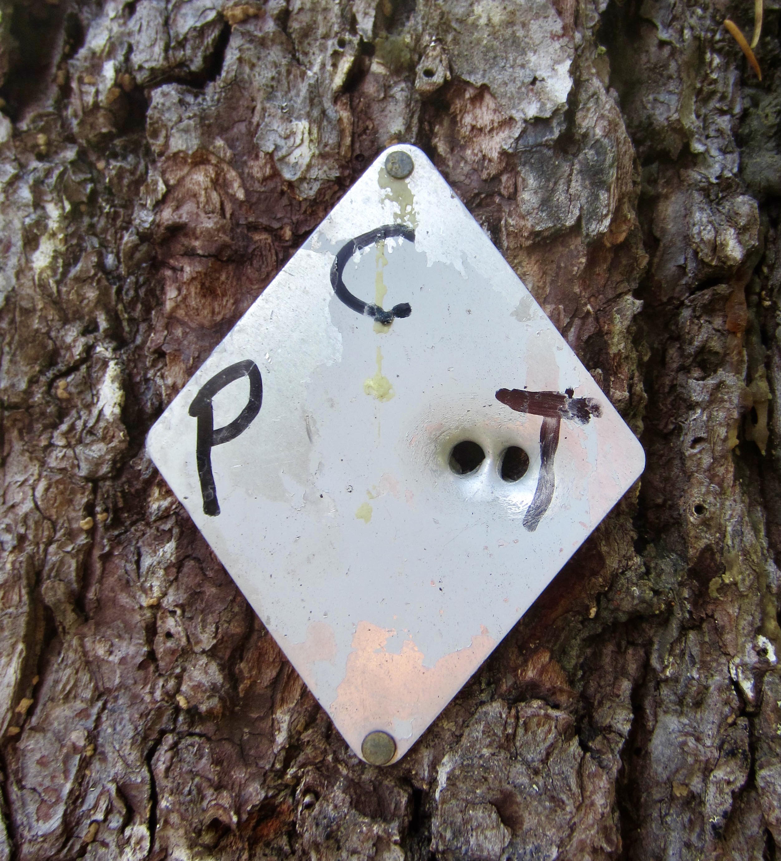
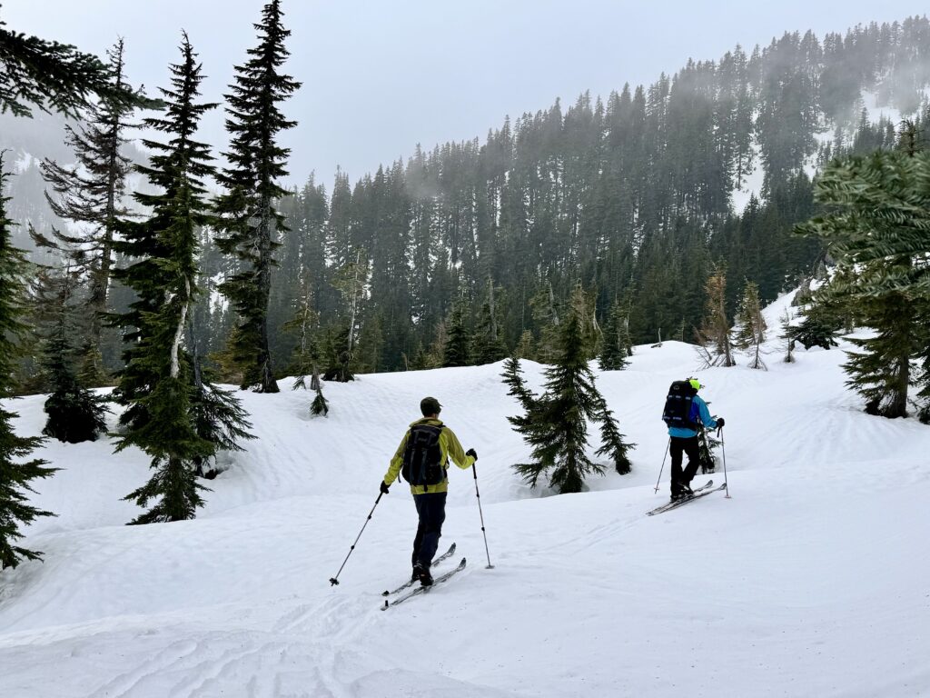
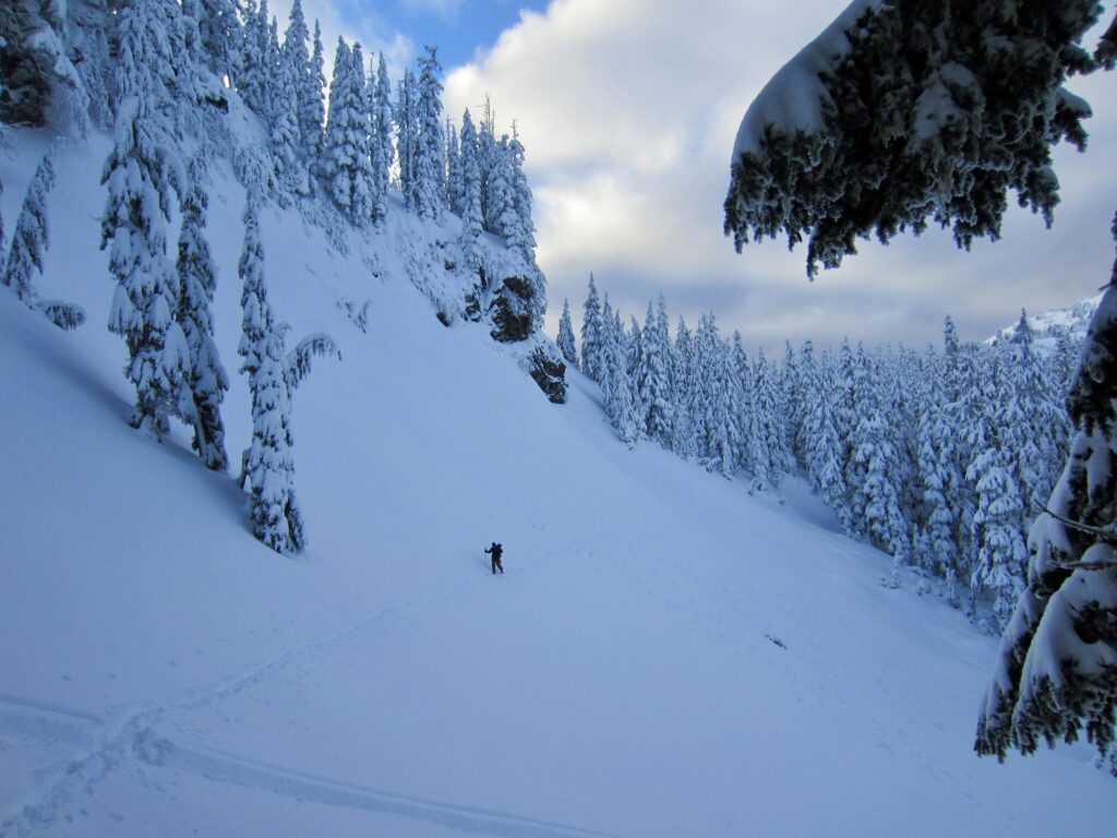
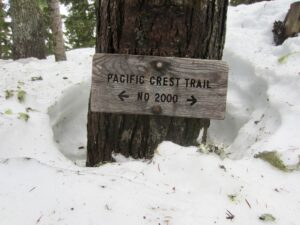
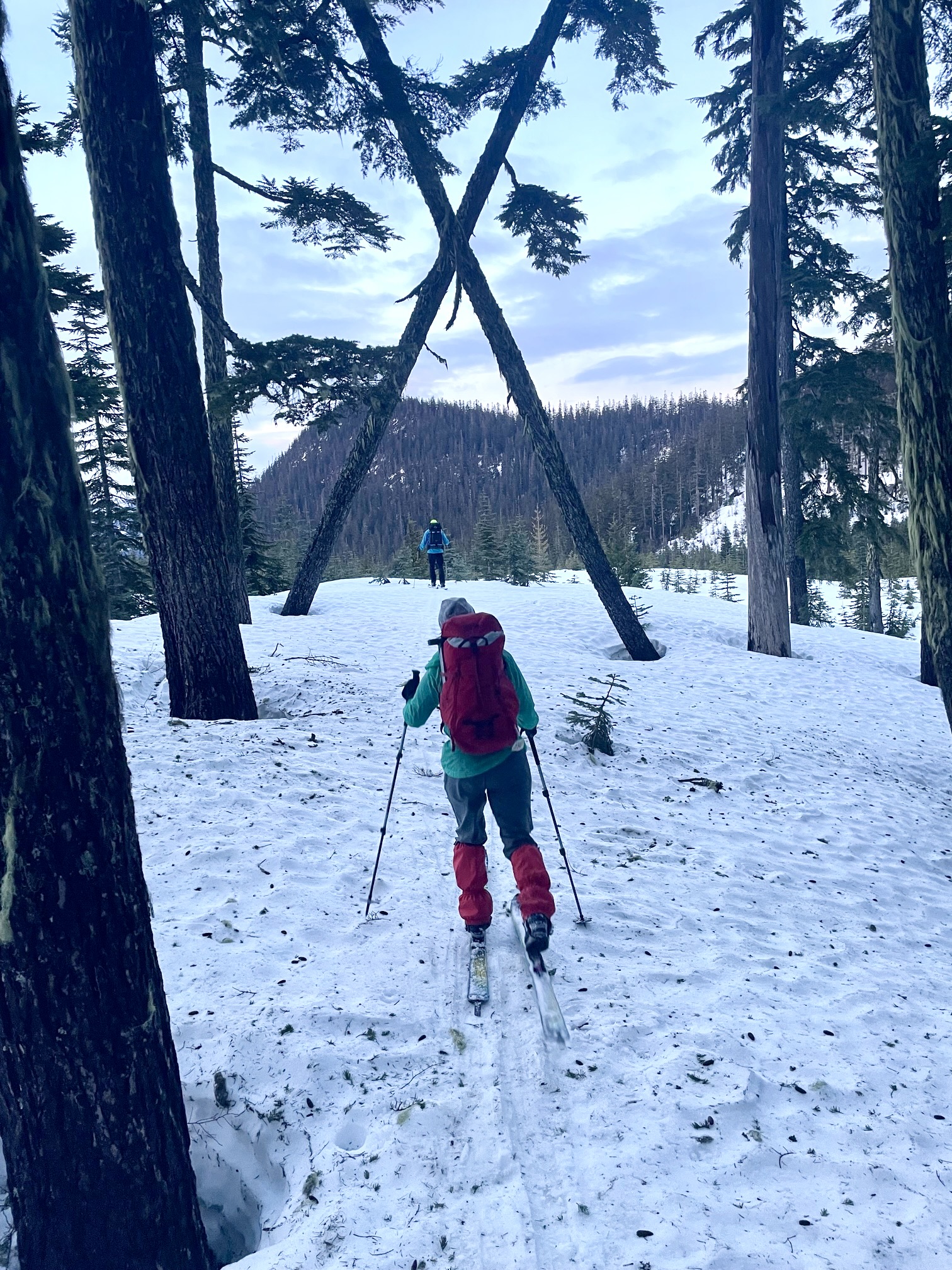
At Windy Pass, make a sharp left turn and head southwesterly across the clear-cut slope, generally aiming toward a prominent triangular cliff. As you get closer to the dense forest ahead, look for two leaning trees that form a giant “X” pattern. This distinctive visual feature marks the point where the PCT enters the dense forest.
.
.
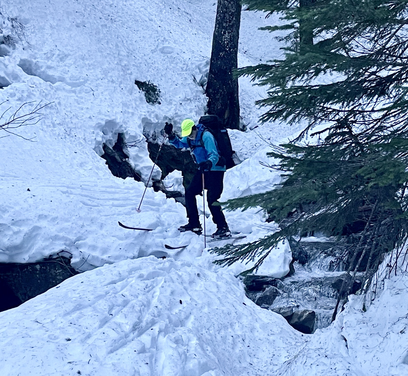
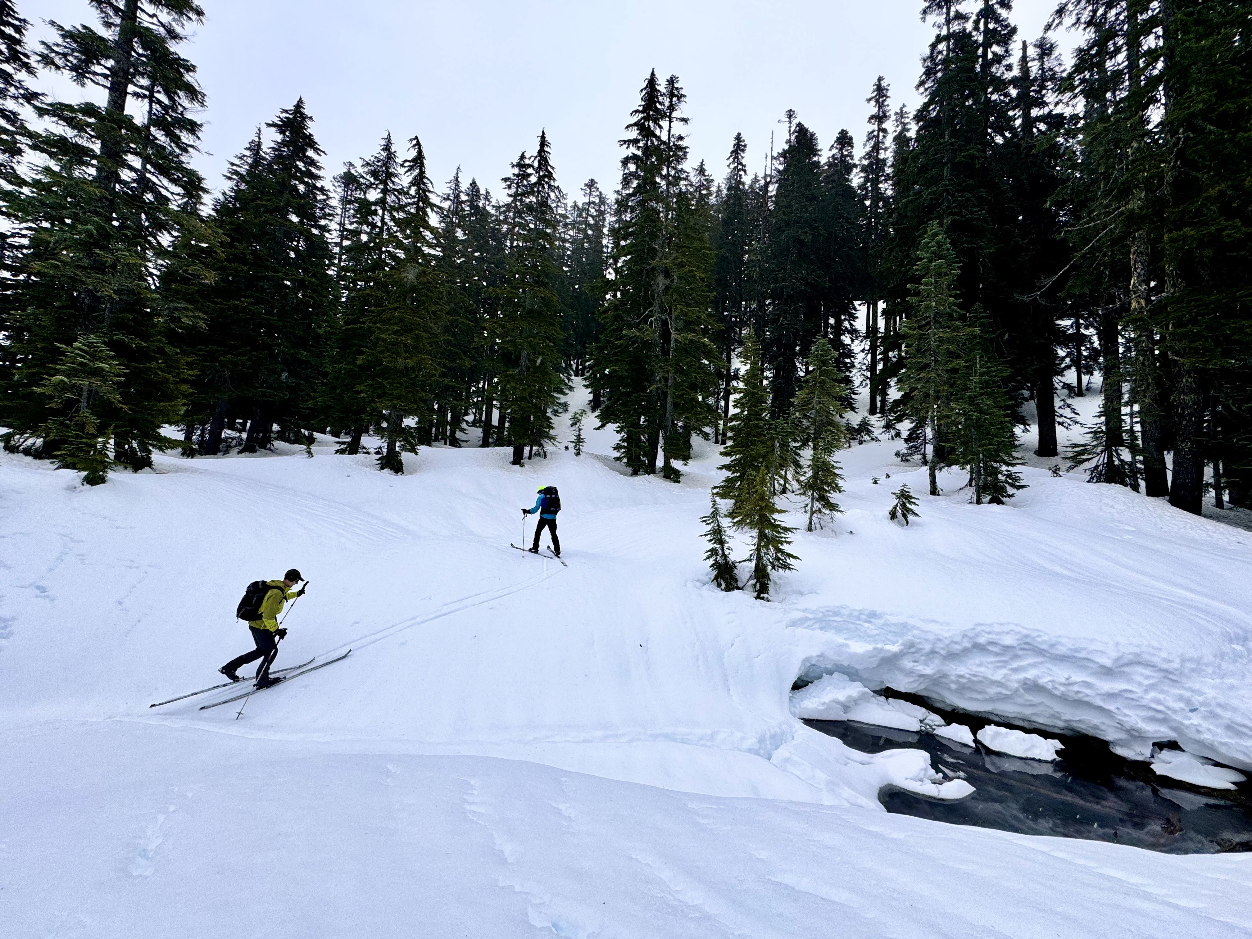
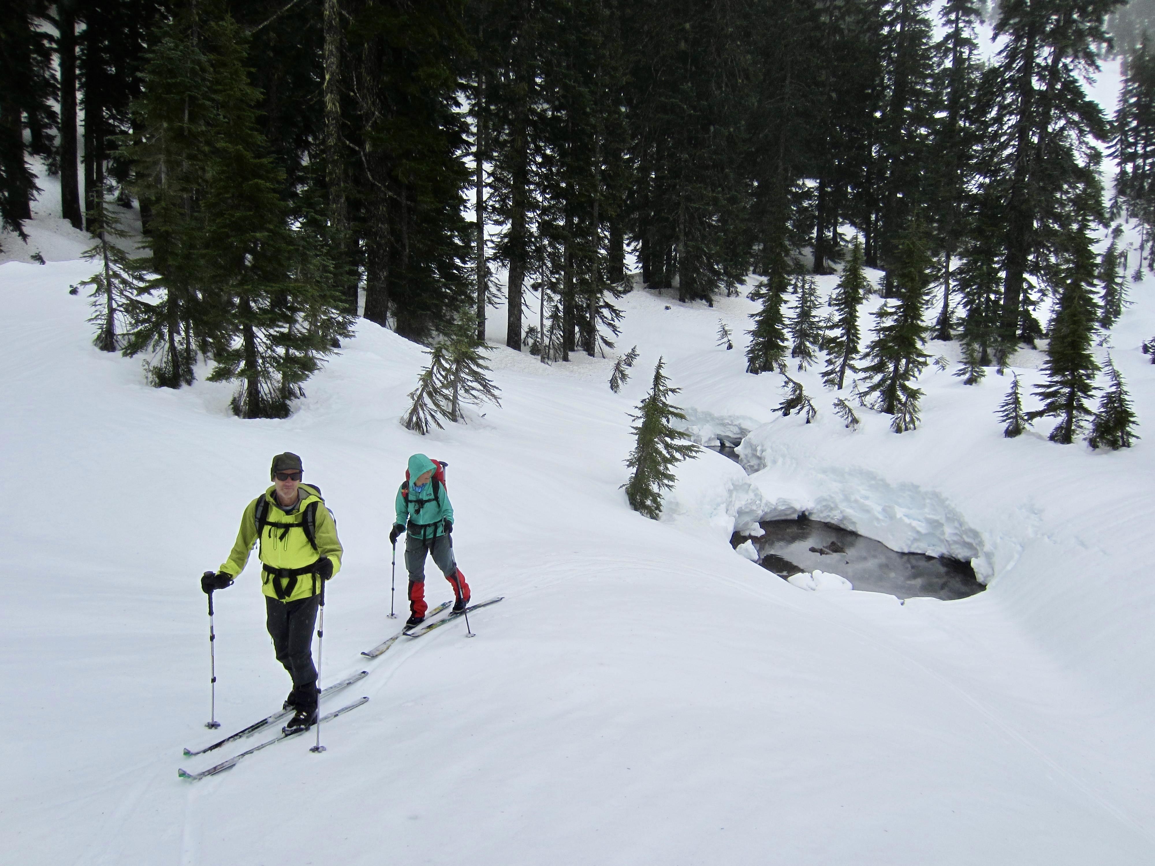
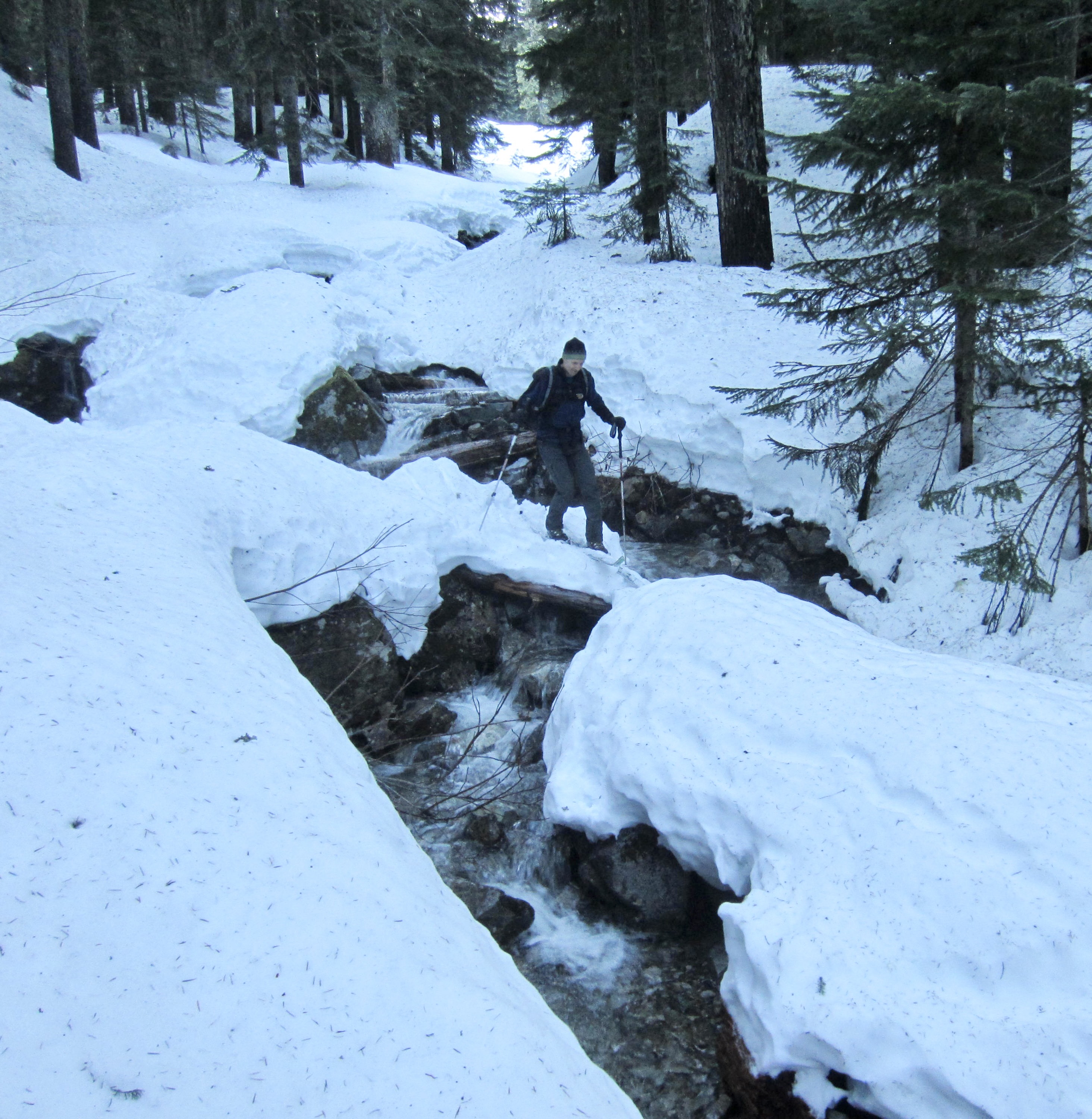
Upon entering the forest, you will need to cross three stream channels in quick succession. These crossings might be very simple or very tricky, depending on snowpack conditions.
.
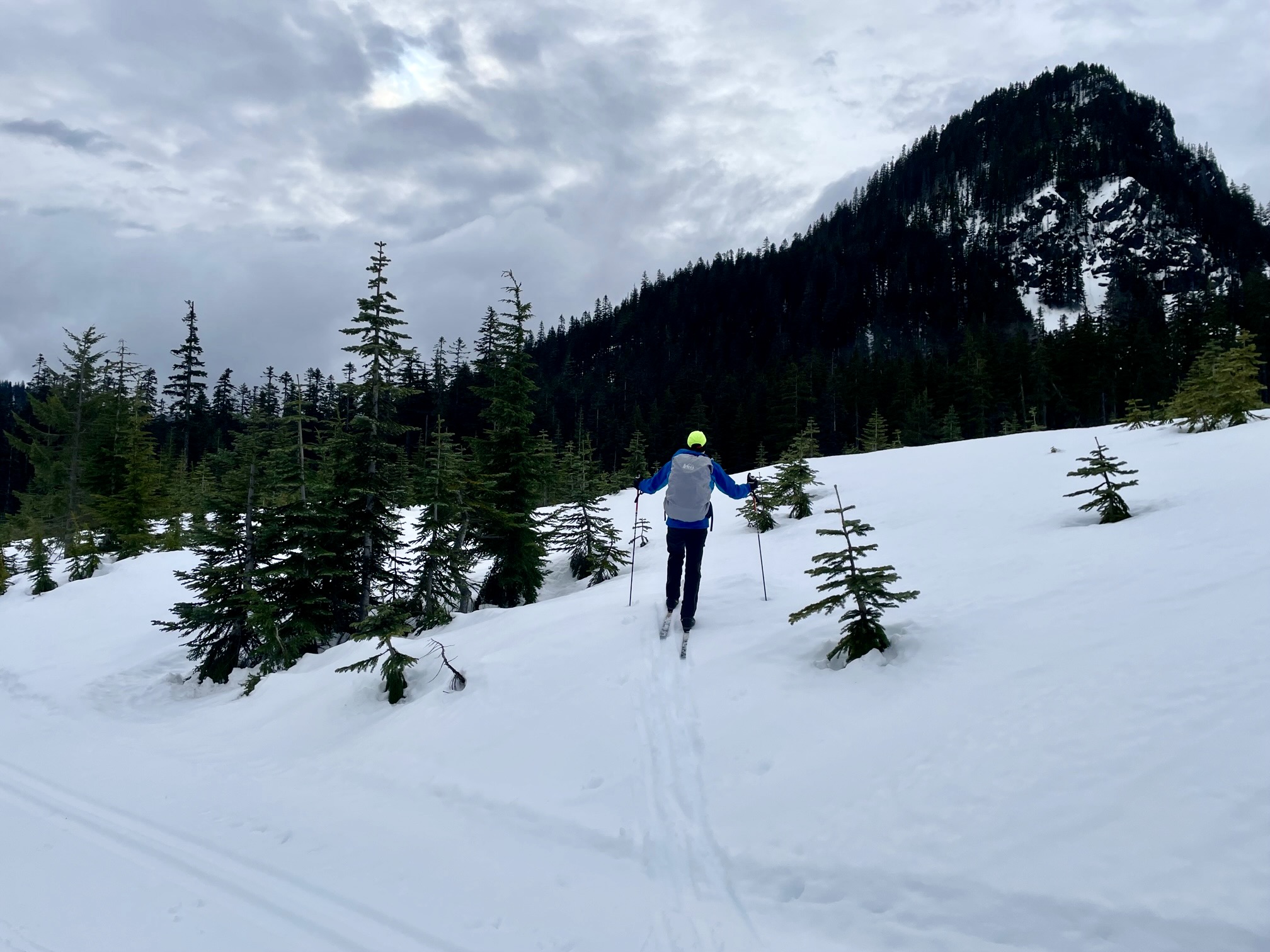
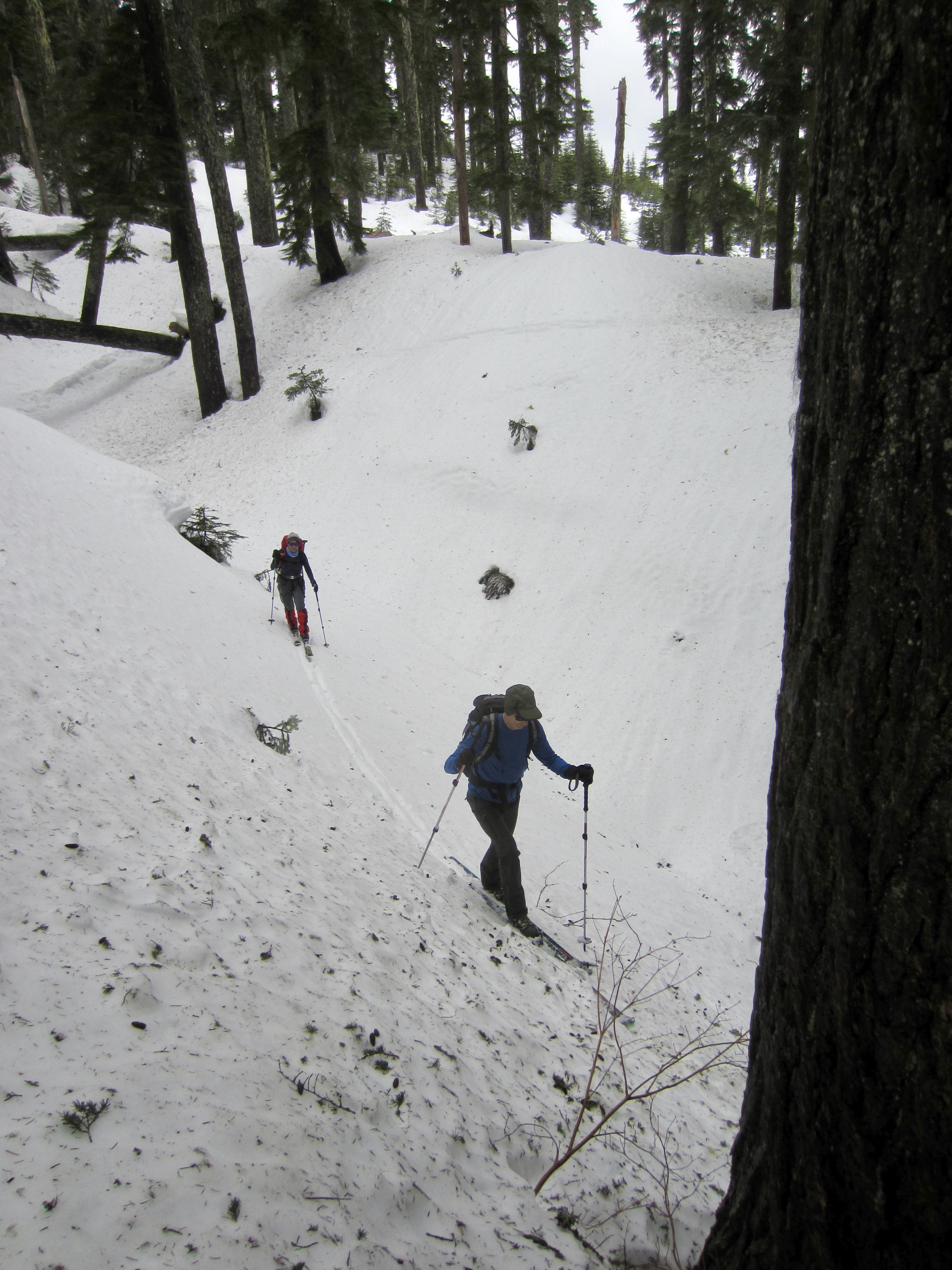
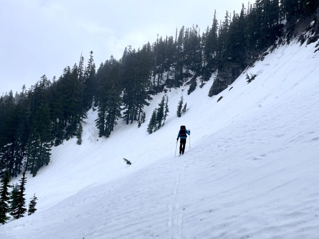
After the three stream crossings, the PCT makes a gently rising southerly traverse across the eastern flank of Silver Peak. It is not necessary to strictly follow the PCT on this traverse, but it does consistently offer the most favorable route across the steep hillslope. Look for trail clues such as cut logs, silver diamonds, and mile markers, as well as subtle “trail benches” in the snow.
.
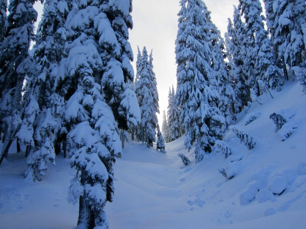
This southerly traverse will take you through stately old-growth forest with only a few clearings along the way. Considering how much logging has occurred on the southern side of Interstate-90 during the past century, it seems remarkable that these trees avoided the lumberjacks’ hungry saws. However, don’t equate “old-growth forest” and “PCT” with “mellow terrain”; there are several no-fall zones along the way, where a careless slip could send you over a small cliff!
.
After a full mile of traversing through dense forest, the PCT ascends a gentle swale and crosses over Cold Creek Saddle—a small dip in the eastern rib of Silver Peak. This saddle lies close to the middle of the traverse and is a notable geographic waypoint. It also marks a transition from continuous sideslopes to much more interesting terrain.
.
Shortly beyond Cold Creek Saddle, the PCT enters a hummocky clearing that provides the first good opportunity for a territorial view. Due south is the imposing cirque of Tinkham Peak, with its double summits. Farther to the left, across the headwaters of Cold Creek (and discouragingly far away!), is the broad sag of Tinkham Pass.
.
.
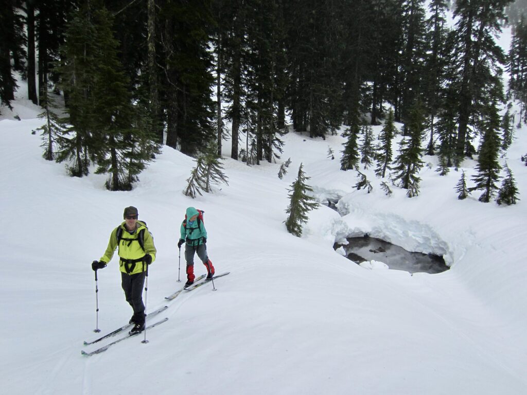
From the hummocky clearing, the PCT contours back into dense forest, then abruptly descends 100 feet to avoid a very steep slope ahead. It continues traversing around to the right and enters a flat basin filled with small trees and patches of open water. This is the home of Cold Creek Pond, which feeds one of Cold Creek’s multiple branches.

.
.
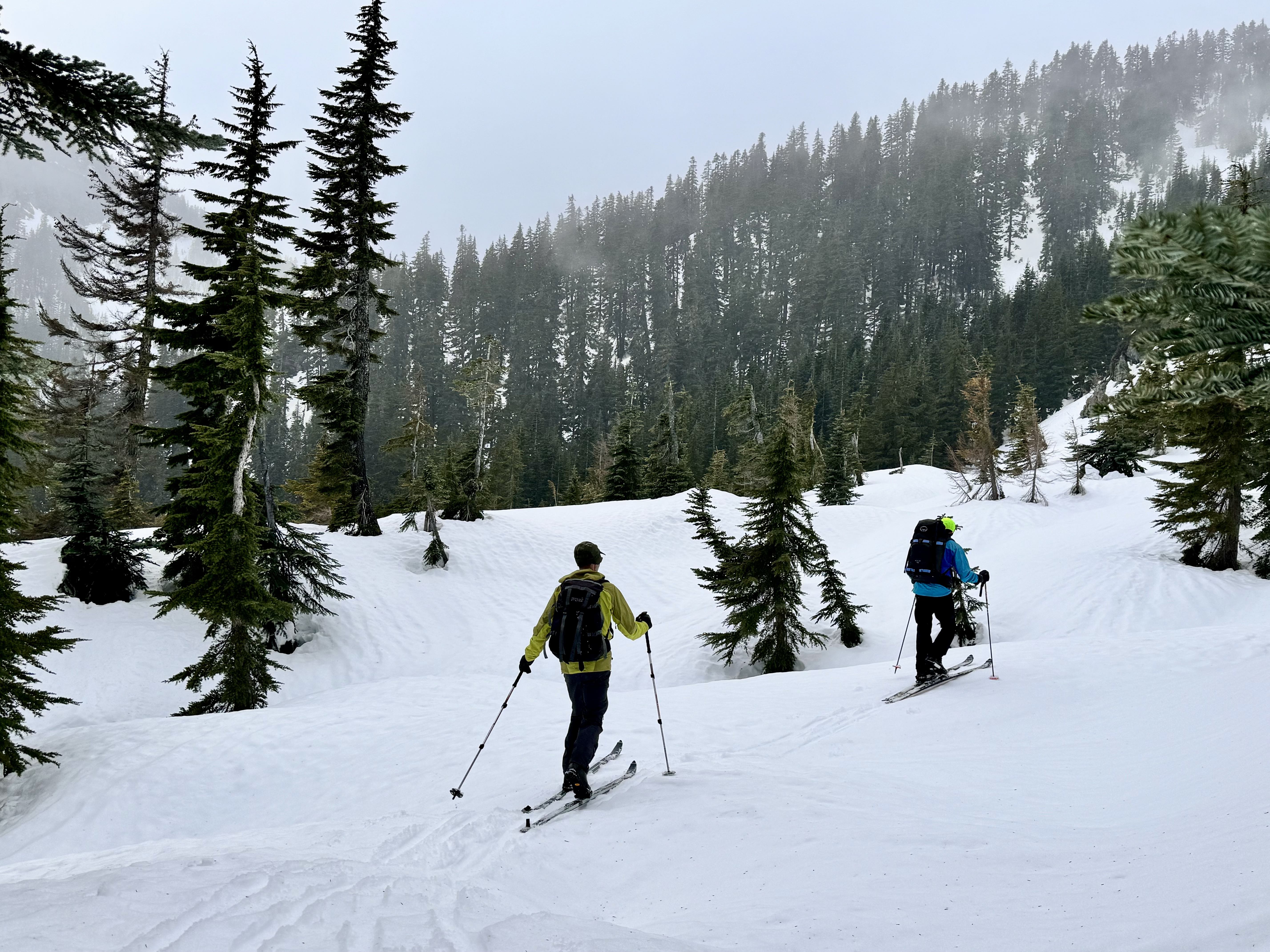
South of Cold Creek Pond, the PCT makes a slightly rising traverse through more old-growth forest, then turns right and proceeds through a long, level swale—a feature that looks much like a narrow coulee. The trail then turns sharply right again and enters a large bowl at the head of another branch of Cold Creek. This bowl has the largest open slope on the entire traverse and probably presents the greatest avalanche risk. I’ve had stable snow conditions on my previous tours through here, and I found some additional reassurance in seeing that this slope often gets thoroughly cut up by snowmobile traffic. Nonetheless, make your own careful assessment of snow stability before proceeding.
.
.
Beyond the large bowl, the PCT makes a final traverse through dense forest to gain 4500-foot Tinkham Pass (7.6 miles + 2200 feet from Hyak). This is a woodsy pass, but by moving around a bit, you can find some openings that give a view of Silver Peak’s handsome summit horn.

.
.

.
Return from Tinkham Pass to Hyak
Under favorable circumstances, the return trek from Tinkham Pass to Windy Pass is a relatively simple matter of following your ski track. It is advisable to keep your climbing skins on for this backcountry segment, because there are many uphill parts. From Windy Pass, you will usually get to enjoy a long, fast glide down the Cold Creek Trail on groomed snow. If you started your day at Hyak Ski Area, just remain on this trail until you reach the broad ski run, then descend to the parking lot. If you started at Hyak Sno-Park, head down the Connector Trail and finish your tour on the P2C Trail.
.
.
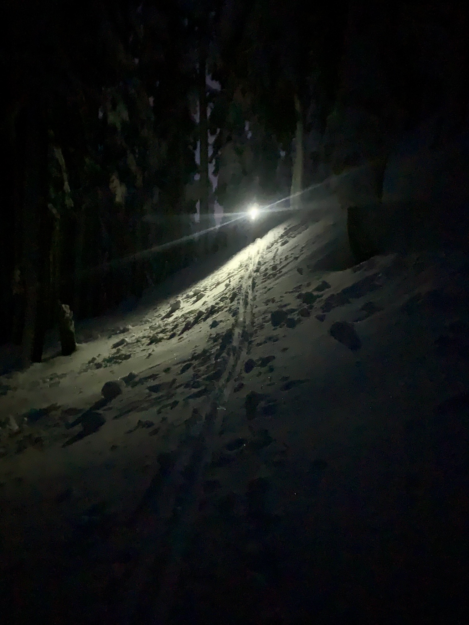
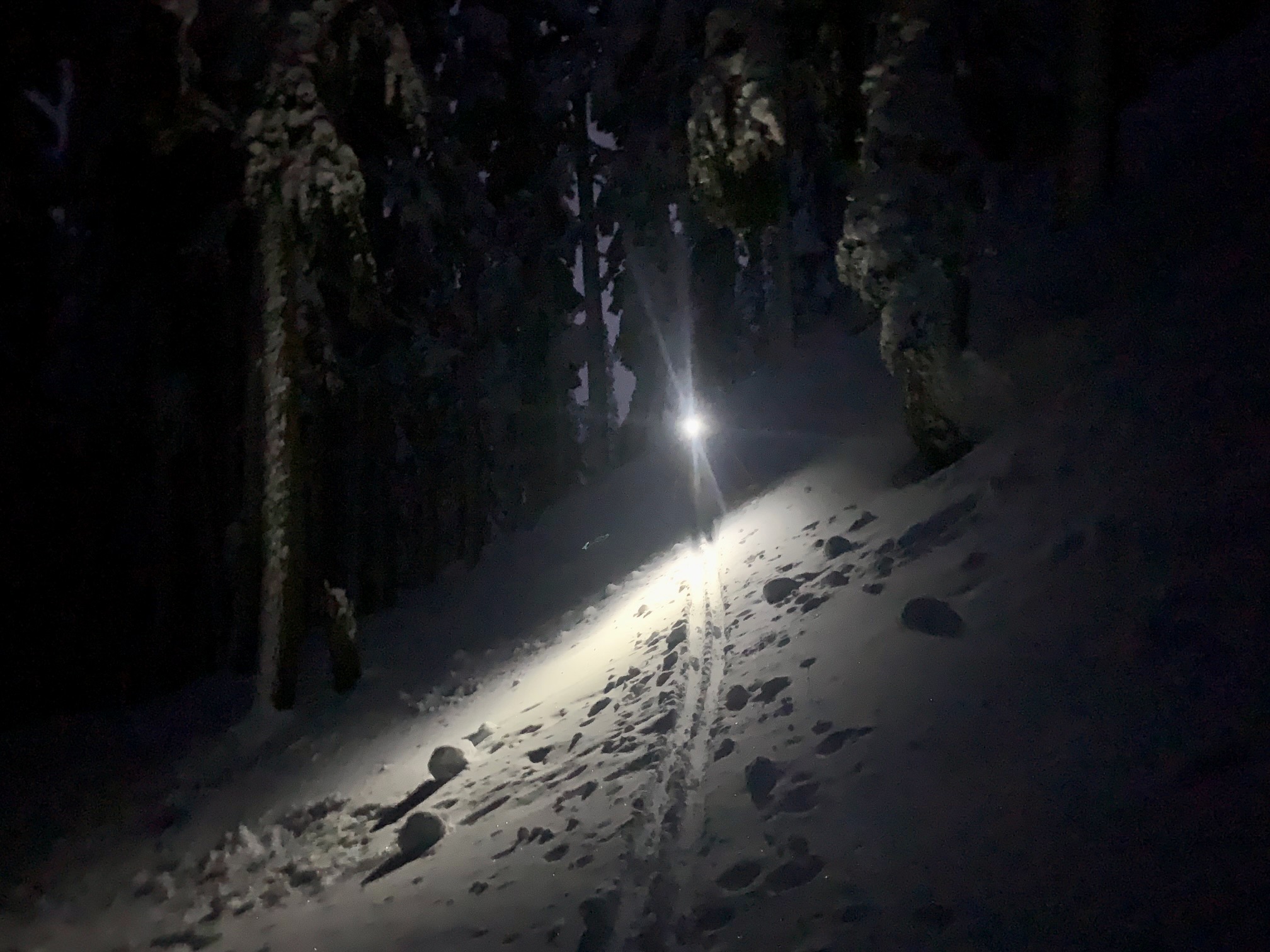
Of course, snow conditions and timing can complicate matters. During my first complete tour, Sean and I were caught by darkness before getting even halfway back to Windy Pass, such that we had to finish our backcountry traverse by headlamp. More recently, Yoko, Todd, and I reached Windy Pass shortly before dark, only to find that the Cold Creek Trail had frozen into a corduroy-textured ice sheet, which resulted in a harrowing twilight descent. But that’s all just part of the Tinkham Pass Ski Tour adventure!

.
Equipment Comments
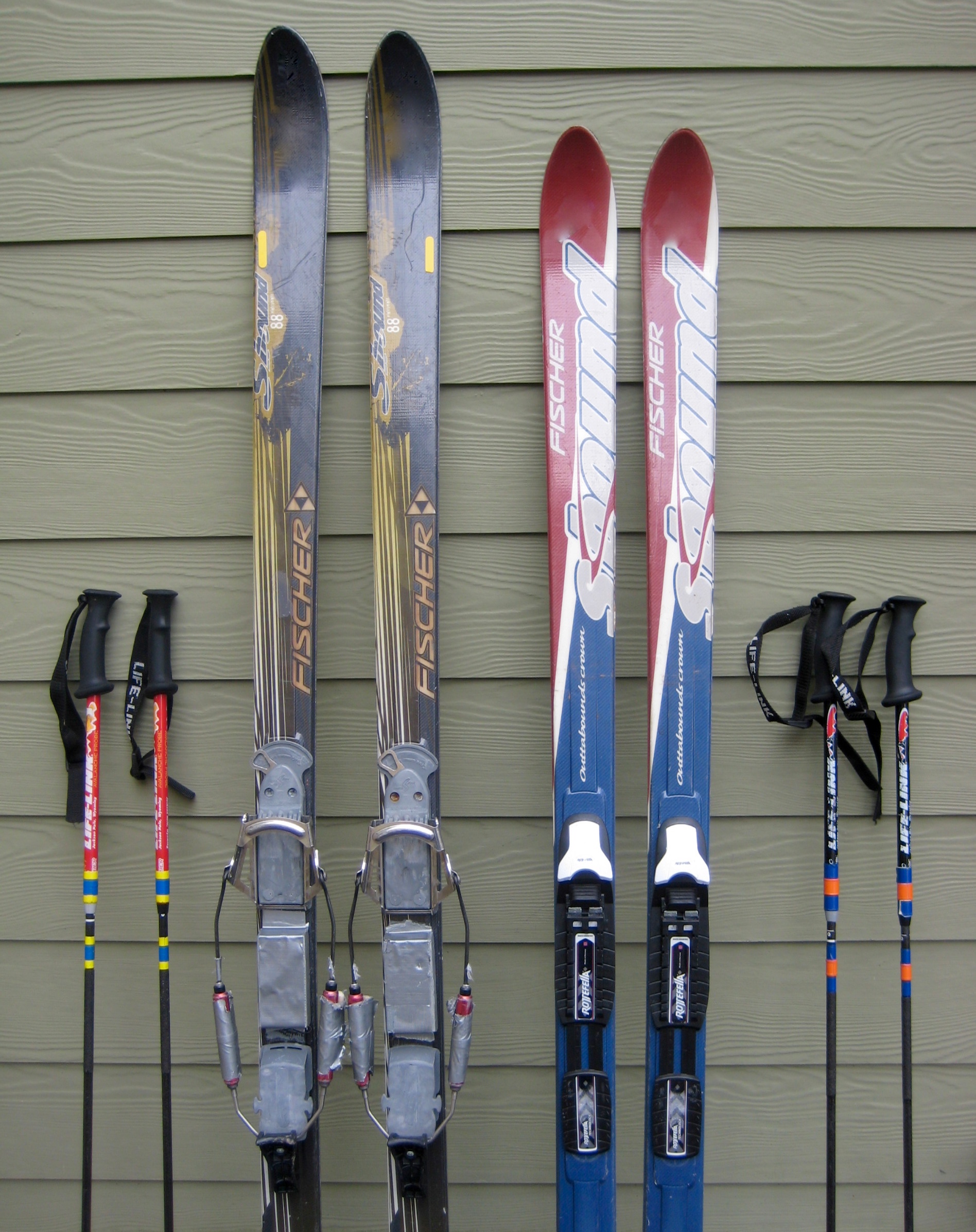
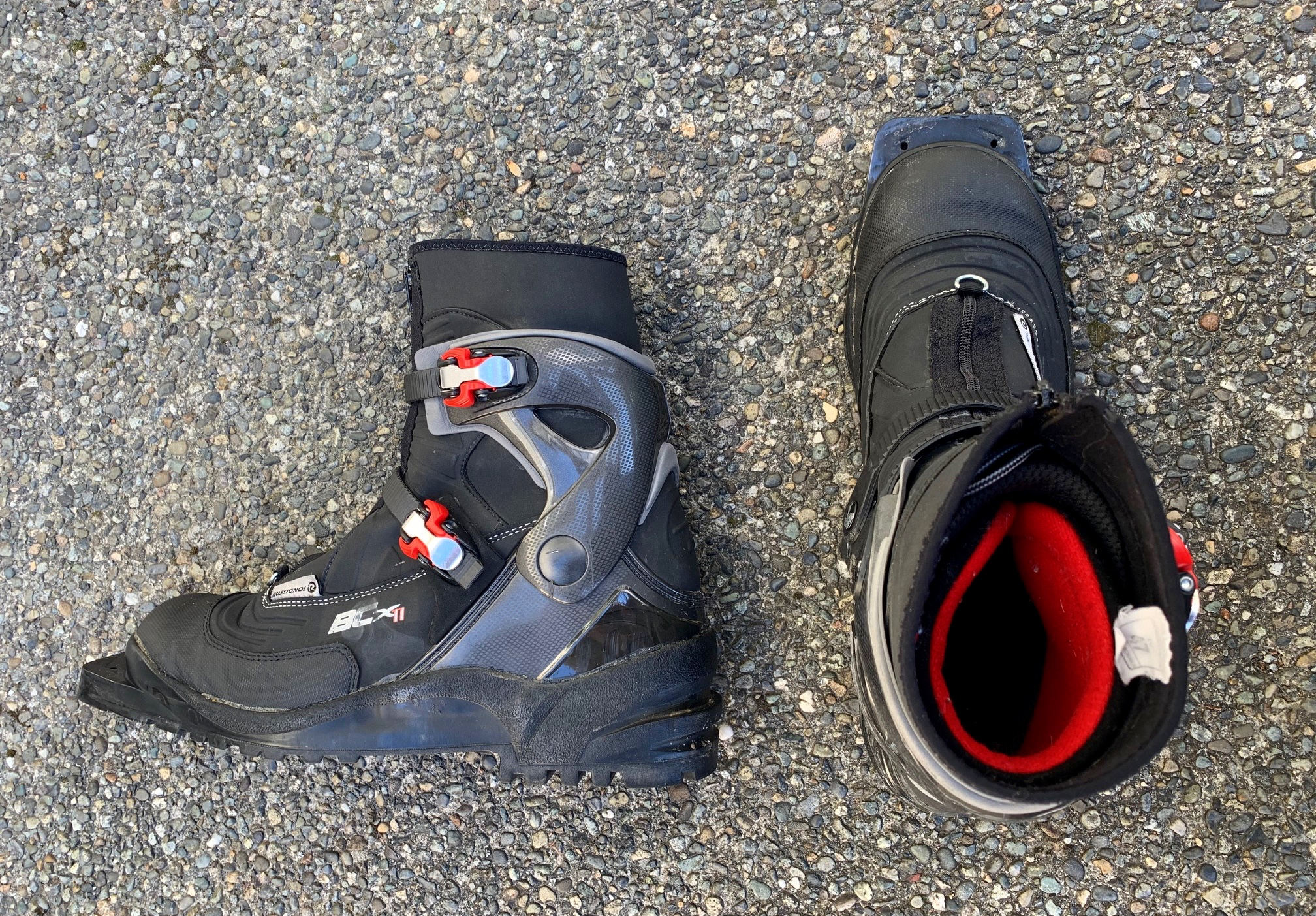
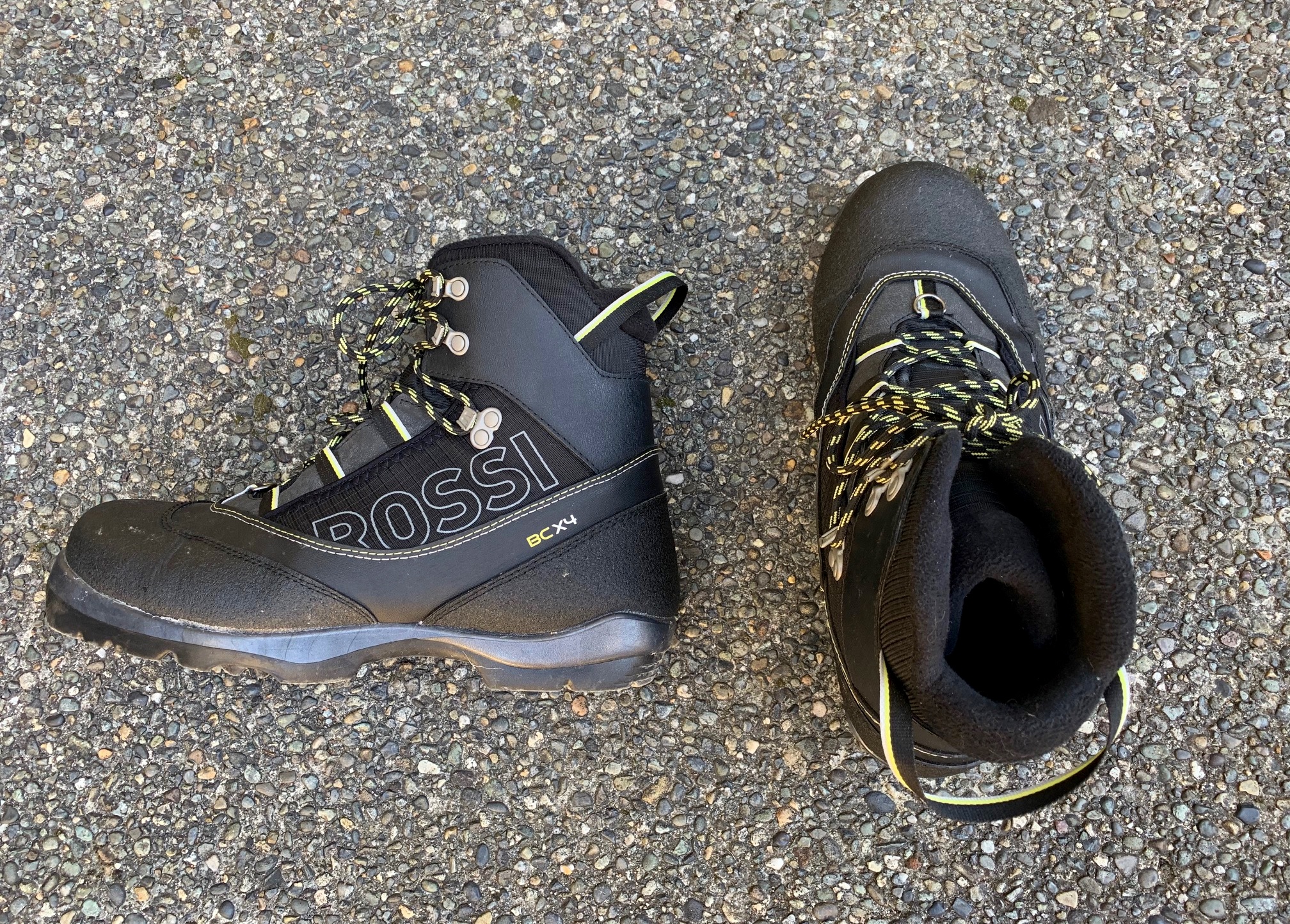
The Tinkham Pass Ski Tour is ideally suited to medium-width backcountry nordic touring skis that have a fishscale base, full metal edges, and sturdy 75-mm bindings or NNN-BC bindings, combined with compatible touring boots. Randonnee (alpine touring, or AT) skis, bindings, and boots can also be used, although such equipment will feel cumbersome on the groomed ski trails. In either case, full-length climbing skins are recommended for the backcountry traverse from Windy Pass to Tinkham Pass. Additionally, adjustable poles are very handy because they can be shortened for the ascent and can be lengthened for the kick-and-glide descent.
For more information regarding the various equipment that I use for this particular trip and that I typically use for other trips of this type, see my gear reviews on the following pages:
>>> Backcountry Nordic Ski Touring Gear
>>> Backcountry Ski & Snowshoe Packs
>>> Wintertime Comfort Accessories
.
Route Maps & Profiles & Photogram
…
…
…
…
…
Photo Gallery
Click to enlarge…