Trip Date: September 26-30, 2024
GOLDEN LARCH OUTING: PASAYTEN MOUNTAINS
Ptarmigan Peak Summit Loop: Tatoosh Ridge to Rolo Pass
Middle Fork Pasayten River Valley
Tatoosh–Tamarack Ridge
Ptarmigan Peak (8614 ft)
Dot Mountain (8165 ft)
Lago Basin
Lago–Carru Col
Eureka Creek Valley
Rolo Pass
Fred’s Lake
Trip Report Summary
Region: Northeastern Washington Cascades
Sub-Region: Pasayten Mountains
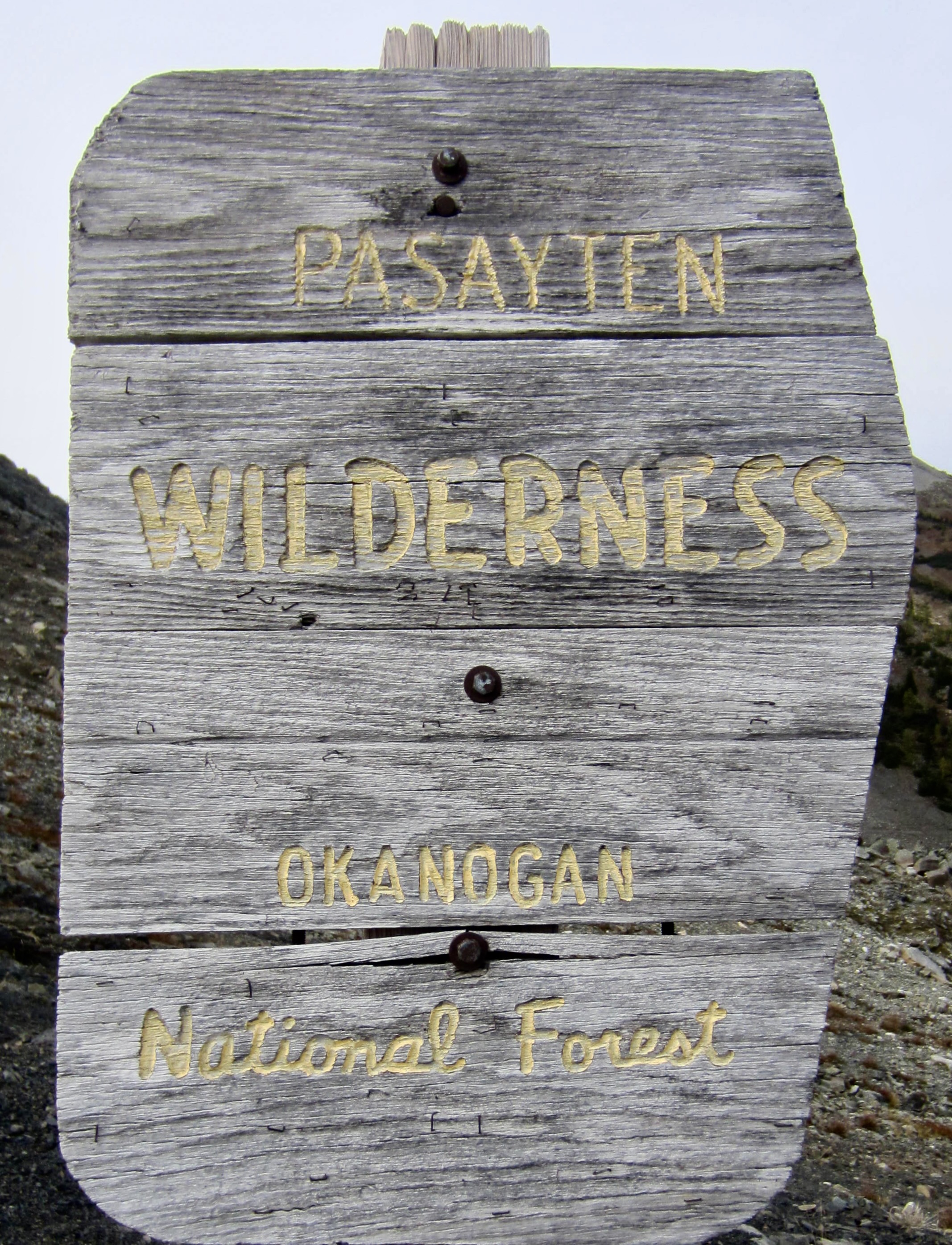
Area: Pasayten Wilderness
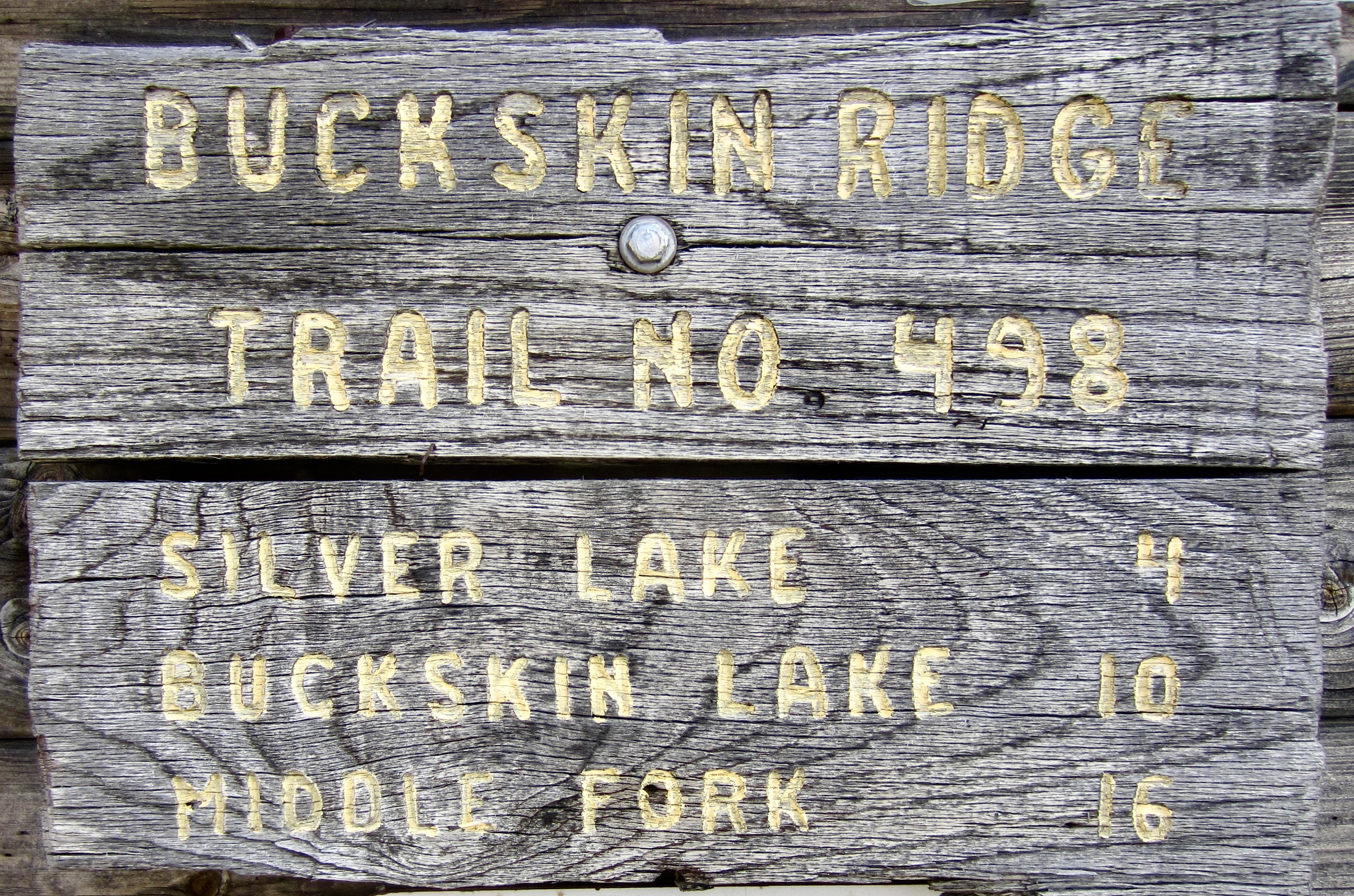
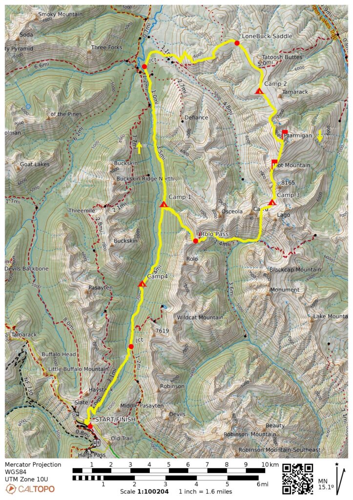
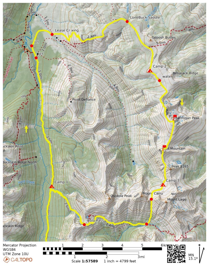
Starting & Ending Point: Buckskin Ridge Trailhead on Slate Peak Road (Elev. 6850 feet)
Way Points: Slate Pass & Middle Fork Pasayten River crossing & Robinson Creek Trail junction & Middle Fork Riverside Camp & Shellrock Pass Trail junction & Berk Creek crossing & Tatoosh Buttes Trail junction & Lease Creek crossing & Lone Buck Saddle & Tamarack Ridge / Point 7042 & North Ptarmigan Peak Saddle & Ptarmigan Peak summit & Ptarmigan–Dot Saddle & Dot Mountain summit & South Dot Mountain Saddle & Lago Basin & Lago–Carru Col & Eureka Creek Trail junction & Shellrock Pass Trail junction & Rolo Pass & Fred’s Lake & Robinson Creek Trail junction & Middle Fork Riverside Camp & Whistler Cutoff junction & Slate Pass & Buckskin Ridge Trailhead (trail hike & off-trail hike & rock scramble)
Low Point: Robinson Creek Trail / Tatoosh Buttes Trail junction (Elev. 4370 feet)
High Point: Ptarmigan Peak summit (Elev. 8614 feet)
Campsites: Berk Creek crossing & Tamarack Ridge at Point 7042 & Lago Basin & Middle Fork Riverside Camp
Summit: Ptarmigan Peak (off-trail hike via North Ridge—Upper West Slope; descent via South Slope)
Summit: Dot Mountain (off-trail hike & rock scramble via Northeast Slope; descent via South Ridge)
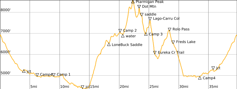
Approximate Stats: 39.8 miles traveled; 10,150 feet gained & lost.
Related Posts
>>> Rolo Pass + Shellrock Pass + Lost Peak + Pistol Pass – September 2010
>>> Rolo Pass + Shellrock Basin + Mt Lago + Mt Carru + Blackcap Mtn – October 2006
>>> Rolo Pass + Lake Doris + Osceola Peak + Mt Rolo – October 2005
Full Trip Report
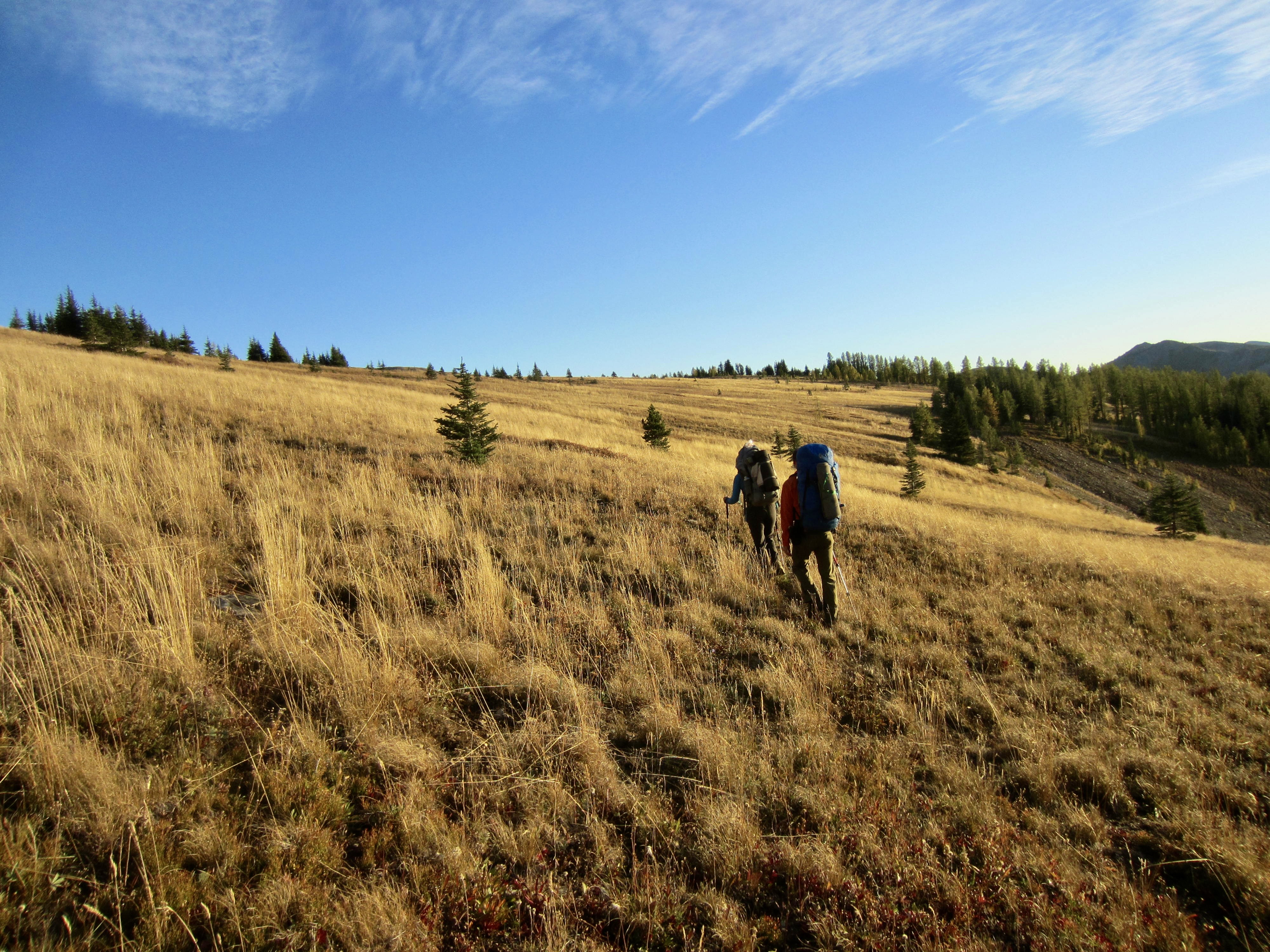
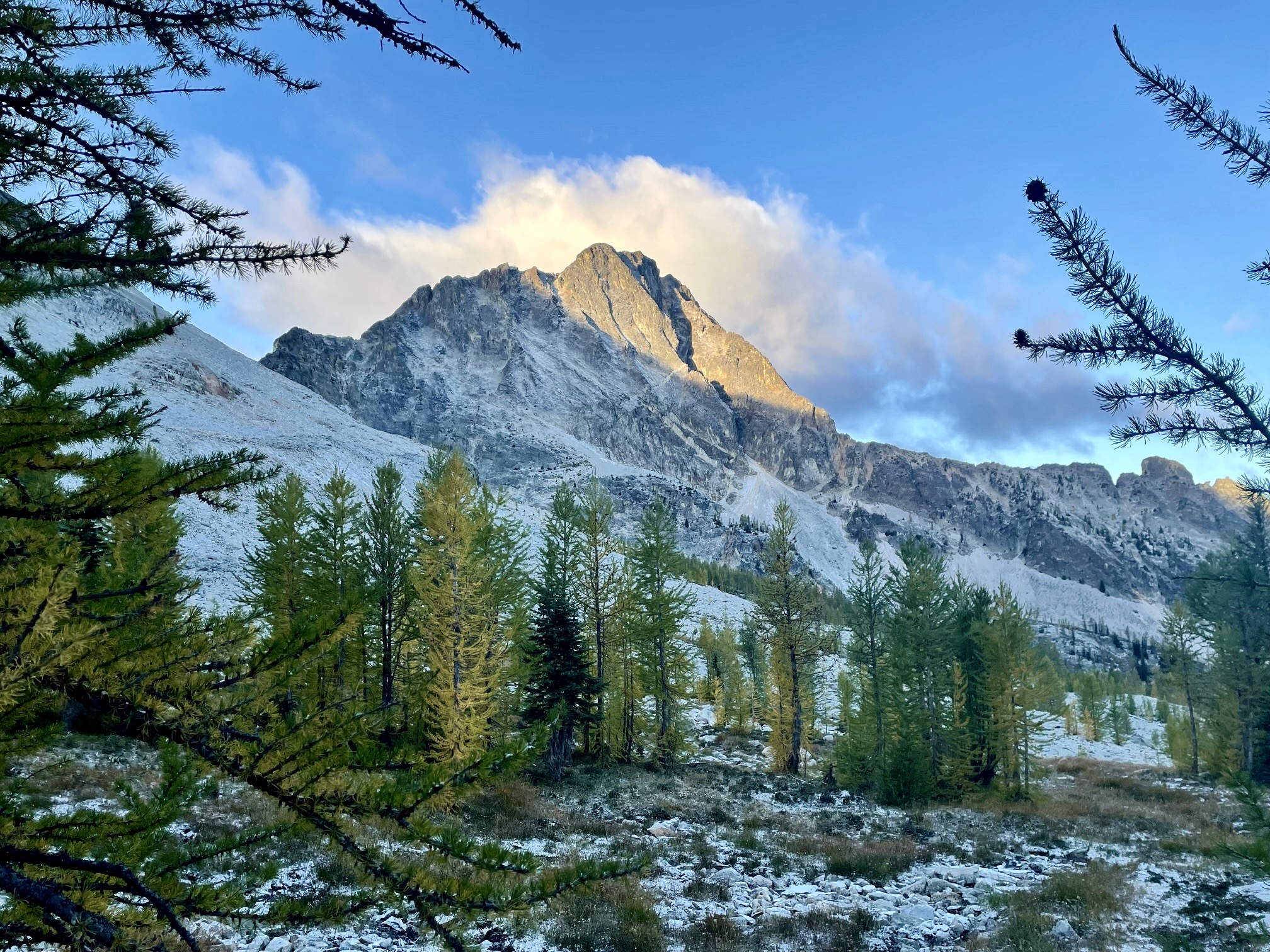
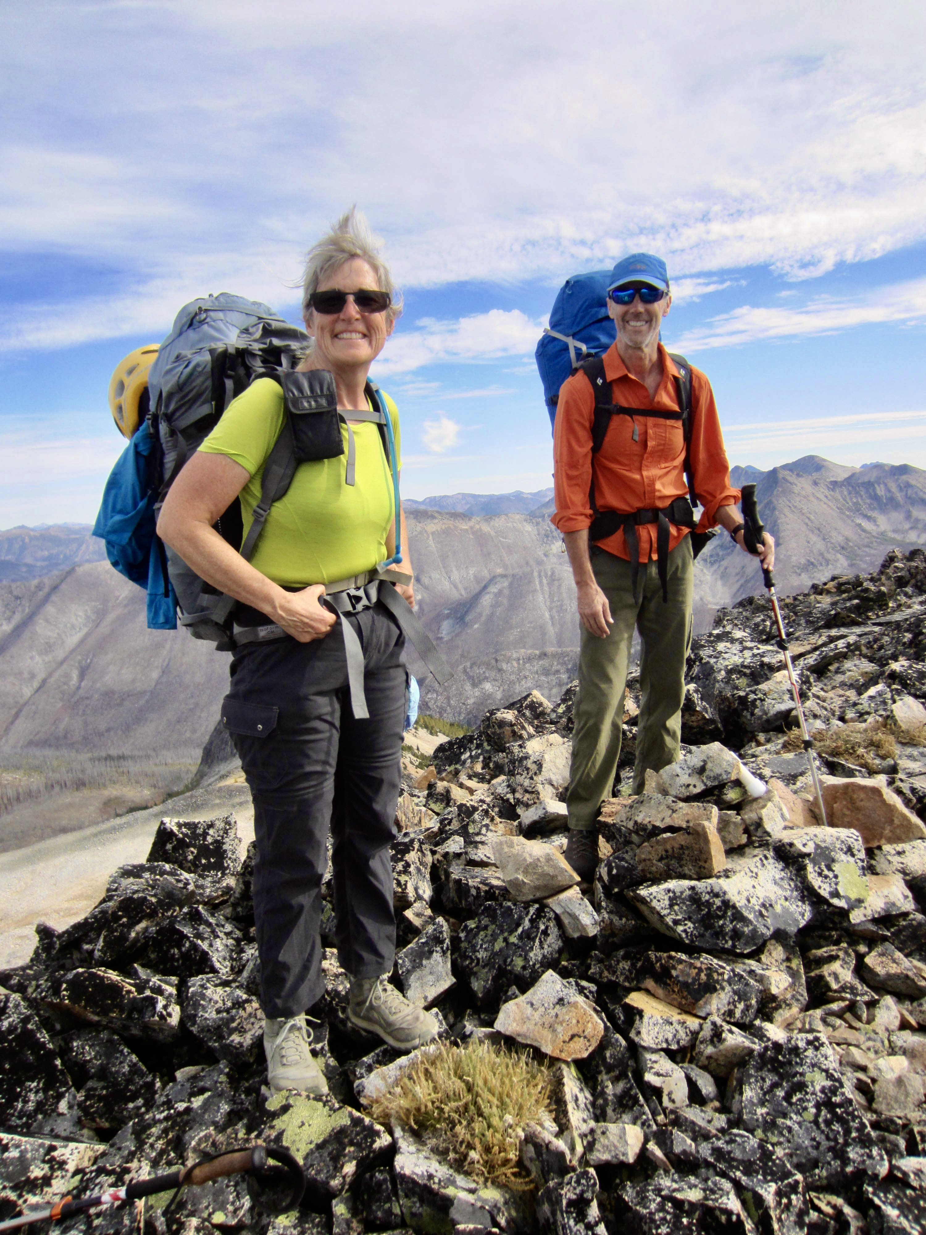
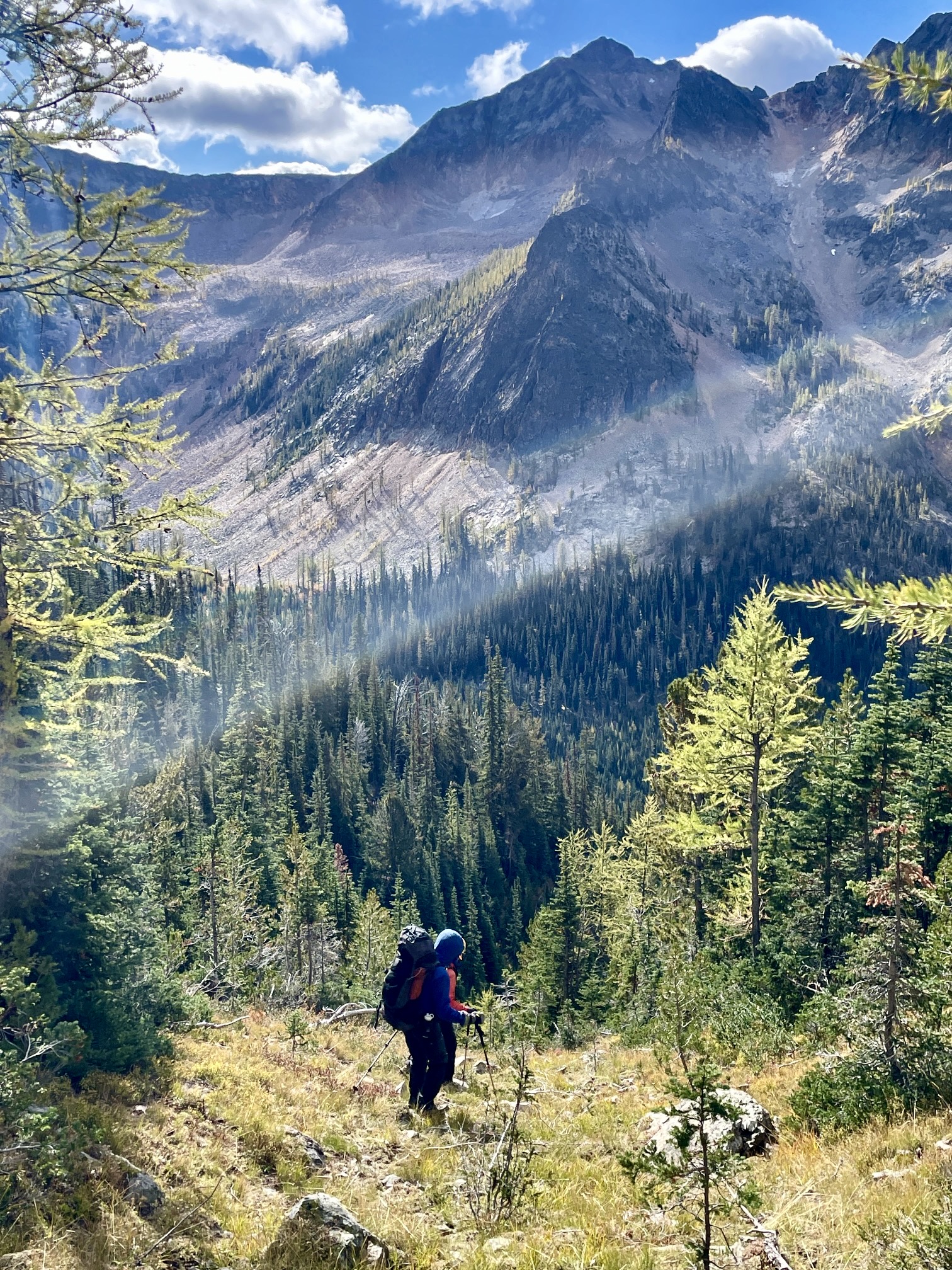
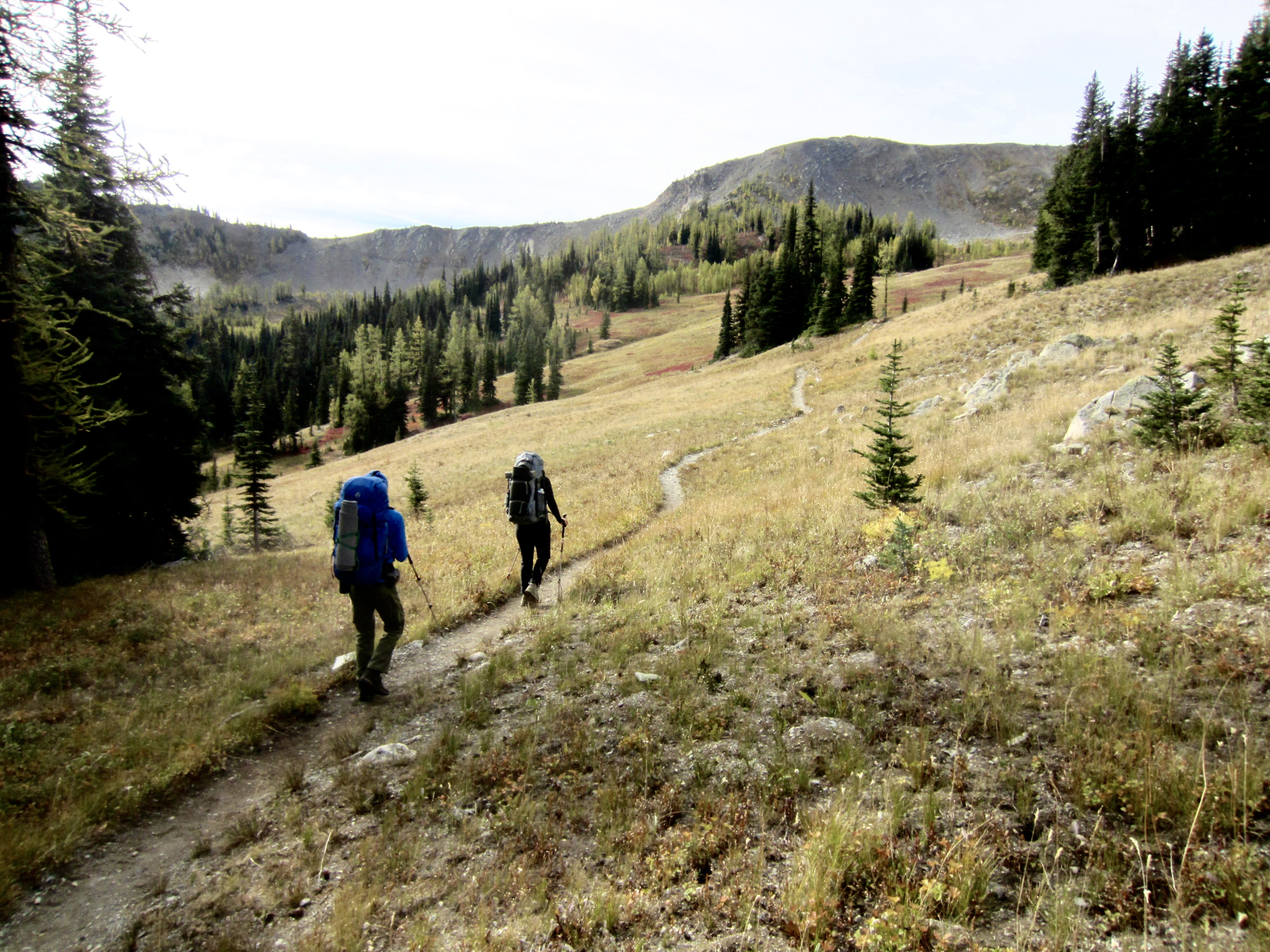
For this year’s Golden Larch Outing, Eileen, Todd, and I did a 40-mile loop through the Pasayten Mountains, starting at Slate Pass. The heart of our loop comprised a cross-country traverse up Tatoosh Ridge, over the summits of Ptarmigan Peak and Dot Mountain, between Mt. Lago and Mt. Carru, and down to Eureka Creek. Although most of the terrain offered pleasant and scenic travel, a few areas were unpleasant or just downright awful. Our weather ran the gamut from mild and sunny to cool and rainy to cold and snowy—all of which merely enhanced our adventure. We were a week or so too early for prime larch color but did find some golden zones.
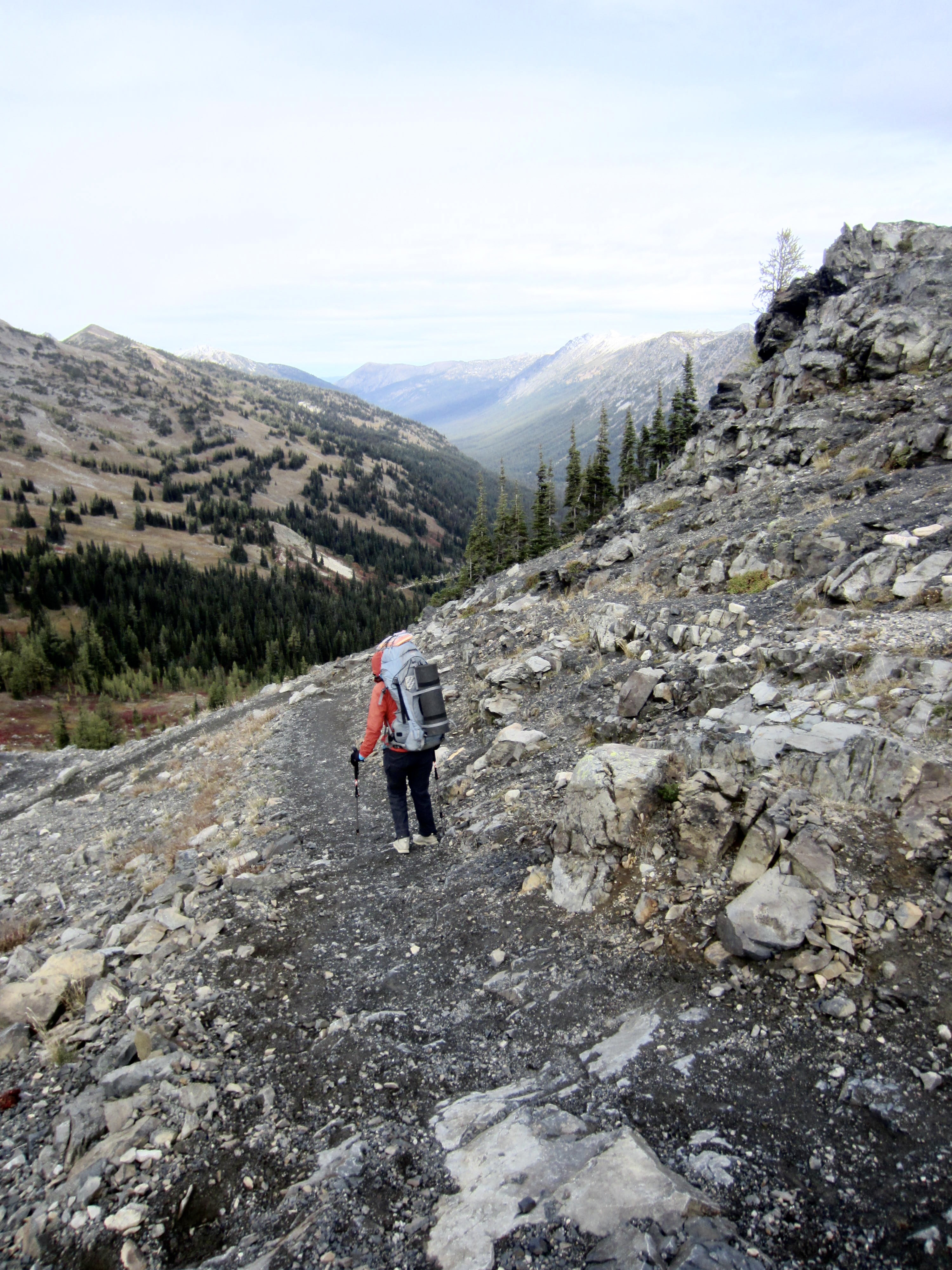
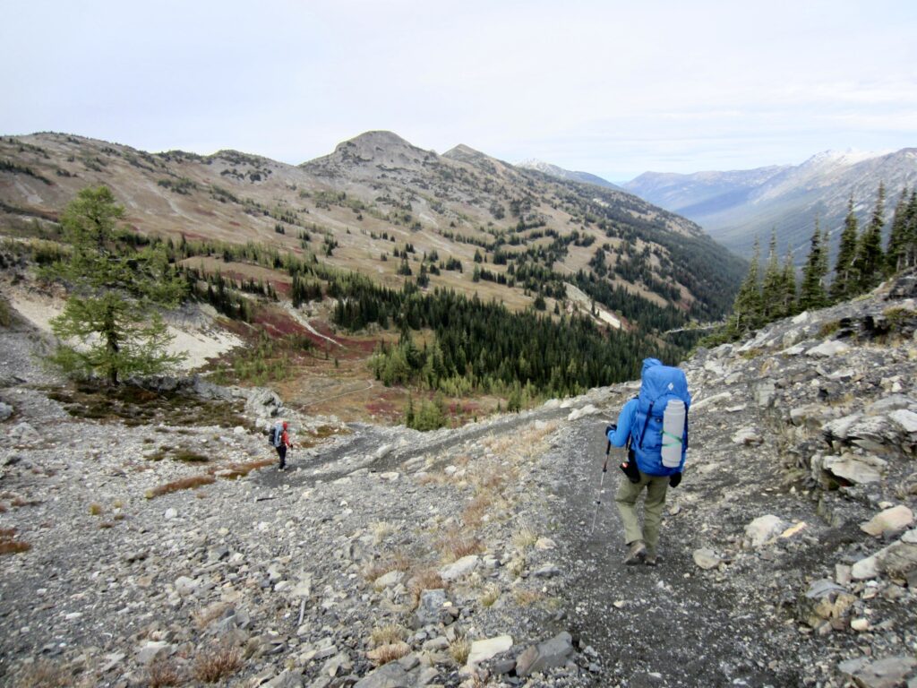
Day 1: Trailhead to Berk Creek Crossing
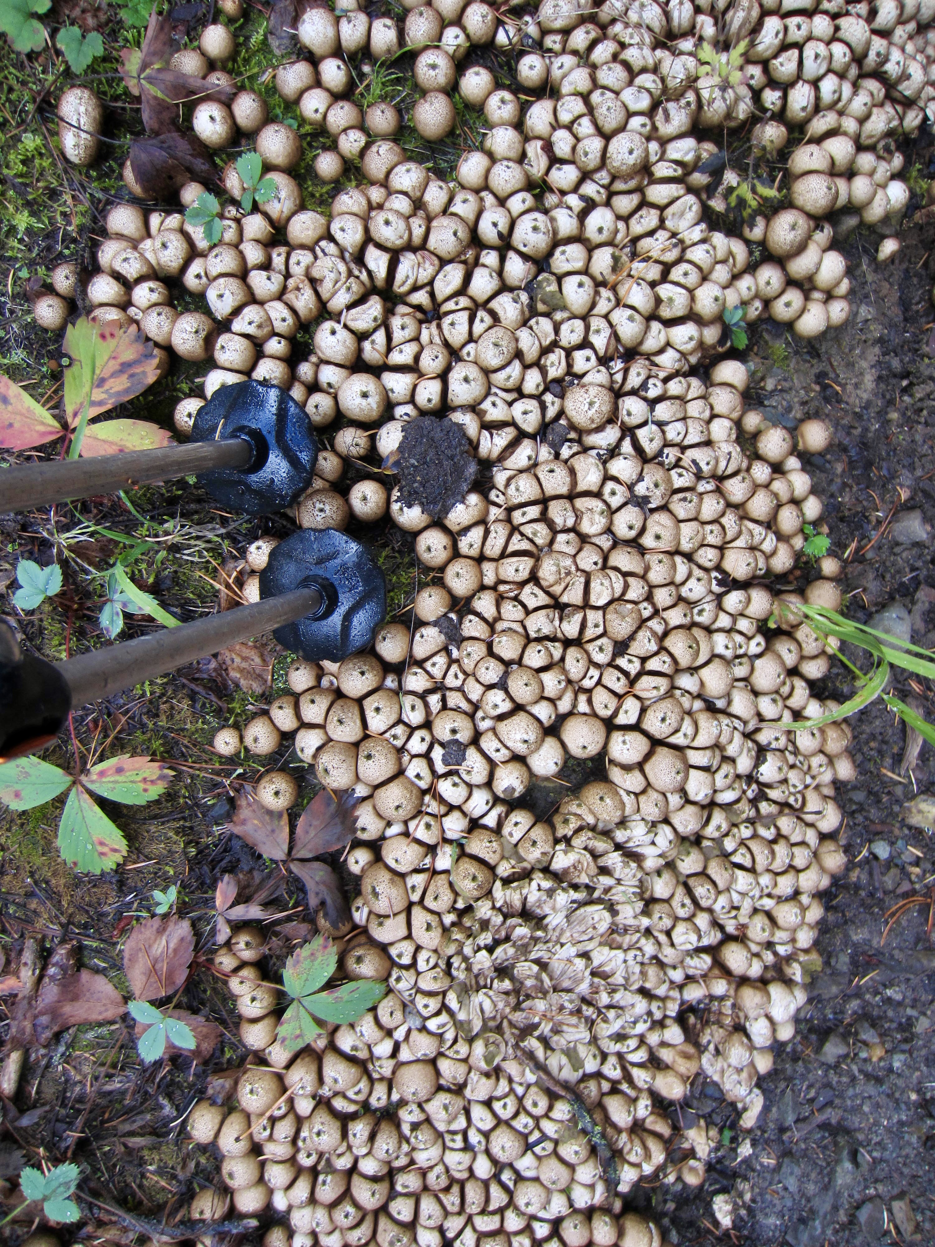
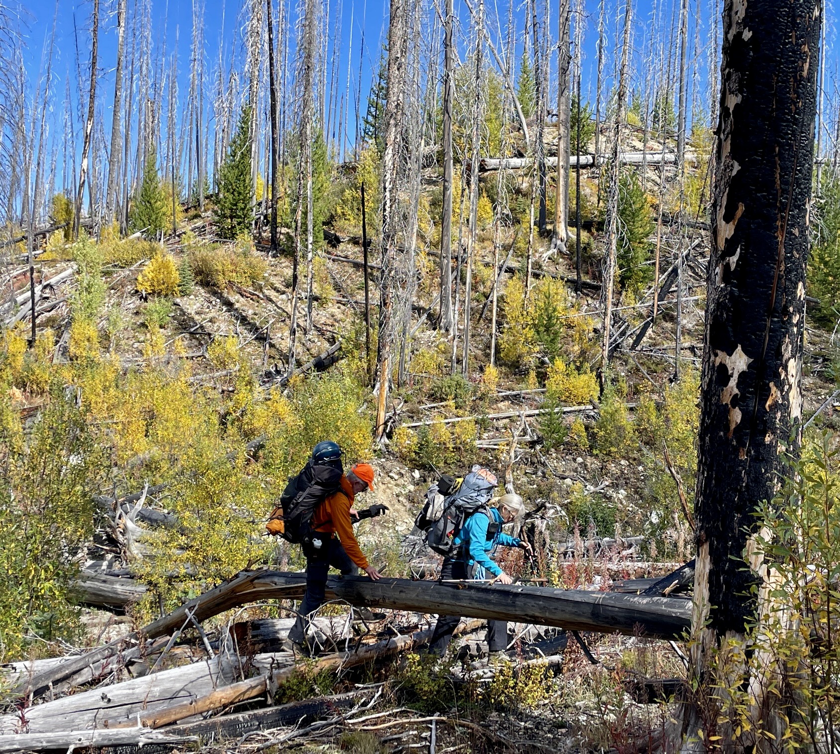
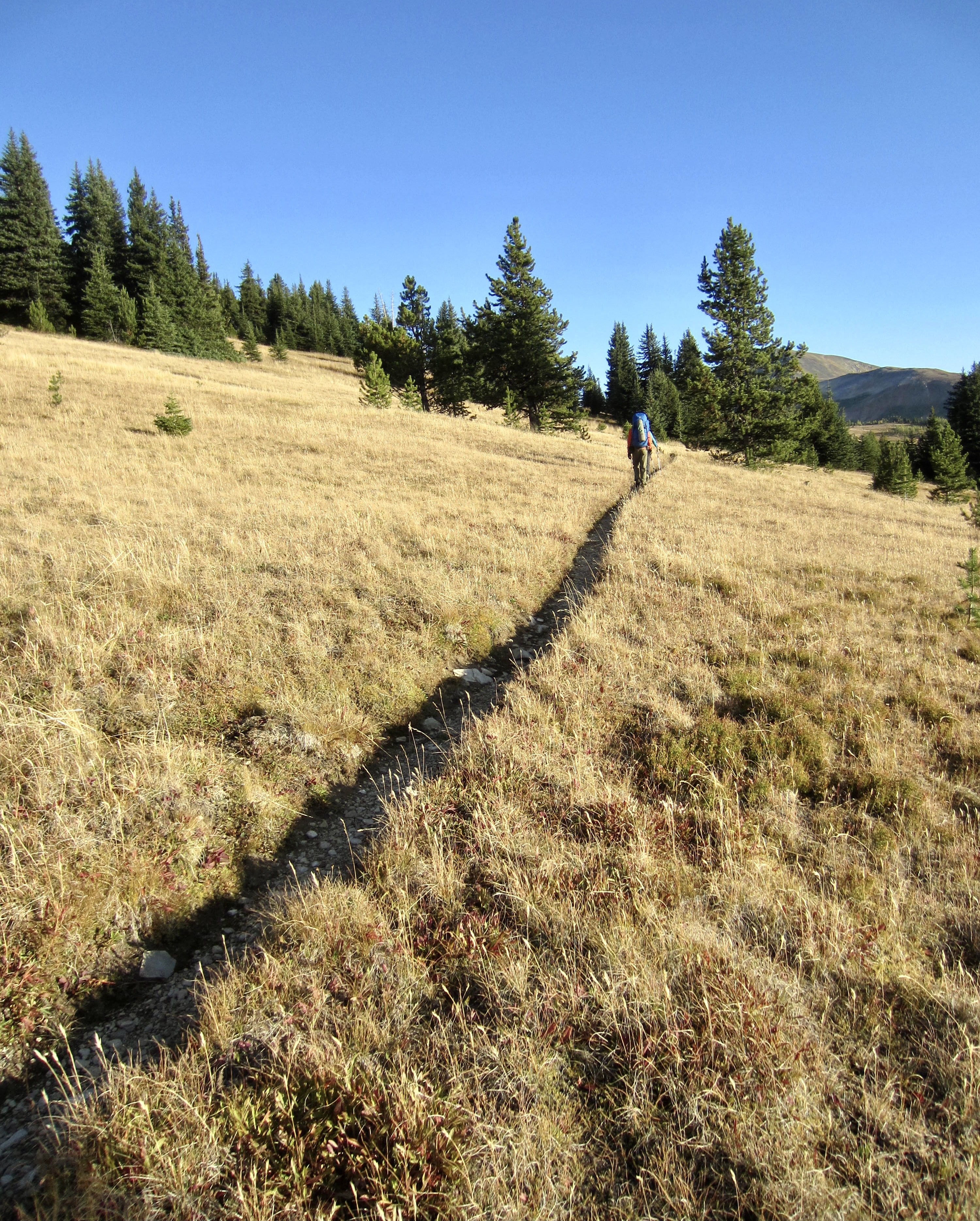
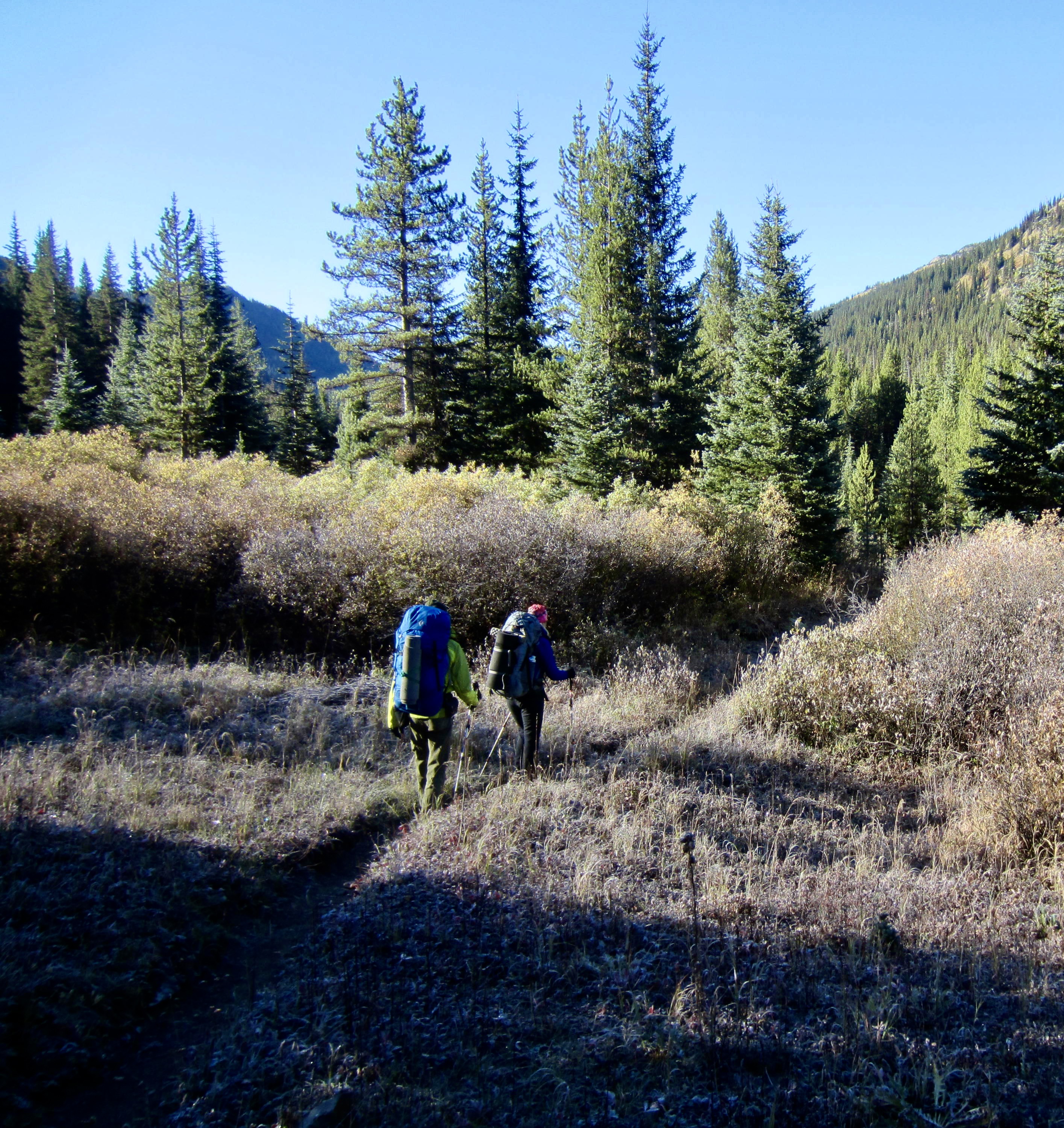
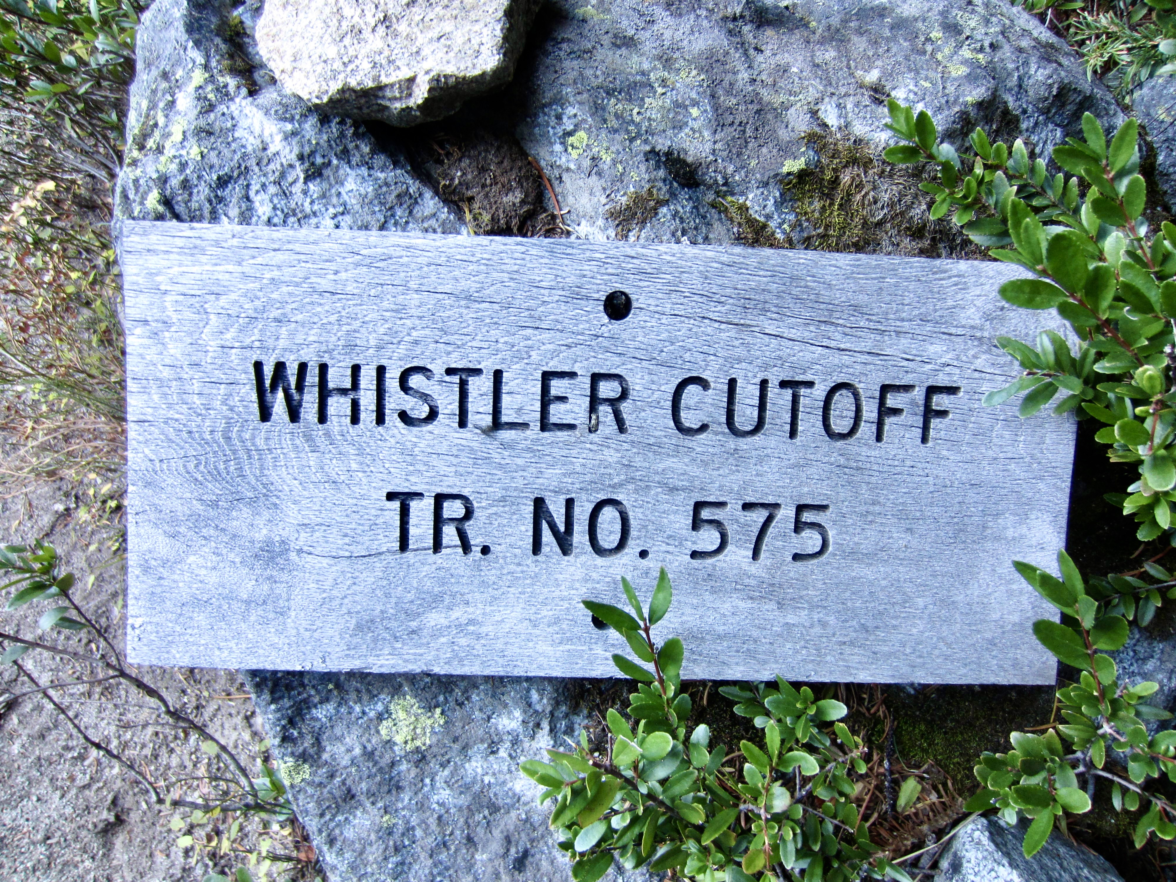
We left the Buckskin Ridge Trailhead at 2:00pm on a chilly, partly cloudy Thursday and hiked over nearby Slate Pass, then down the Whistler Cutoff to an intersection with the Robinson Creek Trail. As we continued down-valley along the Middle Fork Pasayten River, a light rain began to fall. The trail was thoroughly logged out and brushed out, and the forest mushrooms were thriving in response to recent wet weather.
.
.
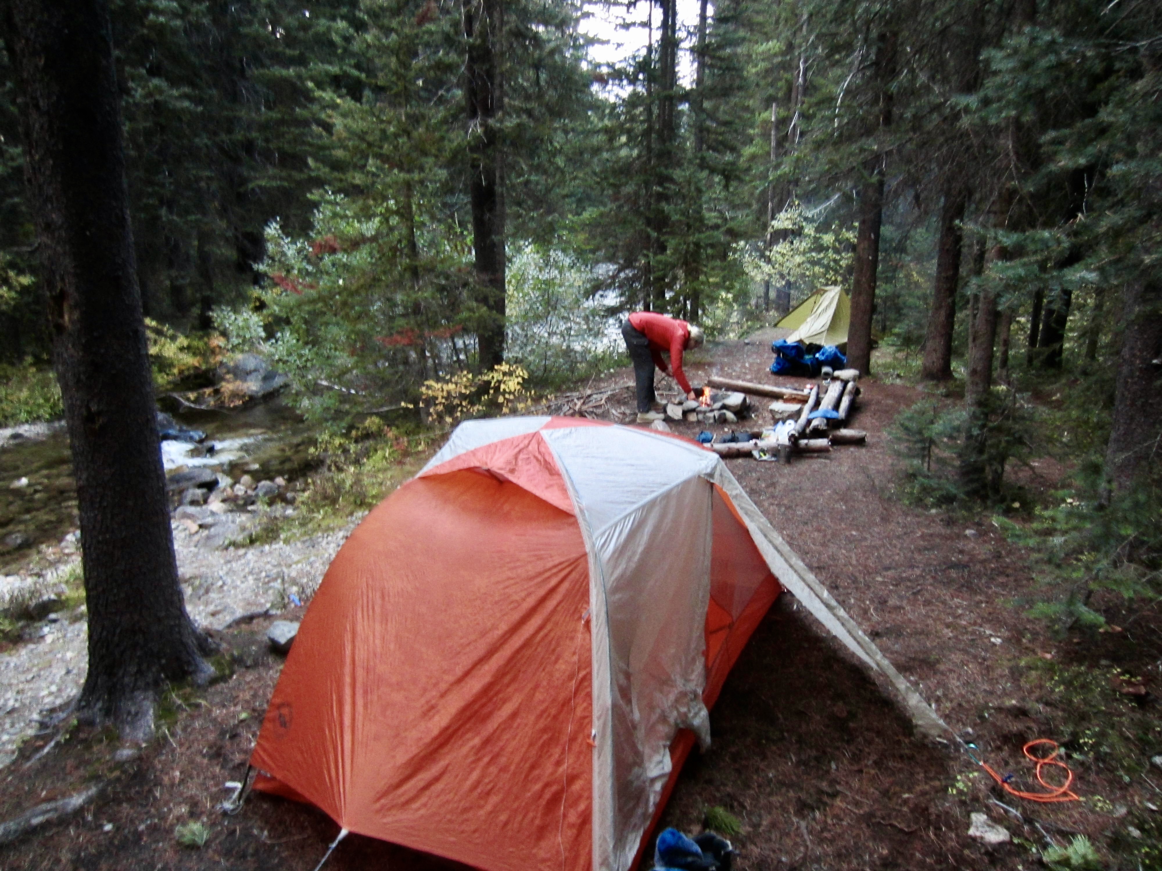
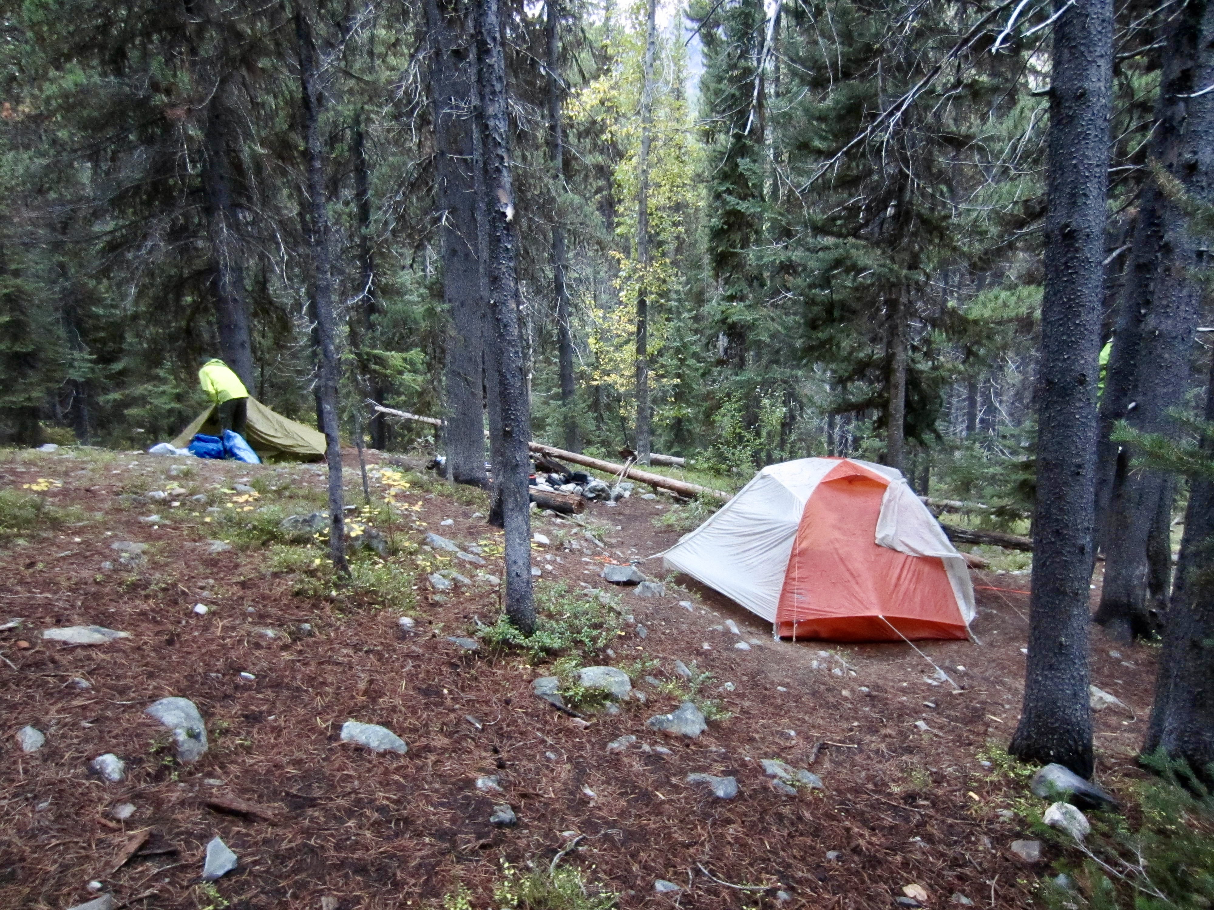
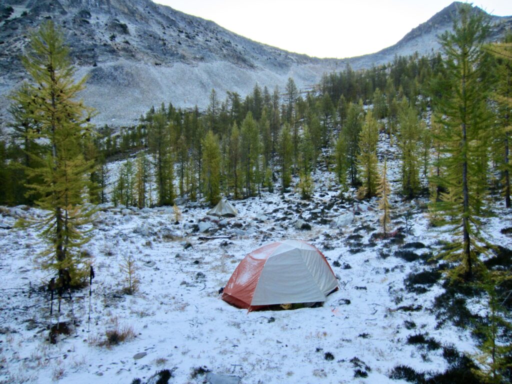
It was raining steadily by the time we reached the Shellrock Pass Trail junction in early evening (4.3 hours + 9.0 miles + 450 feet – 2300 feet from TH). Just 100 yards beyond this junction, we found a small established campsite adjacent to Berk Creek and gladly stopped for the day.
.
Day 2: Berk Creek Crossing to Tamarack Ridge
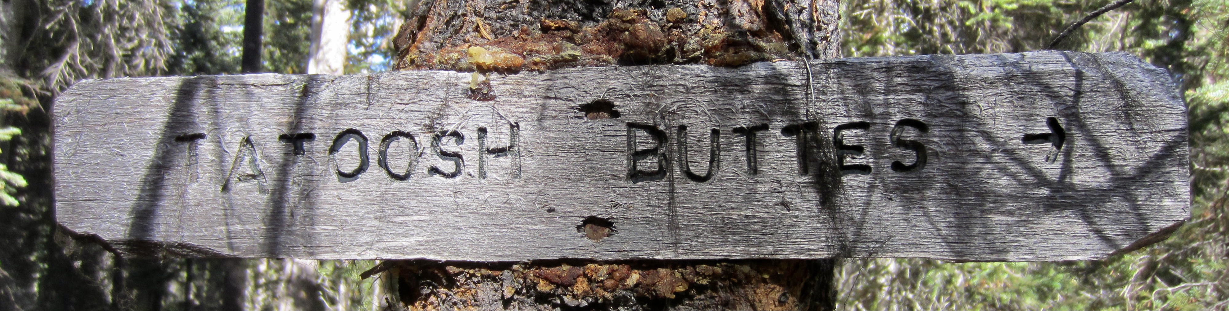
The rainfall tapered off during the night, leaving partially blue skies in the morning. We continued hiking down-valley on the nicely maintained trail until reaching an inconspicuous junction with the Tatoosh Buttes Trail (2.8 hours + 5.0 miles + 100 feet – 600 feet from Camp 1). A long mile of abandoned trail led over to Lease Creek, where we stopped for lunch amidst a not-so-old burn area.

.
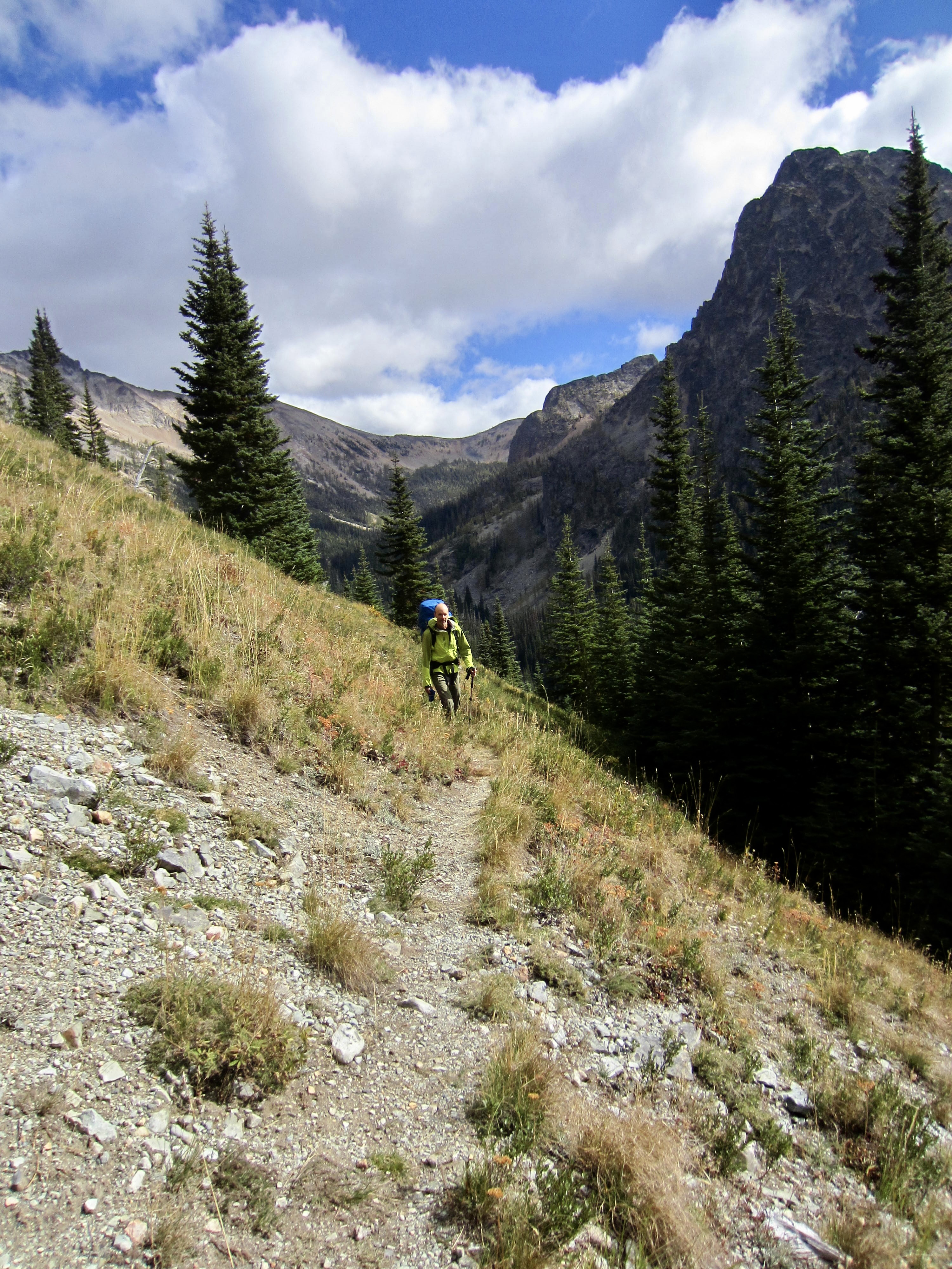
We rock-hopped across Lease Creek and worked our way through jackstraw forest on the opposite side. After a bit of searching, we located the abandoned trail hidden under fallen logs and began a slow, tedious ascent toward Tatoosh Buttes. It should be noted that none of our various maps (Green Trails, USGS, Gaia, and CalTopo) show this part of the trail correctly; the actual trail is located considerably farther to the north.
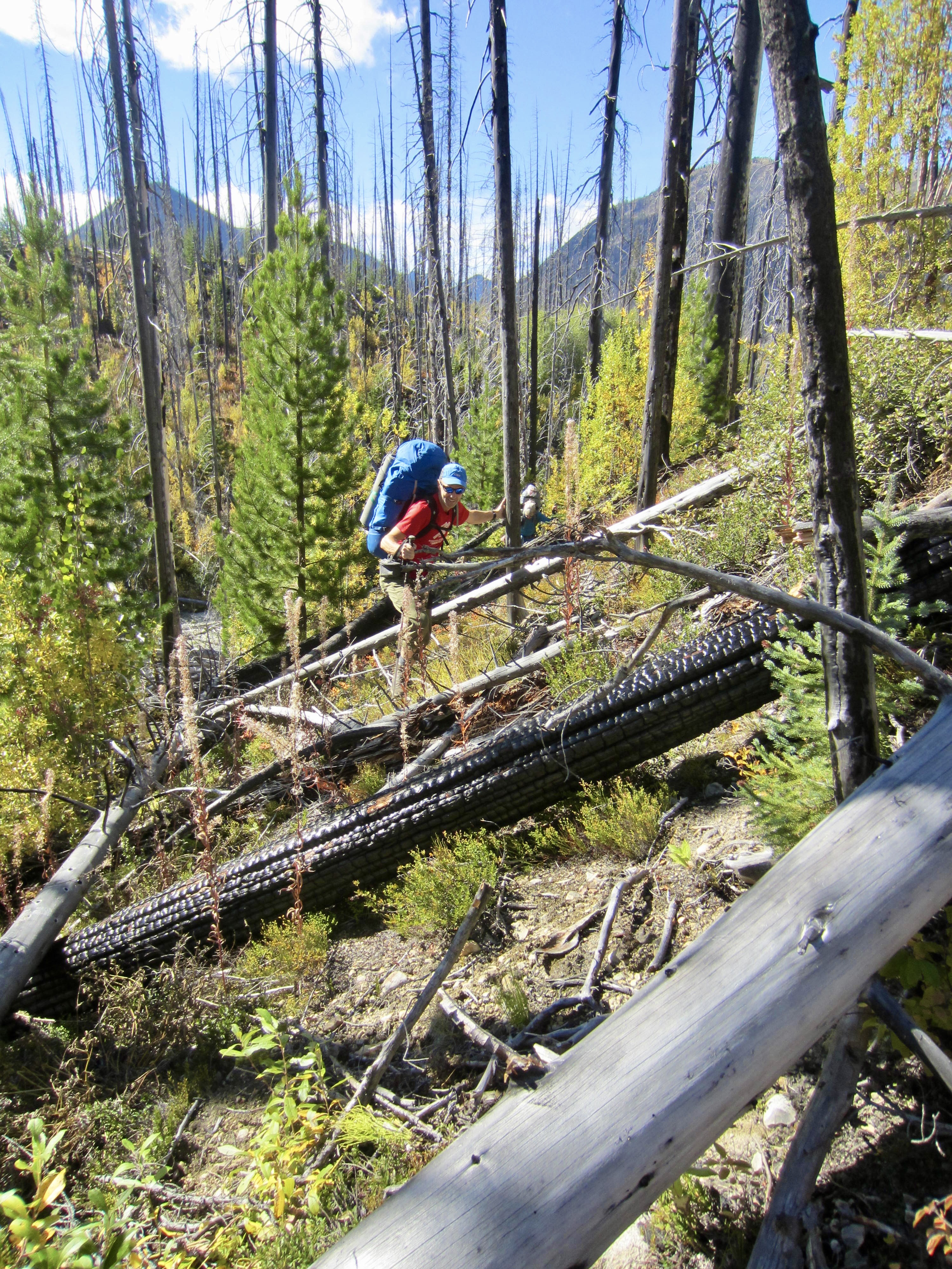
.
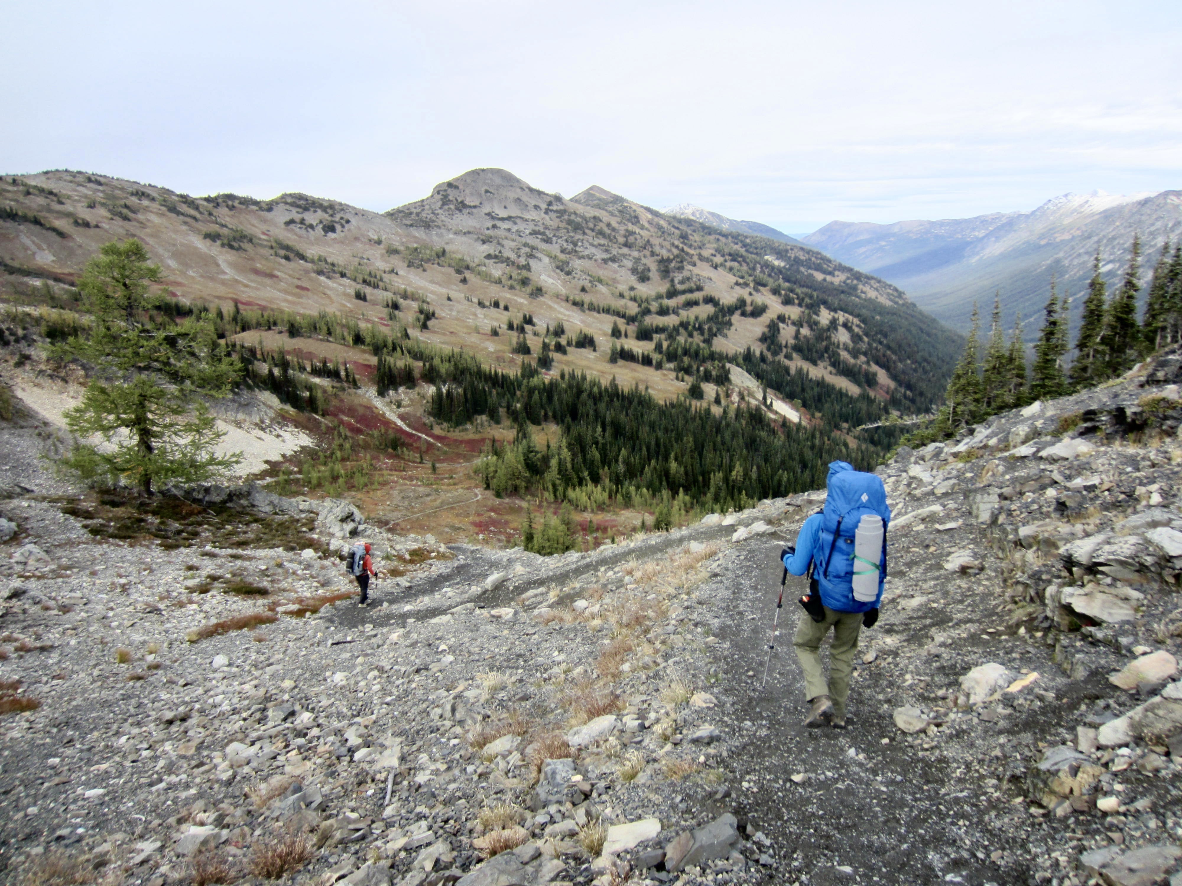
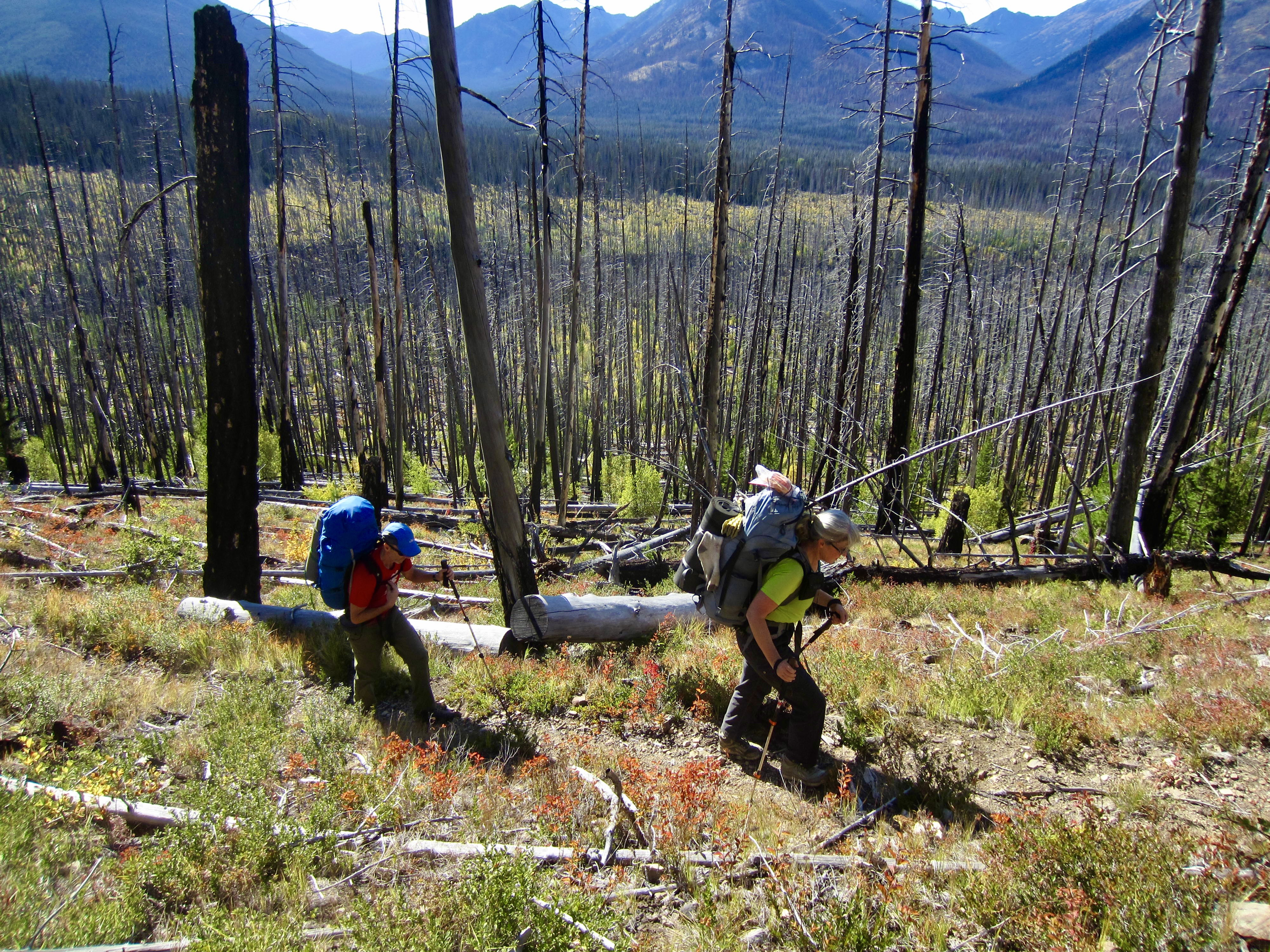
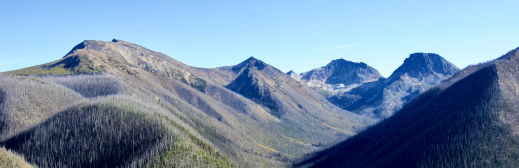
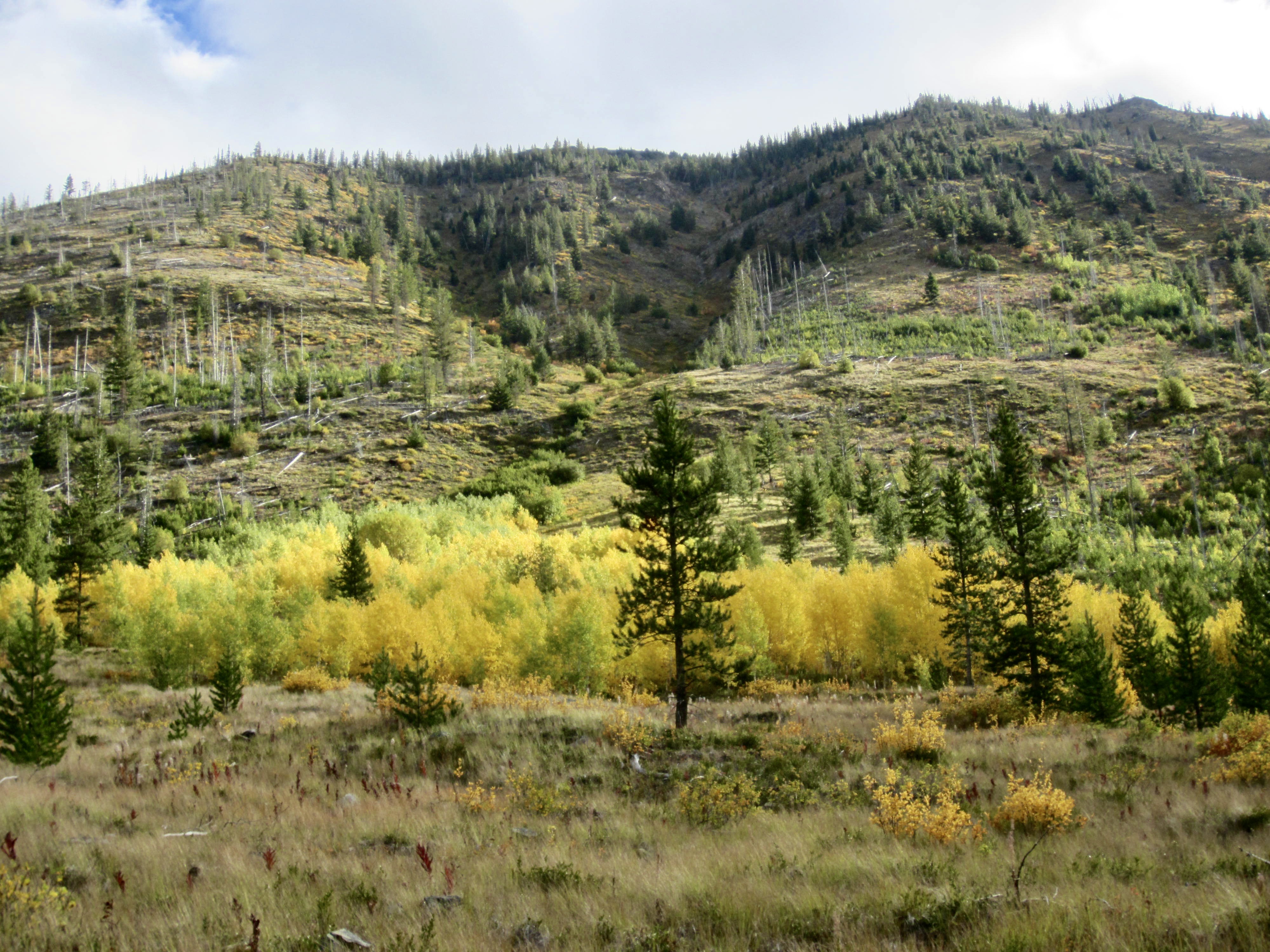
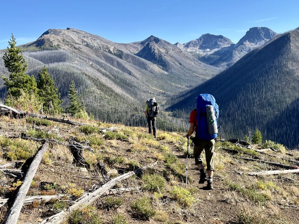
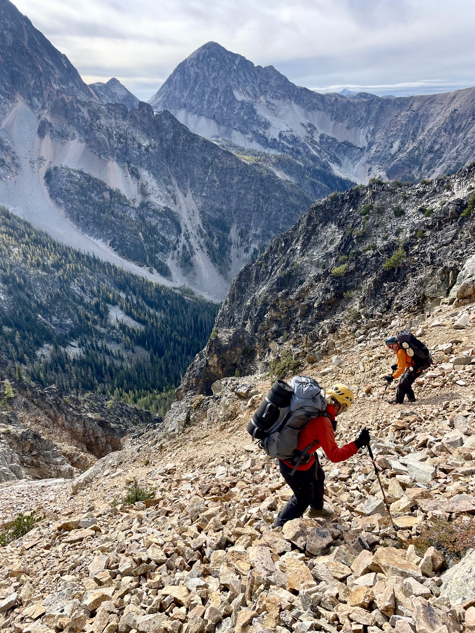
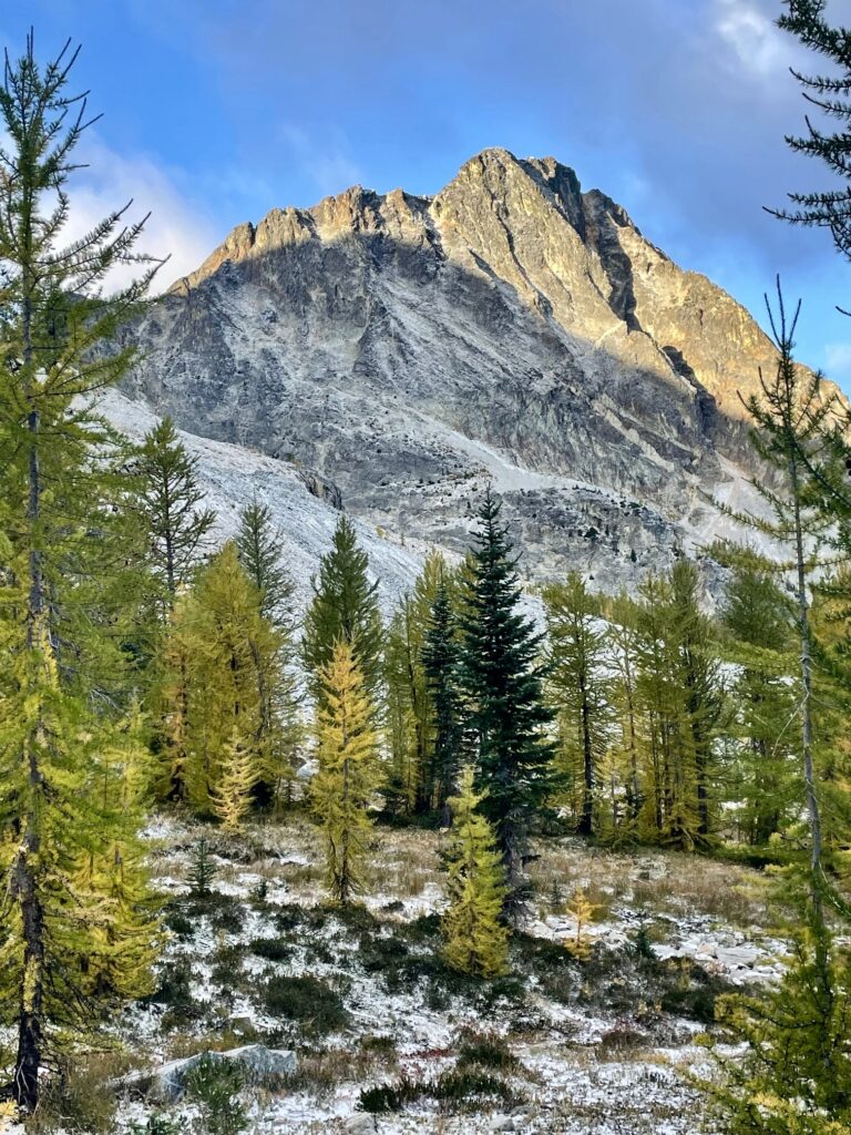
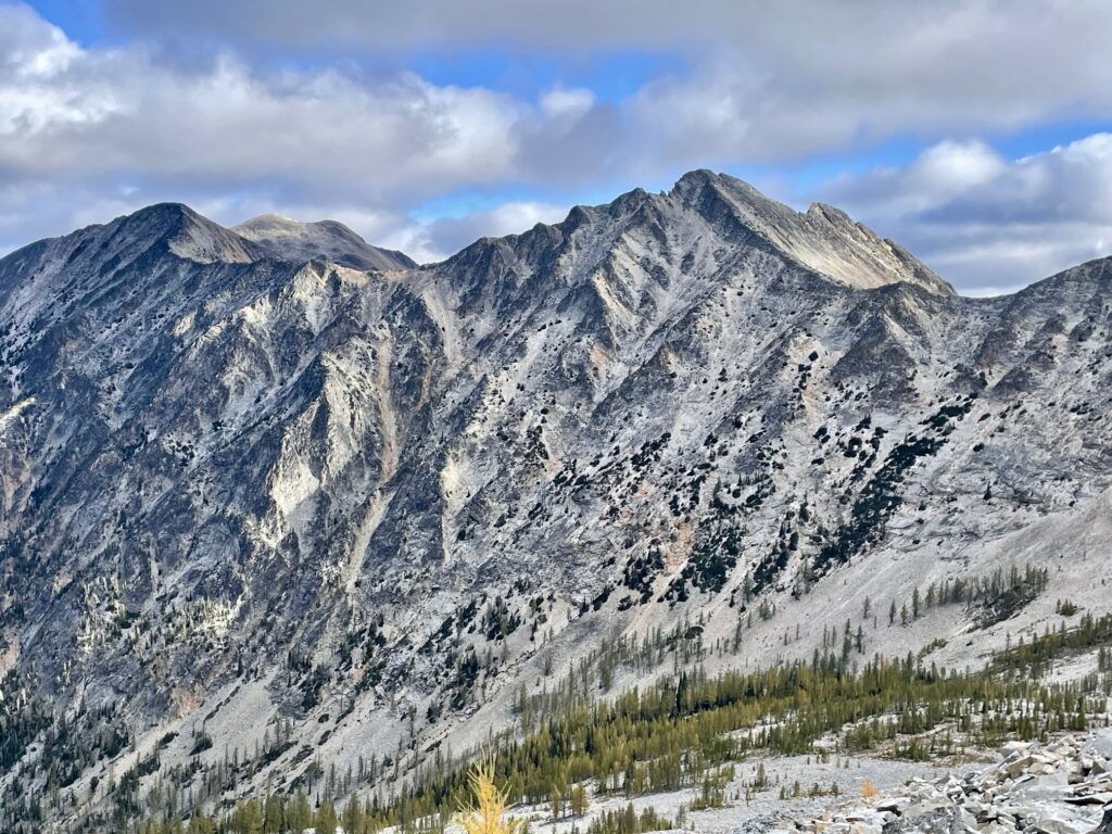
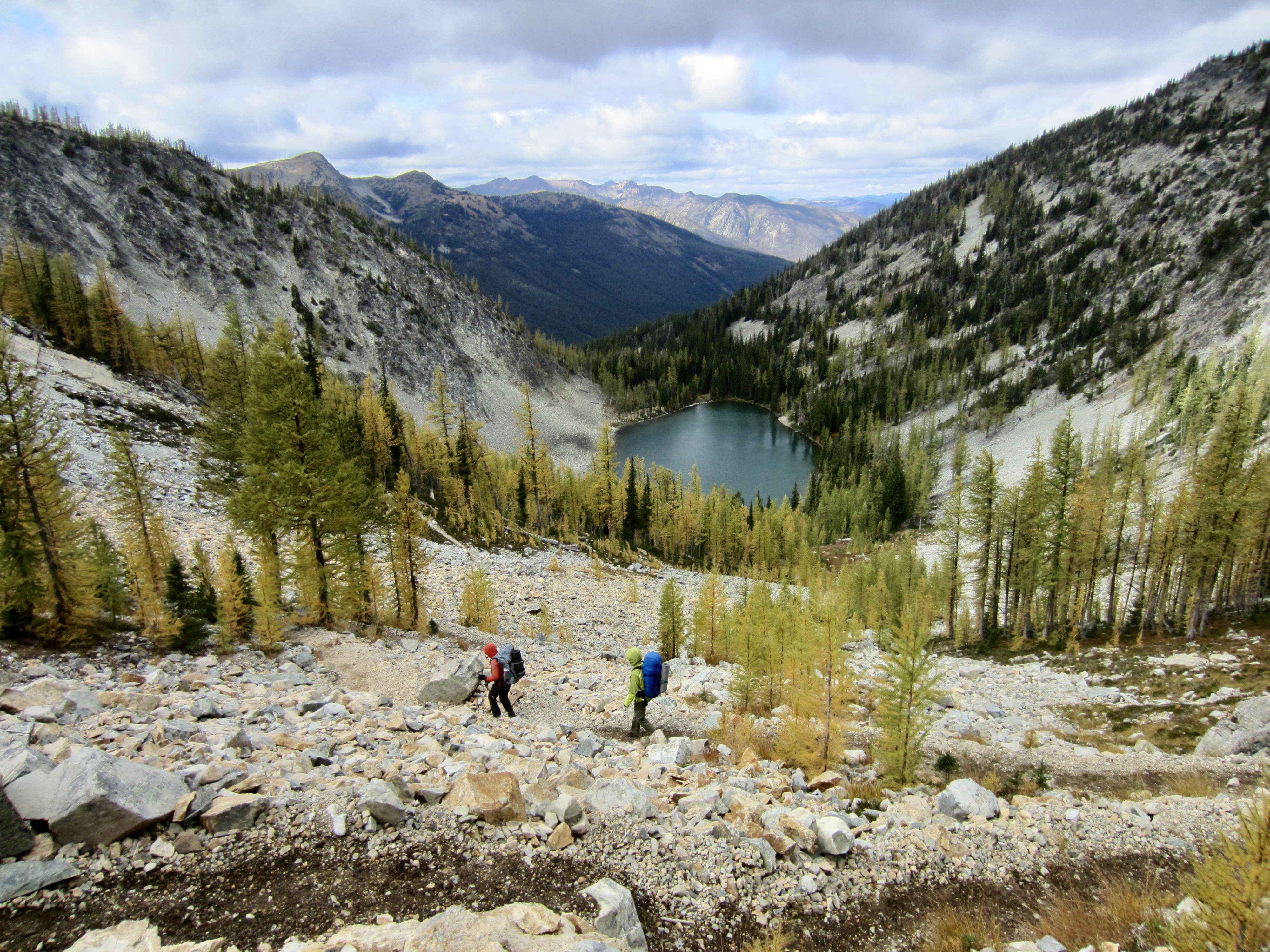
As we gradually gained elevation, the jackstraw forest thinned out and the travel improved. At 5900 feet, we rounded a corner and got an unobstructed view into the Lease Creek watershed. The entirety of Lease Creek Valley has been burned out, leaving a vast forest of dead snags and jackstraw trees. Ptarmigan Peak, Dot Mountain, Mt. Lago, and Mt. Carru were visible at the head of the valley—along with much of our planned cross-country traverse route.

.
.
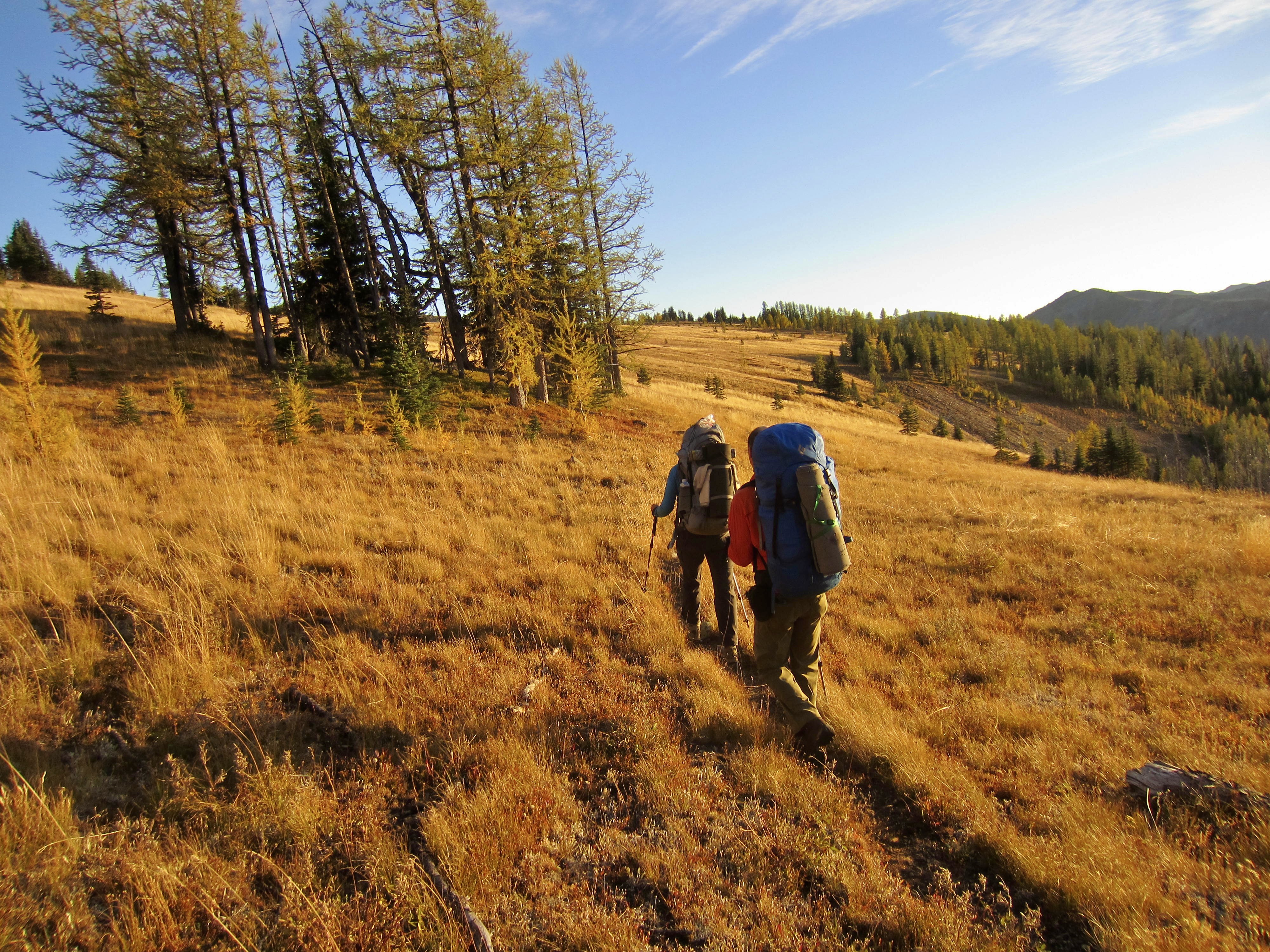
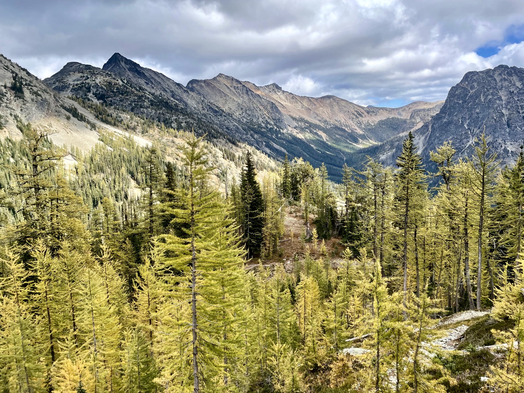
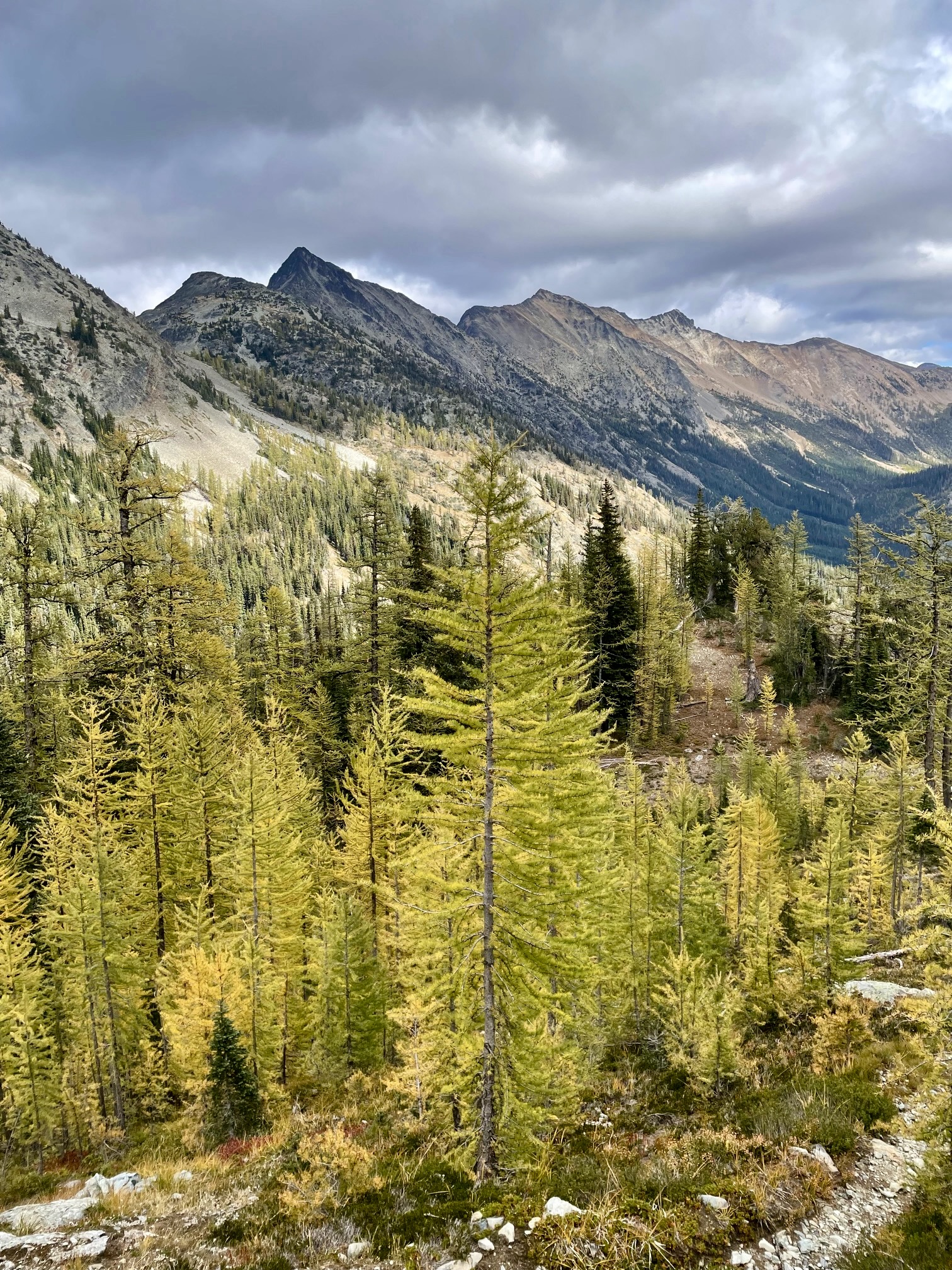
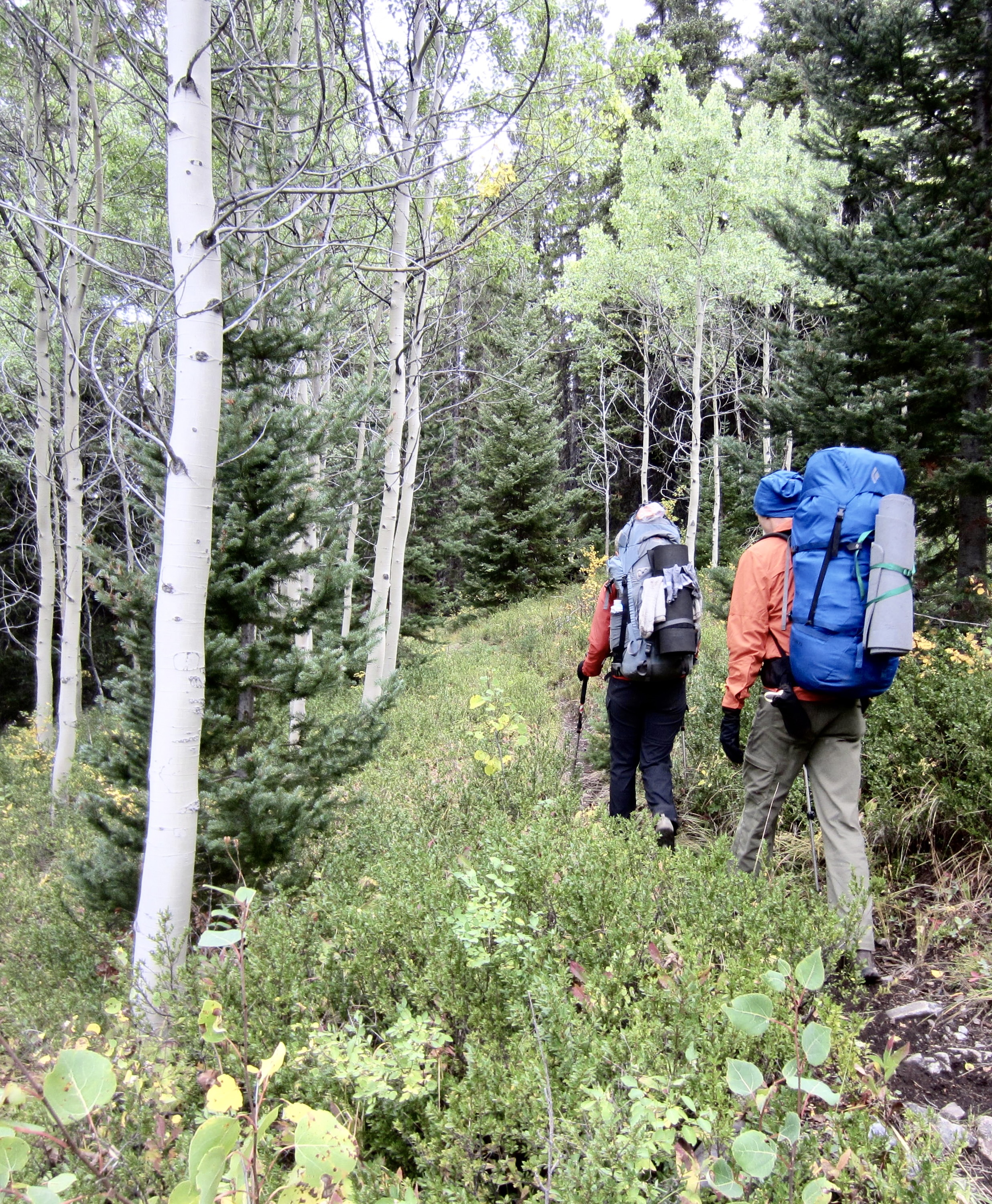
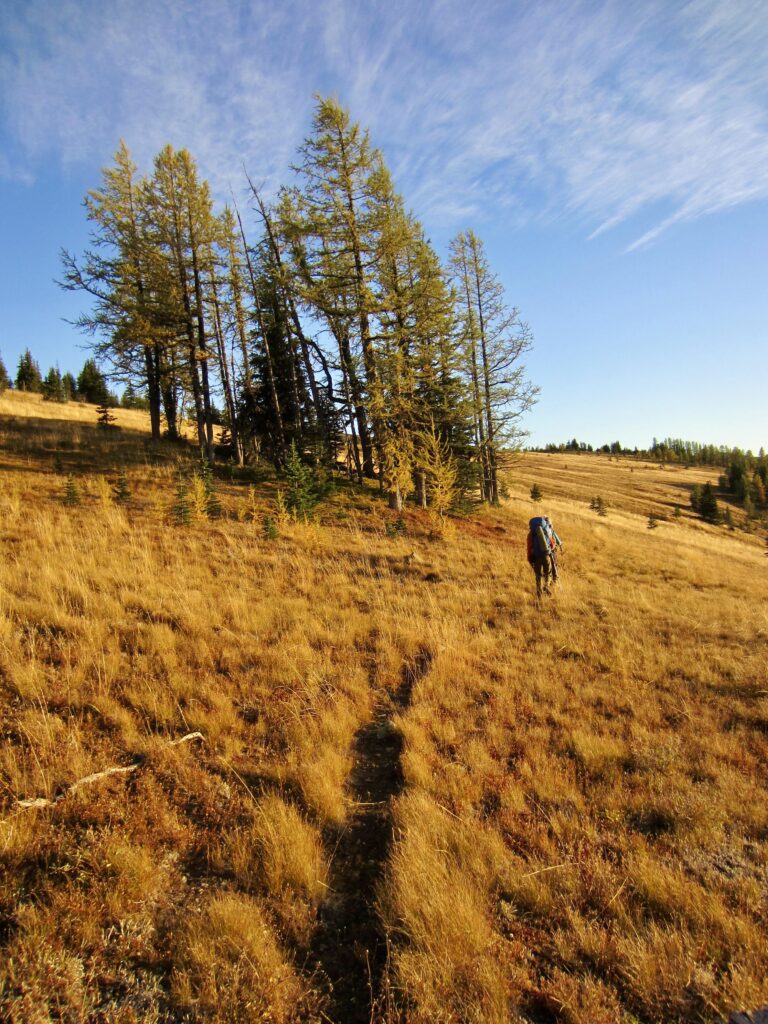
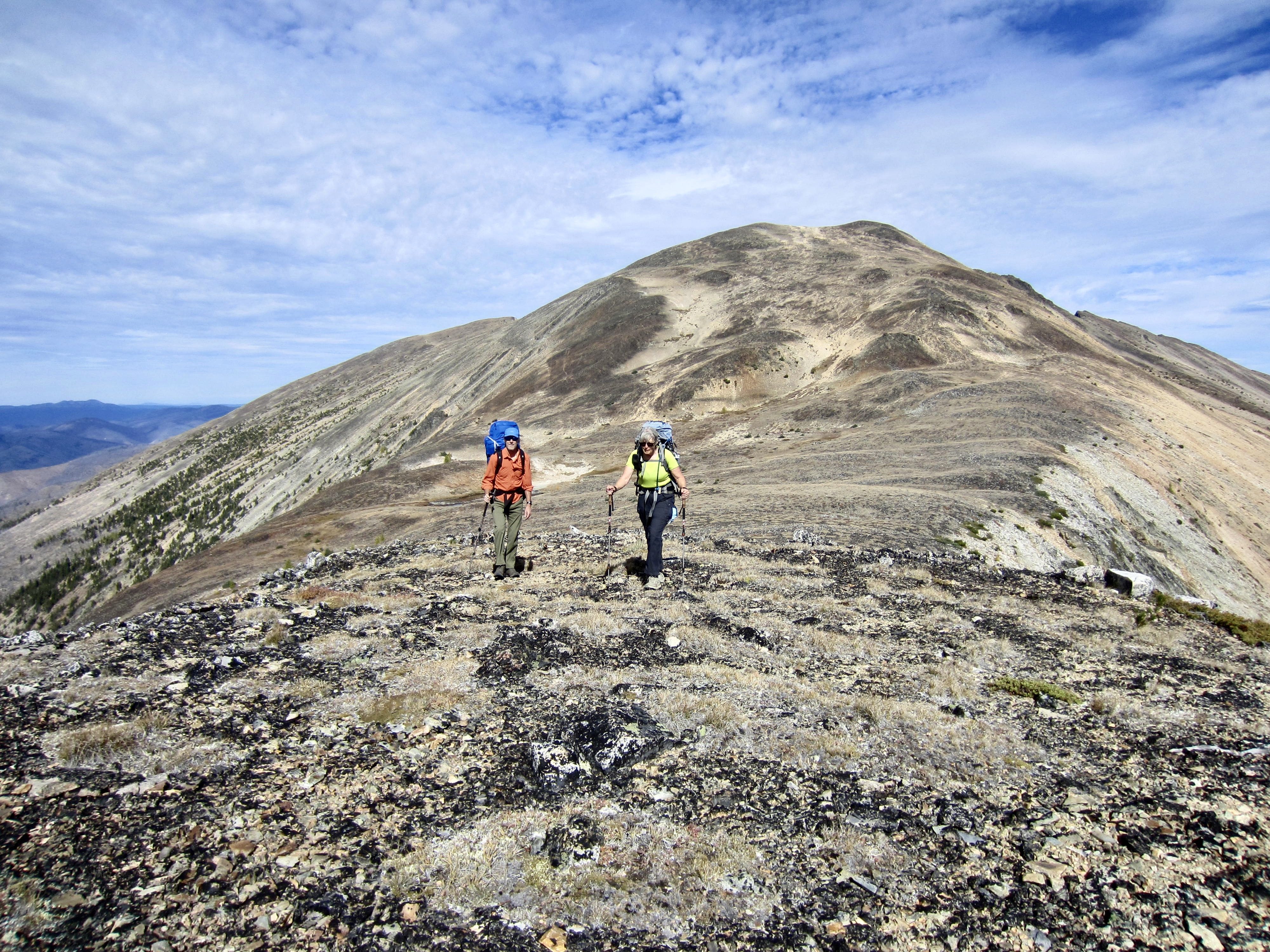
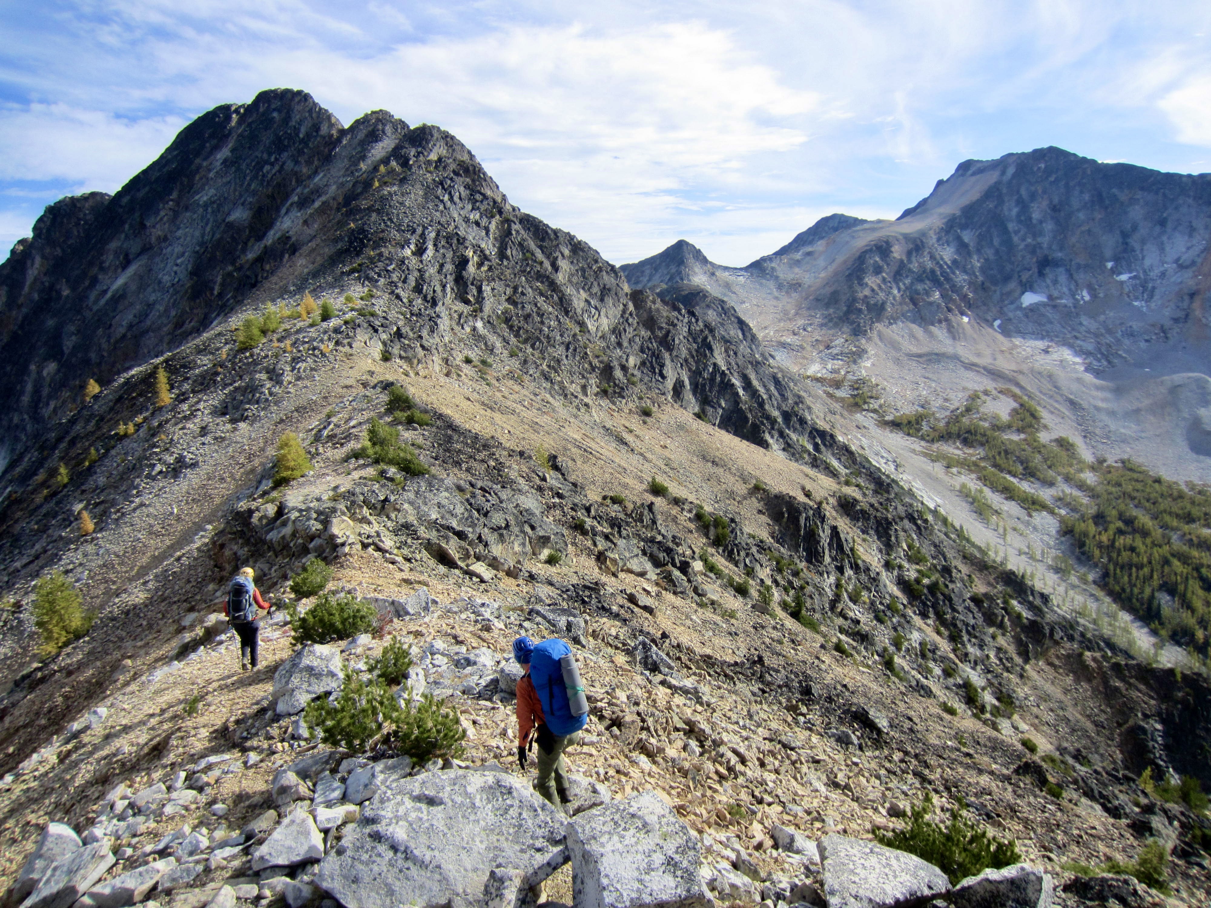
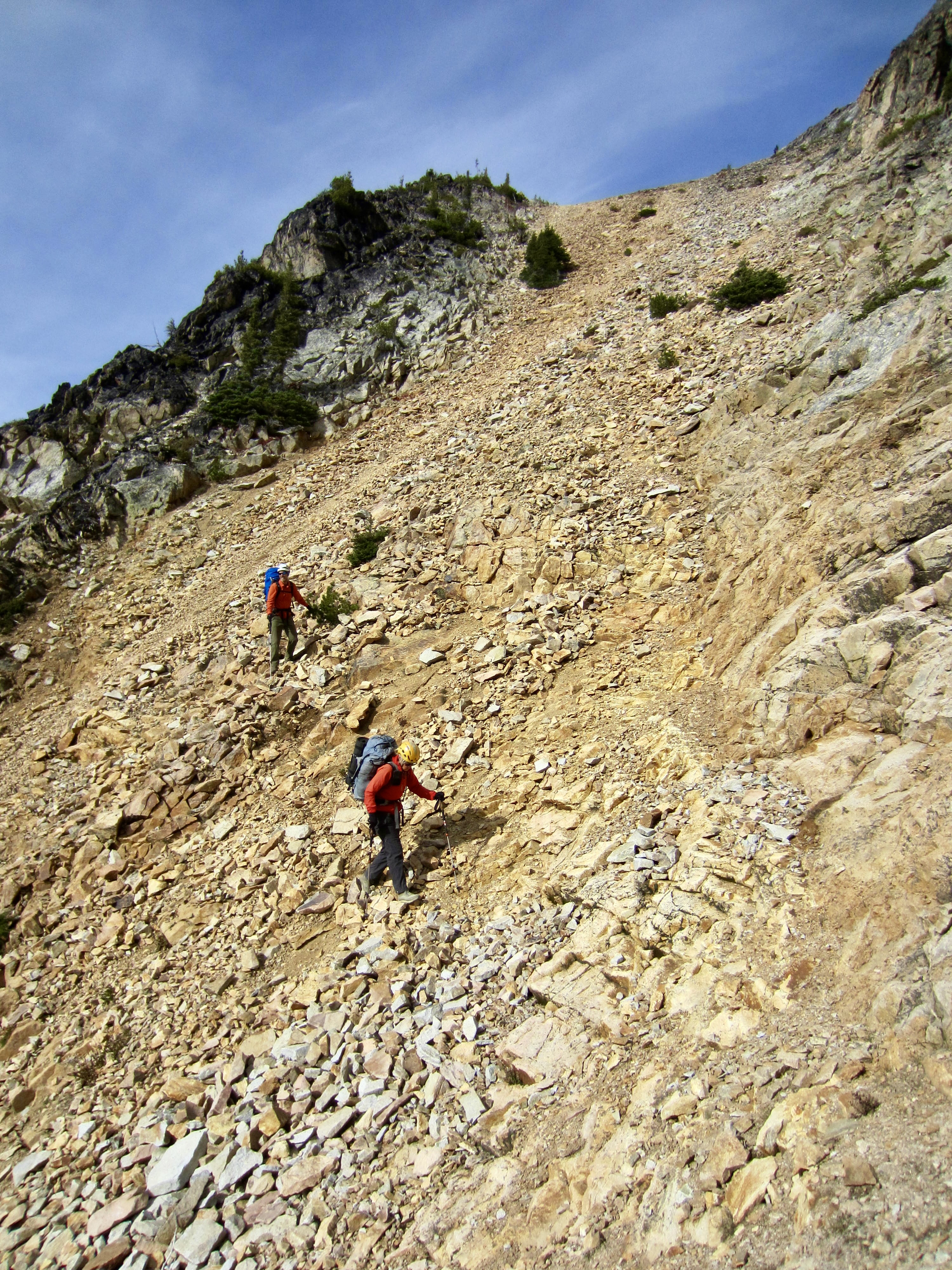
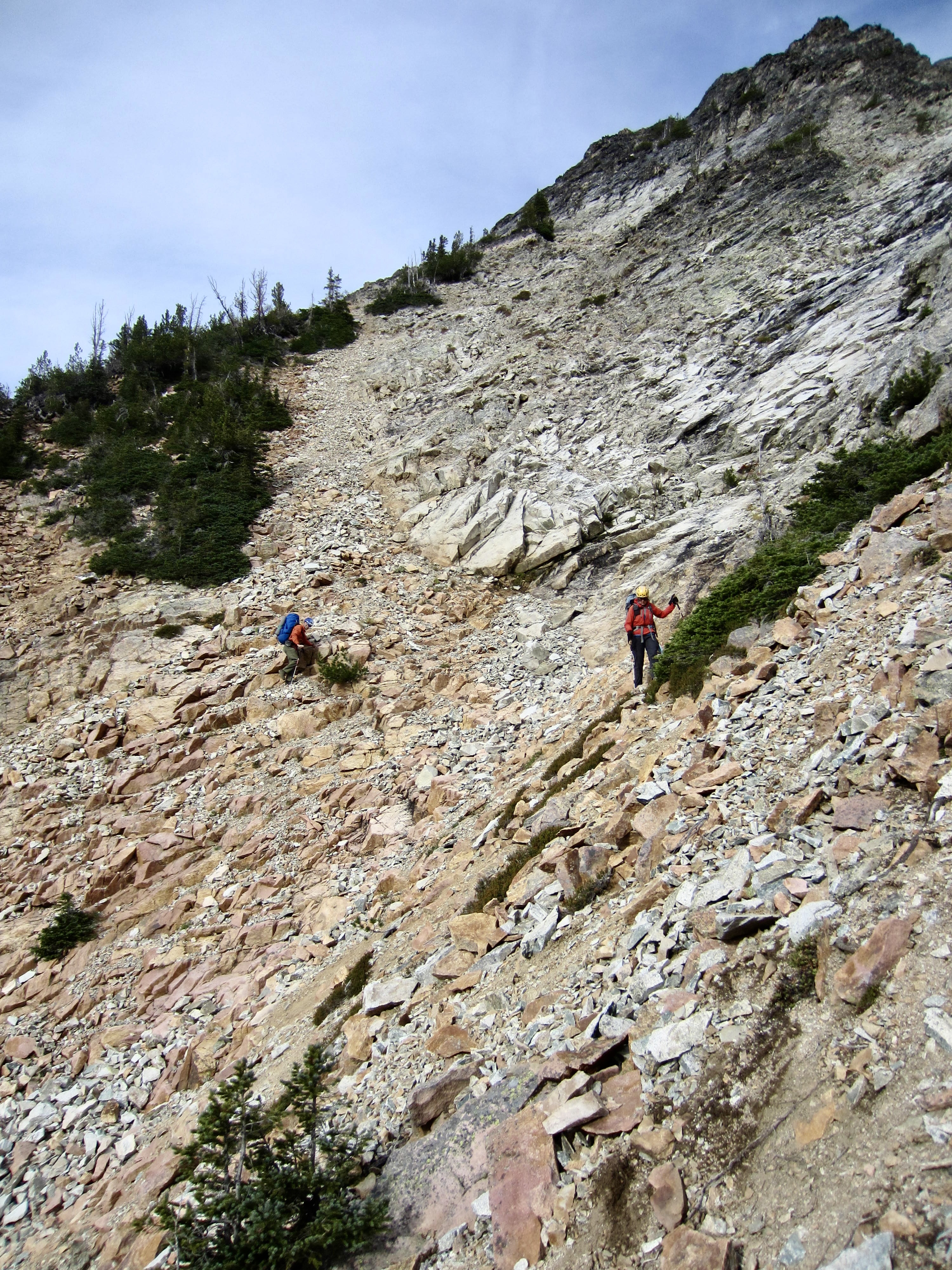
After rounding the corner, we followed the trail on an eastward traverse across Tatoosh Ridge, through a combination of open grassland and burned forest. We passed through Lone Buck Saddle in late afternoon (8.2 hours + 2500 feet from Camp 1), then continued southeastward beneath Tatoosh Buttes. The terrain here consists of splendid subalpine parkland with scattered groves of trees.
.
.
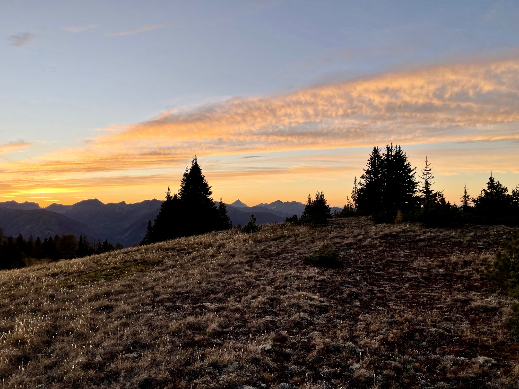
At 6950 feet, where the Tatoosh Buttes Trail turns eastward, we veered onto a well-trodden bootpath that heads due south across the hillside and over Point 7042 on Tamarack Ridge. The sun was close to the horizon when we topped out on the ridge, so we stopped for the night (9.4 hours + 3100 feet from Camp 1). Flat ground here provided nice tent sites, but there was no water to be found. No matter; in anticipation of a dry camp, each of us had packed up 1 or 2 quarts of water.
.
.
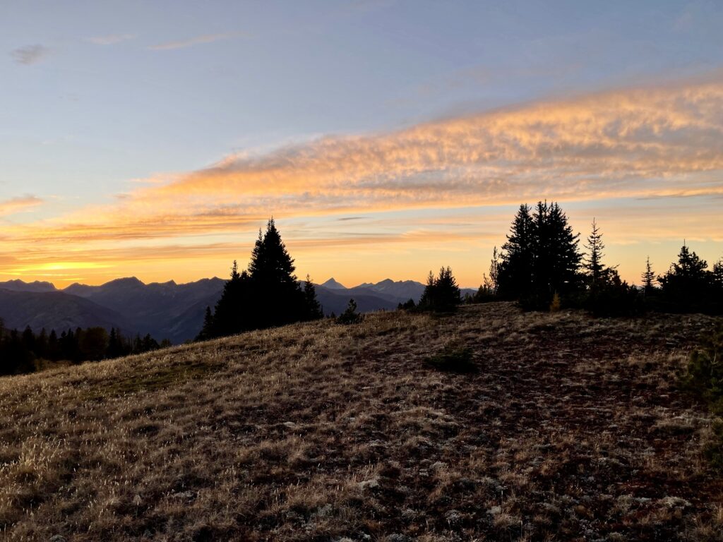
Despite our high and exposed location, there was no wind at any time during the night. We were able to watch a colorful sunset over the Cascade crest while eating dinner. This turned out to be our best campsite of the trip, and one of our best campsites of the entire year!
.
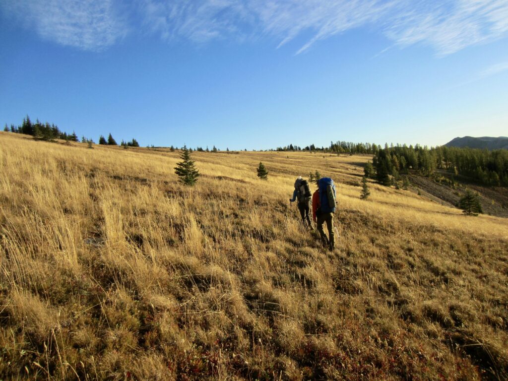
Day 3: Tamarack Ridge to Lago Basin
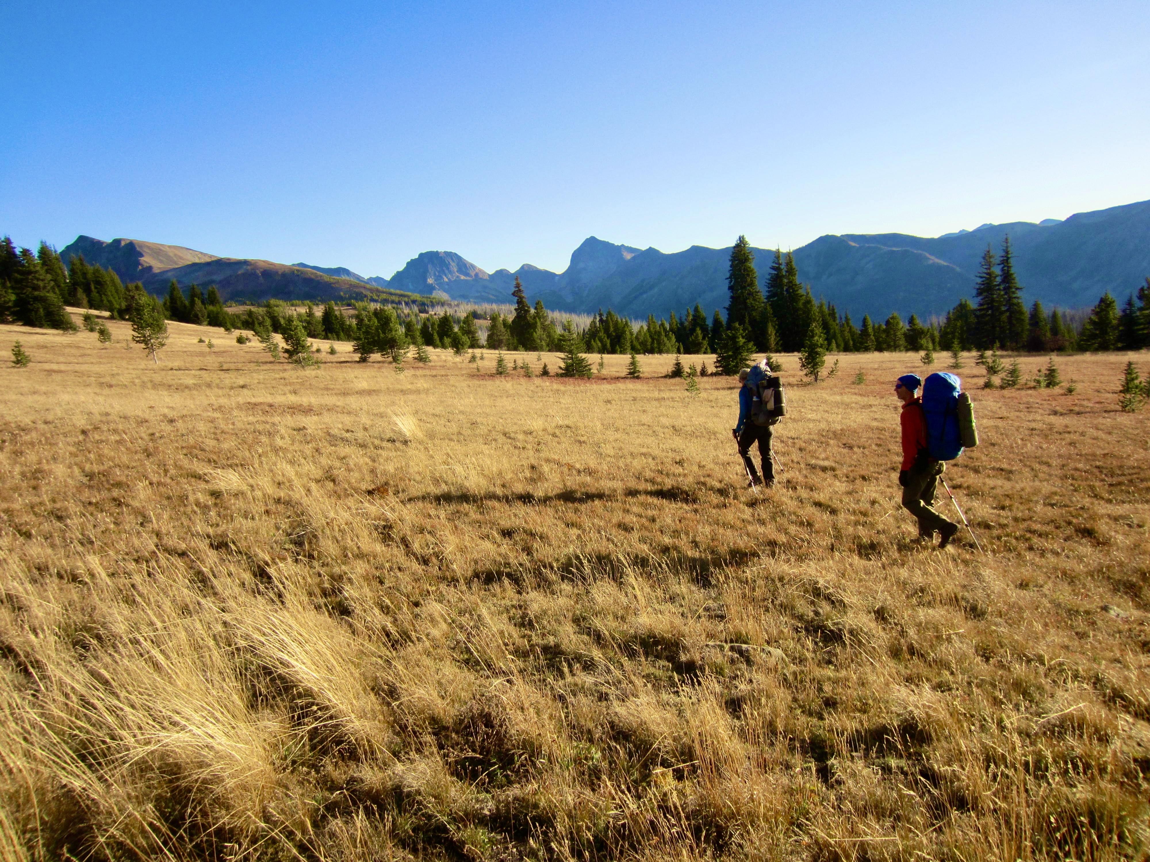
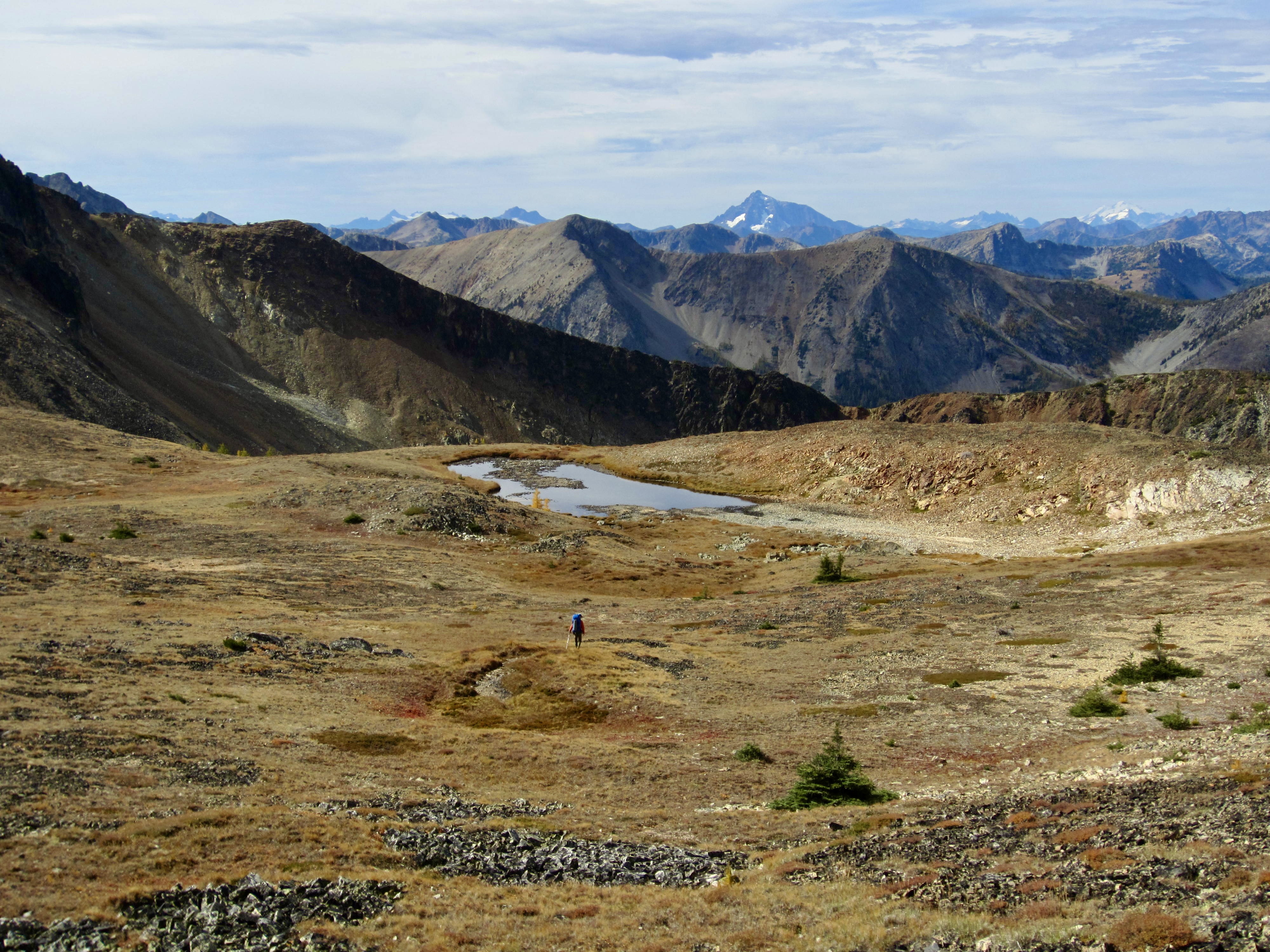
The night had been cold and clear, but clouds drifted over throughout the morning. From our camp on Tamarack Ridge, we contoured into a large, grassy basin at the head of Tamarack Creek. Here, we were happy to find a small creek that allowed us to refill our empty water bottles. This basin would provide a nice campsite without the need to haul water up from Lease Creek.
.
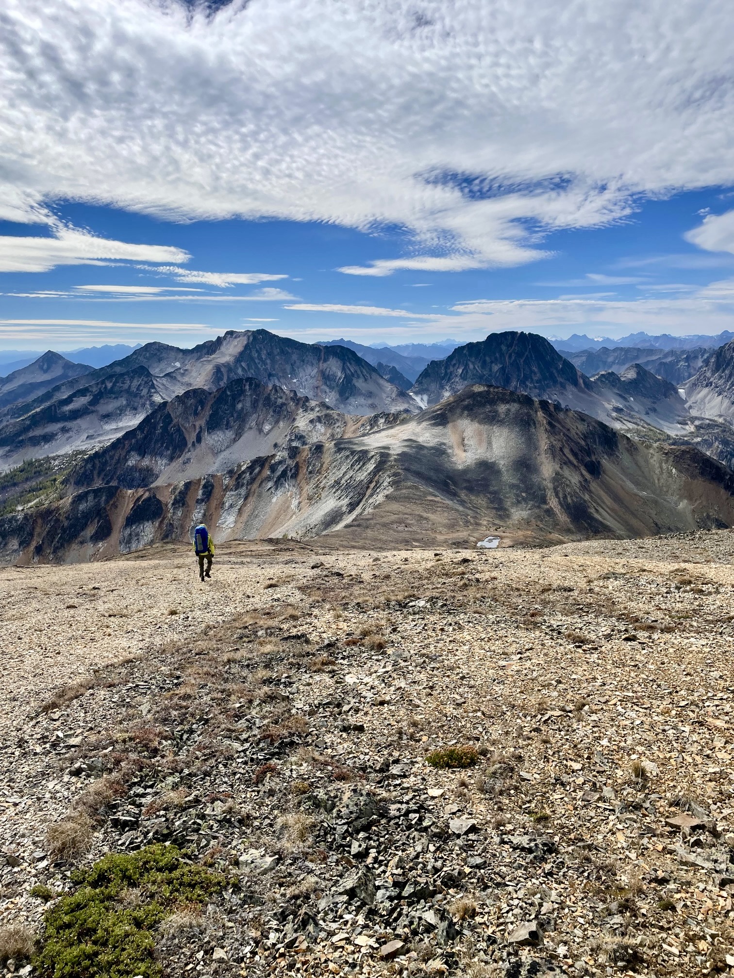
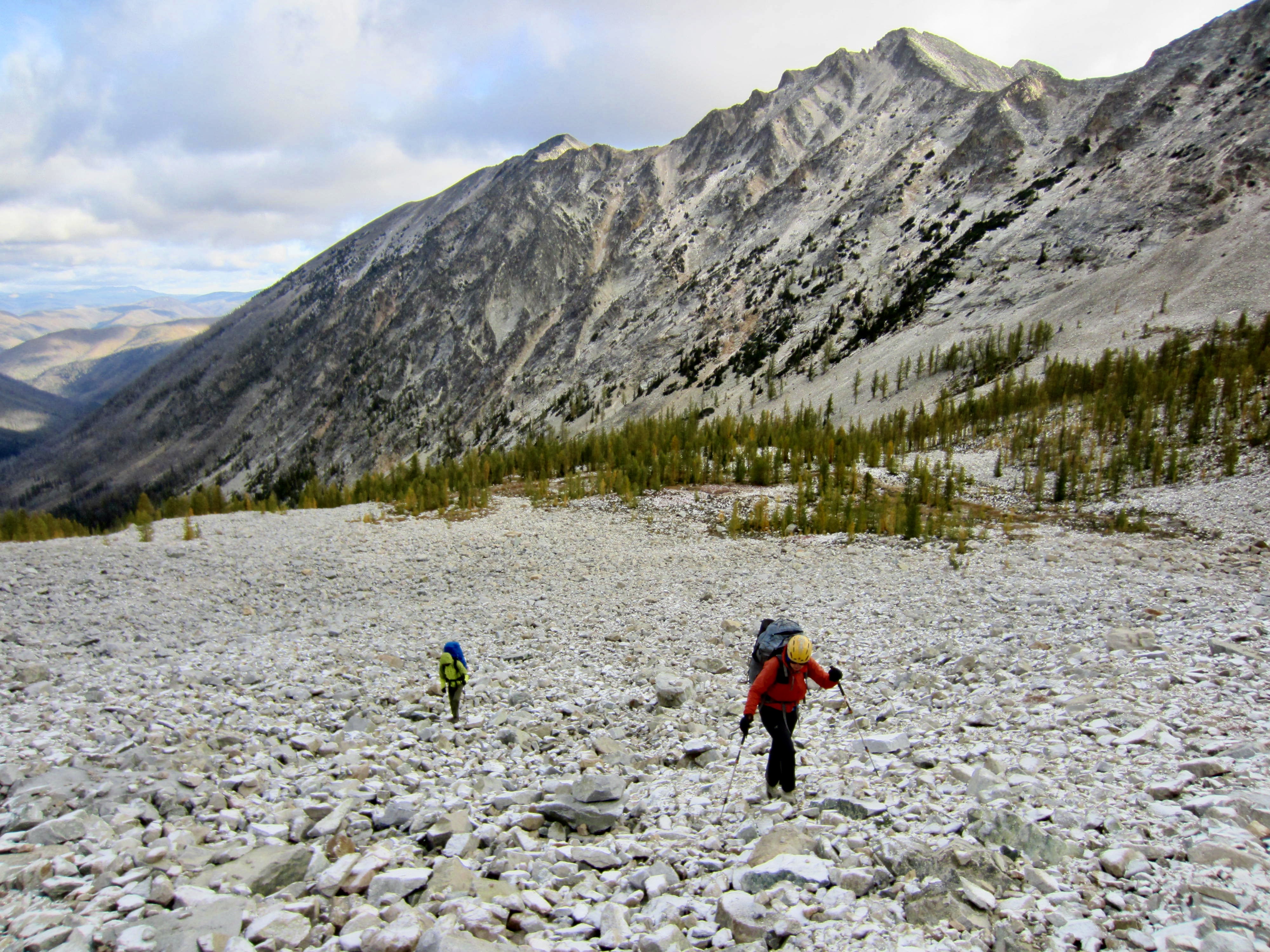
After gaining the 7250-foot saddle overlooking Ptarmigan Lake, we headed up the north ridge of Ptarmigan Peak. Our entire ascent route involved easy Class 1 hiking up broad slopes of alpine tundra, scree, and talus. The benign topography on the western side of this ridge differs dramatically from the steep glacial cirques on the eastern side.

.

.

.
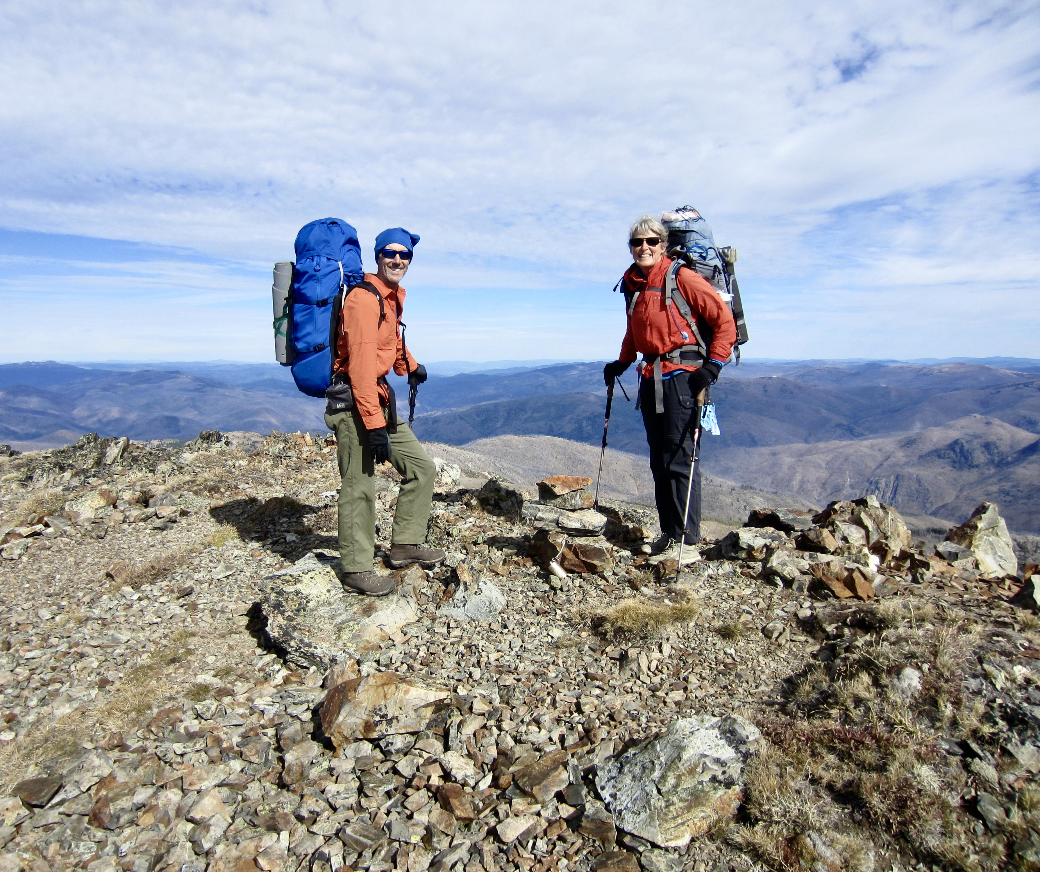
We stepped onto the summit of Ptarmigan Peak in late morning (2.7 hours + 1750 feet from Camp 2). The summit register showed that at least ten parties had preceded us this year—probably totaling several dozen people. Obviously, this peak’s high elevation and prominence make it an appealing objective despite the long approach.
.
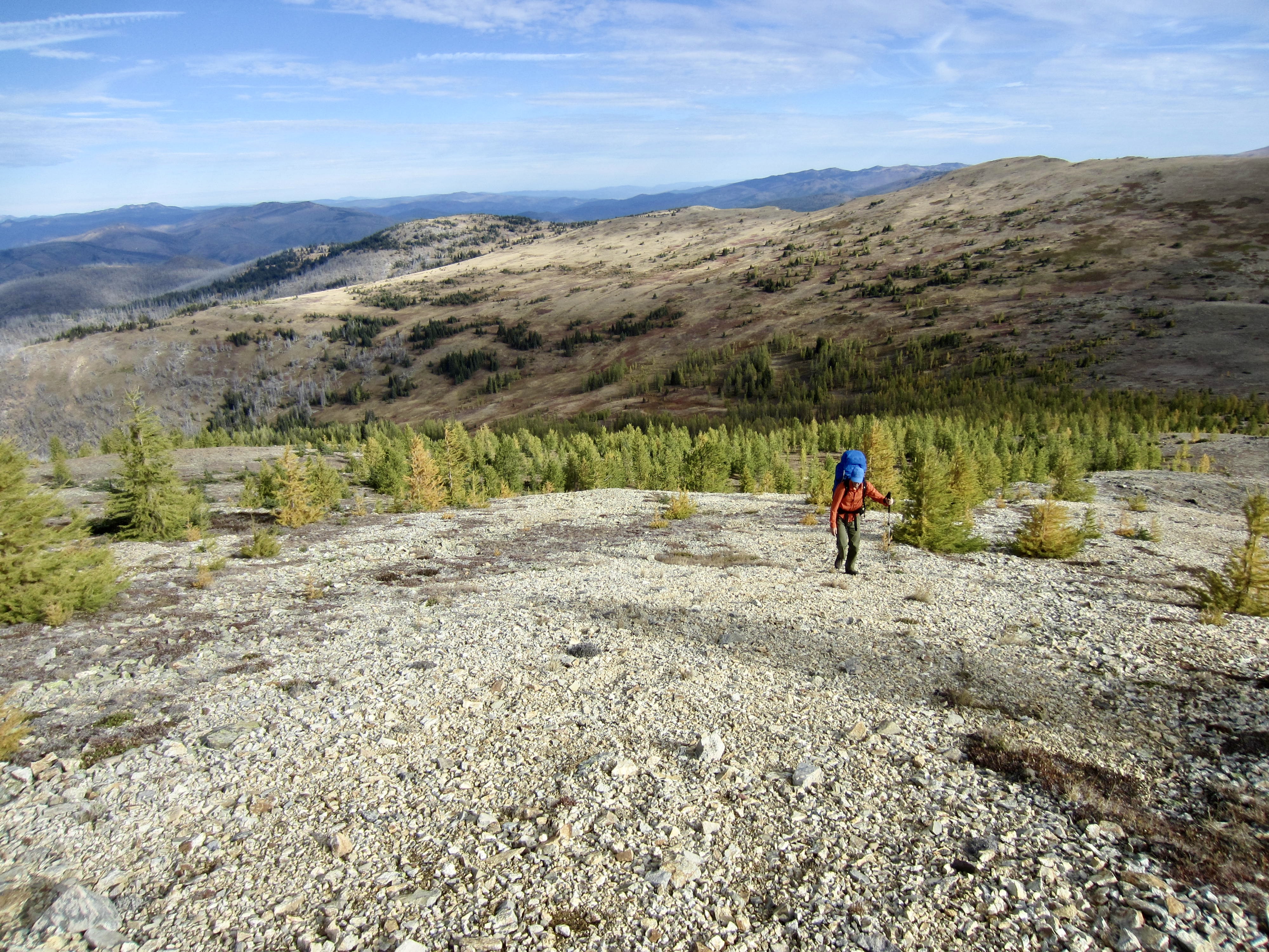
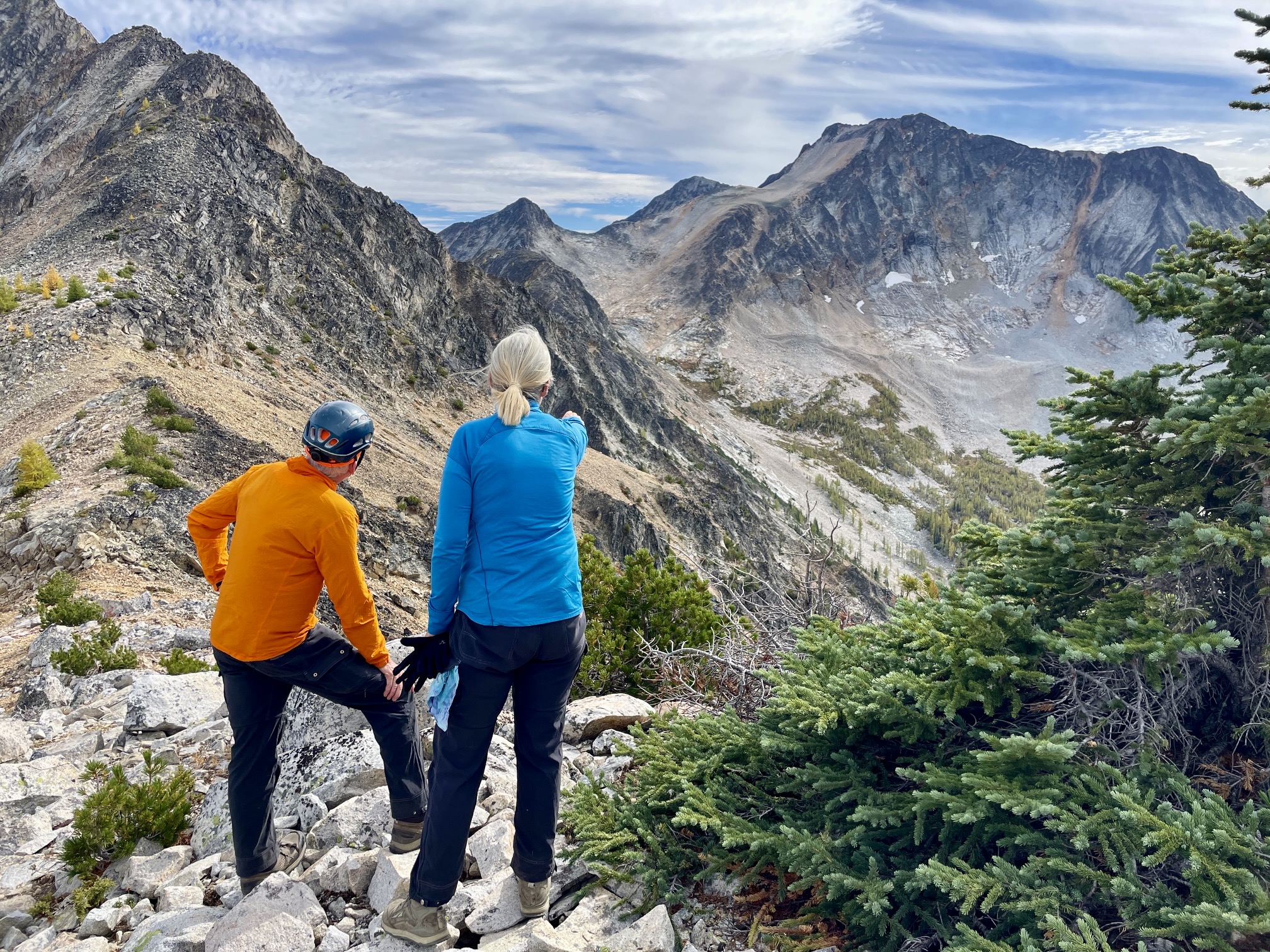
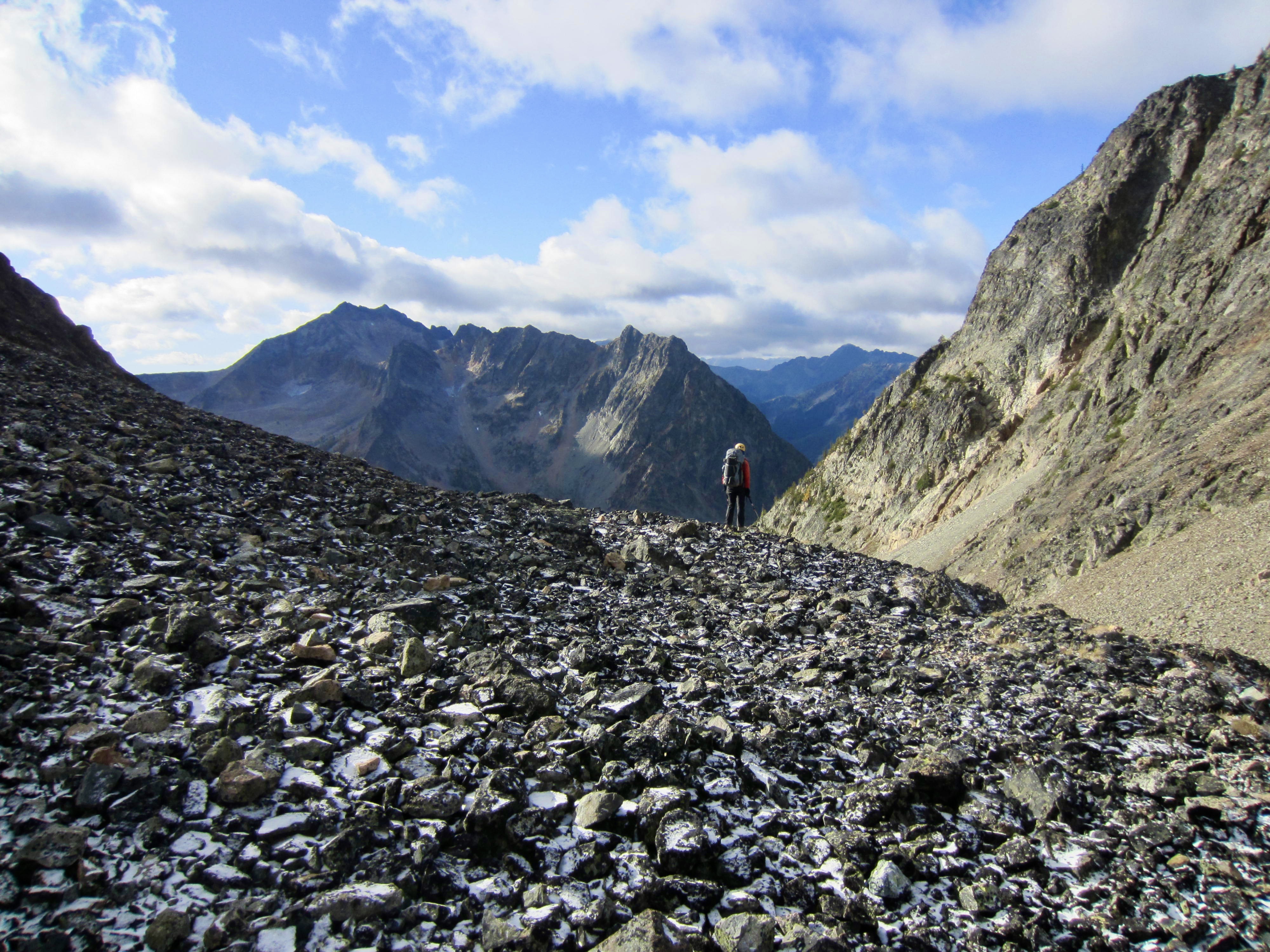
Continuing our traverse, we headed down a broad scree slope on the southern flank. The Lago–Carru Col was clearly visible over the top of Dot Mountain, 2½ miles away. We bottomed out at 7800 feet in the Ptarmigan–Dot Saddle, which cradles a beautiful meadow with a small lake. This would also provide a fabulous campsite.
.
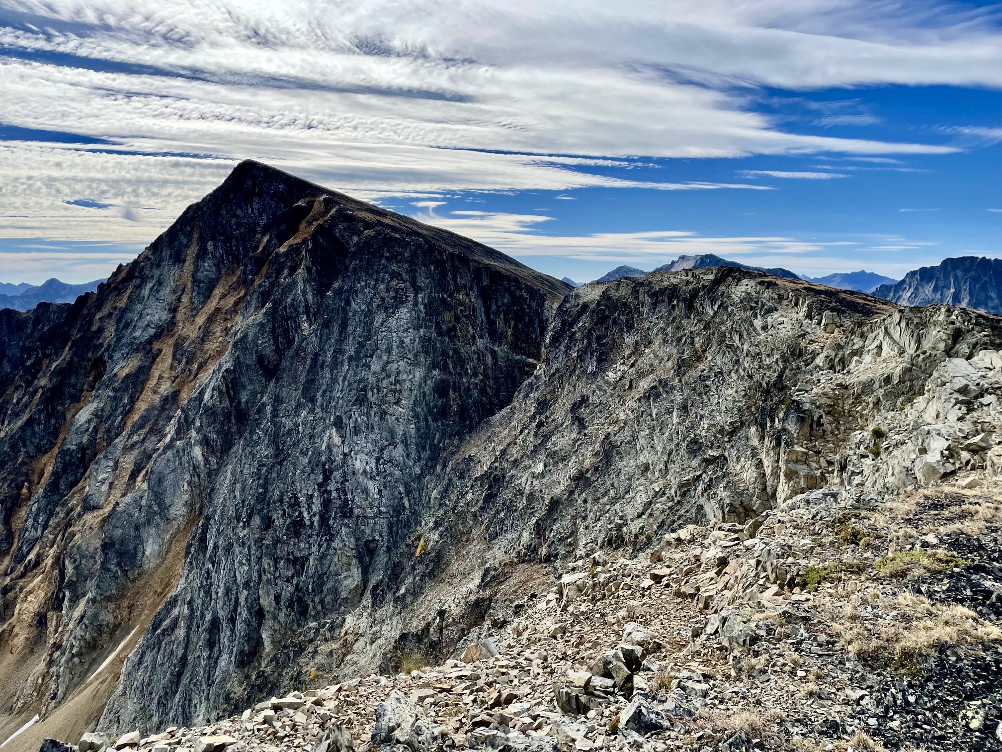
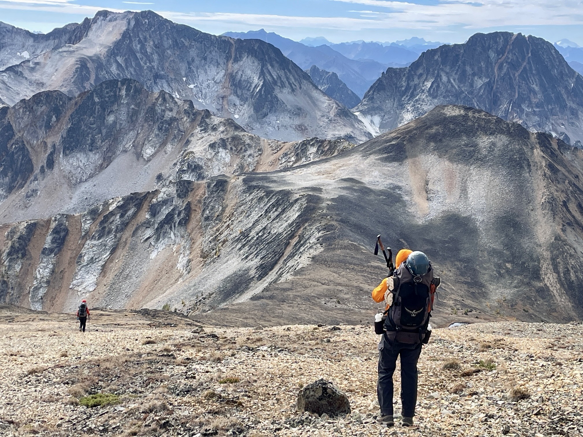
From the saddle, we easily ascended talus slopes to the summit of Dot Mountain (4.6 hours + 2200 feet from Camp 2). Things then got more exciting as we began descending Dot’s south ridge. This ridge is narrow and blocky, with considerable exposure on both sides, but the scrambling never exceeds Class 3.
.
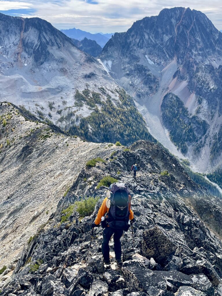
.
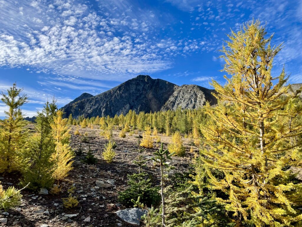
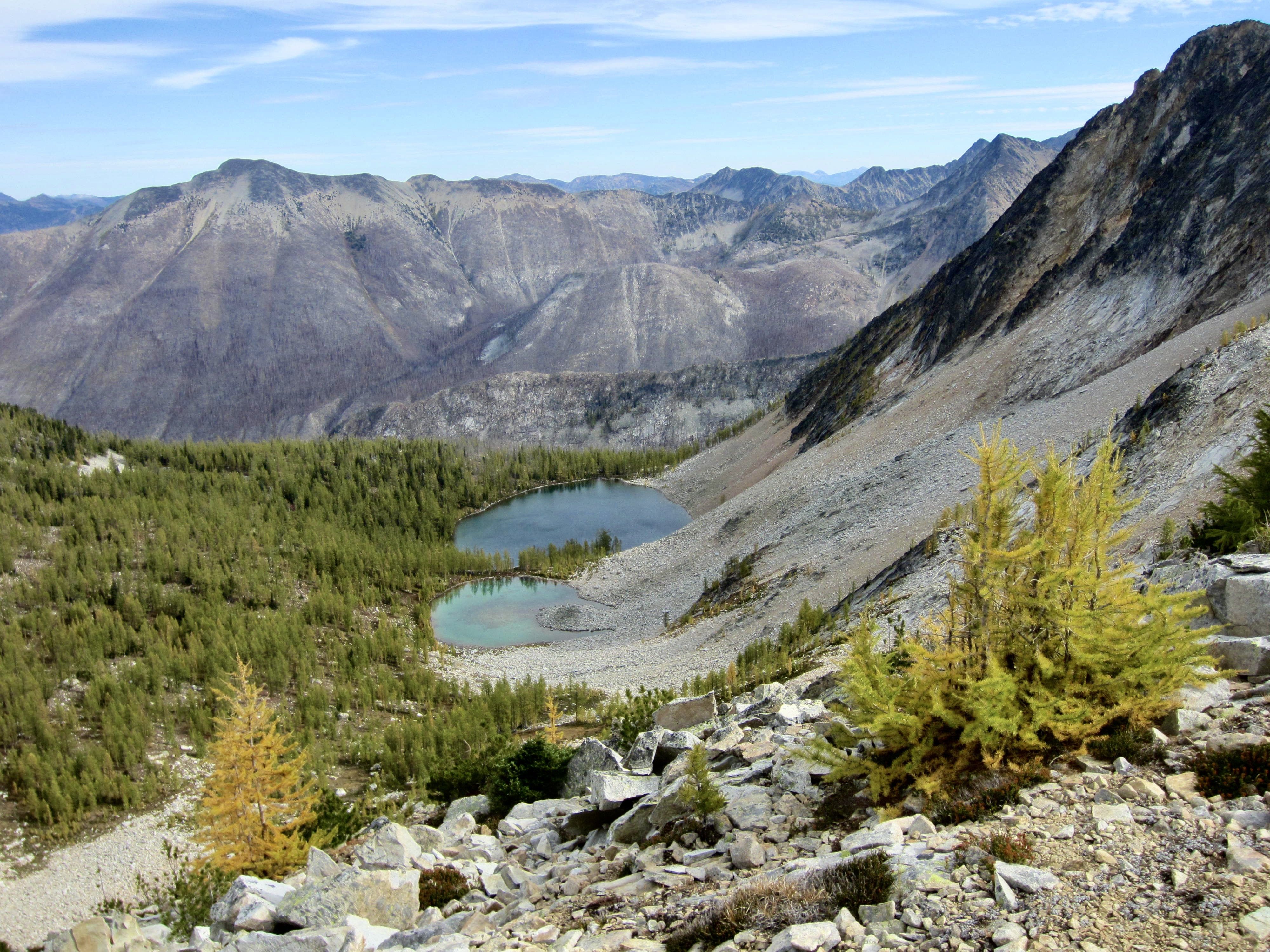
Our ridge descent took us above Dot Lakes, which sit in a shallow bowl down to the east. In another week or two, the larch trees surrounding these lakes will turn the bowl ablaze with gold. We were sorry to miss it. Upon reaching the saddle between Dot Mountain and Point 8165, we stopped for a late lunch.
.
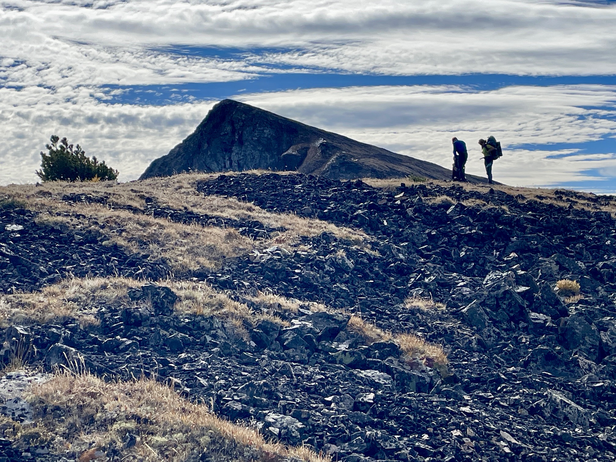
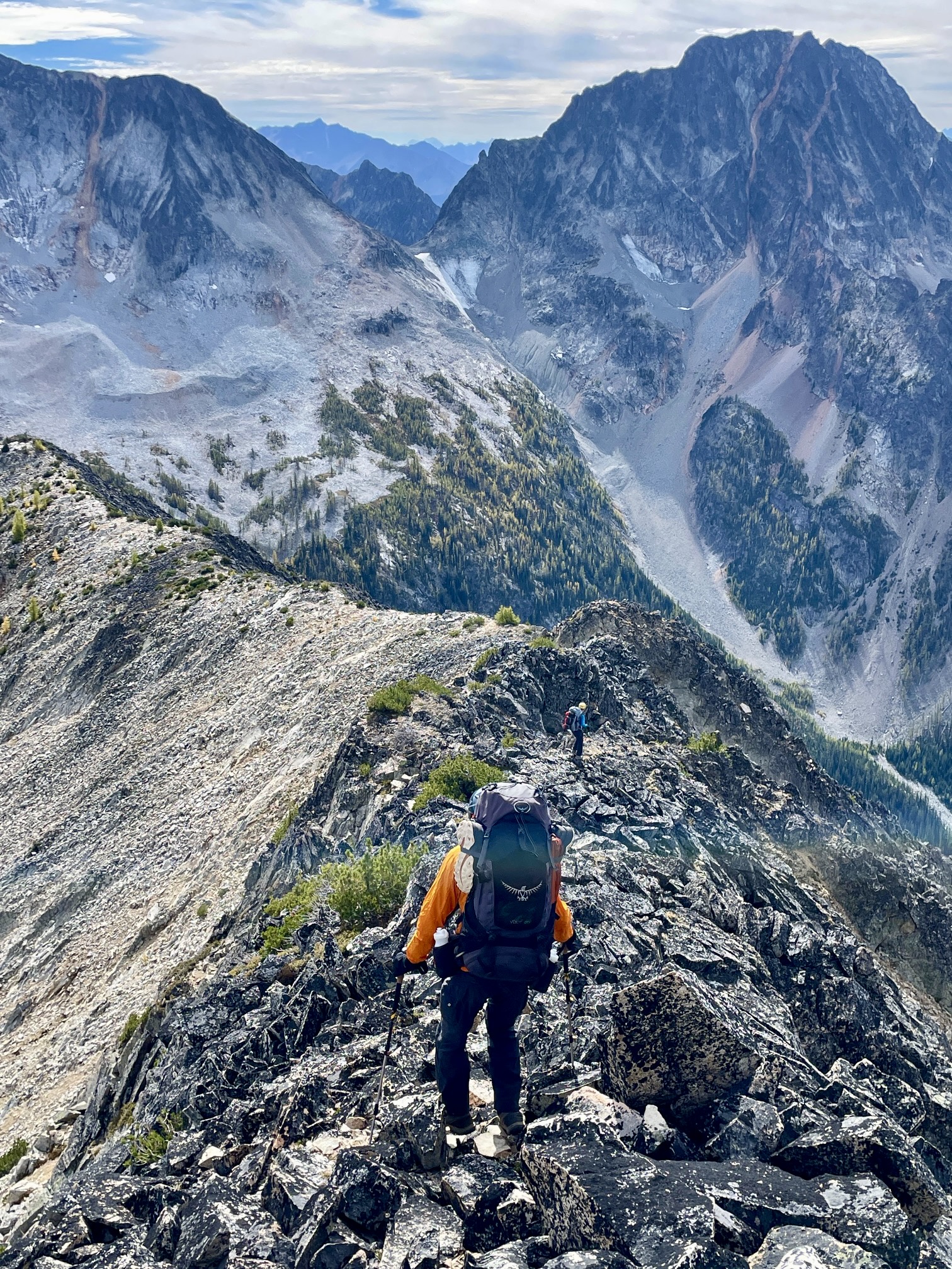
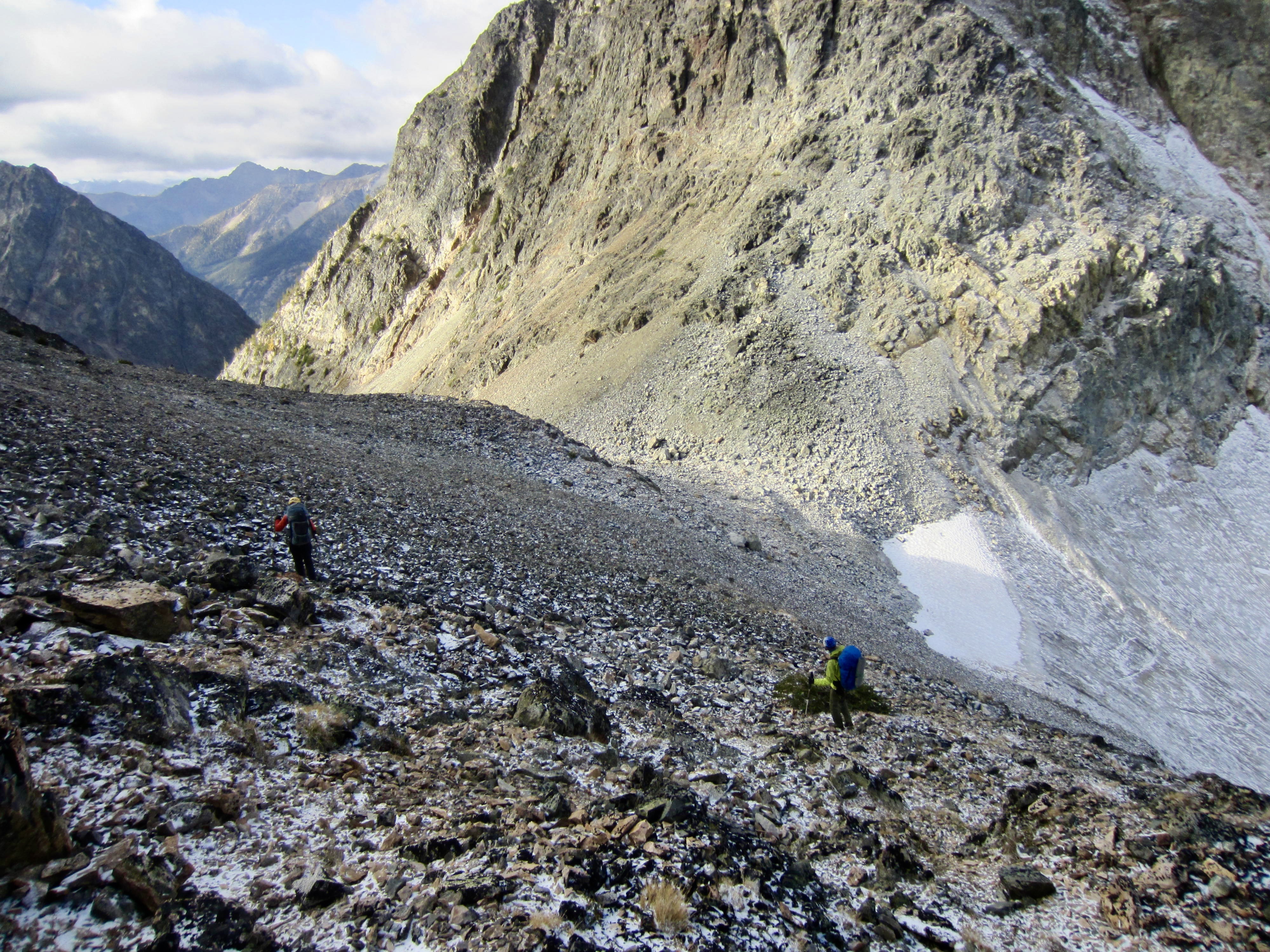
Thus far, all of our cross-country travel had been straightforward and enjoyable. However, our planned traverse route over to the Lago–Carru Col looked very unappealing. We expected to see fairly easy slopes or ledges on the western side of Point 8165, but now all we could see was steep rubble, slabs, ribs, and gullies. Yuck! After scoping out a possible route, we crossed our fingers and jumped in.
.
Our traverse started with a descent of a super-steep scree and talus chute. The debris in this chute is so unstable, it tended to form small, slow-moving avalanches below every footstep! After dropping 300 feet down the chute, we began angling across the steep hillside. This involved crossing a long series of ribs and gullies, all composed of loose volcanic rhyolite and andesite. Given the large number of people who climb Ptarmigan Peak every year, you might expect to see some sort of established route, but there was almost no evidence of previous travel.
.
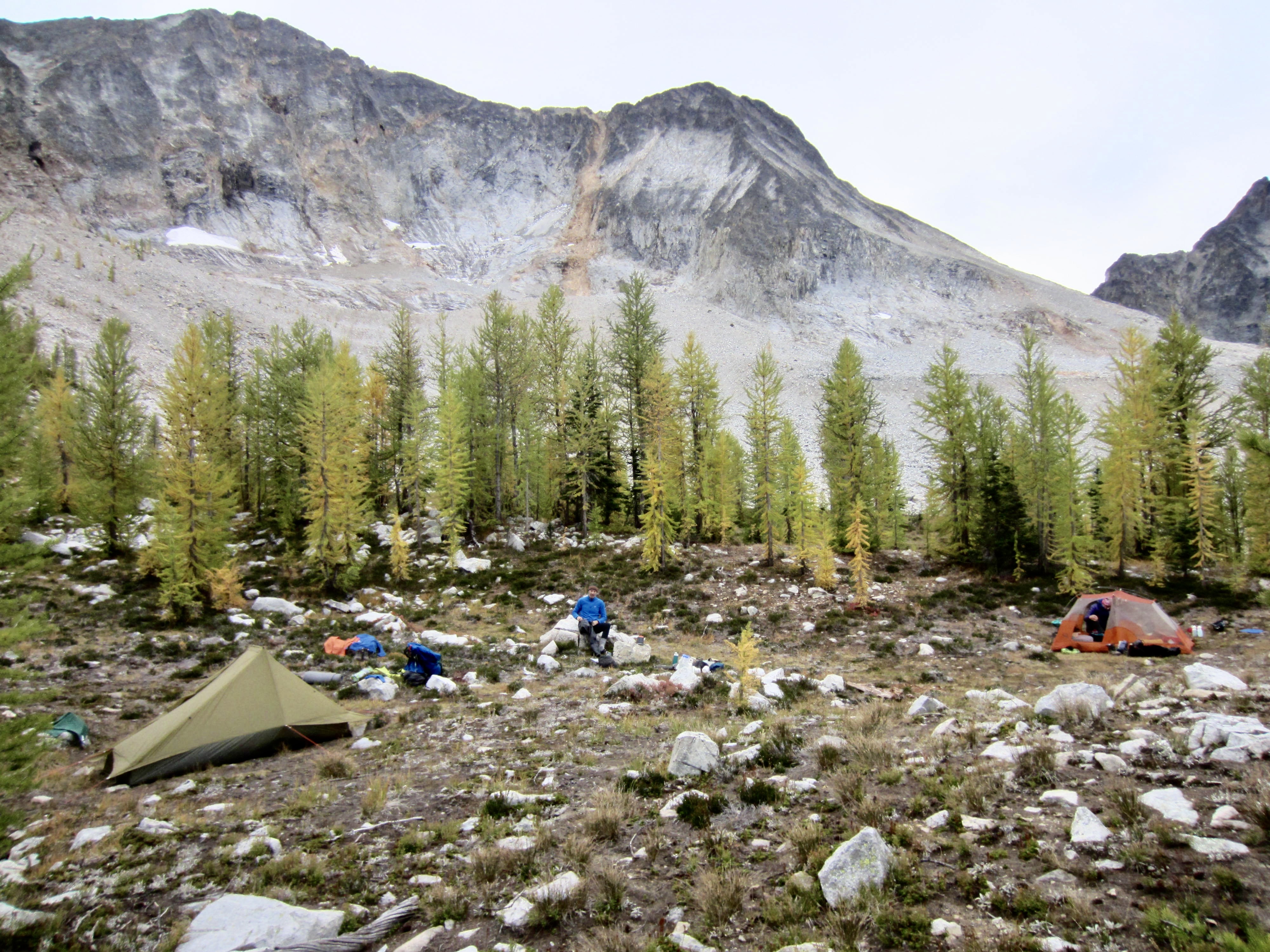
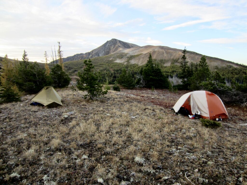
After 2 hours of slow and altogether unsavory traversing, we reached the relatively friendly talus fields of Lago Basin. We descended to a cascading creek to water up, then hiked uphill in search of a suitable campsite. At 7050 feet, we found a grassy bowl surrounded by larch trees, and here we stopped for the day (8.2 hours + 2300 feet from Camp 2). Our original plan was to camp in Shellrock Basin tonight, but yesterday’s jackstraw forest and today’s awful traverse had put us a half-day behind schedule. On the positive side, Lago Basin is actually a more scenic campsite than Shellrock Basin.

.
Day 4: Lago Basin to Middle Fork Riverside Camp
Following a cold night, we awoke to fresh snow on the ground. The contrast between white snow and golden larches created a beautiful autumn scene, but we wondered how this would affect our morning traverse over the Lago–Carru Col. It wouldn’t take long to find out.
.

.
.
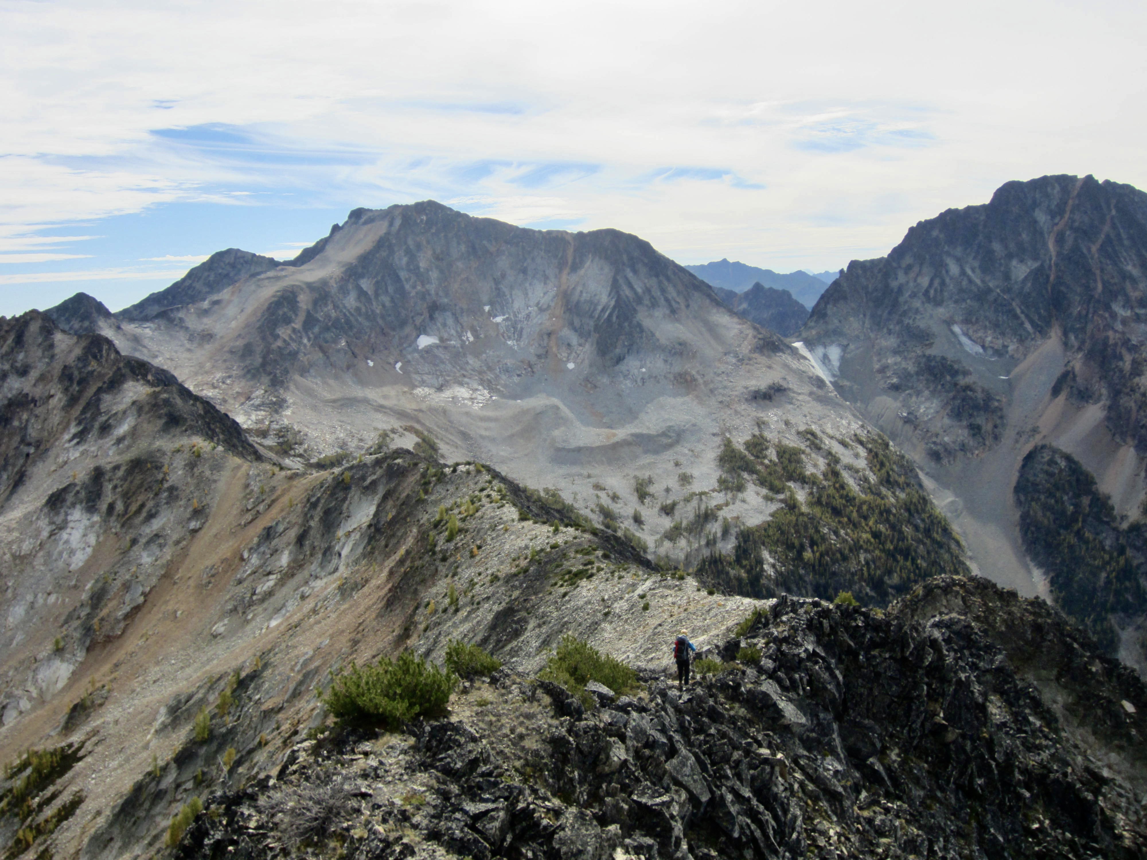
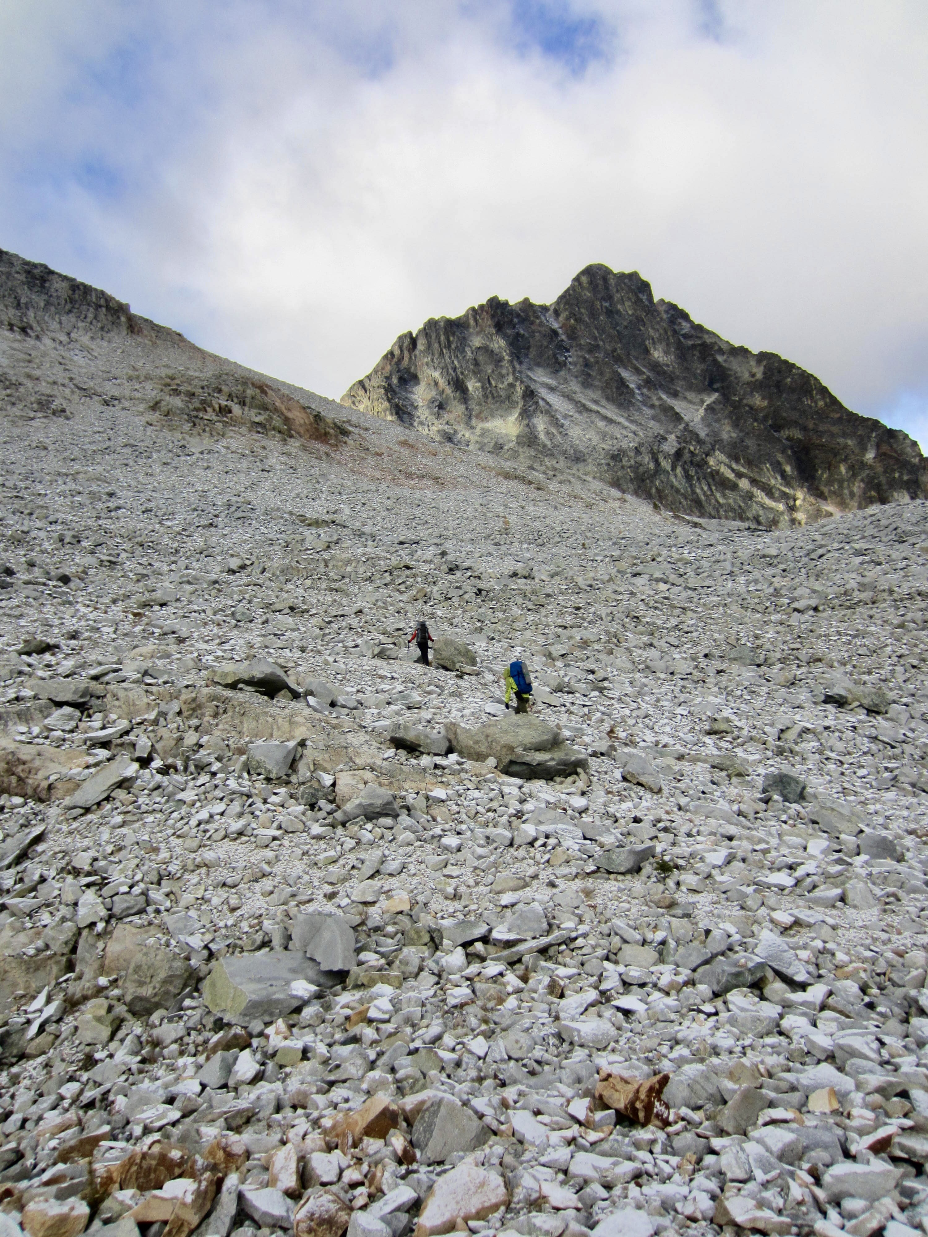
Staying bundled up against an icy wind, we made a rising southwesterly traverse across the talus basin. Thankfully, the snow was very dry and not slippery, and the rocks were fairly stable. Aside from the biting cold, it was an uneventful traverse.
.
As we climbed out of Lago Basin, yesterday’s descending traverse route came into full view. From this vantage, it was a pretty distasteful sight. Unfortunately, the option of going over the top of Point 8165 did not look any more appealing. None of us would likely recommend our route to a friend, but there seemed to be no good alternative.
.
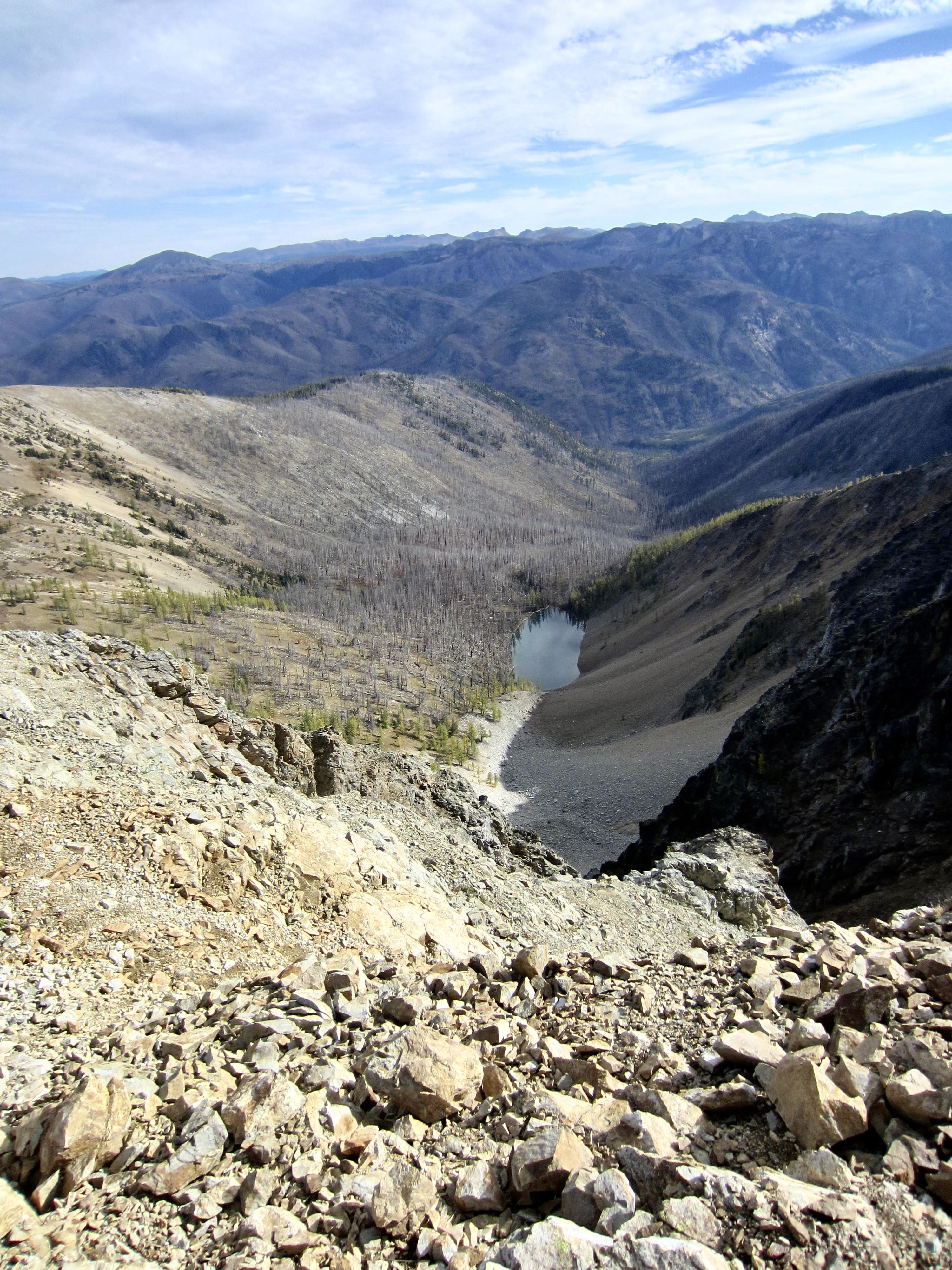
We crossed over the 7600-foot Lago–Carru Col in mid-morning and headed down a long, south-facing talus couloir. A cold wind was blowing through the couloir, but the sunshine helped to ease the chill. Rugged Monument Peak served as a beacon straight ahead.

.
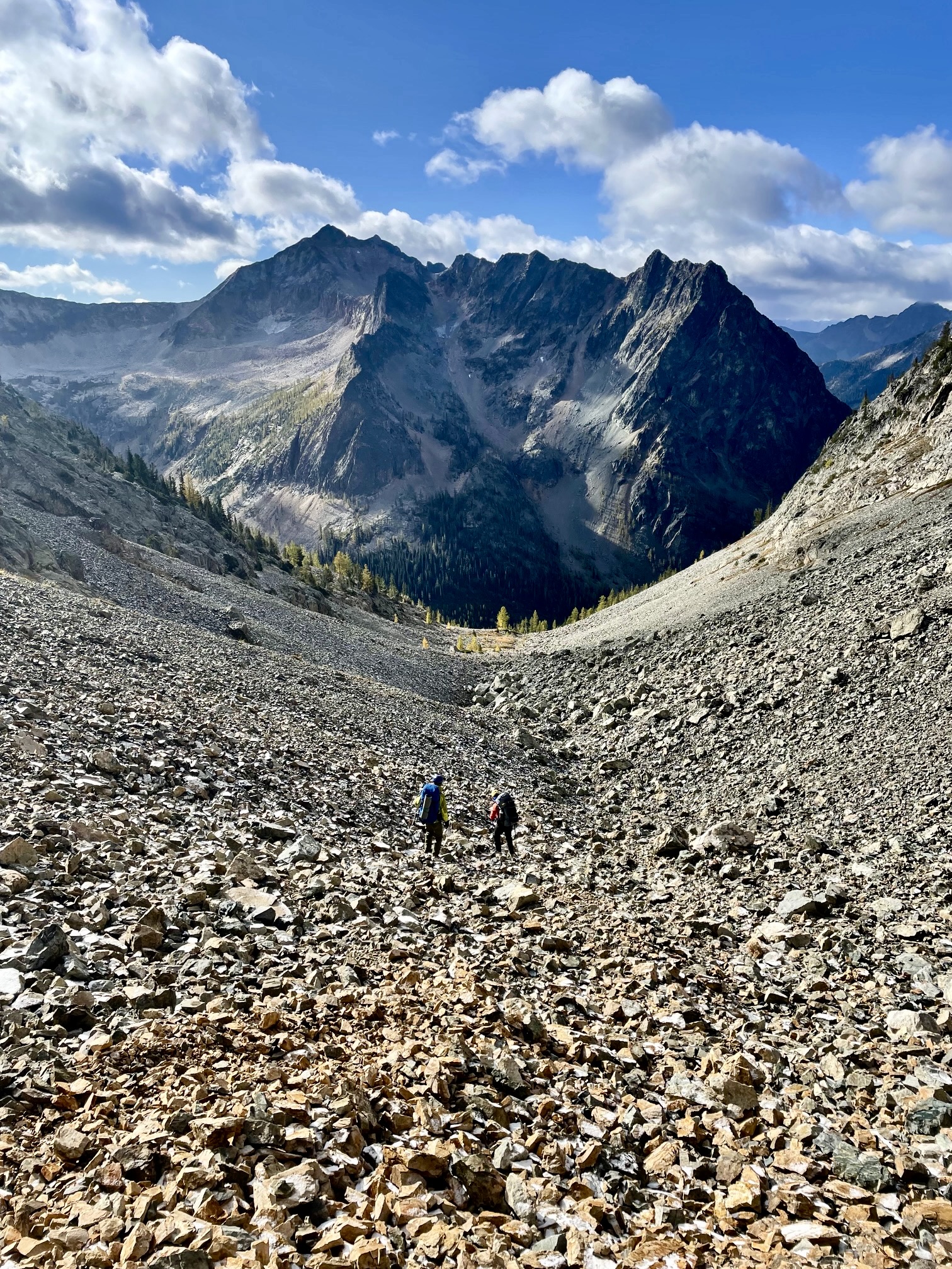
.
The talus couloir eventually funneled us into a stream gully that offered a reasonable descent for another several hundred feet. When this gully steepened, we cut left into the adjacent forest and found easy travel down through the trees and glades. Shortly before noon, we intersected the Shellrock Pass Trail near its crossing of Eureka Creek at 6000 feet (3.3 hours from Camp 3). This ended the off-trail portion of our loop.
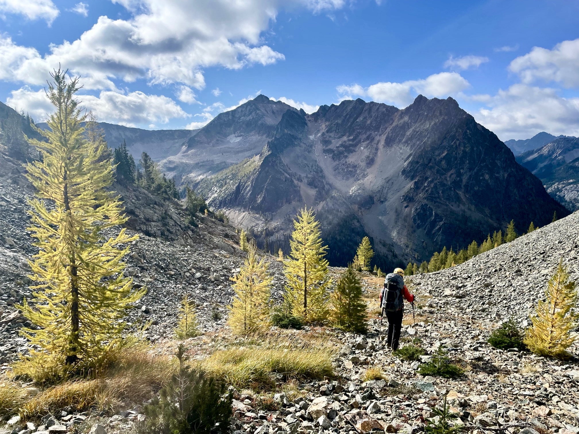
.
As we hiked out of Eureka Creek Valley toward Rolo Pass, it became clear that there has been no trail maintenance work done in a decade or more. The trail is badly overgrown and eroded in many places, and there are numerous fallen trees across the lower portion. It is sad to realize that if left in a neglected state, this popular access trail will eventually degrade to something resembling a well-trodden climber’s path.
.
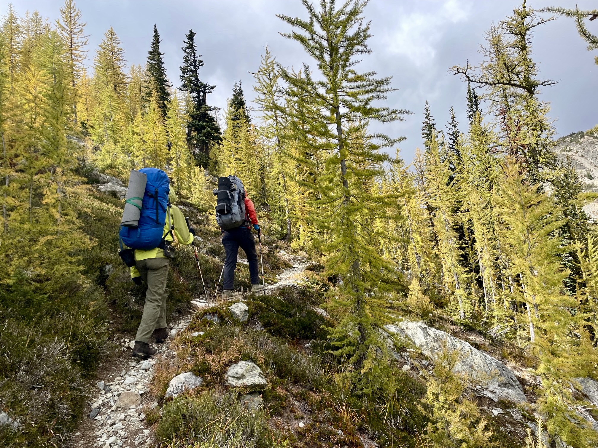
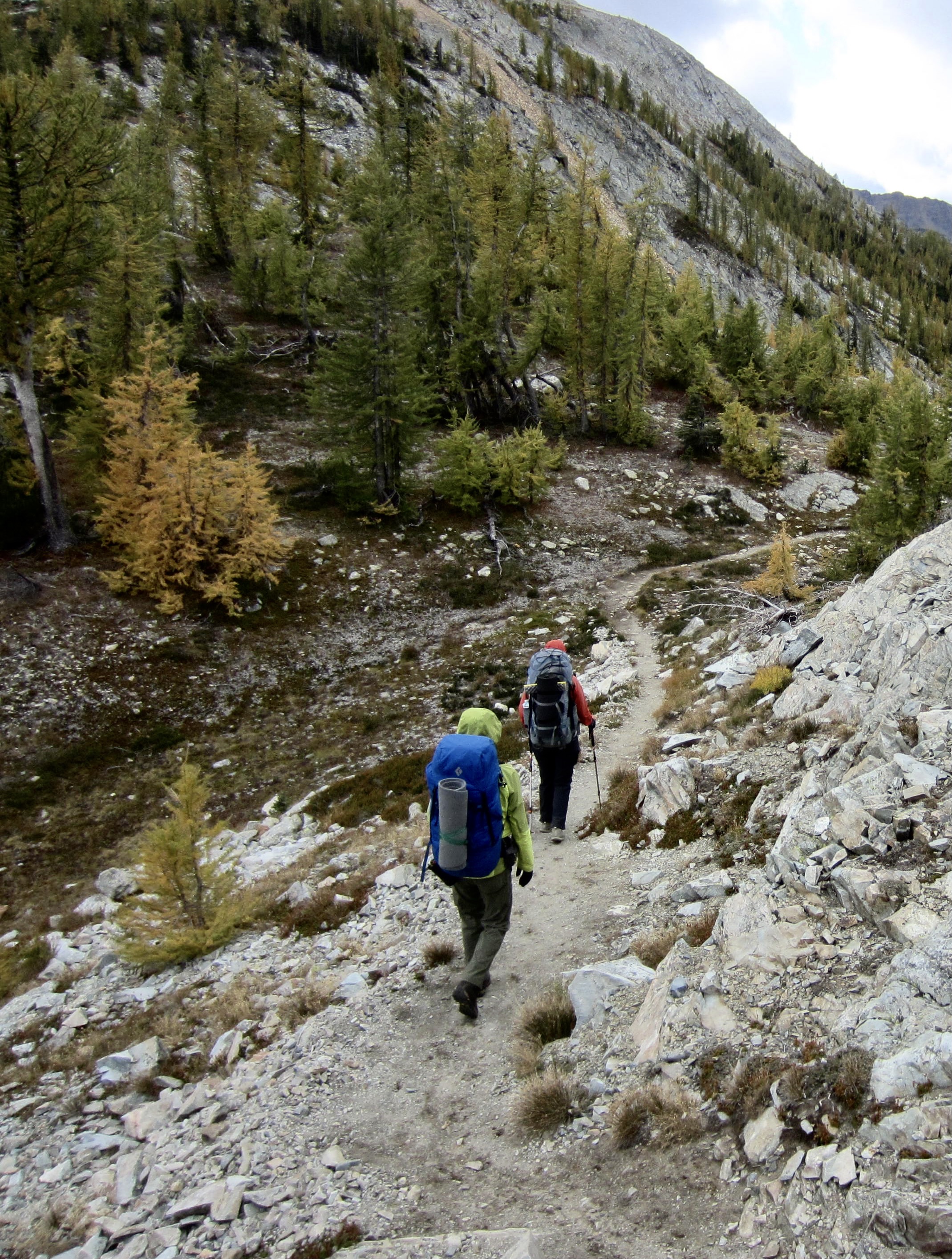
Over the past two days, we had observed that most larch trees were still one or two weeks shy of their full color change. Around Lake Doris and Rolo Pass, however, most larches appeared to be at peak gold. It’s always interesting to see how golden larches form in localized and seemingly random patches every autumn.

.
Upon crossing over 7100-foot Rolo Pass in mid-afternoon (5.8 hours + 2050 feet from Camp 3), we were blasted by a frigid gale blowing in from the west, with gusts approaching 40 mph. This put an urgency in our pace until entering deep forest at Fred’s Lake. The rest of our descent into the Middle Fork Pasayten River Valley was fairly calm. Along the way, we encountered a solo backpacker heading to Lake Doris—only the second backpacker we met during our entire five-day outing. This is lonely country, for sure!
.
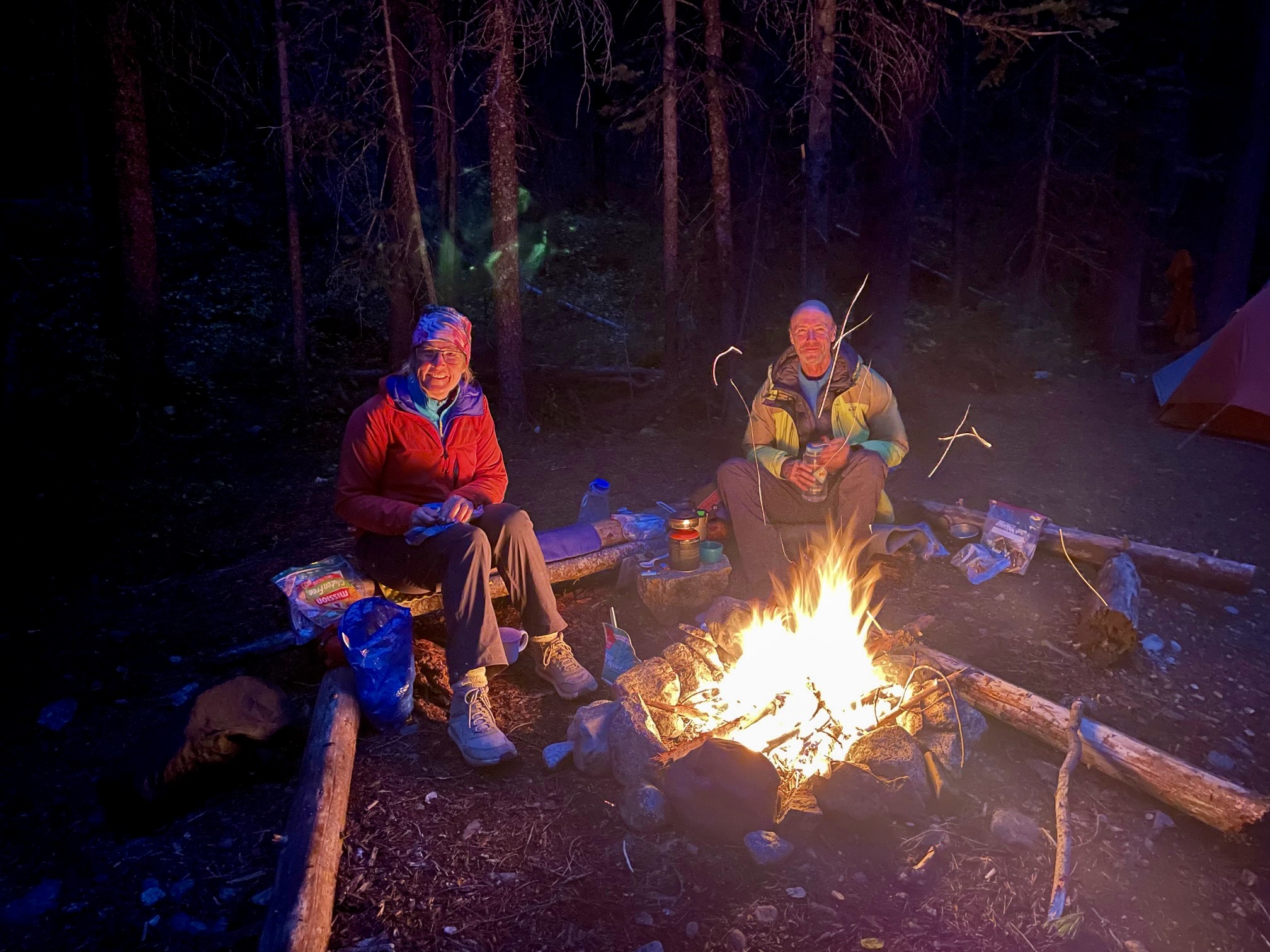
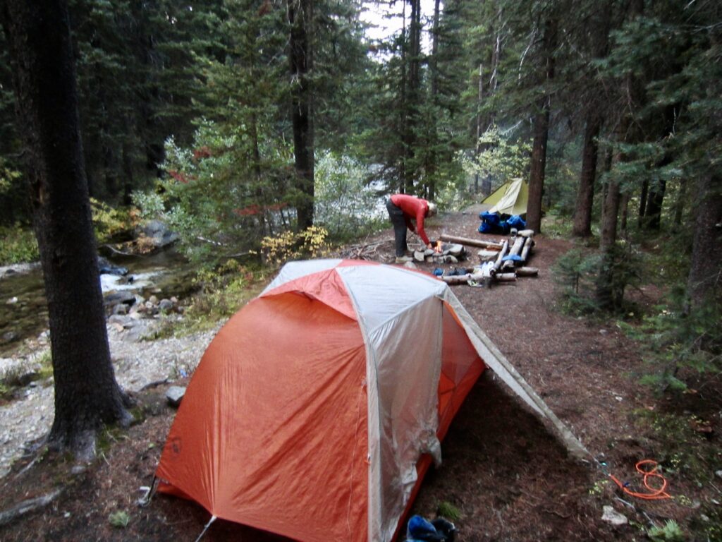
An intersection with the Robinson Creek Trail marked the closure of our loop. From there, we retraced our inbound route along the valley trail until arriving at Middle Fork Riverside Camp shortly before 6:00pm (9.3 hours + 2200 feet from Camp 3). This large campsite hosted Eileen and me on the final night of our 2006 Golden Larch Trip, so it felt good to end another trip here after 18 years. In keeping with tradition, Eileen built a campfire to add some much-appreciated ambience and warmth to our dinner.
.

.
Day 5: Middle Fork Riverside Camp to Trailhead
The night had been cloudless and very cold, such that we awoke to ice in our water bottles. We continued hiking up-valley on the frozen Robinson Creek Trail for 2 miles, then veered onto the Whistler Cutoff and climbed out of the valley to gain Slate Pass at noon (3.4 hours + 2100 feet from Camp 4). Before dropping down to the nearby trailhead, we paused briefly to look back at the high Pasayten crest. It had been a trip with many highs and lows, but it served as a marvelous ending to our season.
.
Route Maps & Profile
…
…
…
Photo Gallery
Click to enlarge…